

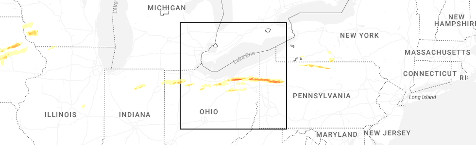
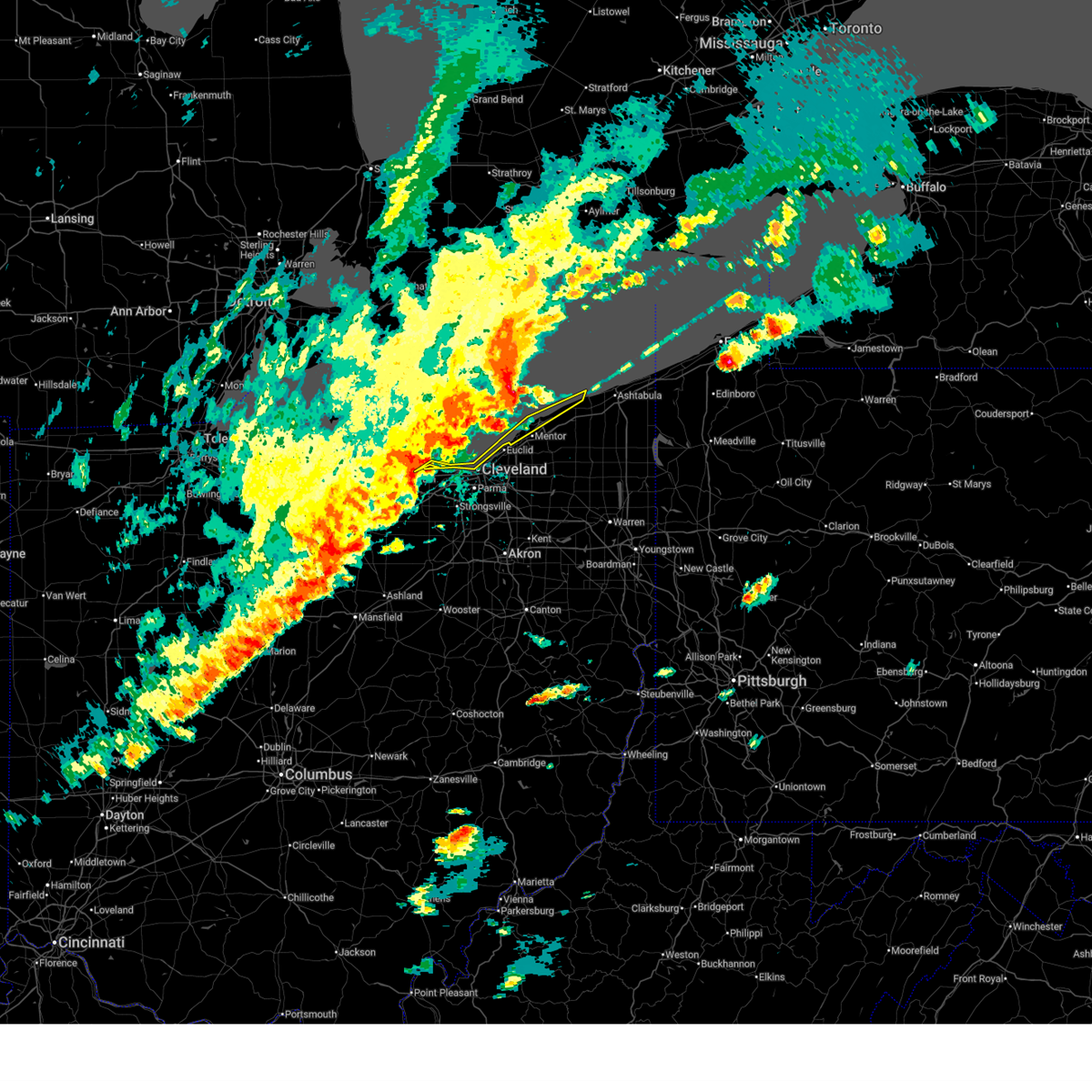
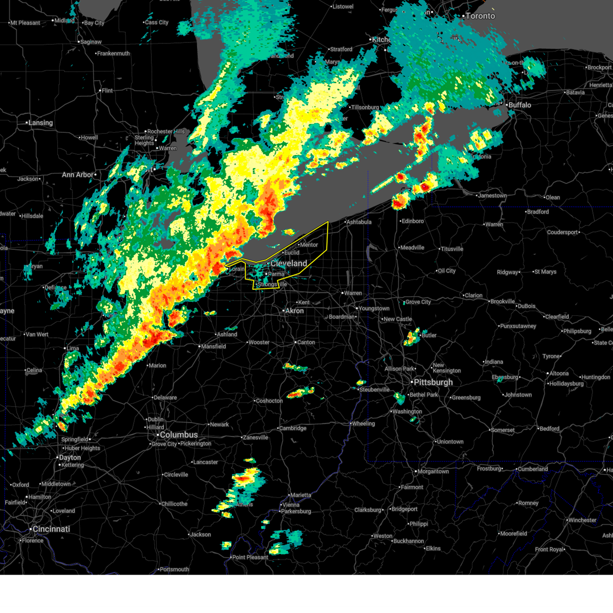
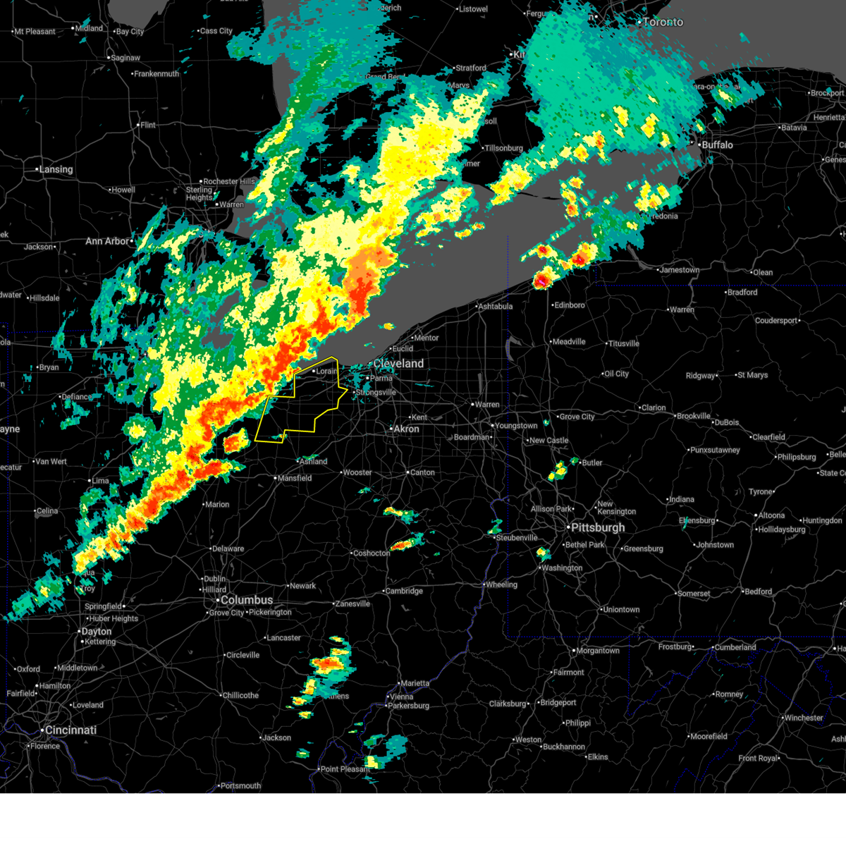
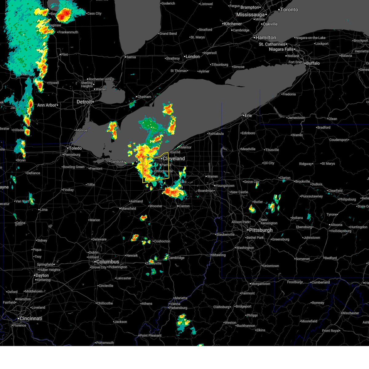
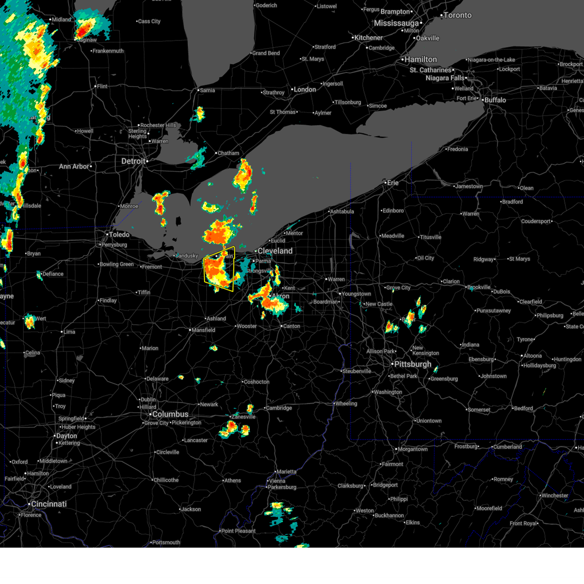
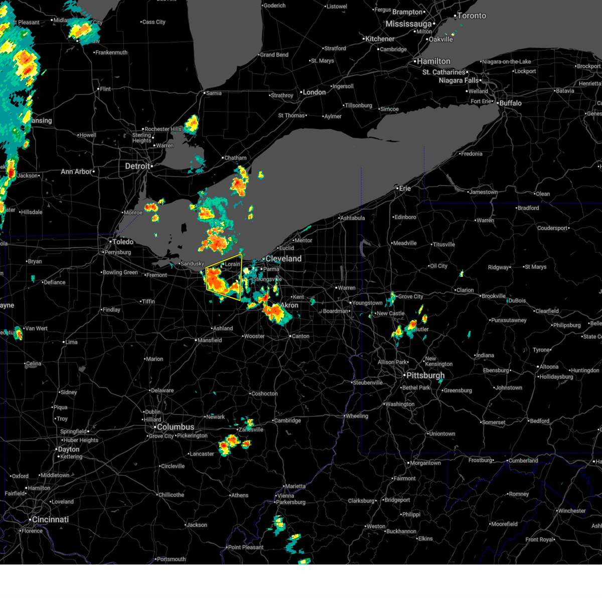
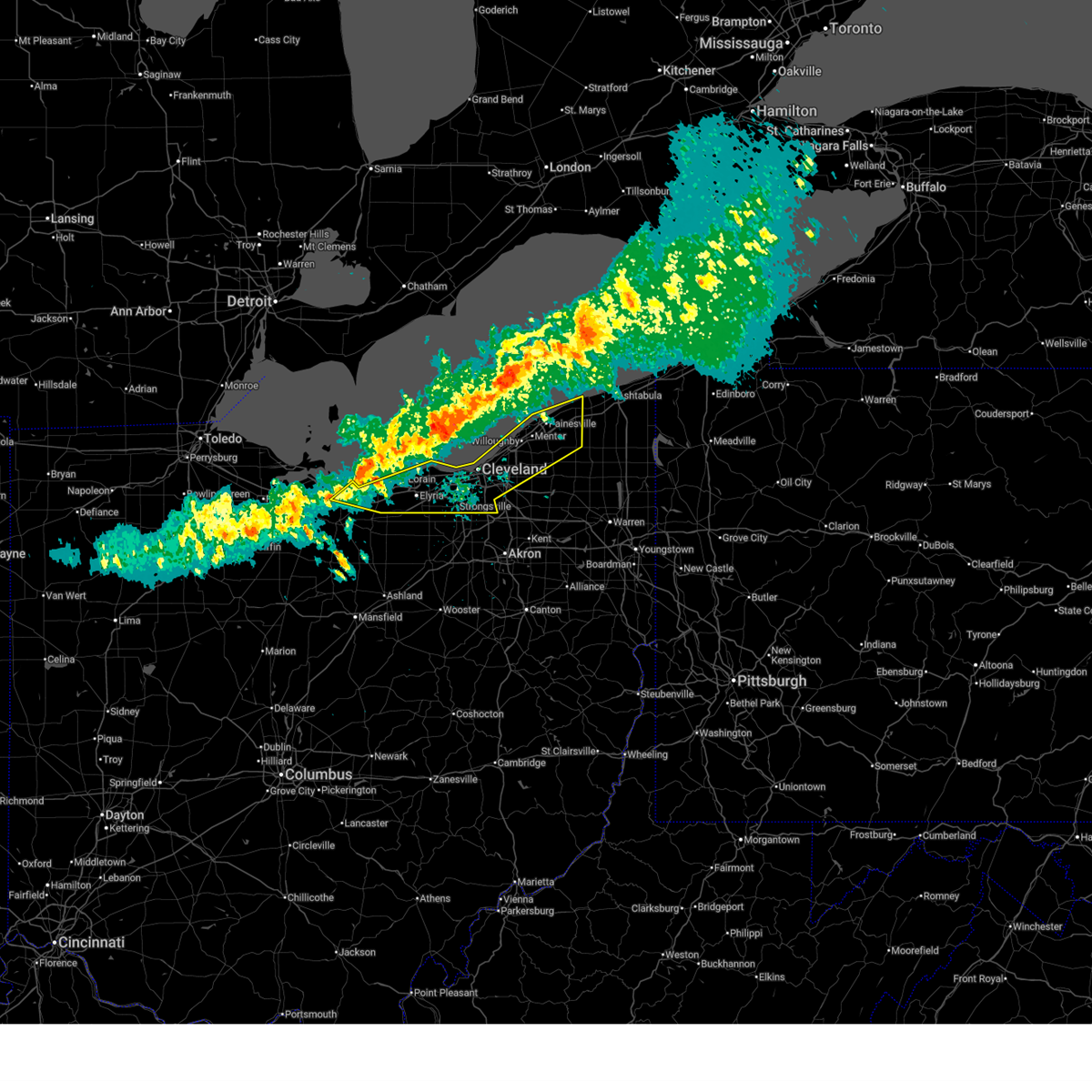
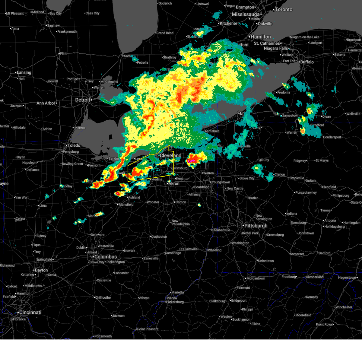
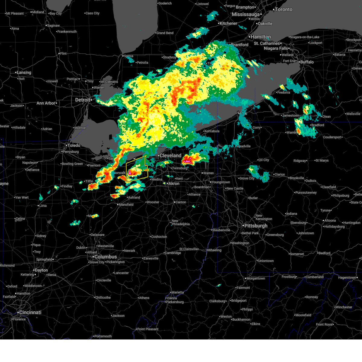
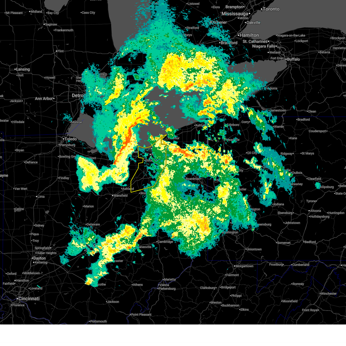
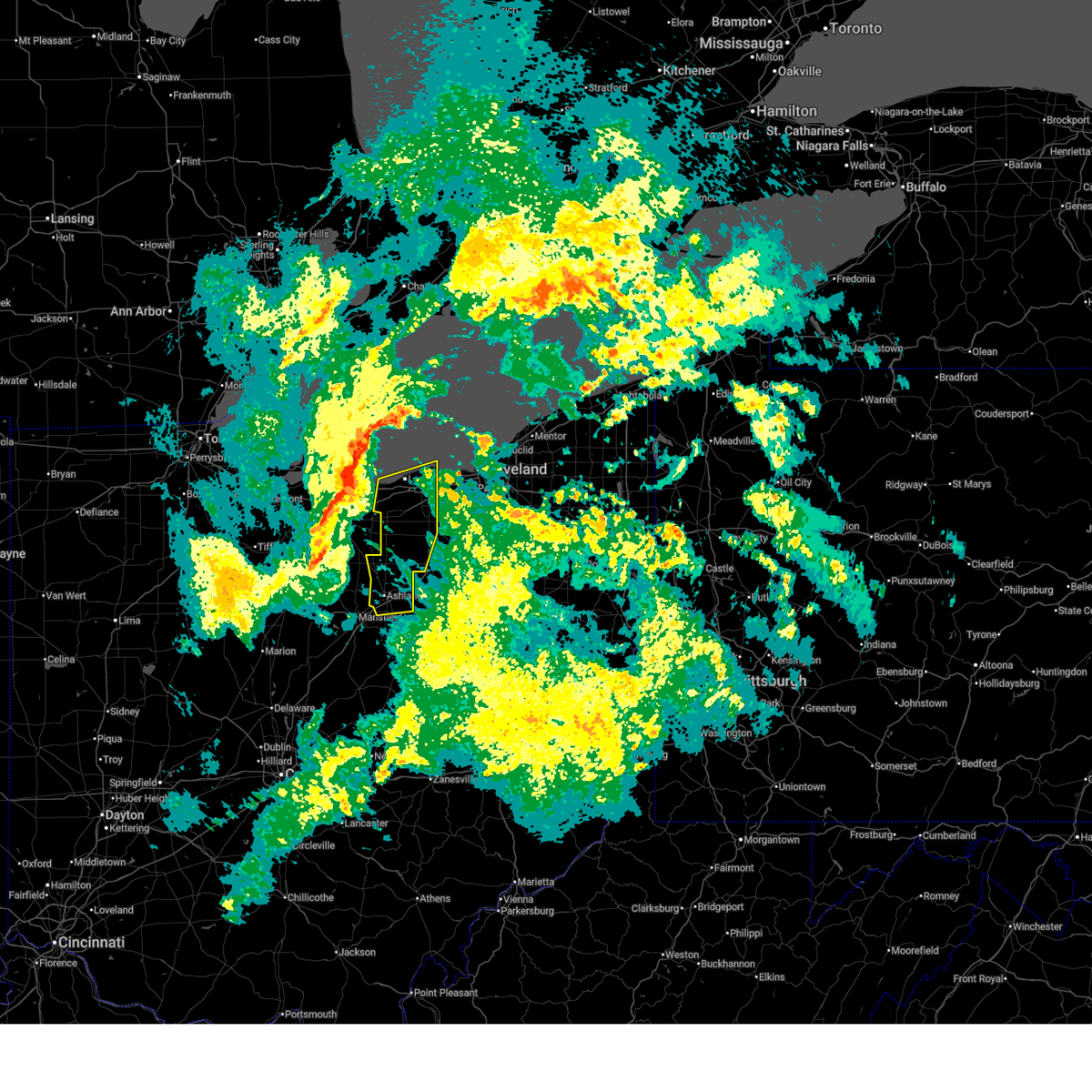
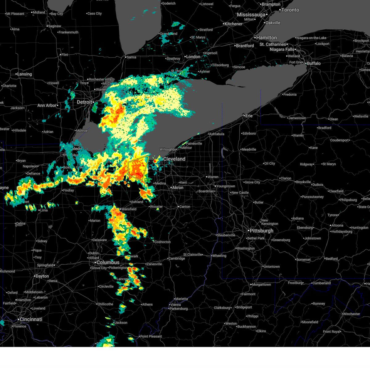
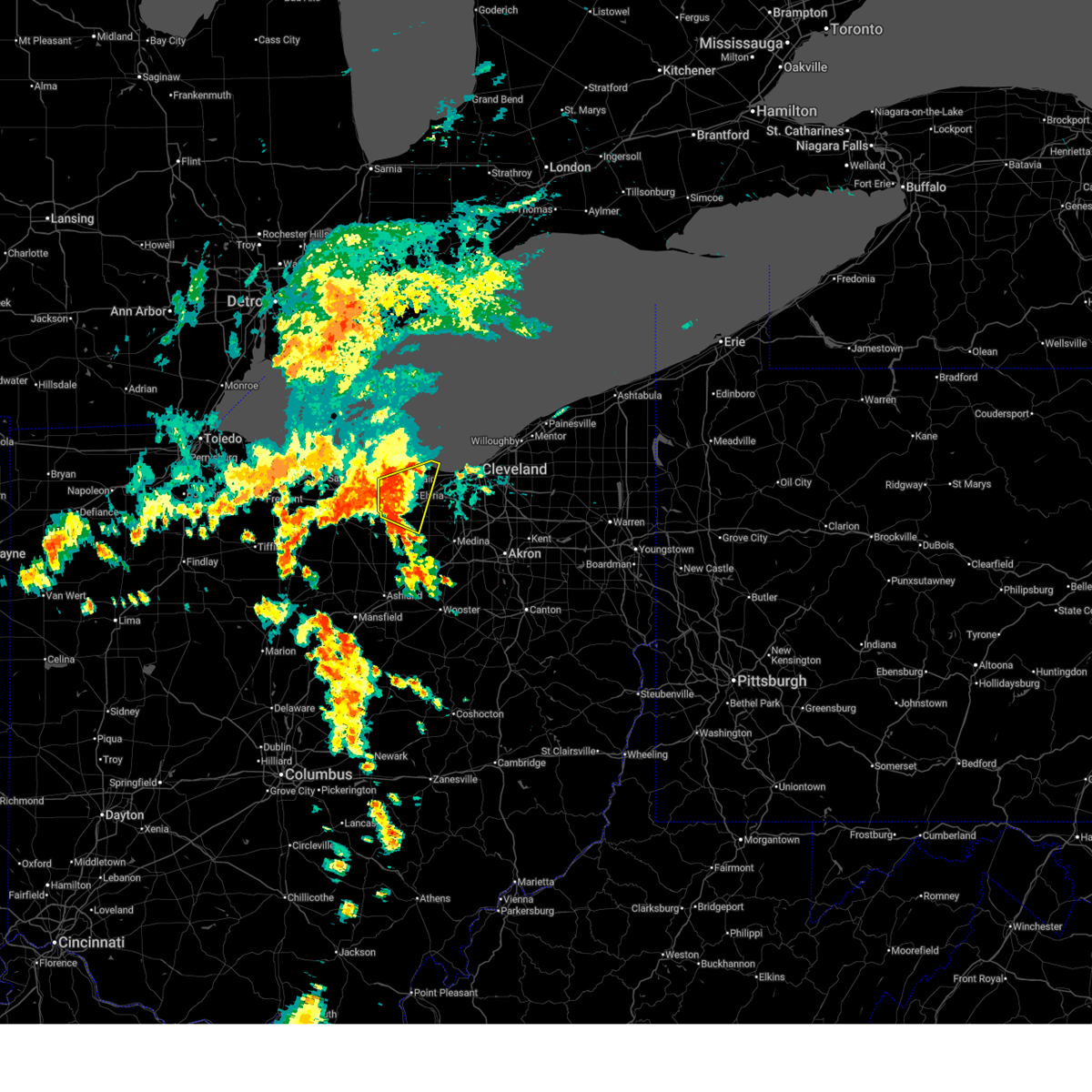
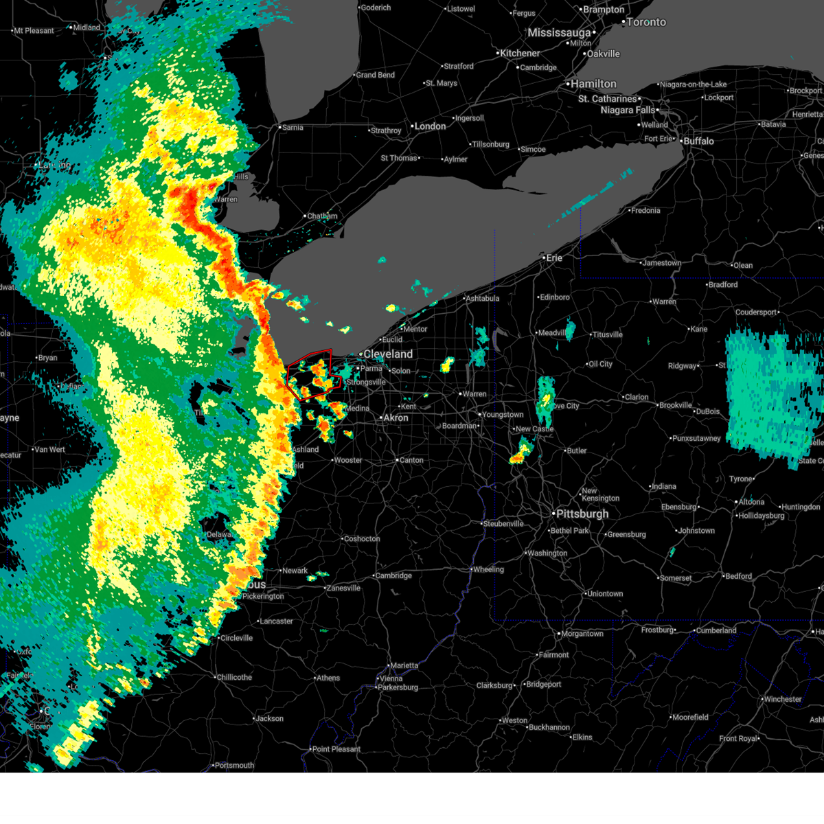
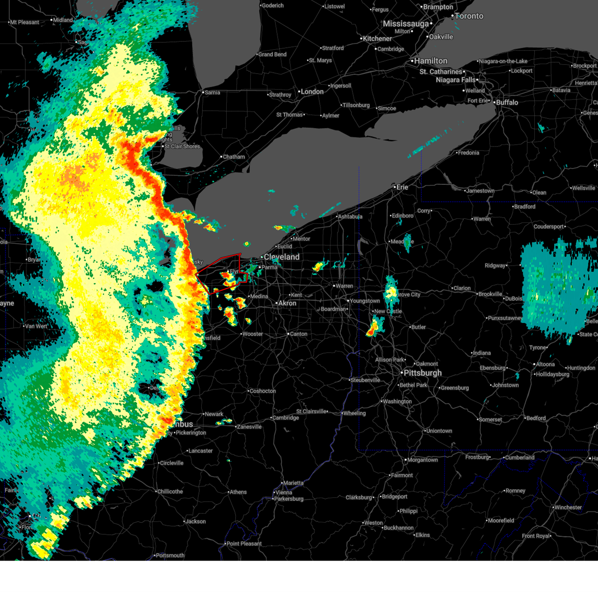
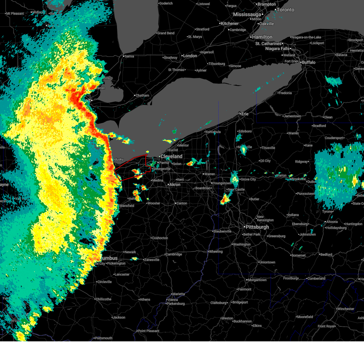
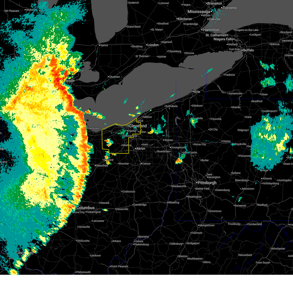
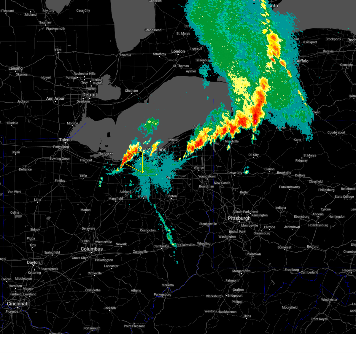
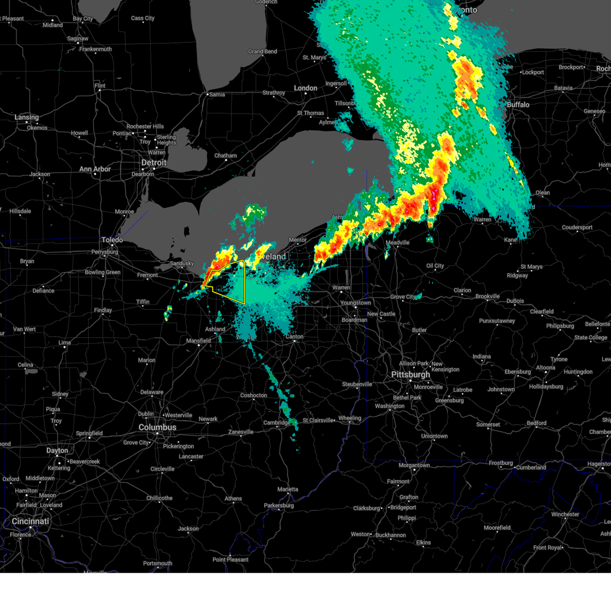
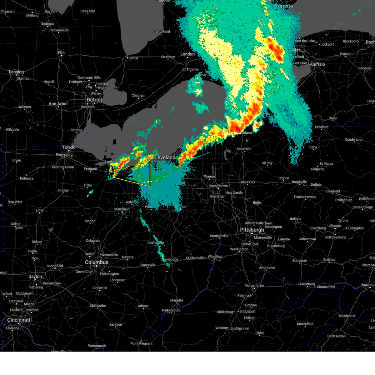
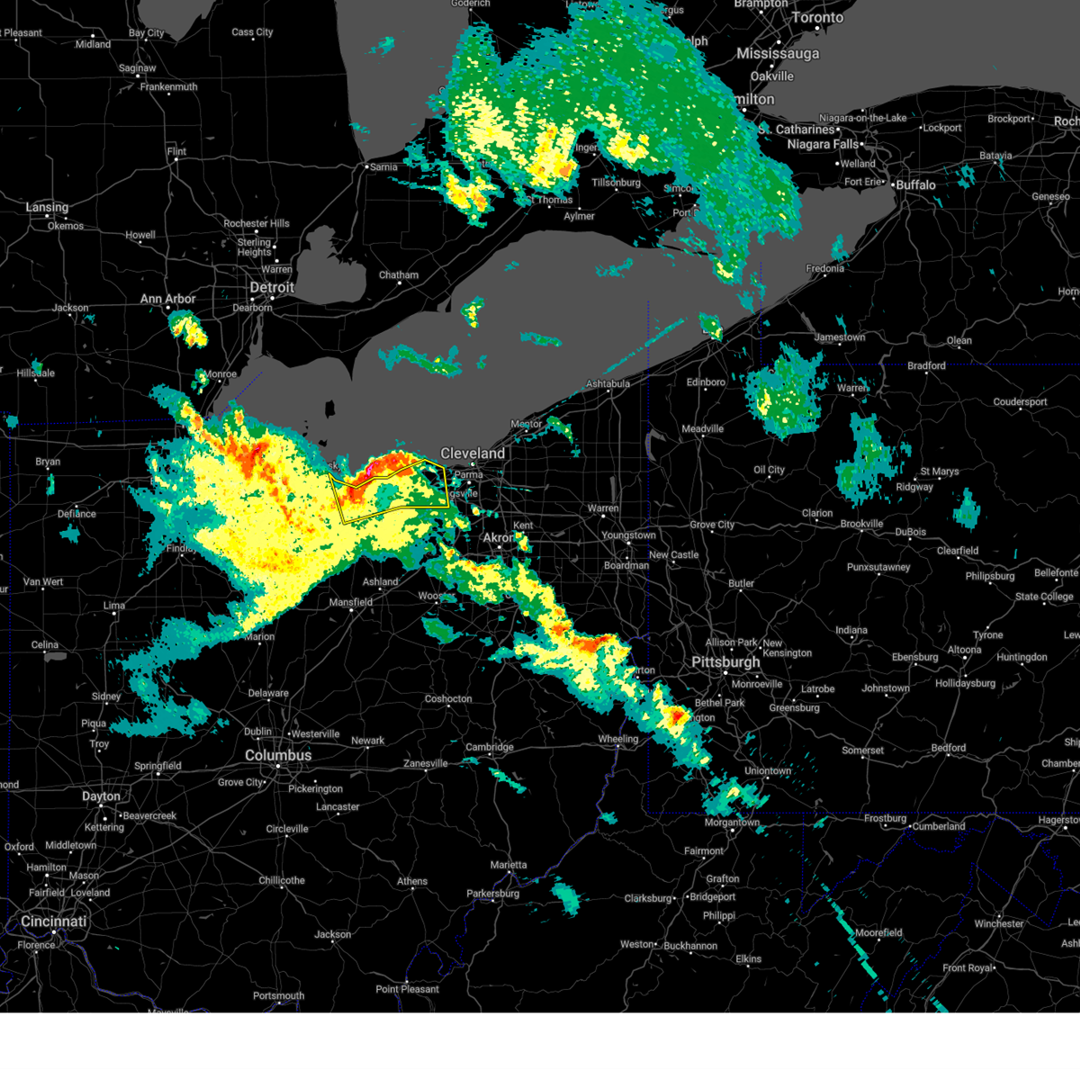
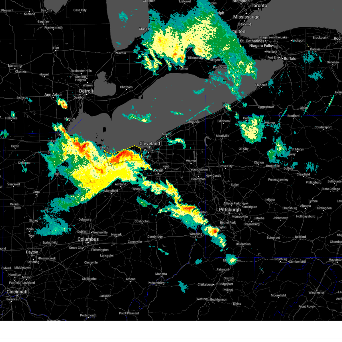
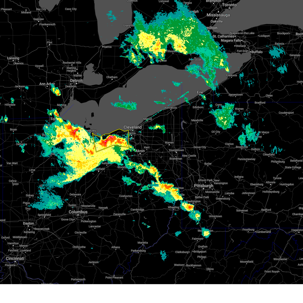
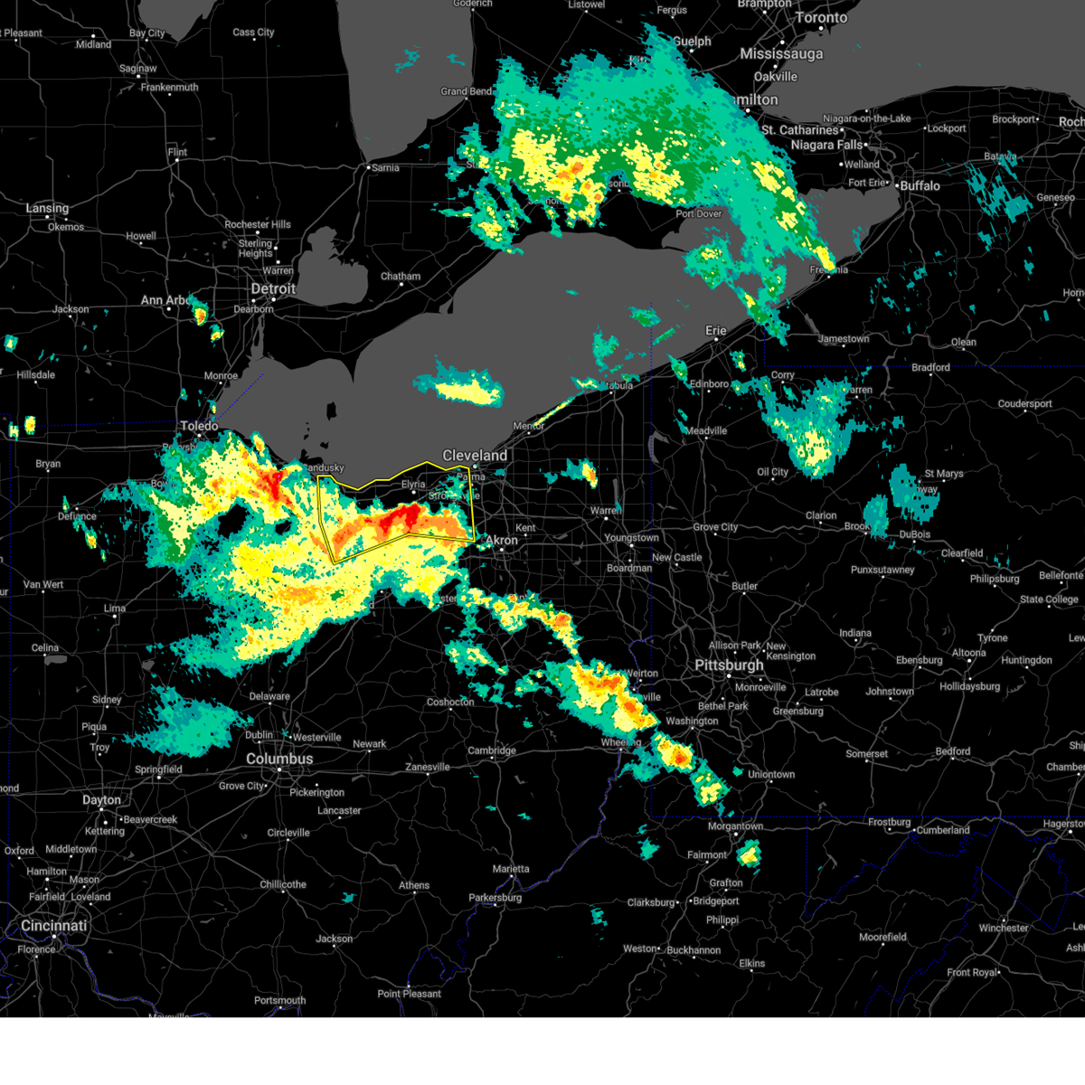
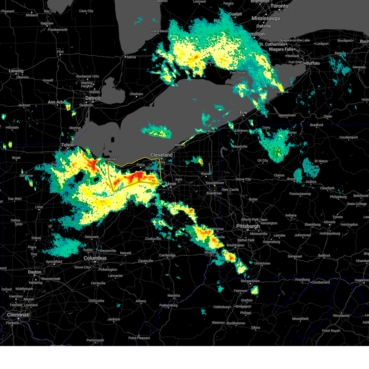
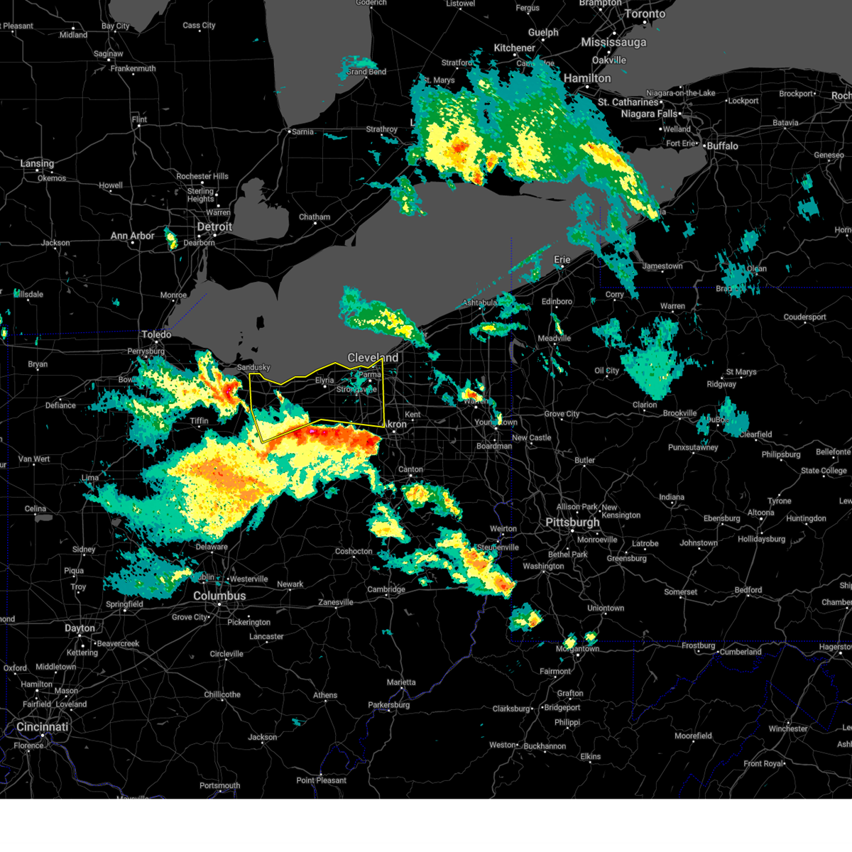
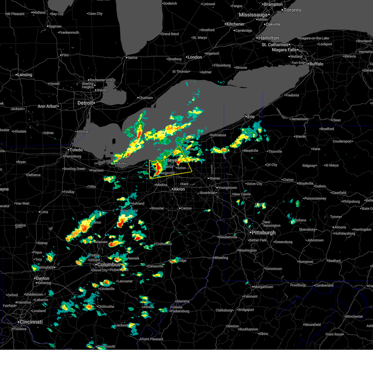
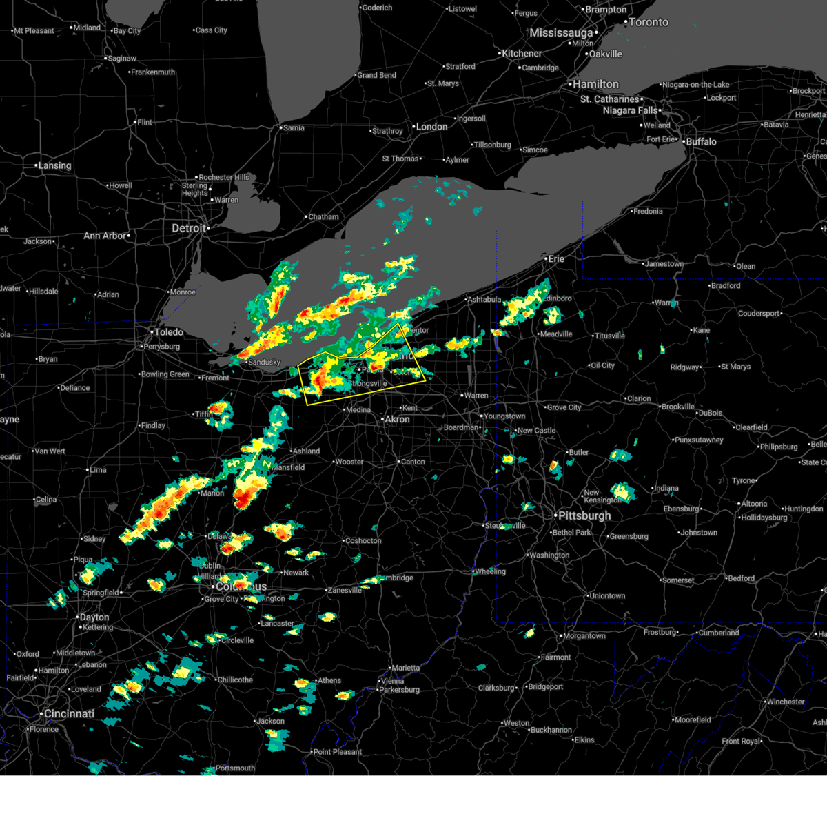
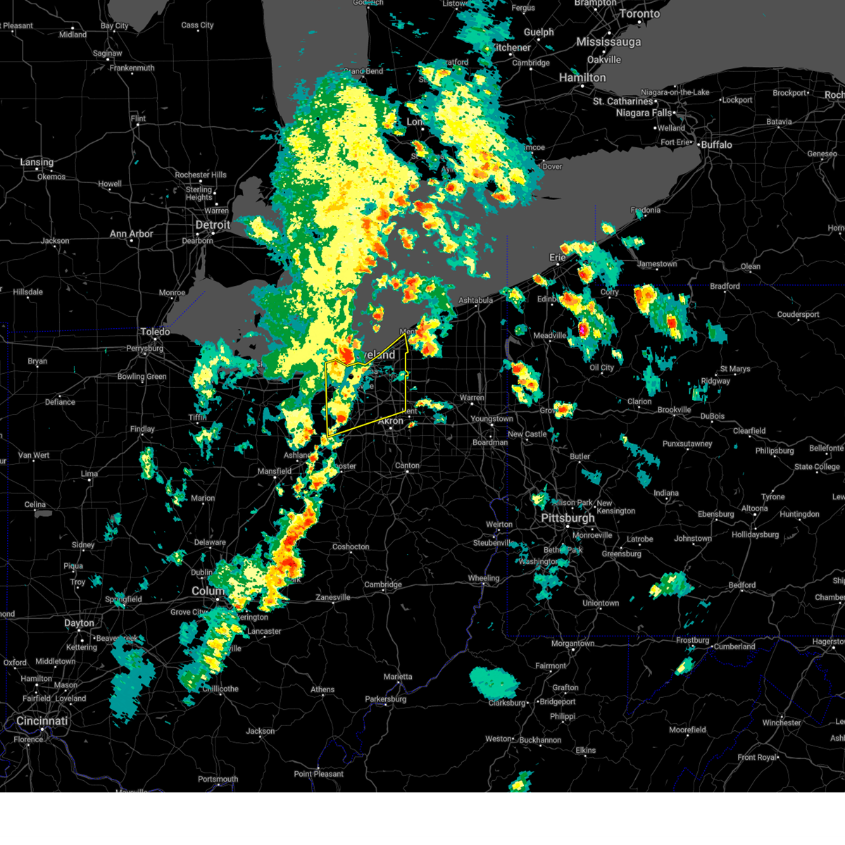
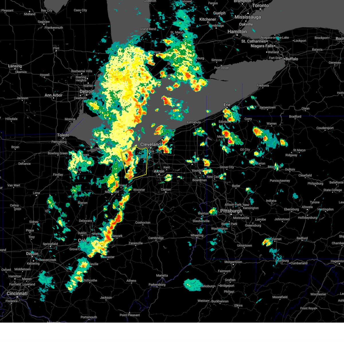
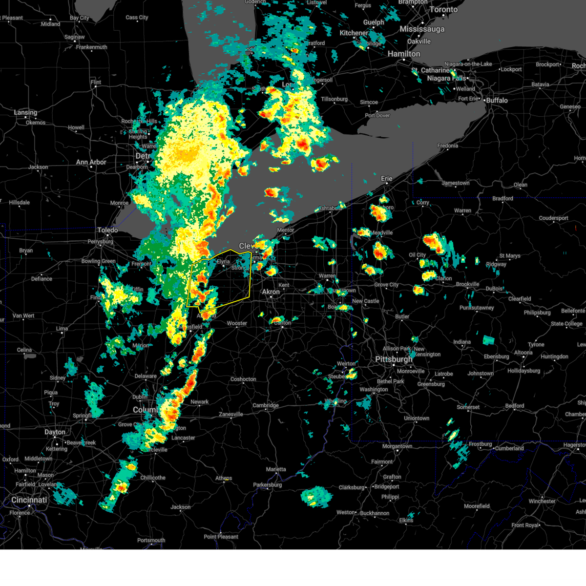
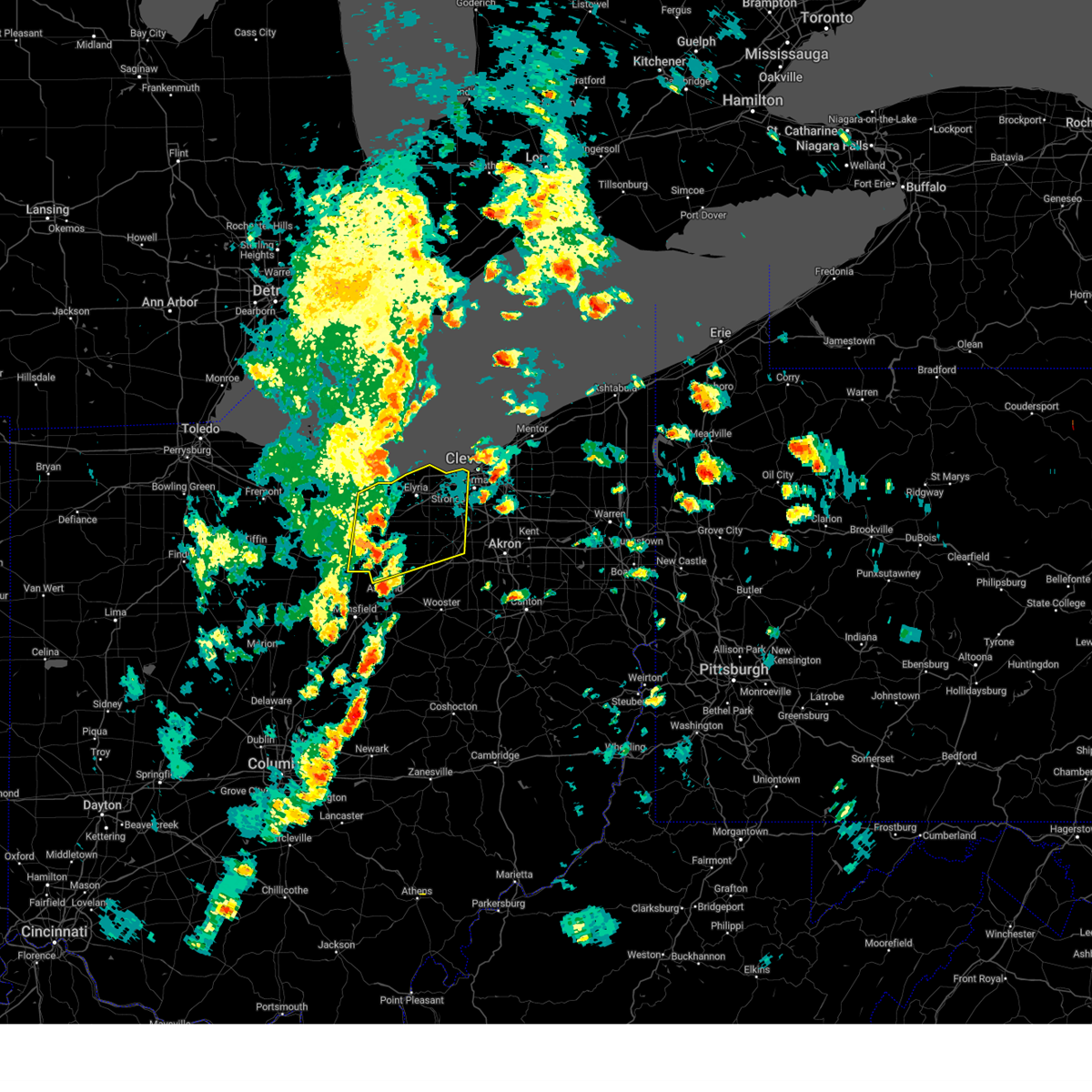
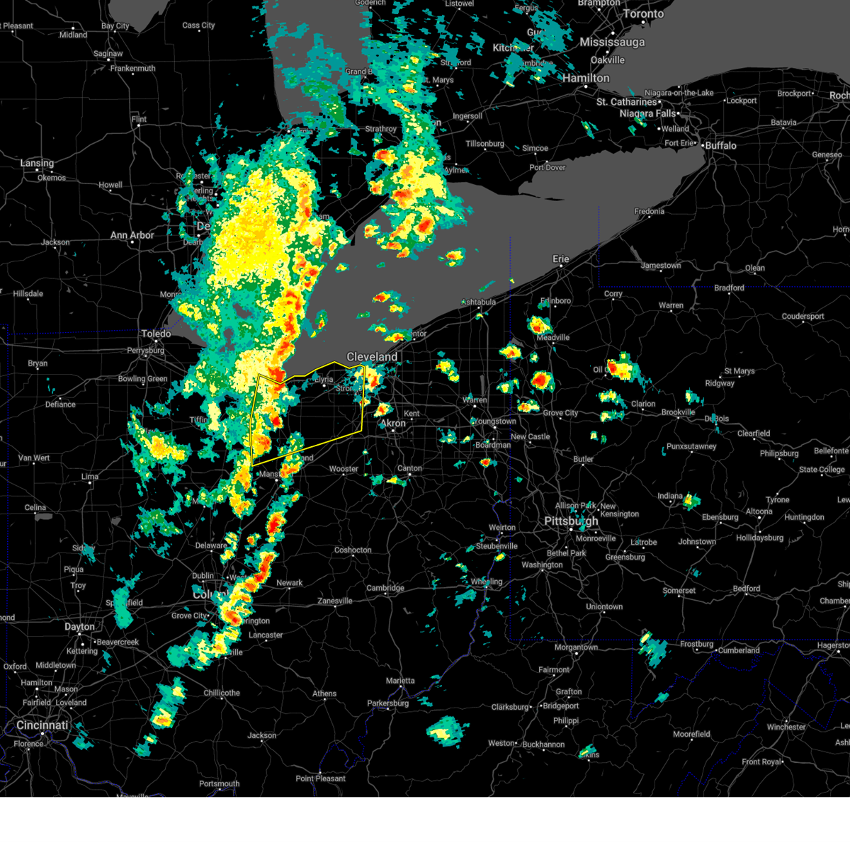
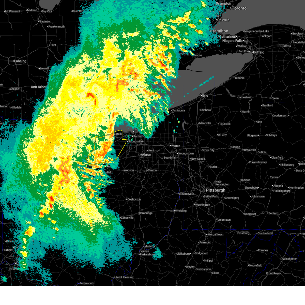
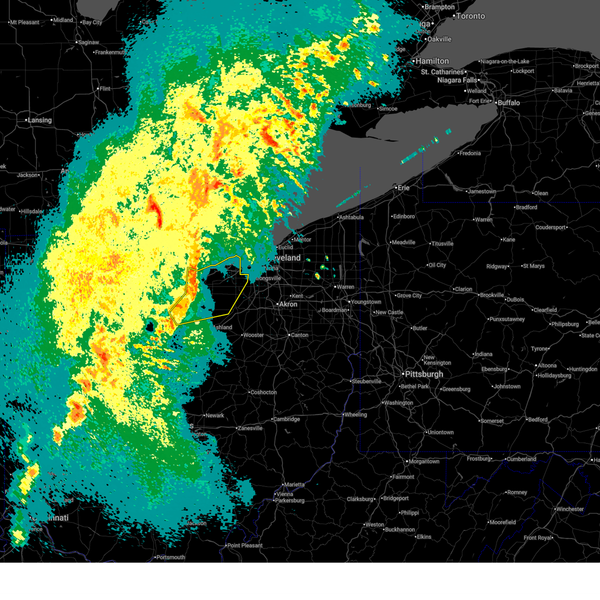
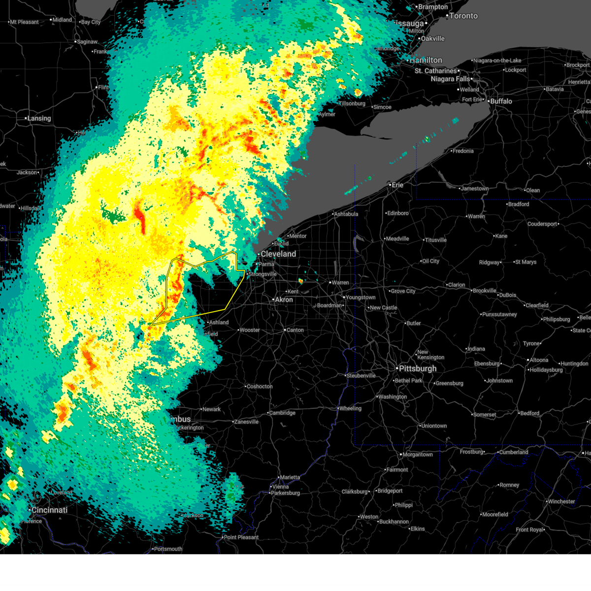
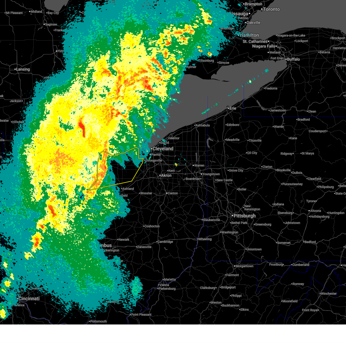
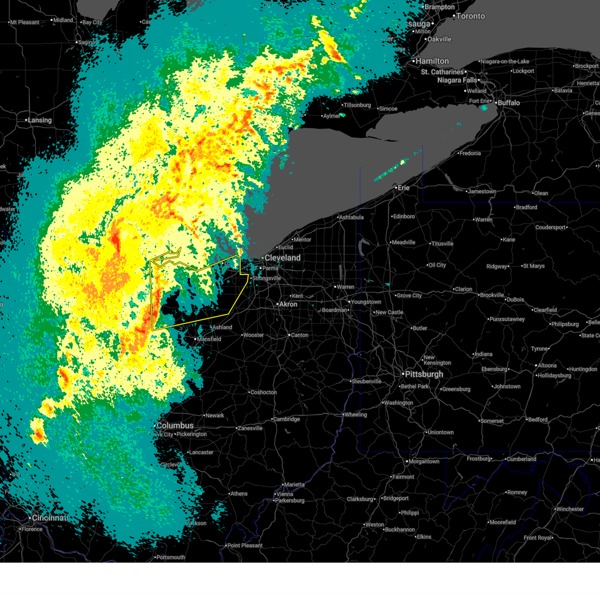
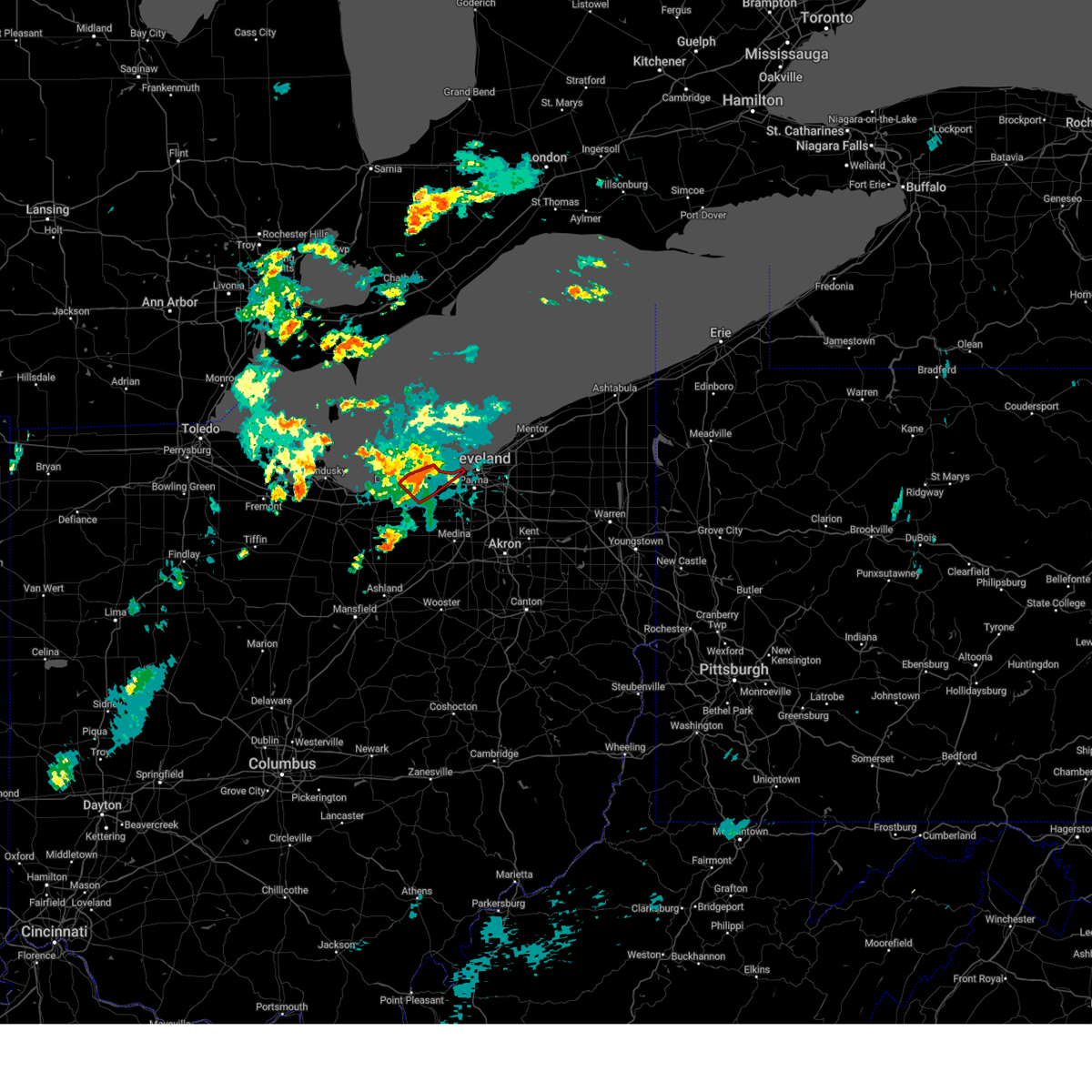
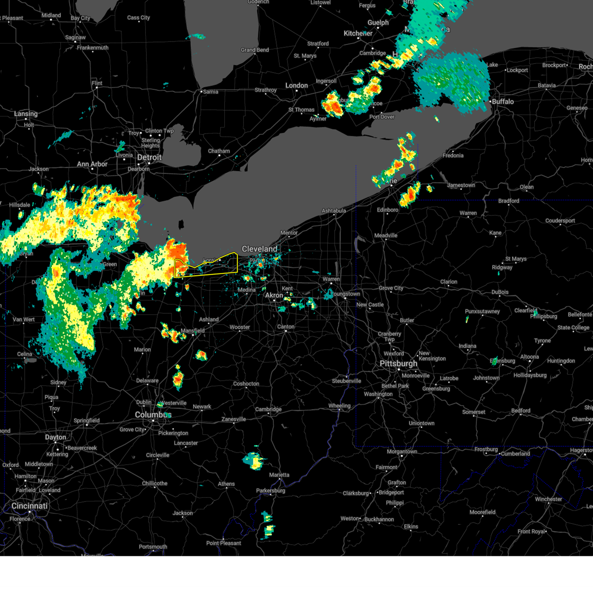
Hail Map for Avon Lake, OH
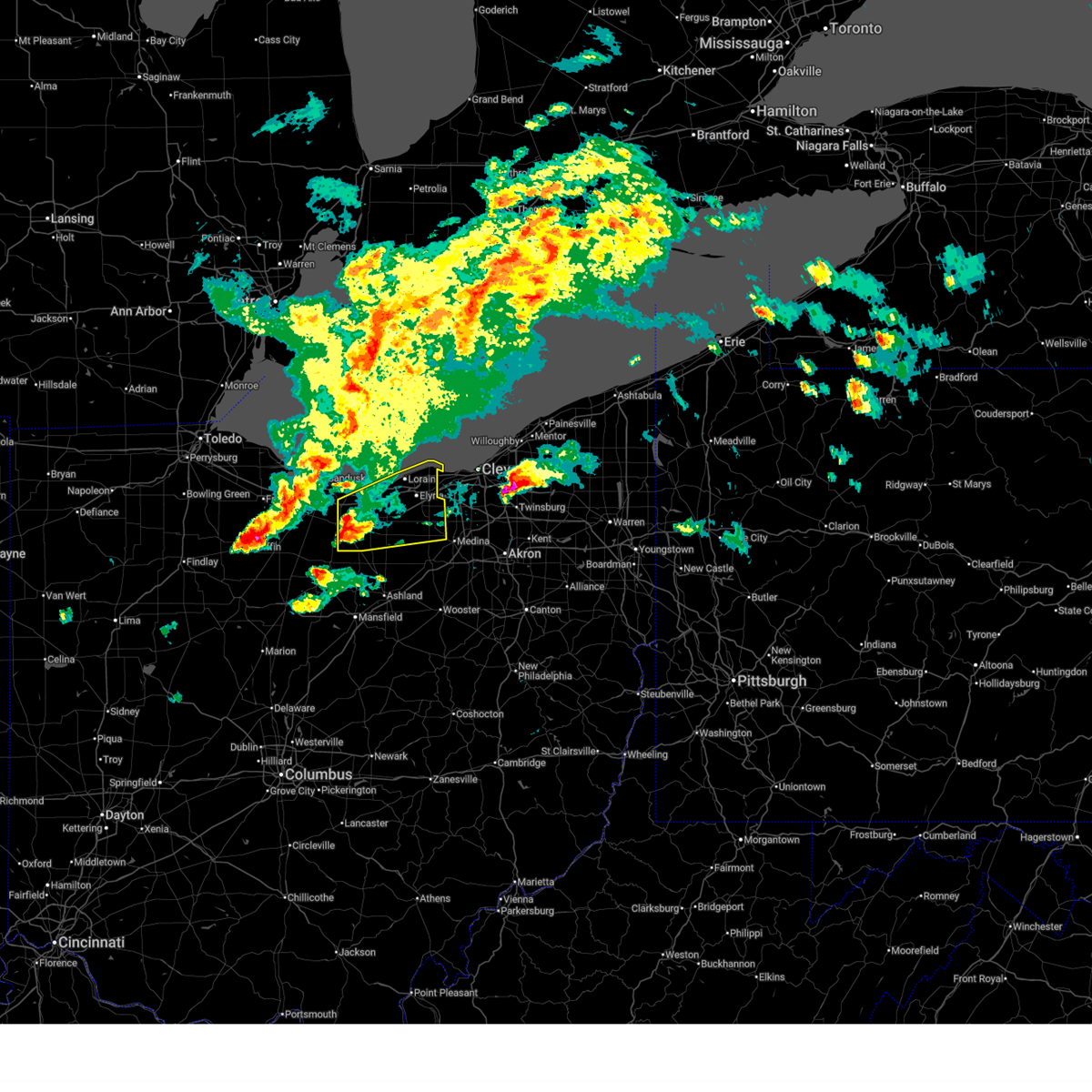
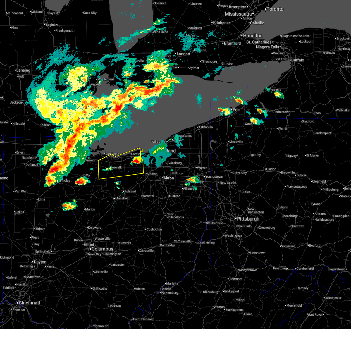
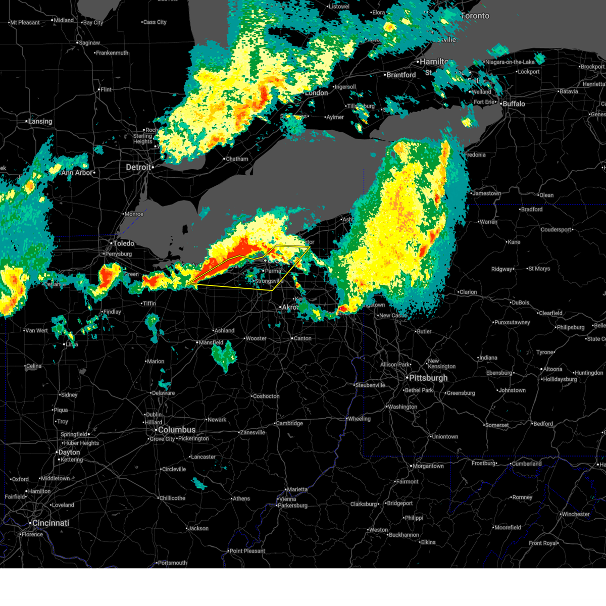
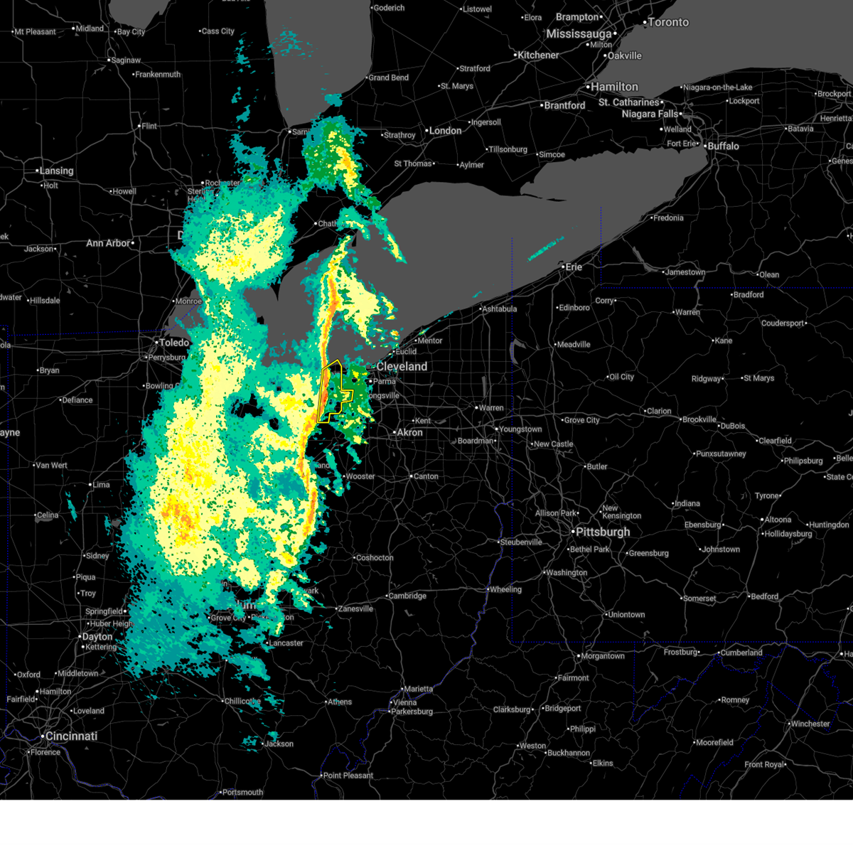
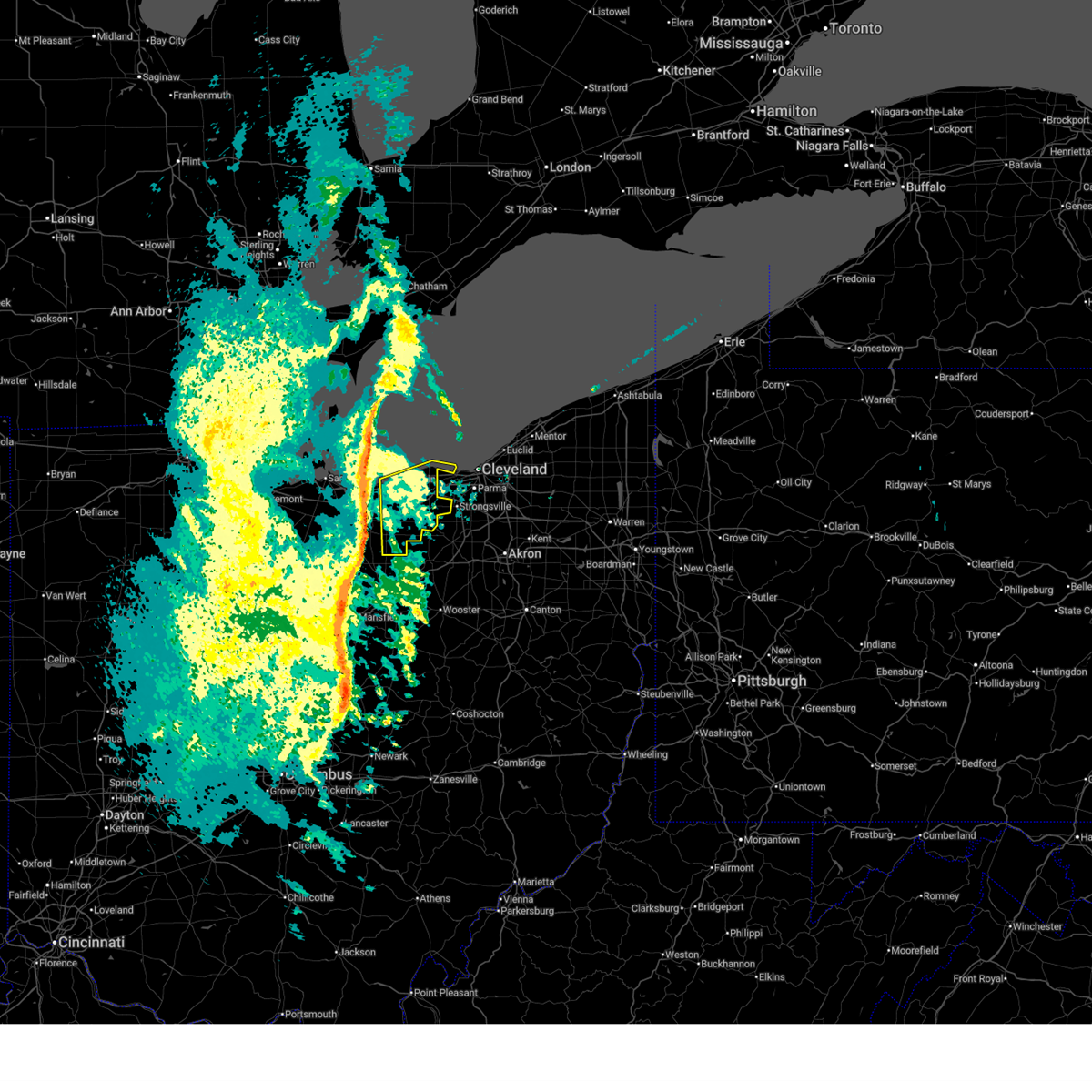
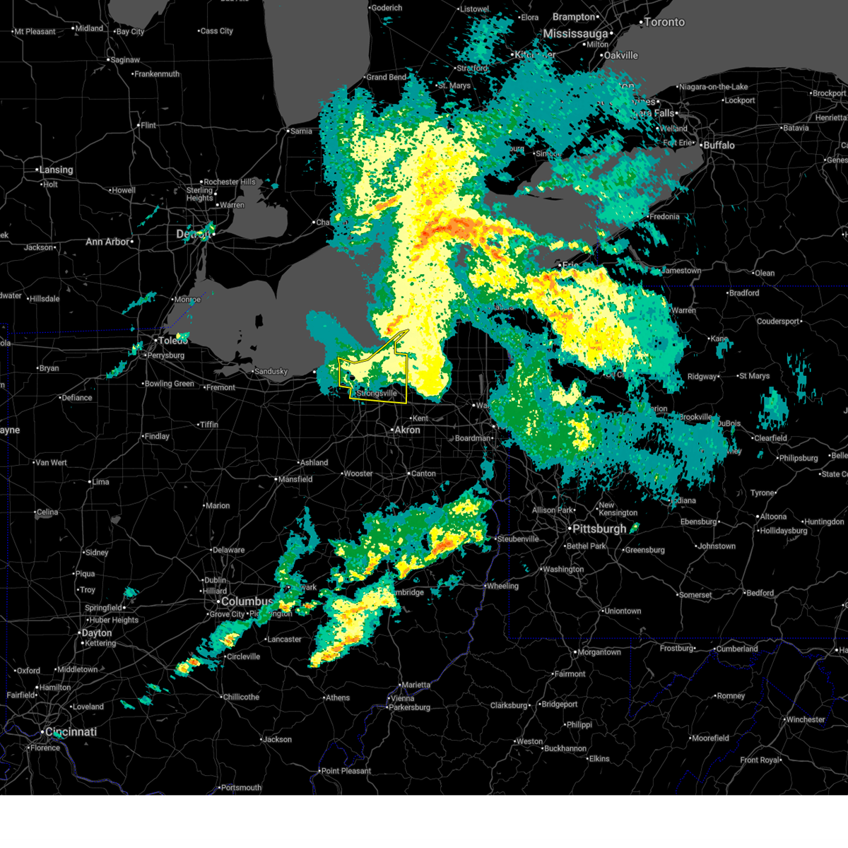
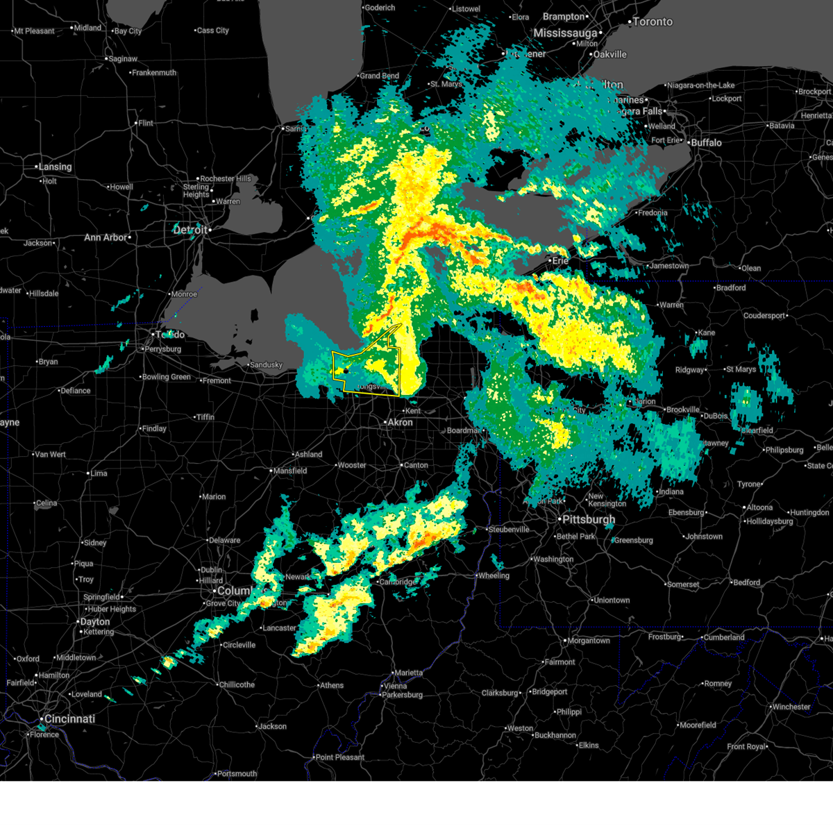
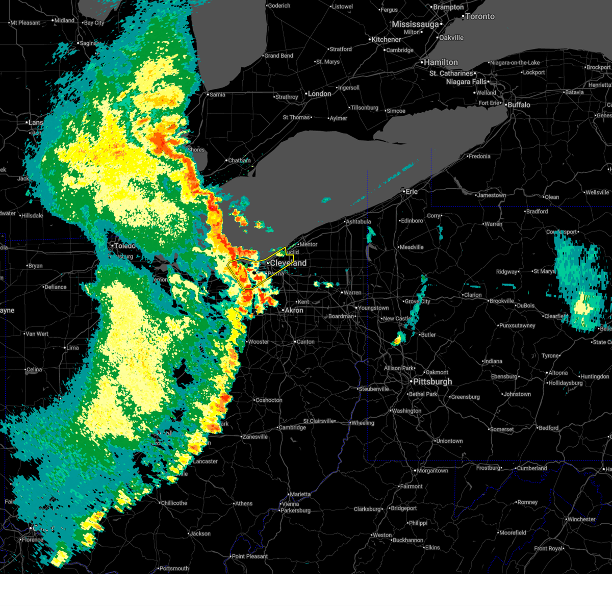
The Avon Lake, OH area has had 0 reports of on-the-ground hail by trained spotters, and has been under severe weather warnings 36 times during the past 12 months. Doppler radar has detected hail at or near Avon Lake, OH on 36 occasions, including 1 occasion during the past year.
| Name: | Avon Lake, OH |
| Where Located: | 17.7 miles W of Cleveland, OH |
| Map: | Google Map for Avon Lake, OH |
| Population: | 22581 |
| Housing Units: | 9411 |
| More Info: | Search Google for Avon Lake, OH |
0
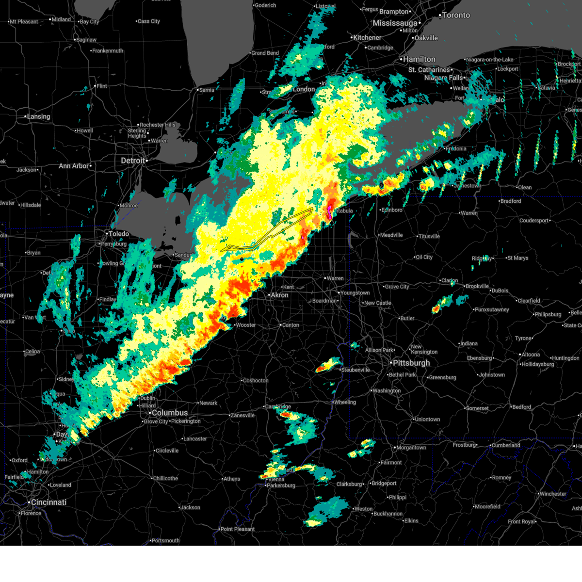
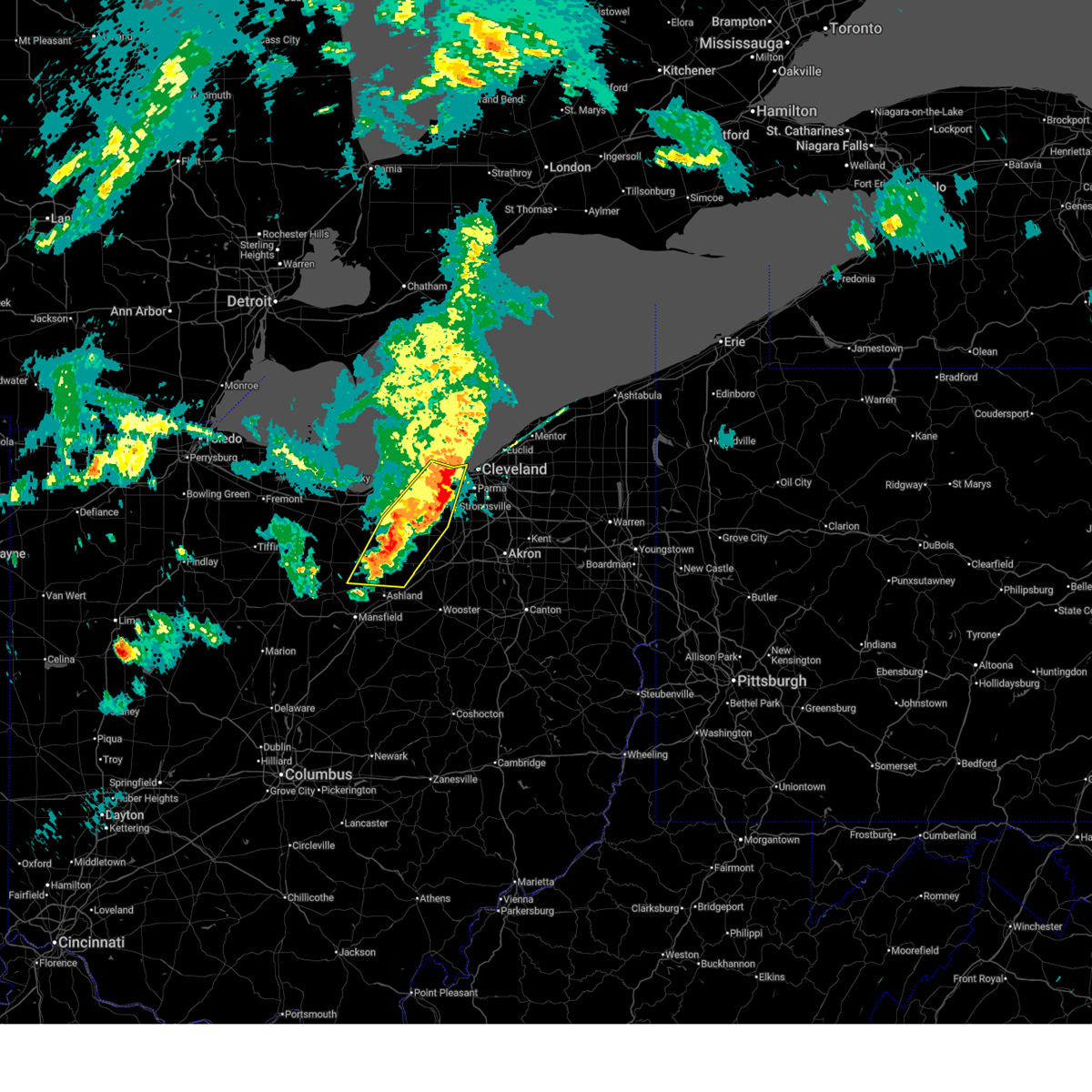
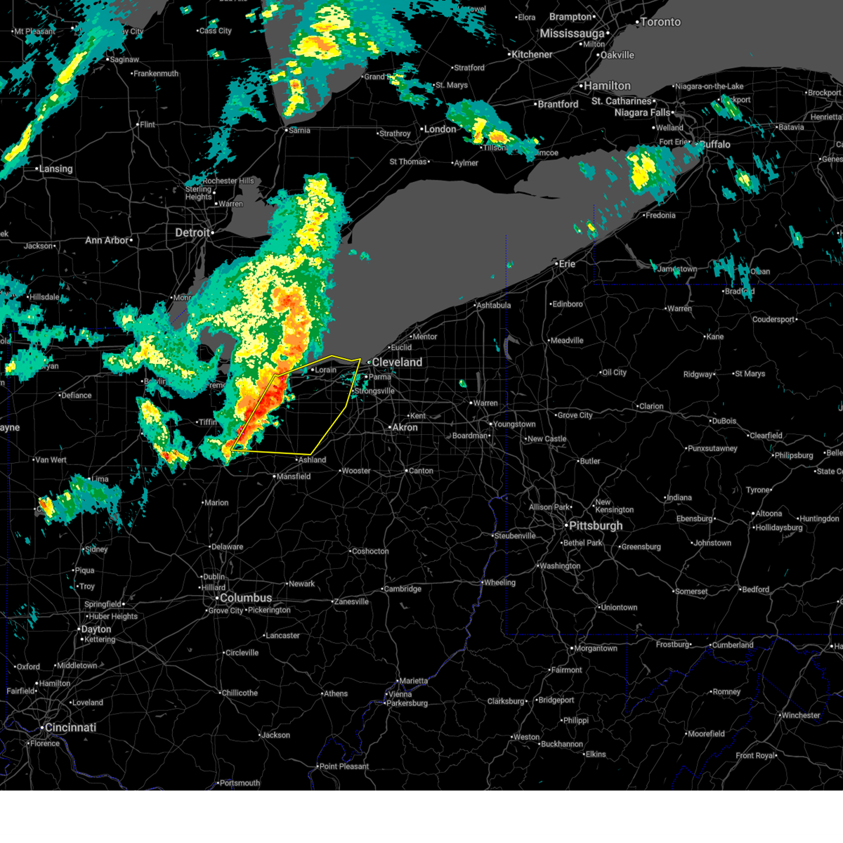
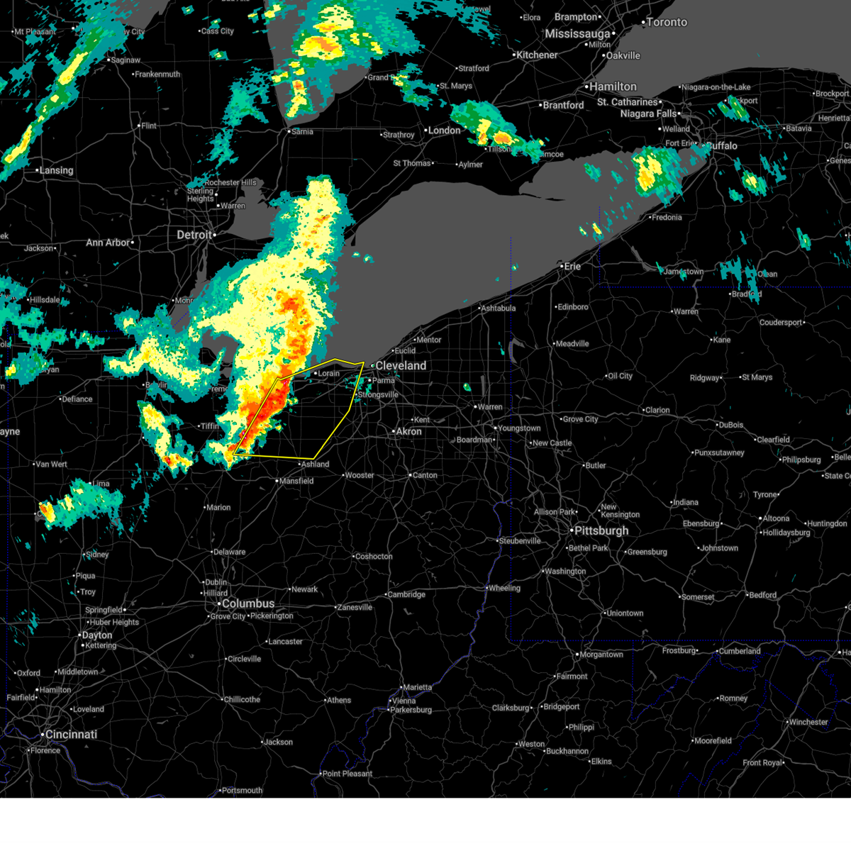
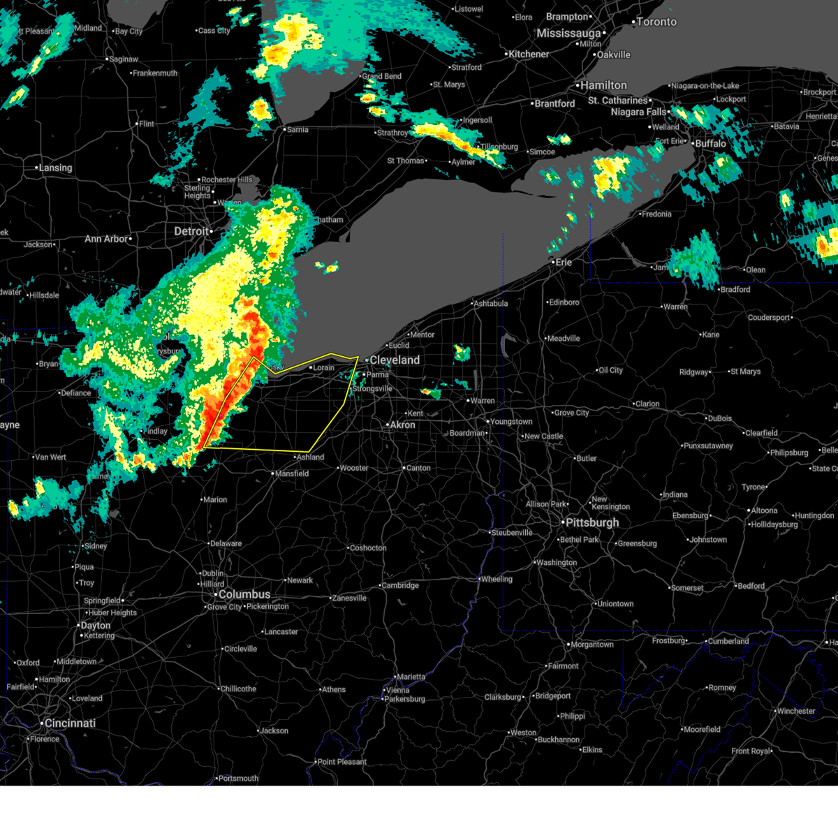
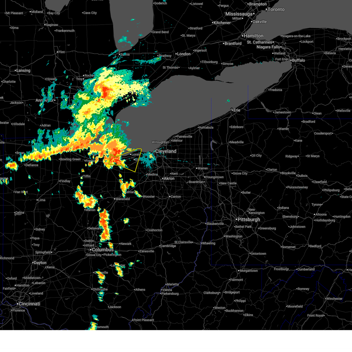
The Top Recent Hail Date for Avon Lake, OH is Wednesday, April 15, 2026 (11th out of 36)
Hail and Wind Damage Spotted near Avon Lake, OH
| Date / Time | Report Details |
|---|---|
| 6/14/2026 3:51 PM EDT |
 The storms which prompted the warning have moved out of the area. therefore, the warning will be allowed to expire. however, gusty winds and heavy rain are still possible with these thunderstorms. a severe thunderstorm watch remains in effect until 900 pm edt for north central and northeastern ohio. The storms which prompted the warning have moved out of the area. therefore, the warning will be allowed to expire. however, gusty winds and heavy rain are still possible with these thunderstorms. a severe thunderstorm watch remains in effect until 900 pm edt for north central and northeastern ohio.
|
| 6/14/2026 3:34 PM EDT |
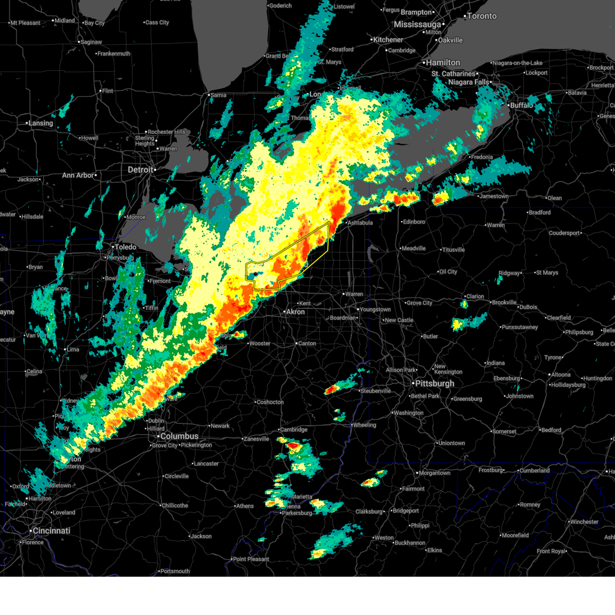 At 334 pm edt, severe thunderstorms were located along a line extending from near painesville to 6 miles northwest of cuyahoga falls to near bellville, moving southeast at 45 mph (radar indicated). Hazards include 70 mph wind gusts. Expect considerable tree damage. damage is likely to mobile homes, roofs, and outbuildings. Locations impacted include, cleveland, painesville, willowick, chardon, fairport harbor, parma, lakewood, euclid, mentor, cleveland heights, strongsville, brunswick, westlake, north royalton, solon, willoughby, eastlake, warrensville heights, south russell, and madison. At 334 pm edt, severe thunderstorms were located along a line extending from near painesville to 6 miles northwest of cuyahoga falls to near bellville, moving southeast at 45 mph (radar indicated). Hazards include 70 mph wind gusts. Expect considerable tree damage. damage is likely to mobile homes, roofs, and outbuildings. Locations impacted include, cleveland, painesville, willowick, chardon, fairport harbor, parma, lakewood, euclid, mentor, cleveland heights, strongsville, brunswick, westlake, north royalton, solon, willoughby, eastlake, warrensville heights, south russell, and madison.
|
| 6/14/2026 3:24 PM EDT |
 At 324 pm edt, severe thunderstorms were located along a line extending from painesville to near north royalton to near mansfield, moving east at 45 mph (radar indicated). Hazards include 70 mph wind gusts. Expect considerable tree damage. damage is likely to mobile homes, roofs, and outbuildings. Locations impacted include, cleveland, painesville, willowick, chardon, fairport harbor, parma, lakewood, euclid, mentor, cleveland heights, strongsville, brunswick, westlake, north royalton, solon, willoughby, eastlake, warrensville heights, south russell, and madison. At 324 pm edt, severe thunderstorms were located along a line extending from painesville to near north royalton to near mansfield, moving east at 45 mph (radar indicated). Hazards include 70 mph wind gusts. Expect considerable tree damage. damage is likely to mobile homes, roofs, and outbuildings. Locations impacted include, cleveland, painesville, willowick, chardon, fairport harbor, parma, lakewood, euclid, mentor, cleveland heights, strongsville, brunswick, westlake, north royalton, solon, willoughby, eastlake, warrensville heights, south russell, and madison.
|
| 6/14/2026 3:23 PM EDT |
 At 323 pm edt, severe thunderstorms were located along a line extending from 10 miles north of lakewood to 6 miles south of amherst to near bucyrus, moving east at 25 mph (radar indicated). Hazards include 60 mph wind gusts. Expect damage to trees and power lines. Locations impacted include, lorain, elyria, north ridgeville, avon lake, grafton, wellington, avon, eaton, oberlin, sheffield, lagrange, penfield, pittsfield, rochester, and eaton estates. At 323 pm edt, severe thunderstorms were located along a line extending from 10 miles north of lakewood to 6 miles south of amherst to near bucyrus, moving east at 25 mph (radar indicated). Hazards include 60 mph wind gusts. Expect damage to trees and power lines. Locations impacted include, lorain, elyria, north ridgeville, avon lake, grafton, wellington, avon, eaton, oberlin, sheffield, lagrange, penfield, pittsfield, rochester, and eaton estates.
|
| 6/14/2026 2:56 PM EDT |
 Svrcle the national weather service in cleveland has issued a * severe thunderstorm warning for, central lake county in northeastern ohio, * until 400 pm edt. * at 256 pm edt, severe thunderstorms were located along a line extending from 31 miles north of fairport harbor to 14 miles north of timberlake to near avon lake, moving east at 40 mph (radar indicated). Hazards include 70 mph wind gusts and penny size hail. Expect considerable tree damage. Damage is likely to mobile homes, roofs, and outbuildings. Svrcle the national weather service in cleveland has issued a * severe thunderstorm warning for, central lake county in northeastern ohio, * until 400 pm edt. * at 256 pm edt, severe thunderstorms were located along a line extending from 31 miles north of fairport harbor to 14 miles north of timberlake to near avon lake, moving east at 40 mph (radar indicated). Hazards include 70 mph wind gusts and penny size hail. Expect considerable tree damage. Damage is likely to mobile homes, roofs, and outbuildings.
|
| 6/14/2026 2:49 PM EDT |
 Svrcle the national weather service in cleveland has issued a * severe thunderstorm warning for, central geauga county in northeastern ohio, cuyahoga county in northeastern ohio, lake county in northeastern ohio, * until 345 pm edt. * at 249 pm edt, severe thunderstorms were located along a line extending from 22 miles northwest of fairport harbor to 6 miles northeast of avon lake to near willard, moving southeast at 45 mph (radar indicated). Hazards include 70 mph wind gusts and penny size hail. Expect considerable tree damage. Damage is likely to mobile homes, roofs, and outbuildings. Svrcle the national weather service in cleveland has issued a * severe thunderstorm warning for, central geauga county in northeastern ohio, cuyahoga county in northeastern ohio, lake county in northeastern ohio, * until 345 pm edt. * at 249 pm edt, severe thunderstorms were located along a line extending from 22 miles northwest of fairport harbor to 6 miles northeast of avon lake to near willard, moving southeast at 45 mph (radar indicated). Hazards include 70 mph wind gusts and penny size hail. Expect considerable tree damage. Damage is likely to mobile homes, roofs, and outbuildings.
|
| 6/14/2026 2:40 PM EDT |
 Svrcle the national weather service in cleveland has issued a * severe thunderstorm warning for, eastern huron county in north central ohio, lorain county in north central ohio, * until 345 pm edt. * at 240 pm edt, severe thunderstorms were located along a line extending from 19 miles north of avon lake to near western vermilion to near sycamore, moving southeast at 25 mph (radar indicated). Hazards include 60 mph wind gusts and penny size hail. expect damage to trees and power lines Svrcle the national weather service in cleveland has issued a * severe thunderstorm warning for, eastern huron county in north central ohio, lorain county in north central ohio, * until 345 pm edt. * at 240 pm edt, severe thunderstorms were located along a line extending from 19 miles north of avon lake to near western vermilion to near sycamore, moving southeast at 25 mph (radar indicated). Hazards include 60 mph wind gusts and penny size hail. expect damage to trees and power lines
|
| 6/10/2026 8:50 PM EDT |
 Svrcle the national weather service in cleveland has issued a * severe thunderstorm warning for, cuyahoga county in northeastern ohio, northern medina county in northeastern ohio, northwestern summit county in northeastern ohio, northeastern lorain county in north central ohio, * until 930 pm edt. * at 850 pm edt, a severe thunderstorm was located near north ridgeville, or 8 miles east of elyria, moving east at 25 mph (radar indicated). Hazards include 60 mph wind gusts and penny size hail. expect damage to trees and power lines Svrcle the national weather service in cleveland has issued a * severe thunderstorm warning for, cuyahoga county in northeastern ohio, northern medina county in northeastern ohio, northwestern summit county in northeastern ohio, northeastern lorain county in north central ohio, * until 930 pm edt. * at 850 pm edt, a severe thunderstorm was located near north ridgeville, or 8 miles east of elyria, moving east at 25 mph (radar indicated). Hazards include 60 mph wind gusts and penny size hail. expect damage to trees and power lines
|
| 6/10/2026 8:33 PM EDT |
 At 832 pm edt, a severe thunderstorm was located over elyria, moving east at 25 mph (radar indicated). Hazards include 60 mph wind gusts and nickel size hail. Expect damage to trees and power lines. Locations impacted include, lorain, elyria, vermilion, westlake, north ridgeville, avon lake, amherst, grafton, wellington, avon, bay village, sheffield lake, eaton, oberlin, sheffield, lagrange, penfield, south amherst, pittsfield, and kipton. At 832 pm edt, a severe thunderstorm was located over elyria, moving east at 25 mph (radar indicated). Hazards include 60 mph wind gusts and nickel size hail. Expect damage to trees and power lines. Locations impacted include, lorain, elyria, vermilion, westlake, north ridgeville, avon lake, amherst, grafton, wellington, avon, bay village, sheffield lake, eaton, oberlin, sheffield, lagrange, penfield, south amherst, pittsfield, and kipton.
|
| 6/10/2026 8:13 PM EDT |
 Svrcle the national weather service in cleveland has issued a * severe thunderstorm warning for, northeastern huron county in north central ohio, erie county in north central ohio, west central medina county in northeastern ohio, lorain county in north central ohio, * until 900 pm edt. * at 813 pm edt, a severe thunderstorm was located near amherst, or 7 miles south of vermilion, moving east at 25 mph (radar indicated). Hazards include 60 mph wind gusts and nickel size hail. expect damage to trees and power lines Svrcle the national weather service in cleveland has issued a * severe thunderstorm warning for, northeastern huron county in north central ohio, erie county in north central ohio, west central medina county in northeastern ohio, lorain county in north central ohio, * until 900 pm edt. * at 813 pm edt, a severe thunderstorm was located near amherst, or 7 miles south of vermilion, moving east at 25 mph (radar indicated). Hazards include 60 mph wind gusts and nickel size hail. expect damage to trees and power lines
|
| 5/9/2026 6:08 PM EDT |
 Svrcle the national weather service in cleveland has issued a * severe thunderstorm warning for, erie county in north central ohio, central geauga county in northeastern ohio, cuyahoga county in northeastern ohio, lake county in northeastern ohio, northern lorain county in north central ohio, * until 700 pm edt. * at 607 pm edt, severe thunderstorms were located along a line extending from 18 miles northwest of fairport harbor to 14 miles north of lakewood to 6 miles west of western vermilion, moving east at 40 mph (radar indicated). Hazards include 60 mph wind gusts and penny size hail. expect damage to trees and power lines Svrcle the national weather service in cleveland has issued a * severe thunderstorm warning for, erie county in north central ohio, central geauga county in northeastern ohio, cuyahoga county in northeastern ohio, lake county in northeastern ohio, northern lorain county in north central ohio, * until 700 pm edt. * at 607 pm edt, severe thunderstorms were located along a line extending from 18 miles northwest of fairport harbor to 14 miles north of lakewood to 6 miles west of western vermilion, moving east at 40 mph (radar indicated). Hazards include 60 mph wind gusts and penny size hail. expect damage to trees and power lines
|
| 4/15/2026 5:42 PM EDT |
 Svrcle the national weather service in cleveland has issued a * severe thunderstorm warning for, cuyahoga county in northeastern ohio, northern medina county in northeastern ohio, northern summit county in northeastern ohio, lorain county in north central ohio, * until 630 pm edt. * at 541 pm edt, a severe thunderstorm was located near grafton, or 8 miles south of elyria, moving east at 45 mph (radar indicated). Hazards include golf ball size hail and 60 mph wind gusts. People and animals outdoors will be injured. expect hail damage to roofs, siding, windows, and vehicles. Expect damage to trees and power lines. Svrcle the national weather service in cleveland has issued a * severe thunderstorm warning for, cuyahoga county in northeastern ohio, northern medina county in northeastern ohio, northern summit county in northeastern ohio, lorain county in north central ohio, * until 630 pm edt. * at 541 pm edt, a severe thunderstorm was located near grafton, or 8 miles south of elyria, moving east at 45 mph (radar indicated). Hazards include golf ball size hail and 60 mph wind gusts. People and animals outdoors will be injured. expect hail damage to roofs, siding, windows, and vehicles. Expect damage to trees and power lines.
|
| 4/15/2026 5:32 PM EDT |
 At 532 pm edt, a severe thunderstorm was located near wellington, or 11 miles southwest of elyria, moving east at 45 mph (radar indicated). Hazards include golf ball size hail and 60 mph wind gusts. People and animals outdoors will be injured. expect hail damage to roofs, siding, windows, and vehicles. expect damage to trees and power lines. Locations impacted include, lorain, elyria, vermilion, north ridgeville, avon lake, amherst, grafton, wellington, avon, bay village, eaton, oberlin, sheffield, lagrange, penfield, south amherst, pittsfield, kipton, rochester, and valley city. At 532 pm edt, a severe thunderstorm was located near wellington, or 11 miles southwest of elyria, moving east at 45 mph (radar indicated). Hazards include golf ball size hail and 60 mph wind gusts. People and animals outdoors will be injured. expect hail damage to roofs, siding, windows, and vehicles. expect damage to trees and power lines. Locations impacted include, lorain, elyria, vermilion, north ridgeville, avon lake, amherst, grafton, wellington, avon, bay village, eaton, oberlin, sheffield, lagrange, penfield, south amherst, pittsfield, kipton, rochester, and valley city.
|
| 4/15/2026 5:12 PM EDT |
 At 511 pm edt, a severe thunderstorm was located near wakeman, or near norwalk, moving east at 50 mph (radar indicated). Hazards include 60 mph wind gusts and quarter size hail. Minor damage to vehicles is possible. expect damage to trees and power lines. Locations impacted include, lorain, elyria, norwalk, western vermilion, vermilion, north ridgeville, avon lake, amherst, grafton, wellington, northern milan, milan, wakeman, avon, bay village, sheffield lake, eaton, oberlin, sheffield, and lagrange. At 511 pm edt, a severe thunderstorm was located near wakeman, or near norwalk, moving east at 50 mph (radar indicated). Hazards include 60 mph wind gusts and quarter size hail. Minor damage to vehicles is possible. expect damage to trees and power lines. Locations impacted include, lorain, elyria, norwalk, western vermilion, vermilion, north ridgeville, avon lake, amherst, grafton, wellington, northern milan, milan, wakeman, avon, bay village, sheffield lake, eaton, oberlin, sheffield, and lagrange.
|
| 4/15/2026 4:56 PM EDT |
 Svrcle the national weather service in cleveland has issued a * severe thunderstorm warning for, huron county in north central ohio, erie county in north central ohio, northwestern medina county in northeastern ohio, lorain county in north central ohio, * until 545 pm edt. * at 456 pm edt, a severe thunderstorm was located 7 miles southwest of norwalk, moving east at 50 mph (radar indicated). Hazards include 60 mph wind gusts and quarter size hail. Minor damage to vehicles is possible. Expect damage to trees and power lines. Svrcle the national weather service in cleveland has issued a * severe thunderstorm warning for, huron county in north central ohio, erie county in north central ohio, northwestern medina county in northeastern ohio, lorain county in north central ohio, * until 545 pm edt. * at 456 pm edt, a severe thunderstorm was located 7 miles southwest of norwalk, moving east at 50 mph (radar indicated). Hazards include 60 mph wind gusts and quarter size hail. Minor damage to vehicles is possible. Expect damage to trees and power lines.
|
| 3/31/2026 7:15 PM EDT |
 Svrcle the national weather service in cleveland has issued a * severe thunderstorm warning for, erie county in north central ohio, west central geauga county in northeastern ohio, cuyahoga county in northeastern ohio, northeastern medina county in northeastern ohio, southwestern lake county in northeastern ohio, northwestern summit county in northeastern ohio, lorain county in north central ohio, * until 800 pm edt. * at 715 pm edt, severe thunderstorms were located along a line extending from 6 miles northwest of lakewood to near wakeman, moving east at 55 mph (radar indicated). Hazards include 60 mph wind gusts. expect damage to trees and power lines Svrcle the national weather service in cleveland has issued a * severe thunderstorm warning for, erie county in north central ohio, west central geauga county in northeastern ohio, cuyahoga county in northeastern ohio, northeastern medina county in northeastern ohio, southwestern lake county in northeastern ohio, northwestern summit county in northeastern ohio, lorain county in north central ohio, * until 800 pm edt. * at 715 pm edt, severe thunderstorms were located along a line extending from 6 miles northwest of lakewood to near wakeman, moving east at 55 mph (radar indicated). Hazards include 60 mph wind gusts. expect damage to trees and power lines
|
| 3/31/2026 5:22 PM EDT |
 the severe thunderstorm warning has been cancelled and is no longer in effect the severe thunderstorm warning has been cancelled and is no longer in effect
|
| 3/31/2026 5:22 PM EDT |
 At 521 pm edt, severe thunderstorms were located along a line extending from 10 miles north of lakewood to near grafton to near polk, moving east at 60 mph (radar indicated). Hazards include 70 mph wind gusts and penny size hail. Expect considerable tree damage. damage is likely to mobile homes, roofs, and outbuildings. Locations impacted include, cleveland, lorain, elyria, lakewood, strongsville, westlake, north ridgeville, avon lake, grafton, wellington, new london, savannah, polk, north olmsted, avon, rocky river, brook park, berea, fairview park, and middleburg heights. At 521 pm edt, severe thunderstorms were located along a line extending from 10 miles north of lakewood to near grafton to near polk, moving east at 60 mph (radar indicated). Hazards include 70 mph wind gusts and penny size hail. Expect considerable tree damage. damage is likely to mobile homes, roofs, and outbuildings. Locations impacted include, cleveland, lorain, elyria, lakewood, strongsville, westlake, north ridgeville, avon lake, grafton, wellington, new london, savannah, polk, north olmsted, avon, rocky river, brook park, berea, fairview park, and middleburg heights.
|
| 3/31/2026 5:03 PM EDT |
 At 502 pm edt, severe thunderstorms were located along a line extending from 11 miles northwest of avon lake to wakeman to near plymouth, moving east at 60 mph (radar indicated). Hazards include 70 mph wind gusts and penny size hail. Expect considerable tree damage. damage is likely to mobile homes, roofs, and outbuildings. Locations impacted include, cleveland, lorain, elyria, norwalk, vermilion, western vermilion, lakewood, strongsville, westlake, north ridgeville, avon lake, amherst, grafton, willard, wellington, new london, plymouth, northern milan, milan, and wakeman. At 502 pm edt, severe thunderstorms were located along a line extending from 11 miles northwest of avon lake to wakeman to near plymouth, moving east at 60 mph (radar indicated). Hazards include 70 mph wind gusts and penny size hail. Expect considerable tree damage. damage is likely to mobile homes, roofs, and outbuildings. Locations impacted include, cleveland, lorain, elyria, norwalk, vermilion, western vermilion, lakewood, strongsville, westlake, north ridgeville, avon lake, amherst, grafton, willard, wellington, new london, plymouth, northern milan, milan, and wakeman.
|
| 3/31/2026 5:03 PM EDT |
 the severe thunderstorm warning has been cancelled and is no longer in effect the severe thunderstorm warning has been cancelled and is no longer in effect
|
| 3/31/2026 4:40 PM EDT |
 Svrcle the national weather service in cleveland has issued a * severe thunderstorm warning for, huron county in north central ohio, northern richland county in north central ohio, eastern seneca county in northwestern ohio, erie county in north central ohio, southwestern cuyahoga county in northeastern ohio, western medina county in northeastern ohio, northern ashland county in north central ohio, southeastern sandusky county in northwestern ohio, northern crawford county in north central ohio, lorain county in north central ohio, * until 530 pm edt. * at 440 pm edt, severe thunderstorms were located along a line extending from 9 miles east of kelleys island to near bellevue to near chatfield, moving east at 60 mph (radar indicated). Hazards include 70 mph wind gusts and penny size hail. Expect considerable tree damage. Damage is likely to mobile homes, roofs, and outbuildings. Svrcle the national weather service in cleveland has issued a * severe thunderstorm warning for, huron county in north central ohio, northern richland county in north central ohio, eastern seneca county in northwestern ohio, erie county in north central ohio, southwestern cuyahoga county in northeastern ohio, western medina county in northeastern ohio, northern ashland county in north central ohio, southeastern sandusky county in northwestern ohio, northern crawford county in north central ohio, lorain county in north central ohio, * until 530 pm edt. * at 440 pm edt, severe thunderstorms were located along a line extending from 9 miles east of kelleys island to near bellevue to near chatfield, moving east at 60 mph (radar indicated). Hazards include 70 mph wind gusts and penny size hail. Expect considerable tree damage. Damage is likely to mobile homes, roofs, and outbuildings.
|
| 3/26/2026 8:39 PM EDT |
 the severe thunderstorm warning has been cancelled and is no longer in effect the severe thunderstorm warning has been cancelled and is no longer in effect
|
| 3/26/2026 8:29 PM EDT |
 At 829 pm edt, severe thunderstorms were located along a line extending from 27 miles northeast of kelleys island to 7 miles north of western vermilion to northern milan, moving east at 60 mph (radar indicated). Hazards include 60 mph wind gusts. Expect damage to trees and power lines. Locations impacted include, lorain, elyria, norwalk, western vermilion, vermilion, north ridgeville, avon lake, amherst, wellington, milan, wakeman, avon, bay village, sheffield lake, oberlin, sheffield, south amherst, pittsfield, berlin heights, and kipton. At 829 pm edt, severe thunderstorms were located along a line extending from 27 miles northeast of kelleys island to 7 miles north of western vermilion to northern milan, moving east at 60 mph (radar indicated). Hazards include 60 mph wind gusts. Expect damage to trees and power lines. Locations impacted include, lorain, elyria, norwalk, western vermilion, vermilion, north ridgeville, avon lake, amherst, wellington, milan, wakeman, avon, bay village, sheffield lake, oberlin, sheffield, south amherst, pittsfield, berlin heights, and kipton.
|
| 3/26/2026 8:29 PM EDT |
 the severe thunderstorm warning has been cancelled and is no longer in effect the severe thunderstorm warning has been cancelled and is no longer in effect
|
| 3/26/2026 7:57 PM EDT |
 Svrcle the national weather service in cleveland has issued a * severe thunderstorm warning for, northern huron county in north central ohio, ottawa county in northwestern ohio, northeastern seneca county in northwestern ohio, erie county in north central ohio, west central cuyahoga county in northeastern ohio, sandusky county in northwestern ohio, lorain county in north central ohio, * until 900 pm edt. * at 757 pm edt, severe thunderstorms were located along a line extending from 18 miles north of put-in-bay to near port clinton to near fremont, moving east at 60 mph (radar indicated). Hazards include 60 mph wind gusts and half dollar size hail. People and animals outdoors will be injured. expect hail damage to roofs, siding, windows, and vehicles. Expect damage to trees and power lines. Svrcle the national weather service in cleveland has issued a * severe thunderstorm warning for, northern huron county in north central ohio, ottawa county in northwestern ohio, northeastern seneca county in northwestern ohio, erie county in north central ohio, west central cuyahoga county in northeastern ohio, sandusky county in northwestern ohio, lorain county in north central ohio, * until 900 pm edt. * at 757 pm edt, severe thunderstorms were located along a line extending from 18 miles north of put-in-bay to near port clinton to near fremont, moving east at 60 mph (radar indicated). Hazards include 60 mph wind gusts and half dollar size hail. People and animals outdoors will be injured. expect hail damage to roofs, siding, windows, and vehicles. Expect damage to trees and power lines.
|
| 3/16/2026 4:11 AM EDT |
 The storms which prompted the warning have moved out of the area. therefore, the warning will be allowed to expire. gusty winds remain possible into monday. The storms which prompted the warning have moved out of the area. therefore, the warning will be allowed to expire. gusty winds remain possible into monday.
|
| 3/16/2026 4:06 AM EDT |
 At 405 am edt, showers capable of producing damaging winds were located along a line extending from 9 miles north of avon lake to north ridgeville to near grafton, moving northeast at 55 mph (radar indicated). Hazards include 60 mph wind gusts. Expect damage to trees and power lines. Locations impacted include, lorain, elyria, strongsville, north ridgeville, avon lake, grafton, avon, sheffield lake, eaton, sheffield, lagrange, penfield, and eaton estates. At 405 am edt, showers capable of producing damaging winds were located along a line extending from 9 miles north of avon lake to north ridgeville to near grafton, moving northeast at 55 mph (radar indicated). Hazards include 60 mph wind gusts. Expect damage to trees and power lines. Locations impacted include, lorain, elyria, strongsville, north ridgeville, avon lake, grafton, avon, sheffield lake, eaton, sheffield, lagrange, penfield, and eaton estates.
|
| 3/16/2026 3:31 AM EDT |
 Svrcle the national weather service in cleveland has issued a * severe thunderstorm warning for, lorain county in north central ohio, * until 415 am edt. * at 330 am edt, showers with isolated thunderstorms producing damaging winds were located along a line extending from near western vermilion to near new london to 6 miles west of savannah, moving northeast at 55 mph (radar indicated). Hazards include 60 mph wind gusts. expect damage to trees and power lines Svrcle the national weather service in cleveland has issued a * severe thunderstorm warning for, lorain county in north central ohio, * until 415 am edt. * at 330 am edt, showers with isolated thunderstorms producing damaging winds were located along a line extending from near western vermilion to near new london to 6 miles west of savannah, moving northeast at 55 mph (radar indicated). Hazards include 60 mph wind gusts. expect damage to trees and power lines
|
| 3/11/2026 12:45 PM EDT |
 The storms which prompted the warning have weakened below severe limits, and have exited the warned area. therefore, the warning will be allowed to expire. a tornado watch remains in effect until 500 pm edt for north central and northeastern ohio. The storms which prompted the warning have weakened below severe limits, and have exited the warned area. therefore, the warning will be allowed to expire. a tornado watch remains in effect until 500 pm edt for north central and northeastern ohio.
|
| 3/11/2026 12:38 PM EDT |
 the severe thunderstorm warning has been cancelled and is no longer in effect the severe thunderstorm warning has been cancelled and is no longer in effect
|
| 3/11/2026 12:38 PM EDT |
 At 1238 pm edt, severe thunderstorms were located along a line extending from 6 miles south of perry to 6 miles northwest of garrettsville to near mogadore, moving east at 70 mph (radar indicated). Hazards include 60 mph wind gusts. Expect damage to trees and power lines. Locations impacted include, cleveland, parma, lakewood, euclid, cleveland heights, strongsville, brunswick, westlake, north royalton, solon, avon lake, hudson, twinsburg, warrensville heights, macedonia, highland hills, north olmsted, garfield heights, shaker heights, and maple heights. At 1238 pm edt, severe thunderstorms were located along a line extending from 6 miles south of perry to 6 miles northwest of garrettsville to near mogadore, moving east at 70 mph (radar indicated). Hazards include 60 mph wind gusts. Expect damage to trees and power lines. Locations impacted include, cleveland, parma, lakewood, euclid, cleveland heights, strongsville, brunswick, westlake, north royalton, solon, avon lake, hudson, twinsburg, warrensville heights, macedonia, highland hills, north olmsted, garfield heights, shaker heights, and maple heights.
|
| 3/11/2026 11:57 AM EDT |
 Svrcle the national weather service in cleveland has issued a * severe thunderstorm warning for, cuyahoga county in northeastern ohio, medina county in northeastern ohio, summit county in northeastern ohio, northern wayne county in northeastern ohio, * until 1245 pm edt. * at 1157 am edt, severe thunderstorms were located along a line extending from near avon lake to near grafton to near west salem, moving east at 70 mph (radar indicated). Hazards include 70 mph wind gusts and quarter size hail. Minor damage to vehicles is possible. expect considerable tree damage. Wind damage is also likely to mobile homes, roofs, and outbuildings. Svrcle the national weather service in cleveland has issued a * severe thunderstorm warning for, cuyahoga county in northeastern ohio, medina county in northeastern ohio, summit county in northeastern ohio, northern wayne county in northeastern ohio, * until 1245 pm edt. * at 1157 am edt, severe thunderstorms were located along a line extending from near avon lake to near grafton to near west salem, moving east at 70 mph (radar indicated). Hazards include 70 mph wind gusts and quarter size hail. Minor damage to vehicles is possible. expect considerable tree damage. Wind damage is also likely to mobile homes, roofs, and outbuildings.
|
| 3/11/2026 11:37 AM EDT |
 Svrcle the national weather service in cleveland has issued a * severe thunderstorm warning for, erie county in north central ohio, southwestern medina county in northeastern ohio, ashland county in north central ohio, lorain county in north central ohio, * until 1230 pm edt. * at 1137 am edt, severe thunderstorms were located along a line extending from vermilion to near new london to 8 miles west of savannah, moving northeast at 65 mph (radar indicated). Hazards include 70 mph wind gusts. Expect considerable tree damage. Damage is likely to mobile homes, roofs, and outbuildings. Svrcle the national weather service in cleveland has issued a * severe thunderstorm warning for, erie county in north central ohio, southwestern medina county in northeastern ohio, ashland county in north central ohio, lorain county in north central ohio, * until 1230 pm edt. * at 1137 am edt, severe thunderstorms were located along a line extending from vermilion to near new london to 8 miles west of savannah, moving northeast at 65 mph (radar indicated). Hazards include 70 mph wind gusts. Expect considerable tree damage. Damage is likely to mobile homes, roofs, and outbuildings.
|
| 7/28/2025 5:56 PM EDT |
 The storm which prompted the warning has weakened below severe limits, and no longer poses an immediate threat to life or property. therefore, the warning will be allowed to expire. however, gusty winds and heavy rain are still possible with this thunderstorm. The storm which prompted the warning has weakened below severe limits, and no longer poses an immediate threat to life or property. therefore, the warning will be allowed to expire. however, gusty winds and heavy rain are still possible with this thunderstorm.
|
| 7/28/2025 5:36 PM EDT |
 At 534 pm edt, a severe thunderstorm was located over amherst, or near vermilion, moving east at 30 mph (radar indicated. the huron lighthouse measured a 66 mph wind gust with this storm). Hazards include 60 mph wind gusts and penny size hail. Expect damage to trees and power lines. Locations impacted include, lorain, elyria, vermilion, western vermilion, north ridgeville, avon lake, amherst, grafton, avon, bay village, sheffield lake, oberlin, sheffield, lagrange, south amherst, pittsfield, kipton, and birmingham. At 534 pm edt, a severe thunderstorm was located over amherst, or near vermilion, moving east at 30 mph (radar indicated. the huron lighthouse measured a 66 mph wind gust with this storm). Hazards include 60 mph wind gusts and penny size hail. Expect damage to trees and power lines. Locations impacted include, lorain, elyria, vermilion, western vermilion, north ridgeville, avon lake, amherst, grafton, avon, bay village, sheffield lake, oberlin, sheffield, lagrange, south amherst, pittsfield, kipton, and birmingham.
|
| 7/28/2025 5:06 PM EDT |
 Svrcle the national weather service in cleveland has issued a * severe thunderstorm warning for, erie county in north central ohio, central lorain county in north central ohio, * until 600 pm edt. * at 506 pm edt, a severe thunderstorm was located near western vermilion, moving east at 20 mph (radar indicated). Hazards include 60 mph wind gusts and penny size hail. expect damage to trees and power lines Svrcle the national weather service in cleveland has issued a * severe thunderstorm warning for, erie county in north central ohio, central lorain county in north central ohio, * until 600 pm edt. * at 506 pm edt, a severe thunderstorm was located near western vermilion, moving east at 20 mph (radar indicated). Hazards include 60 mph wind gusts and penny size hail. expect damage to trees and power lines
|
| 6/18/2025 9:01 PM EDT |
 The storm which prompted the warning has moved out of the area. therefore, the warning has been allowed to expire. however, destructive winds of up to 80 mph are still possible with this thunderstorm. a severe thunderstorm watch remains in effect until 1000 pm edt for north central ohio. a severe thunderstorm watch also remains in effect until 300 am edt for northeastern ohio. The storm which prompted the warning has moved out of the area. therefore, the warning has been allowed to expire. however, destructive winds of up to 80 mph are still possible with this thunderstorm. a severe thunderstorm watch remains in effect until 1000 pm edt for north central ohio. a severe thunderstorm watch also remains in effect until 300 am edt for northeastern ohio.
|
| 6/18/2025 8:58 PM EDT |
 Svrcle the national weather service in cleveland has issued a * severe thunderstorm warning for, cuyahoga county in northeastern ohio, northeastern lorain county in north central ohio, * until 945 pm edt. * at 858 pm edt, severe thunderstorms were located along a line extending from near avon lake to near grafton, moving northeast at 60 mph. these are destructive storms for northeast lorain and northern cuyahoga (radar indicated). Hazards include 80 mph wind gusts. Flying debris will be dangerous to those caught without shelter. mobile homes will be heavily damaged. expect considerable damage to roofs, windows, and vehicles. Extensive tree damage and power outages are likely. Svrcle the national weather service in cleveland has issued a * severe thunderstorm warning for, cuyahoga county in northeastern ohio, northeastern lorain county in north central ohio, * until 945 pm edt. * at 858 pm edt, severe thunderstorms were located along a line extending from near avon lake to near grafton, moving northeast at 60 mph. these are destructive storms for northeast lorain and northern cuyahoga (radar indicated). Hazards include 80 mph wind gusts. Flying debris will be dangerous to those caught without shelter. mobile homes will be heavily damaged. expect considerable damage to roofs, windows, and vehicles. Extensive tree damage and power outages are likely.
|
| 6/18/2025 8:54 PM EDT |
 At 854 pm edt, severe thunderstorms were located along a line extending from near lorain to 6 miles west of medina, moving northeast at 45 mph. an 81 mph wind gust was measured in the city of lorain at 8:47 pm (radar indicated). Hazards include 70 mph wind gusts. Expect considerable tree damage. damage is likely to mobile homes, roofs, and outbuildings. Locations impacted include, cleveland, lorain, elyria, medina, vermilion, parma, lakewood, euclid, cleveland heights, strongsville, brunswick, westlake, north royalton, north ridgeville, solon, avon lake, wadsworth, warrensville heights, amherst, and grafton. At 854 pm edt, severe thunderstorms were located along a line extending from near lorain to 6 miles west of medina, moving northeast at 45 mph. an 81 mph wind gust was measured in the city of lorain at 8:47 pm (radar indicated). Hazards include 70 mph wind gusts. Expect considerable tree damage. damage is likely to mobile homes, roofs, and outbuildings. Locations impacted include, cleveland, lorain, elyria, medina, vermilion, parma, lakewood, euclid, cleveland heights, strongsville, brunswick, westlake, north royalton, north ridgeville, solon, avon lake, wadsworth, warrensville heights, amherst, and grafton.
|
| 6/18/2025 8:52 PM EDT |
 At 851 pm edt, severe thunderstorms were located along a line extending from near lorain to 7 miles north of lodi, moving northeast at 45 mph. an 81 mph wind gust was measured in the city of lorain at 7:47 pm (radar indicated). Hazards include 70 mph wind gusts. Expect considerable tree damage. damage is likely to mobile homes, roofs, and outbuildings. Locations impacted include, cleveland, lorain, elyria, medina, vermilion, parma, lakewood, euclid, cleveland heights, strongsville, brunswick, westlake, north royalton, north ridgeville, solon, avon lake, wadsworth, warrensville heights, amherst, and grafton. At 851 pm edt, severe thunderstorms were located along a line extending from near lorain to 7 miles north of lodi, moving northeast at 45 mph. an 81 mph wind gust was measured in the city of lorain at 7:47 pm (radar indicated). Hazards include 70 mph wind gusts. Expect considerable tree damage. damage is likely to mobile homes, roofs, and outbuildings. Locations impacted include, cleveland, lorain, elyria, medina, vermilion, parma, lakewood, euclid, cleveland heights, strongsville, brunswick, westlake, north royalton, north ridgeville, solon, avon lake, wadsworth, warrensville heights, amherst, and grafton.
|
| 6/18/2025 8:50 PM EDT |
 At 849 pm edt, a severe thunderstorm capable of producing a tornado was located over elyria, moving northeast at 50 mph (radar indicated rotation). Hazards include tornado. Flying debris will be dangerous to those caught without shelter. mobile homes will be damaged or destroyed. damage to roofs, windows, and vehicles will occur. tree damage is likely. this dangerous storm will be near, elyria, westlake, north ridgeville, avon lake, and grafton around 855 pm edt. Other locations impacted by this tornadic thunderstorm include sheffield, avon, sheffield lake, eaton estates, eaton, olmsted falls, lagrange, bay village, and north olmsted. At 849 pm edt, a severe thunderstorm capable of producing a tornado was located over elyria, moving northeast at 50 mph (radar indicated rotation). Hazards include tornado. Flying debris will be dangerous to those caught without shelter. mobile homes will be damaged or destroyed. damage to roofs, windows, and vehicles will occur. tree damage is likely. this dangerous storm will be near, elyria, westlake, north ridgeville, avon lake, and grafton around 855 pm edt. Other locations impacted by this tornadic thunderstorm include sheffield, avon, sheffield lake, eaton estates, eaton, olmsted falls, lagrange, bay village, and north olmsted.
|
| 6/18/2025 8:41 PM EDT |
 the tornado warning has been cancelled and is no longer in effect the tornado warning has been cancelled and is no longer in effect
|
| 6/18/2025 8:41 PM EDT |
 At 841 pm edt, a severe thunderstorm capable of producing a tornado was located near amherst, or near vermilion, moving northeast at 50 mph (radar indicated rotation). Hazards include tornado. Flying debris will be dangerous to those caught without shelter. mobile homes will be damaged or destroyed. damage to roofs, windows, and vehicles will occur. tree damage is likely. this dangerous storm will be near, lorain, elyria, vermilion, north ridgeville, amherst, and grafton around 845 pm edt. westlake and avon lake around 850 pm edt. Other locations impacted by this tornadic thunderstorm include lagrange, south amherst, avon, pittsfield, eaton, kipton, sheffield, oberlin, sheffield lake, and eaton estates. At 841 pm edt, a severe thunderstorm capable of producing a tornado was located near amherst, or near vermilion, moving northeast at 50 mph (radar indicated rotation). Hazards include tornado. Flying debris will be dangerous to those caught without shelter. mobile homes will be damaged or destroyed. damage to roofs, windows, and vehicles will occur. tree damage is likely. this dangerous storm will be near, lorain, elyria, vermilion, north ridgeville, amherst, and grafton around 845 pm edt. westlake and avon lake around 850 pm edt. Other locations impacted by this tornadic thunderstorm include lagrange, south amherst, avon, pittsfield, eaton, kipton, sheffield, oberlin, sheffield lake, and eaton estates.
|
| 6/18/2025 8:35 PM EDT |
 At 835 pm edt, a severe thunderstorm capable of producing a tornado was located near wakeman, or 7 miles south of vermilion, moving northeast at 50 mph (radar indicated rotation). Hazards include tornado. Flying debris will be dangerous to those caught without shelter. mobile homes will be damaged or destroyed. damage to roofs, windows, and vehicles will occur. tree damage is likely. this dangerous storm will be near, lorain, elyria, western vermilion, vermilion, and amherst around 840 pm edt. north ridgeville and grafton around 845 pm edt. avon lake around 850 pm edt. Other locations impacted by this tornadic thunderstorm include lagrange, south amherst, avon, pittsfield, birmingham, eaton, kipton, sheffield, oberlin, and sheffield lake. At 835 pm edt, a severe thunderstorm capable of producing a tornado was located near wakeman, or 7 miles south of vermilion, moving northeast at 50 mph (radar indicated rotation). Hazards include tornado. Flying debris will be dangerous to those caught without shelter. mobile homes will be damaged or destroyed. damage to roofs, windows, and vehicles will occur. tree damage is likely. this dangerous storm will be near, lorain, elyria, western vermilion, vermilion, and amherst around 840 pm edt. north ridgeville and grafton around 845 pm edt. avon lake around 850 pm edt. Other locations impacted by this tornadic thunderstorm include lagrange, south amherst, avon, pittsfield, birmingham, eaton, kipton, sheffield, oberlin, and sheffield lake.
|
| 6/18/2025 8:25 PM EDT |
 Torcle the national weather service in cleveland has issued a * tornado warning for, northeastern huron county in north central ohio, erie county in north central ohio, lorain county in north central ohio, * until 900 pm edt. * at 825 pm edt, a severe thunderstorm capable of producing a tornado was located near wakeman, or 8 miles east of norwalk, moving northeast at 50 mph (radar indicated rotation). Hazards include tornado. Flying debris will be dangerous to those caught without shelter. mobile homes will be damaged or destroyed. damage to roofs, windows, and vehicles will occur. tree damage is likely. this dangerous storm will be near, wakeman around 830 pm edt. elyria, vermilion, and amherst around 835 pm edt. lorain, north ridgeville, and grafton around 840 pm edt. avon lake around 850 pm edt. strongsville around 855 pm edt. Other locations impacted by this tornadic thunderstorm include lagrange, south amherst, avon, pittsfield, birmingham, eaton, kipton, sheffield, oberlin, and sheffield lake. Torcle the national weather service in cleveland has issued a * tornado warning for, northeastern huron county in north central ohio, erie county in north central ohio, lorain county in north central ohio, * until 900 pm edt. * at 825 pm edt, a severe thunderstorm capable of producing a tornado was located near wakeman, or 8 miles east of norwalk, moving northeast at 50 mph (radar indicated rotation). Hazards include tornado. Flying debris will be dangerous to those caught without shelter. mobile homes will be damaged or destroyed. damage to roofs, windows, and vehicles will occur. tree damage is likely. this dangerous storm will be near, wakeman around 830 pm edt. elyria, vermilion, and amherst around 835 pm edt. lorain, north ridgeville, and grafton around 840 pm edt. avon lake around 850 pm edt. strongsville around 855 pm edt. Other locations impacted by this tornadic thunderstorm include lagrange, south amherst, avon, pittsfield, birmingham, eaton, kipton, sheffield, oberlin, and sheffield lake.
|
| 6/18/2025 8:18 PM EDT |
 Svrcle the national weather service in cleveland has issued a * severe thunderstorm warning for, cuyahoga county in northeastern ohio, medina county in northeastern ohio, lorain county in north central ohio, * until 930 pm edt. * at 818 pm edt, severe thunderstorms were located along a line extending from near kelleys island to near plymouth, moving east at 55 mph (radar indicated). Hazards include 70 mph wind gusts. Expect considerable tree damage. Damage is likely to mobile homes, roofs, and outbuildings. Svrcle the national weather service in cleveland has issued a * severe thunderstorm warning for, cuyahoga county in northeastern ohio, medina county in northeastern ohio, lorain county in north central ohio, * until 930 pm edt. * at 818 pm edt, severe thunderstorms were located along a line extending from near kelleys island to near plymouth, moving east at 55 mph (radar indicated). Hazards include 70 mph wind gusts. Expect considerable tree damage. Damage is likely to mobile homes, roofs, and outbuildings.
|
| 5/16/2025 5:03 AM EDT |
 At 503 am edt, a severe thunderstorm was located near amherst, or near elyria, moving east at 35 mph (radar indicated). Hazards include 70 mph wind gusts and half dollar size hail. People and animals outdoors will be injured. expect hail damage to roofs, siding, windows, and vehicles. expect considerable tree damage. wind damage is also likely to mobile homes, roofs, and outbuildings. Locations impacted include, lorain, elyria, vermilion, north ridgeville, avon lake, amherst, grafton, avon, sheffield lake, eaton, oberlin, sheffield, lagrange, south amherst, and eaton estates. At 503 am edt, a severe thunderstorm was located near amherst, or near elyria, moving east at 35 mph (radar indicated). Hazards include 70 mph wind gusts and half dollar size hail. People and animals outdoors will be injured. expect hail damage to roofs, siding, windows, and vehicles. expect considerable tree damage. wind damage is also likely to mobile homes, roofs, and outbuildings. Locations impacted include, lorain, elyria, vermilion, north ridgeville, avon lake, amherst, grafton, avon, sheffield lake, eaton, oberlin, sheffield, lagrange, south amherst, and eaton estates.
|
| 5/16/2025 5:03 AM EDT |
 the severe thunderstorm warning has been cancelled and is no longer in effect the severe thunderstorm warning has been cancelled and is no longer in effect
|
| 5/16/2025 4:55 AM EDT |
 the severe thunderstorm warning has been cancelled and is no longer in effect the severe thunderstorm warning has been cancelled and is no longer in effect
|
| 5/16/2025 4:55 AM EDT |
 At 454 am edt, a severe thunderstorm was located near vermilion, moving east at 35 mph (radar indicated). Hazards include 60 mph wind gusts and half dollar size hail. People and animals outdoors will be injured. expect hail damage to roofs, siding, windows, and vehicles. expect damage to trees and power lines. Locations impacted include, lorain, elyria, western vermilion, vermilion, north ridgeville, avon lake, amherst, grafton, avon, sheffield lake, eaton, oberlin, sheffield, lagrange, south amherst, pittsfield, kipton, birmingham, and eaton estates. At 454 am edt, a severe thunderstorm was located near vermilion, moving east at 35 mph (radar indicated). Hazards include 60 mph wind gusts and half dollar size hail. People and animals outdoors will be injured. expect hail damage to roofs, siding, windows, and vehicles. expect damage to trees and power lines. Locations impacted include, lorain, elyria, western vermilion, vermilion, north ridgeville, avon lake, amherst, grafton, avon, sheffield lake, eaton, oberlin, sheffield, lagrange, south amherst, pittsfield, kipton, birmingham, and eaton estates.
|
| 5/16/2025 4:36 AM EDT |
 Svrcle the national weather service in cleveland has issued a * severe thunderstorm warning for, northeastern huron county in north central ohio, erie county in north central ohio, west central medina county in northeastern ohio, lorain county in north central ohio, * until 515 am edt. * at 435 am edt, a severe thunderstorm was located near northern milan, or 9 miles west of western vermilion, moving east at 35 mph (radar indicated). Hazards include 60 mph wind gusts and half dollar size hail. People and animals outdoors will be injured. expect hail damage to roofs, siding, windows, and vehicles. Expect damage to trees and power lines. Svrcle the national weather service in cleveland has issued a * severe thunderstorm warning for, northeastern huron county in north central ohio, erie county in north central ohio, west central medina county in northeastern ohio, lorain county in north central ohio, * until 515 am edt. * at 435 am edt, a severe thunderstorm was located near northern milan, or 9 miles west of western vermilion, moving east at 35 mph (radar indicated). Hazards include 60 mph wind gusts and half dollar size hail. People and animals outdoors will be injured. expect hail damage to roofs, siding, windows, and vehicles. Expect damage to trees and power lines.
|
| 5/5/2025 8:37 PM EDT |
 The storms which prompted the warning have moved out of the area. therefore, the warning will be allowed to expire. The storms which prompted the warning have moved out of the area. therefore, the warning will be allowed to expire.
|
| 5/5/2025 8:27 PM EDT |
 At 826 pm edt, severe thunderstorms were located along a line extending from near north ridgeville to western vermilion to near milan, moving northwest at 30 mph (radar indicated). Hazards include 60 mph wind gusts and quarter size hail. Minor damage to vehicles is possible. expect damage to trees and power lines. Locations impacted include, lorain, elyria, sandusky, norwalk, western vermilion, vermilion, strongsville, westlake, north ridgeville, avon lake, amherst, grafton, milan, wakeman, north olmsted, avon, brook park, berea, bay village, and sheffield lake. At 826 pm edt, severe thunderstorms were located along a line extending from near north ridgeville to western vermilion to near milan, moving northwest at 30 mph (radar indicated). Hazards include 60 mph wind gusts and quarter size hail. Minor damage to vehicles is possible. expect damage to trees and power lines. Locations impacted include, lorain, elyria, sandusky, norwalk, western vermilion, vermilion, strongsville, westlake, north ridgeville, avon lake, amherst, grafton, milan, wakeman, north olmsted, avon, brook park, berea, bay village, and sheffield lake.
|
| 5/5/2025 8:27 PM EDT |
 the severe thunderstorm warning has been cancelled and is no longer in effect the severe thunderstorm warning has been cancelled and is no longer in effect
|
| 5/5/2025 8:16 PM EDT |
 At 816 pm edt, severe thunderstorms were located along a line extending from near brunswick to near vermilion to near norwalk, moving northwest at 25 mph (radar indicated). Hazards include 60 mph wind gusts and quarter size hail. Minor damage to vehicles is possible. expect damage to trees and power lines. Locations impacted include, cleveland, lorain, elyria, sandusky, norwalk, western vermilion, vermilion, lakewood, strongsville, brunswick, westlake, north ridgeville, avon lake, amherst, grafton, northern milan, milan, wakeman, north olmsted, and avon. At 816 pm edt, severe thunderstorms were located along a line extending from near brunswick to near vermilion to near norwalk, moving northwest at 25 mph (radar indicated). Hazards include 60 mph wind gusts and quarter size hail. Minor damage to vehicles is possible. expect damage to trees and power lines. Locations impacted include, cleveland, lorain, elyria, sandusky, norwalk, western vermilion, vermilion, lakewood, strongsville, brunswick, westlake, north ridgeville, avon lake, amherst, grafton, northern milan, milan, wakeman, north olmsted, and avon.
|
| 5/5/2025 8:05 PM EDT |
 the severe thunderstorm warning has been cancelled and is no longer in effect the severe thunderstorm warning has been cancelled and is no longer in effect
|
| 5/5/2025 8:05 PM EDT |
 At 804 pm edt, severe thunderstorms were located along a line extending from near medina to 7 miles north of wellington to 7 miles southeast of norwalk, moving northwest at 30 mph (radar indicated). Hazards include 60 mph wind gusts and quarter size hail. Minor damage to vehicles is possible. expect damage to trees and power lines. Locations impacted include, cleveland, lorain, elyria, medina, sandusky, norwalk, vermilion, western vermilion, parma, lakewood, strongsville, brunswick, westlake, north royalton, north ridgeville, avon lake, amherst, grafton, wellington, and new london. At 804 pm edt, severe thunderstorms were located along a line extending from near medina to 7 miles north of wellington to 7 miles southeast of norwalk, moving northwest at 30 mph (radar indicated). Hazards include 60 mph wind gusts and quarter size hail. Minor damage to vehicles is possible. expect damage to trees and power lines. Locations impacted include, cleveland, lorain, elyria, medina, sandusky, norwalk, vermilion, western vermilion, parma, lakewood, strongsville, brunswick, westlake, north royalton, north ridgeville, avon lake, amherst, grafton, wellington, and new london.
|
| 5/5/2025 7:43 PM EDT |
 Svrcle the national weather service in cleveland has issued a * severe thunderstorm warning for, huron county in north central ohio, erie county in north central ohio, southwestern cuyahoga county in northeastern ohio, northern medina county in northeastern ohio, northwestern summit county in northeastern ohio, lorain county in north central ohio, * until 845 pm edt. * at 743 pm edt, severe thunderstorms were located along a line extending from near wadsworth to 6 miles southeast of wellington to near new london, moving northwest at 25 mph (radar indicated). Hazards include 60 mph wind gusts and quarter size hail. Minor damage to vehicles is possible. Expect damage to trees and power lines. Svrcle the national weather service in cleveland has issued a * severe thunderstorm warning for, huron county in north central ohio, erie county in north central ohio, southwestern cuyahoga county in northeastern ohio, northern medina county in northeastern ohio, northwestern summit county in northeastern ohio, lorain county in north central ohio, * until 845 pm edt. * at 743 pm edt, severe thunderstorms were located along a line extending from near wadsworth to 6 miles southeast of wellington to near new london, moving northwest at 25 mph (radar indicated). Hazards include 60 mph wind gusts and quarter size hail. Minor damage to vehicles is possible. Expect damage to trees and power lines.
|
| 5/2/2025 2:29 PM EDT |
 At 228 pm edt, a severe thunderstorm was located near parma, or 8 miles southwest of cleveland, moving east at 50 mph (radar indicated). Hazards include 60 mph wind gusts and quarter size hail. Minor damage to vehicles is possible. expect damage to trees and power lines. Locations impacted include, cleveland, willowick, parma, lakewood, euclid, mentor, cleveland heights, strongsville, brunswick, westlake, north royalton, solon, willoughby, twinsburg, eastlake, warrensville heights, macedonia, south russell, highland hills, and timberlake. At 228 pm edt, a severe thunderstorm was located near parma, or 8 miles southwest of cleveland, moving east at 50 mph (radar indicated). Hazards include 60 mph wind gusts and quarter size hail. Minor damage to vehicles is possible. expect damage to trees and power lines. Locations impacted include, cleveland, willowick, parma, lakewood, euclid, mentor, cleveland heights, strongsville, brunswick, westlake, north royalton, solon, willoughby, twinsburg, eastlake, warrensville heights, macedonia, south russell, highland hills, and timberlake.
|
| 5/2/2025 2:10 PM EDT |
 Svrcle the national weather service in cleveland has issued a * severe thunderstorm warning for, northwestern portage county in northeastern ohio, southwestern geauga county in northeastern ohio, cuyahoga county in northeastern ohio, northern medina county in northeastern ohio, southwestern lake county in northeastern ohio, northern summit county in northeastern ohio, lorain county in north central ohio, * until 300 pm edt. * at 210 pm edt, a severe thunderstorm was located near elyria, moving east at 50 mph (public). Hazards include 60 mph wind gusts and quarter size hail. Minor damage to vehicles is possible. Expect damage to trees and power lines. Svrcle the national weather service in cleveland has issued a * severe thunderstorm warning for, northwestern portage county in northeastern ohio, southwestern geauga county in northeastern ohio, cuyahoga county in northeastern ohio, northern medina county in northeastern ohio, southwestern lake county in northeastern ohio, northern summit county in northeastern ohio, lorain county in north central ohio, * until 300 pm edt. * at 210 pm edt, a severe thunderstorm was located near elyria, moving east at 50 mph (public). Hazards include 60 mph wind gusts and quarter size hail. Minor damage to vehicles is possible. Expect damage to trees and power lines.
|
| 5/1/2025 3:41 PM EDT |
 Svrcle the national weather service in cleveland has issued a * severe thunderstorm warning for, cuyahoga county in northeastern ohio, medina county in northeastern ohio, southwestern lake county in northeastern ohio, northern summit county in northeastern ohio, northeastern lorain county in north central ohio, * until 415 pm edt. * at 340 pm edt, severe thunderstorms were located along a line extending from westlake to near strongsville to near lodi, moving northeast at 55 mph (radar indicated). Hazards include 60 mph wind gusts. expect damage to trees and power lines Svrcle the national weather service in cleveland has issued a * severe thunderstorm warning for, cuyahoga county in northeastern ohio, medina county in northeastern ohio, southwestern lake county in northeastern ohio, northern summit county in northeastern ohio, northeastern lorain county in north central ohio, * until 415 pm edt. * at 340 pm edt, severe thunderstorms were located along a line extending from westlake to near strongsville to near lodi, moving northeast at 55 mph (radar indicated). Hazards include 60 mph wind gusts. expect damage to trees and power lines
|
| 5/1/2025 3:28 PM EDT |
 the severe thunderstorm warning has been cancelled and is no longer in effect the severe thunderstorm warning has been cancelled and is no longer in effect
|
| 5/1/2025 3:28 PM EDT |
 At 328 pm edt, severe thunderstorms were located along a line extending from near lorain to near west salem, moving northeast at 45 mph (radar indicated). Hazards include 60 mph wind gusts. Expect damage to trees and power lines. Locations impacted include, cleveland, lorain, elyria, medina, vermilion, parma, lakewood, strongsville, brunswick, westlake, north royalton, north ridgeville, avon lake, amherst, grafton, wellington, lodi, chippewa lake, north olmsted, and avon. At 328 pm edt, severe thunderstorms were located along a line extending from near lorain to near west salem, moving northeast at 45 mph (radar indicated). Hazards include 60 mph wind gusts. Expect damage to trees and power lines. Locations impacted include, cleveland, lorain, elyria, medina, vermilion, parma, lakewood, strongsville, brunswick, westlake, north royalton, north ridgeville, avon lake, amherst, grafton, wellington, lodi, chippewa lake, north olmsted, and avon.
|
| 5/1/2025 3:10 PM EDT |
 At 309 pm edt, a severe thunderstorm was located near wakeman and another severe storm was located near new london, moving northeast at 60 mph (radar indicated). Hazards include 60 mph wind gusts. Expect damage to trees and power lines. Locations impacted include, cleveland, lorain, elyria, medina, vermilion, western vermilion, parma, lakewood, strongsville, brunswick, westlake, north royalton, north ridgeville, avon lake, amherst, grafton, wellington, lodi, new london, and wakeman. At 309 pm edt, a severe thunderstorm was located near wakeman and another severe storm was located near new london, moving northeast at 60 mph (radar indicated). Hazards include 60 mph wind gusts. Expect damage to trees and power lines. Locations impacted include, cleveland, lorain, elyria, medina, vermilion, western vermilion, parma, lakewood, strongsville, brunswick, westlake, north royalton, north ridgeville, avon lake, amherst, grafton, wellington, lodi, new london, and wakeman.
|
| 5/1/2025 3:10 PM EDT |
 the severe thunderstorm warning has been cancelled and is no longer in effect the severe thunderstorm warning has been cancelled and is no longer in effect
|
| 5/1/2025 2:56 PM EDT |
 Svrcle the national weather service in cleveland has issued a * severe thunderstorm warning for, huron county in north central ohio, northwestern richland county in north central ohio, erie county in north central ohio, southwestern cuyahoga county in northeastern ohio, medina county in northeastern ohio, northern ashland county in north central ohio, lorain county in north central ohio, * until 345 pm edt. * at 255 pm edt, severe thunderstorms were located along a line extending from 11 miles east of kelleys island to 7 miles west of new london to near shelby, moving northeast at 50 mph (radar indicated). Hazards include 60 mph wind gusts. expect damage to trees and power lines Svrcle the national weather service in cleveland has issued a * severe thunderstorm warning for, huron county in north central ohio, northwestern richland county in north central ohio, erie county in north central ohio, southwestern cuyahoga county in northeastern ohio, medina county in northeastern ohio, northern ashland county in north central ohio, lorain county in north central ohio, * until 345 pm edt. * at 255 pm edt, severe thunderstorms were located along a line extending from 11 miles east of kelleys island to 7 miles west of new london to near shelby, moving northeast at 50 mph (radar indicated). Hazards include 60 mph wind gusts. expect damage to trees and power lines
|
| 4/3/2025 1:11 AM EDT |
 The storms which prompted the warning have weakened below severe limits, and no longer pose an immediate threat to life or property. therefore, the warning will be allowed to expire. however, gusty winds and heavy rain are still possible with these thunderstorms. a tornado watch remains in effect until 400 am edt for north central, northeastern and northwestern ohio. The storms which prompted the warning have weakened below severe limits, and no longer pose an immediate threat to life or property. therefore, the warning will be allowed to expire. however, gusty winds and heavy rain are still possible with these thunderstorms. a tornado watch remains in effect until 400 am edt for north central, northeastern and northwestern ohio.
|
| 4/3/2025 12:44 AM EDT |
 At 1244 am edt, severe thunderstorms were located along a line extending from near sandusky to near norwalk to plymouth, moving northeast at 55 mph (radar indicated). Hazards include 60 mph wind gusts. Expect damage to trees and power lines. Locations impacted include, lorain, elyria, norwalk, western vermilion, vermilion, strongsville, north ridgeville, avon lake, amherst, shelby, grafton, willard, wellington, new london, plymouth, northern milan, milan, wakeman, savannah, and avon. At 1244 am edt, severe thunderstorms were located along a line extending from near sandusky to near norwalk to plymouth, moving northeast at 55 mph (radar indicated). Hazards include 60 mph wind gusts. Expect damage to trees and power lines. Locations impacted include, lorain, elyria, norwalk, western vermilion, vermilion, strongsville, north ridgeville, avon lake, amherst, shelby, grafton, willard, wellington, new london, plymouth, northern milan, milan, wakeman, savannah, and avon.
|
| 4/3/2025 12:34 AM EDT |
 At 1233 am edt, severe thunderstorms were located along a line extending from near clyde to 6 miles north of willard to near new washington, moving northeast at 55 mph (radar indicated). Hazards include 70 mph wind gusts. Expect considerable tree damage. damage is likely to mobile homes, roofs, and outbuildings. Locations impacted include, lorain, elyria, sandusky, norwalk, vermilion, western vermilion, strongsville, north ridgeville, avon lake, amherst, shelby, bellevue, grafton, willard, wellington, new london, plymouth, northern milan, milan, and wakeman. At 1233 am edt, severe thunderstorms were located along a line extending from near clyde to 6 miles north of willard to near new washington, moving northeast at 55 mph (radar indicated). Hazards include 70 mph wind gusts. Expect considerable tree damage. damage is likely to mobile homes, roofs, and outbuildings. Locations impacted include, lorain, elyria, sandusky, norwalk, vermilion, western vermilion, strongsville, north ridgeville, avon lake, amherst, shelby, bellevue, grafton, willard, wellington, new london, plymouth, northern milan, milan, and wakeman.
|
| 4/3/2025 12:34 AM EDT |
 the severe thunderstorm warning has been cancelled and is no longer in effect the severe thunderstorm warning has been cancelled and is no longer in effect
|
| 4/3/2025 12:19 AM EDT |
 Svrcle the national weather service in cleveland has issued a * severe thunderstorm warning for, huron county in north central ohio, northwestern richland county in north central ohio, ottawa county in northwestern ohio, eastern seneca county in northwestern ohio, erie county in north central ohio, western medina county in northeastern ohio, northern ashland county in north central ohio, eastern sandusky county in northwestern ohio, northern crawford county in north central ohio, lorain county in north central ohio, * until 115 am edt. * at 1219 am edt, severe thunderstorms were located along a line extending from near green springs to near bloomville to near bucyrus, moving east at 55 mph (radar indicated). Hazards include 70 mph wind gusts. Expect considerable tree damage. Damage is likely to mobile homes, roofs, and outbuildings. Svrcle the national weather service in cleveland has issued a * severe thunderstorm warning for, huron county in north central ohio, northwestern richland county in north central ohio, ottawa county in northwestern ohio, eastern seneca county in northwestern ohio, erie county in north central ohio, western medina county in northeastern ohio, northern ashland county in north central ohio, eastern sandusky county in northwestern ohio, northern crawford county in north central ohio, lorain county in north central ohio, * until 115 am edt. * at 1219 am edt, severe thunderstorms were located along a line extending from near green springs to near bloomville to near bucyrus, moving east at 55 mph (radar indicated). Hazards include 70 mph wind gusts. Expect considerable tree damage. Damage is likely to mobile homes, roofs, and outbuildings.
|
| 9/24/2024 9:36 PM EDT |
 The storm which prompted the warning has weakened below severe limits. therefore, the warning will be allowed to expire. The storm which prompted the warning has weakened below severe limits. therefore, the warning will be allowed to expire.
|
| 9/24/2024 9:15 PM EDT |
 Torcle the national weather service in cleveland has issued a * tornado warning for, west central cuyahoga county in northeastern ohio, northeastern lorain county in north central ohio, * until 945 pm edt. * at 915 pm edt, a severe thunderstorm capable of producing a tornado was located over avon lake, or 8 miles northeast of elyria, moving northeast at 20 mph (radar indicated rotation). Hazards include tornado. Flying debris will be dangerous to those caught without shelter. mobile homes will be damaged or destroyed. damage to roofs, windows, and vehicles will occur. Tree damage is likely. Torcle the national weather service in cleveland has issued a * tornado warning for, west central cuyahoga county in northeastern ohio, northeastern lorain county in north central ohio, * until 945 pm edt. * at 915 pm edt, a severe thunderstorm capable of producing a tornado was located over avon lake, or 8 miles northeast of elyria, moving northeast at 20 mph (radar indicated rotation). Hazards include tornado. Flying debris will be dangerous to those caught without shelter. mobile homes will be damaged or destroyed. damage to roofs, windows, and vehicles will occur. Tree damage is likely.
|
| 9/24/2024 9:07 PM EDT |
 At 906 pm edt, a severe thunderstorm capable of producing a tornado was located near avon lake, or near elyria, moving northeast at 25 mph (radar indicated rotation). Hazards include tornado. Flying debris will be dangerous to those caught without shelter. mobile homes will be damaged or destroyed. damage to roofs, windows, and vehicles will occur. tree damage is likely. Locations impacted include, lakewood, westlake, north ridgeville, avon lake, north olmsted, avon, rocky river, fairview park, bay village, sheffield lake, and sheffield. At 906 pm edt, a severe thunderstorm capable of producing a tornado was located near avon lake, or near elyria, moving northeast at 25 mph (radar indicated rotation). Hazards include tornado. Flying debris will be dangerous to those caught without shelter. mobile homes will be damaged or destroyed. damage to roofs, windows, and vehicles will occur. tree damage is likely. Locations impacted include, lakewood, westlake, north ridgeville, avon lake, north olmsted, avon, rocky river, fairview park, bay village, sheffield lake, and sheffield.
|
| 9/24/2024 8:53 PM EDT |
 At 853 pm edt, a severe thunderstorm capable of producing a tornado was located over elyria, moving northeast at 25 mph (radar indicated rotation). Hazards include tornado. Flying debris will be dangerous to those caught without shelter. mobile homes will be damaged or destroyed. damage to roofs, windows, and vehicles will occur. tree damage is likely. Locations impacted include, lorain, elyria, lakewood, westlake, north ridgeville, avon lake, amherst, north olmsted, avon, rocky river, fairview park, bay village, sheffield lake, and sheffield. At 853 pm edt, a severe thunderstorm capable of producing a tornado was located over elyria, moving northeast at 25 mph (radar indicated rotation). Hazards include tornado. Flying debris will be dangerous to those caught without shelter. mobile homes will be damaged or destroyed. damage to roofs, windows, and vehicles will occur. tree damage is likely. Locations impacted include, lorain, elyria, lakewood, westlake, north ridgeville, avon lake, amherst, north olmsted, avon, rocky river, fairview park, bay village, sheffield lake, and sheffield.
|
| 9/24/2024 8:42 PM EDT |
 At 841 pm edt, a severe thunderstorm capable of producing a tornado was located over elyria, moving northeast at 25 mph (radar indicated rotation). Hazards include tornado. Flying debris will be dangerous to those caught without shelter. mobile homes will be damaged or destroyed. damage to roofs, windows, and vehicles will occur. tree damage is likely. Locations impacted include, cleveland, lorain, elyria, lakewood, westlake, north ridgeville, avon lake, amherst, north olmsted, avon, rocky river, fairview park, bay village, sheffield lake, sheffield, and south amherst. At 841 pm edt, a severe thunderstorm capable of producing a tornado was located over elyria, moving northeast at 25 mph (radar indicated rotation). Hazards include tornado. Flying debris will be dangerous to those caught without shelter. mobile homes will be damaged or destroyed. damage to roofs, windows, and vehicles will occur. tree damage is likely. Locations impacted include, cleveland, lorain, elyria, lakewood, westlake, north ridgeville, avon lake, amherst, north olmsted, avon, rocky river, fairview park, bay village, sheffield lake, sheffield, and south amherst.
|
| 9/24/2024 8:29 PM EDT |
 Torcle the national weather service in cleveland has issued a * tornado warning for, west central cuyahoga county in northeastern ohio, northern lorain county in north central ohio, * until 915 pm edt. * at 828 pm edt, a severe thunderstorm capable of producing a tornado was located near amherst, or 7 miles southeast of vermilion, moving northeast at 20 mph (radar indicated rotation). Hazards include tornado. Flying debris will be dangerous to those caught without shelter. mobile homes will be damaged or destroyed. damage to roofs, windows, and vehicles will occur. Tree damage is likely. Torcle the national weather service in cleveland has issued a * tornado warning for, west central cuyahoga county in northeastern ohio, northern lorain county in north central ohio, * until 915 pm edt. * at 828 pm edt, a severe thunderstorm capable of producing a tornado was located near amherst, or 7 miles southeast of vermilion, moving northeast at 20 mph (radar indicated rotation). Hazards include tornado. Flying debris will be dangerous to those caught without shelter. mobile homes will be damaged or destroyed. damage to roofs, windows, and vehicles will occur. Tree damage is likely.
|
| 8/31/2024 3:12 AM EDT |
 the severe thunderstorm warning has been cancelled and is no longer in effect the severe thunderstorm warning has been cancelled and is no longer in effect
|
| 8/31/2024 2:54 AM EDT |
 Svrcle the national weather service in cleveland has issued a * severe thunderstorm warning for, erie county in north central ohio, northern lorain county in north central ohio, * until 345 am edt. * at 254 am edt, a severe thunderstorm was located 7 miles northeast of northern milan, or 8 miles west of western vermilion, moving east at 40 mph (radar indicated). Hazards include 60 mph wind gusts and quarter size hail. Minor damage to vehicles is possible. Expect damage to trees and power lines. Svrcle the national weather service in cleveland has issued a * severe thunderstorm warning for, erie county in north central ohio, northern lorain county in north central ohio, * until 345 am edt. * at 254 am edt, a severe thunderstorm was located 7 miles northeast of northern milan, or 8 miles west of western vermilion, moving east at 40 mph (radar indicated). Hazards include 60 mph wind gusts and quarter size hail. Minor damage to vehicles is possible. Expect damage to trees and power lines.
|
| 8/27/2024 7:34 PM EDT |
 Svrcle the national weather service in cleveland has issued a * severe thunderstorm warning for, huron county in north central ohio, seneca county in northwestern ohio, erie county in north central ohio, southwestern cuyahoga county in northeastern ohio, southern sandusky county in northwestern ohio, southern wood county in northwestern ohio, hancock county in northwestern ohio, lorain county in north central ohio, * until 815 pm edt. * at 733 pm edt, severe thunderstorm outflow winds were located along a line extending from near western vermilion to near green springs to mccomb, moving southeast at 45 mph (radar indicated). Hazards include 60 mph wind gusts. expect damage to trees and power lines Svrcle the national weather service in cleveland has issued a * severe thunderstorm warning for, huron county in north central ohio, seneca county in northwestern ohio, erie county in north central ohio, southwestern cuyahoga county in northeastern ohio, southern sandusky county in northwestern ohio, southern wood county in northwestern ohio, hancock county in northwestern ohio, lorain county in north central ohio, * until 815 pm edt. * at 733 pm edt, severe thunderstorm outflow winds were located along a line extending from near western vermilion to near green springs to mccomb, moving southeast at 45 mph (radar indicated). Hazards include 60 mph wind gusts. expect damage to trees and power lines
|
| 8/6/2024 3:54 PM EDT |
 At 353 pm edt, a severe thunderstorm capable of producing a tornado was located over westlake, or 11 miles northeast of elyria, moving southeast at 35 mph (radar indicated rotation). Hazards include tornado. Flying debris will be dangerous to those caught without shelter. mobile homes will be damaged or destroyed. damage to roofs, windows, and vehicles will occur. tree damage is likely. this dangerous storm will be near, cleveland, lakewood, and westlake around 400 pm edt. parma around 405 pm edt. north royalton around 415 pm edt. Other locations impacted by this tornadic thunderstorm include north olmsted, parma heights, linndale, brooklyn, brooklyn heights, seven hills, rocky river, brook park, newburgh heights, and cuyahoga heights. At 353 pm edt, a severe thunderstorm capable of producing a tornado was located over westlake, or 11 miles northeast of elyria, moving southeast at 35 mph (radar indicated rotation). Hazards include tornado. Flying debris will be dangerous to those caught without shelter. mobile homes will be damaged or destroyed. damage to roofs, windows, and vehicles will occur. tree damage is likely. this dangerous storm will be near, cleveland, lakewood, and westlake around 400 pm edt. parma around 405 pm edt. north royalton around 415 pm edt. Other locations impacted by this tornadic thunderstorm include north olmsted, parma heights, linndale, brooklyn, brooklyn heights, seven hills, rocky river, brook park, newburgh heights, and cuyahoga heights.
|
| 8/6/2024 3:54 PM EDT |
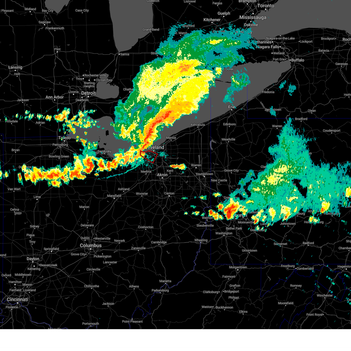 the tornado warning has been cancelled and is no longer in effect the tornado warning has been cancelled and is no longer in effect
|
| 8/6/2024 3:47 PM EDT | Large tree fallen on hous in lorain county OH, 1.7 miles W of Avon Lake, OH |
| 8/6/2024 3:43 PM EDT |
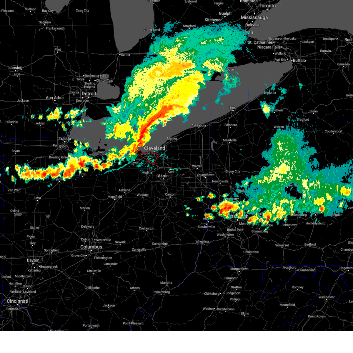 Torcle the national weather service in cleveland has issued a * tornado warning for, southwestern cuyahoga county in northeastern ohio, northeastern lorain county in north central ohio, * until 430 pm edt. * at 343 pm edt, a severe thunderstorm capable of producing a tornado was located over avon lake, or 9 miles northeast of lorain, moving southeast at 35 mph (radar indicated rotation). Hazards include tornado. Flying debris will be dangerous to those caught without shelter. mobile homes will be damaged or destroyed. damage to roofs, windows, and vehicles will occur. tree damage is likely. this dangerous storm will be near, westlake and avon lake around 350 pm edt. cleveland and lakewood around 355 pm edt. parma around 405 pm edt. north royalton around 415 pm edt. Other locations impacted by this tornadic thunderstorm include north olmsted, parma heights, linndale, brooklyn, brooklyn heights, seven hills, rocky river, brook park, newburgh heights, and cuyahoga heights. Torcle the national weather service in cleveland has issued a * tornado warning for, southwestern cuyahoga county in northeastern ohio, northeastern lorain county in north central ohio, * until 430 pm edt. * at 343 pm edt, a severe thunderstorm capable of producing a tornado was located over avon lake, or 9 miles northeast of lorain, moving southeast at 35 mph (radar indicated rotation). Hazards include tornado. Flying debris will be dangerous to those caught without shelter. mobile homes will be damaged or destroyed. damage to roofs, windows, and vehicles will occur. tree damage is likely. this dangerous storm will be near, westlake and avon lake around 350 pm edt. cleveland and lakewood around 355 pm edt. parma around 405 pm edt. north royalton around 415 pm edt. Other locations impacted by this tornadic thunderstorm include north olmsted, parma heights, linndale, brooklyn, brooklyn heights, seven hills, rocky river, brook park, newburgh heights, and cuyahoga heights.
|
| 8/6/2024 3:28 PM EDT |
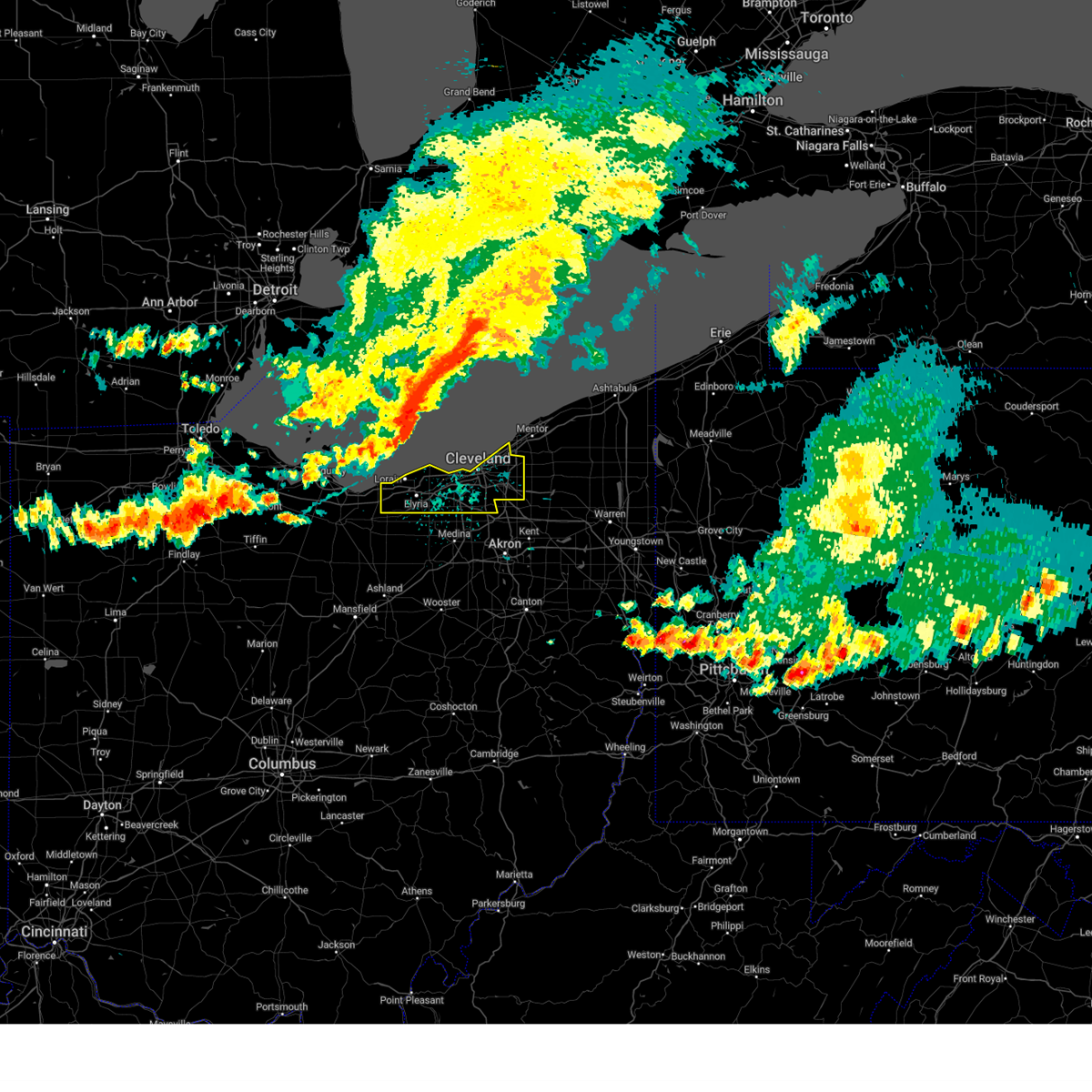 Svrcle the national weather service in cleveland has issued a * severe thunderstorm warning for, cuyahoga county in northeastern ohio, northern lorain county in north central ohio, * until 430 pm edt. * at 328 pm edt, severe thunderstorms were located along a line extending from 32 miles northwest of lakeline to 12 miles north of avon lake to western vermilion, moving southeast at 60 mph (radar indicated). Hazards include 70 mph wind gusts. Expect considerable tree damage. Damage is likely to mobile homes, roofs, and outbuildings. Svrcle the national weather service in cleveland has issued a * severe thunderstorm warning for, cuyahoga county in northeastern ohio, northern lorain county in north central ohio, * until 430 pm edt. * at 328 pm edt, severe thunderstorms were located along a line extending from 32 miles northwest of lakeline to 12 miles north of avon lake to western vermilion, moving southeast at 60 mph (radar indicated). Hazards include 70 mph wind gusts. Expect considerable tree damage. Damage is likely to mobile homes, roofs, and outbuildings.
|
| 6/18/2024 2:39 PM EDT |
 The storm which prompted the warning has weakened below severe limits, and no longer poses an immediate threat to life or property. therefore, the warning will be allowed to expire. however, gusty winds and heavy rain are still possible with this thunderstorm and additional storms are moving in from the southwest. stay tuned for potential new warnings. The storm which prompted the warning has weakened below severe limits, and no longer poses an immediate threat to life or property. therefore, the warning will be allowed to expire. however, gusty winds and heavy rain are still possible with this thunderstorm and additional storms are moving in from the southwest. stay tuned for potential new warnings.
|
| 6/18/2024 1:54 PM EDT |
 Svrcle the national weather service in cleveland has issued a * severe thunderstorm warning for, southwestern cuyahoga county in northeastern ohio, north central medina county in northeastern ohio, northeastern lorain county in north central ohio, * until 245 pm edt. * at 154 pm edt, a severe thunderstorm was located near north olmsted, or 10 miles east of elyria, moving northeast at 15 mph (radar indicated). Hazards include 60 mph wind gusts and quarter size hail. Minor damage to vehicles is possible. Expect damage to trees and power lines. Svrcle the national weather service in cleveland has issued a * severe thunderstorm warning for, southwestern cuyahoga county in northeastern ohio, north central medina county in northeastern ohio, northeastern lorain county in north central ohio, * until 245 pm edt. * at 154 pm edt, a severe thunderstorm was located near north olmsted, or 10 miles east of elyria, moving northeast at 15 mph (radar indicated). Hazards include 60 mph wind gusts and quarter size hail. Minor damage to vehicles is possible. Expect damage to trees and power lines.
|
| 5/26/2024 7:26 PM EDT |
 Svrcle the national weather service in cleveland has issued a * severe thunderstorm warning for, northwestern portage county in northeastern ohio, geauga county in northeastern ohio, cuyahoga county in northeastern ohio, southwestern lake county in northeastern ohio, northeastern summit county in northeastern ohio, northeastern lorain county in north central ohio, * until 815 pm edt. * at 725 pm edt, severe thunderstorms were located along a line extending from near hudson to avon lake, moving northeast at 40 mph (radar indicated). Hazards include 60 mph wind gusts. expect damage to trees and power lines Svrcle the national weather service in cleveland has issued a * severe thunderstorm warning for, northwestern portage county in northeastern ohio, geauga county in northeastern ohio, cuyahoga county in northeastern ohio, southwestern lake county in northeastern ohio, northeastern summit county in northeastern ohio, northeastern lorain county in north central ohio, * until 815 pm edt. * at 725 pm edt, severe thunderstorms were located along a line extending from near hudson to avon lake, moving northeast at 40 mph (radar indicated). Hazards include 60 mph wind gusts. expect damage to trees and power lines
|
| 5/22/2024 8:55 PM EDT |
 Svrcle the national weather service in cleveland has issued a * severe thunderstorm warning for, cuyahoga county in northeastern ohio, northeastern lorain county in north central ohio, * until 945 pm edt. * at 855 pm edt, a severe thunderstorm was located over north ridgeville, or near elyria, moving northeast at 40 mph (radar indicated). Hazards include 60 mph wind gusts and quarter size hail. Minor damage to vehicles is possible. Expect damage to trees and power lines. Svrcle the national weather service in cleveland has issued a * severe thunderstorm warning for, cuyahoga county in northeastern ohio, northeastern lorain county in north central ohio, * until 945 pm edt. * at 855 pm edt, a severe thunderstorm was located over north ridgeville, or near elyria, moving northeast at 40 mph (radar indicated). Hazards include 60 mph wind gusts and quarter size hail. Minor damage to vehicles is possible. Expect damage to trees and power lines.
|
| 5/22/2024 8:47 PM EDT |
 At 847 pm edt, severe thunderstorms were located along a line extending from elyria to wakeman, moving northeast at 40 mph (radar indicated). Hazards include 60 mph wind gusts and quarter size hail. Minor damage to vehicles is possible. expect damage to trees and power lines. Locations impacted include, lorain, elyria, north ridgeville, avon lake, amherst, grafton, wellington, wakeman, avon, sheffield lake, eaton, oberlin, sheffield, lagrange, south amherst, pittsfield, kipton, and eaton estates. At 847 pm edt, severe thunderstorms were located along a line extending from elyria to wakeman, moving northeast at 40 mph (radar indicated). Hazards include 60 mph wind gusts and quarter size hail. Minor damage to vehicles is possible. expect damage to trees and power lines. Locations impacted include, lorain, elyria, north ridgeville, avon lake, amherst, grafton, wellington, wakeman, avon, sheffield lake, eaton, oberlin, sheffield, lagrange, south amherst, pittsfield, kipton, and eaton estates.
|
| 5/22/2024 8:47 PM EDT |
 the severe thunderstorm warning has been cancelled and is no longer in effect the severe thunderstorm warning has been cancelled and is no longer in effect
|
| 5/22/2024 8:23 PM EDT |
 Svrcle the national weather service in cleveland has issued a * severe thunderstorm warning for, eastern huron county in north central ohio, west central medina county in northeastern ohio, lorain county in north central ohio, * until 915 pm edt. * at 822 pm edt, severe thunderstorms were located along a line extending from near wakeman to 6 miles northeast of willard, moving northeast at 35 mph (radar indicated). Hazards include 60 mph wind gusts and quarter size hail. Minor damage to vehicles is possible. Expect damage to trees and power lines. Svrcle the national weather service in cleveland has issued a * severe thunderstorm warning for, eastern huron county in north central ohio, west central medina county in northeastern ohio, lorain county in north central ohio, * until 915 pm edt. * at 822 pm edt, severe thunderstorms were located along a line extending from near wakeman to 6 miles northeast of willard, moving northeast at 35 mph (radar indicated). Hazards include 60 mph wind gusts and quarter size hail. Minor damage to vehicles is possible. Expect damage to trees and power lines.
|
| 8/24/2023 11:34 PM EDT |
 At 1133 pm edt, severe thunderstorms were located along a line extending from 16 miles north of avon lake to 8 miles southeast of kelleys island, moving southeast at 65 mph (radar indicated). Hazards include 70 mph wind gusts. Expect considerable tree damage. Damage is likely to mobile homes, roofs, and outbuildings. At 1133 pm edt, severe thunderstorms were located along a line extending from 16 miles north of avon lake to 8 miles southeast of kelleys island, moving southeast at 65 mph (radar indicated). Hazards include 70 mph wind gusts. Expect considerable tree damage. Damage is likely to mobile homes, roofs, and outbuildings.
|
| 8/23/2023 9:24 PM EDT |
 The severe thunderstorm warning for erie, west central cuyahoga and northern lorain counties will expire at 930 pm edt, the storms which prompted the warning have moved out of the area. therefore, the warning will be allowed to expire. however heavy rain is still possible with these thunderstorms. a severe thunderstorm remains in effect for southern lorain county until 1000 pm. The severe thunderstorm warning for erie, west central cuyahoga and northern lorain counties will expire at 930 pm edt, the storms which prompted the warning have moved out of the area. therefore, the warning will be allowed to expire. however heavy rain is still possible with these thunderstorms. a severe thunderstorm remains in effect for southern lorain county until 1000 pm.
|
| 8/23/2023 8:24 PM EDT |
 At 824 pm edt, severe thunderstorms were located along a line extending from 13 miles northwest of lorain to 8 miles northeast of avon lake, moving southwest at 30 mph (radar indicated). Hazards include golf ball size hail and 60 mph wind gusts. People and animals outdoors will be injured. expect hail damage to roofs, siding, windows, and vehicles. Expect damage to trees and power lines. At 824 pm edt, severe thunderstorms were located along a line extending from 13 miles northwest of lorain to 8 miles northeast of avon lake, moving southwest at 30 mph (radar indicated). Hazards include golf ball size hail and 60 mph wind gusts. People and animals outdoors will be injured. expect hail damage to roofs, siding, windows, and vehicles. Expect damage to trees and power lines.
|
| 8/12/2023 2:29 PM EDT |
 At 228 pm edt, severe thunderstorms were located along a line extending from avon lake to near grafton, moving east at 45 mph (radar indicated). Hazards include 60 mph wind gusts and penny size hail. Expect damage to trees and power lines. locations impacted include, cleveland, lorain, elyria, medina, parma, lakewood, strongsville, brunswick, westlake, north royalton, north ridgeville, avon lake, amherst, grafton, wellington, north olmsted, avon, parma heights, rocky river and broadview heights. hail threat, radar indicated max hail size, 0. 75 in wind threat, radar indicated max wind gust, 60 mph. At 228 pm edt, severe thunderstorms were located along a line extending from avon lake to near grafton, moving east at 45 mph (radar indicated). Hazards include 60 mph wind gusts and penny size hail. Expect damage to trees and power lines. locations impacted include, cleveland, lorain, elyria, medina, parma, lakewood, strongsville, brunswick, westlake, north royalton, north ridgeville, avon lake, amherst, grafton, wellington, north olmsted, avon, parma heights, rocky river and broadview heights. hail threat, radar indicated max hail size, 0. 75 in wind threat, radar indicated max wind gust, 60 mph.
|
| 8/12/2023 2:10 PM EDT |
 At 210 pm edt, severe thunderstorms were located along a line extending from near amherst to near wellington, moving east at 45 mph (radar indicated). Hazards include 60 mph wind gusts and penny size hail. expect damage to trees and power lines At 210 pm edt, severe thunderstorms were located along a line extending from near amherst to near wellington, moving east at 45 mph (radar indicated). Hazards include 60 mph wind gusts and penny size hail. expect damage to trees and power lines
|
| 8/11/2023 6:22 PM EDT |
 At 621 pm edt, a severe thunderstorm capable of producing a tornado was located over lorain, moving east at 20 mph (radar indicated rotation). Hazards include tornado. Flying debris will be dangerous to those caught without shelter. mobile homes will be damaged or destroyed. damage to roofs, windows, and vehicles will occur. tree damage is likely. this dangerous storm will be near, elyria around 630 pm edt. north ridgeville around 645 pm edt. avon lake around 650 pm edt. Other locations impacted by this tornadic thunderstorm include sheffield and avon. At 621 pm edt, a severe thunderstorm capable of producing a tornado was located over lorain, moving east at 20 mph (radar indicated rotation). Hazards include tornado. Flying debris will be dangerous to those caught without shelter. mobile homes will be damaged or destroyed. damage to roofs, windows, and vehicles will occur. tree damage is likely. this dangerous storm will be near, elyria around 630 pm edt. north ridgeville around 645 pm edt. avon lake around 650 pm edt. Other locations impacted by this tornadic thunderstorm include sheffield and avon.
|
| 7/26/2023 6:14 PM EDT |
 At 613 pm edt, severe thunderstorms were located along a line extending from 8 miles northeast of lakewood to near brunswick to near wellington, moving east at 25 mph (radar indicated). Hazards include 60 mph wind gusts and penny size hail. Expect damage to trees and power lines. locations impacted include, cleveland, akron, lorain, elyria, medina, parma, lakewood, cuyahoga falls, euclid, cleveland heights, strongsville, brunswick, westlake, north royalton, north ridgeville, kent, solon, avon lake, hudson and wadsworth. hail threat, radar indicated max hail size, 0. 75 in wind threat, radar indicated max wind gust, 60 mph. At 613 pm edt, severe thunderstorms were located along a line extending from 8 miles northeast of lakewood to near brunswick to near wellington, moving east at 25 mph (radar indicated). Hazards include 60 mph wind gusts and penny size hail. Expect damage to trees and power lines. locations impacted include, cleveland, akron, lorain, elyria, medina, parma, lakewood, cuyahoga falls, euclid, cleveland heights, strongsville, brunswick, westlake, north royalton, north ridgeville, kent, solon, avon lake, hudson and wadsworth. hail threat, radar indicated max hail size, 0. 75 in wind threat, radar indicated max wind gust, 60 mph.
|
| 7/26/2023 6:07 PM EDT |
 At 607 pm edt, severe thunderstorms were located along a line extending from 8 miles north of lakewood to near grafton to near wellington, moving east at 35 mph (radar indicated). Hazards include 60 mph wind gusts and penny size hail. Expect damage to trees and power lines. locations impacted include, cleveland, akron, lorain, elyria, medina, vermilion, parma, lakewood, cuyahoga falls, euclid, cleveland heights, strongsville, brunswick, westlake, north royalton, north ridgeville, kent, solon, avon lake and hudson. hail threat, radar indicated max hail size, 0. 75 in wind threat, radar indicated max wind gust, 60 mph. At 607 pm edt, severe thunderstorms were located along a line extending from 8 miles north of lakewood to near grafton to near wellington, moving east at 35 mph (radar indicated). Hazards include 60 mph wind gusts and penny size hail. Expect damage to trees and power lines. locations impacted include, cleveland, akron, lorain, elyria, medina, vermilion, parma, lakewood, cuyahoga falls, euclid, cleveland heights, strongsville, brunswick, westlake, north royalton, north ridgeville, kent, solon, avon lake and hudson. hail threat, radar indicated max hail size, 0. 75 in wind threat, radar indicated max wind gust, 60 mph.
|
| 7/26/2023 5:56 PM EDT |
 At 555 pm edt, severe thunderstorms were located along a line extending from 10 miles north of lakewood to near grafton to near wellington, moving east-northeast at 40 mph (radar indicated). Hazards include 60 mph wind gusts and penny size hail. expect damage to trees and power lines At 555 pm edt, severe thunderstorms were located along a line extending from 10 miles north of lakewood to near grafton to near wellington, moving east-northeast at 40 mph (radar indicated). Hazards include 60 mph wind gusts and penny size hail. expect damage to trees and power lines
|
| 7/26/2023 4:45 PM EDT |
 At 444 pm edt, a severe thunderstorm was located 8 miles north of lorain, moving east at 55 mph (radar indicated). Hazards include 70 mph wind gusts and penny size hail. Expect considerable tree damage. Damage is likely to mobile homes, roofs, and outbuildings. At 444 pm edt, a severe thunderstorm was located 8 miles north of lorain, moving east at 55 mph (radar indicated). Hazards include 70 mph wind gusts and penny size hail. Expect considerable tree damage. Damage is likely to mobile homes, roofs, and outbuildings.
|
| 7/20/2023 6:59 PM EDT |
 At 659 pm edt, severe thunderstorms were located along a line extending from near burton to parma to near vermilion, moving southeast at 30 mph (radar indicated). Hazards include 70 mph wind gusts and quarter size hail. Minor damage to vehicles is possible. expect considerable tree damage. Wind damage is also likely to mobile homes, roofs, and outbuildings. At 659 pm edt, severe thunderstorms were located along a line extending from near burton to parma to near vermilion, moving southeast at 30 mph (radar indicated). Hazards include 70 mph wind gusts and quarter size hail. Minor damage to vehicles is possible. expect considerable tree damage. Wind damage is also likely to mobile homes, roofs, and outbuildings.
|
| 7/20/2023 6:51 PM EDT |
 At 650 pm edt, severe thunderstorms were located along a line extending from near cleveland to near north ridgeville to near vermilion, moving south at 30 mph (radar indicated). Hazards include 70 mph wind gusts and quarter size hail. Minor damage to vehicles is possible. expect considerable tree damage. wind damage is also likely to mobile homes, roofs, and outbuildings. locations impacted include, cleveland, lorain, elyria, vermilion, western vermilion, parma, lakewood, strongsville, brunswick, westlake, north royalton, north ridgeville, avon lake, amherst, grafton, north olmsted, garfield heights, maple heights, avon and parma heights. thunderstorm damage threat, considerable hail threat, radar indicated max hail size, 1. 00 in wind threat, radar indicated max wind gust, 70 mph. At 650 pm edt, severe thunderstorms were located along a line extending from near cleveland to near north ridgeville to near vermilion, moving south at 30 mph (radar indicated). Hazards include 70 mph wind gusts and quarter size hail. Minor damage to vehicles is possible. expect considerable tree damage. wind damage is also likely to mobile homes, roofs, and outbuildings. locations impacted include, cleveland, lorain, elyria, vermilion, western vermilion, parma, lakewood, strongsville, brunswick, westlake, north royalton, north ridgeville, avon lake, amherst, grafton, north olmsted, garfield heights, maple heights, avon and parma heights. thunderstorm damage threat, considerable hail threat, radar indicated max hail size, 1. 00 in wind threat, radar indicated max wind gust, 70 mph.
|
| 7/20/2023 6:12 PM EDT |
 At 611 pm edt, severe thunderstorms were located along a line extending from 10 miles north of lakewood to 9 miles northwest of avon lake to 8 miles northwest of western vermilion, moving south at 40 mph (radar indicated). Hazards include 70 mph wind gusts and quarter size hail. Minor damage to vehicles is possible. expect considerable tree damage. Wind damage is also likely to mobile homes, roofs, and outbuildings. At 611 pm edt, severe thunderstorms were located along a line extending from 10 miles north of lakewood to 9 miles northwest of avon lake to 8 miles northwest of western vermilion, moving south at 40 mph (radar indicated). Hazards include 70 mph wind gusts and quarter size hail. Minor damage to vehicles is possible. expect considerable tree damage. Wind damage is also likely to mobile homes, roofs, and outbuildings.
|
| 4/16/2023 4:22 PM EDT |
 The severe thunderstorm warning for erie and lorain counties will expire at 430 pm edt, the storm which prompted the warning has weakened below severe limits, and has exited the warned area. therefore, the warning will be allowed to expire. to report severe weather, contact your nearest law enforcement agency. they will relay your report to the national weather service cleveland. The severe thunderstorm warning for erie and lorain counties will expire at 430 pm edt, the storm which prompted the warning has weakened below severe limits, and has exited the warned area. therefore, the warning will be allowed to expire. to report severe weather, contact your nearest law enforcement agency. they will relay your report to the national weather service cleveland.
|
| 4/16/2023 4:07 PM EDT |
 At 406 pm edt, severe thunderstorms were located along a line from berlin heights to vermillion to oberlin moving northeast at 45 mph (radar indicated). Hazards include 60 mph wind gusts. Expect damage to trees and power lines. locations impacted include, lorain, elyria, western vermilion, vermilion, westlake, north ridgeville, avon lake, amherst, grafton, wellington, north olmsted, avon, bay village, sheffield lake, eaton, oberlin, sheffield, lagrange, south amherst and pittsfield. hail threat, radar indicated max hail size, <. 75 in wind threat, radar indicated max wind gust, 60 mph. At 406 pm edt, severe thunderstorms were located along a line from berlin heights to vermillion to oberlin moving northeast at 45 mph (radar indicated). Hazards include 60 mph wind gusts. Expect damage to trees and power lines. locations impacted include, lorain, elyria, western vermilion, vermilion, westlake, north ridgeville, avon lake, amherst, grafton, wellington, north olmsted, avon, bay village, sheffield lake, eaton, oberlin, sheffield, lagrange, south amherst and pittsfield. hail threat, radar indicated max hail size, <. 75 in wind threat, radar indicated max wind gust, 60 mph.
|
| 4/16/2023 3:46 PM EDT |
 At 345 pm edt, severe thunderstorms were located along a line from milan to new london, moving northeast at 45 mph (radar indicated). Hazards include 60 mph wind gusts. expect damage to trees and power lines At 345 pm edt, severe thunderstorms were located along a line from milan to new london, moving northeast at 45 mph (radar indicated). Hazards include 60 mph wind gusts. expect damage to trees and power lines
|
| 4/1/2023 12:38 PM EDT |
 The severe thunderstorm warning for lorain county will expire at 1245 pm edt, the storms which prompted the warning have moved out of the area. therefore, the warning will be allowed to expire. wind gusts in excess of 50 mph will continue for the next several hours and a wind advisory remains in effect until 800 pm edt. a severe thunderstorm watch remains in effect until 600 pm edt for north central and northeastern ohio. The severe thunderstorm warning for lorain county will expire at 1245 pm edt, the storms which prompted the warning have moved out of the area. therefore, the warning will be allowed to expire. wind gusts in excess of 50 mph will continue for the next several hours and a wind advisory remains in effect until 800 pm edt. a severe thunderstorm watch remains in effect until 600 pm edt for north central and northeastern ohio.
|
| 4/1/2023 12:30 PM EDT |
 At 1229 pm edt, severe thunderstorms were located along a line extending from 6 miles west of lakeline to near cleveland to medina, moving northeast at 45 mph. while the thunderstorms are exiting to the east, wind gusts of 50 to 60 mph continue behind them (radar indicated). Hazards include 60 mph wind gusts. Expect damage to trees and power lines. locations impacted include, lorain, elyria, vermilion, western vermilion, westlake, north ridgeville, avon lake, amherst, grafton, wellington, north olmsted, avon, bay village, sheffield lake, olmsted falls, eaton, oberlin, sheffield, lagrange and penfield. hail threat, radar indicated max hail size, <. 75 in wind threat, radar indicated max wind gust, 60 mph. At 1229 pm edt, severe thunderstorms were located along a line extending from 6 miles west of lakeline to near cleveland to medina, moving northeast at 45 mph. while the thunderstorms are exiting to the east, wind gusts of 50 to 60 mph continue behind them (radar indicated). Hazards include 60 mph wind gusts. Expect damage to trees and power lines. locations impacted include, lorain, elyria, vermilion, western vermilion, westlake, north ridgeville, avon lake, amherst, grafton, wellington, north olmsted, avon, bay village, sheffield lake, olmsted falls, eaton, oberlin, sheffield, lagrange and penfield. hail threat, radar indicated max hail size, <. 75 in wind threat, radar indicated max wind gust, 60 mph.
|
| 4/1/2023 12:02 PM EDT |
 At 1201 pm edt, severe thunderstorms were located along a line extending from 13 miles north of western vermilion to wakeman to 7 miles west of new london, moving east at 60 mph. additional thunderstorms developing over lorain county ahead of this line (radar indicated). Hazards include 70 mph wind gusts and penny size hail. Expect considerable tree damage. damage is likely to mobile homes, roofs, and outbuildings. locations impacted include, lorain, elyria, vermilion, western vermilion, westlake, north ridgeville, avon lake, amherst, grafton, wellington, north olmsted, avon, bay village, sheffield lake, olmsted falls, eaton, oberlin, sheffield, lagrange and penfield. thunderstorm damage threat, considerable hail threat, radar indicated max hail size, 0. 75 in wind threat, radar indicated max wind gust, 70 mph. At 1201 pm edt, severe thunderstorms were located along a line extending from 13 miles north of western vermilion to wakeman to 7 miles west of new london, moving east at 60 mph. additional thunderstorms developing over lorain county ahead of this line (radar indicated). Hazards include 70 mph wind gusts and penny size hail. Expect considerable tree damage. damage is likely to mobile homes, roofs, and outbuildings. locations impacted include, lorain, elyria, vermilion, western vermilion, westlake, north ridgeville, avon lake, amherst, grafton, wellington, north olmsted, avon, bay village, sheffield lake, olmsted falls, eaton, oberlin, sheffield, lagrange and penfield. thunderstorm damage threat, considerable hail threat, radar indicated max hail size, 0. 75 in wind threat, radar indicated max wind gust, 70 mph.
|
| 4/1/2023 11:46 AM EDT |
 At 1146 am edt, severe thunderstorms were located along a line extending from near sandusky to near northern milan to near willard, moving northeast at 70 mph. additional thunderstorms are developing along a line from wakeman to lorain and moving east (radar indicated). Hazards include 60 mph wind gusts and penny size hail. expect damage to trees and power lines At 1146 am edt, severe thunderstorms were located along a line extending from near sandusky to near northern milan to near willard, moving northeast at 70 mph. additional thunderstorms are developing along a line from wakeman to lorain and moving east (radar indicated). Hazards include 60 mph wind gusts and penny size hail. expect damage to trees and power lines
|
| 1/19/2023 6:38 PM EST |
 At 637 pm est, severe thunderstorms were located along a line extending from 9 miles north of avon lake to near strongsville to near wooster, moving east at 45 mph (radar indicated). Hazards include 60 mph wind gusts. Expect damage to trees and power lines. locations impacted include, cleveland, akron, elyria, medina, parma, lakewood, cuyahoga falls, euclid, cleveland heights, strongsville, brunswick, westlake, north royalton, north ridgeville, kent, solon, avon lake, hudson, twinsburg and tallmadge. hail threat, radar indicated max hail size, <. 75 in wind threat, radar indicated max wind gust, 60 mph. At 637 pm est, severe thunderstorms were located along a line extending from 9 miles north of avon lake to near strongsville to near wooster, moving east at 45 mph (radar indicated). Hazards include 60 mph wind gusts. Expect damage to trees and power lines. locations impacted include, cleveland, akron, elyria, medina, parma, lakewood, cuyahoga falls, euclid, cleveland heights, strongsville, brunswick, westlake, north royalton, north ridgeville, kent, solon, avon lake, hudson, twinsburg and tallmadge. hail threat, radar indicated max hail size, <. 75 in wind threat, radar indicated max wind gust, 60 mph.
|
| 1/19/2023 6:24 PM EST |
 At 622 pm est, severe thunderstorms were located along a line extending from 9 miles north of lorain to grafton to 6 miles northwest of shreve, moving east at 60 mph (radar indicated). Hazards include 60 mph wind gusts. Expect damage to trees and power lines. locations impacted include, cleveland, akron, lorain, elyria, medina, vermilion, western vermilion, parma, lakewood, cuyahoga falls, euclid, cleveland heights, strongsville, brunswick, westlake, north royalton, north ridgeville, kent, solon and avon lake. hail threat, radar indicated max hail size, <. 75 in wind threat, radar indicated max wind gust, 60 mph. At 622 pm est, severe thunderstorms were located along a line extending from 9 miles north of lorain to grafton to 6 miles northwest of shreve, moving east at 60 mph (radar indicated). Hazards include 60 mph wind gusts. Expect damage to trees and power lines. locations impacted include, cleveland, akron, lorain, elyria, medina, vermilion, western vermilion, parma, lakewood, cuyahoga falls, euclid, cleveland heights, strongsville, brunswick, westlake, north royalton, north ridgeville, kent, solon and avon lake. hail threat, radar indicated max hail size, <. 75 in wind threat, radar indicated max wind gust, 60 mph.
|
| 1/19/2023 6:05 PM EST |
 At 605 pm est, severe thunderstorms were located along a line extending from 9 miles northwest of western vermilion to near wellington to near bellville, moving east at 60 mph (radar indicated). Hazards include 60 mph wind gusts. expect damage to trees and power lines At 605 pm est, severe thunderstorms were located along a line extending from 9 miles northwest of western vermilion to near wellington to near bellville, moving east at 60 mph (radar indicated). Hazards include 60 mph wind gusts. expect damage to trees and power lines
|
| 8/8/2022 8:12 PM EDT |
 The severe thunderstorm warning for northwestern portage, geauga, northeastern medina, cuyahoga, lake, northern summit, central lorain and southwestern ashtabula counties will expire at 815 pm edt, the storms which prompted the warning have weakened below severe limits, and no longer pose an immediate threat to life or property. therefore, the warning will be allowed to expire. The severe thunderstorm warning for northwestern portage, geauga, northeastern medina, cuyahoga, lake, northern summit, central lorain and southwestern ashtabula counties will expire at 815 pm edt, the storms which prompted the warning have weakened below severe limits, and no longer pose an immediate threat to life or property. therefore, the warning will be allowed to expire.
|
| 8/8/2022 8:06 PM EDT |
 At 806 pm edt, severe thunderstorms were located along a line extending from 6 miles southeast of perry to near highland hills to near wellington, moving southeast at 40 mph (radar indicated). Hazards include 60 mph wind gusts. Expect damage to trees and power lines. locations impacted include, cleveland, lorain, elyria, painesville, willowick, chardon, fairport harbor, parma, lakewood, euclid, mentor, cleveland heights, strongsville, brunswick, westlake, north royalton, north ridgeville, solon, avon lake and willoughby. hail threat, radar indicated max hail size, <. 75 in wind threat, radar indicated max wind gust, 60 mph. At 806 pm edt, severe thunderstorms were located along a line extending from 6 miles southeast of perry to near highland hills to near wellington, moving southeast at 40 mph (radar indicated). Hazards include 60 mph wind gusts. Expect damage to trees and power lines. locations impacted include, cleveland, lorain, elyria, painesville, willowick, chardon, fairport harbor, parma, lakewood, euclid, mentor, cleveland heights, strongsville, brunswick, westlake, north royalton, north ridgeville, solon, avon lake and willoughby. hail threat, radar indicated max hail size, <. 75 in wind threat, radar indicated max wind gust, 60 mph.
|
| 8/8/2022 7:47 PM EDT |
 At 747 pm edt, severe thunderstorms were located along a line extending from near fairport harbor to near euclid to near vermilion, moving southeast at 35 mph (radar indicated). Hazards include 60 mph wind gusts. Expect damage to trees and power lines. locations impacted include, cleveland, lorain, elyria, painesville, willowick, vermilion, western vermilion, chardon, fairport harbor, parma, lakewood, euclid, mentor, cleveland heights, strongsville, brunswick, westlake, north royalton, north ridgeville and solon. hail threat, radar indicated max hail size, <. 75 in wind threat, radar indicated max wind gust, 60 mph. At 747 pm edt, severe thunderstorms were located along a line extending from near fairport harbor to near euclid to near vermilion, moving southeast at 35 mph (radar indicated). Hazards include 60 mph wind gusts. Expect damage to trees and power lines. locations impacted include, cleveland, lorain, elyria, painesville, willowick, vermilion, western vermilion, chardon, fairport harbor, parma, lakewood, euclid, mentor, cleveland heights, strongsville, brunswick, westlake, north royalton, north ridgeville and solon. hail threat, radar indicated max hail size, <. 75 in wind threat, radar indicated max wind gust, 60 mph.
|
| 8/8/2022 7:25 PM EDT |
 At 725 pm edt, severe thunderstorms were located along a line extending from 16 miles northwest of timberlake to 6 miles northwest of euclid to 6 miles northeast of milan, moving southeast at 35 mph (radar indicated). Hazards include 60 mph wind gusts. expect damage to trees and power lines At 725 pm edt, severe thunderstorms were located along a line extending from 16 miles northwest of timberlake to 6 miles northwest of euclid to 6 miles northeast of milan, moving southeast at 35 mph (radar indicated). Hazards include 60 mph wind gusts. expect damage to trees and power lines
|
| 7/24/2022 10:56 PM EDT |
 At 1056 pm edt, severe thunderstorms were located along a line extending from near lorain to 6 miles north of willard, moving east at 55 mph (radar indicated). Hazards include 60 mph wind gusts. expect damage to trees and power lines At 1056 pm edt, severe thunderstorms were located along a line extending from near lorain to 6 miles north of willard, moving east at 55 mph (radar indicated). Hazards include 60 mph wind gusts. expect damage to trees and power lines
|
| 7/13/2022 4:03 PM EDT |
 At 402 pm edt, severe thunderstorms were located along a line extending from lorain to elyria to near amherst, moving east at 35 mph (radar indicated). Hazards include 60 mph wind gusts. Expect damage to trees and power lines. locations impacted include, lorain, elyria, vermilion, westlake, north ridgeville, avon lake, amherst, grafton, avon, bay village, sheffield lake, eaton, oberlin, sheffield, south amherst and eaton estates. hail threat, radar indicated max hail size, <. 75 in wind threat, radar indicated max wind gust, 60 mph. At 402 pm edt, severe thunderstorms were located along a line extending from lorain to elyria to near amherst, moving east at 35 mph (radar indicated). Hazards include 60 mph wind gusts. Expect damage to trees and power lines. locations impacted include, lorain, elyria, vermilion, westlake, north ridgeville, avon lake, amherst, grafton, avon, bay village, sheffield lake, eaton, oberlin, sheffield, south amherst and eaton estates. hail threat, radar indicated max hail size, <. 75 in wind threat, radar indicated max wind gust, 60 mph.
|
| 7/13/2022 3:44 PM EDT |
 At 344 pm edt, severe thunderstorms were located along a line extending from near western vermilion to vermilion to 6 miles north of wakeman, moving east at 35 mph (radar indicated). Hazards include 60 mph wind gusts. expect damage to trees and power lines At 344 pm edt, severe thunderstorms were located along a line extending from near western vermilion to vermilion to 6 miles north of wakeman, moving east at 35 mph (radar indicated). Hazards include 60 mph wind gusts. expect damage to trees and power lines
|
| 6/1/2022 5:00 PM EDT |
 At 459 pm edt, a severe thunderstorm was located near westlake, or 8 miles east of elyria, moving east at 50 mph (radar indicated). Hazards include 70 mph wind gusts and nickel size hail. Expect considerable tree damage. damage is likely to mobile homes, roofs, and outbuildings. locations impacted include, cleveland, elyria, parma, lakewood, strongsville, brunswick, westlake, north royalton, north ridgeville, avon lake, grafton, north olmsted, garfield heights, avon, parma heights, rocky river, broadview heights, brook park, berea and fairview park. thunderstorm damage threat, considerable hail threat, radar indicated max hail size, 0. 88 in wind threat, radar indicated max wind gust, 70 mph. At 459 pm edt, a severe thunderstorm was located near westlake, or 8 miles east of elyria, moving east at 50 mph (radar indicated). Hazards include 70 mph wind gusts and nickel size hail. Expect considerable tree damage. damage is likely to mobile homes, roofs, and outbuildings. locations impacted include, cleveland, elyria, parma, lakewood, strongsville, brunswick, westlake, north royalton, north ridgeville, avon lake, grafton, north olmsted, garfield heights, avon, parma heights, rocky river, broadview heights, brook park, berea and fairview park. thunderstorm damage threat, considerable hail threat, radar indicated max hail size, 0. 88 in wind threat, radar indicated max wind gust, 70 mph.
|
| 6/1/2022 4:49 PM EDT |
 At 449 pm edt, a severe thunderstorm was located over elyria, moving east at 35 mph (radar indicated). Hazards include 70 mph wind gusts and nickel size hail. Expect considerable tree damage. damage is likely to mobile homes, roofs, and outbuildings. locations impacted include, cleveland, lorain, elyria, parma, lakewood, strongsville, brunswick, westlake, north royalton, north ridgeville, avon lake, amherst, grafton, north olmsted, garfield heights, avon, parma heights, rocky river, broadview heights and brook park. thunderstorm damage threat, considerable hail threat, radar indicated max hail size, 0. 88 in wind threat, radar indicated max wind gust, 70 mph. At 449 pm edt, a severe thunderstorm was located over elyria, moving east at 35 mph (radar indicated). Hazards include 70 mph wind gusts and nickel size hail. Expect considerable tree damage. damage is likely to mobile homes, roofs, and outbuildings. locations impacted include, cleveland, lorain, elyria, parma, lakewood, strongsville, brunswick, westlake, north royalton, north ridgeville, avon lake, amherst, grafton, north olmsted, garfield heights, avon, parma heights, rocky river, broadview heights and brook park. thunderstorm damage threat, considerable hail threat, radar indicated max hail size, 0. 88 in wind threat, radar indicated max wind gust, 70 mph.
|
| 6/1/2022 4:40 PM EDT |
 At 440 pm edt, a severe thunderstorm was located over lorain, moving east at 40 mph (radar indicated). Hazards include 70 mph wind gusts and penny size hail. Expect considerable tree damage. Damage is likely to mobile homes, roofs, and outbuildings. At 440 pm edt, a severe thunderstorm was located over lorain, moving east at 40 mph (radar indicated). Hazards include 70 mph wind gusts and penny size hail. Expect considerable tree damage. Damage is likely to mobile homes, roofs, and outbuildings.
|
| 6/1/2022 4:36 PM EDT |
 At 436 pm edt, a severe thunderstorm was located over lorain, moving east at 50 mph (radar indicated). Hazards include 70 mph wind gusts and penny size hail. Expect considerable tree damage. damage is likely to mobile homes, roofs, and outbuildings. locations impacted include, lorain, elyria, vermilion, western vermilion, north ridgeville, avon lake, amherst, grafton, avon, bay village, sheffield lake, eaton, sheffield, south amherst and eaton estates. thunderstorm damage threat, considerable hail threat, radar indicated max hail size, 0. 75 in wind threat, radar indicated max wind gust, 70 mph. At 436 pm edt, a severe thunderstorm was located over lorain, moving east at 50 mph (radar indicated). Hazards include 70 mph wind gusts and penny size hail. Expect considerable tree damage. damage is likely to mobile homes, roofs, and outbuildings. locations impacted include, lorain, elyria, vermilion, western vermilion, north ridgeville, avon lake, amherst, grafton, avon, bay village, sheffield lake, eaton, sheffield, south amherst and eaton estates. thunderstorm damage threat, considerable hail threat, radar indicated max hail size, 0. 75 in wind threat, radar indicated max wind gust, 70 mph.
|
| 6/1/2022 4:30 PM EDT |
 At 430 pm edt, a severe thunderstorm was located near western vermilion, moving east at 50 mph (radar indicated). Hazards include 70 mph wind gusts and penny size hail. Expect considerable tree damage. damage is likely to mobile homes, roofs, and outbuildings. locations impacted include, lorain, elyria, western vermilion, vermilion, north ridgeville, avon lake, amherst, grafton, avon, bay village, sheffield lake, eaton, sheffield, south amherst and eaton estates. thunderstorm damage threat, considerable hail threat, radar indicated max hail size, 0. 75 in wind threat, radar indicated max wind gust, 70 mph. At 430 pm edt, a severe thunderstorm was located near western vermilion, moving east at 50 mph (radar indicated). Hazards include 70 mph wind gusts and penny size hail. Expect considerable tree damage. damage is likely to mobile homes, roofs, and outbuildings. locations impacted include, lorain, elyria, western vermilion, vermilion, north ridgeville, avon lake, amherst, grafton, avon, bay village, sheffield lake, eaton, sheffield, south amherst and eaton estates. thunderstorm damage threat, considerable hail threat, radar indicated max hail size, 0. 75 in wind threat, radar indicated max wind gust, 70 mph.
|
| 6/1/2022 4:17 PM EDT |
 At 417 pm edt, a severe thunderstorm was located 9 miles northwest of western vermilion, moving east at 25 mph (radar indicated). Hazards include 60 mph wind gusts and quarter size hail. Minor damage to vehicles is possible. Expect damage to trees and power lines. At 417 pm edt, a severe thunderstorm was located 9 miles northwest of western vermilion, moving east at 25 mph (radar indicated). Hazards include 60 mph wind gusts and quarter size hail. Minor damage to vehicles is possible. Expect damage to trees and power lines.
|
| 5/3/2022 7:24 PM EDT |
 At 724 pm edt, severe thunderstorms were located along a line extending from 12 miles north of lorain to near north ridgeville to near new london, moving northeast at 45 mph (radar indicated). Hazards include 60 mph wind gusts and quarter size hail. Minor damage to vehicles is possible. Expect damage to trees and power lines. At 724 pm edt, severe thunderstorms were located along a line extending from 12 miles north of lorain to near north ridgeville to near new london, moving northeast at 45 mph (radar indicated). Hazards include 60 mph wind gusts and quarter size hail. Minor damage to vehicles is possible. Expect damage to trees and power lines.
|
| 5/3/2022 7:11 PM EDT |
 At 711 pm edt, severe thunderstorms were located along a line extending from near vermilion to 6 miles south of amherst to near new london, moving northeast at 55 mph (radar indicated). Hazards include 70 mph wind gusts and quarter size hail. Minor damage to vehicles is possible. expect considerable tree damage. wind damage is also likely to mobile homes, roofs, and outbuildings. locations impacted include, cleveland, lorain, elyria, medina, sandusky, norwalk, vermilion, western vermilion, strongsville, brunswick, westlake, north ridgeville, avon lake, amherst, grafton, rittman, wellington, lodi, new london and creston. thunderstorm damage threat, considerable hail threat, radar indicated max hail size, 1. 00 in wind threat, radar indicated max wind gust, 70 mph. At 711 pm edt, severe thunderstorms were located along a line extending from near vermilion to 6 miles south of amherst to near new london, moving northeast at 55 mph (radar indicated). Hazards include 70 mph wind gusts and quarter size hail. Minor damage to vehicles is possible. expect considerable tree damage. wind damage is also likely to mobile homes, roofs, and outbuildings. locations impacted include, cleveland, lorain, elyria, medina, sandusky, norwalk, vermilion, western vermilion, strongsville, brunswick, westlake, north ridgeville, avon lake, amherst, grafton, rittman, wellington, lodi, new london and creston. thunderstorm damage threat, considerable hail threat, radar indicated max hail size, 1. 00 in wind threat, radar indicated max wind gust, 70 mph.
|
| 5/3/2022 6:49 PM EDT |
 At 649 pm edt, severe thunderstorms were located along a line extending from near northern milan to near norwalk to near willard, moving northeast at 55 mph (radar indicated). Hazards include 70 mph wind gusts and quarter size hail. Minor damage to vehicles is possible. expect considerable tree damage. Wind damage is also likely to mobile homes, roofs, and outbuildings. At 649 pm edt, severe thunderstorms were located along a line extending from near northern milan to near norwalk to near willard, moving northeast at 55 mph (radar indicated). Hazards include 70 mph wind gusts and quarter size hail. Minor damage to vehicles is possible. expect considerable tree damage. Wind damage is also likely to mobile homes, roofs, and outbuildings.
|
| 10/8/2021 5:07 PM EDT |
 The severe thunderstorm warning for north central lorain county will expire at 515 pm edt, the storm which prompted the warning has moved out of the area. therefore, the warning will be allowed to expire. The severe thunderstorm warning for north central lorain county will expire at 515 pm edt, the storm which prompted the warning has moved out of the area. therefore, the warning will be allowed to expire.
|
| 10/8/2021 4:47 PM EDT |
 At 447 pm edt, a severe thunderstorm was located over lorain, moving northeast at 15 mph (radar indicated). Hazards include half dollar size hail. People and animals outdoors will be injured. Expect damage to roofs, siding, windows, and vehicles. At 447 pm edt, a severe thunderstorm was located over lorain, moving northeast at 15 mph (radar indicated). Hazards include half dollar size hail. People and animals outdoors will be injured. Expect damage to roofs, siding, windows, and vehicles.
|
| 8/11/2021 5:20 PM EDT |
 At 519 pm edt, a severe thunderstorm was located near strongsville, or 12 miles east of elyria, moving east at 50 mph. this is a destructive storm for northern cuyahoga and northeastern lorain counties (radar indicated). Hazards include 80 mph wind gusts and penny size hail. Flying debris will be dangerous to those caught without shelter. mobile homes will be heavily damaged. expect considerable damage to roofs, windows, and vehicles. extensive tree damage and power outages are likely. locations impacted include, cleveland, lorain, elyria, medina, vermilion, western vermilion, lakewood, strongsville, brunswick, westlake, north ridgeville, avon lake, amherst, grafton, wellington, lodi, creston, chippewa lake, north olmsted and avon. thunderstorm damage threat, destructive hail threat, radar indicated max hail size, 0. 75 in wind threat, radar indicated max wind gust, 80 mph. At 519 pm edt, a severe thunderstorm was located near strongsville, or 12 miles east of elyria, moving east at 50 mph. this is a destructive storm for northern cuyahoga and northeastern lorain counties (radar indicated). Hazards include 80 mph wind gusts and penny size hail. Flying debris will be dangerous to those caught without shelter. mobile homes will be heavily damaged. expect considerable damage to roofs, windows, and vehicles. extensive tree damage and power outages are likely. locations impacted include, cleveland, lorain, elyria, medina, vermilion, western vermilion, lakewood, strongsville, brunswick, westlake, north ridgeville, avon lake, amherst, grafton, wellington, lodi, creston, chippewa lake, north olmsted and avon. thunderstorm damage threat, destructive hail threat, radar indicated max hail size, 0. 75 in wind threat, radar indicated max wind gust, 80 mph.
|
| 8/11/2021 5:07 PM EDT |
 At 506 pm edt, a severe thunderstorm was located over elyria, moving east at 50 mph. this is a destructive storm for northern lorain and northwestern cuyahoga counties (radar indicated). Hazards include 80 mph wind gusts and penny size hail. Flying debris will be dangerous to those caught without shelter. mobile homes will be heavily damaged. expect considerable damage to roofs, windows, and vehicles. extensive tree damage and power outages are likely. locations impacted include, cleveland, lorain, elyria, medina, vermilion, western vermilion, lakewood, strongsville, brunswick, westlake, north ridgeville, avon lake, amherst, grafton, wellington, lodi, new london, creston, wakeman and chippewa lake. thunderstorm damage threat, destructive hail threat, radar indicated max hail size, 0. 75 in wind threat, radar indicated max wind gust, 80 mph. At 506 pm edt, a severe thunderstorm was located over elyria, moving east at 50 mph. this is a destructive storm for northern lorain and northwestern cuyahoga counties (radar indicated). Hazards include 80 mph wind gusts and penny size hail. Flying debris will be dangerous to those caught without shelter. mobile homes will be heavily damaged. expect considerable damage to roofs, windows, and vehicles. extensive tree damage and power outages are likely. locations impacted include, cleveland, lorain, elyria, medina, vermilion, western vermilion, lakewood, strongsville, brunswick, westlake, north ridgeville, avon lake, amherst, grafton, wellington, lodi, new london, creston, wakeman and chippewa lake. thunderstorm damage threat, destructive hail threat, radar indicated max hail size, 0. 75 in wind threat, radar indicated max wind gust, 80 mph.
|
| 8/11/2021 4:57 PM EDT | Large tree uprooted which took down powerlines and a fenc in lorain county OH, 1.4 miles NNW of Avon Lake, OH |
| 8/11/2021 4:39 PM EDT |
 At 439 pm edt, a severe thunderstorm was located near northern milan, or 8 miles southwest of western vermilion, moving east at 50 mph (radar indicated). Hazards include 70 mph wind gusts and penny size hail. Expect considerable tree damage. Damage is likely to mobile homes, roofs, and outbuildings. At 439 pm edt, a severe thunderstorm was located near northern milan, or 8 miles southwest of western vermilion, moving east at 50 mph (radar indicated). Hazards include 70 mph wind gusts and penny size hail. Expect considerable tree damage. Damage is likely to mobile homes, roofs, and outbuildings.
|
| 8/11/2021 9:34 AM EDT |
 At 934 am edt, a severe thunderstorm was located near wakeman, or near western vermilion, moving east at 35 mph (radar indicated). Hazards include 60 mph wind gusts and nickel size hail. Expect damage to trees and power lines. locations impacted include, lorain, elyria, vermilion, strongsville, north ridgeville, amherst, grafton, wakeman, avon, eaton, oberlin, sheffield, south amherst, berlin heights, kipton, birmingham and eaton estates. hail threat, radar indicated max hail size, 0. 88 in wind threat, radar indicated max wind gust, 60 mph. At 934 am edt, a severe thunderstorm was located near wakeman, or near western vermilion, moving east at 35 mph (radar indicated). Hazards include 60 mph wind gusts and nickel size hail. Expect damage to trees and power lines. locations impacted include, lorain, elyria, vermilion, strongsville, north ridgeville, amherst, grafton, wakeman, avon, eaton, oberlin, sheffield, south amherst, berlin heights, kipton, birmingham and eaton estates. hail threat, radar indicated max hail size, 0. 88 in wind threat, radar indicated max wind gust, 60 mph.
|
| 8/11/2021 9:14 AM EDT |
 At 913 am edt, a severe thunderstorm was located over northern milan, or near norwalk, moving east at 35 mph (radar indicated). Hazards include 60 mph wind gusts and nickel size hail. expect damage to trees and power lines At 913 am edt, a severe thunderstorm was located over northern milan, or near norwalk, moving east at 35 mph (radar indicated). Hazards include 60 mph wind gusts and nickel size hail. expect damage to trees and power lines
|
| 7/7/2021 3:44 PM EDT |
 At 343 pm edt, severe thunderstorms were located along a line extending from lorain to near north ridgeville to north royalton, moving northeast at 25 mph (radar indicated). Hazards include 60 mph wind gusts. expect damage to trees and power lines At 343 pm edt, severe thunderstorms were located along a line extending from lorain to near north ridgeville to north royalton, moving northeast at 25 mph (radar indicated). Hazards include 60 mph wind gusts. expect damage to trees and power lines
|
| 6/21/2021 6:14 AM EDT |
 At 613 am edt, severe thunderstorms were located along a line extending from lakewood to near strongsville, moving east at 50 mph (radar indicated). Hazards include 60 mph wind gusts. Expect damage to trees and power lines. Locations impacted include, cleveland, elyria, parma, lakewood, euclid, cleveland heights, strongsville, brunswick, westlake, north royalton, north ridgeville, solon, avon lake, warrensville heights, grafton, highland hills, north olmsted, garfield heights, shaker heights and maple heights. At 613 am edt, severe thunderstorms were located along a line extending from lakewood to near strongsville, moving east at 50 mph (radar indicated). Hazards include 60 mph wind gusts. Expect damage to trees and power lines. Locations impacted include, cleveland, elyria, parma, lakewood, euclid, cleveland heights, strongsville, brunswick, westlake, north royalton, north ridgeville, solon, avon lake, warrensville heights, grafton, highland hills, north olmsted, garfield heights, shaker heights and maple heights.
|
| 6/21/2021 5:38 AM EDT |
 At 538 am edt, severe thunderstorms were located along a line extending from near western vermilion to near milan, moving east at 55 mph (radar indicated). Hazards include 60 mph wind gusts. expect damage to trees and power lines At 538 am edt, severe thunderstorms were located along a line extending from near western vermilion to near milan, moving east at 55 mph (radar indicated). Hazards include 60 mph wind gusts. expect damage to trees and power lines
|
| 11/15/2020 12:57 PM EST |
 At 1256 pm est, severe thunderstorms were located along a line extending from 11 miles north of avon lake to 7 miles southwest of loudonville, moving east at 50 mph. at 12:53 pm, cleveland hopkins airport reported a 62 knot wind gust (radar indicated). Hazards include 70 mph wind gusts. Expect considerable tree damage. damage is likely to mobile homes, roofs, and outbuildings. Locations impacted include, cleveland, medina, wooster, millersburg, parma, lakewood, strongsville, brunswick, westlake, north royalton, north ridgeville, avon lake, wadsworth, grafton, rittman, lodi, creston, shreve, west salem and killbuck. At 1256 pm est, severe thunderstorms were located along a line extending from 11 miles north of avon lake to 7 miles southwest of loudonville, moving east at 50 mph. at 12:53 pm, cleveland hopkins airport reported a 62 knot wind gust (radar indicated). Hazards include 70 mph wind gusts. Expect considerable tree damage. damage is likely to mobile homes, roofs, and outbuildings. Locations impacted include, cleveland, medina, wooster, millersburg, parma, lakewood, strongsville, brunswick, westlake, north royalton, north ridgeville, avon lake, wadsworth, grafton, rittman, lodi, creston, shreve, west salem and killbuck.
|
| 11/15/2020 12:54 PM EST |
 At 1254 pm est, severe thunderstorms were located along a line extending from 12 miles north of lakewood to near loudonville, moving east at 50 mph (radar indicated). Hazards include 60 mph wind gusts. Expect damage to trees and power lines. Locations impacted include, cleveland, medina, wooster, millersburg, parma, lakewood, strongsville, brunswick, westlake, north royalton, north ridgeville, avon lake, wadsworth, grafton, rittman, lodi, creston, shreve, west salem and killbuck. At 1254 pm est, severe thunderstorms were located along a line extending from 12 miles north of lakewood to near loudonville, moving east at 50 mph (radar indicated). Hazards include 60 mph wind gusts. Expect damage to trees and power lines. Locations impacted include, cleveland, medina, wooster, millersburg, parma, lakewood, strongsville, brunswick, westlake, north royalton, north ridgeville, avon lake, wadsworth, grafton, rittman, lodi, creston, shreve, west salem and killbuck.
|
| 11/15/2020 12:46 PM EST |
 At 1244 pm est, severe thunderstorms were located along a line extending from 10 miles north of avon lake to 8 miles northwest of danville, moving east at 50 mph (radar indicated). Hazards include 60 mph wind gusts. Expect damage to trees and power lines. Locations impacted include, cleveland, lorain, elyria, medina, wooster, ashland, millersburg, parma, lakewood, strongsville, brunswick, westlake, north royalton, north ridgeville, avon lake, wadsworth, grafton, rittman, wellington and lodi. At 1244 pm est, severe thunderstorms were located along a line extending from 10 miles north of avon lake to 8 miles northwest of danville, moving east at 50 mph (radar indicated). Hazards include 60 mph wind gusts. Expect damage to trees and power lines. Locations impacted include, cleveland, lorain, elyria, medina, wooster, ashland, millersburg, parma, lakewood, strongsville, brunswick, westlake, north royalton, north ridgeville, avon lake, wadsworth, grafton, rittman, wellington and lodi.
|
| 11/15/2020 12:19 PM EST |
 At 1219 pm est, severe thunderstorms were located along a line extending from 11 miles north of vermilion to near chesterville, moving east at 50 mph (radar indicated). Hazards include 60 mph wind gusts. expect damage to trees and power lines At 1219 pm est, severe thunderstorms were located along a line extending from 11 miles north of vermilion to near chesterville, moving east at 50 mph (radar indicated). Hazards include 60 mph wind gusts. expect damage to trees and power lines
|
| 10/23/2020 7:22 PM EDT |
 The severe thunderstorm warning for central lorain county will expire at 730 pm edt, the storms which prompted the warning have moved out of most of lorain county. therefore, the warning will be allowed to expire. a severe thunderstorm watch remains in effect until 900 pm edt for north central ohio. remember, a severe thunderstorm warning still remains in effect for east-central lorain county until 7:45 pm edt. The severe thunderstorm warning for central lorain county will expire at 730 pm edt, the storms which prompted the warning have moved out of most of lorain county. therefore, the warning will be allowed to expire. a severe thunderstorm watch remains in effect until 900 pm edt for north central ohio. remember, a severe thunderstorm warning still remains in effect for east-central lorain county until 7:45 pm edt.
|
| 10/23/2020 7:08 PM EDT |
 At 708 pm edt, severe thunderstorms were located along a line extending from 13 miles northeast of lorain to near avon lake to near grafton to near wellington, moving east at 55 mph (radar indicated). Hazards include 70 mph wind gusts and penny size hail. Expect considerable tree damage. damage is likely to mobile homes, roofs, and outbuildings. Locations impacted include, lorain, elyria, north ridgeville, avon lake, grafton, avon, bay village, sheffield lake, eaton, oberlin, sheffield, lagrange, pittsfield and eaton estates. At 708 pm edt, severe thunderstorms were located along a line extending from 13 miles northeast of lorain to near avon lake to near grafton to near wellington, moving east at 55 mph (radar indicated). Hazards include 70 mph wind gusts and penny size hail. Expect considerable tree damage. damage is likely to mobile homes, roofs, and outbuildings. Locations impacted include, lorain, elyria, north ridgeville, avon lake, grafton, avon, bay village, sheffield lake, eaton, oberlin, sheffield, lagrange, pittsfield and eaton estates.
|
| 10/23/2020 7:05 PM EDT |
 At 705 pm edt, severe thunderstorms were located along a line extending from 12 miles northwest of avon lake to near elyria to near wellington, moving east at 50 mph (radar indicated). Hazards include 70 mph wind gusts and penny size hail. Expect considerable tree damage. Damage is likely to mobile homes, roofs, and outbuildings. At 705 pm edt, severe thunderstorms were located along a line extending from 12 miles northwest of avon lake to near elyria to near wellington, moving east at 50 mph (radar indicated). Hazards include 70 mph wind gusts and penny size hail. Expect considerable tree damage. Damage is likely to mobile homes, roofs, and outbuildings.
|
| 10/23/2020 6:54 PM EDT |
 At 654 pm edt, severe thunderstorms were located along a line extending from 10 miles north of western vermilion to near vermilion to near wakeman to near new london, moving east at 55 mph (radar indicated). Hazards include 70 mph wind gusts and penny size hail. Expect considerable tree damage. damage is likely to mobile homes, roofs, and outbuildings. Locations impacted include, lorain, elyria, western vermilion, vermilion, north ridgeville, avon lake, amherst, grafton, wellington, wakeman, avon, bay village, sheffield lake, eaton, oberlin, sheffield, lagrange, penfield, south amherst and pittsfield. At 654 pm edt, severe thunderstorms were located along a line extending from 10 miles north of western vermilion to near vermilion to near wakeman to near new london, moving east at 55 mph (radar indicated). Hazards include 70 mph wind gusts and penny size hail. Expect considerable tree damage. damage is likely to mobile homes, roofs, and outbuildings. Locations impacted include, lorain, elyria, western vermilion, vermilion, north ridgeville, avon lake, amherst, grafton, wellington, wakeman, avon, bay village, sheffield lake, eaton, oberlin, sheffield, lagrange, penfield, south amherst and pittsfield.
|
| 10/23/2020 6:42 PM EDT |
 At 641 pm edt, severe thunderstorms were located along a line extending from 8 miles northeast of sandusky to 7 miles west of vermilion to near wakeman to willard, moving east at 55 mph (radar indicated). Hazards include 70 mph wind gusts and penny size hail. Expect considerable tree damage. Damage is likely to mobile homes, roofs, and outbuildings. At 641 pm edt, severe thunderstorms were located along a line extending from 8 miles northeast of sandusky to 7 miles west of vermilion to near wakeman to willard, moving east at 55 mph (radar indicated). Hazards include 70 mph wind gusts and penny size hail. Expect considerable tree damage. Damage is likely to mobile homes, roofs, and outbuildings.
|
| 7/27/2020 4:09 PM EDT |
 The severe thunderstorm warning for northern lorain county will expire at 415 pm edt, the storm which prompted the warning has moved out of the area. therefore, the warning will be allowed to expire. however heavy rain is still possible in lorain county. The severe thunderstorm warning for northern lorain county will expire at 415 pm edt, the storm which prompted the warning has moved out of the area. therefore, the warning will be allowed to expire. however heavy rain is still possible in lorain county.
|
| 7/27/2020 3:55 PM EDT |
 At 355 pm edt, a severe thunderstorm was located over north ridgeville, or near elyria, moving east at 20 mph (radar indicated). Hazards include 60 mph wind gusts. expect damage to trees and power lines At 355 pm edt, a severe thunderstorm was located over north ridgeville, or near elyria, moving east at 20 mph (radar indicated). Hazards include 60 mph wind gusts. expect damage to trees and power lines
|
| 7/27/2020 3:45 PM EDT |
 At 345 pm edt, a severe thunderstorm was located over lorain, moving east at 25 mph (radar indicated). Hazards include 60 mph wind gusts. Expect damage to trees and power lines. Locations impacted include, lorain, elyria, north ridgeville, avon lake, amherst, avon, sheffield lake, sheffield and south amherst. At 345 pm edt, a severe thunderstorm was located over lorain, moving east at 25 mph (radar indicated). Hazards include 60 mph wind gusts. Expect damage to trees and power lines. Locations impacted include, lorain, elyria, north ridgeville, avon lake, amherst, avon, sheffield lake, sheffield and south amherst.
|
| 7/27/2020 3:34 PM EDT |
 At 333 pm edt, a severe thunderstorm was located near amherst, or near vermilion, moving east at 25 mph (radar indicated). Hazards include 60 mph wind gusts. Expect damage to trees and power lines. Locations impacted include, lorain, elyria, western vermilion, vermilion, north ridgeville, avon lake, amherst, avon, sheffield lake, sheffield and south amherst. At 333 pm edt, a severe thunderstorm was located near amherst, or near vermilion, moving east at 25 mph (radar indicated). Hazards include 60 mph wind gusts. Expect damage to trees and power lines. Locations impacted include, lorain, elyria, western vermilion, vermilion, north ridgeville, avon lake, amherst, avon, sheffield lake, sheffield and south amherst.
|
| 7/27/2020 3:21 PM EDT |
 At 321 pm edt, a severe thunderstorm was located over western vermilion, or over vermilion, moving east at 25 mph (radar indicated). Hazards include 60 mph wind gusts. expect damage to trees and power lines At 321 pm edt, a severe thunderstorm was located over western vermilion, or over vermilion, moving east at 25 mph (radar indicated). Hazards include 60 mph wind gusts. expect damage to trees and power lines
|
| 7/19/2020 5:39 PM EDT |
 The severe thunderstorm warning for northeastern lorain county will expire at 545 pm edt, the storms which prompted the warning have moved out of the area. therefore, the warning will be allowed to expire. a severe thunderstorm watch remains in effect until 1100 pm edt for north central and northeastern ohio. to report severe weather, contact your nearest law enforcement agency. they will relay your report to the national weather service cleveland. The severe thunderstorm warning for northeastern lorain county will expire at 545 pm edt, the storms which prompted the warning have moved out of the area. therefore, the warning will be allowed to expire. a severe thunderstorm watch remains in effect until 1100 pm edt for north central and northeastern ohio. to report severe weather, contact your nearest law enforcement agency. they will relay your report to the national weather service cleveland.
|
| 7/19/2020 5:28 PM EDT |
 At 528 pm edt, severe thunderstorms were located along a line extending from near avon lake to near grafton, moving east at 35 mph (radar indicated). Hazards include 60 mph wind gusts. Expect damage to trees and power lines. Locations impacted include, elyria, north ridgeville, avon lake, grafton, avon, sheffield lake, eaton, sheffield and eaton estates. At 528 pm edt, severe thunderstorms were located along a line extending from near avon lake to near grafton, moving east at 35 mph (radar indicated). Hazards include 60 mph wind gusts. Expect damage to trees and power lines. Locations impacted include, elyria, north ridgeville, avon lake, grafton, avon, sheffield lake, eaton, sheffield and eaton estates.
|
| 7/19/2020 5:18 PM EDT |
 At 517 pm edt, severe thunderstorms were located along a line extending from near avon lake to north ridgeville to grafton, moving east at 50 mph (radar indicated). Hazards include 60 mph wind gusts. expect damage to trees and power lines At 517 pm edt, severe thunderstorms were located along a line extending from near avon lake to north ridgeville to grafton, moving east at 50 mph (radar indicated). Hazards include 60 mph wind gusts. expect damage to trees and power lines
|
| 7/19/2020 4:50 PM EDT |
 At 450 pm edt, a severe thunderstorm was located over wakeman, or 11 miles east of norwalk, moving east at 45 mph (radar indicated). Hazards include 60 mph wind gusts. expect damage to trees and power lines At 450 pm edt, a severe thunderstorm was located over wakeman, or 11 miles east of norwalk, moving east at 45 mph (radar indicated). Hazards include 60 mph wind gusts. expect damage to trees and power lines
|
| 7/10/2020 3:02 PM EDT |
 At 302 pm edt, a severe thunderstorm was located over elyria, moving northeast at 30 mph (radar indicated). Hazards include 60 mph wind gusts. Expect damage to trees and power lines. Locations impacted include, lorain, elyria, western vermilion, vermilion, avon lake, amherst, avon, sheffield lake, oberlin, sheffield, south amherst and kipton. At 302 pm edt, a severe thunderstorm was located over elyria, moving northeast at 30 mph (radar indicated). Hazards include 60 mph wind gusts. Expect damage to trees and power lines. Locations impacted include, lorain, elyria, western vermilion, vermilion, avon lake, amherst, avon, sheffield lake, oberlin, sheffield, south amherst and kipton.
|
| 7/10/2020 2:45 PM EDT |
 At 244 pm edt, a severe thunderstorm was located near wakeman, or 10 miles south of western vermilion, moving northeast at 30 mph (radar indicated). Hazards include 60 mph wind gusts. expect damage to trees and power lines At 244 pm edt, a severe thunderstorm was located near wakeman, or 10 miles south of western vermilion, moving northeast at 30 mph (radar indicated). Hazards include 60 mph wind gusts. expect damage to trees and power lines
|
| 6/26/2020 11:23 PM EDT |
 At 1123 pm edt, a severe thunderstorm was located 7 miles northwest of avon lake, or 9 miles northeast of lorain, moving east at 30 mph (radar indicated). Hazards include 70 mph wind gusts and half dollar size hail. People and animals outdoors will be injured. expect hail damage to roofs, siding, windows, and vehicles. expect considerable tree damage. Wind damage is also likely to mobile homes, roofs, and outbuildings. At 1123 pm edt, a severe thunderstorm was located 7 miles northwest of avon lake, or 9 miles northeast of lorain, moving east at 30 mph (radar indicated). Hazards include 70 mph wind gusts and half dollar size hail. People and animals outdoors will be injured. expect hail damage to roofs, siding, windows, and vehicles. expect considerable tree damage. Wind damage is also likely to mobile homes, roofs, and outbuildings.
|
| 6/10/2020 7:25 PM EDT |
 At 724 pm edt, severe thunderstorms were located along a line extending from 24 miles north of avon lake to near medina, moving northeast at 60 mph (radar indicated). Hazards include 70 mph wind gusts and nickel size hail. Expect considerable tree damage. damage is likely to mobile homes, roofs, and outbuildings. Locations impacted include, lorain, elyria, ashland, vermilion, north ridgeville, avon lake, amherst, grafton, wellington, lodi, loudonville, hayesville, savannah, polk, avon, sheffield lake, eaton, oberlin, sheffield and sullivan. At 724 pm edt, severe thunderstorms were located along a line extending from 24 miles north of avon lake to near medina, moving northeast at 60 mph (radar indicated). Hazards include 70 mph wind gusts and nickel size hail. Expect considerable tree damage. damage is likely to mobile homes, roofs, and outbuildings. Locations impacted include, lorain, elyria, ashland, vermilion, north ridgeville, avon lake, amherst, grafton, wellington, lodi, loudonville, hayesville, savannah, polk, avon, sheffield lake, eaton, oberlin, sheffield and sullivan.
|
| 6/10/2020 7:23 PM EDT |
 At 722 pm edt, a severe thunderstorm was located near grafton, or near elyria, moving northeast at 60 mph (radar indicated). Hazards include 70 mph wind gusts and nickel size hail. Expect considerable tree damage. Damage is likely to mobile homes, roofs, and outbuildings. At 722 pm edt, a severe thunderstorm was located near grafton, or near elyria, moving northeast at 60 mph (radar indicated). Hazards include 70 mph wind gusts and nickel size hail. Expect considerable tree damage. Damage is likely to mobile homes, roofs, and outbuildings.
|
| 6/10/2020 7:13 PM EDT | Trees down on homes. mcdonalds sign also tossed about 60 feet according to eye witnesse in lorain county OH, 1.4 miles NNW of Avon Lake, OH |
| 6/10/2020 6:46 PM EDT |
 At 646 pm edt, severe thunderstorms were located along a line extending from 8 miles east of sandusky to near mansfield, moving northeast at 60 mph (radar indicated). Hazards include 70 mph wind gusts and nickel size hail. Expect considerable tree damage. Damage is likely to mobile homes, roofs, and outbuildings. At 646 pm edt, severe thunderstorms were located along a line extending from 8 miles east of sandusky to near mansfield, moving northeast at 60 mph (radar indicated). Hazards include 70 mph wind gusts and nickel size hail. Expect considerable tree damage. Damage is likely to mobile homes, roofs, and outbuildings.
|
| 5/14/2020 6:12 PM EDT |
 At 611 pm edt, severe thunderstorms were located along a line extending from near north ridgeville to near grafton to 8 miles east of wellington, moving northeast at 45 mph. the strongest portion of this line is in southeast lorain county, south of grafton (radar indicated). Hazards include 60 mph wind gusts. Expect damage to trees and power lines. Locations impacted include, cleveland, lorain, elyria, parma, lakewood, strongsville, westlake, north royalton, north ridgeville, avon lake, grafton, north olmsted, garfield heights, avon, parma heights, rocky river, broadview heights, brook park, berea and fairview park. At 611 pm edt, severe thunderstorms were located along a line extending from near north ridgeville to near grafton to 8 miles east of wellington, moving northeast at 45 mph. the strongest portion of this line is in southeast lorain county, south of grafton (radar indicated). Hazards include 60 mph wind gusts. Expect damage to trees and power lines. Locations impacted include, cleveland, lorain, elyria, parma, lakewood, strongsville, westlake, north royalton, north ridgeville, avon lake, grafton, north olmsted, garfield heights, avon, parma heights, rocky river, broadview heights, brook park, berea and fairview park.
|
| 5/14/2020 5:57 PM EDT |
 At 555 pm edt, severe thunderstorms were located along a line extending from near kipton to near rochester, moving east at 40 mph. another storm was located near grafton, also moving east at 40 mph (radar indicated). Hazards include 60 mph wind gusts and penny size hail. Expect damage to trees and power lines. Locations impacted include, cleveland, lorain, elyria, western vermilion, vermilion, parma, lakewood, strongsville, westlake, north royalton, north ridgeville, avon lake, amherst, grafton, wellington, north olmsted, garfield heights, avon, parma heights and rocky river. At 555 pm edt, severe thunderstorms were located along a line extending from near kipton to near rochester, moving east at 40 mph. another storm was located near grafton, also moving east at 40 mph (radar indicated). Hazards include 60 mph wind gusts and penny size hail. Expect damage to trees and power lines. Locations impacted include, cleveland, lorain, elyria, western vermilion, vermilion, parma, lakewood, strongsville, westlake, north royalton, north ridgeville, avon lake, amherst, grafton, wellington, north olmsted, garfield heights, avon, parma heights and rocky river.
|
| 5/14/2020 5:37 PM EDT |
 At 537 pm edt, a severe thunderstorm was located near amherst, or near elyria, moving northeast at 55 mph (radar indicated). Hazards include 60 mph wind gusts. expect damage to trees and power lines At 537 pm edt, a severe thunderstorm was located near amherst, or near elyria, moving northeast at 55 mph (radar indicated). Hazards include 60 mph wind gusts. expect damage to trees and power lines
|
| 4/7/2020 11:34 PM EDT |
 At 1134 pm edt, severe thunderstorms were located along a line extending from highland hills to 7 miles west of medina to 6 miles southwest of wakeman, moving southeast at 70 mph (radar indicated). Hazards include 70 mph wind gusts and quarter size hail. Minor damage to vehicles is possible. expect considerable tree damage. wind damage is also likely to mobile homes, roofs, and outbuildings. Locations impacted include, cleveland, akron, lorain, elyria, medina, ravenna, vermilion, parma, lakewood, cuyahoga falls, euclid, cleveland heights, strongsville, brunswick, westlake, north royalton, north ridgeville, kent, barberton and solon. At 1134 pm edt, severe thunderstorms were located along a line extending from highland hills to 7 miles west of medina to 6 miles southwest of wakeman, moving southeast at 70 mph (radar indicated). Hazards include 70 mph wind gusts and quarter size hail. Minor damage to vehicles is possible. expect considerable tree damage. wind damage is also likely to mobile homes, roofs, and outbuildings. Locations impacted include, cleveland, akron, lorain, elyria, medina, ravenna, vermilion, parma, lakewood, cuyahoga falls, euclid, cleveland heights, strongsville, brunswick, westlake, north royalton, north ridgeville, kent, barberton and solon.
|
| 4/7/2020 11:17 PM EDT |
 At 1117 pm edt, severe thunderstorms were located along a line extending from 6 miles north of cleveland to 6 miles south of amherst to near northern milan, moving south at 50 mph (trained weather spotters reported half dollar size hail in avon recently). Hazards include 70 mph wind gusts and half dollar size hail. People and animals outdoors will be injured. expect hail damage to roofs, siding, windows, and vehicles. expect considerable tree damage. wind damage is also likely to mobile homes, roofs, and outbuildings. Locations impacted include, cleveland, akron, lorain, elyria, medina, sandusky, ravenna, western vermilion, vermilion, parma, lakewood, cuyahoga falls, euclid, cleveland heights, strongsville, brunswick, westlake, north royalton, north ridgeville and kent. At 1117 pm edt, severe thunderstorms were located along a line extending from 6 miles north of cleveland to 6 miles south of amherst to near northern milan, moving south at 50 mph (trained weather spotters reported half dollar size hail in avon recently). Hazards include 70 mph wind gusts and half dollar size hail. People and animals outdoors will be injured. expect hail damage to roofs, siding, windows, and vehicles. expect considerable tree damage. wind damage is also likely to mobile homes, roofs, and outbuildings. Locations impacted include, cleveland, akron, lorain, elyria, medina, sandusky, ravenna, western vermilion, vermilion, parma, lakewood, cuyahoga falls, euclid, cleveland heights, strongsville, brunswick, westlake, north royalton, north ridgeville and kent.
|
| 4/7/2020 11:01 PM EDT |
 At 1100 pm edt, severe thunderstorms were located along a line extending from 16 miles northwest of lakeline to near lorain to 7 miles east of sandusky, moving southeast at 55 mph (radar indicated). Hazards include 60 mph wind gusts and quarter size hail. Minor damage to vehicles is possible. Expect damage to trees and power lines. At 1100 pm edt, severe thunderstorms were located along a line extending from 16 miles northwest of lakeline to near lorain to 7 miles east of sandusky, moving southeast at 55 mph (radar indicated). Hazards include 60 mph wind gusts and quarter size hail. Minor damage to vehicles is possible. Expect damage to trees and power lines.
|
| 9/13/2019 7:49 PM EDT |
 At 748 pm edt, severe thunderstorms were located along a line extending from 10 miles northwest of cleveland to near grafton, moving east at 45 mph. these are very dangerous storms (radar indicated). Hazards include 80 mph wind gusts and penny size hail. Flying debris will be dangerous to those caught without shelter. mobile homes will be heavily damaged. expect considerable damage to roofs, windows, and vehicles. extensive tree damage and power outages are likely. Locations impacted include, cleveland, lorain, elyria, willowick, parma, lakewood, euclid, cleveland heights, strongsville, brunswick, westlake, north royalton, north ridgeville, solon, avon lake, willoughby, hudson, twinsburg, eastlake and warrensville heights. At 748 pm edt, severe thunderstorms were located along a line extending from 10 miles northwest of cleveland to near grafton, moving east at 45 mph. these are very dangerous storms (radar indicated). Hazards include 80 mph wind gusts and penny size hail. Flying debris will be dangerous to those caught without shelter. mobile homes will be heavily damaged. expect considerable damage to roofs, windows, and vehicles. extensive tree damage and power outages are likely. Locations impacted include, cleveland, lorain, elyria, willowick, parma, lakewood, euclid, cleveland heights, strongsville, brunswick, westlake, north royalton, north ridgeville, solon, avon lake, willoughby, hudson, twinsburg, eastlake and warrensville heights.
|
| 9/13/2019 7:35 PM EDT |
 A severe thunderstorm warning remains in effect until 745 pm edt for northern lorain county. at 734 pm edt, severe thunderstorms were located along a line extending from 10 miles north of avon lake to 6 miles east of wakeman, moving east at 40 mph. hazard. 70 mph wind gusts and penny size hail. A severe thunderstorm warning remains in effect until 745 pm edt for northern lorain county. at 734 pm edt, severe thunderstorms were located along a line extending from 10 miles north of avon lake to 6 miles east of wakeman, moving east at 40 mph. hazard. 70 mph wind gusts and penny size hail.
|
| 9/13/2019 7:31 PM EDT |
 At 730 pm edt, severe thunderstorms were located along a line extending from 10 miles north of avon lake to 6 miles northeast of wakeman, moving east at 50 mph (radar indicated). Hazards include 70 mph wind gusts and penny size hail. Expect considerable tree damage. Damage is likely to mobile homes, roofs, and outbuildings. At 730 pm edt, severe thunderstorms were located along a line extending from 10 miles north of avon lake to 6 miles northeast of wakeman, moving east at 50 mph (radar indicated). Hazards include 70 mph wind gusts and penny size hail. Expect considerable tree damage. Damage is likely to mobile homes, roofs, and outbuildings.
|
| 9/13/2019 7:15 PM EDT |
 At 703 pm edt, a severe thunderstorm was located near western vermilion, moving east at 40 mph (radar indicated). Hazards include 60 mph wind gusts and penny size hail. expect damage to trees and power lines At 703 pm edt, a severe thunderstorm was located near western vermilion, moving east at 40 mph (radar indicated). Hazards include 60 mph wind gusts and penny size hail. expect damage to trees and power lines
|
| 9/13/2019 7:03 PM EDT |
 The national weather service in cleveland has issued a * severe thunderstorm warning for. erie county in north central ohio. northern lorain county in north central ohio. until 745 pm edt. At 703 pm edt, a severe thunderstorm was located near western. The national weather service in cleveland has issued a * severe thunderstorm warning for. erie county in north central ohio. northern lorain county in north central ohio. until 745 pm edt. At 703 pm edt, a severe thunderstorm was located near western.
|
| 8/20/2019 6:52 PM EDT |
 The national weather service in cleveland has issued a * severe thunderstorm warning for. eastern lorain county in north central ohio. until 730 pm edt. At 651 pm edt, a severe thunderstorm was located near grafton, or 9 miles south of elyria, moving northeast at 15 mph. The national weather service in cleveland has issued a * severe thunderstorm warning for. eastern lorain county in north central ohio. until 730 pm edt. At 651 pm edt, a severe thunderstorm was located near grafton, or 9 miles south of elyria, moving northeast at 15 mph.
|
| 8/18/2019 5:55 AM EDT |
 At 554 am edt, severe thunderstorms were located along a line extending from near westlake to near brunswick, moving northeast at 40 mph (radar indicated). Hazards include 60 mph wind gusts. expect damage to trees and power lines At 554 am edt, severe thunderstorms were located along a line extending from near westlake to near brunswick, moving northeast at 40 mph (radar indicated). Hazards include 60 mph wind gusts. expect damage to trees and power lines
|
| 7/2/2019 10:35 PM EDT |
 At 1034 pm edt, severe thunderstorms were located along a line extending from near lakewood to lorain, moving southeast at 65 mph (radar indicated). Hazards include 70 mph wind gusts and penny size hail. Expect considerable tree damage. damage is likely to mobile homes, roofs, and outbuildings. Locations impacted include, cleveland, lorain, elyria, vermilion, western vermilion, parma, lakewood, euclid, cleveland heights, strongsville, westlake, north royalton, north ridgeville, avon lake, warrensville heights, amherst, grafton, highland hills, north olmsted and garfield heights. At 1034 pm edt, severe thunderstorms were located along a line extending from near lakewood to lorain, moving southeast at 65 mph (radar indicated). Hazards include 70 mph wind gusts and penny size hail. Expect considerable tree damage. damage is likely to mobile homes, roofs, and outbuildings. Locations impacted include, cleveland, lorain, elyria, vermilion, western vermilion, parma, lakewood, euclid, cleveland heights, strongsville, westlake, north royalton, north ridgeville, avon lake, warrensville heights, amherst, grafton, highland hills, north olmsted and garfield heights.
|
| 7/2/2019 10:22 PM EDT |
 At 1021 pm edt, severe thunderstorms were located along a line extending from 9 miles north of avon lake to 8 miles north of western vermilion, moving southeast at 30 mph (radar indicated). Hazards include 60 mph wind gusts and penny size hail. expect damage to trees and power lines At 1021 pm edt, severe thunderstorms were located along a line extending from 9 miles north of avon lake to 8 miles north of western vermilion, moving southeast at 30 mph (radar indicated). Hazards include 60 mph wind gusts and penny size hail. expect damage to trees and power lines
|
| 7/2/2019 5:06 PM EDT |
 At 505 pm edt, severe thunderstorms were located along a line extending from near westlake to near west salem, moving east at 35 mph (radar indicated). Hazards include 70 mph wind gusts and quarter size hail. Minor damage to vehicles is possible. expect considerable tree damage. wind damage is also likely to mobile homes, roofs, and outbuildings. Locations impacted include, cleveland, elyria, medina, parma, lakewood, strongsville, brunswick, westlake, north royalton, north ridgeville, avon lake, wadsworth, grafton, rittman, lodi, creston, chippewa lake, polk, north olmsted and avon. At 505 pm edt, severe thunderstorms were located along a line extending from near westlake to near west salem, moving east at 35 mph (radar indicated). Hazards include 70 mph wind gusts and quarter size hail. Minor damage to vehicles is possible. expect considerable tree damage. wind damage is also likely to mobile homes, roofs, and outbuildings. Locations impacted include, cleveland, elyria, medina, parma, lakewood, strongsville, brunswick, westlake, north royalton, north ridgeville, avon lake, wadsworth, grafton, rittman, lodi, creston, chippewa lake, polk, north olmsted and avon.
|
| 7/2/2019 4:47 PM EDT |
 At 447 pm edt, severe thunderstorms were located along a line extending from near north ridgeville to near polk, moving southeast at 35 mph (radar indicated). Hazards include 70 mph wind gusts and quarter size hail. Minor damage to vehicles is possible. expect considerable tree damage. wind damage is also likely to mobile homes, roofs, and outbuildings. Locations impacted include, cleveland, lorain, elyria, medina, vermilion, parma, lakewood, strongsville, brunswick, westlake, north royalton, north ridgeville, avon lake, wadsworth, amherst, grafton, rittman, wellington, lodi and creston. At 447 pm edt, severe thunderstorms were located along a line extending from near north ridgeville to near polk, moving southeast at 35 mph (radar indicated). Hazards include 70 mph wind gusts and quarter size hail. Minor damage to vehicles is possible. expect considerable tree damage. wind damage is also likely to mobile homes, roofs, and outbuildings. Locations impacted include, cleveland, lorain, elyria, medina, vermilion, parma, lakewood, strongsville, brunswick, westlake, north royalton, north ridgeville, avon lake, wadsworth, amherst, grafton, rittman, wellington, lodi and creston.
|
| 7/2/2019 4:10 PM EDT |
 At 410 pm edt, severe thunderstorms were located along a line extending from 10 miles northwest of vermilion to 6 miles northeast of willard, moving east at 35 mph (radar indicated). Hazards include 70 mph wind gusts and quarter size hail. Minor damage to vehicles is possible. expect considerable tree damage. Wind damage is also likely to mobile homes, roofs, and outbuildings. At 410 pm edt, severe thunderstorms were located along a line extending from 10 miles northwest of vermilion to 6 miles northeast of willard, moving east at 35 mph (radar indicated). Hazards include 70 mph wind gusts and quarter size hail. Minor damage to vehicles is possible. expect considerable tree damage. Wind damage is also likely to mobile homes, roofs, and outbuildings.
|
| 6/1/2019 5:27 PM EDT |
 At 526 pm edt, severe thunderstorms were located along a line extending from near sandusky to near milan, moving east at 40 mph (radar indicated). Hazards include 60 mph wind gusts and quarter size hail. Minor damage to vehicles is possible. expect damage to trees and power lines. Locations impacted include, lorain, elyria, sandusky, norwalk, western vermilion, vermilion, westlake, north ridgeville, avon lake, amherst, bellevue, grafton, northern milan, milan, wakeman, avon, bay village, eaton, oberlin and sheffield. At 526 pm edt, severe thunderstorms were located along a line extending from near sandusky to near milan, moving east at 40 mph (radar indicated). Hazards include 60 mph wind gusts and quarter size hail. Minor damage to vehicles is possible. expect damage to trees and power lines. Locations impacted include, lorain, elyria, sandusky, norwalk, western vermilion, vermilion, westlake, north ridgeville, avon lake, amherst, bellevue, grafton, northern milan, milan, wakeman, avon, bay village, eaton, oberlin and sheffield.
|
| 6/1/2019 5:01 PM EDT |
 At 459 pm edt, severe thunderstorms were located along a line extending from near sandusky to near clyde, moving east at 55 mph (radar indicated). Hazards include 60 mph wind gusts and quarter size hail. Minor damage to vehicles is possible. expect damage to trees and power lines. Locations impacted include, lorain, elyria, sandusky, norwalk, fremont, western vermilion, vermilion, port clinton, westlake, north ridgeville, avon lake, amherst, bellevue, grafton, clyde, gibsonburg, woodville, elmore, northern milan and milan. At 459 pm edt, severe thunderstorms were located along a line extending from near sandusky to near clyde, moving east at 55 mph (radar indicated). Hazards include 60 mph wind gusts and quarter size hail. Minor damage to vehicles is possible. expect damage to trees and power lines. Locations impacted include, lorain, elyria, sandusky, norwalk, fremont, western vermilion, vermilion, port clinton, westlake, north ridgeville, avon lake, amherst, bellevue, grafton, clyde, gibsonburg, woodville, elmore, northern milan and milan.
|
| 6/1/2019 4:42 PM EDT |
 At 441 pm edt, severe thunderstorms were located along a line extending from near port clinton to near fremont, moving east at 45 mph (radar indicated). Hazards include 60 mph wind gusts and quarter size hail. Minor damage to vehicles is possible. Expect damage to trees and power lines. At 441 pm edt, severe thunderstorms were located along a line extending from near port clinton to near fremont, moving east at 45 mph (radar indicated). Hazards include 60 mph wind gusts and quarter size hail. Minor damage to vehicles is possible. Expect damage to trees and power lines.
|
| 5/30/2019 4:56 PM EDT |
 At 455 pm edt, a severe thunderstorm was located over westlake, or 9 miles northeast of elyria, moving east at 45 mph (radar indicated). Hazards include 60 mph wind gusts. Expect damage to trees and power lines. Locations impacted include, lorain, elyria, north ridgeville, avon lake, amherst, grafton, avon, sheffield lake, eaton, sheffield and eaton estates. At 455 pm edt, a severe thunderstorm was located over westlake, or 9 miles northeast of elyria, moving east at 45 mph (radar indicated). Hazards include 60 mph wind gusts. Expect damage to trees and power lines. Locations impacted include, lorain, elyria, north ridgeville, avon lake, amherst, grafton, avon, sheffield lake, eaton, sheffield and eaton estates.
|
| 5/30/2019 4:45 PM EDT |
 At 444 pm edt, a severe thunderstorm was located near elyria, moving east at 45 mph (radar indicated). Hazards include 60 mph wind gusts. Expect damage to trees and power lines. Locations impacted include, lorain, elyria, western vermilion, vermilion, north ridgeville, avon lake, amherst, grafton, avon, sheffield lake, eaton, sheffield, south amherst and eaton estates. At 444 pm edt, a severe thunderstorm was located near elyria, moving east at 45 mph (radar indicated). Hazards include 60 mph wind gusts. Expect damage to trees and power lines. Locations impacted include, lorain, elyria, western vermilion, vermilion, north ridgeville, avon lake, amherst, grafton, avon, sheffield lake, eaton, sheffield, south amherst and eaton estates.
|
| 5/30/2019 4:24 PM EDT |
 At 424 pm edt, a severe thunderstorm was located near western vermilion, or near vermilion, moving east at 40 mph (radar indicated). Hazards include 60 mph wind gusts. expect damage to trees and power lines At 424 pm edt, a severe thunderstorm was located near western vermilion, or near vermilion, moving east at 40 mph (radar indicated). Hazards include 60 mph wind gusts. expect damage to trees and power lines
|
| 5/28/2019 6:57 PM EDT |
 At 657 pm edt, a severe thunderstorm was located over avon lake, or 7 miles northeast of elyria, moving east at 50 mph (radar indicated). Hazards include 60 mph wind gusts and quarter size hail. Minor damage to vehicles is possible. Expect damage to trees and power lines. At 657 pm edt, a severe thunderstorm was located over avon lake, or 7 miles northeast of elyria, moving east at 50 mph (radar indicated). Hazards include 60 mph wind gusts and quarter size hail. Minor damage to vehicles is possible. Expect damage to trees and power lines.
|
| 5/23/2019 8:19 AM EDT |
 At 819 am edt, severe thunderstorms were located along a line extending from near north royalton to near shreve, moving east at 45 mph (radar indicated). Hazards include 60 mph wind gusts. Expect damage to trees and power lines. Locations impacted include, cleveland, akron, canton, medina, wooster, painesville, mount vernon, willowick, millersburg, parma, lakewood, cuyahoga falls, euclid, mentor, cleveland heights, strongsville, brunswick, westlake, massillon and north royalton. At 819 am edt, severe thunderstorms were located along a line extending from near north royalton to near shreve, moving east at 45 mph (radar indicated). Hazards include 60 mph wind gusts. Expect damage to trees and power lines. Locations impacted include, cleveland, akron, canton, medina, wooster, painesville, mount vernon, willowick, millersburg, parma, lakewood, cuyahoga falls, euclid, mentor, cleveland heights, strongsville, brunswick, westlake, massillon and north royalton.
|
| 5/23/2019 8:17 AM EDT |
 At 817 am edt, severe thunderstorms were located along a line extending from near north royalton to near shreve, moving east at 45 mph (radar indicated). Hazards include 60 mph wind gusts. expect damage to trees and power lines At 817 am edt, severe thunderstorms were located along a line extending from near north royalton to near shreve, moving east at 45 mph (radar indicated). Hazards include 60 mph wind gusts. expect damage to trees and power lines
|
| 5/23/2019 8:04 AM EDT |
 At 803 am edt, severe thunderstorms were located along a line extending from near avon lake to near lexington, moving east at 60 mph (radar indicated). Hazards include 60 mph wind gusts. Expect damage to trees and power lines. Locations impacted include, lorain, elyria, mansfield, ashland, mount gilead, brunswick, north ridgeville, avon lake, amherst, grafton, ontario, lexington, wellington, lodi, cardington, bellville, hayesville, savannah, polk and chesterville. At 803 am edt, severe thunderstorms were located along a line extending from near avon lake to near lexington, moving east at 60 mph (radar indicated). Hazards include 60 mph wind gusts. Expect damage to trees and power lines. Locations impacted include, lorain, elyria, mansfield, ashland, mount gilead, brunswick, north ridgeville, avon lake, amherst, grafton, ontario, lexington, wellington, lodi, cardington, bellville, hayesville, savannah, polk and chesterville.
|
| 5/23/2019 8:00 AM EDT | Tree down and poles damage in lorain county OH, 2.7 miles W of Avon Lake, OH |
| 5/23/2019 7:33 AM EDT |
 At 732 am edt, severe thunderstorms were located along a line extending from 6 miles southeast of sandusky to near prospect, moving east at 60 mph (radar indicated). Hazards include 70 mph wind gusts. Expect considerable tree damage. Damage is likely to mobile homes, roofs, and outbuildings. At 732 am edt, severe thunderstorms were located along a line extending from 6 miles southeast of sandusky to near prospect, moving east at 60 mph (radar indicated). Hazards include 70 mph wind gusts. Expect considerable tree damage. Damage is likely to mobile homes, roofs, and outbuildings.
|
| 4/14/2019 5:51 PM EDT |
 At 551 pm edt, a severe thunderstorm was located over lakewood, or near cleveland, moving east at 55 mph (radar indicated). Hazards include 60 mph wind gusts and penny size hail. expect damage to trees and power lines At 551 pm edt, a severe thunderstorm was located over lakewood, or near cleveland, moving east at 55 mph (radar indicated). Hazards include 60 mph wind gusts and penny size hail. expect damage to trees and power lines
|
| 4/14/2019 4:59 PM EDT |
 At 459 pm edt, a confirmed tornado was located near savannah, or 10 miles northwest of ashland, moving northeast at 50 mph (weather spotters confirmed tornado). Hazards include damaging tornado and quarter size hail. Flying debris will be dangerous to those caught without shelter. mobile homes will be damaged or destroyed. damage to roofs, windows, and vehicles will occur. Tree damage is likely. At 459 pm edt, a confirmed tornado was located near savannah, or 10 miles northwest of ashland, moving northeast at 50 mph (weather spotters confirmed tornado). Hazards include damaging tornado and quarter size hail. Flying debris will be dangerous to those caught without shelter. mobile homes will be damaged or destroyed. damage to roofs, windows, and vehicles will occur. Tree damage is likely.
|
| 4/12/2019 10:10 AM EDT |
 At 1009 am edt, severe thunderstorms were located along a line extending from near avon lake to near hayesville, moving northeast at 60 mph (radar indicated). Hazards include 60 mph wind gusts. Expect damage to trees and power lines. Locations impacted include, lorain, elyria, wooster, ashland, north ridgeville, avon lake, amherst, grafton, wellington, lodi, loudonville, shreve, west salem, hayesville, polk, avon, sheffield lake, olmsted falls, eaton and oberlin. At 1009 am edt, severe thunderstorms were located along a line extending from near avon lake to near hayesville, moving northeast at 60 mph (radar indicated). Hazards include 60 mph wind gusts. Expect damage to trees and power lines. Locations impacted include, lorain, elyria, wooster, ashland, north ridgeville, avon lake, amherst, grafton, wellington, lodi, loudonville, shreve, west salem, hayesville, polk, avon, sheffield lake, olmsted falls, eaton and oberlin.
|
| 4/12/2019 9:54 AM EDT |
 At 953 am edt, severe thunderstorms were located along a line extending from vermilion to near bellville, moving northeast at 60 mph (radar indicated). Hazards include 60 mph wind gusts. expect damage to trees and power lines At 953 am edt, severe thunderstorms were located along a line extending from vermilion to near bellville, moving northeast at 60 mph (radar indicated). Hazards include 60 mph wind gusts. expect damage to trees and power lines
|
| 4/12/2019 9:52 AM EDT |
 At 952 am edt, a severe thunderstorm was located over lorain, moving northeast at 50 mph (radar indicated). Hazards include 60 mph wind gusts. Expect damage to trees and power lines. Locations impacted include, lorain, elyria, western vermilion, vermilion, north ridgeville, avon lake, amherst, wakeman, avon, sheffield lake, oberlin, sheffield, south amherst, kipton and birmingham. At 952 am edt, a severe thunderstorm was located over lorain, moving northeast at 50 mph (radar indicated). Hazards include 60 mph wind gusts. Expect damage to trees and power lines. Locations impacted include, lorain, elyria, western vermilion, vermilion, north ridgeville, avon lake, amherst, wakeman, avon, sheffield lake, oberlin, sheffield, south amherst, kipton and birmingham.
|
| 4/12/2019 9:35 AM EDT |
 At 935 am edt, a severe thunderstorm was located 7 miles northeast of milan, or 9 miles northeast of norwalk, moving northeast at 50 mph (radar indicated). Hazards include 60 mph wind gusts. expect damage to trees and power lines At 935 am edt, a severe thunderstorm was located 7 miles northeast of milan, or 9 miles northeast of norwalk, moving northeast at 50 mph (radar indicated). Hazards include 60 mph wind gusts. expect damage to trees and power lines
|
| 1/8/2019 3:22 PM EST |
 At 321 pm est, severe thunderstorms were located along a line extending from elyria to near wellington, moving east at 20 mph (emergency management). Hazards include 60 mph wind gusts and quarter size hail. Minor damage to vehicles is possible. Expect damage to trees and power lines. At 321 pm est, severe thunderstorms were located along a line extending from elyria to near wellington, moving east at 20 mph (emergency management). Hazards include 60 mph wind gusts and quarter size hail. Minor damage to vehicles is possible. Expect damage to trees and power lines.
|
| 10/20/2018 4:21 PM EDT |
 At 420 pm edt, strong winds from a thunderstorm outflow were located over westlake, or 7 miles northeast of elyria, moving east at 45 mph (radar indicated). Hazards include 70 mph wind gusts. Expect considerable tree damage. Damage is likely to mobile homes, roofs, and outbuildings. At 420 pm edt, strong winds from a thunderstorm outflow were located over westlake, or 7 miles northeast of elyria, moving east at 45 mph (radar indicated). Hazards include 70 mph wind gusts. Expect considerable tree damage. Damage is likely to mobile homes, roofs, and outbuildings.
|
| 9/5/2018 6:37 PM EDT |
 At 636 pm edt, a severe thunderstorm was located over westlake, or 11 miles west of cleveland, moving northeast at 15 mph (radar indicated). Hazards include 60 mph wind gusts and quarter size hail. Minor damage to vehicles is possible. Expect damage to trees and power lines. At 636 pm edt, a severe thunderstorm was located over westlake, or 11 miles west of cleveland, moving northeast at 15 mph (radar indicated). Hazards include 60 mph wind gusts and quarter size hail. Minor damage to vehicles is possible. Expect damage to trees and power lines.
|
| 8/6/2018 11:55 PM EDT |
 At 1133 pm edt, severe thunderstorms were located along a line extending from near euclid to near cleveland to strongsville to 7 miles west of grafton, moving east at 30 mph. reports from east of lorain to near sheffield lake indicate some tree damage has occured with this storm (radar indicated). Hazards include 60 mph wind gusts. Expect damage to trees and power lines. Locations impacted include, cleveland, lorain, elyria, parma, lakewood, euclid, cleveland heights, strongsville, westlake, north royalton, north ridgeville, solon, avon lake, warrensville heights, grafton, highland hills, north olmsted, garfield heights, shaker heights and maple heights. At 1133 pm edt, severe thunderstorms were located along a line extending from near euclid to near cleveland to strongsville to 7 miles west of grafton, moving east at 30 mph. reports from east of lorain to near sheffield lake indicate some tree damage has occured with this storm (radar indicated). Hazards include 60 mph wind gusts. Expect damage to trees and power lines. Locations impacted include, cleveland, lorain, elyria, parma, lakewood, euclid, cleveland heights, strongsville, westlake, north royalton, north ridgeville, solon, avon lake, warrensville heights, grafton, highland hills, north olmsted, garfield heights, shaker heights and maple heights.
|
| 8/6/2018 11:34 PM EDT |
 At 1133 pm edt, severe thunderstorms were located along a line extending from near euclid to near cleveland to strongsville to 7 miles west of grafton, moving east at 30 mph. reports from east of lorain to near sheffield lake indicate some tree damage has occured with this storm (radar indicated). Hazards include 60 mph wind gusts. Expect damage to trees and power lines. Locations impacted include, cleveland, lorain, elyria, parma, lakewood, euclid, cleveland heights, strongsville, westlake, north royalton, north ridgeville, solon, avon lake, warrensville heights, grafton, highland hills, north olmsted, garfield heights, shaker heights and maple heights. At 1133 pm edt, severe thunderstorms were located along a line extending from near euclid to near cleveland to strongsville to 7 miles west of grafton, moving east at 30 mph. reports from east of lorain to near sheffield lake indicate some tree damage has occured with this storm (radar indicated). Hazards include 60 mph wind gusts. Expect damage to trees and power lines. Locations impacted include, cleveland, lorain, elyria, parma, lakewood, euclid, cleveland heights, strongsville, westlake, north royalton, north ridgeville, solon, avon lake, warrensville heights, grafton, highland hills, north olmsted, garfield heights, shaker heights and maple heights.
|
| 8/6/2018 11:09 PM EDT |
 At 1108 pm edt, severe thunderstorms were located along a line extending from 9 miles northwest of cleveland to near lakewood to near elyria, moving east at 30 mph (radar indicated). Hazards include 60 mph wind gusts. expect damage to trees and power lines At 1108 pm edt, severe thunderstorms were located along a line extending from 9 miles northwest of cleveland to near lakewood to near elyria, moving east at 30 mph (radar indicated). Hazards include 60 mph wind gusts. expect damage to trees and power lines
|
| 7/26/2018 7:53 PM EDT |
 At 752 pm edt, a severe thunderstorm was located near wellington, or 12 miles south of western vermilion, moving east at 50 mph (radar indicated). Hazards include 60 mph wind gusts and quarter size hail. Minor damage to vehicles is possible. expect damage to trees and power lines. Locations impacted include, lorain, elyria, north ridgeville, avon lake, amherst, grafton, wellington, avon, sheffield lake, eaton, oberlin, sheffield, lagrange, penfield, south amherst, pittsfield, kipton and eaton estates. At 752 pm edt, a severe thunderstorm was located near wellington, or 12 miles south of western vermilion, moving east at 50 mph (radar indicated). Hazards include 60 mph wind gusts and quarter size hail. Minor damage to vehicles is possible. expect damage to trees and power lines. Locations impacted include, lorain, elyria, north ridgeville, avon lake, amherst, grafton, wellington, avon, sheffield lake, eaton, oberlin, sheffield, lagrange, penfield, south amherst, pittsfield, kipton and eaton estates.
|
| 7/26/2018 7:43 PM EDT |
 At 743 pm edt, a severe thunderstorm was located near wakeman, or 11 miles east of norwalk, moving east at 55 mph (radar indicated). Hazards include 60 mph wind gusts and quarter size hail. Minor damage to vehicles is possible. Expect damage to trees and power lines. At 743 pm edt, a severe thunderstorm was located near wakeman, or 11 miles east of norwalk, moving east at 55 mph (radar indicated). Hazards include 60 mph wind gusts and quarter size hail. Minor damage to vehicles is possible. Expect damage to trees and power lines.
|
| 7/26/2018 7:29 PM EDT |
 At 728 pm edt, a severe thunderstorm was located near wakeman, or near norwalk, moving east at 35 mph (radar indicated). Hazards include 60 mph wind gusts and quarter size hail. Minor damage to vehicles is possible. expect damage to trees and power lines. Locations impacted include, lorain, elyria, norwalk, western vermilion, vermilion, north ridgeville, avon lake, amherst, grafton, wellington, milan, wakeman, avon, sheffield lake, eaton, oberlin, sheffield, lagrange, penfield and south amherst. At 728 pm edt, a severe thunderstorm was located near wakeman, or near norwalk, moving east at 35 mph (radar indicated). Hazards include 60 mph wind gusts and quarter size hail. Minor damage to vehicles is possible. expect damage to trees and power lines. Locations impacted include, lorain, elyria, norwalk, western vermilion, vermilion, north ridgeville, avon lake, amherst, grafton, wellington, milan, wakeman, avon, sheffield lake, eaton, oberlin, sheffield, lagrange, penfield and south amherst.
|
| 7/26/2018 7:11 PM EDT |
 At 711 pm edt, a severe thunderstorm was located near norwalk, moving east at 40 mph (radar indicated). Hazards include 60 mph wind gusts and quarter size hail. Minor damage to vehicles is possible. expect damage to trees and power lines. Locations impacted include, lorain, elyria, sandusky, norwalk, western vermilion, vermilion, north ridgeville, avon lake, amherst, grafton, wellington, northern milan, milan, wakeman, avon, sheffield lake, eaton, oberlin, sheffield and lagrange. At 711 pm edt, a severe thunderstorm was located near norwalk, moving east at 40 mph (radar indicated). Hazards include 60 mph wind gusts and quarter size hail. Minor damage to vehicles is possible. expect damage to trees and power lines. Locations impacted include, lorain, elyria, sandusky, norwalk, western vermilion, vermilion, north ridgeville, avon lake, amherst, grafton, wellington, northern milan, milan, wakeman, avon, sheffield lake, eaton, oberlin, sheffield and lagrange.
|
| 7/26/2018 6:20 PM EDT |
 At 620 pm edt, a severe thunderstorm was located near bellevue, or 11 miles east of fremont, moving east at 25 mph (radar indicated). Hazards include 60 mph wind gusts and quarter size hail. Minor damage to vehicles is possible. Expect damage to trees and power lines. At 620 pm edt, a severe thunderstorm was located near bellevue, or 11 miles east of fremont, moving east at 25 mph (radar indicated). Hazards include 60 mph wind gusts and quarter size hail. Minor damage to vehicles is possible. Expect damage to trees and power lines.
|
| 7/23/2018 8:39 PM EDT |
 At 839 pm edt, a severe thunderstorm was located over strongsville, or 11 miles north of medina, moving north at 15 mph (radar indicated). Hazards include 60 mph wind gusts and quarter size hail. Minor damage to vehicles is possible. expect damage to trees and power lines. Locations impacted include, cleveland, parma, lakewood, strongsville, brunswick, westlake, north royalton, north ridgeville, north olmsted, parma heights, rocky river, broadview heights, brook park, berea, fairview park, middleburg heights, bay village, brooklyn, olmsted falls and hinckley. At 839 pm edt, a severe thunderstorm was located over strongsville, or 11 miles north of medina, moving north at 15 mph (radar indicated). Hazards include 60 mph wind gusts and quarter size hail. Minor damage to vehicles is possible. expect damage to trees and power lines. Locations impacted include, cleveland, parma, lakewood, strongsville, brunswick, westlake, north royalton, north ridgeville, north olmsted, parma heights, rocky river, broadview heights, brook park, berea, fairview park, middleburg heights, bay village, brooklyn, olmsted falls and hinckley.
|
| 7/23/2018 8:19 PM EDT |
 At 819 pm edt, a severe thunderstorm was located near brunswick, or 7 miles northeast of medina, moving northwest at 25 mph (radar indicated). Hazards include 60 mph wind gusts and quarter size hail. Minor damage to vehicles is possible. Expect damage to trees and power lines. At 819 pm edt, a severe thunderstorm was located near brunswick, or 7 miles northeast of medina, moving northwest at 25 mph (radar indicated). Hazards include 60 mph wind gusts and quarter size hail. Minor damage to vehicles is possible. Expect damage to trees and power lines.
|
| 7/23/2018 5:20 PM EDT |
 At 519 pm edt, a severe thunderstorm was located near lodi, or 12 miles west of medina, moving northwest at 10 mph (radar indicated). Hazards include 60 mph wind gusts and quarter size hail. Minor damage to vehicles is possible. Expect damage to trees and power lines. At 519 pm edt, a severe thunderstorm was located near lodi, or 12 miles west of medina, moving northwest at 10 mph (radar indicated). Hazards include 60 mph wind gusts and quarter size hail. Minor damage to vehicles is possible. Expect damage to trees and power lines.
|
| 5/22/2018 1:48 PM EDT |
 At 148 pm edt, a severe thunderstorm was located near parma, or 9 miles southwest of cleveland, moving east at 25 mph (radar indicated). Hazards include 60 mph wind gusts and quarter size hail. Minor damage to vehicles is possible. expect damage to trees and power lines. Locations impacted include, cleveland, parma, lakewood, euclid, cleveland heights, strongsville, brunswick, westlake, north royalton, north ridgeville, solon, avon lake, warrensville heights, south russell, highland hills, north olmsted, garfield heights, shaker heights, maple heights and south euclid. At 148 pm edt, a severe thunderstorm was located near parma, or 9 miles southwest of cleveland, moving east at 25 mph (radar indicated). Hazards include 60 mph wind gusts and quarter size hail. Minor damage to vehicles is possible. expect damage to trees and power lines. Locations impacted include, cleveland, parma, lakewood, euclid, cleveland heights, strongsville, brunswick, westlake, north royalton, north ridgeville, solon, avon lake, warrensville heights, south russell, highland hills, north olmsted, garfield heights, shaker heights, maple heights and south euclid.
|
| 5/22/2018 1:23 PM EDT |
 At 123 pm edt, a severe thunderstorm was located over westlake, or 10 miles west of cleveland, moving northeast at 55 mph (radar indicated). Hazards include 60 mph wind gusts and quarter size hail. Minor damage to vehicles is possible. Expect damage to trees and power lines. At 123 pm edt, a severe thunderstorm was located over westlake, or 10 miles west of cleveland, moving northeast at 55 mph (radar indicated). Hazards include 60 mph wind gusts and quarter size hail. Minor damage to vehicles is possible. Expect damage to trees and power lines.
|
| 11/5/2017 7:01 PM EDT |
 At 600 pm est, a severe thunderstorm was located over parma, or 9 miles south of cleveland, moving east at 65 mph (radar indicated). Hazards include 70 mph wind gusts. Expect considerable tree damage. damage is likely to mobile homes, roofs, and outbuildings. locations impacted include, cleveland, medina, parma, lakewood, strongsville, brunswick, westlake, north royalton, north ridgeville, avon lake, wadsworth, grafton, rittman, lodi, creston, chippewa lake, north olmsted, avon, parma heights and rocky river. A tornado watch remains in effect until 700 pm est for north central and northeastern ohio. At 600 pm est, a severe thunderstorm was located over parma, or 9 miles south of cleveland, moving east at 65 mph (radar indicated). Hazards include 70 mph wind gusts. Expect considerable tree damage. damage is likely to mobile homes, roofs, and outbuildings. locations impacted include, cleveland, medina, parma, lakewood, strongsville, brunswick, westlake, north royalton, north ridgeville, avon lake, wadsworth, grafton, rittman, lodi, creston, chippewa lake, north olmsted, avon, parma heights and rocky river. A tornado watch remains in effect until 700 pm est for north central and northeastern ohio.
|
| 11/5/2017 6:31 PM EDT |
 At 530 pm est, severe thunderstorms were located along a line extending from near avon lake to near lodi, moving northeast at 100 mph (radar indicated). Hazards include 70 mph wind gusts. Expect considerable tree damage. Damage is likely to mobile homes, roofs, and outbuildings. At 530 pm est, severe thunderstorms were located along a line extending from near avon lake to near lodi, moving northeast at 100 mph (radar indicated). Hazards include 70 mph wind gusts. Expect considerable tree damage. Damage is likely to mobile homes, roofs, and outbuildings.
|
| 7/7/2017 7:23 AM EDT |
 At 723 am edt, severe thunderstorms were located along a line extending from 13 miles north of lakewood to near avon lake to elyria to 8 miles south of amherst, moving east at 45 mph (radar indicated). Hazards include 60 mph wind gusts. Expect damage to trees and power lines. Locations impacted include, cleveland, lorain, elyria, vermilion, parma, lakewood, euclid, cleveland heights, strongsville, westlake, north royalton, north ridgeville, solon, avon lake, warrensville heights, amherst, grafton, south russell, highland hills and north olmsted. At 723 am edt, severe thunderstorms were located along a line extending from 13 miles north of lakewood to near avon lake to elyria to 8 miles south of amherst, moving east at 45 mph (radar indicated). Hazards include 60 mph wind gusts. Expect damage to trees and power lines. Locations impacted include, cleveland, lorain, elyria, vermilion, parma, lakewood, euclid, cleveland heights, strongsville, westlake, north royalton, north ridgeville, solon, avon lake, warrensville heights, amherst, grafton, south russell, highland hills and north olmsted.
|
| 7/7/2017 7:08 AM EDT |
 At 708 am edt, severe thunderstorms were located along a line extending from 16 miles north of avon lake to 10 miles north of lorain to near western vermilion, moving east at 30 mph (radar indicated). Hazards include 70 mph wind gusts. Expect considerable tree damage. Damage is likely to mobile homes, roofs, and outbuildings. At 708 am edt, severe thunderstorms were located along a line extending from 16 miles north of avon lake to 10 miles north of lorain to near western vermilion, moving east at 30 mph (radar indicated). Hazards include 70 mph wind gusts. Expect considerable tree damage. Damage is likely to mobile homes, roofs, and outbuildings.
|
| 6/19/2017 5:10 PM EDT | One tree down on cheyenne falls roa in lorain county OH, 1.4 miles NNW of Avon Lake, OH |
| 6/19/2017 4:58 PM EDT |
 At 458 pm edt, a severe thunderstorm was located near avon lake, or near lorain, moving east at 45 mph (radar indicated). Hazards include 60 mph wind gusts and penny size hail. expect damage to trees and power lines At 458 pm edt, a severe thunderstorm was located near avon lake, or near lorain, moving east at 45 mph (radar indicated). Hazards include 60 mph wind gusts and penny size hail. expect damage to trees and power lines
|
| 5/29/2017 11:21 PM EDT |
 At 1119 pm edt, a severe thunderstorm was located near wellington, moving northeast at 45 mph. tree limbs were reported downed in willard with this storm (radar indicated). Hazards include 60 mph wind gusts and quarter size hail. Minor damage to vehicles is possible. expect damage to trees and power lines. Locations impacted include, elyria, westlake, north ridgeville, grafton, wellington, avon, bay village, eaton, oberlin, sheffield, lagrange, penfield, south amherst, pittsfield, kipton, rochester and eaton estates. At 1119 pm edt, a severe thunderstorm was located near wellington, moving northeast at 45 mph. tree limbs were reported downed in willard with this storm (radar indicated). Hazards include 60 mph wind gusts and quarter size hail. Minor damage to vehicles is possible. expect damage to trees and power lines. Locations impacted include, elyria, westlake, north ridgeville, grafton, wellington, avon, bay village, eaton, oberlin, sheffield, lagrange, penfield, south amherst, pittsfield, kipton, rochester and eaton estates.
|
| 5/29/2017 11:01 PM EDT |
 At 1101 pm edt, a severe thunderstorm was located near new london, or 11 miles southeast of norwalk, moving northeast at 45 mph (radar indicated). Hazards include 60 mph wind gusts and quarter size hail. Minor damage to vehicles is possible. Expect damage to trees and power lines. At 1101 pm edt, a severe thunderstorm was located near new london, or 11 miles southeast of norwalk, moving northeast at 45 mph (radar indicated). Hazards include 60 mph wind gusts and quarter size hail. Minor damage to vehicles is possible. Expect damage to trees and power lines.
|
| 5/29/2017 11:01 PM EDT |
 The national weather service in cleveland has issued a * severe thunderstorm warning for. eastern huron county in north central ohio. northwestern ashland county in north central ohio. lorain county in north central ohio. Until 1145 pm edt. The national weather service in cleveland has issued a * severe thunderstorm warning for. eastern huron county in north central ohio. northwestern ashland county in north central ohio. lorain county in north central ohio. Until 1145 pm edt.
|
| 4/19/2017 4:55 PM EDT | Multiple power poles down on nagel roa in lorain county OH, 2.9 miles NW of Avon Lake, OH |
| 3/1/2017 5:09 AM EST |
 At 509 am est, severe thunderstorms were located along a line extending from 10 miles northwest of timberlake to near westlake, moving east at 55 mph (radar indicated). Hazards include 60 mph wind gusts and quarter size hail. Hail damage to vehicles is expected. Expect wind damage to roofs, siding, and trees. At 509 am est, severe thunderstorms were located along a line extending from 10 miles northwest of timberlake to near westlake, moving east at 55 mph (radar indicated). Hazards include 60 mph wind gusts and quarter size hail. Hail damage to vehicles is expected. Expect wind damage to roofs, siding, and trees.
|
| 3/1/2017 4:56 AM EST |
 At 455 am est, severe thunderstorms were located along a line extending from 14 miles north of avon lake to 6 miles northeast of northern milan, moving east at 50 mph (radar indicated). Hazards include 60 mph wind gusts and quarter size hail. Hail damage to vehicles is expected. expect wind damage to roofs, siding, and trees. Locations impacted include, lorain, elyria, western vermilion, vermilion, strongsville, westlake, north ridgeville, avon lake, amherst, grafton, north olmsted, avon, bay village, sheffield lake, eaton, oberlin, sheffield, south amherst, berlin heights and birmingham. At 455 am est, severe thunderstorms were located along a line extending from 14 miles north of avon lake to 6 miles northeast of northern milan, moving east at 50 mph (radar indicated). Hazards include 60 mph wind gusts and quarter size hail. Hail damage to vehicles is expected. expect wind damage to roofs, siding, and trees. Locations impacted include, lorain, elyria, western vermilion, vermilion, strongsville, westlake, north ridgeville, avon lake, amherst, grafton, north olmsted, avon, bay village, sheffield lake, eaton, oberlin, sheffield, south amherst, berlin heights and birmingham.
|
| 3/1/2017 4:31 AM EST |
 At 430 am est, a severe thunderstorm was located near sandusky, moving east at 70 mph (radar indicated). Hazards include 60 mph wind gusts and quarter size hail. Hail damage to vehicles is expected. Expect wind damage to roofs, siding, and trees. At 430 am est, a severe thunderstorm was located near sandusky, moving east at 70 mph (radar indicated). Hazards include 60 mph wind gusts and quarter size hail. Hail damage to vehicles is expected. Expect wind damage to roofs, siding, and trees.
|
| 3/1/2017 1:15 AM EST |
 At 115 am est, severe thunderstorms were located along a line extending from norwalk to near medina to rittman to 7 miles west of wooster, moving east at 95 mph (radar indicated). Hazards include 70 mph wind gusts and quarter size hail. Hail damage to vehicles is expected. expect considerable tree damage. Wind damage is also likely to mobile homes, roofs, and outbuildings. At 115 am est, severe thunderstorms were located along a line extending from norwalk to near medina to rittman to 7 miles west of wooster, moving east at 95 mph (radar indicated). Hazards include 70 mph wind gusts and quarter size hail. Hail damage to vehicles is expected. expect considerable tree damage. Wind damage is also likely to mobile homes, roofs, and outbuildings.
|
| 9/10/2016 4:35 PM EDT |
 At 412 pm edt, severe thunderstorms were located along a line extending from lorain to near wellington, moving northeast at 45 mph (radar indicated). Hazards include 60 mph wind gusts and quarter size hail. Hail damage to vehicles is expected. Expect wind damage to roofs, siding and trees. At 412 pm edt, severe thunderstorms were located along a line extending from lorain to near wellington, moving northeast at 45 mph (radar indicated). Hazards include 60 mph wind gusts and quarter size hail. Hail damage to vehicles is expected. Expect wind damage to roofs, siding and trees.
|
| 9/10/2016 4:12 PM EDT |
 At 412 pm edt, severe thunderstorms were located along a line extending from lorain to near wellington, moving northeast at 45 mph (radar indicated). Hazards include 60 mph wind gusts and quarter size hail. Hail damage to vehicles is expected. Expect wind damage to roofs, siding and trees. At 412 pm edt, severe thunderstorms were located along a line extending from lorain to near wellington, moving northeast at 45 mph (radar indicated). Hazards include 60 mph wind gusts and quarter size hail. Hail damage to vehicles is expected. Expect wind damage to roofs, siding and trees.
|
| 8/11/2016 4:30 PM EDT |
 At 430 pm edt, a severe thunderstorm was located over westlake, or 9 miles northeast of elyria, moving east at 25 mph (radar indicated). Hazards include 60 mph wind gusts and penny size hail. Expect damage to roofs. Siding and trees. At 430 pm edt, a severe thunderstorm was located over westlake, or 9 miles northeast of elyria, moving east at 25 mph (radar indicated). Hazards include 60 mph wind gusts and penny size hail. Expect damage to roofs. Siding and trees.
|
| 7/18/2016 5:34 AM EDT |
 At 533 am edt, a severe thunderstorm was located over lorain, moving east at 40 mph (radar indicated). Hazards include 60 mph wind gusts. Expect damage to roofs. Siding and trees. At 533 am edt, a severe thunderstorm was located over lorain, moving east at 40 mph (radar indicated). Hazards include 60 mph wind gusts. Expect damage to roofs. Siding and trees.
|
| 7/13/2016 9:41 PM EDT |
 At 941 pm edt, severe thunderstorms were located along a line extending from near lorain to grafton, moving northeast at 40 mph (radar indicated). Hazards include 60 mph wind gusts. Expect damage to roofs. siding and trees. Locations impacted include, lorain, elyria, strongsville, north ridgeville, avon lake, grafton, avon, bay village, sheffield lake, olmsted falls, eaton, sheffield, lagrange, penfield and eaton estates. At 941 pm edt, severe thunderstorms were located along a line extending from near lorain to grafton, moving northeast at 40 mph (radar indicated). Hazards include 60 mph wind gusts. Expect damage to roofs. siding and trees. Locations impacted include, lorain, elyria, strongsville, north ridgeville, avon lake, grafton, avon, bay village, sheffield lake, olmsted falls, eaton, sheffield, lagrange, penfield and eaton estates.
|
| 7/13/2016 9:13 PM EDT |
 At 909 pm edt, severe thunderstorms were located along a line extending from near wakeman to 6 miles north of polk, moving north at 85 mph (radar indicated). Hazards include 60 mph wind gusts and quarter size hail. Hail damage to vehicles is expected. Expect wind damage to roofs, siding and trees. At 909 pm edt, severe thunderstorms were located along a line extending from near wakeman to 6 miles north of polk, moving north at 85 mph (radar indicated). Hazards include 60 mph wind gusts and quarter size hail. Hail damage to vehicles is expected. Expect wind damage to roofs, siding and trees.
|
| 6/5/2016 3:16 PM EDT |
 At 315 pm edt, a severe thunderstorm was located near parma, or near cleveland, moving northeast at 45 mph. in addition, another another severe thunderstorm was located near lorain, moving east at 45 mph (radar indicated). Hazards include 60 mph wind gusts and quarter size hail. Hail damage to vehicles is expected. expect wind damage to roofs, siding and trees. Locations impacted include, cleveland, lorain, elyria, willowick, parma, lakewood, euclid, mentor, cleveland heights, strongsville, westlake, north royalton, north ridgeville, solon, avon lake, willoughby, eastlake, warrensville heights, amherst and grafton. At 315 pm edt, a severe thunderstorm was located near parma, or near cleveland, moving northeast at 45 mph. in addition, another another severe thunderstorm was located near lorain, moving east at 45 mph (radar indicated). Hazards include 60 mph wind gusts and quarter size hail. Hail damage to vehicles is expected. expect wind damage to roofs, siding and trees. Locations impacted include, cleveland, lorain, elyria, willowick, parma, lakewood, euclid, mentor, cleveland heights, strongsville, westlake, north royalton, north ridgeville, solon, avon lake, willoughby, eastlake, warrensville heights, amherst and grafton.
|
| 6/5/2016 2:52 PM EDT |
 At 252 pm edt, severe thunderstorms were located along a line extending from near timberlake to near grafton, moving east at 50 mph (radar indicated). Hazards include 60 mph wind gusts and quarter size hail. Hail damage to vehicles is expected. Expect wind damage to roofs, siding and trees. At 252 pm edt, severe thunderstorms were located along a line extending from near timberlake to near grafton, moving east at 50 mph (radar indicated). Hazards include 60 mph wind gusts and quarter size hail. Hail damage to vehicles is expected. Expect wind damage to roofs, siding and trees.
|
| 5/29/2016 8:41 PM EDT |
 At 841 pm edt, a severe thunderstorm was located over westlake, or 9 miles northeast of elyria, moving east at 15 mph (radar indicated). Hazards include 60 mph wind gusts. Expect damage to roofs. siding. And trees. At 841 pm edt, a severe thunderstorm was located over westlake, or 9 miles northeast of elyria, moving east at 15 mph (radar indicated). Hazards include 60 mph wind gusts. Expect damage to roofs. siding. And trees.
|
| 8/11/2015 8:58 PM EDT |
 At 856 pm edt, severe thunderstorms were located along a line extending from near avon lake to near elyria to 6 miles northwest of grafton, moving southeast at 30 mph (radar indicated). Hazards include 60 mph wind gusts. Expect damage to roofs. siding and trees. Locations impacted include, lorain, elyria, north ridgeville, avon lake, amherst, grafton, avon, sheffield lake, eaton, oberlin, sheffield, lagrange, south amherst, pittsfield and eaton estates. At 856 pm edt, severe thunderstorms were located along a line extending from near avon lake to near elyria to 6 miles northwest of grafton, moving southeast at 30 mph (radar indicated). Hazards include 60 mph wind gusts. Expect damage to roofs. siding and trees. Locations impacted include, lorain, elyria, north ridgeville, avon lake, amherst, grafton, avon, sheffield lake, eaton, oberlin, sheffield, lagrange, south amherst, pittsfield and eaton estates.
|
| 8/11/2015 8:39 PM EDT |
 At 839 pm edt, severe thunderstorms were located along a line extending from 10 miles northwest of avon lake to lorain to near amherst, moving southeast at 30 mph (radar indicated). Hazards include 60 mph wind gusts. Expect damage to roofs. Siding and trees. At 839 pm edt, severe thunderstorms were located along a line extending from 10 miles northwest of avon lake to lorain to near amherst, moving southeast at 30 mph (radar indicated). Hazards include 60 mph wind gusts. Expect damage to roofs. Siding and trees.
|
| 6/23/2015 5:28 AM EDT |
 At 527 am edt, a severe thunderstorm was located over avon lake, or 8 miles northeast of lorain, moving east at 40 mph (radar indicated). Hazards include 70 mph wind gusts. Expect considerable tree damage. Damage is likely to mobile homes, roofs and outbuildings. At 527 am edt, a severe thunderstorm was located over avon lake, or 8 miles northeast of lorain, moving east at 40 mph (radar indicated). Hazards include 70 mph wind gusts. Expect considerable tree damage. Damage is likely to mobile homes, roofs and outbuildings.
|
| 6/23/2015 4:25 AM EDT |
 At 423 am edt, severe thunderstorms were located along a line extending from near chardon to near warrensville heights to near amherst, moving east at 50 mph. a 52 mph wind gust has been measured at burke lakefront airport in downtown cleveland (radar indicated). Hazards include 70 mph wind gusts. Expect considerable tree damage. damage is likely to mobile homes, roofs and outbuildings. Locations impacted include, cleveland, lorain, elyria, vermilion, parma, lakewood, euclid, cleveland heights, strongsville, brunswick, westlake, north royalton, north ridgeville, solon, avon lake, warrensville heights, amherst, grafton, highland hills and north olmsted. At 423 am edt, severe thunderstorms were located along a line extending from near chardon to near warrensville heights to near amherst, moving east at 50 mph. a 52 mph wind gust has been measured at burke lakefront airport in downtown cleveland (radar indicated). Hazards include 70 mph wind gusts. Expect considerable tree damage. damage is likely to mobile homes, roofs and outbuildings. Locations impacted include, cleveland, lorain, elyria, vermilion, parma, lakewood, euclid, cleveland heights, strongsville, brunswick, westlake, north royalton, north ridgeville, solon, avon lake, warrensville heights, amherst, grafton, highland hills and north olmsted.
|
| 6/23/2015 3:56 AM EDT |
 At 355 am edt, severe thunderstorms were located along a line extending from near mentor to near cleveland to near vermilion, moving east at 80 mph (radar indicated). Hazards include 70 mph wind gusts. Expect considerable tree damage. Damage is likely to mobile homes, roofs and outbuildings. At 355 am edt, severe thunderstorms were located along a line extending from near mentor to near cleveland to near vermilion, moving east at 80 mph (radar indicated). Hazards include 70 mph wind gusts. Expect considerable tree damage. Damage is likely to mobile homes, roofs and outbuildings.
|
| 6/22/2015 5:56 PM EDT |
 At 553 pm edt, several strong to severe thunderstorms were located from eastern lorain county across cuyahoga county moving east at 45 mph (radar indicated). Hazards include 60 mph wind gusts and quarter size hail. Hail damage to vehicles is expected. expect wind damage to roofs, siding and trees. Locations impacted include, cleveland, lorain, elyria, parma, lakewood, euclid, cleveland heights, strongsville, brunswick, westlake, north royalton, north ridgeville, solon, avon lake, warrensville heights, amherst, grafton, highland hills, north olmsted and garfield heights. At 553 pm edt, several strong to severe thunderstorms were located from eastern lorain county across cuyahoga county moving east at 45 mph (radar indicated). Hazards include 60 mph wind gusts and quarter size hail. Hail damage to vehicles is expected. expect wind damage to roofs, siding and trees. Locations impacted include, cleveland, lorain, elyria, parma, lakewood, euclid, cleveland heights, strongsville, brunswick, westlake, north royalton, north ridgeville, solon, avon lake, warrensville heights, amherst, grafton, highland hills, north olmsted and garfield heights.
|
| 6/22/2015 5:26 PM EDT |
 At 526 pm edt, a severe thunderstorm was located over amherst, or near lorain, moving east at 45 mph (radar indicated). Hazards include 60 mph wind gusts and quarter size hail. Hail damage to vehicles is expected. Expect wind damage to roofs, siding and trees. At 526 pm edt, a severe thunderstorm was located over amherst, or near lorain, moving east at 45 mph (radar indicated). Hazards include 60 mph wind gusts and quarter size hail. Hail damage to vehicles is expected. Expect wind damage to roofs, siding and trees.
|
| 5/27/2015 6:08 PM EDT | The severe thunderstorm warning for southwestern cuyahoga and northern lorain counties will expire at 615 pm edt, the storm which prompted the warning has weakened below severe limits, and no longer pose an immediate threat to life or property. therefore the warning will be allowed to expire. a severe thunderstorm watch remains in effect until 700 pm edt for north central ohio. |
| 5/27/2015 5:42 PM EDT | At 542 pm edt, a severe thunderstorm was located near north ridgeville, or near elyria, moving east at 25 mph (radar indicated). Hazards include 60 mph wind gusts and penny size hail. Expect damage to roofs. Siding and trees. |
| 5/27/2015 5:31 PM EDT | At 530 pm edt, a severe thunderstorm was located over lorain, moving northeast at 50 mph (radar indicated). Hazards include 60 mph wind gusts and quarter size hail. Hail damage to vehicles is expected. expect wind damage to roofs, siding and trees. Locations impacted include, lorain, avon lake, amherst, avon, sheffield lake, sheffield and south amherst. |
| 5/27/2015 5:19 PM EDT | At 518 pm edt, a severe thunderstorm was located near wakeman, or 12 miles southwest of lorain, moving northeast at 25 mph (radar indicated). Hazards include 60 mph wind gusts and quarter size hail. Hail damage to vehicles is expected. Expect wind damage to roofs, siding and trees. |
Hail Maps for Avon Lake, OH
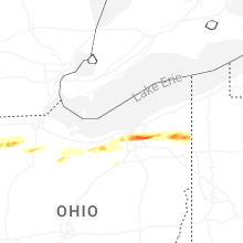


Connect with Interactive Hail Maps