

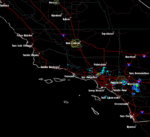
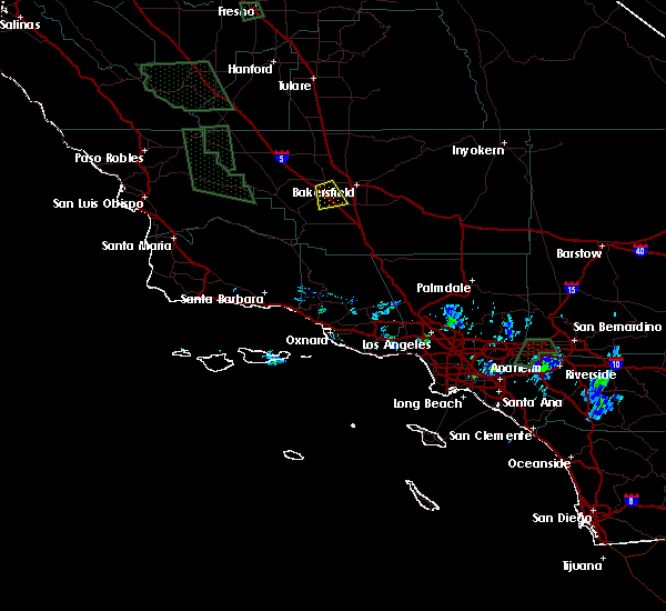
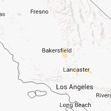
Hail Map for Bakersfield, CA
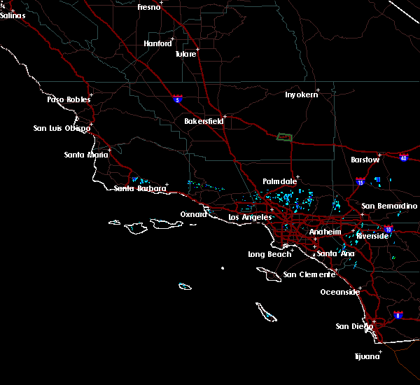
The Bakersfield, CA area has had 1 report of on-the-ground hail by trained spotters, and has been under severe weather warnings 0 times during the past 12 months. Doppler radar has detected hail at or near Bakersfield, CA on 4 occasions.
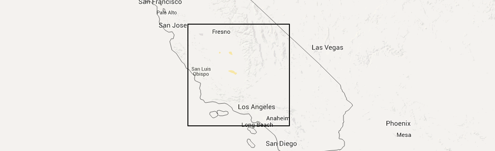
| Name: | Bakersfield, CA |
| Where Located: | 0.5 miles NW of Bakersfield, CA |
| Map: | Google Map for Bakersfield, CA |
| Population: | 347483 |
| Housing Units: | 120725 |
| More Info: | Search Google for Bakersfield, CA |
5
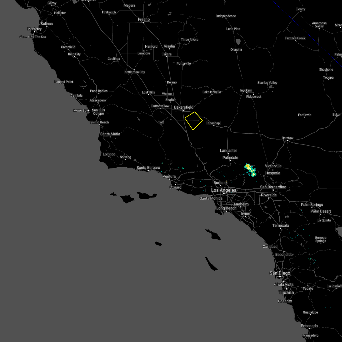
The Top Recent Hail Date for Bakersfield, CA is Sunday, April 24, 2016 (1st out of 4)
Hail and Wind Damage Spotted near Bakersfield, CA
| Date / Time | Report Details |
|---|---|
| 3/31/2024 7:54 PM PDT | California highway patrol reported a downed tree at the junction of ca highway 99 and ca highway 16 in kern county CA, 22.4 miles N of Bakersfield, CA |
| 10/25/2021 5:26 PM PDT |
 The severe thunderstorm warning for north central kern county will expire at 530 pm pdt, the storm which prompted the warning has weakened below severe limits, and has exited the warned area. therefore, the warning will be allowed to expire. however gusty winds and heavy rain are still possible with this thunderstorm. to report severe weather, contact your nearest law enforcement agency. they will relay your report to the national weather service hanford ca. The severe thunderstorm warning for north central kern county will expire at 530 pm pdt, the storm which prompted the warning has weakened below severe limits, and has exited the warned area. therefore, the warning will be allowed to expire. however gusty winds and heavy rain are still possible with this thunderstorm. to report severe weather, contact your nearest law enforcement agency. they will relay your report to the national weather service hanford ca.
|
| 10/25/2021 4:42 PM PDT |
 At 441 pm pdt, a severe thunderstorm was located 7 miles southwest of wasco, or 21 miles southwest of delano, moving southeast at 30 mph (radar indicated). Hazards include 60 mph wind gusts and quarter size hail. Hail damage to vehicles is expected. Expect wind damage to roofs, siding, and trees. At 441 pm pdt, a severe thunderstorm was located 7 miles southwest of wasco, or 21 miles southwest of delano, moving southeast at 30 mph (radar indicated). Hazards include 60 mph wind gusts and quarter size hail. Hail damage to vehicles is expected. Expect wind damage to roofs, siding, and trees.
|
| 6/18/2021 2:50 AM PDT | Tree blew down in thunderstorm wind in kern county CA, 2.3 miles NNE of Bakersfield, CA |
| 6/2/2019 5:42 PM PDT |
 The severe thunderstorm warning for central kern county will expire at 545 pm pdt, the storm which prompted the warning has weakened below severe limits, and no longer poses an immediate threat to life or property. therefore, the warning will be allowed to expire. The severe thunderstorm warning for central kern county will expire at 545 pm pdt, the storm which prompted the warning has weakened below severe limits, and no longer poses an immediate threat to life or property. therefore, the warning will be allowed to expire.
|
| 6/2/2019 5:35 PM PDT |
 At 535 pm pdt, a severe thunderstorm was located near weedpatch, or 14 miles south of bakersfield, moving southwest at 30 mph (radar indicated). Hazards include 60 mph wind gusts and nickel size hail. Expect damage to roofs, siding, and trees. Locations impacted include, south bakersfield, arvin, weedpatch, lamont and bear valley springs. At 535 pm pdt, a severe thunderstorm was located near weedpatch, or 14 miles south of bakersfield, moving southwest at 30 mph (radar indicated). Hazards include 60 mph wind gusts and nickel size hail. Expect damage to roofs, siding, and trees. Locations impacted include, south bakersfield, arvin, weedpatch, lamont and bear valley springs.
|
| 6/2/2019 5:19 PM PDT |
 The national weather service in hanford ca has issued a * severe thunderstorm warning for. central kern county in central california. until 545 pm pdt. At 518 pm pdt, a severe thunderstorm was located over arvin, or 13 miles southeast of bakersfield, moving southwest at 30 mph. The national weather service in hanford ca has issued a * severe thunderstorm warning for. central kern county in central california. until 545 pm pdt. At 518 pm pdt, a severe thunderstorm was located over arvin, or 13 miles southeast of bakersfield, moving southwest at 30 mph.
|
| 6/1/2019 5:56 PM PDT |
 The severe thunderstorm warning for central kern county will expire at 600 pm pdt, the storm which prompted the warning has weakened below severe limits, and has exited the warned area. therefore, the warning will be allowed to expire. The severe thunderstorm warning for central kern county will expire at 600 pm pdt, the storm which prompted the warning has weakened below severe limits, and has exited the warned area. therefore, the warning will be allowed to expire.
|
| 6/1/2019 5:37 PM PDT |
 At 536 pm pdt, a severe thunderstorm was located near lamont, or 8 miles east of bakersfield, moving south at 20 mph (radar indicated). Hazards include 60 mph wind gusts and quarter size hail. Hail damage to vehicles is expected. expect wind damage to roofs, siding, and trees. Locations impacted include, bakersfield, lamont and edison. At 536 pm pdt, a severe thunderstorm was located near lamont, or 8 miles east of bakersfield, moving south at 20 mph (radar indicated). Hazards include 60 mph wind gusts and quarter size hail. Hail damage to vehicles is expected. expect wind damage to roofs, siding, and trees. Locations impacted include, bakersfield, lamont and edison.
|
| 6/1/2019 5:19 PM PDT |
 The national weather service in hanford ca has issued a * severe thunderstorm warning for. central kern county in central california. until 600 pm pdt. At 519 pm pdt, a severe thunderstorm was located 8 miles east of bakersfield, moving south at 30 mph. The national weather service in hanford ca has issued a * severe thunderstorm warning for. central kern county in central california. until 600 pm pdt. At 519 pm pdt, a severe thunderstorm was located 8 miles east of bakersfield, moving south at 30 mph.
|
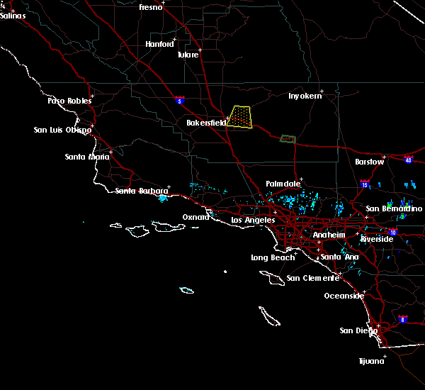
| 5/25/2019 3:07 PM PDT |
 At 306 pm pdt, a severe thunderstorm was located near dustin acres, or 24 miles west of bakersfield, moving southeast at 15 mph (radar indicated). Hazards include quarter size hail. Potentially damaging hail is possible with this storm. very heavy rain and road flooding is possible. this storm is bringing frequent cloud to ground lightning as well. Locations impacted include, bakersfield, tupman, dustin acres, valley acres, rosedale, harris ranch and buttonwillow. At 306 pm pdt, a severe thunderstorm was located near dustin acres, or 24 miles west of bakersfield, moving southeast at 15 mph (radar indicated). Hazards include quarter size hail. Potentially damaging hail is possible with this storm. very heavy rain and road flooding is possible. this storm is bringing frequent cloud to ground lightning as well. Locations impacted include, bakersfield, tupman, dustin acres, valley acres, rosedale, harris ranch and buttonwillow.
|
| 5/25/2019 2:46 PM PDT |
 At 244 pm pdt, a severe thunderstorm was located near tupman, or 26 miles west of bakersfield, moving southeast at 15 mph (radar indicated. impacts, large potentially damaging hail along with frequent lightning and very heavy heavy rain with possible flooding). Hazards include quarter size hail. At 244 pm pdt, a severe thunderstorm was located near tupman, or 26 miles west of bakersfield, moving southeast at 15 mph (radar indicated. impacts, large potentially damaging hail along with frequent lightning and very heavy heavy rain with possible flooding). Hazards include quarter size hail.
|
| 9/3/2017 6:24 PM PDT | California highway patrol reported a downed tree from thunderstorm winds on airport drive and west china grade loop in bakersfiel in kern county CA, 4.1 miles S of Bakersfield, CA |
| 9/3/2017 6:21 PM PDT | Received a public report through social media that showed a building under construction damaged by thunderstorm wind gusts near state route 99 and berkshire road in bak in kern county CA, 5.6 miles N of Bakersfield, CA |
| 9/3/2017 6:08 PM PDT | California highway patrol reported downed power poles and power lines near northbound interstate 5 just south of stockdale highway just southeast of buttonwillow. the d in kern county CA, 17.2 miles E of Bakersfield, CA |
| 9/3/2017 5:52 PM PDT | California highway patrol reported power lines downed across stockdale highway west of rosedale from thunderstorm wind in kern county CA, 10.4 miles E of Bakersfield, CA |
| 9/3/2017 5:31 PM PDT | California highway patrol reported several tree branches down in roadway due to strong thunderstorm winds in east bakersfiel in kern county CA, 4.7 miles WSW of Bakersfield, CA |
| 9/3/2017 5:29 PM PDT | California highway patrol reported a tree down in roadway due to strong wind in kern county CA, 2.1 miles SSE of Bakersfield, CA |
| 9/3/2017 5:19 PM PDT | California highway patrol reported power lines downed by thunderstorm winds across northbound lanes on state route 184 near sunset boulevard south of lamon in kern county CA, 12.3 miles NNW of Bakersfield, CA |
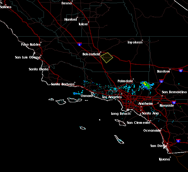
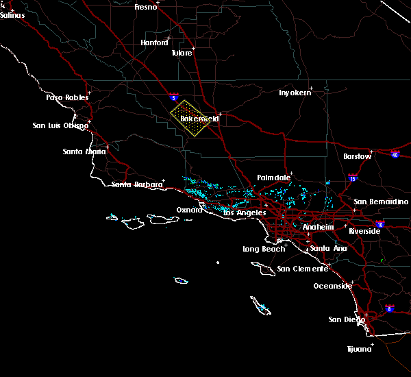
| 5/6/2016 7:07 PM PDT |
 The severe thunderstorm warning for central kern county will expire at 715 pm pdt, the storm which prompted the warning has weakened below severe limits, and no longer poses an immediate threat to life or property. therefore the warning will be allowed to expire. however heavy rain is still possible with this thunderstorm. to report severe weather, contact your nearest law enforcement agency. they will relay your report to the national weather service hanford ca. The severe thunderstorm warning for central kern county will expire at 715 pm pdt, the storm which prompted the warning has weakened below severe limits, and no longer poses an immediate threat to life or property. therefore the warning will be allowed to expire. however heavy rain is still possible with this thunderstorm. to report severe weather, contact your nearest law enforcement agency. they will relay your report to the national weather service hanford ca.
|
| 5/6/2016 6:36 PM PDT |
 At 634 pm pdt, doppler radar indicated a severe thunderstorm capable of producing quarter size hail and damaging winds in excess of 60 mph. this storm was located near tupman, or 14 miles west of bakersfield, and moving southerly at 10 mph. At 634 pm pdt, doppler radar indicated a severe thunderstorm capable of producing quarter size hail and damaging winds in excess of 60 mph. this storm was located near tupman, or 14 miles west of bakersfield, and moving southerly at 10 mph.
|
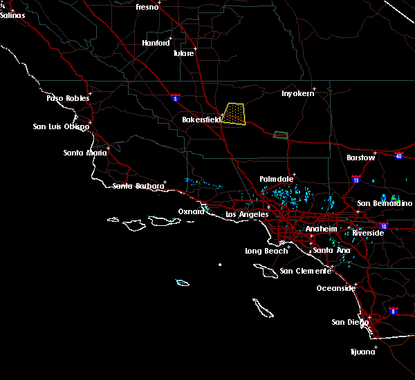
| 4/24/2016 9:07 PM PDT |
 At 907 pm pdt, the public reported a severe thunderstorm producing quarter size hail. this storm was located over bakersfield, and moving southeast at 40 mph. At 907 pm pdt, the public reported a severe thunderstorm producing quarter size hail. this storm was located over bakersfield, and moving southeast at 40 mph.
|
| 4/24/2016 8:55 PM PDT | Quarter sized hail reported 5.7 miles ESE of Bakersfield, CA, public reports 1 inch hail near hageman rd and verdugo ln in bakersfield. relayed via facebook. |
| 6/10/2015 6:15 PM PDT | Chp reported large tree blocking all lanes on belle terrace (400 e block in kern county CA, 2.1 miles NW of Bakersfield, CA |
| 1/1/0001 12:00 AM | Tree toppled into a power pole. 3723 people lost powe in kern county CA, 2 miles W of Bakersfield, CA |
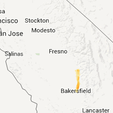
Hail Maps for Bakersfield, CA
Connect with Interactive Hail Maps