

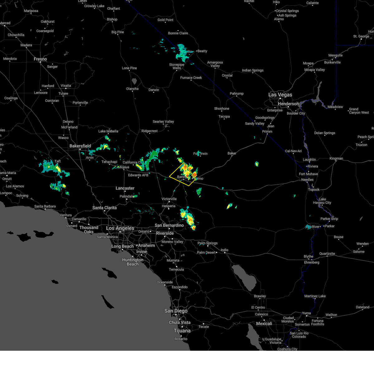
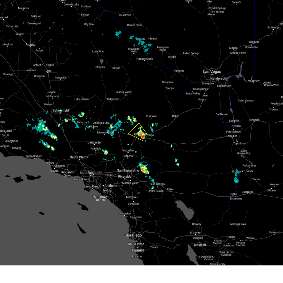
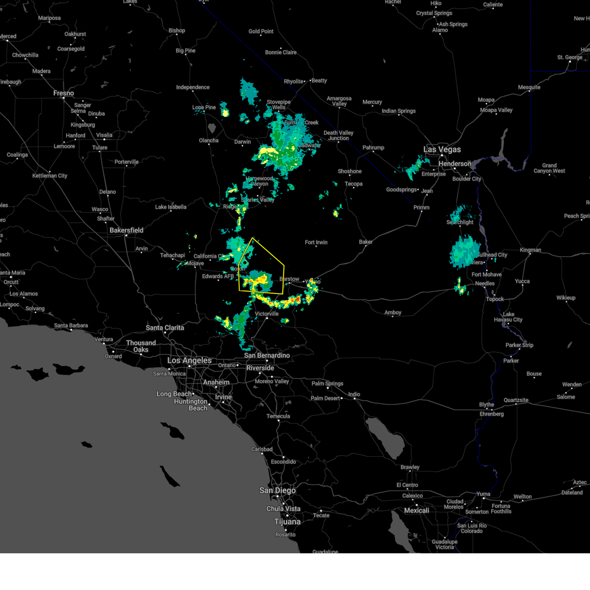
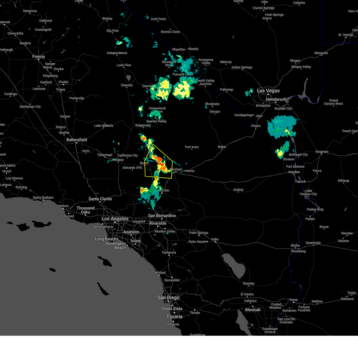
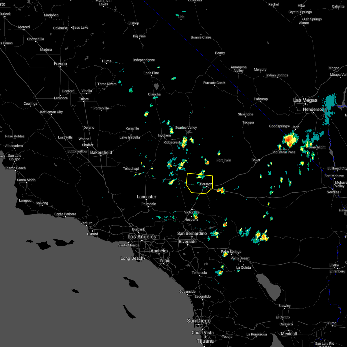
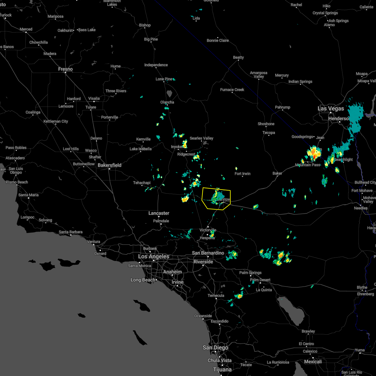
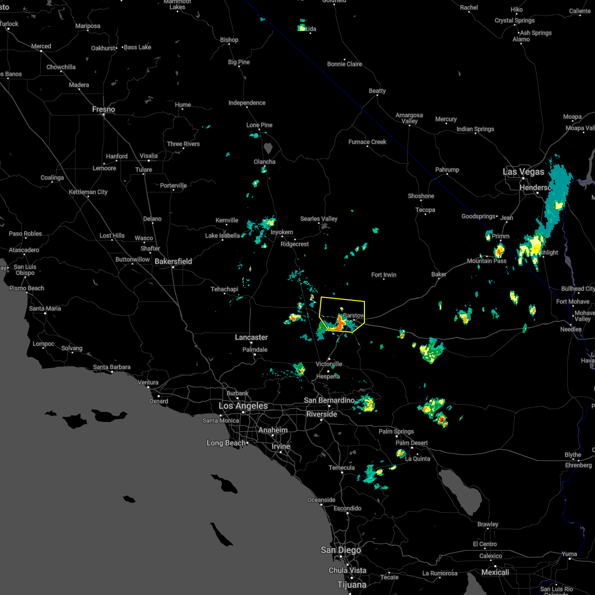
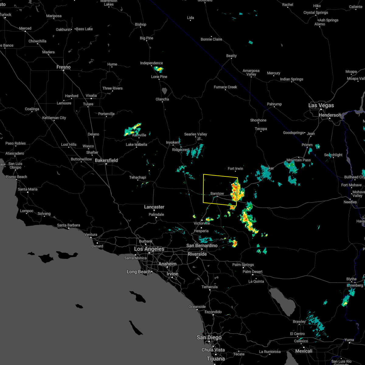
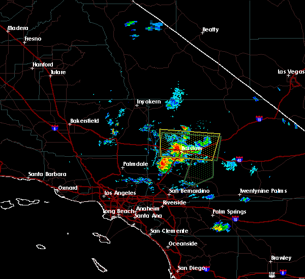
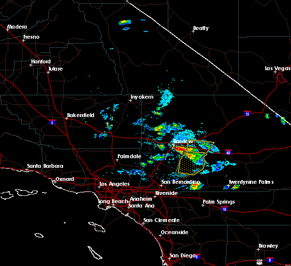
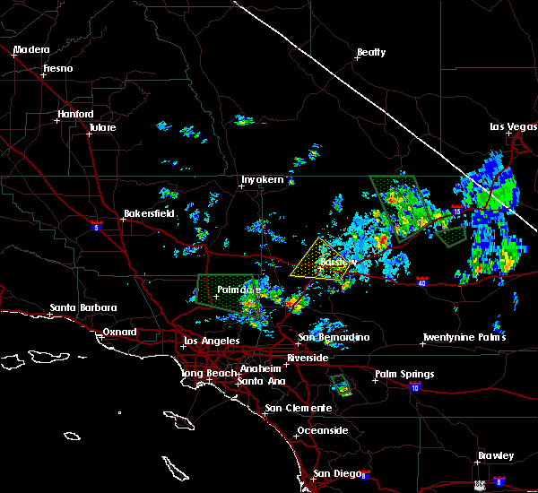
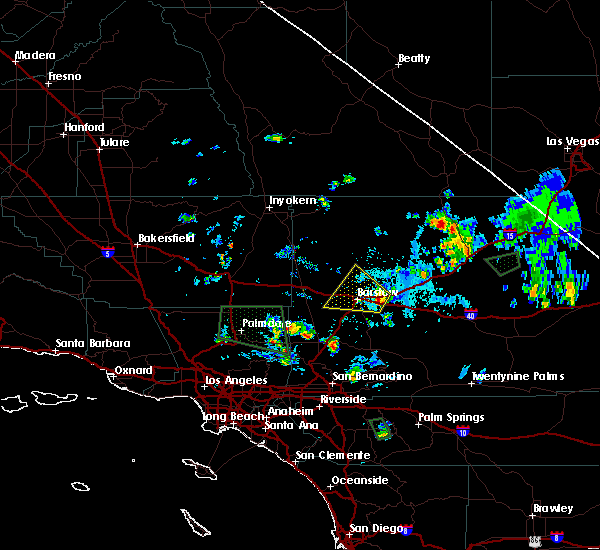
Hail Map for Barstow, CA
The Barstow, CA area has had 2 reports of on-the-ground hail by trained spotters, and has been under severe weather warnings 0 times during the past 12 months. Doppler radar has detected hail at or near Barstow, CA on 9 occasions.
| Name: | Barstow, CA |
| Where Located: | 63.2 miles NW of Yucca Valley, CA |
| Map: | Google Map for Barstow, CA |
| Population: | 22639 |
| Housing Units: | 9555 |
| More Info: | Search Google for Barstow, CA |
1
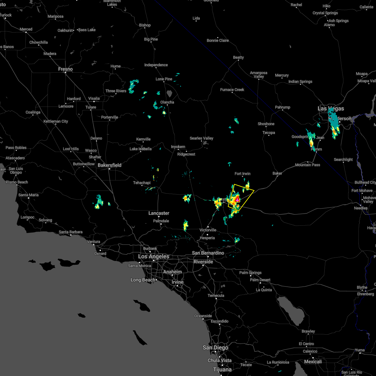
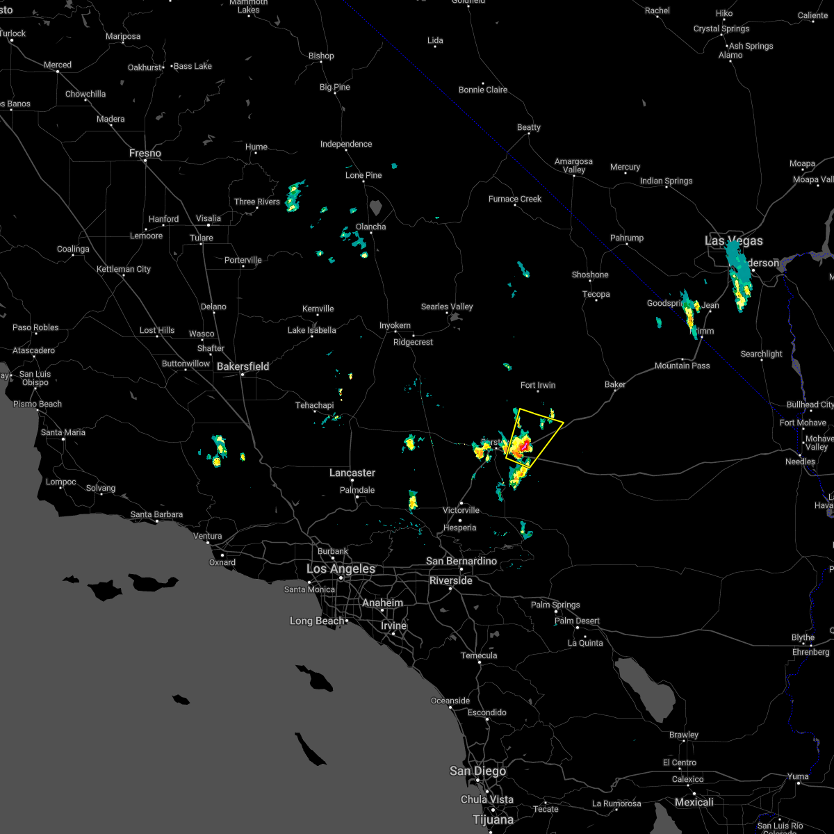
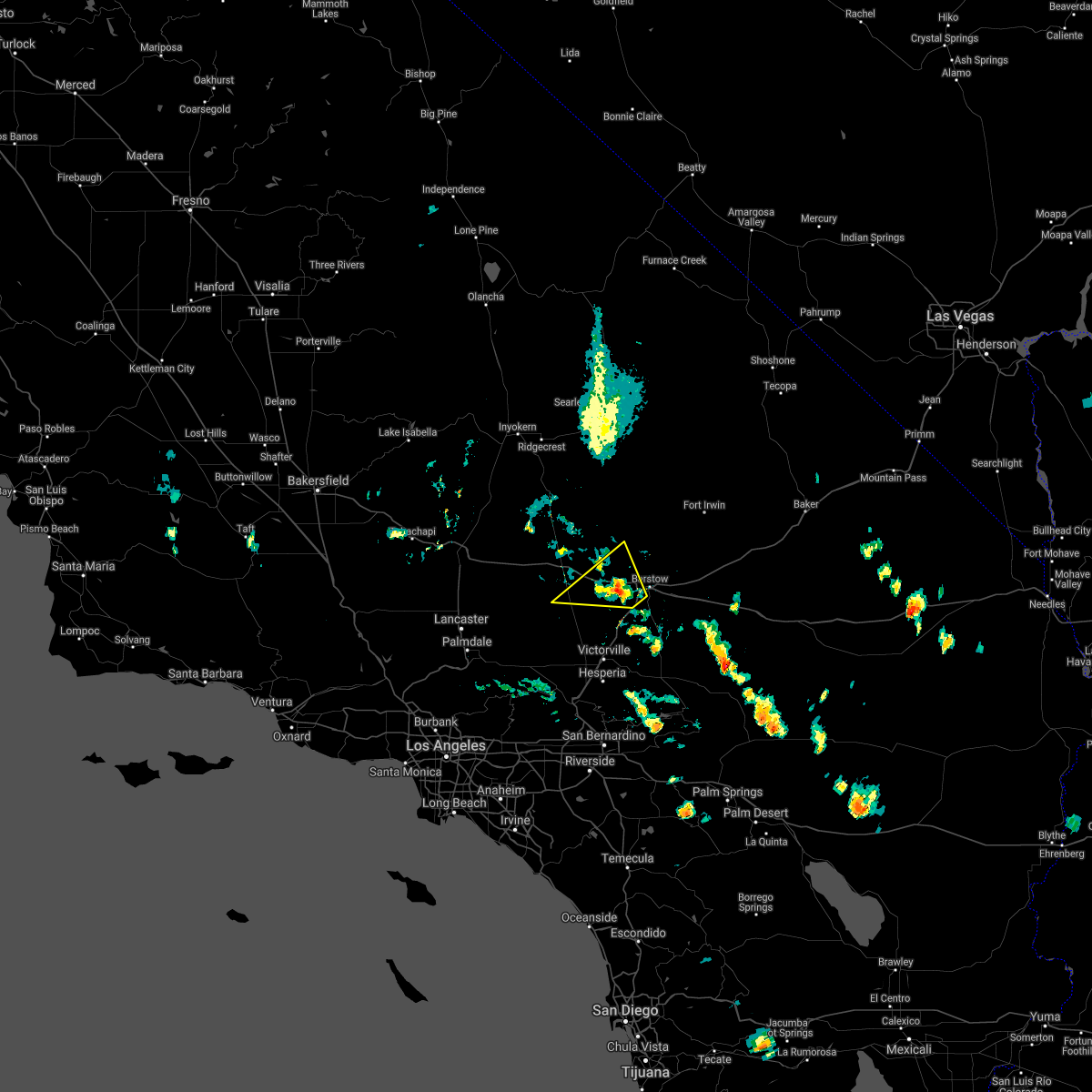
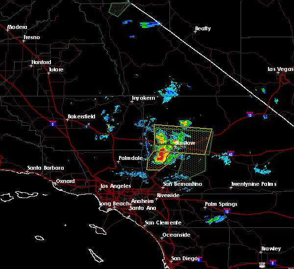
The Top Recent Hail Date for Barstow, CA is Friday, August 2, 2024 (4th out of 9)

Hail and Wind Damage Spotted near Barstow, CA
| Date / Time | Report Details |
|---|---|
| 8/2/2024 4:06 PM PDT |
 The storm which prompted the warning has weakened, and has exited the warned area. therefore, the warning will be allowed to expire. The storm which prompted the warning has weakened, and has exited the warned area. therefore, the warning will be allowed to expire.
|
| 8/2/2024 3:46 PM PDT |
 At 345 pm pdt, a severe thunderstorm was located near owl canyon campground, or near barstow, moving northwest at 15 mph (radar indicated). Hazards include 60 mph wind gusts and quarter size hail. Hail damage to vehicles is expected. expect wind damage to roofs and trees. locations impacted include, barstow, daggett, owl canyon campground, hwy 247 between lucerne valley and barstow, lenwood, and nebo center. this includes the following roads, interstate 15 in california between mile markers 81 and 88. interstate 40 in california between mile markers 1 and 10. state route 247 in san bernardino county between mile markers 75 and 78. Fort irwin road between mile markers 1 and 10. At 345 pm pdt, a severe thunderstorm was located near owl canyon campground, or near barstow, moving northwest at 15 mph (radar indicated). Hazards include 60 mph wind gusts and quarter size hail. Hail damage to vehicles is expected. expect wind damage to roofs and trees. locations impacted include, barstow, daggett, owl canyon campground, hwy 247 between lucerne valley and barstow, lenwood, and nebo center. this includes the following roads, interstate 15 in california between mile markers 81 and 88. interstate 40 in california between mile markers 1 and 10. state route 247 in san bernardino county between mile markers 75 and 78. Fort irwin road between mile markers 1 and 10.
|
| 8/2/2024 3:23 PM PDT |
 Svrvef the national weather service in las vegas has issued a * severe thunderstorm warning for, west central san bernardino county in southern california, * until 415 pm pdt. * at 322 pm pdt, a severe thunderstorm was located over daggett, moving northwest at 15 mph (radar indicated). Hazards include 60 mph wind gusts and quarter size hail. Hail damage to vehicles is expected. Expect wind damage to roofs and trees. Svrvef the national weather service in las vegas has issued a * severe thunderstorm warning for, west central san bernardino county in southern california, * until 415 pm pdt. * at 322 pm pdt, a severe thunderstorm was located over daggett, moving northwest at 15 mph (radar indicated). Hazards include 60 mph wind gusts and quarter size hail. Hail damage to vehicles is expected. Expect wind damage to roofs and trees.
|
| 7/13/2024 2:14 PM PDT | Chp reports 120 foot pine tree down on clemens av in san bernardino county CA, 3.5 miles SSW of Barstow, CA |
| 7/12/2024 5:45 PM PDT | Data courtesy of earth network in san bernardino county CA, 2.4 miles WSW of Barstow, CA |
| 5/20/2023 8:12 PM PDT |
 The severe thunderstorm warning for west central san bernardino county will expire at 815 pm pdt, the storm northwest of barstow which prompted the warning has weakened below severe limits, and no longer poses an immediate threat to life or property. therefore, the warning will be allowed to expire. brief heavy rain will occur on sections of sr58 and us 395 as the storm continues to weaken and slowly move to southwest until 9 pm. The severe thunderstorm warning for west central san bernardino county will expire at 815 pm pdt, the storm northwest of barstow which prompted the warning has weakened below severe limits, and no longer poses an immediate threat to life or property. therefore, the warning will be allowed to expire. brief heavy rain will occur on sections of sr58 and us 395 as the storm continues to weaken and slowly move to southwest until 9 pm.
|
| 5/20/2023 7:12 PM PDT |
 At 709 pm pdt, a severe thunderstorm was located 15 miles northwest of barstow, moving south at 15 mph (radar indicated). Hazards include 60 mph wind gusts and quarter size hail. Hail damage to vehicles is expected. Expect wind damage to roofs and trees. At 709 pm pdt, a severe thunderstorm was located 15 miles northwest of barstow, moving south at 15 mph (radar indicated). Hazards include 60 mph wind gusts and quarter size hail. Hail damage to vehicles is expected. Expect wind damage to roofs and trees.
|
| 10/15/2022 7:38 PM PDT |
 At 737 pm pdt, severe thunderstorms were located along a line extending from 11 miles northeast of owl canyon campground to 8 miles southwest of newberry springs, moving southwest at 25 mph (radar indicated). Hazards include 60 mph wind gusts. expect damage to roofs and trees At 737 pm pdt, severe thunderstorms were located along a line extending from 11 miles northeast of owl canyon campground to 8 miles southwest of newberry springs, moving southwest at 25 mph (radar indicated). Hazards include 60 mph wind gusts. expect damage to roofs and trees
|
| 8/24/2022 3:45 PM PDT | Site at newberry springs elementary school gusted to 58 mph at 345pm. data courtesy of earth networks. chp also reported telephone pole leaning with two transformers bl in san bernardino county CA, 22.1 miles W of Barstow, CA |
| 8/8/2022 4:08 PM PDT | Barstow fire reported numerous power poles down around barstow from thunderstorm related wind in san bernardino county CA, 2.9 miles NE of Barstow, CA |
| 8/8/2022 4:08 PM PDT | Corrects previous report from 2 sse lenwood. barstow fire reported power poles down over the road at aberdeen drive and yucca mesa road in barstow due to thunderstorm r in san bernardino county CA, 14.2 miles W of Barstow, CA |
| 8/1/2022 3:26 PM PDT |
 The severe thunderstorm warning for west central san bernardino county will expire at 330 pm pdt, the storm which prompted the warning has weakened and has exited the warned area. there still could be strong gusty winds in the area but the threat for severe winds is diminishing. therefore, the warning will be allowed to expire. The severe thunderstorm warning for west central san bernardino county will expire at 330 pm pdt, the storm which prompted the warning has weakened and has exited the warned area. there still could be strong gusty winds in the area but the threat for severe winds is diminishing. therefore, the warning will be allowed to expire.
|
| 8/1/2022 3:13 PM PDT |
 At 311 pm pdt, a possible severe thunderstorm was located 8 miles southwest of owl canyon campground, or 8 miles northwest of barstow, and is moving slowly north at 10 mph. this storm is beginning to weaken but may still be producing severe wind gusts and blowing dust (radar indicated). Hazards include 60 mph wind gusts and blowing dust. Possible damage to roofs and trees and blowing dust. locations impacted include, barstow, i-15 between victorville and barstow, owl canyon campground, hwy 247 between lucerne valley and barstow, lenwood and nebo center. this includes the following highways, interstate 15 in california near mile marker 81. interstate 40 in california between mile markers 1 and 6. hail threat, radar indicated max hail size, <. 75 in wind threat, radar indicated max wind gust, 60 mph. At 311 pm pdt, a possible severe thunderstorm was located 8 miles southwest of owl canyon campground, or 8 miles northwest of barstow, and is moving slowly north at 10 mph. this storm is beginning to weaken but may still be producing severe wind gusts and blowing dust (radar indicated). Hazards include 60 mph wind gusts and blowing dust. Possible damage to roofs and trees and blowing dust. locations impacted include, barstow, i-15 between victorville and barstow, owl canyon campground, hwy 247 between lucerne valley and barstow, lenwood and nebo center. this includes the following highways, interstate 15 in california near mile marker 81. interstate 40 in california between mile markers 1 and 6. hail threat, radar indicated max hail size, <. 75 in wind threat, radar indicated max wind gust, 60 mph.
|
| 8/1/2022 2:45 PM PDT |
 At 243 pm pdt, a severe thunderstorm was located just west of barstow, moving north at 15 mph (radar indicated). Hazards include 60 mph wind gusts and frequent cloud to ground lightning. possible damage to roofs and trees, blowing dust, and small hail At 243 pm pdt, a severe thunderstorm was located just west of barstow, moving north at 15 mph (radar indicated). Hazards include 60 mph wind gusts and frequent cloud to ground lightning. possible damage to roofs and trees, blowing dust, and small hail
|
| 7/30/2022 4:42 PM PDT |
 The severe thunderstorm warning for west central san bernardino county will expire at 445 pm pdt, the storm which prompted the warning has moved out of the area. therefore, the warning will be allowed to expire. gusty winds and frequent cloud-to-ground lightning will continue south of barstow between barstow and victorville. The severe thunderstorm warning for west central san bernardino county will expire at 445 pm pdt, the storm which prompted the warning has moved out of the area. therefore, the warning will be allowed to expire. gusty winds and frequent cloud-to-ground lightning will continue south of barstow between barstow and victorville.
|
| 7/30/2022 4:18 PM PDT | California highway patrol report of a broken powerpole and lines hanging about 6 feet off the groun in san bernardino county CA, 22.1 miles W of Barstow, CA |
| 7/30/2022 4:10 PM PDT |
 At 409 pm pdt, a severe thunderstorm was located 8 miles east of owl canyon campground, or 13 miles north of daggett, moving west at 10 mph (radar and surface observations). Hazards include 60 mph wind gusts. Expect damage to roofs and trees as well as power lines. blowing dust may reduce visibility on area roadways. locations impacted include, barstow, daggett, i-15 between victorville and barstow, owl canyon campground, hwy 247 between lucerne valley and barstow, lenwood and nebo center. this includes the following highways, interstate 15 in california between mile markers 81 and 88. interstate 40 in california between mile markers 1 and 13. hail threat, radar indicated max hail size, <. 75 in wind threat, radar indicated max wind gust, 60 mph. At 409 pm pdt, a severe thunderstorm was located 8 miles east of owl canyon campground, or 13 miles north of daggett, moving west at 10 mph (radar and surface observations). Hazards include 60 mph wind gusts. Expect damage to roofs and trees as well as power lines. blowing dust may reduce visibility on area roadways. locations impacted include, barstow, daggett, i-15 between victorville and barstow, owl canyon campground, hwy 247 between lucerne valley and barstow, lenwood and nebo center. this includes the following highways, interstate 15 in california between mile markers 81 and 88. interstate 40 in california between mile markers 1 and 13. hail threat, radar indicated max hail size, <. 75 in wind threat, radar indicated max wind gust, 60 mph.
|
| 7/30/2022 3:40 PM PDT |
 At 340 pm pdt, a severe thunderstorm was located 13 miles east of owl canyon campground, or 14 miles south of fort irwin, moving west at 10 mph (radar and surface observations). Hazards include 60 mph wind gusts. Expect damage to roofs and trees as well as powerlines. Blowing dust may reduce visibility on area roadways. At 340 pm pdt, a severe thunderstorm was located 13 miles east of owl canyon campground, or 14 miles south of fort irwin, moving west at 10 mph (radar and surface observations). Hazards include 60 mph wind gusts. Expect damage to roofs and trees as well as powerlines. Blowing dust may reduce visibility on area roadways.
|
| 7/30/2022 3:24 PM PDT | California highway patrol reported a powerline down due to thunderstorm wind in san bernardino county CA, 22.2 miles W of Barstow, CA |
| 7/30/2022 3:08 PM PDT | Site at newberry elementary school gusted to 61 mph at 308pm. data courtesy of earthnetwork in san bernardino county CA, 22.1 miles W of Barstow, CA |
| 7/18/2022 3:56 PM PDT |
 The severe thunderstorm warning for west central san bernardino county will expire at 400 pm pdt, the storm which prompted the warning has weakened below severe limits, and has exited the warned area. therefore, the warning will be allowed to expire. however gusty winds to 40 mph are still possible with this thunderstorm. The severe thunderstorm warning for west central san bernardino county will expire at 400 pm pdt, the storm which prompted the warning has weakened below severe limits, and has exited the warned area. therefore, the warning will be allowed to expire. however gusty winds to 40 mph are still possible with this thunderstorm.
|
| 7/18/2022 3:39 PM PDT |
 At 338 pm pdt, a severe thunderstorm was located 11 miles north of newberry springs, or 14 miles northeast of daggett, moving northeast at 15 mph (radar indicated. 60 mph gusts and dime size hail have been reported with this storm). Hazards include 60 mph wind gusts and quarter size hail. Hail damage to vehicles is expected. expect wind damage to roofs and trees. locations impacted include, daggett and yermo. this includes the following highways, interstate 15 in california between mile markers 81 and 105. interstate 40 in california between mile markers 6 and 19. hail threat, radar indicated max hail size, 1. 00 in wind threat, radar indicated max wind gust, 60 mph. At 338 pm pdt, a severe thunderstorm was located 11 miles north of newberry springs, or 14 miles northeast of daggett, moving northeast at 15 mph (radar indicated. 60 mph gusts and dime size hail have been reported with this storm). Hazards include 60 mph wind gusts and quarter size hail. Hail damage to vehicles is expected. expect wind damage to roofs and trees. locations impacted include, daggett and yermo. this includes the following highways, interstate 15 in california between mile markers 81 and 105. interstate 40 in california between mile markers 6 and 19. hail threat, radar indicated max hail size, 1. 00 in wind threat, radar indicated max wind gust, 60 mph.
|
| 7/18/2022 3:23 PM PDT |
 At 321 pm pdt, a severe thunderstorm was located 9 miles northwest of newberry springs, or 10 miles northeast of daggett, moving northeast at 15 mph (radar indicated. gusts to 60 mph was measured at the daggett-barstow airport and dime size hail was reported by trained spotters). Hazards include 60 mph wind gusts and quarter size hail. Hail damage to vehicles is expected. Expect wind damage to roofs and trees. At 321 pm pdt, a severe thunderstorm was located 9 miles northwest of newberry springs, or 10 miles northeast of daggett, moving northeast at 15 mph (radar indicated. gusts to 60 mph was measured at the daggett-barstow airport and dime size hail was reported by trained spotters). Hazards include 60 mph wind gusts and quarter size hail. Hail damage to vehicles is expected. Expect wind damage to roofs and trees.
|
| 7/18/2022 3:13 PM PDT |
 At 310 pm pdt, a severe thunderstorm was located 8 miles northwest of newberry springs, or 8 miles northeast of daggett, moving northeast at 15 mph (radar indicated. a gust to 60 mph was measured at the daggett- barstow airport). Hazards include 60 mph wind gusts and dime size hail. expect damage to roofs and trees At 310 pm pdt, a severe thunderstorm was located 8 miles northwest of newberry springs, or 8 miles northeast of daggett, moving northeast at 15 mph (radar indicated. a gust to 60 mph was measured at the daggett- barstow airport). Hazards include 60 mph wind gusts and dime size hail. expect damage to roofs and trees
|
| 7/18/2022 3:04 PM PDT | Kdag asos recorded a thunderstorm wind gust of 60 mph from the nn in san bernardino county CA, 14.8 miles W of Barstow, CA |
| 9/9/2021 2:36 PM PDT |
 The severe thunderstorm warning for west central san bernardino county will expire at 245 pm pdt, the storm which prompted the warning has weakened below severe limits, and no longer poses an immediate threat to life or property. therefore, the warning will be allowed to expire. The severe thunderstorm warning for west central san bernardino county will expire at 245 pm pdt, the storm which prompted the warning has weakened below severe limits, and no longer poses an immediate threat to life or property. therefore, the warning will be allowed to expire.
|
| 9/9/2021 2:00 PM PDT |
 At 146 pm pdt, a severe thunderstorm was located 7 miles north of i-15 between victorville and barstow, moving northwest at 10 mph (radar indicated). Hazards include 60 mph wind gusts. expect damage to roofs and trees At 146 pm pdt, a severe thunderstorm was located 7 miles north of i-15 between victorville and barstow, moving northwest at 10 mph (radar indicated). Hazards include 60 mph wind gusts. expect damage to roofs and trees
|
| 9/9/2021 1:47 PM PDT |
 At 146 pm pdt, a severe thunderstorm was located 7 miles north of i-15 between victorville and barstow, moving northwest at 10 mph (radar indicated). Hazards include 60 mph wind gusts. expect damage to roofs and trees At 146 pm pdt, a severe thunderstorm was located 7 miles north of i-15 between victorville and barstow, moving northwest at 10 mph (radar indicated). Hazards include 60 mph wind gusts. expect damage to roofs and trees
|
| 7/1/2016 5:52 PM PDT |
 The severe thunderstorm warning for west central san bernardino county will expire at 600 pm pdt, the storm which prompted the warning has weakened below severe limits, and no longer poses an immediate threat to life or property. therefore the warning will be allowed to expire. however, additional storms were moving into the area from the west and will likely produce heavy rain and small hail. a flash flood warning remains in effect for the barstow area until 730 pm. The severe thunderstorm warning for west central san bernardino county will expire at 600 pm pdt, the storm which prompted the warning has weakened below severe limits, and no longer poses an immediate threat to life or property. therefore the warning will be allowed to expire. however, additional storms were moving into the area from the west and will likely produce heavy rain and small hail. a flash flood warning remains in effect for the barstow area until 730 pm.
|
| 7/1/2016 5:28 PM PDT |
 At 527 pm pdt, doppler radar indicated a severe thunderstorm capable of producing quarter size hail and damaging winds in excess of 60 mph. this storm was near barstow and moving slowly to the northeast. locations impacted include, barstow, daggett, i-15 between victorville and barstow, hwy 247 between lucerne valley and barstow, owl canyon campground, newberry springs, lenwood and nebo center. At 527 pm pdt, doppler radar indicated a severe thunderstorm capable of producing quarter size hail and damaging winds in excess of 60 mph. this storm was near barstow and moving slowly to the northeast. locations impacted include, barstow, daggett, i-15 between victorville and barstow, hwy 247 between lucerne valley and barstow, owl canyon campground, newberry springs, lenwood and nebo center.
|
| 7/1/2016 4:59 PM PDT |
 At 458 pm pdt, doppler radar indicated a severe thunderstorm capable of producing quarter size hail and damaging winds in excess of 60 mph. this storm was located 9 miles west of owl canyon campground, or 11 miles northwest of barstow, and moving north at 15 mph. this warning replaces the previous severe thunderstorm warning that was in effect for the area. At 458 pm pdt, doppler radar indicated a severe thunderstorm capable of producing quarter size hail and damaging winds in excess of 60 mph. this storm was located 9 miles west of owl canyon campground, or 11 miles northwest of barstow, and moving north at 15 mph. this warning replaces the previous severe thunderstorm warning that was in effect for the area.
|
| 7/1/2016 4:30 PM PDT | Quarter sized hail reported 1.1 miles WNW of Barstow, CA, local business reported hail dime to quarter sized on veterans parkway. report relayed via social media. |
| 7/1/2016 4:29 PM PDT |
 At 427 pm pdt, doppler radar indicated a severe thunderstorm capable of producing large damaging hail up to golf ball size and damaging winds in excess of 60 mph. this storm was located in barstow, moving north at 10 mph. a trained spotter reported golf ball size hail near the intersection of rimrock and h street. locations impacted include, barstow, daggett, i-15 between victorville and barstow, owl canyon campground, newberry springs, hwy 247 between lucerne valley and barstow, lenwood and nebo center. At 427 pm pdt, doppler radar indicated a severe thunderstorm capable of producing large damaging hail up to golf ball size and damaging winds in excess of 60 mph. this storm was located in barstow, moving north at 10 mph. a trained spotter reported golf ball size hail near the intersection of rimrock and h street. locations impacted include, barstow, daggett, i-15 between victorville and barstow, owl canyon campground, newberry springs, hwy 247 between lucerne valley and barstow, lenwood and nebo center.
|
| 7/1/2016 4:25 PM PDT | Golf Ball sized hail reported 0.3 miles S of Barstow, CA, quarter to golf ball sized hail at intersection of rimrock rd and h st. also reports of small branches down from thunderstorm wind gusts. |
| 7/1/2016 4:05 PM PDT |
 At 405 pm pdt, doppler radar indicated a severe thunderstorm capable of producing quarter size hail and damaging winds in excess of 60 mph. this storm was located near barstow, and moving north at 20 mph. At 405 pm pdt, doppler radar indicated a severe thunderstorm capable of producing quarter size hail and damaging winds in excess of 60 mph. this storm was located near barstow, and moving north at 20 mph.
|
| 7/29/2015 5:10 PM PDT |
 The severe thunderstorm warning for west central san bernardino county will expire at 515 pm pdt, the storm which prompted the warning has weakened below severe limits, and no longer poses an immediate threat to life or property. therefore the warning will be allowed to expire. however gusty winds are still possible with this decaying thunderstorm. The severe thunderstorm warning for west central san bernardino county will expire at 515 pm pdt, the storm which prompted the warning has weakened below severe limits, and no longer poses an immediate threat to life or property. therefore the warning will be allowed to expire. however gusty winds are still possible with this decaying thunderstorm.
|
| 7/29/2015 4:50 PM PDT |
 At 448 pm pdt, doppler radar indicated a severe thunderstorm capable of producing damaging winds in excess of 60 mph. this storm was located over daggett, and moving northwest at 20 mph. At 448 pm pdt, doppler radar indicated a severe thunderstorm capable of producing damaging winds in excess of 60 mph. this storm was located over daggett, and moving northwest at 20 mph.
|
| 8/18/2014 3:39 PM PDT | California highway patrol reported power lines down on minneola roa in san bernardino county CA, 15.8 miles W of Barstow, CA |
| 8/18/2014 3:30 PM PDT | Several trees were reported down and a sheet metal garage door was reported damaged in newberry spring in san bernardino county CA, 20.6 miles W of Barstow, CA |
| 8/18/2014 3:14 PM PDT | Storm damage reported in san bernardino county CA, 14.8 miles W of Barstow, CA |
| 7/23/2013 3:30 PM PDT | Thunderstorm winds knocked down 4 major utlity poles that provide power to fort irwin. the entire military operation lost power which impacted power for ab in san bernardino county CA, 10.9 miles SW of Barstow, CA |
| 7/22/2013 3:30 PM PDT | Thunderstorm winds knocked down 4 major utlity poles that provide power to fort irwin. the entire military operation lost power which impacted power for ab in san bernardino county CA, 10.9 miles SW of Barstow, CA |
| 1/1/0001 12:00 AM | 5 power poles were knocked down by thunderstorm winds along community boulevard between summerset road and dixie roa in san bernardino county CA, 6.2 miles ESE of Barstow, CA |
| 1/1/0001 12:00 AM | California highway patrol reported power lines were down at state route 58 at irwin roa in san bernardino county CA, 2.9 miles SW of Barstow, CA |
Hail Maps for Barstow, CA


Connect with Interactive Hail Maps