

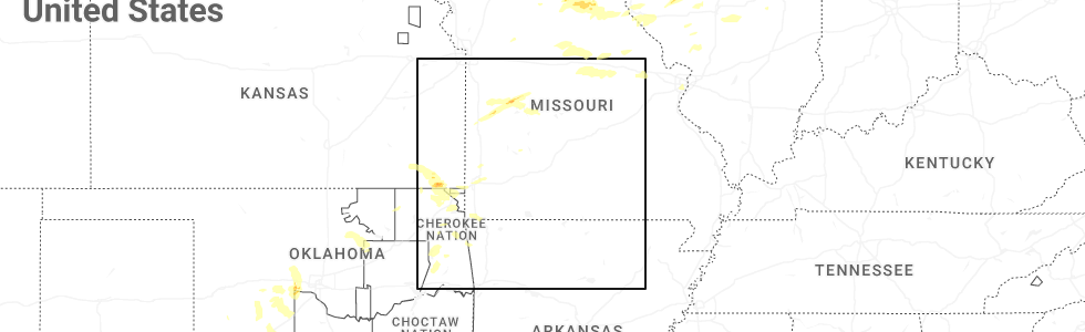
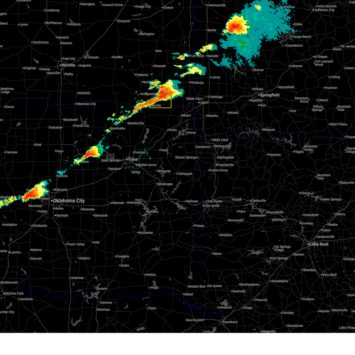
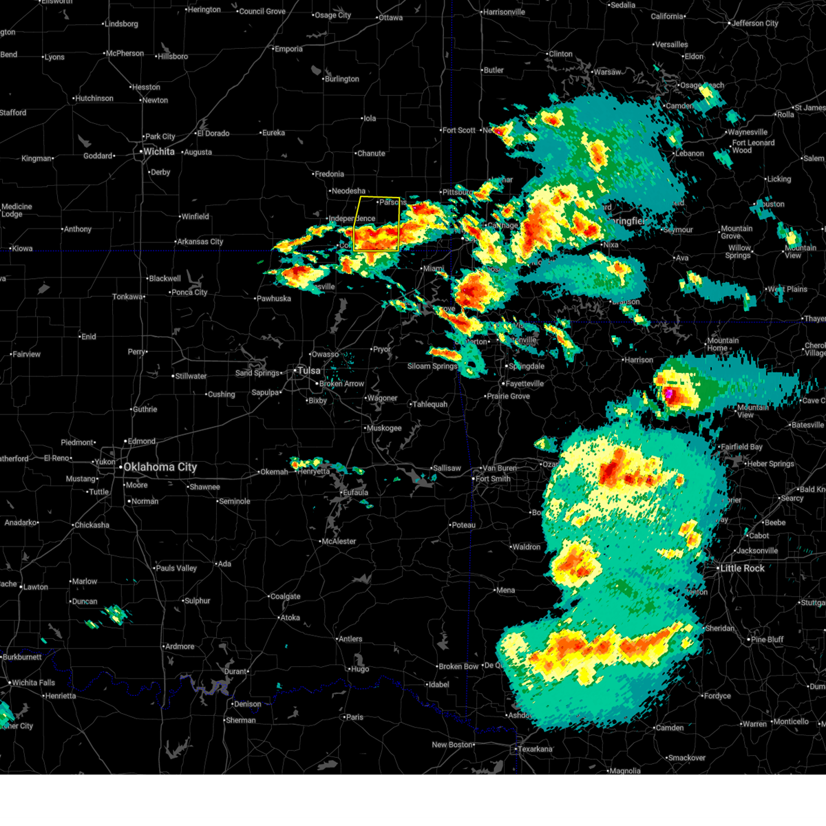
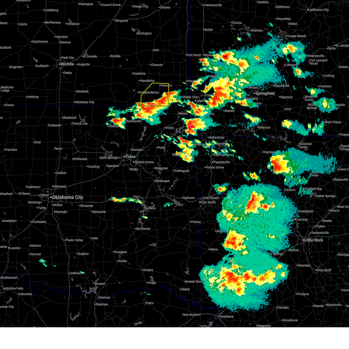
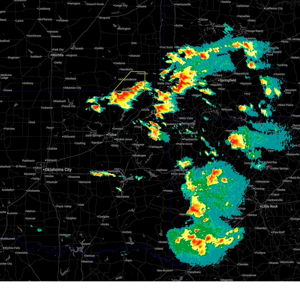
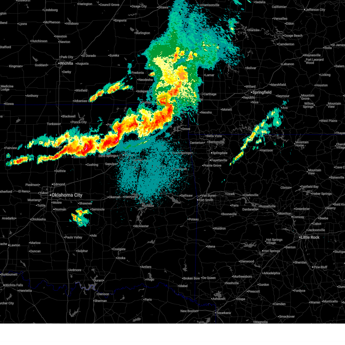
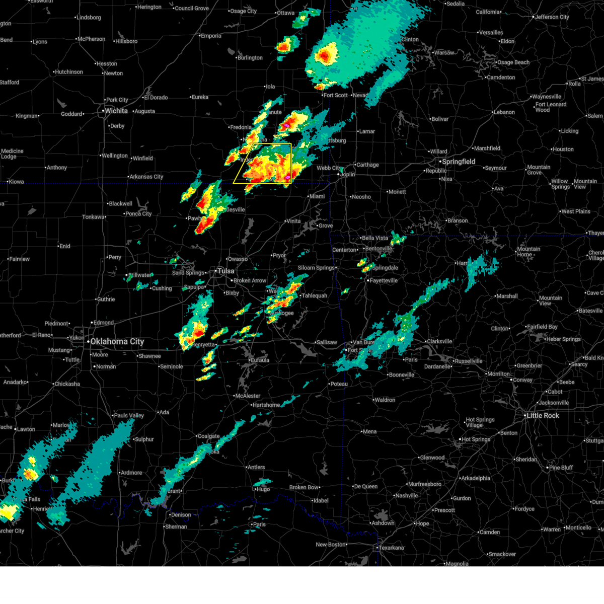
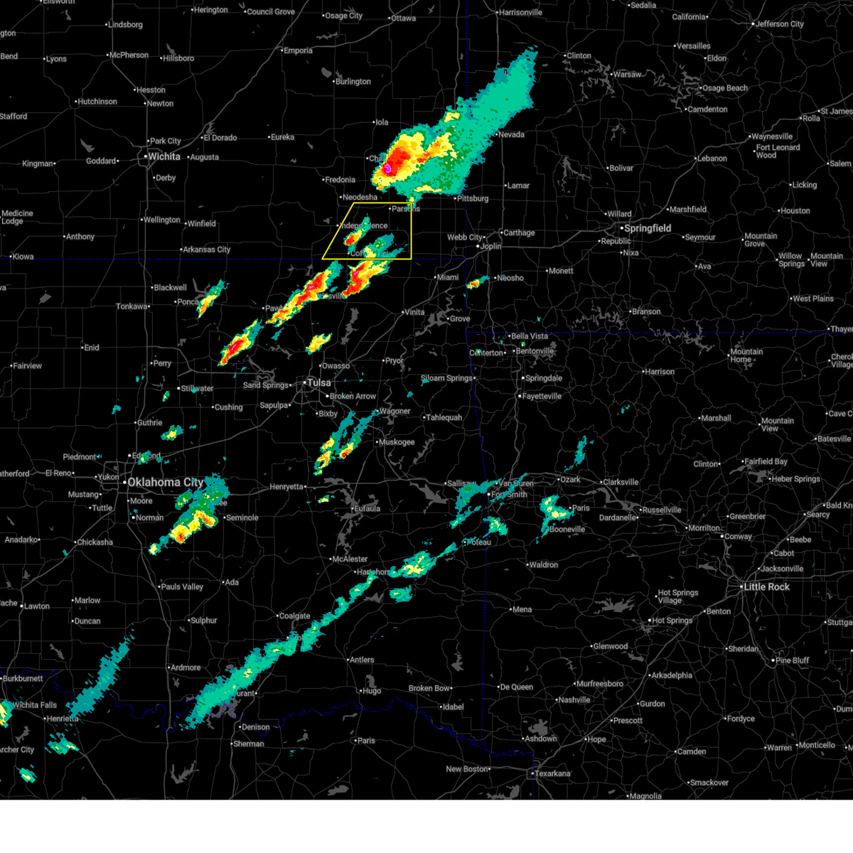
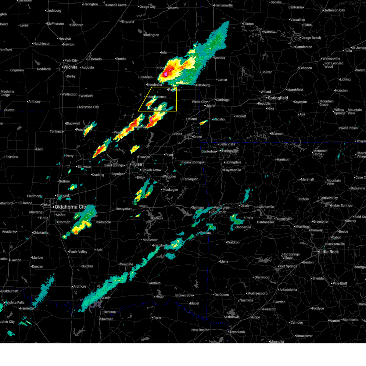
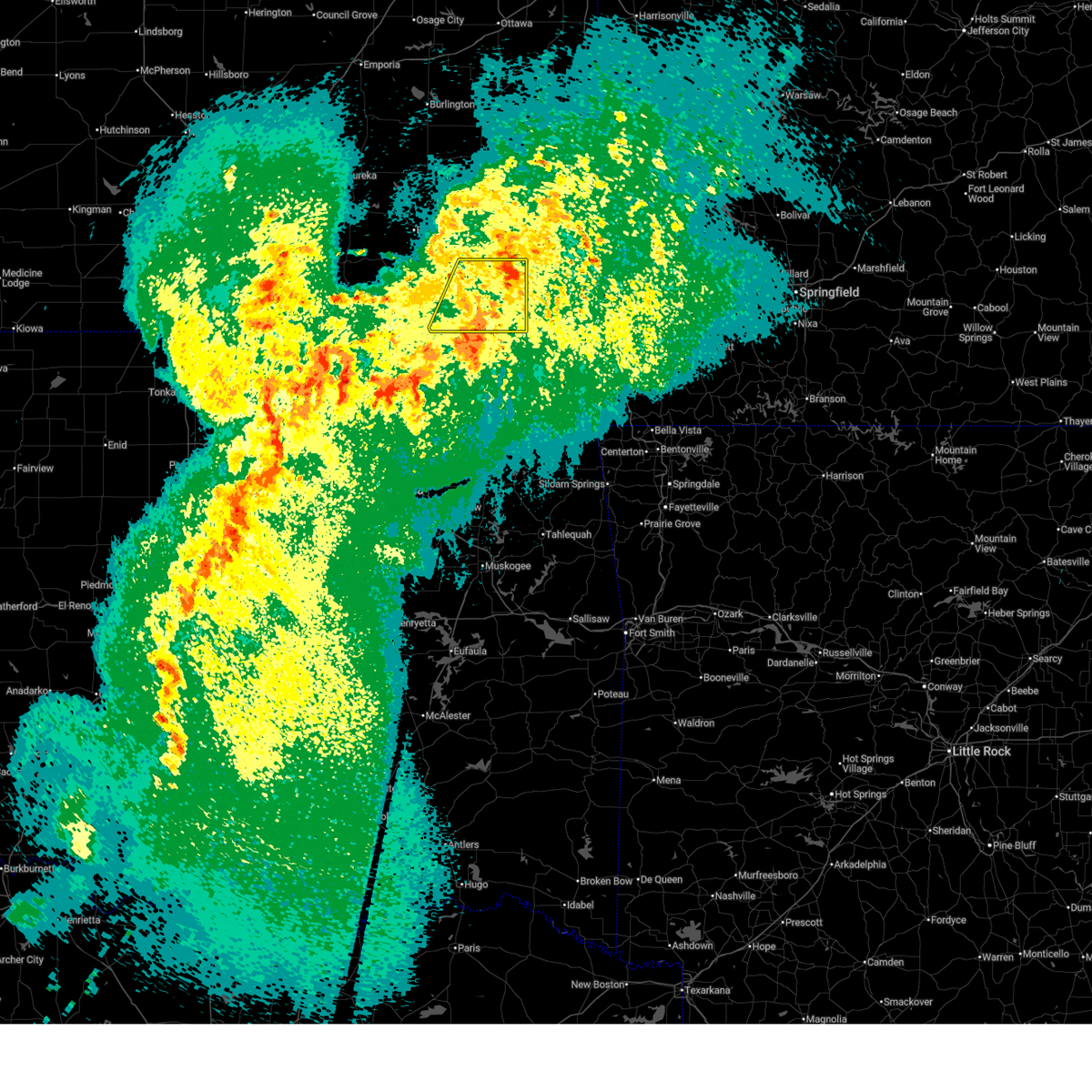
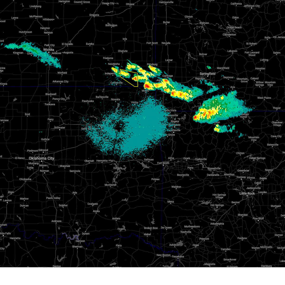
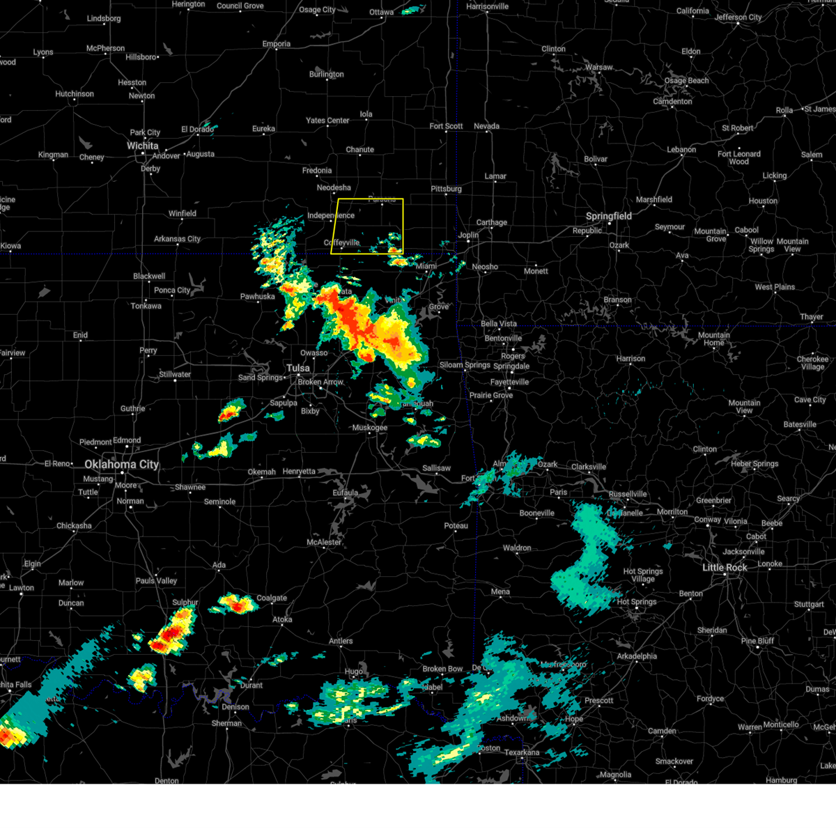
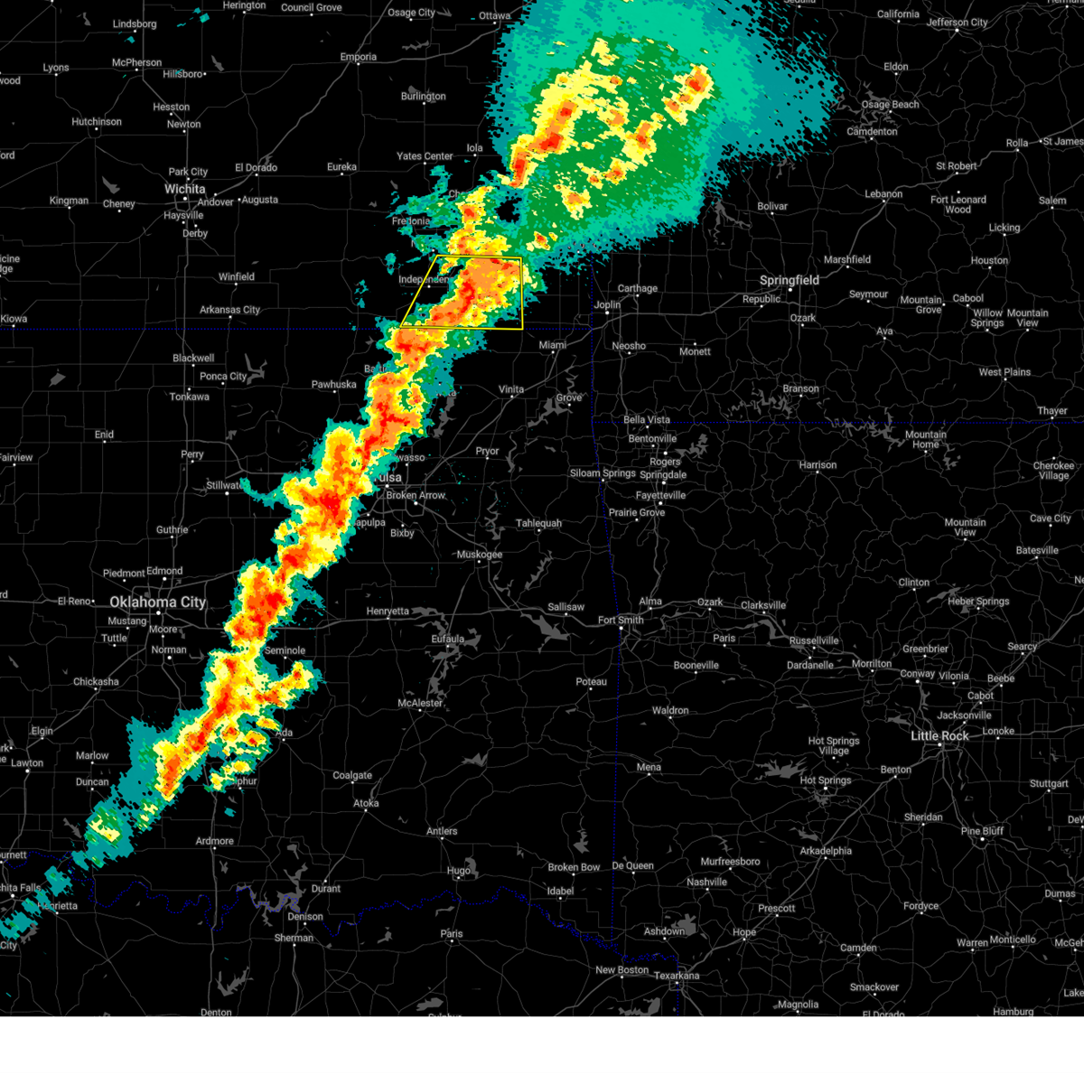
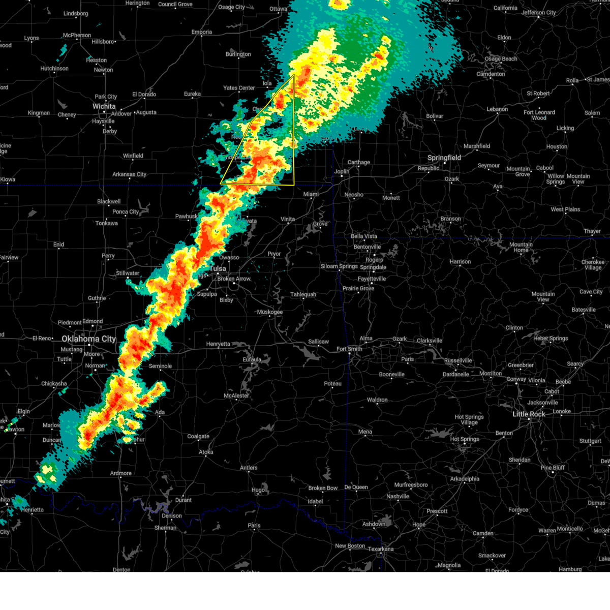
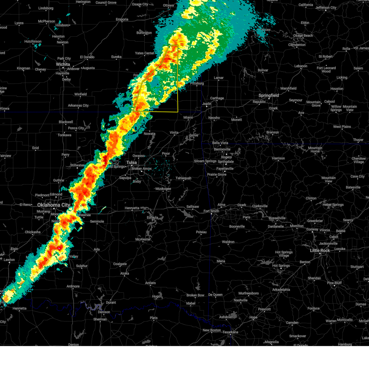
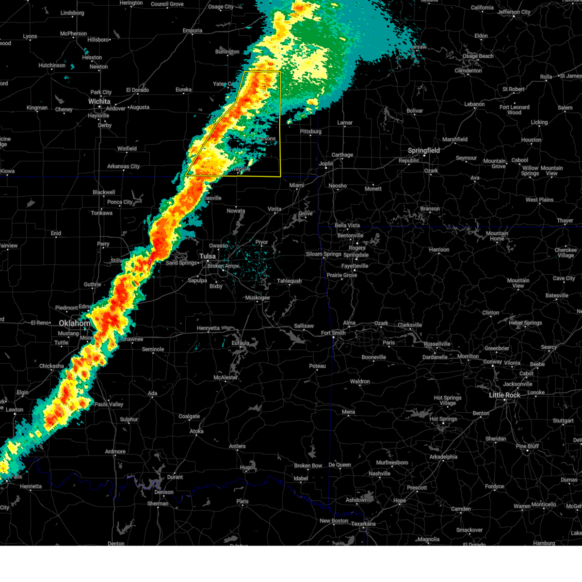
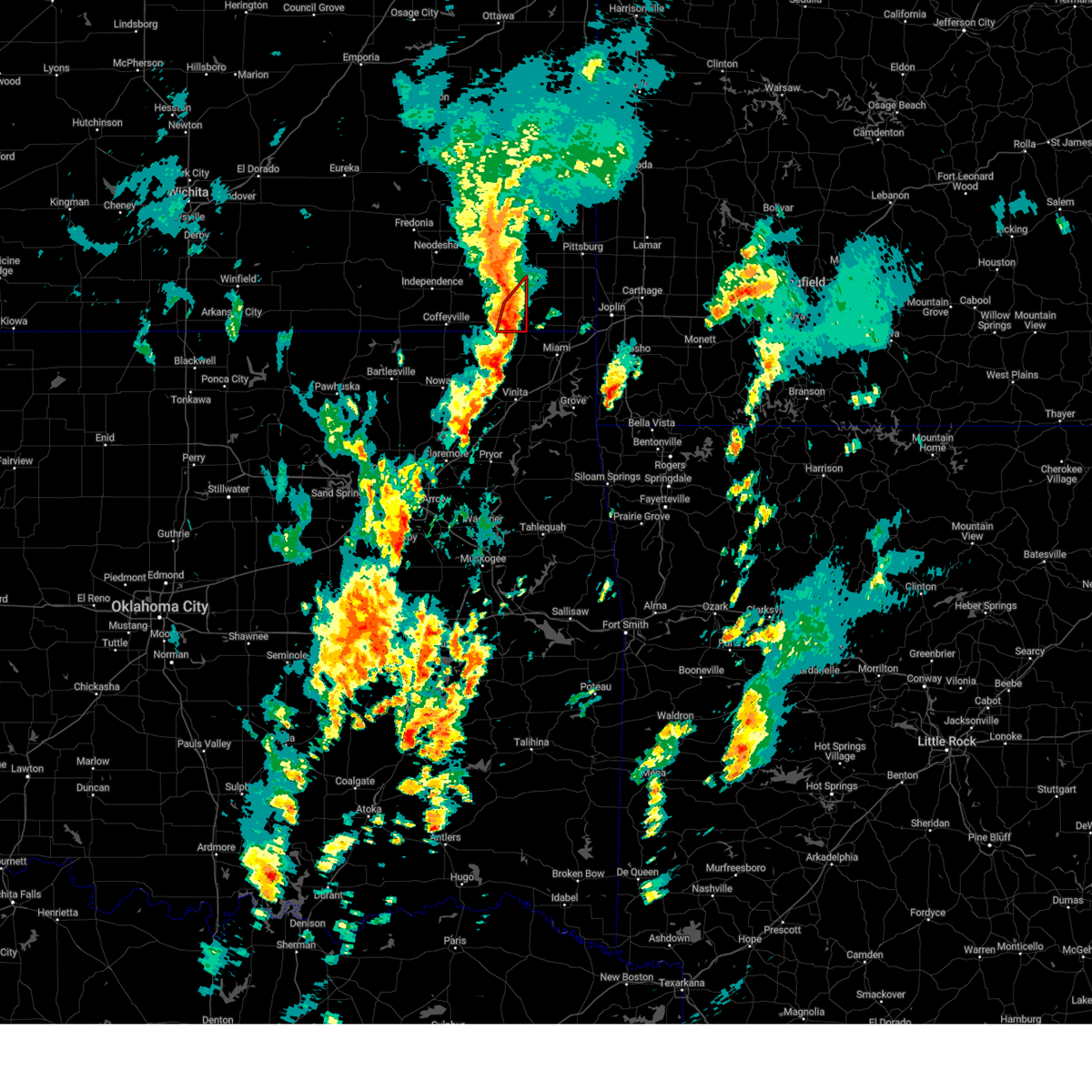
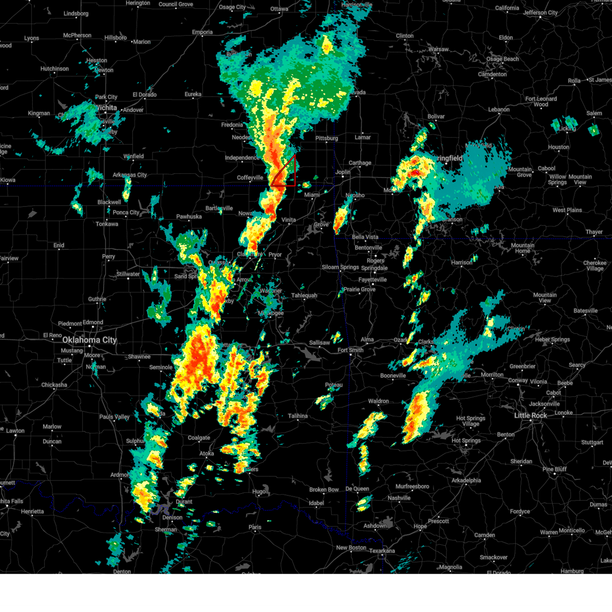
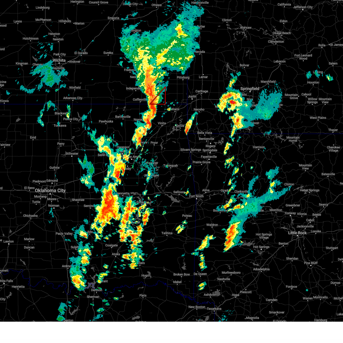
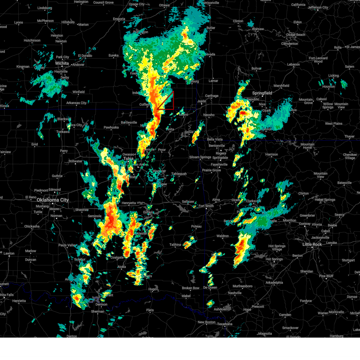
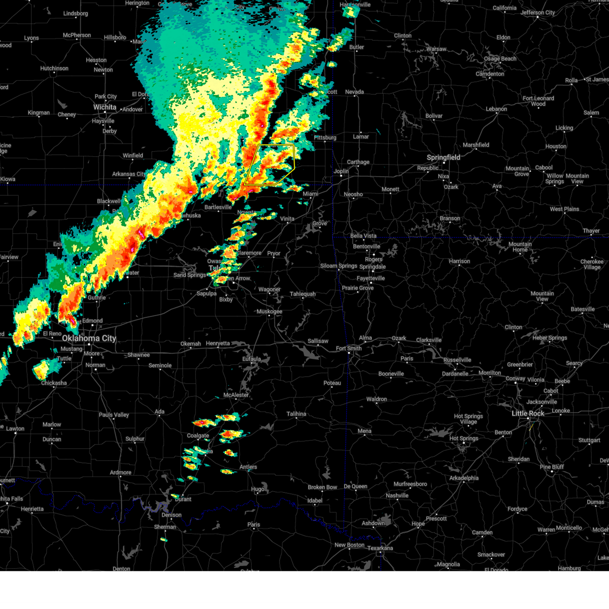
Hail Map for Bartlett, KS
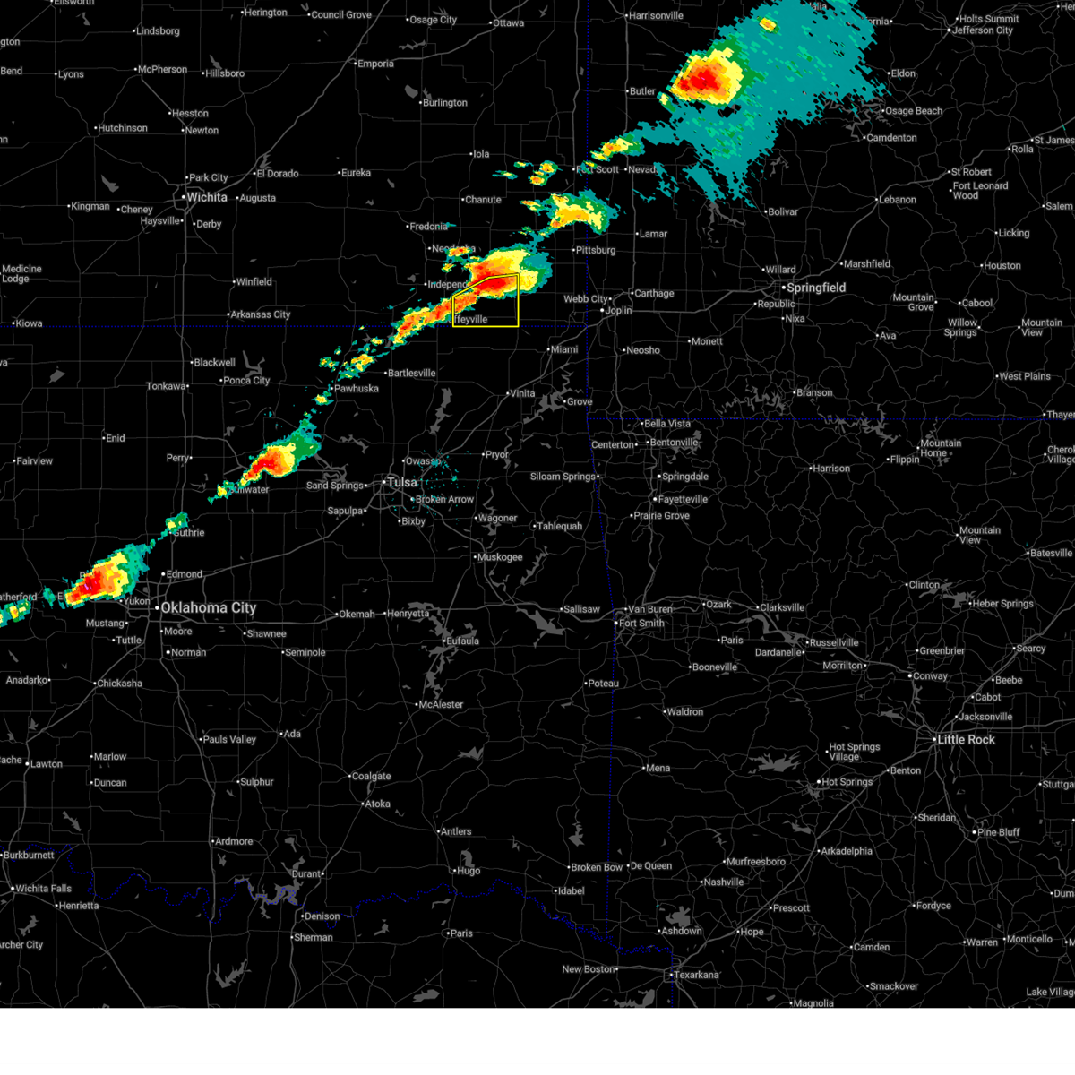
The Bartlett, KS area has had 3 reports of on-the-ground hail by trained spotters, and has been under severe weather warnings 30 times during the past 12 months. Doppler radar has detected hail at or near Bartlett, KS on 74 occasions, including 8 occasions during the past year.
| Name: | Bartlett, KS |
| Where Located: | 45.2 miles SSE of Chanute, KS |
| Map: | Google Map for Bartlett, KS |
| Population: | 80 |
| Housing Units: | 42 |
| More Info: | Search Google for Bartlett, KS |
3
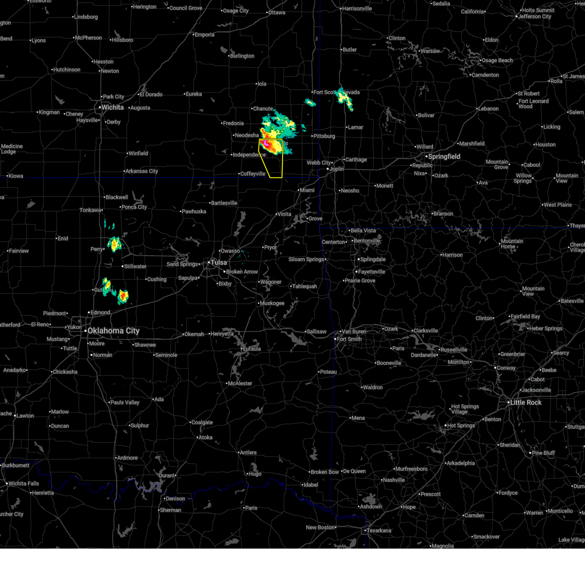
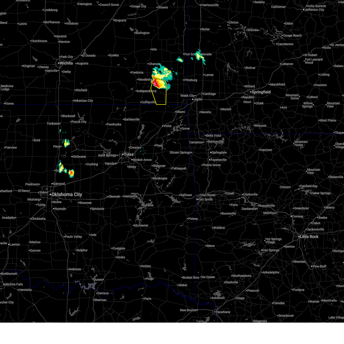
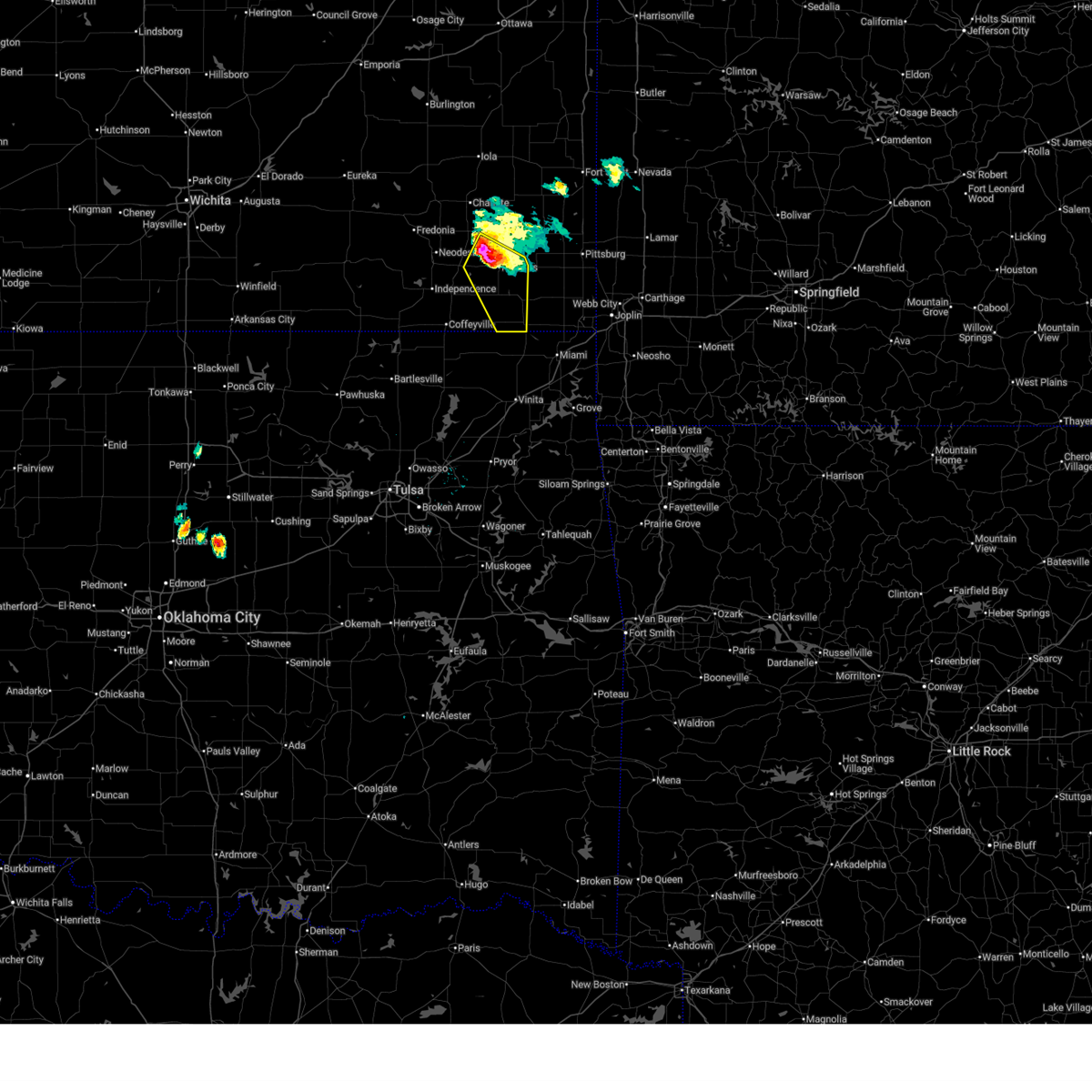
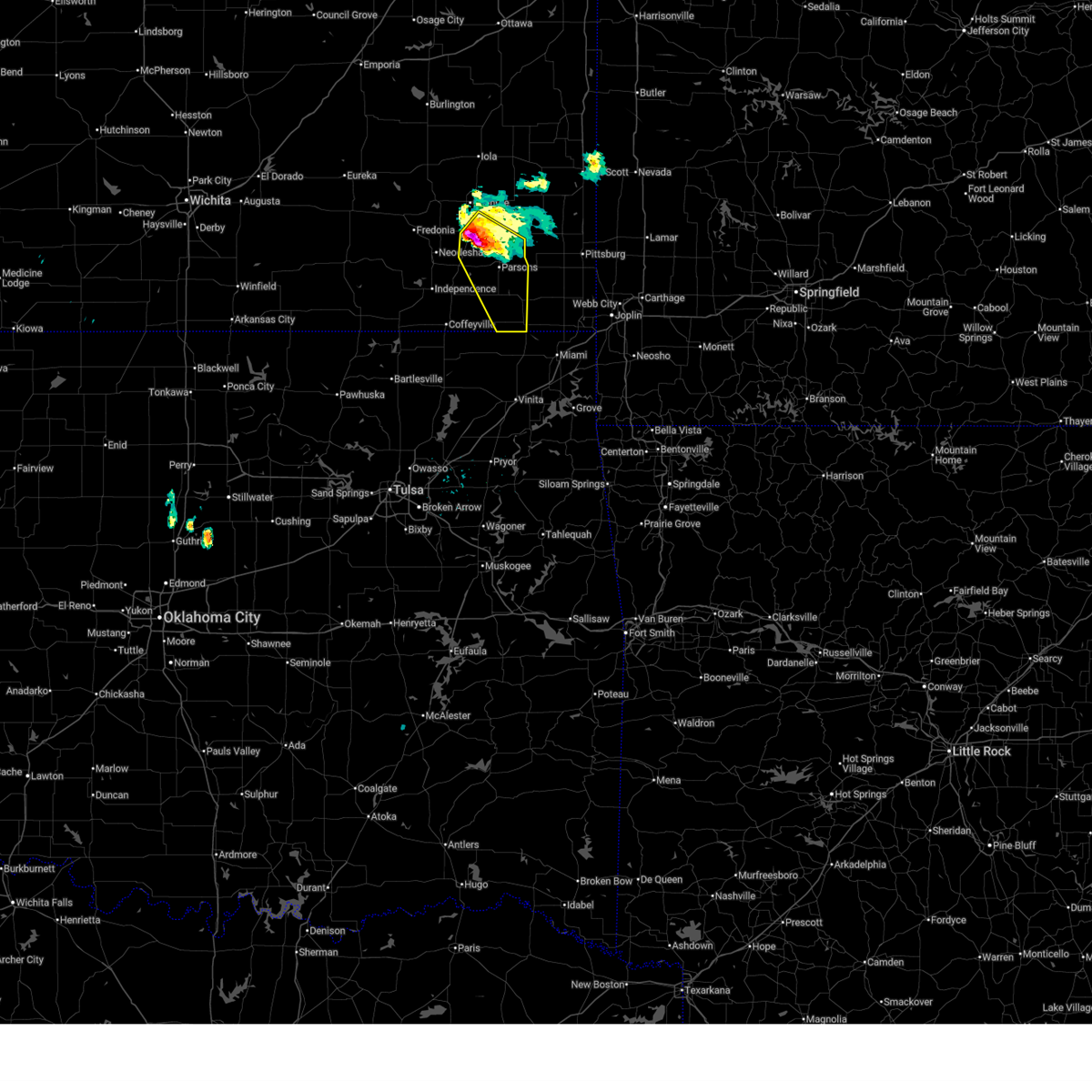
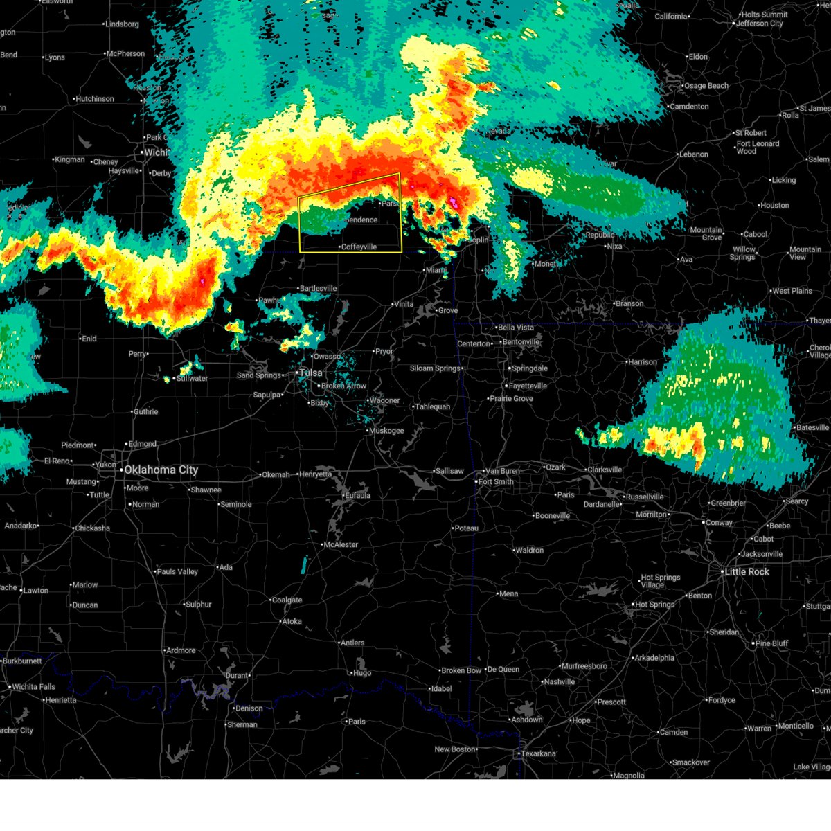
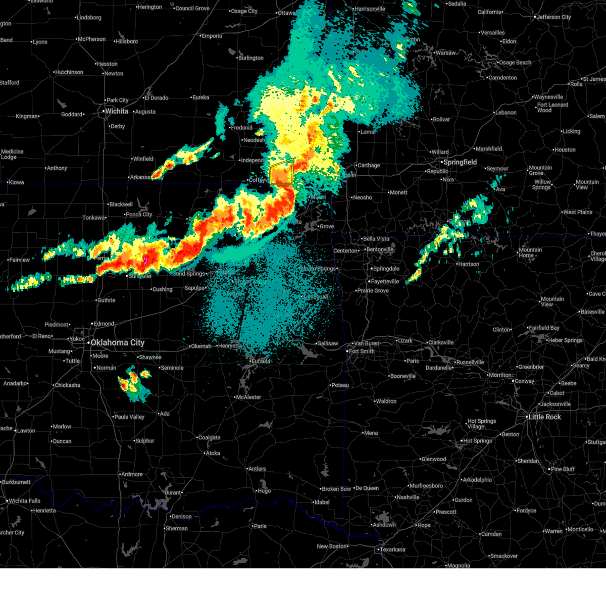
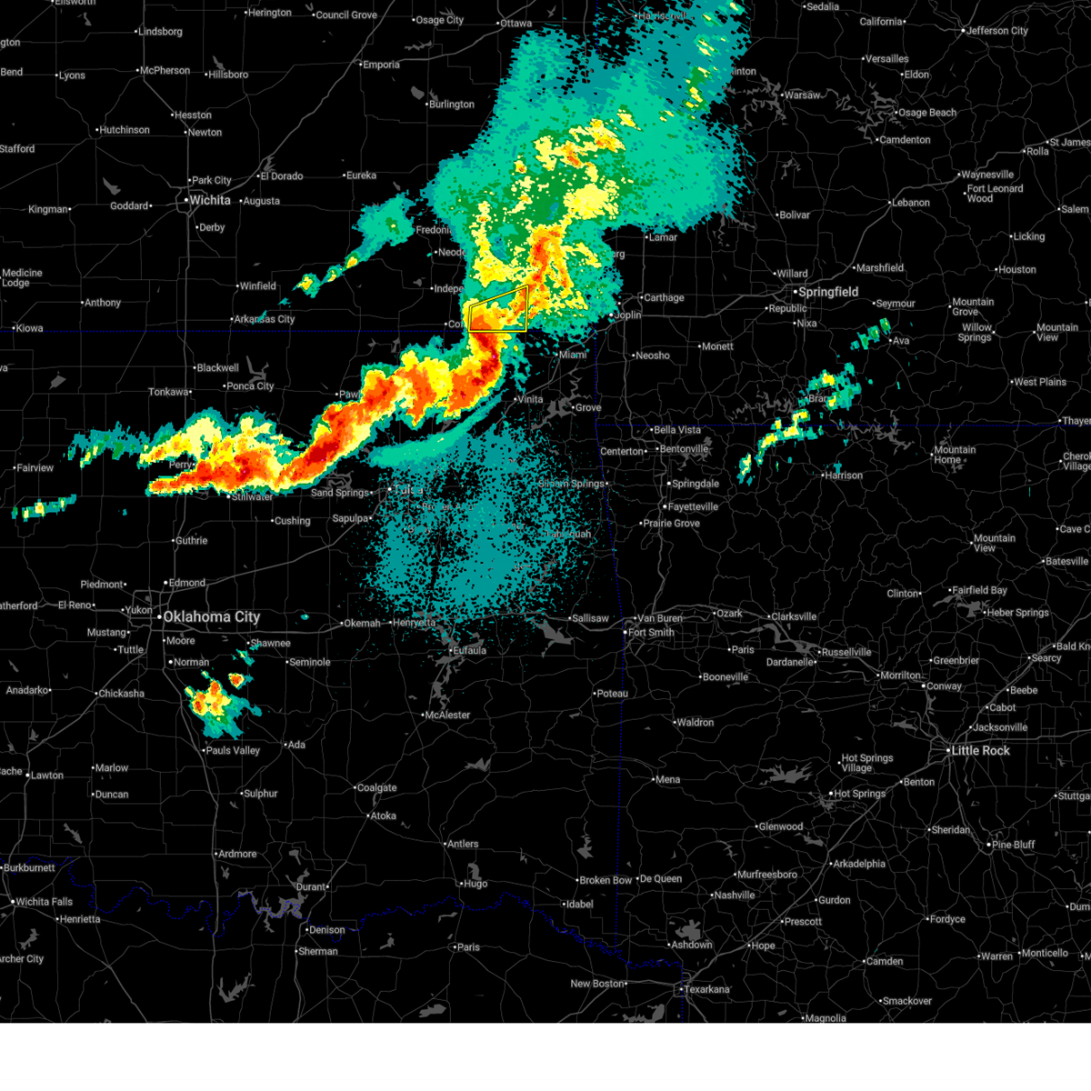
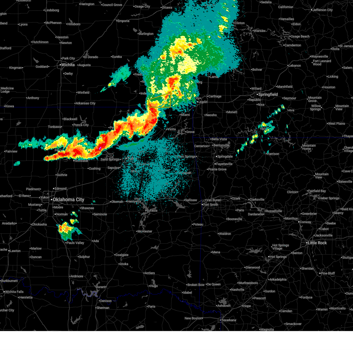
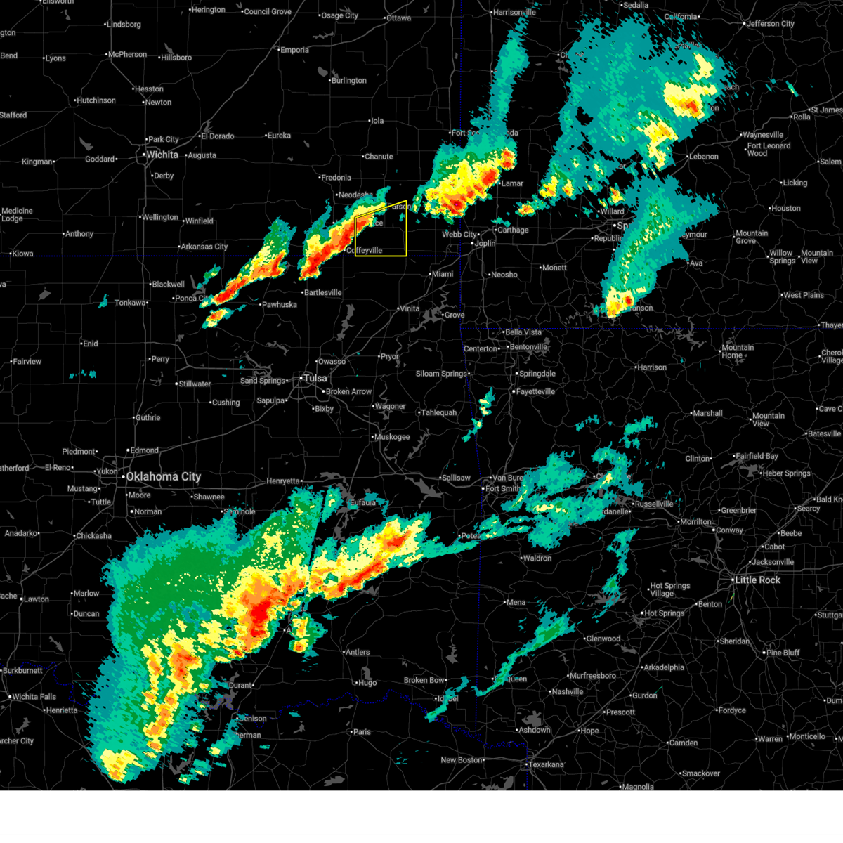
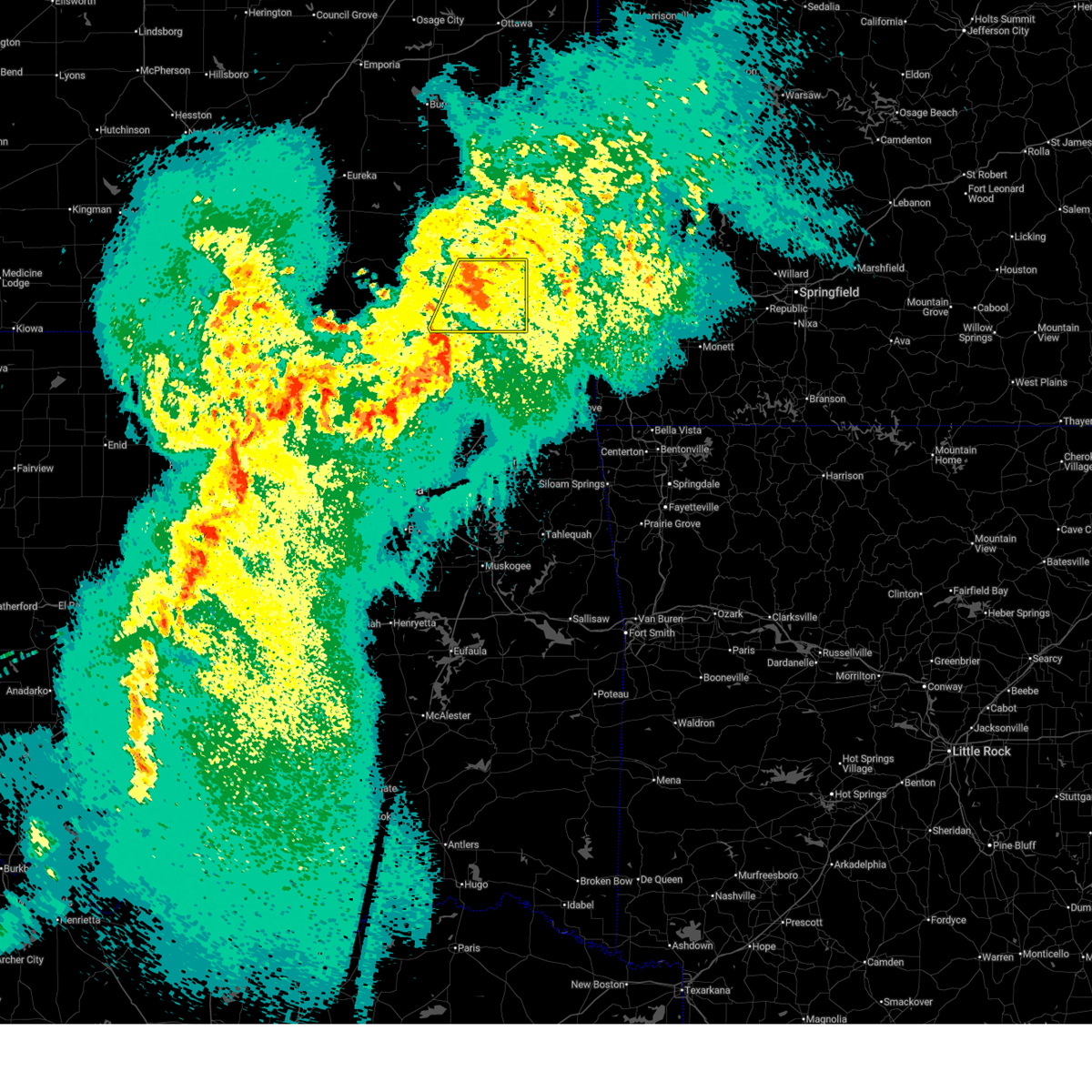
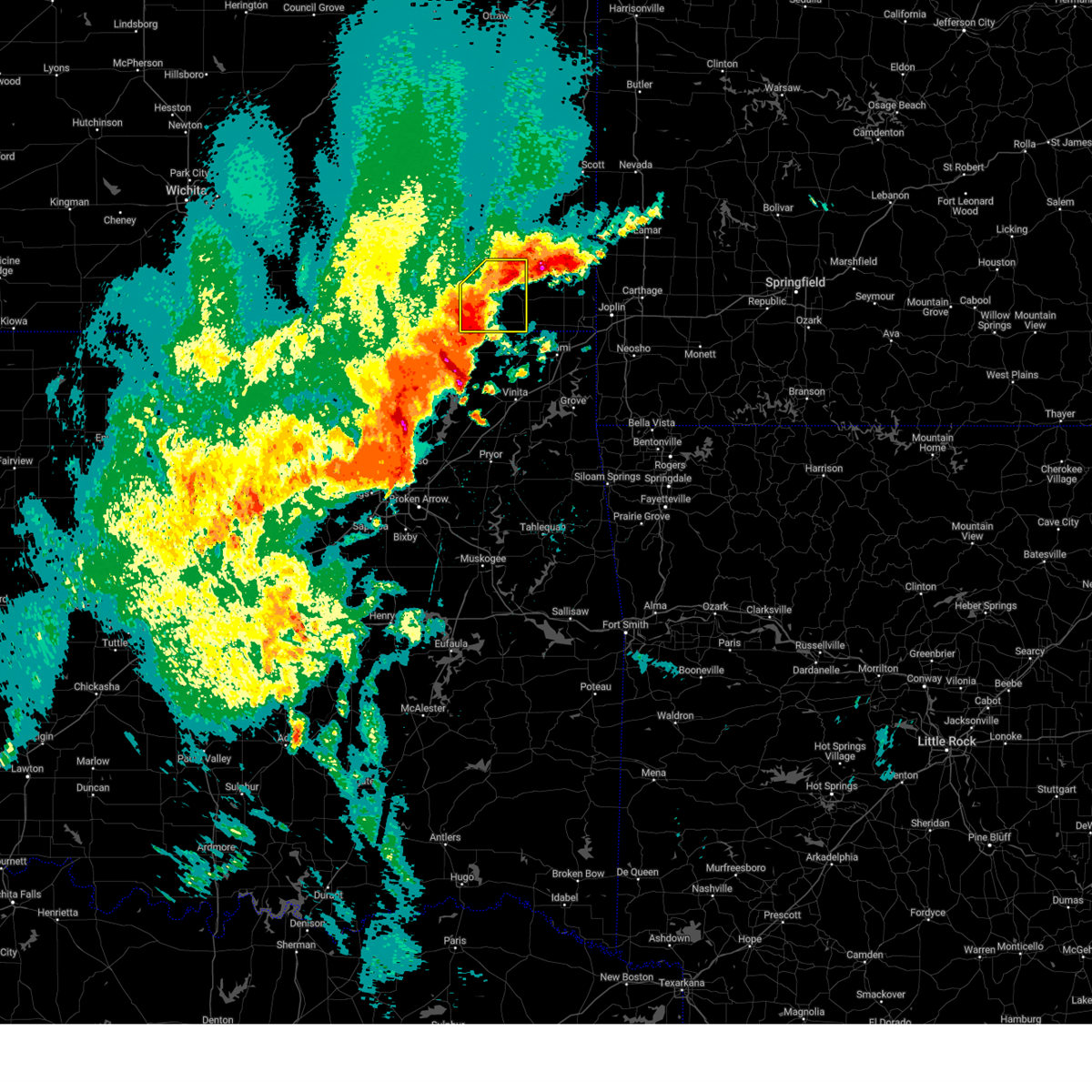
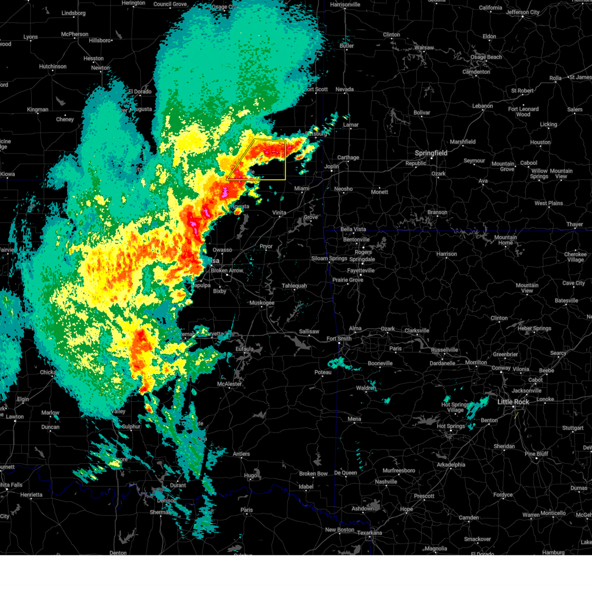
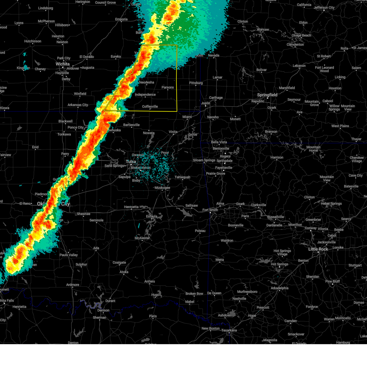
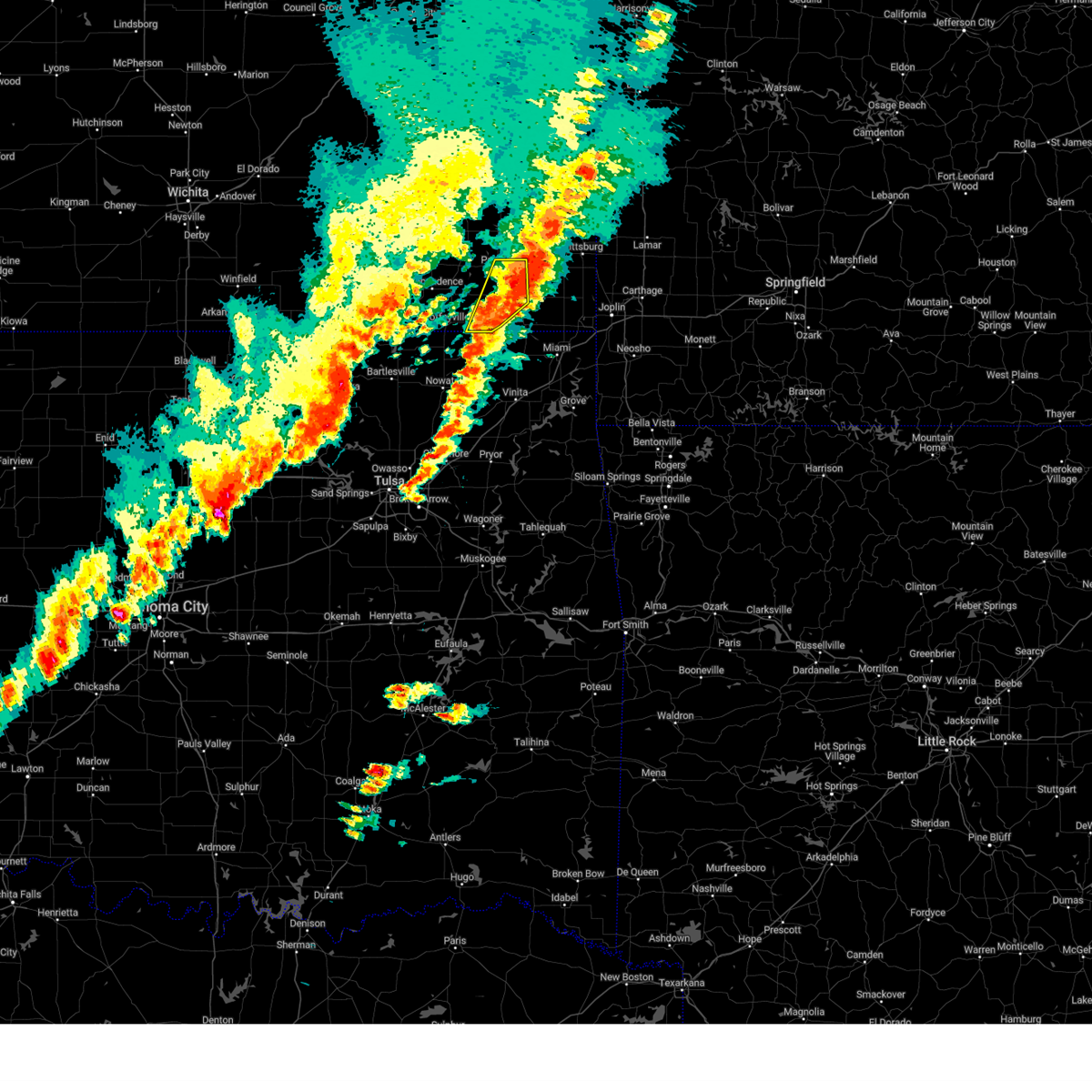
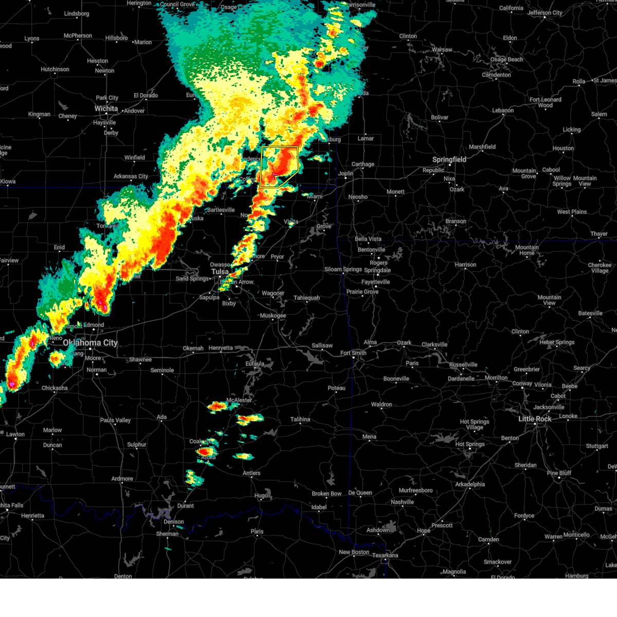
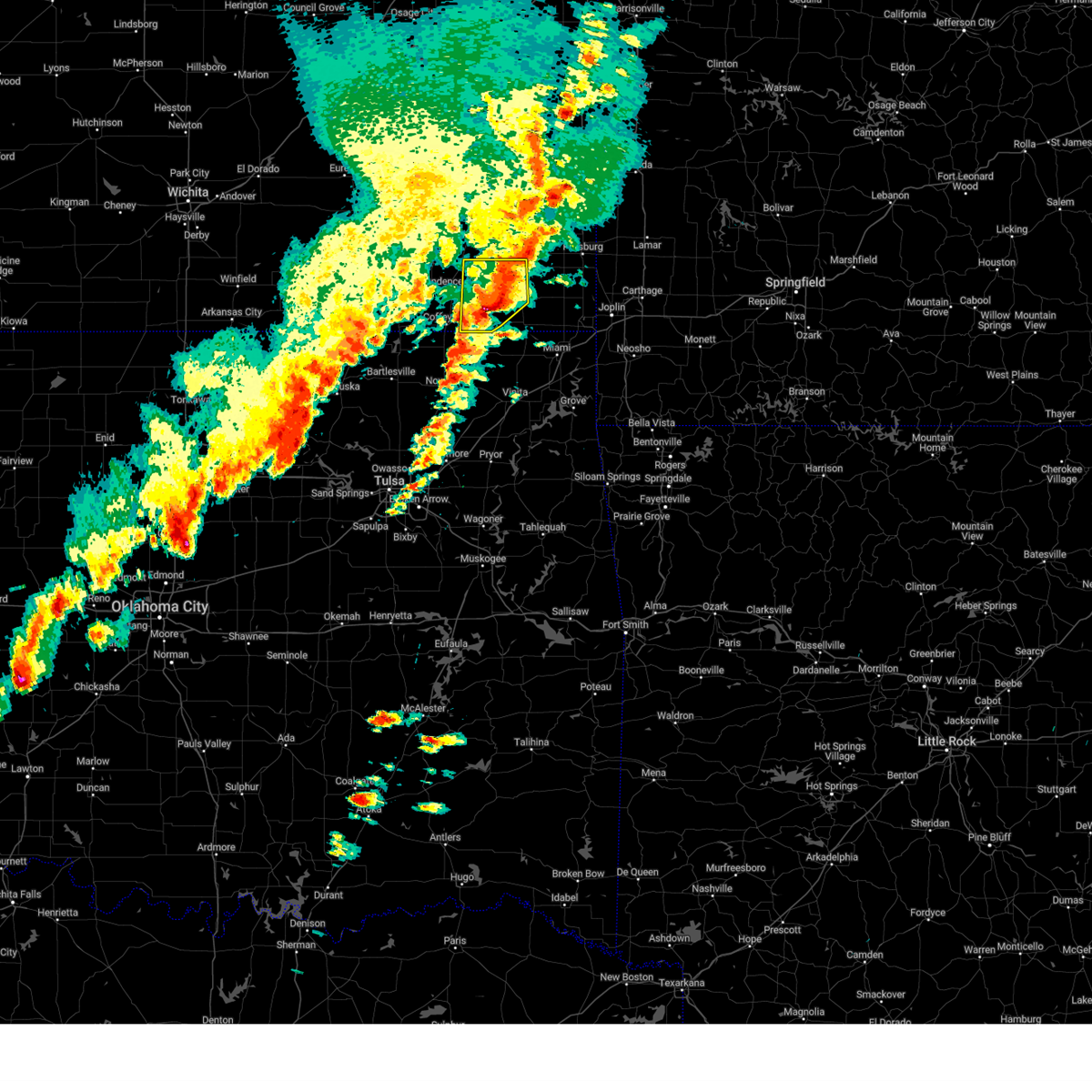
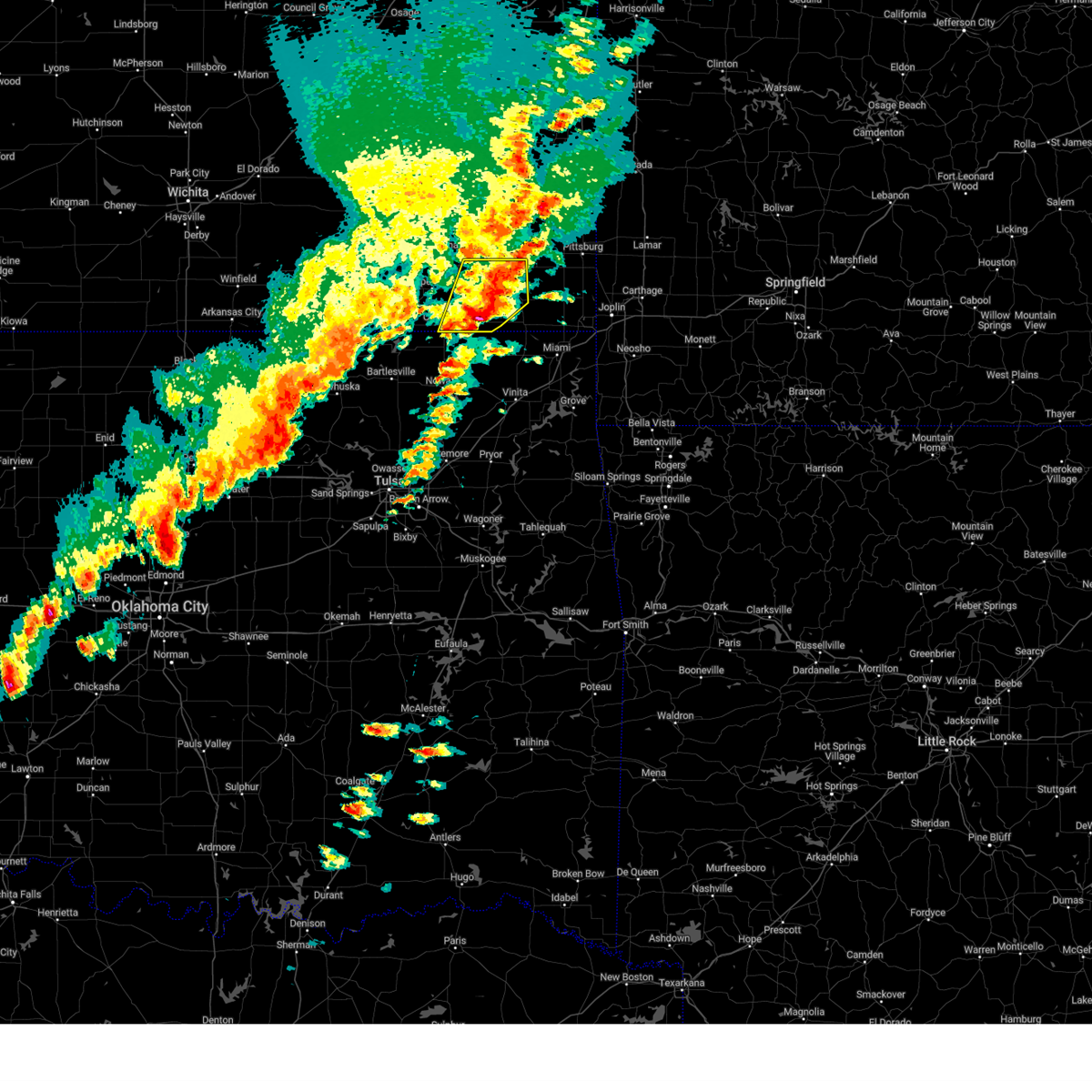
The Top Recent Hail Date for Bartlett, KS is Thursday, June 11, 2026 (3rd out of 74)
Hail and Wind Damage Spotted near Bartlett, KS
| Date / Time | Report Details |
|---|---|
| 6/17/2026 1:10 AM CDT |
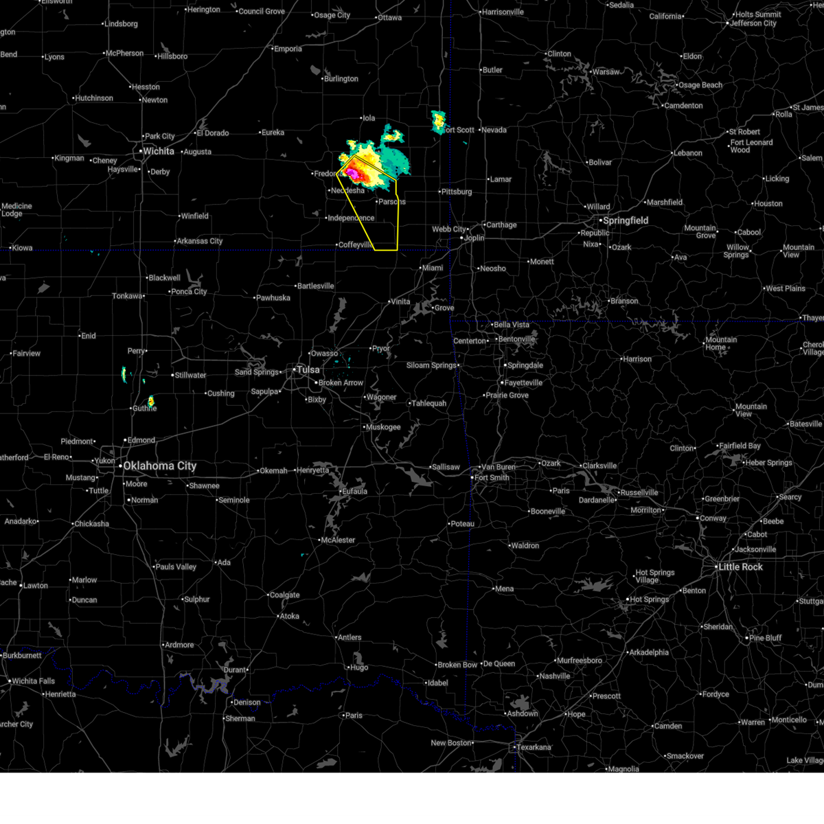
 At 110 am cdt, a severe thunderstorm was located over parsons, moving southeast at 30 mph (radar indicated). Hazards include golf ball size hail and 60 mph wind gusts. People and animals outdoors will be injured. expect hail damage to roofs, siding, windows, and vehicles. expect wind damage to roofs, siding, and trees. Locations impacted include, parsons, oswego, chetopa, altamont, bartlett, and labette. At 110 am cdt, a severe thunderstorm was located over parsons, moving southeast at 30 mph (radar indicated). Hazards include golf ball size hail and 60 mph wind gusts. People and animals outdoors will be injured. expect hail damage to roofs, siding, windows, and vehicles. expect wind damage to roofs, siding, and trees. Locations impacted include, parsons, oswego, chetopa, altamont, bartlett, and labette.
|
| 6/17/2026 1:05 AM CDT |
 At 105 am cdt, a severe thunderstorm was located over parsons, moving southeast at 30 mph (radar indicated). Hazards include golf ball size hail and 60 mph wind gusts. People and animals outdoors will be injured. expect hail damage to roofs, siding, windows, and vehicles. expect wind damage to roofs, siding, and trees. Locations impacted include, parsons, oswego, chetopa, altamont, bartlett, labette, and lake parsons. At 105 am cdt, a severe thunderstorm was located over parsons, moving southeast at 30 mph (radar indicated). Hazards include golf ball size hail and 60 mph wind gusts. People and animals outdoors will be injured. expect hail damage to roofs, siding, windows, and vehicles. expect wind damage to roofs, siding, and trees. Locations impacted include, parsons, oswego, chetopa, altamont, bartlett, labette, and lake parsons.
|
| 6/17/2026 12:54 AM CDT |
 At 1254 am cdt, a severe thunderstorm was located near galesburg, or near parsons, moving southeast at 30 mph (radar indicated). Hazards include golf ball size hail and 60 mph wind gusts. People and animals outdoors will be injured. expect hail damage to roofs, siding, windows, and vehicles. expect wind damage to roofs, siding, and trees. Locations impacted include, parsons, oswego, chetopa, altamont, mound valley, galesburg, bartlett, labette, lake parsons, dennis, south mound, and big hill lake. At 1254 am cdt, a severe thunderstorm was located near galesburg, or near parsons, moving southeast at 30 mph (radar indicated). Hazards include golf ball size hail and 60 mph wind gusts. People and animals outdoors will be injured. expect hail damage to roofs, siding, windows, and vehicles. expect wind damage to roofs, siding, and trees. Locations impacted include, parsons, oswego, chetopa, altamont, mound valley, galesburg, bartlett, labette, lake parsons, dennis, south mound, and big hill lake.
|
| 6/17/2026 12:43 AM CDT |
 At 1243 am cdt, a severe thunderstorm was located over galesburg, or 10 miles southwest of erie, moving southeast at 30 mph (radar indicated). Hazards include golf ball size hail and 60 mph wind gusts. People and animals outdoors will be injured. expect hail damage to roofs, siding, windows, and vehicles. expect wind damage to roofs, siding, and trees. locations impacted include, parsons, oswego, chetopa, altamont, st. Paul, thayer, mound valley, galesburg, bartlett, labette, lake parsons, dennis, big hill lake, and south mound. At 1243 am cdt, a severe thunderstorm was located over galesburg, or 10 miles southwest of erie, moving southeast at 30 mph (radar indicated). Hazards include golf ball size hail and 60 mph wind gusts. People and animals outdoors will be injured. expect hail damage to roofs, siding, windows, and vehicles. expect wind damage to roofs, siding, and trees. locations impacted include, parsons, oswego, chetopa, altamont, st. Paul, thayer, mound valley, galesburg, bartlett, labette, lake parsons, dennis, big hill lake, and south mound.
|
| 6/17/2026 12:36 AM CDT |
 Svrict the national weather service in wichita has issued a * severe thunderstorm warning for, east central wilson county in southeastern kansas, labette county in southeastern kansas, southern neosho county in southeastern kansas, * until 145 am cdt. * at 1235 am cdt, a severe thunderstorm was located near thayer, or 10 miles south of chanute, moving southeast at 30 mph. this warning replaces the previous severe thunderstorm warning (radar indicated). Hazards include ping pong ball size hail and 60 mph wind gusts. People and animals outdoors will be injured. expect hail damage to roofs, siding, windows, and vehicles. Expect wind damage to roofs, siding, and trees. Svrict the national weather service in wichita has issued a * severe thunderstorm warning for, east central wilson county in southeastern kansas, labette county in southeastern kansas, southern neosho county in southeastern kansas, * until 145 am cdt. * at 1235 am cdt, a severe thunderstorm was located near thayer, or 10 miles south of chanute, moving southeast at 30 mph. this warning replaces the previous severe thunderstorm warning (radar indicated). Hazards include ping pong ball size hail and 60 mph wind gusts. People and animals outdoors will be injured. expect hail damage to roofs, siding, windows, and vehicles. Expect wind damage to roofs, siding, and trees.
|
| 6/13/2026 10:54 PM CDT |
 At 1053 pm cdt, severe thunderstorms were located along a line extending from 6 miles west of columbus to near edna to near wann, moving southeast at 45 mph (radar indicated. the storm has a history of producing winds in excess of 60 to 70 mph). Hazards include 60 to 75 mph wind gusts. Expect considerable tree damage. damage is likely to mobile homes, roofs, and outbuildings. Locations impacted include, coffeyville, independence, cherryvale, caney, oswego, chetopa, altamont, edna, dearing, mound valley, tyro, liberty, havana, bolton, bartlett, labette, angola, big hill lake, elk city state park, and independence airport. At 1053 pm cdt, severe thunderstorms were located along a line extending from 6 miles west of columbus to near edna to near wann, moving southeast at 45 mph (radar indicated. the storm has a history of producing winds in excess of 60 to 70 mph). Hazards include 60 to 75 mph wind gusts. Expect considerable tree damage. damage is likely to mobile homes, roofs, and outbuildings. Locations impacted include, coffeyville, independence, cherryvale, caney, oswego, chetopa, altamont, edna, dearing, mound valley, tyro, liberty, havana, bolton, bartlett, labette, angola, big hill lake, elk city state park, and independence airport.
|
| 6/13/2026 10:41 PM CDT |
 At 1040 pm cdt, severe thunderstorms were located along a line extending from 5 miles northeast of oswego to 7 miles east of coffeyville to near havana, moving south to southeast at 50 mph (radar indicated. this storm has a history of producing 60 to 70 mph winds). Hazards include 70 mph wind gusts. Expect considerable tree damage. damage is likely to mobile homes, roofs, and outbuildings. locations impacted include, parsons, coffeyville, independence, neodesha, cherryvale, caney, oswego, chetopa, altamont, st. Paul, edna, dearing, mound valley, elk city, tyro, galesburg, liberty, havana, bolton, and sycamore. At 1040 pm cdt, severe thunderstorms were located along a line extending from 5 miles northeast of oswego to 7 miles east of coffeyville to near havana, moving south to southeast at 50 mph (radar indicated. this storm has a history of producing 60 to 70 mph winds). Hazards include 70 mph wind gusts. Expect considerable tree damage. damage is likely to mobile homes, roofs, and outbuildings. locations impacted include, parsons, coffeyville, independence, neodesha, cherryvale, caney, oswego, chetopa, altamont, st. Paul, edna, dearing, mound valley, elk city, tyro, galesburg, liberty, havana, bolton, and sycamore.
|
| 6/13/2026 10:22 PM CDT |
 Svrict the national weather service in wichita has issued a * severe thunderstorm warning for, southeastern wilson county in southeastern kansas, labette county in southeastern kansas, southern neosho county in southeastern kansas, montgomery county in southeastern kansas, * until 1130 pm cdt. * at 1020 pm cdt, severe thunderstorms were located along a line extending from 7 miles north of mccune to elk city, moving southeast at 45 mph (radar indicated. this line of storms has a history of producing winds greater than 60 mph). Hazards include 70 mph wind gusts and penny size hail. Expect considerable tree damage. Damage is likely to mobile homes, roofs, and outbuildings. Svrict the national weather service in wichita has issued a * severe thunderstorm warning for, southeastern wilson county in southeastern kansas, labette county in southeastern kansas, southern neosho county in southeastern kansas, montgomery county in southeastern kansas, * until 1130 pm cdt. * at 1020 pm cdt, severe thunderstorms were located along a line extending from 7 miles north of mccune to elk city, moving southeast at 45 mph (radar indicated. this line of storms has a history of producing winds greater than 60 mph). Hazards include 70 mph wind gusts and penny size hail. Expect considerable tree damage. Damage is likely to mobile homes, roofs, and outbuildings.
|
| 6/11/2026 6:20 PM CDT |
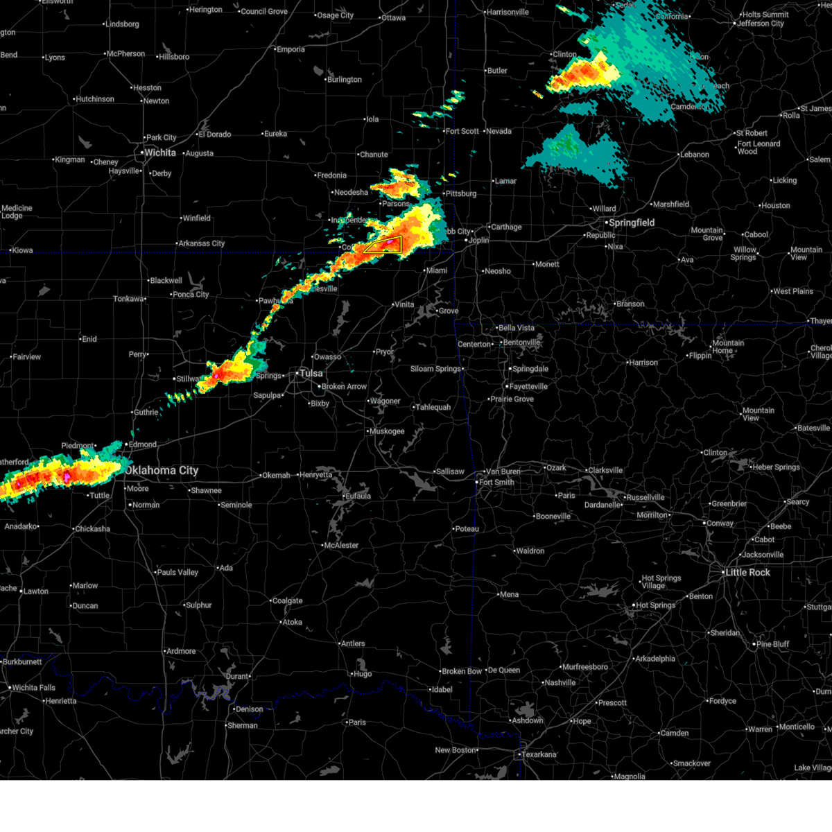 At 620 pm cdt, severe thunderstorms were located along a line extending from near chetopa to 9 miles southeast of edna, moving southeast at 20 mph (radar indicated). Hazards include 60 mph wind gusts and half dollar size hail. Hail damage to vehicles is expected. expect wind damage to roofs, siding, and trees. Locations impacted include, chetopa and bartlett. At 620 pm cdt, severe thunderstorms were located along a line extending from near chetopa to 9 miles southeast of edna, moving southeast at 20 mph (radar indicated). Hazards include 60 mph wind gusts and half dollar size hail. Hail damage to vehicles is expected. expect wind damage to roofs, siding, and trees. Locations impacted include, chetopa and bartlett.
|
| 6/11/2026 6:10 PM CDT |
 At 610 pm cdt, severe thunderstorms were located along a line extending from near chetopa to 6 miles southeast of edna, moving southeast at 20 mph (radar indicated). Hazards include 60 mph wind gusts and half dollar size hail. Hail damage to vehicles is expected. expect wind damage to roofs, siding, and trees. Locations impacted include, chetopa, edna, and bartlett. At 610 pm cdt, severe thunderstorms were located along a line extending from near chetopa to 6 miles southeast of edna, moving southeast at 20 mph (radar indicated). Hazards include 60 mph wind gusts and half dollar size hail. Hail damage to vehicles is expected. expect wind damage to roofs, siding, and trees. Locations impacted include, chetopa, edna, and bartlett.
|
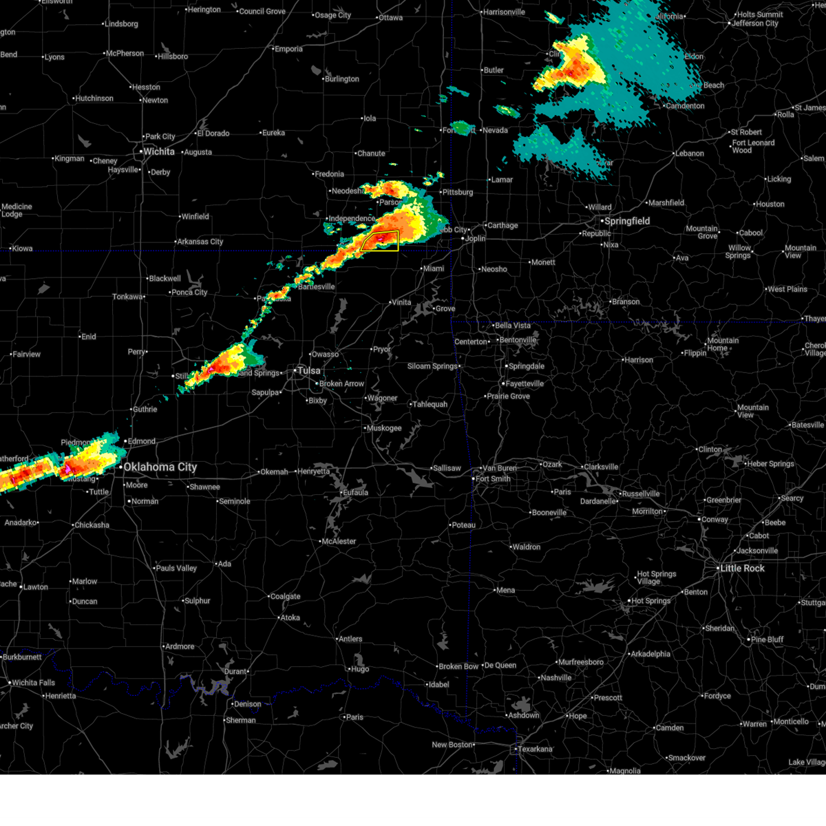
| 6/11/2026 5:51 PM CDT |
 At 551 pm cdt, severe thunderstorms were located along a line extending from near oswego to near edna, moving southeast at 20 mph (radar indicated). Hazards include 60 mph wind gusts and half dollar size hail. Hail damage to vehicles is expected. expect wind damage to roofs, siding, and trees. Locations impacted include, oswego, chetopa, altamont, edna, bartlett, and angola. At 551 pm cdt, severe thunderstorms were located along a line extending from near oswego to near edna, moving southeast at 20 mph (radar indicated). Hazards include 60 mph wind gusts and half dollar size hail. Hail damage to vehicles is expected. expect wind damage to roofs, siding, and trees. Locations impacted include, oswego, chetopa, altamont, edna, bartlett, and angola.
|
| 6/11/2026 5:47 PM CDT |
 At 546 pm cdt, severe thunderstorms were located along a line extending from 5 miles west of oswego to edna, moving southeast at 20 mph (trained weather spotters reported quarter size hail 2 miles northeast of altamont at 545 pm). Hazards include 60 mph wind gusts and half dollar size hail. Hail damage to vehicles is expected. expect wind damage to roofs, siding, and trees. Locations impacted include, oswego, chetopa, altamont, edna, bartlett, labette, and angola. At 546 pm cdt, severe thunderstorms were located along a line extending from 5 miles west of oswego to edna, moving southeast at 20 mph (trained weather spotters reported quarter size hail 2 miles northeast of altamont at 545 pm). Hazards include 60 mph wind gusts and half dollar size hail. Hail damage to vehicles is expected. expect wind damage to roofs, siding, and trees. Locations impacted include, oswego, chetopa, altamont, edna, bartlett, labette, and angola.
|
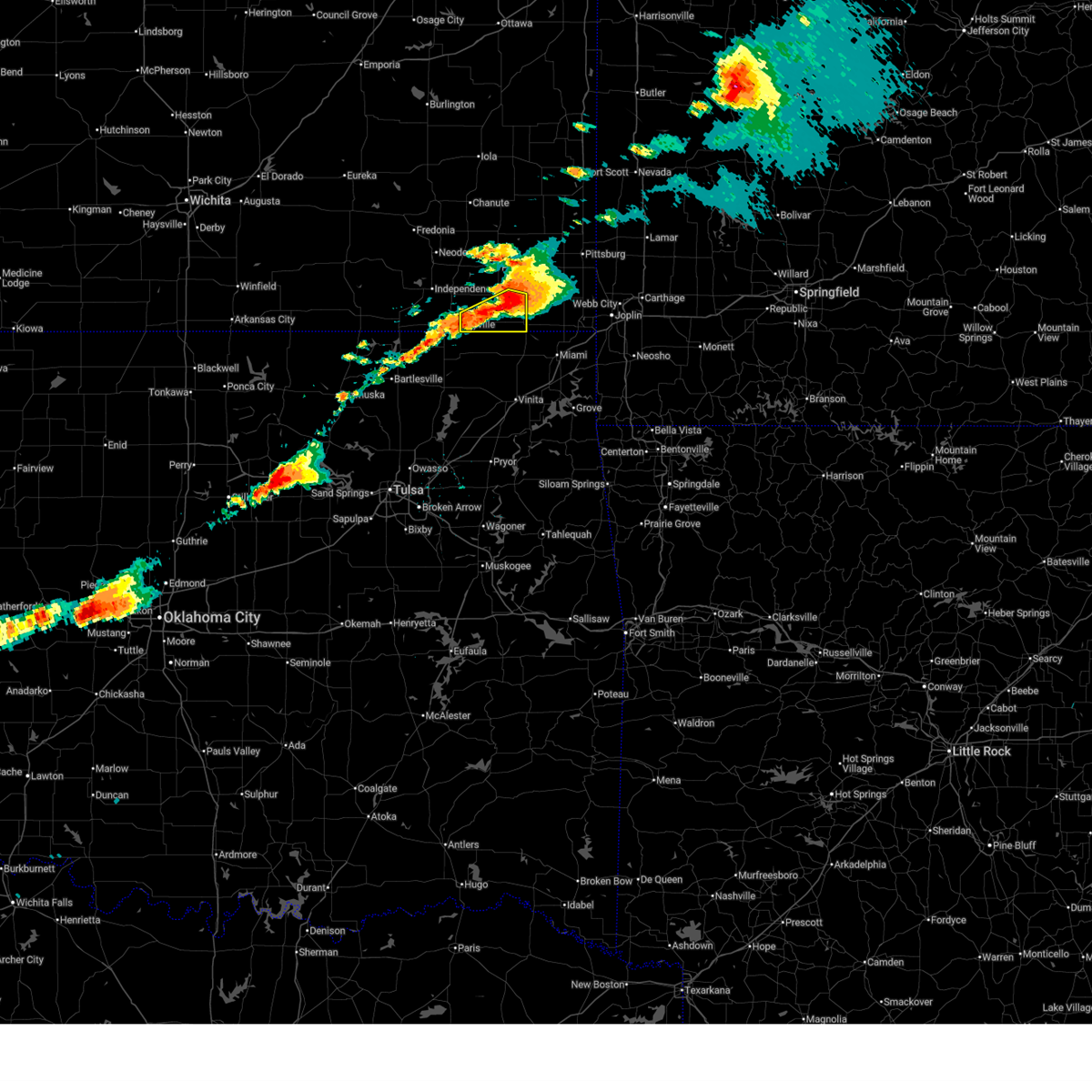
| 6/11/2026 5:35 PM CDT |
 At 535 pm cdt, severe thunderstorms were located along a line extending from near altamont to near edna, moving southeast at 20 mph (radar indicated). Hazards include 60 mph wind gusts and half dollar size hail. Hail damage to vehicles is expected. expect wind damage to roofs, siding, and trees. Locations impacted include, oswego, chetopa, altamont, edna, mound valley, bartlett, labette, and angola. At 535 pm cdt, severe thunderstorms were located along a line extending from near altamont to near edna, moving southeast at 20 mph (radar indicated). Hazards include 60 mph wind gusts and half dollar size hail. Hail damage to vehicles is expected. expect wind damage to roofs, siding, and trees. Locations impacted include, oswego, chetopa, altamont, edna, mound valley, bartlett, labette, and angola.
|
| 6/11/2026 5:28 PM CDT |
 At 527 pm cdt, severe thunderstorms were located along a line extending from near altamont to 6 miles east of liberty, moving east at 20 mph (radar indicated). Hazards include 60 mph wind gusts and half dollar size hail. Hail damage to vehicles is expected. expect wind damage to roofs, siding, and trees. Locations impacted include, oswego, chetopa, altamont, edna, mound valley, bartlett, labette, and angola. At 527 pm cdt, severe thunderstorms were located along a line extending from near altamont to 6 miles east of liberty, moving east at 20 mph (radar indicated). Hazards include 60 mph wind gusts and half dollar size hail. Hail damage to vehicles is expected. expect wind damage to roofs, siding, and trees. Locations impacted include, oswego, chetopa, altamont, edna, mound valley, bartlett, labette, and angola.
|
| 6/11/2026 5:28 PM CDT |
 the severe thunderstorm warning has been cancelled and is no longer in effect the severe thunderstorm warning has been cancelled and is no longer in effect
|
| 4/28/2026 1:29 PM CDT |
 At 128 pm cdt, a severe thunderstorm was located 7 miles southwest of chetopa, moving northeast at 50 mph (radar indicated). Hazards include half dollar size hail. Damage to vehicles is expected. Locations impacted include, parsons, oswego, chetopa, altamont, edna, mound valley, bartlett, labette, and angola. At 128 pm cdt, a severe thunderstorm was located 7 miles southwest of chetopa, moving northeast at 50 mph (radar indicated). Hazards include half dollar size hail. Damage to vehicles is expected. Locations impacted include, parsons, oswego, chetopa, altamont, edna, mound valley, bartlett, labette, and angola.
|
| 4/28/2026 1:10 PM CDT |
 the severe thunderstorm warning has been cancelled and is no longer in effect the severe thunderstorm warning has been cancelled and is no longer in effect
|
| 4/28/2026 1:10 PM CDT |
 At 109 pm cdt, a severe thunderstorm was located near altamont, moving northeast at 50 mph (radar indicated). Hazards include quarter size hail. Damage to vehicles is expected. Locations impacted include, parsons, oswego, chetopa, altamont, edna, mound valley, bartlett, labette, and angola. At 109 pm cdt, a severe thunderstorm was located near altamont, moving northeast at 50 mph (radar indicated). Hazards include quarter size hail. Damage to vehicles is expected. Locations impacted include, parsons, oswego, chetopa, altamont, edna, mound valley, bartlett, labette, and angola.
|
| 4/28/2026 1:00 PM CDT |
 At 1259 pm cdt, a severe thunderstorm was located over edna, or 7 miles south of altamont, moving northeast at 45 mph (radar indicated). Hazards include quarter size hail. Damage to vehicles is expected. Locations impacted include, parsons, coffeyville, cherryvale, oswego, chetopa, altamont, edna, mound valley, liberty, bartlett, labette, angola, dennis, big hill lake, and coffeyville airport. At 1259 pm cdt, a severe thunderstorm was located over edna, or 7 miles south of altamont, moving northeast at 45 mph (radar indicated). Hazards include quarter size hail. Damage to vehicles is expected. Locations impacted include, parsons, coffeyville, cherryvale, oswego, chetopa, altamont, edna, mound valley, liberty, bartlett, labette, angola, dennis, big hill lake, and coffeyville airport.
|
| 4/28/2026 12:46 PM CDT |
 Svrict the national weather service in wichita has issued a * severe thunderstorm warning for, labette county in southeastern kansas, southeastern montgomery county in southeastern kansas, * until 145 pm cdt. * at 1246 pm cdt, a severe thunderstorm was located 6 miles southeast of south coffeyville, or 9 miles southeast of coffeyville, moving northeast at 45 mph (radar indicated). Hazards include quarter size hail. damage to vehicles is expected Svrict the national weather service in wichita has issued a * severe thunderstorm warning for, labette county in southeastern kansas, southeastern montgomery county in southeastern kansas, * until 145 pm cdt. * at 1246 pm cdt, a severe thunderstorm was located 6 miles southeast of south coffeyville, or 9 miles southeast of coffeyville, moving northeast at 45 mph (radar indicated). Hazards include quarter size hail. damage to vehicles is expected
|
| 4/23/2026 11:37 PM CDT |
 At 1136 pm cdt, severe thunderstorms were located along a line extending from near chetopa to 7 miles northwest of commerce to 5 miles east of welch to near bluejacket to near white oak, moving east at 45 mph (radar indicated). Hazards include 60 mph wind gusts and penny size hail. Expect damage to roofs, siding, and trees. Locations impacted include, chetopa and bartlett. At 1136 pm cdt, severe thunderstorms were located along a line extending from near chetopa to 7 miles northwest of commerce to 5 miles east of welch to near bluejacket to near white oak, moving east at 45 mph (radar indicated). Hazards include 60 mph wind gusts and penny size hail. Expect damage to roofs, siding, and trees. Locations impacted include, chetopa and bartlett.
|
| 4/23/2026 11:31 PM CDT |
 At 1131 pm cdt, severe thunderstorms were located along a line extending from 7 miles southwest of oswego to near chetopa to welch to 5 miles southwest of bluejacket to near white oak, moving east at 45 mph (radar indicated). Hazards include 60 mph wind gusts and penny size hail. Expect damage to roofs, siding, and trees. Locations impacted include, oswego, chetopa, altamont, and bartlett. At 1131 pm cdt, severe thunderstorms were located along a line extending from 7 miles southwest of oswego to near chetopa to welch to 5 miles southwest of bluejacket to near white oak, moving east at 45 mph (radar indicated). Hazards include 60 mph wind gusts and penny size hail. Expect damage to roofs, siding, and trees. Locations impacted include, oswego, chetopa, altamont, and bartlett.
|
| 4/23/2026 11:22 PM CDT |
 At 1122 pm cdt, severe thunderstorms were located along a line extending from near edna to 6 miles southwest of chetopa to near welch to 7 miles north of white oak to near chelsea, moving east at 45 mph (radar indicated). Hazards include 60 mph wind gusts and nickel size hail. Expect damage to roofs, siding, and trees. Locations impacted include, oswego, chetopa, altamont, edna, and bartlett. At 1122 pm cdt, severe thunderstorms were located along a line extending from near edna to 6 miles southwest of chetopa to near welch to 7 miles north of white oak to near chelsea, moving east at 45 mph (radar indicated). Hazards include 60 mph wind gusts and nickel size hail. Expect damage to roofs, siding, and trees. Locations impacted include, oswego, chetopa, altamont, edna, and bartlett.
|
| 4/23/2026 11:07 PM CDT |
 Svrict the national weather service in wichita has issued a * severe thunderstorm warning for, southern labette county in southeastern kansas, * until midnight cdt. * at 1107 pm cdt, severe thunderstorms were located along a line extending from 6 miles west of edna to 13 miles east of south coffeyville to 14 miles east of lenapah to 7 miles north of new alluwe to near watova, moving east at 45 mph (radar indicated). Hazards include 60 mph wind gusts and nickel size hail. expect damage to roofs, siding, and trees Svrict the national weather service in wichita has issued a * severe thunderstorm warning for, southern labette county in southeastern kansas, * until midnight cdt. * at 1107 pm cdt, severe thunderstorms were located along a line extending from 6 miles west of edna to 13 miles east of south coffeyville to 14 miles east of lenapah to 7 miles north of new alluwe to near watova, moving east at 45 mph (radar indicated). Hazards include 60 mph wind gusts and nickel size hail. expect damage to roofs, siding, and trees
|
| 4/15/2026 8:16 PM CDT |
 Svrict the national weather service in wichita has issued a * severe thunderstorm warning for, labette county in southeastern kansas, * until 830 pm cdt. * at 815 pm cdt, a severe thunderstorm was located near edna, or 11 miles east of coffeyville, moving east at 50 mph. this warning replaces the previous warning in effect for the warned area (radar indicated). Hazards include 60 mph wind gusts and quarter size hail. Hail damage to vehicles is expected. Expect wind damage to roofs, siding, and trees. Svrict the national weather service in wichita has issued a * severe thunderstorm warning for, labette county in southeastern kansas, * until 830 pm cdt. * at 815 pm cdt, a severe thunderstorm was located near edna, or 11 miles east of coffeyville, moving east at 50 mph. this warning replaces the previous warning in effect for the warned area (radar indicated). Hazards include 60 mph wind gusts and quarter size hail. Hail damage to vehicles is expected. Expect wind damage to roofs, siding, and trees.
|
| 4/15/2026 4:12 PM CDT |
 Svrict the national weather service in wichita has issued a * severe thunderstorm warning for, labette county in southeastern kansas, eastern montgomery county in southeastern kansas, * until 500 pm cdt. * at 412 pm cdt, a severe thunderstorm was located over chetopa, moving northeast at 50 mph (radar indicated). Hazards include ping pong ball size hail and 60 mph wind gusts. People and animals outdoors will be injured. expect hail damage to roofs, siding, windows, and vehicles. Expect wind damage to roofs, siding, and trees. Svrict the national weather service in wichita has issued a * severe thunderstorm warning for, labette county in southeastern kansas, eastern montgomery county in southeastern kansas, * until 500 pm cdt. * at 412 pm cdt, a severe thunderstorm was located over chetopa, moving northeast at 50 mph (radar indicated). Hazards include ping pong ball size hail and 60 mph wind gusts. People and animals outdoors will be injured. expect hail damage to roofs, siding, windows, and vehicles. Expect wind damage to roofs, siding, and trees.
|
| 4/15/2026 3:53 PM CDT |
 At 352 pm cdt, a severe thunderstorm was located near liberty, or near coffeyville, moving northeast at 50 mph (broadcast media. at 350 pm, half dollar sized hail was reported west of coffeyville). Hazards include 60 mph wind gusts and half dollar size hail. Hail damage to vehicles is expected. expect wind damage to roofs, siding, and trees. Locations impacted include, parsons, coffeyville, cherryvale, oswego, chetopa, altamont, edna, dearing, mound valley, liberty, bartlett, labette, parsons tri city airport, angola, dennis, big hill lake, and coffeyville airport. At 352 pm cdt, a severe thunderstorm was located near liberty, or near coffeyville, moving northeast at 50 mph (broadcast media. at 350 pm, half dollar sized hail was reported west of coffeyville). Hazards include 60 mph wind gusts and half dollar size hail. Hail damage to vehicles is expected. expect wind damage to roofs, siding, and trees. Locations impacted include, parsons, coffeyville, cherryvale, oswego, chetopa, altamont, edna, dearing, mound valley, liberty, bartlett, labette, parsons tri city airport, angola, dennis, big hill lake, and coffeyville airport.
|
| 4/15/2026 3:34 PM CDT |
 Svrict the national weather service in wichita has issued a * severe thunderstorm warning for, labette county in southeastern kansas, eastern montgomery county in southeastern kansas, * until 415 pm cdt. * at 333 pm cdt, a severe thunderstorm was located over wann, or 10 miles southeast of caney, moving northeast at 50 mph (radar indicated). Hazards include 60 mph wind gusts and quarter size hail. Hail damage to vehicles is expected. Expect wind damage to roofs, siding, and trees. Svrict the national weather service in wichita has issued a * severe thunderstorm warning for, labette county in southeastern kansas, eastern montgomery county in southeastern kansas, * until 415 pm cdt. * at 333 pm cdt, a severe thunderstorm was located over wann, or 10 miles southeast of caney, moving northeast at 50 mph (radar indicated). Hazards include 60 mph wind gusts and quarter size hail. Hail damage to vehicles is expected. Expect wind damage to roofs, siding, and trees.
|
| 4/1/2026 10:37 PM CDT |
 the severe thunderstorm warning has been cancelled and is no longer in effect the severe thunderstorm warning has been cancelled and is no longer in effect
|
| 4/1/2026 10:19 PM CDT |
 Svrict the national weather service in wichita has issued a * severe thunderstorm warning for, labette county in southeastern kansas, eastern montgomery county in southeastern kansas, * until 1100 pm cdt. * at 1018 pm cdt, a severe thunderstorm was located near south coffeyville, or 7 miles southeast of coffeyville, moving northeast at 45 mph (radar indicated). Hazards include 60 mph wind gusts. expect damage to roofs, siding, and trees Svrict the national weather service in wichita has issued a * severe thunderstorm warning for, labette county in southeastern kansas, eastern montgomery county in southeastern kansas, * until 1100 pm cdt. * at 1018 pm cdt, a severe thunderstorm was located near south coffeyville, or 7 miles southeast of coffeyville, moving northeast at 45 mph (radar indicated). Hazards include 60 mph wind gusts. expect damage to roofs, siding, and trees
|
| 5/22/2025 2:12 AM CDT |
 The storm which prompted the warning has weakened below severe limits, and has exited the warned area. therefore, the warning will be allowed to expire. to report severe weather, contact your nearest law enforcement agency. they will relay your report to the national weather service wichita. The storm which prompted the warning has weakened below severe limits, and has exited the warned area. therefore, the warning will be allowed to expire. to report severe weather, contact your nearest law enforcement agency. they will relay your report to the national weather service wichita.
|
| 5/22/2025 1:57 AM CDT |
 At 157 am cdt, a severe thunderstorm was located 6 miles northwest of chetopa, moving southeast at 40 mph (radar indicated). Hazards include quarter size hail. Damage to vehicles is expected. Locations impacted include, chetopa and bartlett. At 157 am cdt, a severe thunderstorm was located 6 miles northwest of chetopa, moving southeast at 40 mph (radar indicated). Hazards include quarter size hail. Damage to vehicles is expected. Locations impacted include, chetopa and bartlett.
|
| 5/22/2025 1:45 AM CDT |
 At 144 am cdt, a severe thunderstorm was located over altamont, moving southeast at 35 mph (radar indicated). Hazards include half dollar size hail. Damage to vehicles is expected. Locations impacted include, oswego, chetopa, altamont, and bartlett. At 144 am cdt, a severe thunderstorm was located over altamont, moving southeast at 35 mph (radar indicated). Hazards include half dollar size hail. Damage to vehicles is expected. Locations impacted include, oswego, chetopa, altamont, and bartlett.
|
| 5/22/2025 1:38 AM CDT |
 At 138 am cdt, a severe thunderstorm was located near mound valley, or near altamont, moving southeast at 35 mph (radar indicated). Hazards include half dollar size hail. Damage to vehicles is expected. Locations impacted include, oswego, chetopa, altamont, mound valley, bartlett, labette, parsons tri city airport, and big hill lake. At 138 am cdt, a severe thunderstorm was located near mound valley, or near altamont, moving southeast at 35 mph (radar indicated). Hazards include half dollar size hail. Damage to vehicles is expected. Locations impacted include, oswego, chetopa, altamont, mound valley, bartlett, labette, parsons tri city airport, and big hill lake.
|
| 5/22/2025 1:28 AM CDT |
 Svrict the national weather service in wichita has issued a * severe thunderstorm warning for, central labette county in southeastern kansas, * until 215 am cdt. * at 128 am cdt, a severe thunderstorm was located near mound valley, or 7 miles east of cherryvale, moving east at 55 mph (radar indicated). Hazards include quarter size hail. damage to vehicles is expected Svrict the national weather service in wichita has issued a * severe thunderstorm warning for, central labette county in southeastern kansas, * until 215 am cdt. * at 128 am cdt, a severe thunderstorm was located near mound valley, or 7 miles east of cherryvale, moving east at 55 mph (radar indicated). Hazards include quarter size hail. damage to vehicles is expected
|
| 5/19/2025 2:32 PM CDT |
 At 231 pm cdt, severe thunderstorms were located along a line extending from near cherryvale to near chetopa, moving north at 60 mph (radar indicated). Hazards include 70 mph wind gusts and ping pong ball size hail. People and animals outdoors will be injured. expect hail damage to roofs, siding, windows, and vehicles. expect considerable tree damage. wind damage is also likely to mobile homes, roofs, and outbuildings. Locations impacted include, parsons, oswego, chetopa, altamont, edna, mound valley, bartlett, labette, parsons tri city airport, angola, dennis, and big hill lake. At 231 pm cdt, severe thunderstorms were located along a line extending from near cherryvale to near chetopa, moving north at 60 mph (radar indicated). Hazards include 70 mph wind gusts and ping pong ball size hail. People and animals outdoors will be injured. expect hail damage to roofs, siding, windows, and vehicles. expect considerable tree damage. wind damage is also likely to mobile homes, roofs, and outbuildings. Locations impacted include, parsons, oswego, chetopa, altamont, edna, mound valley, bartlett, labette, parsons tri city airport, angola, dennis, and big hill lake.
|
| 5/19/2025 2:32 PM CDT |
 the severe thunderstorm warning has been cancelled and is no longer in effect the severe thunderstorm warning has been cancelled and is no longer in effect
|
| 5/19/2025 2:19 PM CDT |
 At 218 pm cdt, severe thunderstorms were located along a line extending from coffeyville to 9 miles south of edna, moving north at 55 mph (radar indicated). Hazards include 70 mph wind gusts and ping pong ball size hail. People and animals outdoors will be injured. expect hail damage to roofs, siding, windows, and vehicles. expect considerable tree damage. wind damage is also likely to mobile homes, roofs, and outbuildings. Locations impacted include, parsons, coffeyville, cherryvale, oswego, chetopa, altamont, edna, dearing, mound valley, liberty, bartlett, labette, parsons tri city airport, angola, dennis, big hill lake, and coffeyville airport. At 218 pm cdt, severe thunderstorms were located along a line extending from coffeyville to 9 miles south of edna, moving north at 55 mph (radar indicated). Hazards include 70 mph wind gusts and ping pong ball size hail. People and animals outdoors will be injured. expect hail damage to roofs, siding, windows, and vehicles. expect considerable tree damage. wind damage is also likely to mobile homes, roofs, and outbuildings. Locations impacted include, parsons, coffeyville, cherryvale, oswego, chetopa, altamont, edna, dearing, mound valley, liberty, bartlett, labette, parsons tri city airport, angola, dennis, big hill lake, and coffeyville airport.
|
| 5/19/2025 2:11 PM CDT |
 At 211 pm cdt, severe thunderstorms were located along a line extending from near south coffeyville to 13 miles west of welch, moving north at 55 mph (radar indicated). Hazards include ping pong ball size hail and 60 mph wind gusts. People and animals outdoors will be injured. expect hail damage to roofs, siding, windows, and vehicles. expect wind damage to roofs, siding, and trees. Locations impacted include, parsons, coffeyville, cherryvale, oswego, chetopa, altamont, edna, dearing, mound valley, liberty, bartlett, labette, parsons tri city airport, angola, dennis, big hill lake, and coffeyville airport. At 211 pm cdt, severe thunderstorms were located along a line extending from near south coffeyville to 13 miles west of welch, moving north at 55 mph (radar indicated). Hazards include ping pong ball size hail and 60 mph wind gusts. People and animals outdoors will be injured. expect hail damage to roofs, siding, windows, and vehicles. expect wind damage to roofs, siding, and trees. Locations impacted include, parsons, coffeyville, cherryvale, oswego, chetopa, altamont, edna, dearing, mound valley, liberty, bartlett, labette, parsons tri city airport, angola, dennis, big hill lake, and coffeyville airport.
|
| 5/19/2025 2:01 PM CDT |
 Svrict the national weather service in wichita has issued a * severe thunderstorm warning for, labette county in southeastern kansas, eastern montgomery county in southeastern kansas, * until 300 pm cdt. * at 201 pm cdt, severe thunderstorms were located along a line extending from near lenapah to 9 miles northeast of new alluwe, moving north at 55 mph (radar indicated). Hazards include 60 mph wind gusts and half dollar size hail. Hail damage to vehicles is expected. Expect wind damage to roofs, siding, and trees. Svrict the national weather service in wichita has issued a * severe thunderstorm warning for, labette county in southeastern kansas, eastern montgomery county in southeastern kansas, * until 300 pm cdt. * at 201 pm cdt, severe thunderstorms were located along a line extending from near lenapah to 9 miles northeast of new alluwe, moving north at 55 mph (radar indicated). Hazards include 60 mph wind gusts and half dollar size hail. Hail damage to vehicles is expected. Expect wind damage to roofs, siding, and trees.
|
| 4/29/2025 7:41 AM CDT |
 the severe thunderstorm warning has been cancelled and is no longer in effect the severe thunderstorm warning has been cancelled and is no longer in effect
|
| 4/29/2025 7:32 AM CDT |
 At 732 am cdt, severe thunderstorms were located along a line extending from 5 miles north of oswego to near chetopa to 7 miles northwest of welch, moving northeast at 35 mph (radar indicated). Hazards include 60 mph wind gusts and quarter size hail. Hail damage to vehicles is expected. expect wind damage to roofs, siding, and trees. Locations impacted include, bartlett, oswego, and chetopa. At 732 am cdt, severe thunderstorms were located along a line extending from 5 miles north of oswego to near chetopa to 7 miles northwest of welch, moving northeast at 35 mph (radar indicated). Hazards include 60 mph wind gusts and quarter size hail. Hail damage to vehicles is expected. expect wind damage to roofs, siding, and trees. Locations impacted include, bartlett, oswego, and chetopa.
|
| 4/29/2025 7:22 AM CDT |
 At 721 am cdt, severe thunderstorms were located along a line extending from 5 miles southeast of parsons to 5 miles southwest of oswego to 5 miles southeast of edna, moving northeast at 50 mph (radar indicated). Hazards include 60 mph wind gusts. Expect damage to roofs, siding, and trees. Locations impacted include, oswego, chetopa, parsons, labette, altamont, bartlett, and edna. At 721 am cdt, severe thunderstorms were located along a line extending from 5 miles southeast of parsons to 5 miles southwest of oswego to 5 miles southeast of edna, moving northeast at 50 mph (radar indicated). Hazards include 60 mph wind gusts. Expect damage to roofs, siding, and trees. Locations impacted include, oswego, chetopa, parsons, labette, altamont, bartlett, and edna.
|
| 4/29/2025 7:09 AM CDT |
 the severe thunderstorm warning has been cancelled and is no longer in effect the severe thunderstorm warning has been cancelled and is no longer in effect
|
| 4/29/2025 7:09 AM CDT |
 At 708 am cdt, severe thunderstorms were located along a line extending from near mound valley to edna to 10 miles southeast of south coffeyville, moving northeast at 40 mph (radar indicated). Hazards include 60 mph wind gusts and quarter size hail. Hail damage to vehicles is expected. expect wind damage to roofs, siding, and trees. Locations impacted include, oswego, mound valley, edna, angola, chetopa, parsons, labette, altamont, big hill lake, and bartlett. At 708 am cdt, severe thunderstorms were located along a line extending from near mound valley to edna to 10 miles southeast of south coffeyville, moving northeast at 40 mph (radar indicated). Hazards include 60 mph wind gusts and quarter size hail. Hail damage to vehicles is expected. expect wind damage to roofs, siding, and trees. Locations impacted include, oswego, mound valley, edna, angola, chetopa, parsons, labette, altamont, big hill lake, and bartlett.
|
| 4/29/2025 6:52 AM CDT |
 Svrict the national weather service in wichita has issued a * severe thunderstorm warning for, labette county in southeastern kansas, southeastern montgomery county in southeastern kansas, * until 800 am cdt. * at 652 am cdt, a severe thunderstorm was located near coffeyville, moving northeast at 50 mph (radar indicated). Hazards include 60 mph wind gusts and quarter size hail. Hail damage to vehicles is expected. Expect wind damage to roofs, siding, and trees. Svrict the national weather service in wichita has issued a * severe thunderstorm warning for, labette county in southeastern kansas, southeastern montgomery county in southeastern kansas, * until 800 am cdt. * at 652 am cdt, a severe thunderstorm was located near coffeyville, moving northeast at 50 mph (radar indicated). Hazards include 60 mph wind gusts and quarter size hail. Hail damage to vehicles is expected. Expect wind damage to roofs, siding, and trees.
|
| 4/2/2025 7:06 AM CDT |
 The storms which prompted the warning have weakened below severe limits, and no longer pose an immediate threat to life or property. therefore, the warning will be allowed to expire. The storms which prompted the warning have weakened below severe limits, and no longer pose an immediate threat to life or property. therefore, the warning will be allowed to expire.
|
| 4/2/2025 6:45 AM CDT |
 Svrict the national weather service in wichita has issued a * severe thunderstorm warning for, labette county in southeastern kansas, southeastern montgomery county in southeastern kansas, * until 715 am cdt. * at 645 am cdt, severe thunderstorms were located along a line extending from near mccune to near edna, moving northeast at 75 mph (radar indicated). Hazards include 60 mph wind gusts and nickel size hail. expect damage to roofs, siding, and trees Svrict the national weather service in wichita has issued a * severe thunderstorm warning for, labette county in southeastern kansas, southeastern montgomery county in southeastern kansas, * until 715 am cdt. * at 645 am cdt, severe thunderstorms were located along a line extending from near mccune to near edna, moving northeast at 75 mph (radar indicated). Hazards include 60 mph wind gusts and nickel size hail. expect damage to roofs, siding, and trees
|
| 4/2/2025 6:25 AM CDT |
 At 624 am cdt, a severe thunderstorm was located near altamont, moving northeast at 70 mph (radar indicated). Hazards include 60 mph wind gusts and quarter size hail. Hail damage to vehicles is expected. expect wind damage to roofs, siding, and trees. Locations impacted include, parsons tri city airport, oswego, mound valley, angola, dennis, independence, altamont, tyro, big hill lake, liberty, edna, chetopa, cherryvale, parsons, independence airport, labette, coffeyville airport, coffeyville, bartlett, and dearing. At 624 am cdt, a severe thunderstorm was located near altamont, moving northeast at 70 mph (radar indicated). Hazards include 60 mph wind gusts and quarter size hail. Hail damage to vehicles is expected. expect wind damage to roofs, siding, and trees. Locations impacted include, parsons tri city airport, oswego, mound valley, angola, dennis, independence, altamont, tyro, big hill lake, liberty, edna, chetopa, cherryvale, parsons, independence airport, labette, coffeyville airport, coffeyville, bartlett, and dearing.
|
| 4/2/2025 6:25 AM CDT |
 the severe thunderstorm warning has been cancelled and is no longer in effect the severe thunderstorm warning has been cancelled and is no longer in effect
|
| 4/2/2025 6:16 AM CDT |
 At 616 am cdt, severe thunderstorms were located along a line extending from near mound city to near uniontown to near thayer to 7 miles east of coffeyville, moving east at 55 mph (radar indicated). Hazards include 60 mph wind gusts and quarter size hail. Hail damage to vehicles is expected. expect wind damage to roofs, siding, and trees. Locations impacted include, elsmore, parsons tri city airport, lake parsons, mound valley, angola, dennis, thayer, erie, elk city lake, tyro, big hill lake, liberty, elk city state park, earlton, edna, chetopa, cherryvale, south mound, parsons, and neodesha. At 616 am cdt, severe thunderstorms were located along a line extending from near mound city to near uniontown to near thayer to 7 miles east of coffeyville, moving east at 55 mph (radar indicated). Hazards include 60 mph wind gusts and quarter size hail. Hail damage to vehicles is expected. expect wind damage to roofs, siding, and trees. Locations impacted include, elsmore, parsons tri city airport, lake parsons, mound valley, angola, dennis, thayer, erie, elk city lake, tyro, big hill lake, liberty, elk city state park, earlton, edna, chetopa, cherryvale, south mound, parsons, and neodesha.
|
| 4/2/2025 6:01 AM CDT |
 the severe thunderstorm warning has been cancelled and is no longer in effect the severe thunderstorm warning has been cancelled and is no longer in effect
|
| 4/2/2025 6:01 AM CDT |
 At 600 am cdt, severe thunderstorms were located along a line extending from near kincaid to 10 miles south of la harpe to 5 miles west of thayer to near dearing, moving east at 25 mph (radar indicated). Hazards include 60 mph wind gusts and quarter size hail. Hail damage to vehicles is expected. expect wind damage to roofs, siding, and trees. Locations impacted include, elsmore, parsons tri city airport, lake parsons, mound valley, angola, dennis, thayer, erie, elk city lake, tyro, big hill lake, altoona, liberty, elk city state park, earlton, mildred, edna, chetopa, cherryvale, and south mound. At 600 am cdt, severe thunderstorms were located along a line extending from near kincaid to 10 miles south of la harpe to 5 miles west of thayer to near dearing, moving east at 25 mph (radar indicated). Hazards include 60 mph wind gusts and quarter size hail. Hail damage to vehicles is expected. expect wind damage to roofs, siding, and trees. Locations impacted include, elsmore, parsons tri city airport, lake parsons, mound valley, angola, dennis, thayer, erie, elk city lake, tyro, big hill lake, altoona, liberty, elk city state park, earlton, mildred, edna, chetopa, cherryvale, and south mound.
|
| 4/2/2025 5:38 AM CDT |
 At 538 am cdt, severe thunderstorms were located along a line extending from near colony to near chanute to 7 miles west of neodesha to near peru, moving east at 40 mph (radar indicated). Hazards include 60 mph wind gusts and quarter size hail. Hail damage to vehicles is expected. expect wind damage to roofs, siding, and trees. Locations impacted include, elsmore, parsons tri city airport, lake parsons, mound valley, angola, buxton, humboldt, erie, elk city lake, tyro, big hill lake, earlton, edna, neodesha, iola, piqua, dearing, petrolia, savonburg, and altamont. At 538 am cdt, severe thunderstorms were located along a line extending from near colony to near chanute to 7 miles west of neodesha to near peru, moving east at 40 mph (radar indicated). Hazards include 60 mph wind gusts and quarter size hail. Hail damage to vehicles is expected. expect wind damage to roofs, siding, and trees. Locations impacted include, elsmore, parsons tri city airport, lake parsons, mound valley, angola, buxton, humboldt, erie, elk city lake, tyro, big hill lake, earlton, edna, neodesha, iola, piqua, dearing, petrolia, savonburg, and altamont.
|
| 4/2/2025 5:14 AM CDT |
 Svrict the national weather service in wichita has issued a * severe thunderstorm warning for, eastern elk county in southeastern kansas, wilson county in southeastern kansas, labette county in southeastern kansas, neosho county in southeastern kansas, montgomery county in southeastern kansas, chautauqua county in southeastern kansas, woodson county in southeastern kansas, allen county in southeastern kansas, * until 645 am cdt. * at 514 am cdt, severe thunderstorms were located along a line extending from 5 miles west of neosho falls to 6 miles west of buffalo to longton to near elgin, moving east at 35 mph (radar indicated). Hazards include 60 mph wind gusts and quarter size hail. Hail damage to vehicles is expected. Expect wind damage to roofs, siding, and trees. Svrict the national weather service in wichita has issued a * severe thunderstorm warning for, eastern elk county in southeastern kansas, wilson county in southeastern kansas, labette county in southeastern kansas, neosho county in southeastern kansas, montgomery county in southeastern kansas, chautauqua county in southeastern kansas, woodson county in southeastern kansas, allen county in southeastern kansas, * until 645 am cdt. * at 514 am cdt, severe thunderstorms were located along a line extending from 5 miles west of neosho falls to 6 miles west of buffalo to longton to near elgin, moving east at 35 mph (radar indicated). Hazards include 60 mph wind gusts and quarter size hail. Hail damage to vehicles is expected. Expect wind damage to roofs, siding, and trees.
|
| 3/30/2025 2:04 AM CDT |
 the severe thunderstorm warning has been cancelled and is no longer in effect the severe thunderstorm warning has been cancelled and is no longer in effect
|
| 3/30/2025 1:52 AM CDT |
 At 151 am cdt, severe thunderstorms were located along a line extending from near mound valley to near chetopa to near bluejacket, moving northeast at 45 mph (radar indicated). Hazards include 60 mph wind gusts. Expect damage to roofs, siding, and trees. Locations impacted include, labette, oswego, altamont, edna, chetopa, and bartlett. At 151 am cdt, severe thunderstorms were located along a line extending from near mound valley to near chetopa to near bluejacket, moving northeast at 45 mph (radar indicated). Hazards include 60 mph wind gusts. Expect damage to roofs, siding, and trees. Locations impacted include, labette, oswego, altamont, edna, chetopa, and bartlett.
|
| 3/30/2025 1:25 AM CDT |
 Svrict the national weather service in wichita has issued a * severe thunderstorm warning for, labette county in southeastern kansas, * until 215 am cdt. * at 125 am cdt, severe thunderstorms were located along a line extending from near dearing to 11 miles east of lenapah to near white oak, moving northeast at 45 mph (radar indicated). Hazards include 60 mph wind gusts. expect damage to roofs, siding, and trees Svrict the national weather service in wichita has issued a * severe thunderstorm warning for, labette county in southeastern kansas, * until 215 am cdt. * at 125 am cdt, severe thunderstorms were located along a line extending from near dearing to 11 miles east of lenapah to near white oak, moving northeast at 45 mph (radar indicated). Hazards include 60 mph wind gusts. expect damage to roofs, siding, and trees
|
| 11/4/2024 1:58 PM CST |
 At 158 pm cst, a confirmed tornado was located near chetopa, moving northeast at 45 mph (law enforcement confirmed tornado). Hazards include damaging tornado. Flying debris will be dangerous to those caught without shelter. mobile homes will be damaged or destroyed. damage to roofs, windows, and vehicles will occur. tree damage is likely. this tornado will be near, chetopa around 205 pm cst. Other locations impacted by this tornadic thunderstorm include bartlett. At 158 pm cst, a confirmed tornado was located near chetopa, moving northeast at 45 mph (law enforcement confirmed tornado). Hazards include damaging tornado. Flying debris will be dangerous to those caught without shelter. mobile homes will be damaged or destroyed. damage to roofs, windows, and vehicles will occur. tree damage is likely. this tornado will be near, chetopa around 205 pm cst. Other locations impacted by this tornadic thunderstorm include bartlett.
|
| 11/4/2024 1:56 PM CST |
 At 156 pm cst, a severe thunderstorm capable of producing a tornado was located near chetopa, moving northeast at 45 mph (radar indicated rotation). Hazards include tornado. Flying debris will be dangerous to those caught without shelter. mobile homes will be damaged or destroyed. damage to roofs, windows, and vehicles will occur. tree damage is likely. this dangerous storm will be near, chetopa around 200 pm cst. Other locations impacted by this tornadic thunderstorm include bartlett. At 156 pm cst, a severe thunderstorm capable of producing a tornado was located near chetopa, moving northeast at 45 mph (radar indicated rotation). Hazards include tornado. Flying debris will be dangerous to those caught without shelter. mobile homes will be damaged or destroyed. damage to roofs, windows, and vehicles will occur. tree damage is likely. this dangerous storm will be near, chetopa around 200 pm cst. Other locations impacted by this tornadic thunderstorm include bartlett.
|
| 11/4/2024 1:51 PM CST |
 At 151 pm cst, a severe thunderstorm capable of producing a tornado was located 8 miles southwest of chetopa, moving northeast at 45 mph (radar indicated rotation). Hazards include tornado. Flying debris will be dangerous to those caught without shelter. mobile homes will be damaged or destroyed. damage to roofs, windows, and vehicles will occur. tree damage is likely. this dangerous storm will be near, chetopa around 155 pm cst. Other locations impacted by this tornadic thunderstorm include bartlett. At 151 pm cst, a severe thunderstorm capable of producing a tornado was located 8 miles southwest of chetopa, moving northeast at 45 mph (radar indicated rotation). Hazards include tornado. Flying debris will be dangerous to those caught without shelter. mobile homes will be damaged or destroyed. damage to roofs, windows, and vehicles will occur. tree damage is likely. this dangerous storm will be near, chetopa around 155 pm cst. Other locations impacted by this tornadic thunderstorm include bartlett.
|
| 11/4/2024 1:48 PM CST |
 At 148 pm cst, a severe thunderstorm capable of producing a tornado was located 6 miles southeast of edna, or 10 miles west of chetopa, moving northeast at 45 mph (radar indicated rotation). Hazards include tornado. Flying debris will be dangerous to those caught without shelter. mobile homes will be damaged or destroyed. damage to roofs, windows, and vehicles will occur. tree damage is likely. this dangerous storm will be near, oswego around 200 pm cst. Other locations impacted by this tornadic thunderstorm include bartlett. At 148 pm cst, a severe thunderstorm capable of producing a tornado was located 6 miles southeast of edna, or 10 miles west of chetopa, moving northeast at 45 mph (radar indicated rotation). Hazards include tornado. Flying debris will be dangerous to those caught without shelter. mobile homes will be damaged or destroyed. damage to roofs, windows, and vehicles will occur. tree damage is likely. this dangerous storm will be near, oswego around 200 pm cst. Other locations impacted by this tornadic thunderstorm include bartlett.
|
| 11/4/2024 1:44 PM CST |
 At 144 pm cst, a severe thunderstorm capable of producing a tornado was located 6 miles south of edna, or 13 miles west of chetopa, moving northeast at 45 mph (radar indicated rotation). Hazards include tornado. Flying debris will be dangerous to those caught without shelter. mobile homes will be damaged or destroyed. damage to roofs, windows, and vehicles will occur. tree damage is likely. this dangerous storm will be near, oswego around 200 pm cst. Other locations impacted by this tornadic thunderstorm include bartlett. At 144 pm cst, a severe thunderstorm capable of producing a tornado was located 6 miles south of edna, or 13 miles west of chetopa, moving northeast at 45 mph (radar indicated rotation). Hazards include tornado. Flying debris will be dangerous to those caught without shelter. mobile homes will be damaged or destroyed. damage to roofs, windows, and vehicles will occur. tree damage is likely. this dangerous storm will be near, oswego around 200 pm cst. Other locations impacted by this tornadic thunderstorm include bartlett.
|
| 11/4/2024 1:39 PM CST |
 Torict the national weather service in wichita has issued a * tornado warning for, southeastern labette county in southeastern kansas, * until 245 pm cst. * at 139 pm cst, a severe thunderstorm capable of producing a tornado was located 9 miles south of edna, or 16 miles southwest of chetopa, moving northeast at 45 mph (radar indicated rotation). Hazards include tornado. Flying debris will be dangerous to those caught without shelter. mobile homes will be damaged or destroyed. damage to roofs, windows, and vehicles will occur. tree damage is likely. this dangerous storm will be near, oswego around 200 pm cst. Other locations impacted by this tornadic thunderstorm include bartlett. Torict the national weather service in wichita has issued a * tornado warning for, southeastern labette county in southeastern kansas, * until 245 pm cst. * at 139 pm cst, a severe thunderstorm capable of producing a tornado was located 9 miles south of edna, or 16 miles southwest of chetopa, moving northeast at 45 mph (radar indicated rotation). Hazards include tornado. Flying debris will be dangerous to those caught without shelter. mobile homes will be damaged or destroyed. damage to roofs, windows, and vehicles will occur. tree damage is likely. this dangerous storm will be near, oswego around 200 pm cst. Other locations impacted by this tornadic thunderstorm include bartlett.
|
| 10/30/2024 9:01 PM CDT |
 the severe thunderstorm warning has been cancelled and is no longer in effect the severe thunderstorm warning has been cancelled and is no longer in effect
|
| 10/30/2024 8:54 PM CDT |
 At 854 pm cdt, a severe thunderstorm was located near altamont, moving northeast at 40 mph (radar indicated). Hazards include 60 mph wind gusts and nickel size hail. Expect damage to roofs, siding, and trees. Locations impacted include, parsons, oswego, altamont, edna, bartlett, and labette. At 854 pm cdt, a severe thunderstorm was located near altamont, moving northeast at 40 mph (radar indicated). Hazards include 60 mph wind gusts and nickel size hail. Expect damage to roofs, siding, and trees. Locations impacted include, parsons, oswego, altamont, edna, bartlett, and labette.
|
| 10/30/2024 8:45 PM CDT |
 At 845 pm cdt, a severe thunderstorm was located over altamont, moving northeast at 40 mph (radar indicated). Hazards include 70 mph wind gusts and half dollar size hail. Hail damage to vehicles is expected. expect considerable tree damage. wind damage is also likely to mobile homes, roofs, and outbuildings. Locations impacted include, parsons, oswego, altamont, edna, bartlett, and labette. At 845 pm cdt, a severe thunderstorm was located over altamont, moving northeast at 40 mph (radar indicated). Hazards include 70 mph wind gusts and half dollar size hail. Hail damage to vehicles is expected. expect considerable tree damage. wind damage is also likely to mobile homes, roofs, and outbuildings. Locations impacted include, parsons, oswego, altamont, edna, bartlett, and labette.
|
| 10/30/2024 8:36 PM CDT |
 At 836 pm cdt, a severe thunderstorm was located near edna, or 6 miles south of altamont, moving northeast at 40 mph (radar indicated). Hazards include 70 mph wind gusts and ping pong ball size hail. People and animals outdoors will be injured. expect hail damage to roofs, siding, windows, and vehicles. expect considerable tree damage. wind damage is also likely to mobile homes, roofs, and outbuildings. Locations impacted include, parsons, oswego, altamont, edna, mound valley, bartlett, labette, angola, dennis, big hill lake, and parsons tri city airport. At 836 pm cdt, a severe thunderstorm was located near edna, or 6 miles south of altamont, moving northeast at 40 mph (radar indicated). Hazards include 70 mph wind gusts and ping pong ball size hail. People and animals outdoors will be injured. expect hail damage to roofs, siding, windows, and vehicles. expect considerable tree damage. wind damage is also likely to mobile homes, roofs, and outbuildings. Locations impacted include, parsons, oswego, altamont, edna, mound valley, bartlett, labette, angola, dennis, big hill lake, and parsons tri city airport.
|
| 10/30/2024 8:36 PM CDT |
 the severe thunderstorm warning has been cancelled and is no longer in effect the severe thunderstorm warning has been cancelled and is no longer in effect
|
| 10/30/2024 8:32 PM CDT |
 At 832 pm cdt, a severe thunderstorm was located over edna, or 8 miles southwest of altamont, moving northeast at 40 mph (radar indicated). Hazards include 70 mph wind gusts and ping pong ball size hail. People and animals outdoors will be injured. expect hail damage to roofs, siding, windows, and vehicles. expect considerable tree damage. wind damage is also likely to mobile homes, roofs, and outbuildings. Locations impacted include, parsons, coffeyville, cherryvale, oswego, altamont, edna, mound valley, liberty, bartlett, labette, parsons tri city airport, angola, dennis, big hill lake, and coffeyville airport. At 832 pm cdt, a severe thunderstorm was located over edna, or 8 miles southwest of altamont, moving northeast at 40 mph (radar indicated). Hazards include 70 mph wind gusts and ping pong ball size hail. People and animals outdoors will be injured. expect hail damage to roofs, siding, windows, and vehicles. expect considerable tree damage. wind damage is also likely to mobile homes, roofs, and outbuildings. Locations impacted include, parsons, coffeyville, cherryvale, oswego, altamont, edna, mound valley, liberty, bartlett, labette, parsons tri city airport, angola, dennis, big hill lake, and coffeyville airport.
|
| 10/30/2024 8:17 PM CDT |
 Svrict the national weather service in wichita has issued a * severe thunderstorm warning for, labette county in southeastern kansas, southeastern montgomery county in southeastern kansas, * until 915 pm cdt. * at 817 pm cdt, a severe thunderstorm was located near south coffeyville, or near coffeyville, moving northeast at 40 mph (radar indicated). Hazards include 60 mph wind gusts and half dollar size hail. Hail damage to vehicles is expected. Expect wind damage to roofs, siding, and trees. Svrict the national weather service in wichita has issued a * severe thunderstorm warning for, labette county in southeastern kansas, southeastern montgomery county in southeastern kansas, * until 915 pm cdt. * at 817 pm cdt, a severe thunderstorm was located near south coffeyville, or near coffeyville, moving northeast at 40 mph (radar indicated). Hazards include 60 mph wind gusts and half dollar size hail. Hail damage to vehicles is expected. Expect wind damage to roofs, siding, and trees.
|
| 8/16/2024 7:27 PM CDT |
 the severe thunderstorm warning has been cancelled and is no longer in effect the severe thunderstorm warning has been cancelled and is no longer in effect
|
| 8/16/2024 7:03 PM CDT |
 At 703 pm cdt, a severe thunderstorm was located over oswego, moving southeast at 35 mph (radar indicated). Hazards include 60 mph wind gusts and quarter size hail. Hail damage to vehicles is expected. expect wind damage to roofs, siding, and trees. Locations impacted include, oswego, chetopa, altamont, edna, mound valley, bartlett, and labette. At 703 pm cdt, a severe thunderstorm was located over oswego, moving southeast at 35 mph (radar indicated). Hazards include 60 mph wind gusts and quarter size hail. Hail damage to vehicles is expected. expect wind damage to roofs, siding, and trees. Locations impacted include, oswego, chetopa, altamont, edna, mound valley, bartlett, and labette.
|
| 8/16/2024 6:53 PM CDT |
 Svrict the national weather service in wichita has issued a * severe thunderstorm warning for, labette county in southeastern kansas, * until 745 pm cdt. * at 653 pm cdt, a severe thunderstorm was located over altamont, moving southeast at 35 mph (radar indicated). Hazards include 60 mph wind gusts. expect damage to roofs, siding, and trees Svrict the national weather service in wichita has issued a * severe thunderstorm warning for, labette county in southeastern kansas, * until 745 pm cdt. * at 653 pm cdt, a severe thunderstorm was located over altamont, moving southeast at 35 mph (radar indicated). Hazards include 60 mph wind gusts. expect damage to roofs, siding, and trees
|
| 7/4/2024 8:35 PM CDT |
 The storm which prompted the warning has moved out of the area. therefore, the warning will be allowed to expire. The storm which prompted the warning has moved out of the area. therefore, the warning will be allowed to expire.
|
| 7/4/2024 8:16 PM CDT |
 At 815 pm cdt, a severe thunderstorm was located near oswego, moving east at 35 mph (radar indicated). Hazards include 60 mph wind gusts and quarter size hail. Hail damage to vehicles is expected. expect wind damage to roofs, siding, and trees. Locations impacted include, oswego, chetopa, altamont, edna, bartlett, and angola. At 815 pm cdt, a severe thunderstorm was located near oswego, moving east at 35 mph (radar indicated). Hazards include 60 mph wind gusts and quarter size hail. Hail damage to vehicles is expected. expect wind damage to roofs, siding, and trees. Locations impacted include, oswego, chetopa, altamont, edna, bartlett, and angola.
|
| 7/4/2024 8:01 PM CDT |
 At 800 pm cdt, a severe thunderstorm was located over edna, or 7 miles southwest of altamont, moving northeast at 30 mph (radar indicated). Hazards include 60 mph wind gusts and quarter size hail. Hail damage to vehicles is expected. expect wind damage to roofs, siding, and trees. Locations impacted include, oswego, chetopa, altamont, edna, bartlett, and angola. At 800 pm cdt, a severe thunderstorm was located over edna, or 7 miles southwest of altamont, moving northeast at 30 mph (radar indicated). Hazards include 60 mph wind gusts and quarter size hail. Hail damage to vehicles is expected. expect wind damage to roofs, siding, and trees. Locations impacted include, oswego, chetopa, altamont, edna, bartlett, and angola.
|
| 7/4/2024 7:48 PM CDT |
 Svrict the national weather service in wichita has issued a * severe thunderstorm warning for, southern labette county in southeastern kansas, * until 845 pm cdt. * at 747 pm cdt, a severe thunderstorm was located near edna, or 11 miles east of coffeyville, moving east at 30 mph (radar indicated). Hazards include 60 mph wind gusts and quarter size hail. Hail damage to vehicles is expected. Expect wind damage to roofs, siding, and trees. Svrict the national weather service in wichita has issued a * severe thunderstorm warning for, southern labette county in southeastern kansas, * until 845 pm cdt. * at 747 pm cdt, a severe thunderstorm was located near edna, or 11 miles east of coffeyville, moving east at 30 mph (radar indicated). Hazards include 60 mph wind gusts and quarter size hail. Hail damage to vehicles is expected. Expect wind damage to roofs, siding, and trees.
|
| 6/29/2024 7:19 PM CDT |
 the severe thunderstorm warning has been cancelled and is no longer in effect the severe thunderstorm warning has been cancelled and is no longer in effect
|
| 6/29/2024 7:00 PM CDT |
 At 659 pm cdt, a severe thunderstorm was located over dearing, or near coffeyville, moving south at 10 mph (radar indicated). Hazards include 70 mph wind gusts and quarter size hail. Hail damage to vehicles is expected. expect considerable tree damage. wind damage is also likely to mobile homes, roofs, and outbuildings. Locations impacted include, coffeyville, caney, chetopa, edna, dearing, tyro, liberty, havana, bartlett, angola, independence airport, and coffeyville airport. At 659 pm cdt, a severe thunderstorm was located over dearing, or near coffeyville, moving south at 10 mph (radar indicated). Hazards include 70 mph wind gusts and quarter size hail. Hail damage to vehicles is expected. expect considerable tree damage. wind damage is also likely to mobile homes, roofs, and outbuildings. Locations impacted include, coffeyville, caney, chetopa, edna, dearing, tyro, liberty, havana, bartlett, angola, independence airport, and coffeyville airport.
|
| 6/29/2024 6:33 PM CDT |
 At 633 pm cdt, a severe thunderstorm was located near coffeyville, moving southeast at 15 mph (radar indicated). Hazards include 70 mph wind gusts and half dollar size hail. Hail damage to vehicles is expected. expect considerable tree damage. wind damage is also likely to mobile homes, roofs, and outbuildings. Locations impacted include, coffeyville, independence, caney, chetopa, edna, dearing, elk city, tyro, liberty, havana, bolton, bartlett, angola, elk city lake, elk city state park, independence airport, and coffeyville airport. At 633 pm cdt, a severe thunderstorm was located near coffeyville, moving southeast at 15 mph (radar indicated). Hazards include 70 mph wind gusts and half dollar size hail. Hail damage to vehicles is expected. expect considerable tree damage. wind damage is also likely to mobile homes, roofs, and outbuildings. Locations impacted include, coffeyville, independence, caney, chetopa, edna, dearing, elk city, tyro, liberty, havana, bolton, bartlett, angola, elk city lake, elk city state park, independence airport, and coffeyville airport.
|
| 6/29/2024 6:05 PM CDT |
 Svrict the national weather service in wichita has issued a * severe thunderstorm warning for, southern labette county in southeastern kansas, montgomery county in southeastern kansas, * until 730 pm cdt. * at 605 pm cdt, a severe thunderstorm was located near independence, moving southeast at 10 mph (radar indicated). Hazards include 70 mph wind gusts and half dollar size hail. Hail damage to vehicles is expected. expect considerable tree damage. Wind damage is also likely to mobile homes, roofs, and outbuildings. Svrict the national weather service in wichita has issued a * severe thunderstorm warning for, southern labette county in southeastern kansas, montgomery county in southeastern kansas, * until 730 pm cdt. * at 605 pm cdt, a severe thunderstorm was located near independence, moving southeast at 10 mph (radar indicated). Hazards include 70 mph wind gusts and half dollar size hail. Hail damage to vehicles is expected. expect considerable tree damage. Wind damage is also likely to mobile homes, roofs, and outbuildings.
|
| 6/26/2024 6:00 AM CDT |
 The severe portion of the storms which prompted the warning have exited the warned area. therefore, the warning will be allowed to expire. however, gusty winds are still possible with these thunderstorms. a severe thunderstorm watch remains in effect until 1100 am cdt for southeastern kansas. The severe portion of the storms which prompted the warning have exited the warned area. therefore, the warning will be allowed to expire. however, gusty winds are still possible with these thunderstorms. a severe thunderstorm watch remains in effect until 1100 am cdt for southeastern kansas.
|
| 6/26/2024 5:47 AM CDT |
 The severe portion of the storms which prompted the warning have weakened below severe limits, and have exited the warned area. therefore, the warning has been allowed to expire. however, gusty winds are still possible with these thunderstorms. a severe thunderstorm warning remains in effect for southeast montgomery and southern labette counties until 6 am cdt. a severe thunderstorm watch remains in effect until 1100 am cdt for southeastern kansas. The severe portion of the storms which prompted the warning have weakened below severe limits, and have exited the warned area. therefore, the warning has been allowed to expire. however, gusty winds are still possible with these thunderstorms. a severe thunderstorm warning remains in effect for southeast montgomery and southern labette counties until 6 am cdt. a severe thunderstorm watch remains in effect until 1100 am cdt for southeastern kansas.
|
| 6/26/2024 5:45 AM CDT |
 Svrict the national weather service in wichita has issued a * severe thunderstorm warning for, southern labette county in southeastern kansas, southeastern montgomery county in southeastern kansas, * until 600 am cdt. * at 544 am cdt, severe thunderstorms were located along a line extending from just north of chetopa to just north of coffeyville, moving south-southeast at 45 mph (radar indicated). Hazards include 60 mph wind gusts and penny size hail. expect damage to roofs, siding, and trees Svrict the national weather service in wichita has issued a * severe thunderstorm warning for, southern labette county in southeastern kansas, southeastern montgomery county in southeastern kansas, * until 600 am cdt. * at 544 am cdt, severe thunderstorms were located along a line extending from just north of chetopa to just north of coffeyville, moving south-southeast at 45 mph (radar indicated). Hazards include 60 mph wind gusts and penny size hail. expect damage to roofs, siding, and trees
|
| 6/26/2024 5:28 AM CDT |
 At 528 am cdt, severe thunderstorms were located along a line extending from 5 miles northeast of oswego to near altamont to independence, moving southeast at 60 mph (radar indicated). Hazards include 60 mph wind gusts. Expect damage to roofs, siding, and trees. Locations impacted include, parsons, coffeyville, independence, cherryvale, oswego, chetopa, altamont, edna, mound valley, liberty, sycamore, bartlett, labette, parsons tri city airport, angola, dennis, big hill lake, and coffeyville airport. At 528 am cdt, severe thunderstorms were located along a line extending from 5 miles northeast of oswego to near altamont to independence, moving southeast at 60 mph (radar indicated). Hazards include 60 mph wind gusts. Expect damage to roofs, siding, and trees. Locations impacted include, parsons, coffeyville, independence, cherryvale, oswego, chetopa, altamont, edna, mound valley, liberty, sycamore, bartlett, labette, parsons tri city airport, angola, dennis, big hill lake, and coffeyville airport.
|
| 6/26/2024 4:58 AM CDT |
 Svrict the national weather service in wichita has issued a * severe thunderstorm warning for, labette county in southeastern kansas, eastern montgomery county in southeastern kansas, * until 545 am cdt. * at 458 am cdt, severe thunderstorms were located along a line extending from near st. paul to 5 miles northwest of thayer to near fall river, moving southeast at 70 mph (radar indicated). Hazards include 60 mph wind gusts. expect damage to roofs, siding, and trees Svrict the national weather service in wichita has issued a * severe thunderstorm warning for, labette county in southeastern kansas, eastern montgomery county in southeastern kansas, * until 545 am cdt. * at 458 am cdt, severe thunderstorms were located along a line extending from near st. paul to 5 miles northwest of thayer to near fall river, moving southeast at 70 mph (radar indicated). Hazards include 60 mph wind gusts. expect damage to roofs, siding, and trees
|
| 5/26/2024 2:21 AM CDT |
 The storm which prompted the warning has moved out of the area. therefore, the warning will be allowed to expire. however, gusty winds are still possible with this thunderstorm. a tornado watch remains in effect until 500 am cdt for southeastern kansas. The storm which prompted the warning has moved out of the area. therefore, the warning will be allowed to expire. however, gusty winds are still possible with this thunderstorm. a tornado watch remains in effect until 500 am cdt for southeastern kansas.
|
| 5/26/2024 2:08 AM CDT |
 At 207 am cdt, a severe thunderstorm was located just south of bartlett, moving east-southeast at 35 mph (radar indicated). Hazards include 70 mph wind gusts and ping pong ball size hail. People and animals outdoors will be injured. expect hail damage to roofs, siding, windows, and vehicles. expect considerable tree damage. wind damage is also likely to mobile homes, roofs, and outbuildings. Locations impacted include, chetopa, edna, and bartlett. At 207 am cdt, a severe thunderstorm was located just south of bartlett, moving east-southeast at 35 mph (radar indicated). Hazards include 70 mph wind gusts and ping pong ball size hail. People and animals outdoors will be injured. expect hail damage to roofs, siding, windows, and vehicles. expect considerable tree damage. wind damage is also likely to mobile homes, roofs, and outbuildings. Locations impacted include, chetopa, edna, and bartlett.
|
| 5/26/2024 2:06 AM CDT | Ping Pong Ball sized hail reported 2.3 miles NE of Bartlett, KS |
| 5/26/2024 1:55 AM CDT |
 At 154 am cdt, a severe thunderstorm was located near edna, or 11 miles south of altamont, moving east at 40 mph. this is a destructive storm! (radar indicated). Hazards include 80 mph wind gusts and two inch hail. Flying debris will be dangerous to those caught without shelter. mobile homes will be heavily damaged. expect considerable damage to roofs, windows, and vehicles. extensive tree damage and power outages are likely. Locations impacted include, chetopa, edna, bartlett, and angola. At 154 am cdt, a severe thunderstorm was located near edna, or 11 miles south of altamont, moving east at 40 mph. this is a destructive storm! (radar indicated). Hazards include 80 mph wind gusts and two inch hail. Flying debris will be dangerous to those caught without shelter. mobile homes will be heavily damaged. expect considerable damage to roofs, windows, and vehicles. extensive tree damage and power outages are likely. Locations impacted include, chetopa, edna, bartlett, and angola.
|
| 5/26/2024 1:55 AM CDT |
 the severe thunderstorm warning has been cancelled and is no longer in effect the severe thunderstorm warning has been cancelled and is no longer in effect
|
| 5/26/2024 1:45 AM CDT |
 At 144 am cdt, a severe thunderstorm was located from near coffeyville to 10 miles east of coffeyville, moving east at 40 mph. this is a destructive storm! (radar indicated). Hazards include 80 mph wind gusts and two inch hail. Flying debris will be dangerous to those caught without shelter. mobile homes will be heavily damaged. expect considerable damage to roofs, windows, and vehicles. extensive tree damage and power outages are likely. Locations impacted include, coffeyville, chetopa, edna, bartlett, coffeyville airport, and angola. At 144 am cdt, a severe thunderstorm was located from near coffeyville to 10 miles east of coffeyville, moving east at 40 mph. this is a destructive storm! (radar indicated). Hazards include 80 mph wind gusts and two inch hail. Flying debris will be dangerous to those caught without shelter. mobile homes will be heavily damaged. expect considerable damage to roofs, windows, and vehicles. extensive tree damage and power outages are likely. Locations impacted include, coffeyville, chetopa, edna, bartlett, coffeyville airport, and angola.
|
| 5/26/2024 1:36 AM CDT |
 Svrict the national weather service in wichita has issued a * severe thunderstorm warning for, southern labette county in southeastern kansas, southeastern montgomery county in southeastern kansas, * until 230 am cdt. * at 136 am cdt, a severe thunderstorm was located just west of coffeyville, moving east at 40 mph. this is a destructive storm! (radar indicated). Hazards include 80 mph wind gusts and two inch hail. Flying debris will be dangerous to those caught without shelter. mobile homes will be heavily damaged. expect considerable damage to roofs, windows, and vehicles. Extensive tree damage and power outages are likely. Svrict the national weather service in wichita has issued a * severe thunderstorm warning for, southern labette county in southeastern kansas, southeastern montgomery county in southeastern kansas, * until 230 am cdt. * at 136 am cdt, a severe thunderstorm was located just west of coffeyville, moving east at 40 mph. this is a destructive storm! (radar indicated). Hazards include 80 mph wind gusts and two inch hail. Flying debris will be dangerous to those caught without shelter. mobile homes will be heavily damaged. expect considerable damage to roofs, windows, and vehicles. Extensive tree damage and power outages are likely.
|
| 5/21/2024 5:07 PM CDT |
 the severe thunderstorm warning has been cancelled and is no longer in effect the severe thunderstorm warning has been cancelled and is no longer in effect
|
| 5/21/2024 4:53 PM CDT |
 At 453 pm cdt, a severe thunderstorm was located near altamont, moving northeast at 45 mph (radar indicated). Hazards include 60 mph wind gusts and quarter size hail. Hail damage to vehicles is expected. expect wind damage to roofs, siding, and trees. Locations impacted include, parsons, oswego, chetopa, altamont, edna, mound valley, bartlett, and labette. At 453 pm cdt, a severe thunderstorm was located near altamont, moving northeast at 45 mph (radar indicated). Hazards include 60 mph wind gusts and quarter size hail. Hail damage to vehicles is expected. expect wind damage to roofs, siding, and trees. Locations impacted include, parsons, oswego, chetopa, altamont, edna, mound valley, bartlett, and labette.
|
| 5/21/2024 4:43 PM CDT |
 Svrict the national weather service in wichita has issued a * severe thunderstorm warning for, labette county in southeastern kansas, * until 530 pm cdt. * at 442 pm cdt, a severe thunderstorm was located near edna, or near altamont, moving northeast at 40 mph (radar indicated). Hazards include 60 mph wind gusts and quarter size hail. Hail damage to vehicles is expected. Expect wind damage to roofs, siding, and trees. Svrict the national weather service in wichita has issued a * severe thunderstorm warning for, labette county in southeastern kansas, * until 530 pm cdt. * at 442 pm cdt, a severe thunderstorm was located near edna, or near altamont, moving northeast at 40 mph (radar indicated). Hazards include 60 mph wind gusts and quarter size hail. Hail damage to vehicles is expected. Expect wind damage to roofs, siding, and trees.
|
| 5/6/2024 11:07 PM CDT |
 the severe thunderstorm warning has been cancelled and is no longer in effect the severe thunderstorm warning has been cancelled and is no longer in effect
|
| 5/6/2024 10:59 PM CDT |
 the severe thunderstorm warning has been cancelled and is no longer in effect the severe thunderstorm warning has been cancelled and is no longer in effect
|
| 5/6/2024 10:59 PM CDT |
 At 1059 pm cdt, a severe thunderstorm was located near parsons, moving northeast at 55 mph (radar indicated). Hazards include 60 mph wind gusts. Expect damage to roofs, siding, and trees. locations impacted include, parsons, oswego, erie, chetopa, st. Paul, bartlett, labette, stark, and south mound. At 1059 pm cdt, a severe thunderstorm was located near parsons, moving northeast at 55 mph (radar indicated). Hazards include 60 mph wind gusts. Expect damage to roofs, siding, and trees. locations impacted include, parsons, oswego, erie, chetopa, st. Paul, bartlett, labette, stark, and south mound.
|
| 5/6/2024 10:49 PM CDT |
 At 1048 pm cdt, severe thunderstorms were located along a line extending from 5 miles northwest of walnut to near edna, moving northeast at 65 mph (trained weather spotters). Hazards include 60 mph wind gusts. Expect damage to roofs, siding, and trees. locations impacted include, parsons, chanute, iola, humboldt, oswego, erie, chetopa, altamont, st. Paul, la harpe, gas, moran, thayer, edna, mound valley, walnut, galesburg, savonburg, bartlett, and labette. At 1048 pm cdt, severe thunderstorms were located along a line extending from 5 miles northwest of walnut to near edna, moving northeast at 65 mph (trained weather spotters). Hazards include 60 mph wind gusts. Expect damage to roofs, siding, and trees. locations impacted include, parsons, chanute, iola, humboldt, oswego, erie, chetopa, altamont, st. Paul, la harpe, gas, moran, thayer, edna, mound valley, walnut, galesburg, savonburg, bartlett, and labette.
|
| 5/6/2024 10:49 PM CDT |
 the severe thunderstorm warning has been cancelled and is no longer in effect the severe thunderstorm warning has been cancelled and is no longer in effect
|
| 5/6/2024 10:32 PM CDT |
 the severe thunderstorm warning has been cancelled and is no longer in effect the severe thunderstorm warning has been cancelled and is no longer in effect
|
| 5/6/2024 10:32 PM CDT |
 At 1032 pm cdt, severe thunderstorms were located along a line extending from near chanute to near coffeyville, moving northeast at 45 mph (radar indicated). Hazards include 60 mph wind gusts. Expect damage to roofs, siding, and trees. locations impacted include, parsons, coffeyville, independence, chanute, iola, cherryvale, humboldt, oswego, erie, chetopa, altamont, st. Paul, la harpe, gas, moran, thayer, edna, dearing, mound valley, and bronson. At 1032 pm cdt, severe thunderstorms were located along a line extending from near chanute to near coffeyville, moving northeast at 45 mph (radar indicated). Hazards include 60 mph wind gusts. Expect damage to roofs, siding, and trees. locations impacted include, parsons, coffeyville, independence, chanute, iola, cherryvale, humboldt, oswego, erie, chetopa, altamont, st. Paul, la harpe, gas, moran, thayer, edna, dearing, mound valley, and bronson.
|
| 5/6/2024 10:23 PM CDT |
 Svrict the national weather service in wichita has issued a * severe thunderstorm warning for, wilson county in southeastern kansas, labette county in southeastern kansas, neosho county in southeastern kansas, montgomery county in southeastern kansas, eastern woodson county in southeastern kansas, allen county in southeastern kansas, * until 1145 pm cdt. * at 1022 pm cdt, severe thunderstorms were located along a line extending from near buffalo to near liberty, moving northeast at 65 mph (radar indicated). Hazards include 60 mph wind gusts. expect damage to roofs, siding, and trees Svrict the national weather service in wichita has issued a * severe thunderstorm warning for, wilson county in southeastern kansas, labette county in southeastern kansas, neosho county in southeastern kansas, montgomery county in southeastern kansas, eastern woodson county in southeastern kansas, allen county in southeastern kansas, * until 1145 pm cdt. * at 1022 pm cdt, severe thunderstorms were located along a line extending from near buffalo to near liberty, moving northeast at 65 mph (radar indicated). Hazards include 60 mph wind gusts. expect damage to roofs, siding, and trees
|
| 8/6/2023 1:35 AM CDT |
 At 134 am cdt, severe thunderstorms were located along a line extending from 6 miles southeast of st. paul to near altamont to near south coffeyville, moving southeast at 55 mph (radar indicated). Hazards include 60 mph wind gusts and penny size hail. Expect damage to roofs, siding, and trees. locations impacted include, parsons, coffeyville, independence, chanute, cherryvale, caney, oswego, erie, chetopa, altamont, st. paul, thayer, edna, dearing, mound valley, tyro, galesburg, liberty, bartlett and labette. hail threat, radar indicated max hail size, 0. 75 in wind threat, radar indicated max wind gust, 60 mph. At 134 am cdt, severe thunderstorms were located along a line extending from 6 miles southeast of st. paul to near altamont to near south coffeyville, moving southeast at 55 mph (radar indicated). Hazards include 60 mph wind gusts and penny size hail. Expect damage to roofs, siding, and trees. locations impacted include, parsons, coffeyville, independence, chanute, cherryvale, caney, oswego, erie, chetopa, altamont, st. paul, thayer, edna, dearing, mound valley, tyro, galesburg, liberty, bartlett and labette. hail threat, radar indicated max hail size, 0. 75 in wind threat, radar indicated max wind gust, 60 mph.
|
| 8/6/2023 1:12 AM CDT |
 At 112 am cdt, severe thunderstorms were located along a line extending from near iola to near thayer to 6 miles southwest of elk city, moving east at 65 mph (radar indicated). Hazards include 60 mph wind gusts and nickel size hail. expect damage to roofs, siding, and trees At 112 am cdt, severe thunderstorms were located along a line extending from near iola to near thayer to 6 miles southwest of elk city, moving east at 65 mph (radar indicated). Hazards include 60 mph wind gusts and nickel size hail. expect damage to roofs, siding, and trees
|
| 8/5/2023 8:37 AM CDT |
 At 836 am cdt, severe thunderstorms were located along a line extending from near oswego to near chetopa, moving east at 40 mph (radar indicated). Hazards include 60 mph wind gusts. Expect damage to roofs, siding, and trees. locations impacted include, oswego, chetopa and bartlett. hail threat, radar indicated max hail size, <. 75 in wind threat, radar indicated max wind gust, 60 mph. At 836 am cdt, severe thunderstorms were located along a line extending from near oswego to near chetopa, moving east at 40 mph (radar indicated). Hazards include 60 mph wind gusts. Expect damage to roofs, siding, and trees. locations impacted include, oswego, chetopa and bartlett. hail threat, radar indicated max hail size, <. 75 in wind threat, radar indicated max wind gust, 60 mph.
|
| 8/5/2023 8:28 AM CDT |
 At 828 am cdt, severe thunderstorms were located along a line extending from parsons to 5 miles east of edna, moving east at 40 mph (radar indicated). Hazards include 60 mph wind gusts. Expect damage to roofs, siding, and trees. locations impacted include, parsons, oswego, chetopa, altamont, edna, mound valley, bartlett, labette, parsons tri city airport, angola, dennis and big hill lake. hail threat, radar indicated max hail size, <. 75 in wind threat, radar indicated max wind gust, 60 mph. At 828 am cdt, severe thunderstorms were located along a line extending from parsons to 5 miles east of edna, moving east at 40 mph (radar indicated). Hazards include 60 mph wind gusts. Expect damage to roofs, siding, and trees. locations impacted include, parsons, oswego, chetopa, altamont, edna, mound valley, bartlett, labette, parsons tri city airport, angola, dennis and big hill lake. hail threat, radar indicated max hail size, <. 75 in wind threat, radar indicated max wind gust, 60 mph.
|
| 8/5/2023 8:02 AM CDT |
 At 802 am cdt, severe thunderstorms were located along a line extending from near cherryvale to near coffeyville, moving east at 40 mph (radar indicated). Hazards include 60 mph wind gusts. expect damage to roofs, siding, and trees At 802 am cdt, severe thunderstorms were located along a line extending from near cherryvale to near coffeyville, moving east at 40 mph (radar indicated). Hazards include 60 mph wind gusts. expect damage to roofs, siding, and trees
|
| 7/14/2023 6:54 PM CDT |
 The severe thunderstorm warning for southern labette, southern montgomery and southern chautauqua counties will expire at 700 pm cdt, the storms which prompted the warning have moved out of the area. therefore, the warning will be allowed to expire. however gusty winds and heavy rain are still possible with these thunderstorms. The severe thunderstorm warning for southern labette, southern montgomery and southern chautauqua counties will expire at 700 pm cdt, the storms which prompted the warning have moved out of the area. therefore, the warning will be allowed to expire. however gusty winds and heavy rain are still possible with these thunderstorms.
|
| 7/14/2023 6:42 PM CDT |
 At 641 pm cdt, severe thunderstorms were located along a line extending from 5 miles southeast of oswego to south coffeyville to near grainola, moving east at 30 mph (radar indicated). Hazards include 60 mph wind gusts. Expect damage to roofs, siding, and trees. locations impacted include, coffeyville, caney, oswego, chetopa, altamont, edna, dearing, tyro, peru, chautauqua, havana, niotaze, bartlett, angola and coffeyville airport. hail threat, radar indicated max hail size, <. 75 in wind threat, radar indicated max wind gust, 60 mph. At 641 pm cdt, severe thunderstorms were located along a line extending from 5 miles southeast of oswego to south coffeyville to near grainola, moving east at 30 mph (radar indicated). Hazards include 60 mph wind gusts. Expect damage to roofs, siding, and trees. locations impacted include, coffeyville, caney, oswego, chetopa, altamont, edna, dearing, tyro, peru, chautauqua, havana, niotaze, bartlett, angola and coffeyville airport. hail threat, radar indicated max hail size, <. 75 in wind threat, radar indicated max wind gust, 60 mph.
|
| 7/14/2023 6:28 PM CDT |
 At 628 pm cdt, severe thunderstorms were located along a line extending from oswego to dearing to 5 miles north of grainola, moving east at 35 mph (radar indicated). Hazards include 60 mph wind gusts. Expect damage to roofs, siding, and trees. locations impacted include, parsons, coffeyville, independence, cherryvale, caney, oswego, chetopa, sedan, altamont, cedar vale, edna, dearing, mound valley, tyro, peru, liberty, chautauqua, havana, elgin and bolton. hail threat, radar indicated max hail size, <. 75 in wind threat, radar indicated max wind gust, 60 mph. At 628 pm cdt, severe thunderstorms were located along a line extending from oswego to dearing to 5 miles north of grainola, moving east at 35 mph (radar indicated). Hazards include 60 mph wind gusts. Expect damage to roofs, siding, and trees. locations impacted include, parsons, coffeyville, independence, cherryvale, caney, oswego, chetopa, sedan, altamont, cedar vale, edna, dearing, mound valley, tyro, peru, liberty, chautauqua, havana, elgin and bolton. hail threat, radar indicated max hail size, <. 75 in wind threat, radar indicated max wind gust, 60 mph.
|
| 7/14/2023 6:15 PM CDT |
 At 615 pm cdt, severe thunderstorms were located along a line extending from 5 miles southeast of parsons to near tyro to 7 miles northeast of hardy, moving southeast at 30 mph (radar indicated). Hazards include 60 mph wind gusts. expect damage to roofs, siding, and trees At 615 pm cdt, severe thunderstorms were located along a line extending from 5 miles southeast of parsons to near tyro to 7 miles northeast of hardy, moving southeast at 30 mph (radar indicated). Hazards include 60 mph wind gusts. expect damage to roofs, siding, and trees
|
| 7/14/2023 5:51 PM CDT |
 At 551 pm cdt, severe thunderstorms were located along a line extending from near st. paul to near independence to 6 miles north of grainola, moving southeast at 45 mph (radar indicated). Hazards include 70 mph wind gusts. Expect considerable tree damage. damage is likely to mobile homes, roofs, and outbuildings. locations impacted include, parsons, coffeyville, independence, neodesha, fredonia, cherryvale, caney, oswego, erie, chetopa, sedan, altamont, st. paul, cedar vale, thayer, edna, dearing, altoona, mound valley and elk city. thunderstorm damage threat, considerable hail threat, radar indicated max hail size, <. 75 in wind threat, radar indicated max wind gust, 70 mph. At 551 pm cdt, severe thunderstorms were located along a line extending from near st. paul to near independence to 6 miles north of grainola, moving southeast at 45 mph (radar indicated). Hazards include 70 mph wind gusts. Expect considerable tree damage. damage is likely to mobile homes, roofs, and outbuildings. locations impacted include, parsons, coffeyville, independence, neodesha, fredonia, cherryvale, caney, oswego, erie, chetopa, sedan, altamont, st. paul, cedar vale, thayer, edna, dearing, altoona, mound valley and elk city. thunderstorm damage threat, considerable hail threat, radar indicated max hail size, <. 75 in wind threat, radar indicated max wind gust, 70 mph.
|
| 7/14/2023 5:41 PM CDT |
 At 540 pm cdt, severe thunderstorms were located along a line extending from near erie to near independence to 6 miles north of hardy, moving east at 60 mph (radar indicated). Hazards include 70 mph wind gusts. Expect considerable tree damage. damage is likely to mobile homes, roofs, and outbuildings. locations impacted include, parsons, coffeyville, independence, neodesha, fredonia, cherryvale, caney, oswego, erie, chetopa, sedan, altamont, st. paul, cedar vale, thayer, edna, dearing, altoona, mound valley and elk city. thunderstorm damage threat, considerable hail threat, radar indicated max hail size, <. 75 in wind threat, radar indicated max wind gust, 70 mph. At 540 pm cdt, severe thunderstorms were located along a line extending from near erie to near independence to 6 miles north of hardy, moving east at 60 mph (radar indicated). Hazards include 70 mph wind gusts. Expect considerable tree damage. damage is likely to mobile homes, roofs, and outbuildings. locations impacted include, parsons, coffeyville, independence, neodesha, fredonia, cherryvale, caney, oswego, erie, chetopa, sedan, altamont, st. paul, cedar vale, thayer, edna, dearing, altoona, mound valley and elk city. thunderstorm damage threat, considerable hail threat, radar indicated max hail size, <. 75 in wind threat, radar indicated max wind gust, 70 mph.
|
| 7/14/2023 5:25 PM CDT |
 At 525 pm cdt, severe thunderstorms were located along a line extending from near altoona to 6 miles south of longton to near arkansas city, moving east at 50 mph (radar indicated). Hazards include 70 mph wind gusts. Expect considerable tree damage. Damage is likely to mobile homes, roofs, and outbuildings. At 525 pm cdt, severe thunderstorms were located along a line extending from near altoona to 6 miles south of longton to near arkansas city, moving east at 50 mph (radar indicated). Hazards include 70 mph wind gusts. Expect considerable tree damage. Damage is likely to mobile homes, roofs, and outbuildings.
|
| 7/13/2023 2:26 AM CDT |
 At 225 am cdt, a severe thunderstorm was located near altamont, moving southeast at 45 mph (radar indicated). Hazards include 60 mph wind gusts and nickel size hail. expect damage to roofs, siding, and trees At 225 am cdt, a severe thunderstorm was located near altamont, moving southeast at 45 mph (radar indicated). Hazards include 60 mph wind gusts and nickel size hail. expect damage to roofs, siding, and trees
|
| 5/9/2023 5:11 PM CDT |
 At 509 pm cdt, severe thunderstorms were located along a line extending from 7 miles west of humboldt to near grenola, moving south at 15 mph. damaging winds are occurring far beyond the area of precipitation, and along the leading gust front (radar indicated). Hazards include 70 mph wind gusts and penny size hail. Expect considerable tree damage. Damage is likely to mobile homes, roofs, and outbuildings. At 509 pm cdt, severe thunderstorms were located along a line extending from 7 miles west of humboldt to near grenola, moving south at 15 mph. damaging winds are occurring far beyond the area of precipitation, and along the leading gust front (radar indicated). Hazards include 70 mph wind gusts and penny size hail. Expect considerable tree damage. Damage is likely to mobile homes, roofs, and outbuildings.
|
| 4/5/2023 2:47 AM CDT |
 At 245 am cdt, a severe thunderstorm was located near altamont, moving east at 65 mph (radar indicated). Hazards include 60 mph wind gusts and quarter size hail. Hail damage to vehicles is expected. expect wind damage to roofs, siding, and trees. locations impacted include, oswego, chetopa, altamont, edna, mound valley, bartlett, labette and angola. hail threat, radar indicated max hail size, 1. 00 in wind threat, radar indicated max wind gust, 60 mph. At 245 am cdt, a severe thunderstorm was located near altamont, moving east at 65 mph (radar indicated). Hazards include 60 mph wind gusts and quarter size hail. Hail damage to vehicles is expected. expect wind damage to roofs, siding, and trees. locations impacted include, oswego, chetopa, altamont, edna, mound valley, bartlett, labette and angola. hail threat, radar indicated max hail size, 1. 00 in wind threat, radar indicated max wind gust, 60 mph.
|
| 4/5/2023 2:36 AM CDT |
 At 236 am cdt, a severe thunderstorm was located near coffeyville, moving northeast at 55 mph (radar indicated). Hazards include 60 mph wind gusts and quarter size hail. Hail damage to vehicles is expected. Expect wind damage to roofs, siding, and trees. At 236 am cdt, a severe thunderstorm was located near coffeyville, moving northeast at 55 mph (radar indicated). Hazards include 60 mph wind gusts and quarter size hail. Hail damage to vehicles is expected. Expect wind damage to roofs, siding, and trees.
|
| 4/30/2022 2:10 AM CDT |
 The severe thunderstorm warning for southeastern labette county will expire at 215 am cdt, the storms which prompted the warning have weakened below severe limits, and have exited the warned area. therefore, the warning will be allowed to expire. however heavy rain is still possible with these thunderstorms. a severe thunderstorm watch remains in effect until 600 am cdt for southeastern kansas. The severe thunderstorm warning for southeastern labette county will expire at 215 am cdt, the storms which prompted the warning have weakened below severe limits, and have exited the warned area. therefore, the warning will be allowed to expire. however heavy rain is still possible with these thunderstorms. a severe thunderstorm watch remains in effect until 600 am cdt for southeastern kansas.
|
| 4/30/2022 1:35 AM CDT |
 At 135 am cdt, severe thunderstorms were located along a line extending from 6 miles southeast of weir to near chetopa, moving east at 55 mph (radar indicated). Hazards include 60 mph wind gusts. Expect damage to roofs, siding, and trees. locations impacted include, oswego, chetopa, edna and bartlett. hail threat, radar indicated max hail size, <. 75 in wind threat, radar indicated max wind gust, 60 mph. At 135 am cdt, severe thunderstorms were located along a line extending from 6 miles southeast of weir to near chetopa, moving east at 55 mph (radar indicated). Hazards include 60 mph wind gusts. Expect damage to roofs, siding, and trees. locations impacted include, oswego, chetopa, edna and bartlett. hail threat, radar indicated max hail size, <. 75 in wind threat, radar indicated max wind gust, 60 mph.
|
| 4/30/2022 1:22 AM CDT |
 At 122 am cdt, severe thunderstorms were located along a line extending from scammon to 7 miles southwest of chetopa, moving east at 55 mph (radar indicated). Hazards include 60 mph wind gusts and penny size hail. Expect damage to roofs, siding, and trees. locations impacted include, oswego, chetopa, altamont, edna, bartlett and labette. hail threat, radar indicated max hail size, 0. 75 in wind threat, radar indicated max wind gust, 60 mph. At 122 am cdt, severe thunderstorms were located along a line extending from scammon to 7 miles southwest of chetopa, moving east at 55 mph (radar indicated). Hazards include 60 mph wind gusts and penny size hail. Expect damage to roofs, siding, and trees. locations impacted include, oswego, chetopa, altamont, edna, bartlett and labette. hail threat, radar indicated max hail size, 0. 75 in wind threat, radar indicated max wind gust, 60 mph.
|
| 4/30/2022 1:07 AM CDT |
 At 106 am cdt, severe thunderstorms were located along a line extending from 6 miles southwest of mccune to 6 miles southwest of edna, moving east at 55 mph (radar indicated). Hazards include 60 mph wind gusts and penny size hail. Expect damage to roofs, siding, and trees. locations impacted include, parsons, oswego, chetopa, altamont, edna, mound valley, bartlett, labette and angola. hail threat, radar indicated max hail size, 0. 75 in wind threat, radar indicated max wind gust, 60 mph. At 106 am cdt, severe thunderstorms were located along a line extending from 6 miles southwest of mccune to 6 miles southwest of edna, moving east at 55 mph (radar indicated). Hazards include 60 mph wind gusts and penny size hail. Expect damage to roofs, siding, and trees. locations impacted include, parsons, oswego, chetopa, altamont, edna, mound valley, bartlett, labette and angola. hail threat, radar indicated max hail size, 0. 75 in wind threat, radar indicated max wind gust, 60 mph.
|
| 4/30/2022 12:53 AM CDT |
 At 1252 am cdt, severe thunderstorms were located along a line extending from near parsons to near dearing, moving east at 55 mph (radar indicated). Hazards include 60 mph wind gusts and penny size hail. expect damage to roofs, siding, and trees At 1252 am cdt, severe thunderstorms were located along a line extending from near parsons to near dearing, moving east at 55 mph (radar indicated). Hazards include 60 mph wind gusts and penny size hail. expect damage to roofs, siding, and trees
|
| 11/10/2021 8:14 PM CST |
 At 812 pm cst, severe thunderstorms were located along a line extending from 9 miles east of parsons to near chetopa, moving east at 40 mph (radar indicated). Hazards include 60 mph wind gusts and penny size hail. Expect damage to roofs, siding, and trees. locations impacted include, parsons, oswego, chetopa, altamont, edna, mound valley, bartlett, labette, parsons tri city airport, angola, dennis and big hill lake. hail threat, radar indicated max hail size, 0. 75 in wind threat, radar indicated max wind gust, 60 mph. At 812 pm cst, severe thunderstorms were located along a line extending from 9 miles east of parsons to near chetopa, moving east at 40 mph (radar indicated). Hazards include 60 mph wind gusts and penny size hail. Expect damage to roofs, siding, and trees. locations impacted include, parsons, oswego, chetopa, altamont, edna, mound valley, bartlett, labette, parsons tri city airport, angola, dennis and big hill lake. hail threat, radar indicated max hail size, 0. 75 in wind threat, radar indicated max wind gust, 60 mph.
|
| 11/10/2021 7:38 PM CST |
 At 737 pm cst, severe thunderstorms were located along a line extending from 6 miles east of buffalo to near havana, moving east at 40 mph (radar indicated). Hazards include 60 mph wind gusts and nickel size hail. expect damage to roofs, siding, and trees At 737 pm cst, severe thunderstorms were located along a line extending from 6 miles east of buffalo to near havana, moving east at 40 mph (radar indicated). Hazards include 60 mph wind gusts and nickel size hail. expect damage to roofs, siding, and trees
|
| 11/24/2020 8:41 PM CST |
 At 815 pm cst, severe thunderstorms were located along a line extending from 7 miles north of cherryvale to near edna, moving east at 50 mph (radar indicated). Hazards include 60 mph wind gusts and quarter size hail. Hail damage to vehicles is expected. expect wind damage to roofs, siding, and trees. Locations impacted include, parsons, oswego, chetopa, altamont, edna, mound valley, bartlett, labette, parsons tri city airport, angola, dennis and big hill lake. At 815 pm cst, severe thunderstorms were located along a line extending from 7 miles north of cherryvale to near edna, moving east at 50 mph (radar indicated). Hazards include 60 mph wind gusts and quarter size hail. Hail damage to vehicles is expected. expect wind damage to roofs, siding, and trees. Locations impacted include, parsons, oswego, chetopa, altamont, edna, mound valley, bartlett, labette, parsons tri city airport, angola, dennis and big hill lake.
|
| 11/24/2020 8:30 PM CST | Half Dollar sized hail reported 0.6 miles SE of Bartlett, KS |
| 11/24/2020 8:16 PM CST |
 At 815 pm cst, severe thunderstorms were located along a line extending from 7 miles north of cherryvale to near edna, moving east at 50 mph (radar indicated). Hazards include 60 mph wind gusts and quarter size hail. Hail damage to vehicles is expected. expect wind damage to roofs, siding, and trees. Locations impacted include, parsons, oswego, chetopa, altamont, edna, mound valley, bartlett, labette, parsons tri city airport, angola, dennis and big hill lake. At 815 pm cst, severe thunderstorms were located along a line extending from 7 miles north of cherryvale to near edna, moving east at 50 mph (radar indicated). Hazards include 60 mph wind gusts and quarter size hail. Hail damage to vehicles is expected. expect wind damage to roofs, siding, and trees. Locations impacted include, parsons, oswego, chetopa, altamont, edna, mound valley, bartlett, labette, parsons tri city airport, angola, dennis and big hill lake.
|
| 11/24/2020 7:58 PM CST |
 At 758 pm cst, severe thunderstorms were located along a line extending from 5 miles north of independence to near south coffeyville, moving east-northeast at 50 mph (radar indicated). Hazards include 60 mph wind gusts and quarter size hail. Hail damage to vehicles is expected. Expect wind damage to roofs, siding, and trees. At 758 pm cst, severe thunderstorms were located along a line extending from 5 miles north of independence to near south coffeyville, moving east-northeast at 50 mph (radar indicated). Hazards include 60 mph wind gusts and quarter size hail. Hail damage to vehicles is expected. Expect wind damage to roofs, siding, and trees.
|
| 8/29/2020 8:55 AM CDT |
 The severe thunderstorm warning for eastern labette and eastern neosho counties will expire at 900 am cdt, the storms which prompted the warning are moving out of the area, therefore the warning will be allowed to expire. however, gusty winds to 40 mph and cloud to ground lightning will remain possible for another 30 minutes in the wake of thunderstorms. The severe thunderstorm warning for eastern labette and eastern neosho counties will expire at 900 am cdt, the storms which prompted the warning are moving out of the area, therefore the warning will be allowed to expire. however, gusty winds to 40 mph and cloud to ground lightning will remain possible for another 30 minutes in the wake of thunderstorms.
|
| 8/29/2020 8:32 AM CDT |
 At 832 am cdt, severe thunderstorms were located along a line extending from 9 miles east of chanute to st. paul to 6 miles west of chetopa, moving east at 40 mph (trained weather spotters. these thunderstorms have a history of producing wind gusts to 60 mph and minor tree damage. a wind gust to 59 mph was recently measured in chanute). Hazards include 60 mph wind gusts and penny size hail. expect damage to roofs, siding, and trees At 832 am cdt, severe thunderstorms were located along a line extending from 9 miles east of chanute to st. paul to 6 miles west of chetopa, moving east at 40 mph (trained weather spotters. these thunderstorms have a history of producing wind gusts to 60 mph and minor tree damage. a wind gust to 59 mph was recently measured in chanute). Hazards include 60 mph wind gusts and penny size hail. expect damage to roofs, siding, and trees
|
| 8/29/2020 8:20 AM CDT |
 At 817 am cdt, severe thunderstorms were located along a line extending from 9 miles north of erie to 6 miles southwest of mccune to chetopa, moving east at 45 mph (trained weather spotters. these thunderstorms have a history of producing wind gusts to 60 mph and minor tree damage. a wind gust to 59 mph was recently measured in chanute). Hazards include 60 mph wind gusts and penny size hail. Expect damage to roofs, siding, and trees. locations impacted include, parsons, chanute, oswego, erie, chetopa, altamont, st. Paul, thayer, edna, mound valley, galesburg, bartlett, labette, stark, earlton, lake parsons, parsons tri city airport, angola, dennis and big hill lake. At 817 am cdt, severe thunderstorms were located along a line extending from 9 miles north of erie to 6 miles southwest of mccune to chetopa, moving east at 45 mph (trained weather spotters. these thunderstorms have a history of producing wind gusts to 60 mph and minor tree damage. a wind gust to 59 mph was recently measured in chanute). Hazards include 60 mph wind gusts and penny size hail. Expect damage to roofs, siding, and trees. locations impacted include, parsons, chanute, oswego, erie, chetopa, altamont, st. Paul, thayer, edna, mound valley, galesburg, bartlett, labette, stark, earlton, lake parsons, parsons tri city airport, angola, dennis and big hill lake.
|
| 8/29/2020 8:07 AM CDT |
 At 805 am cdt, severe thunderstorms were located along a line extending from near chanute to near parsons to 6 miles southeast of edna, moving east at 50 mph (trained weather spotters. these storms have a history of producing wind gusts to 60 mph and minor tree damage). Hazards include 60 mph wind gusts and penny size hail. Expect damage to roofs, siding, and trees. locations impacted include, parsons, coffeyville, chanute, cherryvale, oswego, erie, chetopa, altamont, st. Paul, thayer, edna, dearing, altoona, mound valley, buffalo, galesburg, liberty, bartlett, labette and stark. At 805 am cdt, severe thunderstorms were located along a line extending from near chanute to near parsons to 6 miles southeast of edna, moving east at 50 mph (trained weather spotters. these storms have a history of producing wind gusts to 60 mph and minor tree damage). Hazards include 60 mph wind gusts and penny size hail. Expect damage to roofs, siding, and trees. locations impacted include, parsons, coffeyville, chanute, cherryvale, oswego, erie, chetopa, altamont, st. Paul, thayer, edna, dearing, altoona, mound valley, buffalo, galesburg, liberty, bartlett, labette and stark.
|
| 8/29/2020 7:49 AM CDT |
 At 749 am cdt, severe thunderstorms were located along a line extending from 5 miles southwest of chanute to near mound valley to 5 miles west of edna, moving east at 50 mph (radar indicated). Hazards include 60 mph wind gusts and penny size hail. Expect damage to roofs, siding, and trees. locations impacted include, parsons, coffeyville, independence, chanute, neodesha, fredonia, cherryvale, oswego, erie, chetopa, altamont, st. Paul, thayer, edna, dearing, altoona, mound valley, buffalo, tyro and galesburg. At 749 am cdt, severe thunderstorms were located along a line extending from 5 miles southwest of chanute to near mound valley to 5 miles west of edna, moving east at 50 mph (radar indicated). Hazards include 60 mph wind gusts and penny size hail. Expect damage to roofs, siding, and trees. locations impacted include, parsons, coffeyville, independence, chanute, neodesha, fredonia, cherryvale, oswego, erie, chetopa, altamont, st. Paul, thayer, edna, dearing, altoona, mound valley, buffalo, tyro and galesburg.
|
| 8/29/2020 7:30 AM CDT |
 At 730 am cdt, severe thunderstorms were located along a line extending from 6 miles northeast of fredonia to near cherryvale to near south coffeyville, moving east at 65 mph (radar indicated). Hazards include 60 mph wind gusts and penny size hail. expect damage to roofs, siding, and trees At 730 am cdt, severe thunderstorms were located along a line extending from 6 miles northeast of fredonia to near cherryvale to near south coffeyville, moving east at 65 mph (radar indicated). Hazards include 60 mph wind gusts and penny size hail. expect damage to roofs, siding, and trees
|
| 8/10/2020 5:10 PM CDT |
 The severe thunderstorm warning for eastern labette county will expire at 515 pm cdt, the storm which prompted the warning has moved out of the area. therefore, the warning will be allowed to expire. The severe thunderstorm warning for eastern labette county will expire at 515 pm cdt, the storm which prompted the warning has moved out of the area. therefore, the warning will be allowed to expire.
|
| 8/10/2020 4:49 PM CDT |
 At 449 pm cdt, a severe thunderstorm was located over oswego, moving east at 35 mph (law enforcement has reported 60 mph winds in oswego). Hazards include 60 mph wind gusts and penny size hail. Expect damage to roofs, siding, and trees. Locations impacted include, oswego, chetopa, bartlett and labette. At 449 pm cdt, a severe thunderstorm was located over oswego, moving east at 35 mph (law enforcement has reported 60 mph winds in oswego). Hazards include 60 mph wind gusts and penny size hail. Expect damage to roofs, siding, and trees. Locations impacted include, oswego, chetopa, bartlett and labette.
|
| 8/10/2020 4:41 PM CDT |
 At 441 pm cdt, a severe thunderstorm was located over oswego, moving east at 35 mph (trained weather spotters). Hazards include 60 mph wind gusts and penny size hail. expect damage to roofs, siding, and trees At 441 pm cdt, a severe thunderstorm was located over oswego, moving east at 35 mph (trained weather spotters). Hazards include 60 mph wind gusts and penny size hail. expect damage to roofs, siding, and trees
|
| 8/10/2020 4:08 PM CDT |
 At 408 pm cdt, severe thunderstorms were located along a line extending from near altamont to near dearing, moving east at 30 mph (radar indicated). Hazards include 70 mph wind gusts and quarter size hail. Hail damage to vehicles is expected. expect considerable tree damage. Wind damage is also likely to mobile homes, roofs, and outbuildings. At 408 pm cdt, severe thunderstorms were located along a line extending from near altamont to near dearing, moving east at 30 mph (radar indicated). Hazards include 70 mph wind gusts and quarter size hail. Hail damage to vehicles is expected. expect considerable tree damage. Wind damage is also likely to mobile homes, roofs, and outbuildings.
|
| 7/11/2020 7:17 PM CDT |
 At 717 pm cdt, severe thunderstorms were located along a line extending from 7 miles north of independence to near elk falls, and near chetopa moving southeast at 40 mph.. these are very dangerous storms (radar indicated). Hazards include three inch hail and 70 mph wind gusts. People and animals outdoors will be severely injured. Expect shattered windows, extensive damage to roofs, siding, and vehicles. At 717 pm cdt, severe thunderstorms were located along a line extending from 7 miles north of independence to near elk falls, and near chetopa moving southeast at 40 mph.. these are very dangerous storms (radar indicated). Hazards include three inch hail and 70 mph wind gusts. People and animals outdoors will be severely injured. Expect shattered windows, extensive damage to roofs, siding, and vehicles.
|
| 7/11/2020 6:28 PM CDT |
 At 628 pm cdt, severe thunderstorms were located along a line extending from near altamont to 8 miles northeast of cherryvale, moving southeast at 35 mph. these are very dangerous storms (radar indicated). Hazards include three inch hail and 70 mph wind gusts. People and animals outdoors will be severely injured. expect shattered windows, extensive damage to roofs, siding, and vehicles. Locations impacted include, parsons, oswego, chetopa, altamont, edna, mound valley, bartlett, labette, angola, dennis, south mound and big hill lake. At 628 pm cdt, severe thunderstorms were located along a line extending from near altamont to 8 miles northeast of cherryvale, moving southeast at 35 mph. these are very dangerous storms (radar indicated). Hazards include three inch hail and 70 mph wind gusts. People and animals outdoors will be severely injured. expect shattered windows, extensive damage to roofs, siding, and vehicles. Locations impacted include, parsons, oswego, chetopa, altamont, edna, mound valley, bartlett, labette, angola, dennis, south mound and big hill lake.
|
| 7/11/2020 6:15 PM CDT |
 At 615 pm cdt, a severe thunderstorm was located near parsons, moving southeast at 35 mph. this is a very dangerous storm (radar indicated). Hazards include three inch hail and 70 mph wind gusts. People and animals outdoors will be severely injured. Expect shattered windows, extensive damage to roofs, siding, and vehicles. At 615 pm cdt, a severe thunderstorm was located near parsons, moving southeast at 35 mph. this is a very dangerous storm (radar indicated). Hazards include three inch hail and 70 mph wind gusts. People and animals outdoors will be severely injured. Expect shattered windows, extensive damage to roofs, siding, and vehicles.
|
| 7/11/2020 5:54 PM CDT |
 At 554 pm cdt, a severe thunderstorm was located over oswego, moving southeast at 30 mph (radar indicated). Hazards include tennis ball size hail and 70 mph wind gusts. People and animals outdoors will be injured. expect hail damage to roofs, siding, windows, and vehicles. expect considerable tree damage. Wind damage is also likely to mobile homes, roofs, and outbuildings. At 554 pm cdt, a severe thunderstorm was located over oswego, moving southeast at 30 mph (radar indicated). Hazards include tennis ball size hail and 70 mph wind gusts. People and animals outdoors will be injured. expect hail damage to roofs, siding, windows, and vehicles. expect considerable tree damage. Wind damage is also likely to mobile homes, roofs, and outbuildings.
|
| 5/4/2020 4:27 PM CDT |
 At 427 pm cdt, a severe thunderstorm was located near chetopa, moving northeast at 35 mph (trained weather spotters). Hazards include golf ball size hail and 60 mph wind gusts. People and animals outdoors will be injured. expect hail damage to roofs, siding, windows, and vehicles. Expect wind damage to roofs, siding, and trees. At 427 pm cdt, a severe thunderstorm was located near chetopa, moving northeast at 35 mph (trained weather spotters). Hazards include golf ball size hail and 60 mph wind gusts. People and animals outdoors will be injured. expect hail damage to roofs, siding, windows, and vehicles. Expect wind damage to roofs, siding, and trees.
|
| 5/3/2020 9:21 AM CDT |
 The severe thunderstorm warning for eastern labette county will expire at 930 am cdt, the storms which prompted the warning have moved out of the area. therefore, the warning will be allowed to expire. however gusty winds and heavy rain are still possible with these thunderstorms. The severe thunderstorm warning for eastern labette county will expire at 930 am cdt, the storms which prompted the warning have moved out of the area. therefore, the warning will be allowed to expire. however gusty winds and heavy rain are still possible with these thunderstorms.
|
| 5/3/2020 9:09 AM CDT |
 At 909 am cdt, severe thunderstorms were located along a line extending from 5 miles southeast of oswego to 7 miles southwest of chetopa, moving southeast at 45 mph (radar indicated). Hazards include 60 mph wind gusts and quarter size hail. Hail damage to vehicles is expected. expect wind damage to roofs, siding, and trees. Locations impacted include, oswego, chetopa, altamont, bartlett and labette. At 909 am cdt, severe thunderstorms were located along a line extending from 5 miles southeast of oswego to 7 miles southwest of chetopa, moving southeast at 45 mph (radar indicated). Hazards include 60 mph wind gusts and quarter size hail. Hail damage to vehicles is expected. expect wind damage to roofs, siding, and trees. Locations impacted include, oswego, chetopa, altamont, bartlett and labette.
|
| 5/3/2020 9:03 AM CDT |
 At 902 am cdt, severe thunderstorms were located along a line extending from near oswego to 5 miles southeast of edna, moving southeast at 45 mph (radar indicated). Hazards include 70 mph wind gusts and half dollar size hail. Hail damage to vehicles is expected. expect considerable tree damage. wind damage is also likely to mobile homes, roofs, and outbuildings. Locations impacted include, parsons, oswego, chetopa, altamont, edna, bartlett and labette. At 902 am cdt, severe thunderstorms were located along a line extending from near oswego to 5 miles southeast of edna, moving southeast at 45 mph (radar indicated). Hazards include 70 mph wind gusts and half dollar size hail. Hail damage to vehicles is expected. expect considerable tree damage. wind damage is also likely to mobile homes, roofs, and outbuildings. Locations impacted include, parsons, oswego, chetopa, altamont, edna, bartlett and labette.
|
| 5/3/2020 8:53 AM CDT |
 At 853 am cdt, severe thunderstorms were located along a line extending from near mccune to near edna, moving southeast at 45 mph (radar indicated). Hazards include 70 mph wind gusts and ping pong ball size hail. People and animals outdoors will be injured. expect hail damage to roofs, siding, windows, and vehicles. expect considerable tree damage. wind damage is also likely to mobile homes, roofs, and outbuildings. locations impacted include, parsons, oswego, chetopa, altamont, st. Paul, edna, mound valley, bartlett, labette, lake parsons, angola, dennis, big hill lake, south mound and parsons tri city airport. At 853 am cdt, severe thunderstorms were located along a line extending from near mccune to near edna, moving southeast at 45 mph (radar indicated). Hazards include 70 mph wind gusts and ping pong ball size hail. People and animals outdoors will be injured. expect hail damage to roofs, siding, windows, and vehicles. expect considerable tree damage. wind damage is also likely to mobile homes, roofs, and outbuildings. locations impacted include, parsons, oswego, chetopa, altamont, st. Paul, edna, mound valley, bartlett, labette, lake parsons, angola, dennis, big hill lake, south mound and parsons tri city airport.
|
| 5/3/2020 8:44 AM CDT |
 At 843 am cdt, severe thunderstorms were located along a line extending from 6 miles south of walnut to parsons to 5 miles east of liberty, moving east at 55 mph (radar indicated). Hazards include 70 mph wind gusts and quarter size hail. Hail damage to vehicles is expected. expect considerable tree damage. wind damage is also likely to mobile homes, roofs, and outbuildings. locations impacted include, parsons, oswego, chetopa, altamont, st. Paul, edna, mound valley, bartlett, labette, lake parsons, angola, dennis, big hill lake, south mound and parsons tri city airport. At 843 am cdt, severe thunderstorms were located along a line extending from 6 miles south of walnut to parsons to 5 miles east of liberty, moving east at 55 mph (radar indicated). Hazards include 70 mph wind gusts and quarter size hail. Hail damage to vehicles is expected. expect considerable tree damage. wind damage is also likely to mobile homes, roofs, and outbuildings. locations impacted include, parsons, oswego, chetopa, altamont, st. Paul, edna, mound valley, bartlett, labette, lake parsons, angola, dennis, big hill lake, south mound and parsons tri city airport.
|
| 5/3/2020 8:28 AM CDT |
 At 827 am cdt, severe thunderstorms were located along a line extending from near erie to 5 miles east of neodesha to near independence, moving east to southeast at 50 mph (radar indicated). Hazards include 70 mph wind gusts and quarter size hail. Hail damage to vehicles is expected. expect considerable tree damage. Wind damage is also likely to mobile homes, roofs, and outbuildings. At 827 am cdt, severe thunderstorms were located along a line extending from near erie to 5 miles east of neodesha to near independence, moving east to southeast at 50 mph (radar indicated). Hazards include 70 mph wind gusts and quarter size hail. Hail damage to vehicles is expected. expect considerable tree damage. Wind damage is also likely to mobile homes, roofs, and outbuildings.
|
| 4/28/2020 5:51 PM CDT |
 The severe thunderstorm warning for southeastern labette county will expire at 600 pm cdt, the strongest part of the storms which prompted the warning have moved out of the area. therefore, the warning will be allowed to expire. however small hail, gusty winds and heavy rain are still possible with these thunderstorms. a tornado watch remains in effect until 1100 pm cdt for southeastern kansas. The severe thunderstorm warning for southeastern labette county will expire at 600 pm cdt, the strongest part of the storms which prompted the warning have moved out of the area. therefore, the warning will be allowed to expire. however small hail, gusty winds and heavy rain are still possible with these thunderstorms. a tornado watch remains in effect until 1100 pm cdt for southeastern kansas.
|
| 4/28/2020 5:37 PM CDT |
 At 537 pm cdt, severe thunderstorms were located along a line extending from near oswego to 7 miles southeast of edna, moving east- southeast at 35 mph (radar indicated). Hazards include 70 mph wind gusts and quarter size hail. Hail damage to vehicles is expected. expect considerable tree damage. wind damage is also likely to mobile homes, roofs, and outbuildings. Locations impacted include, oswego, chetopa, altamont, edna, bartlett and labette. At 537 pm cdt, severe thunderstorms were located along a line extending from near oswego to 7 miles southeast of edna, moving east- southeast at 35 mph (radar indicated). Hazards include 70 mph wind gusts and quarter size hail. Hail damage to vehicles is expected. expect considerable tree damage. wind damage is also likely to mobile homes, roofs, and outbuildings. Locations impacted include, oswego, chetopa, altamont, edna, bartlett and labette.
|
| 4/28/2020 5:35 PM CDT | Spotter estimated 50 to 60 mph wind gusts east of edn in labette county KS, 0.6 miles NE of Bartlett, KS |
| 4/28/2020 5:17 PM CDT |
 At 516 pm cdt, severe thunderstorms were located along a line extending from near st. paul to near altamont to near south coffeyville, moving east-southeast at 45 mph (radar indicated). Hazards include 70 mph wind gusts and quarter size hail. Hail damage to vehicles is expected. expect considerable tree damage. Wind damage is also likely to mobile homes, roofs, and outbuildings. At 516 pm cdt, severe thunderstorms were located along a line extending from near st. paul to near altamont to near south coffeyville, moving east-southeast at 45 mph (radar indicated). Hazards include 70 mph wind gusts and quarter size hail. Hail damage to vehicles is expected. expect considerable tree damage. Wind damage is also likely to mobile homes, roofs, and outbuildings.
|
| 8/30/2019 3:25 AM CDT |
 The severe thunderstorm warning for labette and southeastern neosho counties will expire at 330 am cdt, the strongest storms which prompted the warning have moved out of the area. therefore, the warning will be allowed to expire. however gusty winds and heavy rain are still possible with the storms in the area. The severe thunderstorm warning for labette and southeastern neosho counties will expire at 330 am cdt, the strongest storms which prompted the warning have moved out of the area. therefore, the warning will be allowed to expire. however gusty winds and heavy rain are still possible with the storms in the area.
|
| 8/30/2019 3:12 AM CDT |
 At 312 am cdt, severe thunderstorms were located along a line extending from near mccune to 7 miles west of chetopa, moving southeast at 50 mph (radar indicated). Hazards include 70 mph wind gusts and nickel size hail. Expect considerable tree damage. damage is likely to mobile homes, roofs, and outbuildings. locations impacted include, parsons, oswego, chetopa, altamont, st. Paul, edna, mound valley, bartlett, labette, angola and south mound. At 312 am cdt, severe thunderstorms were located along a line extending from near mccune to 7 miles west of chetopa, moving southeast at 50 mph (radar indicated). Hazards include 70 mph wind gusts and nickel size hail. Expect considerable tree damage. damage is likely to mobile homes, roofs, and outbuildings. locations impacted include, parsons, oswego, chetopa, altamont, st. Paul, edna, mound valley, bartlett, labette, angola and south mound.
|
| 8/30/2019 2:53 AM CDT |
 At 253 am cdt, severe thunderstorms were located along a line extending from 5 miles southwest of st. paul to mound valley to 5 miles southwest of south coffeyville, moving east at 55 mph (radar indicated). Hazards include 60 mph wind gusts and nickel size hail. Expect damage to roofs, siding, and trees. locations impacted include, parsons, coffeyville, independence, cherryvale, caney, oswego, chetopa, altamont, st. Paul, thayer, edna, dearing, mound valley, tyro, galesburg, liberty, bolton, bartlett, labette and lake parsons. At 253 am cdt, severe thunderstorms were located along a line extending from 5 miles southwest of st. paul to mound valley to 5 miles southwest of south coffeyville, moving east at 55 mph (radar indicated). Hazards include 60 mph wind gusts and nickel size hail. Expect damage to roofs, siding, and trees. locations impacted include, parsons, coffeyville, independence, cherryvale, caney, oswego, chetopa, altamont, st. Paul, thayer, edna, dearing, mound valley, tyro, galesburg, liberty, bolton, bartlett, labette and lake parsons.
|
| 8/30/2019 2:46 AM CDT |
 At 246 am cdt, severe thunderstorms were located along a line extending from thayer to near independence to near caney, moving east at 45 mph (radar indicated). Hazards include 60 mph wind gusts and nickel size hail. Expect damage to roofs, siding, and trees. locations impacted include, parsons, coffeyville, independence, neodesha, fredonia, cherryvale, caney, oswego, chetopa, altamont, st. Paul, thayer, edna, dearing, altoona, mound valley, elk city, tyro, galesburg and liberty. At 246 am cdt, severe thunderstorms were located along a line extending from thayer to near independence to near caney, moving east at 45 mph (radar indicated). Hazards include 60 mph wind gusts and nickel size hail. Expect damage to roofs, siding, and trees. locations impacted include, parsons, coffeyville, independence, neodesha, fredonia, cherryvale, caney, oswego, chetopa, altamont, st. Paul, thayer, edna, dearing, altoona, mound valley, elk city, tyro, galesburg and liberty.
|
| 8/30/2019 2:15 AM CDT |
 At 215 am cdt, severe thunderstorms were located along a line extending from 6 miles northwest of fredonia to 5 miles southeast of longton to 6 miles northwest of elgin, moving southeast at 55 mph (radar indicated). Hazards include 60 mph wind gusts and nickel size hail. expect damage to roofs, siding, and trees At 215 am cdt, severe thunderstorms were located along a line extending from 6 miles northwest of fredonia to 5 miles southeast of longton to 6 miles northwest of elgin, moving southeast at 55 mph (radar indicated). Hazards include 60 mph wind gusts and nickel size hail. expect damage to roofs, siding, and trees
|
| 8/26/2019 9:09 PM CDT |
 At 858 pm cdt, a severe thunderstorm was located 7 miles east of edna, or 7 miles west of chetopa, moving southeast at 30 mph (radar indicated). Hazards include 60 mph wind gusts. Expect damage to roofs, siding, and trees. Locations impacted include, chetopa, edna and bartlett. At 858 pm cdt, a severe thunderstorm was located 7 miles east of edna, or 7 miles west of chetopa, moving southeast at 30 mph (radar indicated). Hazards include 60 mph wind gusts. Expect damage to roofs, siding, and trees. Locations impacted include, chetopa, edna and bartlett.
|
| 8/26/2019 8:58 PM CDT |
 At 858 pm cdt, a severe thunderstorm was located 7 miles east of edna, or 7 miles west of chetopa, moving southeast at 30 mph (radar indicated). Hazards include 60 mph wind gusts. Expect damage to roofs, siding, and trees. Locations impacted include, chetopa, edna and bartlett. At 858 pm cdt, a severe thunderstorm was located 7 miles east of edna, or 7 miles west of chetopa, moving southeast at 30 mph (radar indicated). Hazards include 60 mph wind gusts. Expect damage to roofs, siding, and trees. Locations impacted include, chetopa, edna and bartlett.
|
| 8/26/2019 8:49 PM CDT |
 At 849 pm cdt, a severe thunderstorm was located near edna, or 9 miles south of altamont, moving east to southeast at 25 mph (radar indicated). Hazards include 60 mph wind gusts and penny size hail. Expect damage to roofs, siding, and trees. Locations impacted include, chetopa, edna and bartlett. At 849 pm cdt, a severe thunderstorm was located near edna, or 9 miles south of altamont, moving east to southeast at 25 mph (radar indicated). Hazards include 60 mph wind gusts and penny size hail. Expect damage to roofs, siding, and trees. Locations impacted include, chetopa, edna and bartlett.
|
| 8/26/2019 8:36 PM CDT |
 At 836 pm cdt, a severe thunderstorm was located over edna, or 9 miles southwest of altamont, moving southeast at 25 mph (radar indicated). Hazards include 60 mph wind gusts and half dollar size hail. Hail damage to vehicles is expected. expect wind damage to roofs, siding, and trees. Locations impacted include, chetopa, edna, bartlett and angola. At 836 pm cdt, a severe thunderstorm was located over edna, or 9 miles southwest of altamont, moving southeast at 25 mph (radar indicated). Hazards include 60 mph wind gusts and half dollar size hail. Hail damage to vehicles is expected. expect wind damage to roofs, siding, and trees. Locations impacted include, chetopa, edna, bartlett and angola.
|
| 8/26/2019 8:31 PM CDT |
 At 831 pm cdt, a severe thunderstorm was located near edna, or 10 miles southwest of altamont, moving east at 25 mph (radar indicated). Hazards include 60 mph wind gusts and half dollar size hail. Hail damage to vehicles is expected. expect wind damage to roofs, siding, and trees. Locations impacted include, chetopa, edna, bartlett, angola and coffeyville airport. At 831 pm cdt, a severe thunderstorm was located near edna, or 10 miles southwest of altamont, moving east at 25 mph (radar indicated). Hazards include 60 mph wind gusts and half dollar size hail. Hail damage to vehicles is expected. expect wind damage to roofs, siding, and trees. Locations impacted include, chetopa, edna, bartlett, angola and coffeyville airport.
|
| 8/26/2019 8:17 PM CDT |
 At 817 pm cdt, a severe thunderstorm was located 6 miles southeast of liberty, or 7 miles northeast of coffeyville, moving southeast at 30 mph (radar indicated). Hazards include 60 mph wind gusts and quarter size hail. Hail damage to vehicles is expected. Expect wind damage to roofs, siding, and trees. At 817 pm cdt, a severe thunderstorm was located 6 miles southeast of liberty, or 7 miles northeast of coffeyville, moving southeast at 30 mph (radar indicated). Hazards include 60 mph wind gusts and quarter size hail. Hail damage to vehicles is expected. Expect wind damage to roofs, siding, and trees.
|
| 8/21/2019 11:40 PM CDT |
 At 1139 pm cdt, severe thunderstorms were located along a line extending from 6 miles northeast of altoona to near cherryvale to near tyro, moving east at 30 mph (radar indicated). Hazards include 70 mph wind gusts and half dollar size hail. Hail damage to vehicles is expected. expect considerable tree damage. wind damage is also likely to mobile homes, roofs, and outbuildings. locations impacted include, parsons, coffeyville, independence, neodesha, cherryvale, caney, oswego, erie, chetopa, altamont, st. Paul, thayer, edna, dearing, altoona, mound valley, tyro, galesburg, liberty and havana. At 1139 pm cdt, severe thunderstorms were located along a line extending from 6 miles northeast of altoona to near cherryvale to near tyro, moving east at 30 mph (radar indicated). Hazards include 70 mph wind gusts and half dollar size hail. Hail damage to vehicles is expected. expect considerable tree damage. wind damage is also likely to mobile homes, roofs, and outbuildings. locations impacted include, parsons, coffeyville, independence, neodesha, cherryvale, caney, oswego, erie, chetopa, altamont, st. Paul, thayer, edna, dearing, altoona, mound valley, tyro, galesburg, liberty and havana.
|
| 8/21/2019 11:23 PM CDT |
 At 1123 pm cdt, severe thunderstorms were located along a line extending from 6 miles northwest of altoona to 6 miles north of independence to caney, moving east at 25 mph (radar indicated). Hazards include 70 mph wind gusts and ping pong ball size hail. People and animals outdoors will be injured. expect hail damage to roofs, siding, windows, and vehicles. expect considerable tree damage. wind damage is also likely to mobile homes, roofs, and outbuildings. locations impacted include, parsons, coffeyville, independence, neodesha, fredonia, cherryvale, caney, oswego, erie, chetopa, altamont, st. Paul, thayer, edna, dearing, altoona, mound valley, elk city, tyro and galesburg. At 1123 pm cdt, severe thunderstorms were located along a line extending from 6 miles northwest of altoona to 6 miles north of independence to caney, moving east at 25 mph (radar indicated). Hazards include 70 mph wind gusts and ping pong ball size hail. People and animals outdoors will be injured. expect hail damage to roofs, siding, windows, and vehicles. expect considerable tree damage. wind damage is also likely to mobile homes, roofs, and outbuildings. locations impacted include, parsons, coffeyville, independence, neodesha, fredonia, cherryvale, caney, oswego, erie, chetopa, altamont, st. Paul, thayer, edna, dearing, altoona, mound valley, elk city, tyro and galesburg.
|
| 8/21/2019 11:02 PM CDT |
 At 1102 pm cdt, a severe thunderstorm was located near elk city, or 8 miles west of independence, moving east at 35 mph (radar indicated). Hazards include 60 mph wind gusts and half dollar size hail. Hail damage to vehicles is expected. Expect wind damage to roofs, siding, and trees. At 1102 pm cdt, a severe thunderstorm was located near elk city, or 8 miles west of independence, moving east at 35 mph (radar indicated). Hazards include 60 mph wind gusts and half dollar size hail. Hail damage to vehicles is expected. Expect wind damage to roofs, siding, and trees.
|
| 8/18/2019 4:52 AM CDT |
 The severe thunderstorm warning for southeastern labette county will expire at 500 am cdt, the storm which prompted the warning has moved out of the area. therefore, the warning will be allowed to expire. The severe thunderstorm warning for southeastern labette county will expire at 500 am cdt, the storm which prompted the warning has moved out of the area. therefore, the warning will be allowed to expire.
|
| 8/18/2019 4:32 AM CDT |
 At 414 am cdt, a severe thunderstorm was located over edna, or 11 miles south of altamont, moving east at 30 mph (radar indicated). Hazards include 60 mph wind gusts and quarter size hail. Hail damage to vehicles is expected. Expect wind damage to roofs, siding, and trees. At 414 am cdt, a severe thunderstorm was located over edna, or 11 miles south of altamont, moving east at 30 mph (radar indicated). Hazards include 60 mph wind gusts and quarter size hail. Hail damage to vehicles is expected. Expect wind damage to roofs, siding, and trees.
|
| 8/18/2019 4:14 AM CDT |
 At 414 am cdt, a severe thunderstorm was located over edna, or 11 miles south of altamont, moving east at 30 mph (radar indicated). Hazards include 60 mph wind gusts and quarter size hail. Hail damage to vehicles is expected. Expect wind damage to roofs, siding, and trees. At 414 am cdt, a severe thunderstorm was located over edna, or 11 miles south of altamont, moving east at 30 mph (radar indicated). Hazards include 60 mph wind gusts and quarter size hail. Hail damage to vehicles is expected. Expect wind damage to roofs, siding, and trees.
|
| 8/8/2019 1:52 AM CDT |
 The severe thunderstorm warning for labette county will expire at 200 am cdt, the storm which prompted the warning has weakened below severe limits, and no longer poses an immediate threat to life or property. therefore, the warning will be allowed to expire. however heavy rain is still possible with this thunderstorm. to report severe weather, contact your nearest law enforcement agency. they will relay your report to the national weather service wichita. The severe thunderstorm warning for labette county will expire at 200 am cdt, the storm which prompted the warning has weakened below severe limits, and no longer poses an immediate threat to life or property. therefore, the warning will be allowed to expire. however heavy rain is still possible with this thunderstorm. to report severe weather, contact your nearest law enforcement agency. they will relay your report to the national weather service wichita.
|
| 8/8/2019 1:23 AM CDT |
 At 121 am cdt, a severe thunderstorm was located over mound valley, or near altamont, moving east at 20 mph (radar indicated). Hazards include 60 mph wind gusts and nickel size hail. Expect damage to roofs, siding, and trees. Locations impacted include, parsons, oswego, chetopa, altamont, edna, mound valley, bartlett, labette, parsons tri city airport, angola, dennis and big hill lake. At 121 am cdt, a severe thunderstorm was located over mound valley, or near altamont, moving east at 20 mph (radar indicated). Hazards include 60 mph wind gusts and nickel size hail. Expect damage to roofs, siding, and trees. Locations impacted include, parsons, oswego, chetopa, altamont, edna, mound valley, bartlett, labette, parsons tri city airport, angola, dennis and big hill lake.
|
| 8/8/2019 12:59 AM CDT |
 At 1259 am cdt, a severe thunderstorm was located near cherryvale, moving east at 20 mph (radar indicated). Hazards include 60 mph wind gusts and quarter size hail. Hail damage to vehicles is expected. Expect wind damage to roofs, siding, and trees. At 1259 am cdt, a severe thunderstorm was located near cherryvale, moving east at 20 mph (radar indicated). Hazards include 60 mph wind gusts and quarter size hail. Hail damage to vehicles is expected. Expect wind damage to roofs, siding, and trees.
|
| 8/1/2019 2:40 AM CDT |
 At 237 am cdt, a severe thunderstorm was located near cherryvale, moving south at 35 mph. an additional thunderstorm was located near oswego and also moving south (radar indicated). Hazards include golf ball size hail and 60 mph wind gusts. for the storm near oswego, the primary threat will be 60 mph gusts. People and animals outdoors will be injured. expect hail damage to roofs, siding, windows, and vehicles. expect wind damage to roofs, siding, and trees. Locations impacted include, parsons, coffeyville, independence, cherryvale, oswego, chetopa, altamont, edna, dearing, mound valley, liberty, sycamore, bartlett, labette, parsons tri city airport, angola, dennis, big hill lake and coffeyville airport. At 237 am cdt, a severe thunderstorm was located near cherryvale, moving south at 35 mph. an additional thunderstorm was located near oswego and also moving south (radar indicated). Hazards include golf ball size hail and 60 mph wind gusts. for the storm near oswego, the primary threat will be 60 mph gusts. People and animals outdoors will be injured. expect hail damage to roofs, siding, windows, and vehicles. expect wind damage to roofs, siding, and trees. Locations impacted include, parsons, coffeyville, independence, cherryvale, oswego, chetopa, altamont, edna, dearing, mound valley, liberty, sycamore, bartlett, labette, parsons tri city airport, angola, dennis, big hill lake and coffeyville airport.
|
| 8/1/2019 2:15 AM CDT |
 At 212 am cdt, a severe thunderstorm was located near neodesha, moving south at 40 mph. an additional severe thunderstorm was located near altamont and also moving south (radar indicated). Hazards include 60 mph wind gusts and half dollar size hail. Hail damage to vehicles is expected. Expect wind damage to roofs, siding, and trees. At 212 am cdt, a severe thunderstorm was located near neodesha, moving south at 40 mph. an additional severe thunderstorm was located near altamont and also moving south (radar indicated). Hazards include 60 mph wind gusts and half dollar size hail. Hail damage to vehicles is expected. Expect wind damage to roofs, siding, and trees.
|
| 7/21/2019 9:55 PM CDT |
 At 953 pm cdt, a severe thunderstorm was located 6 miles east of coffeyville, moving east at 20 mph (radar indicated). Hazards include 70 mph wind gusts and penny size hail. Expect considerable tree damage. damage is likely to mobile homes, roofs, and outbuildings. Locations impacted include, coffeyville, independence, chetopa, edna, dearing, liberty, bartlett, angola and coffeyville airport. At 953 pm cdt, a severe thunderstorm was located 6 miles east of coffeyville, moving east at 20 mph (radar indicated). Hazards include 70 mph wind gusts and penny size hail. Expect considerable tree damage. damage is likely to mobile homes, roofs, and outbuildings. Locations impacted include, coffeyville, independence, chetopa, edna, dearing, liberty, bartlett, angola and coffeyville airport.
|
| 7/21/2019 9:36 PM CDT |
 At 934 pm cdt, a severe thunderstorm was located near liberty, or 6 miles northeast of coffeyville, moving east at 30 mph (radar indicated). Hazards include 60 mph wind gusts and penny size hail. expect damage to roofs, siding, and trees At 934 pm cdt, a severe thunderstorm was located near liberty, or 6 miles northeast of coffeyville, moving east at 30 mph (radar indicated). Hazards include 60 mph wind gusts and penny size hail. expect damage to roofs, siding, and trees
|
| 6/23/2019 6:55 AM CDT |
 At 655 am cdt, severe thunderstorms were located along a line extending from 5 miles west of neosho falls to near altoona to near tyro, moving east at 45 mph (radar indicated). Hazards include 60 mph wind gusts. expect damage to roofs, siding, and trees At 655 am cdt, severe thunderstorms were located along a line extending from 5 miles west of neosho falls to near altoona to near tyro, moving east at 45 mph (radar indicated). Hazards include 60 mph wind gusts. expect damage to roofs, siding, and trees
|
| 5/23/2019 3:13 AM CDT |
 At 313 am cdt, a severe thunderstorm was located just south of oswego, moving northeast at 50 mph (radar indicated). Hazards include 60 mph wind gusts and quarter size hail. Hail damage to vehicles is expected. expect wind damage to roofs, siding, and trees. Locations impacted include, oswego, chetopa, edna and bartlett. At 313 am cdt, a severe thunderstorm was located just south of oswego, moving northeast at 50 mph (radar indicated). Hazards include 60 mph wind gusts and quarter size hail. Hail damage to vehicles is expected. expect wind damage to roofs, siding, and trees. Locations impacted include, oswego, chetopa, edna and bartlett.
|
| 5/23/2019 2:58 AM CDT |
 At 258 am cdt, a severe thunderstorm was located near edna, or 12 miles south of altamont, moving northeast at 50 mph (radar indicated). Hazards include 60 mph wind gusts and quarter size hail. Hail damage to vehicles is expected. Expect wind damage to roofs, siding, and trees. At 258 am cdt, a severe thunderstorm was located near edna, or 12 miles south of altamont, moving northeast at 50 mph (radar indicated). Hazards include 60 mph wind gusts and quarter size hail. Hail damage to vehicles is expected. Expect wind damage to roofs, siding, and trees.
|
| 5/22/2019 7:06 PM CDT |
 At 705 pm cdt, clusters of severe thunderstorms were rapidly developing along and east of an independence to erie line (radar indicated). Hazards include ping pong ball size hail and 60 mph wind gusts. People and animals outdoors will be injured. expect hail damage to roofs, siding, windows, and vehicles. Expect wind damage to roofs, siding, and trees. At 705 pm cdt, clusters of severe thunderstorms were rapidly developing along and east of an independence to erie line (radar indicated). Hazards include ping pong ball size hail and 60 mph wind gusts. People and animals outdoors will be injured. expect hail damage to roofs, siding, windows, and vehicles. Expect wind damage to roofs, siding, and trees.
|
| 5/22/2019 6:49 PM CDT |
 At 649 pm cdt, a severe thunderstorm was located 7 miles south of edna, or 14 miles southeast of coffeyville, moving northeast at 30 mph (radar indicated). Hazards include 60 mph wind gusts and half dollar size hail. Hail damage to vehicles is expected. expect wind damage to roofs, siding, and trees. Locations impacted include, oswego, chetopa, edna, bartlett and labette. At 649 pm cdt, a severe thunderstorm was located 7 miles south of edna, or 14 miles southeast of coffeyville, moving northeast at 30 mph (radar indicated). Hazards include 60 mph wind gusts and half dollar size hail. Hail damage to vehicles is expected. expect wind damage to roofs, siding, and trees. Locations impacted include, oswego, chetopa, edna, bartlett and labette.
|
| 5/22/2019 6:15 PM CDT |
 At 615 pm cdt, a severe thunderstorm was located near chetopa, moving northeast at 40 mph. additional severe thunderstorms to the southwest will likely impact labette county as well (radar indicated). Hazards include 60 mph wind gusts and quarter size hail. Hail damage to vehicles is expected. Expect wind damage to roofs, siding, and trees. At 615 pm cdt, a severe thunderstorm was located near chetopa, moving northeast at 40 mph. additional severe thunderstorms to the southwest will likely impact labette county as well (radar indicated). Hazards include 60 mph wind gusts and quarter size hail. Hail damage to vehicles is expected. Expect wind damage to roofs, siding, and trees.
|
| 5/20/2019 7:57 PM CDT |
 The severe thunderstorm warning for labette and neosho counties will expire at 800 pm cdt, the storms which prompted the warning have moved out of the area. therefore, the warning will be allowed to expire. however gusty winds and heavy rain are still possible with these thunderstorms. a tornado watch remains in effect until 100 am cdt for southeastern kansas. The severe thunderstorm warning for labette and neosho counties will expire at 800 pm cdt, the storms which prompted the warning have moved out of the area. therefore, the warning will be allowed to expire. however gusty winds and heavy rain are still possible with these thunderstorms. a tornado watch remains in effect until 100 am cdt for southeastern kansas.
|
| 5/20/2019 7:38 PM CDT |
 At 738 pm cdt, severe thunderstorms were located along a line extending from 6 miles northwest of walnut to 5 miles northwest of mccune to near oswego, moving east at 55 mph (radar indicated). Hazards include 60 mph wind gusts. Expect damage to roofs, siding, and trees. locations impacted include, parsons, oswego, erie, chetopa, altamont, st. Paul, edna, mound valley, galesburg, bartlett, labette, stark, lake parsons, angola, dennis and south mound. At 738 pm cdt, severe thunderstorms were located along a line extending from 6 miles northwest of walnut to 5 miles northwest of mccune to near oswego, moving east at 55 mph (radar indicated). Hazards include 60 mph wind gusts. Expect damage to roofs, siding, and trees. locations impacted include, parsons, oswego, erie, chetopa, altamont, st. Paul, edna, mound valley, galesburg, bartlett, labette, stark, lake parsons, angola, dennis and south mound.
|
| 5/20/2019 7:28 PM CDT |
 At 728 pm cdt, severe thunderstorms were located along a line extending from 6 miles northwest of erie to near parsons to near edna, moving northeast at 55 mph (radar indicated). Hazards include 60 mph wind gusts. Expect damage to roofs, siding, and trees. locations impacted include, parsons, chanute, oswego, erie, chetopa, altamont, st. Paul, thayer, edna, mound valley, galesburg, bartlett, labette, stark, earlton, lake parsons, parsons tri city airport, angola, dennis and big hill lake. At 728 pm cdt, severe thunderstorms were located along a line extending from 6 miles northwest of erie to near parsons to near edna, moving northeast at 55 mph (radar indicated). Hazards include 60 mph wind gusts. Expect damage to roofs, siding, and trees. locations impacted include, parsons, chanute, oswego, erie, chetopa, altamont, st. Paul, thayer, edna, mound valley, galesburg, bartlett, labette, stark, earlton, lake parsons, parsons tri city airport, angola, dennis and big hill lake.
|
| 5/20/2019 7:18 PM CDT |
 At 705 pm cdt, severe thunderstorms were located along a line extending from 5 miles east of neodesha to near liberty to south coffeyville, moving northeast at 50 mph (radar indicated). Hazards include 60 mph wind gusts. expect damage to roofs, siding, and trees At 705 pm cdt, severe thunderstorms were located along a line extending from 5 miles east of neodesha to near liberty to south coffeyville, moving northeast at 50 mph (radar indicated). Hazards include 60 mph wind gusts. expect damage to roofs, siding, and trees
|
| 5/20/2019 7:05 PM CDT |
 The national weather service in wichita has issued a * severe thunderstorm warning for. labette county in southeastern kansas. neosho county in southeastern kansas. until 800 pm cdt. At 705 pm cdt, severe thunderstorms were located along a line. The national weather service in wichita has issued a * severe thunderstorm warning for. labette county in southeastern kansas. neosho county in southeastern kansas. until 800 pm cdt. At 705 pm cdt, severe thunderstorms were located along a line.
|
| 5/19/2019 12:38 AM CDT |
 At 1238 am cdt, severe thunderstorms were located along a line extending from galesburg to 6 miles southeast of parsons to chetopa, moving northeast at 45 mph (radar indicated). Hazards include 60 mph wind gusts. Expect damage to roofs, siding, and trees. locations impacted include, parsons, oswego, erie, chetopa, altamont, st. Paul, edna, mound valley, galesburg, bartlett, labette, lake parsons, dennis, south mound and big hill lake. At 1238 am cdt, severe thunderstorms were located along a line extending from galesburg to 6 miles southeast of parsons to chetopa, moving northeast at 45 mph (radar indicated). Hazards include 60 mph wind gusts. Expect damage to roofs, siding, and trees. locations impacted include, parsons, oswego, erie, chetopa, altamont, st. Paul, edna, mound valley, galesburg, bartlett, labette, lake parsons, dennis, south mound and big hill lake.
|
| 5/19/2019 12:26 AM CDT |
 At 1225 am cdt, severe thunderstorms were located along a line extending from near thayer to near mound valley to edna, moving northeast at 50 mph (radar indicated). Hazards include 60 mph wind gusts. Expect damage to roofs, siding, and trees. locations impacted include, parsons, oswego, erie, chetopa, altamont, st. Paul, thayer, edna, mound valley, galesburg, bartlett, labette, stark, earlton, lake parsons, parsons tri city airport, angola, dennis, big hill lake and south mound. At 1225 am cdt, severe thunderstorms were located along a line extending from near thayer to near mound valley to edna, moving northeast at 50 mph (radar indicated). Hazards include 60 mph wind gusts. Expect damage to roofs, siding, and trees. locations impacted include, parsons, oswego, erie, chetopa, altamont, st. Paul, thayer, edna, mound valley, galesburg, bartlett, labette, stark, earlton, lake parsons, parsons tri city airport, angola, dennis, big hill lake and south mound.
|
| 5/19/2019 12:15 AM CDT |
 At 1213 am cdt, severe thunderstorms were located along a line extending from neodesha to near cherryvale to 6 miles east of south coffeyville, moving northeast at 50 mph (radar indicated. this storm has a history of producing 60 to 70 mph winds near sedan and independence). Hazards include 60 mph wind gusts. expect damage to roofs, siding, and trees At 1213 am cdt, severe thunderstorms were located along a line extending from neodesha to near cherryvale to 6 miles east of south coffeyville, moving northeast at 50 mph (radar indicated. this storm has a history of producing 60 to 70 mph winds near sedan and independence). Hazards include 60 mph wind gusts. expect damage to roofs, siding, and trees
|
| 5/18/2019 10:57 AM CDT |
 At 1045 am cdt, a severe thunderstorm was located near chetopa, moving north at 40 mph (radar indicated). Hazards include 60 mph wind gusts and quarter sized hail. Hail damage to vehicles is expected. Expect wind damage to roofs, siding, and trees. At 1045 am cdt, a severe thunderstorm was located near chetopa, moving north at 40 mph (radar indicated). Hazards include 60 mph wind gusts and quarter sized hail. Hail damage to vehicles is expected. Expect wind damage to roofs, siding, and trees.
|
| 5/18/2019 10:45 AM CDT |
 At 1045 am cdt, a severe thunderstorm was located near chetopa, moving north at 40 mph (radar indicated). Hazards include 60 mph wind gusts and quarter sized hail. Hail damage to vehicles is expected. Expect wind damage to roofs, siding, and trees. At 1045 am cdt, a severe thunderstorm was located near chetopa, moving north at 40 mph (radar indicated). Hazards include 60 mph wind gusts and quarter sized hail. Hail damage to vehicles is expected. Expect wind damage to roofs, siding, and trees.
|
| 5/8/2019 3:22 AM CDT |
 The severe thunderstorm warning for labette and neosho counties will expire at 330 am cdt, the storms which prompted the warning have moved out of the area. therefore, the warning will be allowed to expire. however gusty winds are still possible with these thunderstorms. a tornado watch remains in effect until 500 am cdt for southeastern kansas. The severe thunderstorm warning for labette and neosho counties will expire at 330 am cdt, the storms which prompted the warning have moved out of the area. therefore, the warning will be allowed to expire. however gusty winds are still possible with these thunderstorms. a tornado watch remains in effect until 500 am cdt for southeastern kansas.
|
| 5/8/2019 2:37 AM CDT |
 At 236 am cdt, severe thunderstorms were located along a line extending from near buffalo to 6 miles southwest of thayer to near coffeyville, moving east at 55 mph (radar indicated). Hazards include 60 mph wind gusts and penny size hail. expect damage to roofs, siding, and trees At 236 am cdt, severe thunderstorms were located along a line extending from near buffalo to 6 miles southwest of thayer to near coffeyville, moving east at 55 mph (radar indicated). Hazards include 60 mph wind gusts and penny size hail. expect damage to roofs, siding, and trees
|
| 5/7/2019 12:06 AM CDT |
 At 1206 am cdt, a severe thunderstorm was located near edna, or 6 miles southwest of altamont, moving east at 10 mph (radar indicated). Hazards include 60 mph wind gusts and nickel size hail. Expect damage to roofs, siding, and trees. Locations impacted include, oswego, chetopa, altamont, edna, mound valley, bartlett and angola. At 1206 am cdt, a severe thunderstorm was located near edna, or 6 miles southwest of altamont, moving east at 10 mph (radar indicated). Hazards include 60 mph wind gusts and nickel size hail. Expect damage to roofs, siding, and trees. Locations impacted include, oswego, chetopa, altamont, edna, mound valley, bartlett and angola.
|
| 5/6/2019 11:42 PM CDT |
 At 1141 pm cdt, severe thunderstorms were located along a line extending from near independence to 6 miles southwest of mound valley to chetopa, moving southwest at 10 mph (law enforcement. these storms have a history of producing 60 to 70 mph wind gusts). Hazards include 70 mph wind gusts and quarter size hail. Hail damage to vehicles is expected. expect considerable tree damage. Wind damage is also likely to mobile homes, roofs, and outbuildings. At 1141 pm cdt, severe thunderstorms were located along a line extending from near independence to 6 miles southwest of mound valley to chetopa, moving southwest at 10 mph (law enforcement. these storms have a history of producing 60 to 70 mph wind gusts). Hazards include 70 mph wind gusts and quarter size hail. Hail damage to vehicles is expected. expect considerable tree damage. Wind damage is also likely to mobile homes, roofs, and outbuildings.
|
| 4/18/2019 12:07 AM CDT |
 The severe thunderstorm warning for labette county will expire at 1215 am cdt, the storm which prompted the warning has moved out of the area. therefore, the warning will be allowed to expire. The severe thunderstorm warning for labette county will expire at 1215 am cdt, the storm which prompted the warning has moved out of the area. therefore, the warning will be allowed to expire.
|
| 4/17/2019 11:55 PM CDT |
 At 1150 pm cdt, a severe thunderstorm was located over oswego, moving east at 55 mph (radar indicated). Hazards include 60 to 70 mph winds and dime-sized hail. Expect considerable tree damage. damage is likely to mobile homes, roofs, and outbuildings. Locations impacted include, parsons, oswego, chetopa, altamont, edna, mound valley, bartlett, labette, parsons tri city airport, angola, dennis and big hill lake. At 1150 pm cdt, a severe thunderstorm was located over oswego, moving east at 55 mph (radar indicated). Hazards include 60 to 70 mph winds and dime-sized hail. Expect considerable tree damage. damage is likely to mobile homes, roofs, and outbuildings. Locations impacted include, parsons, oswego, chetopa, altamont, edna, mound valley, bartlett, labette, parsons tri city airport, angola, dennis and big hill lake.
|
| 4/17/2019 11:45 PM CDT |
 At 1143 pm cdt, a severe thunderstorm was located over altamont, moving east at 55 mph (radar indicated). Hazards include 70 mph winds and hail smaller than dime-sized. Expect considerable tree damage. damage is likely to mobile homes, roofs, and outbuildings. Locations impacted include, parsons, coffeyville, independence, cherryvale, oswego, chetopa, altamont, edna, dearing, mound valley, tyro, liberty, bolton, sycamore, bartlett, labette, parsons tri city airport, angola, dennis and elk city lake. At 1143 pm cdt, a severe thunderstorm was located over altamont, moving east at 55 mph (radar indicated). Hazards include 70 mph winds and hail smaller than dime-sized. Expect considerable tree damage. damage is likely to mobile homes, roofs, and outbuildings. Locations impacted include, parsons, coffeyville, independence, cherryvale, oswego, chetopa, altamont, edna, dearing, mound valley, tyro, liberty, bolton, sycamore, bartlett, labette, parsons tri city airport, angola, dennis and elk city lake.
|
| 4/17/2019 11:35 PM CDT |
 At 1131 pm cdt, a severe thunderstorm was located 6 miles southwest of mound valley, or 9 miles southeast of cherryvale, moving east at 55 mph (radar indicated). Hazards include 60 mph winds and penny size hail. Expect damage to roofs, siding, and trees. Locations impacted include, parsons, coffeyville, independence, cherryvale, oswego, chetopa, altamont, edna, dearing, mound valley, tyro, liberty, bolton, sycamore, bartlett, labette, parsons tri city airport, angola, dennis and elk city lake. At 1131 pm cdt, a severe thunderstorm was located 6 miles southwest of mound valley, or 9 miles southeast of cherryvale, moving east at 55 mph (radar indicated). Hazards include 60 mph winds and penny size hail. Expect damage to roofs, siding, and trees. Locations impacted include, parsons, coffeyville, independence, cherryvale, oswego, chetopa, altamont, edna, dearing, mound valley, tyro, liberty, bolton, sycamore, bartlett, labette, parsons tri city airport, angola, dennis and elk city lake.
|
| 4/17/2019 11:17 PM CDT |
 At 1116 pm cdt, a severe thunderstorm was located near dearing, or 7 miles northwest of coffeyville, moving east at 55 mph (radar indicated). Hazards include 60 mph wind gusts and penny size hail. expect damage to roofs, siding, and trees At 1116 pm cdt, a severe thunderstorm was located near dearing, or 7 miles northwest of coffeyville, moving east at 55 mph (radar indicated). Hazards include 60 mph wind gusts and penny size hail. expect damage to roofs, siding, and trees
|
| 11/30/2018 11:06 PM CST |
 At 1106 pm cst, severe thunderstorms were located along a line extending from near humboldt to 7 miles northwest of walnut to 6 miles southwest of west mineral, moving northeast at 55 mph (radar indicated). Hazards include 60 mph wind gusts and nickel size hail. Expect damage to roofs, siding, and trees. locations impacted include, parsons, chanute, oswego, erie, chetopa, altamont, st. paul, thayer, edna, mound valley, galesburg, bartlett, labette, stark, earlton, lake parsons, dennis, big hill lake, chanute airport and south mound. A tornado watch remains in effect until 500 am cst for southeastern kansas. At 1106 pm cst, severe thunderstorms were located along a line extending from near humboldt to 7 miles northwest of walnut to 6 miles southwest of west mineral, moving northeast at 55 mph (radar indicated). Hazards include 60 mph wind gusts and nickel size hail. Expect damage to roofs, siding, and trees. locations impacted include, parsons, chanute, oswego, erie, chetopa, altamont, st. paul, thayer, edna, mound valley, galesburg, bartlett, labette, stark, earlton, lake parsons, dennis, big hill lake, chanute airport and south mound. A tornado watch remains in effect until 500 am cst for southeastern kansas.
|
| 11/30/2018 10:48 PM CST |
 At 1048 pm cst, severe thunderstorms were located along a line extending from 5 miles south of buffalo to galesburg to near chetopa, moving northeast at 55 mph (radar indicated). Hazards include 70 mph wind gusts and quarter size hail. Hail damage to vehicles is expected. expect considerable tree damage. wind damage is also likely to mobile homes, roofs, and outbuildings. locations impacted include, parsons, chanute, fredonia, oswego, erie, chetopa, altamont, st. paul, thayer, edna, altoona, mound valley, galesburg, bartlett, labette, benedict, stark, earlton, lake parsons and dennis. A tornado watch remains in effect until 500 am cst for southeastern kansas. At 1048 pm cst, severe thunderstorms were located along a line extending from 5 miles south of buffalo to galesburg to near chetopa, moving northeast at 55 mph (radar indicated). Hazards include 70 mph wind gusts and quarter size hail. Hail damage to vehicles is expected. expect considerable tree damage. wind damage is also likely to mobile homes, roofs, and outbuildings. locations impacted include, parsons, chanute, fredonia, oswego, erie, chetopa, altamont, st. paul, thayer, edna, altoona, mound valley, galesburg, bartlett, labette, benedict, stark, earlton, lake parsons and dennis. A tornado watch remains in effect until 500 am cst for southeastern kansas.
|
| 11/30/2018 10:33 PM CST |
 At 1033 pm cst, severe thunderstorms were located along a line extending from near fredonia to 6 miles northeast of cherryvale to near edna, moving northeast at 55 mph (radar indicated). Hazards include 70 mph wind gusts and quarter size hail. Hail damage to vehicles is expected. expect considerable tree damage. Wind damage is also likely to mobile homes, roofs, and outbuildings. At 1033 pm cst, severe thunderstorms were located along a line extending from near fredonia to 6 miles northeast of cherryvale to near edna, moving northeast at 55 mph (radar indicated). Hazards include 70 mph wind gusts and quarter size hail. Hail damage to vehicles is expected. expect considerable tree damage. Wind damage is also likely to mobile homes, roofs, and outbuildings.
|
| 10/9/2018 1:12 PM CDT |
 At 112 pm cdt, a severe thunderstorm was located 6 miles east of edna, or 7 miles southeast of altamont, moving north at 35 mph (radar indicated). Hazards include 60 mph wind gusts. expect damage to roofs, siding, and trees At 112 pm cdt, a severe thunderstorm was located 6 miles east of edna, or 7 miles southeast of altamont, moving north at 35 mph (radar indicated). Hazards include 60 mph wind gusts. expect damage to roofs, siding, and trees
|
| 8/16/2018 6:00 PM CDT |
 At 559 pm cdt, severe thunderstorms were located along a line extending from 5 miles north of cherryvale to 7 miles northeast of chetopa, moving northeast at 35 mph (radar indicated). Hazards include 60 mph wind gusts and penny size hail. Expect damage to roofs, siding, and trees. Locations impacted include, parsons, oswego, chetopa, altamont, edna, mound valley, bartlett, labette, parsons tri city airport, angola, dennis and big hill lake. At 559 pm cdt, severe thunderstorms were located along a line extending from 5 miles north of cherryvale to 7 miles northeast of chetopa, moving northeast at 35 mph (radar indicated). Hazards include 60 mph wind gusts and penny size hail. Expect damage to roofs, siding, and trees. Locations impacted include, parsons, oswego, chetopa, altamont, edna, mound valley, bartlett, labette, parsons tri city airport, angola, dennis and big hill lake.
|
| 8/16/2018 5:49 PM CDT |
 At 549 pm cdt, severe thunderstorms were located along a line extending from near independence to near chetopa, moving northeast at 20 mph (radar indicated). Hazards include 60 mph wind gusts and quarter size hail. Hail damage to vehicles is expected. Expect wind damage to roofs, siding, and trees. At 549 pm cdt, severe thunderstorms were located along a line extending from near independence to near chetopa, moving northeast at 20 mph (radar indicated). Hazards include 60 mph wind gusts and quarter size hail. Hail damage to vehicles is expected. Expect wind damage to roofs, siding, and trees.
|
| 7/28/2018 4:45 PM CDT |
 At 445 pm cdt, a severe thunderstorm was located near oswego, moving south at 25 mph (radar indicated). Hazards include 60 mph wind gusts and quarter size hail. Hail damage to vehicles is expected. Expect wind damage to roofs, siding, and trees. At 445 pm cdt, a severe thunderstorm was located near oswego, moving south at 25 mph (radar indicated). Hazards include 60 mph wind gusts and quarter size hail. Hail damage to vehicles is expected. Expect wind damage to roofs, siding, and trees.
|
| 7/18/2018 3:44 PM CDT |
 At 344 pm cdt, a severe thunderstorm was located near chetopa, and is nearly stationary (radar indicated). Hazards include 60 mph wind gusts and quarter size hail. Hail damage to vehicles is expected. Expect wind damage to roofs, siding, and trees. At 344 pm cdt, a severe thunderstorm was located near chetopa, and is nearly stationary (radar indicated). Hazards include 60 mph wind gusts and quarter size hail. Hail damage to vehicles is expected. Expect wind damage to roofs, siding, and trees.
|
| 7/17/2018 12:15 PM CDT |
 At 1214 pm cdt, severe thunderstorms were located along a line extending from 5 miles west of mccune to just west of chetopa, moving east at 35 mph (radar indicated). Hazards include 60 mph wind gusts and penny size hail. expect damage to roofs, siding, and trees At 1214 pm cdt, severe thunderstorms were located along a line extending from 5 miles west of mccune to just west of chetopa, moving east at 35 mph (radar indicated). Hazards include 60 mph wind gusts and penny size hail. expect damage to roofs, siding, and trees
|
| 7/17/2018 12:09 PM CDT |
 At 1209 pm cdt, severe thunderstorms were located along a line extending from near st. paul to 6 miles north of oswego to 6 miles west of chetopa, moving east at 35 mph (radar indicated). Hazards include 60 mph wind gusts and nickel size hail. Expect damage to roofs, siding, and trees. locations impacted include, parsons, oswego, chetopa, altamont, st. Paul, edna, mound valley, galesburg, bartlett, labette, lake parsons, dennis and south mound. At 1209 pm cdt, severe thunderstorms were located along a line extending from near st. paul to 6 miles north of oswego to 6 miles west of chetopa, moving east at 35 mph (radar indicated). Hazards include 60 mph wind gusts and nickel size hail. Expect damage to roofs, siding, and trees. locations impacted include, parsons, oswego, chetopa, altamont, st. Paul, edna, mound valley, galesburg, bartlett, labette, lake parsons, dennis and south mound.
|
| 7/17/2018 11:56 AM CDT |
 At 1156 am cdt, severe thunderstorms were located along a line extending from near galesburg to 5 miles north of altamont to 5 miles southeast of edna, moving east at 30 mph (radar indicated). Hazards include 60 mph wind gusts and nickel size hail. Expect damage to roofs, siding, and trees. locations impacted include, parsons, oswego, chetopa, altamont, st. Paul, thayer, edna, mound valley, galesburg, bartlett, labette, lake parsons, parsons tri city airport, angola, dennis, big hill lake and south mound. At 1156 am cdt, severe thunderstorms were located along a line extending from near galesburg to 5 miles north of altamont to 5 miles southeast of edna, moving east at 30 mph (radar indicated). Hazards include 60 mph wind gusts and nickel size hail. Expect damage to roofs, siding, and trees. locations impacted include, parsons, oswego, chetopa, altamont, st. Paul, thayer, edna, mound valley, galesburg, bartlett, labette, lake parsons, parsons tri city airport, angola, dennis, big hill lake and south mound.
|
| 7/17/2018 11:41 AM CDT |
 At 1140 am cdt, severe thunderstorms were located along a line extending from near thayer to near mound valley to 5 miles southwest of edna, moving east at 30 mph (radar indicated). Hazards include 60 mph wind gusts and penny size hail. expect damage to roofs, siding, and trees At 1140 am cdt, severe thunderstorms were located along a line extending from near thayer to near mound valley to 5 miles southwest of edna, moving east at 30 mph (radar indicated). Hazards include 60 mph wind gusts and penny size hail. expect damage to roofs, siding, and trees
|
| 6/12/2018 3:52 AM CDT |
 At 350 am cdt, severe thunderstorms were located along a line extending from near mccune to near oswego to 6 miles east of coffeyville, moving southeast at 40 mph (law enforcement). Hazards include 70 mph wind gusts and nickel size hail. Expect considerable tree damage. damage is likely to mobile homes, roofs, and outbuildings. locations impacted include, parsons, coffeyville, independence, neodesha, cherryvale, oswego, erie, chetopa, altamont, st. Paul, thayer, edna, mound valley, galesburg, liberty, sycamore, bartlett, labette, lake parsons and parsons tri city airport. At 350 am cdt, severe thunderstorms were located along a line extending from near mccune to near oswego to 6 miles east of coffeyville, moving southeast at 40 mph (law enforcement). Hazards include 70 mph wind gusts and nickel size hail. Expect considerable tree damage. damage is likely to mobile homes, roofs, and outbuildings. locations impacted include, parsons, coffeyville, independence, neodesha, cherryvale, oswego, erie, chetopa, altamont, st. Paul, thayer, edna, mound valley, galesburg, liberty, sycamore, bartlett, labette, lake parsons and parsons tri city airport.
|
| 6/12/2018 3:34 AM CDT |
 At 333 am cdt, severe thunderstorms were located along a line extending from near st. paul to near parsons to near liberty, moving southeast at 40 mph (law enforcement). Hazards include 60 mph wind gusts and nickel size hail. Expect damage to roofs, siding, and trees. locations impacted include, parsons, coffeyville, independence, neodesha, cherryvale, oswego, erie, chetopa, altamont, st. Paul, thayer, edna, mound valley, galesburg, liberty, sycamore, bartlett, labette, lake parsons and parsons tri city airport. At 333 am cdt, severe thunderstorms were located along a line extending from near st. paul to near parsons to near liberty, moving southeast at 40 mph (law enforcement). Hazards include 60 mph wind gusts and nickel size hail. Expect damage to roofs, siding, and trees. locations impacted include, parsons, coffeyville, independence, neodesha, cherryvale, oswego, erie, chetopa, altamont, st. Paul, thayer, edna, mound valley, galesburg, liberty, sycamore, bartlett, labette, lake parsons and parsons tri city airport.
|
| 6/12/2018 3:16 AM CDT |
 At 315 am cdt, severe thunderstorms were located along a line extending from near erie to near thayer to near neodesha, moving southeast at 40 mph (law enforcement). Hazards include 60 mph wind gusts and nickel size hail. expect damage to roofs, siding, and trees At 315 am cdt, severe thunderstorms were located along a line extending from near erie to near thayer to near neodesha, moving southeast at 40 mph (law enforcement). Hazards include 60 mph wind gusts and nickel size hail. expect damage to roofs, siding, and trees
|
| 5/20/2018 3:54 AM CDT |
 At 353 am cdt, severe thunderstorms were located along a line extending from 4 miles west of erie to near edna, moving east at 25 mph (radar indicated). Hazards include 60 mph wind gusts and quarter size hail. Hail damage to vehicles is expected. expect wind damage to roofs, siding, and trees. locations impacted include, parsons, oswego, erie, chetopa, altamont, st. Paul, thayer, edna, mound valley and galesburg. At 353 am cdt, severe thunderstorms were located along a line extending from 4 miles west of erie to near edna, moving east at 25 mph (radar indicated). Hazards include 60 mph wind gusts and quarter size hail. Hail damage to vehicles is expected. expect wind damage to roofs, siding, and trees. locations impacted include, parsons, oswego, erie, chetopa, altamont, st. Paul, thayer, edna, mound valley and galesburg.
|
| 5/20/2018 3:19 AM CDT |
 At 319 am cdt, severe thunderstorms were located along a line extending from neodesha to 3 miles east of south coffeyville, moving northeast at 30 mph (radar indicated). Hazards include 60 mph wind gusts and quarter size hail. Hail damage to vehicles is expected. Expect wind damage to roofs, siding, and trees. At 319 am cdt, severe thunderstorms were located along a line extending from neodesha to 3 miles east of south coffeyville, moving northeast at 30 mph (radar indicated). Hazards include 60 mph wind gusts and quarter size hail. Hail damage to vehicles is expected. Expect wind damage to roofs, siding, and trees.
|
| 5/20/2018 12:18 AM CDT |
 At 1218 am cdt, severe thunderstorms were located along a line extending from near parsons to near altamont, moving east at 35 mph (radar indicated). Hazards include ping pong ball size hail and 60 mph wind gusts. People and animals outdoors will be injured. expect hail damage to roofs, siding, windows, and vehicles. expect wind damage to roofs, siding, and trees. Locations impacted include, parsons, oswego, chetopa, altamont, edna, mound valley, bartlett, labette, dennis and big hill lake. At 1218 am cdt, severe thunderstorms were located along a line extending from near parsons to near altamont, moving east at 35 mph (radar indicated). Hazards include ping pong ball size hail and 60 mph wind gusts. People and animals outdoors will be injured. expect hail damage to roofs, siding, windows, and vehicles. expect wind damage to roofs, siding, and trees. Locations impacted include, parsons, oswego, chetopa, altamont, edna, mound valley, bartlett, labette, dennis and big hill lake.
|
| 5/20/2018 12:09 AM CDT |
 At 1208 am cdt, severe thunderstorms were located along a line extending from near parsons to near edna, moving east at 35 mph (radar indicated). Hazards include 60 mph wind gusts and quarter size hail. Hail damage to vehicles is expected. Expect wind damage to roofs, siding, and trees. At 1208 am cdt, severe thunderstorms were located along a line extending from near parsons to near edna, moving east at 35 mph (radar indicated). Hazards include 60 mph wind gusts and quarter size hail. Hail damage to vehicles is expected. Expect wind damage to roofs, siding, and trees.
|
| 5/19/2018 4:40 PM CDT |
 At 440 pm cdt, a severe thunderstorm was located near edna, or 6 miles south of altamont, moving east at 40 mph (radar indicated). Hazards include 70 mph wind gusts and ping pong ball size hail. People and animals outdoors will be injured. expect hail damage to roofs, siding, windows, and vehicles. expect considerable tree damage. wind damage is also likely to mobile homes, roofs, and outbuildings. Locations impacted include, oswego, chetopa, altamont, edna, mound valley, bartlett, labette and angola. At 440 pm cdt, a severe thunderstorm was located near edna, or 6 miles south of altamont, moving east at 40 mph (radar indicated). Hazards include 70 mph wind gusts and ping pong ball size hail. People and animals outdoors will be injured. expect hail damage to roofs, siding, windows, and vehicles. expect considerable tree damage. wind damage is also likely to mobile homes, roofs, and outbuildings. Locations impacted include, oswego, chetopa, altamont, edna, mound valley, bartlett, labette and angola.
|
| 5/19/2018 4:30 PM CDT |
 At 430 pm cdt, a severe thunderstorm was located over edna, or 10 miles southwest of altamont, moving east at 40 mph (radar indicated). Hazards include 70 mph wind gusts and ping pong ball size hail. People and animals outdoors will be injured. expect hail damage to roofs, siding, windows, and vehicles. expect considerable tree damage. wind damage is also likely to mobile homes, roofs, and outbuildings. Locations impacted include, oswego, chetopa, altamont, edna, mound valley, bartlett, labette and angola. At 430 pm cdt, a severe thunderstorm was located over edna, or 10 miles southwest of altamont, moving east at 40 mph (radar indicated). Hazards include 70 mph wind gusts and ping pong ball size hail. People and animals outdoors will be injured. expect hail damage to roofs, siding, windows, and vehicles. expect considerable tree damage. wind damage is also likely to mobile homes, roofs, and outbuildings. Locations impacted include, oswego, chetopa, altamont, edna, mound valley, bartlett, labette and angola.
|
| 5/19/2018 4:11 PM CDT |
 The national weather service in wichita has issued a * severe thunderstorm warning for. labette county in southeastern kansas. Until 500 pm cdt * at 411 pm cdt, a severe thunderstorm was located over coffeyville, moving east at 40 mph. The national weather service in wichita has issued a * severe thunderstorm warning for. labette county in southeastern kansas. Until 500 pm cdt * at 411 pm cdt, a severe thunderstorm was located over coffeyville, moving east at 40 mph.
|
| 5/15/2018 5:21 PM CDT |
 The severe thunderstorm warning for southeastern labette county will expire at 530 pm cdt, the storm which prompted the warning has weakened below severe limits, and will exit the warned area. therefore, the warning will be allowed to expire. The severe thunderstorm warning for southeastern labette county will expire at 530 pm cdt, the storm which prompted the warning has weakened below severe limits, and will exit the warned area. therefore, the warning will be allowed to expire.
|
| 5/15/2018 5:09 PM CDT |
 At 509 pm cdt, a severe thunderstorm was located near chetopa, moving southeast at 15 mph (radar indicated). Hazards include 60 mph wind gusts and nickel size hail. Expect damage to roofs, siding, and trees. Locations impacted include, chetopa and bartlett. At 509 pm cdt, a severe thunderstorm was located near chetopa, moving southeast at 15 mph (radar indicated). Hazards include 60 mph wind gusts and nickel size hail. Expect damage to roofs, siding, and trees. Locations impacted include, chetopa and bartlett.
|
| 5/15/2018 4:52 PM CDT |
 At 452 pm cdt, a severe thunderstorm was located near altamont, moving southeast at 10 mph (radar indicated). Hazards include 60 mph wind gusts and quarter size hail. Hail damage to vehicles is expected. Expect wind damage to roofs, siding, and trees. At 452 pm cdt, a severe thunderstorm was located near altamont, moving southeast at 10 mph (radar indicated). Hazards include 60 mph wind gusts and quarter size hail. Hail damage to vehicles is expected. Expect wind damage to roofs, siding, and trees.
|
| 5/15/2018 12:06 AM CDT |
 The severe thunderstorm warning for labette county will expire at 1215 am cdt, the storms which prompted the warning have weakened below severe limits, and no longer pose an immediate threat to life or property. therefore the warning will be allowed to expire. however heavy rain is still possible with these thunderstorms. The severe thunderstorm warning for labette county will expire at 1215 am cdt, the storms which prompted the warning have weakened below severe limits, and no longer pose an immediate threat to life or property. therefore the warning will be allowed to expire. however heavy rain is still possible with these thunderstorms.
|
| 5/14/2018 11:57 PM CDT |
 At 1156 pm cdt, severe thunderstorms were located along a line extending from near parsons to 10 miles south of edna, moving east at 30 mph (radar indicated). Hazards include 60 mph wind gusts and penny size hail. Expect damage to roofs, siding, trees and localized flooding. Locations impacted include, parsons, oswego, chetopa, altamont, edna, mound valley, bartlett, labette, parsons tri city airport, angola, dennis and big hill lake. At 1156 pm cdt, severe thunderstorms were located along a line extending from near parsons to 10 miles south of edna, moving east at 30 mph (radar indicated). Hazards include 60 mph wind gusts and penny size hail. Expect damage to roofs, siding, trees and localized flooding. Locations impacted include, parsons, oswego, chetopa, altamont, edna, mound valley, bartlett, labette, parsons tri city airport, angola, dennis and big hill lake.
|
| 5/14/2018 11:14 PM CDT |
 At 1114 pm cdt, severe thunderstorms were located along a line extending from near neodesha to near wann, moving east at 30 mph (radar indicated). Hazards include 60 mph wind gusts and quarter size hail. Hail damage to vehicles is expected. Expect wind damage to roofs, siding, and trees. At 1114 pm cdt, severe thunderstorms were located along a line extending from near neodesha to near wann, moving east at 30 mph (radar indicated). Hazards include 60 mph wind gusts and quarter size hail. Hail damage to vehicles is expected. Expect wind damage to roofs, siding, and trees.
|
| 5/14/2018 10:08 PM CDT |
 At 1008 pm cdt, severe thunderstorms were located along a line extending from 9 miles southwest of uniontown to near cedar vale, moving southeast at 40 mph (radar indicated). Hazards include 60 mph wind gusts and half dollar size hail. Hail damage to vehicles is expected. Expect wind damage to roofs, siding, and trees. At 1008 pm cdt, severe thunderstorms were located along a line extending from 9 miles southwest of uniontown to near cedar vale, moving southeast at 40 mph (radar indicated). Hazards include 60 mph wind gusts and half dollar size hail. Hail damage to vehicles is expected. Expect wind damage to roofs, siding, and trees.
|
| 5/2/2018 11:52 PM CDT |
 The severe thunderstorm warning for eastern labette county will expire at midnight cdt, the storm which prompted the warning has moved out of the area. therefore the warning will be allowed to expire. The severe thunderstorm warning for eastern labette county will expire at midnight cdt, the storm which prompted the warning has moved out of the area. therefore the warning will be allowed to expire.
|
| 5/2/2018 11:37 PM CDT |
 At 1137 pm cdt, a severe thunderstorm was located near oswego, moving northeast at 45 mph (radar indicated). Hazards include 60 mph wind gusts and penny size hail. Expect damage to roofs, siding, and trees. Locations impacted include, oswego, chetopa, bartlett and labette. At 1137 pm cdt, a severe thunderstorm was located near oswego, moving northeast at 45 mph (radar indicated). Hazards include 60 mph wind gusts and penny size hail. Expect damage to roofs, siding, and trees. Locations impacted include, oswego, chetopa, bartlett and labette.
|
| 5/2/2018 11:22 PM CDT |
 At 1122 pm cdt, a severe thunderstorm was located near edna, or 9 miles south of altamont, moving northeast at 60 mph (radar indicated). Hazards include 60 mph wind gusts and penny size hail. expect damage to roofs, siding, and trees At 1122 pm cdt, a severe thunderstorm was located near edna, or 9 miles south of altamont, moving northeast at 60 mph (radar indicated). Hazards include 60 mph wind gusts and penny size hail. expect damage to roofs, siding, and trees
|
| 10/14/2017 10:16 PM CDT |
 At 1016 pm cdt, a severe thunderstorm was located over altamont, moving east at 50 mph (radar indicated). Hazards include 60 mph wind gusts. expect damage to roofs, siding, and trees At 1016 pm cdt, a severe thunderstorm was located over altamont, moving east at 50 mph (radar indicated). Hazards include 60 mph wind gusts. expect damage to roofs, siding, and trees
|
| 9/16/2017 5:26 PM CDT |
 At 526 pm cdt, severe thunderstorms were located along a line extending from near galesburg to 6 miles northeast of parsons to near oswego, moving east at 20 mph (radar indicated). Hazards include 60 mph wind gusts and penny size hail. Expect damage to roofs, siding, and trees. locations impacted include, parsons, oswego, erie, chetopa, altamont, st. Paul, thayer, edna, mound valley, galesburg, bartlett, labette, earlton, lake parsons, angola, dennis, big hill lake, south mound and parsons tri city airport. At 526 pm cdt, severe thunderstorms were located along a line extending from near galesburg to 6 miles northeast of parsons to near oswego, moving east at 20 mph (radar indicated). Hazards include 60 mph wind gusts and penny size hail. Expect damage to roofs, siding, and trees. locations impacted include, parsons, oswego, erie, chetopa, altamont, st. Paul, thayer, edna, mound valley, galesburg, bartlett, labette, earlton, lake parsons, angola, dennis, big hill lake, south mound and parsons tri city airport.
|
| 9/16/2017 5:10 PM CDT |
 At 510 pm cdt, severe thunderstorms were located along a line extending from galesburg to near parsons to near altamont, moving east at 30 mph (radar indicated). Hazards include 60 mph wind gusts and penny size hail. Expect damage to roofs, siding, and trees. locations impacted include, parsons, oswego, erie, chetopa, altamont, st. Paul, thayer, edna, mound valley, galesburg, bartlett, labette, earlton, lake parsons, angola, dennis, big hill lake, south mound and parsons tri city airport. At 510 pm cdt, severe thunderstorms were located along a line extending from galesburg to near parsons to near altamont, moving east at 30 mph (radar indicated). Hazards include 60 mph wind gusts and penny size hail. Expect damage to roofs, siding, and trees. locations impacted include, parsons, oswego, erie, chetopa, altamont, st. Paul, thayer, edna, mound valley, galesburg, bartlett, labette, earlton, lake parsons, angola, dennis, big hill lake, south mound and parsons tri city airport.
|
| 9/16/2017 4:45 PM CDT |
 At 444 pm cdt, a severe thunderstorm was located over cherryvale, moving east at 25 mph (radar indicated). Hazards include 70 mph wind gusts and quarter size hail. Hail damage to vehicles is expected. expect considerable tree damage. Wind damage is also likely to mobile homes, roofs, and outbuildings. At 444 pm cdt, a severe thunderstorm was located over cherryvale, moving east at 25 mph (radar indicated). Hazards include 70 mph wind gusts and quarter size hail. Hail damage to vehicles is expected. expect considerable tree damage. Wind damage is also likely to mobile homes, roofs, and outbuildings.
|
| 8/3/2017 4:33 PM CDT |
 At 432 pm cdt, a severe thunderstorm was located near edna, or 11 miles east of coffeyville, moving southeast at 25 mph (radar indicated). Hazards include 60 mph wind gusts and quarter size hail. Hail damage to vehicles is expected. Expect wind damage to roofs, siding, and trees. At 432 pm cdt, a severe thunderstorm was located near edna, or 11 miles east of coffeyville, moving southeast at 25 mph (radar indicated). Hazards include 60 mph wind gusts and quarter size hail. Hail damage to vehicles is expected. Expect wind damage to roofs, siding, and trees.
|
| 6/29/2017 11:18 PM CDT |
 At 416 am cdt, severe thunderstorms were located along a line extending from near oswego to 5 miles southwest of edna, moving east at 45 mph (radar indicated). Hazards include 60 mph wind gusts and penny size hail. Expect damage to roofs, siding, and trees. Locations impacted include, parsons, oswego, chetopa, altamont, edna, mound valley, bartlett, labette, angola, dennis and big hill lake. At 416 am cdt, severe thunderstorms were located along a line extending from near oswego to 5 miles southwest of edna, moving east at 45 mph (radar indicated). Hazards include 60 mph wind gusts and penny size hail. Expect damage to roofs, siding, and trees. Locations impacted include, parsons, oswego, chetopa, altamont, edna, mound valley, bartlett, labette, angola, dennis and big hill lake.
|
| 6/29/2017 10:59 PM CDT |
 At 357 am cdt, severe thunderstorms were located along a line extending from near parsons to near dearing, moving east at 35 mph (radar indicated). Hazards include 60 mph winds and penny size hail. Expect damage to roofs, siding, and trees. Locations impacted include, parsons, coffeyville, cherryvale, caney, oswego, chetopa, altamont, edna, dearing, mound valley, tyro, liberty, bartlett, labette, angola, dennis, big hill lake and coffeyville airport. At 357 am cdt, severe thunderstorms were located along a line extending from near parsons to near dearing, moving east at 35 mph (radar indicated). Hazards include 60 mph winds and penny size hail. Expect damage to roofs, siding, and trees. Locations impacted include, parsons, coffeyville, cherryvale, caney, oswego, chetopa, altamont, edna, dearing, mound valley, tyro, liberty, bartlett, labette, angola, dennis, big hill lake and coffeyville airport.
|
| 6/29/2017 10:45 PM CDT |
 At 345 am cdt, severe thunderstorms were located along a line extending from 6 miles north of mound valley to near tyro, moving southeast at 40 mph (radar indicated). Hazards include 70 mph wind gusts and nickel size hail. Expect considerable tree damage. Damage is likely to mobile homes, roofs, and outbuildings. At 345 am cdt, severe thunderstorms were located along a line extending from 6 miles north of mound valley to near tyro, moving southeast at 40 mph (radar indicated). Hazards include 70 mph wind gusts and nickel size hail. Expect considerable tree damage. Damage is likely to mobile homes, roofs, and outbuildings.
|
| 6/29/2017 10:05 PM CDT |
 At 305 am cdt, severe thunderstorms were located along a line extending from near walnut to near galesburg to 6 miles northwest of independence, moving southeast at 50 mph (radar indicated). Hazards include 60 mph wind gusts. Expect damage to roofs, siding, and trees. locations impacted include, parsons, coffeyville, independence, neodesha, cherryvale, oswego, erie, chetopa, altamont, st. Paul, thayer, edna, mound valley, walnut, galesburg, liberty, sycamore, savonburg, bartlett and labette. At 305 am cdt, severe thunderstorms were located along a line extending from near walnut to near galesburg to 6 miles northwest of independence, moving southeast at 50 mph (radar indicated). Hazards include 60 mph wind gusts. Expect damage to roofs, siding, and trees. locations impacted include, parsons, coffeyville, independence, neodesha, cherryvale, oswego, erie, chetopa, altamont, st. Paul, thayer, edna, mound valley, walnut, galesburg, liberty, sycamore, savonburg, bartlett and labette.
|
| 6/29/2017 9:45 PM CDT |
 At 245 am cdt, severe thunderstorms were located along a line extending from 5 miles southwest of bronson to near erie to 6 miles northwest of independence, moving southeast at 50 mph (radar indicated). Hazards include 60 mph wind gusts and nickel size hail. expect damage to roofs, siding, and trees At 245 am cdt, severe thunderstorms were located along a line extending from 5 miles southwest of bronson to near erie to 6 miles northwest of independence, moving southeast at 50 mph (radar indicated). Hazards include 60 mph wind gusts and nickel size hail. expect damage to roofs, siding, and trees
|
| 6/17/2017 11:50 PM CDT |
 At 1149 pm cdt, severe thunderstorms were located along a line extending from 7 miles south of thayer to near mound valley to 5 miles east of south coffeyville, moving southeast at 55 mph (radar indicated). Hazards include 60 mph wind gusts. Expect damage to roofs, siding, and trees. Locations impacted include, parsons, cherryvale, oswego, chetopa, altamont, edna, mound valley, sycamore, bartlett, labette, parsons tri city airport, angola, dennis and big hill lake. At 1149 pm cdt, severe thunderstorms were located along a line extending from 7 miles south of thayer to near mound valley to 5 miles east of south coffeyville, moving southeast at 55 mph (radar indicated). Hazards include 60 mph wind gusts. Expect damage to roofs, siding, and trees. Locations impacted include, parsons, cherryvale, oswego, chetopa, altamont, edna, mound valley, sycamore, bartlett, labette, parsons tri city airport, angola, dennis and big hill lake.
|
| 6/17/2017 11:33 PM CDT |
 At 1133 pm cdt, severe thunderstorms were located along a line extending from near altoona to 5 miles north of dearing, moving east at 45 mph (radar indicated). Hazards include 70 mph wind gusts and penny size hail. Expect considerable tree damage. damage is likely to mobile homes, roofs, and outbuildings. Locations impacted include, parsons, neodesha, cherryvale, oswego, chetopa, altamont, thayer, edna, mound valley, elk city, sycamore, bartlett, labette, parsons tri city airport, lake parsons, angola, buxton, dennis, big hill lake and south mound. At 1133 pm cdt, severe thunderstorms were located along a line extending from near altoona to 5 miles north of dearing, moving east at 45 mph (radar indicated). Hazards include 70 mph wind gusts and penny size hail. Expect considerable tree damage. damage is likely to mobile homes, roofs, and outbuildings. Locations impacted include, parsons, neodesha, cherryvale, oswego, chetopa, altamont, thayer, edna, mound valley, elk city, sycamore, bartlett, labette, parsons tri city airport, lake parsons, angola, buxton, dennis, big hill lake and south mound.
|
| 6/17/2017 11:22 PM CDT |
 At 1122 pm cdt, severe thunderstorms were located along a line extending from near fredonia to 6 miles northwest of independence to near elk city, moving east at 45 mph (radar indicated). Hazards include 60 mph wind gusts and quarter size hail. Hail damage to vehicles is expected. Expect wind damage to roofs, siding, and trees. At 1122 pm cdt, severe thunderstorms were located along a line extending from near fredonia to 6 miles northwest of independence to near elk city, moving east at 45 mph (radar indicated). Hazards include 60 mph wind gusts and quarter size hail. Hail damage to vehicles is expected. Expect wind damage to roofs, siding, and trees.
|
| 4/29/2017 8:12 PM CDT |
 At 812 pm cdt, severe thunderstorms were located along a line extending from near thayer to 7 miles southeast of parsons, moving northeast at 40 mph (radar indicated). Hazards include 60 mph wind gusts and quarter size hail. Hail damage to vehicles is expected. expect wind damage to roofs, siding, and trees. Locations impacted include, parsons, oswego, chetopa, altamont, edna, mound valley, bartlett, labette, parsons tri city airport, angola, dennis and big hill lake. At 812 pm cdt, severe thunderstorms were located along a line extending from near thayer to 7 miles southeast of parsons, moving northeast at 40 mph (radar indicated). Hazards include 60 mph wind gusts and quarter size hail. Hail damage to vehicles is expected. expect wind damage to roofs, siding, and trees. Locations impacted include, parsons, oswego, chetopa, altamont, edna, mound valley, bartlett, labette, parsons tri city airport, angola, dennis and big hill lake.
|
| 4/29/2017 7:47 PM CDT |
 At 747 pm cdt, severe thunderstorms were located along a line extending from near cherryvale to near edna, moving northeast at 40 mph (radar indicated). Hazards include 60 mph wind gusts and quarter size hail. Hail damage to vehicles is expected. Expect wind damage to roofs, siding, and trees. At 747 pm cdt, severe thunderstorms were located along a line extending from near cherryvale to near edna, moving northeast at 40 mph (radar indicated). Hazards include 60 mph wind gusts and quarter size hail. Hail damage to vehicles is expected. Expect wind damage to roofs, siding, and trees.
|
| 4/4/2017 7:55 PM CDT |
 At 754 pm cdt, severe thunderstorms were located along a line extending from near cherryvale to 5 miles northeast of liberty to 5 miles northwest of edna, moving northeast at 40 mph (radar indicated). Hazards include 70 mph wind gusts and penny size hail. Expect considerable tree damage. damage is likely to mobile homes, roofs, and outbuildings. Locations impacted include, parsons, cherryvale, oswego, chetopa, altamont, edna, mound valley, liberty, bartlett, labette, parsons tri city airport, lake parsons, angola, dennis, big hill lake, south mound and coffeyville airport. At 754 pm cdt, severe thunderstorms were located along a line extending from near cherryvale to 5 miles northeast of liberty to 5 miles northwest of edna, moving northeast at 40 mph (radar indicated). Hazards include 70 mph wind gusts and penny size hail. Expect considerable tree damage. damage is likely to mobile homes, roofs, and outbuildings. Locations impacted include, parsons, cherryvale, oswego, chetopa, altamont, edna, mound valley, liberty, bartlett, labette, parsons tri city airport, lake parsons, angola, dennis, big hill lake, south mound and coffeyville airport.
|
| 4/4/2017 7:35 PM CDT |
 At 732 pm cdt, severe thunderstorms were located along a line extending from 6 miles south of elk city to near dearing to near south coffeyville, moving northeast at 40 mph (radar indicated). Hazards include 70 mph wind gusts and penny size hail. Expect considerable tree damage. Damage is likely to mobile homes, roofs, and outbuildings. At 732 pm cdt, severe thunderstorms were located along a line extending from 6 miles south of elk city to near dearing to near south coffeyville, moving northeast at 40 mph (radar indicated). Hazards include 70 mph wind gusts and penny size hail. Expect considerable tree damage. Damage is likely to mobile homes, roofs, and outbuildings.
|
| 3/6/2017 9:37 PM CST |
 At 937 pm cst, a severe thunderstorm was located over oswego, moving east at 80 mph (radar indicated). Hazards include 60 mph wind gusts and quarter size hail. Hail damage to vehicles is expected. expect wind damage to roofs, siding, and trees. locations impacted include, oswego, chetopa, altamont, edna, bartlett and labette. A tornado watch remains in effect until 300 am cst for southeastern kansas. At 937 pm cst, a severe thunderstorm was located over oswego, moving east at 80 mph (radar indicated). Hazards include 60 mph wind gusts and quarter size hail. Hail damage to vehicles is expected. expect wind damage to roofs, siding, and trees. locations impacted include, oswego, chetopa, altamont, edna, bartlett and labette. A tornado watch remains in effect until 300 am cst for southeastern kansas.
|
| 3/6/2017 9:20 PM CST |
 At 920 pm cst, a severe thunderstorm was located 6 miles southwest of mound valley, or 10 miles southeast of cherryvale, moving east at 60 mph (radar indicated). Hazards include 70 mph wind gusts and half dollar size hail. Hail damage to vehicles is expected. expect considerable tree damage. wind damage is also likely to mobile homes, roofs, and outbuildings. locations impacted include, parsons, coffeyville, cherryvale, oswego, chetopa, altamont, edna, dearing, mound valley, liberty, bartlett, labette, parsons tri city airport, angola, big hill lake and coffeyville airport. A tornado watch remains in effect until 300 am cst for southeastern kansas. At 920 pm cst, a severe thunderstorm was located 6 miles southwest of mound valley, or 10 miles southeast of cherryvale, moving east at 60 mph (radar indicated). Hazards include 70 mph wind gusts and half dollar size hail. Hail damage to vehicles is expected. expect considerable tree damage. wind damage is also likely to mobile homes, roofs, and outbuildings. locations impacted include, parsons, coffeyville, cherryvale, oswego, chetopa, altamont, edna, dearing, mound valley, liberty, bartlett, labette, parsons tri city airport, angola, big hill lake and coffeyville airport. A tornado watch remains in effect until 300 am cst for southeastern kansas.
|
| 3/6/2017 8:53 PM CST |
 At 853 pm cst, severe thunderstorms were located along a line extending from near galesburg to tyro, moving east at 55 mph (radar indicated). Hazards include 70 mph wind gusts and quarter size hail. Hail damage to vehicles is expected. expect considerable tree damage. wind damage is also likely to mobile homes, roofs, and outbuildings. locations impacted include, parsons, coffeyville, independence, cherryvale, caney, oswego, chetopa, altamont, edna, dearing, mound valley, tyro, liberty, bartlett, labette, parsons tri city airport, angola, dennis, big hill lake and independence airport. A tornado watch remains in effect until 300 am cst for southeastern kansas. At 853 pm cst, severe thunderstorms were located along a line extending from near galesburg to tyro, moving east at 55 mph (radar indicated). Hazards include 70 mph wind gusts and quarter size hail. Hail damage to vehicles is expected. expect considerable tree damage. wind damage is also likely to mobile homes, roofs, and outbuildings. locations impacted include, parsons, coffeyville, independence, cherryvale, caney, oswego, chetopa, altamont, edna, dearing, mound valley, tyro, liberty, bartlett, labette, parsons tri city airport, angola, dennis, big hill lake and independence airport. A tornado watch remains in effect until 300 am cst for southeastern kansas.
|
| 3/6/2017 8:49 PM CST |
 At 849 pm cst, severe thunderstorms were located along a line extending from galesburg to near tyro, moving northeast at 110 mph (radar indicated). Hazards include 70 mph wind gusts and quarter size hail. Hail damage to vehicles is expected. expect considerable tree damage. Wind damage is also likely to mobile homes, roofs, and outbuildings. At 849 pm cst, severe thunderstorms were located along a line extending from galesburg to near tyro, moving northeast at 110 mph (radar indicated). Hazards include 70 mph wind gusts and quarter size hail. Hail damage to vehicles is expected. expect considerable tree damage. Wind damage is also likely to mobile homes, roofs, and outbuildings.
|
| 2/28/2017 11:50 PM CST |
 At 1149 pm cst, a severe thunderstorm was located over oswego, moving east at 65 mph (radar indicated). Hazards include 60 mph wind gusts and half dollar size hail. Hail damage to vehicles is expected. expect wind damage to roofs, siding, and trees. locations impacted include, oswego, chetopa, altamont, edna, mound valley, bartlett, labette, angola and big hill lake. A tornado watch remains in effect until 400 am cst for southeastern kansas. At 1149 pm cst, a severe thunderstorm was located over oswego, moving east at 65 mph (radar indicated). Hazards include 60 mph wind gusts and half dollar size hail. Hail damage to vehicles is expected. expect wind damage to roofs, siding, and trees. locations impacted include, oswego, chetopa, altamont, edna, mound valley, bartlett, labette, angola and big hill lake. A tornado watch remains in effect until 400 am cst for southeastern kansas.
|
| 2/28/2017 11:42 PM CST |
 At 1142 pm cst, a severe thunderstorm was located near altamont, moving east at 55 mph (radar indicated). Hazards include 60 mph wind gusts and quarter size hail. Hail damage to vehicles is expected. Expect wind damage to roofs, siding, and trees. At 1142 pm cst, a severe thunderstorm was located near altamont, moving east at 55 mph (radar indicated). Hazards include 60 mph wind gusts and quarter size hail. Hail damage to vehicles is expected. Expect wind damage to roofs, siding, and trees.
|
| 2/28/2017 11:24 PM CST |
 At 1124 pm cst, a severe thunderstorm was located over coffeyville, moving east at 60 mph. another severe storm was located near altamont (radar indicated). Hazards include 60 mph wind gusts and half dollar size hail. Hail damage to vehicles is expected. expect wind damage to roofs, siding, and trees. locations impacted include, coffeyville, oswego, chetopa, altamont, edna, dearing, tyro, bartlett, angola and coffeyville airport. A tornado watch remains in effect until 400 am cst for southeastern kansas. At 1124 pm cst, a severe thunderstorm was located over coffeyville, moving east at 60 mph. another severe storm was located near altamont (radar indicated). Hazards include 60 mph wind gusts and half dollar size hail. Hail damage to vehicles is expected. expect wind damage to roofs, siding, and trees. locations impacted include, coffeyville, oswego, chetopa, altamont, edna, dearing, tyro, bartlett, angola and coffeyville airport. A tornado watch remains in effect until 400 am cst for southeastern kansas.
|
| 2/28/2017 11:12 PM CST |
 At 1111 pm cst, a severe thunderstorm was located 6 miles west of edna, or 9 miles east of coffeyville, moving east at 60 mph. another severe storm was near tyro (radar indicated). Hazards include 60 mph wind gusts and half dollar size hail. Hail damage to vehicles is expected. expect wind damage to roofs, siding, and trees. locations impacted include, coffeyville, caney, oswego, chetopa, altamont, edna, dearing, tyro, havana, bartlett, angola and coffeyville airport. A tornado watch remains in effect until 400 am cst for southeastern kansas. At 1111 pm cst, a severe thunderstorm was located 6 miles west of edna, or 9 miles east of coffeyville, moving east at 60 mph. another severe storm was near tyro (radar indicated). Hazards include 60 mph wind gusts and half dollar size hail. Hail damage to vehicles is expected. expect wind damage to roofs, siding, and trees. locations impacted include, coffeyville, caney, oswego, chetopa, altamont, edna, dearing, tyro, havana, bartlett, angola and coffeyville airport. A tornado watch remains in effect until 400 am cst for southeastern kansas.
|
| 2/28/2017 11:00 PM CST |
 At 1100 pm cst, a severe thunderstorm was located over dearing, or near coffeyville, moving east at 70 mph (radar indicated). Hazards include 60 mph wind gusts and half dollar size hail. Hail damage to vehicles is expected. expect wind damage to roofs, siding, and trees. locations impacted include, coffeyville, caney, oswego, chetopa, altamont, edna, dearing, tyro, havana, bartlett, angola and coffeyville airport. A tornado watch remains in effect until 400 am cst for southeastern kansas. At 1100 pm cst, a severe thunderstorm was located over dearing, or near coffeyville, moving east at 70 mph (radar indicated). Hazards include 60 mph wind gusts and half dollar size hail. Hail damage to vehicles is expected. expect wind damage to roofs, siding, and trees. locations impacted include, coffeyville, caney, oswego, chetopa, altamont, edna, dearing, tyro, havana, bartlett, angola and coffeyville airport. A tornado watch remains in effect until 400 am cst for southeastern kansas.
|
| 2/28/2017 10:51 PM CST |
 At 1051 pm cst, a severe thunderstorm was located near caney, moving east at 55 mph (radar indicated). Hazards include 60 mph wind gusts and half dollar size hail. Hail damage to vehicles is expected. Expect wind damage to roofs, siding, and trees. At 1051 pm cst, a severe thunderstorm was located near caney, moving east at 55 mph (radar indicated). Hazards include 60 mph wind gusts and half dollar size hail. Hail damage to vehicles is expected. Expect wind damage to roofs, siding, and trees.
|
| 10/6/2016 12:09 PM CDT |
 The tornado warning for southeastern labette county will expire at 1215 pm cdt, the storm which prompted the warning has moved out of the area. therefore, the warning will be allowed to expire. The tornado warning for southeastern labette county will expire at 1215 pm cdt, the storm which prompted the warning has moved out of the area. therefore, the warning will be allowed to expire.
|
| 10/6/2016 11:57 AM CDT |
 At 1157 am cdt, a confirmed tornado was located near chetopa, moving northeast at 15 mph (weather spotters confirmed tornado). Hazards include damaging tornado. Flying debris will be dangerous to those caught without shelter. mobile homes will be damaged or destroyed. damage to roofs, windows, and vehicles will occur. tree damage is likely. the tornado will be near, oswego around 1215 pm cdt. Other locations impacted by this tornadic thunderstorm include bartlett and labette. At 1157 am cdt, a confirmed tornado was located near chetopa, moving northeast at 15 mph (weather spotters confirmed tornado). Hazards include damaging tornado. Flying debris will be dangerous to those caught without shelter. mobile homes will be damaged or destroyed. damage to roofs, windows, and vehicles will occur. tree damage is likely. the tornado will be near, oswego around 1215 pm cdt. Other locations impacted by this tornadic thunderstorm include bartlett and labette.
|
| 8/9/2016 8:11 PM CDT |
 The severe thunderstorm warning for southeastern labette county will expire at 815 pm cdt, the storm which prompted the warning has weakened below severe limits, and no longer pose an immediate threat to life or property. therefore, the warning will be allowed to expire. however gusty winds are still possible with this thunderstorm. The severe thunderstorm warning for southeastern labette county will expire at 815 pm cdt, the storm which prompted the warning has weakened below severe limits, and no longer pose an immediate threat to life or property. therefore, the warning will be allowed to expire. however gusty winds are still possible with this thunderstorm.
|
| 8/9/2016 8:04 PM CDT |
 At 803 pm cdt, a severe thunderstorm was located over oswego, moving north at 10 mph (radar indicated). Hazards include 60 mph wind gusts. Expect damage to roofs. siding. and trees. Locations impacted include, oswego, chetopa, altamont, bartlett and labette. At 803 pm cdt, a severe thunderstorm was located over oswego, moving north at 10 mph (radar indicated). Hazards include 60 mph wind gusts. Expect damage to roofs. siding. and trees. Locations impacted include, oswego, chetopa, altamont, bartlett and labette.
|
| 8/9/2016 7:49 PM CDT |
 At 749 pm cdt, a severe thunderstorm was located near chetopa, moving north at 10 mph (radar indicated). Hazards include 60 mph wind gusts and penny size hail. Expect damage to roofs. siding. And trees. At 749 pm cdt, a severe thunderstorm was located near chetopa, moving north at 10 mph (radar indicated). Hazards include 60 mph wind gusts and penny size hail. Expect damage to roofs. siding. And trees.
|
| 4/26/2016 11:16 PM CDT | Estimated 60-70mph wind gus in labette county KS, 2.1 miles E of Bartlett, KS |
| 4/10/2016 10:36 PM CDT |
 At 1035 pm cdt, severe thunderstorms were located along a line extending from 6 miles north of oswego, to 5 miles east of liberty, to near coffeyville, moving east at 35 mph (radar indicated). Hazards include 60 mph wind gusts and pea to dime size hail. Expect damage to roofs. siding. and trees. Locations impacted include, parsons, coffeyville, independence, cherryvale, oswego, chetopa, altamont, edna, mound valley, liberty, bartlett, labette, angola, dennis, big hill lake, coffeyville airport and parsons tri city airport. At 1035 pm cdt, severe thunderstorms were located along a line extending from 6 miles north of oswego, to 5 miles east of liberty, to near coffeyville, moving east at 35 mph (radar indicated). Hazards include 60 mph wind gusts and pea to dime size hail. Expect damage to roofs. siding. and trees. Locations impacted include, parsons, coffeyville, independence, cherryvale, oswego, chetopa, altamont, edna, mound valley, liberty, bartlett, labette, angola, dennis, big hill lake, coffeyville airport and parsons tri city airport.
|
| 4/10/2016 10:24 PM CDT |
 At 1023 pm cdt, a severe thunderstorm was located near mound valley, or 7 miles southeast of cherryvale, moving east at 30 mph (radar indicated). Hazards include 60 mph wind gusts and half dollar size hail. Hail damage to vehicles is expected. Expect wind damage to roofs, siding, and trees. At 1023 pm cdt, a severe thunderstorm was located near mound valley, or 7 miles southeast of cherryvale, moving east at 30 mph (radar indicated). Hazards include 60 mph wind gusts and half dollar size hail. Hail damage to vehicles is expected. Expect wind damage to roofs, siding, and trees.
|
| 3/30/2016 7:17 PM CDT |
 At 716 pm cdt, a severe thunderstorm was located 6 miles southeast of liberty, or 7 miles northeast of coffeyville, moving northeast at 35 mph (radar indicated). Hazards include golf ball size hail and 60 mph wind gusts. People and animals outdoors will be injured. expect hail damage to roofs, siding, windows, and vehicles. expect wind damage to roofs, siding, and trees. Locations impacted include, parsons, oswego, chetopa, altamont, edna, mound valley, bartlett, labette, angola, big hill lake and dennis. At 716 pm cdt, a severe thunderstorm was located 6 miles southeast of liberty, or 7 miles northeast of coffeyville, moving northeast at 35 mph (radar indicated). Hazards include golf ball size hail and 60 mph wind gusts. People and animals outdoors will be injured. expect hail damage to roofs, siding, windows, and vehicles. expect wind damage to roofs, siding, and trees. Locations impacted include, parsons, oswego, chetopa, altamont, edna, mound valley, bartlett, labette, angola, big hill lake and dennis.
|
| 3/30/2016 7:09 PM CDT |
 At 708 pm cdt, a severe thunderstorm was located near coffeyville, moving northeast at 45 mph (radar indicated). Hazards include golf ball size hail and 60 mph wind gusts. People and animals outdoors will be injured. expect hail damage to roofs, siding, windows, and vehicles. Expect wind damage to roofs, siding, and trees. At 708 pm cdt, a severe thunderstorm was located near coffeyville, moving northeast at 45 mph (radar indicated). Hazards include golf ball size hail and 60 mph wind gusts. People and animals outdoors will be injured. expect hail damage to roofs, siding, windows, and vehicles. Expect wind damage to roofs, siding, and trees.
|
| 11/17/2015 4:02 AM CST |
 At 401 am cst, a severe thunderstorm was located near liberty, or 8 miles south of cherryvale, moving northeast at 50 mph (radar indicated). Hazards include 60 mph wind gusts. Expect damage to roofs. siding and trees. Locations impacted include, parsons, coffeyville, independence, cherryvale, caney, altamont, edna, dearing, mound valley, elk city, tyro, liberty, havana, bolton, sycamore, bartlett, labette, angola, independence airport and dennis. At 401 am cst, a severe thunderstorm was located near liberty, or 8 miles south of cherryvale, moving northeast at 50 mph (radar indicated). Hazards include 60 mph wind gusts. Expect damage to roofs. siding and trees. Locations impacted include, parsons, coffeyville, independence, cherryvale, caney, altamont, edna, dearing, mound valley, elk city, tyro, liberty, havana, bolton, sycamore, bartlett, labette, angola, independence airport and dennis.
|
| 11/17/2015 3:50 AM CST |
 At 350 am cst, a severe thunderstorm was located near dearing, or 6 miles northwest of coffeyville, moving northeast at 50 mph (radar indicated). Hazards include 60 mph wind gusts. Expect damage to roofs. Siding and trees. At 350 am cst, a severe thunderstorm was located near dearing, or 6 miles northwest of coffeyville, moving northeast at 50 mph (radar indicated). Hazards include 60 mph wind gusts. Expect damage to roofs. Siding and trees.
|
| 11/5/2015 12:58 PM CST |
 At 1257 pm cst, a severe thunderstorm was located 9 miles east of parsons, moving northeast at 55 mph (radar indicated). Hazards include 60 mph wind gusts and half dollar size hail. Hail damage to vehicles is expected. expect wind damage to roofs, siding and trees. Locations impacted include, parsons, oswego, chetopa, altamont, edna, bartlett and labette. At 1257 pm cst, a severe thunderstorm was located 9 miles east of parsons, moving northeast at 55 mph (radar indicated). Hazards include 60 mph wind gusts and half dollar size hail. Hail damage to vehicles is expected. expect wind damage to roofs, siding and trees. Locations impacted include, parsons, oswego, chetopa, altamont, edna, bartlett and labette.
|
| 11/5/2015 12:43 PM CST |
 At 1243 pm cst, a severe thunderstorm was located near altamont, moving northeast at 55 mph (radar indicated). Hazards include 60 mph wind gusts and half dollar size hail. Hail damage to vehicles is expected. Expect wind damage to roofs, siding and trees. At 1243 pm cst, a severe thunderstorm was located near altamont, moving northeast at 55 mph (radar indicated). Hazards include 60 mph wind gusts and half dollar size hail. Hail damage to vehicles is expected. Expect wind damage to roofs, siding and trees.
|
| 8/23/2015 4:08 AM CDT |
 At 408 am cdt, a severe thunderstorm was located near altamont, moving east at 25 mph (radar indicated). Hazards include 60 mph wind gusts and penny size hail. Expect damage to roofs. siding and trees. Locations impacted include, oswego, chetopa, bartlett and labette. At 408 am cdt, a severe thunderstorm was located near altamont, moving east at 25 mph (radar indicated). Hazards include 60 mph wind gusts and penny size hail. Expect damage to roofs. siding and trees. Locations impacted include, oswego, chetopa, bartlett and labette.
|
| 8/23/2015 3:59 AM CDT |
 At 359 am cdt, a severe thunderstorm was located over altamont, moving east at 30 mph (radar indicated). Hazards include 60 mph wind gusts and quarter size hail. Hail damage to vehicles is expected. Expect wind damage to roofs, siding and trees. At 359 am cdt, a severe thunderstorm was located over altamont, moving east at 30 mph (radar indicated). Hazards include 60 mph wind gusts and quarter size hail. Hail damage to vehicles is expected. Expect wind damage to roofs, siding and trees.
|
| 6/12/2015 4:21 PM CDT |
 At 420 pm cdt, a severe thunderstorm was located near edna, or 8 miles south of altamont, moving northeast at 15 mph (radar indicated). Hazards include 60 mph wind gusts and quarter size hail. Hail damage to vehicles is expected. expect wind damage to roofs, siding and trees. Locations impacted include, oswego, chetopa, altamont, edna, bartlett and labette. At 420 pm cdt, a severe thunderstorm was located near edna, or 8 miles south of altamont, moving northeast at 15 mph (radar indicated). Hazards include 60 mph wind gusts and quarter size hail. Hail damage to vehicles is expected. expect wind damage to roofs, siding and trees. Locations impacted include, oswego, chetopa, altamont, edna, bartlett and labette.
|
| 6/12/2015 4:02 PM CDT |
 At 402 pm cdt, a severe thunderstorm was located near edna, or 7 miles south of altamont, moving east at 15 mph (radar indicated). Hazards include 60 mph wind gusts and quarter size hail. Hail damage to vehicles is expected. expect wind damage to roofs, siding and trees. Locations impacted include, oswego, chetopa, altamont, edna, bartlett and labette. At 402 pm cdt, a severe thunderstorm was located near edna, or 7 miles south of altamont, moving east at 15 mph (radar indicated). Hazards include 60 mph wind gusts and quarter size hail. Hail damage to vehicles is expected. expect wind damage to roofs, siding and trees. Locations impacted include, oswego, chetopa, altamont, edna, bartlett and labette.
|
| 6/12/2015 3:54 PM CDT |
 At 354 pm cdt, a severe thunderstorm was located near altamont, moving northeast at 20 mph (radar indicated). Hazards include 60 mph wind gusts and quarter size hail. Hail damage to vehicles is expected. expect wind damage to roofs, siding and trees. Locations impacted include, oswego, chetopa, altamont, edna, bartlett and labette. At 354 pm cdt, a severe thunderstorm was located near altamont, moving northeast at 20 mph (radar indicated). Hazards include 60 mph wind gusts and quarter size hail. Hail damage to vehicles is expected. expect wind damage to roofs, siding and trees. Locations impacted include, oswego, chetopa, altamont, edna, bartlett and labette.
|
| 6/12/2015 3:47 PM CDT |
 At 346 pm cdt, a severe thunderstorm was located near edna, or near altamont, moving northeast at 25 mph (radar indicated). Hazards include 60 mph wind gusts. Expect damage to roofs. Siding and trees. At 346 pm cdt, a severe thunderstorm was located near edna, or near altamont, moving northeast at 25 mph (radar indicated). Hazards include 60 mph wind gusts. Expect damage to roofs. Siding and trees.
|
| 5/16/2015 11:22 PM CDT | At 1121 pm cdt, severe thunderstorms were located along a line extending from 6 miles north of bronson to 5 miles northwest of walnut to parsons to edna, moving northeast at 45 mph (radar indicated). Hazards include 60 mph wind gusts. Expect damage to roofs. siding and trees. locations impacted include, parsons, chanute, iola, humboldt, oswego, erie, chetopa, altamont, st. paul, la harpe, gas, moran, thayer, edna, mound valley, walnut, galesburg, savonburg, bartlett and labette. a tornado watch remains in effect until midnight cdt for southeastern kansas. Possible. |
| 5/16/2015 10:59 PM CDT | At 1057 pm cdt, severe thunderstorms were located along a line extending from 5 miles south of lone elm, to 5 miles east of chanute, to 5 miles northeast of cherryvale, to coffeyville, moving northeast at 45 mph (radar indicated). Hazards include 60 mph wind gusts. Expect damage to roofs. siding and trees. locations impacted include, parsons, coffeyville, independence, chanute, iola, neodesha, fredonia, cherryvale, caney, humboldt, oswego, yates center, erie, chetopa, altamont, st. paul, la harpe, gas, moran and thayer. a tornado watch remains in effect until midnight cdt for southeastern kansas. Possible. |
| 5/16/2015 10:48 PM CDT | At 1046 pm cdt, severe thunderstorms were located along a line extending from near colony, to chanute, to 5 miles north of cherryvale, to coffeyville, moving northeast at 45 mph (radar indicated). Hazards include 60 mph wind gusts and penny size hail. Expect damage to roofs. Siding and trees. |
| 4/8/2015 3:33 PM CDT | A severe thunderstorm warning remains in effect until 345 pm cdt for labette. southern allen and neosho counties. at 332 pm cdt. severe thunderstorms were located along a line extending from 5 miles northwest of humboldt to near chanute to near galesburg. moving northeast at 65 mph. hazard. Quarter size hail and 70 mph wind gusts. |
| 4/8/2015 3:28 PM CDT | A severe thunderstorm warning remains in effect until 345 pm cdt for eastern montgomery. southeastern woodson. wilson. labette. southern allen and neosho counties. at 327 pm cdt. severe thunderstorms were located along a line extending from 7 miles northwest of humboldt to chanute to 5 miles south of thayer. Moving north at 65 mph. |
| 4/8/2015 3:20 PM CDT | A severe thunderstorm warning remains in effect until 345 pm cdt for eastern montgomery. southeastern woodson. wilson. labette. southern allen and neosho counties. at 320 pm cdt. severe thunderstorms were located along a line extending from near buffalo to 5 miles northwest of thayer to cherryvale. Moving north at 65 mph. |
| 4/8/2015 3:20 PM CDT | A severe thunderstorm warning remains in effect until 345 pm cdt for eastern montgomery. southeastern woodson. wilson. labette. southern allen and neosho counties. at 320 pm cdt. severe thunderstorms were located along a line extending from near buffalo to 5 miles northwest of thayer to cherryvale. Moving north at 65 mph. |
| 4/8/2015 3:06 PM CDT | The national weather service in wichita has issued a * severe thunderstorm warning for. montgomery county in southeastern kansas. southeastern woodson county in southeastern kansas. wilson county in southeastern kansas. Labette county in southeastern kansas. |
| 4/3/2015 2:26 AM CDT | The severe thunderstorm warning for eastern labette and eastern neosho counties will expire at 230 am cdt. the line of storms which prompted the warning have moved out of the area. Therefore the warning will be allowed to expire. |
| 4/3/2015 2:25 AM CDT | The tornado warning for southeastern labette county will expire at 230 am cdt. the storm which prompted the warning will move out of the area. Therefore the warning will be allowed to expire. |
| 4/3/2015 2:22 AM CDT | A severe thunderstorm warning remains in effect until 230 am cdt for eastern labette and eastern neosho counties. at 222 am cdt. severe thunderstorms were located along a line extending from near hepler to near mccune to near chetopa. moving east at 65 mph. These are very dangerous storms. |
| 4/3/2015 2:12 AM CDT | A tornado warning remains in effect until 230 am cdt for southeastern labette county. at 212 am cdt. a severe thunderstorm capable of producing a tornado was located near edna. or 8 miles west of chetopa. moving east at 60 mph. hazard. Tornado and golf ball size hail. |
| 4/3/2015 2:02 AM CDT | The national weather service in wichita has issued a * tornado warning for. southern labette county in southeastern kansas. until 230 am cdt * at 202 am cdt. a severe thunderstorm capable of producing a tornado was located over edna. Or 8 miles southwest of altamont. |
| 4/3/2015 1:52 AM CDT | The national weather service in wichita has issued a * severe thunderstorm warning for. labette county in southeastern kansas. allen county in southeastern kansas. neosho county in southeastern kansas. Until 230 am cdt. |
| 10/1/2014 4:20 PM CDT | Quarter sized hail reported 0.3 miles NNW of Bartlett, KS, a funnel cloud was also reported near bartlett. |
| 5/23/2011 7:48 AM CDT | Storm damage reported in labette county KS, 1.1 miles ENE of Bartlett, KS |
Hail Maps for Bartlett, KS
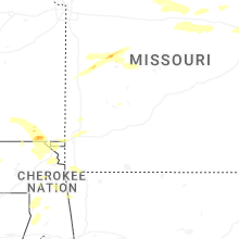
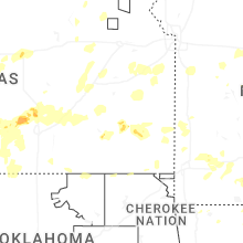

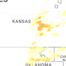
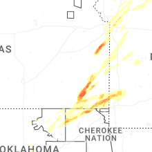
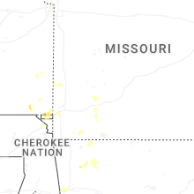
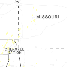
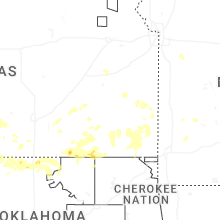
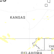


Connect with Interactive Hail Maps