

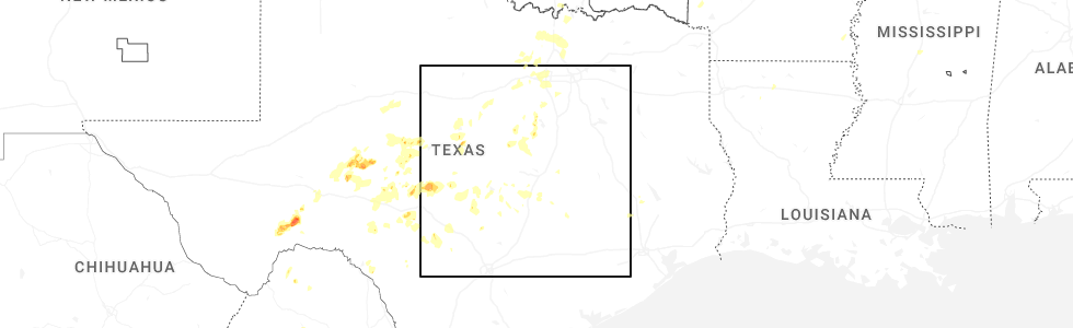
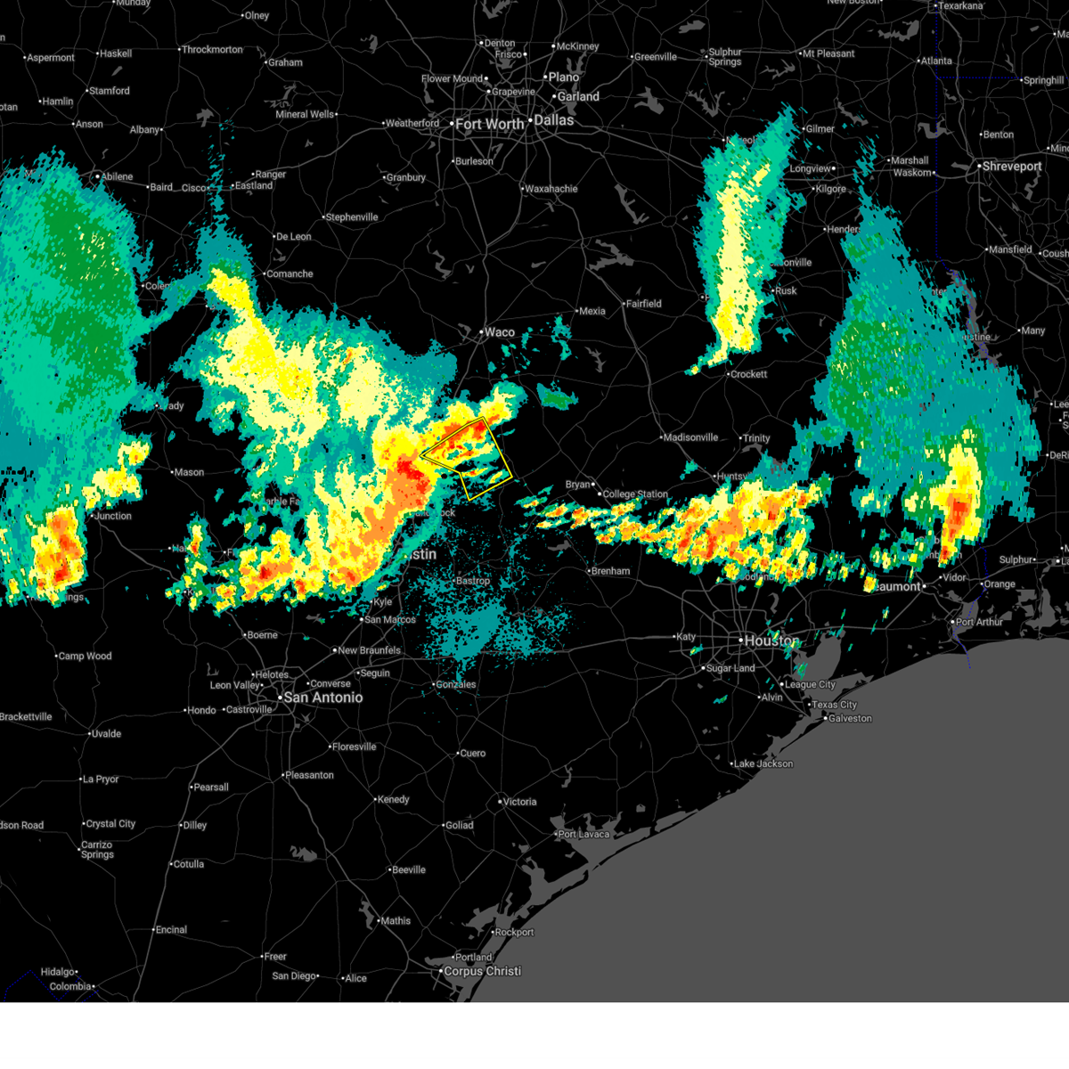
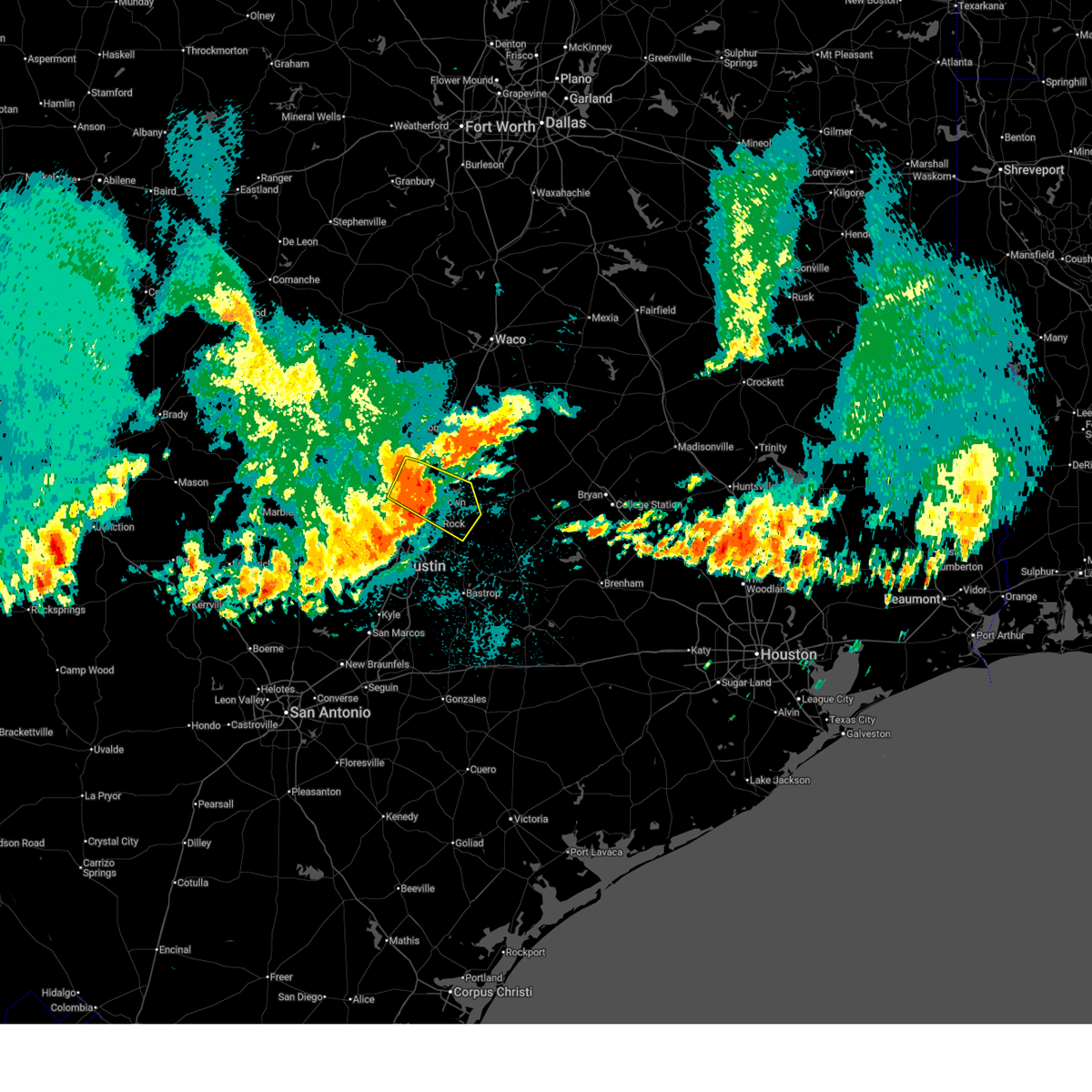
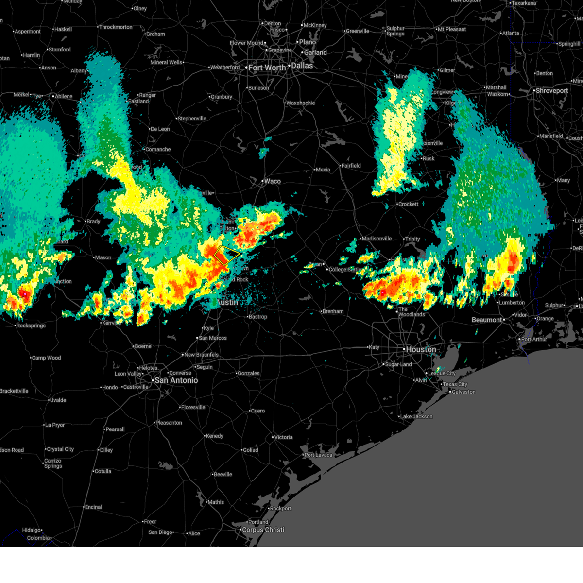
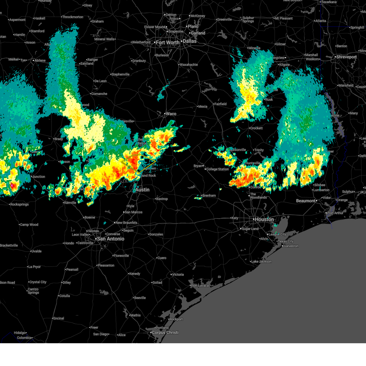
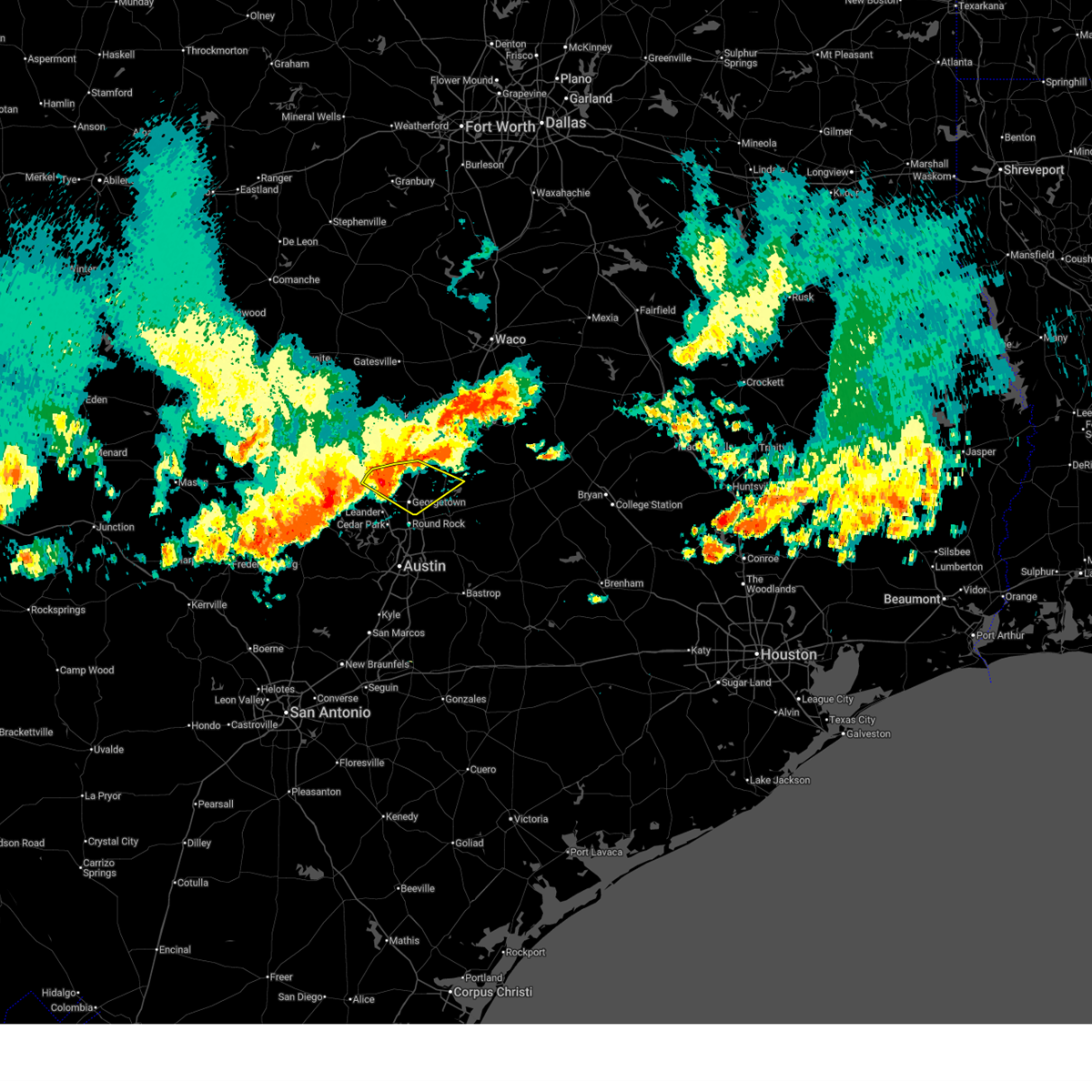
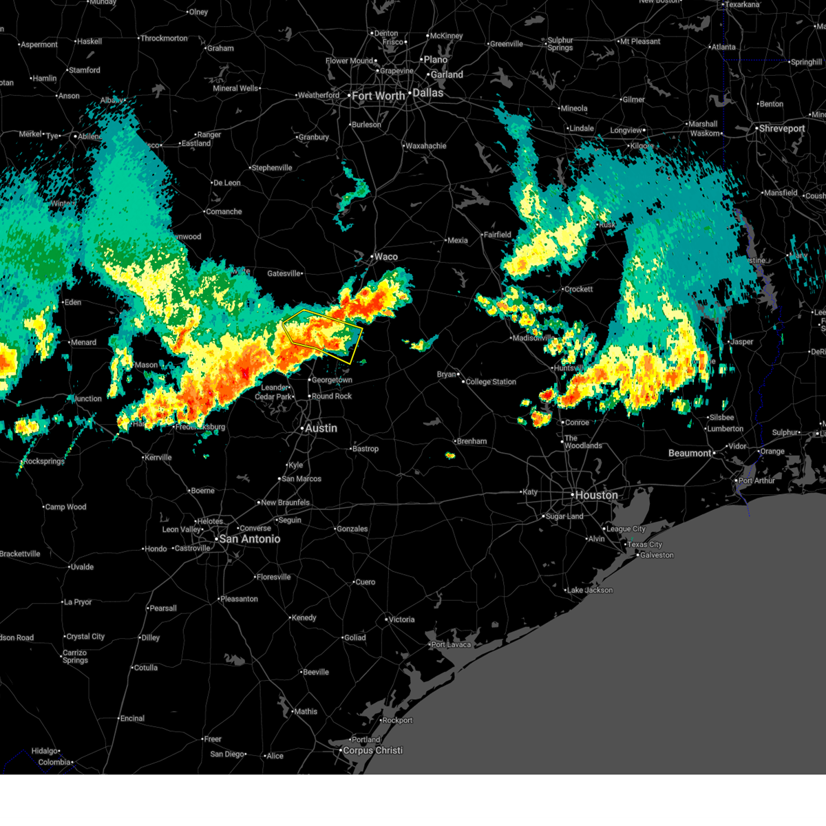
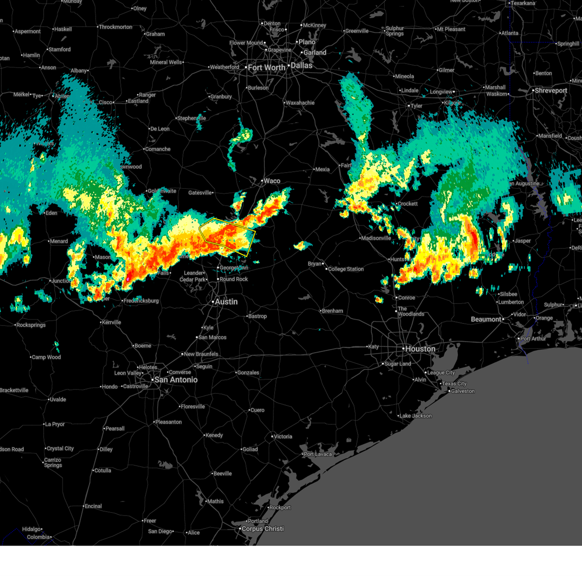
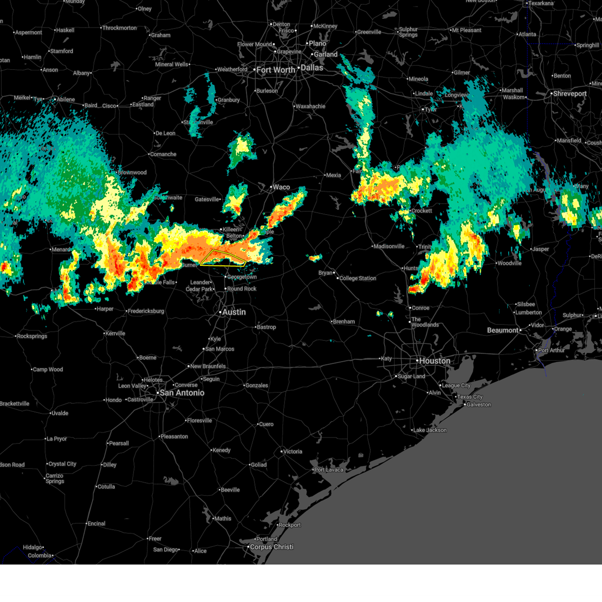
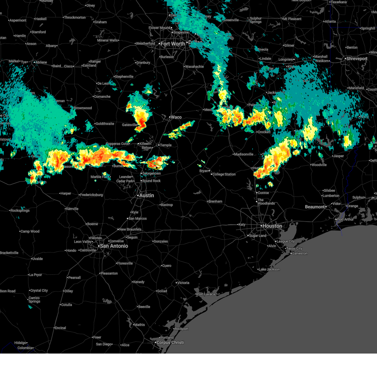
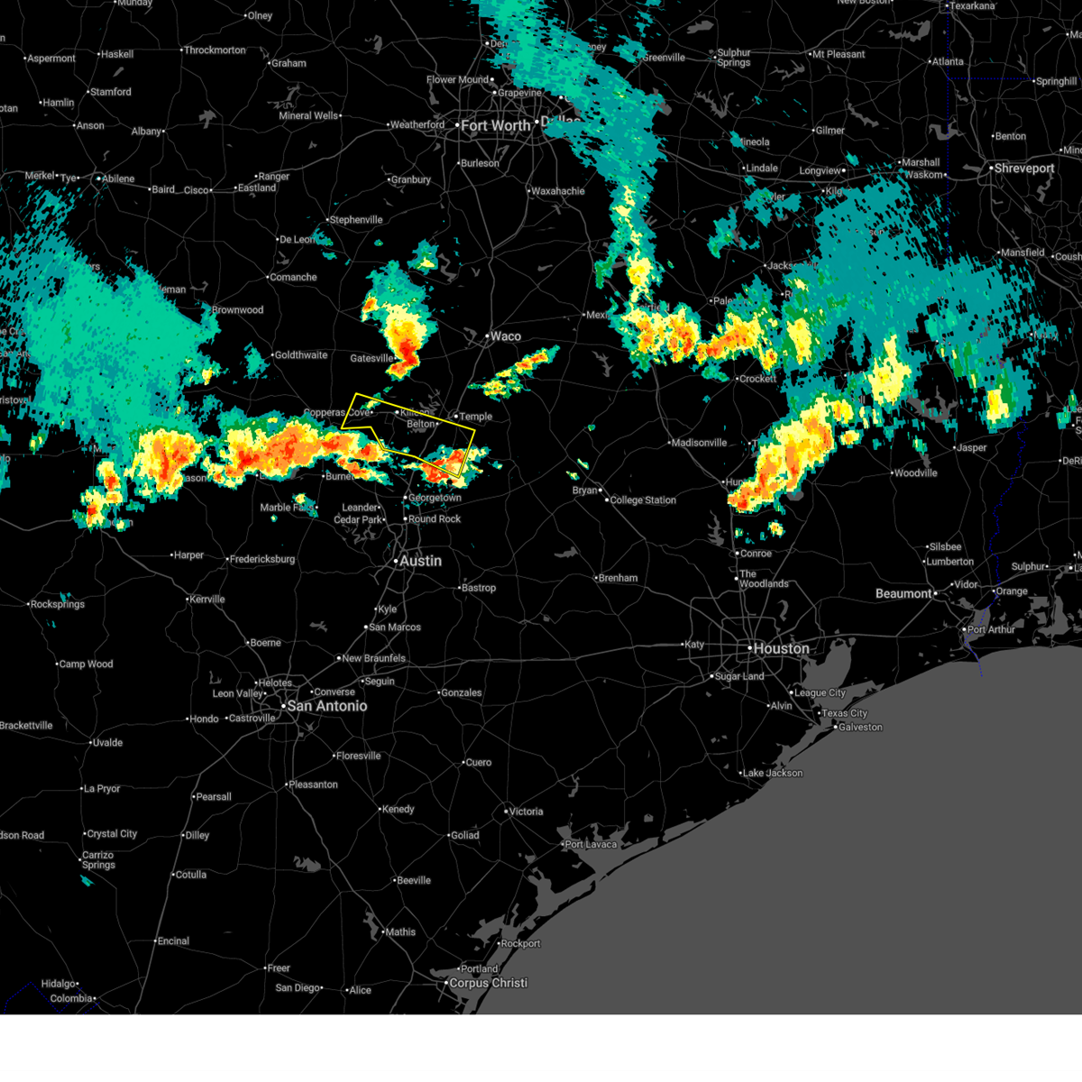
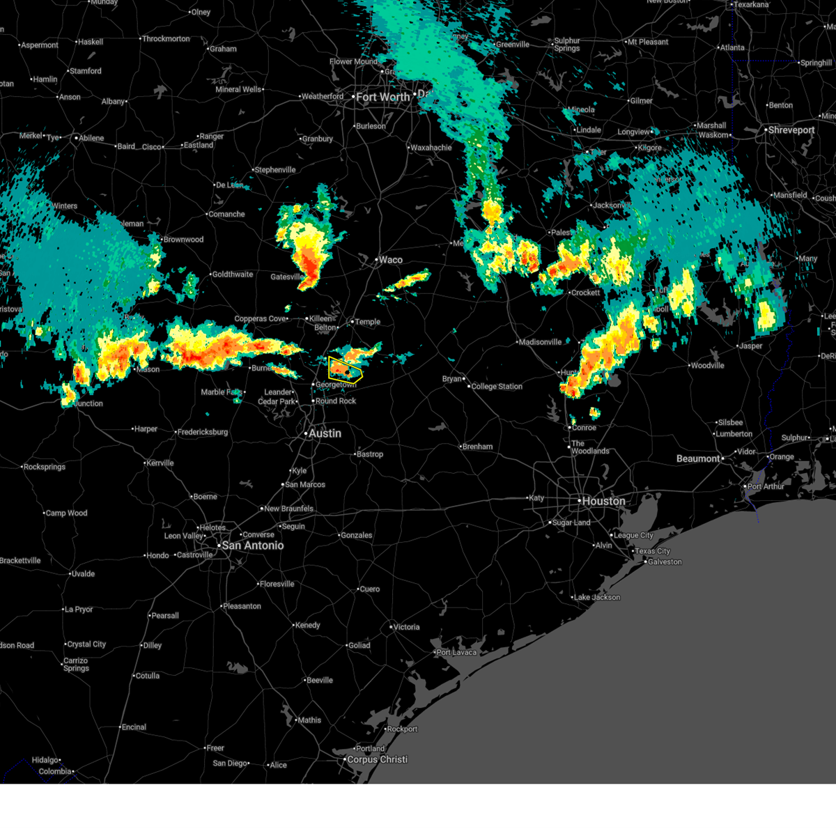
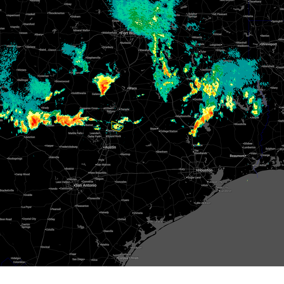
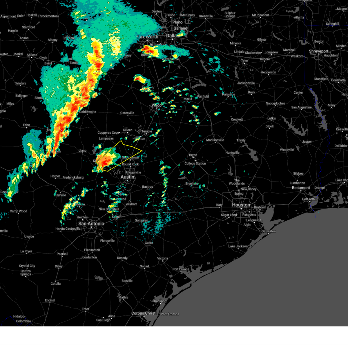
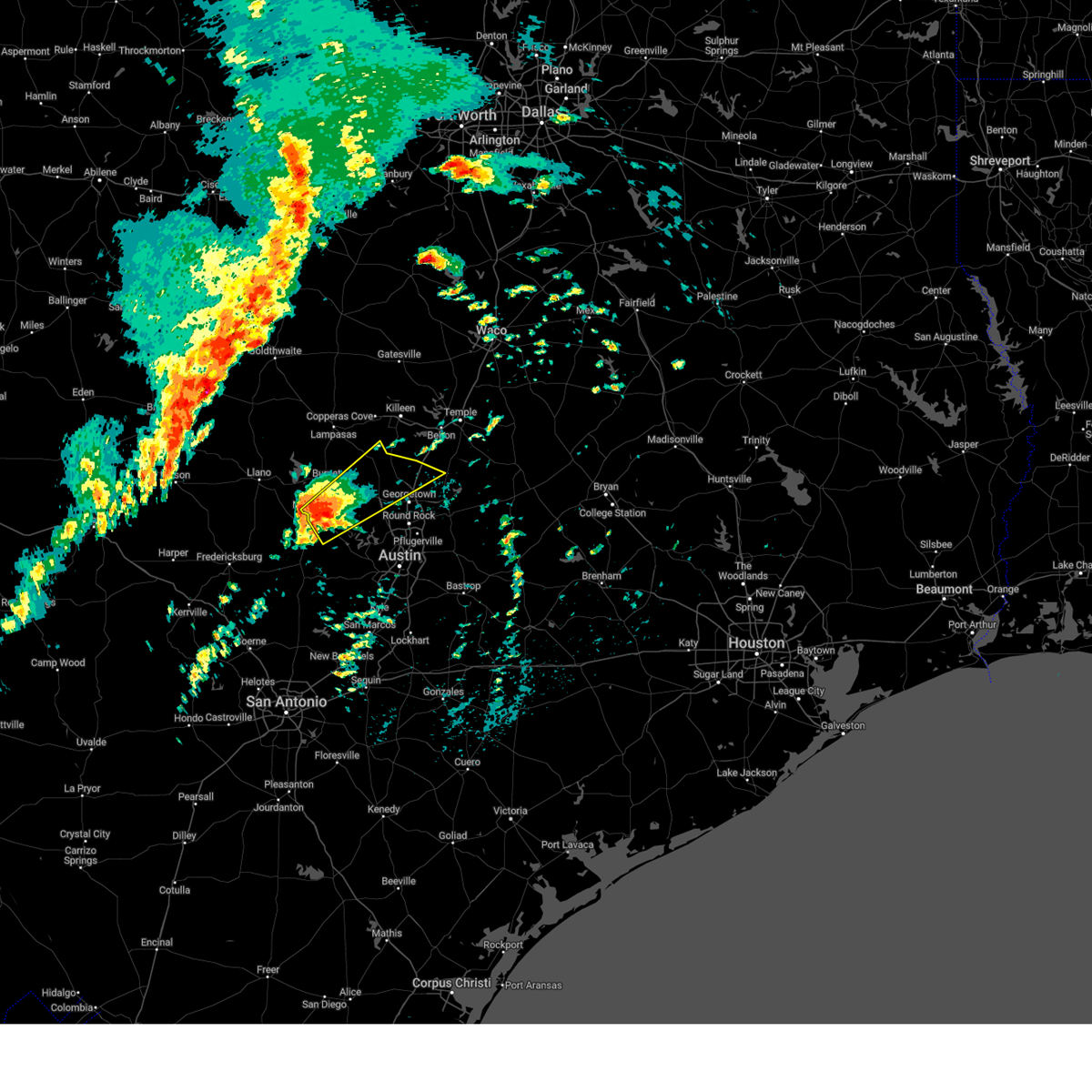
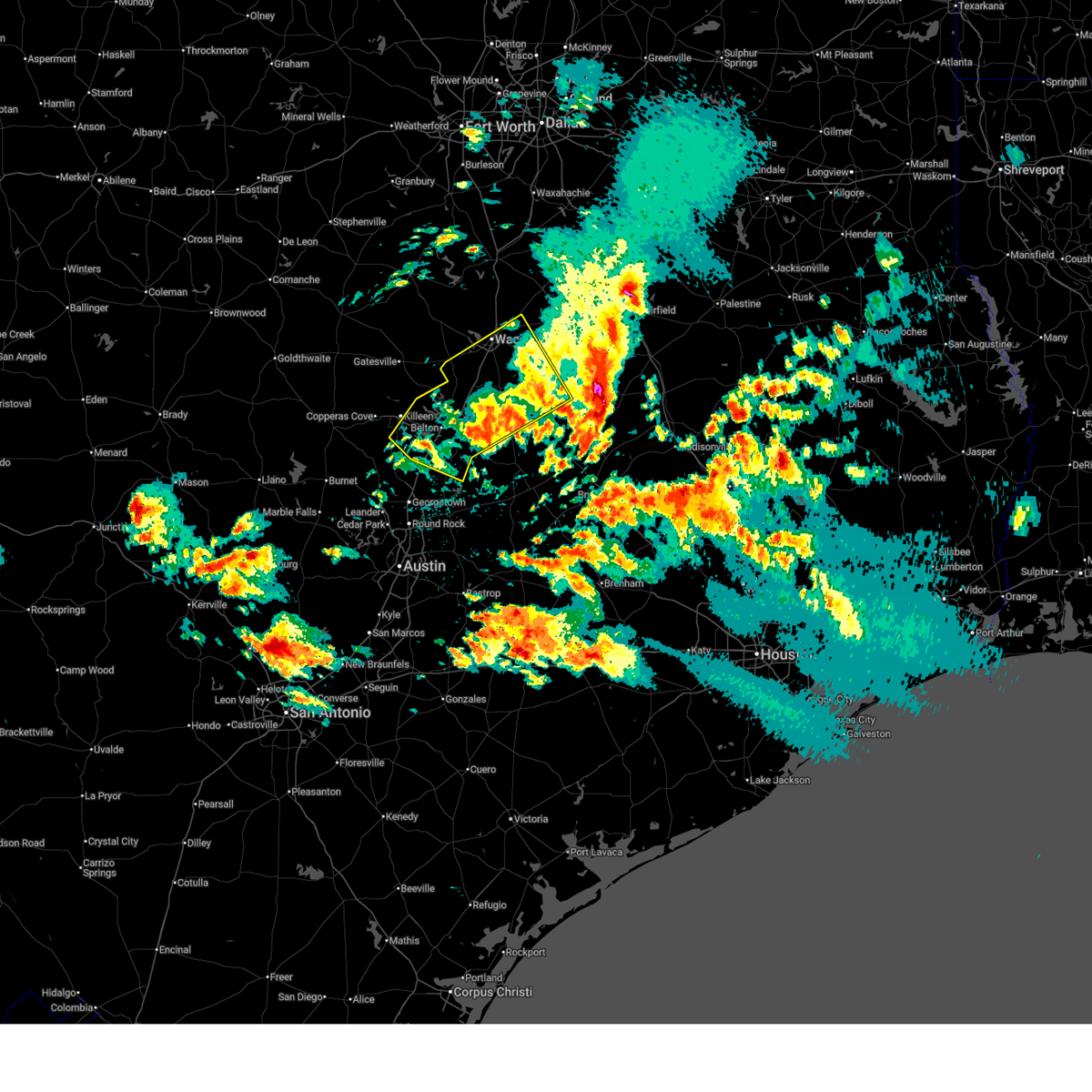
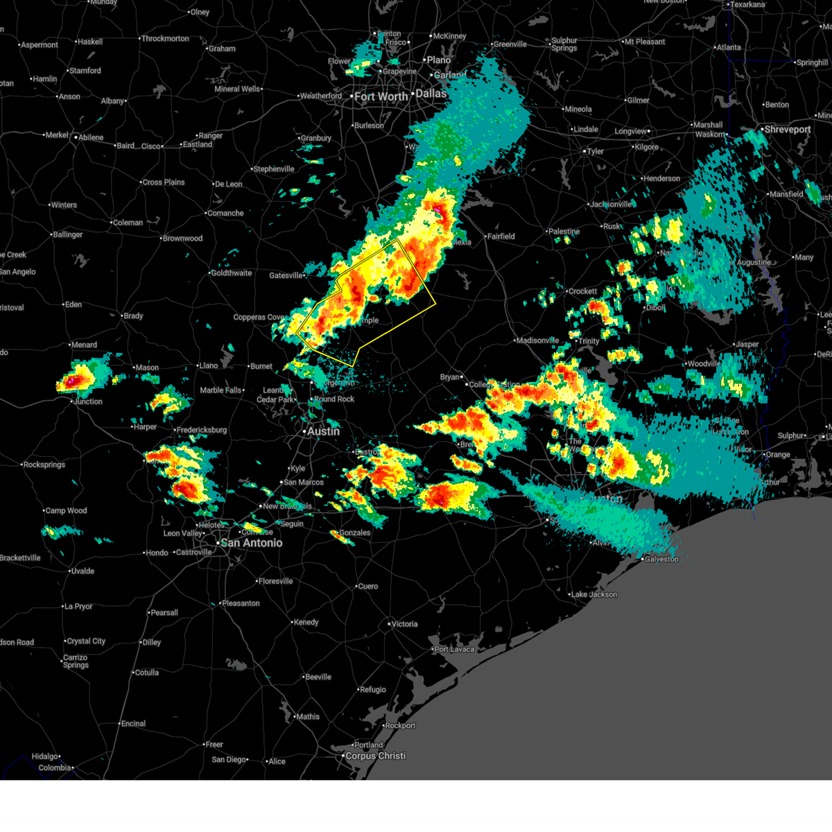
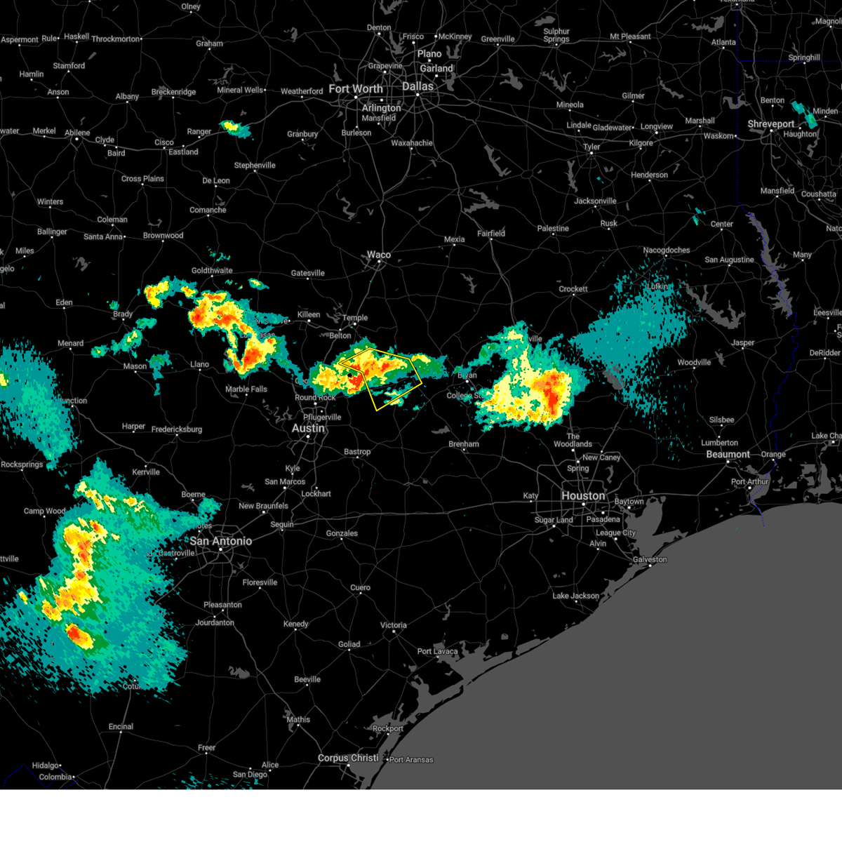
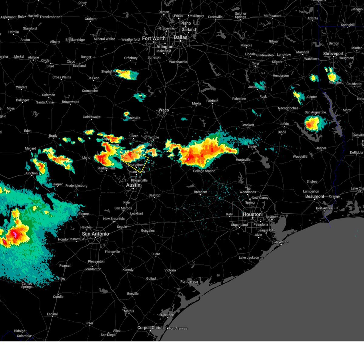
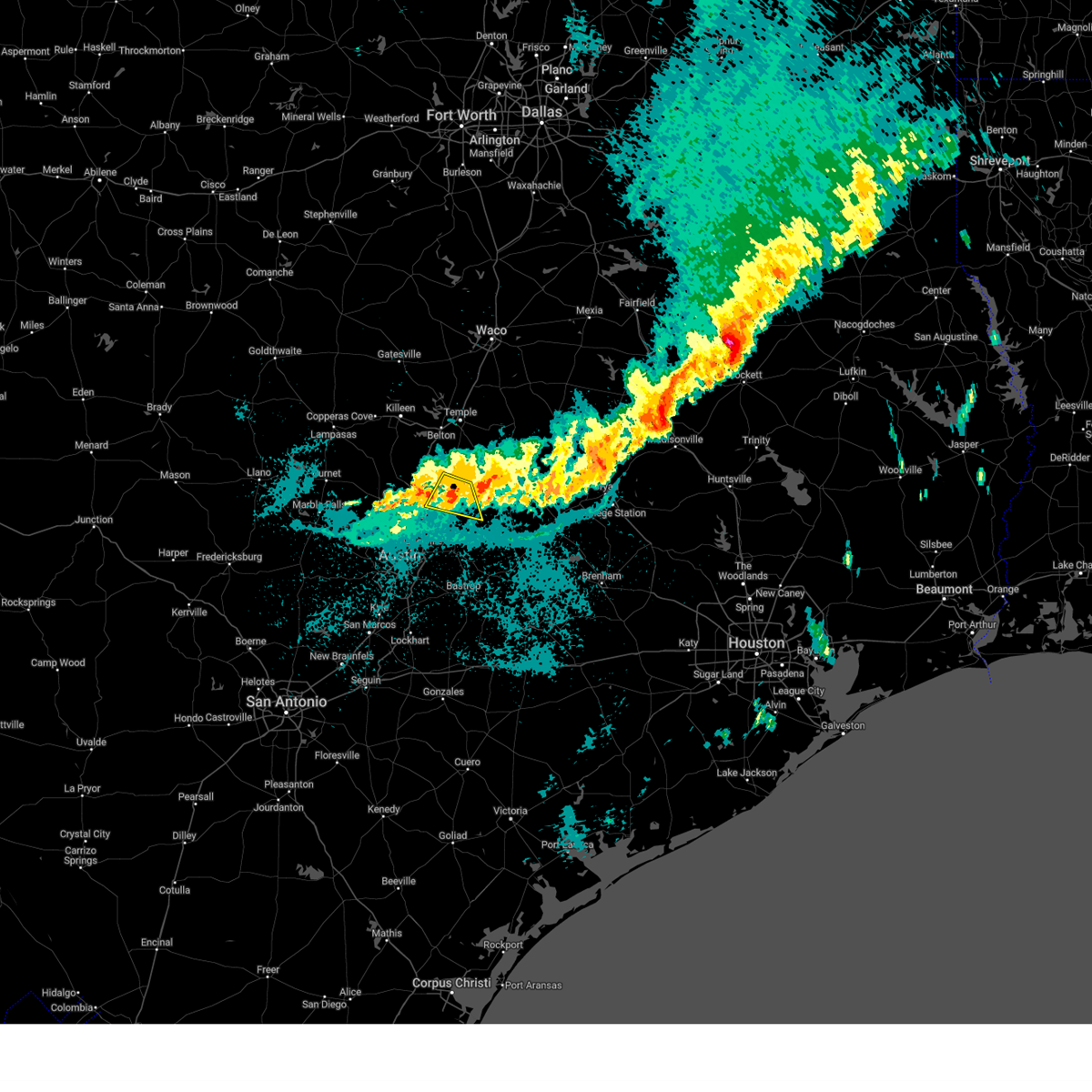
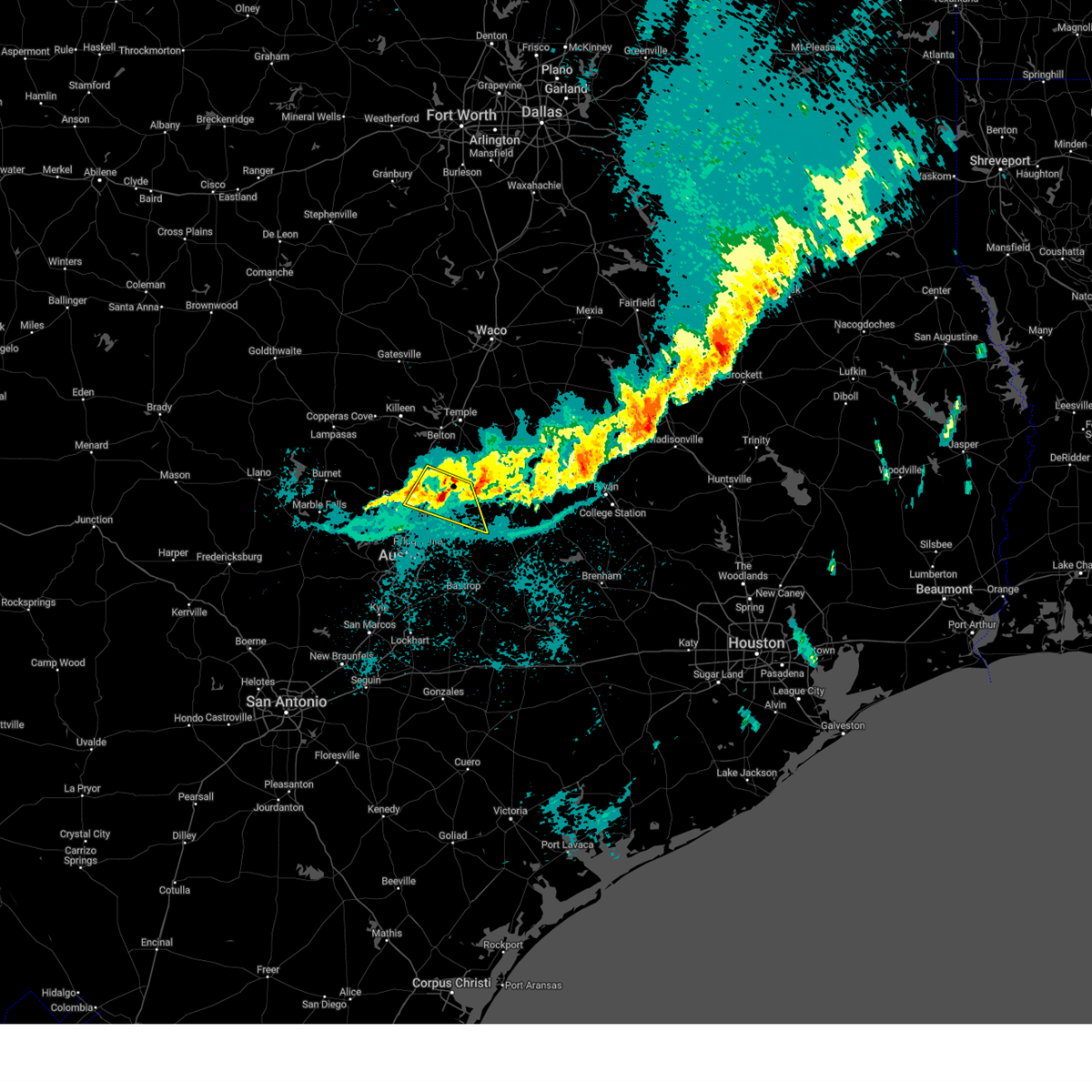
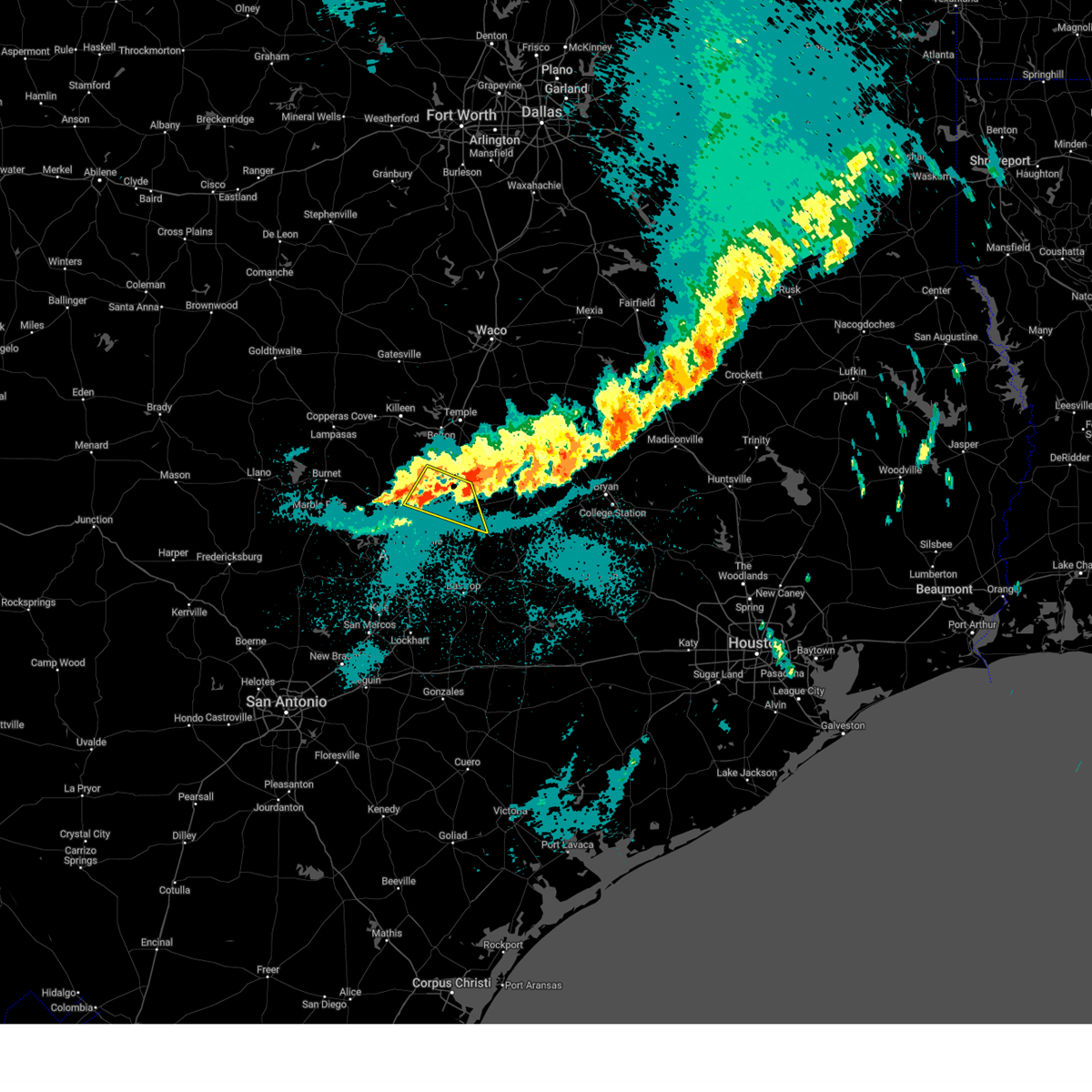
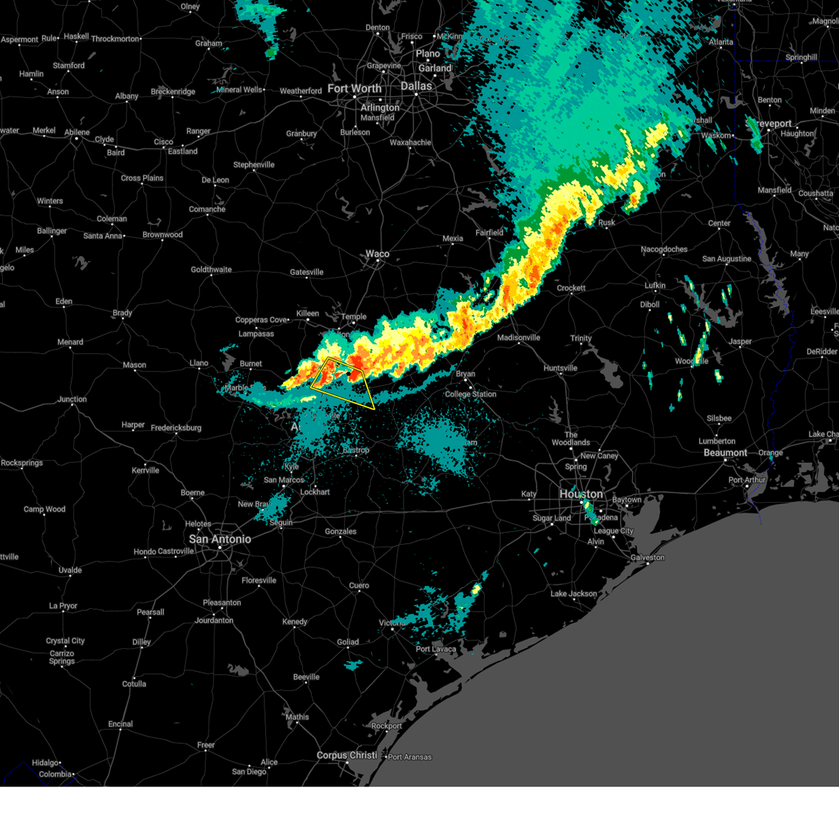
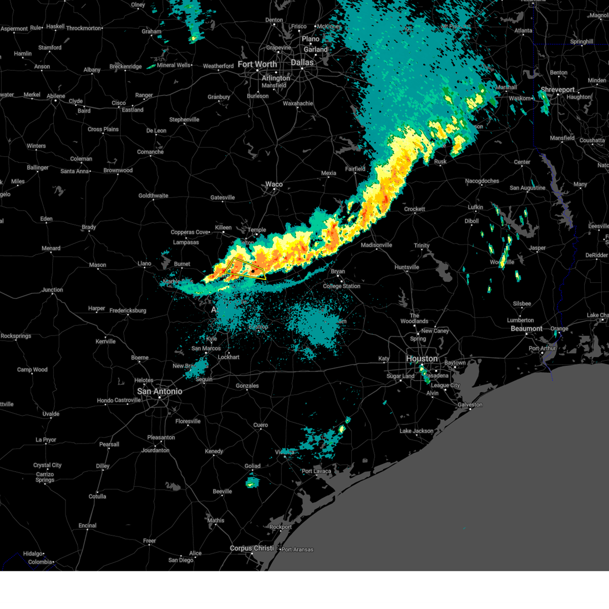
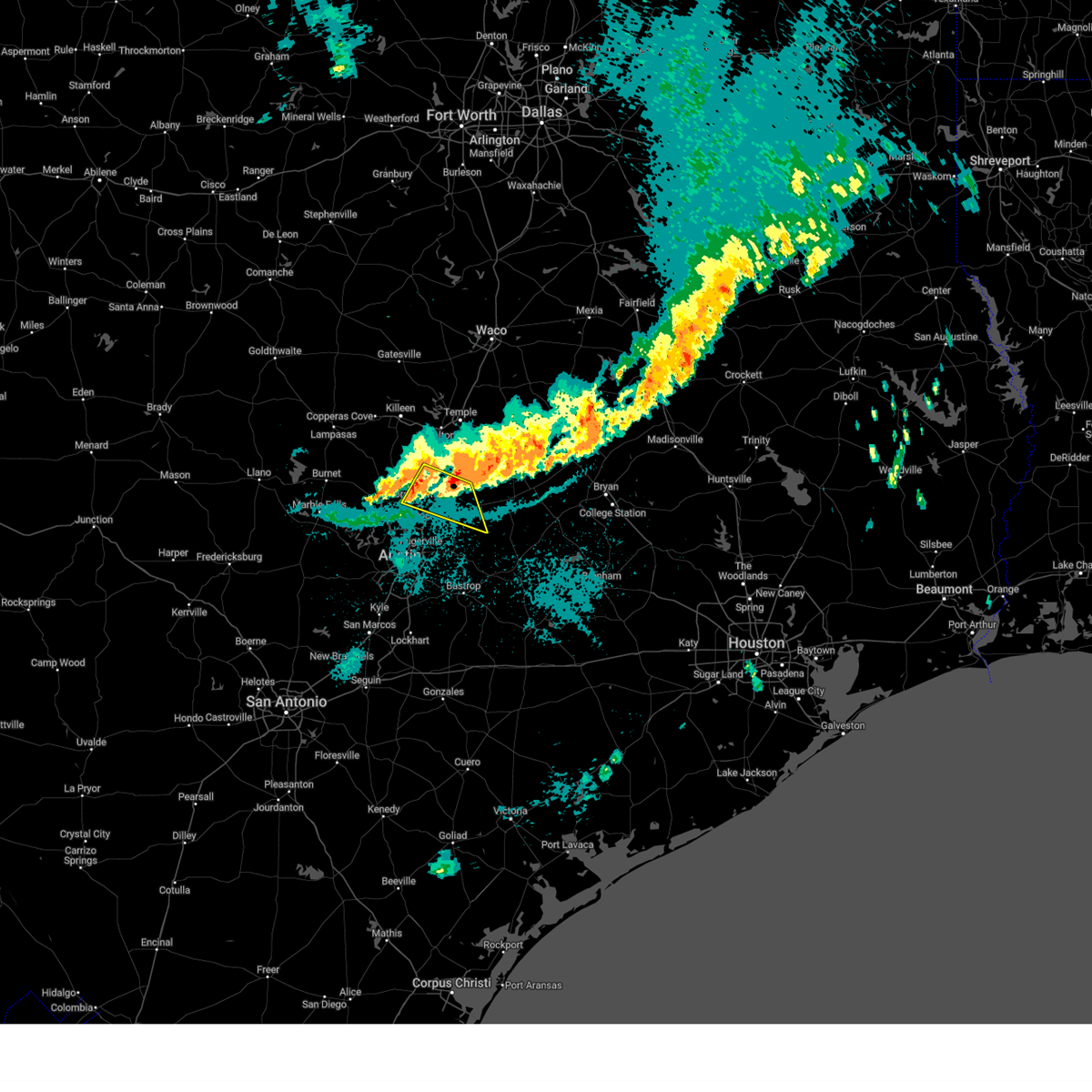
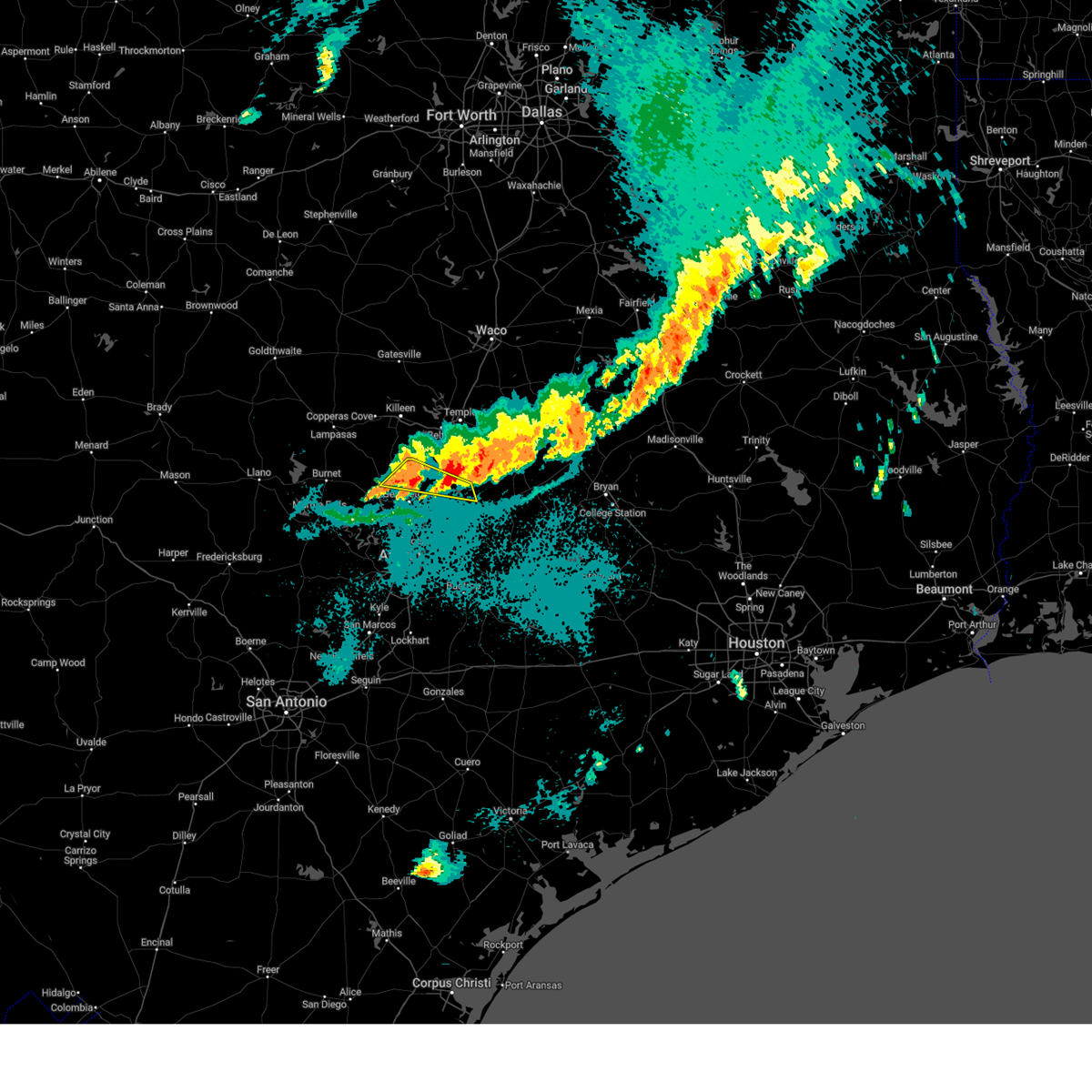
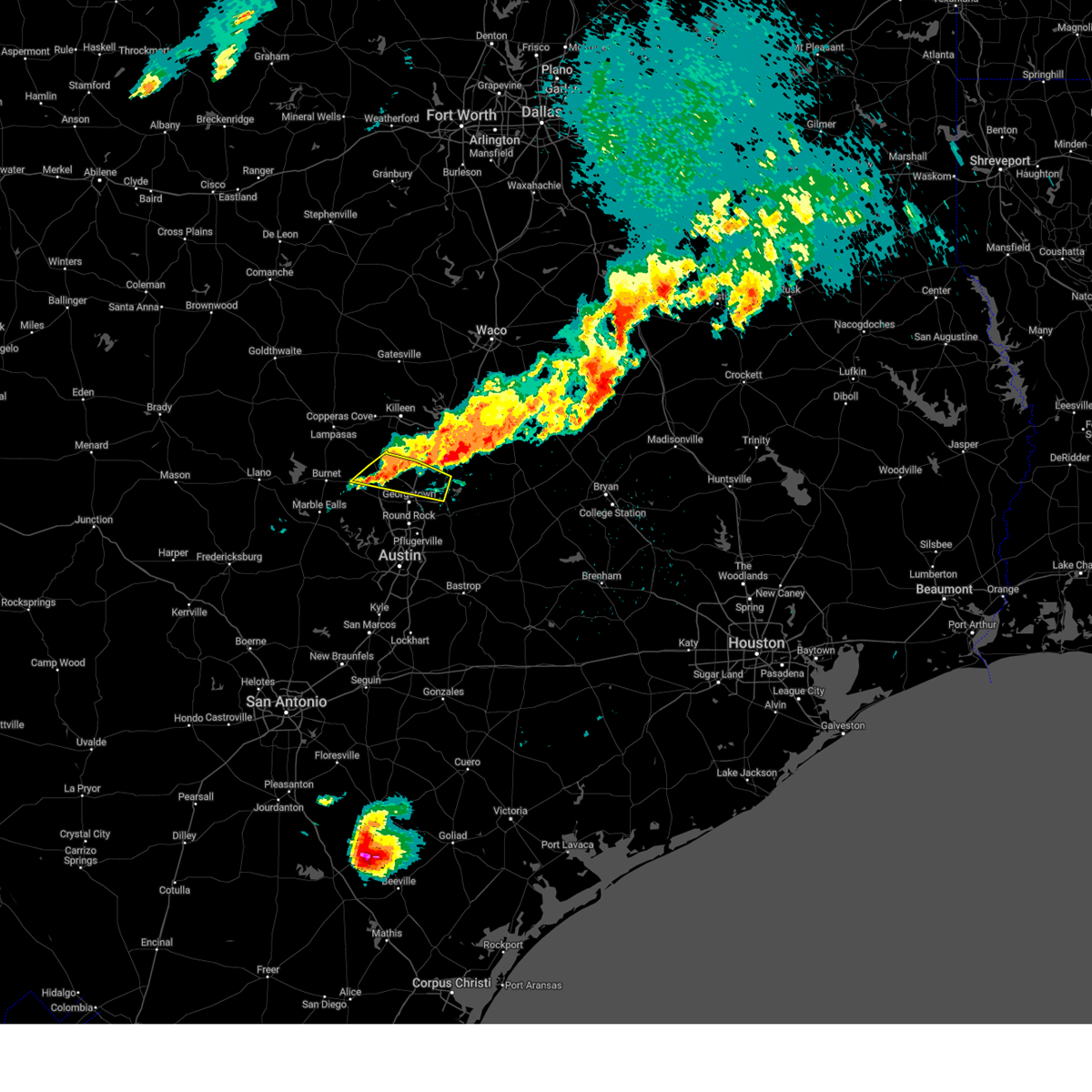
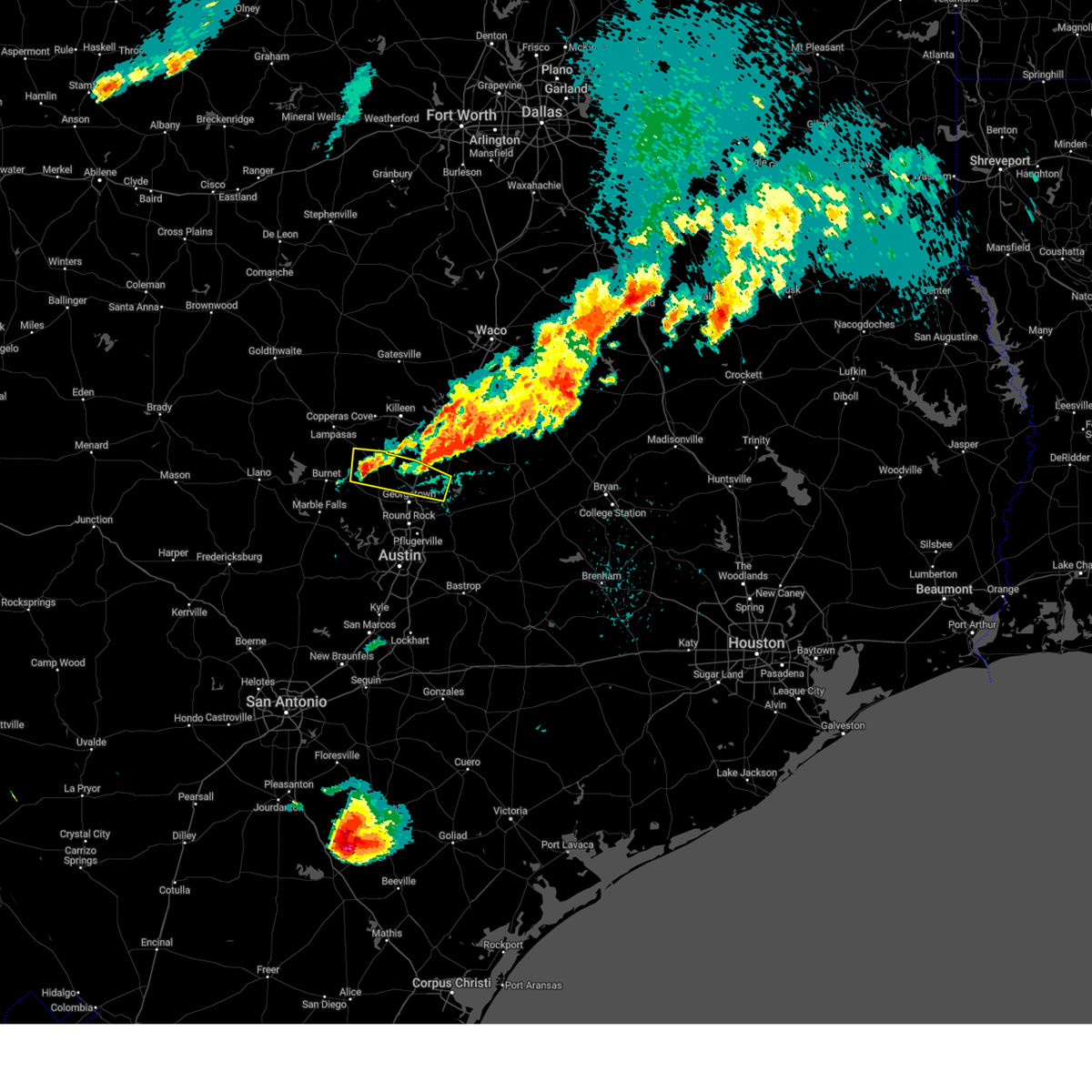
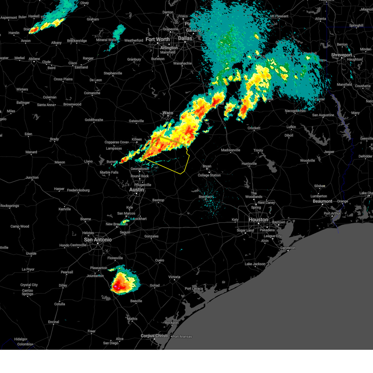
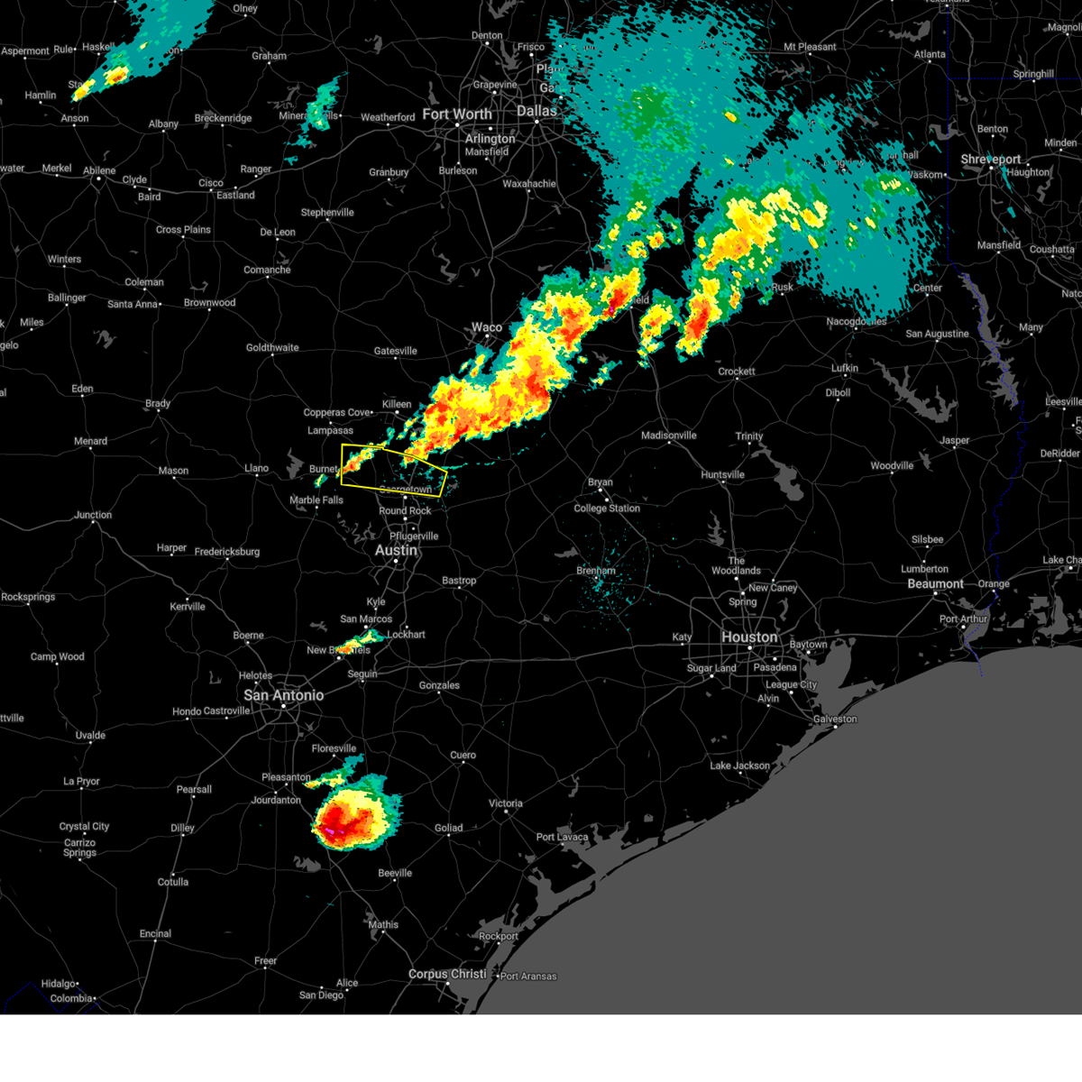
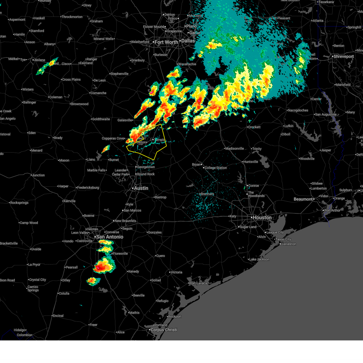
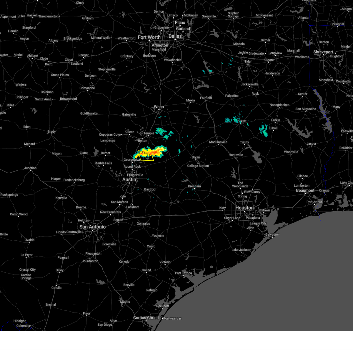
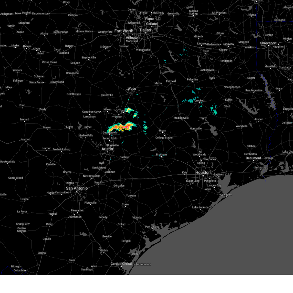
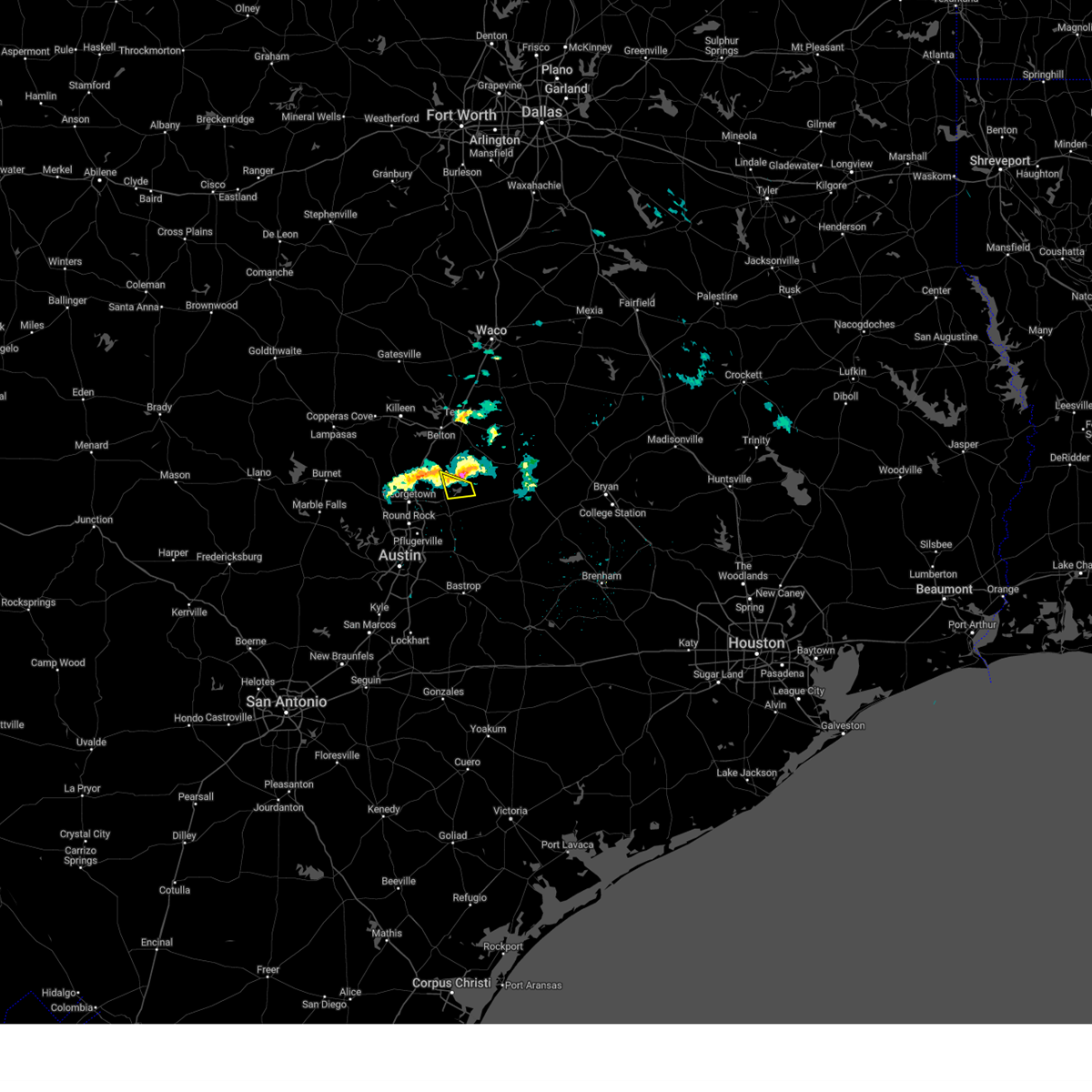
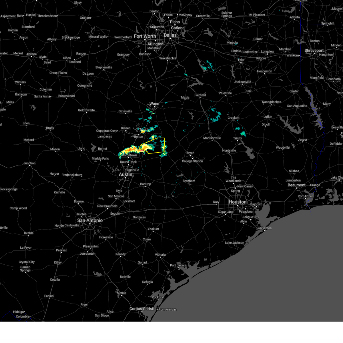
Hail Map for Bartlett, TX
The Bartlett, TX area has had 3 reports of on-the-ground hail by trained spotters, and has been under severe weather warnings 17 times during the past 12 months. Doppler radar has detected hail at or near Bartlett, TX on 39 occasions, including 1 occasion during the past year.
| Name: | Bartlett, TX |
| Where Located: | 28.3 miles SE of Killeen, TX |
| Map: | Google Map for Bartlett, TX |
| Population: | 1623 |
| Housing Units: | 639 |
| More Info: | Search Google for Bartlett, TX |
0
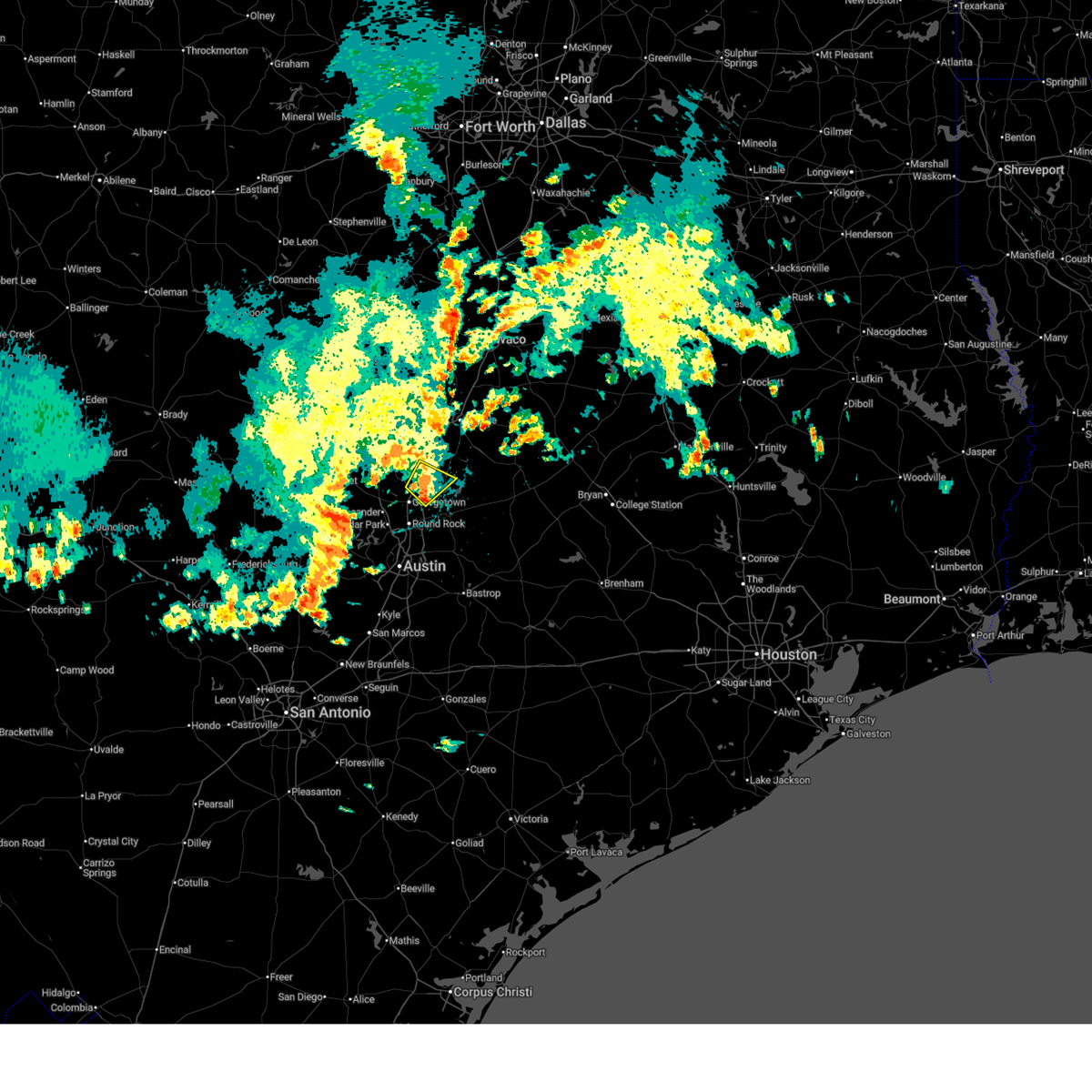
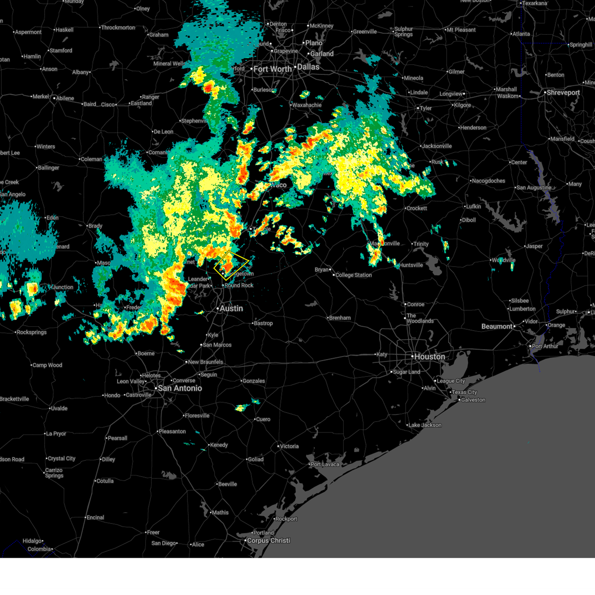
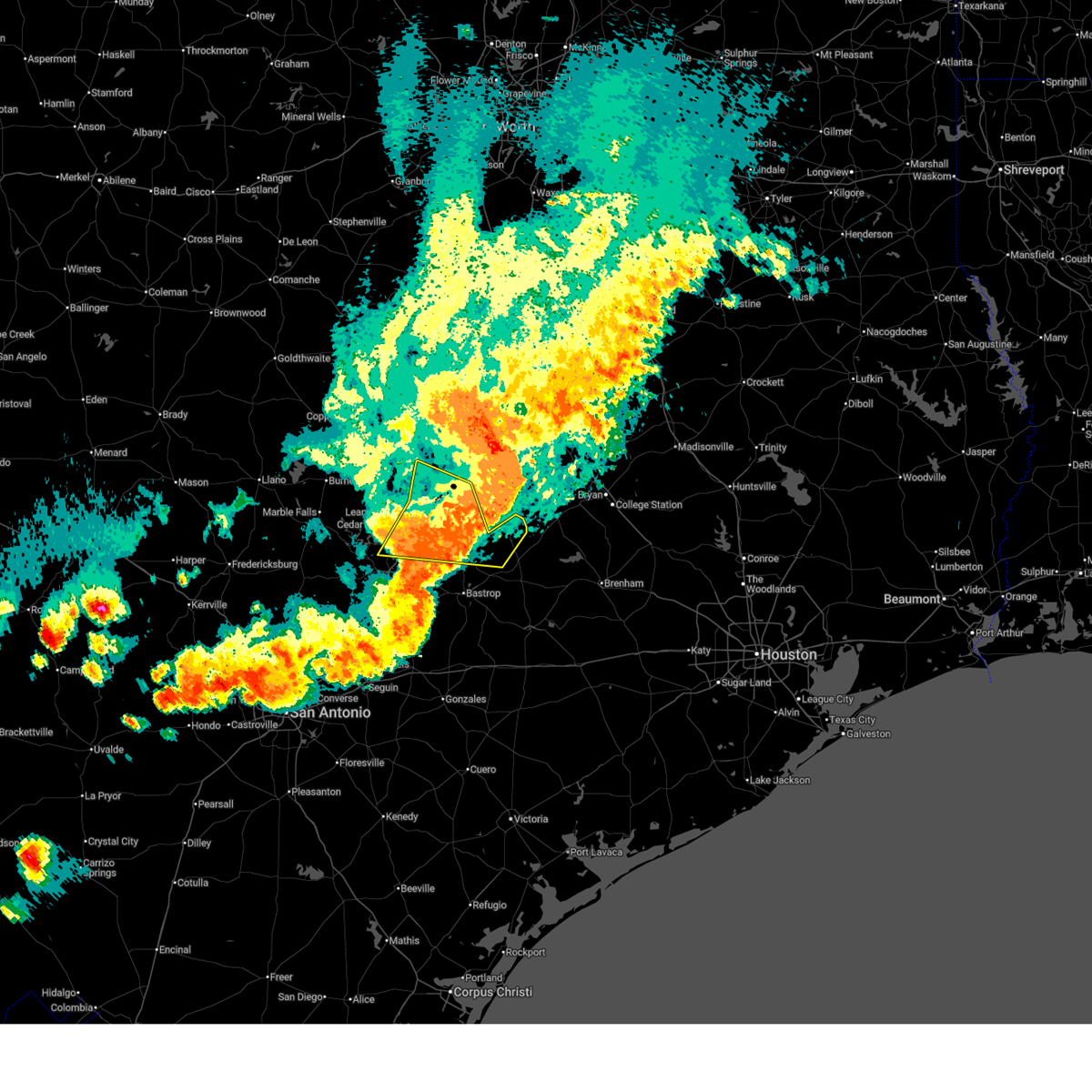
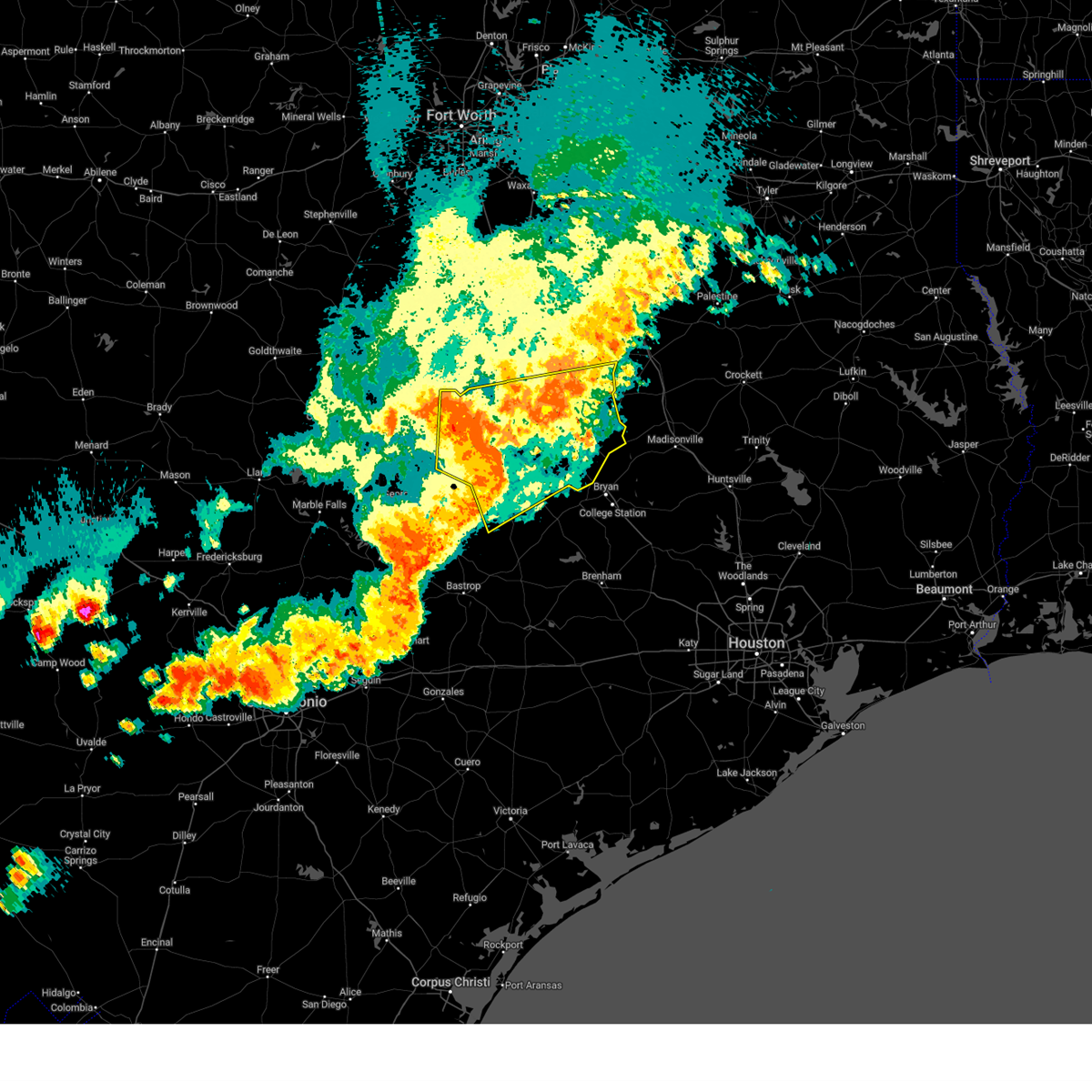
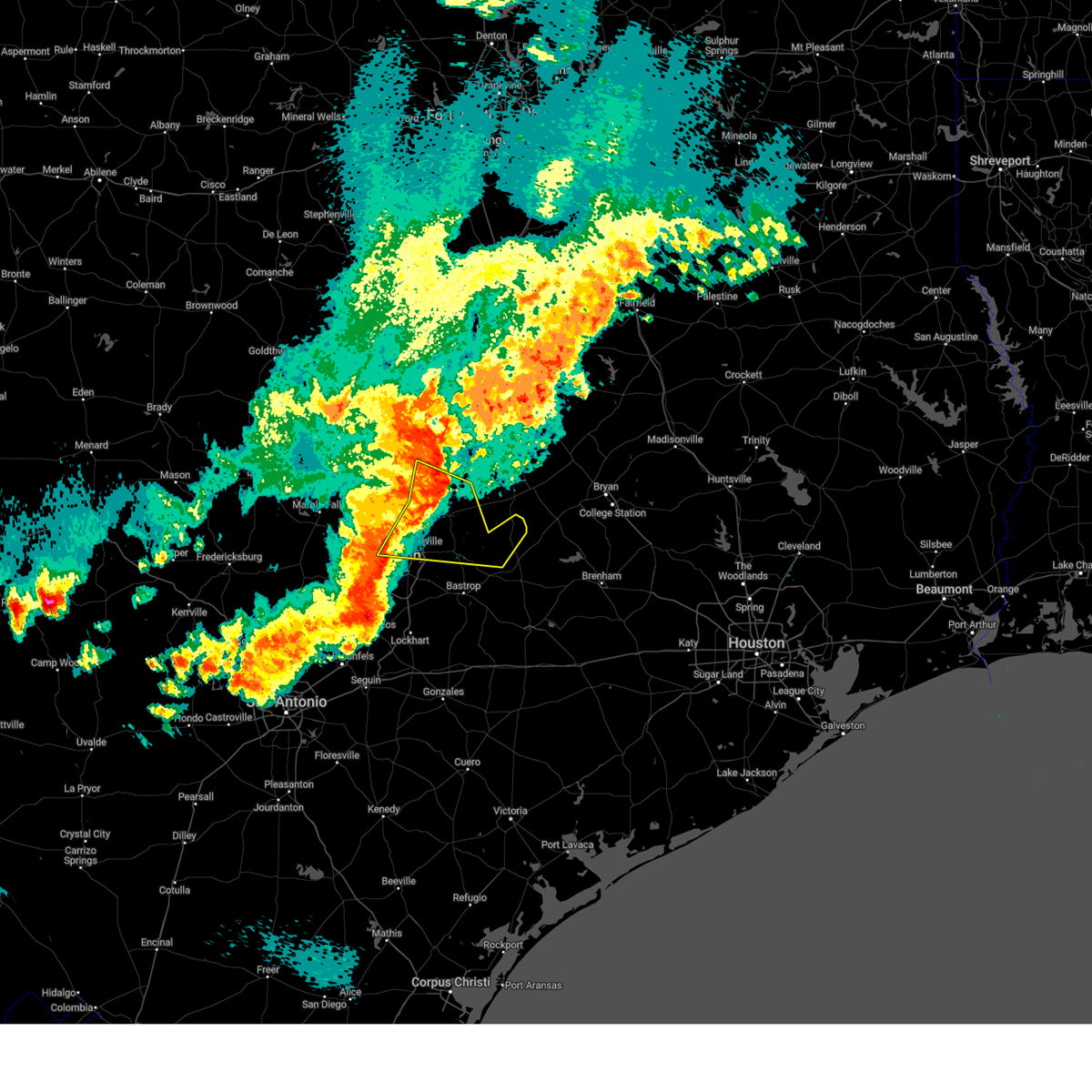
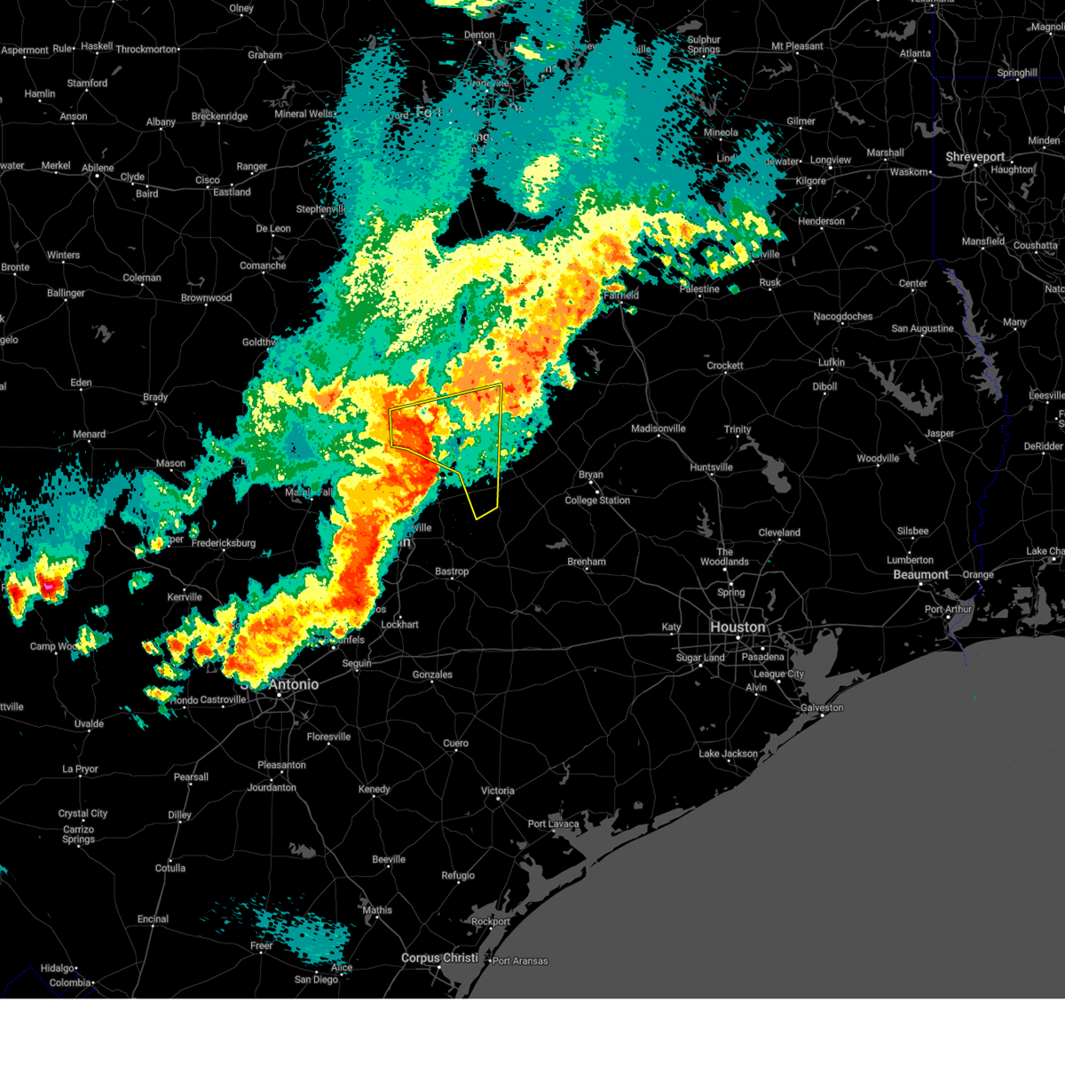
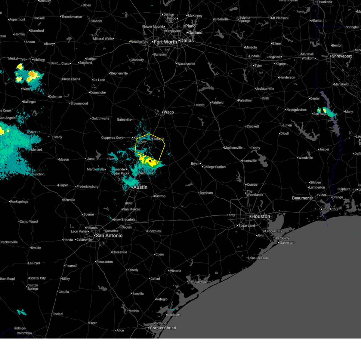
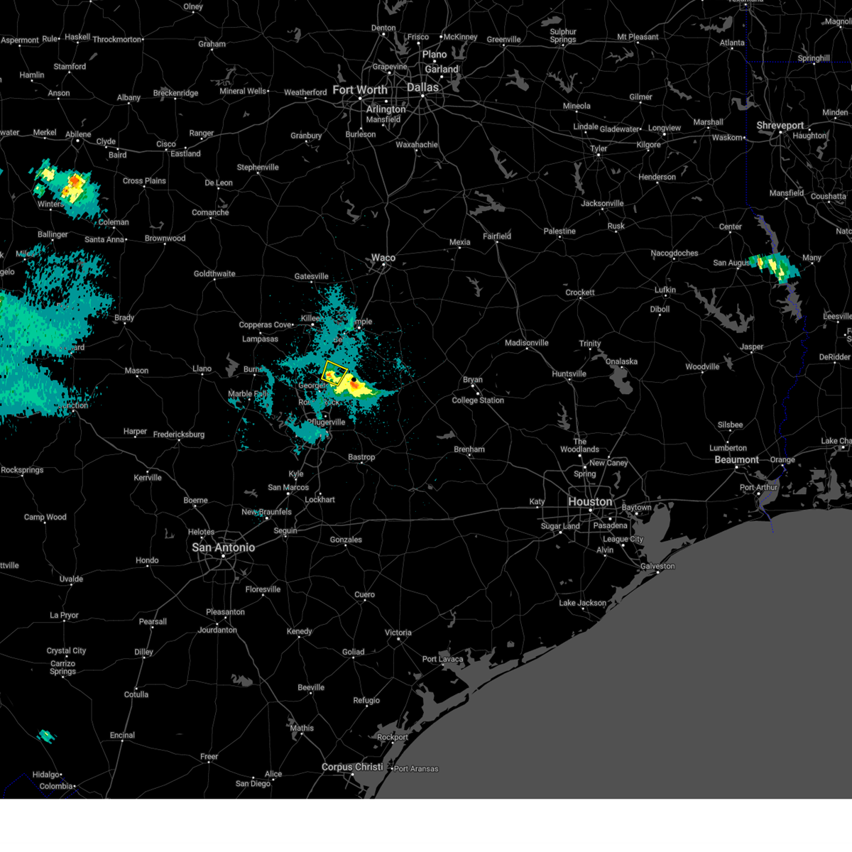
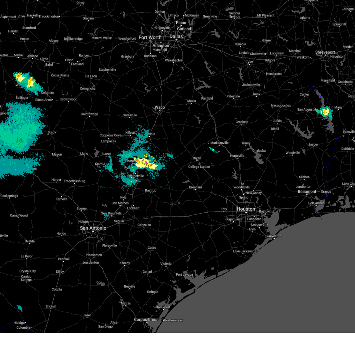
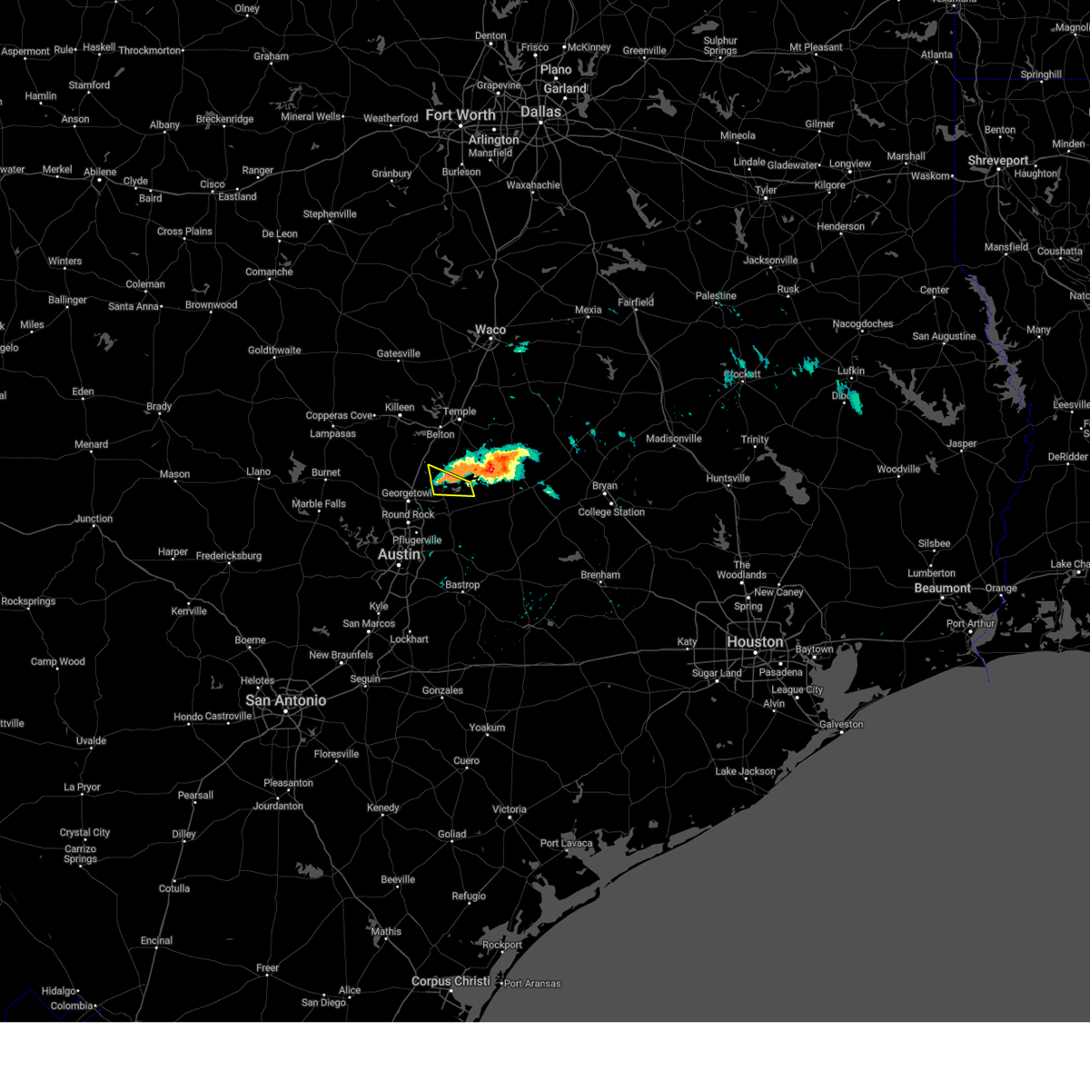
The Top Recent Hail Date for Bartlett, TX is Tuesday, May 19, 2026 (39th out of 39)
Hail and Wind Damage Spotted near Bartlett, TX
| Date / Time | Report Details |
|---|---|
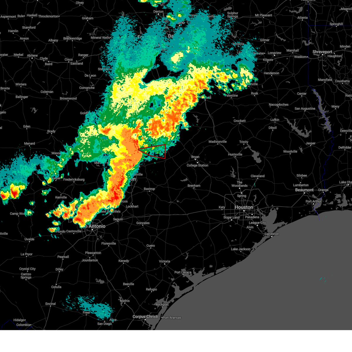
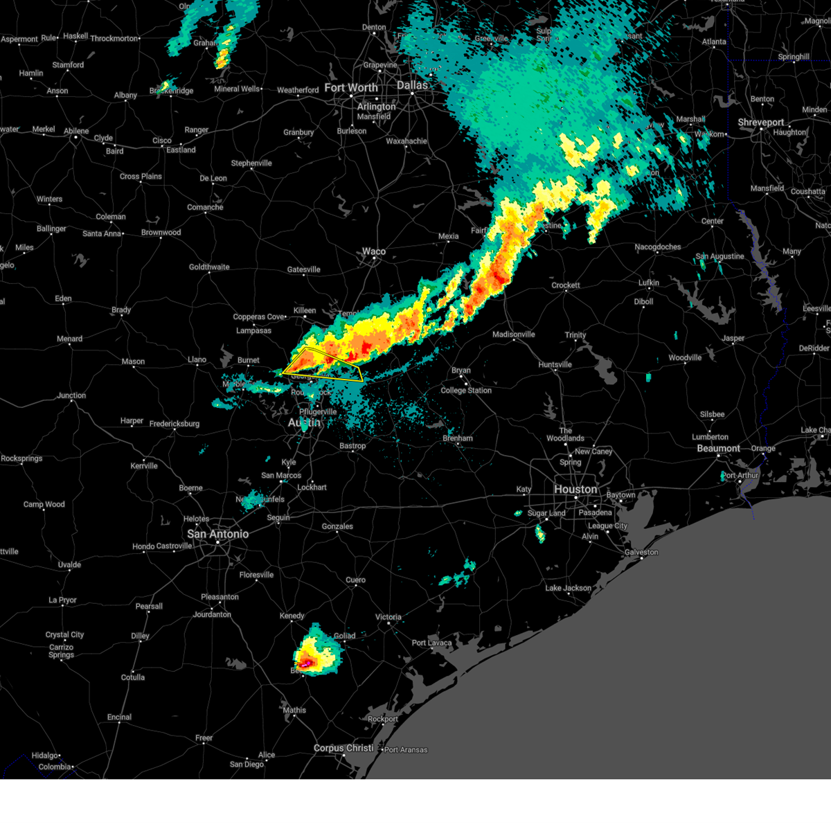
| 5/21/2026 6:25 PM CDT |
 At 625 pm cdt, a severe thunderstorm was located near weir, or 7 miles east of serenada, moving northeast at 20 mph (radar indicated). Hazards include 60 mph wind gusts and half dollar size hail. Hail damage to vehicles is expected. expect wind damage to roofs, siding, and trees. Locations impacted include, georgetown, granger, serenada, bartlett, jarrell, weir, theon, jonah, walburg, and schwertner. At 625 pm cdt, a severe thunderstorm was located near weir, or 7 miles east of serenada, moving northeast at 20 mph (radar indicated). Hazards include 60 mph wind gusts and half dollar size hail. Hail damage to vehicles is expected. expect wind damage to roofs, siding, and trees. Locations impacted include, georgetown, granger, serenada, bartlett, jarrell, weir, theon, jonah, walburg, and schwertner.
|
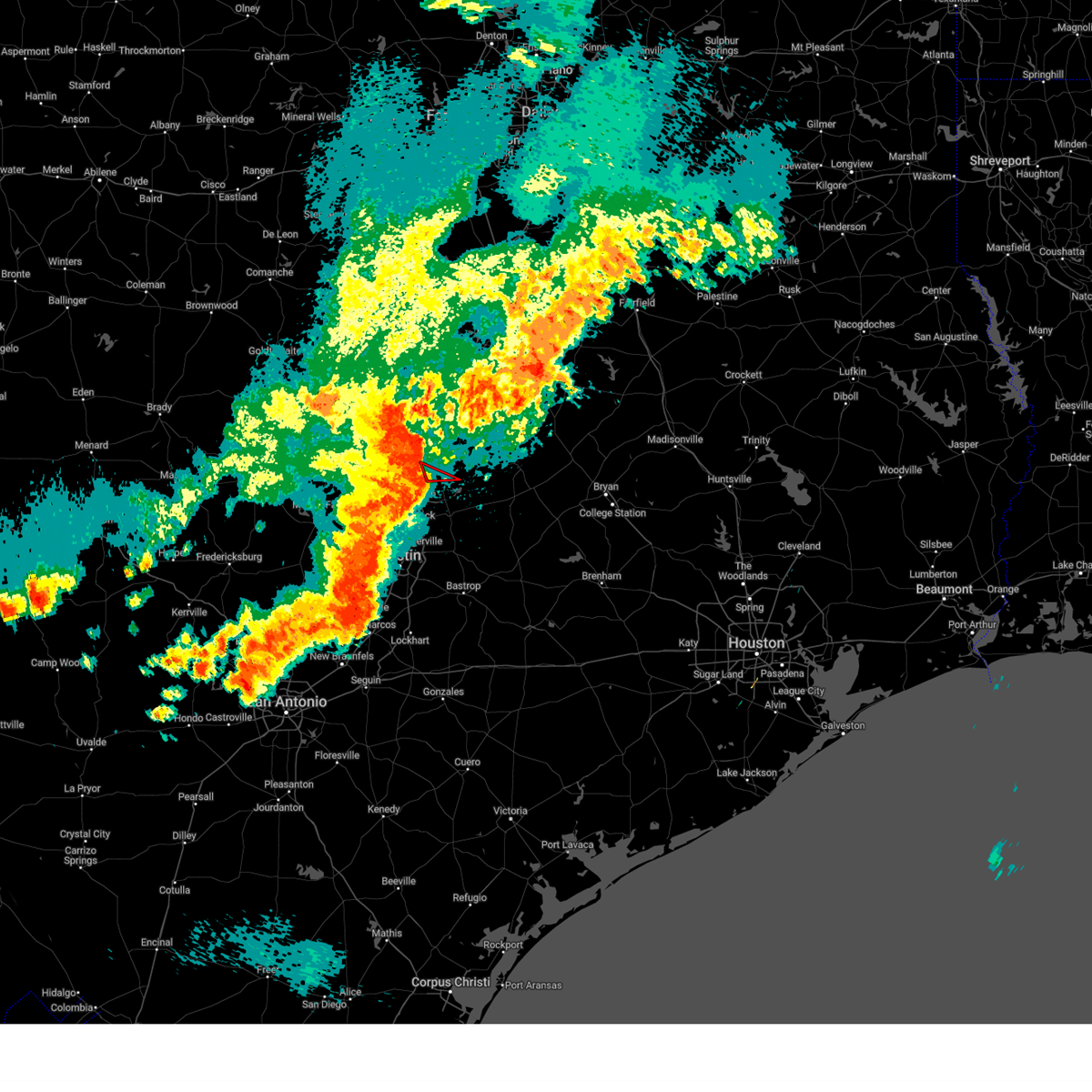
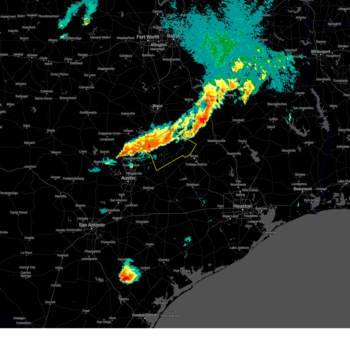
| 5/21/2026 6:10 PM CDT |
 Svrewx the national weather service in austin san antonio has issued a * severe thunderstorm warning for, central williamson county in south central texas, * until 700 pm cdt. * at 610 pm cdt, a severe thunderstorm was located near weir, or 7 miles east of serenada, moving northeast at 25 mph (radar indicated). Hazards include 60 mph wind gusts and half dollar size hail. Hail damage to vehicles is expected. Expect wind damage to roofs, siding, and trees. Svrewx the national weather service in austin san antonio has issued a * severe thunderstorm warning for, central williamson county in south central texas, * until 700 pm cdt. * at 610 pm cdt, a severe thunderstorm was located near weir, or 7 miles east of serenada, moving northeast at 25 mph (radar indicated). Hazards include 60 mph wind gusts and half dollar size hail. Hail damage to vehicles is expected. Expect wind damage to roofs, siding, and trees.
|
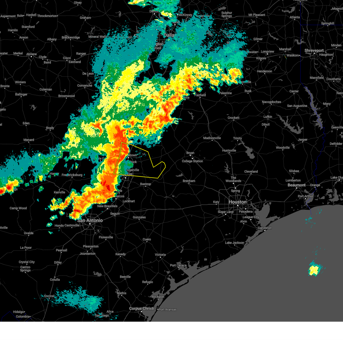
| 5/19/2026 9:32 PM CDT |
 At 931 pm cdt, a severe thunderstorm was located over taylor, moving southeast at 15 mph (radar indicated). Hazards include 60 mph wind gusts and half dollar size hail. Hail damage to vehicles is expected. expect wind damage to roofs, siding, and trees. Locations impacted include, round rock, georgetown, taylor, granger, serenada, hutto, bartlett, jarrell, thrall, weir, georgetown dam, granger dam, coupland, sun city, laneport, waterloo, schwertner, jonah, sandoval, and theon. At 931 pm cdt, a severe thunderstorm was located over taylor, moving southeast at 15 mph (radar indicated). Hazards include 60 mph wind gusts and half dollar size hail. Hail damage to vehicles is expected. expect wind damage to roofs, siding, and trees. Locations impacted include, round rock, georgetown, taylor, granger, serenada, hutto, bartlett, jarrell, thrall, weir, georgetown dam, granger dam, coupland, sun city, laneport, waterloo, schwertner, jonah, sandoval, and theon.
|
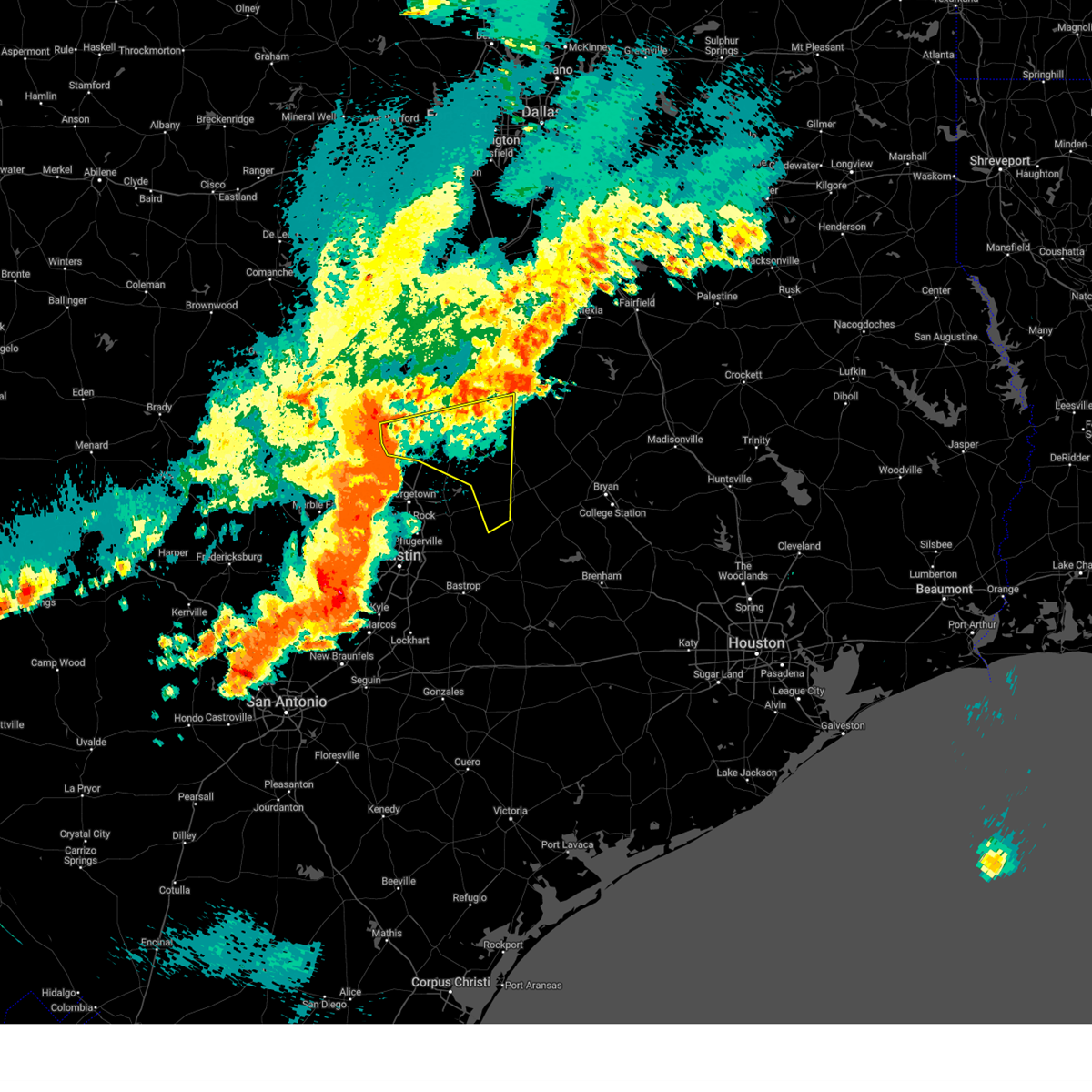
| 5/19/2026 9:19 PM CDT |
 Svrfwd the national weather service in fort worth has issued a * severe thunderstorm warning for, northwestern milam county in central texas, southeastern bell county in central texas, * until 1030 pm cdt. * at 919 pm cdt, a severe thunderstorm was located near rogers, or 12 miles west of cameron, moving south at 10 mph (radar indicated). Hazards include 65 mph wind gusts and quarter size hail. Hail damage to vehicles is expected. expect wind damage to roofs, siding, and trees. this severe thunderstorm will be near, rogers and buckholts around 925 pm cdt. Other locations impacted by this severe thunderstorm include minerva, edgeworth, val verde, leedale, san gabriel, cyclone, sharp, yarrelton, sparks, and pettibone. Svrfwd the national weather service in fort worth has issued a * severe thunderstorm warning for, northwestern milam county in central texas, southeastern bell county in central texas, * until 1030 pm cdt. * at 919 pm cdt, a severe thunderstorm was located near rogers, or 12 miles west of cameron, moving south at 10 mph (radar indicated). Hazards include 65 mph wind gusts and quarter size hail. Hail damage to vehicles is expected. expect wind damage to roofs, siding, and trees. this severe thunderstorm will be near, rogers and buckholts around 925 pm cdt. Other locations impacted by this severe thunderstorm include minerva, edgeworth, val verde, leedale, san gabriel, cyclone, sharp, yarrelton, sparks, and pettibone.
|
| 5/19/2026 9:11 PM CDT |
 Svrewx the national weather service in austin san antonio has issued a * severe thunderstorm warning for, central williamson county in south central texas, * until 1015 pm cdt. * at 911 pm cdt, a severe thunderstorm was located near weir, or near taylor, moving southeast at 15 mph (radar indicated). Hazards include 60 mph wind gusts and quarter size hail. Hail damage to vehicles is expected. Expect wind damage to roofs, siding, and trees. Svrewx the national weather service in austin san antonio has issued a * severe thunderstorm warning for, central williamson county in south central texas, * until 1015 pm cdt. * at 911 pm cdt, a severe thunderstorm was located near weir, or near taylor, moving southeast at 15 mph (radar indicated). Hazards include 60 mph wind gusts and quarter size hail. Hail damage to vehicles is expected. Expect wind damage to roofs, siding, and trees.
|
| 5/19/2026 8:59 PM CDT |
 Svrewx the national weather service in austin san antonio has issued a * severe thunderstorm warning for, north central williamson county in south central texas, * until 930 pm cdt. * at 858 pm cdt, a severe thunderstorm was located over jarrell, or 7 miles northeast of serenada, moving northeast at 15 mph. this is a destructive storm for jarrell and theon (radar indicated). Hazards include 80 mph wind gusts. Flying debris will be dangerous to those caught without shelter. mobile homes will be heavily damaged. expect considerable damage to roofs, windows, and vehicles. Extensive tree damage and power outages are likely. Svrewx the national weather service in austin san antonio has issued a * severe thunderstorm warning for, north central williamson county in south central texas, * until 930 pm cdt. * at 858 pm cdt, a severe thunderstorm was located over jarrell, or 7 miles northeast of serenada, moving northeast at 15 mph. this is a destructive storm for jarrell and theon (radar indicated). Hazards include 80 mph wind gusts. Flying debris will be dangerous to those caught without shelter. mobile homes will be heavily damaged. expect considerable damage to roofs, windows, and vehicles. Extensive tree damage and power outages are likely.
|
| 5/19/2026 8:49 PM CDT |
 At 849 pm cdt, a severe thunderstorm was located near serenada, moving east at 20 mph (radar indicated). Hazards include 70 mph wind gusts and quarter size hail. Hail damage to vehicles is expected. expect considerable tree damage. wind damage is also likely to mobile homes, roofs, and outbuildings. Locations impacted include, round rock, georgetown, granger, serenada, bartlett, jarrell, florence, weir, georgetown dam, sun city, andice, theon, walburg, schwertner, and jonah. At 849 pm cdt, a severe thunderstorm was located near serenada, moving east at 20 mph (radar indicated). Hazards include 70 mph wind gusts and quarter size hail. Hail damage to vehicles is expected. expect considerable tree damage. wind damage is also likely to mobile homes, roofs, and outbuildings. Locations impacted include, round rock, georgetown, granger, serenada, bartlett, jarrell, florence, weir, georgetown dam, sun city, andice, theon, walburg, schwertner, and jonah.
|
| 5/19/2026 8:35 PM CDT |
 At 835 pm cdt, a severe thunderstorm was located near sun city, or near serenada, moving southeast at 15 mph (radar indicated). Hazards include ping pong ball size hail and 60 mph wind gusts. People and animals outdoors will be injured. expect hail damage to roofs, siding, windows, and vehicles. expect wind damage to roofs, siding, and trees. Locations impacted include, round rock, georgetown, granger, serenada, bartlett, jarrell, florence, weir, georgetown dam, sun city, andice, theon, walburg, schwertner, and jonah. At 835 pm cdt, a severe thunderstorm was located near sun city, or near serenada, moving southeast at 15 mph (radar indicated). Hazards include ping pong ball size hail and 60 mph wind gusts. People and animals outdoors will be injured. expect hail damage to roofs, siding, windows, and vehicles. expect wind damage to roofs, siding, and trees. Locations impacted include, round rock, georgetown, granger, serenada, bartlett, jarrell, florence, weir, georgetown dam, sun city, andice, theon, walburg, schwertner, and jonah.
|
| 5/19/2026 8:23 PM CDT |
 At 822 pm cdt, a severe thunderstorm was located over andice, or 8 miles northwest of serenada, moving southeast at 20 mph (trained weather spotters reported quarter size hail in andice at 8:19pm). Hazards include 60 mph wind gusts and quarter size hail. Hail damage to vehicles is expected. expect wind damage to roofs, siding, and trees. Locations impacted include, round rock, georgetown, granger, serenada, bartlett, jarrell, florence, weir, georgetown dam, sun city, andice, theon, walburg, schwertner, and jonah. At 822 pm cdt, a severe thunderstorm was located over andice, or 8 miles northwest of serenada, moving southeast at 20 mph (trained weather spotters reported quarter size hail in andice at 8:19pm). Hazards include 60 mph wind gusts and quarter size hail. Hail damage to vehicles is expected. expect wind damage to roofs, siding, and trees. Locations impacted include, round rock, georgetown, granger, serenada, bartlett, jarrell, florence, weir, georgetown dam, sun city, andice, theon, walburg, schwertner, and jonah.
|
| 5/19/2026 8:10 PM CDT |
 Svrewx the national weather service in austin san antonio has issued a * severe thunderstorm warning for, central williamson county in south central texas, * until 915 pm cdt. * at 809 pm cdt, severe thunderstorms were located along a line extending from near bartlett to near mahomet, moving southeast at 10 mph (radar indicated). Hazards include 60 mph wind gusts and quarter size hail. Hail damage to vehicles is expected. Expect wind damage to roofs, siding, and trees. Svrewx the national weather service in austin san antonio has issued a * severe thunderstorm warning for, central williamson county in south central texas, * until 915 pm cdt. * at 809 pm cdt, severe thunderstorms were located along a line extending from near bartlett to near mahomet, moving southeast at 10 mph (radar indicated). Hazards include 60 mph wind gusts and quarter size hail. Hail damage to vehicles is expected. Expect wind damage to roofs, siding, and trees.
|
| 5/19/2026 8:08 PM CDT |
 The storms which prompted the warning have weakened below severe limits. therefore the warning will be allowed to expire. however gusty winds and heavy rain are still possible with these thunderstorms. a severe thunderstorm watch remains in effect until 100 am cdt for central texas. The storms which prompted the warning have weakened below severe limits. therefore the warning will be allowed to expire. however gusty winds and heavy rain are still possible with these thunderstorms. a severe thunderstorm watch remains in effect until 100 am cdt for central texas.
|
| 5/19/2026 7:52 PM CDT |
 At 752 pm cdt, severe thunderstorms were located along a line extending from near kempner to holland, moving northeast at 10 mph (radar indicated). Hazards include 60 mph wind gusts and quarter size hail. Hail damage to vehicles is expected. expect wind damage to roofs, siding, and trees. these severe storms will be near, killeen, copperas cove, salado, holland, and stillhouse hollow lake around 755 pm cdt. harker heights around 800 pm cdt. belton around 810 pm cdt. little river-academy around 815 pm cdt. Fort hood around 820 pm cdt. At 752 pm cdt, severe thunderstorms were located along a line extending from near kempner to holland, moving northeast at 10 mph (radar indicated). Hazards include 60 mph wind gusts and quarter size hail. Hail damage to vehicles is expected. expect wind damage to roofs, siding, and trees. these severe storms will be near, killeen, copperas cove, salado, holland, and stillhouse hollow lake around 755 pm cdt. harker heights around 800 pm cdt. belton around 810 pm cdt. little river-academy around 815 pm cdt. Fort hood around 820 pm cdt.
|
| 5/19/2026 7:29 PM CDT |
 Svrewx the national weather service in austin san antonio has issued a * severe thunderstorm warning for, northwestern williamson county in south central texas, * until 815 pm cdt. * at 729 pm cdt, a severe thunderstorm was located near florence, or 12 miles south of harker heights, moving north at 10 mph (radar indicated). Hazards include 60 mph wind gusts and quarter size hail. Hail damage to vehicles is expected. Expect wind damage to roofs, siding, and trees. Svrewx the national weather service in austin san antonio has issued a * severe thunderstorm warning for, northwestern williamson county in south central texas, * until 815 pm cdt. * at 729 pm cdt, a severe thunderstorm was located near florence, or 12 miles south of harker heights, moving north at 10 mph (radar indicated). Hazards include 60 mph wind gusts and quarter size hail. Hail damage to vehicles is expected. Expect wind damage to roofs, siding, and trees.
|
| 5/19/2026 7:04 PM CDT |
 At 703 pm cdt, a severe thunderstorm was located over bartlett, or near granger, moving north at 10 mph (radar indicated). Hazards include 60 mph wind gusts and quarter size hail. Hail damage to vehicles is expected. expect wind damage to roofs, siding, and trees. Locations impacted include, granger, bartlett, and schwertner. At 703 pm cdt, a severe thunderstorm was located over bartlett, or near granger, moving north at 10 mph (radar indicated). Hazards include 60 mph wind gusts and quarter size hail. Hail damage to vehicles is expected. expect wind damage to roofs, siding, and trees. Locations impacted include, granger, bartlett, and schwertner.
|
| 5/19/2026 7:04 PM CDT |
 Svrfwd the national weather service in fort worth has issued a * severe thunderstorm warning for, southwestern coryell county in central texas, southeastern lampasas county in central texas, bell county in central texas, * until 815 pm cdt. * at 703 pm cdt, severe thunderstorms were located along a line extending from near watson to bartlett, moving northeast at 10 mph (radar indicated). Hazards include 60 mph wind gusts and quarter size hail. Hail damage to vehicles is expected. expect wind damage to roofs, siding, and trees. severe thunderstorms will be near, holland around 710 pm cdt. salado around 715 pm cdt. stillhouse hollow lake around 735 pm cdt. kempner around 740 pm cdt. Other locations impacted by these severe thunderstorms include cedar valley, maxdale, topsey, heidenheimer, union grove, youngsport, ding dong, sparks, and prairie dell. Svrfwd the national weather service in fort worth has issued a * severe thunderstorm warning for, southwestern coryell county in central texas, southeastern lampasas county in central texas, bell county in central texas, * until 815 pm cdt. * at 703 pm cdt, severe thunderstorms were located along a line extending from near watson to bartlett, moving northeast at 10 mph (radar indicated). Hazards include 60 mph wind gusts and quarter size hail. Hail damage to vehicles is expected. expect wind damage to roofs, siding, and trees. severe thunderstorms will be near, holland around 710 pm cdt. salado around 715 pm cdt. stillhouse hollow lake around 735 pm cdt. kempner around 740 pm cdt. Other locations impacted by these severe thunderstorms include cedar valley, maxdale, topsey, heidenheimer, union grove, youngsport, ding dong, sparks, and prairie dell.
|
| 5/19/2026 6:53 PM CDT | Quarter sized hail reported 4.8 miles ENE of Bartlett, TX, picture of quarter sized hail sent by em from between granger and jarrell. |
| 5/19/2026 6:43 PM CDT |
 At 643 pm cdt, a severe thunderstorm was located over granger, moving north at 10 mph (radar indicated). Hazards include 60 mph wind gusts and half dollar size hail. Hail damage to vehicles is expected. expect wind damage to roofs, siding, and trees. Locations impacted include, granger, bartlett, granger dam, laneport, hoxie, and schwertner. At 643 pm cdt, a severe thunderstorm was located over granger, moving north at 10 mph (radar indicated). Hazards include 60 mph wind gusts and half dollar size hail. Hail damage to vehicles is expected. expect wind damage to roofs, siding, and trees. Locations impacted include, granger, bartlett, granger dam, laneport, hoxie, and schwertner.
|
| 5/19/2026 6:27 PM CDT |
 Svrewx the national weather service in austin san antonio has issued a * severe thunderstorm warning for, northeastern williamson county in south central texas, * until 715 pm cdt. * at 627 pm cdt, a severe thunderstorm was located over granger, moving north at 10 mph (radar indicated). Hazards include 60 mph wind gusts and quarter size hail. Hail damage to vehicles is expected. Expect wind damage to roofs, siding, and trees. Svrewx the national weather service in austin san antonio has issued a * severe thunderstorm warning for, northeastern williamson county in south central texas, * until 715 pm cdt. * at 627 pm cdt, a severe thunderstorm was located over granger, moving north at 10 mph (radar indicated). Hazards include 60 mph wind gusts and quarter size hail. Hail damage to vehicles is expected. Expect wind damage to roofs, siding, and trees.
|
| 5/26/2025 9:33 PM CDT |
 the severe thunderstorm warning has been cancelled and is no longer in effect the severe thunderstorm warning has been cancelled and is no longer in effect
|
| 5/26/2025 9:26 PM CDT |
 Svrfwd the national weather service in fort worth has issued a * severe thunderstorm warning for, robertson county in central texas, milam county in central texas, eastern bell county in central texas, southeastern limestone county in central texas, falls county in central texas, * until 1015 pm cdt. * at 925 pm cdt, a severe thunderstorm was located near cameron, moving east at 55 mph (trained weather spotters). Hazards include 70 mph wind gusts and quarter size hail. Hail damage to vehicles is expected. expect considerable tree damage. wind damage is also likely to mobile homes, roofs, and outbuildings. this severe thunderstorm will be near, cameron around 930 pm cdt. calvert and hearne around 945 pm cdt. other locations impacted by this severe thunderstorm include barclay, moffat, sharp, yarrelton, hoyte, pettibone, reagan, new baden, davilla, and elevation. This includes interstate 35 between mile markers 290 and 313. Svrfwd the national weather service in fort worth has issued a * severe thunderstorm warning for, robertson county in central texas, milam county in central texas, eastern bell county in central texas, southeastern limestone county in central texas, falls county in central texas, * until 1015 pm cdt. * at 925 pm cdt, a severe thunderstorm was located near cameron, moving east at 55 mph (trained weather spotters). Hazards include 70 mph wind gusts and quarter size hail. Hail damage to vehicles is expected. expect considerable tree damage. wind damage is also likely to mobile homes, roofs, and outbuildings. this severe thunderstorm will be near, cameron around 930 pm cdt. calvert and hearne around 945 pm cdt. other locations impacted by this severe thunderstorm include barclay, moffat, sharp, yarrelton, hoyte, pettibone, reagan, new baden, davilla, and elevation. This includes interstate 35 between mile markers 290 and 313.
|
| 5/26/2025 9:03 PM CDT |
 At 902 pm cdt, severe thunderstorms were located along a line extending from near rogers to near thrall to near manor, moving east at 60 mph (radar indicated). Hazards include 60 mph wind gusts. Expect damage to roofs, siding, and trees. Locations impacted include, austin, round rock, cedar park, georgetown, pflugerville, taylor, elgin, granger, lexington, windemere, anderson mill, hutto, manor, bartlett, jarrell, thorndale, thrall, weir, fedor, and granger dam. At 902 pm cdt, severe thunderstorms were located along a line extending from near rogers to near thrall to near manor, moving east at 60 mph (radar indicated). Hazards include 60 mph wind gusts. Expect damage to roofs, siding, and trees. Locations impacted include, austin, round rock, cedar park, georgetown, pflugerville, taylor, elgin, granger, lexington, windemere, anderson mill, hutto, manor, bartlett, jarrell, thorndale, thrall, weir, fedor, and granger dam.
|
| 5/26/2025 9:02 PM CDT |
 At 901 pm cdt, a severe thunderstorm was located near holland, or 13 miles northeast of granger, moving east at 50 mph. this is a destructive storm for southern bell and milam counties (trained weather spotters). Hazards include 80 mph wind gusts and quarter size hail. Flying debris will be dangerous to those caught without shelter. mobile homes will be heavily damaged. expect considerable damage to roofs, windows, and vehicles. extensive tree damage and power outages are likely. this severe storm will be near, rogers around 905 pm cdt. buckholts around 910 pm cdt. cameron around 925 pm cdt. Other locations impacted by this severe thunderstorm include barclay, cedar valley, sharp, yarrelton, pettibone, prairie dell, davilla, woodland, oenaville, and terrys chapel. At 901 pm cdt, a severe thunderstorm was located near holland, or 13 miles northeast of granger, moving east at 50 mph. this is a destructive storm for southern bell and milam counties (trained weather spotters). Hazards include 80 mph wind gusts and quarter size hail. Flying debris will be dangerous to those caught without shelter. mobile homes will be heavily damaged. expect considerable damage to roofs, windows, and vehicles. extensive tree damage and power outages are likely. this severe storm will be near, rogers around 905 pm cdt. buckholts around 910 pm cdt. cameron around 925 pm cdt. Other locations impacted by this severe thunderstorm include barclay, cedar valley, sharp, yarrelton, pettibone, prairie dell, davilla, woodland, oenaville, and terrys chapel.
|
| 5/26/2025 8:51 PM CDT |
 Torfwd the national weather service in fort worth has issued a * tornado warning for, west central milam county in central texas, southeastern bell county in central texas, * until 930 pm cdt. * at 851 pm cdt, a severe thunderstorm capable of producing a tornado was located over bartlett, or near granger, moving east at 45 mph (radar indicated rotation). Hazards include tornado and quarter size hail. Flying debris will be dangerous to those caught without shelter. mobile homes will be damaged or destroyed. damage to roofs, windows, and vehicles will occur. tree damage is likely. this dangerous storm will be near, bartlett and holland around 855 pm cdt. buckholts around 915 pm cdt. cameron around 925 pm cdt. Other locations impacted by this tornadic thunderstorm include sharp, val verde, pettibone, and davilla. Torfwd the national weather service in fort worth has issued a * tornado warning for, west central milam county in central texas, southeastern bell county in central texas, * until 930 pm cdt. * at 851 pm cdt, a severe thunderstorm capable of producing a tornado was located over bartlett, or near granger, moving east at 45 mph (radar indicated rotation). Hazards include tornado and quarter size hail. Flying debris will be dangerous to those caught without shelter. mobile homes will be damaged or destroyed. damage to roofs, windows, and vehicles will occur. tree damage is likely. this dangerous storm will be near, bartlett and holland around 855 pm cdt. buckholts around 915 pm cdt. cameron around 925 pm cdt. Other locations impacted by this tornadic thunderstorm include sharp, val verde, pettibone, and davilla.
|
| 5/26/2025 8:49 PM CDT |
 Torewx the national weather service in austin san antonio has issued a * tornado warning for, northeastern williamson county in south central texas, * until 900 pm cdt. * at 849 pm cdt, a severe thunderstorm capable of producing a tornado was located near bartlett, or 8 miles northwest of granger, moving east at 35 mph (radar indicated rotation). Hazards include tornado. Flying debris will be dangerous to those caught without shelter. mobile homes will be damaged or destroyed. damage to roofs, windows, and vehicles will occur. Tree damage is likely. Torewx the national weather service in austin san antonio has issued a * tornado warning for, northeastern williamson county in south central texas, * until 900 pm cdt. * at 849 pm cdt, a severe thunderstorm capable of producing a tornado was located near bartlett, or 8 miles northwest of granger, moving east at 35 mph (radar indicated rotation). Hazards include tornado. Flying debris will be dangerous to those caught without shelter. mobile homes will be damaged or destroyed. damage to roofs, windows, and vehicles will occur. Tree damage is likely.
|
| 5/26/2025 8:42 PM CDT |
 At 842 pm cdt, severe thunderstorms were located along a line extending from 8 miles northeast of florence to georgetown to anderson mill, moving east at 40 mph. these are destructive storms for jarrell, granger, and barlett (radar indicated). Hazards include 80 mph wind gusts and penny size hail. Flying debris will be dangerous to those caught without shelter. mobile homes will be heavily damaged. expect considerable damage to roofs, windows, and vehicles. extensive tree damage and power outages are likely. Locations impacted include, austin, round rock, cedar park, georgetown, pflugerville, taylor, elgin, granger, lexington, serenada, anderson mill, windemere, leander, hutto, lakeway, manor, lago vista, hudson bend, bartlett, and the hills. At 842 pm cdt, severe thunderstorms were located along a line extending from 8 miles northeast of florence to georgetown to anderson mill, moving east at 40 mph. these are destructive storms for jarrell, granger, and barlett (radar indicated). Hazards include 80 mph wind gusts and penny size hail. Flying debris will be dangerous to those caught without shelter. mobile homes will be heavily damaged. expect considerable damage to roofs, windows, and vehicles. extensive tree damage and power outages are likely. Locations impacted include, austin, round rock, cedar park, georgetown, pflugerville, taylor, elgin, granger, lexington, serenada, anderson mill, windemere, leander, hutto, lakeway, manor, lago vista, hudson bend, bartlett, and the hills.
|
| 5/26/2025 8:38 PM CDT |
 Svrfwd the national weather service in fort worth has issued a * severe thunderstorm warning for, western milam county in central texas, bell county in central texas, southwestern falls county in central texas, * until 930 pm cdt. * at 836 pm cdt, a severe thunderstorm was located near stillhouse hollow lake, or near harker heights, moving east at 40 mph (radar indicated). Hazards include 70 mph wind gusts and quarter size hail. Hail damage to vehicles is expected. expect considerable tree damage. wind damage is also likely to mobile homes, roofs, and outbuildings. this severe thunderstorm will be near, stillhouse hollow lake, harker heights, and salado around 840 pm cdt. belton around 850 pm cdt. little river-academy around 855 pm cdt. rogers around 910 pm cdt. other locations impacted by this severe thunderstorm include barclay, cedar valley, sharp, yarrelton, pettibone, prairie dell, davilla, woodland, oenaville, and terrys chapel. This includes interstate 35 between mile markers 278 and 306. Svrfwd the national weather service in fort worth has issued a * severe thunderstorm warning for, western milam county in central texas, bell county in central texas, southwestern falls county in central texas, * until 930 pm cdt. * at 836 pm cdt, a severe thunderstorm was located near stillhouse hollow lake, or near harker heights, moving east at 40 mph (radar indicated). Hazards include 70 mph wind gusts and quarter size hail. Hail damage to vehicles is expected. expect considerable tree damage. wind damage is also likely to mobile homes, roofs, and outbuildings. this severe thunderstorm will be near, stillhouse hollow lake, harker heights, and salado around 840 pm cdt. belton around 850 pm cdt. little river-academy around 855 pm cdt. rogers around 910 pm cdt. other locations impacted by this severe thunderstorm include barclay, cedar valley, sharp, yarrelton, pettibone, prairie dell, davilla, woodland, oenaville, and terrys chapel. This includes interstate 35 between mile markers 278 and 306.
|
| 5/26/2025 8:36 PM CDT |
 Svrewx the national weather service in austin san antonio has issued a * severe thunderstorm warning for, williamson county in south central texas, central travis county in south central texas, northeastern bastrop county in south central texas, northwestern lee county in south central texas, * until 945 pm cdt. * at 835 pm cdt, severe thunderstorms were located along a line extending from 7 miles north of florence to georgetown dam to near hudson bend, moving east at 40 mph. these are destructive storms for jarrell, granger, and barlett (radar indicated). Hazards include 80 mph wind gusts and penny size hail. Flying debris will be dangerous to those caught without shelter. mobile homes will be heavily damaged. expect considerable damage to roofs, windows, and vehicles. Extensive tree damage and power outages are likely. Svrewx the national weather service in austin san antonio has issued a * severe thunderstorm warning for, williamson county in south central texas, central travis county in south central texas, northeastern bastrop county in south central texas, northwestern lee county in south central texas, * until 945 pm cdt. * at 835 pm cdt, severe thunderstorms were located along a line extending from 7 miles north of florence to georgetown dam to near hudson bend, moving east at 40 mph. these are destructive storms for jarrell, granger, and barlett (radar indicated). Hazards include 80 mph wind gusts and penny size hail. Flying debris will be dangerous to those caught without shelter. mobile homes will be heavily damaged. expect considerable damage to roofs, windows, and vehicles. Extensive tree damage and power outages are likely.
|
| 5/16/2025 9:39 PM CDT |
 the severe thunderstorm warning has been cancelled and is no longer in effect the severe thunderstorm warning has been cancelled and is no longer in effect
|
| 5/16/2025 9:07 PM CDT |
 Svrewx the national weather service in austin san antonio has issued a * severe thunderstorm warning for, williamson county in south central texas, northeastern travis county in south central texas, * until 1000 pm cdt. * at 907 pm cdt, a severe thunderstorm was located near leander, or near cedar park, moving east at 30 mph (radar indicated). Hazards include 70 mph wind gusts and quarter size hail. Hail damage to vehicles is expected. expect considerable tree damage. Wind damage is also likely to mobile homes, roofs, and outbuildings. Svrewx the national weather service in austin san antonio has issued a * severe thunderstorm warning for, williamson county in south central texas, northeastern travis county in south central texas, * until 1000 pm cdt. * at 907 pm cdt, a severe thunderstorm was located near leander, or near cedar park, moving east at 30 mph (radar indicated). Hazards include 70 mph wind gusts and quarter size hail. Hail damage to vehicles is expected. expect considerable tree damage. Wind damage is also likely to mobile homes, roofs, and outbuildings.
|
| 5/6/2025 10:23 AM CDT |
 At 1023 am cdt, a severe thunderstorm was located near holland, or 13 miles southeast of belton, moving northeast at 35 mph (radar indicated). Hazards include 60 mph wind gusts and quarter size hail. Hail damage to vehicles is expected. expect wind damage to roofs, siding, and trees. this severe storm will be near, little river-academy and rogers around 1030 am cdt. Other locations impacted by this severe thunderstorm include cyclone, heidenheimer, yarrelton, pettibone, sparks, prairie dell, davilla, oenaville, edgeworth, and val verde. At 1023 am cdt, a severe thunderstorm was located near holland, or 13 miles southeast of belton, moving northeast at 35 mph (radar indicated). Hazards include 60 mph wind gusts and quarter size hail. Hail damage to vehicles is expected. expect wind damage to roofs, siding, and trees. this severe storm will be near, little river-academy and rogers around 1030 am cdt. Other locations impacted by this severe thunderstorm include cyclone, heidenheimer, yarrelton, pettibone, sparks, prairie dell, davilla, oenaville, edgeworth, and val verde.
|
| 5/6/2025 10:12 AM CDT |
 Svrfwd the national weather service in fort worth has issued a * severe thunderstorm warning for, northwestern milam county in central texas, eastern bell county in central texas, * until 1100 am cdt. * at 1012 am cdt, a severe thunderstorm was located over holland, or 11 miles southeast of belton, moving northeast at 40 mph (radar indicated). Hazards include 60 mph wind gusts and quarter size hail. Hail damage to vehicles is expected. expect wind damage to roofs, siding, and trees. this severe thunderstorm will be near, little river-academy around 1015 am cdt. other locations impacted by this severe thunderstorm include cyclone, heidenheimer, yarrelton, pettibone, sparks, prairie dell, davilla, oenaville, edgeworth, and val verde. This includes interstate 35 between mile markers 277 and 308. Svrfwd the national weather service in fort worth has issued a * severe thunderstorm warning for, northwestern milam county in central texas, eastern bell county in central texas, * until 1100 am cdt. * at 1012 am cdt, a severe thunderstorm was located over holland, or 11 miles southeast of belton, moving northeast at 40 mph (radar indicated). Hazards include 60 mph wind gusts and quarter size hail. Hail damage to vehicles is expected. expect wind damage to roofs, siding, and trees. this severe thunderstorm will be near, little river-academy around 1015 am cdt. other locations impacted by this severe thunderstorm include cyclone, heidenheimer, yarrelton, pettibone, sparks, prairie dell, davilla, oenaville, edgeworth, and val verde. This includes interstate 35 between mile markers 277 and 308.
|
| 5/6/2025 8:34 AM CDT |
 the severe thunderstorm warning has been cancelled and is no longer in effect the severe thunderstorm warning has been cancelled and is no longer in effect
|
| 5/6/2025 8:34 AM CDT |
 At 834 am cdt, a severe thunderstorm was located near smithwick, or near marble falls, moving northeast at 40 mph (radar indicated). Hazards include 60 mph wind gusts and quarter size hail. Hail damage to vehicles is expected. expect wind damage to roofs, siding, and trees. this severe storm will be near, oatmeal around 845 am cdt. bertram around 850 am cdt. liberty hill around 855 am cdt. andice around 905 am cdt. florence around 910 am cdt. Other locations impacted by this severe thunderstorm include theon, seward junction, cottonwood shores, walburg, and schwertner. At 834 am cdt, a severe thunderstorm was located near smithwick, or near marble falls, moving northeast at 40 mph (radar indicated). Hazards include 60 mph wind gusts and quarter size hail. Hail damage to vehicles is expected. expect wind damage to roofs, siding, and trees. this severe storm will be near, oatmeal around 845 am cdt. bertram around 850 am cdt. liberty hill around 855 am cdt. andice around 905 am cdt. florence around 910 am cdt. Other locations impacted by this severe thunderstorm include theon, seward junction, cottonwood shores, walburg, and schwertner.
|
| 5/6/2025 8:25 AM CDT |
 Svrewx the national weather service in austin san antonio has issued a * severe thunderstorm warning for, northwestern williamson county in south central texas, northwestern travis county in south central texas, northeastern blanco county in south central texas, central burnet county in south central texas, * until 915 am cdt. * at 825 am cdt, a severe thunderstorm was located near marble falls, moving northeast at 55 mph (radar indicated). Hazards include golf ball size hail and 60 mph wind gusts. People and animals outdoors will be injured. expect hail damage to roofs, siding, windows, and vehicles. expect wind damage to roofs, siding, and trees. this severe thunderstorm will be near, smithwick around 830 am cdt. oatmeal around 835 am cdt. bertram and liberty hill around 840 am cdt. andice around 850 am cdt. florence around 855 am cdt. Other locations impacted by this severe thunderstorm include theon, seward junction, cottonwood shores, walburg, and schwertner. Svrewx the national weather service in austin san antonio has issued a * severe thunderstorm warning for, northwestern williamson county in south central texas, northwestern travis county in south central texas, northeastern blanco county in south central texas, central burnet county in south central texas, * until 915 am cdt. * at 825 am cdt, a severe thunderstorm was located near marble falls, moving northeast at 55 mph (radar indicated). Hazards include golf ball size hail and 60 mph wind gusts. People and animals outdoors will be injured. expect hail damage to roofs, siding, windows, and vehicles. expect wind damage to roofs, siding, and trees. this severe thunderstorm will be near, smithwick around 830 am cdt. oatmeal around 835 am cdt. bertram and liberty hill around 840 am cdt. andice around 850 am cdt. florence around 855 am cdt. Other locations impacted by this severe thunderstorm include theon, seward junction, cottonwood shores, walburg, and schwertner.
|
| 5/2/2025 4:12 PM CDT |
 the severe thunderstorm warning has been cancelled and is no longer in effect the severe thunderstorm warning has been cancelled and is no longer in effect
|
| 5/2/2025 3:30 PM CDT |
 Svrfwd the national weather service in fort worth has issued a * severe thunderstorm warning for, southern mclennan county in central texas, bell county in central texas, falls county in central texas, * until 430 pm cdt. * at 329 pm cdt, a line of severe thunderstorms was located from mart to salado, moving southeast at 30 mph (radar indicated). Hazards include 60 mph wind gusts and quarter size hail. Hail damage to vehicles is expected. expect wind damage to roofs, siding, and trees. this severe thunderstorm will be near, rosebud around 355 pm cdt. other locations impacted by this severe thunderstorm include barclay, cedar valley, moffat, mooreville, owl creek, reagan, prairie dell, asa, meadow grove, and woodland. This includes interstate 35 between mile markers 277 and 338. Svrfwd the national weather service in fort worth has issued a * severe thunderstorm warning for, southern mclennan county in central texas, bell county in central texas, falls county in central texas, * until 430 pm cdt. * at 329 pm cdt, a line of severe thunderstorms was located from mart to salado, moving southeast at 30 mph (radar indicated). Hazards include 60 mph wind gusts and quarter size hail. Hail damage to vehicles is expected. expect wind damage to roofs, siding, and trees. this severe thunderstorm will be near, rosebud around 355 pm cdt. other locations impacted by this severe thunderstorm include barclay, cedar valley, moffat, mooreville, owl creek, reagan, prairie dell, asa, meadow grove, and woodland. This includes interstate 35 between mile markers 277 and 338.
|
| 5/1/2025 7:58 PM CDT |
 At 757 pm cdt, severe thunderstorms were located along a line extending from granger dam to cameron, moving southeast at 10 mph (radar indicated). Hazards include 65 mph wind gusts and quarter size hail. Hail damage to vehicles is expected. expect wind damage to roofs, siding, and trees. Locations impacted include, minerva, san gabriel, sharp, hoyte, thorndale, pettibone, cameron, milano, rockdale, davilla, buckholts, elevation, val verde, praesel, alcoa lake, bartlett, and rogers. At 757 pm cdt, severe thunderstorms were located along a line extending from granger dam to cameron, moving southeast at 10 mph (radar indicated). Hazards include 65 mph wind gusts and quarter size hail. Hail damage to vehicles is expected. expect wind damage to roofs, siding, and trees. Locations impacted include, minerva, san gabriel, sharp, hoyte, thorndale, pettibone, cameron, milano, rockdale, davilla, buckholts, elevation, val verde, praesel, alcoa lake, bartlett, and rogers.
|
| 5/1/2025 7:45 PM CDT |
 the severe thunderstorm warning has been cancelled and is no longer in effect the severe thunderstorm warning has been cancelled and is no longer in effect
|
| 5/1/2025 7:32 PM CDT |
 Svrfwd the national weather service in fort worth has issued a * severe thunderstorm warning for, southern milam county in central texas, southeastern bell county in central texas, * until 845 pm cdt. * at 731 pm cdt, severe thunderstorms were located along a line extending from bartlett to 12 miles southwest of hearne, moving southeast at 10 mph (radar indicated). Hazards include 60 mph wind gusts and half dollar size hail. Hail damage to vehicles is expected. expect wind damage to roofs, siding, and trees. these severe thunderstorms will remain over mainly rural areas of southern milam and southeastern bell counties, including the following locations, minerva, elevation, val verde, san gabriel, praesel, sharp, hoyte, pettibone, prairie dell, and milano. This includes interstate 35 between mile markers 278 and 279. Svrfwd the national weather service in fort worth has issued a * severe thunderstorm warning for, southern milam county in central texas, southeastern bell county in central texas, * until 845 pm cdt. * at 731 pm cdt, severe thunderstorms were located along a line extending from bartlett to 12 miles southwest of hearne, moving southeast at 10 mph (radar indicated). Hazards include 60 mph wind gusts and half dollar size hail. Hail damage to vehicles is expected. expect wind damage to roofs, siding, and trees. these severe thunderstorms will remain over mainly rural areas of southern milam and southeastern bell counties, including the following locations, minerva, elevation, val verde, san gabriel, praesel, sharp, hoyte, pettibone, prairie dell, and milano. This includes interstate 35 between mile markers 278 and 279.
|
| 5/1/2025 7:24 PM CDT |
 Svrewx the national weather service in austin san antonio has issued a * severe thunderstorm warning for, central williamson county in south central texas, * until 830 pm cdt. * at 724 pm cdt, a severe thunderstorm was located over sun city, or near serenada, moving southeast at 15 mph (radar indicated). Hazards include 60 mph wind gusts and quarter size hail. Hail damage to vehicles is expected. Expect wind damage to roofs, siding, and trees. Svrewx the national weather service in austin san antonio has issued a * severe thunderstorm warning for, central williamson county in south central texas, * until 830 pm cdt. * at 724 pm cdt, a severe thunderstorm was located over sun city, or near serenada, moving southeast at 15 mph (radar indicated). Hazards include 60 mph wind gusts and quarter size hail. Hail damage to vehicles is expected. Expect wind damage to roofs, siding, and trees.
|
| 5/1/2025 6:32 PM CDT |
 Svrewx the national weather service in austin san antonio has issued a * severe thunderstorm warning for, northwestern williamson county in south central texas, * until 730 pm cdt. * at 632 pm cdt, a severe thunderstorm was located over florence, or 10 miles northwest of serenada, moving southeast at 15 mph (radar indicated). Hazards include 60 mph wind gusts and quarter size hail. Hail damage to vehicles is expected. Expect wind damage to roofs, siding, and trees. Svrewx the national weather service in austin san antonio has issued a * severe thunderstorm warning for, northwestern williamson county in south central texas, * until 730 pm cdt. * at 632 pm cdt, a severe thunderstorm was located over florence, or 10 miles northwest of serenada, moving southeast at 15 mph (radar indicated). Hazards include 60 mph wind gusts and quarter size hail. Hail damage to vehicles is expected. Expect wind damage to roofs, siding, and trees.
|
| 4/30/2025 9:53 PM CDT |
 At 953 pm cdt, a severe thunderstorm was located near granger dam, or 7 miles northeast of taylor, moving east at 30 mph (radar indicated). Hazards include 60 mph wind gusts and quarter size hail. Hail damage to vehicles is expected. expect wind damage to roofs, siding, and trees. Locations impacted include, taylor, granger, bartlett, thrall, granger dam, laneport, jonah, noack, hoxie, waterloo, hare, and sandoval. At 953 pm cdt, a severe thunderstorm was located near granger dam, or 7 miles northeast of taylor, moving east at 30 mph (radar indicated). Hazards include 60 mph wind gusts and quarter size hail. Hail damage to vehicles is expected. expect wind damage to roofs, siding, and trees. Locations impacted include, taylor, granger, bartlett, thrall, granger dam, laneport, jonah, noack, hoxie, waterloo, hare, and sandoval.
|
| 4/30/2025 9:47 PM CDT |
 At 946 pm cdt, a severe thunderstorm was located near granger dam, or near granger, moving east at 30 mph (radar indicated). Hazards include 60 mph wind gusts and half dollar size hail. Hail damage to vehicles is expected. expect wind damage to roofs, siding, and trees. Locations impacted include, georgetown, taylor, granger, hutto, bartlett, thrall, weir, granger dam, theon, laneport, hoxie, beyarsville, waterloo, hare, walburg, schwertner, jonah, noack, and sandoval. At 946 pm cdt, a severe thunderstorm was located near granger dam, or near granger, moving east at 30 mph (radar indicated). Hazards include 60 mph wind gusts and half dollar size hail. Hail damage to vehicles is expected. expect wind damage to roofs, siding, and trees. Locations impacted include, georgetown, taylor, granger, hutto, bartlett, thrall, weir, granger dam, theon, laneport, hoxie, beyarsville, waterloo, hare, walburg, schwertner, jonah, noack, and sandoval.
|
| 4/30/2025 9:37 PM CDT |
 At 937 pm cdt, a severe thunderstorm was located near granger, moving east at 35 mph (radar indicated). Hazards include 60 mph wind gusts and half dollar size hail. Hail damage to vehicles is expected. expect wind damage to roofs, siding, and trees. Locations impacted include, georgetown, taylor, granger, hutto, bartlett, thrall, weir, granger dam, theon, laneport, hoxie, beyarsville, waterloo, hare, walburg, schwertner, jonah, noack, and sandoval. At 937 pm cdt, a severe thunderstorm was located near granger, moving east at 35 mph (radar indicated). Hazards include 60 mph wind gusts and half dollar size hail. Hail damage to vehicles is expected. expect wind damage to roofs, siding, and trees. Locations impacted include, georgetown, taylor, granger, hutto, bartlett, thrall, weir, granger dam, theon, laneport, hoxie, beyarsville, waterloo, hare, walburg, schwertner, jonah, noack, and sandoval.
|
| 4/30/2025 9:29 PM CDT |
 At 929 pm cdt, a severe thunderstorm was located near granger, moving east at 35 mph (radar indicated). Hazards include golf ball size hail and 60 mph wind gusts. People and animals outdoors will be injured. expect hail damage to roofs, siding, windows, and vehicles. expect wind damage to roofs, siding, and trees. Locations impacted include, georgetown, taylor, granger, hutto, bartlett, thrall, weir, granger dam, theon, laneport, hoxie, beyarsville, waterloo, hare, walburg, schwertner, jonah, noack, and sandoval. At 929 pm cdt, a severe thunderstorm was located near granger, moving east at 35 mph (radar indicated). Hazards include golf ball size hail and 60 mph wind gusts. People and animals outdoors will be injured. expect hail damage to roofs, siding, windows, and vehicles. expect wind damage to roofs, siding, and trees. Locations impacted include, georgetown, taylor, granger, hutto, bartlett, thrall, weir, granger dam, theon, laneport, hoxie, beyarsville, waterloo, hare, walburg, schwertner, jonah, noack, and sandoval.
|
| 4/30/2025 9:22 PM CDT |
 At 921 pm cdt, a severe thunderstorm was located near granger dam, or 8 miles east of granger, moving east at 25 mph (radar indicated). Hazards include 60 mph wind gusts and half dollar size hail. Hail damage to vehicles is expected. expect wind damage to roofs, siding, and trees. Locations impacted include, georgetown, granger, serenada, bartlett, jarrell, granger dam, sun city, theon, laneport, hare, walburg, and schwertner. At 921 pm cdt, a severe thunderstorm was located near granger dam, or 8 miles east of granger, moving east at 25 mph (radar indicated). Hazards include 60 mph wind gusts and half dollar size hail. Hail damage to vehicles is expected. expect wind damage to roofs, siding, and trees. Locations impacted include, georgetown, granger, serenada, bartlett, jarrell, granger dam, sun city, theon, laneport, hare, walburg, and schwertner.
|
| 4/30/2025 9:20 PM CDT |
 Svrewx the national weather service in austin san antonio has issued a * severe thunderstorm warning for, northeastern williamson county in south central texas, * until 1000 pm cdt. * at 919 pm cdt, a severe thunderstorm was located over weir, or near serenada, moving east at 35 mph (radar indicated). Hazards include 60 mph wind gusts and half dollar size hail. Hail damage to vehicles is expected. Expect wind damage to roofs, siding, and trees. Svrewx the national weather service in austin san antonio has issued a * severe thunderstorm warning for, northeastern williamson county in south central texas, * until 1000 pm cdt. * at 919 pm cdt, a severe thunderstorm was located over weir, or near serenada, moving east at 35 mph (radar indicated). Hazards include 60 mph wind gusts and half dollar size hail. Hail damage to vehicles is expected. Expect wind damage to roofs, siding, and trees.
|
| 4/30/2025 9:13 PM CDT |
 At 913 pm cdt, a severe thunderstorm was located near cameron, moving east at 20 mph (radar indicated). Hazards include 60 mph wind gusts and quarter size hail. Hail damage to vehicles is expected. expect wind damage to roofs, siding, and trees. This severe thunderstorm will remain over mainly rural areas of southern robertson, milam and south central bell counties, including the following locations, minerva, hanover, ben arnold, san gabriel, baileyville, sharp, maysfield, yarrelton, hoyte, and crossroads. At 913 pm cdt, a severe thunderstorm was located near cameron, moving east at 20 mph (radar indicated). Hazards include 60 mph wind gusts and quarter size hail. Hail damage to vehicles is expected. expect wind damage to roofs, siding, and trees. This severe thunderstorm will remain over mainly rural areas of southern robertson, milam and south central bell counties, including the following locations, minerva, hanover, ben arnold, san gabriel, baileyville, sharp, maysfield, yarrelton, hoyte, and crossroads.
|
| 4/30/2025 9:13 PM CDT |
 the severe thunderstorm warning has been cancelled and is no longer in effect the severe thunderstorm warning has been cancelled and is no longer in effect
|
| 4/30/2025 9:07 PM CDT |
 At 906 pm cdt, a severe thunderstorm was located over bartlett, or near granger, moving east at 30 mph (radar indicated). Hazards include 60 mph wind gusts and half dollar size hail. Hail damage to vehicles is expected. expect wind damage to roofs, siding, and trees. Locations impacted include, georgetown, granger, serenada, bartlett, jarrell, sun city, granger dam, theon, laneport, hare, walburg, and schwertner. At 906 pm cdt, a severe thunderstorm was located over bartlett, or near granger, moving east at 30 mph (radar indicated). Hazards include 60 mph wind gusts and half dollar size hail. Hail damage to vehicles is expected. expect wind damage to roofs, siding, and trees. Locations impacted include, georgetown, granger, serenada, bartlett, jarrell, sun city, granger dam, theon, laneport, hare, walburg, and schwertner.
|
| 4/30/2025 9:00 PM CDT |
 At 900 pm cdt, a severe thunderstorm was located over bartlett, or near granger, moving east at 30 mph (radar indicated). Hazards include 60 mph wind gusts and half dollar size hail. Hail damage to vehicles is expected. expect wind damage to roofs, siding, and trees. Locations impacted include, georgetown, granger, serenada, bartlett, jarrell, weir, sun city, granger dam, theon, laneport, hare, walburg, schwertner, and hoxie. At 900 pm cdt, a severe thunderstorm was located over bartlett, or near granger, moving east at 30 mph (radar indicated). Hazards include 60 mph wind gusts and half dollar size hail. Hail damage to vehicles is expected. expect wind damage to roofs, siding, and trees. Locations impacted include, georgetown, granger, serenada, bartlett, jarrell, weir, sun city, granger dam, theon, laneport, hare, walburg, schwertner, and hoxie.
|
| 4/30/2025 8:52 PM CDT |
 At 852 pm cdt, a severe thunderstorm was located near bartlett, or 9 miles northwest of granger, moving east at 25 mph (radar indicated). Hazards include 60 mph wind gusts and half dollar size hail. Hail damage to vehicles is expected. expect wind damage to roofs, siding, and trees. Locations impacted include, georgetown, granger, serenada, bartlett, jarrell, florence, weir, sun city, granger dam, theon, laneport, hoxie, hare, walburg, and schwertner. At 852 pm cdt, a severe thunderstorm was located near bartlett, or 9 miles northwest of granger, moving east at 25 mph (radar indicated). Hazards include 60 mph wind gusts and half dollar size hail. Hail damage to vehicles is expected. expect wind damage to roofs, siding, and trees. Locations impacted include, georgetown, granger, serenada, bartlett, jarrell, florence, weir, sun city, granger dam, theon, laneport, hoxie, hare, walburg, and schwertner.
|
| 4/30/2025 8:44 PM CDT |
 At 844 pm cdt, a severe thunderstorm was located near jarrell, or 9 miles northwest of granger, and is nearly stationary (radar indicated). Hazards include 60 mph wind gusts and half dollar size hail. Hail damage to vehicles is expected. expect wind damage to roofs, siding, and trees. Locations impacted include, georgetown, granger, serenada, bartlett, jarrell, florence, weir, sun city, granger dam, andice, theon, laneport, hoxie, hare, walburg, and schwertner. At 844 pm cdt, a severe thunderstorm was located near jarrell, or 9 miles northwest of granger, and is nearly stationary (radar indicated). Hazards include 60 mph wind gusts and half dollar size hail. Hail damage to vehicles is expected. expect wind damage to roofs, siding, and trees. Locations impacted include, georgetown, granger, serenada, bartlett, jarrell, florence, weir, sun city, granger dam, andice, theon, laneport, hoxie, hare, walburg, and schwertner.
|
| 4/30/2025 8:43 PM CDT |
 The severe thunderstorm which prompted the warning will be allowed to expire as another severe thunderstorm warning is in effect for similar areas. remember, a severe thunderstorm warning is in effect for northern williamson county until 930 pm cdt. The severe thunderstorm which prompted the warning will be allowed to expire as another severe thunderstorm warning is in effect for similar areas. remember, a severe thunderstorm warning is in effect for northern williamson county until 930 pm cdt.
|
| 4/30/2025 8:41 PM CDT |
 Svrfwd the national weather service in fort worth has issued a * severe thunderstorm warning for, southern robertson county in central texas, milam county in central texas, southeastern bell county in central texas, south central falls county in central texas, * until 945 pm cdt. * at 840 pm cdt, a severe thunderstorm was located near buckholts, or 8 miles northwest of cameron, moving east at 20 mph (radar indicated). Hazards include 60 mph wind gusts and quarter size hail. Hail damage to vehicles is expected. expect wind damage to roofs, siding, and trees. this severe thunderstorm will be near, cameron around 850 pm cdt. Other locations impacted by this severe thunderstorm include hanover, ben arnold, baileyville, sharp, yarrelton, hoyte, crossroads, pettibone, davilla, and elevation. Svrfwd the national weather service in fort worth has issued a * severe thunderstorm warning for, southern robertson county in central texas, milam county in central texas, southeastern bell county in central texas, south central falls county in central texas, * until 945 pm cdt. * at 840 pm cdt, a severe thunderstorm was located near buckholts, or 8 miles northwest of cameron, moving east at 20 mph (radar indicated). Hazards include 60 mph wind gusts and quarter size hail. Hail damage to vehicles is expected. expect wind damage to roofs, siding, and trees. this severe thunderstorm will be near, cameron around 850 pm cdt. Other locations impacted by this severe thunderstorm include hanover, ben arnold, baileyville, sharp, yarrelton, hoyte, crossroads, pettibone, davilla, and elevation.
|
| 4/30/2025 8:37 PM CDT |
 Svrewx the national weather service in austin san antonio has issued a * severe thunderstorm warning for, northern williamson county in south central texas, * until 930 pm cdt. * at 836 pm cdt, a severe thunderstorm was located near florence, or 7 miles northwest of serenada, moving east at 30 mph (radar indicated). Hazards include 60 mph wind gusts and quarter size hail. Hail damage to vehicles is expected. Expect wind damage to roofs, siding, and trees. Svrewx the national weather service in austin san antonio has issued a * severe thunderstorm warning for, northern williamson county in south central texas, * until 930 pm cdt. * at 836 pm cdt, a severe thunderstorm was located near florence, or 7 miles northwest of serenada, moving east at 30 mph (radar indicated). Hazards include 60 mph wind gusts and quarter size hail. Hail damage to vehicles is expected. Expect wind damage to roofs, siding, and trees.
|
| 4/30/2025 8:30 PM CDT |
 At 828 pm cdt, a severe thunderstorm was located near jarrell, or 8 miles north of serenada, moving east at 25 mph (radar indicated). Hazards include 60 mph wind gusts and quarter size hail. Hail damage to vehicles is expected. expect wind damage to roofs, siding, and trees. Locations impacted include, georgetown, granger, serenada, bartlett, jarrell, florence, weir, andice, sun city, theon, walburg, and schwertner. At 828 pm cdt, a severe thunderstorm was located near jarrell, or 8 miles north of serenada, moving east at 25 mph (radar indicated). Hazards include 60 mph wind gusts and quarter size hail. Hail damage to vehicles is expected. expect wind damage to roofs, siding, and trees. Locations impacted include, georgetown, granger, serenada, bartlett, jarrell, florence, weir, andice, sun city, theon, walburg, and schwertner.
|
| 4/30/2025 8:30 PM CDT |
 the severe thunderstorm warning has been cancelled and is no longer in effect the severe thunderstorm warning has been cancelled and is no longer in effect
|
| 4/30/2025 8:24 PM CDT |
 At 823 pm cdt, a severe thunderstorm was located near buckholts, or 8 miles northwest of cameron, moving east at 20 mph (radar indicated). Hazards include 60 mph wind gusts and half dollar size hail. Hail damage to vehicles is expected. expect wind damage to roofs, siding, and trees. this severe storm will be near, cameron around 830 pm cdt. Other locations impacted by this severe thunderstorm include hanover, barclay, ben arnold, baileyville, sharp, yarrelton, hoyte, crossroads, pettibone, and davilla. At 823 pm cdt, a severe thunderstorm was located near buckholts, or 8 miles northwest of cameron, moving east at 20 mph (radar indicated). Hazards include 60 mph wind gusts and half dollar size hail. Hail damage to vehicles is expected. expect wind damage to roofs, siding, and trees. this severe storm will be near, cameron around 830 pm cdt. Other locations impacted by this severe thunderstorm include hanover, barclay, ben arnold, baileyville, sharp, yarrelton, hoyte, crossroads, pettibone, and davilla.
|
| 4/30/2025 8:14 PM CDT |
 At 814 pm cdt, a severe thunderstorm was located over florence, or 9 miles northwest of serenada, moving east at 25 mph (radar indicated). Hazards include 60 mph wind gusts and quarter size hail. Hail damage to vehicles is expected. expect wind damage to roofs, siding, and trees. Locations impacted include, georgetown, granger, bertram, serenada, bartlett, jarrell, florence, weir, sun city, mahomet, andice, theon, walburg, and schwertner. At 814 pm cdt, a severe thunderstorm was located over florence, or 9 miles northwest of serenada, moving east at 25 mph (radar indicated). Hazards include 60 mph wind gusts and quarter size hail. Hail damage to vehicles is expected. expect wind damage to roofs, siding, and trees. Locations impacted include, georgetown, granger, bertram, serenada, bartlett, jarrell, florence, weir, sun city, mahomet, andice, theon, walburg, and schwertner.
|
| 4/30/2025 7:54 PM CDT |
 At 753 pm cdt, a severe thunderstorm was located over mahomet, or 9 miles northeast of bertram, moving east at 25 mph (radar indicated). Hazards include 60 mph wind gusts and half dollar size hail. Hail damage to vehicles is expected. expect wind damage to roofs, siding, and trees. Locations impacted include, georgetown, granger, bertram, serenada, bartlett, jarrell, florence, weir, watson, briggs, sun city, mahomet, joppa, andice, theon, walburg, and schwertner. At 753 pm cdt, a severe thunderstorm was located over mahomet, or 9 miles northeast of bertram, moving east at 25 mph (radar indicated). Hazards include 60 mph wind gusts and half dollar size hail. Hail damage to vehicles is expected. expect wind damage to roofs, siding, and trees. Locations impacted include, georgetown, granger, bertram, serenada, bartlett, jarrell, florence, weir, watson, briggs, sun city, mahomet, joppa, andice, theon, walburg, and schwertner.
|
| 4/30/2025 7:51 PM CDT |
 Svrfwd the national weather service in fort worth has issued a * severe thunderstorm warning for, milam county in central texas, eastern bell county in central texas, southwestern falls county in central texas, * until 845 pm cdt. * at 750 pm cdt, a severe thunderstorm was located near little river-academy, or 9 miles southeast of temple, moving east at 20 mph (radar indicated). Hazards include ping pong ball size hail and 60 mph wind gusts. People and animals outdoors will be injured. expect hail damage to roofs, siding, windows, and vehicles. expect wind damage to roofs, siding, and trees. this severe thunderstorm will be near, rogers around 755 pm cdt. buckholts around 820 pm cdt. cameron around 835 pm cdt. other locations impacted by this severe thunderstorm include hanover, barclay, ben arnold, baileyville, sharp, yarrelton, hoyte, crossroads, pettibone, and prairie dell. This includes interstate 35 between mile markers 277 and 291, and between mile markers 293 and 308. Svrfwd the national weather service in fort worth has issued a * severe thunderstorm warning for, milam county in central texas, eastern bell county in central texas, southwestern falls county in central texas, * until 845 pm cdt. * at 750 pm cdt, a severe thunderstorm was located near little river-academy, or 9 miles southeast of temple, moving east at 20 mph (radar indicated). Hazards include ping pong ball size hail and 60 mph wind gusts. People and animals outdoors will be injured. expect hail damage to roofs, siding, windows, and vehicles. expect wind damage to roofs, siding, and trees. this severe thunderstorm will be near, rogers around 755 pm cdt. buckholts around 820 pm cdt. cameron around 835 pm cdt. other locations impacted by this severe thunderstorm include hanover, barclay, ben arnold, baileyville, sharp, yarrelton, hoyte, crossroads, pettibone, and prairie dell. This includes interstate 35 between mile markers 277 and 291, and between mile markers 293 and 308.
|
| 4/30/2025 7:44 PM CDT |
 Svrewx the national weather service in austin san antonio has issued a * severe thunderstorm warning for, northwestern williamson county in south central texas, northeastern burnet county in south central texas, * until 845 pm cdt. * at 743 pm cdt, a pair of severe thunderstorms was located over joppa, or near bertram, moving east at 25 mph (radar indicated). Hazards include 60 mph wind gusts and quarter size hail. Hail damage to vehicles is expected. Expect wind damage to roofs, siding, and trees. Svrewx the national weather service in austin san antonio has issued a * severe thunderstorm warning for, northwestern williamson county in south central texas, northeastern burnet county in south central texas, * until 845 pm cdt. * at 743 pm cdt, a pair of severe thunderstorms was located over joppa, or near bertram, moving east at 25 mph (radar indicated). Hazards include 60 mph wind gusts and quarter size hail. Hail damage to vehicles is expected. Expect wind damage to roofs, siding, and trees.
|
| 4/30/2025 6:18 PM CDT |
 Svrfwd the national weather service in fort worth has issued a * severe thunderstorm warning for, south central mclennan county in central texas, bell county in central texas, southwestern falls county in central texas, * until 700 pm cdt. * at 618 pm cdt, a severe thunderstorm was located over nolanville, or near harker heights, moving east at 40 mph (radar indicated). Hazards include golf ball size hail. People and animals outdoors will be injured. expect damage to roofs, siding, windows, and vehicles. this severe thunderstorm will be near, temple, belton, morgan's point resort, and belton lake around 625 pm cdt. troy around 640 pm cdt. other locations impacted by this severe thunderstorm include barclay, cedar valley, moffat, owl creek, prairie dell, woodland, oenaville, terrys chapel, leedale, and ratibor. This includes interstate 35 between mile markers 278 and 319. Svrfwd the national weather service in fort worth has issued a * severe thunderstorm warning for, south central mclennan county in central texas, bell county in central texas, southwestern falls county in central texas, * until 700 pm cdt. * at 618 pm cdt, a severe thunderstorm was located over nolanville, or near harker heights, moving east at 40 mph (radar indicated). Hazards include golf ball size hail. People and animals outdoors will be injured. expect damage to roofs, siding, windows, and vehicles. this severe thunderstorm will be near, temple, belton, morgan's point resort, and belton lake around 625 pm cdt. troy around 640 pm cdt. other locations impacted by this severe thunderstorm include barclay, cedar valley, moffat, owl creek, prairie dell, woodland, oenaville, terrys chapel, leedale, and ratibor. This includes interstate 35 between mile markers 278 and 319.
|
| 4/22/2025 9:51 PM CDT |
 The storm which prompted the warning has weakened below severe limits. therefore the warning will be allowed to expire. however small hail is still possible with this thunderstorm. The storm which prompted the warning has weakened below severe limits. therefore the warning will be allowed to expire. however small hail is still possible with this thunderstorm.
|
| 4/22/2025 9:27 PM CDT |
 At 927 pm cdt, a severe thunderstorm was located near holland, or 10 miles northeast of granger, moving north at 20 mph (radar indicated). Hazards include 60 mph wind gusts and quarter size hail. Hail damage to vehicles is expected. expect wind damage to roofs, siding, and trees. this severe storm will be near, rogers around 945 pm cdt. Other locations impacted by this severe thunderstorm include cyclone, heidenheimer, sparks, prairie dell, davilla, woodland, oenaville, edgeworth, val verde, and leedale. At 927 pm cdt, a severe thunderstorm was located near holland, or 10 miles northeast of granger, moving north at 20 mph (radar indicated). Hazards include 60 mph wind gusts and quarter size hail. Hail damage to vehicles is expected. expect wind damage to roofs, siding, and trees. this severe storm will be near, rogers around 945 pm cdt. Other locations impacted by this severe thunderstorm include cyclone, heidenheimer, sparks, prairie dell, davilla, woodland, oenaville, edgeworth, val verde, and leedale.
|
| 4/22/2025 9:21 PM CDT |
 The storm which prompted the warning has moved out of the area. therefore, the warning will be allowed to expire. The storm which prompted the warning has moved out of the area. therefore, the warning will be allowed to expire.
|
| 4/22/2025 9:21 PM CDT |
 The storm which prompted the warning has moved out of the area. therefore, the warning will be allowed to expire. The storm which prompted the warning has moved out of the area. therefore, the warning will be allowed to expire.
|
| 4/22/2025 9:15 PM CDT |
 Svrfwd the national weather service in fort worth has issued a * severe thunderstorm warning for, northwestern milam county in central texas, bell county in central texas, * until 1000 pm cdt. * at 915 pm cdt, a severe thunderstorm was located near granger dam, or 7 miles northeast of granger, moving north at 20 mph (radar indicated). Hazards include 60 mph wind gusts and quarter size hail. Hail damage to vehicles is expected. expect wind damage to roofs, siding, and trees. this severe thunderstorm will be near, rogers around 940 pm cdt. other locations impacted by this severe thunderstorm include cyclone, heidenheimer, sparks, prairie dell, davilla, woodland, oenaville, edgeworth, val verde, and leedale. This includes interstate 35 between mile markers 278 and 304. Svrfwd the national weather service in fort worth has issued a * severe thunderstorm warning for, northwestern milam county in central texas, bell county in central texas, * until 1000 pm cdt. * at 915 pm cdt, a severe thunderstorm was located near granger dam, or 7 miles northeast of granger, moving north at 20 mph (radar indicated). Hazards include 60 mph wind gusts and quarter size hail. Hail damage to vehicles is expected. expect wind damage to roofs, siding, and trees. this severe thunderstorm will be near, rogers around 940 pm cdt. other locations impacted by this severe thunderstorm include cyclone, heidenheimer, sparks, prairie dell, davilla, woodland, oenaville, edgeworth, val verde, and leedale. This includes interstate 35 between mile markers 278 and 304.
|
| 4/22/2025 9:06 PM CDT |
 Svrewx the national weather service in austin san antonio has issued a * severe thunderstorm warning for, north central williamson county in south central texas, * until 930 pm cdt. * at 906 pm cdt, a severe thunderstorm was located near jarrell, or 8 miles northeast of serenada, moving northeast at 15 mph (radar indicated). Hazards include 60 mph wind gusts and quarter size hail. Hail damage to vehicles is expected. Expect wind damage to roofs, siding, and trees. Svrewx the national weather service in austin san antonio has issued a * severe thunderstorm warning for, north central williamson county in south central texas, * until 930 pm cdt. * at 906 pm cdt, a severe thunderstorm was located near jarrell, or 8 miles northeast of serenada, moving northeast at 15 mph (radar indicated). Hazards include 60 mph wind gusts and quarter size hail. Hail damage to vehicles is expected. Expect wind damage to roofs, siding, and trees.
|
| 4/22/2025 8:56 PM CDT |
 Svrewx the national weather service in austin san antonio has issued a * severe thunderstorm warning for, northeastern williamson county in south central texas, * until 930 pm cdt. * at 856 pm cdt, a severe thunderstorm was located near granger dam, or near taylor, moving northeast at 15 mph (radar indicated). Hazards include 60 mph wind gusts and quarter size hail. Hail damage to vehicles is expected. Expect wind damage to roofs, siding, and trees. Svrewx the national weather service in austin san antonio has issued a * severe thunderstorm warning for, northeastern williamson county in south central texas, * until 930 pm cdt. * at 856 pm cdt, a severe thunderstorm was located near granger dam, or near taylor, moving northeast at 15 mph (radar indicated). Hazards include 60 mph wind gusts and quarter size hail. Hail damage to vehicles is expected. Expect wind damage to roofs, siding, and trees.
|
| 3/30/2025 12:25 PM CDT |
 The storm which prompted the warning has weakened below severe limits, and has exited the warned area. therefore, the warning will be allowed to expire. The storm which prompted the warning has weakened below severe limits, and has exited the warned area. therefore, the warning will be allowed to expire.
|
| 3/30/2025 12:20 PM CDT |
 At 1219 pm cdt, a severe thunderstorm was located near bartlett, or 7 miles northeast of granger, moving east at 30 mph (radar indicated). Hazards include quarter size hail. Damage to vehicles is expected. Locations impacted include, granger, laneport, bartlett, hare, granger dam, and schwertner. At 1219 pm cdt, a severe thunderstorm was located near bartlett, or 7 miles northeast of granger, moving east at 30 mph (radar indicated). Hazards include quarter size hail. Damage to vehicles is expected. Locations impacted include, granger, laneport, bartlett, hare, granger dam, and schwertner.
|
| 3/30/2025 12:18 PM CDT | Quarter sized hail reported 2.4 miles NNE of Bartlett, TX, report from mping. |
| 3/30/2025 12:07 PM CDT |
 Svrewx the national weather service in austin san antonio has issued a * severe thunderstorm warning for, northeastern williamson county in south central texas, * until 1230 pm cdt. * at 1207 pm cdt, a severe thunderstorm was located over bartlett, or near granger, moving east at 30 mph (radar indicated). Hazards include quarter size hail. damage to vehicles is expected Svrewx the national weather service in austin san antonio has issued a * severe thunderstorm warning for, northeastern williamson county in south central texas, * until 1230 pm cdt. * at 1207 pm cdt, a severe thunderstorm was located over bartlett, or near granger, moving east at 30 mph (radar indicated). Hazards include quarter size hail. damage to vehicles is expected
|
| 3/30/2025 12:04 PM CDT |
 At 1204 pm cdt, a severe thunderstorm was located near buckholts, or 9 miles west of cameron, moving east at 30 mph (radar indicated). Hazards include 60 mph wind gusts and half dollar size hail. Hail damage to vehicles is expected. expect wind damage to roofs, siding, and trees. Locations impacted include, minerva, ben arnold, rogers, sharp, yarrelton, hoyte, pettibone, cameron, davilla, silver city, buckholts, edgeworth, val verde, and bartlett. At 1204 pm cdt, a severe thunderstorm was located near buckholts, or 9 miles west of cameron, moving east at 30 mph (radar indicated). Hazards include 60 mph wind gusts and half dollar size hail. Hail damage to vehicles is expected. expect wind damage to roofs, siding, and trees. Locations impacted include, minerva, ben arnold, rogers, sharp, yarrelton, hoyte, pettibone, cameron, davilla, silver city, buckholts, edgeworth, val verde, and bartlett.
|
| 3/30/2025 12:03 PM CDT |
 At 1203 pm cdt, a severe thunderstorm was located near granger dam, or 10 miles northeast of granger, moving east at 25 mph (radar indicated). Hazards include quarter size hail. Damage to vehicles is expected. Locations impacted include, bartlett and granger. At 1203 pm cdt, a severe thunderstorm was located near granger dam, or 10 miles northeast of granger, moving east at 25 mph (radar indicated). Hazards include quarter size hail. Damage to vehicles is expected. Locations impacted include, bartlett and granger.
|
| 3/30/2025 11:49 AM CDT |
 Svrewx the national weather service in austin san antonio has issued a * severe thunderstorm warning for, northeastern williamson county in south central texas, * until 1215 pm cdt. * at 1149 am cdt, a severe thunderstorm was located near granger dam, or near granger, moving east at 25 mph (radar indicated). Hazards include quarter size hail. damage to vehicles is expected Svrewx the national weather service in austin san antonio has issued a * severe thunderstorm warning for, northeastern williamson county in south central texas, * until 1215 pm cdt. * at 1149 am cdt, a severe thunderstorm was located near granger dam, or near granger, moving east at 25 mph (radar indicated). Hazards include quarter size hail. damage to vehicles is expected
|
| 3/30/2025 11:47 AM CDT |
 Svrfwd the national weather service in fort worth has issued a * severe thunderstorm warning for, northwestern milam county in central texas, southeastern bell county in central texas, * until 1230 pm cdt. * at 1146 am cdt, a severe thunderstorm was located 7 miles north of granger dam, or 10 miles northeast of granger, moving east at 30 mph (radar indicated). Hazards include 60 mph wind gusts and half dollar size hail. Hail damage to vehicles is expected. expect wind damage to roofs, siding, and trees. this severe thunderstorm will be near, buckholts around 1200 pm cdt. cameron around 1215 pm cdt. Other locations impacted by this severe thunderstorm include minerva, silver city, edgeworth, val verde, ben arnold, sharp, yarrelton, hoyte, pettibone, and davilla. Svrfwd the national weather service in fort worth has issued a * severe thunderstorm warning for, northwestern milam county in central texas, southeastern bell county in central texas, * until 1230 pm cdt. * at 1146 am cdt, a severe thunderstorm was located 7 miles north of granger dam, or 10 miles northeast of granger, moving east at 30 mph (radar indicated). Hazards include 60 mph wind gusts and half dollar size hail. Hail damage to vehicles is expected. expect wind damage to roofs, siding, and trees. this severe thunderstorm will be near, buckholts around 1200 pm cdt. cameron around 1215 pm cdt. Other locations impacted by this severe thunderstorm include minerva, silver city, edgeworth, val verde, ben arnold, sharp, yarrelton, hoyte, pettibone, and davilla.
|
| 3/23/2025 10:51 PM CDT |
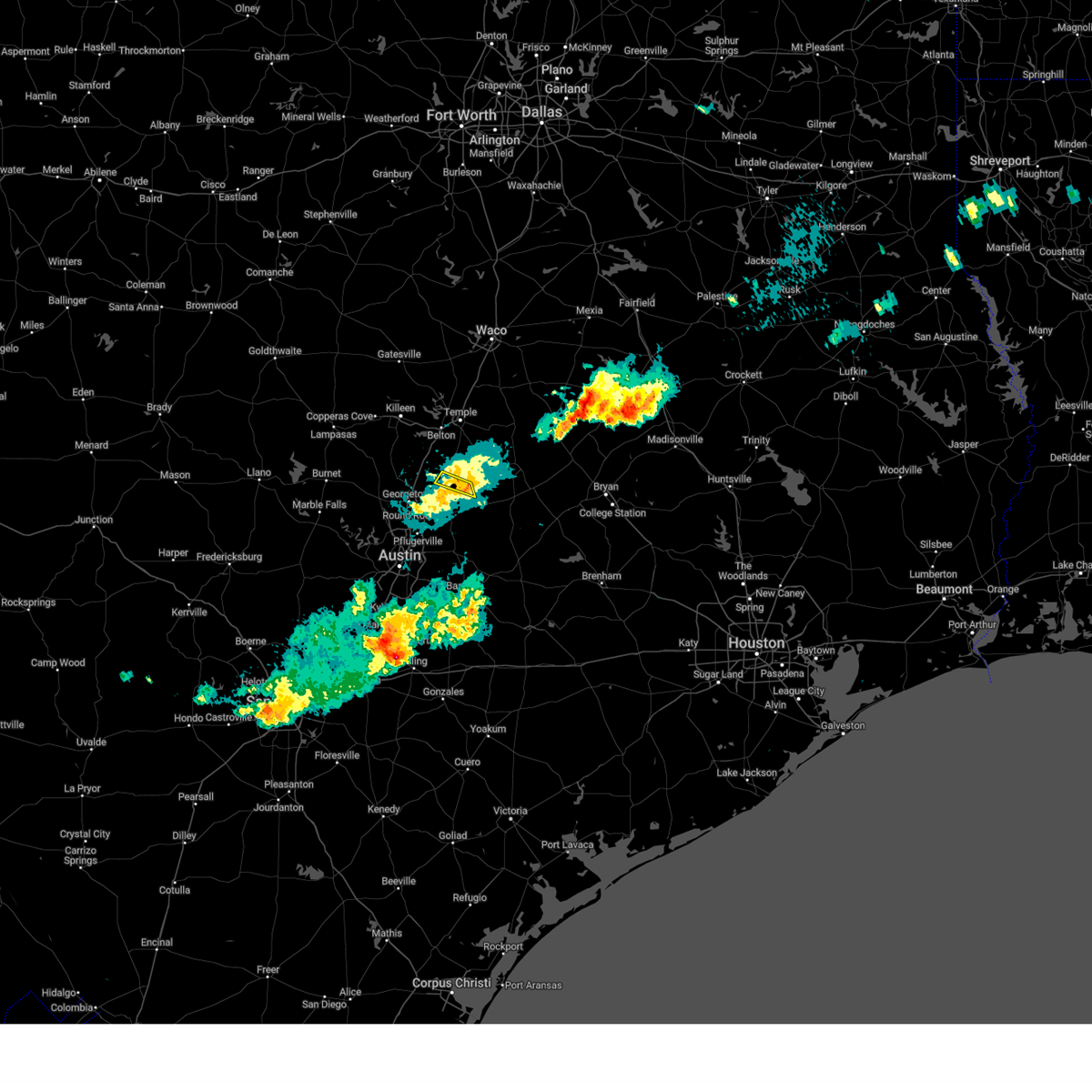 The storm which prompted the warning has weakened below severe limits, and no longer poses an immediate threat to life or property. therefore, the warning will be allowed to expire. a severe thunderstorm watch remains in effect until 100 am cdt for south central texas. The storm which prompted the warning has weakened below severe limits, and no longer poses an immediate threat to life or property. therefore, the warning will be allowed to expire. a severe thunderstorm watch remains in effect until 100 am cdt for south central texas.
|
| 3/23/2025 10:46 PM CDT |
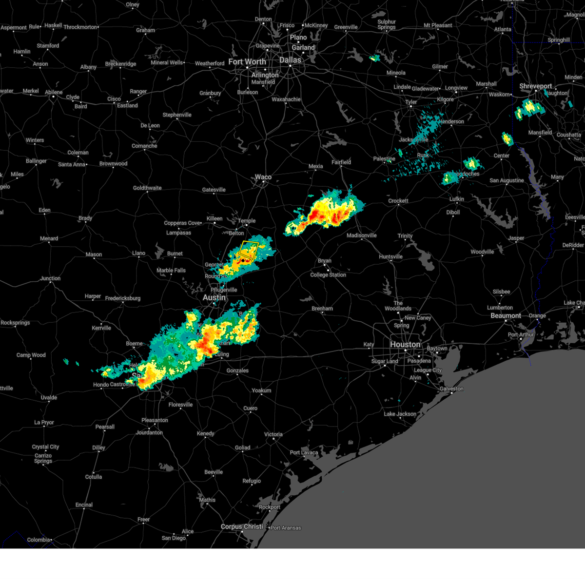 the severe thunderstorm warning has been cancelled and is no longer in effect the severe thunderstorm warning has been cancelled and is no longer in effect
|
| 3/23/2025 10:33 PM CDT |
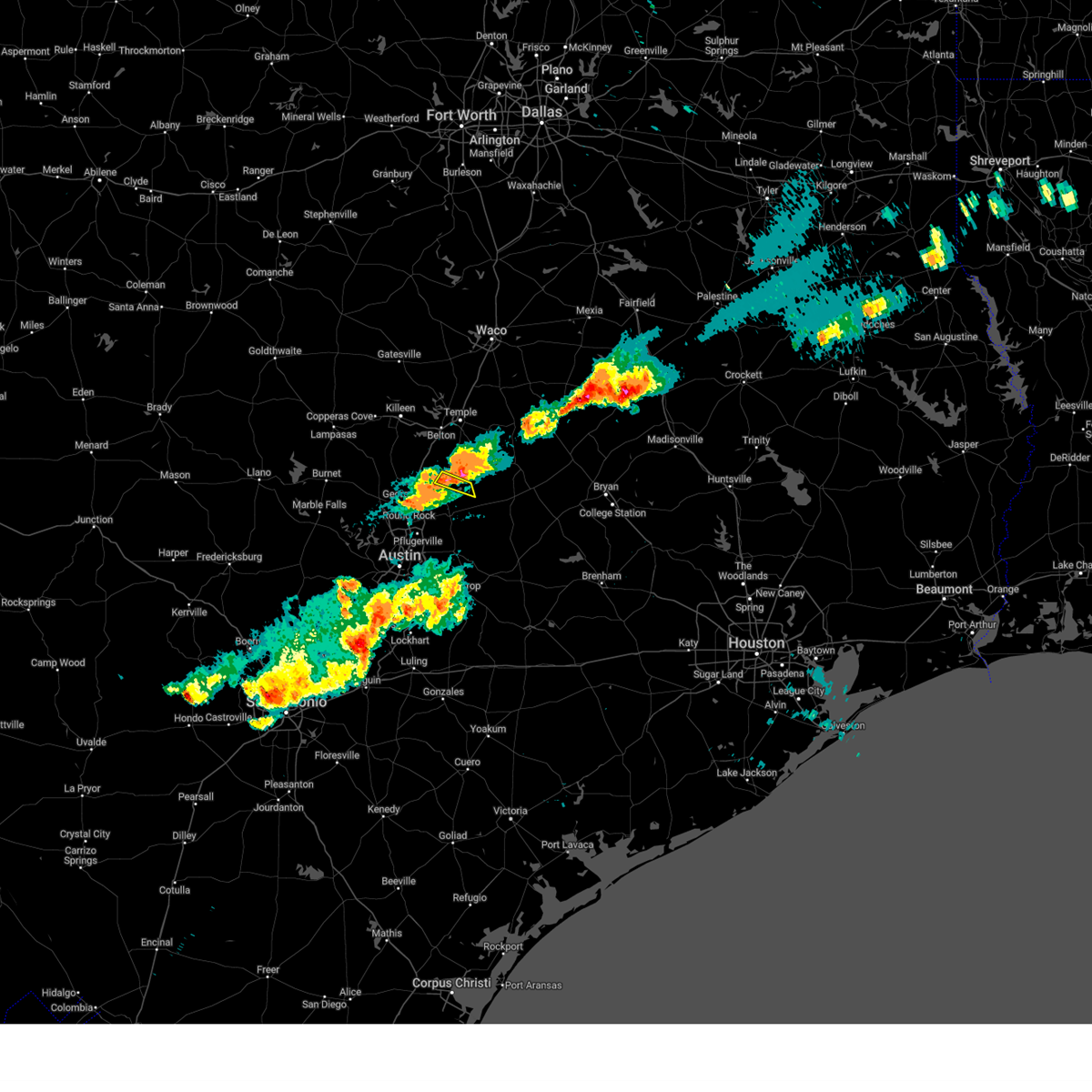 At 1033 pm cdt, a severe thunderstorm was located near bartlett, or near granger, moving east at 25 mph (radar indicated). Hazards include 60 mph wind gusts and quarter size hail. Hail damage to vehicles is expected. expect wind damage to roofs, siding, and trees. Locations impacted include, granger, bartlett, granger dam, laneport, and hare. At 1033 pm cdt, a severe thunderstorm was located near bartlett, or near granger, moving east at 25 mph (radar indicated). Hazards include 60 mph wind gusts and quarter size hail. Hail damage to vehicles is expected. expect wind damage to roofs, siding, and trees. Locations impacted include, granger, bartlett, granger dam, laneport, and hare.
|
| 3/23/2025 10:28 PM CDT |
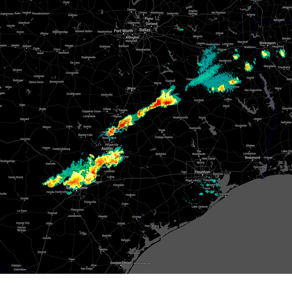 At 1028 pm cdt, a severe thunderstorm was located near holland, or 9 miles northeast of granger, moving southeast at 15 mph (radar indicated). Hazards include 60 mph wind gusts and half dollar size hail. Hail damage to vehicles is expected. expect wind damage to roofs, siding, and trees. This severe thunderstorm will remain over mainly rural areas of west central milam and southeastern bell counties, including the following locations, val verde, davilla, and sparks. At 1028 pm cdt, a severe thunderstorm was located near holland, or 9 miles northeast of granger, moving southeast at 15 mph (radar indicated). Hazards include 60 mph wind gusts and half dollar size hail. Hail damage to vehicles is expected. expect wind damage to roofs, siding, and trees. This severe thunderstorm will remain over mainly rural areas of west central milam and southeastern bell counties, including the following locations, val verde, davilla, and sparks.
|
| 3/23/2025 10:18 PM CDT |
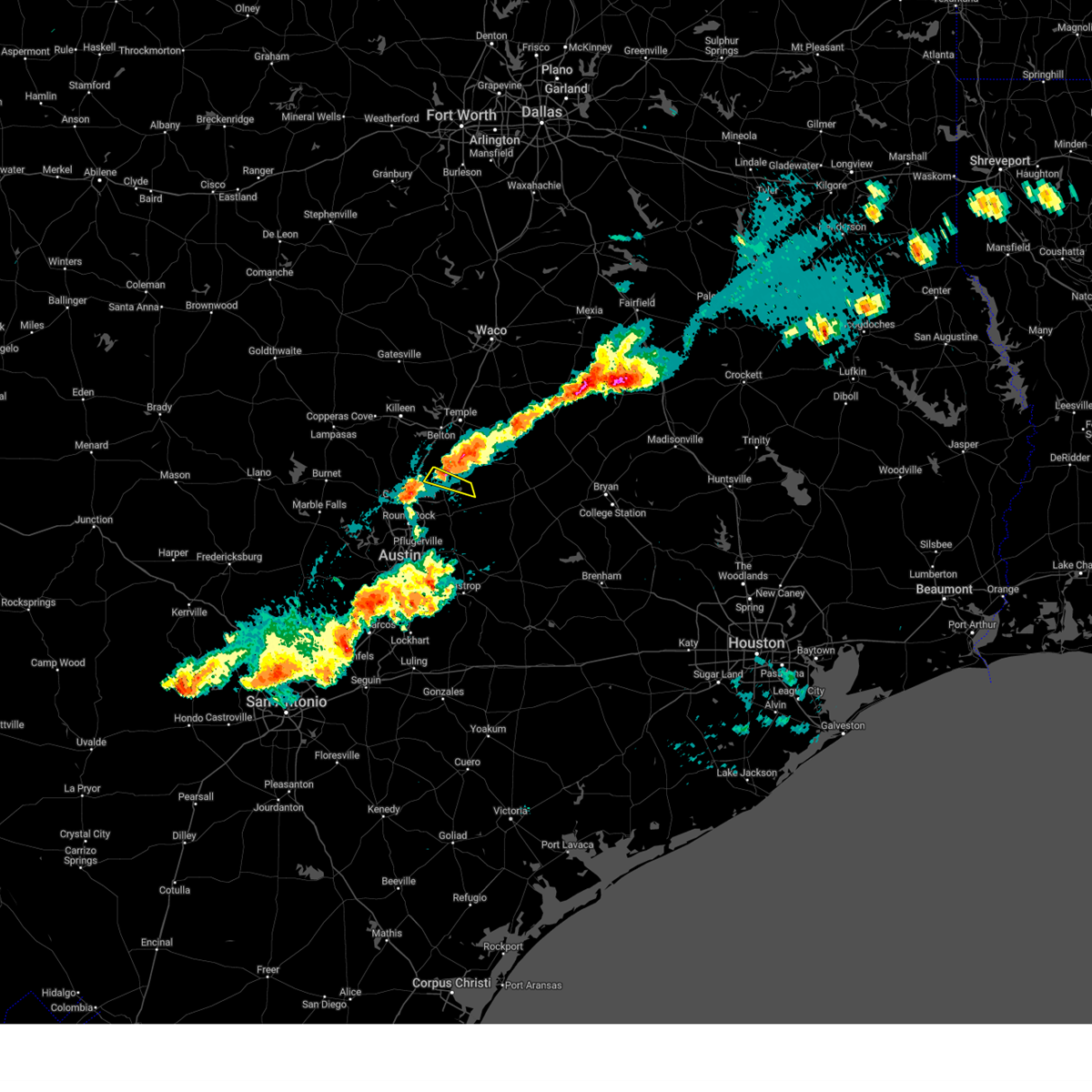 Svrewx the national weather service in austin san antonio has issued a * severe thunderstorm warning for, northeastern williamson county in south central texas, * until 1100 pm cdt. * at 1018 pm cdt, a severe thunderstorm was located near bartlett, or near granger, moving east at 25 mph (radar indicated). Hazards include 60 mph wind gusts and quarter size hail. Hail damage to vehicles is expected. Expect wind damage to roofs, siding, and trees. Svrewx the national weather service in austin san antonio has issued a * severe thunderstorm warning for, northeastern williamson county in south central texas, * until 1100 pm cdt. * at 1018 pm cdt, a severe thunderstorm was located near bartlett, or near granger, moving east at 25 mph (radar indicated). Hazards include 60 mph wind gusts and quarter size hail. Hail damage to vehicles is expected. Expect wind damage to roofs, siding, and trees.
|
| 3/23/2025 9:53 PM CDT |
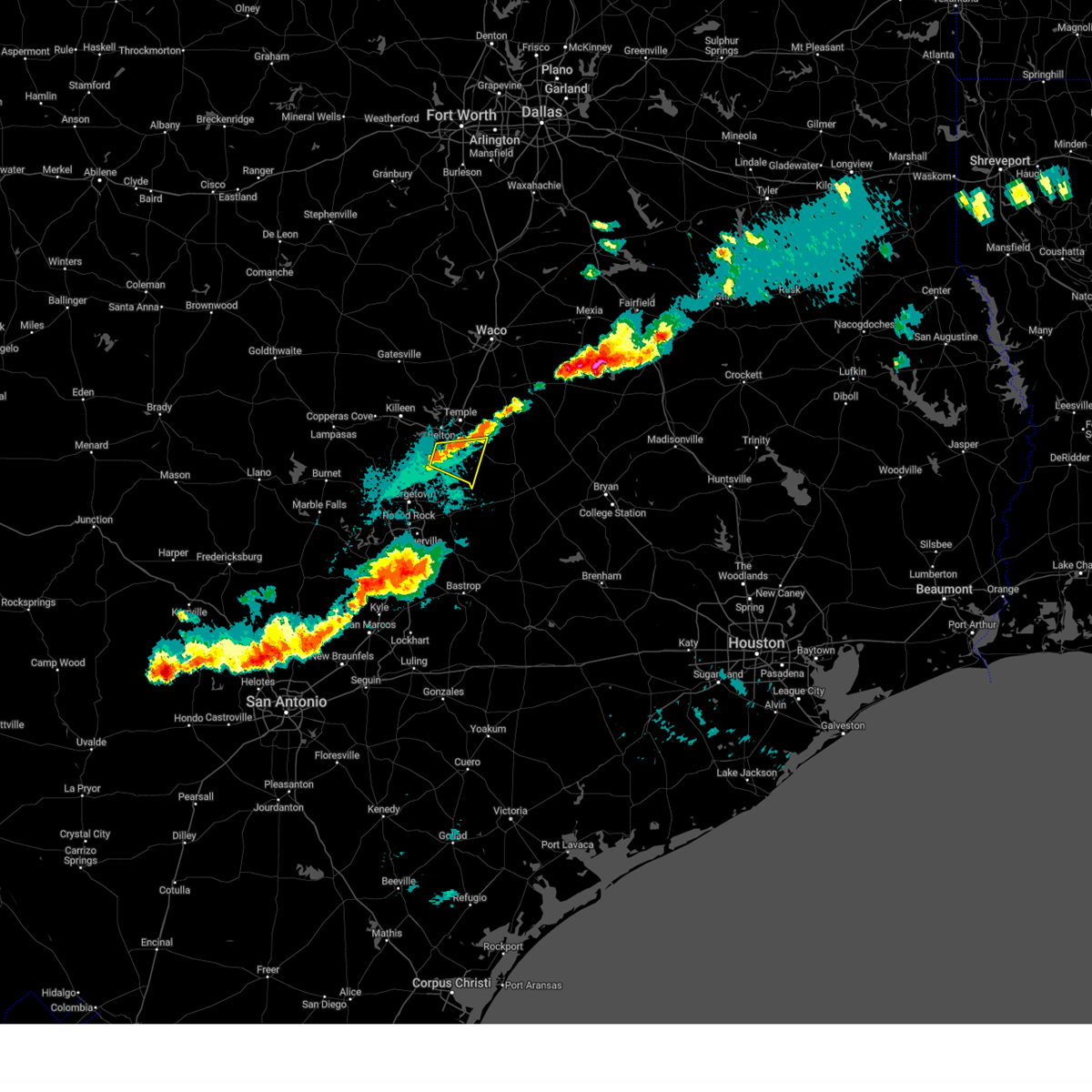 Svrfwd the national weather service in fort worth has issued a * severe thunderstorm warning for, west central milam county in central texas, southeastern bell county in central texas, * until 1100 pm cdt. * at 952 pm cdt, a severe thunderstorm was located near holland, or 11 miles north of granger, moving east at 10 mph (radar indicated). Hazards include 60 mph wind gusts and quarter size hail. Hail damage to vehicles is expected. expect wind damage to roofs, siding, and trees. this severe thunderstorm will be near, holland around 1000 pm cdt. Other locations impacted by this severe thunderstorm include val verde, leedale, sparks, and davilla. Svrfwd the national weather service in fort worth has issued a * severe thunderstorm warning for, west central milam county in central texas, southeastern bell county in central texas, * until 1100 pm cdt. * at 952 pm cdt, a severe thunderstorm was located near holland, or 11 miles north of granger, moving east at 10 mph (radar indicated). Hazards include 60 mph wind gusts and quarter size hail. Hail damage to vehicles is expected. expect wind damage to roofs, siding, and trees. this severe thunderstorm will be near, holland around 1000 pm cdt. Other locations impacted by this severe thunderstorm include val verde, leedale, sparks, and davilla.
|
| 5/31/2024 4:00 AM CDT |
 At 359 am cdt, severe thunderstorms were located along a line extending from 10 miles northeast of tradinghouse creek reservoir to 8 miles south of marlin to near salado, moving southeast at 55 mph (radar indicated). Hazards include 60 mph wind gusts and penny size hail. Expect damage to roofs, siding, and trees. these severe storms will be near, marlin, bartlett, mart, rosebud, rogers, and holland around 405 am cdt. bremond and buckholts around 410 am cdt. cameron, lake mexia, and fort parker state park around 415 am cdt. groesbeck, calvert, and twin oak reservoir around 420 am cdt. lake limestone around 425 am cdt. Other locations impacted by these severe thunderstorms include barclay, mooreville, sharp, yarrelton, pettibone, reagan, davilla, perry, highbank, and val verde. At 359 am cdt, severe thunderstorms were located along a line extending from 10 miles northeast of tradinghouse creek reservoir to 8 miles south of marlin to near salado, moving southeast at 55 mph (radar indicated). Hazards include 60 mph wind gusts and penny size hail. Expect damage to roofs, siding, and trees. these severe storms will be near, marlin, bartlett, mart, rosebud, rogers, and holland around 405 am cdt. bremond and buckholts around 410 am cdt. cameron, lake mexia, and fort parker state park around 415 am cdt. groesbeck, calvert, and twin oak reservoir around 420 am cdt. lake limestone around 425 am cdt. Other locations impacted by these severe thunderstorms include barclay, mooreville, sharp, yarrelton, pettibone, reagan, davilla, perry, highbank, and val verde.
|
| 5/31/2024 4:00 AM CDT |
 the severe thunderstorm warning has been cancelled and is no longer in effect the severe thunderstorm warning has been cancelled and is no longer in effect
|
| 5/31/2024 3:28 AM CDT |
 Svrfwd the national weather service in fort worth has issued a * severe thunderstorm warning for, mclennan county in central texas, northern robertson county in central texas, northern milam county in central texas, southeastern bosque county in central texas, bell county in central texas, limestone county in central texas, falls county in central texas, * until 430 am cdt. * at 327 am cdt, severe thunderstorms were located along a line extending from near laguna park to near mcgregor to fort cavazos, moving east at 60 mph (radar indicated). Hazards include 60 mph wind gusts and nickel size hail. Expect damage to roofs, siding, and trees. severe thunderstorms will be near, killeen, waco, temple, harker heights, belton, hewitt, robinson, bellmead, woodway, and lacy-lakeview around 335 am cdt. west, stillhouse hollow lake, and northcrest around 340 am cdt. riesel, hallsburg, tradinghouse creek reservoir, and lake creek lake around 345 am cdt. marlin, little river-academy, and lott around 350 am cdt. mart around 355 am cdt. rosebud around 400 am cdt. coolidge and lake mexia around 405 am cdt. groesbeck, bremond, and fort parker state park around 410 am cdt. other locations impacted by these severe thunderstorms include barclay, rock creek, moffat, mooreville, sharp, yarrelton, pettibone, reagan, davilla, and meadow grove. This includes interstate 35 between mile markers 278 and 354. Svrfwd the national weather service in fort worth has issued a * severe thunderstorm warning for, mclennan county in central texas, northern robertson county in central texas, northern milam county in central texas, southeastern bosque county in central texas, bell county in central texas, limestone county in central texas, falls county in central texas, * until 430 am cdt. * at 327 am cdt, severe thunderstorms were located along a line extending from near laguna park to near mcgregor to fort cavazos, moving east at 60 mph (radar indicated). Hazards include 60 mph wind gusts and nickel size hail. Expect damage to roofs, siding, and trees. severe thunderstorms will be near, killeen, waco, temple, harker heights, belton, hewitt, robinson, bellmead, woodway, and lacy-lakeview around 335 am cdt. west, stillhouse hollow lake, and northcrest around 340 am cdt. riesel, hallsburg, tradinghouse creek reservoir, and lake creek lake around 345 am cdt. marlin, little river-academy, and lott around 350 am cdt. mart around 355 am cdt. rosebud around 400 am cdt. coolidge and lake mexia around 405 am cdt. groesbeck, bremond, and fort parker state park around 410 am cdt. other locations impacted by these severe thunderstorms include barclay, rock creek, moffat, mooreville, sharp, yarrelton, pettibone, reagan, davilla, and meadow grove. This includes interstate 35 between mile markers 278 and 354.
|
| 5/9/2024 9:05 PM CDT |
 At 904 pm cdt, a severe thunderstorm was located near taylor, moving southeast at 45 mph. this is a destructive storm for taylor and thrall (radar indicated). Hazards include three inch hail and 60 mph wind gusts. People and animals outdoors will be severely injured. expect shattered windows, extensive damage to roofs, siding, and vehicles. Locations impacted include, round rock, georgetown, taylor, granger, hutto, bartlett, jarrell, thorndale, thrall, weir, granger dam, coupland, theon, rices crossing, laneport, hoxie, beyarsville, waterloo, hare, and walburg. At 904 pm cdt, a severe thunderstorm was located near taylor, moving southeast at 45 mph. this is a destructive storm for taylor and thrall (radar indicated). Hazards include three inch hail and 60 mph wind gusts. People and animals outdoors will be severely injured. expect shattered windows, extensive damage to roofs, siding, and vehicles. Locations impacted include, round rock, georgetown, taylor, granger, hutto, bartlett, jarrell, thorndale, thrall, weir, granger dam, coupland, theon, rices crossing, laneport, hoxie, beyarsville, waterloo, hare, and walburg.
|
| 5/9/2024 8:51 PM CDT |
 At 851 pm cdt, a severe thunderstorm was located near granger, moving southeast at 40 mph (radar indicated). Hazards include two inch hail and 60 mph wind gusts. People and animals outdoors will be injured. expect hail damage to roofs, siding, windows, and vehicles. expect wind damage to roofs, siding, and trees. Locations impacted include, round rock, georgetown, taylor, granger, hutto, bartlett, jarrell, thorndale, thrall, weir, granger dam, coupland, theon, rices crossing, laneport, hoxie, beyarsville, waterloo, hare, and walburg. At 851 pm cdt, a severe thunderstorm was located near granger, moving southeast at 40 mph (radar indicated). Hazards include two inch hail and 60 mph wind gusts. People and animals outdoors will be injured. expect hail damage to roofs, siding, windows, and vehicles. expect wind damage to roofs, siding, and trees. Locations impacted include, round rock, georgetown, taylor, granger, hutto, bartlett, jarrell, thorndale, thrall, weir, granger dam, coupland, theon, rices crossing, laneport, hoxie, beyarsville, waterloo, hare, and walburg.
|
| 5/9/2024 8:29 PM CDT |
 Svrewx the national weather service in austin san antonio has issued a * severe thunderstorm warning for, williamson county in south central texas, * until 930 pm cdt. * at 828 pm cdt, a severe thunderstorm was located near jarrell, or near serenada, moving southeast at 45 mph (radar indicated). Hazards include two inch hail and 60 mph wind gusts. People and animals outdoors will be injured. expect hail damage to roofs, siding, windows, and vehicles. Expect wind damage to roofs, siding, and trees. Svrewx the national weather service in austin san antonio has issued a * severe thunderstorm warning for, williamson county in south central texas, * until 930 pm cdt. * at 828 pm cdt, a severe thunderstorm was located near jarrell, or near serenada, moving southeast at 45 mph (radar indicated). Hazards include two inch hail and 60 mph wind gusts. People and animals outdoors will be injured. expect hail damage to roofs, siding, windows, and vehicles. Expect wind damage to roofs, siding, and trees.
|
| 4/9/2024 9:29 PM CDT |
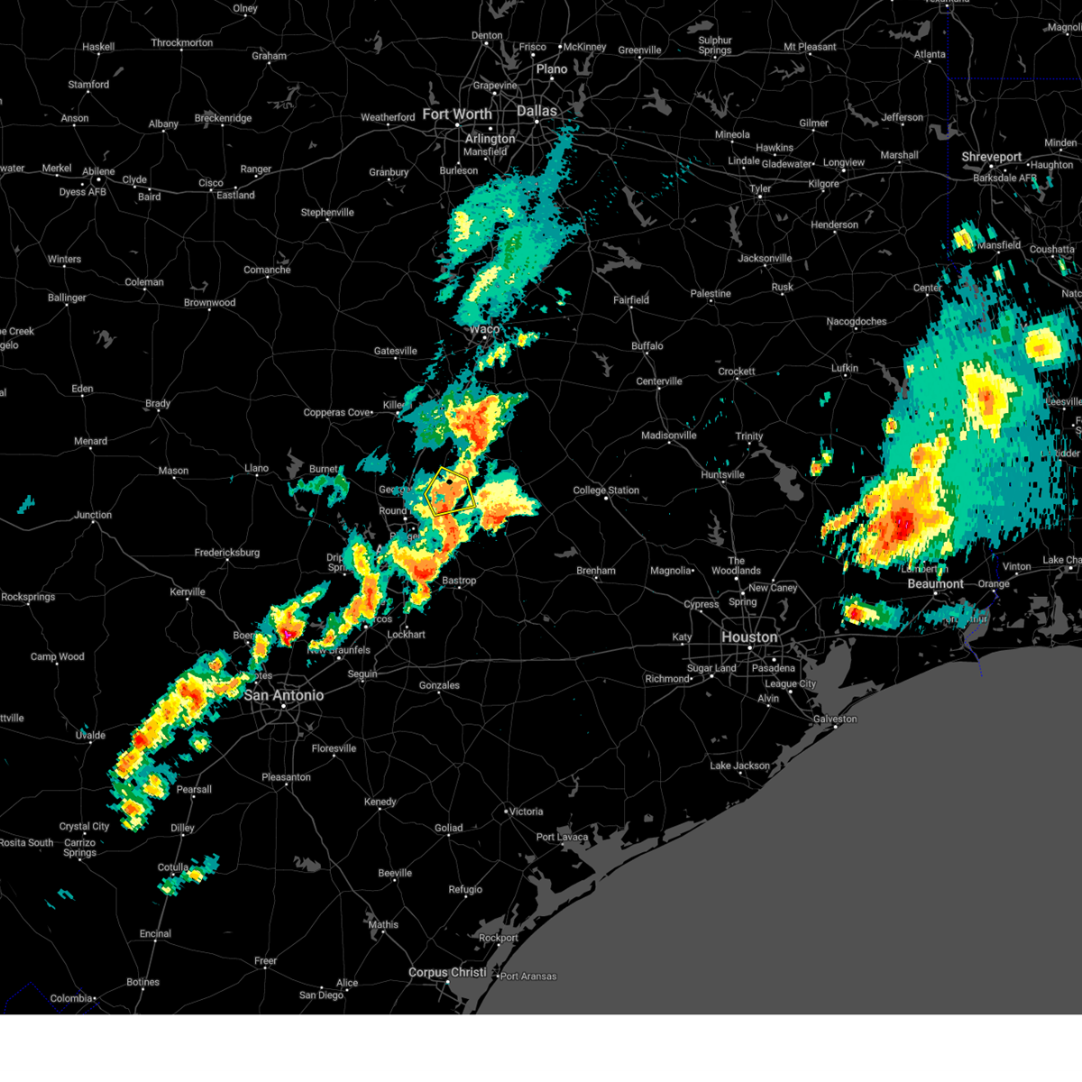 At 928 pm cdt, a severe thunderstorm was located near granger dam, or near granger, moving northeast at 30 mph (radar indicated). Hazards include 60 mph wind gusts and half dollar size hail. Hail damage to vehicles is expected. expect wind damage to roofs, siding, and trees. Locations impacted include, taylor, granger, bartlett, thrall, granger dam, laneport, jonah, hoxie, waterloo, sandoval, and hare. At 928 pm cdt, a severe thunderstorm was located near granger dam, or near granger, moving northeast at 30 mph (radar indicated). Hazards include 60 mph wind gusts and half dollar size hail. Hail damage to vehicles is expected. expect wind damage to roofs, siding, and trees. Locations impacted include, taylor, granger, bartlett, thrall, granger dam, laneport, jonah, hoxie, waterloo, sandoval, and hare.
|
| 4/9/2024 9:00 PM CDT |
 Svrewx the national weather service in austin san antonio has issued a * severe thunderstorm warning for, eastern williamson county in south central texas, * until 945 pm cdt. * at 900 pm cdt, a severe thunderstorm was located near hutto, or near round rock, moving northeast at 30 mph (radar indicated). Hazards include 60 mph wind gusts and quarter size hail. Hail damage to vehicles is expected. Expect wind damage to roofs, siding, and trees. Svrewx the national weather service in austin san antonio has issued a * severe thunderstorm warning for, eastern williamson county in south central texas, * until 945 pm cdt. * at 900 pm cdt, a severe thunderstorm was located near hutto, or near round rock, moving northeast at 30 mph (radar indicated). Hazards include 60 mph wind gusts and quarter size hail. Hail damage to vehicles is expected. Expect wind damage to roofs, siding, and trees.
|
| 4/9/2024 8:44 PM CDT |
 At 843 pm cdt, a severe thunderstorm was located near holland, or 9 miles south of belton, moving east at 15 mph (radar indicated). Hazards include tennis ball size hail and 65 mph wind gusts. People and animals outdoors will be injured. expect hail damage to roofs, siding, windows, and vehicles. expect wind damage to roofs, siding, and trees. this severe storm will be near, holland around 850 pm cdt. little river-academy around 855 pm cdt. rogers around 910 pm cdt. Other locations impacted by this severe thunderstorm include cyclone, heidenheimer, sharp, sparks, davilla, edgeworth, val verde, leedale, ratibor, and airville. At 843 pm cdt, a severe thunderstorm was located near holland, or 9 miles south of belton, moving east at 15 mph (radar indicated). Hazards include tennis ball size hail and 65 mph wind gusts. People and animals outdoors will be injured. expect hail damage to roofs, siding, windows, and vehicles. expect wind damage to roofs, siding, and trees. this severe storm will be near, holland around 850 pm cdt. little river-academy around 855 pm cdt. rogers around 910 pm cdt. Other locations impacted by this severe thunderstorm include cyclone, heidenheimer, sharp, sparks, davilla, edgeworth, val verde, leedale, ratibor, and airville.
|
| 4/9/2024 8:17 PM CDT |
 At 817 pm cdt, a severe thunderstorm was located over salado, or 10 miles southeast of harker heights, moving east at 20 mph (radar indicated). Hazards include tennis ball size hail and 70 mph wind gusts. People and animals outdoors will be injured. expect hail damage to roofs, siding, windows, and vehicles. expect considerable tree damage. wind damage is also likely to mobile homes, roofs, and outbuildings. this severe storm will be near, salado around 820 pm cdt. holland around 840 pm cdt. little river-academy around 850 pm cdt. Other locations impacted by this severe thunderstorm include cyclone, heidenheimer, sharp, sparks, prairie dell, davilla, edgeworth, val verde, leedale, and ratibor. At 817 pm cdt, a severe thunderstorm was located over salado, or 10 miles southeast of harker heights, moving east at 20 mph (radar indicated). Hazards include tennis ball size hail and 70 mph wind gusts. People and animals outdoors will be injured. expect hail damage to roofs, siding, windows, and vehicles. expect considerable tree damage. wind damage is also likely to mobile homes, roofs, and outbuildings. this severe storm will be near, salado around 820 pm cdt. holland around 840 pm cdt. little river-academy around 850 pm cdt. Other locations impacted by this severe thunderstorm include cyclone, heidenheimer, sharp, sparks, prairie dell, davilla, edgeworth, val verde, leedale, and ratibor.
|
| 4/9/2024 7:55 PM CDT |
 Svrfwd the national weather service in fort worth has issued a * severe thunderstorm warning for, northwestern milam county in central texas, southern bell county in central texas, * until 900 pm cdt. * at 754 pm cdt, a severe thunderstorm was located near stillhouse hollow lake, or 7 miles south of harker heights, moving east at 30 mph (radar indicated). Hazards include golf ball size hail and 60 mph wind gusts. People and animals outdoors will be injured. expect hail damage to roofs, siding, windows, and vehicles. expect wind damage to roofs, siding, and trees. this severe thunderstorm will be near, salado and stillhouse hollow lake around 800 pm cdt. little river-academy and holland around 820 pm cdt. rogers around 835 pm cdt. buckholts around 850 pm cdt. other locations impacted by this severe thunderstorm include cedar valley, cyclone, heidenheimer, sharp, youngsport, sparks, prairie dell, davilla, edgeworth, and val verde. This includes interstate 35 between mile markers 278 and 298. Svrfwd the national weather service in fort worth has issued a * severe thunderstorm warning for, northwestern milam county in central texas, southern bell county in central texas, * until 900 pm cdt. * at 754 pm cdt, a severe thunderstorm was located near stillhouse hollow lake, or 7 miles south of harker heights, moving east at 30 mph (radar indicated). Hazards include golf ball size hail and 60 mph wind gusts. People and animals outdoors will be injured. expect hail damage to roofs, siding, windows, and vehicles. expect wind damage to roofs, siding, and trees. this severe thunderstorm will be near, salado and stillhouse hollow lake around 800 pm cdt. little river-academy and holland around 820 pm cdt. rogers around 835 pm cdt. buckholts around 850 pm cdt. other locations impacted by this severe thunderstorm include cedar valley, cyclone, heidenheimer, sharp, youngsport, sparks, prairie dell, davilla, edgeworth, and val verde. This includes interstate 35 between mile markers 278 and 298.
|
| 4/9/2024 7:32 PM CDT |
 At 731 pm cdt, a severe thunderstorm was located 7 miles north of florence, or 11 miles southwest of harker heights, moving east at 30 mph. this is a destructive storm for southerstern portions of bell county (radar indicated). Hazards include baseball size hail and 60 mph wind gusts. People and animals outdoors will be severely injured. expect shattered windows, extensive damage to roofs, siding, and vehicles. this severe storm will be near, stillhouse hollow lake around 740 pm cdt. salado around 750 pm cdt. belton around 805 pm cdt. Other locations impacted by this severe thunderstorm include union grove, cedar valley, youngsport, ding dong, prairie dell, and maxdale. At 731 pm cdt, a severe thunderstorm was located 7 miles north of florence, or 11 miles southwest of harker heights, moving east at 30 mph. this is a destructive storm for southerstern portions of bell county (radar indicated). Hazards include baseball size hail and 60 mph wind gusts. People and animals outdoors will be severely injured. expect shattered windows, extensive damage to roofs, siding, and vehicles. this severe storm will be near, stillhouse hollow lake around 740 pm cdt. salado around 750 pm cdt. belton around 805 pm cdt. Other locations impacted by this severe thunderstorm include union grove, cedar valley, youngsport, ding dong, prairie dell, and maxdale.
|
| 4/9/2024 7:03 PM CDT |
 Svrfwd the national weather service in fort worth has issued a * severe thunderstorm warning for, southwestern bell county in central texas, * until 800 pm cdt. * at 702 pm cdt, a severe thunderstorm was located near watson, or 11 miles southwest of copperas cove, moving east at 35 mph (radar indicated). Hazards include ping pong ball size hail and 60 mph wind gusts. People and animals outdoors will be injured. expect hail damage to roofs, siding, windows, and vehicles. expect wind damage to roofs, siding, and trees. this severe thunderstorm will be near, killeen around 720 pm cdt. harker heights and stillhouse hollow lake around 730 pm cdt. salado around 735 pm cdt. belton around 745 pm cdt. other locations impacted by this severe thunderstorm include cedar valley, maxdale, union grove, youngsport, ding dong, prairie dell, and woodland. This includes interstate 35 between mile markers 278 and 294. Svrfwd the national weather service in fort worth has issued a * severe thunderstorm warning for, southwestern bell county in central texas, * until 800 pm cdt. * at 702 pm cdt, a severe thunderstorm was located near watson, or 11 miles southwest of copperas cove, moving east at 35 mph (radar indicated). Hazards include ping pong ball size hail and 60 mph wind gusts. People and animals outdoors will be injured. expect hail damage to roofs, siding, windows, and vehicles. expect wind damage to roofs, siding, and trees. this severe thunderstorm will be near, killeen around 720 pm cdt. harker heights and stillhouse hollow lake around 730 pm cdt. salado around 735 pm cdt. belton around 745 pm cdt. other locations impacted by this severe thunderstorm include cedar valley, maxdale, union grove, youngsport, ding dong, prairie dell, and woodland. This includes interstate 35 between mile markers 278 and 294.
|
| 9/24/2023 8:45 PM CDT |
 At 845 pm cdt, a severe thunderstorm was located near rogers, or 14 miles northeast of granger, moving south at 15 mph (trained weather spotters). Hazards include 70 mph wind gusts. Expect considerable tree damage. Damage is likely to mobile homes, roofs, and outbuildings. At 845 pm cdt, a severe thunderstorm was located near rogers, or 14 miles northeast of granger, moving south at 15 mph (trained weather spotters). Hazards include 70 mph wind gusts. Expect considerable tree damage. Damage is likely to mobile homes, roofs, and outbuildings.
|
| 9/24/2023 8:44 PM CDT |
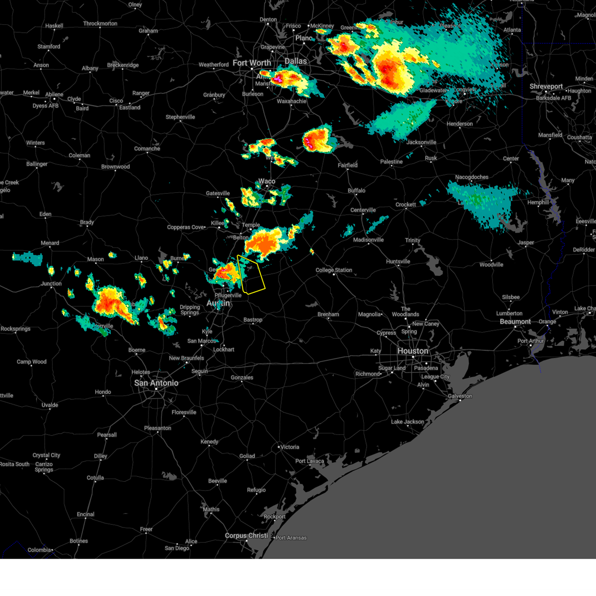 At 844 pm cdt, a severe thunderstorm was located near holland, or 14 miles northeast of granger, moving south at 15 mph (radar indicated). Hazards include 60 mph wind gusts and quarter size hail. Hail damage to vehicles is expected. Expect wind damage to roofs, siding, and trees. At 844 pm cdt, a severe thunderstorm was located near holland, or 14 miles northeast of granger, moving south at 15 mph (radar indicated). Hazards include 60 mph wind gusts and quarter size hail. Hail damage to vehicles is expected. Expect wind damage to roofs, siding, and trees.
|
| 9/24/2023 8:31 PM CDT |
 At 831 pm cdt, a severe thunderstorm was located near rogers, or 13 miles west of cameron, moving south at 25 mph (radar indicated). Hazards include 70 mph wind gusts and quarter size hail. Hail damage to vehicles is expected. expect considerable tree damage. wind damage is also likely to mobile homes, roofs, and outbuildings. locations impacted include, temple, belton, cameron, bartlett, little river-academy, rogers, holland, buckholts, sparks, wilson, yarrelton, silver city, leedale, edgeworth, barclay, ben arnold, pettibone, davilla, terrys chapel, and val verde. thunderstorm damage threat, considerable hail threat, radar indicated max hail size, 1. 00 in wind threat, radar indicated max wind gust, 70 mph. At 831 pm cdt, a severe thunderstorm was located near rogers, or 13 miles west of cameron, moving south at 25 mph (radar indicated). Hazards include 70 mph wind gusts and quarter size hail. Hail damage to vehicles is expected. expect considerable tree damage. wind damage is also likely to mobile homes, roofs, and outbuildings. locations impacted include, temple, belton, cameron, bartlett, little river-academy, rogers, holland, buckholts, sparks, wilson, yarrelton, silver city, leedale, edgeworth, barclay, ben arnold, pettibone, davilla, terrys chapel, and val verde. thunderstorm damage threat, considerable hail threat, radar indicated max hail size, 1. 00 in wind threat, radar indicated max wind gust, 70 mph.
|
| 9/24/2023 7:41 PM CDT |
 At 741 pm cdt, a severe thunderstorm was located near troy, or near temple, moving south at 25 mph (radar indicated). Hazards include 65 mph wind gusts and quarter size hail. Hail damage to vehicles is expected. Expect wind damage to roofs, siding, and trees. At 741 pm cdt, a severe thunderstorm was located near troy, or near temple, moving south at 25 mph (radar indicated). Hazards include 65 mph wind gusts and quarter size hail. Hail damage to vehicles is expected. Expect wind damage to roofs, siding, and trees.
|
| 6/10/2023 8:00 PM CDT |
 At 800 pm cdt, a severe thunderstorm was located over temple, moving southeast at 25 mph (radar indicated). Hazards include 60 mph wind gusts. Expect damage to roofs, siding, and trees. locations impacted include, killeen, temple, copperas cove, harker heights, belton, fort cavazos, nolanville, morgan`s point resort, bartlett, salado, little river-academy, troy, rogers, holland, belton lake, stillhouse hollow lake, sparks, union grove, ding dong and white hall. hail threat, radar indicated max hail size, <. 75 in wind threat, radar indicated max wind gust, 60 mph. At 800 pm cdt, a severe thunderstorm was located over temple, moving southeast at 25 mph (radar indicated). Hazards include 60 mph wind gusts. Expect damage to roofs, siding, and trees. locations impacted include, killeen, temple, copperas cove, harker heights, belton, fort cavazos, nolanville, morgan`s point resort, bartlett, salado, little river-academy, troy, rogers, holland, belton lake, stillhouse hollow lake, sparks, union grove, ding dong and white hall. hail threat, radar indicated max hail size, <. 75 in wind threat, radar indicated max wind gust, 60 mph.
|
| 6/10/2023 7:44 PM CDT |
 At 743 pm cdt, a severe thunderstorm was located near killeen, moving southeast at 25 mph. a 70 mph wind gust was measured near killeen in the last few minutes (radar indicated). Hazards include 70 mph wind gusts and quarter size hail. Hail damage to vehicles is expected. expect considerable tree damage. Wind damage is also likely to mobile homes, roofs, and outbuildings. At 743 pm cdt, a severe thunderstorm was located near killeen, moving southeast at 25 mph. a 70 mph wind gust was measured near killeen in the last few minutes (radar indicated). Hazards include 70 mph wind gusts and quarter size hail. Hail damage to vehicles is expected. expect considerable tree damage. Wind damage is also likely to mobile homes, roofs, and outbuildings.
|
| 6/8/2023 3:45 PM CDT |
 At 345 pm cdt, a severe thunderstorm was located near rogers, or 8 miles southeast of temple, moving southeast at 5 mph (radar indicated). Hazards include 60 mph wind gusts and penny size hail. expect damage to roofs, siding, and trees At 345 pm cdt, a severe thunderstorm was located near rogers, or 8 miles southeast of temple, moving southeast at 5 mph (radar indicated). Hazards include 60 mph wind gusts and penny size hail. expect damage to roofs, siding, and trees
|
| 4/28/2023 4:45 PM CDT |
 At 444 pm cdt, severe thunderstorms were located along a line extending from near bartlett to near lago vista, moving southeast at 30 mph (radar indicated). Hazards include 70 mph wind gusts and quarter size hail. Hail damage to vehicles is expected. expect considerable tree damage. wind damage is also likely to mobile homes, roofs, and outbuildings. locations impacted include, austin, round rock, cedar park, georgetown, pflugerville, taylor, granger, serenada, anderson mill, windemere, leander, hutto, lakeway, manor, lago vista, bee cave, west lake hills, hudson bend, bartlett and the hills. thunderstorm damage threat, considerable hail threat, observed max hail size, 1. 00 in wind threat, radar indicated max wind gust, 70 mph. At 444 pm cdt, severe thunderstorms were located along a line extending from near bartlett to near lago vista, moving southeast at 30 mph (radar indicated). Hazards include 70 mph wind gusts and quarter size hail. Hail damage to vehicles is expected. expect considerable tree damage. wind damage is also likely to mobile homes, roofs, and outbuildings. locations impacted include, austin, round rock, cedar park, georgetown, pflugerville, taylor, granger, serenada, anderson mill, windemere, leander, hutto, lakeway, manor, lago vista, bee cave, west lake hills, hudson bend, bartlett and the hills. thunderstorm damage threat, considerable hail threat, observed max hail size, 1. 00 in wind threat, radar indicated max wind gust, 70 mph.
|
| 4/28/2023 4:36 PM CDT |
 At 436 pm cdt, severe thunderstorms were located along a line extending from 6 miles west of rosebud to near jarrell, moving southeast at 40 mph (trained weather spotters). Hazards include golf ball size hail and 60 mph wind gusts. People and animals outdoors will be injured. expect hail damage to roofs, siding, windows, and vehicles. expect wind damage to roofs, siding, and trees. locations impacted include, temple, rockdale, cameron, bartlett, salado, little river-academy, rosebud, thorndale, rogers, holland, lott, buckholts, alcoa lake, sparks, wilson, milano, yarrelton, crossroads, silver city and hoyte. thunderstorm damage threat, considerable hail threat, radar indicated max hail size, 1. 75 in wind threat, radar indicated max wind gust, 60 mph. At 436 pm cdt, severe thunderstorms were located along a line extending from 6 miles west of rosebud to near jarrell, moving southeast at 40 mph (trained weather spotters). Hazards include golf ball size hail and 60 mph wind gusts. People and animals outdoors will be injured. expect hail damage to roofs, siding, windows, and vehicles. expect wind damage to roofs, siding, and trees. locations impacted include, temple, rockdale, cameron, bartlett, salado, little river-academy, rosebud, thorndale, rogers, holland, lott, buckholts, alcoa lake, sparks, wilson, milano, yarrelton, crossroads, silver city and hoyte. thunderstorm damage threat, considerable hail threat, radar indicated max hail size, 1. 75 in wind threat, radar indicated max wind gust, 60 mph.
|
| 4/28/2023 4:35 PM CDT |
 At 435 pm cdt, severe thunderstorms were located along a line extending from 6 miles northeast of jarrell to near spicewood, moving southeast at 30 mph (radar indicated). Hazards include 70 mph wind gusts and quarter size hail. Hail damage to vehicles is expected. expect considerable tree damage. wind damage is also likely to mobile homes, roofs, and outbuildings. locations impacted include, austin, round rock, cedar park, georgetown, pflugerville, taylor, granger, serenada, anderson mill, windemere, leander, hutto, lakeway, manor, lago vista, bee cave, west lake hills, hudson bend, bartlett and the hills. thunderstorm damage threat, considerable hail threat, radar indicated max hail size, 1. 00 in wind threat, radar indicated max wind gust, 70 mph. At 435 pm cdt, severe thunderstorms were located along a line extending from 6 miles northeast of jarrell to near spicewood, moving southeast at 30 mph (radar indicated). Hazards include 70 mph wind gusts and quarter size hail. Hail damage to vehicles is expected. expect considerable tree damage. wind damage is also likely to mobile homes, roofs, and outbuildings. locations impacted include, austin, round rock, cedar park, georgetown, pflugerville, taylor, granger, serenada, anderson mill, windemere, leander, hutto, lakeway, manor, lago vista, bee cave, west lake hills, hudson bend, bartlett and the hills. thunderstorm damage threat, considerable hail threat, radar indicated max hail size, 1. 00 in wind threat, radar indicated max wind gust, 70 mph.
|
| 4/28/2023 4:13 PM CDT |
 At 413 pm cdt, severe thunderstorms were located along a line extending from 6 miles west of salado to marble falls, moving southeast at 30 mph (radar indicated). Hazards include 60 mph wind gusts and quarter size hail. Hail damage to vehicles is expected. Expect wind damage to roofs, siding, and trees. At 413 pm cdt, severe thunderstorms were located along a line extending from 6 miles west of salado to marble falls, moving southeast at 30 mph (radar indicated). Hazards include 60 mph wind gusts and quarter size hail. Hail damage to vehicles is expected. Expect wind damage to roofs, siding, and trees.
|
| 4/28/2023 4:12 PM CDT |
 At 411 pm cdt, severe thunderstorms were located along a line extending from lott to near rogers to near jarrell, moving southeast at 55 mph (radar indicated). Hazards include 60 mph wind gusts and quarter size hail. Hail damage to vehicles is expected. Expect wind damage to roofs, siding, and trees. At 411 pm cdt, severe thunderstorms were located along a line extending from lott to near rogers to near jarrell, moving southeast at 55 mph (radar indicated). Hazards include 60 mph wind gusts and quarter size hail. Hail damage to vehicles is expected. Expect wind damage to roofs, siding, and trees.
|
| 4/26/2023 8:45 PM CDT |
 At 845 pm cdt, a severe thunderstorm was located near belton, moving southeast at 30 mph (radar indicated). Hazards include two inch hail and 60 mph wind gusts. People and animals outdoors will be injured. expect hail damage to roofs, siding, windows, and vehicles. Expect wind damage to roofs, siding, and trees. At 845 pm cdt, a severe thunderstorm was located near belton, moving southeast at 30 mph (radar indicated). Hazards include two inch hail and 60 mph wind gusts. People and animals outdoors will be injured. expect hail damage to roofs, siding, windows, and vehicles. Expect wind damage to roofs, siding, and trees.
|
| 4/20/2023 6:31 PM CDT |
 At 631 pm cdt, severe thunderstorms were located along a line extending from serenada to near liberty hill to near burnet, moving southeast at 25 mph (radar indicated). Hazards include ping pong ball size hail. People and animals outdoors will be injured. expect damage to roofs, siding, windows, and vehicles. locations impacted include, round rock, georgetown, burnet, bertram, serenada, leander, bartlett, liberty hill, jarrell, florence, weir, georgetown dam, watson, joppa, andice, shady grove, oatmeal, briggs, sun city and mahomet. hail threat, observed max hail size, 1. 50 in wind threat, radar indicated max wind gust, <50 mph. At 631 pm cdt, severe thunderstorms were located along a line extending from serenada to near liberty hill to near burnet, moving southeast at 25 mph (radar indicated). Hazards include ping pong ball size hail. People and animals outdoors will be injured. expect damage to roofs, siding, windows, and vehicles. locations impacted include, round rock, georgetown, burnet, bertram, serenada, leander, bartlett, liberty hill, jarrell, florence, weir, georgetown dam, watson, joppa, andice, shady grove, oatmeal, briggs, sun city and mahomet. hail threat, observed max hail size, 1. 50 in wind threat, radar indicated max wind gust, <50 mph.
|
| 4/20/2023 6:25 PM CDT |
 At 623 pm cdt, severe thunderstorms were located along a line extending from sun city to near bertram to near burnet, moving southeast at 25 mph (trained weather spotters. quarter size hail was reported in burnet at 620 pm cdt). Hazards include quarter size hail. damage to vehicles is expected At 623 pm cdt, severe thunderstorms were located along a line extending from sun city to near bertram to near burnet, moving southeast at 25 mph (trained weather spotters. quarter size hail was reported in burnet at 620 pm cdt). Hazards include quarter size hail. damage to vehicles is expected
|
| 4/20/2023 6:19 PM CDT |
 At 618 pm cdt, severe thunderstorms were located along a line extending from near jarrell to buckholts, moving southeast at 20 mph (radar indicated). Hazards include 60 mph wind gusts and half dollar size hail. Hail damage to vehicles is expected. Expect wind damage to roofs, siding, and trees. At 618 pm cdt, severe thunderstorms were located along a line extending from near jarrell to buckholts, moving southeast at 20 mph (radar indicated). Hazards include 60 mph wind gusts and half dollar size hail. Hail damage to vehicles is expected. Expect wind damage to roofs, siding, and trees.
|
| 4/20/2023 5:52 PM CDT |
 At 551 pm cdt, severe thunderstorms were located along a line extending from harker heights to belton to seaton, moving southeast at 15 mph (radar indicated). Hazards include ping pong ball size hail and 60 mph wind gusts. People and animals outdoors will be injured. expect damage to roofs, siding, windows, and vehicles. locations impacted include, killeen, temple, copperas cove, harker heights, belton, fort hood, nolanville, morgan`s point resort, bartlett, salado, little river-academy, troy, rogers, holland, kempner, buckholts, belton lake, stillhouse hollow lake, sparks and union grove. hail threat, observed max hail size, 1. 50 in wind threat, radar indicated max wind gust, 60 mph. At 551 pm cdt, severe thunderstorms were located along a line extending from harker heights to belton to seaton, moving southeast at 15 mph (radar indicated). Hazards include ping pong ball size hail and 60 mph wind gusts. People and animals outdoors will be injured. expect damage to roofs, siding, windows, and vehicles. locations impacted include, killeen, temple, copperas cove, harker heights, belton, fort hood, nolanville, morgan`s point resort, bartlett, salado, little river-academy, troy, rogers, holland, kempner, buckholts, belton lake, stillhouse hollow lake, sparks and union grove. hail threat, observed max hail size, 1. 50 in wind threat, radar indicated max wind gust, 60 mph.
|
| 4/20/2023 5:37 PM CDT |
 At 535 pm cdt, severe thunderstorms were located along a line extending from copperas cove to belton to seaton, moving southeast at 10 mph. at 530 pm cdt, ping pong ball size hail was reported with this storm at fort hood (radar indicated). Hazards include ping pong ball size hail and 60 mph wind gusts. People and animals outdoors will be injured. Expect damage to roofs, siding, windows, and vehicles. At 535 pm cdt, severe thunderstorms were located along a line extending from copperas cove to belton to seaton, moving southeast at 10 mph. at 530 pm cdt, ping pong ball size hail was reported with this storm at fort hood (radar indicated). Hazards include ping pong ball size hail and 60 mph wind gusts. People and animals outdoors will be injured. Expect damage to roofs, siding, windows, and vehicles.
|
| 3/16/2023 8:59 PM CDT |
 At 859 pm cdt, a severe thunderstorm was located near granger, moving east at 45 mph (radar indicated). Hazards include 60 mph wind gusts and quarter size hail. Hail damage to vehicles is expected. expect wind damage to roofs, siding, and trees. locations impacted include, georgetown, granger, bartlett, jarrell, weir, granger dam, theon, laneport, hoxie, waterloo, hare, walburg, schwertner and sandoval. hail threat, radar indicated max hail size, 1. 00 in wind threat, radar indicated max wind gust, 60 mph. At 859 pm cdt, a severe thunderstorm was located near granger, moving east at 45 mph (radar indicated). Hazards include 60 mph wind gusts and quarter size hail. Hail damage to vehicles is expected. expect wind damage to roofs, siding, and trees. locations impacted include, georgetown, granger, bartlett, jarrell, weir, granger dam, theon, laneport, hoxie, waterloo, hare, walburg, schwertner and sandoval. hail threat, radar indicated max hail size, 1. 00 in wind threat, radar indicated max wind gust, 60 mph.
|
| 3/16/2023 8:45 PM CDT |
 At 845 pm cdt, a severe thunderstorm was located near jarrell, or near serenada, moving east at 45 mph (radar indicated). Hazards include 60 mph wind gusts and quarter size hail. Hail damage to vehicles is expected. Expect wind damage to roofs, siding, and trees. At 845 pm cdt, a severe thunderstorm was located near jarrell, or near serenada, moving east at 45 mph (radar indicated). Hazards include 60 mph wind gusts and quarter size hail. Hail damage to vehicles is expected. Expect wind damage to roofs, siding, and trees.
|
| 3/2/2023 7:53 PM CST |
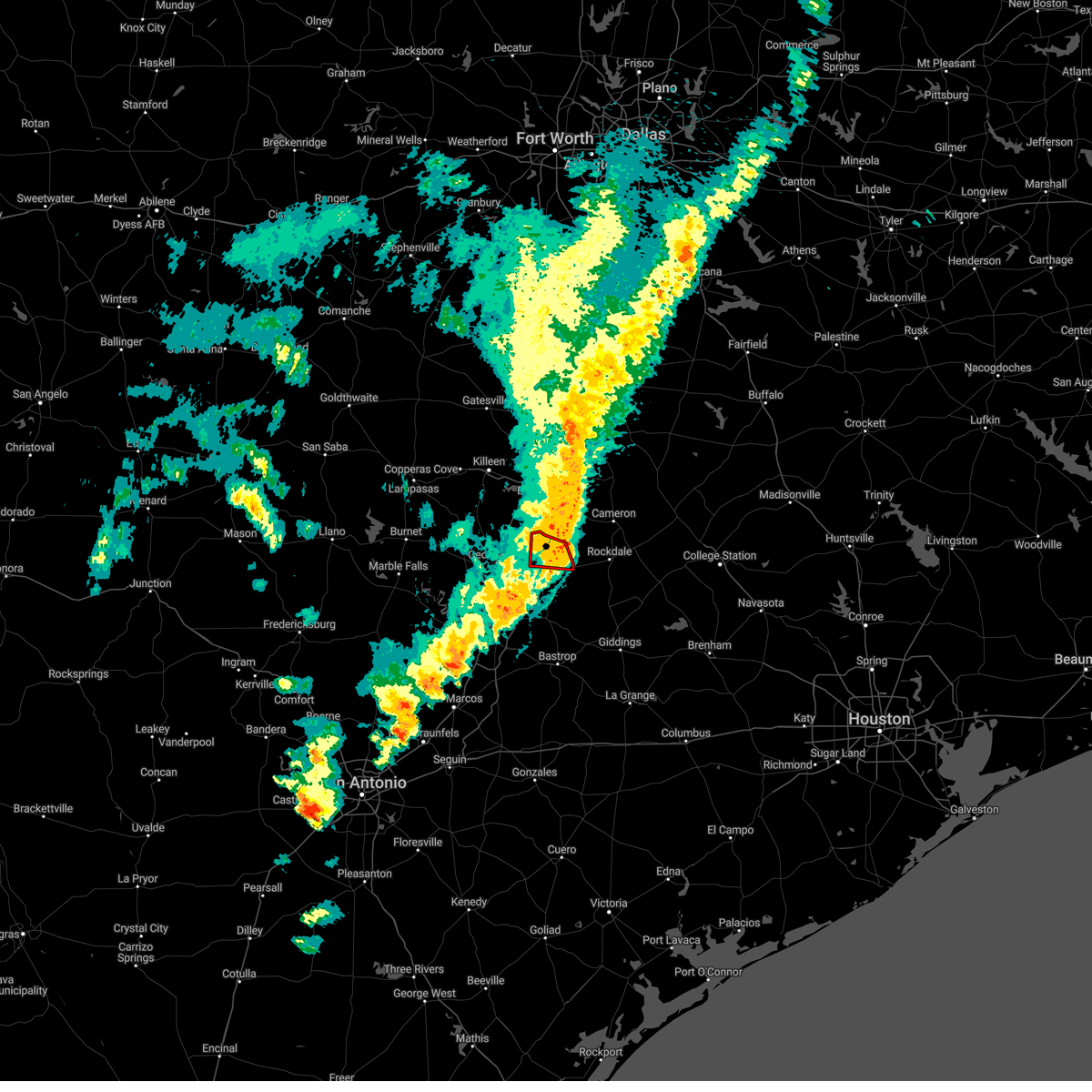 The tornado warning for northeastern williamson county will expire at 800 pm cst, the storm which prompted the warning has moved out of the area. therefore, the warning will be allowed to expire. however gusty winds to 60 mph are still possible with this thunderstorm. remember, a severe thunderstorm warning still remains in effect for williamson county until 845 pm. The tornado warning for northeastern williamson county will expire at 800 pm cst, the storm which prompted the warning has moved out of the area. therefore, the warning will be allowed to expire. however gusty winds to 60 mph are still possible with this thunderstorm. remember, a severe thunderstorm warning still remains in effect for williamson county until 845 pm.
|
| 3/2/2023 7:44 PM CST |
 At 744 pm cst, severe thunderstorms were located along a line extending from near granger dam to near manor to near buda, moving east at 45 mph (radar indicated). Hazards include 60 mph wind gusts. Expect damage to roofs, siding, and trees. severe thunderstorms will be near, elgin around 755 pm cst. wyldwood around 805 pm cst. cedar creek around 810 pm cst. bastrop and paige around 820 pm cst. fedor around 825 pm cst. lexington around 830 pm cst. circle d-kc estates around 835 pm cst. dime box around 845 pm cst. other locations impacted by these severe thunderstorms include northrup, laneport, maha, wells branch, waterloo, cedar hills, schwertner, mckinney falls state park, hills and hays city. hail threat, radar indicated max hail size, <. 75 in wind threat, radar indicated max wind gust, 60 mph. At 744 pm cst, severe thunderstorms were located along a line extending from near granger dam to near manor to near buda, moving east at 45 mph (radar indicated). Hazards include 60 mph wind gusts. Expect damage to roofs, siding, and trees. severe thunderstorms will be near, elgin around 755 pm cst. wyldwood around 805 pm cst. cedar creek around 810 pm cst. bastrop and paige around 820 pm cst. fedor around 825 pm cst. lexington around 830 pm cst. circle d-kc estates around 835 pm cst. dime box around 845 pm cst. other locations impacted by these severe thunderstorms include northrup, laneport, maha, wells branch, waterloo, cedar hills, schwertner, mckinney falls state park, hills and hays city. hail threat, radar indicated max hail size, <. 75 in wind threat, radar indicated max wind gust, 60 mph.
|
| 3/2/2023 7:39 PM CST |
 At 739 pm cst, a severe thunderstorm capable of producing a tornado was located near bartlett, or near granger, moving east at 40 mph (radar indicated rotation). Hazards include tornado. Flying debris will be dangerous to those caught without shelter. mobile homes will be damaged or destroyed. damage to roofs, windows, and vehicles will occur. tree damage is likely. This tornadic thunderstorm will remain over mainly rural areas of northeastern williamson county, including the following locations, laneport, waterloo, sandoval, hare and hoxie. At 739 pm cst, a severe thunderstorm capable of producing a tornado was located near bartlett, or near granger, moving east at 40 mph (radar indicated rotation). Hazards include tornado. Flying debris will be dangerous to those caught without shelter. mobile homes will be damaged or destroyed. damage to roofs, windows, and vehicles will occur. tree damage is likely. This tornadic thunderstorm will remain over mainly rural areas of northeastern williamson county, including the following locations, laneport, waterloo, sandoval, hare and hoxie.
|
| 3/2/2023 7:33 PM CST |
 At 733 pm cst, a severe thunderstorm capable of producing a tornado was located over bartlett, or near granger, moving east at 45 mph (radar indicated rotation). Hazards include tornado. Flying debris will be dangerous to those caught without shelter. mobile homes will be damaged or destroyed. damage to roofs, windows, and vehicles will occur. tree damage is likely. this dangerous storm will be near, rogers around 755 pm cst. buckholts around 800 pm cst. other locations impacted by this tornadic thunderstorm include edgeworth, val verde, sharp, sparks, davilla, prairie dell and leedale. This includes interstate 35 near mile marker 279. At 733 pm cst, a severe thunderstorm capable of producing a tornado was located over bartlett, or near granger, moving east at 45 mph (radar indicated rotation). Hazards include tornado. Flying debris will be dangerous to those caught without shelter. mobile homes will be damaged or destroyed. damage to roofs, windows, and vehicles will occur. tree damage is likely. this dangerous storm will be near, rogers around 755 pm cst. buckholts around 800 pm cst. other locations impacted by this tornadic thunderstorm include edgeworth, val verde, sharp, sparks, davilla, prairie dell and leedale. This includes interstate 35 near mile marker 279.
|
| 3/2/2023 7:27 PM CST |
 At 727 pm cst, a severe thunderstorm capable of producing a tornado was located near weir, or near granger, moving east at 40 mph (radar indicated rotation). Hazards include tornado. Flying debris will be dangerous to those caught without shelter. mobile homes will be damaged or destroyed. damage to roofs, windows, and vehicles will occur. tree damage is likely. this dangerous storm will be near, granger around 735 pm cst. bartlett around 740 pm cst. granger dam around 745 pm cst. Other locations impacted by this tornadic thunderstorm include theon, laneport, jonah, hoxie, waterloo, sandoval, hare and walburg. At 727 pm cst, a severe thunderstorm capable of producing a tornado was located near weir, or near granger, moving east at 40 mph (radar indicated rotation). Hazards include tornado. Flying debris will be dangerous to those caught without shelter. mobile homes will be damaged or destroyed. damage to roofs, windows, and vehicles will occur. tree damage is likely. this dangerous storm will be near, granger around 735 pm cst. bartlett around 740 pm cst. granger dam around 745 pm cst. Other locations impacted by this tornadic thunderstorm include theon, laneport, jonah, hoxie, waterloo, sandoval, hare and walburg.
|
| 3/2/2023 7:20 PM CST |
 At 720 pm cst, severe thunderstorms were located along a line extending from near nolanville to serenada to near dripping springs, moving east at 55 mph (radar indicated). Hazards include 70 mph wind gusts and penny size hail. Expect considerable tree damage. damage is likely to mobile homes, roofs, and outbuildings. these severe storms will be near, serenada and weir around 725 pm cst. buda, granger and tanglewood forest around 735 pm cst. austin, taylor, bartlett and onion creek around 740 pm cst. austin bergstrom int airport, thrall and granger dam around 745 pm cst. mustang ridge around 750 pm cst. other locations impacted by these severe thunderstorms include mountain city, laneport, garfield, creedmoor, maha, wells branch, waterloo, manchaca, schwertner and mckinney falls state park. thunderstorm damage threat, considerable hail threat, radar indicated max hail size, 0. 75 in wind threat, radar indicated max wind gust, 70 mph. At 720 pm cst, severe thunderstorms were located along a line extending from near nolanville to serenada to near dripping springs, moving east at 55 mph (radar indicated). Hazards include 70 mph wind gusts and penny size hail. Expect considerable tree damage. damage is likely to mobile homes, roofs, and outbuildings. these severe storms will be near, serenada and weir around 725 pm cst. buda, granger and tanglewood forest around 735 pm cst. austin, taylor, bartlett and onion creek around 740 pm cst. austin bergstrom int airport, thrall and granger dam around 745 pm cst. mustang ridge around 750 pm cst. other locations impacted by these severe thunderstorms include mountain city, laneport, garfield, creedmoor, maha, wells branch, waterloo, manchaca, schwertner and mckinney falls state park. thunderstorm damage threat, considerable hail threat, radar indicated max hail size, 0. 75 in wind threat, radar indicated max wind gust, 70 mph.
|
| 3/2/2023 7:17 PM CST |
 At 717 pm cst, a severe thunderstorm capable of producing a tornado was located over serenada, moving east at 35 mph (radar indicated rotation). Hazards include tornado. Flying debris will be dangerous to those caught without shelter. mobile homes will be damaged or destroyed. damage to roofs, windows, and vehicles will occur. tree damage is likely. this dangerous storm will be near, weir around 725 pm cst. granger and bartlett around 740 pm cst. granger dam around 750 pm cst. Other locations impacted by this tornadic thunderstorm include theon, laneport, jonah, hoxie, waterloo, sandoval, hare and walburg. At 717 pm cst, a severe thunderstorm capable of producing a tornado was located over serenada, moving east at 35 mph (radar indicated rotation). Hazards include tornado. Flying debris will be dangerous to those caught without shelter. mobile homes will be damaged or destroyed. damage to roofs, windows, and vehicles will occur. tree damage is likely. this dangerous storm will be near, weir around 725 pm cst. granger and bartlett around 740 pm cst. granger dam around 750 pm cst. Other locations impacted by this tornadic thunderstorm include theon, laneport, jonah, hoxie, waterloo, sandoval, hare and walburg.
|
| 3/2/2023 6:51 PM CST |
 At 650 pm cst, severe thunderstorms were located along a line extending from near kempner to bertram to near flugrath, moving east at 55 mph (radar indicated). Hazards include 70 mph wind gusts and penny size hail. Expect considerable tree damage. damage is likely to mobile homes, roofs, and outbuildings. severe thunderstorms will be near, bertram, oatmeal, joppa and shady grove around 655 pm cst. leander, liberty hill and mahomet around 700 pm cst. payton and andice around 705 pm cst. florence, sun city, henly and georgetown dam around 710 pm cst. serenada around 715 pm cst. dripping springs, jarrell, weir and driftwood around 720 pm cst. bear creek around 725 pm cst. granger, bartlett and shady hollow around 730 pm cst. other locations impacted by these severe thunderstorms include mountain city, laneport, garfield, creedmoor, maha, wells branch, waterloo, manchaca, schwertner and mckinney falls state park. thunderstorm damage threat, considerable hail threat, radar indicated max hail size, 0. 75 in wind threat, observed max wind gust, 70 mph. At 650 pm cst, severe thunderstorms were located along a line extending from near kempner to bertram to near flugrath, moving east at 55 mph (radar indicated). Hazards include 70 mph wind gusts and penny size hail. Expect considerable tree damage. damage is likely to mobile homes, roofs, and outbuildings. severe thunderstorms will be near, bertram, oatmeal, joppa and shady grove around 655 pm cst. leander, liberty hill and mahomet around 700 pm cst. payton and andice around 705 pm cst. florence, sun city, henly and georgetown dam around 710 pm cst. serenada around 715 pm cst. dripping springs, jarrell, weir and driftwood around 720 pm cst. bear creek around 725 pm cst. granger, bartlett and shady hollow around 730 pm cst. other locations impacted by these severe thunderstorms include mountain city, laneport, garfield, creedmoor, maha, wells branch, waterloo, manchaca, schwertner and mckinney falls state park. thunderstorm damage threat, considerable hail threat, radar indicated max hail size, 0. 75 in wind threat, observed max wind gust, 70 mph.
|
| 3/2/2023 6:50 PM CST |
 At 649 pm cst, severe thunderstorms were located along a line extending from 9 miles north of fort hood to near bertram, moving east at 45 mph (radar indicated). Hazards include 70 mph wind gusts and penny size hail. Expect considerable tree damage. Damage is likely to mobile homes, roofs, and outbuildings. At 649 pm cst, severe thunderstorms were located along a line extending from 9 miles north of fort hood to near bertram, moving east at 45 mph (radar indicated). Hazards include 70 mph wind gusts and penny size hail. Expect considerable tree damage. Damage is likely to mobile homes, roofs, and outbuildings.
|
| 11/11/2022 9:29 AM CST |
 At 928 am cst, a severe thunderstorm was located over salado, or 8 miles southwest of belton, moving east at 50 mph. at 927 am, trained spotters reported golf ball size hail with this storm (trained weather spotters). Hazards include golf ball size hail. People and animals outdoors will be injured. expect damage to roofs, siding, windows, and vehicles. locations impacted include, temple, harker heights, belton, nolanville, bartlett, salado, little river-academy, rogers, holland, buckholts, stillhouse hollow lake, sparks, union grove, yarrelton, leedale, edgeworth, cedar valley, sharp, pettibone and prairie dell. thunderstorm damage threat, considerable hail threat, radar indicated max hail size, 1. 75 in wind threat, radar indicated max wind gust, <50 mph. At 928 am cst, a severe thunderstorm was located over salado, or 8 miles southwest of belton, moving east at 50 mph. at 927 am, trained spotters reported golf ball size hail with this storm (trained weather spotters). Hazards include golf ball size hail. People and animals outdoors will be injured. expect damage to roofs, siding, windows, and vehicles. locations impacted include, temple, harker heights, belton, nolanville, bartlett, salado, little river-academy, rogers, holland, buckholts, stillhouse hollow lake, sparks, union grove, yarrelton, leedale, edgeworth, cedar valley, sharp, pettibone and prairie dell. thunderstorm damage threat, considerable hail threat, radar indicated max hail size, 1. 75 in wind threat, radar indicated max wind gust, <50 mph.
|
| 11/11/2022 9:26 AM CST |
 At 925 am cst, a severe thunderstorm was located near stillhouse hollow lake, or 5 miles west of salado, moving east at 50 mph (radar indicated). Hazards include half dollar size hail. Damage to vehicles is possible. locations impacted include, killeen, temple, harker heights, belton, nolanville, bartlett, salado, little river-academy, rogers, holland, buckholts, stillhouse hollow lake, sparks, union grove, yarrelton, leedale, edgeworth, cedar valley, sharp and pettibone. hail threat, radar indicated max hail size, 1. 25 in wind threat, radar indicated max wind gust, <50 mph. At 925 am cst, a severe thunderstorm was located near stillhouse hollow lake, or 5 miles west of salado, moving east at 50 mph (radar indicated). Hazards include half dollar size hail. Damage to vehicles is possible. locations impacted include, killeen, temple, harker heights, belton, nolanville, bartlett, salado, little river-academy, rogers, holland, buckholts, stillhouse hollow lake, sparks, union grove, yarrelton, leedale, edgeworth, cedar valley, sharp and pettibone. hail threat, radar indicated max hail size, 1. 25 in wind threat, radar indicated max wind gust, <50 mph.
|
| 11/11/2022 9:12 AM CST |
 At 912 am cst, a severe thunderstorm was located 7 miles south of killeen, moving east at 50 mph (radar indicated). Hazards include half dollar size hail. damage to vehicles is possible At 912 am cst, a severe thunderstorm was located 7 miles south of killeen, moving east at 50 mph (radar indicated). Hazards include half dollar size hail. damage to vehicles is possible
|
| 10/24/2022 9:24 PM CDT |
 At 923 pm cdt, severe thunderstorms were located along a line extending from near marlin to rosebud to 9 miles south of buckholts, moving east at 45 mph (radar indicated). Hazards include ping pong ball size hail and 60 mph wind gusts. People and animals outdoors will be injured. expect hail damage to roofs, siding, windows, and vehicles. Expect wind damage to roofs, siding, and trees. At 923 pm cdt, severe thunderstorms were located along a line extending from near marlin to rosebud to 9 miles south of buckholts, moving east at 45 mph (radar indicated). Hazards include ping pong ball size hail and 60 mph wind gusts. People and animals outdoors will be injured. expect hail damage to roofs, siding, windows, and vehicles. Expect wind damage to roofs, siding, and trees.
|
| 10/24/2022 9:21 PM CDT |
 The tornado warning for northeastern williamson county will expire at 930 pm cdt, the storm which prompted the warning has moved out of the area. therefore, the warning will be allowed to expire. however gusty winds and heavy rain are still possible with this thunderstorm. a tornado watch remains in effect until midnight cdt for south central texas. The tornado warning for northeastern williamson county will expire at 930 pm cdt, the storm which prompted the warning has moved out of the area. therefore, the warning will be allowed to expire. however gusty winds and heavy rain are still possible with this thunderstorm. a tornado watch remains in effect until midnight cdt for south central texas.
|
| 10/24/2022 9:04 PM CDT |
 At 904 pm cdt, a severe thunderstorm capable of producing a tornado was located over bartlett, or near granger, moving east at 50 mph (radar indicated rotation). Hazards include tornado and quarter size hail. Flying debris will be dangerous to those caught without shelter. mobile homes will be damaged or destroyed. damage to roofs, windows, and vehicles will occur. tree damage is likely. this dangerous storm will be near, buckholts around 925 pm cdt. Other locations impacted by this tornadic thunderstorm include sharp, val verde, pettibone, davilla and san gabriel. At 904 pm cdt, a severe thunderstorm capable of producing a tornado was located over bartlett, or near granger, moving east at 50 mph (radar indicated rotation). Hazards include tornado and quarter size hail. Flying debris will be dangerous to those caught without shelter. mobile homes will be damaged or destroyed. damage to roofs, windows, and vehicles will occur. tree damage is likely. this dangerous storm will be near, buckholts around 925 pm cdt. Other locations impacted by this tornadic thunderstorm include sharp, val verde, pettibone, davilla and san gabriel.
|
| 10/24/2022 8:59 PM CDT |
 At 858 pm cdt, a severe thunderstorm capable of producing a tornado was located over bartlett, or near granger, moving east at 60 mph (radar indicated rotation). Hazards include tornado and wind gusts to 70 mph. Flying debris will be dangerous to those caught without shelter. mobile homes will be damaged or destroyed. damage to roofs, windows, and vehicles will occur. tree damage is likely. Locations impacted include, georgetown, granger, serenada, bartlett, jarrell, weir, georgetown dam, sun city, granger dam, theon, laneport, hoxie, hare, walburg, schwertner and sandoval. At 858 pm cdt, a severe thunderstorm capable of producing a tornado was located over bartlett, or near granger, moving east at 60 mph (radar indicated rotation). Hazards include tornado and wind gusts to 70 mph. Flying debris will be dangerous to those caught without shelter. mobile homes will be damaged or destroyed. damage to roofs, windows, and vehicles will occur. tree damage is likely. Locations impacted include, georgetown, granger, serenada, bartlett, jarrell, weir, georgetown dam, sun city, granger dam, theon, laneport, hoxie, hare, walburg, schwertner and sandoval.
|
| 10/24/2022 8:56 PM CDT |
 At 855 pm cdt, a severe thunderstorm capable of producing a tornado was located over bartlett, or near granger, moving east at 60 mph (radar indicated rotation). Hazards include tornado. Flying debris will be dangerous to those caught without shelter. mobile homes will be damaged or destroyed. damage to roofs, windows, and vehicles will occur. tree damage is likely. Locations impacted include, georgetown, granger, serenada, bartlett, jarrell, weir, georgetown dam, sun city, granger dam, theon, laneport, hoxie, hare, walburg, schwertner and sandoval. At 855 pm cdt, a severe thunderstorm capable of producing a tornado was located over bartlett, or near granger, moving east at 60 mph (radar indicated rotation). Hazards include tornado. Flying debris will be dangerous to those caught without shelter. mobile homes will be damaged or destroyed. damage to roofs, windows, and vehicles will occur. tree damage is likely. Locations impacted include, georgetown, granger, serenada, bartlett, jarrell, weir, georgetown dam, sun city, granger dam, theon, laneport, hoxie, hare, walburg, schwertner and sandoval.
|
| 10/24/2022 8:46 PM CDT |
 At 846 pm cdt, a severe thunderstorm capable of producing a tornado was located over jarrell, or 7 miles northeast of serenada, moving east at 60 mph (radar indicated rotation). Hazards include tornado. Flying debris will be dangerous to those caught without shelter. mobile homes will be damaged or destroyed. damage to roofs, windows, and vehicles will occur. Tree damage is likely. At 846 pm cdt, a severe thunderstorm capable of producing a tornado was located over jarrell, or 7 miles northeast of serenada, moving east at 60 mph (radar indicated rotation). Hazards include tornado. Flying debris will be dangerous to those caught without shelter. mobile homes will be damaged or destroyed. damage to roofs, windows, and vehicles will occur. Tree damage is likely.
|
| 10/24/2022 8:46 PM CDT |
 At 845 pm cdt, a severe thunderstorm was located over belton lake, or near belton, moving east at 40 mph (radar indicated). Hazards include ping pong ball size hail and 60 mph wind gusts. People and animals outdoors will be injured. expect hail damage to roofs, siding, windows, and vehicles. Expect wind damage to roofs, siding, and trees. At 845 pm cdt, a severe thunderstorm was located over belton lake, or near belton, moving east at 40 mph (radar indicated). Hazards include ping pong ball size hail and 60 mph wind gusts. People and animals outdoors will be injured. expect hail damage to roofs, siding, windows, and vehicles. Expect wind damage to roofs, siding, and trees.
|
| 5/25/2022 12:09 AM CDT |
 At 1209 am cdt, severe thunderstorms were located along a line extending from 7 miles east of cameron to 7 miles west of lexington to 10 miles east of lockhart, moving east at 40 mph (radar indicated). Hazards include 60 mph wind gusts and penny size hail. Expect damage to roofs, siding, and trees. locations impacted include, austin, san marcos, pflugerville, kyle, taylor, buda, lockhart, elgin, bastrop, giddings, smithville, granger, lexington, austin bergstrom int airport, hutto, manor, bartlett, jarrell, uhland and mustang ridge. hail threat, radar indicated max hail size, 0. 75 in wind threat, radar indicated max wind gust, 60 mph. At 1209 am cdt, severe thunderstorms were located along a line extending from 7 miles east of cameron to 7 miles west of lexington to 10 miles east of lockhart, moving east at 40 mph (radar indicated). Hazards include 60 mph wind gusts and penny size hail. Expect damage to roofs, siding, and trees. locations impacted include, austin, san marcos, pflugerville, kyle, taylor, buda, lockhart, elgin, bastrop, giddings, smithville, granger, lexington, austin bergstrom int airport, hutto, manor, bartlett, jarrell, uhland and mustang ridge. hail threat, radar indicated max hail size, 0. 75 in wind threat, radar indicated max wind gust, 60 mph.
|
| 5/24/2022 11:23 PM CDT |
 At 1122 pm cdt, severe thunderstorms were located along a line extending from near florence to near pflugerville to near seguin, moving east at 60 mph (radar indicated). Hazards include 60 mph wind gusts and quarter size hail. Hail damage to vehicles is expected. Expect wind damage to roofs, siding, and trees. At 1122 pm cdt, severe thunderstorms were located along a line extending from near florence to near pflugerville to near seguin, moving east at 60 mph (radar indicated). Hazards include 60 mph wind gusts and quarter size hail. Hail damage to vehicles is expected. Expect wind damage to roofs, siding, and trees.
|
| 5/5/2022 1:51 PM CDT |
 The severe thunderstorm warning for bell county will expire at 200 pm cdt, the storm which prompted the warning has weakened below severe limits. therefore the warning will be allowed to expire. however gusty winds and heavy rain are still possible with this thunderstorm. a tornado watch remains in effect until 600 pm cdt for central texas. The severe thunderstorm warning for bell county will expire at 200 pm cdt, the storm which prompted the warning has weakened below severe limits. therefore the warning will be allowed to expire. however gusty winds and heavy rain are still possible with this thunderstorm. a tornado watch remains in effect until 600 pm cdt for central texas.
|
| 5/5/2022 12:58 PM CDT |
 At 1258 pm cdt, a severe thunderstorm was located 7 miles southwest of harker heights, moving east at 30 mph (radar indicated). Hazards include 60 mph wind gusts. expect damage to roofs, siding, and trees At 1258 pm cdt, a severe thunderstorm was located 7 miles southwest of harker heights, moving east at 30 mph (radar indicated). Hazards include 60 mph wind gusts. expect damage to roofs, siding, and trees
|
| 4/12/2022 6:13 PM CDT |
 At 613 pm cdt, a severe thunderstorm was located over jarrell, or 7 miles northeast of serenada, moving northeast at 35 mph (radar indicated). Hazards include quarter size hail. Damage to vehicles is expected. locations impacted include, georgetown, bartlett, jarrell, theon, walburg and schwertner. hail threat, radar indicated max hail size, 1. 00 in wind threat, radar indicated max wind gust, <50 mph. At 613 pm cdt, a severe thunderstorm was located over jarrell, or 7 miles northeast of serenada, moving northeast at 35 mph (radar indicated). Hazards include quarter size hail. Damage to vehicles is expected. locations impacted include, georgetown, bartlett, jarrell, theon, walburg and schwertner. hail threat, radar indicated max hail size, 1. 00 in wind threat, radar indicated max wind gust, <50 mph.
|
| 4/12/2022 5:59 PM CDT |
 At 558 pm cdt, severe thunderstorms were located along a line extending from near florence to sun city, moving northeast at 45 mph (public). Hazards include 60 mph wind gusts and quarter size hail. Hail damage to vehicles is expected. expect wind damage to roofs, siding, and trees. locations impacted include, georgetown, serenada, bartlett, jarrell, florence, weir, georgetown dam, andice, sun city, theon, walburg and schwertner. hail threat, observed max hail size, 1. 00 in wind threat, radar indicated max wind gust, 60 mph. At 558 pm cdt, severe thunderstorms were located along a line extending from near florence to sun city, moving northeast at 45 mph (public). Hazards include 60 mph wind gusts and quarter size hail. Hail damage to vehicles is expected. expect wind damage to roofs, siding, and trees. locations impacted include, georgetown, serenada, bartlett, jarrell, florence, weir, georgetown dam, andice, sun city, theon, walburg and schwertner. hail threat, observed max hail size, 1. 00 in wind threat, radar indicated max wind gust, 60 mph.
|
| 4/12/2022 5:46 PM CDT |
 At 546 pm cdt, a severe thunderstorm was located near andice, or 7 miles northwest of serenada, moving northeast at 40 mph (public). Hazards include 60 mph wind gusts and quarter size hail. Hail damage to vehicles is expected. Expect wind damage to roofs, siding, and trees. At 546 pm cdt, a severe thunderstorm was located near andice, or 7 miles northwest of serenada, moving northeast at 40 mph (public). Hazards include 60 mph wind gusts and quarter size hail. Hail damage to vehicles is expected. Expect wind damage to roofs, siding, and trees.
|
| 3/21/2022 9:02 PM CDT |
 At 902 pm cdt, severe thunderstorms were located along a line extending from near bartlett to near round rock, moving northeast at 10 mph (radar indicated). Hazards include 60 mph wind gusts and quarter size hail. Hail damage to vehicles is expected. Expect wind damage to roofs, siding, and trees. At 902 pm cdt, severe thunderstorms were located along a line extending from near bartlett to near round rock, moving northeast at 10 mph (radar indicated). Hazards include 60 mph wind gusts and quarter size hail. Hail damage to vehicles is expected. Expect wind damage to roofs, siding, and trees.
|
| 3/21/2022 8:46 PM CDT |
 At 845 pm cdt, a severe thunderstorm was located 9 miles northeast of rogers, or 12 miles east of temple, moving northeast at 40 mph (radar indicated). Hazards include 60 mph wind gusts and quarter size hail. Hail damage to vehicles is expected. Expect wind damage to roofs, siding, and trees. At 845 pm cdt, a severe thunderstorm was located 9 miles northeast of rogers, or 12 miles east of temple, moving northeast at 40 mph (radar indicated). Hazards include 60 mph wind gusts and quarter size hail. Hail damage to vehicles is expected. Expect wind damage to roofs, siding, and trees.
|
| 3/21/2022 8:37 PM CDT |
 At 837 pm cdt, a severe thunderstorm was located near weir, or near granger, moving northeast at 30 mph (radar indicated). Hazards include 60 mph wind gusts and quarter size hail. Hail damage to vehicles is expected. Expect wind damage to roofs, siding, and trees. At 837 pm cdt, a severe thunderstorm was located near weir, or near granger, moving northeast at 30 mph (radar indicated). Hazards include 60 mph wind gusts and quarter size hail. Hail damage to vehicles is expected. Expect wind damage to roofs, siding, and trees.
|
| 3/21/2022 6:41 PM CDT |
 At 641 pm cdt, a severe thunderstorm with a history of producing a tornado was located near holland, or 11 miles northeast of granger, moving northeast at 40 mph (radar indicated rotation). Hazards include tornado and half dollar size hail. Flying debris will be dangerous to those caught without shelter. mobile homes will be damaged or destroyed. damage to roofs, windows, and vehicles will occur. tree damage is likely. this dangerous storm will be near, rogers around 655 pm cdt. Other locations impacted by this tornadic thunderstorm include buckholts. At 641 pm cdt, a severe thunderstorm with a history of producing a tornado was located near holland, or 11 miles northeast of granger, moving northeast at 40 mph (radar indicated rotation). Hazards include tornado and half dollar size hail. Flying debris will be dangerous to those caught without shelter. mobile homes will be damaged or destroyed. damage to roofs, windows, and vehicles will occur. tree damage is likely. this dangerous storm will be near, rogers around 655 pm cdt. Other locations impacted by this tornadic thunderstorm include buckholts.
|
| 3/21/2022 6:38 PM CDT |
 At 638 pm cdt, a confirmed large and extremely dangerous tornado was located near bartlett, or near granger, moving northeast at 30 mph. this is a particularly dangerous situation. take cover now! (radar confirmed tornado). Hazards include damaging tornado. You are in a life-threatening situation. flying debris may be deadly to those caught without shelter. mobile homes will be destroyed. considerable damage to homes, businesses, and vehicles is likely and complete destruction is possible. Locations impacted include, bartlett and granger dam. At 638 pm cdt, a confirmed large and extremely dangerous tornado was located near bartlett, or near granger, moving northeast at 30 mph. this is a particularly dangerous situation. take cover now! (radar confirmed tornado). Hazards include damaging tornado. You are in a life-threatening situation. flying debris may be deadly to those caught without shelter. mobile homes will be destroyed. considerable damage to homes, businesses, and vehicles is likely and complete destruction is possible. Locations impacted include, bartlett and granger dam.
|
| 3/21/2022 6:28 PM CDT |
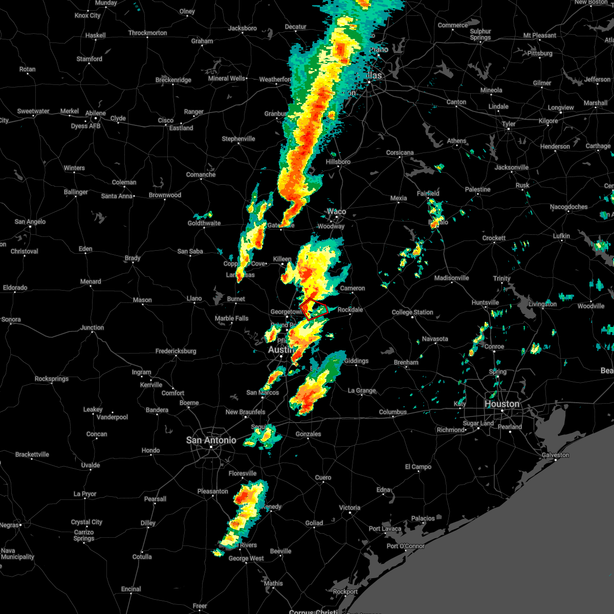 At 628 pm cdt, a confirmed large and extremely dangerous tornado was located near granger dam, or near granger, moving northeast at 40 mph. this is a particularly dangerous situation. take cover now! (radar confirmed tornado). Hazards include damaging tornado. You are in a life-threatening situation. flying debris may be deadly to those caught without shelter. mobile homes will be destroyed. considerable damage to homes, businesses, and vehicles is likely and complete destruction is possible. Locations impacted include, taylor, granger, bartlett, granger dam, laneport, hoxie, waterloo and hare. At 628 pm cdt, a confirmed large and extremely dangerous tornado was located near granger dam, or near granger, moving northeast at 40 mph. this is a particularly dangerous situation. take cover now! (radar confirmed tornado). Hazards include damaging tornado. You are in a life-threatening situation. flying debris may be deadly to those caught without shelter. mobile homes will be destroyed. considerable damage to homes, businesses, and vehicles is likely and complete destruction is possible. Locations impacted include, taylor, granger, bartlett, granger dam, laneport, hoxie, waterloo and hare.
|
| 3/21/2022 6:26 PM CDT |
 At 625 pm cdt, a confirmed large and extremely dangerous tornado was located over granger, moving northeast at 40 mph. this is a particularly dangerous situation. take cover now! (radar confirmed tornado). Hazards include damaging tornado. You are in a life-threatening situation. flying debris may be deadly to those caught without shelter. mobile homes will be destroyed. considerable damage to homes, businesses, and vehicles is likely and complete destruction is possible. the tornado will be near, bartlett around 635 pm cdt. holland around 640 pm cdt. rogers around 655 pm cdt. Other locations impacted by this tornadic thunderstorm include buckholts. At 625 pm cdt, a confirmed large and extremely dangerous tornado was located over granger, moving northeast at 40 mph. this is a particularly dangerous situation. take cover now! (radar confirmed tornado). Hazards include damaging tornado. You are in a life-threatening situation. flying debris may be deadly to those caught without shelter. mobile homes will be destroyed. considerable damage to homes, businesses, and vehicles is likely and complete destruction is possible. the tornado will be near, bartlett around 635 pm cdt. holland around 640 pm cdt. rogers around 655 pm cdt. Other locations impacted by this tornadic thunderstorm include buckholts.
|
| 3/21/2022 6:22 PM CDT |
 At 622 pm cdt, a tornado producing storm was located over granger, moving northeast at 40 mph (radar confirmed tornado). Hazards include damaging tornado and quarter size hail. Flying debris will be dangerous to those caught without shelter. mobile homes will be damaged or destroyed. damage to roofs, windows, and vehicles will occur. Tree damage is likely. At 622 pm cdt, a tornado producing storm was located over granger, moving northeast at 40 mph (radar confirmed tornado). Hazards include damaging tornado and quarter size hail. Flying debris will be dangerous to those caught without shelter. mobile homes will be damaged or destroyed. damage to roofs, windows, and vehicles will occur. Tree damage is likely.
|
| 3/21/2022 5:52 PM CDT |
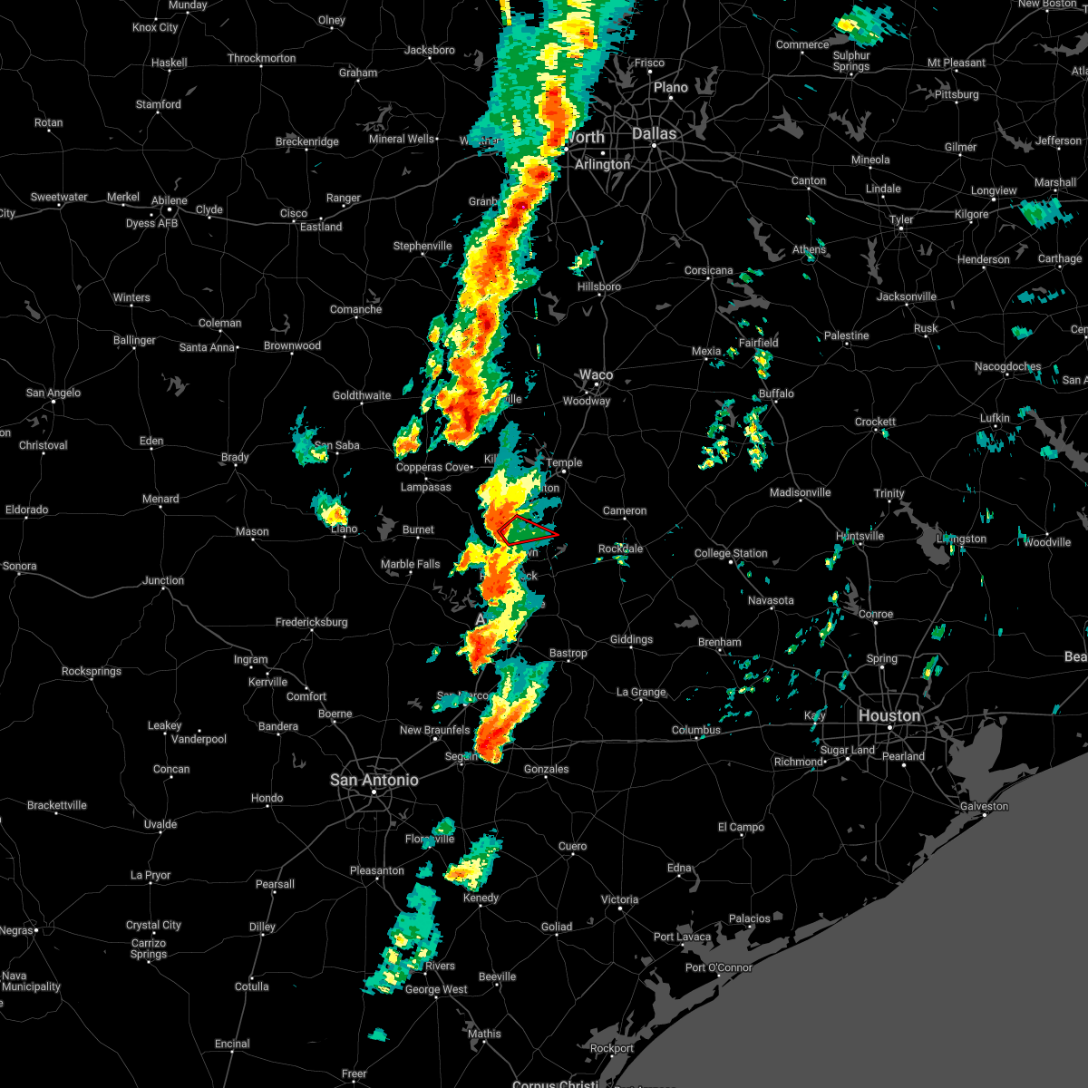 At 551 pm cdt, a large and extremely dangerous tornado was located near sun city, or near serenada, moving northeast at 30 mph. this is a particularly dangerous situation. take cover now! (radar indicated rotation). Hazards include damaging tornado. You are in a life-threatening situation. flying debris may be deadly to those caught without shelter. mobile homes will be destroyed. Considerable damage to homes, businesses, and vehicles is likely and complete destruction is possible. At 551 pm cdt, a large and extremely dangerous tornado was located near sun city, or near serenada, moving northeast at 30 mph. this is a particularly dangerous situation. take cover now! (radar indicated rotation). Hazards include damaging tornado. You are in a life-threatening situation. flying debris may be deadly to those caught without shelter. mobile homes will be destroyed. Considerable damage to homes, businesses, and vehicles is likely and complete destruction is possible.
|
| 3/21/2022 5:46 PM CDT |
 At 545 pm cdt, severe thunderstorms were located along a line extending from near florence to near anderson mill, moving east at 20 mph (radar indicated). Hazards include 60 mph wind gusts and nickel size hail. expect damage to roofs, siding, and trees At 545 pm cdt, severe thunderstorms were located along a line extending from near florence to near anderson mill, moving east at 20 mph (radar indicated). Hazards include 60 mph wind gusts and nickel size hail. expect damage to roofs, siding, and trees
|
| 9/28/2021 8:05 PM CDT |
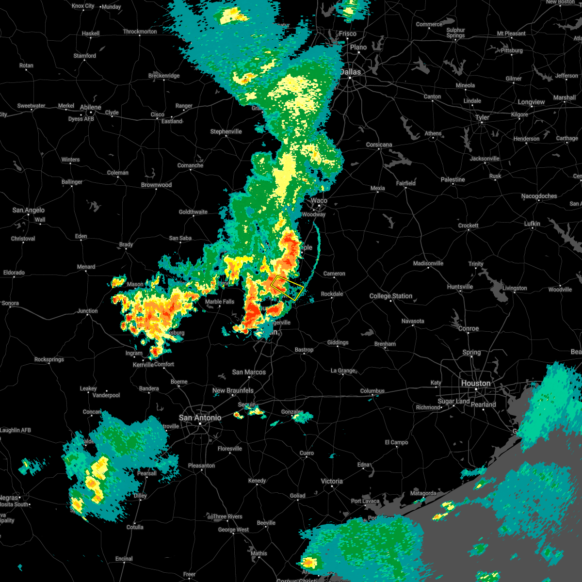 At 805 pm cdt, a severe thunderstorm was located over jarrell, or 8 miles northeast of serenada, moving southeast at 25 mph (radar indicated). Hazards include 60 mph wind gusts. Expect damage to roofs, siding, and trees. locations impacted include, granger, bartlett, jarrell, theon, walburg and schwertner. hail threat, radar indicated max hail size, <. 75 in wind threat, radar indicated max wind gust, 60 mph. At 805 pm cdt, a severe thunderstorm was located over jarrell, or 8 miles northeast of serenada, moving southeast at 25 mph (radar indicated). Hazards include 60 mph wind gusts. Expect damage to roofs, siding, and trees. locations impacted include, granger, bartlett, jarrell, theon, walburg and schwertner. hail threat, radar indicated max hail size, <. 75 in wind threat, radar indicated max wind gust, 60 mph.
|
| 9/28/2021 7:45 PM CDT |
 At 745 pm cdt, a severe thunderstorm was located near florence, or 9 miles north of serenada, moving southeast at 25 mph (radar indicated). Hazards include 60 mph wind gusts. expect damage to roofs, siding, and trees At 745 pm cdt, a severe thunderstorm was located near florence, or 9 miles north of serenada, moving southeast at 25 mph (radar indicated). Hazards include 60 mph wind gusts. expect damage to roofs, siding, and trees
|
| 7/19/2021 2:39 PM CDT |
 At 238 pm cdt, a severe thunderstorm was located between harker heights and salado, moving south at 15 mph (radar indicated). Hazards include 60 mph wind gusts and penny size hail. Expect damage to roofs, siding, and trees. Locations impacted include, bartlett and salado. At 238 pm cdt, a severe thunderstorm was located between harker heights and salado, moving south at 15 mph (radar indicated). Hazards include 60 mph wind gusts and penny size hail. Expect damage to roofs, siding, and trees. Locations impacted include, bartlett and salado.
|
| 7/19/2021 2:19 PM CDT |
 At 219 pm cdt, a severe thunderstorm was located near harker heights, moving south at 15 mph (radar indicated). Hazards include 60 mph wind gusts and penny size hail. expect damage to roofs, siding, and trees At 219 pm cdt, a severe thunderstorm was located near harker heights, moving south at 15 mph (radar indicated). Hazards include 60 mph wind gusts and penny size hail. expect damage to roofs, siding, and trees
|
| 5/28/2021 6:51 PM CDT |
 At 650 pm cdt, severe thunderstorms were located along a line extending from near sun city to near round rock to west lake hills to shady hollow, moving southeast at 40 mph (radar indicated). Hazards include 70 mph wind gusts and quarter size hail. Hail damage to vehicles is expected. expect considerable tree damage. wind damage is also likely to mobile homes, roofs, and outbuildings. Locations impacted include, austin, round rock, cedar park, georgetown, pflugerville, taylor, granger, tanglewood forest, serenada, anderson mill, austin bergstrom int airport, windemere, leander, hutto, lakeway, manor, lago vista, bee cave, west lake hills and hudson bend. At 650 pm cdt, severe thunderstorms were located along a line extending from near sun city to near round rock to west lake hills to shady hollow, moving southeast at 40 mph (radar indicated). Hazards include 70 mph wind gusts and quarter size hail. Hail damage to vehicles is expected. expect considerable tree damage. wind damage is also likely to mobile homes, roofs, and outbuildings. Locations impacted include, austin, round rock, cedar park, georgetown, pflugerville, taylor, granger, tanglewood forest, serenada, anderson mill, austin bergstrom int airport, windemere, leander, hutto, lakeway, manor, lago vista, bee cave, west lake hills and hudson bend.
|
| 5/28/2021 6:29 PM CDT |
 At 628 pm cdt, severe thunderstorms were located along a line extending from near liberty hill to lago vista to near cypress mill, moving southeast at 30 mph (radar indicated). Hazards include tennis ball size hail and 70 mph wind gusts. People and animals outdoors will be injured. expect hail damage to roofs, siding, windows, and vehicles. expect considerable tree damage. wind damage is also likely to mobile homes, roofs, and outbuildings. Locations impacted include, austin, round rock, cedar park, georgetown, pflugerville, taylor, burnet, marble falls, granger, bertram, round mountain, tanglewood forest, serenada, anderson mill, austin bergstrom int airport, windemere, leander, hutto, lakeway and manor. At 628 pm cdt, severe thunderstorms were located along a line extending from near liberty hill to lago vista to near cypress mill, moving southeast at 30 mph (radar indicated). Hazards include tennis ball size hail and 70 mph wind gusts. People and animals outdoors will be injured. expect hail damage to roofs, siding, windows, and vehicles. expect considerable tree damage. wind damage is also likely to mobile homes, roofs, and outbuildings. Locations impacted include, austin, round rock, cedar park, georgetown, pflugerville, taylor, burnet, marble falls, granger, bertram, round mountain, tanglewood forest, serenada, anderson mill, austin bergstrom int airport, windemere, leander, hutto, lakeway and manor.
|
| 5/28/2021 6:12 PM CDT |
 At 611 pm cdt, severe thunderstorms were located along a line extending from bertram to near smithwick to near round mountain, moving southeast at 35 mph (radar indicated). Hazards include 70 mph wind gusts and ping pong ball size hail. People and animals outdoors will be injured. expect hail damage to roofs, siding, windows, and vehicles. expect considerable tree damage. Wind damage is also likely to mobile homes, roofs, and outbuildings. At 611 pm cdt, severe thunderstorms were located along a line extending from bertram to near smithwick to near round mountain, moving southeast at 35 mph (radar indicated). Hazards include 70 mph wind gusts and ping pong ball size hail. People and animals outdoors will be injured. expect hail damage to roofs, siding, windows, and vehicles. expect considerable tree damage. Wind damage is also likely to mobile homes, roofs, and outbuildings.
|
| 5/3/2021 9:53 PM CDT |
 At 953 pm cdt, a severe thunderstorm was located near kempner, or near copperas cove, moving east at 25 mph (radar indicated). Hazards include 60 mph wind gusts and quarter size hail. Hail damage to vehicles is expected. Expect wind damage to roofs, siding, and trees. At 953 pm cdt, a severe thunderstorm was located near kempner, or near copperas cove, moving east at 25 mph (radar indicated). Hazards include 60 mph wind gusts and quarter size hail. Hail damage to vehicles is expected. Expect wind damage to roofs, siding, and trees.
|
| 4/15/2021 4:07 PM CDT |
 The severe thunderstorm warning for northwestern williamson and east central burnet counties will expire at 415 pm cdt, the storms which prompted the warning have weakened below severe limits across northern portions of the warning area, and no longer pose an immediate threat to life or property. therefore, the warning will be allowed to expire. however hail is still possible with these thunderstorms. a severe thunderstorm watch remains in effect until 500 pm cdt for south central texas. remember, a severe thunderstorm warning still remains in effect for southern williamson and northern traviscounty (warning 047). The severe thunderstorm warning for northwestern williamson and east central burnet counties will expire at 415 pm cdt, the storms which prompted the warning have weakened below severe limits across northern portions of the warning area, and no longer pose an immediate threat to life or property. therefore, the warning will be allowed to expire. however hail is still possible with these thunderstorms. a severe thunderstorm watch remains in effect until 500 pm cdt for south central texas. remember, a severe thunderstorm warning still remains in effect for southern williamson and northern traviscounty (warning 047).
|
| 4/15/2021 3:53 PM CDT |
 At 353 pm cdt, severe thunderstorms were located along a line extending from near killeen to florence to near liberty hill, moving east at 50 mph. these are very dangerous storms (public). Hazards include baseball size hail moving into liberty hill/northern leander and 60 mph wind gusts. People and animals outdoors will be severely injured. expect shattered windows, extensive damage to roofs, siding, and vehicles. Locations impacted include, round rock, georgetown, serenada, leander, bartlett, liberty hill, jarrell, florence, weir, georgetown dam, sun city, mahomet, andice, theon, walburg, schwertner and seward junction. At 353 pm cdt, severe thunderstorms were located along a line extending from near killeen to florence to near liberty hill, moving east at 50 mph. these are very dangerous storms (public). Hazards include baseball size hail moving into liberty hill/northern leander and 60 mph wind gusts. People and animals outdoors will be severely injured. expect shattered windows, extensive damage to roofs, siding, and vehicles. Locations impacted include, round rock, georgetown, serenada, leander, bartlett, liberty hill, jarrell, florence, weir, georgetown dam, sun city, mahomet, andice, theon, walburg, schwertner and seward junction.
|
| 4/15/2021 3:36 PM CDT |
 At 336 pm cdt, severe thunderstorms were located along a line extending from near kempner to near joppa to near burnet, moving east at 50 mph (public). Hazards include tennis ball size hail and 60 mph wind gusts. People and animals outdoors will be injured. expect hail damage to roofs, siding, windows, and vehicles. expect wind damage to roofs, siding, and trees. Locations impacted include, round rock, georgetown, burnet, bertram, serenada, leander, bartlett, liberty hill, jarrell, florence, weir, georgetown dam, watson, oatmeal, briggs, sun city, mahomet, joppa, andice and shady grove. At 336 pm cdt, severe thunderstorms were located along a line extending from near kempner to near joppa to near burnet, moving east at 50 mph (public). Hazards include tennis ball size hail and 60 mph wind gusts. People and animals outdoors will be injured. expect hail damage to roofs, siding, windows, and vehicles. expect wind damage to roofs, siding, and trees. Locations impacted include, round rock, georgetown, burnet, bertram, serenada, leander, bartlett, liberty hill, jarrell, florence, weir, georgetown dam, watson, oatmeal, briggs, sun city, mahomet, joppa, andice and shady grove.
|
| 4/15/2021 3:30 PM CDT |
 At 330 pm cdt, severe thunderstorms were located along a line extending from near kempner to near joppa to near burnet, moving east at 50 mph (radar indicated). Hazards include two inch hail and 60 mph wind gusts. People and animals outdoors will be injured. expect hail damage to roofs, siding, windows, and vehicles. expect wind damage to roofs, siding, and trees. Locations impacted include, round rock, georgetown, burnet, bertram, serenada, leander, bartlett, liberty hill, jarrell, florence, weir, georgetown dam, watson, lake victor, joppa, andice, shady grove, oatmeal, briggs and sun city. At 330 pm cdt, severe thunderstorms were located along a line extending from near kempner to near joppa to near burnet, moving east at 50 mph (radar indicated). Hazards include two inch hail and 60 mph wind gusts. People and animals outdoors will be injured. expect hail damage to roofs, siding, windows, and vehicles. expect wind damage to roofs, siding, and trees. Locations impacted include, round rock, georgetown, burnet, bertram, serenada, leander, bartlett, liberty hill, jarrell, florence, weir, georgetown dam, watson, lake victor, joppa, andice, shady grove, oatmeal, briggs and sun city.
|
| 4/15/2021 3:21 PM CDT |
 At 320 pm cdt, severe thunderstorms were located along a line extending from near lampasas to lake victor to inks lake state park, moving east at 50 mph (radar indicated). Hazards include 60 mph wind gusts and half dollar size hail. Hail damage to vehicles is expected. Expect wind damage to roofs, siding, and trees. At 320 pm cdt, severe thunderstorms were located along a line extending from near lampasas to lake victor to inks lake state park, moving east at 50 mph (radar indicated). Hazards include 60 mph wind gusts and half dollar size hail. Hail damage to vehicles is expected. Expect wind damage to roofs, siding, and trees.
|
| 3/22/2021 11:15 PM CDT |
 At 1115 pm cdt, a severe thunderstorm was located over granger dam, or near granger, moving east at 35 mph (radar indicated). Hazards include golf ball size hail and 60 mph wind gusts. People and animals outdoors will be injured. expect hail damage to roofs, siding, windows, and vehicles. expect wind damage to roofs, siding, and trees. Locations impacted include, taylor, granger, bartlett, thrall, granger dam, laneport, hoxie, waterloo, hare and sandoval. At 1115 pm cdt, a severe thunderstorm was located over granger dam, or near granger, moving east at 35 mph (radar indicated). Hazards include golf ball size hail and 60 mph wind gusts. People and animals outdoors will be injured. expect hail damage to roofs, siding, windows, and vehicles. expect wind damage to roofs, siding, and trees. Locations impacted include, taylor, granger, bartlett, thrall, granger dam, laneport, hoxie, waterloo, hare and sandoval.
|
| 3/22/2021 10:56 PM CDT |
 At 1056 pm cdt, severe thunderstorms were located along a line extending from near bartlett to near liberty hill, moving east at 40 mph (radar indicated). Hazards include golf ball size hail and 60 mph wind gusts. People and animals outdoors will be injured. expect hail damage to roofs, siding, windows, and vehicles. Expect wind damage to roofs, siding, and trees. At 1056 pm cdt, severe thunderstorms were located along a line extending from near bartlett to near liberty hill, moving east at 40 mph (radar indicated). Hazards include golf ball size hail and 60 mph wind gusts. People and animals outdoors will be injured. expect hail damage to roofs, siding, windows, and vehicles. Expect wind damage to roofs, siding, and trees.
|
| 3/22/2021 10:53 PM CDT |
 At 1052 pm cdt, a severe thunderstorm was located near granger, moving east at 35 mph (radar indicated). Hazards include 60 mph wind gusts and half dollar size hail. Hail damage to vehicles is expected. Expect wind damage to roofs, siding, and trees. At 1052 pm cdt, a severe thunderstorm was located near granger, moving east at 35 mph (radar indicated). Hazards include 60 mph wind gusts and half dollar size hail. Hail damage to vehicles is expected. Expect wind damage to roofs, siding, and trees.
|
| 3/22/2021 10:43 PM CDT |
 At 1042 pm cdt, a severe thunderstorm capable of producing a tornado was located near weir, or near serenada, moving east at 35 mph (radar indicated rotation). Hazards include tornado and ping pong ball size hail. Flying debris will be dangerous to those caught without shelter. mobile homes will be damaged or destroyed. damage to roofs, windows, and vehicles will occur. tree damage is likely. Locations impacted include, georgetown, taylor, granger, serenada, bartlett, jarrell, weir, granger dam, theon, laneport, hoxie, waterloo, hare, walburg, schwertner, jonah and sandoval. At 1042 pm cdt, a severe thunderstorm capable of producing a tornado was located near weir, or near serenada, moving east at 35 mph (radar indicated rotation). Hazards include tornado and ping pong ball size hail. Flying debris will be dangerous to those caught without shelter. mobile homes will be damaged or destroyed. damage to roofs, windows, and vehicles will occur. tree damage is likely. Locations impacted include, georgetown, taylor, granger, serenada, bartlett, jarrell, weir, granger dam, theon, laneport, hoxie, waterloo, hare, walburg, schwertner, jonah and sandoval.
|
| 3/22/2021 10:26 PM CDT |
 At 1025 pm cdt, a severe thunderstorm capable of producing a tornado was located near sun city, or near serenada, moving east at 40 mph (radar indicated rotation). Hazards include tornado and golf ball size hail. Flying debris will be dangerous to those caught without shelter. mobile homes will be damaged or destroyed. damage to roofs, windows, and vehicles will occur. Tree damage is likely. At 1025 pm cdt, a severe thunderstorm capable of producing a tornado was located near sun city, or near serenada, moving east at 40 mph (radar indicated rotation). Hazards include tornado and golf ball size hail. Flying debris will be dangerous to those caught without shelter. mobile homes will be damaged or destroyed. damage to roofs, windows, and vehicles will occur. Tree damage is likely.
|
| 3/22/2021 10:18 PM CDT |
 At 1017 pm cdt, a severe thunderstorm was located near liberty hill, or 10 miles west of serenada, moving east at 40 mph (radar indicated). Hazards include golf ball size hail and 60 mph wind gusts. People and animals outdoors will be injured. expect hail damage to roofs, siding, windows, and vehicles. expect wind damage to roofs, siding, and trees. Locations impacted include, georgetown, taylor, granger, serenada, bartlett, liberty hill, jarrell, florence, thrall, weir, georgetown dam, sun city, granger dam, andice, theon, laneport, hoxie, waterloo, hare and walburg. At 1017 pm cdt, a severe thunderstorm was located near liberty hill, or 10 miles west of serenada, moving east at 40 mph (radar indicated). Hazards include golf ball size hail and 60 mph wind gusts. People and animals outdoors will be injured. expect hail damage to roofs, siding, windows, and vehicles. expect wind damage to roofs, siding, and trees. Locations impacted include, georgetown, taylor, granger, serenada, bartlett, liberty hill, jarrell, florence, thrall, weir, georgetown dam, sun city, granger dam, andice, theon, laneport, hoxie, waterloo, hare and walburg.
|
| 3/22/2021 9:58 PM CDT |
 At 957 pm cdt, a severe thunderstorm was located near bertram, moving east at 65 mph (radar indicated). Hazards include golf ball size hail and 60 mph wind gusts. People and animals outdoors will be injured. expect hail damage to roofs, siding, windows, and vehicles. Expect wind damage to roofs, siding, and trees. At 957 pm cdt, a severe thunderstorm was located near bertram, moving east at 65 mph (radar indicated). Hazards include golf ball size hail and 60 mph wind gusts. People and animals outdoors will be injured. expect hail damage to roofs, siding, windows, and vehicles. Expect wind damage to roofs, siding, and trees.
|
| 5/27/2020 7:08 PM CDT |
 At 707 pm cdt, severe thunderstorms were located along a line extending from rogers to granger, moving southeast at 40 mph (radar indicated). Hazards include 60 mph wind gusts and quarter size hail. Hail damage to vehicles is expected. expect wind damage to roofs, siding, and trees. Locations impacted include, rockdale, cameron, bartlett, thorndale, rogers, holland, buckholts and milano. At 707 pm cdt, severe thunderstorms were located along a line extending from rogers to granger, moving southeast at 40 mph (radar indicated). Hazards include 60 mph wind gusts and quarter size hail. Hail damage to vehicles is expected. expect wind damage to roofs, siding, and trees. Locations impacted include, rockdale, cameron, bartlett, thorndale, rogers, holland, buckholts and milano.
|
| 5/27/2020 6:50 PM CDT |
 At 649 pm cdt, severe thunderstorms were located along a line extending from little river-academy to holland to jarrell, moving southeast at 35 mph (radar indicated). Hazards include 60 mph wind gusts and quarter size hail. Hail damage to vehicles is expected. Expect wind damage to roofs, siding, and trees. At 649 pm cdt, severe thunderstorms were located along a line extending from little river-academy to holland to jarrell, moving southeast at 35 mph (radar indicated). Hazards include 60 mph wind gusts and quarter size hail. Hail damage to vehicles is expected. Expect wind damage to roofs, siding, and trees.
|
| 4/29/2020 5:28 AM CDT |
 The severe thunderstorm warning for williamson, central caldwell, central hays, travis, blanco, northeastern gillespie, llano, bastrop, lee, central fayette and burnet counties will expire at 530 am cdt, the storms which prompted the warning have weakened below severe limits, and no longer pose an immediate threat to life or property. therefore, the warning will be allowed to expire. however small hail, gusty winds and heavy rain are still possible with these thunderstorms. a severe thunderstorm watch remains in effect until 900 am cdt for south central texas. to report severe weather, contact your nearest law enforcement agency. they will relay your report to the national weather service austin san antonio. The severe thunderstorm warning for williamson, central caldwell, central hays, travis, blanco, northeastern gillespie, llano, bastrop, lee, central fayette and burnet counties will expire at 530 am cdt, the storms which prompted the warning have weakened below severe limits, and no longer pose an immediate threat to life or property. therefore, the warning will be allowed to expire. however small hail, gusty winds and heavy rain are still possible with these thunderstorms. a severe thunderstorm watch remains in effect until 900 am cdt for south central texas. to report severe weather, contact your nearest law enforcement agency. they will relay your report to the national weather service austin san antonio.
|
| 4/29/2020 5:05 AM CDT |
 At 505 am cdt, severe thunderstorms were located along a line extending from near field creek to near horseshoe bay to near austin bergstrom int airport to bastrop to 8 miles south of lake somerville state park & trailway, moving south at 40 mph (radar indicated). Hazards include 60 mph wind gusts and nickel size hail. Expect damage to roofs, siding, and trees. Locations impacted include, austin, round rock, cedar park, georgetown, pflugerville, kyle, taylor, buda, lockhart, elgin, bastrop, burnet, marble falls, kingsland, giddings, la grange, smithville, llano, dripping springs and granger. At 505 am cdt, severe thunderstorms were located along a line extending from near field creek to near horseshoe bay to near austin bergstrom int airport to bastrop to 8 miles south of lake somerville state park & trailway, moving south at 40 mph (radar indicated). Hazards include 60 mph wind gusts and nickel size hail. Expect damage to roofs, siding, and trees. Locations impacted include, austin, round rock, cedar park, georgetown, pflugerville, kyle, taylor, buda, lockhart, elgin, bastrop, burnet, marble falls, kingsland, giddings, la grange, smithville, llano, dripping springs and granger.
|
| 4/29/2020 4:35 AM CDT |
 At 435 am cdt, severe thunderstorms were located along a line extending from tow to pflugerville to near elgin to near caldwell, moving south at 40 mph (radar indicated). Hazards include 60 mph wind gusts and quarter size hail. Hail damage to vehicles is expected. Expect wind damage to roofs, siding, and trees. At 435 am cdt, severe thunderstorms were located along a line extending from tow to pflugerville to near elgin to near caldwell, moving south at 40 mph (radar indicated). Hazards include 60 mph wind gusts and quarter size hail. Hail damage to vehicles is expected. Expect wind damage to roofs, siding, and trees.
|
| 4/29/2020 4:31 AM CDT |
 At 430 am cdt, severe thunderstorms were located along a line extending from calvert to milano to near thorndale, moving south at 40 mph (radar indicated). Hazards include 65 mph wind gusts and half dollar size hail. Hail damage to vehicles is expected. expect wind damage to roofs, siding, and trees. Locations impacted include, rockdale, cameron, bartlett, thorndale, holland, buckholts and milano. At 430 am cdt, severe thunderstorms were located along a line extending from calvert to milano to near thorndale, moving south at 40 mph (radar indicated). Hazards include 65 mph wind gusts and half dollar size hail. Hail damage to vehicles is expected. expect wind damage to roofs, siding, and trees. Locations impacted include, rockdale, cameron, bartlett, thorndale, holland, buckholts and milano.
|
| 4/29/2020 4:23 AM CDT |
 At 423 am cdt, severe thunderstorms were located along a line extending from rockdale to near taylor to near bend, moving south at 35 mph (radar indicated). Hazards include 60 mph wind gusts and quarter size hail. Hail damage to vehicles is expected. expect wind damage to roofs, siding, and trees. Locations impacted include, round rock, cedar park, georgetown, pflugerville, taylor, burnet, granger, bertram, lexington, serenada, windemere, buchanan dam, leander, hutto, bartlett, liberty hill, jarrell, florence, thrall and buchanan lake village. At 423 am cdt, severe thunderstorms were located along a line extending from rockdale to near taylor to near bend, moving south at 35 mph (radar indicated). Hazards include 60 mph wind gusts and quarter size hail. Hail damage to vehicles is expected. expect wind damage to roofs, siding, and trees. Locations impacted include, round rock, cedar park, georgetown, pflugerville, taylor, burnet, granger, bertram, lexington, serenada, windemere, buchanan dam, leander, hutto, bartlett, liberty hill, jarrell, florence, thrall and buchanan lake village.
|
| 4/29/2020 4:01 AM CDT |
 At 401 am cdt, severe thunderstorms were located along a line extending from near rogers to near salado to near copperas cove, moving southeast at 60 mph (law enforcement). Hazards include 65 mph wind gusts and half dollar size hail. Hail damage to vehicles is expected. expect wind damage to roofs, siding, and trees. Locations impacted include, killeen, temple, copperas cove, harker heights, belton, fort hood, nolanville, morgan`s point resort, bartlett, salado, little river-academy, troy, rogers, holland and mother neff state park. At 401 am cdt, severe thunderstorms were located along a line extending from near rogers to near salado to near copperas cove, moving southeast at 60 mph (law enforcement). Hazards include 65 mph wind gusts and half dollar size hail. Hail damage to vehicles is expected. expect wind damage to roofs, siding, and trees. Locations impacted include, killeen, temple, copperas cove, harker heights, belton, fort hood, nolanville, morgan`s point resort, bartlett, salado, little river-academy, troy, rogers, holland and mother neff state park.
|
| 4/29/2020 3:55 AM CDT |
 At 355 am cdt, severe thunderstorms were located along a line extending from salado to rovers to rosebud, moving southeast at 55 mph (radar indicated). Hazards include 65 mph wind gusts and half dollar size hail. Hail damage to vehicles is expected. Expect wind damage to roofs, siding, and trees. At 355 am cdt, severe thunderstorms were located along a line extending from salado to rovers to rosebud, moving southeast at 55 mph (radar indicated). Hazards include 65 mph wind gusts and half dollar size hail. Hail damage to vehicles is expected. Expect wind damage to roofs, siding, and trees.
|
| 4/29/2020 3:54 AM CDT |
 At 353 am cdt, severe thunderstorms were located along a line extending from near rogers to salado to 13 miles southwest of evant, moving southeast at 35 mph (radar indicated). Hazards include 70 mph wind gusts and ping pong ball size hail. People and animals outdoors will be injured. expect hail damage to roofs, siding, windows, and vehicles. expect considerable tree damage. Wind damage is also likely to mobile homes, roofs, and outbuildings. At 353 am cdt, severe thunderstorms were located along a line extending from near rogers to salado to 13 miles southwest of evant, moving southeast at 35 mph (radar indicated). Hazards include 70 mph wind gusts and ping pong ball size hail. People and animals outdoors will be injured. expect hail damage to roofs, siding, windows, and vehicles. expect considerable tree damage. Wind damage is also likely to mobile homes, roofs, and outbuildings.
|
| 4/29/2020 3:45 AM CDT |
 At 343 am cdt, severe thunderstorms were located along a line extending from temple to belton to fort hood, moving southeast at 60 mph. at 341 am cdt, 60 mph winds were observed at robert gray army airfield (law enforcement). Hazards include 65 mph wind gusts and half dollar size hail. Hail damage to vehicles is expected. expect wind damage to roofs, siding, and trees. Locations impacted include, killeen, temple, copperas cove, harker heights, belton, gatesville, mcgregor, fort hood, nolanville, morgan`s point resort, bartlett, salado, little river-academy, troy, rogers, holland, mother neff state park, fort gates, oglesby and south mountain. At 343 am cdt, severe thunderstorms were located along a line extending from temple to belton to fort hood, moving southeast at 60 mph. at 341 am cdt, 60 mph winds were observed at robert gray army airfield (law enforcement). Hazards include 65 mph wind gusts and half dollar size hail. Hail damage to vehicles is expected. expect wind damage to roofs, siding, and trees. Locations impacted include, killeen, temple, copperas cove, harker heights, belton, gatesville, mcgregor, fort hood, nolanville, morgan`s point resort, bartlett, salado, little river-academy, troy, rogers, holland, mother neff state park, fort gates, oglesby and south mountain.
|
| 4/29/2020 3:41 AM CDT |
 At 341 am cdt, severe thunderstorms were located along a line extending from near temple to near nolanville to near copperas cove, moving southeast at 60 mph (radar indicated). Hazards include 65 mph wind gusts and half dollar size hail. Hail damage to vehicles is expected. expect wind damage to roofs, siding, and trees. Locations impacted include, killeen, temple, copperas cove, harker heights, belton, gatesville, mcgregor, fort hood, nolanville, morgan`s point resort, bartlett, salado, little river-academy, troy, rogers, holland, mother neff state park, fort gates, oglesby and south mountain. At 341 am cdt, severe thunderstorms were located along a line extending from near temple to near nolanville to near copperas cove, moving southeast at 60 mph (radar indicated). Hazards include 65 mph wind gusts and half dollar size hail. Hail damage to vehicles is expected. expect wind damage to roofs, siding, and trees. Locations impacted include, killeen, temple, copperas cove, harker heights, belton, gatesville, mcgregor, fort hood, nolanville, morgan`s point resort, bartlett, salado, little river-academy, troy, rogers, holland, mother neff state park, fort gates, oglesby and south mountain.
|
| 4/29/2020 3:13 AM CDT |
 At 312 am cdt, severe thunderstorms were located along a line extending from evant to gatesville to mcgregor, moving southeast at 60 mph (radar indicated). Hazards include 65 mph wind gusts and half dollar size hail. Hail damage to vehicles is expected. Expect wind damage to roofs, siding, and trees. At 312 am cdt, severe thunderstorms were located along a line extending from evant to gatesville to mcgregor, moving southeast at 60 mph (radar indicated). Hazards include 65 mph wind gusts and half dollar size hail. Hail damage to vehicles is expected. Expect wind damage to roofs, siding, and trees.
|
| 4/29/2020 2:51 AM CDT |
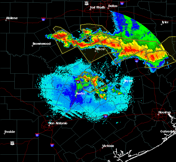 The severe thunderstorm warning for eastern williamson county will expire at 300 am cdt, the storms which prompted the warning have weakened below severe limits, and have exited the warned area. therefore, the warning will be allowed to expire. a severe thunderstorm watch remains in effect until 900 am cdt for south central texas. to report severe weather, contact your nearest law enforcement agency. they will relay your report to the national weather service austin san antonio. The severe thunderstorm warning for eastern williamson county will expire at 300 am cdt, the storms which prompted the warning have weakened below severe limits, and have exited the warned area. therefore, the warning will be allowed to expire. a severe thunderstorm watch remains in effect until 900 am cdt for south central texas. to report severe weather, contact your nearest law enforcement agency. they will relay your report to the national weather service austin san antonio.
|
| 4/29/2020 2:33 AM CDT |
 At 233 am cdt, a severe thunderstorm was located near granger dam, or near granger, moving southeast at 30 mph (radar indicated). Hazards include quarter size hail. Damage to vehicles is expected. Locations impacted include, taylor, granger, bartlett, thrall, granger dam, laneport, noack, hoxie, beyarsville, waterloo, hare and sandoval. At 233 am cdt, a severe thunderstorm was located near granger dam, or near granger, moving southeast at 30 mph (radar indicated). Hazards include quarter size hail. Damage to vehicles is expected. Locations impacted include, taylor, granger, bartlett, thrall, granger dam, laneport, noack, hoxie, beyarsville, waterloo, hare and sandoval.
|
| 4/29/2020 2:14 AM CDT |
 At 214 am cdt, severe thunderstorms were located along a line extending from near granger dam to granger to near bartlett, moving southeast at 30 mph (radar indicated). Hazards include quarter size hail. Damage to vehicles is expected. Locations impacted include, taylor, granger, hutto, bartlett, jarrell, thrall, weir, granger dam, coupland, theon, rices crossing, laneport, hoxie, beyarsville, waterloo, hare, walburg, schwertner, jonah and noack. At 214 am cdt, severe thunderstorms were located along a line extending from near granger dam to granger to near bartlett, moving southeast at 30 mph (radar indicated). Hazards include quarter size hail. Damage to vehicles is expected. Locations impacted include, taylor, granger, hutto, bartlett, jarrell, thrall, weir, granger dam, coupland, theon, rices crossing, laneport, hoxie, beyarsville, waterloo, hare, walburg, schwertner, jonah and noack.
|
| 4/29/2020 1:54 AM CDT |
 At 153 am cdt, a severe thunderstorm was located near jarrell, or 10 miles northwest of granger, moving southeast at 35 mph (radar indicated). Hazards include half dollar size hail. damage to vehicles is expected At 153 am cdt, a severe thunderstorm was located near jarrell, or 10 miles northwest of granger, moving southeast at 35 mph (radar indicated). Hazards include half dollar size hail. damage to vehicles is expected
|
| 4/29/2020 1:53 AM CDT |
 At 153 am cdt, a severe thunderstorm was located over salado, or 10 miles south of belton, moving southeast at 25 mph (public). Hazards include half dollar size hail. Damage to vehicles is possible. Locations impacted include, bartlett, salado and holland. At 153 am cdt, a severe thunderstorm was located over salado, or 10 miles south of belton, moving southeast at 25 mph (public). Hazards include half dollar size hail. Damage to vehicles is possible. Locations impacted include, bartlett, salado and holland.
|
| 4/29/2020 1:44 AM CDT |
 At 143 am cdt, a severe thunderstorm was located over salado, or 8 miles southeast of harker heights, moving southeast at 30 mph. this storm has a history of producing half dollar size hail in killeen (public). Hazards include half dollar size hail. Damage to vehicles is possible. Locations impacted include, killeen, harker heights, belton, nolanville, bartlett, salado and holland. At 143 am cdt, a severe thunderstorm was located over salado, or 8 miles southeast of harker heights, moving southeast at 30 mph. this storm has a history of producing half dollar size hail in killeen (public). Hazards include half dollar size hail. Damage to vehicles is possible. Locations impacted include, killeen, harker heights, belton, nolanville, bartlett, salado and holland.
|
| 4/29/2020 1:39 AM CDT |
 At 138 am cdt, a severe thunderstorm was located near harker heights producing quarter size hail moving southeast at 25 mph (public). Hazards include quarter size hail. Damage to vehicles is possible. Locations impacted include, killeen, harker heights, belton, nolanville, bartlett, salado and holland. At 138 am cdt, a severe thunderstorm was located near harker heights producing quarter size hail moving southeast at 25 mph (public). Hazards include quarter size hail. Damage to vehicles is possible. Locations impacted include, killeen, harker heights, belton, nolanville, bartlett, salado and holland.
|
| 4/29/2020 1:29 AM CDT |
 At 129 am cdt, a severe thunderstorm was located over harker heights, moving southeast at 25 mph (radar indicated). Hazards include quarter size hail. damage to vehicles is possible At 129 am cdt, a severe thunderstorm was located over harker heights, moving southeast at 25 mph (radar indicated). Hazards include quarter size hail. damage to vehicles is possible
|
| 4/9/2020 3:20 PM CDT | Power poles and trees down near hwy 95 and prof e allen powell blvd. debris was also found near bartlett high school down the stree in bell county TX, 0.7 miles WSW of Bartlett, TX |
| 4/9/2020 3:03 PM CDT |
 At 302 pm cdt, a severe thunderstorm was located near granger dam, or near granger, moving east at 40 mph (radar indicated). Hazards include 70 mph wind gusts and penny size hail. Expect considerable tree damage. Damage is likely to mobile homes, roofs, and outbuildings. At 302 pm cdt, a severe thunderstorm was located near granger dam, or near granger, moving east at 40 mph (radar indicated). Hazards include 70 mph wind gusts and penny size hail. Expect considerable tree damage. Damage is likely to mobile homes, roofs, and outbuildings.
|
| 4/9/2020 3:00 PM CDT |
 At 300 pm cdt, severe thunderstorms were located along a line extending from near belton to bartlett to near weir, moving east at 40 mph (radar indicated). Hazards include 60 mph wind gusts. Expect damage to roofs, siding, and trees. Locations impacted include, round rock, georgetown, taylor, granger, hutto, bartlett, jarrell, weir, theon, jonah, walburg and schwertner. At 300 pm cdt, severe thunderstorms were located along a line extending from near belton to bartlett to near weir, moving east at 40 mph (radar indicated). Hazards include 60 mph wind gusts. Expect damage to roofs, siding, and trees. Locations impacted include, round rock, georgetown, taylor, granger, hutto, bartlett, jarrell, weir, theon, jonah, walburg and schwertner.
|
| 4/9/2020 2:53 PM CDT |
 At 253 pm cdt, a severe thunderstorm was located over little river- academy, or near temple, moving east at 45 mph. strong winds will cross hwy 95 east of salado in the next few minutes (radar indicated). Hazards include 70 mph wind gusts and penny size hail. Expect considerable tree damage. damage is likely to mobile homes, roofs, and outbuildings. Locations impacted include, temple, harker heights, belton, nolanville, bartlett, salado, little river-academy and holland. At 253 pm cdt, a severe thunderstorm was located over little river- academy, or near temple, moving east at 45 mph. strong winds will cross hwy 95 east of salado in the next few minutes (radar indicated). Hazards include 70 mph wind gusts and penny size hail. Expect considerable tree damage. damage is likely to mobile homes, roofs, and outbuildings. Locations impacted include, temple, harker heights, belton, nolanville, bartlett, salado, little river-academy and holland.
|
| 4/9/2020 2:43 PM CDT |
 At 243 pm cdt, a severe thunderstorm was located near belton, moving east at 45 mph (radar indicated). Hazards include 60 mph wind gusts and penny size hail. Expect damage to roofs, siding, and trees. Locations impacted include, killeen, temple, harker heights, belton, nolanville, morgan`s point resort, bartlett, salado, little river-academy and holland. At 243 pm cdt, a severe thunderstorm was located near belton, moving east at 45 mph (radar indicated). Hazards include 60 mph wind gusts and penny size hail. Expect damage to roofs, siding, and trees. Locations impacted include, killeen, temple, harker heights, belton, nolanville, morgan`s point resort, bartlett, salado, little river-academy and holland.
|
| 4/9/2020 2:37 PM CDT |
 At 236 pm cdt, severe thunderstorms were located along a line extending from harker heights to near florence to near leander, moving east at 50 mph (radar indicated). Hazards include 60 mph wind gusts. Expect damage to roofs, siding, and trees. Locations impacted include, round rock, georgetown, taylor, granger, serenada, leander, hutto, bartlett, liberty hill, jarrell, florence, weir, georgetown dam, sun city, andice, theon, walburg, schwertner, jonah and seward junction. At 236 pm cdt, severe thunderstorms were located along a line extending from harker heights to near florence to near leander, moving east at 50 mph (radar indicated). Hazards include 60 mph wind gusts. Expect damage to roofs, siding, and trees. Locations impacted include, round rock, georgetown, taylor, granger, serenada, leander, hutto, bartlett, liberty hill, jarrell, florence, weir, georgetown dam, sun city, andice, theon, walburg, schwertner, jonah and seward junction.
|
| 4/9/2020 2:24 PM CDT |
 At 223 pm cdt, a severe thunderstorm was located near killeen, moving east at 50 mph (radar indicated). Hazards include 60 mph wind gusts and penny size hail. expect damage to roofs, siding, and trees At 223 pm cdt, a severe thunderstorm was located near killeen, moving east at 50 mph (radar indicated). Hazards include 60 mph wind gusts and penny size hail. expect damage to roofs, siding, and trees
|
| 4/9/2020 2:23 PM CDT |
 At 222 pm cdt, severe thunderstorms were located along a line extending from near fort hood to near mahomet to near marble falls, moving east at 40 mph (radar indicated). Hazards include 60 mph wind gusts. expect damage to roofs, siding, and trees At 222 pm cdt, severe thunderstorms were located along a line extending from near fort hood to near mahomet to near marble falls, moving east at 40 mph (radar indicated). Hazards include 60 mph wind gusts. expect damage to roofs, siding, and trees
|
| 10/15/2019 6:38 PM CDT |
 At 637 pm cdt, a severe thunderstorm was located near round rock, moving northeast at 25 mph (radar indicated). Hazards include quarter size hail. damage to vehicles is expected At 637 pm cdt, a severe thunderstorm was located near round rock, moving northeast at 25 mph (radar indicated). Hazards include quarter size hail. damage to vehicles is expected
|
| 6/24/2019 4:27 AM CDT |
 The severe thunderstorm warning for northeastern williamson county will expire at 430 am cdt, the severe thunderstorm which prompted the warning has weakened slightly. therefore, the warning will be allowed to expire. however gusty winds to near 50 mph are still possible with this thunderstorm. The severe thunderstorm warning for northeastern williamson county will expire at 430 am cdt, the severe thunderstorm which prompted the warning has weakened slightly. therefore, the warning will be allowed to expire. however gusty winds to near 50 mph are still possible with this thunderstorm.
|
| 6/24/2019 4:10 AM CDT |
 At 410 am cdt, a severe thunderstorm was located near bartlett, or near granger, moving southeast at 30 mph (radar indicated). Hazards include 60 mph wind gusts. Expect damage to roofs, siding, and trees. Locations impacted include, georgetown, granger, serenada, bartlett, jarrell, weir, jonah, walburg and schwertner. At 410 am cdt, a severe thunderstorm was located near bartlett, or near granger, moving southeast at 30 mph (radar indicated). Hazards include 60 mph wind gusts. Expect damage to roofs, siding, and trees. Locations impacted include, georgetown, granger, serenada, bartlett, jarrell, weir, jonah, walburg and schwertner.
|
| 6/24/2019 3:57 AM CDT |
 At 357 am cdt, a severe thunderstorm was located over jarrell, or 9 miles northeast of serenada, moving southeast at 30 mph (radar indicated). Hazards include 60 mph wind gusts and penny size hail. expect damage to roofs, siding, and trees At 357 am cdt, a severe thunderstorm was located over jarrell, or 9 miles northeast of serenada, moving southeast at 30 mph (radar indicated). Hazards include 60 mph wind gusts and penny size hail. expect damage to roofs, siding, and trees
|
| 6/19/2019 11:10 PM CDT |
 The severe thunderstorm warning for eastern bell, central limestone and falls counties will expire at 1115 pm cdt, the storms which prompted the warning have weakened below severe limits, and have exited the warned area. therefore the warning will be allowed to expire. however gusty winds of 40 to 50 mph are still possible with these thunderstorms. a tornado watch remains in effect until midnight cdt for central texas. a severe thunderstorm watch remains in effect until 600 am cdt for central texas. The severe thunderstorm warning for eastern bell, central limestone and falls counties will expire at 1115 pm cdt, the storms which prompted the warning have weakened below severe limits, and have exited the warned area. therefore the warning will be allowed to expire. however gusty winds of 40 to 50 mph are still possible with these thunderstorms. a tornado watch remains in effect until midnight cdt for central texas. a severe thunderstorm watch remains in effect until 600 am cdt for central texas.
|
| 6/19/2019 10:58 PM CDT |
 At 1057 pm cdt, severe thunderstorms were located along a line extending from thornton to bartlett, moving southeast at 45 mph (trained weather spotters). Hazards include 60 mph wind gusts. Expect damage to roofs, siding, and trees. locations impacted include, temple, belton, marlin, groesbeck, bartlett, salado, little river-academy, troy, rosebud, rogers, holland, lott, golinda, fort parker state park and thornton. A tornado watch remains in effect until midnight cdt for central texas. At 1057 pm cdt, severe thunderstorms were located along a line extending from thornton to bartlett, moving southeast at 45 mph (trained weather spotters). Hazards include 60 mph wind gusts. Expect damage to roofs, siding, and trees. locations impacted include, temple, belton, marlin, groesbeck, bartlett, salado, little river-academy, troy, rosebud, rogers, holland, lott, golinda, fort parker state park and thornton. A tornado watch remains in effect until midnight cdt for central texas.
|
| 6/19/2019 10:39 PM CDT |
 At 1038 pm cdt, severe thunderstorms were located along a line extending from killeen to mart, moving southeast at 30 mph (trained weather spotters). Hazards include 60 mph wind gusts. Expect damage to roofs, siding, and trees. locations impacted include, killeen, temple, copperas cove, harker heights, belton, marlin, groesbeck, fort hood, nolanville, morgan`s point resort, bartlett, mart, salado, little river-academy, troy, rosebud, rogers, holland, coolidge and lott. A tornado watch remains in effect until midnight cdt for central texas. At 1038 pm cdt, severe thunderstorms were located along a line extending from killeen to mart, moving southeast at 30 mph (trained weather spotters). Hazards include 60 mph wind gusts. Expect damage to roofs, siding, and trees. locations impacted include, killeen, temple, copperas cove, harker heights, belton, marlin, groesbeck, fort hood, nolanville, morgan`s point resort, bartlett, mart, salado, little river-academy, troy, rosebud, rogers, holland, coolidge and lott. A tornado watch remains in effect until midnight cdt for central texas.
|
| 6/19/2019 10:24 PM CDT |
 At 1022 pm cdt, severe thunderstorms were located along a line extending from near copperas cove to near malone, moving southeast at 40 mph (trained weather spotters). Hazards include 65 mph wind gusts. Expect damage to roofs, siding, and trees. locations impacted include, killeen, waco, temple, copperas cove, harker heights, belton, gatesville, hewitt, robinson, bellmead, woodway, lampasas, lacy-lakeview, marlin, mcgregor, groesbeck, fort hood, nolanville, morgan`s point resort and west. A tornado watch remains in effect until midnight cdt for central and north central texas. At 1022 pm cdt, severe thunderstorms were located along a line extending from near copperas cove to near malone, moving southeast at 40 mph (trained weather spotters). Hazards include 65 mph wind gusts. Expect damage to roofs, siding, and trees. locations impacted include, killeen, waco, temple, copperas cove, harker heights, belton, gatesville, hewitt, robinson, bellmead, woodway, lampasas, lacy-lakeview, marlin, mcgregor, groesbeck, fort hood, nolanville, morgan`s point resort and west. A tornado watch remains in effect until midnight cdt for central and north central texas.
|
| 6/19/2019 10:03 PM CDT |
 At 1003 pm cdt, severe thunderstorms were located along a line extending from near west to 13 miles north of lampasas, moving southeast at 30 mph (radar indicated). Hazards include 65 mph wind gusts. expect damage to roofs, siding, and trees At 1003 pm cdt, severe thunderstorms were located along a line extending from near west to 13 miles north of lampasas, moving southeast at 30 mph (radar indicated). Hazards include 65 mph wind gusts. expect damage to roofs, siding, and trees
|
| 6/16/2019 10:04 PM CDT |
 At 1000 pm cdt, a severe thunderstorm was located near kempner in lampasas county. another severe storm was near harker heights in bell county. both storms were moving east at 20 mph (radar indicated). Hazards include quarter size hail. Damage to vehicles is possible. Other storms in bell, coryell, and lampasas counties will be capable of small hail and gusty winds. At 1000 pm cdt, a severe thunderstorm was located near kempner in lampasas county. another severe storm was near harker heights in bell county. both storms were moving east at 20 mph (radar indicated). Hazards include quarter size hail. Damage to vehicles is possible. Other storms in bell, coryell, and lampasas counties will be capable of small hail and gusty winds.
|
| 6/16/2019 9:32 PM CDT |
 At 930 pm cdt, a severe thunderstorm was located near kempner, or 7 miles northwest of copperas cove, moving east at 15 mph (radar indicated). Hazards include 60 mph wind gusts and half dollar size hail. Hail damage to vehicles is expected. expect wind damage to roofs, siding, and trees. this severe thunderstorm will be near, kempner around 935 pm cdt. copperas cove around 950 pm cdt. fort hood around 1015 pm cdt. killeen, harker heights, and nolanville around 1030 pm cdt. Other storms in lampasas, coryell, and bell counties will also be capable of hail and gusty winds. At 930 pm cdt, a severe thunderstorm was located near kempner, or 7 miles northwest of copperas cove, moving east at 15 mph (radar indicated). Hazards include 60 mph wind gusts and half dollar size hail. Hail damage to vehicles is expected. expect wind damage to roofs, siding, and trees. this severe thunderstorm will be near, kempner around 935 pm cdt. copperas cove around 950 pm cdt. fort hood around 1015 pm cdt. killeen, harker heights, and nolanville around 1030 pm cdt. Other storms in lampasas, coryell, and bell counties will also be capable of hail and gusty winds.
|
| 6/16/2019 8:49 PM CDT |
 At 849 pm cdt, a severe thunderstorm was located near bartlett, or 7 miles northeast of granger, moving east at 20 mph (radar indicated). Hazards include 60 mph wind gusts and quarter size hail. Hail damage to vehicles is expected. expect wind damage to roofs, siding, and trees. Locations impacted include, taylor, granger, bartlett, jarrell, thrall, granger dam, laneport, hoxie, beyarsville, waterloo, hare, schwertner, noack and sandoval. At 849 pm cdt, a severe thunderstorm was located near bartlett, or 7 miles northeast of granger, moving east at 20 mph (radar indicated). Hazards include 60 mph wind gusts and quarter size hail. Hail damage to vehicles is expected. expect wind damage to roofs, siding, and trees. Locations impacted include, taylor, granger, bartlett, jarrell, thrall, granger dam, laneport, hoxie, beyarsville, waterloo, hare, schwertner, noack and sandoval.
|
| 6/16/2019 8:19 PM CDT |
 At 818 pm cdt, a severe thunderstorm was located near jarrell, or 10 miles northwest of granger, moving southeast at 20 mph (radar indicated). Hazards include 60 mph wind gusts and quarter size hail. Hail damage to vehicles is expected. Expect wind damage to roofs, siding, and trees. At 818 pm cdt, a severe thunderstorm was located near jarrell, or 10 miles northwest of granger, moving southeast at 20 mph (radar indicated). Hazards include 60 mph wind gusts and quarter size hail. Hail damage to vehicles is expected. Expect wind damage to roofs, siding, and trees.
|
| 6/16/2019 8:16 PM CDT |
 At 815 pm cdt, a severe thunderstorm was located near jarrell, or 13 miles northwest of granger, moving east at 20 mph (radar indicated). Hazards include 60 mph wind gusts and half dollar size hail. Hail damage to vehicles is expected. expect wind damage to roofs, siding, and trees. this severe thunderstorm will be near, bartlett around 835 pm cdt. holland around 840 pm cdt. little river-academy around 905 pm cdt. rogers around 915 pm cdt. this includes interstate 35 between mile markers 277 and 287. Spotters have reported quarter size hail along i-35 in southern bell county near the williamson county line. At 815 pm cdt, a severe thunderstorm was located near jarrell, or 13 miles northwest of granger, moving east at 20 mph (radar indicated). Hazards include 60 mph wind gusts and half dollar size hail. Hail damage to vehicles is expected. expect wind damage to roofs, siding, and trees. this severe thunderstorm will be near, bartlett around 835 pm cdt. holland around 840 pm cdt. little river-academy around 905 pm cdt. rogers around 915 pm cdt. this includes interstate 35 between mile markers 277 and 287. Spotters have reported quarter size hail along i-35 in southern bell county near the williamson county line.
|
| 6/9/2019 6:11 PM CDT |
 At 611 pm cdt, severe thunderstorms were located along a line extending from jarrell to near thorndale, moving southwest at 30 mph (radar indicated). Hazards include 70 mph wind gusts and quarter size hail. Hail damage to vehicles is expected. expect considerable tree damage. Wind damage is also likely to mobile homes, roofs, and outbuildings. At 611 pm cdt, severe thunderstorms were located along a line extending from jarrell to near thorndale, moving southwest at 30 mph (radar indicated). Hazards include 70 mph wind gusts and quarter size hail. Hail damage to vehicles is expected. expect considerable tree damage. Wind damage is also likely to mobile homes, roofs, and outbuildings.
|
| 6/9/2019 5:52 PM CDT |
 The national weather service in fort worth has issued a * severe thunderstorm warning for. southern bell county in central texas. until 615 pm cdt. At 552 pm cdt, severe thunderstorms were located along a line extending from 9 miles northeast of briggs to near salado, moving. The national weather service in fort worth has issued a * severe thunderstorm warning for. southern bell county in central texas. until 615 pm cdt. At 552 pm cdt, severe thunderstorms were located along a line extending from 9 miles northeast of briggs to near salado, moving.
|
| 5/18/2019 3:28 PM CDT |
 The severe thunderstorm warning for bell county will expire at 330 pm cdt, the storm which prompted the warning has weakened below severe limits, and no longer poses an immediate threat to life or property. therefore, the warning will be allowed to expire. however small hail is still possible with this thunderstorm. The severe thunderstorm warning for bell county will expire at 330 pm cdt, the storm which prompted the warning has weakened below severe limits, and no longer poses an immediate threat to life or property. therefore, the warning will be allowed to expire. however small hail is still possible with this thunderstorm.
|
| 5/18/2019 2:59 PM CDT |
 At 259 pm cdt, a severe thunderstorm was located near temple, moving northeast at 35 mph (radar indicated). Hazards include 60 mph wind gusts and quarter size hail. Hail damage to vehicles is expected. Expect wind damage to roofs, siding, and trees. At 259 pm cdt, a severe thunderstorm was located near temple, moving northeast at 35 mph (radar indicated). Hazards include 60 mph wind gusts and quarter size hail. Hail damage to vehicles is expected. Expect wind damage to roofs, siding, and trees.
|
| 4/18/2019 12:05 AM CDT |
 The severe thunderstorm warning for coryell and bell counties will expire at 1215 am cdt, the storms which prompted the warning have weakened below severe limits. therefore the warning will be allowed to expire. however gusty winds are still possible with these thunderstorms. a severe thunderstorm watch remains in effect until 200 am cdt for central texas. The severe thunderstorm warning for coryell and bell counties will expire at 1215 am cdt, the storms which prompted the warning have weakened below severe limits. therefore the warning will be allowed to expire. however gusty winds are still possible with these thunderstorms. a severe thunderstorm watch remains in effect until 200 am cdt for central texas.
|
| 4/17/2019 11:15 PM CDT |
 At 1114 pm cdt, severe thunderstorms were located along a line extending from evant to copperas cove, moving east at 35 mph (radar indicated). Hazards include 60 mph wind gusts. expect damage to roofs, siding, and trees At 1114 pm cdt, severe thunderstorms were located along a line extending from evant to copperas cove, moving east at 35 mph (radar indicated). Hazards include 60 mph wind gusts. expect damage to roofs, siding, and trees
|
| 4/6/2019 1:24 PM CDT |
 At 124 pm cdt, a severe thunderstorm was located near coupland, or near taylor, moving northeast at 25 mph (radar indicated). Hazards include quarter size hail. damage to vehicles is expected At 124 pm cdt, a severe thunderstorm was located near coupland, or near taylor, moving northeast at 25 mph (radar indicated). Hazards include quarter size hail. damage to vehicles is expected
|
| 12/26/2018 10:50 PM CST |
 At 1049 pm cst, a severe thunderstorm was located 9 miles north of thorndale, or 11 miles northwest of rockdale, moving east at 35 mph (radar indicated). Hazards include 60 mph wind gusts and quarter size hail. Hail damage to vehicles is expected. Expect wind damage to roofs, siding, and trees. At 1049 pm cst, a severe thunderstorm was located 9 miles north of thorndale, or 11 miles northwest of rockdale, moving east at 35 mph (radar indicated). Hazards include 60 mph wind gusts and quarter size hail. Hail damage to vehicles is expected. Expect wind damage to roofs, siding, and trees.
|
| 12/26/2018 10:14 PM CST |
 At 1014 pm cst, a severe thunderstorm was located near granger, moving east at 35 mph (radar indicated). Hazards include 60 mph wind gusts and penny size hail. Expect damage to roofs, siding, and trees. locations impacted include, georgetown, granger, serenada, bartlett, jarrell, sun city, theon, walburg and schwertner. A tornado watch remains in effect until midnight cst for south central texas. At 1014 pm cst, a severe thunderstorm was located near granger, moving east at 35 mph (radar indicated). Hazards include 60 mph wind gusts and penny size hail. Expect damage to roofs, siding, and trees. locations impacted include, georgetown, granger, serenada, bartlett, jarrell, sun city, theon, walburg and schwertner. A tornado watch remains in effect until midnight cst for south central texas.
|
| 12/26/2018 10:08 PM CST |
 At 1007 pm cst, a severe thunderstorm was located near jarrell, or near granger, moving east at 35 mph (radar indicated). Hazards include 60 mph wind gusts and penny size hail. Expect damage to roofs, siding, and trees. locations impacted include, georgetown, granger, serenada, bartlett, jarrell, sun city, theon, walburg and schwertner. A tornado watch remains in effect until midnight cst for south central texas. At 1007 pm cst, a severe thunderstorm was located near jarrell, or near granger, moving east at 35 mph (radar indicated). Hazards include 60 mph wind gusts and penny size hail. Expect damage to roofs, siding, and trees. locations impacted include, georgetown, granger, serenada, bartlett, jarrell, sun city, theon, walburg and schwertner. A tornado watch remains in effect until midnight cst for south central texas.
|
| 12/26/2018 10:01 PM CST |
 At 1001 pm cst, a severe thunderstorm was located near jarrell, or near serenada, moving east at 25 mph (radar indicated). Hazards include 60 mph wind gusts. Expect damage to roofs, siding, and trees. locations impacted include, georgetown, granger, serenada, bartlett, jarrell, sun city, theon, walburg and schwertner. A tornado watch remains in effect until midnight cst for south central texas. At 1001 pm cst, a severe thunderstorm was located near jarrell, or near serenada, moving east at 25 mph (radar indicated). Hazards include 60 mph wind gusts. Expect damage to roofs, siding, and trees. locations impacted include, georgetown, granger, serenada, bartlett, jarrell, sun city, theon, walburg and schwertner. A tornado watch remains in effect until midnight cst for south central texas.
|
| 12/26/2018 9:54 PM CST |
 At 954 pm cst, a severe thunderstorm was located near serenada, moving east at 40 mph (radar indicated). Hazards include 60 mph wind gusts. expect damage to roofs, siding, and trees At 954 pm cst, a severe thunderstorm was located near serenada, moving east at 40 mph (radar indicated). Hazards include 60 mph wind gusts. expect damage to roofs, siding, and trees
|
| 6/3/2018 11:43 PM CDT |
 At 1143 pm cdt, a severe thunderstorm was located over coupland, or 7 miles south of taylor, moving west at 25 mph (radar indicated). Hazards include 60 mph wind gusts and nickel size hail. Expect damage to roofs, siding, and trees. Locations impacted include, round rock, georgetown, taylor, granger, hutto, bartlett, jarrell, thrall, weir, granger dam, coupland, theon, rices crossing, laneport, hoxie, beyarsville, waterloo, hare, walburg and schwertner. At 1143 pm cdt, a severe thunderstorm was located over coupland, or 7 miles south of taylor, moving west at 25 mph (radar indicated). Hazards include 60 mph wind gusts and nickel size hail. Expect damage to roofs, siding, and trees. Locations impacted include, round rock, georgetown, taylor, granger, hutto, bartlett, jarrell, thrall, weir, granger dam, coupland, theon, rices crossing, laneport, hoxie, beyarsville, waterloo, hare, walburg and schwertner.
|
| 6/3/2018 11:22 PM CDT |
 At 1121 pm cdt, a severe thunderstorm was located near thorndale, or 12 miles southwest of rockdale, moving west at 25 mph (radar indicated). Hazards include 60 mph wind gusts and half dollar size hail. Hail damage to vehicles is expected. Expect wind damage to roofs, siding, and trees. At 1121 pm cdt, a severe thunderstorm was located near thorndale, or 12 miles southwest of rockdale, moving west at 25 mph (radar indicated). Hazards include 60 mph wind gusts and half dollar size hail. Hail damage to vehicles is expected. Expect wind damage to roofs, siding, and trees.
|
| 4/6/2018 10:55 PM CDT |
 At 1039 pm cdt, severe thunderstorms were located along a line extending from 9 miles southwest of lott to near belton, moving east at 35 mph (radar indicated). Hazards include ping pong ball size hail and 60 mph wind gusts. People and animals outdoors will be injured. expect hail damage to roofs, siding, windows, and vehicles. expect wind damage to roofs, siding, and trees. Locations impacted include, temple, belton, cameron, salado, little river-academy, troy, rosebud, rogers, holland and buckholts. At 1039 pm cdt, severe thunderstorms were located along a line extending from 9 miles southwest of lott to near belton, moving east at 35 mph (radar indicated). Hazards include ping pong ball size hail and 60 mph wind gusts. People and animals outdoors will be injured. expect hail damage to roofs, siding, windows, and vehicles. expect wind damage to roofs, siding, and trees. Locations impacted include, temple, belton, cameron, salado, little river-academy, troy, rosebud, rogers, holland and buckholts.
|
| 4/6/2018 10:40 PM CDT |
 At 1039 pm cdt, severe thunderstorms were located along a line extending from 9 miles southwest of lott to near belton, moving east at 35 mph (radar indicated). Hazards include ping pong ball size hail and 60 mph wind gusts. People and animals outdoors will be injured. expect hail damage to roofs, siding, windows, and vehicles. expect wind damage to roofs, siding, and trees. Locations impacted include, temple, belton, cameron, salado, little river-academy, troy, rosebud, rogers, holland and buckholts. At 1039 pm cdt, severe thunderstorms were located along a line extending from 9 miles southwest of lott to near belton, moving east at 35 mph (radar indicated). Hazards include ping pong ball size hail and 60 mph wind gusts. People and animals outdoors will be injured. expect hail damage to roofs, siding, windows, and vehicles. expect wind damage to roofs, siding, and trees. Locations impacted include, temple, belton, cameron, salado, little river-academy, troy, rosebud, rogers, holland and buckholts.
|
| 4/6/2018 10:33 PM CDT |
 At 1033 pm cdt, severe thunderstorms were located along a line extending from 7 miles southeast of troy to near salado, moving southeast at 35 mph (radar indicated). Hazards include quarter size hail. damage to vehicles is possible At 1033 pm cdt, severe thunderstorms were located along a line extending from 7 miles southeast of troy to near salado, moving southeast at 35 mph (radar indicated). Hazards include quarter size hail. damage to vehicles is possible
|
| 3/17/2018 9:10 PM CDT |
 The severe thunderstorm warning for north central williamson county will expire at 915 pm cdt, the storm which prompted the warning has weakened below severe limits, and no longer poses an immediate threat to life or property. therefore the warning will be allowed to expire. however small hail is still possible with this thunderstorm. to report severe weather, contact your nearest law enforcement agency. they will relay your report to the national weather service austin san antonio. The severe thunderstorm warning for north central williamson county will expire at 915 pm cdt, the storm which prompted the warning has weakened below severe limits, and no longer poses an immediate threat to life or property. therefore the warning will be allowed to expire. however small hail is still possible with this thunderstorm. to report severe weather, contact your nearest law enforcement agency. they will relay your report to the national weather service austin san antonio.
|
| 3/17/2018 8:42 PM CDT |
 At 842 pm cdt, a severe thunderstorm was located over jarrell, or 7 miles north of serenada, moving southeast at 25 mph (radar indicated). Hazards include half dollar size hail. damage to vehicles is expected At 842 pm cdt, a severe thunderstorm was located over jarrell, or 7 miles north of serenada, moving southeast at 25 mph (radar indicated). Hazards include half dollar size hail. damage to vehicles is expected
|
| 3/17/2018 8:32 PM CDT |
 At 831 pm cdt, a severe thunderstorm was located near jarrell, or 10 miles north of serenada, moving southeast at 20 mph (radar indicated). Hazards include 60 mph wind gusts and quarter size hail. Hail damage to vehicles is expected. expect wind damage to roofs, siding, and trees. Locations impacted include, bartlett, holland and buckholts. At 831 pm cdt, a severe thunderstorm was located near jarrell, or 10 miles north of serenada, moving southeast at 20 mph (radar indicated). Hazards include 60 mph wind gusts and quarter size hail. Hail damage to vehicles is expected. expect wind damage to roofs, siding, and trees. Locations impacted include, bartlett, holland and buckholts.
|
| 3/17/2018 8:22 PM CDT |
 At 820 pm cdt, a severe thunderstorm was located near florence, or 8 miles north of serenada, moving southeast at 45 mph (radar indicated. at 7:42 pm cdt three inch hail was reported near briggs. the storm has weakened and hail this large is no longer expected). Hazards include golf ball size hail and 60 mph wind gusts. People and animals outdoors will be injured. expect hail damage to roofs, siding, windows, and vehicles. expect wind damage to roofs, siding, and trees. Locations impacted include, georgetown, taylor, granger, serenada, bartlett, jarrell, florence, weir, andice, sun city, theon, walburg, schwertner and jonah. At 820 pm cdt, a severe thunderstorm was located near florence, or 8 miles north of serenada, moving southeast at 45 mph (radar indicated. at 7:42 pm cdt three inch hail was reported near briggs. the storm has weakened and hail this large is no longer expected). Hazards include golf ball size hail and 60 mph wind gusts. People and animals outdoors will be injured. expect hail damage to roofs, siding, windows, and vehicles. expect wind damage to roofs, siding, and trees. Locations impacted include, georgetown, taylor, granger, serenada, bartlett, jarrell, florence, weir, andice, sun city, theon, walburg, schwertner and jonah.
|
| 3/17/2018 8:00 PM CDT |
 At 759 pm cdt, a severe thunderstorm was located near florence, or 13 miles southwest of harker heights, moving east at 40 mph (radar indicated). Hazards include 60 mph wind gusts and half dollar size hail. Hail damage to vehicles is expected. Expect wind damage to roofs, siding, and trees. At 759 pm cdt, a severe thunderstorm was located near florence, or 13 miles southwest of harker heights, moving east at 40 mph (radar indicated). Hazards include 60 mph wind gusts and half dollar size hail. Hail damage to vehicles is expected. Expect wind damage to roofs, siding, and trees.
|
| 3/17/2018 7:53 PM CDT |
 The national weather service in austin san antonio has issued a * severe thunderstorm warning for. northern williamson county in south central texas. northeastern burnet county in south central texas. Until 845 pm cdt * at 752 pm cdt, a severe thunderstorm was located near briggs, or 15. The national weather service in austin san antonio has issued a * severe thunderstorm warning for. northern williamson county in south central texas. northeastern burnet county in south central texas. Until 845 pm cdt * at 752 pm cdt, a severe thunderstorm was located near briggs, or 15.
|
| 4/2/2017 10:56 AM CDT | The severe thunderstorm warning for western milam and bell counties will expire at 1100 am cdt, the storms which prompted the warning have moved out of the area. therefore the warning will be allowed to expire. a tornado watch remains in effect until 100 pm cdt for central texas. |
| 4/2/2017 10:35 AM CDT | The severe thunderstorm warning for eastern williamson county will expire at 1045 am cdt, the storms which prompted the warning have moved out of the warned area. therefore, the warning will be allowed to expire. a tornado watch remains in effect until 100 pm cdt for south central texas. |
| 4/2/2017 10:30 AM CDT | At 1030 am cdt, severe thunderstorms were located along a line extending from near rogers to 8 miles west of fedor, moving east at 45 mph (radar indicated). Hazards include 60 mph wind gusts and nickel size hail. Expect damage to roofs, siding, and trees. locations impacted include, taylor, thrall, granger dam, laneport, noack, hoxie, beyarsville, waterloo, hare and sandoval. A tornado watch remains in effect until 100 pm cdt for south central texas. |
| 4/2/2017 10:12 AM CDT | At 1012 am cdt, severe thunderstorms were located along a line extending from near killeen to coupland, moving east at 50 mph (radar indicated). Hazards include 60 mph wind gusts and nickel size hail. Expect damage to roofs, siding, and trees. locations impacted include, taylor, elgin, granger, hutto, bartlett, jarrell, thrall, weir, granger dam, coupland, theon, rices crossing, laneport, hoxie, beyarsville, waterloo, hare, walburg, schwertner and jonah. A tornado watch remains in effect until 100 pm cdt for south central texas. |
| 4/2/2017 9:58 AM CDT | At 957 am cdt, severe thunderstorms were located along a line extending from near kempner to near elgin, moving northeast at 45 mph (radar indicated). Hazards include 65 mph wind gusts. expect damage to roofs, siding, and trees |
| 4/2/2017 9:48 AM CDT | At 948 am cdt, severe thunderstorms were located along a line extending from near watson to near manor, moving northeast at 35 mph (radar indicated). Hazards include 60 mph wind gusts and nickel size hail. expect damage to roofs, siding, and trees |
| 4/2/2017 6:10 AM CDT |
 At 610 am cdt, a severe thunderstorm was located near holland, or 12 miles northeast of granger, moving north at 30 mph (radar indicated). Hazards include 60 mph wind gusts and half dollar size hail. Hail damage to vehicles is expected. expect wind damage to roofs, siding, and trees. this severe thunderstorm will be near, rogers around 620 am cdt. little river-academy around 625 am cdt. temple around 650 am cdt. troy around 655 am cdt. this includes interstate 35 between mile markers 293 and 313. A tornado watch remains in effect until 100 pm cdt for central texas. At 610 am cdt, a severe thunderstorm was located near holland, or 12 miles northeast of granger, moving north at 30 mph (radar indicated). Hazards include 60 mph wind gusts and half dollar size hail. Hail damage to vehicles is expected. expect wind damage to roofs, siding, and trees. this severe thunderstorm will be near, rogers around 620 am cdt. little river-academy around 625 am cdt. temple around 650 am cdt. troy around 655 am cdt. this includes interstate 35 between mile markers 293 and 313. A tornado watch remains in effect until 100 pm cdt for central texas.
|
| 2/20/2017 1:08 AM CST |
 The severe thunderstorm warning for eastern williamson and lee counties will expire at 115 am cst, the stronger portions of the line of thunderstorms which prompted the warning have moved out of the area. therefore the warning will be allowed to expire. a severe thunderstorm watch remains in effect until 200 am cst for south central texas. The severe thunderstorm warning for eastern williamson and lee counties will expire at 115 am cst, the stronger portions of the line of thunderstorms which prompted the warning have moved out of the area. therefore the warning will be allowed to expire. a severe thunderstorm watch remains in effect until 200 am cst for south central texas.
|
| 2/20/2017 12:40 AM CST |
 At 1240 am cst, severe thunderstorms were located along a line extending from 6 miles northeast of granger dam to near fedor, moving east at 55 mph (radar indicated). Hazards include 60 mph wind gusts and penny size hail. Expect damage to roofs, siding, and trees. Locations impacted include, taylor, giddings, granger, lexington, bartlett, thrall, fedor, granger dam, tanglewood, knobb springs, laneport, waterloo, loebau, schwertner, hills, lincoln, sandoval, manheim, theon and serbin. At 1240 am cst, severe thunderstorms were located along a line extending from 6 miles northeast of granger dam to near fedor, moving east at 55 mph (radar indicated). Hazards include 60 mph wind gusts and penny size hail. Expect damage to roofs, siding, and trees. Locations impacted include, taylor, giddings, granger, lexington, bartlett, thrall, fedor, granger dam, tanglewood, knobb springs, laneport, waterloo, loebau, schwertner, hills, lincoln, sandoval, manheim, theon and serbin.
|
| 2/20/2017 12:35 AM CST |
 At 1235 am cst, severe thunderstorms were located along a line extending from near granger dam to paige, moving northeast at 45 mph (radar indicated). Hazards include 60 mph wind gusts and penny size hail. Expect damage to roofs, siding, and trees. Locations impacted include, taylor, elgin, bastrop, giddings, smithville, granger, lexington, bartlett, thrall, weir, fedor, paige, granger dam, tanglewood, camp swift, coupland, circle d-kc estate, circle d-kc estates, knobb springs and laneport. At 1235 am cst, severe thunderstorms were located along a line extending from near granger dam to paige, moving northeast at 45 mph (radar indicated). Hazards include 60 mph wind gusts and penny size hail. Expect damage to roofs, siding, and trees. Locations impacted include, taylor, elgin, bastrop, giddings, smithville, granger, lexington, bartlett, thrall, weir, fedor, paige, granger dam, tanglewood, camp swift, coupland, circle d-kc estate, circle d-kc estates, knobb springs and laneport.
|
| 2/20/2017 12:22 AM CST |
 At 1221 am cst, severe thunderstorms were located along a line extending from near bartlett to near bastrop, moving east at 45 mph (radar indicated). Hazards include 60 mph wind gusts and penny size hail. expect damage to roofs, siding, and trees At 1221 am cst, severe thunderstorms were located along a line extending from near bartlett to near bastrop, moving east at 45 mph (radar indicated). Hazards include 60 mph wind gusts and penny size hail. expect damage to roofs, siding, and trees
|
| 5/14/2016 1:22 PM CDT |
 The severe thunderstorm warning for north central williamson county will expire at 130 pm cdt, the storm which prompted the warning has weakened below severe limits, and no longer poses an immediate threat to life or property. therefore the warning will be allowed to expire. however small hail and heavy rain are still possible with this thunderstorm. The severe thunderstorm warning for north central williamson county will expire at 130 pm cdt, the storm which prompted the warning has weakened below severe limits, and no longer poses an immediate threat to life or property. therefore the warning will be allowed to expire. however small hail and heavy rain are still possible with this thunderstorm.
|
| 5/14/2016 12:54 PM CDT |
 At 1242 pm cdt, a trained weather spotter reported quarter sized hail on interstate 35 1 mile south of jarrell. at 1252 pm cdt, a severe thunderstorm was located over jarrell, or 8 miles northeast of serenada, moving northeast at 10 mph (radar indicated). Hazards include 60 mph wind gusts and quarter size hail. Hail damage to vehicles is expected. expect wind damage to roofs, siding, and trees. Locations impacted include, jarrell, schwertner and theon. At 1242 pm cdt, a trained weather spotter reported quarter sized hail on interstate 35 1 mile south of jarrell. at 1252 pm cdt, a severe thunderstorm was located over jarrell, or 8 miles northeast of serenada, moving northeast at 10 mph (radar indicated). Hazards include 60 mph wind gusts and quarter size hail. Hail damage to vehicles is expected. expect wind damage to roofs, siding, and trees. Locations impacted include, jarrell, schwertner and theon.
|
| 5/14/2016 12:40 PM CDT |
 At 1240 pm cdt, a severe thunderstorm was located over jarrell, or 9 miles northeast of serenada, moving northeast at 10 mph (radar indicated). Hazards include quarter size hail. damage to vehicles is expected At 1240 pm cdt, a severe thunderstorm was located over jarrell, or 9 miles northeast of serenada, moving northeast at 10 mph (radar indicated). Hazards include quarter size hail. damage to vehicles is expected
|
| 3/8/2016 10:11 AM CST |
 The severe thunderstorm warning for bell county will expire at 1015 am cst, the storms which prompted the warning have weakened below severe limits, and no longer pose an immediate threat to life or property. therefore the warning will be allowed to expire. however gusty winds and heavy rain are still possible with these thunderstorms with urban and small stream flooding possible across the county. a tornado watch remains in effect until 100 pm cst for central texas. The severe thunderstorm warning for bell county will expire at 1015 am cst, the storms which prompted the warning have weakened below severe limits, and no longer pose an immediate threat to life or property. therefore the warning will be allowed to expire. however gusty winds and heavy rain are still possible with these thunderstorms with urban and small stream flooding possible across the county. a tornado watch remains in effect until 100 pm cst for central texas.
|
| 3/8/2016 9:55 AM CST |
 At 954 am cst, severe thunderstorms were located along a line extending from 6 miles northwest of morgan`s point resort to near belton to near salado to near jarrell to near bartlett, moving east at 30 mph (radar indicated). Hazards include 60 mph wind gusts. Expect damage to roofs. siding. and trees. locations impacted include, killeen, temple, harker heights, belton, nolanville, morgan`s point resort, salado, little river-academy, troy, rogers and holland. this includes interstate 35 between mile markers 278 and 313. A tornado watch remains in effect until 100 pm cst for central texas. At 954 am cst, severe thunderstorms were located along a line extending from 6 miles northwest of morgan`s point resort to near belton to near salado to near jarrell to near bartlett, moving east at 30 mph (radar indicated). Hazards include 60 mph wind gusts. Expect damage to roofs. siding. and trees. locations impacted include, killeen, temple, harker heights, belton, nolanville, morgan`s point resort, salado, little river-academy, troy, rogers and holland. this includes interstate 35 between mile markers 278 and 313. A tornado watch remains in effect until 100 pm cst for central texas.
|
| 3/8/2016 9:43 AM CST |
 At 942 am cst, severe thunderstorms were located along a line extending from 7 miles southwest of mother neff state park to near morgan`s point resort to near nolanville to salado to near holland, moving northeast at 55 mph (radar indicated). Hazards include 60 mph wind gusts. Expect damage to roofs. siding. and trees. locations impacted include, killeen, temple, harker heights, belton, mcgregor, fort hood, nolanville, morgan`s point resort, salado, little river-academy, troy, rogers, holland and mother neff state park. this includes interstate 35 between mile markers 278 and 313 and highway 190 from killeen to belton. A tornado watch remains in effect until 100 pm cst for central texas. At 942 am cst, severe thunderstorms were located along a line extending from 7 miles southwest of mother neff state park to near morgan`s point resort to near nolanville to salado to near holland, moving northeast at 55 mph (radar indicated). Hazards include 60 mph wind gusts. Expect damage to roofs. siding. and trees. locations impacted include, killeen, temple, harker heights, belton, mcgregor, fort hood, nolanville, morgan`s point resort, salado, little river-academy, troy, rogers, holland and mother neff state park. this includes interstate 35 between mile markers 278 and 313 and highway 190 from killeen to belton. A tornado watch remains in effect until 100 pm cst for central texas.
|
| 3/8/2016 9:22 AM CST |
 At 922 am cst, severe thunderstorms were located along a line extending from near copperas cove to near killeen to florence to near serenada, moving northeast at 55 mph (radar indicated). Hazards include 60 mph wind gusts. Expect damage to roofs. siding. And trees. At 922 am cst, severe thunderstorms were located along a line extending from near copperas cove to near killeen to florence to near serenada, moving northeast at 55 mph (radar indicated). Hazards include 60 mph wind gusts. Expect damage to roofs. siding. And trees.
|
| 5/29/2015 1:21 AM CDT | At 121 am cdt, severe thunderstorms were located along a line extending from near bartlett to near austin bergstrom int ap to near staples, moving east at 50 mph (radar indicated). Hazards include 60 mph wind gusts. Expect damage to roofs. siding and trees. Locations impacted include, austin, round rock, cedar park, georgetown, pflugerville, san marcos, taylor, elgin, wimberley, dripping springs, granger, windemere, tanglewood forest, anderson mill, serenada, austin bergstrom int ap, kyle, leander, hutto and lakeway. |
| 5/29/2015 12:44 AM CDT | At 1244 am cdt, severe thunderstorms were located along a line extending from 6 miles northeast of florence to barton creek to near canyon lake dam, moving east at 40 mph (radar indicated). Hazards include 60 mph wind gusts. Expect damage to roofs. siding and trees. Locations impacted include, austin, round rock, cedar park, georgetown, pflugerville, san marcos, taylor, elgin, wimberley, dripping springs, granger, windemere, tanglewood forest, anderson mill, serenada, austin bergstrom int ap, kyle, leander, hutto and lakeway. |
| 5/29/2015 12:03 AM CDT | At 1203 am cdt, severe thunderstorms were located along a line extending from 6 miles southwest of kempner to near spicewood to near twin sisters, moving east at 50 mph (radar indicated). Hazards include 60 mph wind gusts and penny size hail. Expect damage to roofs. Siding and trees. |
| 5/25/2015 3:27 PM CDT | At 327 pm cdt, a severe thunderstorm was located over granger dam, or 7 miles east of granger, moving northeast at 30 mph (radar indicated). Hazards include 70 mph wind gusts and nickel size hail. Expect considerable tree damage. Damage is likely to mobile homes, roofs and outbuildings. |
| 5/25/2015 2:55 PM CDT | At 254 pm cdt, a severe thunderstorm capable of producing a tornado was located over serenada, moving northeast at 30 mph (weather spotters reported a funnel cloud over the georgetown airport). Hazards include tornado. Flying debris will be dangerous to those caught without shelter. mobile homes will be damaged or destroyed. damage to roofs, windows and vehicles will occur. tree damage is likely. this dangerous storm will be near, weir around 305 pm cdt. jarrell around 310 pm cdt. granger around 315 pm cdt. Other locations impacted by this tornadic thunderstorm include jonah, walburg, schwertner and theon. |
| 5/25/2015 2:42 PM CDT | At 242 pm cdt, a severe thunderstorm capable of producing a tornado was located over georgetown dam, or near georgetown, moving northeast at 35 mph (radar indicated rotation). Hazards include tornado and quarter size hail. Flying debris will be dangerous to those caught without shelter. mobile homes will be damaged or destroyed. damage to roofs, windows and vehicles will occur. tree damage is likely. this dangerous storm will be near, georgetown dam and sun city around 245 pm cdt. serenada around 250 pm cdt. georgetown around 255 pm cdt. weir around 300 pm cdt. jarrell around 305 pm cdt. granger and bartlett around 315 pm cdt. Other locations impacted by this tornadic thunderstorm include sandoval, walburg, hoxie, jonah, schwertner, waterloo, theon and brushy creek. |
| 5/23/2015 10:44 PM CDT | At 1044 pm cdt, severe thunderstorms were located along a line extending from near killeen to little river-academy to west of cameron to near rockdale, moving north at 45 mph. some low level rotation has been observed in this line of storms (radar indicated). Hazards include 60 mph wind gusts. Expect damage to roofs. siding and trees. locations impacted include, killeen, temple, copperas cove, harker heights, belton, rockdale, cameron, fort hood, nolanville, morgan`s point resort, salado, little river-academy, troy, thorndale, rogers, holland, buckholts and milano. A tornado watch remains in effect until 400 am cdt for central texas. |
| 5/23/2015 10:15 PM CDT | At 1013 pm cdt, severe thunderstorms were located along a line extending from near florence to granger to near fedor, moving northeast at 45 mph (radar indicated). Hazards include 65 mph wind gusts. Expect damage to roofs. Siding and trees. |
| 5/23/2015 10:06 PM CDT | At 1006 pm cdt, severe thunderstorms were located along a line extending from salado to near taylor, moving east at 35 mph (radar indicated). Hazards include 70 mph wind gusts. Expect considerable tree damage. damage is likely to mobile homes, roofs and outbuildings. locations impacted include, round rock, georgetown, taylor, granger, serenada, hutto, bartlett, florence, jarrell, thrall, weir, georgetown dam, andice, sun city, coupland, granger dam, sandoval, rices crossing, noack and beyarsville. A tornado watch remains in effect until 300 am cdt for south central texas. |
| 5/23/2015 9:39 PM CDT | At 939 pm cdt, severe thunderstorms were located along a line extending from florence to near anderson mill, moving east at 35 mph (radar indicated). Hazards include 70 mph wind gusts. Expect considerable tree damage. Damage is likely to mobile homes, roofs and outbuildings. |
| 5/8/2015 5:48 PM CDT | At 547 pm cdt, a severe thunderstorm was located over holland, or 10 miles north of granger, moving east at 20 mph (radar indicated). Hazards include 60 mph wind gusts and quarter size hail. Hail damage to vehicles is expected. expect wind damage to roofs, siding and trees. locations impacted include, temple, salado, little river-academy, bartlett, rogers, holland and buckholts. this includes interstate 35 between mile markers 278 and 288. 1. 00in. |
| 5/8/2015 5:13 PM CDT | At 512 pm cdt, a severe thunderstorm was located near jarrell, or 8 miles north of serenada, moving east at 35 mph (radar indicated). Hazards include 60 mph wind gusts and quarter size hail. Hail damage to vehicles is expected. Expect wind damage to roofs, siding and trees. |
| 4/27/2015 1:58 AM CDT | At 157 am cdt, severe thunderstorms were located along a line extending from near cameron to 9 miles south of cedar creek to near sutherland springs to near elmendorf to near bigfoot to pearsall to dilley, moving east at 55 mph (radar indicated). Hazards include 60 mph wind gusts and penny size hail. Expect damage to roofs. siding and trees. locations impacted include, san antonio, austin, round rock, new braunfels, cedar park, georgetown, pflugerville, san marcos, seguin, universal city, taylor, lockhart, pearsall, pleasanton, elgin, gonzales, bastrop, crystal city, floresville and luling. a tornado watch remains in effect until 900 am cdt for south central texas. 0. 75in. |
| 4/27/2015 1:38 AM CDT | At 137 am cdt, severe thunderstorms were located along a line extending from near bartlett to zorn to near somerset to moore to 9 miles east of batesville to near brundage, moving east at 50 mph (radar indicated). Hazards include 60 mph wind gusts and penny size hail. Expect damage to roofs. Siding and trees. |
| 4/27/2015 1:05 AM CDT | At 103 am cdt, severe thunderstorms were located along a line extending from near watson to near canyon lake to near fair oaks ranch to near lacoste to near yancey, and are nearly stationary. these are very dangerous storms (radar indicated). Hazards include 80 mph wind gusts and penny size hail. the strongest winds will impact medina, bexar and comal counties. Flying debris will be dangerous to those caught without shelter. mobile homes will be heavily damaged. expect considerable damage to roofs, windows and vehicles. extensive tree damage and power outages are likely. locations impacted include, san antonio, austin, round rock, new braunfels, cedar park, georgetown, pflugerville, san marcos, seguin, universal city, taylor, boerne, hondo, kingsland, marble falls, burnet, castroville, comfort, wimberley and dripping springs. 0. 75in. |
| 4/27/2015 12:44 AM CDT | At 1243 am cdt, severe thunderstorms were located along a line extending from near lake victor to near guadalupe river state park to near pipe creek to quihi to 9 miles southeast of sabinal, moving east at 45 mph (radar indicated). Hazards include 70 mph wind gusts and penny size hail. Expect considerable tree damage. Damage is likely to mobile homes, roofs and outbuildings. |
| 1/1/0001 12:00 AM | Quarter sized hail reported 1.1 miles S of Bartlett, TX |
| 1/1/0001 12:00 AM | Storm damage reported in bell county TX, 1.1 miles S of Bartlett, TX |
Hail Maps for Bartlett, TX


Connect with Interactive Hail Maps