

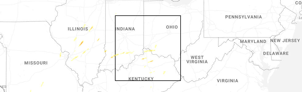
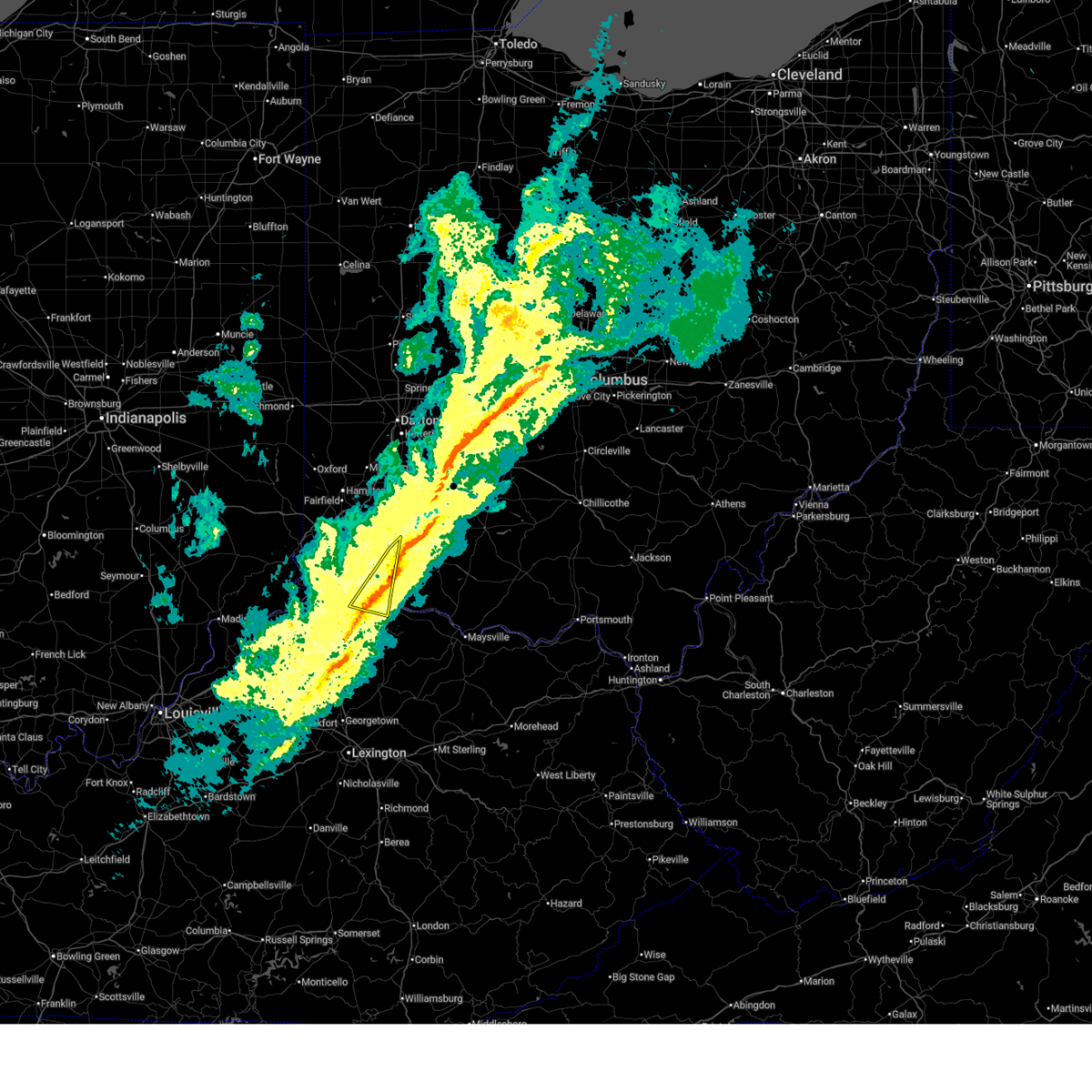
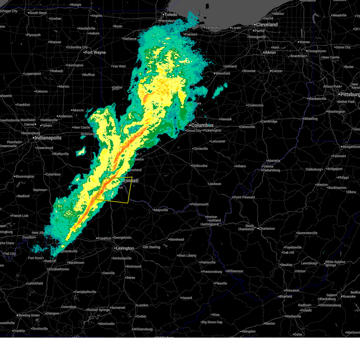
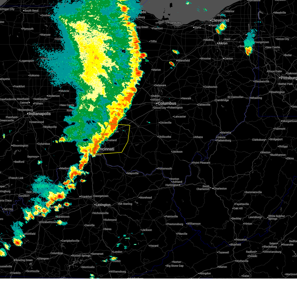
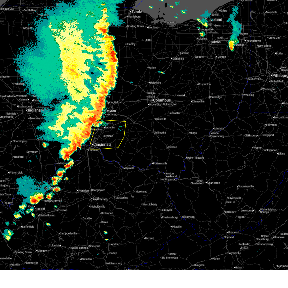
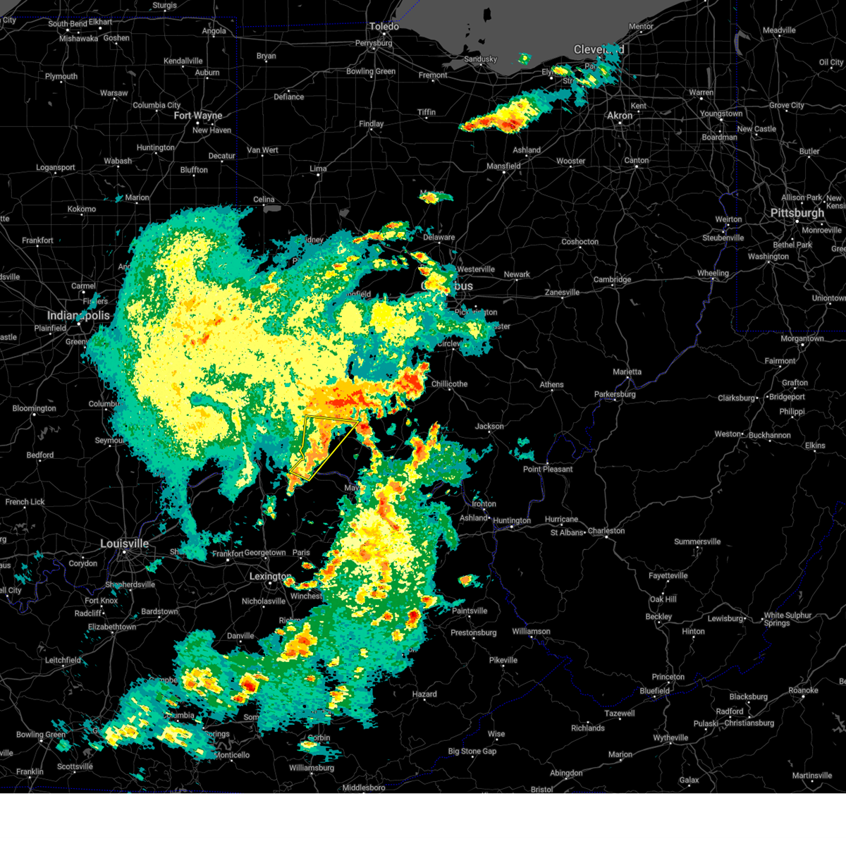
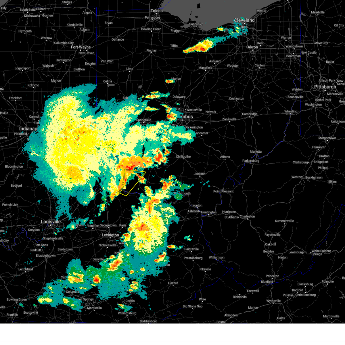
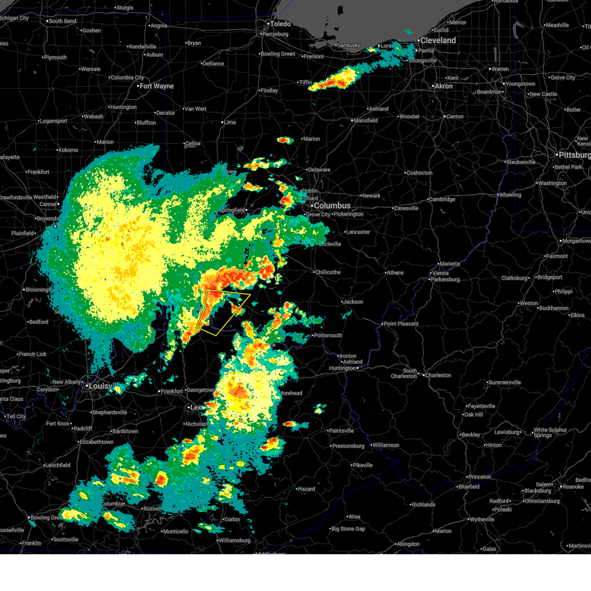
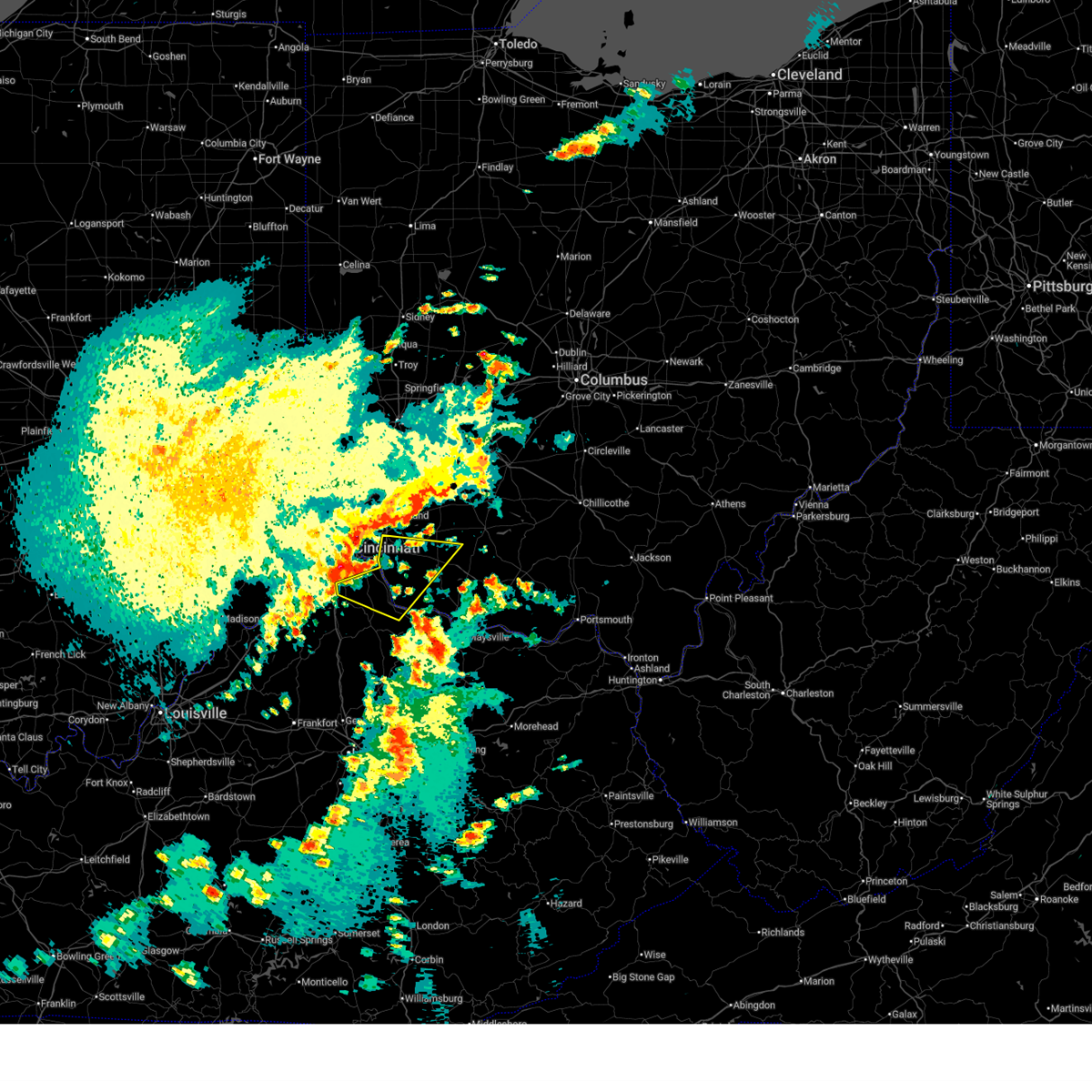
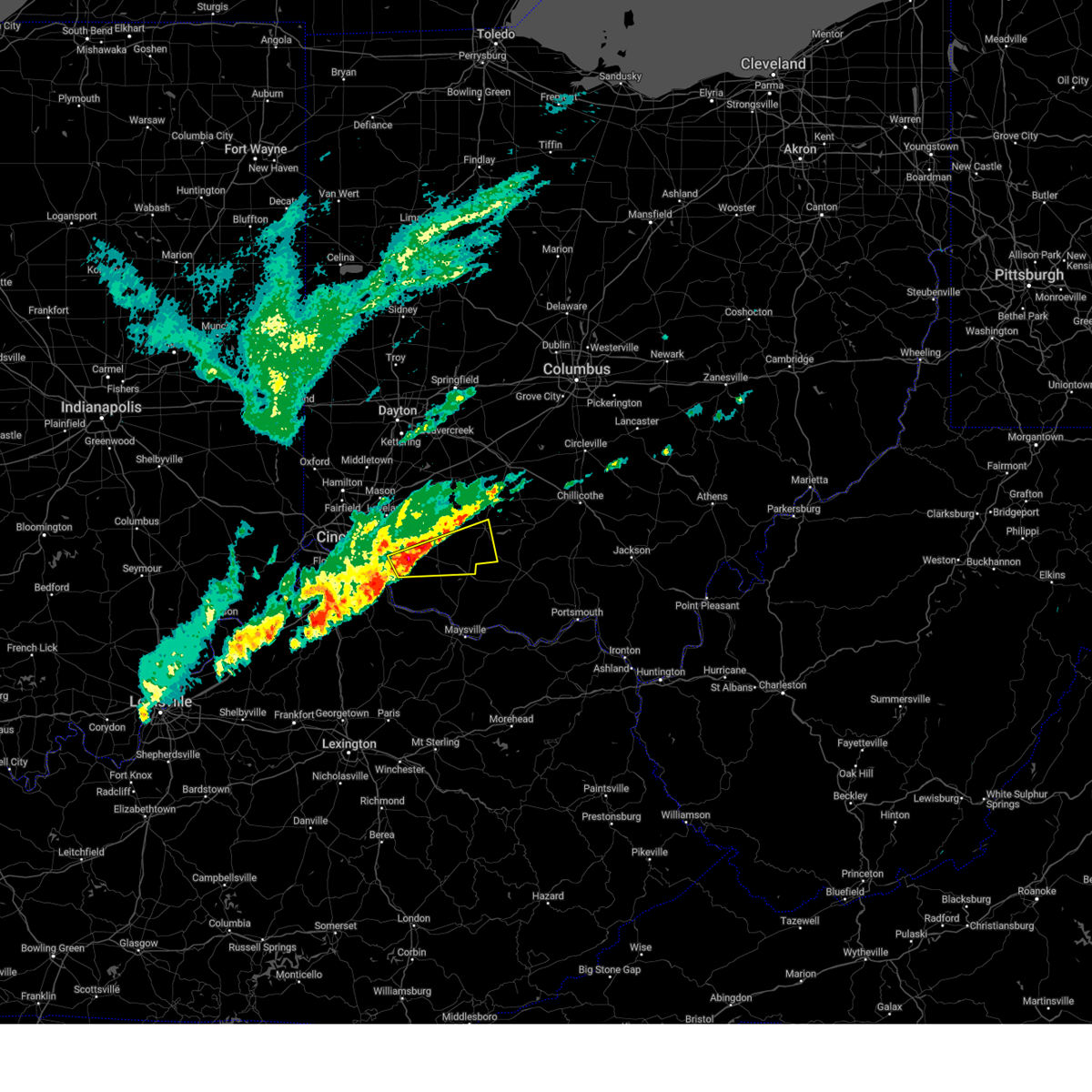
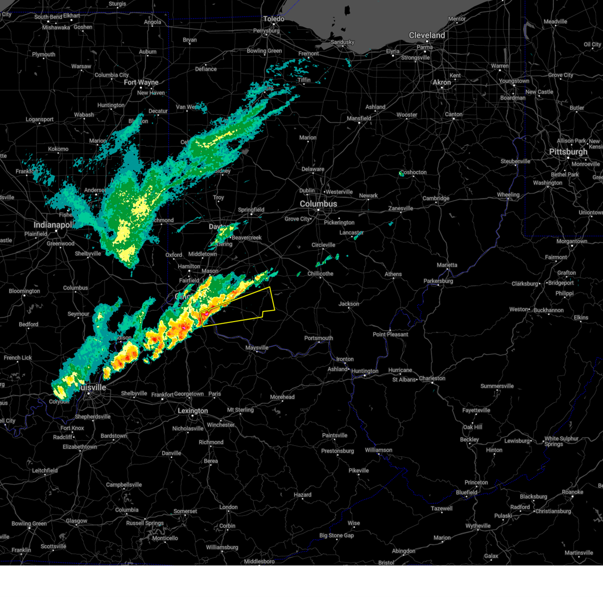
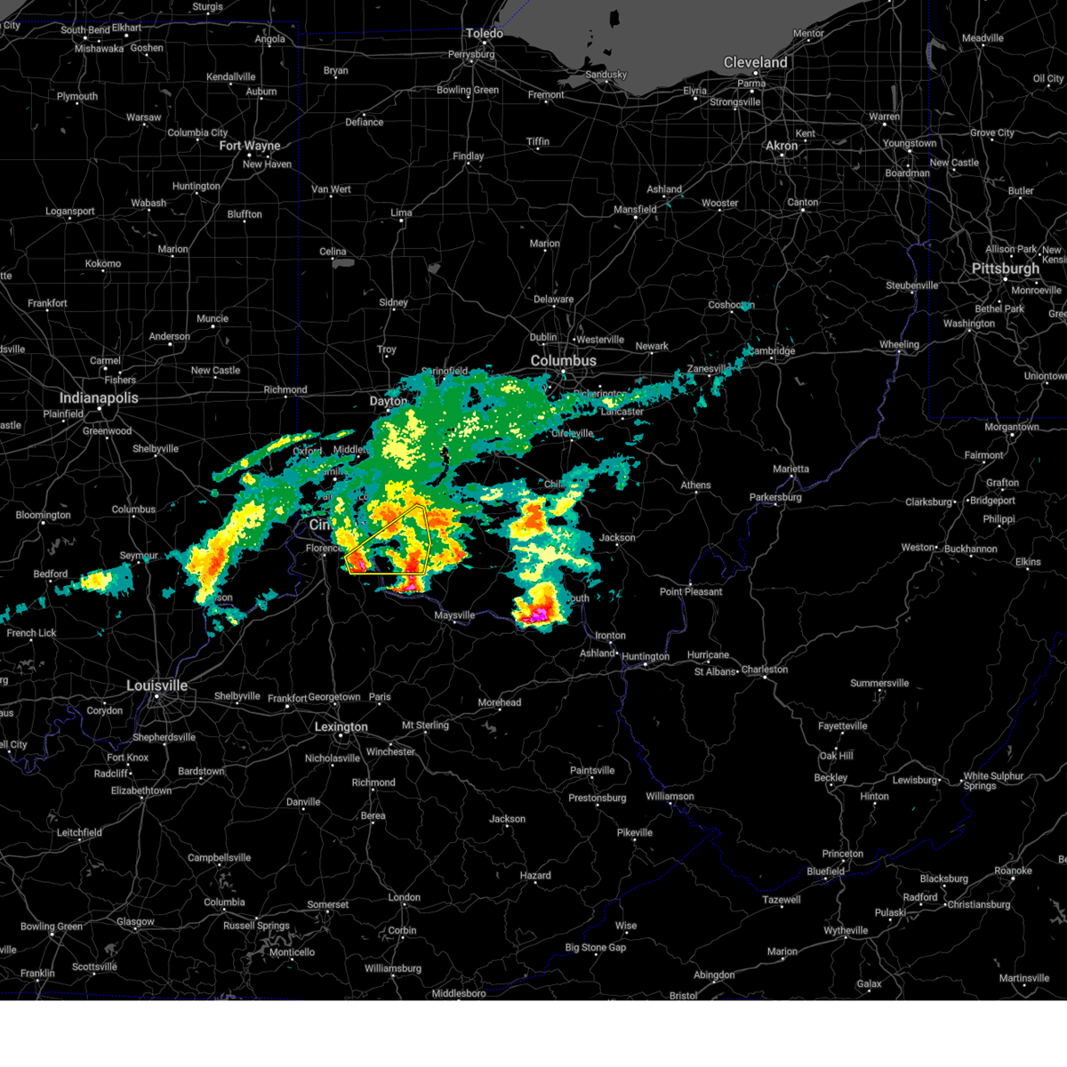
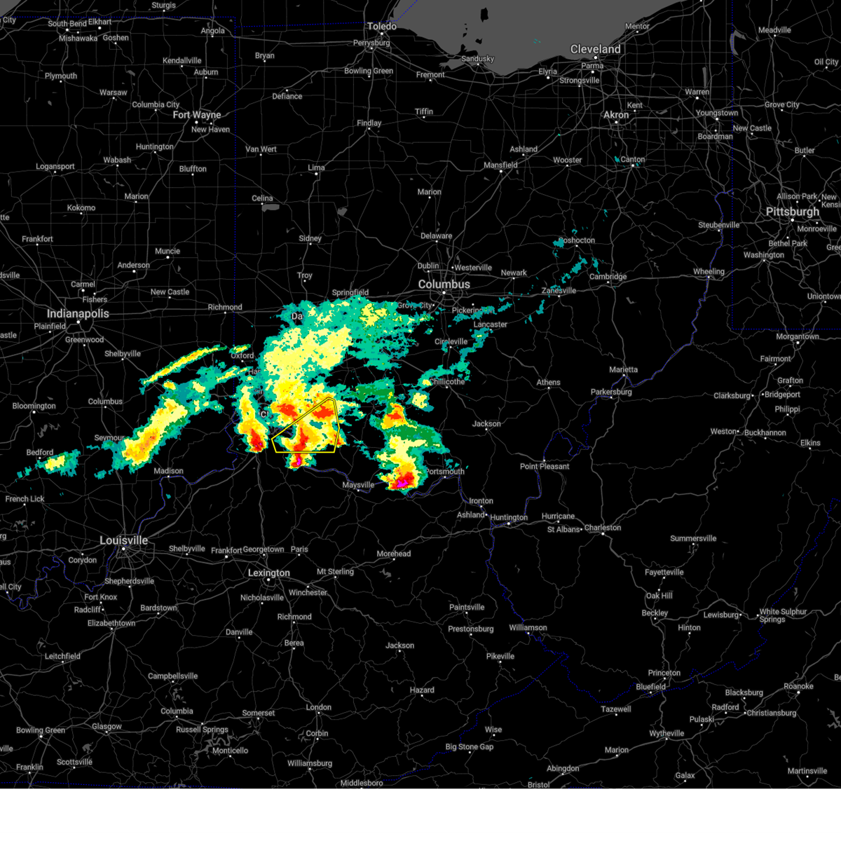
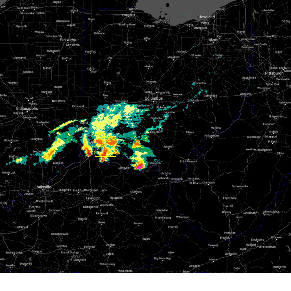
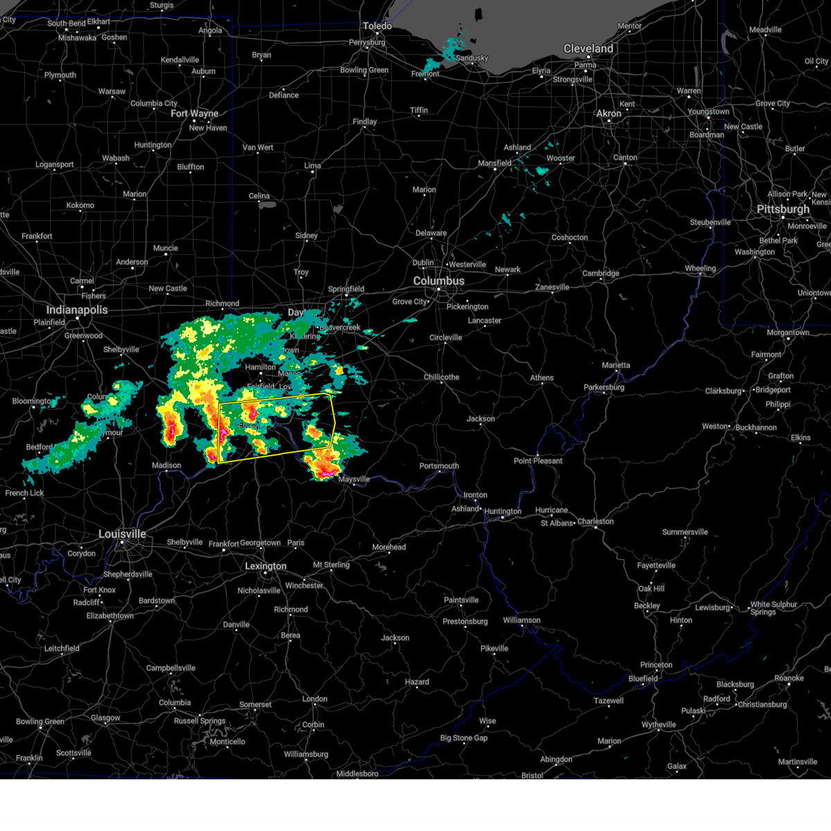
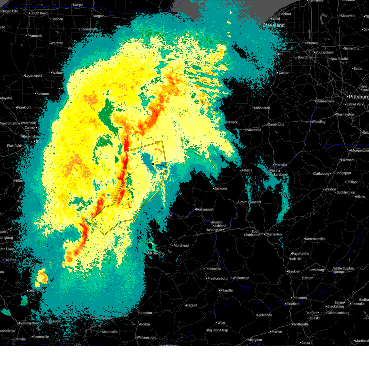
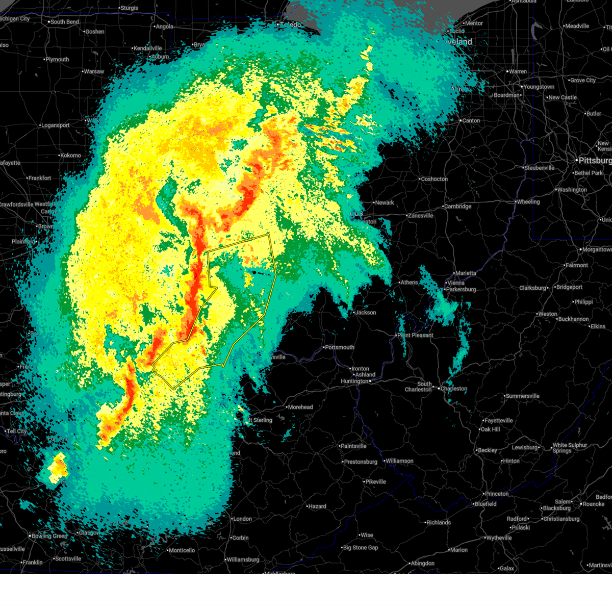
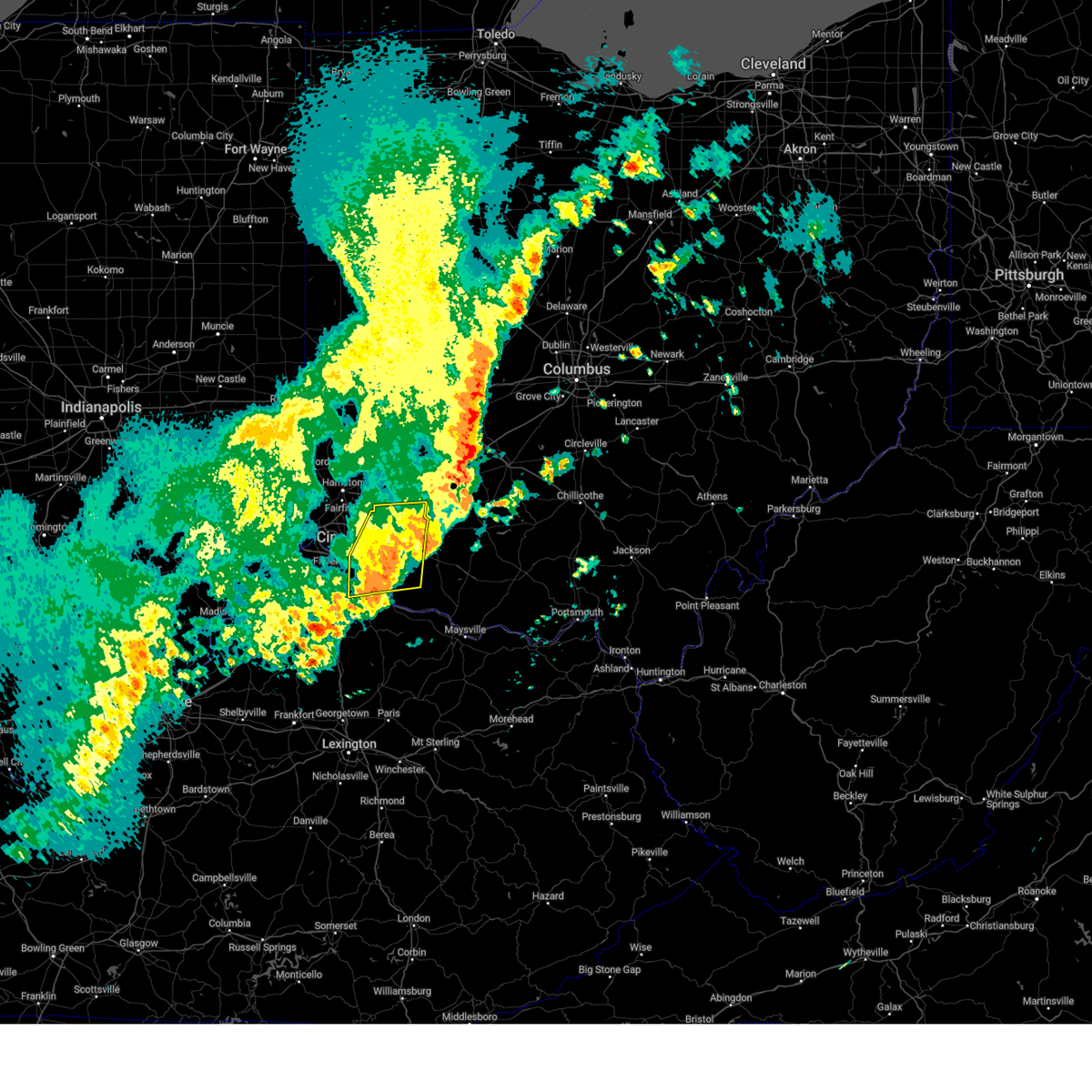
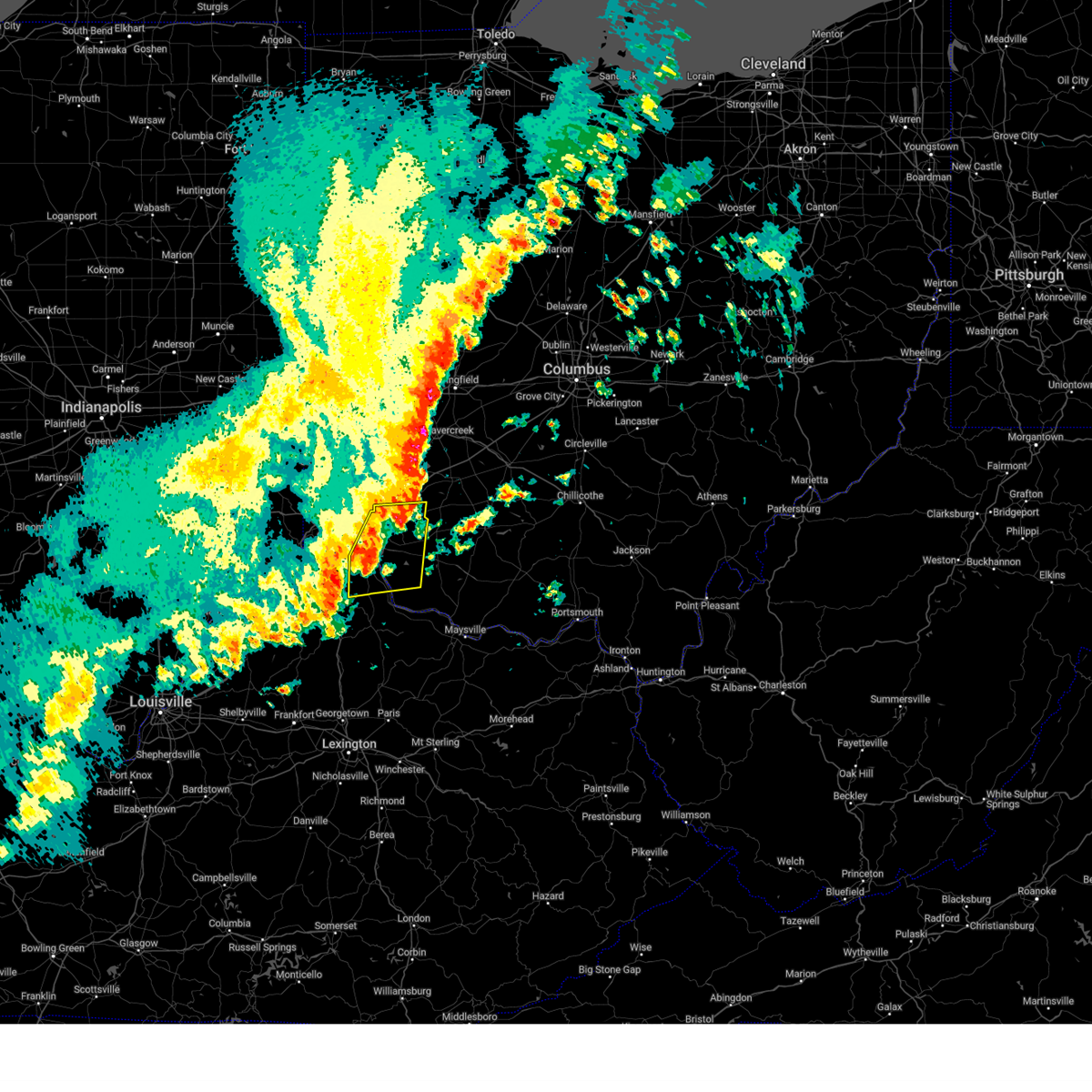
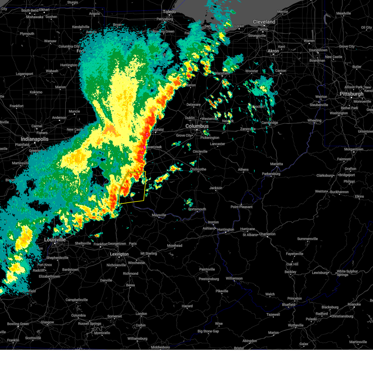
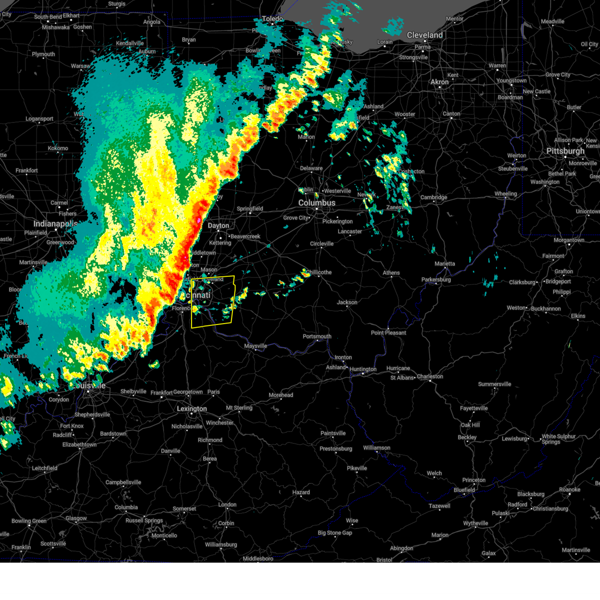
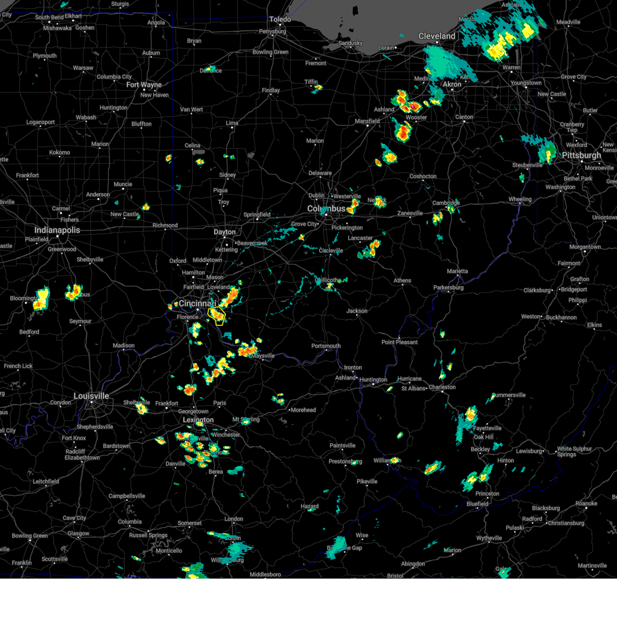
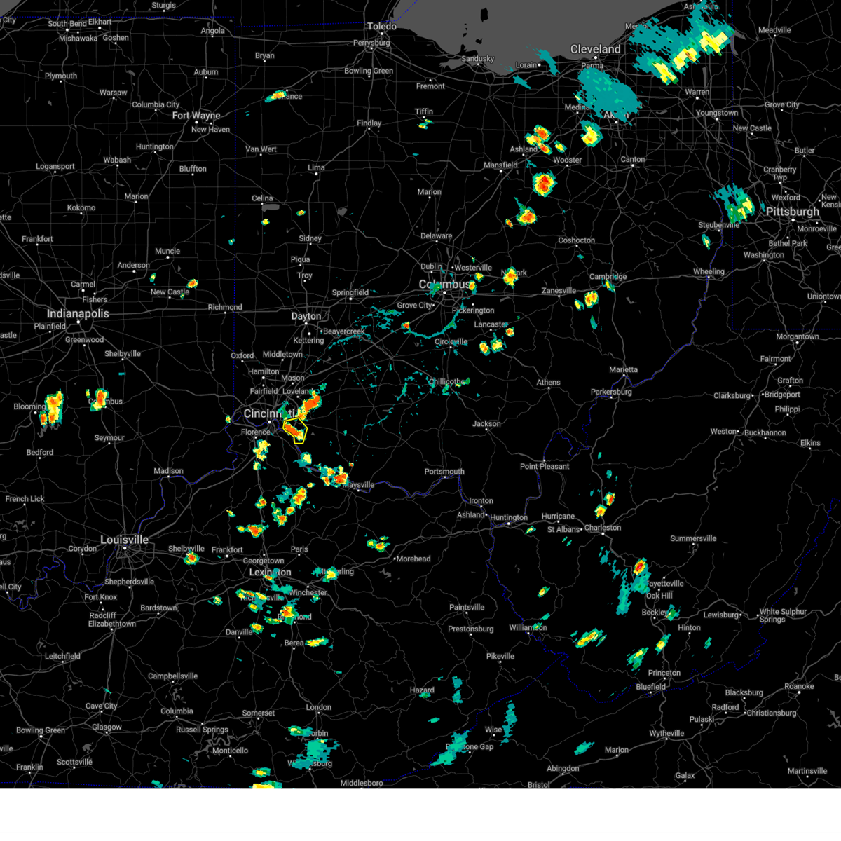
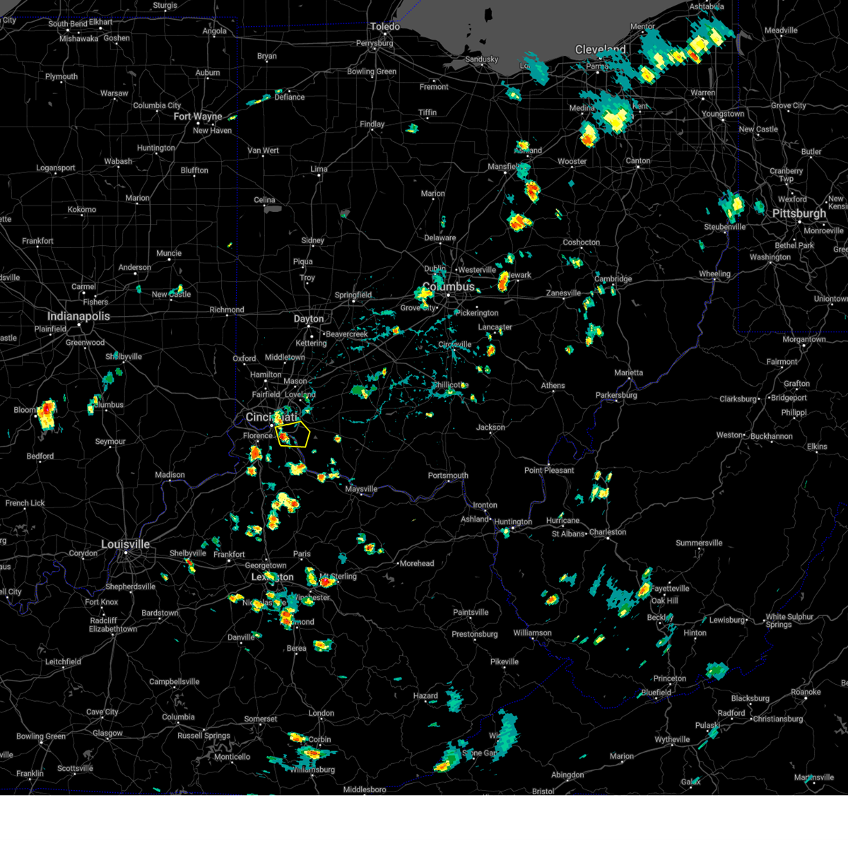
Hail Map for Batavia, OH
The Batavia, OH area has had 2 reports of on-the-ground hail by trained spotters, and has been under severe weather warnings 15 times during the past 12 months. Doppler radar has detected hail at or near Batavia, OH on 52 occasions.
| Name: | Batavia, OH |
| Where Located: | 17.5 miles E of Cincinnati, OH |
| Map: | Google Map for Batavia, OH |
| Population: | 1509 |
| Housing Units: | 713 |
| More Info: | Search Google for Batavia, OH |
0
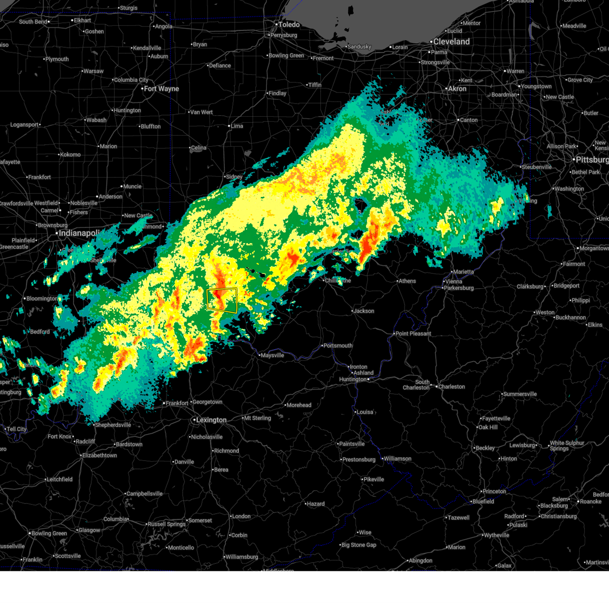
The Top Recent Hail Date for Batavia, OH is Wednesday, April 30, 2025 (51st out of 52)
Hail and Wind Damage Spotted near Batavia, OH
| Date / Time | Report Details |
|---|---|
| 3/22/2026 11:41 PM EDT |
 The storm which prompted the warning has weakened below severe limits and no longer poses an immediate threat to life or property. therefore, the warning will be allowed to expire. a severe thunderstorm watch remains in effect until midnight edt for southwestern ohio. please report previous wind damage or hail to the national weather service by going to our website at weather.gov/iln and submitting your report via social media. The storm which prompted the warning has weakened below severe limits and no longer poses an immediate threat to life or property. therefore, the warning will be allowed to expire. a severe thunderstorm watch remains in effect until midnight edt for southwestern ohio. please report previous wind damage or hail to the national weather service by going to our website at weather.gov/iln and submitting your report via social media.
|
| 3/22/2026 11:33 PM EDT |
 At 1133 pm edt, a severe thunderstorm was located over terrace park, moving east at 50 mph (radar indicated). Hazards include 60 mph wind gusts and penny size hail. Expect damage to trees and power lines. locations impacted include, blue ash, loveland, montgomery, madeira, milford, forestville, mariemont, williamsburg, terrace park, batavia, camp dennison, remington, plainville, concorde hills, withamsville, the village of indian hill, newtown, sherwood, owensville, and goshen. This includes i-71 in ohio between mile markers 14 and 15. At 1133 pm edt, a severe thunderstorm was located over terrace park, moving east at 50 mph (radar indicated). Hazards include 60 mph wind gusts and penny size hail. Expect damage to trees and power lines. locations impacted include, blue ash, loveland, montgomery, madeira, milford, forestville, mariemont, williamsburg, terrace park, batavia, camp dennison, remington, plainville, concorde hills, withamsville, the village of indian hill, newtown, sherwood, owensville, and goshen. This includes i-71 in ohio between mile markers 14 and 15.
|
| 3/22/2026 11:33 PM EDT |
 the severe thunderstorm warning has been cancelled and is no longer in effect the severe thunderstorm warning has been cancelled and is no longer in effect
|
| 3/22/2026 11:22 PM EDT |
 Svriln the national weather service in wilmington has issued a * severe thunderstorm warning for, northern campbell county in northern kentucky, eastern hamilton county in southwestern ohio, northern clermont county in southwestern ohio, * until 1145 pm edt. * at 1121 pm edt, a severe thunderstorm was located over cincinnati, moving east at 50 mph (radar indicated). Hazards include 60 mph wind gusts and penny size hail. expect damage to trees and power lines Svriln the national weather service in wilmington has issued a * severe thunderstorm warning for, northern campbell county in northern kentucky, eastern hamilton county in southwestern ohio, northern clermont county in southwestern ohio, * until 1145 pm edt. * at 1121 pm edt, a severe thunderstorm was located over cincinnati, moving east at 50 mph (radar indicated). Hazards include 60 mph wind gusts and penny size hail. expect damage to trees and power lines
|
| 12/28/2025 10:51 PM EST |
 The storm which prompted the warning has moved out of the area. therefore, the warning will be allowed to expire. however, a new severe thunderstorm warning has been issued for pendleton county and far southern clermont county. please report previous wind damage or hail to the national weather service by going to our website at weather.gov/iln and submitting your report via social media. The storm which prompted the warning has moved out of the area. therefore, the warning will be allowed to expire. however, a new severe thunderstorm warning has been issued for pendleton county and far southern clermont county. please report previous wind damage or hail to the national weather service by going to our website at weather.gov/iln and submitting your report via social media.
|
| 12/28/2025 10:48 PM EST | Tree branches knocked down power lines time estimated by rada in clermont county OH, 4.3 miles N of Batavia, OH |
| 12/28/2025 10:41 PM EST |
 At 1041 pm est, a severe thunderstorm was located near coldstream, moving east at 35 mph (radar indicated). Hazards include 60 mph wind gusts. Expect damage to trees and power lines. Locations impacted include, alexandria, claryville, amelia, new richmond, batavia, butler, withamsville, mentor, california, mount auburn, clermont county airport, lindale, grants lick, aspen grove, morning view, new palestine, gubser mill, blairsville, peach grove, and ivor. At 1041 pm est, a severe thunderstorm was located near coldstream, moving east at 35 mph (radar indicated). Hazards include 60 mph wind gusts. Expect damage to trees and power lines. Locations impacted include, alexandria, claryville, amelia, new richmond, batavia, butler, withamsville, mentor, california, mount auburn, clermont county airport, lindale, grants lick, aspen grove, morning view, new palestine, gubser mill, blairsville, peach grove, and ivor.
|
| 12/28/2025 10:41 PM EST |
 the severe thunderstorm warning has been cancelled and is no longer in effect the severe thunderstorm warning has been cancelled and is no longer in effect
|
| 12/28/2025 10:27 PM EST |
 the severe thunderstorm warning has been cancelled and is no longer in effect the severe thunderstorm warning has been cancelled and is no longer in effect
|
| 12/28/2025 10:27 PM EST |
 At 1026 pm est, a severe thunderstorm was located over taylor mill, moving east at 35 mph (radar indicated). Hazards include 60 mph wind gusts. Expect damage to trees and power lines. locations impacted include, cincinnati, covington, independence, erlanger, fort thomas, newport, alexandria, highland heights, taylor mill, bellevue, fort wright, dayton, southgate, claryville, forestville, amelia, mariemont, wilder, new richmond, and terrace park. This includes i-75 in kentucky near mile marker 169. At 1026 pm est, a severe thunderstorm was located over taylor mill, moving east at 35 mph (radar indicated). Hazards include 60 mph wind gusts. Expect damage to trees and power lines. locations impacted include, cincinnati, covington, independence, erlanger, fort thomas, newport, alexandria, highland heights, taylor mill, bellevue, fort wright, dayton, southgate, claryville, forestville, amelia, mariemont, wilder, new richmond, and terrace park. This includes i-75 in kentucky near mile marker 169.
|
| 12/28/2025 10:21 PM EST |
 the severe thunderstorm warning has been cancelled and is no longer in effect the severe thunderstorm warning has been cancelled and is no longer in effect
|
| 12/28/2025 10:21 PM EST |
 At 1021 pm est, a severe thunderstorm was located over edgewood, moving east at 35 mph (radar indicated). Hazards include 60 mph wind gusts. Expect damage to trees and power lines. locations impacted include, cincinnati, covington, florence, independence, erlanger, fort thomas, newport, edgewood, alexandria, elsmere, fort mitchell, highland heights, taylor mill, bellevue, fort wright, dayton, southgate, walton, crestview hills, and park hills. this includes the following interstates, i-71 in kentucky between mile markers 72 and 77. i-71 in ohio between mile markers 1 and 2. I-75 in kentucky between mile markers 168 and 178, and between mile markers 188 and 191. At 1021 pm est, a severe thunderstorm was located over edgewood, moving east at 35 mph (radar indicated). Hazards include 60 mph wind gusts. Expect damage to trees and power lines. locations impacted include, cincinnati, covington, florence, independence, erlanger, fort thomas, newport, edgewood, alexandria, elsmere, fort mitchell, highland heights, taylor mill, bellevue, fort wright, dayton, southgate, walton, crestview hills, and park hills. this includes the following interstates, i-71 in kentucky between mile markers 72 and 77. i-71 in ohio between mile markers 1 and 2. I-75 in kentucky between mile markers 168 and 178, and between mile markers 188 and 191.
|
| 12/28/2025 10:11 PM EST |
 Svriln the national weather service in wilmington has issued a * severe thunderstorm warning for, northeastern switzerland county in southeastern indiana, kenton county in northern kentucky, campbell county in northern kentucky, boone county in northern kentucky, north central grant county in northern kentucky, northern pendleton county in northern kentucky, eastern gallatin county in northern kentucky, southern hamilton county in southwestern ohio, western clermont county in southwestern ohio, * until 1100 pm est. * at 1010 pm est, a severe thunderstorm was located over oakbrook, moving east at 35 mph (radar indicated). Hazards include 60 mph wind gusts. expect damage to trees and power lines Svriln the national weather service in wilmington has issued a * severe thunderstorm warning for, northeastern switzerland county in southeastern indiana, kenton county in northern kentucky, campbell county in northern kentucky, boone county in northern kentucky, north central grant county in northern kentucky, northern pendleton county in northern kentucky, eastern gallatin county in northern kentucky, southern hamilton county in southwestern ohio, western clermont county in southwestern ohio, * until 1100 pm est. * at 1010 pm est, a severe thunderstorm was located over oakbrook, moving east at 35 mph (radar indicated). Hazards include 60 mph wind gusts. expect damage to trees and power lines
|
| 11/18/2025 6:17 PM EST | the severe thunderstorm warning has been cancelled and is no longer in effect |
| 11/18/2025 5:50 PM EST | Svriln the national weather service in wilmington has issued a * severe thunderstorm warning for, ohio county in southeastern indiana, eastern dearborn county in southeastern indiana, kenton county in northern kentucky, campbell county in northern kentucky, boone county in northern kentucky, hamilton county in southwestern ohio, western clermont county in southwestern ohio, * until 630 pm est. * at 550 pm est, a severe thunderstorm was located over greendale, moving east at 55 mph (radar indicated). Hazards include 60 mph wind gusts and quarter size hail. Minor hail damage to vehicles is possible. Expect wind damage to trees and power lines. |
| 9/21/2025 2:13 PM EDT | Svriln the national weather service in wilmington has issued a * severe thunderstorm warning for, northeastern hamilton county in southwestern ohio, northern clermont county in southwestern ohio, northwestern brown county in southwestern ohio, southern warren county in southwestern ohio, southwestern clinton county in southwestern ohio, * until 300 pm edt. * at 213 pm edt, a severe thunderstorm was located over milford, moving northeast at 25 mph (radar indicated). Hazards include 60 mph wind gusts. expect damage to trees and power lines |
| 7/9/2025 4:30 PM EDT | A large tree limb split along the trunk of a tree and fell onto a parked vehicle... causing damage to the vehicl in clermont county OH, 3.9 miles ESE of Batavia, OH |
| 7/9/2025 4:29 PM EDT | A hardwood tree had a large limb split along the trunk... falling onto a home with minor damage. additionally... several other trees had limbs broken off at the same pr in clermont county OH, 3.2 miles E of Batavia, OH |
| 7/9/2025 4:28 PM EDT | A couple of trees had large limbs split off of them... downing several power lines in the area along with one power pol in clermont county OH, 3.9 miles ESE of Batavia, OH |
| 6/18/2025 8:23 PM EDT |
 At 822 pm edt, severe thunderstorms were located along a line extending from bloomingburg to mount orab, moving east at 30 mph (radar indicated). Hazards include 60 mph wind gusts. Expect damage to trees and power lines. Locations impacted include, washington court house, hillsboro, greenfield, blanchester, amelia, mount orab, sabina, williamsburg, batavia, lynchburg, leesburg, new vienna, marshall, sardinia, belfast, highland holiday, rocky fork point, russell, woodville, and staunton. At 822 pm edt, severe thunderstorms were located along a line extending from bloomingburg to mount orab, moving east at 30 mph (radar indicated). Hazards include 60 mph wind gusts. Expect damage to trees and power lines. Locations impacted include, washington court house, hillsboro, greenfield, blanchester, amelia, mount orab, sabina, williamsburg, batavia, lynchburg, leesburg, new vienna, marshall, sardinia, belfast, highland holiday, rocky fork point, russell, woodville, and staunton.
|
| 6/18/2025 7:43 PM EDT |
 Svriln the national weather service in wilmington has issued a * severe thunderstorm warning for, northern clermont county in southwestern ohio, northern brown county in southwestern ohio, southern fayette county in central ohio, clinton county in southwestern ohio, highland county in south central ohio, * until 845 pm edt. * at 743 pm edt, severe thunderstorms were located along a line extending from 7 miles south of jamestown to withamsville, moving east at 35 mph (radar indicated). Hazards include 60 mph wind gusts. expect damage to trees and power lines Svriln the national weather service in wilmington has issued a * severe thunderstorm warning for, northern clermont county in southwestern ohio, northern brown county in southwestern ohio, southern fayette county in central ohio, clinton county in southwestern ohio, highland county in south central ohio, * until 845 pm edt. * at 743 pm edt, severe thunderstorms were located along a line extending from 7 miles south of jamestown to withamsville, moving east at 35 mph (radar indicated). Hazards include 60 mph wind gusts. expect damage to trees and power lines
|
| 6/18/2025 7:30 PM EDT |
 the severe thunderstorm warning has been cancelled and is no longer in effect the severe thunderstorm warning has been cancelled and is no longer in effect
|
| 6/18/2025 7:30 PM EDT |
 At 730 pm edt, severe thunderstorms were located along a line extending from waynesville to newport, moving east at 50 mph (radar indicated). Hazards include 60 mph wind gusts and penny size hail. Expect damage to trees and power lines. locations impacted include, cincinnati, covington, mason, lebanon, norwood, fort thomas, newport, sharonville, wilmington, blue ash, loveland, reading, montgomery, madeira, edgewood, fort mitchell, villa hills, highland heights, milford, and taylor mill. this includes the following interstates, i-71 in ohio between mile markers 0 and 57. i-75 in kentucky between mile markers 187 and 191. I-75 in ohio between mile markers 0 and 2, and near mile marker 8. At 730 pm edt, severe thunderstorms were located along a line extending from waynesville to newport, moving east at 50 mph (radar indicated). Hazards include 60 mph wind gusts and penny size hail. Expect damage to trees and power lines. locations impacted include, cincinnati, covington, mason, lebanon, norwood, fort thomas, newport, sharonville, wilmington, blue ash, loveland, reading, montgomery, madeira, edgewood, fort mitchell, villa hills, highland heights, milford, and taylor mill. this includes the following interstates, i-71 in ohio between mile markers 0 and 57. i-75 in kentucky between mile markers 187 and 191. I-75 in ohio between mile markers 0 and 2, and near mile marker 8.
|
| 6/18/2025 7:04 PM EDT |
 Svriln the national weather service in wilmington has issued a * severe thunderstorm warning for, north central kenton county in northern kentucky, northern campbell county in northern kentucky, eastern hamilton county in southwestern ohio, eastern butler county in southwestern ohio, northern clermont county in southwestern ohio, northwestern brown county in southwestern ohio, warren county in southwestern ohio, clinton county in southwestern ohio, northwestern highland county in south central ohio, * until 800 pm edt. * at 704 pm edt, severe thunderstorms were located along a line extending from middletown to burlington, moving northeast at 30 mph (radar indicated). Hazards include 60 mph wind gusts and penny size hail. expect damage to trees and power lines Svriln the national weather service in wilmington has issued a * severe thunderstorm warning for, north central kenton county in northern kentucky, northern campbell county in northern kentucky, eastern hamilton county in southwestern ohio, eastern butler county in southwestern ohio, northern clermont county in southwestern ohio, northwestern brown county in southwestern ohio, warren county in southwestern ohio, clinton county in southwestern ohio, northwestern highland county in south central ohio, * until 800 pm edt. * at 704 pm edt, severe thunderstorms were located along a line extending from middletown to burlington, moving northeast at 30 mph (radar indicated). Hazards include 60 mph wind gusts and penny size hail. expect damage to trees and power lines
|
| 4/29/2025 7:57 PM EDT |
 The storms which prompted the warning have moved out of the area. therefore, the warning will be allowed to expire. however, gusty winds and heavy rain are still possible with these thunderstorms. a severe thunderstorm watch remains in effect until midnight edt for northern kentucky, and south central and southwestern ohio. please report previous wind damage or hail to the national weather service by going to our website at weather.gov/iln and submitting your report via social media. The storms which prompted the warning have moved out of the area. therefore, the warning will be allowed to expire. however, gusty winds and heavy rain are still possible with these thunderstorms. a severe thunderstorm watch remains in effect until midnight edt for northern kentucky, and south central and southwestern ohio. please report previous wind damage or hail to the national weather service by going to our website at weather.gov/iln and submitting your report via social media.
|
| 4/29/2025 7:48 PM EDT |
 At 748 pm edt, severe thunderstorms were located along a line extending from 6 miles northeast of batavia to near neville, moving east at 40 mph (radar indicated). Hazards include 60 mph wind gusts and quarter size hail. Minor hail damage to vehicles is possible. expect wind damage to trees and power lines. Locations impacted include, mount auburn, bradford, willow grove, saltair, moscow, nicholsville, state route 32 at us route 68, peach grove, amelia, ivor, point isabel, williamsburg, owensville, bethel, mount orab, clermont county airport, lindale, chilo, greenbush, and east fork state park. At 748 pm edt, severe thunderstorms were located along a line extending from 6 miles northeast of batavia to near neville, moving east at 40 mph (radar indicated). Hazards include 60 mph wind gusts and quarter size hail. Minor hail damage to vehicles is possible. expect wind damage to trees and power lines. Locations impacted include, mount auburn, bradford, willow grove, saltair, moscow, nicholsville, state route 32 at us route 68, peach grove, amelia, ivor, point isabel, williamsburg, owensville, bethel, mount orab, clermont county airport, lindale, chilo, greenbush, and east fork state park.
|
| 4/29/2025 7:48 PM EDT |
 the severe thunderstorm warning has been cancelled and is no longer in effect the severe thunderstorm warning has been cancelled and is no longer in effect
|
| 4/29/2025 7:41 PM EDT |
 the severe thunderstorm warning has been cancelled and is no longer in effect the severe thunderstorm warning has been cancelled and is no longer in effect
|
| 4/29/2025 7:41 PM EDT |
 At 741 pm edt, severe thunderstorms were located along a line extending from near batavia to near butler, moving east at 45 mph (radar indicated). Hazards include 60 mph wind gusts and quarter size hail. Minor hail damage to vehicles is possible. expect wind damage to trees and power lines. Locations impacted include, mount auburn, new richmond, perintown, bradford, willow grove, saltair, mentor, new palestine, moscow, gubser mill, nicholsville, state route 32 at us route 68, peach grove, amelia, ivor, campbell county lake, point isabel, withamsville, williamsburg, and owensville. At 741 pm edt, severe thunderstorms were located along a line extending from near batavia to near butler, moving east at 45 mph (radar indicated). Hazards include 60 mph wind gusts and quarter size hail. Minor hail damage to vehicles is possible. expect wind damage to trees and power lines. Locations impacted include, mount auburn, new richmond, perintown, bradford, willow grove, saltair, mentor, new palestine, moscow, gubser mill, nicholsville, state route 32 at us route 68, peach grove, amelia, ivor, campbell county lake, point isabel, withamsville, williamsburg, and owensville.
|
| 4/29/2025 7:19 PM EDT |
 Svriln the national weather service in wilmington has issued a * severe thunderstorm warning for, northwestern bracken county in northern kentucky, southern kenton county in northern kentucky, campbell county in northern kentucky, northeastern pendleton county in northern kentucky, clermont county in southwestern ohio, northwestern brown county in southwestern ohio, southwestern highland county in south central ohio, * until 800 pm edt. * at 718 pm edt, severe thunderstorms were located along a line extending from near loveland to walton, moving east at 40 mph (radar indicated). Hazards include 60 mph wind gusts and quarter size hail. Minor hail damage to vehicles is possible. Expect wind damage to trees and power lines. Svriln the national weather service in wilmington has issued a * severe thunderstorm warning for, northwestern bracken county in northern kentucky, southern kenton county in northern kentucky, campbell county in northern kentucky, northeastern pendleton county in northern kentucky, clermont county in southwestern ohio, northwestern brown county in southwestern ohio, southwestern highland county in south central ohio, * until 800 pm edt. * at 718 pm edt, severe thunderstorms were located along a line extending from near loveland to walton, moving east at 40 mph (radar indicated). Hazards include 60 mph wind gusts and quarter size hail. Minor hail damage to vehicles is possible. Expect wind damage to trees and power lines.
|
| 4/19/2025 4:56 PM EDT |
 At 456 pm edt, a severe thunderstorm was located near williamsburg, moving east at 45 mph (radar indicated). Hazards include 60 mph wind gusts and quarter size hail. Minor hail damage to vehicles is possible. expect wind damage to trees and power lines. Locations impacted include, sardinia, lindale, danville in highland county, greenbush, east fork state park, buford, nicholsville, state route 32 at us route 68, amelia, belfast, batavia, mowrystown, hillsboro, fincastle, new market, williamsburg, berrysville, bethel, new hope, and bantam. At 456 pm edt, a severe thunderstorm was located near williamsburg, moving east at 45 mph (radar indicated). Hazards include 60 mph wind gusts and quarter size hail. Minor hail damage to vehicles is possible. expect wind damage to trees and power lines. Locations impacted include, sardinia, lindale, danville in highland county, greenbush, east fork state park, buford, nicholsville, state route 32 at us route 68, amelia, belfast, batavia, mowrystown, hillsboro, fincastle, new market, williamsburg, berrysville, bethel, new hope, and bantam.
|
| 4/19/2025 4:56 PM EDT |
 the severe thunderstorm warning has been cancelled and is no longer in effect the severe thunderstorm warning has been cancelled and is no longer in effect
|
| 4/19/2025 4:50 PM EDT | Tree down on car and powerline in clermont county OH, 2.2 miles N of Batavia, OH |
| 4/19/2025 4:41 PM EDT |
 Svriln the national weather service in wilmington has issued a * severe thunderstorm warning for, central campbell county in northern kentucky, central clermont county in southwestern ohio, central brown county in southwestern ohio, southwestern highland county in south central ohio, * until 530 pm edt. * at 441 pm edt, a severe thunderstorm was located near new richmond, moving east at 50 mph (radar indicated). Hazards include 60 mph wind gusts and quarter size hail. Minor hail damage to vehicles is possible. Expect wind damage to trees and power lines. Svriln the national weather service in wilmington has issued a * severe thunderstorm warning for, central campbell county in northern kentucky, central clermont county in southwestern ohio, central brown county in southwestern ohio, southwestern highland county in south central ohio, * until 530 pm edt. * at 441 pm edt, a severe thunderstorm was located near new richmond, moving east at 50 mph (radar indicated). Hazards include 60 mph wind gusts and quarter size hail. Minor hail damage to vehicles is possible. Expect wind damage to trees and power lines.
|
| 4/14/2025 4:10 PM EDT |
 The storm which prompted the warning has weakened below severe limits and no longer poses an immediate threat to life or property. therefore, the warning will be allowed to expire. a severe thunderstorm watch remains in effect until 1100 pm edt for northern kentucky, and southwestern ohio. please report previous wind damage or hail to the national weather service by going to our website at weather.gov/iln and submitting your report via social media. remember, a severe thunderstorm warning still remains in effect for the southern half of brown county. The storm which prompted the warning has weakened below severe limits and no longer poses an immediate threat to life or property. therefore, the warning will be allowed to expire. a severe thunderstorm watch remains in effect until 1100 pm edt for northern kentucky, and southwestern ohio. please report previous wind damage or hail to the national weather service by going to our website at weather.gov/iln and submitting your report via social media. remember, a severe thunderstorm warning still remains in effect for the southern half of brown county.
|
| 4/14/2025 4:08 PM EDT |
 the severe thunderstorm warning has been cancelled and is no longer in effect the severe thunderstorm warning has been cancelled and is no longer in effect
|
| 4/14/2025 4:08 PM EDT |
 At 407 pm edt, a severe thunderstorm was located near williamsburg, moving east at 65 mph (radar indicated). Hazards include 60 mph wind gusts and quarter size hail. Minor hail damage to vehicles is possible. expect wind damage to trees and power lines. Locations impacted include, chasetown, silver grove, new richmond, visalia, saltair, new palestine, melbourne, nicholsville, state route 32 at us route 68, amelia, withamsville, cold spring, williamsburg, owensville, bethel, alexandria, edenton, mount orab, clermont county airport, and lindale. At 407 pm edt, a severe thunderstorm was located near williamsburg, moving east at 65 mph (radar indicated). Hazards include 60 mph wind gusts and quarter size hail. Minor hail damage to vehicles is possible. expect wind damage to trees and power lines. Locations impacted include, chasetown, silver grove, new richmond, visalia, saltair, new palestine, melbourne, nicholsville, state route 32 at us route 68, amelia, withamsville, cold spring, williamsburg, owensville, bethel, alexandria, edenton, mount orab, clermont county airport, and lindale.
|
| 4/14/2025 3:59 PM EDT |
 At 358 pm edt, a severe thunderstorm was located over withamsville, moving east at 65 mph (radar indicated). Hazards include 60 mph wind gusts and quarter size hail. Minor hail damage to vehicles is possible. expect wind damage to trees and power lines. locations impacted include, new richmond, florence, new palestine, covington, highland heights, villa hills, crescent park, ricedale, crestview hills, fort thomas, southgate, plainville, edgewood, bromley, clermont county airport, erlanger, california, coldstream, fairfax, and woodlawn. this includes the following interstates, i-71 in ohio between mile markers 0 and 3. i-75 in kentucky between mile markers 173 and 191. I-75 in ohio between mile markers 0 and 2. At 358 pm edt, a severe thunderstorm was located over withamsville, moving east at 65 mph (radar indicated). Hazards include 60 mph wind gusts and quarter size hail. Minor hail damage to vehicles is possible. expect wind damage to trees and power lines. locations impacted include, new richmond, florence, new palestine, covington, highland heights, villa hills, crescent park, ricedale, crestview hills, fort thomas, southgate, plainville, edgewood, bromley, clermont county airport, erlanger, california, coldstream, fairfax, and woodlawn. this includes the following interstates, i-71 in ohio between mile markers 0 and 3. i-75 in kentucky between mile markers 173 and 191. I-75 in ohio between mile markers 0 and 2.
|
| 4/14/2025 3:59 PM EDT |
 the severe thunderstorm warning has been cancelled and is no longer in effect the severe thunderstorm warning has been cancelled and is no longer in effect
|
| 4/14/2025 3:30 PM EDT |
 Svriln the national weather service in wilmington has issued a * severe thunderstorm warning for, ohio county in southeastern indiana, southeastern dearborn county in southeastern indiana, northeastern switzerland county in southeastern indiana, kenton county in northern kentucky, campbell county in northern kentucky, boone county in northern kentucky, eastern gallatin county in northern kentucky, central hamilton county in southwestern ohio, clermont county in southwestern ohio, northwestern brown county in southwestern ohio, * until 415 pm edt. * at 330 pm edt, a severe thunderstorm was located near burlington, moving east at 55 mph (radar indicated). Hazards include 60 mph wind gusts and quarter size hail. Minor hail damage to vehicles is possible. Expect wind damage to trees and power lines. Svriln the national weather service in wilmington has issued a * severe thunderstorm warning for, ohio county in southeastern indiana, southeastern dearborn county in southeastern indiana, northeastern switzerland county in southeastern indiana, kenton county in northern kentucky, campbell county in northern kentucky, boone county in northern kentucky, eastern gallatin county in northern kentucky, central hamilton county in southwestern ohio, clermont county in southwestern ohio, northwestern brown county in southwestern ohio, * until 415 pm edt. * at 330 pm edt, a severe thunderstorm was located near burlington, moving east at 55 mph (radar indicated). Hazards include 60 mph wind gusts and quarter size hail. Minor hail damage to vehicles is possible. Expect wind damage to trees and power lines.
|
| 4/3/2025 1:22 AM EDT |
 the severe thunderstorm warning has been cancelled and is no longer in effect the severe thunderstorm warning has been cancelled and is no longer in effect
|
| 4/3/2025 1:22 AM EDT |
 At 121 am edt, a severe thunderstorm was located over lynchburg, moving east at 75 mph (radar indicated). Hazards include 70 mph wind gusts and penny size hail. Expect considerable tree damage. damage is likely to mobile homes, roofs, and outbuildings. locations impacted include, new richmond, atwood, bradford, lumberton, new palestine, bracht, morrisville, cowan lake state park, mulberry, woolcutt, clermont county airport, harmony, long ridge, california, lenoxburg, knoxville, russell, keefer, midland, and reesville. this includes the following interstates, i-71 in kentucky near mile marker 65. i-71 in ohio between mile markers 35 and 65. I-75 in kentucky between mile markers 143 and 167. At 121 am edt, a severe thunderstorm was located over lynchburg, moving east at 75 mph (radar indicated). Hazards include 70 mph wind gusts and penny size hail. Expect considerable tree damage. damage is likely to mobile homes, roofs, and outbuildings. locations impacted include, new richmond, atwood, bradford, lumberton, new palestine, bracht, morrisville, cowan lake state park, mulberry, woolcutt, clermont county airport, harmony, long ridge, california, lenoxburg, knoxville, russell, keefer, midland, and reesville. this includes the following interstates, i-71 in kentucky near mile marker 65. i-71 in ohio between mile markers 35 and 65. I-75 in kentucky between mile markers 143 and 167.
|
| 4/3/2025 1:09 AM EDT |
 At 108 am edt, a severe thunderstorm was located 7 miles north of williamsburg, moving northeast at 70 mph (radar indicated). Hazards include 70 mph wind gusts and penny size hail. Expect considerable tree damage. damage is likely to mobile homes, roofs, and outbuildings. locations impacted include, new richmond, atwood, bradford, lumberton, new palestine, bracht, pekin, corwin, morrisville, cowan lake state park, mulberry, woolcutt, clermont county airport, harmony, long ridge, california, lenoxburg, knoxville, russell, and keefer. this includes the following interstates, i-71 in kentucky near mile marker 65. i-71 in ohio between mile markers 27 and 65. i-75 in kentucky between mile markers 143 and 167. I-75 in ohio between mile markers 40 and 43. At 108 am edt, a severe thunderstorm was located 7 miles north of williamsburg, moving northeast at 70 mph (radar indicated). Hazards include 70 mph wind gusts and penny size hail. Expect considerable tree damage. damage is likely to mobile homes, roofs, and outbuildings. locations impacted include, new richmond, atwood, bradford, lumberton, new palestine, bracht, pekin, corwin, morrisville, cowan lake state park, mulberry, woolcutt, clermont county airport, harmony, long ridge, california, lenoxburg, knoxville, russell, and keefer. this includes the following interstates, i-71 in kentucky near mile marker 65. i-71 in ohio between mile markers 27 and 65. i-75 in kentucky between mile markers 143 and 167. I-75 in ohio between mile markers 40 and 43.
|
| 4/3/2025 1:09 AM EDT |
 the severe thunderstorm warning has been cancelled and is no longer in effect the severe thunderstorm warning has been cancelled and is no longer in effect
|
| 4/3/2025 12:53 AM EDT |
 At 1253 am edt, a severe thunderstorm was located over coldstream, moving northeast at 75 mph (radar indicated). Hazards include 70 mph wind gusts and penny size hail. Expect considerable tree damage. damage is likely to mobile homes, roofs, and outbuildings. locations impacted include, franklin, new richmond, atwood, bradford, lumberton, new palestine, bracht, pekin, corwin, morrisville, cowan lake state park, mulberry, hunter, woolcutt, clermont county airport, harmony, long ridge, california, lenoxburg, and knoxville. this includes the following interstates, i-71 in kentucky near mile marker 65. i-71 in ohio between mile markers 20 and 65. i-75 in kentucky between mile markers 143 and 167. I-75 in ohio between mile markers 27 and 44. At 1253 am edt, a severe thunderstorm was located over coldstream, moving northeast at 75 mph (radar indicated). Hazards include 70 mph wind gusts and penny size hail. Expect considerable tree damage. damage is likely to mobile homes, roofs, and outbuildings. locations impacted include, franklin, new richmond, atwood, bradford, lumberton, new palestine, bracht, pekin, corwin, morrisville, cowan lake state park, mulberry, hunter, woolcutt, clermont county airport, harmony, long ridge, california, lenoxburg, and knoxville. this includes the following interstates, i-71 in kentucky near mile marker 65. i-71 in ohio between mile markers 20 and 65. i-75 in kentucky between mile markers 143 and 167. I-75 in ohio between mile markers 27 and 44.
|
| 4/3/2025 12:47 AM EDT |
 Svriln the national weather service in wilmington has issued a * severe thunderstorm warning for, southern kenton county in northern kentucky, western bracken county in northern kentucky, campbell county in northern kentucky, grant county in northern kentucky, owen county in northern kentucky, pendleton county in northern kentucky, eastern gallatin county in northern kentucky, northeastern butler county in southwestern ohio, clermont county in southwestern ohio, western fayette county in central ohio, eastern hamilton county in southwestern ohio, northern brown county in southwestern ohio, warren county in southwestern ohio, clinton county in southwestern ohio, greene county in west central ohio, western highland county in south central ohio, southeastern montgomery county in west central ohio, * until 130 am edt. * at 1247 am edt, a severe thunderstorm was located over mariemont, moving east at 75 mph (radar indicated). Hazards include 60 mph wind gusts and penny size hail. expect damage to trees and power lines Svriln the national weather service in wilmington has issued a * severe thunderstorm warning for, southern kenton county in northern kentucky, western bracken county in northern kentucky, campbell county in northern kentucky, grant county in northern kentucky, owen county in northern kentucky, pendleton county in northern kentucky, eastern gallatin county in northern kentucky, northeastern butler county in southwestern ohio, clermont county in southwestern ohio, western fayette county in central ohio, eastern hamilton county in southwestern ohio, northern brown county in southwestern ohio, warren county in southwestern ohio, clinton county in southwestern ohio, greene county in west central ohio, western highland county in south central ohio, southeastern montgomery county in west central ohio, * until 130 am edt. * at 1247 am edt, a severe thunderstorm was located over mariemont, moving east at 75 mph (radar indicated). Hazards include 60 mph wind gusts and penny size hail. expect damage to trees and power lines
|
| 3/30/2025 9:36 PM EDT |
 The storms which prompted the warning have weakened below severe limits and no longer pose an immediate threat to life or property. therefore, the warning will be allowed to expire. however, gusty winds are still possible with these thunderstorms. a tornado watch remains in effect until 100 am edt for northern kentucky, and southwestern ohio. please report previous wind damage or hail to the national weather service by going to our website at weather.gov/iln and submitting your report via social media. The storms which prompted the warning have weakened below severe limits and no longer pose an immediate threat to life or property. therefore, the warning will be allowed to expire. however, gusty winds are still possible with these thunderstorms. a tornado watch remains in effect until 100 am edt for northern kentucky, and southwestern ohio. please report previous wind damage or hail to the national weather service by going to our website at weather.gov/iln and submitting your report via social media.
|
| 3/30/2025 9:15 PM EDT |
 At 914 pm edt, severe thunderstorms were located along a line extending from near loveland to near independence, moving east at 50 mph (radar indicated). Hazards include 60 mph wind gusts and penny size hail. Expect damage to trees and power lines. locations impacted include, new richmond, new palestine, highland heights, fort thomas, highpoint, springvale, remington, southgate, plainville, mulberry, clermont county airport, montgomery, california, coldstream, fairfax, woodlawn, miamiville, loveland park, concorde hills, and dry run. This includes i-71 in ohio between mile markers 6 and 22. At 914 pm edt, severe thunderstorms were located along a line extending from near loveland to near independence, moving east at 50 mph (radar indicated). Hazards include 60 mph wind gusts and penny size hail. Expect damage to trees and power lines. locations impacted include, new richmond, new palestine, highland heights, fort thomas, highpoint, springvale, remington, southgate, plainville, mulberry, clermont county airport, montgomery, california, coldstream, fairfax, woodlawn, miamiville, loveland park, concorde hills, and dry run. This includes i-71 in ohio between mile markers 6 and 22.
|
| 3/30/2025 9:15 PM EDT |
 the severe thunderstorm warning has been cancelled and is no longer in effect the severe thunderstorm warning has been cancelled and is no longer in effect
|
| 3/30/2025 8:40 PM EDT |
 Svriln the national weather service in wilmington has issued a * severe thunderstorm warning for, kenton county in northern kentucky, campbell county in northern kentucky, eastern hamilton county in southwestern ohio, southeastern butler county in southwestern ohio, clermont county in southwestern ohio, southern warren county in southwestern ohio, * until 945 pm edt. * at 839 pm edt, severe thunderstorms were located along a line extending from taylor creek to near florence, moving east at 50 mph (radar indicated). Hazards include 60 mph wind gusts and penny size hail. expect damage to trees and power lines Svriln the national weather service in wilmington has issued a * severe thunderstorm warning for, kenton county in northern kentucky, campbell county in northern kentucky, eastern hamilton county in southwestern ohio, southeastern butler county in southwestern ohio, clermont county in southwestern ohio, southern warren county in southwestern ohio, * until 945 pm edt. * at 839 pm edt, severe thunderstorms were located along a line extending from taylor creek to near florence, moving east at 50 mph (radar indicated). Hazards include 60 mph wind gusts and penny size hail. expect damage to trees and power lines
|
| 8/30/2024 4:42 PM EDT |
 The storm which prompted the warning has weakened below severe limits and no longer poses an immediate threat to life or property. therefore, the warning will be allowed to expire. gusty winds are still possible with this thunderstorm. an additional severe thunderstorm warning remains in effect for northern clermont county until 500 pm. please report previous wind damage or hail to the national weather service by going to our website at weather.gov/iln and submitting your report via social media. The storm which prompted the warning has weakened below severe limits and no longer poses an immediate threat to life or property. therefore, the warning will be allowed to expire. gusty winds are still possible with this thunderstorm. an additional severe thunderstorm warning remains in effect for northern clermont county until 500 pm. please report previous wind damage or hail to the national weather service by going to our website at weather.gov/iln and submitting your report via social media.
|
| 8/30/2024 4:29 PM EDT |
 the severe thunderstorm warning has been cancelled and is no longer in effect the severe thunderstorm warning has been cancelled and is no longer in effect
|
| 8/30/2024 4:29 PM EDT |
 At 427 pm edt, a severe thunderstorm was located over withamsville, moving east at 20 mph (radar indicated). Hazards include 60 mph wind gusts. Expect damage to trees and power lines. Locations impacted include, cincinnati, forestville, amelia, new richmond, salem heights, coldstream, withamsville, newtown, sherwood, clermont county airport, lindale, mount carmel, cherry grove, new palestine, fruit hill, blairsville, willowville, summerside, turpin hills, and dry run. At 427 pm edt, a severe thunderstorm was located over withamsville, moving east at 20 mph (radar indicated). Hazards include 60 mph wind gusts. Expect damage to trees and power lines. Locations impacted include, cincinnati, forestville, amelia, new richmond, salem heights, coldstream, withamsville, newtown, sherwood, clermont county airport, lindale, mount carmel, cherry grove, new palestine, fruit hill, blairsville, willowville, summerside, turpin hills, and dry run.
|
| 8/30/2024 4:10 PM EDT |
 Svriln the national weather service in wilmington has issued a * severe thunderstorm warning for, northern campbell county in northern kentucky, southeastern hamilton county in southwestern ohio, west central clermont county in southwestern ohio, * until 445 pm edt. * at 410 pm edt, a severe thunderstorm was located over silver grove, moving east at 20 mph (radar indicated). Hazards include 60 mph wind gusts. expect damage to trees and power lines Svriln the national weather service in wilmington has issued a * severe thunderstorm warning for, northern campbell county in northern kentucky, southeastern hamilton county in southwestern ohio, west central clermont county in southwestern ohio, * until 445 pm edt. * at 410 pm edt, a severe thunderstorm was located over silver grove, moving east at 20 mph (radar indicated). Hazards include 60 mph wind gusts. expect damage to trees and power lines
|
| 6/29/2024 7:23 PM EDT |
 At 723 pm edt, a severe thunderstorm was located 8 miles east of milford, moving east at 25 mph (radar indicated). Hazards include 60 mph wind gusts and penny size hail. Expect damage to trees and power lines. locations impacted include, cincinnati, norwood, loveland, montgomery, madeira, milford, deer park, dayton, mariemont, terrace park, batavia, camp dennison, remington, plainville, university of cincinnati, concorde hills, rossmoyne, the village of indian hill, silverton, and st. bernard. this includes the following interstates, i-71 in ohio between mile markers 3 and 13. I-75 in ohio between mile markers 3 and 4. At 723 pm edt, a severe thunderstorm was located 8 miles east of milford, moving east at 25 mph (radar indicated). Hazards include 60 mph wind gusts and penny size hail. Expect damage to trees and power lines. locations impacted include, cincinnati, norwood, loveland, montgomery, madeira, milford, deer park, dayton, mariemont, terrace park, batavia, camp dennison, remington, plainville, university of cincinnati, concorde hills, rossmoyne, the village of indian hill, silverton, and st. bernard. this includes the following interstates, i-71 in ohio between mile markers 3 and 13. I-75 in ohio between mile markers 3 and 4.
|
| 6/29/2024 7:02 PM EDT |
 Svriln the national weather service in wilmington has issued a * severe thunderstorm warning for, northeastern hamilton county in southwestern ohio, northern clermont county in southwestern ohio, * until 730 pm edt. * at 701 pm edt, a severe thunderstorm was located over remington, moving east at 35 mph (radar indicated). Hazards include 60 mph wind gusts and penny size hail. expect damage to trees and power lines Svriln the national weather service in wilmington has issued a * severe thunderstorm warning for, northeastern hamilton county in southwestern ohio, northern clermont county in southwestern ohio, * until 730 pm edt. * at 701 pm edt, a severe thunderstorm was located over remington, moving east at 35 mph (radar indicated). Hazards include 60 mph wind gusts and penny size hail. expect damage to trees and power lines
|
| 5/27/2024 1:11 AM EDT |
 the severe thunderstorm warning has been cancelled and is no longer in effect the severe thunderstorm warning has been cancelled and is no longer in effect
|
| 5/27/2024 1:00 AM EDT |
 the severe thunderstorm warning has been cancelled and is no longer in effect the severe thunderstorm warning has been cancelled and is no longer in effect
|
| 5/27/2024 1:00 AM EDT |
 At 100 am edt, a severe thunderstorm was located near batavia, moving northeast at 50 mph (radar indicated). Hazards include 60 mph wind gusts. Expect damage to trees and power lines. locations impacted include, milford, mount orab, williamsburg, batavia, withamsville, woodville, owensville, goshen, newtonsville, fayetteville, st. Martin, chasetown, perintown, day heights, springvale, edenton, mulberry, clermont county airport, mount carmel, and greenbush. At 100 am edt, a severe thunderstorm was located near batavia, moving northeast at 50 mph (radar indicated). Hazards include 60 mph wind gusts. Expect damage to trees and power lines. locations impacted include, milford, mount orab, williamsburg, batavia, withamsville, woodville, owensville, goshen, newtonsville, fayetteville, st. Martin, chasetown, perintown, day heights, springvale, edenton, mulberry, clermont county airport, mount carmel, and greenbush.
|
| 5/27/2024 12:48 AM EDT |
 Svriln the national weather service in wilmington has issued a * severe thunderstorm warning for, central kenton county in northern kentucky, campbell county in northern kentucky, southeastern hamilton county in southwestern ohio, clermont county in southwestern ohio, northwestern brown county in southwestern ohio, * until 130 am edt. * at 1248 am edt, a severe thunderstorm was located near alexandria, moving northeast at 50 mph (radar indicated). Hazards include 60 mph wind gusts. expect damage to trees and power lines Svriln the national weather service in wilmington has issued a * severe thunderstorm warning for, central kenton county in northern kentucky, campbell county in northern kentucky, southeastern hamilton county in southwestern ohio, clermont county in southwestern ohio, northwestern brown county in southwestern ohio, * until 130 am edt. * at 1248 am edt, a severe thunderstorm was located near alexandria, moving northeast at 50 mph (radar indicated). Hazards include 60 mph wind gusts. expect damage to trees and power lines
|
| 5/26/2024 2:10 PM EDT |
 The storms which prompted the warning have moved out of the area. therefore, the warning will be allowed to expire. a severe thunderstorm watch remains in effect until 800 pm edt for northern and northeastern kentucky, and south central and southwestern ohio. please report previous wind damage or hail to the national weather service by going to our website at weather.gov/iln and submitting your report via social media. remember, a severe thunderstorm warning still remains in effect for northeast hamilton, northern clermont, brown, and adams county!. The storms which prompted the warning have moved out of the area. therefore, the warning will be allowed to expire. a severe thunderstorm watch remains in effect until 800 pm edt for northern and northeastern kentucky, and south central and southwestern ohio. please report previous wind damage or hail to the national weather service by going to our website at weather.gov/iln and submitting your report via social media. remember, a severe thunderstorm warning still remains in effect for northeast hamilton, northern clermont, brown, and adams county!.
|
| 5/26/2024 1:59 PM EDT |
 the severe thunderstorm warning has been cancelled and is no longer in effect the severe thunderstorm warning has been cancelled and is no longer in effect
|
| 5/26/2024 1:59 PM EDT |
 At 159 pm edt, severe thunderstorms were located along a line extending from near ross to near felicity, moving northeast at 50 mph (radar indicated). Hazards include 60 mph wind gusts and penny size hail. Expect damage to trees and power lines. locations impacted include, cincinnati, fairfield, covington, norwood, forest park, fort thomas, newport, sharonville, blue ash, springdale, reading, montgomery, north college hill, maysville, madeira, edgewood, alexandria, wyoming, cheviot, and fort mitchell. this includes the following interstates, i-71 in ohio between mile markers 0 and 15. i-74 in ohio between mile markers 8 and 19. i-75 in kentucky between mile markers 186 and 191. I-75 in ohio between mile markers 0 and 16. At 159 pm edt, severe thunderstorms were located along a line extending from near ross to near felicity, moving northeast at 50 mph (radar indicated). Hazards include 60 mph wind gusts and penny size hail. Expect damage to trees and power lines. locations impacted include, cincinnati, fairfield, covington, norwood, forest park, fort thomas, newport, sharonville, blue ash, springdale, reading, montgomery, north college hill, maysville, madeira, edgewood, alexandria, wyoming, cheviot, and fort mitchell. this includes the following interstates, i-71 in ohio between mile markers 0 and 15. i-74 in ohio between mile markers 8 and 19. i-75 in kentucky between mile markers 186 and 191. I-75 in ohio between mile markers 0 and 16.
|
| 5/26/2024 1:55 PM EDT |
 Svriln the national weather service in wilmington has issued a * severe thunderstorm warning for, northeastern hamilton county in southwestern ohio, eastern butler county in southwestern ohio, northern clermont county in southwestern ohio, central brown county in southwestern ohio, warren county in southwestern ohio, northern adams county in south central ohio, southwestern clinton county in southwestern ohio, west central pike county in south central ohio, highland county in south central ohio, south central montgomery county in west central ohio, * until 300 pm edt. * at 155 pm edt, severe thunderstorms were located along a line extending from bridgetown to near aberdeen, moving northeast at 55 mph (radar indicated). Hazards include 60 mph wind gusts. expect damage to trees and power lines Svriln the national weather service in wilmington has issued a * severe thunderstorm warning for, northeastern hamilton county in southwestern ohio, eastern butler county in southwestern ohio, northern clermont county in southwestern ohio, central brown county in southwestern ohio, warren county in southwestern ohio, northern adams county in south central ohio, southwestern clinton county in southwestern ohio, west central pike county in south central ohio, highland county in south central ohio, south central montgomery county in west central ohio, * until 300 pm edt. * at 155 pm edt, severe thunderstorms were located along a line extending from bridgetown to near aberdeen, moving northeast at 55 mph (radar indicated). Hazards include 60 mph wind gusts. expect damage to trees and power lines
|
| 5/26/2024 1:44 PM EDT |
 the severe thunderstorm warning has been cancelled and is no longer in effect the severe thunderstorm warning has been cancelled and is no longer in effect
|
| 5/26/2024 1:44 PM EDT |
 At 144 pm edt, severe thunderstorms were located along a line extending from bright to near neville, moving northeast at 50 mph (radar indicated). Hazards include 60 mph wind gusts and penny size hail. Expect damage to trees and power lines. locations impacted include, cincinnati, fairfield, covington, florence, independence, norwood, forest park, erlanger, fort thomas, newport, sharonville, blue ash, springdale, reading, montgomery, north college hill, maysville, madeira, edgewood, and alexandria. this includes the following interstates, i-71 in ohio between mile markers 0 and 15. i-74 in ohio between mile markers 7 and 19. i-75 in kentucky between mile markers 174 and 191. I-75 in ohio between mile markers 0 and 16. At 144 pm edt, severe thunderstorms were located along a line extending from bright to near neville, moving northeast at 50 mph (radar indicated). Hazards include 60 mph wind gusts and penny size hail. Expect damage to trees and power lines. locations impacted include, cincinnati, fairfield, covington, florence, independence, norwood, forest park, erlanger, fort thomas, newport, sharonville, blue ash, springdale, reading, montgomery, north college hill, maysville, madeira, edgewood, and alexandria. this includes the following interstates, i-71 in ohio between mile markers 0 and 15. i-74 in ohio between mile markers 7 and 19. i-75 in kentucky between mile markers 174 and 191. I-75 in ohio between mile markers 0 and 16.
|
| 5/26/2024 1:16 PM EDT |
 At 116 pm edt, severe thunderstorms were located along a line extending from near dillsboro to 10 miles northwest of cynthiana, moving northeast at 50 mph (radar indicated). Hazards include 60 mph wind gusts and penny size hail. Expect damage to trees and power lines. locations impacted include, cincinnati, fairfield, covington, florence, independence, norwood, forest park, erlanger, fort thomas, newport, sharonville, blue ash, springdale, reading, montgomery, harrison, north college hill, maysville, madeira, and edgewood. this includes the following interstates, i-71 in kentucky between mile markers 70 and 77. i-71 in ohio between mile markers 0 and 15. i-74 in ohio between mile markers 1 and 19. i-75 in kentucky between mile markers 160 and 191. I-75 in ohio between mile markers 0 and 16. At 116 pm edt, severe thunderstorms were located along a line extending from near dillsboro to 10 miles northwest of cynthiana, moving northeast at 50 mph (radar indicated). Hazards include 60 mph wind gusts and penny size hail. Expect damage to trees and power lines. locations impacted include, cincinnati, fairfield, covington, florence, independence, norwood, forest park, erlanger, fort thomas, newport, sharonville, blue ash, springdale, reading, montgomery, harrison, north college hill, maysville, madeira, and edgewood. this includes the following interstates, i-71 in kentucky between mile markers 70 and 77. i-71 in ohio between mile markers 0 and 15. i-74 in ohio between mile markers 1 and 19. i-75 in kentucky between mile markers 160 and 191. I-75 in ohio between mile markers 0 and 16.
|
| 5/26/2024 1:01 PM EDT |
 Svriln the national weather service in wilmington has issued a * severe thunderstorm warning for, mason county in northern kentucky, robertson county in northern kentucky, kenton county in northern kentucky, boone county in northern kentucky, bracken county in northern kentucky, campbell county in northern kentucky, northeastern grant county in northern kentucky, pendleton county in northern kentucky, eastern gallatin county in northern kentucky, southwestern butler county in southwestern ohio, clermont county in southwestern ohio, hamilton county in southwestern ohio, brown county in southwestern ohio, southwestern adams county in south central ohio, * until 215 pm edt. * at 100 pm edt, severe thunderstorms were located along a line extending from 8 miles northeast of madison to 8 miles north of georgetown, moving northeast at 50 mph (radar indicated). Hazards include 70 mph wind gusts and penny size hail. Expect considerable tree damage. Damage is likely to mobile homes, roofs, and outbuildings. Svriln the national weather service in wilmington has issued a * severe thunderstorm warning for, mason county in northern kentucky, robertson county in northern kentucky, kenton county in northern kentucky, boone county in northern kentucky, bracken county in northern kentucky, campbell county in northern kentucky, northeastern grant county in northern kentucky, pendleton county in northern kentucky, eastern gallatin county in northern kentucky, southwestern butler county in southwestern ohio, clermont county in southwestern ohio, hamilton county in southwestern ohio, brown county in southwestern ohio, southwestern adams county in south central ohio, * until 215 pm edt. * at 100 pm edt, severe thunderstorms were located along a line extending from 8 miles northeast of madison to 8 miles north of georgetown, moving northeast at 50 mph (radar indicated). Hazards include 70 mph wind gusts and penny size hail. Expect considerable tree damage. Damage is likely to mobile homes, roofs, and outbuildings.
|
| 4/2/2024 7:02 PM EDT |
 the severe thunderstorm warning has been cancelled and is no longer in effect the severe thunderstorm warning has been cancelled and is no longer in effect
|
| 4/2/2024 6:55 PM EDT |
 At 655 pm edt, a severe thunderstorm was located near batavia, moving east at 50 mph (radar indicated). Hazards include 60 mph wind gusts and quarter size hail. Minor hail damage to vehicles is possible. expect wind damage to trees and power lines. locations impacted include, milford, blanchester, amelia, mount orab, williamsburg, terrace park, batavia, lynchburg, withamsville, camp dennison, woodville, owensville, goshen, newtonsville, fayetteville, midland, pleasant plain, st. Martin, chasetown, and perintown. At 655 pm edt, a severe thunderstorm was located near batavia, moving east at 50 mph (radar indicated). Hazards include 60 mph wind gusts and quarter size hail. Minor hail damage to vehicles is possible. expect wind damage to trees and power lines. locations impacted include, milford, blanchester, amelia, mount orab, williamsburg, terrace park, batavia, lynchburg, withamsville, camp dennison, woodville, owensville, goshen, newtonsville, fayetteville, midland, pleasant plain, st. Martin, chasetown, and perintown.
|
| 4/2/2024 6:55 PM EDT |
 the severe thunderstorm warning has been cancelled and is no longer in effect the severe thunderstorm warning has been cancelled and is no longer in effect
|
| 4/2/2024 6:38 PM EDT |
 Svriln the national weather service in wilmington has issued a * severe thunderstorm warning for, northern campbell county in northern kentucky, southeastern hamilton county in southwestern ohio, northern clermont county in southwestern ohio, northwestern brown county in southwestern ohio, southeastern warren county in southwestern ohio, southwestern clinton county in southwestern ohio, southwestern highland county in south central ohio, * until 730 pm edt. * at 638 pm edt, a severe thunderstorm was located over fort thomas, moving east at 50 mph (radar indicated). Hazards include 60 mph wind gusts and quarter size hail. Minor hail damage to vehicles is possible. Expect wind damage to trees and power lines. Svriln the national weather service in wilmington has issued a * severe thunderstorm warning for, northern campbell county in northern kentucky, southeastern hamilton county in southwestern ohio, northern clermont county in southwestern ohio, northwestern brown county in southwestern ohio, southeastern warren county in southwestern ohio, southwestern clinton county in southwestern ohio, southwestern highland county in south central ohio, * until 730 pm edt. * at 638 pm edt, a severe thunderstorm was located over fort thomas, moving east at 50 mph (radar indicated). Hazards include 60 mph wind gusts and quarter size hail. Minor hail damage to vehicles is possible. Expect wind damage to trees and power lines.
|
| 3/14/2024 11:11 PM EDT |
 Svriln the national weather service in wilmington has issued a * severe thunderstorm warning for, southeastern hamilton county in southwestern ohio, northern clermont county in southwestern ohio, northwestern brown county in southwestern ohio, southeastern warren county in southwestern ohio, southwestern clinton county in southwestern ohio, * until midnight edt. * at 1110 pm edt, a severe thunderstorm was located over mariemont, moving east at 40 mph (asos observation). Hazards include 60 mph wind gusts. expect damage to trees and power lines Svriln the national weather service in wilmington has issued a * severe thunderstorm warning for, southeastern hamilton county in southwestern ohio, northern clermont county in southwestern ohio, northwestern brown county in southwestern ohio, southeastern warren county in southwestern ohio, southwestern clinton county in southwestern ohio, * until midnight edt. * at 1110 pm edt, a severe thunderstorm was located over mariemont, moving east at 40 mph (asos observation). Hazards include 60 mph wind gusts. expect damage to trees and power lines
|
| 7/24/2023 5:43 PM EDT |
 The severe thunderstorm warning for northern campbell, southeastern hamilton and northern clermont counties will expire at 545 pm edt, the storm which prompted the warning has weakened below severe limits, and no longer poses an immediate threat to life or property. therefore, the warning will be allowed to expire. however small hail, gusty winds and heavy rain are still possible with this thunderstorm. a severe thunderstorm watch remains in effect until 1000 pm edt for northern kentucky, and southwestern ohio. please report previous wind damage or hail to the national weather service by going to our website at weather.gov/iln and submitting your report via social media. The severe thunderstorm warning for northern campbell, southeastern hamilton and northern clermont counties will expire at 545 pm edt, the storm which prompted the warning has weakened below severe limits, and no longer poses an immediate threat to life or property. therefore, the warning will be allowed to expire. however small hail, gusty winds and heavy rain are still possible with this thunderstorm. a severe thunderstorm watch remains in effect until 1000 pm edt for northern kentucky, and southwestern ohio. please report previous wind damage or hail to the national weather service by going to our website at weather.gov/iln and submitting your report via social media.
|
| 7/24/2023 5:07 PM EDT |
 At 507 pm edt, a severe thunderstorm was located over salem heights, moving northeast at 20 mph (trained weather spotters). Hazards include 60 mph wind gusts and quarter size hail. Minor hail damage to vehicles is possible. Expect wind damage to trees and power lines. At 507 pm edt, a severe thunderstorm was located over salem heights, moving northeast at 20 mph (trained weather spotters). Hazards include 60 mph wind gusts and quarter size hail. Minor hail damage to vehicles is possible. Expect wind damage to trees and power lines.
|
| 7/13/2023 1:44 PM EDT |
 At 144 pm edt, a severe thunderstorm was located near new richmond, moving east at 30 mph (radar indicated). Hazards include 60 mph wind gusts and quarter size hail. Minor hail damage to vehicles is possible. Expect wind damage to trees and power lines. At 144 pm edt, a severe thunderstorm was located near new richmond, moving east at 30 mph (radar indicated). Hazards include 60 mph wind gusts and quarter size hail. Minor hail damage to vehicles is possible. Expect wind damage to trees and power lines.
|
| 4/5/2023 4:41 PM EDT |
 The severe thunderstorm warning for southern campbell and clermont counties will expire at 445 pm edt, the storm which prompted the warning has moved out of the area. therefore, the warning will be allowed to expire. a tornado watch remains in effect until 500 pm edt for northern kentucky, and southwestern ohio. a severe thunderstorm watch remains in effect until 800 pm edt for northern kentucky, and southwestern ohio. please report previous wind damage or hail to the national weather service by going to our website at weather.gov/iln and submitting your report via social media. The severe thunderstorm warning for southern campbell and clermont counties will expire at 445 pm edt, the storm which prompted the warning has moved out of the area. therefore, the warning will be allowed to expire. a tornado watch remains in effect until 500 pm edt for northern kentucky, and southwestern ohio. a severe thunderstorm watch remains in effect until 800 pm edt for northern kentucky, and southwestern ohio. please report previous wind damage or hail to the national weather service by going to our website at weather.gov/iln and submitting your report via social media.
|
| 4/5/2023 4:36 PM EDT |
 At 436 pm edt, a severe thunderstorm was located 7 miles northeast of williamsburg, moving east at 50 mph (radar indicated). Hazards include 60 mph wind gusts. Expect damage to trees and power lines. locations impacted include, loveland, alexandria, milford, claryville, amelia, bethel, new richmond, williamsburg, batavia, withamsville, woodville, owensville, goshen, newtonsville, mentor, moscow, california, perintown, grants lick and saltair. hail threat, radar indicated max hail size, <. 75 in wind threat, radar indicated max wind gust, 60 mph. At 436 pm edt, a severe thunderstorm was located 7 miles northeast of williamsburg, moving east at 50 mph (radar indicated). Hazards include 60 mph wind gusts. Expect damage to trees and power lines. locations impacted include, loveland, alexandria, milford, claryville, amelia, bethel, new richmond, williamsburg, batavia, withamsville, woodville, owensville, goshen, newtonsville, mentor, moscow, california, perintown, grants lick and saltair. hail threat, radar indicated max hail size, <. 75 in wind threat, radar indicated max wind gust, 60 mph.
|
| 4/5/2023 4:27 PM EDT |
 At 426 pm edt, a severe thunderstorm was located near batavia, moving east at 50 mph (radar indicated). Hazards include 60 mph wind gusts. Expect damage to trees and power lines. locations impacted include, cincinnati, covington, independence, fort thomas, blue ash, loveland, montgomery, madeira, alexandria, highland heights, milford, taylor mill, deer park, dayton, southgate, claryville, forestville, amelia, mariemont and wilder. this includes the following interstates, i-71 in ohio between mile markers 9 and 18. i-75 in kentucky near mile marker 168. hail threat, radar indicated max hail size, <. 75 in wind threat, radar indicated max wind gust, 60 mph. At 426 pm edt, a severe thunderstorm was located near batavia, moving east at 50 mph (radar indicated). Hazards include 60 mph wind gusts. Expect damage to trees and power lines. locations impacted include, cincinnati, covington, independence, fort thomas, blue ash, loveland, montgomery, madeira, alexandria, highland heights, milford, taylor mill, deer park, dayton, southgate, claryville, forestville, amelia, mariemont and wilder. this includes the following interstates, i-71 in ohio between mile markers 9 and 18. i-75 in kentucky near mile marker 168. hail threat, radar indicated max hail size, <. 75 in wind threat, radar indicated max wind gust, 60 mph.
|
| 4/5/2023 4:14 PM EDT |
 At 414 pm edt, a severe thunderstorm was located over terrace park, moving east at 50 mph (radar indicated). Hazards include 60 mph wind gusts. expect damage to trees and power lines At 414 pm edt, a severe thunderstorm was located over terrace park, moving east at 50 mph (radar indicated). Hazards include 60 mph wind gusts. expect damage to trees and power lines
|
| 3/3/2023 5:24 PM EST |
 At 524 pm est, severe thunderstorms were located along a line extending from blanchester to georgetown, moving northeast at 50 mph (radar indicated). Hazards include 70 mph wind gusts. Expect considerable tree damage. damage is likely to mobile homes, roofs, and outbuildings. locations impacted include, loveland, maysville, georgetown, amelia, mount orab, bethel, williamsburg, ripley, aberdeen, batavia, augusta, sardinia, felicity, brooksville, woodville, new market, owensville, decatur, russellville and hamersville. thunderstorm damage threat, considerable hail threat, radar indicated max hail size, <. 75 in wind threat, radar indicated max wind gust, 70 mph. At 524 pm est, severe thunderstorms were located along a line extending from blanchester to georgetown, moving northeast at 50 mph (radar indicated). Hazards include 70 mph wind gusts. Expect considerable tree damage. damage is likely to mobile homes, roofs, and outbuildings. locations impacted include, loveland, maysville, georgetown, amelia, mount orab, bethel, williamsburg, ripley, aberdeen, batavia, augusta, sardinia, felicity, brooksville, woodville, new market, owensville, decatur, russellville and hamersville. thunderstorm damage threat, considerable hail threat, radar indicated max hail size, <. 75 in wind threat, radar indicated max wind gust, 70 mph.
|
| 3/3/2023 5:12 PM EST |
 The severe thunderstorm warning for northern kenton, western bracken, campbell, pendleton, eastern hamilton, clermont and northwestern brown counties will expire at 515 pm est, the storms which prompted the warning have moved out of the area. therefore, the warning will be allowed to expire. however gusty winds are still possible with these thunderstorms. a tornado watch remains in effect until 700 pm est for northern kentucky, and southwestern ohio. please report previous wind damage or hail to the national weather service by going to our website at weather.gov/iln and submitting your report via social media. remember, a severe thunderstorm warning still remains in effect for clermont and brown counties in ohio and campbell, pendleton, and bracken counties in kentucky. The severe thunderstorm warning for northern kenton, western bracken, campbell, pendleton, eastern hamilton, clermont and northwestern brown counties will expire at 515 pm est, the storms which prompted the warning have moved out of the area. therefore, the warning will be allowed to expire. however gusty winds are still possible with these thunderstorms. a tornado watch remains in effect until 700 pm est for northern kentucky, and southwestern ohio. please report previous wind damage or hail to the national weather service by going to our website at weather.gov/iln and submitting your report via social media. remember, a severe thunderstorm warning still remains in effect for clermont and brown counties in ohio and campbell, pendleton, and bracken counties in kentucky.
|
| 3/3/2023 5:00 PM EST |
 At 500 pm est, severe thunderstorms were located along a line extending terrace park to falmouth, moving northeast at 50 mph (radar indicated). Hazards include 70 mph wind gusts. Expect considerable tree damage. Damage is likely to mobile homes, roofs, and outbuildings. At 500 pm est, severe thunderstorms were located along a line extending terrace park to falmouth, moving northeast at 50 mph (radar indicated). Hazards include 70 mph wind gusts. Expect considerable tree damage. Damage is likely to mobile homes, roofs, and outbuildings.
|
| 3/3/2023 4:50 PM EST |
 At 449 pm est, severe thunderstorms were located along a line extending from montgomery to near falmouth, moving northeast at 45 mph (radar indicated). Hazards include 70 mph wind gusts. Expect considerable tree damage. damage is likely to mobile homes, roofs, and outbuildings. locations impacted include, cincinnati, covington, norwood, fort thomas, newport, blue ash, loveland, reading, montgomery, madeira, alexandria, wyoming, highland heights, milford, taylor mill, bellevue, deer park, dayton, southgate and falmouth. this includes the following interstates, i-71 in ohio between mile markers 1 and 16. i-75 in ohio between mile markers 7 and 13. thunderstorm damage threat, considerable hail threat, radar indicated max hail size, <. 75 in wind threat, radar indicated max wind gust, 70 mph. At 449 pm est, severe thunderstorms were located along a line extending from montgomery to near falmouth, moving northeast at 45 mph (radar indicated). Hazards include 70 mph wind gusts. Expect considerable tree damage. damage is likely to mobile homes, roofs, and outbuildings. locations impacted include, cincinnati, covington, norwood, fort thomas, newport, blue ash, loveland, reading, montgomery, madeira, alexandria, wyoming, highland heights, milford, taylor mill, bellevue, deer park, dayton, southgate and falmouth. this includes the following interstates, i-71 in ohio between mile markers 1 and 16. i-75 in ohio between mile markers 7 and 13. thunderstorm damage threat, considerable hail threat, radar indicated max hail size, <. 75 in wind threat, radar indicated max wind gust, 70 mph.
|
| 3/3/2023 4:35 PM EST |
 At 434 pm est, severe thunderstorms were located along a line extending from finneytown to 9 miles south of williamstown, moving northeast at 70 mph (radar indicated). Hazards include 70 mph wind gusts. Expect considerable tree damage. Damage is likely to mobile homes, roofs, and outbuildings. At 434 pm est, severe thunderstorms were located along a line extending from finneytown to 9 miles south of williamstown, moving northeast at 70 mph (radar indicated). Hazards include 70 mph wind gusts. Expect considerable tree damage. Damage is likely to mobile homes, roofs, and outbuildings.
|
| 3/1/2023 8:21 PM EST |
 The severe thunderstorm warning for southeastern hamilton, northern clermont, northwestern brown, southeastern warren, southern clinton and western highland counties will expire at 830 pm est, the storm which prompted the warning has weakened below severe limits, and no longer poses an immediate threat to life or property. therefore, the warning will be allowed to expire. please report previous wind damage or hail to the national weather service by going to our website at weather.gov/iln and submitting your report via social media. The severe thunderstorm warning for southeastern hamilton, northern clermont, northwestern brown, southeastern warren, southern clinton and western highland counties will expire at 830 pm est, the storm which prompted the warning has weakened below severe limits, and no longer poses an immediate threat to life or property. therefore, the warning will be allowed to expire. please report previous wind damage or hail to the national weather service by going to our website at weather.gov/iln and submitting your report via social media.
|
| 3/1/2023 8:03 PM EST |
 At 802 pm est, a severe thunderstorm was located 8 miles northeast of batavia, moving east at 40 mph (radar indicated). Hazards include 60 mph wind gusts and quarter size hail. Minor hail damage to vehicles is possible. expect wind damage to trees and power lines. locations impacted include, blue ash, loveland, montgomery, madeira, milford, hillsboro, blanchester, forestville, mariemont, williamsburg, terrace park, batavia, lynchburg, new vienna, camp dennison, remington, plainville, concorde hills, withamsville and coldstream. this includes i-71 in ohio between mile markers 13 and 14. hail threat, radar indicated max hail size, 1. 00 in wind threat, radar indicated max wind gust, 60 mph. At 802 pm est, a severe thunderstorm was located 8 miles northeast of batavia, moving east at 40 mph (radar indicated). Hazards include 60 mph wind gusts and quarter size hail. Minor hail damage to vehicles is possible. expect wind damage to trees and power lines. locations impacted include, blue ash, loveland, montgomery, madeira, milford, hillsboro, blanchester, forestville, mariemont, williamsburg, terrace park, batavia, lynchburg, new vienna, camp dennison, remington, plainville, concorde hills, withamsville and coldstream. this includes i-71 in ohio between mile markers 13 and 14. hail threat, radar indicated max hail size, 1. 00 in wind threat, radar indicated max wind gust, 60 mph.
|
| 3/1/2023 7:49 PM EST |
 At 749 pm est, a severe thunderstorm was located over milford, moving east at 40 mph (radar indicated). Hazards include 60 mph wind gusts and quarter size hail. Minor hail damage to vehicles is possible. Expect wind damage to trees and power lines. At 749 pm est, a severe thunderstorm was located over milford, moving east at 40 mph (radar indicated). Hazards include 60 mph wind gusts and quarter size hail. Minor hail damage to vehicles is possible. Expect wind damage to trees and power lines.
|
| 7/6/2022 3:16 PM EDT |
 At 316 pm edt, severe thunderstorms were located along a line extending from near williamsburg to near neville to dry ridge, moving east at 40 mph (radar indicated). Hazards include 70 mph wind gusts. Expect considerable tree damage. damage is likely to mobile homes, roofs, and outbuildings. locations impacted include, loveland, alexandria, milford, williamstown, claryville, forestville, amelia, crittenden, mount orab, bethel, new richmond, williamsburg, terrace park, dry ridge, batavia, silver grove, butler, melbourne, camp dennison and coldstream. this includes i-75 in kentucky between mile markers 151 and 168. thunderstorm damage threat, considerable hail threat, radar indicated max hail size, <. 75 in wind threat, radar indicated max wind gust, 70 mph. At 316 pm edt, severe thunderstorms were located along a line extending from near williamsburg to near neville to dry ridge, moving east at 40 mph (radar indicated). Hazards include 70 mph wind gusts. Expect considerable tree damage. damage is likely to mobile homes, roofs, and outbuildings. locations impacted include, loveland, alexandria, milford, williamstown, claryville, forestville, amelia, crittenden, mount orab, bethel, new richmond, williamsburg, terrace park, dry ridge, batavia, silver grove, butler, melbourne, camp dennison and coldstream. this includes i-75 in kentucky between mile markers 151 and 168. thunderstorm damage threat, considerable hail threat, radar indicated max hail size, <. 75 in wind threat, radar indicated max wind gust, 70 mph.
|
| 7/6/2022 2:56 PM EDT |
 At 254 pm edt, severe thunderstorms were located along a line extending from camp dennison to near independence to near kentucky speedway, moving east at 40 mph (observed via automated observations. 58 mph gust was measured at cincinnati northern kentucky airport. 67 mph measured at lunken airport). Hazards include 70 mph wind gusts. Expect considerable tree damage. damage is likely to mobile homes, roofs, and outbuildings. locations impacted include, cincinnati, covington, florence, independence, norwood, forest park, erlanger, fort thomas, newport, sharonville, blue ash, loveland, springdale, reading, montgomery, north college hill, madeira, edgewood, alexandria and elsmere. this includes the following interstates, i-71 in kentucky between mile markers 56 and 77. i-71 in ohio between mile markers 0 and 19. i-74 in ohio between mile markers 17 and 19. i-75 in kentucky between mile markers 151 and 191. i-75 in ohio between mile markers 0 and 17. thunderstorm damage threat, considerable hail threat, radar indicated max hail size, <. 75 in wind threat, radar indicated max wind gust, 70 mph. At 254 pm edt, severe thunderstorms were located along a line extending from camp dennison to near independence to near kentucky speedway, moving east at 40 mph (observed via automated observations. 58 mph gust was measured at cincinnati northern kentucky airport. 67 mph measured at lunken airport). Hazards include 70 mph wind gusts. Expect considerable tree damage. damage is likely to mobile homes, roofs, and outbuildings. locations impacted include, cincinnati, covington, florence, independence, norwood, forest park, erlanger, fort thomas, newport, sharonville, blue ash, loveland, springdale, reading, montgomery, north college hill, madeira, edgewood, alexandria and elsmere. this includes the following interstates, i-71 in kentucky between mile markers 56 and 77. i-71 in ohio between mile markers 0 and 19. i-74 in ohio between mile markers 17 and 19. i-75 in kentucky between mile markers 151 and 191. i-75 in ohio between mile markers 0 and 17. thunderstorm damage threat, considerable hail threat, radar indicated max hail size, <. 75 in wind threat, radar indicated max wind gust, 70 mph.
|
| 7/6/2022 2:27 PM EDT |
 At 226 pm edt, severe thunderstorms were located along a line extending from colerain township to near rising sun to near vevay, moving east at 40 mph (radar indicated). Hazards include 70 mph wind gusts possible. Expect considerable tree damage. Damage is likely to mobile homes, roofs, and outbuildings. At 226 pm edt, severe thunderstorms were located along a line extending from colerain township to near rising sun to near vevay, moving east at 40 mph (radar indicated). Hazards include 70 mph wind gusts possible. Expect considerable tree damage. Damage is likely to mobile homes, roofs, and outbuildings.
|
| 7/6/2022 2:15 PM EDT | Large tree down in clermont county OH, 0.1 miles NNW of Batavia, OH |
| 7/5/2022 2:04 PM EDT |
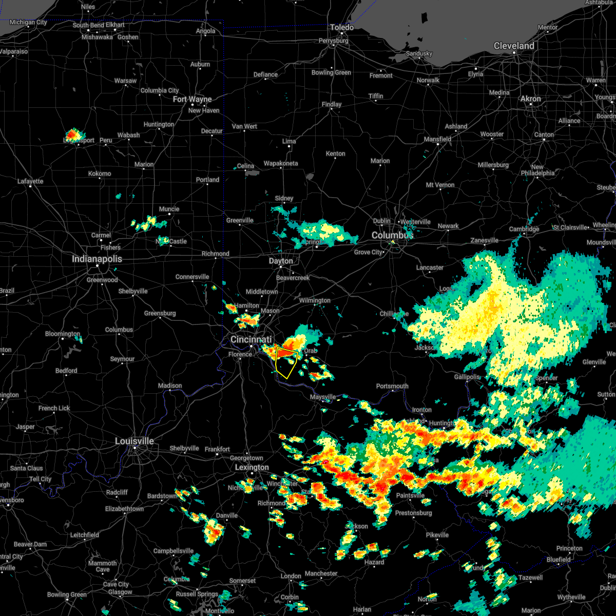 At 204 pm edt, a severe thunderstorm was located near amelia, moving southeast at 25 mph (radar indicated). Hazards include 60 mph wind gusts and quarter size hail. Minor hail damage to vehicles is possible. expect wind damage to trees and power lines. locations impacted include, amelia, bethel, williamsburg, batavia, clermont county airport, lindale, point isabel, saltair, east fork state park, bantam and nicholsville. hail threat, radar indicated max hail size, 1. 00 in wind threat, radar indicated max wind gust, 60 mph. At 204 pm edt, a severe thunderstorm was located near amelia, moving southeast at 25 mph (radar indicated). Hazards include 60 mph wind gusts and quarter size hail. Minor hail damage to vehicles is possible. expect wind damage to trees and power lines. locations impacted include, amelia, bethel, williamsburg, batavia, clermont county airport, lindale, point isabel, saltair, east fork state park, bantam and nicholsville. hail threat, radar indicated max hail size, 1. 00 in wind threat, radar indicated max wind gust, 60 mph.
|
| 7/5/2022 1:52 PM EDT |
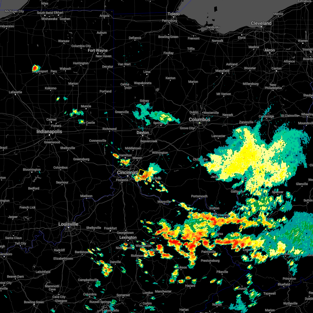 The severe thunderstorm warning for northwestern clermont county will expire at 200 pm edt, the storm which prompted the warning has moved out of the area. therefore, the warning will be allowed to expire. please report previous wind damage or hail to the national weather service by going to our website at weather.gov/iln and submitting your report via social media. remember, a severe thunderstorm warning still remains in effect for central and southern clermont county. The severe thunderstorm warning for northwestern clermont county will expire at 200 pm edt, the storm which prompted the warning has moved out of the area. therefore, the warning will be allowed to expire. please report previous wind damage or hail to the national weather service by going to our website at weather.gov/iln and submitting your report via social media. remember, a severe thunderstorm warning still remains in effect for central and southern clermont county.
|
| 7/5/2022 1:50 PM EDT |
 At 150 pm edt, a severe thunderstorm was located over withamsville, moving southeast at 25 mph (radar indicated). Hazards include 60 mph wind gusts and quarter size hail. Minor hail damage to vehicles is possible. Expect wind damage to trees and power lines. At 150 pm edt, a severe thunderstorm was located over withamsville, moving southeast at 25 mph (radar indicated). Hazards include 60 mph wind gusts and quarter size hail. Minor hail damage to vehicles is possible. Expect wind damage to trees and power lines.
|
| 7/5/2022 1:40 PM EDT |
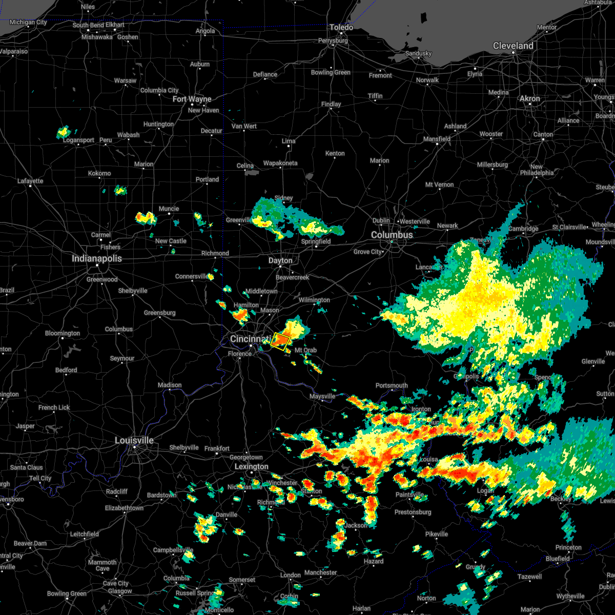 At 140 pm edt, a severe thunderstorm was located near withamsville, moving southeast at 25 mph (radar indicated). Hazards include 60 mph wind gusts and quarter size hail. Minor hail damage to vehicles is possible. expect wind damage to trees and power lines. locations impacted include, milford, batavia, owensville, mulberry, willowville, clermont county airport, summerside, perintown, mount repose and day heights. hail threat, radar indicated max hail size, 1. 00 in wind threat, radar indicated max wind gust, 60 mph. At 140 pm edt, a severe thunderstorm was located near withamsville, moving southeast at 25 mph (radar indicated). Hazards include 60 mph wind gusts and quarter size hail. Minor hail damage to vehicles is possible. expect wind damage to trees and power lines. locations impacted include, milford, batavia, owensville, mulberry, willowville, clermont county airport, summerside, perintown, mount repose and day heights. hail threat, radar indicated max hail size, 1. 00 in wind threat, radar indicated max wind gust, 60 mph.
|
| 7/5/2022 1:29 PM EDT |
 At 129 pm edt, a severe thunderstorm was located over milford, moving southeast at 15 mph (radar indicated). Hazards include 60 mph wind gusts and quarter size hail. Minor hail damage to vehicles is possible. expect wind damage to trees and power lines. locations impacted include, loveland, montgomery, milford, terrace park, batavia, camp dennison, remington, the village of indian hill, newtown, owensville, goshen, newtonsville, mulberry, clermont county airport, perintown, day heights, miamiville, willowville, summerside and mount repose. hail threat, radar indicated max hail size, 1. 00 in wind threat, radar indicated max wind gust, 60 mph. At 129 pm edt, a severe thunderstorm was located over milford, moving southeast at 15 mph (radar indicated). Hazards include 60 mph wind gusts and quarter size hail. Minor hail damage to vehicles is possible. expect wind damage to trees and power lines. locations impacted include, loveland, montgomery, milford, terrace park, batavia, camp dennison, remington, the village of indian hill, newtown, owensville, goshen, newtonsville, mulberry, clermont county airport, perintown, day heights, miamiville, willowville, summerside and mount repose. hail threat, radar indicated max hail size, 1. 00 in wind threat, radar indicated max wind gust, 60 mph.
|
| 7/5/2022 1:24 PM EDT |
 At 124 pm edt, a severe thunderstorm was located near camp dennison, moving southeast at 25 mph (radar indicated). Hazards include 60 mph wind gusts and quarter size hail. Minor hail damage to vehicles is possible. expect wind damage to trees and power lines. locations impacted include, cincinnati, loveland, montgomery, madeira, milford, mariemont, terrace park, batavia, camp dennison, remington, plainville, concorde hills, sixteen mile stand, the village of indian hill, newtown, fairfax, owensville, goshen, newtonsville and perintown. hail threat, radar indicated max hail size, 1. 00 in wind threat, radar indicated max wind gust, 60 mph. At 124 pm edt, a severe thunderstorm was located near camp dennison, moving southeast at 25 mph (radar indicated). Hazards include 60 mph wind gusts and quarter size hail. Minor hail damage to vehicles is possible. expect wind damage to trees and power lines. locations impacted include, cincinnati, loveland, montgomery, madeira, milford, mariemont, terrace park, batavia, camp dennison, remington, plainville, concorde hills, sixteen mile stand, the village of indian hill, newtown, fairfax, owensville, goshen, newtonsville and perintown. hail threat, radar indicated max hail size, 1. 00 in wind threat, radar indicated max wind gust, 60 mph.
|
| 7/5/2022 1:08 PM EDT |
 At 108 pm edt, a severe thunderstorm was located over loveland, moving southeast at 25 mph (radar indicated). Hazards include 60 mph wind gusts and quarter size hail. Minor hail damage to vehicles is possible. Expect wind damage to trees and power lines. At 108 pm edt, a severe thunderstorm was located over loveland, moving southeast at 25 mph (radar indicated). Hazards include 60 mph wind gusts and quarter size hail. Minor hail damage to vehicles is possible. Expect wind damage to trees and power lines.
|
| 6/13/2022 6:18 PM EDT |
 At 618 pm edt, a severe thunderstorm was located over batavia, moving southeast at 40 mph (radar indicated). Hazards include 60 mph wind gusts. Expect damage to trees and power lines. locations impacted include, cincinnati, covington, independence, norwood, erlanger, fort thomas, newport, blue ash, loveland, montgomery, madeira, edgewood, alexandria, elsmere, fort mitchell, villa hills, highland heights, milford, taylor mill and bellevue. this includes the following interstates, i-71 in ohio between mile markers 0 and 14. i-75 in kentucky between mile markers 184 and 191. i-75 in ohio between mile markers 0 and 2. hail threat, radar indicated max hail size, <. 75 in wind threat, radar indicated max wind gust, 60 mph. At 618 pm edt, a severe thunderstorm was located over batavia, moving southeast at 40 mph (radar indicated). Hazards include 60 mph wind gusts. Expect damage to trees and power lines. locations impacted include, cincinnati, covington, independence, norwood, erlanger, fort thomas, newport, blue ash, loveland, montgomery, madeira, edgewood, alexandria, elsmere, fort mitchell, villa hills, highland heights, milford, taylor mill and bellevue. this includes the following interstates, i-71 in ohio between mile markers 0 and 14. i-75 in kentucky between mile markers 184 and 191. i-75 in ohio between mile markers 0 and 2. hail threat, radar indicated max hail size, <. 75 in wind threat, radar indicated max wind gust, 60 mph.
|
| 6/13/2022 6:13 PM EDT |
 At 613 pm edt, a severe thunderstorm was located over alexandria, moving southeast at 35 mph (radar indicated). Hazards include 60 mph wind gusts. Expect damage to trees and power lines. locations impacted include, covington, florence, independence, erlanger, edgewood, alexandria, elsmere, fort mitchell, villa hills, taylor mill, fort wright, crescent springs, walton, crestview hills, lakeside park, oakbrook, claryville, union, amelia and wilder. this includes the following interstates, i-71 in kentucky between mile markers 74 and 77. i-75 in kentucky between mile markers 167 and 186. hail threat, radar indicated max hail size, <. 75 in wind threat, radar indicated max wind gust, 60 mph. At 613 pm edt, a severe thunderstorm was located over alexandria, moving southeast at 35 mph (radar indicated). Hazards include 60 mph wind gusts. Expect damage to trees and power lines. locations impacted include, covington, florence, independence, erlanger, edgewood, alexandria, elsmere, fort mitchell, villa hills, taylor mill, fort wright, crescent springs, walton, crestview hills, lakeside park, oakbrook, claryville, union, amelia and wilder. this includes the following interstates, i-71 in kentucky between mile markers 74 and 77. i-75 in kentucky between mile markers 167 and 186. hail threat, radar indicated max hail size, <. 75 in wind threat, radar indicated max wind gust, 60 mph.
|
| 6/13/2022 6:05 PM EDT |
 At 605 pm edt, a severe thunderstorm was located near forestville, moving southeast at 45 mph (radar indicated). Hazards include 60 mph wind gusts. Expect damage to trees and power lines. locations impacted include, cincinnati, covington, independence, norwood, forest park, erlanger, fort thomas, newport, sharonville, blue ash, loveland, springdale, reading, montgomery, north college hill, madeira, edgewood, alexandria, elsmere and wyoming. this includes the following interstates, i-71 in ohio between mile markers 0 and 19. i-74 in ohio between mile markers 14 and 19. i-75 in kentucky between mile markers 184 and 191. i-75 in ohio between mile markers 0 and 17. hail threat, radar indicated max hail size, <. 75 in wind threat, radar indicated max wind gust, 60 mph. At 605 pm edt, a severe thunderstorm was located near forestville, moving southeast at 45 mph (radar indicated). Hazards include 60 mph wind gusts. Expect damage to trees and power lines. locations impacted include, cincinnati, covington, independence, norwood, forest park, erlanger, fort thomas, newport, sharonville, blue ash, loveland, springdale, reading, montgomery, north college hill, madeira, edgewood, alexandria, elsmere and wyoming. this includes the following interstates, i-71 in ohio between mile markers 0 and 19. i-74 in ohio between mile markers 14 and 19. i-75 in kentucky between mile markers 184 and 191. i-75 in ohio between mile markers 0 and 17. hail threat, radar indicated max hail size, <. 75 in wind threat, radar indicated max wind gust, 60 mph.
|
| 6/13/2022 6:02 PM EDT |
 At 601 pm edt, a severe thunderstorm was located over park hills, moving southeast at 40 mph (radar indicated). Hazards include 60 mph wind gusts. Expect damage to trees and power lines. locations impacted include, covington, florence, independence, erlanger, edgewood, alexandria, elsmere, fort mitchell, villa hills, taylor mill, fort wright, crescent springs, walton, crestview hills, lakeside park, oakbrook, burlington, claryville, union and amelia. this includes the following interstates, i-71 in kentucky between mile markers 71 and 77. i-75 in kentucky between mile markers 162 and 186. hail threat, radar indicated max hail size, <. 75 in wind threat, radar indicated max wind gust, 60 mph. At 601 pm edt, a severe thunderstorm was located over park hills, moving southeast at 40 mph (radar indicated). Hazards include 60 mph wind gusts. Expect damage to trees and power lines. locations impacted include, covington, florence, independence, erlanger, edgewood, alexandria, elsmere, fort mitchell, villa hills, taylor mill, fort wright, crescent springs, walton, crestview hills, lakeside park, oakbrook, burlington, claryville, union and amelia. this includes the following interstates, i-71 in kentucky between mile markers 71 and 77. i-75 in kentucky between mile markers 162 and 186. hail threat, radar indicated max hail size, <. 75 in wind threat, radar indicated max wind gust, 60 mph.
|
| 6/13/2022 5:44 PM EDT |
 At 544 pm edt, a severe thunderstorm was located over monfort heights, moving southeast at 40 mph (radar indicated). Hazards include 70 mph wind gusts. Expect considerable tree damage. Damage is likely to mobile homes, roofs, and outbuildings. At 544 pm edt, a severe thunderstorm was located over monfort heights, moving southeast at 40 mph (radar indicated). Hazards include 70 mph wind gusts. Expect considerable tree damage. Damage is likely to mobile homes, roofs, and outbuildings.
|
| 6/13/2022 5:40 PM EDT |
 At 540 pm edt, a severe thunderstorm was located over forest park, moving southeast at 45 mph (radar indicated). Hazards include 70 mph wind gusts and penny size hail. Expect considerable tree damage. damage is likely to mobile homes, roofs, and outbuildings. locations impacted include, cincinnati, covington, independence, norwood, forest park, erlanger, fort thomas, newport, sharonville, blue ash, loveland, springdale, reading, montgomery, north college hill, madeira, edgewood, alexandria, elsmere and wyoming. this includes the following interstates, i-71 in ohio between mile markers 0 and 19. i-74 in ohio between mile markers 14 and 19. i-75 in kentucky between mile markers 184 and 191. i-75 in ohio between mile markers 0 and 17. thunderstorm damage threat, considerable hail threat, radar indicated max hail size, 0. 75 in wind threat, radar indicated max wind gust, 70 mph. At 540 pm edt, a severe thunderstorm was located over forest park, moving southeast at 45 mph (radar indicated). Hazards include 70 mph wind gusts and penny size hail. Expect considerable tree damage. damage is likely to mobile homes, roofs, and outbuildings. locations impacted include, cincinnati, covington, independence, norwood, forest park, erlanger, fort thomas, newport, sharonville, blue ash, loveland, springdale, reading, montgomery, north college hill, madeira, edgewood, alexandria, elsmere and wyoming. this includes the following interstates, i-71 in ohio between mile markers 0 and 19. i-74 in ohio between mile markers 14 and 19. i-75 in kentucky between mile markers 184 and 191. i-75 in ohio between mile markers 0 and 17. thunderstorm damage threat, considerable hail threat, radar indicated max hail size, 0. 75 in wind threat, radar indicated max wind gust, 70 mph.
|
| 6/13/2022 5:27 PM EDT |
 At 527 pm edt, a severe thunderstorm was located near harrison, moving southeast at 45 mph (radar indicated). Hazards include 70 mph wind gusts and penny size hail. Expect considerable tree damage. Damage is likely to mobile homes, roofs, and outbuildings. At 527 pm edt, a severe thunderstorm was located near harrison, moving southeast at 45 mph (radar indicated). Hazards include 70 mph wind gusts and penny size hail. Expect considerable tree damage. Damage is likely to mobile homes, roofs, and outbuildings.
|
| 6/8/2022 5:11 PM EDT |
 The severe thunderstorm warning for central campbell, southeastern hamilton and west central clermont counties will expire at 515 pm edt, the storm which prompted the warning has weakened below severe limits, and no longer poses an immediate threat to life or property. therefore, the warning will be allowed to expire. however small hail, gusty winds and heavy rain are still possible with this thunderstorm. a tornado watch remains in effect until 1000 pm edt for northern kentucky, and southwestern ohio. please report previous wind damage or hail to the national weather service by going to our website at weather.gov/iln and submitting your report via social media. The severe thunderstorm warning for central campbell, southeastern hamilton and west central clermont counties will expire at 515 pm edt, the storm which prompted the warning has weakened below severe limits, and no longer poses an immediate threat to life or property. therefore, the warning will be allowed to expire. however small hail, gusty winds and heavy rain are still possible with this thunderstorm. a tornado watch remains in effect until 1000 pm edt for northern kentucky, and southwestern ohio. please report previous wind damage or hail to the national weather service by going to our website at weather.gov/iln and submitting your report via social media.
|
| 6/8/2022 5:03 PM EDT |
 At 502 pm edt, a severe thunderstorm was located over melbourne, moving east at 30 mph (radar indicated). Hazards include 60 mph wind gusts and penny size hail. Expect damage to trees and power lines. Locations impacted include, cincinnati, fort thomas, alexandria, highland heights, southgate, forestville, amelia, wilder, new richmond, batavia, silver grove, melbourne, salem heights, riverbend and coney island, withamsville, coldstream, cold spring, ryland heights, sherwood and crestview. At 502 pm edt, a severe thunderstorm was located over melbourne, moving east at 30 mph (radar indicated). Hazards include 60 mph wind gusts and penny size hail. Expect damage to trees and power lines. Locations impacted include, cincinnati, fort thomas, alexandria, highland heights, southgate, forestville, amelia, wilder, new richmond, batavia, silver grove, melbourne, salem heights, riverbend and coney island, withamsville, coldstream, cold spring, ryland heights, sherwood and crestview.
|
| 6/8/2022 4:42 PM EDT |
 At 442 pm edt, a severe thunderstorm was located over taylor mill, moving east at 35 mph (radar indicated). Hazards include 60 mph wind gusts and quarter size hail. Minor hail damage to vehicles is possible. expect wind damage to trees and power lines. locations impacted include, cincinnati, covington, independence, erlanger, fort thomas, newport, edgewood, alexandria, elsmere, fort mitchell, highland heights, milford, taylor mill, fort wright, southgate, crescent springs, crestview hills, park hills, lakeside park and claryville. This includes i-75 in kentucky between mile markers 184 and 190. At 442 pm edt, a severe thunderstorm was located over taylor mill, moving east at 35 mph (radar indicated). Hazards include 60 mph wind gusts and quarter size hail. Minor hail damage to vehicles is possible. expect wind damage to trees and power lines. locations impacted include, cincinnati, covington, independence, erlanger, fort thomas, newport, edgewood, alexandria, elsmere, fort mitchell, highland heights, milford, taylor mill, fort wright, southgate, crescent springs, crestview hills, park hills, lakeside park and claryville. This includes i-75 in kentucky between mile markers 184 and 190.
|
| 6/8/2022 4:31 PM EDT |
 At 431 pm edt, a severe thunderstorm was located over elsmere, moving east at 35 mph (radar indicated). Hazards include 60 mph wind gusts and quarter size hail. Minor hail damage to vehicles is possible. Expect wind damage to trees and power lines. At 431 pm edt, a severe thunderstorm was located over elsmere, moving east at 35 mph (radar indicated). Hazards include 60 mph wind gusts and quarter size hail. Minor hail damage to vehicles is possible. Expect wind damage to trees and power lines.
|
| 6/6/2022 4:12 PM EDT |
 The severe thunderstorm warning for northeastern dearborn, northern kenton, northern campbell, northern boone, hamilton, southwestern butler and northwestern clermont counties will expire at 415 pm edt, the storm which prompted the warning has moved out of the area. therefore, the warning will be allowed to expire. however gusty winds and heavy rain are still possible with this thunderstorm. please report previous wind damage or hail to the national weather service by going to our website at weather.gov/iln and submitting your report via social media. The severe thunderstorm warning for northeastern dearborn, northern kenton, northern campbell, northern boone, hamilton, southwestern butler and northwestern clermont counties will expire at 415 pm edt, the storm which prompted the warning has moved out of the area. therefore, the warning will be allowed to expire. however gusty winds and heavy rain are still possible with this thunderstorm. please report previous wind damage or hail to the national weather service by going to our website at weather.gov/iln and submitting your report via social media.
|
| 6/6/2022 4:02 PM EDT |
 At 401 pm edt, a severe thunderstorm was located over wyoming, moving northeast at 50 mph (radar indicated). Hazards include 60 mph wind gusts. Expect damage to trees and power lines. locations impacted include, cincinnati, hamilton, fairfield, covington, florence, independence, norwood, forest park, erlanger, fort thomas, newport, sharonville, blue ash, springdale, reading, montgomery, harrison, north college hill, madeira and edgewood. this includes the following interstates, i-71 in ohio between mile markers 0 and 18. i-74 in indiana between mile markers 165 and 171. i-74 in ohio between mile markers 0 and 19. i-75 in kentucky between mile markers 179 and 191. i-75 in ohio between mile markers 0 and 20. hail threat, radar indicated max hail size, <. 75 in wind threat, radar indicated max wind gust, 60 mph. At 401 pm edt, a severe thunderstorm was located over wyoming, moving northeast at 50 mph (radar indicated). Hazards include 60 mph wind gusts. Expect damage to trees and power lines. locations impacted include, cincinnati, hamilton, fairfield, covington, florence, independence, norwood, forest park, erlanger, fort thomas, newport, sharonville, blue ash, springdale, reading, montgomery, harrison, north college hill, madeira and edgewood. this includes the following interstates, i-71 in ohio between mile markers 0 and 18. i-74 in indiana between mile markers 165 and 171. i-74 in ohio between mile markers 0 and 19. i-75 in kentucky between mile markers 179 and 191. i-75 in ohio between mile markers 0 and 20. hail threat, radar indicated max hail size, <. 75 in wind threat, radar indicated max wind gust, 60 mph.
|
| 6/6/2022 3:52 PM EDT |
 At 351 pm edt, a severe thunderstorm was located over monfort heights, moving northeast at 50 mph (radar indicated). Hazards include 60 mph wind gusts. Expect damage to trees and power lines. locations impacted include, cincinnati, hamilton, fairfield, covington, florence, independence, norwood, forest park, erlanger, fort thomas, newport, sharonville, blue ash, springdale, reading, montgomery, harrison, north college hill, madeira and edgewood. this includes the following interstates, i-71 in ohio between mile markers 0 and 18. i-74 in indiana between mile markers 165 and 171. i-74 in ohio between mile markers 0 and 19. i-75 in kentucky between mile markers 174 and 191. i-75 in ohio between mile markers 0 and 20. hail threat, radar indicated max hail size, <. 75 in wind threat, radar indicated max wind gust, 60 mph. At 351 pm edt, a severe thunderstorm was located over monfort heights, moving northeast at 50 mph (radar indicated). Hazards include 60 mph wind gusts. Expect damage to trees and power lines. locations impacted include, cincinnati, hamilton, fairfield, covington, florence, independence, norwood, forest park, erlanger, fort thomas, newport, sharonville, blue ash, springdale, reading, montgomery, harrison, north college hill, madeira and edgewood. this includes the following interstates, i-71 in ohio between mile markers 0 and 18. i-74 in indiana between mile markers 165 and 171. i-74 in ohio between mile markers 0 and 19. i-75 in kentucky between mile markers 174 and 191. i-75 in ohio between mile markers 0 and 20. hail threat, radar indicated max hail size, <. 75 in wind threat, radar indicated max wind gust, 60 mph.
|
| 6/6/2022 3:40 PM EDT |
 At 339 pm edt, a severe thunderstorm was located near shawnee, moving northeast at 50 mph (radar indicated). Hazards include 60 mph wind gusts. Expect damage to trees and power lines. locations impacted include, cincinnati, hamilton, fairfield, covington, florence, independence, norwood, forest park, erlanger, fort thomas, newport, sharonville, blue ash, springdale, reading, montgomery, harrison, north college hill, madeira and edgewood. this includes the following interstates, i-71 in ohio between mile markers 0 and 18. i-74 in indiana between mile markers 165 and 171. i-74 in ohio between mile markers 0 and 19. i-75 in kentucky between mile markers 174 and 191. i-75 in ohio between mile markers 0 and 20. hail threat, radar indicated max hail size, <. 75 in wind threat, radar indicated max wind gust, 60 mph. At 339 pm edt, a severe thunderstorm was located near shawnee, moving northeast at 50 mph (radar indicated). Hazards include 60 mph wind gusts. Expect damage to trees and power lines. locations impacted include, cincinnati, hamilton, fairfield, covington, florence, independence, norwood, forest park, erlanger, fort thomas, newport, sharonville, blue ash, springdale, reading, montgomery, harrison, north college hill, madeira and edgewood. this includes the following interstates, i-71 in ohio between mile markers 0 and 18. i-74 in indiana between mile markers 165 and 171. i-74 in ohio between mile markers 0 and 19. i-75 in kentucky between mile markers 174 and 191. i-75 in ohio between mile markers 0 and 20. hail threat, radar indicated max hail size, <. 75 in wind threat, radar indicated max wind gust, 60 mph.
|
| 6/6/2022 3:22 PM EDT |
 At 322 pm edt, a severe thunderstorm was located near rising sun, moving northeast at 50 mph (radar indicated). Hazards include 60 mph wind gusts. expect damage to trees and power lines At 322 pm edt, a severe thunderstorm was located near rising sun, moving northeast at 50 mph (radar indicated). Hazards include 60 mph wind gusts. expect damage to trees and power lines
|
| 5/21/2022 3:28 PM EDT |
 At 328 pm edt, a severe thunderstorm was located over amelia, moving northeast at 25 mph (radar indicated). Hazards include 60 mph wind gusts and quarter size hail. Minor hail damage to vehicles is possible. Expect wind damage to trees and power lines. At 328 pm edt, a severe thunderstorm was located over amelia, moving northeast at 25 mph (radar indicated). Hazards include 60 mph wind gusts and quarter size hail. Minor hail damage to vehicles is possible. Expect wind damage to trees and power lines.
|
| 5/20/2022 4:47 AM EDT |
 At 447 am edt, a severe thunderstorm was located over bethel, moving east at 45 mph (radar indicated). Hazards include 60 mph wind gusts. Expect damage to trees and power lines. locations impacted include, georgetown, amelia, mount orab, bethel, williamsburg, batavia, felicity, owensville, hamersville, fayetteville, higginsport, st. martin, neville, chilo, chasetown, willow grove, bradford, saltair, nicholsville and state route 32 at us route 68. hail threat, radar indicated max hail size, <. 75 in wind threat, radar indicated max wind gust, 60 mph. At 447 am edt, a severe thunderstorm was located over bethel, moving east at 45 mph (radar indicated). Hazards include 60 mph wind gusts. Expect damage to trees and power lines. locations impacted include, georgetown, amelia, mount orab, bethel, williamsburg, batavia, felicity, owensville, hamersville, fayetteville, higginsport, st. martin, neville, chilo, chasetown, willow grove, bradford, saltair, nicholsville and state route 32 at us route 68. hail threat, radar indicated max hail size, <. 75 in wind threat, radar indicated max wind gust, 60 mph.
|
| 5/20/2022 4:40 AM EDT |
 At 440 am edt, a severe thunderstorm was located over amelia, moving east at 40 mph (radar indicated). Hazards include 60 mph wind gusts. Expect damage to trees and power lines. locations impacted include, georgetown, amelia, mount orab, bethel, new richmond, williamsburg, batavia, felicity, withamsville, owensville, hamersville, fayetteville, higginsport, mentor, moscow, st. martin, neville, california, chilo and mount auburn. hail threat, radar indicated max hail size, <. 75 in wind threat, radar indicated max wind gust, 60 mph. At 440 am edt, a severe thunderstorm was located over amelia, moving east at 40 mph (radar indicated). Hazards include 60 mph wind gusts. Expect damage to trees and power lines. locations impacted include, georgetown, amelia, mount orab, bethel, new richmond, williamsburg, batavia, felicity, withamsville, owensville, hamersville, fayetteville, higginsport, mentor, moscow, st. martin, neville, california, chilo and mount auburn. hail threat, radar indicated max hail size, <. 75 in wind threat, radar indicated max wind gust, 60 mph.
|
| 5/20/2022 4:28 AM EDT |
 At 428 am edt, a severe thunderstorm was located over alexandria, moving east at 45 mph (radar indicated). Hazards include 60 mph wind gusts. expect damage to trees and power lines At 428 am edt, a severe thunderstorm was located over alexandria, moving east at 45 mph (radar indicated). Hazards include 60 mph wind gusts. expect damage to trees and power lines
|
| 5/19/2022 9:32 PM EDT |
 The severe thunderstorm warning for southern campbell, north central pendleton, southeastern hamilton and western clermont counties has expired, the storms which prompted the warning have moved out of the area. therefore, the warning has been allowed to expire. a severe thunderstorm watch remains in effect until 200 am edt for northern kentucky, and southwestern ohio. please report previous wind damage or hail to the national weather service by going to our website at weather.gov/iln and submitting your report via social media. The severe thunderstorm warning for southern campbell, north central pendleton, southeastern hamilton and western clermont counties has expired, the storms which prompted the warning have moved out of the area. therefore, the warning has been allowed to expire. a severe thunderstorm watch remains in effect until 200 am edt for northern kentucky, and southwestern ohio. please report previous wind damage or hail to the national weather service by going to our website at weather.gov/iln and submitting your report via social media.
|
| 5/19/2022 9:24 PM EDT |
 At 924 pm edt, severe thunderstorms were located from near milford to near amelia to near neville, moving east at 50 mph (radar indicated). Hazards include 60 mph wind gusts. expect damage to trees and power lines At 924 pm edt, severe thunderstorms were located from near milford to near amelia to near neville, moving east at 50 mph (radar indicated). Hazards include 60 mph wind gusts. expect damage to trees and power lines
|
| 5/19/2022 9:20 PM EDT |
 At 919 pm edt, severe thunderstorms were located from milford to near amelia to near butler, moving east at 50 mph (radar indicated). Hazards include 60 mph wind gusts. Expect damage to trees and power lines. locations impacted include, alexandria, forestville, amelia, mariemont, new richmond, terrace park, batavia, withamsville, plainville, coldstream, the village of indian hill, newtown, sherwood, owensville, mentor, moscow, california, perintown, new palestine and gubser mill. hail threat, radar indicated max hail size, <. 75 in wind threat, radar indicated max wind gust, 60 mph. At 919 pm edt, severe thunderstorms were located from milford to near amelia to near butler, moving east at 50 mph (radar indicated). Hazards include 60 mph wind gusts. Expect damage to trees and power lines. locations impacted include, alexandria, forestville, amelia, mariemont, new richmond, terrace park, batavia, withamsville, plainville, coldstream, the village of indian hill, newtown, sherwood, owensville, mentor, moscow, california, perintown, new palestine and gubser mill. hail threat, radar indicated max hail size, <. 75 in wind threat, radar indicated max wind gust, 60 mph.
|
| 5/19/2022 9:10 PM EDT |
 At 909 pm edt, severe thunderstorms were located from mariemont to claryville to near crittenden, moving east at 65 mph (radar indicated). Hazards include 60 mph wind gusts. Expect damage to trees and power lines. locations impacted include, cincinnati, covington, independence, norwood, fort thomas, newport, alexandria, highland heights, milford, taylor mill, bellevue, fort wright, dayton, southgate, park hills, claryville, forestville, amelia, mariemont and wilder. this includes the following interstates, i-71 in ohio between mile markers 0 and 6. i-75 in kentucky near mile marker 167, and between mile markers 189 and 191. i-75 in ohio between mile markers 0 and 4. hail threat, radar indicated max hail size, <. 75 in wind threat, radar indicated max wind gust, 60 mph. At 909 pm edt, severe thunderstorms were located from mariemont to claryville to near crittenden, moving east at 65 mph (radar indicated). Hazards include 60 mph wind gusts. Expect damage to trees and power lines. locations impacted include, cincinnati, covington, independence, norwood, fort thomas, newport, alexandria, highland heights, milford, taylor mill, bellevue, fort wright, dayton, southgate, park hills, claryville, forestville, amelia, mariemont and wilder. this includes the following interstates, i-71 in ohio between mile markers 0 and 6. i-75 in kentucky near mile marker 167, and between mile markers 189 and 191. i-75 in ohio between mile markers 0 and 4. hail threat, radar indicated max hail size, <. 75 in wind threat, radar indicated max wind gust, 60 mph.
|
| 5/19/2022 8:56 PM EDT |
 At 855 pm edt, severe thunderstorms were located from delhi hills to near union to near patriot, moving east at 45 mph (radar indicated). Hazards include 60 mph wind gusts. Expect damage to trees and power lines. locations impacted include, cincinnati, covington, florence, independence, norwood, erlanger, fort thomas, newport, edgewood, alexandria, elsmere, cheviot, fort mitchell, villa hills, highland heights, milford, taylor mill, bellevue, fort wright and dayton. this includes the following interstates, i-71 in kentucky between mile markers 68 and 77. i-71 in ohio between mile markers 0 and 7. i-75 in kentucky between mile markers 165 and 191. i-75 in ohio between mile markers 0 and 4. hail threat, radar indicated max hail size, <. 75 in wind threat, radar indicated max wind gust, 60 mph. At 855 pm edt, severe thunderstorms were located from delhi hills to near union to near patriot, moving east at 45 mph (radar indicated). Hazards include 60 mph wind gusts. Expect damage to trees and power lines. locations impacted include, cincinnati, covington, florence, independence, norwood, erlanger, fort thomas, newport, edgewood, alexandria, elsmere, cheviot, fort mitchell, villa hills, highland heights, milford, taylor mill, bellevue, fort wright and dayton. this includes the following interstates, i-71 in kentucky between mile markers 68 and 77. i-71 in ohio between mile markers 0 and 7. i-75 in kentucky between mile markers 165 and 191. i-75 in ohio between mile markers 0 and 4. hail threat, radar indicated max hail size, <. 75 in wind threat, radar indicated max wind gust, 60 mph.
|
| 5/19/2022 8:49 PM EDT |
 At 848 pm edt, severe thunderstorms were located from near mack to near rising sun to patriot, moving east at 45 mph (radar indicated). Hazards include 60 mph wind gusts. expect damage to trees and power lines At 848 pm edt, severe thunderstorms were located from near mack to near rising sun to patriot, moving east at 45 mph (radar indicated). Hazards include 60 mph wind gusts. expect damage to trees and power lines
|
| 8/27/2021 6:52 PM EDT |
 The severe thunderstorm warning for northeastern hamilton, southeastern butler, northern clermont, northwestern brown, warren and southwestern clinton counties will expire at 700 pm edt, the storm which prompted the warning has weakened below severe limits, and no longer poses an immediate threat to life or property. therefore, the warning will be allowed to expire. however gusty winds and heavy rain are still possible with this thunderstorm. please report previous wind damage or hail to the national weather service by going to our website at weather.gov/iln and submitting your report via social media. The severe thunderstorm warning for northeastern hamilton, southeastern butler, northern clermont, northwestern brown, warren and southwestern clinton counties will expire at 700 pm edt, the storm which prompted the warning has weakened below severe limits, and no longer poses an immediate threat to life or property. therefore, the warning will be allowed to expire. however gusty winds and heavy rain are still possible with this thunderstorm. please report previous wind damage or hail to the national weather service by going to our website at weather.gov/iln and submitting your report via social media.
|
| 8/27/2021 6:39 PM EDT |
 At 638 pm edt, a severe thunderstorm was located near morrow, moving east at 15 mph (radar indicated). Hazards include 60 mph wind gusts. Expect damage to trees and power lines. locations impacted include, mason, lebanon, sharonville, monroe, blue ash, loveland, reading, montgomery, madeira, milford, deer park, blanchester, west chester, terrace park, batavia, morrow, camp dennison, highpoint, remington and concorde hills. this includes the following interstates, i-71 in ohio between mile markers 12 and 41. i-75 in ohio between mile markers 21 and 29. hail threat, radar indicated max hail size, <. 75 in wind threat, radar indicated max wind gust, 60 mph. At 638 pm edt, a severe thunderstorm was located near morrow, moving east at 15 mph (radar indicated). Hazards include 60 mph wind gusts. Expect damage to trees and power lines. locations impacted include, mason, lebanon, sharonville, monroe, blue ash, loveland, reading, montgomery, madeira, milford, deer park, blanchester, west chester, terrace park, batavia, morrow, camp dennison, highpoint, remington and concorde hills. this includes the following interstates, i-71 in ohio between mile markers 12 and 41. i-75 in ohio between mile markers 21 and 29. hail threat, radar indicated max hail size, <. 75 in wind threat, radar indicated max wind gust, 60 mph.
|
| 8/27/2021 6:26 PM EDT |
 At 626 pm edt, a severe thunderstorm was located near morrow, moving east at 25 mph (radar indicated). Hazards include 60 mph wind gusts. expect damage to trees and power lines At 626 pm edt, a severe thunderstorm was located near morrow, moving east at 25 mph (radar indicated). Hazards include 60 mph wind gusts. expect damage to trees and power lines
|
| 8/27/2021 6:00 PM EDT | Power poles down. time estimated by radar along outflow boundar in clermont county OH, 0.1 miles NNW of Batavia, OH |
| 8/13/2021 3:31 PM EDT | Large tree down and multiple large limbs down from nearby tree. time estimated from rada in clermont county OH, 2.8 miles WNW of Batavia, OH |
| 7/16/2021 3:18 PM EDT |
 At 318 pm edt, a severe thunderstorm was located 7 miles northeast of batavia, moving northeast at 55 mph (radar indicated). Hazards include 60 mph wind gusts. Expect damage to trees and power lines. locations impacted include, loveland, milford, amelia, mount orab, new richmond, williamsburg, batavia, withamsville, woodville, owensville, goshen, newtonsville, fayetteville, st. Martin, chasetown, perintown, day heights, springvale, edenton and mulberry. At 318 pm edt, a severe thunderstorm was located 7 miles northeast of batavia, moving northeast at 55 mph (radar indicated). Hazards include 60 mph wind gusts. Expect damage to trees and power lines. locations impacted include, loveland, milford, amelia, mount orab, new richmond, williamsburg, batavia, withamsville, woodville, owensville, goshen, newtonsville, fayetteville, st. Martin, chasetown, perintown, day heights, springvale, edenton and mulberry.
|
| 7/16/2021 3:11 PM EDT |
 The severe thunderstorm warning for northern kenton, northern campbell, southeastern hamilton and northwestern clermont counties will expire at 315 pm edt, the storm which prompted the warning has moved out of the area. therefore, the warning will be allowed to expire. please report previous wind damage or hail to the national weather service by going to our website at weather.gov/iln and submitting your report via social media. remember, a severe thunderstorm warning still remains in effect for far eastern campbell and southeast hamilton counties, as well as northern clermont until 345 pm. The severe thunderstorm warning for northern kenton, northern campbell, southeastern hamilton and northwestern clermont counties will expire at 315 pm edt, the storm which prompted the warning has moved out of the area. therefore, the warning will be allowed to expire. please report previous wind damage or hail to the national weather service by going to our website at weather.gov/iln and submitting your report via social media. remember, a severe thunderstorm warning still remains in effect for far eastern campbell and southeast hamilton counties, as well as northern clermont until 345 pm.
|
| 7/16/2021 3:08 PM EDT |
 At 308 pm edt, a severe thunderstorm was located over withamsville, moving northeast at 55 mph (radar indicated). Hazards include 70 mph wind gusts. Expect considerable tree damage. Damage is likely to mobile homes, roofs, and outbuildings. At 308 pm edt, a severe thunderstorm was located over withamsville, moving northeast at 55 mph (radar indicated). Hazards include 70 mph wind gusts. Expect considerable tree damage. Damage is likely to mobile homes, roofs, and outbuildings.
|
| 7/16/2021 3:02 PM EDT |
 At 301 pm edt, a severe thunderstorm was located over coldstream, moving northeast at 45 mph (radar indicated). Hazards include 70 mph wind gusts. Expect considerable tree damage. damage is likely to mobile homes, roofs, and outbuildings. locations impacted include, cincinnati, covington, norwood, fort thomas, newport, blue ash, loveland, montgomery, madeira, alexandria, highland heights, milford, taylor mill, bellevue, deer park, fort wright, dayton, ludlow, southgate and park hills. this includes the following interstates, i-71 in ohio between mile markers 0 and 14. i-75 in kentucky between mile markers 189 and 191. I-75 in ohio between mile markers 0 and 1. At 301 pm edt, a severe thunderstorm was located over coldstream, moving northeast at 45 mph (radar indicated). Hazards include 70 mph wind gusts. Expect considerable tree damage. damage is likely to mobile homes, roofs, and outbuildings. locations impacted include, cincinnati, covington, norwood, fort thomas, newport, blue ash, loveland, montgomery, madeira, alexandria, highland heights, milford, taylor mill, bellevue, deer park, fort wright, dayton, ludlow, southgate and park hills. this includes the following interstates, i-71 in ohio between mile markers 0 and 14. i-75 in kentucky between mile markers 189 and 191. I-75 in ohio between mile markers 0 and 1.
|
| 7/16/2021 2:55 PM EDT |
 A severe thunderstorm warning remains in effect until 315 pm edt for northern kenton. northern campbell. southeastern hamilton and northwestern clermont counties. at 255 pm edt, a severe thunderstorm was located over dayton, moving northeast at 45 mph. hazard. 60 mph wind gusts. A severe thunderstorm warning remains in effect until 315 pm edt for northern kenton. northern campbell. southeastern hamilton and northwestern clermont counties. at 255 pm edt, a severe thunderstorm was located over dayton, moving northeast at 45 mph. hazard. 60 mph wind gusts.
|
| 7/16/2021 2:55 PM EDT |
 At 255 pm edt, a severe thunderstorm was located over dayton, moving northeast at 45 mph (radar indicated). Hazards include 60 mph wind gusts. Expect damage to trees and power lines. locations impacted include, cincinnati, covington, florence, independence, norwood, erlanger, fort thomas, newport, sharonville, blue ash, loveland, reading, montgomery, madeira, edgewood, alexandria, elsmere, wyoming, cheviot and fort mitchell. this includes the following interstates, i-71 in ohio between mile markers 0 and 19. i-74 in ohio between mile markers 16 and 19. i-75 in kentucky between mile markers 184 and 191. I-75 in ohio between mile markers 0 and 13. At 255 pm edt, a severe thunderstorm was located over dayton, moving northeast at 45 mph (radar indicated). Hazards include 60 mph wind gusts. Expect damage to trees and power lines. locations impacted include, cincinnati, covington, florence, independence, norwood, erlanger, fort thomas, newport, sharonville, blue ash, loveland, reading, montgomery, madeira, edgewood, alexandria, elsmere, wyoming, cheviot and fort mitchell. this includes the following interstates, i-71 in ohio between mile markers 0 and 19. i-74 in ohio between mile markers 16 and 19. i-75 in kentucky between mile markers 184 and 191. I-75 in ohio between mile markers 0 and 13.
|
| 7/16/2021 2:36 PM EDT |
 At 235 pm edt, a severe thunderstorm was located over oakbrook, moving northeast at 45 mph (radar indicated). Hazards include 60 mph wind gusts. expect damage to trees and power lines At 235 pm edt, a severe thunderstorm was located over oakbrook, moving northeast at 45 mph (radar indicated). Hazards include 60 mph wind gusts. expect damage to trees and power lines
|
| 6/18/2021 9:53 PM EDT |
 The severe thunderstorm warning for southern campbell, eastern hamilton, clermont and northwestern brown counties will expire at 1000 pm edt, the storm which prompted the warning has weakened below severe limits, and has exited the warned area. therefore, the warning will be allowed to expire. however small hail and gusty winds are still possible with this thunderstorm. a tornado watch remains in effect until 1100 pm edt for southwestern ohio. a severe thunderstorm watch remains in effect until 300 am edt for northern kentucky. please report previous wind damage or hail to the national weather service by going to our website at weather.gov/iln and submitting your report via social media. The severe thunderstorm warning for southern campbell, eastern hamilton, clermont and northwestern brown counties will expire at 1000 pm edt, the storm which prompted the warning has weakened below severe limits, and has exited the warned area. therefore, the warning will be allowed to expire. however small hail and gusty winds are still possible with this thunderstorm. a tornado watch remains in effect until 1100 pm edt for southwestern ohio. a severe thunderstorm watch remains in effect until 300 am edt for northern kentucky. please report previous wind damage or hail to the national weather service by going to our website at weather.gov/iln and submitting your report via social media.
|
| 6/18/2021 9:37 PM EDT |
 At 936 pm edt, a severe thunderstorm was located near williamsburg, moving southeast at 45 mph (radar indicated). Hazards include 70 mph wind gusts and quarter size hail. Minor hail damage to vehicles is possible. expect considerable tree damage. wind damage is also likely to mobile homes, roofs, and outbuildings. locations impacted include, loveland, montgomery, alexandria, milford, georgetown, forestville, claryville, amelia, mount orab, bethel, new richmond, williamsburg, terrace park, batavia, felicity, melbourne, camp dennison, remington, coldstream and sixteen mile stand. A tornado watch remains in effect until 1100 pm edt for southwestern ohio. At 936 pm edt, a severe thunderstorm was located near williamsburg, moving southeast at 45 mph (radar indicated). Hazards include 70 mph wind gusts and quarter size hail. Minor hail damage to vehicles is possible. expect considerable tree damage. wind damage is also likely to mobile homes, roofs, and outbuildings. locations impacted include, loveland, montgomery, alexandria, milford, georgetown, forestville, claryville, amelia, mount orab, bethel, new richmond, williamsburg, terrace park, batavia, felicity, melbourne, camp dennison, remington, coldstream and sixteen mile stand. A tornado watch remains in effect until 1100 pm edt for southwestern ohio.
|
| 6/18/2021 9:30 PM EDT | Trees and power lines reported down in batavia. this was representative across the county. time estimated from rada in clermont county OH, 0.1 miles NNW of Batavia, OH |
| 6/18/2021 9:15 PM EDT |
 At 915 pm edt, a severe thunderstorm was located near blanchester, moving southeast at 50 mph (radar indicated). Hazards include 60 mph wind gusts and quarter size hail. Minor hail damage to vehicles is possible. Expect wind damage to trees and power lines. At 915 pm edt, a severe thunderstorm was located near blanchester, moving southeast at 50 mph (radar indicated). Hazards include 60 mph wind gusts and quarter size hail. Minor hail damage to vehicles is possible. Expect wind damage to trees and power lines.
|
| 6/18/2021 9:30 AM EDT | Trees and power lines reported down in batavia. this was representative across the county. time estimated from rada in clermont county OH, 0.1 miles NNW of Batavia, OH |
| 8/10/2020 11:03 PM EDT |
 At 1102 pm edt, a severe thunderstorm was located over williamsburg, moving southeast at 30 mph (radar indicated). Hazards include 60 mph wind gusts. Expect damage to trees and power lines. locations impacted include, georgetown, amelia, mount orab, bethel, williamsburg, batavia, lynchburg, winchester, sardinia, belfast, new market, owensville, emerald, russellville, hamersville, mowrystown, fayetteville, higginsport, st. Martin and chasetown. At 1102 pm edt, a severe thunderstorm was located over williamsburg, moving southeast at 30 mph (radar indicated). Hazards include 60 mph wind gusts. Expect damage to trees and power lines. locations impacted include, georgetown, amelia, mount orab, bethel, williamsburg, batavia, lynchburg, winchester, sardinia, belfast, new market, owensville, emerald, russellville, hamersville, mowrystown, fayetteville, higginsport, st. Martin and chasetown.
|
| 8/10/2020 11:03 PM EDT |
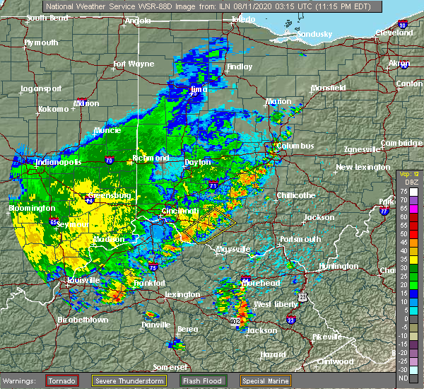 At 1102 pm edt, a severe thunderstorm was located over williamsburg, moving southeast at 30 mph (radar indicated). Hazards include 60 mph wind gusts. Expect damage to trees and power lines. locations impacted include, georgetown, amelia, mount orab, bethel, williamsburg, batavia, lynchburg, winchester, sardinia, belfast, new market, owensville, emerald, russellville, hamersville, mowrystown, fayetteville, higginsport, st. Martin and chasetown. At 1102 pm edt, a severe thunderstorm was located over williamsburg, moving southeast at 30 mph (radar indicated). Hazards include 60 mph wind gusts. Expect damage to trees and power lines. locations impacted include, georgetown, amelia, mount orab, bethel, williamsburg, batavia, lynchburg, winchester, sardinia, belfast, new market, owensville, emerald, russellville, hamersville, mowrystown, fayetteville, higginsport, st. Martin and chasetown.
|
| 8/10/2020 10:53 PM EDT |
 At 1052 pm edt, a severe thunderstorm was located near williamsburg, moving southeast at 30 mph (radar indicated). Hazards include 60 mph wind gusts. expect damage to trees and power lines At 1052 pm edt, a severe thunderstorm was located near williamsburg, moving southeast at 30 mph (radar indicated). Hazards include 60 mph wind gusts. expect damage to trees and power lines
|
| 8/10/2020 10:44 PM EDT | Trees down in clermont county OH, 2.7 miles SSW of Batavia, OH |
| 7/6/2020 6:38 PM EDT |
 The severe thunderstorm warning for southeastern hamilton and northwestern clermont counties will expire at 645 pm edt, the storm which prompted the warning has weakened below severe limits. therefore, the warning will be allowed to expire. flash flood warnings remain in effect for portions of hamilton and clermont counties. please report previous wind damage or hail to the national weather service by going to our website at weather.gov/iln and submitting your report via social media. The severe thunderstorm warning for southeastern hamilton and northwestern clermont counties will expire at 645 pm edt, the storm which prompted the warning has weakened below severe limits. therefore, the warning will be allowed to expire. flash flood warnings remain in effect for portions of hamilton and clermont counties. please report previous wind damage or hail to the national weather service by going to our website at weather.gov/iln and submitting your report via social media.
|
| 7/6/2020 6:22 PM EDT |
 At 621 pm edt, a severe thunderstorm was located near milford, moving northeast at 10 mph (radar indicated). Hazards include 60 mph wind gusts. Expect damage to trees and power lines. Locations impacted include, cincinnati, madeira, milford, forestville, amelia, mariemont, terrace park, batavia, silver grove, salem heights, camp dennison, riverbend and coney island, withamsville, plainville, coldstream, the village of indian hill, newtown, fairfax, sherwood and owensville. At 621 pm edt, a severe thunderstorm was located near milford, moving northeast at 10 mph (radar indicated). Hazards include 60 mph wind gusts. Expect damage to trees and power lines. Locations impacted include, cincinnati, madeira, milford, forestville, amelia, mariemont, terrace park, batavia, silver grove, salem heights, camp dennison, riverbend and coney island, withamsville, plainville, coldstream, the village of indian hill, newtown, fairfax, sherwood and owensville.
|
| 7/6/2020 6:09 PM EDT |
 At 608 pm edt, a severe thunderstorm was located over milford, moving east at 10 mph (radar indicated). Hazards include 60 mph wind gusts. expect damage to trees and power lines At 608 pm edt, a severe thunderstorm was located over milford, moving east at 10 mph (radar indicated). Hazards include 60 mph wind gusts. expect damage to trees and power lines
|
| 6/21/2020 3:51 PM EDT |
 The severe thunderstorm warning for northern clermont and southern warren counties will expire at 400 pm edt, the storm which prompted the warning has weakened below severe limits, and no longer poses an immediate threat to life or property. therefore, the warning will be allowed to expire. please report previous wind damage or hail to the national weather service by going to our website at weather.gov/iln and submitting your report via social media. The severe thunderstorm warning for northern clermont and southern warren counties will expire at 400 pm edt, the storm which prompted the warning has weakened below severe limits, and no longer poses an immediate threat to life or property. therefore, the warning will be allowed to expire. please report previous wind damage or hail to the national weather service by going to our website at weather.gov/iln and submitting your report via social media.
|
| 6/21/2020 3:36 PM EDT | A large branch was downed in batavia. time estimated from rada in clermont county OH, 0.1 miles NNW of Batavia, OH |
| 6/21/2020 3:33 PM EDT |
 At 333 pm edt, a severe thunderstorm was located over batavia, moving north at 30 mph (radar indicated). Hazards include 60 mph wind gusts. Expect damage to trees and power lines. locations impacted include, mason, loveland, milford, amelia, williamsburg, terrace park, batavia, kings island, withamsville, camp dennison, woodville, maineville, owensville, goshen, newtonsville, butlerville, pleasant plain, murdock, perintown and day heights. This includes i-71 in ohio near mile marker 24. At 333 pm edt, a severe thunderstorm was located over batavia, moving north at 30 mph (radar indicated). Hazards include 60 mph wind gusts. Expect damage to trees and power lines. locations impacted include, mason, loveland, milford, amelia, williamsburg, terrace park, batavia, kings island, withamsville, camp dennison, woodville, maineville, owensville, goshen, newtonsville, butlerville, pleasant plain, murdock, perintown and day heights. This includes i-71 in ohio near mile marker 24.
|
| 6/21/2020 3:24 PM EDT |
 At 324 pm edt, a severe thunderstorm was located over amelia, moving north at 30 mph (radar indicated). Hazards include 60 mph wind gusts and penny size hail. expect damage to trees and power lines At 324 pm edt, a severe thunderstorm was located over amelia, moving north at 30 mph (radar indicated). Hazards include 60 mph wind gusts and penny size hail. expect damage to trees and power lines
|
| 6/10/2020 4:53 PM EDT |
 At 453 pm edt, a severe thunderstorm was located over neville, moving northeast at 55 mph (radar indicated). Hazards include 60 mph wind gusts. expect damage to trees and power lines At 453 pm edt, a severe thunderstorm was located over neville, moving northeast at 55 mph (radar indicated). Hazards include 60 mph wind gusts. expect damage to trees and power lines
|
| 5/23/2020 6:26 PM EDT |
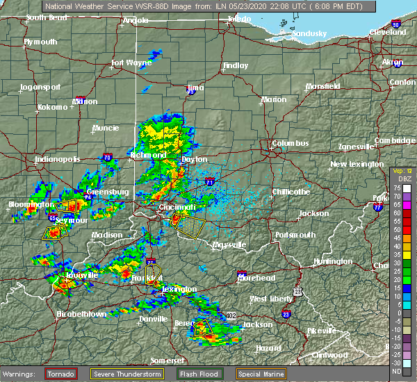 At 626 pm edt, a severe thunderstorm was located over bethel, moving southeast at 20 mph (radar indicated). Hazards include 60 mph wind gusts and quarter size hail. Minor hail damage to vehicles is possible. expect wind damage to trees and power lines. Locations impacted include, amelia, mount orab, bethel, williamsburg, batavia, hamersville, lindale, saltair, east fork state park, nicholsville, feesburg, bantam, new hope, locust ridge, state route 32 at us route 68 and point isabel. At 626 pm edt, a severe thunderstorm was located over bethel, moving southeast at 20 mph (radar indicated). Hazards include 60 mph wind gusts and quarter size hail. Minor hail damage to vehicles is possible. expect wind damage to trees and power lines. Locations impacted include, amelia, mount orab, bethel, williamsburg, batavia, hamersville, lindale, saltair, east fork state park, nicholsville, feesburg, bantam, new hope, locust ridge, state route 32 at us route 68 and point isabel.
|
| 5/23/2020 6:24 PM EDT |
 The severe thunderstorm warning for west central clermont county will expire at 630 pm edt, the storm which prompted the warning has moved out of the area. therefore, the warning will be allowed to expire. however heavy rain is still possible with this thunderstorm. please report previous wind damage or hail to the national weather service by going to our website at weather.gov/iln and submitting your report via social media. remember, a severe thunderstorm warning still remains in effect for southeastern clermont county. The severe thunderstorm warning for west central clermont county will expire at 630 pm edt, the storm which prompted the warning has moved out of the area. therefore, the warning will be allowed to expire. however heavy rain is still possible with this thunderstorm. please report previous wind damage or hail to the national weather service by going to our website at weather.gov/iln and submitting your report via social media. remember, a severe thunderstorm warning still remains in effect for southeastern clermont county.
|
| 5/23/2020 6:17 PM EDT |
 At 617 pm edt, a severe thunderstorm was located over withamsville, moving east at 10 mph (radar indicated). Hazards include 60 mph wind gusts and half dollar size hail. Minor hail damage to vehicles is possible. expect wind damage to trees and power lines. Locations impacted include, amelia, new richmond, batavia, withamsville, willowville and clermont county airport. At 617 pm edt, a severe thunderstorm was located over withamsville, moving east at 10 mph (radar indicated). Hazards include 60 mph wind gusts and half dollar size hail. Minor hail damage to vehicles is possible. expect wind damage to trees and power lines. Locations impacted include, amelia, new richmond, batavia, withamsville, willowville and clermont county airport.
|
| 5/23/2020 6:08 PM EDT |
 At 608 pm edt, a severe thunderstorm was located over withamsville, moving east at 10 mph (radar indicated). Hazards include ping pong ball size hail and 60 mph wind gusts. People and animals outdoors will be injured. expect hail damage to roofs, siding, windows, and vehicles. expect wind damage to trees and power lines. Locations impacted include, amelia, new richmond, batavia, withamsville, california, blairsville, willowville, clermont county airport, mount carmel, new palestine and summerside. At 608 pm edt, a severe thunderstorm was located over withamsville, moving east at 10 mph (radar indicated). Hazards include ping pong ball size hail and 60 mph wind gusts. People and animals outdoors will be injured. expect hail damage to roofs, siding, windows, and vehicles. expect wind damage to trees and power lines. Locations impacted include, amelia, new richmond, batavia, withamsville, california, blairsville, willowville, clermont county airport, mount carmel, new palestine and summerside.
|
| 5/23/2020 6:02 PM EDT |
 At 602 pm edt, a severe thunderstorm was located over amelia, moving southeast at 20 mph (radar indicated). Hazards include 60 mph wind gusts and half dollar size hail. Minor hail damage to vehicles is possible. Expect wind damage to trees and power lines. At 602 pm edt, a severe thunderstorm was located over amelia, moving southeast at 20 mph (radar indicated). Hazards include 60 mph wind gusts and half dollar size hail. Minor hail damage to vehicles is possible. Expect wind damage to trees and power lines.
|
| 5/23/2020 5:59 PM EDT |
 At 548 pm edt, a severe thunderstorm was located over forestville, moving east at 10 mph (radar indicated). Hazards include half dollar size hail. Minor damage to vehicles is possible. Locations impacted include, cincinnati, fort thomas, forestville, amelia, new richmond, batavia, silver grove, melbourne, salem heights, riverbend and coney island, withamsville, coldstream, cold spring, newtown, sherwood, crestview, california, new palestine, lunken airport and turpin hills. At 548 pm edt, a severe thunderstorm was located over forestville, moving east at 10 mph (radar indicated). Hazards include half dollar size hail. Minor damage to vehicles is possible. Locations impacted include, cincinnati, fort thomas, forestville, amelia, new richmond, batavia, silver grove, melbourne, salem heights, riverbend and coney island, withamsville, coldstream, cold spring, newtown, sherwood, crestview, california, new palestine, lunken airport and turpin hills.
|
| 5/23/2020 5:59 PM EDT |
 At 559 pm edt, a severe thunderstorm was located over withamsville, moving east at 20 mph (radar indicated). Hazards include ping pong ball size hail and 60 mph wind gusts. People and animals outdoors will be injured. expect hail damage to roofs, siding, windows, and vehicles. expect wind damage to trees and power lines. Locations impacted include, forestville, amelia, new richmond, batavia, silver grove, melbourne, coldstream, withamsville, salem heights, sherwood, california, clermont county airport, mount carmel, cherry grove, new palestine, fruit hill, blairsville, willowville, dry run and summerside. At 559 pm edt, a severe thunderstorm was located over withamsville, moving east at 20 mph (radar indicated). Hazards include ping pong ball size hail and 60 mph wind gusts. People and animals outdoors will be injured. expect hail damage to roofs, siding, windows, and vehicles. expect wind damage to trees and power lines. Locations impacted include, forestville, amelia, new richmond, batavia, silver grove, melbourne, coldstream, withamsville, salem heights, sherwood, california, clermont county airport, mount carmel, cherry grove, new palestine, fruit hill, blairsville, willowville, dry run and summerside.
|
| 5/23/2020 5:48 PM EDT |
 At 548 pm edt, a severe thunderstorm was located over forestville, moving east at 10 mph (radar indicated). Hazards include half dollar size hail. Minor damage to vehicles is possible. Locations impacted include, cincinnati, fort thomas, forestville, amelia, new richmond, batavia, silver grove, melbourne, salem heights, riverbend and coney island, withamsville, coldstream, cold spring, newtown, sherwood, crestview, california, new palestine, lunken airport and turpin hills. At 548 pm edt, a severe thunderstorm was located over forestville, moving east at 10 mph (radar indicated). Hazards include half dollar size hail. Minor damage to vehicles is possible. Locations impacted include, cincinnati, fort thomas, forestville, amelia, new richmond, batavia, silver grove, melbourne, salem heights, riverbend and coney island, withamsville, coldstream, cold spring, newtown, sherwood, crestview, california, new palestine, lunken airport and turpin hills.
|
| 5/23/2020 5:42 PM EDT |
 At 542 pm edt, a severe thunderstorm was located over salem heights, moving east at 10 mph (radar indicated). Hazards include quarter size hail. minor damage to vehicles is possible At 542 pm edt, a severe thunderstorm was located over salem heights, moving east at 10 mph (radar indicated). Hazards include quarter size hail. minor damage to vehicles is possible
|
| 5/10/2020 5:52 PM EDT |
 At 552 pm edt, a severe thunderstorm was located near williamsburg, moving northeast at 35 mph (radar indicated). Hazards include 60 mph wind gusts and quarter size hail. Minor hail damage to vehicles is possible. Expect wind damage to trees and power lines. At 552 pm edt, a severe thunderstorm was located near williamsburg, moving northeast at 35 mph (radar indicated). Hazards include 60 mph wind gusts and quarter size hail. Minor hail damage to vehicles is possible. Expect wind damage to trees and power lines.
|
| 5/10/2020 4:07 PM EDT |
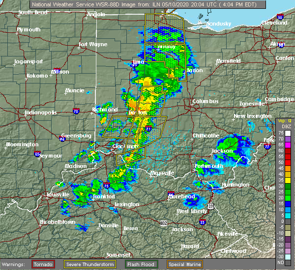 At 407 pm edt, a severe thunderstorm was located over williamsburg, moving east at 65 mph (radar indicated). Hazards include 60 mph wind gusts. Expect damage to trees and power lines. locations impacted include, amelia, mount orab, bethel, williamsburg, batavia, owensville, fayetteville, st. Martin, chasetown, clermont county airport, lindale, greenbush, saltair, east fork state park, nicholsville, state route 32 at us route 68, bantam, locust ridge and lake lorelei. At 407 pm edt, a severe thunderstorm was located over williamsburg, moving east at 65 mph (radar indicated). Hazards include 60 mph wind gusts. Expect damage to trees and power lines. locations impacted include, amelia, mount orab, bethel, williamsburg, batavia, owensville, fayetteville, st. Martin, chasetown, clermont county airport, lindale, greenbush, saltair, east fork state park, nicholsville, state route 32 at us route 68, bantam, locust ridge and lake lorelei.
|
| 5/10/2020 3:51 PM EDT |
 At 351 pm edt, a severe thunderstorm was located over alexandria, moving east at 65 mph (radar indicated). Hazards include 60 mph wind gusts. expect damage to trees and power lines At 351 pm edt, a severe thunderstorm was located over alexandria, moving east at 65 mph (radar indicated). Hazards include 60 mph wind gusts. expect damage to trees and power lines
|
| 4/8/2020 10:52 PM EDT | Large barn flattened in 3100 block on park road near intersection of rte 131 and rte 133. wooden plank driven into side of structur in clermont county OH, 9.4 miles SW of Batavia, OH |
| 4/8/2020 10:45 PM EDT |
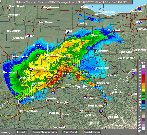 At 1044 pm edt, a severe thunderstorm capable of producing a tornado was located near milford, moving east at 50 mph (radar indicated rotation). Hazards include tornado and quarter size hail. Flying debris will be dangerous to those caught without shelter. mobile homes will be damaged or destroyed. damage to roofs, windows, and vehicles will occur. Tree damage is likely. At 1044 pm edt, a severe thunderstorm capable of producing a tornado was located near milford, moving east at 50 mph (radar indicated rotation). Hazards include tornado and quarter size hail. Flying debris will be dangerous to those caught without shelter. mobile homes will be damaged or destroyed. damage to roofs, windows, and vehicles will occur. Tree damage is likely.
|
| 4/8/2020 10:42 PM EDT |
 At 1042 pm edt, a severe thunderstorm capable of producing a tornado was located over milford, moving east at 50 mph (radar indicated rotation). Hazards include tornado and quarter size hail. Flying debris will be dangerous to those caught without shelter. mobile homes will be damaged or destroyed. damage to roofs, windows, and vehicles will occur. tree damage is likely. Locations impacted include, loveland, milford, batavia, camp dennison, goshen, mulberry, clermont county airport, perintown, mount carmel, day heights, miamiville, willowville, summerside, mount repose and springvale. At 1042 pm edt, a severe thunderstorm capable of producing a tornado was located over milford, moving east at 50 mph (radar indicated rotation). Hazards include tornado and quarter size hail. Flying debris will be dangerous to those caught without shelter. mobile homes will be damaged or destroyed. damage to roofs, windows, and vehicles will occur. tree damage is likely. Locations impacted include, loveland, milford, batavia, camp dennison, goshen, mulberry, clermont county airport, perintown, mount carmel, day heights, miamiville, willowville, summerside, mount repose and springvale.
|
| 4/8/2020 10:42 PM EDT |
 At 1042 pm edt, severe thunderstorms were located along a line extending from camp dennison to crittenden, moving east at 65 mph (radar indicated). Hazards include 70 mph wind gusts and quarter size hail. Minor hail damage to vehicles is possible. expect considerable tree damage. Wind damage is also likely to mobile homes, roofs, and outbuildings. At 1042 pm edt, severe thunderstorms were located along a line extending from camp dennison to crittenden, moving east at 65 mph (radar indicated). Hazards include 70 mph wind gusts and quarter size hail. Minor hail damage to vehicles is possible. expect considerable tree damage. Wind damage is also likely to mobile homes, roofs, and outbuildings.
|
| 4/8/2020 10:36 PM EDT |
 At 1036 pm edt, a severe thunderstorm capable of producing a tornado was located over concorde hills, moving east at 50 mph (radar indicated rotation). Hazards include tornado and quarter size hail. Flying debris will be dangerous to those caught without shelter. mobile homes will be damaged or destroyed. damage to roofs, windows, and vehicles will occur. tree damage is likely. locations impacted include, cincinnati, norwood, sharonville, blue ash, loveland, reading, montgomery, madeira, milford, deer park, mariemont, terrace park, batavia, camp dennison, highpoint, remington, plainville, concorde hills, sixteen mile stand and rossmoyne. this includes the following interstates, i-71 in ohio between mile markers 7 and 19. I-75 in ohio between mile markers 8 and 15. At 1036 pm edt, a severe thunderstorm capable of producing a tornado was located over concorde hills, moving east at 50 mph (radar indicated rotation). Hazards include tornado and quarter size hail. Flying debris will be dangerous to those caught without shelter. mobile homes will be damaged or destroyed. damage to roofs, windows, and vehicles will occur. tree damage is likely. locations impacted include, cincinnati, norwood, sharonville, blue ash, loveland, reading, montgomery, madeira, milford, deer park, mariemont, terrace park, batavia, camp dennison, highpoint, remington, plainville, concorde hills, sixteen mile stand and rossmoyne. this includes the following interstates, i-71 in ohio between mile markers 7 and 19. I-75 in ohio between mile markers 8 and 15.
|
| 4/8/2020 10:26 PM EDT |
 At 1025 pm edt, a severe thunderstorm capable of producing a tornado was located over pleasant hills, moving east at 45 mph (radar indicated rotation). Hazards include tornado and quarter size hail. Flying debris will be dangerous to those caught without shelter. mobile homes will be damaged or destroyed. damage to roofs, windows, and vehicles will occur. Tree damage is likely. At 1025 pm edt, a severe thunderstorm capable of producing a tornado was located over pleasant hills, moving east at 45 mph (radar indicated rotation). Hazards include tornado and quarter size hail. Flying debris will be dangerous to those caught without shelter. mobile homes will be damaged or destroyed. damage to roofs, windows, and vehicles will occur. Tree damage is likely.
|
| 4/8/2020 10:15 PM EDT |
 At 1014 pm edt, a severe thunderstorm was located over reading, moving east at 45 mph (radar indicated). Hazards include 70 mph wind gusts and quarter size hail. Minor hail damage to vehicles is possible. expect considerable tree damage. Wind damage is also likely to mobile homes, roofs, and outbuildings. At 1014 pm edt, a severe thunderstorm was located over reading, moving east at 45 mph (radar indicated). Hazards include 70 mph wind gusts and quarter size hail. Minor hail damage to vehicles is possible. expect considerable tree damage. Wind damage is also likely to mobile homes, roofs, and outbuildings.
|
| 4/8/2020 10:07 PM EDT |
 At 1007 pm edt, a severe thunderstorm was located near williamsburg, moving northeast at 40 mph (radar indicated). Hazards include golf ball size hail and 60 mph wind gusts. People and animals outdoors will be injured. expect hail damage to roofs, siding, windows, and vehicles. expect wind damage to trees and power lines. locations impacted include, blanchester, amelia, mount orab, bethel, williamsburg, batavia, lynchburg, sardinia, woodville, new market, hamersville, mowrystown, fayetteville, midland, st. martin, chasetown, danville in highland county, saltair, nicholsville and state route 32 at us route 68. A tornado watch remains in effect until 200 am edt for southwestern ohio. At 1007 pm edt, a severe thunderstorm was located near williamsburg, moving northeast at 40 mph (radar indicated). Hazards include golf ball size hail and 60 mph wind gusts. People and animals outdoors will be injured. expect hail damage to roofs, siding, windows, and vehicles. expect wind damage to trees and power lines. locations impacted include, blanchester, amelia, mount orab, bethel, williamsburg, batavia, lynchburg, sardinia, woodville, new market, hamersville, mowrystown, fayetteville, midland, st. martin, chasetown, danville in highland county, saltair, nicholsville and state route 32 at us route 68. A tornado watch remains in effect until 200 am edt for southwestern ohio.
|
| 4/8/2020 10:02 PM EDT |
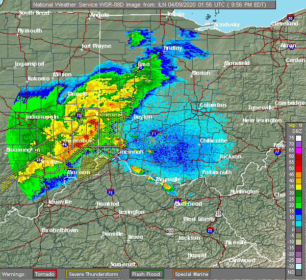 At 1002 pm edt, a severe thunderstorm was located over bethel, moving northeast at 30 mph (radar indicated). Hazards include 60 mph wind gusts and quarter size hail. Minor hail damage to vehicles is possible. Expect wind damage to trees and power lines. At 1002 pm edt, a severe thunderstorm was located over bethel, moving northeast at 30 mph (radar indicated). Hazards include 60 mph wind gusts and quarter size hail. Minor hail damage to vehicles is possible. Expect wind damage to trees and power lines.
|
| 1/11/2020 12:38 PM EST |
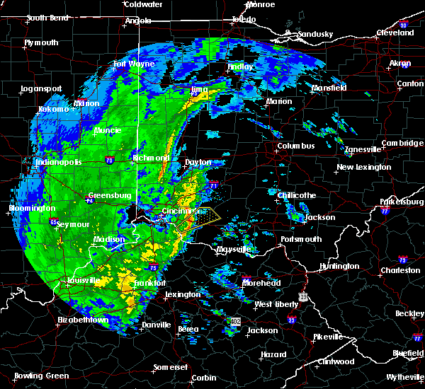 At 1237 pm est, a severe thunderstorm was located near williamsburg, moving northeast at 50 mph (radar indicated). Hazards include 60 mph wind gusts. Expect damage to trees and power lines. locations impacted include, mount orab, williamsburg, batavia, owensville, fayetteville, st. Martin, chasetown, greenbush, east fork state park, buford, state route 32 at us route 68, bantam and lake lorelei. At 1237 pm est, a severe thunderstorm was located near williamsburg, moving northeast at 50 mph (radar indicated). Hazards include 60 mph wind gusts. Expect damage to trees and power lines. locations impacted include, mount orab, williamsburg, batavia, owensville, fayetteville, st. Martin, chasetown, greenbush, east fork state park, buford, state route 32 at us route 68, bantam and lake lorelei.
|
| 1/11/2020 12:29 PM EST |
 At 1228 pm est, a severe thunderstorm was located over new richmond, moving northeast at 50 mph (radar indicated). Hazards include 60 mph wind gusts. expect damage to trees and power lines At 1228 pm est, a severe thunderstorm was located over new richmond, moving northeast at 50 mph (radar indicated). Hazards include 60 mph wind gusts. expect damage to trees and power lines
|
| 8/30/2019 5:36 PM EDT |
 The severe thunderstorm warning for northeastern clermont and northwestern brown counties will expire at 545 pm edt, the storm which prompted the warning has weakened below severe limits, and no longer poses an immediate threat to life or property. therefore, the warning will be allowed to expire. however heavy rain is still possible with this thunderstorm. please report previous wind damage or hail to the national weather service by going to our website at weather.gov/iln and submitting your report via social media. The severe thunderstorm warning for northeastern clermont and northwestern brown counties will expire at 545 pm edt, the storm which prompted the warning has weakened below severe limits, and no longer poses an immediate threat to life or property. therefore, the warning will be allowed to expire. however heavy rain is still possible with this thunderstorm. please report previous wind damage or hail to the national weather service by going to our website at weather.gov/iln and submitting your report via social media.
|
| 8/30/2019 5:23 PM EDT |
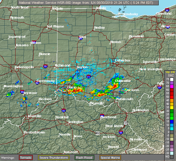 At 506 pm edt, a severe thunderstorm was located near batavia, moving east at 20 mph (radar indicated). Hazards include 60 mph wind gusts and penny size hail. expect damage to trees and power lines At 506 pm edt, a severe thunderstorm was located near batavia, moving east at 20 mph (radar indicated). Hazards include 60 mph wind gusts and penny size hail. expect damage to trees and power lines
|
| 8/30/2019 5:14 PM EDT | Large tree fell into power lines on bauer road and oh-276 and large tree fell down at 1571 us-50. time estimated from rada in clermont county OH, 3.5 miles WSW of Batavia, OH |
| 8/30/2019 5:14 PM EDT | Tree down on benton road. time estimated from rada in clermont county OH, 2.3 miles SSW of Batavia, OH |
| 8/30/2019 5:06 PM EDT |
 At 506 pm edt, a severe thunderstorm was located near batavia, moving east at 20 mph (radar indicated). Hazards include 60 mph wind gusts and penny size hail. expect damage to trees and power lines At 506 pm edt, a severe thunderstorm was located near batavia, moving east at 20 mph (radar indicated). Hazards include 60 mph wind gusts and penny size hail. expect damage to trees and power lines
|
| 8/22/2019 6:04 AM EDT |
 At 603 am edt, a severe thunderstorm was located near bethel, moving east at 35 mph (radar indicated). Hazards include 60 mph wind gusts. Expect damage to trees and power lines. Locations impacted include, amelia, mount orab, bethel, new richmond, williamsburg, batavia, withamsville, hamersville, mentor, california, lindale, saltair, east fork state park, new palestine, nicholsville, blairsville, point isabel, bantam and locust ridge. At 603 am edt, a severe thunderstorm was located near bethel, moving east at 35 mph (radar indicated). Hazards include 60 mph wind gusts. Expect damage to trees and power lines. Locations impacted include, amelia, mount orab, bethel, new richmond, williamsburg, batavia, withamsville, hamersville, mentor, california, lindale, saltair, east fork state park, new palestine, nicholsville, blairsville, point isabel, bantam and locust ridge.
|
| 8/22/2019 5:44 AM EDT |
 The national weather service in wilmington has issued a * severe thunderstorm warning for. central kenton county in northern kentucky. campbell county in northern kentucky. central clermont county in southwestern ohio. West central brown county in southwestern ohio. The national weather service in wilmington has issued a * severe thunderstorm warning for. central kenton county in northern kentucky. campbell county in northern kentucky. central clermont county in southwestern ohio. West central brown county in southwestern ohio.
|
| 8/22/2019 5:44 AM EDT |
 At 544 am edt, a severe thunderstorm was located over alexandria, moving east at 35 mph (radar indicated). Hazards include 60 mph wind gusts. expect damage to trees and power lines At 544 am edt, a severe thunderstorm was located over alexandria, moving east at 35 mph (radar indicated). Hazards include 60 mph wind gusts. expect damage to trees and power lines
|
| 8/20/2019 4:36 PM EDT |
 The severe thunderstorm warning for northern campbell, eastern hamilton and northwestern clermont counties will expire at 445 pm edt, the storm which prompted the warning has weakened and moved out of the area. therefore, the warning will be allowed to expire. this storm will still be capable of wind gusts to 50 mph. a severe thunderstorm watch remains in effect until 900 pm edt for northern kentucky, and southwestern ohio. please report previous wind damage or hail to the national weather service by going to our website at weather.gov/iln and submitting your report via social media. The severe thunderstorm warning for northern campbell, eastern hamilton and northwestern clermont counties will expire at 445 pm edt, the storm which prompted the warning has weakened and moved out of the area. therefore, the warning will be allowed to expire. this storm will still be capable of wind gusts to 50 mph. a severe thunderstorm watch remains in effect until 900 pm edt for northern kentucky, and southwestern ohio. please report previous wind damage or hail to the national weather service by going to our website at weather.gov/iln and submitting your report via social media.
|
| 8/20/2019 4:16 PM EDT |
 At 416 pm edt, a severe thunderstorm was located over norwood, moving northeast at 20 mph (radar indicated). Hazards include 60 mph wind gusts and quarter size hail. Minor hail damage to vehicles is possible. expect wind damage to trees and power lines. locations impacted include, cincinnati, norwood, fort thomas, newport, sharonville, blue ash, loveland, reading, montgomery, madeira, wyoming, highland heights, milford, bellevue, deer park, dayton, southgate, forestville, finneytown and amelia. this includes the following interstates, i-71 in ohio between mile markers 5 and 19. I-75 in ohio between mile markers 8 and 16. At 416 pm edt, a severe thunderstorm was located over norwood, moving northeast at 20 mph (radar indicated). Hazards include 60 mph wind gusts and quarter size hail. Minor hail damage to vehicles is possible. expect wind damage to trees and power lines. locations impacted include, cincinnati, norwood, fort thomas, newport, sharonville, blue ash, loveland, reading, montgomery, madeira, wyoming, highland heights, milford, bellevue, deer park, dayton, southgate, forestville, finneytown and amelia. this includes the following interstates, i-71 in ohio between mile markers 5 and 19. I-75 in ohio between mile markers 8 and 16.
|
| 8/20/2019 4:16 PM EDT |
 A severe thunderstorm warning remains in effect until 445 pm edt for northern campbell. eastern hamilton and northwestern clermont counties. at 416 pm edt, a severe thunderstorm was located over norwood, moving northeast at 20 mph. hazard. 60 mph wind gusts and quarter size hail. A severe thunderstorm warning remains in effect until 445 pm edt for northern campbell. eastern hamilton and northwestern clermont counties. at 416 pm edt, a severe thunderstorm was located over norwood, moving northeast at 20 mph. hazard. 60 mph wind gusts and quarter size hail.
|
| 8/20/2019 4:06 PM EDT |
 At 405 pm edt, a severe thunderstorm was located near newport, moving northeast at 25 mph (radar indicated). Hazards include 60 mph wind gusts and quarter size hail. Minor hail damage to vehicles is possible. Expect wind damage to trees and power lines. At 405 pm edt, a severe thunderstorm was located near newport, moving northeast at 25 mph (radar indicated). Hazards include 60 mph wind gusts and quarter size hail. Minor hail damage to vehicles is possible. Expect wind damage to trees and power lines.
|
| 5/23/2019 5:40 PM EDT |
 The severe thunderstorm warning for northern clermont, northwestern brown, southeastern warren and southwestern clinton counties will expire at 545 pm edt, an additional severe thunderstorm warning is in effect for portions of clinton and brown counties until 615 pm. a severe thunderstorm watch remains in effect until midnight edt for southwestern ohio. please report previous wind damage or hail to the national weather service by going to our website at weather.gov/iln and submitting your report via social media. The severe thunderstorm warning for northern clermont, northwestern brown, southeastern warren and southwestern clinton counties will expire at 545 pm edt, an additional severe thunderstorm warning is in effect for portions of clinton and brown counties until 615 pm. a severe thunderstorm watch remains in effect until midnight edt for southwestern ohio. please report previous wind damage or hail to the national weather service by going to our website at weather.gov/iln and submitting your report via social media.
|
| 5/23/2019 5:21 PM EDT |
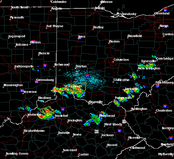 At 521 pm edt, a severe thunderstorm was located 7 miles northeast of batavia, moving east at 35 mph (radar indicated). Hazards include 60 mph wind gusts and quarter size hail. Minor hail damage to vehicles is possible. expect wind damage to trees and power lines. locations impacted include, loveland, milford, blanchester, amelia, mount orab, williamsburg, batavia, withamsville, woodville, owensville, goshen, newtonsville, fayetteville, midland, pleasant plain, st. Martin, chasetown, perintown, day heights and state route 32 at us route 68. At 521 pm edt, a severe thunderstorm was located 7 miles northeast of batavia, moving east at 35 mph (radar indicated). Hazards include 60 mph wind gusts and quarter size hail. Minor hail damage to vehicles is possible. expect wind damage to trees and power lines. locations impacted include, loveland, milford, blanchester, amelia, mount orab, williamsburg, batavia, withamsville, woodville, owensville, goshen, newtonsville, fayetteville, midland, pleasant plain, st. Martin, chasetown, perintown, day heights and state route 32 at us route 68.
|
| 5/23/2019 5:12 PM EDT | Tree down into power lines. time estimated from radar dat in clermont county OH, 4.1 miles S of Batavia, OH |
| 5/23/2019 5:12 PM EDT | Large tree down. time estimated from radar dat in clermont county OH, 4.1 miles S of Batavia, OH |
| 5/23/2019 5:10 PM EDT | Multiple large tree limbs down. time estimated from radar dat in clermont county OH, 2.9 miles SSW of Batavia, OH |
| 5/23/2019 5:10 PM EDT | Several large trees down. time estimated from radar dat in clermont county OH, 2.7 miles S of Batavia, OH |
| 5/23/2019 5:10 PM EDT | Tree down into power lines. time estimated from radar dat in clermont county OH, 3.4 miles S of Batavia, OH |
| 5/23/2019 5:05 PM EDT |
 At 505 pm edt, a severe thunderstorm was located near terrace park, moving east at 30 mph (radar indicated). Hazards include 60 mph wind gusts and quarter size hail. Minor hail damage to vehicles is possible. Expect wind damage to trees and power lines. At 505 pm edt, a severe thunderstorm was located near terrace park, moving east at 30 mph (radar indicated). Hazards include 60 mph wind gusts and quarter size hail. Minor hail damage to vehicles is possible. Expect wind damage to trees and power lines.
|
| 4/14/2019 4:54 PM EDT |
 At 454 pm edt, a severe thunderstorm was located over milford, moving northeast at 60 mph (radar indicated). Hazards include 60 mph wind gusts. Expect damage to trees and power lines. locations impacted include, cincinnati, mason, blue ash, loveland, montgomery, madeira, milford, deer park, forestville, mariemont, terrace park, batavia, morrow, camp dennison, remington, plainville, concorde hills, kings island, sixteen mile stand and withamsville. this includes i-71 in ohio between mile markers 10 and 14, and between mile markers 19 and 24. A tornado watch remains in effect until 900 pm edt for southwestern ohio. At 454 pm edt, a severe thunderstorm was located over milford, moving northeast at 60 mph (radar indicated). Hazards include 60 mph wind gusts. Expect damage to trees and power lines. locations impacted include, cincinnati, mason, blue ash, loveland, montgomery, madeira, milford, deer park, forestville, mariemont, terrace park, batavia, morrow, camp dennison, remington, plainville, concorde hills, kings island, sixteen mile stand and withamsville. this includes i-71 in ohio between mile markers 10 and 14, and between mile markers 19 and 24. A tornado watch remains in effect until 900 pm edt for southwestern ohio.
|
| 4/14/2019 4:44 PM EDT |
 At 443 pm edt, a severe thunderstorm was located over silver grove, moving northeast at 60 mph (radar indicated). Hazards include 70 mph wind gusts. Expect considerable tree damage. damage is likely to mobile homes, roofs, and outbuildings. locations impacted include, cincinnati, covington, mason, fort thomas, newport, blue ash, loveland, montgomery, madeira, alexandria, highland heights, milford, taylor mill, deer park, dayton, southgate, forestville, claryville, amelia and mariemont. this includes i-71 in ohio between mile markers 10 and 15, and between mile markers 18 and 24. A tornado watch remains in effect until 900 pm edt for northern kentucky, and southwestern ohio. At 443 pm edt, a severe thunderstorm was located over silver grove, moving northeast at 60 mph (radar indicated). Hazards include 70 mph wind gusts. Expect considerable tree damage. damage is likely to mobile homes, roofs, and outbuildings. locations impacted include, cincinnati, covington, mason, fort thomas, newport, blue ash, loveland, montgomery, madeira, alexandria, highland heights, milford, taylor mill, deer park, dayton, southgate, forestville, claryville, amelia and mariemont. this includes i-71 in ohio between mile markers 10 and 15, and between mile markers 18 and 24. A tornado watch remains in effect until 900 pm edt for northern kentucky, and southwestern ohio.
|
| 4/14/2019 4:38 PM EDT |
 At 438 pm edt, a severe thunderstorm was located near independence, moving northeast at 60 mph (radar indicated). Hazards include 60 mph wind gusts. expect damage to trees and power lines At 438 pm edt, a severe thunderstorm was located near independence, moving northeast at 60 mph (radar indicated). Hazards include 60 mph wind gusts. expect damage to trees and power lines
|
| 4/12/2019 8:01 AM EDT |
 A tornado warning remains in effect until 815 am edt for northern campbell. southeastern hamilton and northwestern clermont counties. at 801 am edt, a severe thunderstorm capable of producing a tornado was located over salem heights, moving northeast at 55 mph. hazard. Tornado and quarter size hail. A tornado warning remains in effect until 815 am edt for northern campbell. southeastern hamilton and northwestern clermont counties. at 801 am edt, a severe thunderstorm capable of producing a tornado was located over salem heights, moving northeast at 55 mph. hazard. Tornado and quarter size hail.
|
| 4/12/2019 8:01 AM EDT |
 At 801 am edt, a severe thunderstorm capable of producing a tornado was located over salem heights, moving northeast at 55 mph (radar indicated rotation). Hazards include tornado and quarter size hail. Flying debris will be dangerous to those caught without shelter. mobile homes will be damaged or destroyed. damage to roofs, windows, and vehicles will occur. tree damage is likely. Locations impacted include, cincinnati, fort thomas, newport, alexandria, highland heights, milford, bellevue, dayton, southgate, forestville, mariemont, wilder, terrace park, batavia, silver grove, melbourne, salem heights, riverbend and coney island, withamsville and plainville. At 801 am edt, a severe thunderstorm capable of producing a tornado was located over salem heights, moving northeast at 55 mph (radar indicated rotation). Hazards include tornado and quarter size hail. Flying debris will be dangerous to those caught without shelter. mobile homes will be damaged or destroyed. damage to roofs, windows, and vehicles will occur. tree damage is likely. Locations impacted include, cincinnati, fort thomas, newport, alexandria, highland heights, milford, bellevue, dayton, southgate, forestville, mariemont, wilder, terrace park, batavia, silver grove, melbourne, salem heights, riverbend and coney island, withamsville and plainville.
|
| 4/12/2019 7:56 AM EDT |
 At 755 am edt, a severe thunderstorm capable of producing a tornado was located over taylor mill, moving northeast at 55 mph (radar indicated rotation). Hazards include tornado and quarter size hail. Flying debris will be dangerous to those caught without shelter. mobile homes will be damaged or destroyed. damage to roofs, windows, and vehicles will occur. Tree damage is likely. At 755 am edt, a severe thunderstorm capable of producing a tornado was located over taylor mill, moving northeast at 55 mph (radar indicated rotation). Hazards include tornado and quarter size hail. Flying debris will be dangerous to those caught without shelter. mobile homes will be damaged or destroyed. damage to roofs, windows, and vehicles will occur. Tree damage is likely.
|
| 3/14/2019 6:48 PM EDT |
 At 648 pm edt, severe thunderstorms were located along a line extending from near morrow to near batavia to withamsville to near crittenden, moving northeast at 60 mph (radar indicated). Hazards include 70 mph wind gusts. Expect considerable tree damage. Damage is likely to mobile homes, roofs, and outbuildings. At 648 pm edt, severe thunderstorms were located along a line extending from near morrow to near batavia to withamsville to near crittenden, moving northeast at 60 mph (radar indicated). Hazards include 70 mph wind gusts. Expect considerable tree damage. Damage is likely to mobile homes, roofs, and outbuildings.
|
| 3/14/2019 5:23 PM EDT |
 The tornado warning for northern campbell, southeastern hamilton and northwestern clermont counties will expire at 530 pm edt, the storm which prompted the warning has moved out of the area. therefore, the warning will be allowed to expire. a severe thunderstorm watch remains in effect until 1000 pm edt for northern kentucky, and southwestern ohio. please report previous tornadoes, wind damage or hail to the national weather service by going to our website at weather.gov/iln and submitting your report via social media. The tornado warning for northern campbell, southeastern hamilton and northwestern clermont counties will expire at 530 pm edt, the storm which prompted the warning has moved out of the area. therefore, the warning will be allowed to expire. a severe thunderstorm watch remains in effect until 1000 pm edt for northern kentucky, and southwestern ohio. please report previous tornadoes, wind damage or hail to the national weather service by going to our website at weather.gov/iln and submitting your report via social media.
|
| 3/14/2019 5:13 PM EDT |
 At 512 pm edt, a severe thunderstorm capable of producing a tornado was located over wilder, moving northeast at 55 mph (radar indicated rotation). Hazards include tornado and quarter size hail. Flying debris will be dangerous to those caught without shelter. mobile homes will be damaged or destroyed. damage to roofs, windows, and vehicles will occur. tree damage is likely. locations impacted include, cincinnati, norwood, fort thomas, newport, blue ash, loveland, montgomery, madeira, highland heights, milford, bellevue, deer park, dayton, southgate, forestville, mariemont, wilder, terrace park, batavia and silver grove. this includes the following interstates, i-71 in ohio between mile markers 2 and 14. I-75 in ohio between mile markers 6 and 8. At 512 pm edt, a severe thunderstorm capable of producing a tornado was located over wilder, moving northeast at 55 mph (radar indicated rotation). Hazards include tornado and quarter size hail. Flying debris will be dangerous to those caught without shelter. mobile homes will be damaged or destroyed. damage to roofs, windows, and vehicles will occur. tree damage is likely. locations impacted include, cincinnati, norwood, fort thomas, newport, blue ash, loveland, montgomery, madeira, highland heights, milford, bellevue, deer park, dayton, southgate, forestville, mariemont, wilder, terrace park, batavia and silver grove. this includes the following interstates, i-71 in ohio between mile markers 2 and 14. I-75 in ohio between mile markers 6 and 8.
|
| 3/14/2019 5:09 PM EDT |
 At 508 pm edt, a severe thunderstorm capable of producing a tornado was located over covington, moving northeast at 55 mph (radar indicated rotation). Hazards include tornado and quarter size hail. Flying debris will be dangerous to those caught without shelter. mobile homes will be damaged or destroyed. damage to roofs, windows, and vehicles will occur. tree damage is likely. locations impacted include, cincinnati, covington, norwood, erlanger, fort thomas, newport, blue ash, loveland, montgomery, madeira, edgewood, fort mitchell, villa hills, highland heights, milford, taylor mill, bellevue, deer park, fort wright and dayton. this includes the following interstates, i-71 in ohio between mile markers 0 and 14. i-74 in ohio near mile marker 19. i-75 in kentucky between mile markers 186 and 191. I-75 in ohio between mile markers 0 and 8. At 508 pm edt, a severe thunderstorm capable of producing a tornado was located over covington, moving northeast at 55 mph (radar indicated rotation). Hazards include tornado and quarter size hail. Flying debris will be dangerous to those caught without shelter. mobile homes will be damaged or destroyed. damage to roofs, windows, and vehicles will occur. tree damage is likely. locations impacted include, cincinnati, covington, norwood, erlanger, fort thomas, newport, blue ash, loveland, montgomery, madeira, edgewood, fort mitchell, villa hills, highland heights, milford, taylor mill, bellevue, deer park, fort wright and dayton. this includes the following interstates, i-71 in ohio between mile markers 0 and 14. i-74 in ohio near mile marker 19. i-75 in kentucky between mile markers 186 and 191. I-75 in ohio between mile markers 0 and 8.
|
| 3/14/2019 4:59 PM EDT |
 At 459 pm edt, a severe thunderstorm capable of producing a tornado was located over florence, moving northeast at 55 mph (radar indicated rotation). Hazards include tornado and quarter size hail. Flying debris will be dangerous to those caught without shelter. mobile homes will be damaged or destroyed. damage to roofs, windows, and vehicles will occur. Tree damage is likely. At 459 pm edt, a severe thunderstorm capable of producing a tornado was located over florence, moving northeast at 55 mph (radar indicated rotation). Hazards include tornado and quarter size hail. Flying debris will be dangerous to those caught without shelter. mobile homes will be damaged or destroyed. damage to roofs, windows, and vehicles will occur. Tree damage is likely.
|
| 2/7/2019 3:47 PM EST |
 At 346 pm est, a severe thunderstorm was located over withamsville, moving northeast at 55 mph (radar indicated). Hazards include 60 mph wind gusts. Expect damage to trees and power lines. Locations impacted include, forestville, amelia, williamsburg, batavia, withamsville, owensville, clermont county airport, perintown, mount carmel, willowville, summerside, new palestine, day heights, cherry grove, mount repose and dry run. At 346 pm est, a severe thunderstorm was located over withamsville, moving northeast at 55 mph (radar indicated). Hazards include 60 mph wind gusts. Expect damage to trees and power lines. Locations impacted include, forestville, amelia, williamsburg, batavia, withamsville, owensville, clermont county airport, perintown, mount carmel, willowville, summerside, new palestine, day heights, cherry grove, mount repose and dry run.
|
| 2/7/2019 3:41 PM EST |
 At 341 pm est, a severe thunderstorm was located over coldstream, moving northeast at 55 mph (radar indicated). Hazards include 60 mph wind gusts. expect damage to trees and power lines At 341 pm est, a severe thunderstorm was located over coldstream, moving northeast at 55 mph (radar indicated). Hazards include 60 mph wind gusts. expect damage to trees and power lines
|
| 5/31/2018 4:39 PM EDT |
 The severe thunderstorm warning for clermont, northwestern brown and south central warren counties will expire at 445 pm edt, the storms which prompted the warning have moved out of the area. therefore, the warning will be allowed to expire. however gusty winds and heavy rain are still possible with these thunderstorms. a severe thunderstorm watch remains in effect until 600 pm edt for southwestern ohio. please report previous wind damage or hail to the national weather service by going to our website at weather.gov/iln and submitting your report via social media. The severe thunderstorm warning for clermont, northwestern brown and south central warren counties will expire at 445 pm edt, the storms which prompted the warning have moved out of the area. therefore, the warning will be allowed to expire. however gusty winds and heavy rain are still possible with these thunderstorms. a severe thunderstorm watch remains in effect until 600 pm edt for southwestern ohio. please report previous wind damage or hail to the national weather service by going to our website at weather.gov/iln and submitting your report via social media.
|
| 5/31/2018 4:18 PM EDT |
 At 418 pm edt, severe thunderstorms were located along a line extending from loveland to near williamsburg to near felicity, moving east at 45 mph (radar indicated). Hazards include 60 mph wind gusts. Expect damage to trees and power lines. Locations impacted include, loveland, milford, amelia, mount orab, bethel, williamsburg, batavia, withamsville, camp dennison, owensville, hamersville, goshen, newtonsville, butlerville, pleasant plain, perintown, saltair, day heights, nicholsville and dallasburg. At 418 pm edt, severe thunderstorms were located along a line extending from loveland to near williamsburg to near felicity, moving east at 45 mph (radar indicated). Hazards include 60 mph wind gusts. Expect damage to trees and power lines. Locations impacted include, loveland, milford, amelia, mount orab, bethel, williamsburg, batavia, withamsville, camp dennison, owensville, hamersville, goshen, newtonsville, butlerville, pleasant plain, perintown, saltair, day heights, nicholsville and dallasburg.
|
| 5/31/2018 4:12 PM EDT | Multiple trees down across pierce township and batavia township... including trees down on sr 12 in clermont county OH, 0.1 miles NNW of Batavia, OH |
| 5/31/2018 4:10 PM EDT | Tree downe in clermont county OH, 3.2 miles E of Batavia, OH |
| 5/31/2018 3:57 PM EDT |
 At 357 pm edt, severe thunderstorms were located along a line extending from north college hill to melbourne to near butler, moving east at 45 mph (radar indicated). Hazards include 60 mph wind gusts. expect damage to trees and power lines At 357 pm edt, severe thunderstorms were located along a line extending from north college hill to melbourne to near butler, moving east at 45 mph (radar indicated). Hazards include 60 mph wind gusts. expect damage to trees and power lines
|
| 5/20/2018 8:09 PM EDT |
 At 800 pm edt, a severe thunderstorm was located near batavia, moving southeast at 25 mph (radar indicated). Hazards include 60 mph wind gusts and penny size hail. Expect damage to trees and power lines. Locations impacted include, amelia, mount orab, bethel, williamsburg, batavia, owensville, lindale, saltair, east fork state park, bantam, locust ridge and nicholsville. At 800 pm edt, a severe thunderstorm was located near batavia, moving southeast at 25 mph (radar indicated). Hazards include 60 mph wind gusts and penny size hail. Expect damage to trees and power lines. Locations impacted include, amelia, mount orab, bethel, williamsburg, batavia, owensville, lindale, saltair, east fork state park, bantam, locust ridge and nicholsville.
|
| 5/20/2018 8:00 PM EDT |
 At 800 pm edt, a severe thunderstorm was located near batavia, moving southeast at 25 mph (radar indicated). Hazards include 60 mph wind gusts and penny size hail. Expect damage to trees and power lines. Locations impacted include, amelia, mount orab, bethel, williamsburg, batavia, owensville, lindale, saltair, east fork state park, bantam, locust ridge and nicholsville. At 800 pm edt, a severe thunderstorm was located near batavia, moving southeast at 25 mph (radar indicated). Hazards include 60 mph wind gusts and penny size hail. Expect damage to trees and power lines. Locations impacted include, amelia, mount orab, bethel, williamsburg, batavia, owensville, lindale, saltair, east fork state park, bantam, locust ridge and nicholsville.
|
| 5/20/2018 7:49 PM EDT |
 At 749 pm edt, a severe thunderstorm was located over batavia, moving southeast at 25 mph (radar indicated). Hazards include 60 mph wind gusts. expect damage to trees and power lines At 749 pm edt, a severe thunderstorm was located over batavia, moving southeast at 25 mph (radar indicated). Hazards include 60 mph wind gusts. expect damage to trees and power lines
|
| 4/3/2018 8:28 PM EDT |
 The severe thunderstorm warning for northern kenton. northern campbell. central boone. southeastern hamilton and central clermont counties will expire at 830 pm edt. the storm which prompted the warning has weakened below severe limits, and no longer poses an immediate threat to life or property. Therefore, the warning will be allowed to expire. The severe thunderstorm warning for northern kenton. northern campbell. central boone. southeastern hamilton and central clermont counties will expire at 830 pm edt. the storm which prompted the warning has weakened below severe limits, and no longer poses an immediate threat to life or property. Therefore, the warning will be allowed to expire.
|
| 4/3/2018 8:06 PM EDT |
 At 805 pm edt, a severe thunderstorm was located over crestview hills, moving northeast at 55 mph (radar indicated). Hazards include quarter size hail. minor damage to vehicles is possible At 805 pm edt, a severe thunderstorm was located over crestview hills, moving northeast at 55 mph (radar indicated). Hazards include quarter size hail. minor damage to vehicles is possible
|
| 7/7/2017 6:52 PM EDT |
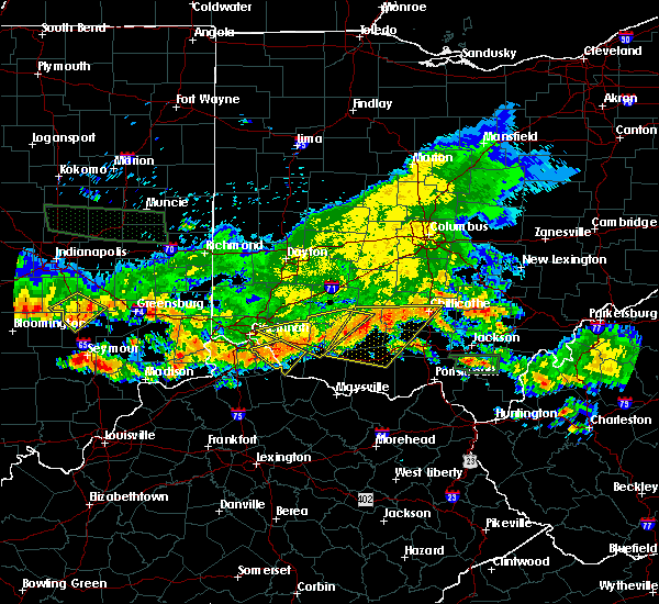 At 652 pm edt, a severe thunderstorm was located near hillsboro, moving east at 45 mph (radar indicated). Hazards include 70 mph wind gusts and quarter size hail. Minor hail damage to vehicles is possible. expect considerable tree damage. wind damage is also likely to mobile homes, roofs, and outbuildings. locations impacted include, hillsboro, mount orab, williamsburg, batavia, leesburg, sardinia, russell, new market, owensville, fayetteville, st. Martin, chasetown, danville in highland county, greenbush, samantha, buford, state route 32 at us route 68, new hope and lake lorelei. At 652 pm edt, a severe thunderstorm was located near hillsboro, moving east at 45 mph (radar indicated). Hazards include 70 mph wind gusts and quarter size hail. Minor hail damage to vehicles is possible. expect considerable tree damage. wind damage is also likely to mobile homes, roofs, and outbuildings. locations impacted include, hillsboro, mount orab, williamsburg, batavia, leesburg, sardinia, russell, new market, owensville, fayetteville, st. Martin, chasetown, danville in highland county, greenbush, samantha, buford, state route 32 at us route 68, new hope and lake lorelei.
|
| 7/7/2017 6:47 PM EDT |
 At 646 pm edt, a severe thunderstorm was located near hillsboro, moving east at 45 mph (radar indicated). Hazards include 70 mph wind gusts and quarter size hail. Minor hail damage to vehicles is possible. expect considerable tree damage. wind damage is also likely to mobile homes, roofs, and outbuildings. locations impacted include, cincinnati, madeira, milford, hillsboro, blanchester, mount orab, mariemont, williamsburg, terrace park, batavia, lynchburg, leesburg, new vienna, sardinia, camp dennison, plainville, the village of indian hill, russell, silverton and woodville. This includes i-71 in ohio between mile markers 9 and 11. At 646 pm edt, a severe thunderstorm was located near hillsboro, moving east at 45 mph (radar indicated). Hazards include 70 mph wind gusts and quarter size hail. Minor hail damage to vehicles is possible. expect considerable tree damage. wind damage is also likely to mobile homes, roofs, and outbuildings. locations impacted include, cincinnati, madeira, milford, hillsboro, blanchester, mount orab, mariemont, williamsburg, terrace park, batavia, lynchburg, leesburg, new vienna, sardinia, camp dennison, plainville, the village of indian hill, russell, silverton and woodville. This includes i-71 in ohio between mile markers 9 and 11.
|
| 7/7/2017 6:42 PM EDT |
 At 642 pm edt, a severe thunderstorm was located over forestville, moving southeast at 25 mph (radar indicated). Hazards include 60 mph wind gusts and quarter size hail. Minor hail damage to vehicles is possible. expect wind damage to trees and power lines. Locations impacted include, alexandria, highland heights, taylor mill, forestville, amelia, wilder, bethel, new richmond, batavia, silver grove, melbourne, withamsville, coldstream, salem heights, cold spring, ryland heights, crestview, mentor, moscow and neville. At 642 pm edt, a severe thunderstorm was located over forestville, moving southeast at 25 mph (radar indicated). Hazards include 60 mph wind gusts and quarter size hail. Minor hail damage to vehicles is possible. expect wind damage to trees and power lines. Locations impacted include, alexandria, highland heights, taylor mill, forestville, amelia, wilder, bethel, new richmond, batavia, silver grove, melbourne, withamsville, coldstream, salem heights, cold spring, ryland heights, crestview, mentor, moscow and neville.
|
| 7/7/2017 6:39 PM EDT |
 At 639 pm edt, a severe thunderstorm was located over lynchburg, moving east at 45 mph (radar indicated). Hazards include 70 mph wind gusts and quarter size hail. Minor hail damage to vehicles is possible. expect considerable tree damage. wind damage is also likely to mobile homes, roofs, and outbuildings. locations impacted include, cincinnati, loveland, madeira, milford, hillsboro, deer park, blanchester, mount orab, mariemont, williamsburg, terrace park, batavia, lynchburg, leesburg, new vienna, sardinia, camp dennison, remington, concorde hills and plainville. This includes i-71 in ohio between mile markers 9 and 13. At 639 pm edt, a severe thunderstorm was located over lynchburg, moving east at 45 mph (radar indicated). Hazards include 70 mph wind gusts and quarter size hail. Minor hail damage to vehicles is possible. expect considerable tree damage. wind damage is also likely to mobile homes, roofs, and outbuildings. locations impacted include, cincinnati, loveland, madeira, milford, hillsboro, deer park, blanchester, mount orab, mariemont, williamsburg, terrace park, batavia, lynchburg, leesburg, new vienna, sardinia, camp dennison, remington, concorde hills and plainville. This includes i-71 in ohio between mile markers 9 and 13.
|
| 7/7/2017 6:20 PM EDT |
 At 620 pm edt, a severe thunderstorm was located over university of cincinnati, moving southeast at 25 mph (radar indicated). Hazards include 60 mph wind gusts and quarter size hail. Minor hail damage to vehicles is possible. Expect wind damage to trees and power lines. At 620 pm edt, a severe thunderstorm was located over university of cincinnati, moving southeast at 25 mph (radar indicated). Hazards include 60 mph wind gusts and quarter size hail. Minor hail damage to vehicles is possible. Expect wind damage to trees and power lines.
|
| 7/7/2017 6:14 PM EDT |
 At 614 pm edt, a severe thunderstorm was located near morrow, moving east at 45 mph (radar indicated). Hazards include 60 mph wind gusts and quarter size hail. Minor hail damage to vehicles is possible. Expect wind damage to trees and power lines. At 614 pm edt, a severe thunderstorm was located near morrow, moving east at 45 mph (radar indicated). Hazards include 60 mph wind gusts and quarter size hail. Minor hail damage to vehicles is possible. Expect wind damage to trees and power lines.
|
| 5/20/2017 3:09 PM EDT |
 At 309 pm edt, a severe thunderstorm was located near claryville, moving northeast at 20 mph (radar indicated). Hazards include 60 mph wind gusts and quarter size hail. Hail damage to vehicles is expected. expect wind damage to roofs, siding, and trees. locations impacted include, cincinnati, covington, independence, erlanger, fort thomas, newport, montgomery, madeira, edgewood, alexandria, highland heights, milford, taylor mill, bellevue, fort wright, dayton, southgate, walton, claryville and forestville. this includes the following interstates, i-71 in ohio between mile markers 10 and 13. I-75 in kentucky between mile markers 174 and 175. At 309 pm edt, a severe thunderstorm was located near claryville, moving northeast at 20 mph (radar indicated). Hazards include 60 mph wind gusts and quarter size hail. Hail damage to vehicles is expected. expect wind damage to roofs, siding, and trees. locations impacted include, cincinnati, covington, independence, erlanger, fort thomas, newport, montgomery, madeira, edgewood, alexandria, highland heights, milford, taylor mill, bellevue, fort wright, dayton, southgate, walton, claryville and forestville. this includes the following interstates, i-71 in ohio between mile markers 10 and 13. I-75 in kentucky between mile markers 174 and 175.
|
| 5/20/2017 2:56 PM EDT |
 At 255 pm edt, a severe thunderstorm was located near independence, moving northeast at 20 mph (radar indicated). Hazards include 60 mph wind gusts and quarter size hail. Hail damage to vehicles is expected. Expect wind damage to roofs, siding, and trees. At 255 pm edt, a severe thunderstorm was located near independence, moving northeast at 20 mph (radar indicated). Hazards include 60 mph wind gusts and quarter size hail. Hail damage to vehicles is expected. Expect wind damage to roofs, siding, and trees.
|
| 4/16/2017 6:32 PM EDT |
 At 632 pm edt, a severe thunderstorm was located near batavia, moving east at 30 mph (radar indicated). Hazards include 60 mph wind gusts and quarter size hail. Hail damage to vehicles is expected. expect wind damage to roofs, siding, and trees. Locations impacted include, milford, forestville, amelia, batavia, withamsville, owensville, newtonsville, clermont county airport, perintown, mount carmel, east fork state park, day heights, new palestine, willowville, summerside, mount repose, mulberry, cherry grove and dry run. At 632 pm edt, a severe thunderstorm was located near batavia, moving east at 30 mph (radar indicated). Hazards include 60 mph wind gusts and quarter size hail. Hail damage to vehicles is expected. expect wind damage to roofs, siding, and trees. Locations impacted include, milford, forestville, amelia, batavia, withamsville, owensville, newtonsville, clermont county airport, perintown, mount carmel, east fork state park, day heights, new palestine, willowville, summerside, mount repose, mulberry, cherry grove and dry run.
|
| 4/16/2017 6:12 PM EDT |
 At 612 pm edt, a severe thunderstorm was located near terrace park, moving east at 30 mph (radar indicated). Hazards include 60 mph wind gusts and quarter size hail. Hail damage to vehicles is expected. Expect wind damage to roofs, siding, and trees. At 612 pm edt, a severe thunderstorm was located near terrace park, moving east at 30 mph (radar indicated). Hazards include 60 mph wind gusts and quarter size hail. Hail damage to vehicles is expected. Expect wind damage to roofs, siding, and trees.
|
| 4/5/2017 7:36 PM EDT |
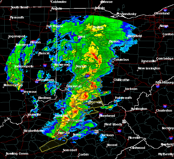 The severe thunderstorm warning for northeastern clermont, northwestern brown, southwestern clinton and western highland counties will expire at 745 pm edt, the storm which prompted the warning has moved out of the area. therefore, the warning will be allowed to expire. a severe thunderstorm watch remains in effect until 900 pm edt for southwestern ohio. please report previous wind damage or hail to the national weather service by going to our website at weather.gov/iln and submitting your report via social media. remember, a severe thunderstorm warning still remains in effect for parts of highland and clinton counties. The severe thunderstorm warning for northeastern clermont, northwestern brown, southwestern clinton and western highland counties will expire at 745 pm edt, the storm which prompted the warning has moved out of the area. therefore, the warning will be allowed to expire. a severe thunderstorm watch remains in effect until 900 pm edt for southwestern ohio. please report previous wind damage or hail to the national weather service by going to our website at weather.gov/iln and submitting your report via social media. remember, a severe thunderstorm warning still remains in effect for parts of highland and clinton counties.
|
| 4/5/2017 7:17 PM EDT |
 At 717 pm edt, a severe thunderstorm was located 8 miles southwest of lynchburg, moving northeast at 30 mph (radar indicated). Hazards include 60 mph wind gusts and quarter size hail. Hail damage to vehicles is expected. expect wind damage to roofs, siding, and trees. locations impacted include, wilmington, hillsboro, blanchester, mount orab, bethel, williamsburg, batavia, lynchburg, russell, woodville, new market, owensville, martinsville, newtonsville, fayetteville, midland, st. Martin, chasetown, danville in highland county and state route 32 at us route 68. At 717 pm edt, a severe thunderstorm was located 8 miles southwest of lynchburg, moving northeast at 30 mph (radar indicated). Hazards include 60 mph wind gusts and quarter size hail. Hail damage to vehicles is expected. expect wind damage to roofs, siding, and trees. locations impacted include, wilmington, hillsboro, blanchester, mount orab, bethel, williamsburg, batavia, lynchburg, russell, woodville, new market, owensville, martinsville, newtonsville, fayetteville, midland, st. Martin, chasetown, danville in highland county and state route 32 at us route 68.
|
| 4/5/2017 6:56 PM EDT |
 The severe thunderstorm warning for southeastern hamilton and clermont counties will expire at 700 pm edt. the storm which prompted the warning has moved out of the area. therefore, the warning will be allowed to expire. a severe thunderstorm watch remains in effect until 900 pm edt for northern kentucky. And southwestern ohio. The severe thunderstorm warning for southeastern hamilton and clermont counties will expire at 700 pm edt. the storm which prompted the warning has moved out of the area. therefore, the warning will be allowed to expire. a severe thunderstorm watch remains in effect until 900 pm edt for northern kentucky. And southwestern ohio.
|
| 4/5/2017 6:54 PM EDT |
 At 654 pm edt, a severe thunderstorm was located over williamsburg, moving northeast at 30 mph (radar indicated). Hazards include 60 mph wind gusts and quarter size hail. Hail damage to vehicles is expected. Expect wind damage to roofs, siding, and trees. At 654 pm edt, a severe thunderstorm was located over williamsburg, moving northeast at 30 mph (radar indicated). Hazards include 60 mph wind gusts and quarter size hail. Hail damage to vehicles is expected. Expect wind damage to roofs, siding, and trees.
|
| 4/5/2017 6:44 PM EDT |
 At 643 pm edt, a severe thunderstorm was located over withamsville, moving northeast at 40 mph (radar indicated). Hazards include 60 mph wind gusts and quarter size hail. Hail damage to vehicles is expected. expect wind damage to roofs, siding, and trees. Locations impacted include, milford, forestville, amelia, new richmond, williamsburg, terrace park, batavia, salem heights, withamsville, coldstream, camp dennison, newtown, sherwood, owensville, goshen, newtonsville, perintown, day heights, new palestine and springvale. At 643 pm edt, a severe thunderstorm was located over withamsville, moving northeast at 40 mph (radar indicated). Hazards include 60 mph wind gusts and quarter size hail. Hail damage to vehicles is expected. expect wind damage to roofs, siding, and trees. Locations impacted include, milford, forestville, amelia, new richmond, williamsburg, terrace park, batavia, salem heights, withamsville, coldstream, camp dennison, newtown, sherwood, owensville, goshen, newtonsville, perintown, day heights, new palestine and springvale.
|
| 4/5/2017 6:31 PM EDT |
 At 631 pm edt, a severe thunderstorm was located over alexandria, moving northeast at 40 mph (radar indicated). Hazards include 60 mph wind gusts and quarter size hail. Hail damage to vehicles is expected. Expect wind damage to roofs, siding, and trees. At 631 pm edt, a severe thunderstorm was located over alexandria, moving northeast at 40 mph (radar indicated). Hazards include 60 mph wind gusts and quarter size hail. Hail damage to vehicles is expected. Expect wind damage to roofs, siding, and trees.
|
| 3/1/2017 7:36 AM EST |
 The severe thunderstorm warning for bracken, southeastern pendleton, southeastern clermont and northwestern brown counties will expire at 745 am est, the storms which prompted the warning have moved out of the area. therefore, the warning will be allowed to expire. however, an additional severe thunderstorm warning remains in effect for portions of brown and bracken counties until 815 am. a tornado watch remains in effect until 1100 am est for northern kentucky, and southwestern ohio. please report previous wind damage or hail to the national weather service by going to our website at weather.gov/iln and submitting your report via social media. The severe thunderstorm warning for bracken, southeastern pendleton, southeastern clermont and northwestern brown counties will expire at 745 am est, the storms which prompted the warning have moved out of the area. therefore, the warning will be allowed to expire. however, an additional severe thunderstorm warning remains in effect for portions of brown and bracken counties until 815 am. a tornado watch remains in effect until 1100 am est for northern kentucky, and southwestern ohio. please report previous wind damage or hail to the national weather service by going to our website at weather.gov/iln and submitting your report via social media.
|
| 3/1/2017 7:26 AM EST |
 The severe thunderstorm warning for east central hamilton, northern clermont, northwestern brown, eastern warren, western clinton and southern greene counties will expire at 730 am est, the storms which prompted the warning have moved out of the area. therefore, the warning will be allowed to expire. a tornado watch remains in effect until 1100 am est for southwestern ohio. please report previous wind damage or hail to the national weather service by going to our website at weather.gov/iln and submitting your report via social media. The severe thunderstorm warning for east central hamilton, northern clermont, northwestern brown, eastern warren, western clinton and southern greene counties will expire at 730 am est, the storms which prompted the warning have moved out of the area. therefore, the warning will be allowed to expire. a tornado watch remains in effect until 1100 am est for southwestern ohio. please report previous wind damage or hail to the national weather service by going to our website at weather.gov/iln and submitting your report via social media.
|
| 3/1/2017 7:25 AM EST |
 At 725 am est, severe thunderstorms were located along a line extending from williamsburg to 7 miles southwest of brooksville, moving east at 65 mph (radar indicated). Hazards include 70 mph wind gusts and penny size hail. Expect considerable tree damage. damage is likely to mobile homes, roofs, and outbuildings. locations impacted include, falmouth, amelia, mount orab, bethel, williamsburg, batavia, augusta, felicity, brooksville, higginsport, hamersville, fayetteville, moscow, st. martin, neville, chilo, browning corner, chasetown, bradford and willow grove. A tornado watch remains in effect until 1100 am est for northern kentucky, and southwestern ohio. At 725 am est, severe thunderstorms were located along a line extending from williamsburg to 7 miles southwest of brooksville, moving east at 65 mph (radar indicated). Hazards include 70 mph wind gusts and penny size hail. Expect considerable tree damage. damage is likely to mobile homes, roofs, and outbuildings. locations impacted include, falmouth, amelia, mount orab, bethel, williamsburg, batavia, augusta, felicity, brooksville, higginsport, hamersville, fayetteville, moscow, st. martin, neville, chilo, browning corner, chasetown, bradford and willow grove. A tornado watch remains in effect until 1100 am est for northern kentucky, and southwestern ohio.
|
| 3/1/2017 7:10 AM EST |
 At 709 am est, severe thunderstorms were located along a line extending from melbourne to 9 miles southeast of owenton, moving east at 60 mph (radar indicated). Hazards include 70 mph wind gusts and penny size hail. Expect considerable tree damage. damage is likely to mobile homes, roofs, and outbuildings. locations impacted include, cincinnati, alexandria, williamstown, falmouth, forestville, claryville, amelia, crittenden, mount orab, bethel, new richmond, williamsburg, dry ridge, batavia, augusta, silver grove, felicity, brooksville, butler and melbourne. this includes i-75 in kentucky between mile markers 144 and 166. A tornado watch remains in effect until 1100 am est for northern kentucky, and southwestern ohio. At 709 am est, severe thunderstorms were located along a line extending from melbourne to 9 miles southeast of owenton, moving east at 60 mph (radar indicated). Hazards include 70 mph wind gusts and penny size hail. Expect considerable tree damage. damage is likely to mobile homes, roofs, and outbuildings. locations impacted include, cincinnati, alexandria, williamstown, falmouth, forestville, claryville, amelia, crittenden, mount orab, bethel, new richmond, williamsburg, dry ridge, batavia, augusta, silver grove, felicity, brooksville, butler and melbourne. this includes i-75 in kentucky between mile markers 144 and 166. A tornado watch remains in effect until 1100 am est for northern kentucky, and southwestern ohio.
|
| 3/1/2017 7:10 AM EST |
 At 710 am est, severe thunderstorms were located along a line extending from near bellbrook to near morrow to near forestville, moving east at 50 mph (radar indicated). Hazards include 60 mph wind gusts and quarter size hail. Hail damage to vehicles is expected. expect wind damage to roofs, siding, and trees. locations impacted include, cincinnati, wilmington, loveland, milford, blanchester, mariemont, waynesville, terrace park, jamestown, batavia, new vienna, morrow, camp dennison, plainville, the village of indian hill, newtown, new jasper, woodville, maineville and owensville. this includes i-71 in ohio between mile markers 33 and 60. A tornado watch remains in effect until 1100 am est for southwestern ohio. At 710 am est, severe thunderstorms were located along a line extending from near bellbrook to near morrow to near forestville, moving east at 50 mph (radar indicated). Hazards include 60 mph wind gusts and quarter size hail. Hail damage to vehicles is expected. expect wind damage to roofs, siding, and trees. locations impacted include, cincinnati, wilmington, loveland, milford, blanchester, mariemont, waynesville, terrace park, jamestown, batavia, new vienna, morrow, camp dennison, plainville, the village of indian hill, newtown, new jasper, woodville, maineville and owensville. this includes i-71 in ohio between mile markers 33 and 60. A tornado watch remains in effect until 1100 am est for southwestern ohio.
|
| 3/1/2017 7:10 AM EST |
 At 709 am est, severe thunderstorms were located along a line extending from melbourne to 9 miles southeast of owenton, moving east at 60 mph (radar indicated). Hazards include 70 mph wind gusts and penny size hail. Expect considerable tree damage. damage is likely to mobile homes, roofs, and outbuildings. locations impacted include, cincinnati, alexandria, williamstown, falmouth, forestville, claryville, amelia, crittenden, mount orab, bethel, new richmond, williamsburg, dry ridge, batavia, augusta, silver grove, felicity, brooksville, butler and melbourne. this includes i-75 in kentucky between mile markers 144 and 166. A tornado watch remains in effect until 1100 am est for northern kentucky, and southwestern ohio. At 709 am est, severe thunderstorms were located along a line extending from melbourne to 9 miles southeast of owenton, moving east at 60 mph (radar indicated). Hazards include 70 mph wind gusts and penny size hail. Expect considerable tree damage. damage is likely to mobile homes, roofs, and outbuildings. locations impacted include, cincinnati, alexandria, williamstown, falmouth, forestville, claryville, amelia, crittenden, mount orab, bethel, new richmond, williamsburg, dry ridge, batavia, augusta, silver grove, felicity, brooksville, butler and melbourne. this includes i-75 in kentucky between mile markers 144 and 166. A tornado watch remains in effect until 1100 am est for northern kentucky, and southwestern ohio.
|
| 3/1/2017 7:06 AM EST | Trees down countywide. time estimated from rada in clermont county OH, 0.1 miles NNW of Batavia, OH |
| 3/1/2017 7:00 AM EST |
 At 700 am est, severe thunderstorms were located along a line extending from newport to near owenton, moving east at 60 mph (radar indicated). Hazards include 70 mph wind gusts and penny size hail. Expect considerable tree damage. Damage is likely to mobile homes, roofs, and outbuildings. At 700 am est, severe thunderstorms were located along a line extending from newport to near owenton, moving east at 60 mph (radar indicated). Hazards include 70 mph wind gusts and penny size hail. Expect considerable tree damage. Damage is likely to mobile homes, roofs, and outbuildings.
|
| 3/1/2017 6:48 AM EST |
 At 647 am est, severe thunderstorms were located along a line extending from near middletown to olde west chester to near mack, moving east at 55 mph (radar indicated). Hazards include 60 mph wind gusts and half dollar size hail. Hail damage to vehicles is expected. Expect wind damage to roofs, siding, and trees. At 647 am est, severe thunderstorms were located along a line extending from near middletown to olde west chester to near mack, moving east at 55 mph (radar indicated). Hazards include 60 mph wind gusts and half dollar size hail. Hail damage to vehicles is expected. Expect wind damage to roofs, siding, and trees.
|
| 3/1/2017 3:41 AM EST |
 At 341 am est, a severe thunderstorm capable of producing a tornado was located over withamsville, moving east at 45 mph (radar indicated rotation). Hazards include tornado. Flying debris will be dangerous to those caught without shelter. mobile homes will be damaged or destroyed. damage to roofs, windows, and vehicles will occur. tree damage is likely. Locations impacted include, amelia, williamsburg, batavia, withamsville and east fork state park. At 341 am est, a severe thunderstorm capable of producing a tornado was located over withamsville, moving east at 45 mph (radar indicated rotation). Hazards include tornado. Flying debris will be dangerous to those caught without shelter. mobile homes will be damaged or destroyed. damage to roofs, windows, and vehicles will occur. tree damage is likely. Locations impacted include, amelia, williamsburg, batavia, withamsville and east fork state park.
|
| 3/1/2017 3:36 AM EST |
 At 335 am est, a severe thunderstorm capable of producing a tornado was located over coldstream, moving east at 50 mph (radar indicated rotation). Hazards include tornado. Flying debris will be dangerous to those caught without shelter. mobile homes will be damaged or destroyed. damage to roofs, windows, and vehicles will occur. Tree damage is likely. At 335 am est, a severe thunderstorm capable of producing a tornado was located over coldstream, moving east at 50 mph (radar indicated rotation). Hazards include tornado. Flying debris will be dangerous to those caught without shelter. mobile homes will be damaged or destroyed. damage to roofs, windows, and vehicles will occur. Tree damage is likely.
|
| 2/24/2017 8:58 PM EST |
 At 857 pm est, a severe thunderstorm was located over williamsburg, moving northeast at 55 mph (radar indicated). Hazards include 60 mph wind gusts and quarter size hail. Hail damage to vehicles is expected. Expect wind damage to roofs, siding, and trees. At 857 pm est, a severe thunderstorm was located over williamsburg, moving northeast at 55 mph (radar indicated). Hazards include 60 mph wind gusts and quarter size hail. Hail damage to vehicles is expected. Expect wind damage to roofs, siding, and trees.
|
| 7/15/2016 5:05 PM EDT |
 The severe thunderstorm warning for northern kenton, central campbell, northwestern clermont and southeastern hamilton counties will expire at 515 pm edt, the storm which prompted the warning has weakened below severe limits, and no longer poses an immediate threat to life or property. therefore the warning will be allowed to expire. however gusty winds and heavy rain are still possible with this thunderstorm. please report previous wind damage or hail to the national weather service by going to our website at weather.gov/iln and submitting your report via social media. The severe thunderstorm warning for northern kenton, central campbell, northwestern clermont and southeastern hamilton counties will expire at 515 pm edt, the storm which prompted the warning has weakened below severe limits, and no longer poses an immediate threat to life or property. therefore the warning will be allowed to expire. however gusty winds and heavy rain are still possible with this thunderstorm. please report previous wind damage or hail to the national weather service by going to our website at weather.gov/iln and submitting your report via social media.
|
| 7/15/2016 4:42 PM EDT |
 At 441 pm edt, a severe thunderstorm was located over taylor mill, moving northeast at 25 mph (radar indicated). Hazards include 70 mph wind gusts. Expect considerable tree damage. damage is likely to mobile homes, roofs, and outbuildings. Locations impacted include, cincinnati, covington, independence, fort thomas, alexandria, highland heights, milford, taylor mill, fort wright, southgate, forestville, claryville, amelia, wilder, new richmond, terrace park, batavia, silver grove, melbourne and riverbend and coney island. At 441 pm edt, a severe thunderstorm was located over taylor mill, moving northeast at 25 mph (radar indicated). Hazards include 70 mph wind gusts. Expect considerable tree damage. damage is likely to mobile homes, roofs, and outbuildings. Locations impacted include, cincinnati, covington, independence, fort thomas, alexandria, highland heights, milford, taylor mill, fort wright, southgate, forestville, claryville, amelia, wilder, new richmond, terrace park, batavia, silver grove, melbourne and riverbend and coney island.
|
| 7/15/2016 4:37 PM EDT |
 At 437 pm edt, a severe thunderstorm was located over independence, moving northeast at 20 mph (radar indicated). Hazards include 60 mph wind gusts. Expect damage to roofs. siding. And trees. At 437 pm edt, a severe thunderstorm was located over independence, moving northeast at 20 mph (radar indicated). Hazards include 60 mph wind gusts. Expect damage to roofs. siding. And trees.
|
| 7/13/2016 11:24 PM EDT |
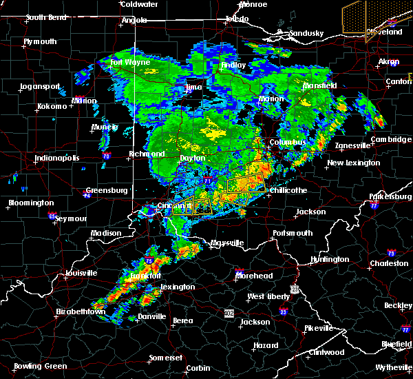 The severe thunderstorm warning for southeastern warren and northern clermont counties will expire at 1130 pm edt, the storm which prompted the warning has moved out of the area. therefore the warning will be allowed to expire. a severe thunderstorm watch remains in effect until 100 am edt for southwestern ohio. please report previous wind damage or hail to the national weather service by going to our website at weather.gov/iln and submitting your report via social media. The severe thunderstorm warning for southeastern warren and northern clermont counties will expire at 1130 pm edt, the storm which prompted the warning has moved out of the area. therefore the warning will be allowed to expire. a severe thunderstorm watch remains in effect until 100 am edt for southwestern ohio. please report previous wind damage or hail to the national weather service by going to our website at weather.gov/iln and submitting your report via social media.
|
| 7/13/2016 11:12 PM EDT |
 At 1112 pm edt, a severe thunderstorm was located near batavia, moving east at 40 mph (radar indicated). Hazards include 60 mph wind gusts and penny size hail. Expect damage to roofs. siding. and trees. Locations impacted include, milford, batavia, woodville, owensville, goshen, newtonsville, butlerville, pleasant plain, springvale, perintown, willowville, day heights, edenton, mount repose, mulberry and summerside. At 1112 pm edt, a severe thunderstorm was located near batavia, moving east at 40 mph (radar indicated). Hazards include 60 mph wind gusts and penny size hail. Expect damage to roofs. siding. and trees. Locations impacted include, milford, batavia, woodville, owensville, goshen, newtonsville, butlerville, pleasant plain, springvale, perintown, willowville, day heights, edenton, mount repose, mulberry and summerside.
|
| 7/13/2016 10:58 PM EDT |
 At 1058 pm edt, a severe thunderstorm was located over terrace park, moving east at 40 mph (radar indicated). Hazards include 60 mph wind gusts and penny size hail. Expect damage to roofs. siding. And trees. At 1058 pm edt, a severe thunderstorm was located over terrace park, moving east at 40 mph (radar indicated). Hazards include 60 mph wind gusts and penny size hail. Expect damage to roofs. siding. And trees.
|
| 7/8/2016 12:56 PM EDT |
 The severe thunderstorm warning for northern clermont and western brown counties will expire at 100 pm edt, the storms which prompted the warning have weakened below severe limits, and no longer pose an immediate threat to life or property. therefore the warning will be allowed to expire. these storms will remain capable of gusty winds to 40 mph and frequent lightning. a severe thunderstorm watch remains in effect until 600 pm edt for northern kentucky, and southwestern ohio. please report previous wind damage or hail to the national weather service by going to our website at weather.gov/iln and submitting your report via social media. The severe thunderstorm warning for northern clermont and western brown counties will expire at 100 pm edt, the storms which prompted the warning have weakened below severe limits, and no longer pose an immediate threat to life or property. therefore the warning will be allowed to expire. these storms will remain capable of gusty winds to 40 mph and frequent lightning. a severe thunderstorm watch remains in effect until 600 pm edt for northern kentucky, and southwestern ohio. please report previous wind damage or hail to the national weather service by going to our website at weather.gov/iln and submitting your report via social media.
|
| 7/8/2016 12:47 PM EDT |
 At 1246 pm edt, severe thunderstorms were located along a line extending from milford to georgetown, moving northeast at 40 mph (radar indicated). Hazards include 60 mph wind gusts. Expect damage to roofs. siding. and trees. Locations impacted include, milford, georgetown, mount orab, bethel, williamsburg, batavia, owensville, hamersville, goshen, newtonsville, fayetteville, higginsport, clermont county airport, greenbush, locust ridge, edenton, feesburg, chasetown and perintown. At 1246 pm edt, severe thunderstorms were located along a line extending from milford to georgetown, moving northeast at 40 mph (radar indicated). Hazards include 60 mph wind gusts. Expect damage to roofs. siding. and trees. Locations impacted include, milford, georgetown, mount orab, bethel, williamsburg, batavia, owensville, hamersville, goshen, newtonsville, fayetteville, higginsport, clermont county airport, greenbush, locust ridge, edenton, feesburg, chasetown and perintown.
|
| 7/8/2016 12:40 PM EDT | Multiple trees down in batavia twnshp. time estimated by rada in clermont county OH, 0.1 miles NNW of Batavia, OH |
| 7/8/2016 12:35 PM EDT |
 At 1235 pm edt, severe thunderstorms were located along a line extending from anderson township to neville, moving northeast at 40 mph (radar indicated). Hazards include 60 mph wind gusts. Expect damage to roofs. siding. And trees. At 1235 pm edt, severe thunderstorms were located along a line extending from anderson township to neville, moving northeast at 40 mph (radar indicated). Hazards include 60 mph wind gusts. Expect damage to roofs. siding. And trees.
|
| 6/23/2016 5:08 AM EDT |
 At 507 am edt, a severe thunderstorm was located over new richmond, moving southeast at 55 mph (radar indicated). Hazards include 60 mph wind gusts and nickel size hail. Expect damage to roofs. siding. and trees. locations impacted include, cincinnati, covington, florence, independence, erlanger, fort thomas, newport, edgewood, alexandria, elsmere, fort mitchell, villa hills, highland heights, milford, taylor mill, bellevue, fort wright, dayton, southgate and crescent springs. A tornado watch remains in effect until 700 am edt for northern kentucky, and southwestern ohio. At 507 am edt, a severe thunderstorm was located over new richmond, moving southeast at 55 mph (radar indicated). Hazards include 60 mph wind gusts and nickel size hail. Expect damage to roofs. siding. and trees. locations impacted include, cincinnati, covington, florence, independence, erlanger, fort thomas, newport, edgewood, alexandria, elsmere, fort mitchell, villa hills, highland heights, milford, taylor mill, bellevue, fort wright, dayton, southgate and crescent springs. A tornado watch remains in effect until 700 am edt for northern kentucky, and southwestern ohio.
|
| 6/23/2016 4:48 AM EDT |
 At 448 am edt, a severe thunderstorm was located over ludlow, moving southeast at 55 mph (radar indicated). Hazards include 60 mph wind gusts and quarter size hail. Hail damage to vehicles is expected. Expect wind damage to roofs, siding, and trees. At 448 am edt, a severe thunderstorm was located over ludlow, moving southeast at 55 mph (radar indicated). Hazards include 60 mph wind gusts and quarter size hail. Hail damage to vehicles is expected. Expect wind damage to roofs, siding, and trees.
|
| 5/1/2016 6:41 PM EDT |
 At 640 pm edt, a severe thunderstorm was located over ludlow, moving northeast at 20 mph (radar indicated). Hazards include 60 mph wind gusts and quarter size hail. Hail damage to vehicles is expected. Expect wind damage to roofs, siding, and trees. At 640 pm edt, a severe thunderstorm was located over ludlow, moving northeast at 20 mph (radar indicated). Hazards include 60 mph wind gusts and quarter size hail. Hail damage to vehicles is expected. Expect wind damage to roofs, siding, and trees.
|
| 4/26/2016 6:54 PM EDT |
 The severe thunderstorm warning for northern kenton, central campbell, central clermont and southeastern hamilton counties will expire at 700 pm edt, the severe thunderstorm which prompted the warning has weakened. therefore the warning will be allowed to expire. a severe thunderstorm watch remains in effect until 200 am edt for northern kentucky, and southwestern ohio. please report previous wind damage or hail to the national weather service by going to our website at weather.gov/iln and submitting your report via social media. The severe thunderstorm warning for northern kenton, central campbell, central clermont and southeastern hamilton counties will expire at 700 pm edt, the severe thunderstorm which prompted the warning has weakened. therefore the warning will be allowed to expire. a severe thunderstorm watch remains in effect until 200 am edt for northern kentucky, and southwestern ohio. please report previous wind damage or hail to the national weather service by going to our website at weather.gov/iln and submitting your report via social media.
|
| 4/26/2016 6:54 PM EDT |
 At 654 pm edt, severe thunderstorms were located along a line extending from near peebles to near amelia, moving east at 15 mph (radar indicated). Hazards include 60 mph wind gusts and quarter size hail. Hail damage to vehicles is expected. expect wind damage to roofs, siding, and trees. Locations impacted include, amelia, mount orab, bethel, williamsburg, peebles, batavia, winchester, sardinia, seaman, withamsville, emerald, hamersville, mowrystown, cherry fork, state route 32 at us route 62, lake waynoka, clermont county airport, state route 32 at us route 68, new palestine and locust ridge. At 654 pm edt, severe thunderstorms were located along a line extending from near peebles to near amelia, moving east at 15 mph (radar indicated). Hazards include 60 mph wind gusts and quarter size hail. Hail damage to vehicles is expected. expect wind damage to roofs, siding, and trees. Locations impacted include, amelia, mount orab, bethel, williamsburg, peebles, batavia, winchester, sardinia, seaman, withamsville, emerald, hamersville, mowrystown, cherry fork, state route 32 at us route 62, lake waynoka, clermont county airport, state route 32 at us route 68, new palestine and locust ridge.
|
| 4/26/2016 6:37 PM EDT |
 At 636 pm edt, radar indicated a severe thunderstorm located over silver grove, moving east at 25 mph. storm hazards include, winds to 60 mph, quarter size hail,. At 636 pm edt, radar indicated a severe thunderstorm located over silver grove, moving east at 25 mph. storm hazards include, winds to 60 mph, quarter size hail,.
|
| 4/26/2016 6:30 PM EDT |
 At 629 pm edt, severe thunderstorms were located along a line extending from peebles to near withamsville, moving east at 15 mph (radar indicated). Hazards include 60 mph wind gusts and quarter size hail. Hail damage to vehicles is expected. Expect wind damage to roofs, siding, and trees. At 629 pm edt, severe thunderstorms were located along a line extending from peebles to near withamsville, moving east at 15 mph (radar indicated). Hazards include 60 mph wind gusts and quarter size hail. Hail damage to vehicles is expected. Expect wind damage to roofs, siding, and trees.
|
| 4/26/2016 6:21 PM EDT |
 At 620 pm edt, a severe thunderstorm was located near batavia, moving east at 30 mph (trained weather spotters). Hazards include quarter size hail. Damage to vehicles is expected. Locations impacted include, forestville, amelia, mount orab, bethel, new richmond, williamsburg, batavia, withamsville, hamersville, clermont county airport, willowville, lindale, new palestine, east fork state park, locust ridge, blairsville, bantam, nicholsville, mount carmel and cherry grove. At 620 pm edt, a severe thunderstorm was located near batavia, moving east at 30 mph (trained weather spotters). Hazards include quarter size hail. Damage to vehicles is expected. Locations impacted include, forestville, amelia, mount orab, bethel, new richmond, williamsburg, batavia, withamsville, hamersville, clermont county airport, willowville, lindale, new palestine, east fork state park, locust ridge, blairsville, bantam, nicholsville, mount carmel and cherry grove.
|
| 4/26/2016 6:01 PM EDT |
 At 601 pm edt, a severe thunderstorm was located over forestville, moving east at 30 mph (trained weather spotters). Hazards include quarter size hail. damage to vehicles is expected At 601 pm edt, a severe thunderstorm was located over forestville, moving east at 30 mph (trained weather spotters). Hazards include quarter size hail. damage to vehicles is expected
|
| 3/31/2016 5:52 PM EDT |
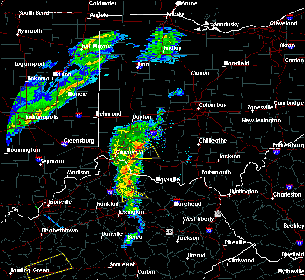 At 551 pm edt, radar indicated a severe thunderstorm located over batavia, moving east at 40 mph. storm hazards include, winds to 60 mph, penny size hail,. At 551 pm edt, radar indicated a severe thunderstorm located over batavia, moving east at 40 mph. storm hazards include, winds to 60 mph, penny size hail,.
|
| 12/23/2015 8:12 PM EST | At 812 pm est, radar indicated severe thunderstorms located along a line extending from near new richmond to near falmouth, moving east at 70 mph. storm hazards include, damaging winds to 70 mph, penny size hail, frequent cloud to ground lightning, very heavy rain which may cause minor flooding,. |
| 12/23/2015 8:12 PM EST | At 812 pm est, radar indicated severe thunderstorms located along a line extending from near new richmond to near falmouth, moving east at 70 mph. storm hazards include, damaging winds to 70 mph, penny size hail, frequent cloud to ground lightning, very heavy rain which may cause minor flooding,. |
| 7/13/2015 1:48 PM EDT | Tree limb down on fence. time estimated from rada in clermont county OH, 0.1 miles NNW of Batavia, OH |
| 7/13/2015 1:34 PM EDT |
 At 132 pm edt, radar indicated severe thunderstorms located along a line extending from montgomery to 11 miles east of vernon, moving south at 40 mph. storm hazards include, winds to 60 mph, penny size hail, frequent cloud to ground lightning, very heavy rain which may cause minor flooding,. At 132 pm edt, radar indicated severe thunderstorms located along a line extending from montgomery to 11 miles east of vernon, moving south at 40 mph. storm hazards include, winds to 60 mph, penny size hail, frequent cloud to ground lightning, very heavy rain which may cause minor flooding,.
|
| 6/30/2015 2:52 PM EDT |
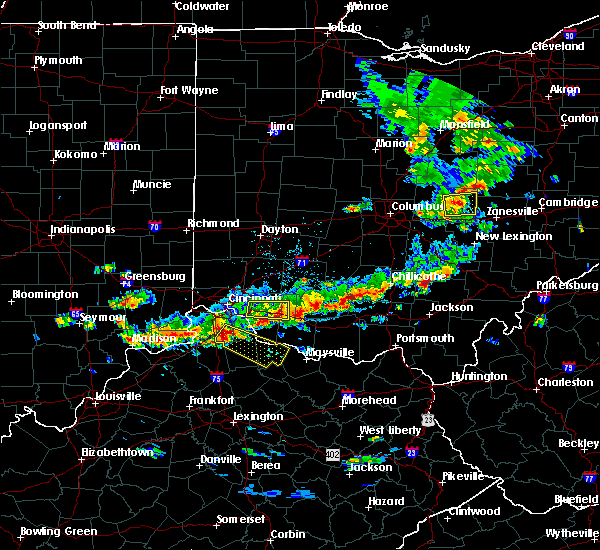 At 251 pm edt, radar continued to indicate a severe thunderstorm located 6 miles northeast of williamsburg, moving east at 20 mph. storm hazards include, winds to 60 mph, quarter size hail, this storm will affect mainly rural areas of central clermont and northwestern brown counties. At 251 pm edt, radar continued to indicate a severe thunderstorm located 6 miles northeast of williamsburg, moving east at 20 mph. storm hazards include, winds to 60 mph, quarter size hail, this storm will affect mainly rural areas of central clermont and northwestern brown counties.
|
| 6/30/2015 2:32 PM EDT |
 At 231 pm edt, radar indicated a severe thunderstorm located near owensville, moving east at 20 mph. storm hazards include, winds to 60 mph, quarter size hail, * the severe thunderstorm will affect mainly rural areas of central clermont and northwestern brown counties, including williamsburg and chasetown. At 231 pm edt, radar indicated a severe thunderstorm located near owensville, moving east at 20 mph. storm hazards include, winds to 60 mph, quarter size hail, * the severe thunderstorm will affect mainly rural areas of central clermont and northwestern brown counties, including williamsburg and chasetown.
|
| 5/26/2015 5:16 PM EDT | At 514 pm edt, radar continued to indicate a severe thunderstorm located near lindale, moving northeast at 30 mph. storm hazards include, winds to 60 mph, quarter size hail, locations impacted include, amelia and batavia. in addition, nicholsville, lindale, bantam, east fork state park, williamsburg and owensville are near the path of this storm. |
| 5/26/2015 5:05 PM EDT | At 504 pm edt, radar continued to indicate a severe thunderstorm located near california, moving northeast at 40 mph. storm hazards include, winds to 60 mph, quarter size hail, locations impacted include, new richmond, amelia and batavia. in addition, nicholsville, lindale, bantam, east fork state park, clermont county airport, williamsburg and owensville are near the path of this storm. |
| 5/26/2015 5:05 PM EDT | At 504 pm edt, radar continued to indicate a severe thunderstorm located near california, moving northeast at 40 mph. storm hazards include, winds to 60 mph, quarter size hail, locations impacted include, new richmond, amelia and batavia. in addition, nicholsville, lindale, bantam, east fork state park, clermont county airport, williamsburg and owensville are near the path of this storm. |
| 5/26/2015 4:52 PM EDT | At 451 pm edt, radar indicated a severe thunderstorm located near grants lick, moving northeast at 35 mph. storm hazards include, winds to 60 mph, quarter size hail,. |
| 5/26/2015 4:52 PM EDT | At 451 pm edt, radar indicated a severe thunderstorm located near grants lick, moving northeast at 35 mph. storm hazards include, winds to 60 mph, quarter size hail,. |
| 5/11/2015 3:11 PM EDT | At 309 pm edt, radar continued to indicate a severe thunderstorm located near willowville, moving northeast at 40 mph. storm hazards include, winds to 60 mph, this storm will affect mainly rural areas of northern clermont county, including day heights, mulberry, mount repose, williamsburg, owensville, springvale, goshen, newtonsville and edenton. , <0.75in. |
| 5/11/2015 3:01 PM EDT | At 257 pm edt, radar continued to indicate a severe thunderstorm located near melbourne, moving northeast at 40 mph. storm hazards include, winds to 60 mph, locations impacted include, amelia, madeira, batavia, milford and loveland. in addition, nicholsville, lindale, cherry grove, fairfax, dry run, mariemont, newtown and withamsville are near the path of this storm. this includes the following interstate, i-71 between mile markers 8 and 14 in ohio, , <0.75in. |
| 5/11/2015 3:01 PM EDT | At 257 pm edt, radar continued to indicate a severe thunderstorm located near melbourne, moving northeast at 40 mph. storm hazards include, winds to 60 mph, locations impacted include, amelia, madeira, batavia, milford and loveland. in addition, nicholsville, lindale, cherry grove, fairfax, dry run, mariemont, newtown and withamsville are near the path of this storm. this includes the following interstate, i-71 between mile markers 8 and 14 in ohio, , <0.75in. |
| 5/11/2015 2:50 PM EDT | At 248 pm edt, radar indicated a severe thunderstorm located near white tower, moving northeast at 35 mph. storm hazards include, winds to 60 mph,. |
| 5/11/2015 2:50 PM EDT | At 248 pm edt, radar indicated a severe thunderstorm located near white tower, moving northeast at 35 mph. storm hazards include, winds to 60 mph,. |
| 4/10/2015 3:25 AM EDT | The national weather service in wilmington has issued a * severe thunderstorm warning for. western highland county in southwest ohio. clermont county in southwest ohio. warren county in southwest ohio. Southeastern greene county in west central ohio. |
| 4/10/2015 3:25 AM EDT | The national weather service in wilmington has issued a * severe thunderstorm warning for. western highland county in southwest ohio. clermont county in southwest ohio. warren county in southwest ohio. Southeastern greene county in west central ohio. |
| 4/10/2015 3:16 AM EDT | A severe thunderstorm warning remains in effect until 345 am edt for northwestern clermont. western warren. eastern hamilton. eastern butler. campbell and kenton counties. at 314 am edt. radar continued to indicate severe thunderstorms located along a line extending from middletown to crestview. Moving east at 60 mph. |
| 4/10/2015 3:16 AM EDT | A severe thunderstorm warning remains in effect until 345 am edt for northwestern clermont. western warren. eastern hamilton. eastern butler. campbell and kenton counties. at 314 am edt. radar continued to indicate severe thunderstorms located along a line extending from middletown to crestview. Moving east at 60 mph. |
| 4/10/2015 2:59 AM EDT | The national weather service in wilmington has issued a * severe thunderstorm warning for. northwestern clermont county in southwest ohio. western warren county in southwest ohio. hamilton county in southwest ohio. Butler county in southwest ohio. |
| 4/10/2015 2:59 AM EDT | The national weather service in wilmington has issued a * severe thunderstorm warning for. northwestern clermont county in southwest ohio. western warren county in southwest ohio. hamilton county in southwest ohio. Butler county in southwest ohio. |
| 4/9/2015 6:33 PM EDT | A severe thunderstorm warning remains in effect until 700 pm edt for northern clermont. southern warren. eastern hamilton and southeastern butler counties. at 631 pm edt. radar continued to indicate a severe thunderstorm located near silverton. moving northeast at 45 mph. Trained spotters have reported hail of up to one and a half inches in. |
| 4/9/2015 6:21 PM EDT | The national weather service in wilmington has issued a * severe thunderstorm warning for. northern clermont county in southwest ohio. southern warren county in southwest ohio. eastern hamilton county in southwest ohio. Southeastern butler county in southwest ohio. |
| 4/9/2015 6:21 PM EDT | The national weather service in wilmington has issued a * severe thunderstorm warning for. northern clermont county in southwest ohio. southern warren county in southwest ohio. eastern hamilton county in southwest ohio. Southeastern butler county in southwest ohio. |
| 4/9/2015 2:00 PM EDT | A severe thunderstorm warning remains in effect until 230 pm edt for clermont county. at 157 pm edt. radar continued to indicate a severe thunderstorm located near withamsville. moving northeast at 45 mph. storm hazards include. Winds to 60 mph. |
| 4/9/2015 1:48 PM EDT | The national weather service in wilmington has issued a * severe thunderstorm warning for. clermont county in southwest ohio. southeastern hamilton county in southwest ohio. campbell county in northern kentucky. Until 230 pm edt. |
| 4/9/2015 1:48 PM EDT | The national weather service in wilmington has issued a * severe thunderstorm warning for. clermont county in southwest ohio. southeastern hamilton county in southwest ohio. campbell county in northern kentucky. Until 230 pm edt. |
| 8/31/2013 8:00 AM EDT | Trees and limbs down. time estimate in clermont county OH, 0.1 miles NNW of Batavia, OH |
| 8/31/2013 7:57 AM EDT | Storm damage reported in clermont county OH, 1.6 miles E of Batavia, OH |
| 7/26/2012 4:05 PM EDT | Large branches and trees dow in clermont county OH, 0.1 miles NNW of Batavia, OH |
| 7/26/2012 4:00 PM EDT | Quarter sized hail reported 0.1 miles NNW of Batavia, OH, winds estimated to 40 mph. |
| 5/1/2012 6:25 PM EDT | Quarter sized hail reported 0.1 miles NNW of Batavia, OH |
| 1/1/0001 12:00 AM | 18 reports into dispatch of trees and wires down across ba in clermont county OH, 0.1 miles NNW of Batavia, OH |
| 1/1/0001 12:00 AM | Multiple trees downed along glendale driv in clermont county OH, 3 miles ESE of Batavia, OH |
Hail Maps for Batavia, OH


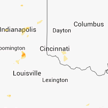


Connect with Interactive Hail Maps