

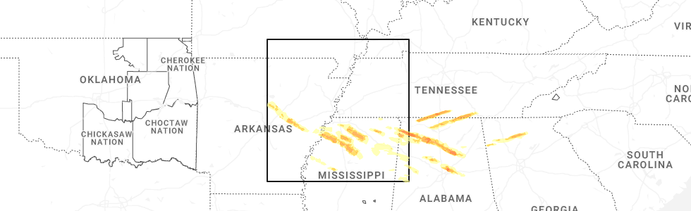
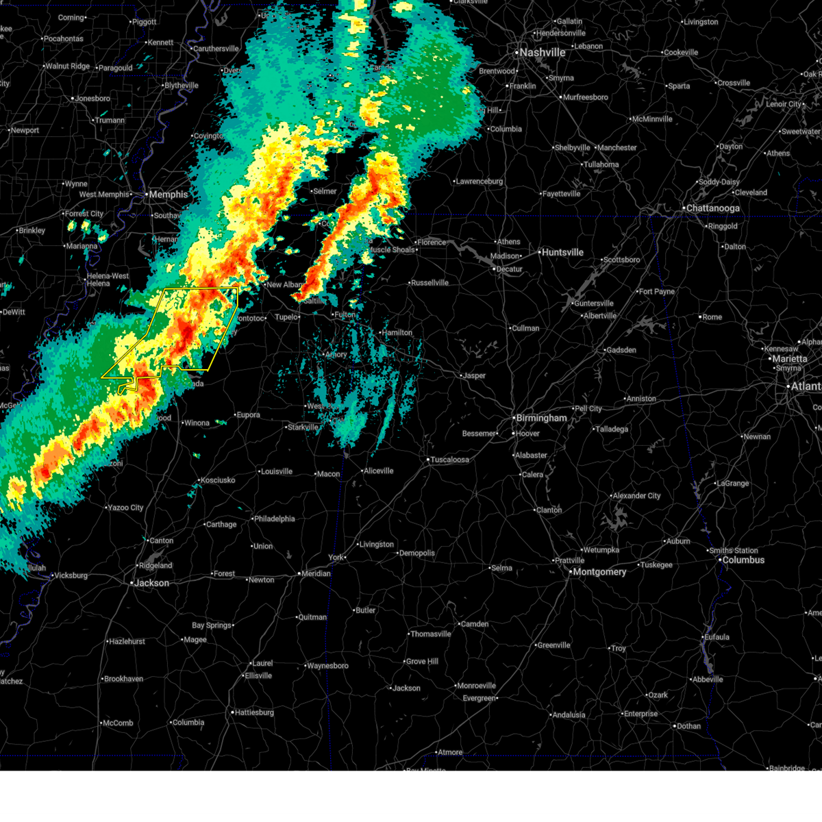
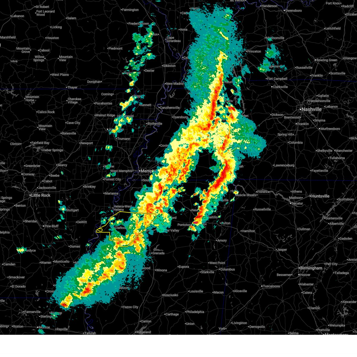
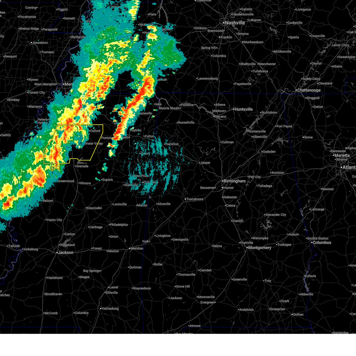
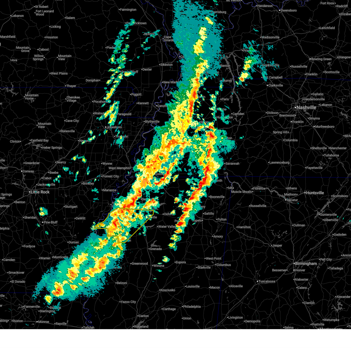
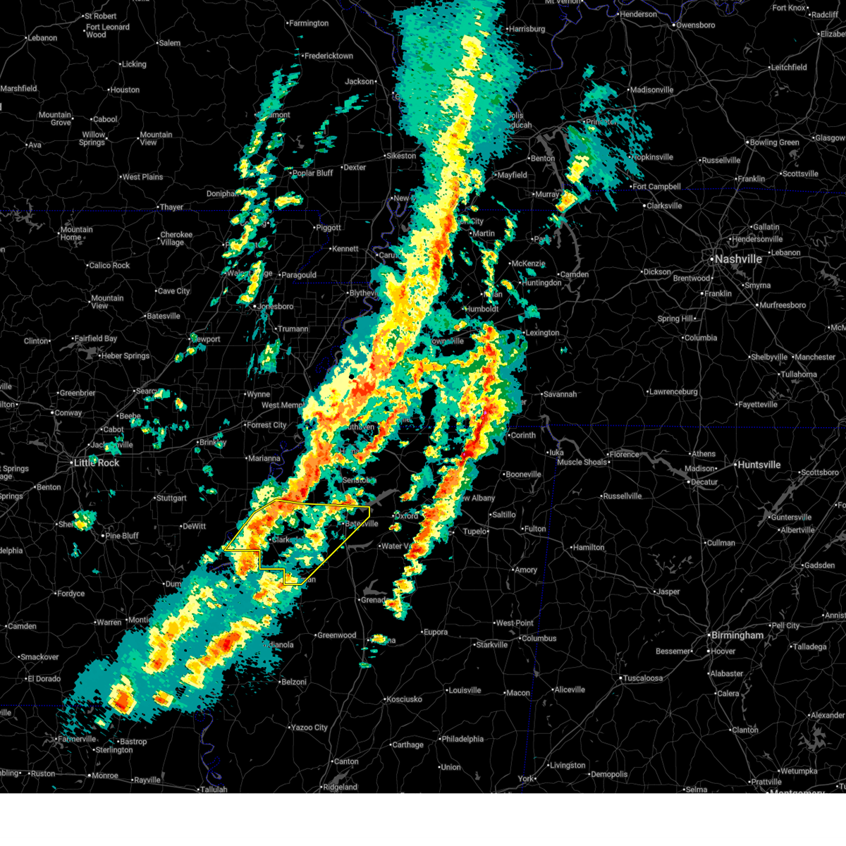
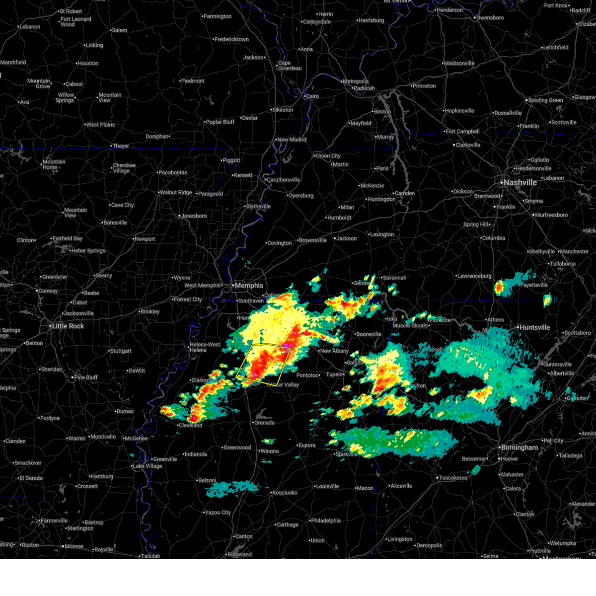
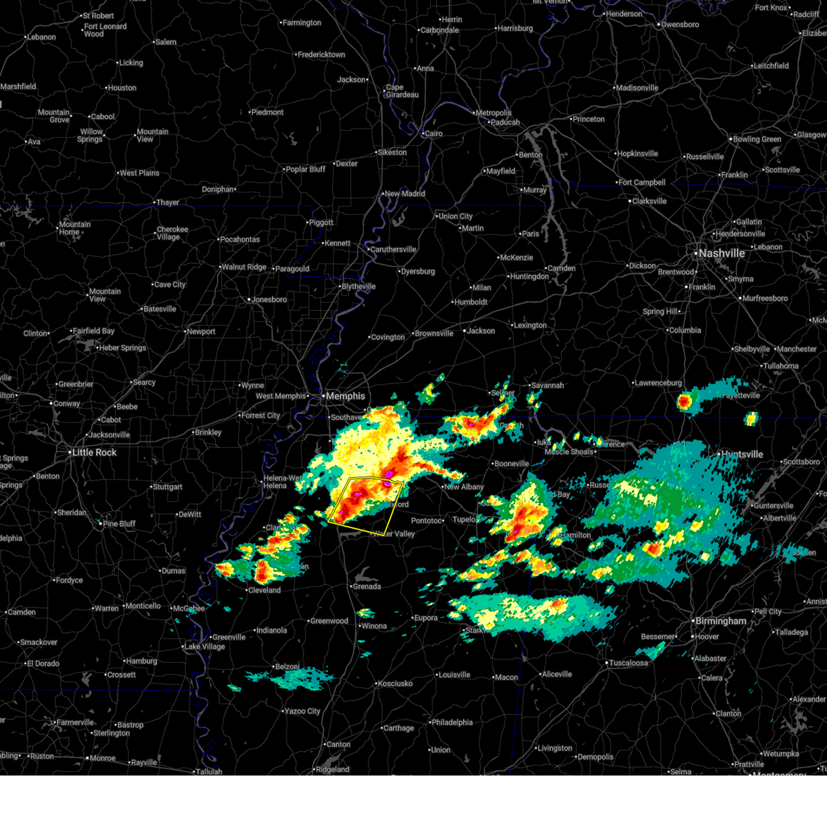
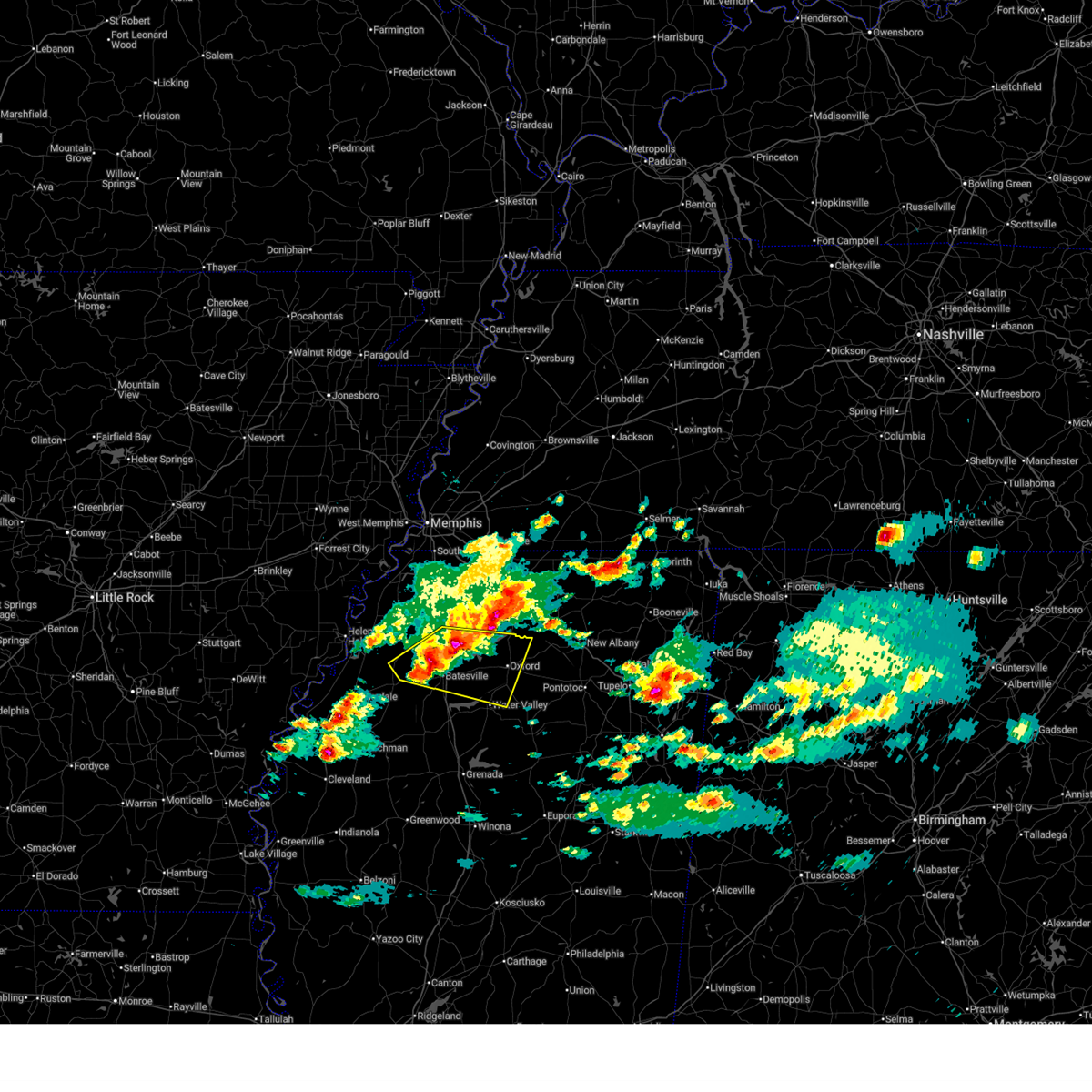
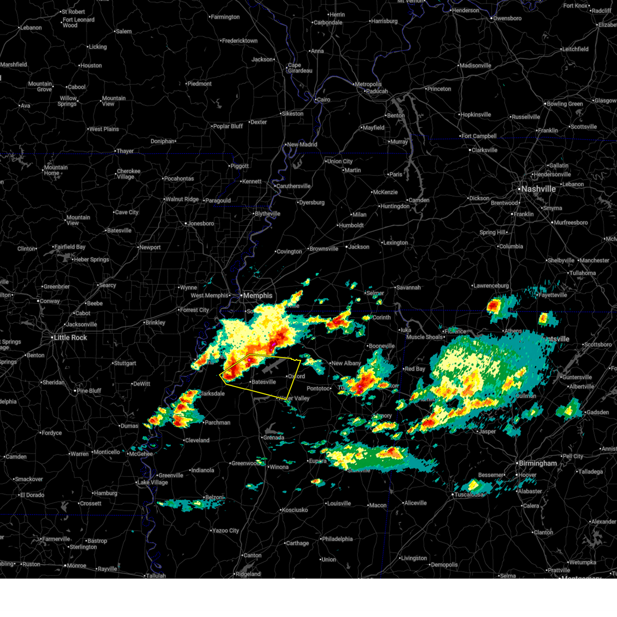
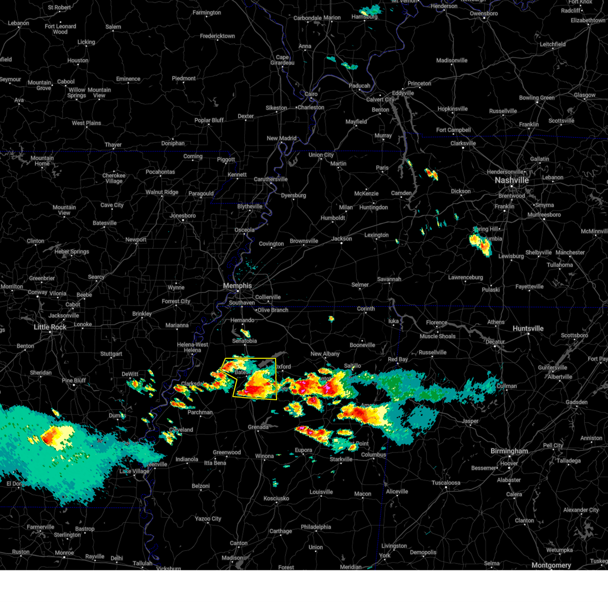
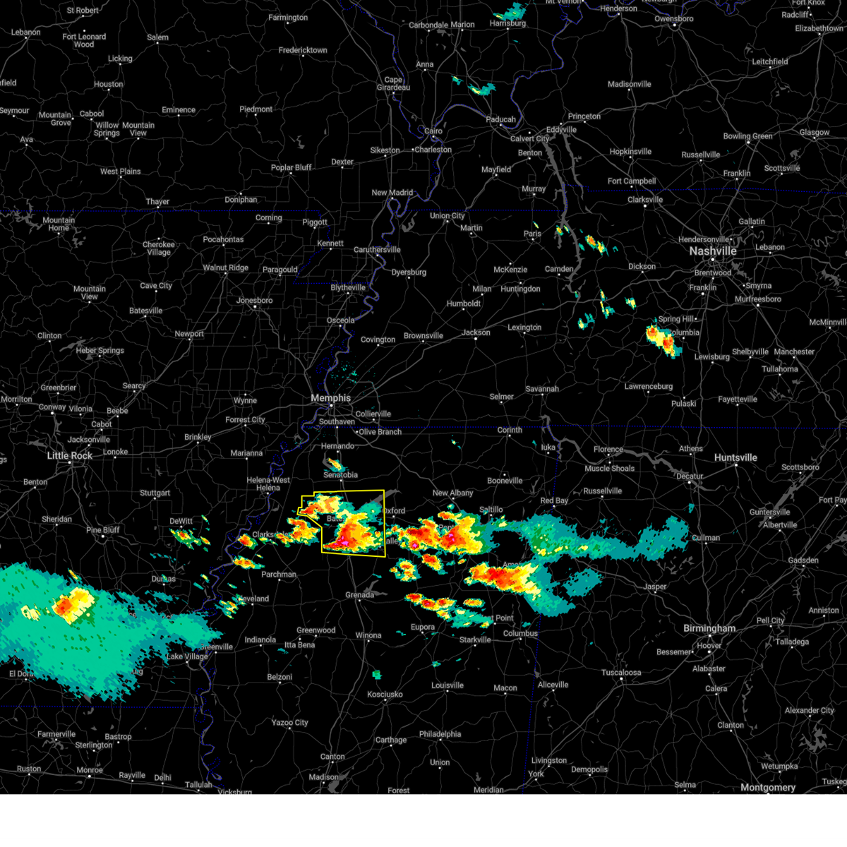
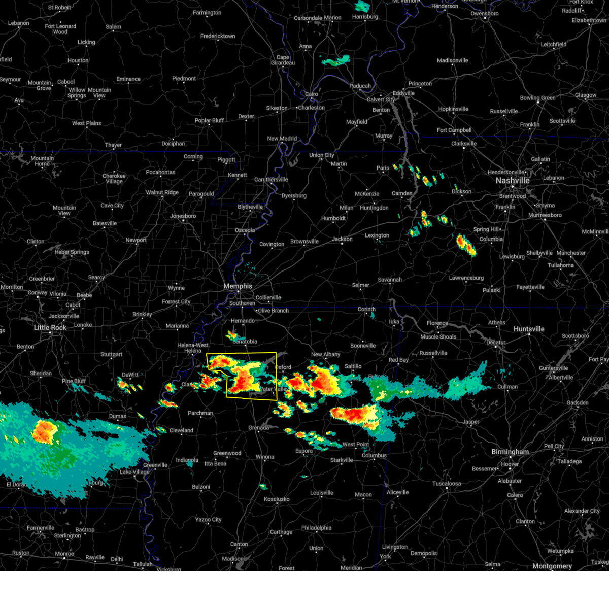
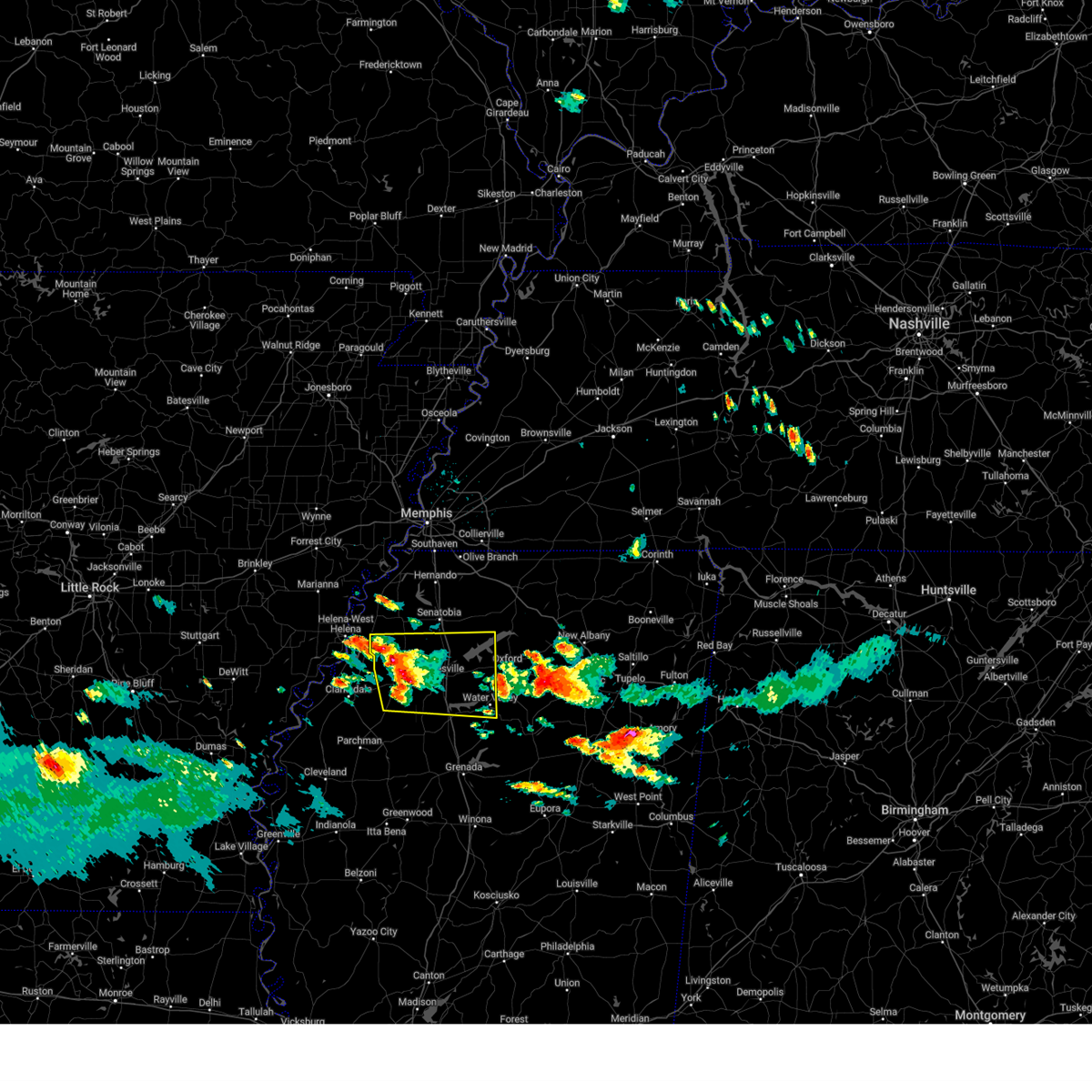
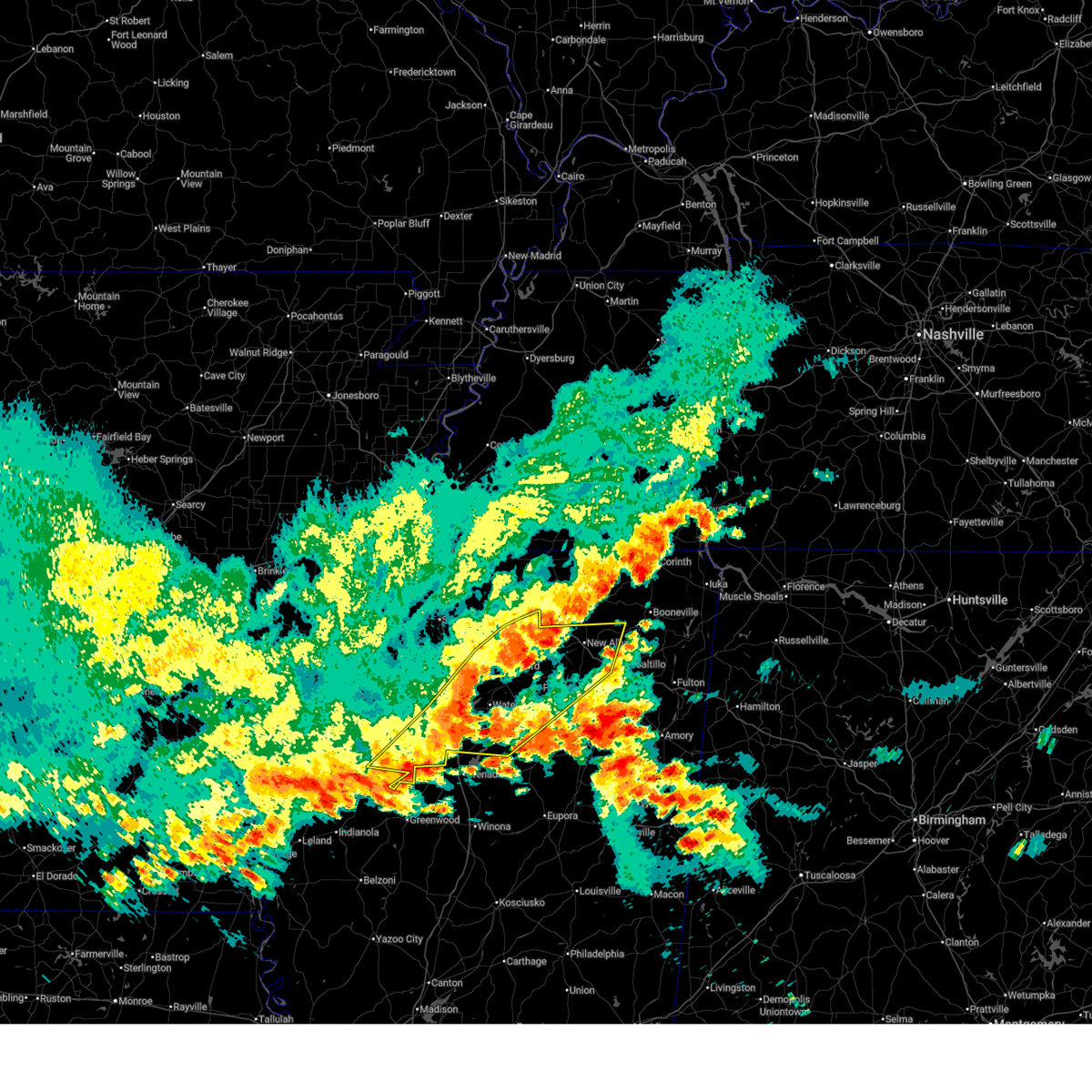
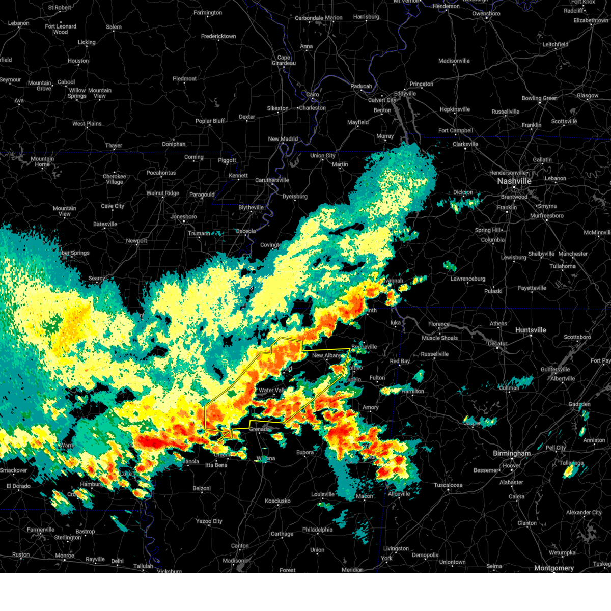
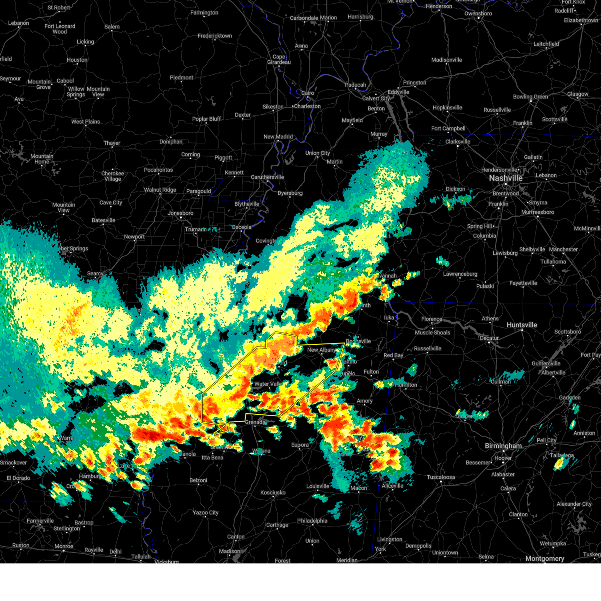
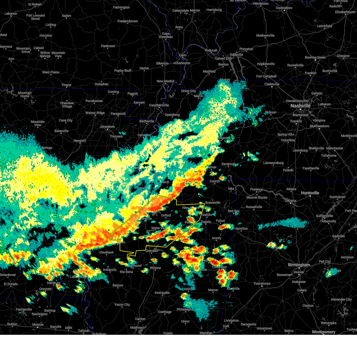
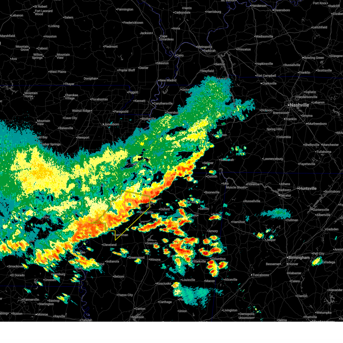
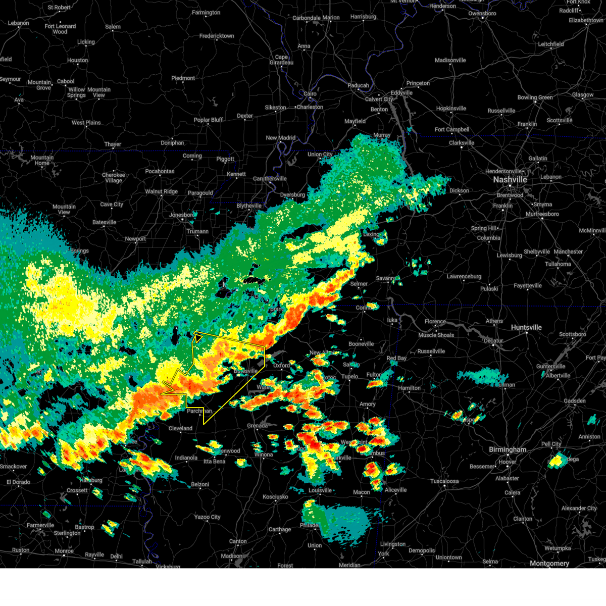
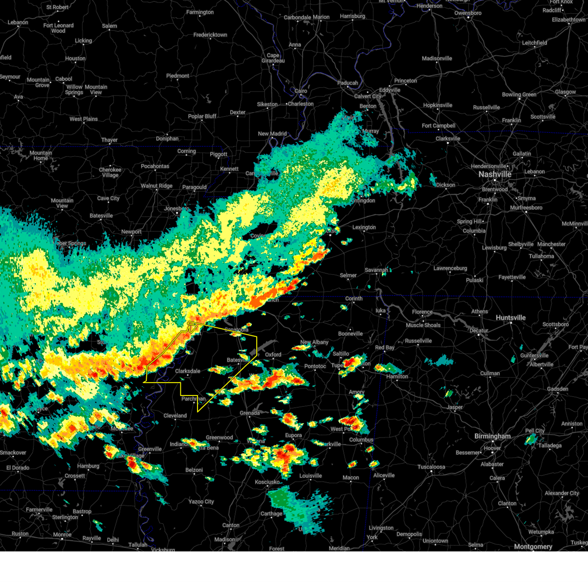
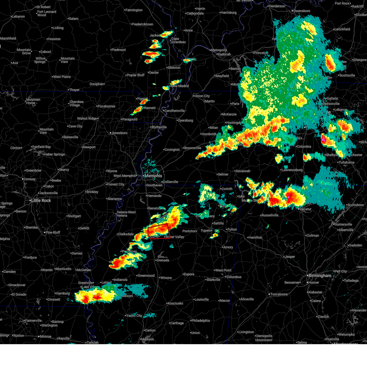
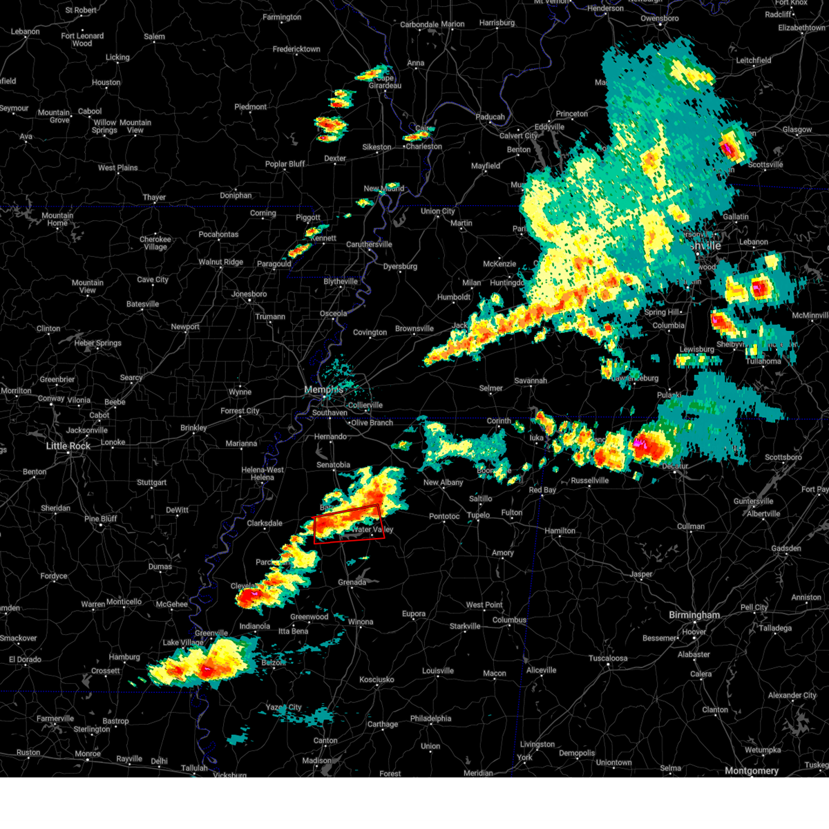
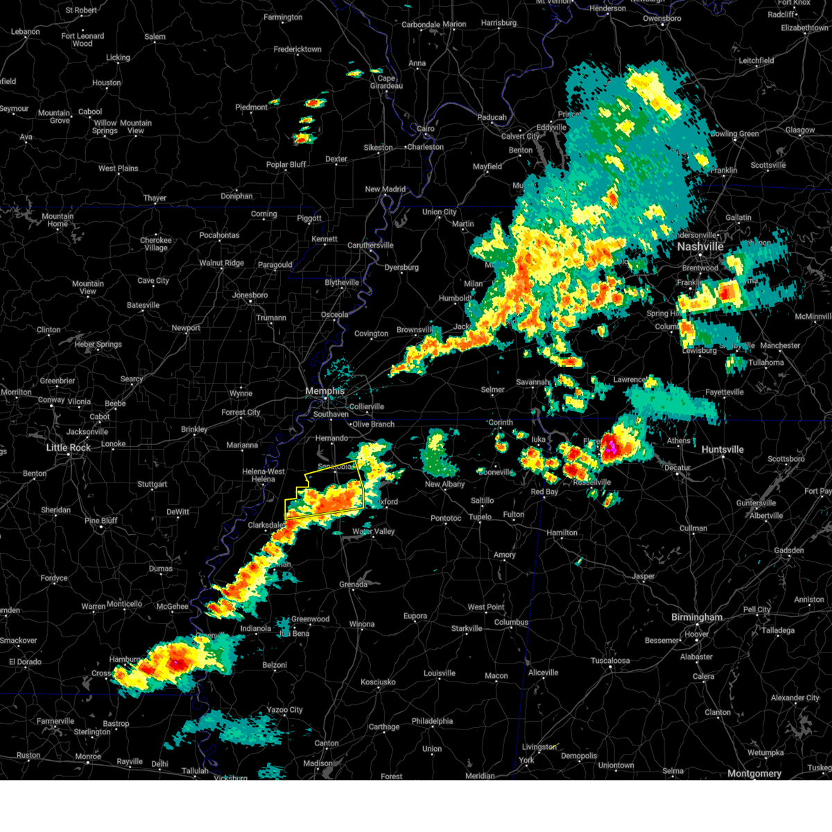
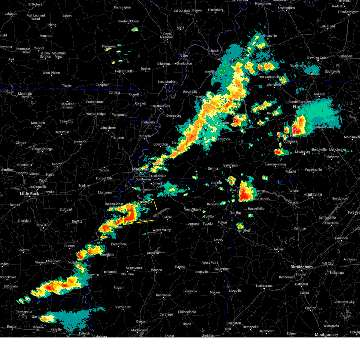
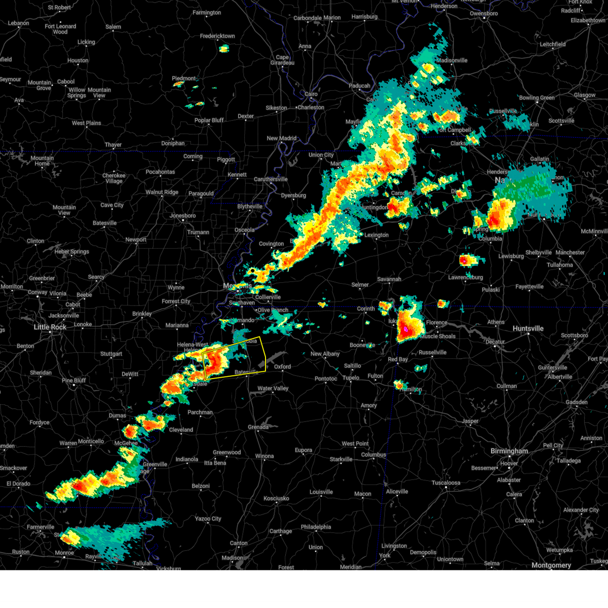
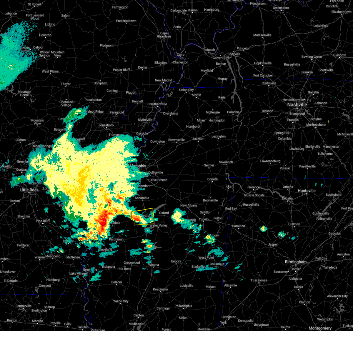
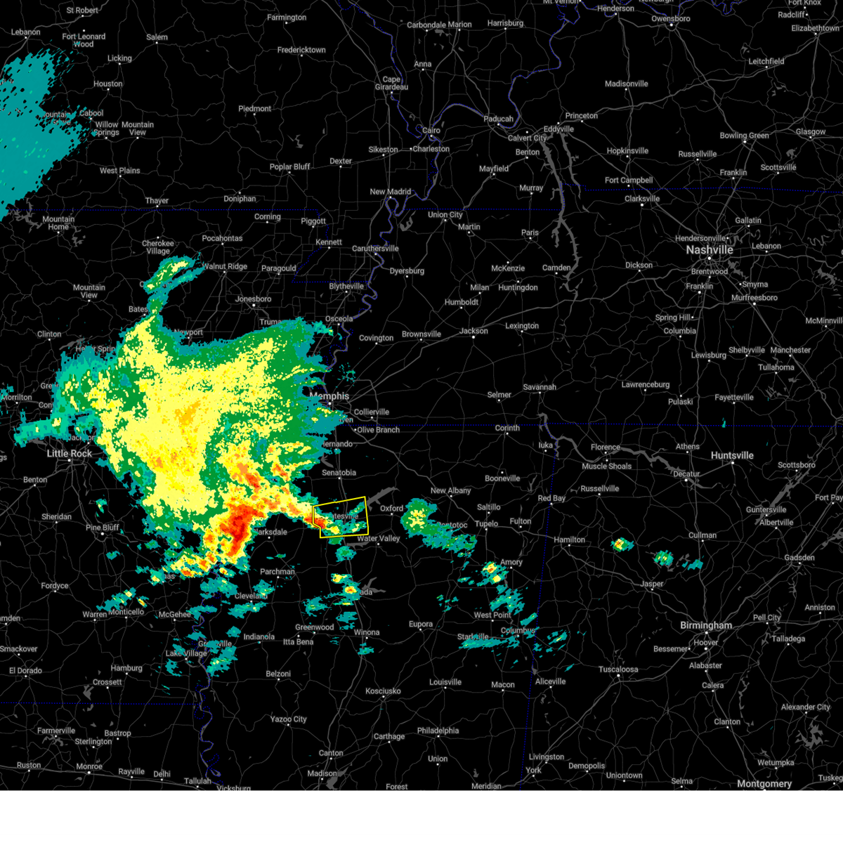
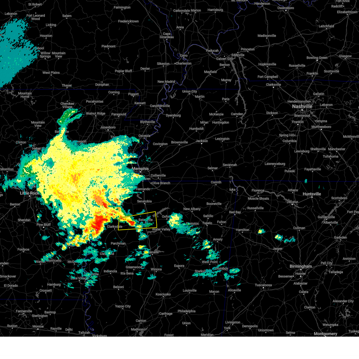
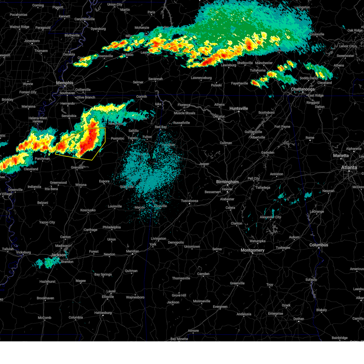
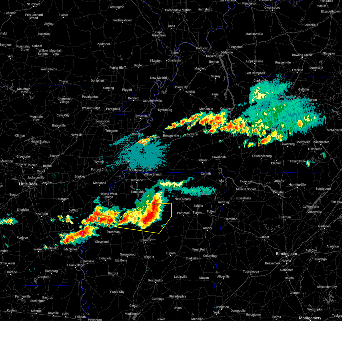
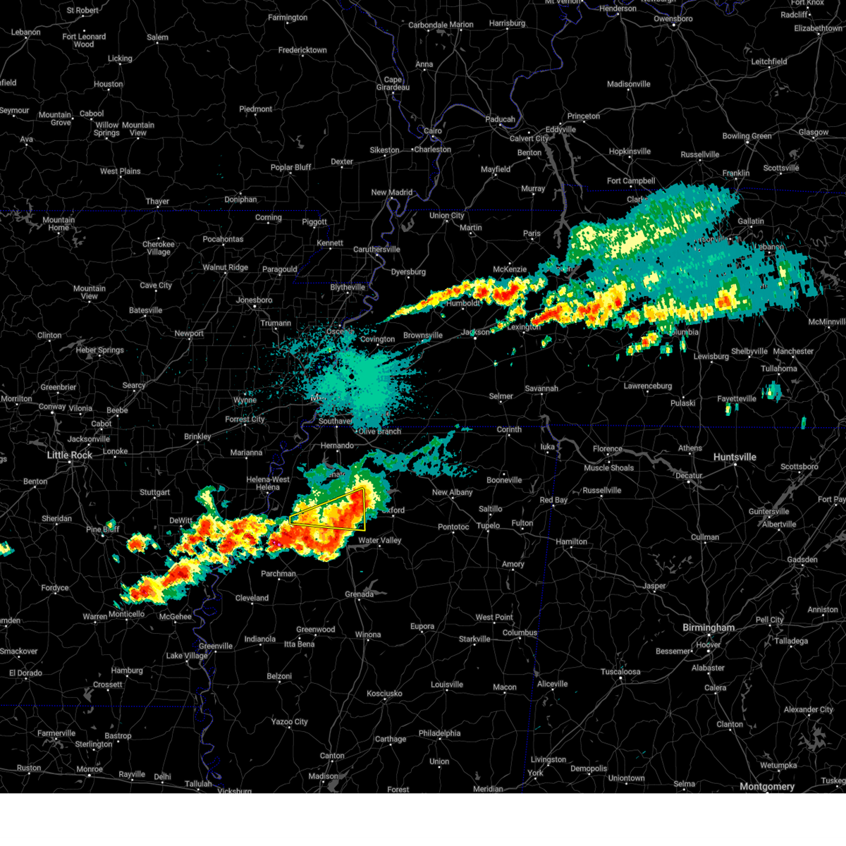
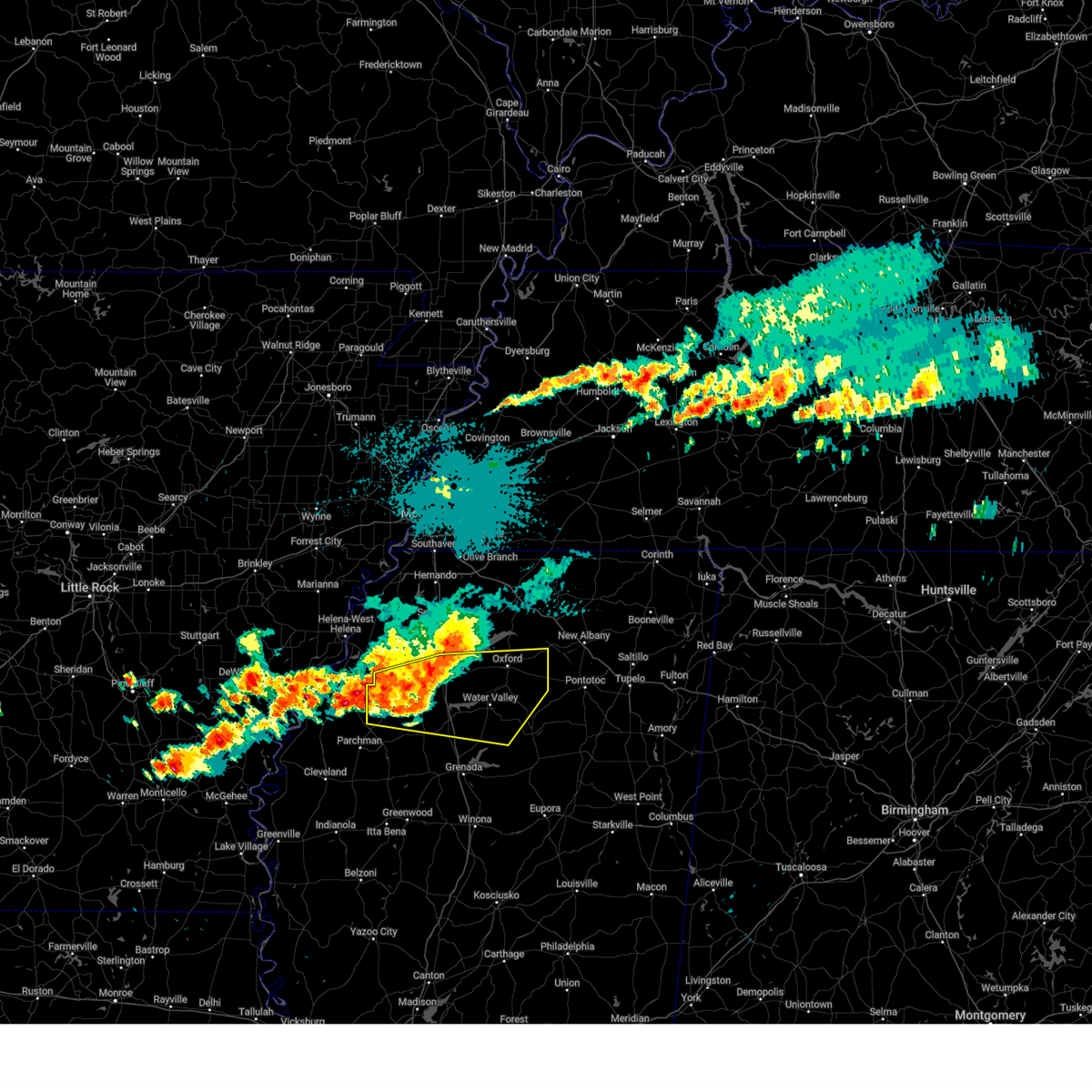
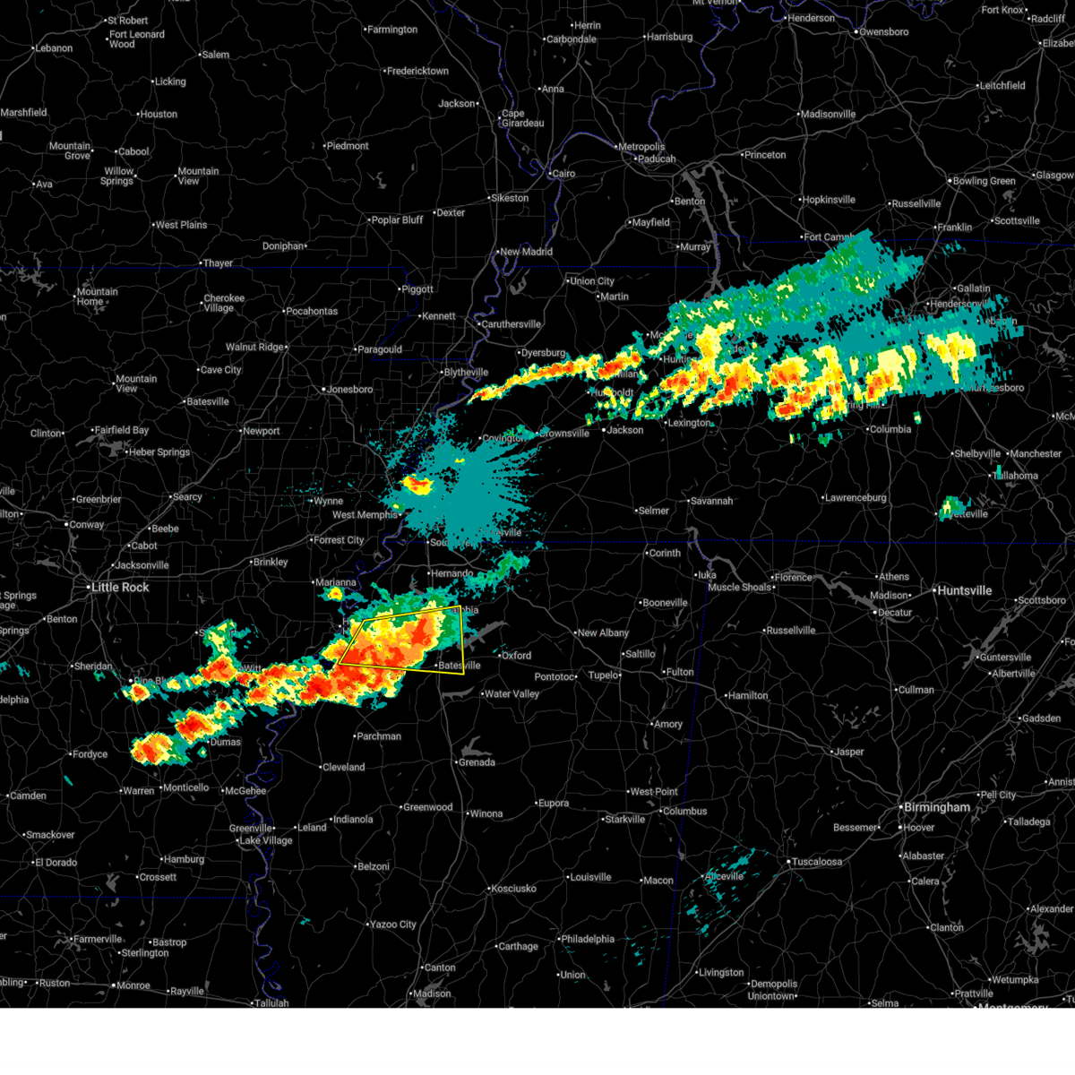
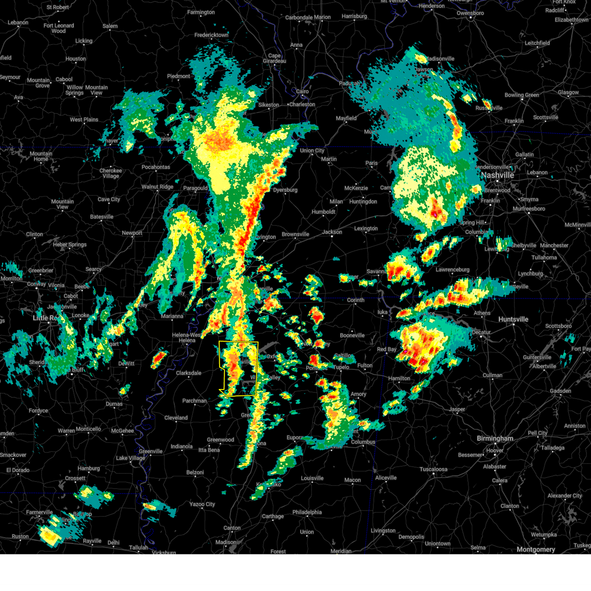
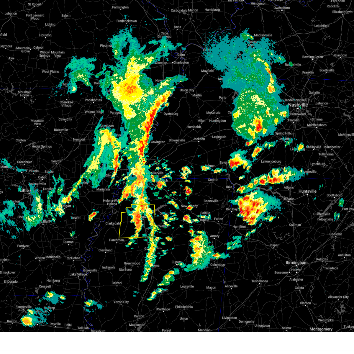
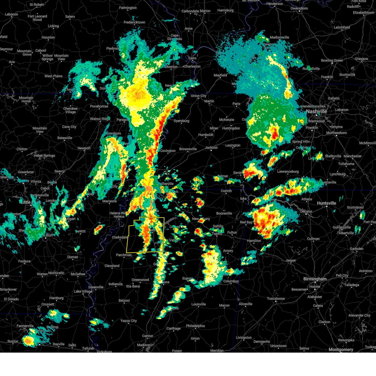
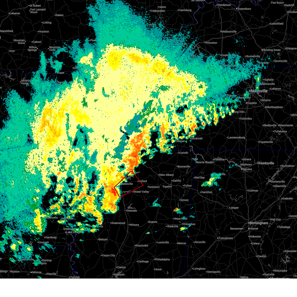
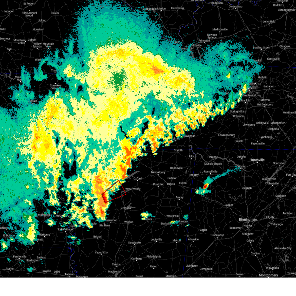
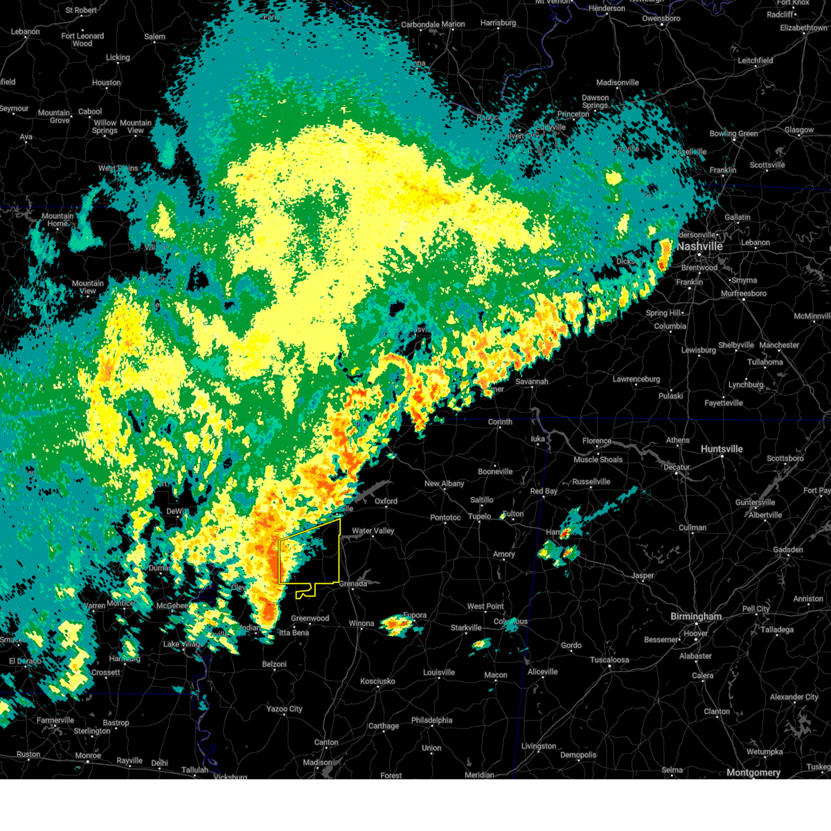
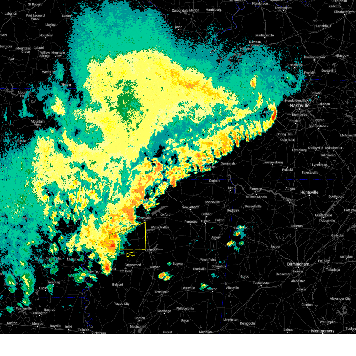
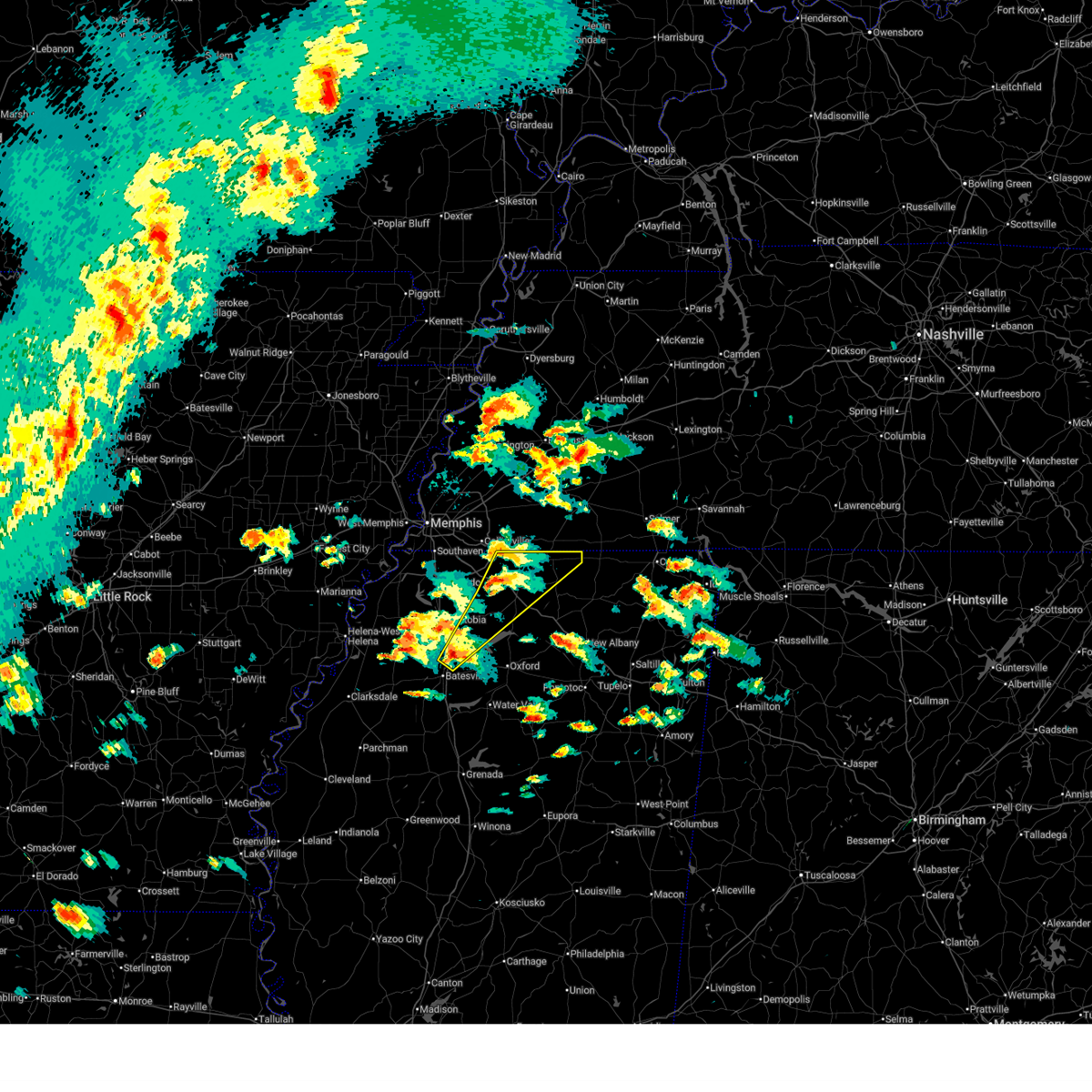
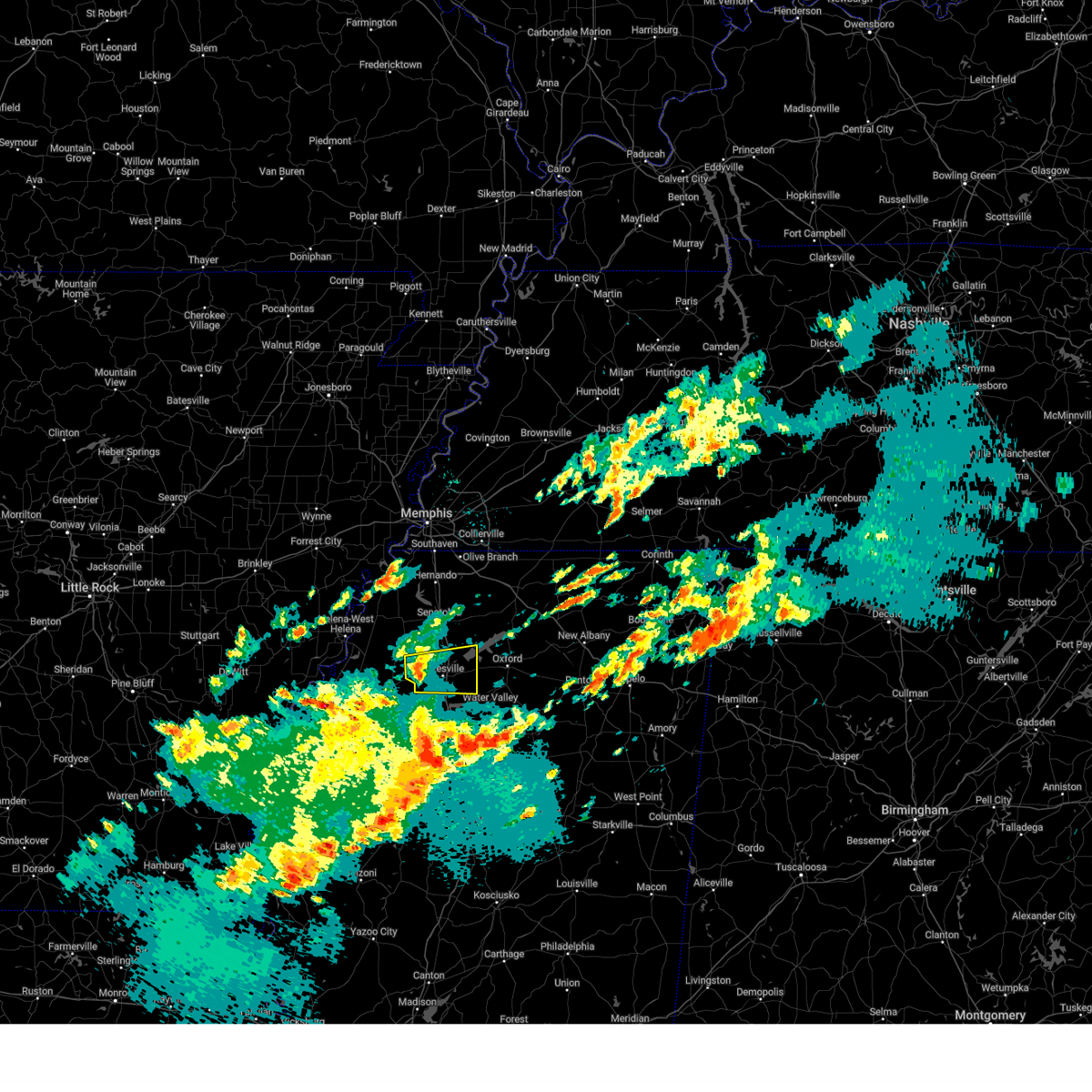
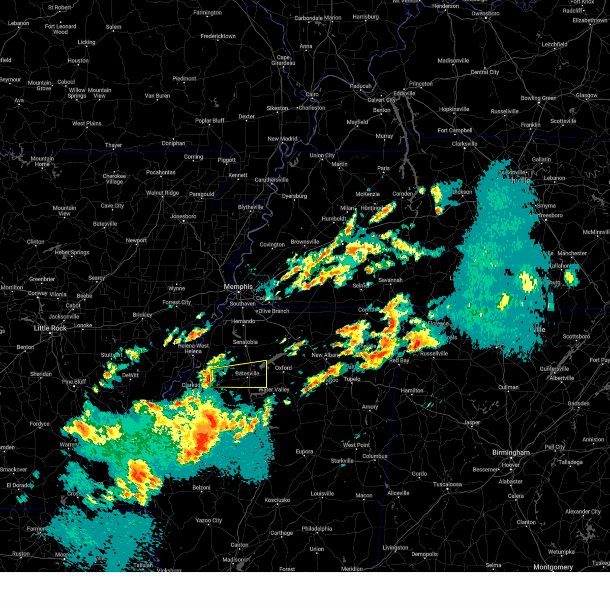
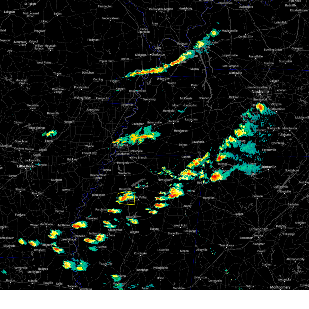
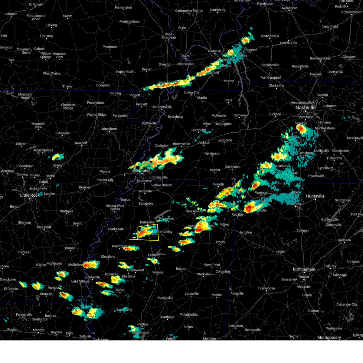
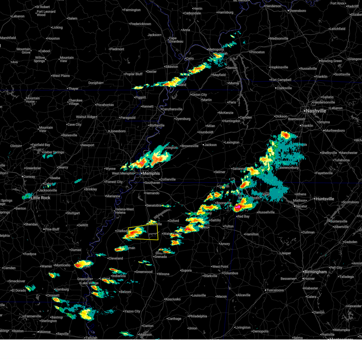
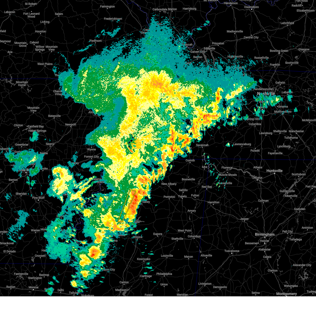
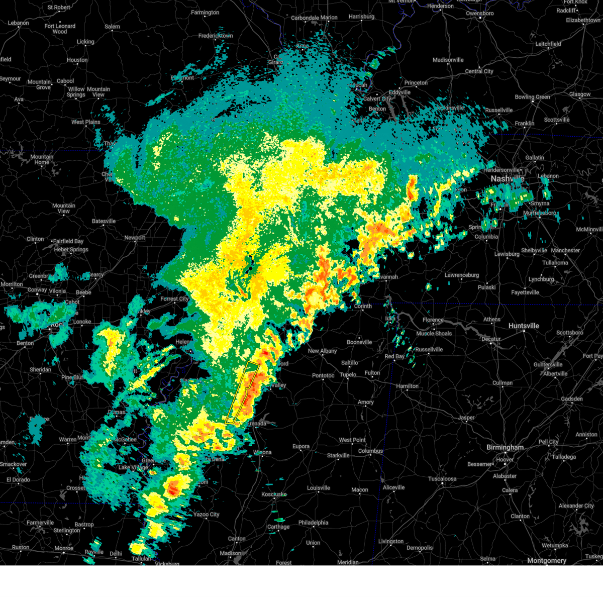
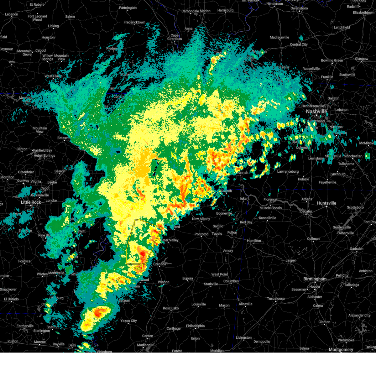
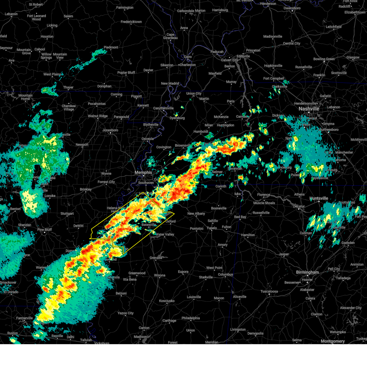
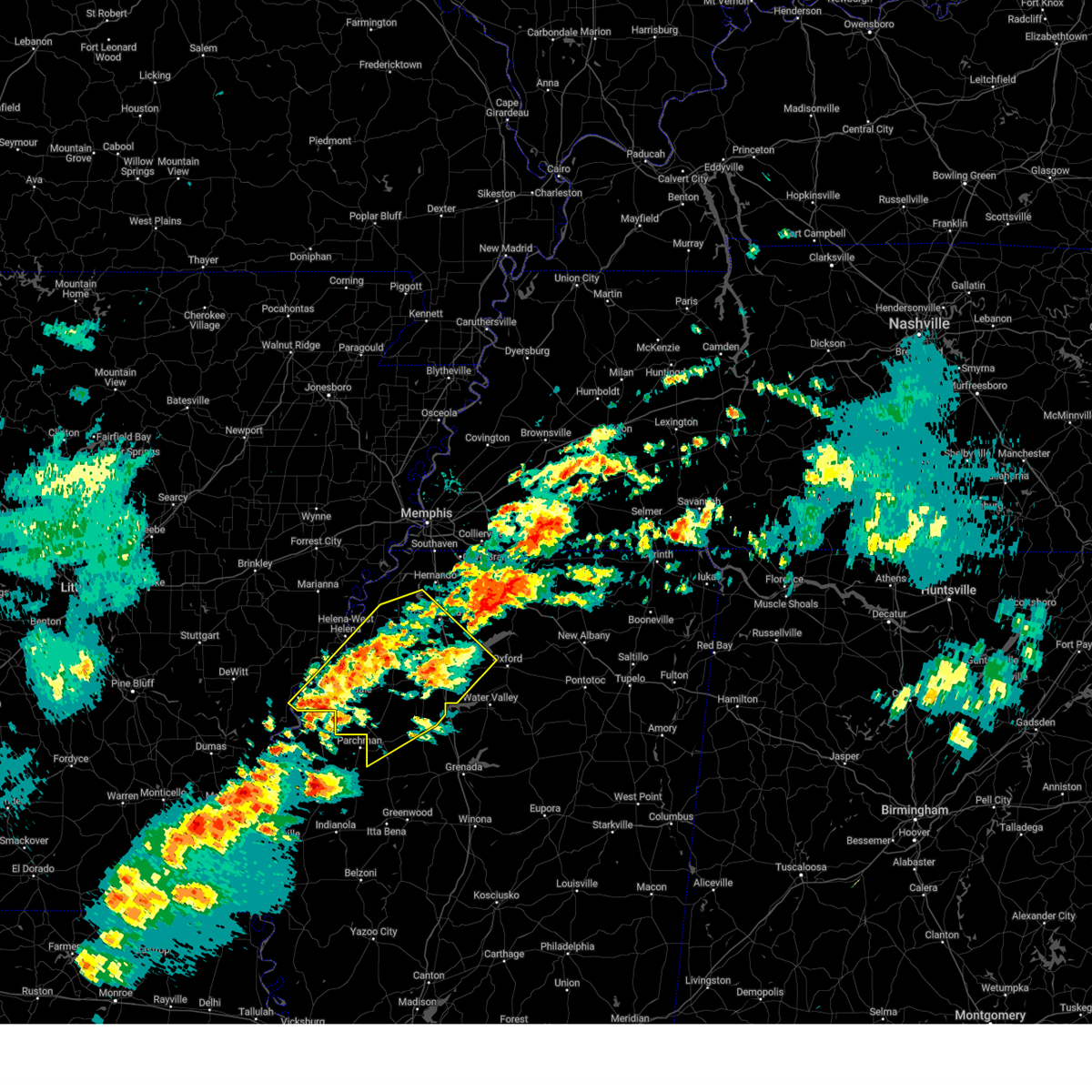
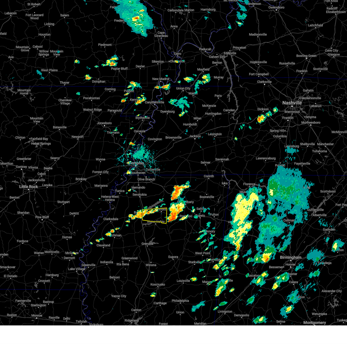
Hail Map for Batesville, MS
The Batesville, MS area has had 15 reports of on-the-ground hail by trained spotters, and has been under severe weather warnings 15 times during the past 12 months. Doppler radar has detected hail at or near Batesville, MS on 88 occasions, including 3 occasions during the past year.
| Name: | Batesville, MS |
| Where Located: | 58.1 miles S of Memphis, TN |
| Map: | Google Map for Batesville, MS |
| Population: | 7463 |
| Housing Units: | 3105 |
| More Info: | Search Google for Batesville, MS |
5
The Top Recent Hail Date for Batesville, MS is Thursday, February 26, 2026 (1st out of 88)
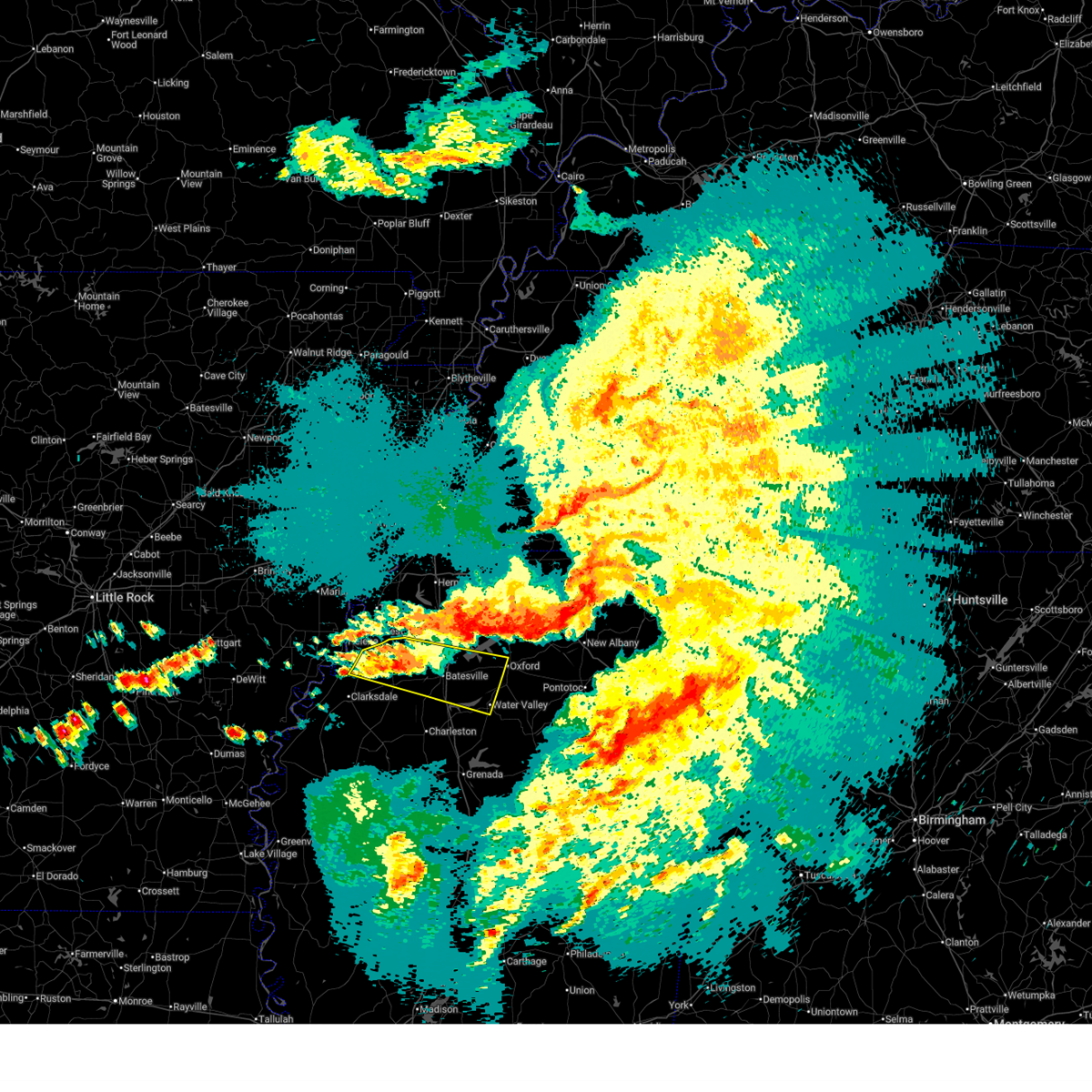
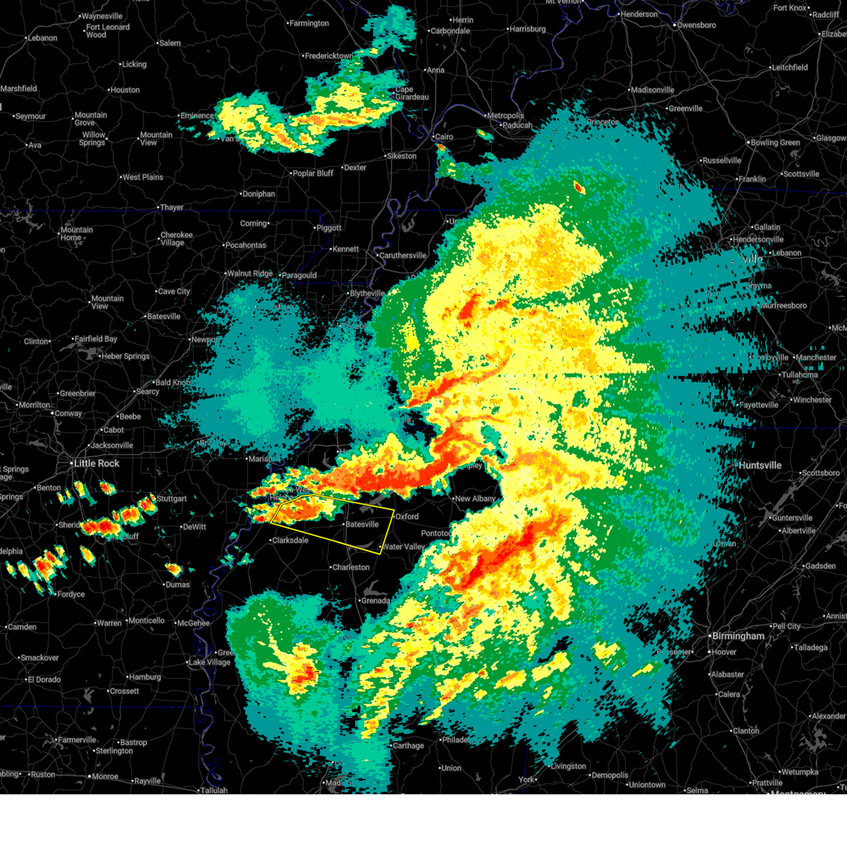
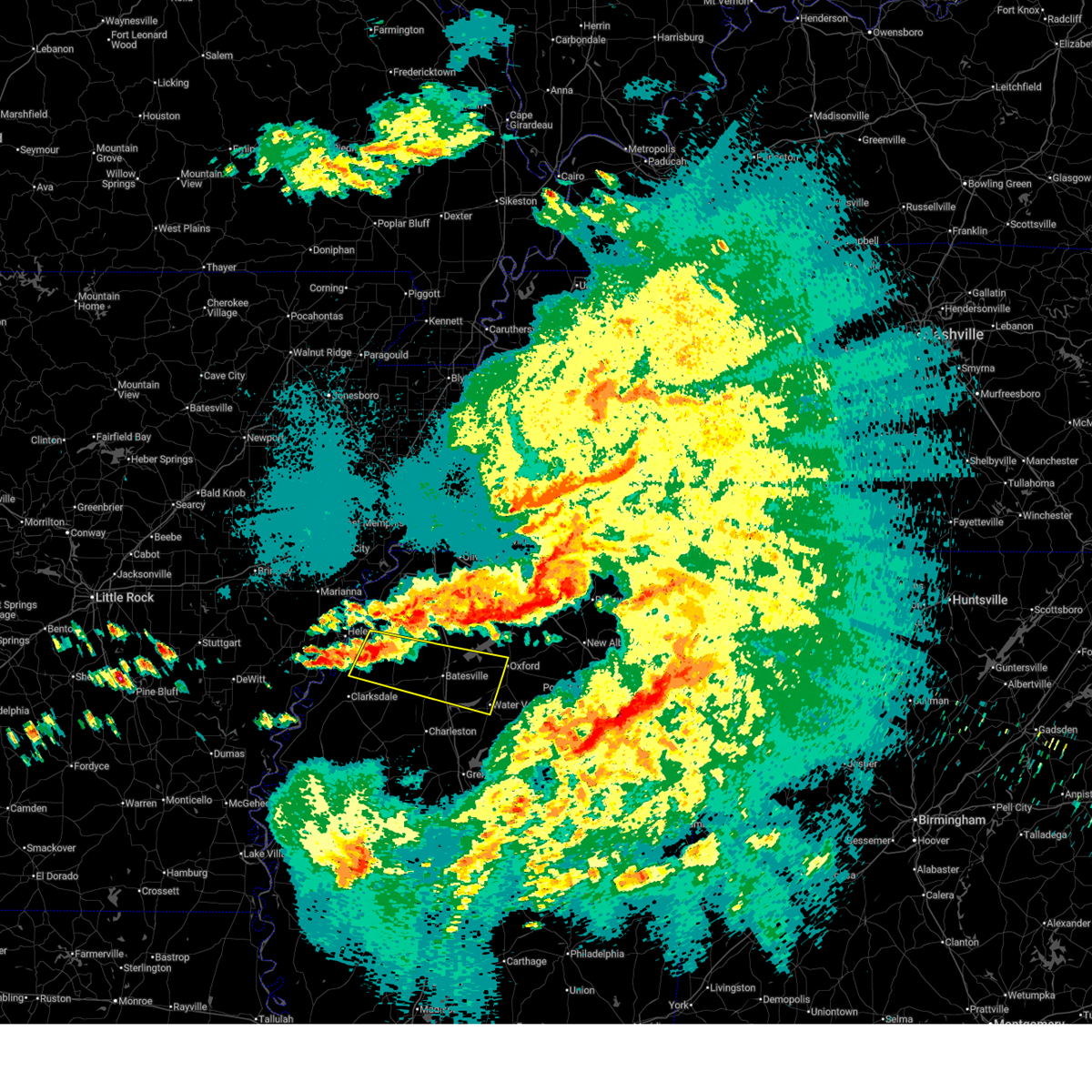
Hail and Wind Damage Spotted near Batesville, MS
| Date / Time | Report Details |
|---|---|
| 4/28/2026 11:00 PM CDT |
 the severe thunderstorm warning has been cancelled and is no longer in effect the severe thunderstorm warning has been cancelled and is no longer in effect
|
| 4/28/2026 10:56 PM CDT |
 At 1056 pm cdt, a severe thunderstorm was located over darling, or 19 miles west of batesville, moving east at 35 mph (radar indicated). Hazards include 60 mph wind gusts. Expect damage to roofs, siding, and trees. locations impacted include, oxford, batesville, water valley, holly springs national forest, john w kyle state park, marks, sardis, jonestown, crenshaw, sledge, pope, darling, pleasant grove, springdale, curtis station, burgess, courtland, coahoma, taylor, and lula. This includes interstate 55 in mississippi between mile markers 234 and 255. At 1056 pm cdt, a severe thunderstorm was located over darling, or 19 miles west of batesville, moving east at 35 mph (radar indicated). Hazards include 60 mph wind gusts. Expect damage to roofs, siding, and trees. locations impacted include, oxford, batesville, water valley, holly springs national forest, john w kyle state park, marks, sardis, jonestown, crenshaw, sledge, pope, darling, pleasant grove, springdale, curtis station, burgess, courtland, coahoma, taylor, and lula. This includes interstate 55 in mississippi between mile markers 234 and 255.
|
| 4/28/2026 10:39 PM CDT |
 Svrmeg the national weather service in memphis has issued a * severe thunderstorm warning for, southwestern lafayette county in northwestern mississippi, northwestern yalobusha county in northwestern mississippi, northeastern coahoma county in northwestern mississippi, southeastern tunica county in northwestern mississippi, central quitman county in northwestern mississippi, panola county in northwestern mississippi, * until 1130 pm cdt. * at 1039 pm cdt, a severe thunderstorm was located 7 miles northwest of darling, or 16 miles southeast of helena-west helena, moving east at 50 mph (radar indicated). Hazards include 60 mph wind gusts and penny size hail. expect damage to roofs, siding, and trees Svrmeg the national weather service in memphis has issued a * severe thunderstorm warning for, southwestern lafayette county in northwestern mississippi, northwestern yalobusha county in northwestern mississippi, northeastern coahoma county in northwestern mississippi, southeastern tunica county in northwestern mississippi, central quitman county in northwestern mississippi, panola county in northwestern mississippi, * until 1130 pm cdt. * at 1039 pm cdt, a severe thunderstorm was located 7 miles northwest of darling, or 16 miles southeast of helena-west helena, moving east at 50 mph (radar indicated). Hazards include 60 mph wind gusts and penny size hail. expect damage to roofs, siding, and trees
|
| 3/15/2026 9:00 PM CDT |
 At 859 pm cdt, severe thunderstorms were located along a line extending from near cambridge to water valley to near bew springs, moving east at 60 mph (radar indicated). Hazards include 60 mph wind gusts and nickel size hail. Expect damage to roofs, siding, and trees. locations impacted include, oxford, batesville, water valley, charleston, george payne state park, holly springs national forest, john w kyle state park, sardis, coffeeville, pope, enid, paynes, cambridge, velma, springdale, burgess, banner, tula, denmark, and scobey. This includes interstate 55 in mississippi between mile markers 215 and 252. At 859 pm cdt, severe thunderstorms were located along a line extending from near cambridge to water valley to near bew springs, moving east at 60 mph (radar indicated). Hazards include 60 mph wind gusts and nickel size hail. Expect damage to roofs, siding, and trees. locations impacted include, oxford, batesville, water valley, charleston, george payne state park, holly springs national forest, john w kyle state park, sardis, coffeeville, pope, enid, paynes, cambridge, velma, springdale, burgess, banner, tula, denmark, and scobey. This includes interstate 55 in mississippi between mile markers 215 and 252.
|
| 3/15/2026 9:00 PM CDT |
 the severe thunderstorm warning has been cancelled and is no longer in effect the severe thunderstorm warning has been cancelled and is no longer in effect
|
| 3/15/2026 8:37 PM CDT | Quarter sized hail reported 3.1 miles W of Batesville, MS |
| 3/15/2026 8:36 PM CDT |
 The storms which prompted the warning have moved out of the area. therefore, the warning will be allowed to expire. a tornado watch remains in effect until 1100 pm cdt for northwestern mississippi. remember, a severe thunderstorm warning still remains in effect for portions of quitman, tallahatchie, and panola counties in mississippi. The storms which prompted the warning have moved out of the area. therefore, the warning will be allowed to expire. a tornado watch remains in effect until 1100 pm cdt for northwestern mississippi. remember, a severe thunderstorm warning still remains in effect for portions of quitman, tallahatchie, and panola counties in mississippi.
|
| 3/15/2026 8:33 PM CDT |
 Svrmeg the national weather service in memphis has issued a * severe thunderstorm warning for, lafayette county in northwestern mississippi, yalobusha county in northwestern mississippi, northwestern calhoun county in northeastern mississippi, tallahatchie county in northwestern mississippi, southeastern quitman county in northwestern mississippi, panola county in northwestern mississippi, * until 915 pm cdt. * at 831 pm cdt, severe thunderstorms were located along a line extending from near sardis to near minter city, moving east at 35 mph (radar indicated). Hazards include 60 mph wind gusts and nickel size hail. expect damage to roofs, siding, and trees Svrmeg the national weather service in memphis has issued a * severe thunderstorm warning for, lafayette county in northwestern mississippi, yalobusha county in northwestern mississippi, northwestern calhoun county in northeastern mississippi, tallahatchie county in northwestern mississippi, southeastern quitman county in northwestern mississippi, panola county in northwestern mississippi, * until 915 pm cdt. * at 831 pm cdt, severe thunderstorms were located along a line extending from near sardis to near minter city, moving east at 35 mph (radar indicated). Hazards include 60 mph wind gusts and nickel size hail. expect damage to roofs, siding, and trees
|
| 3/15/2026 8:09 PM CDT |
 the severe thunderstorm warning has been cancelled and is no longer in effect the severe thunderstorm warning has been cancelled and is no longer in effect
|
| 3/15/2026 8:09 PM CDT |
 At 808 pm cdt, severe thunderstorms were located along a line extending from near pleasant grove to near dublin, moving east at 40 mph (radar indicated). Hazards include 60 mph wind gusts and nickel size hail. Expect damage to roofs, siding, and trees. locations impacted include, clarksdale, batesville, john w kyle state park, tutwiler, marks, sardis, lambert, jonestown, friars point, crowder, webb, sledge, sumner, pope, belen, dublin, pleasant grove, curtis station, vance, and darling. This includes interstate 55 in mississippi between mile markers 236 and 252. At 808 pm cdt, severe thunderstorms were located along a line extending from near pleasant grove to near dublin, moving east at 40 mph (radar indicated). Hazards include 60 mph wind gusts and nickel size hail. Expect damage to roofs, siding, and trees. locations impacted include, clarksdale, batesville, john w kyle state park, tutwiler, marks, sardis, lambert, jonestown, friars point, crowder, webb, sledge, sumner, pope, belen, dublin, pleasant grove, curtis station, vance, and darling. This includes interstate 55 in mississippi between mile markers 236 and 252.
|
| 3/15/2026 7:58 PM CDT |
 Svrmeg the national weather service in memphis has issued a * severe thunderstorm warning for, southeastern phillips county in eastern arkansas, coahoma county in northwestern mississippi, south central tunica county in northwestern mississippi, northwestern tallahatchie county in northwestern mississippi, quitman county in northwestern mississippi, central panola county in northwestern mississippi, * until 845 pm cdt. * at 756 pm cdt, severe thunderstorms were located along a line extending from near crenshaw to alligator, moving east at 40 mph (radar indicated). Hazards include 60 mph wind gusts and nickel size hail. expect damage to roofs, siding, and trees Svrmeg the national weather service in memphis has issued a * severe thunderstorm warning for, southeastern phillips county in eastern arkansas, coahoma county in northwestern mississippi, south central tunica county in northwestern mississippi, northwestern tallahatchie county in northwestern mississippi, quitman county in northwestern mississippi, central panola county in northwestern mississippi, * until 845 pm cdt. * at 756 pm cdt, severe thunderstorms were located along a line extending from near crenshaw to alligator, moving east at 40 mph (radar indicated). Hazards include 60 mph wind gusts and nickel size hail. expect damage to roofs, siding, and trees
|
| 3/6/2026 10:22 PM CST | Golf Ball sized hail reported 8.5 miles SE of Batesville, MS |
| 2/26/2026 8:19 PM CST |
 the severe thunderstorm warning has been cancelled and is no longer in effect the severe thunderstorm warning has been cancelled and is no longer in effect
|
| 2/26/2026 8:08 PM CST |
 At 807 pm cst, a severe thunderstorm was located near burgess, or 7 miles east of john w kyle state park, moving east at 40 mph (radar indicated). Hazards include 60 mph wind gusts and half dollar size hail. Hail damage to vehicles is expected. expect wind damage to roofs, siding, and trees. locations impacted include, oxford, batesville, water valley, holly springs national forest, john w kyle state park, springdale, burgess, harmontown, courtland, abbeville, taylor, blackwater, teckville, shuford, glenville, college hill station, college hill, hayes crossing, and eureka springs. This includes interstate 55 in mississippi between mile markers 238 and 251. At 807 pm cst, a severe thunderstorm was located near burgess, or 7 miles east of john w kyle state park, moving east at 40 mph (radar indicated). Hazards include 60 mph wind gusts and half dollar size hail. Hail damage to vehicles is expected. expect wind damage to roofs, siding, and trees. locations impacted include, oxford, batesville, water valley, holly springs national forest, john w kyle state park, springdale, burgess, harmontown, courtland, abbeville, taylor, blackwater, teckville, shuford, glenville, college hill station, college hill, hayes crossing, and eureka springs. This includes interstate 55 in mississippi between mile markers 238 and 251.
|
| 2/26/2026 8:08 PM CST |
 the severe thunderstorm warning has been cancelled and is no longer in effect the severe thunderstorm warning has been cancelled and is no longer in effect
|
| 2/26/2026 7:55 PM CST |
 At 755 pm cst, a severe thunderstorm was located over john w kyle state park, moving east at 40 mph (radar indicated). Hazards include 60 mph wind gusts and half dollar size hail. Hail damage to vehicles is expected. expect wind damage to roofs, siding, and trees. locations impacted include, oxford, batesville, water valley, holly springs national forest, john w kyle state park, sardis, como, sledge, darling, pleasant grove, harmontown, springdale, curtis station, burgess, courtland, abbeville, taylor, falcon, asa, and glenville. This includes interstate 55 in mississippi between mile markers 238 and 262. At 755 pm cst, a severe thunderstorm was located over john w kyle state park, moving east at 40 mph (radar indicated). Hazards include 60 mph wind gusts and half dollar size hail. Hail damage to vehicles is expected. expect wind damage to roofs, siding, and trees. locations impacted include, oxford, batesville, water valley, holly springs national forest, john w kyle state park, sardis, como, sledge, darling, pleasant grove, harmontown, springdale, curtis station, burgess, courtland, abbeville, taylor, falcon, asa, and glenville. This includes interstate 55 in mississippi between mile markers 238 and 262.
|
| 2/26/2026 7:46 PM CST |
 Svrmeg the national weather service in memphis has issued a * severe thunderstorm warning for, lafayette county in northwestern mississippi, northeastern yalobusha county in northwestern mississippi, south central tate county in northwestern mississippi, northeastern quitman county in northwestern mississippi, panola county in northwestern mississippi, * until 830 pm cst. * at 746 pm cst, a severe thunderstorm was located over sardis, or 7 miles west of john w kyle state park, moving east at 40 mph (radar indicated). Hazards include 60 mph wind gusts and quarter size hail. Hail damage to vehicles is expected. Expect wind damage to roofs, siding, and trees. Svrmeg the national weather service in memphis has issued a * severe thunderstorm warning for, lafayette county in northwestern mississippi, northeastern yalobusha county in northwestern mississippi, south central tate county in northwestern mississippi, northeastern quitman county in northwestern mississippi, panola county in northwestern mississippi, * until 830 pm cst. * at 746 pm cst, a severe thunderstorm was located over sardis, or 7 miles west of john w kyle state park, moving east at 40 mph (radar indicated). Hazards include 60 mph wind gusts and quarter size hail. Hail damage to vehicles is expected. Expect wind damage to roofs, siding, and trees.
|
| 6/7/2025 11:45 PM CDT |
 At 1145 pm cdt, a severe thunderstorm was located near george payne state park, moving east at 30 mph (radar indicated). Hazards include ping pong ball size hail and 60 mph wind gusts. People and animals outdoors will be injured. expect hail damage to roofs, siding, windows, and vehicles. expect wind damage to roofs, siding, and trees. Locations impacted include, batesville, water valley, george payne state park, john w kyle state park, sardis, sledge, pope, springdale, curtis station, burgess, enid, pleasant grove, courtland, taylor, falcon, shuford, ballentine, hayes crossing, horatio, and eureka springs. At 1145 pm cdt, a severe thunderstorm was located near george payne state park, moving east at 30 mph (radar indicated). Hazards include ping pong ball size hail and 60 mph wind gusts. People and animals outdoors will be injured. expect hail damage to roofs, siding, windows, and vehicles. expect wind damage to roofs, siding, and trees. Locations impacted include, batesville, water valley, george payne state park, john w kyle state park, sardis, sledge, pope, springdale, curtis station, burgess, enid, pleasant grove, courtland, taylor, falcon, shuford, ballentine, hayes crossing, horatio, and eureka springs.
|
| 6/7/2025 11:40 PM CDT |
 At 1140 pm cdt, a severe thunderstorm was located over george payne state park, moving east at 35 mph (radar indicated). Hazards include 60 mph wind gusts and half dollar size hail. Hail damage to vehicles is expected. expect wind damage to roofs, siding, and trees. Locations impacted include, batesville, water valley, george payne state park, john w kyle state park, sardis, como, crenshaw, crowder, sledge, pope, enid, pleasant grove, harmontown, springdale, curtis station, burgess, courtland, taylor, falcon, and askew. At 1140 pm cdt, a severe thunderstorm was located over george payne state park, moving east at 35 mph (radar indicated). Hazards include 60 mph wind gusts and half dollar size hail. Hail damage to vehicles is expected. expect wind damage to roofs, siding, and trees. Locations impacted include, batesville, water valley, george payne state park, john w kyle state park, sardis, como, crenshaw, crowder, sledge, pope, enid, pleasant grove, harmontown, springdale, curtis station, burgess, courtland, taylor, falcon, and askew.
|
| 6/7/2025 11:40 PM CDT |
 the severe thunderstorm warning has been cancelled and is no longer in effect the severe thunderstorm warning has been cancelled and is no longer in effect
|
| 6/7/2025 11:29 PM CDT |
 At 1129 pm cdt, a severe thunderstorm was located near pope, or near batesville, moving southeast at 40 mph (radar indicated). Hazards include 60 mph wind gusts and quarter size hail. Hail damage to vehicles is expected. expect wind damage to roofs, siding, and trees. Locations impacted include, batesville, water valley, george payne state park, john w kyle state park, sardis, como, crenshaw, crowder, sledge, pope, enid, pleasant grove, harmontown, springdale, curtis station, burgess, courtland, taylor, falcon, and askew. At 1129 pm cdt, a severe thunderstorm was located near pope, or near batesville, moving southeast at 40 mph (radar indicated). Hazards include 60 mph wind gusts and quarter size hail. Hail damage to vehicles is expected. expect wind damage to roofs, siding, and trees. Locations impacted include, batesville, water valley, george payne state park, john w kyle state park, sardis, como, crenshaw, crowder, sledge, pope, enid, pleasant grove, harmontown, springdale, curtis station, burgess, courtland, taylor, falcon, and askew.
|
| 6/7/2025 11:14 PM CDT |
 Svrmeg the national weather service in memphis has issued a * severe thunderstorm warning for, western lafayette county in northwestern mississippi, northern yalobusha county in northwestern mississippi, southeastern tunica county in northwestern mississippi, northeastern tallahatchie county in northwestern mississippi, quitman county in northwestern mississippi, panola county in northwestern mississippi, * until midnight cdt. * at 1114 pm cdt, a severe thunderstorm was located near curtis station, or 15 miles west of batesville, moving east at 30 mph (radar indicated). Hazards include 60 mph wind gusts and quarter size hail. Hail damage to vehicles is expected. Expect wind damage to roofs, siding, and trees. Svrmeg the national weather service in memphis has issued a * severe thunderstorm warning for, western lafayette county in northwestern mississippi, northern yalobusha county in northwestern mississippi, southeastern tunica county in northwestern mississippi, northeastern tallahatchie county in northwestern mississippi, quitman county in northwestern mississippi, panola county in northwestern mississippi, * until midnight cdt. * at 1114 pm cdt, a severe thunderstorm was located near curtis station, or 15 miles west of batesville, moving east at 30 mph (radar indicated). Hazards include 60 mph wind gusts and quarter size hail. Hail damage to vehicles is expected. Expect wind damage to roofs, siding, and trees.
|
| 5/25/2025 7:09 PM CDT |
 the severe thunderstorm warning has been cancelled and is no longer in effect the severe thunderstorm warning has been cancelled and is no longer in effect
|
| 5/25/2025 7:09 PM CDT |
 At 708 pm cdt, severe thunderstorms were located along a line extending from near keownville to near paynes, moving east at 60 mph (radar indicated). Hazards include 70 mph wind gusts and quarter size hail. Hail damage to vehicles is expected. expect considerable tree damage. wind damage is also likely to mobile homes, roofs, and outbuildings. Locations impacted include, shari, robbs, charleston, esperanza, paynes, swan lake, pumpkin center, cambridge, tyson, gums, new harmony, rough edge, glenfield, rosebloom, bryant, altus, bethlehem, toccopola, cascilla, and alpine. At 708 pm cdt, severe thunderstorms were located along a line extending from near keownville to near paynes, moving east at 60 mph (radar indicated). Hazards include 70 mph wind gusts and quarter size hail. Hail damage to vehicles is expected. expect considerable tree damage. wind damage is also likely to mobile homes, roofs, and outbuildings. Locations impacted include, shari, robbs, charleston, esperanza, paynes, swan lake, pumpkin center, cambridge, tyson, gums, new harmony, rough edge, glenfield, rosebloom, bryant, altus, bethlehem, toccopola, cascilla, and alpine.
|
| 5/25/2025 7:00 PM CDT |
 At 700 pm cdt, severe thunderstorms were located along a line extending from new albany to near paynes, moving east at 60 mph (radar indicated). Hazards include 70 mph wind gusts and quarter size hail. Hail damage to vehicles is expected. expect considerable tree damage. wind damage is also likely to mobile homes, roofs, and outbuildings. Locations impacted include, shari, robbs, charleston, esperanza, paynes, swan lake, pumpkin center, cambridge, chulahoma, tyson, gums, albin, new harmony, rough edge, glenfield, rosebloom, bryant, altus, bethlehem, and toccopola. At 700 pm cdt, severe thunderstorms were located along a line extending from new albany to near paynes, moving east at 60 mph (radar indicated). Hazards include 70 mph wind gusts and quarter size hail. Hail damage to vehicles is expected. expect considerable tree damage. wind damage is also likely to mobile homes, roofs, and outbuildings. Locations impacted include, shari, robbs, charleston, esperanza, paynes, swan lake, pumpkin center, cambridge, chulahoma, tyson, gums, albin, new harmony, rough edge, glenfield, rosebloom, bryant, altus, bethlehem, and toccopola.
|
| 5/25/2025 6:53 PM CDT |
 At 653 pm cdt, severe thunderstorms were located along a line extending from 6 miles northeast of etta to 7 miles east of webb, moving east at 60 mph (radar indicated). Hazards include 60 mph wind gusts and quarter size hail. Hail damage to vehicles is expected. expect wind damage to roofs, siding, and trees. Locations impacted include, shari, robbs, charleston, esperanza, paynes, swan lake, pumpkin center, cambridge, chulahoma, tyson, gums, albin, new harmony, rough edge, glenfield, rosebloom, bryant, altus, bethlehem, and toccopola. At 653 pm cdt, severe thunderstorms were located along a line extending from 6 miles northeast of etta to 7 miles east of webb, moving east at 60 mph (radar indicated). Hazards include 60 mph wind gusts and quarter size hail. Hail damage to vehicles is expected. expect wind damage to roofs, siding, and trees. Locations impacted include, shari, robbs, charleston, esperanza, paynes, swan lake, pumpkin center, cambridge, chulahoma, tyson, gums, albin, new harmony, rough edge, glenfield, rosebloom, bryant, altus, bethlehem, and toccopola.
|
| 5/25/2025 6:53 PM CDT |
 the severe thunderstorm warning has been cancelled and is no longer in effect the severe thunderstorm warning has been cancelled and is no longer in effect
|
| 5/25/2025 6:41 PM CDT | Trees down along jeff sanders r in panola county MS, 10.7 miles NE of Batesville, MS |
| 5/25/2025 6:33 PM CDT |
 Svrmeg the national weather service in memphis has issued a * severe thunderstorm warning for, lafayette county in northwestern mississippi, yalobusha county in northwestern mississippi, southeastern coahoma county in northwestern mississippi, northern calhoun county in northeastern mississippi, union county in northeastern mississippi, pontotoc county in northeastern mississippi, southern marshall county in northwestern mississippi, southeastern tate county in northwestern mississippi, tallahatchie county in northwestern mississippi, quitman county in northwestern mississippi, panola county in northwestern mississippi, * until 730 pm cdt. * at 632 pm cdt, severe thunderstorms were located along a line extending from near wall doxey state park to near dublin, moving east at 60 mph (radar indicated). Hazards include 60 mph wind gusts and quarter size hail. Hail damage to vehicles is expected. Expect wind damage to roofs, siding, and trees. Svrmeg the national weather service in memphis has issued a * severe thunderstorm warning for, lafayette county in northwestern mississippi, yalobusha county in northwestern mississippi, southeastern coahoma county in northwestern mississippi, northern calhoun county in northeastern mississippi, union county in northeastern mississippi, pontotoc county in northeastern mississippi, southern marshall county in northwestern mississippi, southeastern tate county in northwestern mississippi, tallahatchie county in northwestern mississippi, quitman county in northwestern mississippi, panola county in northwestern mississippi, * until 730 pm cdt. * at 632 pm cdt, severe thunderstorms were located along a line extending from near wall doxey state park to near dublin, moving east at 60 mph (radar indicated). Hazards include 60 mph wind gusts and quarter size hail. Hail damage to vehicles is expected. Expect wind damage to roofs, siding, and trees.
|
| 5/25/2025 6:30 PM CDT |
 At 630 pm cdt, severe thunderstorms were located along a line extending from near como to marks to near dublin, moving east at 50 mph (radar indicated). Hazards include 60 mph wind gusts and quarter size hail. Hail damage to vehicles is expected. expect wind damage to roofs, siding, and trees. Locations impacted include, mattson, rena lara, askew, coahoma, gerlach mill, belen, rudyard, moon, buxton, savage, webb, dublin, senatobia, denton, falcon, beverly, como, glenville, clarksdale, and sabino. At 630 pm cdt, severe thunderstorms were located along a line extending from near como to marks to near dublin, moving east at 50 mph (radar indicated). Hazards include 60 mph wind gusts and quarter size hail. Hail damage to vehicles is expected. expect wind damage to roofs, siding, and trees. Locations impacted include, mattson, rena lara, askew, coahoma, gerlach mill, belen, rudyard, moon, buxton, savage, webb, dublin, senatobia, denton, falcon, beverly, como, glenville, clarksdale, and sabino.
|
| 5/25/2025 6:27 PM CDT |
 the severe thunderstorm warning has been cancelled and is no longer in effect the severe thunderstorm warning has been cancelled and is no longer in effect
|
| 5/25/2025 6:27 PM CDT |
 At 627 pm cdt, severe thunderstorms were located along a line extending from near como to near belen to near dublin, moving east at 50 mph (radar indicated). Hazards include 60 mph wind gusts and quarter size hail. Hail damage to vehicles is expected. expect wind damage to roofs, siding, and trees. Locations impacted include, rena lara, askew, belen, rudyard, moon, savage, senatobia, austin, falcon, como, clarksdale, strayhorn, jonestown, dubbs, lurand, dooley, north tunica, longstreet, clayton, and hinchcliff. At 627 pm cdt, severe thunderstorms were located along a line extending from near como to near belen to near dublin, moving east at 50 mph (radar indicated). Hazards include 60 mph wind gusts and quarter size hail. Hail damage to vehicles is expected. expect wind damage to roofs, siding, and trees. Locations impacted include, rena lara, askew, belen, rudyard, moon, savage, senatobia, austin, falcon, como, clarksdale, strayhorn, jonestown, dubbs, lurand, dooley, north tunica, longstreet, clayton, and hinchcliff.
|
| 5/25/2025 5:55 PM CDT |
 Svrmeg the national weather service in memphis has issued a * severe thunderstorm warning for, phillips county in eastern arkansas, coahoma county in northwestern mississippi, tunica county in northwestern mississippi, southern tate county in northwestern mississippi, northwestern tallahatchie county in northwestern mississippi, quitman county in northwestern mississippi, panola county in northwestern mississippi, * until 645 pm cdt. * at 554 pm cdt, severe thunderstorms were located along a line extending from near tunica to near friars point to near crumrod, moving east at 50 mph (radar indicated). Hazards include 60 mph wind gusts and quarter size hail. Hail damage to vehicles is expected. Expect wind damage to roofs, siding, and trees. Svrmeg the national weather service in memphis has issued a * severe thunderstorm warning for, phillips county in eastern arkansas, coahoma county in northwestern mississippi, tunica county in northwestern mississippi, southern tate county in northwestern mississippi, northwestern tallahatchie county in northwestern mississippi, quitman county in northwestern mississippi, panola county in northwestern mississippi, * until 645 pm cdt. * at 554 pm cdt, severe thunderstorms were located along a line extending from near tunica to near friars point to near crumrod, moving east at 50 mph (radar indicated). Hazards include 60 mph wind gusts and quarter size hail. Hail damage to vehicles is expected. Expect wind damage to roofs, siding, and trees.
|
| 5/20/2025 5:49 PM CDT |
 At 548 pm cdt, a severe thunderstorm capable of producing a tornado was located near pope, or near george payne state park, moving east at 40 mph (radar indicated rotation). Hazards include tornado and quarter size hail. Flying debris will be dangerous to those caught without shelter. mobile homes will be damaged or destroyed. damage to roofs, windows, and vehicles will occur. tree damage is likely. Locations impacted include, springdale, pope, courtland, burgess, shuford, george payne state park, taylor, water valley, eureka springs, and batesville. At 548 pm cdt, a severe thunderstorm capable of producing a tornado was located near pope, or near george payne state park, moving east at 40 mph (radar indicated rotation). Hazards include tornado and quarter size hail. Flying debris will be dangerous to those caught without shelter. mobile homes will be damaged or destroyed. damage to roofs, windows, and vehicles will occur. tree damage is likely. Locations impacted include, springdale, pope, courtland, burgess, shuford, george payne state park, taylor, water valley, eureka springs, and batesville.
|
| 5/20/2025 5:49 PM CDT |
 the tornado warning has been cancelled and is no longer in effect the tornado warning has been cancelled and is no longer in effect
|
| 5/20/2025 5:34 PM CDT |
 Tormeg the national weather service in memphis has issued a * tornado warning for, southwestern lafayette county in northwestern mississippi, northern yalobusha county in northwestern mississippi, northeastern tallahatchie county in northwestern mississippi, southern panola county in northwestern mississippi, * until 615 pm cdt. * at 534 pm cdt, a severe thunderstorm capable of producing a tornado was located near crowder, or 9 miles west of george payne state park, moving east at 40 mph (radar indicated rotation). Hazards include tornado and quarter size hail. Flying debris will be dangerous to those caught without shelter. mobile homes will be damaged or destroyed. damage to roofs, windows, and vehicles will occur. Tree damage is likely. Tormeg the national weather service in memphis has issued a * tornado warning for, southwestern lafayette county in northwestern mississippi, northern yalobusha county in northwestern mississippi, northeastern tallahatchie county in northwestern mississippi, southern panola county in northwestern mississippi, * until 615 pm cdt. * at 534 pm cdt, a severe thunderstorm capable of producing a tornado was located near crowder, or 9 miles west of george payne state park, moving east at 40 mph (radar indicated rotation). Hazards include tornado and quarter size hail. Flying debris will be dangerous to those caught without shelter. mobile homes will be damaged or destroyed. damage to roofs, windows, and vehicles will occur. Tree damage is likely.
|
| 5/20/2025 5:07 PM CDT |
 The severe thunderstorm which prompted the warning has weakened. therefore, the warning will be allowed to expire. however, small hail and gusty winds are still possible with this thunderstorm. a tornado watch remains in effect until 800 pm cdt for northwestern mississippi. The severe thunderstorm which prompted the warning has weakened. therefore, the warning will be allowed to expire. however, small hail and gusty winds are still possible with this thunderstorm. a tornado watch remains in effect until 800 pm cdt for northwestern mississippi.
|
| 5/20/2025 4:42 PM CDT |
 the severe thunderstorm warning has been cancelled and is no longer in effect the severe thunderstorm warning has been cancelled and is no longer in effect
|
| 5/20/2025 4:42 PM CDT |
 At 442 pm cdt, a severe thunderstorm was located near pleasant grove, or 11 miles southwest of senatobia, moving east at 50 mph (radar indicated). Hazards include 60 mph wind gusts and quarter size hail. Hail damage to vehicles is expected. expect wind damage to roofs, siding, and trees. Locations impacted include, barr, askew, buxton, crossroad, senatobia, falcon, darling, como, glenville, crenshaw, pleasant grove, sarah, poagville, hayes crossing, essex, horatio, cypress corner, bluff, curtis station, and looxahoma. At 442 pm cdt, a severe thunderstorm was located near pleasant grove, or 11 miles southwest of senatobia, moving east at 50 mph (radar indicated). Hazards include 60 mph wind gusts and quarter size hail. Hail damage to vehicles is expected. expect wind damage to roofs, siding, and trees. Locations impacted include, barr, askew, buxton, crossroad, senatobia, falcon, darling, como, glenville, crenshaw, pleasant grove, sarah, poagville, hayes crossing, essex, horatio, cypress corner, bluff, curtis station, and looxahoma.
|
| 5/20/2025 4:26 PM CDT |
 Svrmeg the national weather service in memphis has issued a * severe thunderstorm warning for, east central coahoma county in northwestern mississippi, southeastern tunica county in northwestern mississippi, southern tate county in northwestern mississippi, northern quitman county in northwestern mississippi, northern panola county in northwestern mississippi, * until 515 pm cdt. * at 426 pm cdt, a severe thunderstorm was located near sledge, or 18 miles southeast of helena-west helena, moving east at 50 mph (radar indicated). Hazards include 60 mph wind gusts and quarter size hail. Hail damage to vehicles is expected. Expect wind damage to roofs, siding, and trees. Svrmeg the national weather service in memphis has issued a * severe thunderstorm warning for, east central coahoma county in northwestern mississippi, southeastern tunica county in northwestern mississippi, southern tate county in northwestern mississippi, northern quitman county in northwestern mississippi, northern panola county in northwestern mississippi, * until 515 pm cdt. * at 426 pm cdt, a severe thunderstorm was located near sledge, or 18 miles southeast of helena-west helena, moving east at 50 mph (radar indicated). Hazards include 60 mph wind gusts and quarter size hail. Hail damage to vehicles is expected. Expect wind damage to roofs, siding, and trees.
|
| 5/18/2025 8:48 AM CDT |
 the severe thunderstorm warning has been cancelled and is no longer in effect the severe thunderstorm warning has been cancelled and is no longer in effect
|
| 5/18/2025 8:46 AM CDT | Trees down on morrow road near ms highway 35. time is radar estimate in panola county MS, 4.5 miles NE of Batesville, MS |
| 5/18/2025 8:42 AM CDT |
 At 842 am cdt, a severe thunderstorm was located over curtis station, or 14 miles west of batesville, moving east at 40 mph (radar indicated). Hazards include 60 mph wind gusts and quarter size hail. Hail damage to vehicles is expected. expect wind damage to roofs, siding, and trees. Locations impacted include, curtis station, sardis, shuford, mims, batesville, asa, ballentine, pope, pleasant grove, courtland, locke station, hayes crossing, horatio, john w kyle state park, eureka springs, and chapeltown. At 842 am cdt, a severe thunderstorm was located over curtis station, or 14 miles west of batesville, moving east at 40 mph (radar indicated). Hazards include 60 mph wind gusts and quarter size hail. Hail damage to vehicles is expected. expect wind damage to roofs, siding, and trees. Locations impacted include, curtis station, sardis, shuford, mims, batesville, asa, ballentine, pope, pleasant grove, courtland, locke station, hayes crossing, horatio, john w kyle state park, eureka springs, and chapeltown.
|
| 5/18/2025 8:42 AM CDT |
 the severe thunderstorm warning has been cancelled and is no longer in effect the severe thunderstorm warning has been cancelled and is no longer in effect
|
| 5/18/2025 8:36 AM CDT |
 Svrmeg the national weather service in memphis has issued a * severe thunderstorm warning for, east central coahoma county in northwestern mississippi, central quitman county in northwestern mississippi, panola county in northwestern mississippi, * until 915 am cdt. * at 828 am cdt, a severe thunderstorm was located over belen, or 14 miles northeast of clarksdale, moving east at 40 mph (radar indicated). Hazards include 60 mph wind gusts and quarter size hail. Hail damage to vehicles is expected. Expect wind damage to roofs, siding, and trees. Svrmeg the national weather service in memphis has issued a * severe thunderstorm warning for, east central coahoma county in northwestern mississippi, central quitman county in northwestern mississippi, panola county in northwestern mississippi, * until 915 am cdt. * at 828 am cdt, a severe thunderstorm was located over belen, or 14 miles northeast of clarksdale, moving east at 40 mph (radar indicated). Hazards include 60 mph wind gusts and quarter size hail. Hail damage to vehicles is expected. Expect wind damage to roofs, siding, and trees.
|
| 5/17/2025 1:17 AM CDT |
 At 117 am cdt, severe thunderstorms were located along a line extending from near oxford to near paris to near coffeeville, moving east at 45 mph (radar indicated). Hazards include 70 mph wind gusts and quarter size hail. Hail damage to vehicles is expected. expect considerable tree damage. wind damage is also likely to mobile homes, roofs, and outbuildings. Locations impacted include, charleston, keel, enid, mims, oakland, cambridge, delay, college hill station, college hill, tyson, oxford, eureka springs, springdale, altus, benwood, burgess, shuford, george payne state park, taylor, and banner. At 117 am cdt, severe thunderstorms were located along a line extending from near oxford to near paris to near coffeeville, moving east at 45 mph (radar indicated). Hazards include 70 mph wind gusts and quarter size hail. Hail damage to vehicles is expected. expect considerable tree damage. wind damage is also likely to mobile homes, roofs, and outbuildings. Locations impacted include, charleston, keel, enid, mims, oakland, cambridge, delay, college hill station, college hill, tyson, oxford, eureka springs, springdale, altus, benwood, burgess, shuford, george payne state park, taylor, and banner.
|
| 5/17/2025 1:06 AM CDT |
 At 106 am cdt, severe thunderstorms were located along a line extending from near holly springs national forest to near springdale to 7 miles northeast of scobey, moving east at 50 mph (radar indicated). Hazards include 70 mph wind gusts and quarter size hail. Hail damage to vehicles is expected. expect considerable tree damage. wind damage is also likely to mobile homes, roofs, and outbuildings. Locations impacted include, charleston, keel, enid, mims, denton, oakland, cambridge, vance, delay, asa, college hill station, college hill, tyson, oxford, eureka springs, springdale, altus, benwood, burgess, and shuford. At 106 am cdt, severe thunderstorms were located along a line extending from near holly springs national forest to near springdale to 7 miles northeast of scobey, moving east at 50 mph (radar indicated). Hazards include 70 mph wind gusts and quarter size hail. Hail damage to vehicles is expected. expect considerable tree damage. wind damage is also likely to mobile homes, roofs, and outbuildings. Locations impacted include, charleston, keel, enid, mims, denton, oakland, cambridge, vance, delay, asa, college hill station, college hill, tyson, oxford, eureka springs, springdale, altus, benwood, burgess, and shuford.
|
| 5/17/2025 12:47 AM CDT |
 At 1247 am cdt, a severe thunderstorm was located over john w kyle state park, moving east at 40 mph (radar indicated). Hazards include 60 mph wind gusts and quarter size hail. Hail damage to vehicles is expected. expect wind damage to roofs, siding, and trees. Locations impacted include, curtis station, pleasant grove, sardis, batesville, essex, horatio, falcon, darling, john w kyle state park, ballentine, hinchcliff, and como. At 1247 am cdt, a severe thunderstorm was located over john w kyle state park, moving east at 40 mph (radar indicated). Hazards include 60 mph wind gusts and quarter size hail. Hail damage to vehicles is expected. expect wind damage to roofs, siding, and trees. Locations impacted include, curtis station, pleasant grove, sardis, batesville, essex, horatio, falcon, darling, john w kyle state park, ballentine, hinchcliff, and como.
|
| 5/17/2025 12:47 AM CDT |
 the severe thunderstorm warning has been cancelled and is no longer in effect the severe thunderstorm warning has been cancelled and is no longer in effect
|
| 5/17/2025 12:45 AM CDT |
 Svrmeg the national weather service in memphis has issued a * severe thunderstorm warning for, lafayette county in northwestern mississippi, yalobusha county in northwestern mississippi, northwestern calhoun county in northeastern mississippi, northern tallahatchie county in northwestern mississippi, quitman county in northwestern mississippi, panola county in northwestern mississippi, * until 130 am cdt. * at 1245 am cdt, severe thunderstorms were located along a line extending from near sardis to near pope to 6 miles south of crowder, moving east at 45 mph (radar indicated). Hazards include 60 mph wind gusts and quarter size hail. Hail damage to vehicles is expected. Expect wind damage to roofs, siding, and trees. Svrmeg the national weather service in memphis has issued a * severe thunderstorm warning for, lafayette county in northwestern mississippi, yalobusha county in northwestern mississippi, northwestern calhoun county in northeastern mississippi, northern tallahatchie county in northwestern mississippi, quitman county in northwestern mississippi, panola county in northwestern mississippi, * until 130 am cdt. * at 1245 am cdt, severe thunderstorms were located along a line extending from near sardis to near pope to 6 miles south of crowder, moving east at 45 mph (radar indicated). Hazards include 60 mph wind gusts and quarter size hail. Hail damage to vehicles is expected. Expect wind damage to roofs, siding, and trees.
|
| 5/17/2025 12:34 AM CDT |
 At 1233 am cdt, a severe thunderstorm was located near como, or 10 miles south of senatobia, moving east at 35 mph (radar indicated). Hazards include 60 mph wind gusts and quarter size hail. Hail damage to vehicles is expected. expect wind damage to roofs, siding, and trees. Locations impacted include, barr, askew, coahoma, gerlach mill, rudyard, moon, buxton, crossroad, senatobia, falcon, darling, como, crenshaw, pleasant grove, sarah, jonestown, dubbs, matagorda, rich, and essex. At 1233 am cdt, a severe thunderstorm was located near como, or 10 miles south of senatobia, moving east at 35 mph (radar indicated). Hazards include 60 mph wind gusts and quarter size hail. Hail damage to vehicles is expected. expect wind damage to roofs, siding, and trees. Locations impacted include, barr, askew, coahoma, gerlach mill, rudyard, moon, buxton, crossroad, senatobia, falcon, darling, como, crenshaw, pleasant grove, sarah, jonestown, dubbs, matagorda, rich, and essex.
|
| 5/17/2025 12:34 AM CDT |
 the severe thunderstorm warning has been cancelled and is no longer in effect the severe thunderstorm warning has been cancelled and is no longer in effect
|
| 5/17/2025 12:15 AM CDT |
 At 1215 am cdt, a severe thunderstorm was located over sledge, or 16 miles northwest of batesville, moving east at 50 mph (radar indicated). Hazards include 60 mph wind gusts and quarter size hail. Hail damage to vehicles is expected. expect wind damage to roofs, siding, and trees. Locations impacted include, askew, coahoma, gerlach mill, rudyard, moon, buxton, helena-west helena, savage, preston place, quarles, crossroad, senatobia, hoop spur, westover, falcon, como, strayhorn, pleasant grove, jonestown, and dubbs. At 1215 am cdt, a severe thunderstorm was located over sledge, or 16 miles northwest of batesville, moving east at 50 mph (radar indicated). Hazards include 60 mph wind gusts and quarter size hail. Hail damage to vehicles is expected. expect wind damage to roofs, siding, and trees. Locations impacted include, askew, coahoma, gerlach mill, rudyard, moon, buxton, helena-west helena, savage, preston place, quarles, crossroad, senatobia, hoop spur, westover, falcon, como, strayhorn, pleasant grove, jonestown, and dubbs.
|
| 5/16/2025 11:54 PM CDT |
 Svrmeg the national weather service in memphis has issued a * severe thunderstorm warning for, phillips county in eastern arkansas, northeastern coahoma county in northwestern mississippi, southern tunica county in northwestern mississippi, tate county in northwestern mississippi, northern quitman county in northwestern mississippi, panola county in northwestern mississippi, * until 100 am cdt. * at 1154 pm cdt, a severe thunderstorm was located near dundee, or 7 miles southeast of helena-west helena, moving east at 40 mph (radar indicated). Hazards include 60 mph wind gusts and quarter size hail. Hail damage to vehicles is expected. Expect wind damage to roofs, siding, and trees. Svrmeg the national weather service in memphis has issued a * severe thunderstorm warning for, phillips county in eastern arkansas, northeastern coahoma county in northwestern mississippi, southern tunica county in northwestern mississippi, tate county in northwestern mississippi, northern quitman county in northwestern mississippi, panola county in northwestern mississippi, * until 100 am cdt. * at 1154 pm cdt, a severe thunderstorm was located near dundee, or 7 miles southeast of helena-west helena, moving east at 40 mph (radar indicated). Hazards include 60 mph wind gusts and quarter size hail. Hail damage to vehicles is expected. Expect wind damage to roofs, siding, and trees.
|
| 5/2/2025 12:25 PM CDT |
 The storms which prompted the warning have weakened below severe limits, and no longer pose an immediate threat to life or property. therefore, the warning will be allowed to expire. however, gusty winds are still possible with these thunderstorms. a severe thunderstorm watch remains in effect until 500 pm cdt for northwestern mississippi. The storms which prompted the warning have weakened below severe limits, and no longer pose an immediate threat to life or property. therefore, the warning will be allowed to expire. however, gusty winds are still possible with these thunderstorms. a severe thunderstorm watch remains in effect until 500 pm cdt for northwestern mississippi.
|
| 5/2/2025 12:17 PM CDT |
 the severe thunderstorm warning has been cancelled and is no longer in effect the severe thunderstorm warning has been cancelled and is no longer in effect
|
| 5/2/2025 12:17 PM CDT |
 At 1217 pm cdt, severe thunderstorms were located along a line extending from near dixonville to near lewisburg to near enid, moving east at 45 mph (radar indicated). Hazards include 60 mph wind gusts and quarter size hail. Hail damage to vehicles is expected. expect wind damage to roofs, siding, and trees. Locations impacted include, charleston, askew, enid, mims, buxton, oakland, como, asa, glenville, crenshaw, pleasant grove, hayes crossing, horatio, cypress corner, eureka springs, curtis station, sardis, shuford, george payne state park, and batesville. At 1217 pm cdt, severe thunderstorms were located along a line extending from near dixonville to near lewisburg to near enid, moving east at 45 mph (radar indicated). Hazards include 60 mph wind gusts and quarter size hail. Hail damage to vehicles is expected. expect wind damage to roofs, siding, and trees. Locations impacted include, charleston, askew, enid, mims, buxton, oakland, como, asa, glenville, crenshaw, pleasant grove, hayes crossing, horatio, cypress corner, eureka springs, curtis station, sardis, shuford, george payne state park, and batesville.
|
| 5/2/2025 12:12 PM CDT |
 the severe thunderstorm warning has been cancelled and is no longer in effect the severe thunderstorm warning has been cancelled and is no longer in effect
|
| 5/2/2025 12:12 PM CDT |
 At 1212 pm cdt, severe thunderstorms were located along a line extending from near meeman shelby forest state park to near lewisburg to near enid, moving east at 55 mph (radar indicated). Hazards include 60 mph wind gusts and quarter size hail. Hail damage to vehicles is expected. expect wind damage to roofs, siding, and trees. Locations impacted include, charleston, askew, belen, enid, buxton, denton, oakland, falcon, como, glenville, sabino, pleasant grove, brazil, curtis station, george payne state park, riverview, longstreet, hinchcliff, lambert, and courtland. At 1212 pm cdt, severe thunderstorms were located along a line extending from near meeman shelby forest state park to near lewisburg to near enid, moving east at 55 mph (radar indicated). Hazards include 60 mph wind gusts and quarter size hail. Hail damage to vehicles is expected. expect wind damage to roofs, siding, and trees. Locations impacted include, charleston, askew, belen, enid, buxton, denton, oakland, falcon, como, glenville, sabino, pleasant grove, brazil, curtis station, george payne state park, riverview, longstreet, hinchcliff, lambert, and courtland.
|
| 5/2/2025 11:53 AM CDT |
 At 1153 am cdt, severe thunderstorms were located along a line extending from near joiner to hernando to near crowder, moving east at 45 mph (radar indicated). Hazards include 60 mph wind gusts and quarter size hail. Hail damage to vehicles is expected. expect wind damage to roofs, siding, and trees. Locations impacted include, three forks, charleston, horn lake, louise, austin, bright, falcon, edmondson, strayhorn, prichard, presidents island, beck, dubbs, glover, locke, arlington, elmore park, alden, dooley, and north tunica. At 1153 am cdt, severe thunderstorms were located along a line extending from near joiner to hernando to near crowder, moving east at 45 mph (radar indicated). Hazards include 60 mph wind gusts and quarter size hail. Hail damage to vehicles is expected. expect wind damage to roofs, siding, and trees. Locations impacted include, three forks, charleston, horn lake, louise, austin, bright, falcon, edmondson, strayhorn, prichard, presidents island, beck, dubbs, glover, locke, arlington, elmore park, alden, dooley, and north tunica.
|
| 5/2/2025 11:53 AM CDT |
 the severe thunderstorm warning has been cancelled and is no longer in effect the severe thunderstorm warning has been cancelled and is no longer in effect
|
| 5/2/2025 11:26 AM CDT |
 Svrmeg the national weather service in memphis has issued a * severe thunderstorm warning for, northeastern st. francis county in eastern arkansas, crittenden county in eastern arkansas, northeastern cross county in eastern arkansas, desoto county in northwestern mississippi, northwestern yalobusha county in northwestern mississippi, eastern coahoma county in northwestern mississippi, tunica county in northwestern mississippi, tate county in northwestern mississippi, northern tallahatchie county in northwestern mississippi, quitman county in northwestern mississippi, panola county in northwestern mississippi, shelby county in west tennessee, * until 1230 pm cdt. * at 1126 am cdt, severe thunderstorms were located along a line extending from near tyronza to robinsonville to dublin, moving east at 45 mph (radar indicated). Hazards include 60 mph wind gusts and quarter size hail. Hail damage to vehicles is expected. Expect wind damage to roofs, siding, and trees. Svrmeg the national weather service in memphis has issued a * severe thunderstorm warning for, northeastern st. francis county in eastern arkansas, crittenden county in eastern arkansas, northeastern cross county in eastern arkansas, desoto county in northwestern mississippi, northwestern yalobusha county in northwestern mississippi, eastern coahoma county in northwestern mississippi, tunica county in northwestern mississippi, tate county in northwestern mississippi, northern tallahatchie county in northwestern mississippi, quitman county in northwestern mississippi, panola county in northwestern mississippi, shelby county in west tennessee, * until 1230 pm cdt. * at 1126 am cdt, severe thunderstorms were located along a line extending from near tyronza to robinsonville to dublin, moving east at 45 mph (radar indicated). Hazards include 60 mph wind gusts and quarter size hail. Hail damage to vehicles is expected. Expect wind damage to roofs, siding, and trees.
|
| 4/5/2025 5:23 PM CDT |
 Tormeg the national weather service in memphis has issued a * tornado warning for, western lafayette county in northwestern mississippi, northwestern yalobusha county in northwestern mississippi, northeastern tallahatchie county in northwestern mississippi, southern panola county in northwestern mississippi, * until 615 pm cdt. * at 523 pm cdt, a severe thunderstorm capable of producing a tornado was located over pope, or near batesville, moving northeast at 40 mph (radar indicated rotation). Hazards include tornado. Flying debris will be dangerous to those caught without shelter. mobile homes will be damaged or destroyed. damage to roofs, windows, and vehicles will occur. Tree damage is likely. Tormeg the national weather service in memphis has issued a * tornado warning for, western lafayette county in northwestern mississippi, northwestern yalobusha county in northwestern mississippi, northeastern tallahatchie county in northwestern mississippi, southern panola county in northwestern mississippi, * until 615 pm cdt. * at 523 pm cdt, a severe thunderstorm capable of producing a tornado was located over pope, or near batesville, moving northeast at 40 mph (radar indicated rotation). Hazards include tornado. Flying debris will be dangerous to those caught without shelter. mobile homes will be damaged or destroyed. damage to roofs, windows, and vehicles will occur. Tree damage is likely.
|
| 4/5/2025 5:04 PM CDT |
 At 504 pm cdt, a severe thunderstorm capable of producing a tornado was located near crowder, or 10 miles northwest of charleston, moving northeast at 45 mph (radar indicated rotation). Hazards include tornado and quarter size hail. Flying debris will be dangerous to those caught without shelter. mobile homes will be damaged or destroyed. damage to roofs, windows, and vehicles will occur. tree damage is likely. Locations impacted include, charleston, george payne state park, enid, mims, crowder, mikoma, oakland, stover, vance, longstreet, asa, pope, courtland, waverly, brazil, chapeltown, and batesville. At 504 pm cdt, a severe thunderstorm capable of producing a tornado was located near crowder, or 10 miles northwest of charleston, moving northeast at 45 mph (radar indicated rotation). Hazards include tornado and quarter size hail. Flying debris will be dangerous to those caught without shelter. mobile homes will be damaged or destroyed. damage to roofs, windows, and vehicles will occur. tree damage is likely. Locations impacted include, charleston, george payne state park, enid, mims, crowder, mikoma, oakland, stover, vance, longstreet, asa, pope, courtland, waverly, brazil, chapeltown, and batesville.
|
| 4/5/2025 4:51 PM CDT |
 Tormeg the national weather service in memphis has issued a * tornado warning for, northwestern yalobusha county in northwestern mississippi, northern tallahatchie county in northwestern mississippi, southeastern quitman county in northwestern mississippi, southwestern panola county in northwestern mississippi, * until 530 pm cdt. * at 451 pm cdt, a severe thunderstorm capable of producing a tornado was located near vance, or 13 miles west of charleston, moving northeast at 35 mph (radar indicated rotation). Hazards include tornado and quarter size hail. Flying debris will be dangerous to those caught without shelter. mobile homes will be damaged or destroyed. damage to roofs, windows, and vehicles will occur. Tree damage is likely. Tormeg the national weather service in memphis has issued a * tornado warning for, northwestern yalobusha county in northwestern mississippi, northern tallahatchie county in northwestern mississippi, southeastern quitman county in northwestern mississippi, southwestern panola county in northwestern mississippi, * until 530 pm cdt. * at 451 pm cdt, a severe thunderstorm capable of producing a tornado was located near vance, or 13 miles west of charleston, moving northeast at 35 mph (radar indicated rotation). Hazards include tornado and quarter size hail. Flying debris will be dangerous to those caught without shelter. mobile homes will be damaged or destroyed. damage to roofs, windows, and vehicles will occur. Tree damage is likely.
|
| 4/5/2025 4:48 PM CDT |
 At 448 pm cdt, a severe thunderstorm was located near webb, or 14 miles west of charleston, moving northeast at 45 mph (radar indicated). Hazards include 60 mph wind gusts and quarter size hail. Hail damage to vehicles is expected. expect wind damage to roofs, siding, and trees. Locations impacted include, charleston, glendora, distall, enid, webb, paynes, swan lake, denton, vance, sumner, brazil, beaver dam, albin, effie, rosebloom, crowder, cascilla, mikoma, tippo, and stover. At 448 pm cdt, a severe thunderstorm was located near webb, or 14 miles west of charleston, moving northeast at 45 mph (radar indicated). Hazards include 60 mph wind gusts and quarter size hail. Hail damage to vehicles is expected. expect wind damage to roofs, siding, and trees. Locations impacted include, charleston, glendora, distall, enid, webb, paynes, swan lake, denton, vance, sumner, brazil, beaver dam, albin, effie, rosebloom, crowder, cascilla, mikoma, tippo, and stover.
|
| 4/5/2025 4:48 PM CDT |
 the severe thunderstorm warning has been cancelled and is no longer in effect the severe thunderstorm warning has been cancelled and is no longer in effect
|
| 4/5/2025 4:38 PM CDT |
 Svrmeg the national weather service in memphis has issued a * severe thunderstorm warning for, southeastern coahoma county in northwestern mississippi, tallahatchie county in northwestern mississippi, southern quitman county in northwestern mississippi, southwestern panola county in northwestern mississippi, * until 530 pm cdt. * at 438 pm cdt, a severe thunderstorm was located near webb, or 14 miles northeast of ruleville, moving northeast at 40 mph (radar indicated). Hazards include 60 mph wind gusts and quarter size hail. Hail damage to vehicles is expected. Expect wind damage to roofs, siding, and trees. Svrmeg the national weather service in memphis has issued a * severe thunderstorm warning for, southeastern coahoma county in northwestern mississippi, tallahatchie county in northwestern mississippi, southern quitman county in northwestern mississippi, southwestern panola county in northwestern mississippi, * until 530 pm cdt. * at 438 pm cdt, a severe thunderstorm was located near webb, or 14 miles northeast of ruleville, moving northeast at 40 mph (radar indicated). Hazards include 60 mph wind gusts and quarter size hail. Hail damage to vehicles is expected. Expect wind damage to roofs, siding, and trees.
|
| 4/2/2025 4:16 PM CDT |
 Svrmeg the national weather service in memphis has issued a * severe thunderstorm warning for, northwestern lafayette county in northwestern mississippi, marshall county in northwestern mississippi, eastern tate county in northwestern mississippi, northern benton county in northeastern mississippi, northeastern panola county in northwestern mississippi, * until 515 pm cdt. * at 416 pm cdt, a severe thunderstorm was located over sardis, or near john w kyle state park, moving northeast at 55 mph (radar indicated). Hazards include 60 mph wind gusts and quarter size hail. Hail damage to vehicles is expected. Expect wind damage to roofs, siding, and trees. Svrmeg the national weather service in memphis has issued a * severe thunderstorm warning for, northwestern lafayette county in northwestern mississippi, marshall county in northwestern mississippi, eastern tate county in northwestern mississippi, northern benton county in northeastern mississippi, northeastern panola county in northwestern mississippi, * until 515 pm cdt. * at 416 pm cdt, a severe thunderstorm was located over sardis, or near john w kyle state park, moving northeast at 55 mph (radar indicated). Hazards include 60 mph wind gusts and quarter size hail. Hail damage to vehicles is expected. Expect wind damage to roofs, siding, and trees.
|
| 3/31/2025 3:49 AM CDT |
 the severe thunderstorm warning has been cancelled and is no longer in effect the severe thunderstorm warning has been cancelled and is no longer in effect
|
| 3/31/2025 3:38 AM CDT |
 the severe thunderstorm warning has been cancelled and is no longer in effect the severe thunderstorm warning has been cancelled and is no longer in effect
|
| 3/31/2025 3:38 AM CDT |
 At 337 am cdt, a severe thunderstorm was located over curtis station, or 11 miles west of batesville, moving east at 40 mph (radar indicated). Hazards include 60 mph wind gusts and quarter size hail. Hail damage to vehicles is expected. expect wind damage to roofs, siding, and trees. Locations impacted include, curtis station, sardis, shuford, mims, batesville, asa, ballentine, courtland, locke station, hayes crossing, horatio, john w kyle state park, eureka springs, chapeltown, pleasant grove, and pope. At 337 am cdt, a severe thunderstorm was located over curtis station, or 11 miles west of batesville, moving east at 40 mph (radar indicated). Hazards include 60 mph wind gusts and quarter size hail. Hail damage to vehicles is expected. expect wind damage to roofs, siding, and trees. Locations impacted include, curtis station, sardis, shuford, mims, batesville, asa, ballentine, courtland, locke station, hayes crossing, horatio, john w kyle state park, eureka springs, chapeltown, pleasant grove, and pope.
|
| 3/31/2025 3:23 AM CDT |
 Svrmeg the national weather service in memphis has issued a * severe thunderstorm warning for, central quitman county in northwestern mississippi, panola county in northwestern mississippi, * until 415 am cdt. * at 322 am cdt, a severe thunderstorm was located near belen, or 16 miles northeast of clarksdale, moving east at 40 mph (radar indicated). Hazards include 60 mph wind gusts and quarter size hail. Hail damage to vehicles is expected. Expect wind damage to roofs, siding, and trees. Svrmeg the national weather service in memphis has issued a * severe thunderstorm warning for, central quitman county in northwestern mississippi, panola county in northwestern mississippi, * until 415 am cdt. * at 322 am cdt, a severe thunderstorm was located near belen, or 16 miles northeast of clarksdale, moving east at 40 mph (radar indicated). Hazards include 60 mph wind gusts and quarter size hail. Hail damage to vehicles is expected. Expect wind damage to roofs, siding, and trees.
|
| 3/23/2025 6:12 PM CDT |
 At 612 pm cdt, a severe thunderstorm was located near enid, or 7 miles west of george payne state park, moving east at 30 mph (radar indicated). Hazards include 60 mph wind gusts and quarter size hail. Hail damage to vehicles is expected. expect wind damage to roofs, siding, and trees. Locations impacted include, pope, courtland, shuford, george payne state park, enid, asa, eureka springs, chapeltown, oakland, and batesville. At 612 pm cdt, a severe thunderstorm was located near enid, or 7 miles west of george payne state park, moving east at 30 mph (radar indicated). Hazards include 60 mph wind gusts and quarter size hail. Hail damage to vehicles is expected. expect wind damage to roofs, siding, and trees. Locations impacted include, pope, courtland, shuford, george payne state park, enid, asa, eureka springs, chapeltown, oakland, and batesville.
|
| 3/23/2025 6:09 PM CDT |
 At 608 pm cdt, a severe thunderstorm was located near crowder, or 9 miles west of george payne state park, moving east at 30 mph (radar indicated). Hazards include 60 mph wind gusts and quarter size hail. Hail damage to vehicles is expected. expect wind damage to roofs, siding, and trees. Locations impacted include, pope, courtland, shuford, george payne state park, enid, mims, asa, eureka springs, chapeltown, oakland, crowder, and batesville. At 608 pm cdt, a severe thunderstorm was located near crowder, or 9 miles west of george payne state park, moving east at 30 mph (radar indicated). Hazards include 60 mph wind gusts and quarter size hail. Hail damage to vehicles is expected. expect wind damage to roofs, siding, and trees. Locations impacted include, pope, courtland, shuford, george payne state park, enid, mims, asa, eureka springs, chapeltown, oakland, crowder, and batesville.
|
| 3/23/2025 6:09 PM CDT |
 the severe thunderstorm warning has been cancelled and is no longer in effect the severe thunderstorm warning has been cancelled and is no longer in effect
|
| 3/23/2025 5:51 PM CDT |
 Svrmeg the national weather service in memphis has issued a * severe thunderstorm warning for, northwestern yalobusha county in northwestern mississippi, northeastern tallahatchie county in northwestern mississippi, southeastern quitman county in northwestern mississippi, southern panola county in northwestern mississippi, * until 630 pm cdt. * at 551 pm cdt, a severe thunderstorm was located near lambert, or 14 miles northwest of charleston, moving east at 30 mph (radar indicated). Hazards include 60 mph wind gusts and quarter size hail. Hail damage to vehicles is expected. Expect wind damage to roofs, siding, and trees. Svrmeg the national weather service in memphis has issued a * severe thunderstorm warning for, northwestern yalobusha county in northwestern mississippi, northeastern tallahatchie county in northwestern mississippi, southeastern quitman county in northwestern mississippi, southern panola county in northwestern mississippi, * until 630 pm cdt. * at 551 pm cdt, a severe thunderstorm was located near lambert, or 14 miles northwest of charleston, moving east at 30 mph (radar indicated). Hazards include 60 mph wind gusts and quarter size hail. Hail damage to vehicles is expected. Expect wind damage to roofs, siding, and trees.
|
| 3/15/2025 10:59 AM CDT |
 The storm which prompted the warning has weakened below severe limits, and no longer poses an immediate threat to life or property. therefore, the warning will be allowed to expire. a tornado watch remains in effect until 100 pm cdt for northwestern mississippi. a tornado watch also remains in effect until 600 pm cdt for northwestern mississippi. The storm which prompted the warning has weakened below severe limits, and no longer poses an immediate threat to life or property. therefore, the warning will be allowed to expire. a tornado watch remains in effect until 100 pm cdt for northwestern mississippi. a tornado watch also remains in effect until 600 pm cdt for northwestern mississippi.
|
| 3/15/2025 10:45 AM CDT |
 the severe thunderstorm warning has been cancelled and is no longer in effect the severe thunderstorm warning has been cancelled and is no longer in effect
|
| 3/15/2025 10:45 AM CDT |
 At 1045 am cdt, a severe thunderstorm was located near marks, or 15 miles west of batesville, moving north at 55 mph (radar indicated). Hazards include ping pong ball size hail and 60 mph wind gusts. People and animals outdoors will be injured. expect hail damage to roofs, siding, windows, and vehicles. expect wind damage to roofs, siding, and trees. Locations impacted include, charleston, pope, courtland, leverett, enid, batesville, paynes, and eureka springs. At 1045 am cdt, a severe thunderstorm was located near marks, or 15 miles west of batesville, moving north at 55 mph (radar indicated). Hazards include ping pong ball size hail and 60 mph wind gusts. People and animals outdoors will be injured. expect hail damage to roofs, siding, windows, and vehicles. expect wind damage to roofs, siding, and trees. Locations impacted include, charleston, pope, courtland, leverett, enid, batesville, paynes, and eureka springs.
|
| 3/15/2025 10:28 AM CDT |
 At 1028 am cdt, a severe thunderstorm was located over vance, or 14 miles west of charleston, moving north at 55 mph (radar indicated). Hazards include ping pong ball size hail and 60 mph wind gusts. People and animals outdoors will be injured. expect hail damage to roofs, siding, windows, and vehicles. expect wind damage to roofs, siding, and trees. Locations impacted include, charleston, glendora, belen, distall, enid, mims, webb, paynes, swan lake, denton, marks, vance, falcon, darling, asa, crenshaw, pleasant grove, sumner, brazil, and beaver dam. At 1028 am cdt, a severe thunderstorm was located over vance, or 14 miles west of charleston, moving north at 55 mph (radar indicated). Hazards include ping pong ball size hail and 60 mph wind gusts. People and animals outdoors will be injured. expect hail damage to roofs, siding, windows, and vehicles. expect wind damage to roofs, siding, and trees. Locations impacted include, charleston, glendora, belen, distall, enid, mims, webb, paynes, swan lake, denton, marks, vance, falcon, darling, asa, crenshaw, pleasant grove, sumner, brazil, and beaver dam.
|
| 3/15/2025 10:15 AM CDT |
 Svrmeg the national weather service in memphis has issued a * severe thunderstorm warning for, tallahatchie county in northwestern mississippi, quitman county in northwestern mississippi, central panola county in northwestern mississippi, * until 1100 am cdt. * at 1015 am cdt, a severe thunderstorm was located near webb, or 13 miles northeast of ruleville, moving northeast at 55 mph (radar indicated). Hazards include 60 mph wind gusts. expect damage to roofs, siding, and trees Svrmeg the national weather service in memphis has issued a * severe thunderstorm warning for, tallahatchie county in northwestern mississippi, quitman county in northwestern mississippi, central panola county in northwestern mississippi, * until 1100 am cdt. * at 1015 am cdt, a severe thunderstorm was located near webb, or 13 miles northeast of ruleville, moving northeast at 55 mph (radar indicated). Hazards include 60 mph wind gusts. expect damage to roofs, siding, and trees
|
| 3/15/2025 7:11 AM CDT |
 Svrmeg the national weather service in memphis has issued a * severe thunderstorm warning for, central phillips county in eastern arkansas, northwestern lafayette county in northwestern mississippi, southwestern desoto county in northwestern mississippi, coahoma county in northwestern mississippi, tunica county in northwestern mississippi, tate county in northwestern mississippi, northwestern tallahatchie county in northwestern mississippi, quitman county in northwestern mississippi, panola county in northwestern mississippi, * until 800 am cdt. * at 710 am cdt, a cluster of severe thunderstorms was located 7 miles northwest of darling, or 16 miles southeast of helena-west helena, moving northeast at 50 mph (radar indicated). Hazards include 60 mph wind gusts and quarter size hail. Hail damage to vehicles is expected. Expect wind damage to roofs, siding, and trees. Svrmeg the national weather service in memphis has issued a * severe thunderstorm warning for, central phillips county in eastern arkansas, northwestern lafayette county in northwestern mississippi, southwestern desoto county in northwestern mississippi, coahoma county in northwestern mississippi, tunica county in northwestern mississippi, tate county in northwestern mississippi, northwestern tallahatchie county in northwestern mississippi, quitman county in northwestern mississippi, panola county in northwestern mississippi, * until 800 am cdt. * at 710 am cdt, a cluster of severe thunderstorms was located 7 miles northwest of darling, or 16 miles southeast of helena-west helena, moving northeast at 50 mph (radar indicated). Hazards include 60 mph wind gusts and quarter size hail. Hail damage to vehicles is expected. Expect wind damage to roofs, siding, and trees.
|
| 3/15/2025 6:48 AM CDT |
 Svrmeg the national weather service in memphis has issued a * severe thunderstorm warning for, southeastern phillips county in eastern arkansas, west central lafayette county in northwestern mississippi, south central desoto county in northwestern mississippi, coahoma county in northwestern mississippi, southern tunica county in northwestern mississippi, western tate county in northwestern mississippi, northern tallahatchie county in northwestern mississippi, quitman county in northwestern mississippi, panola county in northwestern mississippi, * until 730 am cdt. * at 647 am cdt, a cluster of severe thunderstorms were located near batesville, moving northeast at 60 mph (radar indicated). Hazards include 60 mph wind gusts and quarter size hail. Hail damage to vehicles is expected. Expect wind damage to roofs, siding, and trees. Svrmeg the national weather service in memphis has issued a * severe thunderstorm warning for, southeastern phillips county in eastern arkansas, west central lafayette county in northwestern mississippi, south central desoto county in northwestern mississippi, coahoma county in northwestern mississippi, southern tunica county in northwestern mississippi, western tate county in northwestern mississippi, northern tallahatchie county in northwestern mississippi, quitman county in northwestern mississippi, panola county in northwestern mississippi, * until 730 am cdt. * at 647 am cdt, a cluster of severe thunderstorms were located near batesville, moving northeast at 60 mph (radar indicated). Hazards include 60 mph wind gusts and quarter size hail. Hail damage to vehicles is expected. Expect wind damage to roofs, siding, and trees.
|
| 7/28/2024 4:09 PM CDT |
 Svrmeg the national weather service in memphis has issued a * severe thunderstorm warning for, southwestern lafayette county in northwestern mississippi, southeastern panola county in northwestern mississippi, * until 500 pm cdt. * at 409 pm cdt, a severe thunderstorm was located near batesville, moving east at 25 mph (radar indicated). Hazards include 60 mph wind gusts. expect damage to roofs, siding, and trees Svrmeg the national weather service in memphis has issued a * severe thunderstorm warning for, southwestern lafayette county in northwestern mississippi, southeastern panola county in northwestern mississippi, * until 500 pm cdt. * at 409 pm cdt, a severe thunderstorm was located near batesville, moving east at 25 mph (radar indicated). Hazards include 60 mph wind gusts. expect damage to roofs, siding, and trees
|
| 1/12/2024 7:40 AM CST |
 The severe thunderstorm warning for northwestern yalobusha, northern tallahatchie, southeastern quitman and southern panola counties will expire at 745 am cst, the storm which prompted the warning has weakened below severe limits, and no longer poses an immediate threat to life or property. therefore, the warning will be allowed to expire. however, gusty winds are still possible with this thunderstorm. a tornado watch remains in effect until 1100 am cst for northwestern mississippi. The severe thunderstorm warning for northwestern yalobusha, northern tallahatchie, southeastern quitman and southern panola counties will expire at 745 am cst, the storm which prompted the warning has weakened below severe limits, and no longer poses an immediate threat to life or property. therefore, the warning will be allowed to expire. however, gusty winds are still possible with this thunderstorm. a tornado watch remains in effect until 1100 am cst for northwestern mississippi.
|
| 1/12/2024 7:02 AM CST |
 At 701 am cst, a severe thunderstorm was located over parchman, or 10 miles north of ruleville, moving northeast at 60 mph (radar indicated). Hazards include 70 mph wind gusts. Expect considerable tree damage. Damage is likely to mobile homes, roofs, and outbuildings. At 701 am cst, a severe thunderstorm was located over parchman, or 10 miles north of ruleville, moving northeast at 60 mph (radar indicated). Hazards include 70 mph wind gusts. Expect considerable tree damage. Damage is likely to mobile homes, roofs, and outbuildings.
|
| 12/9/2023 3:47 PM CST |
 At 346 pm cst, a severe thunderstorm was located over batesville, moving east at 45 mph (radar indicated). Hazards include ping pong ball size hail and 60 mph wind gusts. People and animals outdoors will be injured. expect hail damage to roofs, siding, windows, and vehicles. Expect wind damage to roofs, siding, and trees. At 346 pm cst, a severe thunderstorm was located over batesville, moving east at 45 mph (radar indicated). Hazards include ping pong ball size hail and 60 mph wind gusts. People and animals outdoors will be injured. expect hail damage to roofs, siding, windows, and vehicles. Expect wind damage to roofs, siding, and trees.
|
| 12/9/2023 3:41 PM CST |
 At 340 pm cst, a severe thunderstorm was located over john w kyle state park, moving east at 50 mph. this is a destructive storm for panola and lafayette counties (radar indicated). Hazards include baseball size hail and 60 mph wind gusts. People and animals outdoors will be severely injured. expect shattered windows, extensive damage to roofs, siding, and vehicles. locations impacted include, oxford, batesville, holly springs national forest, john w kyle state park, sardis, como, pleasant grove, harmontown, burgess, laws hill, courtland, abbeville, taylor, malone, tyro, asa, glenville, college hill station, college hill, and galena. thunderstorm damage threat, destructive hail threat, observed max hail size, 2. 75 in wind threat, radar indicated max wind gust, 60 mph. At 340 pm cst, a severe thunderstorm was located over john w kyle state park, moving east at 50 mph. this is a destructive storm for panola and lafayette counties (radar indicated). Hazards include baseball size hail and 60 mph wind gusts. People and animals outdoors will be severely injured. expect shattered windows, extensive damage to roofs, siding, and vehicles. locations impacted include, oxford, batesville, holly springs national forest, john w kyle state park, sardis, como, pleasant grove, harmontown, burgess, laws hill, courtland, abbeville, taylor, malone, tyro, asa, glenville, college hill station, college hill, and galena. thunderstorm damage threat, destructive hail threat, observed max hail size, 2. 75 in wind threat, radar indicated max wind gust, 60 mph.
|
| 12/9/2023 3:40 PM CST | Baseball sized hail reported 0.9 miles WSW of Batesville, MS |
| 12/9/2023 3:39 PM CST | Power flashes observe in panola county MS, 0.9 miles WSW of Batesville, MS |
| 12/9/2023 3:27 PM CST |
 At 327 pm cst, a severe thunderstorm was located near batesville, moving east at 50 mph (radar indicated). Hazards include two inch hail and 60 mph wind gusts. People and animals outdoors will be injured. expect hail damage to roofs, siding, windows, and vehicles. expect wind damage to roofs, siding, and trees. locations impacted include, oxford, batesville, holly springs national forest, john w kyle state park, sardis, como, pleasant grove, harmontown, burgess, laws hill, courtland, abbeville, taylor, malone, tyro, asa, glenville, college hill station, college hill, and galena. thunderstorm damage threat, considerable hail threat, radar indicated max hail size, 2. 00 in wind threat, radar indicated max wind gust, 60 mph. At 327 pm cst, a severe thunderstorm was located near batesville, moving east at 50 mph (radar indicated). Hazards include two inch hail and 60 mph wind gusts. People and animals outdoors will be injured. expect hail damage to roofs, siding, windows, and vehicles. expect wind damage to roofs, siding, and trees. locations impacted include, oxford, batesville, holly springs national forest, john w kyle state park, sardis, como, pleasant grove, harmontown, burgess, laws hill, courtland, abbeville, taylor, malone, tyro, asa, glenville, college hill station, college hill, and galena. thunderstorm damage threat, considerable hail threat, radar indicated max hail size, 2. 00 in wind threat, radar indicated max wind gust, 60 mph.
|
| 12/9/2023 3:23 PM CST |
 At 323 pm cst, a severe thunderstorm was located near batesville, moving east at 50 mph (radar indicated). Hazards include ping pong ball size hail and 60 mph wind gusts. People and animals outdoors will be injured. expect hail damage to roofs, siding, windows, and vehicles. Expect wind damage to roofs, siding, and trees. At 323 pm cst, a severe thunderstorm was located near batesville, moving east at 50 mph (radar indicated). Hazards include ping pong ball size hail and 60 mph wind gusts. People and animals outdoors will be injured. expect hail damage to roofs, siding, windows, and vehicles. Expect wind damage to roofs, siding, and trees.
|
| 12/9/2023 3:23 PM CST |
 The severe thunderstorm warning for northeastern coahoma, southeastern tunica, southwestern tate, quitman and panola counties will expire at 330 pm cst, the storm which prompted the warning has moved out of the area. therefore, the warning will be allowed to expire. a tornado watch remains in effect until 700 pm cst for northwestern mississippi. The severe thunderstorm warning for northeastern coahoma, southeastern tunica, southwestern tate, quitman and panola counties will expire at 330 pm cst, the storm which prompted the warning has moved out of the area. therefore, the warning will be allowed to expire. a tornado watch remains in effect until 700 pm cst for northwestern mississippi.
|
| 12/9/2023 3:04 PM CST |
 At 304 pm cst, a severe thunderstorm was located over darling, or 20 miles northeast of clarksdale, moving east at 50 mph (radar indicated). Hazards include 60 mph wind gusts and quarter size hail. Hail damage to vehicles is expected. expect wind damage to roofs, siding, and trees. locations impacted include, senatobia, batesville, marks, sardis, lambert, jonestown, como, crenshaw, sledge, belen, darling, pleasant grove, curtis station, dundee, lula, falcon, askew, gerlach mill, moon, and barksdale. hail threat, radar indicated max hail size, 1. 00 in wind threat, radar indicated max wind gust, 60 mph. At 304 pm cst, a severe thunderstorm was located over darling, or 20 miles northeast of clarksdale, moving east at 50 mph (radar indicated). Hazards include 60 mph wind gusts and quarter size hail. Hail damage to vehicles is expected. expect wind damage to roofs, siding, and trees. locations impacted include, senatobia, batesville, marks, sardis, lambert, jonestown, como, crenshaw, sledge, belen, darling, pleasant grove, curtis station, dundee, lula, falcon, askew, gerlach mill, moon, and barksdale. hail threat, radar indicated max hail size, 1. 00 in wind threat, radar indicated max wind gust, 60 mph.
|
| 12/9/2023 2:47 PM CST |
 At 247 pm cst, a severe thunderstorm was located near jonestown, or 9 miles north of clarksdale, moving east at 50 mph (radar indicated). Hazards include ping pong ball size hail and 60 mph wind gusts. People and animals outdoors will be injured. expect hail damage to roofs, siding, windows, and vehicles. Expect wind damage to roofs, siding, and trees. At 247 pm cst, a severe thunderstorm was located near jonestown, or 9 miles north of clarksdale, moving east at 50 mph (radar indicated). Hazards include ping pong ball size hail and 60 mph wind gusts. People and animals outdoors will be injured. expect hail damage to roofs, siding, windows, and vehicles. Expect wind damage to roofs, siding, and trees.
|
| 12/9/2023 2:45 PM CST |
 At 245 pm cst, a severe thunderstorm was located near jonestown, or 8 miles north of clarksdale, moving east at 50 mph (radar indicated). Hazards include 60 mph wind gusts and quarter size hail. Hail damage to vehicles is expected. Expect wind damage to roofs, siding, and trees. At 245 pm cst, a severe thunderstorm was located near jonestown, or 8 miles north of clarksdale, moving east at 50 mph (radar indicated). Hazards include 60 mph wind gusts and quarter size hail. Hail damage to vehicles is expected. Expect wind damage to roofs, siding, and trees.
|
| 9/6/2023 6:58 PM CDT |
 At 657 pm cdt, severe thunderstorms were located along a line extending from near denmark to 7 miles east of batesville to near sledge, moving southeast at 25 mph (radar indicated). Hazards include 60 mph wind gusts and quarter size hail. Hail damage to vehicles is expected. expect wind damage to roofs, siding, and trees. locations impacted include, oxford, batesville, water valley, holly springs national forest, john w kyle state park, sardis, crenshaw, crowder, sledge, pope, cambridge, pleasant grove, curtis station, darling, springdale, burgess, tula, denmark, paris and courtland. hail threat, radar indicated max hail size, 1. 00 in wind threat, radar indicated max wind gust, 60 mph. At 657 pm cdt, severe thunderstorms were located along a line extending from near denmark to 7 miles east of batesville to near sledge, moving southeast at 25 mph (radar indicated). Hazards include 60 mph wind gusts and quarter size hail. Hail damage to vehicles is expected. expect wind damage to roofs, siding, and trees. locations impacted include, oxford, batesville, water valley, holly springs national forest, john w kyle state park, sardis, crenshaw, crowder, sledge, pope, cambridge, pleasant grove, curtis station, darling, springdale, burgess, tula, denmark, paris and courtland. hail threat, radar indicated max hail size, 1. 00 in wind threat, radar indicated max wind gust, 60 mph.
|
| 9/6/2023 6:43 PM CDT |
 The severe thunderstorm warning for northeastern tallahatchie, southeastern quitman and southwestern panola counties will expire at 645 pm cdt, the storm which prompted the warning has weakened below severe limits, and no longer poses an immediate threat to life or property. therefore, the warning will be allowed to expire. however, a severe thunderstorm warning still remains in effect for quitman and panola counties due to another storm approaching from the north. a severe thunderstorm watch remains in effect until 1100 pm cdt for northwestern mississippi. The severe thunderstorm warning for northeastern tallahatchie, southeastern quitman and southwestern panola counties will expire at 645 pm cdt, the storm which prompted the warning has weakened below severe limits, and no longer poses an immediate threat to life or property. therefore, the warning will be allowed to expire. however, a severe thunderstorm warning still remains in effect for quitman and panola counties due to another storm approaching from the north. a severe thunderstorm watch remains in effect until 1100 pm cdt for northwestern mississippi.
|
| 9/6/2023 6:41 PM CDT |
 At 641 pm cdt, severe thunderstorms were located along a line extending from near cambridge to john w kyle state park to sledge, moving southeast at 25 mph (radar indicated). Hazards include 60 mph wind gusts and quarter size hail. Hail damage to vehicles is expected. Expect wind damage to roofs, siding, and trees. At 641 pm cdt, severe thunderstorms were located along a line extending from near cambridge to john w kyle state park to sledge, moving southeast at 25 mph (radar indicated). Hazards include 60 mph wind gusts and quarter size hail. Hail damage to vehicles is expected. Expect wind damage to roofs, siding, and trees.
|
| 9/6/2023 6:20 PM CDT |
 At 620 pm cdt, a severe thunderstorm was located over crowder, or 13 miles southwest of batesville, moving east at 25 mph (radar indicated). Hazards include 60 mph wind gusts and quarter size hail. Hail damage to vehicles is expected. expect wind damage to roofs, siding, and trees. locations impacted include, batesville, crowder, locke station, mims, asa and chapeltown. hail threat, radar indicated max hail size, 1. 00 in wind threat, radar indicated max wind gust, 60 mph. At 620 pm cdt, a severe thunderstorm was located over crowder, or 13 miles southwest of batesville, moving east at 25 mph (radar indicated). Hazards include 60 mph wind gusts and quarter size hail. Hail damage to vehicles is expected. expect wind damage to roofs, siding, and trees. locations impacted include, batesville, crowder, locke station, mims, asa and chapeltown. hail threat, radar indicated max hail size, 1. 00 in wind threat, radar indicated max wind gust, 60 mph.
|
| 9/6/2023 6:02 PM CDT |
 At 601 pm cdt, a severe thunderstorm was located over lambert, or 14 miles east of clarksdale, moving east at 25 mph (radar indicated). Hazards include 60 mph wind gusts and quarter size hail. Hail damage to vehicles is expected. Expect wind damage to roofs, siding, and trees. At 601 pm cdt, a severe thunderstorm was located over lambert, or 14 miles east of clarksdale, moving east at 25 mph (radar indicated). Hazards include 60 mph wind gusts and quarter size hail. Hail damage to vehicles is expected. Expect wind damage to roofs, siding, and trees.
|
| 8/27/2023 6:12 AM CDT |
 At 612 am cdt, a severe thunderstorm was located near george payne state park, moving southeast at 30 mph (radar indicated). Hazards include 60 mph wind gusts. expect damage to roofs, siding, and trees At 612 am cdt, a severe thunderstorm was located near george payne state park, moving southeast at 30 mph (radar indicated). Hazards include 60 mph wind gusts. expect damage to roofs, siding, and trees
|
| 7/2/2023 3:42 PM CDT | Golf Ball sized hail reported 0.4 miles ENE of Batesville, MS |
| 7/2/2023 3:42 PM CDT | Trees and powerlines down across batesvill in panola county MS, 1.6 miles E of Batesville, MS |
| 7/2/2023 3:36 PM CDT |
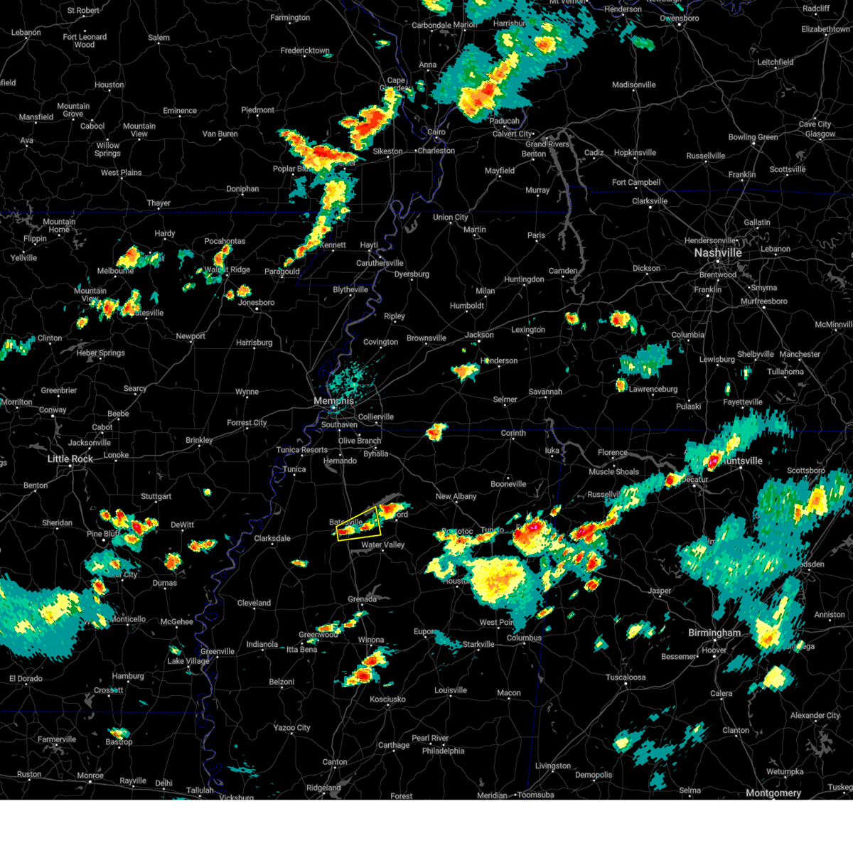 At 336 pm cdt, a severe thunderstorm was located over batesville, moving east at 15 mph (radar indicated). Hazards include 60 mph wind gusts and quarter size hail. Hail damage to vehicles is expected. Expect wind damage to roofs, siding, and trees. At 336 pm cdt, a severe thunderstorm was located over batesville, moving east at 15 mph (radar indicated). Hazards include 60 mph wind gusts and quarter size hail. Hail damage to vehicles is expected. Expect wind damage to roofs, siding, and trees.
|
| 7/1/2023 8:51 AM CDT |
 The severe thunderstorm warning for south central tate, northeastern quitman and panola counties will expire at 900 am cdt, the storm which prompted the warning has weakened below severe limits, and no longer poses an immediate threat to life or property. therefore, the warning will be allowed to expire. The severe thunderstorm warning for south central tate, northeastern quitman and panola counties will expire at 900 am cdt, the storm which prompted the warning has weakened below severe limits, and no longer poses an immediate threat to life or property. therefore, the warning will be allowed to expire.
|
| 7/1/2023 8:27 AM CDT |
 At 827 am cdt, a severe thunderstorm was located over curtis station, or 9 miles west of batesville, moving northeast at 25 mph (radar indicated). Hazards include 60 mph wind gusts and quarter size hail. Hail damage to vehicles is expected. Expect wind damage to roofs, siding, and trees. At 827 am cdt, a severe thunderstorm was located over curtis station, or 9 miles west of batesville, moving northeast at 25 mph (radar indicated). Hazards include 60 mph wind gusts and quarter size hail. Hail damage to vehicles is expected. Expect wind damage to roofs, siding, and trees.
|
| 6/25/2023 8:11 PM CDT |
 At 811 pm cdt, severe thunderstorms were located along a line extending from near harmontown to near enid, moving southeast at 45 mph (radar indicated). Hazards include 60 mph wind gusts and quarter size hail. Hail damage to vehicles is expected. Expect wind damage to roofs, siding, and trees. At 811 pm cdt, severe thunderstorms were located along a line extending from near harmontown to near enid, moving southeast at 45 mph (radar indicated). Hazards include 60 mph wind gusts and quarter size hail. Hail damage to vehicles is expected. Expect wind damage to roofs, siding, and trees.
|
| 6/14/2023 9:55 AM CDT |
 The severe thunderstorm warning for eastern coahoma, southeastern tunica, northern tallahatchie, quitman and panola counties will expire at 1000 am cdt, the storm which prompted the warning has moved out of the area. therefore, the warning will be allowed to expire. a severe thunderstorm watch remains in effect until 200 pm cdt for northwestern mississippi. The severe thunderstorm warning for eastern coahoma, southeastern tunica, northern tallahatchie, quitman and panola counties will expire at 1000 am cdt, the storm which prompted the warning has moved out of the area. therefore, the warning will be allowed to expire. a severe thunderstorm watch remains in effect until 200 pm cdt for northwestern mississippi.
|
| 6/14/2023 9:09 AM CDT |
 At 909 am cdt, a severe thunderstorm was located over friars point, or 10 miles east of elaine, moving east at 60 mph (radar indicated). Hazards include 60 mph wind gusts and quarter size hail. Hail damage to vehicles is expected. Expect wind damage to roofs, siding, and trees. At 909 am cdt, a severe thunderstorm was located over friars point, or 10 miles east of elaine, moving east at 60 mph (radar indicated). Hazards include 60 mph wind gusts and quarter size hail. Hail damage to vehicles is expected. Expect wind damage to roofs, siding, and trees.
|
| 6/11/2023 7:00 PM CDT |
 At 700 pm cdt, a severe thunderstorm was located near batesville, moving east at 20 mph (radar indicated). Hazards include 60 mph wind gusts and quarter size hail. Hail damage to vehicles is expected. expect wind damage to roofs, siding, and trees. locations impacted include, batesville, shuford and eureka springs. hail threat, radar indicated max hail size, 1. 00 in wind threat, radar indicated max wind gust, 60 mph. At 700 pm cdt, a severe thunderstorm was located near batesville, moving east at 20 mph (radar indicated). Hazards include 60 mph wind gusts and quarter size hail. Hail damage to vehicles is expected. expect wind damage to roofs, siding, and trees. locations impacted include, batesville, shuford and eureka springs. hail threat, radar indicated max hail size, 1. 00 in wind threat, radar indicated max wind gust, 60 mph.
|
| 6/11/2023 6:48 PM CDT | Golf Ball sized hail reported 0.8 miles WNW of Batesville, MS, golfball size hail fell at the panola county medical center. |
| 6/11/2023 6:24 PM CDT |
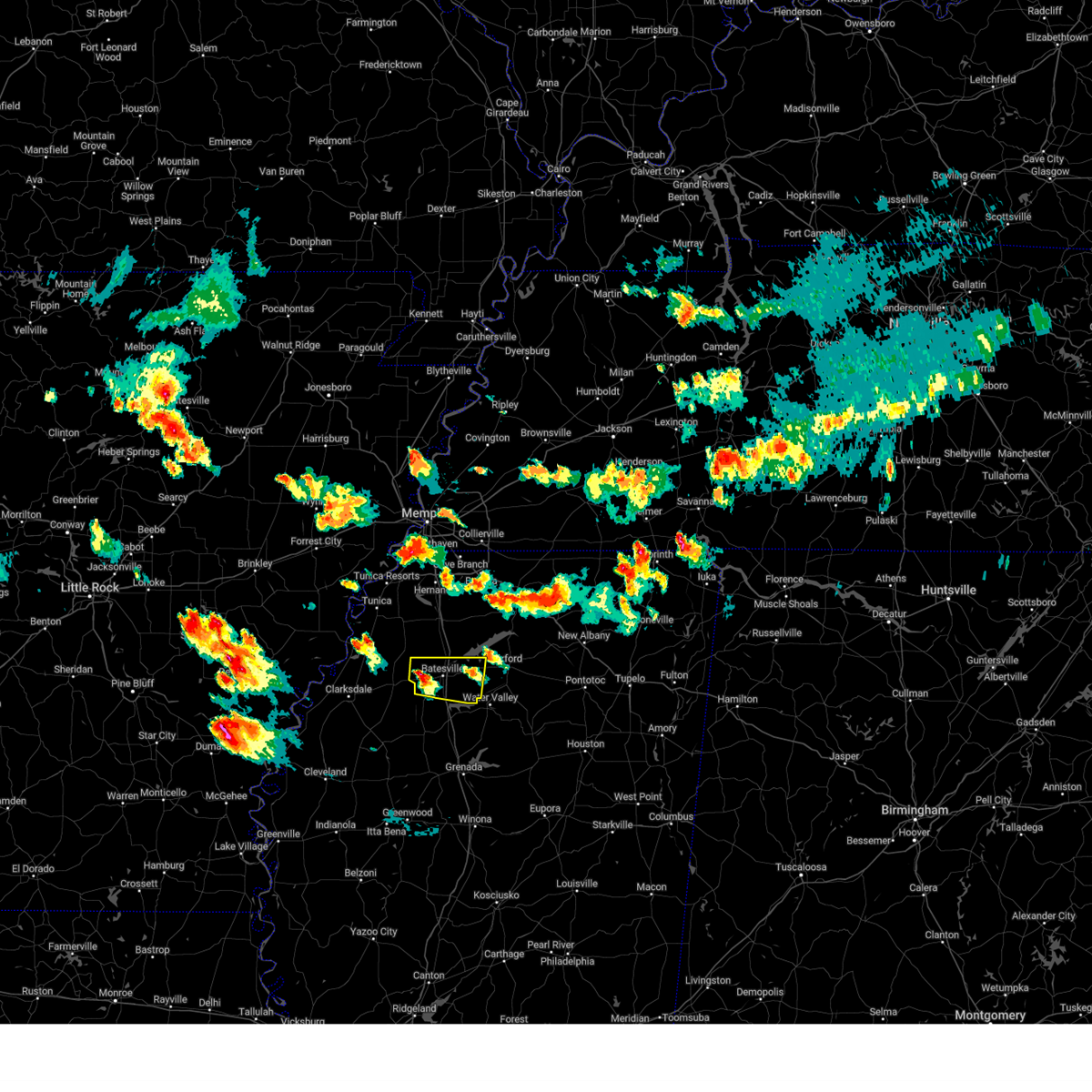 At 624 pm cdt, a severe thunderstorm was located near curtis station, or 8 miles west of batesville, moving east at 20 mph (radar indicated). Hazards include 60 mph wind gusts and quarter size hail. Hail damage to vehicles is expected. Expect wind damage to roofs, siding, and trees. At 624 pm cdt, a severe thunderstorm was located near curtis station, or 8 miles west of batesville, moving east at 20 mph (radar indicated). Hazards include 60 mph wind gusts and quarter size hail. Hail damage to vehicles is expected. Expect wind damage to roofs, siding, and trees.
|
| 3/24/2023 8:38 PM CDT |
 At 837 pm cdt, a severe thunderstorm capable of producing a tornado was located over george payne state park, moving northeast at 55 mph (radar indicated rotation). Hazards include tornado and quarter size hail. Flying debris will be dangerous to those caught without shelter. mobile homes will be damaged or destroyed. damage to roofs, windows, and vehicles will occur. tree damage is likely. Locations impacted include, oxford, batesville, water valley, george payne state park, holly springs national forest, pope, springdale, burgess, courtland, taylor, shuford, college hill and eureka springs. At 837 pm cdt, a severe thunderstorm capable of producing a tornado was located over george payne state park, moving northeast at 55 mph (radar indicated rotation). Hazards include tornado and quarter size hail. Flying debris will be dangerous to those caught without shelter. mobile homes will be damaged or destroyed. damage to roofs, windows, and vehicles will occur. tree damage is likely. Locations impacted include, oxford, batesville, water valley, george payne state park, holly springs national forest, pope, springdale, burgess, courtland, taylor, shuford, college hill and eureka springs.
|
| 3/24/2023 8:17 PM CDT |
 At 817 pm cdt, a severe thunderstorm capable of producing a tornado was located near charleston, moving northeast at 55 mph (radar indicated rotation). Hazards include tornado and quarter size hail. Flying debris will be dangerous to those caught without shelter. mobile homes will be damaged or destroyed. damage to roofs, windows, and vehicles will occur. Tree damage is likely. At 817 pm cdt, a severe thunderstorm capable of producing a tornado was located near charleston, moving northeast at 55 mph (radar indicated rotation). Hazards include tornado and quarter size hail. Flying debris will be dangerous to those caught without shelter. mobile homes will be damaged or destroyed. damage to roofs, windows, and vehicles will occur. Tree damage is likely.
|
| 1/3/2023 7:51 AM CST |
 At 750 am cst, a severe thunderstorm was located near john w kyle state park, moving northeast at 55 mph (radar indicated). Hazards include 60 mph wind gusts. Expect damage to roofs, siding, and trees. Locations impacted include, oxford, batesville, holly springs national forest, john w kyle state park, sardis, pope, burgess, cambridge, harmontown, laws hill, courtland, abbeville, malone, blackwater, teckville, glenville, college hill station, college hill, hayes crossing and spraggins. At 750 am cst, a severe thunderstorm was located near john w kyle state park, moving northeast at 55 mph (radar indicated). Hazards include 60 mph wind gusts. Expect damage to roofs, siding, and trees. Locations impacted include, oxford, batesville, holly springs national forest, john w kyle state park, sardis, pope, burgess, cambridge, harmontown, laws hill, courtland, abbeville, malone, blackwater, teckville, glenville, college hill station, college hill, hayes crossing and spraggins.
|
| 1/3/2023 7:34 AM CST |
 At 733 am cst, a severe thunderstorm was located near batesville, moving northeast at 55 mph (radar indicated). Hazards include 60 mph wind gusts. Expect damage to roofs, siding, and trees. Locations impacted include, oxford, batesville, holly springs national forest, john w kyle state park, sardis, crowder, pope, cambridge, harmontown, curtis station, burgess, laws hill, courtland, abbeville, malone, mims, asa, glenville, college hill station and college hill. At 733 am cst, a severe thunderstorm was located near batesville, moving northeast at 55 mph (radar indicated). Hazards include 60 mph wind gusts. Expect damage to roofs, siding, and trees. Locations impacted include, oxford, batesville, holly springs national forest, john w kyle state park, sardis, crowder, pope, cambridge, harmontown, curtis station, burgess, laws hill, courtland, abbeville, malone, mims, asa, glenville, college hill station and college hill.
|
| 1/3/2023 7:23 AM CST |
 At 720 am cst, a severe thunderstorm was located near crowder, or 15 miles northwest of charleston, moving northeast at 55 mph (radar indicated). Hazards include 60 mph wind gusts. expect damage to roofs, siding, and trees At 720 am cst, a severe thunderstorm was located near crowder, or 15 miles northwest of charleston, moving northeast at 55 mph (radar indicated). Hazards include 60 mph wind gusts. expect damage to roofs, siding, and trees
|
| 12/13/2022 10:58 PM CST |
 At 1058 pm cst, a severe thunderstorm capable of producing a tornado was located near george payne state park, moving northeast at 65 mph (radar indicated rotation). Hazards include tornado and 60 mph wind gusts. Flying debris will be dangerous to those caught without shelter. mobile homes will be damaged or destroyed. damage to roofs, windows, and vehicles will occur. tree damage is likely. Locations impacted include, batesville, water valley, charleston, george payne state park, john w kyle state park, pope, springdale, burgess, enid, velma, oakland, courtland, taylor, shuford, hayes crossing, eureka springs and chapeltown. At 1058 pm cst, a severe thunderstorm capable of producing a tornado was located near george payne state park, moving northeast at 65 mph (radar indicated rotation). Hazards include tornado and 60 mph wind gusts. Flying debris will be dangerous to those caught without shelter. mobile homes will be damaged or destroyed. damage to roofs, windows, and vehicles will occur. tree damage is likely. Locations impacted include, batesville, water valley, charleston, george payne state park, john w kyle state park, pope, springdale, burgess, enid, velma, oakland, courtland, taylor, shuford, hayes crossing, eureka springs and chapeltown.
|
| 12/13/2022 10:40 PM CST |
 At 1039 pm cst, a severe thunderstorm capable of producing a tornado was located near charleston, moving northeast at 65 mph (radar indicated rotation). Hazards include tornado. Flying debris will be dangerous to those caught without shelter. mobile homes will be damaged or destroyed. damage to roofs, windows, and vehicles will occur. Tree damage is likely. At 1039 pm cst, a severe thunderstorm capable of producing a tornado was located near charleston, moving northeast at 65 mph (radar indicated rotation). Hazards include tornado. Flying debris will be dangerous to those caught without shelter. mobile homes will be damaged or destroyed. damage to roofs, windows, and vehicles will occur. Tree damage is likely.
|
| 4/13/2022 6:18 PM CDT |
 At 618 pm cdt, severe thunderstorms were located along a line extending from near como to near batesville to webb, moving east at 40 mph (radar indicated). Hazards include 70 mph wind gusts. Expect considerable tree damage. damage is likely to mobile homes, roofs, and outbuildings. Locations impacted include, oxford, batesville, charleston, george payne state park, holly springs national forest, john w kyle state park, sardis, como, crowder, webb, sumner, pope, enid, paynes, harmontown, burgess, oakland, courtland, taylor and glendora. At 618 pm cdt, severe thunderstorms were located along a line extending from near como to near batesville to webb, moving east at 40 mph (radar indicated). Hazards include 70 mph wind gusts. Expect considerable tree damage. damage is likely to mobile homes, roofs, and outbuildings. Locations impacted include, oxford, batesville, charleston, george payne state park, holly springs national forest, john w kyle state park, sardis, como, crowder, webb, sumner, pope, enid, paynes, harmontown, burgess, oakland, courtland, taylor and glendora.
|
| 4/13/2022 6:06 PM CDT |
 At 605 pm cdt, severe thunderstorms were located along a line extending from pleasant grove to near pope to near parchman, moving east at 40 mph (radar indicated). Hazards include 70 mph wind gusts. Expect considerable tree damage. Damage is likely to mobile homes, roofs, and outbuildings. At 605 pm cdt, severe thunderstorms were located along a line extending from pleasant grove to near pope to near parchman, moving east at 40 mph (radar indicated). Hazards include 70 mph wind gusts. Expect considerable tree damage. Damage is likely to mobile homes, roofs, and outbuildings.
|
| 4/13/2022 5:50 PM CDT |
 The severe thunderstorm warning for eastern desoto, northwestern marshall, tate and northern panola counties will expire at 600 pm cdt, the storms which prompted the warning have moved out of the area. therefore, the warning will be allowed to expire. a tornado watch remains in effect until 900 pm cdt for northwestern mississippi. The severe thunderstorm warning for eastern desoto, northwestern marshall, tate and northern panola counties will expire at 600 pm cdt, the storms which prompted the warning have moved out of the area. therefore, the warning will be allowed to expire. a tornado watch remains in effect until 900 pm cdt for northwestern mississippi.
|
| 4/13/2022 5:43 PM CDT |
 At 543 pm cdt, severe thunderstorms were located along a line extending from near lewisburg to near senatobia to near pleasant grove, moving east at 40 mph (radar indicated). Hazards include 70 mph wind gusts. Expect considerable tree damage. damage is likely to mobile homes, roofs, and outbuildings. locations impacted include, olive branch, senatobia, batesville, sardis, coldwater, byhalia, como, crenshaw, barr, pleasant grove, independence, lewisburg, wakefield, askew, buxton, cockrum, aiken, crossroad, cedarview and handy corner. thunderstorm damage threat, considerable hail threat, radar indicated max hail size, <. 75 in wind threat, radar indicated max wind gust, 70 mph. At 543 pm cdt, severe thunderstorms were located along a line extending from near lewisburg to near senatobia to near pleasant grove, moving east at 40 mph (radar indicated). Hazards include 70 mph wind gusts. Expect considerable tree damage. damage is likely to mobile homes, roofs, and outbuildings. locations impacted include, olive branch, senatobia, batesville, sardis, coldwater, byhalia, como, crenshaw, barr, pleasant grove, independence, lewisburg, wakefield, askew, buxton, cockrum, aiken, crossroad, cedarview and handy corner. thunderstorm damage threat, considerable hail threat, radar indicated max hail size, <. 75 in wind threat, radar indicated max wind gust, 70 mph.
|
| 4/13/2022 5:28 PM CDT |
 At 528 pm cdt, severe thunderstorms were located along a line extending from near pleasant grove to near lambert to 6 miles northwest of rome, moving east at 40 mph (radar indicated). Hazards include 60 mph wind gusts. expect damage to roofs, siding, and trees At 528 pm cdt, severe thunderstorms were located along a line extending from near pleasant grove to near lambert to 6 miles northwest of rome, moving east at 40 mph (radar indicated). Hazards include 60 mph wind gusts. expect damage to roofs, siding, and trees
|
| 4/13/2022 5:16 PM CDT |
 At 516 pm cdt, severe thunderstorms were located along a line extending from walls to phillipp to near dubbs, moving east at 40 mph (radar indicated). Hazards include 70 mph wind gusts. Expect considerable tree damage. Damage is likely to mobile homes, roofs, and outbuildings. At 516 pm cdt, severe thunderstorms were located along a line extending from walls to phillipp to near dubbs, moving east at 40 mph (radar indicated). Hazards include 70 mph wind gusts. Expect considerable tree damage. Damage is likely to mobile homes, roofs, and outbuildings.
|
| 3/30/2022 4:50 PM CDT | Several large trees down at hwy 315 and hwy 6. also a roof torn off a she in panola county MS, 10.6 miles W of Batesville, MS |
| 3/30/2022 4:45 PM CDT |
 At 444 pm cdt, severe thunderstorms were located along a line extending from near como to near george payne state park to near bew springs, moving east at 50 mph (radar indicated). Hazards include 60 mph wind gusts. expect damage to roofs, siding, and trees At 444 pm cdt, severe thunderstorms were located along a line extending from near como to near george payne state park to near bew springs, moving east at 50 mph (radar indicated). Hazards include 60 mph wind gusts. expect damage to roofs, siding, and trees
|
| 3/30/2022 4:35 PM CDT |
 At 435 pm cdt, severe thunderstorms were located along a line extending from near como to near batesville to enid, moving northeast at 60 mph (radar indicated). Hazards include 70 mph wind gusts. Expect considerable tree damage. damage is likely to mobile homes, roofs, and outbuildings. Locations impacted include, batesville, charleston, george payne state park, marks, sardis, lambert, como, crowder, sledge, pope, belen, enid, paynes, darling, pleasant grove, sunnyside, curtis station, scobey, oakland and courtland. At 435 pm cdt, severe thunderstorms were located along a line extending from near como to near batesville to enid, moving northeast at 60 mph (radar indicated). Hazards include 70 mph wind gusts. Expect considerable tree damage. damage is likely to mobile homes, roofs, and outbuildings. Locations impacted include, batesville, charleston, george payne state park, marks, sardis, lambert, como, crowder, sledge, pope, belen, enid, paynes, darling, pleasant grove, sunnyside, curtis station, scobey, oakland and courtland.
|
| 3/30/2022 4:23 PM CDT |
 At 423 pm cdt, severe thunderstorms were located along a line extending from near curtis station to crowder to near charleston, moving northeast at 60 mph (radar indicated). Hazards include 70 mph wind gusts. Expect considerable tree damage. damage is likely to mobile homes, roofs, and outbuildings. Locations impacted include, batesville, charleston, george payne state park, tutwiler, marks, sardis, lambert, como, crowder, webb, sledge, sumner, pope, belen, enid, paynes, pleasant grove, curtis station, vance and darling. At 423 pm cdt, severe thunderstorms were located along a line extending from near curtis station to crowder to near charleston, moving northeast at 60 mph (radar indicated). Hazards include 70 mph wind gusts. Expect considerable tree damage. damage is likely to mobile homes, roofs, and outbuildings. Locations impacted include, batesville, charleston, george payne state park, tutwiler, marks, sardis, lambert, como, crowder, webb, sledge, sumner, pope, belen, enid, paynes, pleasant grove, curtis station, vance and darling.
|
| 3/30/2022 3:57 PM CDT |
 At 357 pm cdt, severe thunderstorms were located along a line extending from near dublin to near sumner to 6 miles east of drew, moving northeast at 60 mph (radar indicated). Hazards include 70 mph wind gusts. Expect considerable tree damage. Damage is likely to mobile homes, roofs, and outbuildings. At 357 pm cdt, severe thunderstorms were located along a line extending from near dublin to near sumner to 6 miles east of drew, moving northeast at 60 mph (radar indicated). Hazards include 70 mph wind gusts. Expect considerable tree damage. Damage is likely to mobile homes, roofs, and outbuildings.
|
| 1/1/2022 1:59 PM CST |
 At 159 pm cst, a severe thunderstorm was located near pope, or near batesville, moving northeast at 45 mph (radar indicated). Hazards include 60 mph wind gusts and penny size hail. expect damage to roofs, siding, and trees At 159 pm cst, a severe thunderstorm was located near pope, or near batesville, moving northeast at 45 mph (radar indicated). Hazards include 60 mph wind gusts and penny size hail. expect damage to roofs, siding, and trees
|
| 6/7/2021 7:31 PM CDT |
 At 731 pm cdt, severe thunderstorms were located along a line extending from near rondo to strayhorn to near batesville, moving northeast at 60 mph (radar indicated). Hazards include 60 mph wind gusts. Expect damage to roofs, siding, and trees. Locations impacted include, hernando, senatobia, batesville, john w kyle state park, sardis, coldwater, como, tunica, crenshaw, sledge, strayhorn, pleasant grove, eudora, dubbs, curtis station, north tunica, arkabutla, barr, phillipp and independence. At 731 pm cdt, severe thunderstorms were located along a line extending from near rondo to strayhorn to near batesville, moving northeast at 60 mph (radar indicated). Hazards include 60 mph wind gusts. Expect damage to roofs, siding, and trees. Locations impacted include, hernando, senatobia, batesville, john w kyle state park, sardis, coldwater, como, tunica, crenshaw, sledge, strayhorn, pleasant grove, eudora, dubbs, curtis station, north tunica, arkabutla, barr, phillipp and independence.
|
| 6/7/2021 7:17 PM CDT |
 At 717 pm cdt, severe thunderstorms were located along a line extending from near marvell to near crenshaw to near enid, moving northeast at 55 mph (radar indicated). Hazards include 60 mph wind gusts. Expect damage to roofs, siding, and trees. Locations impacted include, hernando, senatobia, batesville, john w kyle state park, sardis, coldwater, como, tunica, crenshaw, crowder, sledge, lake cormorant, strayhorn, pleasant grove, eudora, dubbs, curtis station, north tunica, arkabutla and barr. At 717 pm cdt, severe thunderstorms were located along a line extending from near marvell to near crenshaw to near enid, moving northeast at 55 mph (radar indicated). Hazards include 60 mph wind gusts. Expect damage to roofs, siding, and trees. Locations impacted include, hernando, senatobia, batesville, john w kyle state park, sardis, coldwater, como, tunica, crenshaw, crowder, sledge, lake cormorant, strayhorn, pleasant grove, eudora, dubbs, curtis station, north tunica, arkabutla and barr.
|
| 6/7/2021 7:02 PM CDT |
 At 701 pm cdt, severe thunderstorms were located along a line extending from near watkins corner to near darling to near charleston, moving northeast at 60 mph (radar indicated). Hazards include 60 mph wind gusts. Expect damage to roofs, siding, and trees. Locations impacted include, hernando, senatobia, batesville, john w kyle state park, sardis, coldwater, como, tunica, crenshaw, crowder, sledge, lake cormorant, strayhorn, pleasant grove, eudora, dubbs, curtis station, north tunica, arkabutla and barr. At 701 pm cdt, severe thunderstorms were located along a line extending from near watkins corner to near darling to near charleston, moving northeast at 60 mph (radar indicated). Hazards include 60 mph wind gusts. Expect damage to roofs, siding, and trees. Locations impacted include, hernando, senatobia, batesville, john w kyle state park, sardis, coldwater, como, tunica, crenshaw, crowder, sledge, lake cormorant, strayhorn, pleasant grove, eudora, dubbs, curtis station, north tunica, arkabutla and barr.
|
| 6/7/2021 6:54 PM CDT |
 At 654 pm cdt, severe thunderstorms were located along a line extending from 6 miles southeast of st. charles to near jonestown to charleston, moving northeast at 60 mph (radar indicated). Hazards include 60 mph wind gusts. expect damage to roofs, siding, and trees At 654 pm cdt, severe thunderstorms were located along a line extending from 6 miles southeast of st. charles to near jonestown to charleston, moving northeast at 60 mph (radar indicated). Hazards include 60 mph wind gusts. expect damage to roofs, siding, and trees
|
| 5/9/2021 6:01 PM CDT |
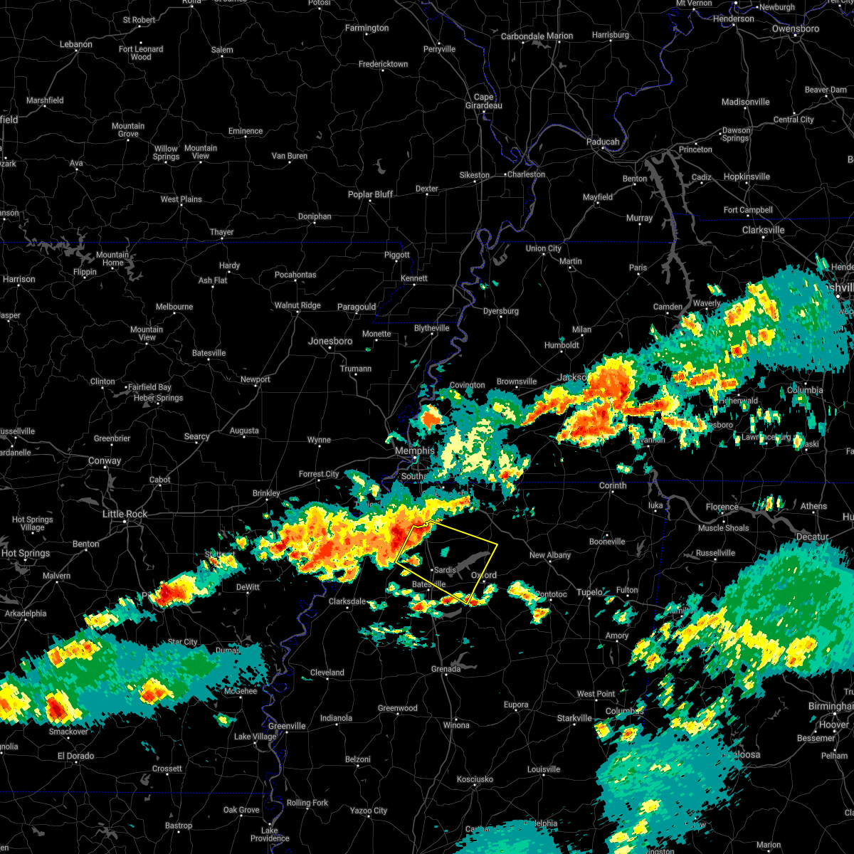 The national weather service in memphis has issued a * severe thunderstorm warning for. northwestern lafayette county in northwestern mississippi. southwestern marshall county in northwestern mississippi. tate county in northwestern mississippi. Northern panola county in northwestern mississippi. The national weather service in memphis has issued a * severe thunderstorm warning for. northwestern lafayette county in northwestern mississippi. southwestern marshall county in northwestern mississippi. tate county in northwestern mississippi. Northern panola county in northwestern mississippi.
|
| 3/28/2021 12:52 AM CDT |
 At 1251 am cdt, severe thunderstorms were located along a line extending from pope to near scobey to near leflore, moving east at 55 mph (radar indicated). Hazards include 60 mph wind gusts. Expect damage to roofs, siding, and trees. Locations impacted include, oxford, batesville, water valley, charleston, george payne state park, holly springs national forest, coffeeville, webb, sumner, pope, enid, paynes, springdale, burgess, velma, scobey, oakland, courtland, taylor and glendora. At 1251 am cdt, severe thunderstorms were located along a line extending from pope to near scobey to near leflore, moving east at 55 mph (radar indicated). Hazards include 60 mph wind gusts. Expect damage to roofs, siding, and trees. Locations impacted include, oxford, batesville, water valley, charleston, george payne state park, holly springs national forest, coffeeville, webb, sumner, pope, enid, paynes, springdale, burgess, velma, scobey, oakland, courtland, taylor and glendora.
|
| 3/28/2021 12:36 AM CDT |
 At 1236 am cdt, severe thunderstorms were located along a line extending from crowder to near paynes to minter city, moving east at 55 mph (radar indicated). Hazards include 60 mph wind gusts. Expect damage to roofs, siding, and trees. Locations impacted include, oxford, batesville, water valley, charleston, george payne state park, holly springs national forest, marks, lambert, coffeeville, crowder, webb, sumner, pope, belen, enid, paynes, curtis station, velma, vance and darling. At 1236 am cdt, severe thunderstorms were located along a line extending from crowder to near paynes to minter city, moving east at 55 mph (radar indicated). Hazards include 60 mph wind gusts. Expect damage to roofs, siding, and trees. Locations impacted include, oxford, batesville, water valley, charleston, george payne state park, holly springs national forest, marks, lambert, coffeeville, crowder, webb, sumner, pope, belen, enid, paynes, curtis station, velma, vance and darling.
|
| 3/28/2021 12:27 AM CDT |
 The national weather service in memphis has issued a * severe thunderstorm warning for. southwestern lafayette county in northwestern mississippi. yalobusha county in northwestern mississippi. northwestern calhoun county in northeastern mississippi. Tallahatchie county in northwestern mississippi. The national weather service in memphis has issued a * severe thunderstorm warning for. southwestern lafayette county in northwestern mississippi. yalobusha county in northwestern mississippi. northwestern calhoun county in northeastern mississippi. Tallahatchie county in northwestern mississippi.
|
| 3/27/2021 10:08 PM CDT |
 At 1008 pm cdt, a severe thunderstorm was located near darling, or 17 miles northeast of clarksdale, moving east at 35 mph (radar indicated). Hazards include 60 mph wind gusts. expect damage to roofs, siding, and trees At 1008 pm cdt, a severe thunderstorm was located near darling, or 17 miles northeast of clarksdale, moving east at 35 mph (radar indicated). Hazards include 60 mph wind gusts. expect damage to roofs, siding, and trees
|
| 3/17/2021 5:43 PM CDT | Ping Pong Ball sized hail reported 3.1 miles W of Batesville, MS, estimated 1 1/2 inch sized hail reported in endville. |
| 3/17/2021 7:56 AM CDT |
 The severe thunderstorm warning for western lafayette, southwestern marshall, southeastern tate and eastern panola counties will expire at 800 am cdt, the storm which prompted the warning has weakened below severe limits, and no longer poses an immediate threat to life or property. therefore, the warning will be allowed to expire. a tornado watch remains in effect until 100 pm cdt for northwestern mississippi. The severe thunderstorm warning for western lafayette, southwestern marshall, southeastern tate and eastern panola counties will expire at 800 am cdt, the storm which prompted the warning has weakened below severe limits, and no longer poses an immediate threat to life or property. therefore, the warning will be allowed to expire. a tornado watch remains in effect until 100 pm cdt for northwestern mississippi.
|
| 3/17/2021 7:39 AM CDT |
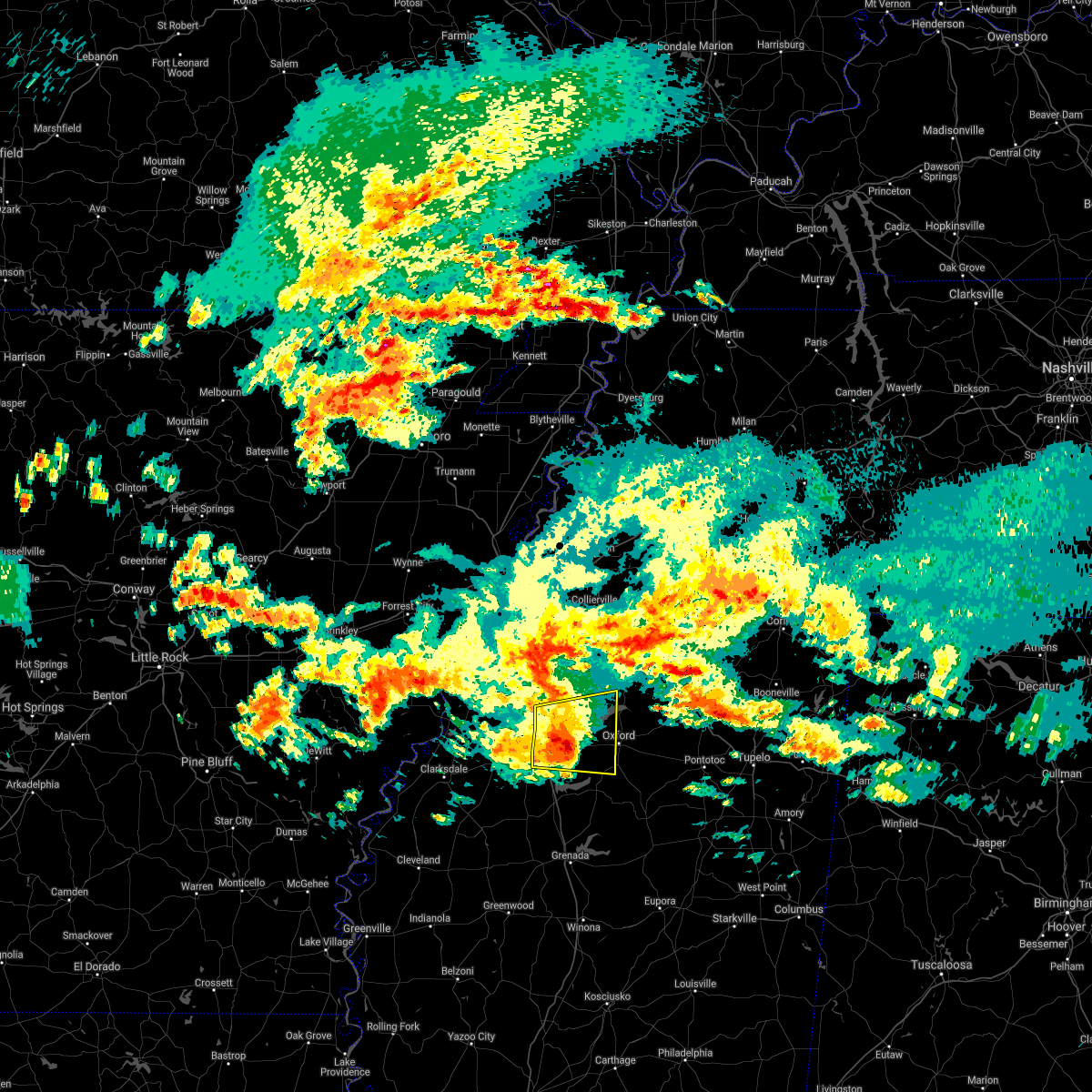 At 739 am cdt, a severe thunderstorm was located near burgess, or 7 miles east of john w kyle state park, moving east at 50 mph (radar indicated). Hazards include 60 mph wind gusts and quarter size hail. Hail damage to vehicles is expected. expect wind damage to roofs, siding, and trees. Locations impacted include, oxford, batesville, holly springs national forest, john w kyle state park, sardis, como, springdale, burgess, harmontown, laws hill, courtland, taylor, blackwater, teckville, tyro, mcghee, glenville, college hill, hayes crossing and eureka springs. At 739 am cdt, a severe thunderstorm was located near burgess, or 7 miles east of john w kyle state park, moving east at 50 mph (radar indicated). Hazards include 60 mph wind gusts and quarter size hail. Hail damage to vehicles is expected. expect wind damage to roofs, siding, and trees. Locations impacted include, oxford, batesville, holly springs national forest, john w kyle state park, sardis, como, springdale, burgess, harmontown, laws hill, courtland, taylor, blackwater, teckville, tyro, mcghee, glenville, college hill, hayes crossing and eureka springs.
|
| 3/17/2021 7:12 AM CDT |
 The national weather service in memphis has issued a * severe thunderstorm warning for. western lafayette county in northwestern mississippi. northern yalobusha county in northwestern mississippi. southwestern marshall county in northwestern mississippi. Southeastern tate county in northwestern mississippi. The national weather service in memphis has issued a * severe thunderstorm warning for. western lafayette county in northwestern mississippi. northern yalobusha county in northwestern mississippi. southwestern marshall county in northwestern mississippi. Southeastern tate county in northwestern mississippi.
|
| 3/17/2021 7:02 AM CDT |
 At 701 am cdt, a severe thunderstorm was located near crowder, or 14 miles southwest of batesville, moving east at 50 mph (radar indicated). Hazards include 60 mph wind gusts and quarter size hail. Hail damage to vehicles is expected. expect wind damage to roofs, siding, and trees. Locations impacted include, clarksdale, batesville, charleston, tutwiler, marks, lambert, jonestown, como, crenshaw, crowder, sledge, pope, belen, enid, dublin, pleasant grove, curtis station, dundee, vance and darling. At 701 am cdt, a severe thunderstorm was located near crowder, or 14 miles southwest of batesville, moving east at 50 mph (radar indicated). Hazards include 60 mph wind gusts and quarter size hail. Hail damage to vehicles is expected. expect wind damage to roofs, siding, and trees. Locations impacted include, clarksdale, batesville, charleston, tutwiler, marks, lambert, jonestown, como, crenshaw, crowder, sledge, pope, belen, enid, dublin, pleasant grove, curtis station, dundee, vance and darling.
|
| 3/17/2021 6:51 AM CDT |
 At 651 am cdt, a severe thunderstorm was located over lambert, or 14 miles east of clarksdale, moving east at 45 mph (radar indicated). Hazards include 60 mph wind gusts and quarter size hail. Hail damage to vehicles is expected. expect wind damage to roofs, siding, and trees. Locations impacted include, clarksdale, batesville, charleston, helena-west helena, tutwiler, marks, lambert, jonestown, como, friars point, crenshaw, crowder, sledge, pope, belen, enid, dublin, pleasant grove, curtis station and dundee. At 651 am cdt, a severe thunderstorm was located over lambert, or 14 miles east of clarksdale, moving east at 45 mph (radar indicated). Hazards include 60 mph wind gusts and quarter size hail. Hail damage to vehicles is expected. expect wind damage to roofs, siding, and trees. Locations impacted include, clarksdale, batesville, charleston, helena-west helena, tutwiler, marks, lambert, jonestown, como, friars point, crenshaw, crowder, sledge, pope, belen, enid, dublin, pleasant grove, curtis station and dundee.
|
| 3/17/2021 6:35 AM CDT |
 At 635 am cdt, a severe thunderstorm was located near clarksdale, moving east at 50 mph (radar indicated). Hazards include 60 mph wind gusts and quarter size hail. Hail damage to vehicles is expected. Expect wind damage to roofs, siding, and trees. At 635 am cdt, a severe thunderstorm was located near clarksdale, moving east at 50 mph (radar indicated). Hazards include 60 mph wind gusts and quarter size hail. Hail damage to vehicles is expected. Expect wind damage to roofs, siding, and trees.
|
| 8/27/2020 8:09 PM CDT |
 At 809 pm cdt, doppler radar indicated a severe thunderstorm producing a tornado was located over sardis, or near john w kyle state park, moving north at 45 mph (radar indicated rotation). Hazards include tornado. Flying debris will be dangerous to those caught without shelter. mobile homes will be damaged or destroyed. damage to roofs, windows, and vehicles will occur. tree damage is likely. Locations impacted include, senatobia, batesville, john w kyle state park, sardis, como, glenville, teckville, hayes crossing, mcghee and bluff. At 809 pm cdt, doppler radar indicated a severe thunderstorm producing a tornado was located over sardis, or near john w kyle state park, moving north at 45 mph (radar indicated rotation). Hazards include tornado. Flying debris will be dangerous to those caught without shelter. mobile homes will be damaged or destroyed. damage to roofs, windows, and vehicles will occur. tree damage is likely. Locations impacted include, senatobia, batesville, john w kyle state park, sardis, como, glenville, teckville, hayes crossing, mcghee and bluff.
|
| 8/27/2020 7:58 PM CDT |
 At 758 pm cdt, doppler radar indicated a severe thunderstorm producing a tornado was located over batesville, moving north at 45 mph (radar indicated rotation). Hazards include tornado. Flying debris will be dangerous to those caught without shelter. mobile homes will be damaged or destroyed. damage to roofs, windows, and vehicles will occur. Tree damage is likely. At 758 pm cdt, doppler radar indicated a severe thunderstorm producing a tornado was located over batesville, moving north at 45 mph (radar indicated rotation). Hazards include tornado. Flying debris will be dangerous to those caught without shelter. mobile homes will be damaged or destroyed. damage to roofs, windows, and vehicles will occur. Tree damage is likely.
|
| 6/5/2020 3:33 PM CDT |
 At 332 pm cdt, severe thunderstorms were located along a line extending from 7 miles southwest of banner to paynes, moving southeast at 45 mph (radar indicated). Hazards include 60 mph wind gusts. Expect damage to roofs, siding, and trees. Locations impacted include, oxford, batesville, water valley, charleston, george payne state park, bruce, calhoun city, marks, lambert, derma, coffeeville, crowder, webb, sumner, pope, pittsboro, slate springs, enid, paynes and sabougla. At 332 pm cdt, severe thunderstorms were located along a line extending from 7 miles southwest of banner to paynes, moving southeast at 45 mph (radar indicated). Hazards include 60 mph wind gusts. Expect damage to roofs, siding, and trees. Locations impacted include, oxford, batesville, water valley, charleston, george payne state park, bruce, calhoun city, marks, lambert, derma, coffeeville, crowder, webb, sumner, pope, pittsboro, slate springs, enid, paynes and sabougla.
|
| 6/5/2020 3:14 PM CDT |
 At 311 pm cdt, severe thunderstorms were located along a line extending from near springdale to 6 miles east of vance, moving southeast at 45 mph (radar indicated). Hazards include 60 mph wind gusts. expect damage to roofs, siding, and trees At 311 pm cdt, severe thunderstorms were located along a line extending from near springdale to 6 miles east of vance, moving southeast at 45 mph (radar indicated). Hazards include 60 mph wind gusts. expect damage to roofs, siding, and trees
|
| 6/5/2020 3:04 PM CDT |
 At 304 pm cdt, severe thunderstorms were located along a line extending from near tula to crowder, moving southeast at 50 mph (radar indicated). Hazards include 60 mph wind gusts. Expect damage to roofs, siding, and trees. Locations impacted include, oxford, batesville, water valley, charleston, george payne state park, holly springs national forest, john w kyle state park, marks, sardis, lambert, como, crowder, sledge, pope, enid, darling, pleasant grove, springdale, curtis station and burgess. At 304 pm cdt, severe thunderstorms were located along a line extending from near tula to crowder, moving southeast at 50 mph (radar indicated). Hazards include 60 mph wind gusts. Expect damage to roofs, siding, and trees. Locations impacted include, oxford, batesville, water valley, charleston, george payne state park, holly springs national forest, john w kyle state park, marks, sardis, lambert, como, crowder, sledge, pope, enid, darling, pleasant grove, springdale, curtis station and burgess.
|
| 6/5/2020 3:00 PM CDT | Extensive tree damage across the city of batesvill in panola county MS, 0.6 miles SE of Batesville, MS |
| 6/5/2020 3:00 PM CDT | Extensive tree damage across the city of batesvill in panola county MS, 0.6 miles SE of Batesville, MS |
| 6/5/2020 2:47 PM CDT |
 At 246 pm cdt, severe thunderstorms were located along a line extending from near holly springs national forest to near darling, moving southeast at 50 mph (radar indicated). Hazards include 60 mph wind gusts. expect damage to roofs, siding, and trees At 246 pm cdt, severe thunderstorms were located along a line extending from near holly springs national forest to near darling, moving southeast at 50 mph (radar indicated). Hazards include 60 mph wind gusts. expect damage to roofs, siding, and trees
|
| 4/12/2020 10:17 PM CDT |
 At 1017 pm cdt, severe thunderstorms were located along a line extending from whitehaven to 6 miles north of burgess to coffeeville, moving northeast at 75 mph (radar indicated). Hazards include 70 mph wind gusts. Expect considerable tree damage. damage is likely to mobile homes, roofs, and outbuildings. Locations impacted include, southaven, horn lake, oxford, hernando, senatobia, batesville, water valley, george payne state park, holly springs national forest, john w kyle state park, sardis, coldwater, como, walls, coffeeville, pope, lake cormorant, enid, harmontown and eudora. At 1017 pm cdt, severe thunderstorms were located along a line extending from whitehaven to 6 miles north of burgess to coffeeville, moving northeast at 75 mph (radar indicated). Hazards include 70 mph wind gusts. Expect considerable tree damage. damage is likely to mobile homes, roofs, and outbuildings. Locations impacted include, southaven, horn lake, oxford, hernando, senatobia, batesville, water valley, george payne state park, holly springs national forest, john w kyle state park, sardis, coldwater, como, walls, coffeeville, pope, lake cormorant, enid, harmontown and eudora.
|
| 4/12/2020 10:03 PM CDT |
 At 1001 pm cdt, severe thunderstorms were located along a line extending from near horseshoe lake to near batesville to near paynes, moving east at 75 mph (radar indicated. tunica airport reported 60 mph winds at 10 pm). Hazards include 70 mph wind gusts. Expect considerable tree damage. damage is likely to mobile homes, roofs, and outbuildings. Locations impacted include, southaven, horn lake, oxford, hernando, senatobia, batesville, water valley, charleston, george payne state park, holly springs national forest, john w kyle state park, sardis, coldwater, como, walls, tunica, coffeeville, crenshaw, crowder and pope. At 1001 pm cdt, severe thunderstorms were located along a line extending from near horseshoe lake to near batesville to near paynes, moving east at 75 mph (radar indicated. tunica airport reported 60 mph winds at 10 pm). Hazards include 70 mph wind gusts. Expect considerable tree damage. damage is likely to mobile homes, roofs, and outbuildings. Locations impacted include, southaven, horn lake, oxford, hernando, senatobia, batesville, water valley, charleston, george payne state park, holly springs national forest, john w kyle state park, sardis, coldwater, como, walls, tunica, coffeeville, crenshaw, crowder and pope.
|
| 4/12/2020 9:50 PM CDT |
 At 950 pm cdt, severe thunderstorms were located along a line extending from madison to 6 miles southeast of dundee to tutwiler, moving northeast at 70 mph (radar indicated). Hazards include 70 mph wind gusts. Expect considerable tree damage. Damage is likely to mobile homes, roofs, and outbuildings. At 950 pm cdt, severe thunderstorms were located along a line extending from madison to 6 miles southeast of dundee to tutwiler, moving northeast at 70 mph (radar indicated). Hazards include 70 mph wind gusts. Expect considerable tree damage. Damage is likely to mobile homes, roofs, and outbuildings.
|
| 3/28/2020 10:08 PM CDT |
 At 1008 pm cdt, a severe thunderstorm was located near batesville, moving northeast at 65 mph (radar indicated). Hazards include 60 mph wind gusts and quarter size hail. Hail damage to vehicles is expected. expect wind damage to roofs, siding, and trees. Locations impacted include, oxford, batesville, holly springs national forest, john w kyle state park, pope, burgess, cambridge, harmontown, laws hill, courtland, abbeville, taylor, malone, keel, blackwater, teckville, shuford, glenville, college hill station and college hill. At 1008 pm cdt, a severe thunderstorm was located near batesville, moving northeast at 65 mph (radar indicated). Hazards include 60 mph wind gusts and quarter size hail. Hail damage to vehicles is expected. expect wind damage to roofs, siding, and trees. Locations impacted include, oxford, batesville, holly springs national forest, john w kyle state park, pope, burgess, cambridge, harmontown, laws hill, courtland, abbeville, taylor, malone, keel, blackwater, teckville, shuford, glenville, college hill station and college hill.
|
| 3/28/2020 10:05 PM CDT | Quarter sized hail reported 5.7 miles NE of Batesville, MS, quarter sized and slightly larger hail. |
| 3/28/2020 9:57 PM CDT |
 The national weather service in memphis has issued a * severe thunderstorm warning for. northern lafayette county in northwestern mississippi. southwestern marshall county in northwestern mississippi. northeastern tallahatchie county in northwestern mississippi. Southeastern panola county in northwestern mississippi. The national weather service in memphis has issued a * severe thunderstorm warning for. northern lafayette county in northwestern mississippi. southwestern marshall county in northwestern mississippi. northeastern tallahatchie county in northwestern mississippi. Southeastern panola county in northwestern mississippi.
|
| 3/28/2020 9:41 PM CDT |
 At 940 pm cdt, a severe thunderstorm was located over vance, or 13 miles northeast of parchman, moving northeast at 75 mph (radar indicated). Hazards include 60 mph wind gusts and quarter size hail. Hail damage to vehicles is expected. expect wind damage to roofs, siding, and trees. Locations impacted include, batesville, tutwiler, marks, sardis, lambert, crowder, pope, curtis station, vance, pleasant grove, courtland, west marks, shuford, mims, denton, stover, riverview, longstreet, asa and ballentine. At 940 pm cdt, a severe thunderstorm was located over vance, or 13 miles northeast of parchman, moving northeast at 75 mph (radar indicated). Hazards include 60 mph wind gusts and quarter size hail. Hail damage to vehicles is expected. expect wind damage to roofs, siding, and trees. Locations impacted include, batesville, tutwiler, marks, sardis, lambert, crowder, pope, curtis station, vance, pleasant grove, courtland, west marks, shuford, mims, denton, stover, riverview, longstreet, asa and ballentine.
|
| 3/28/2020 9:20 PM CDT |
 At 920 pm cdt, doppler radar indicated a severe thunderstorm producing a tornado was located near dublin, or 11 miles southeast of clarksdale, moving northeast at 75 mph (radar indicated rotation). Hazards include tornado. Flying debris will be dangerous to those caught without shelter. mobile homes will be damaged or destroyed. damage to roofs, windows, and vehicles will occur. Tree damage is likely. At 920 pm cdt, doppler radar indicated a severe thunderstorm producing a tornado was located near dublin, or 11 miles southeast of clarksdale, moving northeast at 75 mph (radar indicated rotation). Hazards include tornado. Flying debris will be dangerous to those caught without shelter. mobile homes will be damaged or destroyed. damage to roofs, windows, and vehicles will occur. Tree damage is likely.
|
| 3/28/2020 9:09 PM CDT |
 At 909 pm cdt, a severe thunderstorm was located 8 miles northeast of shelby, moving northeast at 65 mph (radar indicated). Hazards include 60 mph wind gusts and quarter size hail. Hail damage to vehicles is expected. Expect wind damage to roofs, siding, and trees. At 909 pm cdt, a severe thunderstorm was located 8 miles northeast of shelby, moving northeast at 65 mph (radar indicated). Hazards include 60 mph wind gusts and quarter size hail. Hail damage to vehicles is expected. Expect wind damage to roofs, siding, and trees.
|
| 3/28/2020 8:54 PM CDT |
 The severe thunderstorm warning for western lafayette and panola counties will expire at 900 pm cdt, the storm which prompted the warning has weakened below severe limits, and has exited the warned area. therefore, the warning will be allowed to expire. a tornado watch remains in effect until 200 am cdt for northwestern mississippi. The severe thunderstorm warning for western lafayette and panola counties will expire at 900 pm cdt, the storm which prompted the warning has weakened below severe limits, and has exited the warned area. therefore, the warning will be allowed to expire. a tornado watch remains in effect until 200 am cdt for northwestern mississippi.
|
| 3/28/2020 8:25 PM CDT |
 At 825 pm cdt, a severe thunderstorm was located near sardis, or near batesville, moving northeast at 50 mph (radar indicated). Hazards include 60 mph wind gusts. Expect damage to roofs, siding, and trees. Locations impacted include, batesville, john w kyle state park, sardis, como, pope, burgess, harmontown, courtland, abbeville, blackwater, teckville, shuford, mcghee, asa, glenville, college hill, hayes crossing, eureka springs and chapeltown. At 825 pm cdt, a severe thunderstorm was located near sardis, or near batesville, moving northeast at 50 mph (radar indicated). Hazards include 60 mph wind gusts. Expect damage to roofs, siding, and trees. Locations impacted include, batesville, john w kyle state park, sardis, como, pope, burgess, harmontown, courtland, abbeville, blackwater, teckville, shuford, mcghee, asa, glenville, college hill, hayes crossing, eureka springs and chapeltown.
|
| 3/28/2020 8:16 PM CDT |
 At 815 pm cdt, a severe thunderstorm was located near curtis station, or 8 miles west of batesville, moving northeast at 60 mph (radar indicated). Hazards include 60 mph wind gusts. expect damage to roofs, siding, and trees At 815 pm cdt, a severe thunderstorm was located near curtis station, or 8 miles west of batesville, moving northeast at 60 mph (radar indicated). Hazards include 60 mph wind gusts. expect damage to roofs, siding, and trees
|
| 3/28/2020 8:00 PM CDT |
 At 800 pm cdt, severe thunderstorms were located along a line extending from near como to drew, moving east at 35 mph (radar indicated). Hazards include 60 mph wind gusts. Expect damage to roofs, siding, and trees. Locations impacted include, senatobia, batesville, charleston, john w kyle state park, tutwiler, marks, sardis, coldwater, lambert, como, crenshaw, crowder, webb, sledge, sumner, pope, belen, strayhorn, pleasant grove and curtis station. At 800 pm cdt, severe thunderstorms were located along a line extending from near como to drew, moving east at 35 mph (radar indicated). Hazards include 60 mph wind gusts. Expect damage to roofs, siding, and trees. Locations impacted include, senatobia, batesville, charleston, john w kyle state park, tutwiler, marks, sardis, coldwater, lambert, como, crenshaw, crowder, webb, sledge, sumner, pope, belen, strayhorn, pleasant grove and curtis station.
|
| 3/28/2020 7:37 PM CDT |
 At 737 pm cdt, severe thunderstorms were located along a line extending from near crenshaw to renova, moving east at 35 mph (radar indicated). Hazards include 60 mph wind gusts. expect damage to roofs, siding, and trees At 737 pm cdt, severe thunderstorms were located along a line extending from near crenshaw to renova, moving east at 35 mph (radar indicated). Hazards include 60 mph wind gusts. expect damage to roofs, siding, and trees
|
| 1/11/2020 5:34 AM CST |
 At 533 am cst, a severe thunderstorm was located over laws hill, or 8 miles southwest of wall doxey state park, moving northeast at 50 mph (radar indicated). Hazards include 60 mph wind gusts. expect damage to roofs, siding, and trees At 533 am cst, a severe thunderstorm was located over laws hill, or 8 miles southwest of wall doxey state park, moving northeast at 50 mph (radar indicated). Hazards include 60 mph wind gusts. expect damage to roofs, siding, and trees
|
| 1/11/2020 5:16 AM CST |
 At 516 am cst, severe thunderstorms were located along a line extending from near hernando to near barr to 7 miles southeast of enid, moving northeast at 55 mph (radar indicated). Hazards include 70 mph wind gusts. Expect considerable tree damage. damage is likely to mobile homes, roofs, and outbuildings. Locations impacted include, oxford, senatobia, holly springs, batesville, water valley, george payne state park, holly springs national forest, wall doxey state park, john w kyle state park, coffeeville, pope, enid, harmontown, velma, laws hill, barr, springdale, burgess, scobey and marianna. At 516 am cst, severe thunderstorms were located along a line extending from near hernando to near barr to 7 miles southeast of enid, moving northeast at 55 mph (radar indicated). Hazards include 70 mph wind gusts. Expect considerable tree damage. damage is likely to mobile homes, roofs, and outbuildings. Locations impacted include, oxford, senatobia, holly springs, batesville, water valley, george payne state park, holly springs national forest, wall doxey state park, john w kyle state park, coffeeville, pope, enid, harmontown, velma, laws hill, barr, springdale, burgess, scobey and marianna.
|
| 1/11/2020 5:09 AM CST |
 At 509 am cst, severe thunderstorms were located along a line extending from near coldwater to 6 miles northeast of crowder, moving northeast at 30 mph (radar indicated). Hazards include 60 mph wind gusts. Expect damage to roofs, siding, and trees. Locations impacted include, senatobia, batesville, sardis, coldwater, como, pope, pleasant grove, lewisburg, courtland, lurline, alphaba, mcghee, asa, ballentine, love, poagville, horatio, new town, cypress corner and chapeltown. At 509 am cst, severe thunderstorms were located along a line extending from near coldwater to 6 miles northeast of crowder, moving northeast at 30 mph (radar indicated). Hazards include 60 mph wind gusts. Expect damage to roofs, siding, and trees. Locations impacted include, senatobia, batesville, sardis, coldwater, como, pope, pleasant grove, lewisburg, courtland, lurline, alphaba, mcghee, asa, ballentine, love, poagville, horatio, new town, cypress corner and chapeltown.
|
| 1/11/2020 4:55 AM CST |
 At 454 am cst, severe thunderstorms were located along a line extending from near little texas to near batesville to near paynes, moving northeast at 50 mph (radar indicated). Hazards include 70 mph wind gusts. Expect considerable tree damage. Damage is likely to mobile homes, roofs, and outbuildings. At 454 am cst, severe thunderstorms were located along a line extending from near little texas to near batesville to near paynes, moving northeast at 50 mph (radar indicated). Hazards include 70 mph wind gusts. Expect considerable tree damage. Damage is likely to mobile homes, roofs, and outbuildings.
|
| 1/11/2020 4:51 AM CST |
 At 450 am cst, severe thunderstorms were located along a line extending from near strayhorn to near lambert, moving northeast at 30 mph (radar indicated). Hazards include 60 mph wind gusts. Expect damage to roofs, siding, and trees. Locations impacted include, senatobia, batesville, marks, sardis, coldwater, lambert, como, crenshaw, crowder, sledge, pope, vance, darling, strayhorn, pleasant grove, curtis station, arkabutla, lewisburg, courtland and falcon. At 450 am cst, severe thunderstorms were located along a line extending from near strayhorn to near lambert, moving northeast at 30 mph (radar indicated). Hazards include 60 mph wind gusts. Expect damage to roofs, siding, and trees. Locations impacted include, senatobia, batesville, marks, sardis, coldwater, lambert, como, crenshaw, crowder, sledge, pope, vance, darling, strayhorn, pleasant grove, curtis station, arkabutla, lewisburg, courtland and falcon.
|
| 1/11/2020 4:29 AM CST |
 At 428 am cst, severe thunderstorms were located along a line extending from near dubbs to near dublin, moving northeast at 30 mph (radar indicated). Hazards include 60 mph wind gusts. expect damage to roofs, siding, and trees At 428 am cst, severe thunderstorms were located along a line extending from near dubbs to near dublin, moving northeast at 30 mph (radar indicated). Hazards include 60 mph wind gusts. expect damage to roofs, siding, and trees
|
| 12/16/2019 2:40 PM CST |
 At 239 pm cst, a severe thunderstorm was located near springdale, or near water valley, moving northeast at 55 mph (radar indicated). Hazards include 60 mph wind gusts and quarter size hail. Hail damage to vehicles is expected. expect wind damage to roofs, siding, and trees. Locations impacted include, oxford, batesville, water valley, holly springs national forest, springdale, burgess, cambridge, tula, denmark, velma, paris, abbeville, taylor, toccopola, altus, keel, shuford, delay, college hill station and college hill. At 239 pm cst, a severe thunderstorm was located near springdale, or near water valley, moving northeast at 55 mph (radar indicated). Hazards include 60 mph wind gusts and quarter size hail. Hail damage to vehicles is expected. expect wind damage to roofs, siding, and trees. Locations impacted include, oxford, batesville, water valley, holly springs national forest, springdale, burgess, cambridge, tula, denmark, velma, paris, abbeville, taylor, toccopola, altus, keel, shuford, delay, college hill station and college hill.
|
| 12/16/2019 2:18 PM CST |
 At 218 pm cst, a severe thunderstorm was located near enid, or 7 miles west of george payne state park, moving northeast at 65 mph (radar indicated). Hazards include 60 mph wind gusts and quarter size hail. Hail damage to vehicles is expected. Expect wind damage to roofs, siding, and trees. At 218 pm cst, a severe thunderstorm was located near enid, or 7 miles west of george payne state park, moving northeast at 65 mph (radar indicated). Hazards include 60 mph wind gusts and quarter size hail. Hail damage to vehicles is expected. Expect wind damage to roofs, siding, and trees.
|
| 11/30/2019 2:47 PM CST | Half Dollar sized hail reported 0.6 miles SE of Batesville, MS, half dollar size hail around batesville. |
| 11/30/2019 2:45 PM CST | Quarter sized hail reported 12.5 miles E of Batesville, MS, quarter size hail around curtis station. |
| 11/30/2019 2:20 PM CST |
 At 219 pm cst, a severe thunderstorm was located near como, or 9 miles south of senatobia, moving northeast at 70 mph (radar indicated). Hazards include 60 mph wind gusts and quarter size hail. Hail damage to vehicles is expected. expect wind damage to roofs, siding, and trees. Locations impacted include, senatobia, holly springs, batesville, wall doxey state park, john w kyle state park, sardis, byhalia, como, barr, pleasant grove, independence, red banks, laws hill, marianna, coal oil corner, wakefield, aiken, crossroad, tyro and watson. At 219 pm cst, a severe thunderstorm was located near como, or 9 miles south of senatobia, moving northeast at 70 mph (radar indicated). Hazards include 60 mph wind gusts and quarter size hail. Hail damage to vehicles is expected. expect wind damage to roofs, siding, and trees. Locations impacted include, senatobia, holly springs, batesville, wall doxey state park, john w kyle state park, sardis, byhalia, como, barr, pleasant grove, independence, red banks, laws hill, marianna, coal oil corner, wakefield, aiken, crossroad, tyro and watson.
|
| 11/30/2019 2:15 PM CST |
 At 215 pm cst, a severe thunderstorm was located near batesville, moving northeast at 80 mph (radar indicated). Hazards include 60 mph wind gusts and quarter size hail. Hail damage to vehicles is expected. Expect wind damage to roofs, siding, and trees. At 215 pm cst, a severe thunderstorm was located near batesville, moving northeast at 80 mph (radar indicated). Hazards include 60 mph wind gusts and quarter size hail. Hail damage to vehicles is expected. Expect wind damage to roofs, siding, and trees.
|
| 11/30/2019 2:00 PM CST |
 At 200 pm cst, a severe thunderstorm was located over marks, or 17 miles east of clarksdale, moving northeast at 70 mph (radar indicated). Hazards include 60 mph wind gusts and quarter size hail. Hail damage to vehicles is expected. Expect wind damage to roofs, siding, and trees. At 200 pm cst, a severe thunderstorm was located over marks, or 17 miles east of clarksdale, moving northeast at 70 mph (radar indicated). Hazards include 60 mph wind gusts and quarter size hail. Hail damage to vehicles is expected. Expect wind damage to roofs, siding, and trees.
|
| 11/27/2019 1:55 AM CST | Trees down... damage to vinyl siding... shingles and awnings from straight line winds in panola county MS, 0.8 miles WNW of Batesville, MS |
| 6/20/2019 12:10 AM CDT |
 At 1209 am cdt, severe thunderstorms were located along a line extending from holly springs national forest to near embry, moving east at 60 mph (radar indicated). Hazards include 60 mph wind gusts. expect damage to roofs, siding, and trees At 1209 am cdt, severe thunderstorms were located along a line extending from holly springs national forest to near embry, moving east at 60 mph (radar indicated). Hazards include 60 mph wind gusts. expect damage to roofs, siding, and trees
|
| 6/19/2019 11:50 PM CDT |
 At 1150 pm cdt, a severe thunderstorm was located over pope, or near george payne state park, moving northeast at 55 mph (radar indicated). Hazards include 60 mph wind gusts. Expect damage to roofs, siding, and trees. Locations impacted include, oxford, batesville, water valley, charleston, george payne state park, holly springs national forest, john w kyle state park, bruce, marks, lambert, coffeeville, crowder, pope, enid, paynes, velma, vance, springdale, burgess and banner. At 1150 pm cdt, a severe thunderstorm was located over pope, or near george payne state park, moving northeast at 55 mph (radar indicated). Hazards include 60 mph wind gusts. Expect damage to roofs, siding, and trees. Locations impacted include, oxford, batesville, water valley, charleston, george payne state park, holly springs national forest, john w kyle state park, bruce, marks, lambert, coffeeville, crowder, pope, enid, paynes, velma, vance, springdale, burgess and banner.
|
| 6/19/2019 11:28 PM CDT |
 At 1128 pm cdt, a severe thunderstorm was located near vance, or 11 miles northwest of charleston, moving northeast at 55 mph (radar indicated). Hazards include 60 mph wind gusts. expect damage to roofs, siding, and trees At 1128 pm cdt, a severe thunderstorm was located near vance, or 11 miles northwest of charleston, moving northeast at 55 mph (radar indicated). Hazards include 60 mph wind gusts. expect damage to roofs, siding, and trees
|
| 6/19/2019 10:52 PM CDT |
 At 1052 pm cdt, severe thunderstorms were located along a line extending from near kings to near moorhead, moving east at 55 mph (radar indicated). Hazards include 70 mph wind gusts. Expect considerable tree damage. Damage is likely to mobile homes, roofs, and outbuildings. At 1052 pm cdt, severe thunderstorms were located along a line extending from near kings to near moorhead, moving east at 55 mph (radar indicated). Hazards include 70 mph wind gusts. Expect considerable tree damage. Damage is likely to mobile homes, roofs, and outbuildings.
|
| 3/13/2019 9:37 PM CDT |
 At 936 pm cdt, a severe thunderstorm was located 14 miles west of batesville, moving northeast at 40 mph (radar indicated). Hazards include 60 mph wind gusts and quarter size hail. Hail damage to vehicles is expected. Expect wind damage to roofs, siding, and trees. At 936 pm cdt, a severe thunderstorm was located 14 miles west of batesville, moving northeast at 40 mph (radar indicated). Hazards include 60 mph wind gusts and quarter size hail. Hail damage to vehicles is expected. Expect wind damage to roofs, siding, and trees.
|
| 12/1/2018 8:15 AM CST |
 At 815 am cst, a severe thunderstorm was located near barr, or 7 miles east of senatobia, moving northeast at 60 mph (radar indicated). Hazards include 60 mph wind gusts and quarter size hail. Hail damage to vehicles is expected. expect wind damage to roofs, siding, and trees. Locations impacted include, senatobia, holly springs, batesville, wall doxey state park, john w kyle state park, sardis, coldwater, como, barr, harmontown, independence, laws hill, marianna, wakefield, waterford, aiken, crossroad, tyro, gilton and chulahoma. At 815 am cst, a severe thunderstorm was located near barr, or 7 miles east of senatobia, moving northeast at 60 mph (radar indicated). Hazards include 60 mph wind gusts and quarter size hail. Hail damage to vehicles is expected. expect wind damage to roofs, siding, and trees. Locations impacted include, senatobia, holly springs, batesville, wall doxey state park, john w kyle state park, sardis, coldwater, como, barr, harmontown, independence, laws hill, marianna, wakefield, waterford, aiken, crossroad, tyro, gilton and chulahoma.
|
| 12/1/2018 7:53 AM CST |
 At 753 am cst, a severe thunderstorm was located over pleasant grove, or 14 miles southwest of senatobia, moving northeast at 60 mph (radar indicated). Hazards include 60 mph wind gusts and quarter size hail. Hail damage to vehicles is expected. Expect wind damage to roofs, siding, and trees. At 753 am cst, a severe thunderstorm was located over pleasant grove, or 14 miles southwest of senatobia, moving northeast at 60 mph (radar indicated). Hazards include 60 mph wind gusts and quarter size hail. Hail damage to vehicles is expected. Expect wind damage to roofs, siding, and trees.
|
| 11/5/2018 8:59 PM CST |
 At 859 pm cst, doppler radar indicated a severe thunderstorm producing a tornado was located near burgess, or near john w kyle state park, moving northeast at 50 mph (radar indicated rotation). Hazards include tornado. Flying debris will be dangerous to those caught without shelter. mobile homes will be damaged or destroyed. damage to roofs, windows, and vehicles will occur. tree damage is likely. Locations impacted include, oxford, batesville, john w kyle state park, wall doxey state park, sardis, burgess, cambridge, harmontown, laws hill, courtland, abbeville, malone, blackwater, teckville, college hill station, glenville, college hill, hayes crossing and spraggins. At 859 pm cst, doppler radar indicated a severe thunderstorm producing a tornado was located near burgess, or near john w kyle state park, moving northeast at 50 mph (radar indicated rotation). Hazards include tornado. Flying debris will be dangerous to those caught without shelter. mobile homes will be damaged or destroyed. damage to roofs, windows, and vehicles will occur. tree damage is likely. Locations impacted include, oxford, batesville, john w kyle state park, wall doxey state park, sardis, burgess, cambridge, harmontown, laws hill, courtland, abbeville, malone, blackwater, teckville, college hill station, glenville, college hill, hayes crossing and spraggins.
|
| 11/5/2018 8:44 PM CST |
 At 844 pm cst, doppler radar indicated a severe thunderstorm producing a tornado was located over batesville, moving east at 45 mph (radar indicated rotation). Hazards include tornado. Flying debris will be dangerous to those caught without shelter. mobile homes will be damaged or destroyed. damage to roofs, windows, and vehicles will occur. tree damage is likely. Locations impacted include, oxford, batesville, john w kyle state park, wall doxey state park, sardis, burgess, cambridge, harmontown, laws hill, courtland, abbeville, malone, blackwater, teckville, college hill station, glenville, college hill, hayes crossing and spraggins. At 844 pm cst, doppler radar indicated a severe thunderstorm producing a tornado was located over batesville, moving east at 45 mph (radar indicated rotation). Hazards include tornado. Flying debris will be dangerous to those caught without shelter. mobile homes will be damaged or destroyed. damage to roofs, windows, and vehicles will occur. tree damage is likely. Locations impacted include, oxford, batesville, john w kyle state park, wall doxey state park, sardis, burgess, cambridge, harmontown, laws hill, courtland, abbeville, malone, blackwater, teckville, college hill station, glenville, college hill, hayes crossing and spraggins.
|
| 11/5/2018 8:27 PM CST |
 At 827 pm cst, doppler radar indicated a severe thunderstorm producing a tornado was located near curtis station, or 9 miles west of batesville, moving northeast at 50 mph (radar indicated rotation). Hazards include tornado. Flying debris will be dangerous to those caught without shelter. mobile homes will be damaged or destroyed. damage to roofs, windows, and vehicles will occur. Tree damage is likely. At 827 pm cst, doppler radar indicated a severe thunderstorm producing a tornado was located near curtis station, or 9 miles west of batesville, moving northeast at 50 mph (radar indicated rotation). Hazards include tornado. Flying debris will be dangerous to those caught without shelter. mobile homes will be damaged or destroyed. damage to roofs, windows, and vehicles will occur. Tree damage is likely.
|
| 11/5/2018 8:07 PM CST |
 At 806 pm cst, doppler radar indicated a severe thunderstorm producing a tornado was located over belen, or 15 miles east of clarksdale, moving northeast at 45 mph (radar indicated rotation). Hazards include tornado. Flying debris will be dangerous to those caught without shelter. mobile homes will be damaged or destroyed. damage to roofs, windows, and vehicles will occur. tree damage is likely. Locations impacted include, batesville, marks, sardis, lambert, como, sledge, curtis station, belen, darling, pleasant grove, falcon, west marks, riverview, asa, ballentine, hinchcliff, locke station, essex and horatio. At 806 pm cst, doppler radar indicated a severe thunderstorm producing a tornado was located over belen, or 15 miles east of clarksdale, moving northeast at 45 mph (radar indicated rotation). Hazards include tornado. Flying debris will be dangerous to those caught without shelter. mobile homes will be damaged or destroyed. damage to roofs, windows, and vehicles will occur. tree damage is likely. Locations impacted include, batesville, marks, sardis, lambert, como, sledge, curtis station, belen, darling, pleasant grove, falcon, west marks, riverview, asa, ballentine, hinchcliff, locke station, essex and horatio.
|
| 11/5/2018 7:52 PM CST |
 At 751 pm cst, doppler radar indicated a severe thunderstorm producing a tornado was located near clarksdale, moving northeast at 50 mph (radar indicated rotation). Hazards include tornado. Flying debris will be dangerous to those caught without shelter. mobile homes will be damaged or destroyed. damage to roofs, windows, and vehicles will occur. Tree damage is likely. At 751 pm cst, doppler radar indicated a severe thunderstorm producing a tornado was located near clarksdale, moving northeast at 50 mph (radar indicated rotation). Hazards include tornado. Flying debris will be dangerous to those caught without shelter. mobile homes will be damaged or destroyed. damage to roofs, windows, and vehicles will occur. Tree damage is likely.
|
| 8/20/2018 6:27 PM CDT |
 The national weather service in memphis has issued a * severe thunderstorm warning for. southwestern lafayette county in northwestern mississippi. northern yalobusha county in northwestern mississippi. northeastern tallahatchie county in northwestern mississippi. East central quitman county in northwestern mississippi. The national weather service in memphis has issued a * severe thunderstorm warning for. southwestern lafayette county in northwestern mississippi. northern yalobusha county in northwestern mississippi. northeastern tallahatchie county in northwestern mississippi. East central quitman county in northwestern mississippi.
|
| 8/20/2018 5:59 PM CDT |
 At 559 pm cdt, a severe thunderstorm was located near batesville, moving east at 25 mph (radar indicated). Hazards include 60 mph wind gusts and quarter size hail. Hail damage to vehicles is expected. Expect wind damage to roofs, siding, and trees. At 559 pm cdt, a severe thunderstorm was located near batesville, moving east at 25 mph (radar indicated). Hazards include 60 mph wind gusts and quarter size hail. Hail damage to vehicles is expected. Expect wind damage to roofs, siding, and trees.
|
| 8/20/2018 5:48 PM CDT |
 At 548 pm cdt, doppler radar indicated a severe thunderstorm producing a tornado was located near batesville, moving east at 25 mph (radar indicated rotation). Hazards include tornado and half dollar size hail. Flying debris will be dangerous to those caught without shelter. mobile homes will be damaged or destroyed. damage to roofs, windows, and vehicles will occur. tree damage is likely. Locations impacted include, batesville, john w kyle state park, sardis and hayes crossing. At 548 pm cdt, doppler radar indicated a severe thunderstorm producing a tornado was located near batesville, moving east at 25 mph (radar indicated rotation). Hazards include tornado and half dollar size hail. Flying debris will be dangerous to those caught without shelter. mobile homes will be damaged or destroyed. damage to roofs, windows, and vehicles will occur. tree damage is likely. Locations impacted include, batesville, john w kyle state park, sardis and hayes crossing.
|
| 8/20/2018 5:22 PM CDT |
 At 521 pm cdt, doppler radar indicated a severe thunderstorm producing a tornado was located near curtis station, or 8 miles west of batesville, moving east at 30 mph (radar indicated rotation). Hazards include tornado and golf ball size hail. Flying debris will be dangerous to those caught without shelter. mobile homes will be damaged or destroyed. damage to roofs, windows, and vehicles will occur. tree damage is likely. Locations impacted include, batesville, john w kyle state park, sardis, curtis station, hayes crossing and ballentine. At 521 pm cdt, doppler radar indicated a severe thunderstorm producing a tornado was located near curtis station, or 8 miles west of batesville, moving east at 30 mph (radar indicated rotation). Hazards include tornado and golf ball size hail. Flying debris will be dangerous to those caught without shelter. mobile homes will be damaged or destroyed. damage to roofs, windows, and vehicles will occur. tree damage is likely. Locations impacted include, batesville, john w kyle state park, sardis, curtis station, hayes crossing and ballentine.
|
| 8/20/2018 5:13 PM CDT |
 At 513 pm cdt, doppler radar indicated a severe thunderstorm producing a tornado was located over curtis station, or 12 miles west of batesville, moving east at 30 mph (radar indicated rotation). Hazards include tornado and golf ball size hail. Flying debris will be dangerous to those caught without shelter. mobile homes will be damaged or destroyed. damage to roofs, windows, and vehicles will occur. Tree damage is likely. At 513 pm cdt, doppler radar indicated a severe thunderstorm producing a tornado was located over curtis station, or 12 miles west of batesville, moving east at 30 mph (radar indicated rotation). Hazards include tornado and golf ball size hail. Flying debris will be dangerous to those caught without shelter. mobile homes will be damaged or destroyed. damage to roofs, windows, and vehicles will occur. Tree damage is likely.
|
| 7/19/2018 10:33 PM CDT | 85 to 90 percent of the roof at the days inn hotel blown of in panola county MS, 0.8 miles WNW of Batesville, MS |
| 6/23/2018 8:19 AM CDT |
 At 818 am cdt, a severe thunderstorm was located near laws hill, or 11 miles west of wall doxey state park, moving east at 55 mph (radar indicated). Hazards include 60 mph wind gusts. Expect damage to roofs, siding, and trees. Locations impacted include, oxford, senatobia, holly springs, batesville, holly springs national forest, wall doxey state park, john w kyle state park, sardis, coldwater, como, pleasant grove, harmontown, curtis station, laws hill, barr, burgess, independence, marianna, abbeville and waterford. At 818 am cdt, a severe thunderstorm was located near laws hill, or 11 miles west of wall doxey state park, moving east at 55 mph (radar indicated). Hazards include 60 mph wind gusts. Expect damage to roofs, siding, and trees. Locations impacted include, oxford, senatobia, holly springs, batesville, holly springs national forest, wall doxey state park, john w kyle state park, sardis, coldwater, como, pleasant grove, harmontown, curtis station, laws hill, barr, burgess, independence, marianna, abbeville and waterford.
|
| 6/23/2018 8:09 AM CDT |
 At 809 am cdt, a severe thunderstorm was located over barr, or 9 miles east of senatobia, moving east at 55 mph (radar indicated). Hazards include 60 mph wind gusts. Expect damage to roofs, siding, and trees. Locations impacted include, oxford, senatobia, holly springs, batesville, holly springs national forest, wall doxey state park, john w kyle state park, sardis, coldwater, como, crenshaw, sledge, strayhorn, pleasant grove, harmontown, curtis station, arkabutla, laws hill, barr and darling. At 809 am cdt, a severe thunderstorm was located over barr, or 9 miles east of senatobia, moving east at 55 mph (radar indicated). Hazards include 60 mph wind gusts. Expect damage to roofs, siding, and trees. Locations impacted include, oxford, senatobia, holly springs, batesville, holly springs national forest, wall doxey state park, john w kyle state park, sardis, coldwater, como, crenshaw, sledge, strayhorn, pleasant grove, harmontown, curtis station, arkabutla, laws hill, barr and darling.
|
| 6/23/2018 7:50 AM CDT |
 At 750 am cdt, a severe thunderstorm was located near crenshaw, or 9 miles southwest of senatobia, moving east at 55 mph (radar indicated). Hazards include 60 mph wind gusts. expect damage to roofs, siding, and trees At 750 am cdt, a severe thunderstorm was located near crenshaw, or 9 miles southwest of senatobia, moving east at 55 mph (radar indicated). Hazards include 60 mph wind gusts. expect damage to roofs, siding, and trees
|
| 6/23/2018 7:48 AM CDT |
 At 748 am cdt, a severe thunderstorm was located over crenshaw, or 15 miles southwest of senatobia, moving east at 50 mph (radar indicated). Hazards include 60 mph wind gusts. Expect damage to roofs, siding, and trees. Locations impacted include, senatobia, batesville, coldwater, jonestown, crenshaw, sledge, darling, phillipp, strayhorn, pleasant grove, dubbs, curtis station, dundee, arkabutla, little texas, coahoma, lula, falcon, askew and gerlach mill. At 748 am cdt, a severe thunderstorm was located over crenshaw, or 15 miles southwest of senatobia, moving east at 50 mph (radar indicated). Hazards include 60 mph wind gusts. Expect damage to roofs, siding, and trees. Locations impacted include, senatobia, batesville, coldwater, jonestown, crenshaw, sledge, darling, phillipp, strayhorn, pleasant grove, dubbs, curtis station, dundee, arkabutla, little texas, coahoma, lula, falcon, askew and gerlach mill.
|
| 6/23/2018 7:20 AM CDT |
 At 719 am cdt, a severe thunderstorm was located near helena, moving east at 50 mph (radar indicated). Hazards include 60 mph wind gusts. expect damage to roofs, siding, and trees At 719 am cdt, a severe thunderstorm was located near helena, moving east at 50 mph (radar indicated). Hazards include 60 mph wind gusts. expect damage to roofs, siding, and trees
|
| 6/21/2018 10:19 PM CDT |
 At 1019 pm cdt, a severe thunderstorm was located near john w kyle state park, moving east at 40 mph (radar indicated). Hazards include 60 mph wind gusts. Expect damage to roofs, siding, and trees. Locations impacted include, batesville, john w kyle state park, sardis, como, springdale, pleasant grove, burgess, harmontown, glenville, teckville, hayes crossing and horatio. At 1019 pm cdt, a severe thunderstorm was located near john w kyle state park, moving east at 40 mph (radar indicated). Hazards include 60 mph wind gusts. Expect damage to roofs, siding, and trees. Locations impacted include, batesville, john w kyle state park, sardis, como, springdale, pleasant grove, burgess, harmontown, glenville, teckville, hayes crossing and horatio.
|
| 6/21/2018 10:04 PM CDT |
 The national weather service in memphis has issued a * severe thunderstorm warning for. western lafayette county in northwestern mississippi. northern panola county in northwestern mississippi. until 1045 pm cdt. At 1004 pm cdt, a severe thunderstorm was located near sardis, or 9. The national weather service in memphis has issued a * severe thunderstorm warning for. western lafayette county in northwestern mississippi. northern panola county in northwestern mississippi. until 1045 pm cdt. At 1004 pm cdt, a severe thunderstorm was located near sardis, or 9.
|
| 6/3/2018 12:49 AM CDT |
 At 1248 am cdt, a severe thunderstorm was located near clarksdale, moving southeast at 60 mph (radar indicated). Hazards include 60 mph wind gusts and quarter size hail. Hail damage to vehicles is expected. expect wind damage to roofs, siding, and trees. Locations impacted include, clarksdale, batesville, charleston, elaine, tutwiler, marks, lambert, jonestown, friars point, crowder, webb, sumner, pope, belen, enid, paynes, dublin, curtis station, vance and darling. At 1248 am cdt, a severe thunderstorm was located near clarksdale, moving southeast at 60 mph (radar indicated). Hazards include 60 mph wind gusts and quarter size hail. Hail damage to vehicles is expected. expect wind damage to roofs, siding, and trees. Locations impacted include, clarksdale, batesville, charleston, elaine, tutwiler, marks, lambert, jonestown, friars point, crowder, webb, sumner, pope, belen, enid, paynes, dublin, curtis station, vance and darling.
|
| 6/3/2018 12:38 AM CDT |
 At 1237 am cdt, a severe thunderstorm was located near kings, or 9 miles northwest of clarksdale, moving southeast at 60 mph (radar indicated). Hazards include 60 mph wind gusts and quarter size hail. Hail damage to vehicles is expected. Expect wind damage to roofs, siding, and trees. At 1237 am cdt, a severe thunderstorm was located near kings, or 9 miles northwest of clarksdale, moving southeast at 60 mph (radar indicated). Hazards include 60 mph wind gusts and quarter size hail. Hail damage to vehicles is expected. Expect wind damage to roofs, siding, and trees.
|
| 6/1/2018 3:31 PM CDT |
 At 330 pm cdt, a severe thunderstorm was located over pope, or near george payne state park, moving south at 15 mph (trained weather spotters). Hazards include 60 mph wind gusts and quarter size hail. Hail damage to vehicles is expected. expect wind damage to roofs, siding, and trees. Locations impacted include, batesville, george payne state park, pope, enid, courtland, asa, chapeltown, eureka springs and shuford. At 330 pm cdt, a severe thunderstorm was located over pope, or near george payne state park, moving south at 15 mph (trained weather spotters). Hazards include 60 mph wind gusts and quarter size hail. Hail damage to vehicles is expected. expect wind damage to roofs, siding, and trees. Locations impacted include, batesville, george payne state park, pope, enid, courtland, asa, chapeltown, eureka springs and shuford.
|
| 6/1/2018 3:12 PM CDT | 60 to 70 mph gusts with lots of dime to nickel size hai in panola county MS, 0.6 miles SE of Batesville, MS |
| 6/1/2018 3:12 PM CDT |
 At 312 pm cdt, a severe thunderstorm was located near pope, or near batesville, moving south at 15 mph (radar indicated). Hazards include ping pong ball size hail and 60 mph wind gusts. People and animals outdoors will be injured. expect hail damage to roofs, siding, windows, and vehicles. expect wind damage to roofs, siding, and trees. Locations impacted include, batesville, george payne state park, pope, enid, courtland, shuford, asa, chapeltown and eureka springs. At 312 pm cdt, a severe thunderstorm was located near pope, or near batesville, moving south at 15 mph (radar indicated). Hazards include ping pong ball size hail and 60 mph wind gusts. People and animals outdoors will be injured. expect hail damage to roofs, siding, windows, and vehicles. expect wind damage to roofs, siding, and trees. Locations impacted include, batesville, george payne state park, pope, enid, courtland, shuford, asa, chapeltown and eureka springs.
|
| 6/1/2018 3:10 PM CDT | Quarter sized hail reported 0.6 miles SE of Batesville, MS |
| 6/1/2018 3:10 PM CDT | At least 20 homes with wind damage due to falling trees. 2 commerical buildings also damaged. time estimated via rada in panola county MS, 1.1 miles ESE of Batesville, MS |
| 6/1/2018 3:06 PM CDT |
 At 306 pm cdt, a severe thunderstorm was located over batesville, moving south at 15 mph (radar indicated). Hazards include 60 mph wind gusts and quarter size hail. Hail damage to vehicles is expected. Expect wind damage to roofs, siding, and trees. At 306 pm cdt, a severe thunderstorm was located over batesville, moving south at 15 mph (radar indicated). Hazards include 60 mph wind gusts and quarter size hail. Hail damage to vehicles is expected. Expect wind damage to roofs, siding, and trees.
|
| 3/28/2018 6:32 PM CDT |
 At 631 pm cdt, a severe thunderstorm was located near batesville, moving northeast at 50 mph (radar indicated). Hazards include 60 mph wind gusts and quarter size hail. Hail damage to vehicles is expected. expect wind damage to roofs, siding, and trees. Locations impacted include, batesville, john w kyle state park, sardis, como, curtis station, pleasant grove, courtland, mcghee, asa, ballentine, glenville, hayes crossing, horatio and chapeltown. At 631 pm cdt, a severe thunderstorm was located near batesville, moving northeast at 50 mph (radar indicated). Hazards include 60 mph wind gusts and quarter size hail. Hail damage to vehicles is expected. expect wind damage to roofs, siding, and trees. Locations impacted include, batesville, john w kyle state park, sardis, como, curtis station, pleasant grove, courtland, mcghee, asa, ballentine, glenville, hayes crossing, horatio and chapeltown.
|
| 3/28/2018 6:23 PM CDT |
 At 621 pm cdt, a severe thunderstorm was located near curtis station, or 9 miles west of batesville, moving northeast at 45 mph. a second severe thunderstorm is near sumner and will move towards lambert. this storm is also moving northeast at 45 mph (radar indicated). Hazards include 60 mph wind gusts and quarter size hail. Hail damage to vehicles is expected. expect wind damage to roofs, siding, and trees. Locations impacted include, batesville, john w kyle state park, tutwiler, marks, sardis, lambert, como, crowder, sledge, sumner, belen, vance, darling, pleasant grove, curtis station, falcon, mims, barksdale, denton and asa. At 621 pm cdt, a severe thunderstorm was located near curtis station, or 9 miles west of batesville, moving northeast at 45 mph. a second severe thunderstorm is near sumner and will move towards lambert. this storm is also moving northeast at 45 mph (radar indicated). Hazards include 60 mph wind gusts and quarter size hail. Hail damage to vehicles is expected. expect wind damage to roofs, siding, and trees. Locations impacted include, batesville, john w kyle state park, tutwiler, marks, sardis, lambert, como, crowder, sledge, sumner, belen, vance, darling, pleasant grove, curtis station, falcon, mims, barksdale, denton and asa.
|
| 3/28/2018 6:11 PM CDT |
 At 611 pm cdt, a severe thunderstorm was located over tutwiler, or 7 miles north of parchman, moving northeast at 55 mph (radar indicated). Hazards include 60 mph wind gusts and quarter size hail. Hail damage to vehicles is expected. Expect wind damage to roofs, siding, and trees. At 611 pm cdt, a severe thunderstorm was located over tutwiler, or 7 miles north of parchman, moving northeast at 55 mph (radar indicated). Hazards include 60 mph wind gusts and quarter size hail. Hail damage to vehicles is expected. Expect wind damage to roofs, siding, and trees.
|
| 3/10/2018 9:44 PM CDT |
 At 843 pm cst, a severe thunderstorm was located over john w kyle state park, moving east at 25 mph (radar indicated). Hazards include quarter size hail. damage to vehicles is expected At 843 pm cst, a severe thunderstorm was located over john w kyle state park, moving east at 25 mph (radar indicated). Hazards include quarter size hail. damage to vehicles is expected
|
| 8/31/2017 11:24 AM CDT |
 At 1124 am cdt, a severe thunderstorm producing a tornado was located near batesville, moving northwest at 30 mph (radar indicated rotation). Hazards include tornado. Flying debris will be dangerous to those caught without shelter. mobile homes will be damaged or destroyed. damage to roofs, windows, and vehicles will occur. tree damage is likely. this dangerous storm will be near, batesville around 1135 am cdt. sardis around 1145 am cdt. como around 1200 pm cdt. Other locations impacted by this tornadic thunderstorm include mcghee. At 1124 am cdt, a severe thunderstorm producing a tornado was located near batesville, moving northwest at 30 mph (radar indicated rotation). Hazards include tornado. Flying debris will be dangerous to those caught without shelter. mobile homes will be damaged or destroyed. damage to roofs, windows, and vehicles will occur. tree damage is likely. this dangerous storm will be near, batesville around 1135 am cdt. sardis around 1145 am cdt. como around 1200 pm cdt. Other locations impacted by this tornadic thunderstorm include mcghee.
|
| 8/31/2017 11:13 AM CDT |
 At 1112 am cdt, a severe thunderstorm was located over batesville, moving northwest at 45 mph. this storm may produce fast moving short tracked tornadoes with little advanced warning. please be prepared to act quickly if the severe thunderstorm warning is upgraded to a tornado warning (radar indicated). Hazards include 60 mph wind gusts. short-lived brief tornadoes possible. Expect damage to roofs, siding, and trees. locations impacted include, batesville, sardis, como, shuford, horatio, mcghee and eureka springs. A tornado watch remains in effect until 800 pm cdt for northwestern mississippi. At 1112 am cdt, a severe thunderstorm was located over batesville, moving northwest at 45 mph. this storm may produce fast moving short tracked tornadoes with little advanced warning. please be prepared to act quickly if the severe thunderstorm warning is upgraded to a tornado warning (radar indicated). Hazards include 60 mph wind gusts. short-lived brief tornadoes possible. Expect damage to roofs, siding, and trees. locations impacted include, batesville, sardis, como, shuford, horatio, mcghee and eureka springs. A tornado watch remains in effect until 800 pm cdt for northwestern mississippi.
|
| 8/31/2017 10:55 AM CDT |
 At 1054 am cdt, a severe thunderstorm was located near george payne state park, moving northwest at 30 mph. this storm may produce fast moving short tracked tornadoes with little advanced warning. please be prepared to act quickly if the severe thunderstorm warning is upgraded to a tornado warning (radar indicated). Hazards include 60 mph wind gusts. short-lived brief tornadoes possible. expect damage to roofs, siding, and trees At 1054 am cdt, a severe thunderstorm was located near george payne state park, moving northwest at 30 mph. this storm may produce fast moving short tracked tornadoes with little advanced warning. please be prepared to act quickly if the severe thunderstorm warning is upgraded to a tornado warning (radar indicated). Hazards include 60 mph wind gusts. short-lived brief tornadoes possible. expect damage to roofs, siding, and trees
|
| 8/31/2017 10:37 AM CDT |
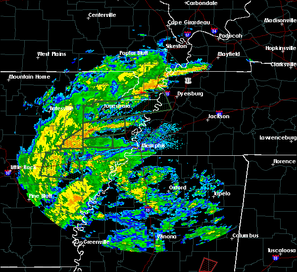 At 1035 am cdt, a severe thunderstorm was located near velma, or 9 miles southwest of water valley, moving northwest at 30 mph. this storm may produce fast moving short tracked tornadoes with little advanced warning. please be prepared to act quickly if the severe thunderstorm warning is upgraded to a tornado warning (radar indicated). Hazards include 60 mph wind gusts. short-lived brief tornadoes. expect damage to roofs, siding, and trees At 1035 am cdt, a severe thunderstorm was located near velma, or 9 miles southwest of water valley, moving northwest at 30 mph. this storm may produce fast moving short tracked tornadoes with little advanced warning. please be prepared to act quickly if the severe thunderstorm warning is upgraded to a tornado warning (radar indicated). Hazards include 60 mph wind gusts. short-lived brief tornadoes. expect damage to roofs, siding, and trees
|
| 4/30/2017 10:34 AM CDT |
 At 1034 am cdt, severe thunderstorms were located along a line extending from near curtis station to scobey, moving northeast at 40 mph (radar indicated). Hazards include 60 mph wind gusts. expect damage to roofs, siding, and trees At 1034 am cdt, severe thunderstorms were located along a line extending from near curtis station to scobey, moving northeast at 40 mph (radar indicated). Hazards include 60 mph wind gusts. expect damage to roofs, siding, and trees
|
| 4/29/2017 8:23 PM CDT |
 At 823 pm cdt, severe thunderstorms were located along a line extending from whitehaven to curtis station, moving northeast at 20 mph (radar indicated). Hazards include 60 mph wind gusts. expect damage to roofs, siding, and trees At 823 pm cdt, severe thunderstorms were located along a line extending from whitehaven to curtis station, moving northeast at 20 mph (radar indicated). Hazards include 60 mph wind gusts. expect damage to roofs, siding, and trees
|
| 4/29/2017 7:43 PM CDT |
 At 743 pm cdt, severe thunderstorms were located along a line extending from near tunica to near lambert, moving northeast at 35 mph (radar indicated). Hazards include 60 mph wind gusts. expect damage to roofs, siding, and trees At 743 pm cdt, severe thunderstorms were located along a line extending from near tunica to near lambert, moving northeast at 35 mph (radar indicated). Hazards include 60 mph wind gusts. expect damage to roofs, siding, and trees
|
| 4/2/2017 6:08 PM CDT |
 At 607 pm cdt, severe thunderstorms were located along a line extending from 6 miles southeast of dundee to 7 miles west of charleston, moving northeast at 60 mph (radar indicated). Hazards include 60 mph wind gusts and nickel size hail. Hail damage to vehicles is expected. expect wind damage to roofs, siding, and trees. Locations impacted include, batesville, charleston, george payne state park, john w kyle state park, tutwiler, marks, sardis, lambert, como, crenshaw, crowder, webb, sledge, sumner, pope, belen, enid, paynes, pleasant grove and curtis station. At 607 pm cdt, severe thunderstorms were located along a line extending from 6 miles southeast of dundee to 7 miles west of charleston, moving northeast at 60 mph (radar indicated). Hazards include 60 mph wind gusts and nickel size hail. Hail damage to vehicles is expected. expect wind damage to roofs, siding, and trees. Locations impacted include, batesville, charleston, george payne state park, john w kyle state park, tutwiler, marks, sardis, lambert, como, crenshaw, crowder, webb, sledge, sumner, pope, belen, enid, paynes, pleasant grove and curtis station.
|
| 4/2/2017 5:30 PM CDT |
 At 530 pm cdt, severe thunderstorms were located along a line extending from near crumrod to boyle, moving northeast at 70 mph (radar indicated). Hazards include 70 mph wind gusts and nickel size hail. Expect considerable tree damage. Wind damage is also likely to mobile homes, roofs, and outbuildings. At 530 pm cdt, severe thunderstorms were located along a line extending from near crumrod to boyle, moving northeast at 70 mph (radar indicated). Hazards include 70 mph wind gusts and nickel size hail. Expect considerable tree damage. Wind damage is also likely to mobile homes, roofs, and outbuildings.
|
| 3/30/2017 12:08 AM CDT |
 The severe thunderstorm warning for northwestern lafayette, southwestern marshall, southeastern tate and northeastern panola counties will expire at 1215 am cdt, the storm which prompted the warning has weakened below severe limits, and no longer pose an immediate threat to life or property. therefore, the warning will be allowed to expire. The severe thunderstorm warning for northwestern lafayette, southwestern marshall, southeastern tate and northeastern panola counties will expire at 1215 am cdt, the storm which prompted the warning has weakened below severe limits, and no longer pose an immediate threat to life or property. therefore, the warning will be allowed to expire.
|
| 3/29/2017 11:44 PM CDT |
 At 1144 pm cdt, a severe thunderstorm was located near batesville, moving northeast at 60 mph (radar indicated). Hazards include 60 mph wind gusts. expect damage to roofs, siding, and trees At 1144 pm cdt, a severe thunderstorm was located near batesville, moving northeast at 60 mph (radar indicated). Hazards include 60 mph wind gusts. expect damage to roofs, siding, and trees
|
| 3/25/2017 4:25 AM CDT |
 At 425 am cdt, a severe thunderstorm was located 7 miles southeast of batesville, moving northeast at 55 mph (radar indicated). Hazards include 60 mph wind gusts. expect damage to roofs, siding, and trees At 425 am cdt, a severe thunderstorm was located 7 miles southeast of batesville, moving northeast at 55 mph (radar indicated). Hazards include 60 mph wind gusts. expect damage to roofs, siding, and trees
|
| 3/25/2017 4:11 AM CDT |
 At 411 am cdt, a severe thunderstorm was located over pope, or near batesville, moving northeast at 50 mph (radar indicated). Hazards include 60 mph wind gusts. Expect damage to roofs, siding, and trees. Locations impacted include, oxford, batesville, water valley, charleston, george payne state park, holly springs national forest, john w kyle state park, sardis, pope, enid, harmontown, springdale, burgess, courtland, abbeville, taylor, glenville, college hill station, college hill and hayes crossing. At 411 am cdt, a severe thunderstorm was located over pope, or near batesville, moving northeast at 50 mph (radar indicated). Hazards include 60 mph wind gusts. Expect damage to roofs, siding, and trees. Locations impacted include, oxford, batesville, water valley, charleston, george payne state park, holly springs national forest, john w kyle state park, sardis, pope, enid, harmontown, springdale, burgess, courtland, abbeville, taylor, glenville, college hill station, college hill and hayes crossing.
|
| 3/25/2017 3:52 AM CDT |
 At 350 am cdt, a severe thunderstorm was located near crowder, or 7 miles northwest of charleston, moving northeast at 60 mph (radar indicated). Hazards include 60 mph wind gusts. expect damage to roofs, siding, and trees At 350 am cdt, a severe thunderstorm was located near crowder, or 7 miles northwest of charleston, moving northeast at 60 mph (radar indicated). Hazards include 60 mph wind gusts. expect damage to roofs, siding, and trees
|
| 1/21/2017 11:39 PM CST |
 At 1138 pm cst, severe thunderstorms were located along a line extending from near curtis station to 8 miles west of springdale, moving north at 50 mph (radar indicated). Hazards include 60 mph wind gusts and quarter size hail. Hail damage to vehicles is expected. expect wind damage to roofs, siding, and trees. Locations impacted include, batesville, john w kyle state park, sardis, como, glenville, hayes crossing, eureka springs, mc ghee and shuford. At 1138 pm cst, severe thunderstorms were located along a line extending from near curtis station to 8 miles west of springdale, moving north at 50 mph (radar indicated). Hazards include 60 mph wind gusts and quarter size hail. Hail damage to vehicles is expected. expect wind damage to roofs, siding, and trees. Locations impacted include, batesville, john w kyle state park, sardis, como, glenville, hayes crossing, eureka springs, mc ghee and shuford.
|
| 1/21/2017 11:32 PM CST |
 At 1132 pm cst, a severe thunderstorm was located near pope, or near batesville, moving northeast at 45 mph (radar indicated). Hazards include 60 mph wind gusts and quarter size hail. Hail damage to vehicles is expected. expect wind damage to roofs, siding, and trees. Locations impacted include, batesville, john w kyle state park, sardis, como, pope, courtland, shuford, asa, glenville, hayes crossing, horatio, eureka springs, chapeltown and mc ghee. At 1132 pm cst, a severe thunderstorm was located near pope, or near batesville, moving northeast at 45 mph (radar indicated). Hazards include 60 mph wind gusts and quarter size hail. Hail damage to vehicles is expected. expect wind damage to roofs, siding, and trees. Locations impacted include, batesville, john w kyle state park, sardis, como, pope, courtland, shuford, asa, glenville, hayes crossing, horatio, eureka springs, chapeltown and mc ghee.
|
| 1/21/2017 11:14 PM CST |
 At 1114 pm cst, a severe thunderstorm was located near charleston, moving northeast at 45 mph (radar indicated). Hazards include 60 mph wind gusts and quarter size hail. Hail damage to vehicles is expected. Expect wind damage to roofs, siding, and trees. At 1114 pm cst, a severe thunderstorm was located near charleston, moving northeast at 45 mph (radar indicated). Hazards include 60 mph wind gusts and quarter size hail. Hail damage to vehicles is expected. Expect wind damage to roofs, siding, and trees.
|
| 12/17/2016 9:50 PM CST | 5 or 6 powerpoles completely snapped near the intersection highways 51 and 3 in panola county MS, 1.2 miles SSE of Batesville, MS |
| 12/17/2016 9:36 PM CST |
 At 936 pm cst, a severe thunderstorm was located over barr, or 10 miles east of senatobia, moving northeast at 70 mph (radar indicated). Hazards include 60 mph wind gusts. Expect damage to roofs, siding, and trees. locations impacted include, holly springs, batesville, wall doxey state park, john w kyle state park, sardis, como, bethlehem, red banks, harmontown, marianna, independence, barr, laws hill, potts camp, abbeville, mahon, looxahoma, glenville, blackwater and mc ghee. A tornado watch remains in effect until 300 am cst for northeastern and northwestern mississippi. At 936 pm cst, a severe thunderstorm was located over barr, or 10 miles east of senatobia, moving northeast at 70 mph (radar indicated). Hazards include 60 mph wind gusts. Expect damage to roofs, siding, and trees. locations impacted include, holly springs, batesville, wall doxey state park, john w kyle state park, sardis, como, bethlehem, red banks, harmontown, marianna, independence, barr, laws hill, potts camp, abbeville, mahon, looxahoma, glenville, blackwater and mc ghee. A tornado watch remains in effect until 300 am cst for northeastern and northwestern mississippi.
|
| 12/17/2016 9:30 PM CST |
 At 929 pm cst, a severe thunderstorm was located over como, or 7 miles southeast of senatobia, moving northeast at 70 mph (radar indicated). Hazards include 60 mph wind gusts. expect damage to roofs, siding, and trees At 929 pm cst, a severe thunderstorm was located over como, or 7 miles southeast of senatobia, moving northeast at 70 mph (radar indicated). Hazards include 60 mph wind gusts. expect damage to roofs, siding, and trees
|
| 12/28/2015 5:51 AM CST |
 At 551 am cst, severe thunderstorms were located along a line extending from near tunica to near minter city, moving north at 160 mph (radar indicated). Hazards include 60 mph wind gusts and penny size hail. Expect damage to roofs. Siding and trees. At 551 am cst, severe thunderstorms were located along a line extending from near tunica to near minter city, moving north at 160 mph (radar indicated). Hazards include 60 mph wind gusts and penny size hail. Expect damage to roofs. Siding and trees.
|
| 12/23/2015 4:25 PM CST | At 424 pm cst, a confirmed large and extremely dangerous tornado was located near pope, or 7 miles west of george payne state park, moving northeast at 60 mph. another tornado may be forming near batesville. take cover now. this is a particularly dangerous situation (radar confirmed tornado). Hazards include damaging tornado. You are in a life threatening situation. flying debris may be deadly to those caught without shelter. mobile homes will be destroyed. considerable damage to homes, businesses and vehicles is likely and complete destruction is possible. the tornado will be near, batesville around 435 pm cst. john w kyle state park around 445 pm cst. Other locations impacted by this tornadic thunderstorm include eureka springs, shuford, courtland, chapeltown and hayes crossing. |
| 12/23/2015 4:12 PM CST | At 412 pm cst, a confirmed large and extremely dangerous tornado was located near crowder, or 9 miles northwest of charleston, moving northeast at 55 mph. this is a particularly dangerous situation (radar confirmed tornado). Hazards include damaging tornado. You are in a life threatening situation. flying debris may be deadly to those caught without shelter. mobile homes will be destroyed. considerable damage to homes, businesses and vehicles is likely and complete destruction is possible. the tornado will be near, crowder around 420 pm cst. enid around 425 pm cst. pope around 430 pm cst. batesville around 435 pm cst. john w kyle state park around 445 pm cst. Other locations impacted by this tornadic thunderstorm include eureka springs, shuford, courtland, chapeltown and hayes crossing. |
| 12/23/2015 3:44 PM CST | At 342 pm cst, a confirmed large and extremely dangerous tornado was located over pleasant grove, or 11 miles northwest of batesville, moving northeast at 60 mph. this is a particularly dangerous situation (radar confirmed tornado). Hazards include damaging tornado. You are in a life threatening situation. flying debris may be deadly to those caught without shelter. mobile homes will be destroyed. considerable damage to homes, businesses and vehicles is likely and complete destruction is possible. the tornado will be near, john w kyle state park, sardis and como around 355 pm cst. traffic on i-55 north of sardis should be halted. if you are traveling along i-55 between sardis and senatobia please exit the highway and seek shelter immediately. this large and dangeerous tornado has produced damage. Other locations impacted by this tornadic thunderstorm include ballentine, locke station, horatio, glenville, mc ghee and hayes crossing. |
| 12/23/2015 3:35 PM CST | At 335 pm cst, a confirmed large and extremely dangerous tornado was located near curtis station, or 15 miles west of batesville, moving northeast at 60 mph. this is a particularly dangerous situation (radar confirmed tornado). Hazards include damaging tornado. You are in a life threatening situation. flying debris may be deadly to those caught without shelter. mobile homes will be destroyed. considerable damage to homes, businesses and vehicles is likely and complete destruction is possible. the tornado will be near, pleasant grove around 345 pm cst. sardis and como around 355 pm cst. Other locations impacted by this tornadic thunderstorm include ballentine, locke station, horatio, glenville, mc ghee and hayes crossing. |
| 8/22/2015 7:02 PM CDT |
 At 702 pm cdt, a severe thunderstorm was located near burgess, or 9 miles northwest of water valley, moving east at 25 mph (trained weather spotters). Hazards include half dollar size hail. Damage to vehicles is expected. Locations impacted include, oxford, batesville, water valley, springdale, burgess, taylor, shuford and eureka springs. At 702 pm cdt, a severe thunderstorm was located near burgess, or 9 miles northwest of water valley, moving east at 25 mph (trained weather spotters). Hazards include half dollar size hail. Damage to vehicles is expected. Locations impacted include, oxford, batesville, water valley, springdale, burgess, taylor, shuford and eureka springs.
|
| 8/22/2015 6:40 PM CDT |
 At 639 pm cdt, a severe thunderstorm was located near batesville, moving east at 25 mph (trained weather spotters). Hazards include quarter size hail. Damage to vehicles is expected. Locations impacted include, oxford, batesville, water valley, pope, springdale, burgess, courtland, taylor, shuford and eureka springs. At 639 pm cdt, a severe thunderstorm was located near batesville, moving east at 25 mph (trained weather spotters). Hazards include quarter size hail. Damage to vehicles is expected. Locations impacted include, oxford, batesville, water valley, pope, springdale, burgess, courtland, taylor, shuford and eureka springs.
|
| 8/22/2015 6:33 PM CDT |
 At 632 pm cdt, a severe thunderstorm was located over lambert, or 17 miles east of clarksdale, moving northeast at 20 mph (radar indicated). Hazards include 60 mph wind gusts and half dollar size hail. Hail damage to vehicles is expected. Expect wind damage to roofs, siding and trees. At 632 pm cdt, a severe thunderstorm was located over lambert, or 17 miles east of clarksdale, moving northeast at 20 mph (radar indicated). Hazards include 60 mph wind gusts and half dollar size hail. Hail damage to vehicles is expected. Expect wind damage to roofs, siding and trees.
|
| 8/22/2015 6:25 PM CDT |
 At 625 pm cdt, a severe thunderstorm was located near pope, or near batesville, moving east at 25 mph (radar indicated). Hazards include 60 mph wind gusts and half dollar size hail. Hail damage to vehicles is expected. Expect wind damage to roofs, siding and trees. At 625 pm cdt, a severe thunderstorm was located near pope, or near batesville, moving east at 25 mph (radar indicated). Hazards include 60 mph wind gusts and half dollar size hail. Hail damage to vehicles is expected. Expect wind damage to roofs, siding and trees.
|
| 8/22/2015 6:07 PM CDT |
 At 606 pm cdt, a severe thunderstorm was located near curtis station, or 9 miles west of batesville, moving east at 20 mph (radar indicated). Hazards include 60 mph wind gusts and half dollar size hail. Hail damage to vehicles is expected. expect wind damage to roofs, siding and trees. Locations impacted include, batesville, sardis, pope, curtis station, courtland, locke station, ballentine, eureka springs, chapeltown, asa and mims. At 606 pm cdt, a severe thunderstorm was located near curtis station, or 9 miles west of batesville, moving east at 20 mph (radar indicated). Hazards include 60 mph wind gusts and half dollar size hail. Hail damage to vehicles is expected. expect wind damage to roofs, siding and trees. Locations impacted include, batesville, sardis, pope, curtis station, courtland, locke station, ballentine, eureka springs, chapeltown, asa and mims.
|
| 8/22/2015 5:46 PM CDT |
 At 546 pm cdt, a severe thunderstorm was located near marks, or 16 miles west of batesville, moving east at 20 mph (radar indicated). Hazards include 60 mph wind gusts and half dollar size hail. Hail damage to vehicles is expected. expect wind damage to roofs, siding and trees. Locations impacted include, batesville, marks, sardis, lambert, pope, darling, curtis station, pleasant grove, courtland, riverview, locke station, hinchcliff, horatio, essex, eureka springs, west marks, ballentine, chapeltown, asa and mims. At 546 pm cdt, a severe thunderstorm was located near marks, or 16 miles west of batesville, moving east at 20 mph (radar indicated). Hazards include 60 mph wind gusts and half dollar size hail. Hail damage to vehicles is expected. expect wind damage to roofs, siding and trees. Locations impacted include, batesville, marks, sardis, lambert, pope, darling, curtis station, pleasant grove, courtland, riverview, locke station, hinchcliff, horatio, essex, eureka springs, west marks, ballentine, chapeltown, asa and mims.
|
| 8/22/2015 5:38 PM CDT |
 At 538 pm cdt, a severe thunderstorm was located over marks, or 17 miles east of clarksdale, moving east at 20 mph (radar indicated). Hazards include 60 mph wind gusts. Expect damage to roofs. Siding and trees. At 538 pm cdt, a severe thunderstorm was located over marks, or 17 miles east of clarksdale, moving east at 20 mph (radar indicated). Hazards include 60 mph wind gusts. Expect damage to roofs. Siding and trees.
|
| 6/30/2015 2:20 AM CDT |
 The severe thunderstorm warning for southern panola county will expire at 230 am cdt, the storm which prompted the warning has weakened below severe limits and exited the warned area. therefore the warning will be allowed to expire. The severe thunderstorm warning for southern panola county will expire at 230 am cdt, the storm which prompted the warning has weakened below severe limits and exited the warned area. therefore the warning will be allowed to expire.
|
| 6/30/2015 2:07 AM CDT |
 At 206 am cdt, a severe thunderstorm was located near batesville, moving east at 30 mph (radar indicated). Hazards include 60 mph wind gusts and quarter size hail. Hail damage to vehicles is expected. expect wind damage to roofs, siding and trees. Locations impacted include, batesville, pope, courtland, locke station, eureka springs, chapeltown and asa. At 206 am cdt, a severe thunderstorm was located near batesville, moving east at 30 mph (radar indicated). Hazards include 60 mph wind gusts and quarter size hail. Hail damage to vehicles is expected. expect wind damage to roofs, siding and trees. Locations impacted include, batesville, pope, courtland, locke station, eureka springs, chapeltown and asa.
|
| 6/30/2015 1:43 AM CDT |
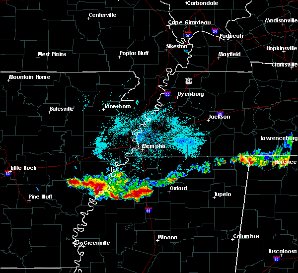 At 142 am cdt, a severe thunderstorm was located near curtis station, or 8 miles west of batesville, moving east at 30 mph (radar indicated). Hazards include 60 mph wind gusts and quarter size hail. Hail damage to vehicles is expected. Expect wind damage to roofs, siding and trees. At 142 am cdt, a severe thunderstorm was located near curtis station, or 8 miles west of batesville, moving east at 30 mph (radar indicated). Hazards include 60 mph wind gusts and quarter size hail. Hail damage to vehicles is expected. Expect wind damage to roofs, siding and trees.
|
| 6/9/2015 1:16 AM CDT | At 116 am cdt, a severe thunderstorm was located over pope, or near batesville, moving southeast at 25 mph (radar indicated). Hazards include 60 mph wind gusts and quarter size hail. Hail damage to vehicles is expected. Expect wind damage to roofs, siding and trees. |
| 5/31/2015 2:35 PM CDT | At 234 pm cdt, a severe thunderstorm was located near pleasant grove, or 12 miles northwest of batesville, moving east at 15 mph (radar indicated). Hazards include 60 mph wind gusts. Expect damage to roofs. siding and trees. Locations impacted include, batesville, john w kyle state park, sardis, como, curtis station, pleasant grove, horatio, glenville, hayes crossing and ballentine. |
| 5/31/2015 2:08 PM CDT | At 208 pm cdt, a severe thunderstorm was located over darling, or 17 miles west of batesville, moving east at 25 mph (radar indicated). Hazards include 60 mph wind gusts. Expect damage to roofs. Siding and trees. |
| 5/24/2015 6:55 PM CDT | At 655 pm cdt, a severe thunderstorm was located near pleasant grove, or 9 miles northwest of batesville, moving north at 45 mph (radar indicated). Hazards include 60 mph wind gusts and penny size hail. Expect damage to roofs. siding and trees. locations impacted include, senatobia, batesville, john w kyle state park, marks, sardis, coldwater, como, crenshaw, sledge, curtis station, independence, strayhorn, darling, phillipp, little texas, arkabutla, barr, pleasant grove, courtland and falcon. A tornado watch remains in effect until 1000 pm cdt for northwestern mississippi. |
| 5/24/2015 6:38 PM CDT | At 637 pm cdt, a severe thunderstorm was located near crowder, or 10 miles southwest of batesville, moving north at 45 mph (radar indicated). Hazards include 60 mph wind gusts and penny size hail. Expect damage to roofs. Siding and trees. |
| 4/19/2015 10:46 PM CDT | At 1046 pm cdt, a severe thunderstorm was located near cambridge, or 8 miles northeast of oxford, moving east at 50 mph (radar indicated). Hazards include 60 mph wind gusts and quarter size hail. Hail damage to vehicles is expected. expect wind damage to roofs, siding and trees. locations impacted include, batesville, john w kyle state park and hayes crossing. a tornado watch remains in effect until 300 am cdt for northwestern mississippi. 1. 00in. |
| 4/19/2015 10:39 PM CDT | Quarter sized hail reported 2.3 miles SW of Batesville, MS, quarter size hail fell at the highway 35 exit near batesville on interstate 55. |
| 4/19/2015 10:10 PM CDT | At 1010 pm cdt, a severe thunderstorm was located over george payne state park, moving northeast at 45 mph (radar indicated). Hazards include 60 mph wind gusts and quarter size hail. Hail damage to vehicles is expected. Expect wind damage to roofs, siding and trees. |
| 4/19/2015 10:08 PM CDT | At 1008 pm cdt, a severe thunderstorm was located near batesville, moving east at 50 mph (radar indicated). Hazards include 60 mph wind gusts and quarter size hail. Hail damage to vehicles is expected. Expect wind damage to roofs, siding and trees. |
| 3/28/2014 7:25 PM CDT | 7 road off macedonia rd which connects to highway 6 has several trees down some of which took power lines down. a mobile home was blown off its foundation and several h in panola county MS, 4.4 miles E of Batesville, MS |
| 3/28/2014 7:25 PM CDT | Several trees down which took down powers lines along curtis road and curtis-lockestation roa in panola county MS, 7.7 miles WSW of Batesville, MS |
| 3/28/2014 7:20 PM CDT | 7 road off macedonia rd which connects to highway 6 has several trees down some of which took power lines down. a mobile home was blown off its foundation and several h in panola county MS, 4.4 miles E of Batesville, MS |
| 1/30/2013 12:00 AM CST | Numerous reports of trees down across the county. time is estimate in panola county MS, 0.6 miles SE of Batesville, MS |
| 1/1/0001 12:00 AM | Quarter sized hail reported 0.6 miles SE of Batesville, MS, one inch hail. |
| 1/1/0001 12:00 AM | Quarter sized hail reported 0.4 miles ENE of Batesville, MS |
| 1/1/0001 12:00 AM | Quarter sized hail reported 12.5 miles E of Batesville, MS |
| 1/1/0001 12:00 AM | Grapefruit sized hail reported 0.6 miles SE of Batesville, MS |
| 1/1/0001 12:00 AM | Trees down north of batesvill in panola county MS, 4.6 miles S of Batesville, MS |
| 1/1/0001 12:00 AM | Trees down along ballentine road and river road between sardis and batesville mississipp in panola county MS, 3.3 miles SSW of Batesville, MS |
Hail Maps for Batesville, MS
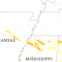
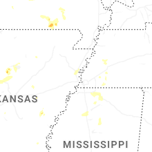
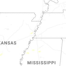
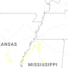
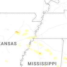
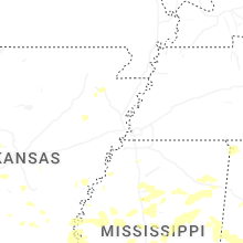
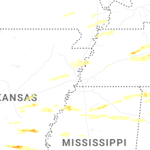


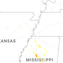
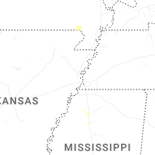


Connect with Interactive Hail Maps