

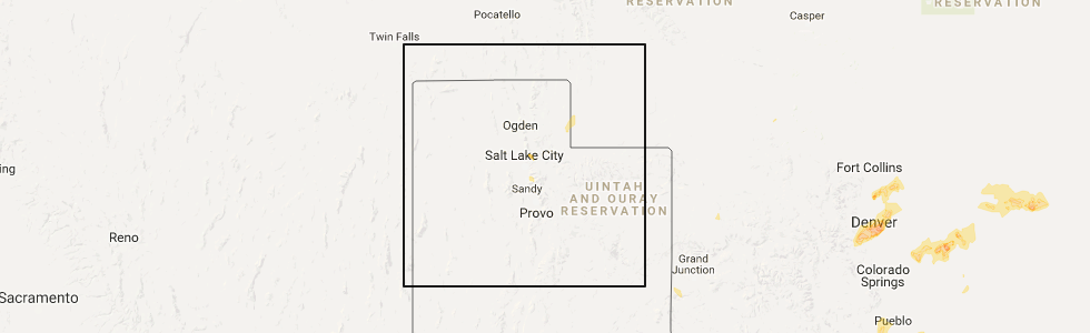
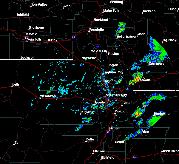
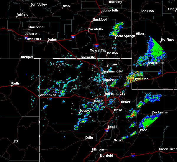
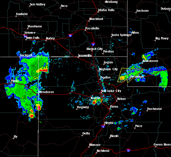
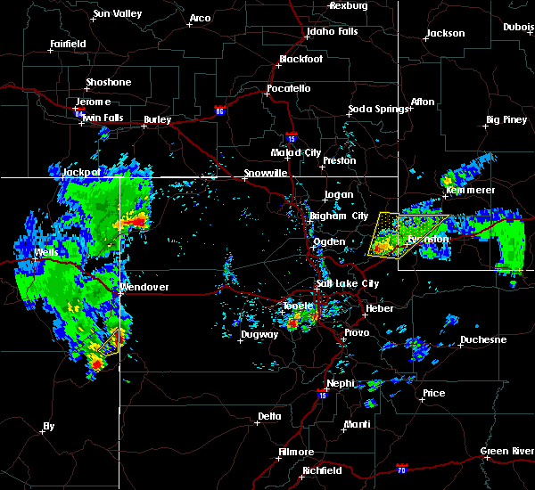
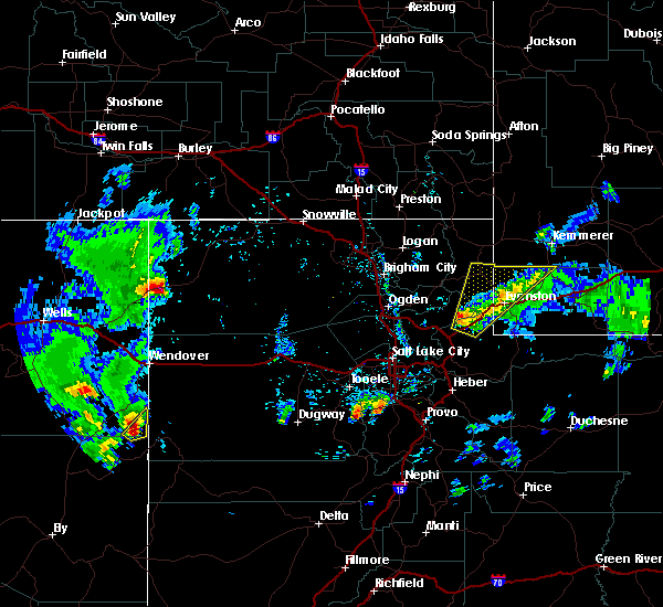
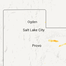
Hail Map for Bear River, WY
The Bear River, WY area has had 0 reports of on-the-ground hail by trained spotters, and has been under severe weather warnings 12 times during the past 12 months. Doppler radar has detected hail at or near Bear River, WY on 8 occasions.
| Name: | Bear River, WY |
| Where Located: | 62.8 miles NE of Salt Lake City, UT |
| Map: | Google Map for Bear River, WY |
| Population: | 518 |
| Housing Units: | 190 |
| More Info: | Search Google for Bear River, WY |
5
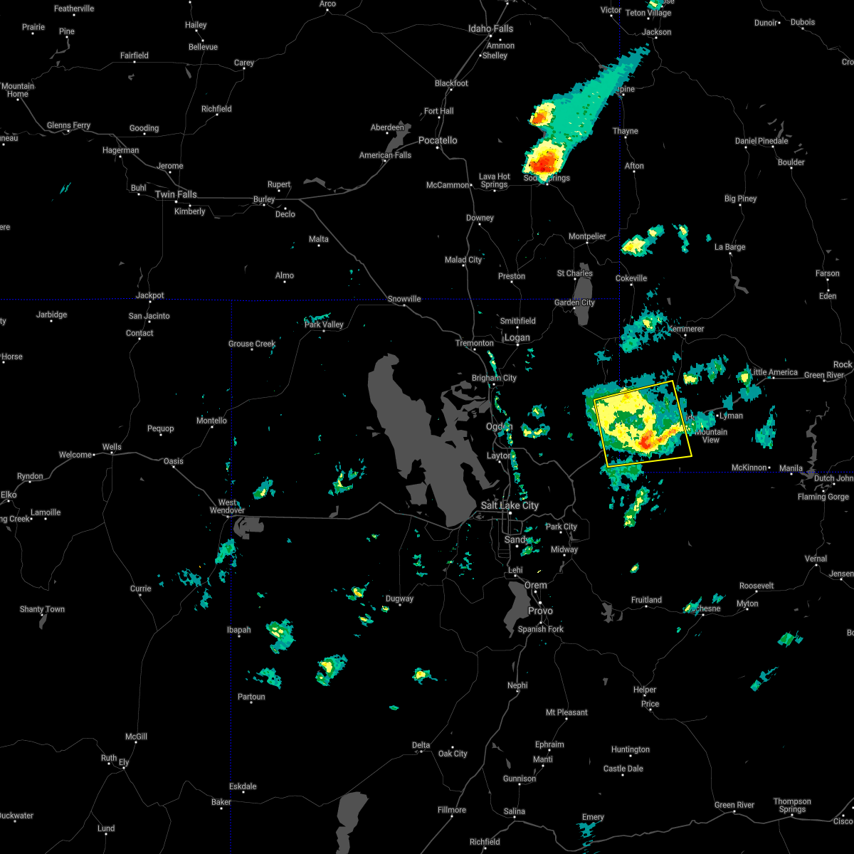
The Top Recent Hail Date for Bear River, WY is Monday, May 8, 2017 (1st out of 8)
Hail and Wind Damage Spotted near Bear River, WY
| Date / Time | Report Details |
|---|---|
| 8/2/2023 5:57 PM MDT |
 The severe thunderstorm warning for southern rich, northeastern morgan, northwestern summit and western uinta counties will expire at 600 pm mdt, the storms which prompted the warning have weakened below severe limits, and no longer pose an immediate threat to life or property. therefore, the warning will be allowed to expire. however gusty winds are still possible with these thunderstorms. The severe thunderstorm warning for southern rich, northeastern morgan, northwestern summit and western uinta counties will expire at 600 pm mdt, the storms which prompted the warning have weakened below severe limits, and no longer pose an immediate threat to life or property. therefore, the warning will be allowed to expire. however gusty winds are still possible with these thunderstorms.
|
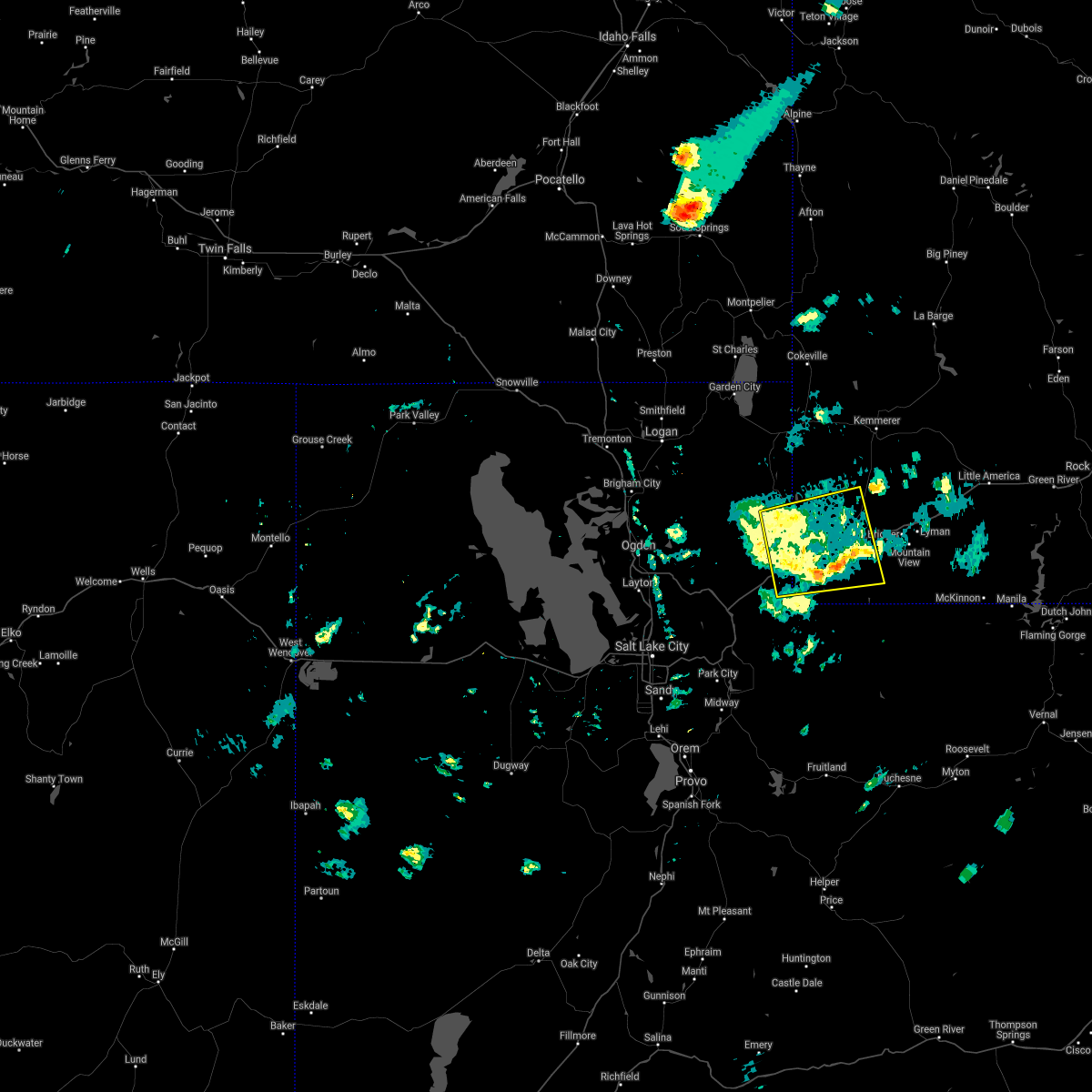
| 8/2/2023 5:25 PM MDT |
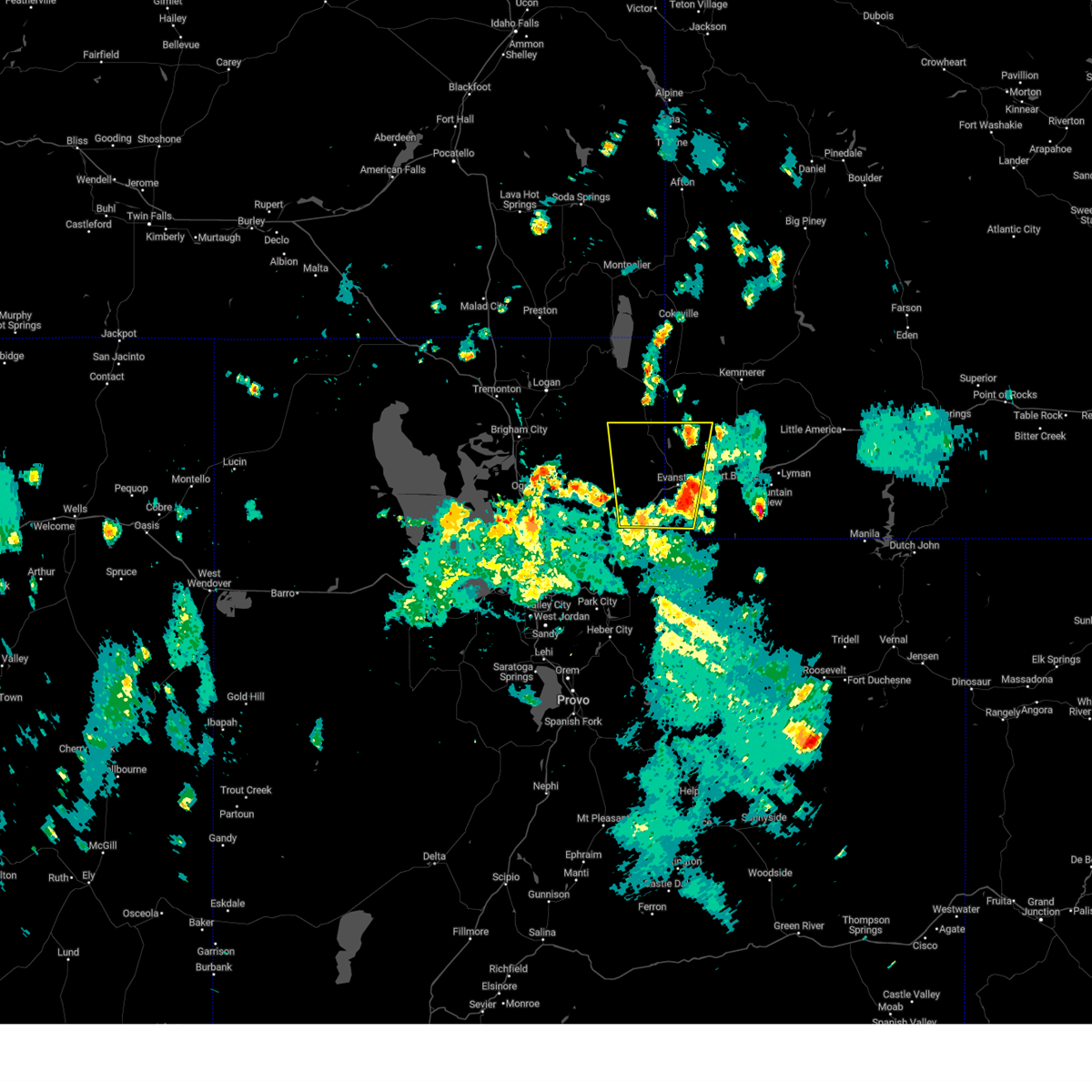 At 524 pm mdt, severe thunderstorms were located along a line extending from 21 miles north of coalville to near evanston, moving north at 35 mph (radar indicated). Hazards include 60 mph wind gusts and quarter size hail. Hail damage to vehicles is expected. expect wind damage to roofs, siding, and trees. locations impacted include, evanston, woodruff, wahsatch, almy, emory and castle rock. this includes interstate 80 in utah between mile markers 178 and 196. hail threat, radar indicated max hail size, 1. 00 in wind threat, radar indicated max wind gust, 60 mph. At 524 pm mdt, severe thunderstorms were located along a line extending from 21 miles north of coalville to near evanston, moving north at 35 mph (radar indicated). Hazards include 60 mph wind gusts and quarter size hail. Hail damage to vehicles is expected. expect wind damage to roofs, siding, and trees. locations impacted include, evanston, woodruff, wahsatch, almy, emory and castle rock. this includes interstate 80 in utah between mile markers 178 and 196. hail threat, radar indicated max hail size, 1. 00 in wind threat, radar indicated max wind gust, 60 mph.
|
| 8/2/2023 5:02 PM MDT |
 At 501 pm mdt, a severe thunderstorm was located 14 miles northeast of coalville, moving north at 30 mph (radar indicated). Hazards include 60 mph wind gusts and quarter size hail. Hail damage to vehicles is expected. Expect wind damage to roofs, siding, and trees. At 501 pm mdt, a severe thunderstorm was located 14 miles northeast of coalville, moving north at 30 mph (radar indicated). Hazards include 60 mph wind gusts and quarter size hail. Hail damage to vehicles is expected. Expect wind damage to roofs, siding, and trees.
|
| 7/3/2023 7:18 PM MDT |
 At 718 pm mdt, severe thunderstorms were located along a line extending from near randolph to 10 miles east of woodruff to 12 miles east of evanston, moving northeast at 40 mph (radar indicated). Hazards include 70 mph wind gusts and half dollar size hail. Hail damage to vehicles is expected. expect considerable tree damage. wind damage is also likely to mobile homes, roofs, and outbuildings. locations impacted include, evanston, randolph, woodruff, robertson, mountain view, millburne, fort bridger, almy, altamont, ragen, piedmont, leroy and carter. this includes the following highways, interstate 80 in utah between mile markers 193 and 196. utah route 30 between mile markers 131 and 135. thunderstorm damage threat, considerable hail threat, radar indicated max hail size, 1. 25 in wind threat, observed max wind gust, 70 mph. At 718 pm mdt, severe thunderstorms were located along a line extending from near randolph to 10 miles east of woodruff to 12 miles east of evanston, moving northeast at 40 mph (radar indicated). Hazards include 70 mph wind gusts and half dollar size hail. Hail damage to vehicles is expected. expect considerable tree damage. wind damage is also likely to mobile homes, roofs, and outbuildings. locations impacted include, evanston, randolph, woodruff, robertson, mountain view, millburne, fort bridger, almy, altamont, ragen, piedmont, leroy and carter. this includes the following highways, interstate 80 in utah between mile markers 193 and 196. utah route 30 between mile markers 131 and 135. thunderstorm damage threat, considerable hail threat, radar indicated max hail size, 1. 25 in wind threat, observed max wind gust, 70 mph.
|
| 7/3/2023 6:59 PM MDT |
 At 659 pm mdt, severe thunderstorms were located along a line extending from 12 miles southwest of randolph to 8 miles south of woodruff to 11 miles south of evanston, moving northeast at 40 mph (radar indicated). Hazards include 70 mph wind gusts and penny size hail. Expect considerable tree damage. damage is likely to mobile homes, roofs, and outbuildings. locations impacted include, evanston, randolph, woodruff, robertson, mountain view, millburne, fort bridger, almy, altamont, ragen, wahsatch, castle rock, piedmont, leroy and carter. this includes the following highways, interstate 80 in utah between mile markers 186 and 196. utah route 30 between mile markers 131 and 135. thunderstorm damage threat, considerable hail threat, radar indicated max hail size, 0. 75 in wind threat, observed max wind gust, 70 mph. At 659 pm mdt, severe thunderstorms were located along a line extending from 12 miles southwest of randolph to 8 miles south of woodruff to 11 miles south of evanston, moving northeast at 40 mph (radar indicated). Hazards include 70 mph wind gusts and penny size hail. Expect considerable tree damage. damage is likely to mobile homes, roofs, and outbuildings. locations impacted include, evanston, randolph, woodruff, robertson, mountain view, millburne, fort bridger, almy, altamont, ragen, wahsatch, castle rock, piedmont, leroy and carter. this includes the following highways, interstate 80 in utah between mile markers 186 and 196. utah route 30 between mile markers 131 and 135. thunderstorm damage threat, considerable hail threat, radar indicated max hail size, 0. 75 in wind threat, observed max wind gust, 70 mph.
|
| 7/3/2023 6:55 PM MDT |
 At 655 pm mdt, severe thunderstorms were located along a line extending from 14 miles southwest of randolph to 9 miles south of woodruff to 11 miles south of evanston, moving northeast at 40 mph (radar indicated). Hazards include 60 mph wind gusts and penny size hail. expect damage to roofs, siding, and trees At 655 pm mdt, severe thunderstorms were located along a line extending from 14 miles southwest of randolph to 9 miles south of woodruff to 11 miles south of evanston, moving northeast at 40 mph (radar indicated). Hazards include 60 mph wind gusts and penny size hail. expect damage to roofs, siding, and trees
|
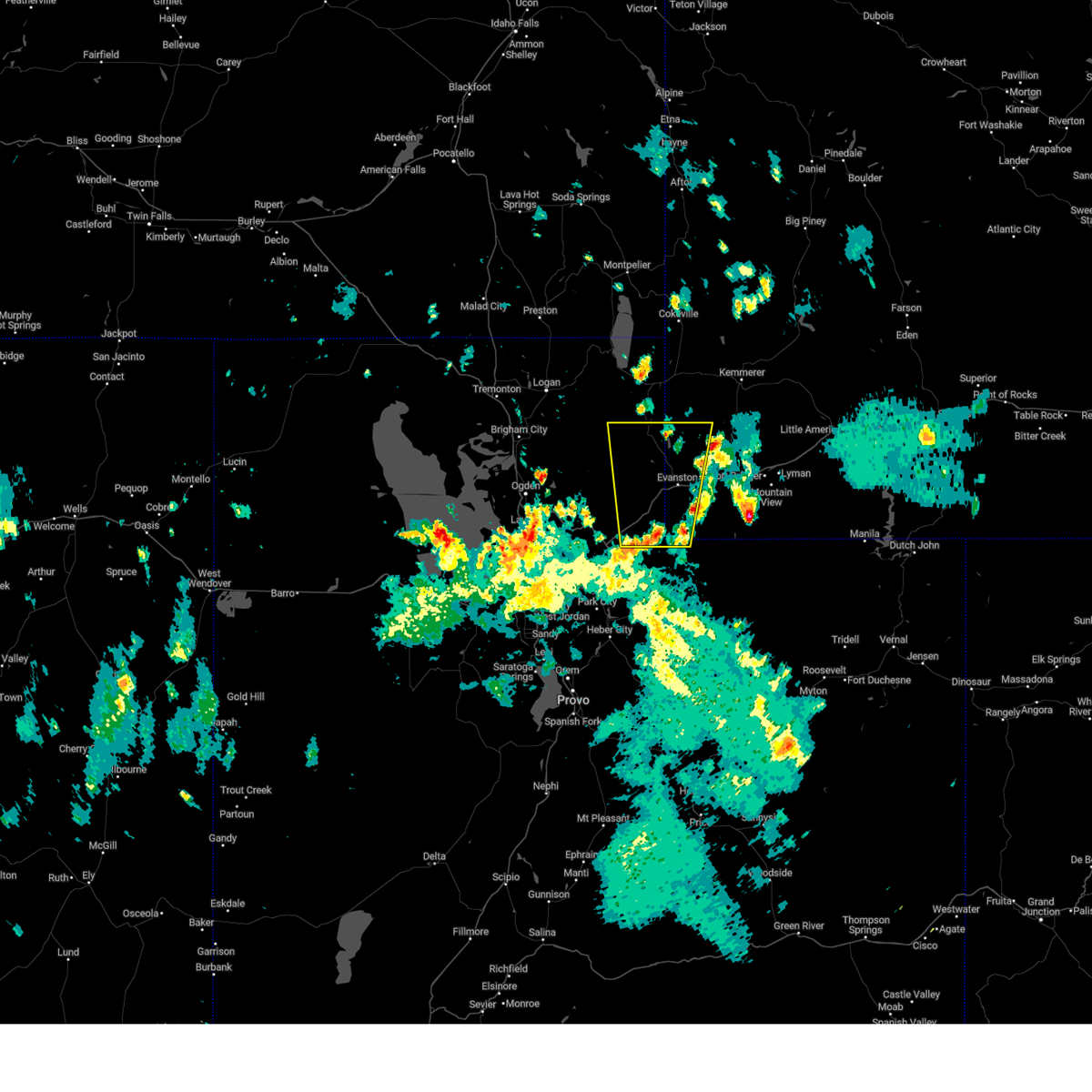
| 9/2/2021 8:02 PM MDT |
 At 801 pm mdt, a severe thunderstorm was located near evanston, moving east at 35 mph. a wind gust to 71 mph was reported at evanston airport with this storm (radar indicated). Hazards include 70 mph wind gusts. Expect considerable tree damage. damage is likely to mobile homes, roofs, and outbuildings. locations impacted include, evanston, ragen, wahsatch, almy, altamont, piedmont and leroy. this includes the following highways, interstate 80 in wyoming between mile markers 1 and 27. interstate 80 in utah between mile markers 186 and 196. thunderstorm damage threat, considerable hail threat, radar indicated max hail size, <. 75 in wind threat, radar indicated max wind gust, 70 mph. At 801 pm mdt, a severe thunderstorm was located near evanston, moving east at 35 mph. a wind gust to 71 mph was reported at evanston airport with this storm (radar indicated). Hazards include 70 mph wind gusts. Expect considerable tree damage. damage is likely to mobile homes, roofs, and outbuildings. locations impacted include, evanston, ragen, wahsatch, almy, altamont, piedmont and leroy. this includes the following highways, interstate 80 in wyoming between mile markers 1 and 27. interstate 80 in utah between mile markers 186 and 196. thunderstorm damage threat, considerable hail threat, radar indicated max hail size, <. 75 in wind threat, radar indicated max wind gust, 70 mph.
|
| 9/2/2021 7:49 PM MDT |
 At 749 pm mdt, a severe thunderstorm was located near evanston, moving east at 35 mph. a wind gust to 60 mph was reported along interstate 80 near the utah/wyoming border with this storm (radar indicated). Hazards include 60 mph wind gusts. expect damage to roofs, siding, and trees At 749 pm mdt, a severe thunderstorm was located near evanston, moving east at 35 mph. a wind gust to 60 mph was reported along interstate 80 near the utah/wyoming border with this storm (radar indicated). Hazards include 60 mph wind gusts. expect damage to roofs, siding, and trees
|
| 8/21/2021 7:41 PM MDT |
 The severe thunderstorm warning for central summit and uinta counties will expire at 745 pm mdt, the storm which prompted the warning has weakened below severe limits, and no longer poses an immediate threat to life or property. therefore, the warning will be allowed to expire. however gusty winds are still possible with this thunderstorm. The severe thunderstorm warning for central summit and uinta counties will expire at 745 pm mdt, the storm which prompted the warning has weakened below severe limits, and no longer poses an immediate threat to life or property. therefore, the warning will be allowed to expire. however gusty winds are still possible with this thunderstorm.
|
| 8/21/2021 7:37 PM MDT |
 At 737 pm mdt, a severe thunderstorm was located 14 miles southwest of elkol, or 19 miles southwest of kemmerer, moving northeast at 55 mph (radar indicated). Hazards include 60 mph wind gusts. Expect damage to roofs, siding, and trees. locations impacted include, evanston, oakley, robertson, ragen, peoa, millburne, almy, altamont, piedmont, carter, leroy and rockport state park. this includes the following highways, interstate 80 in wyoming between mile markers 1 and 35. us route 40 near mile marker 5. mirror lake highway between mile markers 41 and 54. hail threat, radar indicated max hail size, <. 75 in wind threat, observed max wind gust, 60 mph. At 737 pm mdt, a severe thunderstorm was located 14 miles southwest of elkol, or 19 miles southwest of kemmerer, moving northeast at 55 mph (radar indicated). Hazards include 60 mph wind gusts. Expect damage to roofs, siding, and trees. locations impacted include, evanston, oakley, robertson, ragen, peoa, millburne, almy, altamont, piedmont, carter, leroy and rockport state park. this includes the following highways, interstate 80 in wyoming between mile markers 1 and 35. us route 40 near mile marker 5. mirror lake highway between mile markers 41 and 54. hail threat, radar indicated max hail size, <. 75 in wind threat, observed max wind gust, 60 mph.
|
| 8/21/2021 7:08 PM MDT |
 At 706 pm mdt, a severe thunderstorm was located 11 miles south of woodruff, or 14 miles northwest of evanston, moving northeast at 55 mph. additional strong storms are located south toward coalville (trained weather spotters reported widespread damage with this line of storms). Hazards include 70 mph wind gusts and penny size hail. Expect considerable tree damage. Damage is likely to mobile homes, roofs, and outbuildings. At 706 pm mdt, a severe thunderstorm was located 11 miles south of woodruff, or 14 miles northwest of evanston, moving northeast at 55 mph. additional strong storms are located south toward coalville (trained weather spotters reported widespread damage with this line of storms). Hazards include 70 mph wind gusts and penny size hail. Expect considerable tree damage. Damage is likely to mobile homes, roofs, and outbuildings.
|
| 6/7/2020 11:53 AM MDT |
 At 1152 am mdt, a severe thunderstorm was located 7 miles southeast of woodruff, or 13 miles northwest of evanston, moving northeast at 45 mph. another storm was located less than one mile east of evanston moving northeast at 45 mph (radar indicated). Hazards include 60 mph wind gusts and penny size hail. expect damage to roofs, siding, and trees At 1152 am mdt, a severe thunderstorm was located 7 miles southeast of woodruff, or 13 miles northwest of evanston, moving northeast at 45 mph. another storm was located less than one mile east of evanston moving northeast at 45 mph (radar indicated). Hazards include 60 mph wind gusts and penny size hail. expect damage to roofs, siding, and trees
|
| 6/5/2020 6:37 PM MDT |
 The severe thunderstorm warning for western uinta county will expire at 645 pm mdt, the storm which prompted the warning has weakened below severe limits, and has exited the warned area. therefore, the warning will be allowed to expire. The severe thunderstorm warning for western uinta county will expire at 645 pm mdt, the storm which prompted the warning has weakened below severe limits, and has exited the warned area. therefore, the warning will be allowed to expire.
|
| 6/5/2020 6:14 PM MDT |
 At 614 pm mdt, a severe thunderstorm was located near evanston, moving north at 50 mph (wyoming dot mesonet sensor at leroy reported wind gust of 60 mph). Hazards include 60 mph wind gusts. Expect damage to roofs, siding, and trees. locations impacted include, evanston, ragen, almy, altamont, piedmont and leroy. This includes interstate 80 in wyoming between mile markers 1 and 25. At 614 pm mdt, a severe thunderstorm was located near evanston, moving north at 50 mph (wyoming dot mesonet sensor at leroy reported wind gust of 60 mph). Hazards include 60 mph wind gusts. Expect damage to roofs, siding, and trees. locations impacted include, evanston, ragen, almy, altamont, piedmont and leroy. This includes interstate 80 in wyoming between mile markers 1 and 25.
|
| 6/5/2020 5:32 PM MDT |
 At 532 pm mdt, a severe thunderstorm was located 13 miles northwest of mirror lake, or 18 miles east of coalville, moving north at 50 mph (radar indicated). Hazards include 60 mph wind gusts. expect damage to roofs, siding, and trees At 532 pm mdt, a severe thunderstorm was located 13 miles northwest of mirror lake, or 18 miles east of coalville, moving north at 50 mph (radar indicated). Hazards include 60 mph wind gusts. expect damage to roofs, siding, and trees
|
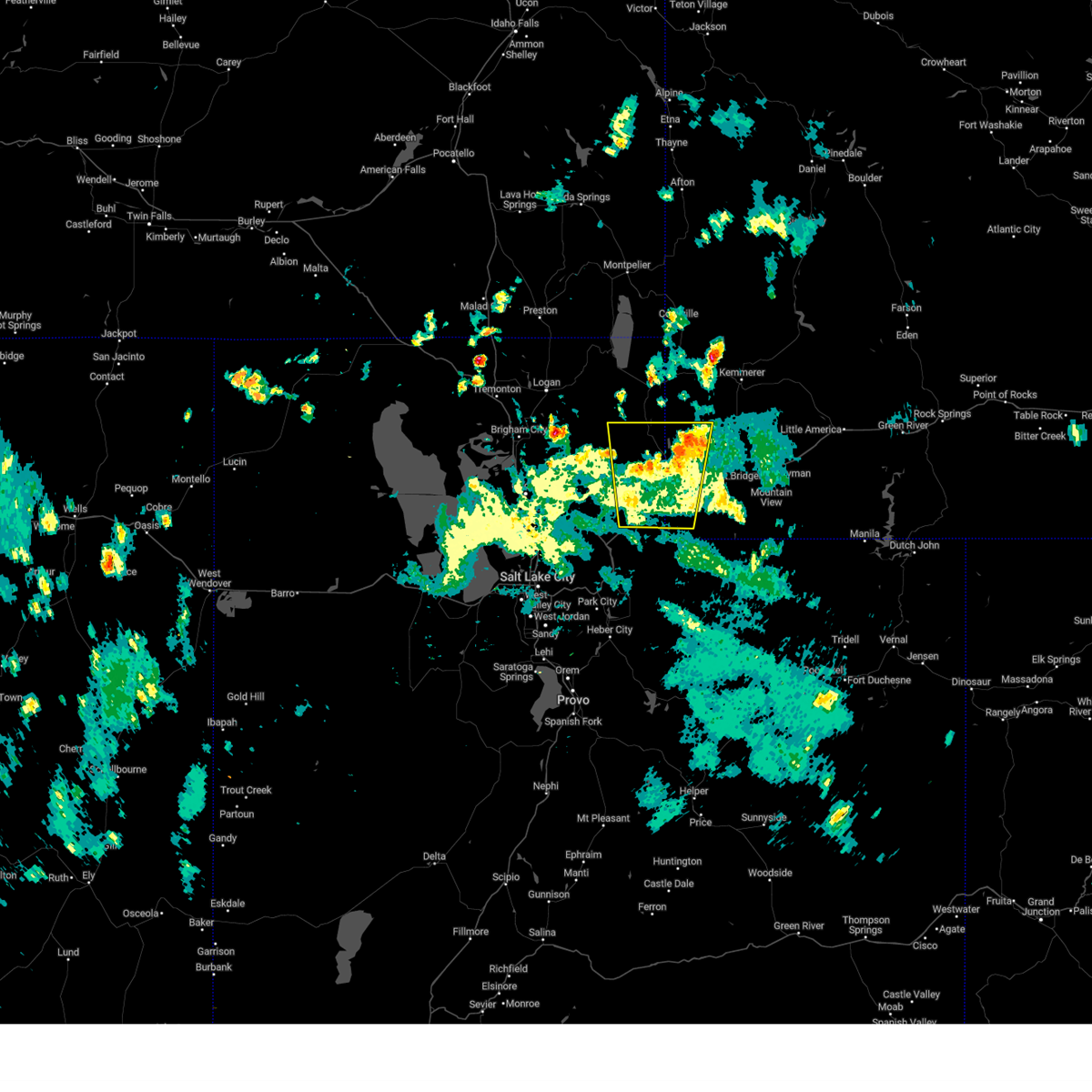
| 5/8/2017 4:21 PM MDT |
 At 419 pm mdt, doppler radar indicated a severe thunderstorm capable of producing quarter size hail and damaging winds in excess of 60 mph. the wyoming port of entry previously reported nickel-sized hail associated with this storm. this storm was located 11 miles east of woodruff, or 14 miles north of evanston, moving northeast at 30 mph. this severe thunderstorm will remain over mainly rural areas of southeastern rich and northwestern uinta counties. the storm may also impact woodruff narrows reservoir. At 419 pm mdt, doppler radar indicated a severe thunderstorm capable of producing quarter size hail and damaging winds in excess of 60 mph. the wyoming port of entry previously reported nickel-sized hail associated with this storm. this storm was located 11 miles east of woodruff, or 14 miles north of evanston, moving northeast at 30 mph. this severe thunderstorm will remain over mainly rural areas of southeastern rich and northwestern uinta counties. the storm may also impact woodruff narrows reservoir.
|
| 5/8/2017 4:09 PM MDT |
 At 406 pm mdt, doppler radar indicated a severe thunderstorm capable of producing quarter size hail and damaging winds in excess of 60 mph. this storm was located 8 miles north of evanston, and moving northeast at 40 mph. At 406 pm mdt, doppler radar indicated a severe thunderstorm capable of producing quarter size hail and damaging winds in excess of 60 mph. this storm was located 8 miles north of evanston, and moving northeast at 40 mph.
|
| 10/2/2016 8:42 PM MDT |
 At 841 pm mdt, doppler radar indicated a severe thunderstorm capable of producing destructive winds in excess of 70 mph. this storm was located 14 miles southwest of evanston, and moving northeast at 40 mph. penny size hail may also accompany the damaging winds. At 841 pm mdt, doppler radar indicated a severe thunderstorm capable of producing destructive winds in excess of 70 mph. this storm was located 14 miles southwest of evanston, and moving northeast at 40 mph. penny size hail may also accompany the damaging winds.
|
| 8/7/2016 5:27 PM MDT |
 At 525 pm mdt, doppler radar indicated a severe thunderstorm capable of producing quarter size hail and damaging winds in excess of 60 mph. this storm was located near evanston, moving northeast at 45 mph. locations impacted include, evanston and almy. At 525 pm mdt, doppler radar indicated a severe thunderstorm capable of producing quarter size hail and damaging winds in excess of 60 mph. this storm was located near evanston, moving northeast at 45 mph. locations impacted include, evanston and almy.
|
| 8/7/2016 5:13 PM MDT |
 At 512 pm mdt, doppler radar indicated a severe thunderstorm capable of producing quarter size hail and damaging winds in excess of 60 mph. this storm was located 11 miles west of evanston, and moving northeast at 40 mph. At 512 pm mdt, doppler radar indicated a severe thunderstorm capable of producing quarter size hail and damaging winds in excess of 60 mph. this storm was located 11 miles west of evanston, and moving northeast at 40 mph.
|
| 6/12/2016 5:28 PM MDT | The severe thunderstorm warning for southeastern rich. northeastern morgan and northwestern uinta counties will expire at 530 pm mdt. the storm which prompted the warning has weakened below severe limits. and no longer poses an immediate threat to life or property. therefore the warning will be allowed to expire. Gusty winds are. |
| 6/12/2016 5:28 PM MDT | The severe thunderstorm warning for southeastern rich. northeastern morgan and northwestern uinta counties will expire at 530 pm mdt. the storm which prompted the warning has weakened below severe limits. and no longer poses an immediate threat to life or property. therefore the warning will be allowed to expire. Gusty winds are. |
| 6/12/2016 5:18 PM MDT |
 At 518 pm mdt, doppler radar indicated a severe thunderstorm capable of producing quarter size hail and damaging winds in excess of 60 mph. this storm was located 15 miles west of evanston, moving northeast at 30 mph. locations impacted include, evanston, woodruff and almy. At 518 pm mdt, doppler radar indicated a severe thunderstorm capable of producing quarter size hail and damaging winds in excess of 60 mph. this storm was located 15 miles west of evanston, moving northeast at 30 mph. locations impacted include, evanston, woodruff and almy.
|
| 6/12/2016 5:10 PM MDT |
 At 509 pm mdt, doppler radar indicated a severe thunderstorm capable of producing quarter size hail and damaging winds in excess of 60 mph. this storm was located 17 miles west of evanston, moving north at 30 mph. additional strong thunderstorms are located in northwestern uinta county. locations impacted include, evanston, woodruff, almy, wahsatch and castle rock. At 509 pm mdt, doppler radar indicated a severe thunderstorm capable of producing quarter size hail and damaging winds in excess of 60 mph. this storm was located 17 miles west of evanston, moving north at 30 mph. additional strong thunderstorms are located in northwestern uinta county. locations impacted include, evanston, woodruff, almy, wahsatch and castle rock.
|
| 6/12/2016 4:57 PM MDT |
 At 456 pm mdt, doppler radar indicated a severe thunderstorm capable of producing quarter size hail and damaging winds in excess of 60 mph. this storm was located 14 miles northeast of coalville, and moving northeast at 30 mph. additional strong thunderstorms are located in northwestern uinta county wyoming. At 456 pm mdt, doppler radar indicated a severe thunderstorm capable of producing quarter size hail and damaging winds in excess of 60 mph. this storm was located 14 miles northeast of coalville, and moving northeast at 30 mph. additional strong thunderstorms are located in northwestern uinta county wyoming.
|
| 8/7/2015 8:51 PM MDT |
 At 850 pm mdt, doppler radar indicated a line of severe thunderstorms capable of producing damaging winds in excess of 60 mph. these storms were located along a line extending from 10 miles north of evanston to 24 miles southwest of robertson to samak, moving east at 35 mph. locations impacted include, evanston, lyman, kamas, oakley, francis, lonetree, samak, robertson, blacks fork natural gas processing plant, trial lk, fort bridger, altamont, leroy, woodland, millburne, carter, marion, almy, castle rock and church buttes. At 850 pm mdt, doppler radar indicated a line of severe thunderstorms capable of producing damaging winds in excess of 60 mph. these storms were located along a line extending from 10 miles north of evanston to 24 miles southwest of robertson to samak, moving east at 35 mph. locations impacted include, evanston, lyman, kamas, oakley, francis, lonetree, samak, robertson, blacks fork natural gas processing plant, trial lk, fort bridger, altamont, leroy, woodland, millburne, carter, marion, almy, castle rock and church buttes.
|
| 8/7/2015 8:10 PM MDT |
 At 809 pm mdt, doppler radar indicated a line of severe thunderstorms capable of producing damaging winds in excess of 60 mph. these storms were located along a line extending from 19 miles southwest of woodruff to 9 miles northeast of coalville to oakley, and moving east at 35 mph. At 809 pm mdt, doppler radar indicated a line of severe thunderstorms capable of producing damaging winds in excess of 60 mph. these storms were located along a line extending from 19 miles southwest of woodruff to 9 miles northeast of coalville to oakley, and moving east at 35 mph.
|
| 6/3/2015 9:43 PM MDT | The severe thunderstorm warning for northeastern cache and rich counties will expire at 945 pm mdt, the storm which prompted the warning has weakened below severe limits. wind gusts to 50 mph are still possible with this storm. this includes bear lake. |
| 6/3/2015 9:12 PM MDT | At 912 pm mdt, trained weather spotters reported a severe thunderstorm producing damaging winds in excess of 60 mph. this storm was located 8 miles southwest of garden, or 10 miles west of laketown, and moving northeast at 30 mph. |
Hail Maps for Bear River, WY


Connect with Interactive Hail Maps