

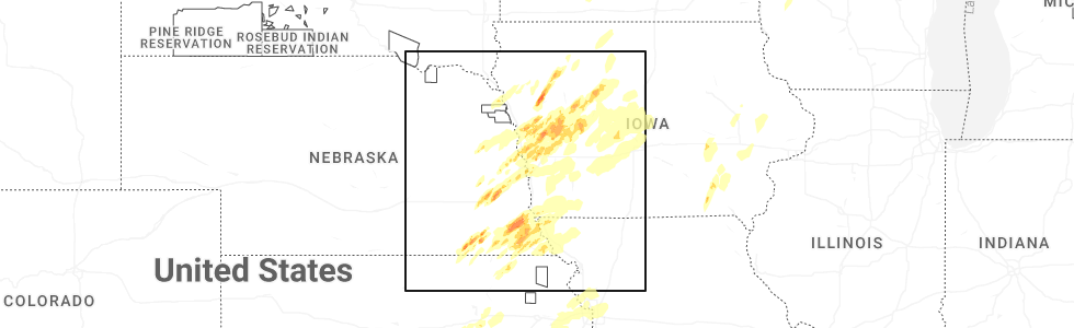
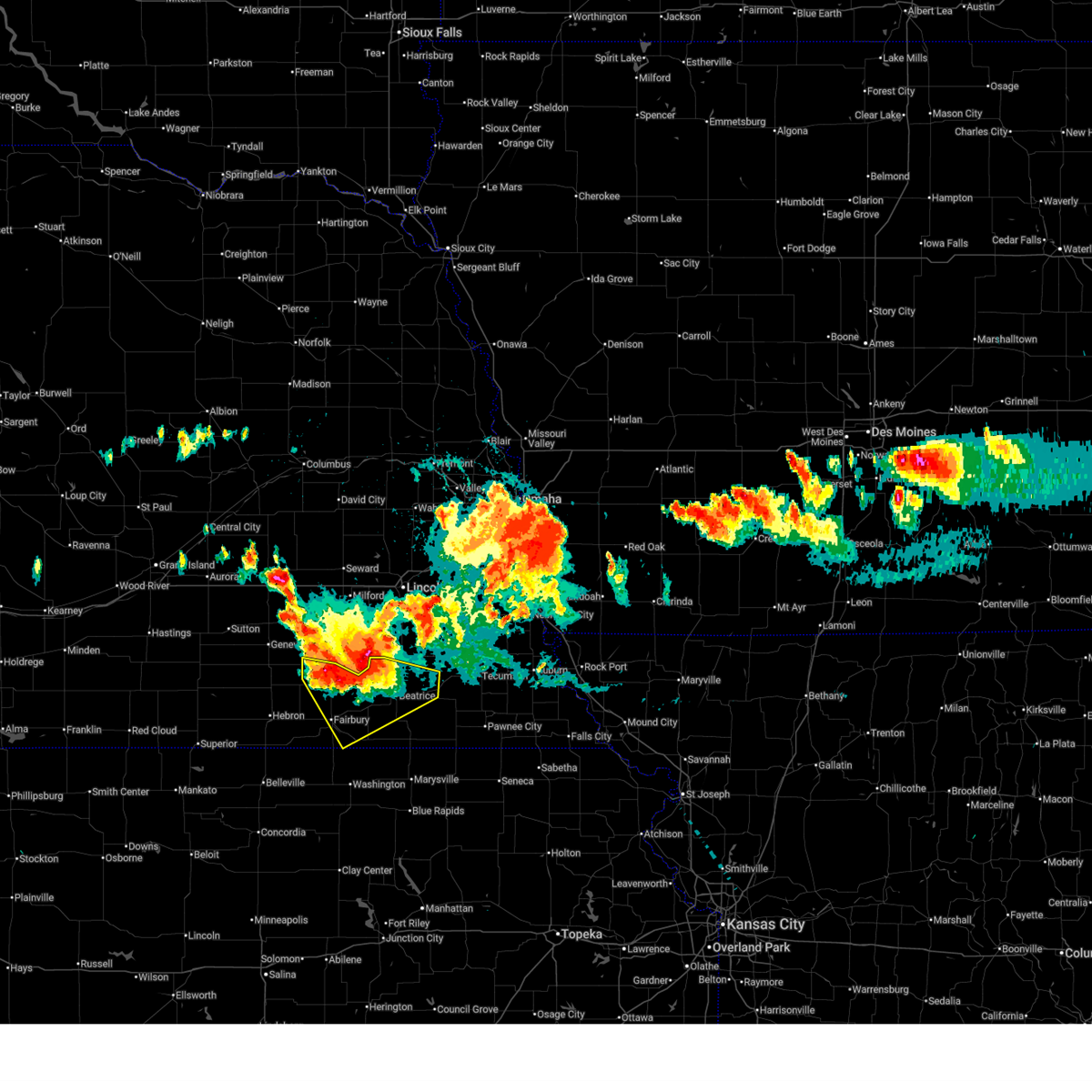
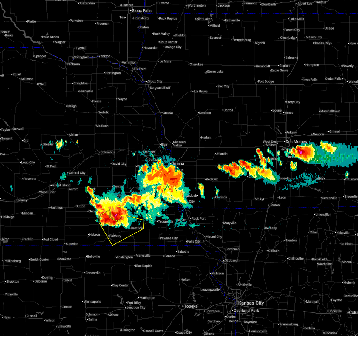
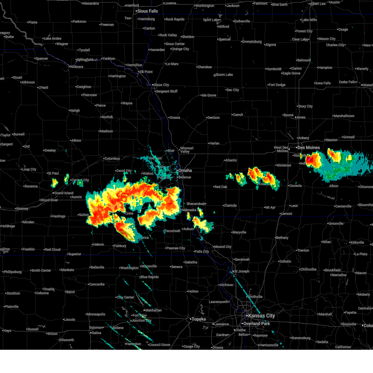
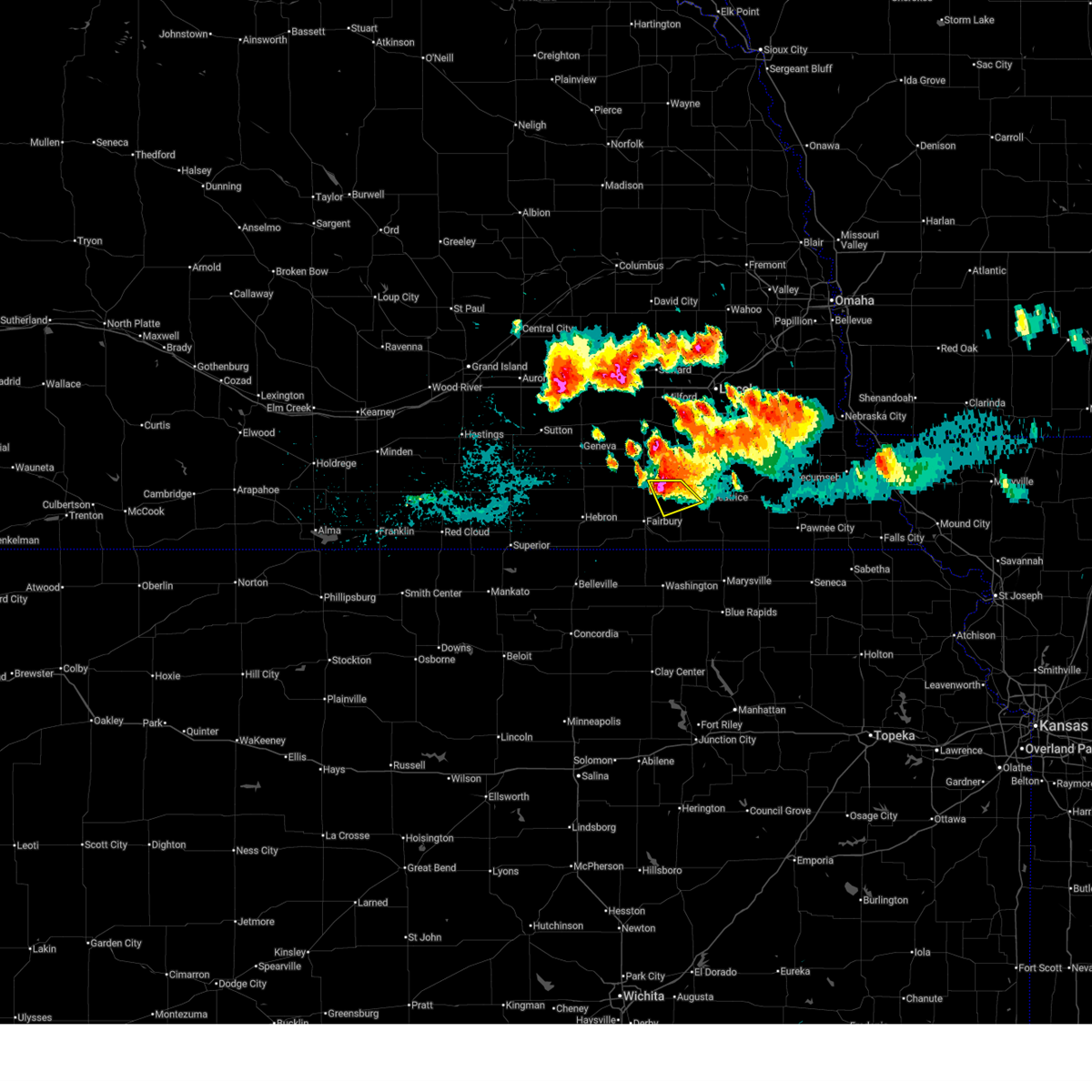
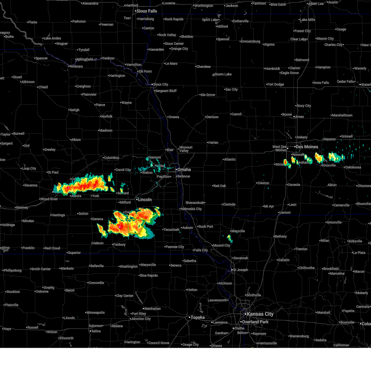
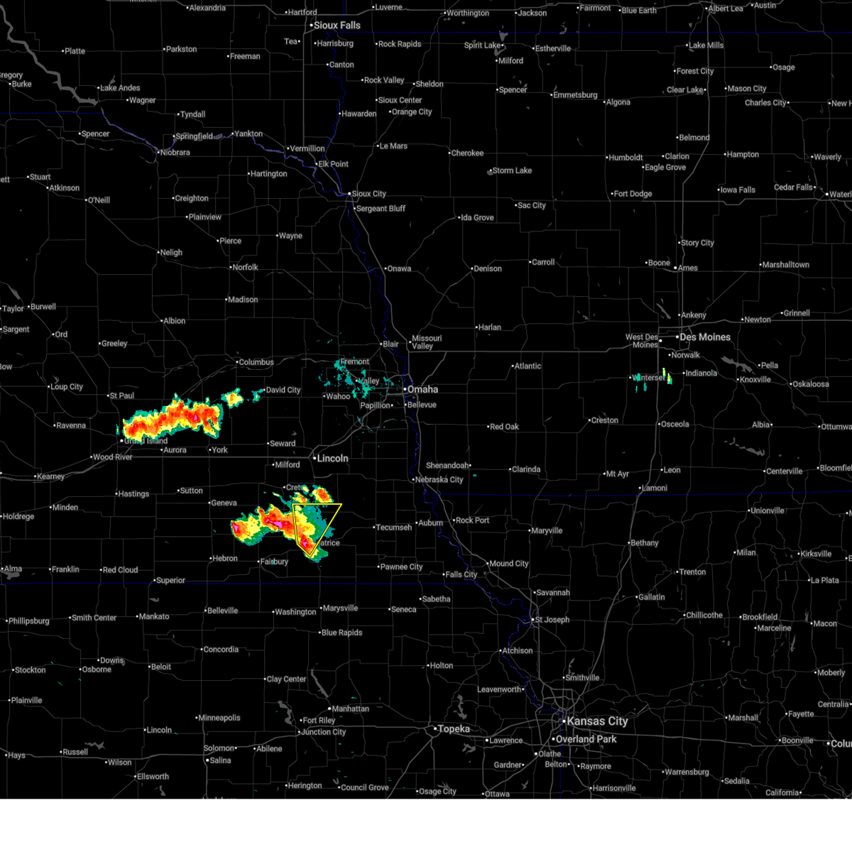
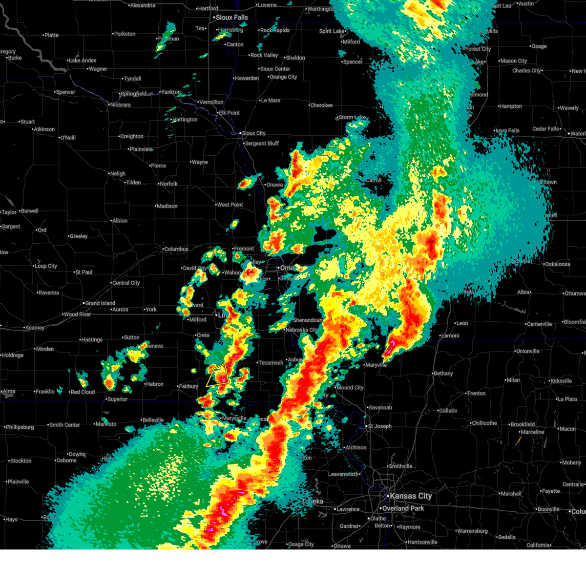
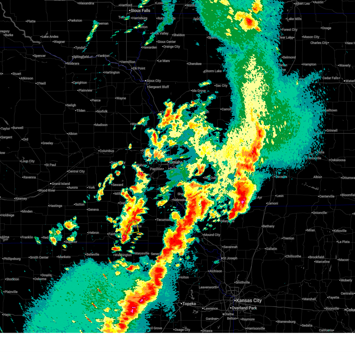
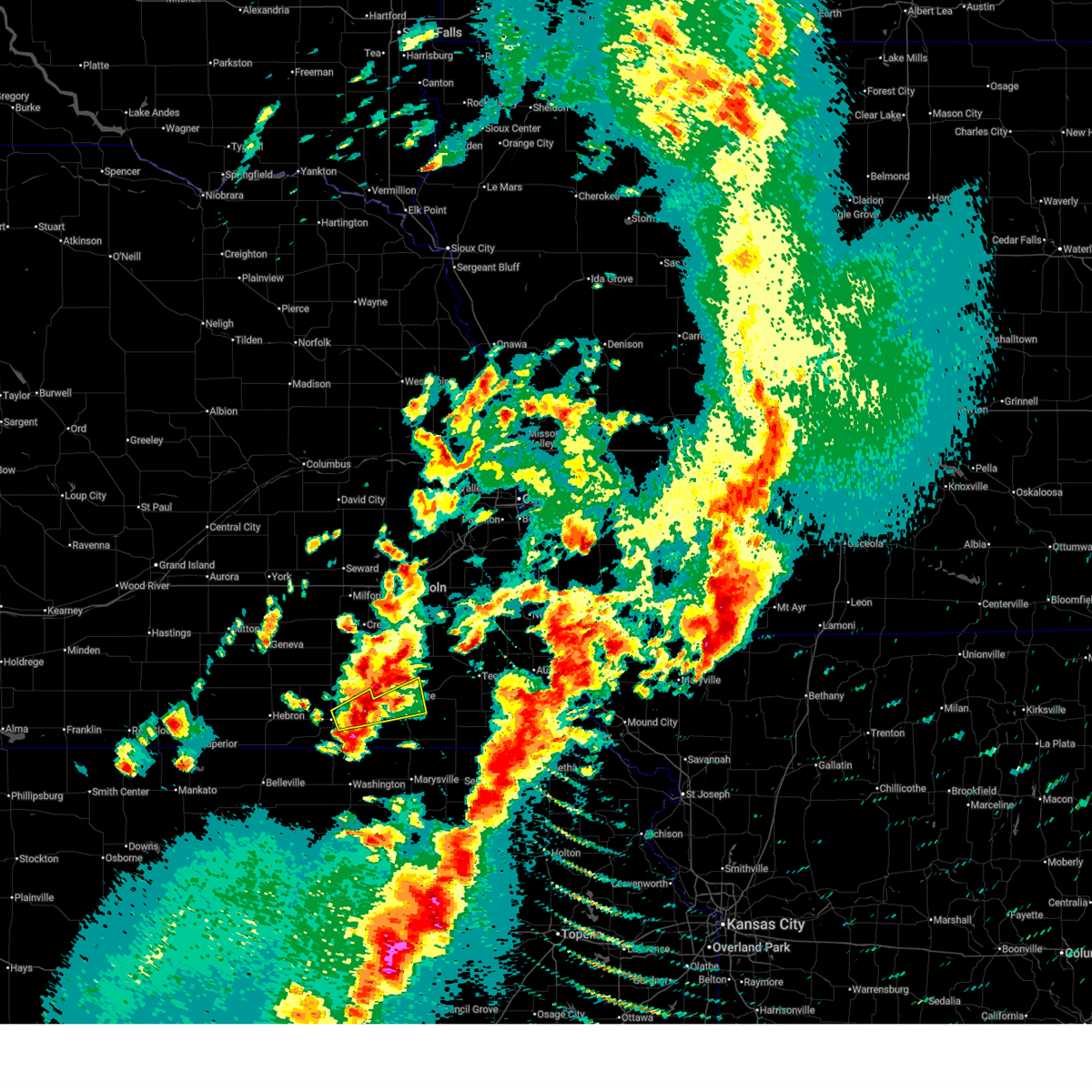
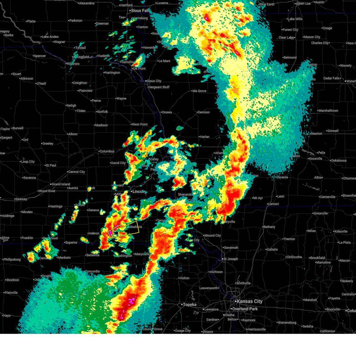
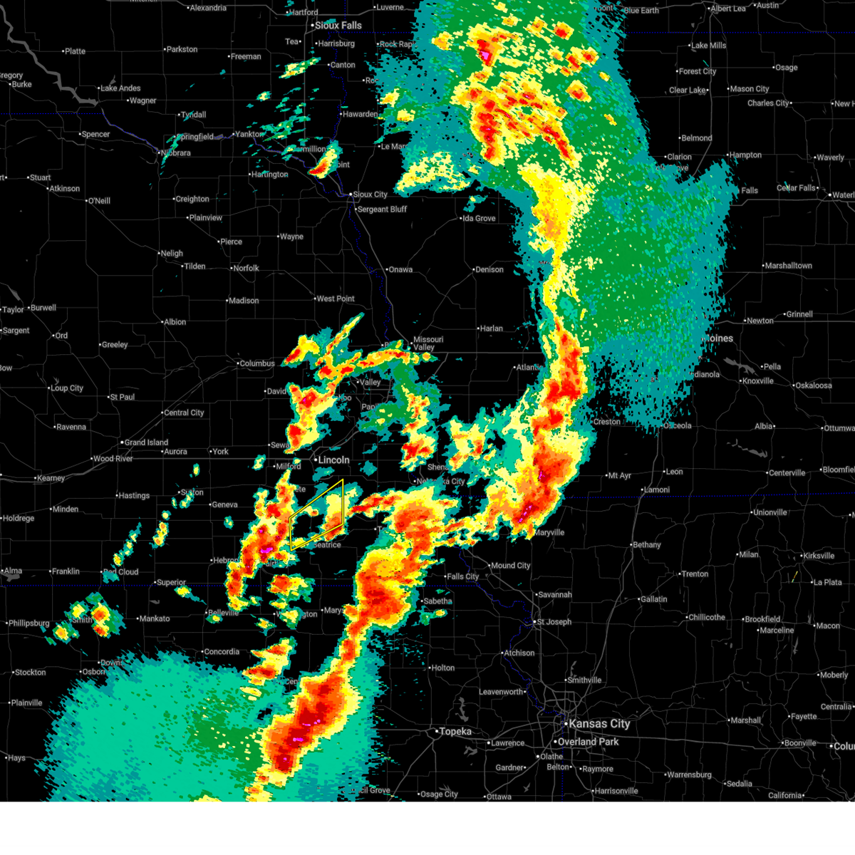
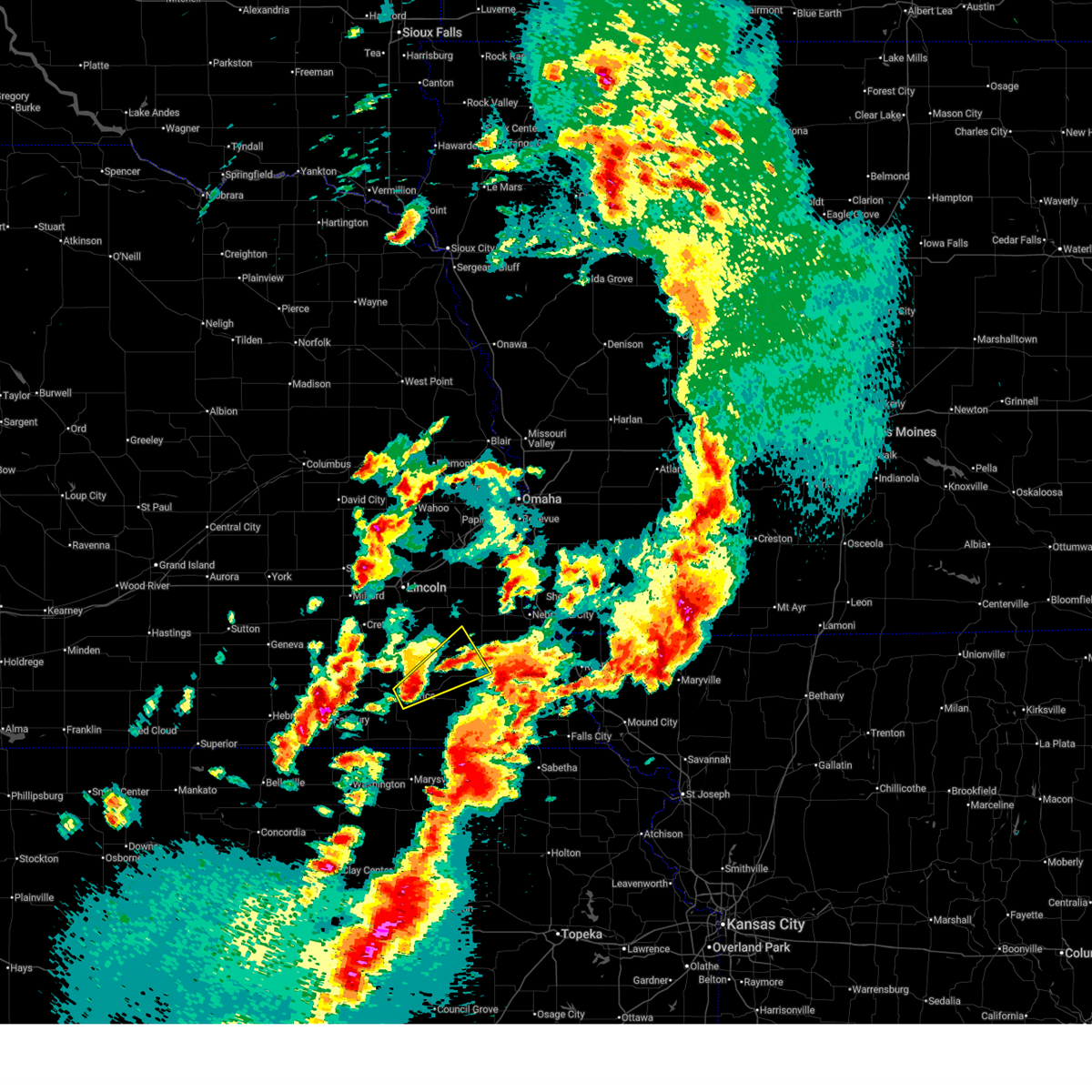
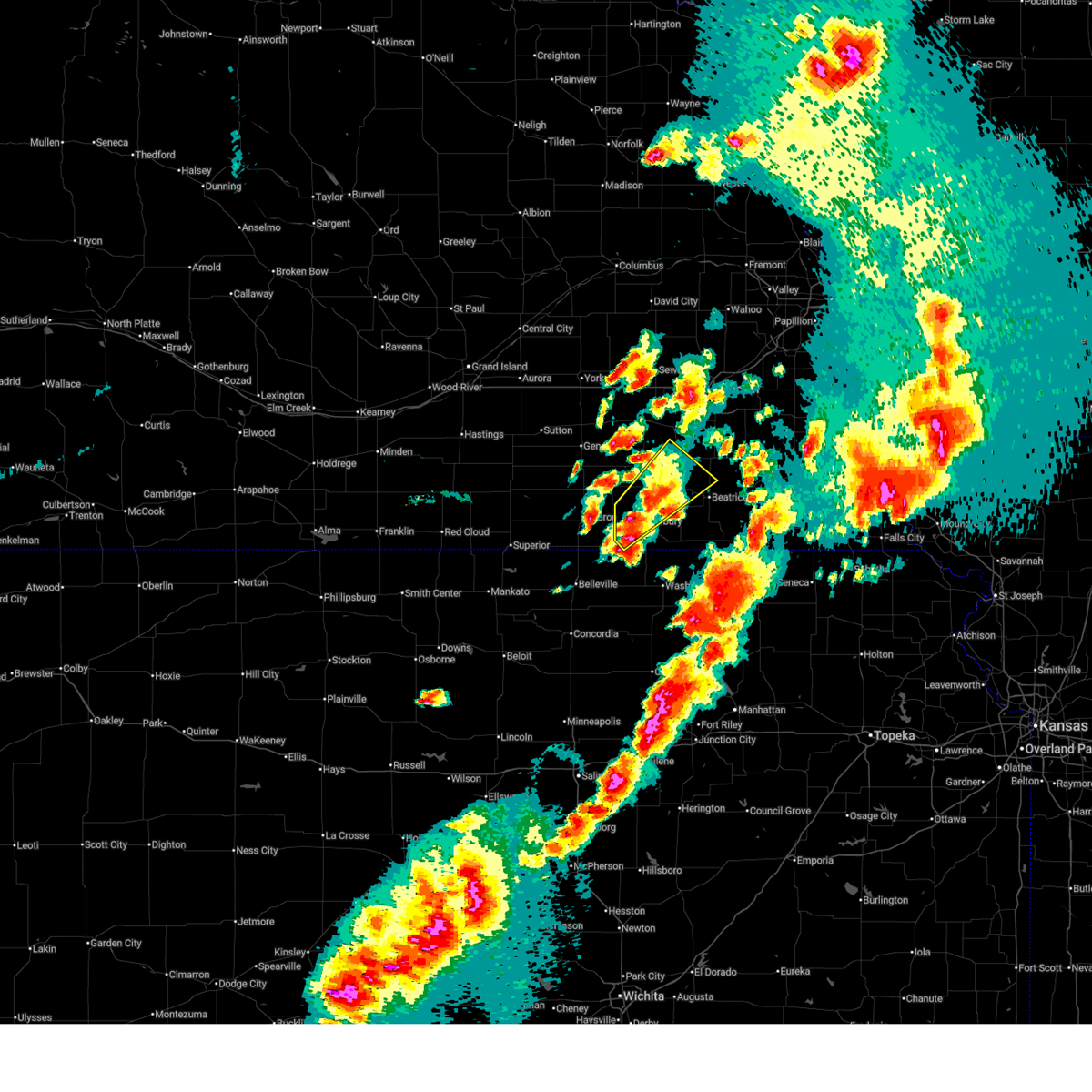
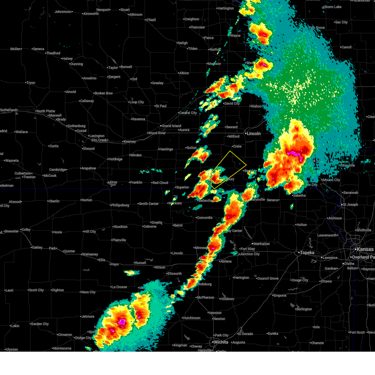
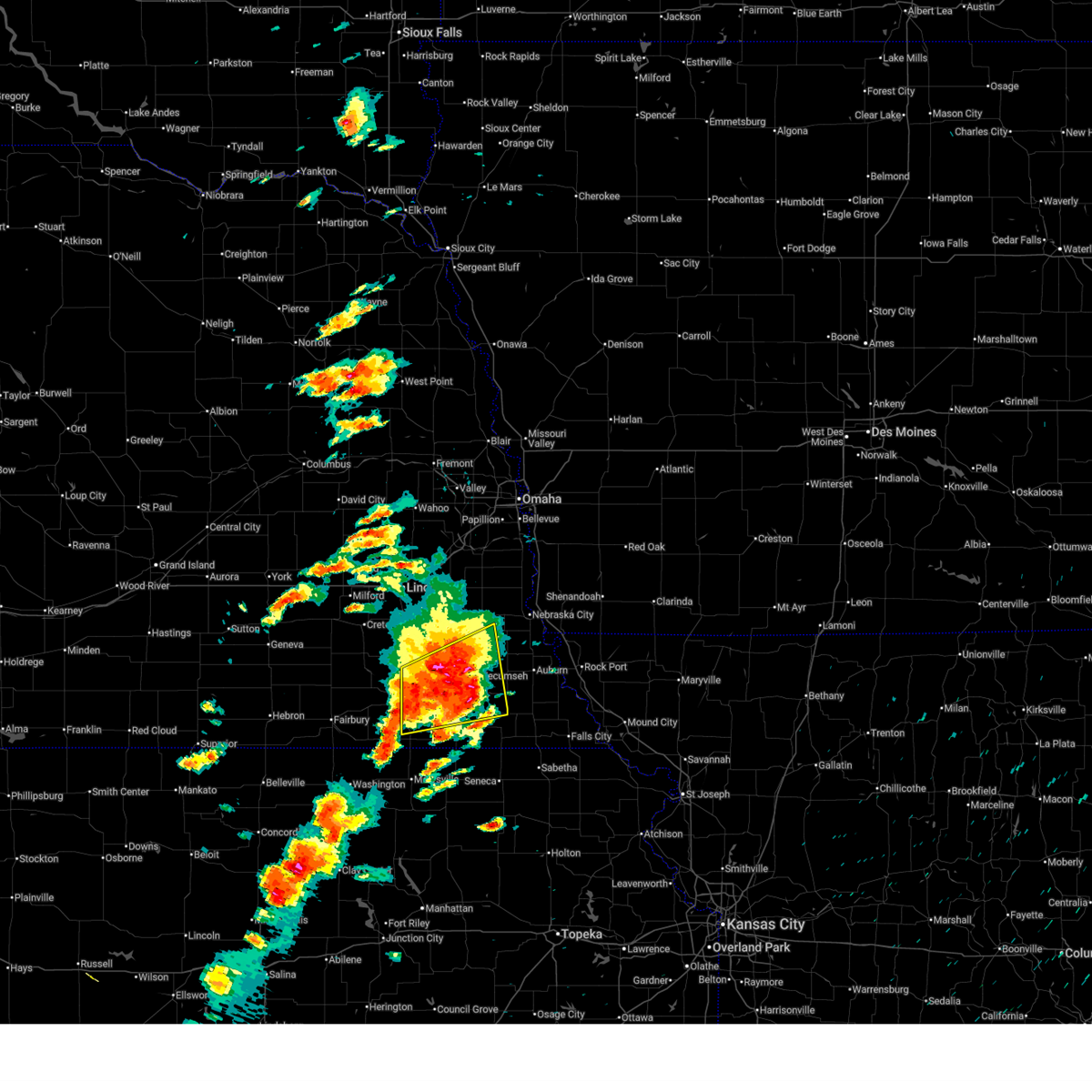
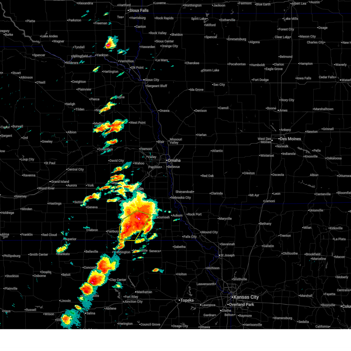
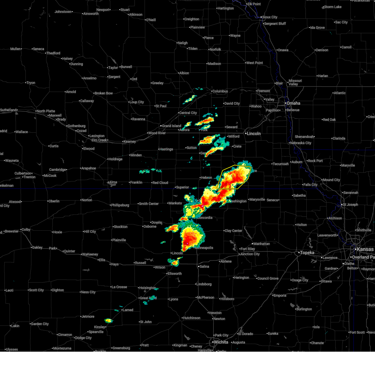
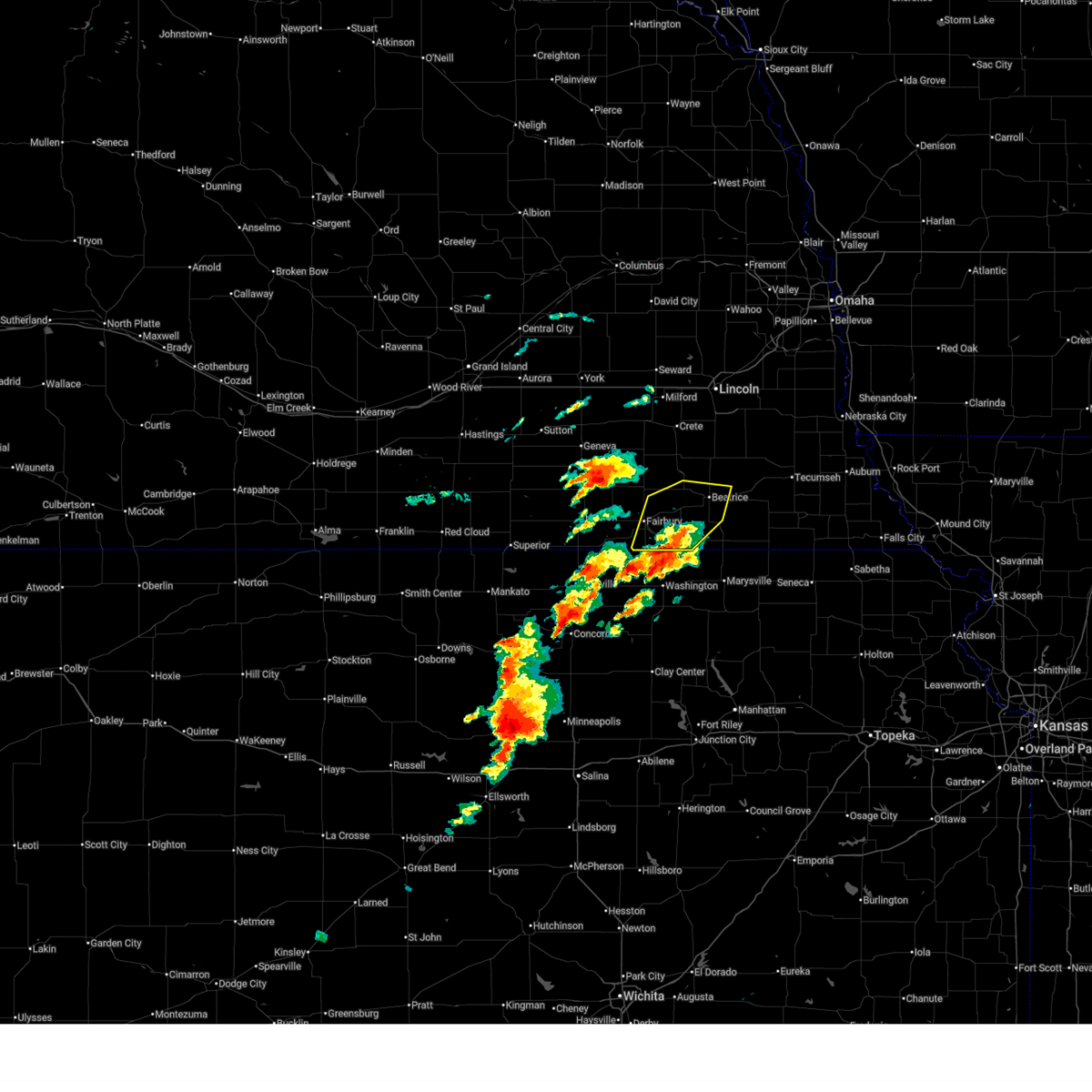
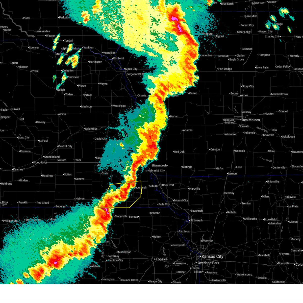
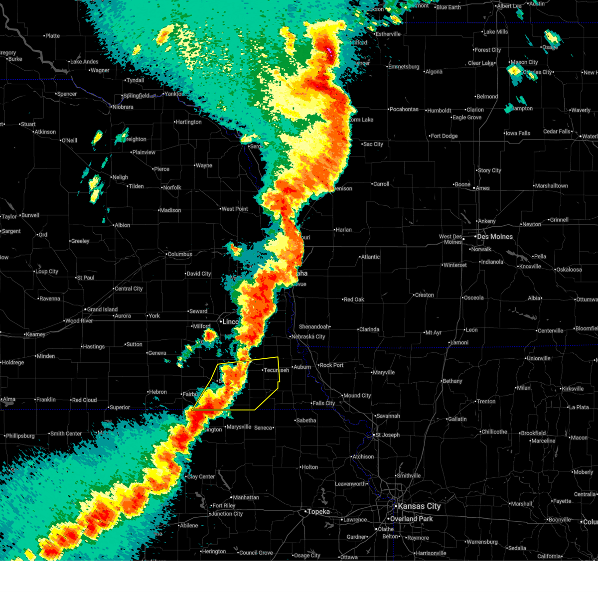
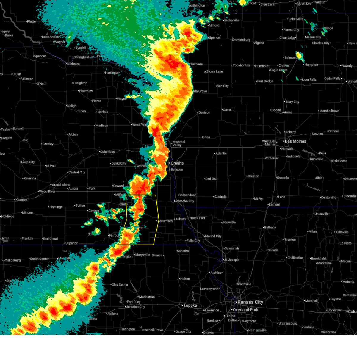
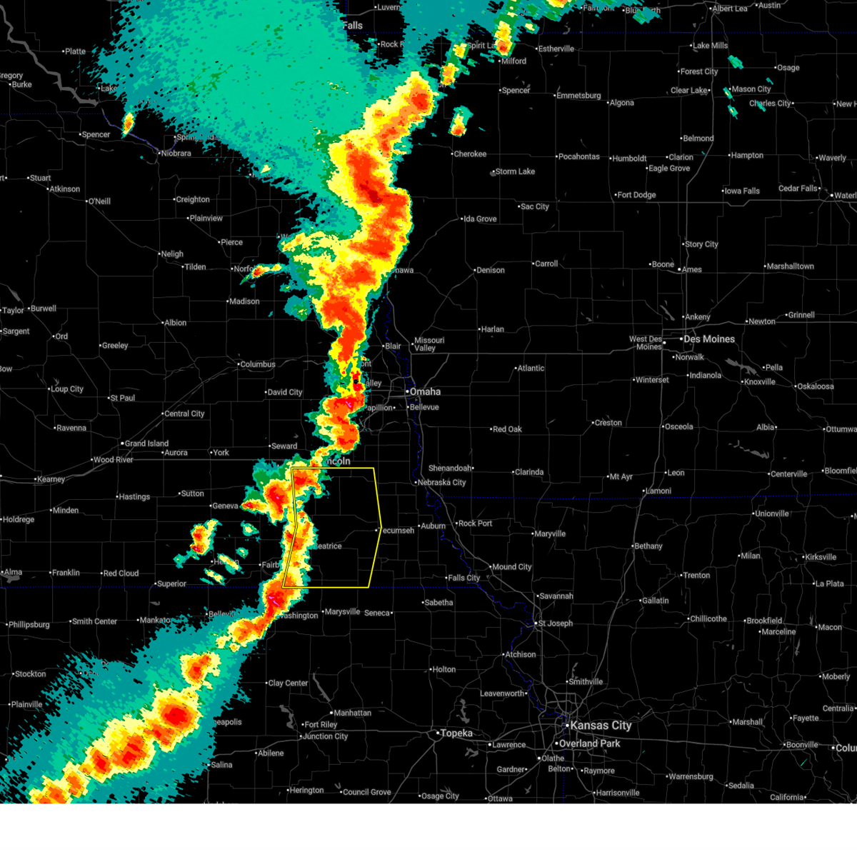
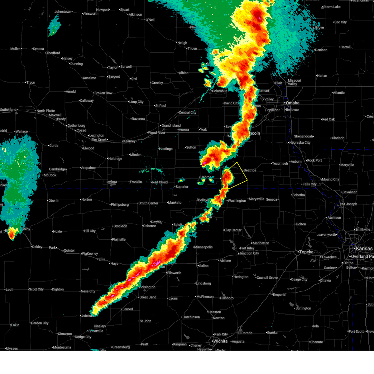
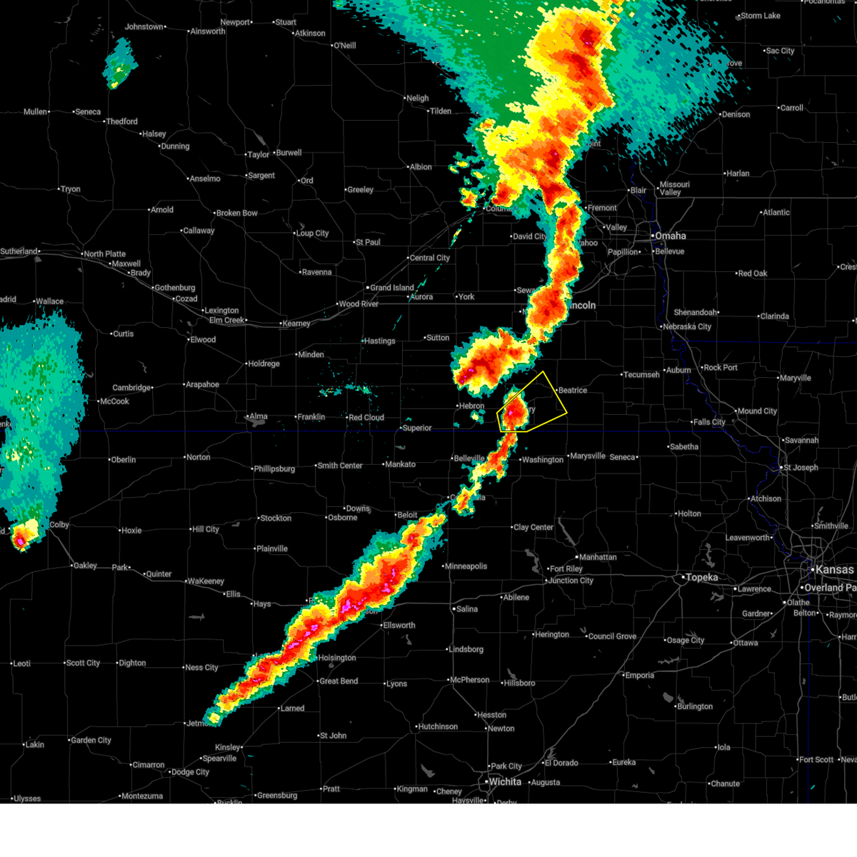
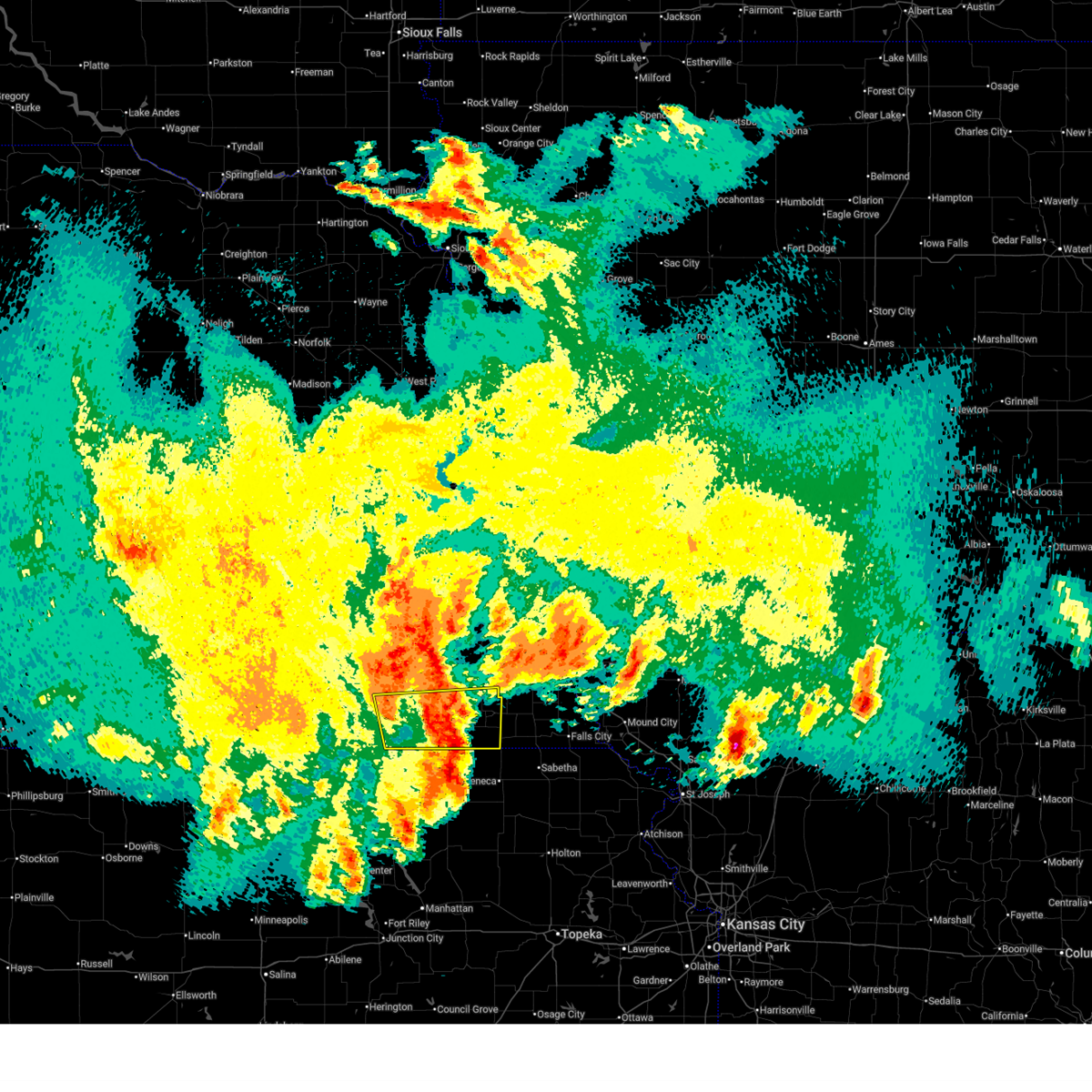
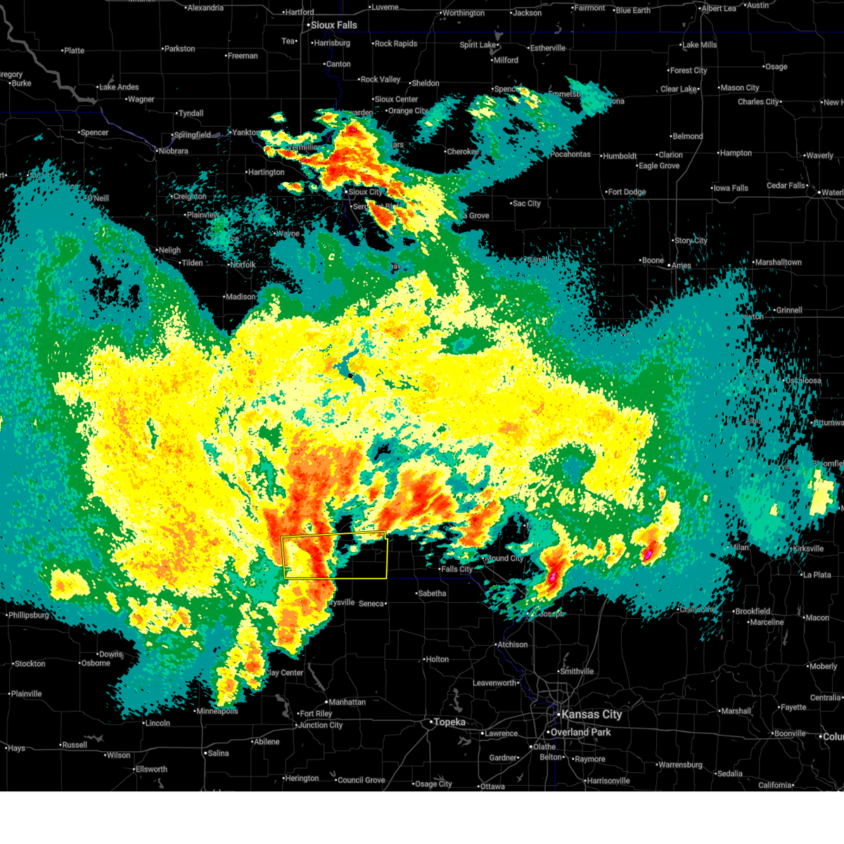
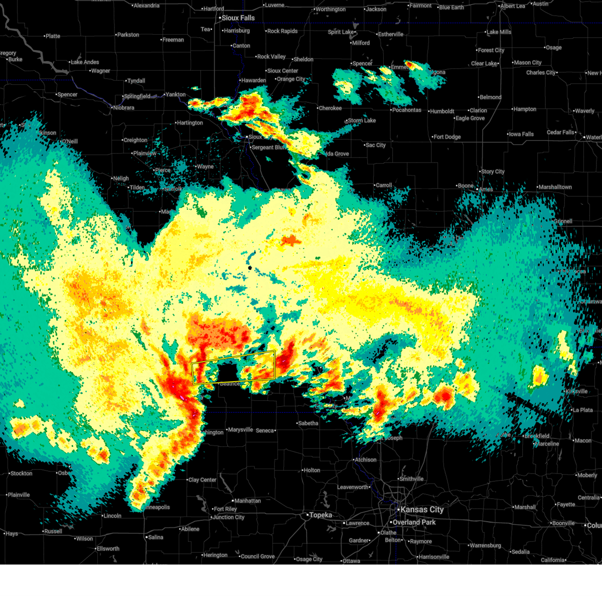
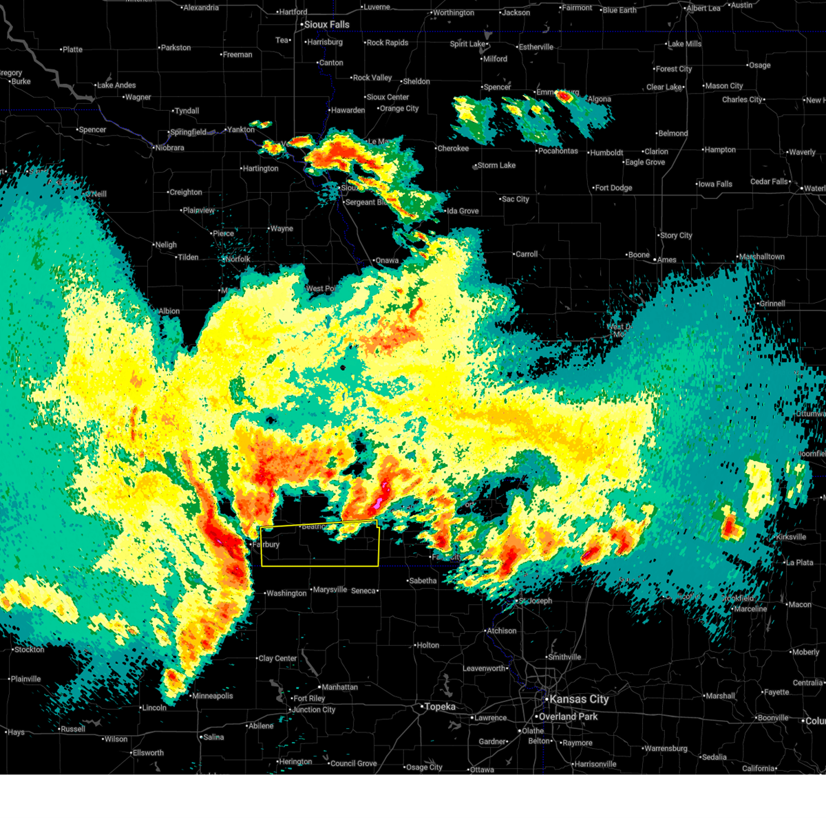
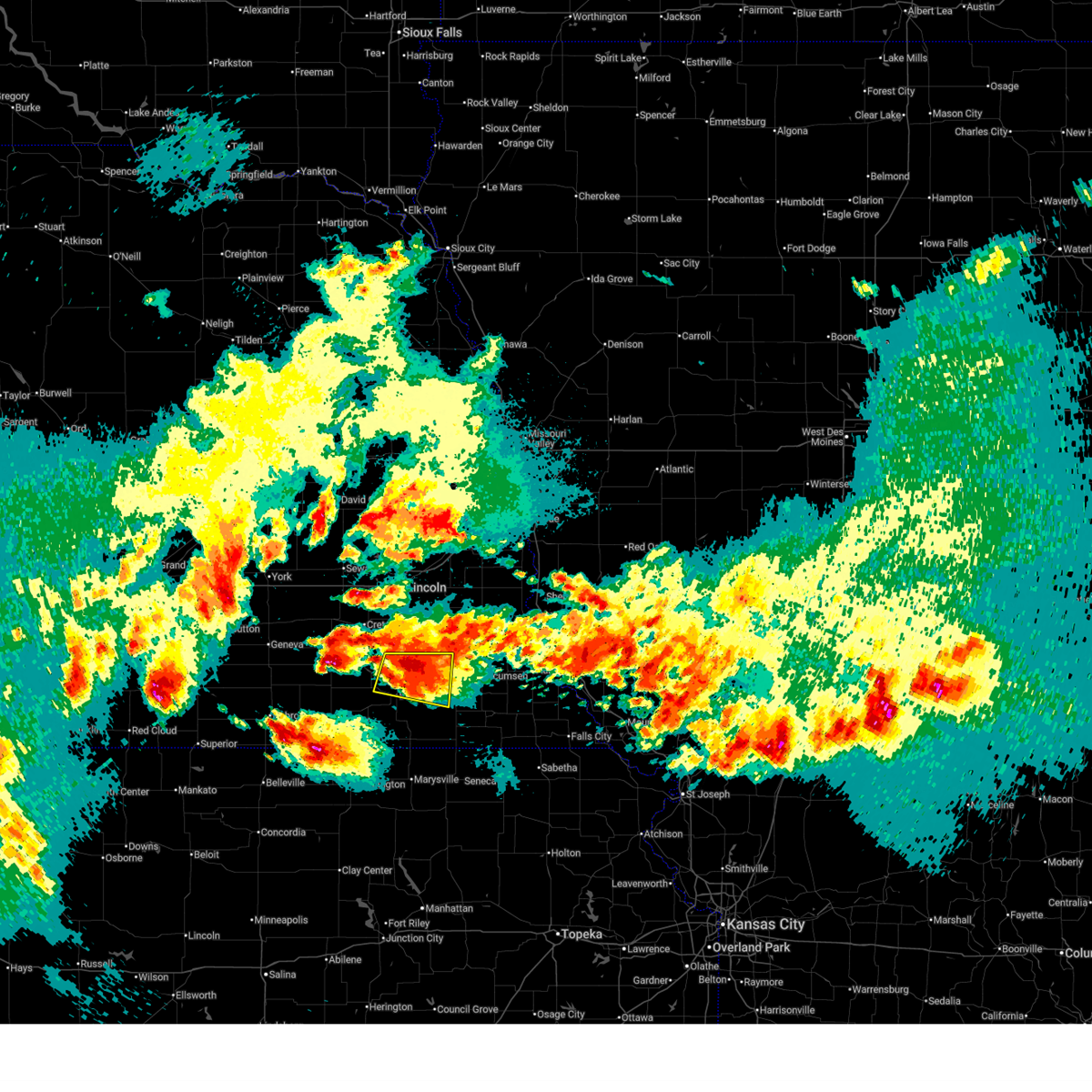
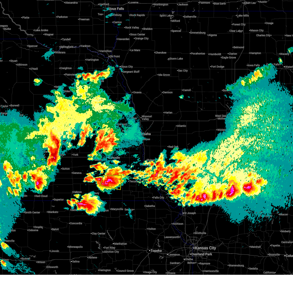
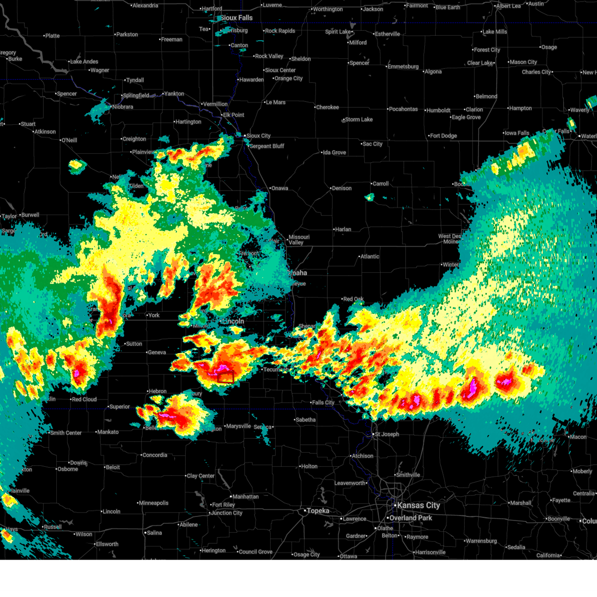
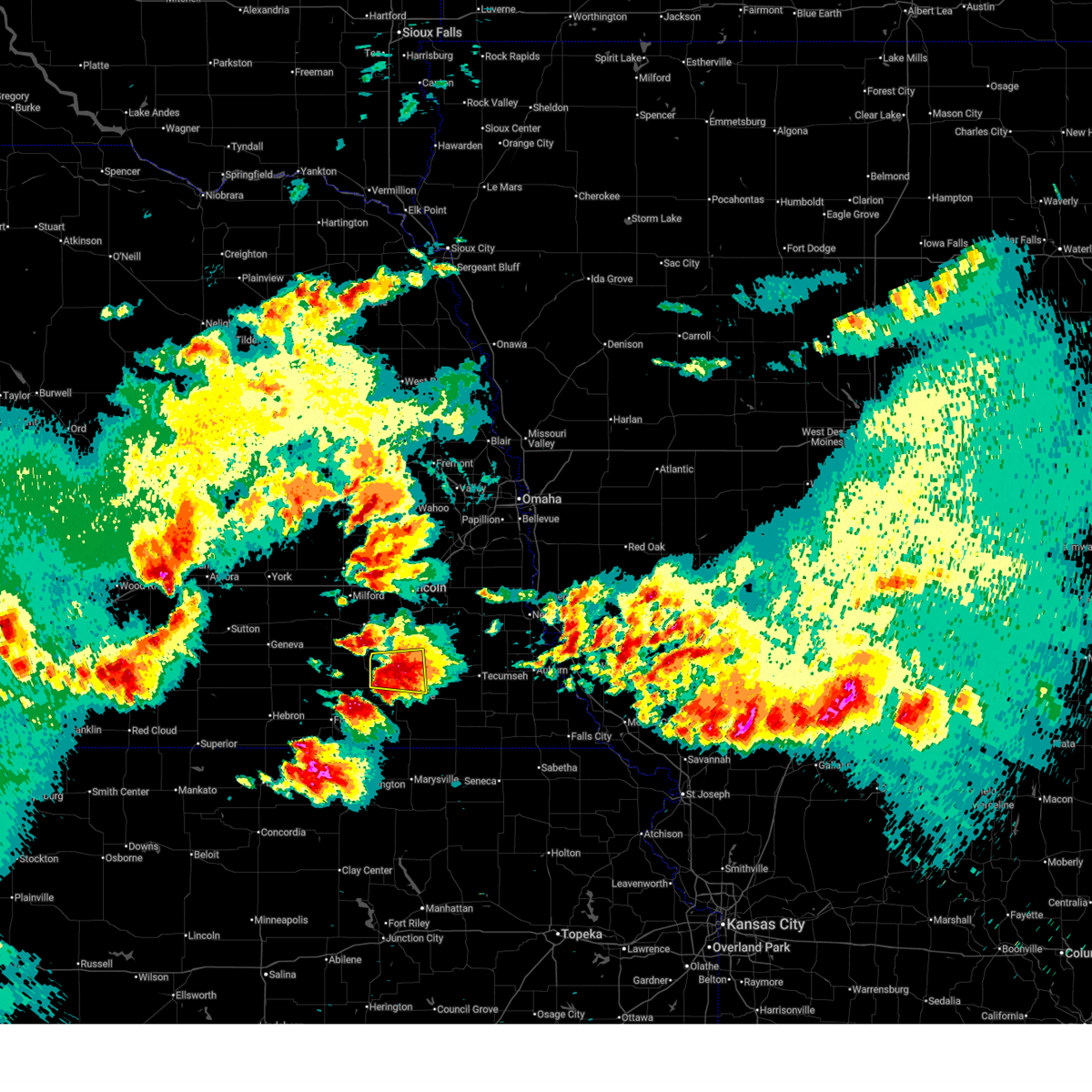
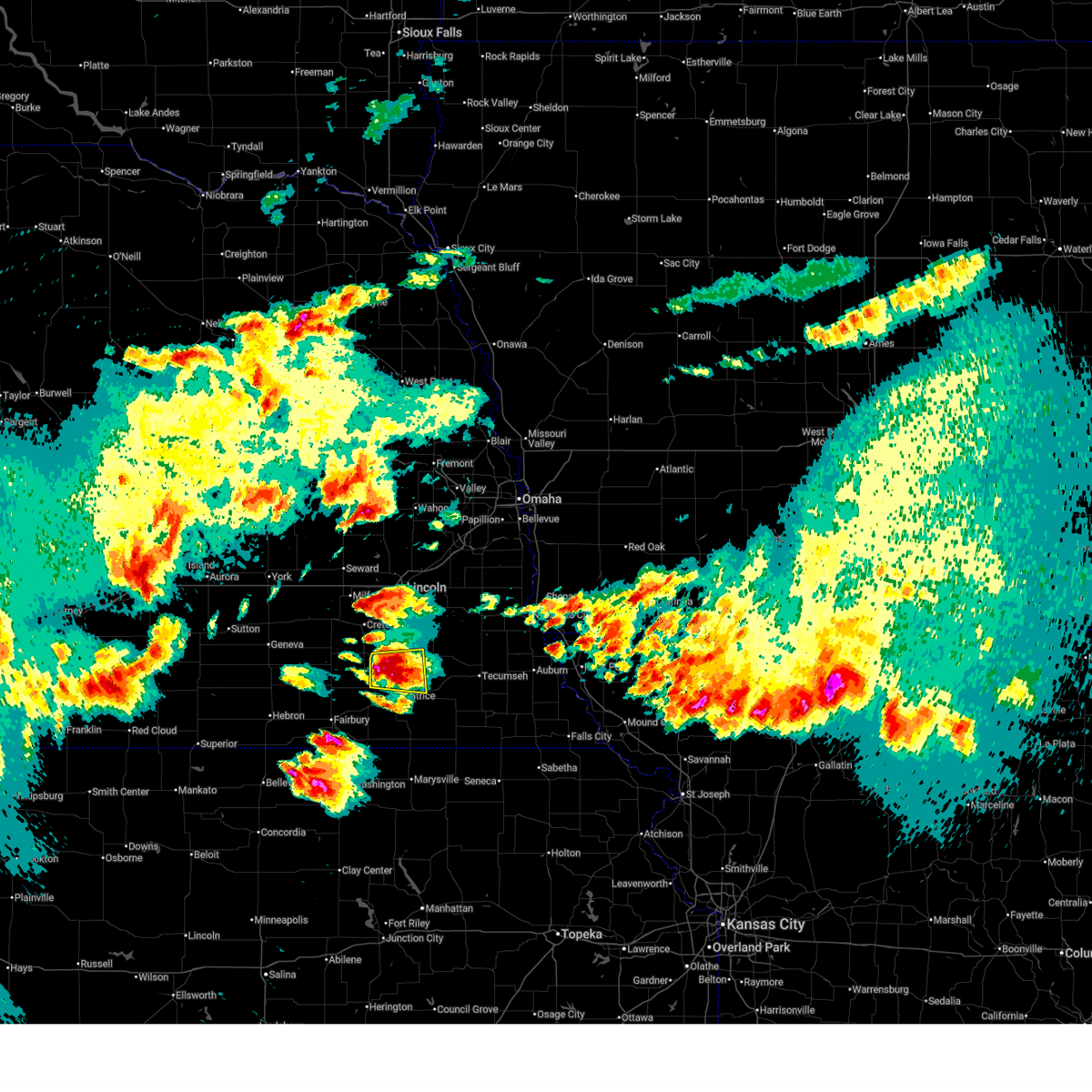
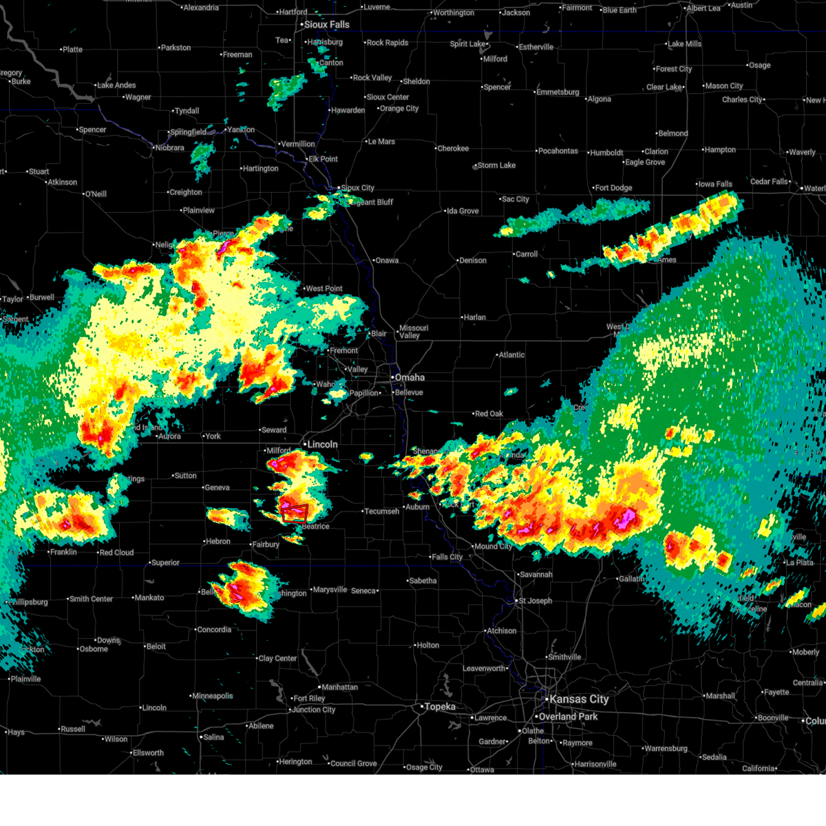
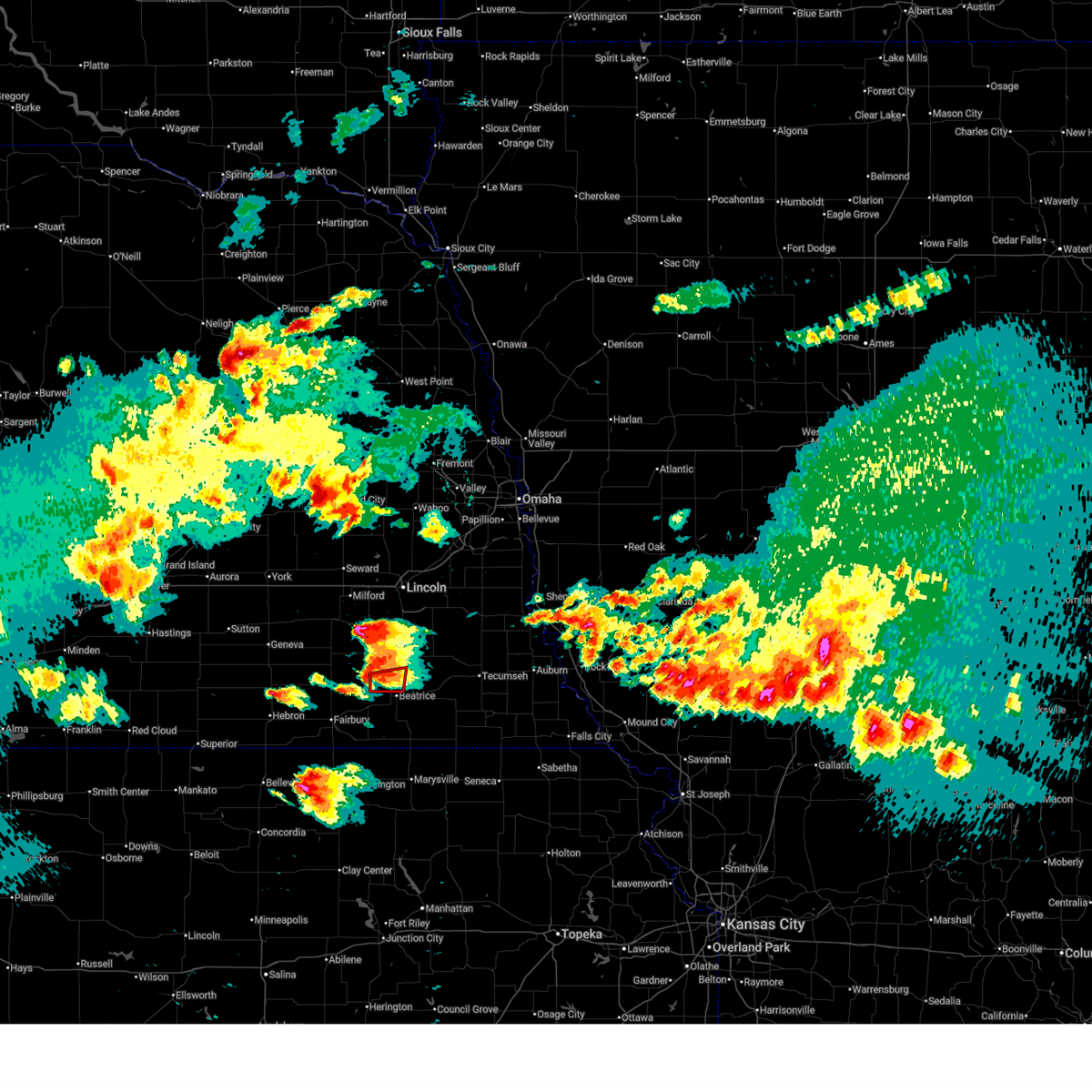
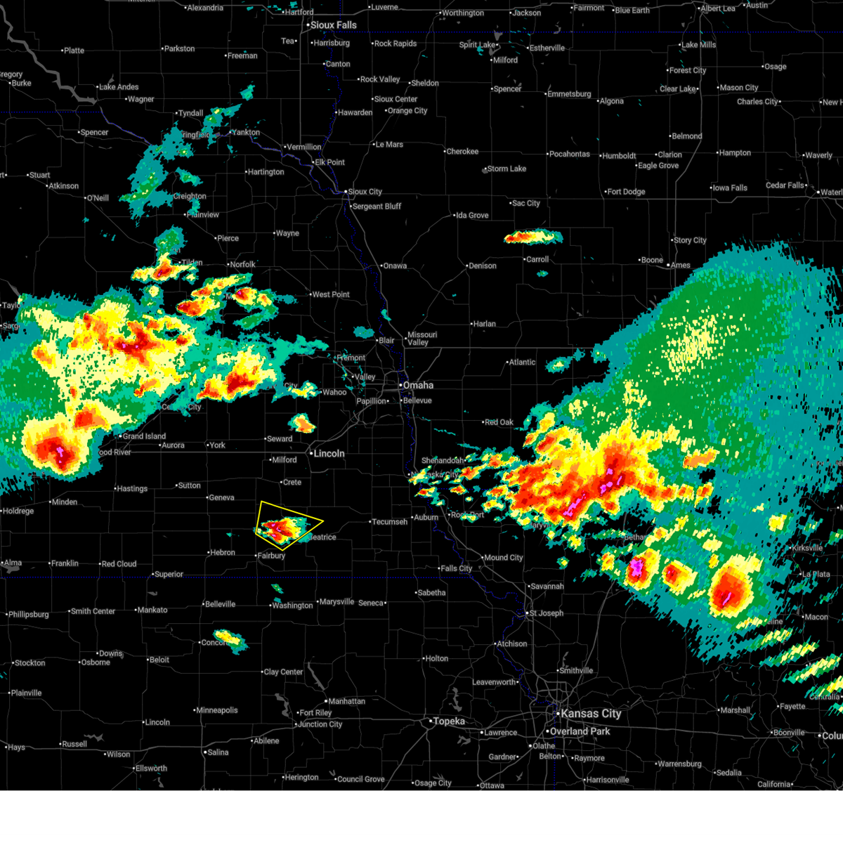
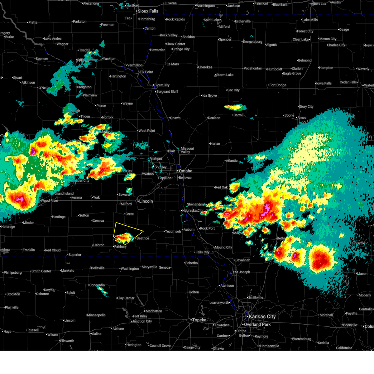
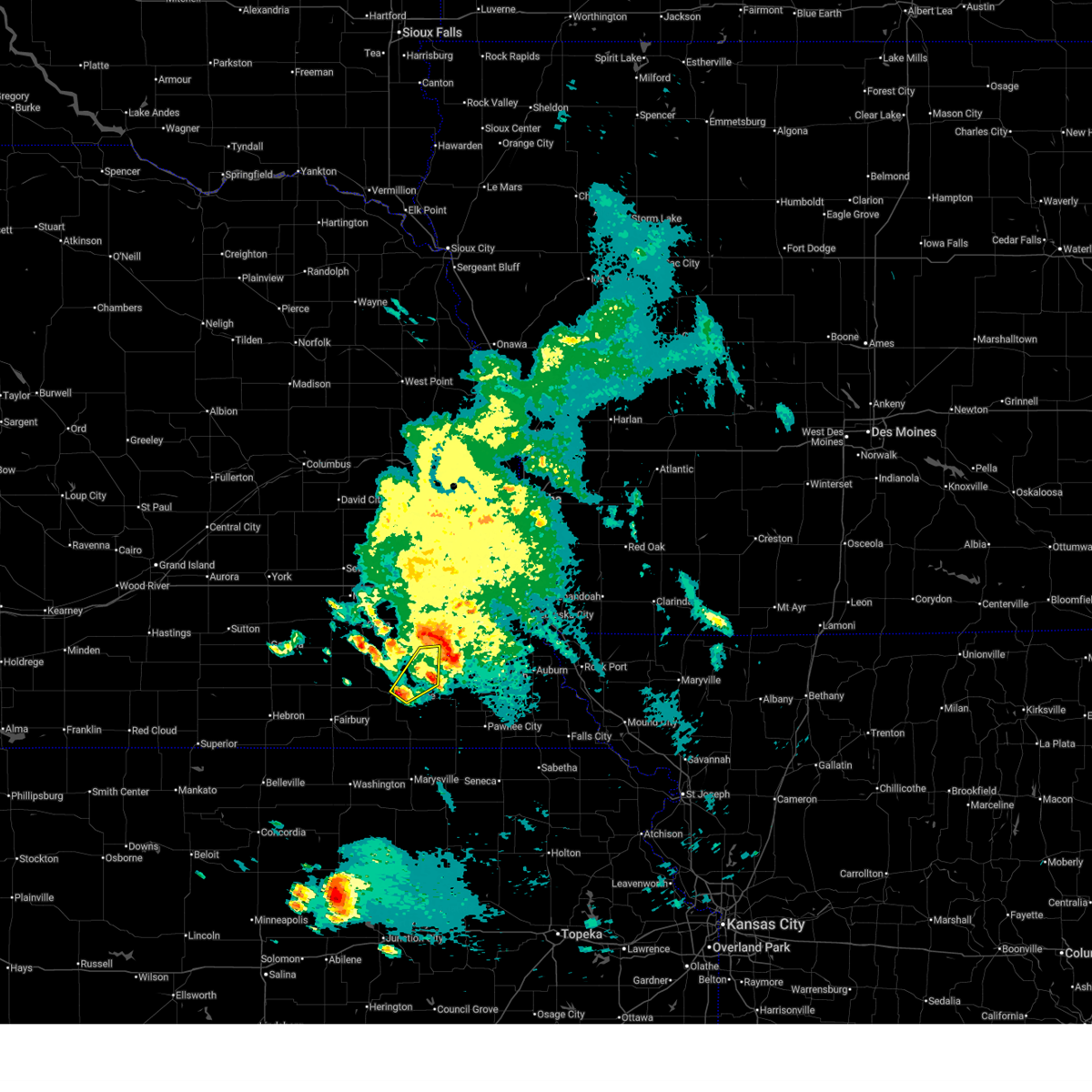
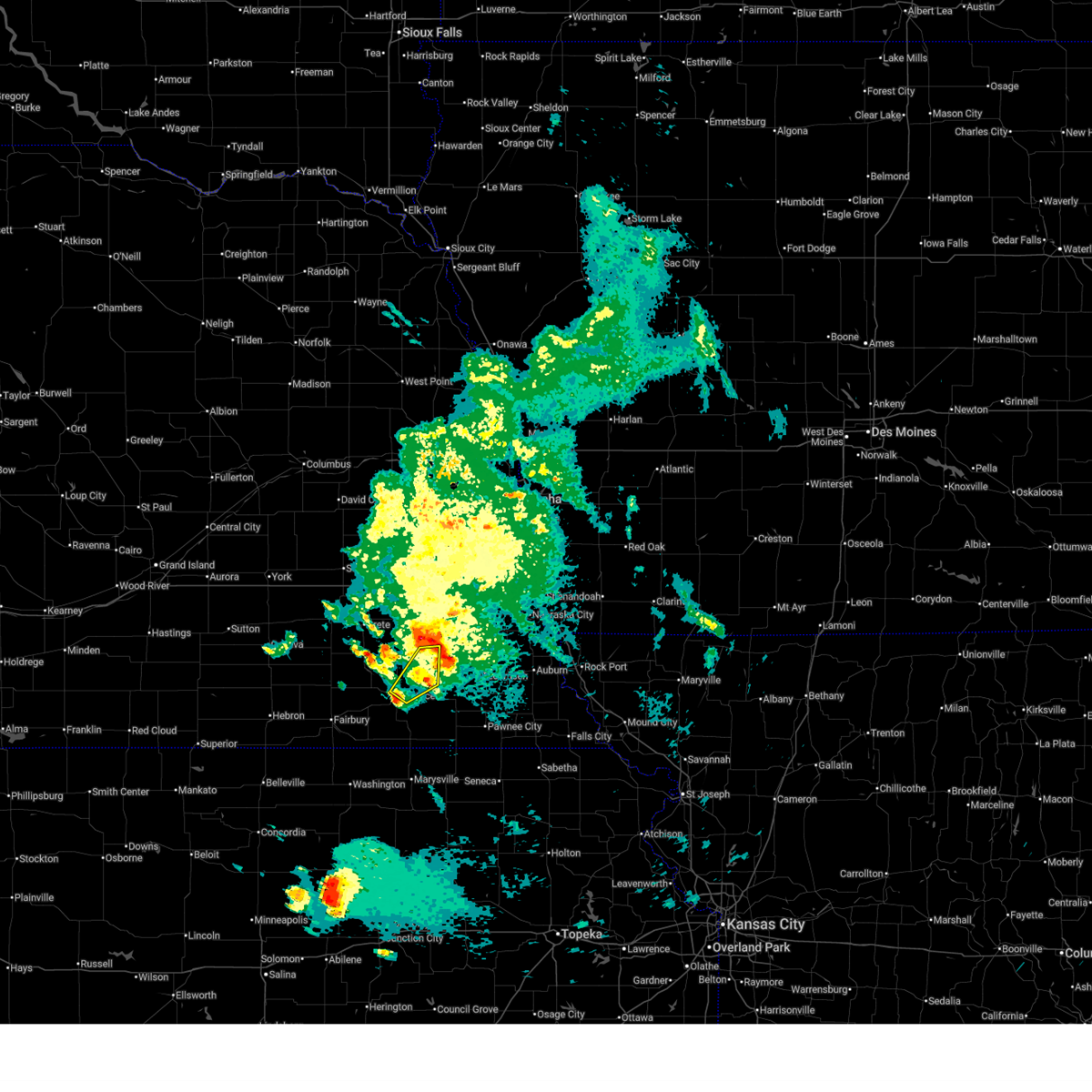
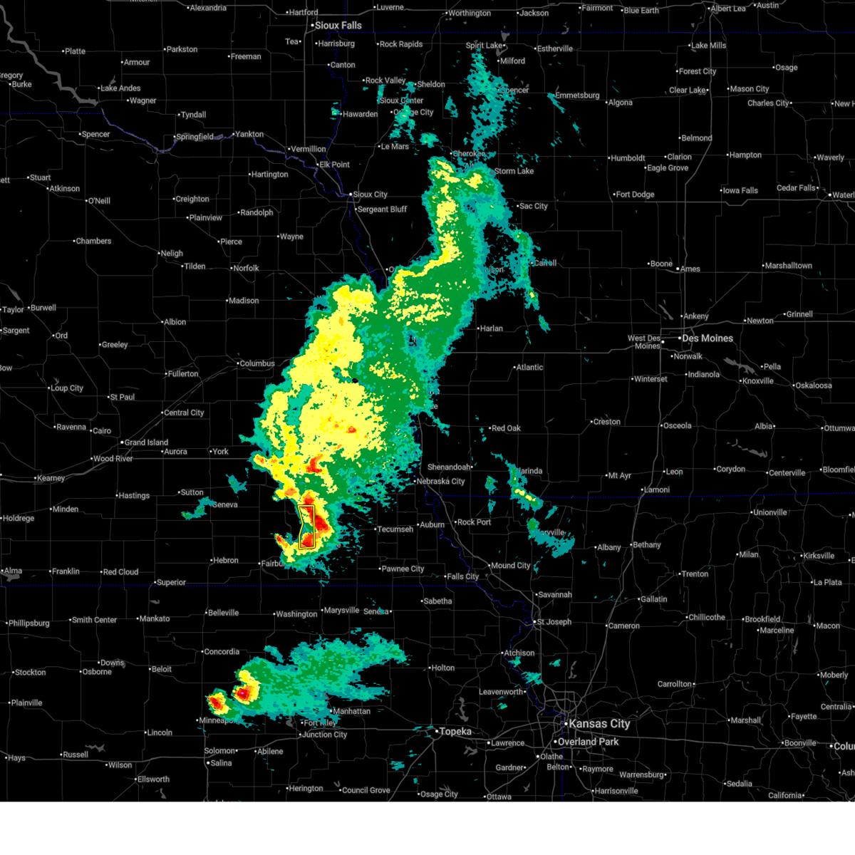
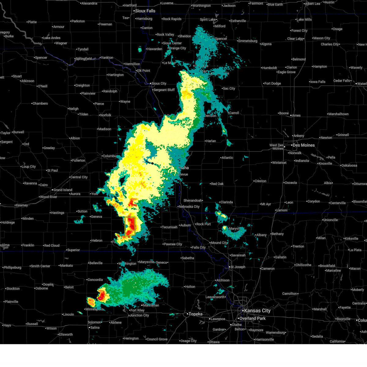
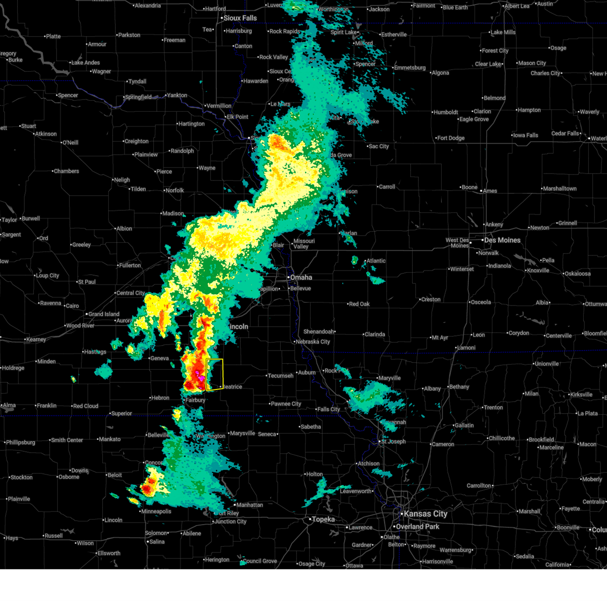
Hail Map for Beatrice, NE
The Beatrice, NE area has had 24 reports of on-the-ground hail by trained spotters, and has been under severe weather warnings 96 times during the past 12 months. Doppler radar has detected hail at or near Beatrice, NE on 145 occasions, including 16 occasions during the past year.
| Name: | Beatrice, NE |
| Where Located: | 75.7 miles N of Manhattan, KS |
| Map: | Google Map for Beatrice, NE |
| Population: | 12459 |
| Housing Units: | 6075 |
| More Info: | Search Google for Beatrice, NE |
1
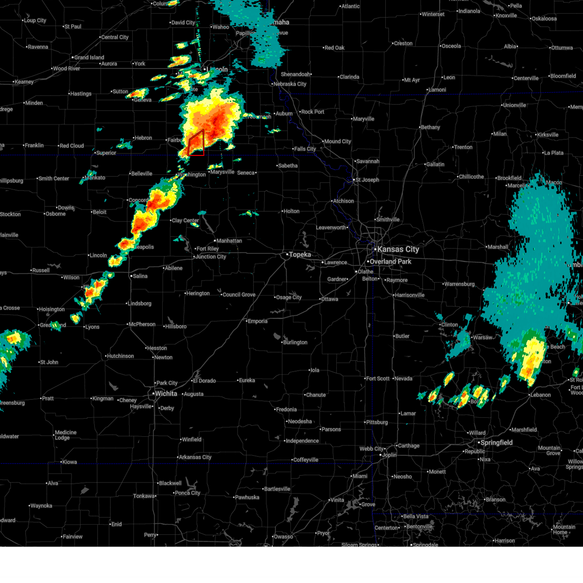
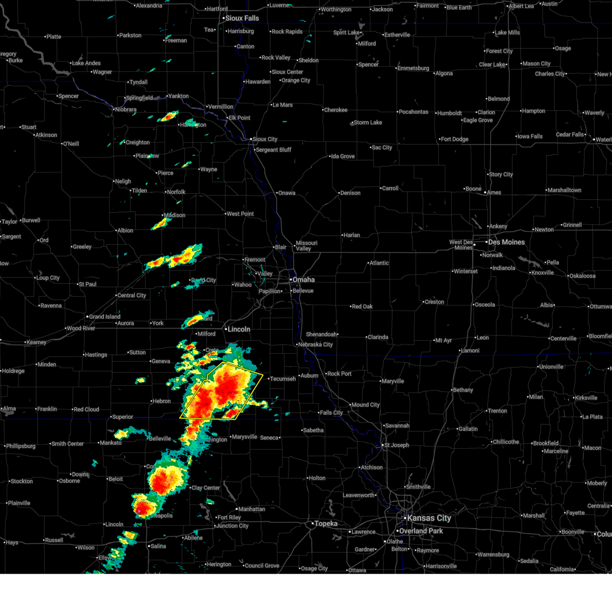
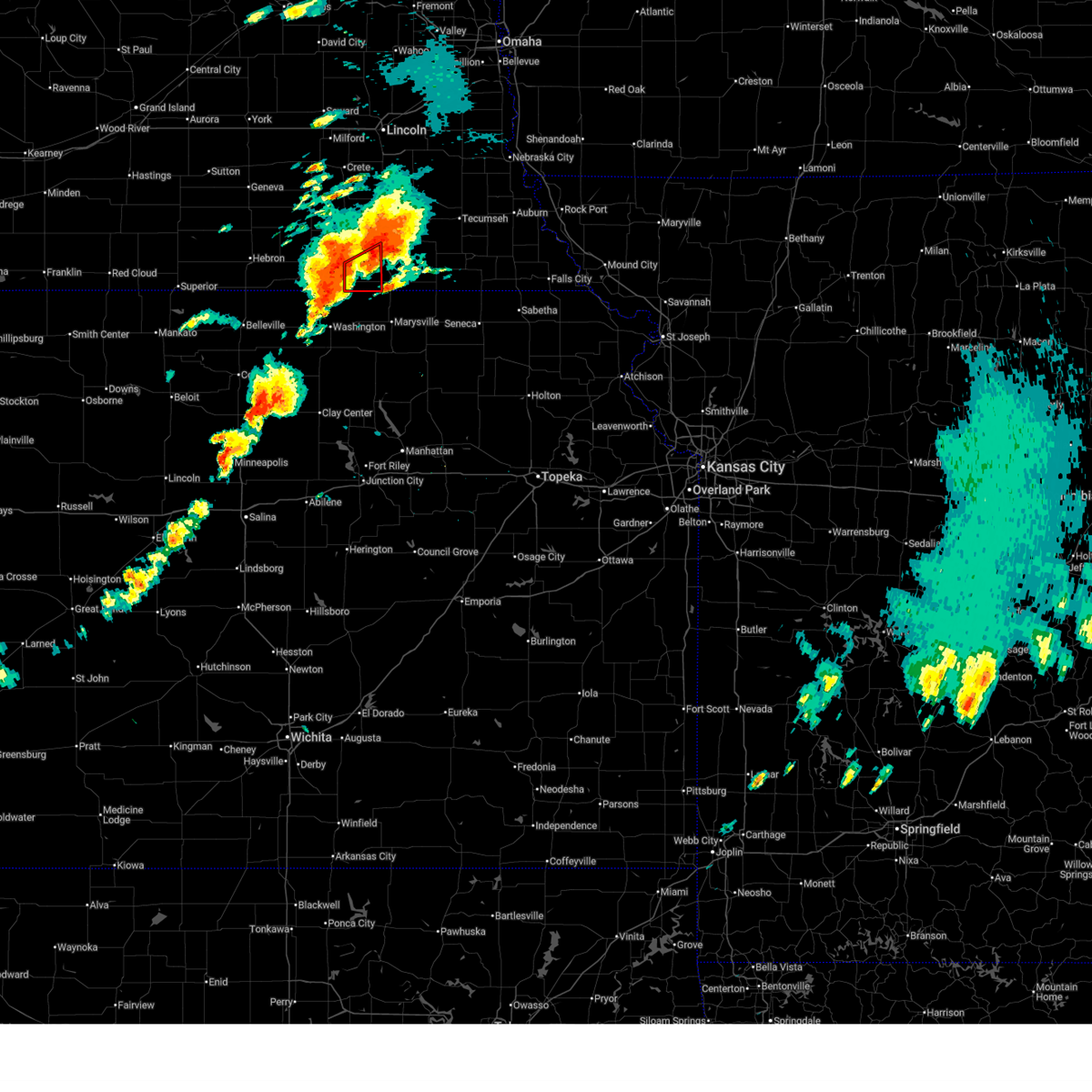
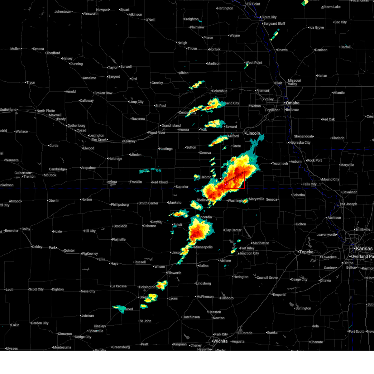
The Top Recent Hail Date for Beatrice, NE is Thursday, April 23, 2026 (19th out of 145)
Hail and Wind Damage Spotted near Beatrice, NE
| Date / Time | Report Details |
|---|---|
| 6/20/2026 5:54 PM CDT |
 Svroax the national weather service in omaha has issued a * severe thunderstorm warning for, southern gage county in southeastern nebraska, * until 645 pm cdt. * at 553 pm cdt, a severe thunderstorm was located 5 miles northeast of diller, or 9 miles southwest of beatrice, moving east at 30 mph (at 540 pm, a member of the public reported quarter size hail 3 ese of jansen, ne). Hazards include 60 mph wind gusts and quarter size hail. Hail damage to vehicles is expected. expect wind damage to roofs, siding, and trees. this severe thunderstorm will be near, wymore around 600 pm cdt. blue springs around 605 pm cdt. Other locations in the path of this severe thunderstorm include liberty. Svroax the national weather service in omaha has issued a * severe thunderstorm warning for, southern gage county in southeastern nebraska, * until 645 pm cdt. * at 553 pm cdt, a severe thunderstorm was located 5 miles northeast of diller, or 9 miles southwest of beatrice, moving east at 30 mph (at 540 pm, a member of the public reported quarter size hail 3 ese of jansen, ne). Hazards include 60 mph wind gusts and quarter size hail. Hail damage to vehicles is expected. expect wind damage to roofs, siding, and trees. this severe thunderstorm will be near, wymore around 600 pm cdt. blue springs around 605 pm cdt. Other locations in the path of this severe thunderstorm include liberty.
|
| 6/5/2026 10:51 PM CDT |
 At 1051 pm cdt, severe thunderstorms were located along a line extending from 3 miles north of crab orchard to 3 miles northeast of holmesville to near diller, moving southeast at 25 mph (radar indicated). Hazards include 60 mph wind gusts. Expect damage to roofs, siding, and trees. Locations impacted include, beatrice, diller, filley, virginia, holmesville, ellis, rockford state recreation area, rockford, and homestead national historical park. At 1051 pm cdt, severe thunderstorms were located along a line extending from 3 miles north of crab orchard to 3 miles northeast of holmesville to near diller, moving southeast at 25 mph (radar indicated). Hazards include 60 mph wind gusts. Expect damage to roofs, siding, and trees. Locations impacted include, beatrice, diller, filley, virginia, holmesville, ellis, rockford state recreation area, rockford, and homestead national historical park.
|
| 6/5/2026 10:36 PM CDT |
 At 1034 pm cdt, severe thunderstorms were located along a line extending from 4 miles west of filley to 6 miles northeast of diller to 3 miles south of jansen, moving southeast at 40 mph (weather instrument measurement. at 1029 pm a 67 mph gust was measured near plymouth). Hazards include 70 mph wind gusts and quarter size hail. Hail damage to vehicles is expected. expect considerable tree damage. wind damage is also likely to mobile homes, roofs, and outbuildings. Locations impacted include, beatrice, de witt, plymouth, diller, western, pickrell, filley, swanton, virginia, harbine, holmesville, cub creek recreational area, homestead national historical park, ellis, rockford state recreation area, and rockford. At 1034 pm cdt, severe thunderstorms were located along a line extending from 4 miles west of filley to 6 miles northeast of diller to 3 miles south of jansen, moving southeast at 40 mph (weather instrument measurement. at 1029 pm a 67 mph gust was measured near plymouth). Hazards include 70 mph wind gusts and quarter size hail. Hail damage to vehicles is expected. expect considerable tree damage. wind damage is also likely to mobile homes, roofs, and outbuildings. Locations impacted include, beatrice, de witt, plymouth, diller, western, pickrell, filley, swanton, virginia, harbine, holmesville, cub creek recreational area, homestead national historical park, ellis, rockford state recreation area, and rockford.
|
| 6/5/2026 10:23 PM CDT |
 At 1023 pm cdt, severe thunderstorms were located along a line extending from near pickrell to 4 miles northeast of harbine to 4 miles north of fairbury, moving southeast at 40 mph (weather instrument measurement. at 1015 pm, a 68 mph gust was reported 2 miles west-northwest of plymouth). Hazards include 70 mph wind gusts and quarter size hail. Hail damage to vehicles is expected. expect considerable tree damage. wind damage is also likely to mobile homes, roofs, and outbuildings. Locations impacted include, beatrice, diller, endicott, jansen, harbine, filley, holmesville, steele city and virginia. At 1023 pm cdt, severe thunderstorms were located along a line extending from near pickrell to 4 miles northeast of harbine to 4 miles north of fairbury, moving southeast at 40 mph (weather instrument measurement. at 1015 pm, a 68 mph gust was reported 2 miles west-northwest of plymouth). Hazards include 70 mph wind gusts and quarter size hail. Hail damage to vehicles is expected. expect considerable tree damage. wind damage is also likely to mobile homes, roofs, and outbuildings. Locations impacted include, beatrice, diller, endicott, jansen, harbine, filley, holmesville, steele city and virginia.
|
| 6/5/2026 10:08 PM CDT |
 Svroax the national weather service in omaha has issued a * severe thunderstorm warning for, jefferson county in southeastern nebraska, southern saline county in southeastern nebraska, central gage county in southeastern nebraska, * until 1100 pm cdt. * at 1008 pm cdt, severe thunderstorms were located along a line extending from 3 miles southeast of clatonia to 3 miles west of plymouth to 3 miles south of daykin, moving southeast at 40 mph (radar indicated). Hazards include 60 mph wind gusts and quarter size hail. Hail damage to vehicles is expected. expect wind damage to roofs, siding, and trees. severe thunderstorms will be near, beatrice, fairbury, plymouth, pickrell, jansen, and harbine around 1015 pm cdt. diller and endicott around 1025 pm cdt. Other locations in the path of these severe thunderstorms include steele city and holmesville. Svroax the national weather service in omaha has issued a * severe thunderstorm warning for, jefferson county in southeastern nebraska, southern saline county in southeastern nebraska, central gage county in southeastern nebraska, * until 1100 pm cdt. * at 1008 pm cdt, severe thunderstorms were located along a line extending from 3 miles southeast of clatonia to 3 miles west of plymouth to 3 miles south of daykin, moving southeast at 40 mph (radar indicated). Hazards include 60 mph wind gusts and quarter size hail. Hail damage to vehicles is expected. expect wind damage to roofs, siding, and trees. severe thunderstorms will be near, beatrice, fairbury, plymouth, pickrell, jansen, and harbine around 1015 pm cdt. diller and endicott around 1025 pm cdt. Other locations in the path of these severe thunderstorms include steele city and holmesville.
|
| 6/5/2026 9:31 PM CDT |
 At 931 pm cdt, a severe thunderstorm was located 4 miles east of plymouth, or 9 miles northwest of beatrice, moving east at 20 mph (radar indicated). Hazards include 60 mph wind gusts and quarter size hail. Hail damage to vehicles is expected. expect wind damage to roofs, siding, and trees. This severe thunderstorm will remain over mainly rural areas of northeastern jefferson and west central gage counties. At 931 pm cdt, a severe thunderstorm was located 4 miles east of plymouth, or 9 miles northwest of beatrice, moving east at 20 mph (radar indicated). Hazards include 60 mph wind gusts and quarter size hail. Hail damage to vehicles is expected. expect wind damage to roofs, siding, and trees. This severe thunderstorm will remain over mainly rural areas of northeastern jefferson and west central gage counties.
|
| 6/5/2026 8:59 PM CDT |
 Svroax the national weather service in omaha has issued a * severe thunderstorm warning for, northeastern jefferson county in southeastern nebraska, west central gage county in southeastern nebraska, * until 945 pm cdt. * at 859 pm cdt, a severe thunderstorm was located near plymouth, or 12 miles northeast of fairbury, moving southeast at 15 mph (radar indicated). Hazards include 60 mph wind gusts and quarter size hail. Hail damage to vehicles is expected. expect wind damage to roofs, siding, and trees. This severe thunderstorm will be near, harbine around 910 pm cdt. Svroax the national weather service in omaha has issued a * severe thunderstorm warning for, northeastern jefferson county in southeastern nebraska, west central gage county in southeastern nebraska, * until 945 pm cdt. * at 859 pm cdt, a severe thunderstorm was located near plymouth, or 12 miles northeast of fairbury, moving southeast at 15 mph (radar indicated). Hazards include 60 mph wind gusts and quarter size hail. Hail damage to vehicles is expected. expect wind damage to roofs, siding, and trees. This severe thunderstorm will be near, harbine around 910 pm cdt.
|
| 6/5/2026 8:10 PM CDT |
 At 810 pm cdt, a severe thunderstorm was located over pickrell, or 8 miles north of beatrice, moving north at 20 mph (radar indicated). Hazards include 60 mph wind gusts and quarter size hail. Hail damage to vehicles is expected. expect wind damage to roofs, siding, and trees. Locations impacted include, cortland. At 810 pm cdt, a severe thunderstorm was located over pickrell, or 8 miles north of beatrice, moving north at 20 mph (radar indicated). Hazards include 60 mph wind gusts and quarter size hail. Hail damage to vehicles is expected. expect wind damage to roofs, siding, and trees. Locations impacted include, cortland.
|
| 6/5/2026 7:47 PM CDT |
 Svroax the national weather service in omaha has issued a * severe thunderstorm warning for, northern gage county in southeastern nebraska, * until 845 pm cdt. * at 747 pm cdt, a severe thunderstorm was located over beatrice, moving north at 20 mph (radar indicated). Hazards include 60 mph wind gusts and quarter size hail. Hail damage to vehicles is expected. expect wind damage to roofs, siding, and trees. this severe thunderstorm will be near, beatrice around 750 pm cdt. pickrell around 755 pm cdt. Other locations in the path of this severe thunderstorm include cortland. Svroax the national weather service in omaha has issued a * severe thunderstorm warning for, northern gage county in southeastern nebraska, * until 845 pm cdt. * at 747 pm cdt, a severe thunderstorm was located over beatrice, moving north at 20 mph (radar indicated). Hazards include 60 mph wind gusts and quarter size hail. Hail damage to vehicles is expected. expect wind damage to roofs, siding, and trees. this severe thunderstorm will be near, beatrice around 750 pm cdt. pickrell around 755 pm cdt. Other locations in the path of this severe thunderstorm include cortland.
|
| 5/18/2026 7:14 PM CDT |
 The storm which prompted the warning has weakened below severe limits, and no longer poses an immediate threat to life or property. therefore, the warning will be allowed to expire. however, small hail is still possible with this thunderstorm. a tornado watch remains in effect until 800 pm cdt for southeastern nebraska. The storm which prompted the warning has weakened below severe limits, and no longer poses an immediate threat to life or property. therefore, the warning will be allowed to expire. however, small hail is still possible with this thunderstorm. a tornado watch remains in effect until 800 pm cdt for southeastern nebraska.
|
| 5/18/2026 7:02 PM CDT |
 At 702 pm cdt, a severe thunderstorm was located 4 miles north of holmesville, or 5 miles east of beatrice, moving east at 45 mph (radar indicated). Hazards include quarter size hail. Damage to vehicles is expected. This severe thunderstorm will remain over mainly rural areas of central gage county, including the following locations, rockford state recreation area and rockford. At 702 pm cdt, a severe thunderstorm was located 4 miles north of holmesville, or 5 miles east of beatrice, moving east at 45 mph (radar indicated). Hazards include quarter size hail. Damage to vehicles is expected. This severe thunderstorm will remain over mainly rural areas of central gage county, including the following locations, rockford state recreation area and rockford.
|
| 5/18/2026 6:45 PM CDT |
 At 645 pm cdt, a severe thunderstorm was located 5 miles east of harbine, or 8 miles southwest of beatrice, moving east at 45 mph (trained weather spotters. at 640 pm, quarter sized hail was reported in harbine). Hazards include half dollar size hail. Damage to vehicles is expected. this severe storm will be near, beatrice around 650 pm cdt. Other locations in the path of this severe thunderstorm include holmesville. At 645 pm cdt, a severe thunderstorm was located 5 miles east of harbine, or 8 miles southwest of beatrice, moving east at 45 mph (trained weather spotters. at 640 pm, quarter sized hail was reported in harbine). Hazards include half dollar size hail. Damage to vehicles is expected. this severe storm will be near, beatrice around 650 pm cdt. Other locations in the path of this severe thunderstorm include holmesville.
|
| 5/18/2026 6:32 PM CDT |
 Svroax the national weather service in omaha has issued a * severe thunderstorm warning for, east central jefferson county in southeastern nebraska, central gage county in southeastern nebraska, * until 715 pm cdt. * at 632 pm cdt, a severe thunderstorm was located near jansen, or 6 miles east of fairbury, moving east at 45 mph (emergency management. at 630 pm, half dollar sized hail was reported in fairbury). Hazards include ping pong ball size hail. People and animals outdoors will be injured. expect damage to roofs, siding, windows, and vehicles. this severe thunderstorm will be near, harbine around 640 pm cdt. beatrice around 650 pm cdt. Other locations in the path of this severe thunderstorm include holmesville. Svroax the national weather service in omaha has issued a * severe thunderstorm warning for, east central jefferson county in southeastern nebraska, central gage county in southeastern nebraska, * until 715 pm cdt. * at 632 pm cdt, a severe thunderstorm was located near jansen, or 6 miles east of fairbury, moving east at 45 mph (emergency management. at 630 pm, half dollar sized hail was reported in fairbury). Hazards include ping pong ball size hail. People and animals outdoors will be injured. expect damage to roofs, siding, windows, and vehicles. this severe thunderstorm will be near, harbine around 640 pm cdt. beatrice around 650 pm cdt. Other locations in the path of this severe thunderstorm include holmesville.
|
| 5/18/2026 6:28 PM CDT |
 Svroax the national weather service in omaha has issued a * severe thunderstorm warning for, southeastern lancaster county in southeastern nebraska, northern gage county in southeastern nebraska, * until 715 pm cdt. * at 627 pm cdt, a severe thunderstorm was located over plymouth, or 12 miles west of beatrice, moving northeast at 50 mph (public. at 619 pm, half dollar sized hail was reported 1 mile northwest of fairbury). Hazards include ping pong ball size hail and 60 mph wind gusts. People and animals outdoors will be injured. expect hail damage to roofs, siding, windows, and vehicles. expect wind damage to roofs, siding, and trees. this severe thunderstorm will be near, de witt around 635 pm cdt. pickrell around 640 pm cdt. Other locations in the path of this severe thunderstorm include cortland, firth, adams and panama. Svroax the national weather service in omaha has issued a * severe thunderstorm warning for, southeastern lancaster county in southeastern nebraska, northern gage county in southeastern nebraska, * until 715 pm cdt. * at 627 pm cdt, a severe thunderstorm was located over plymouth, or 12 miles west of beatrice, moving northeast at 50 mph (public. at 619 pm, half dollar sized hail was reported 1 mile northwest of fairbury). Hazards include ping pong ball size hail and 60 mph wind gusts. People and animals outdoors will be injured. expect hail damage to roofs, siding, windows, and vehicles. expect wind damage to roofs, siding, and trees. this severe thunderstorm will be near, de witt around 635 pm cdt. pickrell around 640 pm cdt. Other locations in the path of this severe thunderstorm include cortland, firth, adams and panama.
|
| 5/18/2026 6:13 PM CDT |
 Svroax the national weather service in omaha has issued a * severe thunderstorm warning for, johnson county in southeastern nebraska, southwestern otoe county in southeastern nebraska, northeastern gage county in southeastern nebraska, * until 700 pm cdt. * at 613 pm cdt, a severe thunderstorm was located 3 miles northwest of filley, or 9 miles northeast of beatrice, moving northeast at 50 mph (radar indicated). Hazards include 60 mph wind gusts and half dollar size hail. Hail damage to vehicles is expected. expect wind damage to roofs, siding, and trees. this severe thunderstorm will be near, crab orchard around 620 pm cdt. Sterling around 625 pm cdt. Svroax the national weather service in omaha has issued a * severe thunderstorm warning for, johnson county in southeastern nebraska, southwestern otoe county in southeastern nebraska, northeastern gage county in southeastern nebraska, * until 700 pm cdt. * at 613 pm cdt, a severe thunderstorm was located 3 miles northwest of filley, or 9 miles northeast of beatrice, moving northeast at 50 mph (radar indicated). Hazards include 60 mph wind gusts and half dollar size hail. Hail damage to vehicles is expected. expect wind damage to roofs, siding, and trees. this severe thunderstorm will be near, crab orchard around 620 pm cdt. Sterling around 625 pm cdt.
|
| 5/18/2026 5:30 PM CDT |
 The storm which prompted the warning has weakened below severe limits, and no longer poses an immediate threat to life or property. therefore, the warning will be allowed to expire. however, hail, gusty winds, and heavy rain are still possible with thunderstorms in the area. a tornado watch remains in effect until 800 pm cdt for southeastern nebraska. The storm which prompted the warning has weakened below severe limits, and no longer poses an immediate threat to life or property. therefore, the warning will be allowed to expire. however, hail, gusty winds, and heavy rain are still possible with thunderstorms in the area. a tornado watch remains in effect until 800 pm cdt for southeastern nebraska.
|
| 5/18/2026 4:44 PM CDT |
 Svroax the national weather service in omaha has issued a * severe thunderstorm warning for, jefferson county in southeastern nebraska, southeastern saline county in southeastern nebraska, northwestern gage county in southeastern nebraska, * until 530 pm cdt. * at 444 pm cdt, a severe thunderstorm was located 4 miles north of reynolds, or 7 miles west of fairbury, moving northeast at 50 mph (radar indicated). Hazards include 60 mph wind gusts and quarter size hail. Hail damage to vehicles is expected. Expect wind damage to roofs, siding, and trees. Svroax the national weather service in omaha has issued a * severe thunderstorm warning for, jefferson county in southeastern nebraska, southeastern saline county in southeastern nebraska, northwestern gage county in southeastern nebraska, * until 530 pm cdt. * at 444 pm cdt, a severe thunderstorm was located 4 miles north of reynolds, or 7 miles west of fairbury, moving northeast at 50 mph (radar indicated). Hazards include 60 mph wind gusts and quarter size hail. Hail damage to vehicles is expected. Expect wind damage to roofs, siding, and trees.
|
| 5/18/2026 3:57 PM CDT |
 At 356 pm cdt, a severe thunderstorm was located 3 miles south of sterling, or 9 miles west of tecumseh, moving northeast at 30 mph (public. at 347 pm cdt, an 81 mph wind gust was reported 5 miles north of burchard). Hazards include golf ball size hail and 70 mph wind gusts. People and animals outdoors will be injured. expect hail damage to roofs, siding, windows, and vehicles. expect considerable tree damage. wind damage is also likely to mobile homes, roofs, and outbuildings. this severe storm will be near, sterling around 400 pm cdt. Other locations in the path of this severe thunderstorm include cook. At 356 pm cdt, a severe thunderstorm was located 3 miles south of sterling, or 9 miles west of tecumseh, moving northeast at 30 mph (public. at 347 pm cdt, an 81 mph wind gust was reported 5 miles north of burchard). Hazards include golf ball size hail and 70 mph wind gusts. People and animals outdoors will be injured. expect hail damage to roofs, siding, windows, and vehicles. expect considerable tree damage. wind damage is also likely to mobile homes, roofs, and outbuildings. this severe storm will be near, sterling around 400 pm cdt. Other locations in the path of this severe thunderstorm include cook.
|
| 5/18/2026 3:48 PM CDT |
 At 348 pm cdt, a severe thunderstorm was located 4 miles northwest of crab orchard, or 14 miles northeast of beatrice, moving northeast at 25 mph (radar indicated). Hazards include golf ball size hail and 60 mph wind gusts. People and animals outdoors will be injured. expect hail damage to roofs, siding, windows, and vehicles. expect wind damage to roofs, siding, and trees. Locations impacted include, beatrice, wymore, adams, blue springs, odell, pickrell, filley, barneston, lewiston, virginia, crab orchard, holmesville, homestead national historical park, ellis, rockford state recreation area, rockford, and vesta. At 348 pm cdt, a severe thunderstorm was located 4 miles northwest of crab orchard, or 14 miles northeast of beatrice, moving northeast at 25 mph (radar indicated). Hazards include golf ball size hail and 60 mph wind gusts. People and animals outdoors will be injured. expect hail damage to roofs, siding, windows, and vehicles. expect wind damage to roofs, siding, and trees. Locations impacted include, beatrice, wymore, adams, blue springs, odell, pickrell, filley, barneston, lewiston, virginia, crab orchard, holmesville, homestead national historical park, ellis, rockford state recreation area, rockford, and vesta.
|
| 5/18/2026 3:43 PM CDT |
 Svroax the national weather service in omaha has issued a * severe thunderstorm warning for, johnson county in southeastern nebraska, southwestern nemaha county in southeastern nebraska, south central otoe county in southeastern nebraska, northern pawnee county in southeastern nebraska, eastern gage county in southeastern nebraska, * until 445 pm cdt. * at 342 pm cdt, a severe thunderstorm was located 3 miles north of filley, or 12 miles northeast of beatrice, moving northeast at 25 mph (radar indicated). Hazards include golf ball size hail and 60 mph wind gusts. People and animals outdoors will be injured. expect hail damage to roofs, siding, windows, and vehicles. expect wind damage to roofs, siding, and trees. this severe thunderstorm will be near, crab orchard around 350 pm cdt. sterling around 400 pm cdt. Other locations in the path of this severe thunderstorm include cook. Svroax the national weather service in omaha has issued a * severe thunderstorm warning for, johnson county in southeastern nebraska, southwestern nemaha county in southeastern nebraska, south central otoe county in southeastern nebraska, northern pawnee county in southeastern nebraska, eastern gage county in southeastern nebraska, * until 445 pm cdt. * at 342 pm cdt, a severe thunderstorm was located 3 miles north of filley, or 12 miles northeast of beatrice, moving northeast at 25 mph (radar indicated). Hazards include golf ball size hail and 60 mph wind gusts. People and animals outdoors will be injured. expect hail damage to roofs, siding, windows, and vehicles. expect wind damage to roofs, siding, and trees. this severe thunderstorm will be near, crab orchard around 350 pm cdt. sterling around 400 pm cdt. Other locations in the path of this severe thunderstorm include cook.
|
| 5/18/2026 3:35 PM CDT |
 At 335 pm cdt, a severe thunderstorm capable of producing a tornado was located near odell, or 13 miles south of beatrice, moving northeast at 25 mph (radar indicated rotation). Hazards include tornado and ping pong ball size hail. Flying debris will be dangerous to those caught without shelter. mobile homes will be damaged or destroyed. damage to roofs, windows, and vehicles will occur. tree damage is likely. This tornadic thunderstorm will remain over mainly rural areas of southwestern gage county. At 335 pm cdt, a severe thunderstorm capable of producing a tornado was located near odell, or 13 miles south of beatrice, moving northeast at 25 mph (radar indicated rotation). Hazards include tornado and ping pong ball size hail. Flying debris will be dangerous to those caught without shelter. mobile homes will be damaged or destroyed. damage to roofs, windows, and vehicles will occur. tree damage is likely. This tornadic thunderstorm will remain over mainly rural areas of southwestern gage county.
|
| 5/18/2026 3:23 PM CDT |
 At 322 pm cdt, a severe thunderstorm was located near beatrice, moving northeast at 30 mph (radar indicated). Hazards include golf ball size hail and 60 mph wind gusts. People and animals outdoors will be injured. expect hail damage to roofs, siding, windows, and vehicles. expect wind damage to roofs, siding, and trees. Locations impacted include, adams. At 322 pm cdt, a severe thunderstorm was located near beatrice, moving northeast at 30 mph (radar indicated). Hazards include golf ball size hail and 60 mph wind gusts. People and animals outdoors will be injured. expect hail damage to roofs, siding, windows, and vehicles. expect wind damage to roofs, siding, and trees. Locations impacted include, adams.
|
| 5/18/2026 3:23 PM CDT |
 the severe thunderstorm warning has been cancelled and is no longer in effect the severe thunderstorm warning has been cancelled and is no longer in effect
|
| 5/18/2026 3:20 PM CDT | Quarter sized hail reported 0.3 miles SSW of Beatrice, NE |
| 5/18/2026 3:17 PM CDT |
 At 316 pm cdt, a severe thunderstorm capable of producing a tornado was located near diller, or 15 miles southwest of beatrice, moving northeast at 40 mph (radar indicated rotation). Hazards include tornado and ping pong ball size hail. Flying debris will be dangerous to those caught without shelter. mobile homes will be damaged or destroyed. damage to roofs, windows, and vehicles will occur. tree damage is likely. this dangerous storm will be near, diller at 315 pm cdt. Odell around 320 pm cdt. At 316 pm cdt, a severe thunderstorm capable of producing a tornado was located near diller, or 15 miles southwest of beatrice, moving northeast at 40 mph (radar indicated rotation). Hazards include tornado and ping pong ball size hail. Flying debris will be dangerous to those caught without shelter. mobile homes will be damaged or destroyed. damage to roofs, windows, and vehicles will occur. tree damage is likely. this dangerous storm will be near, diller at 315 pm cdt. Odell around 320 pm cdt.
|
| 5/18/2026 3:07 PM CDT |
 Toroax the national weather service in omaha has issued a * tornado warning for, southeastern jefferson county in southeastern nebraska, southwestern gage county in southeastern nebraska, * until 345 pm cdt. * at 306 pm cdt, a severe thunderstorm capable of producing a tornado was located near steele city, or 11 miles southeast of fairbury, moving northeast at 25 mph (radar indicated rotation). Hazards include tornado and ping pong ball size hail. Flying debris will be dangerous to those caught without shelter. mobile homes will be damaged or destroyed. damage to roofs, windows, and vehicles will occur. tree damage is likely. This dangerous storm will be near, diller around 310 pm cdt. Toroax the national weather service in omaha has issued a * tornado warning for, southeastern jefferson county in southeastern nebraska, southwestern gage county in southeastern nebraska, * until 345 pm cdt. * at 306 pm cdt, a severe thunderstorm capable of producing a tornado was located near steele city, or 11 miles southeast of fairbury, moving northeast at 25 mph (radar indicated rotation). Hazards include tornado and ping pong ball size hail. Flying debris will be dangerous to those caught without shelter. mobile homes will be damaged or destroyed. damage to roofs, windows, and vehicles will occur. tree damage is likely. This dangerous storm will be near, diller around 310 pm cdt.
|
| 5/18/2026 3:07 PM CDT |
 At 305 pm cdt, a severe thunderstorm was located 5 miles southwest of beatrice, moving northeast at 30 mph. another severe thunderstorm was located near endicott, moving northeast at 30 mph (radar indicated). Hazards include two inch hail and 60 mph wind gusts. People and animals outdoors will be injured. expect hail damage to roofs, siding, windows, and vehicles. expect wind damage to roofs, siding, and trees. this severe storm will be near, beatrice around 310 pm cdt. Other locations in the path of this severe thunderstorm include adams and sterling. At 305 pm cdt, a severe thunderstorm was located 5 miles southwest of beatrice, moving northeast at 30 mph. another severe thunderstorm was located near endicott, moving northeast at 30 mph (radar indicated). Hazards include two inch hail and 60 mph wind gusts. People and animals outdoors will be injured. expect hail damage to roofs, siding, windows, and vehicles. expect wind damage to roofs, siding, and trees. this severe storm will be near, beatrice around 310 pm cdt. Other locations in the path of this severe thunderstorm include adams and sterling.
|
| 5/18/2026 2:54 PM CDT |
 Svroax the national weather service in omaha has issued a * severe thunderstorm warning for, south central lancaster county in southeastern nebraska, southwestern johnson county in southeastern nebraska, eastern jefferson county in southeastern nebraska, northwestern pawnee county in southeastern nebraska, gage county in southeastern nebraska, * until 400 pm cdt. * at 253 pm cdt, a severe thunderstorm was located 5 miles east of harbine, or 9 miles southwest of beatrice, moving northeast at 35 mph. another severe thunderstorm was located on the nebraska- kansas state line, south of endicott, also moving northeast at 35 mph (radar indicated). Hazards include two inch hail and 60 mph wind gusts. People and animals outdoors will be injured. expect hail damage to roofs, siding, windows, and vehicles. expect wind damage to roofs, siding, and trees. this severe thunderstorm will be near, beatrice around 300 pm cdt. Other locations in the path of this severe thunderstorm include pickrell and adams. Svroax the national weather service in omaha has issued a * severe thunderstorm warning for, south central lancaster county in southeastern nebraska, southwestern johnson county in southeastern nebraska, eastern jefferson county in southeastern nebraska, northwestern pawnee county in southeastern nebraska, gage county in southeastern nebraska, * until 400 pm cdt. * at 253 pm cdt, a severe thunderstorm was located 5 miles east of harbine, or 9 miles southwest of beatrice, moving northeast at 35 mph. another severe thunderstorm was located on the nebraska- kansas state line, south of endicott, also moving northeast at 35 mph (radar indicated). Hazards include two inch hail and 60 mph wind gusts. People and animals outdoors will be injured. expect hail damage to roofs, siding, windows, and vehicles. expect wind damage to roofs, siding, and trees. this severe thunderstorm will be near, beatrice around 300 pm cdt. Other locations in the path of this severe thunderstorm include pickrell and adams.
|
| 5/18/2026 2:42 PM CDT |
 At 240 pm cdt, a severe thunderstorm was located over diller, or 11 miles east of fairbury, moving northeast at 30 mph. this is a destructive storm for the warned area (radar indicated). Hazards include baseball size hail and 60 mph wind gusts. People and animals outdoors will be severely injured. expect shattered windows, extensive damage to roofs, siding, and vehicles. Locations impacted include, harbine and beatrice. At 240 pm cdt, a severe thunderstorm was located over diller, or 11 miles east of fairbury, moving northeast at 30 mph. this is a destructive storm for the warned area (radar indicated). Hazards include baseball size hail and 60 mph wind gusts. People and animals outdoors will be severely injured. expect shattered windows, extensive damage to roofs, siding, and vehicles. Locations impacted include, harbine and beatrice.
|
| 5/18/2026 2:08 PM CDT |
 Svroax the national weather service in omaha has issued a * severe thunderstorm warning for, eastern jefferson county in southeastern nebraska, southwestern gage county in southeastern nebraska, * until 300 pm cdt. * at 207 pm cdt, a severe thunderstorm was located 6 miles southwest of hollenberg, or 9 miles north of washington, moving northeast at 35 mph (radar indicated). Hazards include 60 mph wind gusts and half dollar size hail. Hail damage to vehicles is expected. expect wind damage to roofs, siding, and trees. this severe thunderstorm will be near, steele city around 215 pm cdt. endicott around 220 pm cdt. diller around 225 pm cdt. Other locations in the path of this severe thunderstorm include harbine. Svroax the national weather service in omaha has issued a * severe thunderstorm warning for, eastern jefferson county in southeastern nebraska, southwestern gage county in southeastern nebraska, * until 300 pm cdt. * at 207 pm cdt, a severe thunderstorm was located 6 miles southwest of hollenberg, or 9 miles north of washington, moving northeast at 35 mph (radar indicated). Hazards include 60 mph wind gusts and half dollar size hail. Hail damage to vehicles is expected. expect wind damage to roofs, siding, and trees. this severe thunderstorm will be near, steele city around 215 pm cdt. endicott around 220 pm cdt. diller around 225 pm cdt. Other locations in the path of this severe thunderstorm include harbine.
|
| 5/17/2026 9:10 PM CDT |
 At 909 pm cdt, severe thunderstorms were located along a line extending from 4 miles southeast of cook to 3 miles northeast of burchard to 3 miles southeast of odell, moving east at 25 mph (radar indicated). Hazards include 60 mph wind gusts and quarter size hail. Hail damage to vehicles is expected. expect wind damage to roofs, siding, and trees. Locations impacted include, barneston, elk creek, burchard, liberty, pawnee city, table rock and summerfield. At 909 pm cdt, severe thunderstorms were located along a line extending from 4 miles southeast of cook to 3 miles northeast of burchard to 3 miles southeast of odell, moving east at 25 mph (radar indicated). Hazards include 60 mph wind gusts and quarter size hail. Hail damage to vehicles is expected. expect wind damage to roofs, siding, and trees. Locations impacted include, barneston, elk creek, burchard, liberty, pawnee city, table rock and summerfield.
|
| 5/17/2026 8:43 PM CDT |
 Svroax the national weather service in omaha has issued a * severe thunderstorm warning for, johnson county in southeastern nebraska, southwestern nemaha county in southeastern nebraska, southeastern jefferson county in southeastern nebraska, pawnee county in southeastern nebraska, gage county in southeastern nebraska, * until 930 pm cdt. * at 842 pm cdt, severe thunderstorms were located along a line extending from 2 miles southeast of adams to 4 miles southwest of virginia to 4 miles south of odell, moving east at 20 mph (radar indicated). Hazards include 60 mph wind gusts and quarter size hail. Hail damage to vehicles is expected. expect wind damage to roofs, siding, and trees. severe thunderstorms will be near, barneston, lewiston, virginia, and crab orchard around 850 pm cdt. liberty around 855 pm cdt. Other locations in the path of these severe thunderstorms include burchard. Svroax the national weather service in omaha has issued a * severe thunderstorm warning for, johnson county in southeastern nebraska, southwestern nemaha county in southeastern nebraska, southeastern jefferson county in southeastern nebraska, pawnee county in southeastern nebraska, gage county in southeastern nebraska, * until 930 pm cdt. * at 842 pm cdt, severe thunderstorms were located along a line extending from 2 miles southeast of adams to 4 miles southwest of virginia to 4 miles south of odell, moving east at 20 mph (radar indicated). Hazards include 60 mph wind gusts and quarter size hail. Hail damage to vehicles is expected. expect wind damage to roofs, siding, and trees. severe thunderstorms will be near, barneston, lewiston, virginia, and crab orchard around 850 pm cdt. liberty around 855 pm cdt. Other locations in the path of these severe thunderstorms include burchard.
|
| 5/17/2026 8:20 PM CDT |
 At 820 pm cdt, severe thunderstorms were located along a line extending from 4 miles north of bennet to 3 miles west of sterling to 5 miles southeast of odell, moving east at 40 mph (radar indicated). Hazards include 60 mph wind gusts and half dollar size hail. Hail damage to vehicles is expected. expect wind damage to roofs, siding, and trees. Locations impacted include, palmyra, sterling, douglas, barneston, lewiston, virginia, crab orchard, unadilla, liberty, burchard, tecumseh and summerfield. At 820 pm cdt, severe thunderstorms were located along a line extending from 4 miles north of bennet to 3 miles west of sterling to 5 miles southeast of odell, moving east at 40 mph (radar indicated). Hazards include 60 mph wind gusts and half dollar size hail. Hail damage to vehicles is expected. expect wind damage to roofs, siding, and trees. Locations impacted include, palmyra, sterling, douglas, barneston, lewiston, virginia, crab orchard, unadilla, liberty, burchard, tecumseh and summerfield.
|
| 5/17/2026 7:56 PM CDT |
 Svroax the national weather service in omaha has issued a * severe thunderstorm warning for, southern lancaster county in southeastern nebraska, johnson county in southeastern nebraska, southeastern jefferson county in southeastern nebraska, western otoe county in southeastern nebraska, western pawnee county in southeastern nebraska, gage county in southeastern nebraska, * until 845 pm cdt. * at 755 pm cdt, severe thunderstorms were located along a line extending from 4 miles southeast of pioneers park to near pickrell to 2 miles south of odell, moving east at 40 mph (radar indicated). Hazards include 60 mph wind gusts and half dollar size hail. Hail damage to vehicles is expected. expect wind damage to roofs, siding, and trees. severe thunderstorms will be near, southeastern lincoln, beatrice, hickman, wymore, firth, blue springs, roca, and holmesville around 800 pm cdt. adams, panama, filley, and barneston around 805 pm cdt. bennet and virginia around 810 pm cdt. palmyra, sterling, douglas, liberty, lewiston, and crab orchard around 815 pm cdt. Other locations in the path of these severe thunderstorms include unadilla, summerfield, burchard and tecumseh. Svroax the national weather service in omaha has issued a * severe thunderstorm warning for, southern lancaster county in southeastern nebraska, johnson county in southeastern nebraska, southeastern jefferson county in southeastern nebraska, western otoe county in southeastern nebraska, western pawnee county in southeastern nebraska, gage county in southeastern nebraska, * until 845 pm cdt. * at 755 pm cdt, severe thunderstorms were located along a line extending from 4 miles southeast of pioneers park to near pickrell to 2 miles south of odell, moving east at 40 mph (radar indicated). Hazards include 60 mph wind gusts and half dollar size hail. Hail damage to vehicles is expected. expect wind damage to roofs, siding, and trees. severe thunderstorms will be near, southeastern lincoln, beatrice, hickman, wymore, firth, blue springs, roca, and holmesville around 800 pm cdt. adams, panama, filley, and barneston around 805 pm cdt. bennet and virginia around 810 pm cdt. palmyra, sterling, douglas, liberty, lewiston, and crab orchard around 815 pm cdt. Other locations in the path of these severe thunderstorms include unadilla, summerfield, burchard and tecumseh.
|
| 5/17/2026 7:36 PM CDT |
 At 736 pm cdt, a severe thunderstorm was located 3 miles southeast of jansen, or 7 miles east of fairbury, moving northeast at 35 mph (radar indicated). Hazards include 60 mph wind gusts and quarter size hail. Hail damage to vehicles is expected. expect wind damage to roofs, siding, and trees. this severe storm will be near, harbine around 740 pm cdt. Other locations in the path of this severe thunderstorm include beatrice. At 736 pm cdt, a severe thunderstorm was located 3 miles southeast of jansen, or 7 miles east of fairbury, moving northeast at 35 mph (radar indicated). Hazards include 60 mph wind gusts and quarter size hail. Hail damage to vehicles is expected. expect wind damage to roofs, siding, and trees. this severe storm will be near, harbine around 740 pm cdt. Other locations in the path of this severe thunderstorm include beatrice.
|
| 5/17/2026 7:26 PM CDT |
 At 726 pm cdt, a severe thunderstorm was located over endicott, or 4 miles southeast of fairbury, moving northeast at 40 mph (radar indicated). Hazards include 60 mph wind gusts and quarter size hail. Hail damage to vehicles is expected. expect wind damage to roofs, siding, and trees. this severe storm will be near, jansen around 730 pm cdt. harbine around 735 pm cdt. Other locations in the path of this severe thunderstorm include beatrice. At 726 pm cdt, a severe thunderstorm was located over endicott, or 4 miles southeast of fairbury, moving northeast at 40 mph (radar indicated). Hazards include 60 mph wind gusts and quarter size hail. Hail damage to vehicles is expected. expect wind damage to roofs, siding, and trees. this severe storm will be near, jansen around 730 pm cdt. harbine around 735 pm cdt. Other locations in the path of this severe thunderstorm include beatrice.
|
| 5/17/2026 12:43 AM CDT |
 At 1243 am cdt, severe thunderstorms were located along a line extending from 5 miles southeast of douglas to 6 miles southwest of cook to 3 miles southwest of tecumseh, moving east at 55 mph (radar indicated). Hazards include 60 mph wind gusts and penny size hail. Expect damage to roofs, siding, and trees. Locations impacted include, beatrice, tecumseh, adams, sterling, cook, pickrell, crab orchard, st mary, and vesta. At 1243 am cdt, severe thunderstorms were located along a line extending from 5 miles southeast of douglas to 6 miles southwest of cook to 3 miles southwest of tecumseh, moving east at 55 mph (radar indicated). Hazards include 60 mph wind gusts and penny size hail. Expect damage to roofs, siding, and trees. Locations impacted include, beatrice, tecumseh, adams, sterling, cook, pickrell, crab orchard, st mary, and vesta.
|
| 5/17/2026 12:41 AM CDT |
 Svroax the national weather service in omaha has issued a * severe thunderstorm warning for, johnson county in southeastern nebraska, nemaha county in southeastern nebraska, richardson county in southeastern nebraska, pawnee county in southeastern nebraska, eastern gage county in southeastern nebraska, * until 200 am cdt. * at 1241 am cdt, severe thunderstorms were located along a line extending from 3 miles west of tecumseh to 4 miles southwest of elk creek to 6 miles south of pawnee city, moving east at 35 mph (radar indicated). Hazards include 60 mph wind gusts and penny size hail. Expect damage to roofs, siding, and trees. severe thunderstorms will be near, tecumseh, pawnee city, table rock, du bois, and elk creek around 1245 am cdt. humboldt around 1255 am cdt. johnson around 100 am cdt. Other locations in the path of these severe thunderstorms include dawson, auburn, stella, verdon, salem, shubert, falls city, nemaha and brownville. Svroax the national weather service in omaha has issued a * severe thunderstorm warning for, johnson county in southeastern nebraska, nemaha county in southeastern nebraska, richardson county in southeastern nebraska, pawnee county in southeastern nebraska, eastern gage county in southeastern nebraska, * until 200 am cdt. * at 1241 am cdt, severe thunderstorms were located along a line extending from 3 miles west of tecumseh to 4 miles southwest of elk creek to 6 miles south of pawnee city, moving east at 35 mph (radar indicated). Hazards include 60 mph wind gusts and penny size hail. Expect damage to roofs, siding, and trees. severe thunderstorms will be near, tecumseh, pawnee city, table rock, du bois, and elk creek around 1245 am cdt. humboldt around 1255 am cdt. johnson around 100 am cdt. Other locations in the path of these severe thunderstorms include dawson, auburn, stella, verdon, salem, shubert, falls city, nemaha and brownville.
|
| 5/17/2026 12:36 AM CDT |
 At 1235 am cdt, severe thunderstorms were located along a line extending from 4 miles south of douglas to near sterling to 4 miles east of crab orchard, moving northeast at 35 mph (radar indicated). Hazards include 60 mph wind gusts and penny size hail. Expect damage to roofs, siding, and trees. Locations impacted include, beatrice, tecumseh, adams, sterling, cook, clatonia, pickrell, crab orchard, st mary, homestead national historical park, and vesta. At 1235 am cdt, severe thunderstorms were located along a line extending from 4 miles south of douglas to near sterling to 4 miles east of crab orchard, moving northeast at 35 mph (radar indicated). Hazards include 60 mph wind gusts and penny size hail. Expect damage to roofs, siding, and trees. Locations impacted include, beatrice, tecumseh, adams, sterling, cook, clatonia, pickrell, crab orchard, st mary, homestead national historical park, and vesta.
|
| 5/17/2026 12:33 AM CDT |
 At 1233 am cdt, severe thunderstorms were located along a line extending from 5 miles northeast of lewiston to 2 miles east of burchard to 2 miles east of summerfield, moving east at 55 mph (radar indicated). Hazards include 70 mph wind gusts and penny size hail. Expect considerable tree damage. damage is likely to mobile homes, roofs, and outbuildings. These severe storms will be near, pawnee city, table rock, and elk creek around 1240 am cdt. At 1233 am cdt, severe thunderstorms were located along a line extending from 5 miles northeast of lewiston to 2 miles east of burchard to 2 miles east of summerfield, moving east at 55 mph (radar indicated). Hazards include 70 mph wind gusts and penny size hail. Expect considerable tree damage. damage is likely to mobile homes, roofs, and outbuildings. These severe storms will be near, pawnee city, table rock, and elk creek around 1240 am cdt.
|
| 5/17/2026 12:32 AM CDT |
 At 1232 am cdt, severe thunderstorms were located along a line extending from 5 miles east of crab orchard to 2 miles east of summerfield, moving east at 50 mph (radar indicated). Hazards include 70 mph wind gusts and penny size hail. Expect considerable tree damage. damage is likely to mobile homes, roofs, and outbuildings. Locations impacted include, pawnee city, table rock and elk creek. At 1232 am cdt, severe thunderstorms were located along a line extending from 5 miles east of crab orchard to 2 miles east of summerfield, moving east at 50 mph (radar indicated). Hazards include 70 mph wind gusts and penny size hail. Expect considerable tree damage. damage is likely to mobile homes, roofs, and outbuildings. Locations impacted include, pawnee city, table rock and elk creek.
|
| 5/17/2026 12:24 AM CDT |
 At 1224 am cdt, severe thunderstorms were located along a line extending from 3 miles southwest of crab orchard to 3 miles north of liberty to 6 miles southeast of barneston, moving east at 50 mph (radar indicated). Hazards include 70 mph wind gusts and penny size hail. Expect considerable tree damage. damage is likely to mobile homes, roofs, and outbuildings. these severe storms will be near, summerfield, burchard, and lewiston around 1230 am cdt. Other locations in the path of these severe thunderstorms include pawnee city, table rock and elk creek. At 1224 am cdt, severe thunderstorms were located along a line extending from 3 miles southwest of crab orchard to 3 miles north of liberty to 6 miles southeast of barneston, moving east at 50 mph (radar indicated). Hazards include 70 mph wind gusts and penny size hail. Expect considerable tree damage. damage is likely to mobile homes, roofs, and outbuildings. these severe storms will be near, summerfield, burchard, and lewiston around 1230 am cdt. Other locations in the path of these severe thunderstorms include pawnee city, table rock and elk creek.
|
| 5/17/2026 12:22 AM CDT |
 At 1221 am cdt, severe thunderstorms were located along a line extending from near firth to 2 miles northeast of filley, moving east at 45 mph (radar indicated). Hazards include 60 mph wind gusts and penny size hail. Expect damage to roofs, siding, and trees. Locations impacted include, adams, crab orchard, sterling, tecumseh and cook. At 1221 am cdt, severe thunderstorms were located along a line extending from near firth to 2 miles northeast of filley, moving east at 45 mph (radar indicated). Hazards include 60 mph wind gusts and penny size hail. Expect damage to roofs, siding, and trees. Locations impacted include, adams, crab orchard, sterling, tecumseh and cook.
|
| 5/17/2026 12:10 AM CDT |
 At 1209 am cdt, severe thunderstorms were located along a line extending from 4 miles southwest of beatrice to 2 miles west of wymore to 6 miles northwest of oketo, moving east at 55 mph. these are destructive storms (radar indicated). Hazards include 80 mph wind gusts and penny size hail. Flying debris will be dangerous to those caught without shelter. mobile homes will be heavily damaged. expect considerable damage to roofs, windows, and vehicles. extensive tree damage and power outages are likely. these severe storms will be near, beatrice, wymore, blue springs, barneston, and holmesville around 1215 am cdt. Other locations in the path of these severe thunderstorms include filley, liberty, virginia, burchard, lewiston, pawnee city, table rock and elk creek. At 1209 am cdt, severe thunderstorms were located along a line extending from 4 miles southwest of beatrice to 2 miles west of wymore to 6 miles northwest of oketo, moving east at 55 mph. these are destructive storms (radar indicated). Hazards include 80 mph wind gusts and penny size hail. Flying debris will be dangerous to those caught without shelter. mobile homes will be heavily damaged. expect considerable damage to roofs, windows, and vehicles. extensive tree damage and power outages are likely. these severe storms will be near, beatrice, wymore, blue springs, barneston, and holmesville around 1215 am cdt. Other locations in the path of these severe thunderstorms include filley, liberty, virginia, burchard, lewiston, pawnee city, table rock and elk creek.
|
| 5/17/2026 12:03 AM CDT |
 Svroax the national weather service in omaha has issued a * severe thunderstorm warning for, johnson county in southeastern nebraska, northeastern jefferson county in southeastern nebraska, south central otoe county in southeastern nebraska, southeastern saline county in southeastern nebraska, northern gage county in southeastern nebraska, * until 100 am cdt. * at 1203 am cdt, a severe thunderstorm was located over plymouth, or 13 miles west of beatrice, moving east at 55 mph (radar indicated). Hazards include 60 mph wind gusts and quarter size hail. Hail damage to vehicles is expected. expect wind damage to roofs, siding, and trees. this severe thunderstorm will be near, beatrice and pickrell around 1215 am cdt. Other locations in the path of this severe thunderstorm include crab orchard and tecumseh. Svroax the national weather service in omaha has issued a * severe thunderstorm warning for, johnson county in southeastern nebraska, northeastern jefferson county in southeastern nebraska, south central otoe county in southeastern nebraska, southeastern saline county in southeastern nebraska, northern gage county in southeastern nebraska, * until 100 am cdt. * at 1203 am cdt, a severe thunderstorm was located over plymouth, or 13 miles west of beatrice, moving east at 55 mph (radar indicated). Hazards include 60 mph wind gusts and quarter size hail. Hail damage to vehicles is expected. expect wind damage to roofs, siding, and trees. this severe thunderstorm will be near, beatrice and pickrell around 1215 am cdt. Other locations in the path of this severe thunderstorm include crab orchard and tecumseh.
|
| 5/16/2026 11:59 PM CDT |
 Svroax the national weather service in omaha has issued a * severe thunderstorm warning for, southern johnson county in southeastern nebraska, southeastern jefferson county in southeastern nebraska, pawnee county in southeastern nebraska, southern gage county in southeastern nebraska, * until 1245 am cdt. * at 1158 pm cdt, a severe thunderstorm was located 4 miles east of steele city, or 14 miles southeast of fairbury, moving east at 50 mph. this is a destructive storm for the warned area (weather instrument measurement). Hazards include 80 mph wind gusts and quarter size hail. Flying debris will be dangerous to those caught without shelter. mobile homes will be heavily damaged. expect considerable damage to roofs, windows, and vehicles. extensive tree damage and power outages are likely. this severe thunderstorm will be near, odell around 1205 am cdt. Other locations in the path of this severe thunderstorm include barneston, liberty and summerfield. Svroax the national weather service in omaha has issued a * severe thunderstorm warning for, southern johnson county in southeastern nebraska, southeastern jefferson county in southeastern nebraska, pawnee county in southeastern nebraska, southern gage county in southeastern nebraska, * until 1245 am cdt. * at 1158 pm cdt, a severe thunderstorm was located 4 miles east of steele city, or 14 miles southeast of fairbury, moving east at 50 mph. this is a destructive storm for the warned area (weather instrument measurement). Hazards include 80 mph wind gusts and quarter size hail. Flying debris will be dangerous to those caught without shelter. mobile homes will be heavily damaged. expect considerable damage to roofs, windows, and vehicles. extensive tree damage and power outages are likely. this severe thunderstorm will be near, odell around 1205 am cdt. Other locations in the path of this severe thunderstorm include barneston, liberty and summerfield.
|
| 5/16/2026 11:46 PM CDT |
 Svroax the national weather service in omaha has issued a * severe thunderstorm warning for, southern johnson county in southeastern nebraska, southeastern jefferson county in southeastern nebraska, pawnee county in southeastern nebraska, southern gage county in southeastern nebraska, * until 1245 am cdt. * at 1146 pm cdt, a severe thunderstorm was located 3 miles southwest of steele city, or 10 miles southeast of fairbury, moving east at 60 mph (radar indicated). Hazards include 70 mph wind gusts and quarter size hail. Hail damage to vehicles is expected. expect considerable tree damage. wind damage is also likely to mobile homes, roofs, and outbuildings. this severe thunderstorm will be near, steele city around 1150 pm cdt. odell around 1200 am cdt. Other locations in the path of this severe thunderstorm include barneston, liberty, summerfield and pawnee city. Svroax the national weather service in omaha has issued a * severe thunderstorm warning for, southern johnson county in southeastern nebraska, southeastern jefferson county in southeastern nebraska, pawnee county in southeastern nebraska, southern gage county in southeastern nebraska, * until 1245 am cdt. * at 1146 pm cdt, a severe thunderstorm was located 3 miles southwest of steele city, or 10 miles southeast of fairbury, moving east at 60 mph (radar indicated). Hazards include 70 mph wind gusts and quarter size hail. Hail damage to vehicles is expected. expect considerable tree damage. wind damage is also likely to mobile homes, roofs, and outbuildings. this severe thunderstorm will be near, steele city around 1150 pm cdt. odell around 1200 am cdt. Other locations in the path of this severe thunderstorm include barneston, liberty, summerfield and pawnee city.
|
| 5/16/2026 9:34 PM CDT |
 At 934 pm cdt, a severe thunderstorm was located 5 miles east of pickrell, or 10 miles northeast of beatrice, moving east at 15 mph (radar indicated). Hazards include ping pong ball size hail and 60 mph wind gusts. People and animals outdoors will be injured. expect hail damage to roofs, siding, windows, and vehicles. expect wind damage to roofs, siding, and trees. Locations impacted include, adams. At 934 pm cdt, a severe thunderstorm was located 5 miles east of pickrell, or 10 miles northeast of beatrice, moving east at 15 mph (radar indicated). Hazards include ping pong ball size hail and 60 mph wind gusts. People and animals outdoors will be injured. expect hail damage to roofs, siding, windows, and vehicles. expect wind damage to roofs, siding, and trees. Locations impacted include, adams.
|
| 5/16/2026 9:17 PM CDT |
 At 916 pm cdt, a severe thunderstorm capable of producing a tornado was located 4 miles east of beatrice, moving east at 15 mph (radar indicated rotation). Hazards include tornado and two inch hail. Flying debris will be dangerous to those caught without shelter. mobile homes will be damaged or destroyed. damage to roofs, windows, and vehicles will occur. tree damage is likely. This tornadic thunderstorm will remain over mainly rural areas of east central gage county, including the following locations, rockford. At 916 pm cdt, a severe thunderstorm capable of producing a tornado was located 4 miles east of beatrice, moving east at 15 mph (radar indicated rotation). Hazards include tornado and two inch hail. Flying debris will be dangerous to those caught without shelter. mobile homes will be damaged or destroyed. damage to roofs, windows, and vehicles will occur. tree damage is likely. This tornadic thunderstorm will remain over mainly rural areas of east central gage county, including the following locations, rockford.
|
| 5/16/2026 9:12 PM CDT |
 Svroax the national weather service in omaha has issued a * severe thunderstorm warning for, western johnson county in southeastern nebraska, northwestern pawnee county in southeastern nebraska, northern gage county in southeastern nebraska, * until 1000 pm cdt. * at 912 pm cdt, a severe thunderstorm was located over pickrell, or 6 miles north of beatrice, moving east at 10 mph (radar indicated). Hazards include two inch hail and 60 mph wind gusts. People and animals outdoors will be injured. expect hail damage to roofs, siding, windows, and vehicles. expect wind damage to roofs, siding, and trees. This severe thunderstorm will remain over mainly rural areas of western johnson, northwestern pawnee and northern gage counties, including the following locations, homestead national historical park and rockford. Svroax the national weather service in omaha has issued a * severe thunderstorm warning for, western johnson county in southeastern nebraska, northwestern pawnee county in southeastern nebraska, northern gage county in southeastern nebraska, * until 1000 pm cdt. * at 912 pm cdt, a severe thunderstorm was located over pickrell, or 6 miles north of beatrice, moving east at 10 mph (radar indicated). Hazards include two inch hail and 60 mph wind gusts. People and animals outdoors will be injured. expect hail damage to roofs, siding, windows, and vehicles. expect wind damage to roofs, siding, and trees. This severe thunderstorm will remain over mainly rural areas of western johnson, northwestern pawnee and northern gage counties, including the following locations, homestead national historical park and rockford.
|
| 5/16/2026 9:09 PM CDT |
 Toroax the national weather service in omaha has issued a * tornado warning for, central gage county in southeastern nebraska, * until 945 pm cdt. * at 909 pm cdt, a severe thunderstorm capable of producing a tornado was located near beatrice, moving east at 10 mph (radar indicated rotation). Hazards include tornado and hail up to two inches in diameter. Flying debris will be dangerous to those caught without shelter. mobile homes will be damaged or destroyed. damage to roofs, windows, and vehicles will occur. tree damage is likely. This tornadic thunderstorm will remain over mainly rural areas of central gage county, including the following locations, rockford. Toroax the national weather service in omaha has issued a * tornado warning for, central gage county in southeastern nebraska, * until 945 pm cdt. * at 909 pm cdt, a severe thunderstorm capable of producing a tornado was located near beatrice, moving east at 10 mph (radar indicated rotation). Hazards include tornado and hail up to two inches in diameter. Flying debris will be dangerous to those caught without shelter. mobile homes will be damaged or destroyed. damage to roofs, windows, and vehicles will occur. tree damage is likely. This tornadic thunderstorm will remain over mainly rural areas of central gage county, including the following locations, rockford.
|
| 5/16/2026 8:48 PM CDT |
 At 847 pm cdt, a severe thunderstorm was located over pickrell, or 7 miles north of beatrice, moving east at 20 mph (radar indicated). Hazards include ping pong ball size hail and 60 mph wind gusts. People and animals outdoors will be injured. expect hail damage to roofs, siding, windows, and vehicles. expect wind damage to roofs, siding, and trees. This severe thunderstorm will remain over mainly rural areas of northern gage county. At 847 pm cdt, a severe thunderstorm was located over pickrell, or 7 miles north of beatrice, moving east at 20 mph (radar indicated). Hazards include ping pong ball size hail and 60 mph wind gusts. People and animals outdoors will be injured. expect hail damage to roofs, siding, windows, and vehicles. expect wind damage to roofs, siding, and trees. This severe thunderstorm will remain over mainly rural areas of northern gage county.
|
| 5/16/2026 8:32 PM CDT |
 At 832 pm cdt, a severe thunderstorm capable of producing a tornado was located 4 miles southeast of de witt, or 7 miles northwest of beatrice, moving east at 10 mph (radar indicated rotation). Hazards include tornado and two inch hail. Flying debris will be dangerous to those caught without shelter. mobile homes will be damaged or destroyed. damage to roofs, windows, and vehicles will occur. tree damage is likely. This tornadic thunderstorm will remain over mainly rural areas of northwestern gage county. At 832 pm cdt, a severe thunderstorm capable of producing a tornado was located 4 miles southeast of de witt, or 7 miles northwest of beatrice, moving east at 10 mph (radar indicated rotation). Hazards include tornado and two inch hail. Flying debris will be dangerous to those caught without shelter. mobile homes will be damaged or destroyed. damage to roofs, windows, and vehicles will occur. tree damage is likely. This tornadic thunderstorm will remain over mainly rural areas of northwestern gage county.
|
| 5/16/2026 8:30 PM CDT |
 Svroax the national weather service in omaha has issued a * severe thunderstorm warning for, northern gage county in southeastern nebraska, * until 915 pm cdt. * at 830 pm cdt, a severe thunderstorm was located 3 miles east of de witt, or 10 miles northwest of beatrice, moving east at 15 mph (radar indicated). Hazards include tennis ball size hail and 60 mph wind gusts. People and animals outdoors will be injured. expect hail damage to roofs, siding, windows, and vehicles. expect wind damage to roofs, siding, and trees. This severe thunderstorm will be near, pickrell around 845 pm cdt. Svroax the national weather service in omaha has issued a * severe thunderstorm warning for, northern gage county in southeastern nebraska, * until 915 pm cdt. * at 830 pm cdt, a severe thunderstorm was located 3 miles east of de witt, or 10 miles northwest of beatrice, moving east at 15 mph (radar indicated). Hazards include tennis ball size hail and 60 mph wind gusts. People and animals outdoors will be injured. expect hail damage to roofs, siding, windows, and vehicles. expect wind damage to roofs, siding, and trees. This severe thunderstorm will be near, pickrell around 845 pm cdt.
|
| 5/16/2026 8:21 PM CDT |
 At 820 pm cdt, a severe thunderstorm capable of producing a tornado was located 5 miles southwest of pickrell, or 6 miles northwest of beatrice, moving east at 20 mph (radar indicated rotation). Hazards include tornado and golf ball size hail. Flying debris will be dangerous to those caught without shelter. mobile homes will be damaged or destroyed. damage to roofs, windows, and vehicles will occur. tree damage is likely. This dangerous storm will be near, beatrice and pickrell around 825 pm cdt. At 820 pm cdt, a severe thunderstorm capable of producing a tornado was located 5 miles southwest of pickrell, or 6 miles northwest of beatrice, moving east at 20 mph (radar indicated rotation). Hazards include tornado and golf ball size hail. Flying debris will be dangerous to those caught without shelter. mobile homes will be damaged or destroyed. damage to roofs, windows, and vehicles will occur. tree damage is likely. This dangerous storm will be near, beatrice and pickrell around 825 pm cdt.
|
| 5/16/2026 8:12 PM CDT |
 Toroax the national weather service in omaha has issued a * tornado warning for, northwestern gage county in southeastern nebraska, * until 845 pm cdt. * at 812 pm cdt, a severe thunderstorm capable of producing a tornado was located 5 miles southeast of de witt, or 8 miles northwest of beatrice, moving east at 15 mph (radar indicated rotation). Hazards include tornado and ping pong ball size hail. Flying debris will be dangerous to those caught without shelter. mobile homes will be damaged or destroyed. damage to roofs, windows, and vehicles will occur. tree damage is likely. this dangerous storm will be near, beatrice around 820 pm cdt. Pickrell around 830 pm cdt. Toroax the national weather service in omaha has issued a * tornado warning for, northwestern gage county in southeastern nebraska, * until 845 pm cdt. * at 812 pm cdt, a severe thunderstorm capable of producing a tornado was located 5 miles southeast of de witt, or 8 miles northwest of beatrice, moving east at 15 mph (radar indicated rotation). Hazards include tornado and ping pong ball size hail. Flying debris will be dangerous to those caught without shelter. mobile homes will be damaged or destroyed. damage to roofs, windows, and vehicles will occur. tree damage is likely. this dangerous storm will be near, beatrice around 820 pm cdt. Pickrell around 830 pm cdt.
|
| 5/16/2026 7:29 PM CDT |
 At 728 pm cdt, a severe thunderstorm was located near plymouth, or 14 miles west of beatrice, moving northeast at 20 mph (radar indicated). Hazards include 60 mph wind gusts and half dollar size hail. Hail damage to vehicles is expected. expect wind damage to roofs, siding, and trees. This severe storm will be near, de witt around 735 pm cdt. At 728 pm cdt, a severe thunderstorm was located near plymouth, or 14 miles west of beatrice, moving northeast at 20 mph (radar indicated). Hazards include 60 mph wind gusts and half dollar size hail. Hail damage to vehicles is expected. expect wind damage to roofs, siding, and trees. This severe storm will be near, de witt around 735 pm cdt.
|
| 5/16/2026 7:17 PM CDT |
 Svroax the national weather service in omaha has issued a * severe thunderstorm warning for, northeastern jefferson county in southeastern nebraska, southeastern saline county in southeastern nebraska, northwestern gage county in southeastern nebraska, * until 800 pm cdt. * at 717 pm cdt, a severe thunderstorm was located over plymouth, or 13 miles northeast of fairbury, moving northeast at 20 mph (radar indicated). Hazards include 60 mph wind gusts and quarter size hail. Hail damage to vehicles is expected. expect wind damage to roofs, siding, and trees. this severe thunderstorm will be near, plymouth around 725 pm cdt. De witt around 735 pm cdt. Svroax the national weather service in omaha has issued a * severe thunderstorm warning for, northeastern jefferson county in southeastern nebraska, southeastern saline county in southeastern nebraska, northwestern gage county in southeastern nebraska, * until 800 pm cdt. * at 717 pm cdt, a severe thunderstorm was located over plymouth, or 13 miles northeast of fairbury, moving northeast at 20 mph (radar indicated). Hazards include 60 mph wind gusts and quarter size hail. Hail damage to vehicles is expected. expect wind damage to roofs, siding, and trees. this severe thunderstorm will be near, plymouth around 725 pm cdt. De witt around 735 pm cdt.
|
| 4/25/2026 8:59 PM CDT |
 Svroax the national weather service in omaha has issued a * severe thunderstorm warning for, northeastern gage county in southeastern nebraska, * until 945 pm cdt. * at 858 pm cdt, a severe thunderstorm was located 4 miles southeast of pickrell, or 5 miles northeast of beatrice, moving northeast at 20 mph (trained weather spotters. at 855 pm, quarter to ping pong ball sized hail was reported in beatrice). Hazards include ping pong ball size hail. People and animals outdoors will be injured. Expect damage to roofs, siding, windows, and vehicles. Svroax the national weather service in omaha has issued a * severe thunderstorm warning for, northeastern gage county in southeastern nebraska, * until 945 pm cdt. * at 858 pm cdt, a severe thunderstorm was located 4 miles southeast of pickrell, or 5 miles northeast of beatrice, moving northeast at 20 mph (trained weather spotters. at 855 pm, quarter to ping pong ball sized hail was reported in beatrice). Hazards include ping pong ball size hail. People and animals outdoors will be injured. Expect damage to roofs, siding, windows, and vehicles.
|
| 4/25/2026 8:55 PM CDT | Ping Pong Ball sized hail reported 0.3 miles SSW of Beatrice, NE |
| 4/25/2026 8:55 PM CDT |
 Svroax the national weather service in omaha has issued a * severe thunderstorm warning for, northeastern gage county in southeastern nebraska, * until 945 pm cdt. * at 855 pm cdt, a severe thunderstorm was located 4 miles northeast of beatrice, moving northeast at 20 mph (trained weather spotters. at 155 pm, quarter to ping pong ball sized hail was reported in beatrice). Hazards include ping pong ball size hail. People and animals outdoors will be injured. Expect damage to roofs, siding, windows, and vehicles. Svroax the national weather service in omaha has issued a * severe thunderstorm warning for, northeastern gage county in southeastern nebraska, * until 945 pm cdt. * at 855 pm cdt, a severe thunderstorm was located 4 miles northeast of beatrice, moving northeast at 20 mph (trained weather spotters. at 155 pm, quarter to ping pong ball sized hail was reported in beatrice). Hazards include ping pong ball size hail. People and animals outdoors will be injured. Expect damage to roofs, siding, windows, and vehicles.
|
| 4/25/2026 8:16 PM CDT |
 At 816 pm cdt, a severe thunderstorm was located over beatrice, moving northeast at 25 mph (radar indicated). Hazards include 60 mph wind gusts and quarter size hail. Hail damage to vehicles is expected. expect wind damage to roofs, siding, and trees. Locations impacted include, beatrice, pickrell, and homestead national historical park. At 816 pm cdt, a severe thunderstorm was located over beatrice, moving northeast at 25 mph (radar indicated). Hazards include 60 mph wind gusts and quarter size hail. Hail damage to vehicles is expected. expect wind damage to roofs, siding, and trees. Locations impacted include, beatrice, pickrell, and homestead national historical park.
|
| 4/25/2026 8:06 PM CDT |
 At 806 pm cdt, a severe thunderstorm was located over pickrell, or 7 miles north of beatrice, moving east at 15 mph (radar indicated). Hazards include 60 mph wind gusts and quarter size hail. Hail damage to vehicles is expected. expect wind damage to roofs, siding, and trees. Locations impacted include, beatrice, clatonia, pickrell, and homestead national historical park. At 806 pm cdt, a severe thunderstorm was located over pickrell, or 7 miles north of beatrice, moving east at 15 mph (radar indicated). Hazards include 60 mph wind gusts and quarter size hail. Hail damage to vehicles is expected. expect wind damage to roofs, siding, and trees. Locations impacted include, beatrice, clatonia, pickrell, and homestead national historical park.
|
| 4/25/2026 7:24 PM CDT |
 Svroax the national weather service in omaha has issued a * severe thunderstorm warning for, northwestern gage county in southeastern nebraska, * until 830 pm cdt. * at 724 pm cdt, a severe thunderstorm was located 3 miles south of de witt, or 10 miles northwest of beatrice, moving east at 15 mph (radar indicated). Hazards include 60 mph wind gusts and half dollar size hail. Hail damage to vehicles is expected. Expect wind damage to roofs, siding, and trees. Svroax the national weather service in omaha has issued a * severe thunderstorm warning for, northwestern gage county in southeastern nebraska, * until 830 pm cdt. * at 724 pm cdt, a severe thunderstorm was located 3 miles south of de witt, or 10 miles northwest of beatrice, moving east at 15 mph (radar indicated). Hazards include 60 mph wind gusts and half dollar size hail. Hail damage to vehicles is expected. Expect wind damage to roofs, siding, and trees.
|
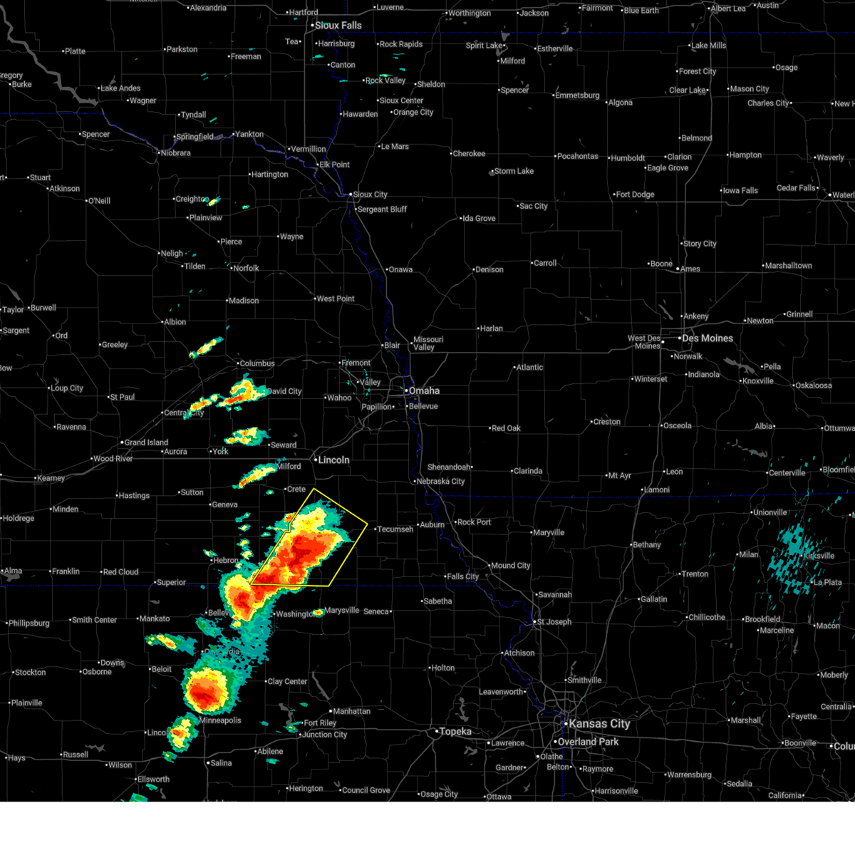
| 4/23/2026 4:16 PM CDT |
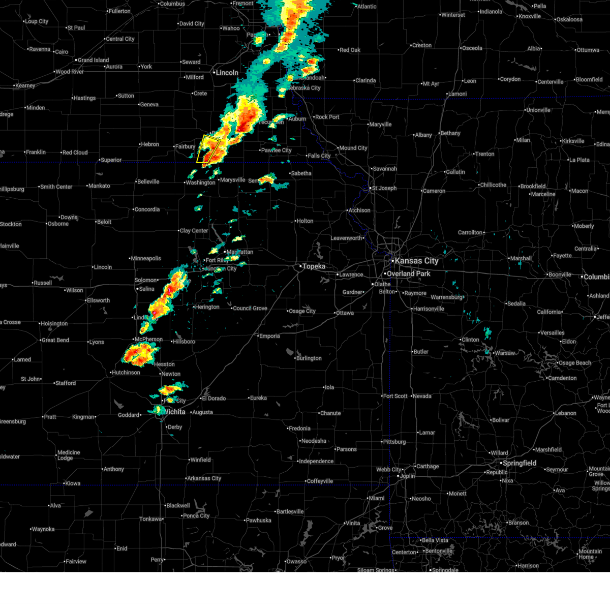 At 416 pm cdt, a severe thunderstorm was located 5 miles south of beatrice, moving northeast at 35 mph (radar indicated). Hazards include 60 mph wind gusts and quarter size hail. Hail damage to vehicles is expected. expect wind damage to roofs, siding, and trees. This severe thunderstorm will remain over mainly rural areas of southwestern gage county. At 416 pm cdt, a severe thunderstorm was located 5 miles south of beatrice, moving northeast at 35 mph (radar indicated). Hazards include 60 mph wind gusts and quarter size hail. Hail damage to vehicles is expected. expect wind damage to roofs, siding, and trees. This severe thunderstorm will remain over mainly rural areas of southwestern gage county.
|
| 4/23/2026 3:50 PM CDT |
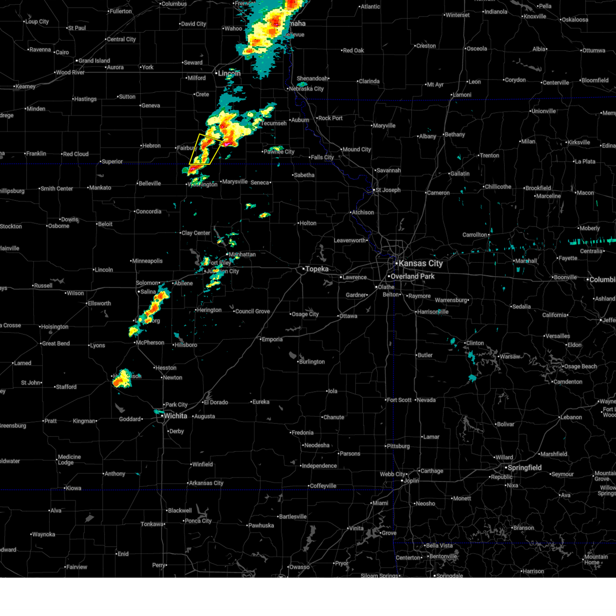 Svroax the national weather service in omaha has issued a * severe thunderstorm warning for, southeastern jefferson county in southeastern nebraska, southwestern gage county in southeastern nebraska, * until 430 pm cdt. * at 349 pm cdt, a severe thunderstorm was located 3 miles northeast of hollenberg, or 14 miles northeast of washington, moving northeast at 35 mph (radar indicated). Hazards include 60 mph wind gusts and quarter size hail. Hail damage to vehicles is expected. expect wind damage to roofs, siding, and trees. This severe thunderstorm will be near, diller around 355 pm cdt. Svroax the national weather service in omaha has issued a * severe thunderstorm warning for, southeastern jefferson county in southeastern nebraska, southwestern gage county in southeastern nebraska, * until 430 pm cdt. * at 349 pm cdt, a severe thunderstorm was located 3 miles northeast of hollenberg, or 14 miles northeast of washington, moving northeast at 35 mph (radar indicated). Hazards include 60 mph wind gusts and quarter size hail. Hail damage to vehicles is expected. expect wind damage to roofs, siding, and trees. This severe thunderstorm will be near, diller around 355 pm cdt.
|
| 4/23/2026 3:35 PM CDT | Ping Pong Ball sized hail reported 1.5 miles SW of Beatrice, NE |
| 4/23/2026 3:29 PM CDT |
 At 329 pm cdt, severe thunderstorms were located along a line extending from 4 miles south of firth to 3 miles southeast of pickrell to 6 miles northeast of diller, moving northeast at 30 mph (trained weather spotters. at 325 pm, ping pong ball sized hail was reported near ellis). Hazards include ping pong ball size hail and 60 mph wind gusts. People and animals outdoors will be injured. expect hail damage to roofs, siding, windows, and vehicles. expect wind damage to roofs, siding, and trees. Locations impacted include, beatrice, adams, cortland, pickrell, homestead national historical park, and ellis. At 329 pm cdt, severe thunderstorms were located along a line extending from 4 miles south of firth to 3 miles southeast of pickrell to 6 miles northeast of diller, moving northeast at 30 mph (trained weather spotters. at 325 pm, ping pong ball sized hail was reported near ellis). Hazards include ping pong ball size hail and 60 mph wind gusts. People and animals outdoors will be injured. expect hail damage to roofs, siding, windows, and vehicles. expect wind damage to roofs, siding, and trees. Locations impacted include, beatrice, adams, cortland, pickrell, homestead national historical park, and ellis.
|
| 4/23/2026 3:25 PM CDT | Ping Pong Ball sized hail reported 7.5 miles ENE of Beatrice, NE, trained spotter reported ping pong ball sized hail. |
| 4/23/2026 3:15 PM CDT |
 At 314 pm cdt, severe thunderstorms were located along a line extending from near cortland to 3 miles southwest of pickrell to near diller, moving northeast at 30 mph (radar indicated). Hazards include 60 mph wind gusts and quarter size hail. Hail damage to vehicles is expected. expect wind damage to roofs, siding, and trees. Locations impacted include, beatrice, cortland, diller and pickrell. At 314 pm cdt, severe thunderstorms were located along a line extending from near cortland to 3 miles southwest of pickrell to near diller, moving northeast at 30 mph (radar indicated). Hazards include 60 mph wind gusts and quarter size hail. Hail damage to vehicles is expected. expect wind damage to roofs, siding, and trees. Locations impacted include, beatrice, cortland, diller and pickrell.
|
| 4/23/2026 2:58 PM CDT |
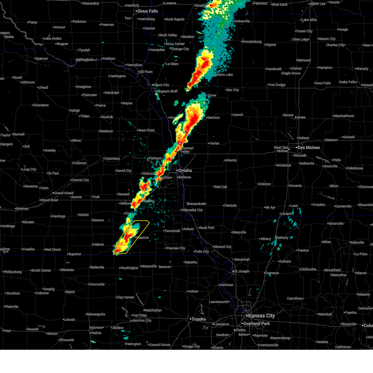 Svroax the national weather service in omaha has issued a * severe thunderstorm warning for, eastern jefferson county in southeastern nebraska, northern gage county in southeastern nebraska, * until 345 pm cdt. * at 257 pm cdt, severe thunderstorms were located along a line extending from 4 miles northwest of pickrell to 6 miles west of beatrice to 3 miles south of endicott, moving northeast at 30 mph (radar indicated. these storms have a history of producing golf ball sized hail). Hazards include ping pong ball size hail and 60 mph wind gusts. People and animals outdoors will be injured. expect hail damage to roofs, siding, windows, and vehicles. expect wind damage to roofs, siding, and trees. Severe thunderstorms will be near, beatrice, cortland, pickrell, and harbine around 305 pm cdt. Svroax the national weather service in omaha has issued a * severe thunderstorm warning for, eastern jefferson county in southeastern nebraska, northern gage county in southeastern nebraska, * until 345 pm cdt. * at 257 pm cdt, severe thunderstorms were located along a line extending from 4 miles northwest of pickrell to 6 miles west of beatrice to 3 miles south of endicott, moving northeast at 30 mph (radar indicated. these storms have a history of producing golf ball sized hail). Hazards include ping pong ball size hail and 60 mph wind gusts. People and animals outdoors will be injured. expect hail damage to roofs, siding, windows, and vehicles. expect wind damage to roofs, siding, and trees. Severe thunderstorms will be near, beatrice, cortland, pickrell, and harbine around 305 pm cdt.
|
| 4/23/2026 2:47 PM CDT |
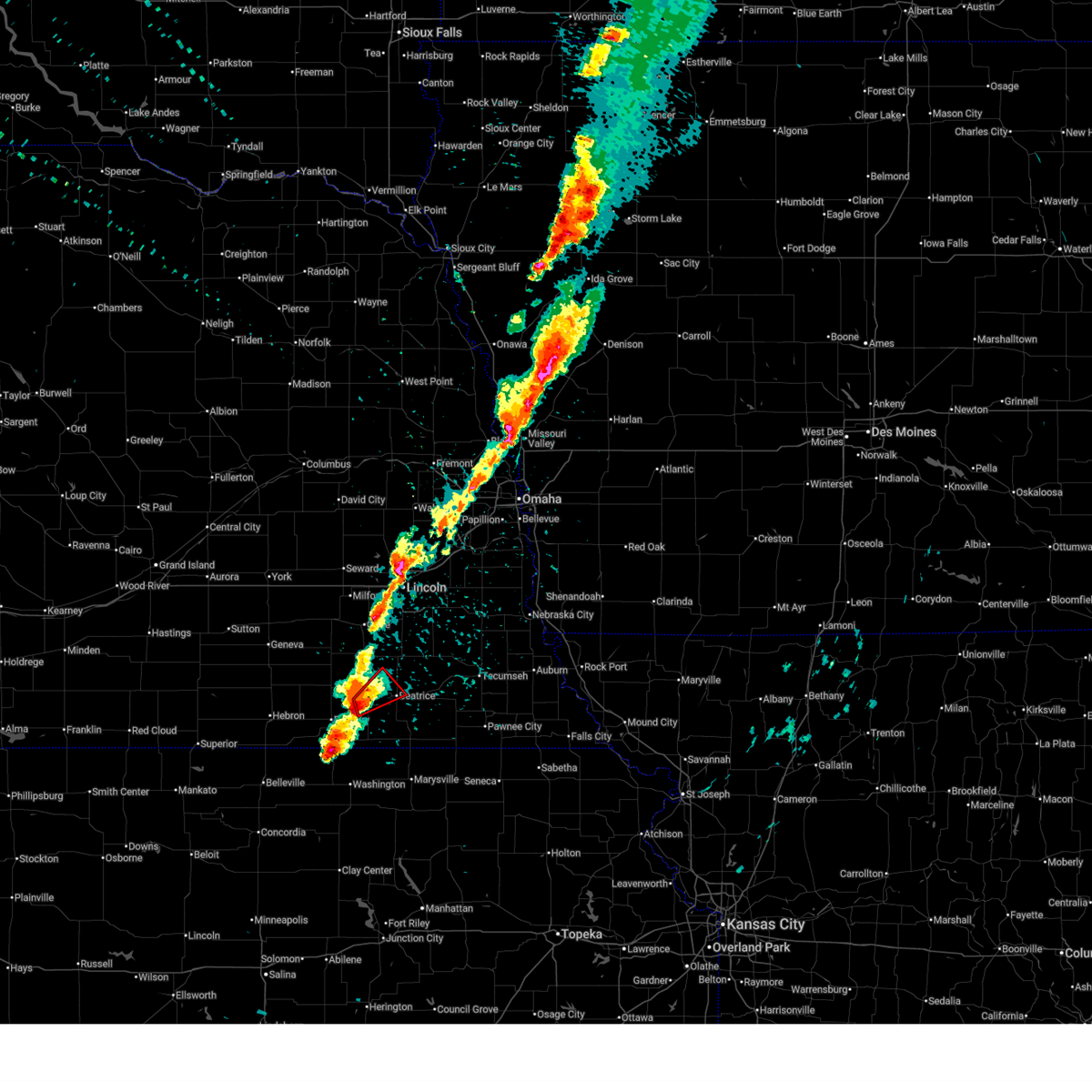 At 246 pm cdt, a severe thunderstorm capable of producing a tornado was located near harbine, or 11 miles west of beatrice, moving northeast at 30 mph (radar indicated rotation). Hazards include tornado and golf ball size hail. Flying debris will be dangerous to those caught without shelter. mobile homes will be damaged or destroyed. damage to roofs, windows, and vehicles will occur. tree damage is likely. Locations impacted include, beatrice. At 246 pm cdt, a severe thunderstorm capable of producing a tornado was located near harbine, or 11 miles west of beatrice, moving northeast at 30 mph (radar indicated rotation). Hazards include tornado and golf ball size hail. Flying debris will be dangerous to those caught without shelter. mobile homes will be damaged or destroyed. damage to roofs, windows, and vehicles will occur. tree damage is likely. Locations impacted include, beatrice.
|
| 4/23/2026 2:36 PM CDT |
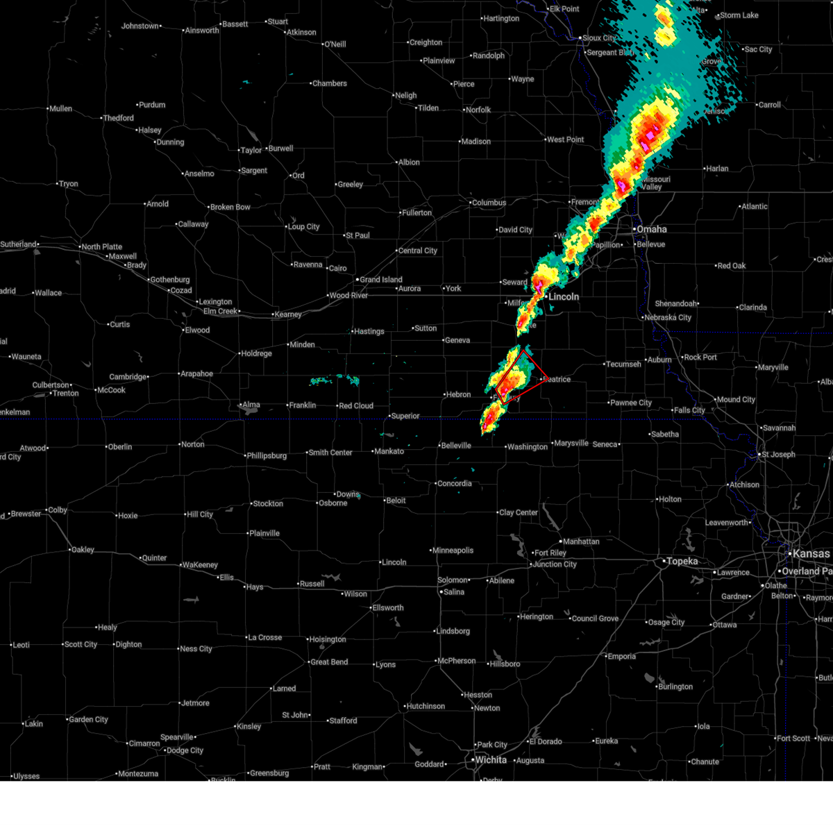 Toroax the national weather service in omaha has issued a * tornado warning for, northeastern jefferson county in southeastern nebraska, southeastern saline county in southeastern nebraska, west central gage county in southeastern nebraska, * until 315 pm cdt. * at 236 pm cdt, a severe thunderstorm capable of producing a tornado was located near harbine, or 8 miles northeast of fairbury, moving northeast at 35 mph (radar indicated rotation). Hazards include tornado and golf ball size hail. Flying debris will be dangerous to those caught without shelter. mobile homes will be damaged or destroyed. damage to roofs, windows, and vehicles will occur. tree damage is likely. this dangerous storm will be near, harbine around 240 pm cdt. Plymouth around 245 pm cdt. Toroax the national weather service in omaha has issued a * tornado warning for, northeastern jefferson county in southeastern nebraska, southeastern saline county in southeastern nebraska, west central gage county in southeastern nebraska, * until 315 pm cdt. * at 236 pm cdt, a severe thunderstorm capable of producing a tornado was located near harbine, or 8 miles northeast of fairbury, moving northeast at 35 mph (radar indicated rotation). Hazards include tornado and golf ball size hail. Flying debris will be dangerous to those caught without shelter. mobile homes will be damaged or destroyed. damage to roofs, windows, and vehicles will occur. tree damage is likely. this dangerous storm will be near, harbine around 240 pm cdt. Plymouth around 245 pm cdt.
|
| 4/23/2026 2:25 PM CDT |
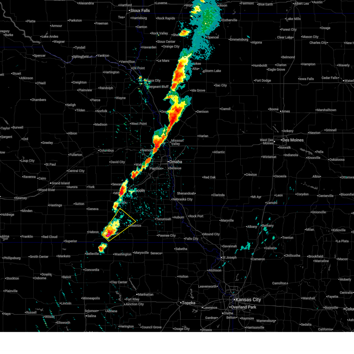 At 225 pm cdt, a severe thunderstorm was located 3 miles south of plymouth, or 12 miles northeast of fairbury, moving northeast at 45 mph (emergency management. at 224 pm golf ball sized hail was reported in fairbury). Hazards include two inch hail and 60 mph wind gusts. People and animals outdoors will be injured. expect hail damage to roofs, siding, windows, and vehicles. expect wind damage to roofs, siding, and trees. this severe storm will be near, plymouth around 230 pm cdt. Pickrell around 240 pm cdt. At 225 pm cdt, a severe thunderstorm was located 3 miles south of plymouth, or 12 miles northeast of fairbury, moving northeast at 45 mph (emergency management. at 224 pm golf ball sized hail was reported in fairbury). Hazards include two inch hail and 60 mph wind gusts. People and animals outdoors will be injured. expect hail damage to roofs, siding, windows, and vehicles. expect wind damage to roofs, siding, and trees. this severe storm will be near, plymouth around 230 pm cdt. Pickrell around 240 pm cdt.
|
| 4/23/2026 2:20 PM CDT |
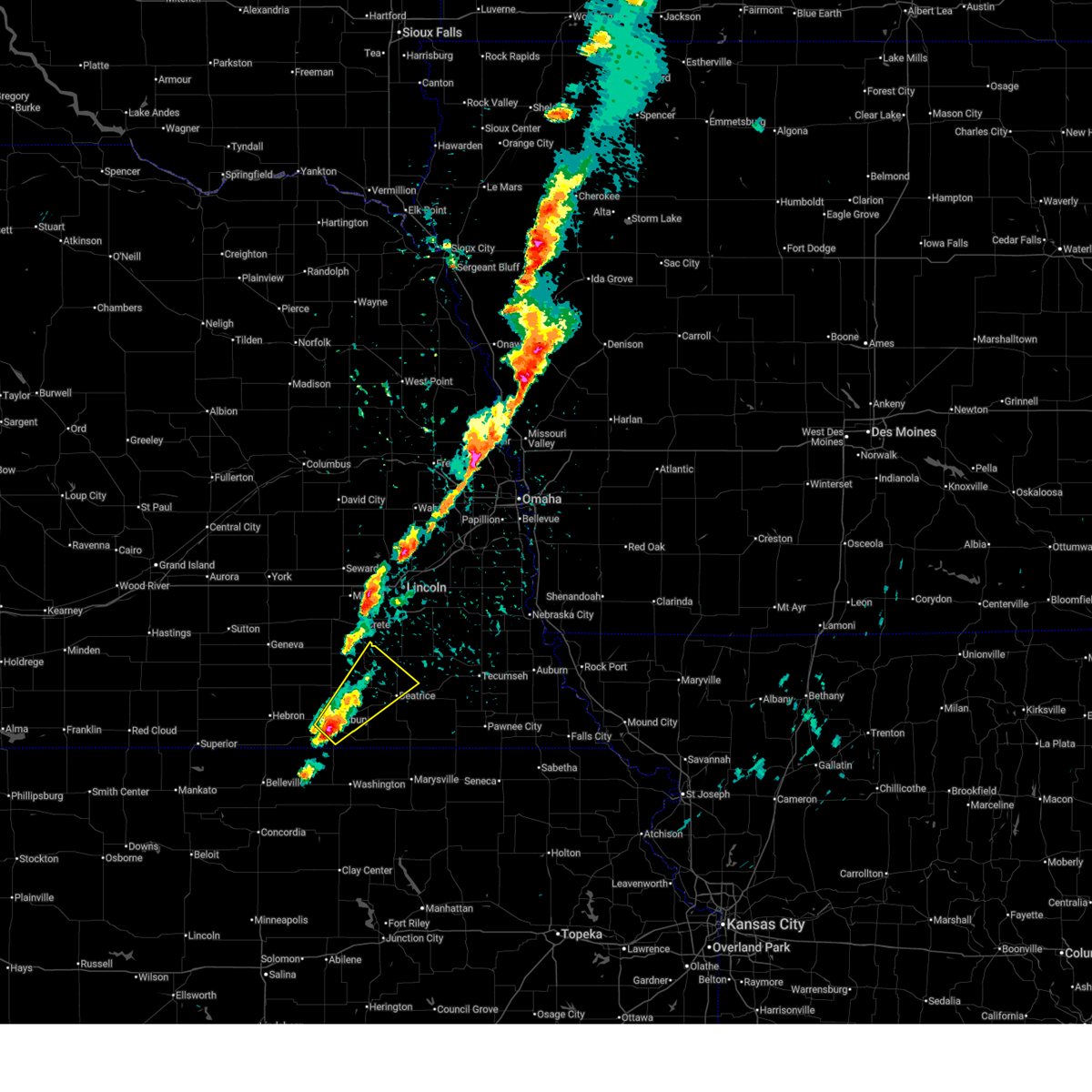 Svroax the national weather service in omaha has issued a * severe thunderstorm warning for, southeastern jefferson county in southeastern nebraska, southeastern saline county in southeastern nebraska, northwestern gage county in southeastern nebraska, * until 300 pm cdt. * at 219 pm cdt, a severe thunderstorm was located over jansen, or 7 miles northeast of fairbury, moving northeast at 45 mph (emergency management. at 218 pm, quarter sized hail was reported on the south edge of fairbury). Hazards include 60 mph wind gusts and quarter size hail. Hail damage to vehicles is expected. expect wind damage to roofs, siding, and trees. this severe thunderstorm will be near, plymouth and harbine around 225 pm cdt. Other locations in the path of this severe thunderstorm include pickrell. Svroax the national weather service in omaha has issued a * severe thunderstorm warning for, southeastern jefferson county in southeastern nebraska, southeastern saline county in southeastern nebraska, northwestern gage county in southeastern nebraska, * until 300 pm cdt. * at 219 pm cdt, a severe thunderstorm was located over jansen, or 7 miles northeast of fairbury, moving northeast at 45 mph (emergency management. at 218 pm, quarter sized hail was reported on the south edge of fairbury). Hazards include 60 mph wind gusts and quarter size hail. Hail damage to vehicles is expected. expect wind damage to roofs, siding, and trees. this severe thunderstorm will be near, plymouth and harbine around 225 pm cdt. Other locations in the path of this severe thunderstorm include pickrell.
|
| 4/15/2026 12:00 AM CDT |
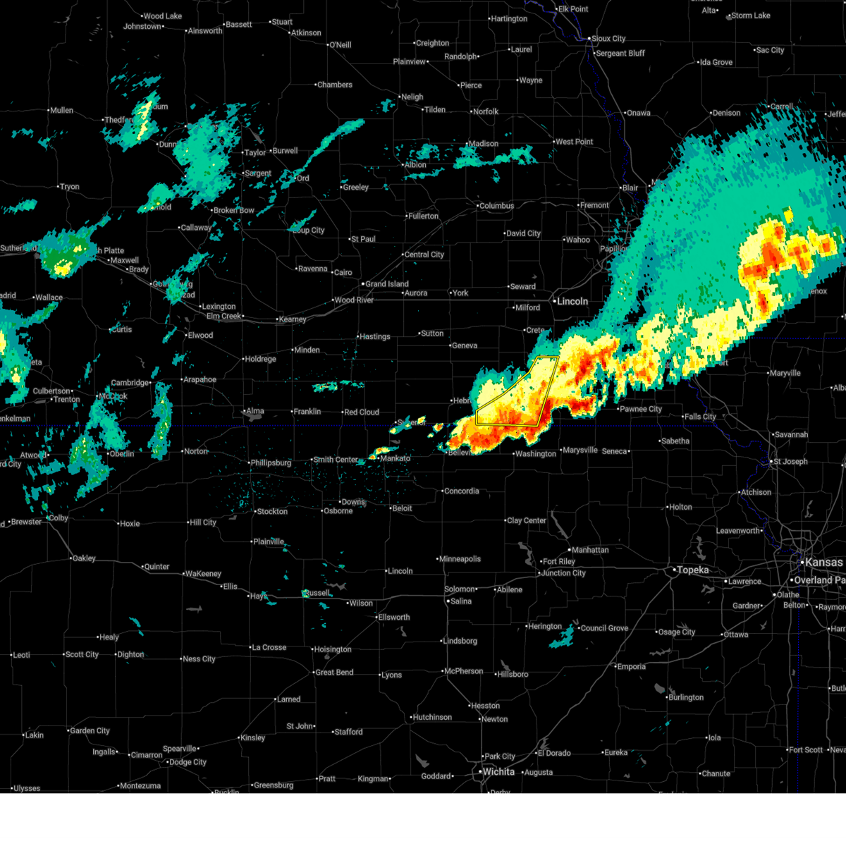 The storms which prompted the warning have weakened below severe limits, and no longer pose an immediate threat to life or property. therefore, the warning has been allowed to expire. however, small hail, gusty winds and heavy rain are still possible with these thunderstorms. a severe thunderstorm watch remains in effect until 200 am cdt for southeastern nebraska. The storms which prompted the warning have weakened below severe limits, and no longer pose an immediate threat to life or property. therefore, the warning has been allowed to expire. however, small hail, gusty winds and heavy rain are still possible with these thunderstorms. a severe thunderstorm watch remains in effect until 200 am cdt for southeastern nebraska.
|
| 4/14/2026 11:50 PM CDT |
 At 1146 pm cdt, severe thunderstorms were located along a line extending from 2 miles north of reynolds to 2 miles west of odell to 4 miles southwest of barneston, moving northeast at 35 mph (radar indicated). Hazards include 60 mph wind gusts and quarter size hail. Hail damage to vehicles is expected. expect wind damage to roofs, siding, and trees. Locations impacted include, fairbury, diller, endicott, jansen, harbine, beatrice and plymouth. At 1146 pm cdt, severe thunderstorms were located along a line extending from 2 miles north of reynolds to 2 miles west of odell to 4 miles southwest of barneston, moving northeast at 35 mph (radar indicated). Hazards include 60 mph wind gusts and quarter size hail. Hail damage to vehicles is expected. expect wind damage to roofs, siding, and trees. Locations impacted include, fairbury, diller, endicott, jansen, harbine, beatrice and plymouth.
|
| 4/14/2026 11:50 PM CDT |
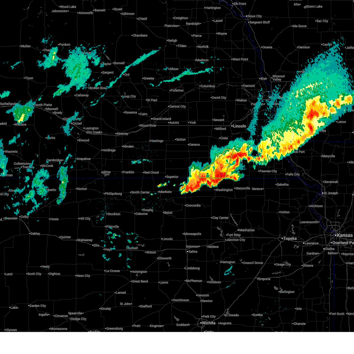 the severe thunderstorm warning has been cancelled and is no longer in effect the severe thunderstorm warning has been cancelled and is no longer in effect
|
| 4/14/2026 11:09 PM CDT |
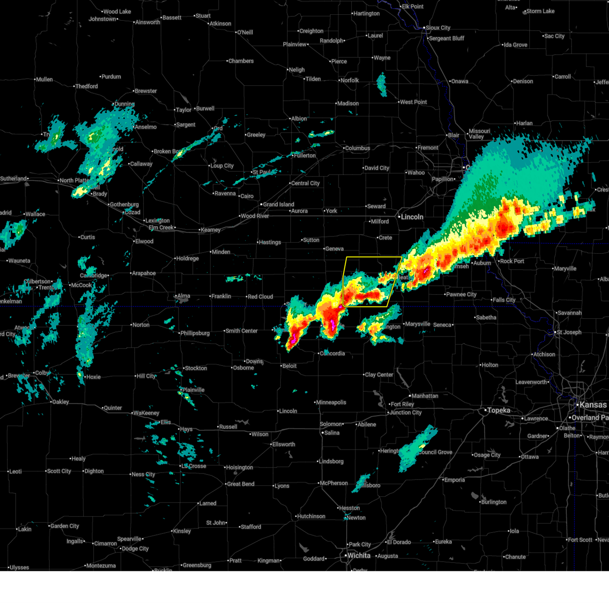 Svroax the national weather service in omaha has issued a * severe thunderstorm warning for, jefferson county in southeastern nebraska, southern saline county in southeastern nebraska, western gage county in southeastern nebraska, * until midnight cdt. * at 1108 pm cdt, severe thunderstorms were located along a line extending from 4 miles southeast of alexandria to near jansen to 4 miles southeast of harbine, moving northeast at 50 mph (weather instrument measurement. at 10:48 pm, a public mesonet site in southwest of mahaska gusted to 58 mph). Hazards include 60 mph wind gusts and quarter size hail. Hail damage to vehicles is expected. expect wind damage to roofs, siding, and trees. severe thunderstorms will be near, beatrice, plymouth, and daykin around 1115 pm cdt. De witt, western, pickrell, and swanton around 1125 pm cdt. Svroax the national weather service in omaha has issued a * severe thunderstorm warning for, jefferson county in southeastern nebraska, southern saline county in southeastern nebraska, western gage county in southeastern nebraska, * until midnight cdt. * at 1108 pm cdt, severe thunderstorms were located along a line extending from 4 miles southeast of alexandria to near jansen to 4 miles southeast of harbine, moving northeast at 50 mph (weather instrument measurement. at 10:48 pm, a public mesonet site in southwest of mahaska gusted to 58 mph). Hazards include 60 mph wind gusts and quarter size hail. Hail damage to vehicles is expected. expect wind damage to roofs, siding, and trees. severe thunderstorms will be near, beatrice, plymouth, and daykin around 1115 pm cdt. De witt, western, pickrell, and swanton around 1125 pm cdt.
|
| 4/14/2026 10:17 PM CDT | Quarter sized hail reported 0.8 miles NW of Beatrice, NE, spotter reported quarter-sized hail in beatrice... time estimated from radar. |
| 4/14/2026 10:11 PM CDT |
 the severe thunderstorm warning has been cancelled and is no longer in effect the severe thunderstorm warning has been cancelled and is no longer in effect
|
| 4/14/2026 10:11 PM CDT |
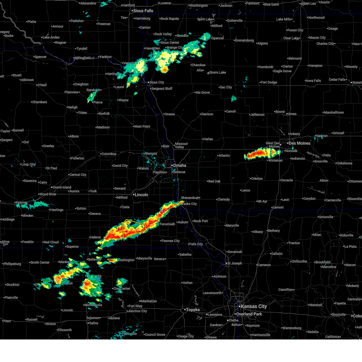 At 1011 pm cdt, a severe thunderstorm was located 4 miles southwest of beatrice, moving northeast at 45 mph (radar indicated). Hazards include 60 mph wind gusts and quarter size hail. Hail damage to vehicles is expected. expect wind damage to roofs, siding, and trees. this severe storm will be near, beatrice around 1015 pm cdt. Pickrell around 1020 pm cdt. At 1011 pm cdt, a severe thunderstorm was located 4 miles southwest of beatrice, moving northeast at 45 mph (radar indicated). Hazards include 60 mph wind gusts and quarter size hail. Hail damage to vehicles is expected. expect wind damage to roofs, siding, and trees. this severe storm will be near, beatrice around 1015 pm cdt. Pickrell around 1020 pm cdt.
|
| 4/14/2026 10:01 PM CDT |
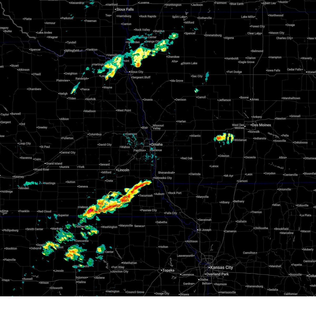 At 1000 pm cdt, a severe thunderstorm was located 6 miles southwest of beatrice, moving northeast at 50 mph (radar indicated). Hazards include 60 mph wind gusts and quarter size hail. Hail damage to vehicles is expected. expect wind damage to roofs, siding, and trees. Locations impacted include, beatrice. At 1000 pm cdt, a severe thunderstorm was located 6 miles southwest of beatrice, moving northeast at 50 mph (radar indicated). Hazards include 60 mph wind gusts and quarter size hail. Hail damage to vehicles is expected. expect wind damage to roofs, siding, and trees. Locations impacted include, beatrice.
|
| 4/14/2026 9:41 PM CDT |
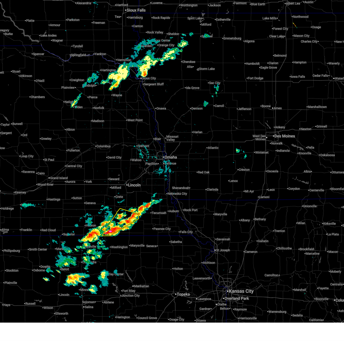 Svroax the national weather service in omaha has issued a * severe thunderstorm warning for, eastern jefferson county in southeastern nebraska, central gage county in southeastern nebraska, * until 1030 pm cdt. * at 941 pm cdt, a severe thunderstorm was located over endicott, or 7 miles southeast of fairbury, moving northeast at 50 mph (radar indicated). Hazards include 60 mph wind gusts and quarter size hail. Hail damage to vehicles is expected. expect wind damage to roofs, siding, and trees. this severe thunderstorm will be near, diller and steele city around 945 pm cdt. harbine around 950 pm cdt. Beatrice around 1000 pm cdt. Svroax the national weather service in omaha has issued a * severe thunderstorm warning for, eastern jefferson county in southeastern nebraska, central gage county in southeastern nebraska, * until 1030 pm cdt. * at 941 pm cdt, a severe thunderstorm was located over endicott, or 7 miles southeast of fairbury, moving northeast at 50 mph (radar indicated). Hazards include 60 mph wind gusts and quarter size hail. Hail damage to vehicles is expected. expect wind damage to roofs, siding, and trees. this severe thunderstorm will be near, diller and steele city around 945 pm cdt. harbine around 950 pm cdt. Beatrice around 1000 pm cdt.
|
| 4/11/2026 6:44 PM CDT |
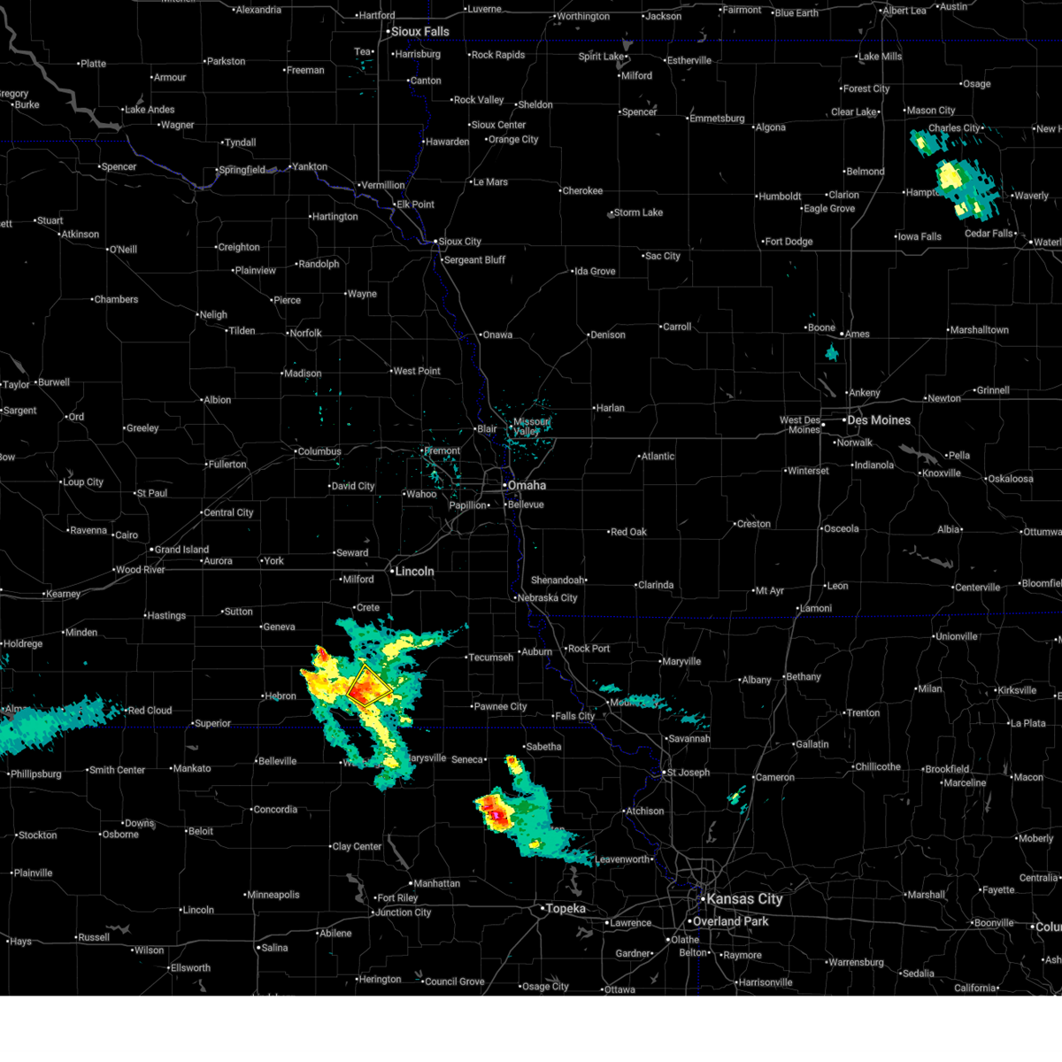 At 644 pm cdt, a severe thunderstorm was located 5 miles northeast of harbine, or 7 miles west of beatrice, moving northeast at 30 mph (radar indicated). Hazards include 60 mph wind gusts and quarter size hail. Hail damage to vehicles is expected. expect wind damage to roofs, siding, and trees. Locations impacted include, harbine, ellis, and homestead national historical park. At 644 pm cdt, a severe thunderstorm was located 5 miles northeast of harbine, or 7 miles west of beatrice, moving northeast at 30 mph (radar indicated). Hazards include 60 mph wind gusts and quarter size hail. Hail damage to vehicles is expected. expect wind damage to roofs, siding, and trees. Locations impacted include, harbine, ellis, and homestead national historical park.
|
| 4/11/2026 6:33 PM CDT |
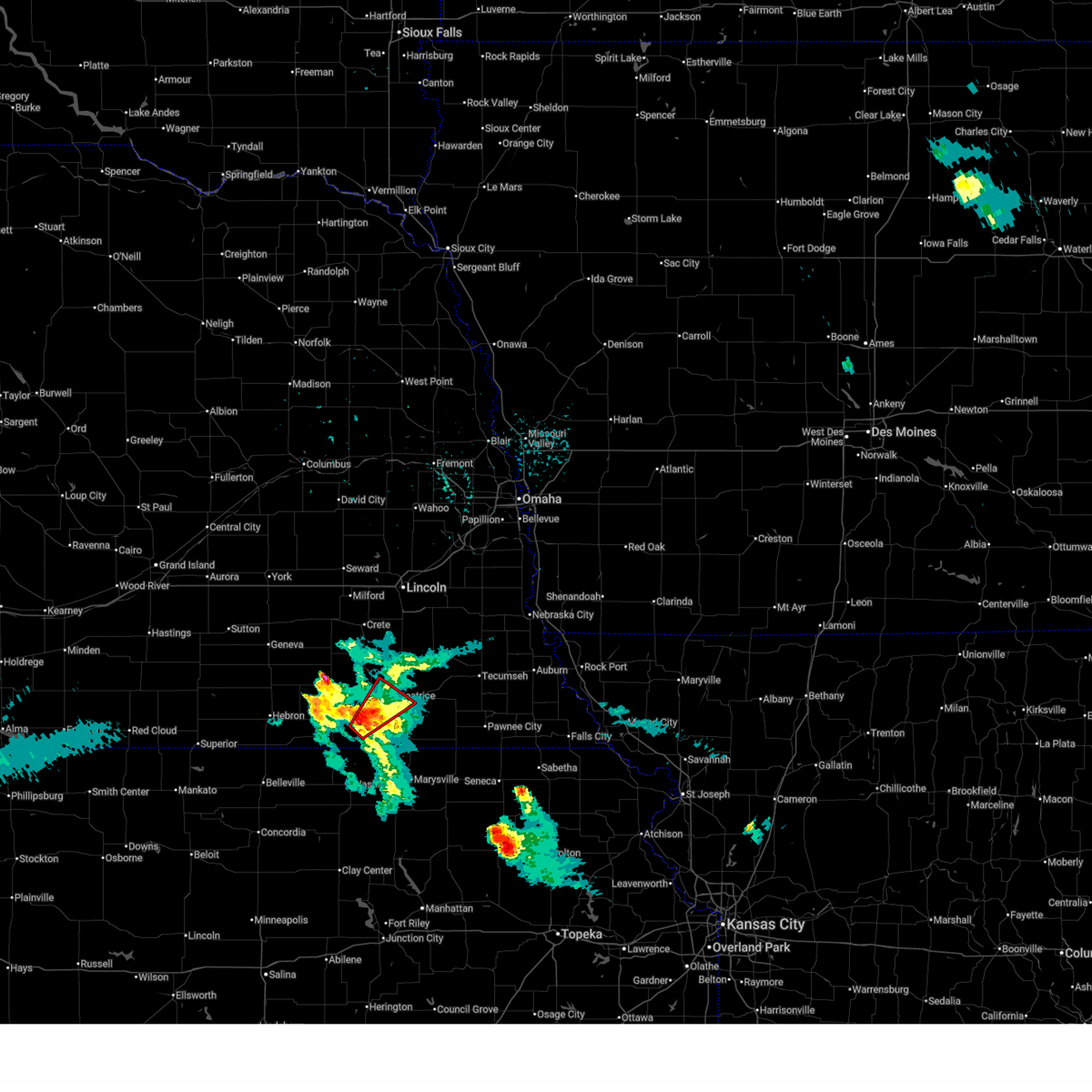 Toroax the national weather service in omaha has issued a * tornado warning for, east central jefferson county in southeastern nebraska, west central gage county in southeastern nebraska, * until 715 pm cdt. * at 633 pm cdt, a severe thunderstorm capable of producing a tornado was located over diller, or 11 miles east of fairbury, moving northeast at 25 mph (radar indicated rotation). Hazards include tornado and quarter size hail. Flying debris will be dangerous to those caught without shelter. mobile homes will be damaged or destroyed. damage to roofs, windows, and vehicles will occur. tree damage is likely. this dangerous storm will be near, harbine around 640 pm cdt. Other locations in the path of this tornadic thunderstorm include beatrice. Toroax the national weather service in omaha has issued a * tornado warning for, east central jefferson county in southeastern nebraska, west central gage county in southeastern nebraska, * until 715 pm cdt. * at 633 pm cdt, a severe thunderstorm capable of producing a tornado was located over diller, or 11 miles east of fairbury, moving northeast at 25 mph (radar indicated rotation). Hazards include tornado and quarter size hail. Flying debris will be dangerous to those caught without shelter. mobile homes will be damaged or destroyed. damage to roofs, windows, and vehicles will occur. tree damage is likely. this dangerous storm will be near, harbine around 640 pm cdt. Other locations in the path of this tornadic thunderstorm include beatrice.
|
| 4/11/2026 6:28 PM CDT |
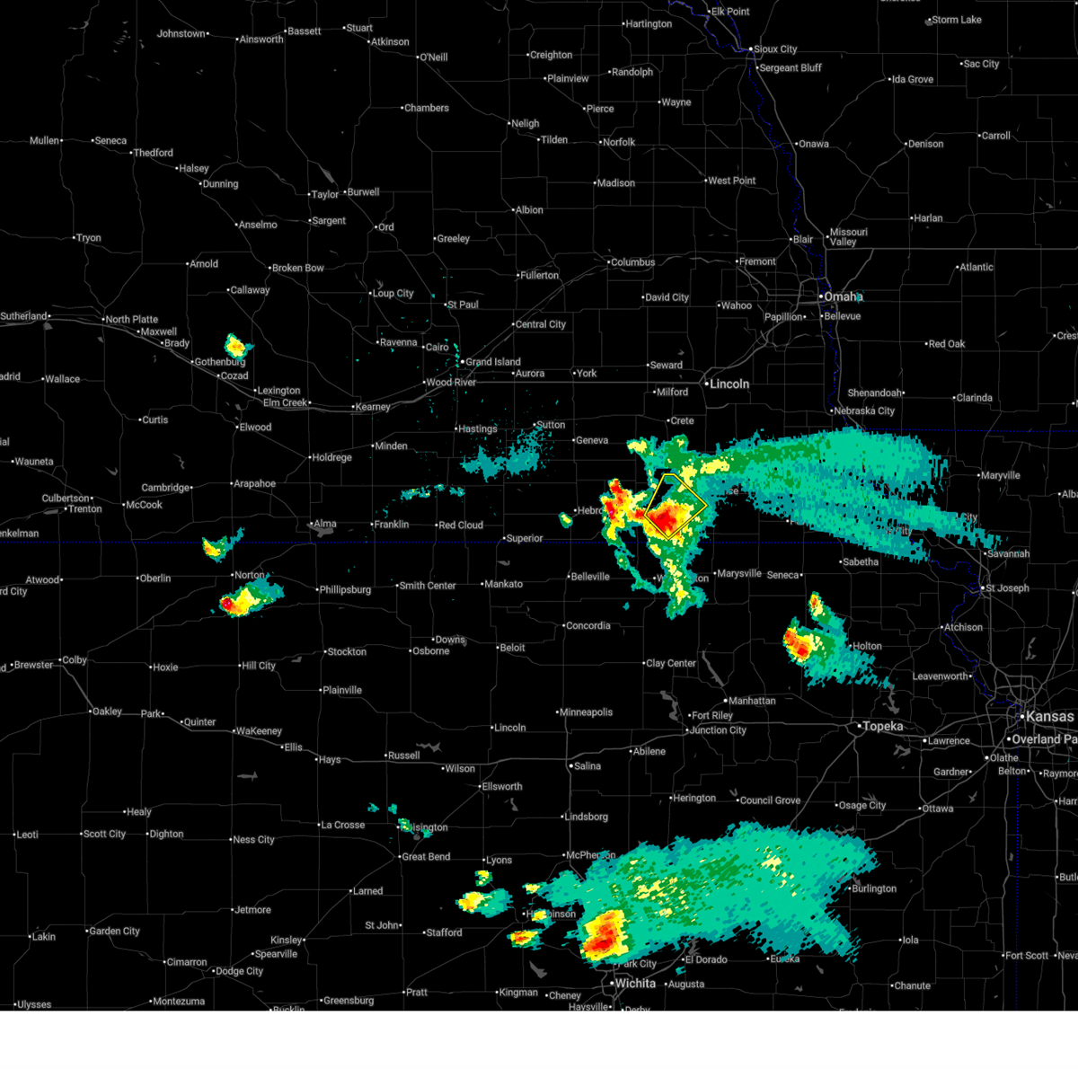 At 627 pm cdt, a severe thunderstorm was located 3 miles northwest of diller, or 10 miles east of fairbury, moving northeast at 25 mph (radar indicated). Hazards include 60 mph wind gusts and quarter size hail. Hail damage to vehicles is expected. expect wind damage to roofs, siding, and trees. Locations impacted include, harbine. At 627 pm cdt, a severe thunderstorm was located 3 miles northwest of diller, or 10 miles east of fairbury, moving northeast at 25 mph (radar indicated). Hazards include 60 mph wind gusts and quarter size hail. Hail damage to vehicles is expected. expect wind damage to roofs, siding, and trees. Locations impacted include, harbine.
|
| 4/11/2026 6:10 PM CDT |
 Svroax the national weather service in omaha has issued a * severe thunderstorm warning for, eastern jefferson county in southeastern nebraska, southwestern gage county in southeastern nebraska, * until 700 pm cdt. * at 610 pm cdt, a severe thunderstorm was located over endicott, or 6 miles southeast of fairbury, moving northeast at 30 mph (radar indicated). Hazards include 60 mph wind gusts and half dollar size hail. Hail damage to vehicles is expected. expect wind damage to roofs, siding, and trees. This severe thunderstorm will be near, harbine around 620 pm cdt. Svroax the national weather service in omaha has issued a * severe thunderstorm warning for, eastern jefferson county in southeastern nebraska, southwestern gage county in southeastern nebraska, * until 700 pm cdt. * at 610 pm cdt, a severe thunderstorm was located over endicott, or 6 miles southeast of fairbury, moving northeast at 30 mph (radar indicated). Hazards include 60 mph wind gusts and half dollar size hail. Hail damage to vehicles is expected. expect wind damage to roofs, siding, and trees. This severe thunderstorm will be near, harbine around 620 pm cdt.
|
| 3/6/2026 7:21 PM CST |
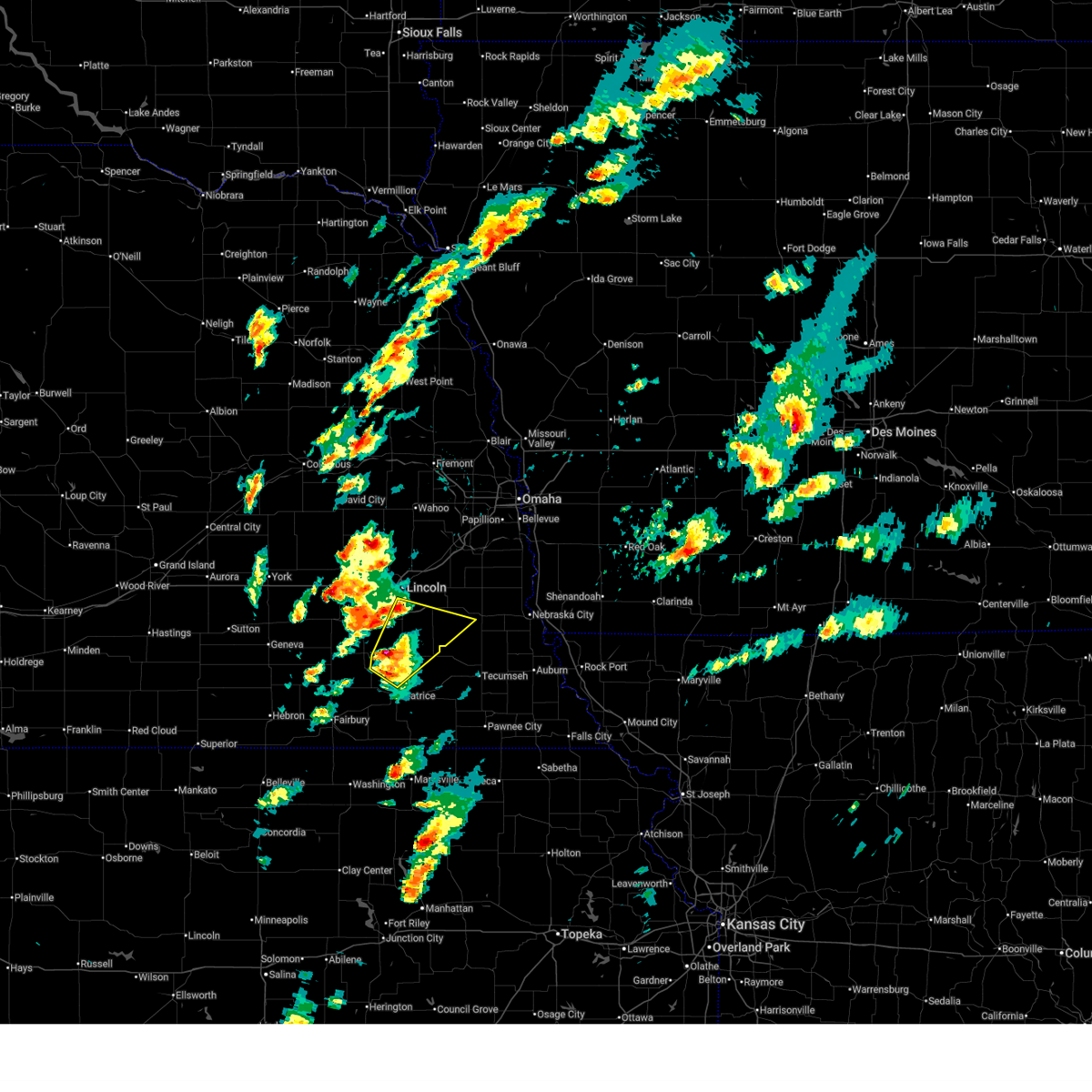 the severe thunderstorm warning has been cancelled and is no longer in effect the severe thunderstorm warning has been cancelled and is no longer in effect
|
| 3/6/2026 7:21 PM CST |
 At 721 pm cst, a severe thunderstorm was located over cortland, or 15 miles north of beatrice, moving northeast at 55 mph (law enforcement report of half dollar sized hail east of fairbury, ne). Hazards include half dollar size hail. Damage to vehicles is expected. this severe storm will be near, hickman, firth, and cortland around 725 pm cst. roca around 730 pm cst. Other locations in the path of this severe thunderstorm include bennet. At 721 pm cst, a severe thunderstorm was located over cortland, or 15 miles north of beatrice, moving northeast at 55 mph (law enforcement report of half dollar sized hail east of fairbury, ne). Hazards include half dollar size hail. Damage to vehicles is expected. this severe storm will be near, hickman, firth, and cortland around 725 pm cst. roca around 730 pm cst. Other locations in the path of this severe thunderstorm include bennet.
|
| 3/6/2026 7:12 PM CST |
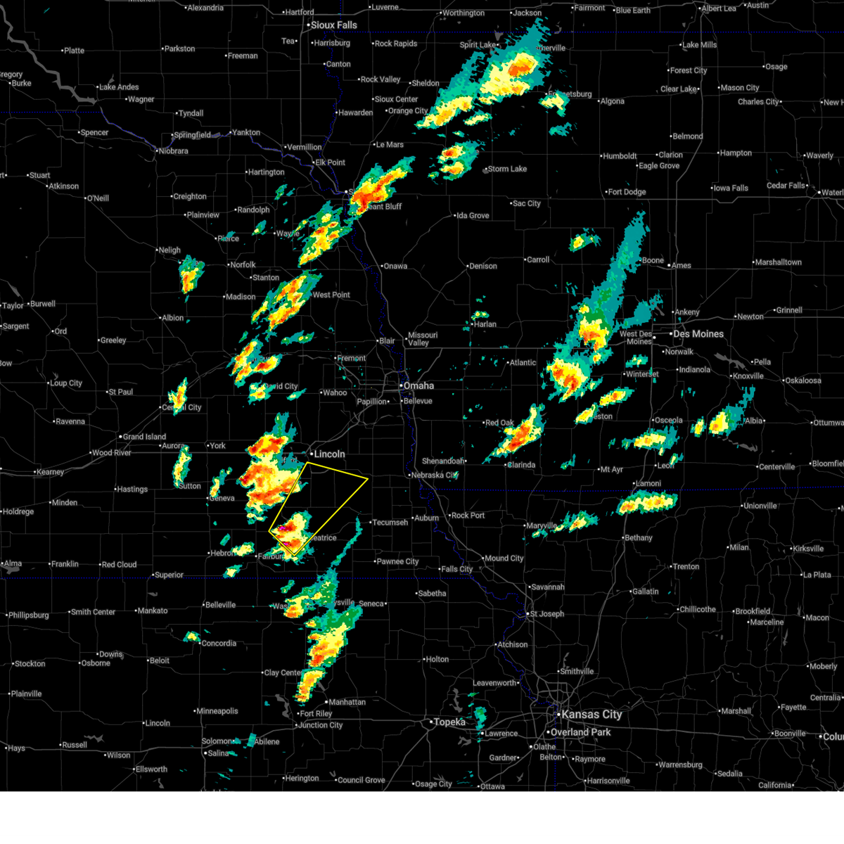 Svroax the national weather service in omaha has issued a * severe thunderstorm warning for, southern lancaster county in southeastern nebraska, northwestern johnson county in southeastern nebraska, northeastern jefferson county in southeastern nebraska, southwestern otoe county in southeastern nebraska, southeastern saline county in southeastern nebraska, northern gage county in southeastern nebraska, * until 745 pm cst. * at 711 pm cst, a severe thunderstorm was located 4 miles west of pickrell, or 8 miles northwest of beatrice, moving northeast at 55 mph (law enforcement reported half dollar sized hail east of fairbury at 6:55 pm). Hazards include half dollar size hail. Damage to vehicles is expected. this severe thunderstorm will be near, pickrell around 715 pm cst. cortland around 720 pm cst. firth around 725 pm cst. hickman and roca around 730 pm cst. Other locations in the path of this severe thunderstorm include bennet. Svroax the national weather service in omaha has issued a * severe thunderstorm warning for, southern lancaster county in southeastern nebraska, northwestern johnson county in southeastern nebraska, northeastern jefferson county in southeastern nebraska, southwestern otoe county in southeastern nebraska, southeastern saline county in southeastern nebraska, northern gage county in southeastern nebraska, * until 745 pm cst. * at 711 pm cst, a severe thunderstorm was located 4 miles west of pickrell, or 8 miles northwest of beatrice, moving northeast at 55 mph (law enforcement reported half dollar sized hail east of fairbury at 6:55 pm). Hazards include half dollar size hail. Damage to vehicles is expected. this severe thunderstorm will be near, pickrell around 715 pm cst. cortland around 720 pm cst. firth around 725 pm cst. hickman and roca around 730 pm cst. Other locations in the path of this severe thunderstorm include bennet.
|
| 9/9/2025 3:52 AM CDT | the severe thunderstorm warning has been cancelled and is no longer in effect |
| 9/9/2025 3:36 AM CDT | Svroax the national weather service in omaha has issued a * severe thunderstorm warning for, southeastern gage county in southeastern nebraska, * until 415 am cdt. * at 335 am cdt, a severe thunderstorm was located over holmesville, or 6 miles southeast of beatrice, moving northeast at 15 mph (radar indicated). Hazards include quarter size hail. Damage to vehicles is expected. this severe thunderstorm will be near, filley around 350 am cdt. Other locations in the path of this severe thunderstorm include virginia. |
| 8/10/2025 2:28 AM CDT |
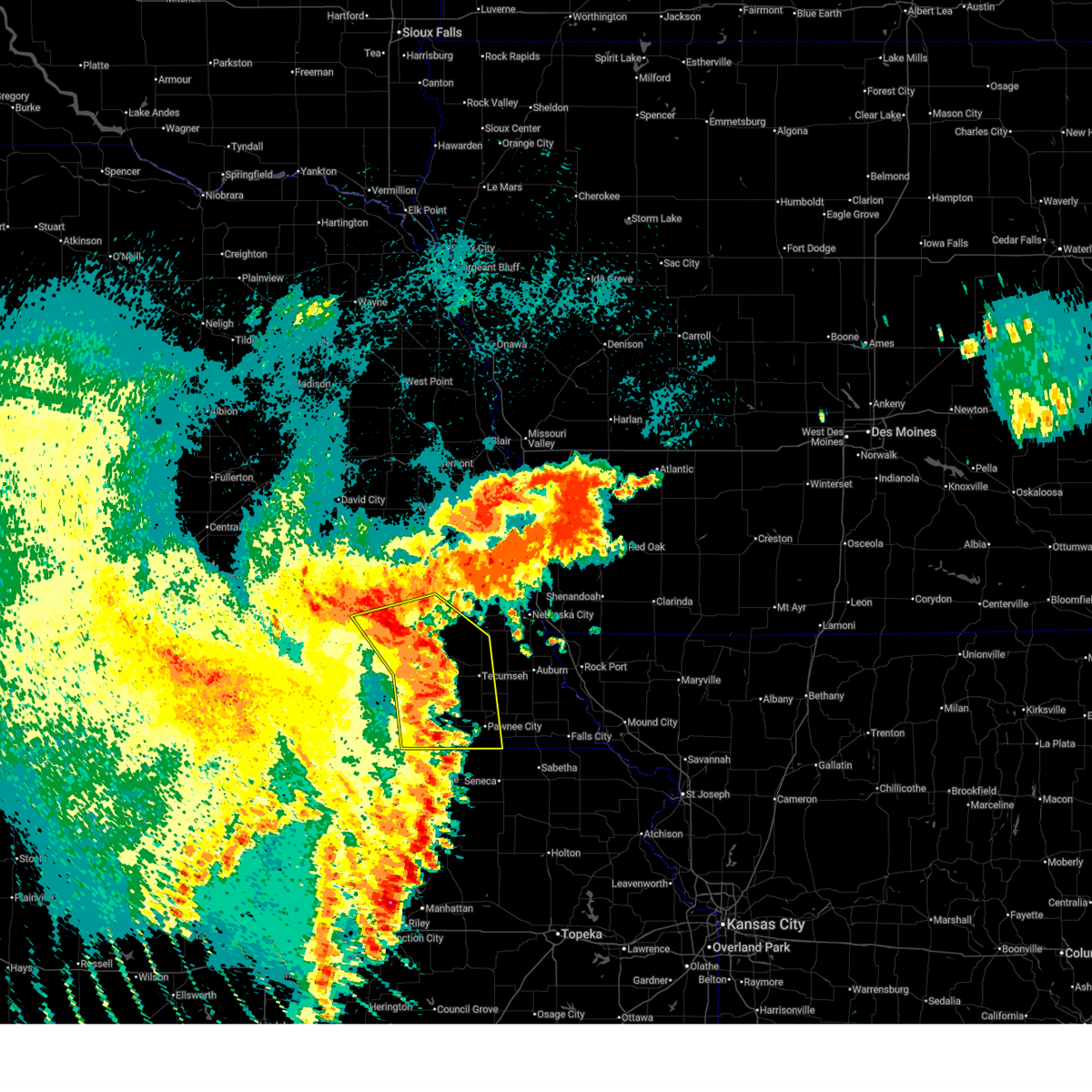 the severe thunderstorm warning has been cancelled and is no longer in effect the severe thunderstorm warning has been cancelled and is no longer in effect
|
| 8/10/2025 2:28 AM CDT |
 At 228 am cdt, severe thunderstorms were located along a line extending from 2 miles northwest of sprague to 2 miles east of adams to 3 miles southwest of summerfield, moving east at 50 mph (radar indicated). Hazards include 60 mph wind gusts. Expect damage to roofs, siding, and trees. Locations impacted include, southeastern lincoln, beatrice, tecumseh, pawnee city, crete, hickman, wymore, bennet, firth, adams, palmyra, cortland, sterling, blue springs, cook, table rock, panama, clatonia, roca, and hallam. At 228 am cdt, severe thunderstorms were located along a line extending from 2 miles northwest of sprague to 2 miles east of adams to 3 miles southwest of summerfield, moving east at 50 mph (radar indicated). Hazards include 60 mph wind gusts. Expect damage to roofs, siding, and trees. Locations impacted include, southeastern lincoln, beatrice, tecumseh, pawnee city, crete, hickman, wymore, bennet, firth, adams, palmyra, cortland, sterling, blue springs, cook, table rock, panama, clatonia, roca, and hallam.
|
| 8/10/2025 2:16 AM CDT |
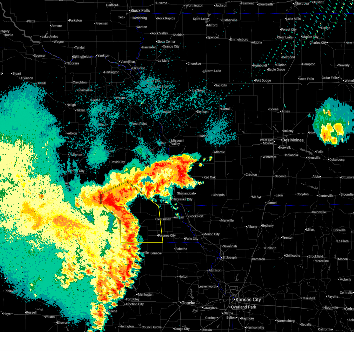 At 216 am cdt, severe thunderstorms were located along a line extending from 2 miles southeast of crete to 4 miles southwest of adams to 4 miles southeast of oketo, moving east at 50 mph (radar indicated). Hazards include 70 mph wind gusts. Expect considerable tree damage. damage is likely to mobile homes, roofs, and outbuildings. Locations impacted include, lincoln, beatrice, tecumseh, pawnee city, crete, milford, wilber, hickman, wymore, friend, bennet, firth, dorchester, adams, palmyra, de witt, cortland, sterling, beaver crossing, and malcolm. At 216 am cdt, severe thunderstorms were located along a line extending from 2 miles southeast of crete to 4 miles southwest of adams to 4 miles southeast of oketo, moving east at 50 mph (radar indicated). Hazards include 70 mph wind gusts. Expect considerable tree damage. damage is likely to mobile homes, roofs, and outbuildings. Locations impacted include, lincoln, beatrice, tecumseh, pawnee city, crete, milford, wilber, hickman, wymore, friend, bennet, firth, dorchester, adams, palmyra, de witt, cortland, sterling, beaver crossing, and malcolm.
|
| 8/10/2025 2:16 AM CDT |
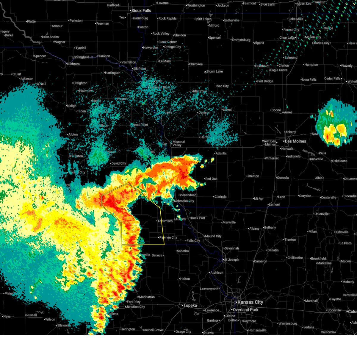 the severe thunderstorm warning has been cancelled and is no longer in effect the severe thunderstorm warning has been cancelled and is no longer in effect
|
| 8/10/2025 2:05 AM CDT |
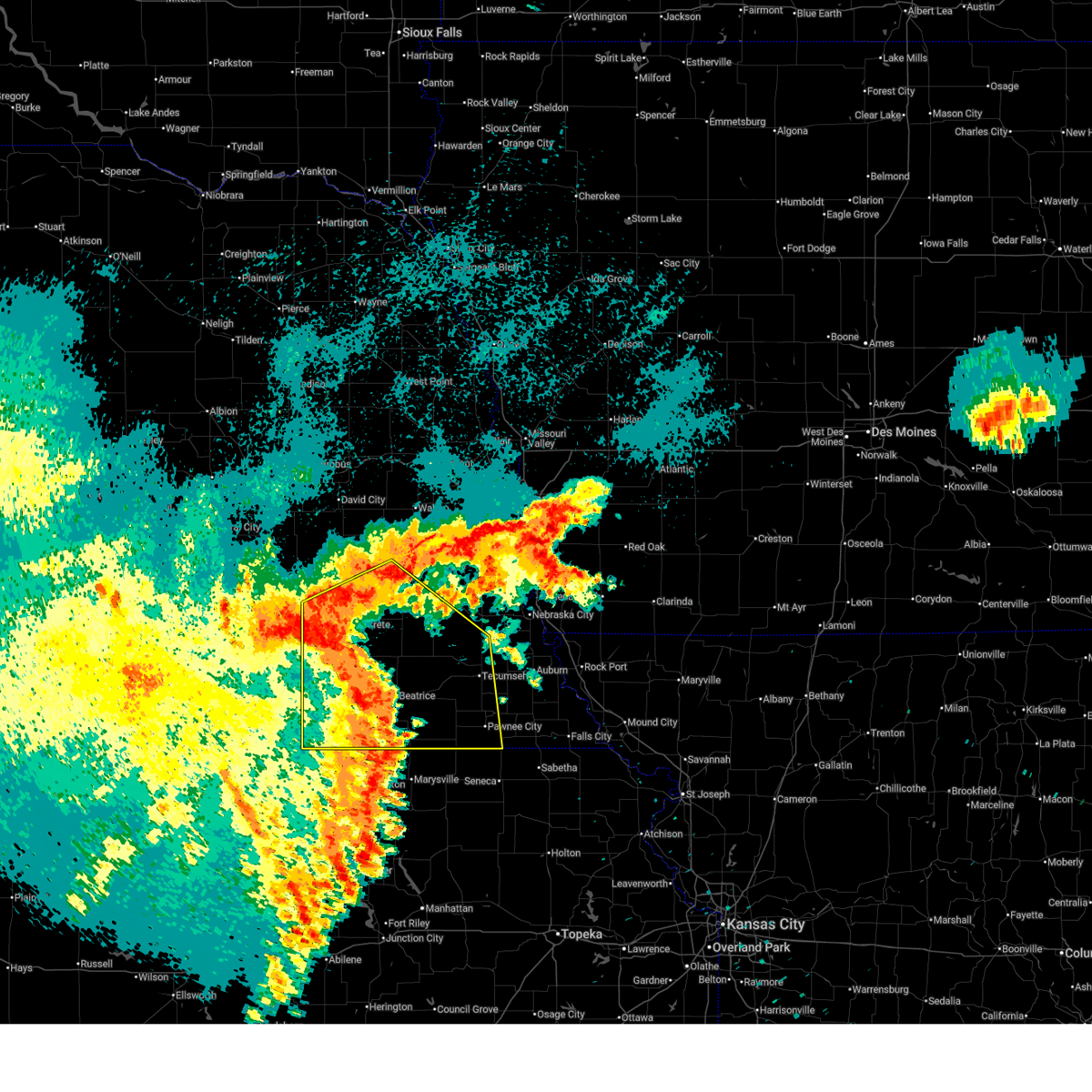 At 205 am cdt, severe thunderstorms were located along a line extending from 3 miles southwest of crete to 2 miles northeast of pickrell to 3 miles southwest of oketo, moving east at 50 mph (radar indicated). Hazards include 60 mph wind gusts. Expect damage to roofs, siding, and trees. Locations impacted include, crete, adams, cortland, hallam, filley, barneston, liberty, virginia, firth, sprague, lewiston, crab orchard, hickman, sterling, panama, roca, summerfield, burchard, southeastern lincoln, tecumseh, pawnee city, bennet, douglas, palmyra, cook, table rock, elk creek and du bois. At 205 am cdt, severe thunderstorms were located along a line extending from 3 miles southwest of crete to 2 miles northeast of pickrell to 3 miles southwest of oketo, moving east at 50 mph (radar indicated). Hazards include 60 mph wind gusts. Expect damage to roofs, siding, and trees. Locations impacted include, crete, adams, cortland, hallam, filley, barneston, liberty, virginia, firth, sprague, lewiston, crab orchard, hickman, sterling, panama, roca, summerfield, burchard, southeastern lincoln, tecumseh, pawnee city, bennet, douglas, palmyra, cook, table rock, elk creek and du bois.
|
| 8/10/2025 1:43 AM CDT |
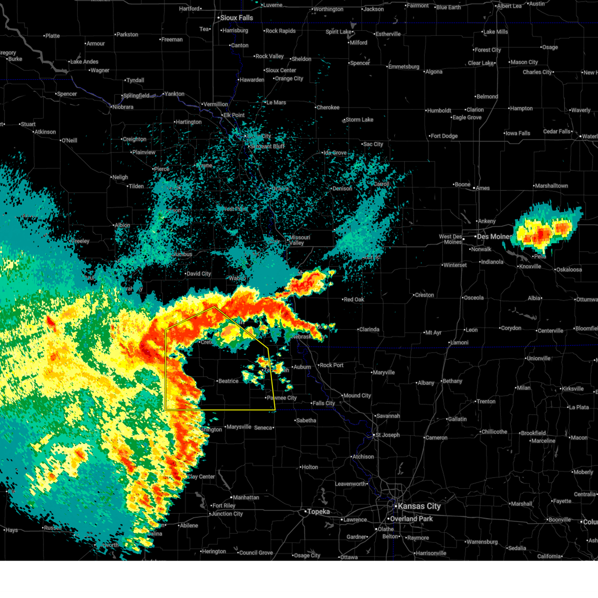 Svroax the national weather service in omaha has issued a * severe thunderstorm warning for, lancaster county in southeastern nebraska, johnson county in southeastern nebraska, southern seward county in southeastern nebraska, jefferson county in southeastern nebraska, southwestern otoe county in southeastern nebraska, saline county in southeastern nebraska, pawnee county in southeastern nebraska, gage county in southeastern nebraska, * until 245 am cdt. * at 142 am cdt, severe thunderstorms were located along a line extending from 3 miles east of milligan to near plymouth to 5 miles southwest of hanover, moving east at 50 mph (radar indicated. this storm has a history of damaging wind gusts of 70 mph or more). Hazards include 70 mph wind gusts. Expect considerable tree damage. damage is likely to mobile homes, roofs, and outbuildings. severe thunderstorms will be near, de witt, plymouth, odell, diller, swanton, and harbine around 145 am cdt. beatrice and wilber around 150 am cdt. wymore, blue springs, clatonia, and pickrell around 155 am cdt. crete, barneston, and holmesville around 200 am cdt. other locations in the path of these severe thunderstorms include cortland, hallam, filley, firth, adams, sprague, liberty, virginia, hickman, summerfield, burchard, lewiston, crab orchard, southeastern lincoln, sterling, panama and roca. This includes interstate 80 in nebraska between mile markers 379 and 403. Svroax the national weather service in omaha has issued a * severe thunderstorm warning for, lancaster county in southeastern nebraska, johnson county in southeastern nebraska, southern seward county in southeastern nebraska, jefferson county in southeastern nebraska, southwestern otoe county in southeastern nebraska, saline county in southeastern nebraska, pawnee county in southeastern nebraska, gage county in southeastern nebraska, * until 245 am cdt. * at 142 am cdt, severe thunderstorms were located along a line extending from 3 miles east of milligan to near plymouth to 5 miles southwest of hanover, moving east at 50 mph (radar indicated. this storm has a history of damaging wind gusts of 70 mph or more). Hazards include 70 mph wind gusts. Expect considerable tree damage. damage is likely to mobile homes, roofs, and outbuildings. severe thunderstorms will be near, de witt, plymouth, odell, diller, swanton, and harbine around 145 am cdt. beatrice and wilber around 150 am cdt. wymore, blue springs, clatonia, and pickrell around 155 am cdt. crete, barneston, and holmesville around 200 am cdt. other locations in the path of these severe thunderstorms include cortland, hallam, filley, firth, adams, sprague, liberty, virginia, hickman, summerfield, burchard, lewiston, crab orchard, southeastern lincoln, sterling, panama and roca. This includes interstate 80 in nebraska between mile markers 379 and 403.
|
| 8/10/2025 1:03 AM CDT |
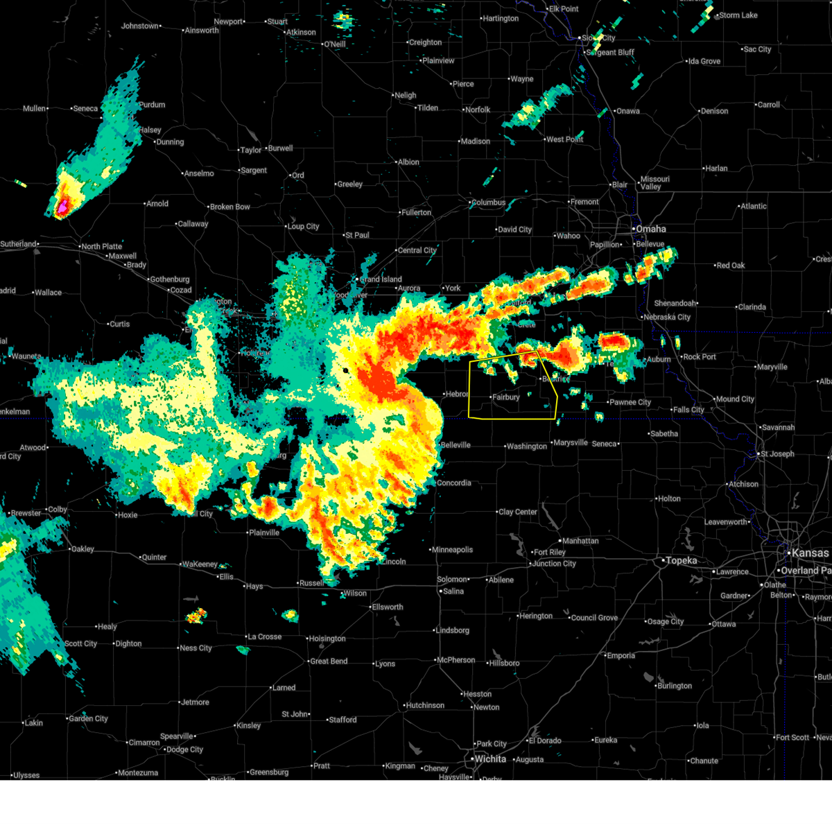 Svroax the national weather service in omaha has issued a * severe thunderstorm warning for, jefferson county in southeastern nebraska, southern saline county in southeastern nebraska, western gage county in southeastern nebraska, * until 145 am cdt. * at 103 am cdt, severe thunderstorms were located along a line extending from near carleton to 2 miles north of hubbell to 3 miles southwest of agenda, moving east at 55 mph. these are destructive storms for southern saline, jefferson, and western gage counites (radar indicated). Hazards include 80 mph wind gusts and quarter size hail. Flying debris will be dangerous to those caught without shelter. mobile homes will be heavily damaged. expect considerable damage to roofs, windows, and vehicles. extensive tree damage and power outages are likely. severe thunderstorms will be near, reynolds around 110 am cdt. fairbury, daykin, and endicott around 120 am cdt. Other locations in the path of these severe thunderstorms include jansen, steele city, diller, western, harbine, plymouth and swanton. Svroax the national weather service in omaha has issued a * severe thunderstorm warning for, jefferson county in southeastern nebraska, southern saline county in southeastern nebraska, western gage county in southeastern nebraska, * until 145 am cdt. * at 103 am cdt, severe thunderstorms were located along a line extending from near carleton to 2 miles north of hubbell to 3 miles southwest of agenda, moving east at 55 mph. these are destructive storms for southern saline, jefferson, and western gage counites (radar indicated). Hazards include 80 mph wind gusts and quarter size hail. Flying debris will be dangerous to those caught without shelter. mobile homes will be heavily damaged. expect considerable damage to roofs, windows, and vehicles. extensive tree damage and power outages are likely. severe thunderstorms will be near, reynolds around 110 am cdt. fairbury, daykin, and endicott around 120 am cdt. Other locations in the path of these severe thunderstorms include jansen, steele city, diller, western, harbine, plymouth and swanton.
|
| 7/15/2025 11:51 PM CDT |
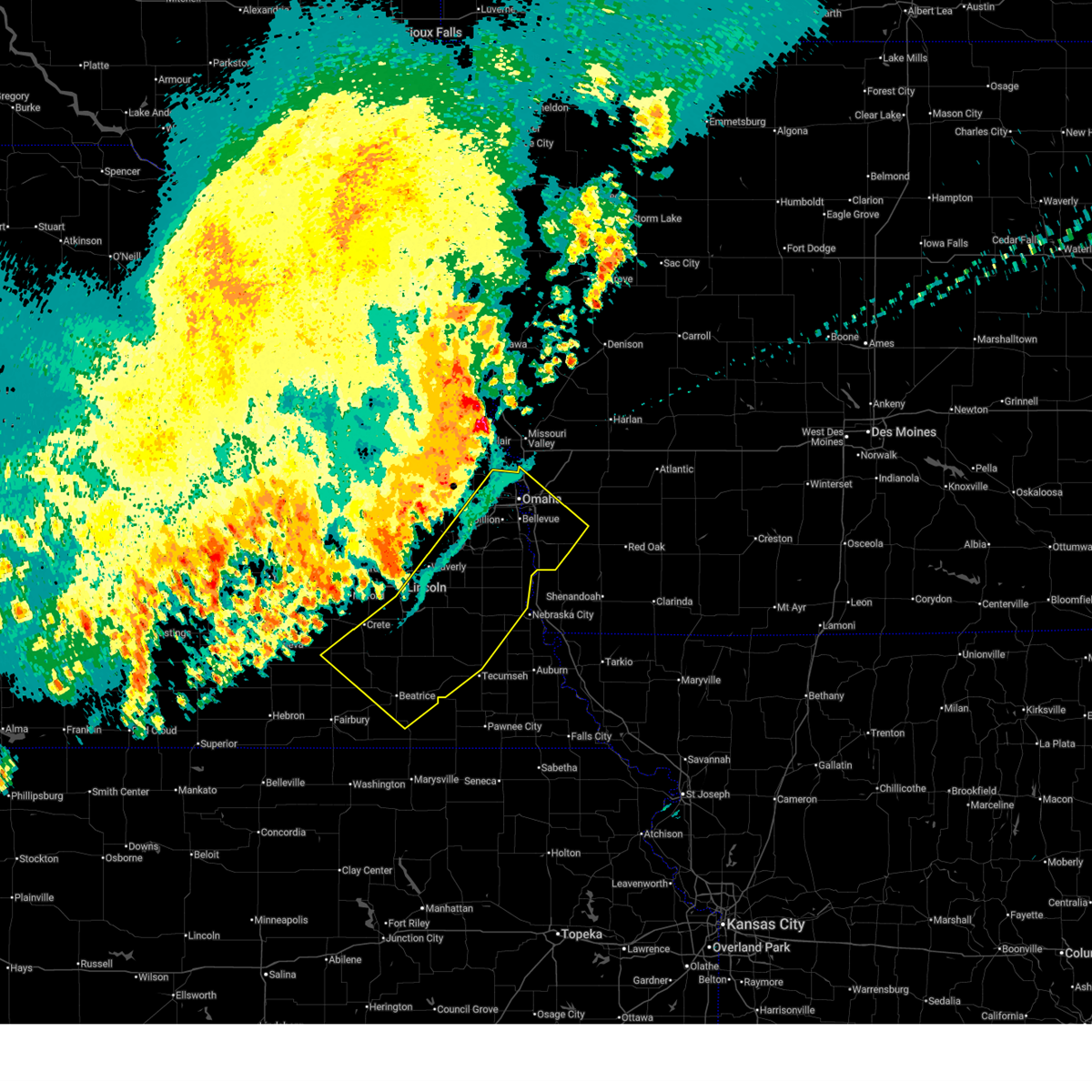 Svroax the national weather service in omaha has issued a * severe thunderstorm warning for, mills county in southwestern iowa, southwestern pottawattamie county in southwestern iowa, sarpy county in east central nebraska, lancaster county in southeastern nebraska, johnson county in southeastern nebraska, northeastern jefferson county in southeastern nebraska, otoe county in southeastern nebraska, douglas county in east central nebraska, southeastern saline county in southeastern nebraska, southeastern saunders county in east central nebraska, gage county in southeastern nebraska, cass county in southeastern nebraska, * until 1215 am cdt. * at 1150 pm cdt, severe thunderstorms were located along a line extending from omaha to 3 miles north of roca to 3 miles west of wilber, moving southeast at 45 mph (weather instrument measurement). Hazards include 70 mph wind gusts. Expect considerable tree damage. damage is likely to mobile homes, roofs, and outbuildings. severe thunderstorms will be near, omaha, council bluffs, bellevue, papillion, ralston, la vista, carter lake, wilber, hickman, and springfield around 1155 pm cdt. offutt afb, firth, palmyra, and panama around 1200 am cdt. Weeping water, unadilla, pickrell, and douglas around 1205 am cdt. Svroax the national weather service in omaha has issued a * severe thunderstorm warning for, mills county in southwestern iowa, southwestern pottawattamie county in southwestern iowa, sarpy county in east central nebraska, lancaster county in southeastern nebraska, johnson county in southeastern nebraska, northeastern jefferson county in southeastern nebraska, otoe county in southeastern nebraska, douglas county in east central nebraska, southeastern saline county in southeastern nebraska, southeastern saunders county in east central nebraska, gage county in southeastern nebraska, cass county in southeastern nebraska, * until 1215 am cdt. * at 1150 pm cdt, severe thunderstorms were located along a line extending from omaha to 3 miles north of roca to 3 miles west of wilber, moving southeast at 45 mph (weather instrument measurement). Hazards include 70 mph wind gusts. Expect considerable tree damage. damage is likely to mobile homes, roofs, and outbuildings. severe thunderstorms will be near, omaha, council bluffs, bellevue, papillion, ralston, la vista, carter lake, wilber, hickman, and springfield around 1155 pm cdt. offutt afb, firth, palmyra, and panama around 1200 am cdt. Weeping water, unadilla, pickrell, and douglas around 1205 am cdt.
|
| 4/23/2025 3:09 PM CDT |
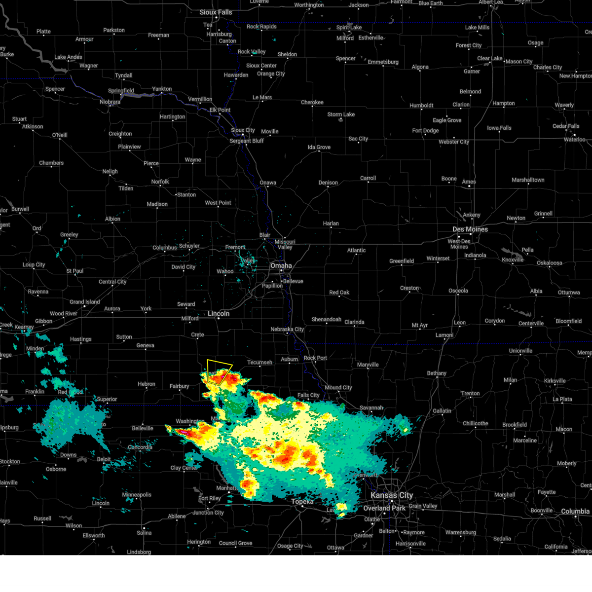 the severe thunderstorm warning has been cancelled and is no longer in effect the severe thunderstorm warning has been cancelled and is no longer in effect
|
| 4/23/2025 3:06 PM CDT |
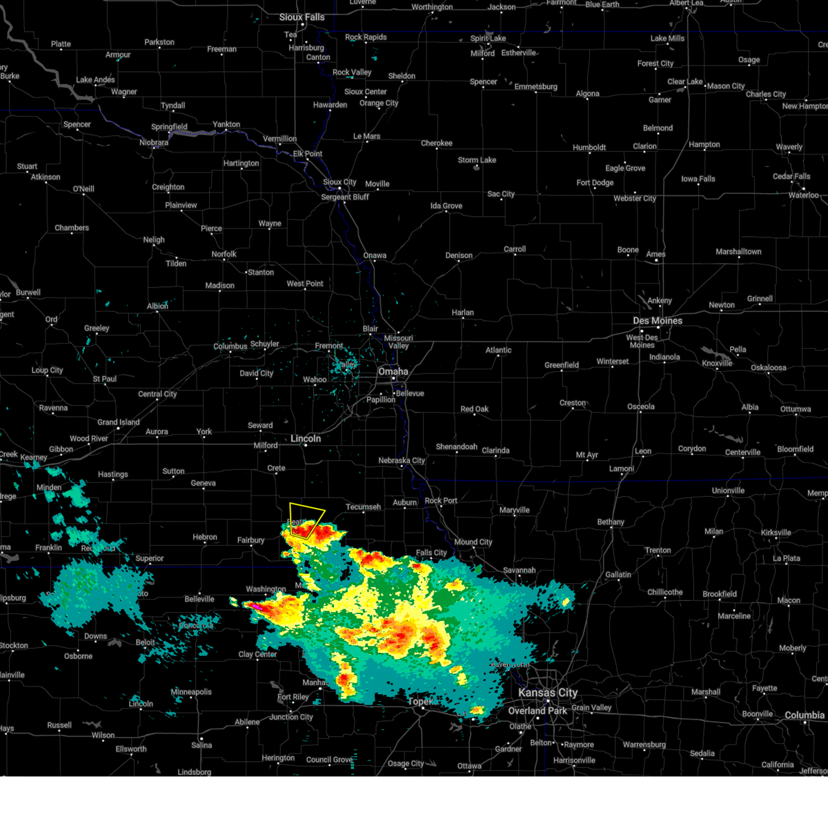 At 306 pm cdt, a severe thunderstorm was located over beatrice, moving north at 15 mph (radar indicated). Hazards include quarter size hail. Damage to vehicles is expected. this severe storm will be near, beatrice around 310 pm cdt. Other locations in the path of this severe thunderstorm include pickrell. At 306 pm cdt, a severe thunderstorm was located over beatrice, moving north at 15 mph (radar indicated). Hazards include quarter size hail. Damage to vehicles is expected. this severe storm will be near, beatrice around 310 pm cdt. Other locations in the path of this severe thunderstorm include pickrell.
|
| 4/23/2025 2:56 PM CDT |
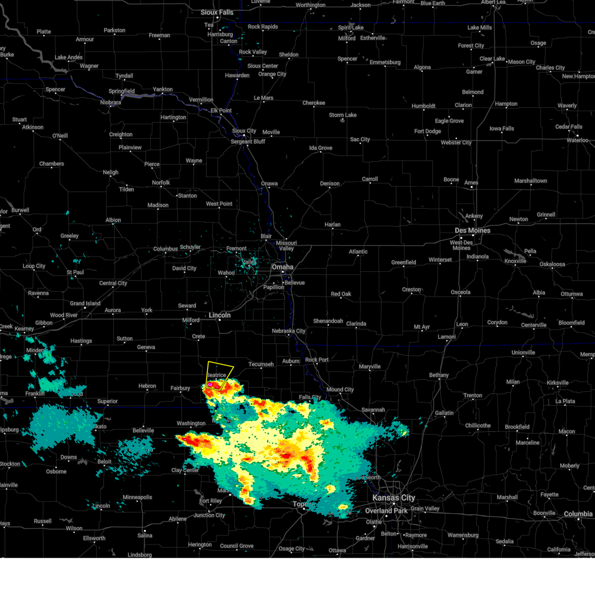 Svroax the national weather service in omaha has issued a * severe thunderstorm warning for, central gage county in southeastern nebraska, * until 330 pm cdt. * at 256 pm cdt, a severe thunderstorm was located 3 miles south of beatrice, moving north at 15 mph (radar indicated). Hazards include quarter size hail. Damage to vehicles is expected. This severe thunderstorm will be near, beatrice around 300 pm cdt. Svroax the national weather service in omaha has issued a * severe thunderstorm warning for, central gage county in southeastern nebraska, * until 330 pm cdt. * at 256 pm cdt, a severe thunderstorm was located 3 miles south of beatrice, moving north at 15 mph (radar indicated). Hazards include quarter size hail. Damage to vehicles is expected. This severe thunderstorm will be near, beatrice around 300 pm cdt.
|
| 3/14/2025 4:19 PM CDT |
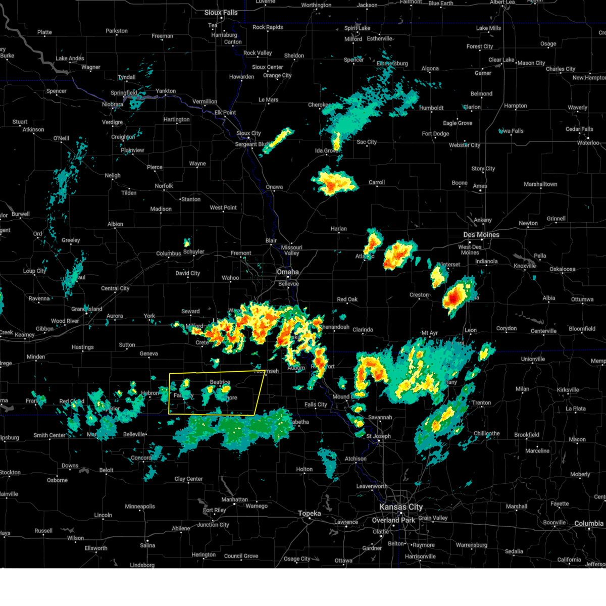 the severe thunderstorm warning has been cancelled and is no longer in effect the severe thunderstorm warning has been cancelled and is no longer in effect
|
| 3/14/2025 4:11 PM CDT |
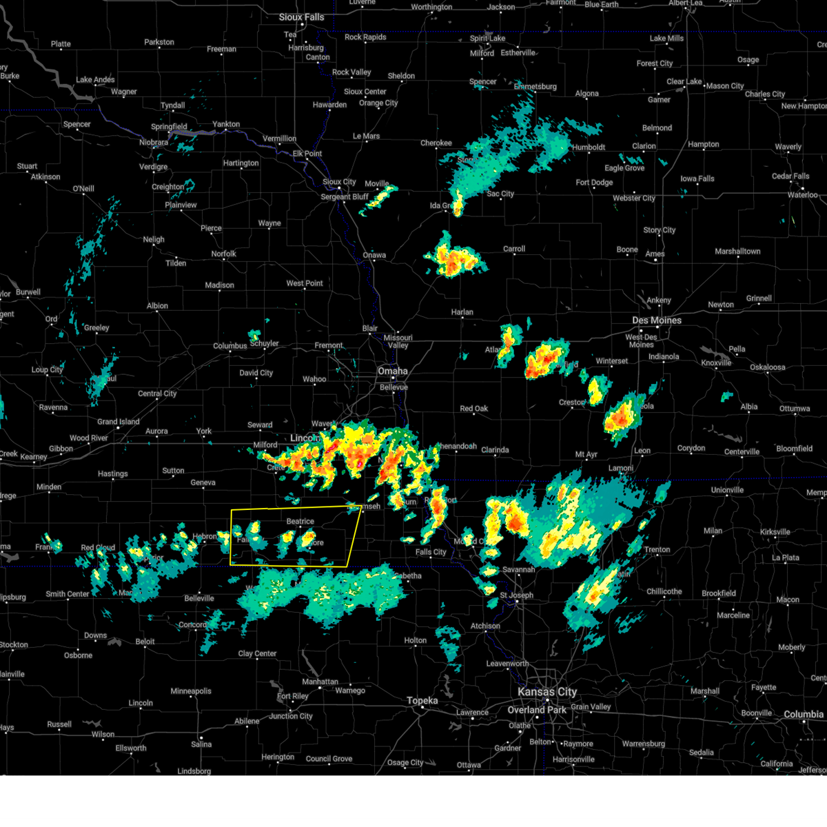 At 410 pm cdt, severe thunderstorms were located along a line extending from 5 miles southeast of alexandria to 3 miles northeast of burchard, moving east at 30 mph (public. at 4:05 pm, a 66 mph wind gust was reported 2 miles east of pymouth). Hazards include 70 mph wind gusts and nickel size hail. Expect considerable tree damage. damage is likely to mobile homes, roofs, and outbuildings. Locations impacted include, crab orchard, swanton, endicott, wymore, alexandria state recreation area, homestead national historical park, harbine, liberty, daykin, ellis, holmesville, diller, crystal springs campground, buckley creek recreational area, jansen, lewiston, odell, gladstone, vesta, and barneston. At 410 pm cdt, severe thunderstorms were located along a line extending from 5 miles southeast of alexandria to 3 miles northeast of burchard, moving east at 30 mph (public. at 4:05 pm, a 66 mph wind gust was reported 2 miles east of pymouth). Hazards include 70 mph wind gusts and nickel size hail. Expect considerable tree damage. damage is likely to mobile homes, roofs, and outbuildings. Locations impacted include, crab orchard, swanton, endicott, wymore, alexandria state recreation area, homestead national historical park, harbine, liberty, daykin, ellis, holmesville, diller, crystal springs campground, buckley creek recreational area, jansen, lewiston, odell, gladstone, vesta, and barneston.
|
| 3/14/2025 3:55 PM CDT |
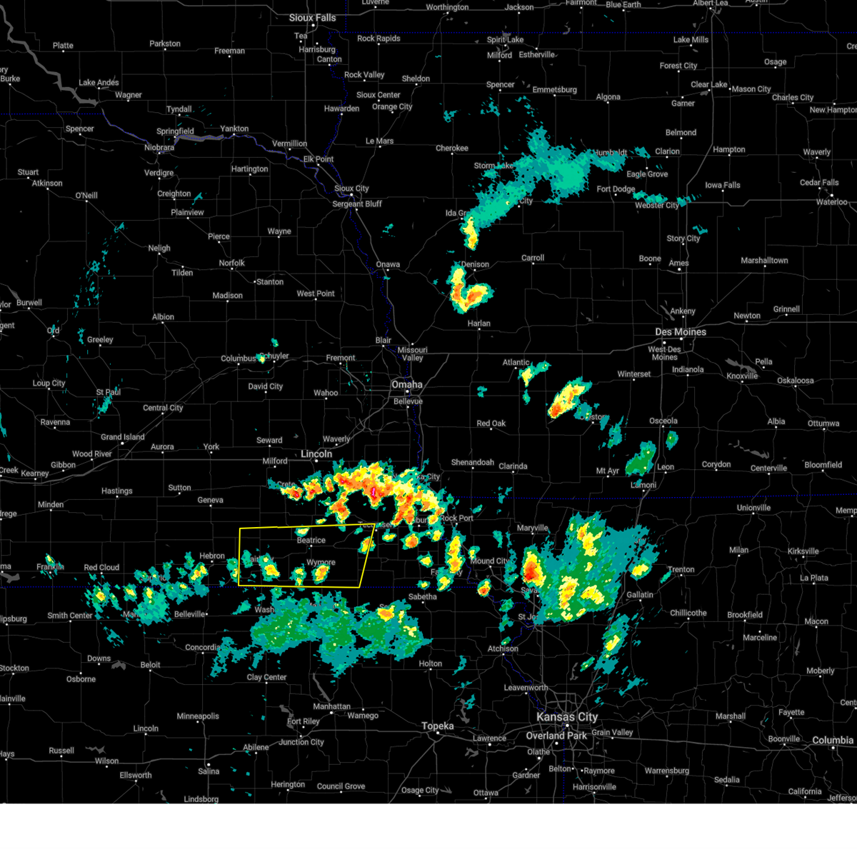 Svroax the national weather service in omaha has issued a * severe thunderstorm warning for, southwestern johnson county in southeastern nebraska, jefferson county in southeastern nebraska, southern saline county in southeastern nebraska, western pawnee county in southeastern nebraska, gage county in southeastern nebraska, * until 445 pm cdt. * at 355 pm cdt, severe thunderstorms were located along a line extending from near reynolds to 4 miles north of summerfield, moving north at 40 mph (radar indicated). Hazards include 70 mph wind gusts and nickel size hail. Expect considerable tree damage. Damage is likely to mobile homes, roofs, and outbuildings. Svroax the national weather service in omaha has issued a * severe thunderstorm warning for, southwestern johnson county in southeastern nebraska, jefferson county in southeastern nebraska, southern saline county in southeastern nebraska, western pawnee county in southeastern nebraska, gage county in southeastern nebraska, * until 445 pm cdt. * at 355 pm cdt, severe thunderstorms were located along a line extending from near reynolds to 4 miles north of summerfield, moving north at 40 mph (radar indicated). Hazards include 70 mph wind gusts and nickel size hail. Expect considerable tree damage. Damage is likely to mobile homes, roofs, and outbuildings.
|
| 2/25/2025 9:18 PM CST | Measured by a personal weather statio in gage county NE, 4.4 miles SW of Beatrice, NE |
| 10/30/2024 9:57 AM CDT |
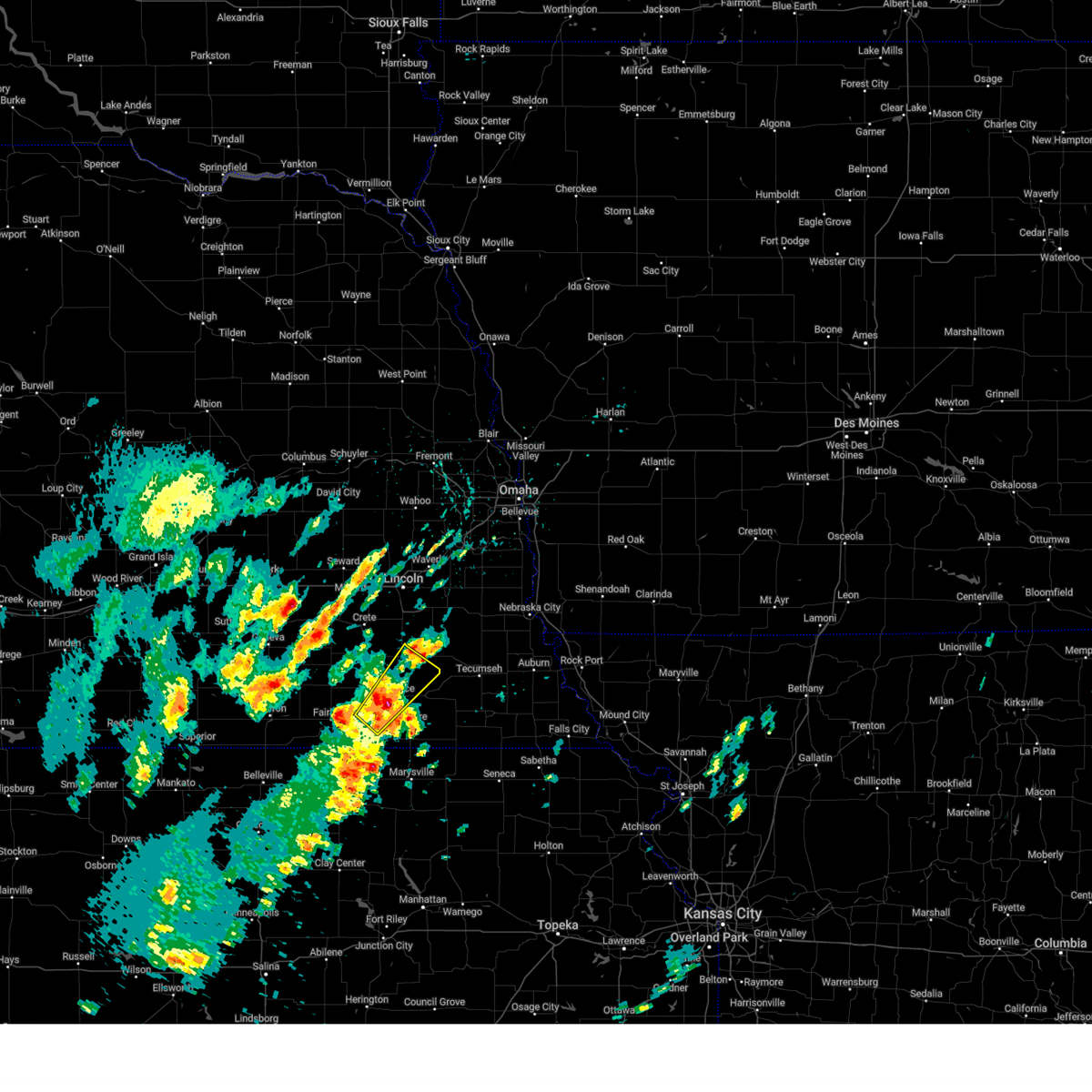 the severe thunderstorm warning has been cancelled and is no longer in effect the severe thunderstorm warning has been cancelled and is no longer in effect
|
| 10/30/2024 9:47 AM CDT |
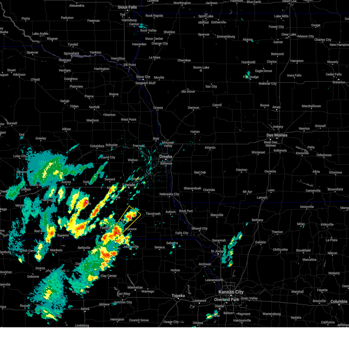 Svroax the national weather service in omaha has issued a * severe thunderstorm warning for, east central jefferson county in southeastern nebraska, central gage county in southeastern nebraska, * until 1015 am cdt. * at 947 am cdt, a severe thunderstorm was located 6 miles east of harbine, or 7 miles southwest of beatrice, moving northeast at 45 mph (radar indicated). Hazards include quarter size hail. damage to vehicles is expected Svroax the national weather service in omaha has issued a * severe thunderstorm warning for, east central jefferson county in southeastern nebraska, central gage county in southeastern nebraska, * until 1015 am cdt. * at 947 am cdt, a severe thunderstorm was located 6 miles east of harbine, or 7 miles southwest of beatrice, moving northeast at 45 mph (radar indicated). Hazards include quarter size hail. damage to vehicles is expected
|
| 8/14/2024 7:15 PM CDT |
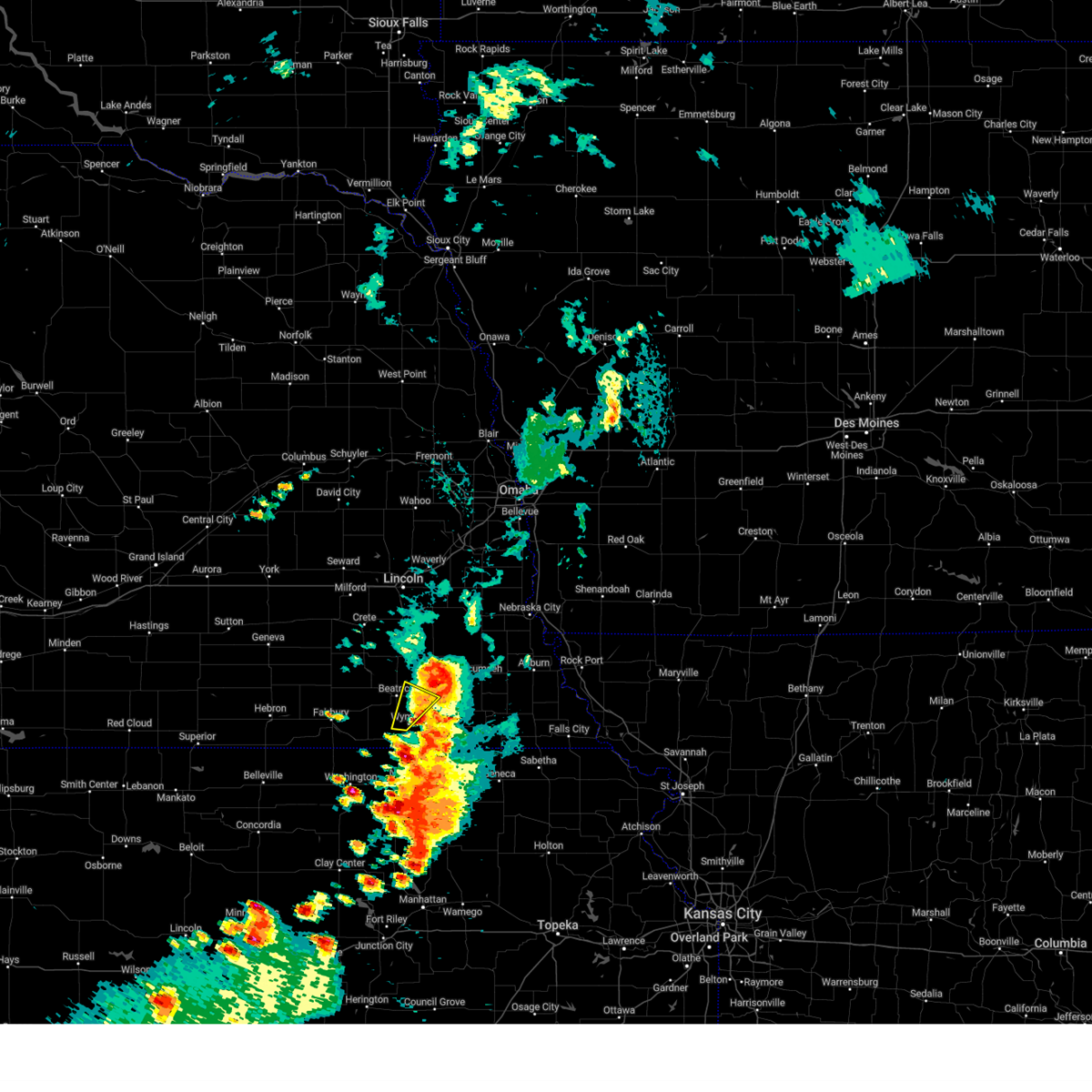 the severe thunderstorm warning has been cancelled and is no longer in effect the severe thunderstorm warning has been cancelled and is no longer in effect
|
| 8/14/2024 7:02 PM CDT |
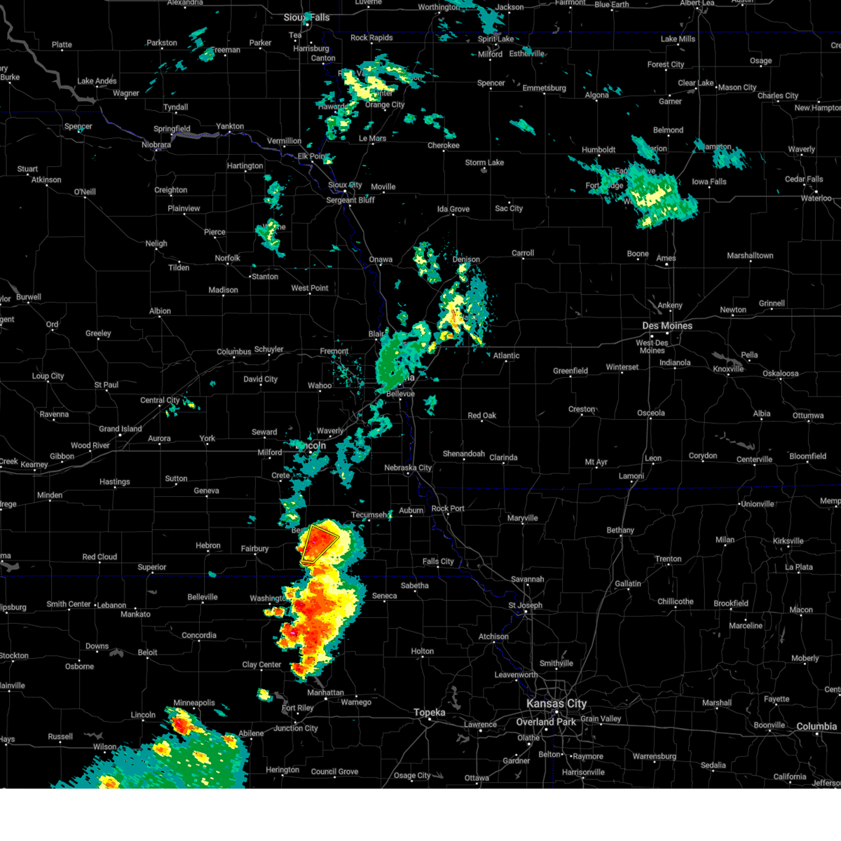 At 702 pm cdt, severe thunderstorms were located along a line extending from 5 miles northwest of filley to 3 miles southwest of wymore, moving northeast at 15 mph (radar indicated). Hazards include ping pong ball size hail and 60 mph wind gusts. People and animals outdoors will be injured. expect hail damage to roofs, siding, windows, and vehicles. expect wind damage to roofs, siding, and trees. Locations impacted include, beatrice, wymore, blue springs, filley, virginia, holmesville, rockford state recreation area, and rockford. At 702 pm cdt, severe thunderstorms were located along a line extending from 5 miles northwest of filley to 3 miles southwest of wymore, moving northeast at 15 mph (radar indicated). Hazards include ping pong ball size hail and 60 mph wind gusts. People and animals outdoors will be injured. expect hail damage to roofs, siding, windows, and vehicles. expect wind damage to roofs, siding, and trees. Locations impacted include, beatrice, wymore, blue springs, filley, virginia, holmesville, rockford state recreation area, and rockford.
|
| 8/14/2024 7:00 PM CDT |
 Svroax the national weather service in omaha has issued a * severe thunderstorm warning for, western johnson county in southeastern nebraska, northwestern pawnee county in southeastern nebraska, eastern gage county in southeastern nebraska, * until 745 pm cdt. * at 700 pm cdt, severe thunderstorms were located along a line extending from 4 miles west of filley to 4 miles west of wymore, moving northeast at 35 mph (radar indicated). Hazards include ping pong ball size hail and 60 mph wind gusts. People and animals outdoors will be injured. expect hail damage to roofs, siding, windows, and vehicles. Expect wind damage to roofs, siding, and trees. Svroax the national weather service in omaha has issued a * severe thunderstorm warning for, western johnson county in southeastern nebraska, northwestern pawnee county in southeastern nebraska, eastern gage county in southeastern nebraska, * until 745 pm cdt. * at 700 pm cdt, severe thunderstorms were located along a line extending from 4 miles west of filley to 4 miles west of wymore, moving northeast at 35 mph (radar indicated). Hazards include ping pong ball size hail and 60 mph wind gusts. People and animals outdoors will be injured. expect hail damage to roofs, siding, windows, and vehicles. Expect wind damage to roofs, siding, and trees.
|
| 8/14/2024 6:52 PM CDT |
 At 652 pm cdt, a severe thunderstorm was located over holmesville, or 5 miles southeast of beatrice, moving northeast at 40 mph (radar indicated). Hazards include golf ball size hail and 60 mph wind gusts. People and animals outdoors will be injured. expect hail damage to roofs, siding, windows, and vehicles. expect wind damage to roofs, siding, and trees. Locations impacted include, beatrice, wymore, blue springs, filley, virginia, holmesville, rockford state recreation area, and rockford. At 652 pm cdt, a severe thunderstorm was located over holmesville, or 5 miles southeast of beatrice, moving northeast at 40 mph (radar indicated). Hazards include golf ball size hail and 60 mph wind gusts. People and animals outdoors will be injured. expect hail damage to roofs, siding, windows, and vehicles. expect wind damage to roofs, siding, and trees. Locations impacted include, beatrice, wymore, blue springs, filley, virginia, holmesville, rockford state recreation area, and rockford.
|
| 8/14/2024 6:52 PM CDT |
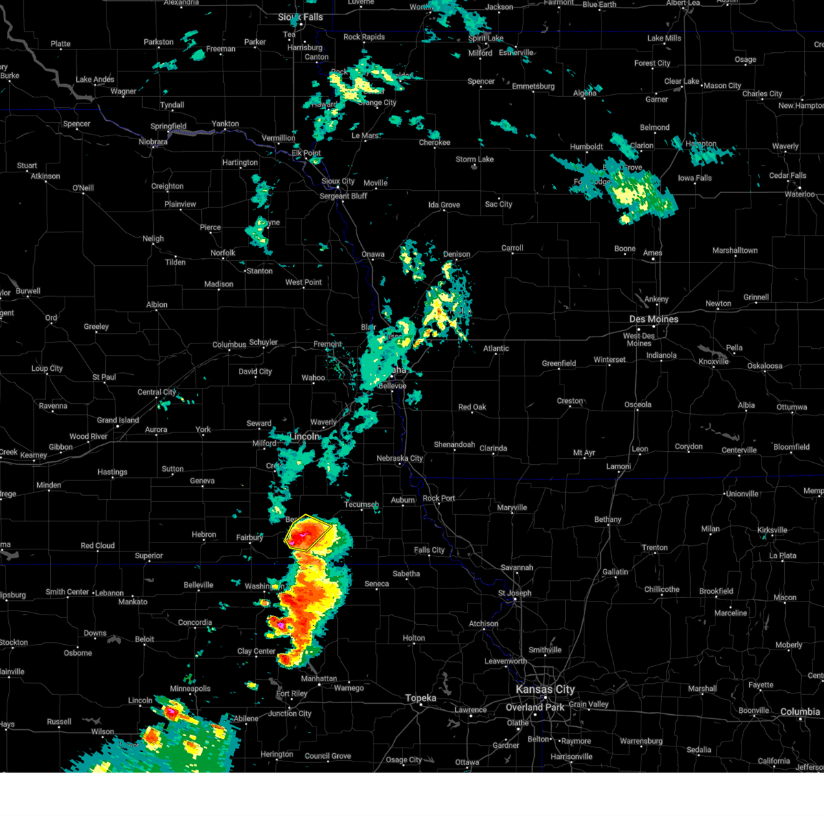 the severe thunderstorm warning has been cancelled and is no longer in effect the severe thunderstorm warning has been cancelled and is no longer in effect
|
| 8/14/2024 6:40 PM CDT |
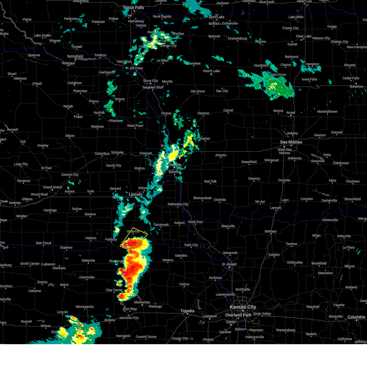 Svroax the national weather service in omaha has issued a * severe thunderstorm warning for, east central jefferson county in southeastern nebraska, southern gage county in southeastern nebraska, * until 730 pm cdt. * at 639 pm cdt, a severe thunderstorm was located 4 miles east of diller, or 12 miles southwest of beatrice, moving northeast at 25 mph (radar indicated. at 624 pm cdt, quarter sized hail was reported 2 miles west of odell by a trained spotter). Hazards include two inch hail and 60 mph wind gusts. People and animals outdoors will be injured. expect hail damage to roofs, siding, windows, and vehicles. Expect wind damage to roofs, siding, and trees. Svroax the national weather service in omaha has issued a * severe thunderstorm warning for, east central jefferson county in southeastern nebraska, southern gage county in southeastern nebraska, * until 730 pm cdt. * at 639 pm cdt, a severe thunderstorm was located 4 miles east of diller, or 12 miles southwest of beatrice, moving northeast at 25 mph (radar indicated. at 624 pm cdt, quarter sized hail was reported 2 miles west of odell by a trained spotter). Hazards include two inch hail and 60 mph wind gusts. People and animals outdoors will be injured. expect hail damage to roofs, siding, windows, and vehicles. Expect wind damage to roofs, siding, and trees.
|
| 8/14/2024 6:22 PM CDT |
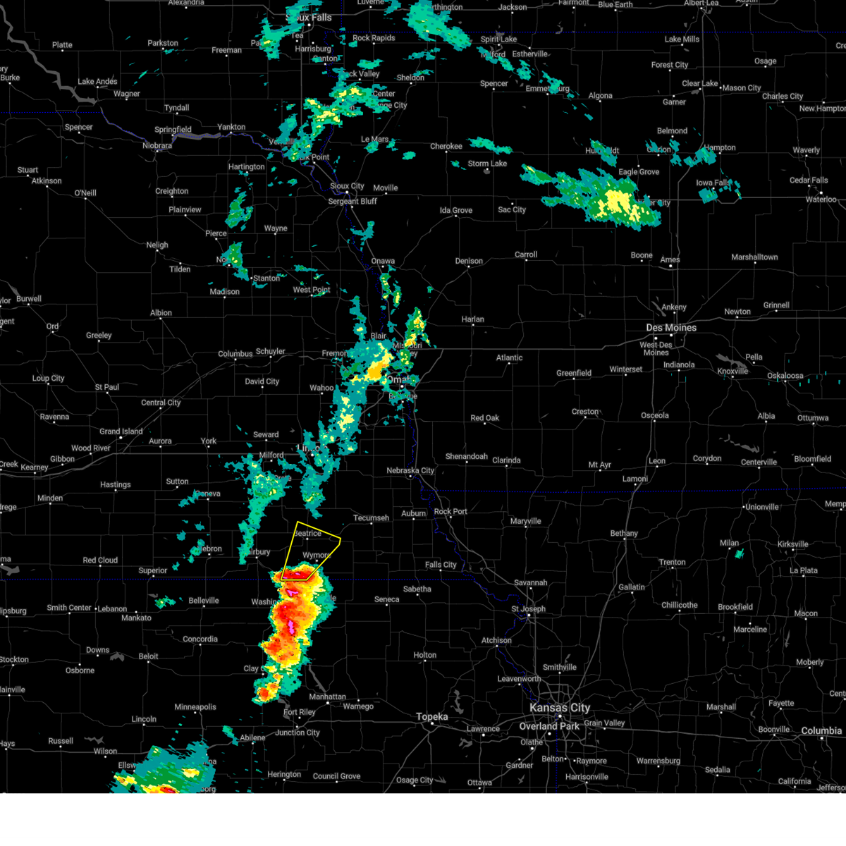 At 622 pm cdt, a severe thunderstorm was located over odell, or 15 miles south of beatrice, moving northeast at 35 mph (radar indicated). Hazards include 60 mph wind gusts and quarter size hail. Hail damage to vehicles is expected. expect wind damage to roofs, siding, and trees. Locations impacted include, beatrice, wymore, blue springs, odell, filley, virginia, holmesville, ellis, rockford state recreation area, rockford, and homestead national historical park. At 622 pm cdt, a severe thunderstorm was located over odell, or 15 miles south of beatrice, moving northeast at 35 mph (radar indicated). Hazards include 60 mph wind gusts and quarter size hail. Hail damage to vehicles is expected. expect wind damage to roofs, siding, and trees. Locations impacted include, beatrice, wymore, blue springs, odell, filley, virginia, holmesville, ellis, rockford state recreation area, rockford, and homestead national historical park.
|
| 8/14/2024 6:15 PM CDT |
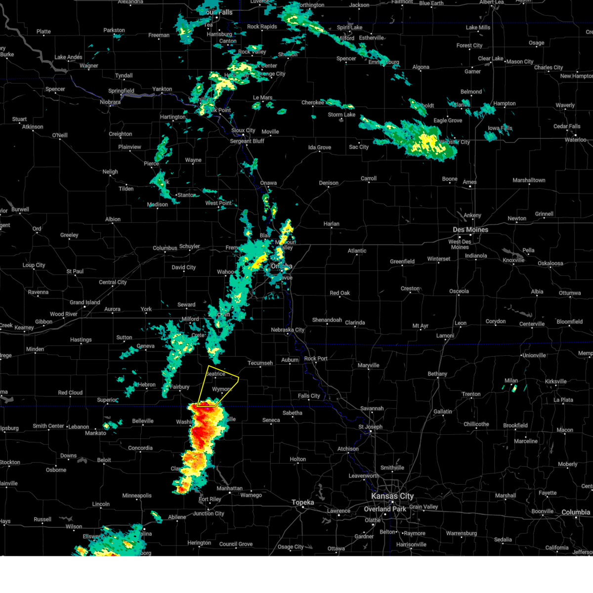 At 614 pm cdt, a severe thunderstorm was located 4 miles southwest of odell, or 15 miles northwest of marysville, moving northeast at 40 mph (radar indicated). Hazards include ping pong ball size hail and 60 mph wind gusts. People and animals outdoors will be injured. expect hail damage to roofs, siding, windows, and vehicles. expect wind damage to roofs, siding, and trees. Locations impacted include, beatrice, wymore, blue springs, odell, filley, virginia, holmesville, ellis, rockford state recreation area, rockford, and homestead national historical park. At 614 pm cdt, a severe thunderstorm was located 4 miles southwest of odell, or 15 miles northwest of marysville, moving northeast at 40 mph (radar indicated). Hazards include ping pong ball size hail and 60 mph wind gusts. People and animals outdoors will be injured. expect hail damage to roofs, siding, windows, and vehicles. expect wind damage to roofs, siding, and trees. Locations impacted include, beatrice, wymore, blue springs, odell, filley, virginia, holmesville, ellis, rockford state recreation area, rockford, and homestead national historical park.
|
| 8/14/2024 6:05 PM CDT |
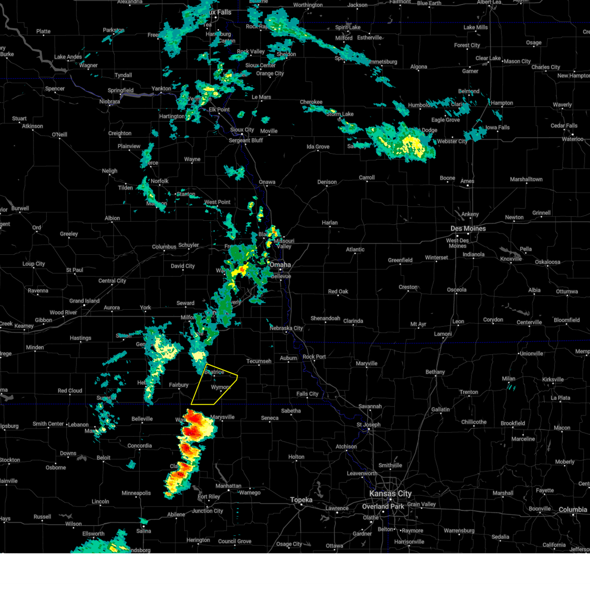 Svroax the national weather service in omaha has issued a * severe thunderstorm warning for, southeastern jefferson county in southeastern nebraska, southern gage county in southeastern nebraska, * until 645 pm cdt. * at 605 pm cdt, a severe thunderstorm was located 4 miles southeast of hollenberg, or 10 miles northeast of washington, moving northeast at 35 mph (radar indicated). Hazards include 60 mph wind gusts and quarter size hail. Hail damage to vehicles is expected. Expect wind damage to roofs, siding, and trees. Svroax the national weather service in omaha has issued a * severe thunderstorm warning for, southeastern jefferson county in southeastern nebraska, southern gage county in southeastern nebraska, * until 645 pm cdt. * at 605 pm cdt, a severe thunderstorm was located 4 miles southeast of hollenberg, or 10 miles northeast of washington, moving northeast at 35 mph (radar indicated). Hazards include 60 mph wind gusts and quarter size hail. Hail damage to vehicles is expected. Expect wind damage to roofs, siding, and trees.
|
| 7/6/2024 7:26 PM CDT |
 The storms which prompted the warning have moved out of the area. therefore, the warning will be allowed to expire. however, gusty winds and heavy rain are still possible with these thunderstorms. a severe thunderstorm watch remains in effect until midnight cdt for southeastern nebraska. The storms which prompted the warning have moved out of the area. therefore, the warning will be allowed to expire. however, gusty winds and heavy rain are still possible with these thunderstorms. a severe thunderstorm watch remains in effect until midnight cdt for southeastern nebraska.
|
| 7/6/2024 6:54 PM CDT |
 the severe thunderstorm warning has been cancelled and is no longer in effect the severe thunderstorm warning has been cancelled and is no longer in effect
|
| 7/6/2024 6:54 PM CDT |
 At 653 pm cdt, severe thunderstorms were located along a line extending from 4 miles north of sprague to 4 miles southeast of cortland to 5 miles west of holmesville, moving east at 45 mph (radar indicated). Hazards include 60 mph wind gusts. Expect damage to roofs, siding, and trees. Locations impacted include, lincoln, beatrice, hickman, bennet, firth, adams, cortland, panama, clatonia, roca, hallam, pickrell, sprague, filley, virginia, holmesville, walton, holmes lake park, pioneers park, and denton. At 653 pm cdt, severe thunderstorms were located along a line extending from 4 miles north of sprague to 4 miles southeast of cortland to 5 miles west of holmesville, moving east at 45 mph (radar indicated). Hazards include 60 mph wind gusts. Expect damage to roofs, siding, and trees. Locations impacted include, lincoln, beatrice, hickman, bennet, firth, adams, cortland, panama, clatonia, roca, hallam, pickrell, sprague, filley, virginia, holmesville, walton, holmes lake park, pioneers park, and denton.
|
| 7/6/2024 6:45 PM CDT |
 At 645 pm cdt, severe thunderstorms were located along a line extending from 6 miles southeast of pleasant dale to 4 miles east of clatonia to 5 miles northeast of diller, moving east at 50 mph (radar indicated). Hazards include 60 mph wind gusts and quarter size hail. Hail damage to vehicles is expected. expect wind damage to roofs, siding, and trees. Locations impacted include, lincoln, beatrice, crete, wilber, hickman, bennet, firth, adams, de witt, cortland, plymouth, panama, clatonia, roca, hallam, pleasant dale, pickrell, sprague, filley, and virginia. At 645 pm cdt, severe thunderstorms were located along a line extending from 6 miles southeast of pleasant dale to 4 miles east of clatonia to 5 miles northeast of diller, moving east at 50 mph (radar indicated). Hazards include 60 mph wind gusts and quarter size hail. Hail damage to vehicles is expected. expect wind damage to roofs, siding, and trees. Locations impacted include, lincoln, beatrice, crete, wilber, hickman, bennet, firth, adams, de witt, cortland, plymouth, panama, clatonia, roca, hallam, pleasant dale, pickrell, sprague, filley, and virginia.
|
| 7/6/2024 6:23 PM CDT |
 Svroax the national weather service in omaha has issued a * severe thunderstorm warning for, southern lancaster county in southeastern nebraska, northeastern jefferson county in southeastern nebraska, southeastern seward county in southeastern nebraska, eastern saline county in southeastern nebraska, gage county in southeastern nebraska, * until 730 pm cdt. * at 623 pm cdt, severe thunderstorms were located along a line extending from 4 miles northwest of dorchester to 4 miles west of wilber to 2 miles northwest of jansen, moving east at 50 mph (radar indicated). Hazards include 60 mph wind gusts and quarter size hail. Hail damage to vehicles is expected. Expect wind damage to roofs, siding, and trees. Svroax the national weather service in omaha has issued a * severe thunderstorm warning for, southern lancaster county in southeastern nebraska, northeastern jefferson county in southeastern nebraska, southeastern seward county in southeastern nebraska, eastern saline county in southeastern nebraska, gage county in southeastern nebraska, * until 730 pm cdt. * at 623 pm cdt, severe thunderstorms were located along a line extending from 4 miles northwest of dorchester to 4 miles west of wilber to 2 miles northwest of jansen, moving east at 50 mph (radar indicated). Hazards include 60 mph wind gusts and quarter size hail. Hail damage to vehicles is expected. Expect wind damage to roofs, siding, and trees.
|
| 6/26/2024 1:55 AM CDT |
 the severe thunderstorm warning has been cancelled and is no longer in effect the severe thunderstorm warning has been cancelled and is no longer in effect
|
| 6/26/2024 1:55 AM CDT |
 At 155 am cdt, severe thunderstorms were located along a line extending from 5 miles southeast of panama to 4 miles southwest of virginia to 6 miles west of hollenberg, moving southeast at 70 mph (weather instruments at the beatrice airport measured a 66 mph wind gust with this storm). Hazards include 70 mph wind gusts. Expect considerable tree damage. damage is likely to mobile homes, roofs, and outbuildings. Locations impacted include, beatrice, fairbury, hickman, wymore, firth, adams, blue springs, odell, diller, panama, endicott, filley, jansen, barneston, liberty, reynolds, steele city, virginia, harbine, and holmesville. At 155 am cdt, severe thunderstorms were located along a line extending from 5 miles southeast of panama to 4 miles southwest of virginia to 6 miles west of hollenberg, moving southeast at 70 mph (weather instruments at the beatrice airport measured a 66 mph wind gust with this storm). Hazards include 70 mph wind gusts. Expect considerable tree damage. damage is likely to mobile homes, roofs, and outbuildings. Locations impacted include, beatrice, fairbury, hickman, wymore, firth, adams, blue springs, odell, diller, panama, endicott, filley, jansen, barneston, liberty, reynolds, steele city, virginia, harbine, and holmesville.
|
| 6/26/2024 1:53 AM CDT | Storm damage reported in gage county NE, 2.3 miles S of Beatrice, NE |
| 6/26/2024 1:53 AM CDT | Storm damage reported in gage county NE, 9 miles ENE of Beatrice, NE |
| 6/26/2024 1:51 AM CDT | Personal weather station measured gus in gage county NE, 6.1 miles ENE of Beatrice, NE |
| 6/26/2024 1:50 AM CDT |
 At 149 am cdt, severe thunderstorms were located along a line extending from 2 miles west of panama to 3 miles east of beatrice to 6 miles east of reynolds, moving southeast at 70 mph (public weather stations measured 55 to 65 mph winds at multiple locations in seward, saline, southern lancaster and northwest gage counties with these storms). Hazards include 60 mph wind gusts. Expect damage to roofs, siding, and trees. Locations impacted include, beatrice, fairbury, hickman, wymore, firth, adams, de witt, cortland, plymouth, blue springs, odell, diller, panama, clatonia, roca, hallam, pickrell, sprague, endicott, and filley. At 149 am cdt, severe thunderstorms were located along a line extending from 2 miles west of panama to 3 miles east of beatrice to 6 miles east of reynolds, moving southeast at 70 mph (public weather stations measured 55 to 65 mph winds at multiple locations in seward, saline, southern lancaster and northwest gage counties with these storms). Hazards include 60 mph wind gusts. Expect damage to roofs, siding, and trees. Locations impacted include, beatrice, fairbury, hickman, wymore, firth, adams, de witt, cortland, plymouth, blue springs, odell, diller, panama, clatonia, roca, hallam, pickrell, sprague, endicott, and filley.
|
| 6/26/2024 1:34 AM CDT |
 Svroax the national weather service in omaha has issued a * severe thunderstorm warning for, southern lancaster county in southeastern nebraska, jefferson county in southeastern nebraska, southeastern saline county in southeastern nebraska, gage county in southeastern nebraska, * until 215 am cdt. * at 133 am cdt, severe thunderstorms were located along a line extending from 5 miles northwest of sprague to 3 miles northeast of alexandria, moving southeast at 65 mph (public weather stations measured 55 to 65 mph winds at multiple locations in seward and saline counties with these storms). Hazards include 60 mph wind gusts. expect damage to roofs, siding, and trees Svroax the national weather service in omaha has issued a * severe thunderstorm warning for, southern lancaster county in southeastern nebraska, jefferson county in southeastern nebraska, southeastern saline county in southeastern nebraska, gage county in southeastern nebraska, * until 215 am cdt. * at 133 am cdt, severe thunderstorms were located along a line extending from 5 miles northwest of sprague to 3 miles northeast of alexandria, moving southeast at 65 mph (public weather stations measured 55 to 65 mph winds at multiple locations in seward and saline counties with these storms). Hazards include 60 mph wind gusts. expect damage to roofs, siding, and trees
|
| 6/15/2024 6:41 PM CDT |
 At 640 pm cdt, a severe thunderstorm was located 5 miles east of beatrice, moving northeast at 40 mph (radar indicated). Hazards include 60 mph wind gusts and quarter size hail. Hail damage to vehicles is expected. expect wind damage to roofs, siding, and trees. Locations impacted include, beatrice, hickman, wymore, firth, adams, cortland, sterling, blue springs, diller, pickrell, filley, lewiston, virginia, harbine, crab orchard, holmesville, st mary, stagecoach state recreation area, homestead national historical park, and ellis. At 640 pm cdt, a severe thunderstorm was located 5 miles east of beatrice, moving northeast at 40 mph (radar indicated). Hazards include 60 mph wind gusts and quarter size hail. Hail damage to vehicles is expected. expect wind damage to roofs, siding, and trees. Locations impacted include, beatrice, hickman, wymore, firth, adams, cortland, sterling, blue springs, diller, pickrell, filley, lewiston, virginia, harbine, crab orchard, holmesville, st mary, stagecoach state recreation area, homestead national historical park, and ellis.
|
| 6/15/2024 6:26 PM CDT |
 At 624 pm cdt, a severe thunderstorm was located 3 miles southwest of beatrice, moving northeast at 45 mph (radar indicated). Hazards include ping pong ball size hail and 60 mph wind gusts. People and animals outdoors will be injured. expect hail damage to roofs, siding, windows, and vehicles. expect wind damage to roofs, siding, and trees. Locations impacted include, beatrice, hickman, wymore, firth, adams, cortland, sterling, blue springs, odell, diller, pickrell, filley, lewiston, steele city, virginia, harbine, crab orchard, holmesville, st mary, and stagecoach state recreation area. At 624 pm cdt, a severe thunderstorm was located 3 miles southwest of beatrice, moving northeast at 45 mph (radar indicated). Hazards include ping pong ball size hail and 60 mph wind gusts. People and animals outdoors will be injured. expect hail damage to roofs, siding, windows, and vehicles. expect wind damage to roofs, siding, and trees. Locations impacted include, beatrice, hickman, wymore, firth, adams, cortland, sterling, blue springs, odell, diller, pickrell, filley, lewiston, steele city, virginia, harbine, crab orchard, holmesville, st mary, and stagecoach state recreation area.
|
| 6/15/2024 6:16 PM CDT |
 Svroax the national weather service in omaha has issued a * severe thunderstorm warning for, southeastern lancaster county in southeastern nebraska, western johnson county in southeastern nebraska, southeastern jefferson county in southeastern nebraska, northwestern pawnee county in southeastern nebraska, gage county in southeastern nebraska, * until 700 pm cdt. * at 616 pm cdt, a severe thunderstorm was located 6 miles northeast of diller, or 9 miles southwest of beatrice, moving northeast at 45 mph (radar indicated). Hazards include 60 mph wind gusts and quarter size hail. Hail damage to vehicles is expected. Expect wind damage to roofs, siding, and trees. Svroax the national weather service in omaha has issued a * severe thunderstorm warning for, southeastern lancaster county in southeastern nebraska, western johnson county in southeastern nebraska, southeastern jefferson county in southeastern nebraska, northwestern pawnee county in southeastern nebraska, gage county in southeastern nebraska, * until 700 pm cdt. * at 616 pm cdt, a severe thunderstorm was located 6 miles northeast of diller, or 9 miles southwest of beatrice, moving northeast at 45 mph (radar indicated). Hazards include 60 mph wind gusts and quarter size hail. Hail damage to vehicles is expected. Expect wind damage to roofs, siding, and trees.
|
| 6/15/2024 5:37 PM CDT |
 Svroax the national weather service in omaha has issued a * severe thunderstorm warning for, southwestern johnson county in southeastern nebraska, southeastern jefferson county in southeastern nebraska, gage county in southeastern nebraska, * until 615 pm cdt. * at 537 pm cdt, a severe thunderstorm was located 4 miles northwest of odell, or 12 miles southwest of beatrice, moving northeast at 40 mph (radar indicated). Hazards include quarter size hail. damage to vehicles is expected Svroax the national weather service in omaha has issued a * severe thunderstorm warning for, southwestern johnson county in southeastern nebraska, southeastern jefferson county in southeastern nebraska, gage county in southeastern nebraska, * until 615 pm cdt. * at 537 pm cdt, a severe thunderstorm was located 4 miles northwest of odell, or 12 miles southwest of beatrice, moving northeast at 40 mph (radar indicated). Hazards include quarter size hail. damage to vehicles is expected
|
| 5/25/2024 10:00 PM CDT |
 the severe thunderstorm warning has been cancelled and is no longer in effect the severe thunderstorm warning has been cancelled and is no longer in effect
|
| 5/25/2024 9:56 PM CDT |
 At 956 pm cdt, a severe thunderstorm was located 4 miles southwest of douglas, or 18 miles northwest of tecumseh, moving northeast at 35 mph (radar indicated). Hazards include quarter size hail. Damage to vehicles is expected. Locations impacted include, beatrice, firth, adams, sterling, panama, pickrell, douglas, and burr. At 956 pm cdt, a severe thunderstorm was located 4 miles southwest of douglas, or 18 miles northwest of tecumseh, moving northeast at 35 mph (radar indicated). Hazards include quarter size hail. Damage to vehicles is expected. Locations impacted include, beatrice, firth, adams, sterling, panama, pickrell, douglas, and burr.
|
| 5/25/2024 9:53 PM CDT |
 At 953 pm cdt, a severe thunderstorm was located 5 miles north of adams, or 18 miles northwest of tecumseh, moving northeast at 35 mph (radar indicated). Hazards include golf ball size hail and 60 mph wind gusts. People and animals outdoors will be injured. expect hail damage to roofs, siding, windows, and vehicles. expect wind damage to roofs, siding, and trees. Locations impacted include, beatrice, firth, adams, sterling, panama, pickrell, douglas, and burr. At 953 pm cdt, a severe thunderstorm was located 5 miles north of adams, or 18 miles northwest of tecumseh, moving northeast at 35 mph (radar indicated). Hazards include golf ball size hail and 60 mph wind gusts. People and animals outdoors will be injured. expect hail damage to roofs, siding, windows, and vehicles. expect wind damage to roofs, siding, and trees. Locations impacted include, beatrice, firth, adams, sterling, panama, pickrell, douglas, and burr.
|
| 5/25/2024 9:41 PM CDT |
 At 941 pm cdt, a severe thunderstorm was located 4 miles west of adams, or 15 miles northeast of beatrice, moving northeast at 35 mph (radar indicated). Hazards include golf ball size hail and 60 mph wind gusts. People and animals outdoors will be injured. expect hail damage to roofs, siding, windows, and vehicles. expect wind damage to roofs, siding, and trees. Locations impacted include, beatrice, firth, adams, sterling, panama, pickrell, douglas, burr, and homestead national historical park. At 941 pm cdt, a severe thunderstorm was located 4 miles west of adams, or 15 miles northeast of beatrice, moving northeast at 35 mph (radar indicated). Hazards include golf ball size hail and 60 mph wind gusts. People and animals outdoors will be injured. expect hail damage to roofs, siding, windows, and vehicles. expect wind damage to roofs, siding, and trees. Locations impacted include, beatrice, firth, adams, sterling, panama, pickrell, douglas, burr, and homestead national historical park.
|
| 5/25/2024 9:33 PM CDT |
 Svroax the national weather service in omaha has issued a * severe thunderstorm warning for, southeastern lancaster county in southeastern nebraska, northwestern johnson county in southeastern nebraska, southwestern otoe county in southeastern nebraska, northern gage county in southeastern nebraska, * until 1015 pm cdt. * at 933 pm cdt, a severe thunderstorm was located 4 miles northeast of pickrell, or 11 miles north of beatrice, moving northeast at 35 mph (radar indicated). Hazards include half dollar size hail. damage to vehicles is expected Svroax the national weather service in omaha has issued a * severe thunderstorm warning for, southeastern lancaster county in southeastern nebraska, northwestern johnson county in southeastern nebraska, southwestern otoe county in southeastern nebraska, northern gage county in southeastern nebraska, * until 1015 pm cdt. * at 933 pm cdt, a severe thunderstorm was located 4 miles northeast of pickrell, or 11 miles north of beatrice, moving northeast at 35 mph (radar indicated). Hazards include half dollar size hail. damage to vehicles is expected
|
| 5/25/2024 9:32 PM CDT |
 At 932 pm cdt, a severe thunderstorm was located near odell, or 14 miles northwest of marysville, moving northeast at 45 mph (radar indicated). Hazards include 60 mph wind gusts and quarter size hail. Hail damage to vehicles is expected. expect wind damage to roofs, siding, and trees. Locations impacted include, beatrice, wymore, blue springs, odell, diller, barneston, and steele city. At 932 pm cdt, a severe thunderstorm was located near odell, or 14 miles northwest of marysville, moving northeast at 45 mph (radar indicated). Hazards include 60 mph wind gusts and quarter size hail. Hail damage to vehicles is expected. expect wind damage to roofs, siding, and trees. Locations impacted include, beatrice, wymore, blue springs, odell, diller, barneston, and steele city.
|
| 5/25/2024 9:15 PM CDT |
 Svroax the national weather service in omaha has issued a * severe thunderstorm warning for, southeastern jefferson county in southeastern nebraska, southwestern gage county in southeastern nebraska, * until 1000 pm cdt. * at 915 pm cdt, a severe thunderstorm was located near hollenberg, or 9 miles northeast of washington, moving northeast at 45 mph (radar indicated). Hazards include 60 mph wind gusts and half dollar size hail. Hail damage to vehicles is expected. Expect wind damage to roofs, siding, and trees. Svroax the national weather service in omaha has issued a * severe thunderstorm warning for, southeastern jefferson county in southeastern nebraska, southwestern gage county in southeastern nebraska, * until 1000 pm cdt. * at 915 pm cdt, a severe thunderstorm was located near hollenberg, or 9 miles northeast of washington, moving northeast at 45 mph (radar indicated). Hazards include 60 mph wind gusts and half dollar size hail. Hail damage to vehicles is expected. Expect wind damage to roofs, siding, and trees.
|
| 5/24/2024 2:39 AM CDT |
 At 239 am cdt, severe thunderstorms were located along a line extending from 4 miles northeast of palmyra to 4 miles southwest of cook to 2 miles east of barneston, moving east at 60 mph (radar indicated). Hazards include 60 mph wind gusts and quarter size hail. Hail damage to vehicles is expected. expect wind damage to roofs, siding, and trees. Locations impacted include, beatrice, fairbury, tecumseh, pawnee city, crete, syracuse, wilber, hickman, wymore, bennet, firth, adams, palmyra, de witt, cortland, sterling, plymouth, blue springs, cook, and unadilla. At 239 am cdt, severe thunderstorms were located along a line extending from 4 miles northeast of palmyra to 4 miles southwest of cook to 2 miles east of barneston, moving east at 60 mph (radar indicated). Hazards include 60 mph wind gusts and quarter size hail. Hail damage to vehicles is expected. expect wind damage to roofs, siding, and trees. Locations impacted include, beatrice, fairbury, tecumseh, pawnee city, crete, syracuse, wilber, hickman, wymore, bennet, firth, adams, palmyra, de witt, cortland, sterling, plymouth, blue springs, cook, and unadilla.
|
| 5/24/2024 2:32 AM CDT |
 Svroax the national weather service in omaha has issued a * severe thunderstorm warning for, southern fremont county in southwestern iowa, southwestern page county in southwestern iowa, southeastern lancaster county in southeastern nebraska, johnson county in southeastern nebraska, nemaha county in southeastern nebraska, otoe county in southeastern nebraska, richardson county in southeastern nebraska, pawnee county in southeastern nebraska, gage county in southeastern nebraska, * until 315 am cdt. * at 231 am cdt, severe thunderstorms were located along a line extending from near palmyra to 4 miles south of adams to 5 miles southeast of odell, moving east at 60 mph (radar indicated). Hazards include 70 mph wind gusts and quarter size hail. Hail damage to vehicles is expected. expect considerable tree damage. Wind damage is also likely to mobile homes, roofs, and outbuildings. Svroax the national weather service in omaha has issued a * severe thunderstorm warning for, southern fremont county in southwestern iowa, southwestern page county in southwestern iowa, southeastern lancaster county in southeastern nebraska, johnson county in southeastern nebraska, nemaha county in southeastern nebraska, otoe county in southeastern nebraska, richardson county in southeastern nebraska, pawnee county in southeastern nebraska, gage county in southeastern nebraska, * until 315 am cdt. * at 231 am cdt, severe thunderstorms were located along a line extending from near palmyra to 4 miles south of adams to 5 miles southeast of odell, moving east at 60 mph (radar indicated). Hazards include 70 mph wind gusts and quarter size hail. Hail damage to vehicles is expected. expect considerable tree damage. Wind damage is also likely to mobile homes, roofs, and outbuildings.
|
| 5/24/2024 1:54 AM CDT |
 Svroax the national weather service in omaha has issued a * severe thunderstorm warning for, southern lancaster county in southeastern nebraska, johnson county in southeastern nebraska, jefferson county in southeastern nebraska, southern seward county in southeastern nebraska, southwestern otoe county in southeastern nebraska, saline county in southeastern nebraska, pawnee county in southeastern nebraska, gage county in southeastern nebraska, * until 245 am cdt. * at 154 am cdt, severe thunderstorms were located along a line extending from 4 miles northwest of dorchester to 2 miles north of swanton to near mahaska, moving east at 60 mph (radar indicated). Hazards include 60 mph wind gusts and quarter size hail. Hail damage to vehicles is expected. Expect wind damage to roofs, siding, and trees. Svroax the national weather service in omaha has issued a * severe thunderstorm warning for, southern lancaster county in southeastern nebraska, johnson county in southeastern nebraska, jefferson county in southeastern nebraska, southern seward county in southeastern nebraska, southwestern otoe county in southeastern nebraska, saline county in southeastern nebraska, pawnee county in southeastern nebraska, gage county in southeastern nebraska, * until 245 am cdt. * at 154 am cdt, severe thunderstorms were located along a line extending from 4 miles northwest of dorchester to 2 miles north of swanton to near mahaska, moving east at 60 mph (radar indicated). Hazards include 60 mph wind gusts and quarter size hail. Hail damage to vehicles is expected. Expect wind damage to roofs, siding, and trees.
|
| 5/24/2024 1:21 AM CDT |
 Svroax the national weather service in omaha has issued a * severe thunderstorm warning for, lancaster county in southeastern nebraska, jefferson county in southeastern nebraska, seward county in southeastern nebraska, saline county in southeastern nebraska, southern butler county in east central nebraska, southwestern saunders county in east central nebraska, western gage county in southeastern nebraska, * until 200 am cdt. * at 121 am cdt, severe thunderstorms were located along a line extending from 3 miles northeast of gresham to 4 miles northwest of hebron, moving east at 55 mph (radar indicated). Hazards include 70 mph wind gusts and quarter size hail. Hail damage to vehicles is expected. expect considerable tree damage. Wind damage is also likely to mobile homes, roofs, and outbuildings. Svroax the national weather service in omaha has issued a * severe thunderstorm warning for, lancaster county in southeastern nebraska, jefferson county in southeastern nebraska, seward county in southeastern nebraska, saline county in southeastern nebraska, southern butler county in east central nebraska, southwestern saunders county in east central nebraska, western gage county in southeastern nebraska, * until 200 am cdt. * at 121 am cdt, severe thunderstorms were located along a line extending from 3 miles northeast of gresham to 4 miles northwest of hebron, moving east at 55 mph (radar indicated). Hazards include 70 mph wind gusts and quarter size hail. Hail damage to vehicles is expected. expect considerable tree damage. Wind damage is also likely to mobile homes, roofs, and outbuildings.
|
| 5/6/2024 7:20 PM CDT | Damage to a residence... downed power line in gage county NE, 4.9 miles SW of Beatrice, NE |
| 5/4/2024 1:10 AM CDT |
 The storms which prompted the warning have weakened below severe limits, and no longer pose an immediate threat to life or property. therefore, the warning will be allowed to expire. however, small hail is still possible with these thunderstorms. a severe thunderstorm watch remains in effect until 400 am cdt for southeastern nebraska. The storms which prompted the warning have weakened below severe limits, and no longer pose an immediate threat to life or property. therefore, the warning will be allowed to expire. however, small hail is still possible with these thunderstorms. a severe thunderstorm watch remains in effect until 400 am cdt for southeastern nebraska.
|
| 5/4/2024 12:56 AM CDT |
 the severe thunderstorm warning has been cancelled and is no longer in effect the severe thunderstorm warning has been cancelled and is no longer in effect
|
| 5/4/2024 12:56 AM CDT |
 At 1255 am cdt, severe thunderstorms were located along a line extending from 2 miles southwest of roca to 3 miles south of firth to 2 miles southeast of pickrell, moving east at 45 mph (radar indicated). Hazards include 60 mph wind gusts and quarter size hail. Hail damage to vehicles is expected. expect wind damage to roofs, siding, and trees. Locations impacted include, beatrice, hickman, bennet, firth, adams, cortland, panama, roca, hallam, pickrell, sprague, filley, virginia, stagecoach state recreation area, homestead national historical park, rockford, wagon train state recreation area, and bluestem state recreation area. At 1255 am cdt, severe thunderstorms were located along a line extending from 2 miles southwest of roca to 3 miles south of firth to 2 miles southeast of pickrell, moving east at 45 mph (radar indicated). Hazards include 60 mph wind gusts and quarter size hail. Hail damage to vehicles is expected. expect wind damage to roofs, siding, and trees. Locations impacted include, beatrice, hickman, bennet, firth, adams, cortland, panama, roca, hallam, pickrell, sprague, filley, virginia, stagecoach state recreation area, homestead national historical park, rockford, wagon train state recreation area, and bluestem state recreation area.
|
| 5/4/2024 12:47 AM CDT |
 At 1247 am cdt, severe thunderstorms were located along a line extending from 2 miles west of sprague to 2 miles south of cortland to 4 miles northwest of beatrice, moving east at 45 mph (radar indicated). Hazards include 60 mph wind gusts and quarter size hail. Hail damage to vehicles is expected. expect wind damage to roofs, siding, and trees. Locations impacted include, beatrice, hickman, bennet, firth, adams, de witt, cortland, plymouth, panama, clatonia, roca, hallam, pickrell, sprague, filley, virginia, stagecoach state recreation area, homestead national historical park, rockford, and wagon train state recreation area. At 1247 am cdt, severe thunderstorms were located along a line extending from 2 miles west of sprague to 2 miles south of cortland to 4 miles northwest of beatrice, moving east at 45 mph (radar indicated). Hazards include 60 mph wind gusts and quarter size hail. Hail damage to vehicles is expected. expect wind damage to roofs, siding, and trees. Locations impacted include, beatrice, hickman, bennet, firth, adams, de witt, cortland, plymouth, panama, clatonia, roca, hallam, pickrell, sprague, filley, virginia, stagecoach state recreation area, homestead national historical park, rockford, and wagon train state recreation area.
|
| 5/4/2024 12:39 AM CDT |
 At 1239 am cdt, severe thunderstorms were located along a line extending from 3 miles southeast of crete to 2 miles southeast of clatonia to 4 miles east of plymouth, moving east at 45 mph (radar indicated). Hazards include 60 mph wind gusts and quarter size hail. Hail damage to vehicles is expected. expect wind damage to roofs, siding, and trees. Locations impacted include, beatrice, crete, wilber, hickman, bennet, firth, adams, de witt, cortland, plymouth, panama, clatonia, roca, hallam, pickrell, sprague, filley, virginia, stagecoach state recreation area, and homestead national historical park. At 1239 am cdt, severe thunderstorms were located along a line extending from 3 miles southeast of crete to 2 miles southeast of clatonia to 4 miles east of plymouth, moving east at 45 mph (radar indicated). Hazards include 60 mph wind gusts and quarter size hail. Hail damage to vehicles is expected. expect wind damage to roofs, siding, and trees. Locations impacted include, beatrice, crete, wilber, hickman, bennet, firth, adams, de witt, cortland, plymouth, panama, clatonia, roca, hallam, pickrell, sprague, filley, virginia, stagecoach state recreation area, and homestead national historical park.
|
| 5/4/2024 12:28 AM CDT |
 Svroax the national weather service in omaha has issued a * severe thunderstorm warning for, southern lancaster county in southeastern nebraska, northeastern jefferson county in southeastern nebraska, southeastern saline county in southeastern nebraska, northern gage county in southeastern nebraska, * until 115 am cdt. * at 1227 am cdt, severe thunderstorms were located along a line extending from 5 miles southwest of crete to 2 miles west of de witt to 3 miles southwest of plymouth, moving east at 45 mph (radar indicated). Hazards include 60 mph wind gusts and quarter size hail. Hail damage to vehicles is expected. Expect wind damage to roofs, siding, and trees. Svroax the national weather service in omaha has issued a * severe thunderstorm warning for, southern lancaster county in southeastern nebraska, northeastern jefferson county in southeastern nebraska, southeastern saline county in southeastern nebraska, northern gage county in southeastern nebraska, * until 115 am cdt. * at 1227 am cdt, severe thunderstorms were located along a line extending from 5 miles southwest of crete to 2 miles west of de witt to 3 miles southwest of plymouth, moving east at 45 mph (radar indicated). Hazards include 60 mph wind gusts and quarter size hail. Hail damage to vehicles is expected. Expect wind damage to roofs, siding, and trees.
|
| 5/4/2024 12:19 AM CDT |
 At 1219 am cdt, severe thunderstorms were located along a line extending from near beaver crossing to 3 miles northwest of plymouth to near mahaska, moving east at 45 mph (radar indicated). Hazards include 60 mph wind gusts and quarter size hail. Hail damage to vehicles is expected. expect wind damage to roofs, siding, and trees. Locations impacted include, fairbury, crete, milford, wilber, friend, dorchester, de witt, plymouth, beaver crossing, diller, western, clatonia, pleasant dale, daykin, goehner, cordova, endicott, jansen, tobias, and swanton. At 1219 am cdt, severe thunderstorms were located along a line extending from near beaver crossing to 3 miles northwest of plymouth to near mahaska, moving east at 45 mph (radar indicated). Hazards include 60 mph wind gusts and quarter size hail. Hail damage to vehicles is expected. expect wind damage to roofs, siding, and trees. Locations impacted include, fairbury, crete, milford, wilber, friend, dorchester, de witt, plymouth, beaver crossing, diller, western, clatonia, pleasant dale, daykin, goehner, cordova, endicott, jansen, tobias, and swanton.
|
| 5/4/2024 12:05 AM CDT |
 At 1204 am cdt, severe thunderstorms were located along a line extending from 6 miles northeast of mccool junction to 3 miles south of western to mahaska, moving east at 45 mph (radar indicated). Hazards include 60 mph wind gusts and quarter size hail. Hail damage to vehicles is expected. expect wind damage to roofs, siding, and trees. Locations impacted include, fairbury, crete, milford, wilber, friend, dorchester, de witt, plymouth, beaver crossing, diller, western, clatonia, pleasant dale, daykin, goehner, cordova, endicott, jansen, tobias, and swanton. At 1204 am cdt, severe thunderstorms were located along a line extending from 6 miles northeast of mccool junction to 3 miles south of western to mahaska, moving east at 45 mph (radar indicated). Hazards include 60 mph wind gusts and quarter size hail. Hail damage to vehicles is expected. expect wind damage to roofs, siding, and trees. Locations impacted include, fairbury, crete, milford, wilber, friend, dorchester, de witt, plymouth, beaver crossing, diller, western, clatonia, pleasant dale, daykin, goehner, cordova, endicott, jansen, tobias, and swanton.
|
| 5/3/2024 11:50 PM CDT |
 Svroax the national weather service in omaha has issued a * severe thunderstorm warning for, southwestern lancaster county in southeastern nebraska, jefferson county in southeastern nebraska, southern seward county in southeastern nebraska, saline county in southeastern nebraska, western gage county in southeastern nebraska, * until 1230 am cdt. * at 1149 pm cdt, severe thunderstorms were located along a line extending from 5 miles north of lushton to 5 miles northwest of daykin to 2 miles east of hubbell, moving east at 50 mph (radar indicated). Hazards include 60 mph wind gusts and quarter size hail. Hail damage to vehicles is expected. Expect wind damage to roofs, siding, and trees. Svroax the national weather service in omaha has issued a * severe thunderstorm warning for, southwestern lancaster county in southeastern nebraska, jefferson county in southeastern nebraska, southern seward county in southeastern nebraska, saline county in southeastern nebraska, western gage county in southeastern nebraska, * until 1230 am cdt. * at 1149 pm cdt, severe thunderstorms were located along a line extending from 5 miles north of lushton to 5 miles northwest of daykin to 2 miles east of hubbell, moving east at 50 mph (radar indicated). Hazards include 60 mph wind gusts and quarter size hail. Hail damage to vehicles is expected. Expect wind damage to roofs, siding, and trees.
|
| 5/2/2024 2:44 AM CDT |
 At 244 am cdt, severe thunderstorms were located along a line extending from near pioneers park to near hickman to 4 miles east of steele city, moving east at 45 mph (radar indicated). Hazards include 60 mph wind gusts and quarter size hail. Hail damage to vehicles is expected. expect wind damage to roofs, siding, and trees. Locations impacted include, lincoln, beatrice, hickman, wymore, bennet, firth, adams, de witt, cortland, plymouth, blue springs, odell, diller, panama, clatonia, roca, hallam, pickrell, sprague, and endicott. At 244 am cdt, severe thunderstorms were located along a line extending from near pioneers park to near hickman to 4 miles east of steele city, moving east at 45 mph (radar indicated). Hazards include 60 mph wind gusts and quarter size hail. Hail damage to vehicles is expected. expect wind damage to roofs, siding, and trees. Locations impacted include, lincoln, beatrice, hickman, wymore, bennet, firth, adams, de witt, cortland, plymouth, blue springs, odell, diller, panama, clatonia, roca, hallam, pickrell, sprague, and endicott.
|
| 5/2/2024 2:34 AM CDT |
 At 234 am cdt, severe thunderstorms were located along a line extending from 3 miles southeast of pleasant dale to 2 miles southwest of sprague to 2 miles west of steele city, moving east at 45 mph (radar indicated). Hazards include 60 mph wind gusts and quarter size hail. Hail damage to vehicles is expected. expect wind damage to roofs, siding, and trees. Locations impacted include, lincoln, beatrice, fairbury, crete, milford, wilber, hickman, wymore, bennet, firth, dorchester, adams, de witt, cortland, plymouth, blue springs, odell, diller, panama, and clatonia. At 234 am cdt, severe thunderstorms were located along a line extending from 3 miles southeast of pleasant dale to 2 miles southwest of sprague to 2 miles west of steele city, moving east at 45 mph (radar indicated). Hazards include 60 mph wind gusts and quarter size hail. Hail damage to vehicles is expected. expect wind damage to roofs, siding, and trees. Locations impacted include, lincoln, beatrice, fairbury, crete, milford, wilber, hickman, wymore, bennet, firth, dorchester, adams, de witt, cortland, plymouth, blue springs, odell, diller, panama, and clatonia.
|
| 5/2/2024 2:23 AM CDT |
 Svroax the national weather service in omaha has issued a * severe thunderstorm warning for, southern lancaster county in southeastern nebraska, jefferson county in southeastern nebraska, southeastern seward county in southeastern nebraska, eastern saline county in southeastern nebraska, gage county in southeastern nebraska, * until 315 am cdt. * at 223 am cdt, severe thunderstorms were located along a line extending from 3 miles southwest of milford to 4 miles south of crete to 4 miles south of endicott, moving east at 45 mph (radar indicated). Hazards include 60 mph wind gusts and quarter size hail. Hail damage to vehicles is expected. Expect wind damage to roofs, siding, and trees. Svroax the national weather service in omaha has issued a * severe thunderstorm warning for, southern lancaster county in southeastern nebraska, jefferson county in southeastern nebraska, southeastern seward county in southeastern nebraska, eastern saline county in southeastern nebraska, gage county in southeastern nebraska, * until 315 am cdt. * at 223 am cdt, severe thunderstorms were located along a line extending from 3 miles southwest of milford to 4 miles south of crete to 4 miles south of endicott, moving east at 45 mph (radar indicated). Hazards include 60 mph wind gusts and quarter size hail. Hail damage to vehicles is expected. Expect wind damage to roofs, siding, and trees.
|
| 4/25/2024 9:15 PM CDT |
 the severe thunderstorm warning has been cancelled and is no longer in effect the severe thunderstorm warning has been cancelled and is no longer in effect
|
| 4/25/2024 9:06 PM CDT |
 At 906 pm cdt, a severe thunderstorm was located 4 miles west of holmesville, or 5 miles south of beatrice, moving northeast at 40 mph (radar indicated). Hazards include quarter size hail. Damage to vehicles is expected. Locations impacted include, beatrice, wymore, blue springs, pickrell, filley, holmesville, rockford state recreation area, and rockford. At 906 pm cdt, a severe thunderstorm was located 4 miles west of holmesville, or 5 miles south of beatrice, moving northeast at 40 mph (radar indicated). Hazards include quarter size hail. Damage to vehicles is expected. Locations impacted include, beatrice, wymore, blue springs, pickrell, filley, holmesville, rockford state recreation area, and rockford.
|
| 4/25/2024 8:57 PM CDT |
 At 857 pm cdt, a severe thunderstorm was located 4 miles north of odell, or 11 miles south of beatrice, moving northeast at 40 mph (radar indicated). Hazards include golf ball size hail. People and animals outdoors will be injured. expect damage to roofs, siding, windows, and vehicles. Locations impacted include, beatrice, wymore, blue springs, odell, pickrell, filley, holmesville, rockford state recreation area, and rockford. At 857 pm cdt, a severe thunderstorm was located 4 miles north of odell, or 11 miles south of beatrice, moving northeast at 40 mph (radar indicated). Hazards include golf ball size hail. People and animals outdoors will be injured. expect damage to roofs, siding, windows, and vehicles. Locations impacted include, beatrice, wymore, blue springs, odell, pickrell, filley, holmesville, rockford state recreation area, and rockford.
|
| 4/25/2024 8:52 PM CDT |
 Svroax the national weather service in omaha has issued a * severe thunderstorm warning for, central gage county in southeastern nebraska, * until 930 pm cdt. * at 851 pm cdt, a severe thunderstorm was located over odell, or 15 miles south of beatrice, moving northeast at 40 mph (radar indicated). Hazards include quarter size hail. damage to vehicles is expected Svroax the national weather service in omaha has issued a * severe thunderstorm warning for, central gage county in southeastern nebraska, * until 930 pm cdt. * at 851 pm cdt, a severe thunderstorm was located over odell, or 15 miles south of beatrice, moving northeast at 40 mph (radar indicated). Hazards include quarter size hail. damage to vehicles is expected
|
| 4/23/2024 12:41 AM CDT |
 The storm which prompted the warning has weakened below severe limits, and no longer poses an immediate threat to life or property. therefore, the warning will be allowed to expire. The storm which prompted the warning has weakened below severe limits, and no longer poses an immediate threat to life or property. therefore, the warning will be allowed to expire.
|
| 4/23/2024 12:29 AM CDT |
 At 1228 am cdt, a severe thunderstorm was located 3 miles northeast of holmesville, or 7 miles east of beatrice, moving east at 50 mph (radar indicated). Hazards include quarter size hail. Damage to vehicles is expected. Locations impacted include, beatrice, wymore, blue springs, summerfield, filley, burchard, liberty, lewiston, virginia, holmesville, steinauer, homestead national historical park, ellis, rockford state recreation area, and rockford. At 1228 am cdt, a severe thunderstorm was located 3 miles northeast of holmesville, or 7 miles east of beatrice, moving east at 50 mph (radar indicated). Hazards include quarter size hail. Damage to vehicles is expected. Locations impacted include, beatrice, wymore, blue springs, summerfield, filley, burchard, liberty, lewiston, virginia, holmesville, steinauer, homestead national historical park, ellis, rockford state recreation area, and rockford.
|
| 4/23/2024 12:09 AM CDT |
 At 1208 am cdt, a severe thunderstorm was located 4 miles east of holmesville, or 10 miles southeast of beatrice, moving east at 45 mph. another severe thunderstorm located east of plymouth is currently moving east into the warning area (radar indicated). Hazards include quarter size hail. Damage to vehicles is expected. Locations impacted include, beatrice, wymore, blue springs, summerfield, filley, burchard, liberty, lewiston, virginia, holmesville, steinauer, homestead national historical park, ellis, rockford state recreation area, and rockford. At 1208 am cdt, a severe thunderstorm was located 4 miles east of holmesville, or 10 miles southeast of beatrice, moving east at 45 mph. another severe thunderstorm located east of plymouth is currently moving east into the warning area (radar indicated). Hazards include quarter size hail. Damage to vehicles is expected. Locations impacted include, beatrice, wymore, blue springs, summerfield, filley, burchard, liberty, lewiston, virginia, holmesville, steinauer, homestead national historical park, ellis, rockford state recreation area, and rockford.
|
| 4/22/2024 11:54 PM CDT |
 Svroax the national weather service in omaha has issued a * severe thunderstorm warning for, western pawnee county in southeastern nebraska, central gage county in southeastern nebraska, * until 1245 am cdt. * at 1154 pm cdt, a severe thunderstorm was located near beatrice, moving east at 45 mph (radar indicated). Hazards include quarter size hail. damage to vehicles is expected Svroax the national weather service in omaha has issued a * severe thunderstorm warning for, western pawnee county in southeastern nebraska, central gage county in southeastern nebraska, * until 1245 am cdt. * at 1154 pm cdt, a severe thunderstorm was located near beatrice, moving east at 45 mph (radar indicated). Hazards include quarter size hail. damage to vehicles is expected
|
| 4/6/2024 6:19 PM CDT |
 the severe thunderstorm warning has been cancelled and is no longer in effect the severe thunderstorm warning has been cancelled and is no longer in effect
|
| 4/6/2024 6:08 PM CDT |
 At 608 pm cdt, severe thunderstorms were located along a line extending from 4 miles northwest of beaver crossing to 2 miles northeast of swanton to 3 miles east of steele city, moving north at 50 mph (radar indicated). Hazards include 60 mph wind gusts. Expect damage to roofs, siding, and trees. Locations impacted include, seward, david city, crete, milford, wilber, friend, utica, dorchester, de witt, bellwood, plymouth, beaver crossing, rising city, brainard, odell, diller, staplehurst, western, clatonia, and garland. At 608 pm cdt, severe thunderstorms were located along a line extending from 4 miles northwest of beaver crossing to 2 miles northeast of swanton to 3 miles east of steele city, moving north at 50 mph (radar indicated). Hazards include 60 mph wind gusts. Expect damage to roofs, siding, and trees. Locations impacted include, seward, david city, crete, milford, wilber, friend, utica, dorchester, de witt, bellwood, plymouth, beaver crossing, rising city, brainard, odell, diller, staplehurst, western, clatonia, and garland.
|
| 4/6/2024 5:49 PM CDT |
 Svroax the national weather service in omaha has issued a * severe thunderstorm warning for, southwestern lancaster county in southeastern nebraska, jefferson county in southeastern nebraska, seward county in southeastern nebraska, saline county in southeastern nebraska, butler county in east central nebraska, western gage county in southeastern nebraska, * until 630 pm cdt. * at 549 pm cdt, severe thunderstorms were located along a line extending from 3 miles west of cordova to 3 miles southeast of western to 2 miles southeast of endicott, moving north at 70 mph (radar indicated). Hazards include 60 mph wind gusts. expect damage to roofs, siding, and trees Svroax the national weather service in omaha has issued a * severe thunderstorm warning for, southwestern lancaster county in southeastern nebraska, jefferson county in southeastern nebraska, seward county in southeastern nebraska, saline county in southeastern nebraska, butler county in east central nebraska, western gage county in southeastern nebraska, * until 630 pm cdt. * at 549 pm cdt, severe thunderstorms were located along a line extending from 3 miles west of cordova to 3 miles southeast of western to 2 miles southeast of endicott, moving north at 70 mph (radar indicated). Hazards include 60 mph wind gusts. expect damage to roofs, siding, and trees
|
| 10/3/2023 8:49 PM CDT |
 At 847 pm cdt, severe thunderstorms were located along a line extending from 4 miles north of bennet to 3 miles northwest of adams to 5 miles northwest of filley, moving northeast at 60 mph (radar indicated. these storms have a history of producing tree damage, but have recently weakened). Hazards include 60 mph wind gusts and penny size hail. Expect damage to roofs, siding, and trees. locations impacted include, adams, palmyra, sterling, douglas and unadilla. hail threat, radar indicated max hail size, 0. 75 in wind threat, radar indicated max wind gust, 60 mph. At 847 pm cdt, severe thunderstorms were located along a line extending from 4 miles north of bennet to 3 miles northwest of adams to 5 miles northwest of filley, moving northeast at 60 mph (radar indicated. these storms have a history of producing tree damage, but have recently weakened). Hazards include 60 mph wind gusts and penny size hail. Expect damage to roofs, siding, and trees. locations impacted include, adams, palmyra, sterling, douglas and unadilla. hail threat, radar indicated max hail size, 0. 75 in wind threat, radar indicated max wind gust, 60 mph.
|
| 10/3/2023 8:42 PM CDT |
 At 842 pm cdt, severe thunderstorms were located along a line extending from 5 miles southwest of beatrice to 3 miles northeast of odell to 4 miles northwest of bremen, moving northeast at 60 mph (radar indicated). Hazards include 60 mph wind gusts and penny size hail. Expect damage to roofs, siding, and trees. severe thunderstorms will be near, beatrice, wymore, blue springs, odell, and holmesville around 845 pm cdt. filley, barneston, and virginia around 855 pm cdt. liberty, lewiston, and crab orchard around 900 pm cdt. burchard around 905 pm cdt. other locations impacted by these severe thunderstorms include vesta, st mary, rockford state recreation area, and rockford. hail threat, radar indicated max hail size, 0. 75 in wind threat, radar indicated max wind gust, 60 mph. At 842 pm cdt, severe thunderstorms were located along a line extending from 5 miles southwest of beatrice to 3 miles northeast of odell to 4 miles northwest of bremen, moving northeast at 60 mph (radar indicated). Hazards include 60 mph wind gusts and penny size hail. Expect damage to roofs, siding, and trees. severe thunderstorms will be near, beatrice, wymore, blue springs, odell, and holmesville around 845 pm cdt. filley, barneston, and virginia around 855 pm cdt. liberty, lewiston, and crab orchard around 900 pm cdt. burchard around 905 pm cdt. other locations impacted by these severe thunderstorms include vesta, st mary, rockford state recreation area, and rockford. hail threat, radar indicated max hail size, 0. 75 in wind threat, radar indicated max wind gust, 60 mph.
|
| 10/3/2023 8:39 PM CDT |
 At 838 pm cdt, severe thunderstorms were located along a line extending from 3 miles north of hallam to near pickrell to 2 miles southwest of beatrice, moving northeast at 55 mph (emergency management. these storms have a history of producing widespread wind damage in jefferson county). Hazards include 70 mph wind gusts and penny size hail. Expect considerable tree damage. damage is likely to mobile homes, roofs, and outbuildings. these severe thunderstorms will remain over mainly rural areas of northwestern gage county, including the following locations, ellis and homestead national historical park. thunderstorm damage threat, considerable hail threat, radar indicated max hail size, 0. 75 in wind threat, observed max wind gust, 70 mph. At 838 pm cdt, severe thunderstorms were located along a line extending from 3 miles north of hallam to near pickrell to 2 miles southwest of beatrice, moving northeast at 55 mph (emergency management. these storms have a history of producing widespread wind damage in jefferson county). Hazards include 70 mph wind gusts and penny size hail. Expect considerable tree damage. damage is likely to mobile homes, roofs, and outbuildings. these severe thunderstorms will remain over mainly rural areas of northwestern gage county, including the following locations, ellis and homestead national historical park. thunderstorm damage threat, considerable hail threat, radar indicated max hail size, 0. 75 in wind threat, observed max wind gust, 70 mph.
|
| 10/3/2023 8:34 PM CDT | Tree limbs broke in gage county NE, 1.6 miles S of Beatrice, NE |
| 10/3/2023 8:32 PM CDT |
 At 832 pm cdt, severe thunderstorms were located along a line extending from 5 miles southeast of crete to 4 miles southeast of de witt to 4 miles east of harbine, moving northeast at 55 mph (emergency management. these storms have a history of producing widespread wind damage in jefferson county). Hazards include 70 mph wind gusts and quarter size hail. Hail damage to vehicles is expected. expect considerable tree damage. wind damage is also likely to mobile homes, roofs, and outbuildings. these severe storms will be near, clatonia around 835 pm cdt. other locations impacted by these severe thunderstorms include ellis and homestead national historical park. thunderstorm damage threat, considerable hail threat, radar indicated max hail size, 1. 00 in wind threat, observed max wind gust, 70 mph. At 832 pm cdt, severe thunderstorms were located along a line extending from 5 miles southeast of crete to 4 miles southeast of de witt to 4 miles east of harbine, moving northeast at 55 mph (emergency management. these storms have a history of producing widespread wind damage in jefferson county). Hazards include 70 mph wind gusts and quarter size hail. Hail damage to vehicles is expected. expect considerable tree damage. wind damage is also likely to mobile homes, roofs, and outbuildings. these severe storms will be near, clatonia around 835 pm cdt. other locations impacted by these severe thunderstorms include ellis and homestead national historical park. thunderstorm damage threat, considerable hail threat, radar indicated max hail size, 1. 00 in wind threat, observed max wind gust, 70 mph.
|
| 10/3/2023 8:31 PM CDT |
 At 830 pm cdt, severe thunderstorms were located along a line extending from 5 miles west of hallam to 4 miles southeast of de witt to 5 miles east of harbine, moving northeast at 60 mph (emergency management. this storm has a history of producing widespread tree damage in jefferson county). Hazards include 70 mph wind gusts and penny size hail. Expect considerable tree damage. Damage is likely to mobile homes, roofs, and outbuildings. At 830 pm cdt, severe thunderstorms were located along a line extending from 5 miles west of hallam to 4 miles southeast of de witt to 5 miles east of harbine, moving northeast at 60 mph (emergency management. this storm has a history of producing widespread tree damage in jefferson county). Hazards include 70 mph wind gusts and penny size hail. Expect considerable tree damage. Damage is likely to mobile homes, roofs, and outbuildings.
|
| 10/3/2023 8:21 PM CDT |
 At 820 pm cdt, severe thunderstorms were located along a line extending from 4 miles west of wilber to near plymouth to 4 miles southeast of jansen, moving northeast at 60 mph. these are destructive storms for jefferson, saline, and gage counties (emergency management. at 819 pm, numerous trees were reported downed over roads in and near fairbury). Hazards include 80 mph wind gusts and quarter size hail. Flying debris will be dangerous to those caught without shelter. mobile homes will be heavily damaged. expect considerable damage to roofs, windows, and vehicles. extensive tree damage and power outages are likely. these severe storms will be near, wilber, de witt, plymouth, clatonia, and harbine around 825 pm cdt. other locations impacted by these severe thunderstorms include cub creek recreational area, ellis, homestead national historical park, and swan creek wildlife management area. thunderstorm damage threat, destructive hail threat, radar indicated max hail size, 1. 00 in wind threat, observed max wind gust, 80 mph. At 820 pm cdt, severe thunderstorms were located along a line extending from 4 miles west of wilber to near plymouth to 4 miles southeast of jansen, moving northeast at 60 mph. these are destructive storms for jefferson, saline, and gage counties (emergency management. at 819 pm, numerous trees were reported downed over roads in and near fairbury). Hazards include 80 mph wind gusts and quarter size hail. Flying debris will be dangerous to those caught without shelter. mobile homes will be heavily damaged. expect considerable damage to roofs, windows, and vehicles. extensive tree damage and power outages are likely. these severe storms will be near, wilber, de witt, plymouth, clatonia, and harbine around 825 pm cdt. other locations impacted by these severe thunderstorms include cub creek recreational area, ellis, homestead national historical park, and swan creek wildlife management area. thunderstorm damage threat, destructive hail threat, radar indicated max hail size, 1. 00 in wind threat, observed max wind gust, 80 mph.
|
| 10/3/2023 8:13 PM CDT |
 At 812 pm cdt, severe thunderstorms were located along a line extending from 2 miles east of western to 4 miles northwest of jansen to 5 miles southwest of endicott, moving northeast at 55 mph. these are destructive storms for jefferson, saline, and gage counties (emergency management. at 810 pm, this storm produced an 82 mph wind gust in fairbury). Hazards include 80 mph wind gusts and quarter size hail. Flying debris will be dangerous to those caught without shelter. mobile homes will be heavily damaged. expect considerable damage to roofs, windows, and vehicles. Extensive tree damage and power outages are likely. At 812 pm cdt, severe thunderstorms were located along a line extending from 2 miles east of western to 4 miles northwest of jansen to 5 miles southwest of endicott, moving northeast at 55 mph. these are destructive storms for jefferson, saline, and gage counties (emergency management. at 810 pm, this storm produced an 82 mph wind gust in fairbury). Hazards include 80 mph wind gusts and quarter size hail. Flying debris will be dangerous to those caught without shelter. mobile homes will be heavily damaged. expect considerable damage to roofs, windows, and vehicles. Extensive tree damage and power outages are likely.
|
| 9/16/2023 2:51 PM CDT |
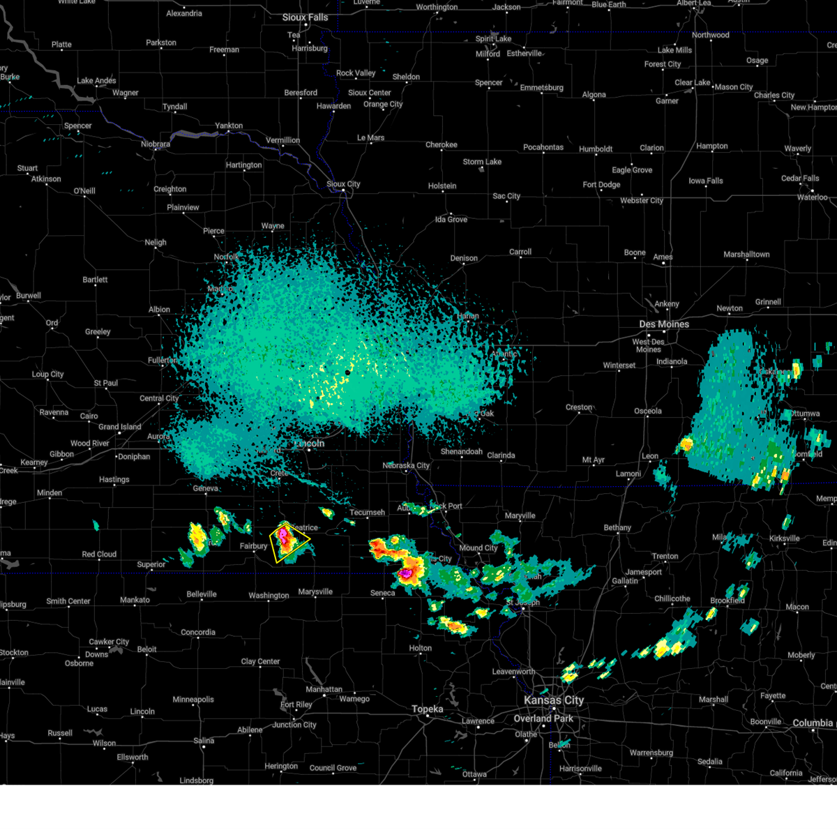 At 250 pm cdt, a severe thunderstorm was located 4 miles northeast of harbine, or 8 miles southwest of beatrice, moving southeast at 20 mph (radar indicated). Hazards include 60 mph wind gusts and quarter size hail. Hail damage to vehicles is expected. expect wind damage to roofs, siding, and trees. locations impacted include, beatrice, diller, harbine, ellis, and homestead national historical park. hail threat, radar indicated max hail size, 1. 00 in wind threat, radar indicated max wind gust, 60 mph. At 250 pm cdt, a severe thunderstorm was located 4 miles northeast of harbine, or 8 miles southwest of beatrice, moving southeast at 20 mph (radar indicated). Hazards include 60 mph wind gusts and quarter size hail. Hail damage to vehicles is expected. expect wind damage to roofs, siding, and trees. locations impacted include, beatrice, diller, harbine, ellis, and homestead national historical park. hail threat, radar indicated max hail size, 1. 00 in wind threat, radar indicated max wind gust, 60 mph.
|
| 9/16/2023 2:39 PM CDT |
 At 239 pm cdt, a severe thunderstorm was located 3 miles southeast of plymouth, or 10 miles west of beatrice, moving southeast at 20 mph (trained weather spotters). Hazards include golf ball size hail and 60 mph wind gusts. People and animals outdoors will be injured. expect hail damage to roofs, siding, windows, and vehicles. expect wind damage to roofs, siding, and trees. locations impacted include, beatrice, plymouth, diller, harbine, ellis, cub creek recreational area, and homestead national historical park. thunderstorm damage threat, considerable hail threat, observed max hail size, 1. 75 in wind threat, radar indicated max wind gust, 60 mph. At 239 pm cdt, a severe thunderstorm was located 3 miles southeast of plymouth, or 10 miles west of beatrice, moving southeast at 20 mph (trained weather spotters). Hazards include golf ball size hail and 60 mph wind gusts. People and animals outdoors will be injured. expect hail damage to roofs, siding, windows, and vehicles. expect wind damage to roofs, siding, and trees. locations impacted include, beatrice, plymouth, diller, harbine, ellis, cub creek recreational area, and homestead national historical park. thunderstorm damage threat, considerable hail threat, observed max hail size, 1. 75 in wind threat, radar indicated max wind gust, 60 mph.
|
| 9/16/2023 2:31 PM CDT |
 At 230 pm cdt, a severe thunderstorm was located over plymouth, or 12 miles west of beatrice, moving southeast at 20 mph (radar indicated). Hazards include 60 mph wind gusts and quarter size hail. Hail damage to vehicles is expected. Expect wind damage to roofs, siding, and trees. At 230 pm cdt, a severe thunderstorm was located over plymouth, or 12 miles west of beatrice, moving southeast at 20 mph (radar indicated). Hazards include 60 mph wind gusts and quarter size hail. Hail damage to vehicles is expected. Expect wind damage to roofs, siding, and trees.
|
| 8/26/2023 12:10 AM CDT |
 The severe thunderstorm warning for northern jefferson, southeastern saline and southwestern gage counties will expire at 1215 am cdt, the storm which prompted the warning has weakened below severe limits, and has exited the warned area. therefore, the warning will be allowed to expire. The severe thunderstorm warning for northern jefferson, southeastern saline and southwestern gage counties will expire at 1215 am cdt, the storm which prompted the warning has weakened below severe limits, and has exited the warned area. therefore, the warning will be allowed to expire.
|
| 8/25/2023 11:44 PM CDT |
 At 1144 pm cdt, a severe thunderstorm was located 4 miles east of plymouth, or 8 miles west of beatrice, moving northeast at 25 mph (emergency management). Hazards include 60 mph wind gusts. Expect damage to roofs, siding, and trees. locations impacted include, beatrice, de witt, plymouth, diller, jansen, swanton, harbine, holmesville, ellis, swan creek wildlife management area, cub creek recreational area, and homestead national historical park. hail threat, radar indicated max hail size, <. 75 in wind threat, radar indicated max wind gust, 60 mph. At 1144 pm cdt, a severe thunderstorm was located 4 miles east of plymouth, or 8 miles west of beatrice, moving northeast at 25 mph (emergency management). Hazards include 60 mph wind gusts. Expect damage to roofs, siding, and trees. locations impacted include, beatrice, de witt, plymouth, diller, jansen, swanton, harbine, holmesville, ellis, swan creek wildlife management area, cub creek recreational area, and homestead national historical park. hail threat, radar indicated max hail size, <. 75 in wind threat, radar indicated max wind gust, 60 mph.
|
| 8/25/2023 11:22 PM CDT |
 At 1122 pm cdt, a severe thunderstorm was located near jansen, or 8 miles northeast of fairbury, moving northeast at 25 mph (emergency management). Hazards include 60 mph wind gusts. expect damage to roofs, siding, and trees At 1122 pm cdt, a severe thunderstorm was located near jansen, or 8 miles northeast of fairbury, moving northeast at 25 mph (emergency management). Hazards include 60 mph wind gusts. expect damage to roofs, siding, and trees
|
| 8/11/2023 1:25 PM CDT | Quarter sized hail reported 8.8 miles WNW of Beatrice, NE, lots of hail up to quarter size. |
| 8/11/2023 1:25 PM CDT | Quarter sized hail reported 7.9 miles WNW of Beatrice, NE |
| 8/11/2023 1:18 PM CDT | Quarter sized hail reported 4.3 miles W of Beatrice, NE, wind driven hail stripped crops. |
| 8/11/2023 1:08 PM CDT |
 At 108 pm cdt, a severe thunderstorm was located near beatrice, moving southeast at 30 mph (radar indicated). Hazards include two inch hail and 60 mph wind gusts. People and animals outdoors will be injured. expect hail damage to roofs, siding, windows, and vehicles. expect wind damage to roofs, siding, and trees. locations impacted include, beatrice, blue springs, pickrell, filley, holmesville, rockford state recreation area, rockford, and homestead national historical park. thunderstorm damage threat, considerable hail threat, radar indicated max hail size, 2. 00 in wind threat, radar indicated max wind gust, 60 mph. At 108 pm cdt, a severe thunderstorm was located near beatrice, moving southeast at 30 mph (radar indicated). Hazards include two inch hail and 60 mph wind gusts. People and animals outdoors will be injured. expect hail damage to roofs, siding, windows, and vehicles. expect wind damage to roofs, siding, and trees. locations impacted include, beatrice, blue springs, pickrell, filley, holmesville, rockford state recreation area, rockford, and homestead national historical park. thunderstorm damage threat, considerable hail threat, radar indicated max hail size, 2. 00 in wind threat, radar indicated max wind gust, 60 mph.
|
| 8/11/2023 1:04 PM CDT | Half Dollar sized hail reported 5.1 miles S of Beatrice, NE |
| 8/11/2023 1:04 PM CDT | Golf Ball sized hail reported 1 miles SSE of Beatrice, NE, photo on social media. time estimated from radar. |
| 8/11/2023 1:01 PM CDT | Quarter sized hail reported 4.2 miles SSE of Beatrice, NE |
| 8/11/2023 1:01 PM CDT | Quarter sized hail reported 6 miles SSE of Beatrice, NE |
| 8/11/2023 12:59 PM CDT |
 At 1258 pm cdt, a severe thunderstorm was located 3 miles southwest of pickrell, or 4 miles north of beatrice, moving southeast at 30 mph (radar indicated). Hazards include golf ball size hail and 60 mph wind gusts. People and animals outdoors will be injured. expect hail damage to roofs, siding, windows, and vehicles. expect wind damage to roofs, siding, and trees. locations impacted include, beatrice, blue springs, pickrell, filley, holmesville, rockford state recreation area, rockford, and homestead national historical park. thunderstorm damage threat, considerable hail threat, radar indicated max hail size, 1. 75 in wind threat, radar indicated max wind gust, 60 mph. At 1258 pm cdt, a severe thunderstorm was located 3 miles southwest of pickrell, or 4 miles north of beatrice, moving southeast at 30 mph (radar indicated). Hazards include golf ball size hail and 60 mph wind gusts. People and animals outdoors will be injured. expect hail damage to roofs, siding, windows, and vehicles. expect wind damage to roofs, siding, and trees. locations impacted include, beatrice, blue springs, pickrell, filley, holmesville, rockford state recreation area, rockford, and homestead national historical park. thunderstorm damage threat, considerable hail threat, radar indicated max hail size, 1. 75 in wind threat, radar indicated max wind gust, 60 mph.
|
| 8/11/2023 12:46 PM CDT |
 At 1245 pm cdt, a severe thunderstorm was located near de witt, or 10 miles northwest of beatrice, moving southeast at 30 mph (radar indicated). Hazards include golf ball size hail. People and animals outdoors will be injured. Expect damage to roofs, siding, windows, and vehicles. At 1245 pm cdt, a severe thunderstorm was located near de witt, or 10 miles northwest of beatrice, moving southeast at 30 mph (radar indicated). Hazards include golf ball size hail. People and animals outdoors will be injured. Expect damage to roofs, siding, windows, and vehicles.
|
| 7/29/2023 8:30 AM CDT |
 At 830 am cdt, severe thunderstorms were located along a line extending from 2 miles southeast of pleasant dale to near panama to 2 miles northwest of barneston, moving east at 45 mph (radar indicated). Hazards include 70 mph wind gusts and nickel size hail. Expect considerable tree damage. damage is likely to mobile homes, roofs, and outbuildings. locations impacted include, lincoln, beatrice, tecumseh, crete, waverly, wilber, hickman, wymore, eagle, bennet, firth, adams, greenwood, palmyra, de witt, cortland, sterling, plymouth, malcolm, and blue springs. thunderstorm damage threat, considerable hail threat, radar indicated max hail size, 0. 88 in wind threat, observed max wind gust, 70 mph. At 830 am cdt, severe thunderstorms were located along a line extending from 2 miles southeast of pleasant dale to near panama to 2 miles northwest of barneston, moving east at 45 mph (radar indicated). Hazards include 70 mph wind gusts and nickel size hail. Expect considerable tree damage. damage is likely to mobile homes, roofs, and outbuildings. locations impacted include, lincoln, beatrice, tecumseh, crete, waverly, wilber, hickman, wymore, eagle, bennet, firth, adams, greenwood, palmyra, de witt, cortland, sterling, plymouth, malcolm, and blue springs. thunderstorm damage threat, considerable hail threat, radar indicated max hail size, 0. 88 in wind threat, observed max wind gust, 70 mph.
|
| 7/29/2023 8:23 AM CDT |
 At 823 am cdt, severe thunderstorms were located along a line extending from 3 miles north of pleasant dale to 4 miles southwest of adams to 3 miles northwest of odell, moving east at 45 mph (weather instrument measurement). Hazards include 70 mph wind gusts and quarter size hail. Hail damage to vehicles is expected. expect considerable tree damage. wind damage is also likely to mobile homes, roofs, and outbuildings. locations impacted include, lincoln, beatrice, tecumseh, crete, waverly, wilber, hickman, wymore, eagle, bennet, firth, adams, greenwood, palmyra, de witt, cortland, sterling, plymouth, malcolm, and blue springs. thunderstorm damage threat, considerable hail threat, radar indicated max hail size, 1. 00 in wind threat, observed max wind gust, 70 mph. At 823 am cdt, severe thunderstorms were located along a line extending from 3 miles north of pleasant dale to 4 miles southwest of adams to 3 miles northwest of odell, moving east at 45 mph (weather instrument measurement). Hazards include 70 mph wind gusts and quarter size hail. Hail damage to vehicles is expected. expect considerable tree damage. wind damage is also likely to mobile homes, roofs, and outbuildings. locations impacted include, lincoln, beatrice, tecumseh, crete, waverly, wilber, hickman, wymore, eagle, bennet, firth, adams, greenwood, palmyra, de witt, cortland, sterling, plymouth, malcolm, and blue springs. thunderstorm damage threat, considerable hail threat, radar indicated max hail size, 1. 00 in wind threat, observed max wind gust, 70 mph.
|
| 7/29/2023 8:21 AM CDT | Gust measured by the kbie awo in gage county NE, 2.3 miles S of Beatrice, NE |
| 7/29/2023 8:17 AM CDT | Multiple large trees down in beatric in gage county NE, 0.7 miles WSW of Beatrice, NE |
| 7/29/2023 8:09 AM CDT |
 At 809 am cdt, severe thunderstorms were located along a line extending from 4 miles south of seward to 4 miles northwest of pickrell to 2 miles east of endicott, moving east at 50 mph (public). Hazards include 70 mph wind gusts and quarter size hail. Hail damage to vehicles is expected. expect considerable tree damage. wind damage is also likely to mobile homes, roofs, and outbuildings. locations impacted include, lincoln, beatrice, tecumseh, crete, waverly, wilber, hickman, wymore, eagle, bennet, firth, adams, greenwood, palmyra, de witt, cortland, sterling, plymouth, malcolm, and blue springs. thunderstorm damage threat, considerable hail threat, radar indicated max hail size, 1. 00 in wind threat, observed max wind gust, 70 mph. At 809 am cdt, severe thunderstorms were located along a line extending from 4 miles south of seward to 4 miles northwest of pickrell to 2 miles east of endicott, moving east at 50 mph (public). Hazards include 70 mph wind gusts and quarter size hail. Hail damage to vehicles is expected. expect considerable tree damage. wind damage is also likely to mobile homes, roofs, and outbuildings. locations impacted include, lincoln, beatrice, tecumseh, crete, waverly, wilber, hickman, wymore, eagle, bennet, firth, adams, greenwood, palmyra, de witt, cortland, sterling, plymouth, malcolm, and blue springs. thunderstorm damage threat, considerable hail threat, radar indicated max hail size, 1. 00 in wind threat, observed max wind gust, 70 mph.
|
| 7/29/2023 8:07 AM CDT | Multiple large trees dow in gage county NE, 0.3 miles SSW of Beatrice, NE |
| 7/29/2023 8:05 AM CDT | Measured from private weather statio in gage county NE, 6.6 miles ENE of Beatrice, NE |
| 7/29/2023 7:53 AM CDT |
 At 752 am cdt, severe thunderstorms were located along a line extending from 3 miles east of utica to 2 miles southeast of swanton to 3 miles northeast of reynolds, moving east at 45 mph (radar indicated). Hazards include 70 mph wind gusts and penny size hail. Expect considerable tree damage. Damage is likely to mobile homes, roofs, and outbuildings. At 752 am cdt, severe thunderstorms were located along a line extending from 3 miles east of utica to 2 miles southeast of swanton to 3 miles northeast of reynolds, moving east at 45 mph (radar indicated). Hazards include 70 mph wind gusts and penny size hail. Expect considerable tree damage. Damage is likely to mobile homes, roofs, and outbuildings.
|
| 7/12/2023 6:48 AM CDT |
 At 648 am cdt, severe thunderstorms were located along a line extending from 7 miles southwest of dorchester to 4 miles southeast of sprague, moving south at 45 mph (public). Hazards include 70 mph wind gusts. Expect considerable tree damage. damage is likely to mobile homes, roofs, and outbuildings. severe thunderstorms will be near, cortland around 655 am cdt. pickrell and swanton around 705 am cdt. other locations in the path of these severe thunderstorms include beatrice, plymouth, filley, virginia, holmesville, jansen, harbine, wymore, blue springs, endicott, barneston, liberty and steele city. thunderstorm damage threat, considerable hail threat, radar indicated max hail size, <. 75 in wind threat, radar indicated max wind gust, 70 mph. At 648 am cdt, severe thunderstorms were located along a line extending from 7 miles southwest of dorchester to 4 miles southeast of sprague, moving south at 45 mph (public). Hazards include 70 mph wind gusts. Expect considerable tree damage. damage is likely to mobile homes, roofs, and outbuildings. severe thunderstorms will be near, cortland around 655 am cdt. pickrell and swanton around 705 am cdt. other locations in the path of these severe thunderstorms include beatrice, plymouth, filley, virginia, holmesville, jansen, harbine, wymore, blue springs, endicott, barneston, liberty and steele city. thunderstorm damage threat, considerable hail threat, radar indicated max hail size, <. 75 in wind threat, radar indicated max wind gust, 70 mph.
|
| 7/4/2023 8:27 PM CDT |
 At 826 pm cdt, severe thunderstorms were located along a line extending from 3 miles northwest of nebraska city to 4 miles northeast of elk creek to 5 miles northeast of burchard to 2 miles northwest of blue springs, moving southeast at 35 mph (radar indicated). Hazards include 60 mph wind gusts and penny size hail. Expect damage to roofs, siding, and trees. severe thunderstorms will be near, johnson and elk creek around 830 pm cdt. table rock around 840 pm cdt. pawnee city, humboldt and barneston around 845 pm cdt. other locations in the path of these severe thunderstorms include liberty, peru, stella, du bois, dawson, shubert, verdon and summerfield. hail threat, radar indicated max hail size, 0. 75 in wind threat, radar indicated max wind gust, 60 mph. At 826 pm cdt, severe thunderstorms were located along a line extending from 3 miles northwest of nebraska city to 4 miles northeast of elk creek to 5 miles northeast of burchard to 2 miles northwest of blue springs, moving southeast at 35 mph (radar indicated). Hazards include 60 mph wind gusts and penny size hail. Expect damage to roofs, siding, and trees. severe thunderstorms will be near, johnson and elk creek around 830 pm cdt. table rock around 840 pm cdt. pawnee city, humboldt and barneston around 845 pm cdt. other locations in the path of these severe thunderstorms include liberty, peru, stella, du bois, dawson, shubert, verdon and summerfield. hail threat, radar indicated max hail size, 0. 75 in wind threat, radar indicated max wind gust, 60 mph.
|
| 6/29/2023 5:42 AM CDT |
 At 542 am cdt, a severe thunderstorm was located 6 miles east of crab orchard, or 6 miles west of tecumseh, moving east at 30 mph (radar indicated). Hazards include 60 mph wind gusts and half dollar size hail. Hail damage to vehicles is expected. expect wind damage to roofs, siding, and trees. this severe thunderstorm will be near, tecumseh around 555 am cdt. elk creek around 600 am cdt. other locations in the path of this severe thunderstorm include johnson. hail threat, radar indicated max hail size, 1. 25 in wind threat, radar indicated max wind gust, 60 mph. At 542 am cdt, a severe thunderstorm was located 6 miles east of crab orchard, or 6 miles west of tecumseh, moving east at 30 mph (radar indicated). Hazards include 60 mph wind gusts and half dollar size hail. Hail damage to vehicles is expected. expect wind damage to roofs, siding, and trees. this severe thunderstorm will be near, tecumseh around 555 am cdt. elk creek around 600 am cdt. other locations in the path of this severe thunderstorm include johnson. hail threat, radar indicated max hail size, 1. 25 in wind threat, radar indicated max wind gust, 60 mph.
|
| 6/29/2023 5:32 AM CDT |
 At 531 am cdt, a severe thunderstorm was located 4 miles west of holmesville, or 5 miles south of beatrice, moving east at 30 mph (radar indicated). Hazards include ping pong ball size hail and 60 mph wind gusts. People and animals outdoors will be injured. expect hail damage to roofs, siding, windows, and vehicles. expect wind damage to roofs, siding, and trees. this severe storm will be near, wymore, blue springs and holmesville around 540 am cdt. other locations in the path of this severe thunderstorm include filley, lewiston and virginia. hail threat, radar indicated max hail size, 1. 50 in wind threat, radar indicated max wind gust, 60 mph. At 531 am cdt, a severe thunderstorm was located 4 miles west of holmesville, or 5 miles south of beatrice, moving east at 30 mph (radar indicated). Hazards include ping pong ball size hail and 60 mph wind gusts. People and animals outdoors will be injured. expect hail damage to roofs, siding, windows, and vehicles. expect wind damage to roofs, siding, and trees. this severe storm will be near, wymore, blue springs and holmesville around 540 am cdt. other locations in the path of this severe thunderstorm include filley, lewiston and virginia. hail threat, radar indicated max hail size, 1. 50 in wind threat, radar indicated max wind gust, 60 mph.
|
| 6/29/2023 5:23 AM CDT |
 At 523 am cdt, a severe thunderstorm was located 7 miles northeast of diller, or 7 miles southwest of beatrice, moving east at 30 mph (radar indicated). Hazards include golf ball size hail and 60 mph wind gusts. People and animals outdoors will be injured. expect hail damage to roofs, siding, windows, and vehicles. expect wind damage to roofs, siding, and trees. this severe thunderstorm will be near, wymore, blue springs and holmesville around 540 am cdt. other locations in the path of this severe thunderstorm include filley and virginia. thunderstorm damage threat, considerable hail threat, radar indicated max hail size, 1. 75 in wind threat, radar indicated max wind gust, 60 mph. At 523 am cdt, a severe thunderstorm was located 7 miles northeast of diller, or 7 miles southwest of beatrice, moving east at 30 mph (radar indicated). Hazards include golf ball size hail and 60 mph wind gusts. People and animals outdoors will be injured. expect hail damage to roofs, siding, windows, and vehicles. expect wind damage to roofs, siding, and trees. this severe thunderstorm will be near, wymore, blue springs and holmesville around 540 am cdt. other locations in the path of this severe thunderstorm include filley and virginia. thunderstorm damage threat, considerable hail threat, radar indicated max hail size, 1. 75 in wind threat, radar indicated max wind gust, 60 mph.
|
| 6/29/2023 5:10 AM CDT |
 At 510 am cdt, a severe thunderstorm was located 3 miles southeast of plymouth, or 10 miles west of beatrice, moving east at 35 mph (emergency management). Hazards include golf ball size hail and 60 mph wind gusts. People and animals outdoors will be injured. expect hail damage to roofs, siding, windows, and vehicles. expect wind damage to roofs, siding, and trees. locations impacted include, beatrice and pickrell. thunderstorm damage threat, considerable hail threat, radar indicated max hail size, 1. 75 in wind threat, radar indicated max wind gust, 60 mph. At 510 am cdt, a severe thunderstorm was located 3 miles southeast of plymouth, or 10 miles west of beatrice, moving east at 35 mph (emergency management). Hazards include golf ball size hail and 60 mph wind gusts. People and animals outdoors will be injured. expect hail damage to roofs, siding, windows, and vehicles. expect wind damage to roofs, siding, and trees. locations impacted include, beatrice and pickrell. thunderstorm damage threat, considerable hail threat, radar indicated max hail size, 1. 75 in wind threat, radar indicated max wind gust, 60 mph.
|
| 6/29/2023 5:08 AM CDT |
 At 508 am cdt, a severe thunderstorm was located 3 miles northwest of filley, or 9 miles northeast of beatrice, moving east at 35 mph (radar indicated). Hazards include 60 mph wind gusts and quarter size hail. Hail damage to vehicles is expected. expect wind damage to roofs, siding, and trees. this severe thunderstorm will be near, crab orchard around 525 am cdt. other locations in the path of this severe thunderstorm include sterling. hail threat, radar indicated max hail size, 1. 00 in wind threat, radar indicated max wind gust, 60 mph. At 508 am cdt, a severe thunderstorm was located 3 miles northwest of filley, or 9 miles northeast of beatrice, moving east at 35 mph (radar indicated). Hazards include 60 mph wind gusts and quarter size hail. Hail damage to vehicles is expected. expect wind damage to roofs, siding, and trees. this severe thunderstorm will be near, crab orchard around 525 am cdt. other locations in the path of this severe thunderstorm include sterling. hail threat, radar indicated max hail size, 1. 00 in wind threat, radar indicated max wind gust, 60 mph.
|
| 6/29/2023 4:56 AM CDT |
 At 456 am cdt, a severe thunderstorm was located near jansen, or 6 miles northeast of fairbury, moving east at 35 mph (emergency management). Hazards include tennis ball size hail and 60 mph wind gusts. People and animals outdoors will be injured. expect hail damage to roofs, siding, windows, and vehicles. expect wind damage to roofs, siding, and trees. this severe thunderstorm will be near, harbine around 505 am cdt. plymouth around 510 am cdt. other locations in the path of this severe thunderstorm include beatrice and pickrell. thunderstorm damage threat, considerable hail threat, radar indicated max hail size, 2. 50 in wind threat, radar indicated max wind gust, 60 mph. At 456 am cdt, a severe thunderstorm was located near jansen, or 6 miles northeast of fairbury, moving east at 35 mph (emergency management). Hazards include tennis ball size hail and 60 mph wind gusts. People and animals outdoors will be injured. expect hail damage to roofs, siding, windows, and vehicles. expect wind damage to roofs, siding, and trees. this severe thunderstorm will be near, harbine around 505 am cdt. plymouth around 510 am cdt. other locations in the path of this severe thunderstorm include beatrice and pickrell. thunderstorm damage threat, considerable hail threat, radar indicated max hail size, 2. 50 in wind threat, radar indicated max wind gust, 60 mph.
|
| 6/29/2023 4:48 AM CDT |
 At 448 am cdt, a severe thunderstorm was located near swanton, or 17 miles north of fairbury, moving northeast at 35 mph (radar indicated). Hazards include 60 mph wind gusts and half dollar size hail. Hail damage to vehicles is expected. expect wind damage to roofs, siding, and trees. locations impacted include, fairbury, wilber, de witt, plymouth, diller, western, clatonia, daykin, endicott, jansen, tobias, swanton, harbine, swan creek reservoir number 2, swan creek wildlife management area, alexandria state recreation area, homestead national historical park, ellis, crystal springs campground and gladstone. hail threat, radar indicated max hail size, 1. 25 in wind threat, radar indicated max wind gust, 60 mph. At 448 am cdt, a severe thunderstorm was located near swanton, or 17 miles north of fairbury, moving northeast at 35 mph (radar indicated). Hazards include 60 mph wind gusts and half dollar size hail. Hail damage to vehicles is expected. expect wind damage to roofs, siding, and trees. locations impacted include, fairbury, wilber, de witt, plymouth, diller, western, clatonia, daykin, endicott, jansen, tobias, swanton, harbine, swan creek reservoir number 2, swan creek wildlife management area, alexandria state recreation area, homestead national historical park, ellis, crystal springs campground and gladstone. hail threat, radar indicated max hail size, 1. 25 in wind threat, radar indicated max wind gust, 60 mph.
|
| 6/29/2023 4:40 AM CDT |
 At 439 am cdt, a severe thunderstorm was located 4 miles south of western, or 12 miles north of fairbury, moving northeast at 35 mph (radar indicated). Hazards include 60 mph wind gusts and quarter size hail. Hail damage to vehicles is expected. expect wind damage to roofs, siding, and trees. locations impacted include, swanton and wilber. hail threat, radar indicated max hail size, 1. 00 in wind threat, radar indicated max wind gust, 60 mph. At 439 am cdt, a severe thunderstorm was located 4 miles south of western, or 12 miles north of fairbury, moving northeast at 35 mph (radar indicated). Hazards include 60 mph wind gusts and quarter size hail. Hail damage to vehicles is expected. expect wind damage to roofs, siding, and trees. locations impacted include, swanton and wilber. hail threat, radar indicated max hail size, 1. 00 in wind threat, radar indicated max wind gust, 60 mph.
|
| 6/29/2023 4:27 AM CDT |
 At 427 am cdt, a severe thunderstorm was located 6 miles southeast of daykin, or 7 miles northwest of fairbury, moving northeast at 30 mph (radar indicated). Hazards include 60 mph wind gusts and quarter size hail. Hail damage to vehicles is expected. expect wind damage to roofs, siding, and trees. this severe thunderstorm will be near, daykin around 435 am cdt. western around 445 am cdt. other locations in the path of this severe thunderstorm include swanton and wilber. hail threat, radar indicated max hail size, 1. 00 in wind threat, radar indicated max wind gust, 60 mph. At 427 am cdt, a severe thunderstorm was located 6 miles southeast of daykin, or 7 miles northwest of fairbury, moving northeast at 30 mph (radar indicated). Hazards include 60 mph wind gusts and quarter size hail. Hail damage to vehicles is expected. expect wind damage to roofs, siding, and trees. this severe thunderstorm will be near, daykin around 435 am cdt. western around 445 am cdt. other locations in the path of this severe thunderstorm include swanton and wilber. hail threat, radar indicated max hail size, 1. 00 in wind threat, radar indicated max wind gust, 60 mph.
|
| 5/7/2023 11:38 PM CDT |
 The severe thunderstorm warning for southern lancaster, johnson, northeastern jefferson, southwestern otoe, southeastern saline, pawnee and gage counties will expire at 1145 pm cdt, the storms which prompted the warning have moved out of the area. therefore, the warning will be allowed to expire. a severe thunderstorm watch remains in effect until 100 am cdt for southeastern nebraska. The severe thunderstorm warning for southern lancaster, johnson, northeastern jefferson, southwestern otoe, southeastern saline, pawnee and gage counties will expire at 1145 pm cdt, the storms which prompted the warning have moved out of the area. therefore, the warning will be allowed to expire. a severe thunderstorm watch remains in effect until 100 am cdt for southeastern nebraska.
|
| 5/7/2023 11:28 PM CDT |
 At 1127 pm cdt, severe thunderstorms were located along a line extending from 2 miles south of panama to 3 miles west of tecumseh to 3 miles west of table rock, moving east at 40 mph (emergency management). Hazards include 70 mph wind gusts and quarter size hail. Hail damage to vehicles is expected. expect considerable tree damage. wind damage is also likely to mobile homes, roofs, and outbuildings. locations impacted include, beatrice, tecumseh, pawnee city, wilber, firth, adams, de witt, cortland, sterling, plymouth, table rock, clatonia, hallam, pickrell, filley, elk creek, burchard, liberty, lewiston and virginia. thunderstorm damage threat, considerable hail threat, radar indicated max hail size, 1. 00 in wind threat, observed max wind gust, 70 mph. At 1127 pm cdt, severe thunderstorms were located along a line extending from 2 miles south of panama to 3 miles west of tecumseh to 3 miles west of table rock, moving east at 40 mph (emergency management). Hazards include 70 mph wind gusts and quarter size hail. Hail damage to vehicles is expected. expect considerable tree damage. wind damage is also likely to mobile homes, roofs, and outbuildings. locations impacted include, beatrice, tecumseh, pawnee city, wilber, firth, adams, de witt, cortland, sterling, plymouth, table rock, clatonia, hallam, pickrell, filley, elk creek, burchard, liberty, lewiston and virginia. thunderstorm damage threat, considerable hail threat, radar indicated max hail size, 1. 00 in wind threat, observed max wind gust, 70 mph.
|
| 5/7/2023 11:21 PM CDT |
 At 1120 pm cdt, severe thunderstorms were located along a line extending from near firth to 5 miles east of crab orchard to 4 miles northwest of pawnee city, moving east at 40 mph (emergency management). Hazards include 70 mph wind gusts and quarter size hail. Hail damage to vehicles is expected. expect considerable tree damage. wind damage is also likely to mobile homes, roofs, and outbuildings. locations impacted include, pawnee city, tecumseh, table rock, du bois, elk creek and sterling. thunderstorm damage threat, considerable hail threat, radar indicated max hail size, 1. 00 in wind threat, observed max wind gust, 70 mph. At 1120 pm cdt, severe thunderstorms were located along a line extending from near firth to 5 miles east of crab orchard to 4 miles northwest of pawnee city, moving east at 40 mph (emergency management). Hazards include 70 mph wind gusts and quarter size hail. Hail damage to vehicles is expected. expect considerable tree damage. wind damage is also likely to mobile homes, roofs, and outbuildings. locations impacted include, pawnee city, tecumseh, table rock, du bois, elk creek and sterling. thunderstorm damage threat, considerable hail threat, radar indicated max hail size, 1. 00 in wind threat, observed max wind gust, 70 mph.
|
| 5/7/2023 11:01 PM CDT | Davis measurement of 62mp in gage county NE, 0.3 miles SSW of Beatrice, NE |
| 5/7/2023 10:58 PM CDT |
 The severe thunderstorm warning for jefferson, southern saline and gage counties will expire at 1100 pm cdt, the storms which prompted the warning have moved out of the area. therefore, the warning will be allowed to expire. however gusty winds are still possible with these thunderstorms. a severe thunderstorm watch remains in effect until 100 am cdt for southeastern nebraska. The severe thunderstorm warning for jefferson, southern saline and gage counties will expire at 1100 pm cdt, the storms which prompted the warning have moved out of the area. therefore, the warning will be allowed to expire. however gusty winds are still possible with these thunderstorms. a severe thunderstorm watch remains in effect until 100 am cdt for southeastern nebraska.
|
| 5/7/2023 10:54 PM CDT | Personal weather statio in gage county NE, 6 miles W of Beatrice, NE |
| 5/7/2023 10:54 PM CDT |
 At 1053 pm cdt, severe thunderstorms were located along a line extending from 2 miles west of clatonia to 4 miles north of holmesville to 2 miles southwest of liberty, moving east at 40 mph (radar indicated). Hazards include 70 mph wind gusts and quarter size hail. Hail damage to vehicles is expected. expect considerable tree damage. wind damage is also likely to mobile homes, roofs, and outbuildings. severe thunderstorms will be near, liberty around 1100 pm cdt. summerfield, filley and virginia around 1105 pm cdt. burchard and lewiston around 1110 pm cdt. other locations in the path of these severe thunderstorms include crab orchard, firth, pawnee city, adams, tecumseh, table rock and elk creek. thunderstorm damage threat, considerable hail threat, radar indicated max hail size, 1. 00 in wind threat, observed max wind gust, 70 mph. At 1053 pm cdt, severe thunderstorms were located along a line extending from 2 miles west of clatonia to 4 miles north of holmesville to 2 miles southwest of liberty, moving east at 40 mph (radar indicated). Hazards include 70 mph wind gusts and quarter size hail. Hail damage to vehicles is expected. expect considerable tree damage. wind damage is also likely to mobile homes, roofs, and outbuildings. severe thunderstorms will be near, liberty around 1100 pm cdt. summerfield, filley and virginia around 1105 pm cdt. burchard and lewiston around 1110 pm cdt. other locations in the path of these severe thunderstorms include crab orchard, firth, pawnee city, adams, tecumseh, table rock and elk creek. thunderstorm damage threat, considerable hail threat, radar indicated max hail size, 1. 00 in wind threat, observed max wind gust, 70 mph.
|
| 5/7/2023 10:49 PM CDT | Storm damage reported in gage county NE, 2.3 miles S of Beatrice, NE |
| 5/7/2023 10:48 PM CDT | Storm damage reported in gage county NE, 2.3 miles S of Beatrice, NE |
| 5/7/2023 10:43 PM CDT |
 At 1043 pm cdt, severe thunderstorms were located along a line extending from near swanton to 6 miles west of beatrice to 2 miles east of wymore, moving northeast at 40 mph (emergency management). Hazards include 70 mph wind gusts and quarter size hail. Hail damage to vehicles is expected. expect considerable tree damage. wind damage is also likely to mobile homes, roofs, and outbuildings. these severe storms will be near, wymore, blue springs and holmesville around 1050 pm cdt. beatrice around 1055 pm cdt. pickrell around 1100 pm cdt. clatonia around 1105 pm cdt. other locations impacted by these severe thunderstorms include ellis, crystal springs campground, buckley creek recreational area, camp jefferson, swan creek wildlife management area, alexandria state recreation area, rockford, rock creek station state historical park, cub creek recreational area and homestead national historical park. thunderstorm damage threat, considerable hail threat, radar indicated max hail size, 1. 00 in wind threat, observed max wind gust, 70 mph. At 1043 pm cdt, severe thunderstorms were located along a line extending from near swanton to 6 miles west of beatrice to 2 miles east of wymore, moving northeast at 40 mph (emergency management). Hazards include 70 mph wind gusts and quarter size hail. Hail damage to vehicles is expected. expect considerable tree damage. wind damage is also likely to mobile homes, roofs, and outbuildings. these severe storms will be near, wymore, blue springs and holmesville around 1050 pm cdt. beatrice around 1055 pm cdt. pickrell around 1100 pm cdt. clatonia around 1105 pm cdt. other locations impacted by these severe thunderstorms include ellis, crystal springs campground, buckley creek recreational area, camp jefferson, swan creek wildlife management area, alexandria state recreation area, rockford, rock creek station state historical park, cub creek recreational area and homestead national historical park. thunderstorm damage threat, considerable hail threat, radar indicated max hail size, 1. 00 in wind threat, observed max wind gust, 70 mph.
|
| 5/7/2023 10:27 PM CDT |
 At 1026 pm cdt, a line of severe thunderstorms were located 3 miles northwest of harbine, or 11 miles northeast of fairbury, moving east at 60 mph (emergency management). Hazards include 70 mph wind gusts and quarter size hail. Hail damage to vehicles is expected. expect considerable tree damage. wind damage is also likely to mobile homes, roofs, and outbuildings. locations impacted include, beatrice, fairbury, wilber, wymore, de witt, plymouth, blue springs, odell, diller, western, clatonia, pickrell, daykin, endicott, jansen, tobias, swanton, reynolds, steele city and harbine. thunderstorm damage threat, considerable hail threat, radar indicated max hail size, 1. 00 in wind threat, observed max wind gust, 70 mph. At 1026 pm cdt, a line of severe thunderstorms were located 3 miles northwest of harbine, or 11 miles northeast of fairbury, moving east at 60 mph (emergency management). Hazards include 70 mph wind gusts and quarter size hail. Hail damage to vehicles is expected. expect considerable tree damage. wind damage is also likely to mobile homes, roofs, and outbuildings. locations impacted include, beatrice, fairbury, wilber, wymore, de witt, plymouth, blue springs, odell, diller, western, clatonia, pickrell, daykin, endicott, jansen, tobias, swanton, reynolds, steele city and harbine. thunderstorm damage threat, considerable hail threat, radar indicated max hail size, 1. 00 in wind threat, observed max wind gust, 70 mph.
|
| 5/7/2023 10:13 PM CDT |
 At 1012 pm cdt, severe thunderstorms were located along a line extending from 2 miles northeast of goehner to 7 miles north of morrowville, moving east at 45 mph (automated weather station. a few stations have reported wind speeds of 55 to 60 mph). Hazards include 60 mph wind gusts and quarter size hail. Hail damage to vehicles is expected. Expect wind damage to roofs, siding, and trees. At 1012 pm cdt, severe thunderstorms were located along a line extending from 2 miles northeast of goehner to 7 miles north of morrowville, moving east at 45 mph (automated weather station. a few stations have reported wind speeds of 55 to 60 mph). Hazards include 60 mph wind gusts and quarter size hail. Hail damage to vehicles is expected. Expect wind damage to roofs, siding, and trees.
|
| 5/7/2023 10:04 PM CDT |
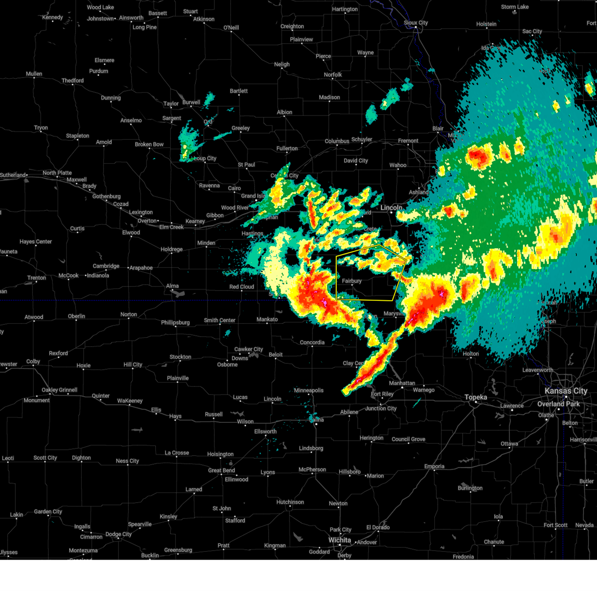 At 1003 pm cdt, severe thunderstorms were located along a line extending from 3 miles northwest of goehner to 5 miles southeast of mahaska, moving east at 40 mph (automated weather station. a few stations have reported wind speeds of 55 to 60 mph). Hazards include 60 mph wind gusts and nickel size hail. expect damage to roofs, siding, and trees At 1003 pm cdt, severe thunderstorms were located along a line extending from 3 miles northwest of goehner to 5 miles southeast of mahaska, moving east at 40 mph (automated weather station. a few stations have reported wind speeds of 55 to 60 mph). Hazards include 60 mph wind gusts and nickel size hail. expect damage to roofs, siding, and trees
|
| 5/7/2023 8:36 PM CDT |
 At 836 pm cdt, a severe thunderstorm was located near holmesville, or 5 miles south of beatrice, moving northeast at 60 mph (radar indicated). Hazards include quarter size hail. Damage to vehicles is expected. locations impacted include, filley, lewiston, virginia and crab orchard. hail threat, radar indicated max hail size, 1. 00 in wind threat, radar indicated max wind gust, <50 mph. At 836 pm cdt, a severe thunderstorm was located near holmesville, or 5 miles south of beatrice, moving northeast at 60 mph (radar indicated). Hazards include quarter size hail. Damage to vehicles is expected. locations impacted include, filley, lewiston, virginia and crab orchard. hail threat, radar indicated max hail size, 1. 00 in wind threat, radar indicated max wind gust, <50 mph.
|
| 5/7/2023 8:25 PM CDT |
 The severe thunderstorm warning for northeastern jefferson, southeastern saline and northern gage counties will expire at 830 pm cdt, the storm which prompted the warning has weakened below severe limits, and has exited the warned area. therefore, the warning will be allowed to expire. however small hail is still possible with this thunderstorm. a severe thunderstorm watch remains in effect until 100 am cdt for southeastern nebraska. The severe thunderstorm warning for northeastern jefferson, southeastern saline and northern gage counties will expire at 830 pm cdt, the storm which prompted the warning has weakened below severe limits, and has exited the warned area. therefore, the warning will be allowed to expire. however small hail is still possible with this thunderstorm. a severe thunderstorm watch remains in effect until 100 am cdt for southeastern nebraska.
|
| 5/7/2023 8:16 PM CDT |
 At 816 pm cdt, a severe thunderstorm was located near endicott, or 7 miles southeast of fairbury, moving northeast at 35 mph (radar indicated). Hazards include quarter size hail. Damage to vehicles is expected. this severe thunderstorm will be near, diller and harbine around 825 pm cdt. odell around 830 pm cdt. wymore and blue springs around 835 pm cdt. other locations in the path of this severe thunderstorm include holmesville, filley, lewiston, virginia and crab orchard. hail threat, radar indicated max hail size, 1. 00 in wind threat, radar indicated max wind gust, <50 mph. At 816 pm cdt, a severe thunderstorm was located near endicott, or 7 miles southeast of fairbury, moving northeast at 35 mph (radar indicated). Hazards include quarter size hail. Damage to vehicles is expected. this severe thunderstorm will be near, diller and harbine around 825 pm cdt. odell around 830 pm cdt. wymore and blue springs around 835 pm cdt. other locations in the path of this severe thunderstorm include holmesville, filley, lewiston, virginia and crab orchard. hail threat, radar indicated max hail size, 1. 00 in wind threat, radar indicated max wind gust, <50 mph.
|
| 5/7/2023 8:13 PM CDT |
 At 813 pm cdt, a severe thunderstorm was located 6 miles southeast of de witt, or 6 miles northwest of beatrice, moving northeast at 35 mph (radar indicated). Hazards include quarter size hail. People and animals outdoors will be injured. expect damage to roofs, siding, windows, and vehicles. locations impacted include, beatrice and pickrell. hail threat, radar indicated max hail size, 1. 50 in wind threat, radar indicated max wind gust, <50 mph. At 813 pm cdt, a severe thunderstorm was located 6 miles southeast of de witt, or 6 miles northwest of beatrice, moving northeast at 35 mph (radar indicated). Hazards include quarter size hail. People and animals outdoors will be injured. expect damage to roofs, siding, windows, and vehicles. locations impacted include, beatrice and pickrell. hail threat, radar indicated max hail size, 1. 50 in wind threat, radar indicated max wind gust, <50 mph.
|
| 5/7/2023 7:56 PM CDT |
 At 755 pm cdt, a severe thunderstorm was located 4 miles southwest of plymouth, or 11 miles northeast of fairbury, moving northeast at 30 mph (radar indicated). Hazards include ping pong ball size hail. People and animals outdoors will be injured. expect damage to roofs, siding, windows, and vehicles. this severe thunderstorm will be near, plymouth around 800 pm cdt. de witt around 815 pm cdt. other locations in the path of this severe thunderstorm include beatrice and pickrell. hail threat, radar indicated max hail size, 1. 50 in wind threat, radar indicated max wind gust, <50 mph. At 755 pm cdt, a severe thunderstorm was located 4 miles southwest of plymouth, or 11 miles northeast of fairbury, moving northeast at 30 mph (radar indicated). Hazards include ping pong ball size hail. People and animals outdoors will be injured. expect damage to roofs, siding, windows, and vehicles. this severe thunderstorm will be near, plymouth around 800 pm cdt. de witt around 815 pm cdt. other locations in the path of this severe thunderstorm include beatrice and pickrell. hail threat, radar indicated max hail size, 1. 50 in wind threat, radar indicated max wind gust, <50 mph.
|
| 5/6/2023 10:27 PM CDT |
 At 1027 pm cdt, a severe thunderstorm was located near holmesville, or 6 miles southeast of beatrice, moving east at 40 mph (radar indicated). Hazards include quarter size hail. Damage to vehicles is expected. locations impacted include, filley, virginia, lewiston and burchard. hail threat, radar indicated max hail size, 1. 00 in wind threat, radar indicated max wind gust, <50 mph. At 1027 pm cdt, a severe thunderstorm was located near holmesville, or 6 miles southeast of beatrice, moving east at 40 mph (radar indicated). Hazards include quarter size hail. Damage to vehicles is expected. locations impacted include, filley, virginia, lewiston and burchard. hail threat, radar indicated max hail size, 1. 00 in wind threat, radar indicated max wind gust, <50 mph.
|
| 5/6/2023 10:14 PM CDT |
 At 1012 pm cdt, a severe thunderstorm was located 4 miles west of beatrice, moving east at 40 mph (radar indicated). Hazards include quarter size hail. Damage to vehicles is expected. this severe thunderstorm will be near, wymore and holmesville around 1025 pm cdt. blue springs around 1030 pm cdt. other locations in the path of this severe thunderstorm include filley, virginia, lewiston and burchard. hail threat, radar indicated max hail size, 1. 00 in wind threat, radar indicated max wind gust, <50 mph. At 1012 pm cdt, a severe thunderstorm was located 4 miles west of beatrice, moving east at 40 mph (radar indicated). Hazards include quarter size hail. Damage to vehicles is expected. this severe thunderstorm will be near, wymore and holmesville around 1025 pm cdt. blue springs around 1030 pm cdt. other locations in the path of this severe thunderstorm include filley, virginia, lewiston and burchard. hail threat, radar indicated max hail size, 1. 00 in wind threat, radar indicated max wind gust, <50 mph.
|
| 10/11/2022 11:49 PM CDT |
 At 1149 pm cdt, severe thunderstorms were located along a line extending from 2 miles southwest of syracuse to 6 miles southeast of odell, moving east at 30 mph (radar indicated). Hazards include 60 mph wind gusts. Expect damage to roofs, siding, and trees. these severe thunderstorms will remain over mainly rural areas of southeastern lancaster and gage counties, including the following locations, rockford state recreation area and rockford. hail threat, radar indicated max hail size, <. 75 in wind threat, radar indicated max wind gust, 60 mph. At 1149 pm cdt, severe thunderstorms were located along a line extending from 2 miles southwest of syracuse to 6 miles southeast of odell, moving east at 30 mph (radar indicated). Hazards include 60 mph wind gusts. Expect damage to roofs, siding, and trees. these severe thunderstorms will remain over mainly rural areas of southeastern lancaster and gage counties, including the following locations, rockford state recreation area and rockford. hail threat, radar indicated max hail size, <. 75 in wind threat, radar indicated max wind gust, 60 mph.
|
| 10/11/2022 11:24 PM CDT |
 At 1124 pm cdt, severe thunderstorms were located along a line extending from 3 miles east of bennet to 3 miles south of diller, moving east at 30 mph (radar indicated). Hazards include 60 mph wind gusts. Expect damage to roofs, siding, and trees. severe thunderstorms will be near, bennet and panama around 1130 pm cdt. other locations in the path of these severe thunderstorms include barneston. hail threat, radar indicated max hail size, <. 75 in wind threat, radar indicated max wind gust, 60 mph. At 1124 pm cdt, severe thunderstorms were located along a line extending from 3 miles east of bennet to 3 miles south of diller, moving east at 30 mph (radar indicated). Hazards include 60 mph wind gusts. Expect damage to roofs, siding, and trees. severe thunderstorms will be near, bennet and panama around 1130 pm cdt. other locations in the path of these severe thunderstorms include barneston. hail threat, radar indicated max hail size, <. 75 in wind threat, radar indicated max wind gust, 60 mph.
|
| 10/11/2022 11:11 PM CDT | Storm damage reported in gage county NE, 2.3 miles S of Beatrice, NE |
| 10/11/2022 11:03 PM CDT |
 At 1103 pm cdt, severe thunderstorms were located along a line extending from 2 miles west of hallam to 4 miles southwest of endicott, moving east at 40 mph (trained weather spotters). Hazards include 70 mph wind gusts. Expect considerable tree damage. damage is likely to mobile homes, roofs, and outbuildings. locations impacted include, clatonia, hallam, sprague, cortland, hickman, diller, firth, adams, odell, panama, wymore, blue springs and barneston. thunderstorm damage threat, considerable hail threat, radar indicated max hail size, <. 75 in wind threat, radar indicated max wind gust, 70 mph. At 1103 pm cdt, severe thunderstorms were located along a line extending from 2 miles west of hallam to 4 miles southwest of endicott, moving east at 40 mph (trained weather spotters). Hazards include 70 mph wind gusts. Expect considerable tree damage. damage is likely to mobile homes, roofs, and outbuildings. locations impacted include, clatonia, hallam, sprague, cortland, hickman, diller, firth, adams, odell, panama, wymore, blue springs and barneston. thunderstorm damage threat, considerable hail threat, radar indicated max hail size, <. 75 in wind threat, radar indicated max wind gust, 70 mph.
|
| 10/11/2022 10:48 PM CDT |
 At 1048 pm cdt, severe thunderstorms were located along a line extending from 3 miles north of wilber to 3 miles southeast of reynolds, moving east at 40 mph (radar indicated). Hazards include 70 mph wind gusts. Expect considerable tree damage. damage is likely to mobile homes, roofs, and outbuildings. severe thunderstorms will be near, crete and wilber around 1055 pm cdt. clatonia around 1100 pm cdt. hallam around 1105 pm cdt. other locations in the path of these severe thunderstorms include cortland, sprague, steele city, hickman, firth, diller, panama, adams and odell. thunderstorm damage threat, considerable hail threat, radar indicated max hail size, <. 75 in wind threat, radar indicated max wind gust, 70 mph. At 1048 pm cdt, severe thunderstorms were located along a line extending from 3 miles north of wilber to 3 miles southeast of reynolds, moving east at 40 mph (radar indicated). Hazards include 70 mph wind gusts. Expect considerable tree damage. damage is likely to mobile homes, roofs, and outbuildings. severe thunderstorms will be near, crete and wilber around 1055 pm cdt. clatonia around 1100 pm cdt. hallam around 1105 pm cdt. other locations in the path of these severe thunderstorms include cortland, sprague, steele city, hickman, firth, diller, panama, adams and odell. thunderstorm damage threat, considerable hail threat, radar indicated max hail size, <. 75 in wind threat, radar indicated max wind gust, 70 mph.
|
| 6/16/2022 11:37 PM CDT |
 At 1137 pm cdt, a severe thunderstorm was located 3 miles south of adams, or 16 miles northeast of beatrice, moving southeast at 40 mph (radar indicated). Hazards include ping pong ball size hail and 60 mph wind gusts. People and animals outdoors will be injured. expect hail damage to roofs, siding, windows, and vehicles. expect wind damage to roofs, siding, and trees. locations impacted include, beatrice, firth, adams, cortland, clatonia, hallam, pickrell, filley, elk creek, lewiston, virginia, crab orchard, rockford, vesta and olive creek state recreation area. hail threat, radar indicated max hail size, 1. 50 in wind threat, radar indicated max wind gust, 60 mph. At 1137 pm cdt, a severe thunderstorm was located 3 miles south of adams, or 16 miles northeast of beatrice, moving southeast at 40 mph (radar indicated). Hazards include ping pong ball size hail and 60 mph wind gusts. People and animals outdoors will be injured. expect hail damage to roofs, siding, windows, and vehicles. expect wind damage to roofs, siding, and trees. locations impacted include, beatrice, firth, adams, cortland, clatonia, hallam, pickrell, filley, elk creek, lewiston, virginia, crab orchard, rockford, vesta and olive creek state recreation area. hail threat, radar indicated max hail size, 1. 50 in wind threat, radar indicated max wind gust, 60 mph.
|
| 6/16/2022 11:28 PM CDT |
 At 1128 pm cdt, a severe thunderstorm was located 4 miles west of adams, or 15 miles northeast of beatrice, moving southeast at 40 mph (radar indicated). Hazards include 60 mph wind gusts and quarter size hail. Hail damage to vehicles is expected. expect wind damage to roofs, siding, and trees. locations impacted include, sterling, crab orchard, lewiston and elk creek. hail threat, radar indicated max hail size, 1. 00 in wind threat, radar indicated max wind gust, 60 mph. At 1128 pm cdt, a severe thunderstorm was located 4 miles west of adams, or 15 miles northeast of beatrice, moving southeast at 40 mph (radar indicated). Hazards include 60 mph wind gusts and quarter size hail. Hail damage to vehicles is expected. expect wind damage to roofs, siding, and trees. locations impacted include, sterling, crab orchard, lewiston and elk creek. hail threat, radar indicated max hail size, 1. 00 in wind threat, radar indicated max wind gust, 60 mph.
|
| 6/16/2022 11:16 PM CDT |
 At 1116 pm cdt, a severe thunderstorm was located over cortland, or 17 miles north of beatrice, moving southeast at 40 mph (radar indicated). Hazards include 60 mph wind gusts and quarter size hail. Hail damage to vehicles is expected. expect wind damage to roofs, siding, and trees. this severe thunderstorm will be near, firth around 1125 pm cdt. adams around 1135 pm cdt. other locations in the path of this severe thunderstorm include sterling, filley, crab orchard, lewiston and elk creek. hail threat, radar indicated max hail size, 1. 00 in wind threat, radar indicated max wind gust, 60 mph. At 1116 pm cdt, a severe thunderstorm was located over cortland, or 17 miles north of beatrice, moving southeast at 40 mph (radar indicated). Hazards include 60 mph wind gusts and quarter size hail. Hail damage to vehicles is expected. expect wind damage to roofs, siding, and trees. this severe thunderstorm will be near, firth around 1125 pm cdt. adams around 1135 pm cdt. other locations in the path of this severe thunderstorm include sterling, filley, crab orchard, lewiston and elk creek. hail threat, radar indicated max hail size, 1. 00 in wind threat, radar indicated max wind gust, 60 mph.
|
| 6/14/2022 7:45 PM CDT |
 At 745 pm cdt, a severe thunderstorm was located 3 miles west of beatrice, moving northeast at 30 mph (radar indicated). Hazards include 60 mph wind gusts and quarter size hail. Hail damage to vehicles is expected. expect wind damage to roofs, siding, and trees. locations impacted include, beatrice, adams, pickrell, filley, crab orchard, holmesville, rockford and homestead national historical park. hail threat, radar indicated max hail size, 1. 00 in wind threat, radar indicated max wind gust, 60 mph. At 745 pm cdt, a severe thunderstorm was located 3 miles west of beatrice, moving northeast at 30 mph (radar indicated). Hazards include 60 mph wind gusts and quarter size hail. Hail damage to vehicles is expected. expect wind damage to roofs, siding, and trees. locations impacted include, beatrice, adams, pickrell, filley, crab orchard, holmesville, rockford and homestead national historical park. hail threat, radar indicated max hail size, 1. 00 in wind threat, radar indicated max wind gust, 60 mph.
|
| 6/14/2022 7:33 PM CDT |
 At 733 pm cdt, a severe thunderstorm was located 3 miles east of harbine, or 9 miles southwest of beatrice, moving northeast at 30 mph (radar indicated). Hazards include 60 mph wind gusts and half dollar size hail. Hail damage to vehicles is expected. Expect wind damage to roofs, siding, and trees. At 733 pm cdt, a severe thunderstorm was located 3 miles east of harbine, or 9 miles southwest of beatrice, moving northeast at 30 mph (radar indicated). Hazards include 60 mph wind gusts and half dollar size hail. Hail damage to vehicles is expected. Expect wind damage to roofs, siding, and trees.
|
| 6/12/2022 8:14 AM CDT |
 At 814 am cdt, a severe thunderstorm was located 3 miles northwest of barneston, or 14 miles southeast of beatrice, moving east at 50 mph (radar indicated). Hazards include 60 mph wind gusts and penny size hail. Expect damage to roofs, siding, and trees. locations impacted include, beatrice, pawnee city, wymore, blue springs, odell, table rock, summerfield, du bois, barneston, burchard, liberty, holmesville, steinauer and rockford state recreation area. hail threat, radar indicated max hail size, 0. 75 in wind threat, radar indicated max wind gust, 60 mph. At 814 am cdt, a severe thunderstorm was located 3 miles northwest of barneston, or 14 miles southeast of beatrice, moving east at 50 mph (radar indicated). Hazards include 60 mph wind gusts and penny size hail. Expect damage to roofs, siding, and trees. locations impacted include, beatrice, pawnee city, wymore, blue springs, odell, table rock, summerfield, du bois, barneston, burchard, liberty, holmesville, steinauer and rockford state recreation area. hail threat, radar indicated max hail size, 0. 75 in wind threat, radar indicated max wind gust, 60 mph.
|
| 6/12/2022 7:55 AM CDT |
 At 755 am cdt, a severe thunderstorm was located 3 miles east of diller, or 13 miles southwest of beatrice, moving east at 40 mph (emergency management). Hazards include 60 mph wind gusts and nickel size hail. expect damage to roofs, siding, and trees At 755 am cdt, a severe thunderstorm was located 3 miles east of diller, or 13 miles southwest of beatrice, moving east at 40 mph (emergency management). Hazards include 60 mph wind gusts and nickel size hail. expect damage to roofs, siding, and trees
|
| 6/12/2022 7:49 AM CDT |
 At 749 am cdt, a severe thunderstorm was located over diller, or 12 miles east of fairbury, moving east at 40 mph (radar indicated). Hazards include ping pong ball size hail and 60 mph wind gusts. People and animals outdoors will be injured. expect hail damage to roofs, siding, windows, and vehicles. expect wind damage to roofs, siding, and trees. locations impacted include, beatrice, fairbury, wymore, plymouth, blue springs, odell, diller, endicott, jansen, steele city, harbine, holmesville, rock creek station state historical park, cub creek recreational area, ellis, crystal springs campground and camp jefferson. hail threat, radar indicated max hail size, 1. 50 in wind threat, radar indicated max wind gust, 60 mph. At 749 am cdt, a severe thunderstorm was located over diller, or 12 miles east of fairbury, moving east at 40 mph (radar indicated). Hazards include ping pong ball size hail and 60 mph wind gusts. People and animals outdoors will be injured. expect hail damage to roofs, siding, windows, and vehicles. expect wind damage to roofs, siding, and trees. locations impacted include, beatrice, fairbury, wymore, plymouth, blue springs, odell, diller, endicott, jansen, steele city, harbine, holmesville, rock creek station state historical park, cub creek recreational area, ellis, crystal springs campground and camp jefferson. hail threat, radar indicated max hail size, 1. 50 in wind threat, radar indicated max wind gust, 60 mph.
|
| 6/12/2022 7:40 AM CDT |
 At 740 am cdt, a severe thunderstorm was located 3 miles southeast of jansen, or 6 miles east of fairbury, moving east at 50 mph (trained weather spotters). Hazards include ping pong ball size hail and 60 mph wind gusts. People and animals outdoors will be injured. expect hail damage to roofs, siding, windows, and vehicles. expect wind damage to roofs, siding, and trees. locations impacted include, beatrice, fairbury, wymore, plymouth, blue springs, odell, diller, daykin, endicott, jansen, reynolds, steele city, harbine, holmesville, alexandria state recreation area, rock creek station state historical park, cub creek recreational area, ellis, crystal springs campground and buckley creek recreational area. hail threat, radar indicated max hail size, 1. 50 in wind threat, radar indicated max wind gust, 60 mph. At 740 am cdt, a severe thunderstorm was located 3 miles southeast of jansen, or 6 miles east of fairbury, moving east at 50 mph (trained weather spotters). Hazards include ping pong ball size hail and 60 mph wind gusts. People and animals outdoors will be injured. expect hail damage to roofs, siding, windows, and vehicles. expect wind damage to roofs, siding, and trees. locations impacted include, beatrice, fairbury, wymore, plymouth, blue springs, odell, diller, daykin, endicott, jansen, reynolds, steele city, harbine, holmesville, alexandria state recreation area, rock creek station state historical park, cub creek recreational area, ellis, crystal springs campground and buckley creek recreational area. hail threat, radar indicated max hail size, 1. 50 in wind threat, radar indicated max wind gust, 60 mph.
|
| 6/12/2022 7:24 AM CDT |
 At 724 am cdt, a severe thunderstorm was located 5 miles southeast of alexandria, or 8 miles northwest of fairbury, moving east at 40 mph (trained weather spotters). Hazards include ping pong ball size hail and 60 mph wind gusts. People and animals outdoors will be injured. expect hail damage to roofs, siding, windows, and vehicles. expect wind damage to roofs, siding, and trees. locations impacted include, beatrice, fairbury, wymore, plymouth, blue springs, odell, diller, daykin, endicott, jansen, reynolds, steele city, harbine, holmesville, alexandria state recreation area, rock creek station state historical park, cub creek recreational area, ellis, crystal springs campground and buckley creek recreational area. hail threat, radar indicated max hail size, 1. 50 in wind threat, radar indicated max wind gust, 60 mph. At 724 am cdt, a severe thunderstorm was located 5 miles southeast of alexandria, or 8 miles northwest of fairbury, moving east at 40 mph (trained weather spotters). Hazards include ping pong ball size hail and 60 mph wind gusts. People and animals outdoors will be injured. expect hail damage to roofs, siding, windows, and vehicles. expect wind damage to roofs, siding, and trees. locations impacted include, beatrice, fairbury, wymore, plymouth, blue springs, odell, diller, daykin, endicott, jansen, reynolds, steele city, harbine, holmesville, alexandria state recreation area, rock creek station state historical park, cub creek recreational area, ellis, crystal springs campground and buckley creek recreational area. hail threat, radar indicated max hail size, 1. 50 in wind threat, radar indicated max wind gust, 60 mph.
|
| 6/12/2022 7:10 AM CDT |
 At 710 am cdt, a severe thunderstorm was located near belvidere, or 19 miles northwest of fairbury, moving east at 40 mph (radar indicated). Hazards include 60 mph wind gusts and quarter size hail. Hail damage to vehicles is expected. expect wind damage to roofs, siding, and trees. this severe thunderstorm will be near, daykin around 720 am cdt. other locations in the path of this severe thunderstorm include fairbury, endicott, jansen, steele city, harbine, diller and odell. hail threat, radar indicated max hail size, 1. 00 in wind threat, radar indicated max wind gust, 60 mph. At 710 am cdt, a severe thunderstorm was located near belvidere, or 19 miles northwest of fairbury, moving east at 40 mph (radar indicated). Hazards include 60 mph wind gusts and quarter size hail. Hail damage to vehicles is expected. expect wind damage to roofs, siding, and trees. this severe thunderstorm will be near, daykin around 720 am cdt. other locations in the path of this severe thunderstorm include fairbury, endicott, jansen, steele city, harbine, diller and odell. hail threat, radar indicated max hail size, 1. 00 in wind threat, radar indicated max wind gust, 60 mph.
|
| 6/11/2022 5:43 PM CDT |
 At 542 pm cdt, a confirmed tornado was located 4 miles southwest of barneston, or 12 miles north of marysville, moving south at 20 mph (law enforcement confirmed tornado). Hazards include damaging tornado and golf ball size hail. Flying debris will be dangerous to those caught without shelter. mobile homes will be damaged or destroyed. damage to roofs, windows, and vehicles will occur. tree damage is likely. Locations impacted include, beatrice, wymore, blue springs, barneston, liberty and holmesville. At 542 pm cdt, a confirmed tornado was located 4 miles southwest of barneston, or 12 miles north of marysville, moving south at 20 mph (law enforcement confirmed tornado). Hazards include damaging tornado and golf ball size hail. Flying debris will be dangerous to those caught without shelter. mobile homes will be damaged or destroyed. damage to roofs, windows, and vehicles will occur. tree damage is likely. Locations impacted include, beatrice, wymore, blue springs, barneston, liberty and holmesville.
|
| 6/11/2022 5:39 PM CDT |
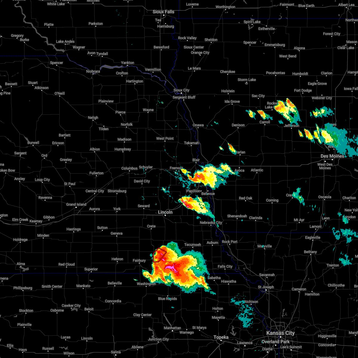 At 539 pm cdt, a severe thunderstorm capable of producing a tornado was located 6 miles east of harbine, or 7 miles southwest of beatrice, moving southeast at 35 mph (radar indicated rotation). Hazards include tornado and half dollar size hail. Flying debris will be dangerous to those caught without shelter. mobile homes will be damaged or destroyed. damage to roofs, windows, and vehicles will occur. tree damage is likely. This tornadic thunderstorm will remain over mainly rural areas of west central gage county, including the following locations, ellis and homestead national historical park. At 539 pm cdt, a severe thunderstorm capable of producing a tornado was located 6 miles east of harbine, or 7 miles southwest of beatrice, moving southeast at 35 mph (radar indicated rotation). Hazards include tornado and half dollar size hail. Flying debris will be dangerous to those caught without shelter. mobile homes will be damaged or destroyed. damage to roofs, windows, and vehicles will occur. tree damage is likely. This tornadic thunderstorm will remain over mainly rural areas of west central gage county, including the following locations, ellis and homestead national historical park.
|
| 6/11/2022 5:29 PM CDT |
 At 529 pm cdt, a severe thunderstorm capable of producing a tornado was located 3 miles southeast of plymouth, or 9 miles west of beatrice, moving southeast at 35 mph (radar indicated rotation). Hazards include tornado and golf ball size hail. Flying debris will be dangerous to those caught without shelter. mobile homes will be damaged or destroyed. damage to roofs, windows, and vehicles will occur. tree damage is likely. This tornadic thunderstorm will remain over mainly rural areas of northeastern jefferson and west central gage counties, including the following locations, ellis and homestead national historical park. At 529 pm cdt, a severe thunderstorm capable of producing a tornado was located 3 miles southeast of plymouth, or 9 miles west of beatrice, moving southeast at 35 mph (radar indicated rotation). Hazards include tornado and golf ball size hail. Flying debris will be dangerous to those caught without shelter. mobile homes will be damaged or destroyed. damage to roofs, windows, and vehicles will occur. tree damage is likely. This tornadic thunderstorm will remain over mainly rural areas of northeastern jefferson and west central gage counties, including the following locations, ellis and homestead national historical park.
|
| 6/11/2022 5:26 PM CDT |
 At 525 pm cdt, a confirmed tornado was located over wymore, or 12 miles southeast of beatrice, moving southeast at 20 mph (law enforcement confirmed a tornado on the ground just south of wymore at around 520 pm cdt). Hazards include damaging tornado and golf ball size hail. Flying debris will be dangerous to those caught without shelter. mobile homes will be damaged or destroyed. damage to roofs, windows, and vehicles will occur. tree damage is likely. Locations impacted include, barneston, liberty and summerfield. At 525 pm cdt, a confirmed tornado was located over wymore, or 12 miles southeast of beatrice, moving southeast at 20 mph (law enforcement confirmed a tornado on the ground just south of wymore at around 520 pm cdt). Hazards include damaging tornado and golf ball size hail. Flying debris will be dangerous to those caught without shelter. mobile homes will be damaged or destroyed. damage to roofs, windows, and vehicles will occur. tree damage is likely. Locations impacted include, barneston, liberty and summerfield.
|
| 6/11/2022 5:13 PM CDT |
 At 513 pm cdt, a severe thunderstorm capable of producing a tornado was located 3 miles northeast of swanton, or 16 miles northwest of beatrice, moving southeast at 35 mph (radar indicated rotation). Hazards include tornado and hail up to two inches in diameter. Flying debris will be dangerous to those caught without shelter. mobile homes will be damaged or destroyed. damage to roofs, windows, and vehicles will occur. tree damage is likely. this dangerous storm will be near, plymouth around 525 pm cdt. Other locations in the path of this tornadic thunderstorm include harbine. At 513 pm cdt, a severe thunderstorm capable of producing a tornado was located 3 miles northeast of swanton, or 16 miles northwest of beatrice, moving southeast at 35 mph (radar indicated rotation). Hazards include tornado and hail up to two inches in diameter. Flying debris will be dangerous to those caught without shelter. mobile homes will be damaged or destroyed. damage to roofs, windows, and vehicles will occur. tree damage is likely. this dangerous storm will be near, plymouth around 525 pm cdt. Other locations in the path of this tornadic thunderstorm include harbine.
|
| 6/11/2022 5:09 PM CDT |
 At 508 pm cdt, a severe thunderstorm capable of producing a tornado was located 4 miles south of beatrice, moving southeast at 35 mph (radar indicated rotation). Hazards include tornado and hail up to two inches in diameter. Flying debris will be dangerous to those caught without shelter. mobile homes will be damaged or destroyed. damage to roofs, windows, and vehicles will occur. tree damage is likely. this dangerous storm will be near, holmesville around 515 pm cdt. wymore and blue springs around 520 pm cdt. odell around 525 pm cdt. Other locations in the path of this tornadic thunderstorm include barneston. At 508 pm cdt, a severe thunderstorm capable of producing a tornado was located 4 miles south of beatrice, moving southeast at 35 mph (radar indicated rotation). Hazards include tornado and hail up to two inches in diameter. Flying debris will be dangerous to those caught without shelter. mobile homes will be damaged or destroyed. damage to roofs, windows, and vehicles will occur. tree damage is likely. this dangerous storm will be near, holmesville around 515 pm cdt. wymore and blue springs around 520 pm cdt. odell around 525 pm cdt. Other locations in the path of this tornadic thunderstorm include barneston.
|
| 6/11/2022 5:01 PM CDT |
 At 501 pm cdt, a severe thunderstorm capable of producing a tornado was located 3 miles west of beatrice, moving south at 25 mph (radar indicated rotation). Hazards include tornado and tennis ball size hail. Flying debris will be dangerous to those caught without shelter. mobile homes will be damaged or destroyed. damage to roofs, windows, and vehicles will occur. tree damage is likely. This tornadic thunderstorm will remain over mainly rural areas of central gage county, including the following locations, ellis and homestead national historical park. At 501 pm cdt, a severe thunderstorm capable of producing a tornado was located 3 miles west of beatrice, moving south at 25 mph (radar indicated rotation). Hazards include tornado and tennis ball size hail. Flying debris will be dangerous to those caught without shelter. mobile homes will be damaged or destroyed. damage to roofs, windows, and vehicles will occur. tree damage is likely. This tornadic thunderstorm will remain over mainly rural areas of central gage county, including the following locations, ellis and homestead national historical park.
|
| 6/11/2022 4:42 PM CDT |
 At 441 pm cdt, a severe thunderstorm capable of producing a tornado was located 3 miles southeast of beatrice, moving southeast at 20 mph (radar indicated rotation). Hazards include tornado and hail up to two inches in diameter. Flying debris will be dangerous to those caught without shelter. mobile homes will be damaged or destroyed. damage to roofs, windows, and vehicles will occur. tree damage is likely. this dangerous storm will be near, holmesville around 455 pm cdt. Other locations in the path of this tornadic thunderstorm include wymore, blue springs, barneston and liberty. At 441 pm cdt, a severe thunderstorm capable of producing a tornado was located 3 miles southeast of beatrice, moving southeast at 20 mph (radar indicated rotation). Hazards include tornado and hail up to two inches in diameter. Flying debris will be dangerous to those caught without shelter. mobile homes will be damaged or destroyed. damage to roofs, windows, and vehicles will occur. tree damage is likely. this dangerous storm will be near, holmesville around 455 pm cdt. Other locations in the path of this tornadic thunderstorm include wymore, blue springs, barneston and liberty.
|
| 6/11/2022 4:39 PM CDT | Tea Cup sized hail reported 1.1 miles SSW of Beatrice, NE, report from mping: baseball+ (3.25 in.). |
| 6/11/2022 4:32 PM CDT |
 At 432 pm cdt, a severe thunderstorm capable of producing a tornado was located near de witt, or 12 miles northwest of beatrice, moving southeast at 40 mph (radar indicated rotation). Hazards include tornado and tennis ball size hail. Flying debris will be dangerous to those caught without shelter. mobile homes will be damaged or destroyed. damage to roofs, windows, and vehicles will occur. tree damage is likely. this dangerous storm will be near, pickrell around 445 pm cdt. Beatrice around 450 pm cdt. At 432 pm cdt, a severe thunderstorm capable of producing a tornado was located near de witt, or 12 miles northwest of beatrice, moving southeast at 40 mph (radar indicated rotation). Hazards include tornado and tennis ball size hail. Flying debris will be dangerous to those caught without shelter. mobile homes will be damaged or destroyed. damage to roofs, windows, and vehicles will occur. tree damage is likely. this dangerous storm will be near, pickrell around 445 pm cdt. Beatrice around 450 pm cdt.
|
| 6/11/2022 4:29 PM CDT | Tea Cup sized hail reported 1.1 miles SSW of Beatrice, NE, grapefruit- (3.75 in.). |
| 6/11/2022 4:28 PM CDT | Softball sized hail reported 0.3 miles SSW of Beatrice, NE, photo sent to broadcast media. |
| 6/11/2022 4:27 PM CDT | Tea Cup sized hail reported 1.8 miles SSW of Beatrice, NE |
| 6/11/2022 4:23 PM CDT | Hen Egg sized hail reported 1.8 miles SSW of Beatrice, NE |
| 6/11/2022 4:23 PM CDT | Tea Cup sized hail reported 1.8 miles SSW of Beatrice, NE, corrects previous hail report from 1 n beatrice. |
| 6/11/2022 4:03 PM CDT |
 At 403 pm cdt, a severe thunderstorm was located 5 miles southwest of pickrell, or 5 miles northwest of beatrice, moving east at 30 mph (radar indicated). Hazards include ping pong ball size hail and 60 mph wind gusts. People and animals outdoors will be injured. expect hail damage to roofs, siding, windows, and vehicles. expect wind damage to roofs, siding, and trees. this severe thunderstorm will be near, beatrice and pickrell around 410 pm cdt. other locations in the path of this severe thunderstorm include holmesville, filley and virginia. hail threat, radar indicated max hail size, 1. 50 in wind threat, radar indicated max wind gust, 60 mph. At 403 pm cdt, a severe thunderstorm was located 5 miles southwest of pickrell, or 5 miles northwest of beatrice, moving east at 30 mph (radar indicated). Hazards include ping pong ball size hail and 60 mph wind gusts. People and animals outdoors will be injured. expect hail damage to roofs, siding, windows, and vehicles. expect wind damage to roofs, siding, and trees. this severe thunderstorm will be near, beatrice and pickrell around 410 pm cdt. other locations in the path of this severe thunderstorm include holmesville, filley and virginia. hail threat, radar indicated max hail size, 1. 50 in wind threat, radar indicated max wind gust, 60 mph.
|
| 6/7/2022 10:15 PM CDT |
 At 1014 pm cdt, a severe thunderstorm was located 3 miles northwest of holmesville, or 3 miles southeast of beatrice, moving southeast at 40 mph (trained weather spotters). Hazards include ping pong ball size hail and 60 mph wind gusts. People and animals outdoors will be injured. expect hail damage to roofs, siding, windows, and vehicles. expect wind damage to roofs, siding, and trees. this severe storm will be near, wymore, blue springs and virginia around 1025 pm cdt. other locations in the path of this severe thunderstorm include barneston, burchard, liberty and summerfield. hail threat, radar indicated max hail size, 1. 50 in wind threat, radar indicated max wind gust, 60 mph. At 1014 pm cdt, a severe thunderstorm was located 3 miles northwest of holmesville, or 3 miles southeast of beatrice, moving southeast at 40 mph (trained weather spotters). Hazards include ping pong ball size hail and 60 mph wind gusts. People and animals outdoors will be injured. expect hail damage to roofs, siding, windows, and vehicles. expect wind damage to roofs, siding, and trees. this severe storm will be near, wymore, blue springs and virginia around 1025 pm cdt. other locations in the path of this severe thunderstorm include barneston, burchard, liberty and summerfield. hail threat, radar indicated max hail size, 1. 50 in wind threat, radar indicated max wind gust, 60 mph.
|
| 6/7/2022 10:12 PM CDT | Quarter sized hail reported 0.3 miles SSW of Beatrice, NE |
| 6/7/2022 10:11 PM CDT | Golf Ball sized hail reported 1.1 miles SSW of Beatrice, NE, report from mping: golf ball (1.75 in.). |
| 6/7/2022 10:08 PM CDT |
 At 1008 pm cdt, a severe thunderstorm was located over beatrice, moving southeast at 40 mph (radar indicated). Hazards include 60 mph wind gusts and quarter size hail. Hail damage to vehicles is expected. expect wind damage to roofs, siding, and trees. this severe thunderstorm will be near, holmesville around 1015 pm cdt. wymore around 1020 pm cdt. blue springs and virginia around 1025 pm cdt. other locations in the path of this severe thunderstorm include barneston, liberty and summerfield. hail threat, radar indicated max hail size, 1. 00 in wind threat, radar indicated max wind gust, 60 mph. At 1008 pm cdt, a severe thunderstorm was located over beatrice, moving southeast at 40 mph (radar indicated). Hazards include 60 mph wind gusts and quarter size hail. Hail damage to vehicles is expected. expect wind damage to roofs, siding, and trees. this severe thunderstorm will be near, holmesville around 1015 pm cdt. wymore around 1020 pm cdt. blue springs and virginia around 1025 pm cdt. other locations in the path of this severe thunderstorm include barneston, liberty and summerfield. hail threat, radar indicated max hail size, 1. 00 in wind threat, radar indicated max wind gust, 60 mph.
|
| 6/7/2022 10:07 PM CDT | Ping Pong Ball sized hail reported 0.3 miles SSW of Beatrice, NE |
| 6/7/2022 10:02 PM CDT |
 At 1002 pm cdt, a severe thunderstorm was located 5 miles southeast of de witt, or 7 miles northwest of beatrice, moving southeast at 35 mph (radar indicated). Hazards include ping pong ball size hail and 60 mph wind gusts. People and animals outdoors will be injured. expect hail damage to roofs, siding, windows, and vehicles. expect wind damage to roofs, siding, and trees. this severe storm will be near, beatrice and pickrell around 1010 pm cdt. hail threat, radar indicated max hail size, 1. 50 in wind threat, radar indicated max wind gust, 60 mph. At 1002 pm cdt, a severe thunderstorm was located 5 miles southeast of de witt, or 7 miles northwest of beatrice, moving southeast at 35 mph (radar indicated). Hazards include ping pong ball size hail and 60 mph wind gusts. People and animals outdoors will be injured. expect hail damage to roofs, siding, windows, and vehicles. expect wind damage to roofs, siding, and trees. this severe storm will be near, beatrice and pickrell around 1010 pm cdt. hail threat, radar indicated max hail size, 1. 50 in wind threat, radar indicated max wind gust, 60 mph.
|
| 6/7/2022 10:00 PM CDT |
 At 1000 pm cdt, a severe thunderstorm was located 3 miles southeast of de witt, or 8 miles northwest of beatrice, moving southeast at 35 mph (radar indicated). Hazards include ping pong ball size hail and 60 mph wind gusts. People and animals outdoors will be injured. expect hail damage to roofs, siding, windows, and vehicles. expect wind damage to roofs, siding, and trees. locations impacted include, beatrice and pickrell. hail threat, radar indicated max hail size, 1. 50 in wind threat, radar indicated max wind gust, 60 mph. At 1000 pm cdt, a severe thunderstorm was located 3 miles southeast of de witt, or 8 miles northwest of beatrice, moving southeast at 35 mph (radar indicated). Hazards include ping pong ball size hail and 60 mph wind gusts. People and animals outdoors will be injured. expect hail damage to roofs, siding, windows, and vehicles. expect wind damage to roofs, siding, and trees. locations impacted include, beatrice and pickrell. hail threat, radar indicated max hail size, 1. 50 in wind threat, radar indicated max wind gust, 60 mph.
|
| 6/7/2022 9:36 PM CDT |
 At 936 pm cdt, a severe thunderstorm was located 6 miles west of wilber, or 23 miles northwest of beatrice, moving southeast at 35 mph (radar indicated). Hazards include ping pong ball size hail and 60 mph wind gusts. People and animals outdoors will be injured. expect hail damage to roofs, siding, windows, and vehicles. expect wind damage to roofs, siding, and trees. this severe thunderstorm will be near, wilber and swanton around 945 pm cdt. de witt, plymouth and clatonia around 955 pm cdt. other locations in the path of this severe thunderstorm include beatrice and pickrell. hail threat, radar indicated max hail size, 1. 50 in wind threat, radar indicated max wind gust, 60 mph. At 936 pm cdt, a severe thunderstorm was located 6 miles west of wilber, or 23 miles northwest of beatrice, moving southeast at 35 mph (radar indicated). Hazards include ping pong ball size hail and 60 mph wind gusts. People and animals outdoors will be injured. expect hail damage to roofs, siding, windows, and vehicles. expect wind damage to roofs, siding, and trees. this severe thunderstorm will be near, wilber and swanton around 945 pm cdt. de witt, plymouth and clatonia around 955 pm cdt. other locations in the path of this severe thunderstorm include beatrice and pickrell. hail threat, radar indicated max hail size, 1. 50 in wind threat, radar indicated max wind gust, 60 mph.
|
| 4/29/2022 7:36 PM CDT |
 At 736 pm cdt, a severe thunderstorm was located 7 miles south of firth, or 14 miles northeast of beatrice, moving northeast at 20 mph (radar indicated). Hazards include 60 mph wind gusts and half dollar size hail. Hail damage to vehicles is expected. expect wind damage to roofs, siding, and trees. locations impacted include, beatrice, cortland, sterling, cook, pickrell, adams, filley, lewiston, virginia, crab orchard and rockford state recreation area. hail threat, radar indicated max hail size, 1. 25 in wind threat, radar indicated max wind gust, 60 mph. At 736 pm cdt, a severe thunderstorm was located 7 miles south of firth, or 14 miles northeast of beatrice, moving northeast at 20 mph (radar indicated). Hazards include 60 mph wind gusts and half dollar size hail. Hail damage to vehicles is expected. expect wind damage to roofs, siding, and trees. locations impacted include, beatrice, cortland, sterling, cook, pickrell, adams, filley, lewiston, virginia, crab orchard and rockford state recreation area. hail threat, radar indicated max hail size, 1. 25 in wind threat, radar indicated max wind gust, 60 mph.
|
| 4/29/2022 7:14 PM CDT |
 At 713 pm cdt, a severe thunderstorm was located 8 miles southeast of pickrell, or 9 miles east of beatrice, moving northeast at 40 mph (radar indicated). Hazards include 60 mph wind gusts and half dollar size hail. Hail damage to vehicles is expected. Expect wind damage to roofs, siding, and trees. At 713 pm cdt, a severe thunderstorm was located 8 miles southeast of pickrell, or 9 miles east of beatrice, moving northeast at 40 mph (radar indicated). Hazards include 60 mph wind gusts and half dollar size hail. Hail damage to vehicles is expected. Expect wind damage to roofs, siding, and trees.
|
| 4/29/2022 6:21 PM CDT |
 At 620 pm cdt, a severe thunderstorm was located near plymouth, or 9 miles west of beatrice, moving northeast at 45 mph (trained weather spotters. at 613 pm, quarter sized hail was reported in diller). Hazards include 60 mph wind gusts and half dollar size hail. Hail damage to vehicles is expected. expect wind damage to roofs, siding, and trees. locations impacted include, beatrice, de witt, pickrell, clatonia and cortland. hail threat, observed max hail size, 1. 25 in wind threat, radar indicated max wind gust, 60 mph. At 620 pm cdt, a severe thunderstorm was located near plymouth, or 9 miles west of beatrice, moving northeast at 45 mph (trained weather spotters. at 613 pm, quarter sized hail was reported in diller). Hazards include 60 mph wind gusts and half dollar size hail. Hail damage to vehicles is expected. expect wind damage to roofs, siding, and trees. locations impacted include, beatrice, de witt, pickrell, clatonia and cortland. hail threat, observed max hail size, 1. 25 in wind threat, radar indicated max wind gust, 60 mph.
|
| 4/29/2022 6:09 PM CDT |
 At 609 pm cdt, a severe thunderstorm was located near diller, or 14 miles southwest of beatrice, moving northeast at 45 mph (radar indicated). Hazards include 60 mph wind gusts and half dollar size hail. Hail damage to vehicles is expected. expect wind damage to roofs, siding, and trees. this severe thunderstorm will be near, plymouth around 620 pm cdt. other locations in the path of this severe thunderstorm include beatrice, de witt, pickrell, clatonia and cortland. hail threat, radar indicated max hail size, 1. 25 in wind threat, radar indicated max wind gust, 60 mph. At 609 pm cdt, a severe thunderstorm was located near diller, or 14 miles southwest of beatrice, moving northeast at 45 mph (radar indicated). Hazards include 60 mph wind gusts and half dollar size hail. Hail damage to vehicles is expected. expect wind damage to roofs, siding, and trees. this severe thunderstorm will be near, plymouth around 620 pm cdt. other locations in the path of this severe thunderstorm include beatrice, de witt, pickrell, clatonia and cortland. hail threat, radar indicated max hail size, 1. 25 in wind threat, radar indicated max wind gust, 60 mph.
|
| 4/28/2022 10:34 PM CDT |
 At 1034 pm cdt, a severe thunderstorm was located near hallam, or 15 miles north of beatrice, moving northeast at 20 mph (radar indicated). Hazards include quarter size hail. damage to vehicles is expected At 1034 pm cdt, a severe thunderstorm was located near hallam, or 15 miles north of beatrice, moving northeast at 20 mph (radar indicated). Hazards include quarter size hail. damage to vehicles is expected
|
| 4/12/2022 8:35 PM CDT |
 At 835 pm cdt, severe thunderstorms were located along a line extending from 4 miles northeast of syracuse to 5 miles southeast of odell, moving east at 35 mph (radar indicated). Hazards include 60 mph wind gusts and quarter size hail. Hail damage to vehicles is expected. expect wind damage to roofs, siding, and trees. locations impacted include, syracuse. hail threat, radar indicated max hail size, 1. 00 in wind threat, radar indicated max wind gust, 60 mph. At 835 pm cdt, severe thunderstorms were located along a line extending from 4 miles northeast of syracuse to 5 miles southeast of odell, moving east at 35 mph (radar indicated). Hazards include 60 mph wind gusts and quarter size hail. Hail damage to vehicles is expected. expect wind damage to roofs, siding, and trees. locations impacted include, syracuse. hail threat, radar indicated max hail size, 1. 00 in wind threat, radar indicated max wind gust, 60 mph.
|
| 4/12/2022 8:15 PM CDT |
 At 815 pm cdt, severe thunderstorms were located along a line extending from near palmyra to 4 miles east of hollenberg, moving east at 30 mph (radar indicated). Hazards include 60 mph wind gusts and quarter size hail. Hail damage to vehicles is expected. expect wind damage to roofs, siding, and trees. severe thunderstorms will be near, bennet and palmyra around 820 pm cdt. unadilla around 830 pm cdt. other locations in the path of these severe thunderstorms include syracuse. hail threat, radar indicated max hail size, 1. 00 in wind threat, radar indicated max wind gust, 60 mph. At 815 pm cdt, severe thunderstorms were located along a line extending from near palmyra to 4 miles east of hollenberg, moving east at 30 mph (radar indicated). Hazards include 60 mph wind gusts and quarter size hail. Hail damage to vehicles is expected. expect wind damage to roofs, siding, and trees. severe thunderstorms will be near, bennet and palmyra around 820 pm cdt. unadilla around 830 pm cdt. other locations in the path of these severe thunderstorms include syracuse. hail threat, radar indicated max hail size, 1. 00 in wind threat, radar indicated max wind gust, 60 mph.
|
| 4/12/2022 7:55 PM CDT |
 The severe thunderstorm warning for jefferson, southeastern saline and southwestern gage counties will expire at 800 pm cdt, the storms which prompted the warning have weakened below severe limits, and no longer pose an immediate threat to life or property. therefore, the warning will be allowed to expire. however small hail and gusty winds are still possible with these thunderstorms. a severe thunderstorm watch remains in effect until 100 am cdt for southeastern nebraska. The severe thunderstorm warning for jefferson, southeastern saline and southwestern gage counties will expire at 800 pm cdt, the storms which prompted the warning have weakened below severe limits, and no longer pose an immediate threat to life or property. therefore, the warning will be allowed to expire. however small hail and gusty winds are still possible with these thunderstorms. a severe thunderstorm watch remains in effect until 100 am cdt for southeastern nebraska.
|
| 4/12/2022 7:30 PM CDT |
 At 729 pm cdt, severe thunderstorms were located along a line extending from 5 miles east of western to 5 miles east of mahaska, moving east at 35 mph (radar indicated). Hazards include 60 mph wind gusts and quarter size hail. Hail damage to vehicles is expected. expect wind damage to roofs, siding, and trees. locations impacted include, fairbury, plymouth, odell, diller, daykin, endicott, jansen, reynolds, steele city, harbine, alexandria state recreation area, rock creek station state historical park, cub creek recreational area, crystal springs campground, buckley creek recreational area and camp jefferson. hail threat, radar indicated max hail size, 1. 00 in wind threat, radar indicated max wind gust, 60 mph. At 729 pm cdt, severe thunderstorms were located along a line extending from 5 miles east of western to 5 miles east of mahaska, moving east at 35 mph (radar indicated). Hazards include 60 mph wind gusts and quarter size hail. Hail damage to vehicles is expected. expect wind damage to roofs, siding, and trees. locations impacted include, fairbury, plymouth, odell, diller, daykin, endicott, jansen, reynolds, steele city, harbine, alexandria state recreation area, rock creek station state historical park, cub creek recreational area, crystal springs campground, buckley creek recreational area and camp jefferson. hail threat, radar indicated max hail size, 1. 00 in wind threat, radar indicated max wind gust, 60 mph.
|
| 4/12/2022 7:16 PM CDT |
 At 716 pm cdt, severe thunderstorms were located along a line extending from 5 miles southwest of western to mahaska, moving east at 35 mph (radar indicated). Hazards include 60 mph wind gusts and quarter size hail. Hail damage to vehicles is expected. Expect wind damage to roofs, siding, and trees. At 716 pm cdt, severe thunderstorms were located along a line extending from 5 miles southwest of western to mahaska, moving east at 35 mph (radar indicated). Hazards include 60 mph wind gusts and quarter size hail. Hail damage to vehicles is expected. Expect wind damage to roofs, siding, and trees.
|
| 12/15/2021 3:35 PM CST | Storm damage reported in gage county NE, 1 miles S of Beatrice, NE |
| 8/31/2021 7:58 AM CDT |
 At 758 am cdt, severe thunderstorms were located along a line extending from near skidmore to 6 miles northeast of baileyville, moving southeast at 40 mph (radar indicated). Hazards include 60 mph wind gusts. Expect damage to roofs, siding, and trees. these severe thunderstorms will remain over mainly rural areas of southern johnson, southeastern nemaha, southeastern jefferson, richardson, pawnee and southern gage counties, including the following locations, dawson, crab orchard, rulo, preston, brownville, liberty, lewiston, du bois, salem and the highway 75 and 8 junction. hail threat, radar indicated max hail size, <. 75 in wind threat, radar indicated max wind gust, 60 mph. At 758 am cdt, severe thunderstorms were located along a line extending from near skidmore to 6 miles northeast of baileyville, moving southeast at 40 mph (radar indicated). Hazards include 60 mph wind gusts. Expect damage to roofs, siding, and trees. these severe thunderstorms will remain over mainly rural areas of southern johnson, southeastern nemaha, southeastern jefferson, richardson, pawnee and southern gage counties, including the following locations, dawson, crab orchard, rulo, preston, brownville, liberty, lewiston, du bois, salem and the highway 75 and 8 junction. hail threat, radar indicated max hail size, <. 75 in wind threat, radar indicated max wind gust, 60 mph.
|
| 8/31/2021 7:47 AM CDT |
 At 747 am cdt, severe thunderstorms were located along a line extending from 8 miles southeast of tarkio to summerfield, moving southeast at 40 mph (radar indicated). Hazards include 60 mph wind gusts. Expect damage to roofs, siding, and trees. locations impacted include, beatrice, falls city, auburn, tecumseh, wymore, pawnee city, humboldt, peru, sterling, blue springs, johnson, cook, odell, table rock, diller, talmage, verdon, stella, shubert and lorton. hail threat, radar indicated max hail size, <. 75 in wind threat, radar indicated max wind gust, 60 mph. At 747 am cdt, severe thunderstorms were located along a line extending from 8 miles southeast of tarkio to summerfield, moving southeast at 40 mph (radar indicated). Hazards include 60 mph wind gusts. Expect damage to roofs, siding, and trees. locations impacted include, beatrice, falls city, auburn, tecumseh, wymore, pawnee city, humboldt, peru, sterling, blue springs, johnson, cook, odell, table rock, diller, talmage, verdon, stella, shubert and lorton. hail threat, radar indicated max hail size, <. 75 in wind threat, radar indicated max wind gust, 60 mph.
|
| 8/31/2021 7:36 AM CDT |
 At 735 am cdt, severe thunderstorms were located along a line extending from near rockport to 6 miles southeast of wymore, moving southeast at 40 mph (radar indicated). Hazards include 60 mph wind gusts. Expect damage to roofs, siding, and trees. locations impacted include, pawnee city, table rock, humboldt, verdon and falls city. hail threat, radar indicated max hail size, <. 75 in wind threat, radar indicated max wind gust, 60 mph. At 735 am cdt, severe thunderstorms were located along a line extending from near rockport to 6 miles southeast of wymore, moving southeast at 40 mph (radar indicated). Hazards include 60 mph wind gusts. Expect damage to roofs, siding, and trees. locations impacted include, pawnee city, table rock, humboldt, verdon and falls city. hail threat, radar indicated max hail size, <. 75 in wind threat, radar indicated max wind gust, 60 mph.
|
| 8/31/2021 7:25 AM CDT |
 At 724 am cdt, severe thunderstorms were located along a line extending from peru to odell, moving southeast at 40 mph (radar indicated). Hazards include 60 mph wind gusts. Expect damage to roofs, siding, and trees. these severe storms will be near, peru around 730 am cdt. other locations in the path of these severe thunderstorms include pawnee city, table rock, humboldt, verdon and falls city. hail threat, radar indicated max hail size, <. 75 in wind threat, radar indicated max wind gust, 60 mph. At 724 am cdt, severe thunderstorms were located along a line extending from peru to odell, moving southeast at 40 mph (radar indicated). Hazards include 60 mph wind gusts. Expect damage to roofs, siding, and trees. these severe storms will be near, peru around 730 am cdt. other locations in the path of these severe thunderstorms include pawnee city, table rock, humboldt, verdon and falls city. hail threat, radar indicated max hail size, <. 75 in wind threat, radar indicated max wind gust, 60 mph.
|
| 8/31/2021 7:12 AM CDT |
 At 712 am cdt, severe thunderstorms were located along a line extending from talmage to 5 miles east of fairbury, moving southeast at 75 mph (radar indicated). Hazards include 65 mph wind gusts. Expect damage to roofs, siding, and trees. severe thunderstorms will be near, johnson, talmage and lorton around 715 am cdt. auburn around 720 am cdt. peru and odell around 725 am cdt. hail threat, radar indicated max hail size, <. 75 in wind threat, radar indicated max wind gust, 60 mph. At 712 am cdt, severe thunderstorms were located along a line extending from talmage to 5 miles east of fairbury, moving southeast at 75 mph (radar indicated). Hazards include 65 mph wind gusts. Expect damage to roofs, siding, and trees. severe thunderstorms will be near, johnson, talmage and lorton around 715 am cdt. auburn around 720 am cdt. peru and odell around 725 am cdt. hail threat, radar indicated max hail size, <. 75 in wind threat, radar indicated max wind gust, 60 mph.
|
| 8/31/2021 6:56 AM CDT |
 At 656 am cdt, a severe thunderstorm was located near clatonia, or 11 miles north of beatrice, moving southeast at 40 mph (radar indicated). Hazards include 60 mph wind gusts. Expect damage to roofs, siding, and trees. locations impacted include, beatrice and pickrell. hail threat, radar indicated max hail size, <. 75 in wind threat, radar indicated max wind gust, 60 mph. At 656 am cdt, a severe thunderstorm was located near clatonia, or 11 miles north of beatrice, moving southeast at 40 mph (radar indicated). Hazards include 60 mph wind gusts. Expect damage to roofs, siding, and trees. locations impacted include, beatrice and pickrell. hail threat, radar indicated max hail size, <. 75 in wind threat, radar indicated max wind gust, 60 mph.
|
| 8/31/2021 6:43 AM CDT |
 At 643 am cdt, a severe thunderstorm was located near wilber, or 21 miles northwest of beatrice, moving southeast at 45 mph (radar indicated). Hazards include 60 mph wind gusts. Expect damage to roofs, siding, and trees. this severe thunderstorm will be near, de witt, clatonia and hallam around 650 am cdt. cortland around 655 am cdt. other locations in the path of this severe thunderstorm include beatrice and pickrell. hail threat, radar indicated max hail size, <. 75 in wind threat, radar indicated max wind gust, 60 mph. At 643 am cdt, a severe thunderstorm was located near wilber, or 21 miles northwest of beatrice, moving southeast at 45 mph (radar indicated). Hazards include 60 mph wind gusts. Expect damage to roofs, siding, and trees. this severe thunderstorm will be near, de witt, clatonia and hallam around 650 am cdt. cortland around 655 am cdt. other locations in the path of this severe thunderstorm include beatrice and pickrell. hail threat, radar indicated max hail size, <. 75 in wind threat, radar indicated max wind gust, 60 mph.
|
| 8/7/2021 10:13 PM CDT |
 At 1012 pm cdt, severe thunderstorms were located along a line extending from 9 miles east of pickrell to 6 miles east of oketo, moving east at 30 mph (radar indicated). Hazards include 60 mph wind gusts and nickel size hail. Expect damage to roofs, siding, and trees. these severe storms will be near, summerfield around 1025 pm cdt. other locations impacted by these severe thunderstorms include rockford state recreation area, lewiston, filley, liberty, barneston, burchard and virginia. hail threat, radar indicated max hail size, 0. 88 in wind threat, radar indicated max wind gust, 60 mph. At 1012 pm cdt, severe thunderstorms were located along a line extending from 9 miles east of pickrell to 6 miles east of oketo, moving east at 30 mph (radar indicated). Hazards include 60 mph wind gusts and nickel size hail. Expect damage to roofs, siding, and trees. these severe storms will be near, summerfield around 1025 pm cdt. other locations impacted by these severe thunderstorms include rockford state recreation area, lewiston, filley, liberty, barneston, burchard and virginia. hail threat, radar indicated max hail size, 0. 88 in wind threat, radar indicated max wind gust, 60 mph.
|
| 8/7/2021 9:49 PM CDT |
 At 948 pm cdt, severe thunderstorms were located along a line extending from 7 miles southwest of plymouth to near odell to 5 miles north of waterville, moving east at 35 mph (radar indicated). Hazards include 60 mph wind gusts and nickel size hail. Expect damage to roofs, siding, and trees. severe thunderstorms will be near, wymore around 1000 pm cdt. blue springs around 1005 pm cdt. beatrice around 1020 pm cdt. other locations impacted by these severe thunderstorms include rock creek station state historical park, cub creek recreational area, harbine, liberty, steele city, jansen, rockford state recreation area, lewiston, filley and barneston. hail threat, radar indicated max hail size, 0. 88 in wind threat, radar indicated max wind gust, 60 mph. At 948 pm cdt, severe thunderstorms were located along a line extending from 7 miles southwest of plymouth to near odell to 5 miles north of waterville, moving east at 35 mph (radar indicated). Hazards include 60 mph wind gusts and nickel size hail. Expect damage to roofs, siding, and trees. severe thunderstorms will be near, wymore around 1000 pm cdt. blue springs around 1005 pm cdt. beatrice around 1020 pm cdt. other locations impacted by these severe thunderstorms include rock creek station state historical park, cub creek recreational area, harbine, liberty, steele city, jansen, rockford state recreation area, lewiston, filley and barneston. hail threat, radar indicated max hail size, 0. 88 in wind threat, radar indicated max wind gust, 60 mph.
|
| 7/10/2021 12:35 AM CDT |
 At 1235 am cdt, severe thunderstorms were located along a line extending from 11 miles east of pickrell to oketo, moving east at 60 mph (radar indicated). Hazards include 70 mph wind gusts and penny size hail. Expect considerable tree damage. damage is likely to mobile homes, roofs, and outbuildings. Locations impacted include, beatrice, wymore, pawnee city, blue springs, odell, table rock, summerfield, filley, barneston, elk creek, burchard, liberty, steinauer, lewiston, virginia, crab orchard and rockford state recreation area. At 1235 am cdt, severe thunderstorms were located along a line extending from 11 miles east of pickrell to oketo, moving east at 60 mph (radar indicated). Hazards include 70 mph wind gusts and penny size hail. Expect considerable tree damage. damage is likely to mobile homes, roofs, and outbuildings. Locations impacted include, beatrice, wymore, pawnee city, blue springs, odell, table rock, summerfield, filley, barneston, elk creek, burchard, liberty, steinauer, lewiston, virginia, crab orchard and rockford state recreation area.
|
| 7/10/2021 12:11 AM CDT |
 At 1210 am cdt, severe thunderstorms were located along a line extending from 5 miles northwest of beatrice to 4 miles east of hollenberg, moving east at 75 mph (radar indicated). Hazards include 70 mph wind gusts and penny size hail. Expect considerable tree damage. Damage is likely to mobile homes, roofs, and outbuildings. At 1210 am cdt, severe thunderstorms were located along a line extending from 5 miles northwest of beatrice to 4 miles east of hollenberg, moving east at 75 mph (radar indicated). Hazards include 70 mph wind gusts and penny size hail. Expect considerable tree damage. Damage is likely to mobile homes, roofs, and outbuildings.
|
| 10/11/2020 10:40 PM CDT |
 The severe thunderstorm warning for southeastern lancaster, western johnson, southeastern jefferson, south central otoe, western pawnee and gage counties will expire at 1045 pm cdt, this warning has been replaced with a new severe thunderstorm warning which expires at 1100 pm cdt. a severe thunderstorm watch remains in effect until midnight cdt for southeastern nebraska. The severe thunderstorm warning for southeastern lancaster, western johnson, southeastern jefferson, south central otoe, western pawnee and gage counties will expire at 1045 pm cdt, this warning has been replaced with a new severe thunderstorm warning which expires at 1100 pm cdt. a severe thunderstorm watch remains in effect until midnight cdt for southeastern nebraska.
|
| 10/11/2020 10:15 PM CDT | Storm damage reported in gage county NE, 1 miles S of Beatrice, NE |
| 10/11/2020 10:15 PM CDT |
 At 1015 pm cdt, severe thunderstorms were located along a line extending from near springfield to 4 miles north of sterling to near oketo, moving east at 50 mph (radar indicated). Hazards include 65 mph wind gusts. expect damage to roofs, siding, and trees At 1015 pm cdt, severe thunderstorms were located along a line extending from near springfield to 4 miles north of sterling to near oketo, moving east at 50 mph (radar indicated). Hazards include 65 mph wind gusts. expect damage to roofs, siding, and trees
|
| 10/11/2020 10:03 PM CDT |
 At 1002 pm cdt, severe thunderstorms were located along a line extending from firth to 6 miles west of hollenberg, moving east at 50 mph (radar indicated). Hazards include 65 mph wind gusts. expect damage to roofs, siding, and trees At 1002 pm cdt, severe thunderstorms were located along a line extending from firth to 6 miles west of hollenberg, moving east at 50 mph (radar indicated). Hazards include 65 mph wind gusts. expect damage to roofs, siding, and trees
|
| 10/11/2020 9:57 PM CDT |
 At 957 pm cdt, severe thunderstorms were located along a line extending from 6 miles north of hickman to 6 miles south of fairbury, moving east at 50 mph (radar indicated). Hazards include 65 mph wind gusts. Expect damage to roofs, siding, and trees. Locations impacted include, beatrice, crete, fairbury, wilber, hickman, friend, bennet, firth, dorchester, de witt, cortland, plymouth, diller, panama, western, clatonia, hallam, pickrell, roca and daykin. At 957 pm cdt, severe thunderstorms were located along a line extending from 6 miles north of hickman to 6 miles south of fairbury, moving east at 50 mph (radar indicated). Hazards include 65 mph wind gusts. Expect damage to roofs, siding, and trees. Locations impacted include, beatrice, crete, fairbury, wilber, hickman, friend, bennet, firth, dorchester, de witt, cortland, plymouth, diller, panama, western, clatonia, hallam, pickrell, roca and daykin.
|
| 10/11/2020 9:57 PM CDT |
 A severe thunderstorm warning remains in effect until 1015 pm cdt for southern lancaster. jefferson. saline and western gage counties. At 957 pm cdt, severe thunderstorms were located along a line extending from 6 miles north of hickman to 6 miles south of fairbury, moving east at 50 mph. A severe thunderstorm warning remains in effect until 1015 pm cdt for southern lancaster. jefferson. saline and western gage counties. At 957 pm cdt, severe thunderstorms were located along a line extending from 6 miles north of hickman to 6 miles south of fairbury, moving east at 50 mph.
|
| 10/11/2020 9:57 PM CDT |
 At 957 pm cdt, severe thunderstorms were located along a line extending from 6 miles north of hickman to 6 miles south of fairbury, moving east at 50 mph (radar indicated). Hazards include 65 mph wind gusts. Expect damage to roofs, siding, and trees. Locations impacted include, beatrice, crete, fairbury, wilber, hickman, friend, bennet, firth, dorchester, de witt, cortland, plymouth, diller, panama, western, clatonia, hallam, pickrell, roca and daykin. At 957 pm cdt, severe thunderstorms were located along a line extending from 6 miles north of hickman to 6 miles south of fairbury, moving east at 50 mph (radar indicated). Hazards include 65 mph wind gusts. Expect damage to roofs, siding, and trees. Locations impacted include, beatrice, crete, fairbury, wilber, hickman, friend, bennet, firth, dorchester, de witt, cortland, plymouth, diller, panama, western, clatonia, hallam, pickrell, roca and daykin.
|
| 10/11/2020 9:55 PM CDT | Awos station kbie beatrice munici in gage county NE, 1 miles S of Beatrice, NE |
| 10/11/2020 9:38 PM CDT |
 At 938 pm cdt, severe thunderstorms were located along a line extending from 4 miles north of crete to hubbell, moving east at 50 mph (radar indicated). Hazards include 65 mph wind gusts. expect damage to roofs, siding, and trees At 938 pm cdt, severe thunderstorms were located along a line extending from 4 miles north of crete to hubbell, moving east at 50 mph (radar indicated). Hazards include 65 mph wind gusts. expect damage to roofs, siding, and trees
|
| 7/9/2020 1:37 AM CDT |
 The severe thunderstorm warning for eastern jefferson, southeastern saline and gage counties will expire at 145 am cdt, the storms which prompted the warning have mostly moved east. the warning will be allowed to expired. winds of 50 to 55 mph will still be possible through around 2 am cdt. a severe thunderstorm watch remains in effect until 500 am cdt for southeastern nebraska. The severe thunderstorm warning for eastern jefferson, southeastern saline and gage counties will expire at 145 am cdt, the storms which prompted the warning have mostly moved east. the warning will be allowed to expired. winds of 50 to 55 mph will still be possible through around 2 am cdt. a severe thunderstorm watch remains in effect until 500 am cdt for southeastern nebraska.
|
| 7/9/2020 1:29 AM CDT |
 At 128 am cdt, the leading edge of a line of severe thunderstorms was located from 5 miles west of cook to 6 miles northeast of oketo, moving east at 55 mph. winds of over 50 or more are still likley occur back behind the main line (radar indicated). Hazards include 75 mph wind gusts. Expect considerable tree damage. damage is likely to mobile homes, roofs, and outbuildings. Locations impacted include, beatrice, fairbury, wilber, wymore, de witt, cortland, plymouth, blue springs, odell, diller, clatonia, pickrell, adams, endicott, filley, jansen, barneston, swanton, liberty and steele city. At 128 am cdt, the leading edge of a line of severe thunderstorms was located from 5 miles west of cook to 6 miles northeast of oketo, moving east at 55 mph. winds of over 50 or more are still likley occur back behind the main line (radar indicated). Hazards include 75 mph wind gusts. Expect considerable tree damage. damage is likely to mobile homes, roofs, and outbuildings. Locations impacted include, beatrice, fairbury, wilber, wymore, de witt, cortland, plymouth, blue springs, odell, diller, clatonia, pickrell, adams, endicott, filley, jansen, barneston, swanton, liberty and steele city.
|
| 7/9/2020 1:23 AM CDT | Lights have been flickering in beatric in gage county NE, 1.2 miles WNW of Beatrice, NE |
| 7/9/2020 1:19 AM CDT |
 At 119 am cdt, severe thunderstorms were located along a line extending from 5 miles southwest of douglas to 5 miles northwest of oketo, moving east at 50 mph (radar indicated). Hazards include 75 mph wind gusts. Expect considerable tree damage. damage is likely to mobile homes, roofs, and outbuildings. Locations impacted include, beatrice, wilber, wymore, de witt, cortland, plymouth, blue springs, odell, diller, clatonia, pickrell, adams, filley, barneston, liberty, steele city, virginia, harbine and rockford state recreation area. At 119 am cdt, severe thunderstorms were located along a line extending from 5 miles southwest of douglas to 5 miles northwest of oketo, moving east at 50 mph (radar indicated). Hazards include 75 mph wind gusts. Expect considerable tree damage. damage is likely to mobile homes, roofs, and outbuildings. Locations impacted include, beatrice, wilber, wymore, de witt, cortland, plymouth, blue springs, odell, diller, clatonia, pickrell, adams, filley, barneston, liberty, steele city, virginia, harbine and rockford state recreation area.
|
| 7/9/2020 1:14 AM CDT |
 At 114 am cdt, severe thunderstorms were located along a line extending from 4 miles east of firth to 4 miles southeast of odell, moving east at 55 mph (radar indicated). Hazards include 75 mph wind gusts. Expect considerable tree damage. damage is likely to mobile homes, roofs, and outbuildings. Locations impacted include, beatrice, fairbury, wilber, wymore, de witt, cortland, plymouth, blue springs, odell, diller, clatonia, pickrell, adams, endicott, filley, jansen, barneston, swanton, liberty and steele city. At 114 am cdt, severe thunderstorms were located along a line extending from 4 miles east of firth to 4 miles southeast of odell, moving east at 55 mph (radar indicated). Hazards include 75 mph wind gusts. Expect considerable tree damage. damage is likely to mobile homes, roofs, and outbuildings. Locations impacted include, beatrice, fairbury, wilber, wymore, de witt, cortland, plymouth, blue springs, odell, diller, clatonia, pickrell, adams, endicott, filley, jansen, barneston, swanton, liberty and steele city.
|
| 7/9/2020 1:11 AM CDT | Storm damage reported in gage county NE, 1.2 miles WNW of Beatrice, NE |
| 7/9/2020 1:06 AM CDT |
 At 105 am cdt, severe thunderstorms were located along a line extending from near cortland to 4 miles southwest of odell, moving east at 50 mph (radar indicated). Hazards include 75 mph wind gusts. Expect considerable tree damage. damage is likely to mobile homes, roofs, and outbuildings. Locations impacted include, beatrice, fairbury, wilber, wymore, de witt, cortland, plymouth, blue springs, odell, diller, western, clatonia, pickrell, adams, daykin, endicott, filley, jansen, barneston and swanton. At 105 am cdt, severe thunderstorms were located along a line extending from near cortland to 4 miles southwest of odell, moving east at 50 mph (radar indicated). Hazards include 75 mph wind gusts. Expect considerable tree damage. damage is likely to mobile homes, roofs, and outbuildings. Locations impacted include, beatrice, fairbury, wilber, wymore, de witt, cortland, plymouth, blue springs, odell, diller, western, clatonia, pickrell, adams, daykin, endicott, filley, jansen, barneston and swanton.
|
| 7/9/2020 1:01 AM CDT |
 At 1259 am cdt, severe thunderstorms were located along a line extending from hallam to near hollenberg, moving east at 50 mph. winds of 60 to 75 mph may occur for 15 to 20 minutes or possibly longer (radar indicated). Hazards include 75 mph wind gusts. Expect considerable tree damage. damage is likely to mobile homes, roofs, and outbuildings. Locations impacted include, beatrice, fairbury, wilber, wymore, de witt, cortland, plymouth, blue springs, odell, diller, western, clatonia, pickrell, adams, daykin, endicott, filley, jansen, barneston and swanton. At 1259 am cdt, severe thunderstorms were located along a line extending from hallam to near hollenberg, moving east at 50 mph. winds of 60 to 75 mph may occur for 15 to 20 minutes or possibly longer (radar indicated). Hazards include 75 mph wind gusts. Expect considerable tree damage. damage is likely to mobile homes, roofs, and outbuildings. Locations impacted include, beatrice, fairbury, wilber, wymore, de witt, cortland, plymouth, blue springs, odell, diller, western, clatonia, pickrell, adams, daykin, endicott, filley, jansen, barneston and swanton.
|
| 7/9/2020 12:53 AM CDT |
 At 1252 am cdt, severe thunderstorms were located along a line extending from 4 miles northeast of wilber to 5 miles northwest of hollenberg, moving east at 50 mph (radar indicated). Hazards include 75 mph wind gusts. Expect considerable tree damage. Damage is likely to mobile homes, roofs, and outbuildings. At 1252 am cdt, severe thunderstorms were located along a line extending from 4 miles northeast of wilber to 5 miles northwest of hollenberg, moving east at 50 mph (radar indicated). Hazards include 75 mph wind gusts. Expect considerable tree damage. Damage is likely to mobile homes, roofs, and outbuildings.
|
| 6/28/2020 3:25 AM CDT |
 The severe thunderstorm warning for southern lancaster and gage counties will expire at 330 am cdt, the storms which prompted the warning continue to move eastward. a new severe thunderstorm warning is in effect for areas along and ahead of the line including eastern gage and southeastern lancaster county. The severe thunderstorm warning for southern lancaster and gage counties will expire at 330 am cdt, the storms which prompted the warning continue to move eastward. a new severe thunderstorm warning is in effect for areas along and ahead of the line including eastern gage and southeastern lancaster county.
|
| 6/28/2020 3:19 AM CDT |
 At 319 am cdt, severe thunderstorms were located along a line extending from bennet to 6 miles northeast of oketo, moving east at 40 mph (radar indicated). Hazards include 60 mph wind gusts and half dollar size hail. Hail damage to vehicles is expected. expect wind damage to roofs, siding, and trees. Locations impacted include, beatrice, hickman, wymore, bennet, firth, cortland, blue springs, odell, panama, clatonia, hallam, pickrell, adams, roca, sprague, filley, barneston, liberty, virginia and stagecoach state recreation area. At 319 am cdt, severe thunderstorms were located along a line extending from bennet to 6 miles northeast of oketo, moving east at 40 mph (radar indicated). Hazards include 60 mph wind gusts and half dollar size hail. Hail damage to vehicles is expected. expect wind damage to roofs, siding, and trees. Locations impacted include, beatrice, hickman, wymore, bennet, firth, cortland, blue springs, odell, panama, clatonia, hallam, pickrell, adams, roca, sprague, filley, barneston, liberty, virginia and stagecoach state recreation area.
|
| 6/28/2020 3:09 AM CDT |
 At 308 am cdt, severe thunderstorms were located along a line extending from near hickman to near oketo, moving east at 50 mph (radar indicated). Hazards include 70 mph wind gusts and ping pong ball size hail. People and animals outdoors will be injured. expect hail damage to roofs, siding, windows, and vehicles. expect considerable tree damage. wind damage is also likely to mobile homes, roofs, and outbuildings. Locations impacted include, beatrice, crete, wilber, hickman, wymore, bennet, firth, de witt, cortland, plymouth, blue springs, odell, diller, panama, clatonia, hallam, pickrell, adams, roca and sprague. At 308 am cdt, severe thunderstorms were located along a line extending from near hickman to near oketo, moving east at 50 mph (radar indicated). Hazards include 70 mph wind gusts and ping pong ball size hail. People and animals outdoors will be injured. expect hail damage to roofs, siding, windows, and vehicles. expect considerable tree damage. wind damage is also likely to mobile homes, roofs, and outbuildings. Locations impacted include, beatrice, crete, wilber, hickman, wymore, bennet, firth, de witt, cortland, plymouth, blue springs, odell, diller, panama, clatonia, hallam, pickrell, adams, roca and sprague.
|
| 6/28/2020 3:03 AM CDT |
 At 302 am cdt, severe thunderstorms were located along a line extending from 6 miles west of hickman to near odell, moving east at 45 mph. the main hail threat is across northern gage county. the wind threat is for all of the warned area (radar indicated). Hazards include 70 mph wind gusts and ping pong ball size hail. People and animals outdoors will be injured. expect hail damage to roofs, siding, windows, and vehicles. expect considerable tree damage. wind damage is also likely to mobile homes, roofs, and outbuildings. Locations impacted include, beatrice, crete, wilber, hickman, wymore, bennet, firth, de witt, cortland, plymouth, blue springs, odell, diller, panama, clatonia, hallam, pickrell, adams, roca and sprague. At 302 am cdt, severe thunderstorms were located along a line extending from 6 miles west of hickman to near odell, moving east at 45 mph. the main hail threat is across northern gage county. the wind threat is for all of the warned area (radar indicated). Hazards include 70 mph wind gusts and ping pong ball size hail. People and animals outdoors will be injured. expect hail damage to roofs, siding, windows, and vehicles. expect considerable tree damage. wind damage is also likely to mobile homes, roofs, and outbuildings. Locations impacted include, beatrice, crete, wilber, hickman, wymore, bennet, firth, de witt, cortland, plymouth, blue springs, odell, diller, panama, clatonia, hallam, pickrell, adams, roca and sprague.
|
| 6/28/2020 2:57 AM CDT |
 At 257 am cdt, severe thunderstorms were located along a line extending from 7 miles northeast of crete to near odell, moving east at 45 mph. the main hail threat is just west of pickrell (radar indicated). Hazards include 70 mph wind gusts and ping pong ball size hail. People and animals outdoors will be injured. expect hail damage to roofs, siding, windows, and vehicles. expect considerable tree damage. wind damage is also likely to mobile homes, roofs, and outbuildings. Locations impacted include, beatrice, crete, wilber, hickman, wymore, bennet, firth, de witt, cortland, plymouth, blue springs, odell, diller, panama, clatonia, hallam, pickrell, adams, roca and sprague. At 257 am cdt, severe thunderstorms were located along a line extending from 7 miles northeast of crete to near odell, moving east at 45 mph. the main hail threat is just west of pickrell (radar indicated). Hazards include 70 mph wind gusts and ping pong ball size hail. People and animals outdoors will be injured. expect hail damage to roofs, siding, windows, and vehicles. expect considerable tree damage. wind damage is also likely to mobile homes, roofs, and outbuildings. Locations impacted include, beatrice, crete, wilber, hickman, wymore, bennet, firth, de witt, cortland, plymouth, blue springs, odell, diller, panama, clatonia, hallam, pickrell, adams, roca and sprague.
|
| 6/28/2020 2:51 AM CDT |
 At 250 am cdt, severe thunderstorms were located along a line extending from 4 miles north of crete to 4 miles southwest of odell, moving east at 45 mph. another area of storms with hail was located just east of dewitt, moving east at 40 mph (radar indicated). Hazards include 65 mph wind gusts and quarter size hail. Hail damage to vehicles is expected. expect wind damage to roofs, siding, and trees. Locations impacted include, beatrice, crete, wilber, hickman, wymore, bennet, firth, de witt, cortland, plymouth, blue springs, odell, diller, panama, clatonia, hallam, pickrell, adams, roca and sprague. At 250 am cdt, severe thunderstorms were located along a line extending from 4 miles north of crete to 4 miles southwest of odell, moving east at 45 mph. another area of storms with hail was located just east of dewitt, moving east at 40 mph (radar indicated). Hazards include 65 mph wind gusts and quarter size hail. Hail damage to vehicles is expected. expect wind damage to roofs, siding, and trees. Locations impacted include, beatrice, crete, wilber, hickman, wymore, bennet, firth, de witt, cortland, plymouth, blue springs, odell, diller, panama, clatonia, hallam, pickrell, adams, roca and sprague.
|
| 6/28/2020 2:46 AM CDT |
 At 245 am cdt, severe thunderstorms were located along a line extending from 5 miles northeast of dorchester to 5 miles east of hollenberg, moving east at 45 mph (radar indicated). Hazards include 65 mph wind gusts and quarter size hail. Hail damage to vehicles is expected. Expect wind damage to roofs, siding, and trees. At 245 am cdt, severe thunderstorms were located along a line extending from 5 miles northeast of dorchester to 5 miles east of hollenberg, moving east at 45 mph (radar indicated). Hazards include 65 mph wind gusts and quarter size hail. Hail damage to vehicles is expected. Expect wind damage to roofs, siding, and trees.
|
| 6/18/2020 7:13 PM CDT |
 At 713 pm cdt, severe thunderstorms were located along a line extending from near sterling to 4 miles south of wymore, moving east at 25 mph (radar indicated). Hazards include 60 mph wind gusts and quarter size hail. Hail damage to vehicles is expected. Expect wind damage to roofs, siding, and trees. At 713 pm cdt, severe thunderstorms were located along a line extending from near sterling to 4 miles south of wymore, moving east at 25 mph (radar indicated). Hazards include 60 mph wind gusts and quarter size hail. Hail damage to vehicles is expected. Expect wind damage to roofs, siding, and trees.
|
| 6/18/2020 6:55 PM CDT |
 At 655 pm cdt, a severe thunderstorm was located 6 miles southwest of beatrice, moving east at 25 mph (radar indicated). Hazards include 60 mph wind gusts and quarter size hail. Hail damage to vehicles is expected. expect wind damage to roofs, siding, and trees. Locations impacted include, beatrice and diller. At 655 pm cdt, a severe thunderstorm was located 6 miles southwest of beatrice, moving east at 25 mph (radar indicated). Hazards include 60 mph wind gusts and quarter size hail. Hail damage to vehicles is expected. expect wind damage to roofs, siding, and trees. Locations impacted include, beatrice and diller.
|
| 6/18/2020 6:44 PM CDT |
 At 644 pm cdt, severe thunderstorms were located along a line extending from 4 miles southwest of pickrell to near beatrice, moving east at 25 mph (radar indicated). Hazards include 60 mph wind gusts. expect damage to roofs, siding, and trees At 644 pm cdt, severe thunderstorms were located along a line extending from 4 miles southwest of pickrell to near beatrice, moving east at 25 mph (radar indicated). Hazards include 60 mph wind gusts. expect damage to roofs, siding, and trees
|
| 6/18/2020 6:30 PM CDT |
 At 630 pm cdt, a severe thunderstorm was located 6 miles northwest of diller, or 14 miles west of beatrice, moving east at 30 mph (radar indicated). Hazards include 60 mph wind gusts and quarter size hail. Hail damage to vehicles is expected. Expect wind damage to roofs, siding, and trees. At 630 pm cdt, a severe thunderstorm was located 6 miles northwest of diller, or 14 miles west of beatrice, moving east at 30 mph (radar indicated). Hazards include 60 mph wind gusts and quarter size hail. Hail damage to vehicles is expected. Expect wind damage to roofs, siding, and trees.
|
| 6/9/2020 10:03 PM CDT | Report from mping: 3-inch tree limbs broken; power poles broke in gage county NE, 1.2 miles WNW of Beatrice, NE |
| 6/9/2020 6:50 PM CDT | Large tree spli in gage county NE, 0.3 miles SSW of Beatrice, NE |
| 6/9/2020 6:43 PM CDT | Report from mping: 1-inch tree limbs broken; shingles blown of in gage county NE, 0.3 miles SSW of Beatrice, NE |
| 6/3/2020 11:27 PM CDT |
 The severe thunderstorm warning for southern lancaster, southeastern seward, jefferson, eastern saline and northwestern gage counties will expire at 1130 pm cdt, the storms which prompted the warning have moved out of the area. therefore, the warning will be allowed to expire. however gusty winds are still possible with these thunderstorms. a severe thunderstorm watch remains in effect until 300 am cdt for southeastern nebraska. The severe thunderstorm warning for southern lancaster, southeastern seward, jefferson, eastern saline and northwestern gage counties will expire at 1130 pm cdt, the storms which prompted the warning have moved out of the area. therefore, the warning will be allowed to expire. however gusty winds are still possible with these thunderstorms. a severe thunderstorm watch remains in effect until 300 am cdt for southeastern nebraska.
|
| 6/3/2020 11:18 PM CDT |
 At 1118 pm cdt, a severe thunderstorm was located over fairbury, or 24 miles north of washington, moving southeast at 40 mph (radar indicated). Hazards include 65 mph wind gusts and penny size hail. expect damage to roofs, siding, and trees At 1118 pm cdt, a severe thunderstorm was located over fairbury, or 24 miles north of washington, moving southeast at 40 mph (radar indicated). Hazards include 65 mph wind gusts and penny size hail. expect damage to roofs, siding, and trees
|
| 6/3/2020 11:11 PM CDT |
 At 1111 pm cdt, severe thunderstorms were located along a line extending from 4 miles northwest of murdock to 9 miles southwest of sterling to 4 miles north of hollenberg, moving southeast at 40 mph (radar indicated). Hazards include 65 mph wind gusts. expect damage to roofs, siding, and trees At 1111 pm cdt, severe thunderstorms were located along a line extending from 4 miles northwest of murdock to 9 miles southwest of sterling to 4 miles north of hollenberg, moving southeast at 40 mph (radar indicated). Hazards include 65 mph wind gusts. expect damage to roofs, siding, and trees
|
| 6/3/2020 10:56 PM CDT |
 At 1056 pm cdt, severe thunderstorms were located along a line extending from 7 miles east of crete to near de witt to 6 miles southwest of fairbury, moving southeast at 45 mph (radar indicated). Hazards include 65 mph wind gusts. Expect damage to roofs, siding, and trees. locations impacted include, southern lincoln, beatrice, crete, fairbury, wilber, hickman, firth, de witt, cortland, plymouth, diller, panama, western, clatonia, hallam, pleasant dale, pickrell, roca, denton and daykin. This includes interstate 80 in nebraska near mile marker 385. At 1056 pm cdt, severe thunderstorms were located along a line extending from 7 miles east of crete to near de witt to 6 miles southwest of fairbury, moving southeast at 45 mph (radar indicated). Hazards include 65 mph wind gusts. Expect damage to roofs, siding, and trees. locations impacted include, southern lincoln, beatrice, crete, fairbury, wilber, hickman, firth, de witt, cortland, plymouth, diller, panama, western, clatonia, hallam, pleasant dale, pickrell, roca, denton and daykin. This includes interstate 80 in nebraska near mile marker 385.
|
| 6/3/2020 10:40 PM CDT |
 At 1038 pm cdt, severe thunderstorms were located along a line extending from near pleasant dale to 4 miles west of wilber to near alexandria, moving southeast at 45 mph (radar indicated). Hazards include 65 mph wind gusts. expect damage to roofs, siding, and trees At 1038 pm cdt, severe thunderstorms were located along a line extending from near pleasant dale to 4 miles west of wilber to near alexandria, moving southeast at 45 mph (radar indicated). Hazards include 65 mph wind gusts. expect damage to roofs, siding, and trees
|
| 6/3/2020 10:30 PM CDT |
 At 1030 pm cdt, a severe thunderstorm was located 7 miles northwest of wilber, or 25 miles northwest of beatrice, moving southeast at 40 mph (trained weather spotters). Hazards include 65 mph wind gusts. Expect damage to roofs, siding, and trees. locations impacted include, southern lincoln, beatrice, crete, milford, wilber, hickman, friend, utica, bennet, firth, dorchester, de witt, cortland, plymouth, beaver crossing, western, clatonia, hallam, pleasant dale and pickrell. This includes interstate 80 in nebraska between mile markers 366 and 385. At 1030 pm cdt, a severe thunderstorm was located 7 miles northwest of wilber, or 25 miles northwest of beatrice, moving southeast at 40 mph (trained weather spotters). Hazards include 65 mph wind gusts. Expect damage to roofs, siding, and trees. locations impacted include, southern lincoln, beatrice, crete, milford, wilber, hickman, friend, utica, bennet, firth, dorchester, de witt, cortland, plymouth, beaver crossing, western, clatonia, hallam, pleasant dale and pickrell. This includes interstate 80 in nebraska between mile markers 366 and 385.
|
| 6/3/2020 10:13 PM CDT |
 At 1012 pm cdt, a severe thunderstorm was located near dorchester, or 28 miles southeast of york, moving southeast at 45 mph (radar indicated). Hazards include 70 mph wind gusts. Expect considerable tree damage. damage is likely to mobile homes, roofs, and outbuildings. locations impacted include, southern lincoln, beatrice, seward, crete, milford, wilber, hickman, friend, utica, bennet, firth, dorchester, de witt, cortland, plymouth, beaver crossing, staplehurst, western, clatonia and hallam. This includes interstate 80 in nebraska between mile markers 366 and 395. At 1012 pm cdt, a severe thunderstorm was located near dorchester, or 28 miles southeast of york, moving southeast at 45 mph (radar indicated). Hazards include 70 mph wind gusts. Expect considerable tree damage. damage is likely to mobile homes, roofs, and outbuildings. locations impacted include, southern lincoln, beatrice, seward, crete, milford, wilber, hickman, friend, utica, bennet, firth, dorchester, de witt, cortland, plymouth, beaver crossing, staplehurst, western, clatonia and hallam. This includes interstate 80 in nebraska between mile markers 366 and 395.
|
| 6/3/2020 9:55 PM CDT |
 At 955 pm cdt, a severe thunderstorm was located near mccool junction, or 11 miles south of york, moving southeast at 45 mph (radar indicated). Hazards include 70 mph wind gusts. Expect considerable tree damage. Damage is likely to mobile homes, roofs, and outbuildings. At 955 pm cdt, a severe thunderstorm was located near mccool junction, or 11 miles south of york, moving southeast at 45 mph (radar indicated). Hazards include 70 mph wind gusts. Expect considerable tree damage. Damage is likely to mobile homes, roofs, and outbuildings.
|
| 9/24/2019 9:58 PM CDT |
 The severe thunderstorm warning for southeastern gage county will expire at 1000 pm cdt, the storm which prompted the warning has weakened below severe limits, and no longer poses an immediate threat to life or property. therefore, the warning will be allowed to expire. however small hail is still possible with this thunderstorm. a severe thunderstorm watch remains in effect until midnight cdt for southeastern nebraska. The severe thunderstorm warning for southeastern gage county will expire at 1000 pm cdt, the storm which prompted the warning has weakened below severe limits, and no longer poses an immediate threat to life or property. therefore, the warning will be allowed to expire. however small hail is still possible with this thunderstorm. a severe thunderstorm watch remains in effect until midnight cdt for southeastern nebraska.
|
| 9/24/2019 9:45 PM CDT |
 At 945 pm cdt, a severe thunderstorm was located near blue springs, or 5 miles southeast of beatrice, moving southeast at 20 mph (radar indicated). Hazards include quarter size hail. Damage to vehicles is expected. Locations impacted include, wymore, blue springs and rockford state recreation area. At 945 pm cdt, a severe thunderstorm was located near blue springs, or 5 miles southeast of beatrice, moving southeast at 20 mph (radar indicated). Hazards include quarter size hail. Damage to vehicles is expected. Locations impacted include, wymore, blue springs and rockford state recreation area.
|
| 9/24/2019 9:34 PM CDT |
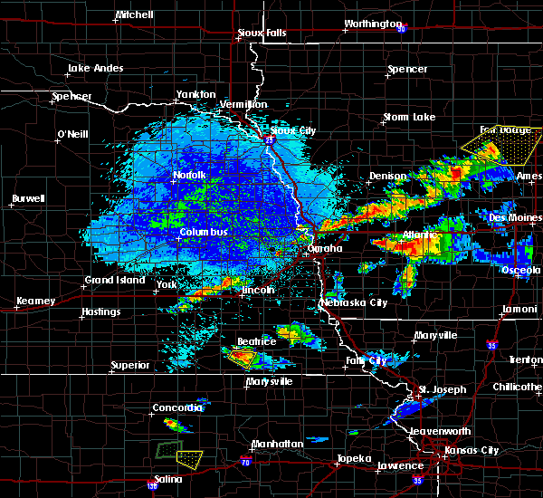 At 934 pm cdt, a severe thunderstorm was located near beatrice, moving southeast at 20 mph (radar indicated). Hazards include quarter size hail. damage to vehicles is expected At 934 pm cdt, a severe thunderstorm was located near beatrice, moving southeast at 20 mph (radar indicated). Hazards include quarter size hail. damage to vehicles is expected
|
| 9/24/2019 8:13 PM CDT |
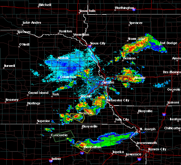 At 812 pm cdt, a severe thunderstorm was located 5 miles west of beatrice, moving east at 25 mph (radar indicated). Hazards include ping pong ball size hail and 60 mph wind gusts. People and animals outdoors will be injured. expect hail damage to roofs, siding, windows, and vehicles. expect wind damage to roofs, siding, and trees. Locations impacted include, beatrice, wymore, blue springs and rockford state recreation area. At 812 pm cdt, a severe thunderstorm was located 5 miles west of beatrice, moving east at 25 mph (radar indicated). Hazards include ping pong ball size hail and 60 mph wind gusts. People and animals outdoors will be injured. expect hail damage to roofs, siding, windows, and vehicles. expect wind damage to roofs, siding, and trees. Locations impacted include, beatrice, wymore, blue springs and rockford state recreation area.
|
| 9/24/2019 7:59 PM CDT |
 At 759 pm cdt, a severe thunderstorm was located near plymouth, or 10 miles west of beatrice, moving east at 25 mph (radar indicated). Hazards include ping pong ball size hail and 60 mph wind gusts. People and animals outdoors will be injured. expect hail damage to roofs, siding, windows, and vehicles. Expect wind damage to roofs, siding, and trees. At 759 pm cdt, a severe thunderstorm was located near plymouth, or 10 miles west of beatrice, moving east at 25 mph (radar indicated). Hazards include ping pong ball size hail and 60 mph wind gusts. People and animals outdoors will be injured. expect hail damage to roofs, siding, windows, and vehicles. Expect wind damage to roofs, siding, and trees.
|
| 8/26/2019 8:37 AM CDT |
 At 837 am cdt, severe thunderstorms were located along a line extending from 4 miles southwest of beatrice to near hollenberg, moving southeast at 35 mph (radar indicated). Hazards include golf ball size hail and 60 mph wind gusts. People and animals outdoors will be injured. expect hail damage to roofs, siding, windows, and vehicles. expect wind damage to roofs, siding, and trees. Locations impacted include, wymore, blue springs, odell, diller, barneston, burchard, liberty, steele city and rockford state recreation area. At 837 am cdt, severe thunderstorms were located along a line extending from 4 miles southwest of beatrice to near hollenberg, moving southeast at 35 mph (radar indicated). Hazards include golf ball size hail and 60 mph wind gusts. People and animals outdoors will be injured. expect hail damage to roofs, siding, windows, and vehicles. expect wind damage to roofs, siding, and trees. Locations impacted include, wymore, blue springs, odell, diller, barneston, burchard, liberty, steele city and rockford state recreation area.
|
| 8/26/2019 8:32 AM CDT |
 At 831 am cdt, severe thunderstorms were located along a line extending from 4 miles southwest of beatrice to near hollenberg, moving southeast at 40 mph. these storms have produced hail up to golfball size in diller (radar indicated). Hazards include golf ball size hail and 60 mph wind gusts. People and animals outdoors will be injured. expect hail damage to roofs, siding, windows, and vehicles. expect wind damage to roofs, siding, and trees. Locations impacted include, beatrice, wymore, blue springs, odell, diller, barneston, burchard, liberty, steele city, harbine and rockford state recreation area. At 831 am cdt, severe thunderstorms were located along a line extending from 4 miles southwest of beatrice to near hollenberg, moving southeast at 40 mph. these storms have produced hail up to golfball size in diller (radar indicated). Hazards include golf ball size hail and 60 mph wind gusts. People and animals outdoors will be injured. expect hail damage to roofs, siding, windows, and vehicles. expect wind damage to roofs, siding, and trees. Locations impacted include, beatrice, wymore, blue springs, odell, diller, barneston, burchard, liberty, steele city, harbine and rockford state recreation area.
|
| 8/26/2019 8:23 AM CDT |
 At 822 am cdt, severe thunderstorms were located along a line extending from 4 miles east of plymouth to 5 miles north of hollenberg, moving southeast at 40 mph (radar indicated). Hazards include ping pong ball size hail and 60 mph wind gusts. People and animals outdoors will be injured. expect hail damage to roofs, siding, windows, and vehicles. Expect wind damage to roofs, siding, and trees. At 822 am cdt, severe thunderstorms were located along a line extending from 4 miles east of plymouth to 5 miles north of hollenberg, moving southeast at 40 mph (radar indicated). Hazards include ping pong ball size hail and 60 mph wind gusts. People and animals outdoors will be injured. expect hail damage to roofs, siding, windows, and vehicles. Expect wind damage to roofs, siding, and trees.
|
| 8/21/2019 2:37 AM CDT |
 At 237 am cdt, severe thunderstorms were located along a line extending from near pawnee city to 6 miles northwest of summerfield to 4 miles west of wymore, moving south at 25 mph (radar indicated). Hazards include 60 mph wind gusts. Expect damage to roofs, siding, and trees. Locations impacted include, beatrice, wymore, pawnee city, blue springs, odell, table rock, summerfield, du bois, barneston, elk creek, burchard, liberty, steinauer, lewiston, virginia, rockford state recreation area and camp cornhusker. At 237 am cdt, severe thunderstorms were located along a line extending from near pawnee city to 6 miles northwest of summerfield to 4 miles west of wymore, moving south at 25 mph (radar indicated). Hazards include 60 mph wind gusts. Expect damage to roofs, siding, and trees. Locations impacted include, beatrice, wymore, pawnee city, blue springs, odell, table rock, summerfield, du bois, barneston, elk creek, burchard, liberty, steinauer, lewiston, virginia, rockford state recreation area and camp cornhusker.
|
| 8/21/2019 2:25 AM CDT |
 The national weather service in omaha has issued a * severe thunderstorm warning for. southeastern johnson county in southeastern nebraska. southwestern richardson county in southeastern nebraska. pawnee county in southeastern nebraska. Southern gage county in southeastern nebraska. The national weather service in omaha has issued a * severe thunderstorm warning for. southeastern johnson county in southeastern nebraska. southwestern richardson county in southeastern nebraska. pawnee county in southeastern nebraska. Southern gage county in southeastern nebraska.
|
| 8/21/2019 2:15 AM CDT | Storm damage reported in gage county NE, 0.3 miles SSW of Beatrice, NE |
| 8/15/2019 12:11 PM CDT |
 The severe thunderstorm warning for southeastern lancaster, johnson, southwestern otoe, northwestern pawnee and northeastern gage counties will expire at 1215 pm cdt, the storm which prompted the warning has weakened below severe limits, and no longer poses an immediate threat to life or property. therefore, the warning will be allowed to expire. however gusty winds of 40 to 50 mph are still possible with this thunderstorm. The severe thunderstorm warning for southeastern lancaster, johnson, southwestern otoe, northwestern pawnee and northeastern gage counties will expire at 1215 pm cdt, the storm which prompted the warning has weakened below severe limits, and no longer poses an immediate threat to life or property. therefore, the warning will be allowed to expire. however gusty winds of 40 to 50 mph are still possible with this thunderstorm.
|
| 8/15/2019 12:03 PM CDT |
 At 1202 pm cdt, a severe thunderstorm was located 6 miles southwest of sterling, or 17 miles northeast of beatrice, moving east at 50 mph (radar indicated). Hazards include 60 mph wind gusts. Expect damage to roofs, siding, and trees. locations impacted include, beatrice, tecumseh, firth, cortland, sterling, pickrell, adams, filley, steinauer, lewiston, virginia, burr, crab orchard and rockford state recreation area. People attending johnson county fairgrounds should seek safe shelter immediately!. At 1202 pm cdt, a severe thunderstorm was located 6 miles southwest of sterling, or 17 miles northeast of beatrice, moving east at 50 mph (radar indicated). Hazards include 60 mph wind gusts. Expect damage to roofs, siding, and trees. locations impacted include, beatrice, tecumseh, firth, cortland, sterling, pickrell, adams, filley, steinauer, lewiston, virginia, burr, crab orchard and rockford state recreation area. People attending johnson county fairgrounds should seek safe shelter immediately!.
|
| 8/15/2019 11:51 AM CDT |
 At 1150 am cdt, a severe thunderstorm was located near pickrell, or 10 miles northeast of beatrice, moving east at 50 mph (radar indicated). Hazards include 60 mph wind gusts. expect damage to roofs, siding, and trees At 1150 am cdt, a severe thunderstorm was located near pickrell, or 10 miles northeast of beatrice, moving east at 50 mph (radar indicated). Hazards include 60 mph wind gusts. expect damage to roofs, siding, and trees
|
| 8/12/2019 2:08 AM CDT |
 The severe thunderstorm warning for lancaster, seward, jefferson, saline and gage counties will expire at 215 am cdt, the storms which prompted the warning have weakened below severe limits, and no longer pose an immediate threat to life or property. therefore, the warning will be allowed to expire. however gusty winds and heavy rain are still possible with these thunderstorms. a severe thunderstorm watch remains in effect until 500 am cdt for southeastern nebraska. The severe thunderstorm warning for lancaster, seward, jefferson, saline and gage counties will expire at 215 am cdt, the storms which prompted the warning have weakened below severe limits, and no longer pose an immediate threat to life or property. therefore, the warning will be allowed to expire. however gusty winds and heavy rain are still possible with these thunderstorms. a severe thunderstorm watch remains in effect until 500 am cdt for southeastern nebraska.
|
| 8/12/2019 2:03 AM CDT |
 At 202 am cdt, severe thunderstorms were located along a line extending from 4 miles northeast of beaver crossing to 4 miles northeast of wilber to near diller, moving east at 50 mph (radar indicated). Hazards include 60 mph wind gusts. Expect damage to roofs, siding, and trees. locations impacted include, lincoln, beatrice, seward, crete, fairbury, milford, wilber, hickman, wymore, friend, utica, firth, dorchester, de witt, cortland, plymouth, beaver crossing, blue springs, odell and diller. This includes interstate 80 in nebraska between mile markers 366 and 407. At 202 am cdt, severe thunderstorms were located along a line extending from 4 miles northeast of beaver crossing to 4 miles northeast of wilber to near diller, moving east at 50 mph (radar indicated). Hazards include 60 mph wind gusts. Expect damage to roofs, siding, and trees. locations impacted include, lincoln, beatrice, seward, crete, fairbury, milford, wilber, hickman, wymore, friend, utica, firth, dorchester, de witt, cortland, plymouth, beaver crossing, blue springs, odell and diller. This includes interstate 80 in nebraska between mile markers 366 and 407.
|
| 8/12/2019 1:46 AM CDT |
 At 146 am cdt, severe thunderstorms were located along a line extending from 5 miles west of beaver crossing to 6 miles north of western to 6 miles east of mahaska, moving east at 45 mph (radar indicated). Hazards include 60 mph wind gusts. Expect damage to roofs, siding, and trees. locations impacted include, lincoln, beatrice, seward, crete, fairbury, milford, wilber, hickman, wymore, friend, utica, firth, dorchester, de witt, cortland, plymouth, beaver crossing, blue springs, odell and diller. This includes interstate 80 in nebraska between mile markers 366 and 407. At 146 am cdt, severe thunderstorms were located along a line extending from 5 miles west of beaver crossing to 6 miles north of western to 6 miles east of mahaska, moving east at 45 mph (radar indicated). Hazards include 60 mph wind gusts. Expect damage to roofs, siding, and trees. locations impacted include, lincoln, beatrice, seward, crete, fairbury, milford, wilber, hickman, wymore, friend, utica, firth, dorchester, de witt, cortland, plymouth, beaver crossing, blue springs, odell and diller. This includes interstate 80 in nebraska between mile markers 366 and 407.
|
| 8/12/2019 1:19 AM CDT |
 The national weather service in omaha has issued a * severe thunderstorm warning for. lancaster county in southeastern nebraska. seward county in southeastern nebraska. jefferson county in southeastern nebraska. Saline county in southeastern nebraska. The national weather service in omaha has issued a * severe thunderstorm warning for. lancaster county in southeastern nebraska. seward county in southeastern nebraska. jefferson county in southeastern nebraska. Saline county in southeastern nebraska.
|
| 6/26/2019 7:22 AM CDT |
 At 721 am cdt, a severe thunderstorm was located over diller, or 12 miles southwest of beatrice, moving southeast at 25 mph (radar indicated). Hazards include 60 mph wind gusts and penny size hail. Expect damage to roofs, siding, and trees. Locations impacted include, beatrice, diller, endicott, jansen, harbine and rock creek station state historical park. At 721 am cdt, a severe thunderstorm was located over diller, or 12 miles southwest of beatrice, moving southeast at 25 mph (radar indicated). Hazards include 60 mph wind gusts and penny size hail. Expect damage to roofs, siding, and trees. Locations impacted include, beatrice, diller, endicott, jansen, harbine and rock creek station state historical park.
|
| 6/26/2019 7:09 AM CDT |
 At 709 am cdt, a severe thunderstorm was located 6 miles south of plymouth, or 13 miles west of beatrice, moving southeast at 25 mph (radar indicated). Hazards include 60 mph wind gusts and penny size hail. Expect damage to roofs, siding, and trees. Locations impacted include, beatrice, fairbury, de witt, plymouth, diller, endicott, jansen, harbine, camp jefferson, rock creek station state historical park and cub creek recreational area. At 709 am cdt, a severe thunderstorm was located 6 miles south of plymouth, or 13 miles west of beatrice, moving southeast at 25 mph (radar indicated). Hazards include 60 mph wind gusts and penny size hail. Expect damage to roofs, siding, and trees. Locations impacted include, beatrice, fairbury, de witt, plymouth, diller, endicott, jansen, harbine, camp jefferson, rock creek station state historical park and cub creek recreational area.
|
| 6/26/2019 6:38 AM CDT |
 At 638 am cdt, a severe thunderstorm was located over western, or 22 miles west of beatrice, moving southeast at 30 mph (radar indicated). Hazards include 60 mph wind gusts and penny size hail. expect damage to roofs, siding, and trees At 638 am cdt, a severe thunderstorm was located over western, or 22 miles west of beatrice, moving southeast at 30 mph (radar indicated). Hazards include 60 mph wind gusts and penny size hail. expect damage to roofs, siding, and trees
|
| 6/21/2019 7:28 AM CDT |
 The severe thunderstorm warning for southeastern lancaster, western johnson, southeastern jefferson, southwestern otoe, western pawnee and gage counties will expire at 730 am cdt, the storm which prompted the warning has moved out of the area. therefore, the warning will be allowed to expire. a severe thunderstorm watch remains in effect until 1000 am cdt for southeastern nebraska. The severe thunderstorm warning for southeastern lancaster, western johnson, southeastern jefferson, southwestern otoe, western pawnee and gage counties will expire at 730 am cdt, the storm which prompted the warning has moved out of the area. therefore, the warning will be allowed to expire. a severe thunderstorm watch remains in effect until 1000 am cdt for southeastern nebraska.
|
| 6/21/2019 7:13 AM CDT |
 At 713 am cdt, a severe thunderstorm was located 11 miles east of beatrice, moving east at 55 mph (radar indicated). Hazards include 65 mph wind gusts. Expect damage to roofs, siding, and trees. Locations impacted include, beatrice, wymore, firth, sterling, blue springs, odell, diller, panama, pickrell, douglas, adams, filley, barneston, burchard, liberty, lewiston, steele city, virginia, burr and crab orchard. At 713 am cdt, a severe thunderstorm was located 11 miles east of beatrice, moving east at 55 mph (radar indicated). Hazards include 65 mph wind gusts. Expect damage to roofs, siding, and trees. Locations impacted include, beatrice, wymore, firth, sterling, blue springs, odell, diller, panama, pickrell, douglas, adams, filley, barneston, burchard, liberty, lewiston, steele city, virginia, burr and crab orchard.
|
| 6/21/2019 7:06 AM CDT |
 The severe thunderstorm warning for jefferson, southeastern saline and northwestern gage counties will expire at 715 am cdt, the storm which prompted the warning has moved out of the area. therefore, the warning will be allowed to expire. a severe thunderstorm watch remains in effect until 1000 am cdt for southeastern nebraska. The severe thunderstorm warning for jefferson, southeastern saline and northwestern gage counties will expire at 715 am cdt, the storm which prompted the warning has moved out of the area. therefore, the warning will be allowed to expire. a severe thunderstorm watch remains in effect until 1000 am cdt for southeastern nebraska.
|
| 6/21/2019 7:04 AM CDT |
 At 703 am cdt, a severe thunderstorm was located over beatrice, moving east at 55 mph (radar indicated. at 655 am a wind gust of 63 mph was measured at beatrice airport). Hazards include 65 mph wind gusts. Expect damage to roofs, siding, and trees. Locations impacted include, beatrice, hickman, wymore, firth, de witt, cortland, sterling, plymouth, blue springs, odell, diller, panama, clatonia, hallam, pickrell, douglas, adams, sprague, endicott and filley. At 703 am cdt, a severe thunderstorm was located over beatrice, moving east at 55 mph (radar indicated. at 655 am a wind gust of 63 mph was measured at beatrice airport). Hazards include 65 mph wind gusts. Expect damage to roofs, siding, and trees. Locations impacted include, beatrice, hickman, wymore, firth, de witt, cortland, sterling, plymouth, blue springs, odell, diller, panama, clatonia, hallam, pickrell, douglas, adams, sprague, endicott and filley.
|
| 6/21/2019 7:02 AM CDT | Tree down. time estimated based on rada in gage county NE, 6.7 miles NW of Beatrice, NE |
| 6/21/2019 6:57 AM CDT |
 At 656 am cdt, a severe thunderstorm was located near beatrice, moving east at 55 mph (radar indicated). Hazards include 65 mph wind gusts. expect damage to roofs, siding, and trees At 656 am cdt, a severe thunderstorm was located near beatrice, moving east at 55 mph (radar indicated). Hazards include 65 mph wind gusts. expect damage to roofs, siding, and trees
|
| 6/21/2019 6:54 AM CDT |
 At 653 am cdt, a severe thunderstorm was located 5 miles southeast of plymouth, or 9 miles west of beatrice, moving east at 50 mph (public reported a wind gust to 60 mph in fairbury at 650 am). Hazards include 60 mph wind gusts. Expect damage to roofs, siding, and trees. Locations impacted include, beatrice, fairbury, wilber, de witt, plymouth, diller, western, clatonia, pickrell, endicott, jansen, swanton, reynolds, steele city, harbine, swan creek wildlife management area, rock creek station state historical park, cub creek recreational area, 11 miles west of wilber and crystal springs campground. At 653 am cdt, a severe thunderstorm was located 5 miles southeast of plymouth, or 9 miles west of beatrice, moving east at 50 mph (public reported a wind gust to 60 mph in fairbury at 650 am). Hazards include 60 mph wind gusts. Expect damage to roofs, siding, and trees. Locations impacted include, beatrice, fairbury, wilber, de witt, plymouth, diller, western, clatonia, pickrell, endicott, jansen, swanton, reynolds, steele city, harbine, swan creek wildlife management area, rock creek station state historical park, cub creek recreational area, 11 miles west of wilber and crystal springs campground.
|
| 6/21/2019 6:43 AM CDT |
 At 640 am cdt, a severe thunderstorm was located 6 miles north of fairbury, or 21 miles west of beatrice, moving east at 50 mph (radar indicated). Hazards include 60 mph wind gusts. expect damage to roofs, siding, and trees At 640 am cdt, a severe thunderstorm was located 6 miles north of fairbury, or 21 miles west of beatrice, moving east at 50 mph (radar indicated). Hazards include 60 mph wind gusts. expect damage to roofs, siding, and trees
|
| 6/21/2019 2:40 AM CDT |
 At 239 am cdt, a severe thunderstorm was located near de witt, or 9 miles northwest of beatrice, moving east at 50 mph (radar indicated). Hazards include 65 mph wind gusts. expect damage to roofs, siding, and trees At 239 am cdt, a severe thunderstorm was located near de witt, or 9 miles northwest of beatrice, moving east at 50 mph (radar indicated). Hazards include 65 mph wind gusts. expect damage to roofs, siding, and trees
|
| 6/21/2019 2:00 AM CDT |
 At 156 am cdt, a severe thunderstorm was located over strang, or 29 miles south of york, moving northeast at 45 mph (radar indicated. this storm has a history of reported 60 to 70 mph winds gusts). Hazards include 70 mph wind gusts. Expect considerable tree damage. Damage is likely to mobile homes, roofs, and outbuildings. At 156 am cdt, a severe thunderstorm was located over strang, or 29 miles south of york, moving northeast at 45 mph (radar indicated. this storm has a history of reported 60 to 70 mph winds gusts). Hazards include 70 mph wind gusts. Expect considerable tree damage. Damage is likely to mobile homes, roofs, and outbuildings.
|
| 5/28/2019 8:42 PM CDT |
 At 842 pm cdt, a severe thunderstorm was located 6 miles east of blue springs, or 14 miles southeast of beatrice, moving east at 45 mph (radar indicated). Hazards include 65 mph wind gusts and quarter size hail. Hail damage to vehicles is expected. expect wind damage to roofs, siding, and trees. Locations impacted include, beatrice, wymore, blue springs, barneston, liberty and rockford state recreation area. At 842 pm cdt, a severe thunderstorm was located 6 miles east of blue springs, or 14 miles southeast of beatrice, moving east at 45 mph (radar indicated). Hazards include 65 mph wind gusts and quarter size hail. Hail damage to vehicles is expected. expect wind damage to roofs, siding, and trees. Locations impacted include, beatrice, wymore, blue springs, barneston, liberty and rockford state recreation area.
|
| 5/28/2019 8:34 PM CDT |
 At 832 pm cdt, a severe thunderstorm was located over wymore, or 11 miles southeast of beatrice, moving east at 40 mph (radar indicated. this storm has a history of producing large hail). Hazards include 60 mph wind gusts and quarter size hail. Hail damage to vehicles is expected. Expect wind damage to roofs, siding, and trees. At 832 pm cdt, a severe thunderstorm was located over wymore, or 11 miles southeast of beatrice, moving east at 40 mph (radar indicated. this storm has a history of producing large hail). Hazards include 60 mph wind gusts and quarter size hail. Hail damage to vehicles is expected. Expect wind damage to roofs, siding, and trees.
|
| 5/28/2019 8:26 PM CDT |
 At 825 pm cdt, a severe thunderstorm was located 6 miles west of blue springs, or 7 miles south of beatrice, moving northeast at 35 mph (radar indicated. this storm has a history of producing large hail). Hazards include two inch hail and 65 mph wind gusts. People and animals outdoors will be injured. expect hail damage to roofs, siding, windows, and vehicles. expect wind damage to roofs, siding, and trees. Locations impacted include, beatrice, wymore, blue springs, odell, diller, barneston, liberty, harbine and rockford state recreation area. At 825 pm cdt, a severe thunderstorm was located 6 miles west of blue springs, or 7 miles south of beatrice, moving northeast at 35 mph (radar indicated. this storm has a history of producing large hail). Hazards include two inch hail and 65 mph wind gusts. People and animals outdoors will be injured. expect hail damage to roofs, siding, windows, and vehicles. expect wind damage to roofs, siding, and trees. Locations impacted include, beatrice, wymore, blue springs, odell, diller, barneston, liberty, harbine and rockford state recreation area.
|
| 5/28/2019 8:10 PM CDT |
 At 810 pm cdt, a severe thunderstorm was located over diller, or 14 miles southwest of beatrice, moving northeast at 35 mph (trained weather spotters. this storm has a history of producing hail to the size of tennis balls near steal city). Hazards include tennis ball size hail and 65 mph wind gusts. People and animals outdoors will be injured. expect hail damage to roofs, siding, windows, and vehicles. expect wind damage to roofs, siding, and trees. Locations impacted include, beatrice, wymore, blue springs, odell, diller, barneston, liberty, steele city, harbine, rockford state recreation area and rock creek station state historical park. At 810 pm cdt, a severe thunderstorm was located over diller, or 14 miles southwest of beatrice, moving northeast at 35 mph (trained weather spotters. this storm has a history of producing hail to the size of tennis balls near steal city). Hazards include tennis ball size hail and 65 mph wind gusts. People and animals outdoors will be injured. expect hail damage to roofs, siding, windows, and vehicles. expect wind damage to roofs, siding, and trees. Locations impacted include, beatrice, wymore, blue springs, odell, diller, barneston, liberty, steele city, harbine, rockford state recreation area and rock creek station state historical park.
|
| 5/28/2019 7:53 PM CDT |
 At 753 pm cdt, a severe thunderstorm was located 6 miles northwest of hollenberg, or 15 miles north of washington, moving northeast at 35 mph (radar indicated). Hazards include two inch hail and 65 mph wind gusts. People and animals outdoors will be injured. expect hail damage to roofs, siding, windows, and vehicles. Expect wind damage to roofs, siding, and trees. At 753 pm cdt, a severe thunderstorm was located 6 miles northwest of hollenberg, or 15 miles north of washington, moving northeast at 35 mph (radar indicated). Hazards include two inch hail and 65 mph wind gusts. People and animals outdoors will be injured. expect hail damage to roofs, siding, windows, and vehicles. Expect wind damage to roofs, siding, and trees.
|
| 5/28/2019 12:56 AM CDT |
 At 1255 am cdt, a severe thunderstorm was located near pickrell, or 8 miles northeast of beatrice, moving northeast at 30 mph (radar indicated). Hazards include 65 mph wind gusts and quarter size hail. Hail damage to vehicles is expected. Expect wind damage to roofs, siding, and trees. At 1255 am cdt, a severe thunderstorm was located near pickrell, or 8 miles northeast of beatrice, moving northeast at 30 mph (radar indicated). Hazards include 65 mph wind gusts and quarter size hail. Hail damage to vehicles is expected. Expect wind damage to roofs, siding, and trees.
|
| 5/28/2019 12:43 AM CDT |
 At 1241 am cdt, severe thunderstorms were located along a line extending from 6 miles southwest of lincoln to 5 miles southwest of pickrell to 5 miles west of diller, moving east at 25 mph (radar indicated). Hazards include 65 mph wind gusts and quarter size hail. Hail damage to vehicles is expected. expect wind damage to roofs, siding, and trees. Locations impacted include, beatrice, crete, wilber, hickman, firth, de witt, cortland, plymouth, panama, clatonia, hallam, pickrell, adams, sprague, filley, virginia, harbine, cub creek recreational area, stagecoach state recreation area and rockford state recreation area. At 1241 am cdt, severe thunderstorms were located along a line extending from 6 miles southwest of lincoln to 5 miles southwest of pickrell to 5 miles west of diller, moving east at 25 mph (radar indicated). Hazards include 65 mph wind gusts and quarter size hail. Hail damage to vehicles is expected. expect wind damage to roofs, siding, and trees. Locations impacted include, beatrice, crete, wilber, hickman, firth, de witt, cortland, plymouth, panama, clatonia, hallam, pickrell, adams, sprague, filley, virginia, harbine, cub creek recreational area, stagecoach state recreation area and rockford state recreation area.
|
| 5/28/2019 12:31 AM CDT |
 At 1230 am cdt, severe thunderstorms were located along a line extending from 5 miles southeast of pleasant dale to near de witt to near fairbury, moving east at 35 mph (radar indicated). Hazards include 65 mph wind gusts and quarter size hail. Hail damage to vehicles is expected. expect wind damage to roofs, siding, and trees. Locations impacted include, beatrice, crete, fairbury, wilber, hickman, wymore, firth, de witt, cortland, plymouth, blue springs, diller, panama, clatonia, hallam, pickrell, adams, sprague, filley and jansen. At 1230 am cdt, severe thunderstorms were located along a line extending from 5 miles southeast of pleasant dale to near de witt to near fairbury, moving east at 35 mph (radar indicated). Hazards include 65 mph wind gusts and quarter size hail. Hail damage to vehicles is expected. expect wind damage to roofs, siding, and trees. Locations impacted include, beatrice, crete, fairbury, wilber, hickman, wymore, firth, de witt, cortland, plymouth, blue springs, diller, panama, clatonia, hallam, pickrell, adams, sprague, filley and jansen.
|
| 5/28/2019 12:22 AM CDT |
 At 1221 am cdt, severe thunderstorms were located along a line extending from near pleasant dale to near plymouth to fairbury, moving east at 35 mph (radar indicated). Hazards include 65 mph wind gusts and quarter size hail. Hail damage to vehicles is expected. Expect wind damage to roofs, siding, and trees. At 1221 am cdt, severe thunderstorms were located along a line extending from near pleasant dale to near plymouth to fairbury, moving east at 35 mph (radar indicated). Hazards include 65 mph wind gusts and quarter size hail. Hail damage to vehicles is expected. Expect wind damage to roofs, siding, and trees.
|
| 5/23/2019 8:25 PM CDT |
 At 825 pm cdt, a severe thunderstorm was located 5 miles east of diller, or 10 miles southwest of beatrice, moving north at 45 mph (radar indicated). Hazards include 60 mph wind gusts and quarter size hail. Hail damage to vehicles is expected. expect wind damage to roofs, siding, and trees. Locations impacted include, beatrice, wymore, de witt, blue springs, odell, diller, pickrell, filley, harbine and rockford state recreation area. At 825 pm cdt, a severe thunderstorm was located 5 miles east of diller, or 10 miles southwest of beatrice, moving north at 45 mph (radar indicated). Hazards include 60 mph wind gusts and quarter size hail. Hail damage to vehicles is expected. expect wind damage to roofs, siding, and trees. Locations impacted include, beatrice, wymore, de witt, blue springs, odell, diller, pickrell, filley, harbine and rockford state recreation area.
|
| 5/23/2019 8:14 PM CDT |
 At 813 pm cdt, a severe thunderstorm was located near hollenberg, or 14 miles northeast of washington, moving north at 45 mph (radar indicated). Hazards include 60 mph wind gusts and quarter size hail. Hail damage to vehicles is expected. Expect wind damage to roofs, siding, and trees. At 813 pm cdt, a severe thunderstorm was located near hollenberg, or 14 miles northeast of washington, moving north at 45 mph (radar indicated). Hazards include 60 mph wind gusts and quarter size hail. Hail damage to vehicles is expected. Expect wind damage to roofs, siding, and trees.
|
| 4/10/2019 9:30 PM CDT |
 At 929 pm cdt, a severe thunderstorm was located 9 miles southwest of sterling, or 13 miles northeast of beatrice, moving northeast at 45 mph (radar indicated). Hazards include 60 mph wind gusts and quarter size hail. Hail damage to vehicles is expected. expect wind damage to roofs, siding, and trees. Locations impacted include, beatrice, hickman, firth, cortland, sterling, cook, panama, clatonia, pickrell, douglas, adams, filley, virginia, burr, crab orchard, stagecoach state recreation area, rockford state recreation area and wagon train state recreation area. At 929 pm cdt, a severe thunderstorm was located 9 miles southwest of sterling, or 13 miles northeast of beatrice, moving northeast at 45 mph (radar indicated). Hazards include 60 mph wind gusts and quarter size hail. Hail damage to vehicles is expected. expect wind damage to roofs, siding, and trees. Locations impacted include, beatrice, hickman, firth, cortland, sterling, cook, panama, clatonia, pickrell, douglas, adams, filley, virginia, burr, crab orchard, stagecoach state recreation area, rockford state recreation area and wagon train state recreation area.
|
| 4/10/2019 9:11 PM CDT |
 At 911 pm cdt, a severe thunderstorm was located over beatrice, moving northeast at 45 mph (radar indicated). Hazards include 60 mph wind gusts and quarter size hail. Hail damage to vehicles is expected. Expect wind damage to roofs, siding, and trees. At 911 pm cdt, a severe thunderstorm was located over beatrice, moving northeast at 45 mph (radar indicated). Hazards include 60 mph wind gusts and quarter size hail. Hail damage to vehicles is expected. Expect wind damage to roofs, siding, and trees.
|
| 4/10/2019 8:49 PM CDT |
 At 821 pm cdt, severe thunderstorms were located along a line extending from 7 miles west of blue springs to near haddam, moving northeast at 40 mph (radar indicated). Hazards include golf ball size hail and 60 mph wind gusts. People and animals outdoors will be injured. expect hail damage to roofs, siding, windows, and vehicles. Expect wind damage to roofs, siding, and trees. At 821 pm cdt, severe thunderstorms were located along a line extending from 7 miles west of blue springs to near haddam, moving northeast at 40 mph (radar indicated). Hazards include golf ball size hail and 60 mph wind gusts. People and animals outdoors will be injured. expect hail damage to roofs, siding, windows, and vehicles. Expect wind damage to roofs, siding, and trees.
|
| 4/10/2019 8:37 PM CDT | Half Dollar sized hail reported 0.3 miles SSW of Beatrice, NE |
| 4/10/2019 8:21 PM CDT |
 At 821 pm cdt, severe thunderstorms were located along a line extending from 7 miles west of blue springs to near haddam, moving northeast at 40 mph (radar indicated). Hazards include golf ball size hail and 60 mph wind gusts. People and animals outdoors will be injured. expect hail damage to roofs, siding, windows, and vehicles. Expect wind damage to roofs, siding, and trees. At 821 pm cdt, severe thunderstorms were located along a line extending from 7 miles west of blue springs to near haddam, moving northeast at 40 mph (radar indicated). Hazards include golf ball size hail and 60 mph wind gusts. People and animals outdoors will be injured. expect hail damage to roofs, siding, windows, and vehicles. Expect wind damage to roofs, siding, and trees.
|
| 9/20/2018 7:55 PM CDT | Storm damage reported in gage county NE, 2.3 miles S of Beatrice, NE |
| 9/20/2018 7:37 PM CDT |
 At 736 pm cdt, severe thunderstorms were located along a line extending from 4 miles northwest of dorchester to near wilber to 4 miles northwest of diller, moving east at 50 mph (radar indicated). Hazards include 60 mph wind gusts. expect damage to roofs, siding, and trees At 736 pm cdt, severe thunderstorms were located along a line extending from 4 miles northwest of dorchester to near wilber to 4 miles northwest of diller, moving east at 50 mph (radar indicated). Hazards include 60 mph wind gusts. expect damage to roofs, siding, and trees
|
| 9/1/2018 8:33 PM CDT |
 At 833 pm cdt, severe thunderstorms were located along a line extending from near western to near diller to 5 miles north of washington, moving east at 40 mph. these are very dangerous storms (trained weather spotters reported wind gusts over 80 mph with this line of storms in fairbury between 810 pm and 815 pm). Hazards include 80 mph wind gusts and quarter size hail. Flying debris will be dangerous to those caught without shelter. mobile homes will be heavily damaged. expect considerable damage to roofs, windows, and vehicles. Extensive tree damage and power outages are likely. At 833 pm cdt, severe thunderstorms were located along a line extending from near western to near diller to 5 miles north of washington, moving east at 40 mph. these are very dangerous storms (trained weather spotters reported wind gusts over 80 mph with this line of storms in fairbury between 810 pm and 815 pm). Hazards include 80 mph wind gusts and quarter size hail. Flying debris will be dangerous to those caught without shelter. mobile homes will be heavily damaged. expect considerable damage to roofs, windows, and vehicles. Extensive tree damage and power outages are likely.
|
| 7/19/2018 3:43 AM CDT |
 At 342 am cdt, severe thunderstorms were located along a line extending from 7 miles east of beatrice to 4 miles north of blue springs to 6 miles northeast of diller, moving southeast at 35 mph (radar indicated). Hazards include 60 mph wind gusts. Expect damage to roofs, siding, and trees. Locations impacted include, beatrice, wymore, blue springs, odell and barneston. At 342 am cdt, severe thunderstorms were located along a line extending from 7 miles east of beatrice to 4 miles north of blue springs to 6 miles northeast of diller, moving southeast at 35 mph (radar indicated). Hazards include 60 mph wind gusts. Expect damage to roofs, siding, and trees. Locations impacted include, beatrice, wymore, blue springs, odell and barneston.
|
| 7/19/2018 3:27 AM CDT |
 At 327 am cdt, severe thunderstorms were located along a line extending from near pickrell to 3 miles northwest of beatrice to 5 miles southeast of plymouth, moving southeast at 35 mph (radar indicated). Hazards include 60 mph wind gusts. expect damage to roofs, siding, and trees At 327 am cdt, severe thunderstorms were located along a line extending from near pickrell to 3 miles northwest of beatrice to 5 miles southeast of plymouth, moving southeast at 35 mph (radar indicated). Hazards include 60 mph wind gusts. expect damage to roofs, siding, and trees
|
| 7/19/2018 3:10 AM CDT |
 At 309 am cdt, a severe thunderstorm was located over clatonia, or 12 miles north of beatrice, moving southeast at 35 mph (radar indicated). Hazards include 60 mph wind gusts and nickel size hail. Expect damage to roofs, siding, and trees. Locations impacted include, beatrice, wilber, de witt, cortland, clatonia, hallam, pickrell and olive creek state recreation area. At 309 am cdt, a severe thunderstorm was located over clatonia, or 12 miles north of beatrice, moving southeast at 35 mph (radar indicated). Hazards include 60 mph wind gusts and nickel size hail. Expect damage to roofs, siding, and trees. Locations impacted include, beatrice, wilber, de witt, cortland, clatonia, hallam, pickrell and olive creek state recreation area.
|
| 7/19/2018 2:55 AM CDT |
 At 254 am cdt, a severe thunderstorm was located 4 miles north of wilber, or 21 miles northwest of beatrice, moving southeast at 35 mph (radar indicated). Hazards include 60 mph wind gusts and nickel size hail. expect damage to roofs, siding, and trees At 254 am cdt, a severe thunderstorm was located 4 miles north of wilber, or 21 miles northwest of beatrice, moving southeast at 35 mph (radar indicated). Hazards include 60 mph wind gusts and nickel size hail. expect damage to roofs, siding, and trees
|
| 7/1/2018 12:29 AM CDT |
 At 1228 am cdt, a severe thunderstorm was located 4 miles west of de witt, or 16 miles northwest of beatrice, moving east at 55 mph (radar indicated). Hazards include 60 mph wind gusts. expect damage to roofs, siding, and trees At 1228 am cdt, a severe thunderstorm was located 4 miles west of de witt, or 16 miles northwest of beatrice, moving east at 55 mph (radar indicated). Hazards include 60 mph wind gusts. expect damage to roofs, siding, and trees
|
| 6/9/2018 4:12 AM CDT |
 The severe thunderstorm warning for northwestern mills. western pottawattamie. southwestern harrison. southeastern burt. lancaster. western johnson. jefferson. douglas. southeastern saline. eastern saunders. sarpy. washington. eastern dodge. otoe. gage and cass counties will expire at 415 am cdt. The storms which prompted the warning have weakened below severe. The severe thunderstorm warning for northwestern mills. western pottawattamie. southwestern harrison. southeastern burt. lancaster. western johnson. jefferson. douglas. southeastern saline. eastern saunders. sarpy. washington. eastern dodge. otoe. gage and cass counties will expire at 415 am cdt. The storms which prompted the warning have weakened below severe.
|
| 6/9/2018 3:41 AM CDT |
 At 338 am cdt, severe thunderstorms were located along a line extending from 6 miles south of tekamah to 3 miles southwest of gretna to near firth to 4 miles northeast of mahaska, moving east at 50 mph (radar indicated. wind gusts of 50 to 70 mph have been reported with the outflow preceeding the line of storms). Hazards include 70 mph wind gusts. Expect considerable tree damage. damage is likely to mobile homes, roofs, and outbuildings. locations impacted include, omaha, lincoln, beatrice, council bluffs, bellevue, fremont, papillion, la vista, blair, plattsmouth, ralston, gretna, fairbury, waverly, missouri valley, ashland, syracuse, valley, wilber and tekamah. this includes the following highways, interstate 29 between mile markers 42 and 92. interstate 80 in iowa between mile markers 1 and 5. Interstate 80 in nebraska between mile markers 399 and 454. At 338 am cdt, severe thunderstorms were located along a line extending from 6 miles south of tekamah to 3 miles southwest of gretna to near firth to 4 miles northeast of mahaska, moving east at 50 mph (radar indicated. wind gusts of 50 to 70 mph have been reported with the outflow preceeding the line of storms). Hazards include 70 mph wind gusts. Expect considerable tree damage. damage is likely to mobile homes, roofs, and outbuildings. locations impacted include, omaha, lincoln, beatrice, council bluffs, bellevue, fremont, papillion, la vista, blair, plattsmouth, ralston, gretna, fairbury, waverly, missouri valley, ashland, syracuse, valley, wilber and tekamah. this includes the following highways, interstate 29 between mile markers 42 and 92. interstate 80 in iowa between mile markers 1 and 5. Interstate 80 in nebraska between mile markers 399 and 454.
|
| 6/9/2018 3:25 AM CDT |
 At 324 am cdt, severe thunderstorms were located along a line extending from 5 miles south of craig to 5 miles south of mead to near hallam to near hubbell, moving east at 40 mph (radar indicated). Hazards include 70 mph wind gusts. Expect considerable tree damage. Damage is likely to mobile homes, roofs, and outbuildings. At 324 am cdt, severe thunderstorms were located along a line extending from 5 miles south of craig to 5 miles south of mead to near hallam to near hubbell, moving east at 40 mph (radar indicated). Hazards include 70 mph wind gusts. Expect considerable tree damage. Damage is likely to mobile homes, roofs, and outbuildings.
|
| 5/29/2018 9:53 PM CDT |
 The severe thunderstorm warning for southwestern lancaster, saline and western gage counties will expire at 1000 pm cdt, the storms which prompted the warning have weakened below severe limits, and no longer pose an immediate threat to life or property. therefore, the warning will be allowed to expire. however gusty winds and heavy rain are still possible with these thunderstorms. The severe thunderstorm warning for southwestern lancaster, saline and western gage counties will expire at 1000 pm cdt, the storms which prompted the warning have weakened below severe limits, and no longer pose an immediate threat to life or property. therefore, the warning will be allowed to expire. however gusty winds and heavy rain are still possible with these thunderstorms.
|
| 5/29/2018 9:45 PM CDT |
 At 944 pm cdt, severe thunderstorms were located along a line extending from 6 miles southeast of friend to 3 miles southeast of clatonia to 4 miles south of beatrice, moving northeast at 50 mph (radar indicated). Hazards include 60 mph wind gusts. Expect damage to roofs, siding, and trees. locations impacted include, beatrice, crete, wilber, wymore, friend, dorchester, de witt, cortland, blue springs, western, clatonia, hallam, pickrell, swanton, swan creek reservoir number 2, swan creek wildlife management area, stagecoach state recreation area, 11 miles west of wilber, olive creek state recreation area and willard meyer recreation area. this includes the following highways, highway 136 in nebraska between mile markers 167 and 185. Highway 77 in nebraska between mile markers 10 and 45. At 944 pm cdt, severe thunderstorms were located along a line extending from 6 miles southeast of friend to 3 miles southeast of clatonia to 4 miles south of beatrice, moving northeast at 50 mph (radar indicated). Hazards include 60 mph wind gusts. Expect damage to roofs, siding, and trees. locations impacted include, beatrice, crete, wilber, wymore, friend, dorchester, de witt, cortland, blue springs, western, clatonia, hallam, pickrell, swanton, swan creek reservoir number 2, swan creek wildlife management area, stagecoach state recreation area, 11 miles west of wilber, olive creek state recreation area and willard meyer recreation area. this includes the following highways, highway 136 in nebraska between mile markers 167 and 185. Highway 77 in nebraska between mile markers 10 and 45.
|
| 5/29/2018 9:30 PM CDT |
 At 930 pm cdt, severe thunderstorms were located along a line extending from 3 miles east of milligan to 3 miles south of de witt to 4 miles north of odell, moving northeast at 45 mph (radar indicated). Hazards include 60 mph wind gusts. Expect damage to roofs, siding, and trees. locations impacted include, beatrice, crete, wilber, wymore, friend, dorchester, de witt, cortland, plymouth, blue springs, diller, western, clatonia, hallam, pickrell, tobias, swanton, harbine, swan creek reservoir number 2 and swan creek wildlife management area. this includes the following highways, highway 136 in nebraska between mile markers 162 and 185. Highway 77 in nebraska between mile markers 10 and 45. At 930 pm cdt, severe thunderstorms were located along a line extending from 3 miles east of milligan to 3 miles south of de witt to 4 miles north of odell, moving northeast at 45 mph (radar indicated). Hazards include 60 mph wind gusts. Expect damage to roofs, siding, and trees. locations impacted include, beatrice, crete, wilber, wymore, friend, dorchester, de witt, cortland, plymouth, blue springs, diller, western, clatonia, hallam, pickrell, tobias, swanton, harbine, swan creek reservoir number 2 and swan creek wildlife management area. this includes the following highways, highway 136 in nebraska between mile markers 162 and 185. Highway 77 in nebraska between mile markers 10 and 45.
|
| 5/29/2018 9:21 PM CDT |
 At 921 pm cdt, severe thunderstorms were located along a line extending from 5 miles west of western to near plymouth to 4 miles east of diller, moving northeast at 50 mph (radar indicated). Hazards include 60 mph wind gusts. expect damage to roofs, siding, and trees At 921 pm cdt, severe thunderstorms were located along a line extending from 5 miles west of western to near plymouth to 4 miles east of diller, moving northeast at 50 mph (radar indicated). Hazards include 60 mph wind gusts. expect damage to roofs, siding, and trees
|
| 5/14/2018 1:11 AM CDT |
 The severe thunderstorm warning for southeastern lancaster, northwestern johnson, southwestern otoe and northern gage counties will expire at 115 am cdt, the storm which prompted the warning has weakened below severe limits, and no longer poses an immediate threat to life or property. therefore the warning will be allowed to expire. however small hail and very heavy rain are still possible with this thunderstorm. The severe thunderstorm warning for southeastern lancaster, northwestern johnson, southwestern otoe and northern gage counties will expire at 115 am cdt, the storm which prompted the warning has weakened below severe limits, and no longer poses an immediate threat to life or property. therefore the warning will be allowed to expire. however small hail and very heavy rain are still possible with this thunderstorm.
|
| 5/14/2018 12:47 AM CDT |
 At 1247 am cdt, a severe thunderstorm was located near pickrell, or 4 miles northeast of beatrice, moving northeast at 35 mph (radar indicated). Hazards include quarter size hail. Damage to vehicles is expected. locations impacted include, beatrice, hickman, bennet, firth, cortland, sterling, panama, pickrell, douglas, adams, filley, virginia, burr, crab orchard, stagecoach state recreation area, rockford state recreation area and wagon train state recreation area. this includes the following highways, highway 136 in nebraska between mile markers 173 and 203. highway 2 in nebraska near mile marker 469. Highway 77 in nebraska between mile markers 19 and 43. At 1247 am cdt, a severe thunderstorm was located near pickrell, or 4 miles northeast of beatrice, moving northeast at 35 mph (radar indicated). Hazards include quarter size hail. Damage to vehicles is expected. locations impacted include, beatrice, hickman, bennet, firth, cortland, sterling, panama, pickrell, douglas, adams, filley, virginia, burr, crab orchard, stagecoach state recreation area, rockford state recreation area and wagon train state recreation area. this includes the following highways, highway 136 in nebraska between mile markers 173 and 203. highway 2 in nebraska near mile marker 469. Highway 77 in nebraska between mile markers 19 and 43.
|
| 5/14/2018 12:44 AM CDT |
 At 1244 am cdt, a severe thunderstorm was located near pickrell, or 6 miles northeast of beatrice, moving northeast at 55 mph (radar indicated). Hazards include quarter size hail. damage to vehicles is expected At 1244 am cdt, a severe thunderstorm was located near pickrell, or 6 miles northeast of beatrice, moving northeast at 55 mph (radar indicated). Hazards include quarter size hail. damage to vehicles is expected
|
| 5/11/2018 3:46 AM CDT |
 At 345 am cdt, a severe thunderstorm was located 6 miles east of western, or 20 miles northwest of beatrice, moving northeast at 45 mph (radar indicated). Hazards include 60 mph wind gusts and quarter size hail. Hail damage to vehicles is expected. expect wind damage to roofs, siding, and trees. locations impacted include, western lincoln, beatrice, seward, crete, fairbury, milford, wilber, friend, firth, dorchester, de witt, cortland, plymouth, beaver crossing, western, clatonia, garland, hallam, pleasant dale and pickrell. this includes the following highways, highway 136 in nebraska between mile markers 147 and 191. highway 77 in nebraska between mile markers 19 and 57, and near mile marker 63. Interstate 80 in nebraska between mile markers 373 and 397. At 345 am cdt, a severe thunderstorm was located 6 miles east of western, or 20 miles northwest of beatrice, moving northeast at 45 mph (radar indicated). Hazards include 60 mph wind gusts and quarter size hail. Hail damage to vehicles is expected. expect wind damage to roofs, siding, and trees. locations impacted include, western lincoln, beatrice, seward, crete, fairbury, milford, wilber, friend, firth, dorchester, de witt, cortland, plymouth, beaver crossing, western, clatonia, garland, hallam, pleasant dale and pickrell. this includes the following highways, highway 136 in nebraska between mile markers 147 and 191. highway 77 in nebraska between mile markers 19 and 57, and near mile marker 63. Interstate 80 in nebraska between mile markers 373 and 397.
|
| 5/11/2018 3:34 AM CDT |
 At 333 am cdt, a severe thunderstorm was located 7 miles north of fairbury, or 24 miles west of beatrice, moving northeast at 45 mph (radar indicated). Hazards include 60 mph wind gusts and quarter size hail. Hail damage to vehicles is expected. Expect wind damage to roofs, siding, and trees. At 333 am cdt, a severe thunderstorm was located 7 miles north of fairbury, or 24 miles west of beatrice, moving northeast at 45 mph (radar indicated). Hazards include 60 mph wind gusts and quarter size hail. Hail damage to vehicles is expected. Expect wind damage to roofs, siding, and trees.
|
| 5/1/2018 7:32 PM CDT |
 At 730 pm cdt, a possible tornado was located 4 miles east of odell, or 14 miles north of marysville, moving east at 35 mph (weather spotters confirmed tornado just northeast of odell at 7:23 pm). Hazards include damaging tornado and tennis ball size hail. Flying debris will be dangerous to those caught without shelter. mobile homes will be damaged or destroyed. damage to roofs, windows, and vehicles will occur. tree damage is likely. this tornado will be near, wymore and blue springs around 735 pm cdt. other locations impacted by this tornadic thunderstorm include liberty, barneston, virginia, rockford state recreation area and filley. this includes the following highways, highway 136 in nebraska between mile markers 185 and 188. Highway 77 in nebraska between mile markers 1 and 19. At 730 pm cdt, a possible tornado was located 4 miles east of odell, or 14 miles north of marysville, moving east at 35 mph (weather spotters confirmed tornado just northeast of odell at 7:23 pm). Hazards include damaging tornado and tennis ball size hail. Flying debris will be dangerous to those caught without shelter. mobile homes will be damaged or destroyed. damage to roofs, windows, and vehicles will occur. tree damage is likely. this tornado will be near, wymore and blue springs around 735 pm cdt. other locations impacted by this tornadic thunderstorm include liberty, barneston, virginia, rockford state recreation area and filley. this includes the following highways, highway 136 in nebraska between mile markers 185 and 188. Highway 77 in nebraska between mile markers 1 and 19.
|
| 5/1/2018 7:22 PM CDT |
 The national weather service in omaha has issued a * tornado warning for. southern gage county in southeastern nebraska. Until 745 pm cdt * at 722 pm cdt, a severe thunderstorm capable of producing a tornado was located near odell, or 12 miles south of beatrice, moving east. The national weather service in omaha has issued a * tornado warning for. southern gage county in southeastern nebraska. Until 745 pm cdt * at 722 pm cdt, a severe thunderstorm capable of producing a tornado was located near odell, or 12 miles south of beatrice, moving east.
|
| 5/1/2018 7:16 PM CDT |
 At 716 pm cdt, a severe thunderstorm capable of producing a tornado was located 7 miles north of odell, or 8 miles south of beatrice, moving east at 35 mph (radar indicated rotation). Hazards include tornado and ping pong ball size hail. Flying debris will be dangerous to those caught without shelter. mobile homes will be damaged or destroyed. damage to roofs, windows, and vehicles will occur. tree damage is likely. locations impacted include, odell and diller. this includes the following highways, highway 136 in nebraska between mile markers 170 and 173. Highway 77 in nebraska near mile marker 14. At 716 pm cdt, a severe thunderstorm capable of producing a tornado was located 7 miles north of odell, or 8 miles south of beatrice, moving east at 35 mph (radar indicated rotation). Hazards include tornado and ping pong ball size hail. Flying debris will be dangerous to those caught without shelter. mobile homes will be damaged or destroyed. damage to roofs, windows, and vehicles will occur. tree damage is likely. locations impacted include, odell and diller. this includes the following highways, highway 136 in nebraska between mile markers 170 and 173. Highway 77 in nebraska near mile marker 14.
|
| 5/1/2018 7:08 PM CDT |
 At 708 pm cdt, a severe thunderstorm capable of producing a tornado was located near diller, or 12 miles southwest of beatrice, moving east at 40 mph (radar indicated rotation). Hazards include tornado and golf ball size hail. Flying debris will be dangerous to those caught without shelter. mobile homes will be damaged or destroyed. damage to roofs, windows, and vehicles will occur. tree damage is likely. this tornadic thunderstorm will remain over mainly rural areas of southeastern jefferson and southwestern gage counties, including the following locations: steele city, rock creek station state historical park and harbine. this includes the following highways, highway 136 in nebraska between mile markers 170 and 173. Highway 77 in nebraska near mile marker 14. At 708 pm cdt, a severe thunderstorm capable of producing a tornado was located near diller, or 12 miles southwest of beatrice, moving east at 40 mph (radar indicated rotation). Hazards include tornado and golf ball size hail. Flying debris will be dangerous to those caught without shelter. mobile homes will be damaged or destroyed. damage to roofs, windows, and vehicles will occur. tree damage is likely. this tornadic thunderstorm will remain over mainly rural areas of southeastern jefferson and southwestern gage counties, including the following locations: steele city, rock creek station state historical park and harbine. this includes the following highways, highway 136 in nebraska between mile markers 170 and 173. Highway 77 in nebraska near mile marker 14.
|
| 5/1/2018 6:56 PM CDT |
 At 656 pm cdt, a severe thunderstorm capable of producing a tornado was located 6 miles northwest of hollenberg, or 17 miles north of washington, moving east at 35 mph (radar indicated rotation). Hazards include tornado and golf ball size hail. Flying debris will be dangerous to those caught without shelter. mobile homes will be damaged or destroyed. damage to roofs, windows, and vehicles will occur. tree damage is likely. this dangerous storm will be near, diller around 705 pm cdt. odell around 715 pm cdt. other locations impacted by this tornadic thunderstorm include steele city, rock creek station state historical park, endicott, harbine and camp jefferson. this includes the following highways, highway 136 in nebraska near mile marker 154, between mile markers 160 and 162, and between mile markers 167 and 173. Highway 77 in nebraska near mile marker 14. At 656 pm cdt, a severe thunderstorm capable of producing a tornado was located 6 miles northwest of hollenberg, or 17 miles north of washington, moving east at 35 mph (radar indicated rotation). Hazards include tornado and golf ball size hail. Flying debris will be dangerous to those caught without shelter. mobile homes will be damaged or destroyed. damage to roofs, windows, and vehicles will occur. tree damage is likely. this dangerous storm will be near, diller around 705 pm cdt. odell around 715 pm cdt. other locations impacted by this tornadic thunderstorm include steele city, rock creek station state historical park, endicott, harbine and camp jefferson. this includes the following highways, highway 136 in nebraska near mile marker 154, between mile markers 160 and 162, and between mile markers 167 and 173. Highway 77 in nebraska near mile marker 14.
|
| 6/16/2017 10:44 PM CDT |
 At 1044 pm cdt, severe thunderstorms were located along a line extending from 7 miles east of falls city to 4 miles northeast of mahaska, moving south at 25 mph (radar indicated). Hazards include 60 mph wind gusts and half dollar size hail. Hail damage to vehicles is expected. expect wind damage to roofs, siding, and trees. locations impacted include, beatrice, falls city, fairbury, wymore, pawnee city, humboldt, plymouth, blue springs, odell, table rock, diller, verdon, stella, shubert, rulo, nemaha, du bois, dawson, endicott and filley. this includes the following highways, highway 136 in nebraska between mile markers 141 and 195. highway 75 in nebraska between mile markers 1 and 23. Highway 77 in nebraska between mile markers 1 and 26. At 1044 pm cdt, severe thunderstorms were located along a line extending from 7 miles east of falls city to 4 miles northeast of mahaska, moving south at 25 mph (radar indicated). Hazards include 60 mph wind gusts and half dollar size hail. Hail damage to vehicles is expected. expect wind damage to roofs, siding, and trees. locations impacted include, beatrice, falls city, fairbury, wymore, pawnee city, humboldt, plymouth, blue springs, odell, table rock, diller, verdon, stella, shubert, rulo, nemaha, du bois, dawson, endicott and filley. this includes the following highways, highway 136 in nebraska between mile markers 141 and 195. highway 75 in nebraska between mile markers 1 and 23. Highway 77 in nebraska between mile markers 1 and 26.
|
| 6/16/2017 10:14 PM CDT |
 At 1013 pm cdt, severe thunderstorms were located along a line extending from 6 miles southwest of rock port to near alexandria, moving southeast at 40 mph. these are very dangerous storms (radar indicated). Hazards include 80 mph wind gusts and quarter size hail. Flying debris will be dangerous to those caught without shelter. mobile homes will be heavily damaged. expect considerable damage to roofs, windows, and vehicles. Extensive tree damage and power outages are likely. At 1013 pm cdt, severe thunderstorms were located along a line extending from 6 miles southwest of rock port to near alexandria, moving southeast at 40 mph. these are very dangerous storms (radar indicated). Hazards include 80 mph wind gusts and quarter size hail. Flying debris will be dangerous to those caught without shelter. mobile homes will be heavily damaged. expect considerable damage to roofs, windows, and vehicles. Extensive tree damage and power outages are likely.
|
| 6/16/2017 10:02 PM CDT |
 At 1001 pm cdt, severe thunderstorms were located along a line extending from 6 miles northeast of shubert to 6 miles southeast of alexandria, moving south at 40 mph. these are very dangerous storms (radar indicated). Hazards include 80 mph wind gusts and quarter size hail. Flying debris will be dangerous to those caught without shelter. mobile homes will be heavily damaged. expect considerable damage to roofs, windows, and vehicles. extensive tree damage and power outages are likely. locations impacted include, beatrice, falls city, fairbury, auburn, tecumseh, wymore, pawnee city, humboldt, peru, de witt, sterling, plymouth, blue springs, johnson, odell, table rock, diller, western, pickrell and verdon. this includes the following highways, highway 136 in nebraska between mile markers 141 and 238. highway 75 in nebraska between mile markers 1 and 33. Highway 77 in nebraska between mile markers 1 and 32. At 1001 pm cdt, severe thunderstorms were located along a line extending from 6 miles northeast of shubert to 6 miles southeast of alexandria, moving south at 40 mph. these are very dangerous storms (radar indicated). Hazards include 80 mph wind gusts and quarter size hail. Flying debris will be dangerous to those caught without shelter. mobile homes will be heavily damaged. expect considerable damage to roofs, windows, and vehicles. extensive tree damage and power outages are likely. locations impacted include, beatrice, falls city, fairbury, auburn, tecumseh, wymore, pawnee city, humboldt, peru, de witt, sterling, plymouth, blue springs, johnson, odell, table rock, diller, western, pickrell and verdon. this includes the following highways, highway 136 in nebraska between mile markers 141 and 238. highway 75 in nebraska between mile markers 1 and 33. Highway 77 in nebraska between mile markers 1 and 32.
|
| 6/16/2017 9:50 PM CDT |
 At 950 pm cdt, a severe thunderstorm capable of producing a tornado was located 5 miles north of blue springs, or 5 miles southeast of beatrice, moving southeast at 30 mph (radar indicated rotation). Hazards include tornado and golf ball size hail. Flying debris will be dangerous to those caught without shelter. mobile homes will be damaged or destroyed. damage to roofs, windows, and vehicles will occur. tree damage is likely. this dangerous storm will be near, wymore and blue springs around 1000 pm cdt. other locations impacted by this tornadic thunderstorm include rockford state recreation area. this includes the following highways, highway 136 in nebraska between mile markers 175 and 185. Highway 77 in nebraska between mile markers 7 and 10, and between mile markers 17 and 22. At 950 pm cdt, a severe thunderstorm capable of producing a tornado was located 5 miles north of blue springs, or 5 miles southeast of beatrice, moving southeast at 30 mph (radar indicated rotation). Hazards include tornado and golf ball size hail. Flying debris will be dangerous to those caught without shelter. mobile homes will be damaged or destroyed. damage to roofs, windows, and vehicles will occur. tree damage is likely. this dangerous storm will be near, wymore and blue springs around 1000 pm cdt. other locations impacted by this tornadic thunderstorm include rockford state recreation area. this includes the following highways, highway 136 in nebraska between mile markers 175 and 185. Highway 77 in nebraska between mile markers 7 and 10, and between mile markers 17 and 22.
|
| 6/16/2017 9:47 PM CDT | Storm damage reported in gage county NE, 3 miles S of Beatrice, NE |
| 6/16/2017 9:42 PM CDT | Storm damage reported in gage county NE, 6.7 miles ESE of Beatrice, NE |
| 6/16/2017 9:42 PM CDT |
 At 940 pm cdt, severe thunderstorms were located along a line extending from 6 miles north of auburn to 6 miles southeast of western, moving southeast at 35 mph. these are very dangerous storms (trained weather spotters). Hazards include winds were estimated at near 100 mph 6 miles northwest of beatrice at 937 pm cdt. Flying debris will be dangerous to those caught without shelter. mobile homes will be heavily damaged. expect considerable damage to roofs, windows, and vehicles. extensive tree damage and power outages are likely. locations impacted include, beatrice, falls city, nebraska city, fairbury, auburn, syracuse, wilber, tecumseh, hickman, wymore, pawnee city, humboldt, peru, firth, de witt, cortland, sterling, plymouth, blue springs and johnson. this includes the following highways, highway 136 in nebraska between mile markers 141 and 238. highway 2 in nebraska between mile markers 484 and 508. highway 75 in nebraska between mile markers 1 and 51. Highway 77 in nebraska between mile markers 1 and 48. At 940 pm cdt, severe thunderstorms were located along a line extending from 6 miles north of auburn to 6 miles southeast of western, moving southeast at 35 mph. these are very dangerous storms (trained weather spotters). Hazards include winds were estimated at near 100 mph 6 miles northwest of beatrice at 937 pm cdt. Flying debris will be dangerous to those caught without shelter. mobile homes will be heavily damaged. expect considerable damage to roofs, windows, and vehicles. extensive tree damage and power outages are likely. locations impacted include, beatrice, falls city, nebraska city, fairbury, auburn, syracuse, wilber, tecumseh, hickman, wymore, pawnee city, humboldt, peru, firth, de witt, cortland, sterling, plymouth, blue springs and johnson. this includes the following highways, highway 136 in nebraska between mile markers 141 and 238. highway 2 in nebraska between mile markers 484 and 508. highway 75 in nebraska between mile markers 1 and 51. Highway 77 in nebraska between mile markers 1 and 48.
|
| 6/16/2017 9:40 PM CDT | Power poles and trees snappe in gage county NE, 6.7 miles ESE of Beatrice, NE |
| 6/16/2017 9:39 PM CDT | Storm damage reported in gage county NE, 6 miles SE of Beatrice, NE |
| 6/16/2017 9:35 PM CDT | Trees blown down onto the roa in gage county NE, 4.8 miles SE of Beatrice, NE |
| 6/16/2017 9:35 PM CDT | Tree and power line damage in town. time estimated in gage county NE, 0.3 miles SSW of Beatrice, NE |
| 6/16/2017 9:34 PM CDT | Half inch hail. substantial tree and power line damage. pivots flippe in gage county NE, 4.7 miles E of Beatrice, NE |
| 6/16/2017 9:33 PM CDT |
 At 932 pm cdt, a severe thunderstorm capable of producing a tornado was located near beatrice, moving southeast at 35 mph (radar indicated rotation). Hazards include tornado and golf ball size hail. Flying debris will be dangerous to those caught without shelter. mobile homes will be damaged or destroyed. damage to roofs, windows, and vehicles will occur. tree damage is likely. this dangerous storm will be near, wymore and blue springs around 955 pm cdt. other locations impacted by this tornadic thunderstorm include rockford state recreation area. this includes the following highways, highway 136 in nebraska between mile markers 175 and 185. Highway 77 in nebraska between mile markers 7 and 10, and between mile markers 17 and 29. At 932 pm cdt, a severe thunderstorm capable of producing a tornado was located near beatrice, moving southeast at 35 mph (radar indicated rotation). Hazards include tornado and golf ball size hail. Flying debris will be dangerous to those caught without shelter. mobile homes will be damaged or destroyed. damage to roofs, windows, and vehicles will occur. tree damage is likely. this dangerous storm will be near, wymore and blue springs around 955 pm cdt. other locations impacted by this tornadic thunderstorm include rockford state recreation area. this includes the following highways, highway 136 in nebraska between mile markers 175 and 185. Highway 77 in nebraska between mile markers 7 and 10, and between mile markers 17 and 29.
|
| 6/16/2017 9:27 PM CDT |
 At 927 pm cdt, severe thunderstorms were located along a line extending from 4 miles northwest of lorton to 3 miles east of milligan, moving southeast at 40 mph (radar indicated). Hazards include 70 mph wind gusts and quarter size hail. Hail damage to vehicles is expected. expect considerable tree damage. Wind damage is also likely to mobile homes, roofs, and outbuildings. At 927 pm cdt, severe thunderstorms were located along a line extending from 4 miles northwest of lorton to 3 miles east of milligan, moving southeast at 40 mph (radar indicated). Hazards include 70 mph wind gusts and quarter size hail. Hail damage to vehicles is expected. expect considerable tree damage. Wind damage is also likely to mobile homes, roofs, and outbuildings.
|
| 6/16/2017 9:10 PM CDT |
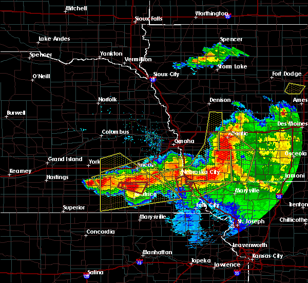 At 910 pm cdt, a severe thunderstorm capable of producing a tornado was located near wilber, or 15 miles northwest of beatrice, moving southeast at 30 mph (radar indicated rotation). Hazards include tornado. Flying debris will be dangerous to those caught without shelter. mobile homes will be damaged or destroyed. damage to roofs, windows, and vehicles will occur. tree damage is likely. this dangerous storm will be near, clatonia around 915 pm cdt. pickrell around 935 pm cdt. beatrice around 940 pm cdt. This includes highway 77 in nebraska between mile markers 26 and 37. At 910 pm cdt, a severe thunderstorm capable of producing a tornado was located near wilber, or 15 miles northwest of beatrice, moving southeast at 30 mph (radar indicated rotation). Hazards include tornado. Flying debris will be dangerous to those caught without shelter. mobile homes will be damaged or destroyed. damage to roofs, windows, and vehicles will occur. tree damage is likely. this dangerous storm will be near, clatonia around 915 pm cdt. pickrell around 935 pm cdt. beatrice around 940 pm cdt. This includes highway 77 in nebraska between mile markers 26 and 37.
|
| 6/16/2017 8:51 PM CDT |
 At 850 pm cdt, severe thunderstorms were located along a line extending from near elmwood to 6 miles west of hickman to 4 miles northwest of friend, moving southeast at 45 mph (radar indicated). Hazards include 70 mph wind gusts. Expect considerable tree damage. Damage is likely to mobile homes, roofs, and outbuildings. At 850 pm cdt, severe thunderstorms were located along a line extending from near elmwood to 6 miles west of hickman to 4 miles northwest of friend, moving southeast at 45 mph (radar indicated). Hazards include 70 mph wind gusts. Expect considerable tree damage. Damage is likely to mobile homes, roofs, and outbuildings.
|
| 6/15/2017 7:59 PM CDT |
 At 759 pm cdt, a severe thunderstorm was located over plymouth, or 11 miles west of beatrice, moving southeast at 15 mph (trained weather spotters). Hazards include half dollar size hail. Damage to vehicles is expected. locations impacted include, wilber, de witt, plymouth, clatonia, swanton, harbine and cub creek recreational area. this includes the following highways, highway 136 in nebraska between mile markers 160 and 170. Highway 77 in nebraska between mile markers 35 and 37. At 759 pm cdt, a severe thunderstorm was located over plymouth, or 11 miles west of beatrice, moving southeast at 15 mph (trained weather spotters). Hazards include half dollar size hail. Damage to vehicles is expected. locations impacted include, wilber, de witt, plymouth, clatonia, swanton, harbine and cub creek recreational area. this includes the following highways, highway 136 in nebraska between mile markers 160 and 170. Highway 77 in nebraska between mile markers 35 and 37.
|
| 6/15/2017 7:39 PM CDT |
 At 739 pm cdt, a severe thunderstorm was located 4 miles northwest of plymouth, or 17 miles west of beatrice, moving southeast at 15 mph (radar indicated). Hazards include two inch hail. People and animals outdoors will be injured. Expect damage to roofs, siding, windows, and vehicles. At 739 pm cdt, a severe thunderstorm was located 4 miles northwest of plymouth, or 17 miles west of beatrice, moving southeast at 15 mph (radar indicated). Hazards include two inch hail. People and animals outdoors will be injured. Expect damage to roofs, siding, windows, and vehicles.
|
| 5/16/2017 8:22 PM CDT |
 At 821 pm cdt, severe thunderstorms were located along a line extending from 3 miles west of crete to 5 miles west of beatrice, moving northeast at 50 mph (radar indicated). Hazards include 60 mph wind gusts and quarter size hail. Hail damage to vehicles is expected. expect wind damage to roofs, siding, and trees. Locations impacted include, beatrice, crete, wilber, de witt, plymouth, diller, western, clatonia, hallam, pickrell, jansen, swanton, harbine, swan creek reservoir number 2, swan creek wildlife management area, rock creek station state historical park, cub creek recreational area, 11 miles west of wilber and willard meyer recreation area. At 821 pm cdt, severe thunderstorms were located along a line extending from 3 miles west of crete to 5 miles west of beatrice, moving northeast at 50 mph (radar indicated). Hazards include 60 mph wind gusts and quarter size hail. Hail damage to vehicles is expected. expect wind damage to roofs, siding, and trees. Locations impacted include, beatrice, crete, wilber, de witt, plymouth, diller, western, clatonia, hallam, pickrell, jansen, swanton, harbine, swan creek reservoir number 2, swan creek wildlife management area, rock creek station state historical park, cub creek recreational area, 11 miles west of wilber and willard meyer recreation area.
|
| 5/16/2017 8:16 PM CDT |
 At 815 pm cdt, severe thunderstorms were located along a line extending from 3 miles south of dorchester to 7 miles north of diller, moving northeast at 50 mph (radar indicated). Hazards include 60 mph wind gusts and quarter size hail. Hail damage to vehicles is expected. expect wind damage to roofs, siding, and trees. Locations impacted include, beatrice, crete, wilber, de witt, plymouth, diller, western, clatonia, hallam, pickrell, jansen, swanton, harbine, swan creek reservoir number 2, swan creek wildlife management area, rock creek station state historical park, cub creek recreational area, 11 miles west of wilber and willard meyer recreation area. At 815 pm cdt, severe thunderstorms were located along a line extending from 3 miles south of dorchester to 7 miles north of diller, moving northeast at 50 mph (radar indicated). Hazards include 60 mph wind gusts and quarter size hail. Hail damage to vehicles is expected. expect wind damage to roofs, siding, and trees. Locations impacted include, beatrice, crete, wilber, de witt, plymouth, diller, western, clatonia, hallam, pickrell, jansen, swanton, harbine, swan creek reservoir number 2, swan creek wildlife management area, rock creek station state historical park, cub creek recreational area, 11 miles west of wilber and willard meyer recreation area.
|
| 5/16/2017 8:07 PM CDT |
 At 806 pm cdt, a severe thunderstorm was located 4 miles east of western, or 21 miles northwest of beatrice, moving northeast at 45 mph (radar indicated). Hazards include 60 mph wind gusts. expect damage to roofs, siding, and trees At 806 pm cdt, a severe thunderstorm was located 4 miles east of western, or 21 miles northwest of beatrice, moving northeast at 45 mph (radar indicated). Hazards include 60 mph wind gusts. expect damage to roofs, siding, and trees
|
| 4/19/2017 6:16 PM CDT |
 At 616 pm cdt, a severe thunderstorm was located over beatrice, moving east at 30 mph (radar indicated). Hazards include 60 mph wind gusts and quarter size hail. Hail damage to vehicles is expected. expect wind damage to roofs, siding, and trees. locations impacted include, beatrice, wymore, blue springs, pickrell, filley and rockford state recreation area. this includes the following highways, highway 136 in nebraska between mile markers 166 and 188. highway 77 in nebraska between mile markers 10 and 29. A tornado watch remains in effect until 1000 pm cdt for southeastern nebraska. At 616 pm cdt, a severe thunderstorm was located over beatrice, moving east at 30 mph (radar indicated). Hazards include 60 mph wind gusts and quarter size hail. Hail damage to vehicles is expected. expect wind damage to roofs, siding, and trees. locations impacted include, beatrice, wymore, blue springs, pickrell, filley and rockford state recreation area. this includes the following highways, highway 136 in nebraska between mile markers 166 and 188. highway 77 in nebraska between mile markers 10 and 29. A tornado watch remains in effect until 1000 pm cdt for southeastern nebraska.
|
| 4/19/2017 5:59 PM CDT |
 At 558 pm cdt, a severe thunderstorm was located near plymouth, or 12 miles west of beatrice, moving east at 30 mph (radar indicated). Hazards include golf ball size hail and 60 mph wind gusts. People and animals outdoors will be injured. expect hail damage to roofs, siding, windows, and vehicles. Expect wind damage to roofs, siding, and trees. At 558 pm cdt, a severe thunderstorm was located near plymouth, or 12 miles west of beatrice, moving east at 30 mph (radar indicated). Hazards include golf ball size hail and 60 mph wind gusts. People and animals outdoors will be injured. expect hail damage to roofs, siding, windows, and vehicles. Expect wind damage to roofs, siding, and trees.
|
| 4/19/2017 5:49 PM CDT |
 At 548 pm cdt, a severe thunderstorm was located 5 miles southwest of plymouth, or 15 miles west of beatrice, moving east at 30 mph (radar indicated). Hazards include 60 mph wind gusts and half dollar size hail. Hail damage to vehicles is expected. expect wind damage to roofs, siding, and trees. locations impacted include, beatrice, de witt, plymouth, jansen, harbine and cub creek recreational area. this includes the following highways, highway 136 in nebraska between mile markers 157 and 178. highway 77 in nebraska between mile markers 14 and 26. A tornado watch remains in effect until 1000 pm cdt for southeastern nebraska. At 548 pm cdt, a severe thunderstorm was located 5 miles southwest of plymouth, or 15 miles west of beatrice, moving east at 30 mph (radar indicated). Hazards include 60 mph wind gusts and half dollar size hail. Hail damage to vehicles is expected. expect wind damage to roofs, siding, and trees. locations impacted include, beatrice, de witt, plymouth, jansen, harbine and cub creek recreational area. this includes the following highways, highway 136 in nebraska between mile markers 157 and 178. highway 77 in nebraska between mile markers 14 and 26. A tornado watch remains in effect until 1000 pm cdt for southeastern nebraska.
|
| 4/19/2017 5:35 PM CDT |
 At 534 pm cdt, a severe thunderstorm was located 6 miles north of fairbury, or 21 miles west of beatrice, moving east at 45 mph (radar indicated). Hazards include 60 mph wind gusts and half dollar size hail. Hail damage to vehicles is expected. Expect wind damage to roofs, siding, and trees. At 534 pm cdt, a severe thunderstorm was located 6 miles north of fairbury, or 21 miles west of beatrice, moving east at 45 mph (radar indicated). Hazards include 60 mph wind gusts and half dollar size hail. Hail damage to vehicles is expected. Expect wind damage to roofs, siding, and trees.
|
| 4/9/2017 9:15 PM CDT |
 At 915 pm cdt, a severe thunderstorm was located 4 miles northeast of hallam, or 17 miles south of lincoln, moving east at 40 mph (radar indicated). Hazards include quarter size hail. Damage to vehicles is expected. locations impacted include, southeastern lincoln, hickman, bennet, firth, cortland, panama, hallam, pickrell, adams, roca, sprague, stagecoach state recreation area, wagon train state recreation area, olive creek state recreation area and bluestem state recreation area. this includes the following highways, highway 2 in nebraska between mile markers 466 and 469. Highway 77 in nebraska between mile markers 26 and 54. At 915 pm cdt, a severe thunderstorm was located 4 miles northeast of hallam, or 17 miles south of lincoln, moving east at 40 mph (radar indicated). Hazards include quarter size hail. Damage to vehicles is expected. locations impacted include, southeastern lincoln, hickman, bennet, firth, cortland, panama, hallam, pickrell, adams, roca, sprague, stagecoach state recreation area, wagon train state recreation area, olive creek state recreation area and bluestem state recreation area. this includes the following highways, highway 2 in nebraska between mile markers 466 and 469. Highway 77 in nebraska between mile markers 26 and 54.
|
| 4/9/2017 9:06 PM CDT |
 At 905 pm cdt, a severe thunderstorm was located near hallam, or 20 miles north of beatrice, moving east at 40 mph (radar indicated). Hazards include half dollar size hail. Damage to vehicles is expected. locations impacted include, southeastern lincoln, beatrice, crete, hickman, bennet, firth, de witt, cortland, panama, clatonia, hallam, pickrell, adams, roca, sprague, stagecoach state recreation area, wagon train state recreation area, olive creek state recreation area and bluestem state recreation area. this includes the following highways, highway 2 in nebraska between mile markers 466 and 469. Highway 77 in nebraska between mile markers 24 and 57. At 905 pm cdt, a severe thunderstorm was located near hallam, or 20 miles north of beatrice, moving east at 40 mph (radar indicated). Hazards include half dollar size hail. Damage to vehicles is expected. locations impacted include, southeastern lincoln, beatrice, crete, hickman, bennet, firth, de witt, cortland, panama, clatonia, hallam, pickrell, adams, roca, sprague, stagecoach state recreation area, wagon train state recreation area, olive creek state recreation area and bluestem state recreation area. this includes the following highways, highway 2 in nebraska between mile markers 466 and 469. Highway 77 in nebraska between mile markers 24 and 57.
|
| 4/9/2017 8:52 PM CDT |
 At 851 pm cdt, a severe thunderstorm was located 4 miles northwest of wilber, or 23 miles northwest of beatrice, moving east at 40 mph (radar indicated). Hazards include half dollar size hail. damage to vehicles is expected At 851 pm cdt, a severe thunderstorm was located 4 miles northwest of wilber, or 23 miles northwest of beatrice, moving east at 40 mph (radar indicated). Hazards include half dollar size hail. damage to vehicles is expected
|
| 8/11/2016 8:26 PM CDT |
 The severe thunderstorm warning for northern gage, saline, northern jefferson and southern lancaster counties will expire at 830 pm cdt, the storm which prompted the warning has weakened below severe limits, and no longer pose an immediate threat to life or property. therefore, the warning will be allowed to expire. however gusty winds of 45 to 55 mph are still possible with this thunderstorm. a severe thunderstorm watch remains in effect until 1100 pm cdt for southeastern nebraska. The severe thunderstorm warning for northern gage, saline, northern jefferson and southern lancaster counties will expire at 830 pm cdt, the storm which prompted the warning has weakened below severe limits, and no longer pose an immediate threat to life or property. therefore, the warning will be allowed to expire. however gusty winds of 45 to 55 mph are still possible with this thunderstorm. a severe thunderstorm watch remains in effect until 1100 pm cdt for southeastern nebraska.
|
| 8/11/2016 8:12 PM CDT |
 At 811 pm cdt, a severe thunderstorm was located over hallam, or 17 miles north of beatrice, moving east at 50 mph (radar indicated). Hazards include 60 mph wind gusts. Expect damage to roofs. siding. and trees. locations impacted include, beatrice, wilber, hickman, firth, de witt, cortland, plymouth, western, clatonia, hallam, pickrell, daykin, sprague, filley, tobias, swanton, wagon train state recreation area, stagecoach state recreation area, swan creek reservoir number 2 and willard meyer recreation area. this includes the following highways, highway 136 in nebraska between mile markers 175 and 188. Highway 77 in nebraska between milemarkers 22 and 48. At 811 pm cdt, a severe thunderstorm was located over hallam, or 17 miles north of beatrice, moving east at 50 mph (radar indicated). Hazards include 60 mph wind gusts. Expect damage to roofs. siding. and trees. locations impacted include, beatrice, wilber, hickman, firth, de witt, cortland, plymouth, western, clatonia, hallam, pickrell, daykin, sprague, filley, tobias, swanton, wagon train state recreation area, stagecoach state recreation area, swan creek reservoir number 2 and willard meyer recreation area. this includes the following highways, highway 136 in nebraska between mile markers 175 and 188. Highway 77 in nebraska between milemarkers 22 and 48.
|
| 8/11/2016 7:54 PM CDT |
 At 753 pm cdt, a severe thunderstorm was located over de witt, or 12 miles northwest of beatrice, moving east at 50 mph (radar indicated). Hazards include 60 mph wind gusts. Expect damage to roofs. siding. And trees. At 753 pm cdt, a severe thunderstorm was located over de witt, or 12 miles northwest of beatrice, moving east at 50 mph (radar indicated). Hazards include 60 mph wind gusts. Expect damage to roofs. siding. And trees.
|
| 5/25/2016 12:08 AM CDT |
 The severe thunderstorm warning for southeastern saline, northern gage and southern lancaster counties will expire at 1215 am cdt, the storm which prompted the warning has weakened below severe limits, and no longer poses an immediate threat to life or property. therefore the warning will be allowed to expire. however gusty winds are still possible with this thunderstorm. a severe thunderstorm watch remains in effect until 500 am cdt for southeastern nebraska. The severe thunderstorm warning for southeastern saline, northern gage and southern lancaster counties will expire at 1215 am cdt, the storm which prompted the warning has weakened below severe limits, and no longer poses an immediate threat to life or property. therefore the warning will be allowed to expire. however gusty winds are still possible with this thunderstorm. a severe thunderstorm watch remains in effect until 500 am cdt for southeastern nebraska.
|
| 5/24/2016 11:47 PM CDT | Storm damage reported in gage county NE, 2.3 miles S of Beatrice, NE |
| 5/24/2016 11:22 PM CDT | The national weather service in omaha has issued a * severe thunderstorm warning for. eastern jefferson county in southeastern nebraska. southern gage county in southeastern nebraska. western pawnee county in southeastern nebraska. Until 1145 pm cdt. |
| 4/26/2016 6:10 PM CDT | The severe thunderstorm warning for southeastern jefferson and gage counties will expire at 615 pm cdt, the storm which prompted the warning has weakened below severe limits, and no longer poses an immediate threat to life or property. therefore the warning will be allowed to expire. however small hail is still possible with this thunderstorm. a tornado watch remains in effect until 900 pm cdt for southeastern nebraska. |
| 4/26/2016 5:49 PM CDT |
 At 548 pm cdt, a severe thunderstorm was located near odell, or 14 miles north of marysville, moving north at 30 mph (public). Hazards include two inch hail. People and animals outdoors will be injured. expect damage to roofs, siding, windows and vehicles. locations impacted include, beatrice, wymore, blue springs, odell, diller, filley, barneston, liberty, virginia and rockford state recreation area. this includes the following highways, highway 136 in nebraska between mile markers 166 and 194. highway 77 in nebraska between milemarkers 1 and 26. A tornado watch remains in effect until 900 pm cdt for southeastern nebraska. At 548 pm cdt, a severe thunderstorm was located near odell, or 14 miles north of marysville, moving north at 30 mph (public). Hazards include two inch hail. People and animals outdoors will be injured. expect damage to roofs, siding, windows and vehicles. locations impacted include, beatrice, wymore, blue springs, odell, diller, filley, barneston, liberty, virginia and rockford state recreation area. this includes the following highways, highway 136 in nebraska between mile markers 166 and 194. highway 77 in nebraska between milemarkers 1 and 26. A tornado watch remains in effect until 900 pm cdt for southeastern nebraska.
|
| 4/26/2016 5:39 PM CDT |
 At 538 pm cdt, a severe thunderstorm was located near odell, or 16 miles south of beatrice, moving north at 40 mph (public). Hazards include two inch hail. People and animals outdoors will be injured. expect damage to roofs, siding, windows and vehicles. locations impacted include, beatrice, wymore, blue springs, odell, diller, filley, barneston, liberty, virginia and rockford state recreation area. this includes the following highways, highway 136 in nebraska between mile markers 166 and 194. highway 77 in nebraska between milemarkers 1 and 26. A tornado watch remains in effect until 900 pm cdt for southeastern nebraska. At 538 pm cdt, a severe thunderstorm was located near odell, or 16 miles south of beatrice, moving north at 40 mph (public). Hazards include two inch hail. People and animals outdoors will be injured. expect damage to roofs, siding, windows and vehicles. locations impacted include, beatrice, wymore, blue springs, odell, diller, filley, barneston, liberty, virginia and rockford state recreation area. this includes the following highways, highway 136 in nebraska between mile markers 166 and 194. highway 77 in nebraska between milemarkers 1 and 26. A tornado watch remains in effect until 900 pm cdt for southeastern nebraska.
|
| 4/26/2016 5:27 PM CDT |
 At 527 pm cdt, a severe thunderstorm was located 5 miles southwest of odell, or 15 miles northwest of marysville, moving north at 30 mph (radar indicated). Hazards include golf ball size hail and 60 mph wind gusts. People and animals outdoors will be injured. expect hail damage to roofs, siding, windows and vehicles. Expect wind damage to roofs, siding and trees. At 527 pm cdt, a severe thunderstorm was located 5 miles southwest of odell, or 15 miles northwest of marysville, moving north at 30 mph (radar indicated). Hazards include golf ball size hail and 60 mph wind gusts. People and animals outdoors will be injured. expect hail damage to roofs, siding, windows and vehicles. Expect wind damage to roofs, siding and trees.
|
| 4/26/2016 5:15 PM CDT |
 At 515 pm cdt, a severe thunderstorm was located near odell, or 15 miles southwest of beatrice, moving north at 30 mph (radar indicated). Hazards include 60 mph wind gusts and half dollar size hail. Hail damage to vehicles is expected. expect wind damage to roofs, siding and trees. locations impacted include, beatrice, fairbury, wymore, plymouth, blue springs, odell, diller, filley, endicott, jansen, barneston, liberty, steele city, virginia, harbine, camp jefferson, crystal springs campground, cub creek recreational area, rock creek station state historical park and rockford state recreation area. this includes the following highways, highway 136 in nebraska between mile markers 151 and 194. highway 77 in nebraska between milemarkers 1 and 24. A tornado watch remains in effect until 900 pm cdt for southeastern nebraska. At 515 pm cdt, a severe thunderstorm was located near odell, or 15 miles southwest of beatrice, moving north at 30 mph (radar indicated). Hazards include 60 mph wind gusts and half dollar size hail. Hail damage to vehicles is expected. expect wind damage to roofs, siding and trees. locations impacted include, beatrice, fairbury, wymore, plymouth, blue springs, odell, diller, filley, endicott, jansen, barneston, liberty, steele city, virginia, harbine, camp jefferson, crystal springs campground, cub creek recreational area, rock creek station state historical park and rockford state recreation area. this includes the following highways, highway 136 in nebraska between mile markers 151 and 194. highway 77 in nebraska between milemarkers 1 and 24. A tornado watch remains in effect until 900 pm cdt for southeastern nebraska.
|
| 4/26/2016 4:57 PM CDT |
 At 456 pm cdt, a severe thunderstorm was located 4 miles northeast of bremen, or 7 miles northwest of marysville, moving north at 45 mph (radar indicated). Hazards include two inch hail and 60 mph wind gusts. People and animals outdoors will be injured. expect hail damage to roofs, siding, windows and vehicles. Expect wind damage to roofs, siding and trees. At 456 pm cdt, a severe thunderstorm was located 4 miles northeast of bremen, or 7 miles northwest of marysville, moving north at 45 mph (radar indicated). Hazards include two inch hail and 60 mph wind gusts. People and animals outdoors will be injured. expect hail damage to roofs, siding, windows and vehicles. Expect wind damage to roofs, siding and trees.
|
| 9/7/2015 9:10 PM CDT |
 The severe thunderstorm warning for northern gage county will expire at 915 pm cdt, the storm which prompted the warning was moving out of the warned area. therefore the warning will be allowed to expire. however gusty winds are still possible. a severe thunderstorm watch remains in effect until 1000 pm cdt for southeastern nebraska. a new severe thunderstorm warning has been issued with this storm for areas to the southeast of this warning which is expiring. The severe thunderstorm warning for northern gage county will expire at 915 pm cdt, the storm which prompted the warning was moving out of the warned area. therefore the warning will be allowed to expire. however gusty winds are still possible. a severe thunderstorm watch remains in effect until 1000 pm cdt for southeastern nebraska. a new severe thunderstorm warning has been issued with this storm for areas to the southeast of this warning which is expiring.
|
| 9/7/2015 9:02 PM CDT |
 At 901 pm cdt, a severe thunderstorm was located 9 miles southwest of sterling, or 14 miles east of beatrice, moving east at 30 mph (radar indicated). Hazards include 60 mph wind gusts and quarter size hail. Hail damage to vehicles is expected. expect wind damage to roofs, siding and trees. locations impacted include, cortland, pickrell, adams and filley. this includes the following highways, highway 136 in nebraska near mile marker 191. Highway 77 in nebraska between milemarkers 26 and 41. At 901 pm cdt, a severe thunderstorm was located 9 miles southwest of sterling, or 14 miles east of beatrice, moving east at 30 mph (radar indicated). Hazards include 60 mph wind gusts and quarter size hail. Hail damage to vehicles is expected. expect wind damage to roofs, siding and trees. locations impacted include, cortland, pickrell, adams and filley. this includes the following highways, highway 136 in nebraska near mile marker 191. Highway 77 in nebraska between milemarkers 26 and 41.
|
| 9/7/2015 8:50 PM CDT |
 At 849 pm cdt, a severe thunderstorm was located 7 miles east of pickrell, or 10 miles northeast of beatrice, moving east at 30 mph (radar indicated). Hazards include golf ball size hail and 60 mph wind gusts. People and animals outdoors will be injured. expect hail damage to roofs, siding, windows and vehicles. expect wind damage to roofs, siding and trees. locations impacted include, cortland, pickrell, adams and filley. this includes the following highways, highway 136 in nebraska near mile marker 191. Highway 77 in nebraska between milemarkers 26 and 41. At 849 pm cdt, a severe thunderstorm was located 7 miles east of pickrell, or 10 miles northeast of beatrice, moving east at 30 mph (radar indicated). Hazards include golf ball size hail and 60 mph wind gusts. People and animals outdoors will be injured. expect hail damage to roofs, siding, windows and vehicles. expect wind damage to roofs, siding and trees. locations impacted include, cortland, pickrell, adams and filley. this includes the following highways, highway 136 in nebraska near mile marker 191. Highway 77 in nebraska between milemarkers 26 and 41.
|
| 9/7/2015 8:43 PM CDT |
 At 842 pm cdt, a severe thunderstorm was located about 5 miles northeast of pickrell, or 11 miles north of beatrice, moving east at 25 mph (radar indicated). Hazards include golf ball size hail and 60 mph wind gusts. People and animals outdoors will be injured. expect hail damage to roofs, siding, windows and vehicles. expect wind damage to roofs, siding and trees. locations impacted include, cortland, pickrell, adams and filley. this includes the following highways, highway 136 in nebraska near mile marker 191. Highway 77 in nebraska between milemarkers 26 and 41. At 842 pm cdt, a severe thunderstorm was located about 5 miles northeast of pickrell, or 11 miles north of beatrice, moving east at 25 mph (radar indicated). Hazards include golf ball size hail and 60 mph wind gusts. People and animals outdoors will be injured. expect hail damage to roofs, siding, windows and vehicles. expect wind damage to roofs, siding and trees. locations impacted include, cortland, pickrell, adams and filley. this includes the following highways, highway 136 in nebraska near mile marker 191. Highway 77 in nebraska between milemarkers 26 and 41.
|
| 9/7/2015 8:32 PM CDT |
 At 830 pm cdt, a severe thunderstorm was located between pickrell and cortland, or 11 miles north of beatrice, moving east at 25 mph (radar indicated). Hazards include golf ball size hail and 60 mph wind gusts. People and animals outdoors will be injured. expect hail damage to roofs, siding, windows and vehicles. expect wind damage to roofs, siding and trees. locations impacted include, cortland, clatonia, pickrell, adams and filley. this includes the following highways, highway 136 in nebraska near mile marker 191. Highway 77 in nebraska between milemarkers 26 and 41. At 830 pm cdt, a severe thunderstorm was located between pickrell and cortland, or 11 miles north of beatrice, moving east at 25 mph (radar indicated). Hazards include golf ball size hail and 60 mph wind gusts. People and animals outdoors will be injured. expect hail damage to roofs, siding, windows and vehicles. expect wind damage to roofs, siding and trees. locations impacted include, cortland, clatonia, pickrell, adams and filley. this includes the following highways, highway 136 in nebraska near mile marker 191. Highway 77 in nebraska between milemarkers 26 and 41.
|
| 9/7/2015 8:22 PM CDT |
 At 822 pm cdt, a severe thunderstorm was located over clatonia, or 12 miles northwest of beatrice, moving east at 25 mph (radar indicated). Hazards include 60 mph wind gusts and half dollar size hail. Hail damage to vehicles is expected. Expect wind damage to roofs, siding and trees. At 822 pm cdt, a severe thunderstorm was located over clatonia, or 12 miles northwest of beatrice, moving east at 25 mph (radar indicated). Hazards include 60 mph wind gusts and half dollar size hail. Hail damage to vehicles is expected. Expect wind damage to roofs, siding and trees.
|
| 9/7/2015 4:41 PM CDT |
 At 441 pm cdt, a severe thunderstorm was located near wymore, or 14 miles southeast of beatrice, moving east at 30 mph (trained weather spotters). Hazards include golf ball size hail and 70 mph wind gusts. People and animals outdoors will be injured. expect hail damage to roofs, siding, windows and vehicles. expect considerable tree damage. wind damage is also likely to mobile homes, roofs and outbuildings. locations impacted include, beatrice, wymore, blue springs, filley, barneston, liberty, virginia and rockford state recreation area. this includes the following highways, highway 136 in nebraska between mile markers 178 and 191. Highway 77 in nebraska between milemarkers 1 and 26. At 441 pm cdt, a severe thunderstorm was located near wymore, or 14 miles southeast of beatrice, moving east at 30 mph (trained weather spotters). Hazards include golf ball size hail and 70 mph wind gusts. People and animals outdoors will be injured. expect hail damage to roofs, siding, windows and vehicles. expect considerable tree damage. wind damage is also likely to mobile homes, roofs and outbuildings. locations impacted include, beatrice, wymore, blue springs, filley, barneston, liberty, virginia and rockford state recreation area. this includes the following highways, highway 136 in nebraska between mile markers 178 and 191. Highway 77 in nebraska between milemarkers 1 and 26.
|
| 9/7/2015 4:25 PM CDT |
 At 425 pm cdt, a severe thunderstorm was located near wymore, or 10 miles south of beatrice, moving east at 30 mph (radar indicated). Hazards include golf ball size hail and 60 mph wind gusts. People and animals outdoors will be injured. expect hail damage to roofs, siding, windows and vehicles. expect wind damage to roofs, siding and trees. locations impacted include, beatrice, wymore, blue springs, odell, filley, barneston, liberty, virginia and rockford state recreation area. this includes the following highways, highway 136 in nebraska between mile markers 170 and 191. Highway 77 in nebraska between milemarkers 1 and 26. At 425 pm cdt, a severe thunderstorm was located near wymore, or 10 miles south of beatrice, moving east at 30 mph (radar indicated). Hazards include golf ball size hail and 60 mph wind gusts. People and animals outdoors will be injured. expect hail damage to roofs, siding, windows and vehicles. expect wind damage to roofs, siding and trees. locations impacted include, beatrice, wymore, blue springs, odell, filley, barneston, liberty, virginia and rockford state recreation area. this includes the following highways, highway 136 in nebraska between mile markers 170 and 191. Highway 77 in nebraska between milemarkers 1 and 26.
|
| 9/7/2015 3:55 PM CDT |
 At 355 pm cdt, a severe thunderstorm was located near diller, or 15 miles southwest of beatrice, moving east at 30 mph (radar indicated). Hazards include golf ball size hail and 70 mph wind gusts. People and animals outdoors will be injured. expect hail damage to roofs, siding, windows and vehicles. expect considerable tree damage. Wind damage is also likely to mobile homes, roofs and outbuildings. At 355 pm cdt, a severe thunderstorm was located near diller, or 15 miles southwest of beatrice, moving east at 30 mph (radar indicated). Hazards include golf ball size hail and 70 mph wind gusts. People and animals outdoors will be injured. expect hail damage to roofs, siding, windows and vehicles. expect considerable tree damage. Wind damage is also likely to mobile homes, roofs and outbuildings.
|
| 8/22/2015 7:03 PM CDT |
 At 703 pm cdt, a severe thunderstorm was located near odell, or 10 miles south of beatrice, moving southeast at 20 mph (radar indicated). Hazards include 60 mph wind gusts and quarter size hail. Hail damage to vehicles is expected. expect wind damage to roofs, siding and trees. locations impacted include, beatrice, wymore, blue springs, odell, diller, filley, barneston, liberty, steele city, virginia and rockford state recreation area. this includes the following highways, highway 136 in nebraska between mile markers 170 and 173, and between mile markers 178 and 191. highway 77 in nebraska between milemarkers 1 and 22. A tornado watch remains in effect until midnight cdt for southeastern nebraska. At 703 pm cdt, a severe thunderstorm was located near odell, or 10 miles south of beatrice, moving southeast at 20 mph (radar indicated). Hazards include 60 mph wind gusts and quarter size hail. Hail damage to vehicles is expected. expect wind damage to roofs, siding and trees. locations impacted include, beatrice, wymore, blue springs, odell, diller, filley, barneston, liberty, steele city, virginia and rockford state recreation area. this includes the following highways, highway 136 in nebraska between mile markers 170 and 173, and between mile markers 178 and 191. highway 77 in nebraska between milemarkers 1 and 22. A tornado watch remains in effect until midnight cdt for southeastern nebraska.
|
| 8/22/2015 6:54 PM CDT |
 The severe thunderstorm warning for northeastern jefferson and central gage counties will expire at 700 pm cdt, the storm which prompted the warning has moved out of the area. therefore the warning will be allowed to expire. a tornado watch remains in effect until midnight cdt for southeastern nebraska. remember, a severe thunderstorm warning still remains in effect for southeast jefferson and southern and central gage county until 730 pm cdt. The severe thunderstorm warning for northeastern jefferson and central gage counties will expire at 700 pm cdt, the storm which prompted the warning has moved out of the area. therefore the warning will be allowed to expire. a tornado watch remains in effect until midnight cdt for southeastern nebraska. remember, a severe thunderstorm warning still remains in effect for southeast jefferson and southern and central gage county until 730 pm cdt.
|
| 8/22/2015 6:51 PM CDT |
 At 651 pm cdt, a severe thunderstorm was located 7 miles southwest of beatrice, moving southeast at 25 mph (radar indicated). Hazards include ping pong ball size hail. People and animals outdoors will be injured. Expect damage to roofs, siding, windows and vehicles. At 651 pm cdt, a severe thunderstorm was located 7 miles southwest of beatrice, moving southeast at 25 mph (radar indicated). Hazards include ping pong ball size hail. People and animals outdoors will be injured. Expect damage to roofs, siding, windows and vehicles.
|
| 8/22/2015 6:29 PM CDT |
 At 629 pm cdt, a severe thunderstorm was located over beatrice, moving southeast at 15 mph (radar indicated). Hazards include ping pong ball size hail. People and animals outdoors will be injured. expect damage to roofs, siding, windows and vehicles. locations impacted include, beatrice, wymore, plymouth, blue springs, harbine and cub creek recreational area. this includes the following highways, highway 136 in nebraska between mile markers 160 and 185. highway 77 in nebraska between milemarkers 10 and 26. A tornado watch remains in effect until midnight cdt for southeastern nebraska. At 629 pm cdt, a severe thunderstorm was located over beatrice, moving southeast at 15 mph (radar indicated). Hazards include ping pong ball size hail. People and animals outdoors will be injured. expect damage to roofs, siding, windows and vehicles. locations impacted include, beatrice, wymore, plymouth, blue springs, harbine and cub creek recreational area. this includes the following highways, highway 136 in nebraska between mile markers 160 and 185. highway 77 in nebraska between milemarkers 10 and 26. A tornado watch remains in effect until midnight cdt for southeastern nebraska.
|
| 8/22/2015 6:13 PM CDT |
 At 612 pm cdt, a severe thunderstorm was located near beatrice, moving east at 15 mph (radar indicated. this replaces and extends the previously issued warning for the area). Hazards include ping pong ball size hail. People and animals outdoors will be injured. Expect damage to roofs, siding, windows and vehicles. At 612 pm cdt, a severe thunderstorm was located near beatrice, moving east at 15 mph (radar indicated. this replaces and extends the previously issued warning for the area). Hazards include ping pong ball size hail. People and animals outdoors will be injured. Expect damage to roofs, siding, windows and vehicles.
|
| 8/22/2015 6:05 PM CDT |
 At 604 pm cdt, a severe thunderstorm was located near beatrice, moving east at 20 mph (several reports from trained weather spotters have reported golf ball size hail). Hazards include golf ball size hail. People and animals outdoors will be injured. expect damage to roofs, siding, windows and vehicles. locations impacted include, beatrice and plymouth. this includes the following highways, highway 136 in nebraska between mile markers 167 and 178. highway 77 in nebraska between milemarkers 19 and 26. A tornado watch remains in effect until midnight cdt for southeastern nebraska. At 604 pm cdt, a severe thunderstorm was located near beatrice, moving east at 20 mph (several reports from trained weather spotters have reported golf ball size hail). Hazards include golf ball size hail. People and animals outdoors will be injured. expect damage to roofs, siding, windows and vehicles. locations impacted include, beatrice and plymouth. this includes the following highways, highway 136 in nebraska between mile markers 167 and 178. highway 77 in nebraska between milemarkers 19 and 26. A tornado watch remains in effect until midnight cdt for southeastern nebraska.
|
| 8/22/2015 5:59 PM CDT | Quarter sized hail reported 4.8 miles SE of Beatrice, NE |
| 8/22/2015 5:59 PM CDT | Golf Ball sized hail reported 5.7 miles ESE of Beatrice, NE |
| 8/22/2015 5:47 PM CDT |
 At 547 pm cdt, a severe thunderstorm was located near plymouth, or 7 miles northwest of beatrice, moving east at 25 mph (radar indicated). Hazards include two inch hail. People and animals outdoors will be injured. expect damage to roofs, siding, windows and vehicles. locations impacted include, beatrice and plymouth. this includes the following highways, highway 136 in nebraska between mile markers 167 and 178. highway 77 in nebraska between milemarkers 19 and 26. A tornado watch remains in effect until midnight cdt for southeastern nebraska. At 547 pm cdt, a severe thunderstorm was located near plymouth, or 7 miles northwest of beatrice, moving east at 25 mph (radar indicated). Hazards include two inch hail. People and animals outdoors will be injured. expect damage to roofs, siding, windows and vehicles. locations impacted include, beatrice and plymouth. this includes the following highways, highway 136 in nebraska between mile markers 167 and 178. highway 77 in nebraska between milemarkers 19 and 26. A tornado watch remains in effect until midnight cdt for southeastern nebraska.
|
| 8/22/2015 5:40 PM CDT |
 At 540 pm cdt, a severe thunderstorm was located near plymouth, or 10 miles west of beatrice, moving east at 25 mph (radar indicated). Hazards include golf ball size hail. People and animals outdoors will be injured. Expect damage to roofs, siding, windows and vehicles. At 540 pm cdt, a severe thunderstorm was located near plymouth, or 10 miles west of beatrice, moving east at 25 mph (radar indicated). Hazards include golf ball size hail. People and animals outdoors will be injured. Expect damage to roofs, siding, windows and vehicles.
|
| 7/24/2015 11:28 PM CDT |
 At 1128 pm cdt, severe thunderstorms were located along a line extending from near shelby to near bruning, moving east at 40 mph (radar indicated). Hazards include 60 mph wind gusts. Expect damage to roofs. Siding and trees. At 1128 pm cdt, severe thunderstorms were located along a line extending from near shelby to near bruning, moving east at 40 mph (radar indicated). Hazards include 60 mph wind gusts. Expect damage to roofs. Siding and trees.
|
| 7/24/2015 8:02 PM CDT |
 At 802 pm cdt, a severe thunderstorm was located over beatrice, moving southeast at 15 mph (radar indicated). Hazards include 60 mph wind gusts. Expect damage to roofs. Siding and trees. At 802 pm cdt, a severe thunderstorm was located over beatrice, moving southeast at 15 mph (radar indicated). Hazards include 60 mph wind gusts. Expect damage to roofs. Siding and trees.
|
| 7/15/2015 10:55 PM CDT |
 The severe thunderstorm warning for gage county will expire at 1100 pm cdt, the storms which prompted the warning have weakened below severe limits, and no longer pose an immediate threat to life or property. therefore the warning will be allowed to expire. however gusty winds and heavy rain are still possible with these thunderstorms. The severe thunderstorm warning for gage county will expire at 1100 pm cdt, the storms which prompted the warning have weakened below severe limits, and no longer pose an immediate threat to life or property. therefore the warning will be allowed to expire. however gusty winds and heavy rain are still possible with these thunderstorms.
|
| 7/15/2015 10:31 PM CDT |
 At 1031 pm cdt, severe thunderstorms were located along a line extending from near pickrell to blue springs, moving northeast at 40 mph (radar indicated). Hazards include 60 mph wind gusts. Expect damage to roofs. siding and trees. locations impacted include, beatrice, wymore, blue springs, odell, pickrell, adams, filley, barneston, liberty, virginia and rockford state recreation area. this includes the following highways, highway 136 in nebraska between mile markers 166 and 191. Highway 77 in nebraska between milemarkers 3 and 29. At 1031 pm cdt, severe thunderstorms were located along a line extending from near pickrell to blue springs, moving northeast at 40 mph (radar indicated). Hazards include 60 mph wind gusts. Expect damage to roofs. siding and trees. locations impacted include, beatrice, wymore, blue springs, odell, pickrell, adams, filley, barneston, liberty, virginia and rockford state recreation area. this includes the following highways, highway 136 in nebraska between mile markers 166 and 191. Highway 77 in nebraska between milemarkers 3 and 29.
|
| 7/15/2015 10:12 PM CDT |
 At 1012 pm cdt, severe thunderstorms were located along a line extending from near plymouth to near hollenberg, moving northeast at 45 mph (radar indicated). Hazards include 60 mph wind gusts. Expect damage to roofs. Siding and trees. At 1012 pm cdt, severe thunderstorms were located along a line extending from near plymouth to near hollenberg, moving northeast at 45 mph (radar indicated). Hazards include 60 mph wind gusts. Expect damage to roofs. Siding and trees.
|
| 6/11/2015 4:49 PM CDT |
 At 448 pm cdt, a severe thunderstorm capable of producing a tornado was located near blue springs, or near beatrice, moving east at 30 mph (radar indicated rotation). Hazards include tornado. Flying debris will be dangerous to those caught without shelter. mobile homes will be damaged or destroyed. damage to roofs, windows and vehicles will occur. tree damage is likely. this tornadic thunderstorm will remain over mainly rural areas of southwestern johnson, east central gage and northwestern pawnee counties, including the following locations, filley, virginia, lewiston and rockford state recreation area. this includes the following highways, highway 136 in nebraska between mile markers 183 and 194. Highway 77 in nebraska near milemarker 10. At 448 pm cdt, a severe thunderstorm capable of producing a tornado was located near blue springs, or near beatrice, moving east at 30 mph (radar indicated rotation). Hazards include tornado. Flying debris will be dangerous to those caught without shelter. mobile homes will be damaged or destroyed. damage to roofs, windows and vehicles will occur. tree damage is likely. this tornadic thunderstorm will remain over mainly rural areas of southwestern johnson, east central gage and northwestern pawnee counties, including the following locations, filley, virginia, lewiston and rockford state recreation area. this includes the following highways, highway 136 in nebraska between mile markers 183 and 194. Highway 77 in nebraska near milemarker 10.
|
| 5/6/2015 10:52 PM CDT | The severe thunderstorm warning for northern gage county will expire at 1100 pm cdt, the severe thunderstorm which prompted the warning will be allowed to expire. a tornado warning continues for part of this area until 1115 pm. a tornado watch remains in effect until 200 am cdt for southeastern nebraska. |
| 5/6/2015 10:43 PM CDT | At 1043 pm cdt, a severe thunderstorm was located near pickrell, or 10 miles north of beatrice, moving north at 25 mph (radar indicated). Hazards include 70 mph wind gusts and quarter size hail. Hail damage to vehicles is expected. expect considerable tree damage. wind damage is also likely to mobile homes, roofs and outbuildings. locations impacted include, cortland, clatonia, pickrell and adams. this includes highway 77 in nebraska between milemarkers 26 and 41. a tornado watch remains in effect until 200 am cdt for southeastern nebraska. 1. 00in. |
| 5/6/2015 10:38 PM CDT | At 1038 pm cdt, a severe thunderstorm capable of producing a tornado was located near clatonia, or 10 miles northwest of beatrice, moving north at 40 mph (radar indicated rotation). Hazards include tornado. Flying debris will be dangerous to those caught without shelter. mobile homes will be damaged or destroyed. damage to roofs, windows and vehicles will occur. tree damage is likely. this dangerous storm will be near, cortland and hallam around 1050 pm cdt. hickman around 1105 pm cdt. other locations impacted by this tornadic thunderstorm include sprague, stagecoach state recreation area, bluestem state recreation area and olive creek state recreation area. this includes highway 77 in nebraska between milemarkers 26 and 48. Radar indicated. |
| 5/6/2015 10:32 PM CDT | At 1031 pm cdt, a severe thunderstorm was located between beatrice and dewitt, moving north at 45 mph (radar indicated). Hazards include 60 to 70 mph wind gusts and quarter size hail. Hail damage to vehicles is expected. expect wind damage to roofs, siding and trees. locations impacted include, beatrice, cortland, clatonia, pickrell and adams. this includes the following highways, highway 136 in nebraska between mile markers 170 and 183. highway 77 in nebraska between milemarkers 14 and 41. a tornado watch remains in effect until 200 am cdt for southeastern nebraska. 1. 00in. |
| 5/6/2015 10:21 PM CDT | At 1021 pm cdt, a severe thunderstorm was located just southwest of beatrice, moving north at 45 mph (radar indicated). Hazards include 60 mph wind gusts and quarter size hail. Hail damage to vehicles is expected. Expect wind damage to roofs, siding and trees. |
| 5/6/2015 10:07 PM CDT | The severe thunderstorm warning for eastern jefferson and southwestern gage counties will expire at 1015 pm cdt, the storm which prompted the warning has weakened below severe limits, and no longer poses an immediate threat to life or property. therefore the warning will be allowed to expire. however small hail and gusty winds are still possible with this thunderstorm. another storm currently in kansas could move up into parts of southeast jefferson county by around 1045 pm. a tornado watch remains in effect until 200 am cdt for southeastern nebraska. |
| 5/6/2015 9:56 PM CDT | At 954 pm cdt, a severe thunderstorm was located between diller and steele city, or about 17 miles southwest of beatrice, moving northeast at 30 mph. the storm has weakened slightly (radar indicated). Hazards include 60 mph wind gusts and nickel size hail. Expect damage to roofs. siding and trees. locations impacted include, plymouth, odell, diller, endicott, jansen, steele city, harbine, cub creek recreational area and rock creek station state historical park. this includes the following highways, highway 136 in nebraska between mile markers 157 and 173. highway 77 in nebraska between milemarkers 17 and 19. a tornado watch remains in effect until 200 am cdt for southeastern nebraska. 0. 88in. |
| 5/6/2015 9:45 PM CDT | At 945 pm cdt, a severe thunderstorm was located near hollenberg, or 14 miles north of washington, moving northeast at 35 mph (radar indicated). Hazards include 60 mph wind gusts and quarter size hail. Hail damage to vehicles is expected. expect wind damage to roofs, siding and trees. locations impacted include, plymouth, odell, diller, endicott, jansen, steele city, harbine, cub creek recreational area and rock creek station state historical park. this includes the following highways, highway 136 in nebraska between mile markers 157 and 173. highway 77 in nebraska between milemarkers 17 and 19. a tornado watch remains in effect until 200 am cdt for southeastern nebraska. 1. 00in. |
| 5/6/2015 9:35 PM CDT | At 934 pm cdt, a severe thunderstorm was located near hollenburg, or 10 miles north of washington, moving northeast at 35 mph (radar indicated). Hazards include 60 mph wind gusts and quarter size hail. Hail damage to vehicles is expected. Expect wind damage to roofs, siding and trees. |
| 5/3/2015 11:50 PM CDT | The severe thunderstorm warning for southern gage and northwestern pawnee counties will expire at 1200 am cdt, the storm which prompted the warning has weakened below severe limits, and no longer poses an immediate threat to life or property. therefore the warning will be allowed to expire. however small hail is still possible with this thunderstorm. |
| 5/3/2015 11:23 PM CDT | At 1123 pm cdt, a severe thunderstorm was located over beatrice, moving southeast at 30 mph (radar indicated). Hazards include quarter size hail. damage to vehicles is expected |
| 6/15/2014 1:20 AM CDT | Received through twitte in gage county NE, 0.3 miles SSW of Beatrice, NE |
| 6/3/2014 9:47 PM CDT | 66kt measured at kbi in gage county NE, 0.3 miles SSW of Beatrice, NE |
| 6/3/2014 9:38 PM CDT | Storm damage reported in gage county NE, 1 miles S of Beatrice, NE |
| 10/3/2013 2:15 AM CDT | 61 mph gust reported at beatrice airport. checked in the town of beatrice and law enforcement reported only a few small branches down which were an inch in diamete in gage county NE, 0.3 miles SSW of Beatrice, NE |
| 5/27/2013 9:25 PM CDT | Storm damage reported in gage county NE, 0.3 miles SSW of Beatrice, NE |
| 5/18/2013 11:40 PM CDT | Roof taken off of a shed along hwy 7 in gage county NE, 6 miles N of Beatrice, NE |
| 4/14/2012 4:00 PM CDT | Tree branches down. barn damaged. windows blown in. time estimate in gage county NE, 0.3 miles SSW of Beatrice, NE |
| 1/1/0001 12:00 AM | Trees blown down blocking roadwa in gage county NE, 0.3 miles SSW of Beatrice, NE |
| 1/1/0001 12:00 AM | Storm damage reported in gage county NE, 2.3 miles S of Beatrice, NE |
Hail Maps for Beatrice, NE
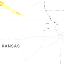
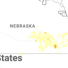
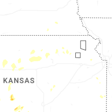


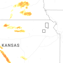

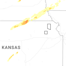
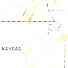
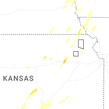
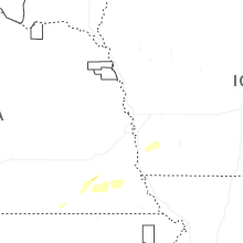
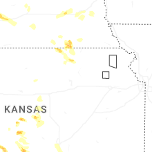
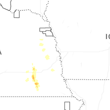
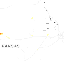
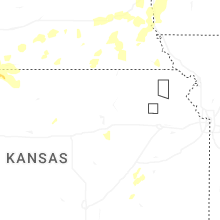
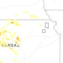
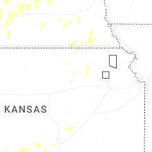
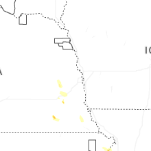
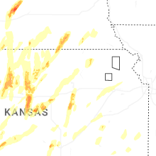


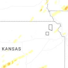


Connect with Interactive Hail Maps