

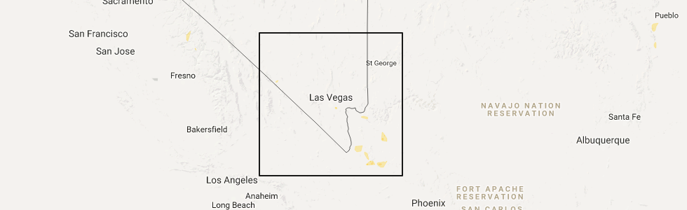
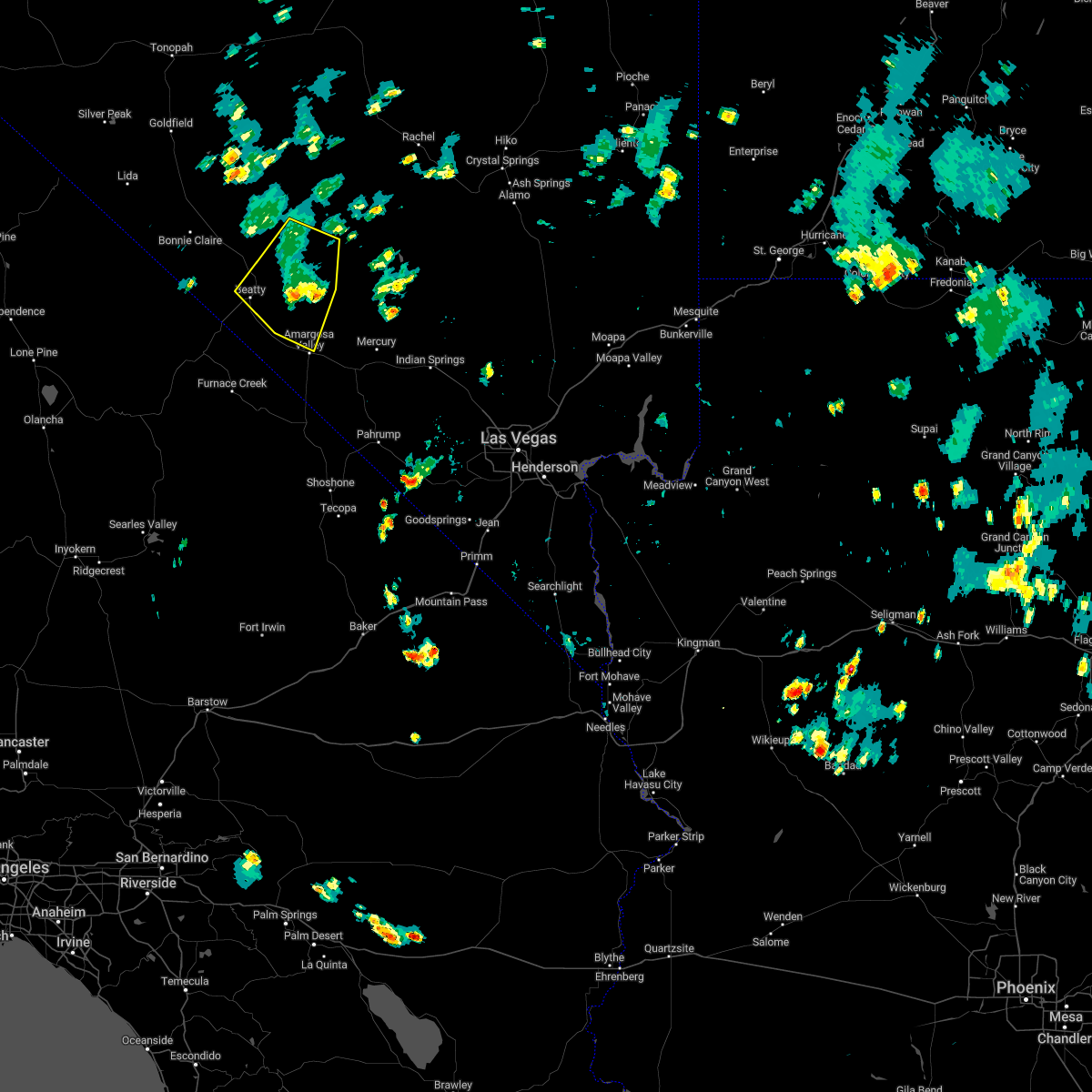
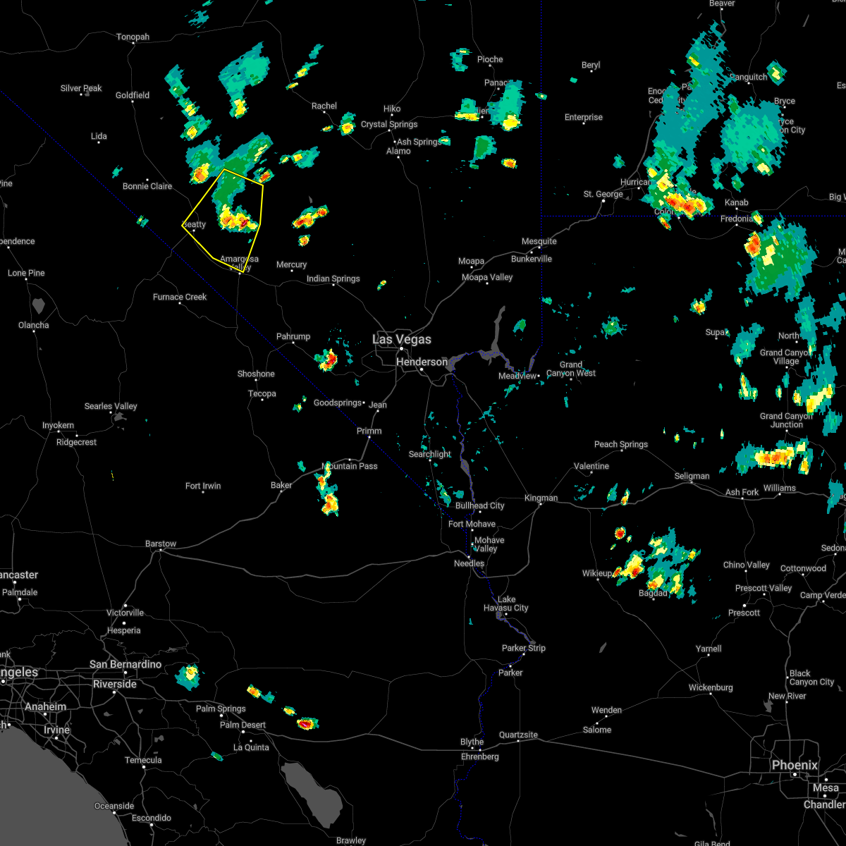
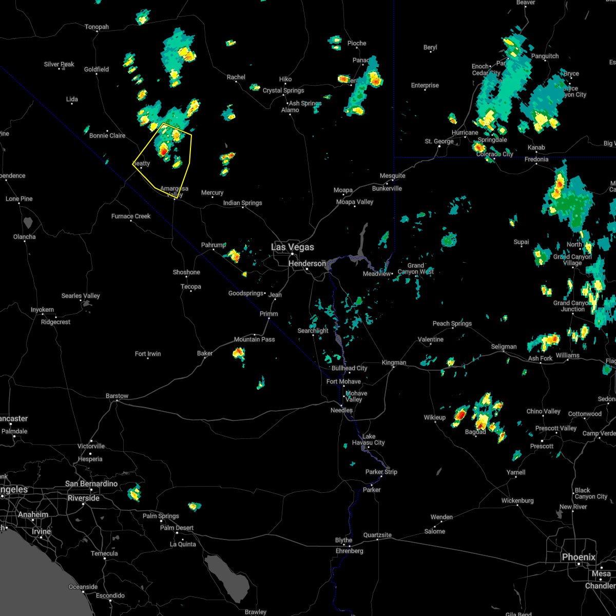
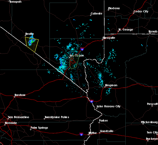
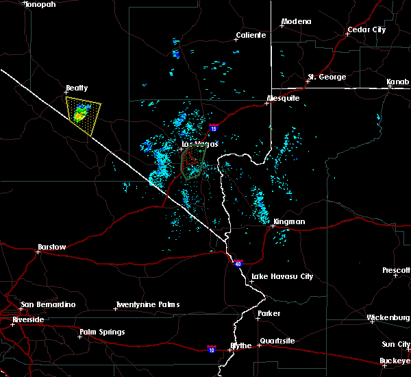
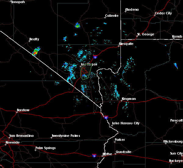
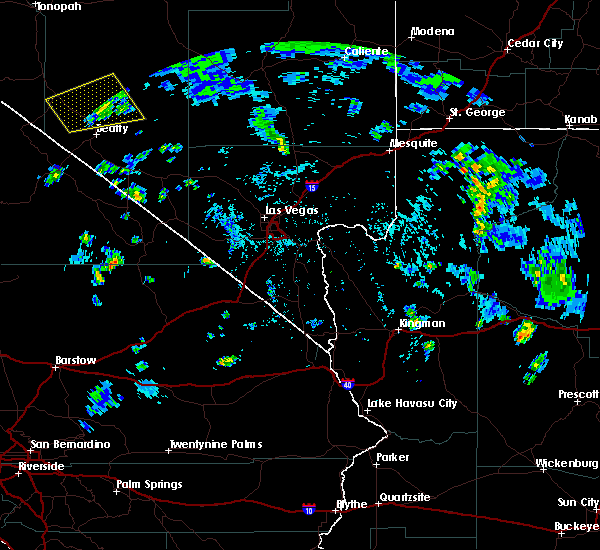
Hail Map for Beatty, NV
The Beatty, NV area has had 0 reports of on-the-ground hail by trained spotters, and has been under severe weather warnings 0 times during the past 12 months. Doppler radar has detected hail at or near Beatty, NV on 3 occasions.
| Name: | Beatty, NV |
| Where Located: | 101.8 miles WNW of Las Vegas, NV |
| Map: | Google Map for Beatty, NV |
| Population: | 1010 |
| Housing Units: | 700 |
| More Info: | Search Google for Beatty, NV |
0
The Top Recent Hail Date for Beatty, NV is Wednesday, August 2, 2017 (3rd out of 3)
Hail and Wind Damage Spotted near Beatty, NV
| Date / Time | Report Details |
|---|---|
| 8/15/2022 2:06 PM PDT |
 The severe thunderstorm warning for central nye county will expire at 215 pm pdt, the severe thunderstorm which prompted the warning has weakened. therefore, the warning will be allowed to expire. however gusty winds are still possible with this thunderstorm. The severe thunderstorm warning for central nye county will expire at 215 pm pdt, the severe thunderstorm which prompted the warning has weakened. therefore, the warning will be allowed to expire. however gusty winds are still possible with this thunderstorm.
|
| 8/15/2022 1:48 PM PDT |
 At 147 pm pdt, a severe thunderstorm was located 7 miles east of beatty, moving southwest at 10 mph (radar indicated). Hazards include 60 mph wind gusts. Expect damage to roofs and trees. locations impacted include, beatty and lathrop wells. hail threat, radar indicated max hail size, <. 75 in wind threat, radar indicated max wind gust, 60 mph. At 147 pm pdt, a severe thunderstorm was located 7 miles east of beatty, moving southwest at 10 mph (radar indicated). Hazards include 60 mph wind gusts. Expect damage to roofs and trees. locations impacted include, beatty and lathrop wells. hail threat, radar indicated max hail size, <. 75 in wind threat, radar indicated max wind gust, 60 mph.
|
| 8/15/2022 1:18 PM PDT |
 At 117 pm pdt, a severe thunderstorm was located 11 miles northeast of beatty, moving southwest at 10 mph (radar indicated). Hazards include 60 mph wind gusts. expect damage to roofs and trees At 117 pm pdt, a severe thunderstorm was located 11 miles northeast of beatty, moving southwest at 10 mph (radar indicated). Hazards include 60 mph wind gusts. expect damage to roofs and trees
|
| 7/28/2022 5:15 PM PDT | Area 25 east reports 59 mph wind gust from thunderstorm in nye county NV, 25.1 miles WNW of Beatty, NV |
| 7/28/2022 3:45 PM PDT | Station 7 a18aa reports gust to 59 mph in thunderstor in nye county NV, 22.1 miles SW of Beatty, NV |
| 6/23/2022 8:15 PM PDT | Wind gusts above 58 mph began at 8pm and ended at 930pm. peak gust of 84 mph at 81 in nye county NV, 14.3 miles WNW of Beatty, NV |
| 8/11/2021 4:30 PM PDT | 87 mph gust measured at the station 7 mesonet site on the nns in nye county NV, 22.1 miles SW of Beatty, NV |
| 7/25/2021 10:36 PM PDT |
 The severe thunderstorm warning for north central san bernardino, southeastern inyo, northwestern clark and southern nye counties will expire at 1045 pm pdt, the storms which prompted the warning have weakened below severe limits, and no longer pose an immediate threat to life or property. therefore, the warning will be allowed to expire. however gusty winds are still possible with these thunderstorms. The severe thunderstorm warning for north central san bernardino, southeastern inyo, northwestern clark and southern nye counties will expire at 1045 pm pdt, the storms which prompted the warning have weakened below severe limits, and no longer pose an immediate threat to life or property. therefore, the warning will be allowed to expire. however gusty winds are still possible with these thunderstorms.
|
| 7/25/2021 10:32 PM PDT |
 At 1029 pm pdt, severe thunderstorms were located along a line extending from 15 miles north of texas springs campground to near tecopa to 13 miles northwest of mountain pass, moving west at 45 mph. strongest winds have been north of desert rock where gusts to 50-57 mph were observed (radar indicated). Hazards include 60 mph wind gusts. Expect damage to roofs and trees. locations impacted include, pahrump, beatty, jean, shoshone, furnace creek, primm, mercury, spring mountains, sandy valley, goodsprings, texas springs campground, indian springs, mountain springs, mcwilliams campground, willow creek campground, death valley junction, amargosa valley, mary jane falls campground, dolomite campground and lathrop wells. this includes the following highways, interstate 15 in california near mile marker 186. Interstate 15 in nevada between mile markers 1 and 18. At 1029 pm pdt, severe thunderstorms were located along a line extending from 15 miles north of texas springs campground to near tecopa to 13 miles northwest of mountain pass, moving west at 45 mph. strongest winds have been north of desert rock where gusts to 50-57 mph were observed (radar indicated). Hazards include 60 mph wind gusts. Expect damage to roofs and trees. locations impacted include, pahrump, beatty, jean, shoshone, furnace creek, primm, mercury, spring mountains, sandy valley, goodsprings, texas springs campground, indian springs, mountain springs, mcwilliams campground, willow creek campground, death valley junction, amargosa valley, mary jane falls campground, dolomite campground and lathrop wells. this includes the following highways, interstate 15 in california near mile marker 186. Interstate 15 in nevada between mile markers 1 and 18.
|
| 7/25/2021 9:55 PM PDT |
 The national weather service in las vegas has issued a * severe thunderstorm warning for. north central san bernardino county in southern california. southeastern inyo county in south central california. northwestern clark county in southern nevada. Southern nye county in south central nevada. The national weather service in las vegas has issued a * severe thunderstorm warning for. north central san bernardino county in southern california. southeastern inyo county in south central california. northwestern clark county in southern nevada. Southern nye county in south central nevada.
|
| 7/25/2021 9:55 PM PDT |
 At 951 pm pdt, severe thunderstorms were located along a line extending from near indian springs to 7 miles west of sandy valley to 11 miles north of nipton road mile marker 3, moving west at 45 mph (radar indicated). Hazards include 70 mph wind gusts. Expect considerable tree damage. Damage is likely to mobile homes, roofs, and outbuildings. At 951 pm pdt, severe thunderstorms were located along a line extending from near indian springs to 7 miles west of sandy valley to 11 miles north of nipton road mile marker 3, moving west at 45 mph (radar indicated). Hazards include 70 mph wind gusts. Expect considerable tree damage. Damage is likely to mobile homes, roofs, and outbuildings.
|
| 7/11/2021 5:15 PM PDT | High winds lasted for approximately 15 minute in nye county NV, 29.2 miles SSW of Beatty, NV |
| 6/30/2021 6:00 PM PDT | Arl sord site briefly gusted to 67 mph nearby a strong thunderstor in nye county NV, 28.5 miles SSW of Beatty, NV |
| 6/24/2021 1:30 PM PDT | Storm damage reported in nye county NV, 14.3 miles WNW of Beatty, NV |
| 5/16/2021 1:51 PM PDT | Buddy adams raws recorded a peak wind gust of 62 mp in nye county NV, 7.5 miles SW of Beatty, NV |
| 8/23/2020 5:30 PM PDT | Reported at yucca mountain arl site oyma in nye county NV, 14 miles WNW of Beatty, NV |
| 6/25/2020 7:30 PM PDT | Mesonet station a18aa 26.2 ne beatty (arl sord in nye county NV, 22.1 miles SW of Beatty, NV |
| 6/25/2020 7:30 PM PDT | Wind gusts from outflow due to earlier thunderstorms near tonopa in nye county NV, 24.5 miles NW of Beatty, NV |
| 6/25/2020 7:15 PM PDT | Mesonet station oymab 14.9 n amargosa valley (arl sord in nye county NV, 14.3 miles WNW of Beatty, NV |
| 8/10/2018 9:06 PM PDT |
 The severe thunderstorm warning for southwestern lincoln and northeastern nye counties will expire at 915 pm pdt, the storm which prompted the warning has weakened below severe limits, and no longer poses an immediate threat to life or property. therefore, the warning will be allowed to expire. however gusty winds are still possible with this thunderstorm. The severe thunderstorm warning for southwestern lincoln and northeastern nye counties will expire at 915 pm pdt, the storm which prompted the warning has weakened below severe limits, and no longer poses an immediate threat to life or property. therefore, the warning will be allowed to expire. however gusty winds are still possible with this thunderstorm.
|
| 8/10/2018 8:15 PM PDT |
 The national weather service in las vegas has issued a * severe thunderstorm warning for. southwestern lincoln county in south central nevada. northeastern nye county in south central nevada. until 915 pm pdt. At 814 pm pdt, a severe thunderstorm was located 31 miles north of. The national weather service in las vegas has issued a * severe thunderstorm warning for. southwestern lincoln county in south central nevada. northeastern nye county in south central nevada. until 915 pm pdt. At 814 pm pdt, a severe thunderstorm was located 31 miles north of.
|
| 7/20/2018 9:35 PM PDT |
 The severe thunderstorm warning for south central nye county will expire at 945 pm pdt, the storm which prompted the warning has weakened below severe limits, and no longer poses an immediate threat to life or property. therefore, the warning will be allowed to expire. The severe thunderstorm warning for south central nye county will expire at 945 pm pdt, the storm which prompted the warning has weakened below severe limits, and no longer poses an immediate threat to life or property. therefore, the warning will be allowed to expire.
|
| 7/20/2018 9:10 PM PDT |
 At 854 pm pdt, a severe thunderstorm was located 7 miles west of amargosa valley, or 20 miles northeast of furnace creek, moving north at 20 mph (radar indicated). Hazards include 70 mph wind gusts and quarter size hail. Hail damage to vehicles is expected. expect considerable tree damage. Wind damage is also likely to mobile homes, roofs, and outbuildings. At 854 pm pdt, a severe thunderstorm was located 7 miles west of amargosa valley, or 20 miles northeast of furnace creek, moving north at 20 mph (radar indicated). Hazards include 70 mph wind gusts and quarter size hail. Hail damage to vehicles is expected. expect considerable tree damage. Wind damage is also likely to mobile homes, roofs, and outbuildings.
|
| 7/20/2018 8:54 PM PDT |
 At 854 pm pdt, a severe thunderstorm was located 7 miles west of amargosa valley, or 20 miles northeast of furnace creek, moving north at 20 mph (radar indicated). Hazards include 70 mph wind gusts and quarter size hail. Hail damage to vehicles is expected. expect considerable tree damage. Wind damage is also likely to mobile homes, roofs, and outbuildings. At 854 pm pdt, a severe thunderstorm was located 7 miles west of amargosa valley, or 20 miles northeast of furnace creek, moving north at 20 mph (radar indicated). Hazards include 70 mph wind gusts and quarter size hail. Hail damage to vehicles is expected. expect considerable tree damage. Wind damage is also likely to mobile homes, roofs, and outbuildings.
|
| 8/30/2017 5:00 PM PDT | Yucca mountain mesonet sit in nye county NV, 14.3 miles WNW of Beatty, NV |
| 8/30/2017 4:30 PM PDT | Gate 10 mesonet sit in nye county NV, 25.1 miles NW of Beatty, NV |
| 7/29/2016 5:21 PM PDT |
 At 519 pm pdt, doppler radar indicated a severe thunderstorm capable of producing damaging winds in excess of 60 mph. this storm was located 15 miles southeast of scottys junction, or 17 miles north of beatty, and moving east at 15 mph. this will primarily affect mile markers 70 though 85 on highway 95. At 519 pm pdt, doppler radar indicated a severe thunderstorm capable of producing damaging winds in excess of 60 mph. this storm was located 15 miles southeast of scottys junction, or 17 miles north of beatty, and moving east at 15 mph. this will primarily affect mile markers 70 though 85 on highway 95.
|
| 7/1/2015 4:26 PM PDT |
 The severe thunderstorm warning for central nye county will expire at 430 pm pdt, the storm which prompted the warning has weakened below severe limits, and no longer poses an immediate threat to life or property. therefore the warning will be allowed to expire. however gusty winds are still possible with this thunderstorm. The severe thunderstorm warning for central nye county will expire at 430 pm pdt, the storm which prompted the warning has weakened below severe limits, and no longer poses an immediate threat to life or property. therefore the warning will be allowed to expire. however gusty winds are still possible with this thunderstorm.
|
| 7/1/2015 4:14 PM PDT |
 At 412 pm pdt, doppler radar continued to indicate a severe thunderstorm capable of producing quarter size hail and destructive winds in excess of 70 mph. this storm was located 19 miles east of scottys junction, or 22 miles north of beatty, moving southwest at 20 mph. locations impacted include, highway 95 between scottys junction and beatty. At 412 pm pdt, doppler radar continued to indicate a severe thunderstorm capable of producing quarter size hail and destructive winds in excess of 70 mph. this storm was located 19 miles east of scottys junction, or 22 miles north of beatty, moving southwest at 20 mph. locations impacted include, highway 95 between scottys junction and beatty.
|
| 7/1/2015 3:59 PM PDT |
 At 358 pm pdt, doppler radar indicated a severe thunderstorm capable of producing destructive winds in excess of 70 mph and large hail the size of quarters. this storm was located 23 miles east of scottys junction, or 25 miles north of beatty, and moving southwest at 20 mph. At 358 pm pdt, doppler radar indicated a severe thunderstorm capable of producing destructive winds in excess of 70 mph and large hail the size of quarters. this storm was located 23 miles east of scottys junction, or 25 miles north of beatty, and moving southwest at 20 mph.
|
| 8/3/2012 5:45 PM PDT | Several large tree limbs were knocked down by a thunderstorm in beatt in nye county NV, 3.8 miles ENE of Beatty, NV |
| 8/3/2012 5:45 PM PDT | Beatty dispatch reported large tree branch down just south of beatty on highway 9 in nye county NV, 4.4 miles NE of Beatty, NV |
Hail Maps for Beatty, NV


Connect with Interactive Hail Maps