

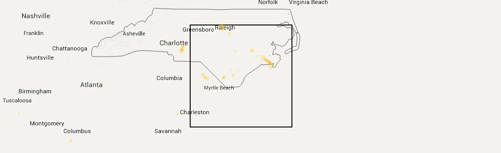
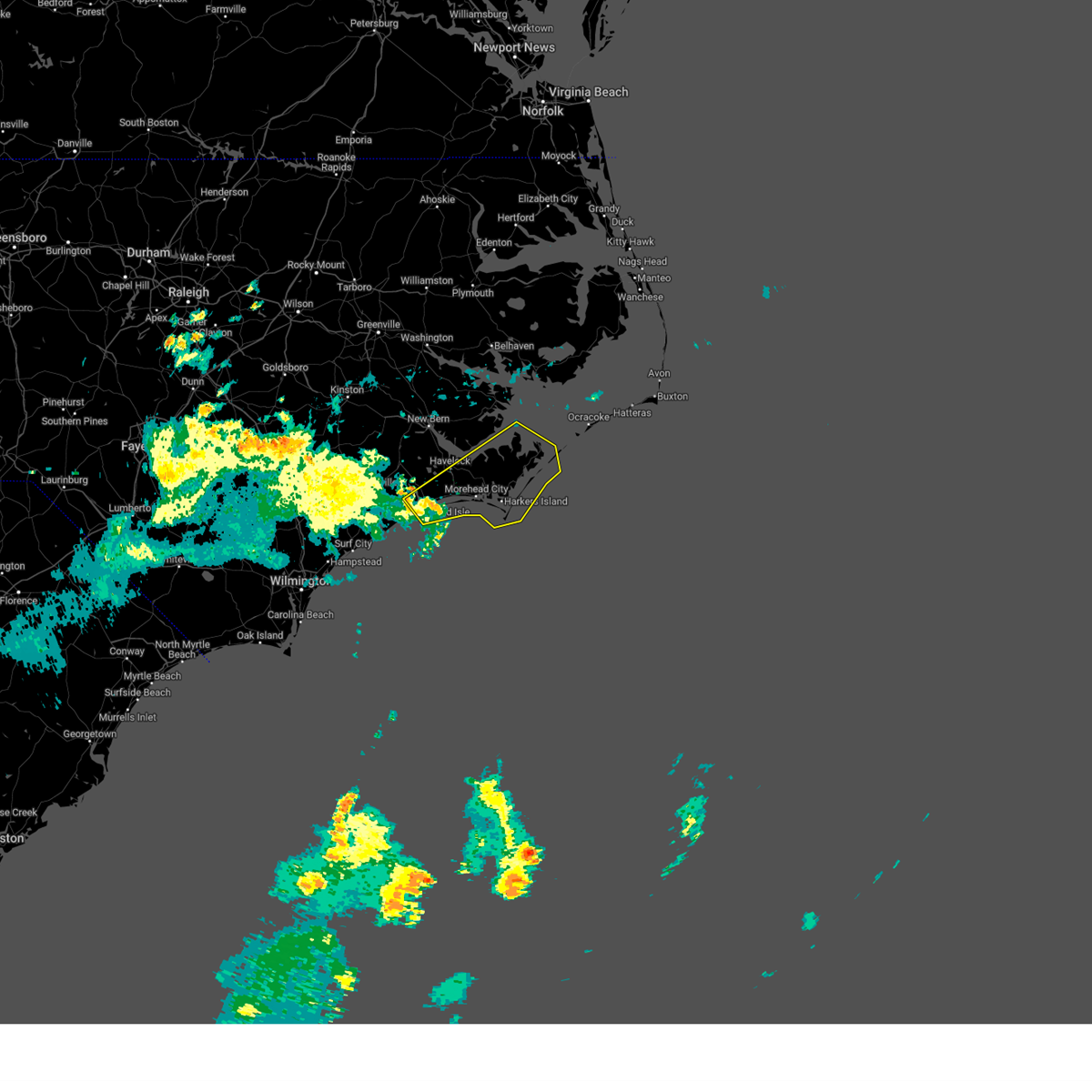
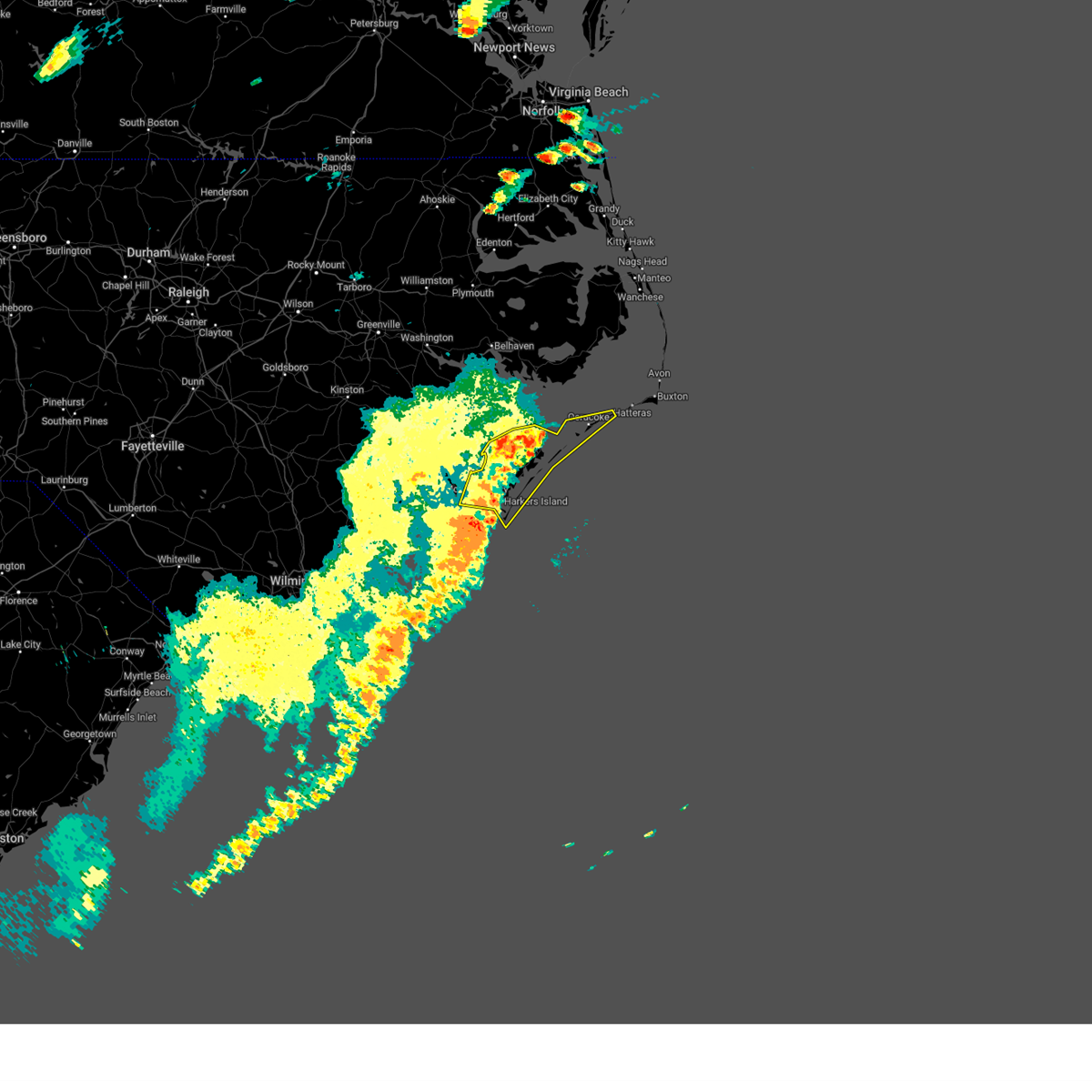
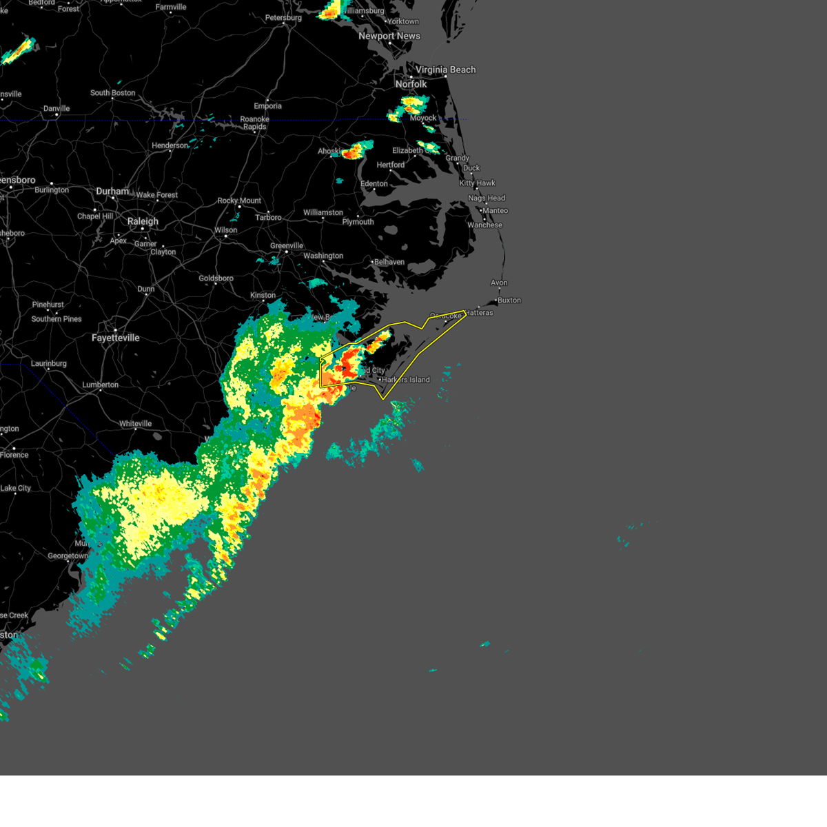
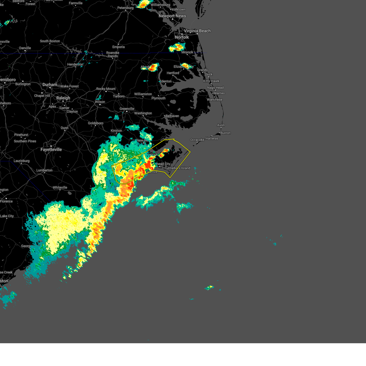
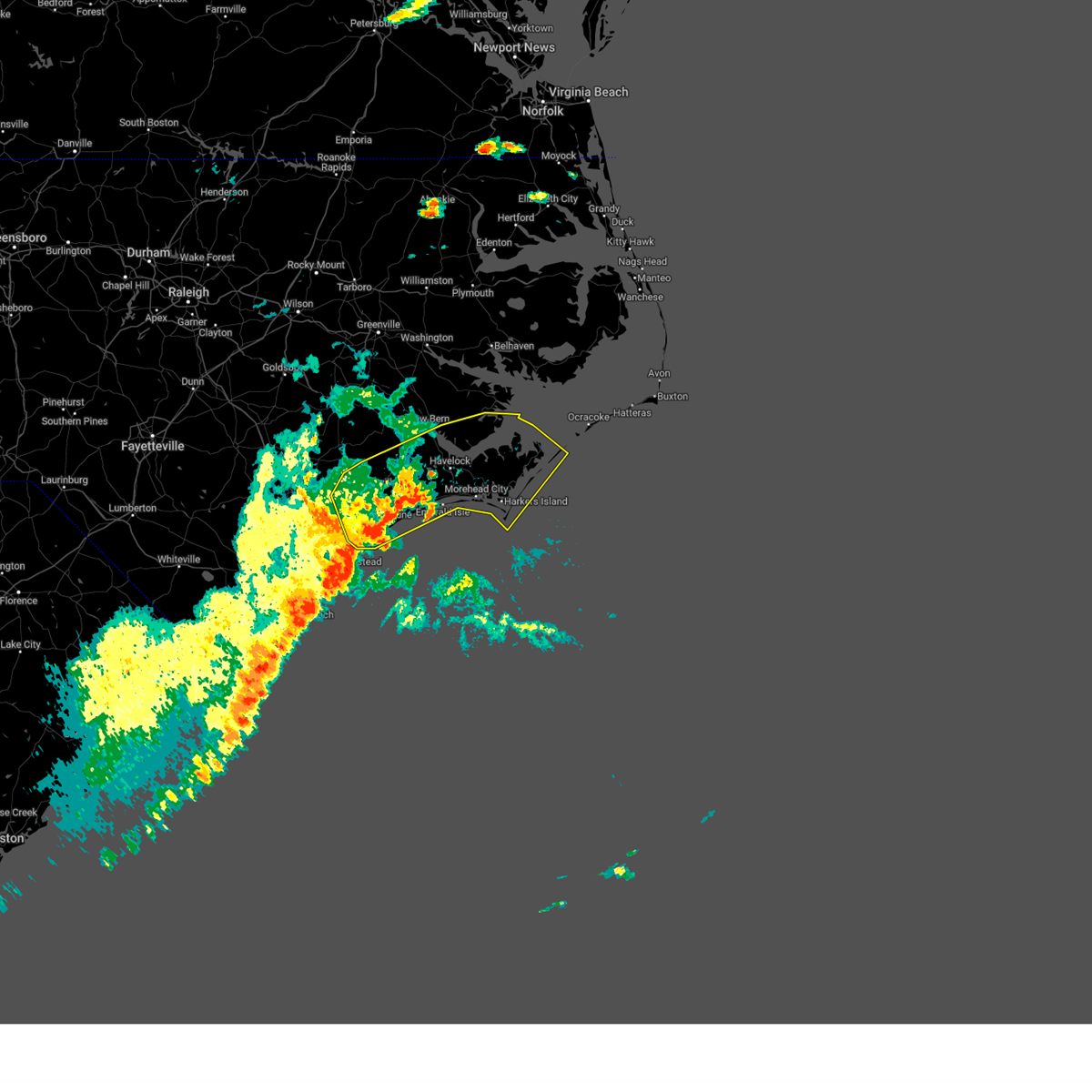
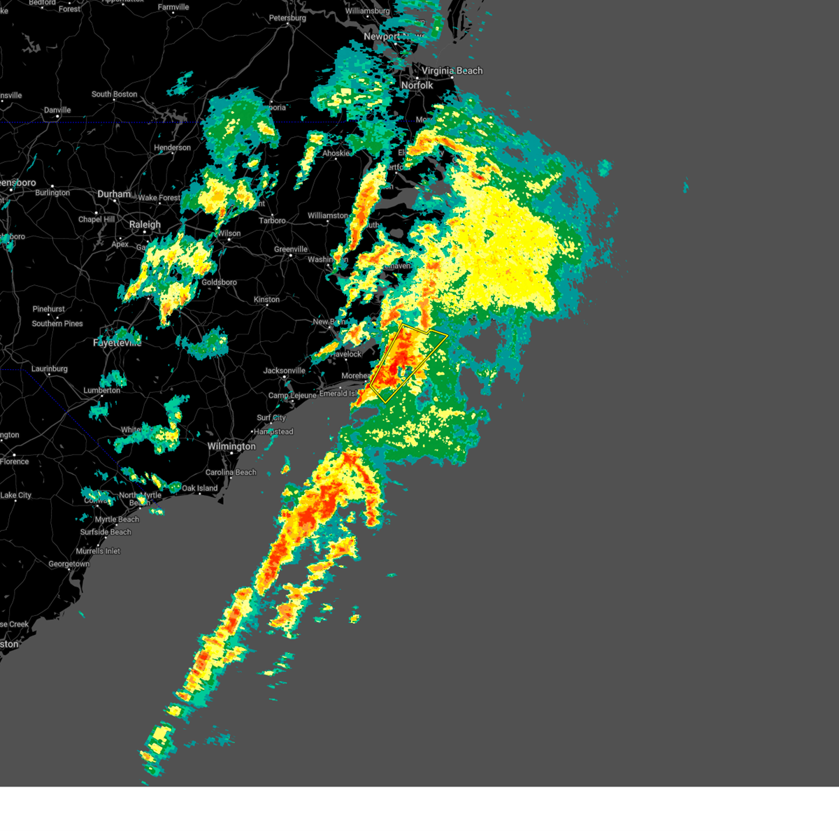
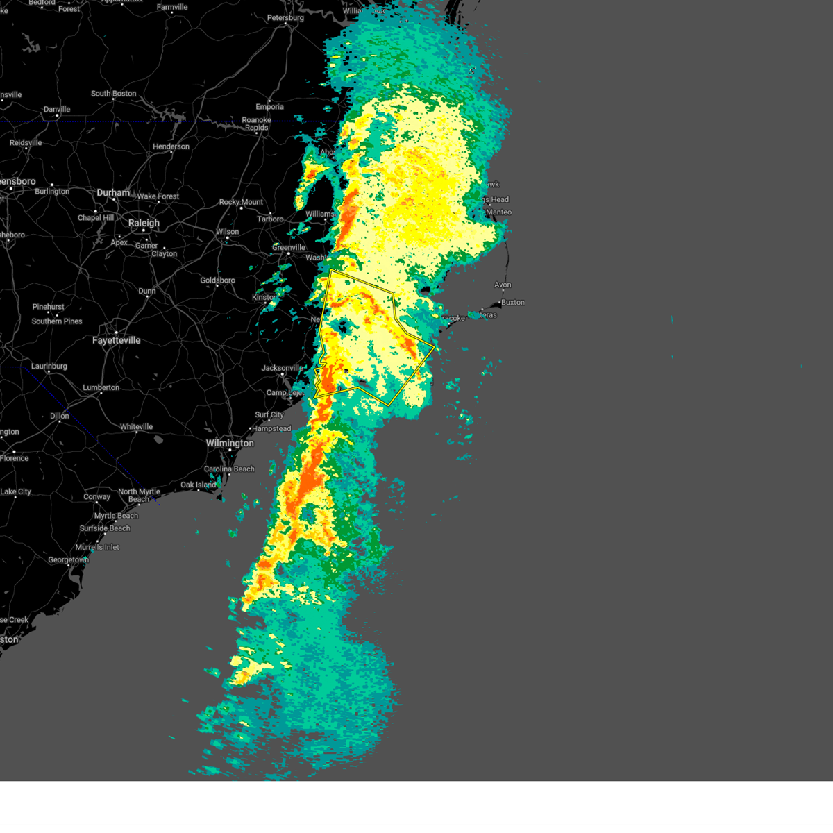
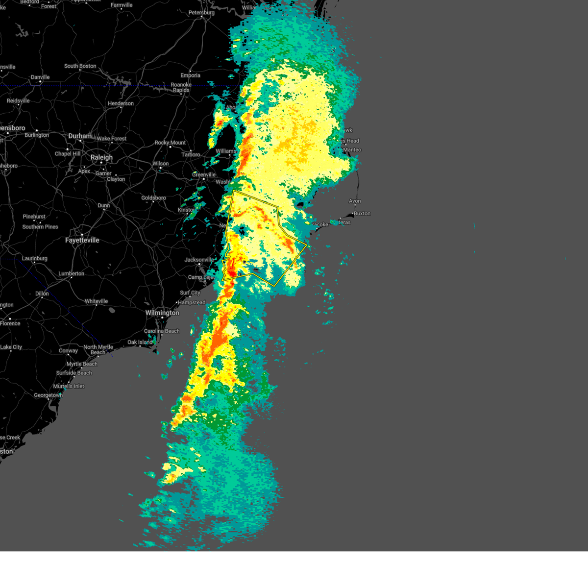
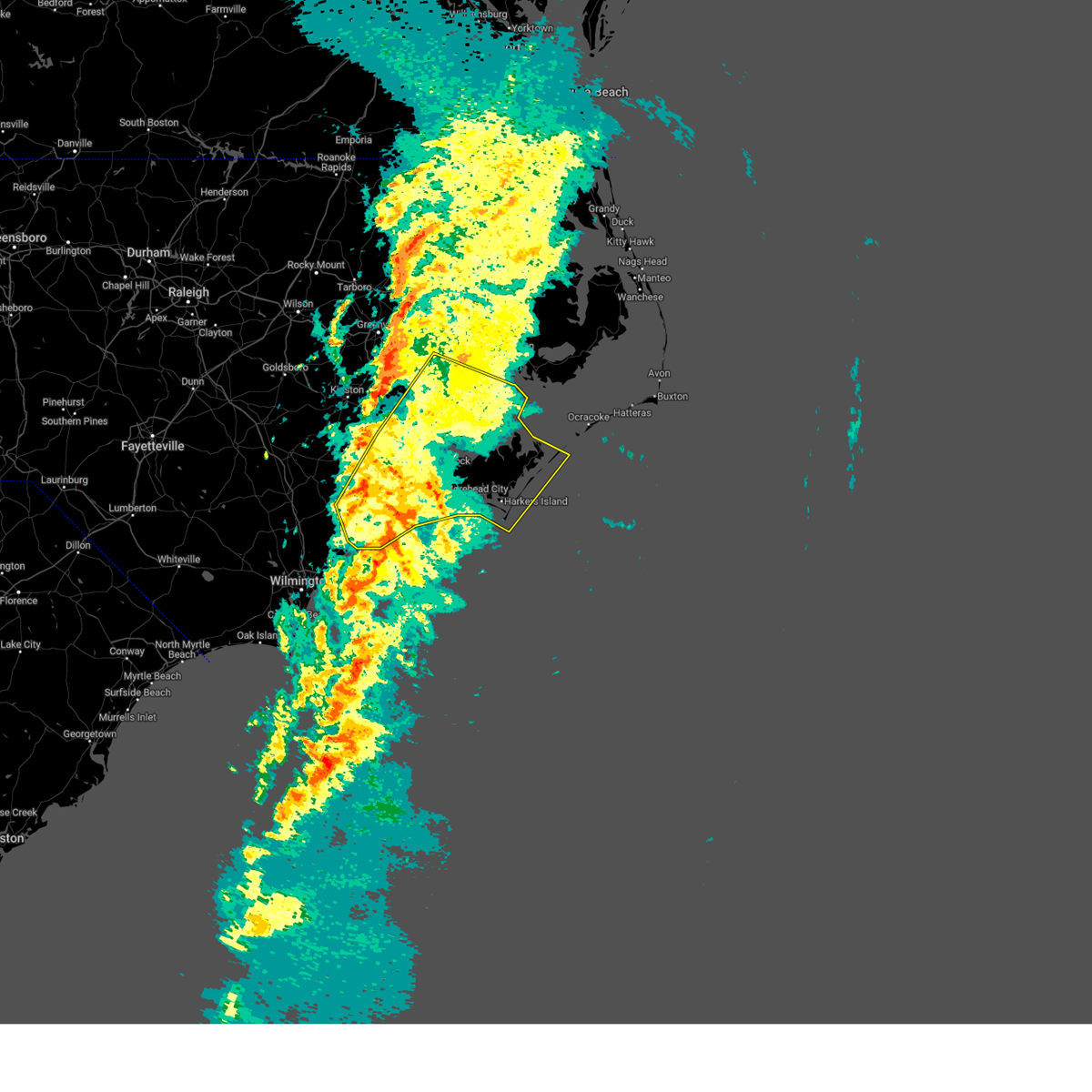
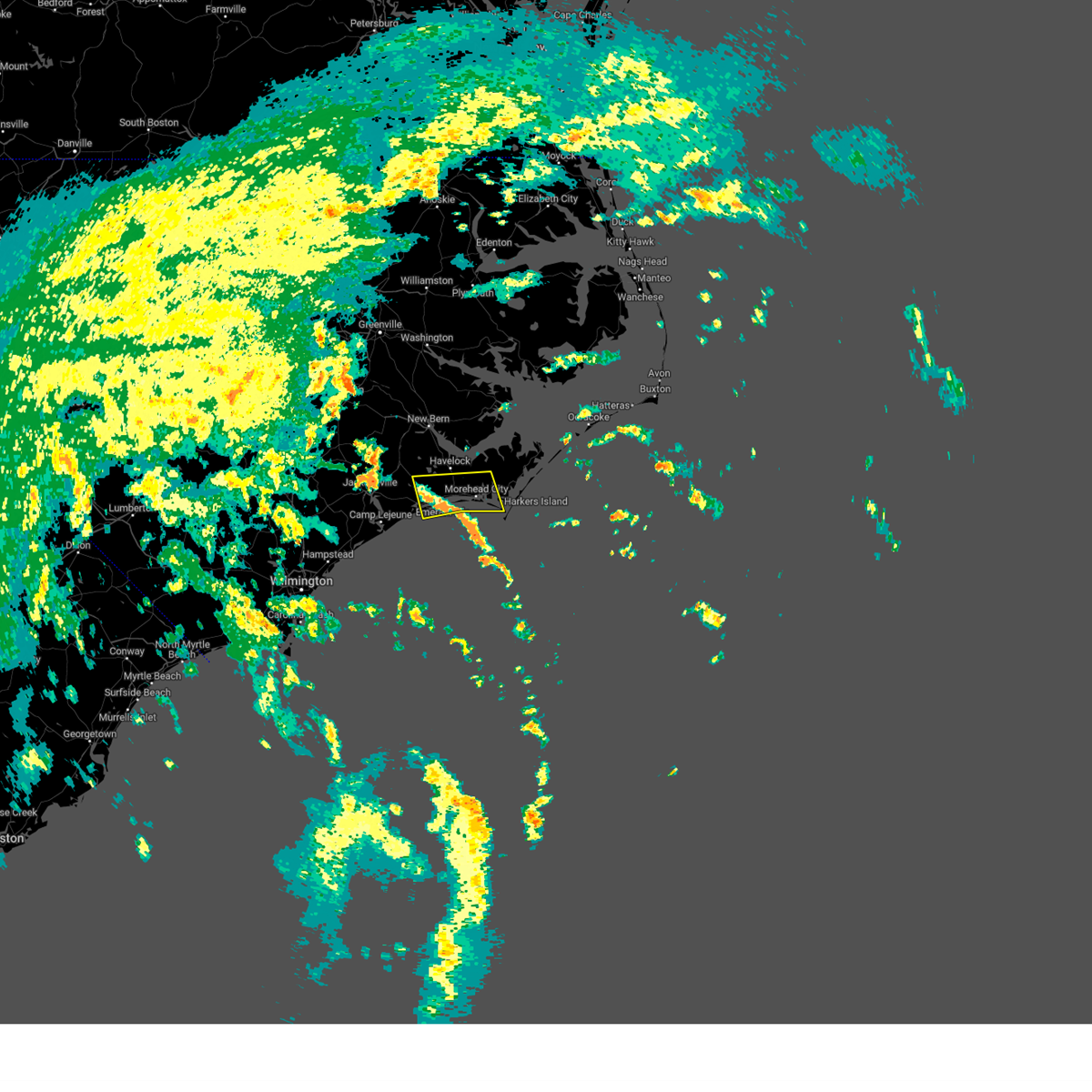
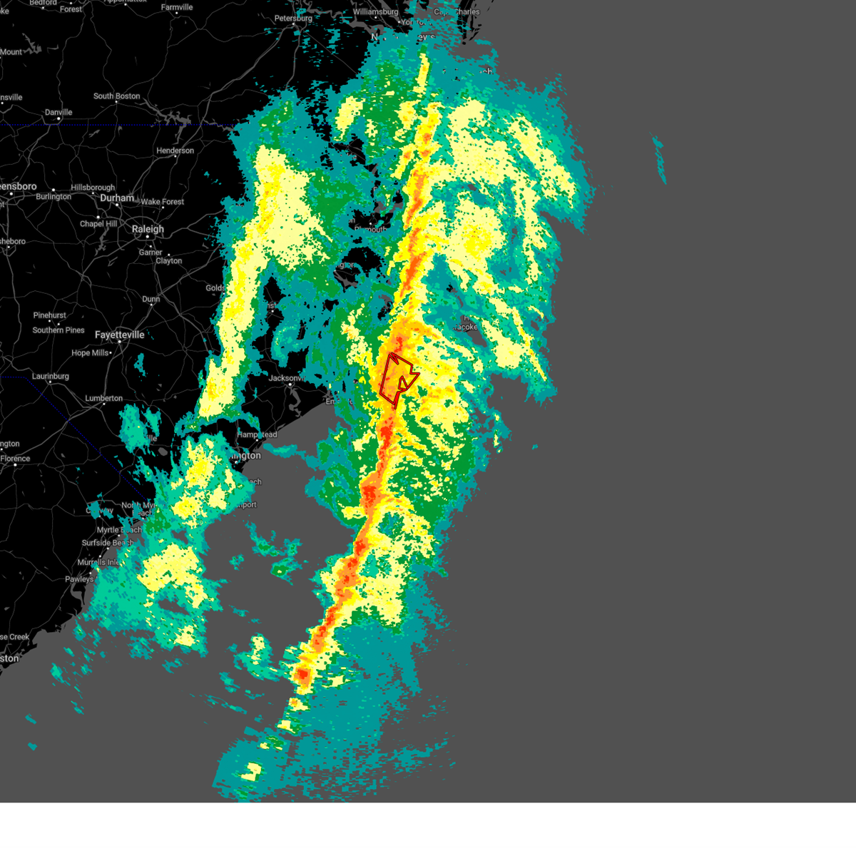
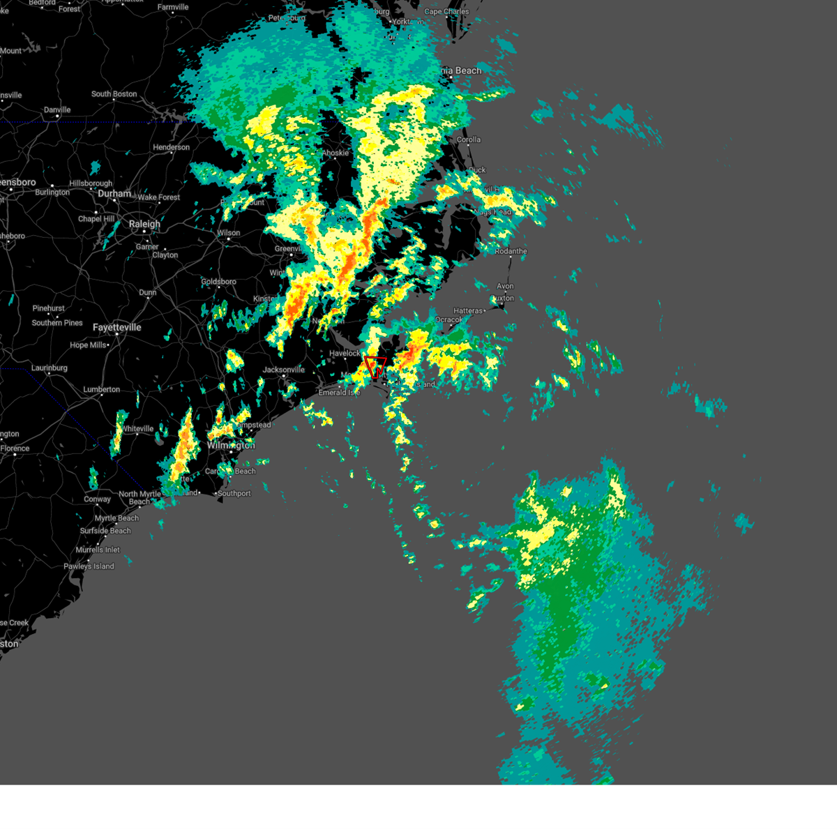
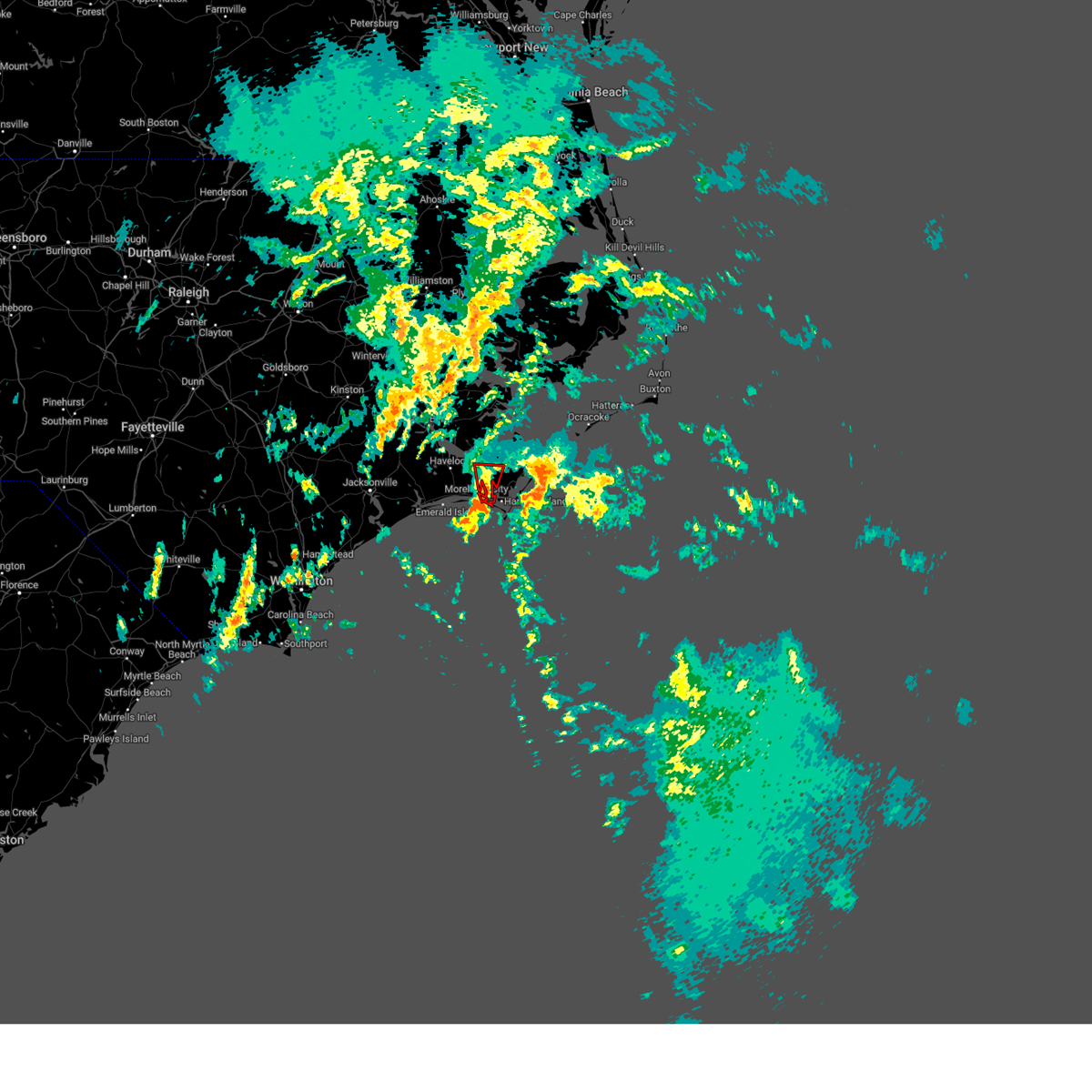
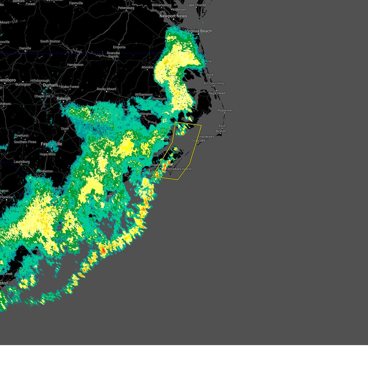
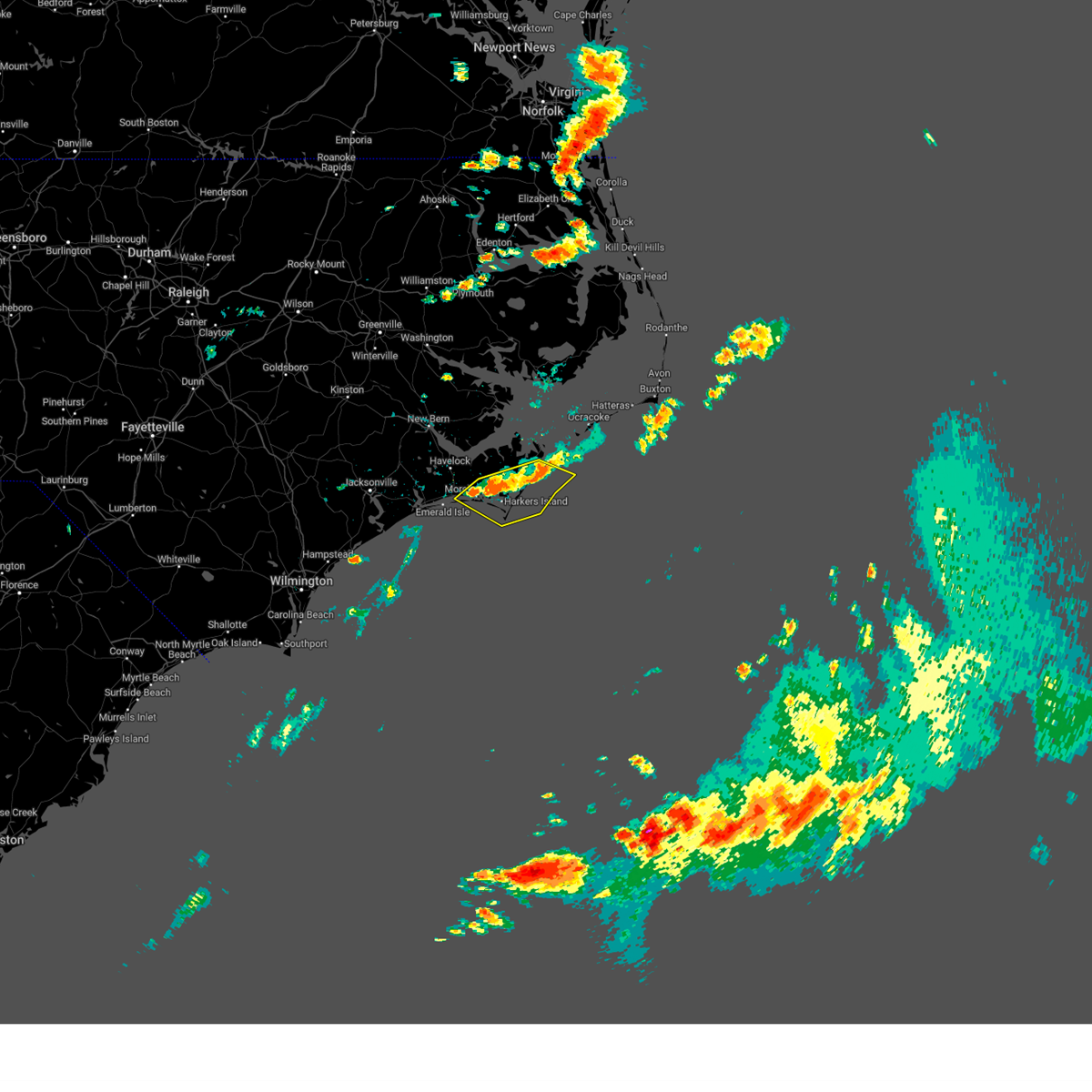
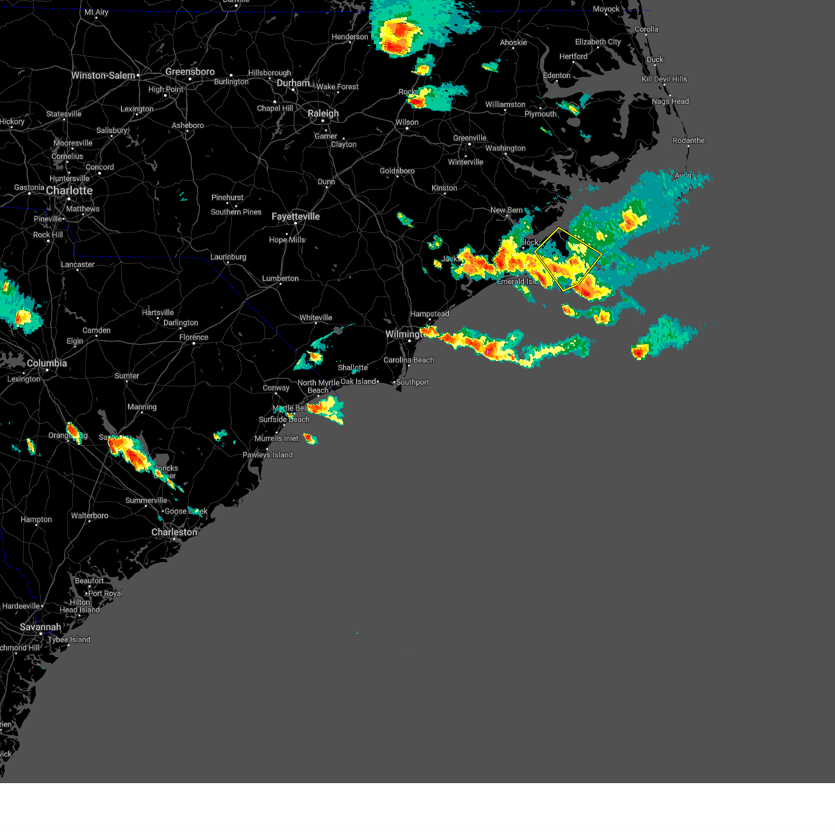
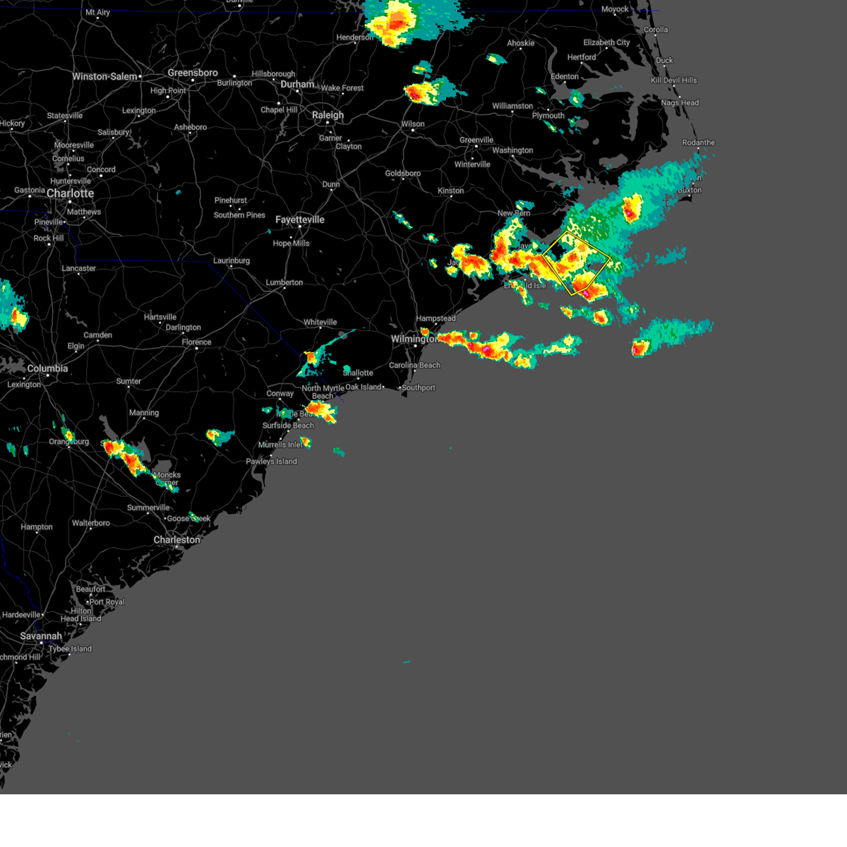
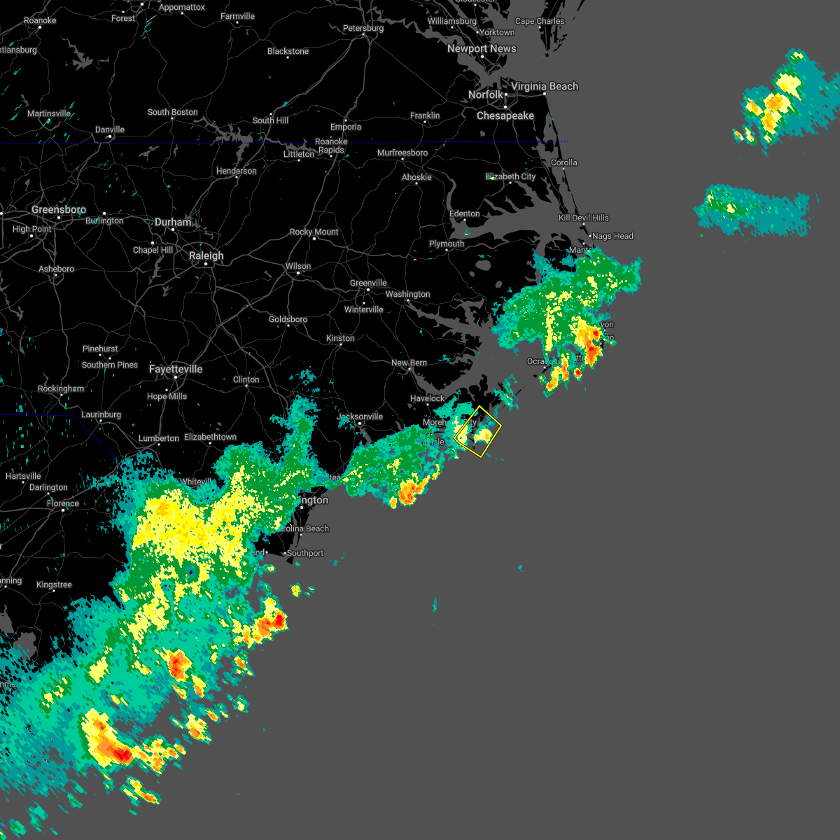
Hail Map for Beaufort, NC
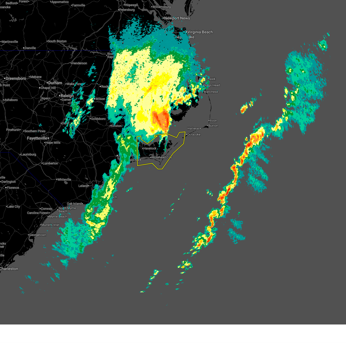
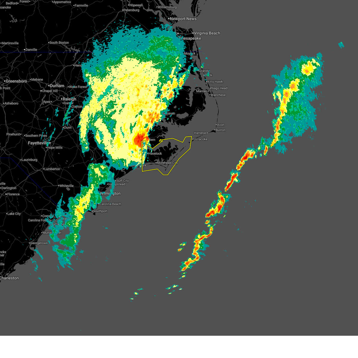
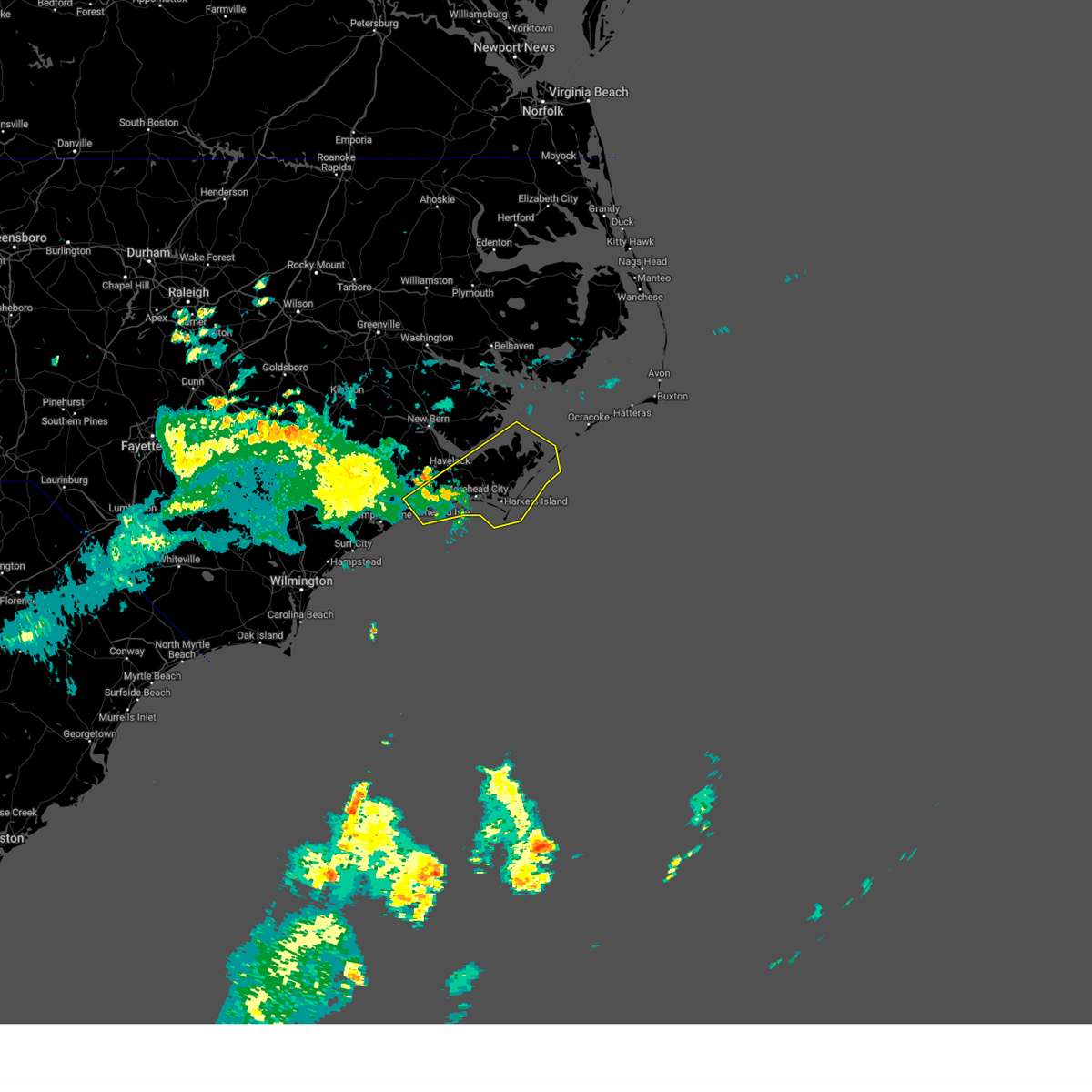
The Beaufort, NC area has had 5 reports of on-the-ground hail by trained spotters, and has been under severe weather warnings 2 times during the past 12 months. Doppler radar has detected hail at or near Beaufort, NC on 14 occasions.
| Name: | Beaufort, NC |
| Where Located: | 81.5 miles ENE of Wilmington, NC |
| Map: | Google Map for Beaufort, NC |
| Population: | 4039 |
| Housing Units: | 2745 |
| More Info: | Search Google for Beaufort, NC |
5
The Top Recent Hail Date for Beaufort, NC is Thursday, July 23, 2015 (1st out of 14)
Hail and Wind Damage Spotted near Beaufort, NC
| Date / Time | Report Details |
|---|---|
| 3/12/2026 3:26 PM EDT | Corrects previous tstm wnd gust report from 8 w cedar island to update to the correct time. the weather station at piney island knbt reported a wind gust of 60 mph as t in carteret county NC, 23.5 miles SSW of Beaufort, NC |
| 3/12/2026 3:22 PM EDT |
 The storms which prompted the warning have moved out of the area. therefore, the warning will be allowed to expire. however, gusty winds are still possible with these thunderstorms. a severe thunderstorm watch remains in effect until 500 pm edt for eastern north carolina. The storms which prompted the warning have moved out of the area. therefore, the warning will be allowed to expire. however, gusty winds are still possible with these thunderstorms. a severe thunderstorm watch remains in effect until 500 pm edt for eastern north carolina.
|
| 3/12/2026 2:42 PM EDT |
 Svrmhx the national weather service in newport has issued a * severe thunderstorm warning for, southeastern craven county in eastern north carolina, carteret county in eastern north carolina, * until 330 pm edt. * at 241 pm edt, severe thunderstorms were located along a line extending from near fairfield harbour to near havelock to 7 miles southeast of bogue inlet pier, moving east at 65 mph (trained weather spotters. these thunderstorms have a history of producing wind damage and winds of 60 to 65 mph). Hazards include 60 mph wind gusts. expect damage to roofs, siding, and trees Svrmhx the national weather service in newport has issued a * severe thunderstorm warning for, southeastern craven county in eastern north carolina, carteret county in eastern north carolina, * until 330 pm edt. * at 241 pm edt, severe thunderstorms were located along a line extending from near fairfield harbour to near havelock to 7 miles southeast of bogue inlet pier, moving east at 65 mph (trained weather spotters. these thunderstorms have a history of producing wind damage and winds of 60 to 65 mph). Hazards include 60 mph wind gusts. expect damage to roofs, siding, and trees
|
| 3/12/2026 2:15 PM EDT | The weather station at piney island knbt reported a wind gust of 60 mph as thunderstorms moved through the are in carteret county NC, 23.5 miles SSW of Beaufort, NC |
| 6/10/2025 3:02 PM EDT |
 the severe thunderstorm warning has been cancelled and is no longer in effect the severe thunderstorm warning has been cancelled and is no longer in effect
|
| 6/10/2025 2:45 PM EDT |
 Svrmhx the national weather service in newport has issued a * severe thunderstorm warning for, southeastern craven county in eastern north carolina, east central onslow county in eastern north carolina, carteret county in eastern north carolina, * until 330 pm edt. * at 245 pm edt, a severe thunderstorm was located over bogue, or 9 miles west of morehead city, moving northeast at 55 mph (radar indicated). Hazards include 60 mph wind gusts. expect damage to roofs, siding, and trees Svrmhx the national weather service in newport has issued a * severe thunderstorm warning for, southeastern craven county in eastern north carolina, east central onslow county in eastern north carolina, carteret county in eastern north carolina, * until 330 pm edt. * at 245 pm edt, a severe thunderstorm was located over bogue, or 9 miles west of morehead city, moving northeast at 55 mph (radar indicated). Hazards include 60 mph wind gusts. expect damage to roofs, siding, and trees
|
| 6/8/2025 3:50 PM EDT |
 the severe thunderstorm warning has been cancelled and is no longer in effect the severe thunderstorm warning has been cancelled and is no longer in effect
|
| 6/8/2025 3:50 PM EDT |
 At 350 pm edt, severe thunderstorms were located along a line extending from 8 miles northwest of portsmouth village to near michael j smith airport, moving northeast at 45 mph (radar indicated). Hazards include 70 mph wind gusts and half dollar size hail. Hail damage to vehicles is expected. expect considerable tree damage. wind damage is also likely to mobile homes, roofs, and outbuildings. Locations impacted include, morehead city, cedar island, harkers island, south river, north river, sealevel, marshallberg, davis, smyrna, merrimon, straits, atlantic, pine knoll shores, harlowe, otway, williston, open grounds farm, stacy, bettie, and portsmouth village. At 350 pm edt, severe thunderstorms were located along a line extending from 8 miles northwest of portsmouth village to near michael j smith airport, moving northeast at 45 mph (radar indicated). Hazards include 70 mph wind gusts and half dollar size hail. Hail damage to vehicles is expected. expect considerable tree damage. wind damage is also likely to mobile homes, roofs, and outbuildings. Locations impacted include, morehead city, cedar island, harkers island, south river, north river, sealevel, marshallberg, davis, smyrna, merrimon, straits, atlantic, pine knoll shores, harlowe, otway, williston, open grounds farm, stacy, bettie, and portsmouth village.
|
| 6/8/2025 3:33 PM EDT | Power lines down across roadway along nc 101 near eastmans creek. tree also down in vicinity. report relayed via facebook... time estimated by rada in carteret county NC, 5.2 miles SSE of Beaufort, NC |
| 6/8/2025 3:25 PM EDT |
 Svrmhx the national weather service in newport has issued a * severe thunderstorm warning for, southeastern craven county in eastern north carolina, southeastern hyde county in eastern north carolina, carteret county in eastern north carolina, * until 430 pm edt. * at 324 pm edt, severe thunderstorms were located along a line extending from 8 miles northeast of south river to near bogue inlet pier, moving northeast at 45 mph (radar indicated). Hazards include 70 mph wind gusts and half dollar size hail. Hail damage to vehicles is expected. expect considerable tree damage. Wind damage is also likely to mobile homes, roofs, and outbuildings. Svrmhx the national weather service in newport has issued a * severe thunderstorm warning for, southeastern craven county in eastern north carolina, southeastern hyde county in eastern north carolina, carteret county in eastern north carolina, * until 430 pm edt. * at 324 pm edt, severe thunderstorms were located along a line extending from 8 miles northeast of south river to near bogue inlet pier, moving northeast at 45 mph (radar indicated). Hazards include 70 mph wind gusts and half dollar size hail. Hail damage to vehicles is expected. expect considerable tree damage. Wind damage is also likely to mobile homes, roofs, and outbuildings.
|
| 6/8/2025 3:10 PM EDT |
 At 309 pm edt, severe thunderstorms were located along a line extending from havelock to near hammocks beach state park, moving east at 55 mph (radar indicated). Hazards include 70 mph wind gusts and ping pong ball size hail. People and animals outdoors will be injured. expect hail damage to roofs, siding, windows, and vehicles. expect considerable tree damage. wind damage is also likely to mobile homes, roofs, and outbuildings. Locations impacted include, jacksonville, new bern, havelock, morehead city, north topsail beach, newport, cedar island, harkers island, pumpkin center, piney green, new river station, camp lejeune center, stella, swansboro, hubert, south river, cape carteret, north river, davis, and straits. At 309 pm edt, severe thunderstorms were located along a line extending from havelock to near hammocks beach state park, moving east at 55 mph (radar indicated). Hazards include 70 mph wind gusts and ping pong ball size hail. People and animals outdoors will be injured. expect hail damage to roofs, siding, windows, and vehicles. expect considerable tree damage. wind damage is also likely to mobile homes, roofs, and outbuildings. Locations impacted include, jacksonville, new bern, havelock, morehead city, north topsail beach, newport, cedar island, harkers island, pumpkin center, piney green, new river station, camp lejeune center, stella, swansboro, hubert, south river, cape carteret, north river, davis, and straits.
|
| 6/8/2025 2:51 PM EDT |
 At 251 pm edt, severe thunderstorms were located along a line extending from near kuhns to sea view pier, moving northeast at 50 mph (radar indicated). Hazards include 70 mph wind gusts and ping pong ball size hail. People and animals outdoors will be injured. expect hail damage to roofs, siding, windows, and vehicles. expect considerable tree damage. wind damage is also likely to mobile homes, roofs, and outbuildings. Locations impacted include, jacksonville, new bern, havelock, morehead city, north topsail beach, newport, cedar island, harkers island, pumpkin center, piney green, new river station, half moon, camp lejeune center, james city, stella, swansboro, hubert, south river, cape carteret, and north river. At 251 pm edt, severe thunderstorms were located along a line extending from near kuhns to sea view pier, moving northeast at 50 mph (radar indicated). Hazards include 70 mph wind gusts and ping pong ball size hail. People and animals outdoors will be injured. expect hail damage to roofs, siding, windows, and vehicles. expect considerable tree damage. wind damage is also likely to mobile homes, roofs, and outbuildings. Locations impacted include, jacksonville, new bern, havelock, morehead city, north topsail beach, newport, cedar island, harkers island, pumpkin center, piney green, new river station, half moon, camp lejeune center, james city, stella, swansboro, hubert, south river, cape carteret, and north river.
|
| 6/8/2025 2:51 PM EDT |
 the severe thunderstorm warning has been cancelled and is no longer in effect the severe thunderstorm warning has been cancelled and is no longer in effect
|
| 6/8/2025 2:10 PM EDT |
 Svrmhx the national weather service in newport has issued a * severe thunderstorm warning for, southeastern jones county in eastern north carolina, southeastern craven county in eastern north carolina, onslow county in eastern north carolina, southern duplin county in eastern north carolina, carteret county in eastern north carolina, southern pamlico county in eastern north carolina, * until 330 pm edt. * at 209 pm edt, severe thunderstorms were located along a line extending from near maple hill to ogden, moving east at 55 mph (radar indicated). Hazards include 60 mph wind gusts and quarter size hail. Hail damage to vehicles is expected. Expect wind damage to roofs, siding, and trees. Svrmhx the national weather service in newport has issued a * severe thunderstorm warning for, southeastern jones county in eastern north carolina, southeastern craven county in eastern north carolina, onslow county in eastern north carolina, southern duplin county in eastern north carolina, carteret county in eastern north carolina, southern pamlico county in eastern north carolina, * until 330 pm edt. * at 209 pm edt, severe thunderstorms were located along a line extending from near maple hill to ogden, moving east at 55 mph (radar indicated). Hazards include 60 mph wind gusts and quarter size hail. Hail damage to vehicles is expected. Expect wind damage to roofs, siding, and trees.
|
| 4/7/2025 11:57 PM EDT |
 Svrmhx the national weather service in newport has issued a * severe thunderstorm warning for, southeastern carteret county in eastern north carolina, * until 1245 am edt. * at 1156 pm edt, a severe thunderstorm was located near oceana pier, or 10 miles southwest of harkers island, moving northeast at 55 mph (radar indicated). Hazards include 60 mph wind gusts and penny size hail. expect damage to roofs, siding, and trees Svrmhx the national weather service in newport has issued a * severe thunderstorm warning for, southeastern carteret county in eastern north carolina, * until 1245 am edt. * at 1156 pm edt, a severe thunderstorm was located near oceana pier, or 10 miles southwest of harkers island, moving northeast at 55 mph (radar indicated). Hazards include 60 mph wind gusts and penny size hail. expect damage to roofs, siding, and trees
|
| 3/17/2025 2:26 AM EDT |
 At 225 am edt, a severe thunderstorm was located over davis, or 9 miles northeast of harkers island, moving northeast at 45 mph (radar indicated). Hazards include 60 mph wind gusts. Expect damage to roofs, siding, and trees. Locations impacted include, otway, open grounds farm, michael j smith airport, sealevel, cape lookout lighthouse, marshallberg, davis, williston, rachel carson estuarine reserve, fort macon state park, ocracoke light house, stacy, harkers island, straits, cedar island ferry terminal, gloucester, bettie, smyrna, atlantic, and cedar island. At 225 am edt, a severe thunderstorm was located over davis, or 9 miles northeast of harkers island, moving northeast at 45 mph (radar indicated). Hazards include 60 mph wind gusts. Expect damage to roofs, siding, and trees. Locations impacted include, otway, open grounds farm, michael j smith airport, sealevel, cape lookout lighthouse, marshallberg, davis, williston, rachel carson estuarine reserve, fort macon state park, ocracoke light house, stacy, harkers island, straits, cedar island ferry terminal, gloucester, bettie, smyrna, atlantic, and cedar island.
|
| 3/17/2025 2:25 AM EDT | Peak wind gust measured at the kevin court weather flow statio in carteret county NC, 1.7 miles SSW of Beaufort, NC |
| 3/17/2025 2:23 AM EDT | Carteret-craven electric coop reports multiple power outages on harkers island. radar wind signature aligns with time of the reported outage in carteret county NC, 4.7 miles WNW of Beaufort, NC |
| 3/17/2025 2:12 AM EDT | A section of a roof was blown off a commercial building... with damage to the hvac system noted as well. there was scattered tree damage around the area as well. time e in carteret county NC, 4.7 miles WNW of Beaufort, NC |
| 3/17/2025 2:10 AM EDT |
 Svrmhx the national weather service in newport has issued a * severe thunderstorm warning for, eastern carteret county in eastern north carolina, * until 300 am edt. * at 210 am edt, a severe thunderstorm was located over harkers island, moving northeast at 50 mph (radar indicated). Hazards include 60 mph wind gusts. expect damage to roofs, siding, and trees Svrmhx the national weather service in newport has issued a * severe thunderstorm warning for, eastern carteret county in eastern north carolina, * until 300 am edt. * at 210 am edt, a severe thunderstorm was located over harkers island, moving northeast at 50 mph (radar indicated). Hazards include 60 mph wind gusts. expect damage to roofs, siding, and trees
|
| 3/5/2025 5:06 PM EST | Several personal weather stations showed thunderstorm wind gusts of 50 to 60 knots on harkers islan in carteret county NC, 4.7 miles WNW of Beaufort, NC |
| 3/5/2025 5:00 PM EST |
 Svrmhx the national weather service in newport has issued a * severe thunderstorm warning for, hyde county in eastern north carolina, southern dare county in eastern north carolina, carteret county in eastern north carolina, eastern pamlico county in eastern north carolina, * until 615 pm est. * at 459 pm est, severe thunderstorms were located along a line extending from near south river to 20 miles south of cape lookout lighthouse, moving northeast at 65 mph (radar indicated). Hazards include 70 mph wind gusts and quarter size hail. Hail damage to vehicles is expected. expect considerable tree damage. Wind damage is also likely to mobile homes, roofs, and outbuildings. Svrmhx the national weather service in newport has issued a * severe thunderstorm warning for, hyde county in eastern north carolina, southern dare county in eastern north carolina, carteret county in eastern north carolina, eastern pamlico county in eastern north carolina, * until 615 pm est. * at 459 pm est, severe thunderstorms were located along a line extending from near south river to 20 miles south of cape lookout lighthouse, moving northeast at 65 mph (radar indicated). Hazards include 70 mph wind gusts and quarter size hail. Hail damage to vehicles is expected. expect considerable tree damage. Wind damage is also likely to mobile homes, roofs, and outbuildings.
|
| 3/5/2025 4:48 PM EST |
 At 448 pm est, severe thunderstorms were located along a line extending from sladesville to great neck, moving northeast at 60 mph (radar indicated). Hazards include 70 mph wind gusts and quarter size hail. Hail damage to vehicles is expected. expect considerable tree damage. wind damage is also likely to mobile homes, roofs, and outbuildings. Locations impacted include, maribel, florence, stonewall, janeiro, north harlowe, davis, north river, great neck, bettie, lowland, south river, cherry branch ferry terminal, merritt, minnesott beach ferry, vandemere, williston, rachel carson estuarine reserve, stacy, whortonsville, and straits. At 448 pm est, severe thunderstorms were located along a line extending from sladesville to great neck, moving northeast at 60 mph (radar indicated). Hazards include 70 mph wind gusts and quarter size hail. Hail damage to vehicles is expected. expect considerable tree damage. wind damage is also likely to mobile homes, roofs, and outbuildings. Locations impacted include, maribel, florence, stonewall, janeiro, north harlowe, davis, north river, great neck, bettie, lowland, south river, cherry branch ferry terminal, merritt, minnesott beach ferry, vandemere, williston, rachel carson estuarine reserve, stacy, whortonsville, and straits.
|
| 3/5/2025 4:25 PM EST |
 the severe thunderstorm warning has been cancelled and is no longer in effect the severe thunderstorm warning has been cancelled and is no longer in effect
|
| 3/5/2025 4:25 PM EST |
 At 424 pm est, severe thunderstorms were located along a line extending from near royal to near broad creek, moving northeast at 60 mph (radar indicated). Hazards include 70 mph wind gusts and quarter size hail. Hail damage to vehicles is expected. expect considerable tree damage. wind damage is also likely to mobile homes, roofs, and outbuildings. Locations impacted include, neuse forest, maribel, askins, broad creek, florence, stonewall, janeiro, north harlowe, davis, aurora, north river, bonnerton, great neck, riverdale, ernul, bettie, new bern, lowland, south river, and havelock. At 424 pm est, severe thunderstorms were located along a line extending from near royal to near broad creek, moving northeast at 60 mph (radar indicated). Hazards include 70 mph wind gusts and quarter size hail. Hail damage to vehicles is expected. expect considerable tree damage. wind damage is also likely to mobile homes, roofs, and outbuildings. Locations impacted include, neuse forest, maribel, askins, broad creek, florence, stonewall, janeiro, north harlowe, davis, aurora, north river, bonnerton, great neck, riverdale, ernul, bettie, new bern, lowland, south river, and havelock.
|
| 3/5/2025 3:45 PM EST |
 Svrmhx the national weather service in newport has issued a * severe thunderstorm warning for, eastern jones county in eastern north carolina, craven county in eastern north carolina, onslow county in eastern north carolina, southern beaufort county in eastern north carolina, carteret county in eastern north carolina, pamlico county in eastern north carolina, * until 500 pm est. * at 345 pm est, severe thunderstorms were located along a line extending from near belgrade to 14 miles southeast of topsail beach, moving northeast at 60 mph (radar indicated). Hazards include 70 mph wind gusts. Expect considerable tree damage. Damage is likely to mobile homes, roofs, and outbuildings. Svrmhx the national weather service in newport has issued a * severe thunderstorm warning for, eastern jones county in eastern north carolina, craven county in eastern north carolina, onslow county in eastern north carolina, southern beaufort county in eastern north carolina, carteret county in eastern north carolina, pamlico county in eastern north carolina, * until 500 pm est. * at 345 pm est, severe thunderstorms were located along a line extending from near belgrade to 14 miles southeast of topsail beach, moving northeast at 60 mph (radar indicated). Hazards include 70 mph wind gusts. Expect considerable tree damage. Damage is likely to mobile homes, roofs, and outbuildings.
|
| 8/8/2024 1:50 AM EDT |
 Svrmhx the national weather service in newport has issued a * severe thunderstorm warning for, southeastern jones county in eastern north carolina, south central craven county in eastern north carolina, eastern onslow county in eastern north carolina, southwestern carteret county in eastern north carolina, * until 230 am edt. * at 150 am edt, severe thunderstorms were located along a line extending from near stella to near pine knoll shores to 13 miles southwest of cape lookout lighthouse, moving northwest at 50 mph (radar indicated). Hazards include 60 mph wind gusts. expect damage to roofs, siding, and trees Svrmhx the national weather service in newport has issued a * severe thunderstorm warning for, southeastern jones county in eastern north carolina, south central craven county in eastern north carolina, eastern onslow county in eastern north carolina, southwestern carteret county in eastern north carolina, * until 230 am edt. * at 150 am edt, severe thunderstorms were located along a line extending from near stella to near pine knoll shores to 13 miles southwest of cape lookout lighthouse, moving northwest at 50 mph (radar indicated). Hazards include 60 mph wind gusts. expect damage to roofs, siding, and trees
|
| 6/24/2024 5:58 PM EDT | Kmrh reported a gust of 55 knot in carteret county NC, 0.8 miles ESE of Beaufort, NC |
| 4/12/2024 9:30 PM EDT |
 The storms which prompted the warning have moved out of the area. therefore, the warning has been allowed to expire. however, gusty winds are still possible with these thunderstorms. The storms which prompted the warning have moved out of the area. therefore, the warning has been allowed to expire. however, gusty winds are still possible with these thunderstorms.
|
| 4/12/2024 9:09 PM EDT |
 At 908 pm edt, severe thunderstorms were located along a line extending from near sealevel to cape lookout lighthouse to 26 miles south of bogue inlet pier, moving east at 45 mph (trained weather spotters. these thunderstorms have a history of producing wind gusts to 60 mph, tree and power line damage, and dime to quarter size hail). Hazards include 60 mph wind gusts and quarter size hail. Hail damage to vehicles is expected. expect wind damage to roofs, siding, and trees. Locations impacted include, havelock, morehead city, newport, cedar island, harkers island, south river, cape carteret, north river, sealevel, marshallberg, davis, smyrna, merrimon, straits, atlantic, pine knoll shores, harlowe, otway, broad creek, and great neck. At 908 pm edt, severe thunderstorms were located along a line extending from near sealevel to cape lookout lighthouse to 26 miles south of bogue inlet pier, moving east at 45 mph (trained weather spotters. these thunderstorms have a history of producing wind gusts to 60 mph, tree and power line damage, and dime to quarter size hail). Hazards include 60 mph wind gusts and quarter size hail. Hail damage to vehicles is expected. expect wind damage to roofs, siding, and trees. Locations impacted include, havelock, morehead city, newport, cedar island, harkers island, south river, cape carteret, north river, sealevel, marshallberg, davis, smyrna, merrimon, straits, atlantic, pine knoll shores, harlowe, otway, broad creek, and great neck.
|
| 4/12/2024 9:09 PM EDT |
 the severe thunderstorm warning has been cancelled and is no longer in effect the severe thunderstorm warning has been cancelled and is no longer in effect
|
| 4/12/2024 8:58 PM EDT | Kmrh reported a gust of 51 knot in carteret county NC, 0.8 miles ESE of Beaufort, NC |
| 4/12/2024 8:36 PM EDT |
 At 835 pm edt, severe thunderstorms were located along a line extending from near janeiro to near broad creek to 11 miles south of onslow beach, moving east at 45 mph (trained weather spotters. these thunderstorms have a history of producing wind damage, 60 to 65 mph winds, and quarter size hail). Hazards include 60 mph wind gusts and quarter size hail. Hail damage to vehicles is expected. expect wind damage to roofs, siding, and trees. Locations impacted include, new bern, havelock, morehead city, newport, cedar island, harkers island, james city, stella, swansboro, south river, cape carteret, north river, davis, straits, atlantic, sealevel, marshallberg, smyrna, merrimon, and pine knoll shores. At 835 pm edt, severe thunderstorms were located along a line extending from near janeiro to near broad creek to 11 miles south of onslow beach, moving east at 45 mph (trained weather spotters. these thunderstorms have a history of producing wind damage, 60 to 65 mph winds, and quarter size hail). Hazards include 60 mph wind gusts and quarter size hail. Hail damage to vehicles is expected. expect wind damage to roofs, siding, and trees. Locations impacted include, new bern, havelock, morehead city, newport, cedar island, harkers island, james city, stella, swansboro, south river, cape carteret, north river, davis, straits, atlantic, sealevel, marshallberg, smyrna, merrimon, and pine knoll shores.
|
| 4/12/2024 8:14 PM EDT |
 Svrmhx the national weather service in newport has issued a * severe thunderstorm warning for, southeastern craven county in eastern north carolina, southeastern beaufort county in eastern north carolina, pamlico county in eastern north carolina, carteret county in eastern north carolina, * until 930 pm edt. * at 813 pm edt, severe thunderstorms were located along a line extending from new bern to silverdale to near north topsail beach, moving east at 45 mph (law enforcement. these thunderstorms have a history of producing wind damage across duplin, lenoir, and jones counties). Hazards include 60 mph wind gusts. expect damage to roofs, siding, and trees Svrmhx the national weather service in newport has issued a * severe thunderstorm warning for, southeastern craven county in eastern north carolina, southeastern beaufort county in eastern north carolina, pamlico county in eastern north carolina, carteret county in eastern north carolina, * until 930 pm edt. * at 813 pm edt, severe thunderstorms were located along a line extending from new bern to silverdale to near north topsail beach, moving east at 45 mph (law enforcement. these thunderstorms have a history of producing wind damage across duplin, lenoir, and jones counties). Hazards include 60 mph wind gusts. expect damage to roofs, siding, and trees
|
| 1/9/2024 9:10 PM EST | Personal weather station reported a 65 kt wind gust. received a report of a window blown out of a home on harkers islan in carteret county NC, 4.2 miles WNW of Beaufort, NC |
| 1/9/2024 9:10 PM EST | Report relayed through broadcast media. damage throughout harkers island and other towns in downeast carteret county. possible tornad in carteret county NC, 5.3 miles WNW of Beaufort, NC |
| 1/9/2024 9:08 PM EST |
 At 908 pm est, a severe thunderstorm capable of producing a tornado was located near rachel carson estuarine reserve, or near harkers island, moving northeast at 40 mph (radar indicated rotation). Hazards include tornado. Flying debris will be dangerous to those caught without shelter. mobile homes will be damaged or destroyed. damage to roofs, windows, and vehicles will occur. tree damage is likely. this dangerous storm will be near, morehead city, harkers island, marshallberg, straits, smyrna, and rachel carson estuarine reserve around 915 pm est. otway and williston around 920 pm est. davis around 925 pm est. stacy around 930 pm est. Other locations impacted by this tornadic thunderstorm include gloucester. At 908 pm est, a severe thunderstorm capable of producing a tornado was located near rachel carson estuarine reserve, or near harkers island, moving northeast at 40 mph (radar indicated rotation). Hazards include tornado. Flying debris will be dangerous to those caught without shelter. mobile homes will be damaged or destroyed. damage to roofs, windows, and vehicles will occur. tree damage is likely. this dangerous storm will be near, morehead city, harkers island, marshallberg, straits, smyrna, and rachel carson estuarine reserve around 915 pm est. otway and williston around 920 pm est. davis around 925 pm est. stacy around 930 pm est. Other locations impacted by this tornadic thunderstorm include gloucester.
|
| 1/9/2024 9:05 PM EST |
 At 904 pm est, severe thunderstorms were located along a line extending from near ransomville to north river, moving east at 40 mph (radar indicated). Hazards include 70 mph wind gusts. Expect considerable tree damage. damage is likely to mobile homes, roofs, and outbuildings. locations impacted include, morehead city, cedar island, south river, north river, sealevel, marshallberg, davis, smyrna, merrimon, straits, harlowe, lowland, florence, otway, great neck, williston, whortonsville, open grounds farm, maribel, and nc pamlico. thunderstorm damage threat, considerable hail threat, radar indicated max hail size, <. 75 in wind threat, radar indicated max wind gust, 70 mph. At 904 pm est, severe thunderstorms were located along a line extending from near ransomville to north river, moving east at 40 mph (radar indicated). Hazards include 70 mph wind gusts. Expect considerable tree damage. damage is likely to mobile homes, roofs, and outbuildings. locations impacted include, morehead city, cedar island, south river, north river, sealevel, marshallberg, davis, smyrna, merrimon, straits, harlowe, lowland, florence, otway, great neck, williston, whortonsville, open grounds farm, maribel, and nc pamlico. thunderstorm damage threat, considerable hail threat, radar indicated max hail size, <. 75 in wind threat, radar indicated max wind gust, 70 mph.
|
| 1/9/2024 9:00 PM EST |
 At 859 pm est, severe thunderstorms were located along a line extending from near leechville to 16 miles south of pine knoll shores, moving east at 55 mph (radar indicated). Hazards include 70 mph wind gusts. Expect considerable tree damage. damage is likely to mobile homes, roofs, and outbuildings. locations impacted include, morehead city, cedar island, harkers island, south river, north river, sealevel, marshallberg, davis, smyrna, merrimon, straits, atlantic, lowland, florence, otway, great neck, williston, whortonsville, open grounds farm, and nc pamlico. thunderstorm damage threat, considerable hail threat, radar indicated max hail size, <. 75 in wind threat, radar indicated max wind gust, 70 mph. At 859 pm est, severe thunderstorms were located along a line extending from near leechville to 16 miles south of pine knoll shores, moving east at 55 mph (radar indicated). Hazards include 70 mph wind gusts. Expect considerable tree damage. damage is likely to mobile homes, roofs, and outbuildings. locations impacted include, morehead city, cedar island, harkers island, south river, north river, sealevel, marshallberg, davis, smyrna, merrimon, straits, atlantic, lowland, florence, otway, great neck, williston, whortonsville, open grounds farm, and nc pamlico. thunderstorm damage threat, considerable hail threat, radar indicated max hail size, <. 75 in wind threat, radar indicated max wind gust, 70 mph.
|
| 1/9/2024 8:44 PM EST | Kmr in carteret county NC, 0.3 miles SE of Beaufort, NC |
| 1/9/2024 8:37 PM EST |
 At 835 pm est, severe thunderstorms were located along a line extending from near olympia to 16 miles south of bogue inlet pier, moving east at 60 mph (radar indicated). Hazards include 70 mph wind gusts. Expect considerable tree damage. damage is likely to mobile homes, roofs, and outbuildings. locations impacted include, havelock, morehead city, newport, cape carteret, north river, pine knoll shores, harlowe, broad creek, wildwood, great neck, bogue, north harlowe, michael j smith airport, oceana pier, rachel carson estuarine reserve, fort macon state park, bogue inlet pier, mitchell village, crab point village, and indian beach. thunderstorm damage threat, considerable hail threat, radar indicated max hail size, <. 75 in wind threat, radar indicated max wind gust, 70 mph. At 835 pm est, severe thunderstorms were located along a line extending from near olympia to 16 miles south of bogue inlet pier, moving east at 60 mph (radar indicated). Hazards include 70 mph wind gusts. Expect considerable tree damage. damage is likely to mobile homes, roofs, and outbuildings. locations impacted include, havelock, morehead city, newport, cape carteret, north river, pine knoll shores, harlowe, broad creek, wildwood, great neck, bogue, north harlowe, michael j smith airport, oceana pier, rachel carson estuarine reserve, fort macon state park, bogue inlet pier, mitchell village, crab point village, and indian beach. thunderstorm damage threat, considerable hail threat, radar indicated max hail size, <. 75 in wind threat, radar indicated max wind gust, 70 mph.
|
| 1/9/2024 8:25 PM EST |
 At 825 pm est, severe thunderstorms were located along a line extending from near vanceboro to near cape carteret, moving east at 40 mph (radar indicated). Hazards include 70 mph wind gusts. Expect considerable tree damage. Damage is likely to mobile homes, roofs, and outbuildings. At 825 pm est, severe thunderstorms were located along a line extending from near vanceboro to near cape carteret, moving east at 40 mph (radar indicated). Hazards include 70 mph wind gusts. Expect considerable tree damage. Damage is likely to mobile homes, roofs, and outbuildings.
|
| 1/9/2024 8:13 PM EST |
 At 813 pm est, severe thunderstorms were located along a line extending from near catfish lake to 21 miles southeast of sea view pier, moving northeast at 60 mph (radar indicated). Hazards include 70 mph wind gusts. Expect considerable tree damage. Damage is likely to mobile homes, roofs, and outbuildings. At 813 pm est, severe thunderstorms were located along a line extending from near catfish lake to 21 miles southeast of sea view pier, moving northeast at 60 mph (radar indicated). Hazards include 70 mph wind gusts. Expect considerable tree damage. Damage is likely to mobile homes, roofs, and outbuildings.
|
| 1/9/2024 7:51 PM EST |
 At 751 pm est, severe thunderstorms were located along a line extending from near snow hill to near pleasant hill to near edgecomb, moving east at 80 mph (radar indicated). Hazards include 70 mph wind gusts. Expect considerable tree damage. Damage is likely to mobile homes, roofs, and outbuildings. At 751 pm est, severe thunderstorms were located along a line extending from near snow hill to near pleasant hill to near edgecomb, moving east at 80 mph (radar indicated). Hazards include 70 mph wind gusts. Expect considerable tree damage. Damage is likely to mobile homes, roofs, and outbuildings.
|
| 12/17/2023 9:59 PM EST |
 At 959 pm est, a severe thunderstorm capable of producing a tornado was located over north river, or 7 miles northwest of harkers island, moving north at 40 mph (radar indicated rotation). Hazards include tornado. Flying debris will be dangerous to those caught without shelter. mobile homes will be damaged or destroyed. damage to roofs, windows, and vehicles will occur. tree damage is likely. This tornadic thunderstorm will remain over mainly rural areas of southeastern craven and central carteret counties. At 959 pm est, a severe thunderstorm capable of producing a tornado was located over north river, or 7 miles northwest of harkers island, moving north at 40 mph (radar indicated rotation). Hazards include tornado. Flying debris will be dangerous to those caught without shelter. mobile homes will be damaged or destroyed. damage to roofs, windows, and vehicles will occur. tree damage is likely. This tornadic thunderstorm will remain over mainly rural areas of southeastern craven and central carteret counties.
|
| 12/17/2023 9:52 PM EST |
 At 952 pm est, a severe thunderstorm capable of producing a tornado was located over rachel carson estuarine reserve, or near harkers island, moving north at 40 mph (radar indicated rotation). Hazards include tornado. Flying debris will be dangerous to those caught without shelter. mobile homes will be damaged or destroyed. damage to roofs, windows, and vehicles will occur. tree damage is likely. This dangerous storm will be near, morehead city, north river, bettie, and michael j smith airport around 955 pm est. At 952 pm est, a severe thunderstorm capable of producing a tornado was located over rachel carson estuarine reserve, or near harkers island, moving north at 40 mph (radar indicated rotation). Hazards include tornado. Flying debris will be dangerous to those caught without shelter. mobile homes will be damaged or destroyed. damage to roofs, windows, and vehicles will occur. tree damage is likely. This dangerous storm will be near, morehead city, north river, bettie, and michael j smith airport around 955 pm est.
|
| 8/7/2023 10:39 PM EDT |
 At 1038 pm edt, a severe thunderstorm was located over marshallberg, or near harkers island, moving east at 45 mph (radar indicated). Hazards include 60 mph wind gusts. Expect damage to roofs, siding, and trees. locations impacted include, morehead city, cedar island, harkers island, north river, sealevel, marshallberg, davis, smyrna, gull rock, straits, atlantic, otway, williston, open grounds farm, stacy, bettie, portsmouth village, ocracoke light house, swan quarter ferry terminal and cedar island ferry terminal. hail threat, radar indicated max hail size, <. 75 in wind threat, radar indicated max wind gust, 60 mph. At 1038 pm edt, a severe thunderstorm was located over marshallberg, or near harkers island, moving east at 45 mph (radar indicated). Hazards include 60 mph wind gusts. Expect damage to roofs, siding, and trees. locations impacted include, morehead city, cedar island, harkers island, north river, sealevel, marshallberg, davis, smyrna, gull rock, straits, atlantic, otway, williston, open grounds farm, stacy, bettie, portsmouth village, ocracoke light house, swan quarter ferry terminal and cedar island ferry terminal. hail threat, radar indicated max hail size, <. 75 in wind threat, radar indicated max wind gust, 60 mph.
|
| 8/7/2023 10:17 PM EDT |
 At 1017 pm edt, a severe thunderstorm was located over wildwood, or near newport, moving east at 40 mph (radar indicated). Hazards include 60 mph wind gusts. expect damage to roofs, siding, and trees At 1017 pm edt, a severe thunderstorm was located over wildwood, or near newport, moving east at 40 mph (radar indicated). Hazards include 60 mph wind gusts. expect damage to roofs, siding, and trees
|
| 7/9/2023 5:55 PM EDT |
 The severe thunderstorm warning for southern carteret county will expire at 600 pm edt, the storm which prompted the warning has weakened below severe limits, and no longer poses an immediate threat to life or property. therefore, the warning will be allowed to expire. a severe thunderstorm watch remains in effect until 800 pm edt for eastern north carolina. The severe thunderstorm warning for southern carteret county will expire at 600 pm edt, the storm which prompted the warning has weakened below severe limits, and no longer poses an immediate threat to life or property. therefore, the warning will be allowed to expire. a severe thunderstorm watch remains in effect until 800 pm edt for eastern north carolina.
|
| 7/9/2023 5:31 PM EDT |
 At 530 pm edt, a severe thunderstorm was located over pine knoll shores, moving east at 40 mph (radar indicated). Hazards include 60 mph wind gusts. Expect damage to roofs, siding, and trees. locations impacted include, morehead city, harkers island, marshallberg, straits, smyrna, pine knoll shores, otway, broad creek, wildwood, michael j smith airport, oceana pier, cape lookout lighthouse, rachel carson estuarine reserve, fort macon state park, mitchell village, gloucester, crab point village and indian beach. hail threat, radar indicated max hail size, <. 75 in wind threat, radar indicated max wind gust, 60 mph. At 530 pm edt, a severe thunderstorm was located over pine knoll shores, moving east at 40 mph (radar indicated). Hazards include 60 mph wind gusts. Expect damage to roofs, siding, and trees. locations impacted include, morehead city, harkers island, marshallberg, straits, smyrna, pine knoll shores, otway, broad creek, wildwood, michael j smith airport, oceana pier, cape lookout lighthouse, rachel carson estuarine reserve, fort macon state park, mitchell village, gloucester, crab point village and indian beach. hail threat, radar indicated max hail size, <. 75 in wind threat, radar indicated max wind gust, 60 mph.
|
| 7/9/2023 5:07 PM EDT |
 At 507 pm edt, a severe thunderstorm was located over bogue inlet pier, or 13 miles west of morehead city, moving east at 45 mph (radar indicated). Hazards include 60 mph wind gusts. expect damage to roofs, siding, and trees At 507 pm edt, a severe thunderstorm was located over bogue inlet pier, or 13 miles west of morehead city, moving east at 45 mph (radar indicated). Hazards include 60 mph wind gusts. expect damage to roofs, siding, and trees
|
| 6/27/2023 4:45 PM EDT |
 At 444 pm edt, severe thunderstorms were located along a line extending from near atlantic to oceana pier, moving east at 25 mph (radar indicated). Hazards include 60 mph wind gusts and quarter size hail. Hail damage to vehicles is expected. expect wind damage to roofs, siding, and trees. locations impacted include, morehead city, harkers island, north river, sealevel, marshallberg, davis, straits, smyrna, atlantic, pine knoll shores, otway, williston, open grounds farm, stacy, bettie, michael j smith airport, oceana pier, cape lookout lighthouse, rachel carson estuarine reserve and fort macon state park. hail threat, radar indicated max hail size, 1. 00 in wind threat, radar indicated max wind gust, 60 mph. At 444 pm edt, severe thunderstorms were located along a line extending from near atlantic to oceana pier, moving east at 25 mph (radar indicated). Hazards include 60 mph wind gusts and quarter size hail. Hail damage to vehicles is expected. expect wind damage to roofs, siding, and trees. locations impacted include, morehead city, harkers island, north river, sealevel, marshallberg, davis, straits, smyrna, atlantic, pine knoll shores, otway, williston, open grounds farm, stacy, bettie, michael j smith airport, oceana pier, cape lookout lighthouse, rachel carson estuarine reserve and fort macon state park. hail threat, radar indicated max hail size, 1. 00 in wind threat, radar indicated max wind gust, 60 mph.
|
| 6/27/2023 4:22 PM EDT |
 At 422 pm edt, severe thunderstorms were located along a line extending from sealevel to near morehead city, moving east at 25 mph (radar indicated). Hazards include 60 mph wind gusts and quarter size hail. Hail damage to vehicles is expected. Expect wind damage to roofs, siding, and trees. At 422 pm edt, severe thunderstorms were located along a line extending from sealevel to near morehead city, moving east at 25 mph (radar indicated). Hazards include 60 mph wind gusts and quarter size hail. Hail damage to vehicles is expected. Expect wind damage to roofs, siding, and trees.
|
| 6/27/2023 2:25 AM EDT |
 At 224 am edt, severe thunderstorms were located along a line extending from 6 miles southeast of whortonsville to near open grounds farm, moving northeast at 55 mph (radar indicated). Hazards include 60 mph wind gusts and quarter size hail. Hail damage to vehicles is expected. expect wind damage to roofs, siding, and trees. locations impacted include, jacksonville, havelock, morehead city, newport, cedar island, harkers island, piney green, camp lejeune center, stella, swansboro, hubert, south river, cape carteret, north river, davis, straits, atlantic, sealevel, marshallberg and smyrna. hail threat, radar indicated max hail size, 1. 00 in wind threat, radar indicated max wind gust, 60 mph. At 224 am edt, severe thunderstorms were located along a line extending from 6 miles southeast of whortonsville to near open grounds farm, moving northeast at 55 mph (radar indicated). Hazards include 60 mph wind gusts and quarter size hail. Hail damage to vehicles is expected. expect wind damage to roofs, siding, and trees. locations impacted include, jacksonville, havelock, morehead city, newport, cedar island, harkers island, piney green, camp lejeune center, stella, swansboro, hubert, south river, cape carteret, north river, davis, straits, atlantic, sealevel, marshallberg and smyrna. hail threat, radar indicated max hail size, 1. 00 in wind threat, radar indicated max wind gust, 60 mph.
|
| 6/27/2023 1:36 AM EDT |
 At 136 am edt, severe thunderstorms were located along a line extending from near belgrade to near camp lejeune center, moving east at 50 mph (radar indicated). Hazards include 60 mph wind gusts and quarter size hail. Hail damage to vehicles is expected. Expect wind damage to roofs, siding, and trees. At 136 am edt, severe thunderstorms were located along a line extending from near belgrade to near camp lejeune center, moving east at 50 mph (radar indicated). Hazards include 60 mph wind gusts and quarter size hail. Hail damage to vehicles is expected. Expect wind damage to roofs, siding, and trees.
|
| 6/23/2023 8:15 AM EDT |
 At 815 am edt, a severe thunderstorm was located near bogue inlet pier, or 8 miles southwest of morehead city, moving northeast at 50 mph (radar indicated). Hazards include 60 mph wind gusts. expect damage to roofs, siding, and trees At 815 am edt, a severe thunderstorm was located near bogue inlet pier, or 8 miles southwest of morehead city, moving northeast at 50 mph (radar indicated). Hazards include 60 mph wind gusts. expect damage to roofs, siding, and trees
|
| 5/9/2023 6:21 PM EDT |
 The severe thunderstorm warning for southeastern craven and central carteret counties will expire at 630 pm edt, the storm which prompted the warning has weakened below severe limits, and no longer poses an immediate threat to life or property. therefore, the warning will be allowed to expire. a severe thunderstorm watch remains in effect until 1000 pm edt for eastern north carolina. The severe thunderstorm warning for southeastern craven and central carteret counties will expire at 630 pm edt, the storm which prompted the warning has weakened below severe limits, and no longer poses an immediate threat to life or property. therefore, the warning will be allowed to expire. a severe thunderstorm watch remains in effect until 1000 pm edt for eastern north carolina.
|
| 5/9/2023 6:07 PM EDT |
 At 607 pm edt, a severe thunderstorm was located near open grounds farm, or 11 miles north of harkers island, moving east at 40 mph (radar indicated). Hazards include 60 mph wind gusts and quarter size hail. Hail damage to vehicles is expected. expect wind damage to roofs, siding, and trees. locations impacted include, morehead city, harkers island, south river, north river, merrimon, sealevel, marshallberg, davis, straits, smyrna, atlantic, harlowe, otway, williston, great neck, open grounds farm, north harlowe, stacy, bettie and michael j smith airport. hail threat, radar indicated max hail size, 1. 00 in wind threat, radar indicated max wind gust, 60 mph. At 607 pm edt, a severe thunderstorm was located near open grounds farm, or 11 miles north of harkers island, moving east at 40 mph (radar indicated). Hazards include 60 mph wind gusts and quarter size hail. Hail damage to vehicles is expected. expect wind damage to roofs, siding, and trees. locations impacted include, morehead city, harkers island, south river, north river, merrimon, sealevel, marshallberg, davis, straits, smyrna, atlantic, harlowe, otway, williston, great neck, open grounds farm, north harlowe, stacy, bettie and michael j smith airport. hail threat, radar indicated max hail size, 1. 00 in wind threat, radar indicated max wind gust, 60 mph.
|
| 5/9/2023 6:03 PM EDT |
 At 603 pm edt, a severe thunderstorm was located near belgrade, or 11 miles northeast of piney green, moving southeast at 45 mph (radar indicated). Hazards include 60 mph wind gusts and quarter size hail. Hail damage to vehicles is expected. Expect wind damage to roofs, siding, and trees. At 603 pm edt, a severe thunderstorm was located near belgrade, or 11 miles northeast of piney green, moving southeast at 45 mph (radar indicated). Hazards include 60 mph wind gusts and quarter size hail. Hail damage to vehicles is expected. Expect wind damage to roofs, siding, and trees.
|
| 5/9/2023 5:46 PM EDT | Quarter sized hail reported 0.5 miles WSW of Beaufort, NC, public reported quarter sized hail in beaufort. |
| 5/9/2023 5:41 PM EDT | Quarter sized hail reported 0.3 miles SE of Beaufort, NC, mping report of quarter sized hail. |
| 5/9/2023 5:40 PM EDT |
 At 540 pm edt, a severe thunderstorm was located near great neck, or 9 miles east of havelock, moving southeast at 55 mph (radar indicated). Hazards include 60 mph wind gusts and quarter size hail. Hail damage to vehicles is expected. Expect wind damage to roofs, siding, and trees. At 540 pm edt, a severe thunderstorm was located near great neck, or 9 miles east of havelock, moving southeast at 55 mph (radar indicated). Hazards include 60 mph wind gusts and quarter size hail. Hail damage to vehicles is expected. Expect wind damage to roofs, siding, and trees.
|
| 5/9/2023 5:21 PM EDT |
 At 520 pm edt, a severe thunderstorm was located over north harlowe, or near newport, moving southeast at 25 mph (radar indicated). Hazards include 60 mph wind gusts and quarter size hail. Hail damage to vehicles is expected. expect wind damage to roofs, siding, and trees. locations impacted include, morehead city, newport, north river, straits, smyrna, harlowe, otway, wildwood, williston, open grounds farm, north harlowe, bettie, michael j smith airport, oceana pier, rachel carson estuarine reserve, fort macon state park, mitchell village and crab point village. hail threat, radar indicated max hail size, 1. 00 in wind threat, radar indicated max wind gust, 60 mph. At 520 pm edt, a severe thunderstorm was located over north harlowe, or near newport, moving southeast at 25 mph (radar indicated). Hazards include 60 mph wind gusts and quarter size hail. Hail damage to vehicles is expected. expect wind damage to roofs, siding, and trees. locations impacted include, morehead city, newport, north river, straits, smyrna, harlowe, otway, wildwood, williston, open grounds farm, north harlowe, bettie, michael j smith airport, oceana pier, rachel carson estuarine reserve, fort macon state park, mitchell village and crab point village. hail threat, radar indicated max hail size, 1. 00 in wind threat, radar indicated max wind gust, 60 mph.
|
| 5/9/2023 4:57 PM EDT |
 At 456 pm edt, a severe thunderstorm was located over havelock, moving southeast at 25 mph (radar indicated). Hazards include 60 mph wind gusts and quarter size hail. Hail damage to vehicles is expected. Expect wind damage to roofs, siding, and trees. At 456 pm edt, a severe thunderstorm was located over havelock, moving southeast at 25 mph (radar indicated). Hazards include 60 mph wind gusts and quarter size hail. Hail damage to vehicles is expected. Expect wind damage to roofs, siding, and trees.
|
| 4/30/2023 4:39 PM EDT |
 At 438 pm edt, severe thunderstorms were located along a line extending from near grantsboro to 14 miles southeast of sea view pier, moving east at 40 mph (radar indicated). Hazards include 60 mph wind gusts and penny size hail. Expect damage to roofs, siding, and trees. locations impacted include, havelock, morehead city, newport, south river, cape carteret, north river, merrimon, pine knoll shores, harlowe, broad creek, janeiro, great neck, wildwood, whortonsville, bogue, nc pamlico, north harlowe, bettie, merritt and cherry branch ferry terminal. hail threat, radar indicated max hail size, 0. 75 in wind threat, radar indicated max wind gust, 60 mph. At 438 pm edt, severe thunderstorms were located along a line extending from near grantsboro to 14 miles southeast of sea view pier, moving east at 40 mph (radar indicated). Hazards include 60 mph wind gusts and penny size hail. Expect damage to roofs, siding, and trees. locations impacted include, havelock, morehead city, newport, south river, cape carteret, north river, merrimon, pine knoll shores, harlowe, broad creek, janeiro, great neck, wildwood, whortonsville, bogue, nc pamlico, north harlowe, bettie, merritt and cherry branch ferry terminal. hail threat, radar indicated max hail size, 0. 75 in wind threat, radar indicated max wind gust, 60 mph.
|
| 4/30/2023 4:07 PM EDT |
 At 407 pm edt, severe thunderstorms were located along a line extending from trent woods to near topsail beach, moving east at 45 mph (radar indicated). Hazards include 60 mph wind gusts and nickel size hail. expect damage to roofs, siding, and trees At 407 pm edt, severe thunderstorms were located along a line extending from trent woods to near topsail beach, moving east at 45 mph (radar indicated). Hazards include 60 mph wind gusts and nickel size hail. expect damage to roofs, siding, and trees
|
| 4/30/2023 12:21 AM EDT |
 At 1220 am edt, severe thunderstorms were located along a line extending from 8 miles southeast of onslow beach to 16 miles south of pine knoll shores to 15 miles south of cape lookout lighthouse, moving north at 45 mph (radar indicated). Hazards include 60 mph wind gusts and penny size hail. expect damage to roofs, siding, and trees At 1220 am edt, severe thunderstorms were located along a line extending from 8 miles southeast of onslow beach to 16 miles south of pine knoll shores to 15 miles south of cape lookout lighthouse, moving north at 45 mph (radar indicated). Hazards include 60 mph wind gusts and penny size hail. expect damage to roofs, siding, and trees
|
| 7/31/2022 6:40 PM EDT | 911 center reports tree down at the intersection of stewart dr and harkers island rd. time estimated by rada in carteret county NC, 4.9 miles W of Beaufort, NC |
| 7/31/2022 6:06 PM EDT |
 At 605 pm edt, severe thunderstorms were located along a line extending from near havelock to near newport to near broad creek, moving northeast at 40 mph (radar indicated). Hazards include 70 mph wind gusts and nickel size hail. Expect considerable tree damage. Damage is likely to mobile homes, roofs, and outbuildings. At 605 pm edt, severe thunderstorms were located along a line extending from near havelock to near newport to near broad creek, moving northeast at 40 mph (radar indicated). Hazards include 70 mph wind gusts and nickel size hail. Expect considerable tree damage. Damage is likely to mobile homes, roofs, and outbuildings.
|
| 7/14/2022 3:41 AM EDT |
 At 341 am edt, a severe thunderstorm was located over harlowe, or near newport, moving northeast at 40 mph (radar indicated). Hazards include 60 mph wind gusts. Expect damage to roofs, siding, and trees. locations impacted include, havelock, morehead city, newport, south river, north river, merrimon, harlowe, florence, otway, janeiro, great neck, wildwood, whortonsville, open grounds farm, maribel, nc pamlico, north harlowe, bettie, merritt and cherry branch ferry terminal. hail threat, radar indicated max hail size, <. 75 in wind threat, radar indicated max wind gust, 60 mph. At 341 am edt, a severe thunderstorm was located over harlowe, or near newport, moving northeast at 40 mph (radar indicated). Hazards include 60 mph wind gusts. Expect damage to roofs, siding, and trees. locations impacted include, havelock, morehead city, newport, south river, north river, merrimon, harlowe, florence, otway, janeiro, great neck, wildwood, whortonsville, open grounds farm, maribel, nc pamlico, north harlowe, bettie, merritt and cherry branch ferry terminal. hail threat, radar indicated max hail size, <. 75 in wind threat, radar indicated max wind gust, 60 mph.
|
| 7/14/2022 3:25 AM EDT |
 At 325 am edt, a severe thunderstorm was located over morehead city, moving northeast at 40 mph (radar indicated). Hazards include 60 mph wind gusts. expect damage to roofs, siding, and trees At 325 am edt, a severe thunderstorm was located over morehead city, moving northeast at 40 mph (radar indicated). Hazards include 60 mph wind gusts. expect damage to roofs, siding, and trees
|
| 6/17/2022 10:39 PM EDT |
 The severe thunderstorm warning for south central carteret county will expire at 1045 pm edt, the storm which prompted the warning has moved out of the area. therefore, the warning will be allowed to expire. The severe thunderstorm warning for south central carteret county will expire at 1045 pm edt, the storm which prompted the warning has moved out of the area. therefore, the warning will be allowed to expire.
|
| 6/17/2022 10:28 PM EDT |
 At 1028 pm edt, a severe thunderstorm was located over straits, or over harkers island, moving southeast at 30 mph (radar indicated). Hazards include 60 mph wind gusts. Expect damage to roofs, siding, and trees. locations impacted include, morehead city, harkers island, straits, marshallberg, smyrna, davis, williston, otway, rachel carson estuarine reserve, cape lookout lighthouse and gloucester. hail threat, radar indicated max hail size, <. 75 in wind threat, radar indicated max wind gust, 60 mph. At 1028 pm edt, a severe thunderstorm was located over straits, or over harkers island, moving southeast at 30 mph (radar indicated). Hazards include 60 mph wind gusts. Expect damage to roofs, siding, and trees. locations impacted include, morehead city, harkers island, straits, marshallberg, smyrna, davis, williston, otway, rachel carson estuarine reserve, cape lookout lighthouse and gloucester. hail threat, radar indicated max hail size, <. 75 in wind threat, radar indicated max wind gust, 60 mph.
|
| 6/17/2022 10:19 PM EDT | Trees down on powerlines in the city of beaufort. time estimated by rada in carteret county NC, 0.9 miles ENE of Beaufort, NC |
| 6/17/2022 10:16 PM EDT |
 At 1015 pm edt, severe thunderstorms were located along a line extending from near sealevel to straits to 12 miles south of hammocks beach state park, moving southeast at 50 mph (radar indicated). Hazards include 60 mph wind gusts. Expect damage to roofs, siding, and trees. locations impacted include, morehead city, harkers island, south river, north river, sealevel, marshallberg, davis, smyrna, straits, pine knoll shores, otway, wildwood, williston, open grounds farm, stacy, bettie, michael j smith airport, oceana pier, cape lookout lighthouse and rachel carson estuarine reserve. hail threat, radar indicated max hail size, <. 75 in wind threat, radar indicated max wind gust, 60 mph. At 1015 pm edt, severe thunderstorms were located along a line extending from near sealevel to straits to 12 miles south of hammocks beach state park, moving southeast at 50 mph (radar indicated). Hazards include 60 mph wind gusts. Expect damage to roofs, siding, and trees. locations impacted include, morehead city, harkers island, south river, north river, sealevel, marshallberg, davis, smyrna, straits, pine knoll shores, otway, wildwood, williston, open grounds farm, stacy, bettie, michael j smith airport, oceana pier, cape lookout lighthouse and rachel carson estuarine reserve. hail threat, radar indicated max hail size, <. 75 in wind threat, radar indicated max wind gust, 60 mph.
|
| 6/17/2022 10:05 PM EDT | Nws employee measured 60 mph gust 5 miles north of beaufort along highway 10 in carteret county NC, 4.6 miles SSE of Beaufort, NC |
| 6/17/2022 9:42 PM EDT |
 At 941 pm edt, severe thunderstorms were located along a line extending from near whortonsville to near bogue to near edgecomb, moving southeast at 25 mph (radar indicated). Hazards include 60 mph wind gusts and quarter size hail. Hail damage to vehicles is expected. Expect wind damage to roofs, siding, and trees. At 941 pm edt, severe thunderstorms were located along a line extending from near whortonsville to near bogue to near edgecomb, moving southeast at 25 mph (radar indicated). Hazards include 60 mph wind gusts and quarter size hail. Hail damage to vehicles is expected. Expect wind damage to roofs, siding, and trees.
|
| 6/17/2022 9:24 PM EDT |
 At 923 pm edt, severe thunderstorms were located along a line extending from near lowland to near minnesott beach ferry to near silverdale to near maple hill, moving southeast at 35 mph (radar indicated). Hazards include 60 mph wind gusts and quarter size hail. Hail damage to vehicles is expected. expect wind damage to roofs, siding, and trees. locations impacted include, jacksonville, new bern, havelock, morehead city, north topsail beach, newport, cedar island, harkers island, pumpkin center, new river station, half moon, camp lejeune center, piney green, james city, stella, swansboro, hubert, south river, cape carteret and north river. hail threat, radar indicated max hail size, 1. 00 in wind threat, radar indicated max wind gust, 60 mph. At 923 pm edt, severe thunderstorms were located along a line extending from near lowland to near minnesott beach ferry to near silverdale to near maple hill, moving southeast at 35 mph (radar indicated). Hazards include 60 mph wind gusts and quarter size hail. Hail damage to vehicles is expected. expect wind damage to roofs, siding, and trees. locations impacted include, jacksonville, new bern, havelock, morehead city, north topsail beach, newport, cedar island, harkers island, pumpkin center, new river station, half moon, camp lejeune center, piney green, james city, stella, swansboro, hubert, south river, cape carteret and north river. hail threat, radar indicated max hail size, 1. 00 in wind threat, radar indicated max wind gust, 60 mph.
|
| 6/17/2022 8:52 PM EDT |
 At 851 pm edt, severe thunderstorms were located along a line extending from near goose creek state park to near askins to near petersburg to near penderlea, moving southeast at 40 mph (radar indicated). Hazards include 60 mph wind gusts and quarter size hail. Hail damage to vehicles is expected. Expect wind damage to roofs, siding, and trees. At 851 pm edt, severe thunderstorms were located along a line extending from near goose creek state park to near askins to near petersburg to near penderlea, moving southeast at 40 mph (radar indicated). Hazards include 60 mph wind gusts and quarter size hail. Hail damage to vehicles is expected. Expect wind damage to roofs, siding, and trees.
|
| 4/26/2022 7:01 PM EDT |
 At 700 pm edt, severe thunderstorms were located along a line extending from near half moon to near white stocking, moving southeast at 35 mph (radar indicated). Hazards include 60 mph wind gusts. expect damage to roofs, siding, and trees At 700 pm edt, severe thunderstorms were located along a line extending from near half moon to near white stocking, moving southeast at 35 mph (radar indicated). Hazards include 60 mph wind gusts. expect damage to roofs, siding, and trees
|
| 3/12/2022 11:08 AM EST | 62 mph gust measured at kmrh aso in carteret county NC, 0.8 miles ESE of Beaufort, NC |
| 3/12/2022 11:03 AM EST |
 At 1103 am est, severe thunderstorms were located along a line extending from 20 miles east of bodie island lighthouse to near broad creek, moving east at 50 mph (radar indicated). Hazards include 70 mph wind gusts. Expect considerable tree damage. damage is likely to mobile homes, roofs, and outbuildings. locations impacted include, cedar island, frisco, harkers island, buxton, salvo, sealevel, marshallberg, waves, davis, smyrna, avon, straits, atlantic, rodanthe, otway, williston, open grounds farm, stacy, bettie and portsmouth village. thunderstorm damage threat, considerable hail threat, radar indicated max hail size, <. 75 in wind threat, radar indicated max wind gust, 70 mph. At 1103 am est, severe thunderstorms were located along a line extending from 20 miles east of bodie island lighthouse to near broad creek, moving east at 50 mph (radar indicated). Hazards include 70 mph wind gusts. Expect considerable tree damage. damage is likely to mobile homes, roofs, and outbuildings. locations impacted include, cedar island, frisco, harkers island, buxton, salvo, sealevel, marshallberg, waves, davis, smyrna, avon, straits, atlantic, rodanthe, otway, williston, open grounds farm, stacy, bettie and portsmouth village. thunderstorm damage threat, considerable hail threat, radar indicated max hail size, <. 75 in wind threat, radar indicated max wind gust, 70 mph.
|
| 3/12/2022 10:40 AM EST |
 At 1039 am est, severe thunderstorms were located along a line extending from near bodie island lighthouse to near hammocks beach state park, moving east at 50 mph (radar indicated). Hazards include 70 mph wind gusts. Expect considerable tree damage. Damage is likely to mobile homes, roofs, and outbuildings. At 1039 am est, severe thunderstorms were located along a line extending from near bodie island lighthouse to near hammocks beach state park, moving east at 50 mph (radar indicated). Hazards include 70 mph wind gusts. Expect considerable tree damage. Damage is likely to mobile homes, roofs, and outbuildings.
|
| 3/12/2022 10:24 AM EST |
 At 1023 am est, severe thunderstorms were located along a line extending from near sladesville to near fairfield harbour to near verona, moving east at 20 mph (radar indicated). Hazards include 70 mph wind gusts. Expect considerable tree damage. damage is likely to mobile homes, roofs, and outbuildings. locations impacted include, jacksonville, new bern, havelock, morehead city, north topsail beach, newport, kill devil hills, stumpy point, cedar island, frisco, harkers island, camp lejeune center, piney green, stella, southern shores, swansboro, hubert, south river, cape carteret and north river. thunderstorm damage threat, considerable hail threat, radar indicated max hail size, <. 75 in wind threat, radar indicated max wind gust, 70 mph. At 1023 am est, severe thunderstorms were located along a line extending from near sladesville to near fairfield harbour to near verona, moving east at 20 mph (radar indicated). Hazards include 70 mph wind gusts. Expect considerable tree damage. damage is likely to mobile homes, roofs, and outbuildings. locations impacted include, jacksonville, new bern, havelock, morehead city, north topsail beach, newport, kill devil hills, stumpy point, cedar island, frisco, harkers island, camp lejeune center, piney green, stella, southern shores, swansboro, hubert, south river, cape carteret and north river. thunderstorm damage threat, considerable hail threat, radar indicated max hail size, <. 75 in wind threat, radar indicated max wind gust, 70 mph.
|
| 3/12/2022 9:40 AM EST |
 At 939 am est, severe thunderstorms were located along a line extending from sidney crossroads to near rhems to near cypress creek, moving east at 20 mph (radar indicated). Hazards include 70 mph wind gusts. Expect considerable tree damage. Damage is likely to mobile homes, roofs, and outbuildings. At 939 am est, severe thunderstorms were located along a line extending from sidney crossroads to near rhems to near cypress creek, moving east at 20 mph (radar indicated). Hazards include 70 mph wind gusts. Expect considerable tree damage. Damage is likely to mobile homes, roofs, and outbuildings.
|
| 1/3/2022 8:51 AM EST |
 At 850 am est, severe thunderstorms were located along a line extending from south creek to great neck to pine knoll shores, moving northeast at 55 mph (radar indicated). Hazards include 60 mph wind gusts. expect damage to roofs, siding, and trees At 850 am est, severe thunderstorms were located along a line extending from south creek to great neck to pine knoll shores, moving northeast at 55 mph (radar indicated). Hazards include 60 mph wind gusts. expect damage to roofs, siding, and trees
|
| 6/15/2021 3:51 PM EDT |
 At 350 pm edt, a severe thunderstorm was located over harlowe, or near newport, moving east at 40 mph (radar indicated). Hazards include 60 mph wind gusts and quarter size hail. Hail damage to vehicles is expected. expect wind damage to roofs, siding, and trees. Locations impacted include, new bern, havelock, morehead city, newport, james city, trent woods, stella, swansboro, south river, cape carteret, north river, merrimon, pine knoll shores, harlowe, broad creek, janeiro, great neck, riverdale, wildwood and croatan. At 350 pm edt, a severe thunderstorm was located over harlowe, or near newport, moving east at 40 mph (radar indicated). Hazards include 60 mph wind gusts and quarter size hail. Hail damage to vehicles is expected. expect wind damage to roofs, siding, and trees. Locations impacted include, new bern, havelock, morehead city, newport, james city, trent woods, stella, swansboro, south river, cape carteret, north river, merrimon, pine knoll shores, harlowe, broad creek, janeiro, great neck, riverdale, wildwood and croatan.
|
| 6/15/2021 3:30 PM EDT |
 At 330 pm edt, a severe thunderstorm was located near havelock, moving east at 40 mph (radar indicated). Hazards include 70 mph wind gusts and half dollar size hail. Hail damage to vehicles is expected. expect considerable tree damage. Wind damage is also likely to mobile homes, roofs, and outbuildings. At 330 pm edt, a severe thunderstorm was located near havelock, moving east at 40 mph (radar indicated). Hazards include 70 mph wind gusts and half dollar size hail. Hail damage to vehicles is expected. expect considerable tree damage. Wind damage is also likely to mobile homes, roofs, and outbuildings.
|
| 9/29/2020 11:12 PM EDT |
 The severe thunderstorm warning for southeastern jones, southeastern craven and southwestern carteret counties will expire at 1115 pm edt, the severe thunderstorm which prompted the warning has weakened. therefore, the warning will be allowed to expire. The severe thunderstorm warning for southeastern jones, southeastern craven and southwestern carteret counties will expire at 1115 pm edt, the severe thunderstorm which prompted the warning has weakened. therefore, the warning will be allowed to expire.
|
| 9/29/2020 10:53 PM EDT |
 At 1053 pm edt, a severe thunderstorm was located over broad creek, or 7 miles southwest of newport, moving northeast at 45 mph (radar indicated). Hazards include 60 mph wind gusts. Expect damage to roofs, siding, and trees. Locations impacted include, havelock, morehead city, newport, north river, pine knoll shores, harlowe, otway, broad creek, wildwood, great neck, bogue, north harlowe, bettie, cherry branch ferry terminal, mitchell village, crab point village and indian beach. At 1053 pm edt, a severe thunderstorm was located over broad creek, or 7 miles southwest of newport, moving northeast at 45 mph (radar indicated). Hazards include 60 mph wind gusts. Expect damage to roofs, siding, and trees. Locations impacted include, havelock, morehead city, newport, north river, pine knoll shores, harlowe, otway, broad creek, wildwood, great neck, bogue, north harlowe, bettie, cherry branch ferry terminal, mitchell village, crab point village and indian beach.
|
| 9/29/2020 10:41 PM EDT |
 At 1040 pm edt, a severe thunderstorm was located over swansboro, or 13 miles southeast of piney green, moving northeast at 45 mph (radar indicated). Hazards include 60 mph wind gusts. expect damage to roofs, siding, and trees At 1040 pm edt, a severe thunderstorm was located over swansboro, or 13 miles southeast of piney green, moving northeast at 45 mph (radar indicated). Hazards include 60 mph wind gusts. expect damage to roofs, siding, and trees
|
| 4/30/2020 1:42 PM EDT |
 At 142 pm edt, severe thunderstorms were located along a line extending from near blounts creek to near pine knoll shores, moving east at 35 mph (radar indicated). Hazards include 60 mph wind gusts. Expect damage to roofs, siding, and trees. Locations impacted include, new bern, havelock, morehead city, newport, harkers island, james city, south river, north river, davis, straits, ransomville, marshallberg, smyrna, merrimon, pine knoll shores, harlowe, blounts creek, pamlico beach, askins and cayton. At 142 pm edt, severe thunderstorms were located along a line extending from near blounts creek to near pine knoll shores, moving east at 35 mph (radar indicated). Hazards include 60 mph wind gusts. Expect damage to roofs, siding, and trees. Locations impacted include, new bern, havelock, morehead city, newport, harkers island, james city, south river, north river, davis, straits, ransomville, marshallberg, smyrna, merrimon, pine knoll shores, harlowe, blounts creek, pamlico beach, askins and cayton.
|
| 4/30/2020 1:28 PM EDT |
 At 127 pm edt, severe thunderstorms were located along a line extending from near vanceboro to near bogue inlet pier, moving east at 35 mph (radar indicated). Hazards include 60 mph wind gusts. Expect damage to roofs, siding, and trees. Locations impacted include, new bern, havelock, morehead city, newport, harkers island, james city, trent woods, river bend, south river, cape carteret, north river, davis, straits, ransomville, marshallberg, smyrna, merrimon, pine knoll shores, harlowe and blounts creek. At 127 pm edt, severe thunderstorms were located along a line extending from near vanceboro to near bogue inlet pier, moving east at 35 mph (radar indicated). Hazards include 60 mph wind gusts. Expect damage to roofs, siding, and trees. Locations impacted include, new bern, havelock, morehead city, newport, harkers island, james city, trent woods, river bend, south river, cape carteret, north river, davis, straits, ransomville, marshallberg, smyrna, merrimon, pine knoll shores, harlowe and blounts creek.
|
| 4/30/2020 1:11 PM EDT |
 At 110 pm edt, severe thunderstorms were located along a line extending from fort barnwell to near hammocks beach state park, moving east at 35 mph (radar indicated). Hazards include 60 mph wind gusts. expect damage to roofs, siding, and trees At 110 pm edt, severe thunderstorms were located along a line extending from fort barnwell to near hammocks beach state park, moving east at 35 mph (radar indicated). Hazards include 60 mph wind gusts. expect damage to roofs, siding, and trees
|
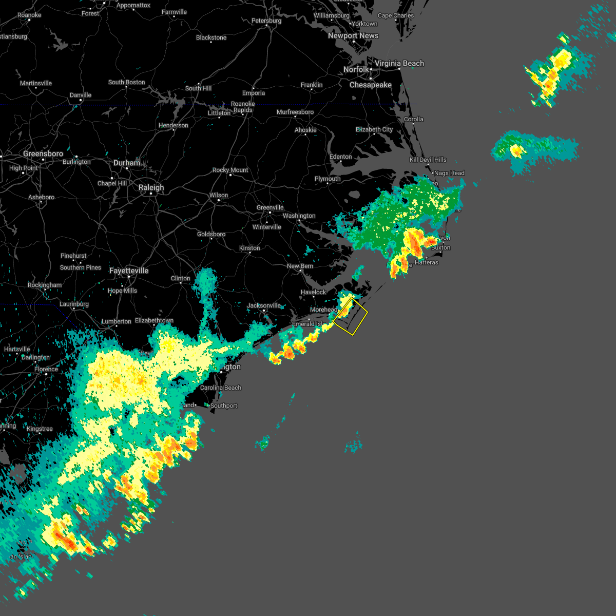
| 4/26/2020 4:05 AM EDT |
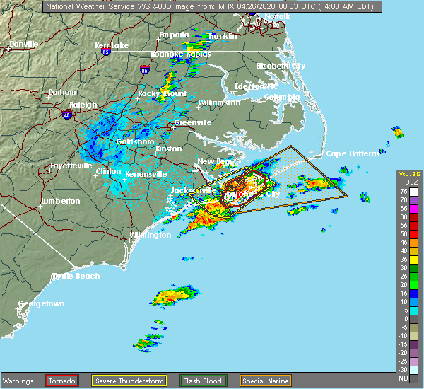 At 405 am edt, a severe thunderstorm capable of producing a tornado was located over marshallberg, or near harkers island, moving northeast at 45 mph (radar indicated rotation). Hazards include tornado and half dollar size hail. Flying debris will be dangerous to those caught without shelter. mobile homes will be damaged or destroyed. damage to roofs, windows, and vehicles will occur. tree damage is likely. Locations impacted include, morehead city, harkers island, sealevel, marshallberg, davis, straits, smyrna, atlantic, otway, williston, stacy, bettie and gloucester. At 405 am edt, a severe thunderstorm capable of producing a tornado was located over marshallberg, or near harkers island, moving northeast at 45 mph (radar indicated rotation). Hazards include tornado and half dollar size hail. Flying debris will be dangerous to those caught without shelter. mobile homes will be damaged or destroyed. damage to roofs, windows, and vehicles will occur. tree damage is likely. Locations impacted include, morehead city, harkers island, sealevel, marshallberg, davis, straits, smyrna, atlantic, otway, williston, stacy, bettie and gloucester.
|
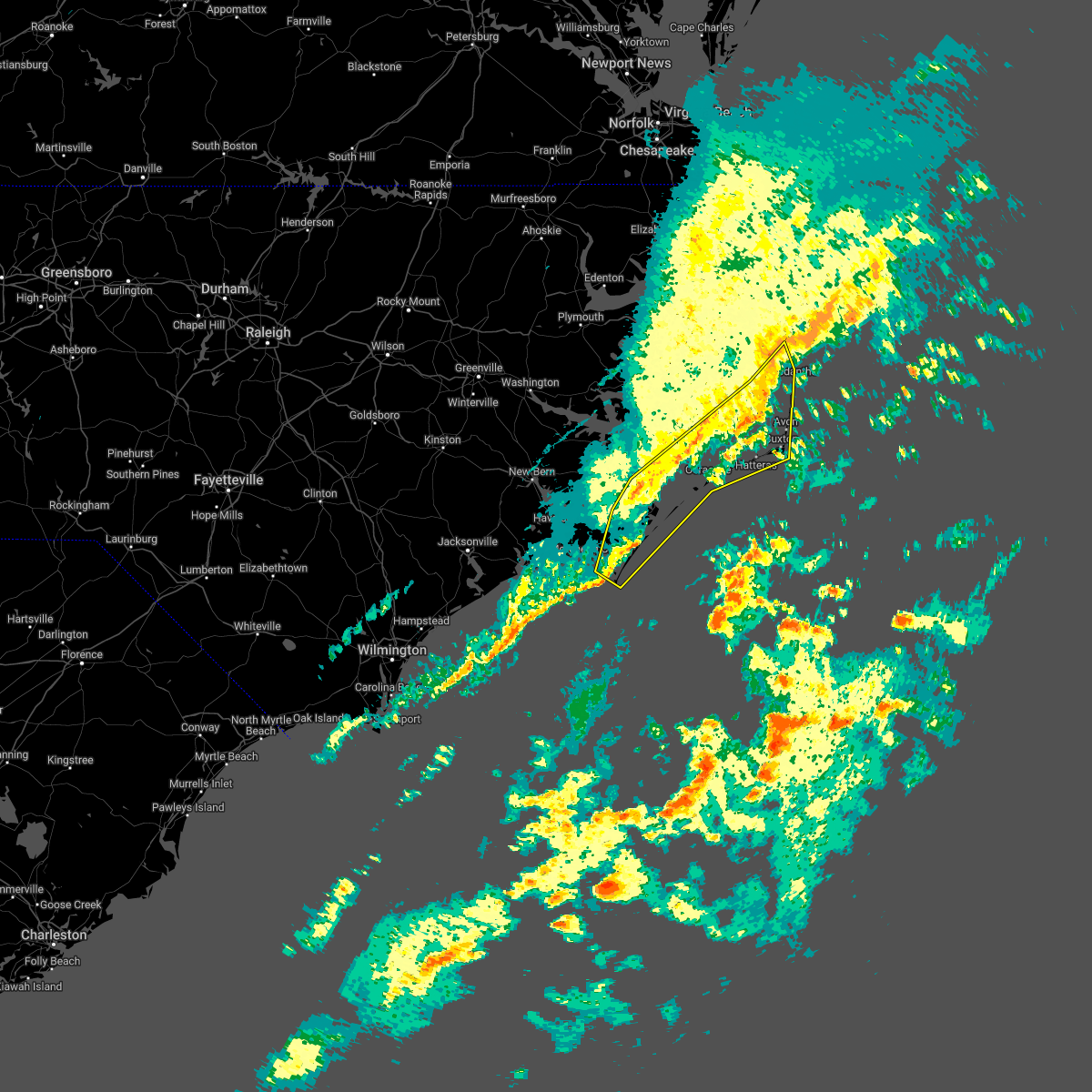
| 4/26/2020 3:51 AM EDT |
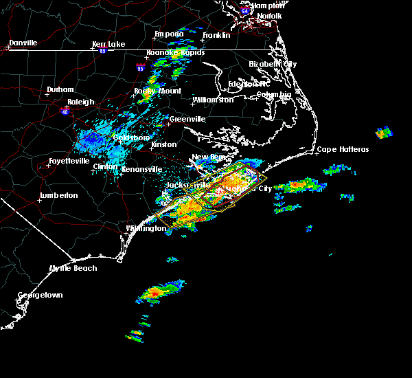 At 351 am edt, a severe thunderstorm capable of producing a tornado was located over fort macon state park, or near morehead city, moving northeast at 60 mph (radar indicated rotation). Hazards include tornado and half dollar size hail. Flying debris will be dangerous to those caught without shelter. mobile homes will be damaged or destroyed. damage to roofs, windows, and vehicles will occur. tree damage is likely. Locations impacted include, morehead city, harkers island, cedar island, north river, sealevel, marshallberg, davis, straits, smyrna, atlantic, otway, williston, open grounds farm, stacy, bettie, michael j smith airport, oceana pier, rachel carson estuarine reserve, fort macon state park and cedar island ferry terminal. At 351 am edt, a severe thunderstorm capable of producing a tornado was located over fort macon state park, or near morehead city, moving northeast at 60 mph (radar indicated rotation). Hazards include tornado and half dollar size hail. Flying debris will be dangerous to those caught without shelter. mobile homes will be damaged or destroyed. damage to roofs, windows, and vehicles will occur. tree damage is likely. Locations impacted include, morehead city, harkers island, cedar island, north river, sealevel, marshallberg, davis, straits, smyrna, atlantic, otway, williston, open grounds farm, stacy, bettie, michael j smith airport, oceana pier, rachel carson estuarine reserve, fort macon state park and cedar island ferry terminal.
|
| 4/26/2020 3:38 AM EDT |
 At 337 am edt, a severe thunderstorm capable of producing a tornado was located over pine knoll shores, or 7 miles southwest of morehead city, moving northeast at 45 mph (radar indicated rotation). Hazards include tornado and half dollar size hail. Flying debris will be dangerous to those caught without shelter. mobile homes will be damaged or destroyed. damage to roofs, windows, and vehicles will occur. Tree damage is likely. At 337 am edt, a severe thunderstorm capable of producing a tornado was located over pine knoll shores, or 7 miles southwest of morehead city, moving northeast at 45 mph (radar indicated rotation). Hazards include tornado and half dollar size hail. Flying debris will be dangerous to those caught without shelter. mobile homes will be damaged or destroyed. damage to roofs, windows, and vehicles will occur. Tree damage is likely.
|
| 4/26/2020 3:24 AM EDT |
 At 323 am edt, a severe thunderstorm was located over broad creek, or 7 miles southwest of newport, moving northeast at 55 mph (radar indicated). Hazards include ping pong ball size hail and 60 mph wind gusts. People and animals outdoors will be injured. expect hail damage to roofs, siding, windows, and vehicles. Expect wind damage to roofs, siding, and trees. At 323 am edt, a severe thunderstorm was located over broad creek, or 7 miles southwest of newport, moving northeast at 55 mph (radar indicated). Hazards include ping pong ball size hail and 60 mph wind gusts. People and animals outdoors will be injured. expect hail damage to roofs, siding, windows, and vehicles. Expect wind damage to roofs, siding, and trees.
|
| 4/18/2020 1:25 PM EDT |
 The severe thunderstorm warning for carteret county will expire at 130 pm edt, the storms which prompted the warning have moved out of the area. therefore, the warning will be allowed to expire. The severe thunderstorm warning for carteret county will expire at 130 pm edt, the storms which prompted the warning have moved out of the area. therefore, the warning will be allowed to expire.
|
| 4/18/2020 12:52 PM EDT |
 At 1252 pm edt, severe thunderstorms were located along a line extending from near cedar island ferry terminal to near great neck to near kuhns, moving east at 60 mph (radar indicated). Hazards include 60 mph wind gusts and penny size hail. expect damage to roofs, siding, and trees At 1252 pm edt, severe thunderstorms were located along a line extending from near cedar island ferry terminal to near great neck to near kuhns, moving east at 60 mph (radar indicated). Hazards include 60 mph wind gusts and penny size hail. expect damage to roofs, siding, and trees
|
| 4/13/2020 10:45 AM EDT |
 At 1044 am edt, severe thunderstorms were located along a line extending from lowland to near oceana pier to 22 miles south of bogue inlet pier, moving east at 35 mph (radar indicated). Hazards include 60 mph wind gusts. Expect damage to roofs, siding, and trees. locations impacted include, morehead city, newport, south river, north river, sealevel, marshallberg, davis, smyrna, merrimon, straits, atlantic, harlowe, florence, otway, janeiro, great neck, wildwood, williston, whortonsville and open grounds farm. A tornado watch remains in effect until noon edt for eastern north carolina. At 1044 am edt, severe thunderstorms were located along a line extending from lowland to near oceana pier to 22 miles south of bogue inlet pier, moving east at 35 mph (radar indicated). Hazards include 60 mph wind gusts. Expect damage to roofs, siding, and trees. locations impacted include, morehead city, newport, south river, north river, sealevel, marshallberg, davis, smyrna, merrimon, straits, atlantic, harlowe, florence, otway, janeiro, great neck, wildwood, williston, whortonsville and open grounds farm. A tornado watch remains in effect until noon edt for eastern north carolina.
|
| 4/13/2020 10:12 AM EDT |
 At 1012 am edt, severe thunderstorms were located along a line extending from near royal to near broad creek to 7 miles south of north topsail beach, moving east at 60 mph (radar indicated). Hazards include 60 mph wind gusts. expect damage to roofs, siding, and trees At 1012 am edt, severe thunderstorms were located along a line extending from near royal to near broad creek to 7 miles south of north topsail beach, moving east at 60 mph (radar indicated). Hazards include 60 mph wind gusts. expect damage to roofs, siding, and trees
|
| 9/5/2019 4:41 PM EDT |
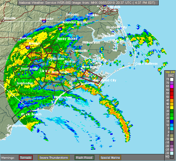 A tornado warning remains in effect until 500 pm edt for southeastern craven and central carteret counties. at 440 pm edt, a severe thunderstorm capable of producing a tornado was located over north river, or near morehead city, moving northwest at 50 mph. hazard. Tornado. A tornado warning remains in effect until 500 pm edt for southeastern craven and central carteret counties. at 440 pm edt, a severe thunderstorm capable of producing a tornado was located over north river, or near morehead city, moving northwest at 50 mph. hazard. Tornado.
|
| 9/5/2019 4:10 PM EDT |
 At 410 pm edt, a severe thunderstorm capable of producing a tornado was located over north river, or 8 miles northeast of morehead city, moving northwest at 25 mph (radar indicated rotation). Hazards include tornado. Flying debris will be dangerous to those caught without shelter. mobile homes will be damaged or destroyed. damage to roofs, windows, and vehicles will occur. Tree damage is likely. At 410 pm edt, a severe thunderstorm capable of producing a tornado was located over north river, or 8 miles northeast of morehead city, moving northwest at 25 mph (radar indicated rotation). Hazards include tornado. Flying debris will be dangerous to those caught without shelter. mobile homes will be damaged or destroyed. damage to roofs, windows, and vehicles will occur. Tree damage is likely.
|
| 8/8/2019 3:35 PM EDT |
 The severe thunderstorm warning for southwestern carteret county will expire at 345 pm edt, the storm which prompted the warning has weakened below severe limits, and no longer poses an immediate threat to life or property. therefore, the warning will be allowed to expire. however heavy rain is still possible with this thunderstorm. The severe thunderstorm warning for southwestern carteret county will expire at 345 pm edt, the storm which prompted the warning has weakened below severe limits, and no longer poses an immediate threat to life or property. therefore, the warning will be allowed to expire. however heavy rain is still possible with this thunderstorm.
|
| 8/8/2019 3:12 PM EDT |
 At 311 pm edt, a severe thunderstorm was located near broad creek, or near newport, moving east at 25 mph (radar indicated). Hazards include 60 mph wind gusts and quarter size hail. Hail damage to vehicles is expected. expect wind damage to roofs, siding, and trees. Locations impacted include, morehead city, newport, harkers island, swansboro, cape carteret, north river, straits, pine knoll shores, otway, broad creek, wildwood, peletier, kuhns, bogue, bettie, michael j smith airport, oceana pier, rachel carson estuarine reserve, fort macon state park and bogue inlet pier. At 311 pm edt, a severe thunderstorm was located near broad creek, or near newport, moving east at 25 mph (radar indicated). Hazards include 60 mph wind gusts and quarter size hail. Hail damage to vehicles is expected. expect wind damage to roofs, siding, and trees. Locations impacted include, morehead city, newport, harkers island, swansboro, cape carteret, north river, straits, pine knoll shores, otway, broad creek, wildwood, peletier, kuhns, bogue, bettie, michael j smith airport, oceana pier, rachel carson estuarine reserve, fort macon state park and bogue inlet pier.
|
| 8/8/2019 2:46 PM EDT |
 At 245 pm edt, a severe thunderstorm was located over peletier, or 11 miles west of newport, moving east at 25 mph (radar indicated). Hazards include 60 mph wind gusts and quarter size hail. Hail damage to vehicles is expected. Expect wind damage to roofs, siding, and trees. At 245 pm edt, a severe thunderstorm was located over peletier, or 11 miles west of newport, moving east at 25 mph (radar indicated). Hazards include 60 mph wind gusts and quarter size hail. Hail damage to vehicles is expected. Expect wind damage to roofs, siding, and trees.
|
| 5/31/2019 3:24 PM EDT |
 The severe thunderstorm warning for southeastern craven and southwestern carteret counties will expire at 330 pm edt, the storm which prompted the warning has weakened below severe limits, and no longer poses an immediate threat to life or property. therefore, the warning will be allowed to expire. however heavy rain is still possible with this thunderstorm. a severe thunderstorm watch remains in effect until 1100 pm edt for eastern north carolina. The severe thunderstorm warning for southeastern craven and southwestern carteret counties will expire at 330 pm edt, the storm which prompted the warning has weakened below severe limits, and no longer poses an immediate threat to life or property. therefore, the warning will be allowed to expire. however heavy rain is still possible with this thunderstorm. a severe thunderstorm watch remains in effect until 1100 pm edt for eastern north carolina.
|
| 5/31/2019 3:05 PM EDT |
 A severe thunderstorm warning remains in effect until 330 pm edt for southeastern craven and southwestern carteret counties. at 305 pm edt, a severe thunderstorm was located near newport, moving east at 35 mph. hazard. 60 mph wind gusts and penny size hail. source. Radar indicated. A severe thunderstorm warning remains in effect until 330 pm edt for southeastern craven and southwestern carteret counties. at 305 pm edt, a severe thunderstorm was located near newport, moving east at 35 mph. hazard. 60 mph wind gusts and penny size hail. source. Radar indicated.
|
| 5/31/2019 2:44 PM EDT |
 At 243 pm edt, a severe thunderstorm was located over peletier, or 12 miles west of newport, moving east at 35 mph (radar indicated). Hazards include 60 mph wind gusts and quarter size hail. Hail damage to vehicles is expected. Expect wind damage to roofs, siding, and trees. At 243 pm edt, a severe thunderstorm was located over peletier, or 12 miles west of newport, moving east at 35 mph (radar indicated). Hazards include 60 mph wind gusts and quarter size hail. Hail damage to vehicles is expected. Expect wind damage to roofs, siding, and trees.
|
| 5/12/2019 4:36 PM EDT |
 At 434 pm edt, severe thunderstorms were located along a line extending from near south river to near open grounds farm to near fort macon state park, moving east at 55 mph (radar indicated). Hazards include 70 mph wind gusts. Expect considerable tree damage. damage is likely to mobile homes, roofs, and outbuildings. Locations impacted include, morehead city, harkers island, south river, north river, sealevel, merrimon, marshallberg, davis, straits, smyrna, otway, janeiro, williston, whortonsville, great neck, open grounds farm, nc pamlico, stacy, merritt and bettie. At 434 pm edt, severe thunderstorms were located along a line extending from near south river to near open grounds farm to near fort macon state park, moving east at 55 mph (radar indicated). Hazards include 70 mph wind gusts. Expect considerable tree damage. damage is likely to mobile homes, roofs, and outbuildings. Locations impacted include, morehead city, harkers island, south river, north river, sealevel, merrimon, marshallberg, davis, straits, smyrna, otway, janeiro, williston, whortonsville, great neck, open grounds farm, nc pamlico, stacy, merritt and bettie.
|
| 5/12/2019 4:26 PM EDT |
 At 424 pm edt, severe thunderstorms were located along a line extending from near neuse forest to near newport to near bogue inlet pier, moving east at 30 mph (radar indicated). Hazards include 60 mph wind gusts and quarter size hail. Hail damage to vehicles is expected. expect wind damage to roofs, siding, and trees. Locations impacted include, new bern, havelock, morehead city, newport, harkers island, south river, north river, sealevel, marshallberg, davis, smyrna, merrimon, straits, pine knoll shores, harlowe, otway, janeiro, great neck, wildwood and williston. At 424 pm edt, severe thunderstorms were located along a line extending from near neuse forest to near newport to near bogue inlet pier, moving east at 30 mph (radar indicated). Hazards include 60 mph wind gusts and quarter size hail. Hail damage to vehicles is expected. expect wind damage to roofs, siding, and trees. Locations impacted include, new bern, havelock, morehead city, newport, harkers island, south river, north river, sealevel, marshallberg, davis, smyrna, merrimon, straits, pine knoll shores, harlowe, otway, janeiro, great neck, wildwood and williston.
|
| 5/12/2019 4:02 PM EDT |
 At 402 pm edt, severe thunderstorms were located along a line extending from near catfish lake to near bogue to 6 miles south of hammocks beach state park, moving east at 30 mph (radar indicated). Hazards include 60 mph wind gusts and quarter size hail. Hail damage to vehicles is expected. Expect wind damage to roofs, siding, and trees. At 402 pm edt, severe thunderstorms were located along a line extending from near catfish lake to near bogue to 6 miles south of hammocks beach state park, moving east at 30 mph (radar indicated). Hazards include 60 mph wind gusts and quarter size hail. Hail damage to vehicles is expected. Expect wind damage to roofs, siding, and trees.
|
| 4/26/2019 11:41 AM EDT | Piney island reports wind gust to 53 knot in amz137 county NC, 22.3 miles SSW of Beaufort, NC |
| 4/15/2019 4:46 AM EDT |
 At 445 am edt, severe thunderstorms were located along a line extending from near columbia to smyrna, moving east at 45 mph (radar indicated). Hazards include 60 mph wind gusts. Expect damage to roofs, siding, and trees. Locations impacted include, morehead city, cedar island, harkers island, south river, north river, killkenny, sealevel, marshallberg, davis, swindell fork, scranton, smyrna, merrimon, gull rock, alligator, straits, gum neck, kilkenny, fairfield and atlantic. At 445 am edt, severe thunderstorms were located along a line extending from near columbia to smyrna, moving east at 45 mph (radar indicated). Hazards include 60 mph wind gusts. Expect damage to roofs, siding, and trees. Locations impacted include, morehead city, cedar island, harkers island, south river, north river, killkenny, sealevel, marshallberg, davis, swindell fork, scranton, smyrna, merrimon, gull rock, alligator, straits, gum neck, kilkenny, fairfield and atlantic.
|
| 4/15/2019 4:34 AM EDT | Beaufort smith field asos (mrh) reports wind gust of 60 mp in carteret county NC, 0.8 miles ESE of Beaufort, NC |
| 4/15/2019 4:32 AM EDT |
 At 431 am edt, severe thunderstorms were located along a line extending from near woodley to near harlowe, moving northeast at 55 mph (radar indicated). Hazards include 60 mph wind gusts. Expect damage to roofs, siding, and trees. Locations impacted include, morehead city, newport, cedar island, harkers island, south river, north river, killkenny, davis, swindell fork, alligator, straits, atlantic, sladesville, ponzer, sealevel, marshallberg, scranton, smyrna, merrimon and gull rock. At 431 am edt, severe thunderstorms were located along a line extending from near woodley to near harlowe, moving northeast at 55 mph (radar indicated). Hazards include 60 mph wind gusts. Expect damage to roofs, siding, and trees. Locations impacted include, morehead city, newport, cedar island, harkers island, south river, north river, killkenny, davis, swindell fork, alligator, straits, atlantic, sladesville, ponzer, sealevel, marshallberg, scranton, smyrna, merrimon and gull rock.
|
| 4/15/2019 4:10 AM EDT |
 At 409 am edt, severe thunderstorms were located along a line extending from near pungo to broad creek, moving northeast at 55 mph (radar indicated). Hazards include 60 mph wind gusts. expect damage to roofs, siding, and trees At 409 am edt, severe thunderstorms were located along a line extending from near pungo to broad creek, moving northeast at 55 mph (radar indicated). Hazards include 60 mph wind gusts. expect damage to roofs, siding, and trees
|
| 12/20/2018 8:34 PM EST |
 At 833 pm est, severe thunderstorms were located along a line extending from near hammocks beach state park to 22 miles southeast of sea view pier, moving northeast at 60 mph (radar indicated). Hazards include 60 mph wind gusts and penny size hail. expect damage to roofs, siding, and trees At 833 pm est, severe thunderstorms were located along a line extending from near hammocks beach state park to 22 miles southeast of sea view pier, moving northeast at 60 mph (radar indicated). Hazards include 60 mph wind gusts and penny size hail. expect damage to roofs, siding, and trees
|
| 11/24/2018 2:37 PM EST |
 At 236 pm est, a severe thunderstorm capable of producing a tornado was located over michael j smith airport, or over morehead city, moving northeast at 20 mph (radar indicated rotation). Hazards include tornado. Flying debris will be dangerous to those caught without shelter. mobile homes will be damaged or destroyed. damage to roofs, windows, and vehicles will occur. tree damage is likely. this dangerous storm will be near, michael j smith airport. harkers island. straits around. north river, marshallberg and bettie. smyrna and otway. williston. open grounds farm. davis and stacy. Other locations impacted by this tornadic thunderstorm include crab point village and gloucester. At 236 pm est, a severe thunderstorm capable of producing a tornado was located over michael j smith airport, or over morehead city, moving northeast at 20 mph (radar indicated rotation). Hazards include tornado. Flying debris will be dangerous to those caught without shelter. mobile homes will be damaged or destroyed. damage to roofs, windows, and vehicles will occur. tree damage is likely. this dangerous storm will be near, michael j smith airport. harkers island. straits around. north river, marshallberg and bettie. smyrna and otway. williston. open grounds farm. davis and stacy. Other locations impacted by this tornadic thunderstorm include crab point village and gloucester.
|
| 11/24/2018 2:33 PM EST |
 At 232 pm est, a severe thunderstorm was located over harlowe, or near morehead city, moving northeast at 40 mph (radar indicated). Hazards include 60 mph wind gusts. expect damage to roofs, siding, and trees At 232 pm est, a severe thunderstorm was located over harlowe, or near morehead city, moving northeast at 40 mph (radar indicated). Hazards include 60 mph wind gusts. expect damage to roofs, siding, and trees
|
| 11/24/2018 1:55 PM EST |
 At 153 pm est, a severe thunderstorm was located near broad creek, or 9 miles southwest of newport, moving northeast at 35 mph (radar indicated). Hazards include 70 mph wind gusts. Expect considerable tree damage. damage is likely to mobile homes, roofs, and outbuildings. Locations impacted include, new bern, havelock, morehead city, newport, cedar island, harkers island, south river, cape carteret, north river, sealevel, marshallberg, davis, smyrna, merrimon, straits, atlantic, pine knoll shores, harlowe, otway and broad creek. At 153 pm est, a severe thunderstorm was located near broad creek, or 9 miles southwest of newport, moving northeast at 35 mph (radar indicated). Hazards include 70 mph wind gusts. Expect considerable tree damage. damage is likely to mobile homes, roofs, and outbuildings. Locations impacted include, new bern, havelock, morehead city, newport, cedar island, harkers island, south river, cape carteret, north river, sealevel, marshallberg, davis, smyrna, merrimon, straits, atlantic, pine knoll shores, harlowe, otway and broad creek.
|
| 11/24/2018 1:36 PM EST |
 At 135 pm est, a severe thunderstorm was located 7 miles south of bogue inlet pier, or 17 miles southwest of newport, moving northeast at 45 mph (radar indicated). Hazards include 70 mph wind gusts. Expect considerable tree damage. Damage is likely to mobile homes, roofs, and outbuildings. At 135 pm est, a severe thunderstorm was located 7 miles south of bogue inlet pier, or 17 miles southwest of newport, moving northeast at 45 mph (radar indicated). Hazards include 70 mph wind gusts. Expect considerable tree damage. Damage is likely to mobile homes, roofs, and outbuildings.
|
| 11/13/2018 4:43 AM EST |
 At 443 am est, severe thunderstorms capable of producing tornadoes were located along a line extending from bogue to pine knoll shores, moving northeast at 40 mph (radar indicated rotation). Hazards include tornado and two inch hail. Flying debris will be dangerous to those caught without shelter. mobile homes will be damaged or destroyed. damage to roofs, windows, and vehicles will occur. tree damage is likely. these dangerous storms will be near, wildwood, oceana pier and fort macon state park around 450 am est. newport and michael j smith airport around 455 am est. north river and bettie around 500 am est. Other locations impacted by these tornadic storms include indian beach, crab point village, mitchell village, cedar point and gloucester. At 443 am est, severe thunderstorms capable of producing tornadoes were located along a line extending from bogue to pine knoll shores, moving northeast at 40 mph (radar indicated rotation). Hazards include tornado and two inch hail. Flying debris will be dangerous to those caught without shelter. mobile homes will be damaged or destroyed. damage to roofs, windows, and vehicles will occur. tree damage is likely. these dangerous storms will be near, wildwood, oceana pier and fort macon state park around 450 am est. newport and michael j smith airport around 455 am est. north river and bettie around 500 am est. Other locations impacted by these tornadic storms include indian beach, crab point village, mitchell village, cedar point and gloucester.
|
| 11/13/2018 4:03 AM EST |
 At 403 am est, severe thunderstorms capable of producing a tornado were located along a line extending from near sea view pier to 14 miles south of hammocks beach state park, moving northeast at 40 mph (radar indicated rotation). Hazards include tornado and hail up to two inches in diameter. Flying debris will be dangerous to those caught without shelter. mobile homes will be damaged or destroyed. damage to roofs, windows, and vehicles will occur. tree damage is likely. these dangerous storms will be near, hammocks beach and hammocks beach state park around 430 am est. morehead city, swansboro and bogue inlet pier around 435 am est. cape carteret, pine knoll shores, peletier and bogue around 440 am est. wildwood, broad creek and oceana pier around 445 am est. fort macon state park and rachel carson estuarine reserve around 450 am est. michael j smith airport around 455 am est. newport, north river, otway and bettie around 500 am est. Other locations impacted by these tornadic storms include indian beach, crab point village, mitchell village, cedar point and gloucester. At 403 am est, severe thunderstorms capable of producing a tornado were located along a line extending from near sea view pier to 14 miles south of hammocks beach state park, moving northeast at 40 mph (radar indicated rotation). Hazards include tornado and hail up to two inches in diameter. Flying debris will be dangerous to those caught without shelter. mobile homes will be damaged or destroyed. damage to roofs, windows, and vehicles will occur. tree damage is likely. these dangerous storms will be near, hammocks beach and hammocks beach state park around 430 am est. morehead city, swansboro and bogue inlet pier around 435 am est. cape carteret, pine knoll shores, peletier and bogue around 440 am est. wildwood, broad creek and oceana pier around 445 am est. fort macon state park and rachel carson estuarine reserve around 450 am est. michael j smith airport around 455 am est. newport, north river, otway and bettie around 500 am est. Other locations impacted by these tornadic storms include indian beach, crab point village, mitchell village, cedar point and gloucester.
|
| 9/14/2018 2:10 PM EDT |
 At 210 pm edt, a severe thunderstorm capable of producing a tornado was located over marshallberg, or near harkers island, moving northwest at 50 mph (radar indicated rotation). Hazards include tornado. Flying debris will be dangerous to those caught without shelter. mobile homes will be damaged or destroyed. damage to roofs, windows, and vehicles will occur. Tree damage is likely. At 210 pm edt, a severe thunderstorm capable of producing a tornado was located over marshallberg, or near harkers island, moving northwest at 50 mph (radar indicated rotation). Hazards include tornado. Flying debris will be dangerous to those caught without shelter. mobile homes will be damaged or destroyed. damage to roofs, windows, and vehicles will occur. Tree damage is likely.
|
| 9/14/2018 1:06 PM EDT |
 At 105 pm edt, a severe thunderstorm capable of producing a tornado was located over marshallberg, or near harkers island, moving northwest at 60 mph (radar indicated rotation). Hazards include tornado. Flying debris will be dangerous to those caught without shelter. mobile homes will be damaged or destroyed. damage to roofs, windows, and vehicles will occur. Tree damage is likely. At 105 pm edt, a severe thunderstorm capable of producing a tornado was located over marshallberg, or near harkers island, moving northwest at 60 mph (radar indicated rotation). Hazards include tornado. Flying debris will be dangerous to those caught without shelter. mobile homes will be damaged or destroyed. damage to roofs, windows, and vehicles will occur. Tree damage is likely.
|
| 9/14/2018 11:57 AM EDT |
 At 1156 am edt, a severe thunderstorm capable of producing a tornado was located over davis, or 7 miles northeast of harkers island, moving northwest at 55 mph (radar indicated rotation). Hazards include tornado. Flying debris will be dangerous to those caught without shelter. mobile homes will be damaged or destroyed. damage to roofs, windows, and vehicles will occur. Tree damage is likely. At 1156 am edt, a severe thunderstorm capable of producing a tornado was located over davis, or 7 miles northeast of harkers island, moving northwest at 55 mph (radar indicated rotation). Hazards include tornado. Flying debris will be dangerous to those caught without shelter. mobile homes will be damaged or destroyed. damage to roofs, windows, and vehicles will occur. Tree damage is likely.
|
| 9/14/2018 10:48 AM EDT |
 At 1048 am edt, a severe thunderstorm capable of producing a tornado was located over open grounds farm, or 13 miles north of harkers island, moving northwest at 85 mph (radar indicated rotation). Hazards include tornado. Flying debris will be dangerous to those caught without shelter. mobile homes will be damaged or destroyed. damage to roofs, windows, and vehicles will occur. tree damage is likely. Locations impacted include, new bern, havelock, harkers island, james city, south river, north river, sealevel, marshallberg, davis, smyrna, merrimon, straits, harlowe, askins, cayton, otway, janeiro, grantsboro, great neck and olympia. At 1048 am edt, a severe thunderstorm capable of producing a tornado was located over open grounds farm, or 13 miles north of harkers island, moving northwest at 85 mph (radar indicated rotation). Hazards include tornado. Flying debris will be dangerous to those caught without shelter. mobile homes will be damaged or destroyed. damage to roofs, windows, and vehicles will occur. tree damage is likely. Locations impacted include, new bern, havelock, harkers island, james city, south river, north river, sealevel, marshallberg, davis, smyrna, merrimon, straits, harlowe, askins, cayton, otway, janeiro, grantsboro, great neck and olympia.
|
| 9/14/2018 10:24 AM EDT |
 At 1024 am edt, a severe thunderstorm capable of producing a tornado was located near merrimon, or 13 miles north of harkers island, moving northwest at 60 mph (radar indicated rotation). Hazards include tornado. Flying debris will be dangerous to those caught without shelter. mobile homes will be damaged or destroyed. damage to roofs, windows, and vehicles will occur. Tree damage is likely. At 1024 am edt, a severe thunderstorm capable of producing a tornado was located near merrimon, or 13 miles north of harkers island, moving northwest at 60 mph (radar indicated rotation). Hazards include tornado. Flying debris will be dangerous to those caught without shelter. mobile homes will be damaged or destroyed. damage to roofs, windows, and vehicles will occur. Tree damage is likely.
|
| 9/13/2018 7:44 PM EDT |
 At 744 pm edt, a severe thunderstorm capable of producing a tornado was located 8 miles east of south river, or 8 miles west of cedar island, moving southwest at 65 mph (radar indicated rotation). Hazards include tornado. Flying debris will be dangerous to those caught without shelter. mobile homes will be damaged or destroyed. damage to roofs, windows, and vehicles will occur. tree damage is likely. this dangerous storm will be near, south river and open grounds farm around 750 pm edt. merrimon, great neck and bettie around 755 pm edt. north river, harlowe, north harlowe and cherry branch ferry terminal around 800 pm edt. newport, pine knoll shores and wildwood around 810 pm edt. morehead city and broad creek around 815 pm edt. Other locations impacted by this tornadic thunderstorm include indian beach, mitchell village and crab point village. At 744 pm edt, a severe thunderstorm capable of producing a tornado was located 8 miles east of south river, or 8 miles west of cedar island, moving southwest at 65 mph (radar indicated rotation). Hazards include tornado. Flying debris will be dangerous to those caught without shelter. mobile homes will be damaged or destroyed. damage to roofs, windows, and vehicles will occur. tree damage is likely. this dangerous storm will be near, south river and open grounds farm around 750 pm edt. merrimon, great neck and bettie around 755 pm edt. north river, harlowe, north harlowe and cherry branch ferry terminal around 800 pm edt. newport, pine knoll shores and wildwood around 810 pm edt. morehead city and broad creek around 815 pm edt. Other locations impacted by this tornadic thunderstorm include indian beach, mitchell village and crab point village.
|
| 7/12/2018 2:33 PM EDT |
 At 232 pm edt, a severe thunderstorm was located near havelock, moving southeast at 10 mph (radar indicated). Hazards include 60 mph wind gusts and quarter size hail. Hail damage to vehicles is expected. Expect wind damage to roofs, siding, and trees. At 232 pm edt, a severe thunderstorm was located near havelock, moving southeast at 10 mph (radar indicated). Hazards include 60 mph wind gusts and quarter size hail. Hail damage to vehicles is expected. Expect wind damage to roofs, siding, and trees.
|
| 6/24/2018 7:16 PM EDT |
 At 716 pm edt, severe thunderstorms were located along a line extending from near maribel to near janeiro to near wildwood to near bogue inlet pier to near maple hill, moving southeast at 35 mph (radar indicated). Hazards include 60 mph wind gusts. Expect damage to roofs, siding, and trees. Locations impacted include, jacksonville, havelock, morehead city, north topsail beach, newport, harkers island, piney green, new river station, camp lejeune center, stella, swansboro, hubert, south river, cape carteret, north river, straits, smyrna, merrimon, pine knoll shores and harlowe. At 716 pm edt, severe thunderstorms were located along a line extending from near maribel to near janeiro to near wildwood to near bogue inlet pier to near maple hill, moving southeast at 35 mph (radar indicated). Hazards include 60 mph wind gusts. Expect damage to roofs, siding, and trees. Locations impacted include, jacksonville, havelock, morehead city, north topsail beach, newport, harkers island, piney green, new river station, camp lejeune center, stella, swansboro, hubert, south river, cape carteret, north river, straits, smyrna, merrimon, pine knoll shores and harlowe.
|
| 6/24/2018 6:58 PM EDT |
 At 658 pm edt, severe thunderstorms were located along a line extending from ernul to james city to near kuhns to near cypress creek, moving southeast at 30 mph (radar indicated). Hazards include 60 mph wind gusts and penny size hail. expect damage to roofs, siding, and trees At 658 pm edt, severe thunderstorms were located along a line extending from ernul to james city to near kuhns to near cypress creek, moving southeast at 30 mph (radar indicated). Hazards include 60 mph wind gusts and penny size hail. expect damage to roofs, siding, and trees
|
| 5/30/2017 9:44 AM EDT | Weatherflow site at north river reported a 59 knot...68 mph...wind gus in carteret county NC, 3.4 miles SSW of Beaufort, NC |
| 5/30/2017 9:40 AM EDT | Large tree limbs down which destroyed chicken coop on gillikin road. time estimated by rada in carteret county NC, 5.8 miles WSW of Beaufort, NC |
| 5/30/2017 8:56 AM EDT |
 At 855 am edt, a severe thunderstorm was located over smyrna, or near harkers island, moving east at 55 mph. a wind gust to 82 mph was reported at fort macon with this storm (radar indicated). Hazards include 80 mph wind gusts. Expect considerable tree damage. Damage is likely to mobile homes, roofs, and outbuildings. At 855 am edt, a severe thunderstorm was located over smyrna, or near harkers island, moving east at 55 mph. a wind gust to 82 mph was reported at fort macon with this storm (radar indicated). Hazards include 80 mph wind gusts. Expect considerable tree damage. Damage is likely to mobile homes, roofs, and outbuildings.
|
| 5/30/2017 8:41 AM EDT |
 At 840 am edt, a severe thunderstorm was located over morehead city, moving east at 55 mph (radar indicated). Hazards include 60 mph wind gusts and quarter size hail. Hail damage to vehicles is expected. Expect wind damage to roofs, siding, and trees. At 840 am edt, a severe thunderstorm was located over morehead city, moving east at 55 mph (radar indicated). Hazards include 60 mph wind gusts and quarter size hail. Hail damage to vehicles is expected. Expect wind damage to roofs, siding, and trees.
|
| 5/30/2017 8:02 AM EDT |
 At 802 am edt, a severe thunderstorm was located near hammocks beach state park, or 10 miles southeast of camp lejeune center, moving east at 40 mph (radar indicated). Hazards include 60 mph wind gusts and quarter size hail. Hail damage to vehicles is expected. Expect wind damage to roofs, siding, and trees. At 802 am edt, a severe thunderstorm was located near hammocks beach state park, or 10 miles southeast of camp lejeune center, moving east at 40 mph (radar indicated). Hazards include 60 mph wind gusts and quarter size hail. Hail damage to vehicles is expected. Expect wind damage to roofs, siding, and trees.
|
| 5/5/2017 7:55 AM EDT |
 At 755 am edt, severe thunderstorms were located along a line extending from near fairfield harbour to 6 miles north of michael j smith airport to near fort macon state park, moving east at 55 mph (radar indicated). Hazards include 60 mph wind gusts. expect damage to roofs, siding, and trees At 755 am edt, severe thunderstorms were located along a line extending from near fairfield harbour to 6 miles north of michael j smith airport to near fort macon state park, moving east at 55 mph (radar indicated). Hazards include 60 mph wind gusts. expect damage to roofs, siding, and trees
|
| 5/5/2017 7:46 AM EDT |
 At 745 am edt, severe thunderstorms were located along a line extending from coastal carolina regional airport to near pine knoll shores to 18 miles south of oceana pier, moving northeast at 50 mph (radar indicated). Hazards include 60 mph wind gusts. Expect damage to roofs, siding, and trees. locations impacted include, new bern, havelock, morehead city, newport, cedar island, harkers island, james city, sealevel, marshallberg, davis, smyrna, merrimon, straits, atlantic, pine knoll shores, neuse forest, cedar island ferry terminal, cherry branch ferry terminal, fairfield harbour and minnesott beach ferry. A tornado watch remains in effect until 900 am edt for eastern north carolina. At 745 am edt, severe thunderstorms were located along a line extending from coastal carolina regional airport to near pine knoll shores to 18 miles south of oceana pier, moving northeast at 50 mph (radar indicated). Hazards include 60 mph wind gusts. Expect damage to roofs, siding, and trees. locations impacted include, new bern, havelock, morehead city, newport, cedar island, harkers island, james city, sealevel, marshallberg, davis, smyrna, merrimon, straits, atlantic, pine knoll shores, neuse forest, cedar island ferry terminal, cherry branch ferry terminal, fairfield harbour and minnesott beach ferry. A tornado watch remains in effect until 900 am edt for eastern north carolina.
|
| 5/5/2017 7:19 AM EDT |
 At 718 am edt, severe thunderstorms were located along a line extending from near pumpkin center to 8 miles south of hammocks beach state park to 25 miles southeast of sea view pier, moving northeast at 50 mph (radar indicated). Hazards include 60 mph wind gusts. expect damage to roofs, siding, and trees At 718 am edt, severe thunderstorms were located along a line extending from near pumpkin center to 8 miles south of hammocks beach state park to 25 miles southeast of sea view pier, moving northeast at 50 mph (radar indicated). Hazards include 60 mph wind gusts. expect damage to roofs, siding, and trees
|
| 10/8/2016 2:37 PM EDT |
 At 237 pm edt, a severe thunderstorm capable of producing a tornado was located near smyrna, or 8 miles north of harkers island, moving northwest at 55 mph (radar indicated rotation). Hazards include tornado. Flying debris will be dangerous to those caught without shelter. mobile homes will be damaged or destroyed. damage to roofs, windows, and vehicles will occur. tree damage is likely. This dangerous storm will be near, merrimon around 250 pm edt. At 237 pm edt, a severe thunderstorm capable of producing a tornado was located near smyrna, or 8 miles north of harkers island, moving northwest at 55 mph (radar indicated rotation). Hazards include tornado. Flying debris will be dangerous to those caught without shelter. mobile homes will be damaged or destroyed. damage to roofs, windows, and vehicles will occur. tree damage is likely. This dangerous storm will be near, merrimon around 250 pm edt.
|
| 10/8/2016 2:24 PM EDT |
 At 224 pm edt, a severe thunderstorm capable of producing a tornado was located near cape lookout lighthouse, or 7 miles east of harkers island, moving northwest at 55 mph (radar indicated rotation). Hazards include tornado. Flying debris will be dangerous to those caught without shelter. mobile homes will be damaged or destroyed. damage to roofs, windows, and vehicles will occur. tree damage is likely. this dangerous storm will be near, harkers island and marshallberg around 230 pm edt. smyrna, davis and straits around 235 pm edt. Merrimon around 250 pm edt. At 224 pm edt, a severe thunderstorm capable of producing a tornado was located near cape lookout lighthouse, or 7 miles east of harkers island, moving northwest at 55 mph (radar indicated rotation). Hazards include tornado. Flying debris will be dangerous to those caught without shelter. mobile homes will be damaged or destroyed. damage to roofs, windows, and vehicles will occur. tree damage is likely. this dangerous storm will be near, harkers island and marshallberg around 230 pm edt. smyrna, davis and straits around 235 pm edt. Merrimon around 250 pm edt.
|
| 10/8/2016 11:57 AM EDT |
 At 1156 am edt, a severe thunderstorm capable of producing a tornado was located over pine knoll shores, or near morehead city, moving northwest at 55 mph (radar indicated rotation). Hazards include tornado. Flying debris will be dangerous to those caught without shelter. mobile homes will be damaged or destroyed. damage to roofs, windows, and vehicles will occur. tree damage is likely. this dangerous storm will be near, newport around 1205 pm edt. morehead city 1205 pm edt. Other locations impacted by this tornadic thunderstorm include indian beach. At 1156 am edt, a severe thunderstorm capable of producing a tornado was located over pine knoll shores, or near morehead city, moving northwest at 55 mph (radar indicated rotation). Hazards include tornado. Flying debris will be dangerous to those caught without shelter. mobile homes will be damaged or destroyed. damage to roofs, windows, and vehicles will occur. tree damage is likely. this dangerous storm will be near, newport around 1205 pm edt. morehead city 1205 pm edt. Other locations impacted by this tornadic thunderstorm include indian beach.
|
| 10/8/2016 11:43 AM EDT |
 The national weather service in newport has issued a * tornado warning for. southwestern carteret county in eastern north carolina. until 1215 pm edt * at 1143 am edt. A severe thunderstorm capable of producing a tornado was located 9 miles southwest of cape lookout lighthouse. The national weather service in newport has issued a * tornado warning for. southwestern carteret county in eastern north carolina. until 1215 pm edt * at 1143 am edt. A severe thunderstorm capable of producing a tornado was located 9 miles southwest of cape lookout lighthouse.
|
| 9/7/2016 4:00 PM EDT | Storm damage reported in carteret county NC, 0.5 miles NNE of Beaufort, NC |
| 7/8/2016 10:31 PM EDT |
 At 1030 pm edt, severe thunderstorms were located along a line extending from 7 miles northwest of ocracoke ferry terminal to 7 miles north of morehead city to near half moon, moving southeast at 45 mph (law enforcement indicated). Hazards include 60 mph wind gusts. Expect damage to roofs. siding. and trees. Locations impacted include, jacksonville, new bern, havelock, morehead city, newport, wallace, warsaw, camp lejeune center, pumpkin center, half moon, new river station, piney green, james city, mount olive, swansboro, cape carteret, rose hill, richlands, pine knoll shores and beulaville. At 1030 pm edt, severe thunderstorms were located along a line extending from 7 miles northwest of ocracoke ferry terminal to 7 miles north of morehead city to near half moon, moving southeast at 45 mph (law enforcement indicated). Hazards include 60 mph wind gusts. Expect damage to roofs. siding. and trees. Locations impacted include, jacksonville, new bern, havelock, morehead city, newport, wallace, warsaw, camp lejeune center, pumpkin center, half moon, new river station, piney green, james city, mount olive, swansboro, cape carteret, rose hill, richlands, pine knoll shores and beulaville.
|
| 7/8/2016 10:14 PM EDT |
 At 1012 pm edt, severe thunderstorms were located along a line extending from 7 miles east of swan quarter ferry terminal to near neuse forest to 8 miles north of richlands, moving southeast at 45 mph. a gust to 58 mph was recorded at the the coastal carolina regional airport in new bern (radar indicated). Hazards include 60 mph wind gusts. Expect damage to roofs. siding. and trees. Locations impacted include, jacksonville, new bern, havelock, morehead city, newport, wallace, warsaw, camp lejeune center, pumpkin center, half moon, new river station, piney green, james city, mount olive, trent woods, river bend, swansboro, cape carteret, rose hill and richlands. At 1012 pm edt, severe thunderstorms were located along a line extending from 7 miles east of swan quarter ferry terminal to near neuse forest to 8 miles north of richlands, moving southeast at 45 mph. a gust to 58 mph was recorded at the the coastal carolina regional airport in new bern (radar indicated). Hazards include 60 mph wind gusts. Expect damage to roofs. siding. and trees. Locations impacted include, jacksonville, new bern, havelock, morehead city, newport, wallace, warsaw, camp lejeune center, pumpkin center, half moon, new river station, piney green, james city, mount olive, trent woods, river bend, swansboro, cape carteret, rose hill and richlands.
|
| 7/8/2016 9:41 PM EDT |
 At 940 pm edt, severe thunderstorms were located along a line extending from 8 miles east of belhaven to 7 miles northwest of new bern to 6 miles south of walnut creek, moving southeast at 40 mph (radar indicated). Hazards include 60 mph wind gusts. Expect damage to roofs. siding. And trees. At 940 pm edt, severe thunderstorms were located along a line extending from 8 miles east of belhaven to 7 miles northwest of new bern to 6 miles south of walnut creek, moving southeast at 40 mph (radar indicated). Hazards include 60 mph wind gusts. Expect damage to roofs. siding. And trees.
|
| 6/15/2016 1:29 PM EDT |
 At 128 pm edt, a severe thunderstorm was located near newport, moving east at 20 mph (radar indicated). Hazards include 60 mph wind gusts and quarter size hail. Hail damage to vehicles is expected. expect wind damage to roofs, siding, and trees. Locations impacted include, morehead city and newport. At 128 pm edt, a severe thunderstorm was located near newport, moving east at 20 mph (radar indicated). Hazards include 60 mph wind gusts and quarter size hail. Hail damage to vehicles is expected. expect wind damage to roofs, siding, and trees. Locations impacted include, morehead city and newport.
|
| 6/15/2016 1:15 PM EDT |
 At 115 pm edt, a severe thunderstorm was located near newport, moving east at 20 mph (radar indicated). Hazards include 60 mph wind gusts and quarter size hail. Hail damage to vehicles is expected. Expect wind damage to roofs, siding, and trees. At 115 pm edt, a severe thunderstorm was located near newport, moving east at 20 mph (radar indicated). Hazards include 60 mph wind gusts and quarter size hail. Hail damage to vehicles is expected. Expect wind damage to roofs, siding, and trees.
|
| 2/16/2016 9:04 AM EST | Piney island bombing range asos wind gust to 62 knots in carteret county NC, 21.4 miles SSW of Beaufort, NC |
| 2/16/2016 8:57 AM EST | Trampoline overturned and shingles ripped off a roof. nearby transformer blew and power out in carteret county NC, 5.1 miles SSW of Beaufort, NC |
| 2/16/2016 8:55 AM EST | Beaufort asos reported wind gust to 55 knots in carteret county NC, 0.5 miles NNE of Beaufort, NC |
| 2/16/2016 8:55 AM EST | Possible tornado damage. open grounds farm reports 5 power poles damaged 1 mile north of nelson bay road on eastern end of farm. nws storm survey team has confirmed dam in carteret county NC, 15.1 miles SW of Beaufort, NC |
| 2/16/2016 8:46 AM EST |
 At 843 am est, fort macon state park reported a wind gust to 81 mph. this storm was located 8 miles north of michael j smith airport, or 9 miles northeast of morehead city, moving north at 50 mph. locations impacted include, havelock, morehead city, newport, pine knoll shores, michael j smith airport, oceana pier and indian beach. At 843 am est, fort macon state park reported a wind gust to 81 mph. this storm was located 8 miles north of michael j smith airport, or 9 miles northeast of morehead city, moving north at 50 mph. locations impacted include, havelock, morehead city, newport, pine knoll shores, michael j smith airport, oceana pier and indian beach.
|
| 2/16/2016 8:42 AM EST | Beaufort nos at noaa labs in beaufort reported at wind gust to 59 knots in carteret county NC, 0.5 miles NNE of Beaufort, NC |
| 2/16/2016 8:40 AM EST | Small tree limbs and fence down. many shingles missing off roof on home on old causeway roa in carteret county NC, 0.5 miles NNE of Beaufort, NC |
| 2/16/2016 8:30 AM EST | Power lines down 1400-1500 block of front stree in beaufort. time estimated in carteret county NC, 0.5 miles NNE of Beaufort, NC |
| 2/16/2016 8:29 AM EST |
 At 829 am est, doppler radar indicated a severe thunderstorm capable of producing destructive winds in excess of 70 mph. this storm was located near fort macon state park, or just south of morehead city, and moving north at 50 mph. At 829 am est, doppler radar indicated a severe thunderstorm capable of producing destructive winds in excess of 70 mph. this storm was located near fort macon state park, or just south of morehead city, and moving north at 50 mph.
|
| 7/23/2015 11:52 AM EDT |
 At 1151 am edt, trained weather spotters reported a funnel cloud near newport. the funnel cloud was in a line of severe thunderstorms extending from 8 miles north of michael j smith airport to near newport to 8 miles northeast of cape carteret. a tornado may develop at any time. doppler radar showed these dangerous storms moving southeast at 25 mph. At 1151 am edt, trained weather spotters reported a funnel cloud near newport. the funnel cloud was in a line of severe thunderstorms extending from 8 miles north of michael j smith airport to near newport to 8 miles northeast of cape carteret. a tornado may develop at any time. doppler radar showed these dangerous storms moving southeast at 25 mph.
|
| 7/23/2015 11:33 AM EDT |
 At 1132 am edt, doppler radar indicated a line of severe thunderstorms capable of producing destructive winds in excess of 70 mph. these storms were located along a line extending from 6 miles south of cherry branch ferry terminal to newport to near pine knoll shores to 8 miles northeast of bogue inlet pier, moving southeast at 15 mph. locations impacted include, havelock, morehead city, newport, pine knoll shores, michael j smith airport, neuse forest, rachel carson estuarine reserve, arapahoe, minnesott beach and indian beach. At 1132 am edt, doppler radar indicated a line of severe thunderstorms capable of producing destructive winds in excess of 70 mph. these storms were located along a line extending from 6 miles south of cherry branch ferry terminal to newport to near pine knoll shores to 8 miles northeast of bogue inlet pier, moving southeast at 15 mph. locations impacted include, havelock, morehead city, newport, pine knoll shores, michael j smith airport, neuse forest, rachel carson estuarine reserve, arapahoe, minnesott beach and indian beach.
|
| 7/23/2015 11:01 AM EDT |
 At 1100 am edt, doppler radar indicated a line of severe thunderstorms capable of producing destructive winds in excess of 70 mph. these storms were located along a line extending from near cherry branch ferry terminal to near havelock to 7 miles northwest of newport to 9 miles north of cape carteret, and moving southeast at 15 mph. At 1100 am edt, doppler radar indicated a line of severe thunderstorms capable of producing destructive winds in excess of 70 mph. these storms were located along a line extending from near cherry branch ferry terminal to near havelock to 7 miles northwest of newport to 9 miles north of cape carteret, and moving southeast at 15 mph.
|
| 7/21/2015 10:36 PM EDT |
 At 1035 pm edt, doppler radar indicated a severe thunderstorm capable of producing damaging winds in excess of 60 mph. this storm was located near cherry branch ferry terminal, or 9 miles northeast of newport, moving east at 45 mph. locations impacted include, new bern, havelock, morehead city, newport, james city, pine knoll shores, minnesott beach ferry, neuse forest, michael j smith airport, cherry branch ferry terminal, rachel carson estuarine reserve, fairfield harbour, arapahoe and minnesott beach. At 1035 pm edt, doppler radar indicated a severe thunderstorm capable of producing damaging winds in excess of 60 mph. this storm was located near cherry branch ferry terminal, or 9 miles northeast of newport, moving east at 45 mph. locations impacted include, new bern, havelock, morehead city, newport, james city, pine knoll shores, minnesott beach ferry, neuse forest, michael j smith airport, cherry branch ferry terminal, rachel carson estuarine reserve, fairfield harbour, arapahoe and minnesott beach.
|
| 7/21/2015 10:01 PM EDT |
 At 1000 pm edt, doppler radar indicated a severe thunderstorm capable of producing damaging winds in excess of 60 mph. this storm was located over maysville, or 13 miles southwest of james city, and moving east at 45 mph. At 1000 pm edt, doppler radar indicated a severe thunderstorm capable of producing damaging winds in excess of 60 mph. this storm was located over maysville, or 13 miles southwest of james city, and moving east at 45 mph.
|
| 6/20/2014 10:45 PM EDT | Nws employee reported wind gusts of 50-60 mph which destroyed a metal flag pol in carteret county NC, 4.4 miles S of Beaufort, NC |
| 6/20/2014 10:38 PM EDT | Trees and large limbs down along hwy-101 in carteret county NC, 4.6 miles SSE of Beaufort, NC |
| 6/20/2014 10:37 PM EDT | Quarter sized hail reported 6.6 miles SSE of Beaufort, NC, quarter size hail and strong winds along hwy-101 |
| 11/26/2013 10:25 PM EST | Measured wind gust on lennoxville roa in carteret county NC, 0.5 miles NNE of Beaufort, NC |
| 5/6/2013 10:40 PM EDT | Report of power lines down along hwy101 near tuttles grove in carteret county NC, 5.9 miles SSE of Beaufort, NC |
| 5/6/2013 10:26 PM EDT | Storm damage reported in carteret county NC, 0.5 miles NNE of Beaufort, NC |
| 2/26/2013 9:19 PM EST | Storm damage reported in carteret county NC, 0.5 miles NNE of Beaufort, NC |
| 12/26/2012 3:00 PM EST | Beaufort draw bridge observed 60 mph wind gus in carteret county NC, 1.4 miles ENE of Beaufort, NC |
| 12/26/2012 3:00 PM EST | National ocean service tide gauge bftn7 gusted to 54 knot in carteret county NC, 0.5 miles NNE of Beaufort, NC |
| 12/26/2012 3:00 PM EST | National ocean service tide gauge in beaufort bftn7 reported a 54 knot marine thunderstorm wind gus in carteret county NC, 0.5 miles NNE of Beaufort, NC |
| 8/24/2012 8:50 PM EDT | Quarter sized hail reported 6.1 miles W of Beaufort, NC, quarter size hail on sand dollar drive. report relayed by media. |
| 7/1/2012 5:56 PM EDT | Measured on home weather station in carteret county NC, 0.5 miles NNE of Beaufort, NC |
| 1/1/0001 12:00 AM | Quarter sized hail reported 5.8 miles WSW of Beaufort, NC, public reports nickel to quarter size hail observed in otway. |
| 1/1/0001 12:00 AM | Beaufort asos observed a 66 knot wind gus in carteret county NC, 0.5 miles NNE of Beaufort, NC |
| 1/1/0001 12:00 AM | Hanger destroyed at michael smith airport in beaufort in carteret county NC, 0.5 miles NNE of Beaufort, NC |
Hail Maps for Beaufort, NC


Connect with Interactive Hail Maps