

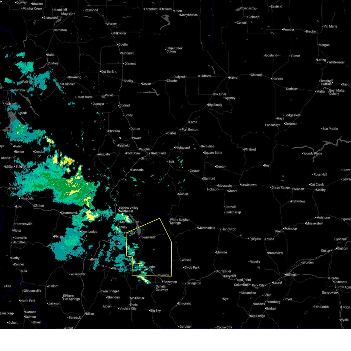
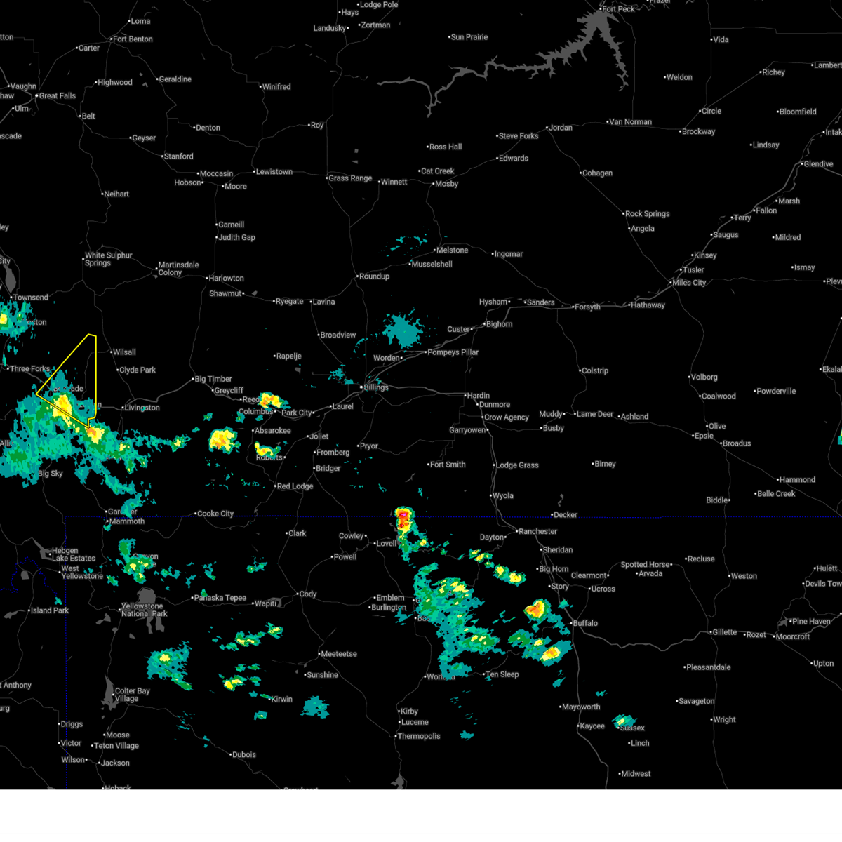
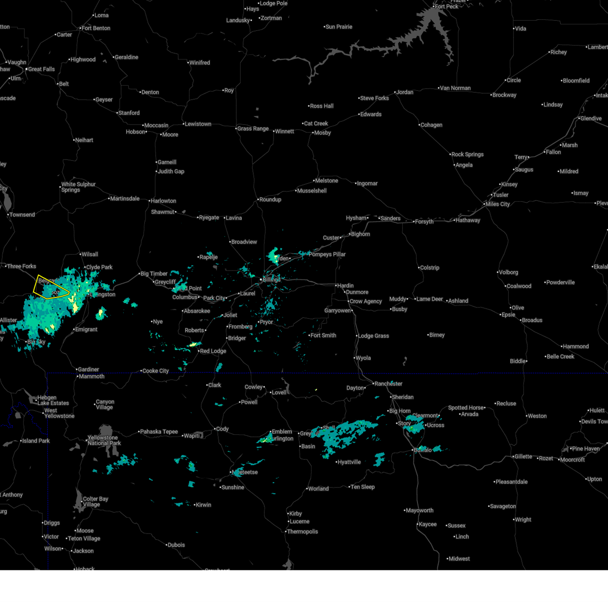
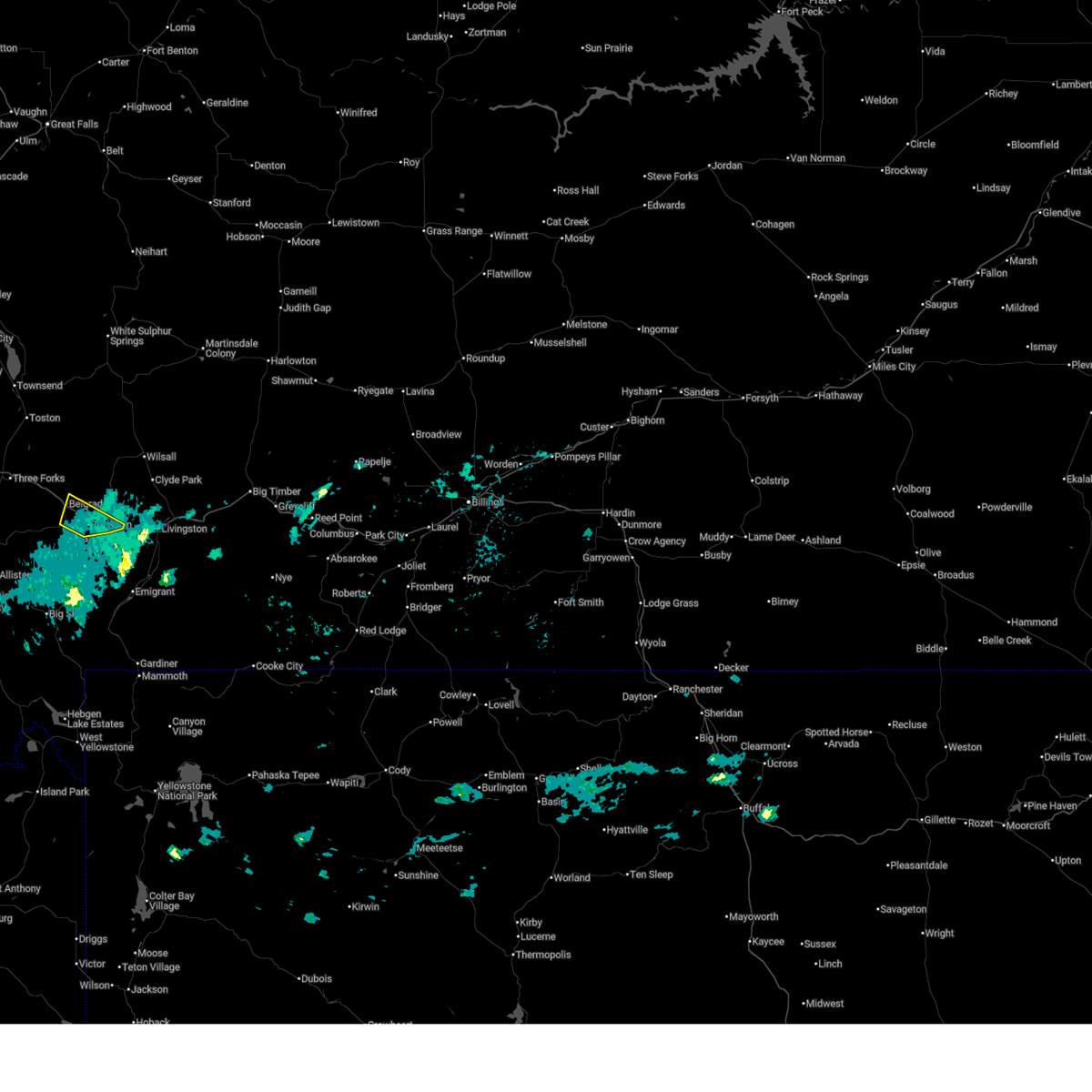
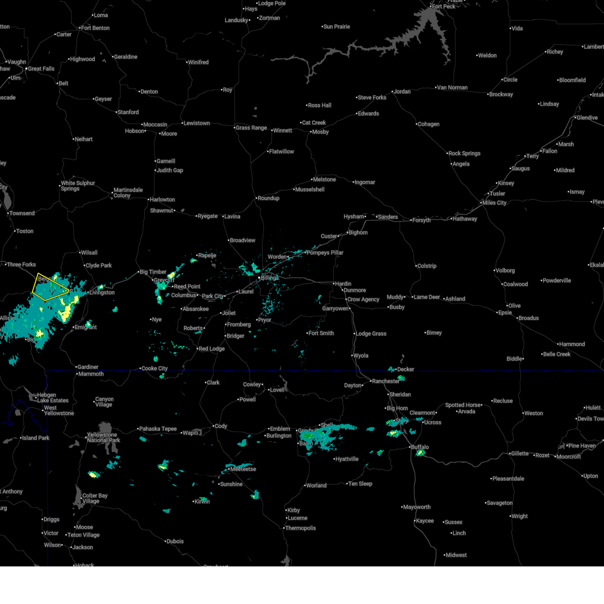
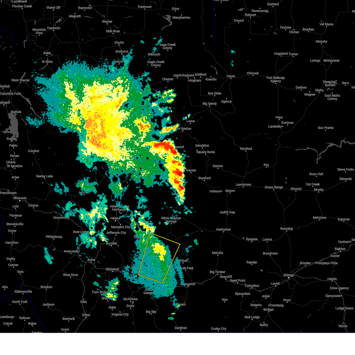
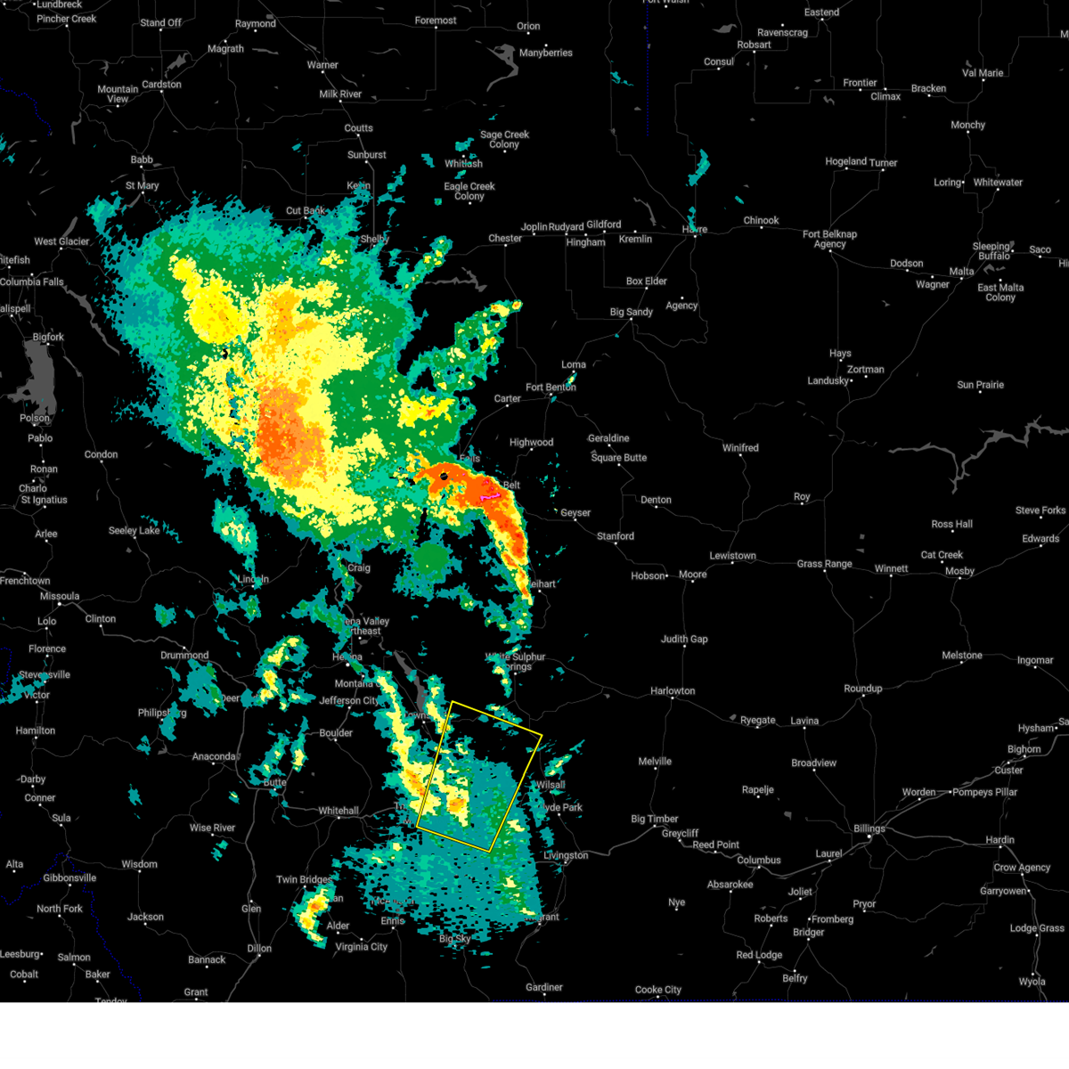
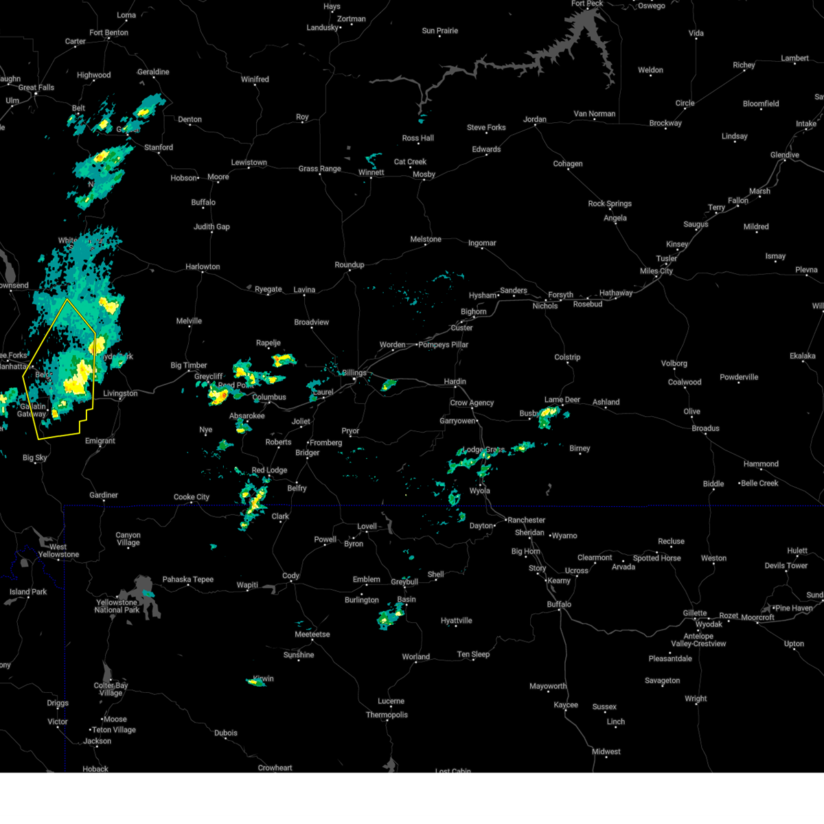
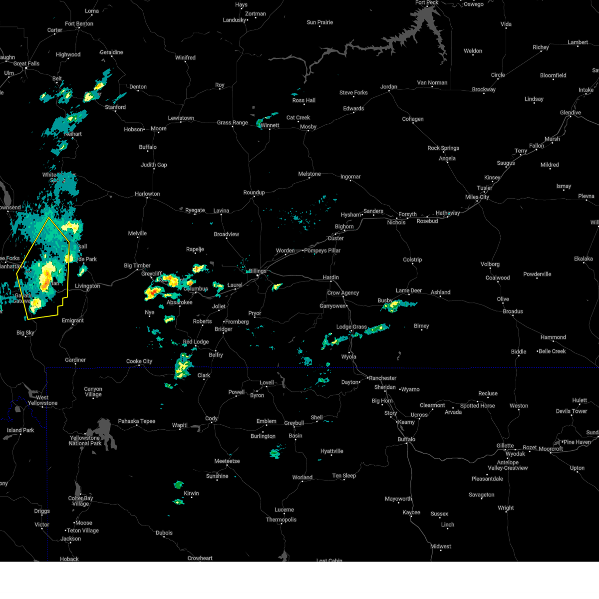
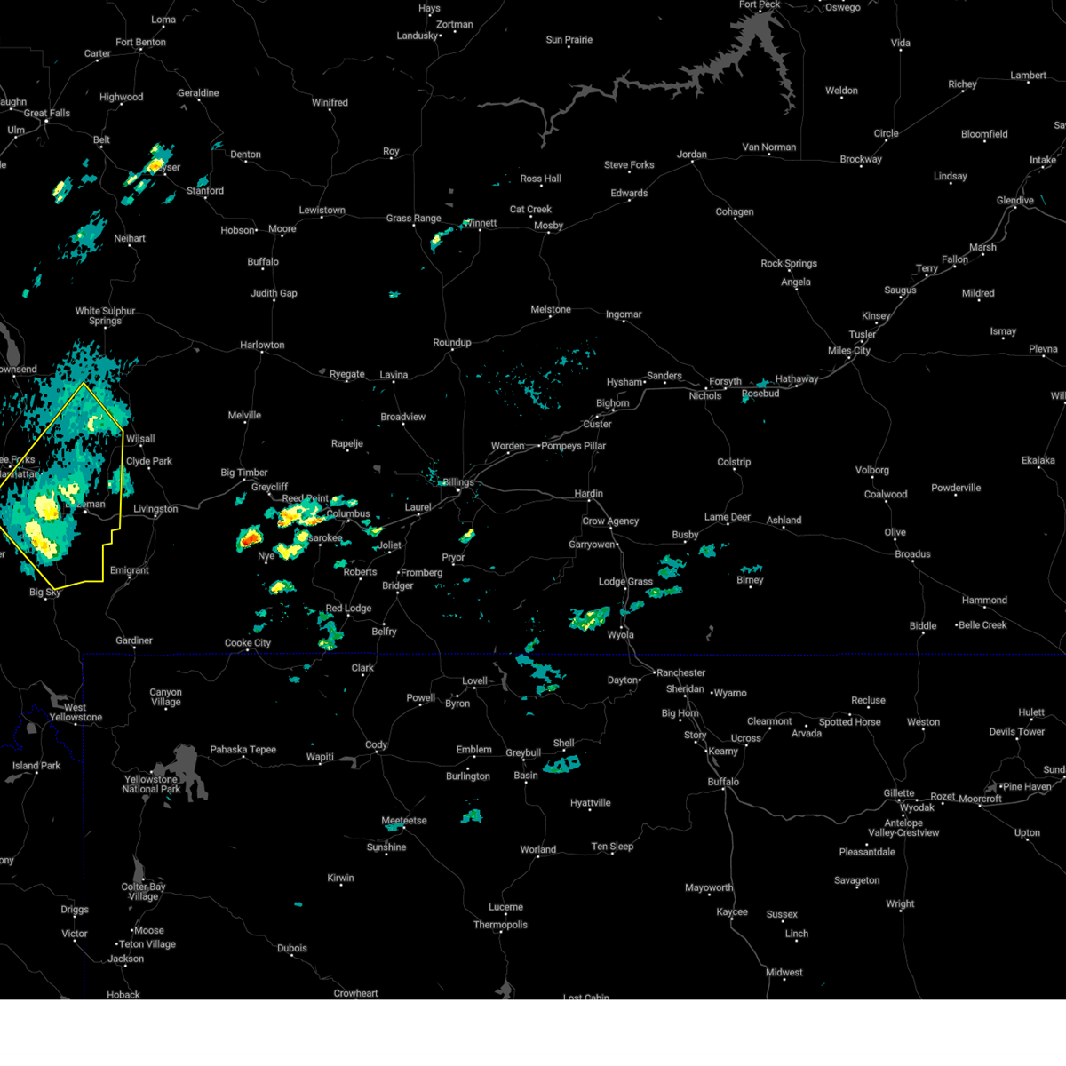
Hail Map for Belgrade, MT
The Belgrade, MT area has had 3 reports of on-the-ground hail by trained spotters, and has been under severe weather warnings 6 times during the past 12 months. Doppler radar has detected hail at or near Belgrade, MT on 12 occasions.
| Name: | Belgrade, MT |
| Where Located: | 9.9 miles NW of Bozeman, MT |
| Map: | Google Map for Belgrade, MT |
| Population: | 7389 |
| Housing Units: | 3174 |
| More Info: | Search Google for Belgrade, MT |
0
The Top Recent Hail Date for Belgrade, MT is Monday, August 19, 2024 (6th out of 12)

Hail and Wind Damage Spotted near Belgrade, MT
| Date / Time | Report Details |
|---|---|
| 11/24/2025 12:09 PM MST | Asos station kbzn bozeman yellowstone airpor in gallatin county MT, 0.3 miles W of Belgrade, MT |
| 9/14/2025 8:15 PM MDT | At 815 pm mdt, severe thunderstorms were located along a line extending from near townsend to 6 miles east of toston to manhattan, moving east at 30 mph (radar indicated). Hazards include 60 mph wind gusts. Expect damage to roofs, siding, and trees. Locations impacted include, townsend, belgrade, manhattan, toston, logan, maudlow, silos, trident, menard, madison buffalo jump state park, and missouri headwaters state park. |
| 9/14/2025 7:53 PM MDT |
 Svrtfx the national weather service in great falls has issued a * severe thunderstorm warning for, broadwater county in southwestern montana, south central meagher county in central montana, northern gallatin county in south central montana, * until 845 pm mdt. * at 753 pm mdt, severe thunderstorms were located along a line extending from 8 miles west of townsend to near toston to near three forks, moving east at 30 mph (radar indicated). Hazards include 60 mph wind gusts. expect damage to roofs, siding, and trees Svrtfx the national weather service in great falls has issued a * severe thunderstorm warning for, broadwater county in southwestern montana, south central meagher county in central montana, northern gallatin county in south central montana, * until 845 pm mdt. * at 753 pm mdt, severe thunderstorms were located along a line extending from 8 miles west of townsend to near toston to near three forks, moving east at 30 mph (radar indicated). Hazards include 60 mph wind gusts. expect damage to roofs, siding, and trees
|
| 7/1/2025 5:56 PM MDT | Asos station kbzn bozeman yellowstone airpor in gallatin county MT, 0.3 miles W of Belgrade, MT |
| 7/1/2025 5:49 PM MDT | Asos station kbzn bozeman yellowstone airpor in gallatin county MT, 0.3 miles W of Belgrade, MT |
| 7/1/2025 5:38 PM MDT |
 Svrtfx the national weather service in great falls has issued a * severe thunderstorm warning for, northeastern gallatin county in south central montana, * until 615 pm mdt. * at 538 pm mdt, a severe thunderstorm was located near bozeman, moving northeast at 55 mph (radar indicated). Hazards include 60 mph wind gusts. expect damage to roofs, siding, and trees Svrtfx the national weather service in great falls has issued a * severe thunderstorm warning for, northeastern gallatin county in south central montana, * until 615 pm mdt. * at 538 pm mdt, a severe thunderstorm was located near bozeman, moving northeast at 55 mph (radar indicated). Hazards include 60 mph wind gusts. expect damage to roofs, siding, and trees
|
| 7/1/2025 5:33 PM MDT | Asos station kbzn bozeman yellowstone airpor in gallatin county MT, 0.3 miles W of Belgrade, MT |
| 6/19/2025 4:05 PM MDT |
 The storm which prompted the warning has weakened below severe limits, and no longer poses an immediate threat to life or property. therefore, the warning will be allowed to expire. The storm which prompted the warning has weakened below severe limits, and no longer poses an immediate threat to life or property. therefore, the warning will be allowed to expire.
|
| 6/19/2025 3:59 PM MDT |
 At 359 pm mdt, a severe thunderstorm was located over bozeman, moving northeast at 15 mph (radar indicated). Hazards include 60 mph wind gusts. Expect damage to roofs, siding, and trees. Locations impacted include, bozeman, belgrade, and four corners. At 359 pm mdt, a severe thunderstorm was located over bozeman, moving northeast at 15 mph (radar indicated). Hazards include 60 mph wind gusts. Expect damage to roofs, siding, and trees. Locations impacted include, bozeman, belgrade, and four corners.
|
| 6/19/2025 3:48 PM MDT |
 Svrtfx the national weather service in great falls has issued a * severe thunderstorm warning for, northeastern gallatin county in south central montana, * until 415 pm mdt. * at 347 pm mdt, a severe thunderstorm was located near bozeman, moving northeast at 15 mph (radar indicated). Hazards include 60 mph wind gusts. expect damage to roofs, siding, and trees Svrtfx the national weather service in great falls has issued a * severe thunderstorm warning for, northeastern gallatin county in south central montana, * until 415 pm mdt. * at 347 pm mdt, a severe thunderstorm was located near bozeman, moving northeast at 15 mph (radar indicated). Hazards include 60 mph wind gusts. expect damage to roofs, siding, and trees
|
| 9/11/2024 7:56 PM MDT |
 The storm which prompted the warning has weakened below severe limits, and no longer poses an immediate threat to life or property. therefore, the warning will be allowed to expire. however, gusty winds to 50 mph are still possible with this thunderstorm. The storm which prompted the warning has weakened below severe limits, and no longer poses an immediate threat to life or property. therefore, the warning will be allowed to expire. however, gusty winds to 50 mph are still possible with this thunderstorm.
|
| 9/11/2024 7:30 PM MDT |
 Svrtfx the national weather service in great falls has issued a * severe thunderstorm warning for, southeastern broadwater county in southwestern montana, south central meagher county in central montana, northeastern gallatin county in south central montana, * until 800 pm mdt. * at 730 pm mdt, a severe thunderstorm was located 11 miles northeast of manhattan, or 22 miles north of bozeman, moving northeast at 40 mph (radar indicated). Hazards include 70 mph wind gusts. Expect considerable tree damage. Damage is likely to mobile homes, roofs, and outbuildings. Svrtfx the national weather service in great falls has issued a * severe thunderstorm warning for, southeastern broadwater county in southwestern montana, south central meagher county in central montana, northeastern gallatin county in south central montana, * until 800 pm mdt. * at 730 pm mdt, a severe thunderstorm was located 11 miles northeast of manhattan, or 22 miles north of bozeman, moving northeast at 40 mph (radar indicated). Hazards include 70 mph wind gusts. Expect considerable tree damage. Damage is likely to mobile homes, roofs, and outbuildings.
|
| 9/11/2024 7:23 PM MDT | Asos station kbzn bozeman yellowstone airport. also reported blowing dus in gallatin county MT, 0.3 miles W of Belgrade, MT |
| 9/2/2024 6:00 PM MDT | Asos station kbzn bozeman yellowstone airpor in gallatin county MT, 0.3 miles W of Belgrade, MT |
| 8/20/2024 4:45 PM MDT | Quarter sized hail reported 8.6 miles SE of Belgrade, MT, delayed report. public report of wheat fields damaged by quarter size hail. time/location estimated. |
| 8/20/2024 4:28 PM MDT |
 The storm which prompted the warning has weakened below severe limits, and has exited the warned area. therefore, the warning will be allowed to expire. however, small hail and gusty winds are still possible with this thunderstorm. a severe thunderstorm watch remains in effect until 1000 pm mdt for south central, central and southwestern montana. The storm which prompted the warning has weakened below severe limits, and has exited the warned area. therefore, the warning will be allowed to expire. however, small hail and gusty winds are still possible with this thunderstorm. a severe thunderstorm watch remains in effect until 1000 pm mdt for south central, central and southwestern montana.
|
| 8/20/2024 4:22 PM MDT |
 At 420 pm mdt, a severe thunderstorm was located 7 miles northeast of bozeman, moving northeast at 60 mph (60mph winds reported on the east side of bozeman). Hazards include 60 mph wind gusts. Expect damage to roofs, siding, and trees. Locations impacted include, bozeman, belgrade, manhattan, amsterdam, four corners, bozeman hot springs, gallatin gateway, church hill, and menard. At 420 pm mdt, a severe thunderstorm was located 7 miles northeast of bozeman, moving northeast at 60 mph (60mph winds reported on the east side of bozeman). Hazards include 60 mph wind gusts. Expect damage to roofs, siding, and trees. Locations impacted include, bozeman, belgrade, manhattan, amsterdam, four corners, bozeman hot springs, gallatin gateway, church hill, and menard.
|
| 8/20/2024 4:05 PM MDT |
 Svrtfx the national weather service in great falls has issued a * severe thunderstorm warning for, southeastern broadwater county in southwestern montana, southern meagher county in central montana, northeastern madison county in southwestern montana, gallatin county in south central montana, * until 430 pm mdt. * at 404 pm mdt, a severe thunderstorm was located 2 miles southwest of belgrade, or 5 miles west of bozeman, moving northeast at 60 mph (55 mph wind gust at the bozeman airport). Hazards include 60 mph wind gusts and penny size hail. expect damage to roofs, siding, and trees Svrtfx the national weather service in great falls has issued a * severe thunderstorm warning for, southeastern broadwater county in southwestern montana, southern meagher county in central montana, northeastern madison county in southwestern montana, gallatin county in south central montana, * until 430 pm mdt. * at 404 pm mdt, a severe thunderstorm was located 2 miles southwest of belgrade, or 5 miles west of bozeman, moving northeast at 60 mph (55 mph wind gust at the bozeman airport). Hazards include 60 mph wind gusts and penny size hail. expect damage to roofs, siding, and trees
|
| 8/19/2024 5:05 PM MDT |
 The storm which prompted the warning has weakened below severe limits, and no longer poses an immediate threat to life or property. therefore, the warning will be allowed to expire. however, small hail and gusty winds are still possible with this thunderstorm. a severe thunderstorm watch remains in effect until 1000 pm mdt for south central montana. The storm which prompted the warning has weakened below severe limits, and no longer poses an immediate threat to life or property. therefore, the warning will be allowed to expire. however, small hail and gusty winds are still possible with this thunderstorm. a severe thunderstorm watch remains in effect until 1000 pm mdt for south central montana.
|
| 8/19/2024 4:35 PM MDT |
 Svrtfx the national weather service in great falls has issued a * severe thunderstorm warning for, northeastern gallatin county in south central montana, * until 515 pm mdt. * at 435 pm mdt, a severe thunderstorm was located near manhattan, or 16 miles northwest of bozeman, moving northeast at 10 mph (radar indicated). Hazards include 60 mph wind gusts and quarter size hail. Hail damage to vehicles is expected. Expect wind damage to roofs, siding, and trees. Svrtfx the national weather service in great falls has issued a * severe thunderstorm warning for, northeastern gallatin county in south central montana, * until 515 pm mdt. * at 435 pm mdt, a severe thunderstorm was located near manhattan, or 16 miles northwest of bozeman, moving northeast at 10 mph (radar indicated). Hazards include 60 mph wind gusts and quarter size hail. Hail damage to vehicles is expected. Expect wind damage to roofs, siding, and trees.
|
| 7/25/2024 5:36 PM MDT |
 The storm which prompted the warning has weakened below severe limits, and no longer poses an immediate threat to life or property. therefore, the warning will be allowed to expire. The storm which prompted the warning has weakened below severe limits, and no longer poses an immediate threat to life or property. therefore, the warning will be allowed to expire.
|
| 7/25/2024 5:22 PM MDT |
 At 522 pm mdt, a second severe thunderstorm was located 10 miles southwest of bozeman, moving east at 35 mph (radar indicated). Hazards include 60 mph wind gusts and quarter size hail. Hail damage to vehicles is expected. expect wind damage to roofs, siding, and trees. Locations impacted include, bozeman, belgrade, gallatin gateway, four corners, and bozeman hot springs. At 522 pm mdt, a second severe thunderstorm was located 10 miles southwest of bozeman, moving east at 35 mph (radar indicated). Hazards include 60 mph wind gusts and quarter size hail. Hail damage to vehicles is expected. expect wind damage to roofs, siding, and trees. Locations impacted include, bozeman, belgrade, gallatin gateway, four corners, and bozeman hot springs.
|
| 7/25/2024 4:52 PM MDT |
 Svrtfx the national weather service in great falls has issued a * severe thunderstorm warning for, northeastern gallatin county in south central montana, * until 545 pm mdt. * at 452 pm mdt, a severe thunderstorm was located near bozeman, moving northeast at 25 mph (trained weather spotters). Hazards include 60 mph wind gusts and quarter size hail. Hail damage to vehicles is expected. Expect wind damage to roofs, siding, and trees. Svrtfx the national weather service in great falls has issued a * severe thunderstorm warning for, northeastern gallatin county in south central montana, * until 545 pm mdt. * at 452 pm mdt, a severe thunderstorm was located near bozeman, moving northeast at 25 mph (trained weather spotters). Hazards include 60 mph wind gusts and quarter size hail. Hail damage to vehicles is expected. Expect wind damage to roofs, siding, and trees.
|
| 6/30/2024 3:47 PM MDT |
 Svrtfx the national weather service in great falls has issued a * severe thunderstorm warning for, northeastern gallatin county in south central montana, * until 430 pm mdt. * at 347 pm mdt, a severe thunderstorm was located over bozeman, moving east northeast at 35 mph (radar indicated). Hazards include quarter size hail. damage to vehicles is expected Svrtfx the national weather service in great falls has issued a * severe thunderstorm warning for, northeastern gallatin county in south central montana, * until 430 pm mdt. * at 347 pm mdt, a severe thunderstorm was located over bozeman, moving east northeast at 35 mph (radar indicated). Hazards include quarter size hail. damage to vehicles is expected
|
| 8/29/2023 9:26 PM MDT |
 The severe thunderstorm warning for northeastern gallatin county will expire at 930 pm mdt, the storms which prompted the warning have mostly moved out of the area. therefore, the warning will be allowed to expire. however gusty winds are still possible with these thunderstorms. remember, a severe thunderstorm warning still remains in effect for far northeast gallatin and far southern meagher counties until 10 pm mdt. The severe thunderstorm warning for northeastern gallatin county will expire at 930 pm mdt, the storms which prompted the warning have mostly moved out of the area. therefore, the warning will be allowed to expire. however gusty winds are still possible with these thunderstorms. remember, a severe thunderstorm warning still remains in effect for far northeast gallatin and far southern meagher counties until 10 pm mdt.
|
| 8/29/2023 9:08 PM MDT | Asos station kbzn bozeman yellowstone airpor in gallatin county MT, 0.3 miles W of Belgrade, MT |
| 8/29/2023 9:01 PM MDT |
 At 901 pm mdt, severe thunderstorms were located along a line extending from 11 miles southeast of toston to 11 miles south of bozeman, moving northeast at 60 mph (radar indicated). Hazards include 60 mph wind gusts. expect damage to roofs, siding, and trees At 901 pm mdt, severe thunderstorms were located along a line extending from 11 miles southeast of toston to 11 miles south of bozeman, moving northeast at 60 mph (radar indicated). Hazards include 60 mph wind gusts. expect damage to roofs, siding, and trees
|
| 8/29/2023 8:58 PM MDT | Second severe gust. asos station kbzn bozeman yellowstone airpor in gallatin county MT, 0.3 miles W of Belgrade, MT |
| 8/29/2023 8:52 PM MDT | Asos station kbzn bozeman yellowstone airpor in gallatin county MT, 0.3 miles W of Belgrade, MT |
| 5/25/2023 5:53 PM MDT |
 The severe thunderstorm warning for northeastern gallatin county will expire at 600 pm mdt, the storm which prompted the warning has weakened below severe limits, and has exited the warned area. therefore, the warning will be allowed to expire. however small hail, gusty winds and heavy rain are still possible with this thunderstorm as it moves northeast across far northeastern gallatin county. The severe thunderstorm warning for northeastern gallatin county will expire at 600 pm mdt, the storm which prompted the warning has weakened below severe limits, and has exited the warned area. therefore, the warning will be allowed to expire. however small hail, gusty winds and heavy rain are still possible with this thunderstorm as it moves northeast across far northeastern gallatin county.
|
| 5/25/2023 5:27 PM MDT |
 At 526 pm mdt, a severe thunderstorm was located near belgrade, or near bozeman, moving northeast at 20 mph (radar indicated). Hazards include 60 mph wind gusts and quarter size hail. Hail damage to vehicles is expected. Expect wind damage to roofs, siding, and trees. At 526 pm mdt, a severe thunderstorm was located near belgrade, or near bozeman, moving northeast at 20 mph (radar indicated). Hazards include 60 mph wind gusts and quarter size hail. Hail damage to vehicles is expected. Expect wind damage to roofs, siding, and trees.
|
| 8/24/2022 9:57 PM MDT | At 956 pm mdt, a severe thunderstorm was located 8 miles northeast of belgrade, or 12 miles north of bozeman, moving northeast at 30 mph (observed at the bozeman airport). Hazards include 60 mph wind gusts. expect damage to roofs, siding, and trees |
| 8/24/2022 9:56 PM MDT | Asos station kbzn bozeman yellowstone airpor in gallatin county MT, 0.3 miles W of Belgrade, MT |
| 7/13/2022 3:50 PM MDT |
 The severe thunderstorm warning for south central broadwater, southeastern jefferson and northern gallatin counties will expire at 400 pm mdt, the storm which prompted the warning has weakened below severe limits, and no longer poses an immediate threat to life or property. therefore, the warning will be allowed to expire. a severe thunderstorm watch remains in effect until 900 pm mdt for south central and southwestern montana. The severe thunderstorm warning for south central broadwater, southeastern jefferson and northern gallatin counties will expire at 400 pm mdt, the storm which prompted the warning has weakened below severe limits, and no longer poses an immediate threat to life or property. therefore, the warning will be allowed to expire. a severe thunderstorm watch remains in effect until 900 pm mdt for south central and southwestern montana.
|
| 7/13/2022 3:47 PM MDT |
 At 347 pm mdt, a severe thunderstorm was located over manhattan, or 20 miles northwest of bozeman, moving northeast at 25 mph (radar indicated). Hazards include 60 mph wind gusts. Expect damage to roofs, siding, and trees. locations impacted include, belgrade, three forks, manhattan, logan, amsterdam, trident, church hill, willow creek, menard, madison buffalo jump state park and missouri headwaters state park. hail threat, radar indicated max hail size, <. 75 in wind threat, radar indicated max wind gust, 60 mph. At 347 pm mdt, a severe thunderstorm was located over manhattan, or 20 miles northwest of bozeman, moving northeast at 25 mph (radar indicated). Hazards include 60 mph wind gusts. Expect damage to roofs, siding, and trees. locations impacted include, belgrade, three forks, manhattan, logan, amsterdam, trident, church hill, willow creek, menard, madison buffalo jump state park and missouri headwaters state park. hail threat, radar indicated max hail size, <. 75 in wind threat, radar indicated max wind gust, 60 mph.
|
| 7/13/2022 3:41 PM MDT |
 At 340 pm mdt, a severe thunderstorm was located near three forks, or 24 miles northwest of bozeman, moving northeast at 25 mph (radar indicated). Hazards include 60 mph wind gusts. Expect damage to roofs, siding, and trees. locations impacted include, belgrade, three forks, manhattan, logan, amsterdam, trident, church hill, willow creek, menard, madison buffalo jump state park and missouri headwaters state park. hail threat, radar indicated max hail size, <. 75 in wind threat, radar indicated max wind gust, 60 mph. At 340 pm mdt, a severe thunderstorm was located near three forks, or 24 miles northwest of bozeman, moving northeast at 25 mph (radar indicated). Hazards include 60 mph wind gusts. Expect damage to roofs, siding, and trees. locations impacted include, belgrade, three forks, manhattan, logan, amsterdam, trident, church hill, willow creek, menard, madison buffalo jump state park and missouri headwaters state park. hail threat, radar indicated max hail size, <. 75 in wind threat, radar indicated max wind gust, 60 mph.
|
| 7/13/2022 3:34 PM MDT |
 At 334 pm mdt, a severe thunderstorm was located near three forks, or 24 miles northwest of bozeman, moving northeast at 25 mph (radar indicated). Hazards include 60 mph wind gusts. Expect damage to roofs, siding, and trees. locations impacted include, belgrade, three forks, manhattan, logan, amsterdam, trident, church hill, willow creek, menard, madison buffalo jump state park and missouri headwaters state park. hail threat, radar indicated max hail size, <. 75 in wind threat, radar indicated max wind gust, 60 mph. At 334 pm mdt, a severe thunderstorm was located near three forks, or 24 miles northwest of bozeman, moving northeast at 25 mph (radar indicated). Hazards include 60 mph wind gusts. Expect damage to roofs, siding, and trees. locations impacted include, belgrade, three forks, manhattan, logan, amsterdam, trident, church hill, willow creek, menard, madison buffalo jump state park and missouri headwaters state park. hail threat, radar indicated max hail size, <. 75 in wind threat, radar indicated max wind gust, 60 mph.
|
| 7/13/2022 3:21 PM MDT |
 At 320 pm mdt, a severe thunderstorm was located near three forks, or 26 miles west of bozeman, moving northeast at 15 mph (radar indicated). Hazards include 60 mph wind gusts and nickel size hail. expect damage to roofs, siding, and trees At 320 pm mdt, a severe thunderstorm was located near three forks, or 26 miles west of bozeman, moving northeast at 15 mph (radar indicated). Hazards include 60 mph wind gusts and nickel size hail. expect damage to roofs, siding, and trees
|
| 8/30/2021 5:16 PM MDT | Gust came from convective clouds with no lightning observed. ktfx/kblx radars showed only 20 to 25 dbz echoe in gallatin county MT, 1.1 miles SW of Belgrade, MT |
| 8/8/2021 5:04 PM MDT |
 At 501 pm mdt, sporadic areas of severe wind gusts continue across the warned area. many locations within the warned area have reported wind gusts of 50 to 55 mph over the last 30 minutes. a few gusts to around 60 mph are likely (trained weather spotters). Hazards include 60 mph wind gusts. Expect damage to roofs, siding, and trees. locations impacted include, bozeman, dillon, sheridan, virginia city, belgrade, three forks, manhattan, ennis, lima, pony, alder, harrison, dell, bannack pass, cameron, missouri headwaters state park, snowline, maudlow, four corners and amsterdam. hail threat, radar indicated max hail size, <. 75 in wind threat, radar indicated max wind gust, 60 mph. At 501 pm mdt, sporadic areas of severe wind gusts continue across the warned area. many locations within the warned area have reported wind gusts of 50 to 55 mph over the last 30 minutes. a few gusts to around 60 mph are likely (trained weather spotters). Hazards include 60 mph wind gusts. Expect damage to roofs, siding, and trees. locations impacted include, bozeman, dillon, sheridan, virginia city, belgrade, three forks, manhattan, ennis, lima, pony, alder, harrison, dell, bannack pass, cameron, missouri headwaters state park, snowline, maudlow, four corners and amsterdam. hail threat, radar indicated max hail size, <. 75 in wind threat, radar indicated max wind gust, 60 mph.
|
| 8/8/2021 4:29 PM MDT |
 At 429 pm mdt, areas of severe wind gusts were located along a line extending from 11 miles southeast of toston to 6 miles north of leadore, moving northeast at 45 mph (radar indicated). Hazards include 60 mph wind gusts. expect damage to roofs, siding, and trees At 429 pm mdt, areas of severe wind gusts were located along a line extending from 11 miles southeast of toston to 6 miles north of leadore, moving northeast at 45 mph (radar indicated). Hazards include 60 mph wind gusts. expect damage to roofs, siding, and trees
|
| 7/22/2021 2:27 PM MDT | Asos station kbzn bozeman yellowstone airpor in gallatin county MT, 0.3 miles W of Belgrade, MT |
| 7/22/2021 2:16 PM MDT | Pictures submitted on social media of medium sized out building flipped upside down from strong wind. tree damage also reporte in gallatin county MT, 8.3 miles SW of Belgrade, MT |
| 7/22/2021 2:13 PM MDT |
 At 213 pm mdt, a severe thunderstorm was located over belgrade, or 9 miles northwest of bozeman, moving northeast at 30 mph (radar indicated). Hazards include 70 mph wind gusts and penny size hail. Expect considerable tree damage. Damage is likely to mobile homes, roofs, and outbuildings. At 213 pm mdt, a severe thunderstorm was located over belgrade, or 9 miles northwest of bozeman, moving northeast at 30 mph (radar indicated). Hazards include 70 mph wind gusts and penny size hail. Expect considerable tree damage. Damage is likely to mobile homes, roofs, and outbuildings.
|
| 7/22/2021 2:12 PM MDT | Corrects previous tstm wnd gst report from belgrade. asos station kbzn bozeman yellowstone airpor in gallatin county MT, 0.3 miles W of Belgrade, MT |
| 7/7/2021 4:34 PM MDT | Also reported pea size hai in gallatin county MT, 8.3 miles SW of Belgrade, MT |
| 7/7/2021 4:30 PM MDT |
 At 430 pm mdt, a severe thunderstorm was located near belgrade, or 12 miles northwest of bozeman, moving northeast at 25 mph (radar indicated). Hazards include 60 mph wind gusts and penny size hail. expect damage to roofs, siding, and trees At 430 pm mdt, a severe thunderstorm was located near belgrade, or 12 miles northwest of bozeman, moving northeast at 25 mph (radar indicated). Hazards include 60 mph wind gusts and penny size hail. expect damage to roofs, siding, and trees
|
| 7/7/2021 4:25 PM MDT | Measured at kbz in gallatin county MT, 1.5 miles WNW of Belgrade, MT |
| 7/4/2021 6:26 PM MDT |
 At 626 pm mdt, a severe thunderstorm was located near bozeman, moving east at 55 mph (radar indicated). Hazards include 60 mph wind gusts. expect damage to roofs, siding, and trees At 626 pm mdt, a severe thunderstorm was located near bozeman, moving east at 55 mph (radar indicated). Hazards include 60 mph wind gusts. expect damage to roofs, siding, and trees
|
| 7/4/2021 6:19 PM MDT | Storm damage reported in gallatin county MT, 1.1 miles SW of Belgrade, MT |
| 6/4/2021 9:30 PM MDT |
 At 930 pm mdt, a severe thunderstorm was located near belgrade, or 14 miles northwest of bozeman, moving east at 35 mph (radar indicated). Hazards include 60 mph wind gusts and half dollar size hail. Hail damage to vehicles is expected. Expect wind damage to roofs, siding, and trees. At 930 pm mdt, a severe thunderstorm was located near belgrade, or 14 miles northwest of bozeman, moving east at 35 mph (radar indicated). Hazards include 60 mph wind gusts and half dollar size hail. Hail damage to vehicles is expected. Expect wind damage to roofs, siding, and trees.
|
| 5/7/2021 4:16 PM MDT | Asos station kbzn bozeman yellowstone airpor in gallatin county MT, 0.3 miles W of Belgrade, MT |
| 7/7/2020 1:54 PM MDT |
 The severe thunderstorm warning for northeastern gallatin county will expire at 200 pm mdt, the storm which prompted the warning has moved out of the area. therefore, the warning will be allowed to expire. a severe thunderstorm watch remains in effect until 900 pm mdt for south central montana. The severe thunderstorm warning for northeastern gallatin county will expire at 200 pm mdt, the storm which prompted the warning has moved out of the area. therefore, the warning will be allowed to expire. a severe thunderstorm watch remains in effect until 900 pm mdt for south central montana.
|
| 7/7/2020 1:27 PM MDT |
 At 126 pm mdt, a severe thunderstorm was located near bozeman, moving east at 40 mph (trained weather spotters). Hazards include 60 mph wind gusts and quarter size hail. Hail damage to vehicles is expected. Expect wind damage to roofs, siding, and trees. At 126 pm mdt, a severe thunderstorm was located near bozeman, moving east at 40 mph (trained weather spotters). Hazards include 60 mph wind gusts and quarter size hail. Hail damage to vehicles is expected. Expect wind damage to roofs, siding, and trees.
|
| 6/6/2020 6:43 PM MDT |
 At 642 pm mdt, a severe thunderstorm was located near belgrade, or near bozeman, moving east at 30 mph (radar indicated). Hazards include 60 mph wind gusts and penny size hail. expect damage to roofs, siding, and trees At 642 pm mdt, a severe thunderstorm was located near belgrade, or near bozeman, moving east at 30 mph (radar indicated). Hazards include 60 mph wind gusts and penny size hail. expect damage to roofs, siding, and trees
|
| 8/11/2019 3:42 PM MDT |
 The severe thunderstorm warning for southwestern broadwater, north central madison, northern gallatin and southeastern jefferson counties will expire at 345 pm mdt, the storms which prompted the warning have moved out of the area. therefore, the warning will be allowed to expire. a severe thunderstorm watch remains in effect until 700 pm mdt for south central and southwestern montana. The severe thunderstorm warning for southwestern broadwater, north central madison, northern gallatin and southeastern jefferson counties will expire at 345 pm mdt, the storms which prompted the warning have moved out of the area. therefore, the warning will be allowed to expire. a severe thunderstorm watch remains in effect until 700 pm mdt for south central and southwestern montana.
|
| 8/11/2019 3:41 PM MDT | Quarter sized hail reported 6.3 miles S of Belgrade, MT, size estimated off of a photo posted to kbzk. time was also estimated. |
| 8/11/2019 3:35 PM MDT | Ping Pong Ball sized hail reported 3.7 miles SE of Belgrade, MT, photos of hail between quarter and golf ball size on kbzk facebook page. time estimated from radar. |
| 8/11/2019 3:27 PM MDT |
 At 326 pm mdt, severe thunderstorms were located along a line extending from near three forks to 9 miles southwest of belgrade, moving east at 55 mph (radar indicated). Hazards include 60 mph wind gusts and nickel size hail. Expect damage to roofs, siding, and trees. Locations impacted include, belgrade, three forks, manhattan, toston, missouri headwaters state park, logan, lewis and clark caverns state park, amsterdam, trident, church hill, willow creek, menard and madison buffalo jump state park. At 326 pm mdt, severe thunderstorms were located along a line extending from near three forks to 9 miles southwest of belgrade, moving east at 55 mph (radar indicated). Hazards include 60 mph wind gusts and nickel size hail. Expect damage to roofs, siding, and trees. Locations impacted include, belgrade, three forks, manhattan, toston, missouri headwaters state park, logan, lewis and clark caverns state park, amsterdam, trident, church hill, willow creek, menard and madison buffalo jump state park.
|
| 8/11/2019 3:17 PM MDT |
 At 316 pm mdt, severe thunderstorms were located along a line extending from 6 miles north of harrison to 14 miles southwest of manhattan, moving northeast at 55 mph (radar indicated). Hazards include 60 mph wind gusts and quarter size hail. Hail damage to vehicles is expected. Expect wind damage to roofs, siding, and trees. At 316 pm mdt, severe thunderstorms were located along a line extending from 6 miles north of harrison to 14 miles southwest of manhattan, moving northeast at 55 mph (radar indicated). Hazards include 60 mph wind gusts and quarter size hail. Hail damage to vehicles is expected. Expect wind damage to roofs, siding, and trees.
|
| 7/5/2017 4:56 PM MDT | Peak wind gust at the bozeman airport (kbzn in gallatin county MT, 1.1 miles SW of Belgrade, MT |
| 4/4/2016 7:19 PM MDT | Storm damage reported in gallatin county MT, 2.1 miles SE of Belgrade, MT |
| 8/1/2013 5:10 PM MDT | Storm damage reported in gallatin county MT, 1.1 miles SW of Belgrade, MT |
| 7/12/2013 1:42 PM MDT | Wind gust was associated with a passing shower...no cloud-to-ground lightning was detected in gallatin county MT, 1.1 miles SW of Belgrade, MT |
| 4/23/2012 4:20 PM MDT | Storm damage reported in gallatin county MT, 1.1 miles SW of Belgrade, MT |
Hail Maps for Belgrade, MT


Connect with Interactive Hail Maps