

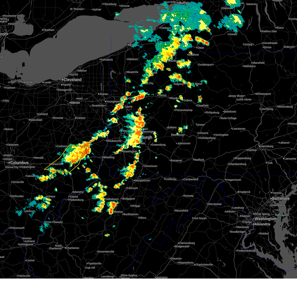
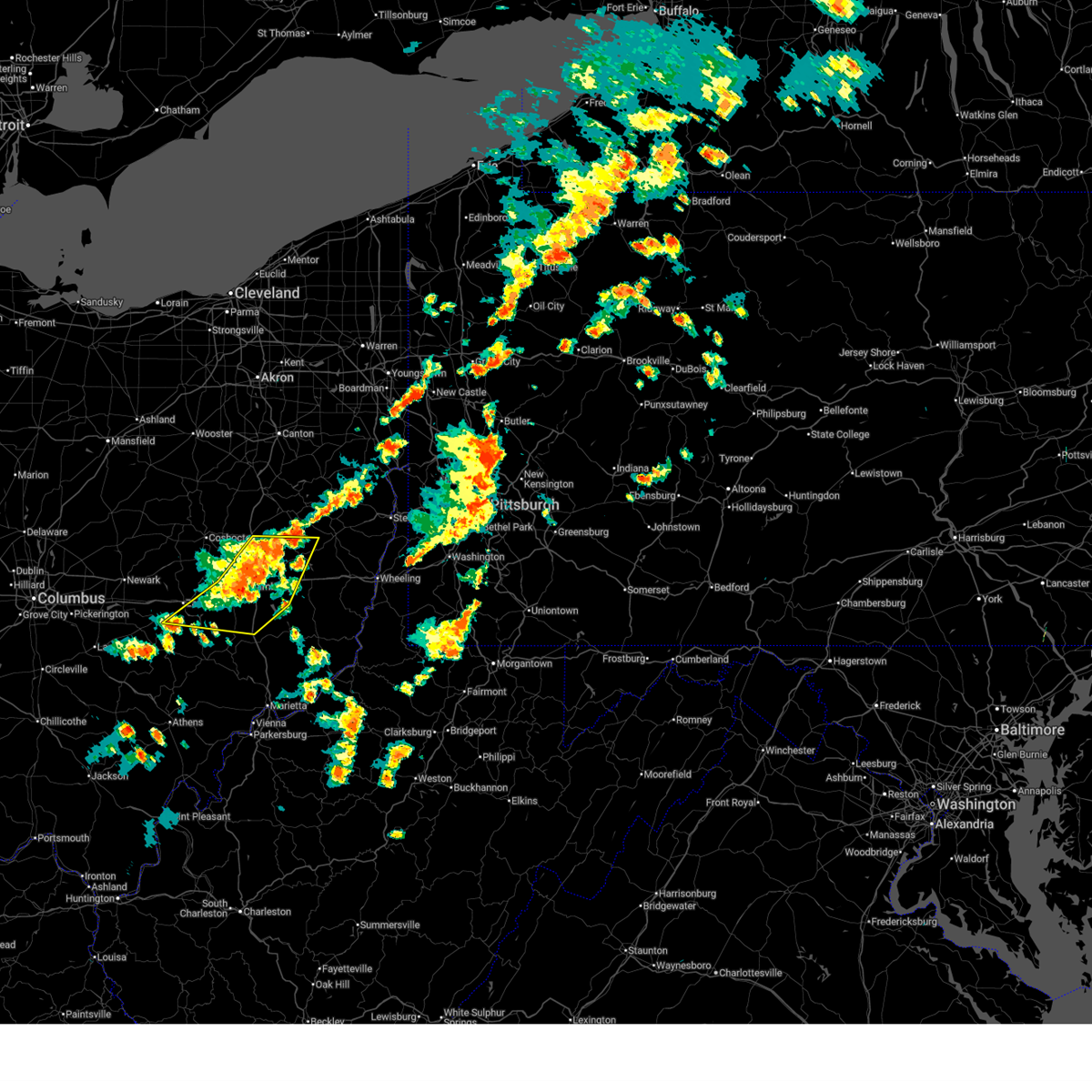
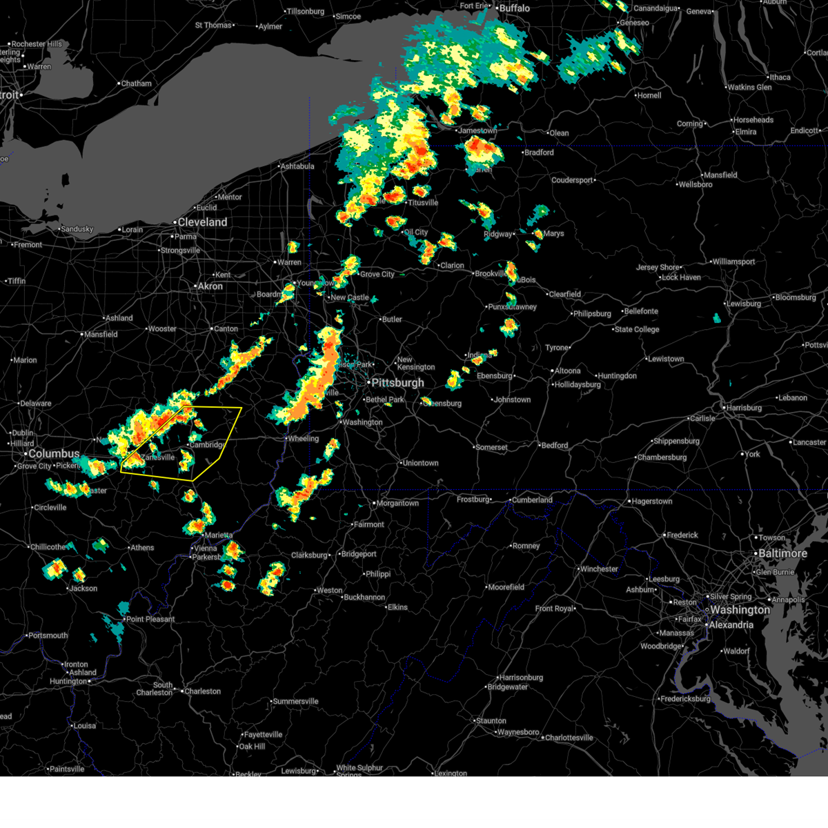
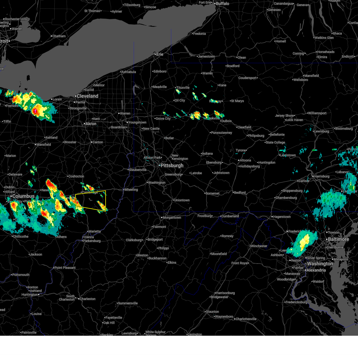
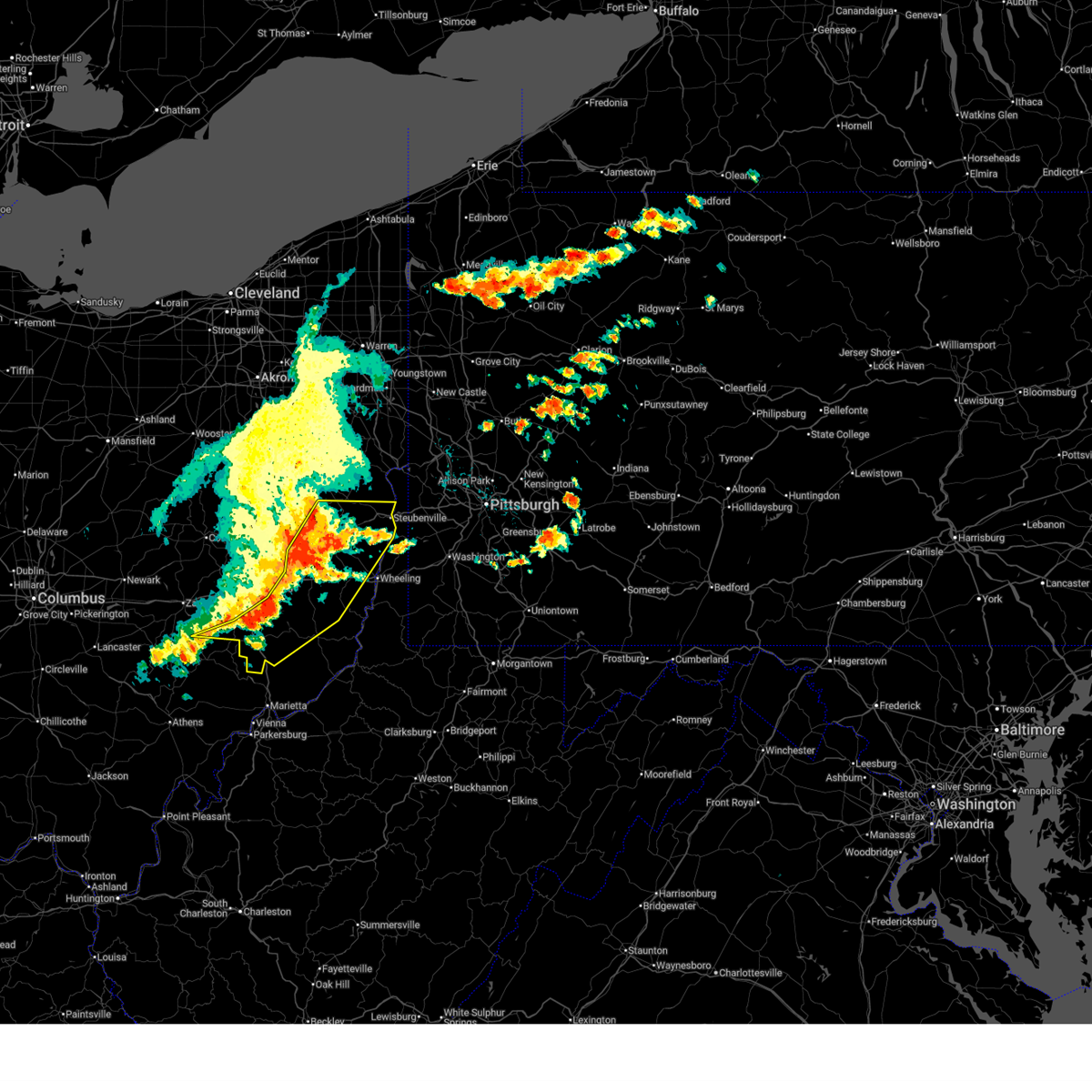
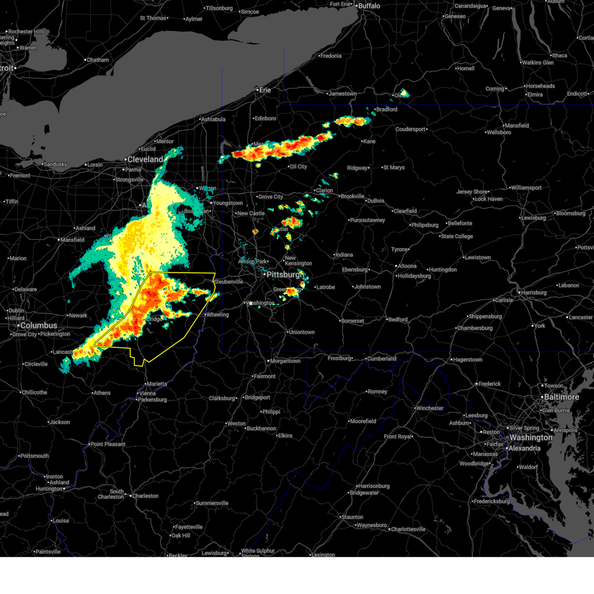
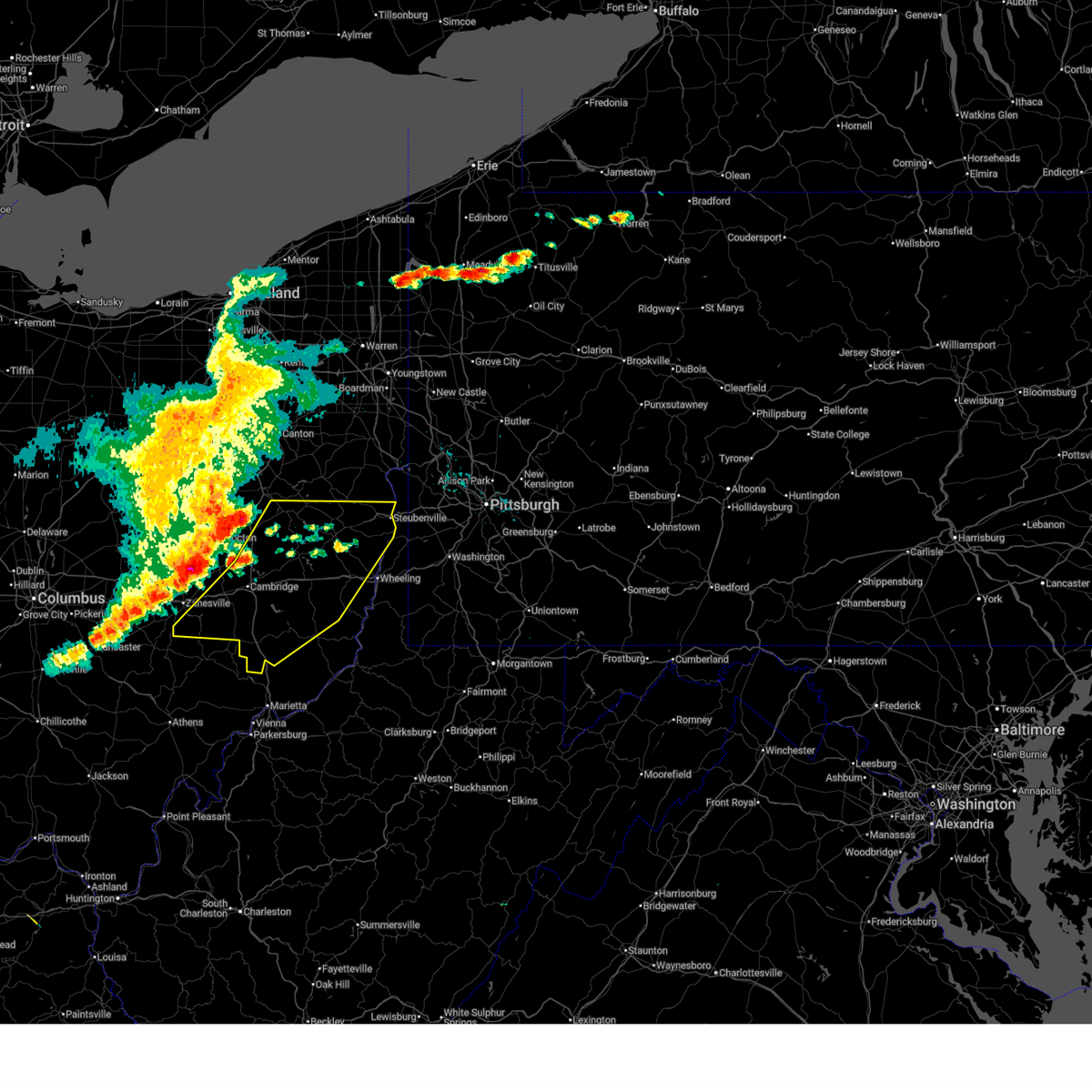
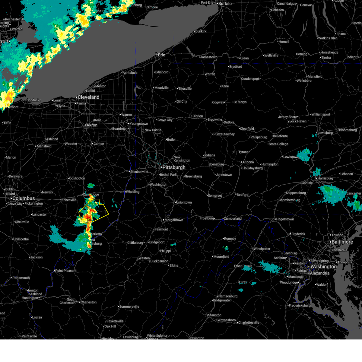
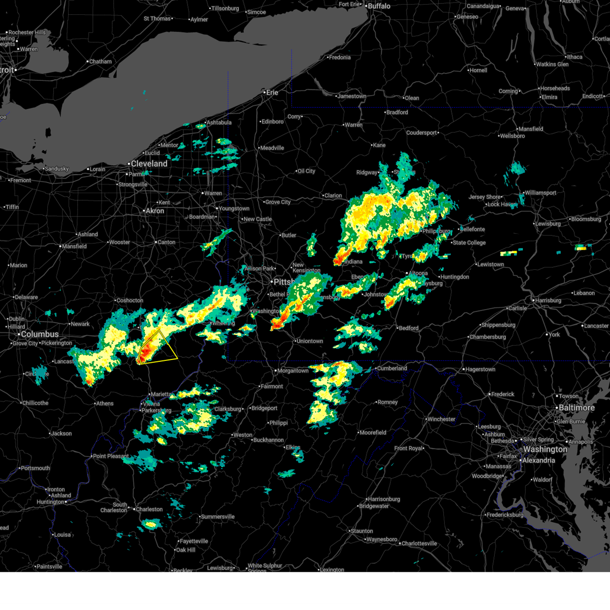
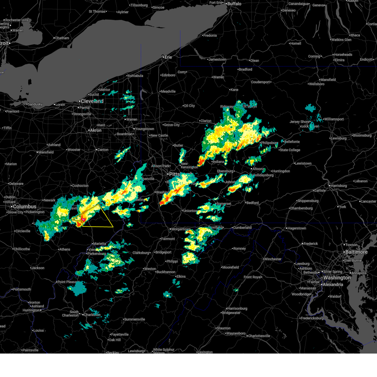
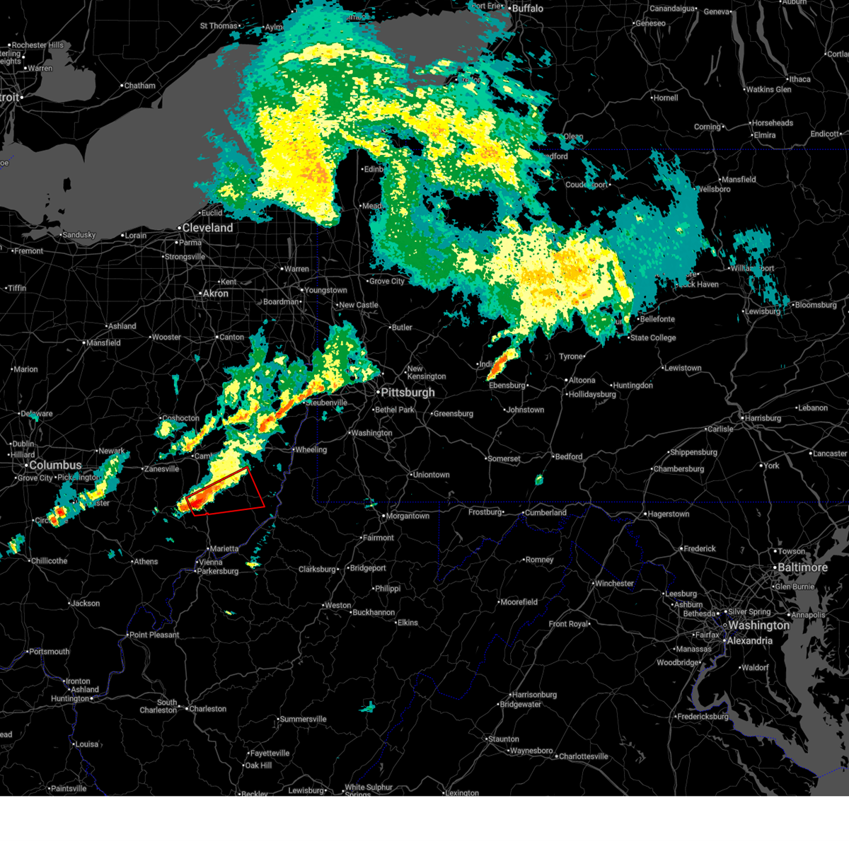
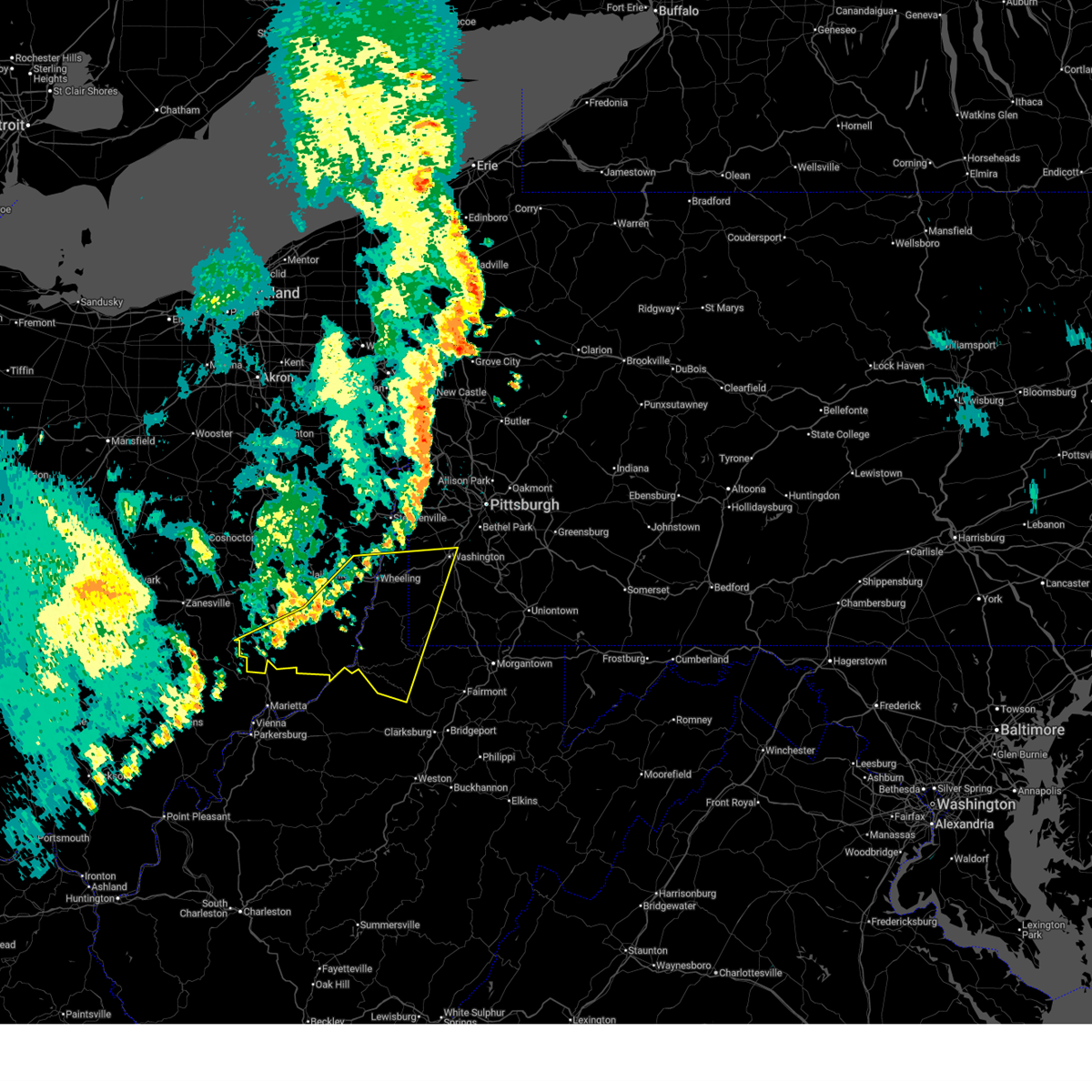
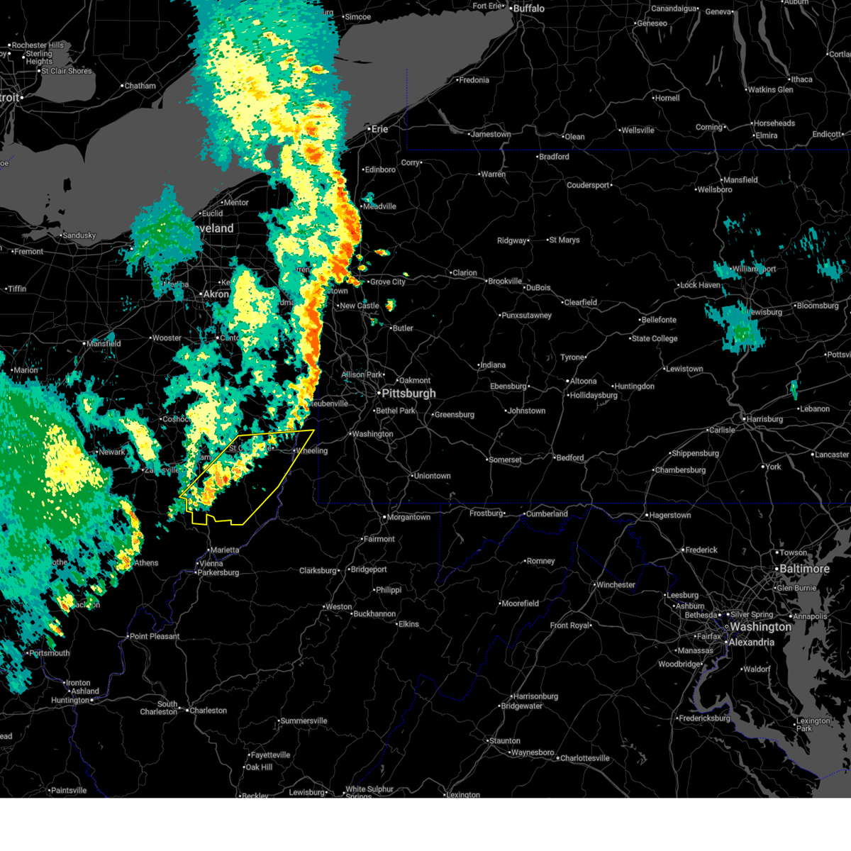
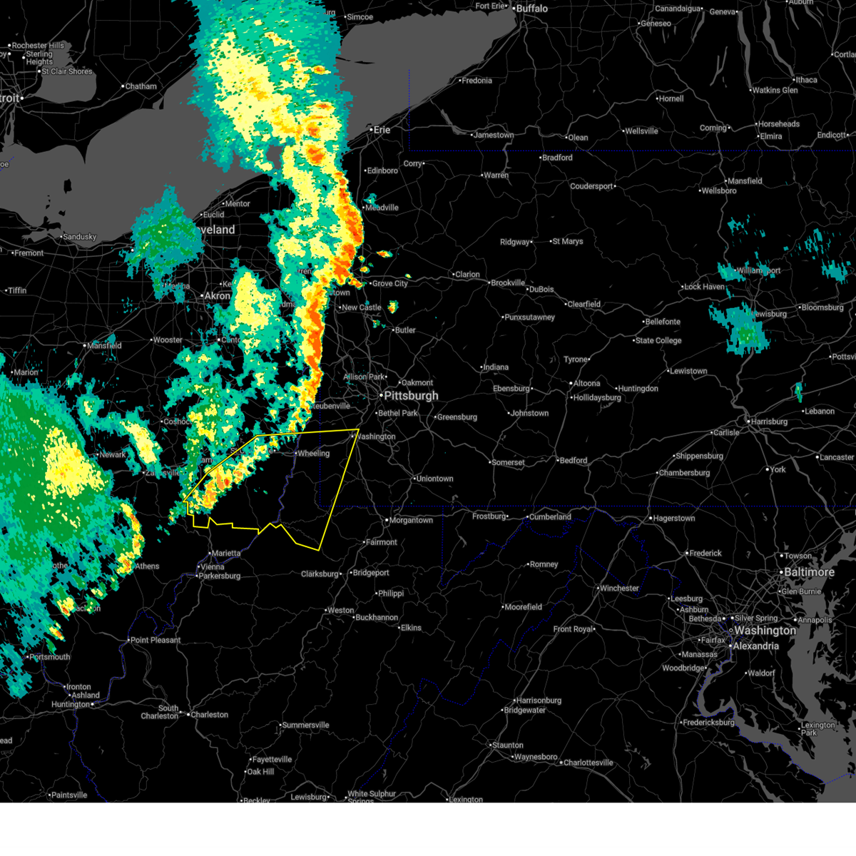
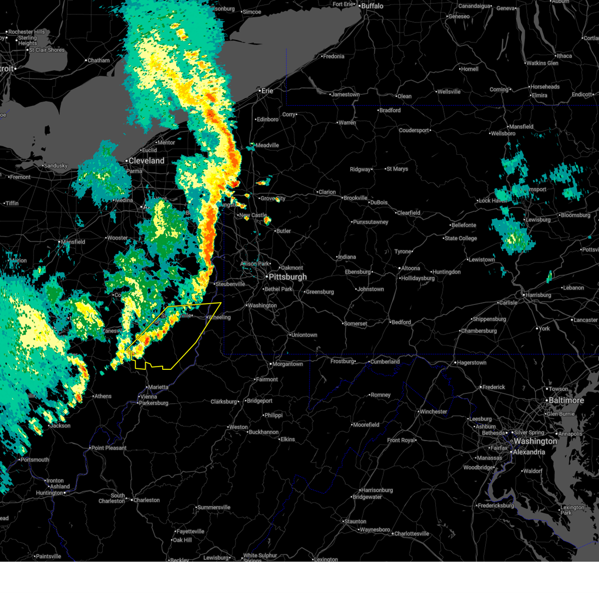
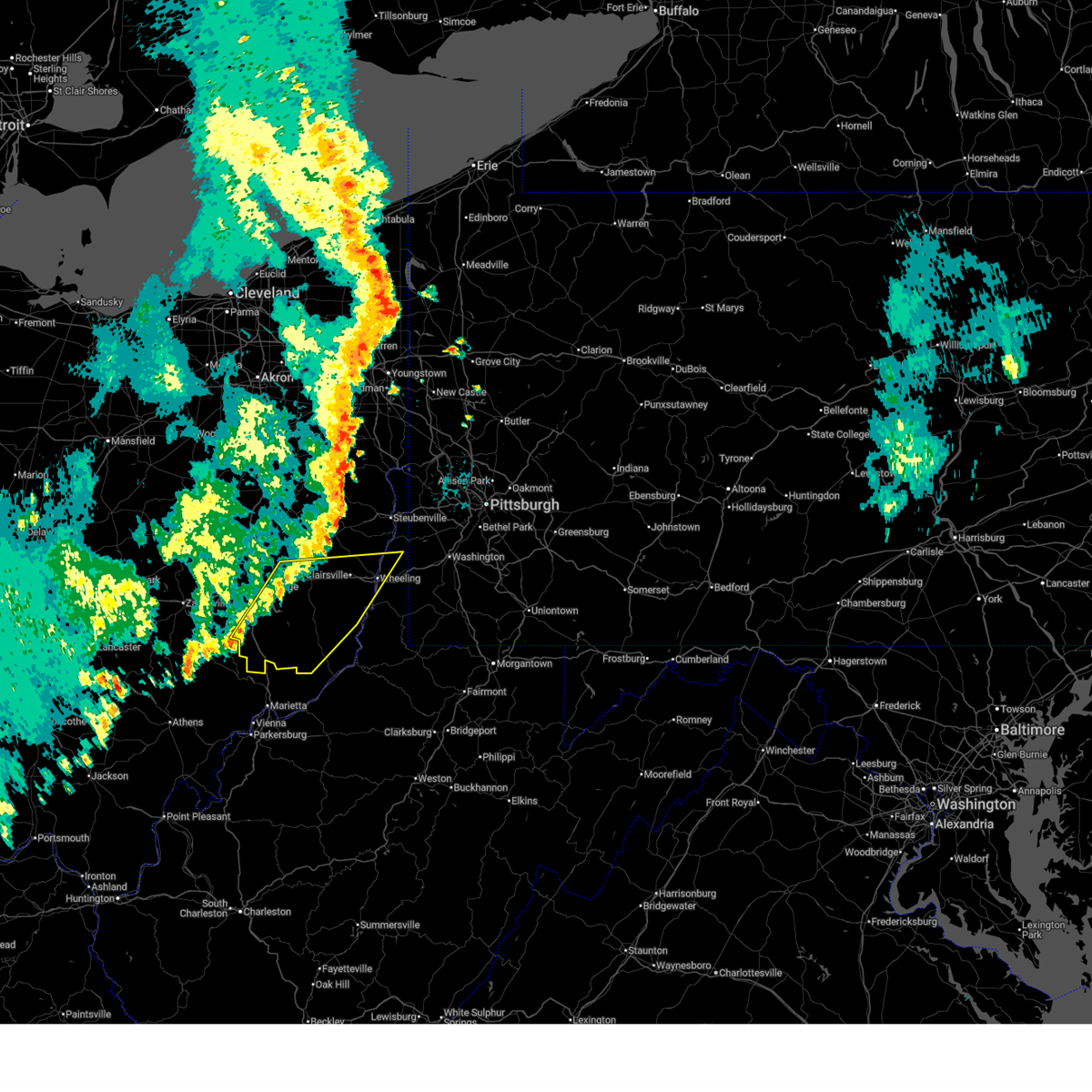
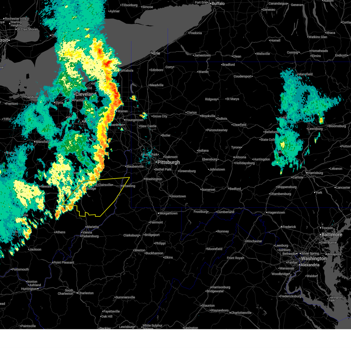
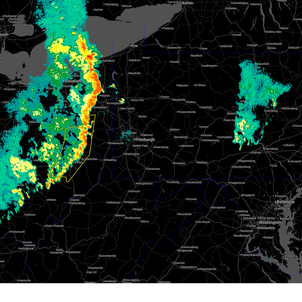
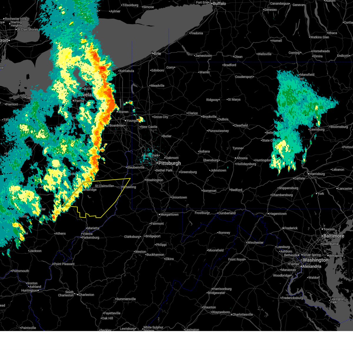
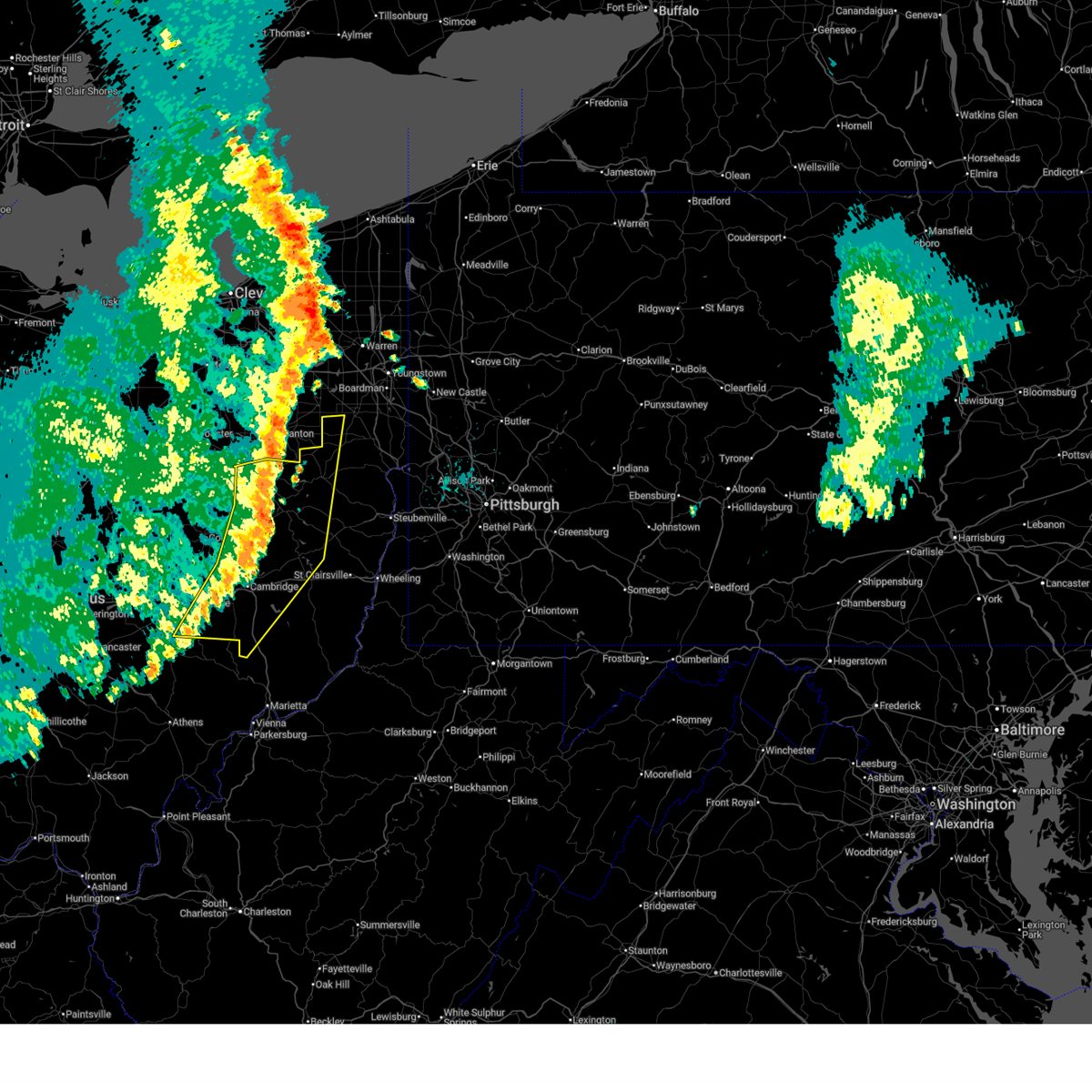
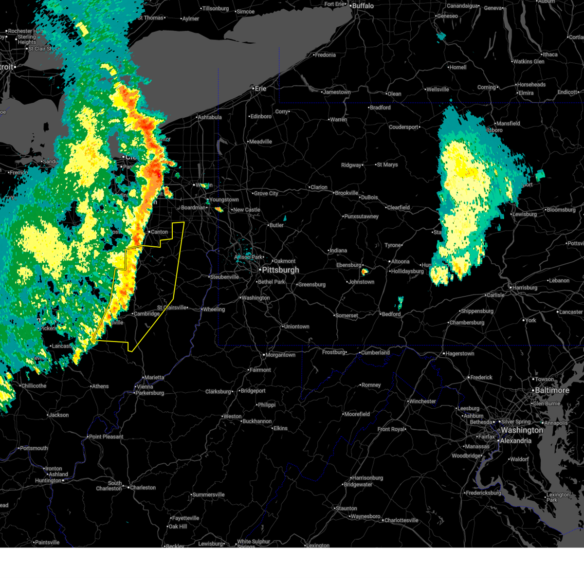
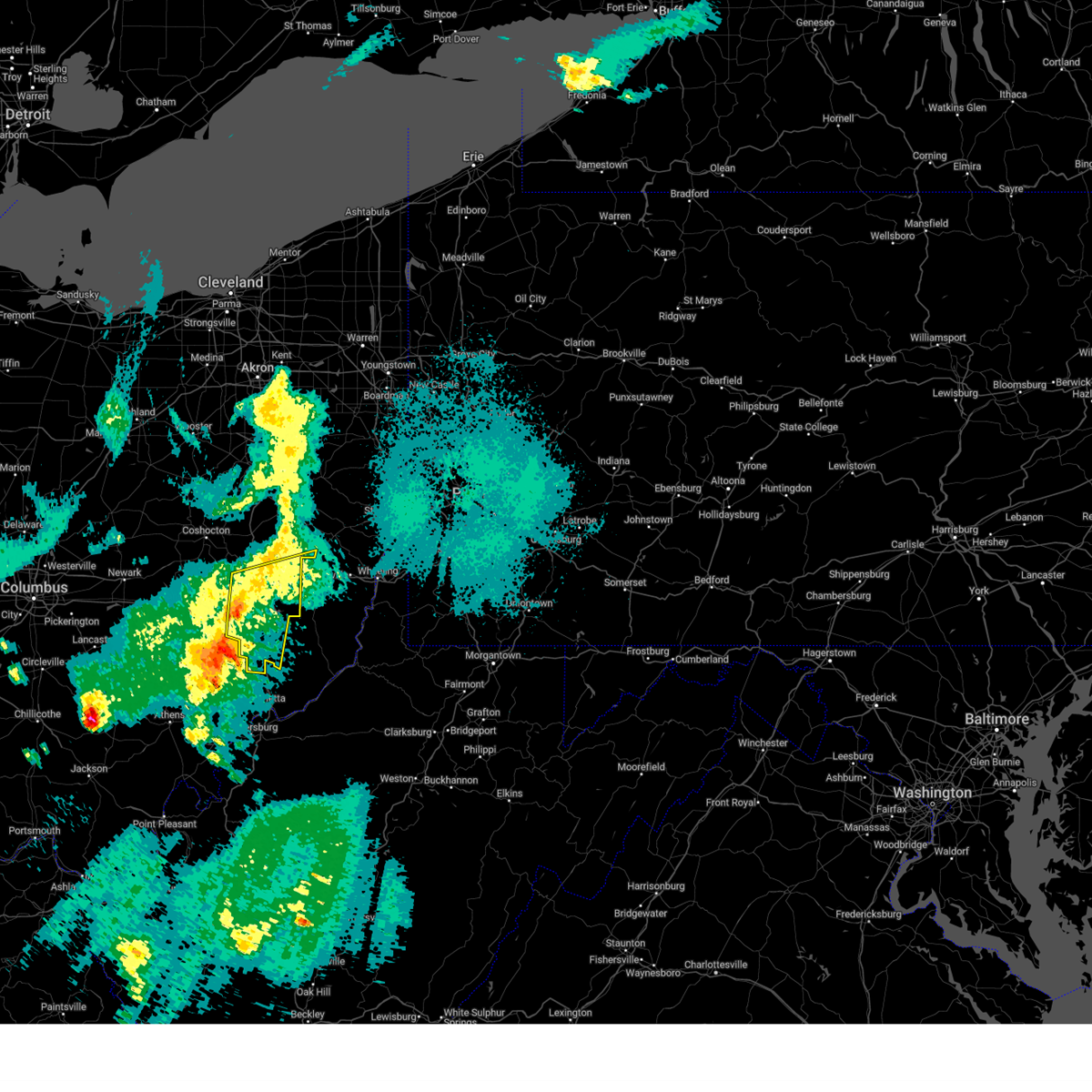
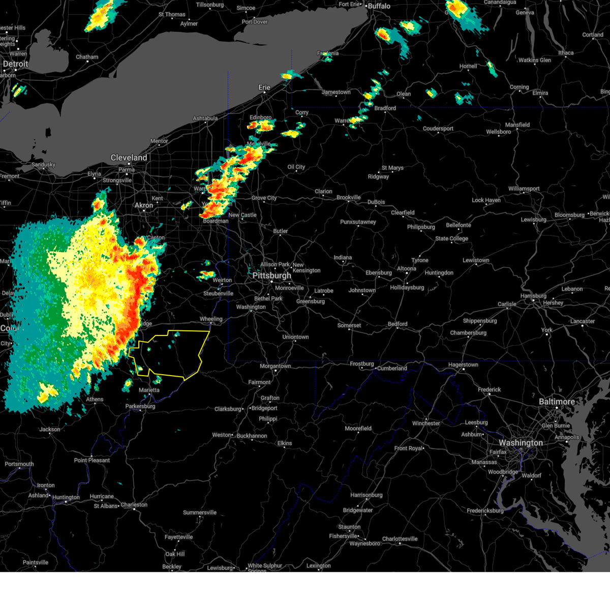
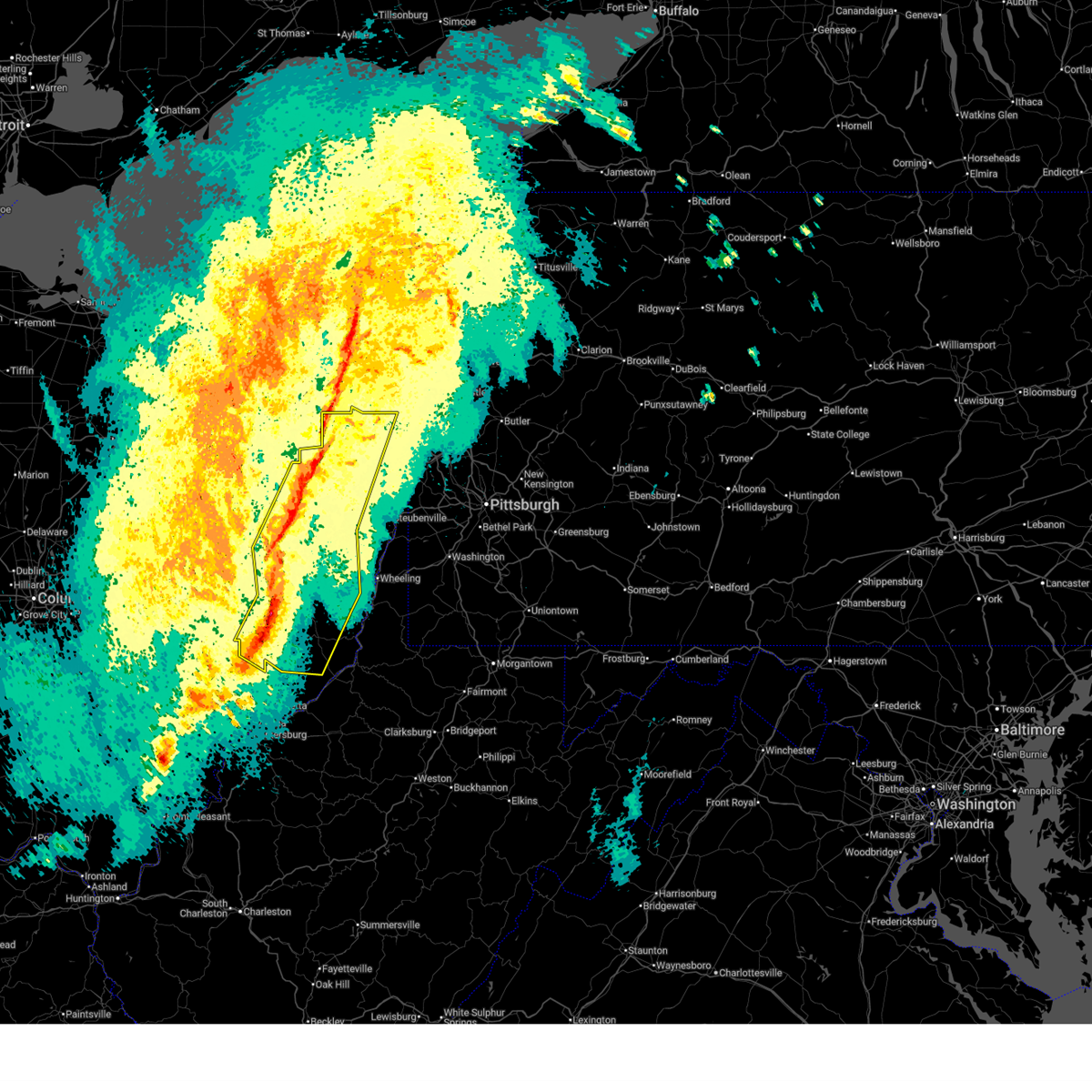
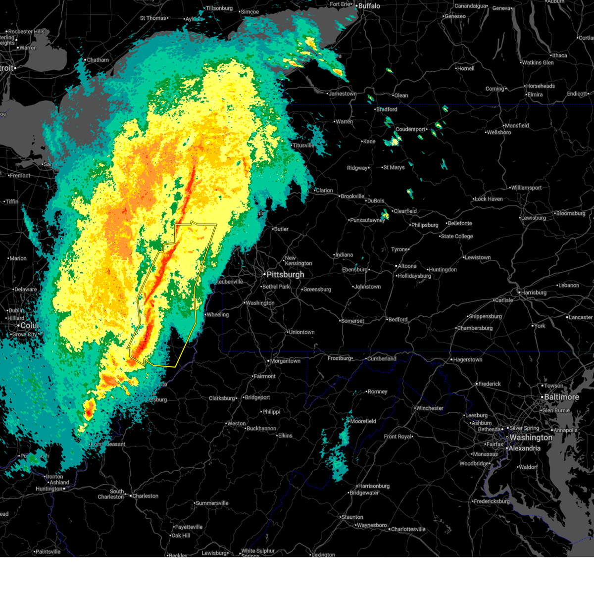
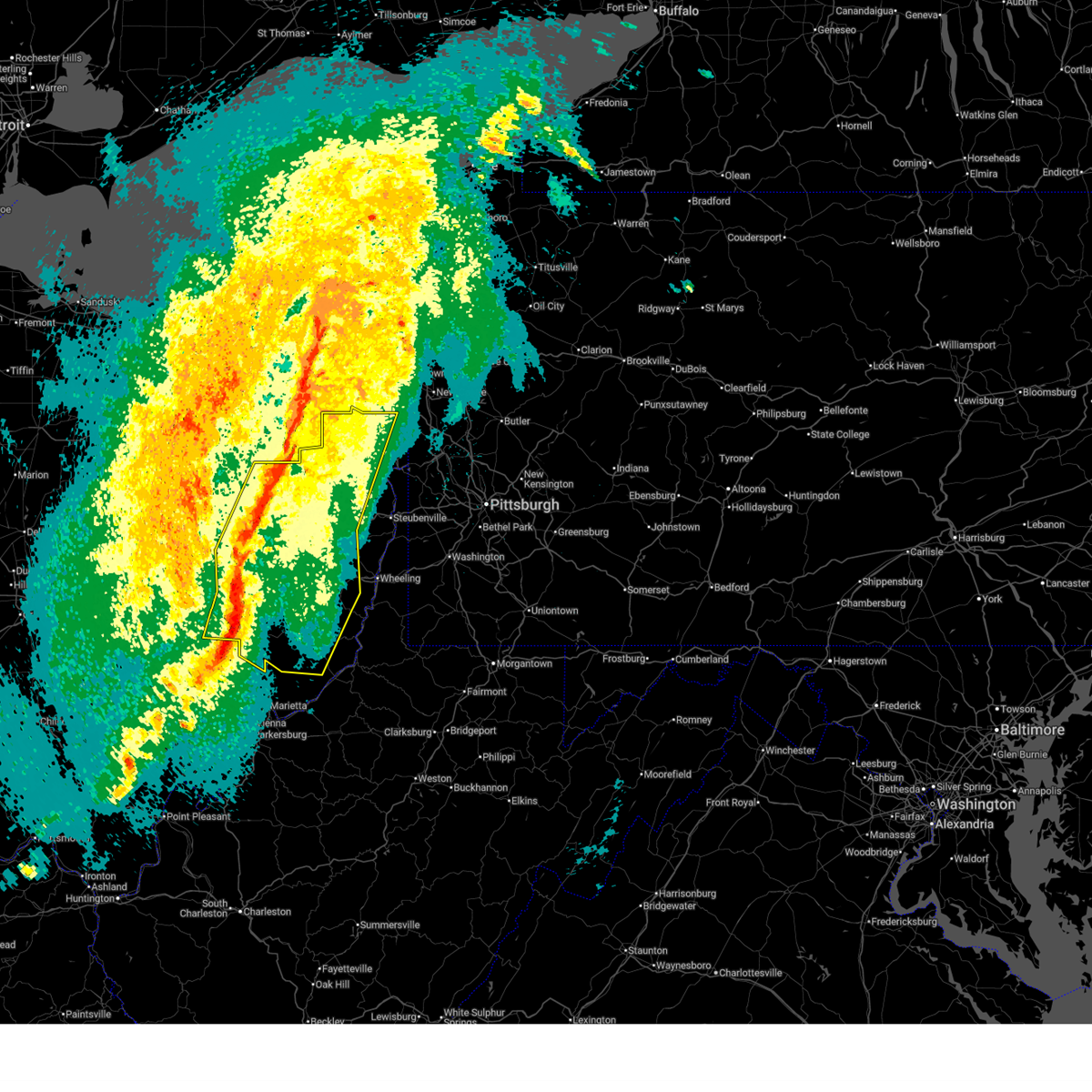
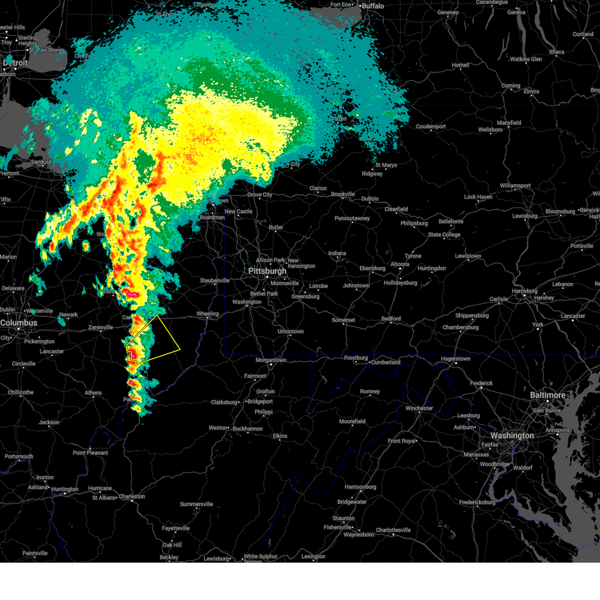
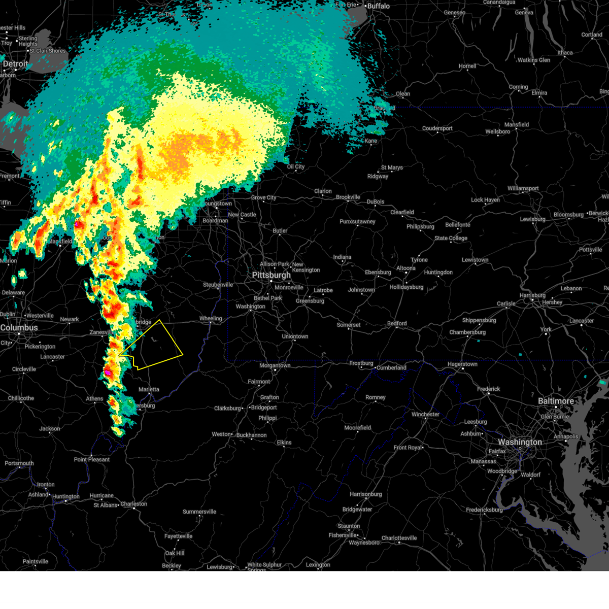
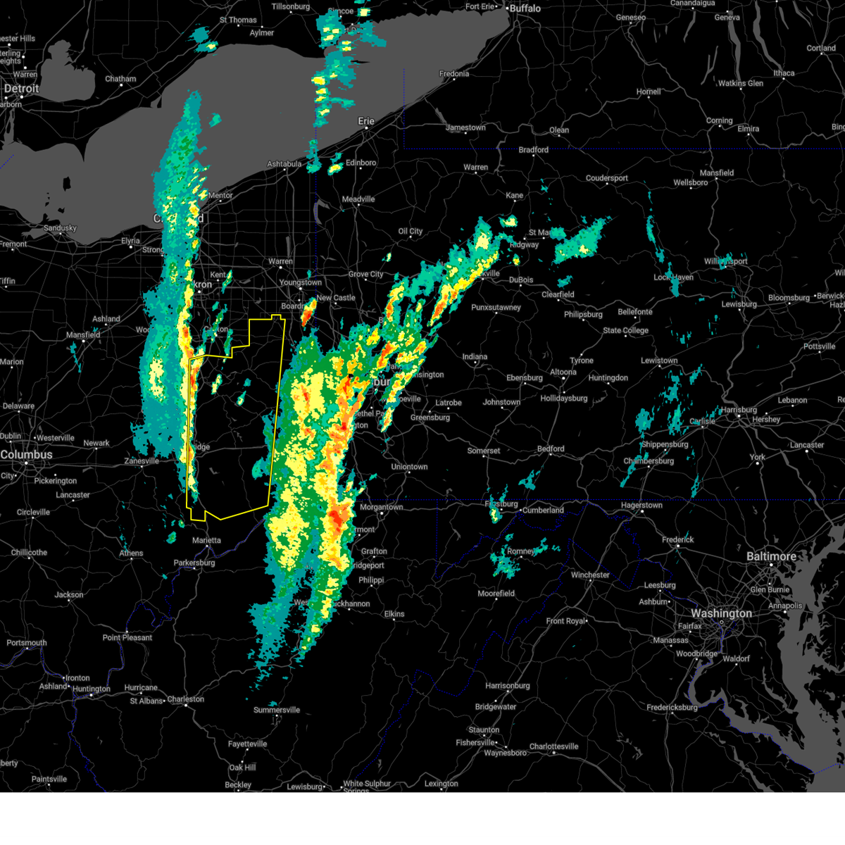
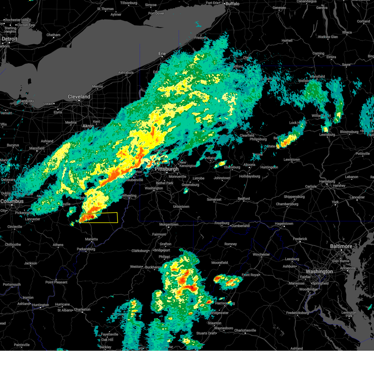
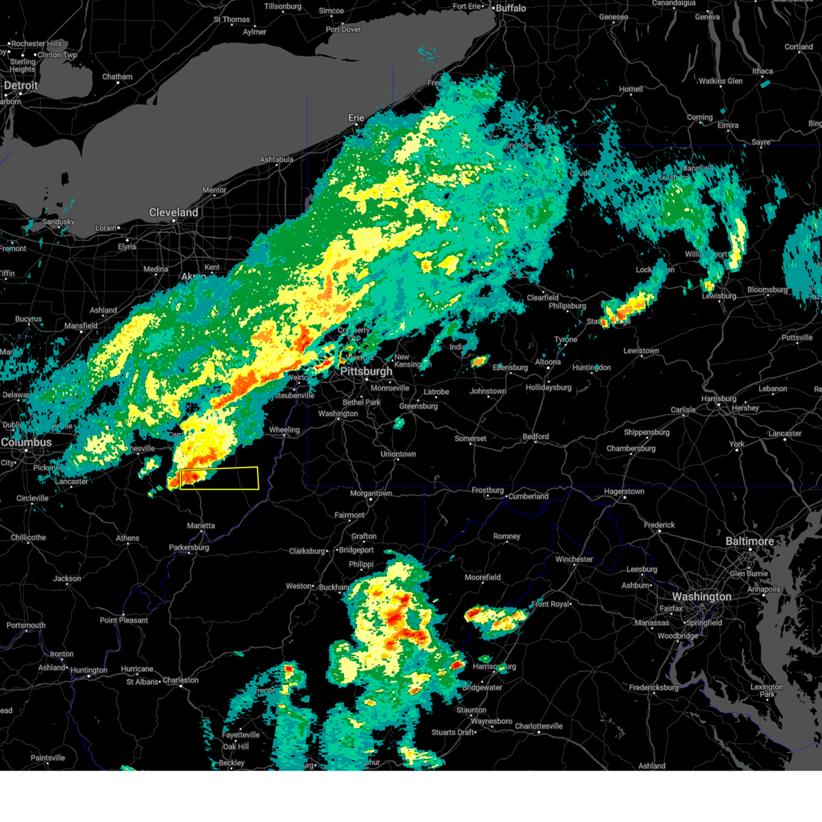
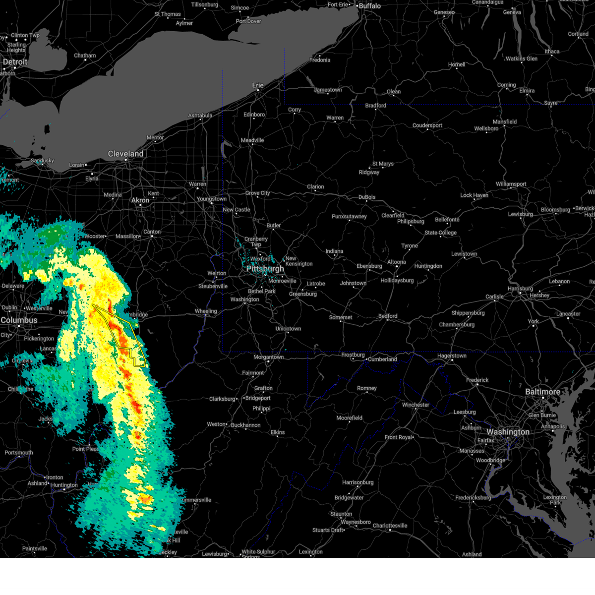
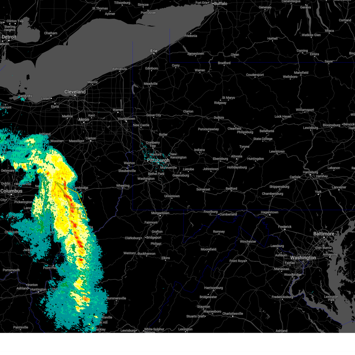
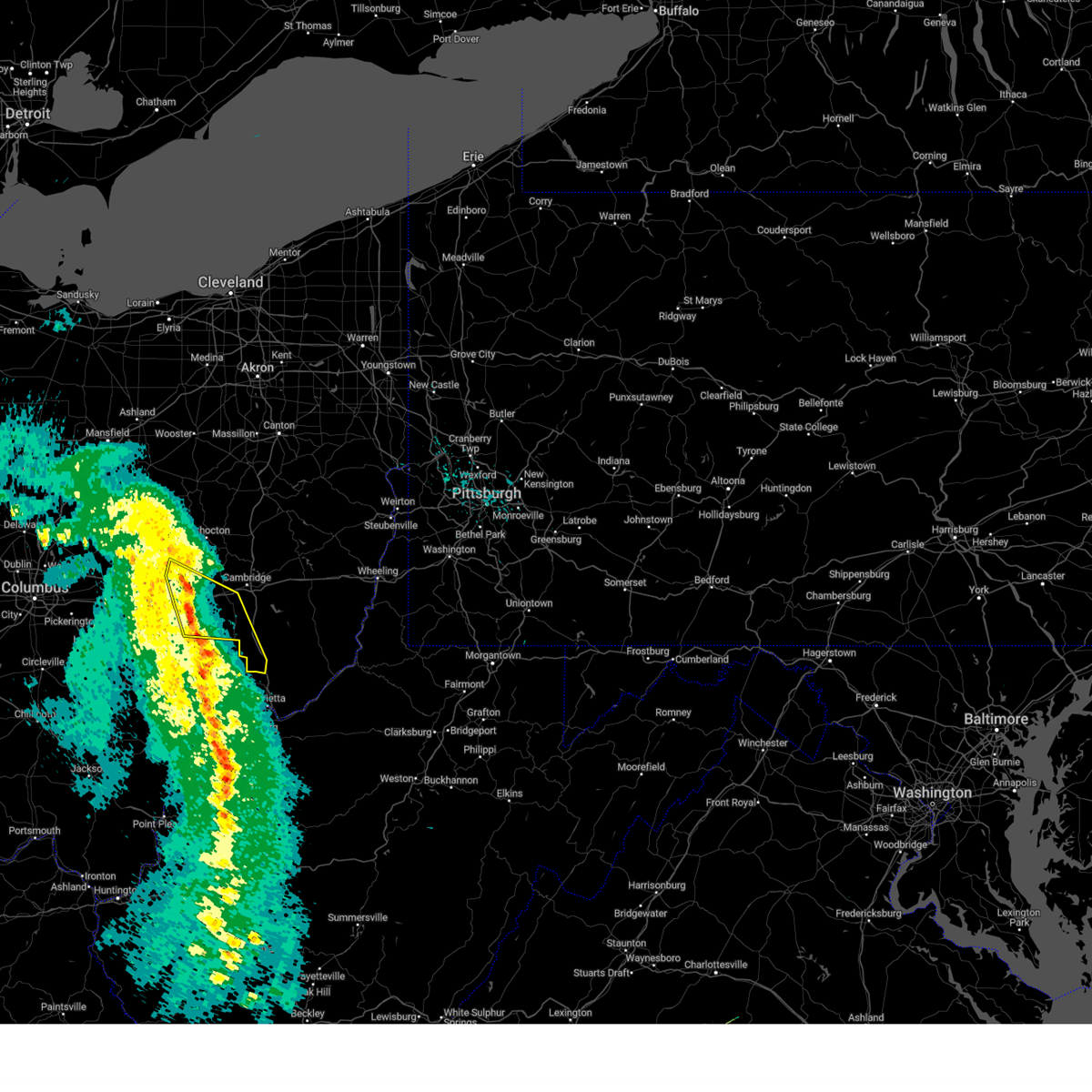
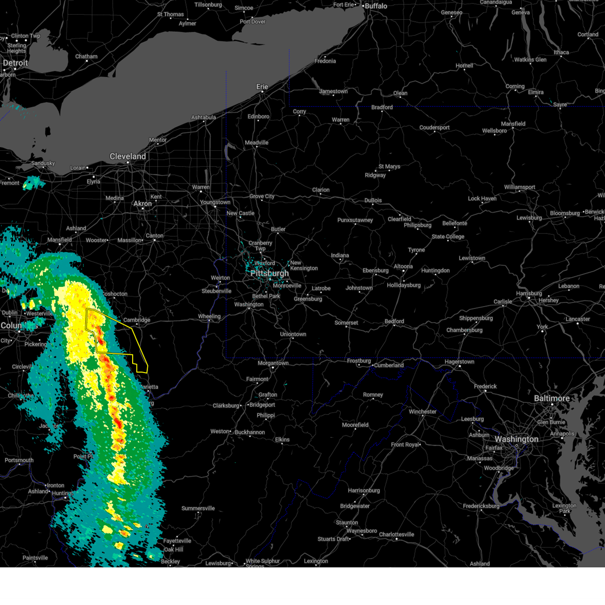
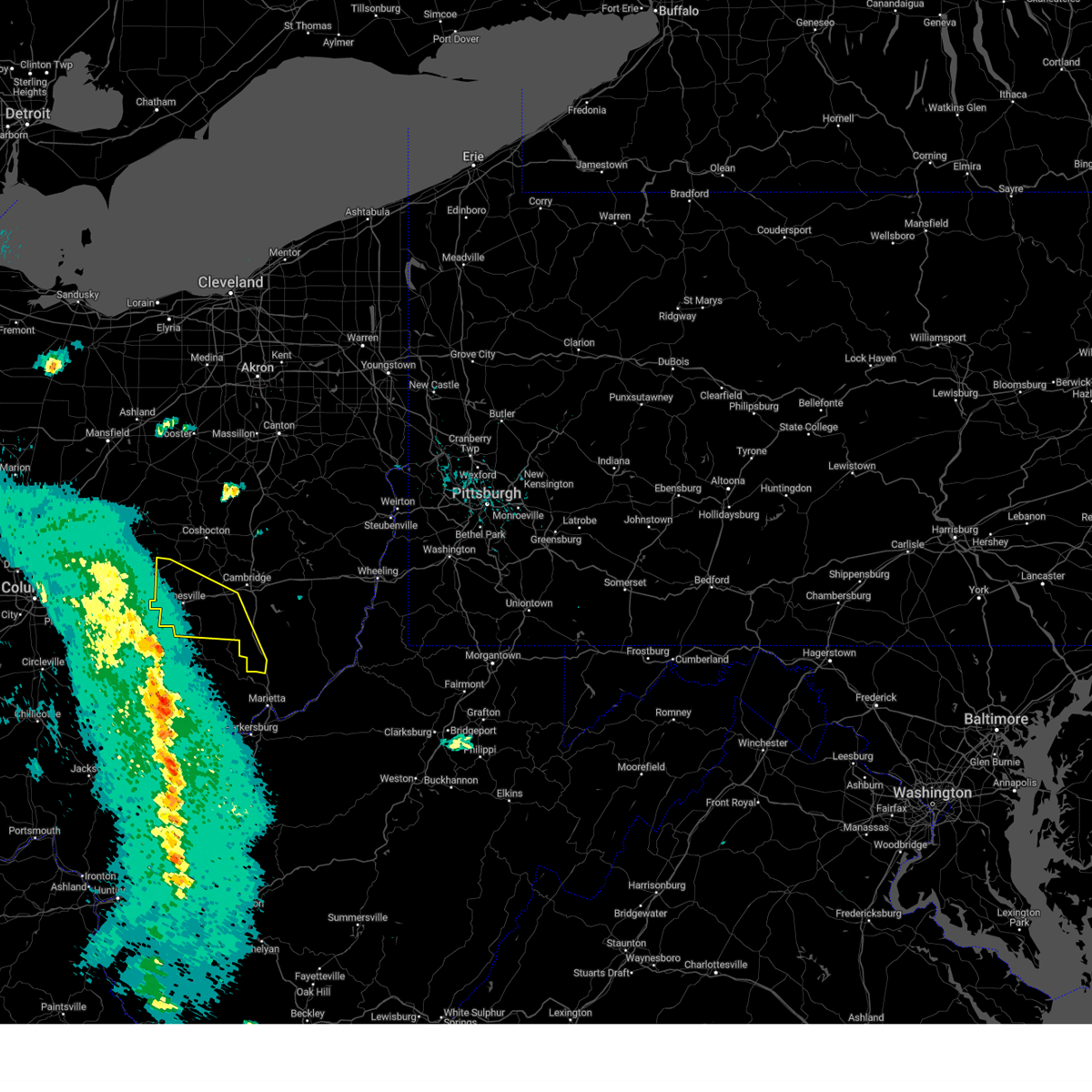
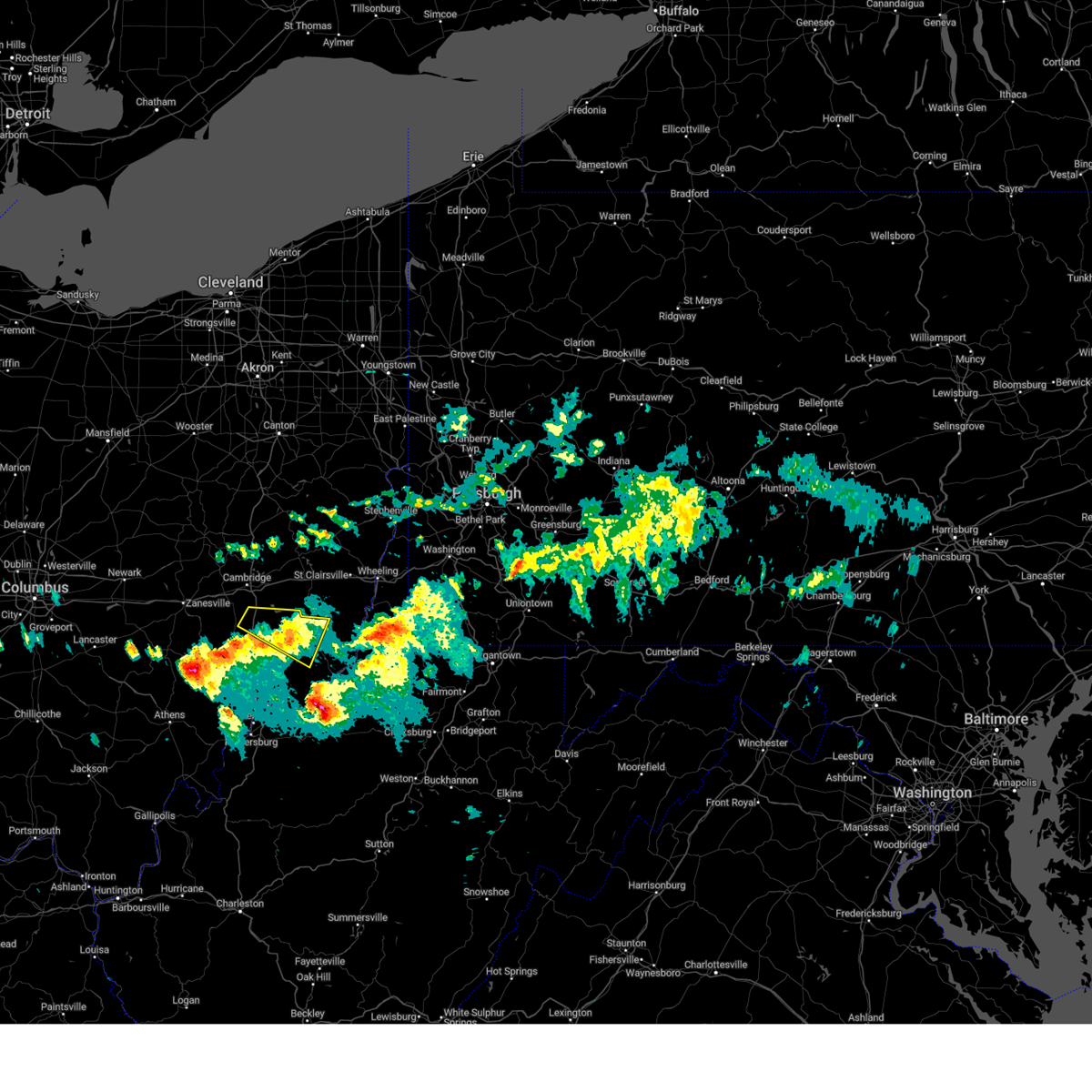
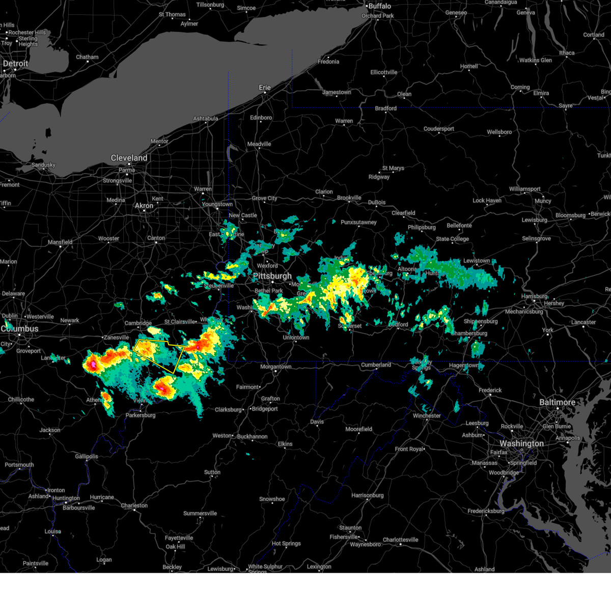
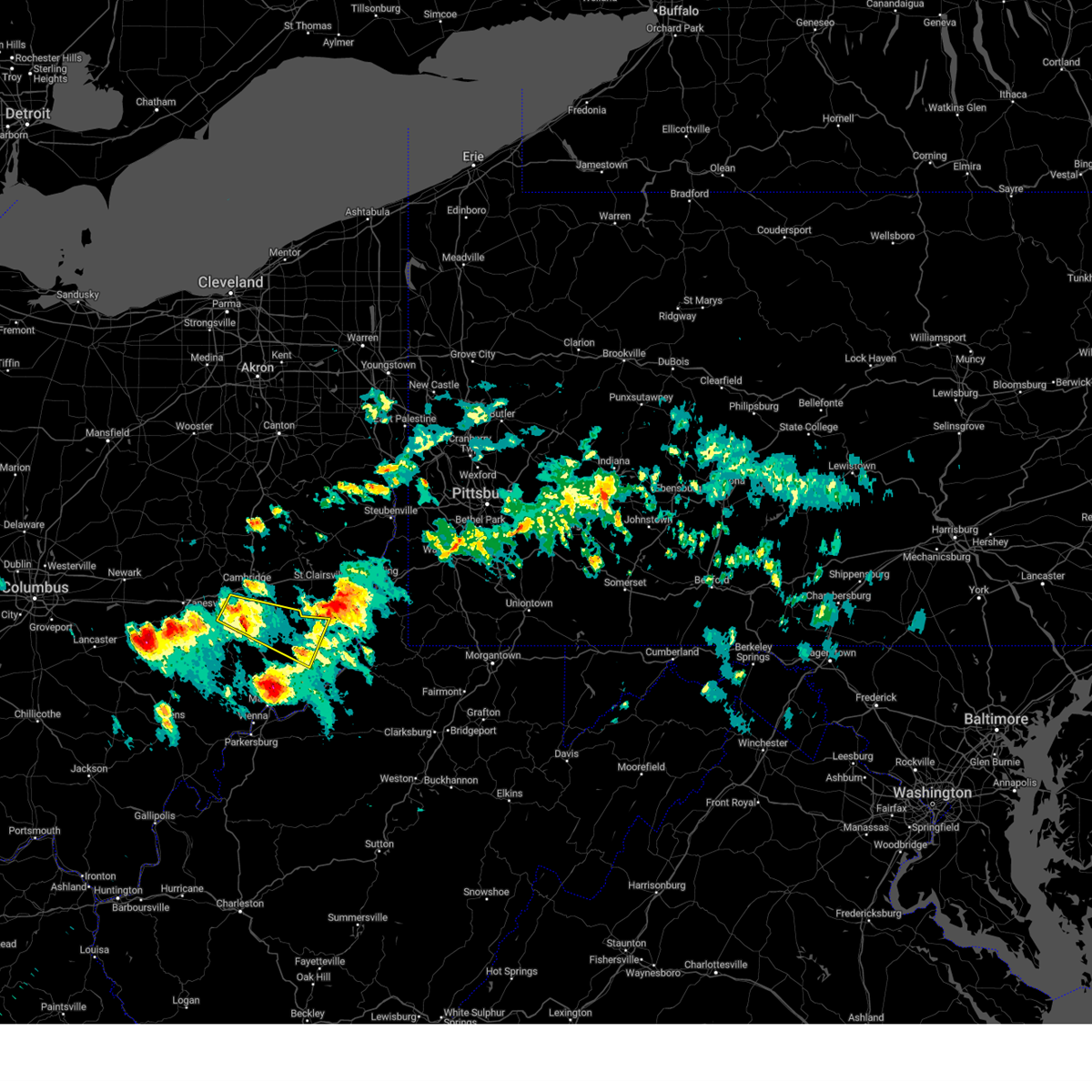
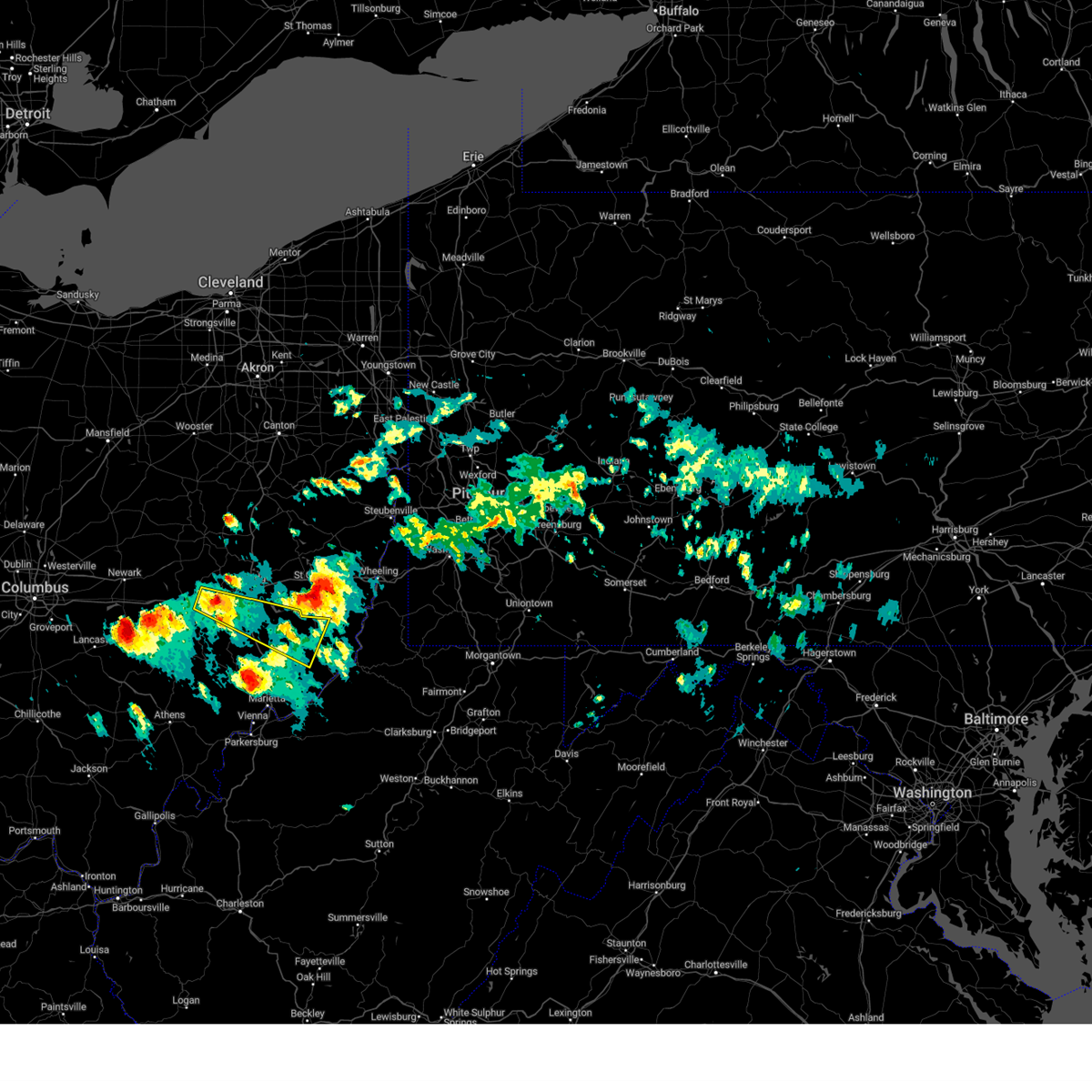
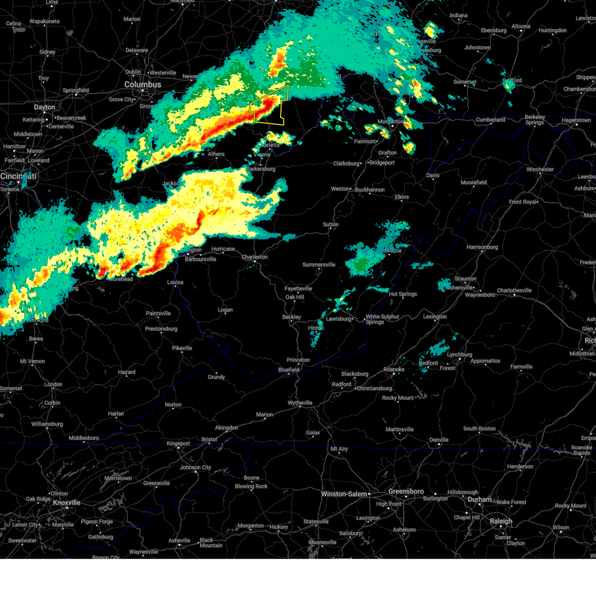
Hail Map for Belle Valley, OH
The Belle Valley, OH area has had 0 reports of on-the-ground hail by trained spotters, and has been under severe weather warnings 15 times during the past 12 months. Doppler radar has detected hail at or near Belle Valley, OH on 37 occasions, including 3 occasions during the past year.
| Name: | Belle Valley, OH |
| Where Located: | 78 miles E of Columbus, OH |
| Map: | Google Map for Belle Valley, OH |
| Population: | 223 |
| Housing Units: | 110 |
| More Info: | Search Google for Belle Valley, OH |
2
The Top Recent Hail Date for Belle Valley, OH is Saturday, September 20, 2025 (11th out of 37)
Hail and Wind Damage Spotted near Belle Valley, OH
| Date / Time | Report Details |
|---|---|
| 6/11/2026 3:39 PM EDT |
 the severe thunderstorm warning has been cancelled and is no longer in effect the severe thunderstorm warning has been cancelled and is no longer in effect
|
| 6/11/2026 3:22 PM EDT |
 At 322 pm edt, severe thunderstorms were located along a line from 6 miles west of freeport to 8 miles southwest of new concord, or along a line from 6 miles west of freeport to 11 miles east of zanesville, moving east at 25 mph (radar indicated). Hazards include 60 mph wind gusts. Expect damage to roofs, siding, and trees. Locations impacted include, cambridge, freeport, new concord, byesville, south zanesville, antrim, philo, quaker city, pleasant grove, senecaville, pleasant city, cumberland, lore city, old washington, belle valley, salesville, norwich, high hill and chandlersville. At 322 pm edt, severe thunderstorms were located along a line from 6 miles west of freeport to 8 miles southwest of new concord, or along a line from 6 miles west of freeport to 11 miles east of zanesville, moving east at 25 mph (radar indicated). Hazards include 60 mph wind gusts. Expect damage to roofs, siding, and trees. Locations impacted include, cambridge, freeport, new concord, byesville, south zanesville, antrim, philo, quaker city, pleasant grove, senecaville, pleasant city, cumberland, lore city, old washington, belle valley, salesville, norwich, high hill and chandlersville.
|
| 6/11/2026 3:04 PM EDT |
 Svrpbz the national weather service in pittsburgh has issued a * severe thunderstorm warning for, northwestern belmont county in east central ohio, southeastern coshocton county in east central ohio, guernsey county in east central ohio, southwestern harrison county in east central ohio, southeastern muskingum county in east central ohio, northwestern noble county in east central ohio, south central tuscarawas county in east central ohio, * until 400 pm edt. * at 304 pm edt, severe thunderstorms were located along a line from near newcomerstown to over south zanesville, or along a line from 14 miles west of freeport to near zanesville, moving east at 25 mph (radar indicated). Hazards include 60 mph wind gusts and small hail. expect damage to roofs, siding, and trees Svrpbz the national weather service in pittsburgh has issued a * severe thunderstorm warning for, northwestern belmont county in east central ohio, southeastern coshocton county in east central ohio, guernsey county in east central ohio, southwestern harrison county in east central ohio, southeastern muskingum county in east central ohio, northwestern noble county in east central ohio, south central tuscarawas county in east central ohio, * until 400 pm edt. * at 304 pm edt, severe thunderstorms were located along a line from near newcomerstown to over south zanesville, or along a line from 14 miles west of freeport to near zanesville, moving east at 25 mph (radar indicated). Hazards include 60 mph wind gusts and small hail. expect damage to roofs, siding, and trees
|
| 6/6/2026 6:30 PM EDT |
 Svrpbz the national weather service in pittsburgh has issued a * severe thunderstorm warning for, southwestern belmont county in east central ohio, southern guernsey county in east central ohio, northwestern monroe county in east central ohio, northern noble county in east central ohio, * until 715 pm edt. * at 630 pm edt, a severe thunderstorm was located 8 miles southwest of byesville, or 10 miles south of cambridge, moving east at 40 mph (radar indicated). Hazards include 60 mph wind gusts and quarter size hail. Hail damage to vehicles is expected. Expect wind damage to roofs, siding, and trees. Svrpbz the national weather service in pittsburgh has issued a * severe thunderstorm warning for, southwestern belmont county in east central ohio, southern guernsey county in east central ohio, northwestern monroe county in east central ohio, northern noble county in east central ohio, * until 715 pm edt. * at 630 pm edt, a severe thunderstorm was located 8 miles southwest of byesville, or 10 miles south of cambridge, moving east at 40 mph (radar indicated). Hazards include 60 mph wind gusts and quarter size hail. Hail damage to vehicles is expected. Expect wind damage to roofs, siding, and trees.
|
| 6/6/2026 1:39 PM EDT |
 At 139 pm edt, severe thunderstorms were located along a line from near cadiz to 16 miles southwest of caldwell, moving east at 50 mph (law enforcement reported uprooted trees and power poles down across muskingum county). Hazards include 70 mph wind gusts and quarter size hail. Hail damage to vehicles is expected. expect considerable tree damage. wind damage is also likely to mobile homes, roofs, and outbuildings. locations impacted include, steubenville, st. Clairsville, barnesville, cadiz, wellsburg, caldwell, freeport, toronto, wintersville, mingo junction, dudley, bethesda, hopedale, flushing, smithfield and scio. At 139 pm edt, severe thunderstorms were located along a line from near cadiz to 16 miles southwest of caldwell, moving east at 50 mph (law enforcement reported uprooted trees and power poles down across muskingum county). Hazards include 70 mph wind gusts and quarter size hail. Hail damage to vehicles is expected. expect considerable tree damage. wind damage is also likely to mobile homes, roofs, and outbuildings. locations impacted include, steubenville, st. Clairsville, barnesville, cadiz, wellsburg, caldwell, freeport, toronto, wintersville, mingo junction, dudley, bethesda, hopedale, flushing, smithfield and scio.
|
| 6/6/2026 1:28 PM EDT |
 At 128 pm edt, severe thunderstorms were located along a line from 7 miles northwest of cadiz to 16 miles south of south zanesville, or along a line from 7 miles northwest of cadiz to 20 miles south of zanesville, moving east at 50 mph (law enforcement reported uprooted trees and power poles down across muskingum county). Hazards include 70 mph wind gusts and quarter size hail. Hail damage to vehicles is expected. expect considerable tree damage. wind damage is also likely to mobile homes, roofs, and outbuildings. locations impacted include, steubenville, cambridge, uhrichsville, st. Clairsville, barnesville, cadiz, wellsburg, caldwell, freeport, toronto, wintersville, mingo junction, dennison, new concord, byesville and dudley. At 128 pm edt, severe thunderstorms were located along a line from 7 miles northwest of cadiz to 16 miles south of south zanesville, or along a line from 7 miles northwest of cadiz to 20 miles south of zanesville, moving east at 50 mph (law enforcement reported uprooted trees and power poles down across muskingum county). Hazards include 70 mph wind gusts and quarter size hail. Hail damage to vehicles is expected. expect considerable tree damage. wind damage is also likely to mobile homes, roofs, and outbuildings. locations impacted include, steubenville, cambridge, uhrichsville, st. Clairsville, barnesville, cadiz, wellsburg, caldwell, freeport, toronto, wintersville, mingo junction, dennison, new concord, byesville and dudley.
|
| 6/6/2026 1:04 PM EDT |
 Svrpbz the national weather service in pittsburgh has issued a * severe thunderstorm warning for, belmont county in east central ohio, south central carroll county in east central ohio, guernsey county in east central ohio, harrison county in east central ohio, jefferson oh county in east central ohio, northwestern monroe county in east central ohio, southeastern muskingum county in east central ohio, noble county in east central ohio, southeastern tuscarawas county in east central ohio, * until 200 pm edt. * at 104 pm edt, severe thunderstorms were located along a line from near uhrichsville to 19 miles southwest of south zanesville, or along a line from near uhrichsville to 21 miles southwest of zanesville, moving east at 50 mph (law enforcement reported damage across muskingum county). Hazards include 60 mph wind gusts and quarter size hail. Hail damage to vehicles is expected. Expect wind damage to roofs, siding, and trees. Svrpbz the national weather service in pittsburgh has issued a * severe thunderstorm warning for, belmont county in east central ohio, south central carroll county in east central ohio, guernsey county in east central ohio, harrison county in east central ohio, jefferson oh county in east central ohio, northwestern monroe county in east central ohio, southeastern muskingum county in east central ohio, noble county in east central ohio, southeastern tuscarawas county in east central ohio, * until 200 pm edt. * at 104 pm edt, severe thunderstorms were located along a line from near uhrichsville to 19 miles southwest of south zanesville, or along a line from near uhrichsville to 21 miles southwest of zanesville, moving east at 50 mph (law enforcement reported damage across muskingum county). Hazards include 60 mph wind gusts and quarter size hail. Hail damage to vehicles is expected. Expect wind damage to roofs, siding, and trees.
|
| 5/19/2026 6:33 PM EDT |
 Svrpbz the national weather service in pittsburgh has issued a * severe thunderstorm warning for, northwestern monroe county in east central ohio, noble county in east central ohio, * until 700 pm edt. * at 633 pm edt, a severe thunderstorm was located 6 miles southeast of caldwell, moving northeast at 20 mph (radar indicated). Hazards include 60 mph wind gusts and small hail. expect damage to roofs, siding, and trees Svrpbz the national weather service in pittsburgh has issued a * severe thunderstorm warning for, northwestern monroe county in east central ohio, noble county in east central ohio, * until 700 pm edt. * at 633 pm edt, a severe thunderstorm was located 6 miles southeast of caldwell, moving northeast at 20 mph (radar indicated). Hazards include 60 mph wind gusts and small hail. expect damage to roofs, siding, and trees
|
| 3/22/2026 11:07 PM EDT |
 the severe thunderstorm warning has been cancelled and is no longer in effect the severe thunderstorm warning has been cancelled and is no longer in effect
|
| 3/22/2026 10:44 PM EDT |
 Svrpbz the national weather service in pittsburgh has issued a * severe thunderstorm warning for, southwestern guernsey county in east central ohio, muskingum county in east central ohio, western noble county in east central ohio, * until 1130 pm edt. * at 1044 pm edt, a severe thunderstorm was located 16 miles southwest of frazeysburg, or 19 miles west of zanesville, moving east at 60 mph (radar indicated). Hazards include 60 mph wind gusts and quarter size hail. Hail damage to vehicles is expected. Expect wind damage to roofs, siding, and trees. Svrpbz the national weather service in pittsburgh has issued a * severe thunderstorm warning for, southwestern guernsey county in east central ohio, muskingum county in east central ohio, western noble county in east central ohio, * until 1130 pm edt. * at 1044 pm edt, a severe thunderstorm was located 16 miles southwest of frazeysburg, or 19 miles west of zanesville, moving east at 60 mph (radar indicated). Hazards include 60 mph wind gusts and quarter size hail. Hail damage to vehicles is expected. Expect wind damage to roofs, siding, and trees.
|
| 3/11/2026 3:24 PM EDT |
 Svrpbz the national weather service in pittsburgh has issued a * severe thunderstorm warning for, southwestern belmont county in east central ohio, western monroe county in east central ohio, noble county in east central ohio, * until 415 pm edt. * at 324 pm edt, a severe thunderstorm was located near caldwell, moving east at 65 mph (radar indicated). Hazards include 60 mph wind gusts. expect damage to roofs, siding, and trees Svrpbz the national weather service in pittsburgh has issued a * severe thunderstorm warning for, southwestern belmont county in east central ohio, western monroe county in east central ohio, noble county in east central ohio, * until 415 pm edt. * at 324 pm edt, a severe thunderstorm was located near caldwell, moving east at 65 mph (radar indicated). Hazards include 60 mph wind gusts. expect damage to roofs, siding, and trees
|
| 3/11/2026 2:57 PM EDT |
 At 257 pm edt, a severe thunderstorm was located 8 miles northeast of caldwell, moving east at 55 mph (radar indicated). Hazards include 60 mph wind gusts and small hail. Expect damage to roofs, siding, and trees. Locations impacted include, caldwell, dudley, summerfield, belle valley, lewisville, sarahsville, salesville, batesville, seneca lake park and wolf run state park. At 257 pm edt, a severe thunderstorm was located 8 miles northeast of caldwell, moving east at 55 mph (radar indicated). Hazards include 60 mph wind gusts and small hail. Expect damage to roofs, siding, and trees. Locations impacted include, caldwell, dudley, summerfield, belle valley, lewisville, sarahsville, salesville, batesville, seneca lake park and wolf run state park.
|
| 3/11/2026 2:57 PM EDT |
 the severe thunderstorm warning has been cancelled and is no longer in effect the severe thunderstorm warning has been cancelled and is no longer in effect
|
| 3/11/2026 2:45 PM EDT |
 Svrpbz the national weather service in pittsburgh has issued a * severe thunderstorm warning for, southeastern guernsey county in east central ohio, northwestern monroe county in east central ohio, southeastern muskingum county in east central ohio, noble county in east central ohio, * until 330 pm edt. * at 245 pm edt, a severe thunderstorm was located 5 miles west of caldwell, moving east at 55 mph (radar indicated). Hazards include 60 mph wind gusts. expect damage to roofs, siding, and trees Svrpbz the national weather service in pittsburgh has issued a * severe thunderstorm warning for, southeastern guernsey county in east central ohio, northwestern monroe county in east central ohio, southeastern muskingum county in east central ohio, noble county in east central ohio, * until 330 pm edt. * at 245 pm edt, a severe thunderstorm was located 5 miles west of caldwell, moving east at 55 mph (radar indicated). Hazards include 60 mph wind gusts. expect damage to roofs, siding, and trees
|
| 3/11/2026 1:13 PM EDT |
 Torpbz the national weather service in pittsburgh has issued a * tornado warning for, southwestern belmont county in east central ohio, northwestern monroe county in east central ohio, central noble county in east central ohio, * until 145 pm edt. * at 113 pm edt, a severe thunderstorm capable of producing a tornado was located near caldwell, moving east at 50 mph (radar indicated rotation). Hazards include tornado. Flying debris will be dangerous to those caught without shelter. mobile homes will be damaged or destroyed. damage to roofs, windows and vehicles will occur. Tree damage is likely. Torpbz the national weather service in pittsburgh has issued a * tornado warning for, southwestern belmont county in east central ohio, northwestern monroe county in east central ohio, central noble county in east central ohio, * until 145 pm edt. * at 113 pm edt, a severe thunderstorm capable of producing a tornado was located near caldwell, moving east at 50 mph (radar indicated rotation). Hazards include tornado. Flying debris will be dangerous to those caught without shelter. mobile homes will be damaged or destroyed. damage to roofs, windows and vehicles will occur. Tree damage is likely.
|
| 6/18/2025 11:08 PM EDT |
 the severe thunderstorm warning has been cancelled and is no longer in effect the severe thunderstorm warning has been cancelled and is no longer in effect
|
| 6/18/2025 11:08 PM EDT |
 At 1108 pm edt, severe thunderstorms were located along a line from over tiltonsville to 5 miles southeast of caldwell, or along a line from near clearview to 5 miles southeast of caldwell, moving east at 35 mph (law enforcement reported trees down with this line). Hazards include 60 mph wind gusts. Expect damage to roofs, siding, and trees. locations impacted include, wheeling, washington, moundsville, martins ferry, new martinsville, st. Clairsville, bellaire, warwood, bethlehem, woodsfield, caldwell, west liberty, triadelphia, clearview, valley grove, shadyside, wolfdale, east washington, mcmechen and powhatan point. At 1108 pm edt, severe thunderstorms were located along a line from over tiltonsville to 5 miles southeast of caldwell, or along a line from near clearview to 5 miles southeast of caldwell, moving east at 35 mph (law enforcement reported trees down with this line). Hazards include 60 mph wind gusts. Expect damage to roofs, siding, and trees. locations impacted include, wheeling, washington, moundsville, martins ferry, new martinsville, st. Clairsville, bellaire, warwood, bethlehem, woodsfield, caldwell, west liberty, triadelphia, clearview, valley grove, shadyside, wolfdale, east washington, mcmechen and powhatan point.
|
| 6/18/2025 11:01 PM EDT |
 The storms which prompted the warning have moved out of the area. a new severe thunderstorm warning has been issued for a portion of the area to the east. a severe thunderstorm watch remains in effect until 300 am edt for portions of east central ohio and the northern panhandle of west virginia. The storms which prompted the warning have moved out of the area. a new severe thunderstorm warning has been issued for a portion of the area to the east. a severe thunderstorm watch remains in effect until 300 am edt for portions of east central ohio and the northern panhandle of west virginia.
|
| 6/18/2025 10:57 PM EDT |
 Svrpbz the national weather service in pittsburgh has issued a * severe thunderstorm warning for, belmont county in east central ohio, southeastern guernsey county in east central ohio, southeastern harrison county in east central ohio, south central jefferson oh county in east central ohio, monroe county in east central ohio, noble county in east central ohio, western greene county in southwestern pennsylvania, southwestern washington county in southwestern pennsylvania, brooke county in northern west virginia, west central marion county in northern west virginia, marshall county in northern west virginia, ohio county in northern west virginia, wetzel county in northern west virginia, * until midnight edt. * at 1057 pm edt, severe thunderstorms were located along a line from 9 miles northeast of st. clairsville to near caldwell, moving east at 35 mph (law enforcement reported trees were reported down with this line). Hazards include 60 mph wind gusts. expect damage to roofs, siding, and trees Svrpbz the national weather service in pittsburgh has issued a * severe thunderstorm warning for, belmont county in east central ohio, southeastern guernsey county in east central ohio, southeastern harrison county in east central ohio, south central jefferson oh county in east central ohio, monroe county in east central ohio, noble county in east central ohio, western greene county in southwestern pennsylvania, southwestern washington county in southwestern pennsylvania, brooke county in northern west virginia, west central marion county in northern west virginia, marshall county in northern west virginia, ohio county in northern west virginia, wetzel county in northern west virginia, * until midnight edt. * at 1057 pm edt, severe thunderstorms were located along a line from 9 miles northeast of st. clairsville to near caldwell, moving east at 35 mph (law enforcement reported trees were reported down with this line). Hazards include 60 mph wind gusts. expect damage to roofs, siding, and trees
|
| 6/18/2025 10:43 PM EDT |
 At 1043 pm edt, severe thunderstorms were located along a line from 7 miles southeast of cadiz to 18 miles southwest of caldwell, moving east at 35 mph (law enforcement reported and radar indicated). Hazards include 60 mph wind gusts. Expect damage to roofs, siding, and trees. locations impacted include, wheeling, martins ferry, st. clairsville, bellaire, barnesville, warwood, bethlehem, woodsfield, caldwell, west liberty, clearview, shadyside, mcmechen, glen dale, tiltonsville, bridgeport, dudley, benwood, bethesda and yorkville. Trees have been reported down with these storms. At 1043 pm edt, severe thunderstorms were located along a line from 7 miles southeast of cadiz to 18 miles southwest of caldwell, moving east at 35 mph (law enforcement reported and radar indicated). Hazards include 60 mph wind gusts. Expect damage to roofs, siding, and trees. locations impacted include, wheeling, martins ferry, st. clairsville, bellaire, barnesville, warwood, bethlehem, woodsfield, caldwell, west liberty, clearview, shadyside, mcmechen, glen dale, tiltonsville, bridgeport, dudley, benwood, bethesda and yorkville. Trees have been reported down with these storms.
|
| 6/18/2025 10:30 PM EDT |
 At 1030 pm edt, severe thunderstorms were located along a line from near cadiz to 22 miles southwest of caldwell, moving east at 35 mph (radar indicated). Hazards include 60 mph wind gusts. Expect damage to roofs, siding, and trees. locations impacted include, wheeling, martins ferry, st. Clairsville, bellaire, barnesville, warwood, bethlehem, woodsfield, caldwell, west liberty, clearview, shadyside, mcmechen, glen dale, tiltonsville, bridgeport, dudley, benwood, bethesda and antrim. At 1030 pm edt, severe thunderstorms were located along a line from near cadiz to 22 miles southwest of caldwell, moving east at 35 mph (radar indicated). Hazards include 60 mph wind gusts. Expect damage to roofs, siding, and trees. locations impacted include, wheeling, martins ferry, st. Clairsville, bellaire, barnesville, warwood, bethlehem, woodsfield, caldwell, west liberty, clearview, shadyside, mcmechen, glen dale, tiltonsville, bridgeport, dudley, benwood, bethesda and antrim.
|
| 6/18/2025 10:30 PM EDT |
 the severe thunderstorm warning has been cancelled and is no longer in effect the severe thunderstorm warning has been cancelled and is no longer in effect
|
| 6/18/2025 10:18 PM EDT |
 At 1018 pm edt, severe thunderstorms were located along a line from near freeport to 25 miles south of south zanesville, or along a line from near freeport to 27 miles southwest of caldwell, moving east at 35 mph (radar indicated). Hazards include 60 mph wind gusts. Expect damage to roofs, siding, and trees. locations impacted include, wheeling, cambridge, martins ferry, st. Clairsville, bellaire, barnesville, warwood, bethlehem, woodsfield, caldwell, west liberty, clearview, shadyside, byesville, mcmechen, glen dale, tiltonsville, bridgeport, dudley and benwood. At 1018 pm edt, severe thunderstorms were located along a line from near freeport to 25 miles south of south zanesville, or along a line from near freeport to 27 miles southwest of caldwell, moving east at 35 mph (radar indicated). Hazards include 60 mph wind gusts. Expect damage to roofs, siding, and trees. locations impacted include, wheeling, cambridge, martins ferry, st. Clairsville, bellaire, barnesville, warwood, bethlehem, woodsfield, caldwell, west liberty, clearview, shadyside, byesville, mcmechen, glen dale, tiltonsville, bridgeport, dudley and benwood.
|
| 6/18/2025 10:13 PM EDT |
 The storms which prompted the warning were moving out of the warned area. therefore, the warning will be allowed to expire. however, a severe thunderstorm warning has been issued for portions of the area to the east. a severe thunderstorm watch remains in effect until 300 am edt thursday for a portion of east central ohio. The storms which prompted the warning were moving out of the warned area. therefore, the warning will be allowed to expire. however, a severe thunderstorm warning has been issued for portions of the area to the east. a severe thunderstorm watch remains in effect until 300 am edt thursday for a portion of east central ohio.
|
| 6/18/2025 10:06 PM EDT |
 Svrpbz the national weather service in pittsburgh has issued a * severe thunderstorm warning for, belmont county in east central ohio, guernsey county in east central ohio, southeastern harrison county in east central ohio, south central jefferson oh county in east central ohio, monroe county in east central ohio, southeastern muskingum county in east central ohio, noble county in east central ohio, brooke county in northern west virginia, marshall county in northern west virginia, ohio county in northern west virginia, * until 1100 pm edt. * at 1006 pm edt, severe thunderstorms were located along a line from over freeport to 24 miles south of south zanesville, or along a line from over freeport to 28 miles south of zanesville, moving east at 35 mph (radar indicated). Hazards include 60 mph wind gusts. expect damage to roofs, siding, and trees Svrpbz the national weather service in pittsburgh has issued a * severe thunderstorm warning for, belmont county in east central ohio, guernsey county in east central ohio, southeastern harrison county in east central ohio, south central jefferson oh county in east central ohio, monroe county in east central ohio, southeastern muskingum county in east central ohio, noble county in east central ohio, brooke county in northern west virginia, marshall county in northern west virginia, ohio county in northern west virginia, * until 1100 pm edt. * at 1006 pm edt, severe thunderstorms were located along a line from over freeport to 24 miles south of south zanesville, or along a line from over freeport to 28 miles south of zanesville, moving east at 35 mph (radar indicated). Hazards include 60 mph wind gusts. expect damage to roofs, siding, and trees
|
| 6/18/2025 9:53 PM EDT |
 At 953 pm edt, severe thunderstorms were located along a line from 15 miles northeast of strasburg to 12 miles south of south zanesville, or along a line from 16 miles northwest of carrollton to 16 miles south of zanesville, moving east at 40 mph (radar indicated). Hazards include 60 mph wind gusts. Expect damage to roofs, siding, and trees. Locations impacted include, new philadelphia, dover, cambridge, uhrichsville, carrollton, caldwell, freeport, newcomerstown, dennison, strasburg, new concord, byesville, sugarcreek, augusta, gnadenhutten, antrim, malvern, tuscarawas, bolivar and scio. At 953 pm edt, severe thunderstorms were located along a line from 15 miles northeast of strasburg to 12 miles south of south zanesville, or along a line from 16 miles northwest of carrollton to 16 miles south of zanesville, moving east at 40 mph (radar indicated). Hazards include 60 mph wind gusts. Expect damage to roofs, siding, and trees. Locations impacted include, new philadelphia, dover, cambridge, uhrichsville, carrollton, caldwell, freeport, newcomerstown, dennison, strasburg, new concord, byesville, sugarcreek, augusta, gnadenhutten, antrim, malvern, tuscarawas, bolivar and scio.
|
| 6/18/2025 9:46 PM EDT |
 At 946 pm edt, severe thunderstorms were located along a line from 11 miles northeast of strasburg to 13 miles southwest of south zanesville, or along a line from 15 miles north of dover to 17 miles south of zanesville, moving east at 40 mph (radar indicated). Hazards include 60 mph wind gusts. Expect damage to roofs, siding, and trees. locations impacted include, zanesville, new philadelphia, dover, coshocton, cambridge, uhrichsville, carrollton, caldwell, freeport, newcomerstown, dennison, strasburg, new concord, byesville, west lafayette, sugarcreek, augusta, gnadenhutten, antrim and malvern. These storms have had a history of producing wind damage across central ohio. At 946 pm edt, severe thunderstorms were located along a line from 11 miles northeast of strasburg to 13 miles southwest of south zanesville, or along a line from 15 miles north of dover to 17 miles south of zanesville, moving east at 40 mph (radar indicated). Hazards include 60 mph wind gusts. Expect damage to roofs, siding, and trees. locations impacted include, zanesville, new philadelphia, dover, coshocton, cambridge, uhrichsville, carrollton, caldwell, freeport, newcomerstown, dennison, strasburg, new concord, byesville, west lafayette, sugarcreek, augusta, gnadenhutten, antrim and malvern. These storms have had a history of producing wind damage across central ohio.
|
| 6/18/2025 9:34 PM EDT |
 At 934 pm edt, severe thunderstorms were located along a line from 10 miles north of strasburg to 18 miles southwest of south zanesville, or along a line from 15 miles north of dover to 21 miles southwest of zanesville, moving east at 40 mph (radar indicated). Hazards include 60 mph wind gusts. Expect damage to roofs, siding, and trees. locations impacted include, zanesville, new philadelphia, dover, coshocton, cambridge, uhrichsville, carrollton, caldwell, freeport, newcomerstown, dennison, strasburg, new concord, byesville, west lafayette, sugarcreek, augusta, gnadenhutten, antrim and malvern. These storms have had a history of producing wind damage across central ohio. At 934 pm edt, severe thunderstorms were located along a line from 10 miles north of strasburg to 18 miles southwest of south zanesville, or along a line from 15 miles north of dover to 21 miles southwest of zanesville, moving east at 40 mph (radar indicated). Hazards include 60 mph wind gusts. Expect damage to roofs, siding, and trees. locations impacted include, zanesville, new philadelphia, dover, coshocton, cambridge, uhrichsville, carrollton, caldwell, freeport, newcomerstown, dennison, strasburg, new concord, byesville, west lafayette, sugarcreek, augusta, gnadenhutten, antrim and malvern. These storms have had a history of producing wind damage across central ohio.
|
| 6/18/2025 9:17 PM EDT |
 Svrpbz the national weather service in pittsburgh has issued a * severe thunderstorm warning for, northwestern belmont county in east central ohio, carroll county in east central ohio, northwestern columbiana county in east central ohio, eastern coshocton county in east central ohio, guernsey county in east central ohio, western harrison county in east central ohio, eastern muskingum county in east central ohio, western noble county in east central ohio, tuscarawas county in east central ohio, * until 1015 pm edt. * at 917 pm edt, severe thunderstorms were located along a line from 18 miles northwest of sugarcreek to 28 miles southwest of south zanesville, or along a line from 22 miles northwest of dover to 30 miles southwest of zanesville, moving east at 40 mph (radar indicated). Hazards include 60 mph wind gusts. expect damage to roofs, siding, and trees Svrpbz the national weather service in pittsburgh has issued a * severe thunderstorm warning for, northwestern belmont county in east central ohio, carroll county in east central ohio, northwestern columbiana county in east central ohio, eastern coshocton county in east central ohio, guernsey county in east central ohio, western harrison county in east central ohio, eastern muskingum county in east central ohio, western noble county in east central ohio, tuscarawas county in east central ohio, * until 1015 pm edt. * at 917 pm edt, severe thunderstorms were located along a line from 18 miles northwest of sugarcreek to 28 miles southwest of south zanesville, or along a line from 22 miles northwest of dover to 30 miles southwest of zanesville, moving east at 40 mph (radar indicated). Hazards include 60 mph wind gusts. expect damage to roofs, siding, and trees
|
| 5/17/2025 12:08 AM EDT |
 The severe thunderstorm warning that was previously in effect has been reissued for guernsey, harrison, and noble counties and is in effect until 1245 am edt. please refer to that bulletin for the latest severe weather information. a severe thunderstorm watch remains in effect until 400 am edt saturday for a portion of east central ohio. The severe thunderstorm warning that was previously in effect has been reissued for guernsey, harrison, and noble counties and is in effect until 1245 am edt. please refer to that bulletin for the latest severe weather information. a severe thunderstorm watch remains in effect until 400 am edt saturday for a portion of east central ohio.
|
| 5/16/2025 11:43 PM EDT |
 At 1143 pm edt, severe thunderstorms were located along a line from 8 miles northwest of barnesville to 17 miles south of caldwell, moving east at 55 mph (radar indicated). Hazards include 60 mph wind gusts. Expect damage to roofs, siding, and trees. Locations impacted include, cambridge, caldwell, byesville, dudley, antrim, quaker city, senecaville, pleasant city, cumberland, holloway, lore city, old washington, summerfield, belle valley, sarahsville, salesville, dexter city, piedmont, fairview and batesville. At 1143 pm edt, severe thunderstorms were located along a line from 8 miles northwest of barnesville to 17 miles south of caldwell, moving east at 55 mph (radar indicated). Hazards include 60 mph wind gusts. Expect damage to roofs, siding, and trees. Locations impacted include, cambridge, caldwell, byesville, dudley, antrim, quaker city, senecaville, pleasant city, cumberland, holloway, lore city, old washington, summerfield, belle valley, sarahsville, salesville, dexter city, piedmont, fairview and batesville.
|
| 5/16/2025 11:24 PM EDT |
 Svrpbz the national weather service in pittsburgh has issued a * severe thunderstorm warning for, guernsey county in east central ohio, southwestern harrison county in east central ohio, eastern muskingum county in east central ohio, noble county in east central ohio, * until 1215 am edt. * at 1124 pm edt, severe thunderstorms were located along a line from 6 miles northwest of new concord to 29 miles south of south zanesville, or along a line from 12 miles west of cambridge to 33 miles south of zanesville, moving east at 55 mph (radar indicated). Hazards include 60 mph wind gusts. expect damage to roofs, siding, and trees Svrpbz the national weather service in pittsburgh has issued a * severe thunderstorm warning for, guernsey county in east central ohio, southwestern harrison county in east central ohio, eastern muskingum county in east central ohio, noble county in east central ohio, * until 1215 am edt. * at 1124 pm edt, severe thunderstorms were located along a line from 6 miles northwest of new concord to 29 miles south of south zanesville, or along a line from 12 miles west of cambridge to 33 miles south of zanesville, moving east at 55 mph (radar indicated). Hazards include 60 mph wind gusts. expect damage to roofs, siding, and trees
|
| 5/5/2025 5:11 PM EDT |
 the severe thunderstorm warning has been cancelled and is no longer in effect the severe thunderstorm warning has been cancelled and is no longer in effect
|
| 5/5/2025 4:58 PM EDT |
 At 458 pm edt, a severe thunderstorm was located 6 miles southwest of caldwell, moving north at 25 mph (radar indicated). Hazards include 60 mph wind gusts and quarter size hail. Hail damage to vehicles is expected. expect wind damage to roofs, siding, and trees. Locations impacted include, caldwell, dudley, pleasant city, cumberland, belle valley, dexter city, high hill and wolf run state park. At 458 pm edt, a severe thunderstorm was located 6 miles southwest of caldwell, moving north at 25 mph (radar indicated). Hazards include 60 mph wind gusts and quarter size hail. Hail damage to vehicles is expected. expect wind damage to roofs, siding, and trees. Locations impacted include, caldwell, dudley, pleasant city, cumberland, belle valley, dexter city, high hill and wolf run state park.
|
| 5/5/2025 4:43 PM EDT |
 Svrpbz the national weather service in pittsburgh has issued a * severe thunderstorm warning for, southwestern guernsey county in east central ohio, southeastern muskingum county in east central ohio, western noble county in east central ohio, * until 530 pm edt. * at 443 pm edt, a severe thunderstorm was located 11 miles south of caldwell, moving north at 25 mph (radar indicated). Hazards include 60 mph wind gusts and quarter size hail. Hail damage to vehicles is expected. Expect wind damage to roofs, siding, and trees. Svrpbz the national weather service in pittsburgh has issued a * severe thunderstorm warning for, southwestern guernsey county in east central ohio, southeastern muskingum county in east central ohio, western noble county in east central ohio, * until 530 pm edt. * at 443 pm edt, a severe thunderstorm was located 11 miles south of caldwell, moving north at 25 mph (radar indicated). Hazards include 60 mph wind gusts and quarter size hail. Hail damage to vehicles is expected. Expect wind damage to roofs, siding, and trees.
|
| 4/29/2025 4:02 PM EDT |
 Svrpbz the national weather service in pittsburgh has issued a * severe thunderstorm warning for, monroe county in east central ohio, southern belmont county in east central ohio, noble county in east central ohio, * until 500 pm edt. * at 401 pm edt, severe thunderstorms were located along a line extending from near byesville to near mcconnelsville, moving east at 50 mph (radar indicated). Hazards include 60 mph wind gusts. expect damage to trees and power lines, resulting in some power outages Svrpbz the national weather service in pittsburgh has issued a * severe thunderstorm warning for, monroe county in east central ohio, southern belmont county in east central ohio, noble county in east central ohio, * until 500 pm edt. * at 401 pm edt, severe thunderstorms were located along a line extending from near byesville to near mcconnelsville, moving east at 50 mph (radar indicated). Hazards include 60 mph wind gusts. expect damage to trees and power lines, resulting in some power outages
|
| 4/3/2025 3:23 AM EDT |
 the severe thunderstorm warning has been cancelled and is no longer in effect the severe thunderstorm warning has been cancelled and is no longer in effect
|
| 4/3/2025 3:23 AM EDT |
 At 323 am edt, severe thunderstorms were located along a line from 12 miles northwest of carrollton to 6 miles northwest of caldwell, moving east at 50 mph (radar indicated). Hazards include 60 mph wind gusts. Expect damage to roofs, siding, and trees. locations impacted include, new philadelphia, salem, columbiana, uhrichsville, st. Clairsville, barnesville, cadiz, carrollton, woodsfield, caldwell, freeport, lisbon, dennison, leetonia, new waterford, augusta, dudley, salineville, gnadenhutten and bethesda. At 323 am edt, severe thunderstorms were located along a line from 12 miles northwest of carrollton to 6 miles northwest of caldwell, moving east at 50 mph (radar indicated). Hazards include 60 mph wind gusts. Expect damage to roofs, siding, and trees. locations impacted include, new philadelphia, salem, columbiana, uhrichsville, st. Clairsville, barnesville, cadiz, carrollton, woodsfield, caldwell, freeport, lisbon, dennison, leetonia, new waterford, augusta, dudley, salineville, gnadenhutten and bethesda.
|
| 4/3/2025 3:13 AM EDT |
 Svrpbz the national weather service in pittsburgh has issued a * severe thunderstorm warning for, belmont county in east central ohio, carroll county in east central ohio, columbiana county in east central ohio, southeastern coshocton county in east central ohio, guernsey county in east central ohio, harrison county in east central ohio, western jefferson oh county in east central ohio, monroe county in east central ohio, eastern muskingum county in east central ohio, noble county in east central ohio, tuscarawas county in east central ohio, * until 415 am edt. * at 313 am edt, severe thunderstorms were located along a line from 9 miles northeast of strasburg to 13 miles south of new concord, or along a line from 12 miles north of dover to 12 miles west of caldwell, moving east at 50 mph (radar indicated). Hazards include 60 mph wind gusts. expect damage to roofs, siding, and trees Svrpbz the national weather service in pittsburgh has issued a * severe thunderstorm warning for, belmont county in east central ohio, carroll county in east central ohio, columbiana county in east central ohio, southeastern coshocton county in east central ohio, guernsey county in east central ohio, harrison county in east central ohio, western jefferson oh county in east central ohio, monroe county in east central ohio, eastern muskingum county in east central ohio, noble county in east central ohio, tuscarawas county in east central ohio, * until 415 am edt. * at 313 am edt, severe thunderstorms were located along a line from 9 miles northeast of strasburg to 13 miles south of new concord, or along a line from 12 miles north of dover to 12 miles west of caldwell, moving east at 50 mph (radar indicated). Hazards include 60 mph wind gusts. expect damage to roofs, siding, and trees
|
| 4/2/2025 12:16 PM EDT |
 At 1216 pm edt, a severe thunderstorm was located 6 miles west of caldwell, moving northeast at 60 mph (radar indicated). Hazards include 60 mph wind gusts and half dollar size hail. Hail damage to vehicles is expected. expect wind damage to roofs, siding, and trees. Locations impacted include, woodsfield, caldwell, dudley, quaker city, senecaville, pleasant city, lore city, summerfield, belle valley, lewisville, sarahsville, salesville, dexter city, stafford, batesville, miltonsburg, seneca lake park and wolf run state park. At 1216 pm edt, a severe thunderstorm was located 6 miles west of caldwell, moving northeast at 60 mph (radar indicated). Hazards include 60 mph wind gusts and half dollar size hail. Hail damage to vehicles is expected. expect wind damage to roofs, siding, and trees. Locations impacted include, woodsfield, caldwell, dudley, quaker city, senecaville, pleasant city, lore city, summerfield, belle valley, lewisville, sarahsville, salesville, dexter city, stafford, batesville, miltonsburg, seneca lake park and wolf run state park.
|
| 4/2/2025 12:16 PM EDT |
 the severe thunderstorm warning has been cancelled and is no longer in effect the severe thunderstorm warning has been cancelled and is no longer in effect
|
| 4/2/2025 12:05 PM EDT |
 Svrpbz the national weather service in pittsburgh has issued a * severe thunderstorm warning for, southwestern belmont county in east central ohio, southeastern guernsey county in east central ohio, northwestern monroe county in east central ohio, southeastern muskingum county in east central ohio, noble county in east central ohio, * until 1245 pm edt. * at 1205 pm edt, a severe thunderstorm was located 16 miles west of caldwell, moving northeast at 60 mph (radar indicated). Hazards include 60 mph wind gusts and half dollar size hail. Hail damage to vehicles is expected. Expect wind damage to roofs, siding, and trees. Svrpbz the national weather service in pittsburgh has issued a * severe thunderstorm warning for, southwestern belmont county in east central ohio, southeastern guernsey county in east central ohio, northwestern monroe county in east central ohio, southeastern muskingum county in east central ohio, noble county in east central ohio, * until 1245 pm edt. * at 1205 pm edt, a severe thunderstorm was located 16 miles west of caldwell, moving northeast at 60 mph (radar indicated). Hazards include 60 mph wind gusts and half dollar size hail. Hail damage to vehicles is expected. Expect wind damage to roofs, siding, and trees.
|
| 3/16/2025 12:17 PM EDT |
 Svrpbz the national weather service in pittsburgh has issued a * severe thunderstorm warning for, belmont county in east central ohio, carroll county in east central ohio, western columbiana county in east central ohio, guernsey county in east central ohio, harrison county in east central ohio, western jefferson oh county in east central ohio, monroe county in east central ohio, noble county in east central ohio, tuscarawas county in east central ohio, * until 115 pm edt. * at 1217 pm edt, severe thunderstorms were located along a line from 19 miles north of strasburg to near caldwell, or along a line from 24 miles north of dover to near caldwell, moving northeast at 55 mph. these are destructive storms for tuscarawas and guernsey counties into locations east of interstate 70 (law enforcement reported. widespread downed trees and powerlines have been reported from coshocton and muskingum counties where the line previously passed). Hazards include 80 mph wind gusts. Flying debris will be dangerous to those caught without shelter. mobile homes will be heavily damaged. expect considerable damage to roofs, windows, and vehicles. Extensive tree damage and power outages are likely. Svrpbz the national weather service in pittsburgh has issued a * severe thunderstorm warning for, belmont county in east central ohio, carroll county in east central ohio, western columbiana county in east central ohio, guernsey county in east central ohio, harrison county in east central ohio, western jefferson oh county in east central ohio, monroe county in east central ohio, noble county in east central ohio, tuscarawas county in east central ohio, * until 115 pm edt. * at 1217 pm edt, severe thunderstorms were located along a line from 19 miles north of strasburg to near caldwell, or along a line from 24 miles north of dover to near caldwell, moving northeast at 55 mph. these are destructive storms for tuscarawas and guernsey counties into locations east of interstate 70 (law enforcement reported. widespread downed trees and powerlines have been reported from coshocton and muskingum counties where the line previously passed). Hazards include 80 mph wind gusts. Flying debris will be dangerous to those caught without shelter. mobile homes will be heavily damaged. expect considerable damage to roofs, windows, and vehicles. Extensive tree damage and power outages are likely.
|
| 7/15/2024 6:27 PM EDT |
 Svrpbz the national weather service in pittsburgh has issued a * severe thunderstorm warning for, western guernsey county in east central ohio, eastern muskingum county in east central ohio, northwestern noble county in east central ohio, * until 715 pm edt. * at 627 pm edt, a severe thunderstorm was located near zanesville, moving east at 25 mph (radar indicated). Hazards include 70 mph wind gusts and half dollar size hail. Minor hail damage to vehicles is possible. trees snapped and uprooted. Power outages can be expected. Svrpbz the national weather service in pittsburgh has issued a * severe thunderstorm warning for, western guernsey county in east central ohio, eastern muskingum county in east central ohio, northwestern noble county in east central ohio, * until 715 pm edt. * at 627 pm edt, a severe thunderstorm was located near zanesville, moving east at 25 mph (radar indicated). Hazards include 70 mph wind gusts and half dollar size hail. Minor hail damage to vehicles is possible. trees snapped and uprooted. Power outages can be expected.
|
| 6/26/2024 6:58 PM EDT |
 At 658 pm edt, a severe thunderstorm was located 7 miles east of caldwell, moving east at 40 mph (radar indicated). Hazards include 60 mph wind gusts, quarter size hail, and possible tornado. Hail damage to vehicles is expected. expect wind damage to roofs, siding, and trees. Locations impacted include, woodsfield, caldwell, dudley, beallsville, summerfield, belle valley, lewisville, sarahsville, stafford, miltonsburg, wolf run state park and laings. At 658 pm edt, a severe thunderstorm was located 7 miles east of caldwell, moving east at 40 mph (radar indicated). Hazards include 60 mph wind gusts, quarter size hail, and possible tornado. Hail damage to vehicles is expected. expect wind damage to roofs, siding, and trees. Locations impacted include, woodsfield, caldwell, dudley, beallsville, summerfield, belle valley, lewisville, sarahsville, stafford, miltonsburg, wolf run state park and laings.
|
| 6/26/2024 6:48 PM EDT |
 Svrpbz the national weather service in pittsburgh has issued a * severe thunderstorm warning for, northwestern monroe county in east central ohio, central noble county in east central ohio, * until 730 pm edt. * at 648 pm edt, a severe thunderstorm was located over caldwell, moving east at 30 mph (radar indicated). Hazards include 60 mph wind gusts, quarter size hail, and possible tornado. Hail damage to vehicles is expected. Expect wind damage to roofs, siding, and trees. Svrpbz the national weather service in pittsburgh has issued a * severe thunderstorm warning for, northwestern monroe county in east central ohio, central noble county in east central ohio, * until 730 pm edt. * at 648 pm edt, a severe thunderstorm was located over caldwell, moving east at 30 mph (radar indicated). Hazards include 60 mph wind gusts, quarter size hail, and possible tornado. Hail damage to vehicles is expected. Expect wind damage to roofs, siding, and trees.
|
| 5/26/2024 5:39 PM EDT |
 The storms which prompted the warning have been replaced with a new warning. therefore, the warning will be allowed to expire. gusty winds are still possible with these thunderstorms. a severe thunderstorm watch remains in effect until 1100 pm edt for east central ohio. The storms which prompted the warning have been replaced with a new warning. therefore, the warning will be allowed to expire. gusty winds are still possible with these thunderstorms. a severe thunderstorm watch remains in effect until 1100 pm edt for east central ohio.
|
| 5/26/2024 5:31 PM EDT |
 At 530 pm edt, a severe thunderstorm located along a line extending from 8 miles southwest of farmerstown to near byesville, moving northeast at 45 mph (local police reported damaging winds that have knocked down trees). Hazards include 60 mph wind gusts. Expect damage to trees and power lines, resulting in some power outages. Locations impacted include, cambridge, caldwell, new concord, byesville, west lafayette, dudley, senecaville, pleasant city, lore city, summerfield, belle valley, sarahsville, plainfield, dexter city, otsego, chili, harriettsville, boden, bakersville, and seneca lake park. At 530 pm edt, a severe thunderstorm located along a line extending from 8 miles southwest of farmerstown to near byesville, moving northeast at 45 mph (local police reported damaging winds that have knocked down trees). Hazards include 60 mph wind gusts. Expect damage to trees and power lines, resulting in some power outages. Locations impacted include, cambridge, caldwell, new concord, byesville, west lafayette, dudley, senecaville, pleasant city, lore city, summerfield, belle valley, sarahsville, plainfield, dexter city, otsego, chili, harriettsville, boden, bakersville, and seneca lake park.
|
| 5/26/2024 5:22 PM EDT |
 At 521 pm edt, severe thunderstorms were located along a line extending from near coshocton to 9 miles northwest of caldwell, moving northeast at 45 mph (local police reported trees down within the warning). Hazards include 60 mph wind gusts. Expect damage to trees and power lines, resulting in some power outages. Locations impacted include, coshocton, cambridge, caldwell, new concord, byesville, west lafayette, dudley, senecaville, pleasant city, cumberland, lore city, summerfield, belle valley, sarahsville, plainfield, dexter city, norwich, otsego, harriettsville, and boden. At 521 pm edt, severe thunderstorms were located along a line extending from near coshocton to 9 miles northwest of caldwell, moving northeast at 45 mph (local police reported trees down within the warning). Hazards include 60 mph wind gusts. Expect damage to trees and power lines, resulting in some power outages. Locations impacted include, coshocton, cambridge, caldwell, new concord, byesville, west lafayette, dudley, senecaville, pleasant city, cumberland, lore city, summerfield, belle valley, sarahsville, plainfield, dexter city, norwich, otsego, harriettsville, and boden.
|
| 5/26/2024 5:15 PM EDT |
 At 515 pm edt, severe thunderstorms were located along a line extending from near coshocton to 9 miles west of caldwell, moving northeast at 45 mph (radar indicated). Hazards include 60 mph wind gusts. Expect damage to trees and power lines, resulting in some power outages. Locations impacted include, coshocton, cambridge, caldwell, new concord, byesville, west lafayette, dudley, senecaville, pleasant city, cumberland, conesville, lore city, summerfield, belle valley, sarahsville, plainfield, dexter city, norwich, chandlersville, and bridgeville. At 515 pm edt, severe thunderstorms were located along a line extending from near coshocton to 9 miles west of caldwell, moving northeast at 45 mph (radar indicated). Hazards include 60 mph wind gusts. Expect damage to trees and power lines, resulting in some power outages. Locations impacted include, coshocton, cambridge, caldwell, new concord, byesville, west lafayette, dudley, senecaville, pleasant city, cumberland, conesville, lore city, summerfield, belle valley, sarahsville, plainfield, dexter city, norwich, chandlersville, and bridgeville.
|
| 5/26/2024 5:08 PM EDT |
 The storms which prompted the warning have been replaced by another severe thunderstorm warning. therefore, the warning will be allowed to expire. gusty winds are still possible with these thunderstorms. a severe thunderstorm watch remains in effect until 1100 pm edt for east central ohio. The storms which prompted the warning have been replaced by another severe thunderstorm warning. therefore, the warning will be allowed to expire. gusty winds are still possible with these thunderstorms. a severe thunderstorm watch remains in effect until 1100 pm edt for east central ohio.
|
| 5/26/2024 5:05 PM EDT |
 At 505 pm edt, severe thunderstorms were located along a line extending from near dresden to 6 miles northeast of mcconnelsville, moving northeast at 45 mph (radar indicated). Hazards include 60 mph wind gusts. Expect damage to trees and power lines, resulting in some power outages. Locations impacted include, coshocton, cambridge, caldwell, new concord, byesville, west lafayette, dresden, dudley, senecaville, pleasant city, cumberland, conesville, lore city, summerfield, belle valley, sarahsville, plainfield, dexter city, norwich, and chandlersville. At 505 pm edt, severe thunderstorms were located along a line extending from near dresden to 6 miles northeast of mcconnelsville, moving northeast at 45 mph (radar indicated). Hazards include 60 mph wind gusts. Expect damage to trees and power lines, resulting in some power outages. Locations impacted include, coshocton, cambridge, caldwell, new concord, byesville, west lafayette, dresden, dudley, senecaville, pleasant city, cumberland, conesville, lore city, summerfield, belle valley, sarahsville, plainfield, dexter city, norwich, and chandlersville.
|
| 5/26/2024 5:04 PM EDT |
 At 504 pm edt, severe thunderstorms were located along a line extending from near frazeysburg to 7 miles southwest of new concord to near mcconnelsville, moving northeast at 40 mph (radar indicated). Hazards include 60 mph wind gusts. Expect damage to trees and power lines, resulting in some power outages. Locations impacted include, caldwell, new concord, dresden, dudley, cumberland, belle valley, dexter city, norwich, chandlersville, bridgeville, and high hill. At 504 pm edt, severe thunderstorms were located along a line extending from near frazeysburg to 7 miles southwest of new concord to near mcconnelsville, moving northeast at 40 mph (radar indicated). Hazards include 60 mph wind gusts. Expect damage to trees and power lines, resulting in some power outages. Locations impacted include, caldwell, new concord, dresden, dudley, cumberland, belle valley, dexter city, norwich, chandlersville, bridgeville, and high hill.
|
| 5/26/2024 4:58 PM EDT |
 Svrpbz the national weather service in pittsburgh has issued a * severe thunderstorm warning for, western guernsey county in east central ohio, eastern coshocton county in east central ohio, muskingum county in east central ohio, noble county in east central ohio, * until 545 pm edt. * at 457 pm edt, severe thunderstorms were located along a line extending from dresden to near mcconnelsville, moving northeast at 45 mph (radar indicated). Hazards include 60 mph wind gusts. expect damage to trees and power lines, resulting in some power outages Svrpbz the national weather service in pittsburgh has issued a * severe thunderstorm warning for, western guernsey county in east central ohio, eastern coshocton county in east central ohio, muskingum county in east central ohio, noble county in east central ohio, * until 545 pm edt. * at 457 pm edt, severe thunderstorms were located along a line extending from dresden to near mcconnelsville, moving northeast at 45 mph (radar indicated). Hazards include 60 mph wind gusts. expect damage to trees and power lines, resulting in some power outages
|
| 5/26/2024 4:54 PM EDT |
 At 454 pm edt, severe thunderstorms were located along a line extending from 7 miles southeast of hanover to 6 miles east of south zanesville to near mcconnelsville, moving northeast at 40 mph (radar indicated). Hazards include 60 mph wind gusts. Expect damage to trees and power lines, resulting in some power outages. Locations impacted include, zanesville, caldwell, new concord, south zanesville, north zanesville, dresden, frazeysburg, dudley, philo, pleasant grove, cumberland, belle valley, dexter city, norwich, cannelville, high hill, ruraldale, chandlersville, bridgeville, and duncan falls. At 454 pm edt, severe thunderstorms were located along a line extending from 7 miles southeast of hanover to 6 miles east of south zanesville to near mcconnelsville, moving northeast at 40 mph (radar indicated). Hazards include 60 mph wind gusts. Expect damage to trees and power lines, resulting in some power outages. Locations impacted include, zanesville, caldwell, new concord, south zanesville, north zanesville, dresden, frazeysburg, dudley, philo, pleasant grove, cumberland, belle valley, dexter city, norwich, cannelville, high hill, ruraldale, chandlersville, bridgeville, and duncan falls.
|
| 5/26/2024 4:48 PM EDT |
 At 448 pm edt, severe thunderstorms were located along a line extending from 7 miles southeast of hanover to near south zanesville to near mcconnelsville, moving northeast at 40 mph (radar indicated). Hazards include 60 mph wind gusts. Expect damage to trees and power lines, resulting in some power outages. Locations impacted include, zanesville, caldwell, new concord, south zanesville, north zanesville, dresden, frazeysburg, dudley, philo, pleasant grove, cumberland, belle valley, dexter city, norwich, cannelville, high hill, ruraldale, chandlersville, bridgeville, and duncan falls. At 448 pm edt, severe thunderstorms were located along a line extending from 7 miles southeast of hanover to near south zanesville to near mcconnelsville, moving northeast at 40 mph (radar indicated). Hazards include 60 mph wind gusts. Expect damage to trees and power lines, resulting in some power outages. Locations impacted include, zanesville, caldwell, new concord, south zanesville, north zanesville, dresden, frazeysburg, dudley, philo, pleasant grove, cumberland, belle valley, dexter city, norwich, cannelville, high hill, ruraldale, chandlersville, bridgeville, and duncan falls.
|
| 5/26/2024 4:24 PM EDT |
 Svrpbz the national weather service in pittsburgh has issued a * severe thunderstorm warning for, southwestern guernsey county in east central ohio, muskingum county in east central ohio, southwestern noble county in east central ohio, * until 515 pm edt. * at 424 pm edt, severe thunderstorms were located along a line extending from near thornport to near perry state forest to glouster, moving northeast at 40 mph (radar indicated). Hazards include 60 mph wind gusts. expect damage to trees and power lines, resulting in some power outages Svrpbz the national weather service in pittsburgh has issued a * severe thunderstorm warning for, southwestern guernsey county in east central ohio, muskingum county in east central ohio, southwestern noble county in east central ohio, * until 515 pm edt. * at 424 pm edt, severe thunderstorms were located along a line extending from near thornport to near perry state forest to glouster, moving northeast at 40 mph (radar indicated). Hazards include 60 mph wind gusts. expect damage to trees and power lines, resulting in some power outages
|
| 4/17/2024 7:20 PM EDT |
 the severe thunderstorm warning has been cancelled and is no longer in effect the severe thunderstorm warning has been cancelled and is no longer in effect
|
| 4/17/2024 7:20 PM EDT |
 At 719 pm edt, severe thunderstorms were located along a line extending from near barnesville to near caldwell, moving east at 55 mph (radar indicated). Hazards include 60 mph wind gusts. Expect damage to trees and power lines, resulting in some power outages. locations impacted include, wheeling, moundsville, martins ferry, st. Clairsville, bellaire, barnesville, bethlehem, woodsfield, caldwell, triadelphia, valley grove, shadyside, mcmechen, powhatan point, glen dale, bridgeport, dudley, benwood, bethesda, and brookside. At 719 pm edt, severe thunderstorms were located along a line extending from near barnesville to near caldwell, moving east at 55 mph (radar indicated). Hazards include 60 mph wind gusts. Expect damage to trees and power lines, resulting in some power outages. locations impacted include, wheeling, moundsville, martins ferry, st. Clairsville, bellaire, barnesville, bethlehem, woodsfield, caldwell, triadelphia, valley grove, shadyside, mcmechen, powhatan point, glen dale, bridgeport, dudley, benwood, bethesda, and brookside.
|
| 4/17/2024 7:11 PM EDT |
 At 711 pm edt, severe thunderstorms were located along a line extending from 7 miles northwest of barnesville to 9 miles northwest of mcconnelsville, moving east at 55 mph (radar indicated). Hazards include 60 mph wind gusts and penny size hail. Expect damage to trees and power lines, resulting in some power outages. locations impacted include, wheeling, cambridge, moundsville, martins ferry, st. Clairsville, bellaire, barnesville, bethlehem, woodsfield, caldwell, triadelphia, valley grove, shadyside, new concord, byesville, mcmechen, powhatan point, glen dale, bridgeport, and dudley. At 711 pm edt, severe thunderstorms were located along a line extending from 7 miles northwest of barnesville to 9 miles northwest of mcconnelsville, moving east at 55 mph (radar indicated). Hazards include 60 mph wind gusts and penny size hail. Expect damage to trees and power lines, resulting in some power outages. locations impacted include, wheeling, cambridge, moundsville, martins ferry, st. Clairsville, bellaire, barnesville, bethlehem, woodsfield, caldwell, triadelphia, valley grove, shadyside, new concord, byesville, mcmechen, powhatan point, glen dale, bridgeport, and dudley.
|
| 4/17/2024 7:00 PM EDT |
 A new severe thunderstorm warning replaces a portion of this expired warning. a tornado watch remains in effect until midnight edt for east central ohio. A new severe thunderstorm warning replaces a portion of this expired warning. a tornado watch remains in effect until midnight edt for east central ohio.
|
| 4/17/2024 6:55 PM EDT |
 Svrpbz the national weather service in pittsburgh has issued a * severe thunderstorm warning for, guernsey county in east central ohio, monroe county in east central ohio, southeastern muskingum county in east central ohio, belmont county in east central ohio, noble county in east central ohio, western washington county in southwestern pennsylvania, ohio county in northern west virginia, marshall county in northern west virginia, * until 800 pm edt. * at 655 pm edt, severe thunderstorms were located along a line extending from near cambridge to near perry state forest, moving east at 55 mph (radar indicated). Hazards include 60 mph wind gusts and penny size hail. expect damage to trees and power lines, resulting in some power outages Svrpbz the national weather service in pittsburgh has issued a * severe thunderstorm warning for, guernsey county in east central ohio, monroe county in east central ohio, southeastern muskingum county in east central ohio, belmont county in east central ohio, noble county in east central ohio, western washington county in southwestern pennsylvania, ohio county in northern west virginia, marshall county in northern west virginia, * until 800 pm edt. * at 655 pm edt, severe thunderstorms were located along a line extending from near cambridge to near perry state forest, moving east at 55 mph (radar indicated). Hazards include 60 mph wind gusts and penny size hail. expect damage to trees and power lines, resulting in some power outages
|
| 4/17/2024 6:40 PM EDT |
 At 640 pm edt, a severe thunderstorm was located near cambridge, moving east at 45 mph (radar indicated). Hazards include 60 mph wind gusts and penny size hail. Expect damage to trees and power lines, resulting in some power outages. Locations impacted include, zanesville, cambridge, new concord, byesville, south zanesville, north zanesville, antrim, philo, pleasant grove, senecaville, pleasant city, cumberland, lore city, old washington, belle valley, sarahsville, norwich, chandlersville, bridgeville, and otsego. At 640 pm edt, a severe thunderstorm was located near cambridge, moving east at 45 mph (radar indicated). Hazards include 60 mph wind gusts and penny size hail. Expect damage to trees and power lines, resulting in some power outages. Locations impacted include, zanesville, cambridge, new concord, byesville, south zanesville, north zanesville, antrim, philo, pleasant grove, senecaville, pleasant city, cumberland, lore city, old washington, belle valley, sarahsville, norwich, chandlersville, bridgeville, and otsego.
|
| 4/17/2024 6:29 PM EDT |
 At 628 pm edt, a severe thunderstorm was located 8 miles east of dresden, or 11 miles northeast of zanesville, moving east at 45 mph (radar indicated). Hazards include 60 mph wind gusts and penny size hail. Expect damage to trees and power lines, resulting in some power outages. Locations impacted include, zanesville, cambridge, new concord, byesville, south zanesville, north zanesville, dresden, antrim, philo, pleasant grove, senecaville, pleasant city, cumberland, lore city, old washington, belle valley, sarahsville, norwich, chandlersville, and bridgeville. At 628 pm edt, a severe thunderstorm was located 8 miles east of dresden, or 11 miles northeast of zanesville, moving east at 45 mph (radar indicated). Hazards include 60 mph wind gusts and penny size hail. Expect damage to trees and power lines, resulting in some power outages. Locations impacted include, zanesville, cambridge, new concord, byesville, south zanesville, north zanesville, dresden, antrim, philo, pleasant grove, senecaville, pleasant city, cumberland, lore city, old washington, belle valley, sarahsville, norwich, chandlersville, and bridgeville.
|
| 4/17/2024 6:19 PM EDT |
 At 619 pm edt, a severe thunderstorm was located over dresden, or 8 miles north of zanesville, moving east at 45 mph (radar indicated). Hazards include 60 mph wind gusts and penny size hail. Expect damage to trees and power lines, resulting in some power outages. Locations impacted include, zanesville, cambridge, new concord, byesville, south zanesville, north zanesville, dresden, frazeysburg, antrim, philo, pleasant grove, senecaville, pleasant city, cumberland, conesville, lore city, old washington, belle valley, gratiot, and fultonham. At 619 pm edt, a severe thunderstorm was located over dresden, or 8 miles north of zanesville, moving east at 45 mph (radar indicated). Hazards include 60 mph wind gusts and penny size hail. Expect damage to trees and power lines, resulting in some power outages. Locations impacted include, zanesville, cambridge, new concord, byesville, south zanesville, north zanesville, dresden, frazeysburg, antrim, philo, pleasant grove, senecaville, pleasant city, cumberland, conesville, lore city, old washington, belle valley, gratiot, and fultonham.
|
| 4/17/2024 6:07 PM EDT |
 At 607 pm edt, a severe thunderstorm was located near hanover, or 12 miles east of newark, moving east at 45 mph (radar indicated). Hazards include 60 mph wind gusts and quarter size hail. Minor hail damage to vehicles is possible. expect wind damage to trees and power lines, resulting in some power outages. Locations impacted include, zanesville, cambridge, new concord, byesville, south zanesville, north zanesville, dresden, frazeysburg, antrim, philo, pleasant grove, senecaville, pleasant city, cumberland, conesville, lore city, old washington, belle valley, gratiot, and fultonham. At 607 pm edt, a severe thunderstorm was located near hanover, or 12 miles east of newark, moving east at 45 mph (radar indicated). Hazards include 60 mph wind gusts and quarter size hail. Minor hail damage to vehicles is possible. expect wind damage to trees and power lines, resulting in some power outages. Locations impacted include, zanesville, cambridge, new concord, byesville, south zanesville, north zanesville, dresden, frazeysburg, antrim, philo, pleasant grove, senecaville, pleasant city, cumberland, conesville, lore city, old washington, belle valley, gratiot, and fultonham.
|
| 4/17/2024 5:54 PM EDT |
 Svrpbz the national weather service in pittsburgh has issued a * severe thunderstorm warning for, guernsey county in east central ohio, southern coshocton county in east central ohio, muskingum county in east central ohio, south central tuscarawas county in east central ohio, northwestern noble county in east central ohio, * until 700 pm edt. * at 554 pm edt, a severe thunderstorm was located over newark, moving east at 50 mph (radar indicated). Hazards include 60 mph wind gusts and quarter size hail. Minor hail damage to vehicles is possible. Expect wind damage to trees and power lines, resulting in some power outages. Svrpbz the national weather service in pittsburgh has issued a * severe thunderstorm warning for, guernsey county in east central ohio, southern coshocton county in east central ohio, muskingum county in east central ohio, south central tuscarawas county in east central ohio, northwestern noble county in east central ohio, * until 700 pm edt. * at 554 pm edt, a severe thunderstorm was located over newark, moving east at 50 mph (radar indicated). Hazards include 60 mph wind gusts and quarter size hail. Minor hail damage to vehicles is possible. Expect wind damage to trees and power lines, resulting in some power outages.
|
| 3/30/2024 7:30 PM EDT |
 the severe thunderstorm warning has been cancelled and is no longer in effect the severe thunderstorm warning has been cancelled and is no longer in effect
|
| 3/30/2024 7:19 PM EDT |
 At 718 pm edt, a severe thunderstorm was located 8 miles south of byesville, or 8 miles north of caldwell, moving east at 45 mph (radar indicated). Hazards include 60 mph wind gusts and quarter size hail. Minor hail damage to vehicles is possible. expect wind damage to trees and power lines, resulting in some power outages. Locations impacted include, woodsfield, pleasant city, summerfield, belle valley, lewisville, sarahsville, jerusalem, wilson, stafford, graysville, miltonsburg, seneca lake park, and wolf run state park. At 718 pm edt, a severe thunderstorm was located 8 miles south of byesville, or 8 miles north of caldwell, moving east at 45 mph (radar indicated). Hazards include 60 mph wind gusts and quarter size hail. Minor hail damage to vehicles is possible. expect wind damage to trees and power lines, resulting in some power outages. Locations impacted include, woodsfield, pleasant city, summerfield, belle valley, lewisville, sarahsville, jerusalem, wilson, stafford, graysville, miltonsburg, seneca lake park, and wolf run state park.
|
| 3/30/2024 7:19 PM EDT |
 the severe thunderstorm warning has been cancelled and is no longer in effect the severe thunderstorm warning has been cancelled and is no longer in effect
|
| 3/30/2024 7:10 PM EDT |
 At 709 pm edt, a severe thunderstorm was located near byesville, or 9 miles south of cambridge, moving east at 45 mph (radar indicated). Hazards include 60 mph wind gusts and quarter size hail. Minor hail damage to vehicles is possible. expect wind damage to trees and power lines, resulting in some power outages. Locations impacted include, woodsfield, caldwell, senecaville, pleasant city, cumberland, summerfield, belle valley, lewisville, sarahsville, jerusalem, wilson, stafford, graysville, miltonsburg, seneca lake park, and wolf run state park. At 709 pm edt, a severe thunderstorm was located near byesville, or 9 miles south of cambridge, moving east at 45 mph (radar indicated). Hazards include 60 mph wind gusts and quarter size hail. Minor hail damage to vehicles is possible. expect wind damage to trees and power lines, resulting in some power outages. Locations impacted include, woodsfield, caldwell, senecaville, pleasant city, cumberland, summerfield, belle valley, lewisville, sarahsville, jerusalem, wilson, stafford, graysville, miltonsburg, seneca lake park, and wolf run state park.
|
| 3/30/2024 6:56 PM EDT |
 Svrpbz the national weather service in pittsburgh has issued a * severe thunderstorm warning for, southwestern guernsey county in east central ohio, western monroe county in east central ohio, east central muskingum county in east central ohio, central noble county in east central ohio, * until 745 pm edt. * at 656 pm edt, a severe thunderstorm was located near new concord, or 10 miles east of zanesville, moving east at 45 mph (radar indicated). Hazards include 60 mph wind gusts and quarter size hail. Minor hail damage to vehicles is possible. Expect wind damage to trees and power lines, resulting in some power outages. Svrpbz the national weather service in pittsburgh has issued a * severe thunderstorm warning for, southwestern guernsey county in east central ohio, western monroe county in east central ohio, east central muskingum county in east central ohio, central noble county in east central ohio, * until 745 pm edt. * at 656 pm edt, a severe thunderstorm was located near new concord, or 10 miles east of zanesville, moving east at 45 mph (radar indicated). Hazards include 60 mph wind gusts and quarter size hail. Minor hail damage to vehicles is possible. Expect wind damage to trees and power lines, resulting in some power outages.
|
| 2/28/2024 7:09 AM EST |
 Svrpbz the national weather service in pittsburgh has issued a * severe thunderstorm warning for, southeastern guernsey county in east central ohio, monroe county in east central ohio, southern belmont county in east central ohio, noble county in east central ohio, ohio county in northern west virginia, marshall county in northern west virginia, * until 800 am est. * at 709 am est, a severe thunderstorm was located 11 miles northeast of caldwell, moving east at 60 mph (radar indicated). Hazards include 60 mph wind gusts and quarter size hail. Minor hail damage to vehicles is possible. Expect wind damage to trees and power lines, resulting in some power outages. Svrpbz the national weather service in pittsburgh has issued a * severe thunderstorm warning for, southeastern guernsey county in east central ohio, monroe county in east central ohio, southern belmont county in east central ohio, noble county in east central ohio, ohio county in northern west virginia, marshall county in northern west virginia, * until 800 am est. * at 709 am est, a severe thunderstorm was located 11 miles northeast of caldwell, moving east at 60 mph (radar indicated). Hazards include 60 mph wind gusts and quarter size hail. Minor hail damage to vehicles is possible. Expect wind damage to trees and power lines, resulting in some power outages.
|
| 2/28/2024 7:06 AM EST |
 At 706 am est, a severe thunderstorm was located near caldwell, moving east at 55 mph (radar indicated). Hazards include 60 mph wind gusts and quarter size hail. Minor hail damage to vehicles is possible. expect wind damage to trees and power lines, resulting in some power outages. Locations impacted include, caldwell, dudley, quaker city, senecaville, cumberland, summerfield, belle valley, sarahsville, dexter city, salesville, batesville, seneca lake park, and wolf run state park. At 706 am est, a severe thunderstorm was located near caldwell, moving east at 55 mph (radar indicated). Hazards include 60 mph wind gusts and quarter size hail. Minor hail damage to vehicles is possible. expect wind damage to trees and power lines, resulting in some power outages. Locations impacted include, caldwell, dudley, quaker city, senecaville, cumberland, summerfield, belle valley, sarahsville, dexter city, salesville, batesville, seneca lake park, and wolf run state park.
|
| 2/28/2024 6:44 AM EST |
 Svrpbz the national weather service in pittsburgh has issued a * severe thunderstorm warning for, southern guernsey county in east central ohio, southeastern muskingum county in east central ohio, noble county in east central ohio, * until 715 am est. * at 644 am est, a severe thunderstorm was located 9 miles north of mcconnelsville, moving east at 55 mph (radar indicated). Hazards include 60 mph wind gusts and quarter size hail. Minor hail damage to vehicles is possible. Expect wind damage to trees and power lines, resulting in some power outages. Svrpbz the national weather service in pittsburgh has issued a * severe thunderstorm warning for, southern guernsey county in east central ohio, southeastern muskingum county in east central ohio, noble county in east central ohio, * until 715 am est. * at 644 am est, a severe thunderstorm was located 9 miles north of mcconnelsville, moving east at 55 mph (radar indicated). Hazards include 60 mph wind gusts and quarter size hail. Minor hail damage to vehicles is possible. Expect wind damage to trees and power lines, resulting in some power outages.
|
| 2/28/2024 1:36 AM EST |
 The storm which prompted the warning has weakened below severe limits, and no longer poses an immediate threat to life or property. therefore, the warning will be allowed to expire. however, small hail is still possible with this thunderstorm. The storm which prompted the warning has weakened below severe limits, and no longer poses an immediate threat to life or property. therefore, the warning will be allowed to expire. however, small hail is still possible with this thunderstorm.
|
| 2/28/2024 1:26 AM EST |
 At 125 am est, a severe thunderstorm was located 7 miles south of byesville, or 7 miles north of caldwell, moving east at 50 mph (radar indicated). Hazards include quarter size hail. Minor damage to vehicles is possible. Locations impacted include, cambridge, byesville, antrim, quaker city, senecaville, pleasant city, cumberland, lore city, old washington, belle valley, sarahsville, salesville, batesville, seneca lake park, and wolf run state park. At 125 am est, a severe thunderstorm was located 7 miles south of byesville, or 7 miles north of caldwell, moving east at 50 mph (radar indicated). Hazards include quarter size hail. Minor damage to vehicles is possible. Locations impacted include, cambridge, byesville, antrim, quaker city, senecaville, pleasant city, cumberland, lore city, old washington, belle valley, sarahsville, salesville, batesville, seneca lake park, and wolf run state park.
|
| 2/28/2024 1:17 AM EST |
 Svrpbz the national weather service in pittsburgh has issued a * severe thunderstorm warning for, southeastern guernsey county in east central ohio, southeastern muskingum county in east central ohio, northern noble county in east central ohio, * until 145 am est. * at 117 am est, a severe thunderstorm was located 11 miles south of new concord, or 12 miles northwest of caldwell, moving northeast at 40 mph (radar indicated). Hazards include quarter size hail. minor damage to vehicles is possible Svrpbz the national weather service in pittsburgh has issued a * severe thunderstorm warning for, southeastern guernsey county in east central ohio, southeastern muskingum county in east central ohio, northern noble county in east central ohio, * until 145 am est. * at 117 am est, a severe thunderstorm was located 11 miles south of new concord, or 12 miles northwest of caldwell, moving northeast at 40 mph (radar indicated). Hazards include quarter size hail. minor damage to vehicles is possible
|
| 8/25/2023 3:14 AM EDT |
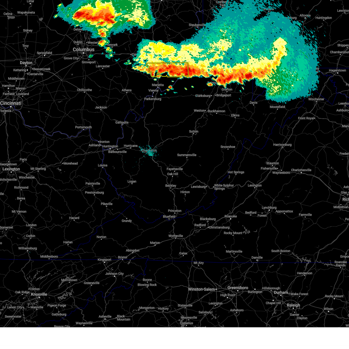 At 314 am edt, severe thunderstorms were located along a line extending from near beverly to new martinsville, moving southeast at 35 mph (radar indicated). Hazards include 60 mph wind gusts and penny size hail. Expect damage to trees and power lines, resulting in some power outages. locations impacted include, new martinsville, woodsfield, caldwell, paden city, dudley, sardis, clarington, summerfield, belle valley, lewisville, dexter city, cameron, antioch, stafford, graysville, harriettsville, hannibal, rinard mills, laings, and proctor. hail threat, radar indicated max hail size, 0. 75 in wind threat, radar indicated max wind gust, 60 mph. At 314 am edt, severe thunderstorms were located along a line extending from near beverly to new martinsville, moving southeast at 35 mph (radar indicated). Hazards include 60 mph wind gusts and penny size hail. Expect damage to trees and power lines, resulting in some power outages. locations impacted include, new martinsville, woodsfield, caldwell, paden city, dudley, sardis, clarington, summerfield, belle valley, lewisville, dexter city, cameron, antioch, stafford, graysville, harriettsville, hannibal, rinard mills, laings, and proctor. hail threat, radar indicated max hail size, 0. 75 in wind threat, radar indicated max wind gust, 60 mph.
|
| 8/25/2023 3:02 AM EDT |
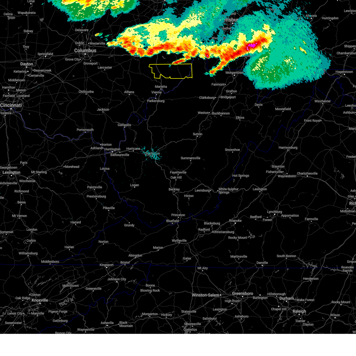 At 302 am edt, severe thunderstorms were located along a line extending from 7 miles east of mcconnelsville to near new martinsville, moving southeast at 35 mph (radar indicated). Hazards include 60 mph wind gusts and penny size hail. expect damage to trees and power lines, resulting in some power outages At 302 am edt, severe thunderstorms were located along a line extending from 7 miles east of mcconnelsville to near new martinsville, moving southeast at 35 mph (radar indicated). Hazards include 60 mph wind gusts and penny size hail. expect damage to trees and power lines, resulting in some power outages
|
| 4/5/2023 6:13 PM EDT |
 At 613 pm edt, severe thunderstorms were located along a line extending from 6 miles north of dresden to 6 miles east of zanesville to 6 miles southeast of south zanesville, moving east at 60 mph (radar indicated). Hazards include 60 mph wind gusts. Expect damage to trees and power lines, resulting in some power outages. locations impacted include, zanesville, coshocton, cambridge, newcomerstown, new concord, byesville, west lafayette, south zanesville, north zanesville, dresden, frazeysburg, and antrim. hail threat, radar indicated max hail size, <. 75 in wind threat, radar indicated max wind gust, 60 mph. At 613 pm edt, severe thunderstorms were located along a line extending from 6 miles north of dresden to 6 miles east of zanesville to 6 miles southeast of south zanesville, moving east at 60 mph (radar indicated). Hazards include 60 mph wind gusts. Expect damage to trees and power lines, resulting in some power outages. locations impacted include, zanesville, coshocton, cambridge, newcomerstown, new concord, byesville, west lafayette, south zanesville, north zanesville, dresden, frazeysburg, and antrim. hail threat, radar indicated max hail size, <. 75 in wind threat, radar indicated max wind gust, 60 mph.
|
| 4/5/2023 6:02 PM EDT |
 At 602 pm edt, severe thunderstorms were located along a line extending from 7 miles northwest of frazeysburg to south zanesville to near perry state forest, moving east at 60 mph (radar indicated). Hazards include 60 mph wind gusts. Expect damage to trees and power lines, resulting in some power outages. locations impacted include, zanesville, coshocton, cambridge, newcomerstown, new concord, byesville, west lafayette, south zanesville, north zanesville, dresden, frazeysburg, and antrim. hail threat, radar indicated max hail size, <. 75 in wind threat, radar indicated max wind gust, 60 mph. At 602 pm edt, severe thunderstorms were located along a line extending from 7 miles northwest of frazeysburg to south zanesville to near perry state forest, moving east at 60 mph (radar indicated). Hazards include 60 mph wind gusts. Expect damage to trees and power lines, resulting in some power outages. locations impacted include, zanesville, coshocton, cambridge, newcomerstown, new concord, byesville, west lafayette, south zanesville, north zanesville, dresden, frazeysburg, and antrim. hail threat, radar indicated max hail size, <. 75 in wind threat, radar indicated max wind gust, 60 mph.
|
| 4/5/2023 5:51 PM EDT |
 At 550 pm edt, severe thunderstorms were located along a line extending from near utica to 7 miles northwest of perry state forest to near somerset, moving east at 60 mph (radar indicated). Hazards include 60 mph wind gusts. expect damage to trees and power lines, resulting in some power outages At 550 pm edt, severe thunderstorms were located along a line extending from near utica to 7 miles northwest of perry state forest to near somerset, moving east at 60 mph (radar indicated). Hazards include 60 mph wind gusts. expect damage to trees and power lines, resulting in some power outages
|
| 6/22/2022 6:27 PM EDT |
 At 627 pm edt, a severe thunderstorm was located near caldwell, moving southeast at 30 mph (radar indicated). Hazards include 60 mph wind gusts. Expect damage to trees and power lines, resulting in some power outages. locations impacted include, caldwell, dudley, belle valley, sarahsville, dexter city, stafford, graysville, harriettsville, wolf run state park, and rinard mills. hail threat, radar indicated max hail size, <. 75 in wind threat, radar indicated max wind gust, 60 mph. At 627 pm edt, a severe thunderstorm was located near caldwell, moving southeast at 30 mph (radar indicated). Hazards include 60 mph wind gusts. Expect damage to trees and power lines, resulting in some power outages. locations impacted include, caldwell, dudley, belle valley, sarahsville, dexter city, stafford, graysville, harriettsville, wolf run state park, and rinard mills. hail threat, radar indicated max hail size, <. 75 in wind threat, radar indicated max wind gust, 60 mph.
|
| 6/22/2022 6:16 PM EDT |
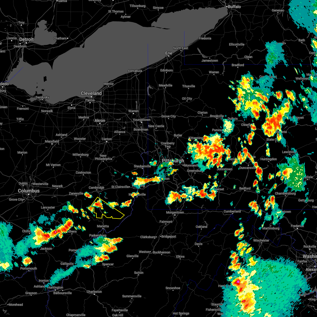 At 616 pm edt, a severe thunderstorm was located over caldwell, moving southeast at 30 mph (radar indicated). Hazards include 60 mph wind gusts. Expect damage to trees and power lines, resulting in some power outages. locations impacted include, caldwell, dudley, pleasant city, summerfield, belle valley, sarahsville, dexter city, antioch, stafford, graysville, harriettsville, and wolf run state park. hail threat, radar indicated max hail size, <. 75 in wind threat, radar indicated max wind gust, 60 mph. At 616 pm edt, a severe thunderstorm was located over caldwell, moving southeast at 30 mph (radar indicated). Hazards include 60 mph wind gusts. Expect damage to trees and power lines, resulting in some power outages. locations impacted include, caldwell, dudley, pleasant city, summerfield, belle valley, sarahsville, dexter city, antioch, stafford, graysville, harriettsville, and wolf run state park. hail threat, radar indicated max hail size, <. 75 in wind threat, radar indicated max wind gust, 60 mph.
|
| 6/22/2022 6:09 PM EDT |
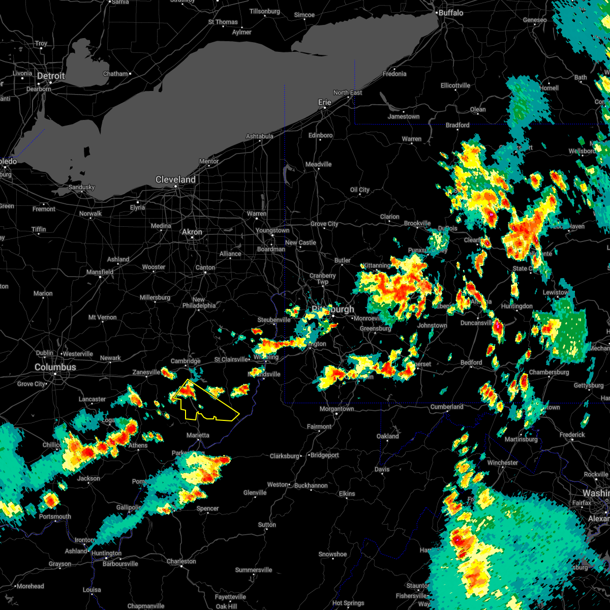 At 609 pm edt, a severe thunderstorm was located near caldwell, moving southeast at 30 mph (radar indicated). Hazards include 60 mph wind gusts. expect damage to trees and power lines, resulting in some power outages At 609 pm edt, a severe thunderstorm was located near caldwell, moving southeast at 30 mph (radar indicated). Hazards include 60 mph wind gusts. expect damage to trees and power lines, resulting in some power outages
|
| 6/22/2022 4:21 PM EDT |
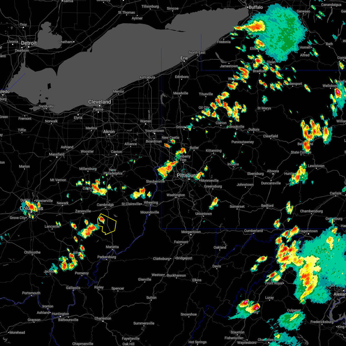 At 421 pm edt, a severe thunderstorm was located 10 miles south of new concord, or 11 miles northwest of caldwell, moving southeast at 10 mph (radar indicated). Hazards include 60 mph wind gusts. Expect damage to trees and power lines, resulting in some power outages. locations impacted include, caldwell, dudley, cumberland, belle valley, sarahsville, and wolf run state park. hail threat, radar indicated max hail size, <. 75 in wind threat, radar indicated max wind gust, 60 mph. At 421 pm edt, a severe thunderstorm was located 10 miles south of new concord, or 11 miles northwest of caldwell, moving southeast at 10 mph (radar indicated). Hazards include 60 mph wind gusts. Expect damage to trees and power lines, resulting in some power outages. locations impacted include, caldwell, dudley, cumberland, belle valley, sarahsville, and wolf run state park. hail threat, radar indicated max hail size, <. 75 in wind threat, radar indicated max wind gust, 60 mph.
|
| 6/22/2022 4:11 PM EDT |
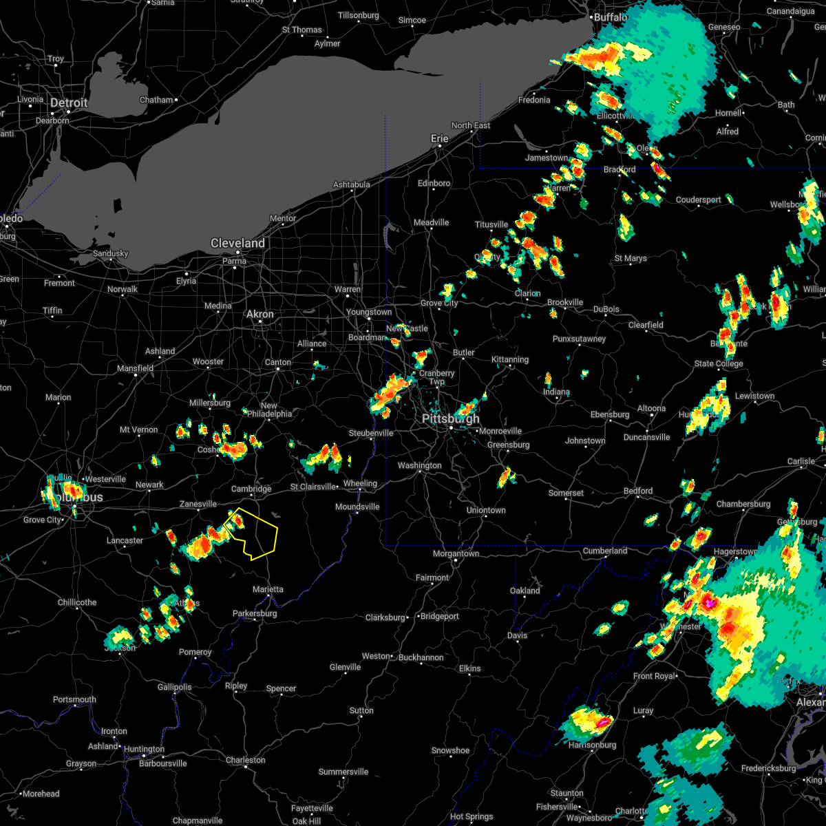 At 411 pm edt, a severe thunderstorm was located 9 miles south of new concord, or 12 miles southwest of cambridge, moving southeast at 10 mph (radar indicated). Hazards include 60 mph wind gusts. expect damage to trees and power lines, resulting in some power outages At 411 pm edt, a severe thunderstorm was located 9 miles south of new concord, or 12 miles southwest of cambridge, moving southeast at 10 mph (radar indicated). Hazards include 60 mph wind gusts. expect damage to trees and power lines, resulting in some power outages
|
| 6/16/2022 8:23 PM EDT |
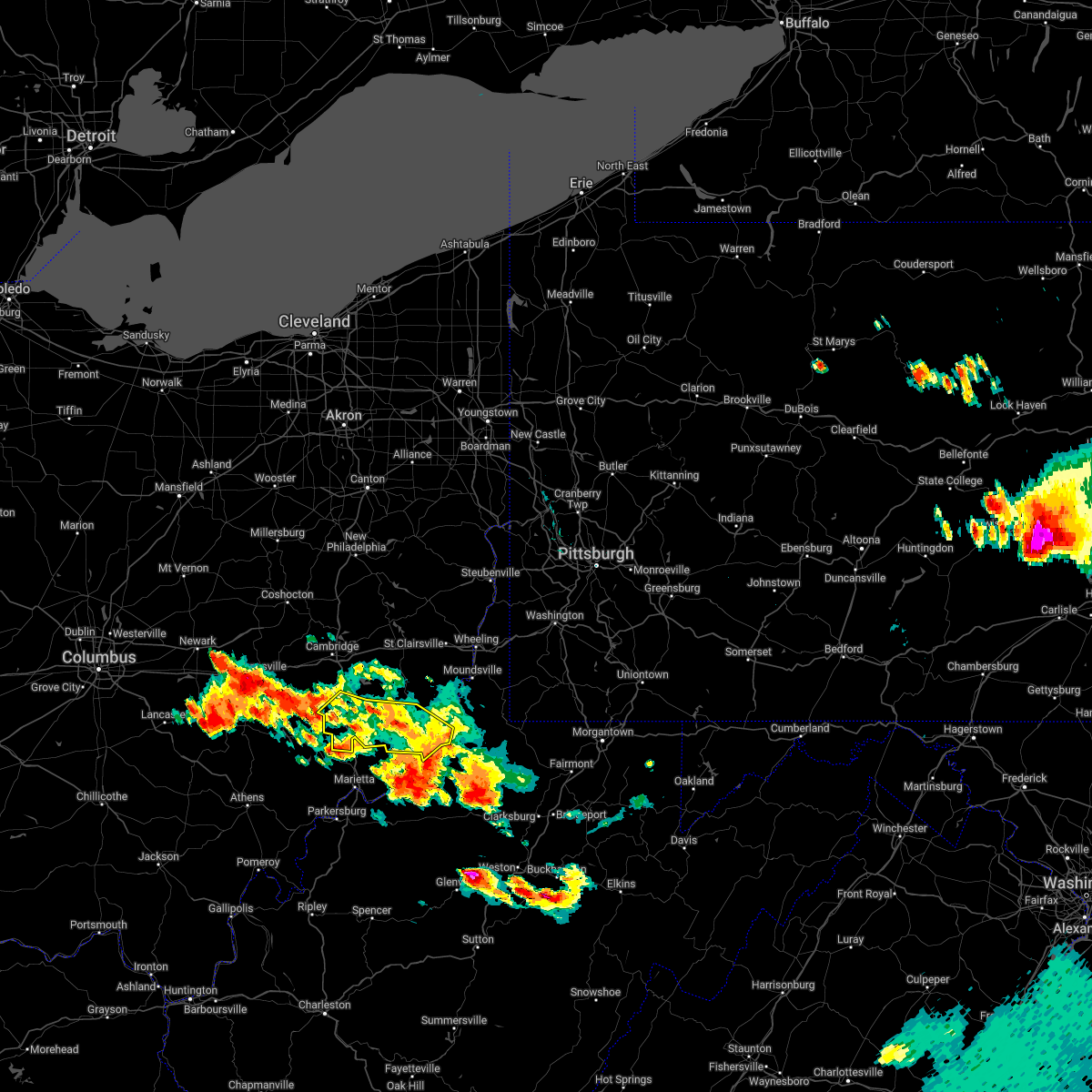 The severe thunderstorm warning for monroe and noble counties will expire at 830 pm edt, the storm which prompted the warning has weakened below severe limits, and has exited the warned area. therefore, the warning will be allowed to expire. however gusty winds and heavy rain are still possible with this thunderstorm. a severe thunderstorm watch remains in effect until 900 pm edt for east central ohio. The severe thunderstorm warning for monroe and noble counties will expire at 830 pm edt, the storm which prompted the warning has weakened below severe limits, and has exited the warned area. therefore, the warning will be allowed to expire. however gusty winds and heavy rain are still possible with this thunderstorm. a severe thunderstorm watch remains in effect until 900 pm edt for east central ohio.
|
| 6/16/2022 8:02 PM EDT |
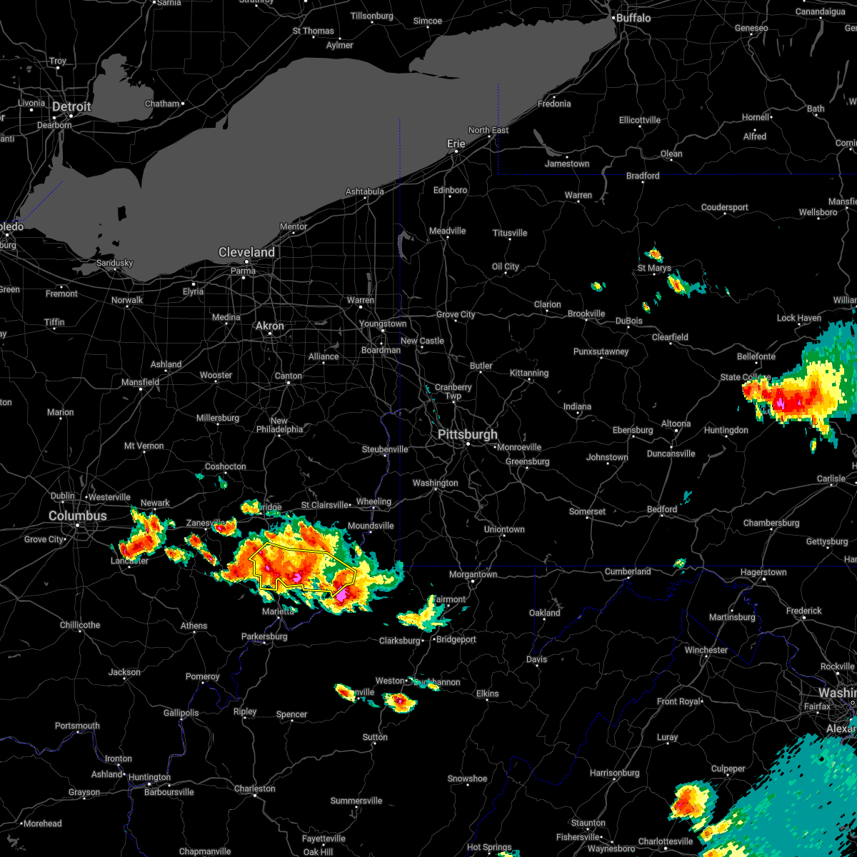 At 802 pm edt, a severe thunderstorm was located over middlebourne, moving southeast at 35 mph (radar indicated). Hazards include 60 mph wind gusts and quarter size hail. Minor hail damage to vehicles is possible. expect wind damage to trees and power lines, resulting in some power outages. locations impacted include, new martinsville, woodsfield, caldwell, dudley, sardis, summerfield, belle valley, lewisville, sarahsville, dexter city, fly, and antioch. hail threat, radar indicated max hail size, 1. 00 in wind threat, radar indicated max wind gust, 60 mph. At 802 pm edt, a severe thunderstorm was located over middlebourne, moving southeast at 35 mph (radar indicated). Hazards include 60 mph wind gusts and quarter size hail. Minor hail damage to vehicles is possible. expect wind damage to trees and power lines, resulting in some power outages. locations impacted include, new martinsville, woodsfield, caldwell, dudley, sardis, summerfield, belle valley, lewisville, sarahsville, dexter city, fly, and antioch. hail threat, radar indicated max hail size, 1. 00 in wind threat, radar indicated max wind gust, 60 mph.
|
| 6/16/2022 7:41 PM EDT |
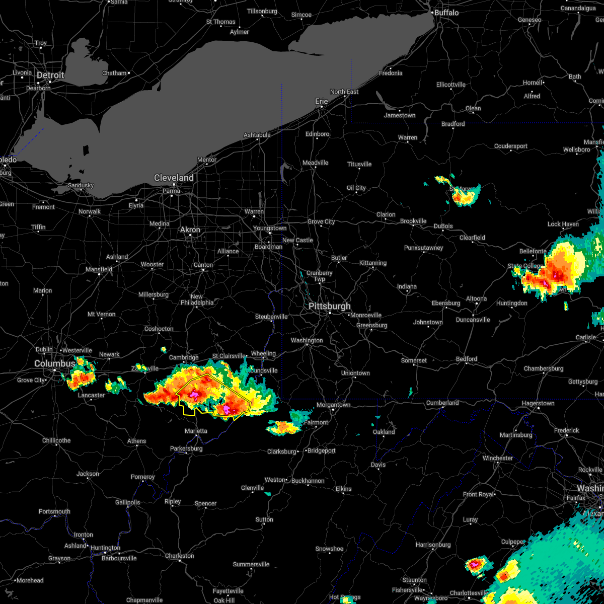 At 741 pm edt, a severe thunderstorm was located near sistersville, or 11 miles south of woodsfield, moving southeast at 35 mph (radar indicated). Hazards include 70 mph wind gusts and ping pong ball size hail. People and animals outdoors will be injured. expect hail damage to roofs, siding, windows, and vehicles. trees snapped and uprooted. Power outages can be expected. At 741 pm edt, a severe thunderstorm was located near sistersville, or 11 miles south of woodsfield, moving southeast at 35 mph (radar indicated). Hazards include 70 mph wind gusts and ping pong ball size hail. People and animals outdoors will be injured. expect hail damage to roofs, siding, windows, and vehicles. trees snapped and uprooted. Power outages can be expected.
|
| 6/16/2022 7:16 PM EDT |
 At 716 pm edt, a severe thunderstorm was located 10 miles southwest of woodsfield, moving southeast at 35 mph (radar indicated). Hazards include two inch hail and 60 mph wind gusts. People and animals outdoors will be injured. expect hail damage to roofs, siding, windows, and vehicles. expect wind damage to trees and power lines, resulting in some power outages. locations impacted include, caldwell, dudley, summerfield, belle valley, lewisville, sarahsville, dexter city, fly, antioch, stafford, graysville, and harriettsville. thunderstorm damage threat, considerable hail threat, radar indicated max hail size, 2. 00 in wind threat, radar indicated max wind gust, 60 mph. At 716 pm edt, a severe thunderstorm was located 10 miles southwest of woodsfield, moving southeast at 35 mph (radar indicated). Hazards include two inch hail and 60 mph wind gusts. People and animals outdoors will be injured. expect hail damage to roofs, siding, windows, and vehicles. expect wind damage to trees and power lines, resulting in some power outages. locations impacted include, caldwell, dudley, summerfield, belle valley, lewisville, sarahsville, dexter city, fly, antioch, stafford, graysville, and harriettsville. thunderstorm damage threat, considerable hail threat, radar indicated max hail size, 2. 00 in wind threat, radar indicated max wind gust, 60 mph.
|
| 6/16/2022 7:16 PM EDT |
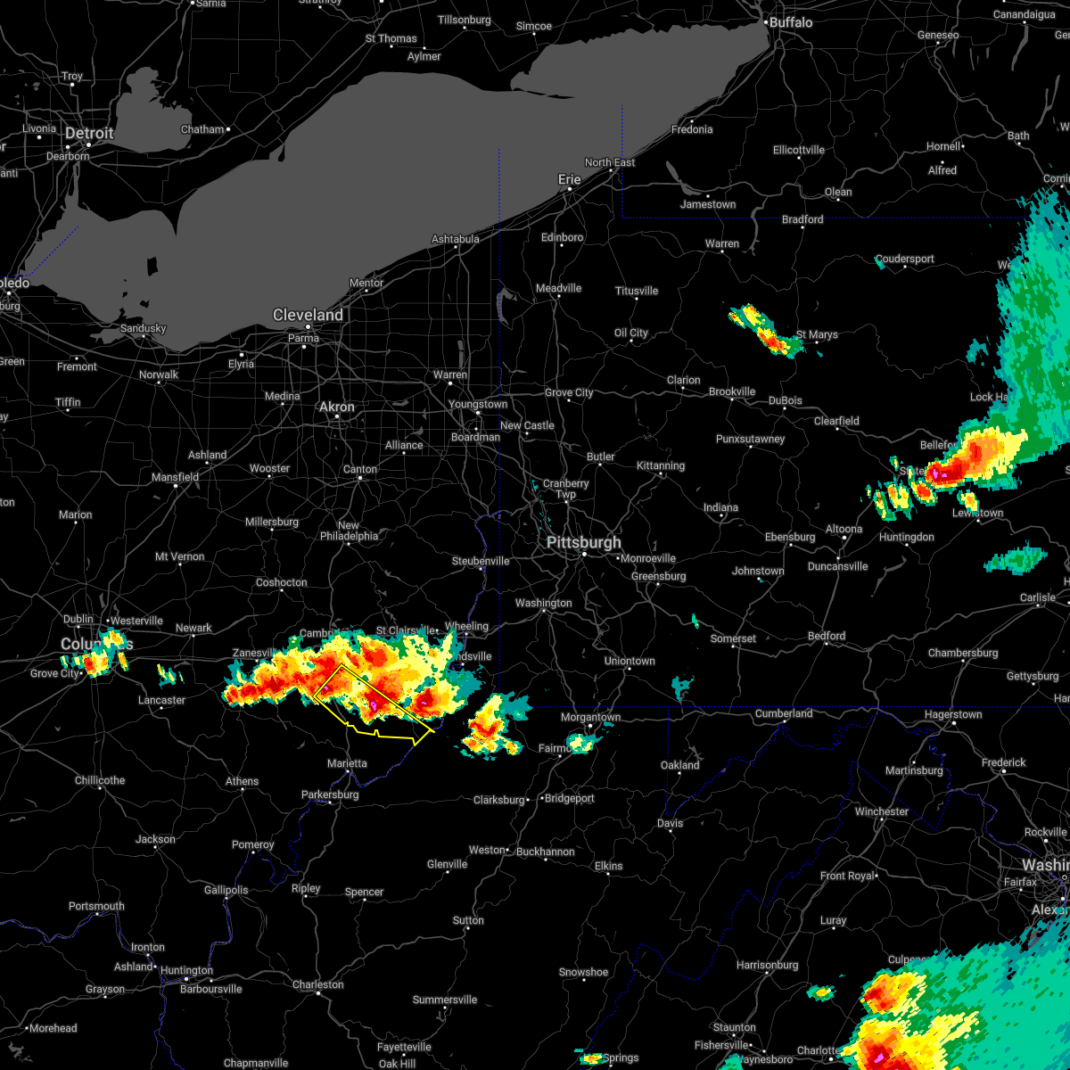 At 716 pm edt, a severe thunderstorm was located 10 miles southwest of woodsfield, moving southeast at 35 mph (radar indicated). Hazards include two inch hail and 60 mph wind gusts. People and animals outdoors will be injured. expect hail damage to roofs, siding, windows, and vehicles. expect wind damage to trees and power lines, resulting in some power outages. locations impacted include, caldwell, dudley, summerfield, belle valley, lewisville, sarahsville, dexter city, fly, antioch, stafford, graysville, and harriettsville. thunderstorm damage threat, considerable hail threat, radar indicated max hail size, 2. 00 in wind threat, radar indicated max wind gust, 60 mph. At 716 pm edt, a severe thunderstorm was located 10 miles southwest of woodsfield, moving southeast at 35 mph (radar indicated). Hazards include two inch hail and 60 mph wind gusts. People and animals outdoors will be injured. expect hail damage to roofs, siding, windows, and vehicles. expect wind damage to trees and power lines, resulting in some power outages. locations impacted include, caldwell, dudley, summerfield, belle valley, lewisville, sarahsville, dexter city, fly, antioch, stafford, graysville, and harriettsville. thunderstorm damage threat, considerable hail threat, radar indicated max hail size, 2. 00 in wind threat, radar indicated max wind gust, 60 mph.
|
| 6/16/2022 7:01 PM EDT |
 At 701 pm edt, a severe thunderstorm was located 11 miles northeast of caldwell, moving southeast at 40 mph (radar indicated). Hazards include 60 mph wind gusts and half dollar size hail. Minor hail damage to vehicles is possible. expect wind damage to trees and power lines, resulting in some power outages. locations impacted include, cambridge, caldwell, new concord, byesville, pleasant city, cumberland, summerfield, belle valley, sarahsville, norwich, and wolf run state park. hail threat, radar indicated max hail size, 1. 25 in wind threat, radar indicated max wind gust, 60 mph. At 701 pm edt, a severe thunderstorm was located 11 miles northeast of caldwell, moving southeast at 40 mph (radar indicated). Hazards include 60 mph wind gusts and half dollar size hail. Minor hail damage to vehicles is possible. expect wind damage to trees and power lines, resulting in some power outages. locations impacted include, cambridge, caldwell, new concord, byesville, pleasant city, cumberland, summerfield, belle valley, sarahsville, norwich, and wolf run state park. hail threat, radar indicated max hail size, 1. 25 in wind threat, radar indicated max wind gust, 60 mph.
|
| 6/16/2022 6:53 PM EDT |
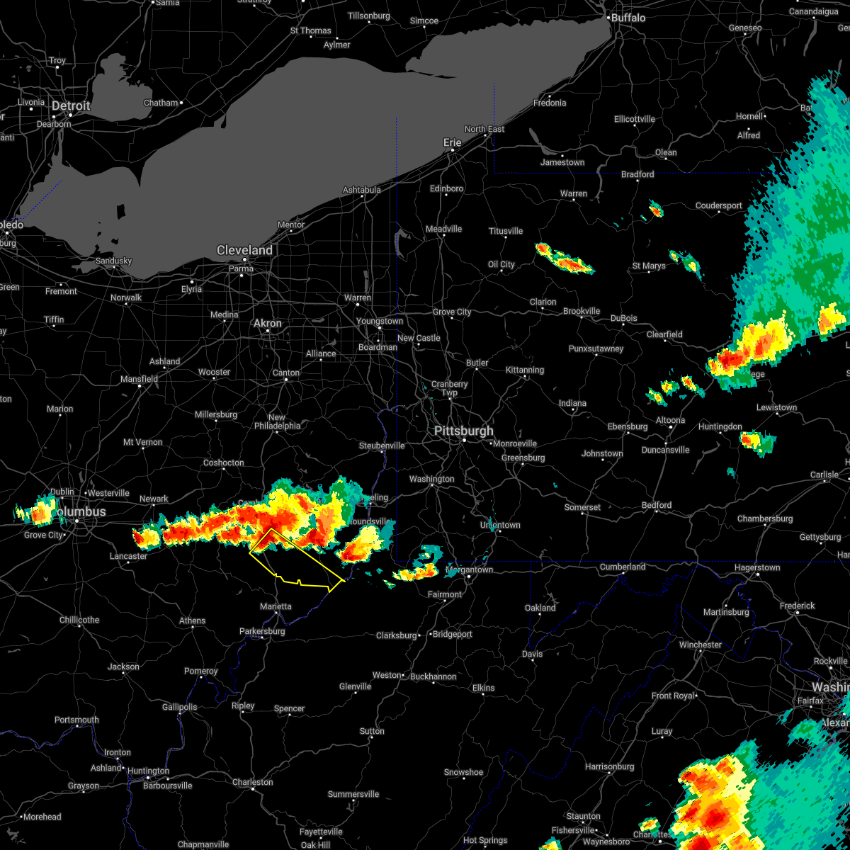 At 653 pm edt, a severe thunderstorm was located near caldwell, moving southeast at 35 mph (radar indicated). Hazards include ping pong ball size hail and 60 mph wind gusts. People and animals outdoors will be injured. expect hail damage to roofs, siding, windows, and vehicles. Expect wind damage to trees and power lines, resulting in some power outages. At 653 pm edt, a severe thunderstorm was located near caldwell, moving southeast at 35 mph (radar indicated). Hazards include ping pong ball size hail and 60 mph wind gusts. People and animals outdoors will be injured. expect hail damage to roofs, siding, windows, and vehicles. Expect wind damage to trees and power lines, resulting in some power outages.
|
| 6/16/2022 6:38 PM EDT |
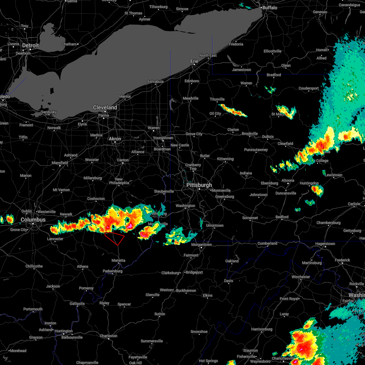 At 638 pm edt, a severe thunderstorm capable of producing a tornado was located 9 miles northwest of caldwell, moving southeast at 40 mph (radar indicated rotation). Hazards include tornado. Flying debris will be dangerous to those caught without shelter. mobile homes will be damaged or destroyed. damage to roofs, windows, and vehicles will occur. tree damage is likely. this dangerous storm will be near, caldwell around 655 pm edt. Other locations impacted by this tornadic thunderstorm include sarahsville, wolf run state park, dudley, belle valley and dexter city. At 638 pm edt, a severe thunderstorm capable of producing a tornado was located 9 miles northwest of caldwell, moving southeast at 40 mph (radar indicated rotation). Hazards include tornado. Flying debris will be dangerous to those caught without shelter. mobile homes will be damaged or destroyed. damage to roofs, windows, and vehicles will occur. tree damage is likely. this dangerous storm will be near, caldwell around 655 pm edt. Other locations impacted by this tornadic thunderstorm include sarahsville, wolf run state park, dudley, belle valley and dexter city.
|
| 6/16/2022 6:33 PM EDT |
 At 632 pm edt, a severe thunderstorm was located near byesville, or near cambridge, moving southeast at 40 mph (radar indicated). Hazards include 60 mph wind gusts and quarter size hail. Minor hail damage to vehicles is possible. Expect wind damage to trees and power lines, resulting in some power outages. At 632 pm edt, a severe thunderstorm was located near byesville, or near cambridge, moving southeast at 40 mph (radar indicated). Hazards include 60 mph wind gusts and quarter size hail. Minor hail damage to vehicles is possible. Expect wind damage to trees and power lines, resulting in some power outages.
|
| 6/14/2022 4:31 AM EDT |
 At 430 am edt, severe thunderstorms were located along a line extending from 6 miles northwest of woodsfield to 7 miles northeast of beverly, moving southeast at 55 mph (radar indicated). Hazards include 60 mph wind gusts and nickel size hail. expect damage to trees and power lines, resulting in some power outages At 430 am edt, severe thunderstorms were located along a line extending from 6 miles northwest of woodsfield to 7 miles northeast of beverly, moving southeast at 55 mph (radar indicated). Hazards include 60 mph wind gusts and nickel size hail. expect damage to trees and power lines, resulting in some power outages
|
| 6/14/2022 4:31 AM EDT |
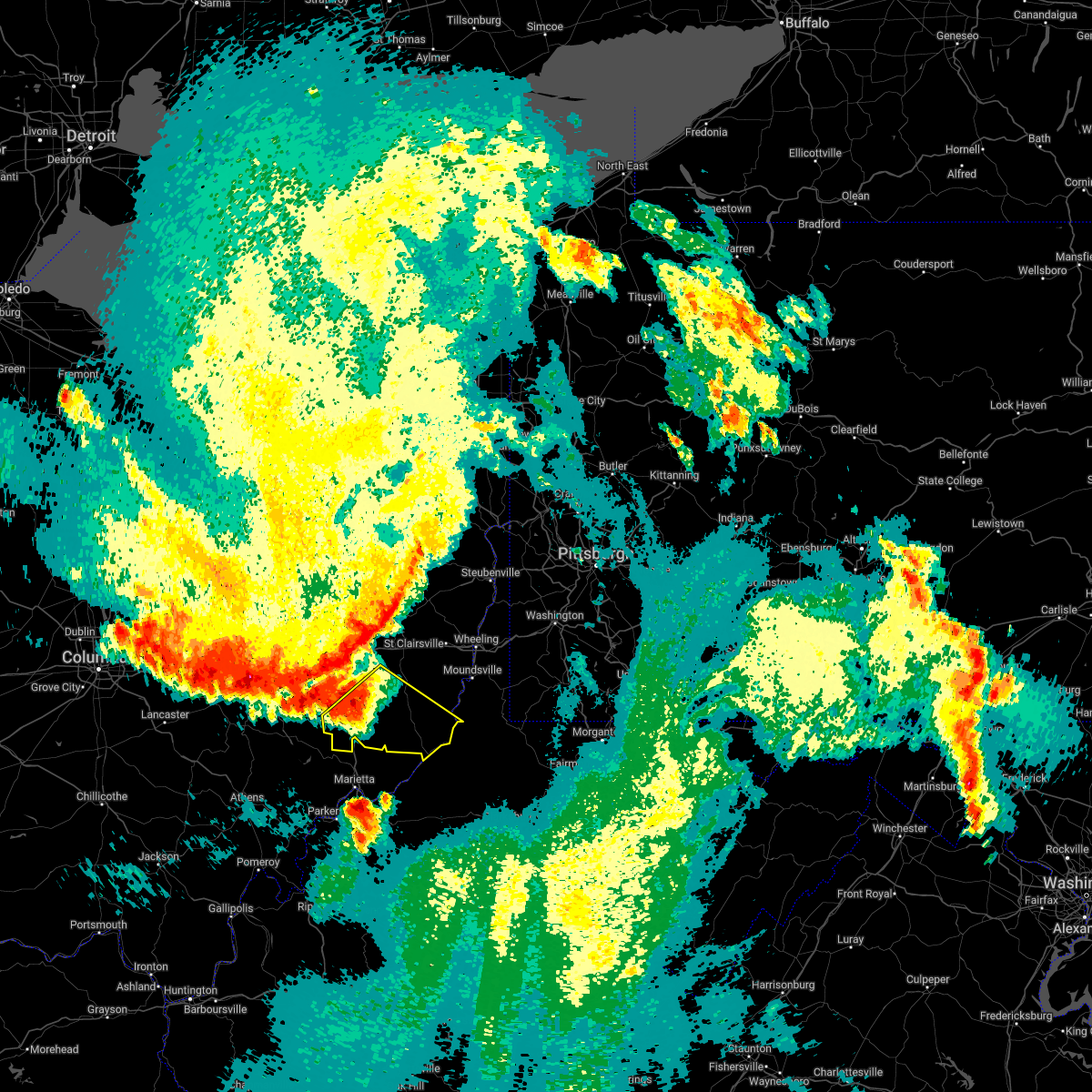 At 430 am edt, severe thunderstorms were located along a line extending from 6 miles northwest of woodsfield to 7 miles northeast of beverly, moving southeast at 55 mph (radar indicated). Hazards include 60 mph wind gusts and nickel size hail. expect damage to trees and power lines, resulting in some power outages At 430 am edt, severe thunderstorms were located along a line extending from 6 miles northwest of woodsfield to 7 miles northeast of beverly, moving southeast at 55 mph (radar indicated). Hazards include 60 mph wind gusts and nickel size hail. expect damage to trees and power lines, resulting in some power outages
|
| 6/14/2022 4:06 AM EDT |
 At 406 am edt, a severe thunderstorm was located over new concord, or 10 miles west of cambridge, moving southeast at 60 mph (radar indicated). Hazards include 60 mph wind gusts and penny size hail. expect damage to trees and power lines, resulting in some power outages At 406 am edt, a severe thunderstorm was located over new concord, or 10 miles west of cambridge, moving southeast at 60 mph (radar indicated). Hazards include 60 mph wind gusts and penny size hail. expect damage to trees and power lines, resulting in some power outages
|
| 6/14/2022 12:42 AM EDT |
 At 1242 am edt, severe thunderstorms were located along a line extending from 6 miles southeast of byesville to 6 miles west of mcconnelsville, moving east at 50 mph (radar indicated). Hazards include 60 mph wind gusts and quarter size hail. Minor hail damage to vehicles is possible. Expect wind damage to trees and power lines, resulting in some power outages. At 1242 am edt, severe thunderstorms were located along a line extending from 6 miles southeast of byesville to 6 miles west of mcconnelsville, moving east at 50 mph (radar indicated). Hazards include 60 mph wind gusts and quarter size hail. Minor hail damage to vehicles is possible. Expect wind damage to trees and power lines, resulting in some power outages.
|
| 6/8/2022 7:51 PM EDT |
 At 751 pm edt, a severe thunderstorm was located 9 miles east of byesville, or 10 miles west of barnesville, moving east at 35 mph (radar indicated). Hazards include 60 mph wind gusts and quarter size hail. Minor hail damage to vehicles is possible. Expect wind damage to trees and power lines, resulting in some power outages. At 751 pm edt, a severe thunderstorm was located 9 miles east of byesville, or 10 miles west of barnesville, moving east at 35 mph (radar indicated). Hazards include 60 mph wind gusts and quarter size hail. Minor hail damage to vehicles is possible. Expect wind damage to trees and power lines, resulting in some power outages.
|
| 6/8/2022 7:49 PM EDT |
 At 748 pm edt, a severe thunderstorm was located over byesville, or near cambridge, moving east at 20 mph (radar indicated). Hazards include 60 mph wind gusts and quarter size hail. Minor hail damage to vehicles is possible. expect wind damage to trees and power lines, resulting in some power outages. Locations impacted include, cambridge, byesville, quaker city, senecaville, pleasant city, cumberland, lore city, old washington, summerfield, belle valley, sarahsville, and salesville. At 748 pm edt, a severe thunderstorm was located over byesville, or near cambridge, moving east at 20 mph (radar indicated). Hazards include 60 mph wind gusts and quarter size hail. Minor hail damage to vehicles is possible. expect wind damage to trees and power lines, resulting in some power outages. Locations impacted include, cambridge, byesville, quaker city, senecaville, pleasant city, cumberland, lore city, old washington, summerfield, belle valley, sarahsville, and salesville.
|
| 6/8/2022 7:42 PM EDT |
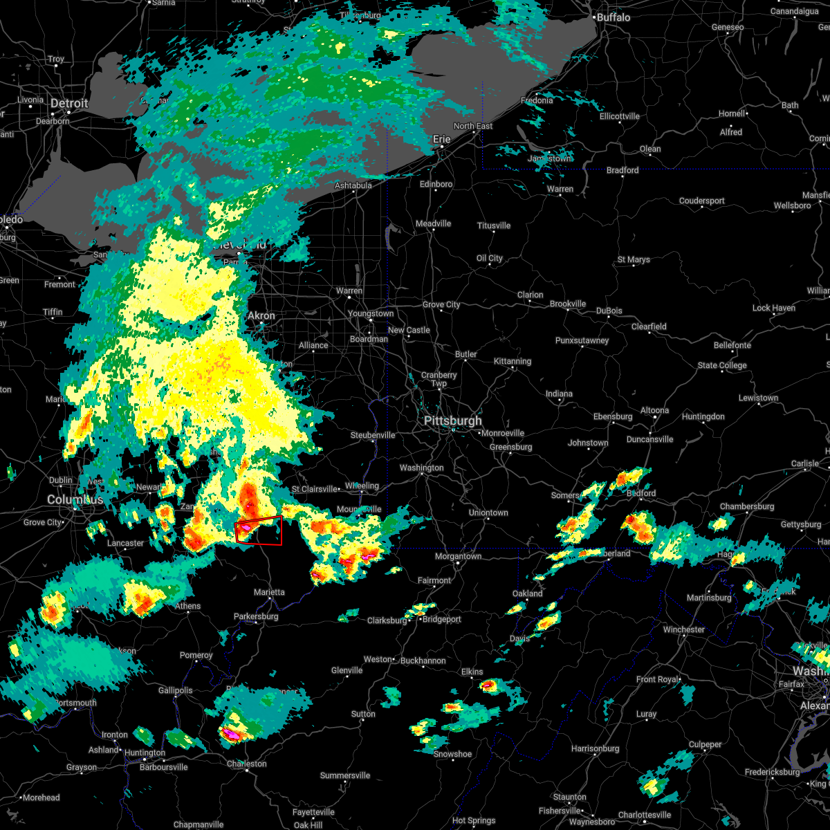 At 742 pm edt, a severe thunderstorm capable of producing a tornado was located 7 miles northwest of caldwell, moving east at 30 mph (radar indicated rotation). Hazards include tornado and golf ball size hail. Flying debris will be dangerous to those caught without shelter. mobile homes will be damaged or destroyed. damage to roofs, windows, and vehicles will occur. tree damage is likely. this dangerous storm will be near, caldwell around 750 pm edt. Other locations impacted by this tornadic thunderstorm include sarahsville, seneca lake park, wolf run state park, cumberland and belle valley. At 742 pm edt, a severe thunderstorm capable of producing a tornado was located 7 miles northwest of caldwell, moving east at 30 mph (radar indicated rotation). Hazards include tornado and golf ball size hail. Flying debris will be dangerous to those caught without shelter. mobile homes will be damaged or destroyed. damage to roofs, windows, and vehicles will occur. tree damage is likely. this dangerous storm will be near, caldwell around 750 pm edt. Other locations impacted by this tornadic thunderstorm include sarahsville, seneca lake park, wolf run state park, cumberland and belle valley.
|
| 6/8/2022 7:34 PM EDT |
 At 733 pm edt, a severe thunderstorm was located near new concord, or 7 miles southwest of cambridge, moving east at 20 mph (radar indicated). Hazards include 60 mph wind gusts and quarter size hail. Minor hail damage to vehicles is possible. Expect wind damage to trees and power lines, resulting in some power outages. At 733 pm edt, a severe thunderstorm was located near new concord, or 7 miles southwest of cambridge, moving east at 20 mph (radar indicated). Hazards include 60 mph wind gusts and quarter size hail. Minor hail damage to vehicles is possible. Expect wind damage to trees and power lines, resulting in some power outages.
|
| 6/8/2022 7:28 PM EDT |
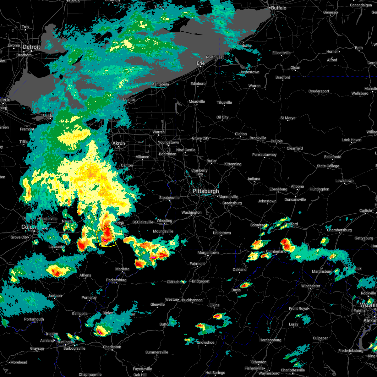 At 728 pm edt, a severe thunderstorm was located 11 miles southwest of new concord, or 12 miles southeast of zanesville, moving northeast at 20 mph (radar indicated). Hazards include 60 mph wind gusts and quarter size hail. Minor hail damage to vehicles is possible. expect wind damage to trees and power lines, resulting in some power outages. Locations impacted include, new concord, cumberland, norwich, chandlersville, ruraldale, high hill, and blue rock state park. At 728 pm edt, a severe thunderstorm was located 11 miles southwest of new concord, or 12 miles southeast of zanesville, moving northeast at 20 mph (radar indicated). Hazards include 60 mph wind gusts and quarter size hail. Minor hail damage to vehicles is possible. expect wind damage to trees and power lines, resulting in some power outages. Locations impacted include, new concord, cumberland, norwich, chandlersville, ruraldale, high hill, and blue rock state park.
|
| 6/8/2022 7:11 PM EDT |
 At 710 pm edt, a severe thunderstorm was located 7 miles southeast of south zanesville, or 10 miles southeast of zanesville, moving east at 20 mph (radar indicated). Hazards include 60 mph wind gusts and quarter size hail. Minor hail damage to vehicles is possible. Expect wind damage to trees and power lines, resulting in some power outages. At 710 pm edt, a severe thunderstorm was located 7 miles southeast of south zanesville, or 10 miles southeast of zanesville, moving east at 20 mph (radar indicated). Hazards include 60 mph wind gusts and quarter size hail. Minor hail damage to vehicles is possible. Expect wind damage to trees and power lines, resulting in some power outages.
|
| 6/1/2022 8:39 PM EDT |
 At 839 pm edt, a severe thunderstorm was located 8 miles southeast of byesville, or 11 miles northeast of caldwell, moving east at 45 mph (radar indicated). Hazards include 60 mph wind gusts. Expect damage to trees and power lines, resulting in some power outages. locations impacted include, cambridge, caldwell, new concord, byesville, philo, quaker city, senecaville, pleasant city, cumberland, lore city, old washington, and summerfield. hail threat, radar indicated max hail size, <. 75 in wind threat, radar indicated max wind gust, 60 mph. At 839 pm edt, a severe thunderstorm was located 8 miles southeast of byesville, or 11 miles northeast of caldwell, moving east at 45 mph (radar indicated). Hazards include 60 mph wind gusts. Expect damage to trees and power lines, resulting in some power outages. locations impacted include, cambridge, caldwell, new concord, byesville, philo, quaker city, senecaville, pleasant city, cumberland, lore city, old washington, and summerfield. hail threat, radar indicated max hail size, <. 75 in wind threat, radar indicated max wind gust, 60 mph.
|
| 6/1/2022 8:21 PM EDT |
 At 821 pm edt, a severe thunderstorm was located near byesville, or near cambridge, moving east at 40 mph (radar indicated). Hazards include 60 mph wind gusts. expect damage to trees and power lines, resulting in some power outages At 821 pm edt, a severe thunderstorm was located near byesville, or near cambridge, moving east at 40 mph (radar indicated). Hazards include 60 mph wind gusts. expect damage to trees and power lines, resulting in some power outages
|
| 5/3/2022 6:36 PM EDT |
 At 635 pm edt, severe thunderstorms were located along a line extending from near west lafayette to near caldwell, moving northeast at 65 mph (radar indicated). Hazards include 60 mph wind gusts and quarter size hail. Minor hail damage to vehicles is possible. Expect wind damage to trees and power lines, resulting in some power outages. At 635 pm edt, severe thunderstorms were located along a line extending from near west lafayette to near caldwell, moving northeast at 65 mph (radar indicated). Hazards include 60 mph wind gusts and quarter size hail. Minor hail damage to vehicles is possible. Expect wind damage to trees and power lines, resulting in some power outages.
|
| 5/3/2022 6:21 PM EDT |
 At 621 pm edt, severe thunderstorms were located along a line extending from near dresden to 9 miles south of new concord, moving northeast at 50 mph (radar indicated). Hazards include 60 mph wind gusts. Expect damage to trees and power lines, resulting in some power outages. locations impacted include, zanesville, coshocton, cambridge, caldwell, new concord, byesville, west lafayette, south zanesville, north zanesville, dresden, philo, and pleasant grove. hail threat, radar indicated max hail size, <. 75 in wind threat, radar indicated max wind gust, 60 mph. At 621 pm edt, severe thunderstorms were located along a line extending from near dresden to 9 miles south of new concord, moving northeast at 50 mph (radar indicated). Hazards include 60 mph wind gusts. Expect damage to trees and power lines, resulting in some power outages. locations impacted include, zanesville, coshocton, cambridge, caldwell, new concord, byesville, west lafayette, south zanesville, north zanesville, dresden, philo, and pleasant grove. hail threat, radar indicated max hail size, <. 75 in wind threat, radar indicated max wind gust, 60 mph.
|
| 5/3/2022 5:53 PM EDT |
 At 553 pm edt, severe thunderstorms were located along a line extending from near harbor hills to near new lexington, moving northeast at 50 mph (radar indicated). Hazards include 60 mph wind gusts. expect damage to trees and power lines, resulting in some power outages At 553 pm edt, severe thunderstorms were located along a line extending from near harbor hills to near new lexington, moving northeast at 50 mph (radar indicated). Hazards include 60 mph wind gusts. expect damage to trees and power lines, resulting in some power outages
|
| 3/23/2022 7:42 PM EDT |
 The severe thunderstorm warning for central guernsey, northwestern monroe, southeastern muskingum, southwestern belmont and northern noble counties will expire at 745 pm edt, the storm which prompted the warning has moved out of the area. therefore, the warning will be allowed to expire. however gusty winds and heavy rain are still possible with this thunderstorm. a tornado watch remains in effect until 1000 pm edt for east central ohio. The severe thunderstorm warning for central guernsey, northwestern monroe, southeastern muskingum, southwestern belmont and northern noble counties will expire at 745 pm edt, the storm which prompted the warning has moved out of the area. therefore, the warning will be allowed to expire. however gusty winds and heavy rain are still possible with this thunderstorm. a tornado watch remains in effect until 1000 pm edt for east central ohio.
|
| 3/23/2022 7:19 PM EDT |
 At 719 pm edt, a severe thunderstorm was located near caldwell, moving northeast at 50 mph (radar indicated). Hazards include 60 mph wind gusts and penny size hail. Expect damage to trees and power lines, resulting in some power outages. locations impacted include, cambridge, barnesville, caldwell, byesville, dudley, antrim, quaker city, senecaville, pleasant city, beallsville, cumberland, and lore city. hail threat, radar indicated max hail size, 0. 75 in wind threat, radar indicated max wind gust, 60 mph. At 719 pm edt, a severe thunderstorm was located near caldwell, moving northeast at 50 mph (radar indicated). Hazards include 60 mph wind gusts and penny size hail. Expect damage to trees and power lines, resulting in some power outages. locations impacted include, cambridge, barnesville, caldwell, byesville, dudley, antrim, quaker city, senecaville, pleasant city, beallsville, cumberland, and lore city. hail threat, radar indicated max hail size, 0. 75 in wind threat, radar indicated max wind gust, 60 mph.
|
| 3/23/2022 7:09 PM EDT |
 At 709 pm edt, a severe thunderstorm was located near caldwell, moving northeast at 50 mph (radar indicated). Hazards include 60 mph wind gusts and penny size hail. expect damage to trees and power lines, resulting in some power outages At 709 pm edt, a severe thunderstorm was located near caldwell, moving northeast at 50 mph (radar indicated). Hazards include 60 mph wind gusts and penny size hail. expect damage to trees and power lines, resulting in some power outages
|
| 8/13/2021 5:29 PM EDT |
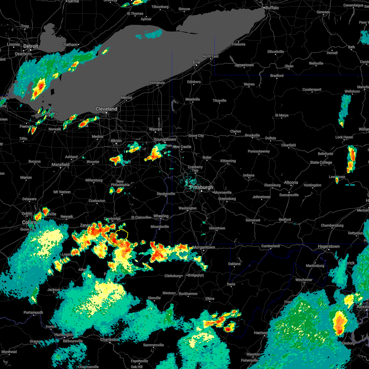 At 529 pm edt, a severe thunderstorm was located over caldwell, moving northeast at 25 mph (radar indicated). Hazards include 60 mph wind gusts and quarter size hail. Minor hail damage to vehicles is possible. Expect wind damage to trees and power lines, resulting in some power outages. At 529 pm edt, a severe thunderstorm was located over caldwell, moving northeast at 25 mph (radar indicated). Hazards include 60 mph wind gusts and quarter size hail. Minor hail damage to vehicles is possible. Expect wind damage to trees and power lines, resulting in some power outages.
|
| 8/11/2021 6:49 PM EDT |
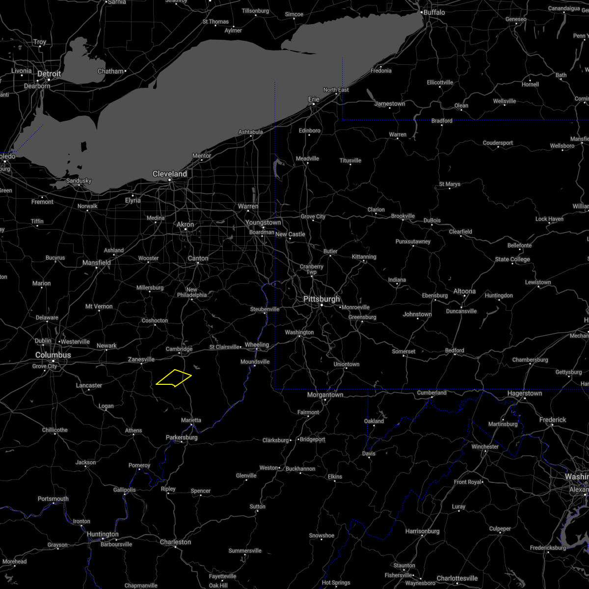 At 649 pm edt, a severe thunderstorm was located 7 miles northwest of caldwell, moving east at 40 mph (radar indicated). Hazards include 60 mph wind gusts. Expect damage to trees and power lines, resulting in some power outages. locations impacted include, cumberland, belle valley, and wolf run state park. hail threat, radar indicated max hail size, <. 75 in wind threat, radar indicated max wind gust, 60 mph. At 649 pm edt, a severe thunderstorm was located 7 miles northwest of caldwell, moving east at 40 mph (radar indicated). Hazards include 60 mph wind gusts. Expect damage to trees and power lines, resulting in some power outages. locations impacted include, cumberland, belle valley, and wolf run state park. hail threat, radar indicated max hail size, <. 75 in wind threat, radar indicated max wind gust, 60 mph.
|
| 8/11/2021 6:39 PM EDT |
 At 638 pm edt, a severe thunderstorm was located 10 miles south of new concord, or 13 miles north of mcconnelsville, moving east at 40 mph (radar indicated). Hazards include 60 mph wind gusts. Expect damage to trees and power lines, resulting in some power outages. locations impacted include, philo, cumberland, belle valley, chandlersville, ruraldale, bridgeville, cannelville, high hill, duncan falls, wolf run state park, and blue rock state park. hail threat, radar indicated max hail size, <. 75 in wind threat, radar indicated max wind gust, 60 mph. At 638 pm edt, a severe thunderstorm was located 10 miles south of new concord, or 13 miles north of mcconnelsville, moving east at 40 mph (radar indicated). Hazards include 60 mph wind gusts. Expect damage to trees and power lines, resulting in some power outages. locations impacted include, philo, cumberland, belle valley, chandlersville, ruraldale, bridgeville, cannelville, high hill, duncan falls, wolf run state park, and blue rock state park. hail threat, radar indicated max hail size, <. 75 in wind threat, radar indicated max wind gust, 60 mph.
|
| 8/11/2021 6:23 PM EDT |
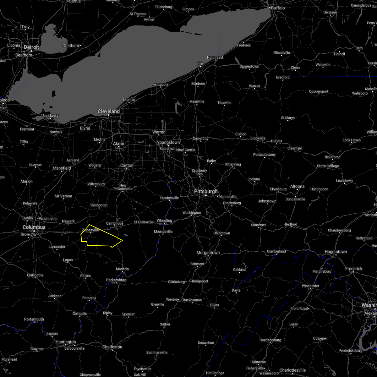 At 622 pm edt, a severe thunderstorm was located over south zanesville, or near zanesville, moving east at 40 mph (radar indicated). Hazards include 60 mph wind gusts. expect damage to trees and power lines, resulting in some power outages At 622 pm edt, a severe thunderstorm was located over south zanesville, or near zanesville, moving east at 40 mph (radar indicated). Hazards include 60 mph wind gusts. expect damage to trees and power lines, resulting in some power outages
|
| 7/29/2021 4:54 PM EDT |
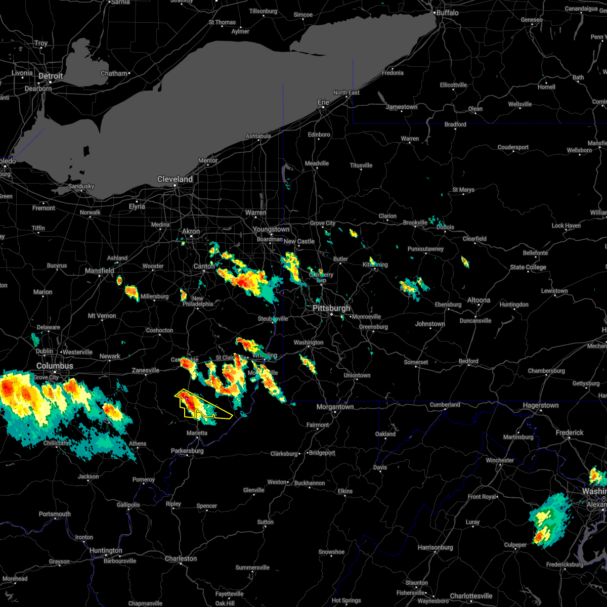 At 454 pm edt, a severe thunderstorm was located near caldwell, moving southeast at 30 mph (radar). Hazards include wind gusts to 60 mph and quarter-size hail. Minor hail damage to vehicles is possible. Expect wind damage to trees and power lines, resulting in some power outages. At 454 pm edt, a severe thunderstorm was located near caldwell, moving southeast at 30 mph (radar). Hazards include wind gusts to 60 mph and quarter-size hail. Minor hail damage to vehicles is possible. Expect wind damage to trees and power lines, resulting in some power outages.
|
| 7/29/2021 4:41 PM EDT |
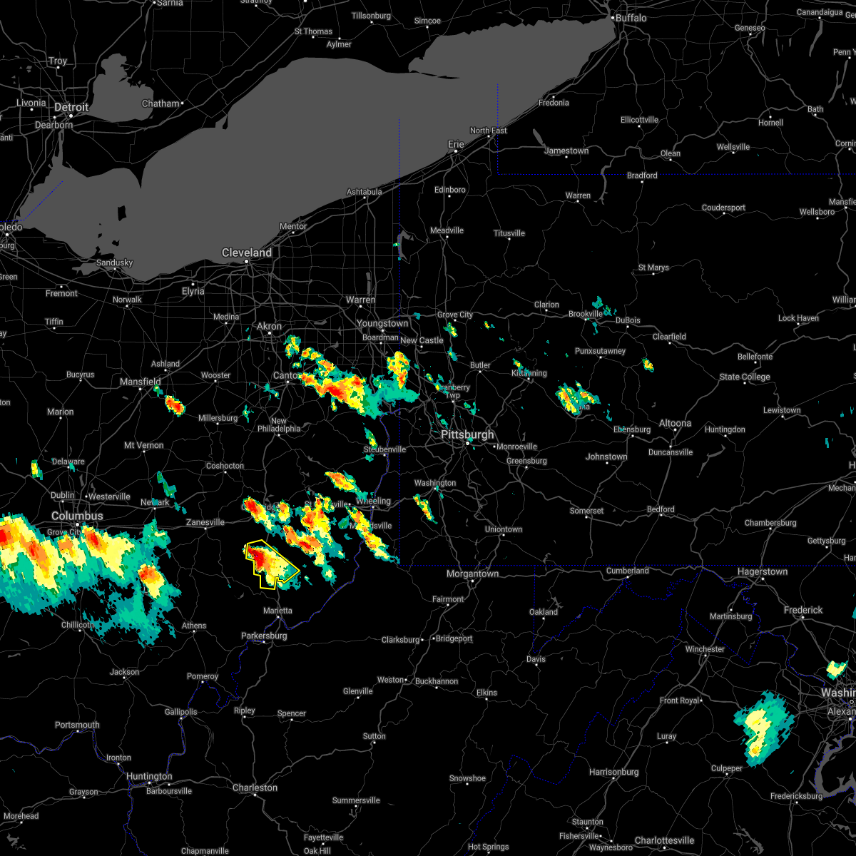 At 441 pm edt, a severe thunderstorm was located near caldwell, moving southeast at 45 mph (radar). Hazards include wind gusts to 60 mph and half dollar-size hail. Minor hail damage to vehicles is possible. expect wind damage to trees and power lines, resulting in some power outages. Locations impacted include, caldwell, dudley, cumberland, belle valley, dexter city, wolf run state park, this includes interstate 77 in ohio between mile markers 18 and 33. At 441 pm edt, a severe thunderstorm was located near caldwell, moving southeast at 45 mph (radar). Hazards include wind gusts to 60 mph and half dollar-size hail. Minor hail damage to vehicles is possible. expect wind damage to trees and power lines, resulting in some power outages. Locations impacted include, caldwell, dudley, cumberland, belle valley, dexter city, wolf run state park, this includes interstate 77 in ohio between mile markers 18 and 33.
|
| 7/29/2021 4:34 PM EDT |
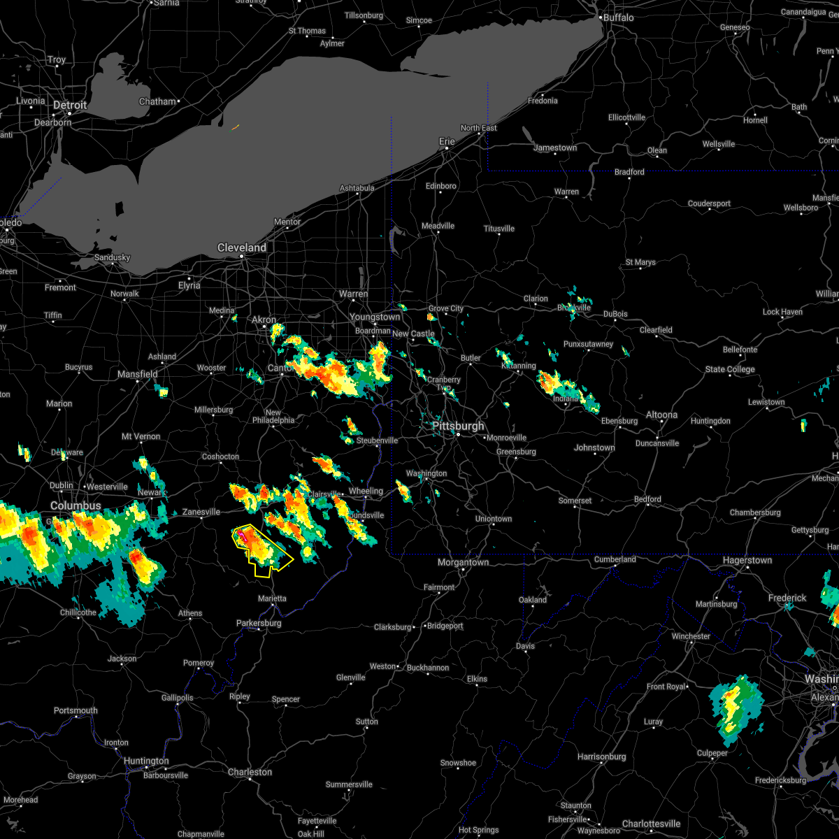 At 434 pm edt, a severe thunderstorm was located over caldwell, moving southeast at 45 mph (radar). Hazards include wind gusts to 60 mph and quarter-size hail. Minor hail damage to vehicles is possible. expect wind damage to trees and power lines, resulting in some power outages. Locations impacted include, caldwell, dudley, cumberland, belle valley, dexter city, high hill, wolf run state park, this includes interstate 77 in ohio between mile markers 18 and 33. At 434 pm edt, a severe thunderstorm was located over caldwell, moving southeast at 45 mph (radar). Hazards include wind gusts to 60 mph and quarter-size hail. Minor hail damage to vehicles is possible. expect wind damage to trees and power lines, resulting in some power outages. Locations impacted include, caldwell, dudley, cumberland, belle valley, dexter city, high hill, wolf run state park, this includes interstate 77 in ohio between mile markers 18 and 33.
|
| 7/29/2021 4:23 PM EDT |
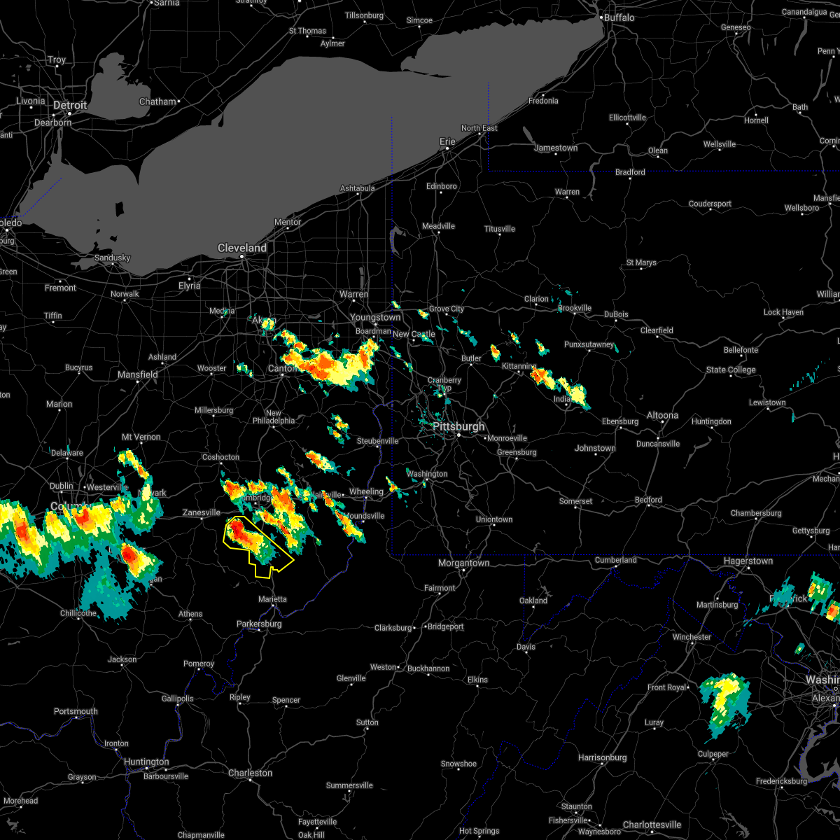 At 423 pm edt, a severe thunderstorm was located 8 miles northwest of caldwell, moving southeast at 45 mph (radar). Hazards include wind gusts to 60 mph and quarter-size hail. Minor hail damage to vehicles is possible. expect wind damage to trees and power lines, resulting in some power outages. Locations impacted include, caldwell, dudley, cumberland, belle valley, sarahsville, dexter city, high hill, wolf run state park, this includes interstate 77 in ohio between mile markers 18 and 33. At 423 pm edt, a severe thunderstorm was located 8 miles northwest of caldwell, moving southeast at 45 mph (radar). Hazards include wind gusts to 60 mph and quarter-size hail. Minor hail damage to vehicles is possible. expect wind damage to trees and power lines, resulting in some power outages. Locations impacted include, caldwell, dudley, cumberland, belle valley, sarahsville, dexter city, high hill, wolf run state park, this includes interstate 77 in ohio between mile markers 18 and 33.
|
| 7/29/2021 4:12 PM EDT |
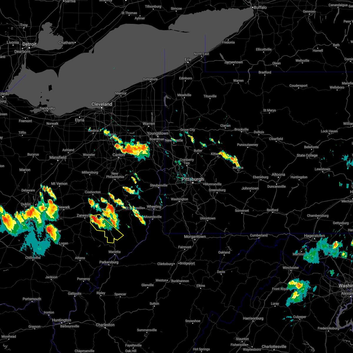 At 412 pm edt, a severe thunderstorm was located 8 miles south of new concord, or 13 miles east of zanesville, moving southeast at 45 mph (radar). Hazards include wind gusts to 60 mph and quarter-size hail. Minor hail damage to vehicles is possible. Expect wind damage to trees and power lines, resulting in some power outages. At 412 pm edt, a severe thunderstorm was located 8 miles south of new concord, or 13 miles east of zanesville, moving southeast at 45 mph (radar). Hazards include wind gusts to 60 mph and quarter-size hail. Minor hail damage to vehicles is possible. Expect wind damage to trees and power lines, resulting in some power outages.
|
| 11/15/2020 1:23 PM EST |
 At 122 pm est, severe thunderstorms were located along a line extending from mount eaton to 9 miles southeast of south zanesville, and are nearly stationary (radar). Hazards include wind gusts to 60 mph. Expect damage to trees and power lines, resulting in some power outages. locations impacted include, new philadelphia, dover, cambridge, uhrichsville, caldwell, freeport, newcomerstown, dennison, strasburg, new concord, byesville, west lafayette, this includes the following highways, interstate 70 in ohio between mile markers 166 and 196. Interstate 77 in ohio between mile markers 18 and 95. At 122 pm est, severe thunderstorms were located along a line extending from mount eaton to 9 miles southeast of south zanesville, and are nearly stationary (radar). Hazards include wind gusts to 60 mph. Expect damage to trees and power lines, resulting in some power outages. locations impacted include, new philadelphia, dover, cambridge, uhrichsville, caldwell, freeport, newcomerstown, dennison, strasburg, new concord, byesville, west lafayette, this includes the following highways, interstate 70 in ohio between mile markers 166 and 196. Interstate 77 in ohio between mile markers 18 and 95.
|
| 11/15/2020 1:07 PM EST |
 At 107 pm est, severe thunderstorms were located along a line extending from mount eaton to 9 miles southeast of south zanesville, moving east at 45 mph (radar). Hazards include wind gusts to 70 mph. Trees snapped and uprooted. Power outages can be expected. At 107 pm est, severe thunderstorms were located along a line extending from mount eaton to 9 miles southeast of south zanesville, moving east at 45 mph (radar). Hazards include wind gusts to 70 mph. Trees snapped and uprooted. Power outages can be expected.
|
| 8/26/2020 3:59 PM EDT |
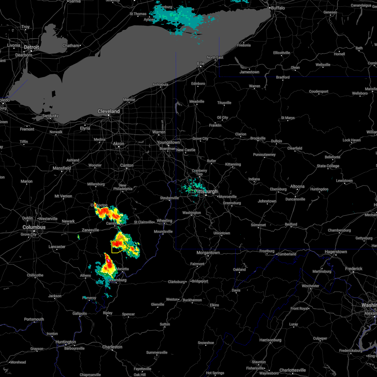 At 359 pm edt, a severe thunderstorm was located near caldwell, moving southeast at 20 mph (radar). Hazards include wind gusts to 60 mph and quarter-size hail. Minor hail damage to vehicles is possible. expect wind damage to trees and power lines, resulting in some power outages. Locations impacted include, caldwell, dudley, belle valley, sarahsville, wolf run state park, this includes interstate 77 in ohio between mile markers 22 and 32. At 359 pm edt, a severe thunderstorm was located near caldwell, moving southeast at 20 mph (radar). Hazards include wind gusts to 60 mph and quarter-size hail. Minor hail damage to vehicles is possible. expect wind damage to trees and power lines, resulting in some power outages. Locations impacted include, caldwell, dudley, belle valley, sarahsville, wolf run state park, this includes interstate 77 in ohio between mile markers 22 and 32.
|
| 8/26/2020 3:50 PM EDT |
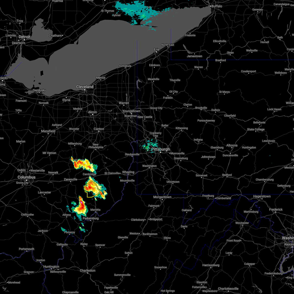 At 349 pm edt, a severe thunderstorm was located near caldwell, moving southeast at 20 mph (radar). Hazards include wind gusts to 60 mph and quarter-size hail. Minor hail damage to vehicles is possible. expect wind damage to trees and power lines, resulting in some power outages. Locations impacted include, caldwell, dudley, pleasant city, cumberland, belle valley, sarahsville, wolf run state park, this includes interstate 77 in ohio between mile markers 22 and 40. At 349 pm edt, a severe thunderstorm was located near caldwell, moving southeast at 20 mph (radar). Hazards include wind gusts to 60 mph and quarter-size hail. Minor hail damage to vehicles is possible. expect wind damage to trees and power lines, resulting in some power outages. Locations impacted include, caldwell, dudley, pleasant city, cumberland, belle valley, sarahsville, wolf run state park, this includes interstate 77 in ohio between mile markers 22 and 40.
|
| 8/26/2020 3:29 PM EDT |
 At 329 pm edt, a severe thunderstorm was located near new concord, or 10 miles southwest of cambridge, moving southeast at 20 mph (radar). Hazards include wind gusts to 60 mph. expect damage to trees and power lines, resulting in some power outages At 329 pm edt, a severe thunderstorm was located near new concord, or 10 miles southwest of cambridge, moving southeast at 20 mph (radar). Hazards include wind gusts to 60 mph. expect damage to trees and power lines, resulting in some power outages
|
| 8/25/2020 3:57 PM EDT |
 At 356 pm edt, a severe thunderstorm was located 8 miles south of new concord, or 13 miles east of zanesville, moving southeast at 30 mph (radar). Hazards include wind gusts to 60 mph. expect damage to trees and power lines, resulting in some power outages At 356 pm edt, a severe thunderstorm was located 8 miles south of new concord, or 13 miles east of zanesville, moving southeast at 30 mph (radar). Hazards include wind gusts to 60 mph. expect damage to trees and power lines, resulting in some power outages
|
| 7/27/2020 7:39 PM EDT |
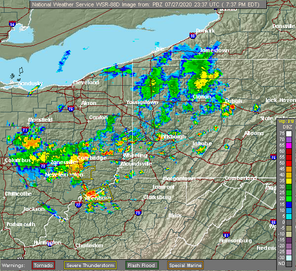 At 738 pm edt, severe thunderstorms were located along a line extending from 8 miles south of byesville to near caldwell, moving northeast at 25 mph (radar). Hazards include wind gusts to 60 mph. Expect damage to trees and power lines, resulting in some power outages. Locations impacted include, caldwell, dudley, summerfield, belle valley, sarahsville, batesville, seneca lake park, wolf run state park, this includes interstate 77 in ohio between mile markers 23 and 36. At 738 pm edt, severe thunderstorms were located along a line extending from 8 miles south of byesville to near caldwell, moving northeast at 25 mph (radar). Hazards include wind gusts to 60 mph. Expect damage to trees and power lines, resulting in some power outages. Locations impacted include, caldwell, dudley, summerfield, belle valley, sarahsville, batesville, seneca lake park, wolf run state park, this includes interstate 77 in ohio between mile markers 23 and 36.
|
| 7/27/2020 7:28 PM EDT |
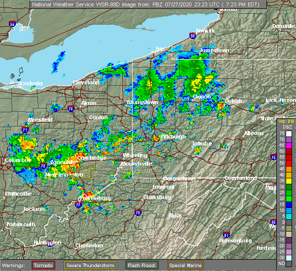 At 727 pm edt, a severe thunderstorm was located 10 miles west of caldwell, moving east at 30 mph (radar). Hazards include wind gusts to 60 mph. expect damage to trees and power lines, resulting in some power outages At 727 pm edt, a severe thunderstorm was located 10 miles west of caldwell, moving east at 30 mph (radar). Hazards include wind gusts to 60 mph. expect damage to trees and power lines, resulting in some power outages
|
| 7/21/2020 9:51 PM EDT |
 The severe thunderstorm warning for southern guernsey, southeastern muskingum and noble counties will expire at 1000 pm edt, the storms which prompted the warning have weakened below severe limits, and no longer pose an immediate threat to life or property. therefore, the warning will be allowed to expire. however gusty winds and heavy rain are still possible with these thunderstorms. The severe thunderstorm warning for southern guernsey, southeastern muskingum and noble counties will expire at 1000 pm edt, the storms which prompted the warning have weakened below severe limits, and no longer pose an immediate threat to life or property. therefore, the warning will be allowed to expire. however gusty winds and heavy rain are still possible with these thunderstorms.
|
| 7/21/2020 9:43 PM EDT |
 At 943 pm edt, severe thunderstorms were located along a line extending from near byesville to 7 miles west of caldwell, moving east at 25 mph (radar). Hazards include wind gusts to 60 mph. Expect damage to trees and power lines, resulting in some power outages. locations impacted include, cambridge, caldwell, byesville, dudley, quaker city, senecaville, pleasant city, cumberland, lore city, belle valley, sarahsville, salesville, this includes the following highways, interstate 70 in ohio between mile markers 179 and 184. Interstate 77 in ohio between mile markers 20 and 46. At 943 pm edt, severe thunderstorms were located along a line extending from near byesville to 7 miles west of caldwell, moving east at 25 mph (radar). Hazards include wind gusts to 60 mph. Expect damage to trees and power lines, resulting in some power outages. locations impacted include, cambridge, caldwell, byesville, dudley, quaker city, senecaville, pleasant city, cumberland, lore city, belle valley, sarahsville, salesville, this includes the following highways, interstate 70 in ohio between mile markers 179 and 184. Interstate 77 in ohio between mile markers 20 and 46.
|
| 7/21/2020 9:14 PM EDT |
 At 913 pm edt, severe thunderstorms were located along a line extending from new concord to 9 miles north of mcconnelsville, moving east at 25 mph (radar). Hazards include wind gusts to 60 mph. expect damage to trees and power lines, resulting in some power outages At 913 pm edt, severe thunderstorms were located along a line extending from new concord to 9 miles north of mcconnelsville, moving east at 25 mph (radar). Hazards include wind gusts to 60 mph. expect damage to trees and power lines, resulting in some power outages
|
| 6/10/2020 8:51 PM EDT |
 The severe thunderstorm warning for south central harrison, central guernsey, western monroe, western belmont and noble counties will expire at 900 pm edt, the storms which prompted the warning have weakened below severe limits, and no longer pose an immediate threat to life or property. therefore, the warning will be allowed to expire. however gusty winds and heavy rain are still possible with these thunderstorms. a severe thunderstorm watch remains in effect until 100 am edt for east central ohio. The severe thunderstorm warning for south central harrison, central guernsey, western monroe, western belmont and noble counties will expire at 900 pm edt, the storms which prompted the warning have weakened below severe limits, and no longer pose an immediate threat to life or property. therefore, the warning will be allowed to expire. however gusty winds and heavy rain are still possible with these thunderstorms. a severe thunderstorm watch remains in effect until 100 am edt for east central ohio.
|
| 6/10/2020 8:36 PM EDT |
 At 836 pm edt, severe thunderstorms were located along a line extending from near uhrichsville to freeport to 10 miles northeast of byesville to 7 miles southwest of barnesville, moving northeast at 50 mph (radar). Hazards include quarter-size hail. Minor damage to vehicles is possible. locations impacted include, cambridge, caldwell, byesville, sugarcreek, senecaville, pleasant city, lore city, old washington, belle valley, sarahsville, birmingham, seneca lake park, this includes the following highways, interstate 70 in ohio between mile markers 181 and 188. Interstate 77 in ohio between mile markers 25 and 43, between mile markers 46 and 58, and between mile markers 76 and 77. At 836 pm edt, severe thunderstorms were located along a line extending from near uhrichsville to freeport to 10 miles northeast of byesville to 7 miles southwest of barnesville, moving northeast at 50 mph (radar). Hazards include quarter-size hail. Minor damage to vehicles is possible. locations impacted include, cambridge, caldwell, byesville, sugarcreek, senecaville, pleasant city, lore city, old washington, belle valley, sarahsville, birmingham, seneca lake park, this includes the following highways, interstate 70 in ohio between mile markers 181 and 188. Interstate 77 in ohio between mile markers 25 and 43, between mile markers 46 and 58, and between mile markers 76 and 77.
|
| 6/10/2020 8:27 PM EDT |
 At 827 pm edt, severe thunderstorms were located along a line extending from near byesville to near caldwell to near beverly, moving northeast at 60 mph (radar). Hazards include wind gusts to 60 mph and quarter-size hail. Minor hail damage to vehicles is possible. Expect wind damage to trees and power lines, resulting in some power outages. At 827 pm edt, severe thunderstorms were located along a line extending from near byesville to near caldwell to near beverly, moving northeast at 60 mph (radar). Hazards include wind gusts to 60 mph and quarter-size hail. Minor hail damage to vehicles is possible. Expect wind damage to trees and power lines, resulting in some power outages.
|
| 6/10/2020 8:16 PM EDT |
 At 815 pm edt, severe thunderstorms were located along a line extending from near newcomerstown to near cambridge to near byesville to near caldwell, moving northeast at 50 mph (radar). Hazards include wind gusts to 60 mph and quarter-size hail. Minor hail damage to vehicles is possible. expect wind damage to trees and power lines, resulting in some power outages. locations impacted include, cambridge, caldwell, newcomerstown, new concord, byesville, west lafayette, sugarcreek, baltic, port washington, senecaville, pleasant city, cumberland, this includes the following highways, interstate 70 in ohio between mile markers 166 and 188. Interstate 77 in ohio between mile markers 25 and 77. At 815 pm edt, severe thunderstorms were located along a line extending from near newcomerstown to near cambridge to near byesville to near caldwell, moving northeast at 50 mph (radar). Hazards include wind gusts to 60 mph and quarter-size hail. Minor hail damage to vehicles is possible. expect wind damage to trees and power lines, resulting in some power outages. locations impacted include, cambridge, caldwell, newcomerstown, new concord, byesville, west lafayette, sugarcreek, baltic, port washington, senecaville, pleasant city, cumberland, this includes the following highways, interstate 70 in ohio between mile markers 166 and 188. Interstate 77 in ohio between mile markers 25 and 77.
|
| 6/10/2020 7:59 PM EDT |
 At 758 pm edt, severe thunderstorms were located along a line extending from near coshocton to new concord to 10 miles southeast of south zanesville to 6 miles northeast of mcconnelsville, moving northeast at 50 mph (radar). Hazards include wind gusts to 60 mph and quarter-size hail. Minor hail damage to vehicles is possible. Expect wind damage to trees and power lines, resulting in some power outages. At 758 pm edt, severe thunderstorms were located along a line extending from near coshocton to new concord to 10 miles southeast of south zanesville to 6 miles northeast of mcconnelsville, moving northeast at 50 mph (radar). Hazards include wind gusts to 60 mph and quarter-size hail. Minor hail damage to vehicles is possible. Expect wind damage to trees and power lines, resulting in some power outages.
|
| 5/14/2020 8:02 PM EDT |
 At 801 pm edt, a severe thunderstorm was located near byesville, or 9 miles north of caldwell, moving east at 45 mph (radar). Hazards include wind gusts to 60 mph and half dollar-size hail. Minor hail damage to vehicles is possible. expect wind damage to trees and power lines, resulting in some power outages. Locations impacted include, byesville, quaker city, senecaville, pleasant city, summerfield, belle valley, sarahsville, salesville, batesville, seneca lake park, wolf run state park, this includes interstate 77 in ohio between mile markers 29 and 41. At 801 pm edt, a severe thunderstorm was located near byesville, or 9 miles north of caldwell, moving east at 45 mph (radar). Hazards include wind gusts to 60 mph and half dollar-size hail. Minor hail damage to vehicles is possible. expect wind damage to trees and power lines, resulting in some power outages. Locations impacted include, byesville, quaker city, senecaville, pleasant city, summerfield, belle valley, sarahsville, salesville, batesville, seneca lake park, wolf run state park, this includes interstate 77 in ohio between mile markers 29 and 41.
|
| 5/14/2020 7:56 PM EDT |
 At 756 pm edt, a severe thunderstorm was located 8 miles southwest of byesville, or 11 miles northwest of caldwell, moving east at 45 mph (radar). Hazards include wind gusts to 60 mph and quarter-size hail. Minor hail damage to vehicles is possible. Expect wind damage to trees and power lines, resulting in some power outages. At 756 pm edt, a severe thunderstorm was located 8 miles southwest of byesville, or 11 miles northwest of caldwell, moving east at 45 mph (radar). Hazards include wind gusts to 60 mph and quarter-size hail. Minor hail damage to vehicles is possible. Expect wind damage to trees and power lines, resulting in some power outages.
|
| 4/7/2020 5:26 PM EDT |
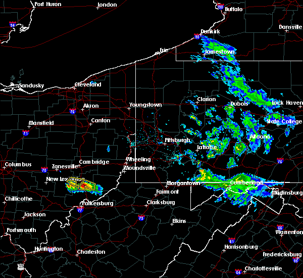 The severe thunderstorm warning for southeastern muskingum and southwestern noble counties will expire at 530 pm edt, the storm that prompted the warning has moved out of this warning area. therefore, the warning will be allowed to expire. however gusty wind and hail are still possible with this thunderstorm. The severe thunderstorm warning for southeastern muskingum and southwestern noble counties will expire at 530 pm edt, the storm that prompted the warning has moved out of this warning area. therefore, the warning will be allowed to expire. however gusty wind and hail are still possible with this thunderstorm.
|
| 4/7/2020 5:05 PM EDT |
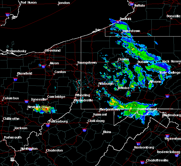 At 505 pm edt, a severe thunderstorm was located 8 miles west of caldwell, moving east at 30 mph (radar). Hazards include wind gusts to 60 mph and quarter-size hail. Minor hail damage to vehicles is possible. expect wind damage to trees and power lines, resulting in some power outages. Locations impacted include, caldwell, belle valley, this includes interstate 77 in ohio between mile markers 24 and 29. At 505 pm edt, a severe thunderstorm was located 8 miles west of caldwell, moving east at 30 mph (radar). Hazards include wind gusts to 60 mph and quarter-size hail. Minor hail damage to vehicles is possible. expect wind damage to trees and power lines, resulting in some power outages. Locations impacted include, caldwell, belle valley, this includes interstate 77 in ohio between mile markers 24 and 29.
|
| 4/7/2020 4:57 PM EDT |
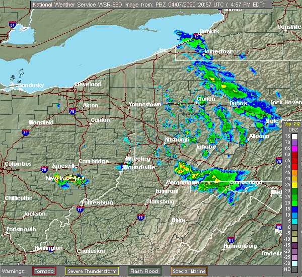 At 456 pm edt, a severe thunderstorm was located 9 miles northeast of mcconnelsville, moving east at 30 mph (radar). Hazards include wind gusts to 60 mph and quarter-size hail. Minor hail damage to vehicles is possible. Expect wind damage to trees and power lines, resulting in some power outages. At 456 pm edt, a severe thunderstorm was located 9 miles northeast of mcconnelsville, moving east at 30 mph (radar). Hazards include wind gusts to 60 mph and quarter-size hail. Minor hail damage to vehicles is possible. Expect wind damage to trees and power lines, resulting in some power outages.
|
| 8/15/2019 3:19 PM EDT |
 At 319 pm edt, a severe thunderstorm was located 7 miles north of caldwell, moving northeast at 20 mph (radar). Hazards include wind gusts to 60 mph and quarter-size hail. Minor hail damage to vehicles is possible. expect wind damage to trees and power lines, resulting in some power outages. locations impacted include, cambridge, caldwell, byesville, senecaville, pleasant city, cumberland, lore city, old washington, belle valley, sarahsville, seneca lake park, wolf run state park, this includes the following highways, interstate 70 in ohio between mile markers 179 and 189. Interstate 77 in ohio between mile markers 26 and 45. At 319 pm edt, a severe thunderstorm was located 7 miles north of caldwell, moving northeast at 20 mph (radar). Hazards include wind gusts to 60 mph and quarter-size hail. Minor hail damage to vehicles is possible. expect wind damage to trees and power lines, resulting in some power outages. locations impacted include, cambridge, caldwell, byesville, senecaville, pleasant city, cumberland, lore city, old washington, belle valley, sarahsville, seneca lake park, wolf run state park, this includes the following highways, interstate 70 in ohio between mile markers 179 and 189. Interstate 77 in ohio between mile markers 26 and 45.
|
| 8/15/2019 3:09 PM EDT |
 At 308 pm edt, a severe thunderstorm was located 7 miles northwest of caldwell, moving northeast at 20 mph (radar). Hazards include wind gusts to 60 mph and quarter-size hail. Minor hail damage to vehicles is possible. Expect wind damage to trees and power lines, resulting in some power outages. At 308 pm edt, a severe thunderstorm was located 7 miles northwest of caldwell, moving northeast at 20 mph (radar). Hazards include wind gusts to 60 mph and quarter-size hail. Minor hail damage to vehicles is possible. Expect wind damage to trees and power lines, resulting in some power outages.
|
| 8/8/2019 3:57 PM EDT |
 At 356 pm edt, a severe thunderstorm was located near caldwell, moving east at 45 mph. another severe storm was southeast of philo (radar). Hazards include wind gusts to 60 mph. Expect damage to trees and power lines, resulting in some power outages. locations impacted include, caldwell, new concord, dudley, senecaville, pleasant city, cumberland, summerfield, belle valley, lewisville, sarahsville, norwich, high hill, this includes the following highways, interstate 70 in ohio between mile markers 166 and 170. Interstate 77 in ohio between mile markers 21 and 40. At 356 pm edt, a severe thunderstorm was located near caldwell, moving east at 45 mph. another severe storm was southeast of philo (radar). Hazards include wind gusts to 60 mph. Expect damage to trees and power lines, resulting in some power outages. locations impacted include, caldwell, new concord, dudley, senecaville, pleasant city, cumberland, summerfield, belle valley, lewisville, sarahsville, norwich, high hill, this includes the following highways, interstate 70 in ohio between mile markers 166 and 170. Interstate 77 in ohio between mile markers 21 and 40.
|
| 8/8/2019 3:46 PM EDT |
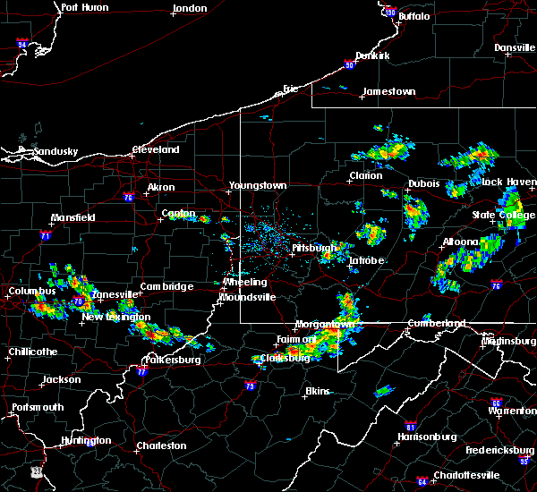 At 345 pm edt, a severe thunderstorm was located 8 miles south of new concord, or 13 miles southwest of cambridge, moving east at 45 mph (radar). Hazards include wind gusts to 60 mph. expect damage to trees and power lines, resulting in some power outages At 345 pm edt, a severe thunderstorm was located 8 miles south of new concord, or 13 miles southwest of cambridge, moving east at 45 mph (radar). Hazards include wind gusts to 60 mph. expect damage to trees and power lines, resulting in some power outages
|
| 7/16/2019 8:50 PM EDT |
 At 850 pm edt, a severe thunderstorm was located near caldwell, moving northeast at 35 mph (radar). Hazards include wind gusts to 60 mph. Expect damage to trees and power lines, resulting in some power outages. Locations impacted include, caldwell, dudley, summerfield, belle valley, sarahsville, dexter city, seneca lake park, wolf run state park, this includes interstate 77 in ohio between mile markers 18 and 31. At 850 pm edt, a severe thunderstorm was located near caldwell, moving northeast at 35 mph (radar). Hazards include wind gusts to 60 mph. Expect damage to trees and power lines, resulting in some power outages. Locations impacted include, caldwell, dudley, summerfield, belle valley, sarahsville, dexter city, seneca lake park, wolf run state park, this includes interstate 77 in ohio between mile markers 18 and 31.
|
| 7/16/2019 8:32 PM EDT |
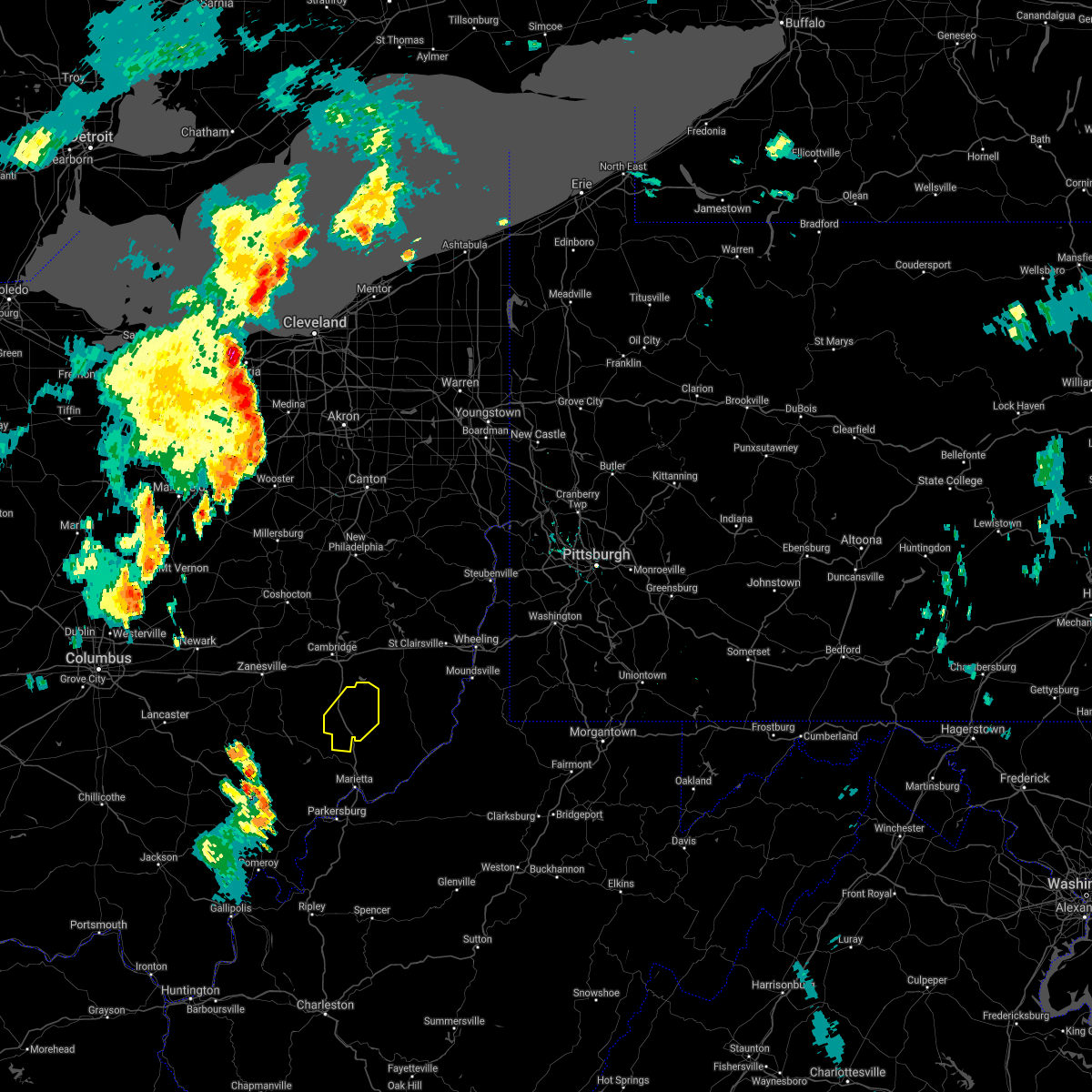 At 832 pm edt, a severe thunderstorm was located near caldwell, moving northeast at 35 mph (radar). Hazards include wind gusts to 60 mph. expect damage to trees and power lines, resulting in some power outages At 832 pm edt, a severe thunderstorm was located near caldwell, moving northeast at 35 mph (radar). Hazards include wind gusts to 60 mph. expect damage to trees and power lines, resulting in some power outages
|
| 6/24/2019 5:42 PM EDT |
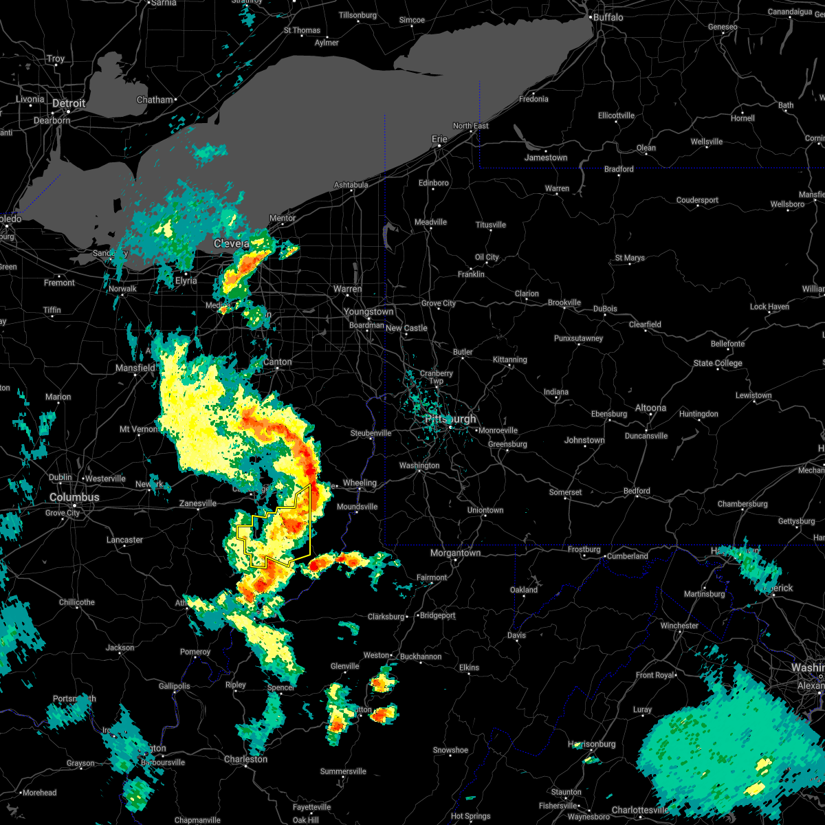 The severe thunderstorm warning for northwestern monroe, southwestern belmont and noble counties will expire at 545 pm edt, the storm that prompted the warning has moved out of the area. therefore, the warning will be allowed to expire. however gusty winds are still possible with this thunderstorm. a severe thunderstorm watch remains in effect until 1000 pm edt for east central ohio. The severe thunderstorm warning for northwestern monroe, southwestern belmont and noble counties will expire at 545 pm edt, the storm that prompted the warning has moved out of the area. therefore, the warning will be allowed to expire. however gusty winds are still possible with this thunderstorm. a severe thunderstorm watch remains in effect until 1000 pm edt for east central ohio.
|
| 6/24/2019 5:16 PM EDT |
 At 516 pm edt, a severe thunderstorm was located 7 miles east of caldwell, moving northeast at 25 mph (radar). Hazards include wind gusts to 60 mph. expect damage to trees and power lines, resulting in some power outages At 516 pm edt, a severe thunderstorm was located 7 miles east of caldwell, moving northeast at 25 mph (radar). Hazards include wind gusts to 60 mph. expect damage to trees and power lines, resulting in some power outages
|
| 6/24/2019 5:00 PM EDT |
 At 452 pm edt, severe thunderstorms were located along a line extending from near killbuck to 6 miles northwest of beverly, moving northeast at 40 mph (radar). Hazards include wind gusts to 60 mph. Expect damage to trees and power lines, resulting in some power outages. Locations impacted include, zanesville, coshocton, new concord, west lafayette, north zanesville, dresden, frazeysburg, philo, warsaw, pleasant grove, cumberland, conesville,. At 452 pm edt, severe thunderstorms were located along a line extending from near killbuck to 6 miles northwest of beverly, moving northeast at 40 mph (radar). Hazards include wind gusts to 60 mph. Expect damage to trees and power lines, resulting in some power outages. Locations impacted include, zanesville, coshocton, new concord, west lafayette, north zanesville, dresden, frazeysburg, philo, warsaw, pleasant grove, cumberland, conesville,.
|
| 6/24/2019 4:53 PM EDT |
 At 451 pm edt, severe thunderstorms were located along a line extending from near killbuck to 6 miles southeast of mcconnelsville, moving northeast at 40 mph (radar). Hazards include wind gusts to 60 mph. Expect damage to trees and power lines, resulting in some power outages. Locations impacted include, zanesville, coshocton, new concord, west lafayette, north zanesville, dresden, frazeysburg, philo, warsaw, pleasant grove, cumberland, conesville,. At 451 pm edt, severe thunderstorms were located along a line extending from near killbuck to 6 miles southeast of mcconnelsville, moving northeast at 40 mph (radar). Hazards include wind gusts to 60 mph. Expect damage to trees and power lines, resulting in some power outages. Locations impacted include, zanesville, coshocton, new concord, west lafayette, north zanesville, dresden, frazeysburg, philo, warsaw, pleasant grove, cumberland, conesville,.
|
| 6/24/2019 4:23 PM EDT |
 At 422 pm edt, severe thunderstorms were located along a line extending from 7 miles southeast of gambier to near glouster, moving northeast at 40 mph (radar). Hazards include wind gusts to 60 mph. expect damage to trees and power lines, resulting in some power outages At 422 pm edt, severe thunderstorms were located along a line extending from 7 miles southeast of gambier to near glouster, moving northeast at 40 mph (radar). Hazards include wind gusts to 60 mph. expect damage to trees and power lines, resulting in some power outages
|
| 5/28/2019 12:51 AM EDT |
 The severe thunderstorm warning for southeastern muskingum and noble counties will expire at 100 am edt, the storm that prompted the warning has weakened below severe limits and no longer pose an immediate threat to life and property. therefore, the warning will be allowed to expire. however small hail, gusty winds and heavy rain are still possible with this thunderstorm. a tornado watch remains in effect until 400 am edt for east central ohio. The severe thunderstorm warning for southeastern muskingum and noble counties will expire at 100 am edt, the storm that prompted the warning has weakened below severe limits and no longer pose an immediate threat to life and property. therefore, the warning will be allowed to expire. however small hail, gusty winds and heavy rain are still possible with this thunderstorm. a tornado watch remains in effect until 400 am edt for east central ohio.
|
| 5/28/2019 12:41 AM EDT |
 At 1241 am edt, a severe thunderstorm was located near caldwell, moving east at 40 mph (radar). Hazards include wind gusts to 60 mph and half dollar-size hail. Minor hail damage to vehicles is possible. expect wind damage to trees and power lines, resulting in some power outages. locations impacted include, caldwell, dudley, summerfield, belle valley, sarahsville, dexter city, ruraldale, high hill, harriettsville, seneca lake park, wolf run state park, blue rock state park, this includes interstate 77 in ohio between mile markers 18 and 36. A tornado watch remains in effect until 400 am edt for east central ohio. At 1241 am edt, a severe thunderstorm was located near caldwell, moving east at 40 mph (radar). Hazards include wind gusts to 60 mph and half dollar-size hail. Minor hail damage to vehicles is possible. expect wind damage to trees and power lines, resulting in some power outages. locations impacted include, caldwell, dudley, summerfield, belle valley, sarahsville, dexter city, ruraldale, high hill, harriettsville, seneca lake park, wolf run state park, blue rock state park, this includes interstate 77 in ohio between mile markers 18 and 36. A tornado watch remains in effect until 400 am edt for east central ohio.
|
| 5/28/2019 12:39 AM EDT |
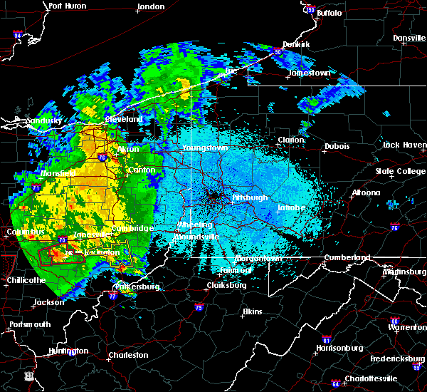 At 1238 am edt, a severe thunderstorm was located 9 miles south of caldwell, moving northeast at 45 mph (radar). Hazards include wind gusts to 60 mph and half dollar-size hail. Minor hail damage to vehicles is possible. expect wind damage to trees and power lines, resulting in some power outages. this includes interstate 77 in ohio between mile markers 18 and 36. A tornado watch remains in effect until 400 am edt for east central ohio. At 1238 am edt, a severe thunderstorm was located 9 miles south of caldwell, moving northeast at 45 mph (radar). Hazards include wind gusts to 60 mph and half dollar-size hail. Minor hail damage to vehicles is possible. expect wind damage to trees and power lines, resulting in some power outages. this includes interstate 77 in ohio between mile markers 18 and 36. A tornado watch remains in effect until 400 am edt for east central ohio.
|
| 5/28/2019 12:22 AM EDT |
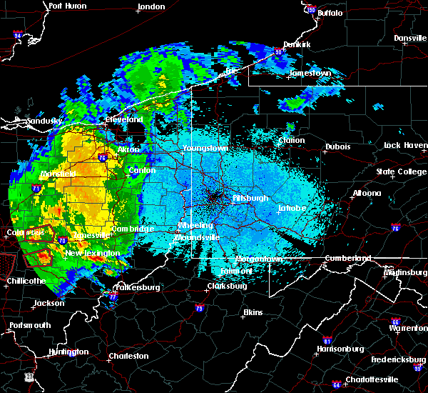 At 1222 am edt, a severe thunderstorm was located near mcconnelsville, moving east at 30 mph (radar). Hazards include wind gusts to 60 mph and quarter-size hail. Minor hail damage to vehicles is possible. Expect wind damage to trees and power lines, resulting in some power outages. At 1222 am edt, a severe thunderstorm was located near mcconnelsville, moving east at 30 mph (radar). Hazards include wind gusts to 60 mph and quarter-size hail. Minor hail damage to vehicles is possible. Expect wind damage to trees and power lines, resulting in some power outages.
|
| 5/26/2019 7:26 PM EDT |
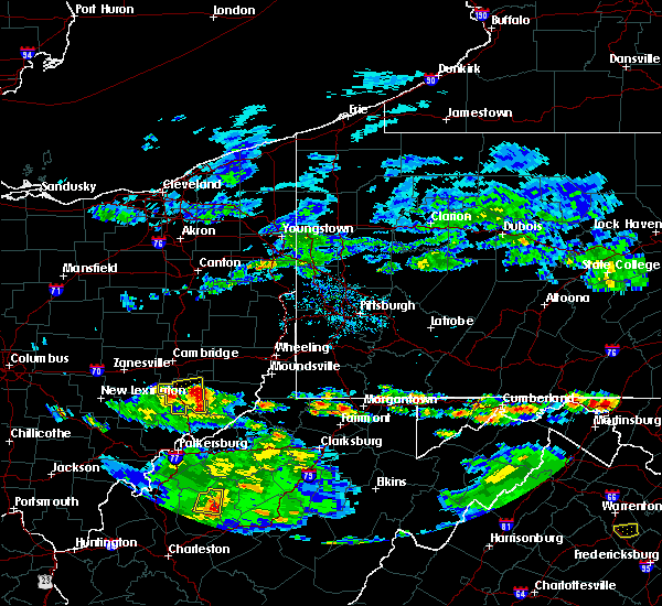 The severe thunderstorm warning for noble county will expire at 730 pm edt, the storm that prompted the warning has weakened below severe limits and no longer pose an immediate threat to life and property. therefore, the warning will be allowed to expire. however gusty winds and heavy rain are still possible with this thunderstorm. The severe thunderstorm warning for noble county will expire at 730 pm edt, the storm that prompted the warning has weakened below severe limits and no longer pose an immediate threat to life and property. therefore, the warning will be allowed to expire. however gusty winds and heavy rain are still possible with this thunderstorm.
|
| 5/26/2019 7:02 PM EDT |
 At 702 pm edt, a severe thunderstorm was located over caldwell, moving east at 25 mph (radar). Hazards include wind gusts to 60 mph and quarter-size hail. Minor hail damage to vehicles is possible. expect wind damage to trees and power lines, resulting in some power outages. Locations impacted include, caldwell, dudley, summerfield, belle valley, sarahsville, dexter city, harriettsville, wolf run state park, this includes interstate 77 in ohio between mile markers 18 and 34. At 702 pm edt, a severe thunderstorm was located over caldwell, moving east at 25 mph (radar). Hazards include wind gusts to 60 mph and quarter-size hail. Minor hail damage to vehicles is possible. expect wind damage to trees and power lines, resulting in some power outages. Locations impacted include, caldwell, dudley, summerfield, belle valley, sarahsville, dexter city, harriettsville, wolf run state park, this includes interstate 77 in ohio between mile markers 18 and 34.
|
| 5/26/2019 6:56 PM EDT |
 At 656 pm edt, a severe thunderstorm was located near caldwell, moving east at 20 mph (radar). Hazards include wind gusts to 60 mph and half dollar-size hail. Minor hail damage to vehicles is possible. Expect wind damage to trees and power lines, resulting in some power outages. At 656 pm edt, a severe thunderstorm was located near caldwell, moving east at 20 mph (radar). Hazards include wind gusts to 60 mph and half dollar-size hail. Minor hail damage to vehicles is possible. Expect wind damage to trees and power lines, resulting in some power outages.
|
| 6/17/2018 4:16 PM EDT |
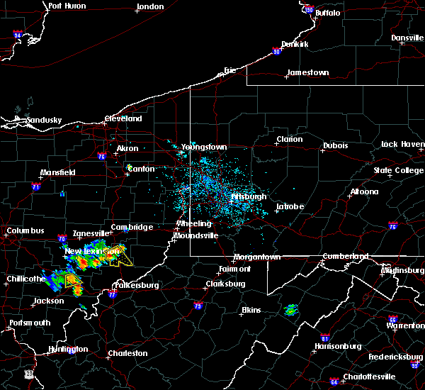 At 415 pm edt, a severe thunderstorm was located near caldwell, moving southeast at 25 mph (radar). Hazards include wind gusts to 60 mph. Expect damage to trees and power lines, resulting in some power outages. This includes interstate 77 in ohio between mile markers 18 and 31. At 415 pm edt, a severe thunderstorm was located near caldwell, moving southeast at 25 mph (radar). Hazards include wind gusts to 60 mph. Expect damage to trees and power lines, resulting in some power outages. This includes interstate 77 in ohio between mile markers 18 and 31.
|
| 6/17/2018 4:06 PM EDT |
 At 406 pm edt, a severe thunderstorm was located near caldwell, moving southeast at 25 mph (radar). Hazards include wind gusts to 60 mph. expect damage to trees and power lines, resulting in some power outages At 406 pm edt, a severe thunderstorm was located near caldwell, moving southeast at 25 mph (radar). Hazards include wind gusts to 60 mph. expect damage to trees and power lines, resulting in some power outages
|
| 5/14/2018 1:45 PM EDT |
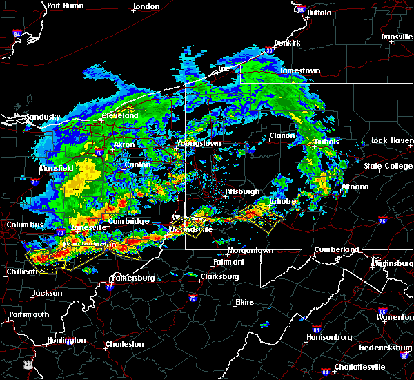 At 145 pm edt, a severe thunderstorm was located over caldwell, moving southeast at 25 mph (radar indicated). Hazards include 60 mph wind gusts and half dollar size hail. Minor hail damage to vehicles is possible. Expect wind damage to trees and power lines, resulting in some power outages. At 145 pm edt, a severe thunderstorm was located over caldwell, moving southeast at 25 mph (radar indicated). Hazards include 60 mph wind gusts and half dollar size hail. Minor hail damage to vehicles is possible. Expect wind damage to trees and power lines, resulting in some power outages.
|
| 5/13/2018 6:32 PM EDT |
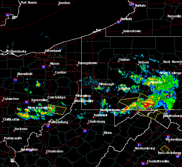 At 631 pm edt, a severe thunderstorm was located near caldwell, moving east at 40 mph (radar). Hazards include wind gusts to 60 mph and quarter-size hail. Minor hail damage to vehicles is possible. expect wind damage to trees and power lines, resulting in some power outages. Locations impacted include, woodsfield, caldwell, dudley, summerfield, belle valley, lewisville, sarahsville, dexter city, antioch, stafford, graysville, harriettsville, this includes interstate 77 in ohio between mile markers 18 and 34. At 631 pm edt, a severe thunderstorm was located near caldwell, moving east at 40 mph (radar). Hazards include wind gusts to 60 mph and quarter-size hail. Minor hail damage to vehicles is possible. expect wind damage to trees and power lines, resulting in some power outages. Locations impacted include, woodsfield, caldwell, dudley, summerfield, belle valley, lewisville, sarahsville, dexter city, antioch, stafford, graysville, harriettsville, this includes interstate 77 in ohio between mile markers 18 and 34.
|
| 5/13/2018 6:17 PM EDT |
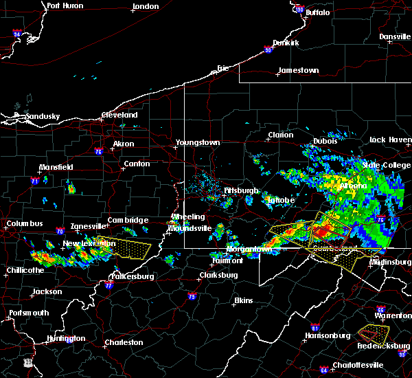 At 617 pm edt, a severe thunderstorm was located 7 miles northwest of caldwell, moving east-southeast at 40 mph (radar). Hazards include wind gusts to 60 mph and quarter-size hail. Minor hail damage to vehicles is possible. Expect wind damage to trees and power lines, resulting in some power outages. At 617 pm edt, a severe thunderstorm was located 7 miles northwest of caldwell, moving east-southeast at 40 mph (radar). Hazards include wind gusts to 60 mph and quarter-size hail. Minor hail damage to vehicles is possible. Expect wind damage to trees and power lines, resulting in some power outages.
|
| 4/3/2018 7:30 PM EDT |
 At 730 pm edt, a severe thunderstorm was located 8 miles north of woodsfield, moving east at 55 mph (radar). Hazards include 60 mph wind gusts and quarter-size hail. Minor hail damage to vehicles is possible. expect wind damage to trees and power lines, resulting in some power outages. locations impacted include, cambridge, st. clairsville, barnesville, woodsfield, caldwell, new concord, byesville, dudley, bethesda, quaker city, senecaville, belmont, this includes the following highways, interstate 70 in ohio near mile marker 166, between mile markers 168 and 173, and between mile markers 177 and 216. Interstate 77 in ohio between mile markers 23 and 45. At 730 pm edt, a severe thunderstorm was located 8 miles north of woodsfield, moving east at 55 mph (radar). Hazards include 60 mph wind gusts and quarter-size hail. Minor hail damage to vehicles is possible. expect wind damage to trees and power lines, resulting in some power outages. locations impacted include, cambridge, st. clairsville, barnesville, woodsfield, caldwell, new concord, byesville, dudley, bethesda, quaker city, senecaville, belmont, this includes the following highways, interstate 70 in ohio near mile marker 166, between mile markers 168 and 173, and between mile markers 177 and 216. Interstate 77 in ohio between mile markers 23 and 45.
|
| 4/3/2018 7:18 PM EDT |
 At 717 pm edt, a severe thunderstorm was located 9 miles northwest of woodsfield, moving east at 55 mph (radar). Hazards include 60 mph wind gusts and quarter-size hail. Minor hail damage to vehicles is possible. expect wind damage to trees and power lines, resulting in some power outages. locations impacted include, cambridge, st. clairsville, barnesville, woodsfield, caldwell, new concord, byesville, dudley, bethesda, quaker city, senecaville, belmont, this includes the following highways, interstate 70 in ohio near mile marker 166, between mile markers 168 and 173, and between mile markers 177 and 216. Interstate 77 in ohio between mile markers 23 and 45. At 717 pm edt, a severe thunderstorm was located 9 miles northwest of woodsfield, moving east at 55 mph (radar). Hazards include 60 mph wind gusts and quarter-size hail. Minor hail damage to vehicles is possible. expect wind damage to trees and power lines, resulting in some power outages. locations impacted include, cambridge, st. clairsville, barnesville, woodsfield, caldwell, new concord, byesville, dudley, bethesda, quaker city, senecaville, belmont, this includes the following highways, interstate 70 in ohio near mile marker 166, between mile markers 168 and 173, and between mile markers 177 and 216. Interstate 77 in ohio between mile markers 23 and 45.
|
| 4/3/2018 6:58 PM EDT |
 At 658 pm edt, a severe thunderstorm was located near caldwell, moving east at 55 mph (radar). Hazards include 60 mph wind gusts and quarter-size hail. Minor hail damage to vehicles is possible. Expect wind damage to trees and power lines, resulting in some power outages. At 658 pm edt, a severe thunderstorm was located near caldwell, moving east at 55 mph (radar). Hazards include 60 mph wind gusts and quarter-size hail. Minor hail damage to vehicles is possible. Expect wind damage to trees and power lines, resulting in some power outages.
|
| 4/3/2018 6:22 PM EDT |
 At 621 pm edt, a severe thunderstorm was located near perry state forest, moving east at 50 mph (radar). Hazards include 60 mph wind gusts and quarter-size hail. Minor hail damage to vehicles is possible. Expect wind damage to trees and power lines, resulting in some power outages. At 621 pm edt, a severe thunderstorm was located near perry state forest, moving east at 50 mph (radar). Hazards include 60 mph wind gusts and quarter-size hail. Minor hail damage to vehicles is possible. Expect wind damage to trees and power lines, resulting in some power outages.
|
| 11/5/2017 9:01 PM EST |
 At 900 pm est, severe thunderstorms were located along a line extending from 9 miles southeast of byesville to near caldwell to 10 miles northeast of beverly, moving east at 40 mph (radar). Hazards include 60 mph wind gusts. Expect damage to trees and power lines, resulting in some power outages. Locations impacted include, new martinsville, woodsfield, caldwell, paden city, powhatan point, sistersville, quaker city, sardis, beallsville, clarington, summerfield, belle valley, this includes interstate 77 in ohio between mile markers 25 and 30. At 900 pm est, severe thunderstorms were located along a line extending from 9 miles southeast of byesville to near caldwell to 10 miles northeast of beverly, moving east at 40 mph (radar). Hazards include 60 mph wind gusts. Expect damage to trees and power lines, resulting in some power outages. Locations impacted include, new martinsville, woodsfield, caldwell, paden city, powhatan point, sistersville, quaker city, sardis, beallsville, clarington, summerfield, belle valley, this includes interstate 77 in ohio between mile markers 25 and 30.
|
| 11/5/2017 8:30 PM EST |
 At 829 pm est, severe thunderstorms were located along a line extending from near new concord to 14 miles west of caldwell to mcconnelsville, moving east at 40 mph (radar). Hazards include 60 mph wind gusts. expect damage to trees and power lines, resulting in some power outages At 829 pm est, severe thunderstorms were located along a line extending from near new concord to 14 miles west of caldwell to mcconnelsville, moving east at 40 mph (radar). Hazards include 60 mph wind gusts. expect damage to trees and power lines, resulting in some power outages
|
| 8/19/2017 5:30 PM EDT |
 At 530 pm edt, a severe thunderstorm was located near caldwell, moving southeast at 25 mph (radar). Hazards include 60 mph wind gusts and quarter-size hail. Minor hail damage to vehicles is possible. Expect wind damage to trees and power lines, resulting in some power outages. At 530 pm edt, a severe thunderstorm was located near caldwell, moving southeast at 25 mph (radar). Hazards include 60 mph wind gusts and quarter-size hail. Minor hail damage to vehicles is possible. Expect wind damage to trees and power lines, resulting in some power outages.
|
| 7/10/2017 5:02 PM EDT |
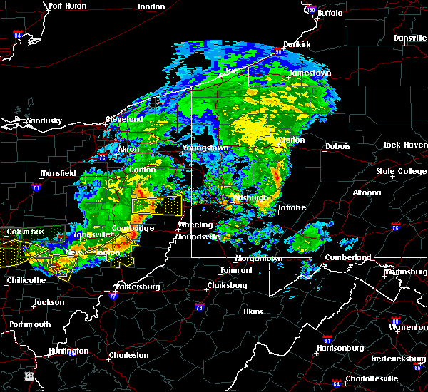 At 501 pm edt, severe thunderstorms were located along a line extending from 10 miles southwest of barnesville to caldwell to 6 miles north of mcconnelsville, moving southeast at 35 mph (radar). Hazards include 60 mph wind gusts. Expect damage to trees and power lines, resulting in some power outages. Locations impacted include, caldwell, byesville, dudley, senecaville, pleasant city, cumberland, lore city, summerfield, belle valley, sarahsville, dexter city, high hill, this includes interstate 77 in ohio between mile markers 18 and 42. At 501 pm edt, severe thunderstorms were located along a line extending from 10 miles southwest of barnesville to caldwell to 6 miles north of mcconnelsville, moving southeast at 35 mph (radar). Hazards include 60 mph wind gusts. Expect damage to trees and power lines, resulting in some power outages. Locations impacted include, caldwell, byesville, dudley, senecaville, pleasant city, cumberland, lore city, summerfield, belle valley, sarahsville, dexter city, high hill, this includes interstate 77 in ohio between mile markers 18 and 42.
|
| 7/10/2017 4:43 PM EDT |
 At 443 pm edt, severe thunderstorms were located along a line extending from near cambridge to 9 miles south of new concord to 7 miles south of south zanesville, moving southeast at 45 mph (radar). Hazards include 60 mph wind gusts. expect damage to trees and power lines, resulting in some power outages At 443 pm edt, severe thunderstorms were located along a line extending from near cambridge to 9 miles south of new concord to 7 miles south of south zanesville, moving southeast at 45 mph (radar). Hazards include 60 mph wind gusts. expect damage to trees and power lines, resulting in some power outages
|
| 7/7/2017 3:25 PM EDT |
 The severe thunderstorm warning for central guernsey, southeastern tuscarawas and northern noble counties will expire at 330 pm edt, the storms that prompted the warning have weakened below severe limits and no longer pose an immediate threat to life and property. therefore, the warning will be allowed to expire. however gusty winds and heavy rain are still possible with these thunderstorms. The severe thunderstorm warning for central guernsey, southeastern tuscarawas and northern noble counties will expire at 330 pm edt, the storms that prompted the warning have weakened below severe limits and no longer pose an immediate threat to life and property. therefore, the warning will be allowed to expire. however gusty winds and heavy rain are still possible with these thunderstorms.
|
| 7/7/2017 3:12 PM EDT |
 At 312 pm edt, severe thunderstorms were located along a line extending from 7 miles east of newcomerstown to 8 miles southeast of byesville to near caldwell, moving east at 35 mph (radar). Hazards include 60 mph wind gusts. Expect damage to trees and power lines, resulting in some power outages. locations impacted include, caldwell, gnadenhutten, antrim, tuscarawas, senecaville, pleasant city, lore city, old washington, summerfield, belle valley, sarahsville, salesville, this includes the following highways, interstate 70 in ohio between mile markers 185 and 192. Interstate 77 in ohio between mile markers 27 and 40. At 312 pm edt, severe thunderstorms were located along a line extending from 7 miles east of newcomerstown to 8 miles southeast of byesville to near caldwell, moving east at 35 mph (radar). Hazards include 60 mph wind gusts. Expect damage to trees and power lines, resulting in some power outages. locations impacted include, caldwell, gnadenhutten, antrim, tuscarawas, senecaville, pleasant city, lore city, old washington, summerfield, belle valley, sarahsville, salesville, this includes the following highways, interstate 70 in ohio between mile markers 185 and 192. Interstate 77 in ohio between mile markers 27 and 40.
|
| 7/7/2017 3:00 PM EDT |
 At 300 pm edt, severe thunderstorms were located along a line extending from near newcomerstown to near byesville to 10 miles west of caldwell, moving east at 35 mph (radar). Hazards include 60 mph wind gusts. Expect damage to trees and power lines, resulting in some power outages. locations impacted include, cambridge, caldwell, newcomerstown, byesville, gnadenhutten, antrim, tuscarawas, port washington, senecaville, pleasant city, cumberland, lore city, this includes the following highways, interstate 70 in ohio between mile markers 175 and 192. Interstate 77 in ohio between mile markers 27 and 71. At 300 pm edt, severe thunderstorms were located along a line extending from near newcomerstown to near byesville to 10 miles west of caldwell, moving east at 35 mph (radar). Hazards include 60 mph wind gusts. Expect damage to trees and power lines, resulting in some power outages. locations impacted include, cambridge, caldwell, newcomerstown, byesville, gnadenhutten, antrim, tuscarawas, port washington, senecaville, pleasant city, cumberland, lore city, this includes the following highways, interstate 70 in ohio between mile markers 175 and 192. Interstate 77 in ohio between mile markers 27 and 71.
|
| 7/7/2017 2:42 PM EDT |
 At 242 pm edt, severe thunderstorms were located along a line extending from 7 miles northeast of west lafayette to near new concord to 9 miles southeast of south zanesville, moving east at 35 mph (radar). Hazards include 60 mph wind gusts. expect damage to trees and power lines, resulting in some power outages At 242 pm edt, severe thunderstorms were located along a line extending from 7 miles northeast of west lafayette to near new concord to 9 miles southeast of south zanesville, moving east at 35 mph (radar). Hazards include 60 mph wind gusts. expect damage to trees and power lines, resulting in some power outages
|
| 5/19/2017 7:57 PM EDT |
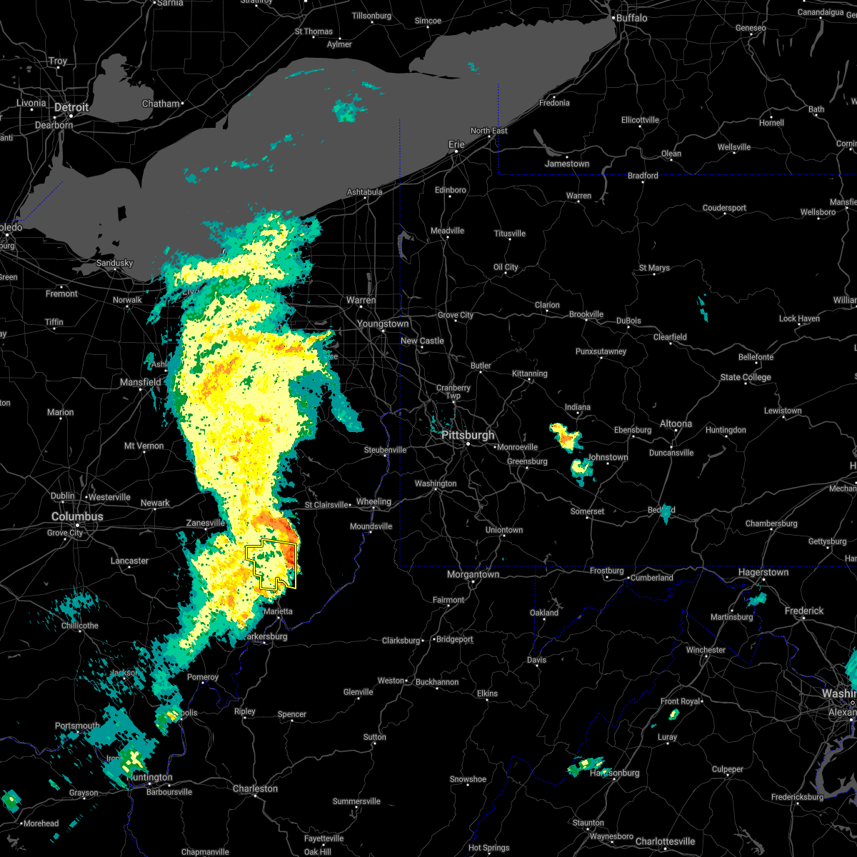 The severe thunderstorm warning for noble county will expire at 800 pm edt, the storm that prompted the warning has weakened below severe limits and has exited the warned area. therefore, the warning will be allowed to expire. a severe thunderstorm watch remains in effect until 1100 pm edt for east central ohio. The severe thunderstorm warning for noble county will expire at 800 pm edt, the storm that prompted the warning has weakened below severe limits and has exited the warned area. therefore, the warning will be allowed to expire. a severe thunderstorm watch remains in effect until 1100 pm edt for east central ohio.
|
| 5/19/2017 7:33 PM EDT |
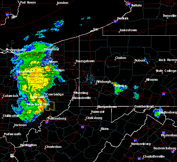 At 733 pm edt, a severe thunderstorm was located 7 miles west of caldwell, moving east at 30 mph (radar). Hazards include 60 mph wind gusts. Expect damage to trees and power lines, resulting in some power outages. Locations impacted include, caldwell, dudley, summerfield, belle valley, sarahsville, dexter city, harriettsville, wolf run state park, this includes interstate 77 in ohio between mile markers 18 and 35. At 733 pm edt, a severe thunderstorm was located 7 miles west of caldwell, moving east at 30 mph (radar). Hazards include 60 mph wind gusts. Expect damage to trees and power lines, resulting in some power outages. Locations impacted include, caldwell, dudley, summerfield, belle valley, sarahsville, dexter city, harriettsville, wolf run state park, this includes interstate 77 in ohio between mile markers 18 and 35.
|
| 5/19/2017 7:03 PM EDT |
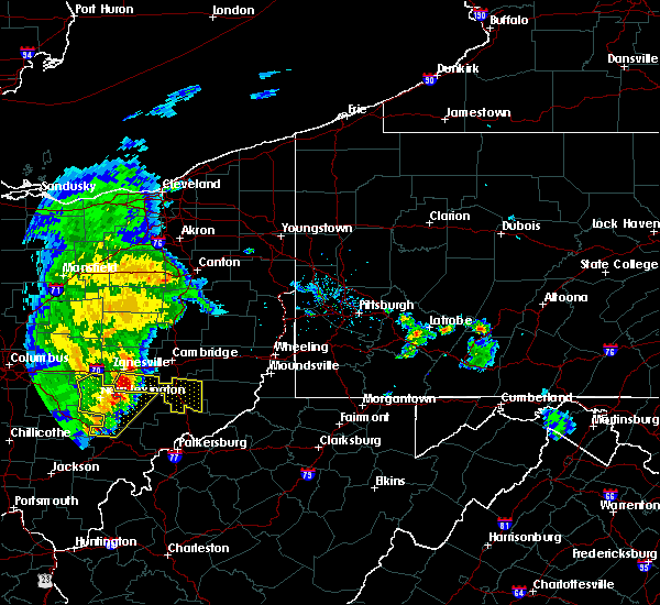 The national weather service in pittsburgh has issued a * severe thunderstorm warning for. southeastern muskingum county in east central ohio. noble county in east central ohio. until 800 pm edt. At 703 pm edt, a severe thunderstorm was located near south. The national weather service in pittsburgh has issued a * severe thunderstorm warning for. southeastern muskingum county in east central ohio. noble county in east central ohio. until 800 pm edt. At 703 pm edt, a severe thunderstorm was located near south.
|
| 5/18/2017 3:44 PM EDT |
 At 344 pm edt, a severe thunderstorm was located near byesville, or 9 miles north of caldwell, moving east at 35 mph (radar). Hazards include 60 mph wind gusts and quarter-size hail. Minor hail damage to vehicles is possible. Expect wind damage to trees and power lines, resulting in some power outages. At 344 pm edt, a severe thunderstorm was located near byesville, or 9 miles north of caldwell, moving east at 35 mph (radar). Hazards include 60 mph wind gusts and quarter-size hail. Minor hail damage to vehicles is possible. Expect wind damage to trees and power lines, resulting in some power outages.
|
| 5/1/2017 12:56 PM EDT |
 At 1255 pm edt, severe thunderstorms were located along a line extending from 7 miles south of west lafayette to near caldwell, moving northeast at 50 mph (radar). Hazards include 60 mph wind gusts. Expect damage to trees and power lines, resulting in some power outages. locations impacted include, cambridge, caldwell, byesville, dudley, antrim, quaker city, senecaville, pleasant city, lore city, old washington, summerfield, belle valley, this includes the following highways, interstate 70 in ohio between mile markers 178 and 193. interstate 77 in ohio between mile markers 21 and 52. A tornado watch remains in effect until 700 pm edt for east central ohio. At 1255 pm edt, severe thunderstorms were located along a line extending from 7 miles south of west lafayette to near caldwell, moving northeast at 50 mph (radar). Hazards include 60 mph wind gusts. Expect damage to trees and power lines, resulting in some power outages. locations impacted include, cambridge, caldwell, byesville, dudley, antrim, quaker city, senecaville, pleasant city, lore city, old washington, summerfield, belle valley, this includes the following highways, interstate 70 in ohio between mile markers 178 and 193. interstate 77 in ohio between mile markers 21 and 52. A tornado watch remains in effect until 700 pm edt for east central ohio.
|
| 5/1/2017 12:38 PM EDT |
 At 1238 pm edt, severe thunderstorms were located along a line extending from 6 miles northeast of north zanesville to near mcconnelsville, moving northeast at 50 mph (radar). Hazards include 60 mph wind gusts. Expect damage to trees and power lines, resulting in some power outages. locations impacted include, cambridge, caldwell, new concord, byesville, dudley, antrim, quaker city, senecaville, pleasant city, cumberland, lore city, old washington, this includes the following highways, interstate 70 in ohio between mile markers 161 and 193. interstate 77 in ohio between mile markers 21 and 52. A tornado watch remains in effect until 700 pm edt for east central ohio. At 1238 pm edt, severe thunderstorms were located along a line extending from 6 miles northeast of north zanesville to near mcconnelsville, moving northeast at 50 mph (radar). Hazards include 60 mph wind gusts. Expect damage to trees and power lines, resulting in some power outages. locations impacted include, cambridge, caldwell, new concord, byesville, dudley, antrim, quaker city, senecaville, pleasant city, cumberland, lore city, old washington, this includes the following highways, interstate 70 in ohio between mile markers 161 and 193. interstate 77 in ohio between mile markers 21 and 52. A tornado watch remains in effect until 700 pm edt for east central ohio.
|
| 5/1/2017 12:08 PM EDT |
 At 1208 pm edt, severe thunderstorms were located along a line extending from near perry state forest to near athens, moving northeast at 50 mph (radar). Hazards include 60 mph wind gusts. expect damage to trees and power lines, resulting in some power outages At 1208 pm edt, severe thunderstorms were located along a line extending from near perry state forest to near athens, moving northeast at 50 mph (radar). Hazards include 60 mph wind gusts. expect damage to trees and power lines, resulting in some power outages
|
| 7/15/2016 4:44 PM EDT |
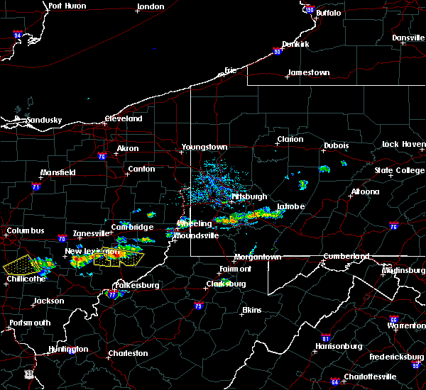 At 443 pm edt, a severe thunderstorm was located over caldwell, moving east at 25 mph (radar indicated). Hazards include 60 mph wind gusts and half dollar size hail. Hail damage to vehicles is expected. expect wind damage to trees and power lines, resulting in some power outages. locations impacted include, caldwell, dudley, belle valley, dexter city, stafford, harriettsville and wolf run state park. this includes interstate 77 in ohio between mile markers 18 and 30. Please report severe weather by calling 4 1 2, 2 6 2, 1 9 8 8, posting to the nws pittsburgh facebook page, or using twitter @nwspittsburgh. At 443 pm edt, a severe thunderstorm was located over caldwell, moving east at 25 mph (radar indicated). Hazards include 60 mph wind gusts and half dollar size hail. Hail damage to vehicles is expected. expect wind damage to trees and power lines, resulting in some power outages. locations impacted include, caldwell, dudley, belle valley, dexter city, stafford, harriettsville and wolf run state park. this includes interstate 77 in ohio between mile markers 18 and 30. Please report severe weather by calling 4 1 2, 2 6 2, 1 9 8 8, posting to the nws pittsburgh facebook page, or using twitter @nwspittsburgh.
|
| 7/15/2016 4:24 PM EDT |
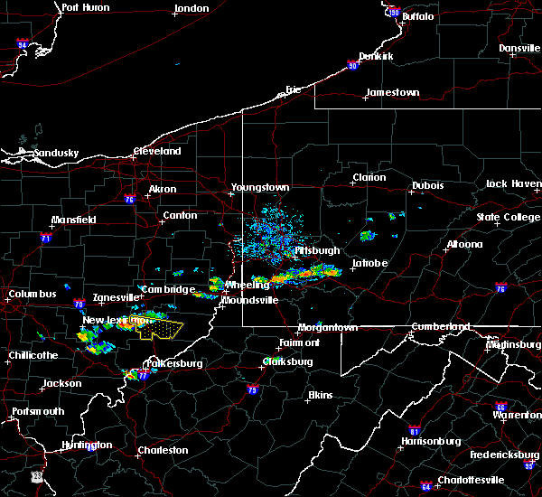 At 423 pm edt, a severe thunderstorm was located 8 miles west of caldwell, moving east at 25 mph (radar indicated). Hazards include 60 mph wind gusts and quarter size hail. Hail damage to vehicles is expected. Expect wind damage to trees and power lines, resulting in some power outages. At 423 pm edt, a severe thunderstorm was located 8 miles west of caldwell, moving east at 25 mph (radar indicated). Hazards include 60 mph wind gusts and quarter size hail. Hail damage to vehicles is expected. Expect wind damage to trees and power lines, resulting in some power outages.
|
| 6/23/2016 1:59 AM EDT |
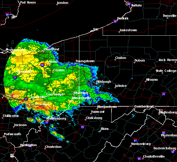 At 159 am edt, a severe thunderstorm was located 9 miles north of mcconnelsville, moving east at 50 mph (radar indicated). Hazards include 60 mph wind gusts and quarter size hail. Hail damage to vehicles is expected. expect wind damage to trees and power lines, resulting in some power outages. locations impacted include, caldwell, dudley, philo, cumberland, belle valley, sarahsville, dexter city, ruraldale, high hill, duncan falls, wolf run state park and blue rock state park. this includes interstate 77 in ohio between mile markers 18 and 35. Please report severe weather by calling 4 1 2, 2 6 2, 1 9 8 8, posting to the nws pittsburgh facebook page, or using twitter @nwspittsburgh. At 159 am edt, a severe thunderstorm was located 9 miles north of mcconnelsville, moving east at 50 mph (radar indicated). Hazards include 60 mph wind gusts and quarter size hail. Hail damage to vehicles is expected. expect wind damage to trees and power lines, resulting in some power outages. locations impacted include, caldwell, dudley, philo, cumberland, belle valley, sarahsville, dexter city, ruraldale, high hill, duncan falls, wolf run state park and blue rock state park. this includes interstate 77 in ohio between mile markers 18 and 35. Please report severe weather by calling 4 1 2, 2 6 2, 1 9 8 8, posting to the nws pittsburgh facebook page, or using twitter @nwspittsburgh.
|
| 6/23/2016 1:50 AM EDT |
 At 150 am edt, a severe thunderstorm was located 7 miles south of south zanesville, or 10 miles south of zanesville, moving east at 50 mph (radar indicated). Hazards include 60 mph wind gusts and quarter size hail. Hail damage to vehicles is expected. Expect wind damage to trees and power lines, resulting in some power outages. At 150 am edt, a severe thunderstorm was located 7 miles south of south zanesville, or 10 miles south of zanesville, moving east at 50 mph (radar indicated). Hazards include 60 mph wind gusts and quarter size hail. Hail damage to vehicles is expected. Expect wind damage to trees and power lines, resulting in some power outages.
|
| 5/10/2016 4:38 PM EDT |
 At 437 pm edt, a severe thunderstorm was located near caldwell, moving northeast at 25 mph (radar indicated). Hazards include 60 mph wind gusts and quarter size hail. Hail damage to vehicles is expected. Expect wind damage to trees and power lines, resulting in some power outages. At 437 pm edt, a severe thunderstorm was located near caldwell, moving northeast at 25 mph (radar indicated). Hazards include 60 mph wind gusts and quarter size hail. Hail damage to vehicles is expected. Expect wind damage to trees and power lines, resulting in some power outages.
|
| 7/14/2015 4:12 PM EDT | The severe thunderstorm warning for noble, southeastern muskingum and southern guernsey counties will expire at 415 pm edt, the severe thunderstorm which prompted the warning has weakened. therefore the warning will be allowed to expire. a severe thunderstorm watch remains in effect until 800 pm edt for east central ohio. |
| 7/14/2015 3:40 PM EDT |
 At 339 pm edt, a severe thunderstorm was located near byesville, or near cambridge, moving east at 50 mph (radar indicated). Hazards include 60 mph wind gusts and quarter size hail. Hail damage to vehicles is expected. expect wind damage to trees and some power outages. Locations impacted include, cambridge, caldwell, new concord, byesville, dudley, quaker city, senecaville, pleasant city, cumberland, lore city, old washington, summerfield, belle valley, sarahsville, salesville, dexter city, norwich, chandlersville, ruraldale and high hill. At 339 pm edt, a severe thunderstorm was located near byesville, or near cambridge, moving east at 50 mph (radar indicated). Hazards include 60 mph wind gusts and quarter size hail. Hail damage to vehicles is expected. expect wind damage to trees and some power outages. Locations impacted include, cambridge, caldwell, new concord, byesville, dudley, quaker city, senecaville, pleasant city, cumberland, lore city, old washington, summerfield, belle valley, sarahsville, salesville, dexter city, norwich, chandlersville, ruraldale and high hill.
|
| 7/14/2015 3:29 PM EDT |
 At 329 pm edt, a severe thunderstorm was located near new concord, or 11 miles east of zanesville, moving east at 50 mph (radar indicated). Hazards include 60 mph wind gusts and quarter size hail. Hail damage to vehicles is expected. Expect wind damage to trees and some power outages. At 329 pm edt, a severe thunderstorm was located near new concord, or 11 miles east of zanesville, moving east at 50 mph (radar indicated). Hazards include 60 mph wind gusts and quarter size hail. Hail damage to vehicles is expected. Expect wind damage to trees and some power outages.
|
| 5/11/2015 6:56 PM EDT | At 656 pm edt, a severe thunderstorm was located near new concord, or 12 miles southwest of cambridge, moving northeast at 45 mph (radar indicated). Hazards include 60 mph wind gusts. Expect damage to roofs. siding and trees. locations impacted include, cambridge, new concord, byesville, senecaville, pleasant city, cumberland, lore city, old washington, belle valley, sarahsville, norwich, chandlersville, ruraldale, high hill, bridgeville, seneca lake park, blue rock state park and wolf run state park. 75in. |
| 5/11/2015 6:31 PM EDT | At 631 pm edt, severe thunderstorms were located along a line extending from near zanesville to 9 miles east of perry state forest, moving northeast at 40 mph (radar indicated). Hazards include 60 mph wind gusts and quarter size hail. Hail damage to vehicles is expected. Expect wind damage to roofs, siding and trees. |
| 5/11/2015 6:31 PM EDT | The national weather service in pittsburgh has issued a * severe thunderstorm warning for. central noble county in east central ohio. southeastern muskingum county in east central ohio. southwestern guernsey county in east central ohio. Until 715 pm edt. |
| 5/11/2015 6:31 PM EDT | The national weather service in pittsburgh has issued a * severe thunderstorm warning for. central noble county in east central ohio. southeastern muskingum county in east central ohio. southwestern guernsey county in east central ohio. Until 715 pm edt. |
| 4/9/2015 4:48 PM EDT | The national weather service in pittsburgh has issued a * severe thunderstorm warning for. noble county in east central ohio. western jefferson county in east central ohio. northeastern coshocton county in east central ohio. Guernsey county in east central ohio. |
| 4/9/2015 4:45 PM EDT | A severe thunderstorm warning remains in effect until 500 pm edt for western noble. eastern muskingum. eastern coshocton. guernsey and southwestern tuscarawas counties. at 445 pm edt. severe thunderstorms were located along a line extending from near walnut creek to near salt fork state park to near mcconnelsville. Moving east at 55 mph. |
| 4/9/2015 4:28 PM EDT | A severe thunderstorm warning remains in effect until 500 pm edt for western noble. muskingum. coshocton. guernsey and southwestern tuscarawas counties. at 426 pm edt. severe thunderstorms were located along a line extending from conesville to near ruraldale to 6 miles east of lake hope state park. Moving east at 50 mph. |
| 4/9/2015 4:11 PM EDT | The national weather service in pittsburgh has issued a * severe thunderstorm warning for. western noble county in east central ohio. muskingum county in east central ohio. coshocton county in east central ohio. Guernsey county in east central ohio. |
| 6/29/2012 6:15 PM EDT | Numerous 80 foot pine trees snapped off at around 35-40 feet in noble county OH, 2.9 miles ESE of Belle Valley, OH |
Hail Maps for Belle Valley, OH
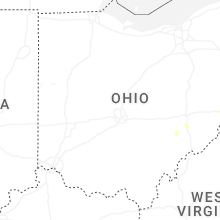


Connect with Interactive Hail Maps