

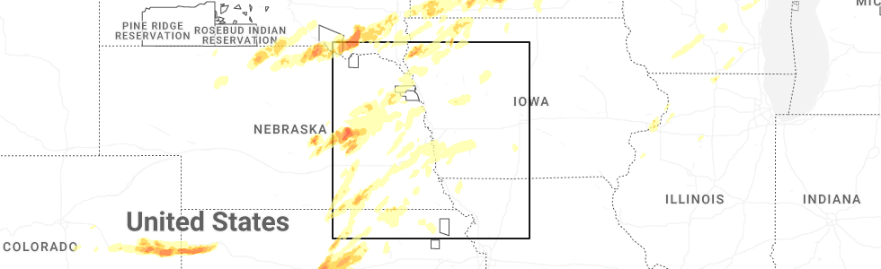
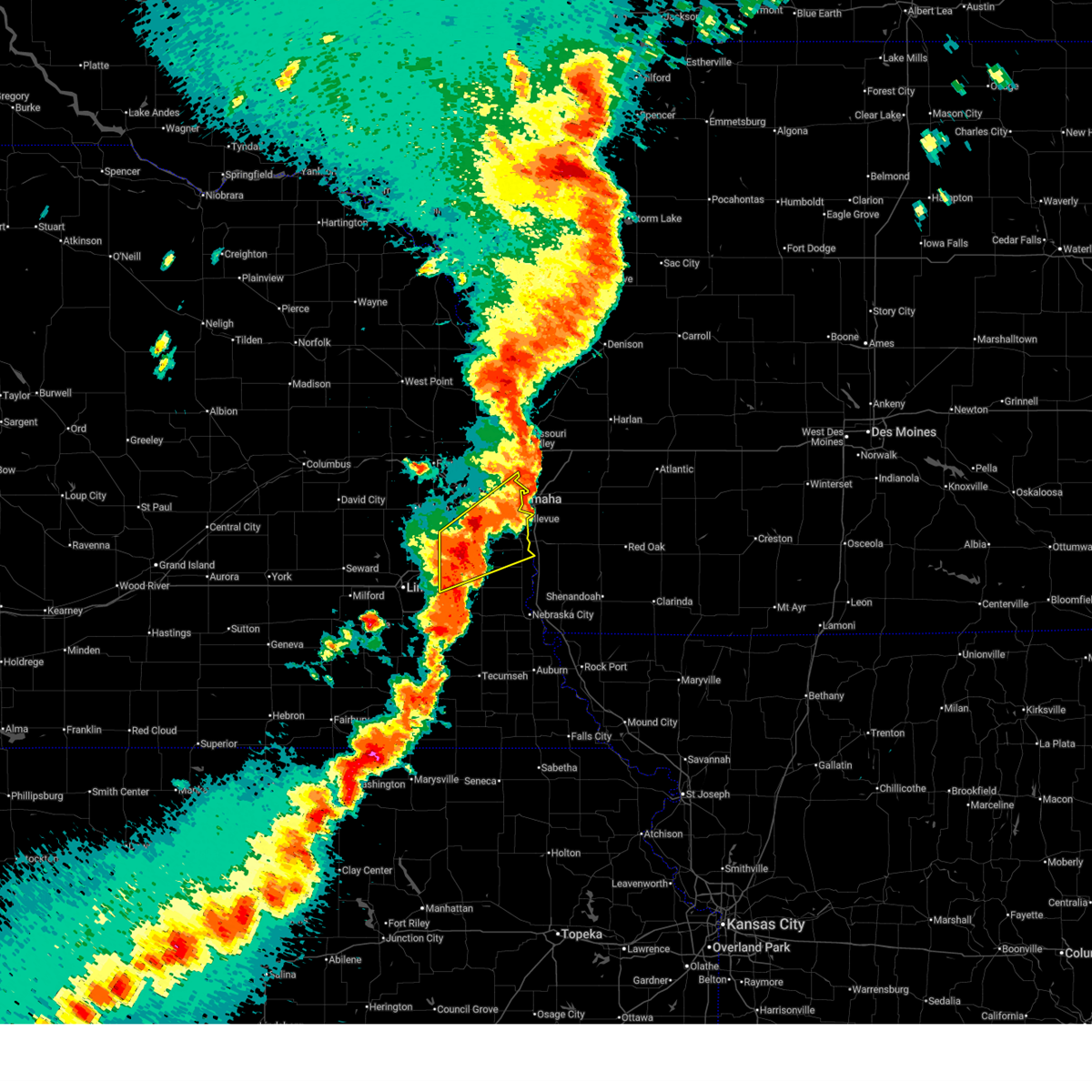
Hail Map for Bellevue, NE
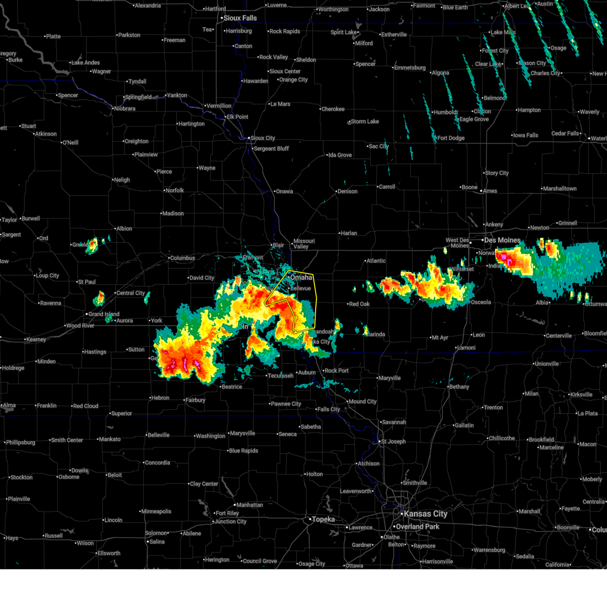
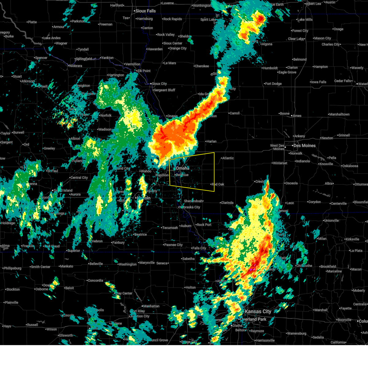
The Bellevue, NE area has had 52 reports of on-the-ground hail by trained spotters, and has been under severe weather warnings 53 times during the past 12 months. Doppler radar has detected hail at or near Bellevue, NE on 149 occasions, including 15 occasions during the past year.
| Name: | Bellevue, NE |
| Where Located: | 7.9 miles S of Omaha, NE |
| Map: | Google Map for Bellevue, NE |
| Population: | 50137 |
| Housing Units: | 20591 |
| More Info: | Search Google for Bellevue, NE |
1
The Top Recent Hail Date for Bellevue, NE is Sunday, May 17, 2026 (17th out of 149)
Hail and Wind Damage Spotted near Bellevue, NE
| Date / Time | Report Details |
|---|---|
| 7/3/2026 8:49 PM CDT |
 At 848 pm cdt, a severe thunderstorm was located over springfield, or 7 miles southwest of papillion, moving southeast at 15 mph (radar indicated). Hazards include 60 mph wind gusts and penny size hail. Expect damage to roofs, siding, and trees. locations impacted include, papillion, springfield, cedar creek, prairie queen recreation area, walnut creek recreation area, wehrspann lake, chalco, and camp maha. This includes interstate 80 in nebraska between mile markers 435 and 440. At 848 pm cdt, a severe thunderstorm was located over springfield, or 7 miles southwest of papillion, moving southeast at 15 mph (radar indicated). Hazards include 60 mph wind gusts and penny size hail. Expect damage to roofs, siding, and trees. locations impacted include, papillion, springfield, cedar creek, prairie queen recreation area, walnut creek recreation area, wehrspann lake, chalco, and camp maha. This includes interstate 80 in nebraska between mile markers 435 and 440.
|
| 7/3/2026 8:22 PM CDT |
 Svroax the national weather service in omaha has issued a * severe thunderstorm warning for, central sarpy county in east central nebraska, north central cass county in southeastern nebraska, * until 900 pm cdt. * at 821 pm cdt, a severe thunderstorm was located near gretna, moving east southeast at 15 mph (radar indicated). Hazards include 60 mph wind gusts and half dollar size hail. Hail damage to vehicles is expected. Expect wind damage to roofs, siding, and trees. Svroax the national weather service in omaha has issued a * severe thunderstorm warning for, central sarpy county in east central nebraska, north central cass county in southeastern nebraska, * until 900 pm cdt. * at 821 pm cdt, a severe thunderstorm was located near gretna, moving east southeast at 15 mph (radar indicated). Hazards include 60 mph wind gusts and half dollar size hail. Hail damage to vehicles is expected. Expect wind damage to roofs, siding, and trees.
|
| 6/13/2026 8:40 AM CDT | Quarter sized hail reported 2.3 miles WSW of Bellevue, NE, quarter-size hail and strong winds. small limbs down. |
| 6/13/2026 8:40 AM CDT | Quarter sized hail reported 1.4 miles SW of Bellevue, NE |
| 6/13/2026 8:39 AM CDT |
 At 839 am cdt, severe thunderstorms were located along a line extending from 2 miles east of kennard to omaha to prairie queen recreation area, moving east at 45 mph (broadcast media reported quarter size hail at 838 am in omaha. this storm has a history of producing 60 mph winds). Hazards include 60 mph wind gusts and quarter size hail. Hail damage to vehicles is expected. expect wind damage to roofs, siding, and trees. locations impacted include, eastern omaha, council bluffs, bellevue, papillion, ralston, offutt afb, la vista, carter lake, fort calhoun, eppley airfield, crescent, council bluffs airport and glenwood. people attending charles schwab field should seek safe shelter immediately! this includes the following highways, interstate 29 between mile markers 35 and 68. interstate 80 in iowa between mile markers 1 and 11. Interstate 80 in nebraska between mile markers 437 and 454. At 839 am cdt, severe thunderstorms were located along a line extending from 2 miles east of kennard to omaha to prairie queen recreation area, moving east at 45 mph (broadcast media reported quarter size hail at 838 am in omaha. this storm has a history of producing 60 mph winds). Hazards include 60 mph wind gusts and quarter size hail. Hail damage to vehicles is expected. expect wind damage to roofs, siding, and trees. locations impacted include, eastern omaha, council bluffs, bellevue, papillion, ralston, offutt afb, la vista, carter lake, fort calhoun, eppley airfield, crescent, council bluffs airport and glenwood. people attending charles schwab field should seek safe shelter immediately! this includes the following highways, interstate 29 between mile markers 35 and 68. interstate 80 in iowa between mile markers 1 and 11. Interstate 80 in nebraska between mile markers 437 and 454.
|
| 6/13/2026 8:38 AM CDT |
 Svroax the national weather service in omaha has issued a * severe thunderstorm warning for, mills county in southwestern iowa, pottawattamie county in southwestern iowa, sarpy county in east central nebraska, southeastern washington county in east central nebraska, douglas county in east central nebraska, northeastern cass county in southeastern nebraska, * until 930 am cdt. * at 837 am cdt, severe thunderstorms were located along a line extending from 2 miles west of fort calhoun to omaha to near walnut creek recreation area, moving east at 50 mph (broadcast media reported quarter size hail at 838 am in omaha. this storm has a history of producing 60 mph winds). Hazards include 60 mph wind gusts and quarter size hail. Hail damage to vehicles is expected. Expect wind damage to roofs, siding, and trees. Svroax the national weather service in omaha has issued a * severe thunderstorm warning for, mills county in southwestern iowa, pottawattamie county in southwestern iowa, sarpy county in east central nebraska, southeastern washington county in east central nebraska, douglas county in east central nebraska, northeastern cass county in southeastern nebraska, * until 930 am cdt. * at 837 am cdt, severe thunderstorms were located along a line extending from 2 miles west of fort calhoun to omaha to near walnut creek recreation area, moving east at 50 mph (broadcast media reported quarter size hail at 838 am in omaha. this storm has a history of producing 60 mph winds). Hazards include 60 mph wind gusts and quarter size hail. Hail damage to vehicles is expected. Expect wind damage to roofs, siding, and trees.
|
| 6/13/2026 8:23 AM CDT |
 At 822 am cdt, severe thunderstorms were located along a line extending from 2 miles northwest of arlington to elkhorn to 5 miles southeast of yutan, moving east at 45 mph (at 820 am, 58 mph winds were observed at nws omaha in valley, ne). Hazards include 60 mph wind gusts and quarter size hail. Hail damage to vehicles is expected. expect wind damage to roofs, siding, and trees. these severe storms will be near, omaha, gretna, bennington, boys town, millard, la vista, kennard, flanagan lake, chalco, and wehrspann lake around 830 am cdt. other locations in the path of these severe thunderstorms include papillion, ralston, midtown, walnut creek recreation area, benson, aksarben, south omaha, council bluffs, bellevue, carter lake, fort calhoun, florence, offutt afb, eppley airfield, crescent, council bluffs airport and glenwood. people attending charles schwab field, and bran-44 should seek safe shelter immediately! this includes the following highways, interstate 29 between mile markers 29 and 68. interstate 80 in iowa between mile markers 1 and 11. Interstate 80 in nebraska between mile markers 430 and 454. At 822 am cdt, severe thunderstorms were located along a line extending from 2 miles northwest of arlington to elkhorn to 5 miles southeast of yutan, moving east at 45 mph (at 820 am, 58 mph winds were observed at nws omaha in valley, ne). Hazards include 60 mph wind gusts and quarter size hail. Hail damage to vehicles is expected. expect wind damage to roofs, siding, and trees. these severe storms will be near, omaha, gretna, bennington, boys town, millard, la vista, kennard, flanagan lake, chalco, and wehrspann lake around 830 am cdt. other locations in the path of these severe thunderstorms include papillion, ralston, midtown, walnut creek recreation area, benson, aksarben, south omaha, council bluffs, bellevue, carter lake, fort calhoun, florence, offutt afb, eppley airfield, crescent, council bluffs airport and glenwood. people attending charles schwab field, and bran-44 should seek safe shelter immediately! this includes the following highways, interstate 29 between mile markers 29 and 68. interstate 80 in iowa between mile markers 1 and 11. Interstate 80 in nebraska between mile markers 430 and 454.
|
| 6/13/2026 8:13 AM CDT |
 Svroax the national weather service in omaha has issued a * severe thunderstorm warning for, western mills county in southwestern iowa, western pottawattamie county in southwestern iowa, sarpy county in east central nebraska, southern washington county in east central nebraska, southeastern dodge county in east central nebraska, douglas county in east central nebraska, eastern saunders county in east central nebraska, northeastern cass county in southeastern nebraska, * until 900 am cdt. * at 813 am cdt, severe thunderstorms were located along a line extending from 3 miles south of nickerson to near valley to 4 miles southeast of mead, moving east at 45 mph (trained weather spotters). Hazards include 60 mph wind gusts and quarter size hail. Hail damage to vehicles is expected. expect wind damage to roofs, siding, and trees. severe thunderstorms will be near, omaha, gretna, boys town, elkhorn, arlington, waterloo, flanagan lake, and zorinsky lake around 820 am cdt. bennington, millard, kennard, chalco, wehrspann lake, and standing bear lake around 825 am cdt. papillion, ralston, la vista, prairie queen recreation area, benson, and aksarben around 830 am cdt. other locations in the path of these severe thunderstorms include bellevue, springfield, midtown, walnut creek recreation area, florence, south omaha, council bluffs, offutt afb, carter lake, fort calhoun, eppley airfield, crescent and council bluffs airport. people attending charles schwab field, and bran-44 should seek safe shelter immediately! this includes the following highways, interstate 29 between mile markers 29 and 68. interstate 80 in iowa between mile markers 1 and 11. Interstate 80 in nebraska between mile markers 430 and 454. Svroax the national weather service in omaha has issued a * severe thunderstorm warning for, western mills county in southwestern iowa, western pottawattamie county in southwestern iowa, sarpy county in east central nebraska, southern washington county in east central nebraska, southeastern dodge county in east central nebraska, douglas county in east central nebraska, eastern saunders county in east central nebraska, northeastern cass county in southeastern nebraska, * until 900 am cdt. * at 813 am cdt, severe thunderstorms were located along a line extending from 3 miles south of nickerson to near valley to 4 miles southeast of mead, moving east at 45 mph (trained weather spotters). Hazards include 60 mph wind gusts and quarter size hail. Hail damage to vehicles is expected. expect wind damage to roofs, siding, and trees. severe thunderstorms will be near, omaha, gretna, boys town, elkhorn, arlington, waterloo, flanagan lake, and zorinsky lake around 820 am cdt. bennington, millard, kennard, chalco, wehrspann lake, and standing bear lake around 825 am cdt. papillion, ralston, la vista, prairie queen recreation area, benson, and aksarben around 830 am cdt. other locations in the path of these severe thunderstorms include bellevue, springfield, midtown, walnut creek recreation area, florence, south omaha, council bluffs, offutt afb, carter lake, fort calhoun, eppley airfield, crescent and council bluffs airport. people attending charles schwab field, and bran-44 should seek safe shelter immediately! this includes the following highways, interstate 29 between mile markers 29 and 68. interstate 80 in iowa between mile markers 1 and 11. Interstate 80 in nebraska between mile markers 430 and 454.
|
| 6/11/2026 5:46 AM CDT |
 Svroax the national weather service in omaha has issued a * severe thunderstorm warning for, northwestern mills county in southwestern iowa, pottawattamie county in southwestern iowa, southeastern harrison county in southwestern iowa, southeastern shelby county in southwestern iowa, * until 630 am cdt. * at 545 am cdt, severe thunderstorms were located along a line extending from near underwood to 4 miles northeast of silver city, moving east at 55 mph (radar indicated). Hazards include 70 mph wind gusts and quarter size hail. Hail damage to vehicles is expected. expect considerable tree damage. wind damage is also likely to mobile homes, roofs, and outbuildings. severe thunderstorms will be near, neola, carson, minden, and macedonia around 550 am cdt. oakland, shelby, and hancock around 555 am cdt. avoca around 600 am cdt. walnut around 605 am cdt. this includes the following highways, interstate 29 between mile markers 39 and 52, between mile markers 54 and 56, and between mile markers 61 and 66. Interstate 80 in iowa between mile markers 3 and 48. Svroax the national weather service in omaha has issued a * severe thunderstorm warning for, northwestern mills county in southwestern iowa, pottawattamie county in southwestern iowa, southeastern harrison county in southwestern iowa, southeastern shelby county in southwestern iowa, * until 630 am cdt. * at 545 am cdt, severe thunderstorms were located along a line extending from near underwood to 4 miles northeast of silver city, moving east at 55 mph (radar indicated). Hazards include 70 mph wind gusts and quarter size hail. Hail damage to vehicles is expected. expect considerable tree damage. wind damage is also likely to mobile homes, roofs, and outbuildings. severe thunderstorms will be near, neola, carson, minden, and macedonia around 550 am cdt. oakland, shelby, and hancock around 555 am cdt. avoca around 600 am cdt. walnut around 605 am cdt. this includes the following highways, interstate 29 between mile markers 39 and 52, between mile markers 54 and 56, and between mile markers 61 and 66. Interstate 80 in iowa between mile markers 3 and 48.
|
| 6/5/2026 10:07 PM CDT |
 At 1002 pm cdt, emergency management reported golfball sized hail in plattsmouth. at 1006 pm cdt, severe thunderstorms were located along a line extending from 3 miles southeast of walnut creek recreation area to 3 miles north of pacific junction to 4 miles west of tabor to 4 miles east of union, moving northeast at 25 mph (emergency management). Hazards include golf ball size hail and 60 mph wind gusts. People and animals outdoors will be injured. expect hail damage to roofs, siding, windows, and vehicles. expect wind damage to roofs, siding, and trees. these severe storms will be near, bellevue, papillion, offutt afb, glenwood, tabor, and pacific junction around 1010 pm cdt. other locations in the path of these severe thunderstorms include southern omaha, southern council bluffs, silver city and south omaha. people attending pottawattamie county public health in focus, summerfest, and american heroes park should seek safe shelter immediately! this includes the following highways, interstate 29 between mile markers 17 and 56. interstate 80 in iowa between mile markers 1 and 8. Interstate 80 in nebraska between mile markers 450 and 454. At 1002 pm cdt, emergency management reported golfball sized hail in plattsmouth. at 1006 pm cdt, severe thunderstorms were located along a line extending from 3 miles southeast of walnut creek recreation area to 3 miles north of pacific junction to 4 miles west of tabor to 4 miles east of union, moving northeast at 25 mph (emergency management). Hazards include golf ball size hail and 60 mph wind gusts. People and animals outdoors will be injured. expect hail damage to roofs, siding, windows, and vehicles. expect wind damage to roofs, siding, and trees. these severe storms will be near, bellevue, papillion, offutt afb, glenwood, tabor, and pacific junction around 1010 pm cdt. other locations in the path of these severe thunderstorms include southern omaha, southern council bluffs, silver city and south omaha. people attending pottawattamie county public health in focus, summerfest, and american heroes park should seek safe shelter immediately! this includes the following highways, interstate 29 between mile markers 17 and 56. interstate 80 in iowa between mile markers 1 and 8. Interstate 80 in nebraska between mile markers 450 and 454.
|
| 6/5/2026 9:59 PM CDT |
 Svroax the national weather service in omaha has issued a * severe thunderstorm warning for, northwestern fremont county in southwestern iowa, western mills county in southwestern iowa, southwestern pottawattamie county in southwestern iowa, eastern sarpy county in east central nebraska, southeastern douglas county in east central nebraska, eastern cass county in southeastern nebraska, * until 1045 pm cdt. * at 958 pm cdt, severe thunderstorms were located along a line extending from 2 miles northeast of cedar creek to 3 miles northeast of plattsmouth to 4 miles east of beaver lake to 3 miles southeast of union, moving northeast at 25 mph (radar indicated). Hazards include 60 mph wind gusts and quarter size hail. Hail damage to vehicles is expected. expect wind damage to roofs, siding, and trees. severe thunderstorms will be near, bellevue, papillion, offutt afb, glenwood, tabor, and pacific junction around 1005 pm cdt. other locations in the path of these severe thunderstorms include southern council bluffs, silver city and south omaha. people attending pottawattamie county public health in focus, summerfest, and american heroes park should seek safe shelter immediately! this includes the following highways, interstate 29 between mile markers 17 and 56. interstate 80 in iowa between mile markers 1 and 8. Interstate 80 in nebraska between mile markers 450 and 454. Svroax the national weather service in omaha has issued a * severe thunderstorm warning for, northwestern fremont county in southwestern iowa, western mills county in southwestern iowa, southwestern pottawattamie county in southwestern iowa, eastern sarpy county in east central nebraska, southeastern douglas county in east central nebraska, eastern cass county in southeastern nebraska, * until 1045 pm cdt. * at 958 pm cdt, severe thunderstorms were located along a line extending from 2 miles northeast of cedar creek to 3 miles northeast of plattsmouth to 4 miles east of beaver lake to 3 miles southeast of union, moving northeast at 25 mph (radar indicated). Hazards include 60 mph wind gusts and quarter size hail. Hail damage to vehicles is expected. expect wind damage to roofs, siding, and trees. severe thunderstorms will be near, bellevue, papillion, offutt afb, glenwood, tabor, and pacific junction around 1005 pm cdt. other locations in the path of these severe thunderstorms include southern council bluffs, silver city and south omaha. people attending pottawattamie county public health in focus, summerfest, and american heroes park should seek safe shelter immediately! this includes the following highways, interstate 29 between mile markers 17 and 56. interstate 80 in iowa between mile markers 1 and 8. Interstate 80 in nebraska between mile markers 450 and 454.
|
| 5/17/2026 9:57 PM CDT |
 At 956 pm cdt, severe thunderstorms were located along a line extending from 5 miles north of grant to 6 miles north of villisca to 4 miles south of red oak to 3 miles east of shenandoah, moving east at 40 mph (radar indicated). Hazards include 70 mph wind gusts and penny size hail. Expect considerable tree damage. damage is likely to mobile homes, roofs, and outbuildings. locations impacted include, nebraska city, red oak, glenwood, shenandoah, villisca, hamburg, malvern, sidney, tabor, essex, stanton, farragut, pacific junction, emerson, elliott, riverton, silver city, coin, henderson, and randolph. This includes interstate 29 between mile markers 1 and 42. At 956 pm cdt, severe thunderstorms were located along a line extending from 5 miles north of grant to 6 miles north of villisca to 4 miles south of red oak to 3 miles east of shenandoah, moving east at 40 mph (radar indicated). Hazards include 70 mph wind gusts and penny size hail. Expect considerable tree damage. damage is likely to mobile homes, roofs, and outbuildings. locations impacted include, nebraska city, red oak, glenwood, shenandoah, villisca, hamburg, malvern, sidney, tabor, essex, stanton, farragut, pacific junction, emerson, elliott, riverton, silver city, coin, henderson, and randolph. This includes interstate 29 between mile markers 1 and 42.
|
| 5/17/2026 9:03 PM CDT |
 Svroax the national weather service in omaha has issued a * severe thunderstorm warning for, fremont county in southwestern iowa, montgomery county in southwestern iowa, mills county in southwestern iowa, page county in southwestern iowa, northeastern sarpy county in east central nebraska, eastern otoe county in southeastern nebraska, eastern cass county in southeastern nebraska, * until 1015 pm cdt. * at 902 pm cdt, severe thunderstorms were located along a line extending from 4 miles northwest of silver city to 4 miles north of tabor to near beaver lake to 3 miles northeast of dunbar, moving east at 40 mph (radar indicated. this line of storms has a history of producing 60-70 mph winds). Hazards include 70 mph wind gusts and penny size hail. Expect considerable tree damage. Damage is likely to mobile homes, roofs, and outbuildings. Svroax the national weather service in omaha has issued a * severe thunderstorm warning for, fremont county in southwestern iowa, montgomery county in southwestern iowa, mills county in southwestern iowa, page county in southwestern iowa, northeastern sarpy county in east central nebraska, eastern otoe county in southeastern nebraska, eastern cass county in southeastern nebraska, * until 1015 pm cdt. * at 902 pm cdt, severe thunderstorms were located along a line extending from 4 miles northwest of silver city to 4 miles north of tabor to near beaver lake to 3 miles northeast of dunbar, moving east at 40 mph (radar indicated. this line of storms has a history of producing 60-70 mph winds). Hazards include 70 mph wind gusts and penny size hail. Expect considerable tree damage. Damage is likely to mobile homes, roofs, and outbuildings.
|
| 5/17/2026 8:33 PM CDT |
 At 832 pm cdt, severe thunderstorms were located along a line extending from 2 miles north of logan to 4 miles southeast of crescent to plattsmouth, moving east at 45 mph (at 827 pm, eppley airfield reported a gust of 63 mph). Hazards include 70 mph wind gusts and quarter size hail. Hail damage to vehicles is expected. expect considerable tree damage. wind damage is also likely to mobile homes, roofs, and outbuildings. locations impacted include, eastern council bluffs, plattsmouth, glenwood, underwood, pacific junction, council bluffs airport, treynor, neola, persia, silver city, minden, malvern, shelby, oakland, avoca, carson, macedonia, hancock, henderson, hastings and harlan. people attending fricke field, the omaha cinco de mayo celebration, papillion lavista south high school, werner park, and tal anderson field should seek safe shelter immediately! this includes the following highways, interstate 29 between mile markers 25 and 77. interstate 80 in iowa between mile markers 1 and 43. Interstate 80 in nebraska between mile markers 437 and 454. At 832 pm cdt, severe thunderstorms were located along a line extending from 2 miles north of logan to 4 miles southeast of crescent to plattsmouth, moving east at 45 mph (at 827 pm, eppley airfield reported a gust of 63 mph). Hazards include 70 mph wind gusts and quarter size hail. Hail damage to vehicles is expected. expect considerable tree damage. wind damage is also likely to mobile homes, roofs, and outbuildings. locations impacted include, eastern council bluffs, plattsmouth, glenwood, underwood, pacific junction, council bluffs airport, treynor, neola, persia, silver city, minden, malvern, shelby, oakland, avoca, carson, macedonia, hancock, henderson, hastings and harlan. people attending fricke field, the omaha cinco de mayo celebration, papillion lavista south high school, werner park, and tal anderson field should seek safe shelter immediately! this includes the following highways, interstate 29 between mile markers 25 and 77. interstate 80 in iowa between mile markers 1 and 43. Interstate 80 in nebraska between mile markers 437 and 454.
|
| 5/17/2026 8:31 PM CDT |
 At 830 pm cdt, severe thunderstorms were located along a line extending from 7 miles west of gretna to 4 miles east of ashland to 3 miles northeast of elmwood, moving northeast at 50 mph (at 827 pm, a public mesonet station reported 67 mph 3 miles northeast of alvo, nebraska). Hazards include 70 mph wind gusts and quarter size hail. Hail damage to vehicles is expected. expect considerable tree damage. wind damage is also likely to mobile homes, roofs, and outbuildings. these severe storms will be near, gretna, springfield, louisville, cedar creek, and wehrspann lake around 835 pm cdt. omaha, papillion, millard, la vista, chalco, prairie queen recreation area, walnut creek recreation area, and zorinsky lake around 840 pm cdt. bellevue, ralston, and boys town around 845 pm cdt. other locations in the path of these severe thunderstorms include western council bluffs, offutt afb, plattsmouth, midtown, benson, aksarben, south omaha, carter lake, florence and eppley airfield. people attending fricke field, the omaha cinco de mayo celebration, papillion lavista south high school, werner park, and tal anderson field should seek safe shelter immediately! this includes the following highways, interstate 80 in iowa near mile marker 1. Interstate 80 in nebraska between mile markers 415 and 454. At 830 pm cdt, severe thunderstorms were located along a line extending from 7 miles west of gretna to 4 miles east of ashland to 3 miles northeast of elmwood, moving northeast at 50 mph (at 827 pm, a public mesonet station reported 67 mph 3 miles northeast of alvo, nebraska). Hazards include 70 mph wind gusts and quarter size hail. Hail damage to vehicles is expected. expect considerable tree damage. wind damage is also likely to mobile homes, roofs, and outbuildings. these severe storms will be near, gretna, springfield, louisville, cedar creek, and wehrspann lake around 835 pm cdt. omaha, papillion, millard, la vista, chalco, prairie queen recreation area, walnut creek recreation area, and zorinsky lake around 840 pm cdt. bellevue, ralston, and boys town around 845 pm cdt. other locations in the path of these severe thunderstorms include western council bluffs, offutt afb, plattsmouth, midtown, benson, aksarben, south omaha, carter lake, florence and eppley airfield. people attending fricke field, the omaha cinco de mayo celebration, papillion lavista south high school, werner park, and tal anderson field should seek safe shelter immediately! this includes the following highways, interstate 80 in iowa near mile marker 1. Interstate 80 in nebraska between mile markers 415 and 454.
|
| 5/17/2026 8:25 PM CDT |
 Svroax the national weather service in omaha has issued a * severe thunderstorm warning for, sarpy county in east central nebraska, eastern douglas county in east central nebraska, southeastern saunders county in east central nebraska, cass county in southeastern nebraska, * until 915 pm cdt. * at 824 pm cdt, severe thunderstorms were located along a line extending from 6 miles southeast of ithaca to 3 miles southeast of ashland to elmwood, moving northeast at 50 mph (emergency management reported 70 mph wind gusts near waverly with this storm). Hazards include 70 mph wind gusts and quarter size hail. Hail damage to vehicles is expected. expect considerable tree damage. wind damage is also likely to mobile homes, roofs, and outbuildings. severe thunderstorms will be near, gretna, louisville, and murdock around 830 pm cdt. omaha, springfield, cedar creek, chalco, wehrspann lake, prairie queen recreation area, and zorinsky lake around 835 pm cdt. papillion, boys town, millard, la vista, and walnut creek recreation area around 840 pm cdt. other locations in the path of these severe thunderstorms include bellevue, ralston, offutt afb, aksarben, south omaha, western council bluffs, plattsmouth, midtown, benson, carter lake, eppley airfield and florence. people attending fricke field, the omaha cinco de mayo celebration, papillion lavista south high school, werner park, and tal anderson field should seek safe shelter immediately! this includes the following highways, interstate 80 in iowa near mile marker 1. Interstate 80 in nebraska between mile markers 415 and 454. Svroax the national weather service in omaha has issued a * severe thunderstorm warning for, sarpy county in east central nebraska, eastern douglas county in east central nebraska, southeastern saunders county in east central nebraska, cass county in southeastern nebraska, * until 915 pm cdt. * at 824 pm cdt, severe thunderstorms were located along a line extending from 6 miles southeast of ithaca to 3 miles southeast of ashland to elmwood, moving northeast at 50 mph (emergency management reported 70 mph wind gusts near waverly with this storm). Hazards include 70 mph wind gusts and quarter size hail. Hail damage to vehicles is expected. expect considerable tree damage. wind damage is also likely to mobile homes, roofs, and outbuildings. severe thunderstorms will be near, gretna, louisville, and murdock around 830 pm cdt. omaha, springfield, cedar creek, chalco, wehrspann lake, prairie queen recreation area, and zorinsky lake around 835 pm cdt. papillion, boys town, millard, la vista, and walnut creek recreation area around 840 pm cdt. other locations in the path of these severe thunderstorms include bellevue, ralston, offutt afb, aksarben, south omaha, western council bluffs, plattsmouth, midtown, benson, carter lake, eppley airfield and florence. people attending fricke field, the omaha cinco de mayo celebration, papillion lavista south high school, werner park, and tal anderson field should seek safe shelter immediately! this includes the following highways, interstate 80 in iowa near mile marker 1. Interstate 80 in nebraska between mile markers 415 and 454.
|
| 5/17/2026 8:14 PM CDT |
 Toroax the national weather service in omaha has issued a * tornado warning for, central pottawattamie county in southwestern iowa, north central sarpy county in east central nebraska, southeastern douglas county in east central nebraska, * until 900 pm cdt. * at 814 pm cdt, a severe thunderstorm capable of producing a tornado was located over la vista, or over ralston, moving northeast at 55 mph (radar indicated rotation. this storm has a history of producing a tornado along the platte river northeast of ashland). Hazards include tornado and quarter size hail. Flying debris will be dangerous to those caught without shelter. mobile homes will be damaged or destroyed. damage to roofs, windows, and vehicles will occur. tree damage is likely. this dangerous storm will be near, southeastern omaha, council bluffs, bellevue, carter lake, midtown, benson, aksarben, and south omaha around 820 pm cdt. eppley airfield around 825 pm cdt. council bluffs airport around 830 pm cdt. other locations in the path of this tornadic thunderstorm include underwood, neola and minden. people attending the omaha cinco de mayo celebration, and tal anderson field should seek safe shelter immediately! this includes the following highways, interstate 29 between mile markers 47 and 61. interstate 80 in iowa between mile markers 1 and 31. Interstate 80 in nebraska between mile markers 448 and 454. Toroax the national weather service in omaha has issued a * tornado warning for, central pottawattamie county in southwestern iowa, north central sarpy county in east central nebraska, southeastern douglas county in east central nebraska, * until 900 pm cdt. * at 814 pm cdt, a severe thunderstorm capable of producing a tornado was located over la vista, or over ralston, moving northeast at 55 mph (radar indicated rotation. this storm has a history of producing a tornado along the platte river northeast of ashland). Hazards include tornado and quarter size hail. Flying debris will be dangerous to those caught without shelter. mobile homes will be damaged or destroyed. damage to roofs, windows, and vehicles will occur. tree damage is likely. this dangerous storm will be near, southeastern omaha, council bluffs, bellevue, carter lake, midtown, benson, aksarben, and south omaha around 820 pm cdt. eppley airfield around 825 pm cdt. council bluffs airport around 830 pm cdt. other locations in the path of this tornadic thunderstorm include underwood, neola and minden. people attending the omaha cinco de mayo celebration, and tal anderson field should seek safe shelter immediately! this includes the following highways, interstate 29 between mile markers 47 and 61. interstate 80 in iowa between mile markers 1 and 31. Interstate 80 in nebraska between mile markers 448 and 454.
|
| 5/17/2026 8:11 PM CDT |
 Svroax the national weather service in omaha has issued a * severe thunderstorm warning for, mills county in southwestern iowa, pottawattamie county in southwestern iowa, southern harrison county in southwestern iowa, southwestern shelby county in southwestern iowa, sarpy county in east central nebraska, southeastern washington county in east central nebraska, eastern douglas county in east central nebraska, eastern cass county in southeastern nebraska, * until 915 pm cdt. * at 810 pm cdt, severe thunderstorms were located along a line extending from 3 miles west of modale to omaha to 4 miles south of louisville, moving east at 45 mph (these storms have a history of producing 60 mph winds or greater and quarter sized hail). Hazards include 70 mph wind gusts and quarter size hail. Hail damage to vehicles is expected. expect considerable tree damage. wind damage is also likely to mobile homes, roofs, and outbuildings. severe thunderstorms will be near, omaha, council bluffs, bellevue, papillion, ralston, offutt afb, la vista, carter lake, missouri valley, and fort calhoun around 815 pm cdt. crescent around 820 pm cdt. plattsmouth around 825 pm cdt. pacific junction and council bluffs airport around 830 pm cdt. other locations in the path of these severe thunderstorms include glenwood, underwood, neola, treynor, minden, persia, silver city, malvern and shelby. people attending fricke field, the omaha cinco de mayo celebration, papillion lavista south high school, werner park, and tal anderson field should seek safe shelter immediately! this includes the following highways, interstate 29 between mile markers 25 and 77. interstate 80 in iowa between mile markers 1 and 43. Interstate 80 in nebraska between mile markers 437 and 454. Svroax the national weather service in omaha has issued a * severe thunderstorm warning for, mills county in southwestern iowa, pottawattamie county in southwestern iowa, southern harrison county in southwestern iowa, southwestern shelby county in southwestern iowa, sarpy county in east central nebraska, southeastern washington county in east central nebraska, eastern douglas county in east central nebraska, eastern cass county in southeastern nebraska, * until 915 pm cdt. * at 810 pm cdt, severe thunderstorms were located along a line extending from 3 miles west of modale to omaha to 4 miles south of louisville, moving east at 45 mph (these storms have a history of producing 60 mph winds or greater and quarter sized hail). Hazards include 70 mph wind gusts and quarter size hail. Hail damage to vehicles is expected. expect considerable tree damage. wind damage is also likely to mobile homes, roofs, and outbuildings. severe thunderstorms will be near, omaha, council bluffs, bellevue, papillion, ralston, offutt afb, la vista, carter lake, missouri valley, and fort calhoun around 815 pm cdt. crescent around 820 pm cdt. plattsmouth around 825 pm cdt. pacific junction and council bluffs airport around 830 pm cdt. other locations in the path of these severe thunderstorms include glenwood, underwood, neola, treynor, minden, persia, silver city, malvern and shelby. people attending fricke field, the omaha cinco de mayo celebration, papillion lavista south high school, werner park, and tal anderson field should seek safe shelter immediately! this includes the following highways, interstate 29 between mile markers 25 and 77. interstate 80 in iowa between mile markers 1 and 43. Interstate 80 in nebraska between mile markers 437 and 454.
|
| 5/17/2026 7:51 PM CDT |
 At 750 pm cdt, a severe thunderstorm was located over greenwood, or 14 miles southwest of gretna, moving northeast at 45 mph (weather instruments measured 66 mph 5 miles north of waverly). Hazards include 70 mph wind gusts and quarter size hail. Hail damage to vehicles is expected. expect considerable tree damage. wind damage is also likely to mobile homes, roofs, and outbuildings. locations impacted include, ashland, gretna, springfield, wehrspann lake, prairie queen recreation area, southeastern omaha, papillion, la vista, chalco, walnut creek recreation area, bellevue, ralston, south omaha, western council bluffs, aksarben, midtown, carter lake and eppley airfield. people attending fricke field, the omaha cinco de mayo celebration, papillion lavista south high school, werner park, and tal anderson field should seek safe shelter immediately! this includes the following highways, interstate 80 in iowa near mile marker 1. Interstate 80 in nebraska between mile markers 411 and 454. At 750 pm cdt, a severe thunderstorm was located over greenwood, or 14 miles southwest of gretna, moving northeast at 45 mph (weather instruments measured 66 mph 5 miles north of waverly). Hazards include 70 mph wind gusts and quarter size hail. Hail damage to vehicles is expected. expect considerable tree damage. wind damage is also likely to mobile homes, roofs, and outbuildings. locations impacted include, ashland, gretna, springfield, wehrspann lake, prairie queen recreation area, southeastern omaha, papillion, la vista, chalco, walnut creek recreation area, bellevue, ralston, south omaha, western council bluffs, aksarben, midtown, carter lake and eppley airfield. people attending fricke field, the omaha cinco de mayo celebration, papillion lavista south high school, werner park, and tal anderson field should seek safe shelter immediately! this includes the following highways, interstate 80 in iowa near mile marker 1. Interstate 80 in nebraska between mile markers 411 and 454.
|
| 5/17/2026 7:31 PM CDT |
 Svroax the national weather service in omaha has issued a * severe thunderstorm warning for, sarpy county in east central nebraska, northeastern lancaster county in southeastern nebraska, southeastern douglas county in east central nebraska, southeastern saunders county in east central nebraska, northern cass county in southeastern nebraska, * until 830 pm cdt. * at 731 pm cdt, a severe thunderstorm was located over northeastern lincoln, moving northeast at 45 mph (emergency management). Hazards include 60 mph wind gusts and quarter size hail. Hail damage to vehicles is expected. expect wind damage to roofs, siding, and trees. this severe thunderstorm will be near, northeastern lincoln and waverly around 735 pm cdt. greenwood around 745 pm cdt. other locations in the path of this severe thunderstorm include ashland, gretna, springfield, wehrspann lake, papillion, la vista, chalco, prairie queen recreation area, walnut creek recreation area, southern omaha, bellevue, ralston, south omaha, offutt afb and aksarben. people attending fricke field, the omaha cinco de mayo celebration, papillion lavista south high school, werner park, and tal anderson field should seek safe shelter immediately! this includes the following highways, interstate 29 near mile marker 58. interstate 80 in iowa near mile marker 1. Interstate 80 in nebraska between mile markers 397 and 454. Svroax the national weather service in omaha has issued a * severe thunderstorm warning for, sarpy county in east central nebraska, northeastern lancaster county in southeastern nebraska, southeastern douglas county in east central nebraska, southeastern saunders county in east central nebraska, northern cass county in southeastern nebraska, * until 830 pm cdt. * at 731 pm cdt, a severe thunderstorm was located over northeastern lincoln, moving northeast at 45 mph (emergency management). Hazards include 60 mph wind gusts and quarter size hail. Hail damage to vehicles is expected. expect wind damage to roofs, siding, and trees. this severe thunderstorm will be near, northeastern lincoln and waverly around 735 pm cdt. greenwood around 745 pm cdt. other locations in the path of this severe thunderstorm include ashland, gretna, springfield, wehrspann lake, papillion, la vista, chalco, prairie queen recreation area, walnut creek recreation area, southern omaha, bellevue, ralston, south omaha, offutt afb and aksarben. people attending fricke field, the omaha cinco de mayo celebration, papillion lavista south high school, werner park, and tal anderson field should seek safe shelter immediately! this includes the following highways, interstate 29 near mile marker 58. interstate 80 in iowa near mile marker 1. Interstate 80 in nebraska between mile markers 397 and 454.
|
| 4/23/2026 3:52 PM CDT |
 At 351 pm cdt, a severe thunderstorm was located over southeastern omaha, moving northeast at 35 mph. a second severe storm was located near gretna, also moving northeast at 35 mph (public reported half dollar size hail in millard and ping pong ball size hail in papillion with this storm). Hazards include ping pong ball size hail and 60 mph wind gusts. People and animals outdoors will be injured. expect hail damage to roofs, siding, windows, and vehicles. expect wind damage to roofs, siding, and trees. locations impacted include, omaha, bellevue, papillion, ralston, gretna, millard, la vista, carter lake, springfield, aksarben, benson, florence, chalco, prairie queen recreation area, eppley airfield, south omaha, walnut creek recreation area, midtown, wehrspann lake, and zorinsky lake. This includes interstate 80 in nebraska between mile markers 428 and 454. At 351 pm cdt, a severe thunderstorm was located over southeastern omaha, moving northeast at 35 mph. a second severe storm was located near gretna, also moving northeast at 35 mph (public reported half dollar size hail in millard and ping pong ball size hail in papillion with this storm). Hazards include ping pong ball size hail and 60 mph wind gusts. People and animals outdoors will be injured. expect hail damage to roofs, siding, windows, and vehicles. expect wind damage to roofs, siding, and trees. locations impacted include, omaha, bellevue, papillion, ralston, gretna, millard, la vista, carter lake, springfield, aksarben, benson, florence, chalco, prairie queen recreation area, eppley airfield, south omaha, walnut creek recreation area, midtown, wehrspann lake, and zorinsky lake. This includes interstate 80 in nebraska between mile markers 428 and 454.
|
| 4/23/2026 3:42 PM CDT |
 At 342 pm cdt, a severe thunderstorm was located over southern omaha, moving northeast at 35 mph (public reported half dollar size hail in millard and up to ping pong ball size hail in papillion). Hazards include golf ball size hail and 60 mph wind gusts. People and animals outdoors will be injured. expect hail damage to roofs, siding, windows, and vehicles. expect wind damage to roofs, siding, and trees. locations impacted include, omaha, bellevue, papillion, ralston, gretna, boys town, millard, la vista, carter lake, springfield, aksarben, benson, florence, chalco, zorinsky lake, prairie queen recreation area, eppley airfield, south omaha, walnut creek recreation area, and midtown. This includes interstate 80 in nebraska between mile markers 428 and 454. At 342 pm cdt, a severe thunderstorm was located over southern omaha, moving northeast at 35 mph (public reported half dollar size hail in millard and up to ping pong ball size hail in papillion). Hazards include golf ball size hail and 60 mph wind gusts. People and animals outdoors will be injured. expect hail damage to roofs, siding, windows, and vehicles. expect wind damage to roofs, siding, and trees. locations impacted include, omaha, bellevue, papillion, ralston, gretna, boys town, millard, la vista, carter lake, springfield, aksarben, benson, florence, chalco, zorinsky lake, prairie queen recreation area, eppley airfield, south omaha, walnut creek recreation area, and midtown. This includes interstate 80 in nebraska between mile markers 428 and 454.
|
| 4/23/2026 3:38 PM CDT |
 At 337 pm cdt, a severe thunderstorm was located over southwestern omaha, moving northeast at 35 mph (public reported up to half dollar size hail in millard). Hazards include ping pong ball size hail and 60 mph wind gusts. People and animals outdoors will be injured. expect hail damage to roofs, siding, windows, and vehicles. expect wind damage to roofs, siding, and trees. locations impacted include, omaha, bellevue, papillion, ralston, gretna, boys town, millard, la vista, carter lake, springfield, aksarben, benson, florence, chalco, zorinsky lake, prairie queen recreation area, eppley airfield, south omaha, walnut creek recreation area, and midtown. This includes interstate 80 in nebraska between mile markers 428 and 454. At 337 pm cdt, a severe thunderstorm was located over southwestern omaha, moving northeast at 35 mph (public reported up to half dollar size hail in millard). Hazards include ping pong ball size hail and 60 mph wind gusts. People and animals outdoors will be injured. expect hail damage to roofs, siding, windows, and vehicles. expect wind damage to roofs, siding, and trees. locations impacted include, omaha, bellevue, papillion, ralston, gretna, boys town, millard, la vista, carter lake, springfield, aksarben, benson, florence, chalco, zorinsky lake, prairie queen recreation area, eppley airfield, south omaha, walnut creek recreation area, and midtown. This includes interstate 80 in nebraska between mile markers 428 and 454.
|
| 4/23/2026 3:28 PM CDT |
 Svroax the national weather service in omaha has issued a * severe thunderstorm warning for, western sarpy county in east central nebraska, southeastern washington county in east central nebraska, eastern douglas county in east central nebraska, * until 430 pm cdt. * at 328 pm cdt, a severe thunderstorm was located over gretna, moving northeast at 35 mph (radar indicated). Hazards include 60 mph wind gusts and half dollar size hail. Hail damage to vehicles is expected. Expect wind damage to roofs, siding, and trees. Svroax the national weather service in omaha has issued a * severe thunderstorm warning for, western sarpy county in east central nebraska, southeastern washington county in east central nebraska, eastern douglas county in east central nebraska, * until 430 pm cdt. * at 328 pm cdt, a severe thunderstorm was located over gretna, moving northeast at 35 mph (radar indicated). Hazards include 60 mph wind gusts and half dollar size hail. Hail damage to vehicles is expected. Expect wind damage to roofs, siding, and trees.
|
| 3/6/2026 9:46 PM CST |
 the severe thunderstorm warning has been cancelled and is no longer in effect the severe thunderstorm warning has been cancelled and is no longer in effect
|
| 3/6/2026 9:46 PM CST |
 At 946 pm cst, a severe thunderstorm was located over southeastern omaha, moving northeast at 55 mph (radar indicated). Hazards include quarter size hail. Damage to vehicles is expected. this severe storm will be near, eastern omaha, northwestern council bluffs, carter lake, crescent, florence, and eppley airfield around 950 pm cst. this includes the following highways, interstate 29 between mile markers 50 and 68. interstate 80 in iowa between mile markers 1 and 3, and between mile markers 8 and 14. Interstate 80 in nebraska between mile markers 450 and 454. At 946 pm cst, a severe thunderstorm was located over southeastern omaha, moving northeast at 55 mph (radar indicated). Hazards include quarter size hail. Damage to vehicles is expected. this severe storm will be near, eastern omaha, northwestern council bluffs, carter lake, crescent, florence, and eppley airfield around 950 pm cst. this includes the following highways, interstate 29 between mile markers 50 and 68. interstate 80 in iowa between mile markers 1 and 3, and between mile markers 8 and 14. Interstate 80 in nebraska between mile markers 450 and 454.
|
| 3/6/2026 9:40 PM CST |
 the severe thunderstorm warning has been cancelled and is no longer in effect the severe thunderstorm warning has been cancelled and is no longer in effect
|
| 3/6/2026 9:40 PM CST |
 At 939 pm cst, a severe thunderstorm was located over la vista, or over papillion, moving northeast at 55 mph (radar indicated). Hazards include quarter size hail. Damage to vehicles is expected. this severe storm will be near, eastern omaha, northwestern council bluffs, bellevue, carter lake, midtown, eppley airfield, aksarben, benson, and south omaha around 945 pm cst. crescent and florence around 950 pm cst. this includes the following highways, interstate 29 between mile markers 50 and 68. interstate 80 in iowa between mile markers 1 and 3, and between mile markers 8 and 14. Interstate 80 in nebraska between mile markers 444 and 454. At 939 pm cst, a severe thunderstorm was located over la vista, or over papillion, moving northeast at 55 mph (radar indicated). Hazards include quarter size hail. Damage to vehicles is expected. this severe storm will be near, eastern omaha, northwestern council bluffs, bellevue, carter lake, midtown, eppley airfield, aksarben, benson, and south omaha around 945 pm cst. crescent and florence around 950 pm cst. this includes the following highways, interstate 29 between mile markers 50 and 68. interstate 80 in iowa between mile markers 1 and 3, and between mile markers 8 and 14. Interstate 80 in nebraska between mile markers 444 and 454.
|
| 3/6/2026 9:35 PM CST |
 Svroax the national weather service in omaha has issued a * severe thunderstorm warning for, southwestern pottawattamie county in southwestern iowa, eastern sarpy county in east central nebraska, southeastern washington county in east central nebraska, eastern douglas county in east central nebraska, northeastern cass county in southeastern nebraska, * until 1000 pm cst. * at 934 pm cst, a severe thunderstorm was located near walnut creek recreation area, or 4 miles southwest of papillion, moving northeast at 55 mph (radar indicated). Hazards include quarter size hail. Damage to vehicles is expected. this severe thunderstorm will be near, eastern omaha, bellevue, papillion, ralston, la vista, chalco, prairie queen recreation area, walnut creek recreation area, aksarben, and south omaha around 940 pm cst. northwestern council bluffs, carter lake, midtown, and benson around 945 pm cst. florence and eppley airfield around 950 pm cst. other locations in the path of this severe thunderstorm include crescent. this includes the following highways, interstate 29 between mile markers 48 and 68. interstate 80 in iowa between mile markers 1 and 14. Interstate 80 in nebraska between mile markers 439 and 454. Svroax the national weather service in omaha has issued a * severe thunderstorm warning for, southwestern pottawattamie county in southwestern iowa, eastern sarpy county in east central nebraska, southeastern washington county in east central nebraska, eastern douglas county in east central nebraska, northeastern cass county in southeastern nebraska, * until 1000 pm cst. * at 934 pm cst, a severe thunderstorm was located near walnut creek recreation area, or 4 miles southwest of papillion, moving northeast at 55 mph (radar indicated). Hazards include quarter size hail. Damage to vehicles is expected. this severe thunderstorm will be near, eastern omaha, bellevue, papillion, ralston, la vista, chalco, prairie queen recreation area, walnut creek recreation area, aksarben, and south omaha around 940 pm cst. northwestern council bluffs, carter lake, midtown, and benson around 945 pm cst. florence and eppley airfield around 950 pm cst. other locations in the path of this severe thunderstorm include crescent. this includes the following highways, interstate 29 between mile markers 48 and 68. interstate 80 in iowa between mile markers 1 and 14. Interstate 80 in nebraska between mile markers 439 and 454.
|
| 8/9/2025 6:44 AM CDT |
 Svroax the national weather service in omaha has issued a * severe thunderstorm warning for, western montgomery county in southwestern iowa, mills county in southwestern iowa, pottawattamie county in southwestern iowa, northeastern sarpy county in east central nebraska, eastern douglas county in east central nebraska, northeastern cass county in southeastern nebraska, * until 730 am cdt. * at 644 am cdt, severe thunderstorms were located along a line extending from 4 miles north of crescent to 3 miles north of council bluffs airport to 5 miles east of offutt afb, moving northeast at 45 mph (radar indicated). Hazards include 60 mph wind gusts and quarter size hail. Hail damage to vehicles is expected. expect wind damage to roofs, siding, and trees. severe thunderstorms will be near, underwood and council bluffs airport around 650 am cdt. treynor around 655 am cdt. silver city around 700 am cdt. other locations in the path of these severe thunderstorms include oakland, carson, macedonia and hancock. this includes the following highways, interstate 29 between mile markers 32 and 63. interstate 80 in iowa between mile markers 1 and 20. Interstate 80 in nebraska between mile markers 450 and 454. Svroax the national weather service in omaha has issued a * severe thunderstorm warning for, western montgomery county in southwestern iowa, mills county in southwestern iowa, pottawattamie county in southwestern iowa, northeastern sarpy county in east central nebraska, eastern douglas county in east central nebraska, northeastern cass county in southeastern nebraska, * until 730 am cdt. * at 644 am cdt, severe thunderstorms were located along a line extending from 4 miles north of crescent to 3 miles north of council bluffs airport to 5 miles east of offutt afb, moving northeast at 45 mph (radar indicated). Hazards include 60 mph wind gusts and quarter size hail. Hail damage to vehicles is expected. expect wind damage to roofs, siding, and trees. severe thunderstorms will be near, underwood and council bluffs airport around 650 am cdt. treynor around 655 am cdt. silver city around 700 am cdt. other locations in the path of these severe thunderstorms include oakland, carson, macedonia and hancock. this includes the following highways, interstate 29 between mile markers 32 and 63. interstate 80 in iowa between mile markers 1 and 20. Interstate 80 in nebraska between mile markers 450 and 454.
|
| 8/9/2025 6:29 AM CDT |
 At 624 am cdt, severe thunderstorms were located along a line extending from 2 miles southeast of tekamah to 7 miles southeast of missouri valley to 4 miles northwest of silver city, moving northeast at 50 mph. these are destructive storms for the omaha metro into washington, harrison, and pottawattamie counties (public. multiple reports of 60 to 80 mph winds have been reported in the omaha metro north through blair). Hazards include 80 mph wind gusts and quarter size hail. Flying debris will be dangerous to those caught without shelter. mobile homes will be heavily damaged. expect considerable damage to roofs, windows, and vehicles. extensive tree damage and power outages are likely. Locations impacted include, logan, treynor, underwood, neola, mondamin, magnolia, little sioux, minden, persia, pisgah, oakland, woodbine, carson, shelby and hancock. At 624 am cdt, severe thunderstorms were located along a line extending from 2 miles southeast of tekamah to 7 miles southeast of missouri valley to 4 miles northwest of silver city, moving northeast at 50 mph. these are destructive storms for the omaha metro into washington, harrison, and pottawattamie counties (public. multiple reports of 60 to 80 mph winds have been reported in the omaha metro north through blair). Hazards include 80 mph wind gusts and quarter size hail. Flying debris will be dangerous to those caught without shelter. mobile homes will be heavily damaged. expect considerable damage to roofs, windows, and vehicles. extensive tree damage and power outages are likely. Locations impacted include, logan, treynor, underwood, neola, mondamin, magnolia, little sioux, minden, persia, pisgah, oakland, woodbine, carson, shelby and hancock.
|
| 8/9/2025 6:04 AM CDT |
 Svroax the national weather service in omaha has issued a * severe thunderstorm warning for, south central monona county in west central iowa, northwestern mills county in southwestern iowa, pottawattamie county in southwestern iowa, harrison county in southwestern iowa, southwestern shelby county in southwestern iowa, sarpy county in east central nebraska, southeastern burt county in east central nebraska, washington county in east central nebraska, southeastern dodge county in east central nebraska, douglas county in east central nebraska, northeastern saunders county in east central nebraska, * until 645 am cdt. * at 603 am cdt, severe thunderstorms were located along a line extending from 4 miles north of arlington to omaha to 4 miles northwest of plattsmouth, moving east at 50 mph. these are destructive storms for the omaha-council bluffs metro area (radar indicated). Hazards include 80 mph wind gusts. Flying debris will be dangerous to those caught without shelter. mobile homes will be heavily damaged. expect considerable damage to roofs, windows, and vehicles. extensive tree damage and power outages are likely. severe thunderstorms will be near, eastern omaha, council bluffs, bellevue, blair, offutt afb, carter lake, fort calhoun, crescent, kennard, and eppley airfield around 610 am cdt. council bluffs airport around 615 am cdt. missouri valley and modale around 620 am cdt. other locations in the path of these severe thunderstorms include treynor, underwood, neola, logan, carson and minden. this includes the following highways, interstate 29 between mile markers 42 and 97. interstate 80 in iowa between mile markers 1 and 37. Interstate 80 in nebraska between mile markers 428 and 454. Svroax the national weather service in omaha has issued a * severe thunderstorm warning for, south central monona county in west central iowa, northwestern mills county in southwestern iowa, pottawattamie county in southwestern iowa, harrison county in southwestern iowa, southwestern shelby county in southwestern iowa, sarpy county in east central nebraska, southeastern burt county in east central nebraska, washington county in east central nebraska, southeastern dodge county in east central nebraska, douglas county in east central nebraska, northeastern saunders county in east central nebraska, * until 645 am cdt. * at 603 am cdt, severe thunderstorms were located along a line extending from 4 miles north of arlington to omaha to 4 miles northwest of plattsmouth, moving east at 50 mph. these are destructive storms for the omaha-council bluffs metro area (radar indicated). Hazards include 80 mph wind gusts. Flying debris will be dangerous to those caught without shelter. mobile homes will be heavily damaged. expect considerable damage to roofs, windows, and vehicles. extensive tree damage and power outages are likely. severe thunderstorms will be near, eastern omaha, council bluffs, bellevue, blair, offutt afb, carter lake, fort calhoun, crescent, kennard, and eppley airfield around 610 am cdt. council bluffs airport around 615 am cdt. missouri valley and modale around 620 am cdt. other locations in the path of these severe thunderstorms include treynor, underwood, neola, logan, carson and minden. this includes the following highways, interstate 29 between mile markers 42 and 97. interstate 80 in iowa between mile markers 1 and 37. Interstate 80 in nebraska between mile markers 428 and 454.
|
| 8/9/2025 5:57 AM CDT |
 At 555 am cdt, severe thunderstorms were located along a line extending from 2 miles west of arlington to 2 miles south of flanagan lake to 2 miles northeast of springfield, moving northeast at 50 mph. these are destructive storms for the omaha metro (public. at 549 am, a 78 mph wind gust was recorded just north of gretna). Hazards include 80 mph wind gusts. Flying debris will be dangerous to those caught without shelter. mobile homes will be heavily damaged. expect considerable damage to roofs, windows, and vehicles. extensive tree damage and power outages are likely. these severe storms will be near, omaha, bellevue, papillion, ralston, bennington, boys town, offutt afb, la vista, arlington, and kennard around 600 am cdt. other locations in the path of these severe thunderstorms include council bluffs, blair, carter lake, fort calhoun, florence and eppley airfield. People attending sandhills global event center should seek safe shelter immediately!. At 555 am cdt, severe thunderstorms were located along a line extending from 2 miles west of arlington to 2 miles south of flanagan lake to 2 miles northeast of springfield, moving northeast at 50 mph. these are destructive storms for the omaha metro (public. at 549 am, a 78 mph wind gust was recorded just north of gretna). Hazards include 80 mph wind gusts. Flying debris will be dangerous to those caught without shelter. mobile homes will be heavily damaged. expect considerable damage to roofs, windows, and vehicles. extensive tree damage and power outages are likely. these severe storms will be near, omaha, bellevue, papillion, ralston, bennington, boys town, offutt afb, la vista, arlington, and kennard around 600 am cdt. other locations in the path of these severe thunderstorms include council bluffs, blair, carter lake, fort calhoun, florence and eppley airfield. People attending sandhills global event center should seek safe shelter immediately!.
|
| 8/9/2025 5:40 AM CDT |
 At 538 am cdt, severe thunderstorms were located along a line extending from 3 miles south of cedar bluffs to 3 miles south of yutan to 3 miles east of ashland, moving northeast at 50 mph. these are destructive storms for wahoo, ashland and the omaha metro area (radar indicated). Hazards include 80 mph wind gusts. Flying debris will be dangerous to those caught without shelter. mobile homes will be heavily damaged. expect considerable damage to roofs, windows, and vehicles. extensive tree damage and power outages are likely. these severe storms will be near, omaha, fremont, gretna, elkhorn, millard, valley, springfield, waterloo, inglewood, and leshara around 545 am cdt. other locations in the path of these severe thunderstorms include papillion, boys town, la vista, arlington, cedar creek, prairie queen recreation area, walnut creek recreation area, flanagan lake, standing bear lake, bellevue, ralston, bennington, aksarben, south omaha, council bluffs, offutt afb, kennard, midtown, benson, blair, carter lake, fort calhoun, eppley airfield and florence. People attending sandhills global event center should seek safe shelter immediately!. At 538 am cdt, severe thunderstorms were located along a line extending from 3 miles south of cedar bluffs to 3 miles south of yutan to 3 miles east of ashland, moving northeast at 50 mph. these are destructive storms for wahoo, ashland and the omaha metro area (radar indicated). Hazards include 80 mph wind gusts. Flying debris will be dangerous to those caught without shelter. mobile homes will be heavily damaged. expect considerable damage to roofs, windows, and vehicles. extensive tree damage and power outages are likely. these severe storms will be near, omaha, fremont, gretna, elkhorn, millard, valley, springfield, waterloo, inglewood, and leshara around 545 am cdt. other locations in the path of these severe thunderstorms include papillion, boys town, la vista, arlington, cedar creek, prairie queen recreation area, walnut creek recreation area, flanagan lake, standing bear lake, bellevue, ralston, bennington, aksarben, south omaha, council bluffs, offutt afb, kennard, midtown, benson, blair, carter lake, fort calhoun, eppley airfield and florence. People attending sandhills global event center should seek safe shelter immediately!.
|
| 8/9/2025 5:29 AM CDT |
 Svroax the national weather service in omaha has issued a * severe thunderstorm warning for, northwestern mills county in southwestern iowa, southwestern pottawattamie county in southwestern iowa, southwestern harrison county in southwestern iowa, sarpy county in east central nebraska, washington county in east central nebraska, northeastern lancaster county in southeastern nebraska, southeastern dodge county in east central nebraska, douglas county in east central nebraska, saunders county in east central nebraska, northwestern cass county in southeastern nebraska, * until 615 am cdt. * at 527 am cdt, severe thunderstorms were located along a line extending from near malmo to 2 miles southeast of ithaca to greenwood, moving northeast at 50 mph. these are destructive storms for the omaha metro (radar indicated. this storm has a history of producing wind gusts up to 90 mph). Hazards include 80 mph wind gusts. Flying debris will be dangerous to those caught without shelter. mobile homes will be heavily damaged. expect considerable damage to roofs, windows, and vehicles. extensive tree damage and power outages are likely. severe thunderstorms will be near, wahoo, ashland, mead, ithaca, and colon around 530 am cdt. yutan around 535 am cdt. fremont, gretna, elkhorn, valley, waterloo, inglewood, leshara, and woodcliff around 540 am cdt. omaha, millard, springfield, prairie queen recreation area, zorinsky lake, chalco, and wehrspann lake around 545 am cdt. other locations in the path of these severe thunderstorms include papillion, boys town, la vista, arlington, walnut creek recreation area, flanagan lake, standing bear lake, bellevue, ralston, bennington, kennard, benson, aksarben, south omaha, council bluffs, offutt afb, midtown, florence, blair, carter lake, fort calhoun and eppley airfield. people attending sandhills global event center should seek safe shelter immediately! this includes the following highways, interstate 29 between mile markers 37 and 63. interstate 80 in iowa between mile markers 1 and 5. Interstate 80 in nebraska between mile markers 403 and 454. Svroax the national weather service in omaha has issued a * severe thunderstorm warning for, northwestern mills county in southwestern iowa, southwestern pottawattamie county in southwestern iowa, southwestern harrison county in southwestern iowa, sarpy county in east central nebraska, washington county in east central nebraska, northeastern lancaster county in southeastern nebraska, southeastern dodge county in east central nebraska, douglas county in east central nebraska, saunders county in east central nebraska, northwestern cass county in southeastern nebraska, * until 615 am cdt. * at 527 am cdt, severe thunderstorms were located along a line extending from near malmo to 2 miles southeast of ithaca to greenwood, moving northeast at 50 mph. these are destructive storms for the omaha metro (radar indicated. this storm has a history of producing wind gusts up to 90 mph). Hazards include 80 mph wind gusts. Flying debris will be dangerous to those caught without shelter. mobile homes will be heavily damaged. expect considerable damage to roofs, windows, and vehicles. extensive tree damage and power outages are likely. severe thunderstorms will be near, wahoo, ashland, mead, ithaca, and colon around 530 am cdt. yutan around 535 am cdt. fremont, gretna, elkhorn, valley, waterloo, inglewood, leshara, and woodcliff around 540 am cdt. omaha, millard, springfield, prairie queen recreation area, zorinsky lake, chalco, and wehrspann lake around 545 am cdt. other locations in the path of these severe thunderstorms include papillion, boys town, la vista, arlington, walnut creek recreation area, flanagan lake, standing bear lake, bellevue, ralston, bennington, kennard, benson, aksarben, south omaha, council bluffs, offutt afb, midtown, florence, blair, carter lake, fort calhoun and eppley airfield. people attending sandhills global event center should seek safe shelter immediately! this includes the following highways, interstate 29 between mile markers 37 and 63. interstate 80 in iowa between mile markers 1 and 5. Interstate 80 in nebraska between mile markers 403 and 454.
|
| 7/30/2025 12:12 AM CDT |
 The storms which prompted the warning have weakened below severe limits. therefore, the warning will be allowed to expire. however, gusty winds are still possible with these thunderstorms. a severe thunderstorm watch remains in effect until 200 am cdt for southwestern iowa. a severe thunderstorm watch also remains in effect until 400 am cdt for southwestern iowa, and east central nebraska. The storms which prompted the warning have weakened below severe limits. therefore, the warning will be allowed to expire. however, gusty winds are still possible with these thunderstorms. a severe thunderstorm watch remains in effect until 200 am cdt for southwestern iowa. a severe thunderstorm watch also remains in effect until 400 am cdt for southwestern iowa, and east central nebraska.
|
| 7/30/2025 12:03 AM CDT |
 At 1202 am cdt, severe thunderstorms were located along a line extending from 7 miles northwest of defiance to 2 miles northwest of glenwood, moving east at 55 mph (weather instrument measurement). Hazards include 60 mph wind gusts. Expect damage to roofs, siding, and trees. locations impacted include, treynor, shelby, silver city and henderson. People attending sarpy county fairgrounds should seek safe shelter immediately!. At 1202 am cdt, severe thunderstorms were located along a line extending from 7 miles northwest of defiance to 2 miles northwest of glenwood, moving east at 55 mph (weather instrument measurement). Hazards include 60 mph wind gusts. Expect damage to roofs, siding, and trees. locations impacted include, treynor, shelby, silver city and henderson. People attending sarpy county fairgrounds should seek safe shelter immediately!.
|
| 7/30/2025 12:03 AM CDT |
 the severe thunderstorm warning has been cancelled and is no longer in effect the severe thunderstorm warning has been cancelled and is no longer in effect
|
| 7/29/2025 11:47 PM CDT |
 At 1146 pm cdt, severe thunderstorms were located along a line extending from 6 miles east of soldier to 3 miles southeast of papillion, moving east at 55 mph (weather instrument measurement). Hazards include 60 mph wind gusts. Expect damage to roofs, siding, and trees. these severe storms will be near, southeastern omaha, council bluffs, bellevue, offutt afb, carter lake, logan, woodbine, crescent, eppley airfield, and south omaha around 1150 pm cdt. underwood, neola, persia, and council bluffs airport around 1155 pm cdt. Other locations in the path of these severe thunderstorms include treynor, minden, panama, shelby, silver city and henderson. At 1146 pm cdt, severe thunderstorms were located along a line extending from 6 miles east of soldier to 3 miles southeast of papillion, moving east at 55 mph (weather instrument measurement). Hazards include 60 mph wind gusts. Expect damage to roofs, siding, and trees. these severe storms will be near, southeastern omaha, council bluffs, bellevue, offutt afb, carter lake, logan, woodbine, crescent, eppley airfield, and south omaha around 1150 pm cdt. underwood, neola, persia, and council bluffs airport around 1155 pm cdt. Other locations in the path of these severe thunderstorms include treynor, minden, panama, shelby, silver city and henderson.
|
| 7/29/2025 11:36 PM CDT |
 Svroax the national weather service in omaha has issued a * severe thunderstorm warning for, northern mills county in southwestern iowa, pottawattamie county in southwestern iowa, harrison county in southwestern iowa, western shelby county in southwestern iowa, sarpy county in east central nebraska, southeastern washington county in east central nebraska, eastern douglas county in east central nebraska, * until 1215 am cdt. * at 1136 pm cdt, severe thunderstorms were located along a line extending from 2 miles west of soldier to near wehrspann lake, moving east at 55 mph (radar indicated). Hazards include 60 mph wind gusts. Expect damage to roofs, siding, and trees. severe thunderstorms will be near, omaha, bellevue, papillion, ralston, la vista, carter lake, missouri valley, logan, springfield, and fort calhoun around 1140 pm cdt. council bluffs, offutt afb, woodbine, crescent, and eppley airfield around 1145 pm cdt. dunlap and council bluffs airport around 1150 pm cdt. underwood, neola, and persia around 1155 pm cdt. other locations in the path of these severe thunderstorms include treynor, minden, silver city, panama and shelby. people attending sarpy county fairgrounds should seek safe shelter immediately! this includes the following highways, interstate 29 between mile markers 37 and 82. interstate 80 in iowa between mile markers 1 and 31. Interstate 80 in nebraska between mile markers 432 and 454. Svroax the national weather service in omaha has issued a * severe thunderstorm warning for, northern mills county in southwestern iowa, pottawattamie county in southwestern iowa, harrison county in southwestern iowa, western shelby county in southwestern iowa, sarpy county in east central nebraska, southeastern washington county in east central nebraska, eastern douglas county in east central nebraska, * until 1215 am cdt. * at 1136 pm cdt, severe thunderstorms were located along a line extending from 2 miles west of soldier to near wehrspann lake, moving east at 55 mph (radar indicated). Hazards include 60 mph wind gusts. Expect damage to roofs, siding, and trees. severe thunderstorms will be near, omaha, bellevue, papillion, ralston, la vista, carter lake, missouri valley, logan, springfield, and fort calhoun around 1140 pm cdt. council bluffs, offutt afb, woodbine, crescent, and eppley airfield around 1145 pm cdt. dunlap and council bluffs airport around 1150 pm cdt. underwood, neola, and persia around 1155 pm cdt. other locations in the path of these severe thunderstorms include treynor, minden, silver city, panama and shelby. people attending sarpy county fairgrounds should seek safe shelter immediately! this includes the following highways, interstate 29 between mile markers 37 and 82. interstate 80 in iowa between mile markers 1 and 31. Interstate 80 in nebraska between mile markers 432 and 454.
|
| 7/16/2025 12:54 AM CDT |
 The storms which prompted the warning have weakened below severe limits, and no longer pose an immediate threat to life or property. therefore, the warning will be allowed to expire. however, gusty winds are still possible with these thunderstorms. a severe thunderstorm watch remains in effect until 300 am cdt for southwestern iowa, and southeastern and east central nebraska. The storms which prompted the warning have weakened below severe limits, and no longer pose an immediate threat to life or property. therefore, the warning will be allowed to expire. however, gusty winds are still possible with these thunderstorms. a severe thunderstorm watch remains in effect until 300 am cdt for southwestern iowa, and southeastern and east central nebraska.
|
| 7/16/2025 12:39 AM CDT |
 At 1239 am cdt, severe thunderstorms were located along a line extending from 4 miles northwest of walnut to 3 miles southeast of pacific junction to 4 miles east of sterling, moving east at 40 mph (weather instrument measurement). Hazards include 60 mph wind gusts. Expect damage to roofs, siding, and trees. locations impacted include, council bluffs, bellevue, nebraska city, tecumseh, offutt afb, plattsmouth, glenwood, syracuse, oakland, malvern, weeping water, tabor, treynor, underwood, neola, carson, walnut, shelby, minden, and adams. People attending mills county fairgrounds should seek safe shelter immediately!. At 1239 am cdt, severe thunderstorms were located along a line extending from 4 miles northwest of walnut to 3 miles southeast of pacific junction to 4 miles east of sterling, moving east at 40 mph (weather instrument measurement). Hazards include 60 mph wind gusts. Expect damage to roofs, siding, and trees. locations impacted include, council bluffs, bellevue, nebraska city, tecumseh, offutt afb, plattsmouth, glenwood, syracuse, oakland, malvern, weeping water, tabor, treynor, underwood, neola, carson, walnut, shelby, minden, and adams. People attending mills county fairgrounds should seek safe shelter immediately!.
|
| 7/16/2025 12:39 AM CDT |
 the severe thunderstorm warning has been cancelled and is no longer in effect the severe thunderstorm warning has been cancelled and is no longer in effect
|
| 7/16/2025 12:28 AM CDT |
 At 1227 am cdt, severe thunderstorms were located along a line extending from 3 miles northeast of shelby to near plattsmouth to 2 miles northwest of sterling, moving east at 40 mph (weather instrument measurement). Hazards include 60 mph wind gusts. Expect damage to roofs, siding, and trees. locations impacted include, glenwood, syracuse, oakland, avoca, treynor, walnut, pacific junction, cook, silver city, union, malvern, tabor, carson, macedonia, lorton, nebraska city, talmage, henderson and hastings. People attending mills county fairgrounds should seek safe shelter immediately!. At 1227 am cdt, severe thunderstorms were located along a line extending from 3 miles northeast of shelby to near plattsmouth to 2 miles northwest of sterling, moving east at 40 mph (weather instrument measurement). Hazards include 60 mph wind gusts. Expect damage to roofs, siding, and trees. locations impacted include, glenwood, syracuse, oakland, avoca, treynor, walnut, pacific junction, cook, silver city, union, malvern, tabor, carson, macedonia, lorton, nebraska city, talmage, henderson and hastings. People attending mills county fairgrounds should seek safe shelter immediately!.
|
| 7/16/2025 12:28 AM CDT |
 the severe thunderstorm warning has been cancelled and is no longer in effect the severe thunderstorm warning has been cancelled and is no longer in effect
|
| 7/16/2025 12:13 AM CDT |
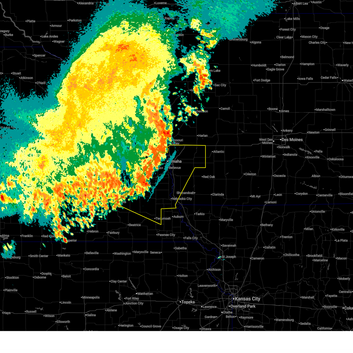 Svroax the national weather service in omaha has issued a * severe thunderstorm warning for, western fremont county in southwestern iowa, mills county in southwestern iowa, pottawattamie county in southwestern iowa, sarpy county in east central nebraska, southeastern lancaster county in southeastern nebraska, johnson county in southeastern nebraska, otoe county in southeastern nebraska, douglas county in east central nebraska, eastern saline county in southeastern nebraska, southeastern saunders county in east central nebraska, northeastern gage county in southeastern nebraska, cass county in southeastern nebraska, * until 100 am cdt. * at 1212 am cdt, severe thunderstorms were located along a line extending from near persia to 4 miles southeast of cedar creek to 3 miles southeast of firth, moving east at 40 mph (weather instrument measurement). Hazards include 70 mph wind gusts. Expect considerable tree damage. damage is likely to mobile homes, roofs, and outbuildings. severe thunderstorms will be near, offutt afb, plattsmouth, syracuse, treynor, shelby, minden, adams, sterling, pacific junction, and murray around 1220 am cdt. glenwood, avoca, silver city, and union around 1225 am cdt. oakland, hancock, and dunbar around 1230 am cdt. other locations in the path of these severe thunderstorms include malvern, carson, walnut, cook, macedonia, lorton, nebraska city, tabor, talmage, henderson and hastings. people attending mills county fairgrounds should seek safe shelter immediately! this includes the following highways, interstate 29 between mile markers 7 and 71. interstate 80 in iowa between mile markers 1 and 48. Interstate 80 in nebraska between mile markers 407 and 454. Svroax the national weather service in omaha has issued a * severe thunderstorm warning for, western fremont county in southwestern iowa, mills county in southwestern iowa, pottawattamie county in southwestern iowa, sarpy county in east central nebraska, southeastern lancaster county in southeastern nebraska, johnson county in southeastern nebraska, otoe county in southeastern nebraska, douglas county in east central nebraska, eastern saline county in southeastern nebraska, southeastern saunders county in east central nebraska, northeastern gage county in southeastern nebraska, cass county in southeastern nebraska, * until 100 am cdt. * at 1212 am cdt, severe thunderstorms were located along a line extending from near persia to 4 miles southeast of cedar creek to 3 miles southeast of firth, moving east at 40 mph (weather instrument measurement). Hazards include 70 mph wind gusts. Expect considerable tree damage. damage is likely to mobile homes, roofs, and outbuildings. severe thunderstorms will be near, offutt afb, plattsmouth, syracuse, treynor, shelby, minden, adams, sterling, pacific junction, and murray around 1220 am cdt. glenwood, avoca, silver city, and union around 1225 am cdt. oakland, hancock, and dunbar around 1230 am cdt. other locations in the path of these severe thunderstorms include malvern, carson, walnut, cook, macedonia, lorton, nebraska city, tabor, talmage, henderson and hastings. people attending mills county fairgrounds should seek safe shelter immediately! this includes the following highways, interstate 29 between mile markers 7 and 71. interstate 80 in iowa between mile markers 1 and 48. Interstate 80 in nebraska between mile markers 407 and 454.
|
| 7/15/2025 11:51 PM CDT |
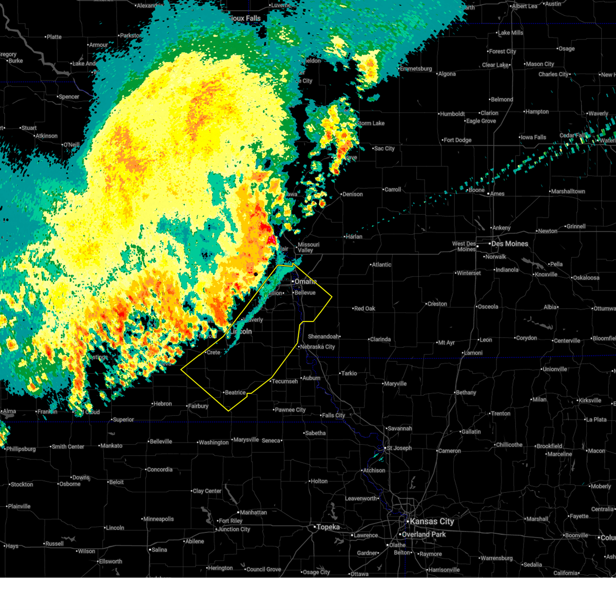 Svroax the national weather service in omaha has issued a * severe thunderstorm warning for, mills county in southwestern iowa, southwestern pottawattamie county in southwestern iowa, sarpy county in east central nebraska, lancaster county in southeastern nebraska, johnson county in southeastern nebraska, northeastern jefferson county in southeastern nebraska, otoe county in southeastern nebraska, douglas county in east central nebraska, southeastern saline county in southeastern nebraska, southeastern saunders county in east central nebraska, gage county in southeastern nebraska, cass county in southeastern nebraska, * until 1215 am cdt. * at 1150 pm cdt, severe thunderstorms were located along a line extending from omaha to 3 miles north of roca to 3 miles west of wilber, moving southeast at 45 mph (weather instrument measurement). Hazards include 70 mph wind gusts. Expect considerable tree damage. damage is likely to mobile homes, roofs, and outbuildings. severe thunderstorms will be near, omaha, council bluffs, bellevue, papillion, ralston, la vista, carter lake, wilber, hickman, and springfield around 1155 pm cdt. offutt afb, firth, palmyra, and panama around 1200 am cdt. Weeping water, unadilla, pickrell, and douglas around 1205 am cdt. Svroax the national weather service in omaha has issued a * severe thunderstorm warning for, mills county in southwestern iowa, southwestern pottawattamie county in southwestern iowa, sarpy county in east central nebraska, lancaster county in southeastern nebraska, johnson county in southeastern nebraska, northeastern jefferson county in southeastern nebraska, otoe county in southeastern nebraska, douglas county in east central nebraska, southeastern saline county in southeastern nebraska, southeastern saunders county in east central nebraska, gage county in southeastern nebraska, cass county in southeastern nebraska, * until 1215 am cdt. * at 1150 pm cdt, severe thunderstorms were located along a line extending from omaha to 3 miles north of roca to 3 miles west of wilber, moving southeast at 45 mph (weather instrument measurement). Hazards include 70 mph wind gusts. Expect considerable tree damage. damage is likely to mobile homes, roofs, and outbuildings. severe thunderstorms will be near, omaha, council bluffs, bellevue, papillion, ralston, la vista, carter lake, wilber, hickman, and springfield around 1155 pm cdt. offutt afb, firth, palmyra, and panama around 1200 am cdt. Weeping water, unadilla, pickrell, and douglas around 1205 am cdt.
|
| 7/7/2025 10:47 PM CDT |
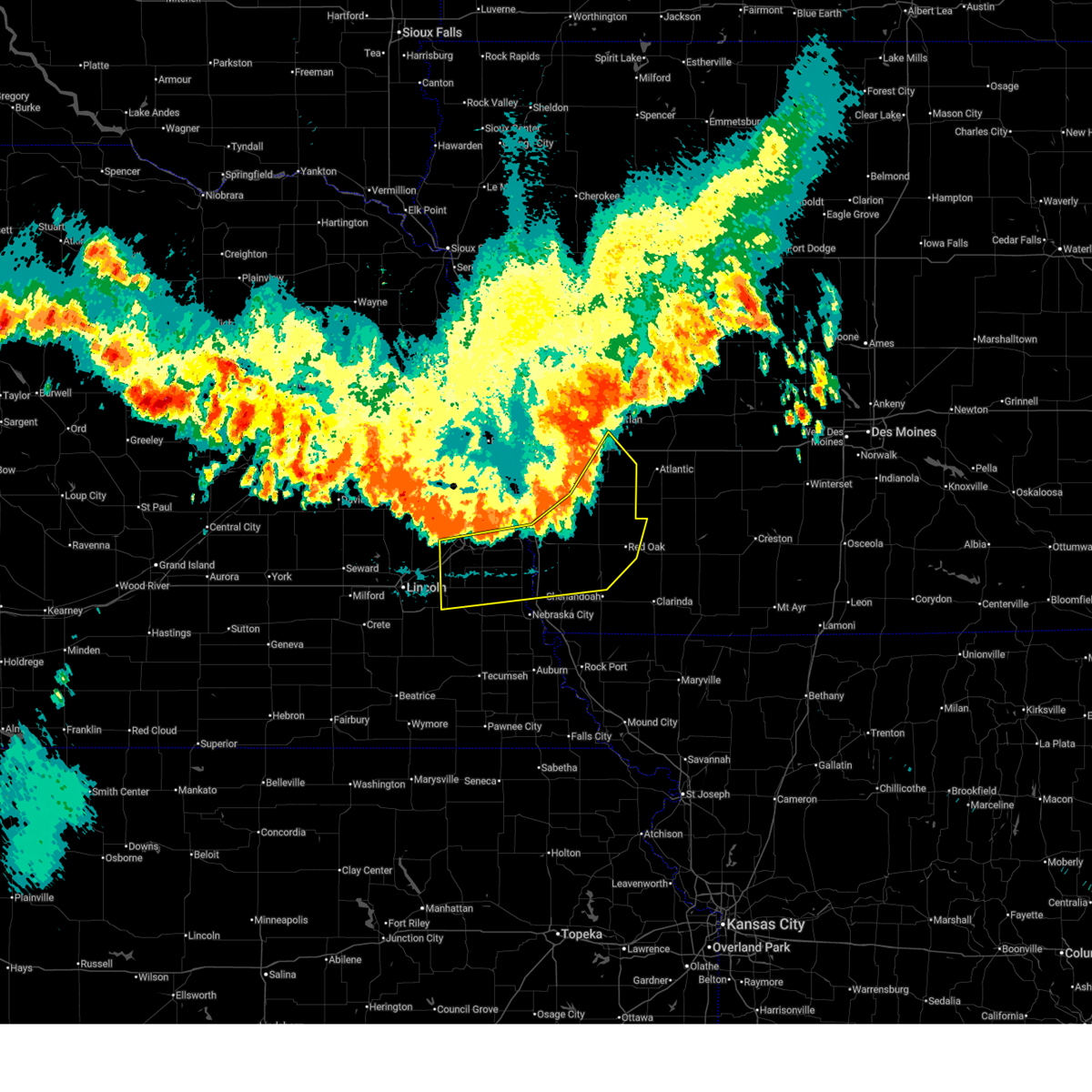 At 1046 pm cdt, severe thunderstorms were located along a line extending from 7 miles east of oakland to emerson to 2 miles east of tabor to 4 miles southeast of elmwood, moving southeast at 45 mph (radar indicated). Hazards include 60 mph wind gusts and penny size hail. Expect damage to roofs, siding, and trees. these severe storms will be near, red oak, emerson, avoca, union, nehawka, and randolph around 1050 pm cdt. Other locations in the path of these severe thunderstorms include elliott and essex. At 1046 pm cdt, severe thunderstorms were located along a line extending from 7 miles east of oakland to emerson to 2 miles east of tabor to 4 miles southeast of elmwood, moving southeast at 45 mph (radar indicated). Hazards include 60 mph wind gusts and penny size hail. Expect damage to roofs, siding, and trees. these severe storms will be near, red oak, emerson, avoca, union, nehawka, and randolph around 1050 pm cdt. Other locations in the path of these severe thunderstorms include elliott and essex.
|
| 7/7/2025 10:34 PM CDT |
 Svroax the national weather service in omaha has issued a * severe thunderstorm warning for, northern fremont county in southwestern iowa, western montgomery county in southwestern iowa, mills county in southwestern iowa, eastern pottawattamie county in southwestern iowa, northwestern page county in southwestern iowa, south central shelby county in southwestern iowa, southern sarpy county in east central nebraska, northwestern otoe county in southeastern nebraska, southeastern saunders county in east central nebraska, cass county in southeastern nebraska, * until 1115 pm cdt. * at 1034 pm cdt, severe thunderstorms were located along a line extending from 2 miles northeast of hancock to 2 miles southwest of henderson to 5 miles south of glenwood to murdock, moving southeast at 45 mph (radar indicated). Hazards include 60 mph wind gusts and penny size hail. Expect damage to roofs, siding, and trees. severe thunderstorms will be near, malvern, weeping water, tabor, murray, emerson, nehawka, henderson, randolph, hastings, and beaver lake around 1040 pm cdt. avoca and union around 1045 pm cdt. red oak and elliott around 1050 pm cdt. other locations in the path of these severe thunderstorms include essex. this includes the following highways, interstate 29 between mile markers 15 and 39. interstate 80 in iowa between mile markers 37 and 43. Interstate 80 in nebraska between mile markers 415 and 430. Svroax the national weather service in omaha has issued a * severe thunderstorm warning for, northern fremont county in southwestern iowa, western montgomery county in southwestern iowa, mills county in southwestern iowa, eastern pottawattamie county in southwestern iowa, northwestern page county in southwestern iowa, south central shelby county in southwestern iowa, southern sarpy county in east central nebraska, northwestern otoe county in southeastern nebraska, southeastern saunders county in east central nebraska, cass county in southeastern nebraska, * until 1115 pm cdt. * at 1034 pm cdt, severe thunderstorms were located along a line extending from 2 miles northeast of hancock to 2 miles southwest of henderson to 5 miles south of glenwood to murdock, moving southeast at 45 mph (radar indicated). Hazards include 60 mph wind gusts and penny size hail. Expect damage to roofs, siding, and trees. severe thunderstorms will be near, malvern, weeping water, tabor, murray, emerson, nehawka, henderson, randolph, hastings, and beaver lake around 1040 pm cdt. avoca and union around 1045 pm cdt. red oak and elliott around 1050 pm cdt. other locations in the path of these severe thunderstorms include essex. this includes the following highways, interstate 29 between mile markers 15 and 39. interstate 80 in iowa between mile markers 37 and 43. Interstate 80 in nebraska between mile markers 415 and 430.
|
| 7/7/2025 10:26 PM CDT |
 the severe thunderstorm warning has been cancelled and is no longer in effect the severe thunderstorm warning has been cancelled and is no longer in effect
|
| 7/7/2025 10:26 PM CDT |
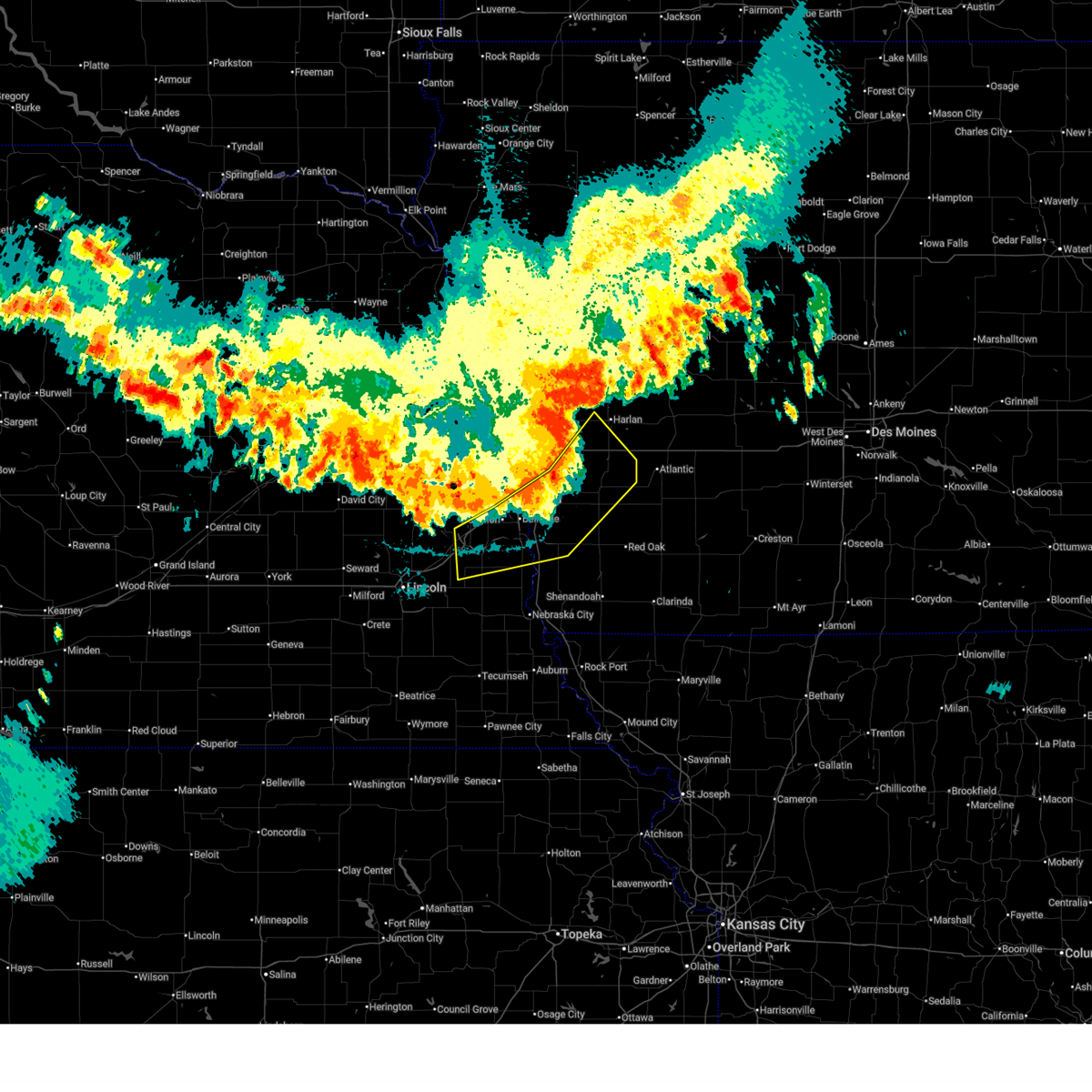 At 1025 pm cdt, severe thunderstorms were located along a line extending from 2 miles northwest of hancock to 2 miles north of pacific junction to 4 miles north of murdock, moving southeast at 45 mph (radar indicated). Hazards include 60 mph wind gusts and penny size hail. Expect damage to roofs, siding, and trees. these severe storms will be near, plattsmouth, glenwood, oakland, malvern, louisville, carson, pacific junction, murray, macedonia, and silver city around 1030 pm cdt. Henderson around 1035 pm cdt. At 1025 pm cdt, severe thunderstorms were located along a line extending from 2 miles northwest of hancock to 2 miles north of pacific junction to 4 miles north of murdock, moving southeast at 45 mph (radar indicated). Hazards include 60 mph wind gusts and penny size hail. Expect damage to roofs, siding, and trees. these severe storms will be near, plattsmouth, glenwood, oakland, malvern, louisville, carson, pacific junction, murray, macedonia, and silver city around 1030 pm cdt. Henderson around 1035 pm cdt.
|
| 7/7/2025 10:15 PM CDT |
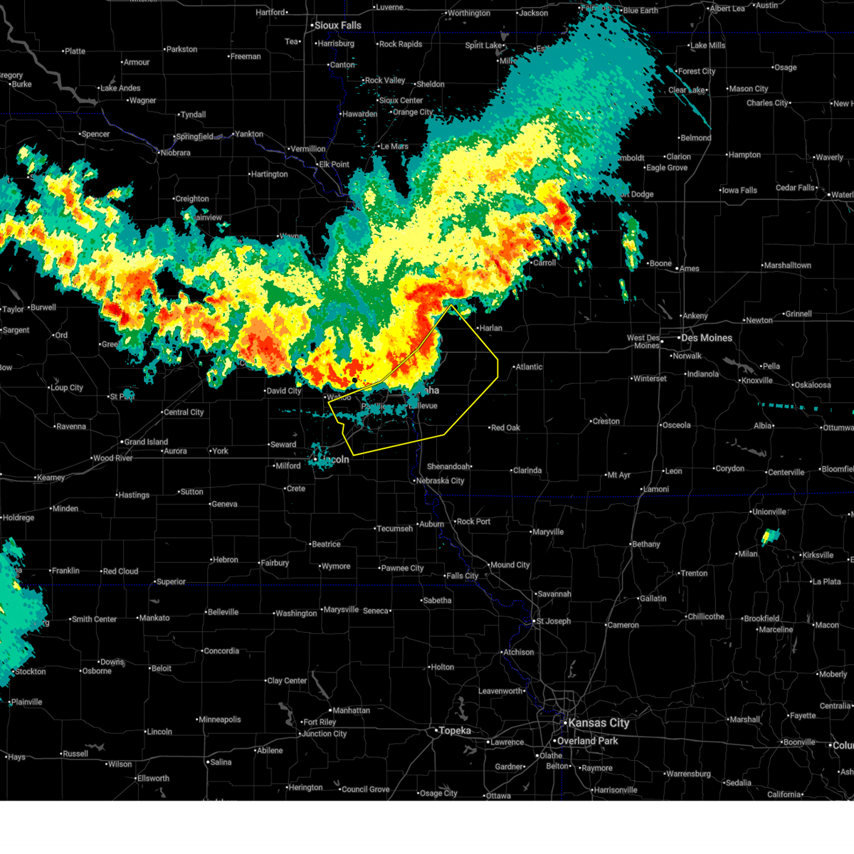 At 1014 pm cdt, severe thunderstorms were located along a line extending from 2 miles west of shelby to near bellevue to 3 miles northwest of ashland, moving southeast at 45 mph (radar indicated). Hazards include 60 mph wind gusts and penny size hail. Expect damage to roofs, siding, and trees. these severe storms will be near, bellevue, offutt afb, plattsmouth, glenwood, ashland, springfield, avoca, louisville, treynor, and cedar creek around 1020 pm cdt. oakland, carson, pacific junction, silver city, and murdock around 1025 pm cdt. Other locations in the path of these severe thunderstorms include malvern, murray, macedonia, henderson and beaver lake. At 1014 pm cdt, severe thunderstorms were located along a line extending from 2 miles west of shelby to near bellevue to 3 miles northwest of ashland, moving southeast at 45 mph (radar indicated). Hazards include 60 mph wind gusts and penny size hail. Expect damage to roofs, siding, and trees. these severe storms will be near, bellevue, offutt afb, plattsmouth, glenwood, ashland, springfield, avoca, louisville, treynor, and cedar creek around 1020 pm cdt. oakland, carson, pacific junction, silver city, and murdock around 1025 pm cdt. Other locations in the path of these severe thunderstorms include malvern, murray, macedonia, henderson and beaver lake.
|
| 7/7/2025 10:15 PM CDT |
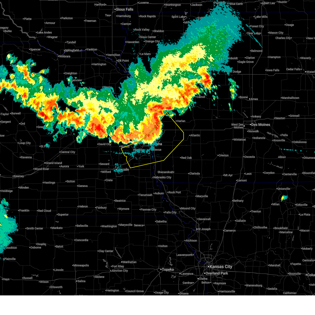 the severe thunderstorm warning has been cancelled and is no longer in effect the severe thunderstorm warning has been cancelled and is no longer in effect
|
| 7/7/2025 10:09 PM CDT |
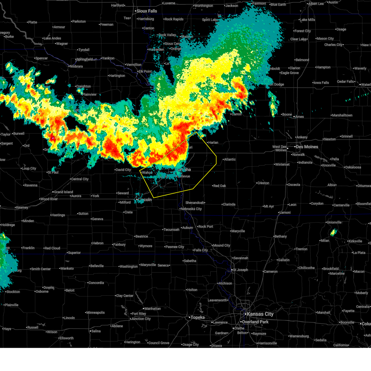 At 1009 pm cdt, severe thunderstorms were located along a line extending from 3 miles south of persia to omaha to 5 miles southeast of ithaca, moving southeast at 45 mph (radar indicated). Hazards include 60 mph wind gusts and nickel size hail. Expect damage to roofs, siding, and trees. these severe storms will be near, southeastern council bluffs, bellevue, papillion, gretna, offutt afb, ashland, springfield, shelby, minden, and cedar creek around 1015 pm cdt. Other locations in the path of these severe thunderstorms include plattsmouth, glenwood, avoca, louisville, treynor, hancock, oakland, carson, pacific junction, silver city, malvern, murray, macedonia, henderson and beaver lake. At 1009 pm cdt, severe thunderstorms were located along a line extending from 3 miles south of persia to omaha to 5 miles southeast of ithaca, moving southeast at 45 mph (radar indicated). Hazards include 60 mph wind gusts and nickel size hail. Expect damage to roofs, siding, and trees. these severe storms will be near, southeastern council bluffs, bellevue, papillion, gretna, offutt afb, ashland, springfield, shelby, minden, and cedar creek around 1015 pm cdt. Other locations in the path of these severe thunderstorms include plattsmouth, glenwood, avoca, louisville, treynor, hancock, oakland, carson, pacific junction, silver city, malvern, murray, macedonia, henderson and beaver lake.
|
| 7/7/2025 9:57 PM CDT |
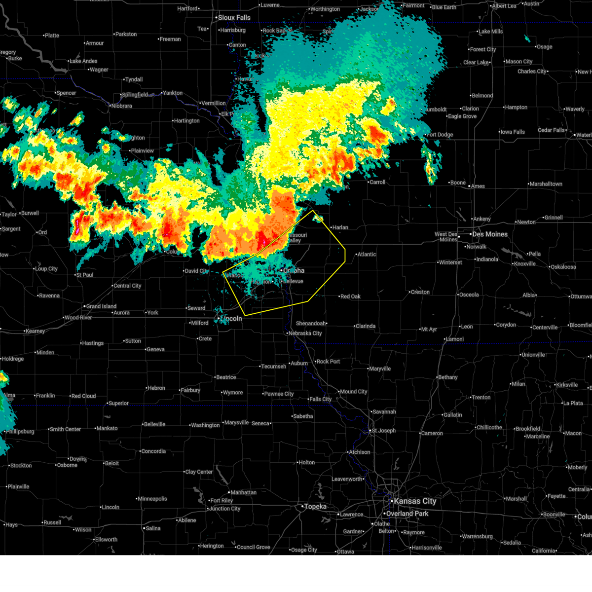 Svroax the national weather service in omaha has issued a * severe thunderstorm warning for, mills county in southwestern iowa, pottawattamie county in southwestern iowa, southeastern harrison county in southwestern iowa, southwestern shelby county in southwestern iowa, sarpy county in east central nebraska, southeastern washington county in east central nebraska, northeastern lancaster county in southeastern nebraska, douglas county in east central nebraska, southeastern saunders county in east central nebraska, central cass county in southeastern nebraska, * until 1045 pm cdt. * at 956 pm cdt, severe thunderstorms were located along a line extending from 3 miles south of persia to omaha to near wahoo, moving southeast at 45 mph (radar indicated). Hazards include 60 mph wind gusts and quarter size hail. Hail damage to vehicles is expected. expect wind damage to roofs, siding, and trees. severe thunderstorms will be near, omaha, council bluffs, bellevue, ralston, gretna, boys town, elkhorn, millard, la vista, and carter lake around 1000 pm cdt. papillion, walnut creek recreation area, and council bluffs airport around 1005 pm cdt. offutt afb, ashland, springfield, treynor, and hancock around 1010 pm cdt. oakland, louisville, and cedar creek around 1015 pm cdt. other locations in the path of these severe thunderstorms include plattsmouth, glenwood, carson, pacific junction, macedonia, silver city, murdock, henderson, malvern, murray and beaver lake. this includes the following highways, interstate 29 between mile markers 29 and 77. interstate 80 in iowa between mile markers 1 and 46. Interstate 80 in nebraska between mile markers 418 and 454. Svroax the national weather service in omaha has issued a * severe thunderstorm warning for, mills county in southwestern iowa, pottawattamie county in southwestern iowa, southeastern harrison county in southwestern iowa, southwestern shelby county in southwestern iowa, sarpy county in east central nebraska, southeastern washington county in east central nebraska, northeastern lancaster county in southeastern nebraska, douglas county in east central nebraska, southeastern saunders county in east central nebraska, central cass county in southeastern nebraska, * until 1045 pm cdt. * at 956 pm cdt, severe thunderstorms were located along a line extending from 3 miles south of persia to omaha to near wahoo, moving southeast at 45 mph (radar indicated). Hazards include 60 mph wind gusts and quarter size hail. Hail damage to vehicles is expected. expect wind damage to roofs, siding, and trees. severe thunderstorms will be near, omaha, council bluffs, bellevue, ralston, gretna, boys town, elkhorn, millard, la vista, and carter lake around 1000 pm cdt. papillion, walnut creek recreation area, and council bluffs airport around 1005 pm cdt. offutt afb, ashland, springfield, treynor, and hancock around 1010 pm cdt. oakland, louisville, and cedar creek around 1015 pm cdt. other locations in the path of these severe thunderstorms include plattsmouth, glenwood, carson, pacific junction, macedonia, silver city, murdock, henderson, malvern, murray and beaver lake. this includes the following highways, interstate 29 between mile markers 29 and 77. interstate 80 in iowa between mile markers 1 and 46. Interstate 80 in nebraska between mile markers 418 and 454.
|
| 6/29/2025 6:08 AM CDT |
 the severe thunderstorm warning has been cancelled and is no longer in effect the severe thunderstorm warning has been cancelled and is no longer in effect
|
| 6/29/2025 6:08 AM CDT |
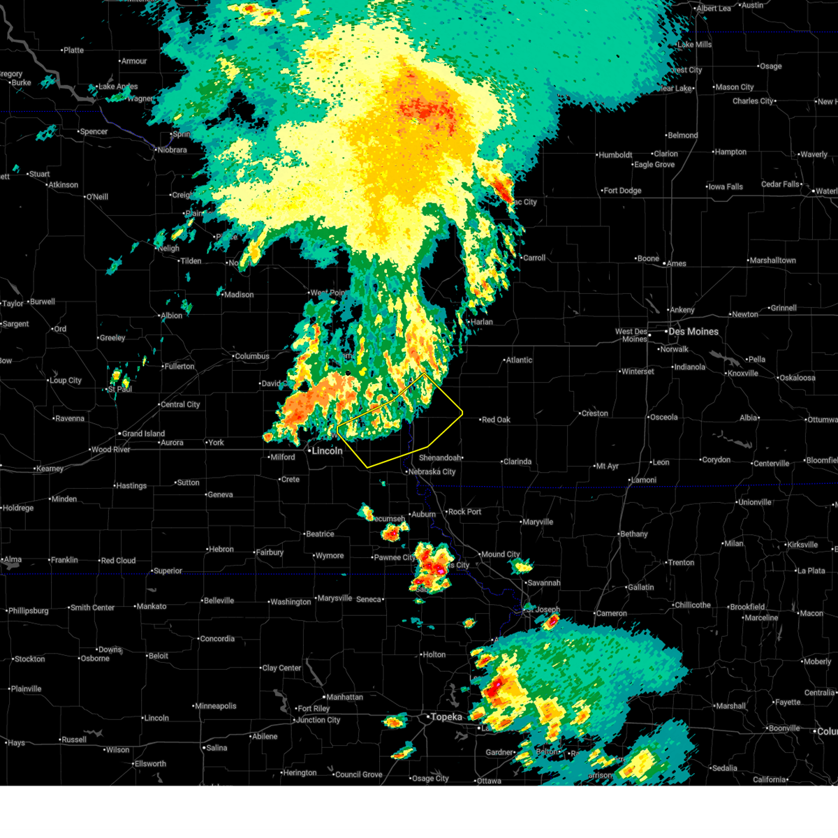 At 607 am cdt, severe thunderstorms were located along a line extending from 4 miles southeast of treynor to 3 miles southwest of pacific junction to near elmwood, moving east at 45 mph (weather instrument measurement measured gust of 62 mph at omaha eppley airfield at 5:43 am). Hazards include 60 mph wind gusts. Expect damage to roofs, siding, and trees. Locations impacted include, plattsmouth, glenwood, malvern, weeping water, pacific junction, murray, silver city, beaver lake, avoca, nehawka, tabor, hastings and union. At 607 am cdt, severe thunderstorms were located along a line extending from 4 miles southeast of treynor to 3 miles southwest of pacific junction to near elmwood, moving east at 45 mph (weather instrument measurement measured gust of 62 mph at omaha eppley airfield at 5:43 am). Hazards include 60 mph wind gusts. Expect damage to roofs, siding, and trees. Locations impacted include, plattsmouth, glenwood, malvern, weeping water, pacific junction, murray, silver city, beaver lake, avoca, nehawka, tabor, hastings and union.
|
| 6/29/2025 5:55 AM CDT | Storm damage reported in sarpy county NE, 3.2 miles N of Bellevue, NE |
| 6/29/2025 5:42 AM CDT |
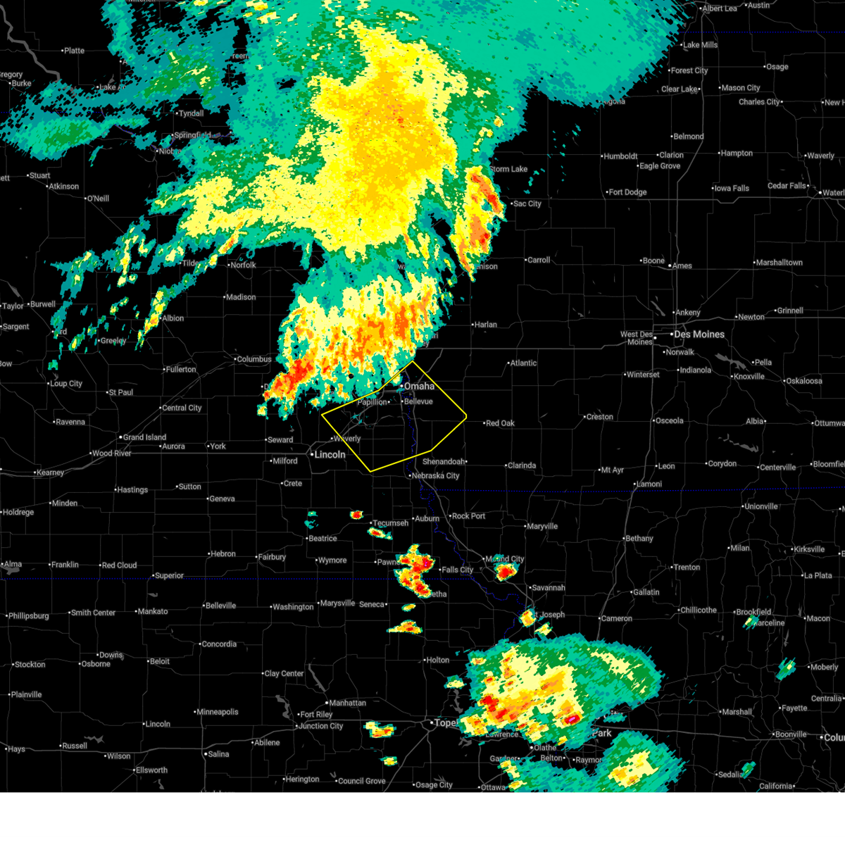 Svroax the national weather service in omaha has issued a * severe thunderstorm warning for, northwestern fremont county in southwestern iowa, mills county in southwestern iowa, southwestern pottawattamie county in southwestern iowa, sarpy county in east central nebraska, northeastern lancaster county in southeastern nebraska, north central otoe county in southeastern nebraska, southeastern douglas county in east central nebraska, southeastern saunders county in east central nebraska, cass county in southeastern nebraska, * until 615 am cdt. * at 542 am cdt, severe thunderstorms were located along a line extending from 5 miles southwest of underwood to near walnut creek recreation area to 3 miles north of greenwood, moving southeast at 45 mph (weather instrument measurement measured gust of 62 mph at omaha eppley airfield at 5:43 am). Hazards include 60 mph wind gusts. Expect damage to roofs, siding, and trees. severe thunderstorms will be near, southeastern omaha, council bluffs, bellevue, papillion, offutt afb, ashland, springfield, louisville, greenwood, and cedar creek around 545 am cdt. plattsmouth, treynor, and murdock around 550 am cdt. glenwood, elmwood, and pacific junction around 555 am cdt. weeping water, murray, silver city, and beaver lake around 600 am cdt. other locations in the path of these severe thunderstorms include malvern, avoca and nehawka. this includes the following highways, interstate 29 between mile markers 20 and 63. interstate 80 in iowa between mile markers 1 and 11. Interstate 80 in nebraska between mile markers 415 and 454. Svroax the national weather service in omaha has issued a * severe thunderstorm warning for, northwestern fremont county in southwestern iowa, mills county in southwestern iowa, southwestern pottawattamie county in southwestern iowa, sarpy county in east central nebraska, northeastern lancaster county in southeastern nebraska, north central otoe county in southeastern nebraska, southeastern douglas county in east central nebraska, southeastern saunders county in east central nebraska, cass county in southeastern nebraska, * until 615 am cdt. * at 542 am cdt, severe thunderstorms were located along a line extending from 5 miles southwest of underwood to near walnut creek recreation area to 3 miles north of greenwood, moving southeast at 45 mph (weather instrument measurement measured gust of 62 mph at omaha eppley airfield at 5:43 am). Hazards include 60 mph wind gusts. Expect damage to roofs, siding, and trees. severe thunderstorms will be near, southeastern omaha, council bluffs, bellevue, papillion, offutt afb, ashland, springfield, louisville, greenwood, and cedar creek around 545 am cdt. plattsmouth, treynor, and murdock around 550 am cdt. glenwood, elmwood, and pacific junction around 555 am cdt. weeping water, murray, silver city, and beaver lake around 600 am cdt. other locations in the path of these severe thunderstorms include malvern, avoca and nehawka. this includes the following highways, interstate 29 between mile markers 20 and 63. interstate 80 in iowa between mile markers 1 and 11. Interstate 80 in nebraska between mile markers 415 and 454.
|
| 6/20/2025 12:49 AM CDT |
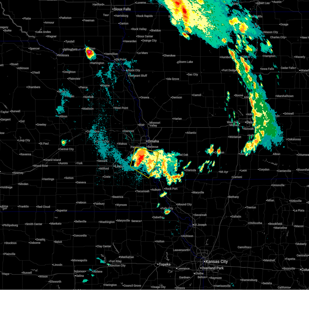 At 1249 am cdt, a severe thunderstorm was located 6 miles southeast of cedar creek, or 12 miles southwest of offutt afb, moving east at 30 mph (radar indicated). Hazards include 60 mph wind gusts. Expect damage to roofs, siding, and trees. this severe storm will be near, murray and beaver lake around 1255 am cdt. Other locations in the path of this severe thunderstorm include plattsmouth. At 1249 am cdt, a severe thunderstorm was located 6 miles southeast of cedar creek, or 12 miles southwest of offutt afb, moving east at 30 mph (radar indicated). Hazards include 60 mph wind gusts. Expect damage to roofs, siding, and trees. this severe storm will be near, murray and beaver lake around 1255 am cdt. Other locations in the path of this severe thunderstorm include plattsmouth.
|
| 6/20/2025 12:35 AM CDT |
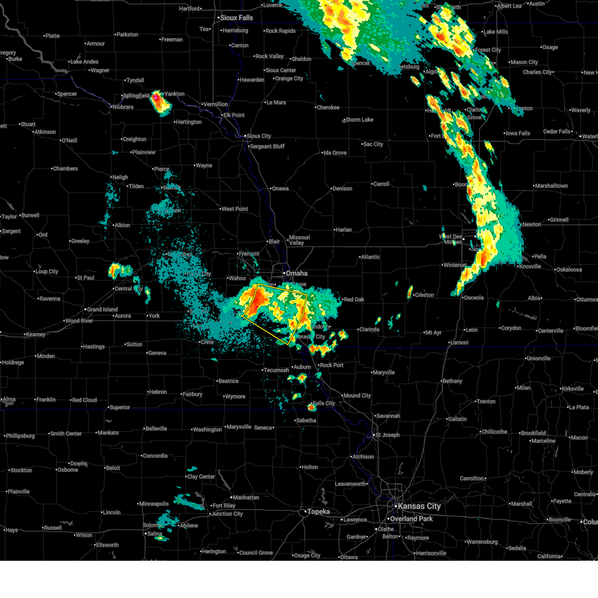 Svroax the national weather service in omaha has issued a * severe thunderstorm warning for, northwestern fremont county in southwestern iowa, southwestern mills county in southwestern iowa, sarpy county in east central nebraska, northeastern otoe county in southeastern nebraska, cass county in southeastern nebraska, * until 115 am cdt. * at 1235 am cdt, a severe thunderstorm was located over louisville, or 10 miles south of gretna, moving east at 30 mph (radar indicated). Hazards include 60 mph wind gusts. Expect damage to roofs, siding, and trees. this severe thunderstorm will be near, cedar creek around 1240 am cdt. murray and beaver lake around 1255 am cdt. this includes the following highways, interstate 29 between mile markers 15 and 37. Interstate 80 in nebraska between mile markers 428 and 437. Svroax the national weather service in omaha has issued a * severe thunderstorm warning for, northwestern fremont county in southwestern iowa, southwestern mills county in southwestern iowa, sarpy county in east central nebraska, northeastern otoe county in southeastern nebraska, cass county in southeastern nebraska, * until 115 am cdt. * at 1235 am cdt, a severe thunderstorm was located over louisville, or 10 miles south of gretna, moving east at 30 mph (radar indicated). Hazards include 60 mph wind gusts. Expect damage to roofs, siding, and trees. this severe thunderstorm will be near, cedar creek around 1240 am cdt. murray and beaver lake around 1255 am cdt. this includes the following highways, interstate 29 between mile markers 15 and 37. Interstate 80 in nebraska between mile markers 428 and 437.
|
| 6/19/2025 11:55 PM CDT |
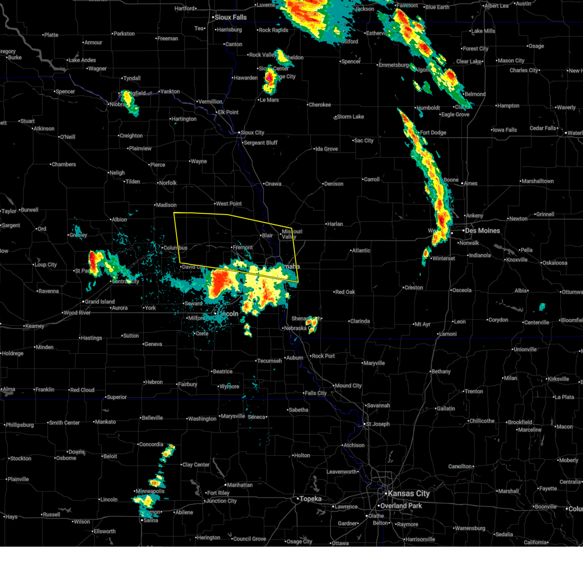 The strong winds which prompted the warning have weakened below severe limits, and the storm has exited the warned area. therefore, the warning will be allowed to expire. however, gusty winds up to 40 mph are still possible. The strong winds which prompted the warning have weakened below severe limits, and the storm has exited the warned area. therefore, the warning will be allowed to expire. however, gusty winds up to 40 mph are still possible.
|
| 6/19/2025 11:14 PM CDT |
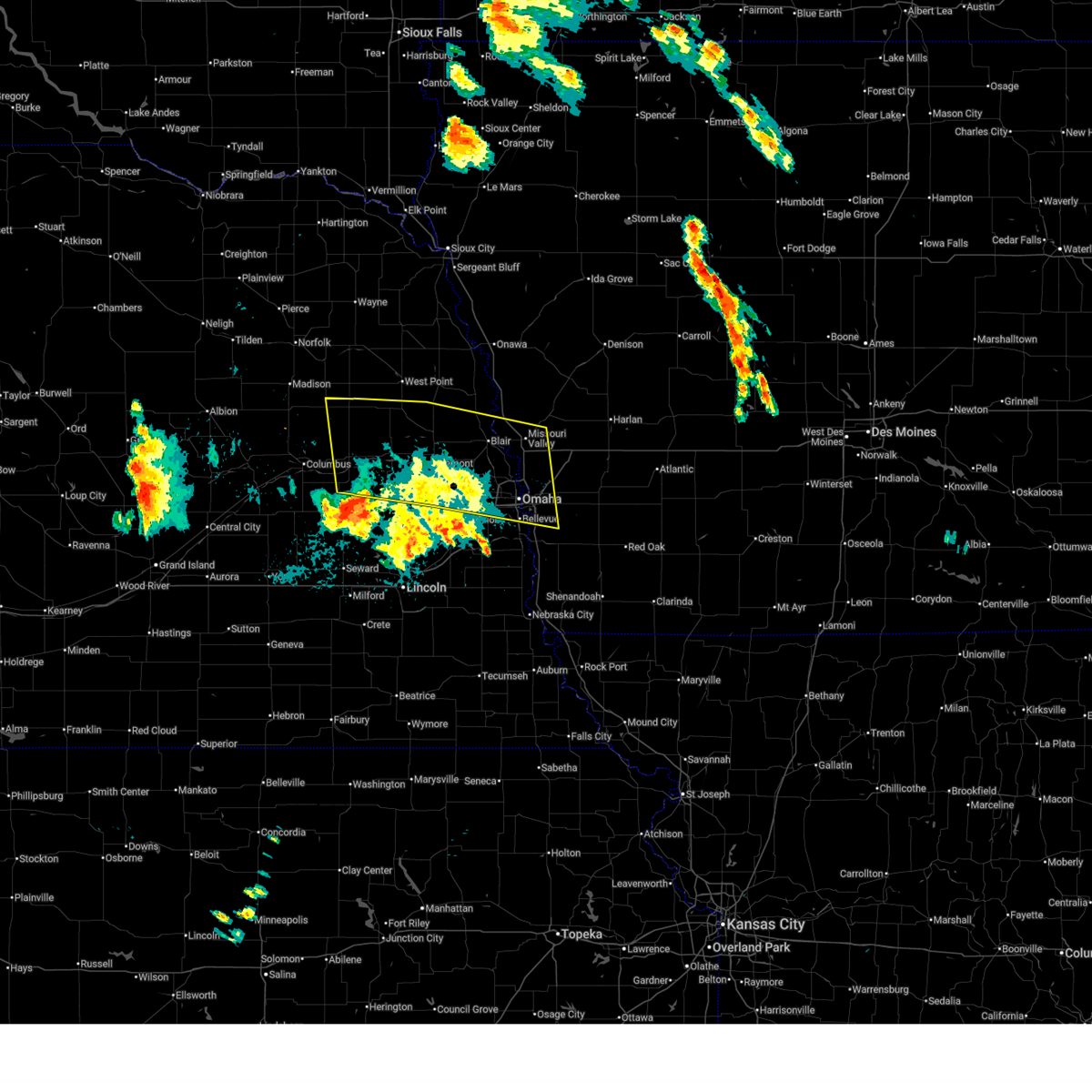 Svroax the national weather service in omaha has issued a * severe thunderstorm warning for, northwestern mills county in southwestern iowa, western pottawattamie county in southwestern iowa, southwestern harrison county in southwestern iowa, south central burt county in east central nebraska, colfax county in northeastern nebraska, douglas county in east central nebraska, northern saunders county in east central nebraska, northeastern sarpy county in east central nebraska, southwestern cuming county in northeastern nebraska, washington county in east central nebraska, dodge county in east central nebraska, northeastern butler county in east central nebraska, southeastern stanton county in northeastern nebraska, * until midnight cdt. * at 1111 pm cdt, showers and thunderstorms producing damaging winds up to 60 mph were located across southern dodge, northern saunders, and into washington and douglas counties, moving east at 20 mph (radar indicated). Hazards include 60 mph wind gusts. Expect damage to roofs, siding, and trees. this severe thunderstorm will be near, fremont and cedar bluffs around 1115 pm cdt. inglewood around 1125 pm cdt. woodcliff around 1130 pm cdt. other locations in the path of this severe thunderstorm include arlington. people attending charles schwab field should seek safe shelter immediately! this includes the following highways, interstate 29 between mile markers 42 and 84. interstate 80 in iowa between mile markers 1 and 14. Interstate 80 in nebraska between mile markers 443 and 454. Svroax the national weather service in omaha has issued a * severe thunderstorm warning for, northwestern mills county in southwestern iowa, western pottawattamie county in southwestern iowa, southwestern harrison county in southwestern iowa, south central burt county in east central nebraska, colfax county in northeastern nebraska, douglas county in east central nebraska, northern saunders county in east central nebraska, northeastern sarpy county in east central nebraska, southwestern cuming county in northeastern nebraska, washington county in east central nebraska, dodge county in east central nebraska, northeastern butler county in east central nebraska, southeastern stanton county in northeastern nebraska, * until midnight cdt. * at 1111 pm cdt, showers and thunderstorms producing damaging winds up to 60 mph were located across southern dodge, northern saunders, and into washington and douglas counties, moving east at 20 mph (radar indicated). Hazards include 60 mph wind gusts. Expect damage to roofs, siding, and trees. this severe thunderstorm will be near, fremont and cedar bluffs around 1115 pm cdt. inglewood around 1125 pm cdt. woodcliff around 1130 pm cdt. other locations in the path of this severe thunderstorm include arlington. people attending charles schwab field should seek safe shelter immediately! this includes the following highways, interstate 29 between mile markers 42 and 84. interstate 80 in iowa between mile markers 1 and 14. Interstate 80 in nebraska between mile markers 443 and 454.
|
| 6/16/2025 8:14 PM CDT |
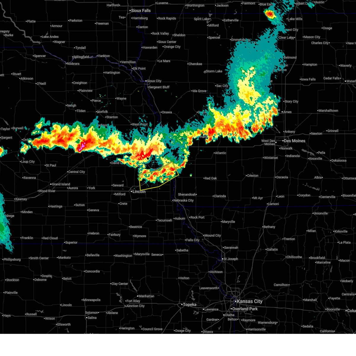 the severe thunderstorm warning has been cancelled and is no longer in effect the severe thunderstorm warning has been cancelled and is no longer in effect
|
| 6/16/2025 7:59 PM CDT |
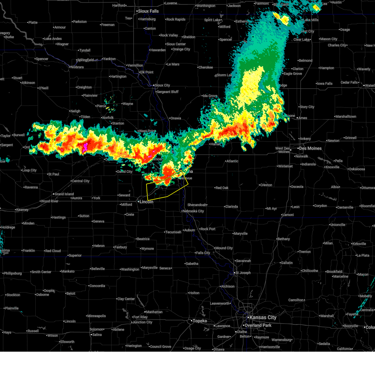 At 759 pm cdt, severe thunderstorms were located along a line extending from 5 miles east of offutt afb to near louisville to near waverly, moving south at 30 mph (radar indicated). Hazards include 60 mph wind gusts and quarter size hail. Hail damage to vehicles is expected. expect wind damage to roofs, siding, and trees. Locations impacted include, plattsmouth and murdock. At 759 pm cdt, severe thunderstorms were located along a line extending from 5 miles east of offutt afb to near louisville to near waverly, moving south at 30 mph (radar indicated). Hazards include 60 mph wind gusts and quarter size hail. Hail damage to vehicles is expected. expect wind damage to roofs, siding, and trees. Locations impacted include, plattsmouth and murdock.
|
| 6/16/2025 7:51 PM CDT |
 At 750 pm cdt, severe thunderstorms were located along a line extending from council bluffs to near wehrspann lake to 5 miles west of ashland, moving south at 25 mph (radar indicated). Hazards include 60 mph wind gusts and quarter size hail. Hail damage to vehicles is expected. expect wind damage to roofs, siding, and trees. locations impacted include, southeastern omaha, council bluffs, bellevue, papillion, ralston, gretna, la vista, prairie queen recreation area, walnut creek recreation area and south omaha. People attending charles schwab field should seek safe shelter immediately!. At 750 pm cdt, severe thunderstorms were located along a line extending from council bluffs to near wehrspann lake to 5 miles west of ashland, moving south at 25 mph (radar indicated). Hazards include 60 mph wind gusts and quarter size hail. Hail damage to vehicles is expected. expect wind damage to roofs, siding, and trees. locations impacted include, southeastern omaha, council bluffs, bellevue, papillion, ralston, gretna, la vista, prairie queen recreation area, walnut creek recreation area and south omaha. People attending charles schwab field should seek safe shelter immediately!.
|
| 6/16/2025 7:51 PM CDT |
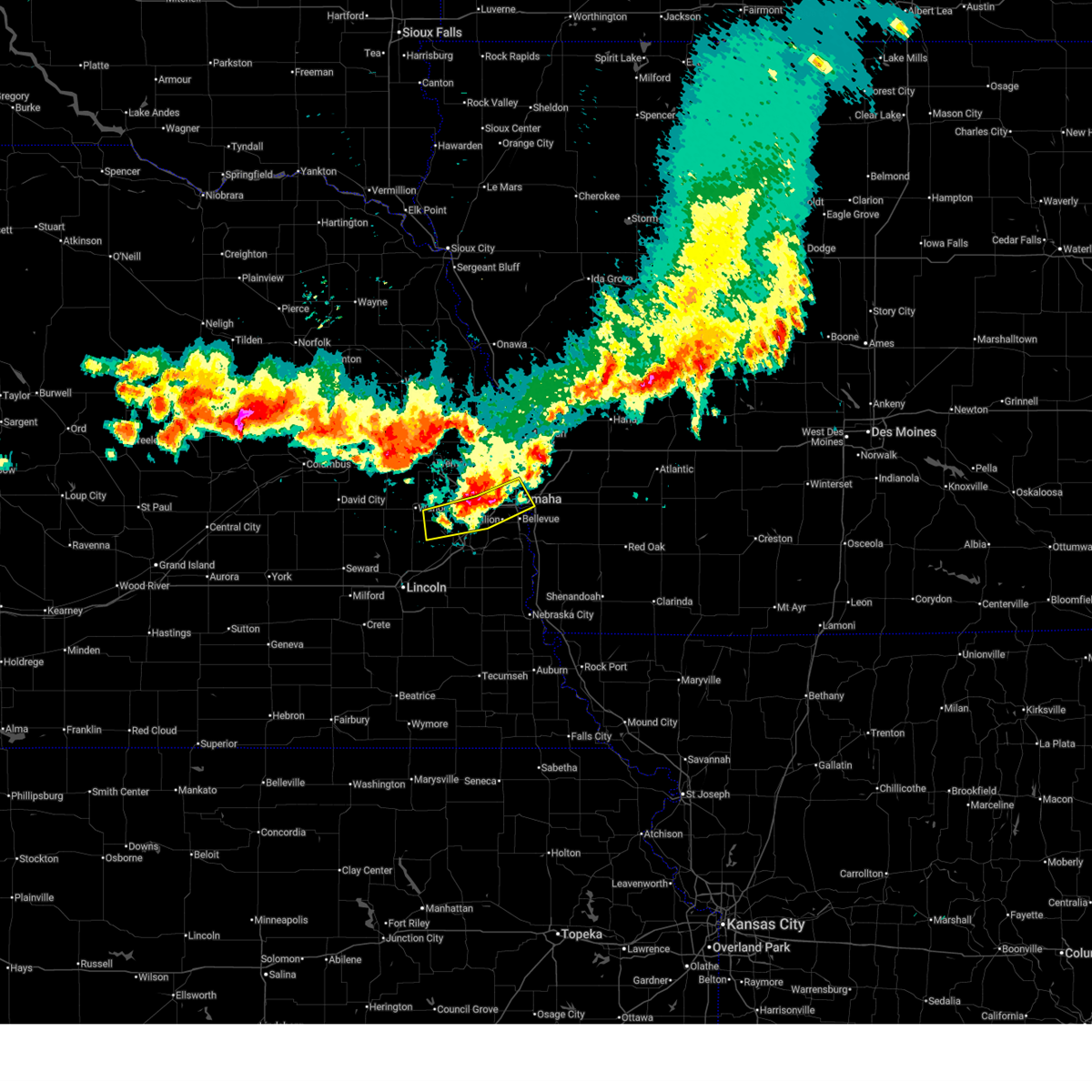 the severe thunderstorm warning has been cancelled and is no longer in effect the severe thunderstorm warning has been cancelled and is no longer in effect
|
| 6/16/2025 7:41 PM CDT |
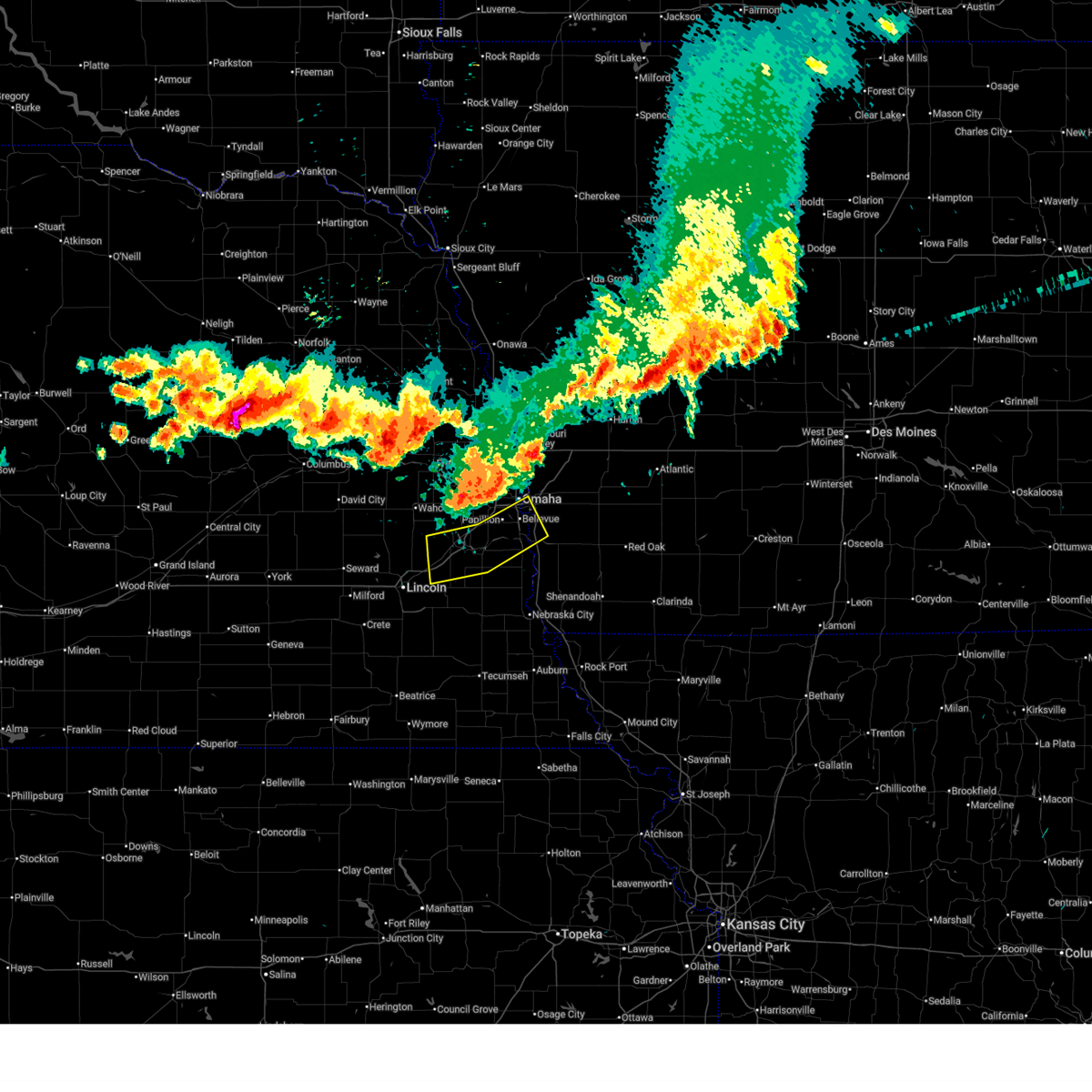 Svroax the national weather service in omaha has issued a * severe thunderstorm warning for, northwestern mills county in southwestern iowa, southwestern pottawattamie county in southwestern iowa, sarpy county in east central nebraska, northeastern lancaster county in southeastern nebraska, southeastern douglas county in east central nebraska, southeastern saunders county in east central nebraska, central cass county in southeastern nebraska, * until 830 pm cdt. * at 741 pm cdt, severe thunderstorms were located along a line extending from council bluffs to near gretna to 5 miles south of ithaca, moving south at 30 mph (radar indicated). Hazards include 60 mph wind gusts and quarter size hail. Hail damage to vehicles is expected. expect wind damage to roofs, siding, and trees. severe thunderstorms will be near, southeastern omaha, council bluffs, bellevue, papillion, offutt afb, la vista, ashland, springfield, prairie queen recreation area, and walnut creek recreation area around 745 pm cdt. louisville, greenwood, and cedar creek around 750 pm cdt. plattsmouth, waverly, and murdock around 800 pm cdt. this includes the following highways, interstate 29 between mile markers 35 and 45, and between mile markers 50 and 53. interstate 80 in iowa between mile markers 1 and 3. Interstate 80 in nebraska between mile markers 411 and 439, and between mile markers 452 and 454. Svroax the national weather service in omaha has issued a * severe thunderstorm warning for, northwestern mills county in southwestern iowa, southwestern pottawattamie county in southwestern iowa, sarpy county in east central nebraska, northeastern lancaster county in southeastern nebraska, southeastern douglas county in east central nebraska, southeastern saunders county in east central nebraska, central cass county in southeastern nebraska, * until 830 pm cdt. * at 741 pm cdt, severe thunderstorms were located along a line extending from council bluffs to near gretna to 5 miles south of ithaca, moving south at 30 mph (radar indicated). Hazards include 60 mph wind gusts and quarter size hail. Hail damage to vehicles is expected. expect wind damage to roofs, siding, and trees. severe thunderstorms will be near, southeastern omaha, council bluffs, bellevue, papillion, offutt afb, la vista, ashland, springfield, prairie queen recreation area, and walnut creek recreation area around 745 pm cdt. louisville, greenwood, and cedar creek around 750 pm cdt. plattsmouth, waverly, and murdock around 800 pm cdt. this includes the following highways, interstate 29 between mile markers 35 and 45, and between mile markers 50 and 53. interstate 80 in iowa between mile markers 1 and 3. Interstate 80 in nebraska between mile markers 411 and 439, and between mile markers 452 and 454.
|
| 6/16/2025 7:31 PM CDT |
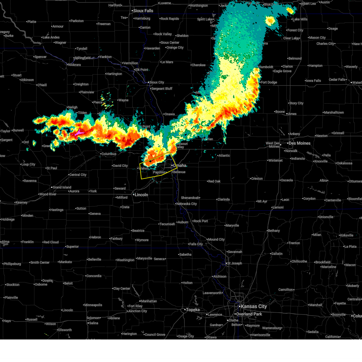 At 730 pm cdt, severe thunderstorms were located along a line extending from omaha to 2 miles west of boys town to near ithaca, moving south at 25 mph (radar indicated). Hazards include 60 mph wind gusts and quarter size hail. Hail damage to vehicles is expected. expect wind damage to roofs, siding, and trees. these severe storms will be near, omaha, council bluffs, ralston, gretna, boys town, millard, la vista, carter lake, ithaca, and eppley airfield around 735 pm cdt. other locations in the path of these severe thunderstorms include bellevue, papillion, prairie queen recreation area, south omaha and walnut creek recreation area. People attending charles schwab field should seek safe shelter immediately!. At 730 pm cdt, severe thunderstorms were located along a line extending from omaha to 2 miles west of boys town to near ithaca, moving south at 25 mph (radar indicated). Hazards include 60 mph wind gusts and quarter size hail. Hail damage to vehicles is expected. expect wind damage to roofs, siding, and trees. these severe storms will be near, omaha, council bluffs, ralston, gretna, boys town, millard, la vista, carter lake, ithaca, and eppley airfield around 735 pm cdt. other locations in the path of these severe thunderstorms include bellevue, papillion, prairie queen recreation area, south omaha and walnut creek recreation area. People attending charles schwab field should seek safe shelter immediately!.
|
| 6/16/2025 7:16 PM CDT |
 Svroax the national weather service in omaha has issued a * severe thunderstorm warning for, southwestern pottawattamie county in southwestern iowa, northwestern sarpy county in east central nebraska, southeastern washington county in east central nebraska, douglas county in east central nebraska, southeastern saunders county in east central nebraska, * until 800 pm cdt. * at 716 pm cdt, severe thunderstorms were located along a line extending from near fort calhoun to 3 miles northwest of flanagan lake to 2 miles southeast of colon, moving south at 30 mph (radar indicated). Hazards include 60 mph wind gusts and quarter size hail. Hail damage to vehicles is expected. expect wind damage to roofs, siding, and trees. severe thunderstorms will be near, omaha, bennington, elkhorn, valley, yutan, waterloo, mead, flanagan lake, and standing bear lake around 720 pm cdt. boys town, ithaca, benson, and florence around 725 pm cdt. eppley airfield and zorinsky lake around 730 pm cdt. millard, carter lake, midtown, aksarben, and chalco around 735 pm cdt. other locations in the path of these severe thunderstorms include northwestern council bluffs, ralston, gretna, la vista, prairie queen recreation area, south omaha, wehrspann lake, bellevue, papillion and walnut creek recreation area. people attending charles schwab field should seek safe shelter immediately! this includes the following highways, interstate 29 between mile markers 47 and 55. interstate 80 in iowa between mile markers 1 and 4. Interstate 80 in nebraska between mile markers 432 and 454. Svroax the national weather service in omaha has issued a * severe thunderstorm warning for, southwestern pottawattamie county in southwestern iowa, northwestern sarpy county in east central nebraska, southeastern washington county in east central nebraska, douglas county in east central nebraska, southeastern saunders county in east central nebraska, * until 800 pm cdt. * at 716 pm cdt, severe thunderstorms were located along a line extending from near fort calhoun to 3 miles northwest of flanagan lake to 2 miles southeast of colon, moving south at 30 mph (radar indicated). Hazards include 60 mph wind gusts and quarter size hail. Hail damage to vehicles is expected. expect wind damage to roofs, siding, and trees. severe thunderstorms will be near, omaha, bennington, elkhorn, valley, yutan, waterloo, mead, flanagan lake, and standing bear lake around 720 pm cdt. boys town, ithaca, benson, and florence around 725 pm cdt. eppley airfield and zorinsky lake around 730 pm cdt. millard, carter lake, midtown, aksarben, and chalco around 735 pm cdt. other locations in the path of these severe thunderstorms include northwestern council bluffs, ralston, gretna, la vista, prairie queen recreation area, south omaha, wehrspann lake, bellevue, papillion and walnut creek recreation area. people attending charles schwab field should seek safe shelter immediately! this includes the following highways, interstate 29 between mile markers 47 and 55. interstate 80 in iowa between mile markers 1 and 4. Interstate 80 in nebraska between mile markers 432 and 454.
|
| 4/24/2025 4:34 PM CDT |
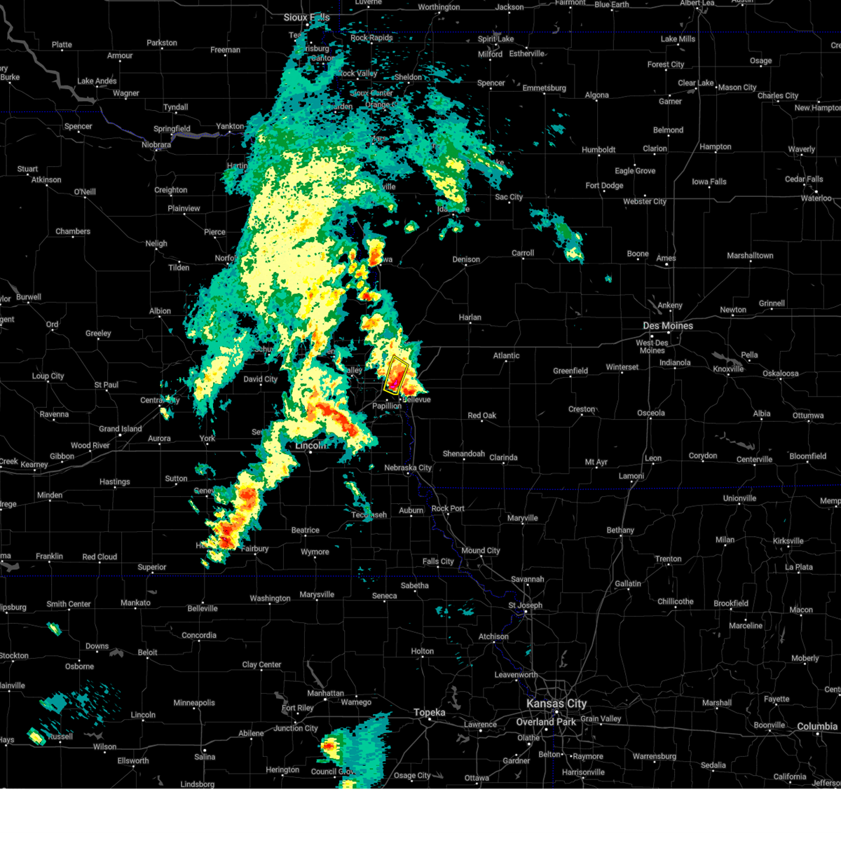 the severe thunderstorm warning has been cancelled and is no longer in effect the severe thunderstorm warning has been cancelled and is no longer in effect
|
| 4/24/2025 4:34 PM CDT |
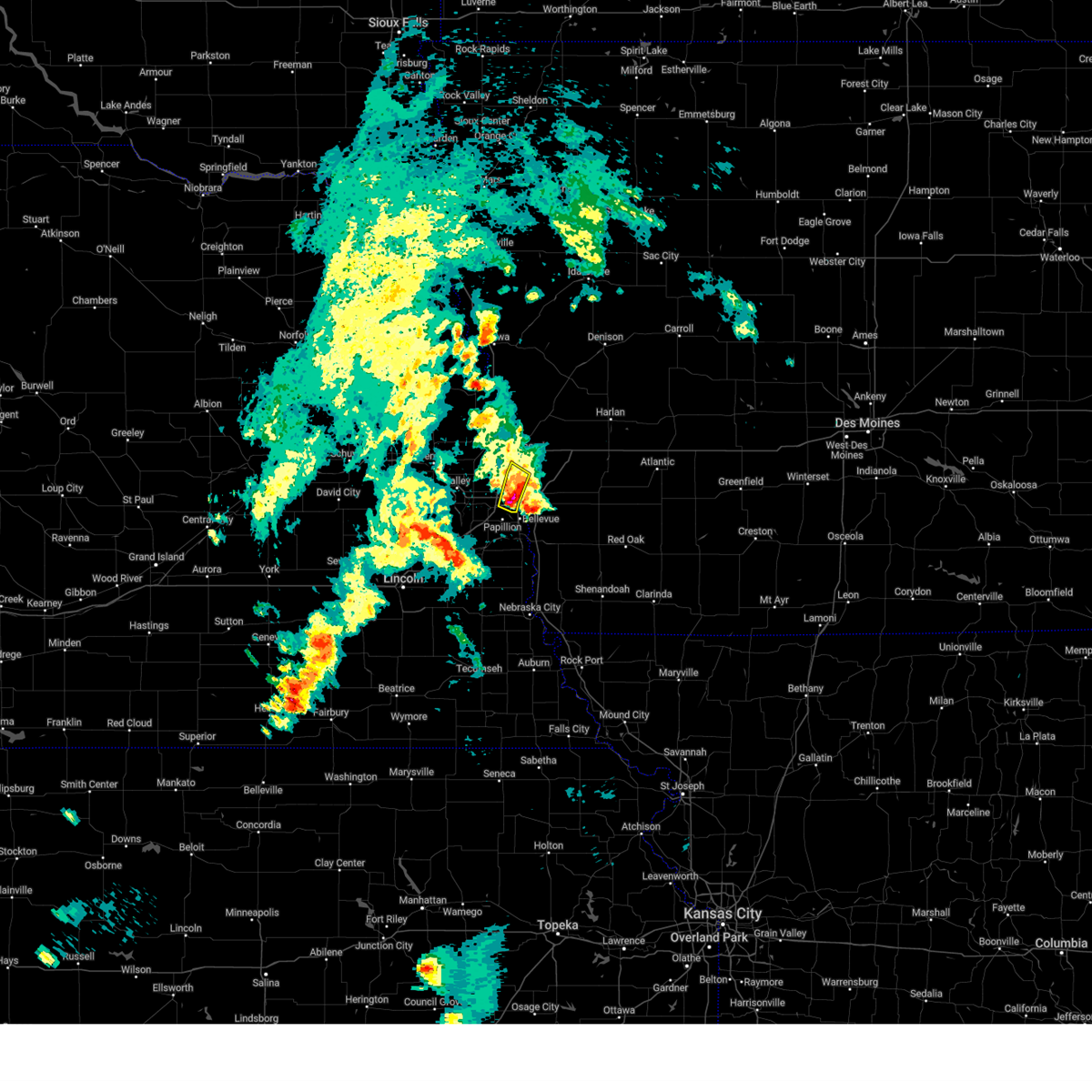 At 433 pm cdt, a severe thunderstorm was located 4 miles northwest of florence, or 7 miles east of bennington, moving north at 25 mph (radar indicated). Hazards include golf ball size hail and 60 mph wind gusts. People and animals outdoors will be injured. expect hail damage to roofs, siding, windows, and vehicles. expect wind damage to roofs, siding, and trees. This severe thunderstorm will remain over mainly rural areas of west central pottawattamie, southeastern washington and eastern douglas counties, including the following locations, old market. At 433 pm cdt, a severe thunderstorm was located 4 miles northwest of florence, or 7 miles east of bennington, moving north at 25 mph (radar indicated). Hazards include golf ball size hail and 60 mph wind gusts. People and animals outdoors will be injured. expect hail damage to roofs, siding, windows, and vehicles. expect wind damage to roofs, siding, and trees. This severe thunderstorm will remain over mainly rural areas of west central pottawattamie, southeastern washington and eastern douglas counties, including the following locations, old market.
|
| 4/24/2025 4:30 PM CDT |
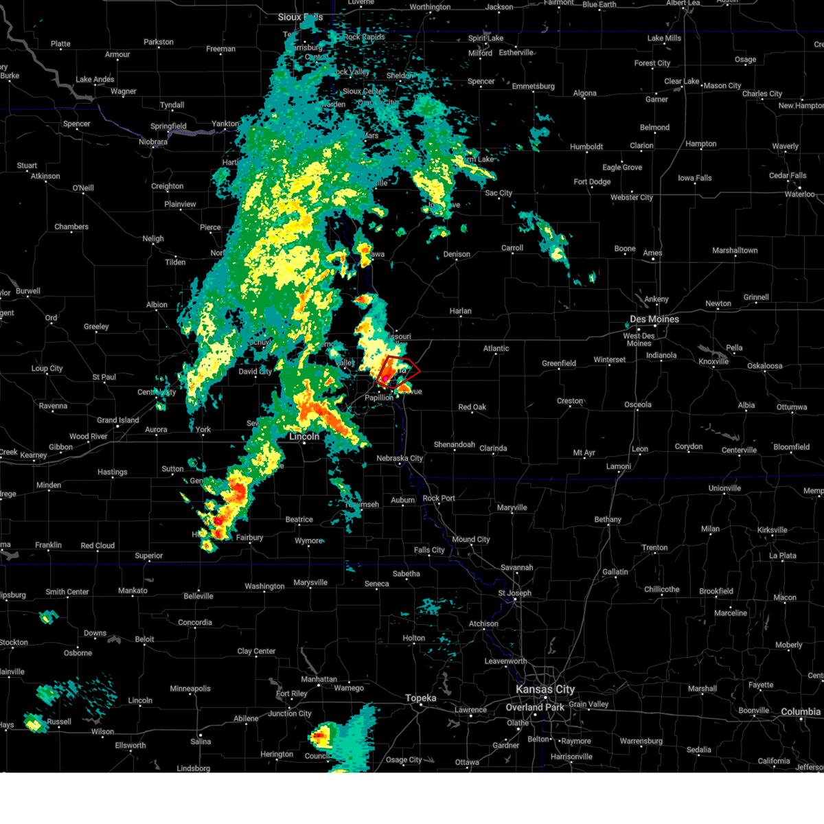 Toroax the national weather service in omaha has issued a * tornado warning for, southwestern pottawattamie county in southwestern iowa, eastern douglas county in east central nebraska, * until 500 pm cdt. * at 430 pm cdt, a severe thunderstorm capable of producing a tornado was located over southeastern omaha, moving northeast at 20 mph (radar indicated rotation). Hazards include tornado and quarter size hail. Flying debris will be dangerous to those caught without shelter. mobile homes will be damaged or destroyed. damage to roofs, windows, and vehicles will occur. tree damage is likely. this dangerous storm will be near, southeastern omaha, council bluffs, carter lake, midtown, and eppley airfield around 435 pm cdt. Crescent around 450 pm cdt. Toroax the national weather service in omaha has issued a * tornado warning for, southwestern pottawattamie county in southwestern iowa, eastern douglas county in east central nebraska, * until 500 pm cdt. * at 430 pm cdt, a severe thunderstorm capable of producing a tornado was located over southeastern omaha, moving northeast at 20 mph (radar indicated rotation). Hazards include tornado and quarter size hail. Flying debris will be dangerous to those caught without shelter. mobile homes will be damaged or destroyed. damage to roofs, windows, and vehicles will occur. tree damage is likely. this dangerous storm will be near, southeastern omaha, council bluffs, carter lake, midtown, and eppley airfield around 435 pm cdt. Crescent around 450 pm cdt.
|
| 4/24/2025 4:19 PM CDT |
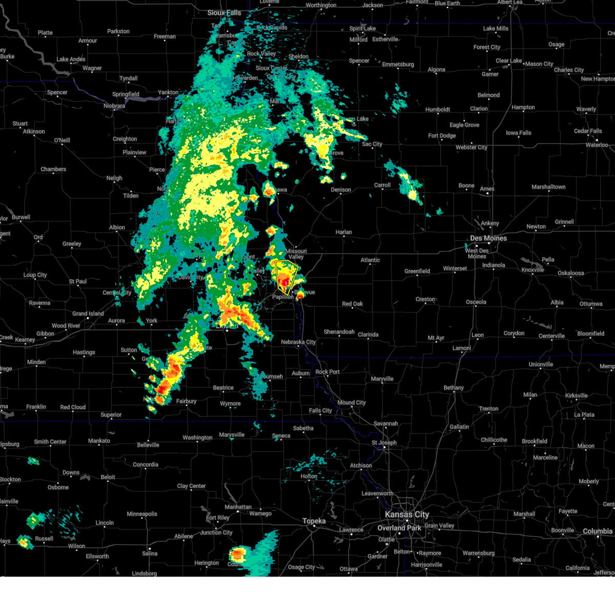 At 418 pm cdt, a severe thunderstorm was located over southeastern omaha, moving north at 25 mph (radar indicated). Hazards include 60 mph wind gusts and quarter size hail. Hail damage to vehicles is expected. expect wind damage to roofs, siding, and trees. This severe storm will be near, northern omaha and florence around 425 pm cdt. At 418 pm cdt, a severe thunderstorm was located over southeastern omaha, moving north at 25 mph (radar indicated). Hazards include 60 mph wind gusts and quarter size hail. Hail damage to vehicles is expected. expect wind damage to roofs, siding, and trees. This severe storm will be near, northern omaha and florence around 425 pm cdt.
|
| 4/24/2025 4:07 PM CDT |
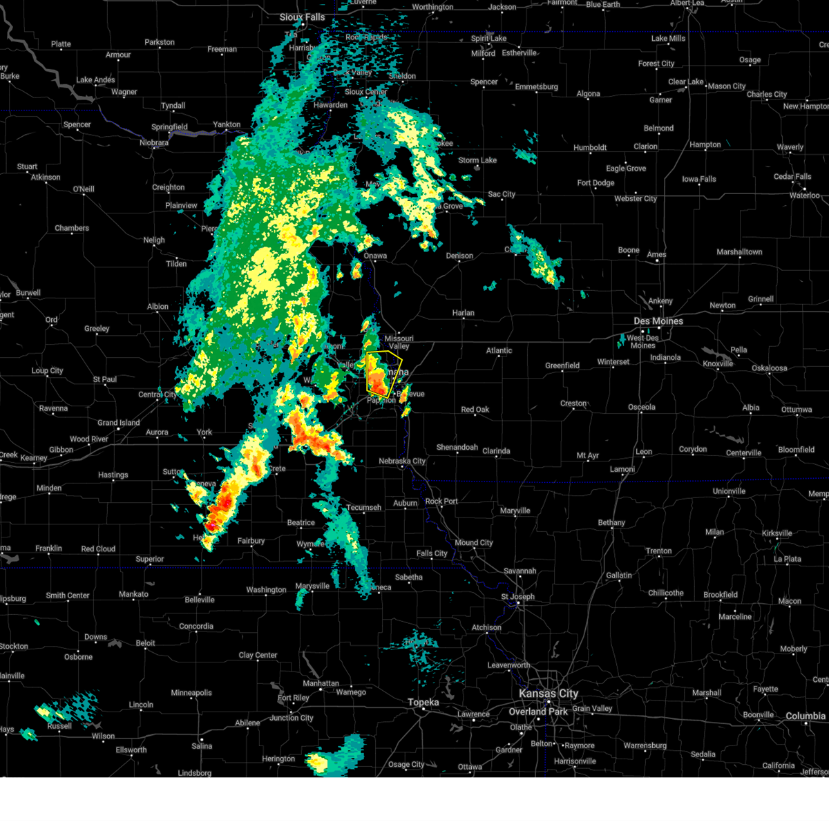 Svroax the national weather service in omaha has issued a * severe thunderstorm warning for, west central pottawattamie county in southwestern iowa, north central sarpy county in east central nebraska, southeastern washington county in east central nebraska, eastern douglas county in east central nebraska, * until 445 pm cdt. * at 407 pm cdt, a severe thunderstorm was located over southern omaha, moving north at 25 mph (radar indicated). Hazards include 60 mph wind gusts and quarter size hail. Hail damage to vehicles is expected. expect wind damage to roofs, siding, and trees. this severe thunderstorm will be near, omaha, boys town, midtown, benson, aksarben, and south omaha around 410 pm cdt. florence around 420 pm cdt. this includes the following highways, interstate 29 between mile markers 61 and 63. Interstate 80 in nebraska between mile markers 443 and 452. Svroax the national weather service in omaha has issued a * severe thunderstorm warning for, west central pottawattamie county in southwestern iowa, north central sarpy county in east central nebraska, southeastern washington county in east central nebraska, eastern douglas county in east central nebraska, * until 445 pm cdt. * at 407 pm cdt, a severe thunderstorm was located over southern omaha, moving north at 25 mph (radar indicated). Hazards include 60 mph wind gusts and quarter size hail. Hail damage to vehicles is expected. expect wind damage to roofs, siding, and trees. this severe thunderstorm will be near, omaha, boys town, midtown, benson, aksarben, and south omaha around 410 pm cdt. florence around 420 pm cdt. this includes the following highways, interstate 29 between mile markers 61 and 63. Interstate 80 in nebraska between mile markers 443 and 452.
|
| 4/17/2025 7:48 PM CDT |
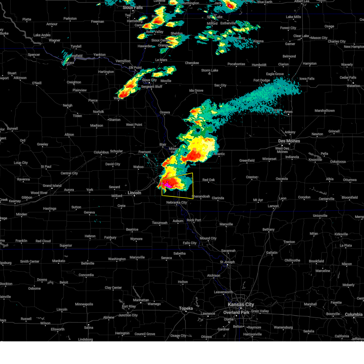 Svroax the national weather service in omaha has issued a * severe thunderstorm warning for, northwestern fremont county in southwestern iowa, mills county in southwestern iowa, southeastern sarpy county in east central nebraska, eastern cass county in southeastern nebraska, * until 830 pm cdt. * at 747 pm cdt, a severe thunderstorm was located 4 miles southeast of cedar creek, or 11 miles southwest of offutt afb, moving east at 40 mph (radar indicated). Hazards include two inch hail and 60 mph wind gusts. People and animals outdoors will be injured. expect hail damage to roofs, siding, windows, and vehicles. expect wind damage to roofs, siding, and trees. this severe thunderstorm will be near, plattsmouth around 755 pm cdt. beaver lake around 800 pm cdt. pacific junction around 805 pm cdt. other locations in the path of this severe thunderstorm include glenwood. This includes interstate 29 between mile markers 20 and 39. Svroax the national weather service in omaha has issued a * severe thunderstorm warning for, northwestern fremont county in southwestern iowa, mills county in southwestern iowa, southeastern sarpy county in east central nebraska, eastern cass county in southeastern nebraska, * until 830 pm cdt. * at 747 pm cdt, a severe thunderstorm was located 4 miles southeast of cedar creek, or 11 miles southwest of offutt afb, moving east at 40 mph (radar indicated). Hazards include two inch hail and 60 mph wind gusts. People and animals outdoors will be injured. expect hail damage to roofs, siding, windows, and vehicles. expect wind damage to roofs, siding, and trees. this severe thunderstorm will be near, plattsmouth around 755 pm cdt. beaver lake around 800 pm cdt. pacific junction around 805 pm cdt. other locations in the path of this severe thunderstorm include glenwood. This includes interstate 29 between mile markers 20 and 39.
|
| 4/17/2025 7:36 PM CDT |
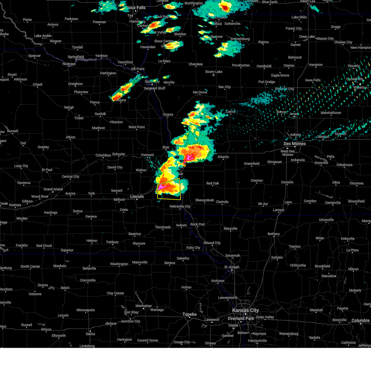 the severe thunderstorm warning has been cancelled and is no longer in effect the severe thunderstorm warning has been cancelled and is no longer in effect
|
| 4/17/2025 7:36 PM CDT |
 At 736 pm cdt, a severe thunderstorm was located over louisville, or 12 miles south of gretna, moving east at 40 mph (radar indicated). Hazards include two inch hail and 60 mph wind gusts. People and animals outdoors will be injured. expect hail damage to roofs, siding, windows, and vehicles. expect wind damage to roofs, siding, and trees. Locations impacted include, plattsmouth and beaver lake. At 736 pm cdt, a severe thunderstorm was located over louisville, or 12 miles south of gretna, moving east at 40 mph (radar indicated). Hazards include two inch hail and 60 mph wind gusts. People and animals outdoors will be injured. expect hail damage to roofs, siding, windows, and vehicles. expect wind damage to roofs, siding, and trees. Locations impacted include, plattsmouth and beaver lake.
|
| 4/17/2025 7:20 PM CDT |
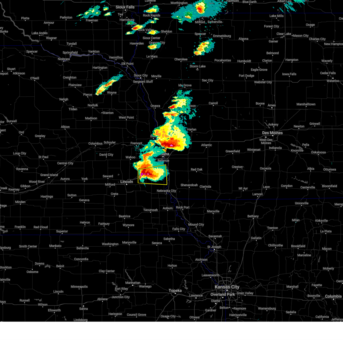 At 719 pm cdt, a severe thunderstorm was located 3 miles northwest of murdock, or 12 miles south of gretna, moving east at 45 mph (trained weather spotters). Hazards include baseball size hail and 60 mph wind gusts. People and animals outdoors will be severely injured. expect shattered windows, extensive damage to roofs, siding, and vehicles. this severe storm will be near, louisville and murdock around 725 pm cdt. Other locations in the path of this severe thunderstorm include cedar creek and plattsmouth. At 719 pm cdt, a severe thunderstorm was located 3 miles northwest of murdock, or 12 miles south of gretna, moving east at 45 mph (trained weather spotters). Hazards include baseball size hail and 60 mph wind gusts. People and animals outdoors will be severely injured. expect shattered windows, extensive damage to roofs, siding, and vehicles. this severe storm will be near, louisville and murdock around 725 pm cdt. Other locations in the path of this severe thunderstorm include cedar creek and plattsmouth.
|
| 4/17/2025 7:20 PM CDT |
 the severe thunderstorm warning has been cancelled and is no longer in effect the severe thunderstorm warning has been cancelled and is no longer in effect
|
| 4/17/2025 7:08 PM CDT |
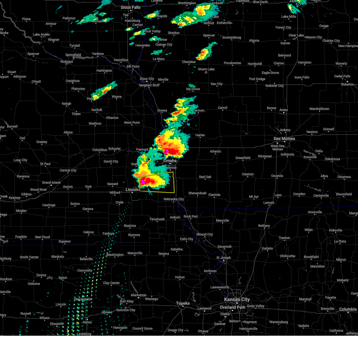 Svroax the national weather service in omaha has issued a * severe thunderstorm warning for, southern sarpy county in east central nebraska, northeastern lancaster county in southeastern nebraska, southeastern saunders county in east central nebraska, cass county in southeastern nebraska, * until 800 pm cdt. * at 707 pm cdt, a severe thunderstorm was located over greenwood, or 15 miles southwest of gretna, moving east at 50 mph. this is a destructive storm for greenwood (trained weather spotters). Hazards include baseball size hail and 60 mph wind gusts. People and animals outdoors will be severely injured. expect shattered windows, extensive damage to roofs, siding, and vehicles. this severe thunderstorm will be near, murdock around 715 pm cdt. louisville around 720 pm cdt. other locations in the path of this severe thunderstorm include plattsmouth and beaver lake. This includes interstate 80 in nebraska between mile markers 411 and 430. Svroax the national weather service in omaha has issued a * severe thunderstorm warning for, southern sarpy county in east central nebraska, northeastern lancaster county in southeastern nebraska, southeastern saunders county in east central nebraska, cass county in southeastern nebraska, * until 800 pm cdt. * at 707 pm cdt, a severe thunderstorm was located over greenwood, or 15 miles southwest of gretna, moving east at 50 mph. this is a destructive storm for greenwood (trained weather spotters). Hazards include baseball size hail and 60 mph wind gusts. People and animals outdoors will be severely injured. expect shattered windows, extensive damage to roofs, siding, and vehicles. this severe thunderstorm will be near, murdock around 715 pm cdt. louisville around 720 pm cdt. other locations in the path of this severe thunderstorm include plattsmouth and beaver lake. This includes interstate 80 in nebraska between mile markers 411 and 430.
|
| 4/1/2025 11:51 PM CDT |
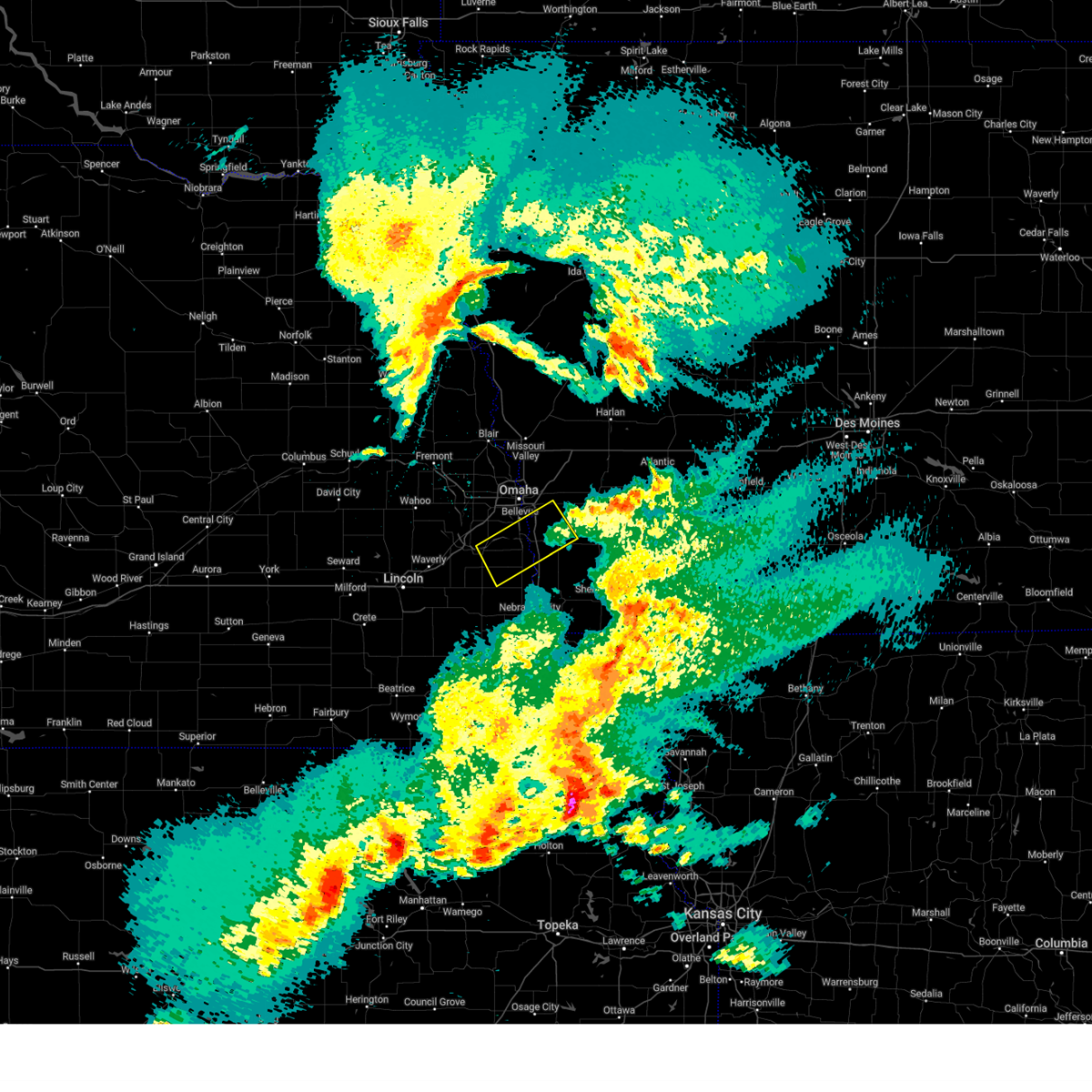 The storm which prompted the warning has weakened below severe limits, and no longer poses an immediate threat to life or property. therefore, the warning will be allowed to expire. however, gusty winds are still possible with this thunderstorm. a severe thunderstorm watch remains in effect until 300 am cdt for southwestern iowa, and southeastern and east central nebraska. The storm which prompted the warning has weakened below severe limits, and no longer poses an immediate threat to life or property. therefore, the warning will be allowed to expire. however, gusty winds are still possible with this thunderstorm. a severe thunderstorm watch remains in effect until 300 am cdt for southwestern iowa, and southeastern and east central nebraska.
|
| 4/1/2025 11:28 PM CDT |
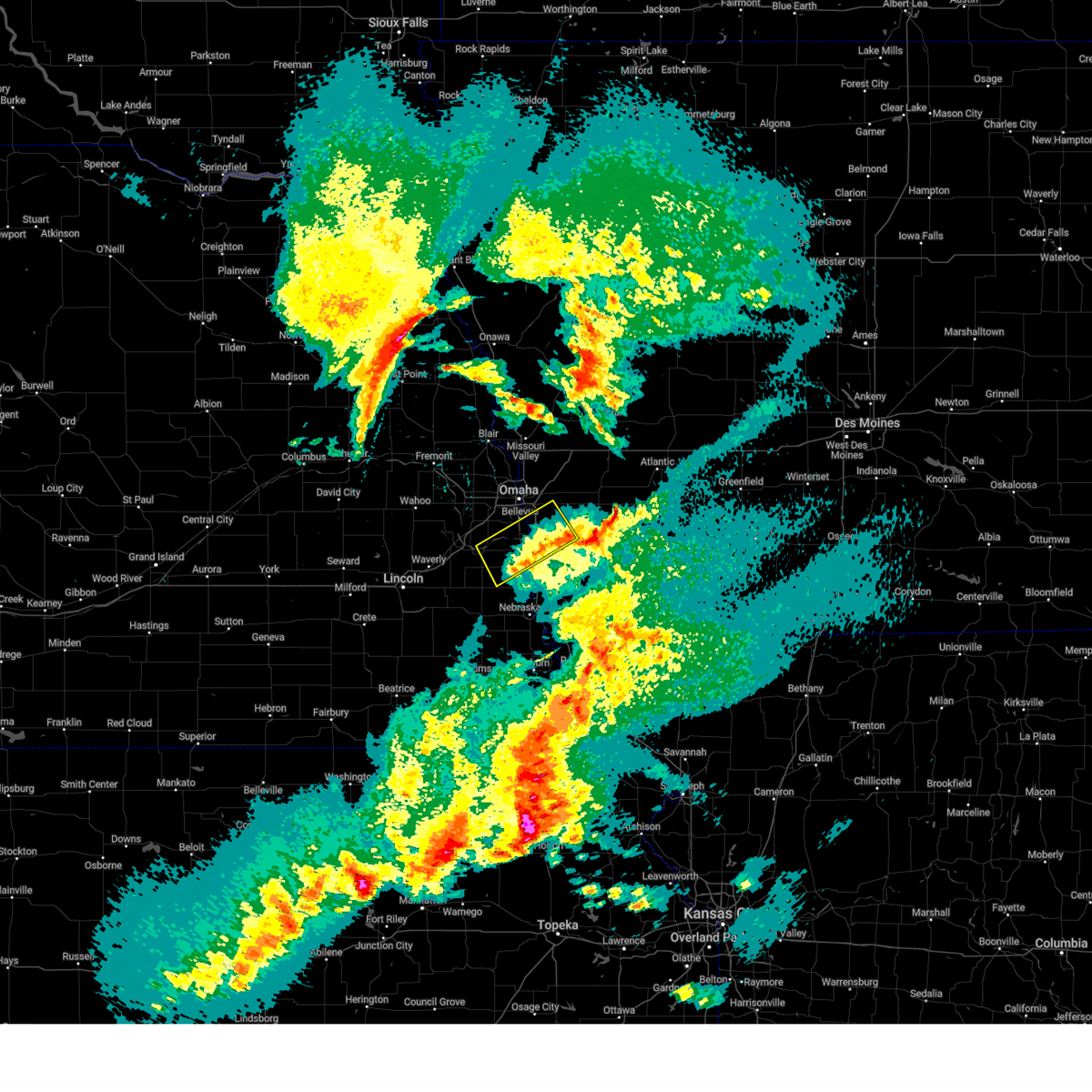 At 1128 pm cdt, a severe thunderstorm was located 4 miles southeast of treynor, or 15 miles east of council bluffs, moving northeast at 50 mph (radar indicated). Hazards include 60 mph wind gusts. Expect damage to roofs, siding, and trees. Locations impacted include, offutt afb, louisville state recreation area, camp maha, cedar creek, beaver lake, glenwood, louisville, murray, silver city, plattsmouth, pacific junction, mineola, bellevue, and council bluffs. At 1128 pm cdt, a severe thunderstorm was located 4 miles southeast of treynor, or 15 miles east of council bluffs, moving northeast at 50 mph (radar indicated). Hazards include 60 mph wind gusts. Expect damage to roofs, siding, and trees. Locations impacted include, offutt afb, louisville state recreation area, camp maha, cedar creek, beaver lake, glenwood, louisville, murray, silver city, plattsmouth, pacific junction, mineola, bellevue, and council bluffs.
|
| 4/1/2025 11:09 PM CDT |
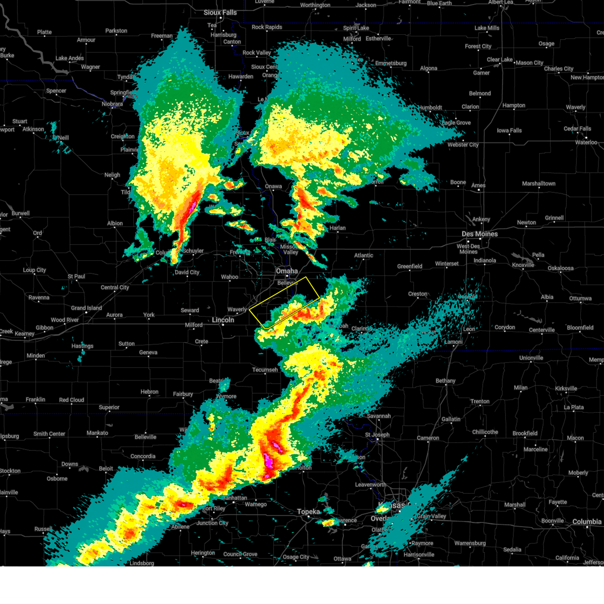 Svroax the national weather service in omaha has issued a * severe thunderstorm warning for, western mills county in southwestern iowa, south central pottawattamie county in southwestern iowa, eastern sarpy county in east central nebraska, cass county in southeastern nebraska, * until midnight cdt. * at 1108 pm cdt, a severe thunderstorm was located over pacific junction, or 10 miles southeast of offutt afb, moving northeast at 50 mph (radar indicated). Hazards include 60 mph wind gusts. expect damage to roofs, siding, and trees Svroax the national weather service in omaha has issued a * severe thunderstorm warning for, western mills county in southwestern iowa, south central pottawattamie county in southwestern iowa, eastern sarpy county in east central nebraska, cass county in southeastern nebraska, * until midnight cdt. * at 1108 pm cdt, a severe thunderstorm was located over pacific junction, or 10 miles southeast of offutt afb, moving northeast at 50 mph (radar indicated). Hazards include 60 mph wind gusts. expect damage to roofs, siding, and trees
|
| 3/14/2025 4:59 PM CDT |
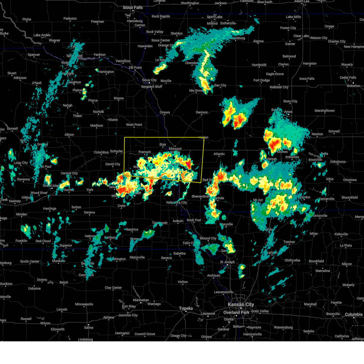 At 458 pm cdt, severe thunderstorms were located along a line extending from 2 miles southwest of north bend to 2 miles west of fort calhoun to near oakland, moving north at 55 mph (weather instrument measurement. at 4:48 pm, a 62 mph wind gust was reported at omaha eppley field). Hazards include 60 mph wind gusts and nickel size hail. Expect damage to roofs, siding, and trees. Locations impacted include, two rivers state recreation area, millard, council bluffs airport, florence, tennant, ralston, inglewood, nishna bend recreation area, winslow, czechland lake, arlington, historical village welcome center, narrows river park, underwood, benson, standing bear lake, glenwood, magnolia, emerson, and woodcliff. At 458 pm cdt, severe thunderstorms were located along a line extending from 2 miles southwest of north bend to 2 miles west of fort calhoun to near oakland, moving north at 55 mph (weather instrument measurement. at 4:48 pm, a 62 mph wind gust was reported at omaha eppley field). Hazards include 60 mph wind gusts and nickel size hail. Expect damage to roofs, siding, and trees. Locations impacted include, two rivers state recreation area, millard, council bluffs airport, florence, tennant, ralston, inglewood, nishna bend recreation area, winslow, czechland lake, arlington, historical village welcome center, narrows river park, underwood, benson, standing bear lake, glenwood, magnolia, emerson, and woodcliff.
|
| 3/14/2025 4:48 PM CDT |
 At 448 pm cdt, severe thunderstorms were located along a line extending from 3 miles southwest of prague to 2 miles north of standing bear lake to 3 miles east of oakland, moving north at 55 mph (radar indicated). Hazards include 60 mph wind gusts and nickel size hail. Expect damage to roofs, siding, and trees. Locations impacted include, two rivers state recreation area, millard, council bluffs airport, florence, tennant, ralston, inglewood, nishna bend recreation area, winslow, czechland lake, arlington, historical village welcome center, narrows river park, underwood, benson, standing bear lake, glenwood, magnolia, emerson, and woodcliff. At 448 pm cdt, severe thunderstorms were located along a line extending from 3 miles southwest of prague to 2 miles north of standing bear lake to 3 miles east of oakland, moving north at 55 mph (radar indicated). Hazards include 60 mph wind gusts and nickel size hail. Expect damage to roofs, siding, and trees. Locations impacted include, two rivers state recreation area, millard, council bluffs airport, florence, tennant, ralston, inglewood, nishna bend recreation area, winslow, czechland lake, arlington, historical village welcome center, narrows river park, underwood, benson, standing bear lake, glenwood, magnolia, emerson, and woodcliff.
|
| 3/14/2025 4:38 PM CDT |
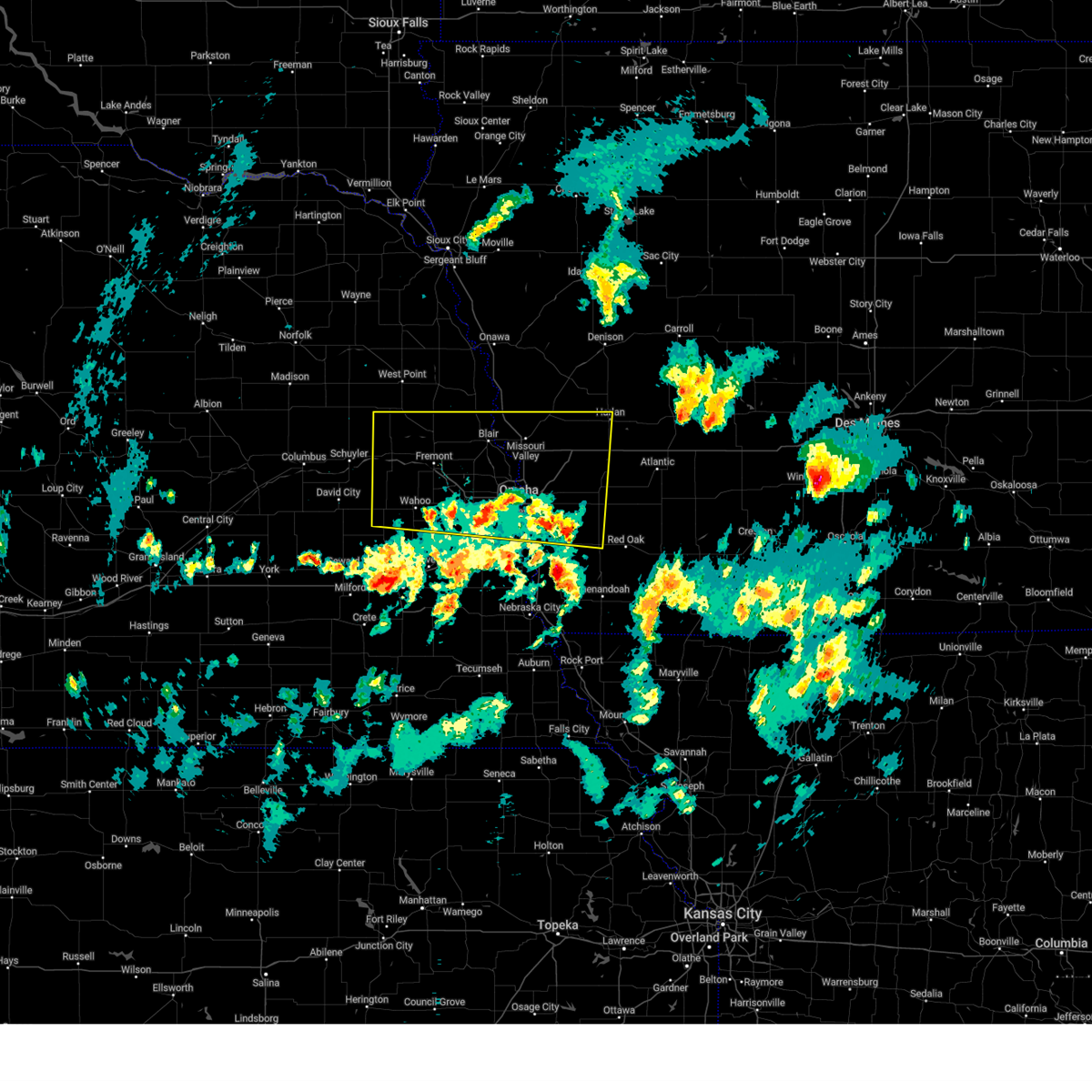 At 438 pm cdt, severe thunderstorms were located along a line extending from malmo to 2 miles southeast of carson, moving north at 50 mph (radar indicated). Hazards include 60 mph wind gusts and nickel size hail. Expect damage to roofs, siding, and trees. Locations impacted include, two rivers state recreation area, millard, council bluffs airport, florence, tennant, ralston, inglewood, nishna bend recreation area, winslow, czechland lake, arlington, historical village welcome center, narrows river park, underwood, benson, standing bear lake, glenwood, magnolia, emerson, and woodcliff. At 438 pm cdt, severe thunderstorms were located along a line extending from malmo to 2 miles southeast of carson, moving north at 50 mph (radar indicated). Hazards include 60 mph wind gusts and nickel size hail. Expect damage to roofs, siding, and trees. Locations impacted include, two rivers state recreation area, millard, council bluffs airport, florence, tennant, ralston, inglewood, nishna bend recreation area, winslow, czechland lake, arlington, historical village welcome center, narrows river park, underwood, benson, standing bear lake, glenwood, magnolia, emerson, and woodcliff.
|
| 3/14/2025 4:24 PM CDT |
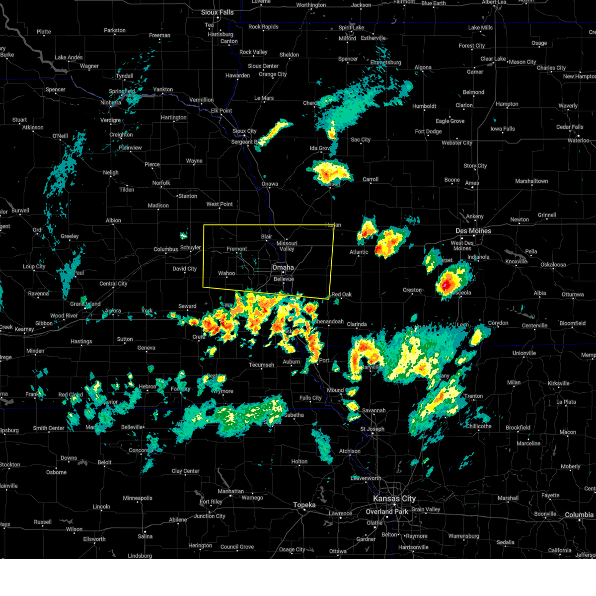 Svroax the national weather service in omaha has issued a * severe thunderstorm warning for, west central montgomery county in southwestern iowa, northern mills county in southwestern iowa, pottawattamie county in southwestern iowa, southern harrison county in southwestern iowa, southwestern shelby county in southwestern iowa, sarpy county in east central nebraska, south central burt county in east central nebraska, washington county in east central nebraska, dodge county in east central nebraska, douglas county in east central nebraska, saunders county in east central nebraska, * until 515 pm cdt. * at 424 pm cdt, severe thunderstorms were located along a line extending from 5 miles south of weston to 2 miles northeast of emerson, moving north at 55 mph (radar indicated). Hazards include 60 mph wind gusts and nickel size hail. expect damage to roofs, siding, and trees Svroax the national weather service in omaha has issued a * severe thunderstorm warning for, west central montgomery county in southwestern iowa, northern mills county in southwestern iowa, pottawattamie county in southwestern iowa, southern harrison county in southwestern iowa, southwestern shelby county in southwestern iowa, sarpy county in east central nebraska, south central burt county in east central nebraska, washington county in east central nebraska, dodge county in east central nebraska, douglas county in east central nebraska, saunders county in east central nebraska, * until 515 pm cdt. * at 424 pm cdt, severe thunderstorms were located along a line extending from 5 miles south of weston to 2 miles northeast of emerson, moving north at 55 mph (radar indicated). Hazards include 60 mph wind gusts and nickel size hail. expect damage to roofs, siding, and trees
|
| 10/30/2024 11:49 AM CDT |
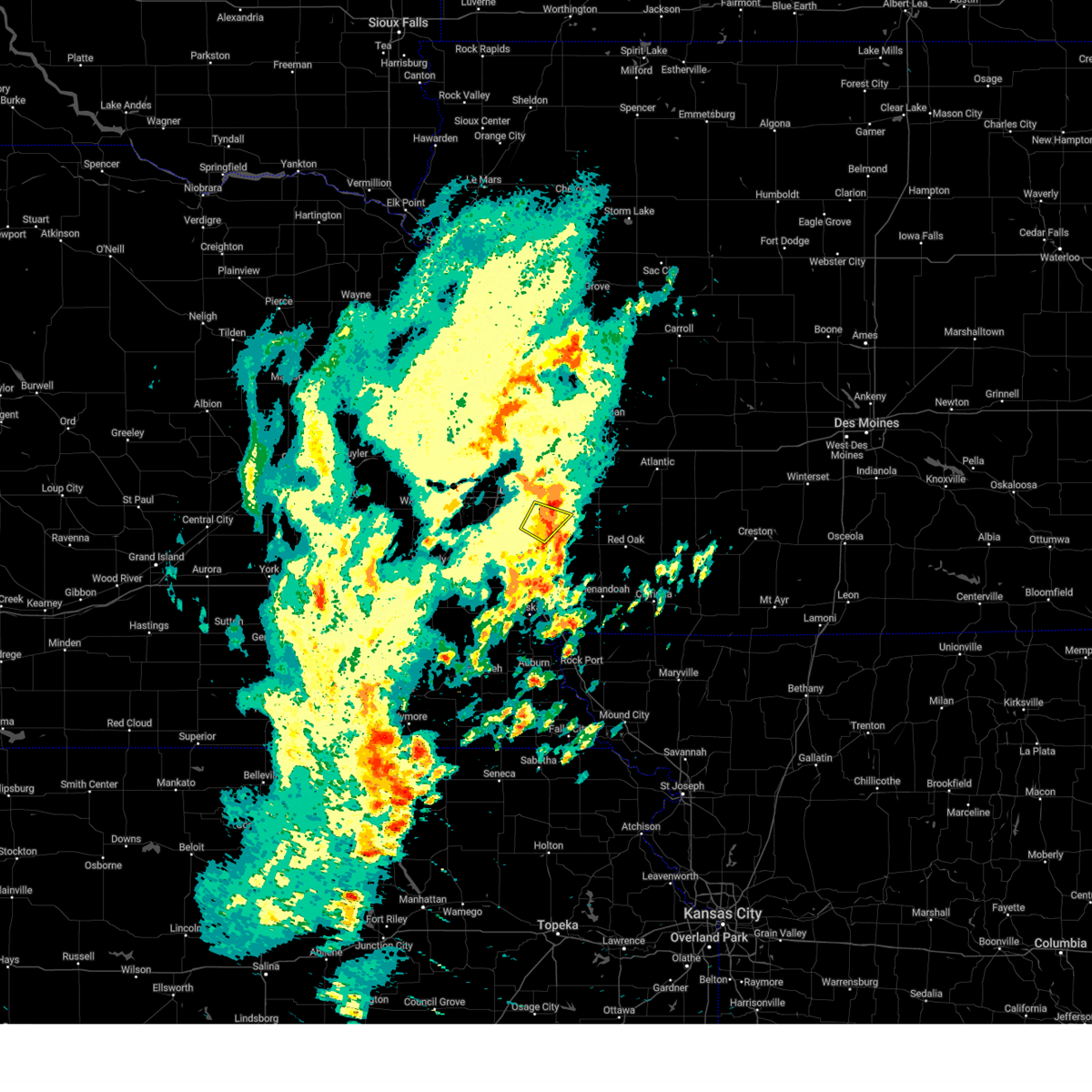 the severe thunderstorm warning has been cancelled and is no longer in effect the severe thunderstorm warning has been cancelled and is no longer in effect
|
| 10/30/2024 11:35 AM CDT |
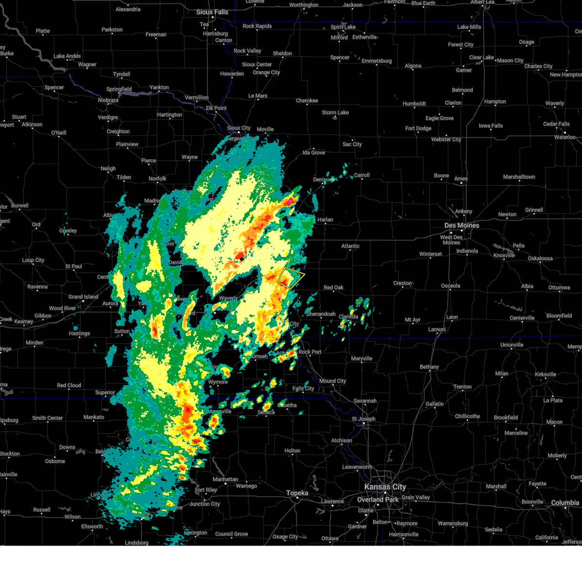 the severe thunderstorm warning has been cancelled and is no longer in effect the severe thunderstorm warning has been cancelled and is no longer in effect
|
| 10/30/2024 11:35 AM CDT |
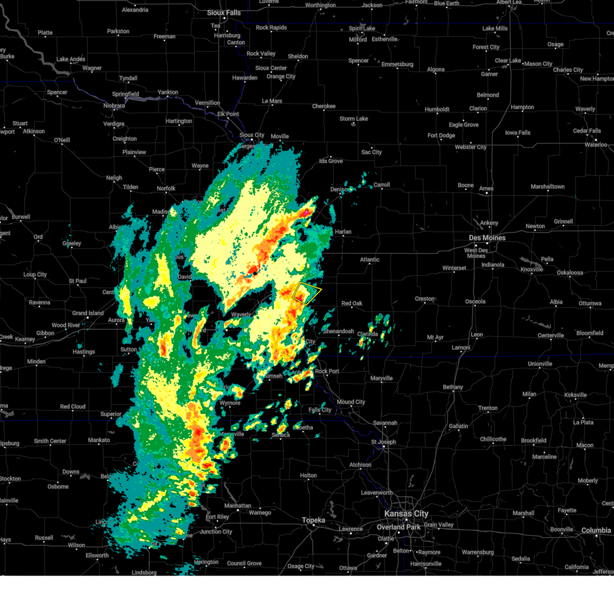 At 1135 am cdt, a severe thunderstorm was located 7 miles northwest of silver city, or 7 miles southeast of council bluffs, moving northeast at 55 mph (radar indicated). Hazards include quarter size hail. Damage to vehicles is expected. Locations impacted include, southeastern council bluffs, bellevue, offutt afb, glenwood, mineola, and lake manawa state park. At 1135 am cdt, a severe thunderstorm was located 7 miles northwest of silver city, or 7 miles southeast of council bluffs, moving northeast at 55 mph (radar indicated). Hazards include quarter size hail. Damage to vehicles is expected. Locations impacted include, southeastern council bluffs, bellevue, offutt afb, glenwood, mineola, and lake manawa state park.
|
| 10/30/2024 11:24 AM CDT |
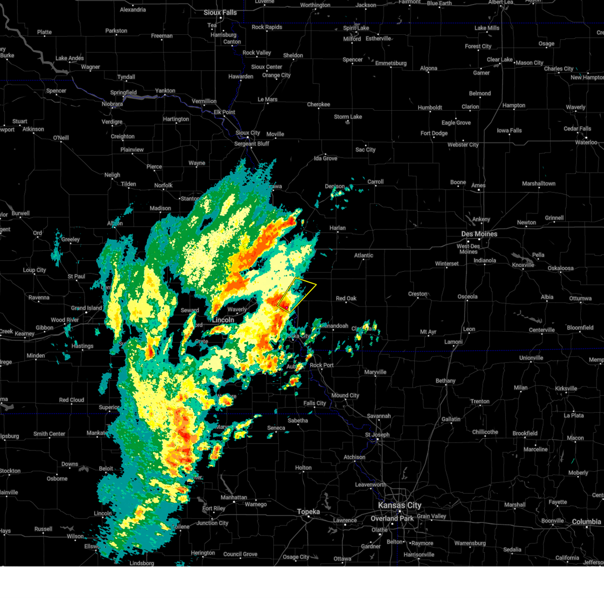 Svroax the national weather service in omaha has issued a * severe thunderstorm warning for, northwestern mills county in southwestern iowa, south central pottawattamie county in southwestern iowa, northeastern sarpy county in east central nebraska, northeastern cass county in southeastern nebraska, * until noon cdt. * at 1124 am cdt, a severe thunderstorm was located over plattsmouth, or 6 miles south of offutt afb, moving northeast at 55 mph (radar indicated). Hazards include quarter size hail. damage to vehicles is expected Svroax the national weather service in omaha has issued a * severe thunderstorm warning for, northwestern mills county in southwestern iowa, south central pottawattamie county in southwestern iowa, northeastern sarpy county in east central nebraska, northeastern cass county in southeastern nebraska, * until noon cdt. * at 1124 am cdt, a severe thunderstorm was located over plattsmouth, or 6 miles south of offutt afb, moving northeast at 55 mph (radar indicated). Hazards include quarter size hail. damage to vehicles is expected
|
| 7/31/2024 6:19 PM CDT |
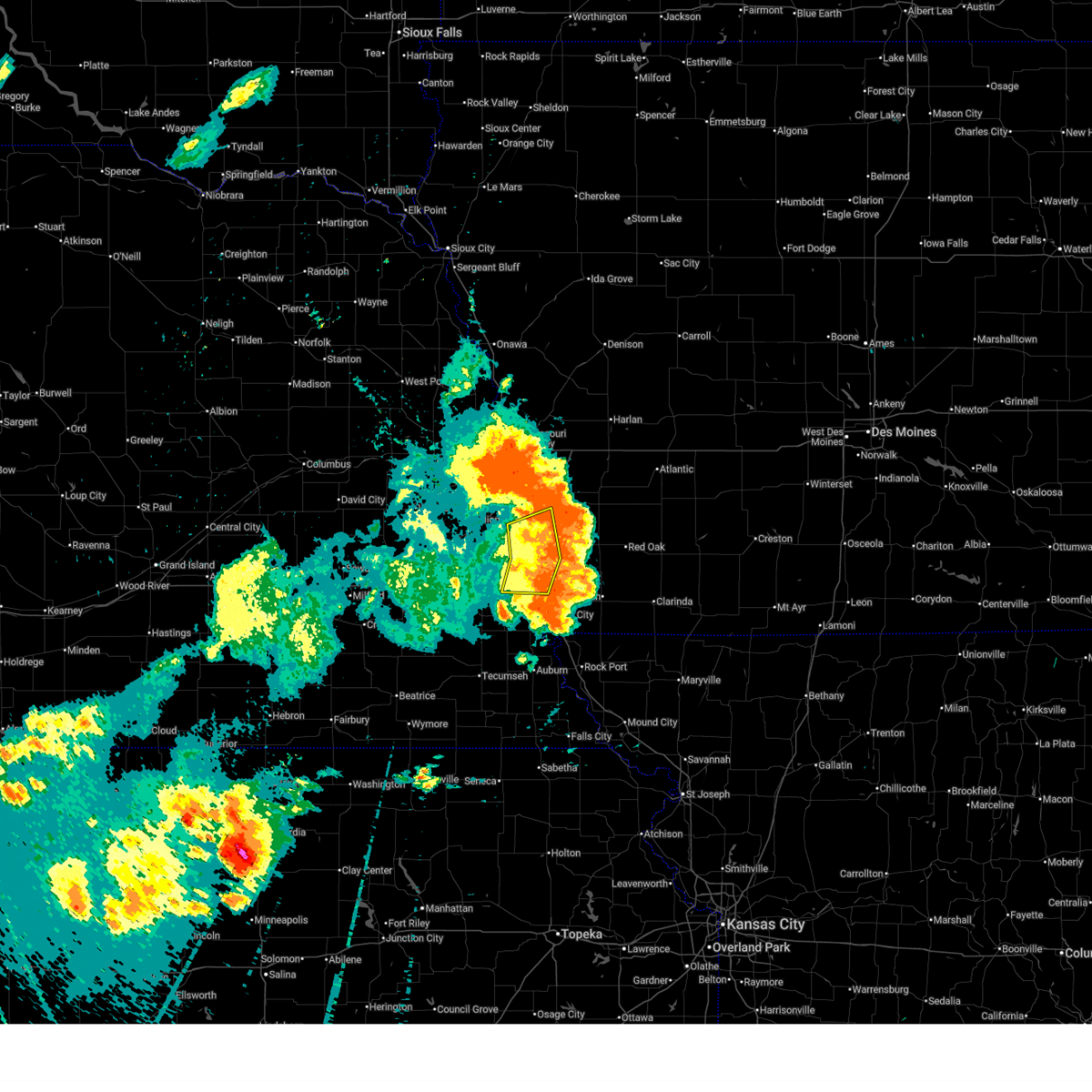 At 617 pm cdt, severe thunderstorms were located along a line extending from 3 miles northwest of hastings to 6 miles southwest of emerson to 2 miles northeast of farragut, moving east at 45 mph. these are destructive storms for portions of fremont, mills, pottawattamie, sarpy, and cass counties (emergency management. these storms have a history of producing widespread wind damage to trees, powerlines, structures, and vehicles). Hazards include 80 mph wind gusts. Flying debris will be dangerous to those caught without shelter. mobile homes will be heavily damaged. expect considerable damage to roofs, windows, and vehicles. extensive tree damage and power outages are likely. Locations impacted include, bellevue, offutt afb, plattsmouth, glenwood, pacific junction, murray, union, nehawka, beaver lake, and thurman. At 617 pm cdt, severe thunderstorms were located along a line extending from 3 miles northwest of hastings to 6 miles southwest of emerson to 2 miles northeast of farragut, moving east at 45 mph. these are destructive storms for portions of fremont, mills, pottawattamie, sarpy, and cass counties (emergency management. these storms have a history of producing widespread wind damage to trees, powerlines, structures, and vehicles). Hazards include 80 mph wind gusts. Flying debris will be dangerous to those caught without shelter. mobile homes will be heavily damaged. expect considerable damage to roofs, windows, and vehicles. extensive tree damage and power outages are likely. Locations impacted include, bellevue, offutt afb, plattsmouth, glenwood, pacific junction, murray, union, nehawka, beaver lake, and thurman.
|
| 7/31/2024 6:00 PM CDT |
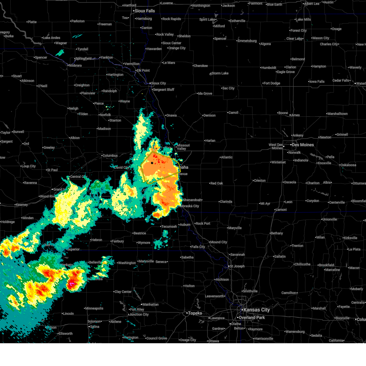 At 558 pm cdt, severe thunderstorms were located along a line extending from 2 miles west of arlington to near fort calhoun to council bluffs, moving northeast at 40 mph. these are destructive storms for portions of pottawattamie, sarpy, washington, dodge, douglas, and saunders counties (emergency management. these storms have produced widespread wind damage to trees, powerlines, structures, and cars. in addition, we recently measured a 76 mph wind gust at our office). Hazards include 80 mph wind gusts. Flying debris will be dangerous to those caught without shelter. mobile homes will be heavily damaged. expect considerable damage to roofs, windows, and vehicles. extensive tree damage and power outages are likely. Locations impacted include, omaha, council bluffs, bellevue, papillion, ralston, gretna, bennington, boys town, elkhorn, millard, la vista, carter lake, ashland, valley, arlington, yutan, waterloo, mead, ithaca, and leshara. At 558 pm cdt, severe thunderstorms were located along a line extending from 2 miles west of arlington to near fort calhoun to council bluffs, moving northeast at 40 mph. these are destructive storms for portions of pottawattamie, sarpy, washington, dodge, douglas, and saunders counties (emergency management. these storms have produced widespread wind damage to trees, powerlines, structures, and cars. in addition, we recently measured a 76 mph wind gust at our office). Hazards include 80 mph wind gusts. Flying debris will be dangerous to those caught without shelter. mobile homes will be heavily damaged. expect considerable damage to roofs, windows, and vehicles. extensive tree damage and power outages are likely. Locations impacted include, omaha, council bluffs, bellevue, papillion, ralston, gretna, bennington, boys town, elkhorn, millard, la vista, carter lake, ashland, valley, arlington, yutan, waterloo, mead, ithaca, and leshara.
|
| 7/31/2024 5:37 PM CDT |
 Svroax the national weather service in omaha has issued a * severe thunderstorm warning for, northwestern fremont county in southwestern iowa, western mills county in southwestern iowa, southwestern pottawattamie county in southwestern iowa, southern sarpy county in east central nebraska, cass county in southeastern nebraska, * until 630 pm cdt. * at 536 pm cdt, severe thunderstorms were located along a line extending from 2 miles northeast of cedar creek to 5 miles west of murray to 5 miles northeast of dunbar, moving east at 45 mph. these are destructive storms for portions of fremont, mills, pottawattamie, sarpy, and cass counties (public. these storms have a history of producing widespread damage to trees, powerlines, and some structures). Hazards include 80 mph wind gusts. Flying debris will be dangerous to those caught without shelter. mobile homes will be heavily damaged. expect considerable damage to roofs, windows, and vehicles. Extensive tree damage and power outages are likely. Svroax the national weather service in omaha has issued a * severe thunderstorm warning for, northwestern fremont county in southwestern iowa, western mills county in southwestern iowa, southwestern pottawattamie county in southwestern iowa, southern sarpy county in east central nebraska, cass county in southeastern nebraska, * until 630 pm cdt. * at 536 pm cdt, severe thunderstorms were located along a line extending from 2 miles northeast of cedar creek to 5 miles west of murray to 5 miles northeast of dunbar, moving east at 45 mph. these are destructive storms for portions of fremont, mills, pottawattamie, sarpy, and cass counties (public. these storms have a history of producing widespread damage to trees, powerlines, and some structures). Hazards include 80 mph wind gusts. Flying debris will be dangerous to those caught without shelter. mobile homes will be heavily damaged. expect considerable damage to roofs, windows, and vehicles. Extensive tree damage and power outages are likely.
|
| 7/31/2024 5:19 PM CDT |
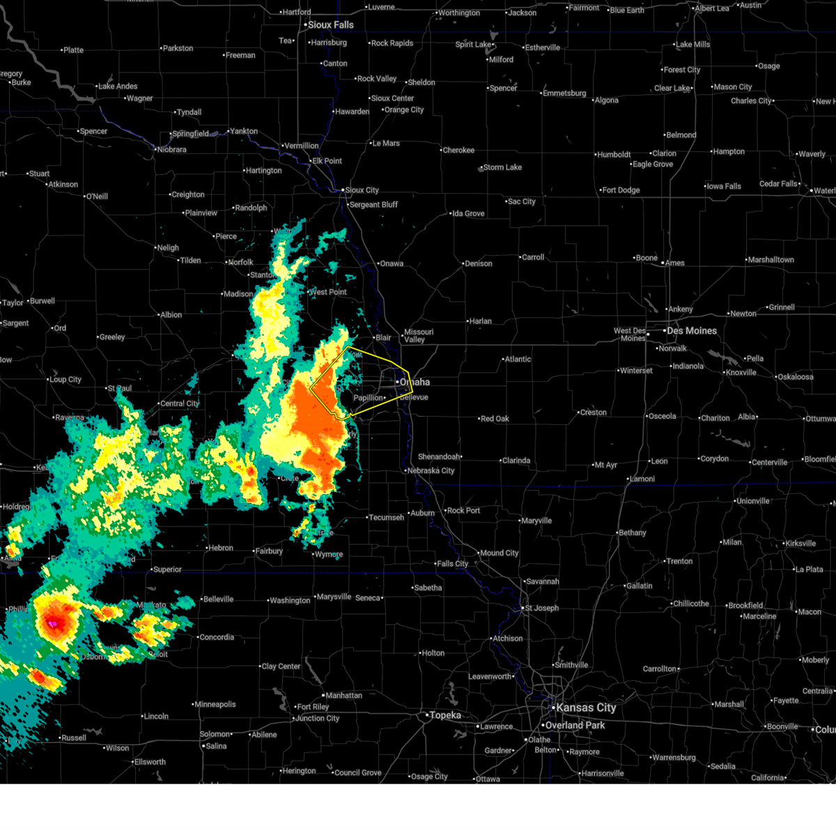 Svroax the national weather service in omaha has issued a * severe thunderstorm warning for, southwestern pottawattamie county in southwestern iowa, northern sarpy county in east central nebraska, southwestern washington county in east central nebraska, southeastern dodge county in east central nebraska, douglas county in east central nebraska, eastern saunders county in east central nebraska, * until 615 pm cdt. * at 517 pm cdt, a severe thunderstorm was located over mead, or 5 miles east of wahoo, moving northeast at 35 mph. this is a destructive storm for saunders, douglas, sarpy, pottawattamie, washington, dodge counties (public. these storms have a history of producing 70 to 80 mph wind gusts and widespread wind damage to trees, powerlines, and some structures). Hazards include 80 mph wind gusts. Flying debris will be dangerous to those caught without shelter. mobile homes will be heavily damaged. expect considerable damage to roofs, windows, and vehicles. Extensive tree damage and power outages are likely. Svroax the national weather service in omaha has issued a * severe thunderstorm warning for, southwestern pottawattamie county in southwestern iowa, northern sarpy county in east central nebraska, southwestern washington county in east central nebraska, southeastern dodge county in east central nebraska, douglas county in east central nebraska, eastern saunders county in east central nebraska, * until 615 pm cdt. * at 517 pm cdt, a severe thunderstorm was located over mead, or 5 miles east of wahoo, moving northeast at 35 mph. this is a destructive storm for saunders, douglas, sarpy, pottawattamie, washington, dodge counties (public. these storms have a history of producing 70 to 80 mph wind gusts and widespread wind damage to trees, powerlines, and some structures). Hazards include 80 mph wind gusts. Flying debris will be dangerous to those caught without shelter. mobile homes will be heavily damaged. expect considerable damage to roofs, windows, and vehicles. Extensive tree damage and power outages are likely.
|
| 7/31/2024 5:12 PM CDT |
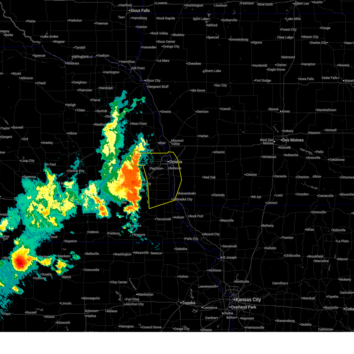 Svroax the national weather service in omaha has issued a * severe thunderstorm warning for, northwestern fremont county in southwestern iowa, western mills county in southwestern iowa, southwestern pottawattamie county in southwestern iowa, sarpy county in east central nebraska, central otoe county in southeastern nebraska, douglas county in east central nebraska, eastern saunders county in east central nebraska, cass county in southeastern nebraska, * until 615 pm cdt. * at 511 pm cdt, severe thunderstorms were located along a line extending from 2 miles southwest of mead to 3 miles southeast of greenwood to 4 miles southeast of palmyra, moving east at 40 mph (public. these storms have a history of producing widespread wind damage to trees, powerlines, and structures across lancaster county). Hazards include 70 mph wind gusts and quarter size hail. Hail damage to vehicles is expected. expect considerable tree damage. Wind damage is also likely to mobile homes, roofs, and outbuildings. Svroax the national weather service in omaha has issued a * severe thunderstorm warning for, northwestern fremont county in southwestern iowa, western mills county in southwestern iowa, southwestern pottawattamie county in southwestern iowa, sarpy county in east central nebraska, central otoe county in southeastern nebraska, douglas county in east central nebraska, eastern saunders county in east central nebraska, cass county in southeastern nebraska, * until 615 pm cdt. * at 511 pm cdt, severe thunderstorms were located along a line extending from 2 miles southwest of mead to 3 miles southeast of greenwood to 4 miles southeast of palmyra, moving east at 40 mph (public. these storms have a history of producing widespread wind damage to trees, powerlines, and structures across lancaster county). Hazards include 70 mph wind gusts and quarter size hail. Hail damage to vehicles is expected. expect considerable tree damage. Wind damage is also likely to mobile homes, roofs, and outbuildings.
|
| 7/2/2024 1:54 AM CDT |
 The storm which prompted the warning has weakened below severe limits, and no longer poses an immediate threat to life or property. therefore, the warning will be allowed to expire. however, gusty winds and heavy rain are still possible with this thunderstorm. The storm which prompted the warning has weakened below severe limits, and no longer poses an immediate threat to life or property. therefore, the warning will be allowed to expire. however, gusty winds and heavy rain are still possible with this thunderstorm.
|
| 7/2/2024 1:41 AM CDT |
 At 141 am cdt, a severe thunderstorm was located near cedar creek, or 8 miles south of papillion, moving east at 30 mph (radar indicated). Hazards include 60 mph wind gusts and nickel size hail. Expect damage to roofs, siding, and trees. Locations impacted include, bellevue, papillion, gretna, offutt afb, la vista, plattsmouth, springfield, louisville, cedar creek, prairie queen recreation area, walnut creek recreation area, wehrspann lake, louisville state recreation area, and camp maha. At 141 am cdt, a severe thunderstorm was located near cedar creek, or 8 miles south of papillion, moving east at 30 mph (radar indicated). Hazards include 60 mph wind gusts and nickel size hail. Expect damage to roofs, siding, and trees. Locations impacted include, bellevue, papillion, gretna, offutt afb, la vista, plattsmouth, springfield, louisville, cedar creek, prairie queen recreation area, walnut creek recreation area, wehrspann lake, louisville state recreation area, and camp maha.
|
| 7/2/2024 1:41 AM CDT |
 the severe thunderstorm warning has been cancelled and is no longer in effect the severe thunderstorm warning has been cancelled and is no longer in effect
|
| 7/2/2024 1:28 AM CDT |
 At 128 am cdt, a severe thunderstorm was located 5 miles south of gretna, moving east at 30 mph (radar indicated). Hazards include 60 mph wind gusts and nickel size hail. Expect damage to roofs, siding, and trees. Locations impacted include, bellevue, papillion, gretna, offutt afb, la vista, plattsmouth, springfield, louisville, cedar creek, prairie queen recreation area, walnut creek recreation area, wehrspann lake, south bend, louisville state recreation area, camp maha, schramm park state recreation area, platte river state park, mahoney state park, and camp carol joy holling. At 128 am cdt, a severe thunderstorm was located 5 miles south of gretna, moving east at 30 mph (radar indicated). Hazards include 60 mph wind gusts and nickel size hail. Expect damage to roofs, siding, and trees. Locations impacted include, bellevue, papillion, gretna, offutt afb, la vista, plattsmouth, springfield, louisville, cedar creek, prairie queen recreation area, walnut creek recreation area, wehrspann lake, south bend, louisville state recreation area, camp maha, schramm park state recreation area, platte river state park, mahoney state park, and camp carol joy holling.
|
| 7/2/2024 1:18 AM CDT |
 Svroax the national weather service in omaha has issued a * severe thunderstorm warning for, sarpy county in east central nebraska, southeastern saunders county in east central nebraska, northern cass county in southeastern nebraska, * until 200 am cdt. * at 117 am cdt, a severe thunderstorm was located over ashland, or 8 miles southwest of gretna, moving east at 30 mph (radar indicated). Hazards include 60 mph wind gusts and nickel size hail. expect damage to roofs, siding, and trees Svroax the national weather service in omaha has issued a * severe thunderstorm warning for, sarpy county in east central nebraska, southeastern saunders county in east central nebraska, northern cass county in southeastern nebraska, * until 200 am cdt. * at 117 am cdt, a severe thunderstorm was located over ashland, or 8 miles southwest of gretna, moving east at 30 mph (radar indicated). Hazards include 60 mph wind gusts and nickel size hail. expect damage to roofs, siding, and trees
|
| 6/26/2024 12:00 AM CDT |
 Svroax the national weather service in omaha has issued a * severe thunderstorm warning for, western mills county in southwestern iowa, southern pottawattamie county in southwestern iowa, northeastern sarpy county in east central nebraska, * until 1230 am cdt. * at 1200 am cdt, a severe thunderstorm was located 3 miles east of offutt afb, moving southeast at 30 mph (radar indicated). Hazards include 60 mph wind gusts and quarter size hail. Hail damage to vehicles is expected. Expect wind damage to roofs, siding, and trees. Svroax the national weather service in omaha has issued a * severe thunderstorm warning for, western mills county in southwestern iowa, southern pottawattamie county in southwestern iowa, northeastern sarpy county in east central nebraska, * until 1230 am cdt. * at 1200 am cdt, a severe thunderstorm was located 3 miles east of offutt afb, moving southeast at 30 mph (radar indicated). Hazards include 60 mph wind gusts and quarter size hail. Hail damage to vehicles is expected. Expect wind damage to roofs, siding, and trees.
|
| 6/25/2024 11:41 PM CDT |
 the severe thunderstorm warning has been cancelled and is no longer in effect the severe thunderstorm warning has been cancelled and is no longer in effect
|
| 6/25/2024 11:41 PM CDT |
 At 1141 pm cdt, a severe thunderstorm was located 4 miles north of glenwood, or 8 miles east of offutt afb, moving southeast at 20 mph (radar indicated). Hazards include 60 mph wind gusts and quarter size hail. Hail damage to vehicles is expected. expect wind damage to roofs, siding, and trees. Locations impacted include, southwestern council bluffs, bellevue, and lake manawa state park. At 1141 pm cdt, a severe thunderstorm was located 4 miles north of glenwood, or 8 miles east of offutt afb, moving southeast at 20 mph (radar indicated). Hazards include 60 mph wind gusts and quarter size hail. Hail damage to vehicles is expected. expect wind damage to roofs, siding, and trees. Locations impacted include, southwestern council bluffs, bellevue, and lake manawa state park.
|
| 6/25/2024 11:31 PM CDT |
 At 1130 pm cdt, a severe thunderstorm was located 5 miles east of offutt afb, moving southeast at 20 mph (public). Hazards include ping pong ball size hail and 60 mph wind gusts. People and animals outdoors will be injured. expect hail damage to roofs, siding, windows, and vehicles. expect wind damage to roofs, siding, and trees. Locations impacted include, southeastern omaha, southwestern council bluffs, bellevue, ralston, offutt afb, la vista, aksarben, south omaha, midtown, old market, and lake manawa state park. At 1130 pm cdt, a severe thunderstorm was located 5 miles east of offutt afb, moving southeast at 20 mph (public). Hazards include ping pong ball size hail and 60 mph wind gusts. People and animals outdoors will be injured. expect hail damage to roofs, siding, windows, and vehicles. expect wind damage to roofs, siding, and trees. Locations impacted include, southeastern omaha, southwestern council bluffs, bellevue, ralston, offutt afb, la vista, aksarben, south omaha, midtown, old market, and lake manawa state park.
|
| 6/25/2024 11:08 PM CDT |
 Svroax the national weather service in omaha has issued a * severe thunderstorm warning for, northwestern mills county in southwestern iowa, southwestern pottawattamie county in southwestern iowa, northeastern sarpy county in east central nebraska, southeastern douglas county in east central nebraska, * until midnight cdt. * at 1108 pm cdt, a severe thunderstorm was located over southeastern omaha, moving southeast at 20 mph (radar indicated). Hazards include 60 mph wind gusts and quarter size hail. Hail damage to vehicles is expected. Expect wind damage to roofs, siding, and trees. Svroax the national weather service in omaha has issued a * severe thunderstorm warning for, northwestern mills county in southwestern iowa, southwestern pottawattamie county in southwestern iowa, northeastern sarpy county in east central nebraska, southeastern douglas county in east central nebraska, * until midnight cdt. * at 1108 pm cdt, a severe thunderstorm was located over southeastern omaha, moving southeast at 20 mph (radar indicated). Hazards include 60 mph wind gusts and quarter size hail. Hail damage to vehicles is expected. Expect wind damage to roofs, siding, and trees.
|
| 6/25/2024 7:33 PM CDT |
 the severe thunderstorm warning has been cancelled and is no longer in effect the severe thunderstorm warning has been cancelled and is no longer in effect
|
| 6/25/2024 7:23 PM CDT |
 At 723 pm cdt, a severe thunderstorm was located 4 miles west of offutt afb, moving east at 15 mph (radar indicated). Hazards include 60 mph wind gusts and quarter size hail. Hail damage to vehicles is expected. expect wind damage to roofs, siding, and trees. Locations impacted include, bellevue, papillion, offutt afb, plattsmouth, glenwood, pacific junction, walnut creek recreation area, and camp maha. At 723 pm cdt, a severe thunderstorm was located 4 miles west of offutt afb, moving east at 15 mph (radar indicated). Hazards include 60 mph wind gusts and quarter size hail. Hail damage to vehicles is expected. expect wind damage to roofs, siding, and trees. Locations impacted include, bellevue, papillion, offutt afb, plattsmouth, glenwood, pacific junction, walnut creek recreation area, and camp maha.
|
| 6/25/2024 7:06 PM CDT |
 At 704 pm cdt, a severe thunderstorm was located 3 miles north of plattsmouth, or 4 miles south of offutt afb, and is nearly stationary (public. at 704 pm, 2 inch diameter hail was reported in papillion near 36th and platteview road). Hazards include two inch hail and 60 mph wind gusts. People and animals outdoors will be injured. expect hail damage to roofs, siding, windows, and vehicles. expect wind damage to roofs, siding, and trees. Locations impacted include, bellevue, papillion, offutt afb, plattsmouth, glenwood, pacific junction, walnut creek recreation area, and camp maha. At 704 pm cdt, a severe thunderstorm was located 3 miles north of plattsmouth, or 4 miles south of offutt afb, and is nearly stationary (public. at 704 pm, 2 inch diameter hail was reported in papillion near 36th and platteview road). Hazards include two inch hail and 60 mph wind gusts. People and animals outdoors will be injured. expect hail damage to roofs, siding, windows, and vehicles. expect wind damage to roofs, siding, and trees. Locations impacted include, bellevue, papillion, offutt afb, plattsmouth, glenwood, pacific junction, walnut creek recreation area, and camp maha.
|
| 6/25/2024 7:05 PM CDT | Quarter sized hail reported 5.3 miles N of Bellevue, NE, report from mping: quarter (1.00 in.). |
| 6/25/2024 6:56 PM CDT |
 Svroax the national weather service in omaha has issued a * severe thunderstorm warning for, west central mills county in southwestern iowa, northeastern sarpy county in east central nebraska, northeastern cass county in southeastern nebraska, * until 745 pm cdt. * at 655 pm cdt, a severe thunderstorm was located 3 miles north of plattsmouth, or 4 miles south of offutt afb, and is nearly stationary (public. at 648 pm, quarter sized hail was reported near offutt air force base). Hazards include 60 mph wind gusts and half dollar size hail. Hail damage to vehicles is expected. Expect wind damage to roofs, siding, and trees. Svroax the national weather service in omaha has issued a * severe thunderstorm warning for, west central mills county in southwestern iowa, northeastern sarpy county in east central nebraska, northeastern cass county in southeastern nebraska, * until 745 pm cdt. * at 655 pm cdt, a severe thunderstorm was located 3 miles north of plattsmouth, or 4 miles south of offutt afb, and is nearly stationary (public. at 648 pm, quarter sized hail was reported near offutt air force base). Hazards include 60 mph wind gusts and half dollar size hail. Hail damage to vehicles is expected. Expect wind damage to roofs, siding, and trees.
|
| 6/25/2024 6:50 PM CDT | Ping Pong Ball sized hail reported 2.8 miles NW of Bellevue, NE |
| 6/25/2024 6:46 PM CDT | Quarter sized hail reported 3.2 miles N of Bellevue, NE, report from mping: quarter (1.00 in.). |
| 6/25/2024 6:45 PM CDT | Quarter sized hail reported 3.3 miles NNE of Bellevue, NE, report from mping: quarter (1.00 in.). |
| 6/25/2024 6:40 PM CDT |
 At 639 pm cdt, a severe thunderstorm was located over offutt afb, moving east at 10 mph (public. at 638 pm quarter sized hail was reported at highway 370 and 42nd street and 2 miles west of offutt air force base). Hazards include ping pong ball size hail and 60 mph wind gusts. People and animals outdoors will be injured. expect hail damage to roofs, siding, windows, and vehicles. expect wind damage to roofs, siding, and trees. Locations impacted include, southwestern council bluffs, bellevue, papillion, offutt afb, la vista, walnut creek recreation area, and camp maha. At 639 pm cdt, a severe thunderstorm was located over offutt afb, moving east at 10 mph (public. at 638 pm quarter sized hail was reported at highway 370 and 42nd street and 2 miles west of offutt air force base). Hazards include ping pong ball size hail and 60 mph wind gusts. People and animals outdoors will be injured. expect hail damage to roofs, siding, windows, and vehicles. expect wind damage to roofs, siding, and trees. Locations impacted include, southwestern council bluffs, bellevue, papillion, offutt afb, la vista, walnut creek recreation area, and camp maha.
|
| 6/25/2024 6:38 PM CDT | Quarter sized hail reported 2.9 miles NNE of Bellevue, NE, report from mping: quarter (1.00 in.). |
| 6/25/2024 6:36 PM CDT | Quarter sized hail reported 1.6 miles ENE of Bellevue, NE |
| 6/25/2024 6:26 PM CDT |
 Svroax the national weather service in omaha has issued a * severe thunderstorm warning for, northwestern mills county in southwestern iowa, southwestern pottawattamie county in southwestern iowa, northeastern sarpy county in east central nebraska, northeastern cass county in southeastern nebraska, * until 700 pm cdt. * at 625 pm cdt, a severe thunderstorm was located 4 miles northwest of plattsmouth, or 4 miles south of offutt afb, moving southeast at 15 mph (public. these storms have a history of producing 2 plus inch diameter hail). Hazards include golf ball size hail and 60 mph wind gusts. People and animals outdoors will be injured. expect hail damage to roofs, siding, windows, and vehicles. Expect wind damage to roofs, siding, and trees. Svroax the national weather service in omaha has issued a * severe thunderstorm warning for, northwestern mills county in southwestern iowa, southwestern pottawattamie county in southwestern iowa, northeastern sarpy county in east central nebraska, northeastern cass county in southeastern nebraska, * until 700 pm cdt. * at 625 pm cdt, a severe thunderstorm was located 4 miles northwest of plattsmouth, or 4 miles south of offutt afb, moving southeast at 15 mph (public. these storms have a history of producing 2 plus inch diameter hail). Hazards include golf ball size hail and 60 mph wind gusts. People and animals outdoors will be injured. expect hail damage to roofs, siding, windows, and vehicles. Expect wind damage to roofs, siding, and trees.
|
| 6/25/2024 6:10 PM CDT | Hen Egg sized hail reported 1.9 miles WSW of Bellevue, NE, report from mping: hen egg (2.00 in.). |
| 6/25/2024 6:10 PM CDT | Tennis Ball sized hail reported 2.3 miles ESE of Bellevue, NE |
| 6/25/2024 6:07 PM CDT | Half Dollar sized hail reported 2.1 miles NNE of Bellevue, NE, report from mping: half dollar (1.25 in.). |
| 6/25/2024 6:06 PM CDT | Quarter sized hail reported 2.1 miles NNE of Bellevue, NE, report from mping: quarter (1.00 in.). |
| 6/25/2024 6:06 PM CDT | Half Dollar sized hail reported 1 miles S of Bellevue, NE, report from mping: half dollar (1.25 in.). |
| 6/25/2024 6:05 PM CDT |
 At 604 pm cdt, a severe thunderstorm was located 3 miles south of offutt afb, moving south at 10 mph. this is a destructive storm for eastern sarpy and northwestern mills counties (public. at 557 pm baseball sized hail was reported 2 miles east of papillion). Hazards include baseball size hail and 60 mph wind gusts. People and animals outdoors will be severely injured. expect shattered windows, extensive damage to roofs, siding, and vehicles. Locations impacted include, southwestern council bluffs, bellevue, papillion, offutt afb, la vista, and camp maha. At 604 pm cdt, a severe thunderstorm was located 3 miles south of offutt afb, moving south at 10 mph. this is a destructive storm for eastern sarpy and northwestern mills counties (public. at 557 pm baseball sized hail was reported 2 miles east of papillion). Hazards include baseball size hail and 60 mph wind gusts. People and animals outdoors will be severely injured. expect shattered windows, extensive damage to roofs, siding, and vehicles. Locations impacted include, southwestern council bluffs, bellevue, papillion, offutt afb, la vista, and camp maha.
|
| 6/25/2024 6:04 PM CDT | Half Dollar sized hail reported 1.1 miles ENE of Bellevue, NE, report from mping: half dollar (1.25 in.). |
| 6/25/2024 6:01 PM CDT | Quarter sized hail reported 2.9 miles NNE of Bellevue, NE, report from mping: quarter (1.00 in.). |
| 6/25/2024 5:56 PM CDT | Ping Pong Ball sized hail reported 3.2 miles SSE of Bellevue, NE |
| 6/25/2024 5:51 PM CDT | Hen Egg sized hail reported 2.9 miles WNW of Bellevue, NE |
| 6/25/2024 5:48 PM CDT |
 Svroax the national weather service in omaha has issued a * severe thunderstorm warning for, northwestern mills county in southwestern iowa, southern pottawattamie county in southwestern iowa, northeastern sarpy county in east central nebraska, northeastern cass county in southeastern nebraska, * until 630 pm cdt. * at 547 pm cdt, a severe thunderstorm was located over offutt afb, moving south at 15 mph. this is a destructive storm for eastern sarpy and northwestern mills county (public. at 540 pm baseball sized hail was reported in bellevue near 30th and l streets). Hazards include baseball size hail and 60 mph wind gusts. People and animals outdoors will be severely injured. Expect shattered windows, extensive damage to roofs, siding, and vehicles. Svroax the national weather service in omaha has issued a * severe thunderstorm warning for, northwestern mills county in southwestern iowa, southern pottawattamie county in southwestern iowa, northeastern sarpy county in east central nebraska, northeastern cass county in southeastern nebraska, * until 630 pm cdt. * at 547 pm cdt, a severe thunderstorm was located over offutt afb, moving south at 15 mph. this is a destructive storm for eastern sarpy and northwestern mills county (public. at 540 pm baseball sized hail was reported in bellevue near 30th and l streets). Hazards include baseball size hail and 60 mph wind gusts. People and animals outdoors will be severely injured. Expect shattered windows, extensive damage to roofs, siding, and vehicles.
|
| 6/25/2024 5:42 PM CDT | Tennis Ball sized hail reported 2.4 miles SSW of Bellevue, NE |
| 6/25/2024 5:41 PM CDT | Hen Egg sized hail reported 2.2 miles WNW of Bellevue, NE |
| 6/25/2024 5:39 PM CDT | Half Dollar sized hail reported 1.1 miles WSW of Bellevue, NE |
| 6/25/2024 5:39 PM CDT |
 Svroax the national weather service in omaha has issued a * severe thunderstorm warning for, northwestern mills county in southwestern iowa, southwestern pottawattamie county in southwestern iowa, northeastern sarpy county in east central nebraska, southeastern douglas county in east central nebraska, northeastern cass county in southeastern nebraska, * until 630 pm cdt. * at 538 pm cdt, a severe thunderstorm was located over bellevue, moving south at 10 mph (radar indicated). Hazards include two inch hail and 60 mph wind gusts. People and animals outdoors will be injured. expect hail damage to roofs, siding, windows, and vehicles. Expect wind damage to roofs, siding, and trees. Svroax the national weather service in omaha has issued a * severe thunderstorm warning for, northwestern mills county in southwestern iowa, southwestern pottawattamie county in southwestern iowa, northeastern sarpy county in east central nebraska, southeastern douglas county in east central nebraska, northeastern cass county in southeastern nebraska, * until 630 pm cdt. * at 538 pm cdt, a severe thunderstorm was located over bellevue, moving south at 10 mph (radar indicated). Hazards include two inch hail and 60 mph wind gusts. People and animals outdoors will be injured. expect hail damage to roofs, siding, windows, and vehicles. Expect wind damage to roofs, siding, and trees.
|
| 6/25/2024 5:36 PM CDT | Quarter sized hail reported 2.7 miles W of Bellevue, NE |
| 6/25/2024 5:36 PM CDT | Quarter sized hail reported 1.7 miles WNW of Bellevue, NE |
| 6/25/2024 5:31 PM CDT |
 At 530 pm cdt, a severe thunderstorm was located over southwestern council bluffs, moving southeast at 10 mph (public). Hazards include tennis ball size hail and 60 mph wind gusts. People and animals outdoors will be injured. expect hail damage to roofs, siding, windows, and vehicles. expect wind damage to roofs, siding, and trees. Locations impacted include, southeastern omaha, council bluffs, bellevue, ralston, offutt afb, south omaha, and lake manawa state park. At 530 pm cdt, a severe thunderstorm was located over southwestern council bluffs, moving southeast at 10 mph (public). Hazards include tennis ball size hail and 60 mph wind gusts. People and animals outdoors will be injured. expect hail damage to roofs, siding, windows, and vehicles. expect wind damage to roofs, siding, and trees. Locations impacted include, southeastern omaha, council bluffs, bellevue, ralston, offutt afb, south omaha, and lake manawa state park.
|
| 6/25/2024 5:16 PM CDT |
 At 516 pm cdt, a severe thunderstorm was located over western council bluffs, moving southeast at 10 mph (public). Hazards include ping pong ball size hail and 60 mph wind gusts. People and animals outdoors will be injured. expect hail damage to roofs, siding, windows, and vehicles. expect wind damage to roofs, siding, and trees. Locations impacted include, southeastern omaha, council bluffs, bellevue, ralston, offutt afb, carter lake, council bluffs airport, eppley airfield, south omaha, midtown, old market, lake manawa state park, and narrows river park. At 516 pm cdt, a severe thunderstorm was located over western council bluffs, moving southeast at 10 mph (public). Hazards include ping pong ball size hail and 60 mph wind gusts. People and animals outdoors will be injured. expect hail damage to roofs, siding, windows, and vehicles. expect wind damage to roofs, siding, and trees. Locations impacted include, southeastern omaha, council bluffs, bellevue, ralston, offutt afb, carter lake, council bluffs airport, eppley airfield, south omaha, midtown, old market, lake manawa state park, and narrows river park.
|
| 6/25/2024 5:08 PM CDT |
 At 508 pm cdt, a severe thunderstorm was located over northwestern council bluffs, moving southeast at 10 mph (radar indicated). Hazards include 60 mph wind gusts and quarter size hail. Hail damage to vehicles is expected. expect wind damage to roofs, siding, and trees. Locations impacted include, southeastern omaha, council bluffs, bellevue, ralston, offutt afb, carter lake, aksarben, council bluffs airport, eppley airfield, south omaha, midtown, old market, lake manawa state park, and narrows river park. At 508 pm cdt, a severe thunderstorm was located over northwestern council bluffs, moving southeast at 10 mph (radar indicated). Hazards include 60 mph wind gusts and quarter size hail. Hail damage to vehicles is expected. expect wind damage to roofs, siding, and trees. Locations impacted include, southeastern omaha, council bluffs, bellevue, ralston, offutt afb, carter lake, aksarben, council bluffs airport, eppley airfield, south omaha, midtown, old market, lake manawa state park, and narrows river park.
|
| 6/25/2024 5:00 PM CDT |
 Svroax the national weather service in omaha has issued a * severe thunderstorm warning for, northwestern mills county in southwestern iowa, southwestern pottawattamie county in southwestern iowa, northeastern sarpy county in east central nebraska, southeastern douglas county in east central nebraska, * until 545 pm cdt. * at 500 pm cdt, a severe thunderstorm was located over northwestern council bluffs, moving southeast at 10 mph (radar indicated). Hazards include 60 mph wind gusts and quarter size hail. Hail damage to vehicles is expected. Expect wind damage to roofs, siding, and trees. Svroax the national weather service in omaha has issued a * severe thunderstorm warning for, northwestern mills county in southwestern iowa, southwestern pottawattamie county in southwestern iowa, northeastern sarpy county in east central nebraska, southeastern douglas county in east central nebraska, * until 545 pm cdt. * at 500 pm cdt, a severe thunderstorm was located over northwestern council bluffs, moving southeast at 10 mph (radar indicated). Hazards include 60 mph wind gusts and quarter size hail. Hail damage to vehicles is expected. Expect wind damage to roofs, siding, and trees.
|
| 6/15/2024 7:29 PM CDT |
 Svroax the national weather service in omaha has issued a * severe thunderstorm warning for, fremont county in southwestern iowa, western montgomery county in southwestern iowa, mills county in southwestern iowa, southeastern pottawattamie county in southwestern iowa, northwestern page county in southwestern iowa, northeastern otoe county in southeastern nebraska, eastern cass county in southeastern nebraska, * until 815 pm cdt. * at 729 pm cdt, severe thunderstorms were located along a line extending from 4 miles northwest of glenwood to 4 miles south of nebraska city, moving east at 25 mph (radar indicated). Hazards include 60 mph wind gusts. expect damage to roofs, siding, and trees Svroax the national weather service in omaha has issued a * severe thunderstorm warning for, fremont county in southwestern iowa, western montgomery county in southwestern iowa, mills county in southwestern iowa, southeastern pottawattamie county in southwestern iowa, northwestern page county in southwestern iowa, northeastern otoe county in southeastern nebraska, eastern cass county in southeastern nebraska, * until 815 pm cdt. * at 729 pm cdt, severe thunderstorms were located along a line extending from 4 miles northwest of glenwood to 4 miles south of nebraska city, moving east at 25 mph (radar indicated). Hazards include 60 mph wind gusts. expect damage to roofs, siding, and trees
|
| 6/15/2024 7:03 PM CDT |
 Svroax the national weather service in omaha has issued a * severe thunderstorm warning for, western fremont county in southwestern iowa, western mills county in southwestern iowa, east central sarpy county in east central nebraska, central otoe county in southeastern nebraska, eastern cass county in southeastern nebraska, * until 745 pm cdt. * at 703 pm cdt, severe thunderstorms were located along a line extending from 3 miles east of cedar creek to 4 miles north of cook, moving east at 20 mph (radar indicated). Hazards include 60 mph wind gusts. expect damage to roofs, siding, and trees Svroax the national weather service in omaha has issued a * severe thunderstorm warning for, western fremont county in southwestern iowa, western mills county in southwestern iowa, east central sarpy county in east central nebraska, central otoe county in southeastern nebraska, eastern cass county in southeastern nebraska, * until 745 pm cdt. * at 703 pm cdt, severe thunderstorms were located along a line extending from 3 miles east of cedar creek to 4 miles north of cook, moving east at 20 mph (radar indicated). Hazards include 60 mph wind gusts. expect damage to roofs, siding, and trees
|
| 6/12/2024 9:40 PM CDT | Baseball sized hail reported 1.7 miles SSW of Bellevue, NE, picture from facebook. |
| 6/12/2024 9:40 PM CDT |
 Svroax the national weather service in omaha has issued a * severe thunderstorm warning for, northern fremont county in southwestern iowa, southwestern montgomery county in southwestern iowa, mills county in southwestern iowa, northwestern page county in southwestern iowa, east central sarpy county in east central nebraska, northeastern cass county in southeastern nebraska, * until 1030 pm cdt. * at 938 pm cdt, a severe thunderstorm was located over pacific junction, or 10 miles southeast of offutt afb, moving southeast at 35 mph (trained weather spotters. at 925 pm, two inch hail was reported in bellevue). Hazards include tennis ball size hail and 60 mph wind gusts. People and animals outdoors will be injured. expect hail damage to roofs, siding, windows, and vehicles. Expect wind damage to roofs, siding, and trees. Svroax the national weather service in omaha has issued a * severe thunderstorm warning for, northern fremont county in southwestern iowa, southwestern montgomery county in southwestern iowa, mills county in southwestern iowa, northwestern page county in southwestern iowa, east central sarpy county in east central nebraska, northeastern cass county in southeastern nebraska, * until 1030 pm cdt. * at 938 pm cdt, a severe thunderstorm was located over pacific junction, or 10 miles southeast of offutt afb, moving southeast at 35 mph (trained weather spotters. at 925 pm, two inch hail was reported in bellevue). Hazards include tennis ball size hail and 60 mph wind gusts. People and animals outdoors will be injured. expect hail damage to roofs, siding, windows, and vehicles. Expect wind damage to roofs, siding, and trees.
|
| 6/12/2024 9:34 PM CDT |
 the severe thunderstorm warning has been cancelled and is no longer in effect the severe thunderstorm warning has been cancelled and is no longer in effect
|
| 6/12/2024 9:34 PM CDT |
 At 932 pm cdt, a severe thunderstorm was located near malvern, or 17 miles southeast of offutt afb, moving southeast at 30 mph (trained weather spotters. at 915 pm, tennis ball sized hail was reported 3 miles southwest of council bluffs). Hazards include tennis ball size hail and 60 mph wind gusts. People and animals outdoors will be injured. expect hail damage to roofs, siding, windows, and vehicles. expect wind damage to roofs, siding, and trees. Locations impacted include, council bluffs, bellevue, offutt afb, la vista, plattsmouth, glenwood, pacific junction, silver city, beaver lake, lake manawa state park, and mineola. At 932 pm cdt, a severe thunderstorm was located near malvern, or 17 miles southeast of offutt afb, moving southeast at 30 mph (trained weather spotters. at 915 pm, tennis ball sized hail was reported 3 miles southwest of council bluffs). Hazards include tennis ball size hail and 60 mph wind gusts. People and animals outdoors will be injured. expect hail damage to roofs, siding, windows, and vehicles. expect wind damage to roofs, siding, and trees. Locations impacted include, council bluffs, bellevue, offutt afb, la vista, plattsmouth, glenwood, pacific junction, silver city, beaver lake, lake manawa state park, and mineola.
|
| 6/12/2024 9:32 PM CDT | Golf Ball sized hail reported 1.4 miles SW of Bellevue, NE, picture from twitter. |
| 6/12/2024 9:25 PM CDT | Hen Egg sized hail reported 1.1 miles WSW of Bellevue, NE, approximately 2 inch diameter hail near bellevue university. |
| 6/12/2024 9:20 PM CDT | Ping Pong Ball sized hail reported 1.4 miles SW of Bellevue, NE, picture from twitter. |
| 6/12/2024 9:16 PM CDT |
 At 915 pm cdt, a severe thunderstorm was located 3 miles north of glenwood, or 10 miles east of offutt afb, moving southeast at 30 mph (trained weather spotters). Hazards include tennis ball size hail and 60 mph wind gusts. People and animals outdoors will be injured. expect hail damage to roofs, siding, windows, and vehicles. expect wind damage to roofs, siding, and trees. locations impacted include, omaha, council bluffs, bellevue, ralston, offutt afb, la vista, plattsmouth, glenwood, carter lake, crescent, pacific junction, silver city, aksarben, council bluffs airport, florence, south omaha, midtown, benson, eppley airfield, and beaver lake. People attending charles schwab field should seek safe shelter immediately!. At 915 pm cdt, a severe thunderstorm was located 3 miles north of glenwood, or 10 miles east of offutt afb, moving southeast at 30 mph (trained weather spotters). Hazards include tennis ball size hail and 60 mph wind gusts. People and animals outdoors will be injured. expect hail damage to roofs, siding, windows, and vehicles. expect wind damage to roofs, siding, and trees. locations impacted include, omaha, council bluffs, bellevue, ralston, offutt afb, la vista, plattsmouth, glenwood, carter lake, crescent, pacific junction, silver city, aksarben, council bluffs airport, florence, south omaha, midtown, benson, eppley airfield, and beaver lake. People attending charles schwab field should seek safe shelter immediately!.
|
| 6/12/2024 9:16 PM CDT |
 the severe thunderstorm warning has been cancelled and is no longer in effect the severe thunderstorm warning has been cancelled and is no longer in effect
|
| 6/12/2024 8:53 PM CDT |
 Svroax the national weather service in omaha has issued a * severe thunderstorm warning for, northwestern mills county in southwestern iowa, southwestern pottawattamie county in southwestern iowa, northeastern sarpy county in east central nebraska, southeastern washington county in east central nebraska, eastern douglas county in east central nebraska, northeastern cass county in southeastern nebraska, * until 945 pm cdt. * at 852 pm cdt, a severe thunderstorm was located over southwestern council bluffs, moving southeast at 30 mph (radar indicated. at 850 pm, two inch hail was reported 6 miles ese of bennington). Hazards include two inch hail and 60 mph wind gusts. People and animals outdoors will be injured. expect hail damage to roofs, siding, windows, and vehicles. Expect wind damage to roofs, siding, and trees. Svroax the national weather service in omaha has issued a * severe thunderstorm warning for, northwestern mills county in southwestern iowa, southwestern pottawattamie county in southwestern iowa, northeastern sarpy county in east central nebraska, southeastern washington county in east central nebraska, eastern douglas county in east central nebraska, northeastern cass county in southeastern nebraska, * until 945 pm cdt. * at 852 pm cdt, a severe thunderstorm was located over southwestern council bluffs, moving southeast at 30 mph (radar indicated. at 850 pm, two inch hail was reported 6 miles ese of bennington). Hazards include two inch hail and 60 mph wind gusts. People and animals outdoors will be injured. expect hail damage to roofs, siding, windows, and vehicles. Expect wind damage to roofs, siding, and trees.
|
| 5/24/2024 2:51 AM CDT |
 the severe thunderstorm warning has been cancelled and is no longer in effect the severe thunderstorm warning has been cancelled and is no longer in effect
|
| 5/24/2024 2:51 AM CDT |
 At 250 am cdt, severe thunderstorms were located along a line extending from 3 miles northwest of woodbine to 3 miles northwest of neola to 4 miles south of union, moving east at 60 mph (radar indicated). Hazards include 70 mph wind gusts and quarter size hail. Hail damage to vehicles is expected. expect considerable tree damage. wind damage is also likely to mobile homes, roofs, and outbuildings. Locations impacted include, omaha, council bluffs, bellevue, papillion, blair, ralston, red oak, harlan, boys town, offutt afb, la vista, plattsmouth, glenwood, shenandoah, carter lake, missouri valley, logan, springfield, oakland, and woodbine. At 250 am cdt, severe thunderstorms were located along a line extending from 3 miles northwest of woodbine to 3 miles northwest of neola to 4 miles south of union, moving east at 60 mph (radar indicated). Hazards include 70 mph wind gusts and quarter size hail. Hail damage to vehicles is expected. expect considerable tree damage. wind damage is also likely to mobile homes, roofs, and outbuildings. Locations impacted include, omaha, council bluffs, bellevue, papillion, blair, ralston, red oak, harlan, boys town, offutt afb, la vista, plattsmouth, glenwood, shenandoah, carter lake, missouri valley, logan, springfield, oakland, and woodbine.
|
| 5/24/2024 2:47 AM CDT |
 At 247 am cdt, a severe thunderstorm capable of producing a tornado was located 4 miles northwest of glenwood, or 7 miles east of offutt afb, moving east at 60 mph (radar indicated rotation). Hazards include tornado. Flying debris will be dangerous to those caught without shelter. mobile homes will be damaged or destroyed. damage to roofs, windows, and vehicles will occur. tree damage is likely. this dangerous storm will be near, glenwood and silver city around 250 am cdt. Other locations in the path of this tornadic thunderstorm include henderson. At 247 am cdt, a severe thunderstorm capable of producing a tornado was located 4 miles northwest of glenwood, or 7 miles east of offutt afb, moving east at 60 mph (radar indicated rotation). Hazards include tornado. Flying debris will be dangerous to those caught without shelter. mobile homes will be damaged or destroyed. damage to roofs, windows, and vehicles will occur. tree damage is likely. this dangerous storm will be near, glenwood and silver city around 250 am cdt. Other locations in the path of this tornadic thunderstorm include henderson.
|
| 5/24/2024 2:38 AM CDT |
 the severe thunderstorm warning has been cancelled and is no longer in effect the severe thunderstorm warning has been cancelled and is no longer in effect
|
| 5/24/2024 2:38 AM CDT |
 At 238 am cdt, severe thunderstorms were located along a line extending from 3 miles north of mondamin to 5 miles southeast of fort calhoun to 5 miles north of unadilla, moving east at 55 mph (radar indicated). Hazards include 70 mph wind gusts and quarter size hail. Hail damage to vehicles is expected. expect considerable tree damage. wind damage is also likely to mobile homes, roofs, and outbuildings. Locations impacted include, omaha, lincoln, western council bluffs, bellevue, fremont, papillion, blair, ralston, wahoo, gretna, bennington, boys town, elkhorn, millard, offutt afb, la vista, carter lake, waverly, missouri valley, and ashland. At 238 am cdt, severe thunderstorms were located along a line extending from 3 miles north of mondamin to 5 miles southeast of fort calhoun to 5 miles north of unadilla, moving east at 55 mph (radar indicated). Hazards include 70 mph wind gusts and quarter size hail. Hail damage to vehicles is expected. expect considerable tree damage. wind damage is also likely to mobile homes, roofs, and outbuildings. Locations impacted include, omaha, lincoln, western council bluffs, bellevue, fremont, papillion, blair, ralston, wahoo, gretna, bennington, boys town, elkhorn, millard, offutt afb, la vista, carter lake, waverly, missouri valley, and ashland.
|
| 5/24/2024 2:35 AM CDT |
 Toroax the national weather service in omaha has issued a * tornado warning for, northwestern montgomery county in southwestern iowa, mills county in southwestern iowa, southeastern pottawattamie county in southwestern iowa, northeastern sarpy county in east central nebraska, northeastern cass county in southeastern nebraska, * until 315 am cdt. * at 235 am cdt, a severe thunderstorm capable of producing a tornado was located 4 miles southeast of walnut creek recreation area, or 4 miles south of papillion, moving east at 60 mph (radar indicated rotation). Hazards include tornado. Flying debris will be dangerous to those caught without shelter. mobile homes will be damaged or destroyed. damage to roofs, windows, and vehicles will occur. tree damage is likely. this dangerous storm will be near, bellevue and offutt afb around 240 am cdt. glenwood around 245 am cdt. silver city around 250 am cdt. Other locations in the path of this tornadic thunderstorm include henderson. Toroax the national weather service in omaha has issued a * tornado warning for, northwestern montgomery county in southwestern iowa, mills county in southwestern iowa, southeastern pottawattamie county in southwestern iowa, northeastern sarpy county in east central nebraska, northeastern cass county in southeastern nebraska, * until 315 am cdt. * at 235 am cdt, a severe thunderstorm capable of producing a tornado was located 4 miles southeast of walnut creek recreation area, or 4 miles south of papillion, moving east at 60 mph (radar indicated rotation). Hazards include tornado. Flying debris will be dangerous to those caught without shelter. mobile homes will be damaged or destroyed. damage to roofs, windows, and vehicles will occur. tree damage is likely. this dangerous storm will be near, bellevue and offutt afb around 240 am cdt. glenwood around 245 am cdt. silver city around 250 am cdt. Other locations in the path of this tornadic thunderstorm include henderson.
|
| 5/24/2024 2:28 AM CDT |
 Svroax the national weather service in omaha has issued a * severe thunderstorm warning for, western montgomery county in southwestern iowa, mills county in southwestern iowa, shelby county in southwestern iowa, northern fremont county in southwestern iowa, pottawattamie county in southwestern iowa, harrison county in southwestern iowa, northwestern page county in southwestern iowa, southeastern burt county in east central nebraska, east central lancaster county in southeastern nebraska, douglas county in east central nebraska, southeastern saunders county in east central nebraska, sarpy county in east central nebraska, washington county in east central nebraska, northwestern otoe county in southeastern nebraska, cass county in southeastern nebraska, * until 315 am cdt. * at 228 am cdt, severe thunderstorms were located along a line extending from 4 miles southeast of tekamah to near fort calhoun to 3 miles north of unadilla, moving east at 60 mph (radar indicated). Hazards include 70 mph wind gusts and quarter size hail. Hail damage to vehicles is expected. expect considerable tree damage. Wind damage is also likely to mobile homes, roofs, and outbuildings. Svroax the national weather service in omaha has issued a * severe thunderstorm warning for, western montgomery county in southwestern iowa, mills county in southwestern iowa, shelby county in southwestern iowa, northern fremont county in southwestern iowa, pottawattamie county in southwestern iowa, harrison county in southwestern iowa, northwestern page county in southwestern iowa, southeastern burt county in east central nebraska, east central lancaster county in southeastern nebraska, douglas county in east central nebraska, southeastern saunders county in east central nebraska, sarpy county in east central nebraska, washington county in east central nebraska, northwestern otoe county in southeastern nebraska, cass county in southeastern nebraska, * until 315 am cdt. * at 228 am cdt, severe thunderstorms were located along a line extending from 4 miles southeast of tekamah to near fort calhoun to 3 miles north of unadilla, moving east at 60 mph (radar indicated). Hazards include 70 mph wind gusts and quarter size hail. Hail damage to vehicles is expected. expect considerable tree damage. Wind damage is also likely to mobile homes, roofs, and outbuildings.
|
| 5/24/2024 2:25 AM CDT |
 the tornado warning has been cancelled and is no longer in effect the tornado warning has been cancelled and is no longer in effect
|
| 5/24/2024 2:25 AM CDT |
 At 225 am cdt, a severe thunderstorm capable of producing a tornado was located 3 miles west of springfield, or 4 miles southeast of gretna, moving east at 60 mph (radar indicated rotation). Hazards include tornado. Flying debris will be dangerous to those caught without shelter. mobile homes will be damaged or destroyed. damage to roofs, windows, and vehicles will occur. tree damage is likely. this dangerous storm will be near, papillion, springfield, cedar creek, walnut creek recreation area, and prairie queen recreation area around 230 am cdt. Bellevue and offutt afb around 235 am cdt. At 225 am cdt, a severe thunderstorm capable of producing a tornado was located 3 miles west of springfield, or 4 miles southeast of gretna, moving east at 60 mph (radar indicated rotation). Hazards include tornado. Flying debris will be dangerous to those caught without shelter. mobile homes will be damaged or destroyed. damage to roofs, windows, and vehicles will occur. tree damage is likely. this dangerous storm will be near, papillion, springfield, cedar creek, walnut creek recreation area, and prairie queen recreation area around 230 am cdt. Bellevue and offutt afb around 235 am cdt.
|
| 5/24/2024 2:18 AM CDT |
 the severe thunderstorm warning has been cancelled and is no longer in effect the severe thunderstorm warning has been cancelled and is no longer in effect
|
| 5/24/2024 2:18 AM CDT |
 At 218 am cdt, severe thunderstorms were located along a line extending from 3 miles southeast of craig to 5 miles southwest of kennard to lincoln, moving east at 55 mph (radar indicated). Hazards include 70 mph wind gusts and quarter size hail. Hail damage to vehicles is expected. expect considerable tree damage. wind damage is also likely to mobile homes, roofs, and outbuildings. Locations impacted include, omaha, lincoln, western council bluffs, bellevue, fremont, papillion, blair, ralston, wahoo, gretna, bennington, boys town, elkhorn, millard, offutt afb, la vista, carter lake, waverly, missouri valley, and ashland. At 218 am cdt, severe thunderstorms were located along a line extending from 3 miles southeast of craig to 5 miles southwest of kennard to lincoln, moving east at 55 mph (radar indicated). Hazards include 70 mph wind gusts and quarter size hail. Hail damage to vehicles is expected. expect considerable tree damage. wind damage is also likely to mobile homes, roofs, and outbuildings. Locations impacted include, omaha, lincoln, western council bluffs, bellevue, fremont, papillion, blair, ralston, wahoo, gretna, bennington, boys town, elkhorn, millard, offutt afb, la vista, carter lake, waverly, missouri valley, and ashland.
|
| 5/24/2024 2:16 AM CDT |
 the tornado warning has been cancelled and is no longer in effect the tornado warning has been cancelled and is no longer in effect
|
| 5/24/2024 2:16 AM CDT |
 At 216 am cdt, a severe thunderstorm capable of producing a tornado was located 3 miles northwest of ashland, or 8 miles southwest of gretna, moving east at 55 mph (radar indicated rotation). Hazards include tornado. Flying debris will be dangerous to those caught without shelter. mobile homes will be damaged or destroyed. damage to roofs, windows, and vehicles will occur. tree damage is likely. this dangerous storm will be near, gretna and ashland around 220 am cdt. springfield and wehrspann lake around 225 am cdt. Other locations in the path of this tornadic thunderstorm include chalco, walnut creek recreation area, prairie queen recreation area, bellevue, papillion, offutt afb and cedar creek. At 216 am cdt, a severe thunderstorm capable of producing a tornado was located 3 miles northwest of ashland, or 8 miles southwest of gretna, moving east at 55 mph (radar indicated rotation). Hazards include tornado. Flying debris will be dangerous to those caught without shelter. mobile homes will be damaged or destroyed. damage to roofs, windows, and vehicles will occur. tree damage is likely. this dangerous storm will be near, gretna and ashland around 220 am cdt. springfield and wehrspann lake around 225 am cdt. Other locations in the path of this tornadic thunderstorm include chalco, walnut creek recreation area, prairie queen recreation area, bellevue, papillion, offutt afb and cedar creek.
|
| 5/24/2024 2:09 AM CDT |
 At 209 am cdt, a severe thunderstorm capable of producing a tornado was located 5 miles northwest of ashland, or 12 miles southeast of wahoo, moving east at 55 mph (radar indicated rotation). Hazards include tornado. Flying debris will be dangerous to those caught without shelter. mobile homes will be damaged or destroyed. damage to roofs, windows, and vehicles will occur. tree damage is likely. this dangerous storm will be near, gretna and ashland around 215 am cdt. Other locations in the path of this tornadic thunderstorm include springfield, prairie queen recreation area, wehrspann lake, papillion, cedar creek, walnut creek recreation area, bellevue and offutt afb. At 209 am cdt, a severe thunderstorm capable of producing a tornado was located 5 miles northwest of ashland, or 12 miles southeast of wahoo, moving east at 55 mph (radar indicated rotation). Hazards include tornado. Flying debris will be dangerous to those caught without shelter. mobile homes will be damaged or destroyed. damage to roofs, windows, and vehicles will occur. tree damage is likely. this dangerous storm will be near, gretna and ashland around 215 am cdt. Other locations in the path of this tornadic thunderstorm include springfield, prairie queen recreation area, wehrspann lake, papillion, cedar creek, walnut creek recreation area, bellevue and offutt afb.
|
| 5/24/2024 1:57 AM CDT |
 Toroax the national weather service in omaha has issued a * tornado warning for, sarpy county in east central nebraska, northeastern lancaster county in southeastern nebraska, southeastern douglas county in east central nebraska, southeastern saunders county in east central nebraska, northern cass county in southeastern nebraska, * until 245 am cdt. * at 156 am cdt, a severe thunderstorm capable of producing a tornado was located over ceresco, or 10 miles south of wahoo, moving east at 55 mph (radar indicated rotation). Hazards include tornado. Flying debris will be dangerous to those caught without shelter. mobile homes will be damaged or destroyed. damage to roofs, windows, and vehicles will occur. tree damage is likely. this dangerous storm will be near, ceresco around 200 am cdt. ashland around 210 am cdt. gretna around 215 am cdt. Other locations in the path of this tornadic thunderstorm include springfield, cedar creek, walnut creek recreation area, prairie queen recreation area, wehrspann lake, bellevue, papillion and offutt afb. Toroax the national weather service in omaha has issued a * tornado warning for, sarpy county in east central nebraska, northeastern lancaster county in southeastern nebraska, southeastern douglas county in east central nebraska, southeastern saunders county in east central nebraska, northern cass county in southeastern nebraska, * until 245 am cdt. * at 156 am cdt, a severe thunderstorm capable of producing a tornado was located over ceresco, or 10 miles south of wahoo, moving east at 55 mph (radar indicated rotation). Hazards include tornado. Flying debris will be dangerous to those caught without shelter. mobile homes will be damaged or destroyed. damage to roofs, windows, and vehicles will occur. tree damage is likely. this dangerous storm will be near, ceresco around 200 am cdt. ashland around 210 am cdt. gretna around 215 am cdt. Other locations in the path of this tornadic thunderstorm include springfield, cedar creek, walnut creek recreation area, prairie queen recreation area, wehrspann lake, bellevue, papillion and offutt afb.
|
| 5/24/2024 1:53 AM CDT |
 Svroax the national weather service in omaha has issued a * severe thunderstorm warning for, western pottawattamie county in southwestern iowa, southwestern harrison county in southwestern iowa, southern burt county in east central nebraska, northeastern colfax county in northeastern nebraska, lancaster county in southeastern nebraska, eastern seward county in southeastern nebraska, douglas county in east central nebraska, saunders county in east central nebraska, sarpy county in east central nebraska, washington county in east central nebraska, dodge county in east central nebraska, northwestern otoe county in southeastern nebraska, southeastern butler county in east central nebraska, cass county in southeastern nebraska, * until 245 am cdt. * at 153 am cdt, severe thunderstorms were located along a line extending from 4 miles northeast of snyder to 2 miles west of cedar bluffs to near pleasant dale, moving east at 55 mph (radar indicated). Hazards include 70 mph wind gusts and quarter size hail. Hail damage to vehicles is expected. expect considerable tree damage. Wind damage is also likely to mobile homes, roofs, and outbuildings. Svroax the national weather service in omaha has issued a * severe thunderstorm warning for, western pottawattamie county in southwestern iowa, southwestern harrison county in southwestern iowa, southern burt county in east central nebraska, northeastern colfax county in northeastern nebraska, lancaster county in southeastern nebraska, eastern seward county in southeastern nebraska, douglas county in east central nebraska, saunders county in east central nebraska, sarpy county in east central nebraska, washington county in east central nebraska, dodge county in east central nebraska, northwestern otoe county in southeastern nebraska, southeastern butler county in east central nebraska, cass county in southeastern nebraska, * until 245 am cdt. * at 153 am cdt, severe thunderstorms were located along a line extending from 4 miles northeast of snyder to 2 miles west of cedar bluffs to near pleasant dale, moving east at 55 mph (radar indicated). Hazards include 70 mph wind gusts and quarter size hail. Hail damage to vehicles is expected. expect considerable tree damage. Wind damage is also likely to mobile homes, roofs, and outbuildings.
|
| 5/21/2024 2:00 PM CDT |
 the severe thunderstorm warning has been cancelled and is no longer in effect the severe thunderstorm warning has been cancelled and is no longer in effect
|
| 5/21/2024 1:53 PM CDT |
 At 153 pm cdt, a severe thunderstorm was located near offutt afb, moving northeast at 55 mph (radar indicated). Hazards include 60 mph wind gusts and quarter size hail. Hail damage to vehicles is expected. expect wind damage to roofs, siding, and trees. Locations impacted include, southeastern omaha, council bluffs, bellevue, offutt afb, south omaha, council bluffs airport, eppley airfield, lake manawa state park, and narrows river park. At 153 pm cdt, a severe thunderstorm was located near offutt afb, moving northeast at 55 mph (radar indicated). Hazards include 60 mph wind gusts and quarter size hail. Hail damage to vehicles is expected. expect wind damage to roofs, siding, and trees. Locations impacted include, southeastern omaha, council bluffs, bellevue, offutt afb, south omaha, council bluffs airport, eppley airfield, lake manawa state park, and narrows river park.
|
| 5/21/2024 1:53 PM CDT |
 the severe thunderstorm warning has been cancelled and is no longer in effect the severe thunderstorm warning has been cancelled and is no longer in effect
|
| 5/21/2024 1:51 PM CDT |
 The storm which prompted the warning has moved out of the area. therefore, the warning will be allowed to expire. a tornado watch remains in effect until 500 pm cdt for southwestern iowa, and east central nebraska. The storm which prompted the warning has moved out of the area. therefore, the warning will be allowed to expire. a tornado watch remains in effect until 500 pm cdt for southwestern iowa, and east central nebraska.
|
| 5/21/2024 1:34 PM CDT |
 Svroax the national weather service in omaha has issued a * severe thunderstorm warning for, northwestern mills county in southwestern iowa, southwestern pottawattamie county in southwestern iowa, northeastern sarpy county in east central nebraska, southeastern douglas county in east central nebraska, central cass county in southeastern nebraska, * until 215 pm cdt. * at 134 pm cdt, a severe thunderstorm was located over weeping water, or 19 miles south of gretna, moving northeast at 50 mph (radar indicated). Hazards include ping pong ball size hail and 60 mph wind gusts. People and animals outdoors will be injured. expect hail damage to roofs, siding, windows, and vehicles. Expect wind damage to roofs, siding, and trees. Svroax the national weather service in omaha has issued a * severe thunderstorm warning for, northwestern mills county in southwestern iowa, southwestern pottawattamie county in southwestern iowa, northeastern sarpy county in east central nebraska, southeastern douglas county in east central nebraska, central cass county in southeastern nebraska, * until 215 pm cdt. * at 134 pm cdt, a severe thunderstorm was located over weeping water, or 19 miles south of gretna, moving northeast at 50 mph (radar indicated). Hazards include ping pong ball size hail and 60 mph wind gusts. People and animals outdoors will be injured. expect hail damage to roofs, siding, windows, and vehicles. Expect wind damage to roofs, siding, and trees.
|
| 5/21/2024 1:29 PM CDT |
 At 129 pm cdt, a severe thunderstorm was located over la vista, or over ralston, moving northeast at 50 mph (radar indicated). Hazards include 60 mph wind gusts and quarter size hail. Hail damage to vehicles is expected. expect wind damage to roofs, siding, and trees. Locations impacted include, southeastern omaha, bellevue, papillion, ralston, la vista, carter lake, aksarben, benson, chalco, prairie queen recreation area, eppley airfield, south omaha, walnut creek recreation area, midtown, and old market. At 129 pm cdt, a severe thunderstorm was located over la vista, or over ralston, moving northeast at 50 mph (radar indicated). Hazards include 60 mph wind gusts and quarter size hail. Hail damage to vehicles is expected. expect wind damage to roofs, siding, and trees. Locations impacted include, southeastern omaha, bellevue, papillion, ralston, la vista, carter lake, aksarben, benson, chalco, prairie queen recreation area, eppley airfield, south omaha, walnut creek recreation area, midtown, and old market.
|
| 5/21/2024 1:17 PM CDT |
 At 116 pm cdt, a severe thunderstorm was located 4 miles west of springfield, or 5 miles south of gretna, moving northeast at 45 mph (radar indicated). Hazards include 60 mph wind gusts and quarter size hail. Hail damage to vehicles is expected. expect wind damage to roofs, siding, and trees. Locations impacted include, southeastern omaha, bellevue, papillion, ralston, offutt afb, la vista, carter lake, springfield, cedar creek, aksarben, benson, chalco, prairie queen recreation area, eppley airfield, south omaha, walnut creek recreation area, midtown, wehrspann lake, old market, and schramm park state recreation area. At 116 pm cdt, a severe thunderstorm was located 4 miles west of springfield, or 5 miles south of gretna, moving northeast at 45 mph (radar indicated). Hazards include 60 mph wind gusts and quarter size hail. Hail damage to vehicles is expected. expect wind damage to roofs, siding, and trees. Locations impacted include, southeastern omaha, bellevue, papillion, ralston, offutt afb, la vista, carter lake, springfield, cedar creek, aksarben, benson, chalco, prairie queen recreation area, eppley airfield, south omaha, walnut creek recreation area, midtown, wehrspann lake, old market, and schramm park state recreation area.
|
| 5/21/2024 1:17 PM CDT |
 the severe thunderstorm warning has been cancelled and is no longer in effect the severe thunderstorm warning has been cancelled and is no longer in effect
|
| 5/21/2024 1:01 PM CDT |
 Svroax the national weather service in omaha has issued a * severe thunderstorm warning for, sarpy county in east central nebraska, southeastern douglas county in east central nebraska, northwestern cass county in southeastern nebraska, * until 200 pm cdt. * at 100 pm cdt, a severe thunderstorm was located 3 miles southeast of greenwood, or 15 miles southwest of gretna, moving northeast at 50 mph (radar indicated). Hazards include 60 mph wind gusts and half dollar size hail. Hail damage to vehicles is expected. Expect wind damage to roofs, siding, and trees. Svroax the national weather service in omaha has issued a * severe thunderstorm warning for, sarpy county in east central nebraska, southeastern douglas county in east central nebraska, northwestern cass county in southeastern nebraska, * until 200 pm cdt. * at 100 pm cdt, a severe thunderstorm was located 3 miles southeast of greenwood, or 15 miles southwest of gretna, moving northeast at 50 mph (radar indicated). Hazards include 60 mph wind gusts and half dollar size hail. Hail damage to vehicles is expected. Expect wind damage to roofs, siding, and trees.
|
| 5/21/2024 6:15 AM CDT |
 Svroax the national weather service in omaha has issued a * severe thunderstorm warning for, northwestern montgomery county in southwestern iowa, northern mills county in southwestern iowa, pottawattamie county in southwestern iowa, southern harrison county in southwestern iowa, shelby county in southwestern iowa, sarpy county in east central nebraska, southeastern washington county in east central nebraska, eastern douglas county in east central nebraska, north central cass county in southeastern nebraska, * until 700 am cdt. * at 614 am cdt, severe thunderstorms were located along a line extending from 2 miles southwest of modale to near walnut creek recreation area, moving east at 60 mph (radar indicated). Hazards include golf ball size hail and 60 mph wind gusts. People and animals outdoors will be injured. expect hail damage to roofs, siding, windows, and vehicles. Expect wind damage to roofs, siding, and trees. Svroax the national weather service in omaha has issued a * severe thunderstorm warning for, northwestern montgomery county in southwestern iowa, northern mills county in southwestern iowa, pottawattamie county in southwestern iowa, southern harrison county in southwestern iowa, shelby county in southwestern iowa, sarpy county in east central nebraska, southeastern washington county in east central nebraska, eastern douglas county in east central nebraska, north central cass county in southeastern nebraska, * until 700 am cdt. * at 614 am cdt, severe thunderstorms were located along a line extending from 2 miles southwest of modale to near walnut creek recreation area, moving east at 60 mph (radar indicated). Hazards include golf ball size hail and 60 mph wind gusts. People and animals outdoors will be injured. expect hail damage to roofs, siding, windows, and vehicles. Expect wind damage to roofs, siding, and trees.
|
| 5/21/2024 12:01 AM CDT |
 At 1200 am cdt, severe thunderstorms were located along a line extending from 5 miles west of persia to 2 miles north of underwood to omaha, moving northeast at 15 mph (radar indicated). Hazards include 60 mph wind gusts and quarter size hail. Hail damage to vehicles is expected. expect wind damage to roofs, siding, and trees. Locations impacted include, omaha, council bluffs, bellevue, papillion, ralston, offutt afb, la vista, carter lake, missouri valley, fort calhoun, crescent, aksarben, benson, council bluffs airport, florence, eppley airfield, south omaha, midtown, old market, and lake manawa state park. At 1200 am cdt, severe thunderstorms were located along a line extending from 5 miles west of persia to 2 miles north of underwood to omaha, moving northeast at 15 mph (radar indicated). Hazards include 60 mph wind gusts and quarter size hail. Hail damage to vehicles is expected. expect wind damage to roofs, siding, and trees. Locations impacted include, omaha, council bluffs, bellevue, papillion, ralston, offutt afb, la vista, carter lake, missouri valley, fort calhoun, crescent, aksarben, benson, council bluffs airport, florence, eppley airfield, south omaha, midtown, old market, and lake manawa state park.
|
| 5/20/2024 11:41 PM CDT |
 At 1140 pm cdt, severe thunderstorms were located along a line extending from 4 miles southeast of logan to 4 miles west of underwood to near ralston, moving northeast at 35 mph (radar indicated. this line of storms has a history of producing a 69 mph wind gust at the blair airport). Hazards include 60 mph wind gusts and quarter size hail. Hail damage to vehicles is expected. expect wind damage to roofs, siding, and trees. Locations impacted include, omaha, council bluffs, bellevue, papillion, blair, ralston, offutt afb, la vista, carter lake, missouri valley, fort calhoun, crescent, modale, aksarben, council bluffs airport, florence, south omaha, midtown, benson, and eppley airfield. At 1140 pm cdt, severe thunderstorms were located along a line extending from 4 miles southeast of logan to 4 miles west of underwood to near ralston, moving northeast at 35 mph (radar indicated. this line of storms has a history of producing a 69 mph wind gust at the blair airport). Hazards include 60 mph wind gusts and quarter size hail. Hail damage to vehicles is expected. expect wind damage to roofs, siding, and trees. Locations impacted include, omaha, council bluffs, bellevue, papillion, blair, ralston, offutt afb, la vista, carter lake, missouri valley, fort calhoun, crescent, modale, aksarben, council bluffs airport, florence, south omaha, midtown, benson, and eppley airfield.
|
| 5/20/2024 11:23 PM CDT |
 Svroax the national weather service in omaha has issued a * severe thunderstorm warning for, northwestern mills county in southwestern iowa, western pottawattamie county in southwestern iowa, southwestern harrison county in southwestern iowa, northeastern sarpy county in east central nebraska, southeastern washington county in east central nebraska, eastern douglas county in east central nebraska, * until 1230 am cdt. * at 1122 pm cdt, severe thunderstorms were located along a line extending from 3 miles east of blair to 4 miles southeast of fort calhoun to omaha, moving east at 15 mph (weather instrument measurement. at 1115 pm a 69 mph wind gust was reported at the blair airport). Hazards include 70 mph wind gusts and quarter size hail. Hail damage to vehicles is expected. expect considerable tree damage. Wind damage is also likely to mobile homes, roofs, and outbuildings. Svroax the national weather service in omaha has issued a * severe thunderstorm warning for, northwestern mills county in southwestern iowa, western pottawattamie county in southwestern iowa, southwestern harrison county in southwestern iowa, northeastern sarpy county in east central nebraska, southeastern washington county in east central nebraska, eastern douglas county in east central nebraska, * until 1230 am cdt. * at 1122 pm cdt, severe thunderstorms were located along a line extending from 3 miles east of blair to 4 miles southeast of fort calhoun to omaha, moving east at 15 mph (weather instrument measurement. at 1115 pm a 69 mph wind gust was reported at the blair airport). Hazards include 70 mph wind gusts and quarter size hail. Hail damage to vehicles is expected. expect considerable tree damage. Wind damage is also likely to mobile homes, roofs, and outbuildings.
|
| 5/6/2024 8:58 PM CDT |
 The storms which prompted the warning have moved out of the area. therefore, the warning will be allowed to expire. a tornado watch remains in effect until 1100 pm cdt for southwestern iowa, and southeastern and east central nebraska. The storms which prompted the warning have moved out of the area. therefore, the warning will be allowed to expire. a tornado watch remains in effect until 1100 pm cdt for southwestern iowa, and southeastern and east central nebraska.
|
| 5/6/2024 8:40 PM CDT | Tree snapped and fell on a hom in sarpy county NE, 1.4 miles SW of Bellevue, NE |
| 5/6/2024 8:39 PM CDT |
 At 838 pm cdt, severe thunderstorms were located along a line extending from 3 miles north of bennington to central omaha, moving northeast at 45 mph (trained weather spotters reported quarter size hail near chalco). Hazards include 60 mph wind gusts and quarter size hail. Hail damage to vehicles is expected. expect wind damage to roofs, siding, and trees. locations impacted include, omaha, bellevue, papillion, blair, ralston, bennington, boys town, millard, la vista, carter lake, springfield, fort calhoun, cedar creek, kennard, aksarben, florence, zorinsky lake, south omaha, walnut creek recreation area, and midtown. People attending morrison stadium should seek safe shelter immediately!. At 838 pm cdt, severe thunderstorms were located along a line extending from 3 miles north of bennington to central omaha, moving northeast at 45 mph (trained weather spotters reported quarter size hail near chalco). Hazards include 60 mph wind gusts and quarter size hail. Hail damage to vehicles is expected. expect wind damage to roofs, siding, and trees. locations impacted include, omaha, bellevue, papillion, blair, ralston, bennington, boys town, millard, la vista, carter lake, springfield, fort calhoun, cedar creek, kennard, aksarben, florence, zorinsky lake, south omaha, walnut creek recreation area, and midtown. People attending morrison stadium should seek safe shelter immediately!.
|
| 5/6/2024 8:39 PM CDT |
 the severe thunderstorm warning has been cancelled and is no longer in effect the severe thunderstorm warning has been cancelled and is no longer in effect
|
| 5/6/2024 8:27 PM CDT |
 Svroax the national weather service in omaha has issued a * severe thunderstorm warning for, northwestern fremont county in southwestern iowa, mills county in southwestern iowa, central pottawattamie county in southwestern iowa, northeastern sarpy county in east central nebraska, northeastern otoe county in southeastern nebraska, eastern cass county in southeastern nebraska, * until 930 pm cdt. * at 827 pm cdt, severe thunderstorms were located along a line extending from 2 miles northeast of cedar creek to 3 miles northwest of nebraska city, moving northeast at 50 mph (emergency management). Hazards include 60 mph wind gusts and nickel size hail. Expect damage to roofs, siding, and trees. severe thunderstorms will be near, bellevue, papillion, offutt afb, la vista, plattsmouth, murray, union, and beaver lake around 830 pm cdt. council bluffs around 835 pm cdt. pacific junction around 840 pm cdt. glenwood, carter lake, tabor, and council bluffs airport around 845 pm cdt. malvern and silver city around 850 pm cdt. treynor around 855 pm cdt. underwood and hastings around 900 pm cdt. neola, minden, emerson, and henderson around 905 pm cdt. other locations impacted by these severe thunderstorms include thurman, old town park, lake manawa state park, camp maha, weston, camp catron, mcclelland, mineola, arrowhead park, and narrows river park. people attending council bluffs should seek safe shelter immediately! this includes the following highways, interstate 29 between mile markers 15 and 56. Interstate 80 in iowa between mile markers 3 and 31. Svroax the national weather service in omaha has issued a * severe thunderstorm warning for, northwestern fremont county in southwestern iowa, mills county in southwestern iowa, central pottawattamie county in southwestern iowa, northeastern sarpy county in east central nebraska, northeastern otoe county in southeastern nebraska, eastern cass county in southeastern nebraska, * until 930 pm cdt. * at 827 pm cdt, severe thunderstorms were located along a line extending from 2 miles northeast of cedar creek to 3 miles northwest of nebraska city, moving northeast at 50 mph (emergency management). Hazards include 60 mph wind gusts and nickel size hail. Expect damage to roofs, siding, and trees. severe thunderstorms will be near, bellevue, papillion, offutt afb, la vista, plattsmouth, murray, union, and beaver lake around 830 pm cdt. council bluffs around 835 pm cdt. pacific junction around 840 pm cdt. glenwood, carter lake, tabor, and council bluffs airport around 845 pm cdt. malvern and silver city around 850 pm cdt. treynor around 855 pm cdt. underwood and hastings around 900 pm cdt. neola, minden, emerson, and henderson around 905 pm cdt. other locations impacted by these severe thunderstorms include thurman, old town park, lake manawa state park, camp maha, weston, camp catron, mcclelland, mineola, arrowhead park, and narrows river park. people attending council bluffs should seek safe shelter immediately! this includes the following highways, interstate 29 between mile markers 15 and 56. Interstate 80 in iowa between mile markers 3 and 31.
|
| 5/6/2024 8:18 PM CDT |
 Svroax the national weather service in omaha has issued a * severe thunderstorm warning for, sarpy county in east central nebraska, eastern washington county in east central nebraska, douglas county in east central nebraska, east central saunders county in east central nebraska, * until 900 pm cdt. * at 818 pm cdt, severe thunderstorms were located along a line extending from 3 miles southwest of waterloo to 3 miles northwest of louisville, moving northeast at 45 mph (radar indicated). Hazards include 60 mph wind gusts and penny size hail. expect damage to roofs, siding, and trees Svroax the national weather service in omaha has issued a * severe thunderstorm warning for, sarpy county in east central nebraska, eastern washington county in east central nebraska, douglas county in east central nebraska, east central saunders county in east central nebraska, * until 900 pm cdt. * at 818 pm cdt, severe thunderstorms were located along a line extending from 3 miles southwest of waterloo to 3 miles northwest of louisville, moving northeast at 45 mph (radar indicated). Hazards include 60 mph wind gusts and penny size hail. expect damage to roofs, siding, and trees
|
| 4/26/2024 5:26 PM CDT |
 Svroax the national weather service in omaha has issued a * severe thunderstorm warning for, western pottawattamie county in southwestern iowa, southeastern harrison county in southwestern iowa, southeastern washington county in east central nebraska, eastern douglas county in east central nebraska, * until 615 pm cdt. * at 526 pm cdt, a severe thunderstorm was located over southeastern omaha, moving northeast at 50 mph (radar indicated). Hazards include ping pong ball size hail and 60 mph wind gusts. People and animals outdoors will be injured. expect hail damage to roofs, siding, windows, and vehicles. Expect wind damage to roofs, siding, and trees. Svroax the national weather service in omaha has issued a * severe thunderstorm warning for, western pottawattamie county in southwestern iowa, southeastern harrison county in southwestern iowa, southeastern washington county in east central nebraska, eastern douglas county in east central nebraska, * until 615 pm cdt. * at 526 pm cdt, a severe thunderstorm was located over southeastern omaha, moving northeast at 50 mph (radar indicated). Hazards include ping pong ball size hail and 60 mph wind gusts. People and animals outdoors will be injured. expect hail damage to roofs, siding, windows, and vehicles. Expect wind damage to roofs, siding, and trees.
|
| 4/26/2024 4:55 PM CDT |
 At 455 pm cdt, a severe thunderstorm capable of producing a tornado was located over southeastern omaha, moving northeast at 35 mph (radar indicated rotation). Hazards include tornado and golf ball size hail. Flying debris will be dangerous to those caught without shelter. mobile homes will be damaged or destroyed. damage to roofs, windows, and vehicles will occur. tree damage is likely. This dangerous storm will be near, eastern omaha, northwestern council bluffs, carter lake, benson, eppley airfield, midtown, and florence around 500 pm cdt. At 455 pm cdt, a severe thunderstorm capable of producing a tornado was located over southeastern omaha, moving northeast at 35 mph (radar indicated rotation). Hazards include tornado and golf ball size hail. Flying debris will be dangerous to those caught without shelter. mobile homes will be damaged or destroyed. damage to roofs, windows, and vehicles will occur. tree damage is likely. This dangerous storm will be near, eastern omaha, northwestern council bluffs, carter lake, benson, eppley airfield, midtown, and florence around 500 pm cdt.
|
| 4/26/2024 4:54 PM CDT |
 Toroax the national weather service in omaha has issued a * tornado warning for, western pottawattamie county in southwestern iowa, south central harrison county in southwestern iowa, northern sarpy county in east central nebraska, southeastern washington county in east central nebraska, eastern douglas county in east central nebraska, * until 545 pm cdt. * at 454 pm cdt, a severe thunderstorm capable of producing a tornado was located over southeastern omaha, moving northeast at 35 mph (radar indicated rotation). Hazards include tornado and golf ball size hail. Flying debris will be dangerous to those caught without shelter. mobile homes will be damaged or destroyed. damage to roofs, windows, and vehicles will occur. tree damage is likely. This dangerous storm will be near, eastern omaha, northern council bluffs, carter lake, crescent, and eppley airfield around 500 pm cdt. Toroax the national weather service in omaha has issued a * tornado warning for, western pottawattamie county in southwestern iowa, south central harrison county in southwestern iowa, northern sarpy county in east central nebraska, southeastern washington county in east central nebraska, eastern douglas county in east central nebraska, * until 545 pm cdt. * at 454 pm cdt, a severe thunderstorm capable of producing a tornado was located over southeastern omaha, moving northeast at 35 mph (radar indicated rotation). Hazards include tornado and golf ball size hail. Flying debris will be dangerous to those caught without shelter. mobile homes will be damaged or destroyed. damage to roofs, windows, and vehicles will occur. tree damage is likely. This dangerous storm will be near, eastern omaha, northern council bluffs, carter lake, crescent, and eppley airfield around 500 pm cdt.
|
| 4/26/2024 4:46 PM CDT |
 the tornado warning has been cancelled and is no longer in effect the tornado warning has been cancelled and is no longer in effect
|
| 4/26/2024 4:46 PM CDT |
 At 445 pm cdt, a severe thunderstorm capable of producing a tornado was located over papillion, moving northeast at 35 mph (radar indicated rotation). Hazards include tornado and baseball size hail. Flying debris will be dangerous to those caught without shelter. mobile homes will be damaged or destroyed. damage to roofs, windows, and vehicles will occur. tree damage is likely. this dangerous storm will be near, eastern omaha, northwestern council bluffs, bellevue, ralston, benson, midtown, aksarben, and south omaha around 450 pm cdt. carter lake and eppley airfield around 455 pm cdt. Florence around 500 pm cdt. At 445 pm cdt, a severe thunderstorm capable of producing a tornado was located over papillion, moving northeast at 35 mph (radar indicated rotation). Hazards include tornado and baseball size hail. Flying debris will be dangerous to those caught without shelter. mobile homes will be damaged or destroyed. damage to roofs, windows, and vehicles will occur. tree damage is likely. this dangerous storm will be near, eastern omaha, northwestern council bluffs, bellevue, ralston, benson, midtown, aksarben, and south omaha around 450 pm cdt. carter lake and eppley airfield around 455 pm cdt. Florence around 500 pm cdt.
|
| 4/26/2024 4:40 PM CDT |
 At 440 pm cdt, a severe thunderstorm capable of producing a tornado was located over walnut creek recreation area, or over papillion, moving northeast at 35 mph (radar indicated rotation). Hazards include tornado and baseball size hail. Flying debris will be dangerous to those caught without shelter. mobile homes will be damaged or destroyed. damage to roofs, windows, and vehicles will occur. tree damage is likely. this dangerous storm will be near, eastern omaha, bellevue, papillion, ralston, offutt afb, la vista, and south omaha around 445 pm cdt. western council bluffs, benson, midtown, and aksarben around 450 pm cdt. carter lake around 455 pm cdt. Other locations in the path of this tornadic thunderstorm include eppley airfield and florence. At 440 pm cdt, a severe thunderstorm capable of producing a tornado was located over walnut creek recreation area, or over papillion, moving northeast at 35 mph (radar indicated rotation). Hazards include tornado and baseball size hail. Flying debris will be dangerous to those caught without shelter. mobile homes will be damaged or destroyed. damage to roofs, windows, and vehicles will occur. tree damage is likely. this dangerous storm will be near, eastern omaha, bellevue, papillion, ralston, offutt afb, la vista, and south omaha around 445 pm cdt. western council bluffs, benson, midtown, and aksarben around 450 pm cdt. carter lake around 455 pm cdt. Other locations in the path of this tornadic thunderstorm include eppley airfield and florence.
|
| 4/26/2024 4:38 PM CDT |
 At 437 pm cdt, a severe thunderstorm capable of producing a tornado was located near walnut creek recreation area, or 3 miles south of papillion, moving northeast at 35 mph (radar indicated rotation). Hazards include tornado and two inch hail. Flying debris will be dangerous to those caught without shelter. mobile homes will be damaged or destroyed. damage to roofs, windows, and vehicles will occur. tree damage is likely. this dangerous storm will be near, eastern omaha, bellevue, papillion, ralston, offutt afb, la vista, and south omaha around 445 pm cdt. Other locations in the path of this tornadic thunderstorm include western council bluffs, benson, midtown, aksarben, carter lake, eppley airfield and florence. At 437 pm cdt, a severe thunderstorm capable of producing a tornado was located near walnut creek recreation area, or 3 miles south of papillion, moving northeast at 35 mph (radar indicated rotation). Hazards include tornado and two inch hail. Flying debris will be dangerous to those caught without shelter. mobile homes will be damaged or destroyed. damage to roofs, windows, and vehicles will occur. tree damage is likely. this dangerous storm will be near, eastern omaha, bellevue, papillion, ralston, offutt afb, la vista, and south omaha around 445 pm cdt. Other locations in the path of this tornadic thunderstorm include western council bluffs, benson, midtown, aksarben, carter lake, eppley airfield and florence.
|
| 4/26/2024 4:26 PM CDT |
 Toroax the national weather service in omaha has issued a * tornado warning for, southwestern pottawattamie county in southwestern iowa, eastern sarpy county in east central nebraska, eastern douglas county in east central nebraska, north central cass county in southeastern nebraska, * until 515 pm cdt. * at 425 pm cdt, a severe thunderstorm capable of producing a tornado was located near louisville, or 11 miles southeast of gretna, moving northeast at 35 mph (radar indicated rotation). Hazards include tornado and hail up to two inches in diameter. Flying debris will be dangerous to those caught without shelter. mobile homes will be damaged or destroyed. damage to roofs, windows, and vehicles will occur. tree damage is likely. this dangerous storm will be near, springfield and cedar creek around 430 pm cdt. papillion and walnut creek recreation area around 435 pm cdt. eastern omaha, bellevue, ralston, offutt afb, la vista, and prairie queen recreation area around 440 pm cdt. south omaha around 445 pm cdt. Other locations in the path of this tornadic thunderstorm include western council bluffs, midtown, aksarben, carter lake, benson, eppley airfield and florence. Toroax the national weather service in omaha has issued a * tornado warning for, southwestern pottawattamie county in southwestern iowa, eastern sarpy county in east central nebraska, eastern douglas county in east central nebraska, north central cass county in southeastern nebraska, * until 515 pm cdt. * at 425 pm cdt, a severe thunderstorm capable of producing a tornado was located near louisville, or 11 miles southeast of gretna, moving northeast at 35 mph (radar indicated rotation). Hazards include tornado and hail up to two inches in diameter. Flying debris will be dangerous to those caught without shelter. mobile homes will be damaged or destroyed. damage to roofs, windows, and vehicles will occur. tree damage is likely. this dangerous storm will be near, springfield and cedar creek around 430 pm cdt. papillion and walnut creek recreation area around 435 pm cdt. eastern omaha, bellevue, ralston, offutt afb, la vista, and prairie queen recreation area around 440 pm cdt. south omaha around 445 pm cdt. Other locations in the path of this tornadic thunderstorm include western council bluffs, midtown, aksarben, carter lake, benson, eppley airfield and florence.
|
| 4/26/2024 3:56 PM CDT |
 At 356 pm cdt, a severe thunderstorm capable of producing a tornado was located over louisville, or 10 miles south of gretna, moving north at 40 mph (radar indicated rotation). Hazards include tornado. Flying debris will be dangerous to those caught without shelter. mobile homes will be damaged or destroyed. damage to roofs, windows, and vehicles will occur. tree damage is likely. this dangerous storm will be near, springfield, louisville, and cedar creek around 400 pm cdt. Other locations in the path of this tornadic thunderstorm include chalco, walnut creek recreation area, prairie queen recreation area, wehrspann lake and papillion. At 356 pm cdt, a severe thunderstorm capable of producing a tornado was located over louisville, or 10 miles south of gretna, moving north at 40 mph (radar indicated rotation). Hazards include tornado. Flying debris will be dangerous to those caught without shelter. mobile homes will be damaged or destroyed. damage to roofs, windows, and vehicles will occur. tree damage is likely. this dangerous storm will be near, springfield, louisville, and cedar creek around 400 pm cdt. Other locations in the path of this tornadic thunderstorm include chalco, walnut creek recreation area, prairie queen recreation area, wehrspann lake and papillion.
|
| 4/26/2024 3:49 PM CDT |
 At 349 pm cdt, a severe thunderstorm capable of producing a tornado was located 3 miles east of murdock, or 15 miles south of gretna, moving north at 45 mph (radar indicated rotation). Hazards include tornado. Flying debris will be dangerous to those caught without shelter. mobile homes will be damaged or destroyed. damage to roofs, windows, and vehicles will occur. tree damage is likely. this dangerous storm will be near, louisville and cedar creek around 355 pm cdt. springfield around 400 pm cdt. Other locations in the path of this tornadic thunderstorm include chalco, walnut creek recreation area, prairie queen recreation area, wehrspann lake and papillion. At 349 pm cdt, a severe thunderstorm capable of producing a tornado was located 3 miles east of murdock, or 15 miles south of gretna, moving north at 45 mph (radar indicated rotation). Hazards include tornado. Flying debris will be dangerous to those caught without shelter. mobile homes will be damaged or destroyed. damage to roofs, windows, and vehicles will occur. tree damage is likely. this dangerous storm will be near, louisville and cedar creek around 355 pm cdt. springfield around 400 pm cdt. Other locations in the path of this tornadic thunderstorm include chalco, walnut creek recreation area, prairie queen recreation area, wehrspann lake and papillion.
|
| 4/26/2024 3:43 PM CDT |
 Toroax the national weather service in omaha has issued a * tornado warning for, sarpy county in east central nebraska, central cass county in southeastern nebraska, * until 430 pm cdt. * at 343 pm cdt, a severe thunderstorm capable of producing a tornado was located 3 miles east of elmwood, or 19 miles south of gretna, moving north at 40 mph (radar indicated rotation). Hazards include tornado. Flying debris will be dangerous to those caught without shelter. mobile homes will be damaged or destroyed. damage to roofs, windows, and vehicles will occur. tree damage is likely. this dangerous storm will be near, murdock around 350 pm cdt. louisville around 355 pm cdt. springfield and cedar creek around 400 pm cdt. Other locations in the path of this tornadic thunderstorm include chalco, walnut creek recreation area, prairie queen recreation area, wehrspann lake, papillion and la vista. Toroax the national weather service in omaha has issued a * tornado warning for, sarpy county in east central nebraska, central cass county in southeastern nebraska, * until 430 pm cdt. * at 343 pm cdt, a severe thunderstorm capable of producing a tornado was located 3 miles east of elmwood, or 19 miles south of gretna, moving north at 40 mph (radar indicated rotation). Hazards include tornado. Flying debris will be dangerous to those caught without shelter. mobile homes will be damaged or destroyed. damage to roofs, windows, and vehicles will occur. tree damage is likely. this dangerous storm will be near, murdock around 350 pm cdt. louisville around 355 pm cdt. springfield and cedar creek around 400 pm cdt. Other locations in the path of this tornadic thunderstorm include chalco, walnut creek recreation area, prairie queen recreation area, wehrspann lake, papillion and la vista.
|
| 4/26/2024 3:03 PM CDT |
 Toroax the national weather service in omaha has issued a * tornado warning for, sarpy county in east central nebraska, northeastern lancaster county in southeastern nebraska, western douglas county in east central nebraska, southeastern saunders county in east central nebraska, northwestern cass county in southeastern nebraska, * until 345 pm cdt. * at 303 pm cdt, a confirmed tornado was located 3 miles west of greenwood, or 13 miles northeast of lincoln, moving northeast at 40 mph (weather spotters confirmed tornado). Hazards include damaging tornado and softball size hail. Flying debris will be dangerous to those caught without shelter. mobile homes will be damaged or destroyed. damage to roofs, windows, and vehicles will occur. tree damage is likely. the tornado will be near, ashland around 310 pm cdt. Other locations in the path of this tornadic thunderstorm include gretna, southwestern omaha, zorinsky lake, wehrspann lake, boys town, elkhorn, millard and chalco. Toroax the national weather service in omaha has issued a * tornado warning for, sarpy county in east central nebraska, northeastern lancaster county in southeastern nebraska, western douglas county in east central nebraska, southeastern saunders county in east central nebraska, northwestern cass county in southeastern nebraska, * until 345 pm cdt. * at 303 pm cdt, a confirmed tornado was located 3 miles west of greenwood, or 13 miles northeast of lincoln, moving northeast at 40 mph (weather spotters confirmed tornado). Hazards include damaging tornado and softball size hail. Flying debris will be dangerous to those caught without shelter. mobile homes will be damaged or destroyed. damage to roofs, windows, and vehicles will occur. tree damage is likely. the tornado will be near, ashland around 310 pm cdt. Other locations in the path of this tornadic thunderstorm include gretna, southwestern omaha, zorinsky lake, wehrspann lake, boys town, elkhorn, millard and chalco.
|
| 8/5/2023 11:52 PM CDT |
 The severe thunderstorm warning for western mills, eastern sarpy and eastern cass counties will expire at midnight cdt, the storms which prompted the warning have moved out of the area. therefore, the warning will be allowed to expire. however, gusty winds are still possible with these thunderstorms. The severe thunderstorm warning for western mills, eastern sarpy and eastern cass counties will expire at midnight cdt, the storms which prompted the warning have moved out of the area. therefore, the warning will be allowed to expire. however, gusty winds are still possible with these thunderstorms.
|
| 8/5/2023 11:33 PM CDT |
 At 1133 pm cdt, severe thunderstorms were located along a line extending from near offutt afb to 5 miles northwest of murray to 3 miles north of weeping water, moving southeast at 30 mph (radar indicated). Hazards include 60 mph wind gusts. expect damage to roofs, siding, and trees At 1133 pm cdt, severe thunderstorms were located along a line extending from near offutt afb to 5 miles northwest of murray to 3 miles north of weeping water, moving southeast at 30 mph (radar indicated). Hazards include 60 mph wind gusts. expect damage to roofs, siding, and trees
|
| 7/28/2023 6:17 PM CDT |
 At 616 pm cdt, a severe thunderstorm was located over southwestern omaha, moving southeast at 25 mph (radar indicated). Hazards include 60 mph wind gusts and half dollar size hail. Hail damage to vehicles is expected. Expect wind damage to roofs, siding, and trees. At 616 pm cdt, a severe thunderstorm was located over southwestern omaha, moving southeast at 25 mph (radar indicated). Hazards include 60 mph wind gusts and half dollar size hail. Hail damage to vehicles is expected. Expect wind damage to roofs, siding, and trees.
|
| 7/24/2023 5:10 AM CDT |
 At 510 am cdt, severe thunderstorms were located along a line extending from 5 miles northwest of underwood to 2 miles southeast of council bluffs to 4 miles east of offutt afb to 2 miles southwest of plattsmouth, moving southeast at 60 mph (radar indicated). Hazards include 70 mph wind gusts. Expect considerable tree damage. damage is likely to mobile homes, roofs, and outbuildings. severe thunderstorms will be near, plattsmouth, glenwood, pacific junction, murray and beaver lake around 515 am cdt. silver city around 520 am cdt. tabor and treynor around 525 am cdt. oakland, malvern and hastings around 530 am cdt. other locations in the path of these severe thunderstorms include sidney, carson, emerson, macedonia, randolph, farragut, riverton, henderson, shenandoah, elliott, red oak and essex. people attending westfair amphitheater & fairgrounds should seek safe shelter immediately! this includes the following highways, interstate 29 between mile markers 20 and 48. interstate 80 in iowa between mile markers 4 and 23. thunderstorm damage threat, considerable hail threat, radar indicated max hail size, <. 75 in wind threat, radar indicated max wind gust, 70 mph. At 510 am cdt, severe thunderstorms were located along a line extending from 5 miles northwest of underwood to 2 miles southeast of council bluffs to 4 miles east of offutt afb to 2 miles southwest of plattsmouth, moving southeast at 60 mph (radar indicated). Hazards include 70 mph wind gusts. Expect considerable tree damage. damage is likely to mobile homes, roofs, and outbuildings. severe thunderstorms will be near, plattsmouth, glenwood, pacific junction, murray and beaver lake around 515 am cdt. silver city around 520 am cdt. tabor and treynor around 525 am cdt. oakland, malvern and hastings around 530 am cdt. other locations in the path of these severe thunderstorms include sidney, carson, emerson, macedonia, randolph, farragut, riverton, henderson, shenandoah, elliott, red oak and essex. people attending westfair amphitheater & fairgrounds should seek safe shelter immediately! this includes the following highways, interstate 29 between mile markers 20 and 48. interstate 80 in iowa between mile markers 4 and 23. thunderstorm damage threat, considerable hail threat, radar indicated max hail size, <. 75 in wind threat, radar indicated max wind gust, 70 mph.
|
| 7/17/2023 7:48 AM CDT |
 At 747 am cdt, a severe thunderstorm was located over northeastern omaha, moving southeast at 45 mph (radar indicated). Hazards include quarter size hail. Damage to vehicles is expected. this severe thunderstorm will be near, carter lake and eppley airfield around 755 am cdt. council bluffs and south omaha around 800 am cdt. this includes the following highways, interstate 29 between mile markers 43 and 56. interstate 80 in iowa between mile markers 1 and 5. interstate 80 in nebraska between mile markers 452 and 454. hail threat, radar indicated max hail size, 1. 00 in wind threat, radar indicated max wind gust, <50 mph. At 747 am cdt, a severe thunderstorm was located over northeastern omaha, moving southeast at 45 mph (radar indicated). Hazards include quarter size hail. Damage to vehicles is expected. this severe thunderstorm will be near, carter lake and eppley airfield around 755 am cdt. council bluffs and south omaha around 800 am cdt. this includes the following highways, interstate 29 between mile markers 43 and 56. interstate 80 in iowa between mile markers 1 and 5. interstate 80 in nebraska between mile markers 452 and 454. hail threat, radar indicated max hail size, 1. 00 in wind threat, radar indicated max wind gust, <50 mph.
|
| 7/12/2023 6:50 AM CDT |
 At 650 am cdt, severe thunderstorms were located along a line extending from 2 miles east of audubon to 6 miles south of atlantic to 2 miles south of randolph to 2 miles north of unadilla, moving southeast at 65 mph (public). Hazards include 70 mph wind gusts. Expect considerable tree damage. damage is likely to mobile homes, roofs, and outbuildings. locations impacted include, eastern omaha, lincoln, council bluffs, bellevue, papillion, red oak, harlan, gretna, offutt afb, la vista, plattsmouth, glenwood, carter lake, waverly, syracuse, springfield, oakland, malvern, sidney and louisville. people attending westfair amphitheater should seek safe shelter immediately! thunderstorm damage threat, considerable hail threat, radar indicated max hail size, <. 75 in wind threat, observed max wind gust, 70 mph. At 650 am cdt, severe thunderstorms were located along a line extending from 2 miles east of audubon to 6 miles south of atlantic to 2 miles south of randolph to 2 miles north of unadilla, moving southeast at 65 mph (public). Hazards include 70 mph wind gusts. Expect considerable tree damage. damage is likely to mobile homes, roofs, and outbuildings. locations impacted include, eastern omaha, lincoln, council bluffs, bellevue, papillion, red oak, harlan, gretna, offutt afb, la vista, plattsmouth, glenwood, carter lake, waverly, syracuse, springfield, oakland, malvern, sidney and louisville. people attending westfair amphitheater should seek safe shelter immediately! thunderstorm damage threat, considerable hail threat, radar indicated max hail size, <. 75 in wind threat, observed max wind gust, 70 mph.
|
| 7/12/2023 6:33 AM CDT |
 At 633 am cdt, severe thunderstorms were located along a line extending from 3 miles northeast of irwin to 4 miles southeast of avoca to 2 miles southeast of plattsmouth to 3 miles north of walton, moving southeast at 65 mph (weather instrument measurement). Hazards include 70 mph wind gusts. Expect considerable tree damage. damage is likely to mobile homes, roofs, and outbuildings. locations impacted include, tabor, elmwood, sidney, unadilla, randolph and syracuse. people attending westfair amphitheater should seek safe shelter immediately! thunderstorm damage threat, considerable hail threat, radar indicated max hail size, <. 75 in wind threat, observed max wind gust, 70 mph. At 633 am cdt, severe thunderstorms were located along a line extending from 3 miles northeast of irwin to 4 miles southeast of avoca to 2 miles southeast of plattsmouth to 3 miles north of walton, moving southeast at 65 mph (weather instrument measurement). Hazards include 70 mph wind gusts. Expect considerable tree damage. damage is likely to mobile homes, roofs, and outbuildings. locations impacted include, tabor, elmwood, sidney, unadilla, randolph and syracuse. people attending westfair amphitheater should seek safe shelter immediately! thunderstorm damage threat, considerable hail threat, radar indicated max hail size, <. 75 in wind threat, observed max wind gust, 70 mph.
|
| 7/12/2023 6:27 AM CDT | Personal weather statio in sarpy county NE, 1.9 miles NNE of Bellevue, NE |
| 7/12/2023 6:05 AM CDT |
 At 605 am cdt, severe thunderstorms were located along a line extending from 2 miles east of ute to near logan to 5 miles southeast of yutan to 2 miles southwest of dwight, moving southeast at 65 mph (weather instrument measurement). Hazards include 70 mph wind gusts. Expect considerable tree damage. damage is likely to mobile homes, roofs, and outbuildings. severe thunderstorms will be near, gretna, millard, logan, ute and zorinsky lake around 610 am cdt. springfield, neola, valparaiso, persia, prairie queen recreation area, wehrspann lake, walnut creek recreation area and chalco around 615 am cdt. papillion, louisville, shelby, minden, cedar creek, malcolm and raymond around 620 am cdt. bellevue, offutt afb, avoca, defiance, davey and lincoln airport around 625 am cdt. other locations in the path of these severe thunderstorms include lincoln, plattsmouth, waverly, walnut, murray, irwin, hancock, beaver lake, holmes lake park, pacific junction, walton, tabor, eagle, bennet, elmwood and palmyra. people attending westfair amphitheater should seek safe shelter immediately! this includes the following highways, interstate 29 between mile markers 15 and 82. interstate 80 in iowa between mile markers 1 and 48. interstate 80 in nebraska between mile markers 382 and 454. thunderstorm damage threat, considerable hail threat, radar indicated max hail size, <. 75 in wind threat, observed max wind gust, 70 mph. At 605 am cdt, severe thunderstorms were located along a line extending from 2 miles east of ute to near logan to 5 miles southeast of yutan to 2 miles southwest of dwight, moving southeast at 65 mph (weather instrument measurement). Hazards include 70 mph wind gusts. Expect considerable tree damage. damage is likely to mobile homes, roofs, and outbuildings. severe thunderstorms will be near, gretna, millard, logan, ute and zorinsky lake around 610 am cdt. springfield, neola, valparaiso, persia, prairie queen recreation area, wehrspann lake, walnut creek recreation area and chalco around 615 am cdt. papillion, louisville, shelby, minden, cedar creek, malcolm and raymond around 620 am cdt. bellevue, offutt afb, avoca, defiance, davey and lincoln airport around 625 am cdt. other locations in the path of these severe thunderstorms include lincoln, plattsmouth, waverly, walnut, murray, irwin, hancock, beaver lake, holmes lake park, pacific junction, walton, tabor, eagle, bennet, elmwood and palmyra. people attending westfair amphitheater should seek safe shelter immediately! this includes the following highways, interstate 29 between mile markers 15 and 82. interstate 80 in iowa between mile markers 1 and 48. interstate 80 in nebraska between mile markers 382 and 454. thunderstorm damage threat, considerable hail threat, radar indicated max hail size, <. 75 in wind threat, observed max wind gust, 70 mph.
|
| 7/12/2023 5:53 AM CDT |
 At 553 am cdt, severe thunderstorms were located along a line extending from 2 miles south of pisgah to near bennington to 4 miles north of valparaiso, moving southeast at 75 mph (radar indicated). Hazards include 70 mph wind gusts. Expect considerable tree damage. damage is likely to mobile homes, roofs, and outbuildings. locations impacted include, ralston, boys town, woodbine, aksarben, benson, florence, standing bear lake, chalco, council bluffs, bellevue, papillion, offutt afb, la vista, carter lake, logan, south omaha, midtown, eppley airfield, waverly, greenwood, persia, glenwood, eagle, neola, minden, pacific junction, murdock and elmwood. people attending westfair amphitheater should seek safe shelter immediately! thunderstorm damage threat, considerable hail threat, radar indicated max hail size, <. 75 in wind threat, observed max wind gust, 70 mph. At 553 am cdt, severe thunderstorms were located along a line extending from 2 miles south of pisgah to near bennington to 4 miles north of valparaiso, moving southeast at 75 mph (radar indicated). Hazards include 70 mph wind gusts. Expect considerable tree damage. damage is likely to mobile homes, roofs, and outbuildings. locations impacted include, ralston, boys town, woodbine, aksarben, benson, florence, standing bear lake, chalco, council bluffs, bellevue, papillion, offutt afb, la vista, carter lake, logan, south omaha, midtown, eppley airfield, waverly, greenwood, persia, glenwood, eagle, neola, minden, pacific junction, murdock and elmwood. people attending westfair amphitheater should seek safe shelter immediately! thunderstorm damage threat, considerable hail threat, radar indicated max hail size, <. 75 in wind threat, observed max wind gust, 70 mph.
|
| 7/12/2023 5:18 AM CDT |
 At 518 am cdt, severe thunderstorms were located along a line extending from 5 miles west of winnebago to 4 miles north of snyder to 2 miles northeast of platte center, moving southeast at 80 mph (radar indicated). Hazards include 70 mph wind gusts and penny size hail. Expect considerable tree damage. damage is likely to mobile homes, roofs, and outbuildings. severe thunderstorms will be near, scribner, snyder and macy around 525 am cdt. hooper around 530 am cdt. decatur and nickerson around 535 am cdt. other locations in the path of these severe thunderstorms include fremont, arlington, inglewood, octavia, abie, valley, kennard, blencoe, bruno, bennington, elkhorn, waterloo, pisgah, little sioux, omaha, boys town, millard, valparaiso, mondamin, weston, standing bear lake, flanagan lake, zorinsky lake, ralston, la vista, carter lake, logan, woodbine, ceresco, magnolia, davey, aksarben and midtown. people attending westfair amphitheater should seek safe shelter immediately! this includes the following highways, interstate 29 between mile markers 32 and 125. interstate 80 in iowa between mile markers 1 and 31. interstate 80 in nebraska between mile markers 409 and 454. thunderstorm damage threat, considerable hail threat, radar indicated max hail size, 0. 75 in wind threat, observed max wind gust, 70 mph. At 518 am cdt, severe thunderstorms were located along a line extending from 5 miles west of winnebago to 4 miles north of snyder to 2 miles northeast of platte center, moving southeast at 80 mph (radar indicated). Hazards include 70 mph wind gusts and penny size hail. Expect considerable tree damage. damage is likely to mobile homes, roofs, and outbuildings. severe thunderstorms will be near, scribner, snyder and macy around 525 am cdt. hooper around 530 am cdt. decatur and nickerson around 535 am cdt. other locations in the path of these severe thunderstorms include fremont, arlington, inglewood, octavia, abie, valley, kennard, blencoe, bruno, bennington, elkhorn, waterloo, pisgah, little sioux, omaha, boys town, millard, valparaiso, mondamin, weston, standing bear lake, flanagan lake, zorinsky lake, ralston, la vista, carter lake, logan, woodbine, ceresco, magnolia, davey, aksarben and midtown. people attending westfair amphitheater should seek safe shelter immediately! this includes the following highways, interstate 29 between mile markers 32 and 125. interstate 80 in iowa between mile markers 1 and 31. interstate 80 in nebraska between mile markers 409 and 454. thunderstorm damage threat, considerable hail threat, radar indicated max hail size, 0. 75 in wind threat, observed max wind gust, 70 mph.
|
| 6/29/2023 7:41 AM CDT |
 At 741 am cdt, a severe thunderstorm was located 4 miles southeast of council bluffs, moving east at 35 mph (public). Hazards include 60 mph wind gusts and nickel size hail. Expect damage to roofs, siding, and trees. this severe storm will be near, council bluffs airport around 745 am cdt. other locations in the path of this severe thunderstorm include treynor. hail threat, radar indicated max hail size, 0. 88 in wind threat, observed max wind gust, 60 mph. At 741 am cdt, a severe thunderstorm was located 4 miles southeast of council bluffs, moving east at 35 mph (public). Hazards include 60 mph wind gusts and nickel size hail. Expect damage to roofs, siding, and trees. this severe storm will be near, council bluffs airport around 745 am cdt. other locations in the path of this severe thunderstorm include treynor. hail threat, radar indicated max hail size, 0. 88 in wind threat, observed max wind gust, 60 mph.
|
| 6/29/2023 7:29 AM CDT |
 At 729 am cdt, a severe thunderstorm was located over bellevue, moving east at 35 mph (radar indicated). Hazards include 60 mph wind gusts and nickel size hail. Expect damage to roofs, siding, and trees. this severe thunderstorm will be near, eppley airfield around 735 am cdt. council bluffs around 740 am cdt. council bluffs airport around 745 am cdt. other locations in the path of this severe thunderstorm include treynor. this includes the following highways, interstate 29 between mile markers 17 and 71. interstate 80 in iowa between mile markers 1 and 17. interstate 80 in nebraska between mile markers 437 and 454. hail threat, radar indicated max hail size, 0. 88 in wind threat, radar indicated max wind gust, 60 mph. At 729 am cdt, a severe thunderstorm was located over bellevue, moving east at 35 mph (radar indicated). Hazards include 60 mph wind gusts and nickel size hail. Expect damage to roofs, siding, and trees. this severe thunderstorm will be near, eppley airfield around 735 am cdt. council bluffs around 740 am cdt. council bluffs airport around 745 am cdt. other locations in the path of this severe thunderstorm include treynor. this includes the following highways, interstate 29 between mile markers 17 and 71. interstate 80 in iowa between mile markers 1 and 17. interstate 80 in nebraska between mile markers 437 and 454. hail threat, radar indicated max hail size, 0. 88 in wind threat, radar indicated max wind gust, 60 mph.
|
| 6/1/2023 4:54 PM CDT |
 The severe thunderstorm warning for southwestern pottawattamie, northeastern sarpy and eastern douglas counties will expire at 500 pm cdt, the storm which prompted the warning has weakened below severe limits, and no longer poses an immediate threat to life or property. therefore, the warning will be allowed to expire. however gusty winds and heavy rain are still possible with this thunderstorm. The severe thunderstorm warning for southwestern pottawattamie, northeastern sarpy and eastern douglas counties will expire at 500 pm cdt, the storm which prompted the warning has weakened below severe limits, and no longer poses an immediate threat to life or property. therefore, the warning will be allowed to expire. however gusty winds and heavy rain are still possible with this thunderstorm.
|
| 6/1/2023 4:27 PM CDT |
 At 426 pm cdt, a severe thunderstorm was located over southern omaha, moving north at 25 mph (trained weather spotters. at 424 pm, quarter sized hail and 60 mph winds were reported 1 mile north of papillion). Hazards include 60 mph wind gusts and quarter size hail. Hail damage to vehicles is expected. expect wind damage to roofs, siding, and trees. this severe storm will be near, carter lake around 430 pm cdt. benson and eppley airfield around 435 pm cdt. other locations in the path of this severe thunderstorm include florence and omaha. hail threat, observed max hail size, 1. 00 in wind threat, observed max wind gust, 60 mph. At 426 pm cdt, a severe thunderstorm was located over southern omaha, moving north at 25 mph (trained weather spotters. at 424 pm, quarter sized hail and 60 mph winds were reported 1 mile north of papillion). Hazards include 60 mph wind gusts and quarter size hail. Hail damage to vehicles is expected. expect wind damage to roofs, siding, and trees. this severe storm will be near, carter lake around 430 pm cdt. benson and eppley airfield around 435 pm cdt. other locations in the path of this severe thunderstorm include florence and omaha. hail threat, observed max hail size, 1. 00 in wind threat, observed max wind gust, 60 mph.
|
| 6/1/2023 4:17 PM CDT |
 At 417 pm cdt, a severe thunderstorm was located over ralston, moving northeast at 25 mph (radar indicated). Hazards include 60 mph wind gusts and quarter size hail. Hail damage to vehicles is expected. expect wind damage to roofs, siding, and trees. this severe thunderstorm will be near, bellevue around 420 pm cdt. aksarben around 425 pm cdt. midtown and south omaha around 430 pm cdt. benson around 435 pm cdt. other locations in the path of this severe thunderstorm include carter lake, eppley airfield, florence, council bluffs, council bluffs airport and crescent. this includes the following highways, interstate 29 between mile markers 47 and 63. interstate 80 in iowa between mile markers 1 and 8. interstate 80 in nebraska between mile markers 444 and 454. hail threat, radar indicated max hail size, 1. 00 in wind threat, radar indicated max wind gust, 60 mph. At 417 pm cdt, a severe thunderstorm was located over ralston, moving northeast at 25 mph (radar indicated). Hazards include 60 mph wind gusts and quarter size hail. Hail damage to vehicles is expected. expect wind damage to roofs, siding, and trees. this severe thunderstorm will be near, bellevue around 420 pm cdt. aksarben around 425 pm cdt. midtown and south omaha around 430 pm cdt. benson around 435 pm cdt. other locations in the path of this severe thunderstorm include carter lake, eppley airfield, florence, council bluffs, council bluffs airport and crescent. this includes the following highways, interstate 29 between mile markers 47 and 63. interstate 80 in iowa between mile markers 1 and 8. interstate 80 in nebraska between mile markers 444 and 454. hail threat, radar indicated max hail size, 1. 00 in wind threat, radar indicated max wind gust, 60 mph.
|
| 5/7/2023 8:01 PM CDT |
 At 759 pm cdt, a severe thunderstorm was located over hastings, or 14 miles west of red oak, moving east at 15 mph. a second severe thunderstorm was located over malvern. a third severe thunderstorm was located 5 miles west of oakland, and a fourth severe thunderstorm was located 8 miles southwest of plattsmouth (trained weather spotters have reported golf ball to tennis ball size hail in the malvern area with these storms). Hazards include two inch hail and 60 mph wind gusts. People and animals outdoors will be injured. expect hail damage to roofs, siding, windows, and vehicles. expect wind damage to roofs, siding, and trees. locations impacted include, plattsmouth, oakland, malvern, carson, pacific junction, emerson, macedonia, henderson, hastings, beaver lake and old town park. thunderstorm damage threat, considerable hail threat, observed max hail size, 2. 00 in wind threat, radar indicated max wind gust, 60 mph. At 759 pm cdt, a severe thunderstorm was located over hastings, or 14 miles west of red oak, moving east at 15 mph. a second severe thunderstorm was located over malvern. a third severe thunderstorm was located 5 miles west of oakland, and a fourth severe thunderstorm was located 8 miles southwest of plattsmouth (trained weather spotters have reported golf ball to tennis ball size hail in the malvern area with these storms). Hazards include two inch hail and 60 mph wind gusts. People and animals outdoors will be injured. expect hail damage to roofs, siding, windows, and vehicles. expect wind damage to roofs, siding, and trees. locations impacted include, plattsmouth, oakland, malvern, carson, pacific junction, emerson, macedonia, henderson, hastings, beaver lake and old town park. thunderstorm damage threat, considerable hail threat, observed max hail size, 2. 00 in wind threat, radar indicated max wind gust, 60 mph.
|
| 5/7/2023 7:45 PM CDT |
 At 744 pm cdt, a severe thunderstorm was located 3 miles south of henderson, or 13 miles northwest of red oak, moving northeast at 25 mph (trained weather spotters. at 740 pm, 2 inch diameter hail was reported in malvern). Hazards include tennis ball size hail and 60 mph wind gusts. People and animals outdoors will be injured. expect hail damage to roofs, siding, windows, and vehicles. expect wind damage to roofs, siding, and trees. locations impacted include, bellevue, offutt afb, plattsmouth, glenwood, oakland, malvern, treynor, carson, pacific junction, emerson, macedonia, silver city, henderson, hastings, beaver lake, old town park and mineola. thunderstorm damage threat, considerable hail threat, observed max hail size, 2. 50 in wind threat, radar indicated max wind gust, 60 mph. At 744 pm cdt, a severe thunderstorm was located 3 miles south of henderson, or 13 miles northwest of red oak, moving northeast at 25 mph (trained weather spotters. at 740 pm, 2 inch diameter hail was reported in malvern). Hazards include tennis ball size hail and 60 mph wind gusts. People and animals outdoors will be injured. expect hail damage to roofs, siding, windows, and vehicles. expect wind damage to roofs, siding, and trees. locations impacted include, bellevue, offutt afb, plattsmouth, glenwood, oakland, malvern, treynor, carson, pacific junction, emerson, macedonia, silver city, henderson, hastings, beaver lake, old town park and mineola. thunderstorm damage threat, considerable hail threat, observed max hail size, 2. 50 in wind threat, radar indicated max wind gust, 60 mph.
|
| 5/7/2023 7:34 PM CDT |
 At 733 pm cdt, a severe thunderstorm was located 3 miles northwest of hastings, or 16 miles west of red oak, moving east at 30 mph (trained weather spotters. at 728 pm, quarter sized hail was reported 5 miles west southwest of malvern). Hazards include 60 mph wind gusts and half dollar size hail. Hail damage to vehicles is expected. expect wind damage to roofs, siding, and trees. locations impacted include, emerson, macedonia and henderson. hail threat, observed max hail size, 1. 25 in wind threat, radar indicated max wind gust, 60 mph. At 733 pm cdt, a severe thunderstorm was located 3 miles northwest of hastings, or 16 miles west of red oak, moving east at 30 mph (trained weather spotters. at 728 pm, quarter sized hail was reported 5 miles west southwest of malvern). Hazards include 60 mph wind gusts and half dollar size hail. Hail damage to vehicles is expected. expect wind damage to roofs, siding, and trees. locations impacted include, emerson, macedonia and henderson. hail threat, observed max hail size, 1. 25 in wind threat, radar indicated max wind gust, 60 mph.
|
| 5/7/2023 7:21 PM CDT |
 At 720 pm cdt, a severe thunderstorm was located near glenwood, or 12 miles southeast of offutt afb, moving east at 25 mph (radar indicated). Hazards include 60 mph wind gusts and half dollar size hail. Hail damage to vehicles is expected. expect wind damage to roofs, siding, and trees. this severe thunderstorm will be near, malvern and silver city around 740 pm cdt. other locations in the path of this severe thunderstorm include hastings, emerson, henderson and macedonia. this includes interstate 29 between mile markers 29 and 42. hail threat, radar indicated max hail size, 1. 25 in wind threat, radar indicated max wind gust, 60 mph. At 720 pm cdt, a severe thunderstorm was located near glenwood, or 12 miles southeast of offutt afb, moving east at 25 mph (radar indicated). Hazards include 60 mph wind gusts and half dollar size hail. Hail damage to vehicles is expected. expect wind damage to roofs, siding, and trees. this severe thunderstorm will be near, malvern and silver city around 740 pm cdt. other locations in the path of this severe thunderstorm include hastings, emerson, henderson and macedonia. this includes interstate 29 between mile markers 29 and 42. hail threat, radar indicated max hail size, 1. 25 in wind threat, radar indicated max wind gust, 60 mph.
|
| 4/19/2023 12:54 AM CDT |
 The severe thunderstorm warning for sarpy, northeastern lancaster, southeastern douglas, southeastern saunders and northwestern cass counties will expire at 100 am cdt, the storm which prompted the warning has weakened below severe limits, and no longer poses an immediate threat to life or property. therefore, the warning will be allowed to expire. The severe thunderstorm warning for sarpy, northeastern lancaster, southeastern douglas, southeastern saunders and northwestern cass counties will expire at 100 am cdt, the storm which prompted the warning has weakened below severe limits, and no longer poses an immediate threat to life or property. therefore, the warning will be allowed to expire.
|
| 4/19/2023 12:18 AM CDT |
 At 1218 am cdt, a severe thunderstorm was located 5 miles northwest of ashland, or 12 miles southeast of wahoo, moving east at 45 mph (radar indicated). Hazards include 60 mph wind gusts and quarter size hail. Hail damage to vehicles is expected. expect wind damage to roofs, siding, and trees. locations impacted include, gretna, millard, springfield, wehrspann lake, zorinsky lake, prairie queen recreation area, chalco, walnut creek recreation area, papillion, ralston, la vista, aksarben, bellevue, offutt afb and south omaha. hail threat, radar indicated max hail size, 1. 00 in wind threat, radar indicated max wind gust, 60 mph. At 1218 am cdt, a severe thunderstorm was located 5 miles northwest of ashland, or 12 miles southeast of wahoo, moving east at 45 mph (radar indicated). Hazards include 60 mph wind gusts and quarter size hail. Hail damage to vehicles is expected. expect wind damage to roofs, siding, and trees. locations impacted include, gretna, millard, springfield, wehrspann lake, zorinsky lake, prairie queen recreation area, chalco, walnut creek recreation area, papillion, ralston, la vista, aksarben, bellevue, offutt afb and south omaha. hail threat, radar indicated max hail size, 1. 00 in wind threat, radar indicated max wind gust, 60 mph.
|
| 4/19/2023 12:13 AM CDT |
 At 1212 am cdt, a severe thunderstorm was located 4 miles east of ceresco, or 12 miles south of wahoo, moving east at 45 mph (radar indicated). Hazards include 60 mph wind gusts and quarter size hail. Hail damage to vehicles is expected. expect wind damage to roofs, siding, and trees. this severe thunderstorm will be near, ashland around 1225 am cdt. other locations in the path of this severe thunderstorm include gretna, springfield, zorinsky lake, millard, cedar creek, prairie queen recreation area, chalco, wehrspann lake, walnut creek recreation area, papillion, ralston, la vista, bellevue, offutt afb, aksarben and south omaha. this includes interstate 80 in nebraska between mile markers 428 and 450. hail threat, radar indicated max hail size, 1. 00 in wind threat, radar indicated max wind gust, 60 mph. At 1212 am cdt, a severe thunderstorm was located 4 miles east of ceresco, or 12 miles south of wahoo, moving east at 45 mph (radar indicated). Hazards include 60 mph wind gusts and quarter size hail. Hail damage to vehicles is expected. expect wind damage to roofs, siding, and trees. this severe thunderstorm will be near, ashland around 1225 am cdt. other locations in the path of this severe thunderstorm include gretna, springfield, zorinsky lake, millard, cedar creek, prairie queen recreation area, chalco, wehrspann lake, walnut creek recreation area, papillion, ralston, la vista, bellevue, offutt afb, aksarben and south omaha. this includes interstate 80 in nebraska between mile markers 428 and 450. hail threat, radar indicated max hail size, 1. 00 in wind threat, radar indicated max wind gust, 60 mph.
|
| 4/14/2023 8:07 PM CDT |
 At 806 pm cdt, severe thunderstorms were located along a line extending from underwood to 6 miles south of council bluffs airport to 2 miles northeast of plattsmouth, moving northeast at 35 mph (public. at 736 pm, a 67 mph wind gust was recorded at offutt air force base. in addition, these storms have a history of producing quarter to half dollar sized hail). Hazards include 70 mph wind gusts and half dollar size hail. Hail damage to vehicles is expected. expect considerable tree damage. wind damage is also likely to mobile homes, roofs, and outbuildings. these severe storms will be near, underwood around 810 pm cdt. council bluffs airport around 815 pm cdt. other locations in the path of these severe thunderstorms include treynor. thunderstorm damage threat, considerable hail threat, observed max hail size, 1. 25 in wind threat, observed max wind gust, 70 mph. At 806 pm cdt, severe thunderstorms were located along a line extending from underwood to 6 miles south of council bluffs airport to 2 miles northeast of plattsmouth, moving northeast at 35 mph (public. at 736 pm, a 67 mph wind gust was recorded at offutt air force base. in addition, these storms have a history of producing quarter to half dollar sized hail). Hazards include 70 mph wind gusts and half dollar size hail. Hail damage to vehicles is expected. expect considerable tree damage. wind damage is also likely to mobile homes, roofs, and outbuildings. these severe storms will be near, underwood around 810 pm cdt. council bluffs airport around 815 pm cdt. other locations in the path of these severe thunderstorms include treynor. thunderstorm damage threat, considerable hail threat, observed max hail size, 1. 25 in wind threat, observed max wind gust, 70 mph.
|
| 4/14/2023 8:01 PM CDT |
 At 800 pm cdt, a severe thunderstorm was located 3 miles northwest of plattsmouth, or 5 miles south of offutt afb, moving northeast at 35 mph (public. these storms have a history of producing quarter to half dollar sized hail). Hazards include 60 mph wind gusts and half dollar size hail. Hail damage to vehicles is expected. expect wind damage to roofs, siding, and trees. this severe thunderstorm will be near, offutt afb around 805 pm cdt. bellevue around 810 pm cdt. other locations in the path of this severe thunderstorm include council bluffs, council bluffs airport and underwood. this includes the following highways, interstate 29 between mile markers 37 and 50, near mile marker 53, and between mile markers 55 and 56. interstate 80 in iowa between mile markers 3 and 23. hail threat, observed max hail size, 1. 25 in wind threat, radar indicated max wind gust, 60 mph. At 800 pm cdt, a severe thunderstorm was located 3 miles northwest of plattsmouth, or 5 miles south of offutt afb, moving northeast at 35 mph (public. these storms have a history of producing quarter to half dollar sized hail). Hazards include 60 mph wind gusts and half dollar size hail. Hail damage to vehicles is expected. expect wind damage to roofs, siding, and trees. this severe thunderstorm will be near, offutt afb around 805 pm cdt. bellevue around 810 pm cdt. other locations in the path of this severe thunderstorm include council bluffs, council bluffs airport and underwood. this includes the following highways, interstate 29 between mile markers 37 and 50, near mile marker 53, and between mile markers 55 and 56. interstate 80 in iowa between mile markers 3 and 23. hail threat, observed max hail size, 1. 25 in wind threat, radar indicated max wind gust, 60 mph.
|
| 4/14/2023 7:49 PM CDT |
 At 748 pm cdt, a severe thunderstorm was located 4 miles east of crescent, or 8 miles northeast of council bluffs, moving northeast at 25 mph (public. these storms have a history of producing quarter sized hail). Hazards include 60 mph wind gusts and quarter size hail. Hail damage to vehicles is expected. expect wind damage to roofs, siding, and trees. locations impacted include, southeastern omaha, council bluffs, bellevue, papillion, ralston, offutt afb, la vista, carter lake, springfield, louisville, crescent, cedar creek, eppley airfield, south omaha, walnut creek recreation area, midtown, lake manawa state park, louisville state recreation area, camp maha and narrows river park. hail threat, observed max hail size, 1. 00 in wind threat, radar indicated max wind gust, 60 mph. At 748 pm cdt, a severe thunderstorm was located 4 miles east of crescent, or 8 miles northeast of council bluffs, moving northeast at 25 mph (public. these storms have a history of producing quarter sized hail). Hazards include 60 mph wind gusts and quarter size hail. Hail damage to vehicles is expected. expect wind damage to roofs, siding, and trees. locations impacted include, southeastern omaha, council bluffs, bellevue, papillion, ralston, offutt afb, la vista, carter lake, springfield, louisville, crescent, cedar creek, eppley airfield, south omaha, walnut creek recreation area, midtown, lake manawa state park, louisville state recreation area, camp maha and narrows river park. hail threat, observed max hail size, 1. 00 in wind threat, radar indicated max wind gust, 60 mph.
|
| 4/14/2023 7:34 PM CDT |
 At 734 pm cdt, a severe thunderstorm was located over northern council bluffs, moving northeast at 20 mph (public. these storms have a history of producing quarter sized hail). Hazards include 60 mph wind gusts and quarter size hail. Hail damage to vehicles is expected. expect wind damage to roofs, siding, and trees. locations impacted include, crescent. hail threat, observed max hail size, 1. 00 in wind threat, radar indicated max wind gust, 60 mph. At 734 pm cdt, a severe thunderstorm was located over northern council bluffs, moving northeast at 20 mph (public. these storms have a history of producing quarter sized hail). Hazards include 60 mph wind gusts and quarter size hail. Hail damage to vehicles is expected. expect wind damage to roofs, siding, and trees. locations impacted include, crescent. hail threat, observed max hail size, 1. 00 in wind threat, radar indicated max wind gust, 60 mph.
|
| 4/14/2023 6:58 PM CDT |
 At 658 pm cdt, a severe thunderstorm was located over southeastern omaha, moving northeast at 25 mph (public. at 655 pm, quarter sized hail was reported in papillion). Hazards include 60 mph wind gusts and quarter size hail. Hail damage to vehicles is expected. expect wind damage to roofs, siding, and trees. this severe thunderstorm will be near, carter lake around 705 pm cdt. eppley airfield and florence around 710 pm cdt. council bluffs around 715 pm cdt. other locations in the path of this severe thunderstorm include crescent. this includes the following highways, interstate 29 between mile markers 47 and 63. interstate 80 in iowa between mile markers 1 and 11. interstate 80 in nebraska between mile markers 428 and 454. hail threat, observed max hail size, 1. 00 in wind threat, radar indicated max wind gust, 60 mph. At 658 pm cdt, a severe thunderstorm was located over southeastern omaha, moving northeast at 25 mph (public. at 655 pm, quarter sized hail was reported in papillion). Hazards include 60 mph wind gusts and quarter size hail. Hail damage to vehicles is expected. expect wind damage to roofs, siding, and trees. this severe thunderstorm will be near, carter lake around 705 pm cdt. eppley airfield and florence around 710 pm cdt. council bluffs around 715 pm cdt. other locations in the path of this severe thunderstorm include crescent. this includes the following highways, interstate 29 between mile markers 47 and 63. interstate 80 in iowa between mile markers 1 and 11. interstate 80 in nebraska between mile markers 428 and 454. hail threat, observed max hail size, 1. 00 in wind threat, radar indicated max wind gust, 60 mph.
|
| 4/14/2023 6:43 PM CDT |
 At 642 pm cdt, a severe thunderstorm was located over southeastern omaha, moving northeast at 35 mph (public. these storms have a history of producing quarter sized hail south of gretna). Hazards include 60 mph wind gusts and quarter size hail. Hail damage to vehicles is expected. expect wind damage to roofs, siding, and trees. locations impacted include, omaha, council bluffs, bellevue, papillion, ralston, gretna, boys town, millard, offutt afb, la vista, carter lake, springfield, aksarben, council bluffs airport, florence, zorinsky lake, south omaha, walnut creek recreation area, midtown and benson. hail threat, observed max hail size, 1. 00 in wind threat, radar indicated max wind gust, 60 mph. At 642 pm cdt, a severe thunderstorm was located over southeastern omaha, moving northeast at 35 mph (public. these storms have a history of producing quarter sized hail south of gretna). Hazards include 60 mph wind gusts and quarter size hail. Hail damage to vehicles is expected. expect wind damage to roofs, siding, and trees. locations impacted include, omaha, council bluffs, bellevue, papillion, ralston, gretna, boys town, millard, offutt afb, la vista, carter lake, springfield, aksarben, council bluffs airport, florence, zorinsky lake, south omaha, walnut creek recreation area, midtown and benson. hail threat, observed max hail size, 1. 00 in wind threat, radar indicated max wind gust, 60 mph.
|
| 4/14/2023 6:26 PM CDT |
 At 625 pm cdt, a severe thunderstorm was located over eastern omaha, moving northeast at 35 mph. additional strong to possibly severe storms are moving into the warned area from the south (radar indicated). Hazards include 60 mph wind gusts and quarter size hail. Hail damage to vehicles is expected. expect wind damage to roofs, siding, and trees. locations impacted include, eppley airfield, florence and council bluffs airport. hail threat, radar indicated max hail size, 1. 00 in wind threat, radar indicated max wind gust, 60 mph. At 625 pm cdt, a severe thunderstorm was located over eastern omaha, moving northeast at 35 mph. additional strong to possibly severe storms are moving into the warned area from the south (radar indicated). Hazards include 60 mph wind gusts and quarter size hail. Hail damage to vehicles is expected. expect wind damage to roofs, siding, and trees. locations impacted include, eppley airfield, florence and council bluffs airport. hail threat, radar indicated max hail size, 1. 00 in wind threat, radar indicated max wind gust, 60 mph.
|
| 4/14/2023 6:07 PM CDT |
 At 606 pm cdt, a severe thunderstorm was located near springfield, or 4 miles southeast of gretna, moving northeast at 35 mph (radar indicated). Hazards include 60 mph wind gusts and quarter size hail. Hail damage to vehicles is expected. expect wind damage to roofs, siding, and trees. this severe thunderstorm will be near, springfield around 610 pm cdt. wehrspann lake around 615 pm cdt. papillion, millard, walnut creek recreation area, prairie queen recreation area, chalco and zorinsky lake around 620 pm cdt. bellevue, ralston, boys town, offutt afb and la vista around 625 pm cdt. other locations in the path of this severe thunderstorm include aksarben, midtown, south omaha, benson, carter lake, eppley airfield, florence, council bluffs and council bluffs airport. this includes the following highways, interstate 29 between mile markers 45 and 61. interstate 80 in iowa between mile markers 1 and 8. interstate 80 in nebraska between mile markers 428 and 454. hail threat, radar indicated max hail size, 1. 00 in wind threat, radar indicated max wind gust, 60 mph. At 606 pm cdt, a severe thunderstorm was located near springfield, or 4 miles southeast of gretna, moving northeast at 35 mph (radar indicated). Hazards include 60 mph wind gusts and quarter size hail. Hail damage to vehicles is expected. expect wind damage to roofs, siding, and trees. this severe thunderstorm will be near, springfield around 610 pm cdt. wehrspann lake around 615 pm cdt. papillion, millard, walnut creek recreation area, prairie queen recreation area, chalco and zorinsky lake around 620 pm cdt. bellevue, ralston, boys town, offutt afb and la vista around 625 pm cdt. other locations in the path of this severe thunderstorm include aksarben, midtown, south omaha, benson, carter lake, eppley airfield, florence, council bluffs and council bluffs airport. this includes the following highways, interstate 29 between mile markers 45 and 61. interstate 80 in iowa between mile markers 1 and 8. interstate 80 in nebraska between mile markers 428 and 454. hail threat, radar indicated max hail size, 1. 00 in wind threat, radar indicated max wind gust, 60 mph.
|
| 7/11/2022 2:13 AM CDT |
 At 212 am cdt, severe thunderstorms were located along a line extending from 6 miles west of oakland to 2 miles northwest of nickerson to 4 miles northwest of colon, moving east at 55 mph (radar indicated). Hazards include 60 mph wind gusts. Expect damage to roofs, siding, and trees. severe thunderstorms will be near, woodcliff around 220 am cdt. arlington, mead, craig and leshara around 225 am cdt. valley, yutan and kennard around 230 am cdt. other locations in the path of these severe thunderstorms include blair, tekamah, bennington, elkhorn, waterloo, herman, omaha, gretna, fort calhoun, zorinsky lake, flanagan lake, standing bear lake, boys town, millard, mondamin, modale, little sioux, chalco, prairie queen recreation area, wehrspann lake, florence, papillion, ralston, la vista, aksarben, walnut creek recreation area, midtown, benson, bellevue, carter lake, missouri valley and south omaha. this includes the following highways, interstate 29 between mile markers 61 and 99. interstate 80 in nebraska between mile markers 437 and 450. hail threat, radar indicated max hail size, <. 75 in wind threat, radar indicated max wind gust, 60 mph. At 212 am cdt, severe thunderstorms were located along a line extending from 6 miles west of oakland to 2 miles northwest of nickerson to 4 miles northwest of colon, moving east at 55 mph (radar indicated). Hazards include 60 mph wind gusts. Expect damage to roofs, siding, and trees. severe thunderstorms will be near, woodcliff around 220 am cdt. arlington, mead, craig and leshara around 225 am cdt. valley, yutan and kennard around 230 am cdt. other locations in the path of these severe thunderstorms include blair, tekamah, bennington, elkhorn, waterloo, herman, omaha, gretna, fort calhoun, zorinsky lake, flanagan lake, standing bear lake, boys town, millard, mondamin, modale, little sioux, chalco, prairie queen recreation area, wehrspann lake, florence, papillion, ralston, la vista, aksarben, walnut creek recreation area, midtown, benson, bellevue, carter lake, missouri valley and south omaha. this includes the following highways, interstate 29 between mile markers 61 and 99. interstate 80 in nebraska between mile markers 437 and 450. hail threat, radar indicated max hail size, <. 75 in wind threat, radar indicated max wind gust, 60 mph.
|
| 7/5/2022 7:13 PM CDT | Report from mping: 3-inch tree limbs broken; power poles broken. estimated 60 mph wind gus in sarpy county NE, 2.4 miles SSE of Bellevue, NE |
| 6/15/2022 12:25 AM CDT |
 The severe thunderstorm warning for western mills, southwestern pottawattamie, northeastern sarpy, southeastern douglas and northeastern cass counties will expire at 1230 am cdt, the storm which prompted the warning has moved out of the area. therefore, the warning will be allowed to expire. a severe thunderstorm watch remains in effect until 400 am cdt for southwestern iowa, and southeastern and east central nebraska. The severe thunderstorm warning for western mills, southwestern pottawattamie, northeastern sarpy, southeastern douglas and northeastern cass counties will expire at 1230 am cdt, the storm which prompted the warning has moved out of the area. therefore, the warning will be allowed to expire. a severe thunderstorm watch remains in effect until 400 am cdt for southwestern iowa, and southeastern and east central nebraska.
|
| 6/15/2022 12:15 AM CDT |
 At 1214 am cdt, a severe thunderstorm was located near pacific junction, or 7 miles southeast of offutt afb, moving east at 30 mph (radar indicated). Hazards include 60 mph wind gusts and nickel size hail. Expect damage to roofs, siding, and trees. locations impacted include, southeastern omaha, council bluffs, bellevue, papillion, ralston, offutt afb, la vista, plattsmouth, glenwood, pacific junction, murray, aksarben, council bluffs airport, beaver lake, south omaha, walnut creek recreation area, midtown, chalco, lake manawa state park and camp maha. hail threat, radar indicated max hail size, 0. 88 in wind threat, radar indicated max wind gust, 60 mph. At 1214 am cdt, a severe thunderstorm was located near pacific junction, or 7 miles southeast of offutt afb, moving east at 30 mph (radar indicated). Hazards include 60 mph wind gusts and nickel size hail. Expect damage to roofs, siding, and trees. locations impacted include, southeastern omaha, council bluffs, bellevue, papillion, ralston, offutt afb, la vista, plattsmouth, glenwood, pacific junction, murray, aksarben, council bluffs airport, beaver lake, south omaha, walnut creek recreation area, midtown, chalco, lake manawa state park and camp maha. hail threat, radar indicated max hail size, 0. 88 in wind threat, radar indicated max wind gust, 60 mph.
|
| 6/14/2022 11:59 PM CDT |
 At 1159 pm cdt, a severe thunderstorm was located 5 miles west of plattsmouth, or 7 miles southwest of offutt afb, moving east at 30 mph (radar indicated). Hazards include 70 mph wind gusts and nickel size hail. Expect considerable tree damage. damage is likely to mobile homes, roofs, and outbuildings. locations impacted include, southern omaha, council bluffs, bellevue, papillion, ralston, millard, offutt afb, la vista, plattsmouth, glenwood, springfield, louisville, weeping water, pacific junction, murray, cedar creek, avoca, union, nehawka and aksarben. thunderstorm damage threat, considerable hail threat, radar indicated max hail size, 0. 88 in wind threat, radar indicated max wind gust, 70 mph. At 1159 pm cdt, a severe thunderstorm was located 5 miles west of plattsmouth, or 7 miles southwest of offutt afb, moving east at 30 mph (radar indicated). Hazards include 70 mph wind gusts and nickel size hail. Expect considerable tree damage. damage is likely to mobile homes, roofs, and outbuildings. locations impacted include, southern omaha, council bluffs, bellevue, papillion, ralston, millard, offutt afb, la vista, plattsmouth, glenwood, springfield, louisville, weeping water, pacific junction, murray, cedar creek, avoca, union, nehawka and aksarben. thunderstorm damage threat, considerable hail threat, radar indicated max hail size, 0. 88 in wind threat, radar indicated max wind gust, 70 mph.
|
| 6/14/2022 11:57 PM CDT | Storm damage reported in sarpy county NE, 3.2 miles N of Bellevue, NE |
| 6/14/2022 11:54 PM CDT |
 At 1152 pm cdt, a severe thunderstorm was located near cedar creek, or 10 miles south of papillion, moving east at 30 mph. this is a destructive storm for northwestern fremont, western mills, southwestern pottawattamie, sarpy, northern otoe, southeastern douglas, southeastern saunders and cass counties, (radar indicated). Hazards include 80 mph wind gusts and nickel size hail. Flying debris will be dangerous to those caught without shelter. mobile homes will be heavily damaged. expect considerable damage to roofs, windows, and vehicles. extensive tree damage and power outages are likely. Locations impacted include, southern omaha, council bluffs, bellevue, papillion, ralston, gretna, millard, offutt afb, la vista, plattsmouth, glenwood, ashland, springfield, louisville, weeping water, eagle, elmwood, pacific junction, murray and cedar creek. At 1152 pm cdt, a severe thunderstorm was located near cedar creek, or 10 miles south of papillion, moving east at 30 mph. this is a destructive storm for northwestern fremont, western mills, southwestern pottawattamie, sarpy, northern otoe, southeastern douglas, southeastern saunders and cass counties, (radar indicated). Hazards include 80 mph wind gusts and nickel size hail. Flying debris will be dangerous to those caught without shelter. mobile homes will be heavily damaged. expect considerable damage to roofs, windows, and vehicles. extensive tree damage and power outages are likely. Locations impacted include, southern omaha, council bluffs, bellevue, papillion, ralston, gretna, millard, offutt afb, la vista, plattsmouth, glenwood, ashland, springfield, louisville, weeping water, eagle, elmwood, pacific junction, murray and cedar creek.
|
| 6/14/2022 11:47 PM CDT |
 At 1147 pm cdt, a severe thunderstorm was located near cedar creek, or 10 miles south of papillion, moving east at 30 mph (radar indicated). Hazards include 70 mph wind gusts and quarter size hail. Hail damage to vehicles is expected. expect considerable tree damage. wind damage is also likely to mobile homes, roofs, and outbuildings. locations impacted include, bellevue, offutt afb, murray, beaver lake, plattsmouth, pacific junction and glenwood. thunderstorm damage threat, considerable hail threat, radar indicated max hail size, 1. 00 in wind threat, radar indicated max wind gust, 70 mph. At 1147 pm cdt, a severe thunderstorm was located near cedar creek, or 10 miles south of papillion, moving east at 30 mph (radar indicated). Hazards include 70 mph wind gusts and quarter size hail. Hail damage to vehicles is expected. expect considerable tree damage. wind damage is also likely to mobile homes, roofs, and outbuildings. locations impacted include, bellevue, offutt afb, murray, beaver lake, plattsmouth, pacific junction and glenwood. thunderstorm damage threat, considerable hail threat, radar indicated max hail size, 1. 00 in wind threat, radar indicated max wind gust, 70 mph.
|
| 6/14/2022 11:39 PM CDT |
 At 1139 pm cdt, a severe thunderstorm was located over louisville, or 9 miles south of gretna, moving east at 30 mph (radar indicated). Hazards include 60 mph wind gusts and quarter size hail. Hail damage to vehicles is expected. expect wind damage to roofs, siding, and trees. this severe thunderstorm will be near, springfield around 1145 pm cdt. cedar creek around 1150 pm cdt. other locations in the path of this severe thunderstorm include bellevue, offutt afb, murray, beaver lake, plattsmouth, pacific junction and glenwood. this includes the following highways, interstate 29 between mile markers 12 and 54. interstate 80 in iowa between mile markers 1 and 8. interstate 80 in nebraska between mile markers 415 and 454. hail threat, radar indicated max hail size, 1. 00 in wind threat, radar indicated max wind gust, 60 mph. At 1139 pm cdt, a severe thunderstorm was located over louisville, or 9 miles south of gretna, moving east at 30 mph (radar indicated). Hazards include 60 mph wind gusts and quarter size hail. Hail damage to vehicles is expected. expect wind damage to roofs, siding, and trees. this severe thunderstorm will be near, springfield around 1145 pm cdt. cedar creek around 1150 pm cdt. other locations in the path of this severe thunderstorm include bellevue, offutt afb, murray, beaver lake, plattsmouth, pacific junction and glenwood. this includes the following highways, interstate 29 between mile markers 12 and 54. interstate 80 in iowa between mile markers 1 and 8. interstate 80 in nebraska between mile markers 415 and 454. hail threat, radar indicated max hail size, 1. 00 in wind threat, radar indicated max wind gust, 60 mph.
|
| 6/11/2022 6:12 PM CDT |
 At 612 pm cdt, a severe thunderstorm was located 4 miles northeast of offutt afb, moving southeast at 30 mph (radar indicated). Hazards include quarter size hail. Damage to vehicles is expected. this severe thunderstorm will remain over mainly rural areas of northwestern mills and northeastern sarpy counties, including the following locations, camp maha. hail threat, radar indicated max hail size, 1. 00 in wind threat, radar indicated max wind gust, <50 mph. At 612 pm cdt, a severe thunderstorm was located 4 miles northeast of offutt afb, moving southeast at 30 mph (radar indicated). Hazards include quarter size hail. Damage to vehicles is expected. this severe thunderstorm will remain over mainly rural areas of northwestern mills and northeastern sarpy counties, including the following locations, camp maha. hail threat, radar indicated max hail size, 1. 00 in wind threat, radar indicated max wind gust, <50 mph.
|
| 6/11/2022 6:08 PM CDT | Quarter sized hail reported 2.4 miles WNW of Bellevue, NE, nickel to quarter sized hail on south side of bellevue. time estimated from radar. relayed via social media. |
| 6/11/2022 6:07 PM CDT |
 At 607 pm cdt, a severe thunderstorm was located near offutt afb, moving southeast at 40 mph (radar indicated). Hazards include ping pong ball size hail and 60 mph wind gusts. People and animals outdoors will be injured. expect hail damage to roofs, siding, windows, and vehicles. expect wind damage to roofs, siding, and trees. this severe thunderstorm will be near, plattsmouth, glenwood and pacific junction around 615 pm cdt. beaver lake around 620 pm cdt. other locations in the path of this severe thunderstorm include tabor. this includes interstate 29 between mile markers 17 and 42. hail threat, radar indicated max hail size, 1. 50 in wind threat, radar indicated max wind gust, 60 mph. At 607 pm cdt, a severe thunderstorm was located near offutt afb, moving southeast at 40 mph (radar indicated). Hazards include ping pong ball size hail and 60 mph wind gusts. People and animals outdoors will be injured. expect hail damage to roofs, siding, windows, and vehicles. expect wind damage to roofs, siding, and trees. this severe thunderstorm will be near, plattsmouth, glenwood and pacific junction around 615 pm cdt. beaver lake around 620 pm cdt. other locations in the path of this severe thunderstorm include tabor. this includes interstate 29 between mile markers 17 and 42. hail threat, radar indicated max hail size, 1. 50 in wind threat, radar indicated max wind gust, 60 mph.
|
| 6/11/2022 5:25 PM CDT |
 At 524 pm cdt, a severe thunderstorm was located 3 miles north of bennington, moving southeast at 30 mph (radar indicated). Hazards include ping pong ball size hail and 60 mph wind gusts. People and animals outdoors will be injured. expect hail damage to roofs, siding, windows, and vehicles. expect wind damage to roofs, siding, and trees. this severe thunderstorm will be near, omaha and flanagan lake around 535 pm cdt. standing bear lake around 540 pm cdt. other locations in the path of this severe thunderstorm include boys town, benson, aksarben, florence, ralston, la vista, carter lake, midtown, eppley airfield, council bluffs, papillion, south omaha, bellevue and offutt afb. people attending westfair fairground & amphitheater should seek safe shelter immediately! this includes the following highways, interstate 29 between mile markers 42 and 63. interstate 80 in iowa between mile markers 1 and 11. interstate 80 in nebraska between mile markers 439 and 454. hail threat, radar indicated max hail size, 1. 50 in wind threat, radar indicated max wind gust, 60 mph. At 524 pm cdt, a severe thunderstorm was located 3 miles north of bennington, moving southeast at 30 mph (radar indicated). Hazards include ping pong ball size hail and 60 mph wind gusts. People and animals outdoors will be injured. expect hail damage to roofs, siding, windows, and vehicles. expect wind damage to roofs, siding, and trees. this severe thunderstorm will be near, omaha and flanagan lake around 535 pm cdt. standing bear lake around 540 pm cdt. other locations in the path of this severe thunderstorm include boys town, benson, aksarben, florence, ralston, la vista, carter lake, midtown, eppley airfield, council bluffs, papillion, south omaha, bellevue and offutt afb. people attending westfair fairground & amphitheater should seek safe shelter immediately! this includes the following highways, interstate 29 between mile markers 42 and 63. interstate 80 in iowa between mile markers 1 and 11. interstate 80 in nebraska between mile markers 439 and 454. hail threat, radar indicated max hail size, 1. 50 in wind threat, radar indicated max wind gust, 60 mph.
|
| 6/7/2022 9:23 PM CDT |
 At 922 pm cdt, a severe thunderstorm was located over southeastern omaha, moving east at 35 mph (radar indicated). Hazards include 60 mph wind gusts and quarter size hail. Hail damage to vehicles is expected. expect wind damage to roofs, siding, and trees. locations impacted include, carter lake, eppley airfield and council bluffs. hail threat, radar indicated max hail size, 1. 00 in wind threat, radar indicated max wind gust, 60 mph. At 922 pm cdt, a severe thunderstorm was located over southeastern omaha, moving east at 35 mph (radar indicated). Hazards include 60 mph wind gusts and quarter size hail. Hail damage to vehicles is expected. expect wind damage to roofs, siding, and trees. locations impacted include, carter lake, eppley airfield and council bluffs. hail threat, radar indicated max hail size, 1. 00 in wind threat, radar indicated max wind gust, 60 mph.
|
| 6/7/2022 9:11 PM CDT |
 At 910 pm cdt, a severe thunderstorm was located over southwestern omaha, moving east at 25 mph (radar indicated). Hazards include 60 mph wind gusts and quarter size hail. Hail damage to vehicles is expected. expect wind damage to roofs, siding, and trees. this severe storm will be near, boys town, chalco and standing bear lake around 915 pm cdt. other locations in the path of this severe thunderstorm include prairie queen recreation area, walnut creek recreation area, papillion, ralston, la vista, aksarben, benson, midtown, florence, bellevue, south omaha, carter lake, eppley airfield and council bluffs. hail threat, radar indicated max hail size, 1. 00 in wind threat, radar indicated max wind gust, 60 mph. At 910 pm cdt, a severe thunderstorm was located over southwestern omaha, moving east at 25 mph (radar indicated). Hazards include 60 mph wind gusts and quarter size hail. Hail damage to vehicles is expected. expect wind damage to roofs, siding, and trees. this severe storm will be near, boys town, chalco and standing bear lake around 915 pm cdt. other locations in the path of this severe thunderstorm include prairie queen recreation area, walnut creek recreation area, papillion, ralston, la vista, aksarben, benson, midtown, florence, bellevue, south omaha, carter lake, eppley airfield and council bluffs. hail threat, radar indicated max hail size, 1. 00 in wind threat, radar indicated max wind gust, 60 mph.
|
| 6/7/2022 8:56 PM CDT |
 At 856 pm cdt, a severe thunderstorm was located over elkhorn, moving east at 35 mph (radar indicated). Hazards include 60 mph wind gusts and quarter size hail. Hail damage to vehicles is expected. expect wind damage to roofs, siding, and trees. this severe thunderstorm will be near, zorinsky lake and flanagan lake around 900 pm cdt. bennington, boys town, millard, standing bear lake, chalco, wehrspann lake and prairie queen recreation area around 905 pm cdt. walnut creek recreation area around 910 pm cdt. ralston, la vista, aksarben and benson around 915 pm cdt. other locations in the path of this severe thunderstorm include midtown, florence, carter lake, eppley airfield, south omaha, council bluffs and crescent. this includes the following highways, interstate 29 between mile markers 47 and 61. interstate 80 in iowa between mile markers 1 and 5. interstate 80 in nebraska between mile markers 437 and 454. hail threat, radar indicated max hail size, 1. 00 in wind threat, radar indicated max wind gust, 60 mph. At 856 pm cdt, a severe thunderstorm was located over elkhorn, moving east at 35 mph (radar indicated). Hazards include 60 mph wind gusts and quarter size hail. Hail damage to vehicles is expected. expect wind damage to roofs, siding, and trees. this severe thunderstorm will be near, zorinsky lake and flanagan lake around 900 pm cdt. bennington, boys town, millard, standing bear lake, chalco, wehrspann lake and prairie queen recreation area around 905 pm cdt. walnut creek recreation area around 910 pm cdt. ralston, la vista, aksarben and benson around 915 pm cdt. other locations in the path of this severe thunderstorm include midtown, florence, carter lake, eppley airfield, south omaha, council bluffs and crescent. this includes the following highways, interstate 29 between mile markers 47 and 61. interstate 80 in iowa between mile markers 1 and 5. interstate 80 in nebraska between mile markers 437 and 454. hail threat, radar indicated max hail size, 1. 00 in wind threat, radar indicated max wind gust, 60 mph.
|
| 6/7/2022 8:30 PM CDT |
 At 829 pm cdt, a severe thunderstorm was located 4 miles south of council bluffs airport, or 6 miles southeast of council bluffs, moving east at 30 mph (public). Hazards include ping pong ball size hail and 60 mph wind gusts. People and animals outdoors will be injured. expect hail damage to roofs, siding, windows, and vehicles. expect wind damage to roofs, siding, and trees. locations impacted include, treynor, silver city, carson, macedonia and henderson. hail threat, radar indicated max hail size, 1. 50 in wind threat, radar indicated max wind gust, 60 mph. At 829 pm cdt, a severe thunderstorm was located 4 miles south of council bluffs airport, or 6 miles southeast of council bluffs, moving east at 30 mph (public). Hazards include ping pong ball size hail and 60 mph wind gusts. People and animals outdoors will be injured. expect hail damage to roofs, siding, windows, and vehicles. expect wind damage to roofs, siding, and trees. locations impacted include, treynor, silver city, carson, macedonia and henderson. hail threat, radar indicated max hail size, 1. 50 in wind threat, radar indicated max wind gust, 60 mph.
|
| 6/7/2022 8:22 PM CDT |
 At 822 pm cdt, a severe thunderstorm was located 3 miles southeast of council bluffs, moving east at 30 mph (radar indicated). Hazards include ping pong ball size hail and 60 mph wind gusts. People and animals outdoors will be injured. expect hail damage to roofs, siding, windows, and vehicles. expect wind damage to roofs, siding, and trees. this severe thunderstorm will be near, council bluffs airport around 825 pm cdt. other locations in the path of this severe thunderstorm include treynor, silver city, carson, macedonia and henderson. this includes the following highways, interstate 29 between mile markers 42 and 50, and near mile marker 56. interstate 80 in iowa between mile markers 3 and 11. hail threat, radar indicated max hail size, 1. 50 in wind threat, radar indicated max wind gust, 60 mph. At 822 pm cdt, a severe thunderstorm was located 3 miles southeast of council bluffs, moving east at 30 mph (radar indicated). Hazards include ping pong ball size hail and 60 mph wind gusts. People and animals outdoors will be injured. expect hail damage to roofs, siding, windows, and vehicles. expect wind damage to roofs, siding, and trees. this severe thunderstorm will be near, council bluffs airport around 825 pm cdt. other locations in the path of this severe thunderstorm include treynor, silver city, carson, macedonia and henderson. this includes the following highways, interstate 29 between mile markers 42 and 50, and near mile marker 56. interstate 80 in iowa between mile markers 3 and 11. hail threat, radar indicated max hail size, 1. 50 in wind threat, radar indicated max wind gust, 60 mph.
|
| 6/7/2022 8:10 PM CDT |
 At 809 pm cdt, a severe thunderstorm was located over southeastern omaha, moving east at 30 mph (public). Hazards include two inch hail and 60 mph wind gusts. People and animals outdoors will be injured. expect hail damage to roofs, siding, windows, and vehicles. expect wind damage to roofs, siding, and trees. this severe storm will be near, council bluffs around 820 pm cdt. council bluffs airport around 825 pm cdt. thunderstorm damage threat, considerable hail threat, radar indicated max hail size, 2. 00 in wind threat, radar indicated max wind gust, 60 mph. At 809 pm cdt, a severe thunderstorm was located over southeastern omaha, moving east at 30 mph (public). Hazards include two inch hail and 60 mph wind gusts. People and animals outdoors will be injured. expect hail damage to roofs, siding, windows, and vehicles. expect wind damage to roofs, siding, and trees. this severe storm will be near, council bluffs around 820 pm cdt. council bluffs airport around 825 pm cdt. thunderstorm damage threat, considerable hail threat, radar indicated max hail size, 2. 00 in wind threat, radar indicated max wind gust, 60 mph.
|
| 6/7/2022 8:05 PM CDT |
 At 805 pm cdt, a severe thunderstorm was located over southeastern omaha, moving east at 30 mph (public). Hazards include ping pong ball size hail and 60 mph wind gusts. People and animals outdoors will be injured. expect hail damage to roofs, siding, windows, and vehicles. expect wind damage to roofs, siding, and trees. this severe storm will be near, bellevue, offutt afb and eppley airfield around 810 pm cdt. carter lake around 815 pm cdt. council bluffs around 820 pm cdt. other locations in the path of this severe thunderstorm include council bluffs airport. hail threat, radar indicated max hail size, 1. 50 in wind threat, radar indicated max wind gust, 60 mph. At 805 pm cdt, a severe thunderstorm was located over southeastern omaha, moving east at 30 mph (public). Hazards include ping pong ball size hail and 60 mph wind gusts. People and animals outdoors will be injured. expect hail damage to roofs, siding, windows, and vehicles. expect wind damage to roofs, siding, and trees. this severe storm will be near, bellevue, offutt afb and eppley airfield around 810 pm cdt. carter lake around 815 pm cdt. council bluffs around 820 pm cdt. other locations in the path of this severe thunderstorm include council bluffs airport. hail threat, radar indicated max hail size, 1. 50 in wind threat, radar indicated max wind gust, 60 mph.
|
| 6/7/2022 8:01 PM CDT |
 At 801 pm cdt, a severe thunderstorm was located over southern omaha, moving east at 30 mph (public). Hazards include 60 mph wind gusts and quarter size hail. Hail damage to vehicles is expected. expect wind damage to roofs, siding, and trees. this severe storm will be near, florence around 805 pm cdt. bellevue, south omaha, midtown and eppley airfield around 810 pm cdt. carter lake around 815 pm cdt. other locations in the path of this severe thunderstorm include council bluffs and council bluffs airport. hail threat, radar indicated max hail size, 1. 00 in wind threat, radar indicated max wind gust, 60 mph. At 801 pm cdt, a severe thunderstorm was located over southern omaha, moving east at 30 mph (public). Hazards include 60 mph wind gusts and quarter size hail. Hail damage to vehicles is expected. expect wind damage to roofs, siding, and trees. this severe storm will be near, florence around 805 pm cdt. bellevue, south omaha, midtown and eppley airfield around 810 pm cdt. carter lake around 815 pm cdt. other locations in the path of this severe thunderstorm include council bluffs and council bluffs airport. hail threat, radar indicated max hail size, 1. 00 in wind threat, radar indicated max wind gust, 60 mph.
|
| 6/7/2022 7:57 PM CDT |
 At 757 pm cdt, a severe thunderstorm was located over southwestern omaha, moving east at 30 mph (radar indicated). Hazards include 60 mph wind gusts and quarter size hail. Hail damage to vehicles is expected. expect wind damage to roofs, siding, and trees. this severe storm will be near, aksarben and benson around 800 pm cdt. papillion, ralston and la vista around 805 pm cdt. bellevue, south omaha, midtown and florence around 810 pm cdt. other locations in the path of this severe thunderstorm include carter lake, eppley airfield, council bluffs and council bluffs airport. hail threat, radar indicated max hail size, 1. 00 in wind threat, radar indicated max wind gust, 60 mph. At 757 pm cdt, a severe thunderstorm was located over southwestern omaha, moving east at 30 mph (radar indicated). Hazards include 60 mph wind gusts and quarter size hail. Hail damage to vehicles is expected. expect wind damage to roofs, siding, and trees. this severe storm will be near, aksarben and benson around 800 pm cdt. papillion, ralston and la vista around 805 pm cdt. bellevue, south omaha, midtown and florence around 810 pm cdt. other locations in the path of this severe thunderstorm include carter lake, eppley airfield, council bluffs and council bluffs airport. hail threat, radar indicated max hail size, 1. 00 in wind threat, radar indicated max wind gust, 60 mph.
|
| 6/7/2022 7:52 PM CDT |
 At 751 pm cdt, a severe thunderstorm was located over boys town, moving east at 30 mph (radar indicated). Hazards include 60 mph wind gusts and quarter size hail. Hail damage to vehicles is expected. expect wind damage to roofs, siding, and trees. this severe thunderstorm will be near, prairie queen recreation area around 755 pm cdt. benson and walnut creek recreation area around 800 pm cdt. papillion, ralston, la vista and aksarben around 805 pm cdt. midtown and florence around 810 pm cdt. other locations in the path of this severe thunderstorm include bellevue, offutt afb, carter lake, south omaha, eppley airfield, council bluffs and council bluffs airport. this includes the following highways, interstate 29 between mile markers 42 and 58. interstate 80 in iowa between mile markers 1 and 11. interstate 80 in nebraska between mile markers 440 and 454. hail threat, radar indicated max hail size, 1. 00 in wind threat, radar indicated max wind gust, 60 mph. At 751 pm cdt, a severe thunderstorm was located over boys town, moving east at 30 mph (radar indicated). Hazards include 60 mph wind gusts and quarter size hail. Hail damage to vehicles is expected. expect wind damage to roofs, siding, and trees. this severe thunderstorm will be near, prairie queen recreation area around 755 pm cdt. benson and walnut creek recreation area around 800 pm cdt. papillion, ralston, la vista and aksarben around 805 pm cdt. midtown and florence around 810 pm cdt. other locations in the path of this severe thunderstorm include bellevue, offutt afb, carter lake, south omaha, eppley airfield, council bluffs and council bluffs airport. this includes the following highways, interstate 29 between mile markers 42 and 58. interstate 80 in iowa between mile markers 1 and 11. interstate 80 in nebraska between mile markers 440 and 454. hail threat, radar indicated max hail size, 1. 00 in wind threat, radar indicated max wind gust, 60 mph.
|
| 5/17/2022 11:52 PM CDT |
 At 1152 pm cdt, a severe thunderstorm was located over northeastern council bluffs, moving east at 30 mph (radar indicated). Hazards include quarter size hail. damage to vehicles is expected At 1152 pm cdt, a severe thunderstorm was located over northeastern council bluffs, moving east at 30 mph (radar indicated). Hazards include quarter size hail. damage to vehicles is expected
|
| 4/29/2022 8:51 PM CDT |
 At 850 pm cdt, a severe thunderstorm was located over papillion, or 6 miles south of omaha, moving northeast at 30 mph (public. this storm has a history of producing quarter to ping pong ball sized hail). Hazards include 60 mph wind gusts and quarter size hail. Hail damage to vehicles is expected. expect wind damage to roofs, siding, and trees. locations impacted include, council bluffs and underwood. hail threat, observed max hail size, 1. 00 in wind threat, radar indicated max wind gust, 60 mph. At 850 pm cdt, a severe thunderstorm was located over papillion, or 6 miles south of omaha, moving northeast at 30 mph (public. this storm has a history of producing quarter to ping pong ball sized hail). Hazards include 60 mph wind gusts and quarter size hail. Hail damage to vehicles is expected. expect wind damage to roofs, siding, and trees. locations impacted include, council bluffs and underwood. hail threat, observed max hail size, 1. 00 in wind threat, radar indicated max wind gust, 60 mph.
|
| 4/29/2022 8:39 PM CDT |
 At 838 pm cdt, a severe thunderstorm was located near springfield, or 12 miles south of omaha, moving north at 40 mph (public. this storm has a history of producing ping pong ball sized hail 2 miles south of louisville). Hazards include 70 mph wind gusts and ping pong ball size hail. People and animals outdoors will be injured. expect hail damage to roofs, siding, windows, and vehicles. expect considerable tree damage. wind damage is also likely to mobile homes, roofs, and outbuildings. this severe storm will be near, bellevue, papillion, offutt afb and millard around 845 pm cdt. other locations in the path of this severe thunderstorm include la vista, ralston, council bluffs and omaha. thunderstorm damage threat, considerable hail threat, observed max hail size, 1. 50 in wind threat, radar indicated max wind gust, 70 mph. At 838 pm cdt, a severe thunderstorm was located near springfield, or 12 miles south of omaha, moving north at 40 mph (public. this storm has a history of producing ping pong ball sized hail 2 miles south of louisville). Hazards include 70 mph wind gusts and ping pong ball size hail. People and animals outdoors will be injured. expect hail damage to roofs, siding, windows, and vehicles. expect considerable tree damage. wind damage is also likely to mobile homes, roofs, and outbuildings. this severe storm will be near, bellevue, papillion, offutt afb and millard around 845 pm cdt. other locations in the path of this severe thunderstorm include la vista, ralston, council bluffs and omaha. thunderstorm damage threat, considerable hail threat, observed max hail size, 1. 50 in wind threat, radar indicated max wind gust, 70 mph.
|
| 4/29/2022 8:26 PM CDT |
 At 825 pm cdt, a severe thunderstorm was located over louisville, or 20 miles south of omaha, moving northeast at 30 mph (radar indicated). Hazards include 70 mph wind gusts and half dollar size hail. Hail damage to vehicles is expected. expect considerable tree damage. wind damage is also likely to mobile homes, roofs, and outbuildings. this severe thunderstorm will be near, cedar creek around 835 pm cdt. springfield around 840 pm cdt. other locations in the path of this severe thunderstorm include omaha, papillion, offutt afb, bellevue, la vista, ralston, council bluffs and underwood. this includes the following highways, interstate 29 between mile markers 35 and 63. interstate 80 in iowa between mile markers 1 and 17. interstate 80 in nebraska between mile markers 432 and 454. thunderstorm damage threat, considerable hail threat, radar indicated max hail size, 1. 25 in wind threat, radar indicated max wind gust, 70 mph. At 825 pm cdt, a severe thunderstorm was located over louisville, or 20 miles south of omaha, moving northeast at 30 mph (radar indicated). Hazards include 70 mph wind gusts and half dollar size hail. Hail damage to vehicles is expected. expect considerable tree damage. wind damage is also likely to mobile homes, roofs, and outbuildings. this severe thunderstorm will be near, cedar creek around 835 pm cdt. springfield around 840 pm cdt. other locations in the path of this severe thunderstorm include omaha, papillion, offutt afb, bellevue, la vista, ralston, council bluffs and underwood. this includes the following highways, interstate 29 between mile markers 35 and 63. interstate 80 in iowa between mile markers 1 and 17. interstate 80 in nebraska between mile markers 432 and 454. thunderstorm damage threat, considerable hail threat, radar indicated max hail size, 1. 25 in wind threat, radar indicated max wind gust, 70 mph.
|
| 4/23/2022 5:21 AM CDT |
 At 521 am cdt, severe thunderstorms were located along a line extending from 6 miles north of glenwood to omaha, moving northeast at 65 mph (radar indicated). Hazards include 60 mph wind gusts and quarter size hail. Hail damage to vehicles is expected. expect wind damage to roofs, siding, and trees. locations impacted include, council bluffs, bellevue, treynor, underwood, crescent, silver city, mcclelland and lake manawa state park. hail threat, radar indicated max hail size, 1. 00 in wind threat, radar indicated max wind gust, 60 mph. At 521 am cdt, severe thunderstorms were located along a line extending from 6 miles north of glenwood to omaha, moving northeast at 65 mph (radar indicated). Hazards include 60 mph wind gusts and quarter size hail. Hail damage to vehicles is expected. expect wind damage to roofs, siding, and trees. locations impacted include, council bluffs, bellevue, treynor, underwood, crescent, silver city, mcclelland and lake manawa state park. hail threat, radar indicated max hail size, 1. 00 in wind threat, radar indicated max wind gust, 60 mph.
|
| 4/23/2022 5:14 AM CDT |
 At 514 am cdt, severe thunderstorms were located along a line extending from near pacific junction to near millard, moving northeast at 65 mph (radar indicated). Hazards include 60 mph wind gusts and quarter size hail. Hail damage to vehicles is expected. expect wind damage to roofs, siding, and trees. locations impacted include, council bluffs, omaha, treynor, underwood and fort calhoun. hail threat, radar indicated max hail size, 1. 00 in wind threat, radar indicated max wind gust, 60 mph. At 514 am cdt, severe thunderstorms were located along a line extending from near pacific junction to near millard, moving northeast at 65 mph (radar indicated). Hazards include 60 mph wind gusts and quarter size hail. Hail damage to vehicles is expected. expect wind damage to roofs, siding, and trees. locations impacted include, council bluffs, omaha, treynor, underwood and fort calhoun. hail threat, radar indicated max hail size, 1. 00 in wind threat, radar indicated max wind gust, 60 mph.
|
| 4/23/2022 5:01 AM CDT |
 At 501 am cdt, severe thunderstorms were located along a line extending from near murray to 4 miles northwest of louisville, moving northeast at 65 mph (radar indicated). Hazards include 60 mph wind gusts and quarter size hail. Hail damage to vehicles is expected. expect wind damage to roofs, siding, and trees. severe thunderstorms will be near, plattsmouth around 505 am cdt. papillion, glenwood, gretna and pacific junction around 510 am cdt. la vista, ralston and millard around 515 am cdt. other locations in the path of these severe thunderstorms include omaha, council bluffs, treynor, underwood and fort calhoun. this includes the following highways, interstate 29 between mile markers 24 and 68. interstate 80 in iowa between mile markers 1 and 17. interstate 80 in nebraska between mile markers 435 and 454. hail threat, radar indicated max hail size, 1. 00 in wind threat, radar indicated max wind gust, 60 mph. At 501 am cdt, severe thunderstorms were located along a line extending from near murray to 4 miles northwest of louisville, moving northeast at 65 mph (radar indicated). Hazards include 60 mph wind gusts and quarter size hail. Hail damage to vehicles is expected. expect wind damage to roofs, siding, and trees. severe thunderstorms will be near, plattsmouth around 505 am cdt. papillion, glenwood, gretna and pacific junction around 510 am cdt. la vista, ralston and millard around 515 am cdt. other locations in the path of these severe thunderstorms include omaha, council bluffs, treynor, underwood and fort calhoun. this includes the following highways, interstate 29 between mile markers 24 and 68. interstate 80 in iowa between mile markers 1 and 17. interstate 80 in nebraska between mile markers 435 and 454. hail threat, radar indicated max hail size, 1. 00 in wind threat, radar indicated max wind gust, 60 mph.
|
| 4/12/2022 9:01 PM CDT |
 At 901 pm cdt, severe thunderstorms were located along a line extending from 4 miles north of oakland to 7 miles north of malvern to near nebraska city, moving east at 40 mph (radar indicated). Hazards include 70 mph wind gusts. Expect considerable tree damage. damage is likely to mobile homes, roofs, and outbuildings. locations impacted include, oakland, emerson, macedonia, sidney, red oak, farragut, elliott, shenandoah and essex. thunderstorm damage threat, considerable hail threat, radar indicated max hail size, <. 75 in wind threat, radar indicated max wind gust, 70 mph. At 901 pm cdt, severe thunderstorms were located along a line extending from 4 miles north of oakland to 7 miles north of malvern to near nebraska city, moving east at 40 mph (radar indicated). Hazards include 70 mph wind gusts. Expect considerable tree damage. damage is likely to mobile homes, roofs, and outbuildings. locations impacted include, oakland, emerson, macedonia, sidney, red oak, farragut, elliott, shenandoah and essex. thunderstorm damage threat, considerable hail threat, radar indicated max hail size, <. 75 in wind threat, radar indicated max wind gust, 70 mph.
|
| 4/12/2022 8:37 PM CDT |
 At 837 pm cdt, a severe thunderstorm capable of producing a tornado was located 7 miles southeast of council bluffs, or 14 miles southeast of omaha, moving northeast at 55 mph (radar indicated rotation). Hazards include tornado. Flying debris will be dangerous to those caught without shelter. mobile homes will be damaged or destroyed. damage to roofs, windows, and vehicles will occur. tree damage is likely. this dangerous storm will be near, treynor around 850 pm cdt. macedonia around 855 pm cdt. Other locations in the path of this tornadic thunderstorm include oakland and carson. At 837 pm cdt, a severe thunderstorm capable of producing a tornado was located 7 miles southeast of council bluffs, or 14 miles southeast of omaha, moving northeast at 55 mph (radar indicated rotation). Hazards include tornado. Flying debris will be dangerous to those caught without shelter. mobile homes will be damaged or destroyed. damage to roofs, windows, and vehicles will occur. tree damage is likely. this dangerous storm will be near, treynor around 850 pm cdt. macedonia around 855 pm cdt. Other locations in the path of this tornadic thunderstorm include oakland and carson.
|
| 4/12/2022 8:36 PM CDT | Quarter sized hail reported 2.5 miles N of Bellevue, NE, report from mping. |
| 4/12/2022 8:34 PM CDT |
 At 834 pm cdt, severe thunderstorms were located along a line extending from underwood to near offutt afb to 5 miles north of syracuse, moving east at 45 mph (radar indicated). Hazards include 70 mph wind gusts and penny size hail. Expect considerable tree damage. damage is likely to mobile homes, roofs, and outbuildings. severe thunderstorms will be near, underwood and pacific junction around 840 pm cdt. glenwood around 845 pm cdt. nehawka around 850 pm cdt. other locations in the path of these severe thunderstorms include oakland, malvern, union, emerson, macedonia, sidney, red oak, farragut and elliott. this includes the following highways, interstate 29 between mile markers 12 and 63. interstate 80 in iowa between mile markers 1 and 17. interstate 80 in nebraska between mile markers 448 and 454. thunderstorm damage threat, considerable hail threat, radar indicated max hail size, 0. 75 in wind threat, radar indicated max wind gust, 70 mph. At 834 pm cdt, severe thunderstorms were located along a line extending from underwood to near offutt afb to 5 miles north of syracuse, moving east at 45 mph (radar indicated). Hazards include 70 mph wind gusts and penny size hail. Expect considerable tree damage. damage is likely to mobile homes, roofs, and outbuildings. severe thunderstorms will be near, underwood and pacific junction around 840 pm cdt. glenwood around 845 pm cdt. nehawka around 850 pm cdt. other locations in the path of these severe thunderstorms include oakland, malvern, union, emerson, macedonia, sidney, red oak, farragut and elliott. this includes the following highways, interstate 29 between mile markers 12 and 63. interstate 80 in iowa between mile markers 1 and 17. interstate 80 in nebraska between mile markers 448 and 454. thunderstorm damage threat, considerable hail threat, radar indicated max hail size, 0. 75 in wind threat, radar indicated max wind gust, 70 mph.
|
| 4/12/2022 8:21 PM CDT |
 At 821 pm cdt, severe thunderstorms were located along a line extending from 8 miles southeast of fort calhoun to 5 miles south of elmwood, moving east at 35 mph (radar indicated). Hazards include 70 mph wind gusts and penny size hail. Expect considerable tree damage. damage is likely to mobile homes, roofs, and outbuildings. locations impacted include, council bluffs, weeping water, underwood, avoca and nehawka. thunderstorm damage threat, considerable hail threat, radar indicated max hail size, 0. 75 in wind threat, radar indicated max wind gust, 70 mph. At 821 pm cdt, severe thunderstorms were located along a line extending from 8 miles southeast of fort calhoun to 5 miles south of elmwood, moving east at 35 mph (radar indicated). Hazards include 70 mph wind gusts and penny size hail. Expect considerable tree damage. damage is likely to mobile homes, roofs, and outbuildings. locations impacted include, council bluffs, weeping water, underwood, avoca and nehawka. thunderstorm damage threat, considerable hail threat, radar indicated max hail size, 0. 75 in wind threat, radar indicated max wind gust, 70 mph.
|
| 4/12/2022 7:55 PM CDT |
 At 755 pm cdt, severe thunderstorms were located along a line extending from 6 miles north of elkhorn to lincoln, moving east at 30 mph (radar indicated). Hazards include 70 mph wind gusts and penny size hail. Expect considerable tree damage. damage is likely to mobile homes, roofs, and outbuildings. severe thunderstorms will be near, elkhorn around 800 pm cdt. omaha around 815 pm cdt. other locations in the path of these severe thunderstorms include council bluffs, elmwood, underwood and avoca. this includes the following highways, interstate 29 between mile markers 35 and 63. interstate 80 in iowa between mile markers 1 and 17. interstate 80 in nebraska between mile markers 395 and 454. thunderstorm damage threat, considerable hail threat, radar indicated max hail size, 0. 75 in wind threat, radar indicated max wind gust, 70 mph. At 755 pm cdt, severe thunderstorms were located along a line extending from 6 miles north of elkhorn to lincoln, moving east at 30 mph (radar indicated). Hazards include 70 mph wind gusts and penny size hail. Expect considerable tree damage. damage is likely to mobile homes, roofs, and outbuildings. severe thunderstorms will be near, elkhorn around 800 pm cdt. omaha around 815 pm cdt. other locations in the path of these severe thunderstorms include council bluffs, elmwood, underwood and avoca. this includes the following highways, interstate 29 between mile markers 35 and 63. interstate 80 in iowa between mile markers 1 and 17. interstate 80 in nebraska between mile markers 395 and 454. thunderstorm damage threat, considerable hail threat, radar indicated max hail size, 0. 75 in wind threat, radar indicated max wind gust, 70 mph.
|
| 4/12/2022 7:47 PM CDT |
 At 747 pm cdt, severe thunderstorms were located along a line extending from 4 miles north of valley to 6 miles north of hallam, moving east at 35 mph (radar indicated). Hazards include 70 mph wind gusts and quarter size hail. Hail damage to vehicles is expected. expect considerable tree damage. wind damage is also likely to mobile homes, roofs, and outbuildings. Locations impacted include, omaha, lincoln, bellevue, papillion, la vista, ralston, gretna, waverly, ashland, valley, springfield, yutan, louisville, waterloo, elmwood, mead, greenwood, cedar creek, elkhorn and murdock. At 747 pm cdt, severe thunderstorms were located along a line extending from 4 miles north of valley to 6 miles north of hallam, moving east at 35 mph (radar indicated). Hazards include 70 mph wind gusts and quarter size hail. Hail damage to vehicles is expected. expect considerable tree damage. wind damage is also likely to mobile homes, roofs, and outbuildings. Locations impacted include, omaha, lincoln, bellevue, papillion, la vista, ralston, gretna, waverly, ashland, valley, springfield, yutan, louisville, waterloo, elmwood, mead, greenwood, cedar creek, elkhorn and murdock.
|
| 4/12/2022 7:21 PM CDT |
 At 721 pm cdt, severe thunderstorms were located along a line extending from near cedar bluffs to 4 miles west of crete, moving east at 35 mph (radar indicated). Hazards include 70 mph wind gusts and quarter size hail. Hail damage to vehicles is expected. expect considerable tree damage. Wind damage is also likely to mobile homes, roofs, and outbuildings. At 721 pm cdt, severe thunderstorms were located along a line extending from near cedar bluffs to 4 miles west of crete, moving east at 35 mph (radar indicated). Hazards include 70 mph wind gusts and quarter size hail. Hail damage to vehicles is expected. expect considerable tree damage. Wind damage is also likely to mobile homes, roofs, and outbuildings.
|
| 12/15/2021 4:26 PM CST |
 At 425 pm cst, severe thunderstorms were located along a line extending from logan to 4 miles southeast of glenwood to near onaga, moving east at 65 mph. these are very destructive storms (trained weather spotters). Hazards include 90 mph wind gusts and penny size hail. You are in a life-threatening situation. flying debris may be deadly to those caught without shelter. mobile homes will be heavily damaged or destroyed. homes and businesses will have substantial roof and window damage. expect extensive tree damage and power outages. Locations impacted include, omaha, falls city, council bluffs, bellevue, papillion, la vista, blair, nebraska city, plattsmouth, ralston, glenwood, auburn, missouri valley, logan, hamburg, malvern, sidney, treynor, underwood and fort calhoun. At 425 pm cst, severe thunderstorms were located along a line extending from logan to 4 miles southeast of glenwood to near onaga, moving east at 65 mph. these are very destructive storms (trained weather spotters). Hazards include 90 mph wind gusts and penny size hail. You are in a life-threatening situation. flying debris may be deadly to those caught without shelter. mobile homes will be heavily damaged or destroyed. homes and businesses will have substantial roof and window damage. expect extensive tree damage and power outages. Locations impacted include, omaha, falls city, council bluffs, bellevue, papillion, la vista, blair, nebraska city, plattsmouth, ralston, glenwood, auburn, missouri valley, logan, hamburg, malvern, sidney, treynor, underwood and fort calhoun.
|
| 12/15/2021 4:16 PM CST | Large limb crushed car. fence dow in sarpy county NE, 1.4 miles SW of Bellevue, NE |
| 12/15/2021 4:13 PM CST | Numerous large trees down and homes damage in sarpy county NE, 1.4 miles SW of Bellevue, NE |
| 12/15/2021 4:13 PM CST | Delayed report... time estimated from radar. limbs down near 30th and harriso in sarpy county NE, 3.2 miles SSE of Bellevue, NE |
| 12/15/2021 4:12 PM CST |
 At 412 pm cst, severe thunderstorms were located along a line extending from 4 miles south of modale to near murray to near westmoreland, moving northeast at 80 mph. these are very destructive storms (trained weather spotters). Hazards include 90 mph wind gusts and penny size hail. You are in a life-threatening situation. flying debris may be deadly to those caught without shelter. mobile homes will be heavily damaged or destroyed. homes and businesses will have substantial roof and window damage. expect extensive tree damage and power outages. Locations impacted include, omaha, falls city, council bluffs, bellevue, papillion, la vista, blair, nebraska city, plattsmouth, ralston, glenwood, auburn, missouri valley, logan, hamburg, malvern, sidney, treynor, underwood and fort calhoun. At 412 pm cst, severe thunderstorms were located along a line extending from 4 miles south of modale to near murray to near westmoreland, moving northeast at 80 mph. these are very destructive storms (trained weather spotters). Hazards include 90 mph wind gusts and penny size hail. You are in a life-threatening situation. flying debris may be deadly to those caught without shelter. mobile homes will be heavily damaged or destroyed. homes and businesses will have substantial roof and window damage. expect extensive tree damage and power outages. Locations impacted include, omaha, falls city, council bluffs, bellevue, papillion, la vista, blair, nebraska city, plattsmouth, ralston, glenwood, auburn, missouri valley, logan, hamburg, malvern, sidney, treynor, underwood and fort calhoun.
|
| 12/15/2021 3:46 PM CST |
 At 345 pm cst, severe thunderstorms were located along a line extending from inglewood to 7 miles north of summerfield, moving east at 65 mph. these are very destructive storms (trained weather spotters). Hazards include 90 mph wind gusts and penny size hail. You are in a life-threatening situation. flying debris may be deadly to those caught without shelter. mobile homes will be heavily damaged or destroyed. homes and businesses will have substantial roof and window damage. expect extensive tree damage and power outages. Locations impacted include, omaha, falls city, council bluffs, bellevue, papillion, la vista, blair, nebraska city, plattsmouth, ralston, glenwood, gretna, auburn, missouri valley, syracuse, tecumseh, logan, springfield, hamburg and malvern. At 345 pm cst, severe thunderstorms were located along a line extending from inglewood to 7 miles north of summerfield, moving east at 65 mph. these are very destructive storms (trained weather spotters). Hazards include 90 mph wind gusts and penny size hail. You are in a life-threatening situation. flying debris may be deadly to those caught without shelter. mobile homes will be heavily damaged or destroyed. homes and businesses will have substantial roof and window damage. expect extensive tree damage and power outages. Locations impacted include, omaha, falls city, council bluffs, bellevue, papillion, la vista, blair, nebraska city, plattsmouth, ralston, glenwood, gretna, auburn, missouri valley, syracuse, tecumseh, logan, springfield, hamburg and malvern.
|
| 12/15/2021 3:35 PM CST |
 At 333 pm cst, severe thunderstorms were located along a line extending from 5 miles northeast of prague to 5 miles north of oketo, moving east at 65 mph. these are destructive storms (radar indicated). Hazards include 80 mph wind gusts and penny size hail. Flying debris will be dangerous to those caught without shelter. mobile homes will be heavily damaged. expect considerable damage to roofs, windows, and vehicles. Extensive tree damage and power outages are likely. At 333 pm cst, severe thunderstorms were located along a line extending from 5 miles northeast of prague to 5 miles north of oketo, moving east at 65 mph. these are destructive storms (radar indicated). Hazards include 80 mph wind gusts and penny size hail. Flying debris will be dangerous to those caught without shelter. mobile homes will be heavily damaged. expect considerable damage to roofs, windows, and vehicles. Extensive tree damage and power outages are likely.
|
| 8/31/2021 1:47 AM CDT |
 At 146 am cdt, severe thunderstorms were located along a line extending from 7 miles northwest of omaha to near millard to near ashland, moving southeast at 30 mph (radar indicated). Hazards include 60 mph wind gusts. Expect damage to roofs, siding, and trees. these severe storms will be near, omaha and millard around 150 am cdt. other locations in the path of these severe thunderstorms include la vista, ralston, springfield, papillion, western council bluffs, bellevue and offutt afb. hail threat, radar indicated max hail size, <. 75 in wind threat, observed max wind gust, 60 mph. At 146 am cdt, severe thunderstorms were located along a line extending from 7 miles northwest of omaha to near millard to near ashland, moving southeast at 30 mph (radar indicated). Hazards include 60 mph wind gusts. Expect damage to roofs, siding, and trees. these severe storms will be near, omaha and millard around 150 am cdt. other locations in the path of these severe thunderstorms include la vista, ralston, springfield, papillion, western council bluffs, bellevue and offutt afb. hail threat, radar indicated max hail size, <. 75 in wind threat, observed max wind gust, 60 mph.
|
| 8/31/2021 1:35 AM CDT |
 At 135 am cdt, severe thunderstorms were located along a line extending from 7 miles northeast of elkhorn to 4 miles north of gretna to 6 miles southeast of mead, moving southeast at 30 mph (radar indicated). Hazards include 60 mph wind gusts. Expect damage to roofs, siding, and trees. severe thunderstorms will be near, omaha and gretna around 140 am cdt. millard around 145 am cdt. la vista, ralston and springfield around 155 am cdt. other locations in the path of these severe thunderstorms include western council bluffs, bellevue, papillion and offutt afb. this includes the following highways, interstate 29 between mile markers 52 and 58. interstate 80 in iowa near mile marker 1. interstate 80 in nebraska between mile markers 426 and 454. hail threat, radar indicated max hail size, <. 75 in wind threat, observed max wind gust, 60 mph. At 135 am cdt, severe thunderstorms were located along a line extending from 7 miles northeast of elkhorn to 4 miles north of gretna to 6 miles southeast of mead, moving southeast at 30 mph (radar indicated). Hazards include 60 mph wind gusts. Expect damage to roofs, siding, and trees. severe thunderstorms will be near, omaha and gretna around 140 am cdt. millard around 145 am cdt. la vista, ralston and springfield around 155 am cdt. other locations in the path of these severe thunderstorms include western council bluffs, bellevue, papillion and offutt afb. this includes the following highways, interstate 29 between mile markers 52 and 58. interstate 80 in iowa near mile marker 1. interstate 80 in nebraska between mile markers 426 and 454. hail threat, radar indicated max hail size, <. 75 in wind threat, observed max wind gust, 60 mph.
|
| 8/25/2021 1:25 AM CDT |
 At 124 am cdt, severe thunderstorms were located along a line extending from omaha to 5 miles east of council bluffs to glenwood, moving east at 25 mph (radar indicated). Hazards include 60 mph wind gusts and quarter size hail. Hail damage to vehicles is expected. Expect wind damage to roofs, siding, and trees. At 124 am cdt, severe thunderstorms were located along a line extending from omaha to 5 miles east of council bluffs to glenwood, moving east at 25 mph (radar indicated). Hazards include 60 mph wind gusts and quarter size hail. Hail damage to vehicles is expected. Expect wind damage to roofs, siding, and trees.
|
| 8/25/2021 1:18 AM CDT |
 At 118 am cdt, a severe thunderstorm was located 5 miles east of bellevue, or 12 miles southeast of omaha, moving east at 25 mph (radar indicated). Hazards include 60 mph wind gusts and quarter size hail. Hail damage to vehicles is expected. expect wind damage to roofs, siding, and trees. locations impacted include, omaha, council bluffs, bellevue, papillion, la vista, plattsmouth, ralston, glenwood, springfield, pacific junction, cedar creek, offutt afb, millard, carter lake, boys town, lake manawa state park, camp maha, chalco and narrows river park. hail threat, radar indicated max hail size, 1. 00 in wind threat, radar indicated max wind gust, 60 mph. At 118 am cdt, a severe thunderstorm was located 5 miles east of bellevue, or 12 miles southeast of omaha, moving east at 25 mph (radar indicated). Hazards include 60 mph wind gusts and quarter size hail. Hail damage to vehicles is expected. expect wind damage to roofs, siding, and trees. locations impacted include, omaha, council bluffs, bellevue, papillion, la vista, plattsmouth, ralston, glenwood, springfield, pacific junction, cedar creek, offutt afb, millard, carter lake, boys town, lake manawa state park, camp maha, chalco and narrows river park. hail threat, radar indicated max hail size, 1. 00 in wind threat, radar indicated max wind gust, 60 mph.
|
| 8/25/2021 12:43 AM CDT |
 At 1242 am cdt, a severe thunderstorm was located near papillion, or 9 miles southwest of omaha, moving east at 25 mph (radar indicated). Hazards include 60 mph wind gusts. Expect damage to roofs, siding, and trees. this severe thunderstorm will be near, omaha, papillion, la vista and ralston around 1255 am cdt. offutt afb around 100 am cdt. other locations in the path of this severe thunderstorm include bellevue, gretna and glenwood. this includes the following highways, interstate 29 between mile markers 29 and 58. interstate 80 in iowa between mile markers 1 and 8. interstate 80 in nebraska between mile markers 439 and 454. hail threat, radar indicated max hail size, <. 75 in wind threat, radar indicated max wind gust, 60 mph. At 1242 am cdt, a severe thunderstorm was located near papillion, or 9 miles southwest of omaha, moving east at 25 mph (radar indicated). Hazards include 60 mph wind gusts. Expect damage to roofs, siding, and trees. this severe thunderstorm will be near, omaha, papillion, la vista and ralston around 1255 am cdt. offutt afb around 100 am cdt. other locations in the path of this severe thunderstorm include bellevue, gretna and glenwood. this includes the following highways, interstate 29 between mile markers 29 and 58. interstate 80 in iowa between mile markers 1 and 8. interstate 80 in nebraska between mile markers 439 and 454. hail threat, radar indicated max hail size, <. 75 in wind threat, radar indicated max wind gust, 60 mph.
|
| 8/7/2021 10:11 PM CDT |
 The severe thunderstorm warning for northwestern mills, western pottawattamie, sarpy, southeastern washington and douglas counties will expire at 1015 pm cdt, the storm which prompted the warning has weakened below severe limits. therefore, the warning will be allowed to expire. however heavy rain and flash flooding are still possible. a severe thunderstorm watch remains in effect until 100 am cdt for southwestern iowa, and southeastern and east central nebraska. The severe thunderstorm warning for northwestern mills, western pottawattamie, sarpy, southeastern washington and douglas counties will expire at 1015 pm cdt, the storm which prompted the warning has weakened below severe limits. therefore, the warning will be allowed to expire. however heavy rain and flash flooding are still possible. a severe thunderstorm watch remains in effect until 100 am cdt for southwestern iowa, and southeastern and east central nebraska.
|
| 8/7/2021 9:50 PM CDT |
 At 950 pm cdt, a severe thunderstorm was located over bellevue, or 10 miles southeast of omaha, moving east at 25 mph (trained weather spotters). Hazards include 60 mph wind gusts and quarter size hail. Hail damage to vehicles is expected. expect wind damage to roofs, siding, and trees. locations impacted include, omaha, council bluffs, bellevue, papillion, la vista, ralston, gretna, springfield, treynor, underwood, waterloo, cedar creek, elkhorn, millard, offutt afb, carter lake, bennington, boys town, crescent and silver city. hail threat, radar indicated max hail size, 1. 00 in wind threat, radar indicated max wind gust, 60 mph. At 950 pm cdt, a severe thunderstorm was located over bellevue, or 10 miles southeast of omaha, moving east at 25 mph (trained weather spotters). Hazards include 60 mph wind gusts and quarter size hail. Hail damage to vehicles is expected. expect wind damage to roofs, siding, and trees. locations impacted include, omaha, council bluffs, bellevue, papillion, la vista, ralston, gretna, springfield, treynor, underwood, waterloo, cedar creek, elkhorn, millard, offutt afb, carter lake, bennington, boys town, crescent and silver city. hail threat, radar indicated max hail size, 1. 00 in wind threat, radar indicated max wind gust, 60 mph.
|
| 8/7/2021 9:47 PM CDT | Quarter sized hail reported 1.4 miles SW of Bellevue, NE, near bellevue university - quarter to half-dollar size hail. |
| 8/7/2021 9:41 PM CDT |
 At 941 pm cdt, a severe thunderstorm was located over eastern omaha, moving east at 25 mph (radar indicated). Hazards include 60 mph wind gusts. Expect damage to roofs, siding, and trees. locations impacted include, council bluffs and treynor. hail threat, radar indicated max hail size, <. 75 in wind threat, radar indicated max wind gust, 60 mph. At 941 pm cdt, a severe thunderstorm was located over eastern omaha, moving east at 25 mph (radar indicated). Hazards include 60 mph wind gusts. Expect damage to roofs, siding, and trees. locations impacted include, council bluffs and treynor. hail threat, radar indicated max hail size, <. 75 in wind threat, radar indicated max wind gust, 60 mph.
|
| 8/7/2021 9:24 PM CDT |
 At 923 pm cdt, a severe thunderstorm was located over western omaha, moving east at 25 mph (trained weather spotters). Hazards include 60 mph wind gusts and penny size hail. Expect damage to roofs, siding, and trees. this severe thunderstorm will be near, omaha, la vista and ralston around 930 pm cdt. other locations in the path of this severe thunderstorm include council bluffs and treynor. this includes the following highways, interstate 29 between mile markers 39 and 68. interstate 80 in iowa between mile markers 1 and 17. interstate 80 in nebraska between mile markers 430 and 454. hail threat, radar indicated max hail size, 0. 75 in wind threat, radar indicated max wind gust, 60 mph. At 923 pm cdt, a severe thunderstorm was located over western omaha, moving east at 25 mph (trained weather spotters). Hazards include 60 mph wind gusts and penny size hail. Expect damage to roofs, siding, and trees. this severe thunderstorm will be near, omaha, la vista and ralston around 930 pm cdt. other locations in the path of this severe thunderstorm include council bluffs and treynor. this includes the following highways, interstate 29 between mile markers 39 and 68. interstate 80 in iowa between mile markers 1 and 17. interstate 80 in nebraska between mile markers 430 and 454. hail threat, radar indicated max hail size, 0. 75 in wind threat, radar indicated max wind gust, 60 mph.
|
| 8/7/2021 9:00 PM CDT |
 At 859 pm cdt, a severe thunderstorm was located near springfield, or 10 miles southwest of omaha, moving east at 30 mph (radar indicated). Hazards include 70 mph wind gusts and penny size hail. Expect considerable tree damage. damage is likely to mobile homes, roofs, and outbuildings. locations impacted include, papillion, la vista, ralston, bellevue, offutt afb, glenwood and treynor. thunderstorm damage threat, considerable hail threat, radar indicated max hail size, 0. 75 in wind threat, radar indicated max wind gust, 70 mph. At 859 pm cdt, a severe thunderstorm was located near springfield, or 10 miles southwest of omaha, moving east at 30 mph (radar indicated). Hazards include 70 mph wind gusts and penny size hail. Expect considerable tree damage. damage is likely to mobile homes, roofs, and outbuildings. locations impacted include, papillion, la vista, ralston, bellevue, offutt afb, glenwood and treynor. thunderstorm damage threat, considerable hail threat, radar indicated max hail size, 0. 75 in wind threat, radar indicated max wind gust, 70 mph.
|
| 8/7/2021 8:41 PM CDT |
 The national weather service in omaha has issued a * severe thunderstorm warning for. western mills county in southwestern iowa. southwestern pottawattamie county in southwestern iowa. sarpy county in east central nebraska. Northeastern lancaster county in southeastern nebraska. The national weather service in omaha has issued a * severe thunderstorm warning for. western mills county in southwestern iowa. southwestern pottawattamie county in southwestern iowa. sarpy county in east central nebraska. Northeastern lancaster county in southeastern nebraska.
|
| 8/7/2021 8:41 PM CDT |
 At 840 pm cdt, a severe thunderstorm was located over springfield, or 14 miles southwest of omaha, moving east at 40 mph (radar indicated). Hazards include 70 mph wind gusts and quarter size hail. Hail damage to vehicles is expected. expect considerable tree damage. wind damage is also likely to mobile homes, roofs, and outbuildings. this severe thunderstorm will be near, cedar creek around 845 pm cdt. la vista and ralston around 850 pm cdt. papillion around 855 pm cdt. bellevue and offutt afb around 900 pm cdt. plattsmouth around 905 pm cdt. pacific junction around 910 pm cdt. glenwood around 915 pm cdt. other locations impacted by this severe thunderstorm include lake manawa state park, camp maha, louisville state recreation area, two rivers state recreation area, koa campground, schramm park state recreation area, chalco, platte river state park, silver city and memphis state recreation area. this includes the following highways, interstate 29 between mile markers 29 and 48. interstate 80 in iowa near mile marker 4. interstate 80 in nebraska between mile markers 426 and 454. thunderstorm damage threat, considerable hail threat, radar indicated max hail size, 1. 00 in wind threat, radar indicated max wind gust, 70 mph. At 840 pm cdt, a severe thunderstorm was located over springfield, or 14 miles southwest of omaha, moving east at 40 mph (radar indicated). Hazards include 70 mph wind gusts and quarter size hail. Hail damage to vehicles is expected. expect considerable tree damage. wind damage is also likely to mobile homes, roofs, and outbuildings. this severe thunderstorm will be near, cedar creek around 845 pm cdt. la vista and ralston around 850 pm cdt. papillion around 855 pm cdt. bellevue and offutt afb around 900 pm cdt. plattsmouth around 905 pm cdt. pacific junction around 910 pm cdt. glenwood around 915 pm cdt. other locations impacted by this severe thunderstorm include lake manawa state park, camp maha, louisville state recreation area, two rivers state recreation area, koa campground, schramm park state recreation area, chalco, platte river state park, silver city and memphis state recreation area. this includes the following highways, interstate 29 between mile markers 29 and 48. interstate 80 in iowa near mile marker 4. interstate 80 in nebraska between mile markers 426 and 454. thunderstorm damage threat, considerable hail threat, radar indicated max hail size, 1. 00 in wind threat, radar indicated max wind gust, 70 mph.
|
| 8/7/2021 8:09 PM CDT |
 At 809 pm cdt, a severe thunderstorm was located over wahoo, or 26 miles north of lincoln, moving east at 30 mph (radar indicated). Hazards include 70 mph wind gusts and ping pong ball size hail. People and animals outdoors will be injured. expect hail damage to roofs, siding, windows, and vehicles. expect considerable tree damage. wind damage is also likely to mobile homes, roofs, and outbuildings. locations impacted include, mead, yutan, waterloo, gretna, elkhorn, springfield, millard, papillion, la vista and ralston. thunderstorm damage threat, considerable hail threat, radar indicated max hail size, 1. 50 in wind threat, radar indicated max wind gust, 70 mph. At 809 pm cdt, a severe thunderstorm was located over wahoo, or 26 miles north of lincoln, moving east at 30 mph (radar indicated). Hazards include 70 mph wind gusts and ping pong ball size hail. People and animals outdoors will be injured. expect hail damage to roofs, siding, windows, and vehicles. expect considerable tree damage. wind damage is also likely to mobile homes, roofs, and outbuildings. locations impacted include, mead, yutan, waterloo, gretna, elkhorn, springfield, millard, papillion, la vista and ralston. thunderstorm damage threat, considerable hail threat, radar indicated max hail size, 1. 50 in wind threat, radar indicated max wind gust, 70 mph.
|
| 8/7/2021 7:56 PM CDT |
 At 755 pm cdt, a severe thunderstorm was located over wahoo, or 26 miles north of lincoln, moving east at 35 mph (radar indicated). Hazards include 70 mph wind gusts and ping pong ball size hail. People and animals outdoors will be injured. expect hail damage to roofs, siding, windows, and vehicles. expect considerable tree damage. wind damage is also likely to mobile homes, roofs, and outbuildings. this severe thunderstorm will be near, mead around 810 pm cdt. yutan around 815 pm cdt. other locations in the path of this severe thunderstorm include waterloo, gretna, elkhorn, millard, papillion, la vista and ralston. this includes interstate 80 in nebraska between mile markers 428 and 450. thunderstorm damage threat, considerable hail threat, radar indicated max hail size, 1. 50 in wind threat, radar indicated max wind gust, 70 mph. At 755 pm cdt, a severe thunderstorm was located over wahoo, or 26 miles north of lincoln, moving east at 35 mph (radar indicated). Hazards include 70 mph wind gusts and ping pong ball size hail. People and animals outdoors will be injured. expect hail damage to roofs, siding, windows, and vehicles. expect considerable tree damage. wind damage is also likely to mobile homes, roofs, and outbuildings. this severe thunderstorm will be near, mead around 810 pm cdt. yutan around 815 pm cdt. other locations in the path of this severe thunderstorm include waterloo, gretna, elkhorn, millard, papillion, la vista and ralston. this includes interstate 80 in nebraska between mile markers 428 and 450. thunderstorm damage threat, considerable hail threat, radar indicated max hail size, 1. 50 in wind threat, radar indicated max wind gust, 70 mph.
|
| 7/10/2021 2:56 PM CDT |
 The severe thunderstorm warning for western pottawattamie, eastern sarpy and eastern douglas counties will expire at 300 pm cdt, the storms which prompted the warning have weakened and have exited the warned area. therefore, the warning will be allowed to expire. a severe thunderstorm watch remains in effect until 1000 pm cdt for southwestern iowa, and southeastern and east central nebraska. The severe thunderstorm warning for western pottawattamie, eastern sarpy and eastern douglas counties will expire at 300 pm cdt, the storms which prompted the warning have weakened and have exited the warned area. therefore, the warning will be allowed to expire. a severe thunderstorm watch remains in effect until 1000 pm cdt for southwestern iowa, and southeastern and east central nebraska.
|
| 7/10/2021 2:53 PM CDT |
 At 253 pm cdt, severe thunderstorms were located along a line extending from near glenwood to near pacific junction to near avoca, moving southeast at 40 mph (radar indicated). Hazards include 60 mph wind gusts. Expect damage to roofs, siding, and trees. Locations impacted include, eastern omaha, council bluffs, bellevue, papillion, la vista, ralston, springfield, cedar creek, offutt afb, carter lake, crescent, lake manawa state park, chalco, hitchcock nature center and narrows river park. At 253 pm cdt, severe thunderstorms were located along a line extending from near glenwood to near pacific junction to near avoca, moving southeast at 40 mph (radar indicated). Hazards include 60 mph wind gusts. Expect damage to roofs, siding, and trees. Locations impacted include, eastern omaha, council bluffs, bellevue, papillion, la vista, ralston, springfield, cedar creek, offutt afb, carter lake, crescent, lake manawa state park, chalco, hitchcock nature center and narrows river park.
|
| 7/10/2021 2:31 PM CDT |
 At 229 pm cdt, severe thunderstorms were located along a line extending from council bluffs to near bellevue to murdock, moving southeast at 40 mph (radar indicated). Hazards include 60 mph wind gusts. Expect damage to roofs, siding, and trees. Locations impacted include, omaha papillion bellevue offutt afb. At 229 pm cdt, severe thunderstorms were located along a line extending from council bluffs to near bellevue to murdock, moving southeast at 40 mph (radar indicated). Hazards include 60 mph wind gusts. Expect damage to roofs, siding, and trees. Locations impacted include, omaha papillion bellevue offutt afb.
|
| 7/10/2021 2:07 PM CDT |
 At 206 pm cdt, severe thunderstorms were located along a line extending from fort calhoun to omaha to 6 miles northwest of ashland, moving southeast at 40 mph (radar indicated). Hazards include 60 mph wind gusts. Expect damage to roofs, siding, and trees. these severe storms will be near, omaha around 210 pm cdt. ashland and millard around 215 pm cdt. other locations in the path of these severe thunderstorms include la vista, ralston, papillion, council bluffs, bellevue and offutt afb. People attending omaha country club should seek safe shelter immediately!. At 206 pm cdt, severe thunderstorms were located along a line extending from fort calhoun to omaha to 6 miles northwest of ashland, moving southeast at 40 mph (radar indicated). Hazards include 60 mph wind gusts. Expect damage to roofs, siding, and trees. these severe storms will be near, omaha around 210 pm cdt. ashland and millard around 215 pm cdt. other locations in the path of these severe thunderstorms include la vista, ralston, papillion, council bluffs, bellevue and offutt afb. People attending omaha country club should seek safe shelter immediately!.
|
| 7/10/2021 1:56 PM CDT |
 At 155 pm cdt, severe thunderstorms were located along a line extending from 4 miles northwest of fort calhoun to 6 miles south of kennard to 4 miles south of mead, moving southeast at 40 mph (radar indicated). Hazards include 60 mph wind gusts. Expect damage to roofs, siding, and trees. severe thunderstorms will be near, elkhorn around 200 pm cdt. omaha around 205 pm cdt. millard around 210 pm cdt. ashland around 215 pm cdt. other locations in the path of these severe thunderstorms include la vista, ralston, council bluffs, papillion, bellevue and offutt afb. people attending omaha country club should seek safe shelter immediately! this includes the following highways, interstate 29 between mile markers 43 and 71. interstate 80 in iowa between mile markers 1 and 5. Interstate 80 in nebraska between mile markers 428 and 454. At 155 pm cdt, severe thunderstorms were located along a line extending from 4 miles northwest of fort calhoun to 6 miles south of kennard to 4 miles south of mead, moving southeast at 40 mph (radar indicated). Hazards include 60 mph wind gusts. Expect damage to roofs, siding, and trees. severe thunderstorms will be near, elkhorn around 200 pm cdt. omaha around 205 pm cdt. millard around 210 pm cdt. ashland around 215 pm cdt. other locations in the path of these severe thunderstorms include la vista, ralston, council bluffs, papillion, bellevue and offutt afb. people attending omaha country club should seek safe shelter immediately! this includes the following highways, interstate 29 between mile markers 43 and 71. interstate 80 in iowa between mile markers 1 and 5. Interstate 80 in nebraska between mile markers 428 and 454.
|
| 7/10/2021 12:51 AM CDT | Report from mping: 3-inch tree limbs broken; power poles broke in sarpy county NE, 1.9 miles NNE of Bellevue, NE |
| 7/10/2021 12:48 AM CDT | Report from mping: 3-inch tree limbs broken; power poles broke in sarpy county NE, 2.5 miles N of Bellevue, NE |
| 7/10/2021 12:36 AM CDT | Report from mping: 3-inch tree limbs broken; power poles broke in sarpy county NE, 1.1 miles ENE of Bellevue, NE |
| 7/10/2021 12:31 AM CDT |
 At 1230 am cdt, severe thunderstorms were located along a line extending from omaha to 5 miles southeast of sterling, moving east at 60 mph (trained weather spotters). Hazards include 75 mph wind gusts and penny size hail. Expect considerable tree damage. damage is likely to mobile homes, roofs, and outbuildings. Locations impacted include, southern omaha, lincoln, council bluffs, bellevue, papillion, la vista, plattsmouth, ralston, gretna, waverly, ashland, syracuse, tecumseh, hickman, springfield, yutan, louisville, weeping water, bennet and elmwood. At 1230 am cdt, severe thunderstorms were located along a line extending from omaha to 5 miles southeast of sterling, moving east at 60 mph (trained weather spotters). Hazards include 75 mph wind gusts and penny size hail. Expect considerable tree damage. damage is likely to mobile homes, roofs, and outbuildings. Locations impacted include, southern omaha, lincoln, council bluffs, bellevue, papillion, la vista, plattsmouth, ralston, gretna, waverly, ashland, syracuse, tecumseh, hickman, springfield, yutan, louisville, weeping water, bennet and elmwood.
|
| 7/10/2021 12:27 AM CDT | Report from mping: 3-inch tree limbs broken; power poles broke in sarpy county NE, 2.4 miles NE of Bellevue, NE |
| 7/10/2021 12:25 AM CDT | Trained spotter reported 3 inch tree branch blown off of a healthy tre in sarpy county NE, 2.5 miles N of Bellevue, NE |
| 7/10/2021 12:25 AM CDT |
 At 1224 am cdt, severe thunderstorms were located along a line extending from 4 miles west of millard to 5 miles southwest of sterling, moving east at 55 mph (public). Hazards include 70 mph wind gusts and penny size hail. Expect considerable tree damage. damage is likely to mobile homes, roofs, and outbuildings. Locations impacted include, southern omaha, lincoln, council bluffs, bellevue, papillion, la vista, plattsmouth, ralston, gretna, waverly, ashland, syracuse, tecumseh, hickman, springfield, yutan, louisville, weeping water, bennet and elmwood. At 1224 am cdt, severe thunderstorms were located along a line extending from 4 miles west of millard to 5 miles southwest of sterling, moving east at 55 mph (public). Hazards include 70 mph wind gusts and penny size hail. Expect considerable tree damage. damage is likely to mobile homes, roofs, and outbuildings. Locations impacted include, southern omaha, lincoln, council bluffs, bellevue, papillion, la vista, plattsmouth, ralston, gretna, waverly, ashland, syracuse, tecumseh, hickman, springfield, yutan, louisville, weeping water, bennet and elmwood.
|
| 7/9/2021 11:55 PM CDT |
 At 1154 pm cdt, severe thunderstorms were located along a line extending from weston to de witt, moving east at 60 mph (radar indicated). Hazards include 75 mph wind gusts and penny size hail. Expect considerable tree damage. damage is likely to mobile homes, roofs, and outbuildings. severe thunderstorms will be near, weston around 1200 am cdt. yutan around 1210 am cdt. other locations in the path of these severe thunderstorms include gretna, elkhorn, sterling, millard, papillion, la vista, ralston, tecumseh, bellevue, cook and council bluffs. this includes the following highways, interstate 29 between mile markers 37 and 53. interstate 80 in iowa between mile markers 1 and 5. Interstate 80 in nebraska between mile markers 395 and 454. At 1154 pm cdt, severe thunderstorms were located along a line extending from weston to de witt, moving east at 60 mph (radar indicated). Hazards include 75 mph wind gusts and penny size hail. Expect considerable tree damage. damage is likely to mobile homes, roofs, and outbuildings. severe thunderstorms will be near, weston around 1200 am cdt. yutan around 1210 am cdt. other locations in the path of these severe thunderstorms include gretna, elkhorn, sterling, millard, papillion, la vista, ralston, tecumseh, bellevue, cook and council bluffs. this includes the following highways, interstate 29 between mile markers 37 and 53. interstate 80 in iowa between mile markers 1 and 5. Interstate 80 in nebraska between mile markers 395 and 454.
|
| 6/24/2021 6:39 PM CDT |
 The severe thunderstorm warning for sarpy, southeastern saunders and central cass counties will expire at 645 pm cdt, the storm which prompted the warning has weakened below severe limits, and no longer poses an immediate threat to life or property. therefore, the warning will be allowed to expire. however small hail, gusty winds and heavy rain are still possible with this thunderstorm. in addition, frequent lightning is occurring with this storm. seek shelter indoors if it approaches your location. The severe thunderstorm warning for sarpy, southeastern saunders and central cass counties will expire at 645 pm cdt, the storm which prompted the warning has weakened below severe limits, and no longer poses an immediate threat to life or property. therefore, the warning will be allowed to expire. however small hail, gusty winds and heavy rain are still possible with this thunderstorm. in addition, frequent lightning is occurring with this storm. seek shelter indoors if it approaches your location.
|
| 6/24/2021 6:12 PM CDT |
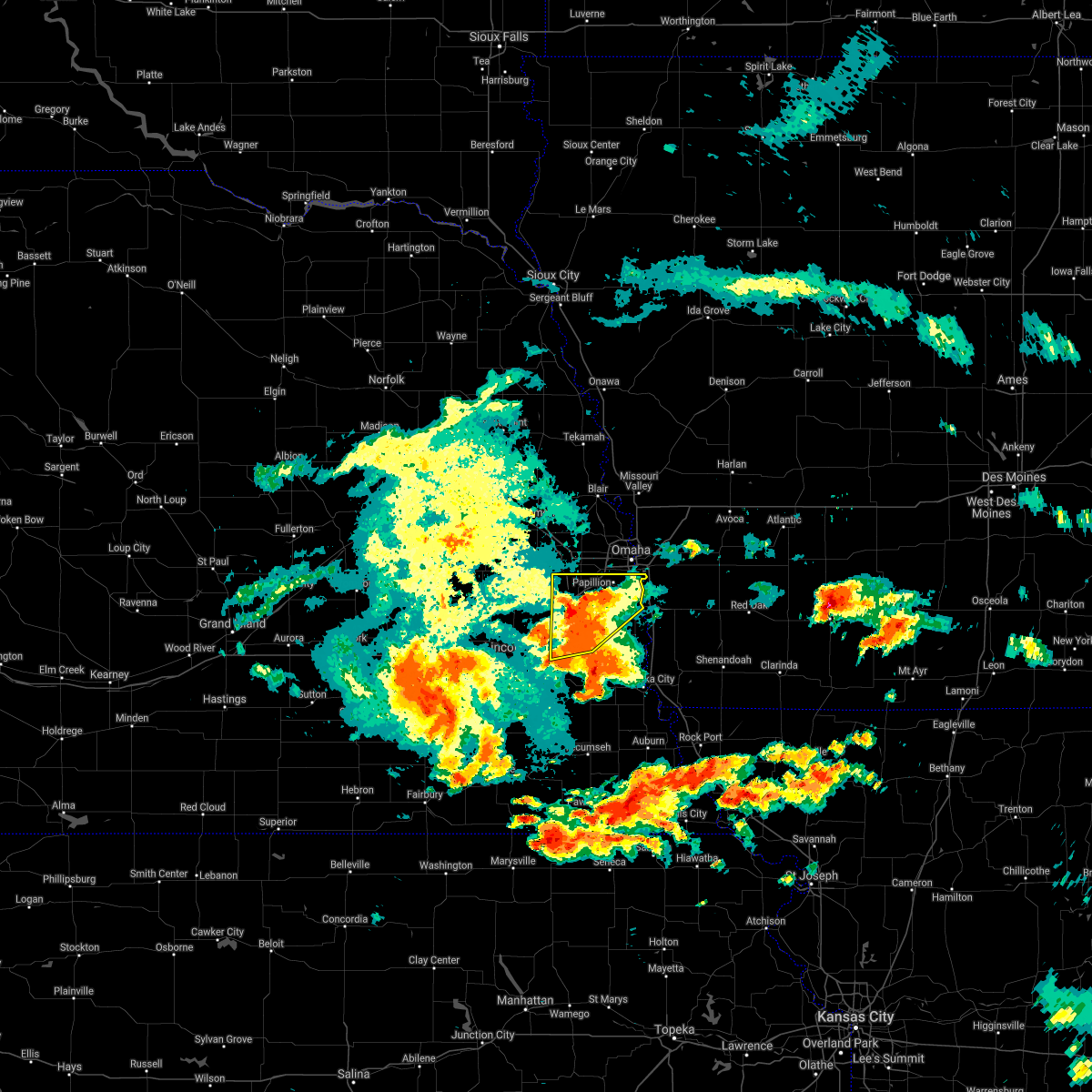 At 612 pm cdt, a severe thunderstorm was located over springfield, or 14 miles southwest of omaha, moving northeast at 20 mph (radar indicated). Hazards include 60 mph wind gusts and quarter size hail. Hail damage to vehicles is expected. expect wind damage to roofs, siding, and trees. Locations impacted include, papillion, offutt afb, bellevue, la vista and southwestern council bluffs. At 612 pm cdt, a severe thunderstorm was located over springfield, or 14 miles southwest of omaha, moving northeast at 20 mph (radar indicated). Hazards include 60 mph wind gusts and quarter size hail. Hail damage to vehicles is expected. expect wind damage to roofs, siding, and trees. Locations impacted include, papillion, offutt afb, bellevue, la vista and southwestern council bluffs.
|
| 6/24/2021 5:51 PM CDT |
 At 550 pm cdt, a severe thunderstorm was located near murdock, or 23 miles southwest of omaha, moving northeast at 15 mph (radar indicated). Hazards include 60 mph wind gusts and quarter size hail. Hail damage to vehicles is expected. expect wind damage to roofs, siding, and trees. this severe thunderstorm will be near, louisville around 610 pm cdt. other locations in the path of this severe thunderstorm include gretna, springfield, cedar creek, papillion and la vista. This includes interstate 80 in nebraska between mile markers 418 and 444. At 550 pm cdt, a severe thunderstorm was located near murdock, or 23 miles southwest of omaha, moving northeast at 15 mph (radar indicated). Hazards include 60 mph wind gusts and quarter size hail. Hail damage to vehicles is expected. expect wind damage to roofs, siding, and trees. this severe thunderstorm will be near, louisville around 610 pm cdt. other locations in the path of this severe thunderstorm include gretna, springfield, cedar creek, papillion and la vista. This includes interstate 80 in nebraska between mile markers 418 and 444.
|
| 6/24/2021 3:12 AM CDT |
 At 311 am cdt, severe thunderstorms were located along a line extending from near glenwood to near panama, moving southeast at 50 mph (radar indicated. papillion, ne reported a 41mph gust at 3:04 am). Hazards include 60 mph wind gusts. Expect damage to roofs, siding, and trees. Locations impacted include, plattsmouth, glenwood, pacific junction, sterling, malvern and tecumseh. At 311 am cdt, severe thunderstorms were located along a line extending from near glenwood to near panama, moving southeast at 50 mph (radar indicated. papillion, ne reported a 41mph gust at 3:04 am). Hazards include 60 mph wind gusts. Expect damage to roofs, siding, and trees. Locations impacted include, plattsmouth, glenwood, pacific junction, sterling, malvern and tecumseh.
|
| 6/24/2021 2:54 AM CDT |
 At 251 am cdt, severe thunderstorms were located along a line extending from omaha to 4 miles northwest of hickman, moving southeast at 50 mph (radar indicated. a 42 mph gust was recorded at valley, ne at 2:53 am). Hazards include 60 mph wind gusts. Expect damage to roofs, siding, and trees. severe thunderstorms will be near, papillion and la vista around 255 am cdt. bellevue and offutt afb around 300 am cdt. plattsmouth, firth and panama around 305 am cdt. glenwood, pacific junction and douglas around 310 am cdt. other locations in the path of these severe thunderstorms include malvern and sterling. this includes the following highways, interstate 29 between mile markers 25 and 42. Interstate 80 in nebraska near mile marker 418, and between mile markers 423 and 426. At 251 am cdt, severe thunderstorms were located along a line extending from omaha to 4 miles northwest of hickman, moving southeast at 50 mph (radar indicated. a 42 mph gust was recorded at valley, ne at 2:53 am). Hazards include 60 mph wind gusts. Expect damage to roofs, siding, and trees. severe thunderstorms will be near, papillion and la vista around 255 am cdt. bellevue and offutt afb around 300 am cdt. plattsmouth, firth and panama around 305 am cdt. glenwood, pacific junction and douglas around 310 am cdt. other locations in the path of these severe thunderstorms include malvern and sterling. this includes the following highways, interstate 29 between mile markers 25 and 42. Interstate 80 in nebraska near mile marker 418, and between mile markers 423 and 426.
|
| 6/24/2021 2:51 AM CDT |
 At 250 am cdt, severe thunderstorms were located along a line extending from omaha to 7 miles northwest of hickman, moving southeast at 50 mph (radar indicated). Hazards include 60 mph wind gusts. Expect damage to roofs, siding, and trees. severe thunderstorms will be near, papillion and la vista around 255 am cdt. bellevue, bennet and offutt afb around 300 am cdt. firth and panama around 305 am cdt. plattsmouth and douglas around 310 am cdt. other locations in the path of these severe thunderstorms include glenwood, pacific junction, sterling, malvern and tecumseh. this includes the following highways, interstate 29 between mile markers 10 and 42. Interstate 80 in nebraska between mile markers 411 and 444. At 250 am cdt, severe thunderstorms were located along a line extending from omaha to 7 miles northwest of hickman, moving southeast at 50 mph (radar indicated). Hazards include 60 mph wind gusts. Expect damage to roofs, siding, and trees. severe thunderstorms will be near, papillion and la vista around 255 am cdt. bellevue, bennet and offutt afb around 300 am cdt. firth and panama around 305 am cdt. plattsmouth and douglas around 310 am cdt. other locations in the path of these severe thunderstorms include glenwood, pacific junction, sterling, malvern and tecumseh. this includes the following highways, interstate 29 between mile markers 10 and 42. Interstate 80 in nebraska between mile markers 411 and 444.
|
| 6/24/2021 2:35 AM CDT |
 At 234 am cdt, severe thunderstorms were located along a line extending from 7 miles east of onawa to omaha, moving east at 65 mph (radar indicated). Hazards include 60 mph wind gusts. Expect damage to roofs, siding, and trees. locations impacted include, council bluffs, ute, treynor, oakland, carson and macedonia. People near td ameritrade park should seek safe shelter immediately!. At 234 am cdt, severe thunderstorms were located along a line extending from 7 miles east of onawa to omaha, moving east at 65 mph (radar indicated). Hazards include 60 mph wind gusts. Expect damage to roofs, siding, and trees. locations impacted include, council bluffs, ute, treynor, oakland, carson and macedonia. People near td ameritrade park should seek safe shelter immediately!.
|
| 6/24/2021 2:15 AM CDT |
 At 214 am cdt, severe thunderstorms were located along a line extending from 4 miles south of macy to yutan, moving east at 65 mph (radar indicated). Hazards include 70 mph wind gusts. this storm has a history of producing widespread wind damage. Expect considerable tree damage. damage is likely to mobile homes, roofs, and outbuildings. severe thunderstorms will be near, whiting and decatur around 220 am cdt. gretna, onawa, elkhorn and millard around 225 am cdt. other locations in the path of these severe thunderstorms include bellevue, papillion, la vista, ralston, council bluffs, ute, treynor, carson, macedonia and oakland. people near td ameritrade park should seek safe shelter immediately! this includes the following highways, interstate 29 between mile markers 35 and 125. interstate 80 in iowa between mile markers 1 and 34. Interstate 80 in nebraska between mile markers 430 and 454. At 214 am cdt, severe thunderstorms were located along a line extending from 4 miles south of macy to yutan, moving east at 65 mph (radar indicated). Hazards include 70 mph wind gusts. this storm has a history of producing widespread wind damage. Expect considerable tree damage. damage is likely to mobile homes, roofs, and outbuildings. severe thunderstorms will be near, whiting and decatur around 220 am cdt. gretna, onawa, elkhorn and millard around 225 am cdt. other locations in the path of these severe thunderstorms include bellevue, papillion, la vista, ralston, council bluffs, ute, treynor, carson, macedonia and oakland. people near td ameritrade park should seek safe shelter immediately! this includes the following highways, interstate 29 between mile markers 35 and 125. interstate 80 in iowa between mile markers 1 and 34. Interstate 80 in nebraska between mile markers 430 and 454.
|
| 10/11/2020 10:38 PM CDT |
 The severe thunderstorm warning for western mills, southwestern pottawattamie, sarpy, southern douglas, southeastern saunders and northern cass counties will expire at 1045 pm cdt, the storm which prompted the warning has moved out of the area. therefore, the warning will be allowed to expire. however gusty winds are still possible with this thunderstorm. a severe thunderstorm watch remains in effect until midnight cdt for southwestern iowa, and southeastern and east central nebraska. remember, a severe thunderstorm warning remains in effect for eastern parts of sarpy and cass counties, and western parts of pottawattamie and mills counties until 1115 pm cdt. The severe thunderstorm warning for western mills, southwestern pottawattamie, sarpy, southern douglas, southeastern saunders and northern cass counties will expire at 1045 pm cdt, the storm which prompted the warning has moved out of the area. therefore, the warning will be allowed to expire. however gusty winds are still possible with this thunderstorm. a severe thunderstorm watch remains in effect until midnight cdt for southwestern iowa, and southeastern and east central nebraska. remember, a severe thunderstorm warning remains in effect for eastern parts of sarpy and cass counties, and western parts of pottawattamie and mills counties until 1115 pm cdt.
|
| 10/11/2020 10:31 PM CDT |
 At 1030 pm cdt, severe thunderstorms were located along a line extending from 5 miles northeast of council bluffs to lorton, moving east at 50 mph (radar indicated). Hazards include 65 mph wind gusts. expect damage to roofs, siding, and trees At 1030 pm cdt, severe thunderstorms were located along a line extending from 5 miles northeast of council bluffs to lorton, moving east at 50 mph (radar indicated). Hazards include 65 mph wind gusts. expect damage to roofs, siding, and trees
|
| 10/11/2020 10:25 PM CDT |
 At 1025 pm cdt, a severe thunderstorm was located over papillion, or 9 miles south of omaha, moving east at 50 mph (radar indicated). Hazards include 65 mph wind gusts. Expect damage to roofs, siding, and trees. locations impacted include, omaha, council bluffs, bellevue, papillion, la vista, plattsmouth, ralston, glenwood, gretna, ashland, springfield, yutan, louisville, pacific junction, cedar creek, elkhorn, millard, offutt afb, carter lake and boys town. this includes the following highways, interstate 29 between mile markers 27 and 55. interstate 80 in iowa between mile markers 1 and 8. Interstate 80 in nebraska between mile markers 426 and 454. At 1025 pm cdt, a severe thunderstorm was located over papillion, or 9 miles south of omaha, moving east at 50 mph (radar indicated). Hazards include 65 mph wind gusts. Expect damage to roofs, siding, and trees. locations impacted include, omaha, council bluffs, bellevue, papillion, la vista, plattsmouth, ralston, glenwood, gretna, ashland, springfield, yutan, louisville, pacific junction, cedar creek, elkhorn, millard, offutt afb, carter lake and boys town. this includes the following highways, interstate 29 between mile markers 27 and 55. interstate 80 in iowa between mile markers 1 and 8. Interstate 80 in nebraska between mile markers 426 and 454.
|
| 10/11/2020 10:10 PM CDT |
 At 1010 pm cdt, a severe thunderstorm was located near ashland, or 21 miles southwest of omaha, moving east at 50 mph (trained weather spotters). Hazards include 65 mph wind gusts. expect damage to roofs, siding, and trees At 1010 pm cdt, a severe thunderstorm was located near ashland, or 21 miles southwest of omaha, moving east at 50 mph (trained weather spotters). Hazards include 65 mph wind gusts. expect damage to roofs, siding, and trees
|
| 8/10/2020 9:17 AM CDT |
 At 916 am cdt, severe thunderstorms were located along a line extending from minden to 4 miles east of offutt afb, moving east at 65 mph (trained weather spotters an automated weather stations have reported tree damage and 55 to 65 mph winds). Hazards include 60 mph wind gusts. Expect damage to roofs, siding, and trees. locations impacted include, council bluffs, bellevue, underwood, minden, offutt afb, neola, crescent, mcclelland, lake manawa state park, arrowhead park and narrows river park. this includes the following highways, interstate 29 between mile markers 42 and 53, and between mile markers 55 and 56. Interstate 80 in iowa between mile markers 3 and 29. At 916 am cdt, severe thunderstorms were located along a line extending from minden to 4 miles east of offutt afb, moving east at 65 mph (trained weather spotters an automated weather stations have reported tree damage and 55 to 65 mph winds). Hazards include 60 mph wind gusts. Expect damage to roofs, siding, and trees. locations impacted include, council bluffs, bellevue, underwood, minden, offutt afb, neola, crescent, mcclelland, lake manawa state park, arrowhead park and narrows river park. this includes the following highways, interstate 29 between mile markers 42 and 53, and between mile markers 55 and 56. Interstate 80 in iowa between mile markers 3 and 29.
|
| 8/10/2020 9:15 AM CDT | Trees and power lines down in the bellevue... lavista... and papillion areas. some homes with tree damage. time estimated based on rada in sarpy county NE, 1.1 miles WSW of Bellevue, NE |
| 8/10/2020 9:01 AM CDT |
 At 859 am cdt, a gust front associated with severe thunderstorms to the north was located along a line extending from 6 miles south of missouri valley to omaha to 5 miles west of ashland, moving southeast at 50 mph (radar indicated). Hazards include 60 mph wind gusts. Expect damage to roofs, siding, and trees. locations impacted include, omaha, council bluffs, bellevue, papillion, la vista, ralston, gretna, ashland, springfield, louisville, underwood, fort calhoun, waterloo, minden, cedar creek, elkhorn, murdock, millard, offutt afb and carter lake. this includes the following highways, interstate 29 between mile markers 42 and 74. interstate 80 in iowa between mile markers 1 and 29. Interstate 80 in nebraska between mile markers 420 and 454. At 859 am cdt, a gust front associated with severe thunderstorms to the north was located along a line extending from 6 miles south of missouri valley to omaha to 5 miles west of ashland, moving southeast at 50 mph (radar indicated). Hazards include 60 mph wind gusts. Expect damage to roofs, siding, and trees. locations impacted include, omaha, council bluffs, bellevue, papillion, la vista, ralston, gretna, ashland, springfield, louisville, underwood, fort calhoun, waterloo, minden, cedar creek, elkhorn, murdock, millard, offutt afb and carter lake. this includes the following highways, interstate 29 between mile markers 42 and 74. interstate 80 in iowa between mile markers 1 and 29. Interstate 80 in nebraska between mile markers 420 and 454.
|
| 8/10/2020 8:53 AM CDT |
 At 852 am cdt, a gust front associated with severe thunderstorms to the north was located along a line extending from 5 miles west of missouri valley to near elkhorn to 6 miles southeast of wahoo, moving southeast at 50 mph (radar indicated). Hazards include 60 mph wind gusts. expect damage to roofs, siding, and trees At 852 am cdt, a gust front associated with severe thunderstorms to the north was located along a line extending from 5 miles west of missouri valley to near elkhorn to 6 miles southeast of wahoo, moving southeast at 50 mph (radar indicated). Hazards include 60 mph wind gusts. expect damage to roofs, siding, and trees
|
| 5/24/2020 5:51 AM CDT |
 At 550 am cdt, severe thunderstorms were located along a line extending from council bluffs to 4 miles northeast of weeping water to 4 miles southwest of unadilla, moving east at 30 mph (radar indicated). Hazards include 60 mph wind gusts. Expect damage to roofs, siding, and trees. locations impacted include, southwestern omaha, southwestern council bluffs, bellevue, papillion, la vista, nebraska city, plattsmouth, ralston, gretna, syracuse, springfield, louisville, weeping water, elmwood, palmyra, murray, cedar creek, unadilla, avoca and murdock. This includes interstate 80 in nebraska between mile markers 432 and 444. At 550 am cdt, severe thunderstorms were located along a line extending from council bluffs to 4 miles northeast of weeping water to 4 miles southwest of unadilla, moving east at 30 mph (radar indicated). Hazards include 60 mph wind gusts. Expect damage to roofs, siding, and trees. locations impacted include, southwestern omaha, southwestern council bluffs, bellevue, papillion, la vista, nebraska city, plattsmouth, ralston, gretna, syracuse, springfield, louisville, weeping water, elmwood, palmyra, murray, cedar creek, unadilla, avoca and murdock. This includes interstate 80 in nebraska between mile markers 432 and 444.
|
| 5/24/2020 5:47 AM CDT |
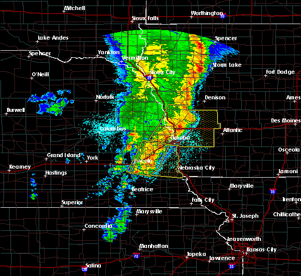 At 546 am cdt, severe thunderstorms were located along a line extending from offutt afb to 4 miles northeast of weeping water to 5 miles east of douglas, moving southeast at 30 mph (radar indicated). Hazards include 60 mph wind gusts. expect damage to roofs, siding, and trees At 546 am cdt, severe thunderstorms were located along a line extending from offutt afb to 4 miles northeast of weeping water to 5 miles east of douglas, moving southeast at 30 mph (radar indicated). Hazards include 60 mph wind gusts. expect damage to roofs, siding, and trees
|
| 5/24/2020 5:38 AM CDT |
 At 538 am cdt, severe thunderstorms were located along a line extending from 7 miles southwest of earling to 5 miles west of minden to near bellevue, moving southeast at 30 mph (radar indicated). Hazards include 60 mph wind gusts. expect damage to roofs, siding, and trees At 538 am cdt, severe thunderstorms were located along a line extending from 7 miles southwest of earling to 5 miles west of minden to near bellevue, moving southeast at 30 mph (radar indicated). Hazards include 60 mph wind gusts. expect damage to roofs, siding, and trees
|
| 5/24/2020 5:17 AM CDT |
 At 517 am cdt, severe thunderstorms were located along a line extending from omaha to near greenwood to near hickman, moving east at 30 mph (radar indicated). Hazards include 65 mph wind gusts. expect damage to roofs, siding, and trees At 517 am cdt, severe thunderstorms were located along a line extending from omaha to near greenwood to near hickman, moving east at 30 mph (radar indicated). Hazards include 65 mph wind gusts. expect damage to roofs, siding, and trees
|
| 5/24/2020 5:12 AM CDT |
 At 512 am cdt, severe thunderstorms were located along a line extending from 4 miles west of logan to fort calhoun to elkhorn, moving southeast at 30 mph (radar indicated). Hazards include 70 mph wind gusts. Expect considerable tree damage. Damage is likely to mobile homes, roofs, and outbuildings. At 512 am cdt, severe thunderstorms were located along a line extending from 4 miles west of logan to fort calhoun to elkhorn, moving southeast at 30 mph (radar indicated). Hazards include 70 mph wind gusts. Expect considerable tree damage. Damage is likely to mobile homes, roofs, and outbuildings.
|
| 5/16/2020 6:41 PM CDT |
 The tornado warning for western mills and east central sarpy counties will expire at 645 pm cdt, the storm which prompted the warning has weakened below severe limits, and no longer appears capable of producing a tornado. therefore, the warning will be allowed to expire. however small hail is still possible with this thunderstorm. The tornado warning for western mills and east central sarpy counties will expire at 645 pm cdt, the storm which prompted the warning has weakened below severe limits, and no longer appears capable of producing a tornado. therefore, the warning will be allowed to expire. however small hail is still possible with this thunderstorm.
|
| 5/16/2020 6:39 PM CDT |
 At 639 pm cdt, a severe thunderstorm capable of producing a tornado was located near offutt afb, or 14 miles southeast of omaha, moving northeast at 25 mph (weather spotters reported a funnel cloud). Hazards include tornado and quarter size hail. Flying debris will be dangerous to those caught without shelter. mobile homes will be damaged or destroyed. damage to roofs, windows, and vehicles will occur. tree damage is likely. This tornadic thunderstorm will remain over mainly rural areas of western mills and east central sarpy counties. At 639 pm cdt, a severe thunderstorm capable of producing a tornado was located near offutt afb, or 14 miles southeast of omaha, moving northeast at 25 mph (weather spotters reported a funnel cloud). Hazards include tornado and quarter size hail. Flying debris will be dangerous to those caught without shelter. mobile homes will be damaged or destroyed. damage to roofs, windows, and vehicles will occur. tree damage is likely. This tornadic thunderstorm will remain over mainly rural areas of western mills and east central sarpy counties.
|
| 5/16/2020 6:28 PM CDT |
 The severe thunderstorm warning for west central mills, east central sarpy and northeastern cass counties will expire at 630 pm cdt, the severe thunderstorm which prompted the warning coincided with a tornado warning. therefore, the severe thunderstorm warning will be allowed to expire. however small hail is still possible with this thunderstorm. remember, a tornado warning still remains in effect for mills, sarpy, and cass counties uuntil 6:45. The severe thunderstorm warning for west central mills, east central sarpy and northeastern cass counties will expire at 630 pm cdt, the severe thunderstorm which prompted the warning coincided with a tornado warning. therefore, the severe thunderstorm warning will be allowed to expire. however small hail is still possible with this thunderstorm. remember, a tornado warning still remains in effect for mills, sarpy, and cass counties uuntil 6:45.
|
| 5/16/2020 6:21 PM CDT |
 At 621 pm cdt, a severe thunderstorm was located near offutt afb, or 15 miles southeast of omaha, moving northeast at 25 mph (radar indicated). Hazards include quarter size hail. Damage to vehicles is expected. locations impacted include, bellevue, plattsmouth, offutt afb and camp maha. This includes interstate 29 between mile markers 35 and 37. At 621 pm cdt, a severe thunderstorm was located near offutt afb, or 15 miles southeast of omaha, moving northeast at 25 mph (radar indicated). Hazards include quarter size hail. Damage to vehicles is expected. locations impacted include, bellevue, plattsmouth, offutt afb and camp maha. This includes interstate 29 between mile markers 35 and 37.
|
| 5/16/2020 6:19 PM CDT |
 At 618 pm cdt, a severe thunderstorm capable of producing a tornado was located near plattsmouth, or 16 miles south of omaha, moving northeast at 25 mph (weather spotters reported a funnel cloud). Hazards include tornado and quarter size hail. Flying debris will be dangerous to those caught without shelter. mobile homes will be damaged or destroyed. damage to roofs, windows, and vehicles will occur. tree damage is likely. this dangerous storm will be near, plattsmouth around 625 pm cdt. bellevue and offutt afb around 630 pm cdt. other locations impacted by this tornadic thunderstorm include camp maha. This includes interstate 29 near mile marker 35. At 618 pm cdt, a severe thunderstorm capable of producing a tornado was located near plattsmouth, or 16 miles south of omaha, moving northeast at 25 mph (weather spotters reported a funnel cloud). Hazards include tornado and quarter size hail. Flying debris will be dangerous to those caught without shelter. mobile homes will be damaged or destroyed. damage to roofs, windows, and vehicles will occur. tree damage is likely. this dangerous storm will be near, plattsmouth around 625 pm cdt. bellevue and offutt afb around 630 pm cdt. other locations impacted by this tornadic thunderstorm include camp maha. This includes interstate 29 near mile marker 35.
|
| 5/16/2020 6:10 PM CDT |
 At 610 pm cdt, a severe thunderstorm capable of producing a tornado was located 5 miles southeast of cedar creek, or 18 miles south of omaha, moving northeast at 25 mph (radar indicated rotation). Hazards include tornado and quarter size hail. Flying debris will be dangerous to those caught without shelter. mobile homes will be damaged or destroyed. damage to roofs, windows, and vehicles will occur. tree damage is likely. this dangerous storm will be near, plattsmouth around 625 pm cdt. bellevue and offutt afb around 630 pm cdt. other locations impacted by this tornadic thunderstorm include camp maha. This includes interstate 29 near mile marker 35. At 610 pm cdt, a severe thunderstorm capable of producing a tornado was located 5 miles southeast of cedar creek, or 18 miles south of omaha, moving northeast at 25 mph (radar indicated rotation). Hazards include tornado and quarter size hail. Flying debris will be dangerous to those caught without shelter. mobile homes will be damaged or destroyed. damage to roofs, windows, and vehicles will occur. tree damage is likely. this dangerous storm will be near, plattsmouth around 625 pm cdt. bellevue and offutt afb around 630 pm cdt. other locations impacted by this tornadic thunderstorm include camp maha. This includes interstate 29 near mile marker 35.
|
| 5/16/2020 6:06 PM CDT |
 At 606 pm cdt, a severe thunderstorm was located near plattsmouth, or 16 miles south of omaha, moving northeast at 25 mph (radar indicated). Hazards include quarter size hail. Damage to vehicles is expected. locations impacted include, bellevue, plattsmouth, offutt afb and camp maha. This includes interstate 29 between mile markers 35 and 37. At 606 pm cdt, a severe thunderstorm was located near plattsmouth, or 16 miles south of omaha, moving northeast at 25 mph (radar indicated). Hazards include quarter size hail. Damage to vehicles is expected. locations impacted include, bellevue, plattsmouth, offutt afb and camp maha. This includes interstate 29 between mile markers 35 and 37.
|
| 5/16/2020 5:47 PM CDT |
 At 546 pm cdt, a severe thunderstorm was located near louisville, or 21 miles south of omaha, moving northeast at 25 mph (radar indicated). Hazards include quarter size hail. damage to vehicles is expected At 546 pm cdt, a severe thunderstorm was located near louisville, or 21 miles south of omaha, moving northeast at 25 mph (radar indicated). Hazards include quarter size hail. damage to vehicles is expected
|
| 5/28/2019 4:38 AM CDT |
 At 438 am cdt, a severe thunderstorm was located 5 miles north of council bluffs, or 8 miles northeast of omaha, moving northeast at 40 mph (trained weather spotters). Hazards include 60 mph wind gusts and up to quarter size hail. Hail damage to vehicles is expected. expect wind damage to roofs, siding, and trees. locations impacted include, eastern omaha, council bluffs, bellevue, treynor, underwood, carter lake, crescent, mcclelland, lake manawa state park and narrows river park. this includes the following highways, interstate 29 between mile markers 43 and 61. interstate 80 in iowa between mile markers 1 and 17. Interstate 80 in nebraska between mile markers 450 and 454. At 438 am cdt, a severe thunderstorm was located 5 miles north of council bluffs, or 8 miles northeast of omaha, moving northeast at 40 mph (trained weather spotters). Hazards include 60 mph wind gusts and up to quarter size hail. Hail damage to vehicles is expected. expect wind damage to roofs, siding, and trees. locations impacted include, eastern omaha, council bluffs, bellevue, treynor, underwood, carter lake, crescent, mcclelland, lake manawa state park and narrows river park. this includes the following highways, interstate 29 between mile markers 43 and 61. interstate 80 in iowa between mile markers 1 and 17. Interstate 80 in nebraska between mile markers 450 and 454.
|
| 5/28/2019 4:32 AM CDT |
 At 431 am cdt, a severe thunderstorm was located over eastern omaha, moving northeast at 40 mph (trained weather spotters). Hazards include up to golf ball size hail and 60 mph wind gusts. People and animals outdoors will be injured. expect hail damage to roofs, siding, windows, and vehicles. expect wind damage to roofs, siding, and trees. locations impacted include, omaha, council bluffs, bellevue, papillion, la vista, ralston, treynor, underwood, carter lake, boys town, crescent, mcclelland, lake manawa state park, chalco, hitchcock nature center and narrows river park. this includes the following highways, interstate 29 between mile markers 45 and 63. interstate 80 in iowa between mile markers 1 and 17. Interstate 80 in nebraska between mile markers 443 and 454. At 431 am cdt, a severe thunderstorm was located over eastern omaha, moving northeast at 40 mph (trained weather spotters). Hazards include up to golf ball size hail and 60 mph wind gusts. People and animals outdoors will be injured. expect hail damage to roofs, siding, windows, and vehicles. expect wind damage to roofs, siding, and trees. locations impacted include, omaha, council bluffs, bellevue, papillion, la vista, ralston, treynor, underwood, carter lake, boys town, crescent, mcclelland, lake manawa state park, chalco, hitchcock nature center and narrows river park. this includes the following highways, interstate 29 between mile markers 45 and 63. interstate 80 in iowa between mile markers 1 and 17. Interstate 80 in nebraska between mile markers 443 and 454.
|
| 5/28/2019 4:23 AM CDT |
 At 423 am cdt, a severe thunderstorm was located over southwestern omaha, moving northeast at 35 mph (radar indicated). Hazards include 60 mph wind gusts and quarter size hail. Hail damage to vehicles is expected. Expect wind damage to roofs, siding, and trees. At 423 am cdt, a severe thunderstorm was located over southwestern omaha, moving northeast at 35 mph (radar indicated). Hazards include 60 mph wind gusts and quarter size hail. Hail damage to vehicles is expected. Expect wind damage to roofs, siding, and trees.
|
| 4/10/2019 10:29 PM CDT |
 At 1029 pm cdt, a severe thunderstorm was located near cedar creek, or 12 miles south of omaha, moving northeast at 50 mph (radar indicated). Hazards include quarter size hail. Damage to vehicles is expected. Locations impacted include, bellevue, papillion, cedar creek, offutt afb and camp maha. At 1029 pm cdt, a severe thunderstorm was located near cedar creek, or 12 miles south of omaha, moving northeast at 50 mph (radar indicated). Hazards include quarter size hail. Damage to vehicles is expected. Locations impacted include, bellevue, papillion, cedar creek, offutt afb and camp maha.
|
| 4/10/2019 10:21 PM CDT |
 At 1021 pm cdt, a severe thunderstorm was located over louisville, or 18 miles south of omaha, moving northeast at 50 mph (radar indicated). Hazards include quarter size hail. damage to vehicles is expected At 1021 pm cdt, a severe thunderstorm was located over louisville, or 18 miles south of omaha, moving northeast at 50 mph (radar indicated). Hazards include quarter size hail. damage to vehicles is expected
|
| 9/20/2018 8:52 PM CDT |
 The severe thunderstorm warning for western fremont, western mills, sarpy, eastern johnson, nemaha, eastern otoe, western richardson, eastern pawnee and eastern cass counties will expire at 900 pm cdt, the storms which prompted the warning have moved out of the area. therefore, the warning will be allowed to expire. a severe thunderstorm watch remains in effect until 1100 pm cdt for southwestern iowa, and southeastern and east central nebraska. The severe thunderstorm warning for western fremont, western mills, sarpy, eastern johnson, nemaha, eastern otoe, western richardson, eastern pawnee and eastern cass counties will expire at 900 pm cdt, the storms which prompted the warning have moved out of the area. therefore, the warning will be allowed to expire. a severe thunderstorm watch remains in effect until 1100 pm cdt for southwestern iowa, and southeastern and east central nebraska.
|
| 9/20/2018 8:42 PM CDT |
 At 824 pm cdt, severe thunderstorms were located along a line extending from near greenwood to 4 miles west of lorton to 3 miles east of summerfield, moving east at 50 mph (radar indicated). Hazards include 60 mph wind gusts. expect damage to roofs, siding, and trees At 824 pm cdt, severe thunderstorms were located along a line extending from near greenwood to 4 miles west of lorton to 3 miles east of summerfield, moving east at 50 mph (radar indicated). Hazards include 60 mph wind gusts. expect damage to roofs, siding, and trees
|
| 9/20/2018 8:42 PM CDT |
 A severe thunderstorm warning remains in effect until 900 pm cdt for western fremont. western mills. sarpy. eastern johnson. nemaha. eastern otoe. western richardson. eastern pawnee and eastern cass counties. At 841 pm cdt, severe thunderstorms were located along a line extending from 3 miles north of springfield to 5 miles west of sidney. A severe thunderstorm warning remains in effect until 900 pm cdt for western fremont. western mills. sarpy. eastern johnson. nemaha. eastern otoe. western richardson. eastern pawnee and eastern cass counties. At 841 pm cdt, severe thunderstorms were located along a line extending from 3 miles north of springfield to 5 miles west of sidney.
|
| 9/20/2018 8:24 PM CDT |
 The national weather service in omaha has issued a * severe thunderstorm warning for. western fremont county in southwestern iowa. western mills county in southwestern iowa. sarpy county in east central nebraska. Eastern johnson county in southeastern nebraska. The national weather service in omaha has issued a * severe thunderstorm warning for. western fremont county in southwestern iowa. western mills county in southwestern iowa. sarpy county in east central nebraska. Eastern johnson county in southeastern nebraska.
|
| 9/18/2018 5:08 PM CDT |
 The severe thunderstorm warning for sarpy and northern cass counties will expire at 515 pm cdt, the storm which prompted the warning has moved out of the area. therefore, the warning will be allowed to expire. however gusty winds are still possible with this thunderstorm. remember, a severe thunderstorm warning still remains in effect for eastern cass county until 530 pm cdt!. The severe thunderstorm warning for sarpy and northern cass counties will expire at 515 pm cdt, the storm which prompted the warning has moved out of the area. therefore, the warning will be allowed to expire. however gusty winds are still possible with this thunderstorm. remember, a severe thunderstorm warning still remains in effect for eastern cass county until 530 pm cdt!.
|
| 9/18/2018 4:25 PM CDT |
 At 425 pm cdt, a severe thunderstorm was located 4 miles south of gretna, or 18 miles southwest of omaha, moving southeast at 20 mph (radar indicated). Hazards include half dollar size hail. damage to vehicles is expected At 425 pm cdt, a severe thunderstorm was located 4 miles south of gretna, or 18 miles southwest of omaha, moving southeast at 20 mph (radar indicated). Hazards include half dollar size hail. damage to vehicles is expected
|
| 9/18/2018 4:20 PM CDT |
 At 419 pm cdt, a severe thunderstorm was located 4 miles southwest of gretna, or 19 miles southwest of omaha, moving southeast 40 mph (radar indicated). Hazards include ping pong ball size hail and 60 mph wind gusts. People and animals outdoors will be injured. expect hail damage to roofs, siding, windows, and vehicles. expect wind damage to roofs, siding, and trees. locations impacted include, bellevue, papillion, gretna, springfield, louisville, cedar creek, offutt afb, memphis, camp maha, louisville state recreation area, two rivers state recreation area, koa campground, schramm park state recreation area and chalco. This includes interstate 80 in nebraska between mile markers 428 and 440. At 419 pm cdt, a severe thunderstorm was located 4 miles southwest of gretna, or 19 miles southwest of omaha, moving southeast 40 mph (radar indicated). Hazards include ping pong ball size hail and 60 mph wind gusts. People and animals outdoors will be injured. expect hail damage to roofs, siding, windows, and vehicles. expect wind damage to roofs, siding, and trees. locations impacted include, bellevue, papillion, gretna, springfield, louisville, cedar creek, offutt afb, memphis, camp maha, louisville state recreation area, two rivers state recreation area, koa campground, schramm park state recreation area and chalco. This includes interstate 80 in nebraska between mile markers 428 and 440.
|
| 9/18/2018 3:55 PM CDT |
 At 355 pm cdt, a severe thunderstorm was located 5 miles south of yutan, or 19 miles west of omaha, moving east at 45 mph (radar indicated). Hazards include ping pong ball size hail and 60 mph wind gusts. People and animals outdoors will be injured. expect hail damage to roofs, siding, windows, and vehicles. Expect wind damage to roofs, siding, and trees. At 355 pm cdt, a severe thunderstorm was located 5 miles south of yutan, or 19 miles west of omaha, moving east at 45 mph (radar indicated). Hazards include ping pong ball size hail and 60 mph wind gusts. People and animals outdoors will be injured. expect hail damage to roofs, siding, windows, and vehicles. Expect wind damage to roofs, siding, and trees.
|
| 9/1/2018 5:36 AM CDT |
 At 536 am cdt, a severe thunderstorm was located near council bluffs, or 10 miles east of omaha, moving east at 35 mph (radar indicated). Hazards include 60 mph wind gusts and quarter size hail. Hail damage to vehicles is expected. Expect wind damage to roofs, siding, and trees. At 536 am cdt, a severe thunderstorm was located near council bluffs, or 10 miles east of omaha, moving east at 35 mph (radar indicated). Hazards include 60 mph wind gusts and quarter size hail. Hail damage to vehicles is expected. Expect wind damage to roofs, siding, and trees.
|
| 7/4/2018 10:23 PM CDT |
 At 1022 pm cdt, severe thunderstorms were located along a line extending from near minden to offutt afb, moving east at 30 mph (radar indicated). Hazards include 60 mph wind gusts. Expect damage to roofs, siding, and trees. locations impacted include, omaha, council bluffs, bellevue, la vista, ralston, oakland, treynor, underwood, minden, offutt afb, carter lake, neola, crescent, hancock, mcclelland, lake manawa state park, botna bend park, hitchcock nature center, arrowhead park and narrows river park. this includes the following highways, interstate 29 between mile markers 37 and 68. interstate 80 in iowa between mile markers 1 and 29. Interstate 80 in nebraska between mile markers 448 and 454. At 1022 pm cdt, severe thunderstorms were located along a line extending from near minden to offutt afb, moving east at 30 mph (radar indicated). Hazards include 60 mph wind gusts. Expect damage to roofs, siding, and trees. locations impacted include, omaha, council bluffs, bellevue, la vista, ralston, oakland, treynor, underwood, minden, offutt afb, carter lake, neola, crescent, hancock, mcclelland, lake manawa state park, botna bend park, hitchcock nature center, arrowhead park and narrows river park. this includes the following highways, interstate 29 between mile markers 37 and 68. interstate 80 in iowa between mile markers 1 and 29. Interstate 80 in nebraska between mile markers 448 and 454.
|
| 7/4/2018 10:18 PM CDT | Large 12 inch tree limb down across roa in sarpy county NE, 1.7 miles SSW of Bellevue, NE |
| 7/4/2018 10:18 PM CDT |
 At 1017 pm cdt, severe thunderstorms were located along a line extending from near minden to near bellevue, moving east at 35 mph (radar indicated). Hazards include 60 mph wind gusts. Expect damage to roofs, siding, and trees. locations impacted include, omaha, council bluffs, bellevue, la vista, ralston, oakland, treynor, underwood, minden, offutt afb, carter lake, neola, crescent, hancock, mcclelland, lake manawa state park, botna bend park, hitchcock nature center, arrowhead park and narrows river park. this includes the following highways, interstate 29 between mile markers 37 and 68. interstate 80 in iowa between mile markers 1 and 29. Interstate 80 in nebraska between mile markers 448 and 454. At 1017 pm cdt, severe thunderstorms were located along a line extending from near minden to near bellevue, moving east at 35 mph (radar indicated). Hazards include 60 mph wind gusts. Expect damage to roofs, siding, and trees. locations impacted include, omaha, council bluffs, bellevue, la vista, ralston, oakland, treynor, underwood, minden, offutt afb, carter lake, neola, crescent, hancock, mcclelland, lake manawa state park, botna bend park, hitchcock nature center, arrowhead park and narrows river park. this includes the following highways, interstate 29 between mile markers 37 and 68. interstate 80 in iowa between mile markers 1 and 29. Interstate 80 in nebraska between mile markers 448 and 454.
|
| 7/4/2018 10:13 PM CDT |
 At 1012 pm cdt, severe thunderstorms were located along a line extending from near minden to near papillion, moving east at 30 mph (radar indicated). Hazards include 60 mph wind gusts. Expect damage to roofs, siding, and trees. Locations impacted include, omaha, council bluffs, bellevue, papillion, la vista, ralston, oakland, treynor, underwood, minden, elkhorn, offutt afb, carter lake, bennington, neola, boys town, crescent, hancock, mcclelland and lake manawa state park. At 1012 pm cdt, severe thunderstorms were located along a line extending from near minden to near papillion, moving east at 30 mph (radar indicated). Hazards include 60 mph wind gusts. Expect damage to roofs, siding, and trees. Locations impacted include, omaha, council bluffs, bellevue, papillion, la vista, ralston, oakland, treynor, underwood, minden, elkhorn, offutt afb, carter lake, bennington, neola, boys town, crescent, hancock, mcclelland and lake manawa state park.
|
| 7/4/2018 10:07 PM CDT |
 At 1007 pm cdt, severe thunderstorms were located along a line extending from near minden to omaha, moving east at 40 mph (radar indicated). Hazards include 60 mph wind gusts. Expect damage to roofs, siding, and trees. Locations impacted include, omaha, council bluffs, bellevue, papillion, la vista, ralston, oakland, treynor, underwood, minden, elkhorn, offutt afb, carter lake, bennington, neola, boys town, crescent, hancock, mcclelland and lake manawa state park. At 1007 pm cdt, severe thunderstorms were located along a line extending from near minden to omaha, moving east at 40 mph (radar indicated). Hazards include 60 mph wind gusts. Expect damage to roofs, siding, and trees. Locations impacted include, omaha, council bluffs, bellevue, papillion, la vista, ralston, oakland, treynor, underwood, minden, elkhorn, offutt afb, carter lake, bennington, neola, boys town, crescent, hancock, mcclelland and lake manawa state park.
|
| 7/4/2018 10:02 PM CDT |
 At 1002 pm cdt, severe thunderstorms were located along a line extending from 3 miles southwest of persia to 3 miles north of millard, moving east at 35 mph (radar indicated). Hazards include 60 mph wind gusts. Expect damage to roofs, siding, and trees. Locations impacted include, omaha, council bluffs, bellevue, papillion, la vista, ralston, oakland, treynor, underwood, minden, elkhorn, offutt afb, carter lake, bennington, neola, boys town, crescent, hancock, mcclelland and lake manawa state park. At 1002 pm cdt, severe thunderstorms were located along a line extending from 3 miles southwest of persia to 3 miles north of millard, moving east at 35 mph (radar indicated). Hazards include 60 mph wind gusts. Expect damage to roofs, siding, and trees. Locations impacted include, omaha, council bluffs, bellevue, papillion, la vista, ralston, oakland, treynor, underwood, minden, elkhorn, offutt afb, carter lake, bennington, neola, boys town, crescent, hancock, mcclelland and lake manawa state park.
|
| 7/4/2018 9:53 PM CDT |
 At 953 pm cdt, severe thunderstorms were located along a line extending from 7 miles west of persia to near elkhorn, moving southeast at 25 mph (radar indicated). Hazards include 60 mph wind gusts. Expect damage to roofs, siding, and trees. Locations impacted include, omaha, council bluffs, bellevue, papillion, la vista, ralston, oakland, treynor, underwood, minden, elkhorn, offutt afb, carter lake, bennington, neola, boys town, crescent, hancock, mcclelland and lake manawa state park. At 953 pm cdt, severe thunderstorms were located along a line extending from 7 miles west of persia to near elkhorn, moving southeast at 25 mph (radar indicated). Hazards include 60 mph wind gusts. Expect damage to roofs, siding, and trees. Locations impacted include, omaha, council bluffs, bellevue, papillion, la vista, ralston, oakland, treynor, underwood, minden, elkhorn, offutt afb, carter lake, bennington, neola, boys town, crescent, hancock, mcclelland and lake manawa state park.
|
| 7/4/2018 9:45 PM CDT |
 The national weather service in omaha has issued a * severe thunderstorm warning for. northwestern mills county in southwestern iowa. pottawattamie county in southwestern iowa. south central harrison county in southwestern iowa. Northeastern sarpy county in east central nebraska. The national weather service in omaha has issued a * severe thunderstorm warning for. northwestern mills county in southwestern iowa. pottawattamie county in southwestern iowa. south central harrison county in southwestern iowa. Northeastern sarpy county in east central nebraska.
|
| 7/4/2018 9:45 PM CDT |
 At 945 pm cdt, severe thunderstorms were located along a line extending from 7 miles west of earling to near waterloo, moving east at 35 mph (radar indicated). Hazards include 60 mph wind gusts. expect damage to roofs, siding, and trees At 945 pm cdt, severe thunderstorms were located along a line extending from 7 miles west of earling to near waterloo, moving east at 35 mph (radar indicated). Hazards include 60 mph wind gusts. expect damage to roofs, siding, and trees
|
| 6/30/2018 7:57 PM CDT |
 The severe thunderstorm warning for sarpy, southeastern saunders and northern cass counties will expire at 800 pm cdt, the storm which prompted the warning has weakened below severe limits, and no longer poses an immediate threat to life or property. therefore, the warning will be allowed to expire. however gusty winds and heavy rain are still possible with this thunderstorm. a severe thunderstorm watch remains in effect until 900 pm cdt for southwestern iowa, and southeastern and east central nebraska. The severe thunderstorm warning for sarpy, southeastern saunders and northern cass counties will expire at 800 pm cdt, the storm which prompted the warning has weakened below severe limits, and no longer poses an immediate threat to life or property. therefore, the warning will be allowed to expire. however gusty winds and heavy rain are still possible with this thunderstorm. a severe thunderstorm watch remains in effect until 900 pm cdt for southwestern iowa, and southeastern and east central nebraska.
|
| 6/30/2018 7:28 PM CDT |
 At 727 pm cdt, a severe thunderstorm was located over murdock, or 21 miles east of lincoln, moving northeast at 35 mph (radar indicated). Hazards include 60 mph wind gusts. expect damage to roofs, siding, and trees At 727 pm cdt, a severe thunderstorm was located over murdock, or 21 miles east of lincoln, moving northeast at 35 mph (radar indicated). Hazards include 60 mph wind gusts. expect damage to roofs, siding, and trees
|
| 6/30/2018 7:12 PM CDT |
 The severe thunderstorm warning for southwestern pottawattamie, northeastern sarpy and eastern douglas counties will expire at 715 pm cdt, the storm which prompted the warning has weakened below severe limits, and no longer poses an immediate threat to life or property. therefore, the warning will be allowed to expire. however gusty winds and heavy rain are still possible with this thunderstorm. a severe thunderstorm watch remains in effect until 900 pm cdt for southwestern iowa, and southeastern and east central nebraska. The severe thunderstorm warning for southwestern pottawattamie, northeastern sarpy and eastern douglas counties will expire at 715 pm cdt, the storm which prompted the warning has weakened below severe limits, and no longer poses an immediate threat to life or property. therefore, the warning will be allowed to expire. however gusty winds and heavy rain are still possible with this thunderstorm. a severe thunderstorm watch remains in effect until 900 pm cdt for southwestern iowa, and southeastern and east central nebraska.
|
| 6/30/2018 6:50 PM CDT |
 At 650 pm cdt, a severe thunderstorm was located near papillion, or 10 miles south of omaha, moving north at 30 mph (radar indicated). Hazards include 60 mph wind gusts and quarter size hail. Hail damage to vehicles is expected. Expect wind damage to roofs, siding, and trees. At 650 pm cdt, a severe thunderstorm was located near papillion, or 10 miles south of omaha, moving north at 30 mph (radar indicated). Hazards include 60 mph wind gusts and quarter size hail. Hail damage to vehicles is expected. Expect wind damage to roofs, siding, and trees.
|
| 6/19/2018 12:34 AM CDT |
 At 1234 am cdt, a severe thunderstorm was located 5 miles southeast of council bluffs, or 12 miles southeast of omaha, moving northeast at 35 mph (automated weather equipment at offutt air force base). Hazards include 60 mph wind gusts. Expect damage to roofs, siding, and trees. locations impacted include, southeastern council bluffs, bellevue, plattsmouth, glenwood, malvern, treynor, pacific junction, offutt afb, silver city, hastings and lake manawa state park. This includes interstate 29 between mile markers 29 and 47. At 1234 am cdt, a severe thunderstorm was located 5 miles southeast of council bluffs, or 12 miles southeast of omaha, moving northeast at 35 mph (automated weather equipment at offutt air force base). Hazards include 60 mph wind gusts. Expect damage to roofs, siding, and trees. locations impacted include, southeastern council bluffs, bellevue, plattsmouth, glenwood, malvern, treynor, pacific junction, offutt afb, silver city, hastings and lake manawa state park. This includes interstate 29 between mile markers 29 and 47.
|
| 6/19/2018 12:29 AM CDT |
 At 1229 am cdt, a severe thunderstorm was located near bellevue, or 11 miles southeast of omaha, moving northeast at 35 mph (radar indicated). Hazards include 60 mph wind gusts. expect damage to roofs, siding, and trees At 1229 am cdt, a severe thunderstorm was located near bellevue, or 11 miles southeast of omaha, moving northeast at 35 mph (radar indicated). Hazards include 60 mph wind gusts. expect damage to roofs, siding, and trees
|
| 6/11/2018 6:32 PM CDT |
 At 630 pm cdt, severe thunderstorms were located along a line extending from 3 miles southeast of millard to near murdock, moving east at 30 mph. additional storms were producing large hail across cass and sarpy counties (spotters reported dime sized hail near gretna and eagle at 625 pm and getting larger). Hazards include two inch hail and 60 mph wind gusts. People and animals outdoors will be injured. expect hail damage to roofs, siding, windows, and vehicles. expect wind damage to roofs, siding, and trees. locations impacted include, southern omaha, council bluffs, bellevue, papillion, la vista, plattsmouth, ralston, gretna, ashland, springfield, louisville, weeping water, greenwood, murray, cedar creek, elkhorn, murdock, millard, offutt afb and boys town. this includes the following highways, interstate 29 between mile markers 47 and 53. interstate 80 in iowa between mile markers 1 and 4. interstate 80 in nebraska between mile markers 415 and 454. A tornado watch remains in effect until 1100 pm cdt for southwestern iowa, and southeastern and east central nebraska. At 630 pm cdt, severe thunderstorms were located along a line extending from 3 miles southeast of millard to near murdock, moving east at 30 mph. additional storms were producing large hail across cass and sarpy counties (spotters reported dime sized hail near gretna and eagle at 625 pm and getting larger). Hazards include two inch hail and 60 mph wind gusts. People and animals outdoors will be injured. expect hail damage to roofs, siding, windows, and vehicles. expect wind damage to roofs, siding, and trees. locations impacted include, southern omaha, council bluffs, bellevue, papillion, la vista, plattsmouth, ralston, gretna, ashland, springfield, louisville, weeping water, greenwood, murray, cedar creek, elkhorn, murdock, millard, offutt afb and boys town. this includes the following highways, interstate 29 between mile markers 47 and 53. interstate 80 in iowa between mile markers 1 and 4. interstate 80 in nebraska between mile markers 415 and 454. A tornado watch remains in effect until 1100 pm cdt for southwestern iowa, and southeastern and east central nebraska.
|
| 6/11/2018 6:13 PM CDT |
 At 613 pm cdt, severe thunderstorms were located along a line extending from near waterloo to near murdock, moving northeast at 30 mph (radar indicated). Hazards include ping pong ball size hail and 60 mph wind gusts. People and animals outdoors will be injured. expect hail damage to roofs, siding, windows, and vehicles. Expect wind damage to roofs, siding, and trees. At 613 pm cdt, severe thunderstorms were located along a line extending from near waterloo to near murdock, moving northeast at 30 mph (radar indicated). Hazards include ping pong ball size hail and 60 mph wind gusts. People and animals outdoors will be injured. expect hail damage to roofs, siding, windows, and vehicles. Expect wind damage to roofs, siding, and trees.
|
| 6/11/2018 6:05 PM CDT |
 At 604 pm cdt, severe thunderstorms were located along a line extending from omaha to 4 miles southwest of plattsmouth, moving northeast at 45 mph (trained weather spotters reported 2 inch hail with this storm). Hazards include two inch hail and 60 mph wind gusts. People and animals outdoors will be injured. expect hail damage to roofs, siding, windows, and vehicles. expect wind damage to roofs, siding, and trees. locations impacted include, southeastern omaha, western council bluffs, bellevue, papillion, la vista, plattsmouth, ralston, springfield, louisville, murray, cedar creek, offutt afb, carter lake, camp maha, louisville state recreation area, chalco, narrows river park and platte river state park. this includes the following highways, interstate 29 between mile markers 50 and 55. interstate 80 in iowa near mile marker 1. interstate 80 in nebraska between mile markers 437 and 444, and between mile markers 450 and 454. A tornado watch remains in effect until 1100 pm cdt for southwestern iowa, and southeastern and east central nebraska. At 604 pm cdt, severe thunderstorms were located along a line extending from omaha to 4 miles southwest of plattsmouth, moving northeast at 45 mph (trained weather spotters reported 2 inch hail with this storm). Hazards include two inch hail and 60 mph wind gusts. People and animals outdoors will be injured. expect hail damage to roofs, siding, windows, and vehicles. expect wind damage to roofs, siding, and trees. locations impacted include, southeastern omaha, western council bluffs, bellevue, papillion, la vista, plattsmouth, ralston, springfield, louisville, murray, cedar creek, offutt afb, carter lake, camp maha, louisville state recreation area, chalco, narrows river park and platte river state park. this includes the following highways, interstate 29 between mile markers 50 and 55. interstate 80 in iowa near mile marker 1. interstate 80 in nebraska between mile markers 437 and 444, and between mile markers 450 and 454. A tornado watch remains in effect until 1100 pm cdt for southwestern iowa, and southeastern and east central nebraska.
|
| 6/11/2018 6:05 PM CDT |
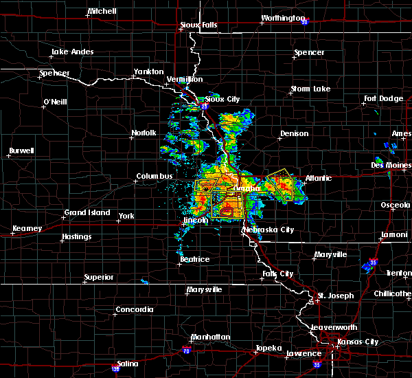 At 604 pm cdt, severe thunderstorms were located along a line extending from omaha to 4 miles southwest of plattsmouth, moving northeast at 45 mph (trained weather spotters reported 2 inch hail with this storm). Hazards include two inch hail and 60 mph wind gusts. People and animals outdoors will be injured. expect hail damage to roofs, siding, windows, and vehicles. expect wind damage to roofs, siding, and trees. locations impacted include, southeastern omaha, western council bluffs, bellevue, papillion, la vista, plattsmouth, ralston, springfield, louisville, murray, cedar creek, offutt afb, carter lake, camp maha, louisville state recreation area, chalco, narrows river park and platte river state park. this includes the following highways, interstate 29 between mile markers 50 and 55. interstate 80 in iowa near mile marker 1. interstate 80 in nebraska between mile markers 437 and 444, and between mile markers 450 and 454. A tornado watch remains in effect until 1100 pm cdt for southwestern iowa, and southeastern and east central nebraska. At 604 pm cdt, severe thunderstorms were located along a line extending from omaha to 4 miles southwest of plattsmouth, moving northeast at 45 mph (trained weather spotters reported 2 inch hail with this storm). Hazards include two inch hail and 60 mph wind gusts. People and animals outdoors will be injured. expect hail damage to roofs, siding, windows, and vehicles. expect wind damage to roofs, siding, and trees. locations impacted include, southeastern omaha, western council bluffs, bellevue, papillion, la vista, plattsmouth, ralston, springfield, louisville, murray, cedar creek, offutt afb, carter lake, camp maha, louisville state recreation area, chalco, narrows river park and platte river state park. this includes the following highways, interstate 29 between mile markers 50 and 55. interstate 80 in iowa near mile marker 1. interstate 80 in nebraska between mile markers 437 and 444, and between mile markers 450 and 454. A tornado watch remains in effect until 1100 pm cdt for southwestern iowa, and southeastern and east central nebraska.
|
| 6/11/2018 5:24 PM CDT |
 At 522 pm cdt, severe thunderstorms were located along a line extending from omaha to 5 miles southeast of louisville, moving northeast at 30 mph. rotation was beginngin to develop on the southwest side of the storm toward cedar creek in cass co (trained weather spotters). Hazards include two inch hail and 60 mph wind gusts. People and animals outdoors will be injured. expect hail damage to roofs, siding, windows, and vehicles. Expect wind damage to roofs, siding, and trees. At 522 pm cdt, severe thunderstorms were located along a line extending from omaha to 5 miles southeast of louisville, moving northeast at 30 mph. rotation was beginngin to develop on the southwest side of the storm toward cedar creek in cass co (trained weather spotters). Hazards include two inch hail and 60 mph wind gusts. People and animals outdoors will be injured. expect hail damage to roofs, siding, windows, and vehicles. Expect wind damage to roofs, siding, and trees.
|
| 6/11/2018 5:13 PM CDT |
 At 512 pm cdt, severe thunderstorms were located along a line extending from near millard to near cedar creek, moving east at 20 mph (public reported 2 inch hail near 174th and cornhusker). Hazards include two inch hail and 60 mph wind gusts. People and animals outdoors will be injured. expect hail damage to roofs, siding, windows, and vehicles. expect wind damage to roofs, siding, and trees. locations impacted include, southwestern omaha, bellevue, papillion, la vista, plattsmouth, ralston, gretna, springfield, louisville, cedar creek, offutt afb, millard, south bend, camp maha, louisville state recreation area, koa campground, schramm park state recreation area, chalco and platte river state park. this includes interstate 80 in nebraska between mile markers 428 and 448. A tornado watch remains in effect until 1100 pm cdt for southwestern iowa, and southeastern and east central nebraska. At 512 pm cdt, severe thunderstorms were located along a line extending from near millard to near cedar creek, moving east at 20 mph (public reported 2 inch hail near 174th and cornhusker). Hazards include two inch hail and 60 mph wind gusts. People and animals outdoors will be injured. expect hail damage to roofs, siding, windows, and vehicles. expect wind damage to roofs, siding, and trees. locations impacted include, southwestern omaha, bellevue, papillion, la vista, plattsmouth, ralston, gretna, springfield, louisville, cedar creek, offutt afb, millard, south bend, camp maha, louisville state recreation area, koa campground, schramm park state recreation area, chalco and platte river state park. this includes interstate 80 in nebraska between mile markers 428 and 448. A tornado watch remains in effect until 1100 pm cdt for southwestern iowa, and southeastern and east central nebraska.
|
| 6/11/2018 5:09 PM CDT |
 At 458 pm cdt, a severe thunderstorm was located near gretna, or 14 miles southwest of omaha, moving northeast at 35 mph (amatuer radio reported quarter-sized hail at nebraska crossing at 455 pm). Hazards include ping pong ball size hail and 60 mph wind gusts. People and animals outdoors will be injured. expect hail damage to roofs, siding, windows, and vehicles. expect wind damage to roofs, siding, and trees. locations impacted include, southwestern omaha, bellevue, papillion, la vista, plattsmouth, ralston, gretna, springfield, louisville, cedar creek, offutt afb, millard, south bend, camp maha, louisville state recreation area, koa campground, schramm park state recreation area, chalco and platte river state park. this includes interstate 80 in nebraska between mile markers 428 and 448. A tornado watch remains in effect until 1100 pm cdt for southwestern iowa, and southeastern and east central nebraska. At 458 pm cdt, a severe thunderstorm was located near gretna, or 14 miles southwest of omaha, moving northeast at 35 mph (amatuer radio reported quarter-sized hail at nebraska crossing at 455 pm). Hazards include ping pong ball size hail and 60 mph wind gusts. People and animals outdoors will be injured. expect hail damage to roofs, siding, windows, and vehicles. expect wind damage to roofs, siding, and trees. locations impacted include, southwestern omaha, bellevue, papillion, la vista, plattsmouth, ralston, gretna, springfield, louisville, cedar creek, offutt afb, millard, south bend, camp maha, louisville state recreation area, koa campground, schramm park state recreation area, chalco and platte river state park. this includes interstate 80 in nebraska between mile markers 428 and 448. A tornado watch remains in effect until 1100 pm cdt for southwestern iowa, and southeastern and east central nebraska.
|
| 6/11/2018 4:59 PM CDT |
 At 458 pm cdt, a severe thunderstorm was located near gretna, or 14 miles southwest of omaha, moving northeast at 35 mph (amatuer radio reported quarter-sized hail at nebraska crossing at 455 pm). Hazards include ping pong ball size hail and 60 mph wind gusts. People and animals outdoors will be injured. expect hail damage to roofs, siding, windows, and vehicles. expect wind damage to roofs, siding, and trees. locations impacted include, southwestern omaha, bellevue, papillion, la vista, plattsmouth, ralston, gretna, springfield, louisville, cedar creek, offutt afb, millard, south bend, camp maha, louisville state recreation area, koa campground, schramm park state recreation area, chalco and platte river state park. this includes interstate 80 in nebraska between mile markers 428 and 448. A tornado watch remains in effect until 1100 pm cdt for southwestern iowa, and southeastern and east central nebraska. At 458 pm cdt, a severe thunderstorm was located near gretna, or 14 miles southwest of omaha, moving northeast at 35 mph (amatuer radio reported quarter-sized hail at nebraska crossing at 455 pm). Hazards include ping pong ball size hail and 60 mph wind gusts. People and animals outdoors will be injured. expect hail damage to roofs, siding, windows, and vehicles. expect wind damage to roofs, siding, and trees. locations impacted include, southwestern omaha, bellevue, papillion, la vista, plattsmouth, ralston, gretna, springfield, louisville, cedar creek, offutt afb, millard, south bend, camp maha, louisville state recreation area, koa campground, schramm park state recreation area, chalco and platte river state park. this includes interstate 80 in nebraska between mile markers 428 and 448. A tornado watch remains in effect until 1100 pm cdt for southwestern iowa, and southeastern and east central nebraska.
|
| 6/11/2018 4:50 PM CDT |
 At 449 pm cdt, a severe thunderstorm was located 4 miles south of gretna, or 17 miles southwest of omaha, moving northeast at 25 mph (radar indicated). Hazards include ping pong ball size hail and 60 mph wind gusts. People and animals outdoors will be injured. expect hail damage to roofs, siding, windows, and vehicles. Expect wind damage to roofs, siding, and trees. At 449 pm cdt, a severe thunderstorm was located 4 miles south of gretna, or 17 miles southwest of omaha, moving northeast at 25 mph (radar indicated). Hazards include ping pong ball size hail and 60 mph wind gusts. People and animals outdoors will be injured. expect hail damage to roofs, siding, windows, and vehicles. Expect wind damage to roofs, siding, and trees.
|
| 6/9/2018 4:12 AM CDT |
 The severe thunderstorm warning for northwestern mills. western pottawattamie. southwestern harrison. southeastern burt. lancaster. western johnson. jefferson. douglas. southeastern saline. eastern saunders. sarpy. washington. eastern dodge. otoe. gage and cass counties will expire at 415 am cdt. The storms which prompted the warning have weakened below severe. The severe thunderstorm warning for northwestern mills. western pottawattamie. southwestern harrison. southeastern burt. lancaster. western johnson. jefferson. douglas. southeastern saline. eastern saunders. sarpy. washington. eastern dodge. otoe. gage and cass counties will expire at 415 am cdt. The storms which prompted the warning have weakened below severe.
|
| 6/9/2018 3:41 AM CDT |
 At 338 am cdt, severe thunderstorms were located along a line extending from 6 miles south of tekamah to 3 miles southwest of gretna to near firth to 4 miles northeast of mahaska, moving east at 50 mph (radar indicated. wind gusts of 50 to 70 mph have been reported with the outflow preceeding the line of storms). Hazards include 70 mph wind gusts. Expect considerable tree damage. damage is likely to mobile homes, roofs, and outbuildings. locations impacted include, omaha, lincoln, beatrice, council bluffs, bellevue, fremont, papillion, la vista, blair, plattsmouth, ralston, gretna, fairbury, waverly, missouri valley, ashland, syracuse, valley, wilber and tekamah. this includes the following highways, interstate 29 between mile markers 42 and 92. interstate 80 in iowa between mile markers 1 and 5. Interstate 80 in nebraska between mile markers 399 and 454. At 338 am cdt, severe thunderstorms were located along a line extending from 6 miles south of tekamah to 3 miles southwest of gretna to near firth to 4 miles northeast of mahaska, moving east at 50 mph (radar indicated. wind gusts of 50 to 70 mph have been reported with the outflow preceeding the line of storms). Hazards include 70 mph wind gusts. Expect considerable tree damage. damage is likely to mobile homes, roofs, and outbuildings. locations impacted include, omaha, lincoln, beatrice, council bluffs, bellevue, fremont, papillion, la vista, blair, plattsmouth, ralston, gretna, fairbury, waverly, missouri valley, ashland, syracuse, valley, wilber and tekamah. this includes the following highways, interstate 29 between mile markers 42 and 92. interstate 80 in iowa between mile markers 1 and 5. Interstate 80 in nebraska between mile markers 399 and 454.
|
| 6/9/2018 3:25 AM CDT |
 At 324 am cdt, severe thunderstorms were located along a line extending from 5 miles south of craig to 5 miles south of mead to near hallam to near hubbell, moving east at 40 mph (radar indicated). Hazards include 70 mph wind gusts. Expect considerable tree damage. Damage is likely to mobile homes, roofs, and outbuildings. At 324 am cdt, severe thunderstorms were located along a line extending from 5 miles south of craig to 5 miles south of mead to near hallam to near hubbell, moving east at 40 mph (radar indicated). Hazards include 70 mph wind gusts. Expect considerable tree damage. Damage is likely to mobile homes, roofs, and outbuildings.
|
| 6/6/2018 10:42 PM CDT |
 The severe thunderstorm warning for western mills, southwestern pottawattamie, east central sarpy and northeastern cass counties will expire at 1045 pm cdt, the severe thunderstorm which prompted the warning has weakened. therefore, the warning will be allowed to expire. however gusty winds are still possible with this thunderstorm. a severe thunderstorm watch remains in effect until 1100 pm cdt for southwestern iowa, and southeastern and east central nebraska. The severe thunderstorm warning for western mills, southwestern pottawattamie, east central sarpy and northeastern cass counties will expire at 1045 pm cdt, the severe thunderstorm which prompted the warning has weakened. therefore, the warning will be allowed to expire. however gusty winds are still possible with this thunderstorm. a severe thunderstorm watch remains in effect until 1100 pm cdt for southwestern iowa, and southeastern and east central nebraska.
|
| 6/6/2018 10:42 PM CDT |
 The severe thunderstorm warning for western mills. southwestern pottawattamie. east central sarpy and northeastern cass counties will expire at 1045 pm cdt. the severe thunderstorm which prompted the warning has weakened. therefore, the warning will be allowed to expire. However gusty winds are still possible with this thunderstorm. The severe thunderstorm warning for western mills. southwestern pottawattamie. east central sarpy and northeastern cass counties will expire at 1045 pm cdt. the severe thunderstorm which prompted the warning has weakened. therefore, the warning will be allowed to expire. However gusty winds are still possible with this thunderstorm.
|
| 6/6/2018 10:40 PM CDT |
 The severe thunderstorm warning for southern sarpy and northeastern cass counties will expire at 1045 pm cdt, the storm which prompted the warning has weakened below severe limits, and no longer poses an immediate threat to life or property. therefore, the warning will be allowed to expire. however gusty winds are still possible with this thunderstorm. a severe thunderstorm watch remains in effect until 1100 pm cdt for southeastern and east central nebraska. The severe thunderstorm warning for southern sarpy and northeastern cass counties will expire at 1045 pm cdt, the storm which prompted the warning has weakened below severe limits, and no longer poses an immediate threat to life or property. therefore, the warning will be allowed to expire. however gusty winds are still possible with this thunderstorm. a severe thunderstorm watch remains in effect until 1100 pm cdt for southeastern and east central nebraska.
|
| 6/6/2018 10:29 PM CDT |
 At 1028 pm cdt, a severe thunderstorm was located over louisville, or 18 miles southwest of omaha, moving south at 20 mph (radar indicated). Hazards include 60 mph wind gusts. Expect damage to roofs, siding, and trees. Locations impacted include, springfield, louisville, cedar creek, south bend, camp maha, louisville state recreation area, schramm park state recreation area and platte river state park. At 1028 pm cdt, a severe thunderstorm was located over louisville, or 18 miles southwest of omaha, moving south at 20 mph (radar indicated). Hazards include 60 mph wind gusts. Expect damage to roofs, siding, and trees. Locations impacted include, springfield, louisville, cedar creek, south bend, camp maha, louisville state recreation area, schramm park state recreation area and platte river state park.
|
| 6/6/2018 10:22 PM CDT |
 The national weather service in omaha has issued a * severe thunderstorm warning for. western mills county in southwestern iowa. southwestern pottawattamie county in southwestern iowa. east central sarpy county in east central nebraska. Northeastern cass county in southeastern nebraska. The national weather service in omaha has issued a * severe thunderstorm warning for. western mills county in southwestern iowa. southwestern pottawattamie county in southwestern iowa. east central sarpy county in east central nebraska. Northeastern cass county in southeastern nebraska.
|
| 6/6/2018 10:22 PM CDT |
 At 1022 pm cdt, a severe thunderstorm was located near pacific junction, or 17 miles southeast of omaha, moving southeast at 30 mph (radar indicated). Hazards include 60 mph wind gusts and nickel size hail. expect damage to roofs, siding, and trees At 1022 pm cdt, a severe thunderstorm was located near pacific junction, or 17 miles southeast of omaha, moving southeast at 30 mph (radar indicated). Hazards include 60 mph wind gusts and nickel size hail. expect damage to roofs, siding, and trees
|
| 6/6/2018 10:18 PM CDT |
 The national weather service in omaha has issued a * severe thunderstorm warning for. southern sarpy county in east central nebraska. northeastern cass county in southeastern nebraska. until 1045 pm cdt. At 1018 pm cdt, a severe thunderstorm was located near springfield,. The national weather service in omaha has issued a * severe thunderstorm warning for. southern sarpy county in east central nebraska. northeastern cass county in southeastern nebraska. until 1045 pm cdt. At 1018 pm cdt, a severe thunderstorm was located near springfield,.
|
| 6/6/2018 10:16 PM CDT |
 At 1015 pm cdt, a severe thunderstorm was located near offutt afb, or 12 miles southeast of omaha, moving south at 20 mph (radar indicated. at 1015 pm a wind gust of 57 mph was reported at offutt afb). Hazards include 60 mph wind gusts and quarter size hail. Hail damage to vehicles is expected. expect wind damage to roofs, siding, and trees. locations impacted include, southern council bluffs, bellevue, plattsmouth, glenwood, pacific junction and offutt afb. This includes interstate 29 between mile markers 35 and 45. At 1015 pm cdt, a severe thunderstorm was located near offutt afb, or 12 miles southeast of omaha, moving south at 20 mph (radar indicated. at 1015 pm a wind gust of 57 mph was reported at offutt afb). Hazards include 60 mph wind gusts and quarter size hail. Hail damage to vehicles is expected. expect wind damage to roofs, siding, and trees. locations impacted include, southern council bluffs, bellevue, plattsmouth, glenwood, pacific junction and offutt afb. This includes interstate 29 between mile markers 35 and 45.
|
| 6/6/2018 10:07 PM CDT |
 At 1007 pm cdt, a severe thunderstorm was located near bellevue, or 10 miles southeast of omaha, moving south at 20 mph (radar indicated). Hazards include 60 mph wind gusts and quarter size hail. Hail damage to vehicles is expected. Expect wind damage to roofs, siding, and trees. At 1007 pm cdt, a severe thunderstorm was located near bellevue, or 10 miles southeast of omaha, moving south at 20 mph (radar indicated). Hazards include 60 mph wind gusts and quarter size hail. Hail damage to vehicles is expected. Expect wind damage to roofs, siding, and trees.
|
| 6/2/2018 12:54 AM CDT |
 At 1254 am cdt, severe thunderstorms were located along a line extending from near underwood to near pacific junction, moving east at 40 mph (trained weather spotters have reported tree damage in several parts of omaha). Hazards include 60 mph wind gusts. Expect damage to roofs, siding, and trees. locations impacted include, council bluffs, bellevue, plattsmouth, glenwood, oakland, malvern, treynor, underwood, carson, pacific junction, emerson, macedonia, offutt afb, silver city, hancock, henderson, hastings, mcclelland, old town park and lake manawa state park. this includes the following highways, interstate 29 between mile markers 29 and 48. Interstate 80 in iowa between mile markers 3 and 17. At 1254 am cdt, severe thunderstorms were located along a line extending from near underwood to near pacific junction, moving east at 40 mph (trained weather spotters have reported tree damage in several parts of omaha). Hazards include 60 mph wind gusts. Expect damage to roofs, siding, and trees. locations impacted include, council bluffs, bellevue, plattsmouth, glenwood, oakland, malvern, treynor, underwood, carson, pacific junction, emerson, macedonia, offutt afb, silver city, hancock, henderson, hastings, mcclelland, old town park and lake manawa state park. this includes the following highways, interstate 29 between mile markers 29 and 48. Interstate 80 in iowa between mile markers 3 and 17.
|
| 6/2/2018 12:41 AM CDT |
 At 1240 am cdt, severe thunderstorms were located along a line extending from 8 miles west of underwood to 4 miles west of plattsmouth, moving east at 40 mph (trained weather spotters have reported tree damage, power outages, and winds up to 65 mph in omaha and surrounding areas). Hazards include 60 mph wind gusts and nickel size hail. Expect damage to roofs, siding, and trees. locations impacted include, omaha, council bluffs, bellevue, papillion, la vista, plattsmouth, ralston, glenwood, springfield, oakland, malvern, louisville, treynor, underwood, carson, pacific junction, emerson, cedar creek, macedonia and offutt afb. people attending heartland of america park should seek safe shelter immediately! this includes the following highways, interstate 29 between mile markers 29 and 61. interstate 80 in iowa between mile markers 1 and 17. Interstate 80 in nebraska between mile markers 437 and 454. At 1240 am cdt, severe thunderstorms were located along a line extending from 8 miles west of underwood to 4 miles west of plattsmouth, moving east at 40 mph (trained weather spotters have reported tree damage, power outages, and winds up to 65 mph in omaha and surrounding areas). Hazards include 60 mph wind gusts and nickel size hail. Expect damage to roofs, siding, and trees. locations impacted include, omaha, council bluffs, bellevue, papillion, la vista, plattsmouth, ralston, glenwood, springfield, oakland, malvern, louisville, treynor, underwood, carson, pacific junction, emerson, cedar creek, macedonia and offutt afb. people attending heartland of america park should seek safe shelter immediately! this includes the following highways, interstate 29 between mile markers 29 and 61. interstate 80 in iowa between mile markers 1 and 17. Interstate 80 in nebraska between mile markers 437 and 454.
|
| 6/2/2018 12:40 AM CDT | 1 inch tree limbs down. shingles blown off roo in sarpy county NE, 1.6 miles W of Bellevue, NE |
| 6/2/2018 12:19 AM CDT |
 At 1219 am cdt, a severe thunderstorm was located over springfield, or 13 miles southwest of omaha, moving east at 55 mph (radar indicated). Hazards include 60 mph wind gusts and nickel size hail. expect damage to roofs, siding, and trees At 1219 am cdt, a severe thunderstorm was located over springfield, or 13 miles southwest of omaha, moving east at 55 mph (radar indicated). Hazards include 60 mph wind gusts and nickel size hail. expect damage to roofs, siding, and trees
|
| 6/1/2018 11:20 PM CDT |
 The national weather service in omaha has issued a * severe thunderstorm warning for. northwestern pottawattamie county in southwestern iowa. southwestern harrison county in southwestern iowa. washington county in east central nebraska. Southeastern dodge county in east central nebraska. The national weather service in omaha has issued a * severe thunderstorm warning for. northwestern pottawattamie county in southwestern iowa. southwestern harrison county in southwestern iowa. washington county in east central nebraska. Southeastern dodge county in east central nebraska.
|
| 8/20/2017 12:22 AM CDT |
 The severe thunderstorm warning for north central sarpy and eastern douglas counties will expire at 1230 am cdt, the storm which prompted the warning has weakened and no longer poses an immediate threat to life or property. therefore the warning will be allowed to expire. however gusty winds are still possible with thunderstorms in the area. The severe thunderstorm warning for north central sarpy and eastern douglas counties will expire at 1230 am cdt, the storm which prompted the warning has weakened and no longer poses an immediate threat to life or property. therefore the warning will be allowed to expire. however gusty winds are still possible with thunderstorms in the area.
|
| 8/20/2017 12:16 AM CDT |
 At 1215 am cdt, a severe thunderstorm was located over southwestern omaha, moving east at 40 mph (trained weather spotters). Hazards include 60 mph wind gusts. Expect damage to roofs, siding, and trees. 61 mph winds were observed at the national weather service in valley with this storm at 1154 pm. locations impacted include, omaha, bellevue, papillion, la vista, ralston, millard, boys town and chalco. this includes the following highways, highway 75 in nebraska near mile marker 88, and between mile markers 94 and 99. Interstate 80 in nebraska between mile markers 443 and 452. At 1215 am cdt, a severe thunderstorm was located over southwestern omaha, moving east at 40 mph (trained weather spotters). Hazards include 60 mph wind gusts. Expect damage to roofs, siding, and trees. 61 mph winds were observed at the national weather service in valley with this storm at 1154 pm. locations impacted include, omaha, bellevue, papillion, la vista, ralston, millard, boys town and chalco. this includes the following highways, highway 75 in nebraska near mile marker 88, and between mile markers 94 and 99. Interstate 80 in nebraska between mile markers 443 and 452.
|
| 8/19/2017 11:57 PM CDT |
 At 1156 pm cdt, a severe thunderstorm was located over waterloo, or 15 miles west of omaha, moving east at 40 mph (radar indicated). Hazards include 60 mph wind gusts. expect damage to roofs, siding, and trees At 1156 pm cdt, a severe thunderstorm was located over waterloo, or 15 miles west of omaha, moving east at 40 mph (radar indicated). Hazards include 60 mph wind gusts. expect damage to roofs, siding, and trees
|
| 6/30/2017 12:02 AM CDT | Quarter sized hail reported 1.4 miles SW of Bellevue, NE |
| 6/29/2017 10:27 PM CDT | Golf Ball sized hail reported 1.4 miles SW of Bellevue, NE |
| 6/29/2017 10:25 PM CDT | Hen Egg sized hail reported 1.6 miles ENE of Bellevue, NE |
| 6/29/2017 7:00 PM CDT |
 At 1200 am cdt, a severe thunderstorm was located near bellevue, or 8 miles south of omaha, moving east at 35 mph. half dollar size hail was reported with this storm, and larger hail is likely (trained weather spotters). Hazards include ping pong ball size hail. People and animals outdoors will be injured. Expect damage to roofs, siding, windows, and vehicles. At 1200 am cdt, a severe thunderstorm was located near bellevue, or 8 miles south of omaha, moving east at 35 mph. half dollar size hail was reported with this storm, and larger hail is likely (trained weather spotters). Hazards include ping pong ball size hail. People and animals outdoors will be injured. Expect damage to roofs, siding, windows, and vehicles.
|
| 6/29/2017 5:45 PM CDT |
 At 1044 pm cdt, a severe thunderstorm was located 4 miles north of pacific junction, or 15 miles southeast of omaha, moving southeast at 30 mph (radar indicated). Hazards include golf ball size hail. People and animals outdoors will be injured. expect damage to roofs, siding, windows, and vehicles. locations impacted include, bellevue, glenwood, malvern, pacific junction, macedonia, offutt afb, silver city, henderson, hastings and old town park. this includes the following highways, highway 34 in iowa between mile markers 6 and 23. highway 59 in iowa between mile markers 34 and 44. highway 75 in nebraska near mile marker 79. Interstate 29 between mile markers 35 and 43. At 1044 pm cdt, a severe thunderstorm was located 4 miles north of pacific junction, or 15 miles southeast of omaha, moving southeast at 30 mph (radar indicated). Hazards include golf ball size hail. People and animals outdoors will be injured. expect damage to roofs, siding, windows, and vehicles. locations impacted include, bellevue, glenwood, malvern, pacific junction, macedonia, offutt afb, silver city, henderson, hastings and old town park. this includes the following highways, highway 34 in iowa between mile markers 6 and 23. highway 59 in iowa between mile markers 34 and 44. highway 75 in nebraska near mile marker 79. Interstate 29 between mile markers 35 and 43.
|
| 6/29/2017 5:26 PM CDT |
 At 1025 pm cdt, a severe thunderstorm was located near bellevue, or 8 miles south of omaha, moving east at 30 mph (radar indicated). Hazards include golf ball size hail. People and animals outdoors will be injured. Expect damage to roofs, siding, windows, and vehicles. At 1025 pm cdt, a severe thunderstorm was located near bellevue, or 8 miles south of omaha, moving east at 30 mph (radar indicated). Hazards include golf ball size hail. People and animals outdoors will be injured. Expect damage to roofs, siding, windows, and vehicles.
|
| 6/29/2017 5:11 PM CDT |
 At 1010 pm cdt, a severe thunderstorm was located over ralston, or 4 miles south of omaha, moving east at 35 mph (radar indicated). Hazards include golf ball size hail. People and animals outdoors will be injured. expect damage to roofs, siding, windows, and vehicles. locations impacted include, omaha, council bluffs, bellevue, papillion, la vista, ralston, oakland, treynor, carson, macedonia, millard, offutt afb, carter lake, boys town, silver city, henderson, old town park, lake manawa state park, chalco and narrows river park. this includes the following highways, highway 59 in iowa between mile markers 34 and 48. highway 75 in nebraska between mile markers 82 and 94. interstate 29 between mile markers 42 and 58. interstate 80 in iowa between mile markers 1 and 11. Interstate 80 in nebraska between mile markers 439 and 454. At 1010 pm cdt, a severe thunderstorm was located over ralston, or 4 miles south of omaha, moving east at 35 mph (radar indicated). Hazards include golf ball size hail. People and animals outdoors will be injured. expect damage to roofs, siding, windows, and vehicles. locations impacted include, omaha, council bluffs, bellevue, papillion, la vista, ralston, oakland, treynor, carson, macedonia, millard, offutt afb, carter lake, boys town, silver city, henderson, old town park, lake manawa state park, chalco and narrows river park. this includes the following highways, highway 59 in iowa between mile markers 34 and 48. highway 75 in nebraska between mile markers 82 and 94. interstate 29 between mile markers 42 and 58. interstate 80 in iowa between mile markers 1 and 11. Interstate 80 in nebraska between mile markers 439 and 454.
|
| 6/29/2017 4:55 PM CDT |
 At 955 pm cdt, a severe thunderstorm was located near millard, or 7 miles west of omaha, moving east at 40 mph (radar indicated). Hazards include golf ball size hail. People and animals outdoors will be injured. Expect damage to roofs, siding, windows, and vehicles. At 955 pm cdt, a severe thunderstorm was located near millard, or 7 miles west of omaha, moving east at 40 mph (radar indicated). Hazards include golf ball size hail. People and animals outdoors will be injured. Expect damage to roofs, siding, windows, and vehicles.
|
| 6/29/2017 4:32 PM CDT |
 At 931 pm cdt, a severe thunderstorm was located over southeastern omaha, moving east at 40 mph (radar indicated). Hazards include 60 mph wind gusts and half dollar size hail. Hail damage to vehicles is expected. Expect wind damage to roofs, siding, and trees. At 931 pm cdt, a severe thunderstorm was located over southeastern omaha, moving east at 40 mph (radar indicated). Hazards include 60 mph wind gusts and half dollar size hail. Hail damage to vehicles is expected. Expect wind damage to roofs, siding, and trees.
|
| 6/16/2017 8:14 PM CDT |
 At 814 pm cdt, severe thunderstorms were located along a line extending from 5 miles east of persia to treynor to 3 miles southeast of pacific junction to 4 miles southwest of elmwood, moving southeast at 45 mph. these are very dangerous storms (radar indicated). Hazards include 80 mph wind gusts. Flying debris will be dangerous to those caught without shelter. mobile homes will be heavily damaged. expect considerable damage to roofs, windows, and vehicles. Extensive tree damage and power outages are likely. At 814 pm cdt, severe thunderstorms were located along a line extending from 5 miles east of persia to treynor to 3 miles southeast of pacific junction to 4 miles southwest of elmwood, moving southeast at 45 mph. these are very dangerous storms (radar indicated). Hazards include 80 mph wind gusts. Flying debris will be dangerous to those caught without shelter. mobile homes will be heavily damaged. expect considerable damage to roofs, windows, and vehicles. Extensive tree damage and power outages are likely.
|
| 6/16/2017 8:10 PM CDT | Storm damage reported in sarpy county NE, 1.4 miles SW of Bellevue, NE |
| 6/16/2017 8:10 PM CDT | Significant damage to multiple homes in the hyda hills neighborhoo in sarpy county NE, 3.2 miles N of Bellevue, NE |
| 6/16/2017 8:07 PM CDT |
 The national weather service in omaha has issued a * tornado warning for. northeastern fremont county in southwestern iowa. west central montgomery county in southwestern iowa. mills county in southwestern iowa. Northeastern sarpy county in east central nebraska. The national weather service in omaha has issued a * tornado warning for. northeastern fremont county in southwestern iowa. west central montgomery county in southwestern iowa. mills county in southwestern iowa. Northeastern sarpy county in east central nebraska.
|
| 6/16/2017 8:07 PM CDT |
 At 806 pm cdt, severe thunderstorms capable of producing both tornadoes and extensive straight line wind damage were located over offutt afb, or 12 miles south of omaha, moving southeast at 45 mph (radar indicated rotation). Hazards include tornado. Flying debris will be dangerous to those caught without shelter. mobile homes will be damaged or destroyed. damage to roofs, windows, and vehicles will occur. tree damage is likely. these dangerous storms will be near, plattsmouth around 810 pm cdt. pacific junction around 815 pm cdt. glenwood around 820 pm cdt. malvern around 830 pm cdt. other locations impacted by this tornadic thunderstorm include hastings, silver city, imogene, camp maha, randolph and tabor. this includes the following highways, highway 34 in iowa between mile markers 1 and 27. highway 59 in iowa between mile markers 25 and 31. highway 75 in nebraska between mile markers 73 and 85. Interstate 29 between mile markers 27 and 42. At 806 pm cdt, severe thunderstorms capable of producing both tornadoes and extensive straight line wind damage were located over offutt afb, or 12 miles south of omaha, moving southeast at 45 mph (radar indicated rotation). Hazards include tornado. Flying debris will be dangerous to those caught without shelter. mobile homes will be damaged or destroyed. damage to roofs, windows, and vehicles will occur. tree damage is likely. these dangerous storms will be near, plattsmouth around 810 pm cdt. pacific junction around 815 pm cdt. glenwood around 820 pm cdt. malvern around 830 pm cdt. other locations impacted by this tornadic thunderstorm include hastings, silver city, imogene, camp maha, randolph and tabor. this includes the following highways, highway 34 in iowa between mile markers 1 and 27. highway 59 in iowa between mile markers 25 and 31. highway 75 in nebraska between mile markers 73 and 85. Interstate 29 between mile markers 27 and 42.
|
| 6/16/2017 7:57 PM CDT |
 At 756 pm cdt, severe thunderstorms were located along a line extending from 4 miles northwest of underwood to 5 miles east of council bluffs to near cedar creek to 6 miles northwest of greenwood, moving southeast at 45 mph. these are very dangerous storms (radar indicated. numerous reports of 70 to 90 mph winds have been received associated with the leading edge of the storm). Hazards include 90 mph wind gusts. You are in a life-threatening situation. flying debris may be deadly to those caught without shelter. mobile homes will be heavily damaged or destroyed. homes and businesses will have substantial roof and window damage. expect extensive tree damage and power outages. locations impacted include, southeastern omaha, council bluffs, bellevue, papillion, la vista, plattsmouth, ralston, glenwood, gretna, waverly, ashland, springfield, oakland, malvern, louisville, weeping water, treynor, underwood, carson and elmwood. this includes the following highways, highway 34 in iowa between mile markers 1 and 23. highway 59 in iowa between mile markers 31 and 55. highway 75 in nebraska between mile markers 57 and 91. highway 77 in nebraska between mile markers 81 and 82. interstate 29 between mile markers 15 and 56. interstate 80 in iowa between mile markers 1 and 23. Interstate 80 in nebraska between mile markers 411 and 444, and between mile markers 448 and 454. At 756 pm cdt, severe thunderstorms were located along a line extending from 4 miles northwest of underwood to 5 miles east of council bluffs to near cedar creek to 6 miles northwest of greenwood, moving southeast at 45 mph. these are very dangerous storms (radar indicated. numerous reports of 70 to 90 mph winds have been received associated with the leading edge of the storm). Hazards include 90 mph wind gusts. You are in a life-threatening situation. flying debris may be deadly to those caught without shelter. mobile homes will be heavily damaged or destroyed. homes and businesses will have substantial roof and window damage. expect extensive tree damage and power outages. locations impacted include, southeastern omaha, council bluffs, bellevue, papillion, la vista, plattsmouth, ralston, glenwood, gretna, waverly, ashland, springfield, oakland, malvern, louisville, weeping water, treynor, underwood, carson and elmwood. this includes the following highways, highway 34 in iowa between mile markers 1 and 23. highway 59 in iowa between mile markers 31 and 55. highway 75 in nebraska between mile markers 57 and 91. highway 77 in nebraska between mile markers 81 and 82. interstate 29 between mile markers 15 and 56. interstate 80 in iowa between mile markers 1 and 23. Interstate 80 in nebraska between mile markers 411 and 444, and between mile markers 448 and 454.
|
| 6/16/2017 7:49 PM CDT |
 At 748 pm cdt, severe thunderstorms were located along a line extending from 6 miles southeast of missouri valley to 4 miles north of council bluffs to near gretna to 9 miles south of wahoo, moving southeast at 40 mph. these are very dangerous storms (radar indicated). Hazards include 80 mph wind gusts. Flying debris will be dangerous to those caught without shelter. mobile homes will be heavily damaged. expect considerable damage to roofs, windows, and vehicles. Extensive tree damage and power outages are likely. At 748 pm cdt, severe thunderstorms were located along a line extending from 6 miles southeast of missouri valley to 4 miles north of council bluffs to near gretna to 9 miles south of wahoo, moving southeast at 40 mph. these are very dangerous storms (radar indicated). Hazards include 80 mph wind gusts. Flying debris will be dangerous to those caught without shelter. mobile homes will be heavily damaged. expect considerable damage to roofs, windows, and vehicles. Extensive tree damage and power outages are likely.
|
| 6/16/2017 7:36 PM CDT |
 At 736 pm cdt, severe thunderstorms were located along a line extending from 4 miles southwest of missouri valley to 8 miles southwest of fort calhoun to 3 miles south of waterloo to near wahoo, moving southeast at 40 mph. these are very dangerous storms (radar indicated). Hazards include 80 mph wind gusts and quarter size hail. Flying debris will be dangerous to those caught without shelter. mobile homes will be heavily damaged. expect considerable damage to roofs, windows, and vehicles. extensive tree damage and power outages are likely. locations impacted include, omaha, council bluffs, bellevue, papillion, la vista, blair, ralston, wahoo, gretna, missouri valley, ashland, valley, springfield, yutan, underwood, fort calhoun, waterloo, mead, cedar creek and kennard. this includes the following highways, highway 275 in nebraska near mile marker 167. highway 30 in iowa between mile markers 1 and 5. highway 30 in nebraska between mile markers 441 and 444, and near mile marker 450. highway 75 in nebraska between mile markers 76 and 114. highway 77 in nebraska between mile markers 90 and 104. highway 92 in nebraska between mile markers 446 and 466. interstate 29 between mile markers 39 and 79. interstate 80 in iowa between mile markers 1 and 23. Interstate 80 in nebraska between mile markers 428 and 454. At 736 pm cdt, severe thunderstorms were located along a line extending from 4 miles southwest of missouri valley to 8 miles southwest of fort calhoun to 3 miles south of waterloo to near wahoo, moving southeast at 40 mph. these are very dangerous storms (radar indicated). Hazards include 80 mph wind gusts and quarter size hail. Flying debris will be dangerous to those caught without shelter. mobile homes will be heavily damaged. expect considerable damage to roofs, windows, and vehicles. extensive tree damage and power outages are likely. locations impacted include, omaha, council bluffs, bellevue, papillion, la vista, blair, ralston, wahoo, gretna, missouri valley, ashland, valley, springfield, yutan, underwood, fort calhoun, waterloo, mead, cedar creek and kennard. this includes the following highways, highway 275 in nebraska near mile marker 167. highway 30 in iowa between mile markers 1 and 5. highway 30 in nebraska between mile markers 441 and 444, and near mile marker 450. highway 75 in nebraska between mile markers 76 and 114. highway 77 in nebraska between mile markers 90 and 104. highway 92 in nebraska between mile markers 446 and 466. interstate 29 between mile markers 39 and 79. interstate 80 in iowa between mile markers 1 and 23. Interstate 80 in nebraska between mile markers 428 and 454.
|
| 6/16/2017 7:30 PM CDT |
 At 729 pm cdt, severe thunderstorms were located along a line extending from 5 miles south of modale to 5 miles south of kennard to near valley to 4 miles northwest of wahoo, moving southeast at 40 mph (radar indicated). Hazards include 60 mph wind gusts and quarter size hail. Hail damage to vehicles is expected. Expect wind damage to roofs, siding, and trees. At 729 pm cdt, severe thunderstorms were located along a line extending from 5 miles south of modale to 5 miles south of kennard to near valley to 4 miles northwest of wahoo, moving southeast at 40 mph (radar indicated). Hazards include 60 mph wind gusts and quarter size hail. Hail damage to vehicles is expected. Expect wind damage to roofs, siding, and trees.
|
| 6/12/2017 9:13 AM CDT |
 At 912 am cdt, a severe thunderstorm was located near murray, or 21 miles south of omaha, moving northeast at 30 mph (radar indicated). Hazards include 60 mph wind gusts and quarter size hail. Hail damage to vehicles is expected. expect wind damage to roofs, siding, and trees. locations impacted include, bellevue, papillion, plattsmouth, springfield, murray, cedar creek, union, nehawka and camp maha. This includes highway 75 in nebraska between mile markers 59 and 79. At 912 am cdt, a severe thunderstorm was located near murray, or 21 miles south of omaha, moving northeast at 30 mph (radar indicated). Hazards include 60 mph wind gusts and quarter size hail. Hail damage to vehicles is expected. expect wind damage to roofs, siding, and trees. locations impacted include, bellevue, papillion, plattsmouth, springfield, murray, cedar creek, union, nehawka and camp maha. This includes highway 75 in nebraska between mile markers 59 and 79.
|
| 6/12/2017 9:07 AM CDT |
 At 907 am cdt, a severe thunderstorm was located over murray, or 23 miles south of omaha, moving northeast at 30 mph (radar indicated). Hazards include 60 mph wind gusts and quarter size hail. Hail damage to vehicles is expected. expect wind damage to roofs, siding, and trees. locations impacted include, bellevue, papillion, plattsmouth, springfield, louisville, weeping water, murray, cedar creek, avoca, union, nehawka and camp maha. This includes highway 75 in nebraska between mile markers 59 and 79. At 907 am cdt, a severe thunderstorm was located over murray, or 23 miles south of omaha, moving northeast at 30 mph (radar indicated). Hazards include 60 mph wind gusts and quarter size hail. Hail damage to vehicles is expected. expect wind damage to roofs, siding, and trees. locations impacted include, bellevue, papillion, plattsmouth, springfield, louisville, weeping water, murray, cedar creek, avoca, union, nehawka and camp maha. This includes highway 75 in nebraska between mile markers 59 and 79.
|
| 6/12/2017 8:57 AM CDT |
 At 843 am cdt, a severe thunderstorm was located over avoca, or 29 miles east of lincoln, moving northeast at 30 mph (radar indicated). Hazards include 60 mph wind gusts and half dollar size hail. Hail damage to vehicles is expected. Expect wind damage to roofs, siding, and trees. At 843 am cdt, a severe thunderstorm was located over avoca, or 29 miles east of lincoln, moving northeast at 30 mph (radar indicated). Hazards include 60 mph wind gusts and half dollar size hail. Hail damage to vehicles is expected. Expect wind damage to roofs, siding, and trees.
|
| 6/12/2017 8:43 AM CDT |
 At 843 am cdt, a severe thunderstorm was located over avoca, or 29 miles east of lincoln, moving northeast at 30 mph (radar indicated). Hazards include 60 mph wind gusts and half dollar size hail. Hail damage to vehicles is expected. Expect wind damage to roofs, siding, and trees. At 843 am cdt, a severe thunderstorm was located over avoca, or 29 miles east of lincoln, moving northeast at 30 mph (radar indicated). Hazards include 60 mph wind gusts and half dollar size hail. Hail damage to vehicles is expected. Expect wind damage to roofs, siding, and trees.
|
| 5/16/2017 7:36 PM CDT |
 The severe thunderstorm warning for west central mills, northeastern sarpy and northeastern cass counties will expire at 745 pm cdt, the storm which prompted the warning has weakened below severe limits, and no longer poses an immediate threat to life or property. therefore the warning will be allowed to expire. however small hail, gusty winds and heavy rain are still possible with this thunderstorm. a severe thunderstorm watch remains in effect until midnight cdt for southwestern iowa, and southeastern and east central nebraska. The severe thunderstorm warning for west central mills, northeastern sarpy and northeastern cass counties will expire at 745 pm cdt, the storm which prompted the warning has weakened below severe limits, and no longer poses an immediate threat to life or property. therefore the warning will be allowed to expire. however small hail, gusty winds and heavy rain are still possible with this thunderstorm. a severe thunderstorm watch remains in effect until midnight cdt for southwestern iowa, and southeastern and east central nebraska.
|
| 5/16/2017 7:21 PM CDT |
 At 720 pm cdt, a severe thunderstorm was located near plattsmouth, or 15 miles south of omaha, moving northeast at 35 mph (radar indicated). Hazards include 60 mph wind gusts and quarter size hail. Hail damage to vehicles is expected. Expect wind damage to roofs, siding, and trees. At 720 pm cdt, a severe thunderstorm was located near plattsmouth, or 15 miles south of omaha, moving northeast at 35 mph (radar indicated). Hazards include 60 mph wind gusts and quarter size hail. Hail damage to vehicles is expected. Expect wind damage to roofs, siding, and trees.
|
| 5/16/2017 6:30 PM CDT |
 At 630 pm cdt, severe thunderstorms were located along a line extending from 3 miles north of fort calhoun omaha and then to near cedar creek, moving northeast at 45 mph. these are very dangerous storms (radar indicated). Hazards include 80 mph wind gusts and half dollar size hail. Flying debris will be dangerous to those caught without shelter. mobile homes will be heavily damaged. expect considerable damage to roofs, windows, and vehicles. extensive tree damage and power outages are likely. locations impacted include, omaha, council bluffs, bellevue, papillion, la vista, ralston, gretna, missouri valley, springfield, fort calhoun, waterloo, cedar creek, kennard, elkhorn, millard, offutt afb, carter lake, bennington, boys town and crescent. People attending werner park and fricke field, and creighton university stadium should seek safe shelter immediately!. At 630 pm cdt, severe thunderstorms were located along a line extending from 3 miles north of fort calhoun omaha and then to near cedar creek, moving northeast at 45 mph. these are very dangerous storms (radar indicated). Hazards include 80 mph wind gusts and half dollar size hail. Flying debris will be dangerous to those caught without shelter. mobile homes will be heavily damaged. expect considerable damage to roofs, windows, and vehicles. extensive tree damage and power outages are likely. locations impacted include, omaha, council bluffs, bellevue, papillion, la vista, ralston, gretna, missouri valley, springfield, fort calhoun, waterloo, cedar creek, kennard, elkhorn, millard, offutt afb, carter lake, bennington, boys town and crescent. People attending werner park and fricke field, and creighton university stadium should seek safe shelter immediately!.
|
| 5/16/2017 6:27 PM CDT |
 At 625 pm cdt, severe thunderstorms with damaging winds were located along a line extending from 3 miles northwest of fort calhoun across central douglas county and to near cedar creek in sarpy county, moving northeast at 45 mph. a storm that may produce large hail was near gretna. these are very dangerous storms (radar indicated). Hazards include 80 mph wind gusts and half dollar size hail. Flying debris will be dangerous to those caught without shelter. mobile homes will be heavily damaged. expect considerable damage to roofs, windows, and vehicles. extensive tree damage and power outages are likely. locations impacted include, omaha, council bluffs, bellevue, papillion, la vista, ralston, gretna, missouri valley, springfield, fort calhoun, waterloo, cedar creek, kennard, elkhorn, millard, offutt afb, carter lake, bennington, boys town and crescent. People attending werner park and fricke field, and creighton university stadium should seek safe shelter immediately!. At 625 pm cdt, severe thunderstorms with damaging winds were located along a line extending from 3 miles northwest of fort calhoun across central douglas county and to near cedar creek in sarpy county, moving northeast at 45 mph. a storm that may produce large hail was near gretna. these are very dangerous storms (radar indicated). Hazards include 80 mph wind gusts and half dollar size hail. Flying debris will be dangerous to those caught without shelter. mobile homes will be heavily damaged. expect considerable damage to roofs, windows, and vehicles. extensive tree damage and power outages are likely. locations impacted include, omaha, council bluffs, bellevue, papillion, la vista, ralston, gretna, missouri valley, springfield, fort calhoun, waterloo, cedar creek, kennard, elkhorn, millard, offutt afb, carter lake, bennington, boys town and crescent. People attending werner park and fricke field, and creighton university stadium should seek safe shelter immediately!.
|
| 5/16/2017 6:27 PM CDT |
 At 618 pm cdt, severe thunderstorms were located along a line extending from kennard to 3 miles west of springfield, moving northeast at 45 mph. these are very dangerous storms (radar indicated). Hazards include 80 mph wind gusts. Flying debris will be dangerous to those caught without shelter. mobile homes will be heavily damaged. expect considerable damage to roofs, windows, and vehicles. Extensive tree damage and power outages are likely. At 618 pm cdt, severe thunderstorms were located along a line extending from kennard to 3 miles west of springfield, moving northeast at 45 mph. these are very dangerous storms (radar indicated). Hazards include 80 mph wind gusts. Flying debris will be dangerous to those caught without shelter. mobile homes will be heavily damaged. expect considerable damage to roofs, windows, and vehicles. Extensive tree damage and power outages are likely.
|
| 5/16/2017 6:18 PM CDT |
 At 618 pm cdt, severe thunderstorms were located along a line extending from kennard to 3 miles west of springfield, moving northeast at 45 mph. these are very dangerous storms (radar indicated). Hazards include 80 mph wind gusts. Flying debris will be dangerous to those caught without shelter. mobile homes will be heavily damaged. expect considerable damage to roofs, windows, and vehicles. Extensive tree damage and power outages are likely. At 618 pm cdt, severe thunderstorms were located along a line extending from kennard to 3 miles west of springfield, moving northeast at 45 mph. these are very dangerous storms (radar indicated). Hazards include 80 mph wind gusts. Flying debris will be dangerous to those caught without shelter. mobile homes will be heavily damaged. expect considerable damage to roofs, windows, and vehicles. Extensive tree damage and power outages are likely.
|
| 3/6/2017 3:47 PM CST |
 At 346 pm cst, a severe thunderstorm was located near bellevue, or 5 miles southeast of omaha, moving northeast at 55 mph (radar indicated). Hazards include 60 mph wind gusts and penny size hail. expect damage to roofs, siding, and trees At 346 pm cst, a severe thunderstorm was located near bellevue, or 5 miles southeast of omaha, moving northeast at 55 mph (radar indicated). Hazards include 60 mph wind gusts and penny size hail. expect damage to roofs, siding, and trees
|
| 3/6/2017 3:33 PM CST |
 At 333 pm cst, a severe thunderstorm was located over southwestern omaha, moving northeast at 55 mph (radar indicated). Hazards include 60 mph wind gusts and quarter size hail. Hail damage to vehicles is expected. expect wind damage to roofs, siding, and trees. locations impacted include, southern omaha, bellevue, papillion, la vista, ralston, gretna, springfield, millard, boys town, koa campground and chalco. this includes the following highways, highway 75 in nebraska near mile marker 88. Interstate 80 in nebraska between mile markers 430 and 454. At 333 pm cst, a severe thunderstorm was located over southwestern omaha, moving northeast at 55 mph (radar indicated). Hazards include 60 mph wind gusts and quarter size hail. Hail damage to vehicles is expected. expect wind damage to roofs, siding, and trees. locations impacted include, southern omaha, bellevue, papillion, la vista, ralston, gretna, springfield, millard, boys town, koa campground and chalco. this includes the following highways, highway 75 in nebraska near mile marker 88. Interstate 80 in nebraska between mile markers 430 and 454.
|
| 3/6/2017 3:25 PM CST |
 At 323 pm cst, a severe thunderstorm was located near gretna, or 13 miles southwest of omaha, moving northeast at 55 mph (radar indicated). Hazards include 60 mph wind gusts and quarter size hail. Hail damage to vehicles is expected. Expect wind damage to roofs, siding, and trees. At 323 pm cst, a severe thunderstorm was located near gretna, or 13 miles southwest of omaha, moving northeast at 55 mph (radar indicated). Hazards include 60 mph wind gusts and quarter size hail. Hail damage to vehicles is expected. Expect wind damage to roofs, siding, and trees.
|
| 10/6/2016 12:36 PM CDT |
 At 1234 pm cdt, a severe thunderstorm was located over papillion, or 7 miles south of omaha, moving northeast at 25 mph (radar indicated). Hazards include quarter size hail. Damage to vehicles is expected. Locations impacted include, papillion. At 1234 pm cdt, a severe thunderstorm was located over papillion, or 7 miles south of omaha, moving northeast at 25 mph (radar indicated). Hazards include quarter size hail. Damage to vehicles is expected. Locations impacted include, papillion.
|
| 10/6/2016 12:27 PM CDT |
 At 1225 pm cdt, a severe thunderstorm was located near papillion, or 11 miles south of omaha, moving northeast at 40 mph (radar indicated). Hazards include half dollar size hail. Damage to vehicles is expected. Locations impacted include, papillion, springfield, and camp maha. At 1225 pm cdt, a severe thunderstorm was located near papillion, or 11 miles south of omaha, moving northeast at 40 mph (radar indicated). Hazards include half dollar size hail. Damage to vehicles is expected. Locations impacted include, papillion, springfield, and camp maha.
|
| 10/6/2016 12:21 PM CDT |
 At 1221 pm cdt, a severe thunderstorm was located over springfield, or 13 miles south of omaha, moving northeast at 25 mph (radar indicated). Hazards include half dollar size hail. damage to vehicles is expected At 1221 pm cdt, a severe thunderstorm was located over springfield, or 13 miles south of omaha, moving northeast at 25 mph (radar indicated). Hazards include half dollar size hail. damage to vehicles is expected
|
| 9/16/2016 1:03 AM CDT |
 At 103 am cdt, severe thunderstorms were located along a line extending from near offutt afb to 3 miles west of avoca, moving east at 50 mph (radar indicated). Hazards include 60 mph wind gusts. Expect damage to roofs. siding. and trees. locations impacted include, bellevue, plattsmouth, glenwood, malvern, weeping water, pacific junction, murray, cedar creek, avoca, union, nehawka, offutt afb, tabor, silver city, thurman, manley and camp maha. this includes the following highways, highway 34 in iowa between mile markers 1 and 17. highway 75 in nebraska between mile markers 59 and 79. Interstate 29 between mile markers 17 and 42. At 103 am cdt, severe thunderstorms were located along a line extending from near offutt afb to 3 miles west of avoca, moving east at 50 mph (radar indicated). Hazards include 60 mph wind gusts. Expect damage to roofs. siding. and trees. locations impacted include, bellevue, plattsmouth, glenwood, malvern, weeping water, pacific junction, murray, cedar creek, avoca, union, nehawka, offutt afb, tabor, silver city, thurman, manley and camp maha. this includes the following highways, highway 34 in iowa between mile markers 1 and 17. highway 75 in nebraska between mile markers 59 and 79. Interstate 29 between mile markers 17 and 42.
|
| 9/16/2016 12:51 AM CDT |
 At 1251 am cdt, severe thunderstorms were located along a line extending from near ashland to lincoln, moving east at 50 mph (radar indicated). Hazards include 60 mph wind gusts. Expect damage to roofs. siding. And trees. At 1251 am cdt, severe thunderstorms were located along a line extending from near ashland to lincoln, moving east at 50 mph (radar indicated). Hazards include 60 mph wind gusts. Expect damage to roofs. siding. And trees.
|
| 8/23/2016 10:11 PM CDT |
 At 1011 pm cdt, severe thunderstorms were located along a line extending from near shelby to 4 miles east of cedar creek, moving east at 40 mph (radar indicated). Hazards include 70 mph wind gusts. Expect considerable tree damage. damage is likely to mobile homes, roofs, and outbuildings. locations impacted include, omaha, council bluffs, bellevue, papillion, la vista, ralston, gretna, springfield, avoca, treynor, underwood, shelby, minden, millard, offutt afb, carter lake, neola, boys town, crescent and silver city. this includes the following highways, highway 59 in iowa between mile markers 61 and 64. highway 75 in nebraska between mile markers 79 and 99. interstate 29 between mile markers 39 and 72. interstate 80 in iowa between mile markers 1 and 34. Interstate 80 in nebraska between mile markers 432 and 454. At 1011 pm cdt, severe thunderstorms were located along a line extending from near shelby to 4 miles east of cedar creek, moving east at 40 mph (radar indicated). Hazards include 70 mph wind gusts. Expect considerable tree damage. damage is likely to mobile homes, roofs, and outbuildings. locations impacted include, omaha, council bluffs, bellevue, papillion, la vista, ralston, gretna, springfield, avoca, treynor, underwood, shelby, minden, millard, offutt afb, carter lake, neola, boys town, crescent and silver city. this includes the following highways, highway 59 in iowa between mile markers 61 and 64. highway 75 in nebraska between mile markers 79 and 99. interstate 29 between mile markers 39 and 72. interstate 80 in iowa between mile markers 1 and 34. Interstate 80 in nebraska between mile markers 432 and 454.
|
| 8/23/2016 10:01 PM CDT |
 At 1001 pm cdt, severe thunderstorms were located along a line extending from 3 miles southwest of persia to near springfield, moving east at 40 mph (radar indicated). Hazards include 60 mph wind gusts. Expect damage to roofs. siding. And trees. At 1001 pm cdt, severe thunderstorms were located along a line extending from 3 miles southwest of persia to near springfield, moving east at 40 mph (radar indicated). Hazards include 60 mph wind gusts. Expect damage to roofs. siding. And trees.
|
| 8/23/2016 10:01 PM CDT |
 The national weather service in omaha has issued a * severe thunderstorm warning for. southwestern shelby county in southwestern iowa. southeastern harrison county in southwestern iowa. northwestern mills county in southwestern iowa. Pottawattamie county in southwestern iowa. The national weather service in omaha has issued a * severe thunderstorm warning for. southwestern shelby county in southwestern iowa. southeastern harrison county in southwestern iowa. northwestern mills county in southwestern iowa. Pottawattamie county in southwestern iowa.
|
| 7/18/2016 12:42 AM CDT | The severe thunderstorm warning for southeastern douglas and eastern sarpy counties will expire at 1245 am cdt, the storm which prompted the warning has weakened below severe limits, and no longer pose an immediate threat to life or property. therefore, the warning will be allowed to expire. however gusty winds and heavy rain are still possible with this thunderstorm. |
| 7/18/2016 12:35 AM CDT |
 At 1235 am cdt, a severe thunderstorm was located near springfield, or 10 miles southwest of omaha, moving northeast at 15 mph (radar indicated). Hazards include 60 mph wind gusts and penny size hail. Expect damage to roofs. siding. and trees. locations impacted include, omaha, bellevue, papillion, la vista, ralston, springfield, cedar creek, millard, offutt afb, boys town and chalco. this includes the following highways, highway 75 in nebraska between mile markers 82 and 91. Interstate 80 in nebraska between mile markers 437 and 454. At 1235 am cdt, a severe thunderstorm was located near springfield, or 10 miles southwest of omaha, moving northeast at 15 mph (radar indicated). Hazards include 60 mph wind gusts and penny size hail. Expect damage to roofs. siding. and trees. locations impacted include, omaha, bellevue, papillion, la vista, ralston, springfield, cedar creek, millard, offutt afb, boys town and chalco. this includes the following highways, highway 75 in nebraska between mile markers 82 and 91. Interstate 80 in nebraska between mile markers 437 and 454.
|
| 7/18/2016 12:30 AM CDT |
 At 1230 am cdt, a severe thunderstorm was located 4 miles southeast of council bluffs, or 12 miles east of omaha, moving northeast at 25 mph (radar indicated). Hazards include 60 mph wind gusts and quarter size hail. Hail damage to vehicles is expected. Expect wind damage to roofs, siding, and trees. At 1230 am cdt, a severe thunderstorm was located 4 miles southeast of council bluffs, or 12 miles east of omaha, moving northeast at 25 mph (radar indicated). Hazards include 60 mph wind gusts and quarter size hail. Hail damage to vehicles is expected. Expect wind damage to roofs, siding, and trees.
|
| 7/18/2016 12:14 AM CDT |
 At 1214 am cdt, a severe thunderstorm was located near springfield, or 14 miles southwest of omaha, moving northeast at 20 mph (radar indicated). Hazards include 60 mph wind gusts and quarter size hail. Hail damage to vehicles is expected. Expect wind damage to roofs, siding, and trees. At 1214 am cdt, a severe thunderstorm was located near springfield, or 14 miles southwest of omaha, moving northeast at 20 mph (radar indicated). Hazards include 60 mph wind gusts and quarter size hail. Hail damage to vehicles is expected. Expect wind damage to roofs, siding, and trees.
|
| 7/7/2016 2:42 AM CDT | The severe thunderstorm warning for northwestern fremont, western mills, southwestern pottawattamie, cass and southeastern sarpy counties will expire at 245 am cdt, the severe thunderstorm which prompted the warning has weakened. therefore, the warning will be allowed to expire. however gusty winds will still be possible with this thunderstorm. a severe thunderstorm watch remains in effect until 900 am cdt for southwestern iowa, and southeastern and east central nebraska. |
| 7/7/2016 2:42 AM CDT | The severe thunderstorm warning for northwestern fremont, western mills, southwestern pottawattamie, cass and southeastern sarpy counties will expire at 245 am cdt, the severe thunderstorm which prompted the warning has weakened. therefore, the warning will be allowed to expire. however gusty winds will still be possible with this thunderstorm. a severe thunderstorm watch remains in effect until 900 am cdt for southwestern iowa, and southeastern and east central nebraska. |
| 7/7/2016 2:36 AM CDT |
 At 236 am cdt, a severe thunderstorm was located 4 miles southeast of pacific junction, or 24 miles southeast of omaha, moving east at 35 mph (radar indicated). Hazards include 60 mph wind gusts and nickel size hail. Expect damage to roofs. siding and trees. Locations impacted include, bellevue, plattsmouth, glenwood, malvern, louisville, weeping water, elmwood, pacific junction, murray, cedar creek, union, nehawka, offutt afb, tabor, silver city, thurman, manley, randolph, camp maha and louisville state recreation area. At 236 am cdt, a severe thunderstorm was located 4 miles southeast of pacific junction, or 24 miles southeast of omaha, moving east at 35 mph (radar indicated). Hazards include 60 mph wind gusts and nickel size hail. Expect damage to roofs. siding and trees. Locations impacted include, bellevue, plattsmouth, glenwood, malvern, louisville, weeping water, elmwood, pacific junction, murray, cedar creek, union, nehawka, offutt afb, tabor, silver city, thurman, manley, randolph, camp maha and louisville state recreation area.
|
| 7/7/2016 2:31 AM CDT |
 At 229 am cdt, a severe thunderstorm was located near pacific junction, or 22 miles southeast of omaha, moving east at 35 mph (radar indicated). Hazards include 60 mph wind gusts and nickel size hail. Expect damage to roofs. siding and trees. Locations impacted include, southwestern council bluffs, bellevue, papillion, la vista, plattsmouth, glenwood, gretna, springfield, malvern, louisville, weeping water, elmwood, pacific junction, murray, cedar creek, murdock, union, nehawka, offutt afb and tabor. At 229 am cdt, a severe thunderstorm was located near pacific junction, or 22 miles southeast of omaha, moving east at 35 mph (radar indicated). Hazards include 60 mph wind gusts and nickel size hail. Expect damage to roofs. siding and trees. Locations impacted include, southwestern council bluffs, bellevue, papillion, la vista, plattsmouth, glenwood, gretna, springfield, malvern, louisville, weeping water, elmwood, pacific junction, murray, cedar creek, murdock, union, nehawka, offutt afb and tabor.
|
| 7/7/2016 2:20 AM CDT |
 At 219 am cdt, a severe thunderstorm was located near plattsmouth, or 16 miles south of omaha, moving east at 35 mph. the potential severe part of these storms also extended back to the west toward murdock and gretna (radar indicated). Hazards include 60 mph wind gusts and quarter size hail. Hail damage to vehicles is expected. expect wind damage to roofs, siding and trees. Locations impacted include, southern omaha, council bluffs, bellevue, papillion, la vista, plattsmouth, ralston, glenwood, gretna, springfield, malvern, louisville, weeping water, treynor, elmwood, pacific junction, murray, cedar creek, murdock and union. At 219 am cdt, a severe thunderstorm was located near plattsmouth, or 16 miles south of omaha, moving east at 35 mph. the potential severe part of these storms also extended back to the west toward murdock and gretna (radar indicated). Hazards include 60 mph wind gusts and quarter size hail. Hail damage to vehicles is expected. expect wind damage to roofs, siding and trees. Locations impacted include, southern omaha, council bluffs, bellevue, papillion, la vista, plattsmouth, ralston, glenwood, gretna, springfield, malvern, louisville, weeping water, treynor, elmwood, pacific junction, murray, cedar creek, murdock and union.
|
| 7/7/2016 2:12 AM CDT |
 At 212 am cdt, a severe thunderstorm was located 4 miles east of cedar creek, or 15 miles south of omaha, moving east at 35 mph (radar indicated). Hazards include 60 mph wind gusts and quarter size hail. Hail damage to vehicles is expected. expect wind damage to roofs, siding and trees. Locations impacted include, southern omaha, council bluffs, bellevue, papillion, la vista, plattsmouth, ralston, glenwood, gretna, springfield, malvern, louisville, weeping water, treynor, elmwood, pacific junction, murray, cedar creek, murdock and union. At 212 am cdt, a severe thunderstorm was located 4 miles east of cedar creek, or 15 miles south of omaha, moving east at 35 mph (radar indicated). Hazards include 60 mph wind gusts and quarter size hail. Hail damage to vehicles is expected. expect wind damage to roofs, siding and trees. Locations impacted include, southern omaha, council bluffs, bellevue, papillion, la vista, plattsmouth, ralston, glenwood, gretna, springfield, malvern, louisville, weeping water, treynor, elmwood, pacific junction, murray, cedar creek, murdock and union.
|
| 7/7/2016 2:02 AM CDT |
 At 202 am cdt, a severe thunderstorm was located over cedar creek, or 16 miles south of omaha, moving east at 35 mph (radar indicated). Hazards include 60 mph wind gusts and quarter size hail. Hail damage to vehicles is expected. Expect wind damage to roofs, siding and trees. At 202 am cdt, a severe thunderstorm was located over cedar creek, or 16 miles south of omaha, moving east at 35 mph (radar indicated). Hazards include 60 mph wind gusts and quarter size hail. Hail damage to vehicles is expected. Expect wind damage to roofs, siding and trees.
|
| 6/29/2016 7:52 PM CDT |
 At 752 pm cdt, a severe thunderstorm was located over springfield, or 13 miles southwest of omaha, moving south at 10 mph (radar indicated). Hazards include two inch hail and 60 mph wind gusts. People and animals outdoors will be injured. expect hail damage to roofs, siding, windows and vehicles. expect wind damage to roofs, siding and trees. locations impacted include, papillion, springfield, louisville, cedar creek and camp maha. This includes interstate 80 in nebraska near mile marker 439. At 752 pm cdt, a severe thunderstorm was located over springfield, or 13 miles southwest of omaha, moving south at 10 mph (radar indicated). Hazards include two inch hail and 60 mph wind gusts. People and animals outdoors will be injured. expect hail damage to roofs, siding, windows and vehicles. expect wind damage to roofs, siding and trees. locations impacted include, papillion, springfield, louisville, cedar creek and camp maha. This includes interstate 80 in nebraska near mile marker 439.
|
| 6/29/2016 7:41 PM CDT |
 At 741 pm cdt, a severe thunderstorm was located near springfield, or 10 miles south of omaha, moving south at 10 mph (radar indicated). Hazards include two inch hail and 60 mph wind gusts. People and animals outdoors will be injured. expect hail damage to roofs, siding, windows and vehicles. Expect wind damage to roofs, siding and trees. At 741 pm cdt, a severe thunderstorm was located near springfield, or 10 miles south of omaha, moving south at 10 mph (radar indicated). Hazards include two inch hail and 60 mph wind gusts. People and animals outdoors will be injured. expect hail damage to roofs, siding, windows and vehicles. Expect wind damage to roofs, siding and trees.
|
| 6/29/2016 7:36 PM CDT |
 At 736 pm cdt, a severe thunderstorm was located near papillion, or 9 miles south of omaha, moving southeast at 15 mph (radar indicated). Hazards include two inch hail and 60 mph wind gusts. People and animals outdoors will be injured. expect hail damage to roofs, siding, windows and vehicles. expect wind damage to roofs, siding and trees. locations impacted include, bellevue, papillion, la vista, springfield, offutt afb and chalco. This includes interstate 80 in nebraska near mile marker 440. At 736 pm cdt, a severe thunderstorm was located near papillion, or 9 miles south of omaha, moving southeast at 15 mph (radar indicated). Hazards include two inch hail and 60 mph wind gusts. People and animals outdoors will be injured. expect hail damage to roofs, siding, windows and vehicles. expect wind damage to roofs, siding and trees. locations impacted include, bellevue, papillion, la vista, springfield, offutt afb and chalco. This includes interstate 80 in nebraska near mile marker 440.
|
| 6/29/2016 7:32 PM CDT |
 At 732 pm cdt, a severe thunderstorm was located over papillion, or 8 miles south of omaha, moving southeast at 10 mph (trained weather spotters). Hazards include ping pong ball size hail. People and animals outdoors will be injured. expect damage to roofs, siding, windows and vehicles. locations impacted include, southern omaha, bellevue, papillion, la vista, ralston, springfield, offutt afb and chalco. This includes interstate 80 in nebraska between mile markers 440 and 448. At 732 pm cdt, a severe thunderstorm was located over papillion, or 8 miles south of omaha, moving southeast at 10 mph (trained weather spotters). Hazards include ping pong ball size hail. People and animals outdoors will be injured. expect damage to roofs, siding, windows and vehicles. locations impacted include, southern omaha, bellevue, papillion, la vista, ralston, springfield, offutt afb and chalco. This includes interstate 80 in nebraska between mile markers 440 and 448.
|
| 6/29/2016 7:28 PM CDT |
 At 728 pm cdt, a severe thunderstorm was located over papillion, or 8 miles south of omaha, moving southeast at 10 mph (radar indicated). Hazards include quarter size hail. Damage to vehicles is expected. locations impacted include, southern omaha, bellevue, papillion, la vista, ralston, springfield, offutt afb and chalco. This includes interstate 80 in nebraska between mile markers 440 and 448. At 728 pm cdt, a severe thunderstorm was located over papillion, or 8 miles south of omaha, moving southeast at 10 mph (radar indicated). Hazards include quarter size hail. Damage to vehicles is expected. locations impacted include, southern omaha, bellevue, papillion, la vista, ralston, springfield, offutt afb and chalco. This includes interstate 80 in nebraska between mile markers 440 and 448.
|
| 6/29/2016 7:18 PM CDT |
 At 717 pm cdt, a severe thunderstorm was located near papillion, or 7 miles southwest of omaha, moving south at 10 mph (radar indicated). Hazards include quarter size hail. damage to vehicles is expected At 717 pm cdt, a severe thunderstorm was located near papillion, or 7 miles southwest of omaha, moving south at 10 mph (radar indicated). Hazards include quarter size hail. damage to vehicles is expected
|
| 5/30/2016 4:43 PM CDT |
 At 443 pm cdt, a severe thunderstorm was located over southwestern omaha, moving north at 20 mph (radar indicated). Hazards include 60 mph wind gusts and quarter size hail. Hail damage to vehicles is expected. Expect wind damage to roofs, siding and trees. At 443 pm cdt, a severe thunderstorm was located over southwestern omaha, moving north at 20 mph (radar indicated). Hazards include 60 mph wind gusts and quarter size hail. Hail damage to vehicles is expected. Expect wind damage to roofs, siding and trees.
|
| 5/11/2016 3:22 AM CDT |
 At 321 am cdt, a severe thunderstorm was located 4 miles east of elkhorn, or 8 miles west of omaha, moving northeast at 35 mph (law enforcement). Hazards include golf ball size hail and 60 mph wind gusts. People and animals outdoors will be injured. expect hail damage to roofs, siding, windows and vehicles. expect wind damage to roofs, siding and trees. locations impacted include, omaha, la vista, ralston, elkhorn, millard, bennington, boys town and chalco. this includes interstate 80 in nebraska between mile markers 446 and 450. Golf ball size hail was reported by law enforcement near 168th and dodge at 320 am. At 321 am cdt, a severe thunderstorm was located 4 miles east of elkhorn, or 8 miles west of omaha, moving northeast at 35 mph (law enforcement). Hazards include golf ball size hail and 60 mph wind gusts. People and animals outdoors will be injured. expect hail damage to roofs, siding, windows and vehicles. expect wind damage to roofs, siding and trees. locations impacted include, omaha, la vista, ralston, elkhorn, millard, bennington, boys town and chalco. this includes interstate 80 in nebraska between mile markers 446 and 450. Golf ball size hail was reported by law enforcement near 168th and dodge at 320 am.
|
| 5/11/2016 3:18 AM CDT |
 At 317 am cdt, severe thunderstorms were located along a line extending from 6 miles northeast of valley to near millard, moving northeast at 35 mph (trained weather spotters). Hazards include quarter size hail. Damage to vehicles is expected. locations impacted include, omaha, la vista, ralston, waterloo, elkhorn, millard, bennington, boys town and chalco. this includes the following highways, highway 275 in nebraska near mile marker 167. interstate 80 in nebraska between mile markers 446 and 450. quarter size hail was reported in elkhorn by an off duty national weather service employee at 315 am. hail covered the ground. trees were being stripped. Downspouts were clogging. At 317 am cdt, severe thunderstorms were located along a line extending from 6 miles northeast of valley to near millard, moving northeast at 35 mph (trained weather spotters). Hazards include quarter size hail. Damage to vehicles is expected. locations impacted include, omaha, la vista, ralston, waterloo, elkhorn, millard, bennington, boys town and chalco. this includes the following highways, highway 275 in nebraska near mile marker 167. interstate 80 in nebraska between mile markers 446 and 450. quarter size hail was reported in elkhorn by an off duty national weather service employee at 315 am. hail covered the ground. trees were being stripped. Downspouts were clogging.
|
| 5/11/2016 3:05 AM CDT |
 At 305 am cdt, severe thunderstorms were located along a line extending from 4 miles south of arlington to 4 miles north of gretna, moving northeast at 40 mph (radar indicated). Hazards include 60 mph wind gusts and quarter size hail. Hail damage to vehicles is expected. Expect wind damage to roofs, siding and trees. At 305 am cdt, severe thunderstorms were located along a line extending from 4 miles south of arlington to 4 miles north of gretna, moving northeast at 40 mph (radar indicated). Hazards include 60 mph wind gusts and quarter size hail. Hail damage to vehicles is expected. Expect wind damage to roofs, siding and trees.
|
| 5/11/2016 1:57 AM CDT | The severe thunderstorm warning for northwestern mills and east central sarpy counties will expire at 200 am cdt, the storm which prompted the warning has likely weakened below severe limits, and no longer poses an immediate threat to life or property. therefore the warning will be allowed to expire. however small hail and heavy rain are still possible with this thunderstorm as it moves through northwestern mills county. the storm did produce penny sized hail around 129 am east of cedar creek. |
| 5/11/2016 1:57 AM CDT | The severe thunderstorm warning for northwestern mills and east central sarpy counties will expire at 200 am cdt, the storm which prompted the warning has likely weakened below severe limits, and no longer poses an immediate threat to life or property. therefore the warning will be allowed to expire. however small hail and heavy rain are still possible with this thunderstorm as it moves through northwestern mills county. the storm did produce penny sized hail around 129 am east of cedar creek. |
| 5/11/2016 1:54 AM CDT |
 At 153 am cdt, a severe thunderstorm was located 4 miles southeast of offutt afb, or 15 miles southeast of omaha, moving northeast at 25 mph (radar indicated). Hazards include 60 mph wind gusts and quarter size hail. Hail damage to vehicles is expected. expect wind damage to roofs, siding and trees. locations impacted include, bellevue and offutt afb. This includes interstate 29 between mile markers 37 and 42. At 153 am cdt, a severe thunderstorm was located 4 miles southeast of offutt afb, or 15 miles southeast of omaha, moving northeast at 25 mph (radar indicated). Hazards include 60 mph wind gusts and quarter size hail. Hail damage to vehicles is expected. expect wind damage to roofs, siding and trees. locations impacted include, bellevue and offutt afb. This includes interstate 29 between mile markers 37 and 42.
|
| 5/11/2016 1:44 AM CDT |
 At 143 am cdt, a severe thunderstorm was located near plattsmouth, or 15 miles south of omaha, moving northeast at 25 mph (radar indicated). Hazards include 60 mph wind gusts and quarter size hail. Hail damage to vehicles is expected. expect wind damage to roofs, siding and trees. locations impacted include, bellevue, plattsmouth, offutt afb and camp maha. penny size hail was reported at 129 am 5 miles east of cedar creek with this storm. this includes the following highways, highway 75 in nebraska between mile markers 73 and 85. Interstate 29 between mile markers 37 and 42. At 143 am cdt, a severe thunderstorm was located near plattsmouth, or 15 miles south of omaha, moving northeast at 25 mph (radar indicated). Hazards include 60 mph wind gusts and quarter size hail. Hail damage to vehicles is expected. expect wind damage to roofs, siding and trees. locations impacted include, bellevue, plattsmouth, offutt afb and camp maha. penny size hail was reported at 129 am 5 miles east of cedar creek with this storm. this includes the following highways, highway 75 in nebraska between mile markers 73 and 85. Interstate 29 between mile markers 37 and 42.
|
| 5/11/2016 1:36 AM CDT |
 At 136 am cdt, a severe thunderstorm was located near offutt afb, or 14 miles south of omaha, moving northeast at 25 mph (radar indicated). Hazards include 60 mph wind gusts and quarter size hail. Hail damage to vehicles is expected. expect wind damage to roofs, siding and trees. locations impacted include, bellevue, papillion, la vista, plattsmouth, offutt afb and camp maha. this includes the following highways, highway 75 in nebraska between mile markers 73 and 85. Interstate 29 between mile markers 37 and 42. At 136 am cdt, a severe thunderstorm was located near offutt afb, or 14 miles south of omaha, moving northeast at 25 mph (radar indicated). Hazards include 60 mph wind gusts and quarter size hail. Hail damage to vehicles is expected. expect wind damage to roofs, siding and trees. locations impacted include, bellevue, papillion, la vista, plattsmouth, offutt afb and camp maha. this includes the following highways, highway 75 in nebraska between mile markers 73 and 85. Interstate 29 between mile markers 37 and 42.
|
| 5/11/2016 1:28 AM CDT |
 At 128 am cdt, a severe thunderstorm was located 4 miles northeast of cedar creek, or 13 miles south of omaha, moving northeast at 25 mph (radar indicated). Hazards include 60 mph wind gusts and quarter size hail. Hail damage to vehicles is expected. Expect wind damage to roofs, siding and trees. At 128 am cdt, a severe thunderstorm was located 4 miles northeast of cedar creek, or 13 miles south of omaha, moving northeast at 25 mph (radar indicated). Hazards include 60 mph wind gusts and quarter size hail. Hail damage to vehicles is expected. Expect wind damage to roofs, siding and trees.
|
| 4/27/2016 4:02 PM CDT |
 At 402 pm cdt, a severe thunderstorm was located over southeastern council bluffs, or 9 miles east of omaha, moving north at 30 mph (radar indicated). Hazards include quarter size hail. Damage to vehicles is expected. locations impacted include, southeastern omaha, council bluffs, bellevue, glenwood, offutt afb, carter lake and lake manawa state park. this includes the following highways, highway 34 in iowa near mile marker 6. highway 75 in nebraska between mile markers 85 and 91. interstate 29 between mile markers 35 and 55. interstate 80 in iowa between mile markers 1 and 8. interstate 80 in nebraska between mile markers 452 and 454. A tornado watch remains in effect until 900 pm cdt for southwestern iowa. At 402 pm cdt, a severe thunderstorm was located over southeastern council bluffs, or 9 miles east of omaha, moving north at 30 mph (radar indicated). Hazards include quarter size hail. Damage to vehicles is expected. locations impacted include, southeastern omaha, council bluffs, bellevue, glenwood, offutt afb, carter lake and lake manawa state park. this includes the following highways, highway 34 in iowa near mile marker 6. highway 75 in nebraska between mile markers 85 and 91. interstate 29 between mile markers 35 and 55. interstate 80 in iowa between mile markers 1 and 8. interstate 80 in nebraska between mile markers 452 and 454. A tornado watch remains in effect until 900 pm cdt for southwestern iowa.
|
| 4/27/2016 3:48 PM CDT |
 At 347 pm cdt, a severe thunderstorm was located 4 miles east of offutt afb, or 13 miles southeast of omaha, moving north at 30 mph (radar indicated). Hazards include quarter size hail. damage to vehicles is expected At 347 pm cdt, a severe thunderstorm was located 4 miles east of offutt afb, or 13 miles southeast of omaha, moving north at 30 mph (radar indicated). Hazards include quarter size hail. damage to vehicles is expected
|
| 4/27/2016 3:45 PM CDT | Storm damage reported in sarpy county NE, 1.4 miles SW of Bellevue, NE |
| 4/27/2016 3:21 PM CDT |
 At 321 pm cdt, a severe thunderstorm was located over offutt afb, or 12 miles southeast of omaha, moving north at 30 mph (radar indicated). Hazards include 60 mph wind gusts and quarter size hail. Hail damage to vehicles is expected. expect wind damage to roofs, siding and trees. locations impacted include, bellevue, papillion, la vista, plattsmouth, pacific junction, offutt afb, camp maha and chalco. this includes the following highways, highway 34 in iowa between mile markers 1 and 3. highway 75 in nebraska between mile markers 73 and 85. interstate 29 between mile markers 32 and 42. interstate 80 in nebraska near mile marker 444. A tornado watch remains in effect until 900 pm cdt for southwestern iowa. At 321 pm cdt, a severe thunderstorm was located over offutt afb, or 12 miles southeast of omaha, moving north at 30 mph (radar indicated). Hazards include 60 mph wind gusts and quarter size hail. Hail damage to vehicles is expected. expect wind damage to roofs, siding and trees. locations impacted include, bellevue, papillion, la vista, plattsmouth, pacific junction, offutt afb, camp maha and chalco. this includes the following highways, highway 34 in iowa between mile markers 1 and 3. highway 75 in nebraska between mile markers 73 and 85. interstate 29 between mile markers 32 and 42. interstate 80 in nebraska near mile marker 444. A tornado watch remains in effect until 900 pm cdt for southwestern iowa.
|
| 4/27/2016 3:07 PM CDT |
 At 307 pm cdt, a severe thunderstorm was located over plattsmouth, or 18 miles south of omaha, moving north at 25 mph (radar indicated). Hazards include 60 mph wind gusts and quarter size hail. Hail damage to vehicles is expected. expect wind damage to roofs, siding and trees. locations impacted include, bellevue, papillion, la vista, plattsmouth, pacific junction, offutt afb, camp maha and chalco. this includes the following highways, highway 34 in iowa between mile markers 1 and 3. highway 75 in nebraska between mile markers 73 and 85. interstate 29 between mile markers 29 and 42. interstate 80 in nebraska between mile markers 439 and 444. A tornado watch remains in effect until 900 pm cdt for southwestern iowa. At 307 pm cdt, a severe thunderstorm was located over plattsmouth, or 18 miles south of omaha, moving north at 25 mph (radar indicated). Hazards include 60 mph wind gusts and quarter size hail. Hail damage to vehicles is expected. expect wind damage to roofs, siding and trees. locations impacted include, bellevue, papillion, la vista, plattsmouth, pacific junction, offutt afb, camp maha and chalco. this includes the following highways, highway 34 in iowa between mile markers 1 and 3. highway 75 in nebraska between mile markers 73 and 85. interstate 29 between mile markers 29 and 42. interstate 80 in nebraska between mile markers 439 and 444. A tornado watch remains in effect until 900 pm cdt for southwestern iowa.
|
| 4/27/2016 2:56 PM CDT |
 At 255 pm cdt, a severe thunderstorm was located near plattsmouth, or 21 miles south of omaha, moving north at 35 mph (radar indicated). Hazards include quarter size hail. damage to vehicles is expected At 255 pm cdt, a severe thunderstorm was located near plattsmouth, or 21 miles south of omaha, moving north at 35 mph (radar indicated). Hazards include quarter size hail. damage to vehicles is expected
|
| 9/18/2015 11:40 AM CDT |
 At 1139 am cdt, a severe thunderstorm was located near plattsmouth, or 16 miles south of omaha, moving east at 55 mph (radar indicated). Hazards include quarter size hail. Damage to vehicles is expected. locations impacted include, glenwood, malvern, pacific junction, silver city and hastings. this includes the following highways, highway 34 in iowa between mile markers 1 and 20. Interstate 29 between mile markers 25 and 43. At 1139 am cdt, a severe thunderstorm was located near plattsmouth, or 16 miles south of omaha, moving east at 55 mph (radar indicated). Hazards include quarter size hail. Damage to vehicles is expected. locations impacted include, glenwood, malvern, pacific junction, silver city and hastings. this includes the following highways, highway 34 in iowa between mile markers 1 and 20. Interstate 29 between mile markers 25 and 43.
|
| 9/18/2015 11:30 AM CDT |
 At 1130 am cdt, a severe thunderstorm was located near plattsmouth, or 17 miles south of omaha, moving east at 55 mph (radar indicated). Hazards include quarter size hail. Damage to vehicles is expected. locations impacted include, bellevue, papillion, plattsmouth, glenwood, malvern, pacific junction, murray, offutt afb, silver city, hastings and camp maha. this includes the following highways, highway 34 in iowa between mile markers 1 and 20. highway 75 in nebraska between mile markers 73 and 82. Interstate 29 between mile markers 25 and 43. At 1130 am cdt, a severe thunderstorm was located near plattsmouth, or 17 miles south of omaha, moving east at 55 mph (radar indicated). Hazards include quarter size hail. Damage to vehicles is expected. locations impacted include, bellevue, papillion, plattsmouth, glenwood, malvern, pacific junction, murray, offutt afb, silver city, hastings and camp maha. this includes the following highways, highway 34 in iowa between mile markers 1 and 20. highway 75 in nebraska between mile markers 73 and 82. Interstate 29 between mile markers 25 and 43.
|
| 9/18/2015 11:23 AM CDT |
 At 1123 am cdt, a severe thunderstorm was located 4 miles south of cedar creek, or 19 miles south of omaha, moving east at 45 mph (radar indicated). Hazards include half dollar size hail. damage to vehicles is expected At 1123 am cdt, a severe thunderstorm was located 4 miles south of cedar creek, or 19 miles south of omaha, moving east at 45 mph (radar indicated). Hazards include half dollar size hail. damage to vehicles is expected
|
| 9/18/2015 11:16 AM CDT |
 At 1115 am cdt, a severe thunderstorm was located 5 miles southeast of cedar creek, or 19 miles south of omaha, moving east at 65 mph (radar indicated). Hazards include golf ball size hail and 60 mph wind gusts. People and animals outdoors will be injured. expect hail damage to roofs, siding, windows and vehicles. expect wind damage to roofs, siding and trees. locations impacted include, bellevue, papillion, plattsmouth, springfield, louisville, weeping water, murray, cedar creek, offutt afb, manley, south bend, platte river state park, schramm park state recreation area, camp maha and louisville state recreation area. this includes the following highways, highway 75 in nebraska between mile markers 73 and 79. Interstate 80 in nebraska between mile markers 428 and 430. At 1115 am cdt, a severe thunderstorm was located 5 miles southeast of cedar creek, or 19 miles south of omaha, moving east at 65 mph (radar indicated). Hazards include golf ball size hail and 60 mph wind gusts. People and animals outdoors will be injured. expect hail damage to roofs, siding, windows and vehicles. expect wind damage to roofs, siding and trees. locations impacted include, bellevue, papillion, plattsmouth, springfield, louisville, weeping water, murray, cedar creek, offutt afb, manley, south bend, platte river state park, schramm park state recreation area, camp maha and louisville state recreation area. this includes the following highways, highway 75 in nebraska between mile markers 73 and 79. Interstate 80 in nebraska between mile markers 428 and 430.
|
| 9/18/2015 11:10 AM CDT |
 At 1109 am cdt, a severe thunderstorm was located near louisville, or 22 miles south of omaha, moving east at 65 mph (radar indicated). Hazards include golf ball size hail and 60 mph wind gusts. People and animals outdoors will be injured. expect hail damage to roofs, siding, windows and vehicles. expect wind damage to roofs, siding and trees. locations impacted include, bellevue, papillion, plattsmouth, springfield, louisville, weeping water, elmwood, murray, cedar creek, murdock, offutt afb, manley, south bend, platte river state park, schramm park state recreation area, camp carol joy holling, mahoney state park, camp maha and louisville state recreation area. this includes the following highways, highway 75 in nebraska between mile markers 73 and 79. Interstate 80 in nebraska between mile markers 420 and 430. At 1109 am cdt, a severe thunderstorm was located near louisville, or 22 miles south of omaha, moving east at 65 mph (radar indicated). Hazards include golf ball size hail and 60 mph wind gusts. People and animals outdoors will be injured. expect hail damage to roofs, siding, windows and vehicles. expect wind damage to roofs, siding and trees. locations impacted include, bellevue, papillion, plattsmouth, springfield, louisville, weeping water, elmwood, murray, cedar creek, murdock, offutt afb, manley, south bend, platte river state park, schramm park state recreation area, camp carol joy holling, mahoney state park, camp maha and louisville state recreation area. this includes the following highways, highway 75 in nebraska between mile markers 73 and 79. Interstate 80 in nebraska between mile markers 420 and 430.
|
| 9/18/2015 11:04 AM CDT |
 At 1103 am cdt, a severe thunderstorm was located over murdock, or 21 miles east of lincoln, moving east at 65 mph (radar indicated). Hazards include 60 mph wind gusts and half dollar size hail. Hail damage to vehicles is expected. expect wind damage to roofs, siding and trees. locations impacted include, bellevue, papillion, plattsmouth, ashland, springfield, louisville, weeping water, elmwood, greenwood, murray, cedar creek, murdock, nehawka, offutt afb, manley, alvo, south bend, platte river state park, schramm park state recreation area and koa campground. this includes the following highways, highway 75 in nebraska between mile markers 73 and 79. Interstate 80 in nebraska between mile markers 414 and 435. At 1103 am cdt, a severe thunderstorm was located over murdock, or 21 miles east of lincoln, moving east at 65 mph (radar indicated). Hazards include 60 mph wind gusts and half dollar size hail. Hail damage to vehicles is expected. expect wind damage to roofs, siding and trees. locations impacted include, bellevue, papillion, plattsmouth, ashland, springfield, louisville, weeping water, elmwood, greenwood, murray, cedar creek, murdock, nehawka, offutt afb, manley, alvo, south bend, platte river state park, schramm park state recreation area and koa campground. this includes the following highways, highway 75 in nebraska between mile markers 73 and 79. Interstate 80 in nebraska between mile markers 414 and 435.
|
| 9/18/2015 10:56 AM CDT |
 At 1056 am cdt, a severe thunderstorm was located near waverly, or 13 miles northeast of lincoln, moving east at 65 mph (radar indicated). Hazards include 60 mph wind gusts and half dollar size hail. Hail damage to vehicles is expected. Expect wind damage to roofs, siding and trees. At 1056 am cdt, a severe thunderstorm was located near waverly, or 13 miles northeast of lincoln, moving east at 65 mph (radar indicated). Hazards include 60 mph wind gusts and half dollar size hail. Hail damage to vehicles is expected. Expect wind damage to roofs, siding and trees.
|
| 8/22/2015 6:32 PM CDT | Quarter sized hail reported 1.4 miles SW of Bellevue, NE |
| 7/24/2015 7:09 PM CDT |
 At 709 pm cdt, a severe thunderstorm was located over cedar creek, or 15 miles south of omaha, moving northeast at 20 mph (radar indicated). Hazards include 60 mph wind gusts and quarter size hail. Hail damage to vehicles is expected. expect wind damage to roofs, siding and trees. Locations impacted include, bellevue, papillion, springfield, louisville, cedar creek, offutt afb, camp maha, platte river state park and louisville state recreation area. At 709 pm cdt, a severe thunderstorm was located over cedar creek, or 15 miles south of omaha, moving northeast at 20 mph (radar indicated). Hazards include 60 mph wind gusts and quarter size hail. Hail damage to vehicles is expected. expect wind damage to roofs, siding and trees. Locations impacted include, bellevue, papillion, springfield, louisville, cedar creek, offutt afb, camp maha, platte river state park and louisville state recreation area.
|
| 7/24/2015 7:03 PM CDT |
 At 703 pm cdt, a severe thunderstorm was located near louisville, or 20 miles southwest of omaha, moving northeast at 20 mph (radar indicated). Hazards include 60 mph wind gusts and quarter size hail. Hail damage to vehicles is expected. Expect wind damage to roofs, siding and trees. At 703 pm cdt, a severe thunderstorm was located near louisville, or 20 miles southwest of omaha, moving northeast at 20 mph (radar indicated). Hazards include 60 mph wind gusts and quarter size hail. Hail damage to vehicles is expected. Expect wind damage to roofs, siding and trees.
|
| 7/16/2015 3:09 AM CDT |
 The severe thunderstorm warning for south central pottawattamie, northwestern mills, northeastern cass and northeastern sarpy counties will expire at 315 am cdt, the storms which prompted the warning have moved out of the area. a new warning is in effect for the storm farther to the east. therefore this warning will be allowed to expire. however gusty winds are still possible with other thunderstorms through around 4 am cdt. The severe thunderstorm warning for south central pottawattamie, northwestern mills, northeastern cass and northeastern sarpy counties will expire at 315 am cdt, the storms which prompted the warning have moved out of the area. a new warning is in effect for the storm farther to the east. therefore this warning will be allowed to expire. however gusty winds are still possible with other thunderstorms through around 4 am cdt.
|
| 7/16/2015 3:00 AM CDT |
 At 259 am cdt, severe thunderstorms were located along a line extending from near council bluffs to near glenwood, moving northeast at 45 mph (radar indicated). Hazards include 60 mph wind gusts. Expect damage to roofs. siding and trees. locations impacted include, southwestern council bluffs, bellevue, plattsmouth, glenwood, pacific junction, offutt afb, silver city and lake manawa state park. this includes the following highways, highway 34 in iowa between mile markers 1 and 17. highway 75 in nebraska between mile markers 73 and 82. Interstate 29 between mile markers 32 and 45. At 259 am cdt, severe thunderstorms were located along a line extending from near council bluffs to near glenwood, moving northeast at 45 mph (radar indicated). Hazards include 60 mph wind gusts. Expect damage to roofs. siding and trees. locations impacted include, southwestern council bluffs, bellevue, plattsmouth, glenwood, pacific junction, offutt afb, silver city and lake manawa state park. this includes the following highways, highway 34 in iowa between mile markers 1 and 17. highway 75 in nebraska between mile markers 73 and 82. Interstate 29 between mile markers 32 and 45.
|
| 7/16/2015 2:54 AM CDT |
 At 253 am cdt, a severe thunderstorm was located near pacific junction, or 16 miles southeast of omaha, moving northeast at 40 mph (radar indicated). Hazards include 60 mph wind gusts. Expect damage to roofs. siding and trees. locations impacted include, southern council bluffs, bellevue, papillion, plattsmouth, glenwood, pacific junction, offutt afb, silver city, lake manawa state park and camp maha. this includes the following highways, highway 34 in iowa between mile markers 1 and 17. highway 75 in nebraska between mile markers 73 and 85. Interstate 29 between mile markers 29 and 47. At 253 am cdt, a severe thunderstorm was located near pacific junction, or 16 miles southeast of omaha, moving northeast at 40 mph (radar indicated). Hazards include 60 mph wind gusts. Expect damage to roofs. siding and trees. locations impacted include, southern council bluffs, bellevue, papillion, plattsmouth, glenwood, pacific junction, offutt afb, silver city, lake manawa state park and camp maha. this includes the following highways, highway 34 in iowa between mile markers 1 and 17. highway 75 in nebraska between mile markers 73 and 85. Interstate 29 between mile markers 29 and 47.
|
| 7/16/2015 2:47 AM CDT |
 At 246 am cdt, a severe thunderstorm was located just west of plattsmouth, or 16 miles south of omaha, moving northeast at 45 mph (radar indicated). Hazards include 60 mph wind gusts. Expect damage to roofs. siding and trees. locations impacted include, southern council bluffs, bellevue, papillion, plattsmouth, glenwood, pacific junction, cedar creek, offutt afb, silver city, lake manawa state park and camp maha. this includes the following highways, highway 34 in iowa between mile markers 1 and 17. highway 75 in nebraska between mile markers 73 and 82. Interstate 29 between mile markers 29 and 47. At 246 am cdt, a severe thunderstorm was located just west of plattsmouth, or 16 miles south of omaha, moving northeast at 45 mph (radar indicated). Hazards include 60 mph wind gusts. Expect damage to roofs. siding and trees. locations impacted include, southern council bluffs, bellevue, papillion, plattsmouth, glenwood, pacific junction, cedar creek, offutt afb, silver city, lake manawa state park and camp maha. this includes the following highways, highway 34 in iowa between mile markers 1 and 17. highway 75 in nebraska between mile markers 73 and 82. Interstate 29 between mile markers 29 and 47.
|
| 7/16/2015 2:40 AM CDT |
 At 239 am cdt, a severe thunderstorm was located near plattsmouth, or 16 miles south of omaha, moving northeast at 45 mph (radar indicated). Hazards include 60 mph wind gusts. Expect damage to roofs. Siding and trees. At 239 am cdt, a severe thunderstorm was located near plattsmouth, or 16 miles south of omaha, moving northeast at 45 mph (radar indicated). Hazards include 60 mph wind gusts. Expect damage to roofs. Siding and trees.
|
| 6/3/2014 6:52 PM CDT | Quarter sized hail reported 1.4 miles SW of Bellevue, NE |
| 5/27/2014 7:00 PM CDT | Svr wind gust report from afwa in sarpy county NE, 1.4 miles SW of Bellevue, NE |
| 10/3/2013 11:56 PM CDT | Quarter sized hail reported 1.4 miles SW of Bellevue, NE |
| 9/1/2013 3:30 AM CDT | Large branch down blocking road near 32nd and modification in sarpy county NE, 3.4 miles WNW of Bellevue, NE |
| 7/21/2013 6:44 PM CDT | Golf Ball sized hail reported 1.4 miles SW of Bellevue, NE, variable 1.25 to 1.75 inch hail at 36th and hwy 370. |
| 7/21/2013 6:40 PM CDT | Ping Pong Ball sized hail reported 1.4 miles SW of Bellevue, NE, started as quarter-sized hail and went to ping pong sized hail for about 15 minutes so far. 36th and blackhawk. |
| 7/21/2013 6:39 PM CDT | Ping Pong Ball sized hail reported 1.4 miles SW of Bellevue, NE, nearing winding river drive. |
| 7/21/2013 6:36 PM CDT | Golf Ball sized hail reported 1.4 miles SW of Bellevue, NE, 36th and hwy 370 quarter sized hail with occasional golfball sized hail. |
| 7/21/2013 6:31 PM CDT | Golf Ball sized hail reported 1.4 miles SW of Bellevue, NE, 36th and cornhusker |
| 7/21/2013 6:23 PM CDT | Quarter sized hail reported 1.4 miles SW of Bellevue, NE |
| 8/8/2012 6:30 PM CDT | Quarter sized hail reported 1.4 miles SW of Bellevue, NE, most hail stones were 1/2 to 3/4 inch and lasted for 10 minutes at corner of cornhusker and fort crook. |
| 8/8/2012 6:29 PM CDT | Golf Ball sized hail reported 1.4 miles SW of Bellevue, NE, hail golfball size or slightly larger. also winds estimated near 70 mph. location was near galvin road and highway 370. |
| 8/8/2012 6:28 PM CDT | Hen Egg sized hail reported 1.4 miles SW of Bellevue, NE, galvin and harvel |
| 8/7/2012 7:52 PM CDT | Quarter sized hail reported 2.5 miles N of Bellevue, NE, winds estimated up to 60 mph. |
| 8/7/2012 7:48 PM CDT | Tree limbs breaking. no size indicate in sarpy county NE, 3.2 miles NE of Bellevue, NE |
| 6/14/2012 7:16 PM CDT | Storm damage reported in sarpy county NE, 2.5 miles N of Bellevue, NE |
| 5/6/2012 5:20 AM CDT | Large trees have taken a few power lines dow in sarpy county NE, 1.4 miles SW of Bellevue, NE |
| 8/22/2011 3:45 AM CDT | Tea Cup sized hail reported 1.4 miles SW of Bellevue, NE, numerous reports of 2 to 3 inch hail with some windshields broken out |
| 1/1/0001 12:00 AM | Winds estimated up to 60 mph by react spotter in sarpy county NE, 1.4 miles SW of Bellevue, NE |
| 1/1/0001 12:00 AM | In old towne bellevue. relayed via faceboo in sarpy county NE, 1.6 miles W of Bellevue, NE |
| 1/1/0001 12:00 AM | Golf Ball sized hail reported 1.4 miles SW of Bellevue, NE, was orginally sent as a report from omaha. |
| 1/1/0001 12:00 AM | Quarter sized hail reported 1.4 miles SW of Bellevue, NE, some car damage...near 205 and industrial road. |
| 1/1/0001 12:00 AM | Quarter sized hail reported 1.1 miles WSW of Bellevue, NE |
| 1/1/0001 12:00 AM | Half Dollar sized hail reported 1.4 miles SW of Bellevue, NE |
| 1/1/0001 12:00 AM | Half Dollar sized hail reported 1.4 miles SW of Bellevue, NE |
| 1/1/0001 12:00 AM | Quarter sized hail reported 1.1 miles WSW of Bellevue, NE |
Hail Maps for Bellevue, NE
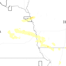
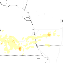


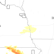
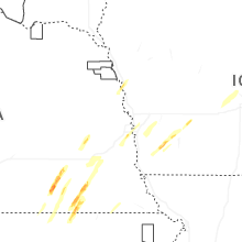
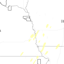
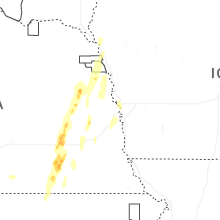
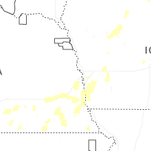
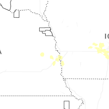
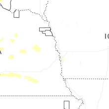
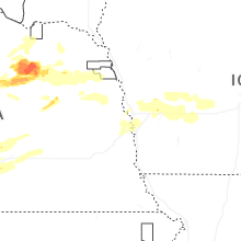
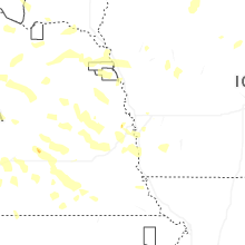

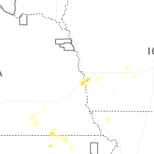

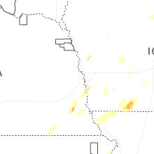


Connect with Interactive Hail Maps