

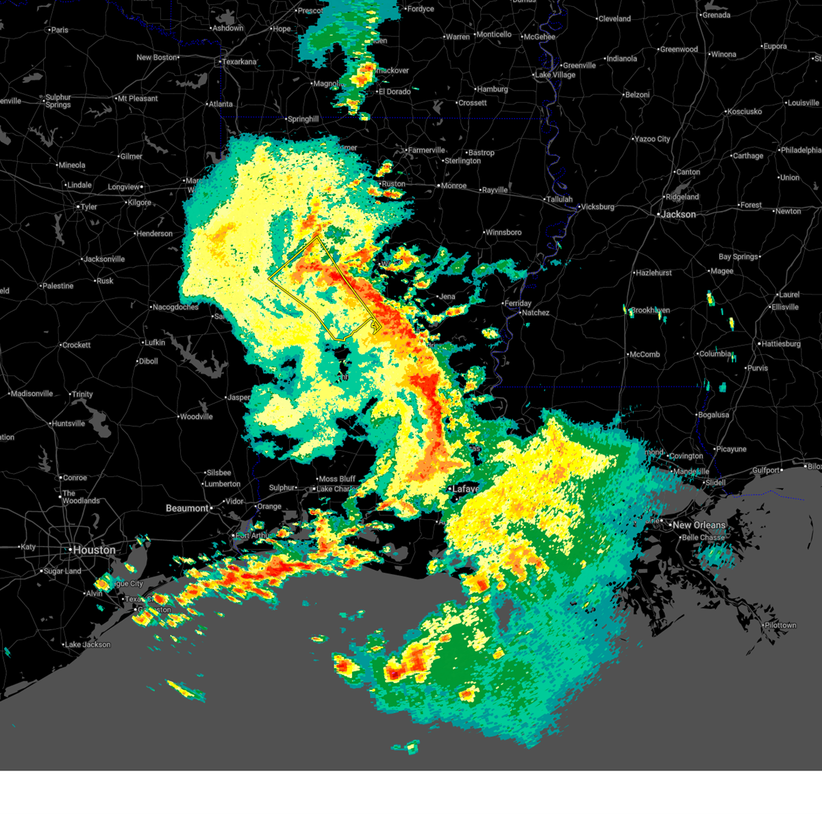
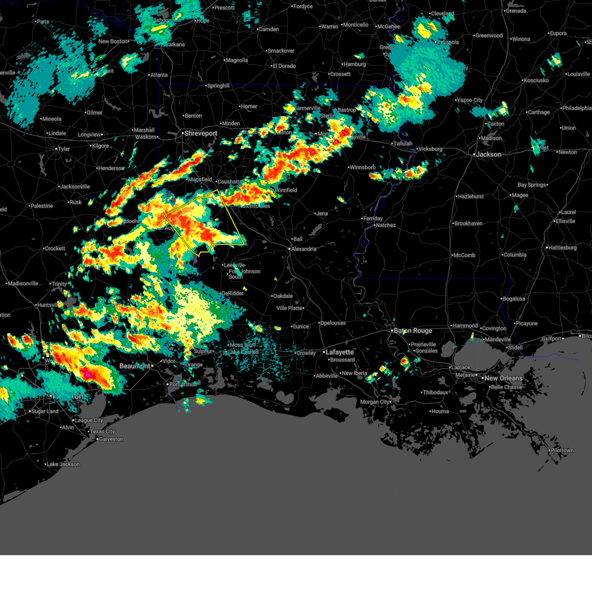
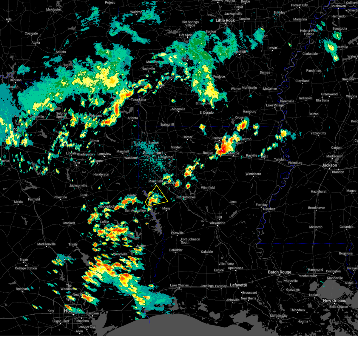
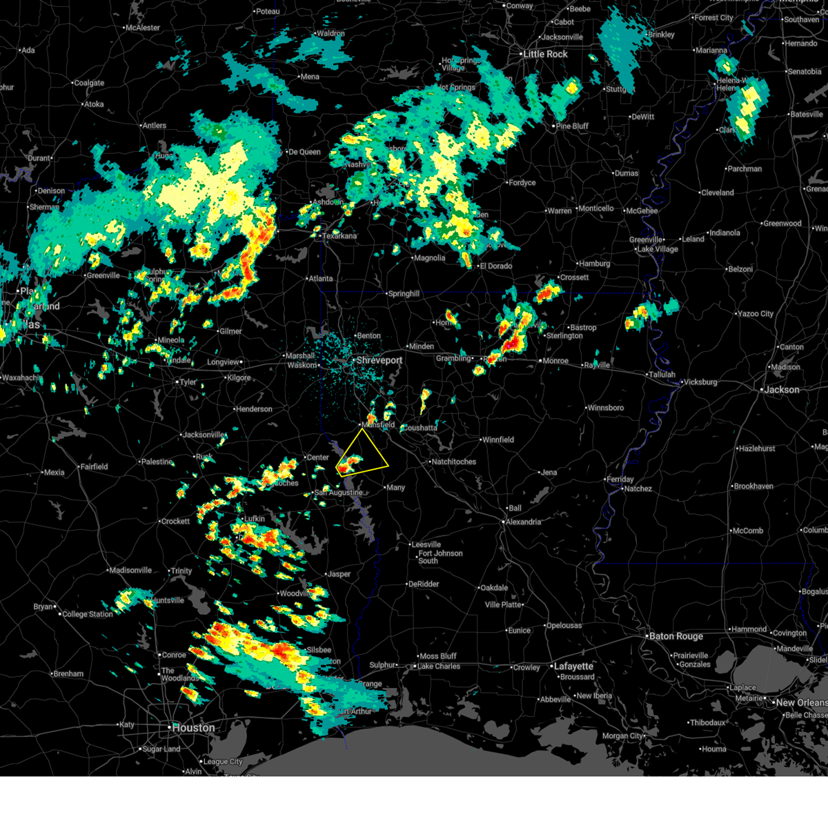
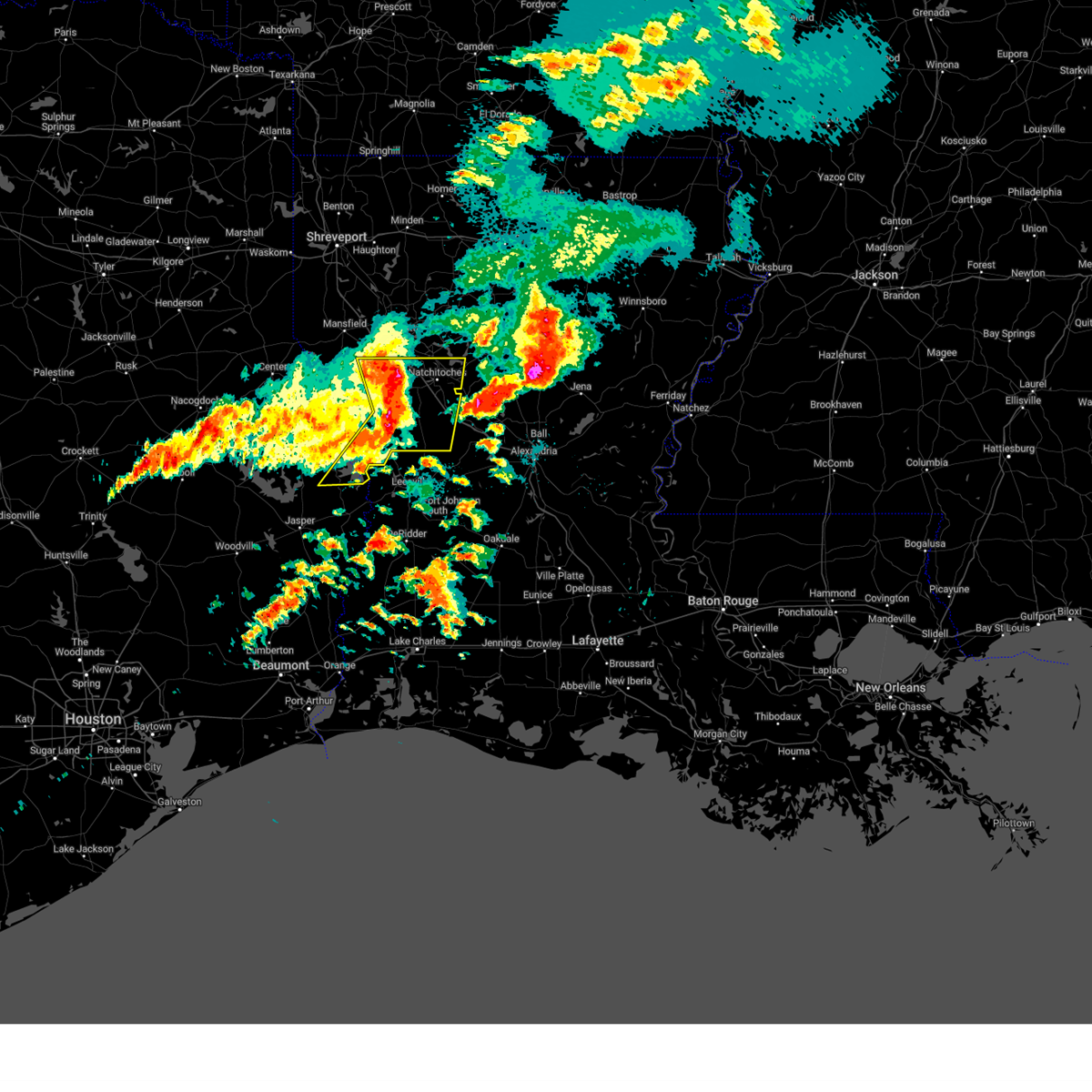
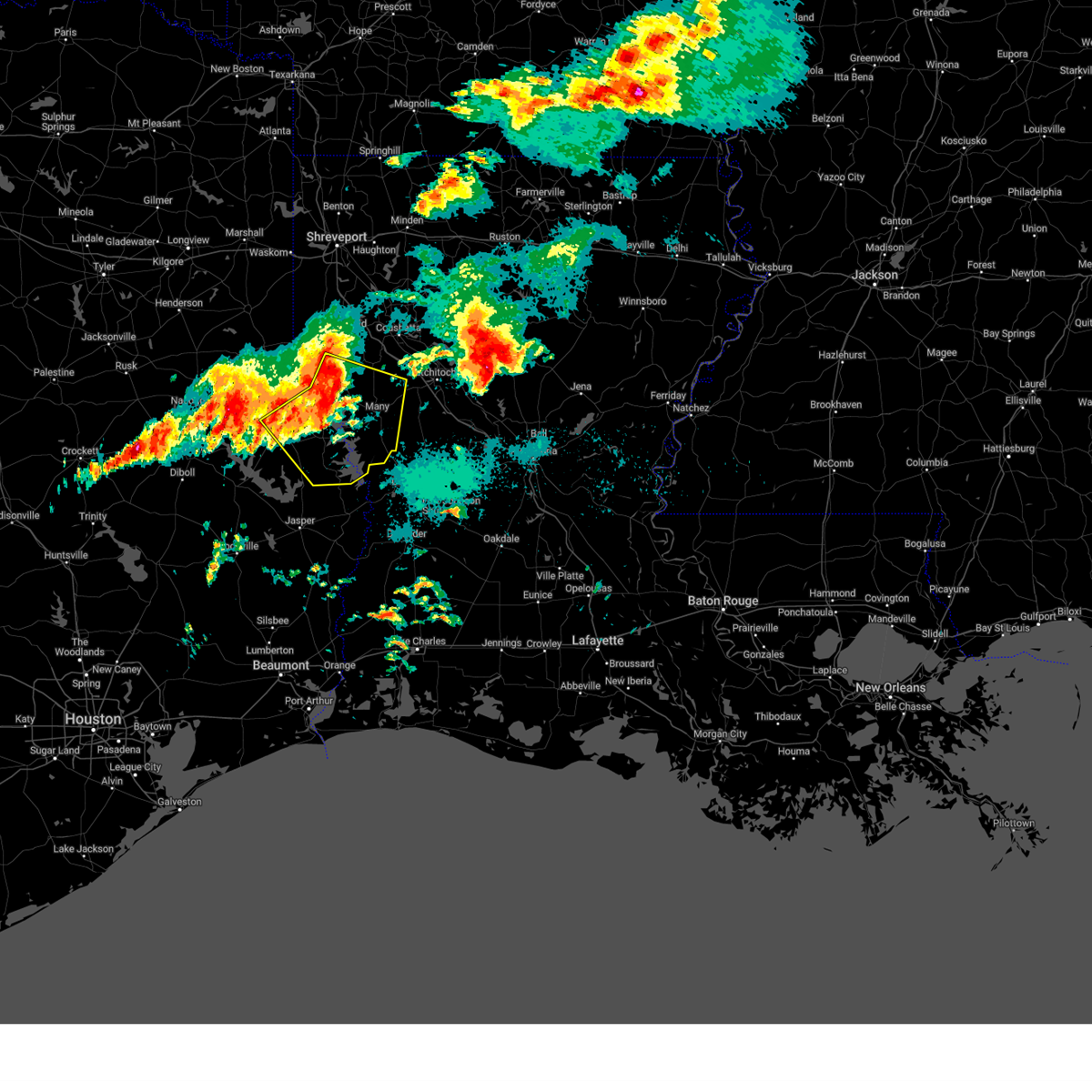
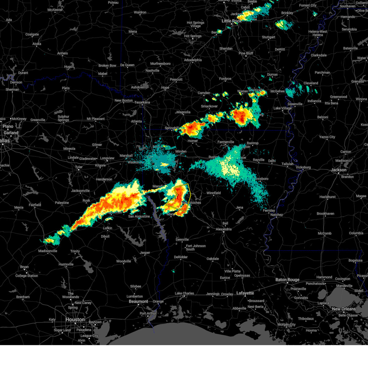
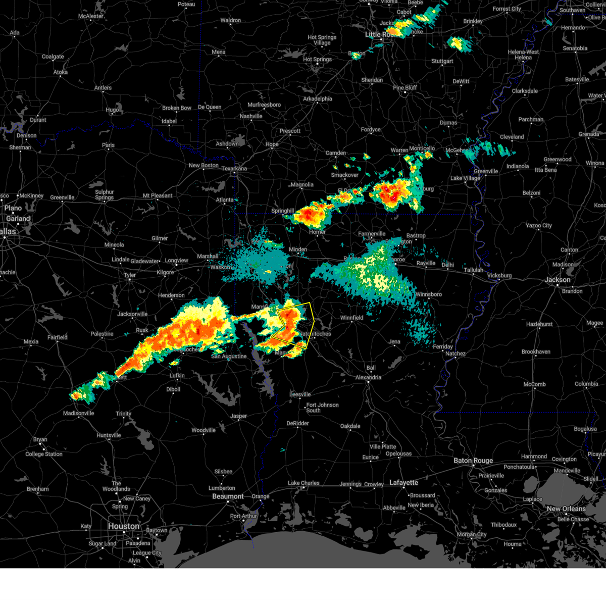
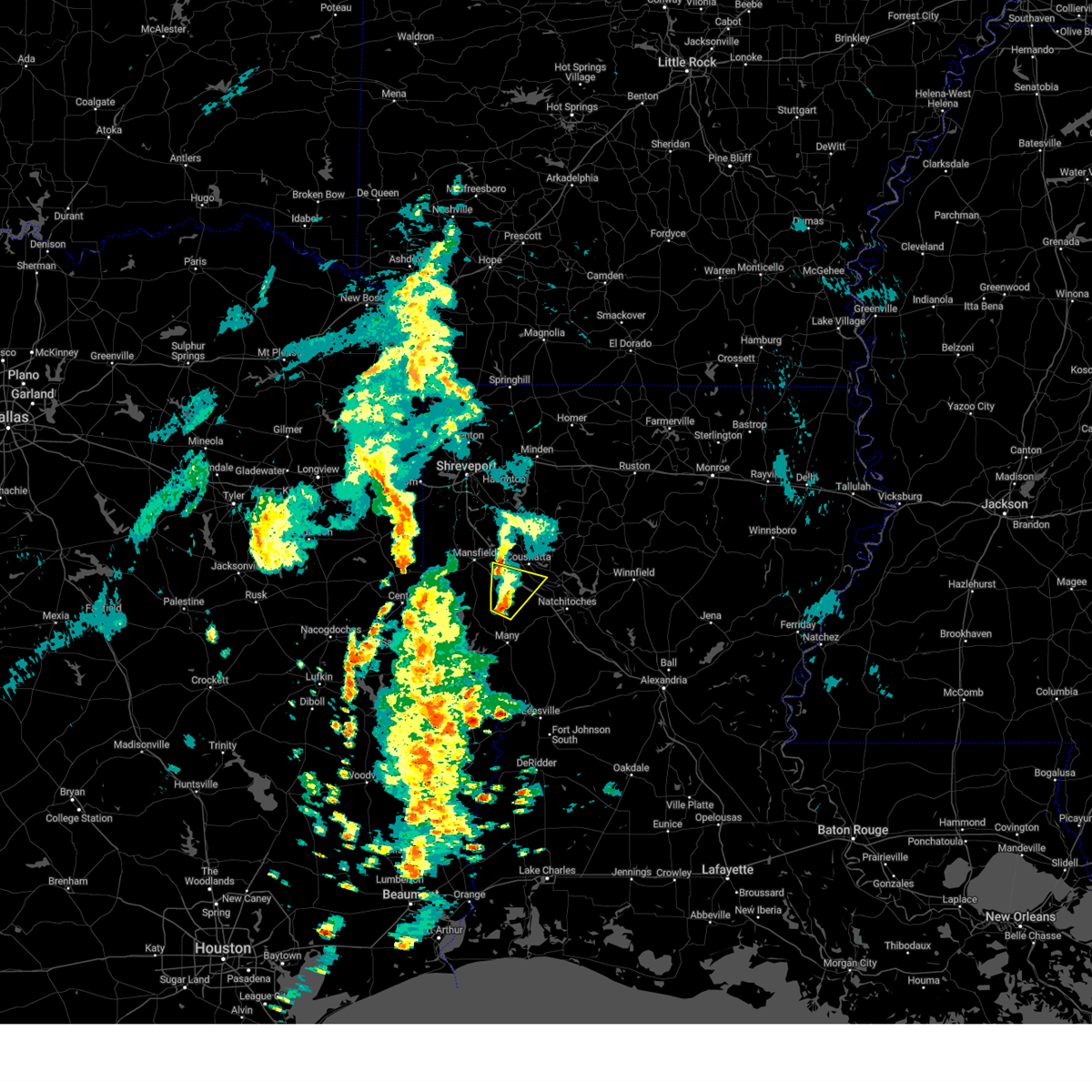
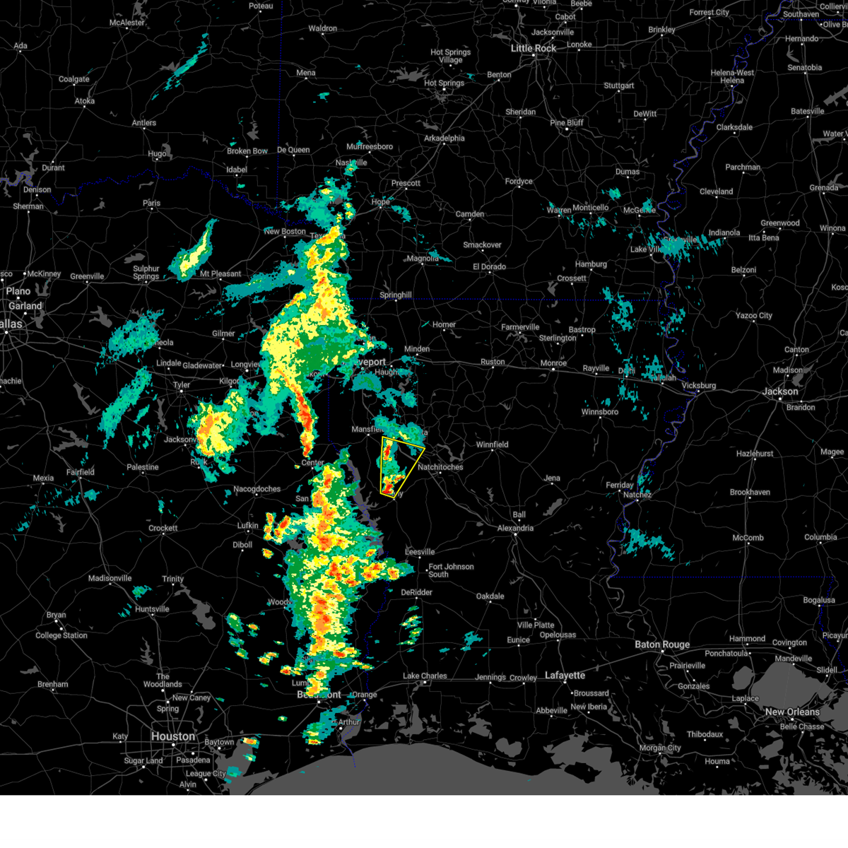
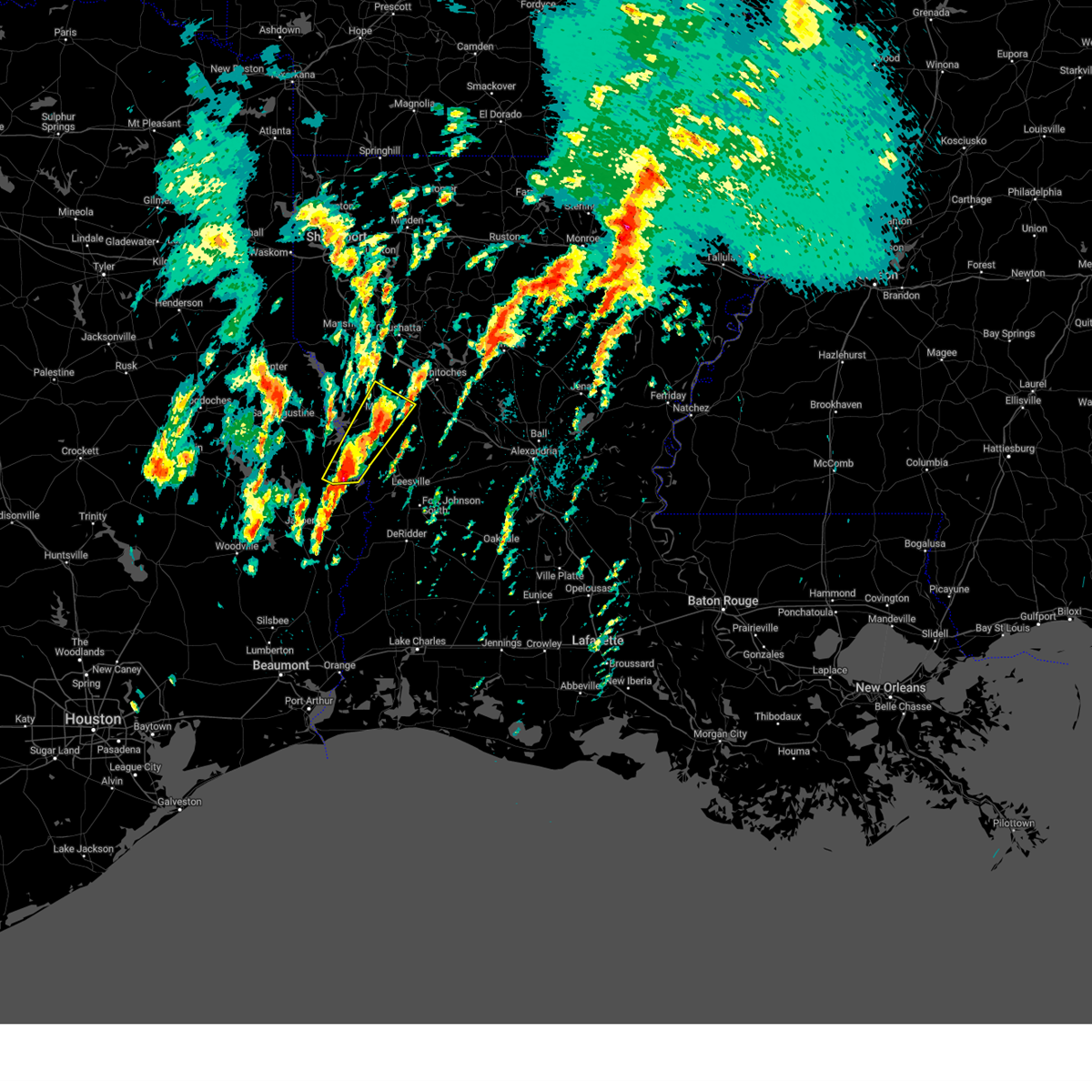
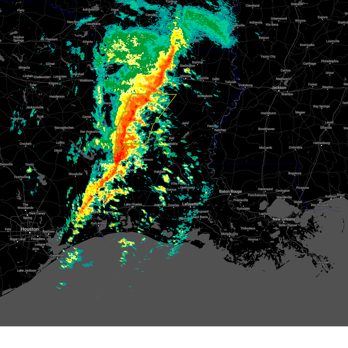
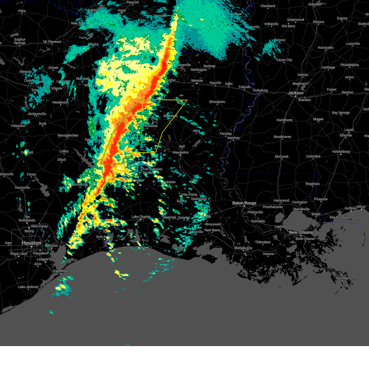
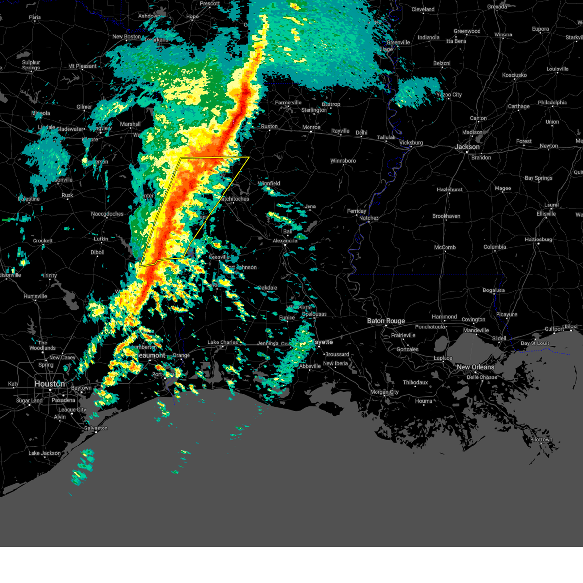
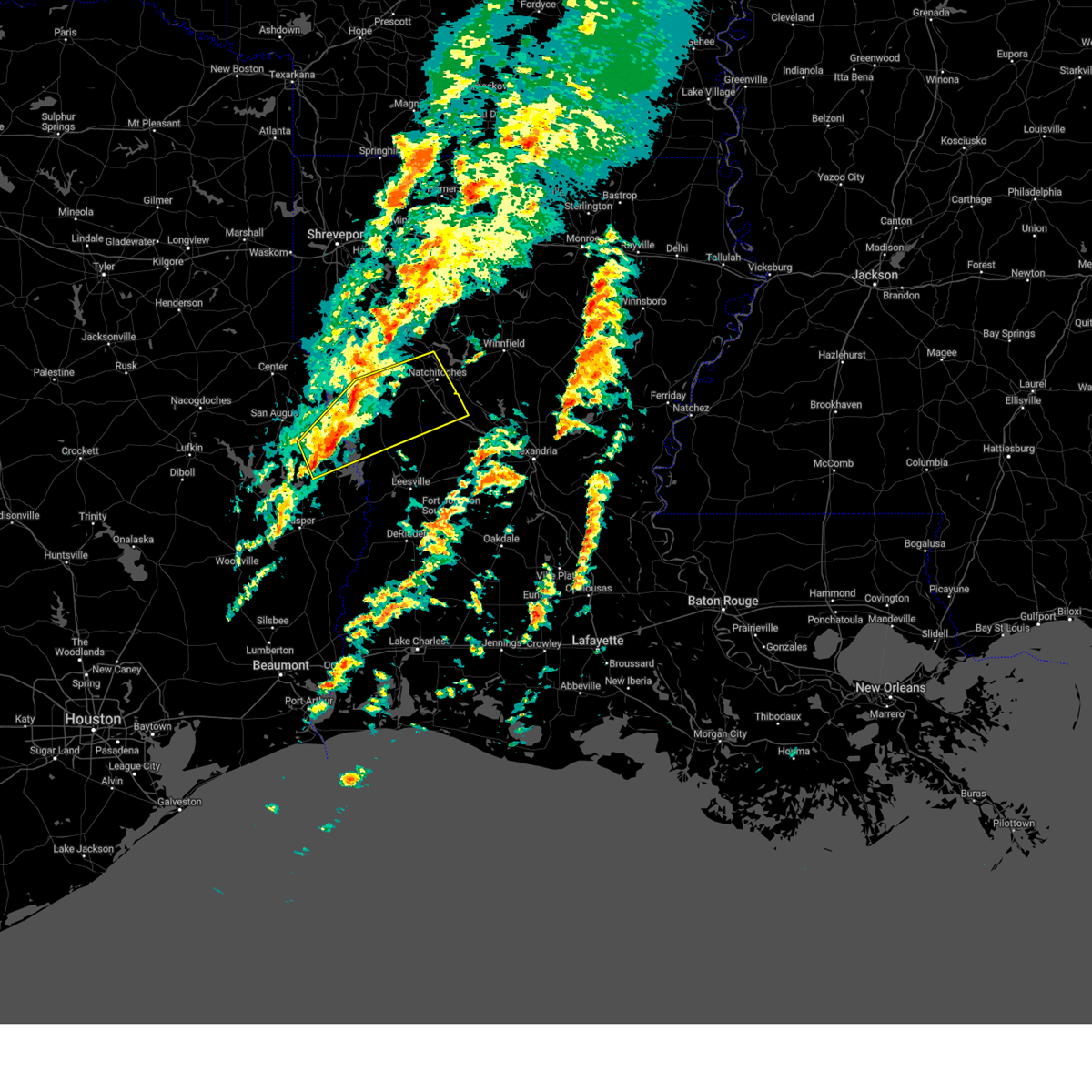
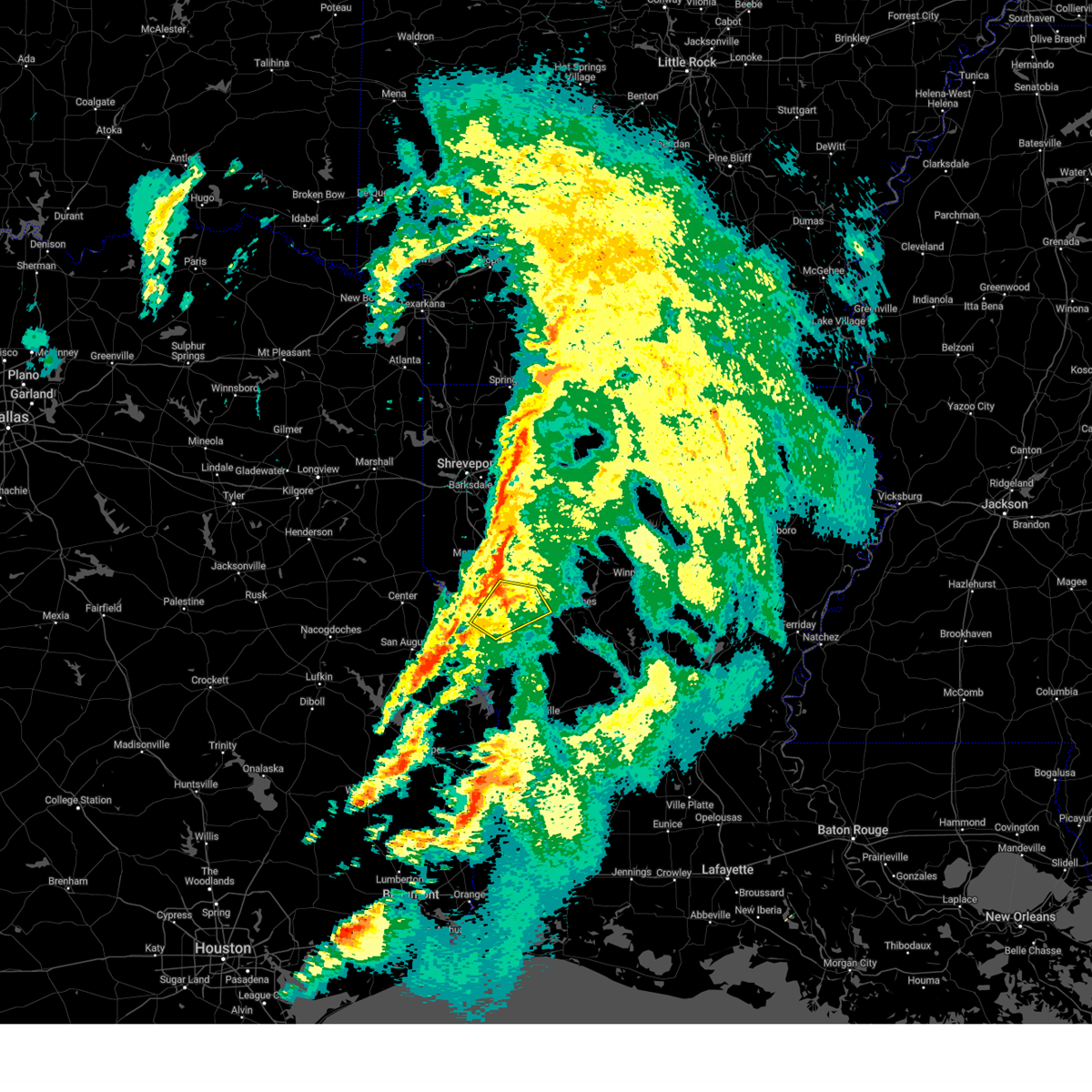
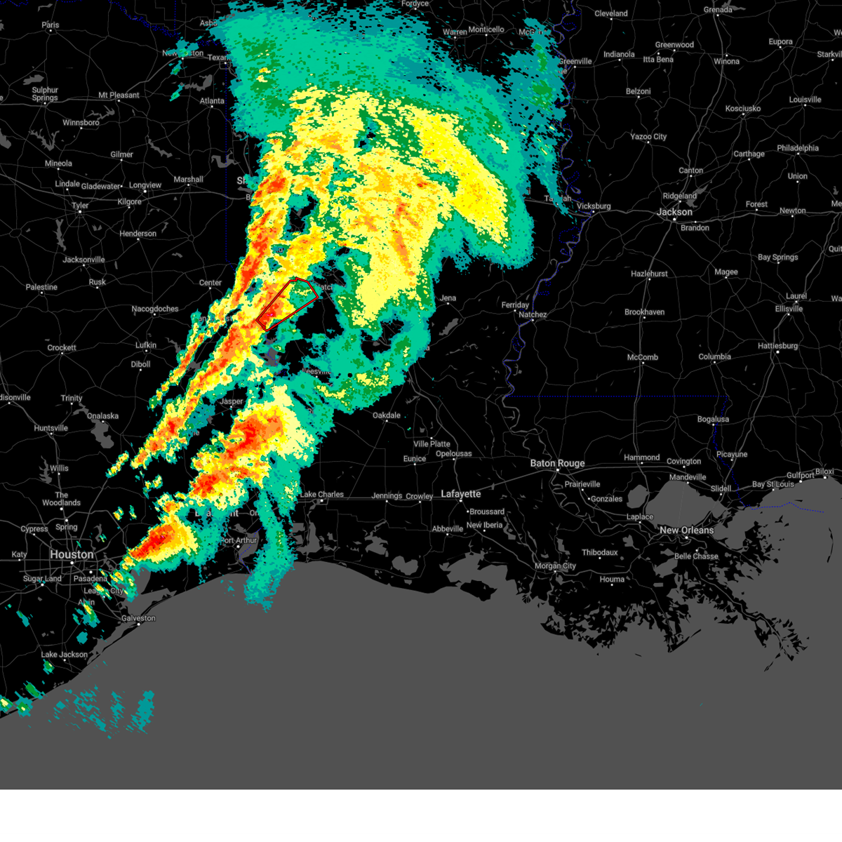
Hail Map for Belmont, LA
The Belmont, LA area has had 4 reports of on-the-ground hail by trained spotters, and has been under severe weather warnings 22 times during the past 12 months. Doppler radar has detected hail at or near Belmont, LA on 92 occasions, including 4 occasions during the past year.
| Name: | Belmont, LA |
| Where Located: | 56.4 miles SSE of Shreveport, LA |
| Map: | Google Map for Belmont, LA |
| Population: | 361 |
| Housing Units: | 154 |
| More Info: | Search Google for Belmont, LA |
4
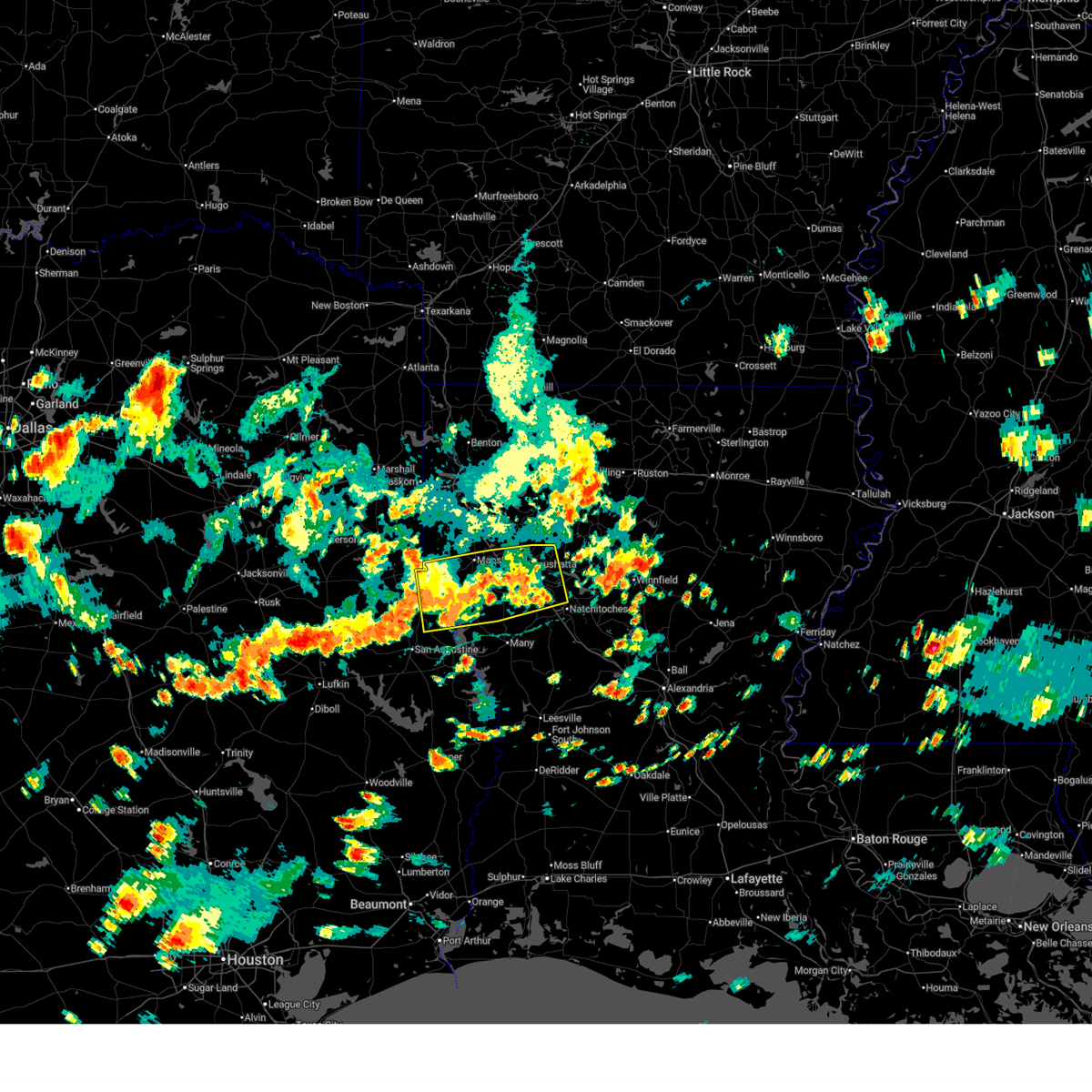
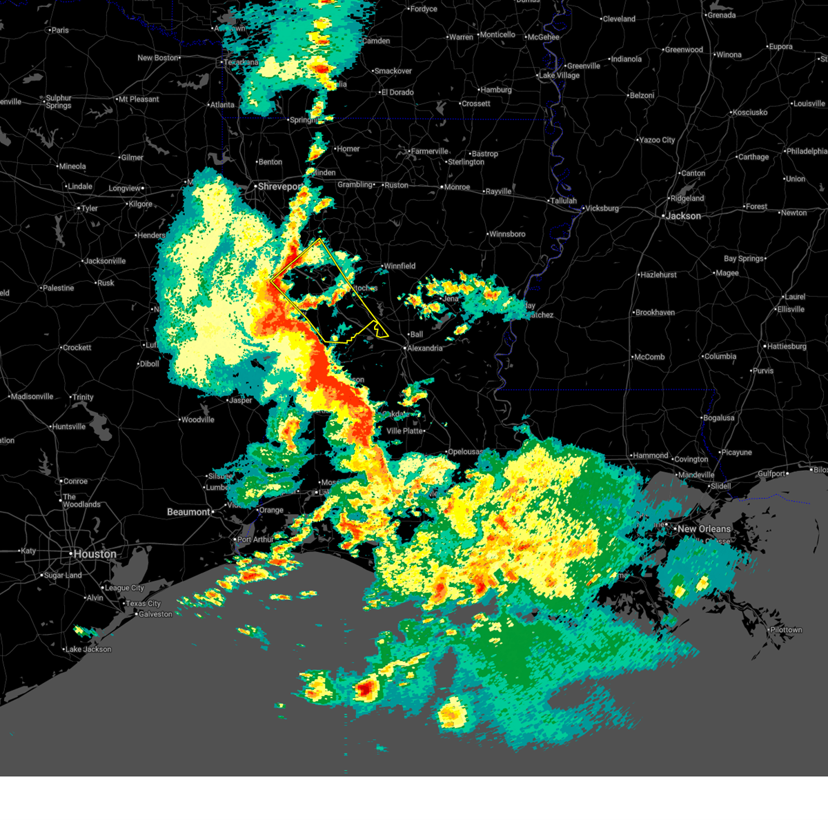
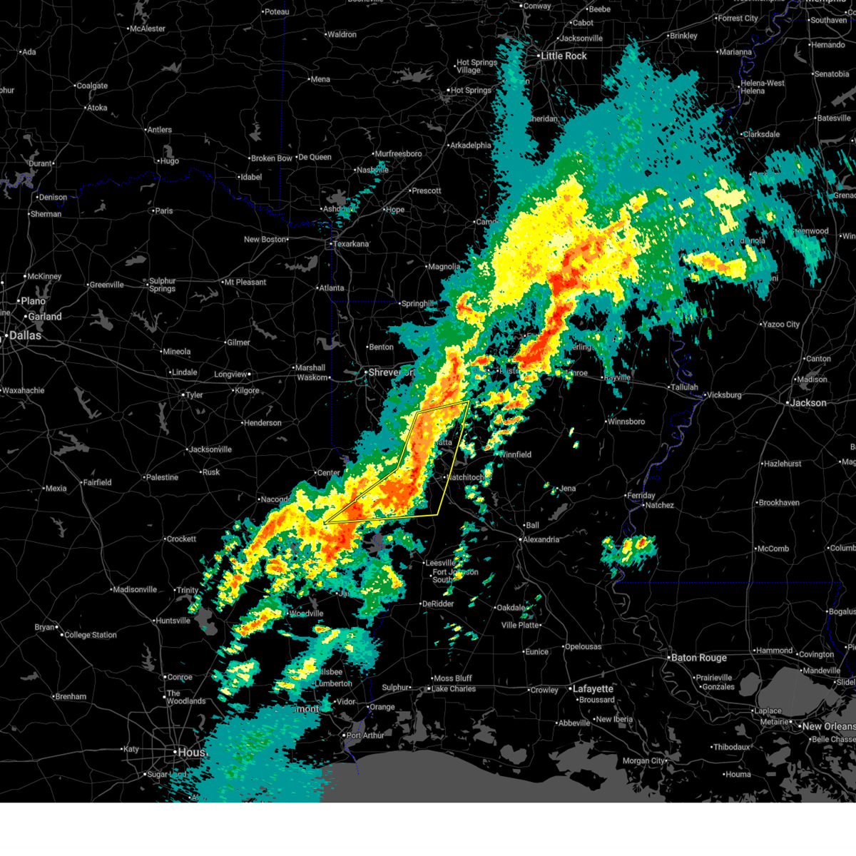
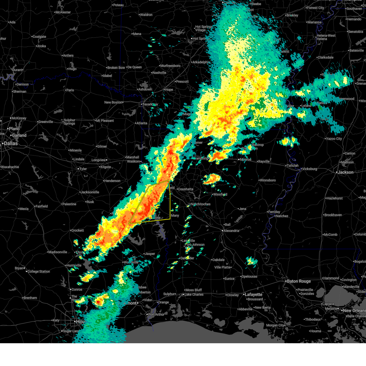
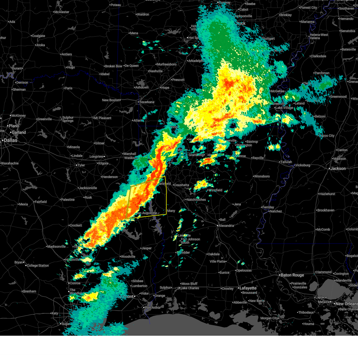
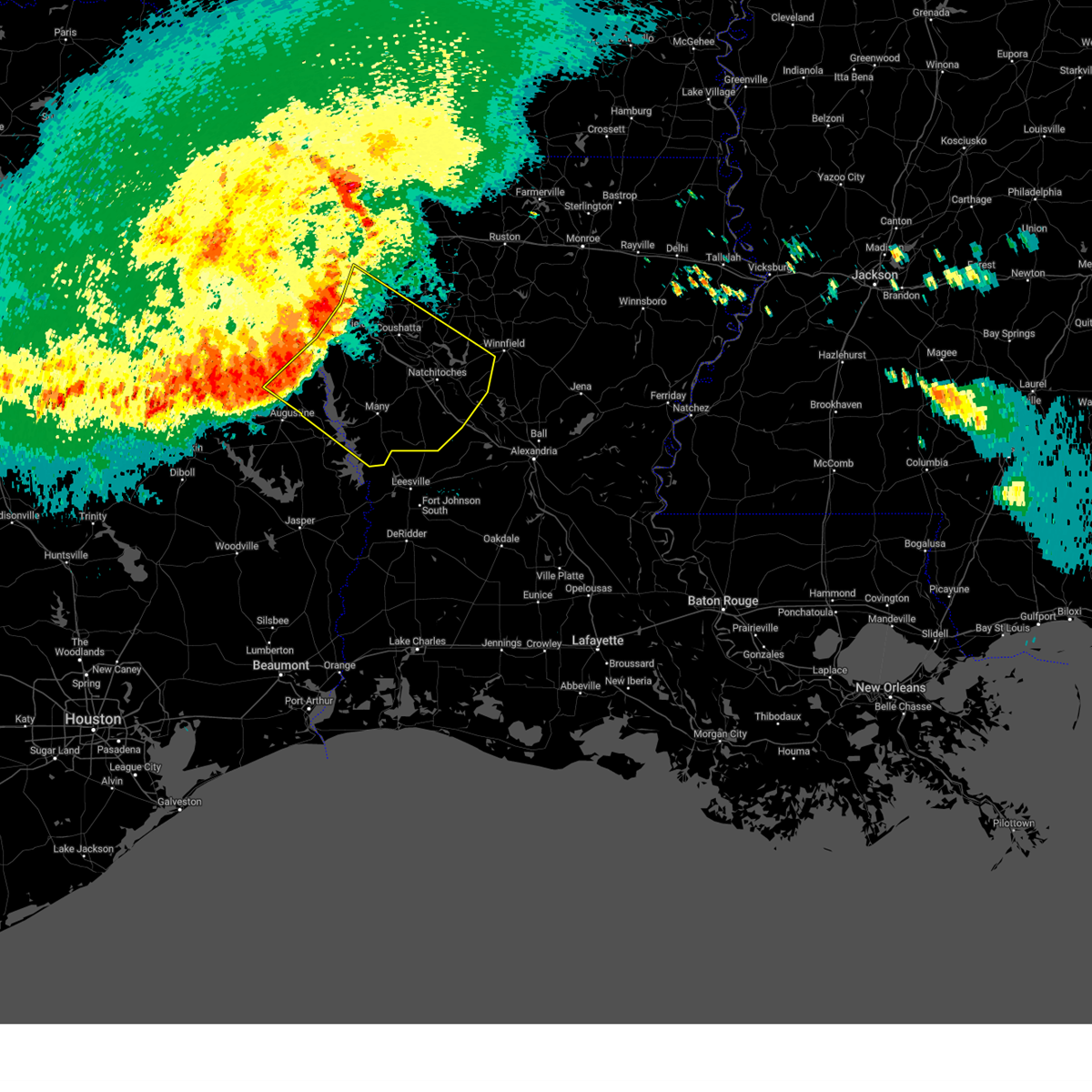
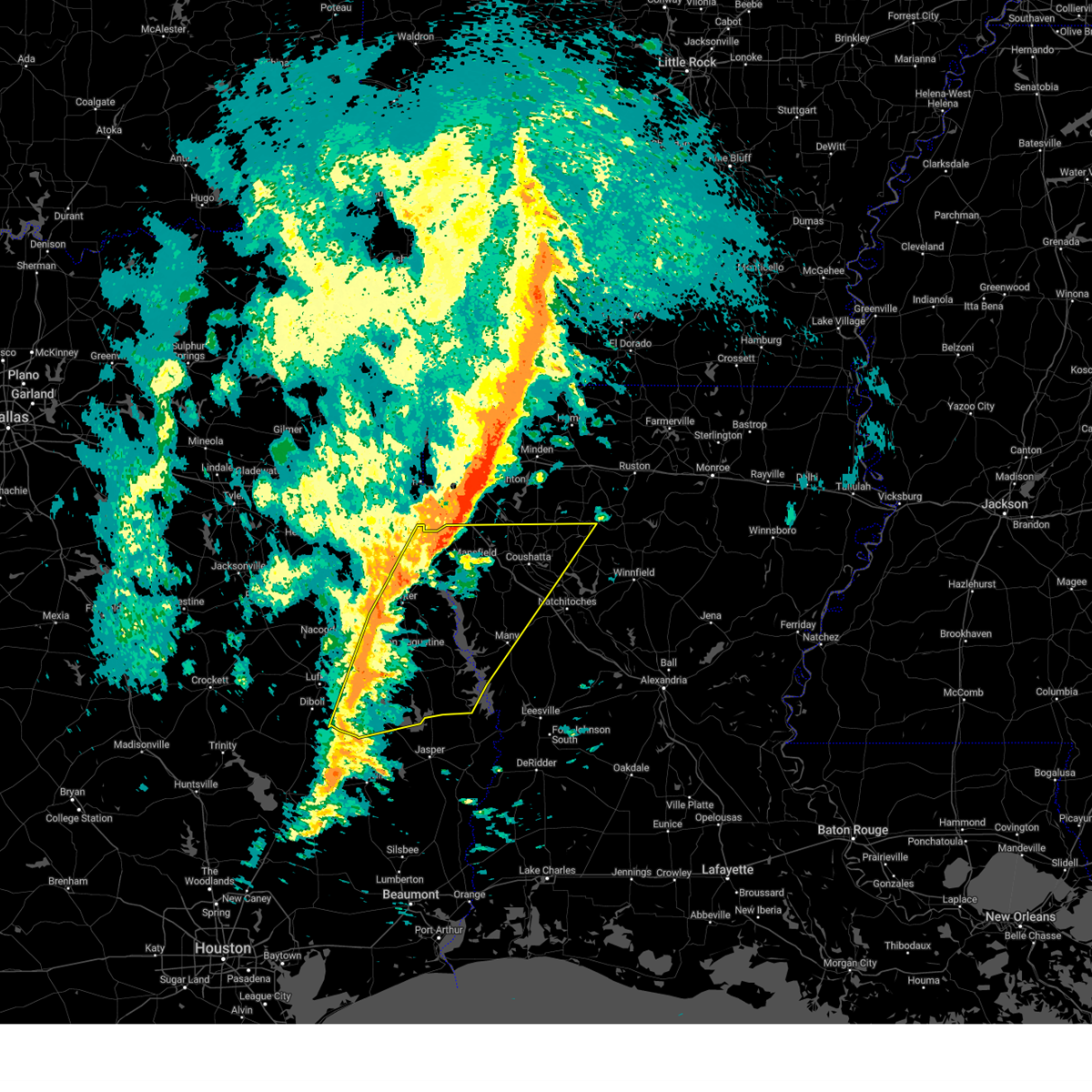
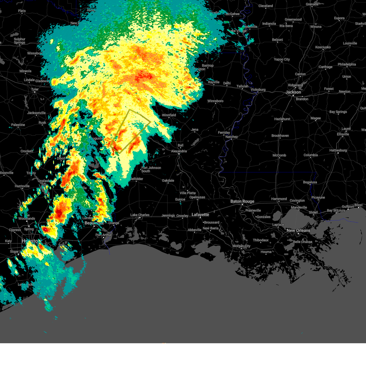
The Top Recent Hail Date for Belmont, LA is Sunday, March 15, 2026 (7th out of 92)

Hail and Wind Damage Spotted near Belmont, LA
| Date / Time | Report Details |
|---|---|
| 6/2/2026 4:40 PM CDT |
 The storms which prompted the warning have weakened below severe limits, and no longer pose an immediate threat to life or property. therefore, the warning will be allowed to expire. however, small hail, gusty winds, and heavy rain are still possible with these thunderstorms. to report severe weather, contact your nearest law enforcement agency. they will send your report to the national weather service office. The storms which prompted the warning have weakened below severe limits, and no longer pose an immediate threat to life or property. therefore, the warning will be allowed to expire. however, small hail, gusty winds, and heavy rain are still possible with these thunderstorms. to report severe weather, contact your nearest law enforcement agency. they will send your report to the national weather service office.
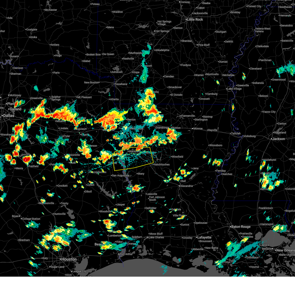
|
| 6/2/2026 3:55 PM CDT |
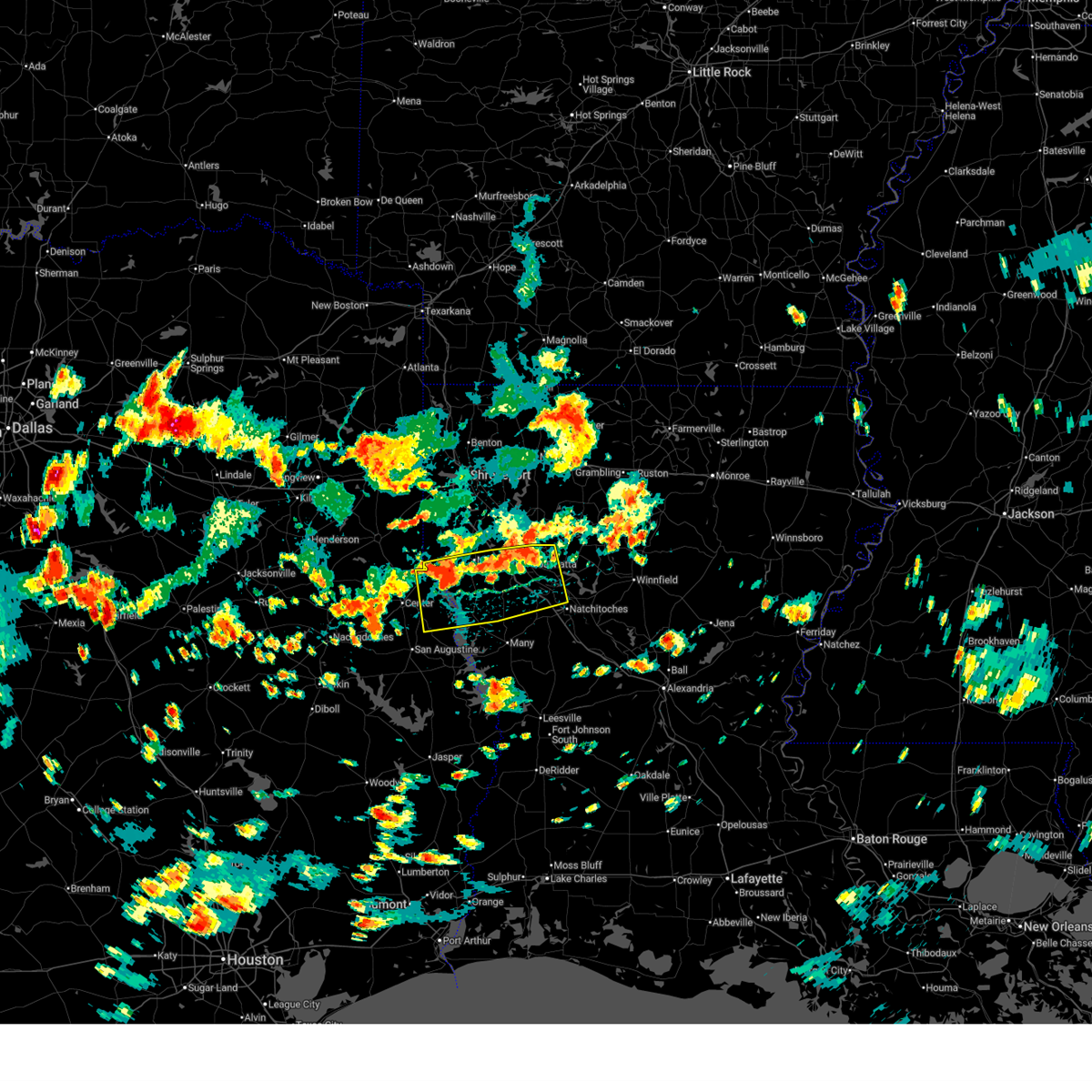 At 355 pm cdt, severe thunderstorms were located along a line from 8 miles southeast of coushatta to 8 miles south of joaquin, or along a line from 18 miles northwest of natchitoches to 11 miles northeast of center, moving south at 20 mph (radar indicated). Hazards include 60 mph wind gusts and quarter size hail. Hail damage to vehicles is expected. expect wind damage to roofs, siding, and trees. Locations impacted include, mansfield, coushatta, logansport, campti, joaquin, converse, patroon, allen, oak grove, pleasant hill, martin, huxley, south mansfield, noble, edgefield, powhatan, stanley, pelican and rambin. At 355 pm cdt, severe thunderstorms were located along a line from 8 miles southeast of coushatta to 8 miles south of joaquin, or along a line from 18 miles northwest of natchitoches to 11 miles northeast of center, moving south at 20 mph (radar indicated). Hazards include 60 mph wind gusts and quarter size hail. Hail damage to vehicles is expected. expect wind damage to roofs, siding, and trees. Locations impacted include, mansfield, coushatta, logansport, campti, joaquin, converse, patroon, allen, oak grove, pleasant hill, martin, huxley, south mansfield, noble, edgefield, powhatan, stanley, pelican and rambin.
|
| 6/2/2026 3:40 PM CDT |
 Svrshv the national weather service in shreveport has issued a * severe thunderstorm warning for, southern de soto parish in northwestern louisiana, northwestern natchitoches parish in northwestern louisiana, central red river parish in northwestern louisiana, northwestern sabine parish in northwestern louisiana, eastern shelby county in eastern texas, * until 445 pm cdt. * at 340 pm cdt, severe thunderstorms were located along a line from 5 miles east of coushatta to over logansport, or along a line from 22 miles northwest of natchitoches to 14 miles northeast of center, moving south at 20 mph (radar indicated). Hazards include 60 mph wind gusts and quarter size hail. Hail damage to vehicles is expected. Expect wind damage to roofs, siding, and trees. Svrshv the national weather service in shreveport has issued a * severe thunderstorm warning for, southern de soto parish in northwestern louisiana, northwestern natchitoches parish in northwestern louisiana, central red river parish in northwestern louisiana, northwestern sabine parish in northwestern louisiana, eastern shelby county in eastern texas, * until 445 pm cdt. * at 340 pm cdt, severe thunderstorms were located along a line from 5 miles east of coushatta to over logansport, or along a line from 22 miles northwest of natchitoches to 14 miles northeast of center, moving south at 20 mph (radar indicated). Hazards include 60 mph wind gusts and quarter size hail. Hail damage to vehicles is expected. Expect wind damage to roofs, siding, and trees.
|
| 5/23/2026 11:07 AM CDT |
 The storms which prompted the warning have moved out of the area. therefore, the warning will be allowed to expire. however, small hail, gusty winds, and heavy rain are still possible with these thunderstorms. to report severe weather, contact your nearest law enforcement agency. they will send your report to the national weather service office. a severe thunderstorm watch remains in effect until 600 pm cdt saturday for portions of north central and northwest louisiana. The storms which prompted the warning have moved out of the area. therefore, the warning will be allowed to expire. however, small hail, gusty winds, and heavy rain are still possible with these thunderstorms. to report severe weather, contact your nearest law enforcement agency. they will send your report to the national weather service office. a severe thunderstorm watch remains in effect until 600 pm cdt saturday for portions of north central and northwest louisiana.
|
| 5/23/2026 10:38 AM CDT |
 At 1038 am cdt, severe thunderstorms were located along a line from 10 miles southwest of coushatta to 8 miles southwest of colfax, or along a line from 18 miles southeast of mansfield to 27 miles southeast of natchitoches, moving northeast at 40 mph (radar indicated). Hazards include 60 mph wind gusts and small hail. Expect damage to roofs, siding, and trees. locations impacted include, natchitoches, coushatta, colfax, campti, montgomery, allen, pleasant hill, provencal, natchez, martin, clarence, robeline, powhatan, hagewood, flora, grand ecore, bermuda, cypress and st. Maurice. At 1038 am cdt, severe thunderstorms were located along a line from 10 miles southwest of coushatta to 8 miles southwest of colfax, or along a line from 18 miles southeast of mansfield to 27 miles southeast of natchitoches, moving northeast at 40 mph (radar indicated). Hazards include 60 mph wind gusts and small hail. Expect damage to roofs, siding, and trees. locations impacted include, natchitoches, coushatta, colfax, campti, montgomery, allen, pleasant hill, provencal, natchez, martin, clarence, robeline, powhatan, hagewood, flora, grand ecore, bermuda, cypress and st. Maurice.
|
| 5/23/2026 10:08 AM CDT |
 Svrshv the national weather service in shreveport has issued a * severe thunderstorm warning for, southwestern grant parish in north central louisiana, southwestern winn parish in north central louisiana, southeastern de soto parish in northwestern louisiana, natchitoches parish in northwestern louisiana, southeastern red river parish in northwestern louisiana, northeastern sabine parish in northwestern louisiana, * until 1115 am cdt. * at 1008 am cdt, severe thunderstorms were located along a line from 9 miles east of converse to 28 miles southwest of colfax, or along a line from 20 miles southeast of mansfield to 33 miles south of natchitoches, moving northeast at 40 mph (radar indicated). Hazards include 60 mph wind gusts and quarter size hail. Hail damage to vehicles is expected. Expect wind damage to roofs, siding, and trees. Svrshv the national weather service in shreveport has issued a * severe thunderstorm warning for, southwestern grant parish in north central louisiana, southwestern winn parish in north central louisiana, southeastern de soto parish in northwestern louisiana, natchitoches parish in northwestern louisiana, southeastern red river parish in northwestern louisiana, northeastern sabine parish in northwestern louisiana, * until 1115 am cdt. * at 1008 am cdt, severe thunderstorms were located along a line from 9 miles east of converse to 28 miles southwest of colfax, or along a line from 20 miles southeast of mansfield to 33 miles south of natchitoches, moving northeast at 40 mph (radar indicated). Hazards include 60 mph wind gusts and quarter size hail. Hail damage to vehicles is expected. Expect wind damage to roofs, siding, and trees.
|
| 5/10/2026 4:02 PM CDT |
 At 402 pm cdt, a severe thunderstorm was located 13 miles north of many, or just southeast of pleasant hill, moving southeast at 15 mph (public reported. at 351 pm, the public reported quarter size hail in pleasant hill from this storm). Hazards include 60 mph wind gusts and half dollar size hail. Hail damage to vehicles is expected. expect wind damage to roofs, siding, and trees. Locations impacted include, pleasant hill and marthaville. At 402 pm cdt, a severe thunderstorm was located 13 miles north of many, or just southeast of pleasant hill, moving southeast at 15 mph (public reported. at 351 pm, the public reported quarter size hail in pleasant hill from this storm). Hazards include 60 mph wind gusts and half dollar size hail. Hail damage to vehicles is expected. expect wind damage to roofs, siding, and trees. Locations impacted include, pleasant hill and marthaville.
|
| 5/10/2026 3:40 PM CDT |
 Svrshv the national weather service in shreveport has issued a * severe thunderstorm warning for, west central natchitoches parish in northwestern louisiana, northeastern sabine parish in northwestern louisiana, * until 430 pm cdt. * at 340 pm cdt, a severe thunderstorm was located 8 miles east of converse, or just west of pleasant hill, moving southeast at 15 mph (radar indicated). Hazards include 60 mph wind gusts and half dollar size hail. Hail damage to vehicles is expected. Expect wind damage to roofs, siding, and trees. Svrshv the national weather service in shreveport has issued a * severe thunderstorm warning for, west central natchitoches parish in northwestern louisiana, northeastern sabine parish in northwestern louisiana, * until 430 pm cdt. * at 340 pm cdt, a severe thunderstorm was located 8 miles east of converse, or just west of pleasant hill, moving southeast at 15 mph (radar indicated). Hazards include 60 mph wind gusts and half dollar size hail. Hail damage to vehicles is expected. Expect wind damage to roofs, siding, and trees.
|
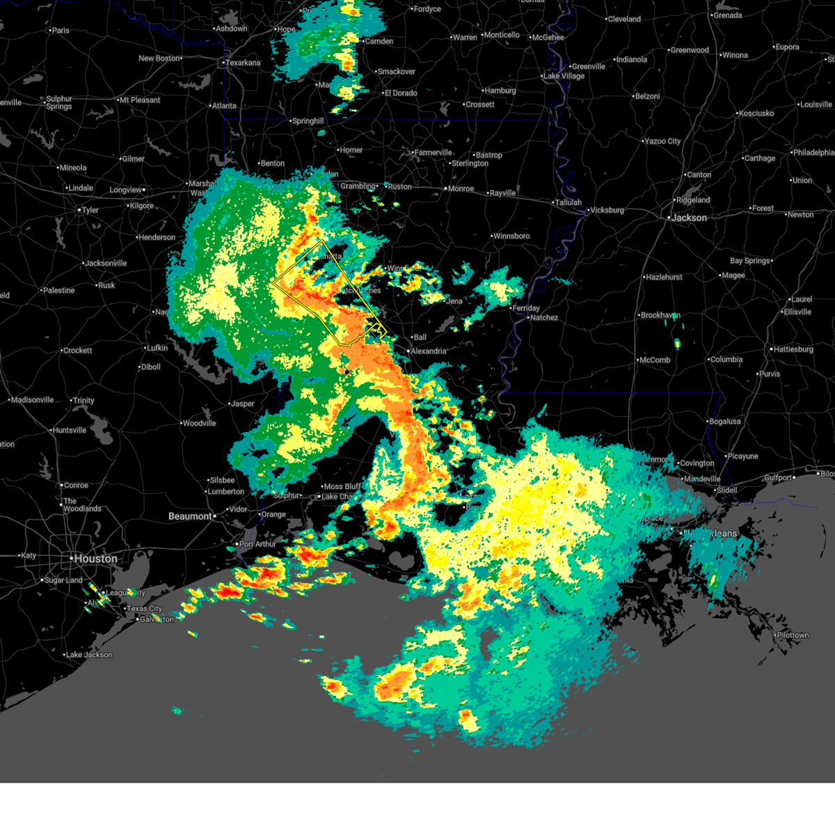
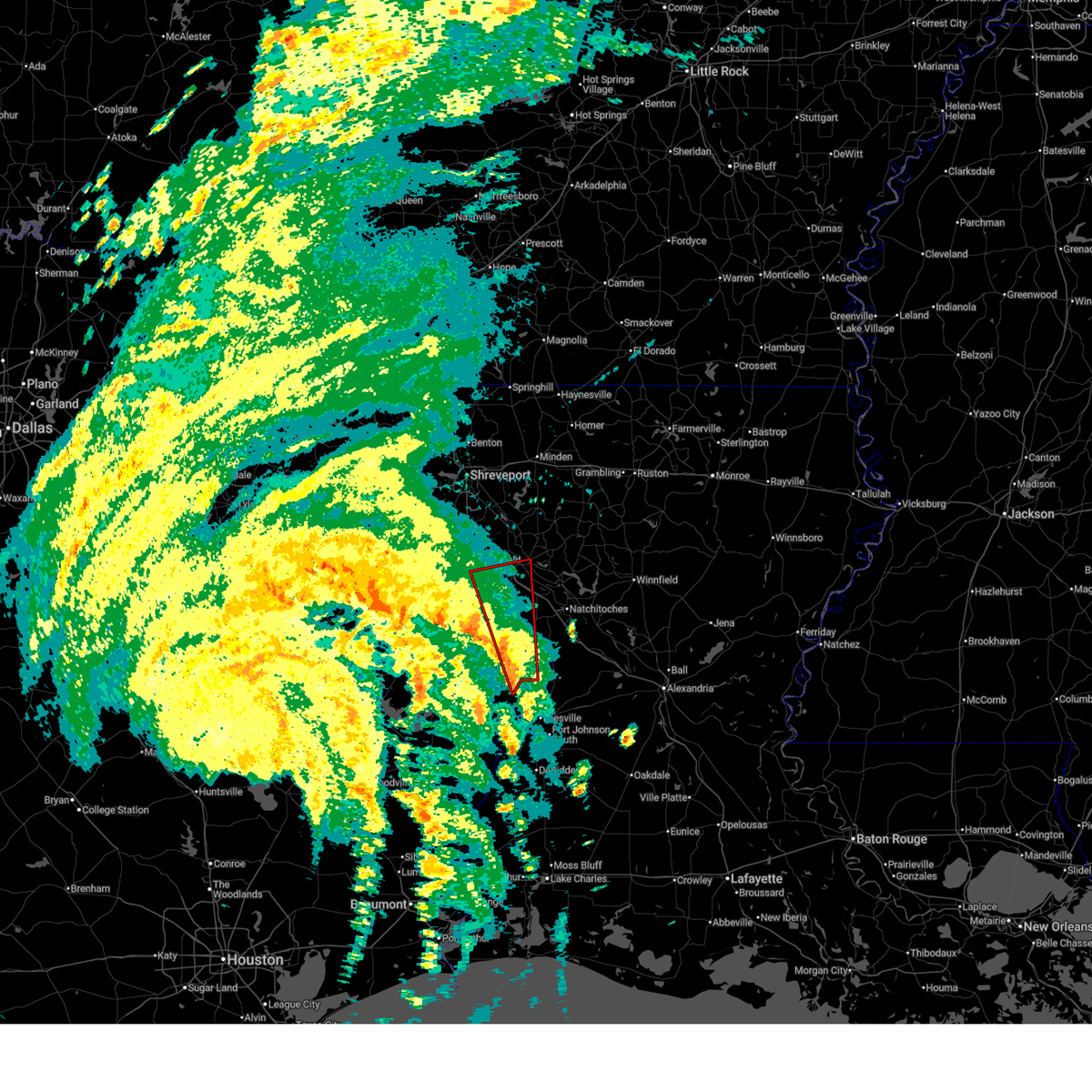
| 3/15/2026 7:51 PM CDT |
 the severe thunderstorm warning has been cancelled and is no longer in effect the severe thunderstorm warning has been cancelled and is no longer in effect
|
| 3/15/2026 7:51 PM CDT |
 At 751 pm cdt, severe thunderstorms were located along a line from 8 miles east of coushatta to 7 miles northwest of many, or along a line from 20 miles north of natchitoches to 26 miles west of natchitoches, moving east at 35 mph (radar indicated). Hazards include 60 mph wind gusts and quarter size hail. Hail damage to vehicles is expected. expect wind damage to roofs, siding, and trees. Locations impacted include, many, coushatta, zwolle, allen, pleasant hill, powhatan, marthaville, belmont, ajax, rambin, lake end, evelyn, hanna and armistead. At 751 pm cdt, severe thunderstorms were located along a line from 8 miles east of coushatta to 7 miles northwest of many, or along a line from 20 miles north of natchitoches to 26 miles west of natchitoches, moving east at 35 mph (radar indicated). Hazards include 60 mph wind gusts and quarter size hail. Hail damage to vehicles is expected. expect wind damage to roofs, siding, and trees. Locations impacted include, many, coushatta, zwolle, allen, pleasant hill, powhatan, marthaville, belmont, ajax, rambin, lake end, evelyn, hanna and armistead.
|
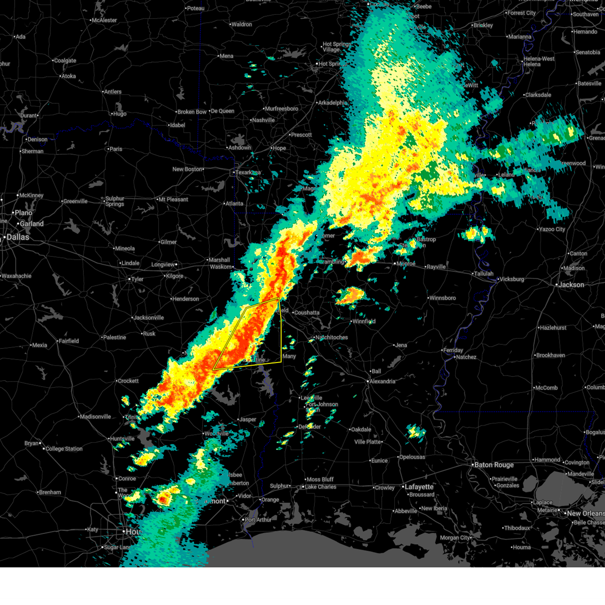
| 3/15/2026 7:32 PM CDT |
 At 732 pm cdt, severe thunderstorms were located along a line from near coushatta to 8 miles west of zwolle, or along a line from 17 miles east of mansfield to 27 miles southeast of center, moving east at 30 mph (radar indicated). Hazards include 60 mph wind gusts and quarter size hail. Hail damage to vehicles is expected. expect wind damage to roofs, siding, and trees. Locations impacted include, many, coushatta, zwolle, converse, allen, oak grove, pleasant hill, noble, powhatan, belmont, pelican, marthaville, ajax, rambin, evelyn, lake end, hanna, armistead, toledo bend reservoir north and grand bayou. At 732 pm cdt, severe thunderstorms were located along a line from near coushatta to 8 miles west of zwolle, or along a line from 17 miles east of mansfield to 27 miles southeast of center, moving east at 30 mph (radar indicated). Hazards include 60 mph wind gusts and quarter size hail. Hail damage to vehicles is expected. expect wind damage to roofs, siding, and trees. Locations impacted include, many, coushatta, zwolle, converse, allen, oak grove, pleasant hill, noble, powhatan, belmont, pelican, marthaville, ajax, rambin, evelyn, lake end, hanna, armistead, toledo bend reservoir north and grand bayou.
|
| 3/15/2026 7:15 PM CDT |
 Svrshv the national weather service in shreveport has issued a * severe thunderstorm warning for, southeastern de soto parish in northwestern louisiana, northwestern natchitoches parish in northwestern louisiana, southern red river parish in northwestern louisiana, northern sabine parish in northwestern louisiana, north central sabine county in eastern texas, southeastern shelby county in eastern texas, * until 815 pm cdt. * at 715 pm cdt, severe thunderstorms were located along a line from 6 miles northeast of mansfield to near patroon, or along a line from 6 miles northeast of mansfield to 19 miles southeast of center, moving east at 30 mph (radar indicated). Hazards include 60 mph wind gusts and quarter size hail. Hail damage to vehicles is expected. Expect wind damage to roofs, siding, and trees. Svrshv the national weather service in shreveport has issued a * severe thunderstorm warning for, southeastern de soto parish in northwestern louisiana, northwestern natchitoches parish in northwestern louisiana, southern red river parish in northwestern louisiana, northern sabine parish in northwestern louisiana, north central sabine county in eastern texas, southeastern shelby county in eastern texas, * until 815 pm cdt. * at 715 pm cdt, severe thunderstorms were located along a line from 6 miles northeast of mansfield to near patroon, or along a line from 6 miles northeast of mansfield to 19 miles southeast of center, moving east at 30 mph (radar indicated). Hazards include 60 mph wind gusts and quarter size hail. Hail damage to vehicles is expected. Expect wind damage to roofs, siding, and trees.
|
| 2/14/2026 7:27 PM CST |
 Svrshv the national weather service in shreveport has issued a * severe thunderstorm warning for, west central grant parish in north central louisiana, southwestern winn parish in north central louisiana, natchitoches parish in northwestern louisiana, eastern sabine parish in northwestern louisiana, southeastern sabine county in eastern texas, * until 815 pm cst. * at 727 pm cst, severe thunderstorms were located along a line from 8 miles west of campti to 19 miles south of many, or along a line from 15 miles northwest of natchitoches to 36 miles southwest of natchitoches, moving east at 30 mph (radar indicated). Hazards include 60 mph wind gusts. expect damage to roofs, siding, and trees Svrshv the national weather service in shreveport has issued a * severe thunderstorm warning for, west central grant parish in north central louisiana, southwestern winn parish in north central louisiana, natchitoches parish in northwestern louisiana, eastern sabine parish in northwestern louisiana, southeastern sabine county in eastern texas, * until 815 pm cst. * at 727 pm cst, severe thunderstorms were located along a line from 8 miles west of campti to 19 miles south of many, or along a line from 15 miles northwest of natchitoches to 36 miles southwest of natchitoches, moving east at 30 mph (radar indicated). Hazards include 60 mph wind gusts. expect damage to roofs, siding, and trees
|
| 11/24/2025 9:30 PM CST |
 The storms which prompted the warning have weakened below severe limits, and no longer pose an immediate threat to life or property. therefore, the warning has been allowed to expire. however, small hail, gusty winds, and heavy rain are still possible with these thunderstorms. to report severe weather, contact your nearest law enforcement agency. they will send your report to the national weather service office. The storms which prompted the warning have weakened below severe limits, and no longer pose an immediate threat to life or property. therefore, the warning has been allowed to expire. however, small hail, gusty winds, and heavy rain are still possible with these thunderstorms. to report severe weather, contact your nearest law enforcement agency. they will send your report to the national weather service office.
|
| 11/24/2025 9:15 PM CST |
 At 915 pm cst, severe thunderstorms were located along a line from 17 miles southeast of ringgold to near many, or along a line from 21 miles west of jonesboro to 20 miles southwest of natchitoches, moving east at 60 mph (radar indicated). Hazards include 60 mph wind gusts and small hail. Expect damage to roofs, siding, and trees. Locations impacted include, natchitoches, milam, many, coushatta, zwolle, campti, allen, pleasant hill, florien, provencal, martin, clarence, hall summit, saline, lucky, ashland, castor, noble, fisher and edgefield. At 915 pm cst, severe thunderstorms were located along a line from 17 miles southeast of ringgold to near many, or along a line from 21 miles west of jonesboro to 20 miles southwest of natchitoches, moving east at 60 mph (radar indicated). Hazards include 60 mph wind gusts and small hail. Expect damage to roofs, siding, and trees. Locations impacted include, natchitoches, milam, many, coushatta, zwolle, campti, allen, pleasant hill, florien, provencal, martin, clarence, hall summit, saline, lucky, ashland, castor, noble, fisher and edgefield.
|
| 11/24/2025 9:15 PM CST |
 the severe thunderstorm warning has been cancelled and is no longer in effect the severe thunderstorm warning has been cancelled and is no longer in effect
|
| 11/24/2025 9:03 PM CST |
 At 903 pm cst, severe thunderstorms were located along a line from 10 miles northeast of coushatta to 5 miles southeast of zwolle, or along a line from 28 miles east of mansfield to 31 miles west of natchitoches, moving east at 60 mph (radar indicated). Hazards include 60 mph wind gusts and small hail. Expect damage to roofs, siding, and trees. Locations impacted include, natchitoches, milam, many, san augustine, coushatta, zwolle, campti, converse, allen, oak grove, pleasant hill, florien, provencal, martin, clarence, hall summit, saline, lucky, ashland and castor. At 903 pm cst, severe thunderstorms were located along a line from 10 miles northeast of coushatta to 5 miles southeast of zwolle, or along a line from 28 miles east of mansfield to 31 miles west of natchitoches, moving east at 60 mph (radar indicated). Hazards include 60 mph wind gusts and small hail. Expect damage to roofs, siding, and trees. Locations impacted include, natchitoches, milam, many, san augustine, coushatta, zwolle, campti, converse, allen, oak grove, pleasant hill, florien, provencal, martin, clarence, hall summit, saline, lucky, ashland and castor.
|
| 11/24/2025 8:45 PM CST |
 The severe thunderstorm warning that was previously in effect has been reissued for red river parish, de soto parish, san augustine county, sabine county, shelby county, and sabine parish and is in effect until 930 pm cst. please refer to that bulletin for the latest severe weather information. to report severe weather, contact your nearest law enforcement agency. they will send your report to the national weather service office. a tornado watch remains in effect until 100 am cst tuesday for portions of northwest louisiana and northeast texas. The severe thunderstorm warning that was previously in effect has been reissued for red river parish, de soto parish, san augustine county, sabine county, shelby county, and sabine parish and is in effect until 930 pm cst. please refer to that bulletin for the latest severe weather information. to report severe weather, contact your nearest law enforcement agency. they will send your report to the national weather service office. a tornado watch remains in effect until 100 am cst tuesday for portions of northwest louisiana and northeast texas.
|
| 11/24/2025 8:40 PM CST |
 Svrshv the national weather service in shreveport has issued a * severe thunderstorm warning for, southeastern bienville parish in northwestern louisiana, southeastern de soto parish in northwestern louisiana, western natchitoches parish in northwestern louisiana, red river parish in northwestern louisiana, sabine parish in northwestern louisiana, northwestern sabine county in eastern texas, northeastern san augustine county in eastern texas, southeastern shelby county in eastern texas, * until 930 pm cst. * at 840 pm cst, severe thunderstorms were located along a line from near mansfield to 6 miles north of rosevine, or along a line from near mansfield to 23 miles southeast of center, moving east at 60 mph (radar indicated). Hazards include 60 mph wind gusts and small hail. expect damage to roofs, siding, and trees Svrshv the national weather service in shreveport has issued a * severe thunderstorm warning for, southeastern bienville parish in northwestern louisiana, southeastern de soto parish in northwestern louisiana, western natchitoches parish in northwestern louisiana, red river parish in northwestern louisiana, sabine parish in northwestern louisiana, northwestern sabine county in eastern texas, northeastern san augustine county in eastern texas, southeastern shelby county in eastern texas, * until 930 pm cst. * at 840 pm cst, severe thunderstorms were located along a line from near mansfield to 6 miles north of rosevine, or along a line from near mansfield to 23 miles southeast of center, moving east at 60 mph (radar indicated). Hazards include 60 mph wind gusts and small hail. expect damage to roofs, siding, and trees
|
| 11/24/2025 8:27 PM CST |
 At 827 pm cst, a severe thunderstorm was located near converse, or 14 miles south of mansfield, moving northeast at 55 mph (radar indicated). Hazards include 60 mph wind gusts and quarter size hail. Hail damage to vehicles is expected. expect wind damage to roofs, siding, and trees. Locations impacted include, mansfield, milam, many, san augustine, zwolle, converse, patroon, shelbyville, bland lake, oak grove, pleasant hill, huxley, south mansfield, noble, grand cane, stanley, toledo bend reservoir north, jordans store, sexton and hurstown. At 827 pm cst, a severe thunderstorm was located near converse, or 14 miles south of mansfield, moving northeast at 55 mph (radar indicated). Hazards include 60 mph wind gusts and quarter size hail. Hail damage to vehicles is expected. expect wind damage to roofs, siding, and trees. Locations impacted include, mansfield, milam, many, san augustine, zwolle, converse, patroon, shelbyville, bland lake, oak grove, pleasant hill, huxley, south mansfield, noble, grand cane, stanley, toledo bend reservoir north, jordans store, sexton and hurstown.
|
| 11/24/2025 8:27 PM CST |
 the severe thunderstorm warning has been cancelled and is no longer in effect the severe thunderstorm warning has been cancelled and is no longer in effect
|
| 11/24/2025 8:07 PM CST |
 Svrshv the national weather service in shreveport has issued a * severe thunderstorm warning for, southern de soto parish in northwestern louisiana, west central red river parish in northwestern louisiana, northwestern sabine parish in northwestern louisiana, northwestern sabine county in eastern texas, northeastern san augustine county in eastern texas, shelby county in eastern texas, southeastern panola county in northeastern texas, * until 845 pm cst. * at 807 pm cst, a severe thunderstorm was located near patroon, or 12 miles southeast of center, moving northeast at 55 mph (radar indicated). Hazards include 60 mph wind gusts and quarter size hail. Hail damage to vehicles is expected. Expect wind damage to roofs, siding, and trees. Svrshv the national weather service in shreveport has issued a * severe thunderstorm warning for, southern de soto parish in northwestern louisiana, west central red river parish in northwestern louisiana, northwestern sabine parish in northwestern louisiana, northwestern sabine county in eastern texas, northeastern san augustine county in eastern texas, shelby county in eastern texas, southeastern panola county in northeastern texas, * until 845 pm cst. * at 807 pm cst, a severe thunderstorm was located near patroon, or 12 miles southeast of center, moving northeast at 55 mph (radar indicated). Hazards include 60 mph wind gusts and quarter size hail. Hail damage to vehicles is expected. Expect wind damage to roofs, siding, and trees.
|
| 10/18/2025 4:23 PM CDT | Law enforcement reports trees and powerlines down just north of man in sabine county LA, 3.6 miles NNW of Belmont, LA |
| 6/9/2025 1:55 AM CDT |
 Svrshv the national weather service in shreveport has issued a * severe thunderstorm warning for, west central grant parish in north central louisiana, de soto parish in northwestern louisiana, red river parish in northwestern louisiana, natchitoches parish in northwestern louisiana, southeastern caddo parish in northwestern louisiana, southwestern bienville parish in northwestern louisiana, south central bossier parish in northwestern louisiana, sabine parish in northwestern louisiana, southwestern winn parish in north central louisiana, eastern shelby county in eastern texas, northeastern sabine county in eastern texas, * until 315 am cdt. * at 155 am cdt, severe thunderstorms were located along a line extending from 14 miles west of ringgold to 15 miles southeast of stonewall to 7 miles southwest of mansfield to near patroon to near neuville, moving southeast at 40 mph (radar indicated). Hazards include 60 mph wind gusts and quarter size hail. Hail damage to vehicles is expected. Expect wind damage to roofs, siding, and trees. Svrshv the national weather service in shreveport has issued a * severe thunderstorm warning for, west central grant parish in north central louisiana, de soto parish in northwestern louisiana, red river parish in northwestern louisiana, natchitoches parish in northwestern louisiana, southeastern caddo parish in northwestern louisiana, southwestern bienville parish in northwestern louisiana, south central bossier parish in northwestern louisiana, sabine parish in northwestern louisiana, southwestern winn parish in north central louisiana, eastern shelby county in eastern texas, northeastern sabine county in eastern texas, * until 315 am cdt. * at 155 am cdt, severe thunderstorms were located along a line extending from 14 miles west of ringgold to 15 miles southeast of stonewall to 7 miles southwest of mansfield to near patroon to near neuville, moving southeast at 40 mph (radar indicated). Hazards include 60 mph wind gusts and quarter size hail. Hail damage to vehicles is expected. Expect wind damage to roofs, siding, and trees.
|
| 5/2/2025 2:45 PM CDT |
 Svrshv the national weather service in shreveport has issued a * severe thunderstorm warning for, south central bienville parish in northwestern louisiana, southeastern de soto parish in northwestern louisiana, northwestern natchitoches parish in northwestern louisiana, red river parish in northwestern louisiana, northeastern sabine parish in northwestern louisiana, * until 345 pm cdt. * at 245 pm cdt, a severe thunderstorm was located 8 miles northeast of many, or 18 miles west of natchitoches, moving northeast at 45 mph (radar indicated). Hazards include 60 mph wind gusts and quarter size hail. Hail damage to vehicles is expected. Expect wind damage to roofs, siding, and trees. Svrshv the national weather service in shreveport has issued a * severe thunderstorm warning for, south central bienville parish in northwestern louisiana, southeastern de soto parish in northwestern louisiana, northwestern natchitoches parish in northwestern louisiana, red river parish in northwestern louisiana, northeastern sabine parish in northwestern louisiana, * until 345 pm cdt. * at 245 pm cdt, a severe thunderstorm was located 8 miles northeast of many, or 18 miles west of natchitoches, moving northeast at 45 mph (radar indicated). Hazards include 60 mph wind gusts and quarter size hail. Hail damage to vehicles is expected. Expect wind damage to roofs, siding, and trees.
|
| 5/2/2025 2:18 PM CDT |
 the severe thunderstorm warning has been cancelled and is no longer in effect the severe thunderstorm warning has been cancelled and is no longer in effect
|
| 5/2/2025 2:18 PM CDT |
 At 218 pm cdt, a severe thunderstorm was located 5 miles south of many, or 28 miles southwest of natchitoches, moving northeast at 50 mph (radar indicated). Hazards include 60 mph wind gusts and quarter size hail. Hail damage to vehicles is expected. expect wind damage to roofs, siding, and trees. Locations impacted include, milam, many, zwolle, converse, allen, oak grove, pleasant hill, florien, provencal, noble, fisher, robeline, negreet, mount carmel, belmont, marthaville, columbus, hagewood, ajax and toledo bend reservoir north. At 218 pm cdt, a severe thunderstorm was located 5 miles south of many, or 28 miles southwest of natchitoches, moving northeast at 50 mph (radar indicated). Hazards include 60 mph wind gusts and quarter size hail. Hail damage to vehicles is expected. expect wind damage to roofs, siding, and trees. Locations impacted include, milam, many, zwolle, converse, allen, oak grove, pleasant hill, florien, provencal, noble, fisher, robeline, negreet, mount carmel, belmont, marthaville, columbus, hagewood, ajax and toledo bend reservoir north.
|
| 5/2/2025 1:56 PM CDT |
 Svrshv the national weather service in shreveport has issued a * severe thunderstorm warning for, southwestern natchitoches parish in northwestern louisiana, southwestern red river parish in northwestern louisiana, sabine parish in northwestern louisiana, sabine county in eastern texas, northeastern san augustine county in eastern texas, southeastern shelby county in eastern texas, * until 245 pm cdt. * at 156 pm cdt, a severe thunderstorm was located 7 miles east of hemphill, or 40 miles southeast of center, moving northeast at 50 mph (radar indicated). Hazards include 60 mph wind gusts and quarter size hail. Hail damage to vehicles is expected. Expect wind damage to roofs, siding, and trees. Svrshv the national weather service in shreveport has issued a * severe thunderstorm warning for, southwestern natchitoches parish in northwestern louisiana, southwestern red river parish in northwestern louisiana, sabine parish in northwestern louisiana, sabine county in eastern texas, northeastern san augustine county in eastern texas, southeastern shelby county in eastern texas, * until 245 pm cdt. * at 156 pm cdt, a severe thunderstorm was located 7 miles east of hemphill, or 40 miles southeast of center, moving northeast at 50 mph (radar indicated). Hazards include 60 mph wind gusts and quarter size hail. Hail damage to vehicles is expected. Expect wind damage to roofs, siding, and trees.
|
| 5/2/2025 12:07 PM CDT |
 the severe thunderstorm warning has been cancelled and is no longer in effect the severe thunderstorm warning has been cancelled and is no longer in effect
|
| 5/2/2025 11:51 AM CDT |
 Svrshv the national weather service in shreveport has issued a * severe thunderstorm warning for, south central de soto parish in northwestern louisiana, northwestern sabine parish in northwestern louisiana, east central shelby county in eastern texas, * until 1230 pm cdt. * at 1151 am cdt, a severe thunderstorm was located 9 miles southwest of converse, or 21 miles east of center, moving northeast at 15 mph (radar indicated). Hazards include 60 mph wind gusts and quarter size hail. Hail damage to vehicles is expected. Expect wind damage to roofs, siding, and trees. Svrshv the national weather service in shreveport has issued a * severe thunderstorm warning for, south central de soto parish in northwestern louisiana, northwestern sabine parish in northwestern louisiana, east central shelby county in eastern texas, * until 1230 pm cdt. * at 1151 am cdt, a severe thunderstorm was located 9 miles southwest of converse, or 21 miles east of center, moving northeast at 15 mph (radar indicated). Hazards include 60 mph wind gusts and quarter size hail. Hail damage to vehicles is expected. Expect wind damage to roofs, siding, and trees.
|
| 3/31/2025 2:28 AM CDT |
 the severe thunderstorm warning has been cancelled and is no longer in effect the severe thunderstorm warning has been cancelled and is no longer in effect
|
| 3/31/2025 2:26 AM CDT |
 Svrshv the national weather service in shreveport has issued a * severe thunderstorm warning for, southwestern winn parish in north central louisiana, south central de soto parish in northwestern louisiana, natchitoches parish in northwestern louisiana, central sabine parish in northwestern louisiana, southeastern sabine county in eastern texas, * until 315 am cdt. * at 226 am cdt, severe thunderstorms were located along a line from 14 miles southwest of coushatta to 16 miles south of many, or along a line from 19 miles southeast of mansfield to 39 miles southwest of natchitoches, moving east at 40 mph (radar indicated). Hazards include 70 mph wind gusts and quarter size hail. Hail damage to vehicles is expected. expect considerable tree damage. Wind damage is also likely to mobile homes, roofs, and outbuildings. Svrshv the national weather service in shreveport has issued a * severe thunderstorm warning for, southwestern winn parish in north central louisiana, south central de soto parish in northwestern louisiana, natchitoches parish in northwestern louisiana, central sabine parish in northwestern louisiana, southeastern sabine county in eastern texas, * until 315 am cdt. * at 226 am cdt, severe thunderstorms were located along a line from 14 miles southwest of coushatta to 16 miles south of many, or along a line from 19 miles southeast of mansfield to 39 miles southwest of natchitoches, moving east at 40 mph (radar indicated). Hazards include 70 mph wind gusts and quarter size hail. Hail damage to vehicles is expected. expect considerable tree damage. Wind damage is also likely to mobile homes, roofs, and outbuildings.
|
| 3/31/2025 1:51 AM CDT |
 Svrshv the national weather service in shreveport has issued a * severe thunderstorm warning for, south central de soto parish in northwestern louisiana, west central natchitoches parish in northwestern louisiana, sabine parish in northwestern louisiana, sabine county in eastern texas, northeastern san augustine county in eastern texas, southeastern shelby county in eastern texas, * until 245 am cdt. * at 151 am cdt, severe thunderstorms were located along a line from near converse to 6 miles northwest of macune, or along a line from 14 miles south of mansfield to 22 miles south of center, moving southeast at 35 mph (radar indicated). Hazards include 60 mph wind gusts and quarter size hail. Hail damage to vehicles is expected. Expect wind damage to roofs, siding, and trees. Svrshv the national weather service in shreveport has issued a * severe thunderstorm warning for, south central de soto parish in northwestern louisiana, west central natchitoches parish in northwestern louisiana, sabine parish in northwestern louisiana, sabine county in eastern texas, northeastern san augustine county in eastern texas, southeastern shelby county in eastern texas, * until 245 am cdt. * at 151 am cdt, severe thunderstorms were located along a line from near converse to 6 miles northwest of macune, or along a line from 14 miles south of mansfield to 22 miles south of center, moving southeast at 35 mph (radar indicated). Hazards include 60 mph wind gusts and quarter size hail. Hail damage to vehicles is expected. Expect wind damage to roofs, siding, and trees.
|
| 3/31/2025 12:58 AM CDT |
 At 1258 am cdt, severe thunderstorms were located along a line from near coushatta to 15 miles north of many, or along a line from 17 miles east of mansfield to 18 miles west of natchitoches, moving east at 15 mph (radar indicated). Hazards include 60 mph wind gusts and quarter size hail. Hail damage to vehicles is expected. expect wind damage to roofs, siding, and trees. Locations impacted include, natchitoches, coushatta, campti, allen, pleasant hill, provencal, martin, ashland, edgefield, robeline, powhatan, lake end, hanna, ajax, armistead, hagewood and marthaville. At 1258 am cdt, severe thunderstorms were located along a line from near coushatta to 15 miles north of many, or along a line from 17 miles east of mansfield to 18 miles west of natchitoches, moving east at 15 mph (radar indicated). Hazards include 60 mph wind gusts and quarter size hail. Hail damage to vehicles is expected. expect wind damage to roofs, siding, and trees. Locations impacted include, natchitoches, coushatta, campti, allen, pleasant hill, provencal, martin, ashland, edgefield, robeline, powhatan, lake end, hanna, ajax, armistead, hagewood and marthaville.
|
| 3/31/2025 12:58 AM CDT |
 the severe thunderstorm warning has been cancelled and is no longer in effect the severe thunderstorm warning has been cancelled and is no longer in effect
|
| 3/31/2025 12:51 AM CDT |
 Svrshv the national weather service in shreveport has issued a * severe thunderstorm warning for, southeastern de soto parish in northwestern louisiana, northwestern natchitoches parish in northwestern louisiana, southeastern red river parish in northwestern louisiana, northeastern sabine parish in northwestern louisiana, * until 145 am cdt. * at 1251 am cdt, severe thunderstorms were located along a line from 7 miles west of coushatta to 14 miles north of many, or along a line from 15 miles east of mansfield to 20 miles west of natchitoches, moving east at 15 mph (radar indicated). Hazards include 60 mph wind gusts and quarter size hail. Hail damage to vehicles is expected. Expect wind damage to roofs, siding, and trees. Svrshv the national weather service in shreveport has issued a * severe thunderstorm warning for, southeastern de soto parish in northwestern louisiana, northwestern natchitoches parish in northwestern louisiana, southeastern red river parish in northwestern louisiana, northeastern sabine parish in northwestern louisiana, * until 145 am cdt. * at 1251 am cdt, severe thunderstorms were located along a line from 7 miles west of coushatta to 14 miles north of many, or along a line from 15 miles east of mansfield to 20 miles west of natchitoches, moving east at 15 mph (radar indicated). Hazards include 60 mph wind gusts and quarter size hail. Hail damage to vehicles is expected. Expect wind damage to roofs, siding, and trees.
|
| 3/28/2025 2:01 PM CDT |
 At 201 pm cdt, a severe thunderstorm was located 14 miles north of many, or 22 miles southeast of mansfield, moving north at 30 mph (radar indicated). Hazards include 60 mph wind gusts and quarter size hail. Hail damage to vehicles is expected. expect wind damage to roofs, siding, and trees. Locations impacted include, pleasant hill, ajax, rambin, evelyn, pelican, lake end and hanna. At 201 pm cdt, a severe thunderstorm was located 14 miles north of many, or 22 miles southeast of mansfield, moving north at 30 mph (radar indicated). Hazards include 60 mph wind gusts and quarter size hail. Hail damage to vehicles is expected. expect wind damage to roofs, siding, and trees. Locations impacted include, pleasant hill, ajax, rambin, evelyn, pelican, lake end and hanna.
|
| 3/28/2025 1:44 PM CDT |
 Svrshv the national weather service in shreveport has issued a * severe thunderstorm warning for, southeastern de soto parish in northwestern louisiana, west central natchitoches parish in northwestern louisiana, south central red river parish in northwestern louisiana, north central sabine parish in northwestern louisiana, * until 230 pm cdt. * at 144 pm cdt, a severe thunderstorm was located 7 miles northwest of many, or 25 miles west of natchitoches, moving north at 30 mph (radar indicated). Hazards include 60 mph wind gusts and quarter size hail. Hail damage to vehicles is expected. Expect wind damage to roofs, siding, and trees. Svrshv the national weather service in shreveport has issued a * severe thunderstorm warning for, southeastern de soto parish in northwestern louisiana, west central natchitoches parish in northwestern louisiana, south central red river parish in northwestern louisiana, north central sabine parish in northwestern louisiana, * until 230 pm cdt. * at 144 pm cdt, a severe thunderstorm was located 7 miles northwest of many, or 25 miles west of natchitoches, moving north at 30 mph (radar indicated). Hazards include 60 mph wind gusts and quarter size hail. Hail damage to vehicles is expected. Expect wind damage to roofs, siding, and trees.
|
| 3/28/2025 1:27 PM CDT |
 At 127 pm cdt, a severe thunderstorm was located over many, or 27 miles southwest of natchitoches, moving north at 30 mph (radar indicated). Hazards include 60 mph wind gusts and quarter size hail. Hail damage to vehicles is expected. expect wind damage to roofs, siding, and trees. Locations impacted include, many and zwolle. At 127 pm cdt, a severe thunderstorm was located over many, or 27 miles southwest of natchitoches, moving north at 30 mph (radar indicated). Hazards include 60 mph wind gusts and quarter size hail. Hail damage to vehicles is expected. expect wind damage to roofs, siding, and trees. Locations impacted include, many and zwolle.
|
| 3/28/2025 1:17 PM CDT |
 At 117 pm cdt, a severe thunderstorm was located 5 miles southwest of many, or 30 miles southwest of natchitoches, moving north at 30 mph (radar indicated). Hazards include 60 mph wind gusts and quarter size hail. Hail damage to vehicles is expected. expect wind damage to roofs, siding, and trees. Locations impacted include, many, zwolle, florien, fisher and negreet. At 117 pm cdt, a severe thunderstorm was located 5 miles southwest of many, or 30 miles southwest of natchitoches, moving north at 30 mph (radar indicated). Hazards include 60 mph wind gusts and quarter size hail. Hail damage to vehicles is expected. expect wind damage to roofs, siding, and trees. Locations impacted include, many, zwolle, florien, fisher and negreet.
|
| 3/28/2025 1:04 PM CDT |
 Svrshv the national weather service in shreveport has issued a * severe thunderstorm warning for, central sabine parish in northwestern louisiana, * until 145 pm cdt. * at 104 pm cdt, a severe thunderstorm was located 11 miles south of many, or 34 miles southwest of natchitoches, moving north at 30 mph (radar indicated). Hazards include quarter size hail. damage to vehicles is expected Svrshv the national weather service in shreveport has issued a * severe thunderstorm warning for, central sabine parish in northwestern louisiana, * until 145 pm cdt. * at 104 pm cdt, a severe thunderstorm was located 11 miles south of many, or 34 miles southwest of natchitoches, moving north at 30 mph (radar indicated). Hazards include quarter size hail. damage to vehicles is expected
|
| 3/15/2025 8:41 AM CDT |
 Svrshv the national weather service in shreveport has issued a * severe thunderstorm warning for, west central natchitoches parish in northwestern louisiana, central sabine parish in northwestern louisiana, southeastern sabine county in eastern texas, * until 930 am cdt. * at 841 am cdt, a severe thunderstorm was located 12 miles southeast of hemphill, or 49 miles southeast of center, moving northeast at 40 mph (radar indicated). Hazards include 60 mph wind gusts and quarter size hail. Hail damage to vehicles is expected. Expect wind damage to roofs, siding, and trees. Svrshv the national weather service in shreveport has issued a * severe thunderstorm warning for, west central natchitoches parish in northwestern louisiana, central sabine parish in northwestern louisiana, southeastern sabine county in eastern texas, * until 930 am cdt. * at 841 am cdt, a severe thunderstorm was located 12 miles southeast of hemphill, or 49 miles southeast of center, moving northeast at 40 mph (radar indicated). Hazards include 60 mph wind gusts and quarter size hail. Hail damage to vehicles is expected. Expect wind damage to roofs, siding, and trees.
|
| 3/4/2025 11:02 AM CST |
 At 1102 am cst, severe thunderstorms were located along a line from over jonesboro to 26 miles south of many, or along a line from over jonesboro to 43 miles southwest of natchitoches, moving east at 45 mph (radar indicated). Hazards include 60 mph wind gusts and quarter size hail. Hail damage to vehicles is expected. expect wind damage to roofs, siding, and trees. Locations impacted include, natchitoches, winnfield, jonesboro, many, coushatta, campti, montgomery, allen, florien, provencal, natchez, martin, clarence, goldonna, dodson, saline, lucky, ashland, calvin and fisher. At 1102 am cst, severe thunderstorms were located along a line from over jonesboro to 26 miles south of many, or along a line from over jonesboro to 43 miles southwest of natchitoches, moving east at 45 mph (radar indicated). Hazards include 60 mph wind gusts and quarter size hail. Hail damage to vehicles is expected. expect wind damage to roofs, siding, and trees. Locations impacted include, natchitoches, winnfield, jonesboro, many, coushatta, campti, montgomery, allen, florien, provencal, natchez, martin, clarence, goldonna, dodson, saline, lucky, ashland, calvin and fisher.
|
| 3/4/2025 11:02 AM CST |
 the severe thunderstorm warning has been cancelled and is no longer in effect the severe thunderstorm warning has been cancelled and is no longer in effect
|
| 3/4/2025 10:38 AM CST |
 Svrshv the national weather service in shreveport has issued a * severe thunderstorm warning for, west central grant parish in north central louisiana, southern jackson parish in north central louisiana, winn parish in north central louisiana, southeastern bienville parish in northwestern louisiana, southeastern de soto parish in northwestern louisiana, natchitoches parish in northwestern louisiana, red river parish in northwestern louisiana, sabine parish in northwestern louisiana, sabine county in eastern texas, * until 1145 am cst. * at 1038 am cst, severe thunderstorms were located along a line from 16 miles west of jonesboro to 12 miles southeast of hemphill, or along a line from 16 miles west of jonesboro to 48 miles southeast of center, moving east at 45 mph (radar indicated). Hazards include 60 mph wind gusts and quarter size hail. Hail damage to vehicles is expected. Expect wind damage to roofs, siding, and trees. Svrshv the national weather service in shreveport has issued a * severe thunderstorm warning for, west central grant parish in north central louisiana, southern jackson parish in north central louisiana, winn parish in north central louisiana, southeastern bienville parish in northwestern louisiana, southeastern de soto parish in northwestern louisiana, natchitoches parish in northwestern louisiana, red river parish in northwestern louisiana, sabine parish in northwestern louisiana, sabine county in eastern texas, * until 1145 am cst. * at 1038 am cst, severe thunderstorms were located along a line from 16 miles west of jonesboro to 12 miles southeast of hemphill, or along a line from 16 miles west of jonesboro to 48 miles southeast of center, moving east at 45 mph (radar indicated). Hazards include 60 mph wind gusts and quarter size hail. Hail damage to vehicles is expected. Expect wind damage to roofs, siding, and trees.
|
| 3/4/2025 10:21 AM CST |
 the severe thunderstorm warning has been cancelled and is no longer in effect the severe thunderstorm warning has been cancelled and is no longer in effect
|
| 3/4/2025 10:21 AM CST |
 At 1021 am cst, severe thunderstorms were located along a line from 10 miles south of ringgold to 17 miles south of pineland, or along a line from 27 miles east of mansfield to 43 miles east of diboll, moving east at 40 mph (radar indicated). Hazards include 60 mph wind gusts and small hail. Expect damage to roofs, siding, and trees. Locations impacted include, mansfield, milam, many, coushatta, zwolle, hemphill, pineland, converse, patroon, rosevine, allen, oak grove, pleasant hill, martin, huxley, south mansfield, hall summit, saline, lucky and ashland. At 1021 am cst, severe thunderstorms were located along a line from 10 miles south of ringgold to 17 miles south of pineland, or along a line from 27 miles east of mansfield to 43 miles east of diboll, moving east at 40 mph (radar indicated). Hazards include 60 mph wind gusts and small hail. Expect damage to roofs, siding, and trees. Locations impacted include, mansfield, milam, many, coushatta, zwolle, hemphill, pineland, converse, patroon, rosevine, allen, oak grove, pleasant hill, martin, huxley, south mansfield, hall summit, saline, lucky and ashland.
|
| 3/4/2025 9:40 AM CST |
 Svrshv the national weather service in shreveport has issued a * severe thunderstorm warning for, southeastern bienville parish in northwestern louisiana, de soto parish in northwestern louisiana, northwestern natchitoches parish in northwestern louisiana, red river parish in northwestern louisiana, sabine parish in northwestern louisiana, southeastern angelina county in eastern texas, southeastern nacogdoches county in eastern texas, sabine county in eastern texas, san augustine county in eastern texas, shelby county in eastern texas, southeastern panola county in northeastern texas, * until 1045 am cst. * at 940 am cst, severe thunderstorms were located along a line from 6 miles southeast of stonewall to 15 miles south of huntington, or along a line from 13 miles north of mansfield to 17 miles southeast of diboll, moving east at 40 mph (radar indicated). Hazards include 60 mph wind gusts and small hail. expect damage to roofs, siding, and trees Svrshv the national weather service in shreveport has issued a * severe thunderstorm warning for, southeastern bienville parish in northwestern louisiana, de soto parish in northwestern louisiana, northwestern natchitoches parish in northwestern louisiana, red river parish in northwestern louisiana, sabine parish in northwestern louisiana, southeastern angelina county in eastern texas, southeastern nacogdoches county in eastern texas, sabine county in eastern texas, san augustine county in eastern texas, shelby county in eastern texas, southeastern panola county in northeastern texas, * until 1045 am cst. * at 940 am cst, severe thunderstorms were located along a line from 6 miles southeast of stonewall to 15 miles south of huntington, or along a line from 13 miles north of mansfield to 17 miles southeast of diboll, moving east at 40 mph (radar indicated). Hazards include 60 mph wind gusts and small hail. expect damage to roofs, siding, and trees
|
| 2/15/2025 6:40 PM CST |
 The storm which prompted the warning has weakened below severe limits, and no longer poses an immediate threat to life or property. therefore, the warning will be allowed to expire. however, gusty winds and heavy rain are still possible with this thunderstorm. a tornado watch remains in effect until 1000 pm cst for a portion of northwest louisiana. The storm which prompted the warning has weakened below severe limits, and no longer poses an immediate threat to life or property. therefore, the warning will be allowed to expire. however, gusty winds and heavy rain are still possible with this thunderstorm. a tornado watch remains in effect until 1000 pm cst for a portion of northwest louisiana.
|
| 2/15/2025 6:29 PM CST |
 At 629 pm cst, a severe thunderstorm was located 6 miles northeast of many, or 19 miles southwest of natchitoches, moving northeast at 50 mph (radar indicated). Hazards include 60 mph wind gusts and small hail. Expect damage to roofs, siding, and trees. Locations impacted include, natchitoches, many, campti, allen, florien, provencal, natchez, clarence, fisher, robeline, powhatan, hagewood, marthaville, flora, grand ecore, mount carmel, cypress and bermuda. At 629 pm cst, a severe thunderstorm was located 6 miles northeast of many, or 19 miles southwest of natchitoches, moving northeast at 50 mph (radar indicated). Hazards include 60 mph wind gusts and small hail. Expect damage to roofs, siding, and trees. Locations impacted include, natchitoches, many, campti, allen, florien, provencal, natchez, clarence, fisher, robeline, powhatan, hagewood, marthaville, flora, grand ecore, mount carmel, cypress and bermuda.
|
| 2/15/2025 6:11 PM CST |
 the severe thunderstorm warning has been cancelled and is no longer in effect the severe thunderstorm warning has been cancelled and is no longer in effect
|
| 2/15/2025 6:11 PM CST |
 At 611 pm cst, a severe thunderstorm was located over many, or 26 miles southwest of natchitoches, moving northeast at 55 mph (radar indicated). Hazards include 60 mph wind gusts and small hail. Expect damage to roofs, siding, and trees. Locations impacted include, natchitoches, many, zwolle, campti, allen, florien, provencal, natchez, clarence, noble, fisher, robeline, powhatan, marthaville, mount carmel, hagewood, belmont, flora, negreet and bellwood. At 611 pm cst, a severe thunderstorm was located over many, or 26 miles southwest of natchitoches, moving northeast at 55 mph (radar indicated). Hazards include 60 mph wind gusts and small hail. Expect damage to roofs, siding, and trees. Locations impacted include, natchitoches, many, zwolle, campti, allen, florien, provencal, natchez, clarence, noble, fisher, robeline, powhatan, marthaville, mount carmel, hagewood, belmont, flora, negreet and bellwood.
|
| 2/15/2025 5:52 PM CST |
 Svrshv the national weather service in shreveport has issued a * severe thunderstorm warning for, southern natchitoches parish in northwestern louisiana, sabine parish in northwestern louisiana, central sabine county in eastern texas, * until 645 pm cst. * at 552 pm cst, a severe thunderstorm was located 5 miles southeast of milam, or 37 miles southeast of center, moving northeast at 55 mph (radar indicated). Hazards include 60 mph wind gusts and small hail. expect damage to roofs, siding, and trees Svrshv the national weather service in shreveport has issued a * severe thunderstorm warning for, southern natchitoches parish in northwestern louisiana, sabine parish in northwestern louisiana, central sabine county in eastern texas, * until 645 pm cst. * at 552 pm cst, a severe thunderstorm was located 5 miles southeast of milam, or 37 miles southeast of center, moving northeast at 55 mph (radar indicated). Hazards include 60 mph wind gusts and small hail. expect damage to roofs, siding, and trees
|
| 12/28/2024 3:03 PM CST |
 the severe thunderstorm warning has been cancelled and is no longer in effect the severe thunderstorm warning has been cancelled and is no longer in effect
|
| 12/28/2024 2:33 PM CST |
 Svrshv the national weather service in shreveport has issued a * severe thunderstorm warning for, southern de soto parish in northwestern louisiana, southwestern natchitoches parish in northwestern louisiana, sabine parish in northwestern louisiana, northeastern sabine county in eastern texas, eastern shelby county in eastern texas, * until 315 pm cst. * at 233 pm cst, a severe thunderstorm was located 10 miles south of zwolle, or 36 miles southwest of natchitoches, moving northeast at 40 mph (radar indicated). Hazards include 60 mph wind gusts and quarter size hail. Hail damage to vehicles is expected. Expect wind damage to roofs, siding, and trees. Svrshv the national weather service in shreveport has issued a * severe thunderstorm warning for, southern de soto parish in northwestern louisiana, southwestern natchitoches parish in northwestern louisiana, sabine parish in northwestern louisiana, northeastern sabine county in eastern texas, eastern shelby county in eastern texas, * until 315 pm cst. * at 233 pm cst, a severe thunderstorm was located 10 miles south of zwolle, or 36 miles southwest of natchitoches, moving northeast at 40 mph (radar indicated). Hazards include 60 mph wind gusts and quarter size hail. Hail damage to vehicles is expected. Expect wind damage to roofs, siding, and trees.
|
| 12/26/2024 7:27 PM CST |
 Svrshv the national weather service in shreveport has issued a * severe thunderstorm warning for, western winn parish in north central louisiana, central natchitoches parish in northwestern louisiana, southeastern red river parish in northwestern louisiana, northeastern sabine parish in northwestern louisiana, * until 815 pm cst. * at 727 pm cst, severe thunderstorms were located along a line from 13 miles south of coushatta to over many, or along a line from 15 miles northwest of natchitoches to 26 miles southwest of natchitoches, moving northeast at 45 mph (radar indicated). Hazards include 60 mph wind gusts and small hail. expect damage to roofs, siding, and trees Svrshv the national weather service in shreveport has issued a * severe thunderstorm warning for, western winn parish in north central louisiana, central natchitoches parish in northwestern louisiana, southeastern red river parish in northwestern louisiana, northeastern sabine parish in northwestern louisiana, * until 815 pm cst. * at 727 pm cst, severe thunderstorms were located along a line from 13 miles south of coushatta to over many, or along a line from 15 miles northwest of natchitoches to 26 miles southwest of natchitoches, moving northeast at 45 mph (radar indicated). Hazards include 60 mph wind gusts and small hail. expect damage to roofs, siding, and trees
|
| 12/26/2024 6:28 PM CST |
 The storm which prompted the warning has weakened below severe limits, and has exited the warned area. therefore, the warning will be allowed to expire. however, gusty winds and heavy rain are still possible with this thunderstorm. a tornado watch remains in effect until 700 pm cst for a portion of northwest louisiana. The storm which prompted the warning has weakened below severe limits, and has exited the warned area. therefore, the warning will be allowed to expire. however, gusty winds and heavy rain are still possible with this thunderstorm. a tornado watch remains in effect until 700 pm cst for a portion of northwest louisiana.
|
| 12/26/2024 6:21 PM CST |
 The storm which prompted the warning has weakened below severe limits, and no longer appears capable of producing a tornado. therefore, the warning will be allowed to expire. however, gusty winds and heavy rain are still possible with this thunderstorm. a severe thunderstorm warning still remains in effect for natchitoches parish. a tornado watch remains in effect until 200 am cst friday for a portion of northwest louisiana. The storm which prompted the warning has weakened below severe limits, and no longer appears capable of producing a tornado. therefore, the warning will be allowed to expire. however, gusty winds and heavy rain are still possible with this thunderstorm. a severe thunderstorm warning still remains in effect for natchitoches parish. a tornado watch remains in effect until 200 am cst friday for a portion of northwest louisiana.
|
| 12/26/2024 6:16 PM CST |
 the severe thunderstorm warning has been cancelled and is no longer in effect the severe thunderstorm warning has been cancelled and is no longer in effect
|
| 12/26/2024 6:16 PM CST |
 At 616 pm cst, a severe thunderstorm was located 12 miles north of many, or 22 miles west of natchitoches, moving northeast at 55 mph (radar indicated). Hazards include 60 mph wind gusts and half dollar size hail. Hail damage to vehicles is expected. expect wind damage to roofs, siding, and trees. Locations impacted include, zwolle, allen, pleasant hill, noble, robeline, belmont, marthaville and ajax. At 616 pm cst, a severe thunderstorm was located 12 miles north of many, or 22 miles west of natchitoches, moving northeast at 55 mph (radar indicated). Hazards include 60 mph wind gusts and half dollar size hail. Hail damage to vehicles is expected. expect wind damage to roofs, siding, and trees. Locations impacted include, zwolle, allen, pleasant hill, noble, robeline, belmont, marthaville and ajax.
|
| 12/26/2024 6:11 PM CST |
 At 611 pm cst, a severe thunderstorm capable of producing a tornado was located 10 miles north of many, or 24 miles west of natchitoches, moving northeast at 55 mph (radar indicated rotation). Hazards include tornado. Flying debris will be dangerous to those caught without shelter. mobile homes will be damaged or destroyed. damage to roofs, windows and vehicles will occur. tree damage is likely. Locations impacted include, pleasant hill, marthaville and belmont. At 611 pm cst, a severe thunderstorm capable of producing a tornado was located 10 miles north of many, or 24 miles west of natchitoches, moving northeast at 55 mph (radar indicated rotation). Hazards include tornado. Flying debris will be dangerous to those caught without shelter. mobile homes will be damaged or destroyed. damage to roofs, windows and vehicles will occur. tree damage is likely. Locations impacted include, pleasant hill, marthaville and belmont.
|
| 12/26/2024 5:54 PM CST |
 Torshv the national weather service in shreveport has issued a * tornado warning for, west central natchitoches parish in northwestern louisiana, northern sabine parish in northwestern louisiana, * until 630 pm cst. * at 554 pm cst, a severe thunderstorm capable of producing a tornado was located 6 miles southwest of zwolle, or 33 miles south of mansfield, moving northeast at 55 mph (radar indicated rotation). Hazards include tornado. Flying debris will be dangerous to those caught without shelter. mobile homes will be damaged or destroyed. damage to roofs, windows and vehicles will occur. Tree damage is likely. Torshv the national weather service in shreveport has issued a * tornado warning for, west central natchitoches parish in northwestern louisiana, northern sabine parish in northwestern louisiana, * until 630 pm cst. * at 554 pm cst, a severe thunderstorm capable of producing a tornado was located 6 miles southwest of zwolle, or 33 miles south of mansfield, moving northeast at 55 mph (radar indicated rotation). Hazards include tornado. Flying debris will be dangerous to those caught without shelter. mobile homes will be damaged or destroyed. damage to roofs, windows and vehicles will occur. Tree damage is likely.
|
| 12/26/2024 5:52 PM CST |
 Svrshv the national weather service in shreveport has issued a * severe thunderstorm warning for, southeastern de soto parish in northwestern louisiana, west central natchitoches parish in northwestern louisiana, northern sabine parish in northwestern louisiana, northeastern sabine county in eastern texas, * until 630 pm cst. * at 552 pm cst, a severe thunderstorm was located 7 miles northeast of milam, or 33 miles southeast of center, moving northeast at 55 mph (radar indicated). Hazards include 60 mph wind gusts and half dollar size hail. Hail damage to vehicles is expected. Expect wind damage to roofs, siding, and trees. Svrshv the national weather service in shreveport has issued a * severe thunderstorm warning for, southeastern de soto parish in northwestern louisiana, west central natchitoches parish in northwestern louisiana, northern sabine parish in northwestern louisiana, northeastern sabine county in eastern texas, * until 630 pm cst. * at 552 pm cst, a severe thunderstorm was located 7 miles northeast of milam, or 33 miles southeast of center, moving northeast at 55 mph (radar indicated). Hazards include 60 mph wind gusts and half dollar size hail. Hail damage to vehicles is expected. Expect wind damage to roofs, siding, and trees.
|
| 12/26/2024 4:48 PM CST |
 The storm which prompted the warning has weakened below severe limits, and no longer poses an immediate threat to life or property. therefore, the warning has been allowed to expire. however, small hail is still possible with this thunderstorm. The storm which prompted the warning has weakened below severe limits, and no longer poses an immediate threat to life or property. therefore, the warning has been allowed to expire. however, small hail is still possible with this thunderstorm.
|
| 12/26/2024 4:36 PM CST |
 At 436 pm cst, a severe thunderstorm was located 15 miles south of coushatta, or 15 miles west of natchitoches, moving northeast at 50 mph (radar indicated). Hazards include 60 mph wind gusts and quarter size hail. Hail damage to vehicles is expected. expect wind damage to roofs, siding, and trees. Locations impacted include, natchitoches, many, campti, allen, clarence, fisher, robeline, powhatan, hagewood, marthaville, lake end and grand ecore. At 436 pm cst, a severe thunderstorm was located 15 miles south of coushatta, or 15 miles west of natchitoches, moving northeast at 50 mph (radar indicated). Hazards include 60 mph wind gusts and quarter size hail. Hail damage to vehicles is expected. expect wind damage to roofs, siding, and trees. Locations impacted include, natchitoches, many, campti, allen, clarence, fisher, robeline, powhatan, hagewood, marthaville, lake end and grand ecore.
|
| 12/26/2024 4:36 PM CST |
 the severe thunderstorm warning has been cancelled and is no longer in effect the severe thunderstorm warning has been cancelled and is no longer in effect
|
| 12/26/2024 3:55 PM CST |
 Svrshv the national weather service in shreveport has issued a * severe thunderstorm warning for, southeastern de soto parish in northwestern louisiana, west central natchitoches parish in northwestern louisiana, southeastern red river parish in northwestern louisiana, central sabine parish in northwestern louisiana, northeastern sabine county in eastern texas, * until 445 pm cst. * at 355 pm cst, a severe thunderstorm was located 7 miles east of milam, or 39 miles southeast of center, moving northeast at 50 mph (radar indicated). Hazards include 60 mph wind gusts and half dollar size hail. Hail damage to vehicles is expected. Expect wind damage to roofs, siding, and trees. Svrshv the national weather service in shreveport has issued a * severe thunderstorm warning for, southeastern de soto parish in northwestern louisiana, west central natchitoches parish in northwestern louisiana, southeastern red river parish in northwestern louisiana, central sabine parish in northwestern louisiana, northeastern sabine county in eastern texas, * until 445 pm cst. * at 355 pm cst, a severe thunderstorm was located 7 miles east of milam, or 39 miles southeast of center, moving northeast at 50 mph (radar indicated). Hazards include 60 mph wind gusts and half dollar size hail. Hail damage to vehicles is expected. Expect wind damage to roofs, siding, and trees.
|
| 7/8/2024 4:15 PM CDT |
 Torshv the national weather service in shreveport has issued a * tornado warning for, central de soto parish in northwestern louisiana, north central sabine parish in northwestern louisiana, * until 500 pm cdt. * at 415 pm cdt, a severe thunderstorm capable of producing a tornado was located near converse, or 15 miles south of mansfield, moving north at 50 mph (radar indicated rotation). Hazards include tornado. Flying debris will be dangerous to those caught without shelter. mobile homes will be damaged or destroyed. damage to roofs, windows, and vehicles will occur. tree damage is likely. this dangerous storm will be near, mansfield around 430 pm cdt. Other locations impacted by this tornadic thunderstorm include carmel, pelican, frierson, grand cane, oak grove, south mansfield, kingston, and pleasant hill. Torshv the national weather service in shreveport has issued a * tornado warning for, central de soto parish in northwestern louisiana, north central sabine parish in northwestern louisiana, * until 500 pm cdt. * at 415 pm cdt, a severe thunderstorm capable of producing a tornado was located near converse, or 15 miles south of mansfield, moving north at 50 mph (radar indicated rotation). Hazards include tornado. Flying debris will be dangerous to those caught without shelter. mobile homes will be damaged or destroyed. damage to roofs, windows, and vehicles will occur. tree damage is likely. this dangerous storm will be near, mansfield around 430 pm cdt. Other locations impacted by this tornadic thunderstorm include carmel, pelican, frierson, grand cane, oak grove, south mansfield, kingston, and pleasant hill.
|
| 7/8/2024 1:42 PM CDT |
 At 141 pm cdt, a confirmed large and extremely dangerous tornado was located 11 miles northeast of converse, or 15 miles southeast of mansfield, moving north at 50 mph. this is a particularly dangerous situation. take cover now! (radar confirmed tornado). Hazards include damaging tornado. You are in a life-threatening situation. flying debris may be deadly to those caught without shelter. mobile homes will be destroyed. considerable damage to homes, businesses, and vehicles is likely and complete destruction is possible. Locations impacted include, mansfield, coushatta, pleasant hill, south mansfield, gloster, carmel, evelyn, grand bayou, belmont, kingston, loggy bayou, pelican, crichton, reeds store, rambin, marthaville, armistead, and ajax. At 141 pm cdt, a confirmed large and extremely dangerous tornado was located 11 miles northeast of converse, or 15 miles southeast of mansfield, moving north at 50 mph. this is a particularly dangerous situation. take cover now! (radar confirmed tornado). Hazards include damaging tornado. You are in a life-threatening situation. flying debris may be deadly to those caught without shelter. mobile homes will be destroyed. considerable damage to homes, businesses, and vehicles is likely and complete destruction is possible. Locations impacted include, mansfield, coushatta, pleasant hill, south mansfield, gloster, carmel, evelyn, grand bayou, belmont, kingston, loggy bayou, pelican, crichton, reeds store, rambin, marthaville, armistead, and ajax.
|
| 7/8/2024 1:26 PM CDT |
 Torshv the national weather service in shreveport has issued a * tornado warning for, central de soto parish in northwestern louisiana, western red river parish in northwestern louisiana, west central natchitoches parish in northwestern louisiana, north central sabine parish in northwestern louisiana, * until 230 pm cdt. * at 126 pm cdt, a severe thunderstorm capable of producing a tornado was located 7 miles north of many, or 23 miles west of natchitoches, moving north at 50 mph (radar indicated rotation). Hazards include tornado. Flying debris will be dangerous to those caught without shelter. mobile homes will be damaged or destroyed. damage to roofs, windows, and vehicles will occur. tree damage is likely. This tornadic thunderstorm will remain over mainly rural areas of central de soto, western red river, west central natchitoches and north central sabine parishes, including the following locations, gloster, carmel, evelyn, grand bayou, belmont, oak grove, south mansfield, kingston, loggy bayou, and pelican. Torshv the national weather service in shreveport has issued a * tornado warning for, central de soto parish in northwestern louisiana, western red river parish in northwestern louisiana, west central natchitoches parish in northwestern louisiana, north central sabine parish in northwestern louisiana, * until 230 pm cdt. * at 126 pm cdt, a severe thunderstorm capable of producing a tornado was located 7 miles north of many, or 23 miles west of natchitoches, moving north at 50 mph (radar indicated rotation). Hazards include tornado. Flying debris will be dangerous to those caught without shelter. mobile homes will be damaged or destroyed. damage to roofs, windows, and vehicles will occur. tree damage is likely. This tornadic thunderstorm will remain over mainly rural areas of central de soto, western red river, west central natchitoches and north central sabine parishes, including the following locations, gloster, carmel, evelyn, grand bayou, belmont, oak grove, south mansfield, kingston, loggy bayou, and pelican.
|
| 7/8/2024 1:02 PM CDT |
 Torshv the national weather service in shreveport has issued a * tornado warning for, southeastern de soto parish in northwestern louisiana, south central red river parish in northwestern louisiana, west central natchitoches parish in northwestern louisiana, eastern sabine parish in northwestern louisiana, * until 130 pm cdt. * at 100 pm cdt, several severe thunderstorms capable of producing a tornado was located near many, or 21 miles northwest of anacoco, moving north at 45 mph (radar indicated rotation). Hazards include tornado. Flying debris will be dangerous to those caught without shelter. mobile homes will be damaged or destroyed. damage to roofs, windows, and vehicles will occur. tree damage is likely. this dangerous storm will be near, many around 105 pm cdt. Other locations impacted by this tornadic thunderstorm include evelyn, mount carmel, belmont, oak grove, hanna, pelican, pleasant hill, fisher, florien, and rambin. Torshv the national weather service in shreveport has issued a * tornado warning for, southeastern de soto parish in northwestern louisiana, south central red river parish in northwestern louisiana, west central natchitoches parish in northwestern louisiana, eastern sabine parish in northwestern louisiana, * until 130 pm cdt. * at 100 pm cdt, several severe thunderstorms capable of producing a tornado was located near many, or 21 miles northwest of anacoco, moving north at 45 mph (radar indicated rotation). Hazards include tornado. Flying debris will be dangerous to those caught without shelter. mobile homes will be damaged or destroyed. damage to roofs, windows, and vehicles will occur. tree damage is likely. this dangerous storm will be near, many around 105 pm cdt. Other locations impacted by this tornadic thunderstorm include evelyn, mount carmel, belmont, oak grove, hanna, pelican, pleasant hill, fisher, florien, and rambin.
|
| 6/26/2024 2:14 PM CDT |
 Svrshv the national weather service in shreveport has issued a * severe thunderstorm warning for, southern natchitoches parish in northwestern louisiana, sabine parish in northwestern louisiana, southeastern shelby county in eastern texas, eastern san augustine county in eastern texas, sabine county in eastern texas, * until 315 pm cdt. * at 214 pm cdt, severe thunderstorms were located along a line extending from 9 miles southwest of coushatta to 6 miles west of converse to near neuville, moving southeast at 50 mph (radar indicated). Hazards include 60 mph wind gusts. expect damage to roofs, siding, and trees Svrshv the national weather service in shreveport has issued a * severe thunderstorm warning for, southern natchitoches parish in northwestern louisiana, sabine parish in northwestern louisiana, southeastern shelby county in eastern texas, eastern san augustine county in eastern texas, sabine county in eastern texas, * until 315 pm cdt. * at 214 pm cdt, severe thunderstorms were located along a line extending from 9 miles southwest of coushatta to 6 miles west of converse to near neuville, moving southeast at 50 mph (radar indicated). Hazards include 60 mph wind gusts. expect damage to roofs, siding, and trees
|
| 6/4/2024 2:00 PM CDT |
 Svrshv the national weather service in shreveport has issued a * severe thunderstorm warning for, southwestern grant parish in north central louisiana, southeastern red river parish in northwestern louisiana, natchitoches parish in northwestern louisiana, sabine parish in northwestern louisiana, northeastern sabine county in eastern texas, * until 245 pm cdt. * at 158 pm cdt, severe thunderstorms were located along a line extending from 7 miles northwest of montgomery to near toledo bend dam, moving east at 55 mph (radar indicated). Hazards include 60 mph wind gusts. expect damage to roofs, siding, and trees Svrshv the national weather service in shreveport has issued a * severe thunderstorm warning for, southwestern grant parish in north central louisiana, southeastern red river parish in northwestern louisiana, natchitoches parish in northwestern louisiana, sabine parish in northwestern louisiana, northeastern sabine county in eastern texas, * until 245 pm cdt. * at 158 pm cdt, severe thunderstorms were located along a line extending from 7 miles northwest of montgomery to near toledo bend dam, moving east at 55 mph (radar indicated). Hazards include 60 mph wind gusts. expect damage to roofs, siding, and trees
|
| 6/4/2024 1:21 PM CDT |
 Svrshv the national weather service in shreveport has issued a * severe thunderstorm warning for, southeastern de soto parish in northwestern louisiana, southeastern red river parish in northwestern louisiana, western natchitoches parish in northwestern louisiana, sabine parish in northwestern louisiana, north central sabine county in eastern texas, * until 200 pm cdt. * at 120 pm cdt, severe thunderstorms were located along a line extending from 9 miles northwest of coushatta to 7 miles northeast of milam, moving east at 50 mph (radar indicated). Hazards include 60 mph wind gusts. expect damage to roofs, siding, and trees Svrshv the national weather service in shreveport has issued a * severe thunderstorm warning for, southeastern de soto parish in northwestern louisiana, southeastern red river parish in northwestern louisiana, western natchitoches parish in northwestern louisiana, sabine parish in northwestern louisiana, north central sabine county in eastern texas, * until 200 pm cdt. * at 120 pm cdt, severe thunderstorms were located along a line extending from 9 miles northwest of coushatta to 7 miles northeast of milam, moving east at 50 mph (radar indicated). Hazards include 60 mph wind gusts. expect damage to roofs, siding, and trees
|
| 6/3/2024 10:37 PM CDT |
 Svrshv the national weather service in shreveport has issued a * severe thunderstorm warning for, west central grant parish in north central louisiana, southwestern jackson parish in north central louisiana, southeastern de soto parish in northwestern louisiana, red river parish in northwestern louisiana, natchitoches parish in northwestern louisiana, southern bienville parish in northwestern louisiana, southeastern bossier parish in northwestern louisiana, sabine parish in northwestern louisiana, western winn parish in north central louisiana, * until 1130 pm cdt. * at 1037 pm cdt, severe thunderstorms were located along a line extending from near ringgold to 13 miles northeast of converse to 9 miles west of zwolle, moving southeast at 40 mph (radar indicated. numerous trees and power lines have been downed across southern caddo and desoto parishes from these storms). Hazards include 60 mph wind gusts. expect damage to roofs, siding, and trees Svrshv the national weather service in shreveport has issued a * severe thunderstorm warning for, west central grant parish in north central louisiana, southwestern jackson parish in north central louisiana, southeastern de soto parish in northwestern louisiana, red river parish in northwestern louisiana, natchitoches parish in northwestern louisiana, southern bienville parish in northwestern louisiana, southeastern bossier parish in northwestern louisiana, sabine parish in northwestern louisiana, western winn parish in north central louisiana, * until 1130 pm cdt. * at 1037 pm cdt, severe thunderstorms were located along a line extending from near ringgold to 13 miles northeast of converse to 9 miles west of zwolle, moving southeast at 40 mph (radar indicated. numerous trees and power lines have been downed across southern caddo and desoto parishes from these storms). Hazards include 60 mph wind gusts. expect damage to roofs, siding, and trees
|
| 6/1/2024 7:51 PM CDT |
 the severe thunderstorm warning has been cancelled and is no longer in effect the severe thunderstorm warning has been cancelled and is no longer in effect
|
| 6/1/2024 7:51 PM CDT |
 At 751 pm cdt, severe thunderstorms were located along a line extending from near many to near hornbeck to near toledo bend dam to 6 miles northwest of mayflower, moving east at 40 mph (radar indicated). Hazards include 60 mph wind gusts and quarter size hail. Hail damage to vehicles is expected. expect wind damage to roofs, siding, and trees. Locations impacted include, many, pineland, florien, fisher, robeline, mcelroy, negreet, fairmount, mount carmel, yellowpine, and columbus. At 751 pm cdt, severe thunderstorms were located along a line extending from near many to near hornbeck to near toledo bend dam to 6 miles northwest of mayflower, moving east at 40 mph (radar indicated). Hazards include 60 mph wind gusts and quarter size hail. Hail damage to vehicles is expected. expect wind damage to roofs, siding, and trees. Locations impacted include, many, pineland, florien, fisher, robeline, mcelroy, negreet, fairmount, mount carmel, yellowpine, and columbus.
|
| 6/1/2024 7:29 PM CDT |
 Svrshv the national weather service in shreveport has issued a * severe thunderstorm warning for, west central natchitoches parish in northwestern louisiana, sabine parish in northwestern louisiana, southeastern san augustine county in eastern texas, sabine county in eastern texas, * until 815 pm cdt. * at 729 pm cdt, severe thunderstorms were located along a line extending from near converse to 8 miles south of zwolle to near milam to hemphill to near pineland, moving east at 35 mph (radar indicated). Hazards include 60 mph wind gusts and quarter size hail. Hail damage to vehicles is expected. Expect wind damage to roofs, siding, and trees. Svrshv the national weather service in shreveport has issued a * severe thunderstorm warning for, west central natchitoches parish in northwestern louisiana, sabine parish in northwestern louisiana, southeastern san augustine county in eastern texas, sabine county in eastern texas, * until 815 pm cdt. * at 729 pm cdt, severe thunderstorms were located along a line extending from near converse to 8 miles south of zwolle to near milam to hemphill to near pineland, moving east at 35 mph (radar indicated). Hazards include 60 mph wind gusts and quarter size hail. Hail damage to vehicles is expected. Expect wind damage to roofs, siding, and trees.
|
| 6/1/2024 6:59 PM CDT |
 Svrshv the national weather service in shreveport has issued a * severe thunderstorm warning for, south central webster parish in northwestern louisiana, southwestern jackson parish in north central louisiana, southeastern de soto parish in northwestern louisiana, red river parish in northwestern louisiana, northern natchitoches parish in northwestern louisiana, bienville parish in northwestern louisiana, southeastern bossier parish in northwestern louisiana, northern sabine parish in northwestern louisiana, northwestern winn parish in north central louisiana, * until 745 pm cdt. * at 658 pm cdt, severe thunderstorms were located along a line extending from 9 miles southwest of haughton to 8 miles south of ringgold to near coushatta to near converse, moving east at 40 mph (radar indicated). Hazards include 60 mph wind gusts and quarter size hail. Hail damage to vehicles is expected. Expect wind damage to roofs, siding, and trees. Svrshv the national weather service in shreveport has issued a * severe thunderstorm warning for, south central webster parish in northwestern louisiana, southwestern jackson parish in north central louisiana, southeastern de soto parish in northwestern louisiana, red river parish in northwestern louisiana, northern natchitoches parish in northwestern louisiana, bienville parish in northwestern louisiana, southeastern bossier parish in northwestern louisiana, northern sabine parish in northwestern louisiana, northwestern winn parish in north central louisiana, * until 745 pm cdt. * at 658 pm cdt, severe thunderstorms were located along a line extending from 9 miles southwest of haughton to 8 miles south of ringgold to near coushatta to near converse, moving east at 40 mph (radar indicated). Hazards include 60 mph wind gusts and quarter size hail. Hail damage to vehicles is expected. Expect wind damage to roofs, siding, and trees.
|
| 5/30/2024 8:23 PM CDT |
 Svrshv the national weather service in shreveport has issued a * severe thunderstorm warning for, natchitoches parish in northwestern louisiana, eastern sabine parish in northwestern louisiana, * until 915 pm cdt. * at 822 pm cdt, severe thunderstorms were located along a line extending from 13 miles east of converse to near many to near hornbeck to 6 miles east of toledo bend dam, moving east at 35 mph (radar indicated). Hazards include 70 mph wind gusts. Expect considerable tree damage. Damage is likely to mobile homes, roofs, and outbuildings. Svrshv the national weather service in shreveport has issued a * severe thunderstorm warning for, natchitoches parish in northwestern louisiana, eastern sabine parish in northwestern louisiana, * until 915 pm cdt. * at 822 pm cdt, severe thunderstorms were located along a line extending from 13 miles east of converse to near many to near hornbeck to 6 miles east of toledo bend dam, moving east at 35 mph (radar indicated). Hazards include 70 mph wind gusts. Expect considerable tree damage. Damage is likely to mobile homes, roofs, and outbuildings.
|
| 5/30/2024 8:16 PM CDT |
 the severe thunderstorm warning has been cancelled and is no longer in effect the severe thunderstorm warning has been cancelled and is no longer in effect
|
| 5/30/2024 8:16 PM CDT |
 At 815 pm cdt, severe thunderstorms were located along a line extending from 9 miles east of converse to 11 miles southwest of many to near toledo bend dam, moving east at 30 mph (radar indicated). Hazards include 60 mph wind gusts. Expect damage to roofs, siding, and trees. Locations impacted include, milam, many, zwolle, pleasant hill, florien, noble, fisher, negreet, fairmount, belmont, and columbus. At 815 pm cdt, severe thunderstorms were located along a line extending from 9 miles east of converse to 11 miles southwest of many to near toledo bend dam, moving east at 30 mph (radar indicated). Hazards include 60 mph wind gusts. Expect damage to roofs, siding, and trees. Locations impacted include, milam, many, zwolle, pleasant hill, florien, noble, fisher, negreet, fairmount, belmont, and columbus.
|
| 5/30/2024 7:39 PM CDT |
 Svrshv the national weather service in shreveport has issued a * severe thunderstorm warning for, sabine parish in northwestern louisiana, southeastern shelby county in eastern texas, southeastern san augustine county in eastern texas, sabine county in eastern texas, * until 830 pm cdt. * at 739 pm cdt, severe thunderstorms were located along a line extending from 8 miles southwest of converse to hemphill to near browndell, moving east at 30 mph (radar indicated). Hazards include 60 mph wind gusts. expect damage to roofs, siding, and trees Svrshv the national weather service in shreveport has issued a * severe thunderstorm warning for, sabine parish in northwestern louisiana, southeastern shelby county in eastern texas, southeastern san augustine county in eastern texas, sabine county in eastern texas, * until 830 pm cdt. * at 739 pm cdt, severe thunderstorms were located along a line extending from 8 miles southwest of converse to hemphill to near browndell, moving east at 30 mph (radar indicated). Hazards include 60 mph wind gusts. expect damage to roofs, siding, and trees
|
| 5/2/2024 10:31 AM CDT |
 the tornado warning has been cancelled and is no longer in effect the tornado warning has been cancelled and is no longer in effect
|
| 5/2/2024 10:09 AM CDT |
 Torshv the national weather service in shreveport has issued a * tornado warning for, west central natchitoches parish in northwestern louisiana, northeastern sabine parish in northwestern louisiana, * until 1045 am cdt. * at 1008 am cdt, a severe thunderstorm capable of producing a tornado was located 10 miles north of many, or 18 miles west of natchitoches, moving northeast at 25 mph (radar indicated rotation). Hazards include tornado. Flying debris will be dangerous to those caught without shelter. mobile homes will be damaged or destroyed. damage to roofs, windows, and vehicles will occur. Tree damage is likely. Torshv the national weather service in shreveport has issued a * tornado warning for, west central natchitoches parish in northwestern louisiana, northeastern sabine parish in northwestern louisiana, * until 1045 am cdt. * at 1008 am cdt, a severe thunderstorm capable of producing a tornado was located 10 miles north of many, or 18 miles west of natchitoches, moving northeast at 25 mph (radar indicated rotation). Hazards include tornado. Flying debris will be dangerous to those caught without shelter. mobile homes will be damaged or destroyed. damage to roofs, windows, and vehicles will occur. Tree damage is likely.
|
| 4/29/2024 12:15 AM CDT |
 At 1214 am cdt, severe thunderstorms were located along a line extending from near natchitoches to 8 miles northwest of kurthwood to 6 miles northeast of burkeville, moving east at 40 mph (radar indicated). Hazards include 70 mph wind gusts and quarter size hail. Hail damage to vehicles is expected. expect considerable tree damage. wind damage is also likely to mobile homes, roofs, and outbuildings. Locations impacted include, natchitoches, milam, many, zwolle, hemphill, pineland, florien, provencal, fisher, robeline, kisatchie, fairmount, mount carmel, belmont, mcelroy, negreet, flora, yellowpine, and columbus. At 1214 am cdt, severe thunderstorms were located along a line extending from near natchitoches to 8 miles northwest of kurthwood to 6 miles northeast of burkeville, moving east at 40 mph (radar indicated). Hazards include 70 mph wind gusts and quarter size hail. Hail damage to vehicles is expected. expect considerable tree damage. wind damage is also likely to mobile homes, roofs, and outbuildings. Locations impacted include, natchitoches, milam, many, zwolle, hemphill, pineland, florien, provencal, fisher, robeline, kisatchie, fairmount, mount carmel, belmont, mcelroy, negreet, flora, yellowpine, and columbus.
|
| 4/29/2024 12:15 AM CDT |
 the severe thunderstorm warning has been cancelled and is no longer in effect the severe thunderstorm warning has been cancelled and is no longer in effect
|
| 4/28/2024 11:44 PM CDT |
 At 1144 pm cdt, a severe thunderstorm was located 13 miles southwest of coushatta, or 15 miles southeast of mansfield, moving northeast at 35 mph (radar indicated). Hazards include 60 mph wind gusts and quarter size hail. Hail damage to vehicles is expected. expect wind damage to roofs, siding, and trees. Locations impacted include, mansfield, coushatta, campti, converse, allen, oak grove, pleasant hill, martin, south mansfield, hall summit, ashland, edgefield, robeline, powhatan, carmel, lake end, grand bayou, belmont, hanna, and loggy bayou. At 1144 pm cdt, a severe thunderstorm was located 13 miles southwest of coushatta, or 15 miles southeast of mansfield, moving northeast at 35 mph (radar indicated). Hazards include 60 mph wind gusts and quarter size hail. Hail damage to vehicles is expected. expect wind damage to roofs, siding, and trees. Locations impacted include, mansfield, coushatta, campti, converse, allen, oak grove, pleasant hill, martin, south mansfield, hall summit, ashland, edgefield, robeline, powhatan, carmel, lake end, grand bayou, belmont, hanna, and loggy bayou.
|
| 4/28/2024 11:42 PM CDT |
 Svrshv the national weather service in shreveport has issued a * severe thunderstorm warning for, southwestern natchitoches parish in northwestern louisiana, sabine parish in northwestern louisiana, southeastern shelby county in eastern texas, southeastern angelina county in eastern texas, southern san augustine county in eastern texas, sabine county in eastern texas, * until 1230 am cdt. * at 1141 pm cdt, severe thunderstorms were located along a line extending from 6 miles northeast of zwolle to 11 miles southeast of milam to near harrisburg, moving east at 40 mph (radar indicated). Hazards include 70 mph wind gusts and quarter size hail. Hail damage to vehicles is expected. expect considerable tree damage. Wind damage is also likely to mobile homes, roofs, and outbuildings. Svrshv the national weather service in shreveport has issued a * severe thunderstorm warning for, southwestern natchitoches parish in northwestern louisiana, sabine parish in northwestern louisiana, southeastern shelby county in eastern texas, southeastern angelina county in eastern texas, southern san augustine county in eastern texas, sabine county in eastern texas, * until 1230 am cdt. * at 1141 pm cdt, severe thunderstorms were located along a line extending from 6 miles northeast of zwolle to 11 miles southeast of milam to near harrisburg, moving east at 40 mph (radar indicated). Hazards include 70 mph wind gusts and quarter size hail. Hail damage to vehicles is expected. expect considerable tree damage. Wind damage is also likely to mobile homes, roofs, and outbuildings.
|
| 4/28/2024 11:32 PM CDT |
 Svrshv the national weather service in shreveport has issued a * severe thunderstorm warning for, southeastern de soto parish in northwestern louisiana, red river parish in northwestern louisiana, northwestern natchitoches parish in northwestern louisiana, northern sabine parish in northwestern louisiana, * until 1215 am cdt. * at 1132 pm cdt, a severe thunderstorm was located 8 miles east of converse, or 17 miles southeast of mansfield, moving northeast at 40 mph (radar indicated). Hazards include 60 mph wind gusts and quarter size hail. Hail damage to vehicles is expected. Expect wind damage to roofs, siding, and trees. Svrshv the national weather service in shreveport has issued a * severe thunderstorm warning for, southeastern de soto parish in northwestern louisiana, red river parish in northwestern louisiana, northwestern natchitoches parish in northwestern louisiana, northern sabine parish in northwestern louisiana, * until 1215 am cdt. * at 1132 pm cdt, a severe thunderstorm was located 8 miles east of converse, or 17 miles southeast of mansfield, moving northeast at 40 mph (radar indicated). Hazards include 60 mph wind gusts and quarter size hail. Hail damage to vehicles is expected. Expect wind damage to roofs, siding, and trees.
|
| 3/8/2024 10:30 AM CST |
 the severe thunderstorm warning has been cancelled and is no longer in effect the severe thunderstorm warning has been cancelled and is no longer in effect
|
| 3/8/2024 10:30 AM CST |
 At 1029 am cst, a severe thunderstorm was located 8 miles south of zwolle, or 23 miles north of toledo bend dam, moving east at 40 mph (radar indicated). Hazards include quarter size hail. Damage to vehicles is expected. Locations impacted include, milam, many, zwolle, pleasant hill, florien, noble, fisher, negreet, mount carmel, belmont, and columbus. At 1029 am cst, a severe thunderstorm was located 8 miles south of zwolle, or 23 miles north of toledo bend dam, moving east at 40 mph (radar indicated). Hazards include quarter size hail. Damage to vehicles is expected. Locations impacted include, milam, many, zwolle, pleasant hill, florien, noble, fisher, negreet, mount carmel, belmont, and columbus.
|
| 3/8/2024 10:10 AM CST |
 Svrshv the national weather service in shreveport has issued a * severe thunderstorm warning for, sabine parish in northwestern louisiana, northeastern san augustine county in eastern texas, central sabine county in eastern texas, * until 1100 am cst. * at 1009 am cst, a severe thunderstorm was located near milam, or 25 miles northwest of toledo bend dam, moving east at 40 mph (radar indicated). Hazards include 60 mph wind gusts and quarter size hail. Hail damage to vehicles is expected. Expect wind damage to roofs, siding, and trees. Svrshv the national weather service in shreveport has issued a * severe thunderstorm warning for, sabine parish in northwestern louisiana, northeastern san augustine county in eastern texas, central sabine county in eastern texas, * until 1100 am cst. * at 1009 am cst, a severe thunderstorm was located near milam, or 25 miles northwest of toledo bend dam, moving east at 40 mph (radar indicated). Hazards include 60 mph wind gusts and quarter size hail. Hail damage to vehicles is expected. Expect wind damage to roofs, siding, and trees.
|
| 2/11/2024 1:00 PM CST |
 At 1259 pm cst, a severe thunderstorm was located near hemphill, or 16 miles northwest of toledo bend dam, moving northeast at 45 mph (radar indicated). Hazards include 60 mph wind gusts and quarter size hail. Hail damage to vehicles is expected. expect wind damage to roofs, siding, and trees. locations impacted include, milam, many, zwolle, hemphill, florien, noble, fisher, negreet, mount carmel, yellowpine, and columbus. hail threat, radar indicated max hail size, 1. 00 in wind threat, radar indicated max wind gust, 60 mph. At 1259 pm cst, a severe thunderstorm was located near hemphill, or 16 miles northwest of toledo bend dam, moving northeast at 45 mph (radar indicated). Hazards include 60 mph wind gusts and quarter size hail. Hail damage to vehicles is expected. expect wind damage to roofs, siding, and trees. locations impacted include, milam, many, zwolle, hemphill, florien, noble, fisher, negreet, mount carmel, yellowpine, and columbus. hail threat, radar indicated max hail size, 1. 00 in wind threat, radar indicated max wind gust, 60 mph.
|
| 2/11/2024 12:40 PM CST |
 At 1238 pm cst, a severe thunderstorms was located near pineland, and just north of hemphill, moving northeast at 45 mph (radar indicated). Hazards include 60 mph wind gusts and quarter size hail. Hail damage to vehicles is expected. Expect wind damage to roofs, siding, and trees. At 1238 pm cst, a severe thunderstorms was located near pineland, and just north of hemphill, moving northeast at 45 mph (radar indicated). Hazards include 60 mph wind gusts and quarter size hail. Hail damage to vehicles is expected. Expect wind damage to roofs, siding, and trees.
|
| 2/11/2024 10:50 AM CST |
 At 1049 am cst, a severe thunderstorm was located 7 miles south of zwolle, or 24 miles north of toledo bend dam, moving northeast at 30 mph (radar indicated). Hazards include 60 mph wind gusts and quarter size hail. Hail damage to vehicles is expected. expect wind damage to roofs, siding, and trees. locations impacted include, many, fisher, robeline, belmont, negreet, and marthaville. hail threat, radar indicated max hail size, 1. 00 in wind threat, radar indicated max wind gust, 60 mph. At 1049 am cst, a severe thunderstorm was located 7 miles south of zwolle, or 24 miles north of toledo bend dam, moving northeast at 30 mph (radar indicated). Hazards include 60 mph wind gusts and quarter size hail. Hail damage to vehicles is expected. expect wind damage to roofs, siding, and trees. locations impacted include, many, fisher, robeline, belmont, negreet, and marthaville. hail threat, radar indicated max hail size, 1. 00 in wind threat, radar indicated max wind gust, 60 mph.
|
| 2/11/2024 10:41 AM CST |
 At 1041 am cst, a severe thunderstorm was located near milam, or 22 miles north of toledo bend dam, moving northeast at 30 mph (radar indicated). Hazards include 60 mph wind gusts and quarter size hail. Hail damage to vehicles is expected. Expect wind damage to roofs, siding, and trees. At 1041 am cst, a severe thunderstorm was located near milam, or 22 miles north of toledo bend dam, moving northeast at 30 mph (radar indicated). Hazards include 60 mph wind gusts and quarter size hail. Hail damage to vehicles is expected. Expect wind damage to roofs, siding, and trees.
|
| 1/8/2024 12:58 PM CST |
 At 1258 pm cst, a severe thunderstorm was located 13 miles east of converse, or 18 miles southeast of mansfield, moving northeast at 70 mph (radar indicated). Hazards include quarter size hail. damage to vehicles is expected At 1258 pm cst, a severe thunderstorm was located 13 miles east of converse, or 18 miles southeast of mansfield, moving northeast at 70 mph (radar indicated). Hazards include quarter size hail. damage to vehicles is expected
|
| 1/8/2024 12:30 PM CST |
 At 1230 pm cst, a severe thunderstorm was located near patroon, or 19 miles southeast of center, moving northeast at 55 mph (radar indicated). Hazards include quarter size hail. damage to vehicles is expected At 1230 pm cst, a severe thunderstorm was located near patroon, or 19 miles southeast of center, moving northeast at 55 mph (radar indicated). Hazards include quarter size hail. damage to vehicles is expected
|
| 12/9/2023 4:08 PM CST | Ping Pong Ball sized hail reported 7.4 miles W of Belmont, LA, half dollar to ping pong ball size hail reported near marthaville. |
| 12/9/2023 4:02 PM CST |
 At 401 pm cst, a severe thunderstorm was located 14 miles east of converse, or 21 miles west of natchitoches, moving east at 35 mph (radar indicated). Hazards include 60 mph wind gusts and quarter size hail. Hail damage to vehicles is expected. Expect wind damage to roofs, siding, and trees. At 401 pm cst, a severe thunderstorm was located 14 miles east of converse, or 21 miles west of natchitoches, moving east at 35 mph (radar indicated). Hazards include 60 mph wind gusts and quarter size hail. Hail damage to vehicles is expected. Expect wind damage to roofs, siding, and trees.
|
| 9/25/2023 1:08 AM CDT |
 At 107 am cdt, severe thunderstorms were located along a line extending from 7 miles southeast of logansport to near hemphill to 8 miles southeast of diboll, moving southeast at 50 mph (radar indicated). Hazards include 70 mph wind gusts and quarter size hail. Hail damage to vehicles is expected. expect considerable tree damage. wind damage is also likely to mobile homes, roofs, and outbuildings. locations impacted include, lufkin, milam, many, huntington, zwolle, logansport, hemphill, pineland, joaquin, converse, patroon, rosevine, shelbyville, oak grove, burke, pleasant hill, zavalla, florien, huxley, and noble. thunderstorm damage threat, considerable hail threat, radar indicated max hail size, 1. 00 in wind threat, radar indicated max wind gust, 70 mph. At 107 am cdt, severe thunderstorms were located along a line extending from 7 miles southeast of logansport to near hemphill to 8 miles southeast of diboll, moving southeast at 50 mph (radar indicated). Hazards include 70 mph wind gusts and quarter size hail. Hail damage to vehicles is expected. expect considerable tree damage. wind damage is also likely to mobile homes, roofs, and outbuildings. locations impacted include, lufkin, milam, many, huntington, zwolle, logansport, hemphill, pineland, joaquin, converse, patroon, rosevine, shelbyville, oak grove, burke, pleasant hill, zavalla, florien, huxley, and noble. thunderstorm damage threat, considerable hail threat, radar indicated max hail size, 1. 00 in wind threat, radar indicated max wind gust, 70 mph.
|
| 9/25/2023 12:33 AM CDT |
 At 1232 am cdt, severe thunderstorms were located along a line extending from 6 miles south of carthage to 9 miles west of bland lake to 7 miles northwest of apple springs, moving southeast at 50 mph (radar indicated). Hazards include 70 mph wind gusts and quarter size hail. Hail damage to vehicles is expected. expect considerable tree damage. Wind damage is also likely to mobile homes, roofs, and outbuildings. At 1232 am cdt, severe thunderstorms were located along a line extending from 6 miles south of carthage to 9 miles west of bland lake to 7 miles northwest of apple springs, moving southeast at 50 mph (radar indicated). Hazards include 70 mph wind gusts and quarter size hail. Hail damage to vehicles is expected. expect considerable tree damage. Wind damage is also likely to mobile homes, roofs, and outbuildings.
|
| 7/22/2023 4:55 PM CDT |
 At 455 pm cdt, a severe thunderstorm was located 9 miles west of zwolle, or 24 miles southeast of center, moving east at 15 mph (radar indicated). Hazards include 60 mph wind gusts and quarter size hail. Hail damage to vehicles is expected. Expect wind damage to roofs, siding, and trees. At 455 pm cdt, a severe thunderstorm was located 9 miles west of zwolle, or 24 miles southeast of center, moving east at 15 mph (radar indicated). Hazards include 60 mph wind gusts and quarter size hail. Hail damage to vehicles is expected. Expect wind damage to roofs, siding, and trees.
|
| 6/16/2023 2:28 AM CDT |
 At 228 am cdt, a severe thunderstorm was located 12 miles northeast of many, or 14 miles west of natchitoches, moving east at 60 mph (radar indicated). Hazards include 60 mph wind gusts and quarter size hail. Hail damage to vehicles is expected. expect wind damage to roofs, siding, and trees. locations impacted include, natchitoches, many, pleasant hill, provencal, natchez, robeline, flora, belmont, marthaville and hagewood. hail threat, radar indicated max hail size, 1. 00 in wind threat, radar indicated max wind gust, 60 mph. At 228 am cdt, a severe thunderstorm was located 12 miles northeast of many, or 14 miles west of natchitoches, moving east at 60 mph (radar indicated). Hazards include 60 mph wind gusts and quarter size hail. Hail damage to vehicles is expected. expect wind damage to roofs, siding, and trees. locations impacted include, natchitoches, many, pleasant hill, provencal, natchez, robeline, flora, belmont, marthaville and hagewood. hail threat, radar indicated max hail size, 1. 00 in wind threat, radar indicated max wind gust, 60 mph.
|
| 6/16/2023 2:12 AM CDT |
 At 211 am cdt, severe thunderstorms were located along a line extending from near heflin to 9 miles southeast of ringgold to near coushatta to 9 miles east of converse, moving east at 50 mph (radar indicated). Hazards include 80 mph wind gusts and quarter size hail. Flying debris will be dangerous to those caught without shelter. mobile homes will be heavily damaged. expect considerable damage to roofs, windows, and vehicles. Extensive tree damage and power outages are likely. At 211 am cdt, severe thunderstorms were located along a line extending from near heflin to 9 miles southeast of ringgold to near coushatta to 9 miles east of converse, moving east at 50 mph (radar indicated). Hazards include 80 mph wind gusts and quarter size hail. Flying debris will be dangerous to those caught without shelter. mobile homes will be heavily damaged. expect considerable damage to roofs, windows, and vehicles. Extensive tree damage and power outages are likely.
|
| 6/16/2023 2:00 AM CDT |
 At 200 am cdt, a severe thunderstorm was located near converse, or 13 miles south of mansfield, moving east at 60 mph (radar indicated). Hazards include 60 mph wind gusts and quarter size hail. Hail damage to vehicles is expected. Expect wind damage to roofs, siding, and trees. At 200 am cdt, a severe thunderstorm was located near converse, or 13 miles south of mansfield, moving east at 60 mph (radar indicated). Hazards include 60 mph wind gusts and quarter size hail. Hail damage to vehicles is expected. Expect wind damage to roofs, siding, and trees.
|
| 6/12/2023 1:44 PM CDT |
 At 144 pm cdt, a severe thunderstorm was located 11 miles north of many, or 22 miles west of natchitoches, moving southeast at 25 mph (radar indicated). Hazards include 60 mph wind gusts and penny size hail. expect damage to roofs, siding, and trees At 144 pm cdt, a severe thunderstorm was located 11 miles north of many, or 22 miles west of natchitoches, moving southeast at 25 mph (radar indicated). Hazards include 60 mph wind gusts and penny size hail. expect damage to roofs, siding, and trees
|
| 6/12/2023 1:17 PM CDT |
 At 117 pm cdt, a severe thunderstorm was located 14 miles south of coushatta, or 17 miles west of natchitoches, moving southeast at 20 mph (radar indicated). Hazards include 60 mph wind gusts and quarter size hail. Hail damage to vehicles is expected. Expect wind damage to roofs, siding, and trees. At 117 pm cdt, a severe thunderstorm was located 14 miles south of coushatta, or 17 miles west of natchitoches, moving southeast at 20 mph (radar indicated). Hazards include 60 mph wind gusts and quarter size hail. Hail damage to vehicles is expected. Expect wind damage to roofs, siding, and trees.
|
| 6/10/2023 3:26 PM CDT |
 At 325 pm cdt, severe thunderstorms were located along a line extending from 17 miles southeast of ringgold to 10 miles northeast of zwolle to near patroon, moving southeast at 25 mph (radar indicated). Hazards include 60 mph wind gusts and quarter size hail. Hail damage to vehicles is expected. Expect wind damage to roofs, siding, and trees. At 325 pm cdt, severe thunderstorms were located along a line extending from 17 miles southeast of ringgold to 10 miles northeast of zwolle to near patroon, moving southeast at 25 mph (radar indicated). Hazards include 60 mph wind gusts and quarter size hail. Hail damage to vehicles is expected. Expect wind damage to roofs, siding, and trees.
|
| 6/5/2023 7:27 PM CDT |
 At 727 pm cdt, a severe thunderstorm was located 10 miles northeast of zwolle, or 23 miles west of natchitoches, moving northwest at 25 mph (radar indicated). Hazards include 60 mph wind gusts and quarter size hail. Hail damage to vehicles is expected. Expect wind damage to roofs, siding, and trees. At 727 pm cdt, a severe thunderstorm was located 10 miles northeast of zwolle, or 23 miles west of natchitoches, moving northwest at 25 mph (radar indicated). Hazards include 60 mph wind gusts and quarter size hail. Hail damage to vehicles is expected. Expect wind damage to roofs, siding, and trees.
|
| 6/3/2023 5:48 PM CDT |
 At 548 pm cdt, a severe thunderstorm was located near mansfield, moving south at 30 mph (radar indicated). Hazards include 60 mph wind gusts and penny size hail. expect damage to roofs, siding, and trees At 548 pm cdt, a severe thunderstorm was located near mansfield, moving south at 30 mph (radar indicated). Hazards include 60 mph wind gusts and penny size hail. expect damage to roofs, siding, and trees
|
| 5/11/2023 9:36 AM CDT |
 At 936 am cdt, severe thunderstorms were located along a line extending from 8 miles west of coushatta to near converse, moving east at 40 mph (radar indicated). Hazards include 60 mph wind gusts and nickel size hail. expect damage to roofs, siding, and trees At 936 am cdt, severe thunderstorms were located along a line extending from 8 miles west of coushatta to near converse, moving east at 40 mph (radar indicated). Hazards include 60 mph wind gusts and nickel size hail. expect damage to roofs, siding, and trees
|
| 4/26/2023 7:34 PM CDT | Half Dollar sized hail reported 0.2 miles WNW of Belmont, LA, hail covering the ground completely in the belmont area... with hail up to half dollar size. also... hail completely covering state hwy 175 between belmont and many. |
| 4/26/2023 7:20 PM CDT |
 At 720 pm cdt, a severe thunderstorm was located over zwolle, or 25 miles south of mansfield, moving southeast at 30 mph (radar indicated). Hazards include golf ball size hail and 60 mph wind gusts. People and animals outdoors will be injured. expect hail damage to roofs, siding, windows, and vehicles. Expect wind damage to roofs, siding, and trees. At 720 pm cdt, a severe thunderstorm was located over zwolle, or 25 miles south of mansfield, moving southeast at 30 mph (radar indicated). Hazards include golf ball size hail and 60 mph wind gusts. People and animals outdoors will be injured. expect hail damage to roofs, siding, windows, and vehicles. Expect wind damage to roofs, siding, and trees.
|
| 4/26/2023 7:02 PM CDT |
 At 702 pm cdt, a severe thunderstorm was located near converse, or 21 miles south of mansfield, moving southeast at 35 mph (radar indicated). Hazards include two inch hail and 60 mph wind gusts. People and animals outdoors will be injured. expect hail damage to roofs, siding, windows, and vehicles. expect wind damage to roofs, siding, and trees. locations impacted include, zwolle, converse, oak grove, noble, belmont and toledo bend reservoir north. thunderstorm damage threat, considerable hail threat, radar indicated max hail size, 2. 00 in wind threat, radar indicated max wind gust, 60 mph. At 702 pm cdt, a severe thunderstorm was located near converse, or 21 miles south of mansfield, moving southeast at 35 mph (radar indicated). Hazards include two inch hail and 60 mph wind gusts. People and animals outdoors will be injured. expect hail damage to roofs, siding, windows, and vehicles. expect wind damage to roofs, siding, and trees. locations impacted include, zwolle, converse, oak grove, noble, belmont and toledo bend reservoir north. thunderstorm damage threat, considerable hail threat, radar indicated max hail size, 2. 00 in wind threat, radar indicated max wind gust, 60 mph.
|
| 4/26/2023 6:39 PM CDT |
 At 639 pm cdt, a severe thunderstorm was located 7 miles east of shelbyville, or 13 miles east of center, moving southeast at 35 mph (radar indicated). Hazards include golf ball size hail and 60 mph wind gusts. People and animals outdoors will be injured. expect hail damage to roofs, siding, windows, and vehicles. Expect wind damage to roofs, siding, and trees. At 639 pm cdt, a severe thunderstorm was located 7 miles east of shelbyville, or 13 miles east of center, moving southeast at 35 mph (radar indicated). Hazards include golf ball size hail and 60 mph wind gusts. People and animals outdoors will be injured. expect hail damage to roofs, siding, windows, and vehicles. Expect wind damage to roofs, siding, and trees.
|
| 4/15/2023 8:01 PM CDT |
 At 800 pm cdt, a severe thunderstorm was located 8 miles southwest of natchitoches, moving east at 45 mph (radar indicated). Hazards include 60 mph wind gusts and half dollar size hail. Hail damage to vehicles is expected. Expect wind damage to roofs, siding, and trees. At 800 pm cdt, a severe thunderstorm was located 8 miles southwest of natchitoches, moving east at 45 mph (radar indicated). Hazards include 60 mph wind gusts and half dollar size hail. Hail damage to vehicles is expected. Expect wind damage to roofs, siding, and trees.
|
| 4/15/2023 6:52 PM CDT |
 At 652 pm cdt, a severe thunderstorm was located near zwolle, or 25 miles south of mansfield, moving east at 25 mph (radar indicated). Hazards include ping pong ball size hail and 60 mph wind gusts. People and animals outdoors will be injured. expect hail damage to roofs, siding, windows, and vehicles. Expect wind damage to roofs, siding, and trees. At 652 pm cdt, a severe thunderstorm was located near zwolle, or 25 miles south of mansfield, moving east at 25 mph (radar indicated). Hazards include ping pong ball size hail and 60 mph wind gusts. People and animals outdoors will be injured. expect hail damage to roofs, siding, windows, and vehicles. Expect wind damage to roofs, siding, and trees.
|
| 4/15/2023 5:54 PM CDT |
 At 554 pm cdt, a severe thunderstorm was located near logansport, or 16 miles northeast of center, moving east at 35 mph (radar indicated). Hazards include 60 mph wind gusts and quarter size hail. Hail damage to vehicles is expected. Expect wind damage to roofs, siding, and trees. At 554 pm cdt, a severe thunderstorm was located near logansport, or 16 miles northeast of center, moving east at 35 mph (radar indicated). Hazards include 60 mph wind gusts and quarter size hail. Hail damage to vehicles is expected. Expect wind damage to roofs, siding, and trees.
|
| 3/17/2023 12:08 AM CDT |
 At 1208 am cdt, severe thunderstorms were located along a line extending from 10 miles east of ruston to 6 miles south of jonesboro to 18 miles northwest of winnfield to near campti to 10 miles south of coushatta to 12 miles north of many, moving southeast at 35 mph (radar indicated). Hazards include 60 mph wind gusts and penny size hail. expect damage to roofs, siding, and trees At 1208 am cdt, severe thunderstorms were located along a line extending from 10 miles east of ruston to 6 miles south of jonesboro to 18 miles northwest of winnfield to near campti to 10 miles south of coushatta to 12 miles north of many, moving southeast at 35 mph (radar indicated). Hazards include 60 mph wind gusts and penny size hail. expect damage to roofs, siding, and trees
|
| 3/16/2023 7:34 PM CDT |
 At 734 pm cdt, a severe thunderstorm was located near milam, or 22 miles northwest of toledo bend dam, moving northeast at 35 mph (radar indicated). Hazards include ping pong ball size hail and 60 mph wind gusts. People and animals outdoors will be injured. expect hail damage to roofs, siding, windows, and vehicles. expect wind damage to roofs, siding, and trees. Locations impacted include, milam, many, zwolle, hemphill, florien, fisher, negreet, mount carmel, belmont and columbus. At 734 pm cdt, a severe thunderstorm was located near milam, or 22 miles northwest of toledo bend dam, moving northeast at 35 mph (radar indicated). Hazards include ping pong ball size hail and 60 mph wind gusts. People and animals outdoors will be injured. expect hail damage to roofs, siding, windows, and vehicles. expect wind damage to roofs, siding, and trees. Locations impacted include, milam, many, zwolle, hemphill, florien, fisher, negreet, mount carmel, belmont and columbus.
|
| 3/16/2023 7:29 PM CDT |
 At 728 pm cdt, a severe thunderstorm was located over milam, or 23 miles northwest of toledo bend dam, moving northeast at 35 mph (radar indicated). Hazards include 60 mph wind gusts and quarter size hail. Hail damage to vehicles is expected. Expect wind damage to roofs, siding, and trees. At 728 pm cdt, a severe thunderstorm was located over milam, or 23 miles northwest of toledo bend dam, moving northeast at 35 mph (radar indicated). Hazards include 60 mph wind gusts and quarter size hail. Hail damage to vehicles is expected. Expect wind damage to roofs, siding, and trees.
|
| 3/3/2023 12:51 AM CST |
 At 1250 am cst, severe thunderstorms were located along a line extending from ringgold to 8 miles northwest of hornbeck, moving east at 50 mph (radar indicated). Hazards include 60 mph wind gusts. Expect damage to roofs, siding, and trees. locations impacted include, natchitoches, coushatta, zwolle, ringgold, campti, allen, oak grove, pleasant hill, provencal, natchez, martin, clarence, hall summit, saline, lucky, ashland, castor, noble, edgefield and bienville. hail threat, radar indicated max hail size, <. 75 in wind threat, radar indicated max wind gust, 60 mph. At 1250 am cst, severe thunderstorms were located along a line extending from ringgold to 8 miles northwest of hornbeck, moving east at 50 mph (radar indicated). Hazards include 60 mph wind gusts. Expect damage to roofs, siding, and trees. locations impacted include, natchitoches, coushatta, zwolle, ringgold, campti, allen, oak grove, pleasant hill, provencal, natchez, martin, clarence, hall summit, saline, lucky, ashland, castor, noble, edgefield and bienville. hail threat, radar indicated max hail size, <. 75 in wind threat, radar indicated max wind gust, 60 mph.
|
| 3/3/2023 12:17 AM CST |
 At 1216 am cst, severe thunderstorms were located along a line extending from 8 miles south of bossier city to near milam, moving east at 45 mph (radar indicated). Hazards include 60 mph wind gusts. expect damage to roofs, siding, and trees At 1216 am cst, severe thunderstorms were located along a line extending from 8 miles south of bossier city to near milam, moving east at 45 mph (radar indicated). Hazards include 60 mph wind gusts. expect damage to roofs, siding, and trees
|
| 1/12/2023 3:19 AM CST |
 At 319 am cst, severe thunderstorms were located along a line extending from 13 miles east of converse to 9 miles north of many to near zwolle, moving east at 45 mph (radar indicated). Hazards include 60 mph wind gusts and nickel size hail. Expect damage to roofs, siding, and trees. locations impacted include, natchitoches, many, zwolle, campti, montgomery, allen, pleasant hill, provencal, natchez, clarence, robeline, powhatan, melrose, grand ecore, belmont, bellwood, st. maurice, flora, cypress and clear lake. hail threat, radar indicated max hail size, 0. 88 in wind threat, radar indicated max wind gust, 60 mph. At 319 am cst, severe thunderstorms were located along a line extending from 13 miles east of converse to 9 miles north of many to near zwolle, moving east at 45 mph (radar indicated). Hazards include 60 mph wind gusts and nickel size hail. Expect damage to roofs, siding, and trees. locations impacted include, natchitoches, many, zwolle, campti, montgomery, allen, pleasant hill, provencal, natchez, clarence, robeline, powhatan, melrose, grand ecore, belmont, bellwood, st. maurice, flora, cypress and clear lake. hail threat, radar indicated max hail size, 0. 88 in wind threat, radar indicated max wind gust, 60 mph.
|
| 1/12/2023 3:04 AM CST |
 At 303 am cst, severe thunderstorms were located along a line extending from near converse to near zwolle to 12 miles east of patroon to 7 miles northwest of milam, moving east at 40 mph (radar indicated). Hazards include 60 mph wind gusts and nickel size hail. expect damage to roofs, siding, and trees At 303 am cst, severe thunderstorms were located along a line extending from near converse to near zwolle to 12 miles east of patroon to 7 miles northwest of milam, moving east at 40 mph (radar indicated). Hazards include 60 mph wind gusts and nickel size hail. expect damage to roofs, siding, and trees
|
| 1/7/2023 11:57 PM CST |
 At 1157 pm cst, a severe thunderstorm was located 10 miles northeast of zwolle, or 22 miles southeast of mansfield, moving northeast at 35 mph (radar indicated). Hazards include 60 mph wind gusts and nickel size hail. expect damage to roofs, siding, and trees At 1157 pm cst, a severe thunderstorm was located 10 miles northeast of zwolle, or 22 miles southeast of mansfield, moving northeast at 35 mph (radar indicated). Hazards include 60 mph wind gusts and nickel size hail. expect damage to roofs, siding, and trees
|
| 1/7/2023 11:52 PM CST |
 At 1152 pm cst, a severe thunderstorm was located 7 miles northeast of zwolle, or 22 miles south of mansfield, moving northeast at 30 mph (radar indicated). Hazards include 60 mph wind gusts and quarter size hail. Hail damage to vehicles is expected. expect wind damage to roofs, siding, and trees. locations impacted include, many, zwolle, oak grove, pleasant hill, noble, robeline, belmont, marthaville, rambin and ajax. hail threat, radar indicated max hail size, 1. 00 in wind threat, radar indicated max wind gust, 60 mph. At 1152 pm cst, a severe thunderstorm was located 7 miles northeast of zwolle, or 22 miles south of mansfield, moving northeast at 30 mph (radar indicated). Hazards include 60 mph wind gusts and quarter size hail. Hail damage to vehicles is expected. expect wind damage to roofs, siding, and trees. locations impacted include, many, zwolle, oak grove, pleasant hill, noble, robeline, belmont, marthaville, rambin and ajax. hail threat, radar indicated max hail size, 1. 00 in wind threat, radar indicated max wind gust, 60 mph.
|
| 1/7/2023 11:32 PM CST |
 At 1131 pm cst, a severe thunderstorm was located near zwolle, or 27 miles south of mansfield, moving northeast at 30 mph (radar indicated). Hazards include 60 mph wind gusts and quarter size hail. Hail damage to vehicles is expected. expect wind damage to roofs, siding, and trees. locations impacted include, many, zwolle, converse, oak grove, pleasant hill, noble, robeline, belmont, pelican, toledo bend reservoir north, marthaville, rambin and ajax. hail threat, radar indicated max hail size, 1. 00 in wind threat, radar indicated max wind gust, 60 mph. At 1131 pm cst, a severe thunderstorm was located near zwolle, or 27 miles south of mansfield, moving northeast at 30 mph (radar indicated). Hazards include 60 mph wind gusts and quarter size hail. Hail damage to vehicles is expected. expect wind damage to roofs, siding, and trees. locations impacted include, many, zwolle, converse, oak grove, pleasant hill, noble, robeline, belmont, pelican, toledo bend reservoir north, marthaville, rambin and ajax. hail threat, radar indicated max hail size, 1. 00 in wind threat, radar indicated max wind gust, 60 mph.
|
| 1/7/2023 11:15 PM CST |
 At 1115 pm cst, a severe thunderstorm was located 7 miles north of milam, or 27 miles southeast of center, moving northeast at 40 mph (radar indicated). Hazards include 60 mph wind gusts and quarter size hail. Hail damage to vehicles is expected. Expect wind damage to roofs, siding, and trees. At 1115 pm cst, a severe thunderstorm was located 7 miles north of milam, or 27 miles southeast of center, moving northeast at 40 mph (radar indicated). Hazards include 60 mph wind gusts and quarter size hail. Hail damage to vehicles is expected. Expect wind damage to roofs, siding, and trees.
|
| 1/2/2023 3:57 PM CST |
 At 357 pm cst, a severe thunderstorm was located 8 miles east of converse, or 16 miles southeast of mansfield, moving northeast at 30 mph (radar indicated). Hazards include 60 mph wind gusts and nickel size hail. expect damage to roofs, siding, and trees At 357 pm cst, a severe thunderstorm was located 8 miles east of converse, or 16 miles southeast of mansfield, moving northeast at 30 mph (radar indicated). Hazards include 60 mph wind gusts and nickel size hail. expect damage to roofs, siding, and trees
|
| 1/2/2023 3:08 PM CST |
 At 308 pm cst, a severe thunderstorm capable of producing a tornado was located 10 miles northeast of zwolle, or 23 miles southeast of mansfield, moving northeast at 30 mph (radar indicated rotation). Hazards include tornado. Flying debris will be dangerous to those caught without shelter. mobile homes will be damaged or destroyed. damage to roofs, windows, and vehicles will occur. tree damage is likely. Locations impacted include, pleasant hill, belmont, lake end, evelyn, rambin and ajax. At 308 pm cst, a severe thunderstorm capable of producing a tornado was located 10 miles northeast of zwolle, or 23 miles southeast of mansfield, moving northeast at 30 mph (radar indicated rotation). Hazards include tornado. Flying debris will be dangerous to those caught without shelter. mobile homes will be damaged or destroyed. damage to roofs, windows, and vehicles will occur. tree damage is likely. Locations impacted include, pleasant hill, belmont, lake end, evelyn, rambin and ajax.
|
| 1/2/2023 2:56 PM CST |
 At 255 pm cst, a severe thunderstorm capable of producing a tornado was located near zwolle, or 28 miles northwest of anacoco, moving northeast at 30 mph (radar indicated rotation). Hazards include tornado. Flying debris will be dangerous to those caught without shelter. mobile homes will be damaged or destroyed. damage to roofs, windows, and vehicles will occur. tree damage is likely. This tornadic thunderstorm will remain over mainly rural areas of southeastern de soto, south central red river, west central natchitoches and north central sabine parishes, including the following locations, lake end, evelyn, pleasant hill, belmont, rambin, ajax and marthaville. At 255 pm cst, a severe thunderstorm capable of producing a tornado was located near zwolle, or 28 miles northwest of anacoco, moving northeast at 30 mph (radar indicated rotation). Hazards include tornado. Flying debris will be dangerous to those caught without shelter. mobile homes will be damaged or destroyed. damage to roofs, windows, and vehicles will occur. tree damage is likely. This tornadic thunderstorm will remain over mainly rural areas of southeastern de soto, south central red river, west central natchitoches and north central sabine parishes, including the following locations, lake end, evelyn, pleasant hill, belmont, rambin, ajax and marthaville.
|
| 1/2/2023 2:36 PM CST |
 At 235 pm cst, a severe thunderstorm capable of producing a tornado was located 7 miles east of milam, or 19 miles north of toledo bend dam, moving northeast at 35 mph (radar indicated rotation). Hazards include tornado. Flying debris will be dangerous to those caught without shelter. mobile homes will be damaged or destroyed. damage to roofs, windows, and vehicles will occur. tree damage is likely. this dangerous storm will be near, many and zwolle around 300 pm cst. Other locations impacted by this tornadic thunderstorm include belmont, oak grove, negreet and noble. At 235 pm cst, a severe thunderstorm capable of producing a tornado was located 7 miles east of milam, or 19 miles north of toledo bend dam, moving northeast at 35 mph (radar indicated rotation). Hazards include tornado. Flying debris will be dangerous to those caught without shelter. mobile homes will be damaged or destroyed. damage to roofs, windows, and vehicles will occur. tree damage is likely. this dangerous storm will be near, many and zwolle around 300 pm cst. Other locations impacted by this tornadic thunderstorm include belmont, oak grove, negreet and noble.
|
| 12/13/2022 8:21 PM CST |
 At 821 pm cst, a severe thunderstorm capable of producing a tornado was located near many, or 25 miles west of natchitoches, moving northeast at 35 mph (radar indicated rotation). Hazards include tornado. Flying debris will be dangerous to those caught without shelter. mobile homes will be damaged or destroyed. damage to roofs, windows, and vehicles will occur. tree damage is likely. This tornadic thunderstorm will remain over mainly rural areas of west central natchitoches and northeastern sabine parishes, including the following locations, robeline, allen, marthaville and hagewood. At 821 pm cst, a severe thunderstorm capable of producing a tornado was located near many, or 25 miles west of natchitoches, moving northeast at 35 mph (radar indicated rotation). Hazards include tornado. Flying debris will be dangerous to those caught without shelter. mobile homes will be damaged or destroyed. damage to roofs, windows, and vehicles will occur. tree damage is likely. This tornadic thunderstorm will remain over mainly rural areas of west central natchitoches and northeastern sabine parishes, including the following locations, robeline, allen, marthaville and hagewood.
|
| 11/29/2022 5:47 PM CST |
 At 546 pm cst, a severe thunderstorm capable of producing a tornado was located 9 miles north of many, or 19 miles west of natchitoches, moving northeast at 35 mph (radar indicated rotation). Hazards include tornado. Flying debris will be dangerous to those caught without shelter. mobile homes will be damaged or destroyed. damage to roofs, windows, and vehicles will occur. tree damage is likely. This tornadic thunderstorm will remain over mainly rural areas of west central natchitoches and northeastern sabine parishes, including the following locations, robeline and marthaville. At 546 pm cst, a severe thunderstorm capable of producing a tornado was located 9 miles north of many, or 19 miles west of natchitoches, moving northeast at 35 mph (radar indicated rotation). Hazards include tornado. Flying debris will be dangerous to those caught without shelter. mobile homes will be damaged or destroyed. damage to roofs, windows, and vehicles will occur. tree damage is likely. This tornadic thunderstorm will remain over mainly rural areas of west central natchitoches and northeastern sabine parishes, including the following locations, robeline and marthaville.
|
| 11/29/2022 5:30 PM CST |
 At 529 pm cst, a severe thunderstorm capable of producing a tornado was located over zwolle, or 29 miles northwest of anacoco, moving east at 35 mph (radar indicated rotation). Hazards include tornado. Flying debris will be dangerous to those caught without shelter. mobile homes will be damaged or destroyed. damage to roofs, windows, and vehicles will occur. tree damage is likely. this dangerous storm will be near, many around 545 pm cst. Other locations impacted by this tornadic thunderstorm include robeline and marthaville. At 529 pm cst, a severe thunderstorm capable of producing a tornado was located over zwolle, or 29 miles northwest of anacoco, moving east at 35 mph (radar indicated rotation). Hazards include tornado. Flying debris will be dangerous to those caught without shelter. mobile homes will be damaged or destroyed. damage to roofs, windows, and vehicles will occur. tree damage is likely. this dangerous storm will be near, many around 545 pm cst. Other locations impacted by this tornadic thunderstorm include robeline and marthaville.
|
| 11/29/2022 4:03 PM CST |
 At 402 pm cst, a severe thunderstorm was located 14 miles east of converse, or 21 miles southeast of mansfield, moving northeast at 45 mph. this is a destructive storm for portions of northeast sabine parish (radar indicated). Hazards include 80 mph wind gusts and ping pong ball size hail. Flying debris will be dangerous to those caught without shelter. mobile homes will be heavily damaged. expect considerable damage to roofs, windows, and vehicles. extensive tree damage and power outages are likely. Locations impacted include, robeline, belmont and marthaville. At 402 pm cst, a severe thunderstorm was located 14 miles east of converse, or 21 miles southeast of mansfield, moving northeast at 45 mph. this is a destructive storm for portions of northeast sabine parish (radar indicated). Hazards include 80 mph wind gusts and ping pong ball size hail. Flying debris will be dangerous to those caught without shelter. mobile homes will be heavily damaged. expect considerable damage to roofs, windows, and vehicles. extensive tree damage and power outages are likely. Locations impacted include, robeline, belmont and marthaville.
|
| 11/29/2022 3:43 PM CST |
 At 341 pm cst, a severe thunderstorm was located near zwolle, or 25 miles south of mansfield, moving northeast at 45 mph. this is a destructive storm for central sabine parish, including zwolle (radar indicated). Hazards include 80 mph wind gusts and ping pong ball size hail. Flying debris will be dangerous to those caught without shelter. mobile homes will be heavily damaged. expect considerable damage to roofs, windows, and vehicles. extensive tree damage and power outages are likely. Locations impacted include, zwolle, noble, robeline, belmont, marthaville and ajax. At 341 pm cst, a severe thunderstorm was located near zwolle, or 25 miles south of mansfield, moving northeast at 45 mph. this is a destructive storm for central sabine parish, including zwolle (radar indicated). Hazards include 80 mph wind gusts and ping pong ball size hail. Flying debris will be dangerous to those caught without shelter. mobile homes will be heavily damaged. expect considerable damage to roofs, windows, and vehicles. extensive tree damage and power outages are likely. Locations impacted include, zwolle, noble, robeline, belmont, marthaville and ajax.
|
| 11/29/2022 3:26 PM CST |
 At 326 pm cst, a severe thunderstorm was located 8 miles northwest of milam, or 24 miles southeast of center, moving northeast at 45 mph (radar indicated). Hazards include 70 mph wind gusts and ping pong ball size hail. People and animals outdoors will be injured. expect hail damage to roofs, siding, windows, and vehicles. expect considerable tree damage. Wind damage is also likely to mobile homes, roofs, and outbuildings. At 326 pm cst, a severe thunderstorm was located 8 miles northwest of milam, or 24 miles southeast of center, moving northeast at 45 mph (radar indicated). Hazards include 70 mph wind gusts and ping pong ball size hail. People and animals outdoors will be injured. expect hail damage to roofs, siding, windows, and vehicles. expect considerable tree damage. Wind damage is also likely to mobile homes, roofs, and outbuildings.
|
| 10/13/2022 1:00 AM CDT |
 At 100 am cdt, a severe thunderstorm was located near converse, or 16 miles south of mansfield, moving southeast at 35 mph (radar indicated). Hazards include 60 mph wind gusts and quarter size hail. Hail damage to vehicles is expected. Expect wind damage to roofs, siding, and trees. At 100 am cdt, a severe thunderstorm was located near converse, or 16 miles south of mansfield, moving southeast at 35 mph (radar indicated). Hazards include 60 mph wind gusts and quarter size hail. Hail damage to vehicles is expected. Expect wind damage to roofs, siding, and trees.
|
| 10/13/2022 12:02 AM CDT |
 At 1202 am cdt, a severe thunderstorm was located 7 miles north of mansfield, moving southeast at 35 mph (radar indicated). Hazards include 60 mph wind gusts and quarter size hail. Hail damage to vehicles is expected. Expect wind damage to roofs, siding, and trees. At 1202 am cdt, a severe thunderstorm was located 7 miles north of mansfield, moving southeast at 35 mph (radar indicated). Hazards include 60 mph wind gusts and quarter size hail. Hail damage to vehicles is expected. Expect wind damage to roofs, siding, and trees.
|
| 9/7/2022 4:37 PM CDT |
 At 437 pm cdt, severe thunderstorms were located along a line extending from 12 miles northeast of many to 8 miles southwest of natchitoches to 11 miles southwest of montgomery to 6 miles northwest of flatwoods, moving southwest at 20 mph (radar indicated). Hazards include 60 mph wind gusts and penny size hail. Expect damage to roofs, siding, and trees. locations impacted include, natchitoches, many, provencal, natchez, robeline, cloutierville, melrose, bellwood, chopin, flora, cypress, bermuda, gorum, marthaville and hagewood. hail threat, radar indicated max hail size, 0. 75 in wind threat, radar indicated max wind gust, 60 mph. At 437 pm cdt, severe thunderstorms were located along a line extending from 12 miles northeast of many to 8 miles southwest of natchitoches to 11 miles southwest of montgomery to 6 miles northwest of flatwoods, moving southwest at 20 mph (radar indicated). Hazards include 60 mph wind gusts and penny size hail. Expect damage to roofs, siding, and trees. locations impacted include, natchitoches, many, provencal, natchez, robeline, cloutierville, melrose, bellwood, chopin, flora, cypress, bermuda, gorum, marthaville and hagewood. hail threat, radar indicated max hail size, 0. 75 in wind threat, radar indicated max wind gust, 60 mph.
|
| 9/7/2022 4:13 PM CDT |
 At 413 pm cdt, severe thunderstorms were located along a line extending from 13 miles southwest of campti to near natchitoches to near montgomery to near colfax, moving southwest at 15 mph (radar indicated). Hazards include 60 mph wind gusts and penny size hail. expect damage to roofs, siding, and trees At 413 pm cdt, severe thunderstorms were located along a line extending from 13 miles southwest of campti to near natchitoches to near montgomery to near colfax, moving southwest at 15 mph (radar indicated). Hazards include 60 mph wind gusts and penny size hail. expect damage to roofs, siding, and trees
|
| 4/13/2022 4:29 PM CDT |
 At 429 pm cdt, a severe thunderstorm was located 13 miles northeast of many, or 15 miles west of natchitoches, moving east at 40 mph (radar indicated). Hazards include 60 mph wind gusts and quarter size hail. Hail damage to vehicles is expected. expect wind damage to roofs, siding, and trees. Locations impacted include, natchitoches, many, zwolle, allen, pleasant hill, provencal, robeline, powhatan, belmont, marthaville, hagewood and flora. At 429 pm cdt, a severe thunderstorm was located 13 miles northeast of many, or 15 miles west of natchitoches, moving east at 40 mph (radar indicated). Hazards include 60 mph wind gusts and quarter size hail. Hail damage to vehicles is expected. expect wind damage to roofs, siding, and trees. Locations impacted include, natchitoches, many, zwolle, allen, pleasant hill, provencal, robeline, powhatan, belmont, marthaville, hagewood and flora.
|
| 4/13/2022 3:56 PM CDT |
 At 356 pm cdt, a severe thunderstorm was located near zwolle, or 26 miles south of mansfield, moving east at 40 mph (radar indicated). Hazards include 60 mph wind gusts and quarter size hail. Hail damage to vehicles is expected. Expect wind damage to roofs, siding, and trees. At 356 pm cdt, a severe thunderstorm was located near zwolle, or 26 miles south of mansfield, moving east at 40 mph (radar indicated). Hazards include 60 mph wind gusts and quarter size hail. Hail damage to vehicles is expected. Expect wind damage to roofs, siding, and trees.
|
| 4/13/2022 12:34 AM CDT |
 At 1234 am cdt, severe thunderstorms were located along a line extending from 6 miles east of natchitoches to near nacogdoches, moving east at 25 mph (radar indicated). Hazards include 60 mph wind gusts and nickel size hail. Expect damage to roofs, siding, and trees. Locations impacted include, natchitoches, center, milam, many, san augustine, zwolle, converse, patroon, bland lake, neuville, shelbyville, allen, oak grove, pleasant hill, provencal, natchez, huxley, noble, robeline and lake end. At 1234 am cdt, severe thunderstorms were located along a line extending from 6 miles east of natchitoches to near nacogdoches, moving east at 25 mph (radar indicated). Hazards include 60 mph wind gusts and nickel size hail. Expect damage to roofs, siding, and trees. Locations impacted include, natchitoches, center, milam, many, san augustine, zwolle, converse, patroon, bland lake, neuville, shelbyville, allen, oak grove, pleasant hill, provencal, natchez, huxley, noble, robeline and lake end.
|
| 4/13/2022 12:15 AM CDT |
 At 1215 am cdt, severe thunderstorms were located along a line extending from natchitoches to near nacogdoches, moving east at 25 mph (radar indicated). Hazards include 60 mph wind gusts and nickel size hail. Expect damage to roofs, siding, and trees. Locations impacted include, nacogdoches, natchitoches, center, milam, many, san augustine, zwolle, converse, melrose, patroon, martinsville, bland lake, neuville, woden, shelbyville, allen, oak grove, pleasant hill, provencal and natchez. At 1215 am cdt, severe thunderstorms were located along a line extending from natchitoches to near nacogdoches, moving east at 25 mph (radar indicated). Hazards include 60 mph wind gusts and nickel size hail. Expect damage to roofs, siding, and trees. Locations impacted include, nacogdoches, natchitoches, center, milam, many, san augustine, zwolle, converse, melrose, patroon, martinsville, bland lake, neuville, woden, shelbyville, allen, oak grove, pleasant hill, provencal and natchez.
|
| 4/12/2022 11:58 PM CDT |
 At 1157 pm cdt, severe thunderstorms were located along a line extending from near natchitoches to 8 miles west of nacogdoches, moving east at 25 mph (radar indicated). Hazards include 60 mph wind gusts and nickel size hail. expect damage to roofs, siding, and trees At 1157 pm cdt, severe thunderstorms were located along a line extending from near natchitoches to 8 miles west of nacogdoches, moving east at 25 mph (radar indicated). Hazards include 60 mph wind gusts and nickel size hail. expect damage to roofs, siding, and trees
|
| 4/12/2022 10:39 PM CDT |
 At 1039 pm cdt, severe thunderstorms were located along a line extending from near gibsland to 14 miles east of converse, moving east at 65 mph (radar indicated). Hazards include 60 mph wind gusts and penny size hail. expect damage to roofs, siding, and trees At 1039 pm cdt, severe thunderstorms were located along a line extending from near gibsland to 14 miles east of converse, moving east at 65 mph (radar indicated). Hazards include 60 mph wind gusts and penny size hail. expect damage to roofs, siding, and trees
|
| 3/30/2022 11:34 AM CDT |
 At 1134 am cdt, severe thunderstorms were located along a line extending from 6 miles southwest of coushatta to near mayflower, moving east at 45 mph (radar indicated). Hazards include 60 mph wind gusts. expect damage to roofs, siding, and trees At 1134 am cdt, severe thunderstorms were located along a line extending from 6 miles southwest of coushatta to near mayflower, moving east at 45 mph (radar indicated). Hazards include 60 mph wind gusts. expect damage to roofs, siding, and trees
|
| 3/30/2022 11:01 AM CDT |
 At 1101 am cdt, severe thunderstorms were located along a line extending from 14 miles south of bossier city to 10 miles east of stonewall to mansfield to 16 miles east of logansport to 6 miles west of converse to 6 miles southeast of patroon to rosevine, moving east at 35 mph (radar indicated). Hazards include 60 mph wind gusts. expect damage to roofs, siding, and trees At 1101 am cdt, severe thunderstorms were located along a line extending from 14 miles south of bossier city to 10 miles east of stonewall to mansfield to 16 miles east of logansport to 6 miles west of converse to 6 miles southeast of patroon to rosevine, moving east at 35 mph (radar indicated). Hazards include 60 mph wind gusts. expect damage to roofs, siding, and trees
|
| 3/22/2022 5:30 AM CDT |
 At 530 am cdt, severe thunderstorms were located along a line extending from 10 miles northeast of coushatta to near many, moving northeast at 35 mph (radar indicated). Hazards include 60 mph wind gusts and quarter size hail. Hail damage to vehicles is expected. Expect wind damage to roofs, siding, and trees. At 530 am cdt, severe thunderstorms were located along a line extending from 10 miles northeast of coushatta to near many, moving northeast at 35 mph (radar indicated). Hazards include 60 mph wind gusts and quarter size hail. Hail damage to vehicles is expected. Expect wind damage to roofs, siding, and trees.
|
| 10/27/2021 11:40 AM CDT |
 At 1139 am cdt, severe thunderstorms were located along a line extending from 7 miles northeast of stonewall to near mansfield to near zwolle, moving east at 25 mph (radar indicated). Hazards include 60 mph wind gusts. expect damage to roofs, siding, and trees At 1139 am cdt, severe thunderstorms were located along a line extending from 7 miles northeast of stonewall to near mansfield to near zwolle, moving east at 25 mph (radar indicated). Hazards include 60 mph wind gusts. expect damage to roofs, siding, and trees
|
| 10/27/2021 11:06 AM CDT |
 At 1105 am cdt, severe thunderstorms were located along a line extending from 7 miles south of greenwood to near logansport to near patroon, moving east at 30 mph (radar indicated). Hazards include 60 mph wind gusts. expect damage to roofs, siding, and trees At 1105 am cdt, severe thunderstorms were located along a line extending from 7 miles south of greenwood to near logansport to near patroon, moving east at 30 mph (radar indicated). Hazards include 60 mph wind gusts. expect damage to roofs, siding, and trees
|
| 9/2/2021 3:49 PM CDT |
 At 349 pm cdt, severe thunderstorms were located along a line extending from 16 miles southeast of mansfield to 7 miles southeast of converse to near zwolle, moving west at 10 mph (radar indicated). Hazards include 60 mph wind gusts and penny size hail. expect damage to roofs, siding, and trees At 349 pm cdt, severe thunderstorms were located along a line extending from 16 miles southeast of mansfield to 7 miles southeast of converse to near zwolle, moving west at 10 mph (radar indicated). Hazards include 60 mph wind gusts and penny size hail. expect damage to roofs, siding, and trees
|
| 5/4/2021 12:17 PM CDT |
 At 1217 pm cdt, severe thunderstorms were located along a line extending from near many to near hornbeck, moving northeast at 35 mph (radar indicated). Hazards include 60 mph wind gusts. expect damage to roofs, siding, and trees At 1217 pm cdt, severe thunderstorms were located along a line extending from near many to near hornbeck, moving northeast at 35 mph (radar indicated). Hazards include 60 mph wind gusts. expect damage to roofs, siding, and trees
|
| 5/4/2021 12:05 PM CDT |
 At 1204 pm cdt, severe thunderstorms were located along a line extending from 9 miles north of mansfield to near converse, moving east at 65 mph (public). Hazards include 60 mph wind gusts and quarter size hail. Hail damage to vehicles is expected. Expect wind damage to roofs, siding, and trees. At 1204 pm cdt, severe thunderstorms were located along a line extending from 9 miles north of mansfield to near converse, moving east at 65 mph (public). Hazards include 60 mph wind gusts and quarter size hail. Hail damage to vehicles is expected. Expect wind damage to roofs, siding, and trees.
|
| 4/16/2021 2:03 PM CDT |
 At 203 pm cdt, a severe thunderstorm was located 10 miles north of many, or 19 miles west of natchitoches, moving east southeast at 50 mph (radar indicated). Hazards include 60 mph wind gusts and quarter size hail. Hail damage to vehicles is expected. Expect wind damage to roofs, siding, and trees. At 203 pm cdt, a severe thunderstorm was located 10 miles north of many, or 19 miles west of natchitoches, moving east southeast at 50 mph (radar indicated). Hazards include 60 mph wind gusts and quarter size hail. Hail damage to vehicles is expected. Expect wind damage to roofs, siding, and trees.
|
| 4/9/2021 7:11 PM CDT |
 At 711 pm cdt, severe thunderstorms were located along a line extending from near coushatta to 7 miles northeast of converse, moving southeast at 25 mph (radar indicated). Hazards include 60 mph wind gusts and quarter size hail. Hail damage to vehicles is expected. Expect wind damage to roofs, siding, and trees. At 711 pm cdt, severe thunderstorms were located along a line extending from near coushatta to 7 miles northeast of converse, moving southeast at 25 mph (radar indicated). Hazards include 60 mph wind gusts and quarter size hail. Hail damage to vehicles is expected. Expect wind damage to roofs, siding, and trees.
|
| 4/7/2021 1:51 PM CDT |
 The severe thunderstorm warning for south central de soto and northwestern sabine parishes, southeastern shelby and north central sabine counties will expire at 200 pm cdt, the storm which prompted the warning has weakened below severe limits, and no longer poses an immediate threat to life or property. therefore, the warning will be allowed to expire. a tornado watch remains in effect until 800 pm cdt for northwestern louisiana, and eastern texas. The severe thunderstorm warning for south central de soto and northwestern sabine parishes, southeastern shelby and north central sabine counties will expire at 200 pm cdt, the storm which prompted the warning has weakened below severe limits, and no longer poses an immediate threat to life or property. therefore, the warning will be allowed to expire. a tornado watch remains in effect until 800 pm cdt for northwestern louisiana, and eastern texas.
|
| 4/7/2021 1:41 PM CDT |
 At 141 pm cdt, a severe thunderstorm was located 7 miles southwest of converse, or 22 miles south of mansfield, moving northeast at 60 mph (radar indicated). Hazards include 60 mph wind gusts and quarter size hail. Hail damage to vehicles is expected. expect wind damage to roofs, siding, and trees. Locations impacted include, zwolle, converse, oak grove, pleasant hill, huxley, noble, pelican, toledo bend reservoir north and belmont. At 141 pm cdt, a severe thunderstorm was located 7 miles southwest of converse, or 22 miles south of mansfield, moving northeast at 60 mph (radar indicated). Hazards include 60 mph wind gusts and quarter size hail. Hail damage to vehicles is expected. expect wind damage to roofs, siding, and trees. Locations impacted include, zwolle, converse, oak grove, pleasant hill, huxley, noble, pelican, toledo bend reservoir north and belmont.
|
| 4/7/2021 1:22 PM CDT |
 At 121 pm cdt, a severe thunderstorm was located over bland lake, or 15 miles south of center, moving northeast at 55 mph (radar indicated). Hazards include 60 mph wind gusts and quarter size hail. Hail damage to vehicles is expected. Expect wind damage to roofs, siding, and trees. At 121 pm cdt, a severe thunderstorm was located over bland lake, or 15 miles south of center, moving northeast at 55 mph (radar indicated). Hazards include 60 mph wind gusts and quarter size hail. Hail damage to vehicles is expected. Expect wind damage to roofs, siding, and trees.
|
| 12/23/2020 6:07 PM CST |
 At 606 pm cst, a severe thunderstorm was located 11 miles east of converse, or 21 miles southeast of mansfield, moving northeast at 35 mph (radar indicated). Hazards include 60 mph wind gusts and quarter size hail. Hail damage to vehicles is expected. Expect wind damage to roofs, siding, and trees. At 606 pm cst, a severe thunderstorm was located 11 miles east of converse, or 21 miles southeast of mansfield, moving northeast at 35 mph (radar indicated). Hazards include 60 mph wind gusts and quarter size hail. Hail damage to vehicles is expected. Expect wind damage to roofs, siding, and trees.
|
| 5/20/2020 5:21 PM CDT |
 At 521 pm cdt, a severe thunderstorm was located near many, or 24 miles west of natchitoches, moving southeast at 20 mph (radar indicated). Hazards include 60 mph wind gusts and quarter size hail. Hail damage to vehicles is expected. Expect wind damage to roofs, siding, and trees. At 521 pm cdt, a severe thunderstorm was located near many, or 24 miles west of natchitoches, moving southeast at 20 mph (radar indicated). Hazards include 60 mph wind gusts and quarter size hail. Hail damage to vehicles is expected. Expect wind damage to roofs, siding, and trees.
|
| 5/20/2020 3:50 PM CDT |
 At 349 pm cdt, a severe thunderstorm was located 7 miles northeast of many, or 18 miles southwest of natchitoches, moving southeast at 15 mph (radar indicated). Hazards include 60 mph wind gusts and quarter size hail. Hail damage to vehicles is expected. expect wind damage to roofs, siding, and trees. Locations impacted include, many, robeline, belmont and marthaville. At 349 pm cdt, a severe thunderstorm was located 7 miles northeast of many, or 18 miles southwest of natchitoches, moving southeast at 15 mph (radar indicated). Hazards include 60 mph wind gusts and quarter size hail. Hail damage to vehicles is expected. expect wind damage to roofs, siding, and trees. Locations impacted include, many, robeline, belmont and marthaville.
|
| 5/20/2020 3:26 PM CDT |
 At 326 pm cdt, a severe thunderstorm was located 9 miles north of many, or 21 miles west of natchitoches, moving southeast at 15 mph (radar indicated). Hazards include 60 mph wind gusts and quarter size hail. Hail damage to vehicles is expected. Expect wind damage to roofs, siding, and trees. At 326 pm cdt, a severe thunderstorm was located 9 miles north of many, or 21 miles west of natchitoches, moving southeast at 15 mph (radar indicated). Hazards include 60 mph wind gusts and quarter size hail. Hail damage to vehicles is expected. Expect wind damage to roofs, siding, and trees.
|
| 4/29/2020 2:49 AM CDT |
 At 248 am cdt, severe thunderstorms were located along a line extending from 7 miles southwest of wisner to 9 miles west of midway to 8 miles northwest of flatwoods to 8 miles southwest of many, moving southeast at 45 mph (radar indicated). Hazards include 60 mph wind gusts and quarter size hail. Hail damage to vehicles is expected. expect wind damage to roofs, siding, and trees. Locations impacted include, natchitoches, jena, many, zwolle, colfax, olla, montgomery, midway, urania, florien, provencal, natchez, pollock, dry prong, tullos, georgetown, fisher, robeline, atlanta and nebo. At 248 am cdt, severe thunderstorms were located along a line extending from 7 miles southwest of wisner to 9 miles west of midway to 8 miles northwest of flatwoods to 8 miles southwest of many, moving southeast at 45 mph (radar indicated). Hazards include 60 mph wind gusts and quarter size hail. Hail damage to vehicles is expected. expect wind damage to roofs, siding, and trees. Locations impacted include, natchitoches, jena, many, zwolle, colfax, olla, montgomery, midway, urania, florien, provencal, natchez, pollock, dry prong, tullos, georgetown, fisher, robeline, atlanta and nebo.
|
| 4/29/2020 2:19 AM CDT |
 At 218 am cdt, severe thunderstorms were located along a line extending from 6 miles west of liddieville to 6 miles east of winnfield to near natchitoches to 6 miles west of converse, moving southeast at 45 mph (radar indicated). Hazards include 60 mph wind gusts and quarter size hail. Hail damage to vehicles is expected. Expect wind damage to roofs, siding, and trees. At 218 am cdt, severe thunderstorms were located along a line extending from 6 miles west of liddieville to 6 miles east of winnfield to near natchitoches to 6 miles west of converse, moving southeast at 45 mph (radar indicated). Hazards include 60 mph wind gusts and quarter size hail. Hail damage to vehicles is expected. Expect wind damage to roofs, siding, and trees.
|
| 4/29/2020 1:34 AM CDT |
 At 134 am cdt, severe thunderstorms were located along a line extending from near ruston to 9 miles southwest of grambling to 7 miles east of ringgold to 16 miles northeast of mansfield to 10 miles southwest of stonewall, moving southeast at 60 mph (radar indicated). Hazards include 60 mph wind gusts and quarter size hail. Hail damage to vehicles is expected. Expect wind damage to roofs, siding, and trees. At 134 am cdt, severe thunderstorms were located along a line extending from near ruston to 9 miles southwest of grambling to 7 miles east of ringgold to 16 miles northeast of mansfield to 10 miles southwest of stonewall, moving southeast at 60 mph (radar indicated). Hazards include 60 mph wind gusts and quarter size hail. Hail damage to vehicles is expected. Expect wind damage to roofs, siding, and trees.
|
| 4/22/2020 5:15 PM CDT |
 At 515 pm cdt, a severe thunderstorm was located near zwolle, or 23 miles south of mansfield, moving east at 45 mph (radar indicated). Hazards include 60 mph wind gusts and quarter size hail. Hail damage to vehicles is expected. Expect wind damage to roofs, siding, and trees. At 515 pm cdt, a severe thunderstorm was located near zwolle, or 23 miles south of mansfield, moving east at 45 mph (radar indicated). Hazards include 60 mph wind gusts and quarter size hail. Hail damage to vehicles is expected. Expect wind damage to roofs, siding, and trees.
|
| 4/19/2020 3:06 PM CDT |
 At 306 pm cdt, a severe thunderstorm was located 8 miles south of patroon, or 23 miles southeast of center, moving east at 45 mph (radar indicated). Hazards include 60 mph wind gusts and quarter size hail. Hail damage to vehicles is expected. expect wind damage to roofs, siding, and trees. Locations impacted include, milam, zwolle, noble, sexton and toledo bend reservoir north. At 306 pm cdt, a severe thunderstorm was located 8 miles south of patroon, or 23 miles southeast of center, moving east at 45 mph (radar indicated). Hazards include 60 mph wind gusts and quarter size hail. Hail damage to vehicles is expected. expect wind damage to roofs, siding, and trees. Locations impacted include, milam, zwolle, noble, sexton and toledo bend reservoir north.
|
| 4/19/2020 2:43 PM CDT |
 At 242 pm cdt, a severe thunderstorm was located near macune, or 24 miles south of center, moving east at 40 mph. another potentially severe thunderstorm was located over east central sabine county and also moving east at 40 mph (radar indicated). Hazards include 60 mph wind gusts and half dollar size hail. Hail damage to vehicles is expected. Expect wind damage to roofs, siding, and trees. At 242 pm cdt, a severe thunderstorm was located near macune, or 24 miles south of center, moving east at 40 mph. another potentially severe thunderstorm was located over east central sabine county and also moving east at 40 mph (radar indicated). Hazards include 60 mph wind gusts and half dollar size hail. Hail damage to vehicles is expected. Expect wind damage to roofs, siding, and trees.
|
| 4/19/2020 1:00 PM CDT |
 At 100 pm cdt, severe thunderstorms were located along a line extending from 15 miles west of natchitoches to 6 miles east of many to 10 miles southeast of zwolle, moving east at 65 mph (radar indicated). Hazards include 60 mph wind gusts and quarter size hail. Hail damage to vehicles is expected. expect wind damage to roofs, siding, and trees. Locations impacted include, natchitoches, many, zwolle, florien, provencal, fisher, robeline, negreet and mount carmel. At 100 pm cdt, severe thunderstorms were located along a line extending from 15 miles west of natchitoches to 6 miles east of many to 10 miles southeast of zwolle, moving east at 65 mph (radar indicated). Hazards include 60 mph wind gusts and quarter size hail. Hail damage to vehicles is expected. expect wind damage to roofs, siding, and trees. Locations impacted include, natchitoches, many, zwolle, florien, provencal, fisher, robeline, negreet and mount carmel.
|
| 4/19/2020 12:40 PM CDT |
 At 1240 pm cdt, severe thunderstorms were located along a line extending from 7 miles northeast of mansfield to 10 miles southwest of coushatta to near zwolle, moving east northeast at 60 mph (radar indicated). Hazards include 60 mph wind gusts and quarter size hail. Hail damage to vehicles is expected. expect wind damage to roofs, siding, and trees. Locations impacted include, mansfield, coushatta, converse, allen, oak grove, pleasant hill, martin, huxley, south mansfield, hall summit, noble, edgefield, robeline, carmel, lake end, grand bayou, belmont, hanna, loggy bayou and pelican. At 1240 pm cdt, severe thunderstorms were located along a line extending from 7 miles northeast of mansfield to 10 miles southwest of coushatta to near zwolle, moving east northeast at 60 mph (radar indicated). Hazards include 60 mph wind gusts and quarter size hail. Hail damage to vehicles is expected. expect wind damage to roofs, siding, and trees. Locations impacted include, mansfield, coushatta, converse, allen, oak grove, pleasant hill, martin, huxley, south mansfield, hall summit, noble, edgefield, robeline, carmel, lake end, grand bayou, belmont, hanna, loggy bayou and pelican.
|
| 4/19/2020 12:34 PM CDT |
 At 1234 pm cdt, severe thunderstorms were located along a line extending from 6 miles northwest of zwolle to near rosevine, moving east at 40 mph (radar indicated). Hazards include 60 mph wind gusts and quarter size hail. Hail damage to vehicles is expected. Expect wind damage to roofs, siding, and trees. At 1234 pm cdt, severe thunderstorms were located along a line extending from 6 miles northwest of zwolle to near rosevine, moving east at 40 mph (radar indicated). Hazards include 60 mph wind gusts and quarter size hail. Hail damage to vehicles is expected. Expect wind damage to roofs, siding, and trees.
|
| 4/19/2020 12:08 PM CDT |
 At 1208 pm cdt, a severe thunderstorm was located just south of logansport, or 12 miles northeast of center, moving east at 50 mph (radar indicated). Hazards include 60 mph wind gusts and quarter size hail. Hail damage to vehicles is expected. Expect wind damage to roofs, siding, and trees. At 1208 pm cdt, a severe thunderstorm was located just south of logansport, or 12 miles northeast of center, moving east at 50 mph (radar indicated). Hazards include 60 mph wind gusts and quarter size hail. Hail damage to vehicles is expected. Expect wind damage to roofs, siding, and trees.
|
| 4/12/2020 9:20 AM CDT |
 At 920 am cdt, severe thunderstorms were located along a line extending from 6 miles northeast of tenaha to center to near martinsville, moving northeast at 90 mph (radar indicated). Hazards include 70 mph wind gusts and quarter size hail. Hail damage to vehicles is expected. expect considerable tree damage. Wind damage is also likely to mobile homes, roofs, and outbuildings. At 920 am cdt, severe thunderstorms were located along a line extending from 6 miles northeast of tenaha to center to near martinsville, moving northeast at 90 mph (radar indicated). Hazards include 70 mph wind gusts and quarter size hail. Hail damage to vehicles is expected. expect considerable tree damage. Wind damage is also likely to mobile homes, roofs, and outbuildings.
|
| 3/4/2020 6:14 AM CST |
 At 614 am cst, a severe thunderstorm was located 10 miles northeast of many, or 16 miles west of natchitoches, moving northeast at 40 mph (radar indicated). Hazards include 60 mph wind gusts and quarter size hail. Hail damage to vehicles is expected. expect wind damage to roofs, siding, and trees. Locations impacted include, natchitoches, many, campti, allen, provencal, natchez, clarence, robeline, powhatan, cloutierville, melrose, grand ecore, belmont, bellwood, flora, black lake, bermuda, marthaville and hagewood. At 614 am cst, a severe thunderstorm was located 10 miles northeast of many, or 16 miles west of natchitoches, moving northeast at 40 mph (radar indicated). Hazards include 60 mph wind gusts and quarter size hail. Hail damage to vehicles is expected. expect wind damage to roofs, siding, and trees. Locations impacted include, natchitoches, many, campti, allen, provencal, natchez, clarence, robeline, powhatan, cloutierville, melrose, grand ecore, belmont, bellwood, flora, black lake, bermuda, marthaville and hagewood.
|
| 3/4/2020 5:40 AM CST |
 At 539 am cst, a severe thunderstorm was located near milam, or 27 miles northwest of toledo bend dam, moving northeast at 40 mph (radar indicated). Hazards include 60 mph wind gusts and quarter size hail. Hail damage to vehicles is expected. expect wind damage to roofs, siding, and trees. Locations impacted include, milam, zwolle, converse, oak grove, huxley, noble and toledo bend reservoir north. At 539 am cst, a severe thunderstorm was located near milam, or 27 miles northwest of toledo bend dam, moving northeast at 40 mph (radar indicated). Hazards include 60 mph wind gusts and quarter size hail. Hail damage to vehicles is expected. expect wind damage to roofs, siding, and trees. Locations impacted include, milam, zwolle, converse, oak grove, huxley, noble and toledo bend reservoir north.
|
| 3/4/2020 5:32 AM CST |
 At 532 am cst, a severe thunderstorm was located near milam, or 27 miles northwest of toledo bend dam, moving northeast at 40 mph (radar indicated). Hazards include 60 mph wind gusts and quarter size hail. Hail damage to vehicles is expected. expect wind damage to roofs, siding, and trees. Locations impacted include, milam, zwolle, converse, patroon, oak grove, huxley, noble, sexton and toledo bend reservoir north. At 532 am cst, a severe thunderstorm was located near milam, or 27 miles northwest of toledo bend dam, moving northeast at 40 mph (radar indicated). Hazards include 60 mph wind gusts and quarter size hail. Hail damage to vehicles is expected. expect wind damage to roofs, siding, and trees. Locations impacted include, milam, zwolle, converse, patroon, oak grove, huxley, noble, sexton and toledo bend reservoir north.
|
| 3/4/2020 5:12 AM CST |
 At 512 am cst, a severe thunderstorm was located near rosevine, or 25 miles north of ebenezer, moving northeast at 40 mph (radar indicated). Hazards include 60 mph wind gusts and quarter size hail. Hail damage to vehicles is expected. Expect wind damage to roofs, siding, and trees. At 512 am cst, a severe thunderstorm was located near rosevine, or 25 miles north of ebenezer, moving northeast at 40 mph (radar indicated). Hazards include 60 mph wind gusts and quarter size hail. Hail damage to vehicles is expected. Expect wind damage to roofs, siding, and trees.
|
| 1/11/2020 1:39 AM CST |
 At 138 am cst, severe thunderstorms were located along a line extending from near mansfield to near browndell, moving east at 40 mph (radar indicated). Hazards include 60 mph wind gusts. expect damage to roofs, siding, and trees At 138 am cst, severe thunderstorms were located along a line extending from near mansfield to near browndell, moving east at 40 mph (radar indicated). Hazards include 60 mph wind gusts. expect damage to roofs, siding, and trees
|
| 11/30/2019 2:44 PM CST |
 At 244 pm cst, a severe thunderstorm was located 9 miles northeast of zwolle, or 22 miles southeast of mansfield, moving northeast at 50 mph (radar indicated). Hazards include 70 mph wind gusts and quarter size hail. Hail damage to vehicles is expected. expect considerable tree damage. wind damage is also likely to mobile homes, roofs, and outbuildings. Locations impacted include, zwolle, allen, pleasant hill, robeline, powhatan, lake end, belmont, marthaville and ajax. At 244 pm cst, a severe thunderstorm was located 9 miles northeast of zwolle, or 22 miles southeast of mansfield, moving northeast at 50 mph (radar indicated). Hazards include 70 mph wind gusts and quarter size hail. Hail damage to vehicles is expected. expect considerable tree damage. wind damage is also likely to mobile homes, roofs, and outbuildings. Locations impacted include, zwolle, allen, pleasant hill, robeline, powhatan, lake end, belmont, marthaville and ajax.
|
| 11/30/2019 2:23 PM CST |
 At 223 pm cst, a severe thunderstorm was located 8 miles west of zwolle, or 25 miles southeast of center, moving northeast at 55 mph (radar indicated). Hazards include 60 mph wind gusts and quarter size hail. Hail damage to vehicles is expected. Expect wind damage to roofs, siding, and trees. At 223 pm cst, a severe thunderstorm was located 8 miles west of zwolle, or 25 miles southeast of center, moving northeast at 55 mph (radar indicated). Hazards include 60 mph wind gusts and quarter size hail. Hail damage to vehicles is expected. Expect wind damage to roofs, siding, and trees.
|
| 5/19/2019 1:14 AM CDT |
 At 114 am cdt, severe thunderstorms were located along a line extending from 15 miles south of gibsland to 16 miles southwest of jonesboro to near campti to near zwolle, moving east at 40 mph (radar indicated). Hazards include 60 mph wind gusts and quarter size hail. Hail damage to vehicles is expected. Expect wind damage to roofs, siding, and trees. At 114 am cdt, severe thunderstorms were located along a line extending from 15 miles south of gibsland to 16 miles southwest of jonesboro to near campti to near zwolle, moving east at 40 mph (radar indicated). Hazards include 60 mph wind gusts and quarter size hail. Hail damage to vehicles is expected. Expect wind damage to roofs, siding, and trees.
|
| 5/19/2019 12:59 AM CDT |
 At 1258 am cdt, severe thunderstorms were located along a line extending from near heflin to 9 miles southeast of ringgold to 8 miles northwest of campti to 10 miles north of many to near milam, moving east at 45 mph (radar indicated). Hazards include 60 mph wind gusts and quarter size hail. Hail damage to vehicles is expected. Expect wind damage to roofs, siding, and trees. At 1258 am cdt, severe thunderstorms were located along a line extending from near heflin to 9 miles southeast of ringgold to 8 miles northwest of campti to 10 miles north of many to near milam, moving east at 45 mph (radar indicated). Hazards include 60 mph wind gusts and quarter size hail. Hail damage to vehicles is expected. Expect wind damage to roofs, siding, and trees.
|
| 5/19/2019 12:15 AM CDT |
 The national weather service in shreveport has issued a * severe thunderstorm warning for. southeastern webster parish in northwestern louisiana. de soto parish in northwestern louisiana. red river parish in northwestern louisiana. Northwestern natchitoches parish in northwestern louisiana. The national weather service in shreveport has issued a * severe thunderstorm warning for. southeastern webster parish in northwestern louisiana. de soto parish in northwestern louisiana. red river parish in northwestern louisiana. Northwestern natchitoches parish in northwestern louisiana.
|
| 5/18/2019 11:09 PM CDT |
 At 1109 pm cdt, severe thunderstorms were located along a line extending from 9 miles south of bossier city to 16 miles southwest of ringgold to 6 miles east of mansfield to near converse, moving east at 25 mph (radar indicated). Hazards include 60 mph wind gusts and quarter size hail. Hail damage to vehicles is expected. Expect wind damage to roofs, siding, and trees. At 1109 pm cdt, severe thunderstorms were located along a line extending from 9 miles south of bossier city to 16 miles southwest of ringgold to 6 miles east of mansfield to near converse, moving east at 25 mph (radar indicated). Hazards include 60 mph wind gusts and quarter size hail. Hail damage to vehicles is expected. Expect wind damage to roofs, siding, and trees.
|
| 5/9/2019 4:11 AM CDT |
 At 410 am cdt, severe thunderstorms were located along a line extending from near kurthwood to near burr ferry, moving southeast at 55 mph (radar indicated). Hazards include 60 mph wind gusts. Expect damage to roofs, siding, and trees. Locations impacted include, natchitoches, many, zwolle, florien, provencal, fisher, robeline, negreet, mount carmel, belmont, marthaville and hagewood. At 410 am cdt, severe thunderstorms were located along a line extending from near kurthwood to near burr ferry, moving southeast at 55 mph (radar indicated). Hazards include 60 mph wind gusts. Expect damage to roofs, siding, and trees. Locations impacted include, natchitoches, many, zwolle, florien, provencal, fisher, robeline, negreet, mount carmel, belmont, marthaville and hagewood.
|
| 5/9/2019 3:39 AM CDT |
 At 338 am cdt, severe thunderstorms were located along a line extending from 7 miles northeast of many to near hemphill, moving east at 25 mph (radar indicated). Hazards include 60 mph wind gusts. expect damage to roofs, siding, and trees At 338 am cdt, severe thunderstorms were located along a line extending from 7 miles northeast of many to near hemphill, moving east at 25 mph (radar indicated). Hazards include 60 mph wind gusts. expect damage to roofs, siding, and trees
|
| 5/8/2019 5:34 PM CDT |
 At 534 pm cdt, severe thunderstorms were located along a line extending from near winnfield to 7 miles east of montgomery to near flatwoods to slagle to near new llano, moving east at 60 mph (radar indicated). Hazards include 60 mph wind gusts and penny size hail. Expect damage to roofs, siding, and trees. Locations impacted include, natchitoches, milam, many, hemphill, campti, allen, florien, provencal, natchez, martin, clarence, goldonna, ashland, fisher, robeline, powhatan, lake end, kisatchie, belmont and bellwood. At 534 pm cdt, severe thunderstorms were located along a line extending from near winnfield to 7 miles east of montgomery to near flatwoods to slagle to near new llano, moving east at 60 mph (radar indicated). Hazards include 60 mph wind gusts and penny size hail. Expect damage to roofs, siding, and trees. Locations impacted include, natchitoches, milam, many, hemphill, campti, allen, florien, provencal, natchez, martin, clarence, goldonna, ashland, fisher, robeline, powhatan, lake end, kisatchie, belmont and bellwood.
|
| 5/8/2019 4:43 PM CDT |
 At 443 pm cdt, severe thunderstorms were located along a line extending from 7 miles west of coushatta to near zwolle to milam to pineland to 6 miles west of browndell, moving east at 60 mph (radar indicated). Hazards include 60 mph wind gusts and penny size hail. expect damage to roofs, siding, and trees At 443 pm cdt, severe thunderstorms were located along a line extending from 7 miles west of coushatta to near zwolle to milam to pineland to 6 miles west of browndell, moving east at 60 mph (radar indicated). Hazards include 60 mph wind gusts and penny size hail. expect damage to roofs, siding, and trees
|
| 5/2/2019 6:57 AM CDT |
 A severe thunderstorm warning remains in effect until 715 am cdt for de soto. central red river. west central natchitoches and northern sabine parishes. At 656 am cdt, severe thunderstorms were located along a line extending from 6 miles west of mansfield to 8 miles north of converse to 6 miles northeast of zwolle to 8 miles east of milam, moving east. A severe thunderstorm warning remains in effect until 715 am cdt for de soto. central red river. west central natchitoches and northern sabine parishes. At 656 am cdt, severe thunderstorms were located along a line extending from 6 miles west of mansfield to 8 miles north of converse to 6 miles northeast of zwolle to 8 miles east of milam, moving east.
|
| 5/2/2019 6:13 AM CDT |
 At 613 am cdt, severe thunderstorms were located along a line extending from near tenaha to near shelbyville to near patroon to near browndell, moving east at 70 mph (radar indicated). Hazards include 60 mph wind gusts. expect damage to roofs, siding, and trees At 613 am cdt, severe thunderstorms were located along a line extending from near tenaha to near shelbyville to near patroon to near browndell, moving east at 70 mph (radar indicated). Hazards include 60 mph wind gusts. expect damage to roofs, siding, and trees
|
| 4/25/2019 1:29 AM CDT |
 At 129 am cdt, severe thunderstorms were located along a line extending from near jonesboro to 13 miles northeast of campti to 10 miles southwest of natchitoches to 10 miles east of milam to near pineland, moving northeast at 80 mph (radar indicated). Hazards include 60 mph wind gusts. Expect damage to roofs, siding, and trees. Locations impacted include, natchitoches, jonesboro, milam, many, hemphill, campti, allen, florien, provencal, natchez, clarence, hodge, goldonna, north hodge, dodson, east hodge, saline, calvin, fisher and robeline. At 129 am cdt, severe thunderstorms were located along a line extending from near jonesboro to 13 miles northeast of campti to 10 miles southwest of natchitoches to 10 miles east of milam to near pineland, moving northeast at 80 mph (radar indicated). Hazards include 60 mph wind gusts. Expect damage to roofs, siding, and trees. Locations impacted include, natchitoches, jonesboro, milam, many, hemphill, campti, allen, florien, provencal, natchez, clarence, hodge, goldonna, north hodge, dodson, east hodge, saline, calvin, fisher and robeline.
|
| 4/25/2019 1:12 AM CDT |
 At 112 am cdt, severe thunderstorms were located along a line extending from 17 miles southeast of ringgold to 12 miles west of natchitoches to near many to near browndell, moving northeast at 35 mph (radar indicated). Hazards include 60 mph wind gusts and penny size hail. expect damage to roofs, siding, and trees At 112 am cdt, severe thunderstorms were located along a line extending from 17 miles southeast of ringgold to 12 miles west of natchitoches to near many to near browndell, moving northeast at 35 mph (radar indicated). Hazards include 60 mph wind gusts and penny size hail. expect damage to roofs, siding, and trees
|
| 4/25/2019 12:58 AM CDT |
 At 1258 am cdt, severe thunderstorms were located along a line extending from 6 miles south of coushatta to near many to near browndell, moving northeast at 50 mph (radar indicated). Hazards include 60 mph wind gusts. Expect damage to roofs, siding, and trees. Locations impacted include, milam, many, zwolle, hemphill, pineland, allen, oak grove, pleasant hill, florien, noble, fisher, robeline, powhatan, lake end, belmont, bronson, mcelroy, negreet, yellowpine and columbus. At 1258 am cdt, severe thunderstorms were located along a line extending from 6 miles south of coushatta to near many to near browndell, moving northeast at 50 mph (radar indicated). Hazards include 60 mph wind gusts. Expect damage to roofs, siding, and trees. Locations impacted include, milam, many, zwolle, hemphill, pineland, allen, oak grove, pleasant hill, florien, noble, fisher, robeline, powhatan, lake end, belmont, bronson, mcelroy, negreet, yellowpine and columbus.
|
| 4/25/2019 12:37 AM CDT |
 At 1237 am cdt, severe thunderstorms were located along a line extending from 7 miles north of converse to hemphill to 6 miles north of ebenezer, moving east at 40 mph (radar indicated). Hazards include 60 mph wind gusts. expect damage to roofs, siding, and trees At 1237 am cdt, severe thunderstorms were located along a line extending from 7 miles north of converse to hemphill to 6 miles north of ebenezer, moving east at 40 mph (radar indicated). Hazards include 60 mph wind gusts. expect damage to roofs, siding, and trees
|
| 4/24/2019 11:55 PM CDT |
 At 1155 pm cdt, a confirmed large and extremely dangerous tornado was located near converse, or 22 miles south of mansfield, moving northeast at 40 mph. this is a particularly dangerous situation. take cover now! (radar confirmed tornado). Hazards include damaging tornado. You are in a life-threatening situation. flying debris may be deadly to those caught without shelter. mobile homes will be destroyed. Considerable damage to homes, businesses, and vehicles is likely and complete destruction is possible. At 1155 pm cdt, a confirmed large and extremely dangerous tornado was located near converse, or 22 miles south of mansfield, moving northeast at 40 mph. this is a particularly dangerous situation. take cover now! (radar confirmed tornado). Hazards include damaging tornado. You are in a life-threatening situation. flying debris may be deadly to those caught without shelter. mobile homes will be destroyed. Considerable damage to homes, businesses, and vehicles is likely and complete destruction is possible.
|
| 4/18/2019 6:47 AM CDT |
 At 646 am cdt, a severe thunderstorm was located near converse, or 21 miles south of mansfield, moving northeast at 55 mph (radar indicated). Hazards include 60 mph wind gusts and quarter size hail. Hail damage to vehicles is expected. Expect wind damage to roofs, siding, and trees. At 646 am cdt, a severe thunderstorm was located near converse, or 21 miles south of mansfield, moving northeast at 55 mph (radar indicated). Hazards include 60 mph wind gusts and quarter size hail. Hail damage to vehicles is expected. Expect wind damage to roofs, siding, and trees.
|
| 4/13/2019 4:06 PM CDT |
 At 406 pm cdt, severe thunderstorms were located along a line extending from 12 miles southwest of coushatta to 6 miles northwest of many, moving northeast at 55 mph (radar indicated). Hazards include 70 mph wind gusts and penny size hail. Expect considerable tree damage. damage is likely to mobile homes, roofs, and outbuildings. Locations impacted include, pleasant hill and belmont. At 406 pm cdt, severe thunderstorms were located along a line extending from 12 miles southwest of coushatta to 6 miles northwest of many, moving northeast at 55 mph (radar indicated). Hazards include 70 mph wind gusts and penny size hail. Expect considerable tree damage. damage is likely to mobile homes, roofs, and outbuildings. Locations impacted include, pleasant hill and belmont.
|
| 4/13/2019 3:55 PM CDT |
 At 355 pm cdt, severe thunderstorms were located along a line extending from near coushatta to 12 miles northeast of zwolle to near many to 6 miles west of hornbeck, moving east at 45 mph (radar indicated). Hazards include 60 mph wind gusts and quarter size hail. Hail damage to vehicles is expected. Expect wind damage to roofs, siding, and trees. At 355 pm cdt, severe thunderstorms were located along a line extending from near coushatta to 12 miles northeast of zwolle to near many to 6 miles west of hornbeck, moving east at 45 mph (radar indicated). Hazards include 60 mph wind gusts and quarter size hail. Hail damage to vehicles is expected. Expect wind damage to roofs, siding, and trees.
|
| 4/13/2019 3:26 PM CDT |
 At 326 pm cdt, a severe thunderstorm capable of producing a tornado was located 7 miles west of zwolle, or 28 miles southeast of center, moving northeast at 55 mph (radar indicated rotation). Hazards include tornado and quarter size hail. Flying debris will be dangerous to those caught without shelter. mobile homes will be damaged or destroyed. damage to roofs, windows, and vehicles will occur. tree damage is likely. this dangerous storm will be near, zwolle around 335 pm cdt. converse around 340 pm cdt. Other locations impacted by this tornadic thunderstorm include pelican, evelyn, pleasant hill, noble, toledo bend reservoir north, belmont, oak grove, rambin and ajax. At 326 pm cdt, a severe thunderstorm capable of producing a tornado was located 7 miles west of zwolle, or 28 miles southeast of center, moving northeast at 55 mph (radar indicated rotation). Hazards include tornado and quarter size hail. Flying debris will be dangerous to those caught without shelter. mobile homes will be damaged or destroyed. damage to roofs, windows, and vehicles will occur. tree damage is likely. this dangerous storm will be near, zwolle around 335 pm cdt. converse around 340 pm cdt. Other locations impacted by this tornadic thunderstorm include pelican, evelyn, pleasant hill, noble, toledo bend reservoir north, belmont, oak grove, rambin and ajax.
|
| 4/13/2019 3:11 PM CDT |
 At 311 pm cdt, severe thunderstorms were located along a line extending from 6 miles north of shelbyville to 7 miles west of pineland, moving east at 25 mph (radar indicated). Hazards include 70 mph wind gusts and penny size hail. Expect considerable tree damage. Damage is likely to mobile homes, roofs, and outbuildings. At 311 pm cdt, severe thunderstorms were located along a line extending from 6 miles north of shelbyville to 7 miles west of pineland, moving east at 25 mph (radar indicated). Hazards include 70 mph wind gusts and penny size hail. Expect considerable tree damage. Damage is likely to mobile homes, roofs, and outbuildings.
|
| 4/7/2019 3:51 PM CDT |
 At 351 pm cdt, severe thunderstorms were located along a line extending from near trawick to near zwolle, moving north at 50 mph (radar indicated). Hazards include 60 mph wind gusts and quarter size hail. Hail damage to vehicles is expected. Expect wind damage to roofs, siding, and trees. At 351 pm cdt, severe thunderstorms were located along a line extending from near trawick to near zwolle, moving north at 50 mph (radar indicated). Hazards include 60 mph wind gusts and quarter size hail. Hail damage to vehicles is expected. Expect wind damage to roofs, siding, and trees.
|
| 4/7/2019 3:26 PM CDT |
 At 326 pm cdt, severe thunderstorms were located along a line extending from 11 miles west of winnfield to 8 miles west of campti to 7 miles northeast of many, moving northwest at 40 mph (radar indicated). Hazards include 60 mph wind gusts and quarter size hail. Hail damage to vehicles is expected. expect wind damage to roofs, siding, and trees. Locations impacted include, coushatta, campti, allen, pleasant hill, martin, goldonna, hall summit, saline, lucky, ashland, castor, calvin, edgefield, powhatan, carmel, lake end, grand bayou, belmont, hanna and loggy bayou. At 326 pm cdt, severe thunderstorms were located along a line extending from 11 miles west of winnfield to 8 miles west of campti to 7 miles northeast of many, moving northwest at 40 mph (radar indicated). Hazards include 60 mph wind gusts and quarter size hail. Hail damage to vehicles is expected. expect wind damage to roofs, siding, and trees. Locations impacted include, coushatta, campti, allen, pleasant hill, martin, goldonna, hall summit, saline, lucky, ashland, castor, calvin, edgefield, powhatan, carmel, lake end, grand bayou, belmont, hanna and loggy bayou.
|
| 4/7/2019 3:13 PM CDT |
 At 313 pm cdt, severe thunderstorms were located along a line extending from 7 miles west of winnfield to near natchitoches to 10 miles east of many, moving northwest at 40 mph (radar indicated). Hazards include 60 mph wind gusts and quarter size hail. Hail damage to vehicles is expected. Expect wind damage to roofs, siding, and trees. At 313 pm cdt, severe thunderstorms were located along a line extending from 7 miles west of winnfield to near natchitoches to 10 miles east of many, moving northwest at 40 mph (radar indicated). Hazards include 60 mph wind gusts and quarter size hail. Hail damage to vehicles is expected. Expect wind damage to roofs, siding, and trees.
|
| 12/27/2018 6:01 AM CST |
 At 601 am cst, severe thunderstorms were located along a line extending from 14 miles northeast of zwolle to near many to 15 miles north of hornbeck to 6 miles north of toledo bend dam, moving east at 25 mph (radar indicated). Hazards include 60 mph wind gusts. Expect damage to roofs, siding, and trees. Locations impacted include, many, florien, fisher, robeline, negreet, fairmount, mount carmel, columbus, marthaville and ajax. At 601 am cst, severe thunderstorms were located along a line extending from 14 miles northeast of zwolle to near many to 15 miles north of hornbeck to 6 miles north of toledo bend dam, moving east at 25 mph (radar indicated). Hazards include 60 mph wind gusts. Expect damage to roofs, siding, and trees. Locations impacted include, many, florien, fisher, robeline, negreet, fairmount, mount carmel, columbus, marthaville and ajax.
|
| 12/27/2018 5:22 AM CST |
 At 521 am cst, severe thunderstorms were located along a line extending from near patroon to milam to 8 miles southeast of pineland, moving northeast at 35 mph (radar indicated). Hazards include 60 mph wind gusts. expect damage to roofs, siding, and trees At 521 am cst, severe thunderstorms were located along a line extending from near patroon to milam to 8 miles southeast of pineland, moving northeast at 35 mph (radar indicated). Hazards include 60 mph wind gusts. expect damage to roofs, siding, and trees
|
| 11/5/2018 4:40 PM CST |
 At 440 pm cst, a confirmed tornado was located over belmont or 10 miles northeast of zwolle, moving east at 30 mph (radar confirmed tornado). Hazards include damaging tornado and quarter size hail. Flying debris will be dangerous to those caught without shelter. mobile homes will be damaged or destroyed. damage to roofs, windows, and vehicles will occur. tree damage is likely. Locations impacted include, belmont and marthaville. At 440 pm cst, a confirmed tornado was located over belmont or 10 miles northeast of zwolle, moving east at 30 mph (radar confirmed tornado). Hazards include damaging tornado and quarter size hail. Flying debris will be dangerous to those caught without shelter. mobile homes will be damaged or destroyed. damage to roofs, windows, and vehicles will occur. tree damage is likely. Locations impacted include, belmont and marthaville.
|
| 11/5/2018 4:29 PM CST |
 At 423 pm cst, a severe thunderstorm capable of producing a tornado was located near zwolle, or 24 miles south of mansfield, moving east at 30 mph. a tornado could touch down at any time. take cover immediately (radar indicated rotation). Hazards include tornado. Flying debris will be dangerous to those caught without shelter. mobile homes will be damaged or destroyed. damage to roofs, windows, and vehicles will occur. tree damage is likely. This tornadic thunderstorm will remain over mainly rural areas of west central natchitoches and northeastern sabine parishes, including the following locations, belmont, pleasant hill, noble and marthaville. At 423 pm cst, a severe thunderstorm capable of producing a tornado was located near zwolle, or 24 miles south of mansfield, moving east at 30 mph. a tornado could touch down at any time. take cover immediately (radar indicated rotation). Hazards include tornado. Flying debris will be dangerous to those caught without shelter. mobile homes will be damaged or destroyed. damage to roofs, windows, and vehicles will occur. tree damage is likely. This tornadic thunderstorm will remain over mainly rural areas of west central natchitoches and northeastern sabine parishes, including the following locations, belmont, pleasant hill, noble and marthaville.
|
| 11/5/2018 4:24 PM CST |
 At 423 pm cst, a severe thunderstorm capable of producing a tornado was located near zwolle, or 24 miles south of mansfield, moving east at 30 mph. a tornado could touch down at any time. take cover immediately (radar indicated rotation). Hazards include tornado. Flying debris will be dangerous to those caught without shelter. mobile homes will be damaged or destroyed. damage to roofs, windows, and vehicles will occur. tree damage is likely. This tornadic thunderstorm will remain over mainly rural areas of west central natchitoches and northeastern sabine parishes, including the following locations, belmont, pleasant hill, noble and marthaville. At 423 pm cst, a severe thunderstorm capable of producing a tornado was located near zwolle, or 24 miles south of mansfield, moving east at 30 mph. a tornado could touch down at any time. take cover immediately (radar indicated rotation). Hazards include tornado. Flying debris will be dangerous to those caught without shelter. mobile homes will be damaged or destroyed. damage to roofs, windows, and vehicles will occur. tree damage is likely. This tornadic thunderstorm will remain over mainly rural areas of west central natchitoches and northeastern sabine parishes, including the following locations, belmont, pleasant hill, noble and marthaville.
|
| 11/5/2018 4:12 PM CST |
 At 411 pm cst, a severe thunderstorm capable of producing a tornado was located near zwolle, or 26 miles south of mansfield, moving east at 30 mph (radar indicated rotation). Hazards include tornado. Flying debris will be dangerous to those caught without shelter. mobile homes will be damaged or destroyed. damage to roofs, windows, and vehicles will occur. tree damage is likely. this dangerous storm will be near, zwolle around 425 pm cst. Other locations impacted by this tornadic thunderstorm include belmont, pleasant hill, noble, marthaville and oak grove. At 411 pm cst, a severe thunderstorm capable of producing a tornado was located near zwolle, or 26 miles south of mansfield, moving east at 30 mph (radar indicated rotation). Hazards include tornado. Flying debris will be dangerous to those caught without shelter. mobile homes will be damaged or destroyed. damage to roofs, windows, and vehicles will occur. tree damage is likely. this dangerous storm will be near, zwolle around 425 pm cst. Other locations impacted by this tornadic thunderstorm include belmont, pleasant hill, noble, marthaville and oak grove.
|
| 10/31/2018 9:22 PM CDT |
 At 922 pm cdt, severe thunderstorms were located along a line extending from dixie inn to doyline to near heflin to near ringgold to near coushatta to near zwolle, moving east at 35 mph (radar indicated). Hazards include 60 mph wind gusts. Expect damage to roofs, siding, and trees. locations impacted include, minden, coushatta, zwolle, ringgold, sibley, gibsland, doyline, converse, dubberly, dixie inn, heflin, oak grove, pleasant hill, martin, hall summit, ashland, castor, noble, edgefield and jamestown. a tornado watch remains in effect until 1000 pm cdt for northwestern louisiana. A tornado watch also remains in effect until 400 am cdt for northwestern louisiana. At 922 pm cdt, severe thunderstorms were located along a line extending from dixie inn to doyline to near heflin to near ringgold to near coushatta to near zwolle, moving east at 35 mph (radar indicated). Hazards include 60 mph wind gusts. Expect damage to roofs, siding, and trees. locations impacted include, minden, coushatta, zwolle, ringgold, sibley, gibsland, doyline, converse, dubberly, dixie inn, heflin, oak grove, pleasant hill, martin, hall summit, ashland, castor, noble, edgefield and jamestown. a tornado watch remains in effect until 1000 pm cdt for northwestern louisiana. A tornado watch also remains in effect until 400 am cdt for northwestern louisiana.
|
| 10/31/2018 8:36 PM CDT |
 At 836 pm cdt, severe thunderstorms were located along a line extending from near stonewall to near mansfield to near patroon, moving northeast at 45 mph (radar indicated. numerous trees have been downed across portions of east texas from these storms). Hazards include 60 mph wind gusts. expect damage to roofs, siding, and trees At 836 pm cdt, severe thunderstorms were located along a line extending from near stonewall to near mansfield to near patroon, moving northeast at 45 mph (radar indicated. numerous trees have been downed across portions of east texas from these storms). Hazards include 60 mph wind gusts. expect damage to roofs, siding, and trees
|
| 7/29/2018 3:46 PM CDT |
 At 346 pm cdt, severe thunderstorms were located along a line extending from 7 miles north of winnfield to near many, moving southeast at 30 mph (radar indicated). Hazards include 60 mph wind gusts. expect damage to roofs, siding, and trees At 346 pm cdt, severe thunderstorms were located along a line extending from 7 miles north of winnfield to near many, moving southeast at 30 mph (radar indicated). Hazards include 60 mph wind gusts. expect damage to roofs, siding, and trees
|
| 7/5/2018 7:06 PM CDT |
 At 705 pm cdt, severe thunderstorms were located along a line extending from 8 miles east of converse to zwolle to near milam to hemphill, moving southwest at 20 mph (radar indicated). Hazards include 60 mph wind gusts and penny size hail. expect damage to roofs, siding, and trees At 705 pm cdt, severe thunderstorms were located along a line extending from 8 miles east of converse to zwolle to near milam to hemphill, moving southwest at 20 mph (radar indicated). Hazards include 60 mph wind gusts and penny size hail. expect damage to roofs, siding, and trees
|
| 4/6/2018 8:56 PM CDT |
 At 856 pm cdt, severe thunderstorms were located along a line extending from 6 miles west of zwolle to 10 miles east of many to 7 miles northeast of montgomery to near olla, moving southeast at 35 mph (radar indicated). Hazards include 60 mph wind gusts and quarter size hail. Hail damage to vehicles is expected. Expect wind damage to roofs, siding, and trees. At 856 pm cdt, severe thunderstorms were located along a line extending from 6 miles west of zwolle to 10 miles east of many to 7 miles northeast of montgomery to near olla, moving southeast at 35 mph (radar indicated). Hazards include 60 mph wind gusts and quarter size hail. Hail damage to vehicles is expected. Expect wind damage to roofs, siding, and trees.
|
| 4/6/2018 8:21 PM CDT |
 At 821 pm cdt, a severe thunderstorm was located near converse, or 16 miles south of mansfield, moving southeast at 40 mph (radar indicated). Hazards include 60 mph wind gusts and quarter size hail. Hail damage to vehicles is expected. Expect wind damage to roofs, siding, and trees. At 821 pm cdt, a severe thunderstorm was located near converse, or 16 miles south of mansfield, moving southeast at 40 mph (radar indicated). Hazards include 60 mph wind gusts and quarter size hail. Hail damage to vehicles is expected. Expect wind damage to roofs, siding, and trees.
|
| 4/3/2018 6:00 PM CDT |
 At 559 pm cdt, severe thunderstorms were located along a line extending from near montgomery to near toledo bend dam, moving east at 50 mph (radar indicated). Hazards include 60 mph wind gusts and quarter size hail. Hail damage to vehicles is expected. Expect wind damage to roofs, siding, and trees. At 559 pm cdt, severe thunderstorms were located along a line extending from near montgomery to near toledo bend dam, moving east at 50 mph (radar indicated). Hazards include 60 mph wind gusts and quarter size hail. Hail damage to vehicles is expected. Expect wind damage to roofs, siding, and trees.
|
| 4/3/2018 5:33 PM CDT |
 At 532 pm cdt, severe thunderstorms were located along a line extending from 8 miles west of natchitoches to 6 miles north of mayflower, moving east at 30 mph (radar indicated). Hazards include 60 mph wind gusts and penny size hail. Expect damage to roofs, siding, and trees. Locations impacted include, natchitoches, milam, many, san augustine, zwolle, hemphill, pineland, montgomery, patroon, bland lake, neuville, rosevine, macune, florien, provencal, natchez, huxley, noble, fisher and broaddus. At 532 pm cdt, severe thunderstorms were located along a line extending from 8 miles west of natchitoches to 6 miles north of mayflower, moving east at 30 mph (radar indicated). Hazards include 60 mph wind gusts and penny size hail. Expect damage to roofs, siding, and trees. Locations impacted include, natchitoches, milam, many, san augustine, zwolle, hemphill, pineland, montgomery, patroon, bland lake, neuville, rosevine, macune, florien, provencal, natchez, huxley, noble, fisher and broaddus.
|
| 4/3/2018 5:14 PM CDT |
 At 514 pm cdt, severe thunderstorms were located along a line extending from 12 miles north of many to near pineland, moving southeast at 20 mph (radar indicated). Hazards include 60 mph wind gusts and quarter size hail. Hail damage to vehicles is expected. Expect wind damage to roofs, siding, and trees. At 514 pm cdt, severe thunderstorms were located along a line extending from 12 miles north of many to near pineland, moving southeast at 20 mph (radar indicated). Hazards include 60 mph wind gusts and quarter size hail. Hail damage to vehicles is expected. Expect wind damage to roofs, siding, and trees.
|
| 4/3/2018 4:32 PM CDT |
 At 431 pm cdt, a severe thunderstorm was located near mansfield, moving east at 50 mph (radar indicated). Hazards include 60 mph wind gusts and quarter size hail. Hail damage to vehicles is expected. expect wind damage to roofs, siding, and trees. Locations impacted include, carthage, center, mansfield, logansport, tenaha, timpson, joaquin, converse, shelbyville, oak grove, pleasant hill, huxley, south mansfield, gary city, keachi, grand cane, longstreet, stanley, keat chie and carmel. At 431 pm cdt, a severe thunderstorm was located near mansfield, moving east at 50 mph (radar indicated). Hazards include 60 mph wind gusts and quarter size hail. Hail damage to vehicles is expected. expect wind damage to roofs, siding, and trees. Locations impacted include, carthage, center, mansfield, logansport, tenaha, timpson, joaquin, converse, shelbyville, oak grove, pleasant hill, huxley, south mansfield, gary city, keachi, grand cane, longstreet, stanley, keat chie and carmel.
|
| 4/3/2018 4:30 PM CDT |
 At 430 pm cdt, severe thunderstorms were located along a line extending from near patroon to 11 miles south of macune, moving southeast at 45 mph (radar indicated). Hazards include 60 mph wind gusts and quarter size hail. Hail damage to vehicles is expected. Expect wind damage to roofs, siding, and trees. At 430 pm cdt, severe thunderstorms were located along a line extending from near patroon to 11 miles south of macune, moving southeast at 45 mph (radar indicated). Hazards include 60 mph wind gusts and quarter size hail. Hail damage to vehicles is expected. Expect wind damage to roofs, siding, and trees.
|
| 4/3/2018 4:02 PM CDT |
 At 401 pm cdt, a severe thunderstorm was located near tenaha, or 11 miles south of carthage, moving east at 40 mph (radar indicated). Hazards include 60 mph wind gusts and quarter size hail. Hail damage to vehicles is expected. Expect wind damage to roofs, siding, and trees. At 401 pm cdt, a severe thunderstorm was located near tenaha, or 11 miles south of carthage, moving east at 40 mph (radar indicated). Hazards include 60 mph wind gusts and quarter size hail. Hail damage to vehicles is expected. Expect wind damage to roofs, siding, and trees.
|
| 3/18/2018 9:14 PM CDT |
 At 914 pm cdt, a severe thunderstorm capable of producing a tornado was located 11 miles north of many, or 22 miles west of natchitoches, moving east at 20 mph (radar indicated rotation). Hazards include tornado and quarter size hail. Flying debris will be dangerous to those caught without shelter. mobile homes will be damaged or destroyed. damage to roofs, windows, and vehicles will occur. tree damage is likely. Locations impacted include, pleasant hill, belmont, marthaville and ajax. At 914 pm cdt, a severe thunderstorm capable of producing a tornado was located 11 miles north of many, or 22 miles west of natchitoches, moving east at 20 mph (radar indicated rotation). Hazards include tornado and quarter size hail. Flying debris will be dangerous to those caught without shelter. mobile homes will be damaged or destroyed. damage to roofs, windows, and vehicles will occur. tree damage is likely. Locations impacted include, pleasant hill, belmont, marthaville and ajax.
|
| 3/18/2018 9:12 PM CDT | Quarter sized hail reported 7.4 miles W of Belmont, LA, public report of hail via ksla-tv meteorologist in the marthaville community. |
| 3/18/2018 9:08 PM CDT |
 At 907 pm cdt, a severe thunderstorm was located 11 miles northeast of zwolle, or 23 miles west of natchitoches, moving east at 20 mph (radar indicated). Hazards include 60 mph wind gusts and half dollar size hail. Hail damage to vehicles is expected. Expect wind damage to roofs, siding, and trees. At 907 pm cdt, a severe thunderstorm was located 11 miles northeast of zwolle, or 23 miles west of natchitoches, moving east at 20 mph (radar indicated). Hazards include 60 mph wind gusts and half dollar size hail. Hail damage to vehicles is expected. Expect wind damage to roofs, siding, and trees.
|
| 3/18/2018 8:58 PM CDT |
 At 857 pm cdt, a severe thunderstorm was located near zwolle, or 23 miles south of mansfield, moving east at 10 mph (radar indicated). Hazards include 60 mph wind gusts and quarter size hail. Hail damage to vehicles is expected. expect wind damage to roofs, siding, and trees. Locations impacted include, pleasant hill and belmont. At 857 pm cdt, a severe thunderstorm was located near zwolle, or 23 miles south of mansfield, moving east at 10 mph (radar indicated). Hazards include 60 mph wind gusts and quarter size hail. Hail damage to vehicles is expected. expect wind damage to roofs, siding, and trees. Locations impacted include, pleasant hill and belmont.
|
| 3/18/2018 8:55 PM CDT | Half Dollar sized hail reported 0.2 miles WNW of Belmont, LA, public report of hail in the belmont community via ksla-tv weather facebook page. |
| 3/18/2018 8:49 PM CDT |
 At 849 pm cdt, a severe thunderstorm capable of producing a tornado was located near converse, or 21 miles south of mansfield, moving east at 20 mph (radar indicated rotation). Hazards include tornado and quarter size hail. Flying debris will be dangerous to those caught without shelter. mobile homes will be damaged or destroyed. damage to roofs, windows, and vehicles will occur. tree damage is likely. This tornadic thunderstorm will remain over mainly rural areas of southern de soto, west central natchitoches and northeastern sabine parishes, including the following locations: belmont, oak grove, pleasant hill, noble, marthaville and ajax. At 849 pm cdt, a severe thunderstorm capable of producing a tornado was located near converse, or 21 miles south of mansfield, moving east at 20 mph (radar indicated rotation). Hazards include tornado and quarter size hail. Flying debris will be dangerous to those caught without shelter. mobile homes will be damaged or destroyed. damage to roofs, windows, and vehicles will occur. tree damage is likely. This tornadic thunderstorm will remain over mainly rural areas of southern de soto, west central natchitoches and northeastern sabine parishes, including the following locations: belmont, oak grove, pleasant hill, noble, marthaville and ajax.
|
| 3/18/2018 8:39 PM CDT |
 At 838 pm cdt, a severe thunderstorm was located near zwolle, or 23 miles south of mansfield, moving east at 10 mph (radar indicated). Hazards include 60 mph wind gusts and quarter size hail. Hail damage to vehicles is expected. Expect wind damage to roofs, siding, and trees. At 838 pm cdt, a severe thunderstorm was located near zwolle, or 23 miles south of mansfield, moving east at 10 mph (radar indicated). Hazards include 60 mph wind gusts and quarter size hail. Hail damage to vehicles is expected. Expect wind damage to roofs, siding, and trees.
|
| 1/22/2018 12:28 AM CST |
 At 1228 am cst, a severe thunderstorm was located near converse, or 18 miles south of mansfield, moving northeast at 55 mph (radar indicated). Hazards include 60 mph wind gusts and quarter size hail. Hail damage to vehicles is expected. Expect wind damage to roofs, siding, and trees. At 1228 am cst, a severe thunderstorm was located near converse, or 18 miles south of mansfield, moving northeast at 55 mph (radar indicated). Hazards include 60 mph wind gusts and quarter size hail. Hail damage to vehicles is expected. Expect wind damage to roofs, siding, and trees.
|
| 5/28/2017 7:09 PM CDT |
 At 709 pm cdt, severe thunderstorms were located along a line extending from 10 miles north of many to near pineland, moving southeast at 45 mph (radar indicated). Hazards include 60 mph wind gusts and nickel size hail. expect damage to roofs, siding, and trees At 709 pm cdt, severe thunderstorms were located along a line extending from 10 miles north of many to near pineland, moving southeast at 45 mph (radar indicated). Hazards include 60 mph wind gusts and nickel size hail. expect damage to roofs, siding, and trees
|
| 5/28/2017 6:40 PM CDT |
 At 640 pm cdt, severe thunderstorms were located along a line extending from near converse to near san augustine, moving southeast at 35 mph (radar indicated). Hazards include 60 mph wind gusts and quarter size hail. Hail damage to vehicles is expected. Expect wind damage to roofs, siding, and trees. At 640 pm cdt, severe thunderstorms were located along a line extending from near converse to near san augustine, moving southeast at 35 mph (radar indicated). Hazards include 60 mph wind gusts and quarter size hail. Hail damage to vehicles is expected. Expect wind damage to roofs, siding, and trees.
|
| 5/11/2017 9:52 PM CDT |
 The severe thunderstorm warning for southeastern de soto and northwestern sabine parishes will expire at 1000 pm cdt, the storms which prompted the warning have weakened below severe limits, and no longer pose an immediate threat to life or property. therefore the warning will be allowed to expire. however heavy rain is still possible with these thunderstorms. a severe thunderstorm watch remains in effect until midnight cdt for northwestern louisiana. The severe thunderstorm warning for southeastern de soto and northwestern sabine parishes will expire at 1000 pm cdt, the storms which prompted the warning have weakened below severe limits, and no longer pose an immediate threat to life or property. therefore the warning will be allowed to expire. however heavy rain is still possible with these thunderstorms. a severe thunderstorm watch remains in effect until midnight cdt for northwestern louisiana.
|
| 5/11/2017 9:45 PM CDT |
 At 945 pm cdt, severe thunderstorms were located along a line extending from mansfield to near converse, moving east at 40 mph (radar indicated). Hazards include 60 mph wind gusts. Expect damage to roofs, siding, and trees. Locations impacted include, mansfield, converse, oak grove, pleasant hill, south mansfield, pelican, evelyn and rambin. At 945 pm cdt, severe thunderstorms were located along a line extending from mansfield to near converse, moving east at 40 mph (radar indicated). Hazards include 60 mph wind gusts. Expect damage to roofs, siding, and trees. Locations impacted include, mansfield, converse, oak grove, pleasant hill, south mansfield, pelican, evelyn and rambin.
|
| 5/11/2017 9:17 PM CDT |
 At 917 pm cdt, severe thunderstorms were located along a line extending from joaquin to 10 miles south of logansport to near shelbyville, moving east at 40 mph (radar indicated). Hazards include 60 mph wind gusts. expect damage to roofs, siding, and trees At 917 pm cdt, severe thunderstorms were located along a line extending from joaquin to 10 miles south of logansport to near shelbyville, moving east at 40 mph (radar indicated). Hazards include 60 mph wind gusts. expect damage to roofs, siding, and trees
|
| 4/29/2017 2:53 PM CDT |
 At 252 pm cdt, a severe thunderstorm was located 14 miles north of many, or 19 miles west of natchitoches, moving northeast at 55 mph (radar indicated). Hazards include 60 mph wind gusts and quarter size hail. Hail damage to vehicles is expected. Expect wind damage to roofs, siding, and trees. At 252 pm cdt, a severe thunderstorm was located 14 miles north of many, or 19 miles west of natchitoches, moving northeast at 55 mph (radar indicated). Hazards include 60 mph wind gusts and quarter size hail. Hail damage to vehicles is expected. Expect wind damage to roofs, siding, and trees.
|
| 4/29/2017 1:05 PM CDT |
 At 104 pm cdt, a severe thunderstorm was located 12 miles west of hornbeck, or 13 miles north of toledo bend dam, moving north at 35 mph (radar indicated). Hazards include 60 mph wind gusts and quarter size hail. Hail damage to vehicles is expected. Expect wind damage to roofs, siding, and trees. At 104 pm cdt, a severe thunderstorm was located 12 miles west of hornbeck, or 13 miles north of toledo bend dam, moving north at 35 mph (radar indicated). Hazards include 60 mph wind gusts and quarter size hail. Hail damage to vehicles is expected. Expect wind damage to roofs, siding, and trees.
|
| 4/26/2017 5:29 PM CDT |
 At 529 pm cdt, severe thunderstorms were located along a line extending from near zwolle to 6 miles northeast of ebenezer, moving east at 50 mph (radar indicated). Hazards include 60 mph wind gusts and nickel size hail. expect damage to roofs, siding, and trees At 529 pm cdt, severe thunderstorms were located along a line extending from near zwolle to 6 miles northeast of ebenezer, moving east at 50 mph (radar indicated). Hazards include 60 mph wind gusts and nickel size hail. expect damage to roofs, siding, and trees
|
| 4/2/2017 2:41 PM CDT |
 At 241 pm cdt, severe thunderstorms were located along a line extending from 11 miles northeast of mansfield to near mayflower, moving east at 40 mph (radar indicated). Hazards include 70 mph wind gusts and quarter size hail. Hail damage to vehicles is expected. expect considerable tree damage. Wind damage is also likely to mobile homes, roofs, and outbuildings. At 241 pm cdt, severe thunderstorms were located along a line extending from 11 miles northeast of mansfield to near mayflower, moving east at 40 mph (radar indicated). Hazards include 70 mph wind gusts and quarter size hail. Hail damage to vehicles is expected. expect considerable tree damage. Wind damage is also likely to mobile homes, roofs, and outbuildings.
|
| 3/24/2017 10:29 PM CDT |
 At 1029 pm cdt, severe thunderstorms were located along a line extending from 6 miles south of mansfield to near converse to near zwolle to 8 miles southeast of milam, moving northeast at 60 mph (radar indicated). Hazards include 60 mph wind gusts. Expect damage to roofs, siding, and trees. locations impacted include, natchitoches, milam, many, coushatta, zwolle, hemphill, pineland, converse, allen, oak grove, pleasant hill, florien, provencal, martin, noble, fisher, edgefield, robeline, powhatan and lake end. A tornado watch remains in effect until 300 am cdt for northwestern louisiana, and eastern texas. At 1029 pm cdt, severe thunderstorms were located along a line extending from 6 miles south of mansfield to near converse to near zwolle to 8 miles southeast of milam, moving northeast at 60 mph (radar indicated). Hazards include 60 mph wind gusts. Expect damage to roofs, siding, and trees. locations impacted include, natchitoches, milam, many, coushatta, zwolle, hemphill, pineland, converse, allen, oak grove, pleasant hill, florien, provencal, martin, noble, fisher, edgefield, robeline, powhatan and lake end. A tornado watch remains in effect until 300 am cdt for northwestern louisiana, and eastern texas.
|
| 3/24/2017 10:13 PM CDT |
 At 1013 pm cdt, severe thunderstorms were located along a line extending from 11 miles southeast of logansport to 7 miles southwest of converse to 6 miles north of milam to near hemphill, moving northeast at 55 mph (radar indicated). Hazards include 60 mph wind gusts. expect damage to roofs, siding, and trees At 1013 pm cdt, severe thunderstorms were located along a line extending from 11 miles southeast of logansport to 7 miles southwest of converse to 6 miles north of milam to near hemphill, moving northeast at 55 mph (radar indicated). Hazards include 60 mph wind gusts. expect damage to roofs, siding, and trees
|
| 1/2/2017 10:14 AM CST |
 At 1013 am cst, severe thunderstorms were located along a line extending from 11 miles southeast of mansfield to 14 miles southwest of coushatta to 9 miles northeast of many to 12 miles northeast of hornbeck to 6 miles west of kurthwood, moving east at 45 mph (radar indicated). Hazards include 60 mph wind gusts and quarter size hail. Hail damage to vehicles is expected. expect wind damage to roofs, siding, and trees. locations impacted include, allen, pleasant hill, provencal, robeline, kisatchie, mount carmel, rambin, marthaville, hagewood and ajax. A tornado watch remains in effect until 200 pm cst for northwestern louisiana. At 1013 am cst, severe thunderstorms were located along a line extending from 11 miles southeast of mansfield to 14 miles southwest of coushatta to 9 miles northeast of many to 12 miles northeast of hornbeck to 6 miles west of kurthwood, moving east at 45 mph (radar indicated). Hazards include 60 mph wind gusts and quarter size hail. Hail damage to vehicles is expected. expect wind damage to roofs, siding, and trees. locations impacted include, allen, pleasant hill, provencal, robeline, kisatchie, mount carmel, rambin, marthaville, hagewood and ajax. A tornado watch remains in effect until 200 pm cst for northwestern louisiana.
|
| 1/2/2017 9:56 AM CST |
 At 956 am cst, severe thunderstorms were located along a line extending from 12 miles south of mansfield to near converse to near many to near hornbeck, moving east at 45 mph (radar indicated). Hazards include 60 mph wind gusts and quarter size hail. Hail damage to vehicles is expected. expect wind damage to roofs, siding, and trees. locations impacted include, many, zwolle, converse, allen, oak grove, pleasant hill, florien, provencal, noble, fisher, robeline, kisatchie, mount carmel, belmont, pelican, negreet, rambin, marthaville, hagewood and ajax. A tornado watch remains in effect until 200 pm cst for northwestern louisiana. At 956 am cst, severe thunderstorms were located along a line extending from 12 miles south of mansfield to near converse to near many to near hornbeck, moving east at 45 mph (radar indicated). Hazards include 60 mph wind gusts and quarter size hail. Hail damage to vehicles is expected. expect wind damage to roofs, siding, and trees. locations impacted include, many, zwolle, converse, allen, oak grove, pleasant hill, florien, provencal, noble, fisher, robeline, kisatchie, mount carmel, belmont, pelican, negreet, rambin, marthaville, hagewood and ajax. A tornado watch remains in effect until 200 pm cst for northwestern louisiana.
|
| 1/2/2017 9:28 AM CST |
 At 928 am cst, severe thunderstorms were located along a line extending from shelbyville to near patroon to 6 miles northwest of milam to near hemphill to 8 miles north of mayflower, moving east at 45 mph (radar indicated). Hazards include golf ball size hail and 60 mph wind gusts. People and animals outdoors will be injured. expect hail damage to roofs, siding, windows, and vehicles. Expect wind damage to roofs, siding, and trees. At 928 am cst, severe thunderstorms were located along a line extending from shelbyville to near patroon to 6 miles northwest of milam to near hemphill to 8 miles north of mayflower, moving east at 45 mph (radar indicated). Hazards include golf ball size hail and 60 mph wind gusts. People and animals outdoors will be injured. expect hail damage to roofs, siding, windows, and vehicles. Expect wind damage to roofs, siding, and trees.
|
| 11/29/2016 4:40 PM CST |
 At 439 pm cst, a severe thunderstorm was located over many, or 23 miles northwest of anacoco, moving northeast at 35 mph (radar indicated). Hazards include 60 mph wind gusts and quarter size hail. Hail damage to vehicles is expected. Expect wind damage to roofs, siding, and trees. At 439 pm cst, a severe thunderstorm was located over many, or 23 miles northwest of anacoco, moving northeast at 35 mph (radar indicated). Hazards include 60 mph wind gusts and quarter size hail. Hail damage to vehicles is expected. Expect wind damage to roofs, siding, and trees.
|
| 11/29/2016 3:41 PM CST |
 At 341 pm cst, a severe thunderstorm was located 15 miles north of many, or 19 miles west of natchitoches, moving northeast at 50 mph (radar indicated). Hazards include 60 mph wind gusts and quarter size hail. Hail damage to vehicles is expected. Expect wind damage to roofs, siding, and trees. At 341 pm cst, a severe thunderstorm was located 15 miles north of many, or 19 miles west of natchitoches, moving northeast at 50 mph (radar indicated). Hazards include 60 mph wind gusts and quarter size hail. Hail damage to vehicles is expected. Expect wind damage to roofs, siding, and trees.
|
| 11/29/2016 3:36 PM CST |
 The severe thunderstorm warning for southern de soto and western sabine parishes, southeastern shelby and central sabine counties will expire at 345 pm cst, the storm which prompted the warning has weakened below severe limits, and no longer pose an immediate threat to life or property. therefore the warning will be allowed to expire. The severe thunderstorm warning for southern de soto and western sabine parishes, southeastern shelby and central sabine counties will expire at 345 pm cst, the storm which prompted the warning has weakened below severe limits, and no longer pose an immediate threat to life or property. therefore the warning will be allowed to expire.
|
| 11/29/2016 3:07 PM CST |
 At 306 pm cst, a severe thunderstorm was located near milam, or 20 miles northwest of toledo bend dam, moving north at 55 mph (radar indicated). Hazards include 60 mph wind gusts and quarter size hail. Hail damage to vehicles is expected. Expect wind damage to roofs, siding, and trees. At 306 pm cst, a severe thunderstorm was located near milam, or 20 miles northwest of toledo bend dam, moving north at 55 mph (radar indicated). Hazards include 60 mph wind gusts and quarter size hail. Hail damage to vehicles is expected. Expect wind damage to roofs, siding, and trees.
|
| 11/28/2016 2:01 PM CST |
 At 200 pm cst, a severe thunderstorm was located near patroon, or 13 miles southeast of center, moving northeast at 55 mph (radar indicated). Hazards include 60 mph wind gusts and penny size hail. Expect damage to roofs. siding. And trees. At 200 pm cst, a severe thunderstorm was located near patroon, or 13 miles southeast of center, moving northeast at 55 mph (radar indicated). Hazards include 60 mph wind gusts and penny size hail. Expect damage to roofs. siding. And trees.
|
| 6/18/2016 12:55 PM CDT |
 At 1255 pm cdt, severe thunderstorms were located along a line extending from 6 miles west of campti to 9 miles southwest of montgomery to near boyce, moving west at 35 mph (radar indicated). Hazards include 60 mph wind gusts. Expect damage to roofs. siding. And trees. At 1255 pm cdt, severe thunderstorms were located along a line extending from 6 miles west of campti to 9 miles southwest of montgomery to near boyce, moving west at 35 mph (radar indicated). Hazards include 60 mph wind gusts. Expect damage to roofs. siding. And trees.
|
| 5/27/2016 1:15 PM CDT |
 At 114 pm cdt, a severe thunderstorm was located over milam, or 24 miles northwest of toledo bend dam, moving northeast at 50 mph (radar indicated). Hazards include 60 mph wind gusts. Expect damage to roofs. siding. And trees. At 114 pm cdt, a severe thunderstorm was located over milam, or 24 miles northwest of toledo bend dam, moving northeast at 50 mph (radar indicated). Hazards include 60 mph wind gusts. Expect damage to roofs. siding. And trees.
|
| 4/30/2016 5:02 AM CDT |
 At 501 am cdt, a severe thunderstorm was located near mansfield, moving northeast at 30 mph (radar indicated). Hazards include 60 mph wind gusts and nickel size hail. Expect damage to roofs. siding. and trees. Locations impacted include, mansfield, coushatta, converse, allen, oak grove, pleasant hill, south mansfield, hall summit, noble, edgefield, marthaville, ajax, belmont, loggy bayou, crichton, armistead, carmel, pelican, hanna and grand bayou. At 501 am cdt, a severe thunderstorm was located near mansfield, moving northeast at 30 mph (radar indicated). Hazards include 60 mph wind gusts and nickel size hail. Expect damage to roofs. siding. and trees. Locations impacted include, mansfield, coushatta, converse, allen, oak grove, pleasant hill, south mansfield, hall summit, noble, edgefield, marthaville, ajax, belmont, loggy bayou, crichton, armistead, carmel, pelican, hanna and grand bayou.
|
| 4/30/2016 4:30 AM CDT |
 At 429 am cdt, a severe thunderstorm was located 9 miles southeast of logansport, or 15 miles southwest of mansfield, moving northeast at 50 mph (radar indicated). Hazards include 60 mph wind gusts and nickel size hail. Expect damage to roofs. siding. And trees. At 429 am cdt, a severe thunderstorm was located 9 miles southeast of logansport, or 15 miles southwest of mansfield, moving northeast at 50 mph (radar indicated). Hazards include 60 mph wind gusts and nickel size hail. Expect damage to roofs. siding. And trees.
|
| 4/27/2016 6:24 AM CDT |
 At 623 am cdt, a severe thunderstorm was located 8 miles east of mansfield, moving northeast at 40 mph (radar indicated). Hazards include 60 mph wind gusts and nickel size hail. Expect damage to roofs. siding. and trees. Locations impacted include, mansfield, milam, many, zwolle, hemphill, converse, rosevine, macune, oak grove, pleasant hill, florien, south mansfield, noble, grand cane, fisher, belmont, negreet, chinaquapin, carmel and pelican. At 623 am cdt, a severe thunderstorm was located 8 miles east of mansfield, moving northeast at 40 mph (radar indicated). Hazards include 60 mph wind gusts and nickel size hail. Expect damage to roofs. siding. and trees. Locations impacted include, mansfield, milam, many, zwolle, hemphill, converse, rosevine, macune, oak grove, pleasant hill, florien, south mansfield, noble, grand cane, fisher, belmont, negreet, chinaquapin, carmel and pelican.
|
| 4/27/2016 5:31 AM CDT |
 At 530 am cdt, a severe thunderstorm was located near center, moving east at 60 mph (radar indicated). Hazards include 60 mph wind gusts. Expect damage to roofs. siding. And trees. At 530 am cdt, a severe thunderstorm was located near center, moving east at 60 mph (radar indicated). Hazards include 60 mph wind gusts. Expect damage to roofs. siding. And trees.
|
| 3/8/2016 9:57 PM CST | The severe thunderstorm warning for west central natchitoches, south central red river and northeastern sabine parishes will expire at 1000 pm cst, the storm which prompted the warning has moved out of the area. therefore the warning will be allowed to expire. |
| 3/8/2016 8:54 PM CST |
 At 853 pm cst, a severe thunderstorm was located near zwolle, or 27 miles northwest of anacoco, moving northeast at 35 mph (radar indicated). Hazards include 60 mph wind gusts and quarter size hail. Hail damage to vehicles is expected. Expect wind damage to roofs, siding, and trees. At 853 pm cst, a severe thunderstorm was located near zwolle, or 27 miles northwest of anacoco, moving northeast at 35 mph (radar indicated). Hazards include 60 mph wind gusts and quarter size hail. Hail damage to vehicles is expected. Expect wind damage to roofs, siding, and trees.
|
| 12/27/2015 10:45 PM CST |
 At 1044 pm cst, a severe thunderstorm was located 10 miles northeast of zwolle, or 23 miles southeast of mansfield, moving northeast at 55 mph (radar indicated). Hazards include 60 mph wind gusts. Expect damage to roofs. siding. And trees. At 1044 pm cst, a severe thunderstorm was located 10 miles northeast of zwolle, or 23 miles southeast of mansfield, moving northeast at 55 mph (radar indicated). Hazards include 60 mph wind gusts. Expect damage to roofs. siding. And trees.
|
| 11/17/2015 12:14 PM CST |
 At 1212 pm cst, a severe thunderstorm was located 8 miles northwest of coushatta or 17 miles east of mansfield, moving northeast at 50 mph (radar indicated). Hazards include 60 mph wind gusts. Expect damage to roofs. siding. and trees. A tornado watch remains in effect until 400 pm cst for northwestern louisiana. At 1212 pm cst, a severe thunderstorm was located 8 miles northwest of coushatta or 17 miles east of mansfield, moving northeast at 50 mph (radar indicated). Hazards include 60 mph wind gusts. Expect damage to roofs. siding. and trees. A tornado watch remains in effect until 400 pm cst for northwestern louisiana.
|
| 8/24/2015 5:36 PM CDT |
 At 536 pm cdt, a severe thunderstorm was located just north of converse, or 14 miles south of mansfield, moving south at 10 mph. another developing severe thunderstorm was located about 5 miles southeast of stanley, and was also moving south at 10 mph (radar indicated). Hazards include 60 mph wind gusts and nickel size hail. Expect damage to roofs. Siding and trees. At 536 pm cdt, a severe thunderstorm was located just north of converse, or 14 miles south of mansfield, moving south at 10 mph. another developing severe thunderstorm was located about 5 miles southeast of stanley, and was also moving south at 10 mph (radar indicated). Hazards include 60 mph wind gusts and nickel size hail. Expect damage to roofs. Siding and trees.
|
| 7/4/2015 6:36 PM CDT |
 At 635 pm cdt, a severe thunderstorm was located 10 miles southwest of natchitoches, moving southeast at 20 mph (radar indicated). Hazards include 60 mph wind gusts. Expect damage to roofs. siding and trees. Locations impacted include, natchitoches, many, zwolle, campti, montgomery, converse, allen, oak grove, pleasant hill, provencal, natchez, clarence, noble, robeline, powhatan, grand ecore, marthaville, clear lake, ajax and belmont. At 635 pm cdt, a severe thunderstorm was located 10 miles southwest of natchitoches, moving southeast at 20 mph (radar indicated). Hazards include 60 mph wind gusts. Expect damage to roofs. siding and trees. Locations impacted include, natchitoches, many, zwolle, campti, montgomery, converse, allen, oak grove, pleasant hill, provencal, natchez, clarence, noble, robeline, powhatan, grand ecore, marthaville, clear lake, ajax and belmont.
|
| 7/4/2015 5:59 PM CDT |
 At 558 pm cdt, a severe thunderstorm was located 14 miles west of natchitoches, moving south at 20 mph (radar indicated). Hazards include 60 mph wind gusts. Expect wind damage to roofs. Siding and trees. At 558 pm cdt, a severe thunderstorm was located 14 miles west of natchitoches, moving south at 20 mph (radar indicated). Hazards include 60 mph wind gusts. Expect wind damage to roofs. Siding and trees.
|
| 5/26/2015 6:13 PM CDT | At 612 pm cdt, a severe thunderstorm was located over zwolle, or 28 miles south of mansfield, moving north at 10 mph (radar indicated). Hazards include 70 mph wind gusts. Expect considerable tree damage. Damage is likely to mobile homes, roofs and outbuildings. |
| 4/19/2015 7:31 PM CDT | At 731 pm cdt, a severe thunderstorm was located 10 miles east of converse, or 20 miles southeast of mansfield, moving east at 40 mph (radar indicated). Hazards include 60 mph wind gusts and nickel size hail. Expect damage to roofs. siding and trees. this severe thunderstorm will remain over mainly rural areas of northeastern sabine and west central natchitoches parishes, including the following locations, marthaville, belmont, pleasant hill, robeline, hagewood, allen and provencal. a tornado watch remains in effect until 100 am cdt for northwestern louisiana. 0. 88in. |
| 4/19/2015 1:52 AM CDT | At 151 am cdt, severe thunderstorms were located along a line extending from 10 miles south of coushatta to 13 miles east of many to near kurthwood, moving east at 45 mph (radar indicated). Hazards include 60 mph wind gusts. This line of thunderstorms will down trees and powerlines along its path. locations impacted include, natchitoches, many, campti, allen, pleasant hill, provencal, natchez, robeline, powhatan, marthaville, ajax, belmont, flora, hagewood, kisatchie, bellwood and mount carmel. 75in. |
| 4/19/2015 1:29 AM CDT | At 128 am cdt, severe thunderstorms were located along a line extending from near converse to near many to near toledo bend dam, moving east at 35 mph (radar indicated). Hazards include 60 mph wind gusts. these winds will likely down trees and powerlines |
| 5/21/2013 8:20 PM CDT | Utility pole snapped in sabine county LA, 1.7 miles ESE of Belmont, LA |
| 6/13/2012 7:41 PM CDT | Trees down in marthavill in natchitoches county LA, 7.7 miles WSW of Belmont, LA |
| 1/1/0001 12:00 AM | Tree down on hwy 120 near marthaville in natchitoches county LA, 6.8 miles WSW of Belmont, LA |
| 1/1/0001 12:00 AM | Trees downe in sabine county LA, 4.3 miles NW of Belmont, LA |
Hail Maps for Belmont, LA
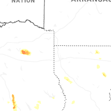
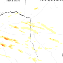

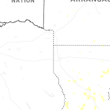
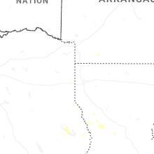
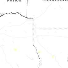
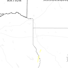
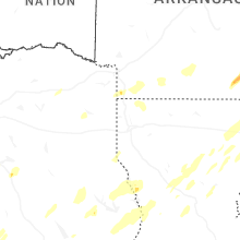


Connect with Interactive Hail Maps