

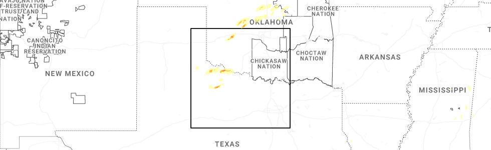
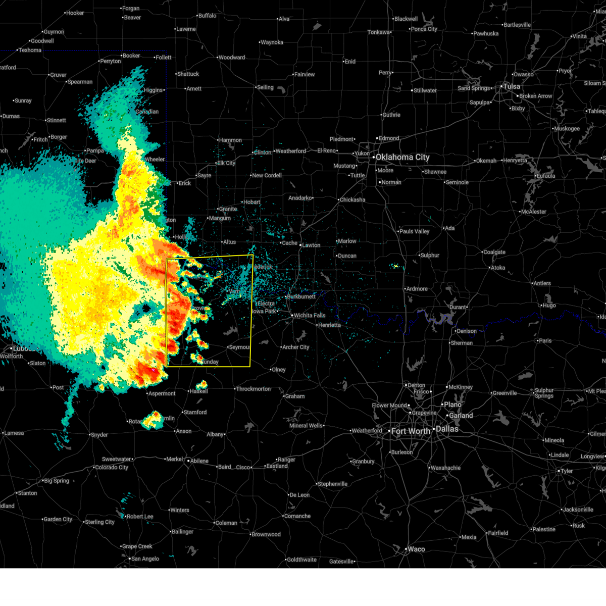
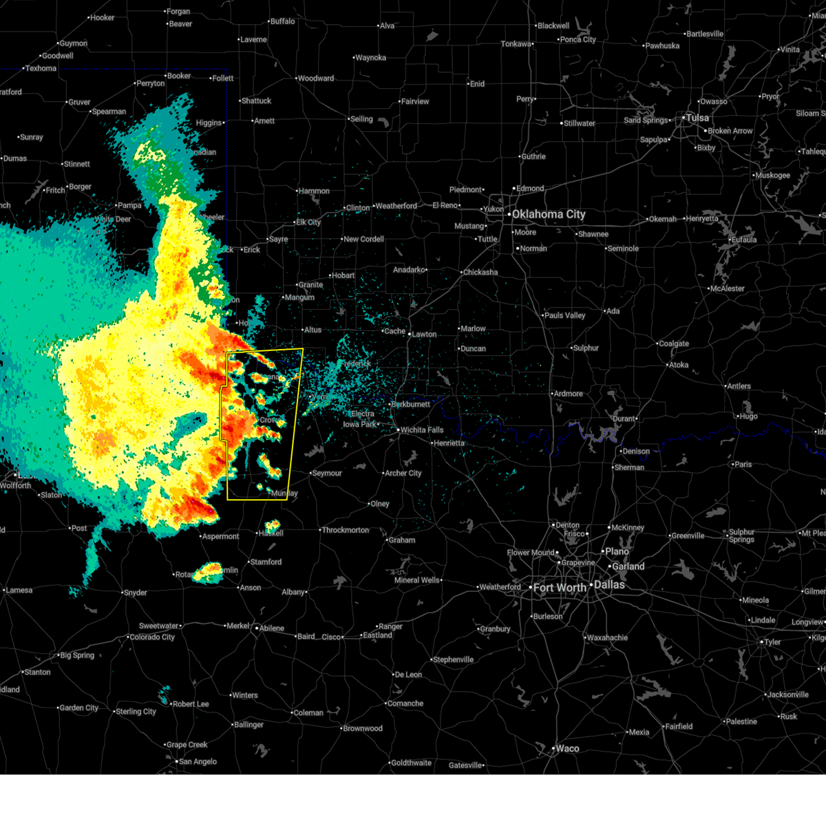
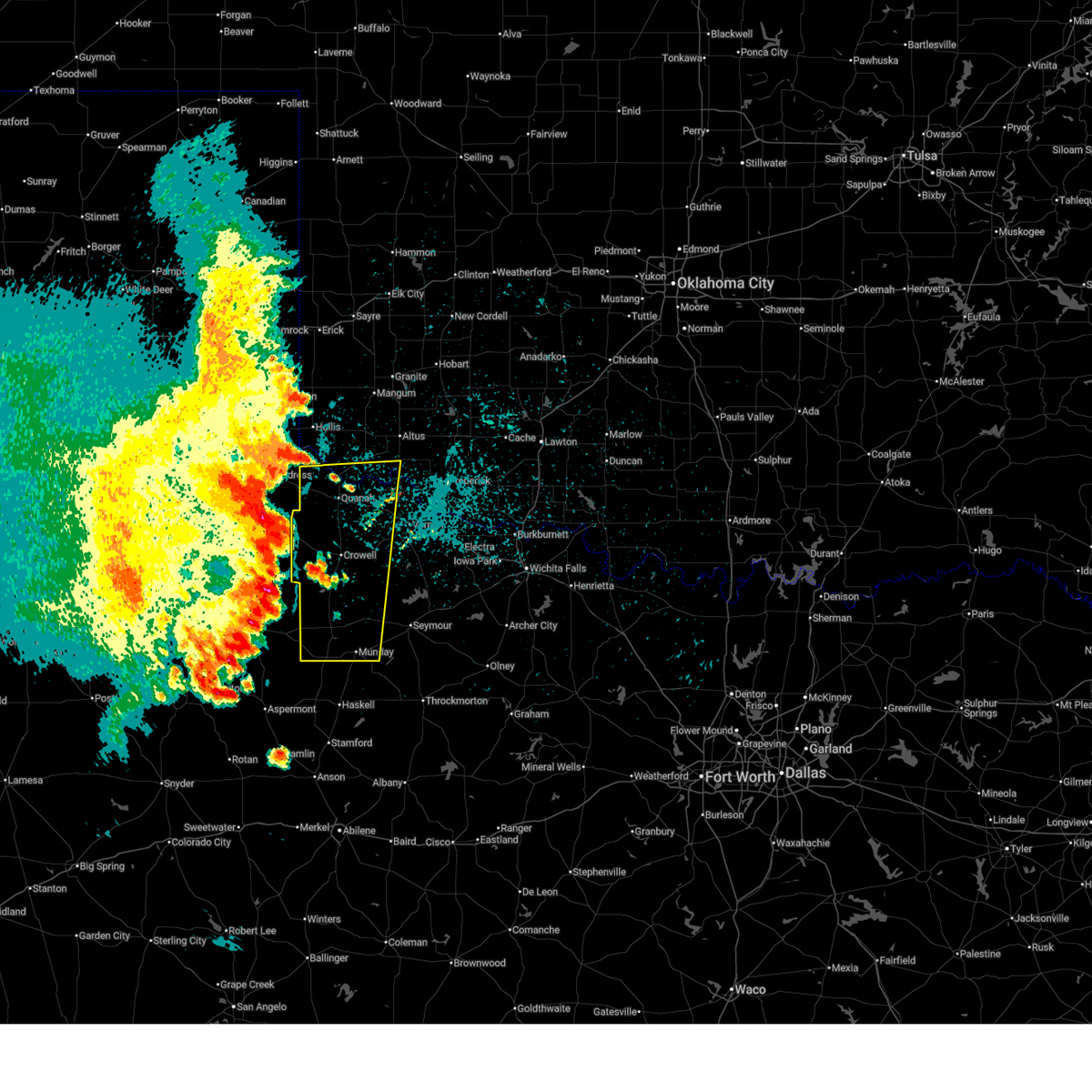
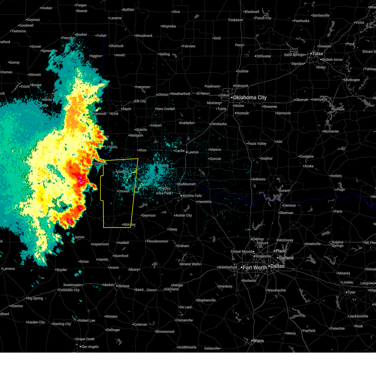
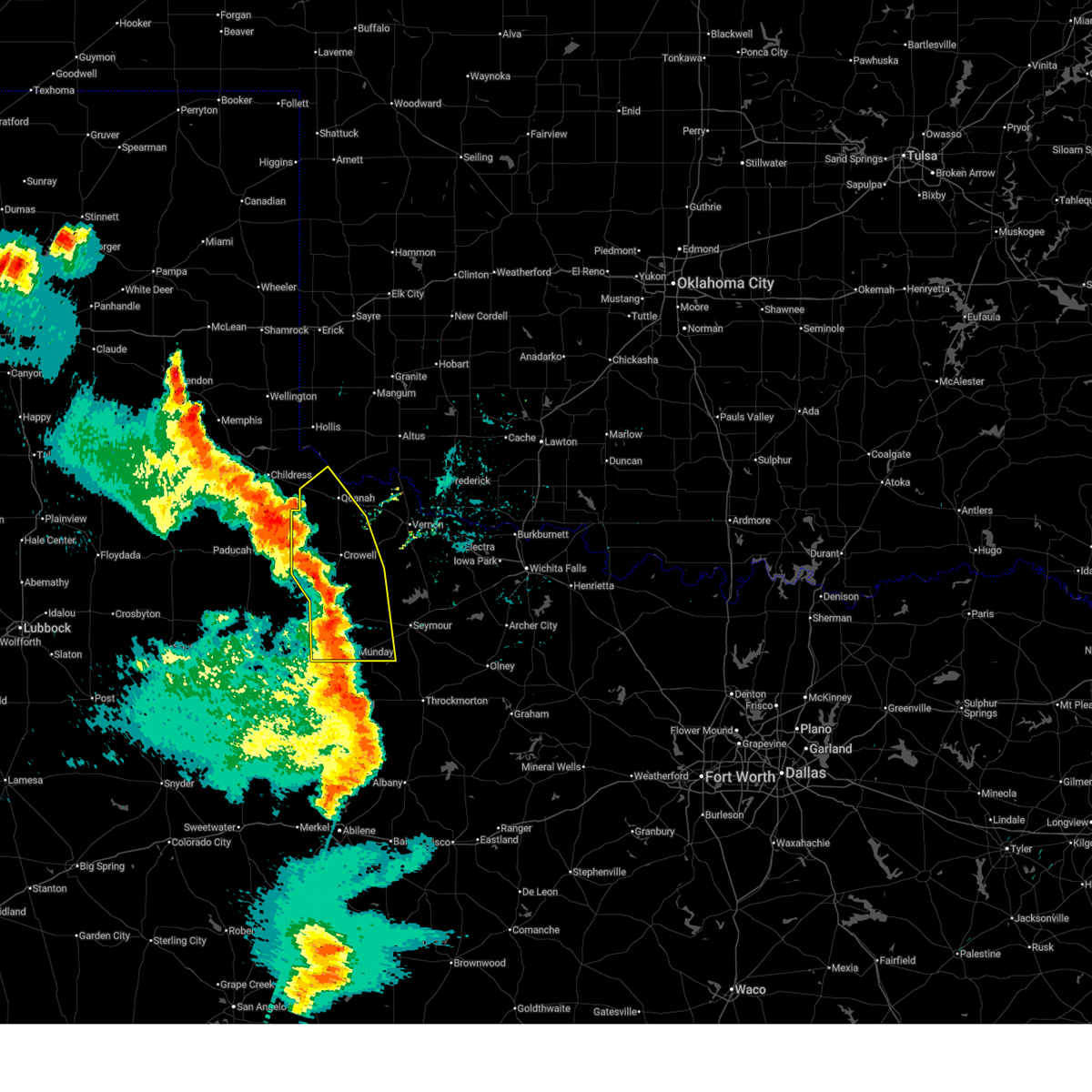
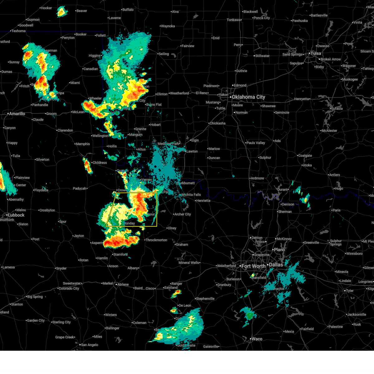
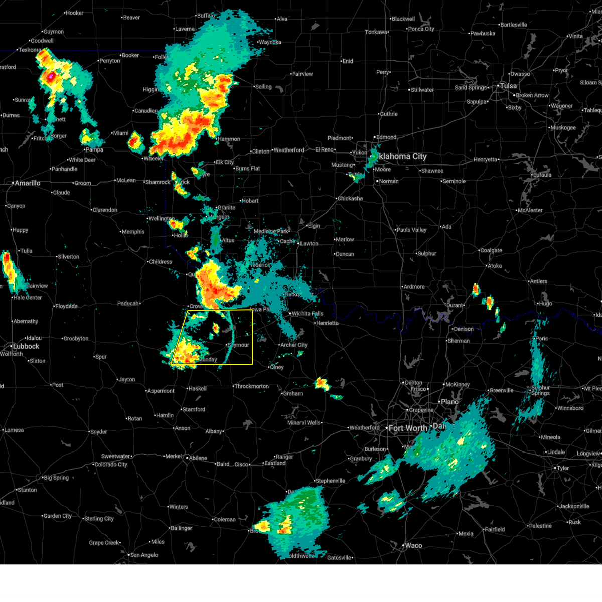
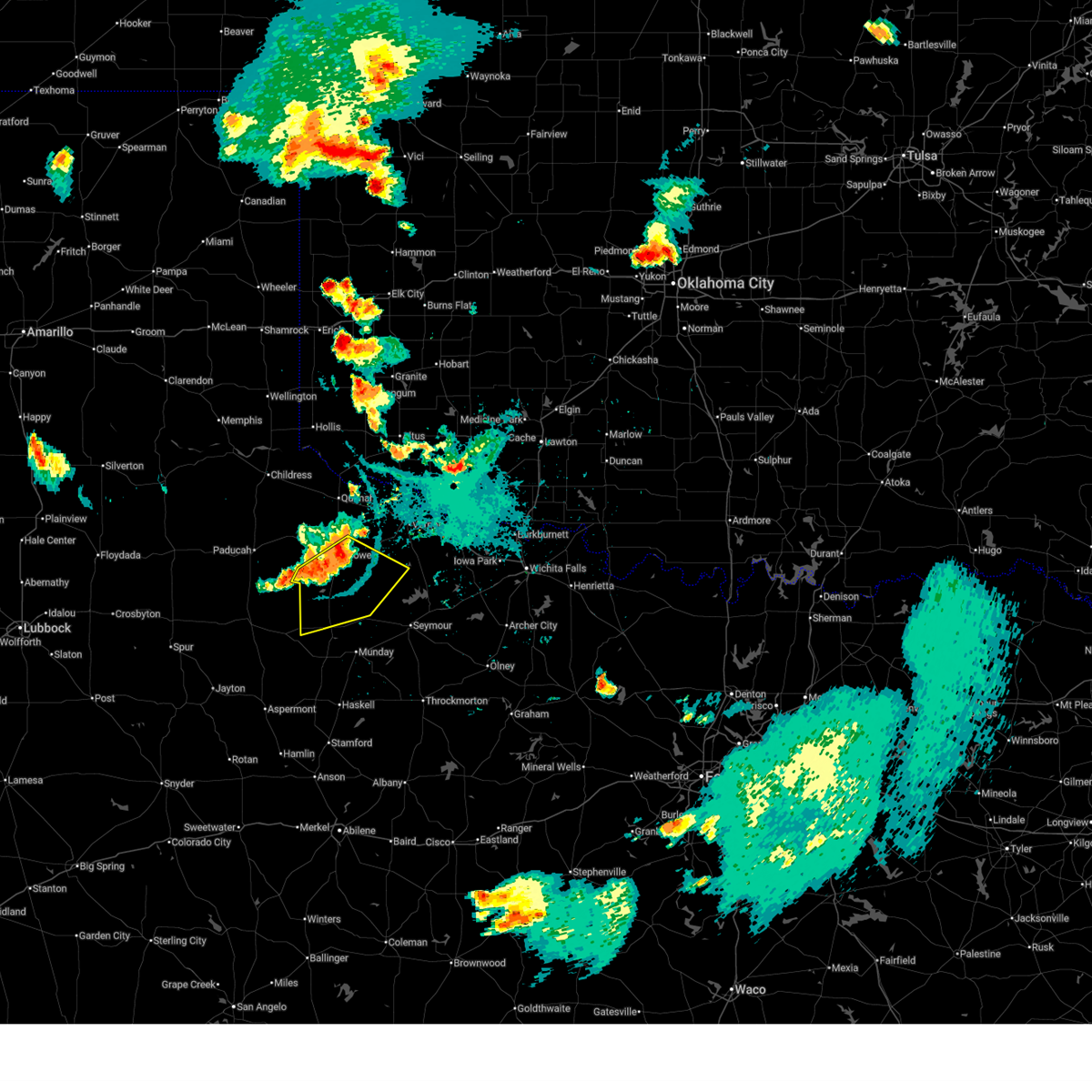
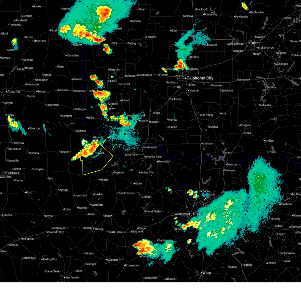
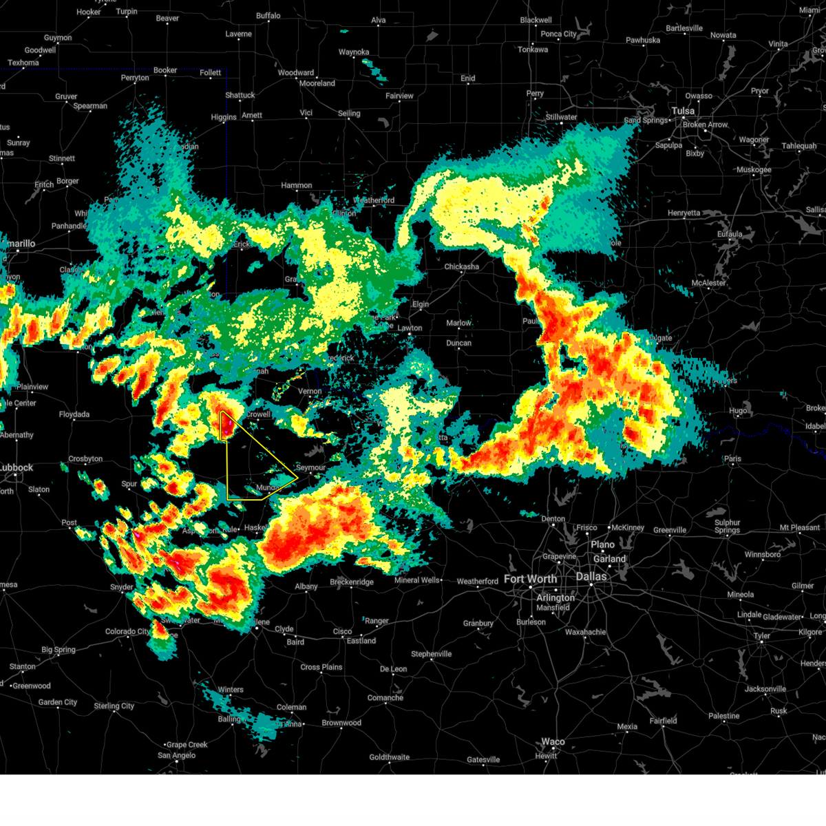
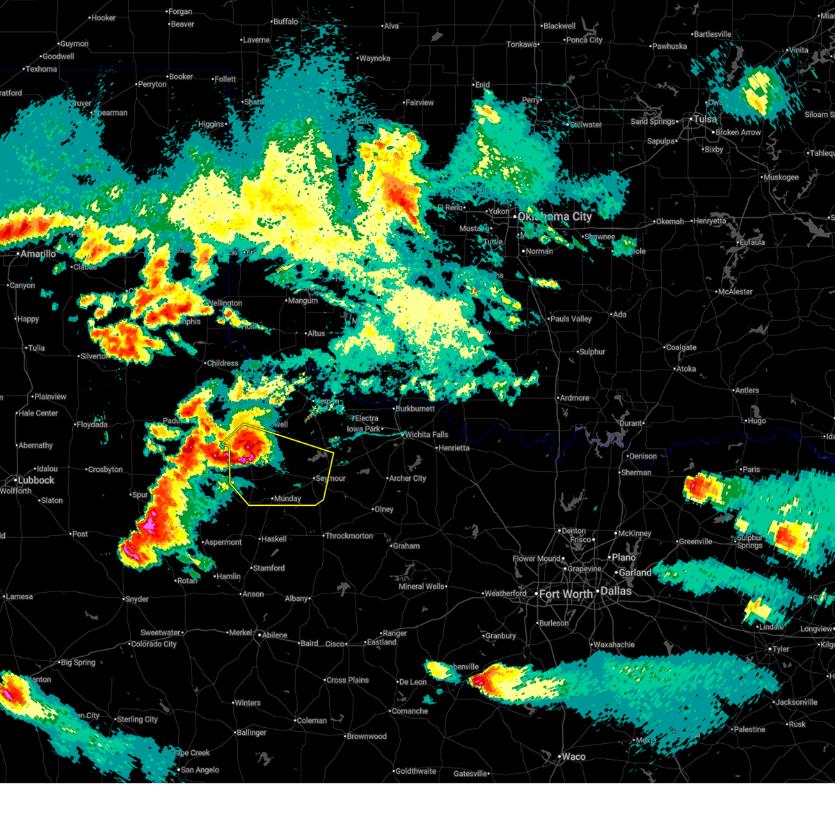
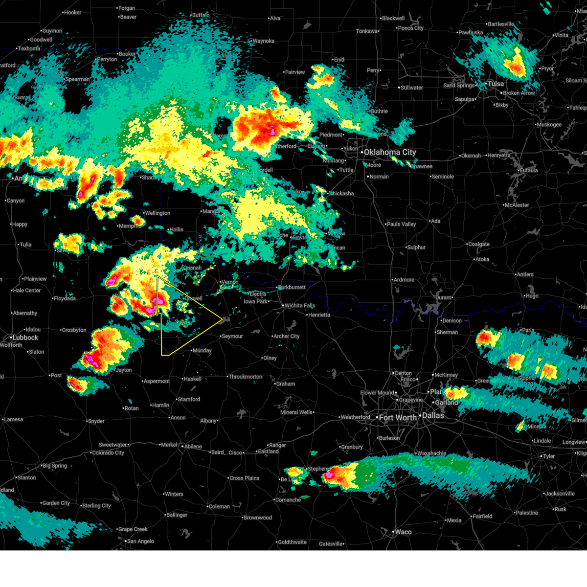
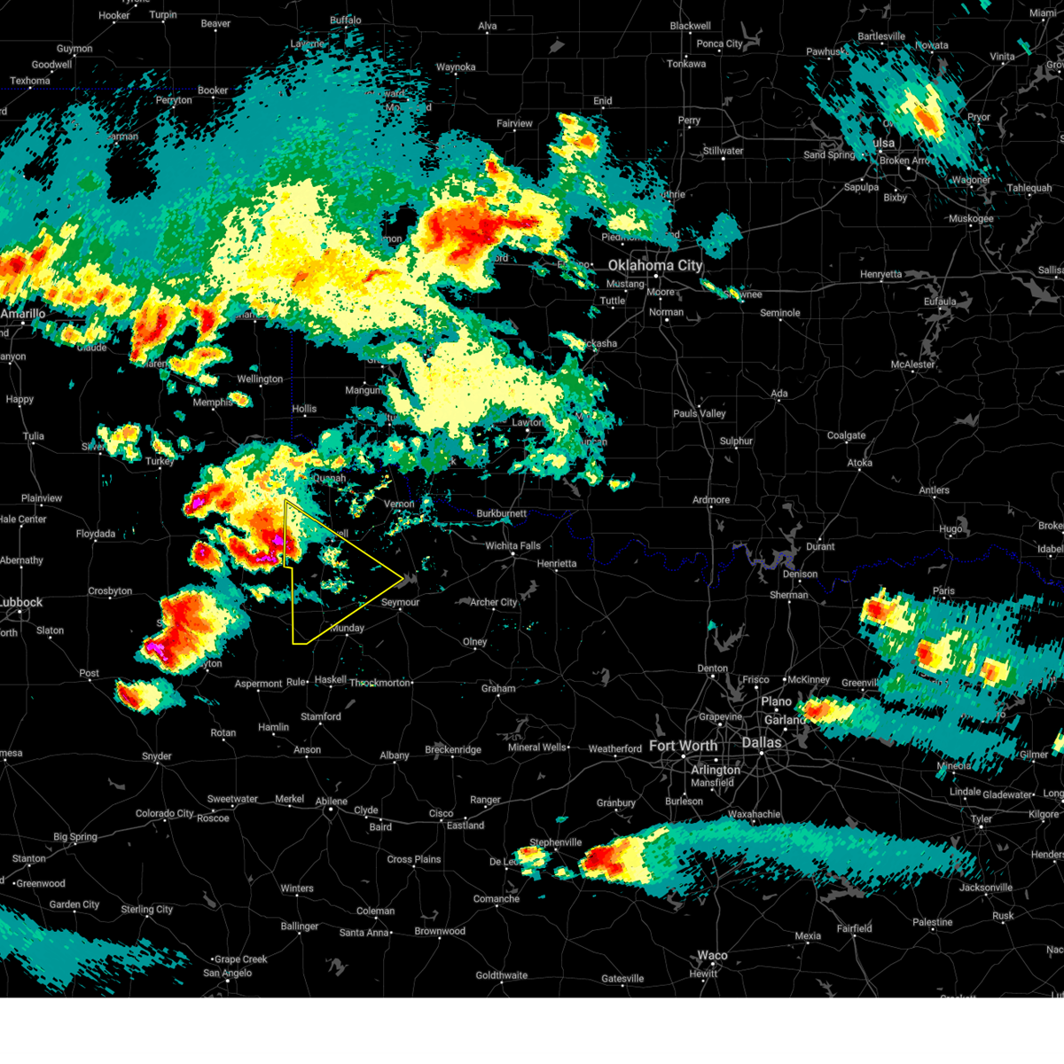
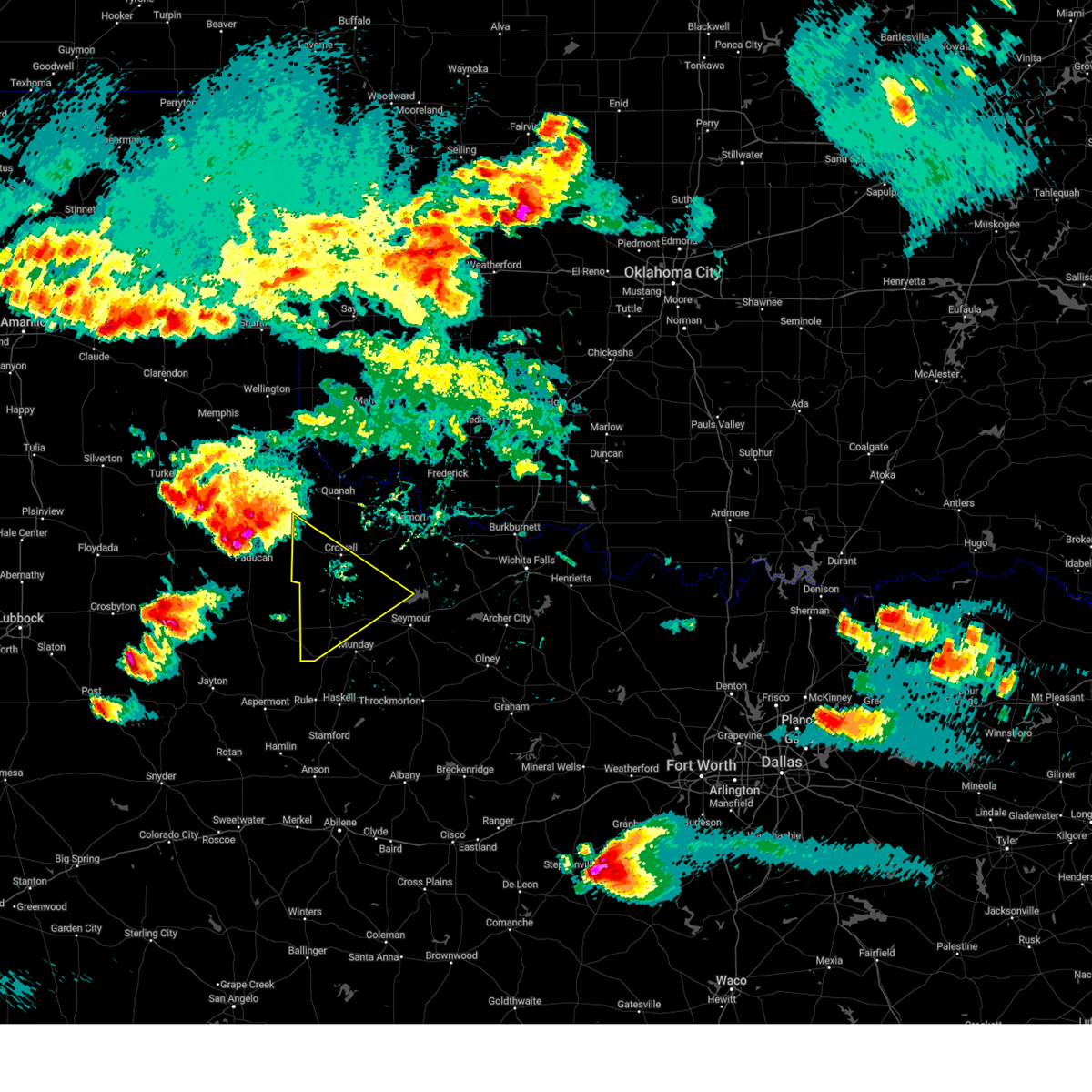
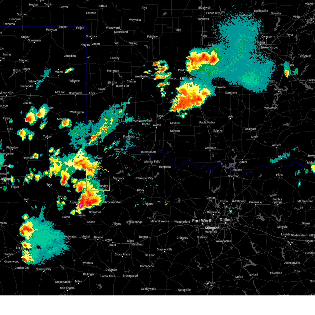
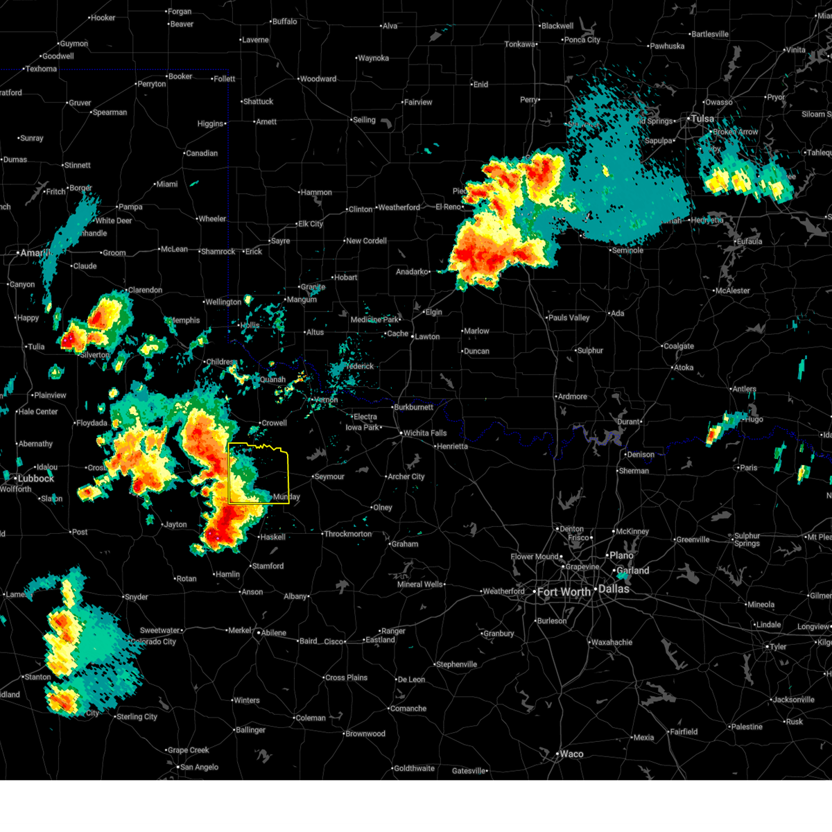
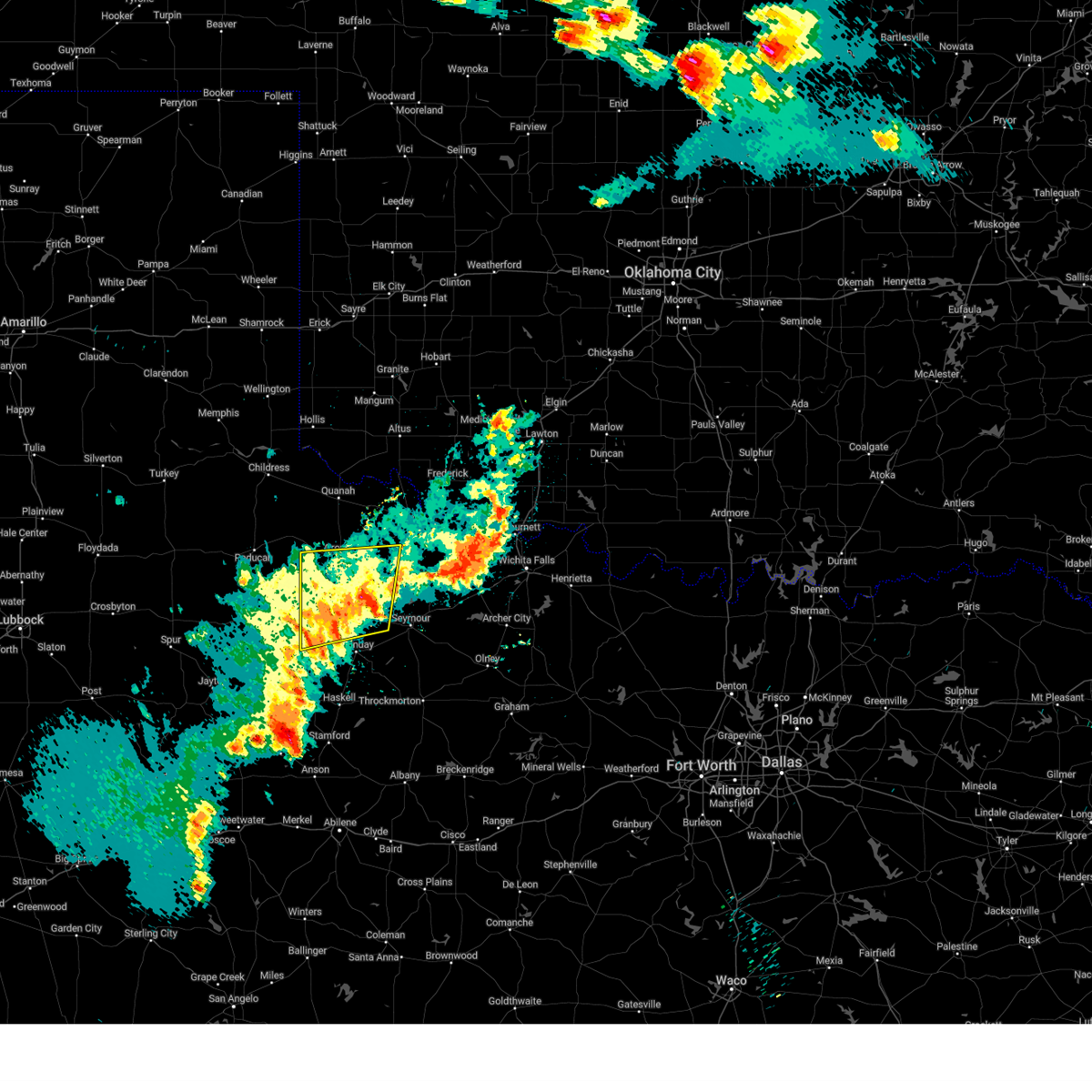
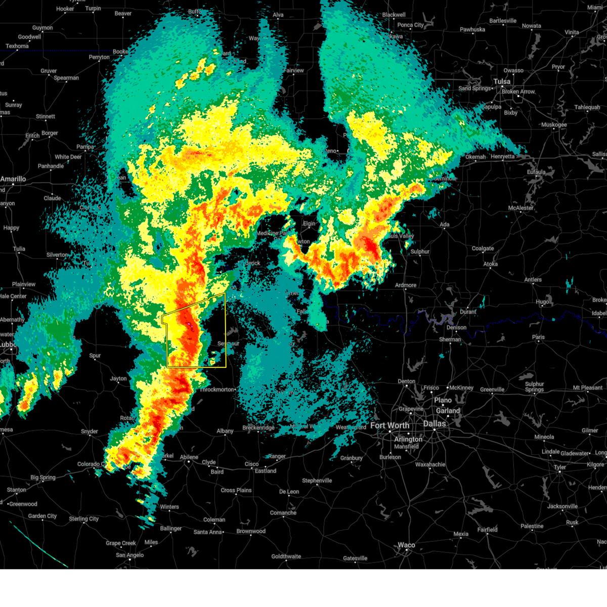
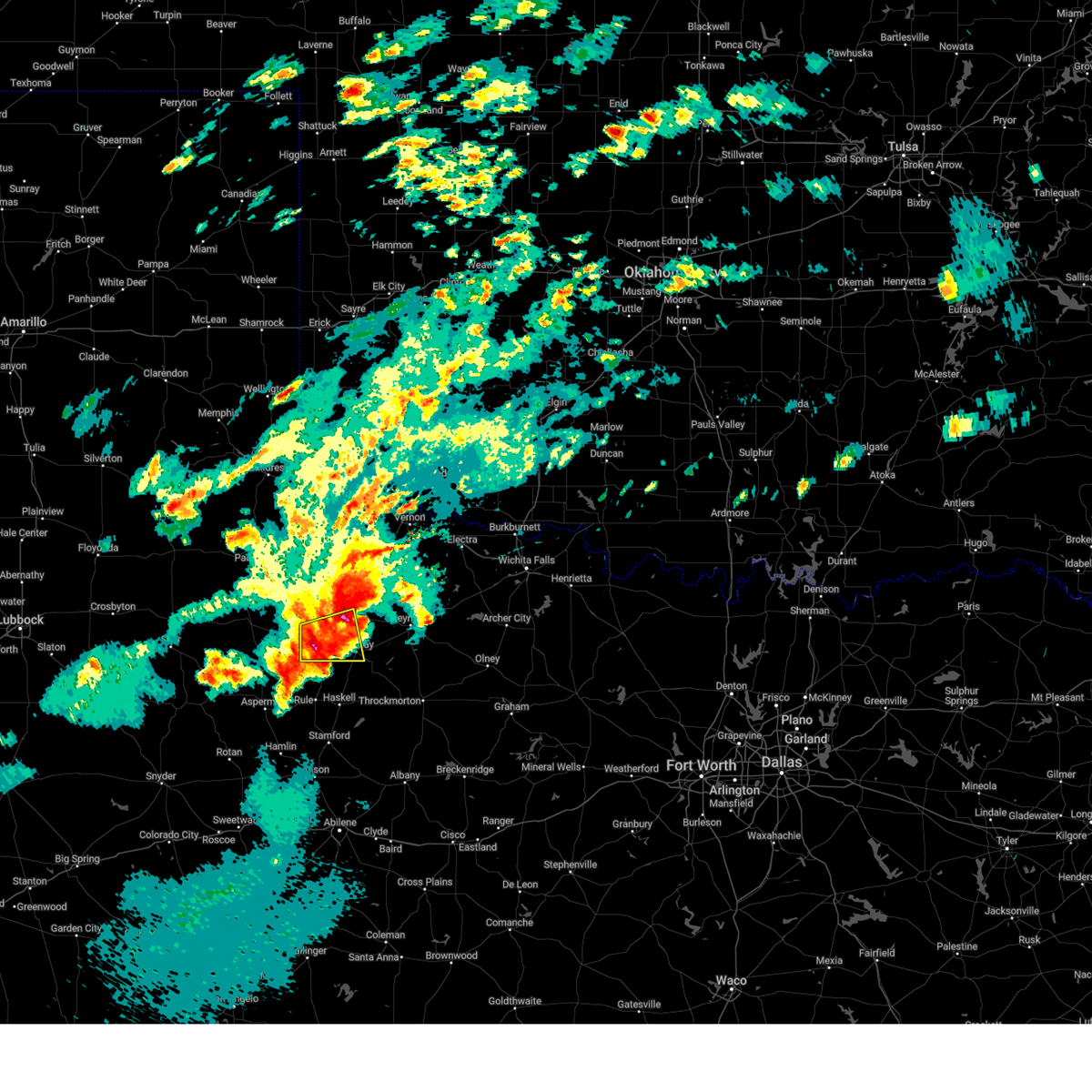
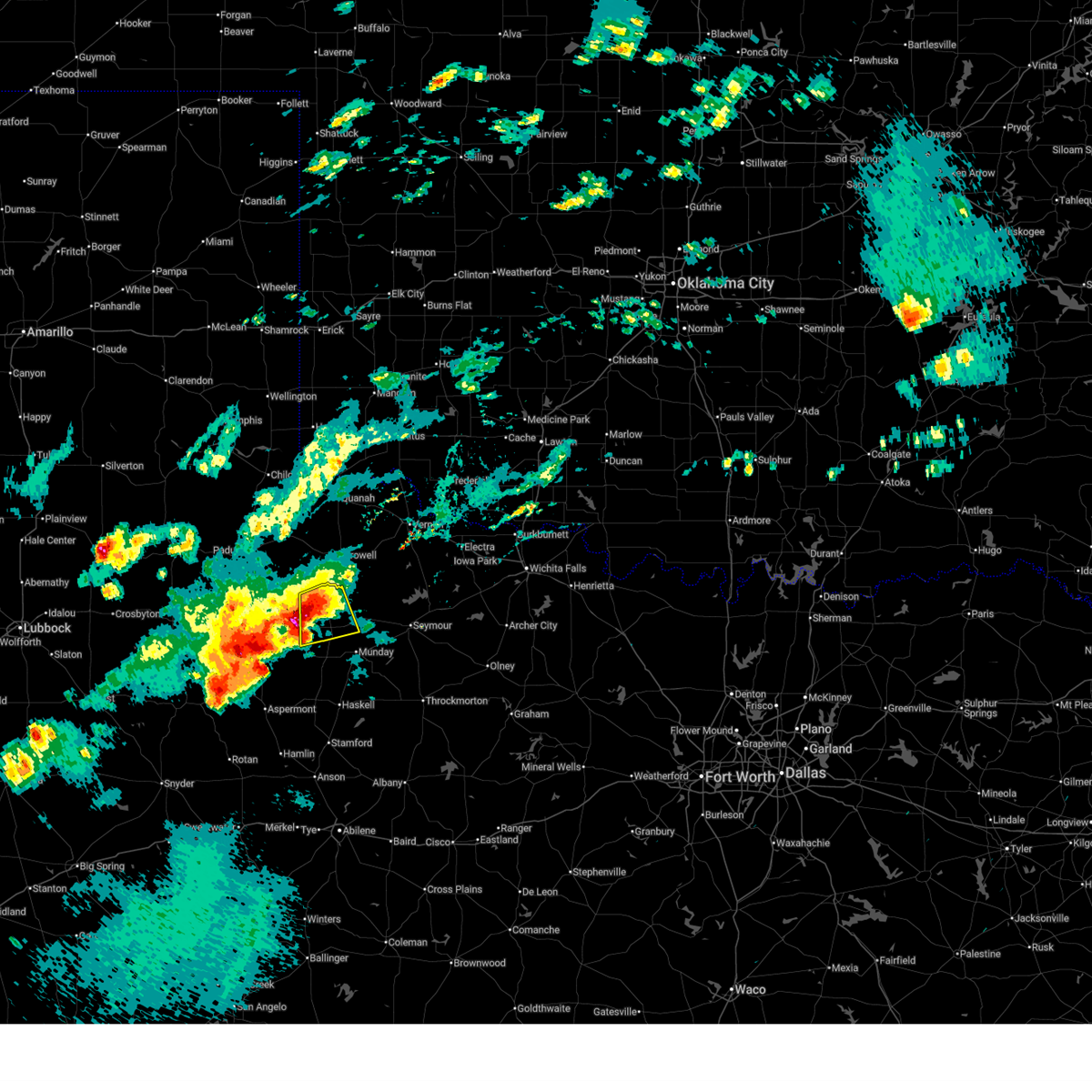
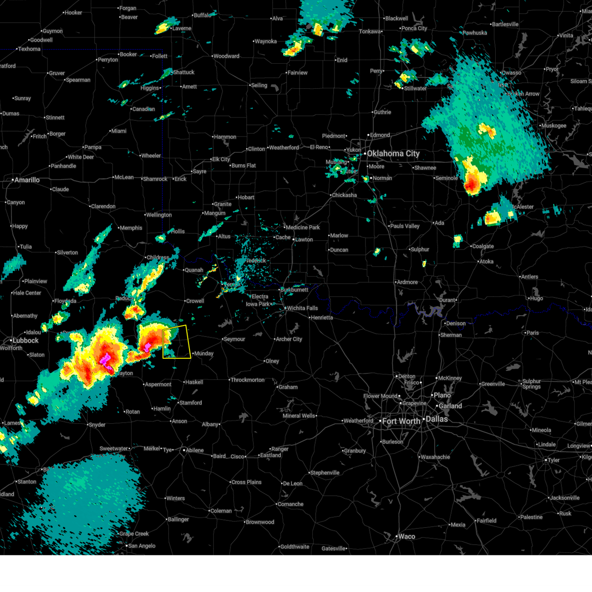
Hail Map for Benjamin, TX
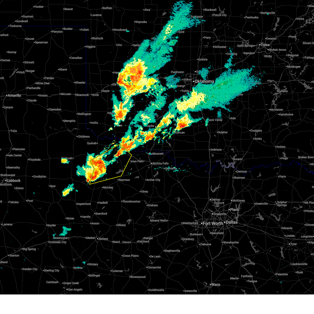
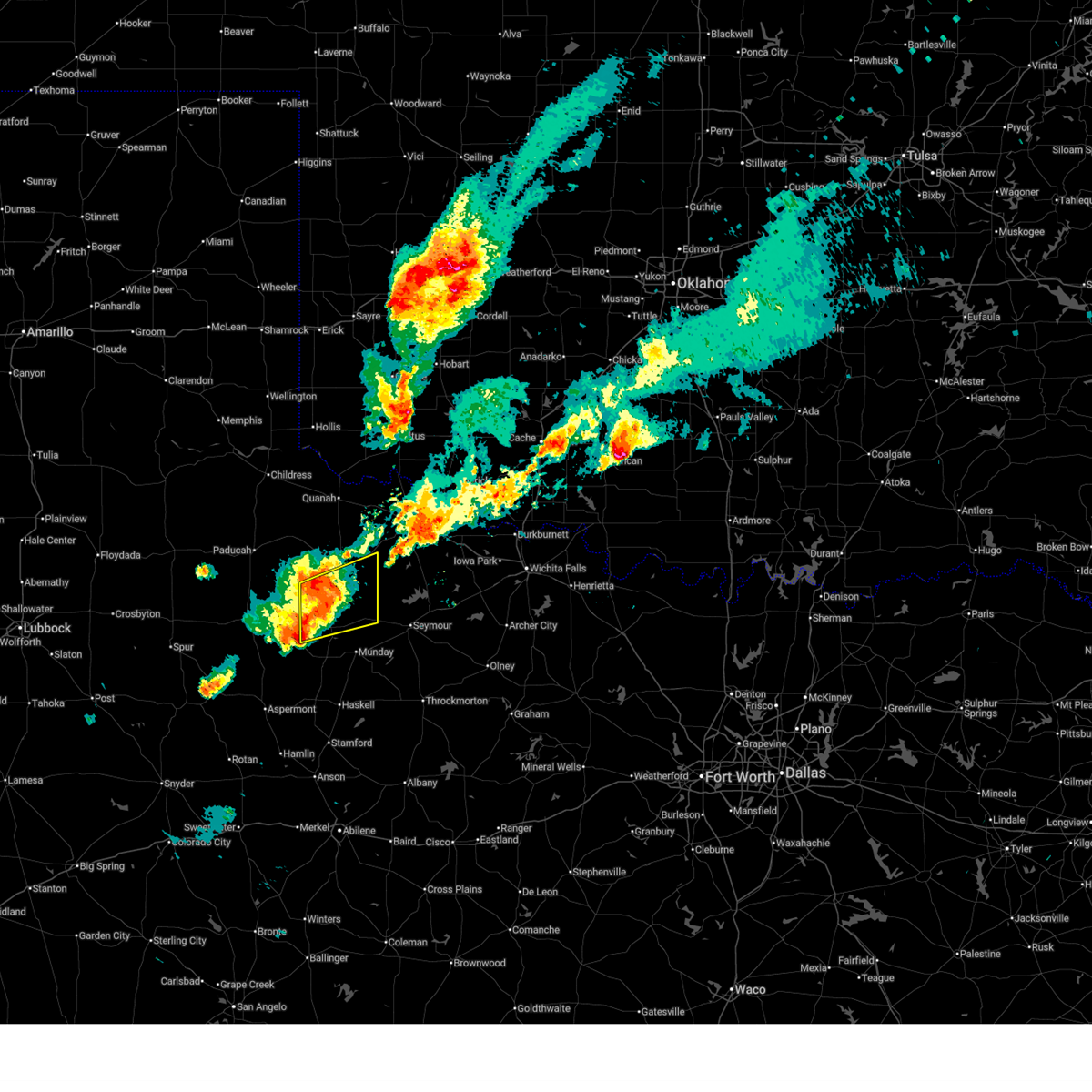
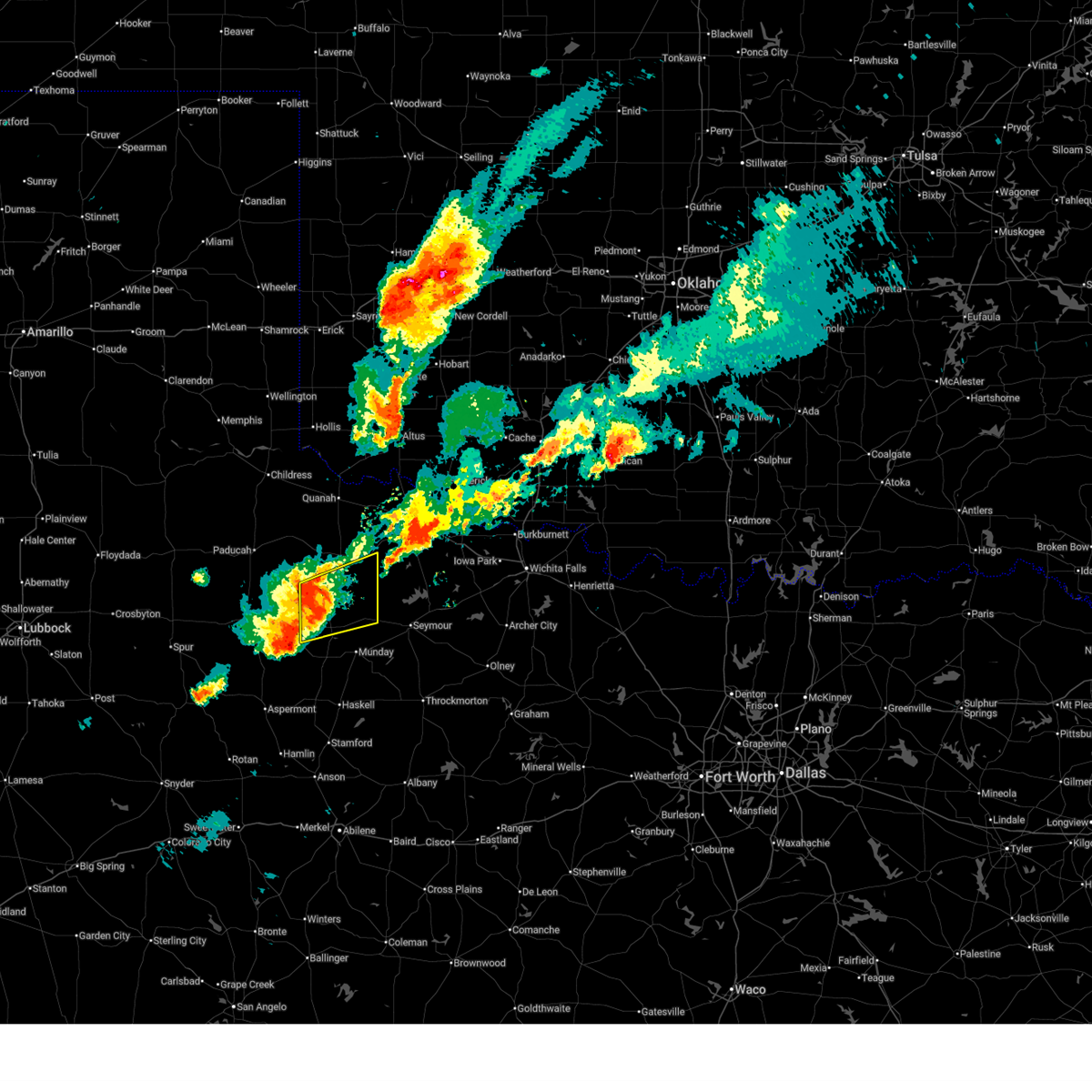
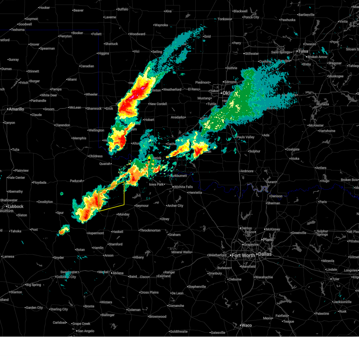
The Benjamin, TX area has had 9 reports of on-the-ground hail by trained spotters, and has been under severe weather warnings 26 times during the past 12 months. Doppler radar has detected hail at or near Benjamin, TX on 99 occasions, including 5 occasions during the past year.
| Name: | Benjamin, TX |
| Where Located: | 63.1 miles SSE of Childress, TX |
| Map: | Google Map for Benjamin, TX |
| Population: | 258 |
| Housing Units: | 124 |
| More Info: | Search Google for Benjamin, TX |
1
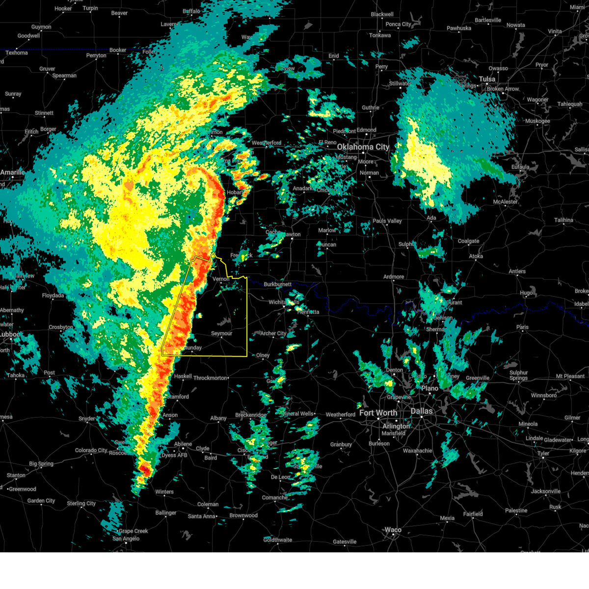
The Top Recent Hail Date for Benjamin, TX is Wednesday, April 1, 2026 (25th out of 99)
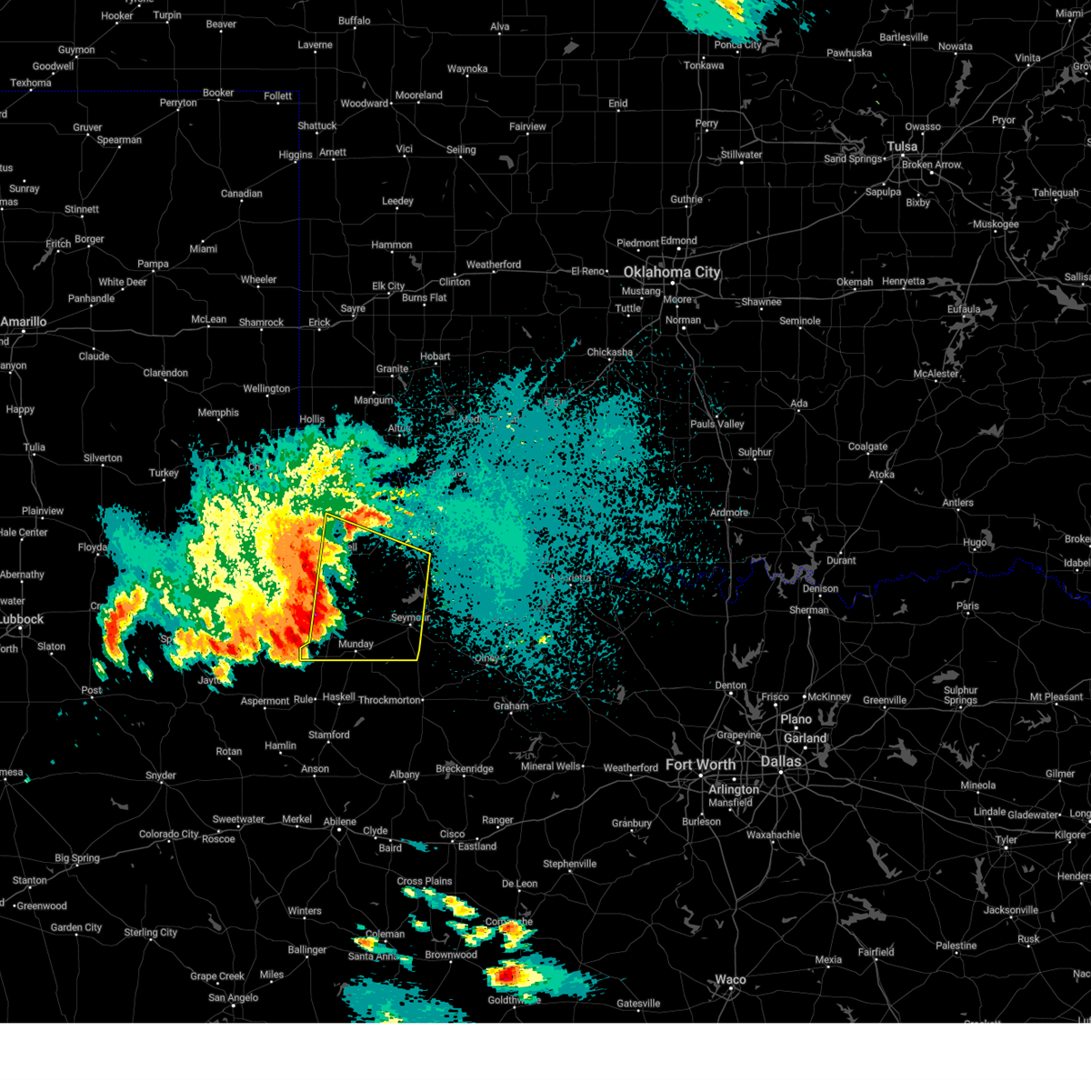
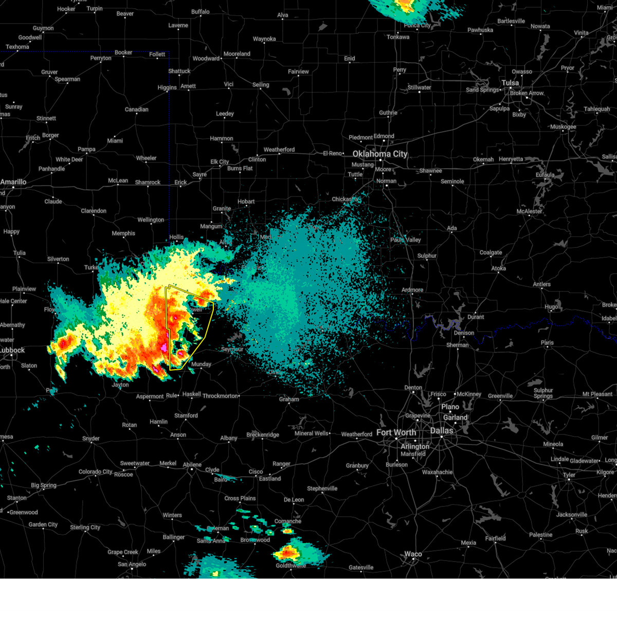
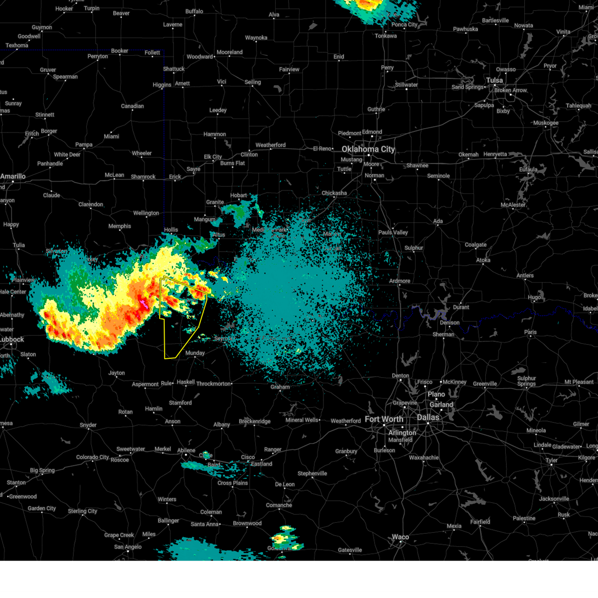
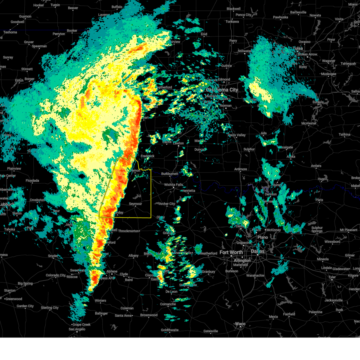
Hail and Wind Damage Spotted near Benjamin, TX
| Date / Time | Report Details |
|---|---|
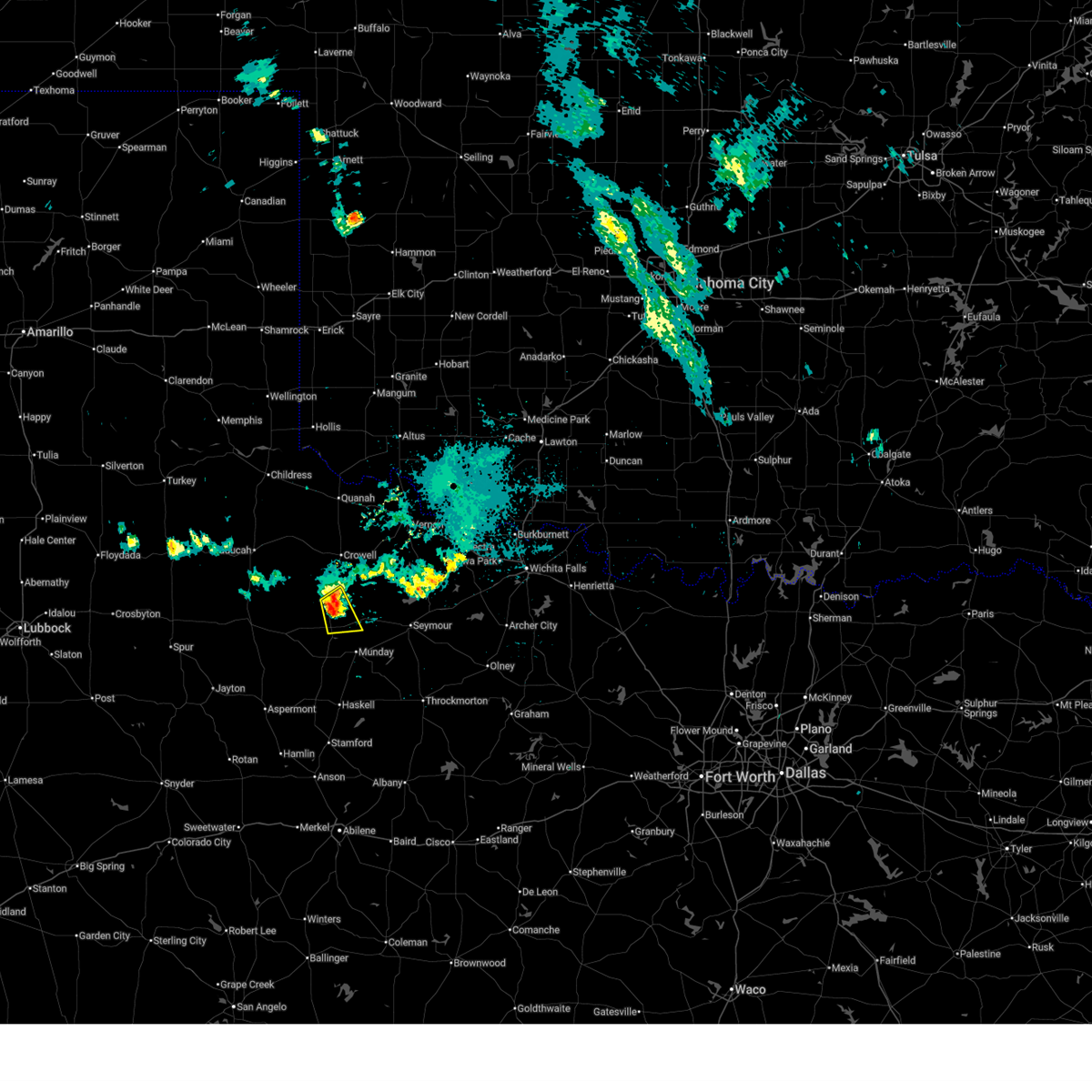
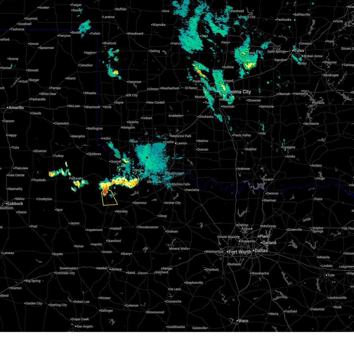
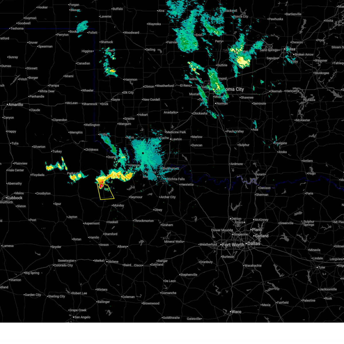
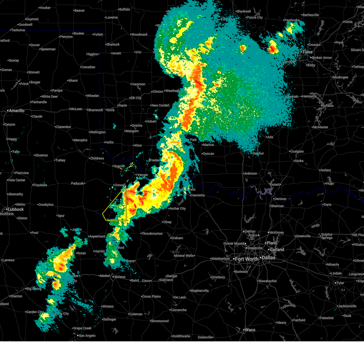
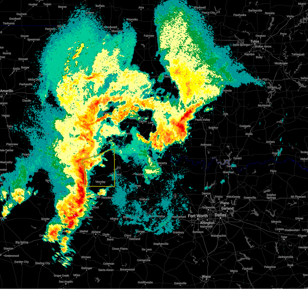
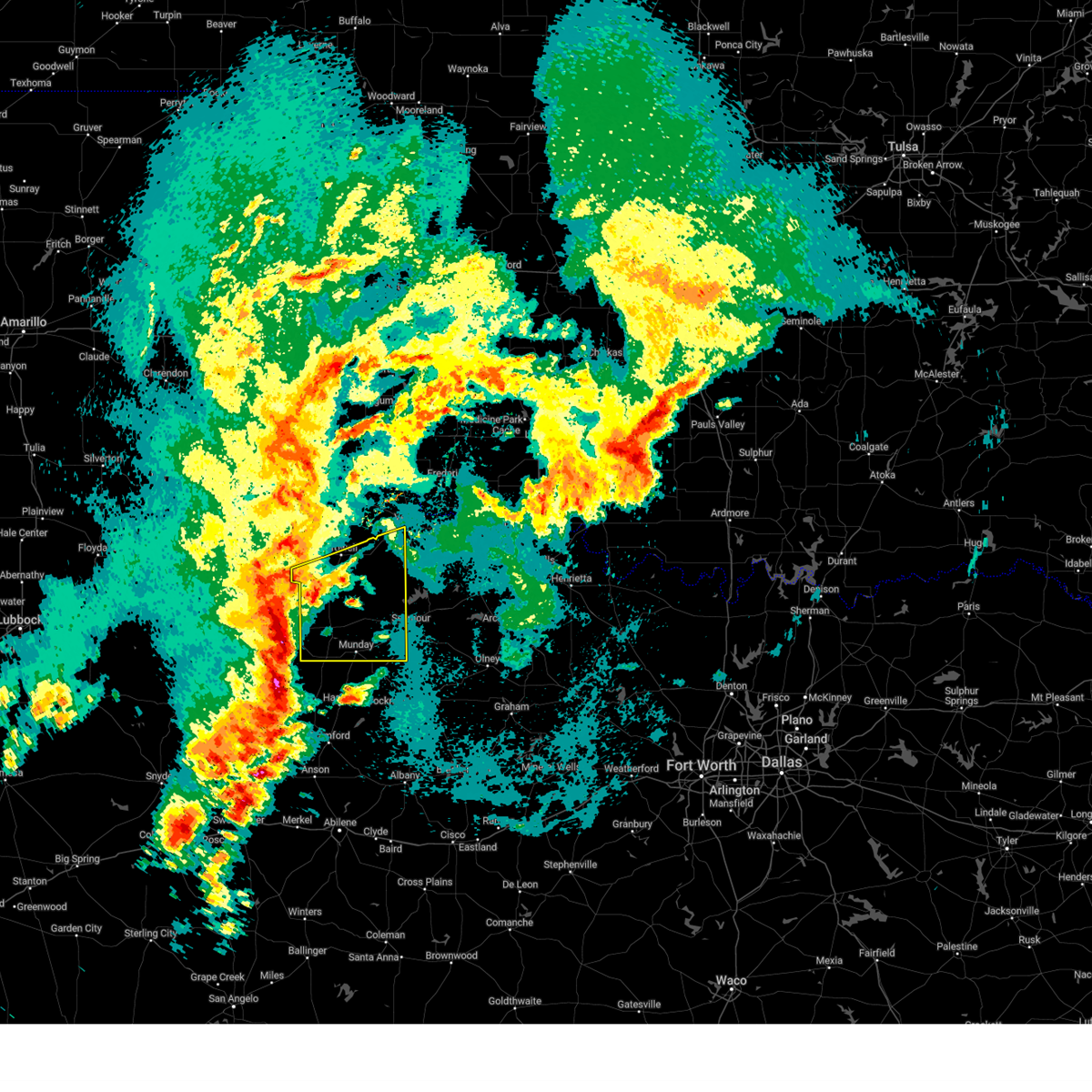
| 6/23/2026 2:49 PM CDT | At 248 pm cdt, severe thunderstorms were located along a line extending from 7 miles west of truscott to 7 miles north of vera to near lockett, moving southeast at 35 mph (radar indicated). Hazards include 70 mph wind gusts and ping pong ball size hail. People and animals outdoors will be injured. expect hail damage to roofs, siding, windows, and vehicles. expect considerable tree damage. wind damage is also likely to mobile homes, roofs, and outbuildings. Locations impacted include, vernon, crowell, benjamin, red springs, thalia, gilliland, margaret, lockett, vera, truscott, grayback, western lake kemp, rayland, and copper breaks state park. |
| 6/23/2026 2:28 PM CDT | Svroun the national weather service in norman has issued a * severe thunderstorm warning for, foard county in northern texas, northern knox county in northern texas, southwestern wilbarger county in northern texas, northwestern baylor county in northern texas, southeastern hardeman county in northern texas, * until 315 pm cdt. * at 228 pm cdt, severe thunderstorms were located along a line extending from 10 miles east of chalk to 4 miles south of crowell to 4 miles southeast of chillicothe, moving southeast at 35 mph (radar indicated). Hazards include golf ball size hail and 70 mph wind gusts. People and animals outdoors will be injured. expect hail damage to roofs, siding, windows, and vehicles. expect considerable tree damage. Wind damage is also likely to mobile homes, roofs, and outbuildings. |
| 5/27/2026 10:13 PM CDT |
 At 1012 pm cdt, a severe thunderstorm was located 5 miles north of benjamin, moving southeast at 25 mph (radar indicated). Hazards include ping pong ball size hail and 60 mph wind gusts. People and animals outdoors will be injured. expect hail damage to roofs, siding, windows, and vehicles. expect wind damage to roofs, siding, and trees. Locations impacted include, benjamin, gilliland, and truscott. At 1012 pm cdt, a severe thunderstorm was located 5 miles north of benjamin, moving southeast at 25 mph (radar indicated). Hazards include ping pong ball size hail and 60 mph wind gusts. People and animals outdoors will be injured. expect hail damage to roofs, siding, windows, and vehicles. expect wind damage to roofs, siding, and trees. Locations impacted include, benjamin, gilliland, and truscott.
|
| 5/27/2026 9:55 PM CDT |
 At 954 pm cdt, a severe thunderstorm was located over truscott, moving southeast at 25 mph (radar indicated). Hazards include ping pong ball size hail and 60 mph wind gusts. People and animals outdoors will be injured. expect hail damage to roofs, siding, windows, and vehicles. expect wind damage to roofs, siding, and trees. Locations impacted include, benjamin, gilliland, and truscott. At 954 pm cdt, a severe thunderstorm was located over truscott, moving southeast at 25 mph (radar indicated). Hazards include ping pong ball size hail and 60 mph wind gusts. People and animals outdoors will be injured. expect hail damage to roofs, siding, windows, and vehicles. expect wind damage to roofs, siding, and trees. Locations impacted include, benjamin, gilliland, and truscott.
|
| 5/27/2026 9:46 PM CDT |
 Svroun the national weather service in norman has issued a * severe thunderstorm warning for, northern knox county in northern texas, * until 1030 pm cdt. * at 946 pm cdt, a severe thunderstorm was located near truscott, moving southeast at 25 mph (radar indicated). Hazards include 60 mph wind gusts and quarter size hail. Hail damage to vehicles is expected. Expect wind damage to roofs, siding, and trees. Svroun the national weather service in norman has issued a * severe thunderstorm warning for, northern knox county in northern texas, * until 1030 pm cdt. * at 946 pm cdt, a severe thunderstorm was located near truscott, moving southeast at 25 mph (radar indicated). Hazards include 60 mph wind gusts and quarter size hail. Hail damage to vehicles is expected. Expect wind damage to roofs, siding, and trees.
|
| 5/24/2026 12:58 AM CDT |
 Svroun the national weather service in norman has issued a * severe thunderstorm warning for, southwestern jackson county in southwestern oklahoma, southwestern tillman county in southwestern oklahoma, foard county in northern texas, knox county in northern texas, wilbarger county in northern texas, baylor county in northern texas, hardeman county in northern texas, * until 145 am cdt. * at 1258 am cdt, severe thunderstorms were located along a line extending from 5 miles south of eldorado to near rhineland, moving east at 35 mph (radar indicated). Hazards include 60 mph wind gusts and penny size hail. expect damage to roofs, siding, and trees Svroun the national weather service in norman has issued a * severe thunderstorm warning for, southwestern jackson county in southwestern oklahoma, southwestern tillman county in southwestern oklahoma, foard county in northern texas, knox county in northern texas, wilbarger county in northern texas, baylor county in northern texas, hardeman county in northern texas, * until 145 am cdt. * at 1258 am cdt, severe thunderstorms were located along a line extending from 5 miles south of eldorado to near rhineland, moving east at 35 mph (radar indicated). Hazards include 60 mph wind gusts and penny size hail. expect damage to roofs, siding, and trees
|
| 5/24/2026 12:48 AM CDT |
 At 1248 am cdt, severe thunderstorms were located along a line extending from 5 miles north of quanah to 6 miles southwest of benjamin, moving east at 35 mph (radar indicated). Hazards include 60 mph wind gusts and penny size hail. Expect damage to roofs, siding, and trees. Locations impacted include, quanah, munday, knox city, crowell, benjamin, chillicothe, eldorado, goree, elmer, thalia, gilliland, margaret, goodlett, vera, medicine mound, odell, truscott, rhineland, lazare, and rayland. At 1248 am cdt, severe thunderstorms were located along a line extending from 5 miles north of quanah to 6 miles southwest of benjamin, moving east at 35 mph (radar indicated). Hazards include 60 mph wind gusts and penny size hail. Expect damage to roofs, siding, and trees. Locations impacted include, quanah, munday, knox city, crowell, benjamin, chillicothe, eldorado, goree, elmer, thalia, gilliland, margaret, goodlett, vera, medicine mound, odell, truscott, rhineland, lazare, and rayland.
|
| 5/24/2026 12:30 AM CDT |
 At 1230 am cdt, severe thunderstorms were located along a line extending from 6 miles west of eldorado to 14 miles east of guthrie, moving east at 35 mph (radar indicated). Hazards include 70 mph wind gusts and quarter size hail. Hail damage to vehicles is expected. expect considerable tree damage. wind damage is also likely to mobile homes, roofs, and outbuildings. Locations impacted include, quanah, munday, knox city, crowell, benjamin, chillicothe, eldorado, goree, elmer, thalia, gilliland, margaret, goodlett, vera, medicine mound, odell, truscott, rhineland, lazare, and rayland. At 1230 am cdt, severe thunderstorms were located along a line extending from 6 miles west of eldorado to 14 miles east of guthrie, moving east at 35 mph (radar indicated). Hazards include 70 mph wind gusts and quarter size hail. Hail damage to vehicles is expected. expect considerable tree damage. wind damage is also likely to mobile homes, roofs, and outbuildings. Locations impacted include, quanah, munday, knox city, crowell, benjamin, chillicothe, eldorado, goree, elmer, thalia, gilliland, margaret, goodlett, vera, medicine mound, odell, truscott, rhineland, lazare, and rayland.
|
| 5/24/2026 12:09 AM CDT |
 Svroun the national weather service in norman has issued a * severe thunderstorm warning for, southwestern jackson county in southwestern oklahoma, foard county in northern texas, knox county in northern texas, western wilbarger county in northern texas, northwestern baylor county in northern texas, hardeman county in northern texas, * until 100 am cdt. * at 1208 am cdt, severe thunderstorms were located along a line extending from 7 miles northeast of kirkland to near guthrie, moving east at 35 mph (radar indicated). Hazards include 60 mph wind gusts and quarter size hail. Hail damage to vehicles is expected. Expect wind damage to roofs, siding, and trees. Svroun the national weather service in norman has issued a * severe thunderstorm warning for, southwestern jackson county in southwestern oklahoma, foard county in northern texas, knox county in northern texas, western wilbarger county in northern texas, northwestern baylor county in northern texas, hardeman county in northern texas, * until 100 am cdt. * at 1208 am cdt, severe thunderstorms were located along a line extending from 7 miles northeast of kirkland to near guthrie, moving east at 35 mph (radar indicated). Hazards include 60 mph wind gusts and quarter size hail. Hail damage to vehicles is expected. Expect wind damage to roofs, siding, and trees.
|
| 5/22/2026 9:13 PM CDT |
 Svroun the national weather service in norman has issued a * severe thunderstorm warning for, foard county in northern texas, knox county in northern texas, southwestern wilbarger county in northern texas, western baylor county in northern texas, hardeman county in northern texas, * until 1000 pm cdt. * at 913 pm cdt, severe thunderstorms were located along a line extending from 8 miles southwest of goodlett to 7 miles west of crowell to 3 miles southwest of gilliland to near munday, moving northeast at 25 mph (radar indicated). Hazards include 60 mph wind gusts and quarter size hail. Hail damage to vehicles is expected. Expect wind damage to roofs, siding, and trees. Svroun the national weather service in norman has issued a * severe thunderstorm warning for, foard county in northern texas, knox county in northern texas, southwestern wilbarger county in northern texas, western baylor county in northern texas, hardeman county in northern texas, * until 1000 pm cdt. * at 913 pm cdt, severe thunderstorms were located along a line extending from 8 miles southwest of goodlett to 7 miles west of crowell to 3 miles southwest of gilliland to near munday, moving northeast at 25 mph (radar indicated). Hazards include 60 mph wind gusts and quarter size hail. Hail damage to vehicles is expected. Expect wind damage to roofs, siding, and trees.
|
| 4/28/2026 6:49 AM CDT |
 At 649 am cdt, a severe thunderstorm was located near benjamin, moving east-northeast at 40 mph (radar indicated). Hazards include golf ball size hail and 60 mph wind gusts. People and animals outdoors will be injured. expect hail damage to roofs, siding, windows, and vehicles. expect wind damage to roofs, siding, and trees. Locations impacted include, munday, benjamin, goree, vera, truscott, gilliland, and rhineland. At 649 am cdt, a severe thunderstorm was located near benjamin, moving east-northeast at 40 mph (radar indicated). Hazards include golf ball size hail and 60 mph wind gusts. People and animals outdoors will be injured. expect hail damage to roofs, siding, windows, and vehicles. expect wind damage to roofs, siding, and trees. Locations impacted include, munday, benjamin, goree, vera, truscott, gilliland, and rhineland.
|
| 4/28/2026 6:36 AM CDT |
 Svroun the national weather service in norman has issued a * severe thunderstorm warning for, knox county in northern texas, * until 715 am cdt. * at 636 am cdt, a severe thunderstorm was located 11 miles west of benjamin, moving east-northeast at 50 mph (radar indicated). Hazards include 60 mph wind gusts and half dollar size hail. Hail damage to vehicles is expected. Expect wind damage to roofs, siding, and trees. Svroun the national weather service in norman has issued a * severe thunderstorm warning for, knox county in northern texas, * until 715 am cdt. * at 636 am cdt, a severe thunderstorm was located 11 miles west of benjamin, moving east-northeast at 50 mph (radar indicated). Hazards include 60 mph wind gusts and half dollar size hail. Hail damage to vehicles is expected. Expect wind damage to roofs, siding, and trees.
|
| 4/14/2026 6:41 PM CDT |
 At 640 pm cdt, severe thunderstorms were located along a line extending from 7 miles west of crowell to 10 miles south of thalia to 3 miles southwest of benjamin, moving northeast at 45 mph (radar indicated). Hazards include 70 mph wind gusts and nickel size hail. Expect considerable tree damage. damage is likely to mobile homes, roofs, and outbuildings. Locations impacted include, benjamin, truscott, gilliland, vera, and thalia. At 640 pm cdt, severe thunderstorms were located along a line extending from 7 miles west of crowell to 10 miles south of thalia to 3 miles southwest of benjamin, moving northeast at 45 mph (radar indicated). Hazards include 70 mph wind gusts and nickel size hail. Expect considerable tree damage. damage is likely to mobile homes, roofs, and outbuildings. Locations impacted include, benjamin, truscott, gilliland, vera, and thalia.
|
| 4/14/2026 6:40 PM CDT |
 Svroun the national weather service in norman has issued a * severe thunderstorm warning for, southeastern foard county in northern texas, central knox county in northern texas, wilbarger county in northern texas, northwestern baylor county in northern texas, southeastern hardeman county in northern texas, * until 730 pm cdt. * at 640 pm cdt, severe thunderstorms were located along a line extending from 3 miles southwest of crowell to 9 miles south of thalia to near benjamin, moving northeast at 45 mph (radar indicated). Hazards include 70 mph wind gusts and nickel size hail. Expect considerable tree damage. Damage is likely to mobile homes, roofs, and outbuildings. Svroun the national weather service in norman has issued a * severe thunderstorm warning for, southeastern foard county in northern texas, central knox county in northern texas, wilbarger county in northern texas, northwestern baylor county in northern texas, southeastern hardeman county in northern texas, * until 730 pm cdt. * at 640 pm cdt, severe thunderstorms were located along a line extending from 3 miles southwest of crowell to 9 miles south of thalia to near benjamin, moving northeast at 45 mph (radar indicated). Hazards include 70 mph wind gusts and nickel size hail. Expect considerable tree damage. Damage is likely to mobile homes, roofs, and outbuildings.
|
| 4/14/2026 6:27 PM CDT |
 At 627 pm cdt, severe thunderstorms were located along a line extending from 11 miles northwest of truscott to 3 miles northwest of gilliland to 9 miles northwest of knox city, moving northeast at 45 mph (radar indicated). Hazards include 70 mph wind gusts and nickel size hail. Expect considerable tree damage. damage is likely to mobile homes, roofs, and outbuildings. Locations impacted include, benjamin, truscott, gilliland, vera, and thalia. At 627 pm cdt, severe thunderstorms were located along a line extending from 11 miles northwest of truscott to 3 miles northwest of gilliland to 9 miles northwest of knox city, moving northeast at 45 mph (radar indicated). Hazards include 70 mph wind gusts and nickel size hail. Expect considerable tree damage. damage is likely to mobile homes, roofs, and outbuildings. Locations impacted include, benjamin, truscott, gilliland, vera, and thalia.
|
| 4/14/2026 6:21 PM CDT |
 At 621 pm cdt, severe thunderstorms were located along a line extending from 14 miles east of chalk to near truscott to 10 miles northwest of o'brien, moving northeast at 45 mph (radar indicated). Hazards include 70 mph wind gusts and nickel size hail. Expect considerable tree damage. damage is likely to mobile homes, roofs, and outbuildings. Locations impacted include, benjamin, truscott, gilliland, vera, and thalia. At 621 pm cdt, severe thunderstorms were located along a line extending from 14 miles east of chalk to near truscott to 10 miles northwest of o'brien, moving northeast at 45 mph (radar indicated). Hazards include 70 mph wind gusts and nickel size hail. Expect considerable tree damage. damage is likely to mobile homes, roofs, and outbuildings. Locations impacted include, benjamin, truscott, gilliland, vera, and thalia.
|
| 4/14/2026 6:10 PM CDT |
 Svroun the national weather service in norman has issued a * severe thunderstorm warning for, southern foard county in northern texas, knox county in northern texas, * until 700 pm cdt. * at 610 pm cdt, severe thunderstorms were located along a line extending from 10 miles northwest of truscott to 8 miles northwest of benjamin to 11 miles northwest of knox city, moving northeast at 45 mph (radar indicated). Hazards include 60 mph wind gusts and quarter size hail. Hail damage to vehicles is expected. Expect wind damage to roofs, siding, and trees. Svroun the national weather service in norman has issued a * severe thunderstorm warning for, southern foard county in northern texas, knox county in northern texas, * until 700 pm cdt. * at 610 pm cdt, severe thunderstorms were located along a line extending from 10 miles northwest of truscott to 8 miles northwest of benjamin to 11 miles northwest of knox city, moving northeast at 45 mph (radar indicated). Hazards include 60 mph wind gusts and quarter size hail. Hail damage to vehicles is expected. Expect wind damage to roofs, siding, and trees.
|
| 4/1/2026 8:53 PM CDT |
 the severe thunderstorm warning has been cancelled and is no longer in effect the severe thunderstorm warning has been cancelled and is no longer in effect
|
| 4/1/2026 8:25 PM CDT |
 Svroun the national weather service in norman has issued a * severe thunderstorm warning for, southeastern foard county in northern texas, knox county in northern texas, * until 915 pm cdt. * at 825 pm cdt, a severe thunderstorm was located 4 miles south of benjamin, moving northeast at 25 mph (radar indicated). Hazards include 60 mph wind gusts and quarter size hail. Hail damage to vehicles is expected. Expect wind damage to roofs, siding, and trees. Svroun the national weather service in norman has issued a * severe thunderstorm warning for, southeastern foard county in northern texas, knox county in northern texas, * until 915 pm cdt. * at 825 pm cdt, a severe thunderstorm was located 4 miles south of benjamin, moving northeast at 25 mph (radar indicated). Hazards include 60 mph wind gusts and quarter size hail. Hail damage to vehicles is expected. Expect wind damage to roofs, siding, and trees.
|
| 4/1/2026 7:23 PM CDT |
 Svroun the national weather service in norman has issued a * severe thunderstorm warning for, southeastern foard county in northern texas, central knox county in northern texas, southern wilbarger county in northern texas, northern baylor county in northern texas, * until 815 pm cdt. * at 723 pm cdt, severe thunderstorms were located along a line extending from near thalia to near benjamin, moving northeast at 50 mph (radar indicated). Hazards include 60 mph wind gusts and quarter size hail. Hail damage to vehicles is expected. Expect wind damage to roofs, siding, and trees. Svroun the national weather service in norman has issued a * severe thunderstorm warning for, southeastern foard county in northern texas, central knox county in northern texas, southern wilbarger county in northern texas, northern baylor county in northern texas, * until 815 pm cdt. * at 723 pm cdt, severe thunderstorms were located along a line extending from near thalia to near benjamin, moving northeast at 50 mph (radar indicated). Hazards include 60 mph wind gusts and quarter size hail. Hail damage to vehicles is expected. Expect wind damage to roofs, siding, and trees.
|
| 4/1/2026 6:48 PM CDT |
 Svroun the national weather service in norman has issued a * severe thunderstorm warning for, foard county in northern texas, knox county in northern texas, southeastern hardeman county in northern texas, * until 730 pm cdt. * at 648 pm cdt, severe thunderstorms were located along a line extending from 13 miles west of crowell to 16 miles southeast of guthrie, moving northeast at 60 mph (radar indicated). Hazards include 60 mph wind gusts and nickel size hail. expect damage to roofs, siding, and trees Svroun the national weather service in norman has issued a * severe thunderstorm warning for, foard county in northern texas, knox county in northern texas, southeastern hardeman county in northern texas, * until 730 pm cdt. * at 648 pm cdt, severe thunderstorms were located along a line extending from 13 miles west of crowell to 16 miles southeast of guthrie, moving northeast at 60 mph (radar indicated). Hazards include 60 mph wind gusts and nickel size hail. expect damage to roofs, siding, and trees
|
| 7/8/2025 11:34 PM CDT |
 At 1133 pm cdt, severe thunderstorms were located along a line extending from near truscott to 5 miles northeast of mabelle, moving south at 35 mph (radar indicated). Hazards include 70 mph wind gusts. Expect considerable tree damage. damage is likely to mobile homes, roofs, and outbuildings. Locations impacted include, seymour, munday, knox city, benjamin, goree, red springs, lake diversion, westover, gilliland, bomarton, lake kemp, mabelle, vera, and rhineland. At 1133 pm cdt, severe thunderstorms were located along a line extending from near truscott to 5 miles northeast of mabelle, moving south at 35 mph (radar indicated). Hazards include 70 mph wind gusts. Expect considerable tree damage. damage is likely to mobile homes, roofs, and outbuildings. Locations impacted include, seymour, munday, knox city, benjamin, goree, red springs, lake diversion, westover, gilliland, bomarton, lake kemp, mabelle, vera, and rhineland.
|
| 7/8/2025 11:02 PM CDT |
 Svroun the national weather service in norman has issued a * severe thunderstorm warning for, southeastern foard county in northern texas, knox county in northern texas, southern wilbarger county in northern texas, baylor county in northern texas, * until 1145 pm cdt. * at 1102 pm cdt, severe thunderstorms were located along a line extending from near crowell to 6 miles south of harrold, moving south at 35 mph (radar indicated). Hazards include 70 mph wind gusts. Expect considerable tree damage. Damage is likely to mobile homes, roofs, and outbuildings. Svroun the national weather service in norman has issued a * severe thunderstorm warning for, southeastern foard county in northern texas, knox county in northern texas, southern wilbarger county in northern texas, baylor county in northern texas, * until 1145 pm cdt. * at 1102 pm cdt, severe thunderstorms were located along a line extending from near crowell to 6 miles south of harrold, moving south at 35 mph (radar indicated). Hazards include 70 mph wind gusts. Expect considerable tree damage. Damage is likely to mobile homes, roofs, and outbuildings.
|
| 7/8/2025 10:04 PM CDT |
 the severe thunderstorm warning has been cancelled and is no longer in effect the severe thunderstorm warning has been cancelled and is no longer in effect
|
| 7/8/2025 10:04 PM CDT |
 At 1003 pm cdt, severe thunderstorms were located along a line extending from near margaret to 10 miles east of chalk, moving southeast at 15 mph. 80 mph winds were recently measured near crowell. these are destructive storms for crowell and truscott (public). Hazards include 80 mph wind gusts. Flying debris will be dangerous to those caught without shelter. mobile homes will be heavily damaged. expect considerable damage to roofs, windows, and vehicles. extensive tree damage and power outages are likely. Locations impacted include, crowell, benjamin, margaret, thalia, truscott, and gilliland. At 1003 pm cdt, severe thunderstorms were located along a line extending from near margaret to 10 miles east of chalk, moving southeast at 15 mph. 80 mph winds were recently measured near crowell. these are destructive storms for crowell and truscott (public). Hazards include 80 mph wind gusts. Flying debris will be dangerous to those caught without shelter. mobile homes will be heavily damaged. expect considerable damage to roofs, windows, and vehicles. extensive tree damage and power outages are likely. Locations impacted include, crowell, benjamin, margaret, thalia, truscott, and gilliland.
|
| 7/8/2025 9:44 PM CDT |
 Svroun the national weather service in norman has issued a * severe thunderstorm warning for, foard county in northern texas, northern knox county in northern texas, southwestern wilbarger county in northern texas, northwestern baylor county in northern texas, southeastern hardeman county in northern texas, * until 1030 pm cdt. * at 944 pm cdt, severe thunderstorms were located along a line extending from 7 miles northwest of margaret to 9 miles northeast of chalk, moving southeast at 15 mph (public). Hazards include 70 mph wind gusts. Expect considerable tree damage. Damage is likely to mobile homes, roofs, and outbuildings. Svroun the national weather service in norman has issued a * severe thunderstorm warning for, foard county in northern texas, northern knox county in northern texas, southwestern wilbarger county in northern texas, northwestern baylor county in northern texas, southeastern hardeman county in northern texas, * until 1030 pm cdt. * at 944 pm cdt, severe thunderstorms were located along a line extending from 7 miles northwest of margaret to 9 miles northeast of chalk, moving southeast at 15 mph (public). Hazards include 70 mph wind gusts. Expect considerable tree damage. Damage is likely to mobile homes, roofs, and outbuildings.
|
| 6/8/2025 9:06 PM CDT |
 At 906 pm cdt, a severe thunderstorm was located 7 miles northwest of truscott, moving southeast at 45 mph (radar indicated). Hazards include 70 mph wind gusts and ping pong ball size hail. People and animals outdoors will be injured. expect hail damage to roofs, siding, windows, and vehicles. expect considerable tree damage. wind damage is also likely to mobile homes, roofs, and outbuildings. Locations impacted include, munday, knox city, benjamin, vera, truscott, gilliland, and rhineland. At 906 pm cdt, a severe thunderstorm was located 7 miles northwest of truscott, moving southeast at 45 mph (radar indicated). Hazards include 70 mph wind gusts and ping pong ball size hail. People and animals outdoors will be injured. expect hail damage to roofs, siding, windows, and vehicles. expect considerable tree damage. wind damage is also likely to mobile homes, roofs, and outbuildings. Locations impacted include, munday, knox city, benjamin, vera, truscott, gilliland, and rhineland.
|
| 6/8/2025 8:59 PM CDT |
 At 859 pm cdt, a severe thunderstorm was located 9 miles west of truscott, moving southeast at 50 mph (hackberry mesonet site reported 70 mph winds). Hazards include 70 mph wind gusts and quarter size hail. Hail damage to vehicles is expected. expect considerable tree damage. wind damage is also likely to mobile homes, roofs, and outbuildings. Locations impacted include, munday, knox city, benjamin, vera, truscott, gilliland, and rhineland. At 859 pm cdt, a severe thunderstorm was located 9 miles west of truscott, moving southeast at 50 mph (hackberry mesonet site reported 70 mph winds). Hazards include 70 mph wind gusts and quarter size hail. Hail damage to vehicles is expected. expect considerable tree damage. wind damage is also likely to mobile homes, roofs, and outbuildings. Locations impacted include, munday, knox city, benjamin, vera, truscott, gilliland, and rhineland.
|
| 6/8/2025 8:50 PM CDT |
 Svroun the national weather service in norman has issued a * severe thunderstorm warning for, southwestern foard county in northern texas, knox county in northern texas, west central baylor county in northern texas, * until 930 pm cdt. * at 850 pm cdt, a severe thunderstorm was located 9 miles east of chalk, moving southeast at 50 mph (radar indicated). Hazards include 60 mph wind gusts and quarter size hail. Hail damage to vehicles is expected. Expect wind damage to roofs, siding, and trees. Svroun the national weather service in norman has issued a * severe thunderstorm warning for, southwestern foard county in northern texas, knox county in northern texas, west central baylor county in northern texas, * until 930 pm cdt. * at 850 pm cdt, a severe thunderstorm was located 9 miles east of chalk, moving southeast at 50 mph (radar indicated). Hazards include 60 mph wind gusts and quarter size hail. Hail damage to vehicles is expected. Expect wind damage to roofs, siding, and trees.
|
| 6/8/2025 7:49 PM CDT |
 the severe thunderstorm warning has been cancelled and is no longer in effect the severe thunderstorm warning has been cancelled and is no longer in effect
|
| 6/8/2025 7:49 PM CDT |
 At 749 pm cdt, severe thunderstorms were located along a line extending from 4 miles northwest of red springs to near vera to near rhineland to 3 miles south of benjamin, moving southeast at 35 mph (trained weather spotters). Hazards include 70 mph wind gusts and nickel size hail. Expect considerable tree damage. damage is likely to mobile homes, roofs, and outbuildings. Locations impacted include, seymour, munday, knox city, benjamin, goree, red springs, mabelle, vera, gilliland, rhineland, bomarton, and southwestern lake kemp. At 749 pm cdt, severe thunderstorms were located along a line extending from 4 miles northwest of red springs to near vera to near rhineland to 3 miles south of benjamin, moving southeast at 35 mph (trained weather spotters). Hazards include 70 mph wind gusts and nickel size hail. Expect considerable tree damage. damage is likely to mobile homes, roofs, and outbuildings. Locations impacted include, seymour, munday, knox city, benjamin, goree, red springs, mabelle, vera, gilliland, rhineland, bomarton, and southwestern lake kemp.
|
| 6/8/2025 7:36 PM CDT |
 At 735 pm cdt, severe thunderstorms were located along a line extending from 8 miles north of vera to 3 miles southeast of gilliland to 6 miles northeast of benjamin to 10 miles southwest of truscott, moving southeast at 35 mph. these are destructive storms for truscott, gilliland, benjamin, knox city, munday, red springs, seymour, lake kemp, mabelle (the truscott mesonet station reported an 80 mph wind gust at 7:25pm). Hazards include 80 mph wind gusts and half dollar size hail. Flying debris will be dangerous to those caught without shelter. mobile homes will be heavily damaged. expect considerable damage to roofs, windows, and vehicles. extensive tree damage and power outages are likely. Locations impacted include, seymour, munday, knox city, benjamin, goree, red springs, gilliland, bomarton, lake kemp, mabelle, vera, truscott, and rhineland. At 735 pm cdt, severe thunderstorms were located along a line extending from 8 miles north of vera to 3 miles southeast of gilliland to 6 miles northeast of benjamin to 10 miles southwest of truscott, moving southeast at 35 mph. these are destructive storms for truscott, gilliland, benjamin, knox city, munday, red springs, seymour, lake kemp, mabelle (the truscott mesonet station reported an 80 mph wind gust at 7:25pm). Hazards include 80 mph wind gusts and half dollar size hail. Flying debris will be dangerous to those caught without shelter. mobile homes will be heavily damaged. expect considerable damage to roofs, windows, and vehicles. extensive tree damage and power outages are likely. Locations impacted include, seymour, munday, knox city, benjamin, goree, red springs, gilliland, bomarton, lake kemp, mabelle, vera, truscott, and rhineland.
|
| 6/8/2025 7:21 PM CDT |
 At 720 pm cdt, severe thunderstorms were located along a line extending from 8 miles south of crowell to near truscott to 8 miles northwest of benjamin to 17 miles west of gilliland, moving east at 30 mph. these are destructive storms for gilliland, benjamin, knox city, munday, red springs, seymour, lake kemp, mabelle (trained weather spotters). Hazards include 80 mph wind gusts and ping pong ball size hail. Flying debris will be dangerous to those caught without shelter. mobile homes will be heavily damaged. expect considerable damage to roofs, windows, and vehicles. extensive tree damage and power outages are likely. Locations impacted include, seymour, munday, knox city, benjamin, goree, red springs, gilliland, bomarton, lake kemp, mabelle, vera, truscott, and rhineland. At 720 pm cdt, severe thunderstorms were located along a line extending from 8 miles south of crowell to near truscott to 8 miles northwest of benjamin to 17 miles west of gilliland, moving east at 30 mph. these are destructive storms for gilliland, benjamin, knox city, munday, red springs, seymour, lake kemp, mabelle (trained weather spotters). Hazards include 80 mph wind gusts and ping pong ball size hail. Flying debris will be dangerous to those caught without shelter. mobile homes will be heavily damaged. expect considerable damage to roofs, windows, and vehicles. extensive tree damage and power outages are likely. Locations impacted include, seymour, munday, knox city, benjamin, goree, red springs, gilliland, bomarton, lake kemp, mabelle, vera, truscott, and rhineland.
|
| 6/8/2025 7:16 PM CDT |
 Svroun the national weather service in norman has issued a * severe thunderstorm warning for, southern foard county in northern texas, knox county in northern texas, southwestern wilbarger county in northern texas, baylor county in northern texas, * until 800 pm cdt. * at 715 pm cdt, severe thunderstorms were located along a line extending from 8 miles south of crowell to near truscott to 9 miles northwest of benjamin to 17 miles southeast of chalk, moving southeast at 45 mph. these are destructive storms for truscott, gilliland, benjamin, knox city, munday, red springs, seymour, lake kemp, mabelle (74 mph wind gust was reported at truscott). Hazards include 80 mph wind gusts and golf ball size hail. Flying debris will be dangerous to those caught without shelter. mobile homes will be heavily damaged. expect considerable damage to roofs, windows, and vehicles. Extensive tree damage and power outages are likely. Svroun the national weather service in norman has issued a * severe thunderstorm warning for, southern foard county in northern texas, knox county in northern texas, southwestern wilbarger county in northern texas, baylor county in northern texas, * until 800 pm cdt. * at 715 pm cdt, severe thunderstorms were located along a line extending from 8 miles south of crowell to near truscott to 9 miles northwest of benjamin to 17 miles southeast of chalk, moving southeast at 45 mph. these are destructive storms for truscott, gilliland, benjamin, knox city, munday, red springs, seymour, lake kemp, mabelle (74 mph wind gust was reported at truscott). Hazards include 80 mph wind gusts and golf ball size hail. Flying debris will be dangerous to those caught without shelter. mobile homes will be heavily damaged. expect considerable damage to roofs, windows, and vehicles. Extensive tree damage and power outages are likely.
|
| 6/8/2025 6:57 PM CDT |
 At 656 pm cdt, severe thunderstorms were located along a line extending from 7 miles east of chalk to 15 miles southeast of swearingen, moving southeast at 35 mph. these are destructive storms for crowell, truscott, gilliland, benjamin, vera (radar indicated). Hazards include 80 mph wind gusts and baseball size hail. Flying debris will be dangerous to those caught without shelter. mobile homes will be heavily damaged. expect considerable damage to roofs, windows, and vehicles. extensive tree damage and power outages are likely. Locations impacted include, crowell, benjamin, truscott, gilliland, vera, and western lake kemp. At 656 pm cdt, severe thunderstorms were located along a line extending from 7 miles east of chalk to 15 miles southeast of swearingen, moving southeast at 35 mph. these are destructive storms for crowell, truscott, gilliland, benjamin, vera (radar indicated). Hazards include 80 mph wind gusts and baseball size hail. Flying debris will be dangerous to those caught without shelter. mobile homes will be heavily damaged. expect considerable damage to roofs, windows, and vehicles. extensive tree damage and power outages are likely. Locations impacted include, crowell, benjamin, truscott, gilliland, vera, and western lake kemp.
|
| 6/8/2025 6:48 PM CDT |
 At 647 pm cdt, severe thunderstorms were located along a line extending from 5 miles east of chalk to 12 miles southeast of swearingen, moving southeast at 45 mph. these are destructive storms for crowell, truscott, gilliland, benjamin, vera (paducah mesonet site reported 77 mph wind gust at 6:35 pm). Hazards include 80 mph wind gusts and baseball size hail. Flying debris will be dangerous to those caught without shelter. mobile homes will be heavily damaged. expect considerable damage to roofs, windows, and vehicles. extensive tree damage and power outages are likely. Locations impacted include, crowell, benjamin, truscott, gilliland, vera, and western lake kemp. At 647 pm cdt, severe thunderstorms were located along a line extending from 5 miles east of chalk to 12 miles southeast of swearingen, moving southeast at 45 mph. these are destructive storms for crowell, truscott, gilliland, benjamin, vera (paducah mesonet site reported 77 mph wind gust at 6:35 pm). Hazards include 80 mph wind gusts and baseball size hail. Flying debris will be dangerous to those caught without shelter. mobile homes will be heavily damaged. expect considerable damage to roofs, windows, and vehicles. extensive tree damage and power outages are likely. Locations impacted include, crowell, benjamin, truscott, gilliland, vera, and western lake kemp.
|
| 6/8/2025 6:30 PM CDT |
 Svroun the national weather service in norman has issued a * severe thunderstorm warning for, foard county in northern texas, knox county in northern texas, southwestern wilbarger county in northern texas, northwestern baylor county in northern texas, * until 715 pm cdt. * at 629 pm cdt, severe thunderstorms were located along a line extending from 4 miles west of paducah to near swearingen, moving southeast at 55 mph. these are destructive storms for crowell, truscott, gilliland, benjamin, vera (radar indicated). Hazards include 80 mph wind gusts and baseball size hail. Flying debris will be dangerous to those caught without shelter. mobile homes will be heavily damaged. expect considerable damage to roofs, windows, and vehicles. Extensive tree damage and power outages are likely. Svroun the national weather service in norman has issued a * severe thunderstorm warning for, foard county in northern texas, knox county in northern texas, southwestern wilbarger county in northern texas, northwestern baylor county in northern texas, * until 715 pm cdt. * at 629 pm cdt, severe thunderstorms were located along a line extending from 4 miles west of paducah to near swearingen, moving southeast at 55 mph. these are destructive storms for crowell, truscott, gilliland, benjamin, vera (radar indicated). Hazards include 80 mph wind gusts and baseball size hail. Flying debris will be dangerous to those caught without shelter. mobile homes will be heavily damaged. expect considerable damage to roofs, windows, and vehicles. Extensive tree damage and power outages are likely.
|
| 5/25/2025 7:08 PM CDT |
 The storm which prompted the warning has weakened below severe limits, therefore the warning will be allowed to expire. however, gusty winds are still possible with this thunderstorm. The storm which prompted the warning has weakened below severe limits, therefore the warning will be allowed to expire. however, gusty winds are still possible with this thunderstorm.
|
| 5/25/2025 6:29 PM CDT |
 Svroun the national weather service in norman has issued a * severe thunderstorm warning for, knox county in northern texas, * until 715 pm cdt. * at 629 pm cdt, a severe thunderstorm was located 13 miles west of truscott, moving east at 35 mph (radar indicated). Hazards include 60 mph wind gusts and quarter size hail. Hail damage to vehicles is expected. Expect wind damage to roofs, siding, and trees. Svroun the national weather service in norman has issued a * severe thunderstorm warning for, knox county in northern texas, * until 715 pm cdt. * at 629 pm cdt, a severe thunderstorm was located 13 miles west of truscott, moving east at 35 mph (radar indicated). Hazards include 60 mph wind gusts and quarter size hail. Hail damage to vehicles is expected. Expect wind damage to roofs, siding, and trees.
|
| 5/25/2025 12:19 AM CDT |
 Svroun the national weather service in norman has issued a * severe thunderstorm warning for, southern foard county in northern texas, knox county in northern texas, southwestern wilbarger county in northern texas, northwestern baylor county in northern texas, * until 100 am cdt. * at 1219 am cdt, severe thunderstorms were located along a line extending from 10 miles north of vera to 4 miles southwest of gilliland to 10 miles west of benjamin, moving northeast at 20 mph (radar indicated). Hazards include 60 mph wind gusts and nickel size hail. expect damage to roofs, siding, and trees Svroun the national weather service in norman has issued a * severe thunderstorm warning for, southern foard county in northern texas, knox county in northern texas, southwestern wilbarger county in northern texas, northwestern baylor county in northern texas, * until 100 am cdt. * at 1219 am cdt, severe thunderstorms were located along a line extending from 10 miles north of vera to 4 miles southwest of gilliland to 10 miles west of benjamin, moving northeast at 20 mph (radar indicated). Hazards include 60 mph wind gusts and nickel size hail. expect damage to roofs, siding, and trees
|
| 4/30/2025 4:20 AM CDT |
 At 420 am cdt, severe thunderstorms were located along a line extending from 5 miles southeast of crowell to 4 miles east of gilliland to near munday, moving northeast at 50 mph. this storm has a history of producing 60 to 70 mph winds across knox county (radar indicated). Hazards include 70 mph wind gusts and nickel size hail. Expect considerable tree damage. damage is likely to mobile homes, roofs, and outbuildings. Locations impacted include, vernon, munday, knox city, crowell, benjamin, goree, red springs, thalia, gilliland, bomarton, lockett, vera, truscott, rhineland, southwestern lake kemp, and rayland. At 420 am cdt, severe thunderstorms were located along a line extending from 5 miles southeast of crowell to 4 miles east of gilliland to near munday, moving northeast at 50 mph. this storm has a history of producing 60 to 70 mph winds across knox county (radar indicated). Hazards include 70 mph wind gusts and nickel size hail. Expect considerable tree damage. damage is likely to mobile homes, roofs, and outbuildings. Locations impacted include, vernon, munday, knox city, crowell, benjamin, goree, red springs, thalia, gilliland, bomarton, lockett, vera, truscott, rhineland, southwestern lake kemp, and rayland.
|
| 4/30/2025 4:06 AM CDT |
 At 406 am cdt, severe thunderstorms were located along a line extending from 5 miles southwest of crowell to 4 miles north of benjamin to near knox city, moving east at 45 mph (radar indicated). Hazards include 70 mph wind gusts and nickel size hail. Expect considerable tree damage. damage is likely to mobile homes, roofs, and outbuildings. Locations impacted include, vernon, munday, knox city, crowell, benjamin, goree, red springs, thalia, gilliland, bomarton, lockett, vera, truscott, rhineland, southwestern lake kemp, and rayland. At 406 am cdt, severe thunderstorms were located along a line extending from 5 miles southwest of crowell to 4 miles north of benjamin to near knox city, moving east at 45 mph (radar indicated). Hazards include 70 mph wind gusts and nickel size hail. Expect considerable tree damage. damage is likely to mobile homes, roofs, and outbuildings. Locations impacted include, vernon, munday, knox city, crowell, benjamin, goree, red springs, thalia, gilliland, bomarton, lockett, vera, truscott, rhineland, southwestern lake kemp, and rayland.
|
| 4/30/2025 3:51 AM CDT |
 Svroun the national weather service in norman has issued a * severe thunderstorm warning for, southern foard county in northern texas, knox county in northern texas, southwestern wilbarger county in northern texas, western baylor county in northern texas, * until 430 am cdt. * at 351 am cdt, severe thunderstorms were located along a line extending from 13 miles northwest of truscott to 11 miles west of benjamin to 9 miles west of rochester, moving east at 45 mph (radar indicated). Hazards include 60 mph wind gusts and nickel size hail. expect damage to roofs, siding, and trees Svroun the national weather service in norman has issued a * severe thunderstorm warning for, southern foard county in northern texas, knox county in northern texas, southwestern wilbarger county in northern texas, western baylor county in northern texas, * until 430 am cdt. * at 351 am cdt, severe thunderstorms were located along a line extending from 13 miles northwest of truscott to 11 miles west of benjamin to 9 miles west of rochester, moving east at 45 mph (radar indicated). Hazards include 60 mph wind gusts and nickel size hail. expect damage to roofs, siding, and trees
|
| 4/29/2025 6:32 PM CDT |
 Svroun the national weather service in norman has issued a * severe thunderstorm warning for, western archer county in northern texas, southwestern wichita county in northern texas, southeastern foard county in northern texas, knox county in northern texas, southern wilbarger county in northern texas, baylor county in northern texas, * until 715 pm cdt. * at 631 pm cdt, severe thunderstorms were located along a line extending from 10 miles northwest of lake kemp to 4 miles south of munday, moving east at 35 mph. these are destructive storms for goree, seymour, and lake kemp (multiple wind gusts over 90 mph have been measured). Hazards include 90 mph wind gusts and two inch hail. You are in a life-threatening situation. flying debris may be deadly to those caught without shelter. mobile homes will be heavily damaged or destroyed. homes and businesses will have substantial roof and window damage. Expect extensive tree damage and power outages. Svroun the national weather service in norman has issued a * severe thunderstorm warning for, western archer county in northern texas, southwestern wichita county in northern texas, southeastern foard county in northern texas, knox county in northern texas, southern wilbarger county in northern texas, baylor county in northern texas, * until 715 pm cdt. * at 631 pm cdt, severe thunderstorms were located along a line extending from 10 miles northwest of lake kemp to 4 miles south of munday, moving east at 35 mph. these are destructive storms for goree, seymour, and lake kemp (multiple wind gusts over 90 mph have been measured). Hazards include 90 mph wind gusts and two inch hail. You are in a life-threatening situation. flying debris may be deadly to those caught without shelter. mobile homes will be heavily damaged or destroyed. homes and businesses will have substantial roof and window damage. Expect extensive tree damage and power outages.
|
| 4/29/2025 6:26 PM CDT |
 At 625 pm cdt, a severe thunderstorm was located 4 miles east of knox city, moving east at 45 mph. this is a destructive storm for rhineland (the west texas mesonet site at knox city gusted to 92 mph). Hazards include 90 mph wind gusts and golf ball size hail. You are in a life-threatening situation. flying debris may be deadly to those caught without shelter. mobile homes will be heavily damaged or destroyed. homes and businesses will have substantial roof and window damage. expect extensive tree damage and power outages. Locations impacted include, munday, knox city, benjamin, and rhineland. At 625 pm cdt, a severe thunderstorm was located 4 miles east of knox city, moving east at 45 mph. this is a destructive storm for rhineland (the west texas mesonet site at knox city gusted to 92 mph). Hazards include 90 mph wind gusts and golf ball size hail. You are in a life-threatening situation. flying debris may be deadly to those caught without shelter. mobile homes will be heavily damaged or destroyed. homes and businesses will have substantial roof and window damage. expect extensive tree damage and power outages. Locations impacted include, munday, knox city, benjamin, and rhineland.
|
| 4/29/2025 6:14 PM CDT |
 At 614 pm cdt, a severe thunderstorm was located near knox city, moving east at 40 mph. this is a destructive storm for knox city (radar indicated). Hazards include baseball size hail and 60 mph wind gusts. People and animals outdoors will be severely injured. expect shattered windows, extensive damage to roofs, siding, and vehicles. Locations impacted include, munday, knox city, benjamin, and rhineland. At 614 pm cdt, a severe thunderstorm was located near knox city, moving east at 40 mph. this is a destructive storm for knox city (radar indicated). Hazards include baseball size hail and 60 mph wind gusts. People and animals outdoors will be severely injured. expect shattered windows, extensive damage to roofs, siding, and vehicles. Locations impacted include, munday, knox city, benjamin, and rhineland.
|
| 4/29/2025 6:11 PM CDT |
 Svroun the national weather service in norman has issued a * severe thunderstorm warning for, southeastern foard county in northern texas, northeastern knox county in northern texas, southwestern wilbarger county in northern texas, northwestern baylor county in northern texas, * until 700 pm cdt. * at 611 pm cdt, a severe thunderstorm was located near gilliland, moving east at 25 mph (radar indicated). Hazards include tennis ball size hail and 70 mph wind gusts. People and animals outdoors will be injured. expect hail damage to roofs, siding, windows, and vehicles. expect considerable tree damage. Wind damage is also likely to mobile homes, roofs, and outbuildings. Svroun the national weather service in norman has issued a * severe thunderstorm warning for, southeastern foard county in northern texas, northeastern knox county in northern texas, southwestern wilbarger county in northern texas, northwestern baylor county in northern texas, * until 700 pm cdt. * at 611 pm cdt, a severe thunderstorm was located near gilliland, moving east at 25 mph (radar indicated). Hazards include tennis ball size hail and 70 mph wind gusts. People and animals outdoors will be injured. expect hail damage to roofs, siding, windows, and vehicles. expect considerable tree damage. Wind damage is also likely to mobile homes, roofs, and outbuildings.
|
| 4/29/2025 6:00 PM CDT |
 At 559 pm cdt, a severe thunderstorm was located near benjamin, moving east at 20 mph. this is a destructive storm for benjamin (a personal weather station in benjamin recorded a 95 mph wind gust). Hazards include 90 mph wind gusts and three inch hail. You are in a life-threatening situation. flying debris may be deadly to those caught without shelter. mobile homes will be heavily damaged or destroyed. homes and businesses will have substantial roof and window damage. expect extensive tree damage and power outages. Locations impacted include, benjamin, gilliland, and truscott. At 559 pm cdt, a severe thunderstorm was located near benjamin, moving east at 20 mph. this is a destructive storm for benjamin (a personal weather station in benjamin recorded a 95 mph wind gust). Hazards include 90 mph wind gusts and three inch hail. You are in a life-threatening situation. flying debris may be deadly to those caught without shelter. mobile homes will be heavily damaged or destroyed. homes and businesses will have substantial roof and window damage. expect extensive tree damage and power outages. Locations impacted include, benjamin, gilliland, and truscott.
|
| 4/29/2025 5:59 PM CDT | Measured at personal statio in knox county TX, 0.3 miles WNW of Benjamin, TX |
| 4/29/2025 5:52 PM CDT |
 Svroun the national weather service in norman has issued a * severe thunderstorm warning for, southwestern knox county in northern texas, * until 645 pm cdt. * at 552 pm cdt, a severe thunderstorm was located 14 miles northwest of o'brien, moving east at 20 mph. this is a destructive storm for knox city (radar indicated). Hazards include baseball size hail and 60 mph wind gusts. People and animals outdoors will be severely injured. Expect shattered windows, extensive damage to roofs, siding, and vehicles. Svroun the national weather service in norman has issued a * severe thunderstorm warning for, southwestern knox county in northern texas, * until 645 pm cdt. * at 552 pm cdt, a severe thunderstorm was located 14 miles northwest of o'brien, moving east at 20 mph. this is a destructive storm for knox city (radar indicated). Hazards include baseball size hail and 60 mph wind gusts. People and animals outdoors will be severely injured. Expect shattered windows, extensive damage to roofs, siding, and vehicles.
|
| 4/29/2025 5:41 PM CDT |
 At 540 pm cdt, a severe thunderstorm was located 11 miles west of benjamin, moving northeast at 15 mph. this is a destructive storm for truscott and benjamin (radar indicated). Hazards include three inch hail and 70 mph wind gusts. People and animals outdoors will be severely injured. expect shattered windows, extensive damage to roofs, siding, and vehicles. Locations impacted include, benjamin, gilliland, and truscott. At 540 pm cdt, a severe thunderstorm was located 11 miles west of benjamin, moving northeast at 15 mph. this is a destructive storm for truscott and benjamin (radar indicated). Hazards include three inch hail and 70 mph wind gusts. People and animals outdoors will be severely injured. expect shattered windows, extensive damage to roofs, siding, and vehicles. Locations impacted include, benjamin, gilliland, and truscott.
|
| 4/29/2025 5:25 PM CDT |
 Svroun the national weather service in norman has issued a * severe thunderstorm warning for, northwestern knox county in northern texas, * until 630 pm cdt. * at 525 pm cdt, a severe thunderstorm was located 14 miles west of benjamin, moving northeast at 15 mph. this is a destructive storm for benjamin and truscott (radar indicated). Hazards include softball size hail and 70 mph wind gusts. People and animals outdoors will be severely injured. Expect shattered windows, extensive damage to roofs, siding, and vehicles. Svroun the national weather service in norman has issued a * severe thunderstorm warning for, northwestern knox county in northern texas, * until 630 pm cdt. * at 525 pm cdt, a severe thunderstorm was located 14 miles west of benjamin, moving northeast at 15 mph. this is a destructive storm for benjamin and truscott (radar indicated). Hazards include softball size hail and 70 mph wind gusts. People and animals outdoors will be severely injured. Expect shattered windows, extensive damage to roofs, siding, and vehicles.
|
| 4/29/2025 5:15 PM CDT |
 At 514 pm cdt, a severe thunderstorm was located 14 miles east of guthrie, moving northeast at 20 mph. this is a destructive storm for benjamin (trained weather spotters have made numerous reports of hail up to 5 inches in diameter). Hazards include softball size hail and 70 mph wind gusts. People and animals outdoors will be severely injured. expect shattered windows, extensive damage to roofs, siding, and vehicles. Locations impacted include, benjamin. At 514 pm cdt, a severe thunderstorm was located 14 miles east of guthrie, moving northeast at 20 mph. this is a destructive storm for benjamin (trained weather spotters have made numerous reports of hail up to 5 inches in diameter). Hazards include softball size hail and 70 mph wind gusts. People and animals outdoors will be severely injured. expect shattered windows, extensive damage to roofs, siding, and vehicles. Locations impacted include, benjamin.
|
| 4/29/2025 5:01 PM CDT |
 At 501 pm cdt, a severe thunderstorm was located 13 miles southeast of guthrie, moving east at 25 mph. this is a destructive storm for benjamin (trained weather spotters reported hail greater than 4 inches in diameter southeast of guthrie). Hazards include softball size hail and 70 mph wind gusts. People and animals outdoors will be severely injured. expect shattered windows, extensive damage to roofs, siding, and vehicles. Locations impacted include, knox city and benjamin. At 501 pm cdt, a severe thunderstorm was located 13 miles southeast of guthrie, moving east at 25 mph. this is a destructive storm for benjamin (trained weather spotters reported hail greater than 4 inches in diameter southeast of guthrie). Hazards include softball size hail and 70 mph wind gusts. People and animals outdoors will be severely injured. expect shattered windows, extensive damage to roofs, siding, and vehicles. Locations impacted include, knox city and benjamin.
|
| 4/29/2025 4:50 PM CDT |
 Svroun the national weather service in norman has issued a * severe thunderstorm warning for, western knox county in northern texas, * until 530 pm cdt. * at 449 pm cdt, a severe thunderstorm was located 12 miles southeast of guthrie, moving east at 25 mph. this is a destructive storm for benjamin (trained weather spotters reported baseball-sized hail south of guthrie). Hazards include baseball size hail and 70 mph wind gusts. People and animals outdoors will be severely injured. Expect shattered windows, extensive damage to roofs, siding, and vehicles. Svroun the national weather service in norman has issued a * severe thunderstorm warning for, western knox county in northern texas, * until 530 pm cdt. * at 449 pm cdt, a severe thunderstorm was located 12 miles southeast of guthrie, moving east at 25 mph. this is a destructive storm for benjamin (trained weather spotters reported baseball-sized hail south of guthrie). Hazards include baseball size hail and 70 mph wind gusts. People and animals outdoors will be severely injured. Expect shattered windows, extensive damage to roofs, siding, and vehicles.
|
| 4/29/2025 3:26 AM CDT |
 At 325 am cdt, a severe thunderstorm was located near red springs, moving east at 60 mph (mesonet observed). Hazards include 60 mph wind gusts. Expect damage to roofs, siding, and trees. Locations impacted include, seymour, munday, benjamin, goree, red springs, lake kemp, mabelle, vera, truscott, gilliland, rhineland, and bomarton. At 325 am cdt, a severe thunderstorm was located near red springs, moving east at 60 mph (mesonet observed). Hazards include 60 mph wind gusts. Expect damage to roofs, siding, and trees. Locations impacted include, seymour, munday, benjamin, goree, red springs, lake kemp, mabelle, vera, truscott, gilliland, rhineland, and bomarton.
|
| 4/29/2025 3:02 AM CDT |
 Svroun the national weather service in norman has issued a * severe thunderstorm warning for, southeastern foard county in northern texas, knox county in northern texas, southwestern wilbarger county in northern texas, baylor county in northern texas, * until 345 am cdt. * at 302 am cdt, a severe thunderstorm was located 6 miles west of benjamin, moving east at 55 mph (radar indicated). Hazards include 60 mph wind gusts and penny size hail. expect damage to roofs, siding, and trees Svroun the national weather service in norman has issued a * severe thunderstorm warning for, southeastern foard county in northern texas, knox county in northern texas, southwestern wilbarger county in northern texas, baylor county in northern texas, * until 345 am cdt. * at 302 am cdt, a severe thunderstorm was located 6 miles west of benjamin, moving east at 55 mph (radar indicated). Hazards include 60 mph wind gusts and penny size hail. expect damage to roofs, siding, and trees
|
| 4/22/2025 11:55 PM CDT | A personal weather station in benjamin measured a 60 mph wind gus in knox county TX, 0.7 miles SSW of Benjamin, TX |
| 4/22/2025 11:50 PM CDT |
 At 1150 pm cdt, severe thunderstorms were located along a line extending from 5 miles southwest of crowell to 3 miles south of truscott to 6 miles northwest of knox city to 13 miles west of o'brien, moving east at 30 mph (radar indicated). Hazards include 60 mph wind gusts and quarter size hail. Hail damage to vehicles is expected. expect wind damage to roofs, siding, and trees. Locations impacted include, seymour, munday, knox city, crowell, benjamin, goree, red springs, thalia, gilliland, bomarton, margaret, lake kemp, vera, truscott, grayback, rhineland, rayland, and copper breaks state park. At 1150 pm cdt, severe thunderstorms were located along a line extending from 5 miles southwest of crowell to 3 miles south of truscott to 6 miles northwest of knox city to 13 miles west of o'brien, moving east at 30 mph (radar indicated). Hazards include 60 mph wind gusts and quarter size hail. Hail damage to vehicles is expected. expect wind damage to roofs, siding, and trees. Locations impacted include, seymour, munday, knox city, crowell, benjamin, goree, red springs, thalia, gilliland, bomarton, margaret, lake kemp, vera, truscott, grayback, rhineland, rayland, and copper breaks state park.
|
| 4/22/2025 11:37 PM CDT |
 Svroun the national weather service in norman has issued a * severe thunderstorm warning for, foard county in northern texas, knox county in northern texas, southwestern wilbarger county in northern texas, western baylor county in northern texas, southeastern hardeman county in northern texas, * until 1215 am cdt. * at 1135 pm cdt, severe thunderstorms were located along a line extending from 7 miles southwest of crowell to near truscott to 8 miles northwest of knox city to 15 miles west of o'brien, moving southeast at 40 mph (radar indicated). Hazards include ping pong ball size hail and 60 mph wind gusts are possible for the segment from truscott to near benjamin. north of truscott, quarter size hail and 60 mph are possible. People and animals outdoors will be injured. expect hail damage to roofs, siding, windows, and vehicles. Expect wind damage to roofs, siding, and trees. Svroun the national weather service in norman has issued a * severe thunderstorm warning for, foard county in northern texas, knox county in northern texas, southwestern wilbarger county in northern texas, western baylor county in northern texas, southeastern hardeman county in northern texas, * until 1215 am cdt. * at 1135 pm cdt, severe thunderstorms were located along a line extending from 7 miles southwest of crowell to near truscott to 8 miles northwest of knox city to 15 miles west of o'brien, moving southeast at 40 mph (radar indicated). Hazards include ping pong ball size hail and 60 mph wind gusts are possible for the segment from truscott to near benjamin. north of truscott, quarter size hail and 60 mph are possible. People and animals outdoors will be injured. expect hail damage to roofs, siding, windows, and vehicles. Expect wind damage to roofs, siding, and trees.
|
| 4/22/2025 11:27 PM CDT |
 At 1127 pm cdt, severe thunderstorms were located along a line extending from 10 miles west of crowell to 9 miles northwest of truscott to 14 miles southeast of chalk to 9 miles northeast of guthrie, moving east at 30 mph (radar indicated). Hazards include ping pong ball size hail is possible for the storm just west of benjamin, and 60 mph wind gusts. People and animals outdoors will be injured. expect hail damage to roofs, siding, windows, and vehicles. expect wind damage to roofs, siding, and trees. Locations impacted include, crowell, benjamin, margaret, thalia, truscott, gilliland, copper breaks state park, and rayland. At 1127 pm cdt, severe thunderstorms were located along a line extending from 10 miles west of crowell to 9 miles northwest of truscott to 14 miles southeast of chalk to 9 miles northeast of guthrie, moving east at 30 mph (radar indicated). Hazards include ping pong ball size hail is possible for the storm just west of benjamin, and 60 mph wind gusts. People and animals outdoors will be injured. expect hail damage to roofs, siding, windows, and vehicles. expect wind damage to roofs, siding, and trees. Locations impacted include, crowell, benjamin, margaret, thalia, truscott, gilliland, copper breaks state park, and rayland.
|
| 4/22/2025 10:54 PM CDT |
 Svroun the national weather service in norman has issued a * severe thunderstorm warning for, foard county in northern texas, northwestern knox county in northern texas, southern hardeman county in northern texas, * until 1145 pm cdt. * at 1054 pm cdt, severe thunderstorms were located along a line extending from 4 miles south of swearingen to 4 miles northeast of chalk to near grow to near finney, moving east at 25 mph (radar indicated). Hazards include 60 mph wind gusts and nickel size hail. expect damage to roofs, siding, and trees Svroun the national weather service in norman has issued a * severe thunderstorm warning for, foard county in northern texas, northwestern knox county in northern texas, southern hardeman county in northern texas, * until 1145 pm cdt. * at 1054 pm cdt, severe thunderstorms were located along a line extending from 4 miles south of swearingen to 4 miles northeast of chalk to near grow to near finney, moving east at 25 mph (radar indicated). Hazards include 60 mph wind gusts and nickel size hail. expect damage to roofs, siding, and trees
|
| 11/18/2024 4:03 AM CST |
 At 402 am cst, severe thunderstorms were located along a line extending from 5 miles north of fargo to near munday, moving northeast at 65 mph (radar indicated). Hazards include 60 mph wind gusts and penny size hail. Expect damage to roofs, siding, and trees. Locations impacted include, vernon, seymour, munday, knox city, crowell, benjamin, chillicothe, goree, lake diversion, westover, bomarton, margaret, lockett, mabelle, vera, medicine mound, fargo, odell, red springs, and thalia. At 402 am cst, severe thunderstorms were located along a line extending from 5 miles north of fargo to near munday, moving northeast at 65 mph (radar indicated). Hazards include 60 mph wind gusts and penny size hail. Expect damage to roofs, siding, and trees. Locations impacted include, vernon, seymour, munday, knox city, crowell, benjamin, chillicothe, goree, lake diversion, westover, bomarton, margaret, lockett, mabelle, vera, medicine mound, fargo, odell, red springs, and thalia.
|
| 11/18/2024 3:47 AM CST |
 Svroun the national weather service in norman has issued a * severe thunderstorm warning for, southeastern foard county in northern texas, knox county in northern texas, wilbarger county in northern texas, baylor county in northern texas, southeastern hardeman county in northern texas, * until 445 am cst. * at 347 am cst, severe thunderstorms were located along a line extending from 4 miles east of odell to 3 miles east of knox city, moving northeast at 90 mph (radar indicated). Hazards include 60 mph wind gusts and penny size hail. expect damage to roofs, siding, and trees Svroun the national weather service in norman has issued a * severe thunderstorm warning for, southeastern foard county in northern texas, knox county in northern texas, wilbarger county in northern texas, baylor county in northern texas, southeastern hardeman county in northern texas, * until 445 am cst. * at 347 am cst, severe thunderstorms were located along a line extending from 4 miles east of odell to 3 miles east of knox city, moving northeast at 90 mph (radar indicated). Hazards include 60 mph wind gusts and penny size hail. expect damage to roofs, siding, and trees
|
| 11/18/2024 2:15 AM CST |
 At 213 am cst, severe thunderstorms were located along a line extending from 8 miles south of childress to near swearingen to 5 miles southeast of guthrie, moving northeast at 45 mph (west texas mesonet site near paducuh reported 65 mph wind gust). Hazards include 70 mph wind gusts and ping pong ball size hail. People and animals outdoors will be injured. expect hail damage to roofs, siding, windows, and vehicles. expect considerable tree damage. wind damage is also likely to mobile homes, roofs, and outbuildings. Locations impacted include, quanah, crowell, benjamin, chillicothe, eldorado, thalia, gilliland, margaret, goodlett, vera, medicine mound, truscott, lazare, and copper breaks state park. At 213 am cst, severe thunderstorms were located along a line extending from 8 miles south of childress to near swearingen to 5 miles southeast of guthrie, moving northeast at 45 mph (west texas mesonet site near paducuh reported 65 mph wind gust). Hazards include 70 mph wind gusts and ping pong ball size hail. People and animals outdoors will be injured. expect hail damage to roofs, siding, windows, and vehicles. expect considerable tree damage. wind damage is also likely to mobile homes, roofs, and outbuildings. Locations impacted include, quanah, crowell, benjamin, chillicothe, eldorado, thalia, gilliland, margaret, goodlett, vera, medicine mound, truscott, lazare, and copper breaks state park.
|
| 11/18/2024 1:59 AM CST |
 Svroun the national weather service in norman has issued a * severe thunderstorm warning for, southwestern jackson county in southwestern oklahoma, southwestern harmon county in southwestern oklahoma, foard county in northern texas, knox county in northern texas, hardeman county in northern texas, * until 245 am cst. * at 158 am cst, severe thunderstorms were located along a line extending from 7 miles southeast of cee vee to 4 miles north of chalk to 14 miles south of guthrie, moving northeast at 45 mph (west texas mesonet site in paducah measured 65 mph wind gust). Hazards include 70 mph wind gusts and quarter size hail. Hail damage to vehicles is expected. expect considerable tree damage. Wind damage is also likely to mobile homes, roofs, and outbuildings. Svroun the national weather service in norman has issued a * severe thunderstorm warning for, southwestern jackson county in southwestern oklahoma, southwestern harmon county in southwestern oklahoma, foard county in northern texas, knox county in northern texas, hardeman county in northern texas, * until 245 am cst. * at 158 am cst, severe thunderstorms were located along a line extending from 7 miles southeast of cee vee to 4 miles north of chalk to 14 miles south of guthrie, moving northeast at 45 mph (west texas mesonet site in paducah measured 65 mph wind gust). Hazards include 70 mph wind gusts and quarter size hail. Hail damage to vehicles is expected. expect considerable tree damage. Wind damage is also likely to mobile homes, roofs, and outbuildings.
|
| 6/2/2024 1:22 PM CDT |
 Svroun the national weather service in norman has issued a * severe thunderstorm warning for, knox county in northern texas, southwestern baylor county in northern texas, * until 215 pm cdt. * at 122 pm cdt, severe thunderstorms were located along a line extending from 9 miles northwest of o'brien to 5 miles north of knox city to 4 miles north of vera, moving south at 25 mph (radar indicated). Hazards include 60 mph wind gusts and quarter size hail. Hail damage to vehicles is expected. Expect wind damage to roofs, siding, and trees. Svroun the national weather service in norman has issued a * severe thunderstorm warning for, knox county in northern texas, southwestern baylor county in northern texas, * until 215 pm cdt. * at 122 pm cdt, severe thunderstorms were located along a line extending from 9 miles northwest of o'brien to 5 miles north of knox city to 4 miles north of vera, moving south at 25 mph (radar indicated). Hazards include 60 mph wind gusts and quarter size hail. Hail damage to vehicles is expected. Expect wind damage to roofs, siding, and trees.
|
| 6/2/2024 1:15 PM CDT |
 At 115 pm cdt, a severe thunderstorm was located 4 miles northeast of benjamin, moving east at 25 mph (radar indicated). Hazards include golf ball size hail and 60 mph wind gusts. People and animals outdoors will be injured. expect hail damage to roofs, siding, windows, and vehicles. expect wind damage to roofs, siding, and trees. Locations impacted include, munday, benjamin, truscott, rhineland, and gilliland. At 115 pm cdt, a severe thunderstorm was located 4 miles northeast of benjamin, moving east at 25 mph (radar indicated). Hazards include golf ball size hail and 60 mph wind gusts. People and animals outdoors will be injured. expect hail damage to roofs, siding, windows, and vehicles. expect wind damage to roofs, siding, and trees. Locations impacted include, munday, benjamin, truscott, rhineland, and gilliland.
|
| 6/2/2024 1:15 PM CDT |
 the severe thunderstorm warning has been cancelled and is no longer in effect the severe thunderstorm warning has been cancelled and is no longer in effect
|
| 6/2/2024 12:45 PM CDT |
 Svroun the national weather service in norman has issued a * severe thunderstorm warning for, southwestern foard county in northern texas, knox county in northern texas, * until 130 pm cdt. * at 1245 pm cdt, a severe thunderstorm was located 7 miles southwest of truscott, moving east at 30 mph (radar indicated). Hazards include ping pong ball size hail and 60 mph wind gusts. People and animals outdoors will be injured. expect hail damage to roofs, siding, windows, and vehicles. Expect wind damage to roofs, siding, and trees. Svroun the national weather service in norman has issued a * severe thunderstorm warning for, southwestern foard county in northern texas, knox county in northern texas, * until 130 pm cdt. * at 1245 pm cdt, a severe thunderstorm was located 7 miles southwest of truscott, moving east at 30 mph (radar indicated). Hazards include ping pong ball size hail and 60 mph wind gusts. People and animals outdoors will be injured. expect hail damage to roofs, siding, windows, and vehicles. Expect wind damage to roofs, siding, and trees.
|
| 5/30/2024 6:05 AM CDT |
 Svroun the national weather service in norman has issued a * severe thunderstorm warning for, knox county in northern texas, southwestern baylor county in northern texas, * until 645 am cdt. * at 605 am cdt, severe thunderstorms were located along a line extending from 7 miles south of truscott to 4 miles southwest of benjamin to 5 miles northwest of o'brien, moving east at 20 mph (radar indicated). Hazards include 60 mph wind gusts and quarter size hail. Hail damage to vehicles is expected. Expect wind damage to roofs, siding, and trees. Svroun the national weather service in norman has issued a * severe thunderstorm warning for, knox county in northern texas, southwestern baylor county in northern texas, * until 645 am cdt. * at 605 am cdt, severe thunderstorms were located along a line extending from 7 miles south of truscott to 4 miles southwest of benjamin to 5 miles northwest of o'brien, moving east at 20 mph (radar indicated). Hazards include 60 mph wind gusts and quarter size hail. Hail damage to vehicles is expected. Expect wind damage to roofs, siding, and trees.
|
| 5/30/2024 5:36 AM CDT |
 Svroun the national weather service in norman has issued a * severe thunderstorm warning for, southeastern foard county in northern texas, knox county in northern texas, southern wilbarger county in northern texas, northern baylor county in northern texas, * until 615 am cdt. * at 535 am cdt, severe thunderstorms were located along a line extending from 9 miles south of lockett to 7 miles north of vera to 4 miles northwest of benjamin, moving east at 25 mph (radar indicated). Hazards include 60 mph wind gusts and quarter size hail. Hail damage to vehicles is expected. Expect wind damage to roofs, siding, and trees. Svroun the national weather service in norman has issued a * severe thunderstorm warning for, southeastern foard county in northern texas, knox county in northern texas, southern wilbarger county in northern texas, northern baylor county in northern texas, * until 615 am cdt. * at 535 am cdt, severe thunderstorms were located along a line extending from 9 miles south of lockett to 7 miles north of vera to 4 miles northwest of benjamin, moving east at 25 mph (radar indicated). Hazards include 60 mph wind gusts and quarter size hail. Hail damage to vehicles is expected. Expect wind damage to roofs, siding, and trees.
|
| 5/23/2024 5:42 PM CDT |
 At 542 pm cdt, a severe thunderstorm was located 9 miles west of benjamin, moving northeast at 40 mph (radar indicated). Hazards include 60 mph wind gusts and half dollar size hail. Hail damage to vehicles is expected. expect wind damage to roofs, siding, and trees. Locations impacted include, benjamin. At 542 pm cdt, a severe thunderstorm was located 9 miles west of benjamin, moving northeast at 40 mph (radar indicated). Hazards include 60 mph wind gusts and half dollar size hail. Hail damage to vehicles is expected. expect wind damage to roofs, siding, and trees. Locations impacted include, benjamin.
|
| 5/23/2024 5:31 PM CDT |
 At 531 pm cdt, a severe thunderstorm was located 13 miles northwest of o'brien, moving northeast at 40 mph (radar indicated). Hazards include 60 mph wind gusts and half dollar size hail. Hail damage to vehicles is expected. expect wind damage to roofs, siding, and trees. Locations impacted include, benjamin. At 531 pm cdt, a severe thunderstorm was located 13 miles northwest of o'brien, moving northeast at 40 mph (radar indicated). Hazards include 60 mph wind gusts and half dollar size hail. Hail damage to vehicles is expected. expect wind damage to roofs, siding, and trees. Locations impacted include, benjamin.
|
| 5/23/2024 5:21 PM CDT |
 Svroun the national weather service in norman has issued a * severe thunderstorm warning for, knox county in northern texas, * until 600 pm cdt. * at 521 pm cdt, a severe thunderstorm was located 14 miles west of o'brien, moving northeast at 40 mph (radar indicated). Hazards include 60 mph wind gusts and half dollar size hail. Hail damage to vehicles is expected. Expect wind damage to roofs, siding, and trees. Svroun the national weather service in norman has issued a * severe thunderstorm warning for, knox county in northern texas, * until 600 pm cdt. * at 521 pm cdt, a severe thunderstorm was located 14 miles west of o'brien, moving northeast at 40 mph (radar indicated). Hazards include 60 mph wind gusts and half dollar size hail. Hail damage to vehicles is expected. Expect wind damage to roofs, siding, and trees.
|
| 5/16/2024 5:11 AM CDT |
 Svroun the national weather service in norman has issued a * severe thunderstorm warning for, southeastern foard county in northern texas, knox county in northern texas, baylor county in northern texas, * until 600 am cdt. * at 510 am cdt, severe thunderstorms were located along a line extending from 11 miles south of thalia to 3 miles east of rochester, moving east at 55 mph (radar indicated). Hazards include 60 mph wind gusts and half dollar size hail. Hail damage to vehicles is expected. Expect wind damage to roofs, siding, and trees. Svroun the national weather service in norman has issued a * severe thunderstorm warning for, southeastern foard county in northern texas, knox county in northern texas, baylor county in northern texas, * until 600 am cdt. * at 510 am cdt, severe thunderstorms were located along a line extending from 11 miles south of thalia to 3 miles east of rochester, moving east at 55 mph (radar indicated). Hazards include 60 mph wind gusts and half dollar size hail. Hail damage to vehicles is expected. Expect wind damage to roofs, siding, and trees.
|
| 5/4/2024 7:01 PM CDT |
 At 701 pm cdt, a severe thunderstorm was located near knox city, moving northwest at 10 mph (radar indicated). Hazards include 60 mph wind gusts and quarter size hail. Hail damage to vehicles is expected. expect wind damage to roofs, siding, and trees. Locations impacted include, knox city and benjamin. At 701 pm cdt, a severe thunderstorm was located near knox city, moving northwest at 10 mph (radar indicated). Hazards include 60 mph wind gusts and quarter size hail. Hail damage to vehicles is expected. expect wind damage to roofs, siding, and trees. Locations impacted include, knox city and benjamin.
|
| 5/4/2024 6:44 PM CDT |
 Svroun the national weather service in norman has issued a * severe thunderstorm warning for, southwestern knox county in northern texas, * until 730 pm cdt. * at 644 pm cdt, a severe thunderstorm was located near knox city, moving north at 10 mph (radar indicated). Hazards include 60 mph wind gusts and half dollar size hail. Hail damage to vehicles is expected. Expect wind damage to roofs, siding, and trees. Svroun the national weather service in norman has issued a * severe thunderstorm warning for, southwestern knox county in northern texas, * until 730 pm cdt. * at 644 pm cdt, a severe thunderstorm was located near knox city, moving north at 10 mph (radar indicated). Hazards include 60 mph wind gusts and half dollar size hail. Hail damage to vehicles is expected. Expect wind damage to roofs, siding, and trees.
|
| 5/2/2024 7:38 PM CDT |
 The storms which prompted the warning have weakened below severe limits, therefore the warning will be allowed to expire. however, small hail, gusty winds and heavy rain are still possible with these thunderstorms. The storms which prompted the warning have weakened below severe limits, therefore the warning will be allowed to expire. however, small hail, gusty winds and heavy rain are still possible with these thunderstorms.
|
| 5/2/2024 7:27 PM CDT |
 At 726 pm cdt, severe thunderstorms were located along a line extending from 3 miles northwest of rhineland to 5 miles northeast of millers creek reservoir, moving north at 10 mph (radar indicated). Hazards include 60 mph wind gusts and quarter size hail. Hail damage to vehicles is expected. expect wind damage to roofs, siding, and trees. Locations impacted include, benjamin, goree, rhineland, and bomarton. At 726 pm cdt, severe thunderstorms were located along a line extending from 3 miles northwest of rhineland to 5 miles northeast of millers creek reservoir, moving north at 10 mph (radar indicated). Hazards include 60 mph wind gusts and quarter size hail. Hail damage to vehicles is expected. expect wind damage to roofs, siding, and trees. Locations impacted include, benjamin, goree, rhineland, and bomarton.
|
| 5/2/2024 6:57 PM CDT |
 Svroun the national weather service in norman has issued a * severe thunderstorm warning for, southeastern knox county in northern texas, southwestern baylor county in northern texas, * until 745 pm cdt. * at 657 pm cdt, severe thunderstorms were located along a line extending from 4 miles southwest of rhineland to near millers creek reservoir, moving north at 10 mph (radar indicated). Hazards include ping pong ball size hail and 60 mph wind gusts. People and animals outdoors will be injured. expect hail damage to roofs, siding, windows, and vehicles. Expect wind damage to roofs, siding, and trees. Svroun the national weather service in norman has issued a * severe thunderstorm warning for, southeastern knox county in northern texas, southwestern baylor county in northern texas, * until 745 pm cdt. * at 657 pm cdt, severe thunderstorms were located along a line extending from 4 miles southwest of rhineland to near millers creek reservoir, moving north at 10 mph (radar indicated). Hazards include ping pong ball size hail and 60 mph wind gusts. People and animals outdoors will be injured. expect hail damage to roofs, siding, windows, and vehicles. Expect wind damage to roofs, siding, and trees.
|
| 5/2/2024 6:43 PM CDT |
 Svroun the national weather service in norman has issued a * severe thunderstorm warning for, southwestern knox county in northern texas, * until 700 pm cdt. * at 643 pm cdt, a severe thunderstorm was located near knox city, moving north at 25 mph (radar indicated). Hazards include 60 mph wind gusts and quarter size hail. Hail damage to vehicles is expected. Expect wind damage to roofs, siding, and trees. Svroun the national weather service in norman has issued a * severe thunderstorm warning for, southwestern knox county in northern texas, * until 700 pm cdt. * at 643 pm cdt, a severe thunderstorm was located near knox city, moving north at 25 mph (radar indicated). Hazards include 60 mph wind gusts and quarter size hail. Hail damage to vehicles is expected. Expect wind damage to roofs, siding, and trees.
|
| 5/2/2024 6:10 PM CDT |
 the severe thunderstorm warning has been cancelled and is no longer in effect the severe thunderstorm warning has been cancelled and is no longer in effect
|
| 5/2/2024 6:02 PM CDT |
 At 601 pm cdt, a severe thunderstorm was located 11 miles west of benjamin, moving east at 20 mph (radar indicated). Hazards include 60 mph wind gusts and quarter size hail. Hail damage to vehicles is expected. expect wind damage to roofs, siding, and trees. Locations impacted include, knox city and benjamin. At 601 pm cdt, a severe thunderstorm was located 11 miles west of benjamin, moving east at 20 mph (radar indicated). Hazards include 60 mph wind gusts and quarter size hail. Hail damage to vehicles is expected. expect wind damage to roofs, siding, and trees. Locations impacted include, knox city and benjamin.
|
| 5/2/2024 5:41 PM CDT |
 Svroun the national weather service in norman has issued a * severe thunderstorm warning for, southwestern knox county in northern texas, * until 630 pm cdt. * at 541 pm cdt, a severe thunderstorm was located 13 miles southeast of guthrie, moving east at 20 mph (radar indicated). Hazards include 60 mph wind gusts and quarter size hail. Hail damage to vehicles is expected. Expect wind damage to roofs, siding, and trees. Svroun the national weather service in norman has issued a * severe thunderstorm warning for, southwestern knox county in northern texas, * until 630 pm cdt. * at 541 pm cdt, a severe thunderstorm was located 13 miles southeast of guthrie, moving east at 20 mph (radar indicated). Hazards include 60 mph wind gusts and quarter size hail. Hail damage to vehicles is expected. Expect wind damage to roofs, siding, and trees.
|
| 4/30/2024 5:53 PM CDT |
 Svroun the national weather service in norman has issued a * severe thunderstorm warning for, southeastern foard county in northern texas, knox county in northern texas, * until 645 pm cdt. * at 553 pm cdt, a severe thunderstorm was located 5 miles south of truscott, moving east at 20 mph (radar indicated). Hazards include 70 mph wind gusts and ping pong ball size hail. People and animals outdoors will be injured. expect hail damage to roofs, siding, windows, and vehicles. expect considerable tree damage. Wind damage is also likely to mobile homes, roofs, and outbuildings. Svroun the national weather service in norman has issued a * severe thunderstorm warning for, southeastern foard county in northern texas, knox county in northern texas, * until 645 pm cdt. * at 553 pm cdt, a severe thunderstorm was located 5 miles south of truscott, moving east at 20 mph (radar indicated). Hazards include 70 mph wind gusts and ping pong ball size hail. People and animals outdoors will be injured. expect hail damage to roofs, siding, windows, and vehicles. expect considerable tree damage. Wind damage is also likely to mobile homes, roofs, and outbuildings.
|
| 4/30/2024 5:28 PM CDT |
 Svroun the national weather service in norman has issued a * severe thunderstorm warning for, western knox county in northern texas, * until 615 pm cdt. * at 528 pm cdt, a severe thunderstorm was located 13 miles west of benjamin, moving northeast at 25 mph (radar indicated). Hazards include 70 mph wind gusts and ping pong ball size hail. People and animals outdoors will be injured. expect hail damage to roofs, siding, windows, and vehicles. expect considerable tree damage. Wind damage is also likely to mobile homes, roofs, and outbuildings. Svroun the national weather service in norman has issued a * severe thunderstorm warning for, western knox county in northern texas, * until 615 pm cdt. * at 528 pm cdt, a severe thunderstorm was located 13 miles west of benjamin, moving northeast at 25 mph (radar indicated). Hazards include 70 mph wind gusts and ping pong ball size hail. People and animals outdoors will be injured. expect hail damage to roofs, siding, windows, and vehicles. expect considerable tree damage. Wind damage is also likely to mobile homes, roofs, and outbuildings.
|
| 4/27/2024 5:43 PM CDT |
 At 543 pm cdt, a severe thunderstorm was located 5 miles southwest of rhineland, moving east at 20 mph (trained weather spotters reported half dollar hail in knox city). Hazards include 60 mph wind gusts and half dollar size hail. Hail damage to vehicles is expected. expect wind damage to roofs, siding, and trees. Locations impacted include, seymour, munday, knox city, goree, red springs, lake kemp, mabelle, vera, rhineland, bomarton, and lake diversion. At 543 pm cdt, a severe thunderstorm was located 5 miles southwest of rhineland, moving east at 20 mph (trained weather spotters reported half dollar hail in knox city). Hazards include 60 mph wind gusts and half dollar size hail. Hail damage to vehicles is expected. expect wind damage to roofs, siding, and trees. Locations impacted include, seymour, munday, knox city, goree, red springs, lake kemp, mabelle, vera, rhineland, bomarton, and lake diversion.
|
| 4/27/2024 5:31 PM CDT |
 Svroun the national weather service in norman has issued a * severe thunderstorm warning for, southern knox county in northern texas, south central wilbarger county in northern texas, northwestern baylor county in northern texas, * until 615 pm cdt. * at 530 pm cdt, a severe thunderstorm was located near knox city, moving east at 20 mph (radar indicated). Hazards include 60 mph wind gusts and half dollar size hail. Hail damage to vehicles is expected. Expect wind damage to roofs, siding, and trees. Svroun the national weather service in norman has issued a * severe thunderstorm warning for, southern knox county in northern texas, south central wilbarger county in northern texas, northwestern baylor county in northern texas, * until 615 pm cdt. * at 530 pm cdt, a severe thunderstorm was located near knox city, moving east at 20 mph (radar indicated). Hazards include 60 mph wind gusts and half dollar size hail. Hail damage to vehicles is expected. Expect wind damage to roofs, siding, and trees.
|
| 4/27/2024 4:45 PM CDT |
 Svroun the national weather service in norman has issued a * severe thunderstorm warning for, southeastern knox county in northern texas, northwestern baylor county in northern texas, * until 530 pm cdt. * at 444 pm cdt, a severe thunderstorm was located near rhineland, moving northeast at 35 mph (radar indicated). Hazards include 60 mph wind gusts and quarter size hail. Hail damage to vehicles is expected. Expect wind damage to roofs, siding, and trees. Svroun the national weather service in norman has issued a * severe thunderstorm warning for, southeastern knox county in northern texas, northwestern baylor county in northern texas, * until 530 pm cdt. * at 444 pm cdt, a severe thunderstorm was located near rhineland, moving northeast at 35 mph (radar indicated). Hazards include 60 mph wind gusts and quarter size hail. Hail damage to vehicles is expected. Expect wind damage to roofs, siding, and trees.
|
| 4/27/2024 4:22 PM CDT |
 The storm which prompted the warning has weakened below severe limits, and has exited the warned area. therefore, the warning will be allowed to expire. however, small hail is still possible with this thunderstorm. The storm which prompted the warning has weakened below severe limits, and has exited the warned area. therefore, the warning will be allowed to expire. however, small hail is still possible with this thunderstorm.
|
| 4/27/2024 3:59 PM CDT |
 Svroun the national weather service in norman has issued a * severe thunderstorm warning for, southern knox county in northern texas, * until 430 pm cdt. * at 358 pm cdt, a severe thunderstorm was located 5 miles south of benjamin, moving northeast at 40 mph (radar indicated). Hazards include 60 mph wind gusts and quarter size hail. Hail damage to vehicles is expected. Expect wind damage to roofs, siding, and trees. Svroun the national weather service in norman has issued a * severe thunderstorm warning for, southern knox county in northern texas, * until 430 pm cdt. * at 358 pm cdt, a severe thunderstorm was located 5 miles south of benjamin, moving northeast at 40 mph (radar indicated). Hazards include 60 mph wind gusts and quarter size hail. Hail damage to vehicles is expected. Expect wind damage to roofs, siding, and trees.
|
| 4/27/2024 3:32 PM CDT |
 At 331 pm cdt, a large and extremely dangerous tornado was located 4 miles southwest of rhineland, moving northeast at 25 mph. this is a particularly dangerous situation. take cover now! (radar indicated rotation). Hazards include damaging tornado. You are in a life-threatening situation. flying debris may be deadly to those caught without shelter. mobile homes will be destroyed. considerable damage to homes, businesses, and vehicles is likely and complete destruction is possible. Locations impacted include, munday, knox city, and rhineland. At 331 pm cdt, a large and extremely dangerous tornado was located 4 miles southwest of rhineland, moving northeast at 25 mph. this is a particularly dangerous situation. take cover now! (radar indicated rotation). Hazards include damaging tornado. You are in a life-threatening situation. flying debris may be deadly to those caught without shelter. mobile homes will be destroyed. considerable damage to homes, businesses, and vehicles is likely and complete destruction is possible. Locations impacted include, munday, knox city, and rhineland.
|
| 4/27/2024 2:54 PM CDT |
 At 253 pm cdt, a severe thunderstorm was located 4 miles northwest of knox city, moving northeast at 25 mph. this is a destructive storm for southern knox county, including knox city (trained weather spotters). Hazards include baseball size hail and 70 mph wind gusts. People and animals outdoors will be severely injured. expect shattered windows, extensive damage to roofs, siding, and vehicles. Locations impacted include, knox city, benjamin, and rhineland. At 253 pm cdt, a severe thunderstorm was located 4 miles northwest of knox city, moving northeast at 25 mph. this is a destructive storm for southern knox county, including knox city (trained weather spotters). Hazards include baseball size hail and 70 mph wind gusts. People and animals outdoors will be severely injured. expect shattered windows, extensive damage to roofs, siding, and vehicles. Locations impacted include, knox city, benjamin, and rhineland.
|
| 4/27/2024 2:26 PM CDT |
 Svroun the national weather service in norman has issued a * severe thunderstorm warning for, southern knox county in northern texas, * until 315 pm cdt. * at 225 pm cdt, a severe thunderstorm was located 4 miles northwest of o'brien, moving northeast at 35 mph (radar indicated). Hazards include golf ball size hail and 70 mph wind gusts. People and animals outdoors will be injured. expect hail damage to roofs, siding, windows, and vehicles. expect considerable tree damage. Wind damage is also likely to mobile homes, roofs, and outbuildings. Svroun the national weather service in norman has issued a * severe thunderstorm warning for, southern knox county in northern texas, * until 315 pm cdt. * at 225 pm cdt, a severe thunderstorm was located 4 miles northwest of o'brien, moving northeast at 35 mph (radar indicated). Hazards include golf ball size hail and 70 mph wind gusts. People and animals outdoors will be injured. expect hail damage to roofs, siding, windows, and vehicles. expect considerable tree damage. Wind damage is also likely to mobile homes, roofs, and outbuildings.
|
| 4/27/2024 2:22 PM CDT |
 At 222 pm cdt, a severe thunderstorm was located near gilliland, moving northeast at 35 mph (radar indicated). Hazards include tennis ball size hail and 70 mph wind gusts. People and animals outdoors will be injured. expect hail damage to roofs, siding, windows, and vehicles. expect considerable tree damage. wind damage is also likely to mobile homes, roofs, and outbuildings. Locations impacted include, benjamin, gilliland, and truscott. At 222 pm cdt, a severe thunderstorm was located near gilliland, moving northeast at 35 mph (radar indicated). Hazards include tennis ball size hail and 70 mph wind gusts. People and animals outdoors will be injured. expect hail damage to roofs, siding, windows, and vehicles. expect considerable tree damage. wind damage is also likely to mobile homes, roofs, and outbuildings. Locations impacted include, benjamin, gilliland, and truscott.
|
| 4/27/2024 2:11 PM CDT |
 At 211 pm cdt, a severe thunderstorm was located near truscott, moving northeast at 35 mph (radar indicated). Hazards include tennis ball size hail and 70 mph wind gusts. People and animals outdoors will be injured. expect hail damage to roofs, siding, windows, and vehicles. expect considerable tree damage. wind damage is also likely to mobile homes, roofs, and outbuildings. Locations impacted include, benjamin, gilliland, and truscott. At 211 pm cdt, a severe thunderstorm was located near truscott, moving northeast at 35 mph (radar indicated). Hazards include tennis ball size hail and 70 mph wind gusts. People and animals outdoors will be injured. expect hail damage to roofs, siding, windows, and vehicles. expect considerable tree damage. wind damage is also likely to mobile homes, roofs, and outbuildings. Locations impacted include, benjamin, gilliland, and truscott.
|
| 4/27/2024 2:09 PM CDT |
 At 209 pm cdt, a severe thunderstorm capable of producing a tornado was located 4 miles north of benjamin, moving northeast at 30 mph (radar indicated rotation). Hazards include tornado and tennis ball size hail. Flying debris will be dangerous to those caught without shelter. mobile homes will be damaged or destroyed. damage to roofs, windows, and vehicles will occur. tree damage is likely. Locations impacted include, benjamin, vera, and gilliland. At 209 pm cdt, a severe thunderstorm capable of producing a tornado was located 4 miles north of benjamin, moving northeast at 30 mph (radar indicated rotation). Hazards include tornado and tennis ball size hail. Flying debris will be dangerous to those caught without shelter. mobile homes will be damaged or destroyed. damage to roofs, windows, and vehicles will occur. tree damage is likely. Locations impacted include, benjamin, vera, and gilliland.
|
| 4/27/2024 2:01 PM CDT |
 Toroun the national weather service in norman has issued a * tornado warning for, southeastern foard county in northern texas, central knox county in northern texas, * until 245 pm cdt. * at 201 pm cdt, a severe thunderstorm capable of producing a tornado was located 6 miles northwest of benjamin, moving northeast at 30 mph (radar indicated rotation). Hazards include tornado and golf ball size hail. Flying debris will be dangerous to those caught without shelter. mobile homes will be damaged or destroyed. damage to roofs, windows, and vehicles will occur. Tree damage is likely. Toroun the national weather service in norman has issued a * tornado warning for, southeastern foard county in northern texas, central knox county in northern texas, * until 245 pm cdt. * at 201 pm cdt, a severe thunderstorm capable of producing a tornado was located 6 miles northwest of benjamin, moving northeast at 30 mph (radar indicated rotation). Hazards include tornado and golf ball size hail. Flying debris will be dangerous to those caught without shelter. mobile homes will be damaged or destroyed. damage to roofs, windows, and vehicles will occur. Tree damage is likely.
|
| 4/27/2024 1:57 PM CDT |
 At 157 pm cdt, a severe thunderstorm was located 6 miles northwest of benjamin, moving northeast at 35 mph (radar indicated). Hazards include golf ball size hail and 70 mph wind gusts. People and animals outdoors will be injured. expect hail damage to roofs, siding, windows, and vehicles. expect considerable tree damage. wind damage is also likely to mobile homes, roofs, and outbuildings. Locations impacted include, benjamin, gilliland, and truscott. At 157 pm cdt, a severe thunderstorm was located 6 miles northwest of benjamin, moving northeast at 35 mph (radar indicated). Hazards include golf ball size hail and 70 mph wind gusts. People and animals outdoors will be injured. expect hail damage to roofs, siding, windows, and vehicles. expect considerable tree damage. wind damage is also likely to mobile homes, roofs, and outbuildings. Locations impacted include, benjamin, gilliland, and truscott.
|
| 4/27/2024 1:38 PM CDT |
 Svroun the national weather service in norman has issued a * severe thunderstorm warning for, southwestern foard county in northern texas, knox county in northern texas, * until 230 pm cdt. * at 138 pm cdt, a severe thunderstorm was located 13 miles west of benjamin, moving northeast at 35 mph (radar indicated). Hazards include 60 mph wind gusts and quarter size hail. Hail damage to vehicles is expected. Expect wind damage to roofs, siding, and trees. Svroun the national weather service in norman has issued a * severe thunderstorm warning for, southwestern foard county in northern texas, knox county in northern texas, * until 230 pm cdt. * at 138 pm cdt, a severe thunderstorm was located 13 miles west of benjamin, moving northeast at 35 mph (radar indicated). Hazards include 60 mph wind gusts and quarter size hail. Hail damage to vehicles is expected. Expect wind damage to roofs, siding, and trees.
|
| 4/26/2024 1:48 AM CDT |
 At 147 am cdt, severe thunderstorms were located 6 miles northwest of crowell and near truscott, moving east-northeast at 50 mph (radar indicated). Hazards include 60 mph wind gusts and penny size hail. Expect damage to roofs, siding, and trees. Locations impacted include, crowell, benjamin, margaret, vera, thalia, truscott, gilliland, rayland, and copper breaks state park. At 147 am cdt, severe thunderstorms were located 6 miles northwest of crowell and near truscott, moving east-northeast at 50 mph (radar indicated). Hazards include 60 mph wind gusts and penny size hail. Expect damage to roofs, siding, and trees. Locations impacted include, crowell, benjamin, margaret, vera, thalia, truscott, gilliland, rayland, and copper breaks state park.
|
| 4/26/2024 1:19 AM CDT |
 Svroun the national weather service in norman has issued a * severe thunderstorm warning for, foard county in northern texas, northern knox county in northern texas, * until 200 am cdt. * at 118 am cdt, severe thunderstorms were located along a line extending from 6 miles northeast of chalk to 13 miles west of benjamin, moving east-northeast at 45 mph. these storms have a history of producing wind gusts of 65 mph in king county (radar indicated). Hazards include 60 mph wind gusts and penny size hail. expect damage to roofs, siding, and trees Svroun the national weather service in norman has issued a * severe thunderstorm warning for, foard county in northern texas, northern knox county in northern texas, * until 200 am cdt. * at 118 am cdt, severe thunderstorms were located along a line extending from 6 miles northeast of chalk to 13 miles west of benjamin, moving east-northeast at 45 mph. these storms have a history of producing wind gusts of 65 mph in king county (radar indicated). Hazards include 60 mph wind gusts and penny size hail. expect damage to roofs, siding, and trees
|
| 4/15/2024 7:12 PM CDT |
 the severe thunderstorm warning has been cancelled and is no longer in effect the severe thunderstorm warning has been cancelled and is no longer in effect
|
| 4/15/2024 6:59 PM CDT |
 Svroun the national weather service in norman has issued a * severe thunderstorm warning for, southeastern foard county in northern texas, northern knox county in northern texas, southern wilbarger county in northern texas, northwestern baylor county in northern texas, * until 730 pm cdt. * at 659 pm cdt, severe thunderstorms were located along a line extending from 8 miles southwest of truscott to near benjamin, moving northeast at 65 mph (radar indicated). Hazards include 60 mph wind gusts and quarter size hail. Hail damage to vehicles is expected. Expect wind damage to roofs, siding, and trees. Svroun the national weather service in norman has issued a * severe thunderstorm warning for, southeastern foard county in northern texas, northern knox county in northern texas, southern wilbarger county in northern texas, northwestern baylor county in northern texas, * until 730 pm cdt. * at 659 pm cdt, severe thunderstorms were located along a line extending from 8 miles southwest of truscott to near benjamin, moving northeast at 65 mph (radar indicated). Hazards include 60 mph wind gusts and quarter size hail. Hail damage to vehicles is expected. Expect wind damage to roofs, siding, and trees.
|
| 4/15/2024 6:39 PM CDT |
 Svroun the national weather service in norman has issued a * severe thunderstorm warning for, southwestern foard county in northern texas, northwestern knox county in northern texas, * until 700 pm cdt. * at 638 pm cdt, a severe thunderstorm was located 16 miles west of o'brien, moving northeast at 70 mph (radar indicated). Hazards include 70 mph wind gusts and ping pong ball size hail. People and animals outdoors will be injured. expect hail damage to roofs, siding, windows, and vehicles. expect considerable tree damage. Wind damage is also likely to mobile homes, roofs, and outbuildings. Svroun the national weather service in norman has issued a * severe thunderstorm warning for, southwestern foard county in northern texas, northwestern knox county in northern texas, * until 700 pm cdt. * at 638 pm cdt, a severe thunderstorm was located 16 miles west of o'brien, moving northeast at 70 mph (radar indicated). Hazards include 70 mph wind gusts and ping pong ball size hail. People and animals outdoors will be injured. expect hail damage to roofs, siding, windows, and vehicles. expect considerable tree damage. Wind damage is also likely to mobile homes, roofs, and outbuildings.
|
| 4/9/2024 8:56 AM CDT |
 At 855 am cdt, a severe thunderstorm was located 5 miles north of benjamin, moving northeast at 40 mph (the west texas mesonet site near knox city reported a 78 mph wind gust). Hazards include 70 mph wind gusts and quarter size hail. Hail damage to vehicles is expected. expect considerable tree damage. wind damage is also likely to mobile homes, roofs, and outbuildings. Locations impacted include, benjamin, truscott, gilliland, and vera. At 855 am cdt, a severe thunderstorm was located 5 miles north of benjamin, moving northeast at 40 mph (the west texas mesonet site near knox city reported a 78 mph wind gust). Hazards include 70 mph wind gusts and quarter size hail. Hail damage to vehicles is expected. expect considerable tree damage. wind damage is also likely to mobile homes, roofs, and outbuildings. Locations impacted include, benjamin, truscott, gilliland, and vera.
|
| 4/9/2024 8:50 AM CDT |
 At 849 am cdt, a severe thunderstorm was located 5 miles northwest of benjamin, moving northeast at 40 mph (radar indicated). Hazards include 60 mph wind gusts and quarter size hail. Hail damage to vehicles is expected. expect wind damage to roofs, siding, and trees. Locations impacted include, knox city, benjamin, truscott, gilliland, vera, and rhineland. At 849 am cdt, a severe thunderstorm was located 5 miles northwest of benjamin, moving northeast at 40 mph (radar indicated). Hazards include 60 mph wind gusts and quarter size hail. Hail damage to vehicles is expected. expect wind damage to roofs, siding, and trees. Locations impacted include, knox city, benjamin, truscott, gilliland, vera, and rhineland.
|
| 4/9/2024 8:29 AM CDT |
 Svroun the national weather service in norman has issued a * severe thunderstorm warning for, southwestern foard county in northern texas, knox county in northern texas, * until 915 am cdt. * at 829 am cdt, a severe thunderstorm was located 16 miles southeast of guthrie, moving northeast at 40 mph (radar indicated). Hazards include 60 mph wind gusts and quarter size hail. Hail damage to vehicles is expected. Expect wind damage to roofs, siding, and trees. Svroun the national weather service in norman has issued a * severe thunderstorm warning for, southwestern foard county in northern texas, knox county in northern texas, * until 915 am cdt. * at 829 am cdt, a severe thunderstorm was located 16 miles southeast of guthrie, moving northeast at 40 mph (radar indicated). Hazards include 60 mph wind gusts and quarter size hail. Hail damage to vehicles is expected. Expect wind damage to roofs, siding, and trees.
|
| 4/1/2024 4:25 PM CDT |
 At 425 pm cdt, a severe thunderstorm was located 5 miles south of truscott, moving northeast at 60 mph (radar indicated). Hazards include ping pong ball size hail and 60 mph wind gusts. People and animals outdoors will be injured. expect hail damage to roofs, siding, windows, and vehicles. expect wind damage to roofs, siding, and trees. Locations impacted include, benjamin, gilliland, and truscott. At 425 pm cdt, a severe thunderstorm was located 5 miles south of truscott, moving northeast at 60 mph (radar indicated). Hazards include ping pong ball size hail and 60 mph wind gusts. People and animals outdoors will be injured. expect hail damage to roofs, siding, windows, and vehicles. expect wind damage to roofs, siding, and trees. Locations impacted include, benjamin, gilliland, and truscott.
|
| 4/1/2024 4:19 PM CDT |
 At 419 pm cdt, a severe thunderstorm was located near benjamin, moving northeast at 60 mph (radar indicated). Hazards include 60 mph wind gusts and quarter size hail. Hail damage to vehicles is expected. expect wind damage to roofs, siding, and trees. Locations impacted include, benjamin, gilliland, and truscott. At 419 pm cdt, a severe thunderstorm was located near benjamin, moving northeast at 60 mph (radar indicated). Hazards include 60 mph wind gusts and quarter size hail. Hail damage to vehicles is expected. expect wind damage to roofs, siding, and trees. Locations impacted include, benjamin, gilliland, and truscott.
|
| 4/1/2024 4:08 PM CDT |
 Svroun the national weather service in norman has issued a * severe thunderstorm warning for, southern foard county in northern texas, knox county in northern texas, * until 500 pm cdt. * at 408 pm cdt, a severe thunderstorm was located 8 miles northwest of o'brien, moving northeast at 60 mph (radar indicated). Hazards include 60 mph wind gusts and quarter size hail. Hail damage to vehicles is expected. Expect wind damage to roofs, siding, and trees. Svroun the national weather service in norman has issued a * severe thunderstorm warning for, southern foard county in northern texas, knox county in northern texas, * until 500 pm cdt. * at 408 pm cdt, a severe thunderstorm was located 8 miles northwest of o'brien, moving northeast at 60 mph (radar indicated). Hazards include 60 mph wind gusts and quarter size hail. Hail damage to vehicles is expected. Expect wind damage to roofs, siding, and trees.
|
| 3/7/2024 3:56 PM CST |
 Svroun the national weather service in norman has issued a * severe thunderstorm warning for, foard county in northern texas, northern knox county in northern texas, * until 445 pm cst. * at 356 pm cst, a severe thunderstorm was located 10 miles west of benjamin, moving northeast at 50 mph (radar indicated). Hazards include 60 mph wind gusts and half dollar size hail. Hail damage to vehicles is expected. Expect wind damage to roofs, siding, and trees. Svroun the national weather service in norman has issued a * severe thunderstorm warning for, foard county in northern texas, northern knox county in northern texas, * until 445 pm cst. * at 356 pm cst, a severe thunderstorm was located 10 miles west of benjamin, moving northeast at 50 mph (radar indicated). Hazards include 60 mph wind gusts and half dollar size hail. Hail damage to vehicles is expected. Expect wind damage to roofs, siding, and trees.
|
| 10/4/2023 5:27 PM CDT |
 At 527 pm cdt, severe thunderstorms were located along a line extending from 4 miles southwest of thalia to 10 miles northeast of gilliland to near vera, moving east at 45 mph (radar indicated). Hazards include ping pong ball size hail and 60 mph wind gusts. People and animals outdoors will be injured. expect hail damage to roofs, siding, windows, and vehicles. expect wind damage to roofs, siding, and trees. locations impacted include, benjamin, truscott, gilliland, and vera. hail threat, radar indicated max hail size, 1. 50 in wind threat, radar indicated max wind gust, 60 mph. At 527 pm cdt, severe thunderstorms were located along a line extending from 4 miles southwest of thalia to 10 miles northeast of gilliland to near vera, moving east at 45 mph (radar indicated). Hazards include ping pong ball size hail and 60 mph wind gusts. People and animals outdoors will be injured. expect hail damage to roofs, siding, windows, and vehicles. expect wind damage to roofs, siding, and trees. locations impacted include, benjamin, truscott, gilliland, and vera. hail threat, radar indicated max hail size, 1. 50 in wind threat, radar indicated max wind gust, 60 mph.
|
| 10/4/2023 5:07 PM CDT | At 506 pm cdt, severe thunderstorms were located along a line extending from near crowell to 7 miles north of truscott to near benjamin, moving east at 50 mph (radar indicated). Hazards include ping pong ball size hail and 60 mph wind gusts. People and animals outdoors will be injured. expect hail damage to roofs, siding, windows, and vehicles. expect wind damage to roofs, siding, and trees. locations impacted include, crowell, benjamin, thalia, truscott, gilliland, and vera. hail threat, radar indicated max hail size, 1. 50 in wind threat, radar indicated max wind gust, 60 mph. |
| 10/4/2023 4:44 PM CDT |
 At 444 pm cdt, severe thunderstorms were located along a line extending from 5 miles south of swearingen to 5 miles east of chalk to 8 miles southeast of guthrie, moving east at 45 mph (radar indicated). Hazards include ping pong ball size hail and 60 mph wind gusts. People and animals outdoors will be injured. expect hail damage to roofs, siding, windows, and vehicles. Expect wind damage to roofs, siding, and trees. At 444 pm cdt, severe thunderstorms were located along a line extending from 5 miles south of swearingen to 5 miles east of chalk to 8 miles southeast of guthrie, moving east at 45 mph (radar indicated). Hazards include ping pong ball size hail and 60 mph wind gusts. People and animals outdoors will be injured. expect hail damage to roofs, siding, windows, and vehicles. Expect wind damage to roofs, siding, and trees.
|
| 9/24/2023 10:10 PM CDT |
 At 1009 pm cdt, a severe thunderstorm was located 14 miles west of benjamin, moving southeast at 35 mph (radar indicated). Hazards include 60 mph wind gusts and half dollar size hail. Hail damage to vehicles is expected. expect wind damage to roofs, siding, and trees. locations impacted include, knox city and benjamin. hail threat, radar indicated max hail size, 1. 25 in wind threat, radar indicated max wind gust, 60 mph. At 1009 pm cdt, a severe thunderstorm was located 14 miles west of benjamin, moving southeast at 35 mph (radar indicated). Hazards include 60 mph wind gusts and half dollar size hail. Hail damage to vehicles is expected. expect wind damage to roofs, siding, and trees. locations impacted include, knox city and benjamin. hail threat, radar indicated max hail size, 1. 25 in wind threat, radar indicated max wind gust, 60 mph.
|
| 9/24/2023 10:00 PM CDT |
 At 1000 pm cdt, a severe thunderstorm was located 12 miles east of guthrie, moving southeast at 35 mph (radar indicated). Hazards include golf ball size hail and 60 mph wind gusts. People and animals outdoors will be injured. expect hail damage to roofs, siding, windows, and vehicles. Expect wind damage to roofs, siding, and trees. At 1000 pm cdt, a severe thunderstorm was located 12 miles east of guthrie, moving southeast at 35 mph (radar indicated). Hazards include golf ball size hail and 60 mph wind gusts. People and animals outdoors will be injured. expect hail damage to roofs, siding, windows, and vehicles. Expect wind damage to roofs, siding, and trees.
|
| 9/19/2023 6:57 PM CDT |
 At 657 pm cdt, a severe thunderstorm was located near benjamin, moving east at 30 mph (radar indicated). Hazards include 60 mph wind gusts and quarter size hail. Hail damage to vehicles is expected. Expect wind damage to roofs, siding, and trees. At 657 pm cdt, a severe thunderstorm was located near benjamin, moving east at 30 mph (radar indicated). Hazards include 60 mph wind gusts and quarter size hail. Hail damage to vehicles is expected. Expect wind damage to roofs, siding, and trees.
|
| 8/10/2023 9:05 PM CDT |
 At 905 pm cdt, a severe thunderstorm was located near gilliland, moving east at 25 mph (radar indicated). Hazards include 60 mph wind gusts and quarter size hail. Hail damage to vehicles is expected. Expect wind damage to roofs, siding, and trees. At 905 pm cdt, a severe thunderstorm was located near gilliland, moving east at 25 mph (radar indicated). Hazards include 60 mph wind gusts and quarter size hail. Hail damage to vehicles is expected. Expect wind damage to roofs, siding, and trees.
|
| 8/10/2023 8:59 PM CDT |
 At 859 pm cdt, a severe thunderstorm was located 5 miles south of truscott, moving northeast at 15 mph (radar indicated). Hazards include 60 mph wind gusts and quarter size hail. Hail damage to vehicles is expected. expect wind damage to roofs, siding, and trees. locations impacted include, benjamin and truscott. hail threat, radar indicated max hail size, 1. 00 in wind threat, radar indicated max wind gust, 60 mph. At 859 pm cdt, a severe thunderstorm was located 5 miles south of truscott, moving northeast at 15 mph (radar indicated). Hazards include 60 mph wind gusts and quarter size hail. Hail damage to vehicles is expected. expect wind damage to roofs, siding, and trees. locations impacted include, benjamin and truscott. hail threat, radar indicated max hail size, 1. 00 in wind threat, radar indicated max wind gust, 60 mph.
|
| 8/10/2023 8:42 PM CDT |
 At 842 pm cdt, a severe thunderstorm was located 7 miles northwest of benjamin, moving northeast at 10 mph (radar indicated). Hazards include ping pong ball size hail and 60 mph wind gusts. People and animals outdoors will be injured. expect hail damage to roofs, siding, windows, and vehicles. expect wind damage to roofs, siding, and trees. locations impacted include, benjamin and truscott. hail threat, radar indicated max hail size, 1. 50 in wind threat, radar indicated max wind gust, 60 mph. At 842 pm cdt, a severe thunderstorm was located 7 miles northwest of benjamin, moving northeast at 10 mph (radar indicated). Hazards include ping pong ball size hail and 60 mph wind gusts. People and animals outdoors will be injured. expect hail damage to roofs, siding, windows, and vehicles. expect wind damage to roofs, siding, and trees. locations impacted include, benjamin and truscott. hail threat, radar indicated max hail size, 1. 50 in wind threat, radar indicated max wind gust, 60 mph.
|
| 8/10/2023 8:36 PM CDT |
 At 836 pm cdt, a severe thunderstorm was located 8 miles west of benjamin, moving northeast at 10 mph (radar indicated). Hazards include 60 mph wind gusts and quarter size hail. Hail damage to vehicles is expected. Expect wind damage to roofs, siding, and trees. At 836 pm cdt, a severe thunderstorm was located 8 miles west of benjamin, moving northeast at 10 mph (radar indicated). Hazards include 60 mph wind gusts and quarter size hail. Hail damage to vehicles is expected. Expect wind damage to roofs, siding, and trees.
|
| 6/23/2023 10:56 PM CDT |
 At 1056 pm cdt, severe thunderstorms were located along a line extending from 11 miles west of crowell to 4 miles south of gilliland to 3 miles south of munday, moving east at 30 mph (radar indicated). Hazards include 70 mph wind gusts and half dollar size hail. Hail damage to vehicles is expected. expect considerable tree damage. wind damage is also likely to mobile homes, roofs, and outbuildings. locations impacted include, munday, knox city, benjamin, goree, vera, truscott, gilliland, and rhineland. thunderstorm damage threat, considerable hail threat, radar indicated max hail size, 1. 25 in wind threat, radar indicated max wind gust, 70 mph. At 1056 pm cdt, severe thunderstorms were located along a line extending from 11 miles west of crowell to 4 miles south of gilliland to 3 miles south of munday, moving east at 30 mph (radar indicated). Hazards include 70 mph wind gusts and half dollar size hail. Hail damage to vehicles is expected. expect considerable tree damage. wind damage is also likely to mobile homes, roofs, and outbuildings. locations impacted include, munday, knox city, benjamin, goree, vera, truscott, gilliland, and rhineland. thunderstorm damage threat, considerable hail threat, radar indicated max hail size, 1. 25 in wind threat, radar indicated max wind gust, 70 mph.
|
| 6/23/2023 10:34 PM CDT |
 At 1034 pm cdt, severe thunderstorms were located along a line extending from 7 miles east of chalk to 4 miles northwest of benjamin to 4 miles southeast of o`brien, moving east at 35 mph (radar indicated). Hazards include 70 mph wind gusts and ping pong ball size hail. the greatest hail threat exists between knox city and benjamin. People and animals outdoors will be injured. expect hail damage to roofs, siding, windows, and vehicles. expect considerable tree damage. wind damage is also likely to mobile homes, roofs, and outbuildings. locations impacted include, munday, knox city, benjamin, goree, vera, truscott, gilliland, and rhineland. thunderstorm damage threat, considerable hail threat, radar indicated max hail size, 1. 50 in wind threat, radar indicated max wind gust, 70 mph. At 1034 pm cdt, severe thunderstorms were located along a line extending from 7 miles east of chalk to 4 miles northwest of benjamin to 4 miles southeast of o`brien, moving east at 35 mph (radar indicated). Hazards include 70 mph wind gusts and ping pong ball size hail. the greatest hail threat exists between knox city and benjamin. People and animals outdoors will be injured. expect hail damage to roofs, siding, windows, and vehicles. expect considerable tree damage. wind damage is also likely to mobile homes, roofs, and outbuildings. locations impacted include, munday, knox city, benjamin, goree, vera, truscott, gilliland, and rhineland. thunderstorm damage threat, considerable hail threat, radar indicated max hail size, 1. 50 in wind threat, radar indicated max wind gust, 70 mph.
|
| 6/23/2023 10:24 PM CDT |
 At 1023 pm cdt, severe thunderstorms were located along a line extending from near grow to 9 miles west of benjamin to near rochester, moving east at 30 mph (radar indicated). Hazards include 60 mph wind gusts and quarter size hail. Hail damage to vehicles is expected. Expect wind damage to roofs, siding, and trees. At 1023 pm cdt, severe thunderstorms were located along a line extending from near grow to 9 miles west of benjamin to near rochester, moving east at 30 mph (radar indicated). Hazards include 60 mph wind gusts and quarter size hail. Hail damage to vehicles is expected. Expect wind damage to roofs, siding, and trees.
|
| 6/22/2023 8:20 PM CDT |
 At 819 pm cdt, a severe thunderstorm was located near rhineland, moving south at 35 mph (radar indicated). Hazards include tennis ball size hail and 60 mph wind gusts. People and animals outdoors will be injured. expect hail damage to roofs, siding, windows, and vehicles. expect wind damage to roofs, siding, and trees. locations impacted include, munday, knox city, benjamin, goree, vera, and rhineland. thunderstorm damage threat, considerable hail threat, radar indicated max hail size, 2. 50 in wind threat, radar indicated max wind gust, 60 mph. At 819 pm cdt, a severe thunderstorm was located near rhineland, moving south at 35 mph (radar indicated). Hazards include tennis ball size hail and 60 mph wind gusts. People and animals outdoors will be injured. expect hail damage to roofs, siding, windows, and vehicles. expect wind damage to roofs, siding, and trees. locations impacted include, munday, knox city, benjamin, goree, vera, and rhineland. thunderstorm damage threat, considerable hail threat, radar indicated max hail size, 2. 50 in wind threat, radar indicated max wind gust, 60 mph.
|
| 6/22/2023 8:10 PM CDT |
 At 810 pm cdt, a severe thunderstorm was located 5 miles northeast of benjamin, moving south at 35 mph (radar indicated). Hazards include tennis ball size hail and 60 mph wind gusts. People and animals outdoors will be injured. expect hail damage to roofs, siding, windows, and vehicles. Expect wind damage to roofs, siding, and trees. At 810 pm cdt, a severe thunderstorm was located 5 miles northeast of benjamin, moving south at 35 mph (radar indicated). Hazards include tennis ball size hail and 60 mph wind gusts. People and animals outdoors will be injured. expect hail damage to roofs, siding, windows, and vehicles. Expect wind damage to roofs, siding, and trees.
|
| 6/2/2023 8:25 PM CDT |
 The severe thunderstorm warning for foard, knox and southern hardeman counties will expire at 830 pm cdt, the storms which prompted the warning have weakened below severe limits, therefore the warning will be allowed to expire. however, gusty winds and heavy rain are still possible with these thunderstorms. The severe thunderstorm warning for foard, knox and southern hardeman counties will expire at 830 pm cdt, the storms which prompted the warning have weakened below severe limits, therefore the warning will be allowed to expire. however, gusty winds and heavy rain are still possible with these thunderstorms.
|
| 6/2/2023 8:01 PM CDT |
 At 801 pm cdt, severe thunderstorms were located along a line extending from 5 miles southwest of quanah to 4 miles northeast of truscott to 4 miles northwest of knox city, moving east at 35 mph (radar indicated). Hazards include 60 mph wind gusts and penny size hail. expect damage to roofs, siding, and trees At 801 pm cdt, severe thunderstorms were located along a line extending from 5 miles southwest of quanah to 4 miles northeast of truscott to 4 miles northwest of knox city, moving east at 35 mph (radar indicated). Hazards include 60 mph wind gusts and penny size hail. expect damage to roofs, siding, and trees
|
| 6/2/2023 7:48 PM CDT |
 At 748 pm cdt, severe thunderstorms were located along a line extending from 8 miles southwest of quanah to 8 miles northwest of truscott to 7 miles northwest of benjamin to 5 miles northwest of o`brien, moving northeast at 50 mph (radar indicated). Hazards include 60 mph wind gusts and penny size hail. Expect damage to roofs, siding, and trees. locations impacted include, munday, knox city, crowell, benjamin, margaret, vera, medicine mound, truscott, gilliland, rhineland, thalia, and copper breaks state park. hail threat, radar indicated max hail size, 0. 75 in wind threat, radar indicated max wind gust, 60 mph. At 748 pm cdt, severe thunderstorms were located along a line extending from 8 miles southwest of quanah to 8 miles northwest of truscott to 7 miles northwest of benjamin to 5 miles northwest of o`brien, moving northeast at 50 mph (radar indicated). Hazards include 60 mph wind gusts and penny size hail. Expect damage to roofs, siding, and trees. locations impacted include, munday, knox city, crowell, benjamin, margaret, vera, medicine mound, truscott, gilliland, rhineland, thalia, and copper breaks state park. hail threat, radar indicated max hail size, 0. 75 in wind threat, radar indicated max wind gust, 60 mph.
|
| 6/2/2023 7:11 PM CDT |
 At 711 pm cdt, severe thunderstorms were located along a line extending from 3 miles east of swearingen to 4 miles south of chalk to 8 miles southeast of guthrie to 7 miles northeast of swenson, moving east at 35 mph (radar indicated). Hazards include 70 mph wind gusts and penny size hail. Expect considerable tree damage. Damage is likely to mobile homes, roofs, and outbuildings. At 711 pm cdt, severe thunderstorms were located along a line extending from 3 miles east of swearingen to 4 miles south of chalk to 8 miles southeast of guthrie to 7 miles northeast of swenson, moving east at 35 mph (radar indicated). Hazards include 70 mph wind gusts and penny size hail. Expect considerable tree damage. Damage is likely to mobile homes, roofs, and outbuildings.
|
| 5/22/2023 7:13 PM CDT |
 The severe thunderstorm warning for foard, northern knox and southern hardeman counties will expire at 715 pm cdt, the storms which prompted the warning have weakened below severe limits, therefore the warning will be allowed to expire. however, small hail and gusty winds are still possible with these thunderstorms. The severe thunderstorm warning for foard, northern knox and southern hardeman counties will expire at 715 pm cdt, the storms which prompted the warning have weakened below severe limits, therefore the warning will be allowed to expire. however, small hail and gusty winds are still possible with these thunderstorms.
|
| 5/22/2023 6:54 PM CDT |
 At 654 pm cdt, the leading edge of severe thunderstorms were located along a line extending from 10 miles south of quanah to near crowell to 6 miles west of truscott, moving southeast at 30 mph (radar indicated). Hazards include 60 mph wind gusts and nickel size hail. Expect damage to roofs, siding, and trees. locations impacted include, crowell, benjamin, margaret, thalia, truscott, gilliland, copper breaks state park, and rayland. hail threat, radar indicated max hail size, 0. 88 in wind threat, radar indicated max wind gust, 60 mph. At 654 pm cdt, the leading edge of severe thunderstorms were located along a line extending from 10 miles south of quanah to near crowell to 6 miles west of truscott, moving southeast at 30 mph (radar indicated). Hazards include 60 mph wind gusts and nickel size hail. Expect damage to roofs, siding, and trees. locations impacted include, crowell, benjamin, margaret, thalia, truscott, gilliland, copper breaks state park, and rayland. hail threat, radar indicated max hail size, 0. 88 in wind threat, radar indicated max wind gust, 60 mph.
|
| 5/22/2023 6:37 PM CDT |
 At 637 pm cdt, the leading edge of severe thunderstorms were located along a line extending from 8 miles south of goodlett to 5 miles west of crowell to 11 miles east of chalk, moving southeast at 35 mph (radar indicated). Hazards include 60 mph wind gusts and nickel size hail. expect damage to roofs, siding, and trees At 637 pm cdt, the leading edge of severe thunderstorms were located along a line extending from 8 miles south of goodlett to 5 miles west of crowell to 11 miles east of chalk, moving southeast at 35 mph (radar indicated). Hazards include 60 mph wind gusts and nickel size hail. expect damage to roofs, siding, and trees
|
| 5/12/2023 6:02 PM CDT |
 At 602 pm cdt, a severe thunderstorm was located 6 miles northwest of o`brien, moving east at 10 mph (radar indicated). Hazards include ping pong ball size hail and 60 mph wind gusts. People and animals outdoors will be injured. expect hail damage to roofs, siding, windows, and vehicles. expect wind damage to roofs, siding, and trees. Locations impacted include, knox city and benjamin. At 602 pm cdt, a severe thunderstorm was located 6 miles northwest of o`brien, moving east at 10 mph (radar indicated). Hazards include ping pong ball size hail and 60 mph wind gusts. People and animals outdoors will be injured. expect hail damage to roofs, siding, windows, and vehicles. expect wind damage to roofs, siding, and trees. Locations impacted include, knox city and benjamin.
|
| 5/12/2023 5:58 PM CDT |
 At 558 pm cdt, a severe thunderstorm was located 7 miles northwest of o`brien, moving southeast at 15 mph (radar indicated). Hazards include ping pong ball size hail and 60 mph wind gusts. People and animals outdoors will be injured. expect hail damage to roofs, siding, windows, and vehicles. expect wind damage to roofs, siding, and trees. locations impacted include, knox city and benjamin. hail threat, radar indicated max hail size, 1. 50 in wind threat, radar indicated max wind gust, 60 mph. At 558 pm cdt, a severe thunderstorm was located 7 miles northwest of o`brien, moving southeast at 15 mph (radar indicated). Hazards include ping pong ball size hail and 60 mph wind gusts. People and animals outdoors will be injured. expect hail damage to roofs, siding, windows, and vehicles. expect wind damage to roofs, siding, and trees. locations impacted include, knox city and benjamin. hail threat, radar indicated max hail size, 1. 50 in wind threat, radar indicated max wind gust, 60 mph.
|
| 5/12/2023 5:53 PM CDT |
 At 552 pm cdt, a severe thunderstorm was located 9 miles northwest of knox city, moving east at 10 mph (radar indicated). Hazards include 60 mph wind gusts and quarter size hail. Hail damage to vehicles is expected. Expect wind damage to roofs, siding, and trees. At 552 pm cdt, a severe thunderstorm was located 9 miles northwest of knox city, moving east at 10 mph (radar indicated). Hazards include 60 mph wind gusts and quarter size hail. Hail damage to vehicles is expected. Expect wind damage to roofs, siding, and trees.
|
| 5/12/2023 4:28 PM CDT |
 The severe thunderstorm warning for southwestern knox county will expire at 430 pm cdt, the storm which prompted the warning has weakened below severe limits, therefore the warning will be allowed to expire. however, small hail and gusty winds are still possible with this thunderstorm. The severe thunderstorm warning for southwestern knox county will expire at 430 pm cdt, the storm which prompted the warning has weakened below severe limits, therefore the warning will be allowed to expire. however, small hail and gusty winds are still possible with this thunderstorm.
|
| 5/12/2023 3:43 PM CDT |
 At 343 pm cdt, a severe thunderstorm was located 5 miles southwest of benjamin, moving northeast at 15 mph (radar indicated). Hazards include quarter size hail. damage to vehicles is expected At 343 pm cdt, a severe thunderstorm was located 5 miles southwest of benjamin, moving northeast at 15 mph (radar indicated). Hazards include quarter size hail. damage to vehicles is expected
|
| 5/7/2023 8:24 PM CDT | Ping Pong Ball sized hail reported 0.3 miles WNW of Benjamin, TX |
| 5/7/2023 7:33 PM CDT |
 At 733 pm cdt, a severe thunderstorm was located 5 miles northeast of knox city, moving south at 15 mph (law enforcement reported golf ball hail in benjamin). Hazards include two inch hail and 70 mph wind gusts. People and animals outdoors will be injured. expect hail damage to roofs, siding, windows, and vehicles. expect considerable tree damage. wind damage is also likely to mobile homes, roofs, and outbuildings. locations impacted include, munday, knox city, benjamin, goree, vera, and rhineland. thunderstorm damage threat, considerable hail threat, observed max hail size, 2. 00 in wind threat, radar indicated max wind gust, 70 mph. At 733 pm cdt, a severe thunderstorm was located 5 miles northeast of knox city, moving south at 15 mph (law enforcement reported golf ball hail in benjamin). Hazards include two inch hail and 70 mph wind gusts. People and animals outdoors will be injured. expect hail damage to roofs, siding, windows, and vehicles. expect considerable tree damage. wind damage is also likely to mobile homes, roofs, and outbuildings. locations impacted include, munday, knox city, benjamin, goree, vera, and rhineland. thunderstorm damage threat, considerable hail threat, observed max hail size, 2. 00 in wind threat, radar indicated max wind gust, 70 mph.
|
| 5/7/2023 7:27 PM CDT |
 At 727 pm cdt, a severe thunderstorm was located 5 miles south of benjamin, moving south at 15 mph (law enforcement reported golf ball hail in downtown benjamin). Hazards include golf ball size hail and 70 mph wind gusts. People and animals outdoors will be injured. expect hail damage to roofs, siding, windows, and vehicles. expect considerable tree damage. wind damage is also likely to mobile homes, roofs, and outbuildings. Locations impacted include, munday, knox city, benjamin, goree, vera, and rhineland. At 727 pm cdt, a severe thunderstorm was located 5 miles south of benjamin, moving south at 15 mph (law enforcement reported golf ball hail in downtown benjamin). Hazards include golf ball size hail and 70 mph wind gusts. People and animals outdoors will be injured. expect hail damage to roofs, siding, windows, and vehicles. expect considerable tree damage. wind damage is also likely to mobile homes, roofs, and outbuildings. Locations impacted include, munday, knox city, benjamin, goree, vera, and rhineland.
|
| 5/7/2023 7:25 PM CDT | Golf Ball sized hail reported 0.3 miles WNW of Benjamin, TX |
| 5/7/2023 7:07 PM CDT |
 At 707 pm cdt, a severe thunderstorm was located near benjamin, moving southeast at 10 mph (radar indicated). Hazards include golf ball size hail and 70 mph wind gusts. People and animals outdoors will be injured. expect hail damage to roofs, siding, windows, and vehicles. expect considerable tree damage. wind damage is also likely to mobile homes, roofs, and outbuildings. Locations impacted include, munday, knox city, benjamin, goree, vera, and rhineland. At 707 pm cdt, a severe thunderstorm was located near benjamin, moving southeast at 10 mph (radar indicated). Hazards include golf ball size hail and 70 mph wind gusts. People and animals outdoors will be injured. expect hail damage to roofs, siding, windows, and vehicles. expect considerable tree damage. wind damage is also likely to mobile homes, roofs, and outbuildings. Locations impacted include, munday, knox city, benjamin, goree, vera, and rhineland.
|
| 5/7/2023 6:56 PM CDT |
 At 655 pm cdt, a severe thunderstorm was located near benjamin, moving south at 10 mph (law enforcement reported half dollar in benjamin). Hazards include two inch hail and 70 mph wind gusts. People and animals outdoors will be injured. expect hail damage to roofs, siding, windows, and vehicles. expect considerable tree damage. Wind damage is also likely to mobile homes, roofs, and outbuildings. At 655 pm cdt, a severe thunderstorm was located near benjamin, moving south at 10 mph (law enforcement reported half dollar in benjamin). Hazards include two inch hail and 70 mph wind gusts. People and animals outdoors will be injured. expect hail damage to roofs, siding, windows, and vehicles. expect considerable tree damage. Wind damage is also likely to mobile homes, roofs, and outbuildings.
|
| 5/7/2023 6:52 PM CDT |
 At 651 pm cdt, a severe thunderstorm was located near benjamin, moving northeast at 10 mph (law enforcement reported half dollar hail in benjamin). Hazards include two inch hail and 70 mph wind gusts. People and animals outdoors will be injured. expect hail damage to roofs, siding, windows, and vehicles. expect considerable tree damage. wind damage is also likely to mobile homes, roofs, and outbuildings. locations impacted include, benjamin, gilliland, and truscott. thunderstorm damage threat, considerable hail threat, observed max hail size, 2. 00 in wind threat, observed max wind gust, 70 mph. At 651 pm cdt, a severe thunderstorm was located near benjamin, moving northeast at 10 mph (law enforcement reported half dollar hail in benjamin). Hazards include two inch hail and 70 mph wind gusts. People and animals outdoors will be injured. expect hail damage to roofs, siding, windows, and vehicles. expect considerable tree damage. wind damage is also likely to mobile homes, roofs, and outbuildings. locations impacted include, benjamin, gilliland, and truscott. thunderstorm damage threat, considerable hail threat, observed max hail size, 2. 00 in wind threat, observed max wind gust, 70 mph.
|
| 5/7/2023 6:50 PM CDT | Half Dollar sized hail reported 0.3 miles WNW of Benjamin, TX |
| 5/7/2023 6:50 PM CDT | Storm damage reported in knox county TX, 0.3 miles WNW of Benjamin, TX |
| 5/7/2023 6:48 PM CDT |
 At 648 pm cdt, a severe thunderstorm was located near benjamin, moving northeast at 10 mph (radar indicated). Hazards include two inch hail and 60 mph wind gusts. People and animals outdoors will be injured. expect hail damage to roofs, siding, windows, and vehicles. expect wind damage to roofs, siding, and trees. locations impacted include, benjamin, gilliland, and truscott. thunderstorm damage threat, considerable hail threat, radar indicated max hail size, 2. 00 in wind threat, radar indicated max wind gust, 60 mph. At 648 pm cdt, a severe thunderstorm was located near benjamin, moving northeast at 10 mph (radar indicated). Hazards include two inch hail and 60 mph wind gusts. People and animals outdoors will be injured. expect hail damage to roofs, siding, windows, and vehicles. expect wind damage to roofs, siding, and trees. locations impacted include, benjamin, gilliland, and truscott. thunderstorm damage threat, considerable hail threat, radar indicated max hail size, 2. 00 in wind threat, radar indicated max wind gust, 60 mph.
|
| 5/7/2023 6:44 PM CDT |
 At 643 pm cdt, a severe thunderstorm was located near benjamin, moving east at 10 mph (radar indicated). Hazards include ping pong ball size hail and 60 mph wind gusts. People and animals outdoors will be injured. expect hail damage to roofs, siding, windows, and vehicles. expect wind damage to roofs, siding, and trees. locations impacted include, benjamin, gilliland, and truscott. hail threat, radar indicated max hail size, 1. 50 in wind threat, radar indicated max wind gust, 60 mph. At 643 pm cdt, a severe thunderstorm was located near benjamin, moving east at 10 mph (radar indicated). Hazards include ping pong ball size hail and 60 mph wind gusts. People and animals outdoors will be injured. expect hail damage to roofs, siding, windows, and vehicles. expect wind damage to roofs, siding, and trees. locations impacted include, benjamin, gilliland, and truscott. hail threat, radar indicated max hail size, 1. 50 in wind threat, radar indicated max wind gust, 60 mph.
|
| 5/7/2023 6:09 PM CDT |
 At 609 pm cdt, a severe thunderstorm was located 6 miles northwest of benjamin, moving northeast at 10 mph (radar indicated). Hazards include 60 mph wind gusts and half dollar size hail. Hail damage to vehicles is expected. Expect wind damage to roofs, siding, and trees. At 609 pm cdt, a severe thunderstorm was located 6 miles northwest of benjamin, moving northeast at 10 mph (radar indicated). Hazards include 60 mph wind gusts and half dollar size hail. Hail damage to vehicles is expected. Expect wind damage to roofs, siding, and trees.
|
| 5/7/2023 5:55 PM CDT |
 At 555 pm cdt, a severe thunderstorm was located 4 miles northeast of benjamin, moving northeast at 5 mph (radar indicated). Hazards include 60 mph wind gusts and quarter size hail. Hail damage to vehicles is expected. expect wind damage to roofs, siding, and trees. locations impacted include, benjamin, truscott, gilliland, vera, and rhineland. hail threat, radar indicated max hail size, 1. 00 in wind threat, radar indicated max wind gust, 60 mph. At 555 pm cdt, a severe thunderstorm was located 4 miles northeast of benjamin, moving northeast at 5 mph (radar indicated). Hazards include 60 mph wind gusts and quarter size hail. Hail damage to vehicles is expected. expect wind damage to roofs, siding, and trees. locations impacted include, benjamin, truscott, gilliland, vera, and rhineland. hail threat, radar indicated max hail size, 1. 00 in wind threat, radar indicated max wind gust, 60 mph.
|
| 5/7/2023 5:27 PM CDT |
 At 527 pm cdt, a severe thunderstorm was located near benjamin, moving northeast at 5 mph (radar indicated). Hazards include 60 mph wind gusts and quarter size hail. Hail damage to vehicles is expected. Expect wind damage to roofs, siding, and trees. At 527 pm cdt, a severe thunderstorm was located near benjamin, moving northeast at 5 mph (radar indicated). Hazards include 60 mph wind gusts and quarter size hail. Hail damage to vehicles is expected. Expect wind damage to roofs, siding, and trees.
|
| 5/7/2023 5:14 PM CDT |
 At 513 pm cdt, a severe thunderstorm was located 4 miles south of truscott, moving northeast at 10 mph (radar indicated). Hazards include 60 mph wind gusts and quarter size hail. Hail damage to vehicles is expected. expect wind damage to roofs, siding, and trees. locations impacted include, benjamin, gilliland, and truscott. hail threat, radar indicated max hail size, 1. 00 in wind threat, radar indicated max wind gust, 60 mph. At 513 pm cdt, a severe thunderstorm was located 4 miles south of truscott, moving northeast at 10 mph (radar indicated). Hazards include 60 mph wind gusts and quarter size hail. Hail damage to vehicles is expected. expect wind damage to roofs, siding, and trees. locations impacted include, benjamin, gilliland, and truscott. hail threat, radar indicated max hail size, 1. 00 in wind threat, radar indicated max wind gust, 60 mph.
|
| 5/7/2023 4:58 PM CDT |
 At 458 pm cdt, a severe thunderstorm was located 5 miles north of benjamin, moving northeast at 15 mph (radar indicated). Hazards include 60 mph wind gusts and quarter size hail. Hail damage to vehicles is expected. expect wind damage to roofs, siding, and trees. locations impacted include, benjamin, gilliland, and truscott. hail threat, radar indicated max hail size, 1. 00 in wind threat, radar indicated max wind gust, 60 mph. At 458 pm cdt, a severe thunderstorm was located 5 miles north of benjamin, moving northeast at 15 mph (radar indicated). Hazards include 60 mph wind gusts and quarter size hail. Hail damage to vehicles is expected. expect wind damage to roofs, siding, and trees. locations impacted include, benjamin, gilliland, and truscott. hail threat, radar indicated max hail size, 1. 00 in wind threat, radar indicated max wind gust, 60 mph.
|
| 5/7/2023 4:42 PM CDT |
 At 442 pm cdt, a severe thunderstorm was located 4 miles west of benjamin, moving northeast at 10 mph (radar indicated). Hazards include 60 mph wind gusts and quarter size hail. Hail damage to vehicles is expected. Expect wind damage to roofs, siding, and trees. At 442 pm cdt, a severe thunderstorm was located 4 miles west of benjamin, moving northeast at 10 mph (radar indicated). Hazards include 60 mph wind gusts and quarter size hail. Hail damage to vehicles is expected. Expect wind damage to roofs, siding, and trees.
|
| 5/6/2023 5:50 PM CDT |
 At 550 pm cdt, a severe thunderstorm was located near benjamin, moving northeast at 25 mph (the public reprted ping pong ball size hail in benjamin). Hazards include 70 mph wind gusts and ping pong ball size hail. People and animals outdoors will be injured. expect hail damage to roofs, siding, windows, and vehicles. expect considerable tree damage. Wind damage is also likely to mobile homes, roofs, and outbuildings. At 550 pm cdt, a severe thunderstorm was located near benjamin, moving northeast at 25 mph (the public reprted ping pong ball size hail in benjamin). Hazards include 70 mph wind gusts and ping pong ball size hail. People and animals outdoors will be injured. expect hail damage to roofs, siding, windows, and vehicles. expect considerable tree damage. Wind damage is also likely to mobile homes, roofs, and outbuildings.
|
| 5/6/2023 5:48 PM CDT | Law enforcement reports trees and signs blown down in benjamin. time estimated by rada in knox county TX, 0.3 miles WNW of Benjamin, TX |
| 5/6/2023 5:45 PM CDT | Ping Pong Ball sized hail reported 0.3 miles WNW of Benjamin, TX, law enforcement report of hail to just smaller than golf-ball-sized. |
| 5/6/2023 5:41 PM CDT |
 At 541 pm cdt, a severe thunderstorm was located near benjamin, moving northeast at 25 mph (radar indicated). Hazards include golf ball size hail and 70 mph wind gusts. People and animals outdoors will be injured. expect hail damage to roofs, siding, windows, and vehicles. expect considerable tree damage. wind damage is also likely to mobile homes, roofs, and outbuildings. locations impacted include, munday, benjamin, and rhineland. thunderstorm damage threat, considerable hail threat, radar indicated max hail size, 1. 75 in wind threat, radar indicated max wind gust, 70 mph. At 541 pm cdt, a severe thunderstorm was located near benjamin, moving northeast at 25 mph (radar indicated). Hazards include golf ball size hail and 70 mph wind gusts. People and animals outdoors will be injured. expect hail damage to roofs, siding, windows, and vehicles. expect considerable tree damage. wind damage is also likely to mobile homes, roofs, and outbuildings. locations impacted include, munday, benjamin, and rhineland. thunderstorm damage threat, considerable hail threat, radar indicated max hail size, 1. 75 in wind threat, radar indicated max wind gust, 70 mph.
|
| 5/6/2023 5:34 PM CDT |
 At 533 pm cdt, a severe thunderstorm was located 4 miles southwest of benjamin, moving northeast at 35 mph. another severe thunderstorm was located 1 mile east of knox city, moving northeast at 25 mph (radar indicated). Hazards include golf ball size hail and 70 mph wind gusts. People and animals outdoors will be injured. expect hail damage to roofs, siding, windows, and vehicles. expect considerable tree damage. wind damage is also likely to mobile homes, roofs, and outbuildings. locations impacted include, munday, knox city, benjamin, and rhineland. thunderstorm damage threat, considerable hail threat, radar indicated max hail size, 1. 75 in wind threat, radar indicated max wind gust, 70 mph. At 533 pm cdt, a severe thunderstorm was located 4 miles southwest of benjamin, moving northeast at 35 mph. another severe thunderstorm was located 1 mile east of knox city, moving northeast at 25 mph (radar indicated). Hazards include golf ball size hail and 70 mph wind gusts. People and animals outdoors will be injured. expect hail damage to roofs, siding, windows, and vehicles. expect considerable tree damage. wind damage is also likely to mobile homes, roofs, and outbuildings. locations impacted include, munday, knox city, benjamin, and rhineland. thunderstorm damage threat, considerable hail threat, radar indicated max hail size, 1. 75 in wind threat, radar indicated max wind gust, 70 mph.
|
| 5/6/2023 5:14 PM CDT |
 At 514 pm cdt, a severe thunderstorm was located near rochester, moving northeast at 30 mph (radar indicated). Hazards include golf ball size hail and 70 mph wind gusts. People and animals outdoors will be injured. expect hail damage to roofs, siding, windows, and vehicles. expect considerable tree damage. Wind damage is also likely to mobile homes, roofs, and outbuildings. At 514 pm cdt, a severe thunderstorm was located near rochester, moving northeast at 30 mph (radar indicated). Hazards include golf ball size hail and 70 mph wind gusts. People and animals outdoors will be injured. expect hail damage to roofs, siding, windows, and vehicles. expect considerable tree damage. Wind damage is also likely to mobile homes, roofs, and outbuildings.
|
| 3/23/2023 8:06 PM CDT |
 At 805 pm cdt, a severe thunderstorm was located near rhineland, moving northeast at 45 mph (radar indicated). Hazards include 60 mph wind gusts and half dollar size hail. Hail damage to vehicles is expected. Expect wind damage to roofs, siding, and trees. At 805 pm cdt, a severe thunderstorm was located near rhineland, moving northeast at 45 mph (radar indicated). Hazards include 60 mph wind gusts and half dollar size hail. Hail damage to vehicles is expected. Expect wind damage to roofs, siding, and trees.
|
| 3/23/2023 7:17 PM CDT |
 At 717 pm cdt, a severe thunderstorm was located 5 miles northeast of benjamin, moving northeast at 35 mph (radar indicated). Hazards include 60 mph wind gusts and half dollar size hail. Hail damage to vehicles is expected. Expect wind damage to roofs, siding, and trees. At 717 pm cdt, a severe thunderstorm was located 5 miles northeast of benjamin, moving northeast at 35 mph (radar indicated). Hazards include 60 mph wind gusts and half dollar size hail. Hail damage to vehicles is expected. Expect wind damage to roofs, siding, and trees.
|
| 3/23/2023 6:11 PM CDT |
 At 610 pm cdt, a severe thunderstorm was located 4 miles east of gilliland, moving northeast at 20 mph. additional severe thunderstorms were located just northeast of benjamin, and about 8 miles west of knox city (radar indicated). Hazards include ping pong ball size hail and 60 mph wind gusts. People and animals outdoors will be injured. expect hail damage to roofs, siding, windows, and vehicles. Expect wind damage to roofs, siding, and trees. At 610 pm cdt, a severe thunderstorm was located 4 miles east of gilliland, moving northeast at 20 mph. additional severe thunderstorms were located just northeast of benjamin, and about 8 miles west of knox city (radar indicated). Hazards include ping pong ball size hail and 60 mph wind gusts. People and animals outdoors will be injured. expect hail damage to roofs, siding, windows, and vehicles. Expect wind damage to roofs, siding, and trees.
|
| 3/23/2023 5:59 PM CDT |
 At 558 pm cdt, severe thunderstorms were located 6 miles southwest of benjamin and 5 miles south of gilliland, moving northeast at 25 mph (radar indicated). Hazards include 60 mph wind gusts and quarter size hail. Hail damage to vehicles is expected. expect wind damage to roofs, siding, and trees. locations impacted include, benjamin, gilliland, vera and rhineland. hail threat, radar indicated max hail size, 1. 00 in wind threat, radar indicated max wind gust, 60 mph. At 558 pm cdt, severe thunderstorms were located 6 miles southwest of benjamin and 5 miles south of gilliland, moving northeast at 25 mph (radar indicated). Hazards include 60 mph wind gusts and quarter size hail. Hail damage to vehicles is expected. expect wind damage to roofs, siding, and trees. locations impacted include, benjamin, gilliland, vera and rhineland. hail threat, radar indicated max hail size, 1. 00 in wind threat, radar indicated max wind gust, 60 mph.
|
| 3/23/2023 5:37 PM CDT |
 At 536 pm cdt, a severe thunderstorm was located near benjamin, moving northeast at 20 mph (radar indicated). Hazards include 60 mph wind gusts and quarter size hail. Hail damage to vehicles is expected. Expect wind damage to roofs, siding, and trees. At 536 pm cdt, a severe thunderstorm was located near benjamin, moving northeast at 20 mph (radar indicated). Hazards include 60 mph wind gusts and quarter size hail. Hail damage to vehicles is expected. Expect wind damage to roofs, siding, and trees.
|
| 2/26/2023 7:48 PM CST |
 At 747 pm cst, severe thunderstorms were located along a line extending from 11 miles northwest of truscott to 13 miles west of benjamin to 14 miles northeast of swenson, moving east at 70 mph (radar indicated). Hazards include 70 mph wind gusts and nickel size hail. Expect considerable tree damage. Damage is likely to mobile homes, roofs, and outbuildings. At 747 pm cst, severe thunderstorms were located along a line extending from 11 miles northwest of truscott to 13 miles west of benjamin to 14 miles northeast of swenson, moving east at 70 mph (radar indicated). Hazards include 70 mph wind gusts and nickel size hail. Expect considerable tree damage. Damage is likely to mobile homes, roofs, and outbuildings.
|
| 10/27/2022 10:40 PM CDT |
 The severe thunderstorm warning for foard, knox and hardeman counties will expire at 1045 pm cdt, the storms which prompted the warning have weakened below severe limits, therefore the warning will be allowed to expire. however gusty winds and heavy rain are still possible with these thunderstorms. The severe thunderstorm warning for foard, knox and hardeman counties will expire at 1045 pm cdt, the storms which prompted the warning have weakened below severe limits, therefore the warning will be allowed to expire. however gusty winds and heavy rain are still possible with these thunderstorms.
|
| 10/27/2022 9:57 PM CDT |
 At 957 pm cdt, severe thunderstorms were located along a line extending from 8 miles southwest of goodlett to 10 miles northwest of truscott to 10 miles northwest of benjamin, moving northeast at 35 mph (radar indicated). Hazards include 60 mph wind gusts and quarter size hail. Hail damage to vehicles is expected. Expect wind damage to roofs, siding, and trees. At 957 pm cdt, severe thunderstorms were located along a line extending from 8 miles southwest of goodlett to 10 miles northwest of truscott to 10 miles northwest of benjamin, moving northeast at 35 mph (radar indicated). Hazards include 60 mph wind gusts and quarter size hail. Hail damage to vehicles is expected. Expect wind damage to roofs, siding, and trees.
|
| 6/8/2022 10:01 AM CDT |
 At 1000 am cdt, severe thunderstorms were located along a line extending from 6 miles east of waurika to 6 miles northwest of scotland to 3 miles north of bomarton, moving southeast at 25 mph (trained weather spotters measured 68 mph wind gust southwest of wichita falls). Hazards include 70 mph wind gusts and penny size hail. Expect considerable tree damage. damage is likely to mobile homes, roofs, and outbuildings. locations impacted include, wichita falls, burkburnett, henrietta, seymour, waurika, archer city, munday, knox city, benjamin, iowa park, holliday, comanche, temple, ryan, petrolia, scotland, byers, dean, randlett and windthorst. thunderstorm damage threat, considerable hail threat, radar indicated max hail size, 0. 75 in wind threat, observed max wind gust, 70 mph. At 1000 am cdt, severe thunderstorms were located along a line extending from 6 miles east of waurika to 6 miles northwest of scotland to 3 miles north of bomarton, moving southeast at 25 mph (trained weather spotters measured 68 mph wind gust southwest of wichita falls). Hazards include 70 mph wind gusts and penny size hail. Expect considerable tree damage. damage is likely to mobile homes, roofs, and outbuildings. locations impacted include, wichita falls, burkburnett, henrietta, seymour, waurika, archer city, munday, knox city, benjamin, iowa park, holliday, comanche, temple, ryan, petrolia, scotland, byers, dean, randlett and windthorst. thunderstorm damage threat, considerable hail threat, radar indicated max hail size, 0. 75 in wind threat, observed max wind gust, 70 mph.
|
| 6/8/2022 9:09 AM CDT |
 At 908 am cdt, severe thunderstorms were located along a line extending from 9 miles south of sterling to 6 miles southwest of grandfield to near margaret, moving south at 35 mph (there have been several measured wind gusts of 60 mph or higher along and behind this line of thunderstorms). Hazards include 60 mph wind gusts and penny size hail. expect damage to roofs, siding, and trees At 908 am cdt, severe thunderstorms were located along a line extending from 9 miles south of sterling to 6 miles southwest of grandfield to near margaret, moving south at 35 mph (there have been several measured wind gusts of 60 mph or higher along and behind this line of thunderstorms). Hazards include 60 mph wind gusts and penny size hail. expect damage to roofs, siding, and trees
|
| 5/28/2022 10:04 PM CDT |
 At 1003 pm cdt, severe thunderstorms were located along a line extending from 3 miles northeast of benjamin to 3 miles northeast of knox city to near o`brien, moving east at 30 mph (radar indicated). Hazards include 60 mph wind gusts. Expect damage to roofs, siding, and trees. locations impacted include, knox city and benjamin. hail threat, radar indicated max hail size, <. 75 in wind threat, radar indicated max wind gust, 60 mph. At 1003 pm cdt, severe thunderstorms were located along a line extending from 3 miles northeast of benjamin to 3 miles northeast of knox city to near o`brien, moving east at 30 mph (radar indicated). Hazards include 60 mph wind gusts. Expect damage to roofs, siding, and trees. locations impacted include, knox city and benjamin. hail threat, radar indicated max hail size, <. 75 in wind threat, radar indicated max wind gust, 60 mph.
|
| 5/28/2022 9:32 PM CDT |
 At 932 pm cdt, severe thunderstorms were located along a line extending from 11 miles west of benjamin to 10 miles west of o`brien to 12 miles north of old glory, moving east at 25 mph (radar indicated). Hazards include 60 mph wind gusts and quarter size hail. Hail damage to vehicles is expected. Expect wind damage to roofs, siding, and trees. At 932 pm cdt, severe thunderstorms were located along a line extending from 11 miles west of benjamin to 10 miles west of o`brien to 12 miles north of old glory, moving east at 25 mph (radar indicated). Hazards include 60 mph wind gusts and quarter size hail. Hail damage to vehicles is expected. Expect wind damage to roofs, siding, and trees.
|
| 5/28/2022 6:50 PM CDT |
 At 649 pm cdt, a severe thunderstorm was located 4 miles northwest of benjamin, moving east at 25 mph (radar indicated). Hazards include 60 mph wind gusts and nickel size hail. Expect damage to roofs, siding, and trees. locations impacted include, benjamin. hail threat, radar indicated max hail size, 0. 88 in wind threat, radar indicated max wind gust, 60 mph. At 649 pm cdt, a severe thunderstorm was located 4 miles northwest of benjamin, moving east at 25 mph (radar indicated). Hazards include 60 mph wind gusts and nickel size hail. Expect damage to roofs, siding, and trees. locations impacted include, benjamin. hail threat, radar indicated max hail size, 0. 88 in wind threat, radar indicated max wind gust, 60 mph.
|
| 5/28/2022 6:30 PM CDT |
 At 630 pm cdt, a severe thunderstorm was located 10 miles west of benjamin, moving east at 25 mph (radar indicated). Hazards include 60 mph wind gusts and nickel size hail. expect damage to roofs, siding, and trees At 630 pm cdt, a severe thunderstorm was located 10 miles west of benjamin, moving east at 25 mph (radar indicated). Hazards include 60 mph wind gusts and nickel size hail. expect damage to roofs, siding, and trees
|
| 5/16/2022 11:40 PM CDT |
 At 1140 pm cdt, severe thunderstorms were located along a line extending from 4 miles northwest of olustee to near fargo to 7 miles southwest of grayback to 4 miles southwest of red springs, moving east at 50 mph (radar indicated). Hazards include 60 mph wind gusts and penny size hail. expect damage to roofs, siding, and trees At 1140 pm cdt, severe thunderstorms were located along a line extending from 4 miles northwest of olustee to near fargo to 7 miles southwest of grayback to 4 miles southwest of red springs, moving east at 50 mph (radar indicated). Hazards include 60 mph wind gusts and penny size hail. expect damage to roofs, siding, and trees
|
| 5/16/2022 11:37 PM CDT |
 At 1137 pm cdt, severe thunderstorms were located along a line extending from 5 miles northwest of olustee to 4 miles south of elmer to 4 miles northeast of vernon to 6 miles west of grayback to 7 miles north of red springs, moving east at 50 mph (radar indicated). Hazards include 60 mph wind gusts and penny size hail. Expect damage to roofs, siding, and trees. locations impacted include, altus, vernon, quanah, crowell, benjamin, tipton, chillicothe, olustee, eldorado, davidson, elmer, altus air force base, margaret, lockett, vera, fargo, medicine mound, humphreys, odell and red springs. hail threat, radar indicated max hail size, 0. 75 in wind threat, radar indicated max wind gust, 60 mph. At 1137 pm cdt, severe thunderstorms were located along a line extending from 5 miles northwest of olustee to 4 miles south of elmer to 4 miles northeast of vernon to 6 miles west of grayback to 7 miles north of red springs, moving east at 50 mph (radar indicated). Hazards include 60 mph wind gusts and penny size hail. Expect damage to roofs, siding, and trees. locations impacted include, altus, vernon, quanah, crowell, benjamin, tipton, chillicothe, olustee, eldorado, davidson, elmer, altus air force base, margaret, lockett, vera, fargo, medicine mound, humphreys, odell and red springs. hail threat, radar indicated max hail size, 0. 75 in wind threat, radar indicated max wind gust, 60 mph.
|
| 5/16/2022 11:07 PM CDT |
 At 1107 pm cdt, severe thunderstorms were located along a line extending from 11 miles south of hollis to near quanah to 5 miles northwest of margaret to 6 miles south of crowell to 3 miles northwest of benjamin, moving east at 50 mph (radar indicated). Hazards include 70 mph wind gusts and penny size hail. Expect considerable tree damage. Damage is likely to mobile homes, roofs, and outbuildings. At 1107 pm cdt, severe thunderstorms were located along a line extending from 11 miles south of hollis to near quanah to 5 miles northwest of margaret to 6 miles south of crowell to 3 miles northwest of benjamin, moving east at 50 mph (radar indicated). Hazards include 70 mph wind gusts and penny size hail. Expect considerable tree damage. Damage is likely to mobile homes, roofs, and outbuildings.
|
| 5/14/2022 4:54 PM CDT | Quarter sized hail reported 8.9 miles E of Benjamin, TX |
| 4/4/2022 2:47 PM CDT |
 At 247 pm cdt, a severe thunderstorm was located 15 miles southeast of guthrie, moving northeast at 40 mph (radar indicated). Hazards include quarter size hail. damage to vehicles is expected At 247 pm cdt, a severe thunderstorm was located 15 miles southeast of guthrie, moving northeast at 40 mph (radar indicated). Hazards include quarter size hail. damage to vehicles is expected
|
| 10/26/2021 9:12 PM CDT |
 At 912 pm cdt, severe thunderstorms were located along a line extending from 6 miles south of crowell to 5 miles south of truscott to 16 miles northeast of swenson, moving east at 65 mph (radar indicated). Hazards include 70 mph wind gusts and quarter size hail. Hail damage to vehicles is expected. expect considerable tree damage. wind damage is also likely to mobile homes, roofs, and outbuildings. locations impacted include, munday, knox city, benjamin, goree, vera, truscott, gilliland and rhineland. thunderstorm damage threat, considerable hail threat, radar indicated max hail size, 1. 00 in wind threat, radar indicated max wind gust, 70 mph. At 912 pm cdt, severe thunderstorms were located along a line extending from 6 miles south of crowell to 5 miles south of truscott to 16 miles northeast of swenson, moving east at 65 mph (radar indicated). Hazards include 70 mph wind gusts and quarter size hail. Hail damage to vehicles is expected. expect considerable tree damage. wind damage is also likely to mobile homes, roofs, and outbuildings. locations impacted include, munday, knox city, benjamin, goree, vera, truscott, gilliland and rhineland. thunderstorm damage threat, considerable hail threat, radar indicated max hail size, 1. 00 in wind threat, radar indicated max wind gust, 70 mph.
|
| 10/26/2021 8:55 PM CDT |
 At 854 pm cdt, severe thunderstorms were located along a line extending from 11 miles southwest of quanah to 7 miles north of truscott to 8 miles west of benjamin, moving northeast at 60 mph. these are destructive storms for foard, crowell, and truscott cities (radar indicated. a wind gust of 96 mph was measured at hackberry mesonet). Hazards include 90 mph wind gusts and quarter size hail. You are in a life-threatening situation. flying debris may be deadly to those caught without shelter. mobile homes will be heavily damaged or destroyed. homes and businesses will have substantial roof and window damage. expect extensive tree damage and power outages. locations impacted include, quanah, munday, knox city, crowell, benjamin, chillicothe, goree, thalia, gilliland, margaret, vera, medicine mound, truscott, rhineland, rayland and copper breaks state park. thunderstorm damage threat, destructive hail threat, radar indicated max hail size, 1. 00 in wind threat, radar indicated max wind gust, 90 mph. At 854 pm cdt, severe thunderstorms were located along a line extending from 11 miles southwest of quanah to 7 miles north of truscott to 8 miles west of benjamin, moving northeast at 60 mph. these are destructive storms for foard, crowell, and truscott cities (radar indicated. a wind gust of 96 mph was measured at hackberry mesonet). Hazards include 90 mph wind gusts and quarter size hail. You are in a life-threatening situation. flying debris may be deadly to those caught without shelter. mobile homes will be heavily damaged or destroyed. homes and businesses will have substantial roof and window damage. expect extensive tree damage and power outages. locations impacted include, quanah, munday, knox city, crowell, benjamin, chillicothe, goree, thalia, gilliland, margaret, vera, medicine mound, truscott, rhineland, rayland and copper breaks state park. thunderstorm damage threat, destructive hail threat, radar indicated max hail size, 1. 00 in wind threat, radar indicated max wind gust, 90 mph.
|
| 10/26/2021 8:42 PM CDT |
 At 842 pm cdt, severe thunderstorms were located along a line extending from 8 miles southeast of swearingen to 10 miles west of truscott to 14 miles southeast of guthrie, moving northeast at 60 mph (radar indicated). Hazards include 70 mph wind gusts and quarter size hail. Hail damage to vehicles is expected. expect considerable tree damage. Wind damage is also likely to mobile homes, roofs, and outbuildings. At 842 pm cdt, severe thunderstorms were located along a line extending from 8 miles southeast of swearingen to 10 miles west of truscott to 14 miles southeast of guthrie, moving northeast at 60 mph (radar indicated). Hazards include 70 mph wind gusts and quarter size hail. Hail damage to vehicles is expected. expect considerable tree damage. Wind damage is also likely to mobile homes, roofs, and outbuildings.
|
| 7/11/2021 4:53 AM CDT |
 The severe thunderstorm warning for southwestern knox county will expire at 500 am cdt, the storm which prompted the warning has moved out of the area. therefore, the warning will be allowed to expire. however heavy rain is still possible with this thunderstorm. The severe thunderstorm warning for southwestern knox county will expire at 500 am cdt, the storm which prompted the warning has moved out of the area. therefore, the warning will be allowed to expire. however heavy rain is still possible with this thunderstorm.
|
| 7/11/2021 4:17 AM CDT |
 At 417 am cdt, a severe thunderstorm was located 6 miles northwest of knox city, moving south at 20 mph (radar indicated). Hazards include 60 mph wind gusts and quarter size hail. Hail damage to vehicles is expected. expect wind damage to roofs, siding, and trees. Locations impacted include, knox city and benjamin. At 417 am cdt, a severe thunderstorm was located 6 miles northwest of knox city, moving south at 20 mph (radar indicated). Hazards include 60 mph wind gusts and quarter size hail. Hail damage to vehicles is expected. expect wind damage to roofs, siding, and trees. Locations impacted include, knox city and benjamin.
|
| 7/11/2021 4:08 AM CDT |
 At 408 am cdt, a severe thunderstorm was located 7 miles southwest of benjamin, moving south at 20 mph (radar indicated). Hazards include 60 mph wind gusts and penny size hail. expect damage to roofs, siding, and trees At 408 am cdt, a severe thunderstorm was located 7 miles southwest of benjamin, moving south at 20 mph (radar indicated). Hazards include 60 mph wind gusts and penny size hail. expect damage to roofs, siding, and trees
|
| 7/11/2021 3:57 AM CDT |
 The severe thunderstorm warning for southwestern foard and knox counties will expire at 400 am cdt, the storms which prompted the warning have weakened below severe limits, therefore the warning will be allowed to expire. however gusty winds and heavy rain are still possible with these thunderstorms. The severe thunderstorm warning for southwestern foard and knox counties will expire at 400 am cdt, the storms which prompted the warning have weakened below severe limits, therefore the warning will be allowed to expire. however gusty winds and heavy rain are still possible with these thunderstorms.
|
| 7/11/2021 3:42 AM CDT |
 At 341 am cdt, severe thunderstorms were located along a line extending from 11 miles northwest of benjamin to near rhineland, moving south at 25 mph (radar indicated). Hazards include 60 mph wind gusts and quarter size hail. Hail damage to vehicles is expected. expect wind damage to roofs, siding, and trees. Locations impacted include, munday, knox city, benjamin, truscott, gilliland and rhineland. At 341 am cdt, severe thunderstorms were located along a line extending from 11 miles northwest of benjamin to near rhineland, moving south at 25 mph (radar indicated). Hazards include 60 mph wind gusts and quarter size hail. Hail damage to vehicles is expected. expect wind damage to roofs, siding, and trees. Locations impacted include, munday, knox city, benjamin, truscott, gilliland and rhineland.
|
| 7/11/2021 2:58 AM CDT |
 At 257 am cdt, severe thunderstorms were located along a line extending from 13 miles northwest of truscott to 3 miles north of vera to 7 miles south of mabelle, moving south at 30 mph (radar indicated). Hazards include 60 mph wind gusts. expect damage to roofs, siding, and trees At 257 am cdt, severe thunderstorms were located along a line extending from 13 miles northwest of truscott to 3 miles north of vera to 7 miles south of mabelle, moving south at 30 mph (radar indicated). Hazards include 60 mph wind gusts. expect damage to roofs, siding, and trees
|
| 7/11/2021 2:47 AM CDT |
 At 247 am cdt, severe thunderstorms were located along a line extending from 12 miles west of crowell to 10 miles northeast of gilliland to near mabelle, moving south at 25 mph (radar indicated). Hazards include 60 mph wind gusts. Expect damage to roofs, siding, and trees. Locations impacted include, seymour, crowell, benjamin, goree, red springs, thalia, gilliland, bomarton, lake kemp, mabelle, vera, truscott and rhineland. At 247 am cdt, severe thunderstorms were located along a line extending from 12 miles west of crowell to 10 miles northeast of gilliland to near mabelle, moving south at 25 mph (radar indicated). Hazards include 60 mph wind gusts. Expect damage to roofs, siding, and trees. Locations impacted include, seymour, crowell, benjamin, goree, red springs, thalia, gilliland, bomarton, lake kemp, mabelle, vera, truscott and rhineland.
|
| 7/11/2021 2:05 AM CDT |
 At 205 am cdt, severe thunderstorms were located along a line extending from 7 miles southwest of goodlett to 6 miles east of margaret to near grayback, moving south at 30 mph (radar indicated). Hazards include 60 mph wind gusts. expect damage to roofs, siding, and trees At 205 am cdt, severe thunderstorms were located along a line extending from 7 miles southwest of goodlett to 6 miles east of margaret to near grayback, moving south at 30 mph (radar indicated). Hazards include 60 mph wind gusts. expect damage to roofs, siding, and trees
|
| 6/13/2021 9:50 PM CDT |
 At 950 pm cdt, a severe thunderstorm was located 4 miles northeast of benjamin, moving south at 35 mph (radar indicated). Hazards include 60 mph wind gusts and quarter size hail. Hail damage to vehicles is expected. expect wind damage to roofs, siding, and trees. Locations impacted include, munday, benjamin, gilliland and rhineland. At 950 pm cdt, a severe thunderstorm was located 4 miles northeast of benjamin, moving south at 35 mph (radar indicated). Hazards include 60 mph wind gusts and quarter size hail. Hail damage to vehicles is expected. expect wind damage to roofs, siding, and trees. Locations impacted include, munday, benjamin, gilliland and rhineland.
|
| 6/13/2021 9:29 PM CDT |
 At 929 pm cdt, a severe thunderstorm was located 4 miles southwest of munday, moving south at 25 mph. a second severe storm was 5 miles north of gilliland also moving south at 25 mph (radar indicated). Hazards include ping pong ball size hail and 60 mph wind gusts. People and animals outdoors will be injured. expect hail damage to roofs, siding, windows, and vehicles. Expect wind damage to roofs, siding, and trees. At 929 pm cdt, a severe thunderstorm was located 4 miles southwest of munday, moving south at 25 mph. a second severe storm was 5 miles north of gilliland also moving south at 25 mph (radar indicated). Hazards include ping pong ball size hail and 60 mph wind gusts. People and animals outdoors will be injured. expect hail damage to roofs, siding, windows, and vehicles. Expect wind damage to roofs, siding, and trees.
|
| 6/13/2021 9:03 PM CDT |
 At 901 pm cdt, a severe thunderstorm was located near goree, moving south at 20 mph (radar indicated). Hazards include golf ball size hail and 70 mph wind gusts. People and animals outdoors will be injured. expect hail damage to roofs, siding, windows, and vehicles. expect considerable tree damage. wind damage is also likely to mobile homes, roofs, and outbuildings. locations impacted include, seymour, munday, crowell, benjamin, goree, red springs, vera, thalia, gilliland, rhineland, bomarton and southwestern lake kemp. the storm east of munday likely has the larger hail and stronger winds. Other severe storms were still moving south through the eastern half of knox county. At 901 pm cdt, a severe thunderstorm was located near goree, moving south at 20 mph (radar indicated). Hazards include golf ball size hail and 70 mph wind gusts. People and animals outdoors will be injured. expect hail damage to roofs, siding, windows, and vehicles. expect considerable tree damage. wind damage is also likely to mobile homes, roofs, and outbuildings. locations impacted include, seymour, munday, crowell, benjamin, goree, red springs, vera, thalia, gilliland, rhineland, bomarton and southwestern lake kemp. the storm east of munday likely has the larger hail and stronger winds. Other severe storms were still moving south through the eastern half of knox county.
|
| 6/13/2021 8:41 PM CDT |
 At 836 pm cdt, severe thunderstorms were located about 10 miles south of thalia, just northeast of vera, and near red springs, moving south at 20 mph (radar indicated). Hazards include ping pong ball size hail and 60 mph wind gusts. People and animals outdoors will be injured. expect hail damage to roofs, siding, windows, and vehicles. Expect wind damage to roofs, siding, and trees. At 836 pm cdt, severe thunderstorms were located about 10 miles south of thalia, just northeast of vera, and near red springs, moving south at 20 mph (radar indicated). Hazards include ping pong ball size hail and 60 mph wind gusts. People and animals outdoors will be injured. expect hail damage to roofs, siding, windows, and vehicles. Expect wind damage to roofs, siding, and trees.
|
| 6/7/2021 3:47 AM CDT |
 At 346 am cdt, severe thunderstorms were located along a line extending from near lockett to 8 miles southwest of grayback to near red springs, moving east at 60 mph (radar indicated). Hazards include ping pong ball size hail and 60 mph wind gusts. People and animals outdoors will be injured. expect hail damage to roofs, siding, windows, and vehicles. Expect wind damage to roofs, siding, and trees. At 346 am cdt, severe thunderstorms were located along a line extending from near lockett to 8 miles southwest of grayback to near red springs, moving east at 60 mph (radar indicated). Hazards include ping pong ball size hail and 60 mph wind gusts. People and animals outdoors will be injured. expect hail damage to roofs, siding, windows, and vehicles. Expect wind damage to roofs, siding, and trees.
|
| 6/7/2021 3:08 AM CDT |
 At 308 am cdt, severe thunderstorms were located along a line extending from 8 miles southwest of truscott to 10 miles northwest of knox city, moving east at 30 mph (radar indicated). Hazards include 60 mph wind gusts and quarter size hail. Hail damage to vehicles is expected. Expect wind damage to roofs, siding, and trees. At 308 am cdt, severe thunderstorms were located along a line extending from 8 miles southwest of truscott to 10 miles northwest of knox city, moving east at 30 mph (radar indicated). Hazards include 60 mph wind gusts and quarter size hail. Hail damage to vehicles is expected. Expect wind damage to roofs, siding, and trees.
|
| 6/2/2021 6:42 AM CDT |
 The severe thunderstorm warning for southwestern knox county will expire at 645 am cdt, the storms which prompted the warning have moved out of the area. therefore, the warning will be allowed to expire. however gusty winds are still possible with these thunderstorms. The severe thunderstorm warning for southwestern knox county will expire at 645 am cdt, the storms which prompted the warning have moved out of the area. therefore, the warning will be allowed to expire. however gusty winds are still possible with these thunderstorms.
|
| 6/2/2021 6:17 AM CDT |
 At 617 am cdt, severe thunderstorms were located along a line extending from 13 miles east of chalk to 11 miles west of rochester to 11 miles southeast of clairemont, moving southeast at 35 mph (radar indicated). Hazards include 60 mph wind gusts and quarter size hail. Hail damage to vehicles is expected. expect wind damage to roofs, siding, and trees. Locations impacted include, munday, knox city, benjamin and rhineland. At 617 am cdt, severe thunderstorms were located along a line extending from 13 miles east of chalk to 11 miles west of rochester to 11 miles southeast of clairemont, moving southeast at 35 mph (radar indicated). Hazards include 60 mph wind gusts and quarter size hail. Hail damage to vehicles is expected. expect wind damage to roofs, siding, and trees. Locations impacted include, munday, knox city, benjamin and rhineland.
|
| 6/2/2021 5:59 AM CDT |
 At 558 am cdt, severe thunderstorms were located along a line extending from 9 miles northeast of chalk to 15 miles southeast of guthrie to 3 miles south of clairemont, moving southeast at 35 mph (radar indicated. at 550 am, a wind gust to 60 mph was reported at paducah, and at 540 am, a gust to 59 mph was recorded at guthrie). Hazards include 60 mph wind gusts and quarter size hail. Hail damage to vehicles is expected. Expect wind damage to roofs, siding, and trees. At 558 am cdt, severe thunderstorms were located along a line extending from 9 miles northeast of chalk to 15 miles southeast of guthrie to 3 miles south of clairemont, moving southeast at 35 mph (radar indicated. at 550 am, a wind gust to 60 mph was reported at paducah, and at 540 am, a gust to 59 mph was recorded at guthrie). Hazards include 60 mph wind gusts and quarter size hail. Hail damage to vehicles is expected. Expect wind damage to roofs, siding, and trees.
|
| 5/25/2021 10:56 PM CDT |
 The severe thunderstorm warning for southeastern knox county will expire at 1100 pm cdt, the storm which prompted the warning has weakened below severe limits, therefore the warning will be allowed to expire. however small hail and gusty winds are still possible with this thunderstorm. The severe thunderstorm warning for southeastern knox county will expire at 1100 pm cdt, the storm which prompted the warning has weakened below severe limits, therefore the warning will be allowed to expire. however small hail and gusty winds are still possible with this thunderstorm.
|
| 5/25/2021 10:35 PM CDT |
 At 1035 pm cdt, a severe thunderstorm was located near rhineland, moving east at 20 mph (radar indicated). Hazards include 60 mph wind gusts and quarter size hail. Hail damage to vehicles is expected. expect wind damage to roofs, siding, and trees. Locations impacted include, munday, knox city, benjamin, goree and rhineland. At 1035 pm cdt, a severe thunderstorm was located near rhineland, moving east at 20 mph (radar indicated). Hazards include 60 mph wind gusts and quarter size hail. Hail damage to vehicles is expected. expect wind damage to roofs, siding, and trees. Locations impacted include, munday, knox city, benjamin, goree and rhineland.
|
| 5/25/2021 10:14 PM CDT |
 At 1014 pm cdt, a severe thunderstorm was located 4 miles north of knox city, moving east at 30 mph (radar indicated). Hazards include 60 mph wind gusts and quarter size hail. Hail damage to vehicles is expected. Expect wind damage to roofs, siding, and trees. At 1014 pm cdt, a severe thunderstorm was located 4 miles north of knox city, moving east at 30 mph (radar indicated). Hazards include 60 mph wind gusts and quarter size hail. Hail damage to vehicles is expected. Expect wind damage to roofs, siding, and trees.
|
| 5/25/2021 10:00 PM CDT |
 At 959 pm cdt, a severe thunderstorm was located 7 miles northwest of knox city, moving east at 25 mph (radar indicated). Hazards include 60 mph wind gusts and quarter size hail. Hail damage to vehicles is expected. expect wind damage to roofs, siding, and trees. Locations impacted include, knox city and benjamin. At 959 pm cdt, a severe thunderstorm was located 7 miles northwest of knox city, moving east at 25 mph (radar indicated). Hazards include 60 mph wind gusts and quarter size hail. Hail damage to vehicles is expected. expect wind damage to roofs, siding, and trees. Locations impacted include, knox city and benjamin.
|
| 5/25/2021 9:50 PM CDT |
 At 950 pm cdt, a severe thunderstorm was located 7 miles west of knox city, moving east at 30 mph (radar indicated). Hazards include ping pong ball size hail and 60 mph wind gusts. People and animals outdoors will be injured. expect hail damage to roofs, siding, windows, and vehicles. expect wind damage to roofs, siding, and trees. Locations impacted include, knox city and benjamin. At 950 pm cdt, a severe thunderstorm was located 7 miles west of knox city, moving east at 30 mph (radar indicated). Hazards include ping pong ball size hail and 60 mph wind gusts. People and animals outdoors will be injured. expect hail damage to roofs, siding, windows, and vehicles. expect wind damage to roofs, siding, and trees. Locations impacted include, knox city and benjamin.
|
| 5/25/2021 9:26 PM CDT |
 At 925 pm cdt, a severe thunderstorm was located 13 miles west of rochester, moving northeast at 30 mph (radar indicated). Hazards include two inch hail and 60 mph wind gusts. People and animals outdoors will be injured. expect hail damage to roofs, siding, windows, and vehicles. Expect wind damage to roofs, siding, and trees. At 925 pm cdt, a severe thunderstorm was located 13 miles west of rochester, moving northeast at 30 mph (radar indicated). Hazards include two inch hail and 60 mph wind gusts. People and animals outdoors will be injured. expect hail damage to roofs, siding, windows, and vehicles. Expect wind damage to roofs, siding, and trees.
|
| 5/17/2021 7:14 PM CDT |
 At 714 pm cdt, a severe thunderstorm was located near munday, moving east at 20 mph (radar indicated). Hazards include two inch hail and 60 mph wind gusts. People and animals outdoors will be injured. expect hail damage to roofs, siding, windows, and vehicles. expect wind damage to roofs, siding, and trees. Locations impacted include, munday, benjamin, goree, vera, rhineland and bomarton. At 714 pm cdt, a severe thunderstorm was located near munday, moving east at 20 mph (radar indicated). Hazards include two inch hail and 60 mph wind gusts. People and animals outdoors will be injured. expect hail damage to roofs, siding, windows, and vehicles. expect wind damage to roofs, siding, and trees. Locations impacted include, munday, benjamin, goree, vera, rhineland and bomarton.
|
| 5/17/2021 7:00 PM CDT |
 At 659 pm cdt, a severe thunderstorm was located over knox city, moving east at 20 mph (radar indicated). Hazards include two inch hail and 60 mph wind gusts. People and animals outdoors will be injured. expect hail damage to roofs, siding, windows, and vehicles. Expect wind damage to roofs, siding, and trees. At 659 pm cdt, a severe thunderstorm was located over knox city, moving east at 20 mph (radar indicated). Hazards include two inch hail and 60 mph wind gusts. People and animals outdoors will be injured. expect hail damage to roofs, siding, windows, and vehicles. Expect wind damage to roofs, siding, and trees.
|
| 5/17/2021 6:41 PM CDT |
 At 641 pm cdt, a severe thunderstorm was located 4 miles northwest of o`brien, moving east at 15 mph (radar indicated). Hazards include tennis ball size hail and 60 mph wind gusts. People and animals outdoors will be injured. expect hail damage to roofs, siding, windows, and vehicles. expect wind damage to roofs, siding, and trees. Locations impacted include, knox city and benjamin. At 641 pm cdt, a severe thunderstorm was located 4 miles northwest of o`brien, moving east at 15 mph (radar indicated). Hazards include tennis ball size hail and 60 mph wind gusts. People and animals outdoors will be injured. expect hail damage to roofs, siding, windows, and vehicles. expect wind damage to roofs, siding, and trees. Locations impacted include, knox city and benjamin.
|
| 5/17/2021 6:27 PM CDT |
 At 627 pm cdt, a severe thunderstorm was located 8 miles west of o`brien, moving east at 15 mph (radar indicated). Hazards include two inch hail and 60 mph wind gusts. People and animals outdoors will be injured. expect hail damage to roofs, siding, windows, and vehicles. expect wind damage to roofs, siding, and trees. Locations impacted include, knox city and benjamin. At 627 pm cdt, a severe thunderstorm was located 8 miles west of o`brien, moving east at 15 mph (radar indicated). Hazards include two inch hail and 60 mph wind gusts. People and animals outdoors will be injured. expect hail damage to roofs, siding, windows, and vehicles. expect wind damage to roofs, siding, and trees. Locations impacted include, knox city and benjamin.
|
| 5/17/2021 6:23 PM CDT |
 At 622 pm cdt, a severe thunderstorm was located 9 miles west of o`brien, moving east at 15 mph. this storm is producing large hail. the strongest portion of this storm will move towards the knox city area (radar indicated). Hazards include golf ball size hail and 60 mph wind gusts. People and animals outdoors will be injured. expect hail damage to roofs, siding, windows, and vehicles. Expect wind damage to roofs, siding, and trees. At 622 pm cdt, a severe thunderstorm was located 9 miles west of o`brien, moving east at 15 mph. this storm is producing large hail. the strongest portion of this storm will move towards the knox city area (radar indicated). Hazards include golf ball size hail and 60 mph wind gusts. People and animals outdoors will be injured. expect hail damage to roofs, siding, windows, and vehicles. Expect wind damage to roofs, siding, and trees.
|
| 5/16/2021 11:32 PM CDT |
 At 1131 pm cdt, severe thunderstorms were located along a line extending from 7 miles south of crowell to 12 miles west of truscott, moving east at 30 mph (radar indicated). Hazards include 60 mph wind gusts and quarter size hail. Hail damage to vehicles is expected. Expect wind damage to roofs, siding, and trees. At 1131 pm cdt, severe thunderstorms were located along a line extending from 7 miles south of crowell to 12 miles west of truscott, moving east at 30 mph (radar indicated). Hazards include 60 mph wind gusts and quarter size hail. Hail damage to vehicles is expected. Expect wind damage to roofs, siding, and trees.
|
| 5/16/2021 10:31 PM CDT |
 At 1031 pm cdt, a severe thunderstorm was located near o`brien, moving northeast at 20 mph (radar indicated). Hazards include ping pong ball size hail. People and animals outdoors will be injured. Expect damage to roofs, siding, windows, and vehicles. At 1031 pm cdt, a severe thunderstorm was located near o`brien, moving northeast at 20 mph (radar indicated). Hazards include ping pong ball size hail. People and animals outdoors will be injured. Expect damage to roofs, siding, windows, and vehicles.
|
| 4/27/2021 7:36 PM CDT |
 At 735 pm cdt, a severe thunderstorm was located near rhineland, moving northeast at 30 mph. another severe thunderstorm located about 3 miles southwest of knox city, is moving northeast at 30 mph into knox county (radar indicated). Hazards include ping pong ball size hail and 60 mph wind gusts. People and animals outdoors will be injured. expect hail damage to roofs, siding, windows, and vehicles. expect wind damage to roofs, siding, and trees. Locations impacted include, munday, knox city, benjamin, red springs, vera, gilliland and rhineland. At 735 pm cdt, a severe thunderstorm was located near rhineland, moving northeast at 30 mph. another severe thunderstorm located about 3 miles southwest of knox city, is moving northeast at 30 mph into knox county (radar indicated). Hazards include ping pong ball size hail and 60 mph wind gusts. People and animals outdoors will be injured. expect hail damage to roofs, siding, windows, and vehicles. expect wind damage to roofs, siding, and trees. Locations impacted include, munday, knox city, benjamin, red springs, vera, gilliland and rhineland.
|
| 4/27/2021 7:09 PM CDT |
 At 708 pm cdt, a severe thunderstorm was located near knox city, moving northeast at 30 mph (radar indicated). Hazards include 60 mph wind gusts and quarter size hail. Hail damage to vehicles is expected. Expect wind damage to roofs, siding, and trees. At 708 pm cdt, a severe thunderstorm was located near knox city, moving northeast at 30 mph (radar indicated). Hazards include 60 mph wind gusts and quarter size hail. Hail damage to vehicles is expected. Expect wind damage to roofs, siding, and trees.
|
| 4/27/2021 3:30 PM CDT |
 At 329 pm cdt, a severe thunderstorm was located 9 miles southeast of grow, moving east at 45 mph. this is a very dangerous storm (trained weather spotters). Hazards include baseball size hail and 60 mph wind gusts. People and animals outdoors will be severely injured. Expect shattered windows, extensive damage to roofs, siding, and vehicles. At 329 pm cdt, a severe thunderstorm was located 9 miles southeast of grow, moving east at 45 mph. this is a very dangerous storm (trained weather spotters). Hazards include baseball size hail and 60 mph wind gusts. People and animals outdoors will be severely injured. Expect shattered windows, extensive damage to roofs, siding, and vehicles.
|
| 4/23/2021 5:24 PM CDT | Quarter sized hail reported 8.4 miles W of Benjamin, TX |
| 4/23/2021 5:23 PM CDT |
 At 523 pm cdt, a severe thunderstorm was located near rhineland, moving east at 30 mph (radar indicated). Hazards include 60 mph wind gusts and quarter size hail. Hail damage to vehicles is expected. Expect wind damage to roofs, siding, and trees. At 523 pm cdt, a severe thunderstorm was located near rhineland, moving east at 30 mph (radar indicated). Hazards include 60 mph wind gusts and quarter size hail. Hail damage to vehicles is expected. Expect wind damage to roofs, siding, and trees.
|
| 8/2/2020 5:57 PM CDT |
 A severe thunderstorm warning remains in effect until 630 pm cdt for northwestern knox county. at 557 pm cdt, a severe thunderstorm was located 5 miles southwest of truscott, moving south at 35 mph. hazard. 60 mph wind gusts and nickel size hail. source. Radar indicated. A severe thunderstorm warning remains in effect until 630 pm cdt for northwestern knox county. at 557 pm cdt, a severe thunderstorm was located 5 miles southwest of truscott, moving south at 35 mph. hazard. 60 mph wind gusts and nickel size hail. source. Radar indicated.
|
| 8/2/2020 5:38 PM CDT |
 At 538 pm cdt, a severe thunderstorm was located 10 miles northwest of truscott, moving south at 35 mph (radar indicated). Hazards include 60 mph wind gusts and quarter size hail. Hail damage to vehicles is expected. Expect wind damage to roofs, siding, and trees. At 538 pm cdt, a severe thunderstorm was located 10 miles northwest of truscott, moving south at 35 mph (radar indicated). Hazards include 60 mph wind gusts and quarter size hail. Hail damage to vehicles is expected. Expect wind damage to roofs, siding, and trees.
|
| 6/19/2020 9:35 PM CDT |
 The severe thunderstorm warning for foard, knox and southern hardeman counties will expire at 945 pm cdt, the storms which prompted the warning have weakened below severe limits, therefore the warning will be allowed to expire. however gusty winds and heavy rain are still possible with these thunderstorms. The severe thunderstorm warning for foard, knox and southern hardeman counties will expire at 945 pm cdt, the storms which prompted the warning have weakened below severe limits, therefore the warning will be allowed to expire. however gusty winds and heavy rain are still possible with these thunderstorms.
|
| 6/19/2020 9:07 PM CDT |
 At 907 pm cdt, severe thunderstorms were located along a line extending from 3 miles north of crowell to 3 miles south of truscott to 6 miles west of o`brien, moving east at 30 mph (radar indicated). Hazards include 60 mph wind gusts and penny size hail. Expect damage to roofs, siding, and trees. Locations impacted include, munday, knox city, crowell, benjamin, goree, thalia, gilliland, margaret, vera, truscott, rhineland, copper breaks state park and rayland. At 907 pm cdt, severe thunderstorms were located along a line extending from 3 miles north of crowell to 3 miles south of truscott to 6 miles west of o`brien, moving east at 30 mph (radar indicated). Hazards include 60 mph wind gusts and penny size hail. Expect damage to roofs, siding, and trees. Locations impacted include, munday, knox city, crowell, benjamin, goree, thalia, gilliland, margaret, vera, truscott, rhineland, copper breaks state park and rayland.
|
| 6/19/2020 8:31 PM CDT |
 At 831 pm cdt, severe thunderstorms were located along a line extending from 8 miles east of swearingen to 12 miles east of guthrie to 14 miles east of girard, moving southeast at 35 mph (radar indicated). Hazards include 60 mph wind gusts and quarter size hail. Hail damage to vehicles is expected. Expect wind damage to roofs, siding, and trees. At 831 pm cdt, severe thunderstorms were located along a line extending from 8 miles east of swearingen to 12 miles east of guthrie to 14 miles east of girard, moving southeast at 35 mph (radar indicated). Hazards include 60 mph wind gusts and quarter size hail. Hail damage to vehicles is expected. Expect wind damage to roofs, siding, and trees.
|
| 5/23/2020 9:13 PM CDT |
 At 913 pm cdt, severe thunderstorms were located along a line extending from 9 miles west of crowell to 6 miles west of o`brien, moving east at 20 mph (radar indicated). Hazards include 60 mph wind gusts and nickel size hail. Expect damage to roofs, siding, and trees. Locations impacted include, quanah, munday, knox city, crowell, benjamin, chillicothe, thalia, gilliland, margaret, medicine mound, truscott, rhineland, lazare and copper breaks state park. At 913 pm cdt, severe thunderstorms were located along a line extending from 9 miles west of crowell to 6 miles west of o`brien, moving east at 20 mph (radar indicated). Hazards include 60 mph wind gusts and nickel size hail. Expect damage to roofs, siding, and trees. Locations impacted include, quanah, munday, knox city, crowell, benjamin, chillicothe, thalia, gilliland, margaret, medicine mound, truscott, rhineland, lazare and copper breaks state park.
|
| 5/23/2020 8:46 PM CDT |
 At 845 pm cdt, severe thunderstorms were located along a line extending from 13 miles southeast of swearingen to 14 miles west of o`brien, moving east at 20 mph (radar indicated). Hazards include 60 mph wind gusts and nickel size hail. expect damage to roofs, siding, and trees At 845 pm cdt, severe thunderstorms were located along a line extending from 13 miles southeast of swearingen to 14 miles west of o`brien, moving east at 20 mph (radar indicated). Hazards include 60 mph wind gusts and nickel size hail. expect damage to roofs, siding, and trees
|
| 5/22/2020 7:57 PM CDT |
 At 757 pm cdt, a severe thunderstorm was located 7 miles northwest of knox city, moving northeast at 25 mph (radar indicated). Hazards include ping pong ball size hail and 60 mph wind gusts. People and animals outdoors will be injured. expect hail damage to roofs, siding, windows, and vehicles. expect wind damage to roofs, siding, and trees. Locations impacted include, knox city and benjamin. At 757 pm cdt, a severe thunderstorm was located 7 miles northwest of knox city, moving northeast at 25 mph (radar indicated). Hazards include ping pong ball size hail and 60 mph wind gusts. People and animals outdoors will be injured. expect hail damage to roofs, siding, windows, and vehicles. expect wind damage to roofs, siding, and trees. Locations impacted include, knox city and benjamin.
|
| 5/22/2020 7:42 PM CDT |
 At 742 pm cdt, a severe thunderstorm was located 9 miles west of o`brien, moving northeast at 25 mph (radar indicated). Hazards include ping pong ball size hail and 60 mph wind gusts. People and animals outdoors will be injured. expect hail damage to roofs, siding, windows, and vehicles. Expect wind damage to roofs, siding, and trees. At 742 pm cdt, a severe thunderstorm was located 9 miles west of o`brien, moving northeast at 25 mph (radar indicated). Hazards include ping pong ball size hail and 60 mph wind gusts. People and animals outdoors will be injured. expect hail damage to roofs, siding, windows, and vehicles. Expect wind damage to roofs, siding, and trees.
|
| 5/13/2020 10:50 PM CDT |
 The severe thunderstorm warning for southern foard and knox counties will expire at 1100 pm cdt, the storm which prompted the warning has moved out of the area. therefore, the warning will be allowed to expire. however gusty winds and heavy rain are still possible with this thunderstorm. The severe thunderstorm warning for southern foard and knox counties will expire at 1100 pm cdt, the storm which prompted the warning has moved out of the area. therefore, the warning will be allowed to expire. however gusty winds and heavy rain are still possible with this thunderstorm.
|
| 5/13/2020 10:10 PM CDT |
 At 1010 pm cdt, a severe thunderstorm was located near truscott, moving east at 35 mph (radar indicated). Hazards include 60 mph wind gusts and quarter size hail. Hail damage to vehicles is expected. Expect wind damage to roofs, siding, and trees. At 1010 pm cdt, a severe thunderstorm was located near truscott, moving east at 35 mph (radar indicated). Hazards include 60 mph wind gusts and quarter size hail. Hail damage to vehicles is expected. Expect wind damage to roofs, siding, and trees.
|
| 4/21/2020 9:40 PM CDT |
 At 940 pm cdt, a severe thunderstorm was located 4 miles north of rule, moving northeast at 50 mph (radar indicated). Hazards include golf ball size hail and 60 mph wind gusts. People and animals outdoors will be injured. expect hail damage to roofs, siding, windows, and vehicles. Expect wind damage to roofs, siding, and trees. At 940 pm cdt, a severe thunderstorm was located 4 miles north of rule, moving northeast at 50 mph (radar indicated). Hazards include golf ball size hail and 60 mph wind gusts. People and animals outdoors will be injured. expect hail damage to roofs, siding, windows, and vehicles. Expect wind damage to roofs, siding, and trees.
|
| 3/17/2020 3:02 PM CDT |
 At 300 pm cdt, severe thunderstorms were located along a line extending from 5 miles south of truscott to near benjamin, moving east-northeast at 20 mph. other strengthening storms area located just west of rhineland and near knox city (radar indicated). Hazards include 60 mph wind gusts and quarter size hail. Hail damage to vehicles is expected. Expect wind damage to roofs, siding, and trees. At 300 pm cdt, severe thunderstorms were located along a line extending from 5 miles south of truscott to near benjamin, moving east-northeast at 20 mph. other strengthening storms area located just west of rhineland and near knox city (radar indicated). Hazards include 60 mph wind gusts and quarter size hail. Hail damage to vehicles is expected. Expect wind damage to roofs, siding, and trees.
|
| 3/17/2020 2:51 PM CDT |
 At 250 pm cdt, severe thunderstorms were located along a line extending from 5 miles south of truscott to benjamin to 3 miles south of benjamin, moving east-northeast at 20 mph (radar indicated). Hazards include ping pong ball size hail and 60 mph wind gusts. People and animals outdoors will be injured. expect hail damage to roofs, siding, windows, and vehicles. expect wind damage to roofs, siding, and trees. Locations impacted include, benjamin, truscott, gilliland and rhineland. At 250 pm cdt, severe thunderstorms were located along a line extending from 5 miles south of truscott to benjamin to 3 miles south of benjamin, moving east-northeast at 20 mph (radar indicated). Hazards include ping pong ball size hail and 60 mph wind gusts. People and animals outdoors will be injured. expect hail damage to roofs, siding, windows, and vehicles. expect wind damage to roofs, siding, and trees. Locations impacted include, benjamin, truscott, gilliland and rhineland.
|
| 3/17/2020 2:39 PM CDT |
 At 238 pm cdt, severe thunderstorms were located along a line extending from 5 miles west of truscott to 6 miles northwest of benjamin to 7 miles northwest of knox city, moving east-northeast at 15 mph (radar indicated). Hazards include 60 mph wind gusts and quarter size hail. Hail damage to vehicles is expected. expect wind damage to roofs, siding, and trees. Locations impacted include, benjamin, truscott, gilliland and rhineland. At 238 pm cdt, severe thunderstorms were located along a line extending from 5 miles west of truscott to 6 miles northwest of benjamin to 7 miles northwest of knox city, moving east-northeast at 15 mph (radar indicated). Hazards include 60 mph wind gusts and quarter size hail. Hail damage to vehicles is expected. expect wind damage to roofs, siding, and trees. Locations impacted include, benjamin, truscott, gilliland and rhineland.
|
| 3/17/2020 2:08 PM CDT |
 At 208 pm cdt, severe thunderstorms were located along a line extending from 11 miles southwest of truscott to 10 miles west of benjamin, moving east-northeast at 25 mph (radar indicated). Hazards include 60 mph wind gusts and quarter size hail. Hail damage to vehicles is expected. Expect wind damage to roofs, siding, and trees. At 208 pm cdt, severe thunderstorms were located along a line extending from 11 miles southwest of truscott to 10 miles west of benjamin, moving east-northeast at 25 mph (radar indicated). Hazards include 60 mph wind gusts and quarter size hail. Hail damage to vehicles is expected. Expect wind damage to roofs, siding, and trees.
|
| 6/18/2019 11:11 PM CDT |
 The severe thunderstorm warning for foard, knox and southeastern hardeman counties will expire at 1115 pm cdt, the storms which prompted the warning have weakened below severe limits, therefore the warning will be allowed to expire. however gusty winds of 40 to 50 mph are still possible with these thunderstorms across eastern foard and northeastern knox counties. The severe thunderstorm warning for foard, knox and southeastern hardeman counties will expire at 1115 pm cdt, the storms which prompted the warning have weakened below severe limits, therefore the warning will be allowed to expire. however gusty winds of 40 to 50 mph are still possible with these thunderstorms across eastern foard and northeastern knox counties.
|
| 6/18/2019 10:26 PM CDT |
 At 1026 pm cdt, severe thunderstorms were located along a line extending from 3 miles south of swearingen to 7 miles southeast of chalk to 4 miles north of guthrie, moving east at 45 mph (radar indicated). Hazards include 70 mph wind gusts and quarter size hail. Hail damage to vehicles is expected. expect considerable tree damage. Wind damage is also likely to mobile homes, roofs, and outbuildings. At 1026 pm cdt, severe thunderstorms were located along a line extending from 3 miles south of swearingen to 7 miles southeast of chalk to 4 miles north of guthrie, moving east at 45 mph (radar indicated). Hazards include 70 mph wind gusts and quarter size hail. Hail damage to vehicles is expected. expect considerable tree damage. Wind damage is also likely to mobile homes, roofs, and outbuildings.
|
| 6/15/2019 10:35 PM CDT | Roof blown off of a dwelling. location approximate. time estimated from nearby repor in knox county TX, 6.8 miles NNE of Benjamin, TX |
| 6/15/2019 10:11 PM CDT |
 The national weather service in norman has issued a * severe thunderstorm warning for. knox county in northern texas. until 1115 pm cdt. At 1011 pm cdt, a severe thunderstorm was located 14 miles northwest of o`brien, moving east at 35 mph. The national weather service in norman has issued a * severe thunderstorm warning for. knox county in northern texas. until 1115 pm cdt. At 1011 pm cdt, a severe thunderstorm was located 14 miles northwest of o`brien, moving east at 35 mph.
|
| 6/15/2019 8:58 PM CDT |
 At 857 pm cdt, severe thunderstorms were located along a line extending from 10 miles northwest of crowell to 8 miles north of truscott to 5 miles northwest of benjamin, moving east at 30 mph (radar indicated). Hazards include 60 mph wind gusts and quarter size hail. Hail damage to vehicles is expected. Expect wind damage to roofs, siding, and trees. At 857 pm cdt, severe thunderstorms were located along a line extending from 10 miles northwest of crowell to 8 miles north of truscott to 5 miles northwest of benjamin, moving east at 30 mph (radar indicated). Hazards include 60 mph wind gusts and quarter size hail. Hail damage to vehicles is expected. Expect wind damage to roofs, siding, and trees.
|
| 5/21/2019 12:41 AM CDT |
 At 1218 am cdt, severe thunderstorms were located along a line extending from 12 miles east of guthrie to 4 miles west of rochester, moving northeast at 50 mph (radar indicated). Hazards include ping pong ball size hail and 60 mph wind gusts. People and animals outdoors will be injured. expect hail damage to roofs, siding, windows, and vehicles. Expect wind damage to roofs, siding, and trees. At 1218 am cdt, severe thunderstorms were located along a line extending from 12 miles east of guthrie to 4 miles west of rochester, moving northeast at 50 mph (radar indicated). Hazards include ping pong ball size hail and 60 mph wind gusts. People and animals outdoors will be injured. expect hail damage to roofs, siding, windows, and vehicles. Expect wind damage to roofs, siding, and trees.
|
| 5/21/2019 12:18 AM CDT |
 At 1218 am cdt, severe thunderstorms were located along a line extending from 12 miles east of guthrie to 4 miles west of rochester, moving northeast at 50 mph (radar indicated). Hazards include ping pong ball size hail and 60 mph wind gusts. People and animals outdoors will be injured. expect hail damage to roofs, siding, windows, and vehicles. Expect wind damage to roofs, siding, and trees. At 1218 am cdt, severe thunderstorms were located along a line extending from 12 miles east of guthrie to 4 miles west of rochester, moving northeast at 50 mph (radar indicated). Hazards include ping pong ball size hail and 60 mph wind gusts. People and animals outdoors will be injured. expect hail damage to roofs, siding, windows, and vehicles. Expect wind damage to roofs, siding, and trees.
|
| 5/20/2019 10:45 PM CDT |
 At 1045 pm cdt, a severe thunderstorm capable of producing a tornado was located near rochester, moving northeast at 55 mph (radar indicated rotation). Hazards include tornado and ping pong ball size hail. Flying debris will be dangerous to those caught without shelter. mobile homes will be damaged or destroyed. damage to roofs, windows, and vehicles will occur. Tree damage is likely. At 1045 pm cdt, a severe thunderstorm capable of producing a tornado was located near rochester, moving northeast at 55 mph (radar indicated rotation). Hazards include tornado and ping pong ball size hail. Flying debris will be dangerous to those caught without shelter. mobile homes will be damaged or destroyed. damage to roofs, windows, and vehicles will occur. Tree damage is likely.
|
| 4/6/2019 2:43 AM CDT |
 At 243 am cdt, a severe thunderstorm was located 5 miles south of crowell, moving northeast at 45 mph (radar indicated). Hazards include 60 mph wind gusts and penny size hail. Expect damage to roofs, siding, and trees. Locations impacted include, crowell, benjamin, truscott and gilliland. At 243 am cdt, a severe thunderstorm was located 5 miles south of crowell, moving northeast at 45 mph (radar indicated). Hazards include 60 mph wind gusts and penny size hail. Expect damage to roofs, siding, and trees. Locations impacted include, crowell, benjamin, truscott and gilliland.
|
| 4/6/2019 2:25 AM CDT |
 At 225 am cdt, a severe thunderstorm was located 5 miles southeast of truscott, moving northeast at 45 mph (radar indicated). Hazards include 60 mph wind gusts and nickel size hail. expect damage to roofs, siding, and trees At 225 am cdt, a severe thunderstorm was located 5 miles southeast of truscott, moving northeast at 45 mph (radar indicated). Hazards include 60 mph wind gusts and nickel size hail. expect damage to roofs, siding, and trees
|
| 4/6/2019 1:50 AM CDT |
 At 148 am cdt, a severe thunderstorm was located 13 miles southeast of guthrie, moving east northeast at 35 mph (radar indicated). Hazards include 70 mph wind gusts and ping pong ball size hail. People and animals outdoors will be injured. expect hail damage to roofs, siding, windows, and vehicles. expect considerable tree damage. Wind damage is also likely to mobile homes, roofs, and outbuildings. At 148 am cdt, a severe thunderstorm was located 13 miles southeast of guthrie, moving east northeast at 35 mph (radar indicated). Hazards include 70 mph wind gusts and ping pong ball size hail. People and animals outdoors will be injured. expect hail damage to roofs, siding, windows, and vehicles. expect considerable tree damage. Wind damage is also likely to mobile homes, roofs, and outbuildings.
|
| 6/7/2018 6:44 PM CDT |
 At 643 pm cdt, severe thunderstorms were located along a line extending from 6 miles northeast of vera to near munday to near knox city, moving south at 20 mph (radar indicated. the public reported 60 to 70 mph winds in knox city at 640 pm cdt). Hazards include 70 mph wind gusts and nickel size hail. Expect considerable tree damage. damage is likely to mobile homes, roofs, and outbuildings. Locations impacted include, seymour, munday, knox city, benjamin, goree, red springs, vera, rhineland, bomarton and southwestern lake kemp. At 643 pm cdt, severe thunderstorms were located along a line extending from 6 miles northeast of vera to near munday to near knox city, moving south at 20 mph (radar indicated. the public reported 60 to 70 mph winds in knox city at 640 pm cdt). Hazards include 70 mph wind gusts and nickel size hail. Expect considerable tree damage. damage is likely to mobile homes, roofs, and outbuildings. Locations impacted include, seymour, munday, knox city, benjamin, goree, red springs, vera, rhineland, bomarton and southwestern lake kemp.
|
| 6/7/2018 6:33 PM CDT |
 At 632 pm cdt, severe thunderstorms were located along a line extending from 10 miles south of thalia to near vera to near knox city, moving southeast at 20 mph (radar indicated). Hazards include 70 mph wind gusts and nickel size hail. Expect considerable tree damage. damage is likely to mobile homes, roofs, and outbuildings. Locations impacted include, seymour, munday, knox city, benjamin, goree, red springs, mabelle, vera, gilliland, rhineland, bomarton and lake kemp. At 632 pm cdt, severe thunderstorms were located along a line extending from 10 miles south of thalia to near vera to near knox city, moving southeast at 20 mph (radar indicated). Hazards include 70 mph wind gusts and nickel size hail. Expect considerable tree damage. damage is likely to mobile homes, roofs, and outbuildings. Locations impacted include, seymour, munday, knox city, benjamin, goree, red springs, mabelle, vera, gilliland, rhineland, bomarton and lake kemp.
|
| 6/7/2018 6:13 PM CDT |
 At 613 pm cdt, severe thunderstorms were located along a line extending from 9 miles southeast of thalia to near rhineland, moving southeast at 30 mph (radar indicated). Hazards include 70 mph wind gusts and quarter size hail. Expect considerable tree damage. Wind damage is also likely to mobile homes, roofs, and outbuildings. At 613 pm cdt, severe thunderstorms were located along a line extending from 9 miles southeast of thalia to near rhineland, moving southeast at 30 mph (radar indicated). Hazards include 70 mph wind gusts and quarter size hail. Expect considerable tree damage. Wind damage is also likely to mobile homes, roofs, and outbuildings.
|
| 6/7/2018 6:06 PM CDT |
 At 545 pm cdt, severe thunderstorms were located along a line extending from near thalia to near crowell to near truscott, moving east at 30 mph (radar indicated). Hazards include 70 mph wind gusts and quarter size hail. Expect considerable tree damage. wind damage is also likely to mobile homes, roofs, and outbuildings. Locations impacted include, crowell, benjamin, margaret, thalia, truscott, gilliland and copper breaks state park. At 545 pm cdt, severe thunderstorms were located along a line extending from near thalia to near crowell to near truscott, moving east at 30 mph (radar indicated). Hazards include 70 mph wind gusts and quarter size hail. Expect considerable tree damage. wind damage is also likely to mobile homes, roofs, and outbuildings. Locations impacted include, crowell, benjamin, margaret, thalia, truscott, gilliland and copper breaks state park.
|
| 6/7/2018 5:46 PM CDT |
 At 545 pm cdt, severe thunderstorms were located along a line extending from near thalia to near crowell to near truscott, moving east at 30 mph (radar indicated). Hazards include 70 mph wind gusts and quarter size hail. Expect considerable tree damage. wind damage is also likely to mobile homes, roofs, and outbuildings. Locations impacted include, crowell, benjamin, margaret, thalia, truscott, gilliland and copper breaks state park. At 545 pm cdt, severe thunderstorms were located along a line extending from near thalia to near crowell to near truscott, moving east at 30 mph (radar indicated). Hazards include 70 mph wind gusts and quarter size hail. Expect considerable tree damage. wind damage is also likely to mobile homes, roofs, and outbuildings. Locations impacted include, crowell, benjamin, margaret, thalia, truscott, gilliland and copper breaks state park.
|
| 6/7/2018 5:28 PM CDT |
 At 528 pm cdt, severe thunderstorms were located along a line extending from 12 miles northwest of crowell to 9 miles west of truscott, moving southeast at 20 mph (radar indicated). Hazards include 70 mph wind gusts and ping pong ball size hail. People and animals outdoors will be injured. expect hail damage to roofs, siding, windows, and vehicles. expect considerable tree damage. Wind damage is also likely to mobile homes, roofs, and outbuildings. At 528 pm cdt, severe thunderstorms were located along a line extending from 12 miles northwest of crowell to 9 miles west of truscott, moving southeast at 20 mph (radar indicated). Hazards include 70 mph wind gusts and ping pong ball size hail. People and animals outdoors will be injured. expect hail damage to roofs, siding, windows, and vehicles. expect considerable tree damage. Wind damage is also likely to mobile homes, roofs, and outbuildings.
|
| 5/15/2018 8:17 PM CDT |
 At 816 pm cdt, severe thunderstorms were located along a broken line extending from 8 miles northeast of millers creek reservoir to 15 miles west of benjamin, moving southeast at 15 mph (radar indicated). Hazards include two inch hail and 70 mph wind gusts. People and animals outdoors will be injured. expect hail damage to roofs, siding, windows, and vehicles. expect considerable tree damage. Wind damage is also likely to mobile homes, roofs, and outbuildings. At 816 pm cdt, severe thunderstorms were located along a broken line extending from 8 miles northeast of millers creek reservoir to 15 miles west of benjamin, moving southeast at 15 mph (radar indicated). Hazards include two inch hail and 70 mph wind gusts. People and animals outdoors will be injured. expect hail damage to roofs, siding, windows, and vehicles. expect considerable tree damage. Wind damage is also likely to mobile homes, roofs, and outbuildings.
|
| 5/3/2018 4:49 AM CDT |
 At 449 am cdt, severe thunderstorms were located along a line extending from near medicine mound to 4 miles west of vera, moving east at 45 mph (radar indicated). Hazards include 60 mph wind gusts and quarter size hail. Hail damage to vehicles is expected. expect wind damage to roofs, siding, and trees. Locations impacted include, crowell, benjamin, red springs, margaret, vera, medicine mound, thalia, truscott, gilliland, rhineland and rayland. At 449 am cdt, severe thunderstorms were located along a line extending from near medicine mound to 4 miles west of vera, moving east at 45 mph (radar indicated). Hazards include 60 mph wind gusts and quarter size hail. Hail damage to vehicles is expected. expect wind damage to roofs, siding, and trees. Locations impacted include, crowell, benjamin, red springs, margaret, vera, medicine mound, thalia, truscott, gilliland, rhineland and rayland.
|
| 5/3/2018 4:37 AM CDT |
 At 437 am cdt, severe thunderstorms were located along a line extending from 6 miles west of medicine mound to 3 miles north of benjamin, moving east at 45 mph (radar indicated). Hazards include 60 mph wind gusts and quarter size hail. Hail damage to vehicles is expected. Expect wind damage to roofs, siding, and trees. At 437 am cdt, severe thunderstorms were located along a line extending from 6 miles west of medicine mound to 3 miles north of benjamin, moving east at 45 mph (radar indicated). Hazards include 60 mph wind gusts and quarter size hail. Hail damage to vehicles is expected. Expect wind damage to roofs, siding, and trees.
|
| 5/2/2018 11:23 PM CDT |
 At 1123 pm cdt, a severe thunderstorm was located 8 miles east of gilliland, moving northeast at 60 mph (radar indicated). Hazards include 70 mph wind gusts and quarter size hail. Hail damage to vehicles is expected. expect considerable tree damage. wind damage is also likely to mobile homes, roofs, and outbuildings. Locations impacted include, benjamin, goree, red springs, lake kemp, vera, thalia, gilliland, rhineland and bomarton. At 1123 pm cdt, a severe thunderstorm was located 8 miles east of gilliland, moving northeast at 60 mph (radar indicated). Hazards include 70 mph wind gusts and quarter size hail. Hail damage to vehicles is expected. expect considerable tree damage. wind damage is also likely to mobile homes, roofs, and outbuildings. Locations impacted include, benjamin, goree, red springs, lake kemp, vera, thalia, gilliland, rhineland and bomarton.
|
| 5/2/2018 11:00 PM CDT |
 At 1100 pm cdt, a severe thunderstorm was located 5 miles northeast of knox city, moving northeast at 60 mph (radar indicated). Hazards include 60 mph wind gusts and quarter size hail. Hail damage to vehicles is expected. Expect wind damage to roofs, siding, and trees. At 1100 pm cdt, a severe thunderstorm was located 5 miles northeast of knox city, moving northeast at 60 mph (radar indicated). Hazards include 60 mph wind gusts and quarter size hail. Hail damage to vehicles is expected. Expect wind damage to roofs, siding, and trees.
|
| 5/2/2018 5:48 PM CDT |
 At 548 pm cdt, a severe thunderstorm was located 5 miles north of benjamin, moving northeast at 35 mph (radar indicated). Hazards include ping pong ball size hail and 60 mph wind gusts. People and animals outdoors will be injured. expect hail damage to roofs, siding, windows, and vehicles. expect wind damage to roofs, siding, and trees. Locations impacted include, benjamin, gilliland and truscott. At 548 pm cdt, a severe thunderstorm was located 5 miles north of benjamin, moving northeast at 35 mph (radar indicated). Hazards include ping pong ball size hail and 60 mph wind gusts. People and animals outdoors will be injured. expect hail damage to roofs, siding, windows, and vehicles. expect wind damage to roofs, siding, and trees. Locations impacted include, benjamin, gilliland and truscott.
|
| 5/2/2018 5:37 PM CDT |
 At 537 pm cdt, severe thunderstorms were located along a line extending from 7 miles north of gilliland to 8 miles northwest of knox city, moving east at 20 mph (radar indicated). Hazards include ping pong ball size hail and 60 mph wind gusts. People and animals outdoors will be injured. expect hail damage to roofs, siding, windows, and vehicles. Expect wind damage to roofs, siding, and trees. At 537 pm cdt, severe thunderstorms were located along a line extending from 7 miles north of gilliland to 8 miles northwest of knox city, moving east at 20 mph (radar indicated). Hazards include ping pong ball size hail and 60 mph wind gusts. People and animals outdoors will be injured. expect hail damage to roofs, siding, windows, and vehicles. Expect wind damage to roofs, siding, and trees.
|
| 10/21/2017 8:10 PM CDT |
 At 810 pm cdt, a severe thunderstorm was located near knox city, moving northeast at 60 mph (radar indicated). Hazards include 60 mph wind gusts and half dollar size hail. Hail damage to vehicles is expected. Expect wind damage to roofs, siding, and trees. At 810 pm cdt, a severe thunderstorm was located near knox city, moving northeast at 60 mph (radar indicated). Hazards include 60 mph wind gusts and half dollar size hail. Hail damage to vehicles is expected. Expect wind damage to roofs, siding, and trees.
|
| 8/12/2017 5:10 PM CDT |
 At 510 pm cdt, a severe thunderstorm was located near benjamin, moving east-southeast at 20 mph (radar indicated). Hazards include golf ball size hail and 60 mph wind gusts. People and animals outdoors will be injured. expect hail damage to roofs, siding, windows, and vehicles. expect wind damage to roofs, siding, and trees. Locations impacted include, munday, benjamin, goree, vera and rhineland. At 510 pm cdt, a severe thunderstorm was located near benjamin, moving east-southeast at 20 mph (radar indicated). Hazards include golf ball size hail and 60 mph wind gusts. People and animals outdoors will be injured. expect hail damage to roofs, siding, windows, and vehicles. expect wind damage to roofs, siding, and trees. Locations impacted include, munday, benjamin, goree, vera and rhineland.
|
| 8/12/2017 5:02 PM CDT |
 At 501 pm cdt, a severe thunderstorm was located 4 miles west of benjamin, moving east-southeast at 20 mph (radar indicated). Hazards include 60 mph wind gusts and half dollar size hail. Hail damage to vehicles is expected. Expect wind damage to roofs, siding, and trees. At 501 pm cdt, a severe thunderstorm was located 4 miles west of benjamin, moving east-southeast at 20 mph (radar indicated). Hazards include 60 mph wind gusts and half dollar size hail. Hail damage to vehicles is expected. Expect wind damage to roofs, siding, and trees.
|
| 8/6/2017 8:47 PM CDT |
 At 847 pm cdt, a severe thunderstorm was located 4 miles west of truscott, moving southeast at 10 mph (radar indicated). Hazards include 70 mph wind gusts and nickel size hail. Expect considerable tree damage. Damage is likely to mobile homes, roofs, and outbuildings. At 847 pm cdt, a severe thunderstorm was located 4 miles west of truscott, moving southeast at 10 mph (radar indicated). Hazards include 70 mph wind gusts and nickel size hail. Expect considerable tree damage. Damage is likely to mobile homes, roofs, and outbuildings.
|
| 7/4/2017 7:56 PM CDT |
 At 756 pm cdt, a severe thunderstorm was located 5 miles south of gilliland, moving north at 35 mph (radar indicated). Hazards include 60 mph wind gusts and half dollar size hail. Hail damage to vehicles is expected. Expect wind damage to roofs, siding, and trees. At 756 pm cdt, a severe thunderstorm was located 5 miles south of gilliland, moving north at 35 mph (radar indicated). Hazards include 60 mph wind gusts and half dollar size hail. Hail damage to vehicles is expected. Expect wind damage to roofs, siding, and trees.
|
| 6/30/2017 9:20 PM CDT |
 At 903 pm cdt, a severe thunderstorm was located 7 miles southwest of benjamin, moving east at 15 mph (radar indicated). Hazards include golf ball size hail and 70 mph wind gusts. People and animals outdoors will be injured. expect hail damage to roofs, siding, windows, and vehicles. expect considerable tree damage. wind damage is also likely to mobile homes, roofs, and outbuildings. Locations impacted include, knox city, benjamin and rhineland. At 903 pm cdt, a severe thunderstorm was located 7 miles southwest of benjamin, moving east at 15 mph (radar indicated). Hazards include golf ball size hail and 70 mph wind gusts. People and animals outdoors will be injured. expect hail damage to roofs, siding, windows, and vehicles. expect considerable tree damage. wind damage is also likely to mobile homes, roofs, and outbuildings. Locations impacted include, knox city, benjamin and rhineland.
|
| 6/30/2017 9:03 PM CDT |
 At 847 pm cdt, a severe thunderstorm was located 10 miles southwest of benjamin, moving east-southeast at 15 mph (radar indicated). Hazards include golf ball size hail and 70 mph wind gusts. People and animals outdoors will be injured. expect hail damage to roofs, siding, windows, and vehicles. expect considerable tree damage. Wind damage is also likely to mobile homes, roofs, and outbuildings. At 847 pm cdt, a severe thunderstorm was located 10 miles southwest of benjamin, moving east-southeast at 15 mph (radar indicated). Hazards include golf ball size hail and 70 mph wind gusts. People and animals outdoors will be injured. expect hail damage to roofs, siding, windows, and vehicles. expect considerable tree damage. Wind damage is also likely to mobile homes, roofs, and outbuildings.
|
| 6/30/2017 8:47 PM CDT |
 At 847 pm cdt, a severe thunderstorm was located 10 miles southwest of benjamin, moving east-southeast at 15 mph (radar indicated). Hazards include golf ball size hail and 70 mph wind gusts. People and animals outdoors will be injured. expect hail damage to roofs, siding, windows, and vehicles. expect considerable tree damage. Wind damage is also likely to mobile homes, roofs, and outbuildings. At 847 pm cdt, a severe thunderstorm was located 10 miles southwest of benjamin, moving east-southeast at 15 mph (radar indicated). Hazards include golf ball size hail and 70 mph wind gusts. People and animals outdoors will be injured. expect hail damage to roofs, siding, windows, and vehicles. expect considerable tree damage. Wind damage is also likely to mobile homes, roofs, and outbuildings.
|
| 6/30/2017 6:45 PM CDT |
 At 645 pm cdt, a severe thunderstorm was located 10 miles west of benjamin, moving east at 25 mph (radar indicated). Hazards include tennis ball size hail and 70 mph wind gusts. People and animals outdoors will be injured. expect hail damage to roofs, siding, windows, and vehicles. expect considerable tree damage. Wind damage is also likely to mobile homes, roofs, and outbuildings. At 645 pm cdt, a severe thunderstorm was located 10 miles west of benjamin, moving east at 25 mph (radar indicated). Hazards include tennis ball size hail and 70 mph wind gusts. People and animals outdoors will be injured. expect hail damage to roofs, siding, windows, and vehicles. expect considerable tree damage. Wind damage is also likely to mobile homes, roofs, and outbuildings.
|
| 6/30/2017 6:14 PM CDT |
 At 613 pm cdt, severe thunderstorms were located along a line extending from 9 miles west of crowell to 8 miles west of benjamin, moving northeast at 30 mph (radar indicated). Hazards include tennis ball size hail and 70 mph wind gusts. People and animals outdoors will be injured. expect hail damage to roofs, siding, windows, and vehicles. expect considerable tree damage. Wind damage is also likely to mobile homes, roofs, and outbuildings. At 613 pm cdt, severe thunderstorms were located along a line extending from 9 miles west of crowell to 8 miles west of benjamin, moving northeast at 30 mph (radar indicated). Hazards include tennis ball size hail and 70 mph wind gusts. People and animals outdoors will be injured. expect hail damage to roofs, siding, windows, and vehicles. expect considerable tree damage. Wind damage is also likely to mobile homes, roofs, and outbuildings.
|
| 6/30/2017 5:35 PM CDT |
 At 532 pm cdt, a severe thunderstorm was located 13 miles west of benjamin. this storm was capable of producing tennis ball size hail and 70 mph winds. another severe storm was located 9 miles southeast of chalk capable of producing quarter size hail and 60 mph winds. both storms were moving east-northeast at 20 mph (radar indicated). Hazards include tennis ball size hail and 70 mph wind gusts. People and animals outdoors will be injured. expect hail damage to roofs, siding, windows, and vehicles. expect considerable tree damage. Wind damage is also likely to mobile homes, roofs, and outbuildings. At 532 pm cdt, a severe thunderstorm was located 13 miles west of benjamin. this storm was capable of producing tennis ball size hail and 70 mph winds. another severe storm was located 9 miles southeast of chalk capable of producing quarter size hail and 60 mph winds. both storms were moving east-northeast at 20 mph (radar indicated). Hazards include tennis ball size hail and 70 mph wind gusts. People and animals outdoors will be injured. expect hail damage to roofs, siding, windows, and vehicles. expect considerable tree damage. Wind damage is also likely to mobile homes, roofs, and outbuildings.
|
| 6/23/2017 5:35 PM CDT |
 The severe thunderstorm warning for southwestern knox county will expire at 545 pm cdt, the storm which prompted the warning has weakened below severe limits, and no longer poses an immediate threat to life or property. therefore the warning will be allowed to expire. The severe thunderstorm warning for southwestern knox county will expire at 545 pm cdt, the storm which prompted the warning has weakened below severe limits, and no longer poses an immediate threat to life or property. therefore the warning will be allowed to expire.
|
| 6/23/2017 5:18 PM CDT |
 At 518 pm cdt, a severe thunderstorm was located 5 miles south of benjamin, moving southeast at 5 mph (radar indicated). Hazards include 60 mph wind gusts and quarter size hail. Hail damage to vehicles is expected. expect wind damage to roofs, siding, and trees. Locations impacted include, knox city and benjamin. At 518 pm cdt, a severe thunderstorm was located 5 miles south of benjamin, moving southeast at 5 mph (radar indicated). Hazards include 60 mph wind gusts and quarter size hail. Hail damage to vehicles is expected. expect wind damage to roofs, siding, and trees. Locations impacted include, knox city and benjamin.
|
| 6/23/2017 4:54 PM CDT |
 At 454 pm cdt, a severe thunderstorm was located 8 miles southwest of benjamin, moving southeast at 10 mph (radar indicated). Hazards include golf ball size hail and 70 mph wind gusts. People and animals outdoors will be injured. expect hail damage to roofs, siding, windows, and vehicles. expect considerable tree damage. Wind damage is also likely to mobile homes, roofs, and outbuildings. At 454 pm cdt, a severe thunderstorm was located 8 miles southwest of benjamin, moving southeast at 10 mph (radar indicated). Hazards include golf ball size hail and 70 mph wind gusts. People and animals outdoors will be injured. expect hail damage to roofs, siding, windows, and vehicles. expect considerable tree damage. Wind damage is also likely to mobile homes, roofs, and outbuildings.
|
| 5/16/2017 11:25 PM CDT |
 The severe thunderstorm warning for central knox county will expire at 1130 pm cdt, the storm which prompted the warning has weakened below severe limits, therefore the warning will be allowed to expire. however small hail, gusty winds and heavy rain are still possible with thunderstorms that will persist in the area. The severe thunderstorm warning for central knox county will expire at 1130 pm cdt, the storm which prompted the warning has weakened below severe limits, therefore the warning will be allowed to expire. however small hail, gusty winds and heavy rain are still possible with thunderstorms that will persist in the area.
|
| 5/16/2017 10:38 PM CDT |
 At 1038 pm cdt, a severe thunderstorm was located 7 miles west of benjamin, moving northeast at 30 mph (radar indicated). Hazards include 70 mph wind gusts and ping pong ball size hail. People and animals outdoors will be injured. expect hail damage to roofs, siding, windows, and vehicles. expect considerable tree damage. Wind damage is also likely to mobile homes, roofs, and outbuildings. At 1038 pm cdt, a severe thunderstorm was located 7 miles west of benjamin, moving northeast at 30 mph (radar indicated). Hazards include 70 mph wind gusts and ping pong ball size hail. People and animals outdoors will be injured. expect hail damage to roofs, siding, windows, and vehicles. expect considerable tree damage. Wind damage is also likely to mobile homes, roofs, and outbuildings.
|
| 5/16/2017 9:59 PM CDT |
 At 959 pm cdt, a severe thunderstorm was located near gilliland, moving northeast at 45 mph (radar indicated). Hazards include tennis ball size hail and 60 mph wind gusts. People and animals outdoors will be injured. expect hail damage to roofs, siding, windows, and vehicles. expect wind damage to roofs, siding, and trees. Locations impacted include, benjamin, truscott, gilliland, vera and thalia. At 959 pm cdt, a severe thunderstorm was located near gilliland, moving northeast at 45 mph (radar indicated). Hazards include tennis ball size hail and 60 mph wind gusts. People and animals outdoors will be injured. expect hail damage to roofs, siding, windows, and vehicles. expect wind damage to roofs, siding, and trees. Locations impacted include, benjamin, truscott, gilliland, vera and thalia.
|
| 5/16/2017 9:24 PM CDT |
 At 924 pm cdt, a severe thunderstorm was located 9 miles west of benjamin, moving northeast at 55 mph (radar indicated). Hazards include ping pong ball size hail and 60 mph wind gusts. People and animals outdoors will be injured. expect hail damage to roofs, siding, windows, and vehicles. Expect wind damage to roofs, siding, and trees. At 924 pm cdt, a severe thunderstorm was located 9 miles west of benjamin, moving northeast at 55 mph (radar indicated). Hazards include ping pong ball size hail and 60 mph wind gusts. People and animals outdoors will be injured. expect hail damage to roofs, siding, windows, and vehicles. Expect wind damage to roofs, siding, and trees.
|
| 3/28/2017 8:30 PM CDT |
 At 829 pm cdt, a severe thunderstorm was located 3 miles southeast of knox city, moving north-northeast at 25 mph (radar indicated). Hazards include tennis ball size hail and 60 mph wind gusts. People and animals outdoors will be injured. expect hail damage to roofs, siding, windows, and vehicles. Expect wind damage to roofs, siding, and trees. At 829 pm cdt, a severe thunderstorm was located 3 miles southeast of knox city, moving north-northeast at 25 mph (radar indicated). Hazards include tennis ball size hail and 60 mph wind gusts. People and animals outdoors will be injured. expect hail damage to roofs, siding, windows, and vehicles. Expect wind damage to roofs, siding, and trees.
|
| 3/28/2017 6:30 PM CDT |
 At 630 pm cdt, a severe thunderstorm was located 5 miles east of quanah. this storm is capable of producing 70 mph winds and quarter size hail. another severe thunderstorm is located 5 miles north of knox city. this storm is capable of producing golf ball size hail and 70 mph winds. in between these storms, a line of severe storms extends across eastern hardeman, eastern foard, and knox counties. these storms were moving northeast at 60 mph (radar indicated). Hazards include golf ball size hail and 70 mph wind gusts. People and animals outdoors will be injured. expect hail damage to roofs, siding, windows, and vehicles. expect considerable tree damage. wind damage is also likely to mobile homes, roofs, and outbuildings. Locations impacted include, quanah, munday, knox city, crowell, benjamin, chillicothe, goree, thalia, gilliland, margaret, goodlett, vera, medicine mound, truscott, rhineland, rayland and copper breaks state park. At 630 pm cdt, a severe thunderstorm was located 5 miles east of quanah. this storm is capable of producing 70 mph winds and quarter size hail. another severe thunderstorm is located 5 miles north of knox city. this storm is capable of producing golf ball size hail and 70 mph winds. in between these storms, a line of severe storms extends across eastern hardeman, eastern foard, and knox counties. these storms were moving northeast at 60 mph (radar indicated). Hazards include golf ball size hail and 70 mph wind gusts. People and animals outdoors will be injured. expect hail damage to roofs, siding, windows, and vehicles. expect considerable tree damage. wind damage is also likely to mobile homes, roofs, and outbuildings. Locations impacted include, quanah, munday, knox city, crowell, benjamin, chillicothe, goree, thalia, gilliland, margaret, goodlett, vera, medicine mound, truscott, rhineland, rayland and copper breaks state park.
|
| 3/28/2017 6:09 PM CDT |
 At 609 pm cdt, severe thunderstorms were located along a line extending from 6 miles south of quanah to near margaret to near knox city, moving northeast at 35 mph (radar indicated). Hazards include 70 mph wind gusts and half dollar size hail. Hail damage to vehicles is expected. expect considerable tree damage. wind damage is also likely to mobile homes, roofs, and outbuildings. Locations impacted include, quanah, munday, knox city, crowell, benjamin, chillicothe, goree, thalia, gilliland, margaret, goodlett, vera, medicine mound, truscott, rhineland, rayland and copper breaks state park. At 609 pm cdt, severe thunderstorms were located along a line extending from 6 miles south of quanah to near margaret to near knox city, moving northeast at 35 mph (radar indicated). Hazards include 70 mph wind gusts and half dollar size hail. Hail damage to vehicles is expected. expect considerable tree damage. wind damage is also likely to mobile homes, roofs, and outbuildings. Locations impacted include, quanah, munday, knox city, crowell, benjamin, chillicothe, goree, thalia, gilliland, margaret, goodlett, vera, medicine mound, truscott, rhineland, rayland and copper breaks state park.
|
| 3/28/2017 5:54 PM CDT |
 At 554 pm cdt, severe thunderstorms were located along a line extending from 6 miles west of crowell to near knox city, moving north-northeast at 50 mph (radar indicated). Hazards include 60 mph wind gusts and half dollar size hail. Hail damage to vehicles is expected. Expect wind damage to roofs, siding, and trees. At 554 pm cdt, severe thunderstorms were located along a line extending from 6 miles west of crowell to near knox city, moving north-northeast at 50 mph (radar indicated). Hazards include 60 mph wind gusts and half dollar size hail. Hail damage to vehicles is expected. Expect wind damage to roofs, siding, and trees.
|
| 3/28/2017 5:22 PM CDT |
 At 520 pm cdt, severe thunderstorms were located along a line extending from 20 miles west of truscott to 15 miles west of knox city, moving northeast at 50 mph (radar indicated). Hazards include 60 mph wind gusts and half dollar size hail. Hail damage to vehicles is expected. Expect wind damage to roofs, siding, and trees. At 520 pm cdt, severe thunderstorms were located along a line extending from 20 miles west of truscott to 15 miles west of knox city, moving northeast at 50 mph (radar indicated). Hazards include 60 mph wind gusts and half dollar size hail. Hail damage to vehicles is expected. Expect wind damage to roofs, siding, and trees.
|
| 11/2/2016 7:37 PM CDT |
 At 737 pm cdt, a severe thunderstorm was located 4 miles west of rhineland, moving east at 35 mph (radar indicated). Hazards include 60 mph wind gusts and quarter size hail. Hail damage to vehicles is expected. Expect wind damage to roofs, siding, and trees. At 737 pm cdt, a severe thunderstorm was located 4 miles west of rhineland, moving east at 35 mph (radar indicated). Hazards include 60 mph wind gusts and quarter size hail. Hail damage to vehicles is expected. Expect wind damage to roofs, siding, and trees.
|
| 7/15/2016 11:59 PM CDT |
 At 1159 pm cdt, the leading edge of winds from a line of severe thunderstorms was located along a line extending from 5 miles east of manitou to 5 miles northwest of oklaunion to 11 miles northwest of truscott, moving southeast at 45 mph (radar indicated). Hazards include 60 mph wind gusts and nickel size hail. Expect damage to roofs. siding. And trees. At 1159 pm cdt, the leading edge of winds from a line of severe thunderstorms was located along a line extending from 5 miles east of manitou to 5 miles northwest of oklaunion to 11 miles northwest of truscott, moving southeast at 45 mph (radar indicated). Hazards include 60 mph wind gusts and nickel size hail. Expect damage to roofs. siding. And trees.
|
| 7/6/2016 9:59 PM CDT |
 At 957 pm cdt, the leading edge of winds from severe thunderstorms was located along a line extending from electra to lake kemp to truscott, moving southeast at 40 mph. winds of 60 mph will be possible. the severe storms are located near copper breaks state park and crowell where quarter size hail is also possible (radar indicated). Hazards include 60 mph wind gusts and quarter size hail. Hail damage to vehicles is expected. expect wind damage to roofs, siding, and trees. Locations impacted include, wichita falls, vernon, burkburnett, seymour, quanah, crowell, benjamin, iowa park, electra, holliday, chillicothe, kamay, harrold, truscott, mankins, red springs, vera, margaret, fargo and odell. At 957 pm cdt, the leading edge of winds from severe thunderstorms was located along a line extending from electra to lake kemp to truscott, moving southeast at 40 mph. winds of 60 mph will be possible. the severe storms are located near copper breaks state park and crowell where quarter size hail is also possible (radar indicated). Hazards include 60 mph wind gusts and quarter size hail. Hail damage to vehicles is expected. expect wind damage to roofs, siding, and trees. Locations impacted include, wichita falls, vernon, burkburnett, seymour, quanah, crowell, benjamin, iowa park, electra, holliday, chillicothe, kamay, harrold, truscott, mankins, red springs, vera, margaret, fargo and odell.
|
| 7/6/2016 9:39 PM CDT |
 At 938 pm cdt, the leading edge of winds from a line of severe thunderstorms was located along a line extending from 4 miles southeast of davidson to 9 miles south of lockett to 12 miles northwest of truscott, moving southeast at 50 mph. winds of 70 mph have been measured with these storms. the winds will occur well before the arrival of the thunderstorms (radar indicated). Hazards include 70 mph wind gusts and quarter size hail. Hail damage to vehicles is expected. expect considerable tree damage. Wind damage is also likely to mobile homes, roofs, and outbuildings. At 938 pm cdt, the leading edge of winds from a line of severe thunderstorms was located along a line extending from 4 miles southeast of davidson to 9 miles south of lockett to 12 miles northwest of truscott, moving southeast at 50 mph. winds of 70 mph have been measured with these storms. the winds will occur well before the arrival of the thunderstorms (radar indicated). Hazards include 70 mph wind gusts and quarter size hail. Hail damage to vehicles is expected. expect considerable tree damage. Wind damage is also likely to mobile homes, roofs, and outbuildings.
|
| 7/2/2016 8:11 PM CDT |
 At 811 pm cdt, a severe thunderstorm was located near knox city, moving northeast at 20 mph (the west texas mesonet measured a 58 mph wind gust near knox city). Hazards include 60 mph wind gusts and penny size hail. Expect damage to roofs. siding. And trees. At 811 pm cdt, a severe thunderstorm was located near knox city, moving northeast at 20 mph (the west texas mesonet measured a 58 mph wind gust near knox city). Hazards include 60 mph wind gusts and penny size hail. Expect damage to roofs. siding. And trees.
|
| 6/28/2016 10:49 PM CDT |
 At 1049 pm cdt, severe thunderstorms were located along a line extending from 6 miles northwest of lake kemp to 12 miles east of chalk, moving south at 35 mph (radar indicated). Hazards include 60 mph wind gusts and quarter size hail. Hail damage to vehicles is expected. expect wind damage to roofs, siding, and trees. Locations impacted include, seymour, munday, knox city, crowell, benjamin, goree, truscott, red springs, vera, lake kemp, mabelle, thalia, rhineland, gilliland and bomarton. At 1049 pm cdt, severe thunderstorms were located along a line extending from 6 miles northwest of lake kemp to 12 miles east of chalk, moving south at 35 mph (radar indicated). Hazards include 60 mph wind gusts and quarter size hail. Hail damage to vehicles is expected. expect wind damage to roofs, siding, and trees. Locations impacted include, seymour, munday, knox city, crowell, benjamin, goree, truscott, red springs, vera, lake kemp, mabelle, thalia, rhineland, gilliland and bomarton.
|
| 6/28/2016 10:12 PM CDT |
 At 1011 pm cdt, severe thunderstorms were located along a line extending from 5 miles northwest of oklaunion to 7 miles south of goodlett, moving southwest at 35 mph (radar indicated). Hazards include 70 mph wind gusts and quarter size hail. Hail damage to vehicles is expected. expect considerable tree damage. Wind damage is also likely to mobile homes, roofs, and outbuildings. At 1011 pm cdt, severe thunderstorms were located along a line extending from 5 miles northwest of oklaunion to 7 miles south of goodlett, moving southwest at 35 mph (radar indicated). Hazards include 70 mph wind gusts and quarter size hail. Hail damage to vehicles is expected. expect considerable tree damage. Wind damage is also likely to mobile homes, roofs, and outbuildings.
|
| 6/14/2016 9:59 PM CDT |
 At 958 pm cdt, severe thunderstorms were located along a line extending from 4 miles northwest of benjamin to 12 miles southwest of truscott to 16 miles northwest of knox city, moving southeast at 15 mph (radar indicated). Hazards include 60 mph wind gusts and quarter size hail. Hail damage to vehicles is expected. expect wind damage to roofs, siding, and trees. Locations impacted include, benjamin. At 958 pm cdt, severe thunderstorms were located along a line extending from 4 miles northwest of benjamin to 12 miles southwest of truscott to 16 miles northwest of knox city, moving southeast at 15 mph (radar indicated). Hazards include 60 mph wind gusts and quarter size hail. Hail damage to vehicles is expected. expect wind damage to roofs, siding, and trees. Locations impacted include, benjamin.
|
| 6/14/2016 9:36 PM CDT |
 At 936 pm cdt, severe thunderstorms were located along a line extending from 9 miles southwest of truscott to 14 miles east of guthrie, moving southeast at 20 mph (radar indicated). Hazards include golf ball size hail and 60 mph wind gusts. People and animals outdoors will be injured. expect hail damage to roofs, siding, windows, and vehicles. Expect wind damage to roofs, siding, and trees. At 936 pm cdt, severe thunderstorms were located along a line extending from 9 miles southwest of truscott to 14 miles east of guthrie, moving southeast at 20 mph (radar indicated). Hazards include golf ball size hail and 60 mph wind gusts. People and animals outdoors will be injured. expect hail damage to roofs, siding, windows, and vehicles. Expect wind damage to roofs, siding, and trees.
|
| 6/11/2016 1:56 PM CDT |
 The severe thunderstorm warning for western knox and southwestern foard counties will expire at 200 pm cdt, the storms which prompted the warning have weakened below severe limits, therefore the warning will be allowed to expire. however very heavy rain will still occur with these storms leading to the potential of flooding. gusty winds and small hail will also be possible. The severe thunderstorm warning for western knox and southwestern foard counties will expire at 200 pm cdt, the storms which prompted the warning have weakened below severe limits, therefore the warning will be allowed to expire. however very heavy rain will still occur with these storms leading to the potential of flooding. gusty winds and small hail will also be possible.
|
| 6/11/2016 1:21 PM CDT |
 At 120 pm cdt, severe thunderstorms were located 8 miles west of truscott and 8 miles west of benjamin, moving north at 15 mph (radar indicated). Hazards include 60 mph wind gusts and quarter size hail. Hail damage to vehicles is expected. Expect wind damage to roofs, siding, and trees. At 120 pm cdt, severe thunderstorms were located 8 miles west of truscott and 8 miles west of benjamin, moving north at 15 mph (radar indicated). Hazards include 60 mph wind gusts and quarter size hail. Hail damage to vehicles is expected. Expect wind damage to roofs, siding, and trees.
|
| 6/11/2016 12:53 PM CDT |
 At 1252 pm cdt, a severe thunderstorm was located 7 miles southwest of benjamin, moving northeast at 15 mph. other strong to severe storms were located just northeast of benjamin and 7 miles west of knox city (radar indicated). Hazards include 60 mph wind gusts and quarter size hail. Hail damage to vehicles is expected. Expect wind damage to roofs, siding, and trees. At 1252 pm cdt, a severe thunderstorm was located 7 miles southwest of benjamin, moving northeast at 15 mph. other strong to severe storms were located just northeast of benjamin and 7 miles west of knox city (radar indicated). Hazards include 60 mph wind gusts and quarter size hail. Hail damage to vehicles is expected. Expect wind damage to roofs, siding, and trees.
|
| 5/29/2016 8:31 PM CDT |
 At 830 pm cdt, a severe thunderstorm was located 5 miles west of munday, moving east at 35 mph (radar indicated). Hazards include golf ball size hail and 70 mph wind gusts. People and animals outdoors will be injured. expect hail damage to roofs, siding, windows, and vehicles. expect considerable tree damage. wind damage is also likely to mobile homes, roofs, and outbuildings. Locations impacted include, seymour, munday, knox city, benjamin, goree, rhineland and bomarton. At 830 pm cdt, a severe thunderstorm was located 5 miles west of munday, moving east at 35 mph (radar indicated). Hazards include golf ball size hail and 70 mph wind gusts. People and animals outdoors will be injured. expect hail damage to roofs, siding, windows, and vehicles. expect considerable tree damage. wind damage is also likely to mobile homes, roofs, and outbuildings. Locations impacted include, seymour, munday, knox city, benjamin, goree, rhineland and bomarton.
|
| 5/29/2016 8:26 PM CDT |
 At 826 pm cdt, a severe thunderstorm was located near knox city, moving east at 35 to 45 mph (radar indicated). Hazards include 60 mph wind gusts and half dollar size hail. Hail damage to vehicles is expected. Expect wind damage to roofs, siding, and trees. At 826 pm cdt, a severe thunderstorm was located near knox city, moving east at 35 to 45 mph (radar indicated). Hazards include 60 mph wind gusts and half dollar size hail. Hail damage to vehicles is expected. Expect wind damage to roofs, siding, and trees.
|
| 5/29/2016 8:00 PM CDT |
 At 757 pm cdt, a severe thunderstorm was located 12 miles west of knox city, moving east at 30 to 40 mph (radar indicated). Hazards include 60 mph wind gusts and half dollar size hail. Hail damage to vehicles is expected. expect wind damage to roofs, siding, and trees. Locations impacted include, knox city, benjamin, truscott and gilliland. At 757 pm cdt, a severe thunderstorm was located 12 miles west of knox city, moving east at 30 to 40 mph (radar indicated). Hazards include 60 mph wind gusts and half dollar size hail. Hail damage to vehicles is expected. expect wind damage to roofs, siding, and trees. Locations impacted include, knox city, benjamin, truscott and gilliland.
|
| 5/29/2016 7:43 PM CDT |
 At 742 pm cdt, a severe thunderstorm was located 14 miles west of benjamin, moving east at 30 mph (radar indicated). Hazards include 60 mph wind gusts and half dollar size hail. Hail damage to vehicles is expected. Expect wind damage to roofs, siding, and trees. At 742 pm cdt, a severe thunderstorm was located 14 miles west of benjamin, moving east at 30 mph (radar indicated). Hazards include 60 mph wind gusts and half dollar size hail. Hail damage to vehicles is expected. Expect wind damage to roofs, siding, and trees.
|
| 5/29/2016 7:20 PM CDT |
 At 717 pm cdt, a dangerous thunderstorm was located from near goree to bomarton and red springs. this storm is moving east around 20mph. the strongest part of this storm will track over bomarton and should stay just south of seymour. this is a very dangerous storm (radar indicated). Hazards include 80 mph wind gusts and tennis ball size hail. Flying debris will be dangerous to those caught without shelter. mobile homes will be heavily damaged. expect considerable damage to roofs, windows, and vehicles. extensive tree damage and power outages are likely. Locations impacted include, seymour, benjamin, goree, lake kemp, mabelle, red springs, vera, rhineland, gilliland and bomarton. At 717 pm cdt, a dangerous thunderstorm was located from near goree to bomarton and red springs. this storm is moving east around 20mph. the strongest part of this storm will track over bomarton and should stay just south of seymour. this is a very dangerous storm (radar indicated). Hazards include 80 mph wind gusts and tennis ball size hail. Flying debris will be dangerous to those caught without shelter. mobile homes will be heavily damaged. expect considerable damage to roofs, windows, and vehicles. extensive tree damage and power outages are likely. Locations impacted include, seymour, benjamin, goree, lake kemp, mabelle, red springs, vera, rhineland, gilliland and bomarton.
|
| 5/29/2016 6:56 PM CDT |
 At 653 pm cdt, a small cluster of severe thunderstorms were located from 5 miles west of vera to 2 miles north of red springs to 7 miles south of thailia. the generally storm motion was south and east at 25 to 35 mph (radar indicated). Hazards include 70 mph wind gusts and half dollar size hail. Hail damage to vehicles is expected. expect considerable tree damage. Wind damage is also likely to mobile homes, roofs, and outbuildings. At 653 pm cdt, a small cluster of severe thunderstorms were located from 5 miles west of vera to 2 miles north of red springs to 7 miles south of thailia. the generally storm motion was south and east at 25 to 35 mph (radar indicated). Hazards include 70 mph wind gusts and half dollar size hail. Hail damage to vehicles is expected. expect considerable tree damage. Wind damage is also likely to mobile homes, roofs, and outbuildings.
|
| 5/29/2016 12:11 AM CDT | The severe thunderstorm warning for southeastern knox and west central baylor counties will expire at 1215 am cdt, the storm which prompted the warning has weakened below severe limits, and no longer pose an immediate threat to life or property. therefore the warning will be allowed to expire. |
| 5/28/2016 11:49 PM CDT |
 At 1149 pm cdt, a severe thunderstorm was located 5 miles east of knox city, moving northeast at 30 mph (radar indicated). Hazards include 60 mph wind gusts and half dollar size hail. Hail damage to vehicles is expected. Expect wind damage to roofs, siding, and trees. At 1149 pm cdt, a severe thunderstorm was located 5 miles east of knox city, moving northeast at 30 mph (radar indicated). Hazards include 60 mph wind gusts and half dollar size hail. Hail damage to vehicles is expected. Expect wind damage to roofs, siding, and trees.
|
| 5/26/2016 6:23 PM CDT |
 At 623 pm cdt, a severe thunderstorm was located 7 miles west of benjamin, moving northeast at 35 mph (radar indicated). Hazards include 60 mph wind gusts and half dollar size hail. Hail damage to vehicles is expected. Expect wind damage to roofs, siding, and trees. At 623 pm cdt, a severe thunderstorm was located 7 miles west of benjamin, moving northeast at 35 mph (radar indicated). Hazards include 60 mph wind gusts and half dollar size hail. Hail damage to vehicles is expected. Expect wind damage to roofs, siding, and trees.
|
| 5/13/2016 9:34 PM CDT |
 At 933 pm cdt, a severe thunderstorm was located near knox city, moving southeast at 30 mph (radar indicated). Hazards include 60 mph wind gusts and quarter size hail. Hail damage to vehicles is expected. expect wind damage to roofs, siding, and trees. Locations impacted include, munday, knox city, benjamin and rhineland. At 933 pm cdt, a severe thunderstorm was located near knox city, moving southeast at 30 mph (radar indicated). Hazards include 60 mph wind gusts and quarter size hail. Hail damage to vehicles is expected. expect wind damage to roofs, siding, and trees. Locations impacted include, munday, knox city, benjamin and rhineland.
|
| 5/13/2016 9:25 PM CDT |
 At 925 pm cdt, severe thunderstorms were located along a line extending from 6 miles north of gilliland to 5 miles northeast of knox city to 10 miles west of o`brien, moving southeast at 30 mph (radar indicated). Hazards include 60 mph wind gusts and half dollar size hail. Hail damage to vehicles is expected. expect wind damage to roofs, siding, and trees. Locations impacted include, munday, knox city, benjamin, goree, truscott, vera, rhineland and gilliland. At 925 pm cdt, severe thunderstorms were located along a line extending from 6 miles north of gilliland to 5 miles northeast of knox city to 10 miles west of o`brien, moving southeast at 30 mph (radar indicated). Hazards include 60 mph wind gusts and half dollar size hail. Hail damage to vehicles is expected. expect wind damage to roofs, siding, and trees. Locations impacted include, munday, knox city, benjamin, goree, truscott, vera, rhineland and gilliland.
|
| 5/13/2016 9:00 PM CDT |
 At 900 pm cdt, severe thunderstorms were located along a line extending from near crowell to 3 miles northwest of benjamin to 12 miles east of guthrie, moving southeast at 30 mph (radar indicated). Hazards include golf ball size hail and 70 mph wind gusts. People and animals outdoors will be injured. expect hail damage to roofs, siding, windows, and vehicles. expect considerable tree damage. Wind damage is also likely to mobile homes, roofs, and outbuildings. At 900 pm cdt, severe thunderstorms were located along a line extending from near crowell to 3 miles northwest of benjamin to 12 miles east of guthrie, moving southeast at 30 mph (radar indicated). Hazards include golf ball size hail and 70 mph wind gusts. People and animals outdoors will be injured. expect hail damage to roofs, siding, windows, and vehicles. expect considerable tree damage. Wind damage is also likely to mobile homes, roofs, and outbuildings.
|
| 5/13/2016 8:42 PM CDT |
 At 842 pm cdt, severe thunderstorms were located along a line extending from 9 miles northwest of margaret to 5 miles north of truscott to 14 miles southeast of chalk, moving southeast at 35 mph (radar indicated). Hazards include 70 mph wind gusts and ping pong ball size hail. People and animals outdoors will be injured. expect hail damage to roofs, siding, windows, and vehicles. expect considerable tree damage. wind damage is also likely to mobile homes, roofs, and outbuildings. Locations impacted include, crowell, benjamin, truscott, thalia, margaret, gilliland, rayland and copper breaks state park. At 842 pm cdt, severe thunderstorms were located along a line extending from 9 miles northwest of margaret to 5 miles north of truscott to 14 miles southeast of chalk, moving southeast at 35 mph (radar indicated). Hazards include 70 mph wind gusts and ping pong ball size hail. People and animals outdoors will be injured. expect hail damage to roofs, siding, windows, and vehicles. expect considerable tree damage. wind damage is also likely to mobile homes, roofs, and outbuildings. Locations impacted include, crowell, benjamin, truscott, thalia, margaret, gilliland, rayland and copper breaks state park.
|
| 5/13/2016 8:23 PM CDT |
 At 823 pm cdt, severe thunderstorms were located along a line extending from 6 miles south of goodlett to 10 miles northwest of crowell to 7 miles southeast of chalk, moving southeast at 30 mph (radar indicated). Hazards include golf ball size hail and 70 mph wind gusts. People and animals outdoors will be injured. expect hail damage to roofs, siding, windows, and vehicles. expect considerable tree damage. wind damage is also likely to mobile homes, roofs, and outbuildings. Locations impacted include, quanah, crowell, benjamin, truscott, thalia, margaret, gilliland, medicine mound, goodlett, rayland, copper breaks state park and lazare. At 823 pm cdt, severe thunderstorms were located along a line extending from 6 miles south of goodlett to 10 miles northwest of crowell to 7 miles southeast of chalk, moving southeast at 30 mph (radar indicated). Hazards include golf ball size hail and 70 mph wind gusts. People and animals outdoors will be injured. expect hail damage to roofs, siding, windows, and vehicles. expect considerable tree damage. wind damage is also likely to mobile homes, roofs, and outbuildings. Locations impacted include, quanah, crowell, benjamin, truscott, thalia, margaret, gilliland, medicine mound, goodlett, rayland, copper breaks state park and lazare.
|
| 5/13/2016 8:09 PM CDT |
 At 808 pm cdt, severe thunderstorms were located along a line extending from 6 miles south of goodlett to 12 miles east of swearingen to 3 miles southeast of grow, moving southeast at 40 mph (radar indicated). Hazards include golf ball size hail and 70 mph wind gusts. People and animals outdoors will be injured. expect hail damage to roofs, siding, windows, and vehicles. expect considerable tree damage. Wind damage is also likely to mobile homes, roofs, and outbuildings. At 808 pm cdt, severe thunderstorms were located along a line extending from 6 miles south of goodlett to 12 miles east of swearingen to 3 miles southeast of grow, moving southeast at 40 mph (radar indicated). Hazards include golf ball size hail and 70 mph wind gusts. People and animals outdoors will be injured. expect hail damage to roofs, siding, windows, and vehicles. expect considerable tree damage. Wind damage is also likely to mobile homes, roofs, and outbuildings.
|
| 4/26/2016 5:48 PM CDT |
 At 548 pm cdt, severe thunderstorms were located along a line extending from near gilliland to 3 miles northwest of rochester, moving northeast at 45 mph (radar indicated). Hazards include 60 mph wind gusts and quarter size hail. Hail damage to vehicles is expected. Expect wind damage to roofs, siding, and trees. At 548 pm cdt, severe thunderstorms were located along a line extending from near gilliland to 3 miles northwest of rochester, moving northeast at 45 mph (radar indicated). Hazards include 60 mph wind gusts and quarter size hail. Hail damage to vehicles is expected. Expect wind damage to roofs, siding, and trees.
|
| 4/19/2016 8:44 PM CDT |
 At 843 pm cdt, a severe thunderstorm was located 5 miles west of rhineland, moving east at 30 mph (radar indicated). Hazards include 60 mph wind gusts and half dollar size hail. Hail damage to vehicles is expected. expect wind damage to roofs, siding, and trees. Locations impacted include, munday, benjamin, goree, vera and rhineland. At 843 pm cdt, a severe thunderstorm was located 5 miles west of rhineland, moving east at 30 mph (radar indicated). Hazards include 60 mph wind gusts and half dollar size hail. Hail damage to vehicles is expected. expect wind damage to roofs, siding, and trees. Locations impacted include, munday, benjamin, goree, vera and rhineland.
|
| 4/19/2016 8:25 PM CDT |
 At 825 pm cdt, a severe thunderstorm was located 8 miles northwest of knox city, moving east at 30 mph (radar indicated). Hazards include ping pong ball size hail and 60 mph wind gusts. People and animals outdoors will be injured. expect hail damage to roofs, siding, windows, and vehicles. Expect wind damage to roofs, siding, and trees. At 825 pm cdt, a severe thunderstorm was located 8 miles northwest of knox city, moving east at 30 mph (radar indicated). Hazards include ping pong ball size hail and 60 mph wind gusts. People and animals outdoors will be injured. expect hail damage to roofs, siding, windows, and vehicles. Expect wind damage to roofs, siding, and trees.
|
| 4/19/2016 7:55 PM CDT |
 At 755 pm cdt, a severe thunderstorm was located 5 miles northeast of benjamin, moving east at 30 mph (radar indicated). Hazards include golf ball size hail and 60 mph wind gusts. People and animals outdoors will be injured. expect hail damage to roofs, siding, windows, and vehicles. expect wind damage to roofs, siding, and trees. Locations impacted include, benjamin, vera, truscott and gilliland. At 755 pm cdt, a severe thunderstorm was located 5 miles northeast of benjamin, moving east at 30 mph (radar indicated). Hazards include golf ball size hail and 60 mph wind gusts. People and animals outdoors will be injured. expect hail damage to roofs, siding, windows, and vehicles. expect wind damage to roofs, siding, and trees. Locations impacted include, benjamin, vera, truscott and gilliland.
|
| 4/19/2016 7:49 PM CDT |
 At 749 pm cdt, a severe thunderstorm was located near benjamin, moving east at 25 mph (radar indicated). Hazards include 60 mph wind gusts and half dollar size hail. Hail damage to vehicles is expected. expect wind damage to roofs, siding, and trees. Locations impacted include, benjamin, vera, truscott and gilliland. At 749 pm cdt, a severe thunderstorm was located near benjamin, moving east at 25 mph (radar indicated). Hazards include 60 mph wind gusts and half dollar size hail. Hail damage to vehicles is expected. expect wind damage to roofs, siding, and trees. Locations impacted include, benjamin, vera, truscott and gilliland.
|
| 4/19/2016 7:34 PM CDT |
 At 734 pm cdt, a severe thunderstorm was located 7 miles west of benjamin, moving east at 30 mph (radar indicated). Hazards include 60 mph wind gusts and half dollar size hail. Hail damage to vehicles is expected. Expect wind damage to roofs, siding, and trees. At 734 pm cdt, a severe thunderstorm was located 7 miles west of benjamin, moving east at 30 mph (radar indicated). Hazards include 60 mph wind gusts and half dollar size hail. Hail damage to vehicles is expected. Expect wind damage to roofs, siding, and trees.
|
| 4/19/2016 6:04 PM CDT |
 At 604 pm cdt, a severe thunderstorm was located 4 miles north of vera, moving east at 25 mph. this is a very dangerous storm (radar indicated). Hazards include baseball size hail and 70 mph wind gusts. People and animals outdoors will be severely injured. expect shattered windows, extensive damage to roofs, siding, and vehicles. Locations impacted include, seymour, benjamin, lake kemp, mabelle, red springs, vera, rhineland, gilliland and bomarton. At 604 pm cdt, a severe thunderstorm was located 4 miles north of vera, moving east at 25 mph. this is a very dangerous storm (radar indicated). Hazards include baseball size hail and 70 mph wind gusts. People and animals outdoors will be severely injured. expect shattered windows, extensive damage to roofs, siding, and vehicles. Locations impacted include, seymour, benjamin, lake kemp, mabelle, red springs, vera, rhineland, gilliland and bomarton.
|
| 4/19/2016 5:55 PM CDT |
 At 555 pm cdt, a severe thunderstorm was located near gilliland, moving east at 25 mph (radar indicated). Hazards include two inch hail and 70 mph wind gusts. People and animals outdoors will be injured. expect hail damage to roofs, siding, windows, and vehicles. expect considerable tree damage. Wind damage is also likely to mobile homes, roofs, and outbuildings. At 555 pm cdt, a severe thunderstorm was located near gilliland, moving east at 25 mph (radar indicated). Hazards include two inch hail and 70 mph wind gusts. People and animals outdoors will be injured. expect hail damage to roofs, siding, windows, and vehicles. expect considerable tree damage. Wind damage is also likely to mobile homes, roofs, and outbuildings.
|
| 5/28/2015 4:36 PM CDT | At 436 pm cdt, severe thunderstorms were located along a line extending from 3 miles northwest of thalia to 14 miles northeast of gilliland to near red springs to near munday, moving east at 20 mph (radar indicated). Hazards include 60 mph wind gusts and half dollar size hail. Hail damage to vehicles is expected. expect wind damage to roofs, siding and trees. Locations impacted include, vernon, seymour, munday, knox city, crowell, benjamin, goree, red springs, vera, lockett, margaret, lake kemp, thalia, rhineland, gilliland, bomarton, rayland and copper breaks state park. |
| 5/28/2015 4:26 PM CDT | At 426 pm cdt, severe thunderstorms were located along a line extending from 3 miles south of margaret to 7 miles northeast of gilliland to 4 miles northeast of knox city, moving east at 25 mph (radar indicated). Hazards include 70 mph wind gusts and half dollar size hail. Hail damage to vehicles is expected. expect considerable tree damage. wind damage is also likely to mobile homes, roofs and outbuildings. Locations impacted include, vernon, seymour, munday, knox city, crowell, benjamin, goree, red springs, vera, lockett, margaret, lake kemp, thalia, rhineland, gilliland, bomarton, rayland and copper breaks state park. |
| 5/28/2015 4:12 PM CDT | At 411 pm cdt, severe thunderstorms were located along a line extending from near crowell to 5 miles west of vera to 3 miles west of o`brien, moving east at 25 mph (radar indicated). Hazards include 70 mph wind gusts and ping pong ball size hail. People and animals outdoors will be injured. expect hail damage to roofs, siding, windows and vehicles. expect considerable tree damage. Wind damage is also likely to mobile homes, roofs and outbuildings. |
| 5/28/2015 3:55 PM CDT | Tree limbs dow in knox county TX, 12.2 miles SSE of Benjamin, TX |
| 5/28/2015 3:44 PM CDT | At 344 pm cdt, severe thunderstorms were located along a line extending from 8 miles west of truscott to 16 miles west of o`brien, moving east at 35 mph (radar indicated). Hazards include two inch hail and 70 mph wind gusts. People and animals outdoors will be injured. expect hail damage to roofs, siding, windows and vehicles. expect considerable tree damage. wind damage is also likely to mobile homes, roofs and outbuildings. Locations impacted include, knox city, benjamin, truscott and gilliland. |
| 5/28/2015 3:34 PM CDT | At 333 pm cdt, severe thunderstorms were located along a line extending from 14 miles southeast of grow to 10 miles south of guthrie, moving east at 25 mph (radar indicated). Hazards include up to two inch hail and 70 mph wind gusts. People and animals outdoors will be injured. expect hail damage to roofs, siding, windows and vehicles. expect considerable tree damage. Wind damage is also likely to mobile homes, roofs and outbuildings. |
| 5/25/2015 11:41 AM CDT | At 1141 am cdt, severe thunderstorms were located along a line extending from near munday to near throckmorton, moving north at 45 mph (radar indicated). Hazards include 70 mph wind gusts and ping pong ball size hail. People and animals outdoors will be injured. expect hail damage to roofs, siding, windows and vehicles. expect considerable tree damage. Wind damage is also likely to mobile homes, roofs and outbuildings. |
| 5/16/2015 7:06 PM CDT | At 705 pm cdt, a severe thunderstorm was located 6 miles northeast of benjamin, moving northeast at 50 mph (radar indicated). Hazards include ping pong ball size hail and 60 mph wind gusts. People and animals outdoors will be injured. expect hail damage to roofs, siding, windows and vehicles. Expect wind damage to roofs, siding and trees. |
| 5/16/2015 6:03 PM CDT | At 603 pm cdt, a severe thunderstorm was located near knox city, moving northeast at 40 mph (radar indicated). Hazards include 60 mph wind gusts and half dollar size hail. Hail damage to vehicles is expected. Expect wind damage to roofs, siding and trees. |
| 5/16/2015 5:01 PM CDT | At 501 pm cdt, a severe thunderstorm was located 11 miles southwest of truscott, moving northeast at 40 mph (radar indicated). Hazards include ping pong ball size hail and 60 mph wind gusts. People and animals outdoors will be injured. expect hail damage to roofs, siding, windows and vehicles. Expect wind damage to roofs, siding and trees. |
| 5/10/2015 4:11 AM CDT | At 411 am cdt, a severe thunderstorm was located 7 miles northeast of vera, moving north at 40 mph (radar indicated). Hazards include 60 mph wind gusts and quarter size hail. Hail damage to vehicles is expected. expect wind damage to roofs, siding and trees. locations impacted include, benjamin, thalia, vera, rhineland, gilliland and northwestern lake kemp. 1. 00in. |
| 5/10/2015 3:54 AM CDT | At 354 am cdt, a severe thunderstorm was located near vera, moving north at 40 mph (radar indicated). Hazards include 60 mph wind gusts and half dollar size hail. Hail damage to vehicles is expected. Expect wind damage to roofs, siding and trees. |
| 5/8/2015 5:08 PM CDT | At 508 pm cdt, a severe thunderstorm was located 9 miles northwest of o`brien, moving east at 40 mph (radar indicated). Hazards include 60 mph wind gusts and half dollar size hail. Hail damage to vehicles is expected. Expect wind damage to roofs, siding and trees. |
| 5/6/2015 10:25 PM CDT | At 1025 pm cdt, a severe thunderstorm was located over benjamin, moving east at 15 mph (radar indicated). Hazards include golf ball size hail and 70 mph wind gusts. People and animals outdoors will be injured. expect hail damage to roofs, siding, windows and vehicles. expect considerable tree damage. Wind damage is also likely to mobile homes, roofs and outbuildings. |
| 5/6/2015 8:54 PM CDT | At 854 pm cdt, severe thunderstorms were located along a line extending from 3 miles north of crowell to 3 miles southwest of munday, moving northeast at 45 mph (radar indicated). Hazards include golf ball size hail and 70 mph wind gusts. People and animals outdoors will be injured. expect hail damage to roofs, siding, windows and vehicles. expect considerable tree damage. Wind damage is also likely to mobile homes, roofs and outbuildings. |
| 5/6/2015 8:02 PM CDT | At 802 pm cdt, a severe thunderstorm was located near benjamin, moving northeast at 20 mph (radar indicated). Hazards include golf ball size hail and 70 mph wind gusts. People and animals outdoors will be injured. expect hail damage to roofs, siding, windows and vehicles. expect considerable tree damage. Wind damage is also likely to mobile homes, roofs and outbuildings. |
| 5/6/2015 5:10 PM CDT | Ping Pong Ball sized hail reported 12.2 miles SSE of Benjamin, TX |
| 5/6/2015 4:51 PM CDT | At 451 pm cdt, a severe thunderstorm was located 5 miles northwest of knox city, moving northeast at 30 mph (radar indicated). Hazards include ping pong ball size hail and 60 mph wind gusts. People and animals outdoors will be injured. expect hail damage to roofs, siding, windows and vehicles. expect wind damage to roofs, siding and trees. locations impacted include, munday, knox city, benjamin, goree, vera, rhineland and gilliland. 1. 50in. |
| 5/6/2015 4:35 PM CDT | At 435 pm cdt, a severe thunderstorm was located near o`brien, moving northeast at 35 mph (radar indicated). Hazards include ping pong ball size hail and 60 mph wind gusts. People and animals outdoors will be injured. expect hail damage to roofs, siding, windows and vehicles. Expect wind damage to roofs, siding and trees. |
| 4/26/2015 5:53 PM CDT | The severe thunderstorm warning for eastern knox county will expire at 600 pm cdt, the storm which prompted the warning has weakened below severe limits, and no longer pose an immediate threat to life or property. therefore the warning will be allowed to expire. however small hail and gusty winds are still possible with this thunderstorm. a tornado watch remains in effect until 800 pm cdt for northern texas. |
| 4/26/2015 5:50 PM CDT | At 550 pm cdt, a severe thunderstorm was located 6 miles north of rhineland, moving north at 50 mph (radar indicated). Hazards include 60 mph wind gusts and quarter size hail. Hail damage to vehicles is expected. expect wind damage to roofs, siding and trees. locations impacted include, benjamin, vera, rhineland and gilliland. 1. 00in. |
| 4/26/2015 5:44 PM CDT | At 543 pm cdt, a severe thunderstorm was located 4 miles west of rhineland, moving northeast at 45 mph (public). Hazards include 60 mph wind gusts and quarter size hail. Hail damage to vehicles is expected. expect wind damage to roofs, siding and trees. locations impacted include, benjamin, vera, rhineland and gilliland. 1. 00in. |
| 4/26/2015 5:34 PM CDT | At 533 pm cdt, a severe thunderstorm was located near knox city, moving north at 50 mph (radar indicated). Hazards include 60 mph wind gusts and quarter size hail. Hail damage to vehicles is expected. Expect wind damage to roofs, siding and trees. |
| 4/26/2015 1:45 PM CDT | At 144 pm cdt, a severe thunderstorm was located 7 miles southwest of truscott, moving northeast at 35 mph (radar indicated). Hazards include golf ball size hail and 60 mph wind gusts. People and animals outdoors will be injured. expect hail damage to roofs, siding, windows and vehicles. expect wind damage to roofs, siding and trees. locations impacted include, benjamin, truscott and gilliland. Possible. |
| 4/26/2015 1:32 PM CDT | At 132 pm cdt, a severe thunderstorm was located 13 miles west of benjamin, moving northeast at 35 mph (radar indicated). Hazards include two inch hail and 60 mph wind gusts. People and animals outdoors will be injured. expect hail damage to roofs, siding, windows and vehicles. expect wind damage to roofs, siding and trees. locations impacted include, benjamin, truscott and gilliland. Possible. |
| 4/26/2015 1:22 PM CDT | At 121 pm cdt, a severe thunderstorm was located 14 miles southeast of guthrie texas, moving northeast at 35 mph (radar indicated). Hazards include two inch hail and 60 mph wind gusts. People and animals outdoors will be injured. expect hail damage to roofs, siding, windows and vehicles. Expect wind damage to roofs, siding and trees. |
| 4/22/2015 10:25 PM CDT | At 1024 pm cdt, a confirmed tornado was located 4 miles northwest of knox city, moving southeast at 30 mph. another tornadic storm was moving southeast into northern haskell county texas (weather spotters confirmed tornado). Hazards include damaging tornado and tennis ball size hail. Flying debris will be dangerous to those caught without shelter. mobile homes will be damaged or destroyed. damage to roofs, windows and vehicles will occur. tree damage is likely. locations impacted include, munday, knox city, benjamin, goree and rhineland. Observed. |
| 4/22/2015 10:12 PM CDT | At 1011 pm cdt, a storm with a history of producing tornadoes was located near knox city. another potentially tornadic storm was located 10 miles west of benjamin, both of these storms were moving east to southeast at 30 mph (emergency management confirmed tornado). Hazards include tornado and tennis ball size hail. Flying debris will be dangerous to those caught without shelter. mobile homes will be damaged or destroyed. damage to roofs, windows and vehicles will occur. Tree damage is likely. |
| 4/22/2015 10:03 PM CDT | At 1001 pm cdt, a storm with a history of producing tornadoes was located near knox city, moving east at 30 mph. another potentially tornadic storm was located about 12 miles west of benjamin, and was also moving east at 30 mph (emergency management confirmed tornado). Hazards include tornado and tennis ball size hail. Flying debris will be dangerous to those caught without shelter. mobile homes will be damaged or destroyed. damage to roofs, windows and vehicles will occur. tree damage is likely. locations impacted include, munday, knox city, benjamin and rhineland. Observed. |
| 4/22/2015 10:00 PM CDT | At 958 pm cdt, a storm with a history of producing tornadoes was located near knox city, moving east to east to southeast at 30 mph (emergency management confirmed tornado). Hazards include tornado and tennis ball size hail. Flying debris will be dangerous to those caught without shelter. mobile homes will be damaged or destroyed. damage to roofs, windows and vehicles will occur. tree damage is likely. locations impacted include, munday, knox city, benjamin and rhineland. Observed. |
| 4/22/2015 9:33 PM CDT | At 933 pm cdt, a severe thunderstorm capable of producing a tornado was located 12 miles northwest of knox city, moving east at 30 mph (radar indicated rotation). Hazards include tornado and tennis ball size hail. Flying debris will be dangerous to those caught without shelter. mobile homes will be damaged or destroyed. damage to roofs, windows and vehicles will occur. Tree damage is likely. |
| 4/22/2015 9:11 PM CDT | At 910 pm cdt, a severe thunderstorm was located near delwin, moving southeast at 35 mph. other storms were located west of truscott and benjamin (radar indicated). Hazards include golf ball size hail and 70 mph wind gusts. People and animals outdoors will be injured. expect hail damage to roofs, siding, windows and vehicles. expect considerable tree damage. Wind damage is also likely to mobile homes, roofs and outbuildings. |
| 4/17/2015 11:53 AM CDT | At 1153 am cdt, a severe thunderstorm was located near benjamin, moving northeast at 30 mph (radar indicated). Hazards include 60 mph wind gusts and quarter size hail. Hail damage to vehicles is expected. expect wind damage to roofs, siding and trees. locations impacted include, benjamin and vera. 1. 00in. |
| 4/17/2015 11:42 AM CDT | At 1142 am cdt, a severe thunderstorm was located 6 miles southwest of benjamin, moving northeast at 20 mph (radar indicated). Hazards include golf ball size hail and 60 mph wind gusts. People and animals outdoors will be injured. expect hail damage to roofs, siding, windows and vehicles. expect wind damage to roofs, siding and trees. locations impacted include, benjamin, vera, rhineland and gilliland. 1. 75in. |
| 4/17/2015 11:24 AM CDT | At 1124 am cdt, a severe thunderstorm was located 7 miles northwest of o`brien, moving northeast at 35 mph (radar indicated). Hazards include golf ball size hail and 60 mph wind gusts. People and animals outdoors will be injured. expect hail damage to roofs, siding, windows and vehicles. Expect wind damage to roofs, siding and trees. |
| 4/8/2015 9:32 PM CDT | A severe thunderstorm warning remains in effect until 1000 pm cdt for southern hardeman. western baylor. knox. southwestern wilbarger and foard counties. at 931 pm cdt. severe thunderstorms were located along a line extending from 12 miles northwest of crowell to near truscott to 6 miles northwest of o`brien. Moving northeast at 60 mph. |
| 4/8/2015 9:04 PM CDT | The national weather service in norman has issued a * severe thunderstorm warning for. southern hardeman county in northern texas. western baylor county in northern texas. knox county in northern texas. Southwestern wilbarger county in northern texas. |
| 4/9/2013 11:55 PM CDT | Quarter sized hail reported 0.3 miles WNW of Benjamin, TX |
| 4/1/2013 7:42 PM CDT | 60 mph wind gust at this location. sustained winds of 55 mph in knox county TX, 5.4 miles S of Benjamin, TX |
| 5/30/2012 6:50 PM CDT | Storm damage reported in knox county TX, 12 miles SSE of Benjamin, TX |
| 5/30/2012 6:27 PM CDT | Storm damage reported in knox county TX, 12 miles SSE of Benjamin, TX |
| 5/28/2012 6:31 PM CDT | Storm damage reported in knox county TX, 14 miles SW of Benjamin, TX |
| 5/3/2012 9:19 PM CDT | Quarter sized hail reported 9.6 miles ENE of Benjamin, TX, relayed via knox county 911 dispatch |
Hail Maps for Benjamin, TX
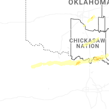
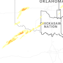
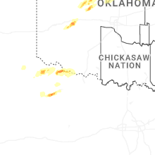
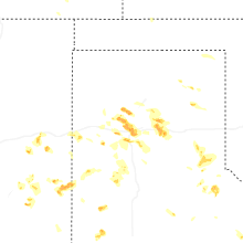

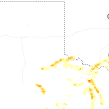

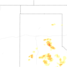


Connect with Interactive Hail Maps