

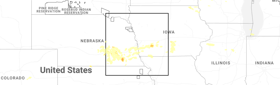
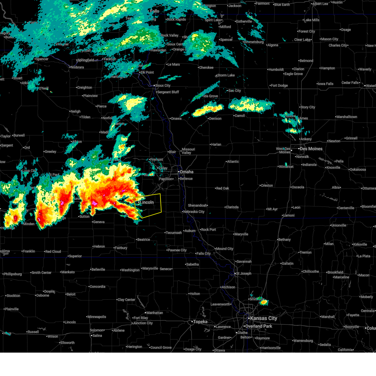
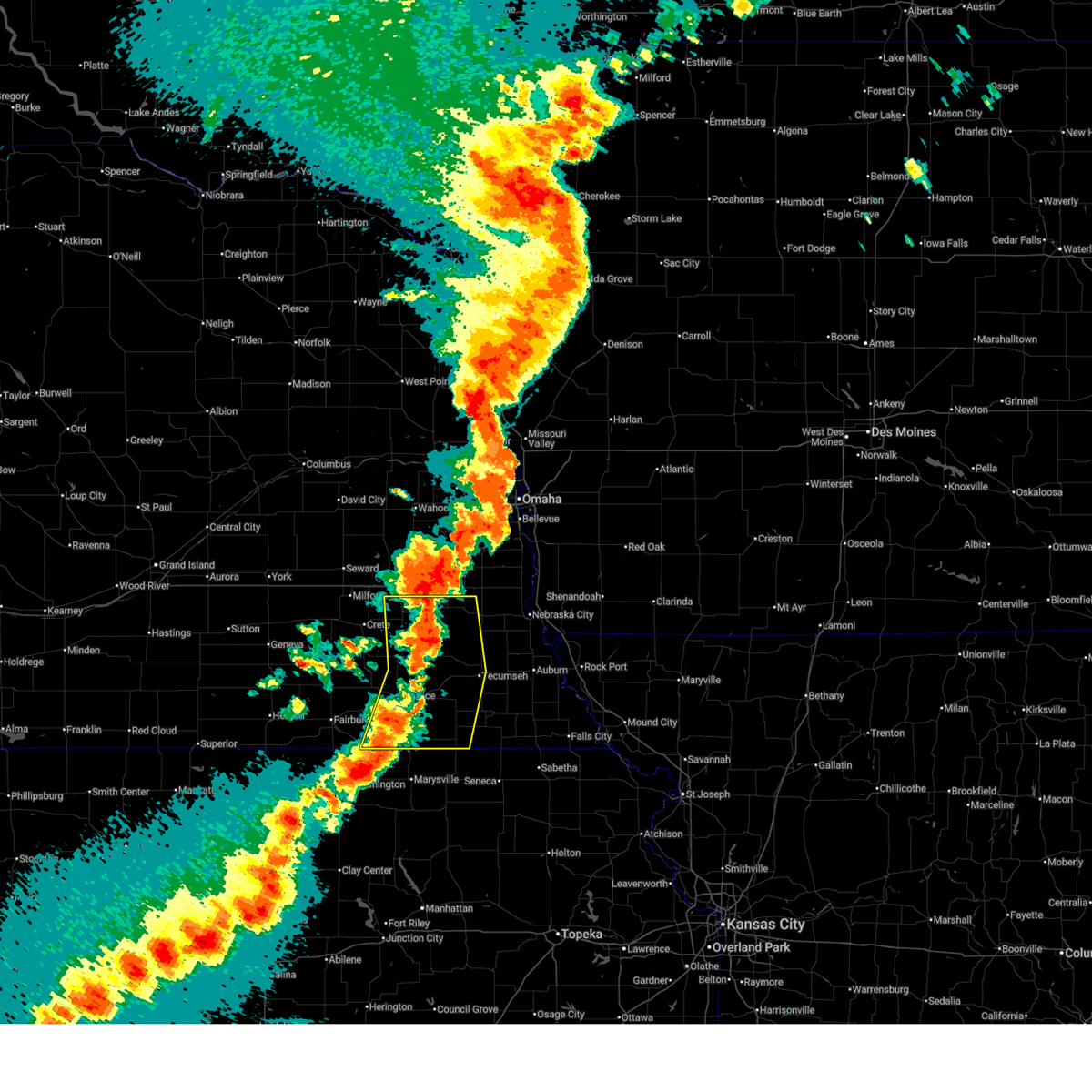
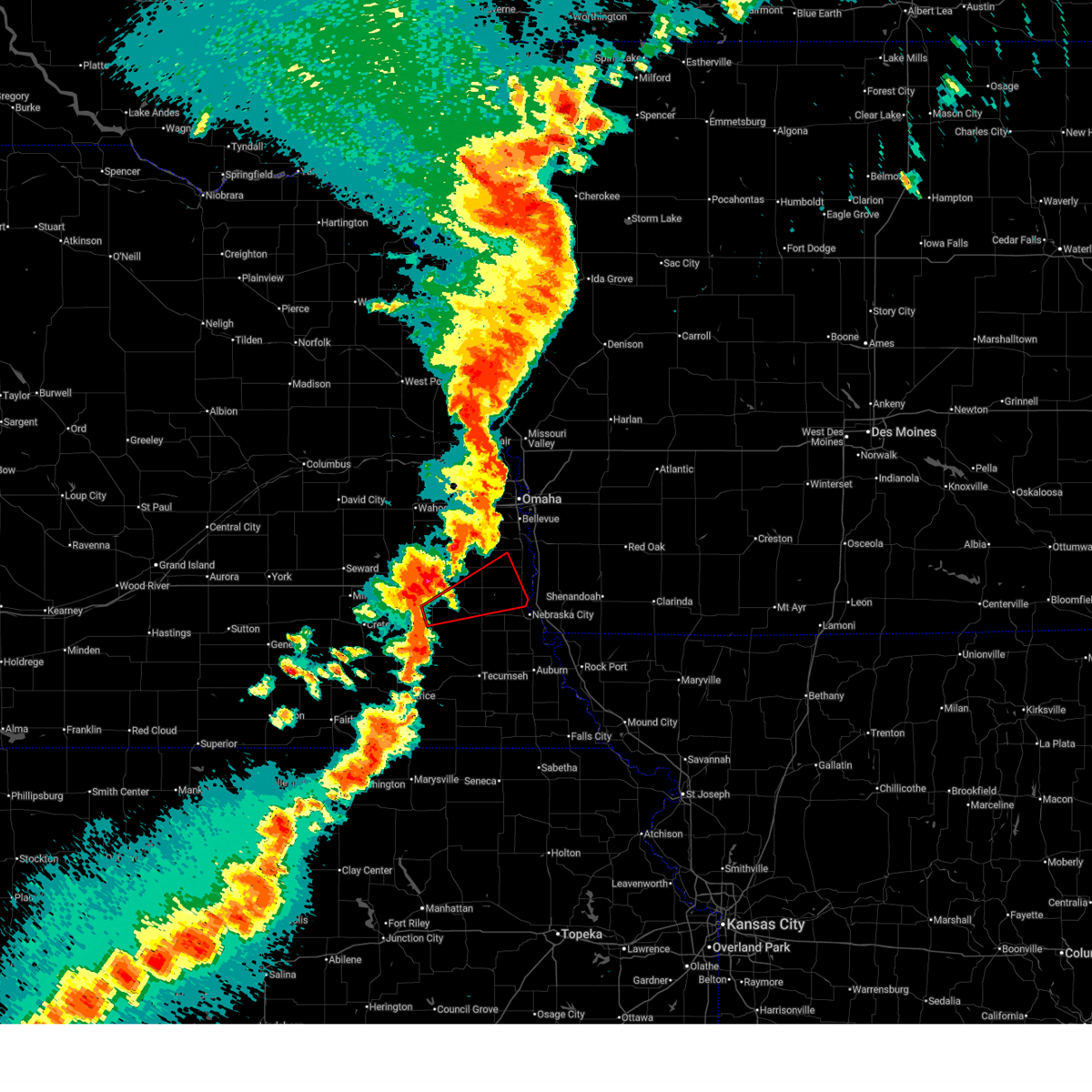
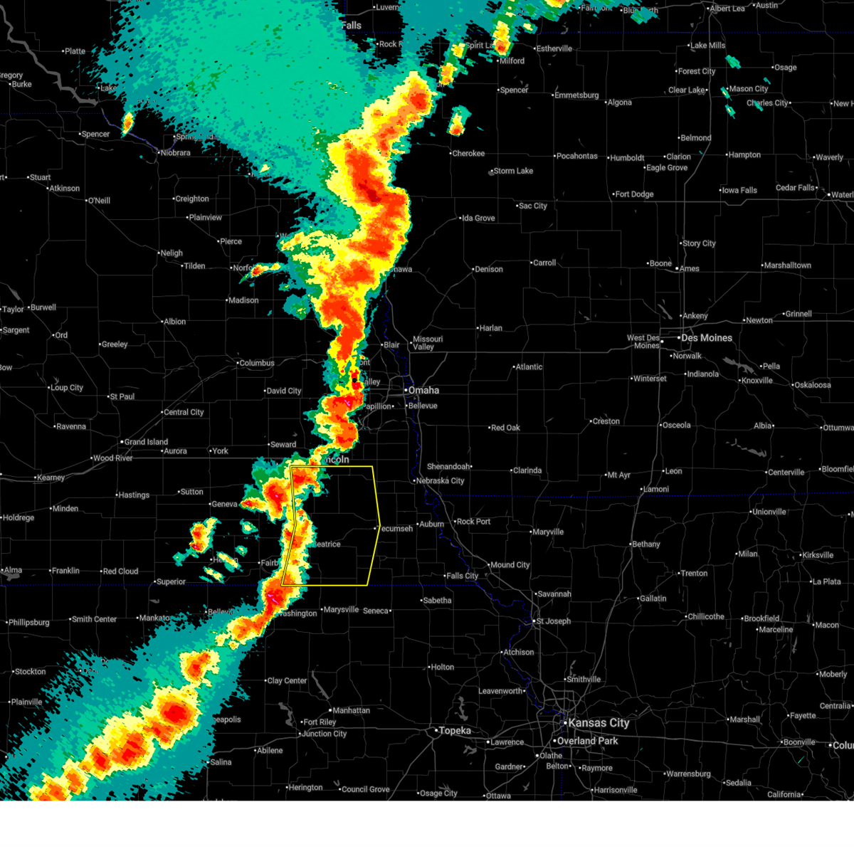
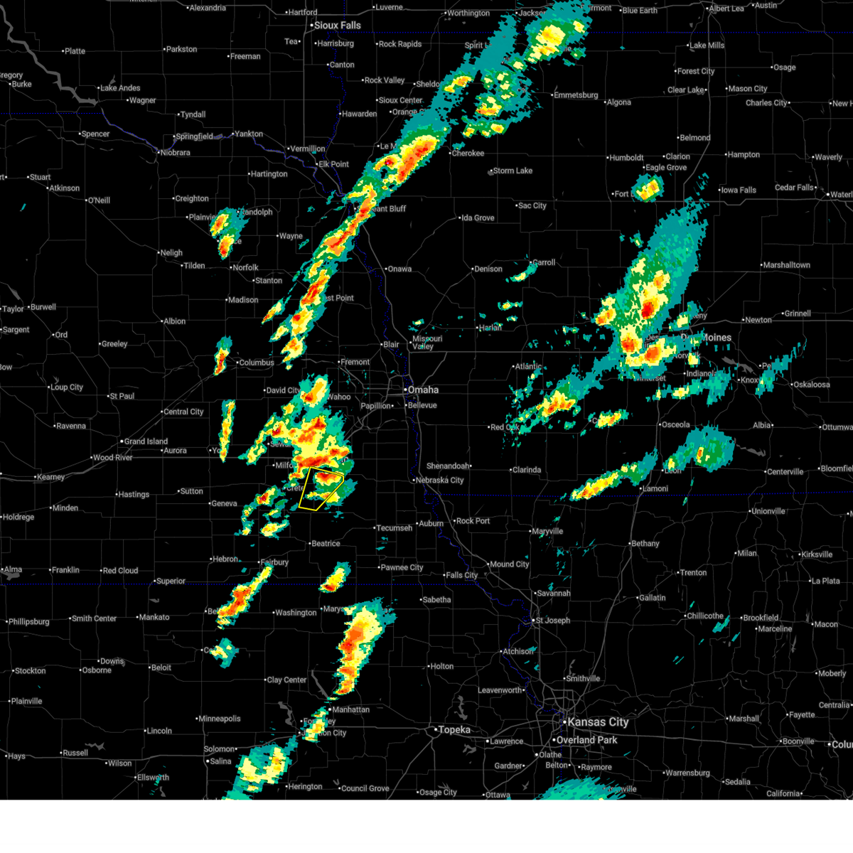
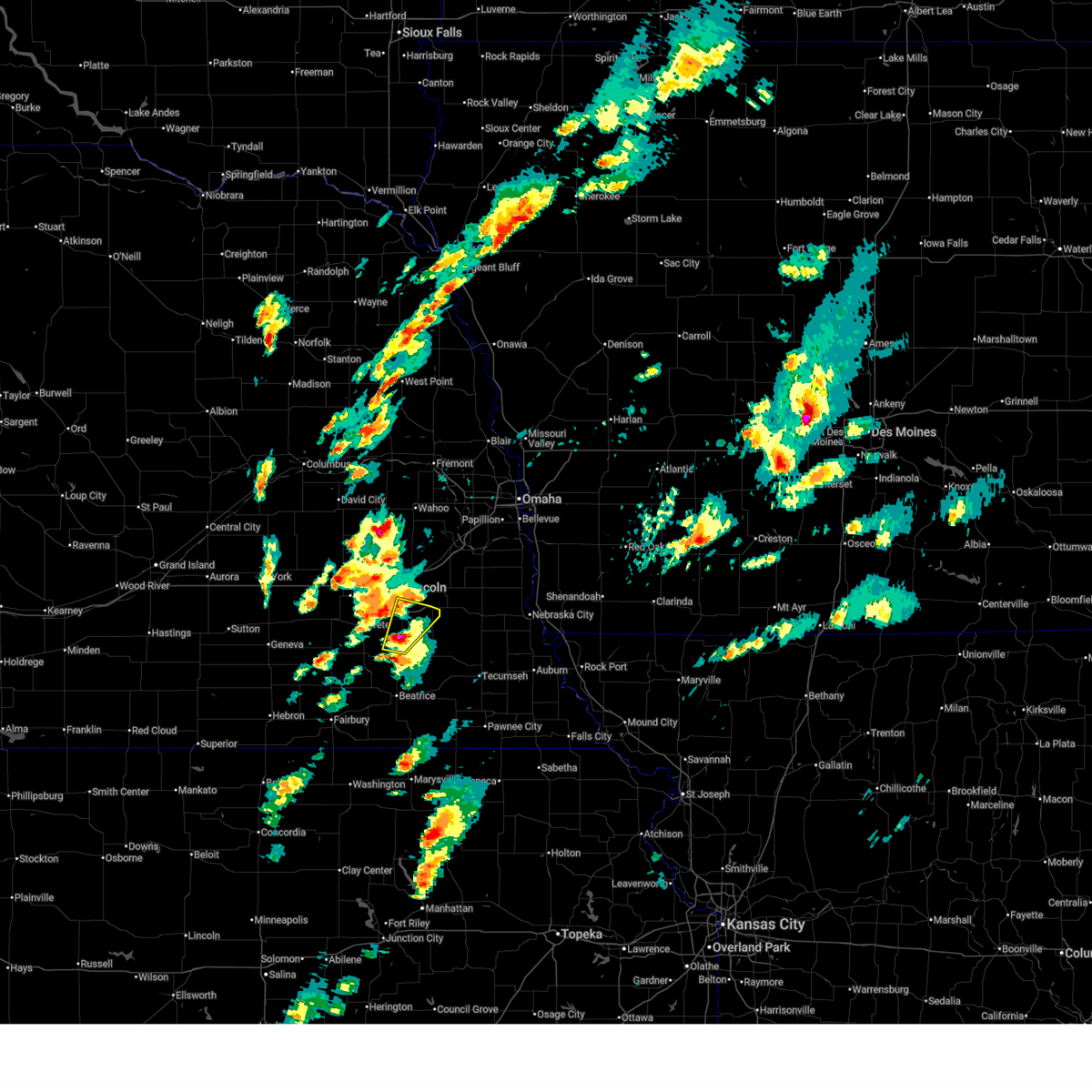
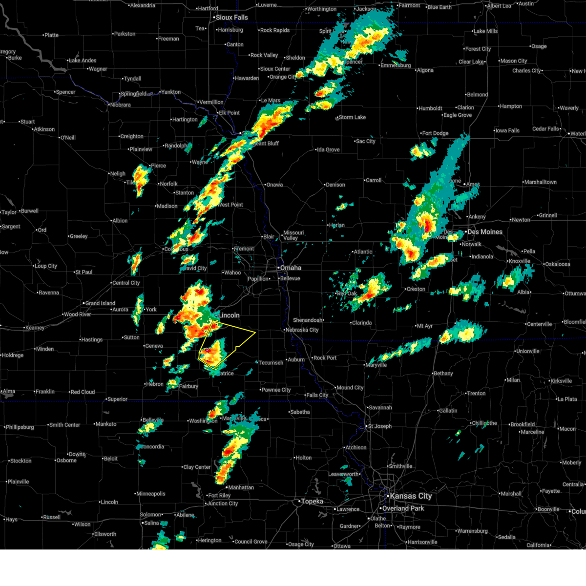
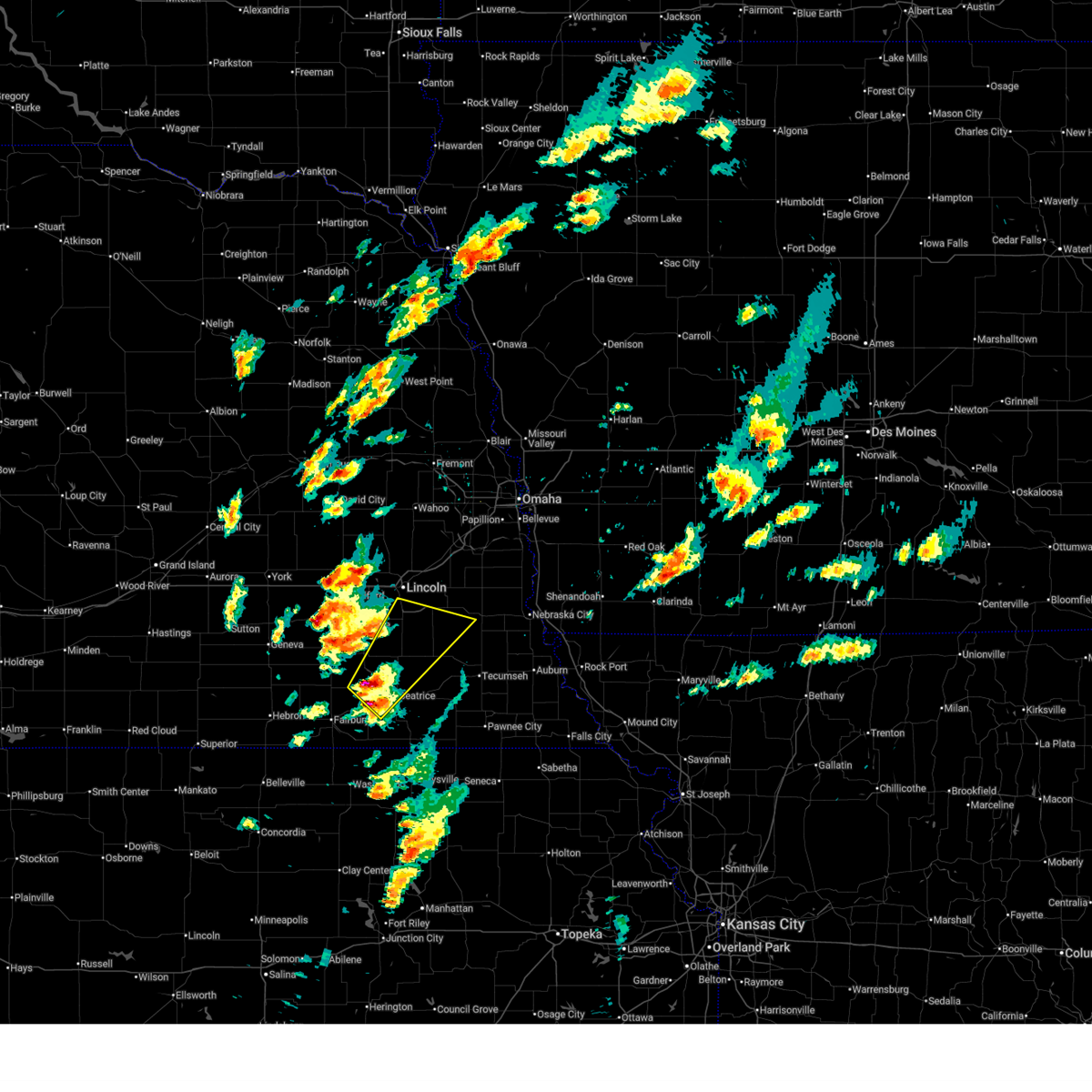
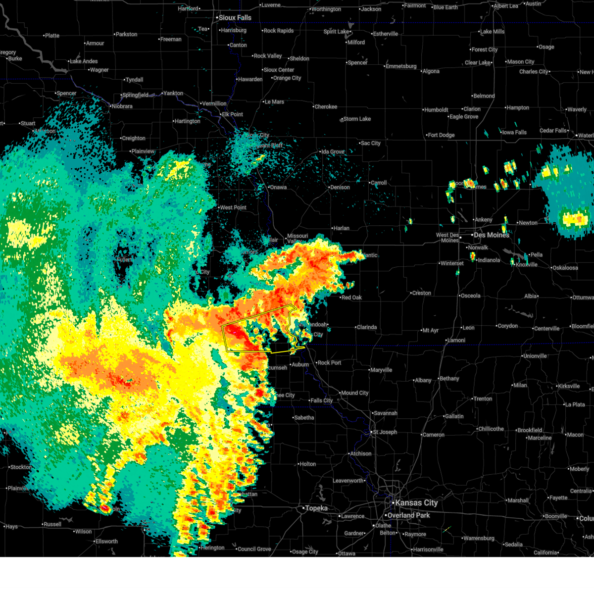
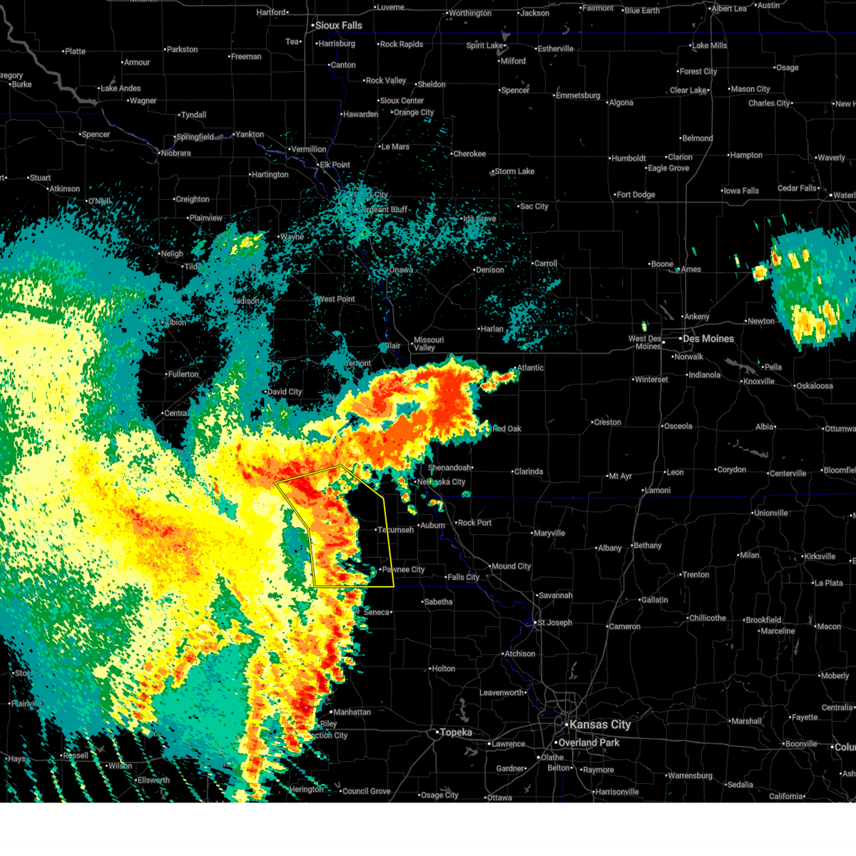
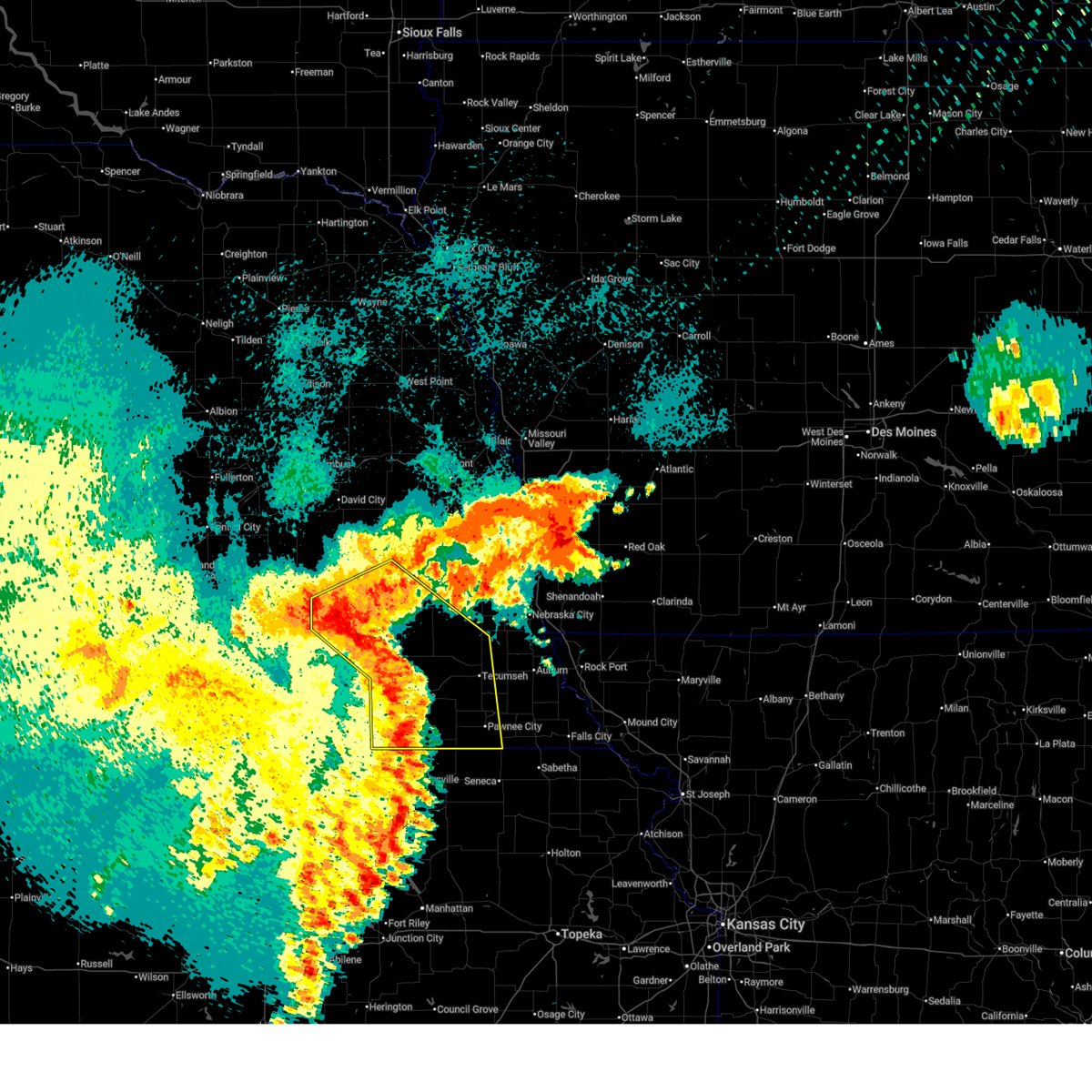
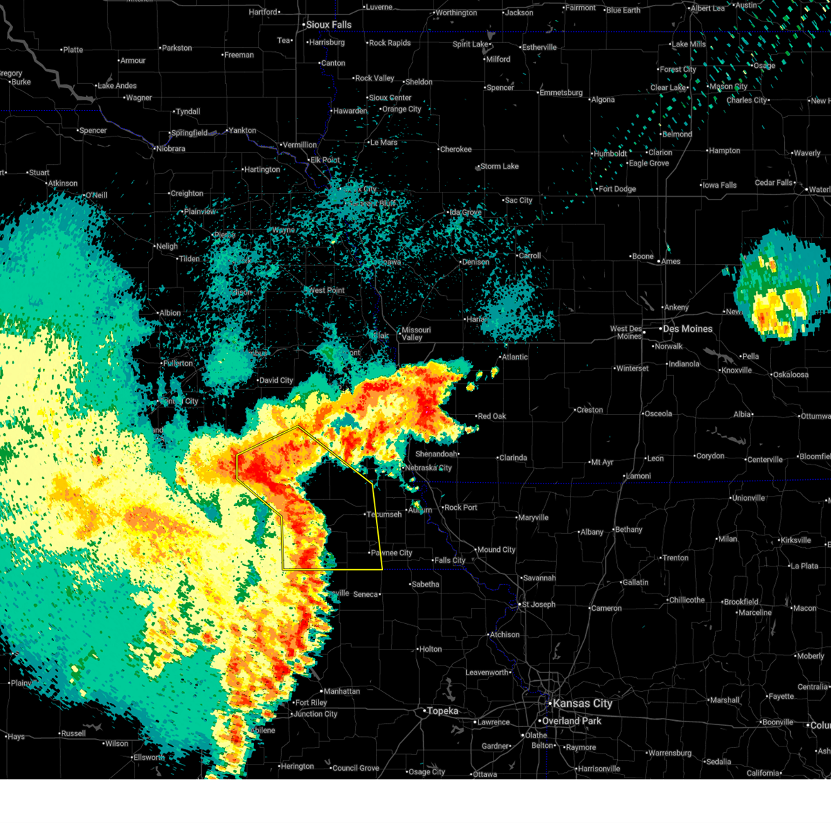
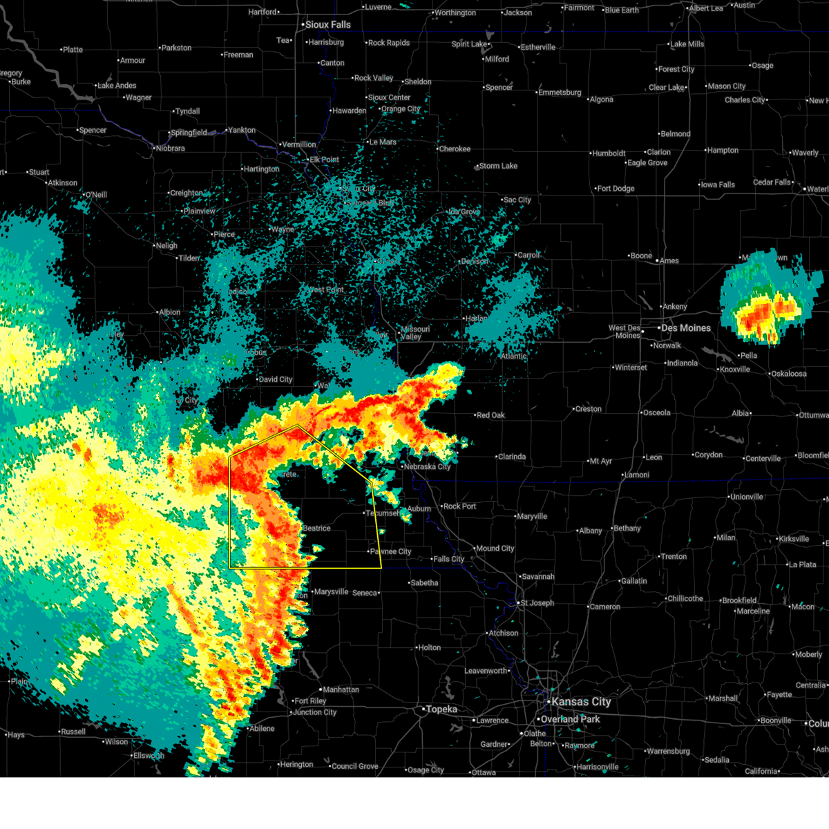
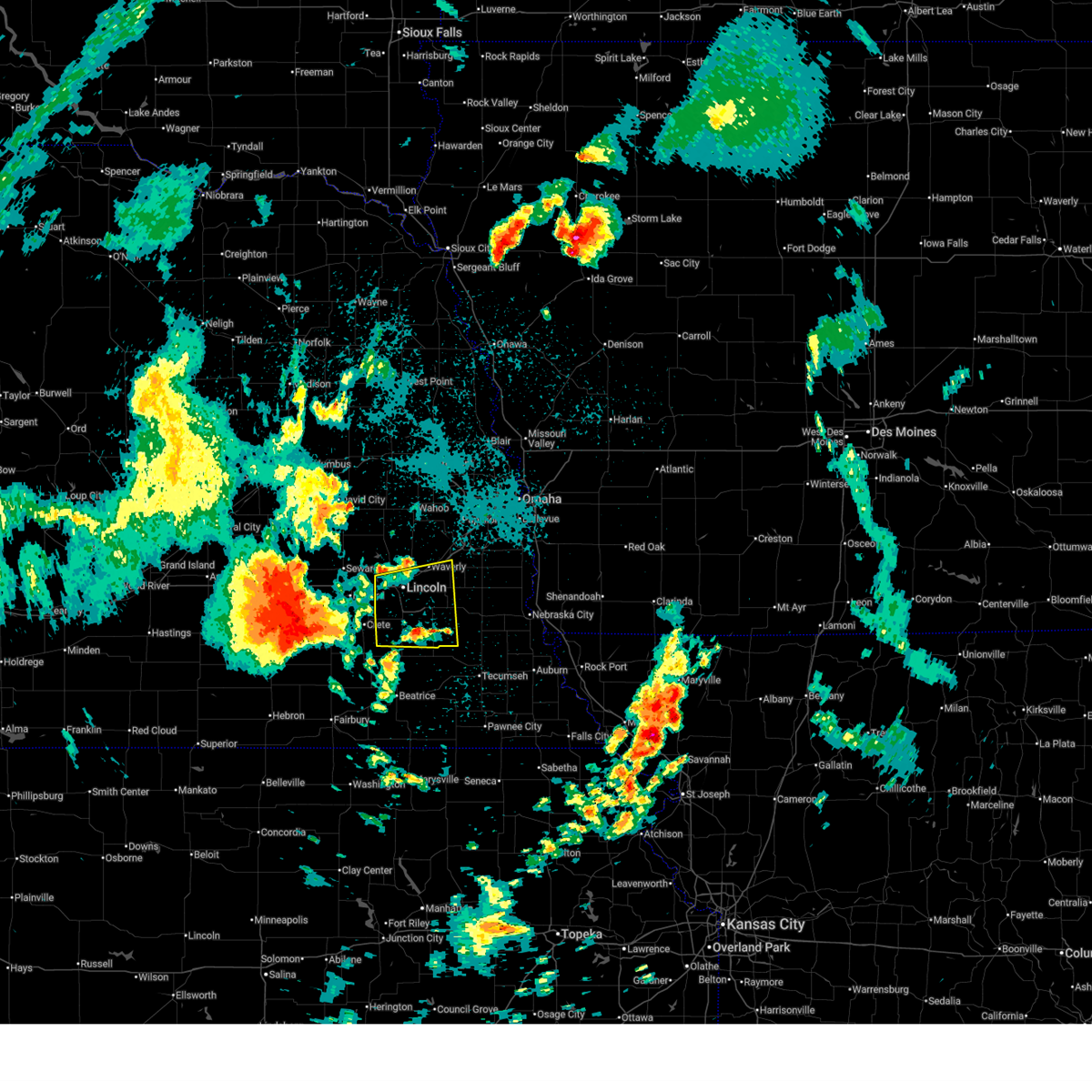
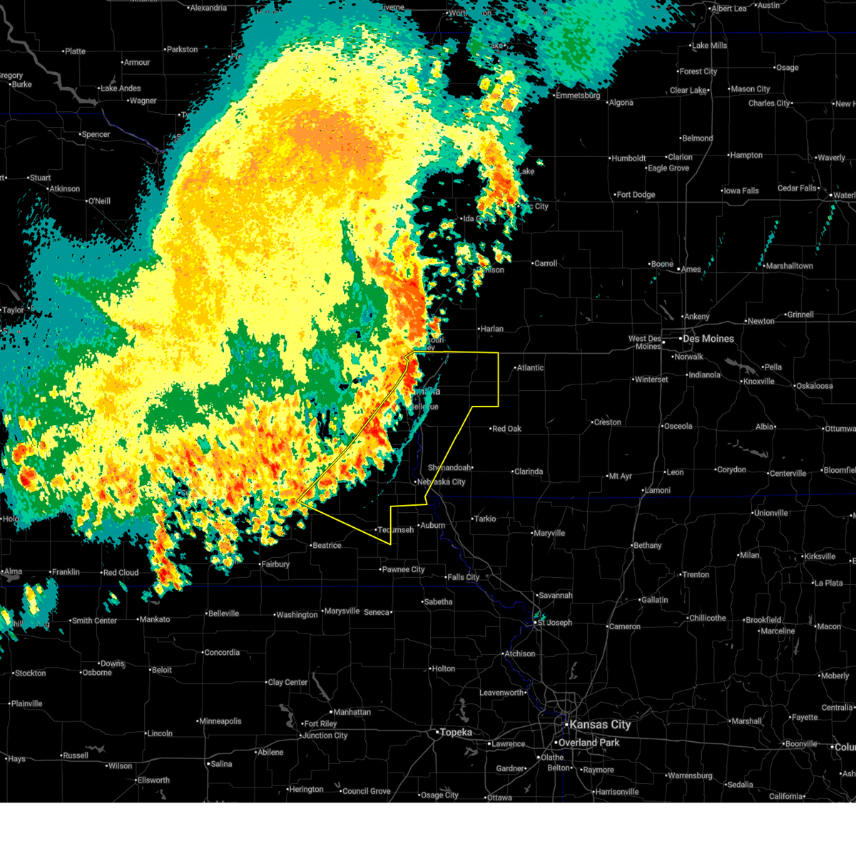
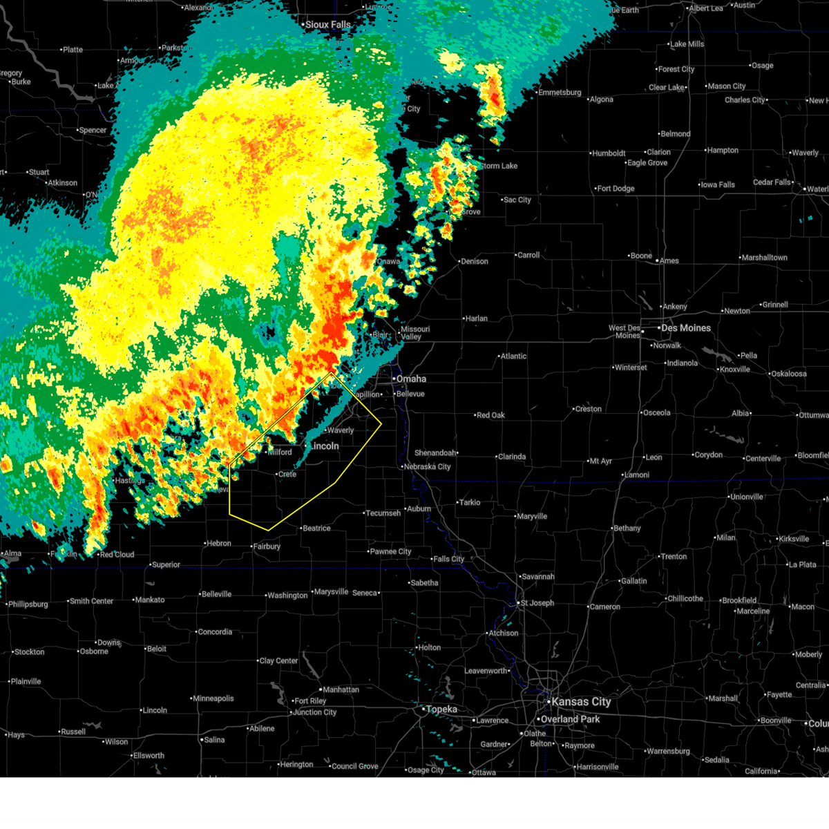
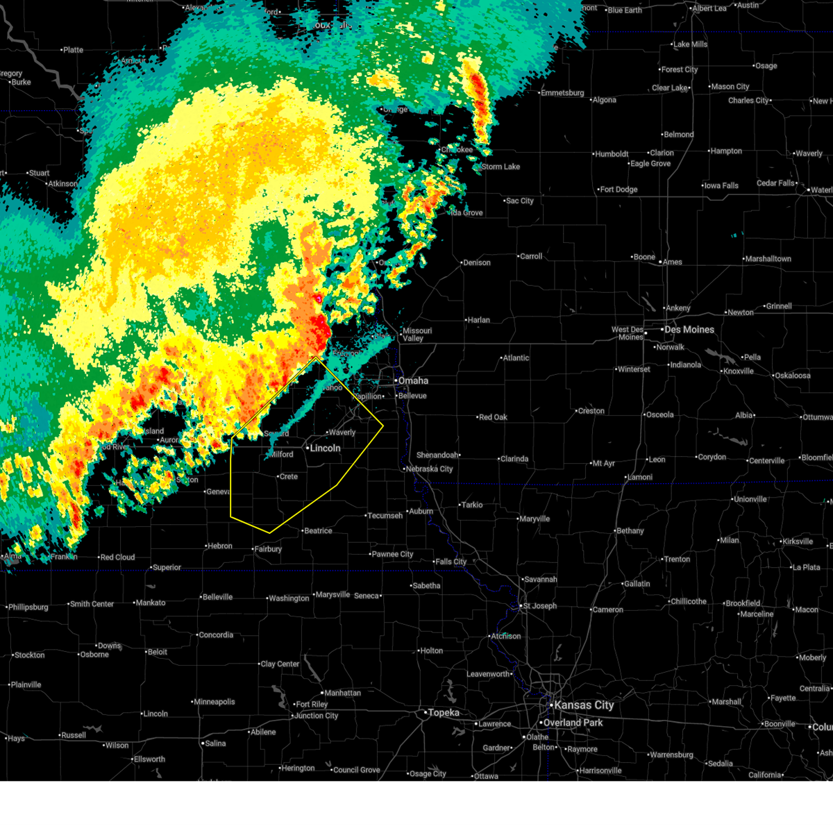
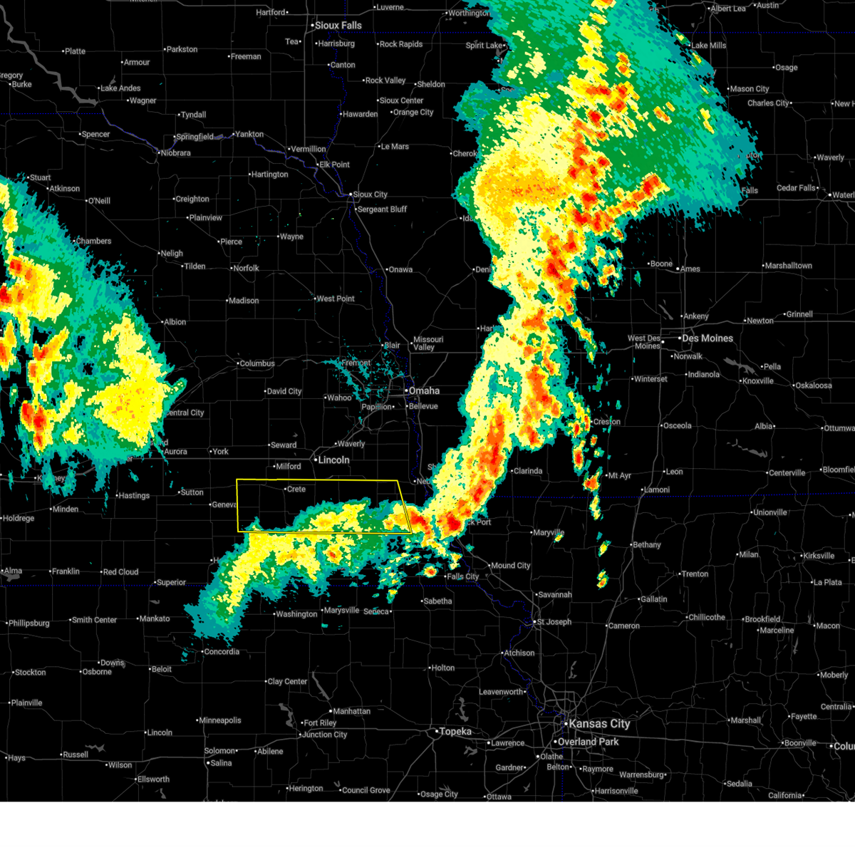
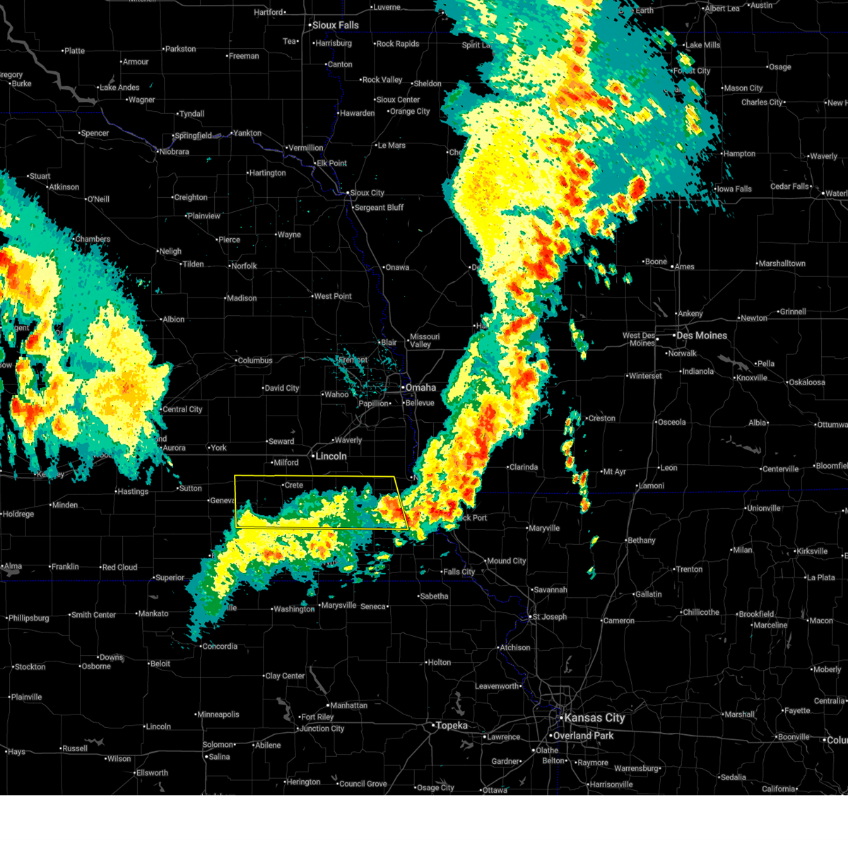
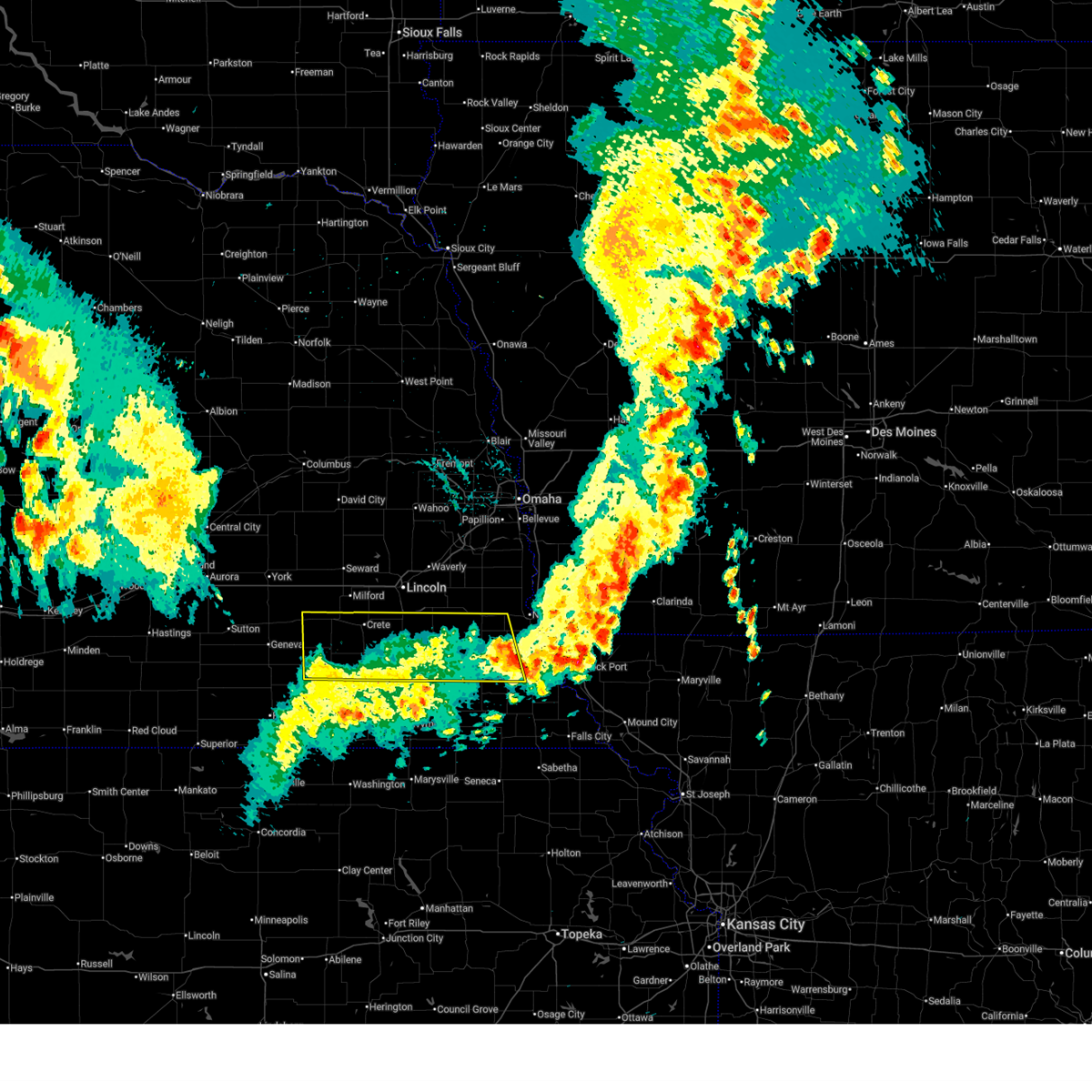
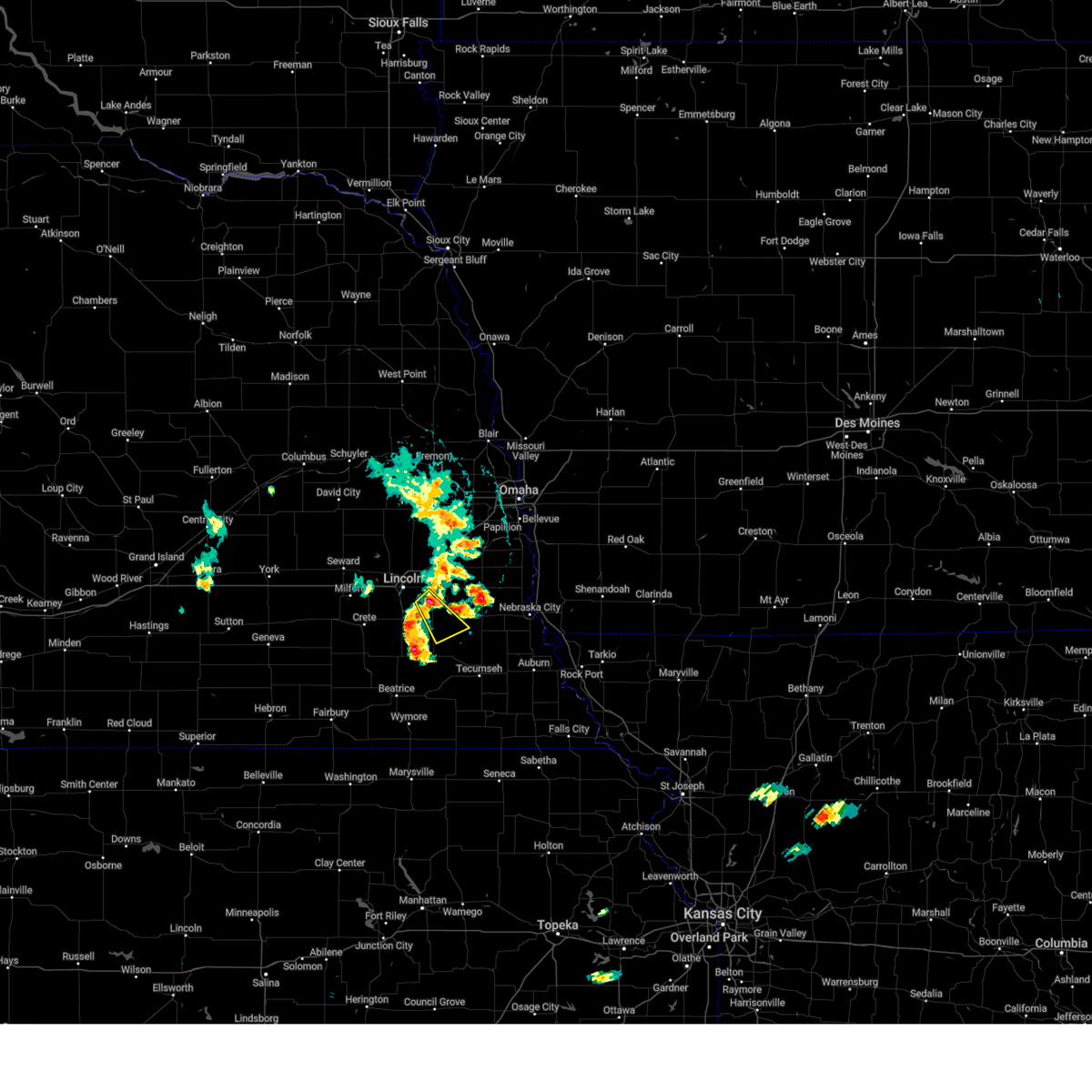
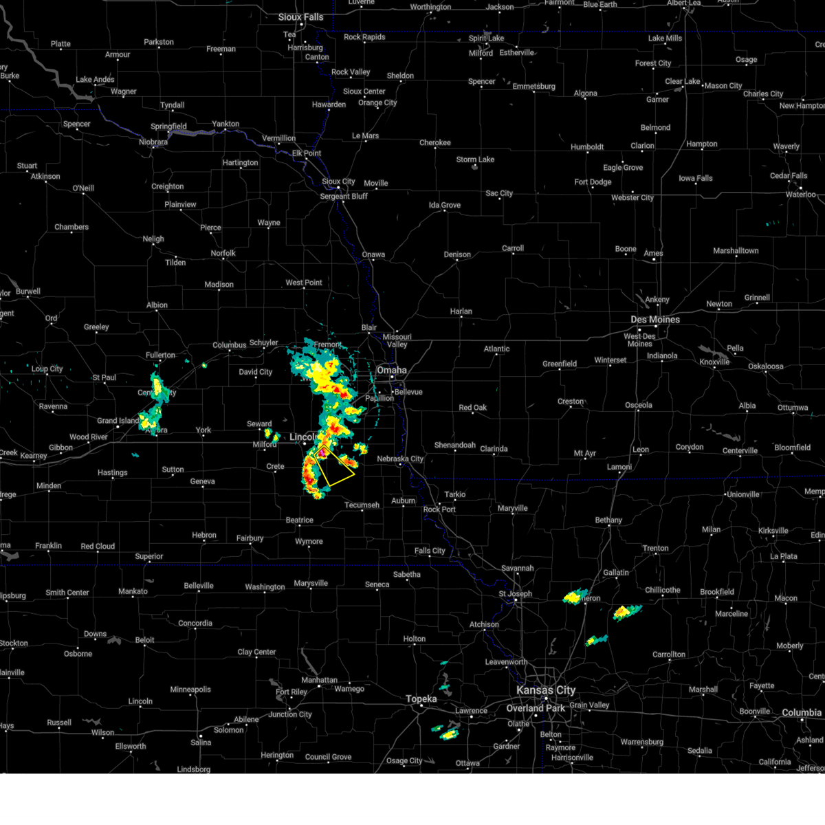
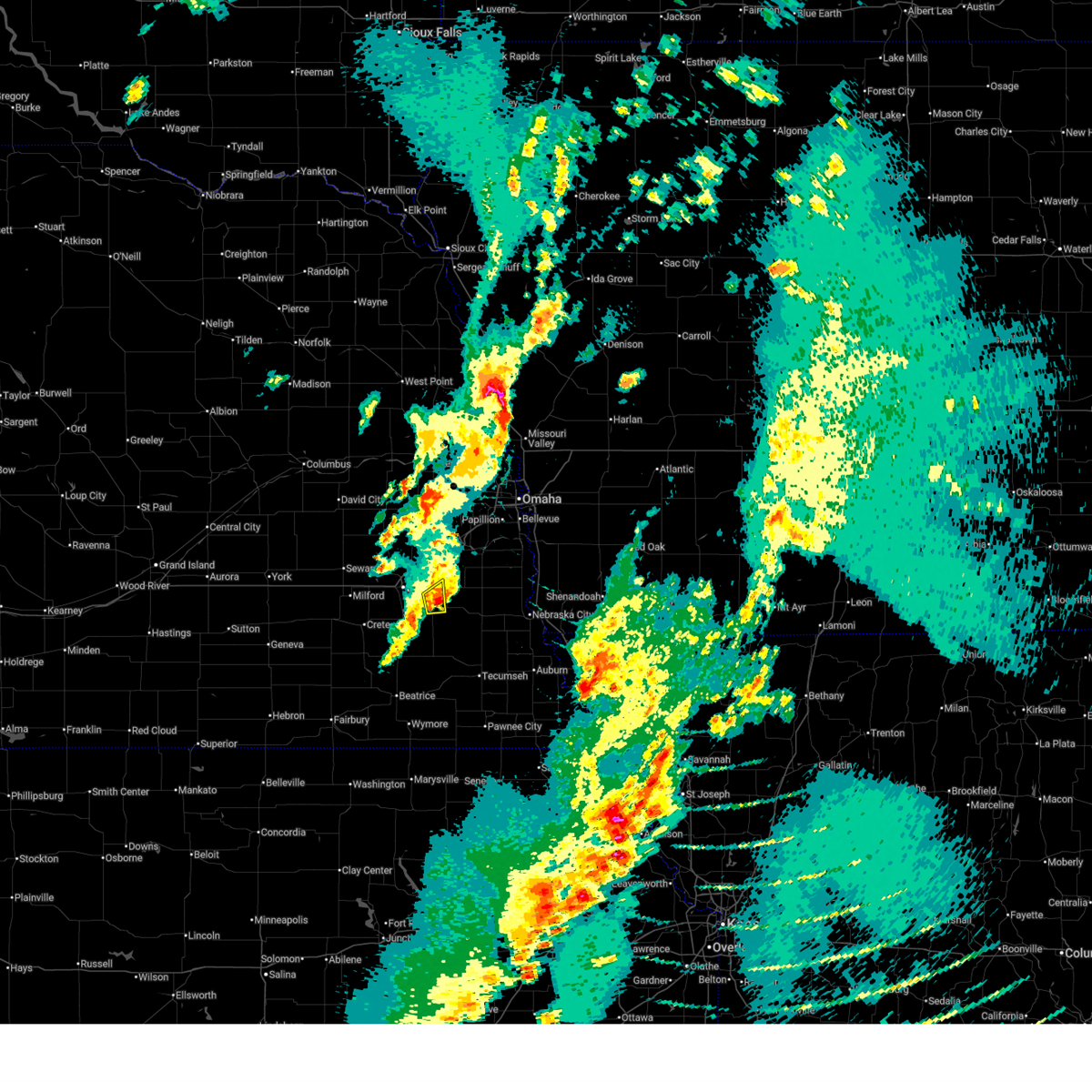
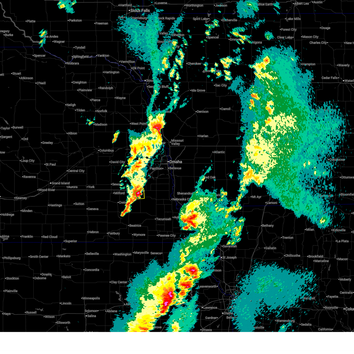
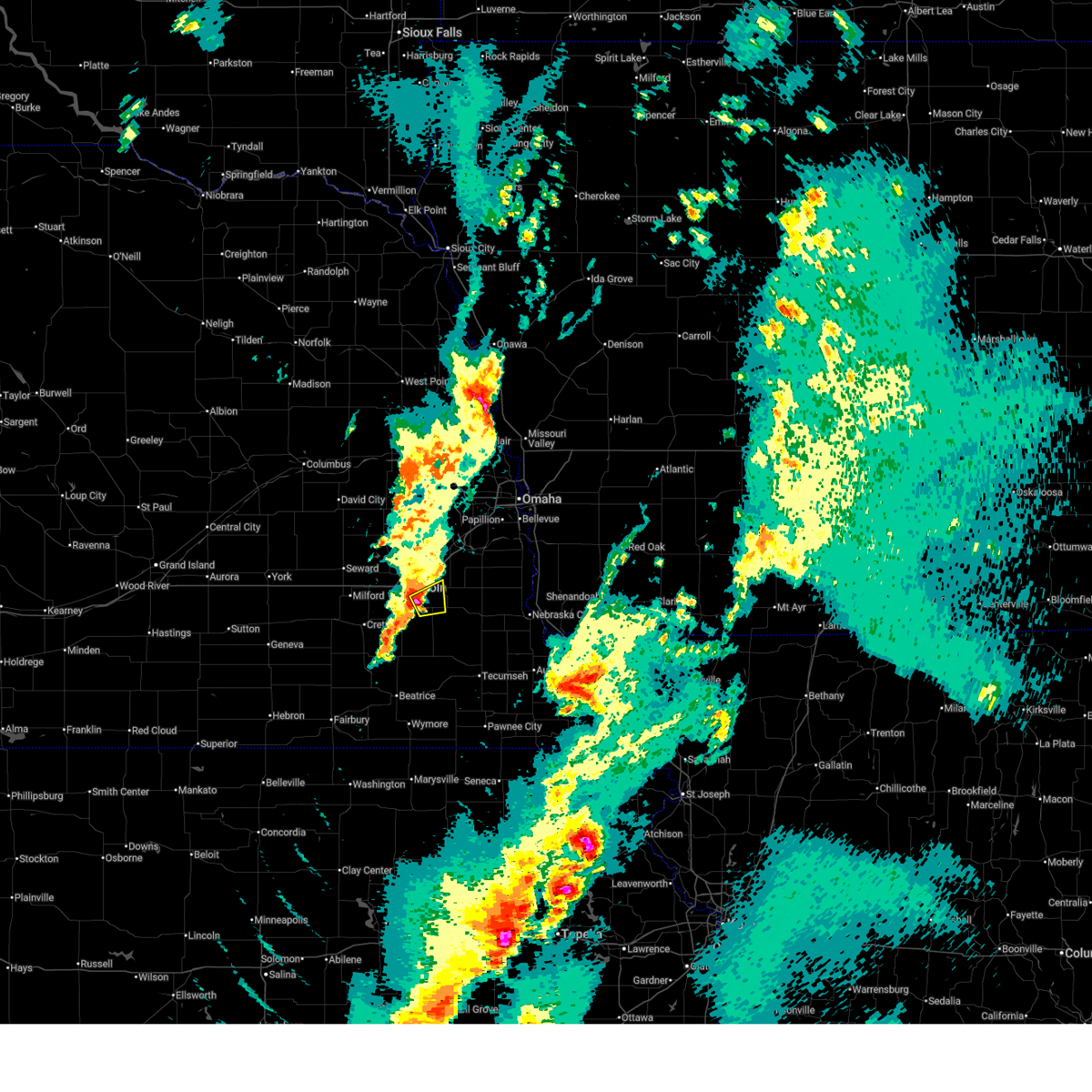
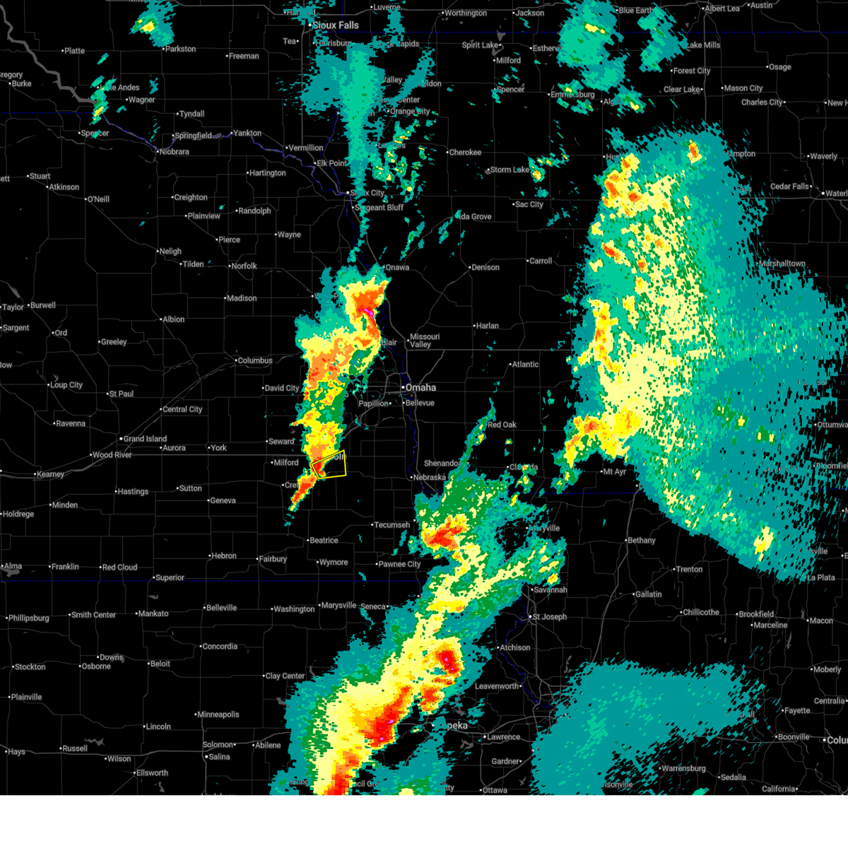
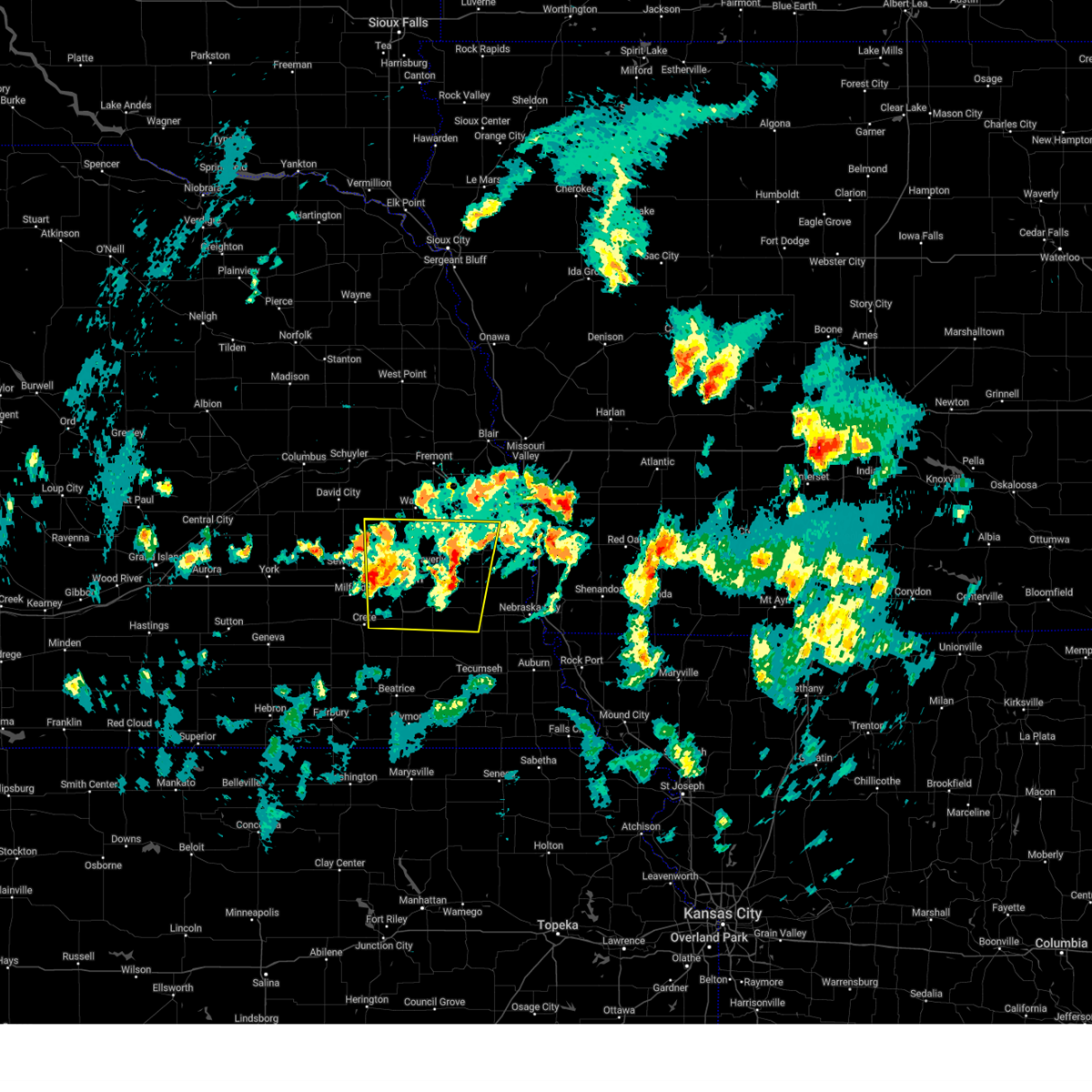
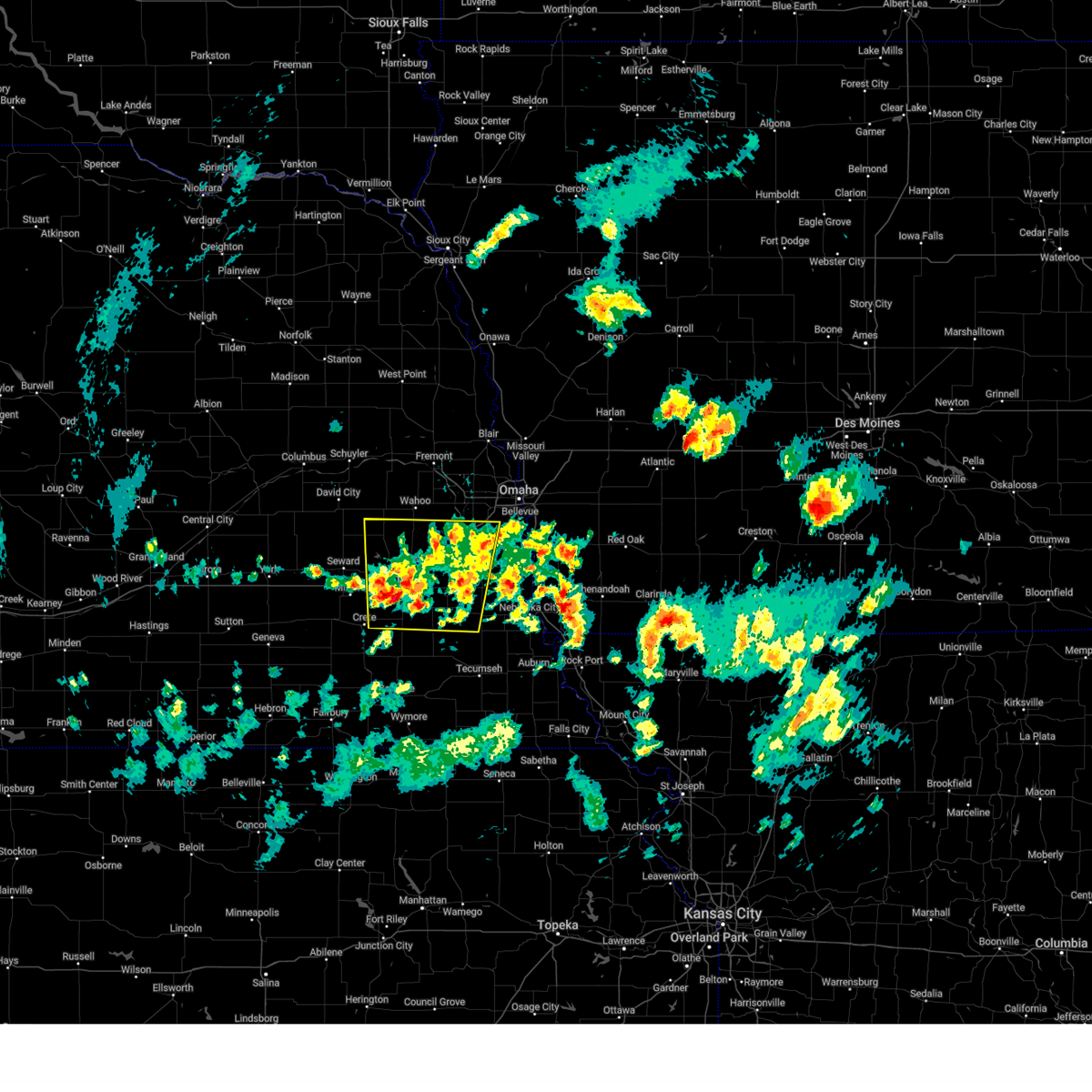
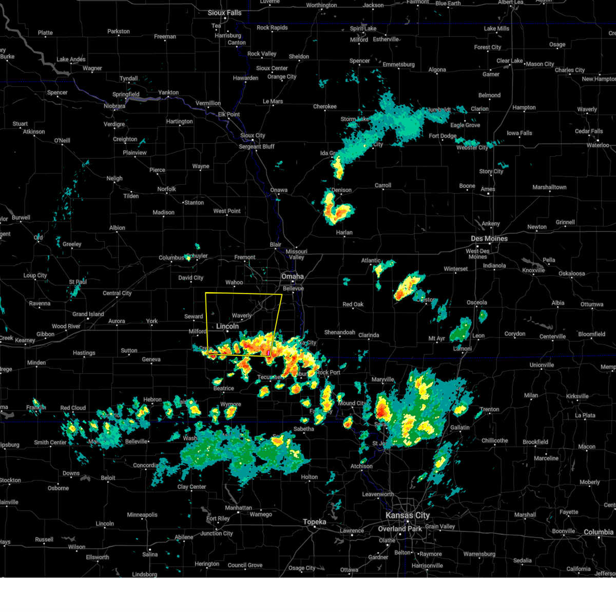
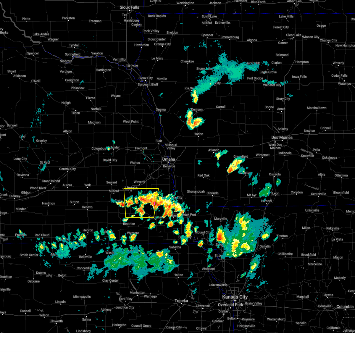
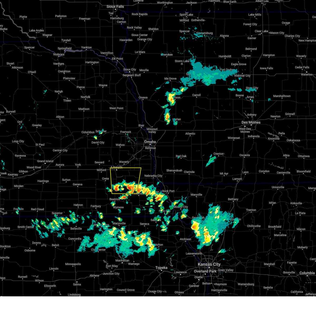
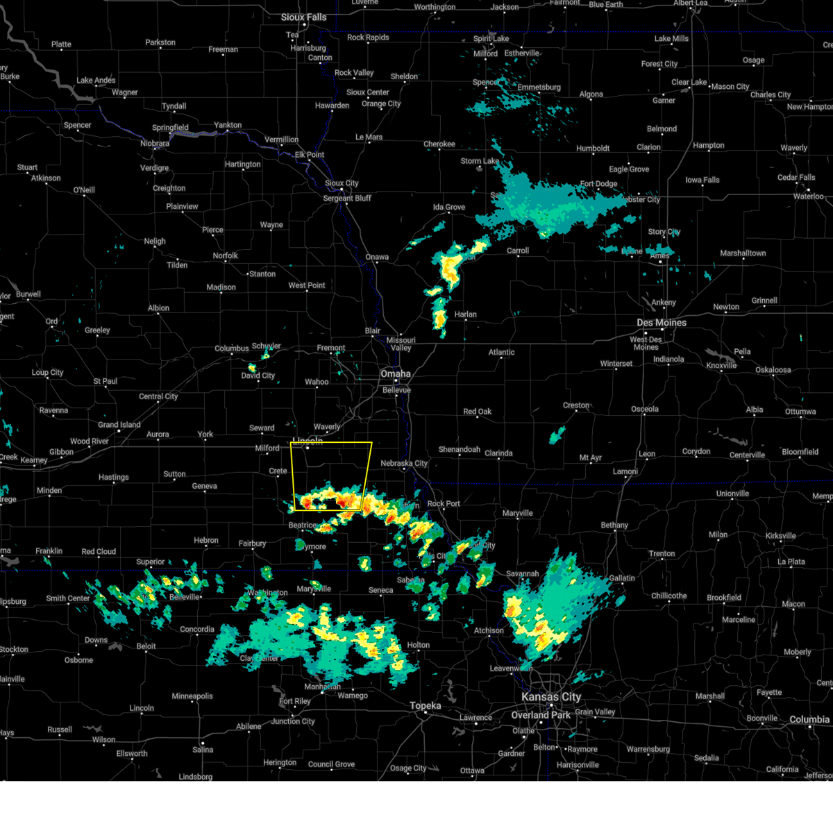
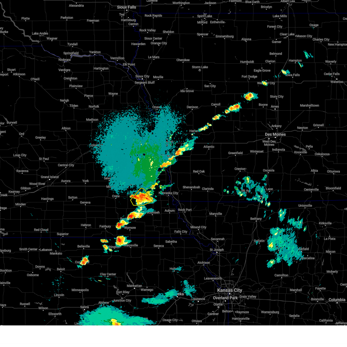
Hail Map for Bennet, NE
The Bennet, NE area has had 9 reports of on-the-ground hail by trained spotters, and has been under severe weather warnings 47 times during the past 12 months. Doppler radar has detected hail at or near Bennet, NE on 105 occasions, including 4 occasions during the past year.
| Name: | Bennet, NE |
| Where Located: | 49.7 miles SW of Omaha, NE |
| Map: | Google Map for Bennet, NE |
| Population: | 719 |
| Housing Units: | 306 |
| More Info: | Search Google for Bennet, NE |
1
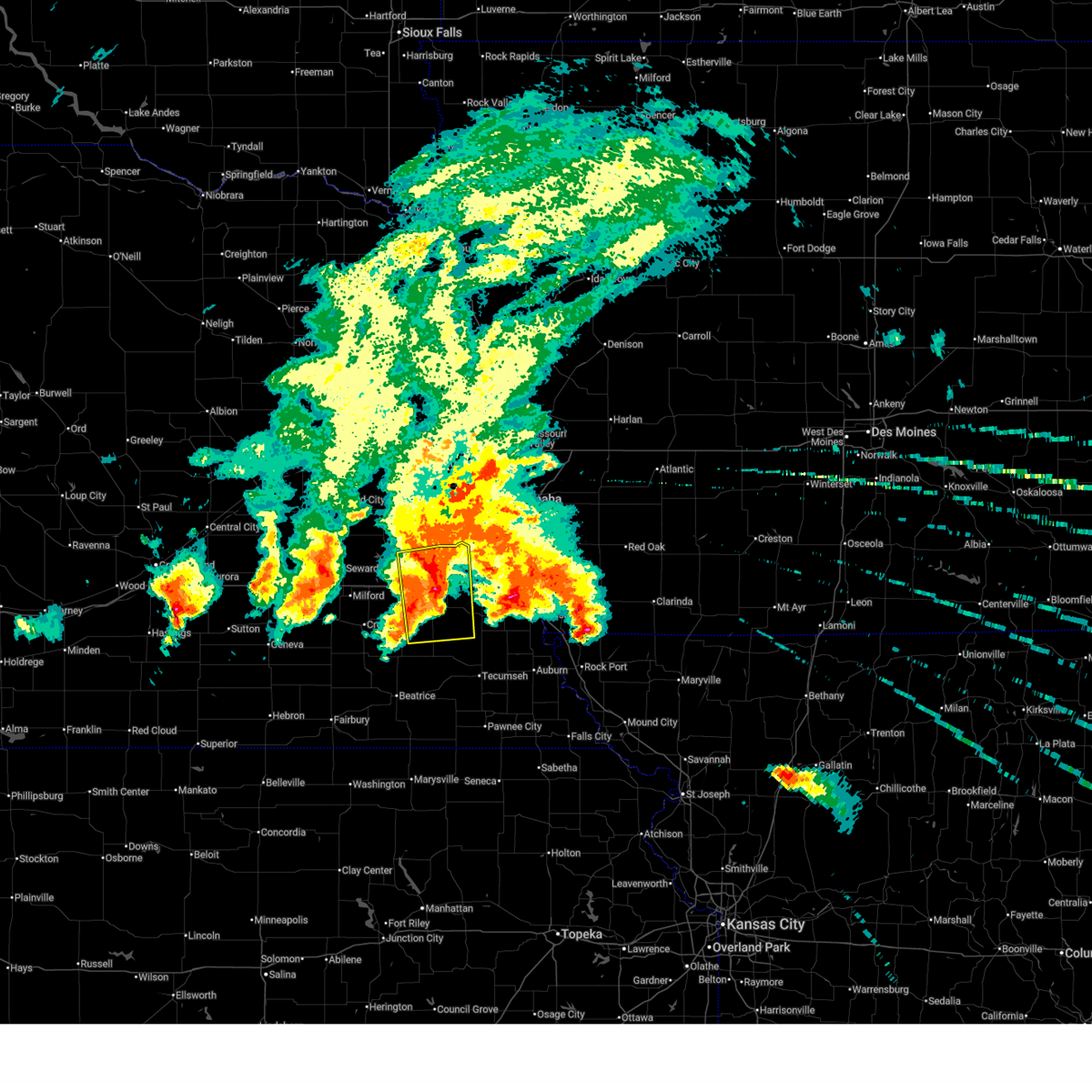
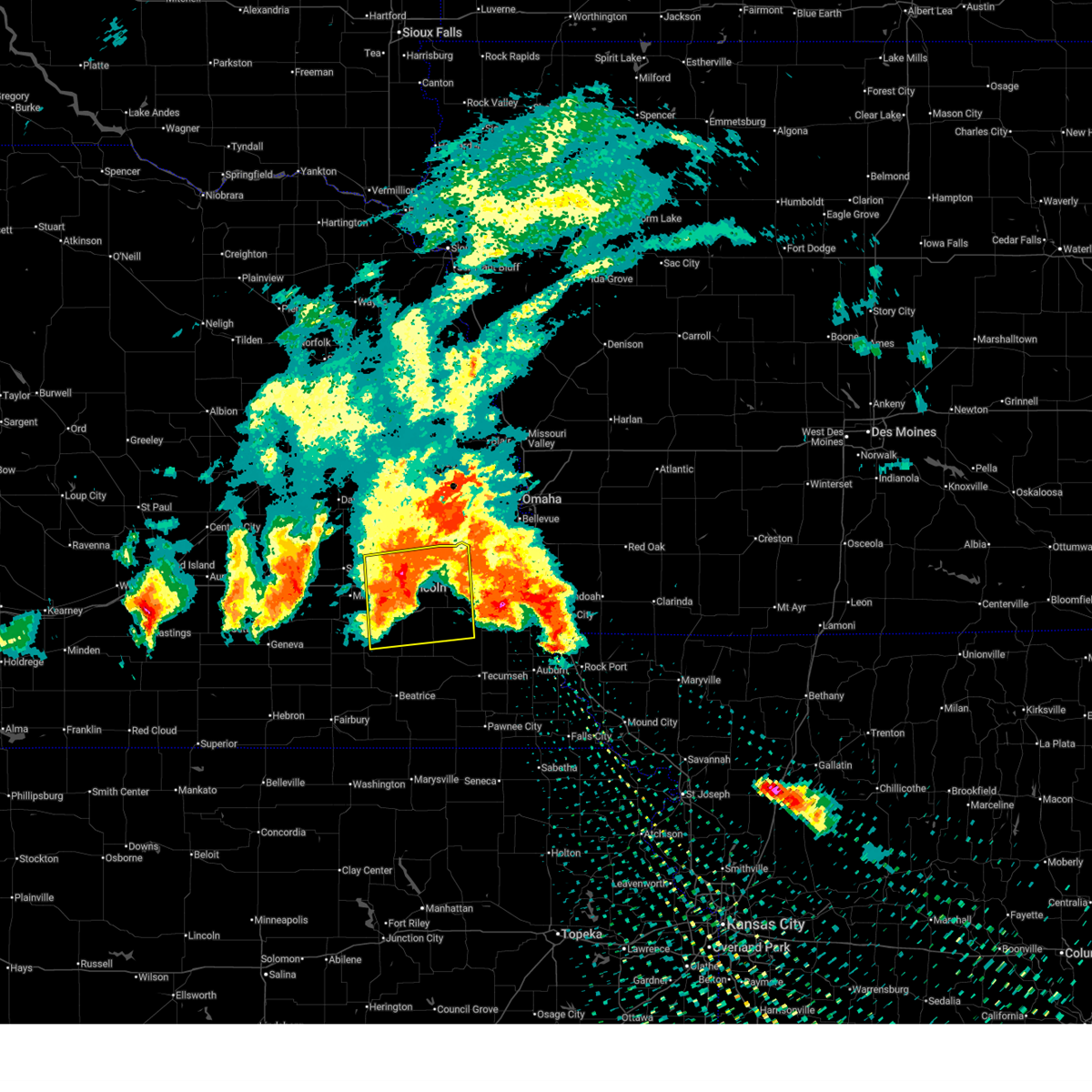
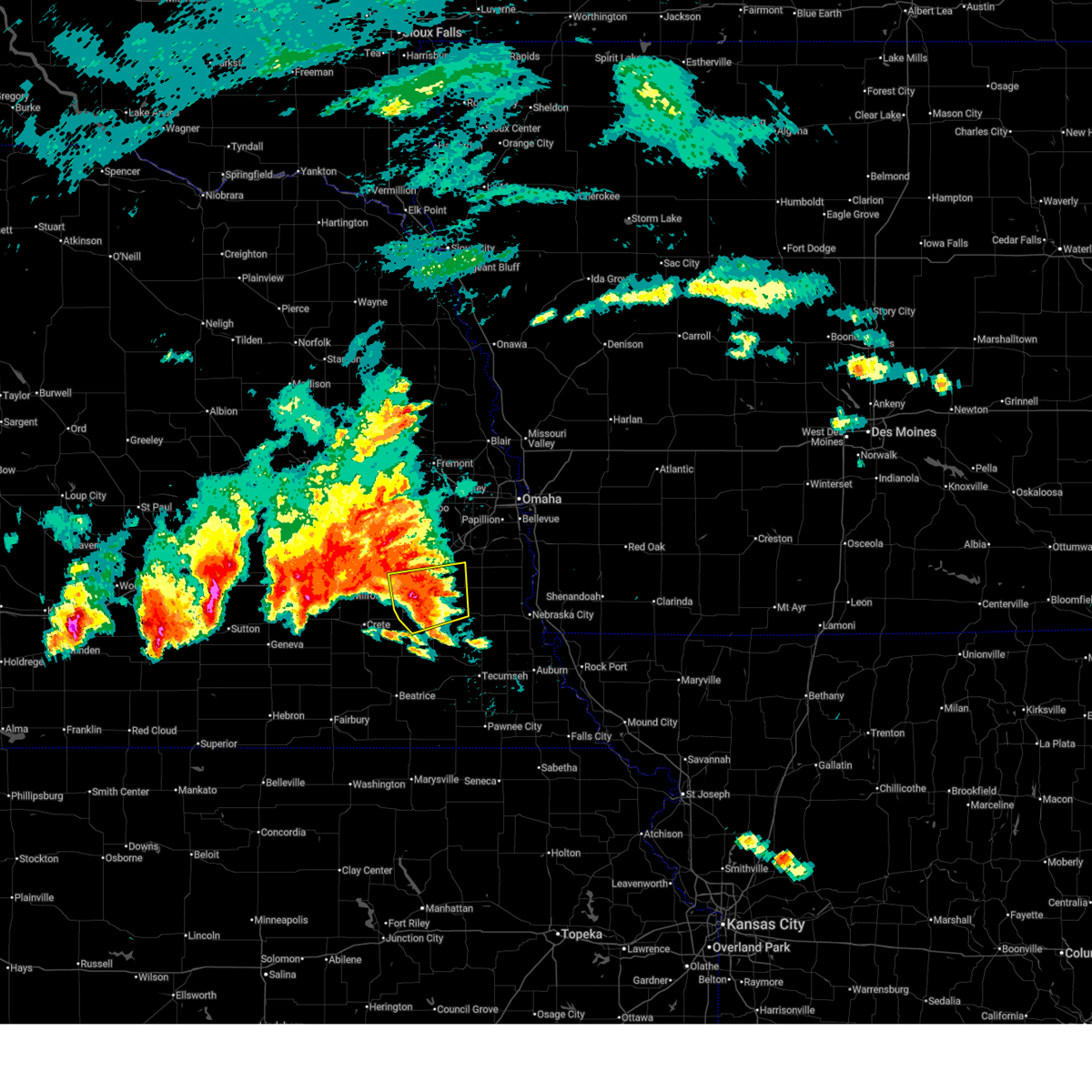
The Top Recent Hail Date for Bennet, NE is Friday, June 5, 2026 (27th out of 105)
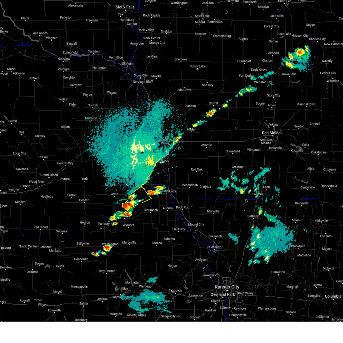
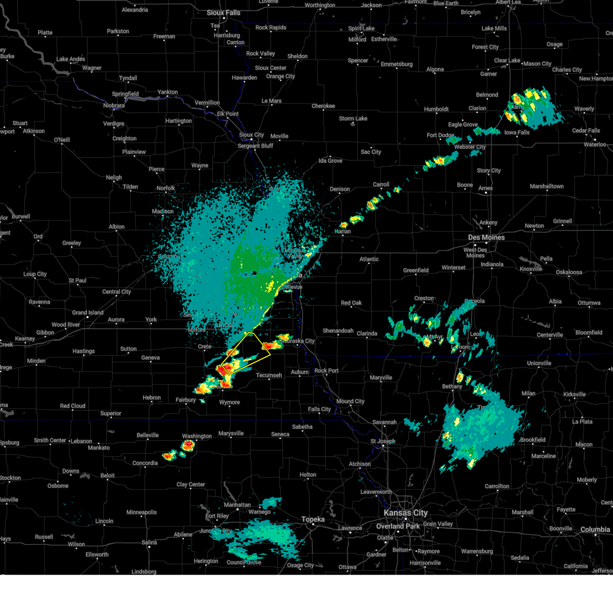
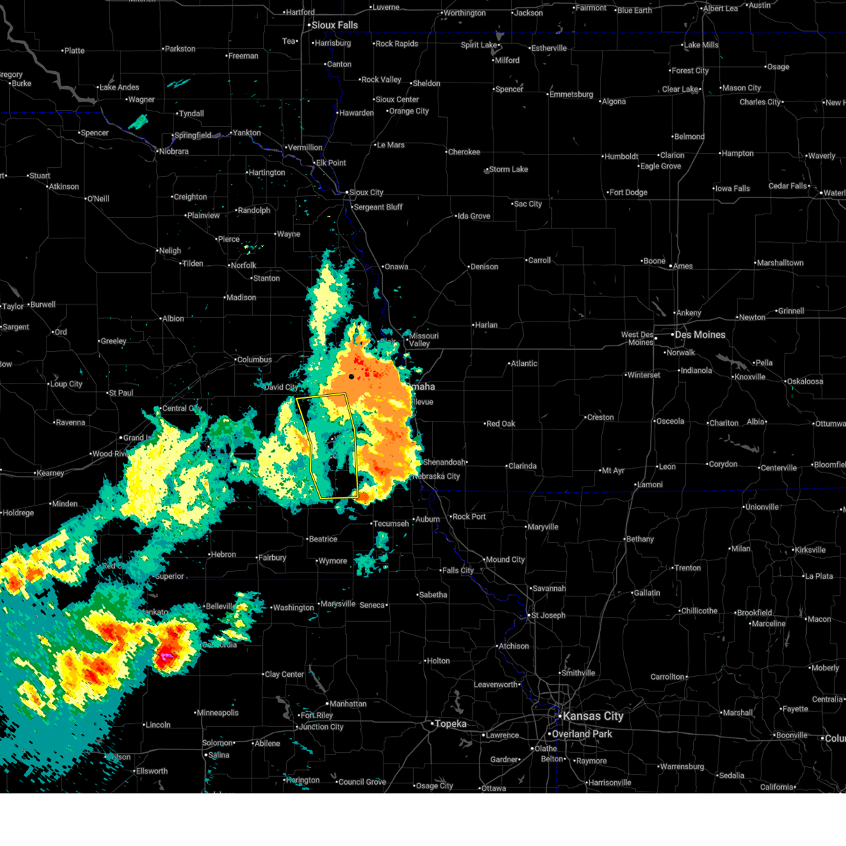
Hail and Wind Damage Spotted near Bennet, NE
| Date / Time | Report Details |
|---|---|
| 6/11/2026 5:07 AM CDT |
 Svroax the national weather service in omaha has issued a * severe thunderstorm warning for, southeastern lancaster county in southeastern nebraska, northern johnson county in southeastern nebraska, northwestern nemaha county in southeastern nebraska, otoe county in southeastern nebraska, northeastern gage county in southeastern nebraska, southern cass county in southeastern nebraska, * until 545 am cdt. * at 506 am cdt, a severe thunderstorm was located over panama, or 15 miles southeast of lincoln, moving east at 40 mph (radar indicated). Hazards include 70 mph wind gusts and quarter size hail. Hail damage to vehicles is expected. expect considerable tree damage. wind damage is also likely to mobile homes, roofs, and outbuildings. this severe thunderstorm will be near, bennet and douglas around 510 am cdt. unadilla around 520 am cdt. syracuse around 525 am cdt. Other locations in the path of this severe thunderstorm include dunbar. Svroax the national weather service in omaha has issued a * severe thunderstorm warning for, southeastern lancaster county in southeastern nebraska, northern johnson county in southeastern nebraska, northwestern nemaha county in southeastern nebraska, otoe county in southeastern nebraska, northeastern gage county in southeastern nebraska, southern cass county in southeastern nebraska, * until 545 am cdt. * at 506 am cdt, a severe thunderstorm was located over panama, or 15 miles southeast of lincoln, moving east at 40 mph (radar indicated). Hazards include 70 mph wind gusts and quarter size hail. Hail damage to vehicles is expected. expect considerable tree damage. wind damage is also likely to mobile homes, roofs, and outbuildings. this severe thunderstorm will be near, bennet and douglas around 510 am cdt. unadilla around 520 am cdt. syracuse around 525 am cdt. Other locations in the path of this severe thunderstorm include dunbar.
|
| 6/11/2026 5:01 AM CDT | Storm damage reported in lancaster county NE, 3.3 miles ESE of Bennet, NE |
| 6/11/2026 4:56 AM CDT |
 At 455 am cdt, a severe thunderstorm was located 4 miles north of palmyra, or 16 miles east of lincoln, moving east at 60 mph (weather instrument measurement measured 70 mph gust in lincoln, nebraska at 4:37 am). Hazards include 70 mph wind gusts and quarter size hail. Hail damage to vehicles is expected. expect considerable tree damage. wind damage is also likely to mobile homes, roofs, and outbuildings. this severe thunderstorm will remain over mainly rural areas of eastern lancaster, western otoe and western cass counties, including the following locations, stagecoach state recreation area, mahoney state park, wagon train state recreation area, and alvo. This includes interstate 80 in nebraska between mile markers 401 and 426. At 455 am cdt, a severe thunderstorm was located 4 miles north of palmyra, or 16 miles east of lincoln, moving east at 60 mph (weather instrument measurement measured 70 mph gust in lincoln, nebraska at 4:37 am). Hazards include 70 mph wind gusts and quarter size hail. Hail damage to vehicles is expected. expect considerable tree damage. wind damage is also likely to mobile homes, roofs, and outbuildings. this severe thunderstorm will remain over mainly rural areas of eastern lancaster, western otoe and western cass counties, including the following locations, stagecoach state recreation area, mahoney state park, wagon train state recreation area, and alvo. This includes interstate 80 in nebraska between mile markers 401 and 426.
|
| 6/11/2026 4:53 AM CDT |
 Toroax the national weather service in omaha has issued a * tornado warning for, east central lancaster county in southeastern nebraska, northwestern otoe county in southeastern nebraska, southwestern cass county in southeastern nebraska, * until 530 am cdt. * at 453 am cdt, a severe thunderstorm capable of producing a tornado was located near palmyra, or 14 miles southeast of lincoln, moving east at 55 mph (radar indicated rotation). Hazards include tornado and half dollar size hail. Flying debris will be dangerous to those caught without shelter. mobile homes will be damaged or destroyed. damage to roofs, windows, and vehicles will occur. tree damage is likely. this dangerous storm will be near, unadilla around 500 am cdt. Avoca around 510 am cdt. Toroax the national weather service in omaha has issued a * tornado warning for, east central lancaster county in southeastern nebraska, northwestern otoe county in southeastern nebraska, southwestern cass county in southeastern nebraska, * until 530 am cdt. * at 453 am cdt, a severe thunderstorm capable of producing a tornado was located near palmyra, or 14 miles southeast of lincoln, moving east at 55 mph (radar indicated rotation). Hazards include tornado and half dollar size hail. Flying debris will be dangerous to those caught without shelter. mobile homes will be damaged or destroyed. damage to roofs, windows, and vehicles will occur. tree damage is likely. this dangerous storm will be near, unadilla around 500 am cdt. Avoca around 510 am cdt.
|
| 6/11/2026 4:46 AM CDT |
 At 446 am cdt, a severe thunderstorm was located 3 miles south of walton, or 7 miles southeast of lincoln, moving east at 60 mph (weather instrument measurement measured 70 mph gust in lincoln, nebraska at 4:37 am). Hazards include 70 mph wind gusts and quarter size hail. Hail damage to vehicles is expected. expect considerable tree damage. wind damage is also likely to mobile homes, roofs, and outbuildings. this severe storm will be near, eagle around 450 am cdt. palmyra around 455 am cdt. This includes interstate 80 in nebraska between mile markers 388 and 426. At 446 am cdt, a severe thunderstorm was located 3 miles south of walton, or 7 miles southeast of lincoln, moving east at 60 mph (weather instrument measurement measured 70 mph gust in lincoln, nebraska at 4:37 am). Hazards include 70 mph wind gusts and quarter size hail. Hail damage to vehicles is expected. expect considerable tree damage. wind damage is also likely to mobile homes, roofs, and outbuildings. this severe storm will be near, eagle around 450 am cdt. palmyra around 455 am cdt. This includes interstate 80 in nebraska between mile markers 388 and 426.
|
| 6/11/2026 4:12 AM CDT |
 At 411 am cdt, a severe thunderstorm was located 4 miles northwest of bennet, or 8 miles southeast of lincoln, moving northeast at 50 mph (trained weather spotters reported quarter size hail on the south side of lincoln at 410 am). Hazards include half dollar size hail. Damage to vehicles is expected. locations impacted include, lincoln, waverly, hickman, eagle, bennet, elmwood, palmyra, unadilla, roca, lincoln airport, walton, holmes lake park, pioneers park, alvo, stagecoach state recreation area, and wagon train state recreation area. This includes interstate 80 in nebraska between mile markers 397 and 412. At 411 am cdt, a severe thunderstorm was located 4 miles northwest of bennet, or 8 miles southeast of lincoln, moving northeast at 50 mph (trained weather spotters reported quarter size hail on the south side of lincoln at 410 am). Hazards include half dollar size hail. Damage to vehicles is expected. locations impacted include, lincoln, waverly, hickman, eagle, bennet, elmwood, palmyra, unadilla, roca, lincoln airport, walton, holmes lake park, pioneers park, alvo, stagecoach state recreation area, and wagon train state recreation area. This includes interstate 80 in nebraska between mile markers 397 and 412.
|
| 6/11/2026 4:05 AM CDT |
 At 404 am cdt, a severe thunderstorm was located over roca, or 9 miles south of lincoln, moving northeast at 50 mph (radar indicated). Hazards include half dollar size hail. Damage to vehicles is expected. locations impacted include, lincoln, waverly, hickman, eagle, bennet, elmwood, palmyra, unadilla, roca, lincoln airport, walton, holmes lake park, pioneers park, alvo, stagecoach state recreation area, and wagon train state recreation area. This includes interstate 80 in nebraska between mile markers 397 and 412. At 404 am cdt, a severe thunderstorm was located over roca, or 9 miles south of lincoln, moving northeast at 50 mph (radar indicated). Hazards include half dollar size hail. Damage to vehicles is expected. locations impacted include, lincoln, waverly, hickman, eagle, bennet, elmwood, palmyra, unadilla, roca, lincoln airport, walton, holmes lake park, pioneers park, alvo, stagecoach state recreation area, and wagon train state recreation area. This includes interstate 80 in nebraska between mile markers 397 and 412.
|
| 6/11/2026 3:57 AM CDT |
 Svroax the national weather service in omaha has issued a * severe thunderstorm warning for, central lancaster county in southeastern nebraska, northwestern otoe county in southeastern nebraska, southwestern cass county in southeastern nebraska, * until 445 am cdt. * at 356 am cdt, a severe thunderstorm was located near sprague, or 14 miles southwest of lincoln, moving northeast at 50 mph (radar indicated). Hazards include half dollar size hail. damage to vehicles is expected Svroax the national weather service in omaha has issued a * severe thunderstorm warning for, central lancaster county in southeastern nebraska, northwestern otoe county in southeastern nebraska, southwestern cass county in southeastern nebraska, * until 445 am cdt. * at 356 am cdt, a severe thunderstorm was located near sprague, or 14 miles southwest of lincoln, moving northeast at 50 mph (radar indicated). Hazards include half dollar size hail. damage to vehicles is expected
|
| 6/5/2026 8:56 PM CDT | Personal weather statio in lancaster county NE, 2.6 miles ENE of Bennet, NE |
| 5/17/2026 8:20 PM CDT |
 At 820 pm cdt, severe thunderstorms were located along a line extending from 4 miles north of bennet to 3 miles west of sterling to 5 miles southeast of odell, moving east at 40 mph (radar indicated). Hazards include 60 mph wind gusts and half dollar size hail. Hail damage to vehicles is expected. expect wind damage to roofs, siding, and trees. Locations impacted include, palmyra, sterling, douglas, barneston, lewiston, virginia, crab orchard, unadilla, liberty, burchard, tecumseh and summerfield. At 820 pm cdt, severe thunderstorms were located along a line extending from 4 miles north of bennet to 3 miles west of sterling to 5 miles southeast of odell, moving east at 40 mph (radar indicated). Hazards include 60 mph wind gusts and half dollar size hail. Hail damage to vehicles is expected. expect wind damage to roofs, siding, and trees. Locations impacted include, palmyra, sterling, douglas, barneston, lewiston, virginia, crab orchard, unadilla, liberty, burchard, tecumseh and summerfield.
|
| 5/17/2026 8:17 PM CDT |
 Toroax the national weather service in omaha has issued a * tornado warning for, east central lancaster county in southeastern nebraska, northwestern otoe county in southeastern nebraska, southeastern cass county in southeastern nebraska, * until 900 pm cdt. * at 816 pm cdt, a severe thunderstorm capable of producing a tornado was located over bennet, or 13 miles southeast of lincoln, moving northeast at 50 mph (radar indicated rotation). Hazards include tornado and quarter size hail. Flying debris will be dangerous to those caught without shelter. mobile homes will be damaged or destroyed. damage to roofs, windows, and vehicles will occur. tree damage is likely. this dangerous storm will be near, palmyra around 820 pm cdt. avoca around 835 pm cdt. Other locations in the path of this tornadic thunderstorm include weeping water and nehawka. Toroax the national weather service in omaha has issued a * tornado warning for, east central lancaster county in southeastern nebraska, northwestern otoe county in southeastern nebraska, southeastern cass county in southeastern nebraska, * until 900 pm cdt. * at 816 pm cdt, a severe thunderstorm capable of producing a tornado was located over bennet, or 13 miles southeast of lincoln, moving northeast at 50 mph (radar indicated rotation). Hazards include tornado and quarter size hail. Flying debris will be dangerous to those caught without shelter. mobile homes will be damaged or destroyed. damage to roofs, windows, and vehicles will occur. tree damage is likely. this dangerous storm will be near, palmyra around 820 pm cdt. avoca around 835 pm cdt. Other locations in the path of this tornadic thunderstorm include weeping water and nehawka.
|
| 5/17/2026 7:56 PM CDT |
 Svroax the national weather service in omaha has issued a * severe thunderstorm warning for, southern lancaster county in southeastern nebraska, johnson county in southeastern nebraska, southeastern jefferson county in southeastern nebraska, western otoe county in southeastern nebraska, western pawnee county in southeastern nebraska, gage county in southeastern nebraska, * until 845 pm cdt. * at 755 pm cdt, severe thunderstorms were located along a line extending from 4 miles southeast of pioneers park to near pickrell to 2 miles south of odell, moving east at 40 mph (radar indicated). Hazards include 60 mph wind gusts and half dollar size hail. Hail damage to vehicles is expected. expect wind damage to roofs, siding, and trees. severe thunderstorms will be near, southeastern lincoln, beatrice, hickman, wymore, firth, blue springs, roca, and holmesville around 800 pm cdt. adams, panama, filley, and barneston around 805 pm cdt. bennet and virginia around 810 pm cdt. palmyra, sterling, douglas, liberty, lewiston, and crab orchard around 815 pm cdt. Other locations in the path of these severe thunderstorms include unadilla, summerfield, burchard and tecumseh. Svroax the national weather service in omaha has issued a * severe thunderstorm warning for, southern lancaster county in southeastern nebraska, johnson county in southeastern nebraska, southeastern jefferson county in southeastern nebraska, western otoe county in southeastern nebraska, western pawnee county in southeastern nebraska, gage county in southeastern nebraska, * until 845 pm cdt. * at 755 pm cdt, severe thunderstorms were located along a line extending from 4 miles southeast of pioneers park to near pickrell to 2 miles south of odell, moving east at 40 mph (radar indicated). Hazards include 60 mph wind gusts and half dollar size hail. Hail damage to vehicles is expected. expect wind damage to roofs, siding, and trees. severe thunderstorms will be near, southeastern lincoln, beatrice, hickman, wymore, firth, blue springs, roca, and holmesville around 800 pm cdt. adams, panama, filley, and barneston around 805 pm cdt. bennet and virginia around 810 pm cdt. palmyra, sterling, douglas, liberty, lewiston, and crab orchard around 815 pm cdt. Other locations in the path of these severe thunderstorms include unadilla, summerfield, burchard and tecumseh.
|
| 3/6/2026 7:39 PM CST |
 The storm which prompted the warning has weakened below severe limits, and no longer poses an immediate threat to life or property. therefore, the warning will be allowed to expire. however, small hail is still possible with this thunderstorm. a tornado watch remains in effect until 1000 pm cst for southeastern nebraska. The storm which prompted the warning has weakened below severe limits, and no longer poses an immediate threat to life or property. therefore, the warning will be allowed to expire. however, small hail is still possible with this thunderstorm. a tornado watch remains in effect until 1000 pm cst for southeastern nebraska.
|
| 3/6/2026 7:30 PM CST |
 the severe thunderstorm warning has been cancelled and is no longer in effect the severe thunderstorm warning has been cancelled and is no longer in effect
|
| 3/6/2026 7:30 PM CST |
 At 729 pm cst, a severe thunderstorm was located near hickman, or 15 miles south of lincoln, moving northeast at 55 mph (trained weather spotter reported gold ball sized hail near clatonia, ne at 7:15 pm). Hazards include golf ball size hail. People and animals outdoors will be injured. expect damage to roofs, siding, windows, and vehicles. This severe storm will be near, hickman, bennet, and roca around 735 pm cst. At 729 pm cst, a severe thunderstorm was located near hickman, or 15 miles south of lincoln, moving northeast at 55 mph (trained weather spotter reported gold ball sized hail near clatonia, ne at 7:15 pm). Hazards include golf ball size hail. People and animals outdoors will be injured. expect damage to roofs, siding, windows, and vehicles. This severe storm will be near, hickman, bennet, and roca around 735 pm cst.
|
| 3/6/2026 7:21 PM CST |
 At 721 pm cst, a severe thunderstorm was located over cortland, or 15 miles north of beatrice, moving northeast at 55 mph (law enforcement report of half dollar sized hail east of fairbury, ne). Hazards include half dollar size hail. Damage to vehicles is expected. this severe storm will be near, hickman, firth, and cortland around 725 pm cst. roca around 730 pm cst. Other locations in the path of this severe thunderstorm include bennet. At 721 pm cst, a severe thunderstorm was located over cortland, or 15 miles north of beatrice, moving northeast at 55 mph (law enforcement report of half dollar sized hail east of fairbury, ne). Hazards include half dollar size hail. Damage to vehicles is expected. this severe storm will be near, hickman, firth, and cortland around 725 pm cst. roca around 730 pm cst. Other locations in the path of this severe thunderstorm include bennet.
|
| 3/6/2026 7:21 PM CST |
 the severe thunderstorm warning has been cancelled and is no longer in effect the severe thunderstorm warning has been cancelled and is no longer in effect
|
| 3/6/2026 7:12 PM CST |
 Svroax the national weather service in omaha has issued a * severe thunderstorm warning for, southern lancaster county in southeastern nebraska, northwestern johnson county in southeastern nebraska, northeastern jefferson county in southeastern nebraska, southwestern otoe county in southeastern nebraska, southeastern saline county in southeastern nebraska, northern gage county in southeastern nebraska, * until 745 pm cst. * at 711 pm cst, a severe thunderstorm was located 4 miles west of pickrell, or 8 miles northwest of beatrice, moving northeast at 55 mph (law enforcement reported half dollar sized hail east of fairbury at 6:55 pm). Hazards include half dollar size hail. Damage to vehicles is expected. this severe thunderstorm will be near, pickrell around 715 pm cst. cortland around 720 pm cst. firth around 725 pm cst. hickman and roca around 730 pm cst. Other locations in the path of this severe thunderstorm include bennet. Svroax the national weather service in omaha has issued a * severe thunderstorm warning for, southern lancaster county in southeastern nebraska, northwestern johnson county in southeastern nebraska, northeastern jefferson county in southeastern nebraska, southwestern otoe county in southeastern nebraska, southeastern saline county in southeastern nebraska, northern gage county in southeastern nebraska, * until 745 pm cst. * at 711 pm cst, a severe thunderstorm was located 4 miles west of pickrell, or 8 miles northwest of beatrice, moving northeast at 55 mph (law enforcement reported half dollar sized hail east of fairbury at 6:55 pm). Hazards include half dollar size hail. Damage to vehicles is expected. this severe thunderstorm will be near, pickrell around 715 pm cst. cortland around 720 pm cst. firth around 725 pm cst. hickman and roca around 730 pm cst. Other locations in the path of this severe thunderstorm include bennet.
|
| 8/10/2025 2:41 AM CDT |
 Svroax the national weather service in omaha has issued a * severe thunderstorm warning for, southwestern mills county in southwestern iowa, southeastern lancaster county in southeastern nebraska, northwestern nemaha county in southeastern nebraska, otoe county in southeastern nebraska, southern cass county in southeastern nebraska, * until 330 am cdt. * at 240 am cdt, severe thunderstorms were located along a line extending from 3 miles northwest of bennet to 4 miles northwest of cook, moving east at 45 mph (at 235 am , public mesonet recorded a gust to 60 mph near bennet). Hazards include 60 mph wind gusts. Expect damage to roofs, siding, and trees. severe thunderstorms will be near, syracuse, palmyra, and unadilla around 245 am cdt. talmage and lorton around 250 am cdt. dunbar around 255 am cdt. other locations in the path of these severe thunderstorms include nebraska city, avoca, nehawka and union. This includes interstate 29 near mile marker 25. Svroax the national weather service in omaha has issued a * severe thunderstorm warning for, southwestern mills county in southwestern iowa, southeastern lancaster county in southeastern nebraska, northwestern nemaha county in southeastern nebraska, otoe county in southeastern nebraska, southern cass county in southeastern nebraska, * until 330 am cdt. * at 240 am cdt, severe thunderstorms were located along a line extending from 3 miles northwest of bennet to 4 miles northwest of cook, moving east at 45 mph (at 235 am , public mesonet recorded a gust to 60 mph near bennet). Hazards include 60 mph wind gusts. Expect damage to roofs, siding, and trees. severe thunderstorms will be near, syracuse, palmyra, and unadilla around 245 am cdt. talmage and lorton around 250 am cdt. dunbar around 255 am cdt. other locations in the path of these severe thunderstorms include nebraska city, avoca, nehawka and union. This includes interstate 29 near mile marker 25.
|
| 8/10/2025 2:35 AM CDT | Storm damage reported in lancaster county NE, 3.3 miles ESE of Bennet, NE |
| 8/10/2025 2:28 AM CDT |
 the severe thunderstorm warning has been cancelled and is no longer in effect the severe thunderstorm warning has been cancelled and is no longer in effect
|
| 8/10/2025 2:28 AM CDT |
 At 228 am cdt, severe thunderstorms were located along a line extending from 2 miles northwest of sprague to 2 miles east of adams to 3 miles southwest of summerfield, moving east at 50 mph (radar indicated). Hazards include 60 mph wind gusts. Expect damage to roofs, siding, and trees. Locations impacted include, southeastern lincoln, beatrice, tecumseh, pawnee city, crete, hickman, wymore, bennet, firth, adams, palmyra, cortland, sterling, blue springs, cook, table rock, panama, clatonia, roca, and hallam. At 228 am cdt, severe thunderstorms were located along a line extending from 2 miles northwest of sprague to 2 miles east of adams to 3 miles southwest of summerfield, moving east at 50 mph (radar indicated). Hazards include 60 mph wind gusts. Expect damage to roofs, siding, and trees. Locations impacted include, southeastern lincoln, beatrice, tecumseh, pawnee city, crete, hickman, wymore, bennet, firth, adams, palmyra, cortland, sterling, blue springs, cook, table rock, panama, clatonia, roca, and hallam.
|
| 8/10/2025 2:16 AM CDT |
 the severe thunderstorm warning has been cancelled and is no longer in effect the severe thunderstorm warning has been cancelled and is no longer in effect
|
| 8/10/2025 2:16 AM CDT |
 At 216 am cdt, severe thunderstorms were located along a line extending from 2 miles southeast of crete to 4 miles southwest of adams to 4 miles southeast of oketo, moving east at 50 mph (radar indicated). Hazards include 70 mph wind gusts. Expect considerable tree damage. damage is likely to mobile homes, roofs, and outbuildings. Locations impacted include, lincoln, beatrice, tecumseh, pawnee city, crete, milford, wilber, hickman, wymore, friend, bennet, firth, dorchester, adams, palmyra, de witt, cortland, sterling, beaver crossing, and malcolm. At 216 am cdt, severe thunderstorms were located along a line extending from 2 miles southeast of crete to 4 miles southwest of adams to 4 miles southeast of oketo, moving east at 50 mph (radar indicated). Hazards include 70 mph wind gusts. Expect considerable tree damage. damage is likely to mobile homes, roofs, and outbuildings. Locations impacted include, lincoln, beatrice, tecumseh, pawnee city, crete, milford, wilber, hickman, wymore, friend, bennet, firth, dorchester, adams, palmyra, de witt, cortland, sterling, beaver crossing, and malcolm.
|
| 8/10/2025 2:05 AM CDT |
 At 205 am cdt, severe thunderstorms were located along a line extending from 3 miles southwest of crete to 2 miles northeast of pickrell to 3 miles southwest of oketo, moving east at 50 mph (radar indicated). Hazards include 60 mph wind gusts. Expect damage to roofs, siding, and trees. Locations impacted include, crete, adams, cortland, hallam, filley, barneston, liberty, virginia, firth, sprague, lewiston, crab orchard, hickman, sterling, panama, roca, summerfield, burchard, southeastern lincoln, tecumseh, pawnee city, bennet, douglas, palmyra, cook, table rock, elk creek and du bois. At 205 am cdt, severe thunderstorms were located along a line extending from 3 miles southwest of crete to 2 miles northeast of pickrell to 3 miles southwest of oketo, moving east at 50 mph (radar indicated). Hazards include 60 mph wind gusts. Expect damage to roofs, siding, and trees. Locations impacted include, crete, adams, cortland, hallam, filley, barneston, liberty, virginia, firth, sprague, lewiston, crab orchard, hickman, sterling, panama, roca, summerfield, burchard, southeastern lincoln, tecumseh, pawnee city, bennet, douglas, palmyra, cook, table rock, elk creek and du bois.
|
| 8/10/2025 1:43 AM CDT |
 Svroax the national weather service in omaha has issued a * severe thunderstorm warning for, lancaster county in southeastern nebraska, johnson county in southeastern nebraska, southern seward county in southeastern nebraska, jefferson county in southeastern nebraska, southwestern otoe county in southeastern nebraska, saline county in southeastern nebraska, pawnee county in southeastern nebraska, gage county in southeastern nebraska, * until 245 am cdt. * at 142 am cdt, severe thunderstorms were located along a line extending from 3 miles east of milligan to near plymouth to 5 miles southwest of hanover, moving east at 50 mph (radar indicated. this storm has a history of damaging wind gusts of 70 mph or more). Hazards include 70 mph wind gusts. Expect considerable tree damage. damage is likely to mobile homes, roofs, and outbuildings. severe thunderstorms will be near, de witt, plymouth, odell, diller, swanton, and harbine around 145 am cdt. beatrice and wilber around 150 am cdt. wymore, blue springs, clatonia, and pickrell around 155 am cdt. crete, barneston, and holmesville around 200 am cdt. other locations in the path of these severe thunderstorms include cortland, hallam, filley, firth, adams, sprague, liberty, virginia, hickman, summerfield, burchard, lewiston, crab orchard, southeastern lincoln, sterling, panama and roca. This includes interstate 80 in nebraska between mile markers 379 and 403. Svroax the national weather service in omaha has issued a * severe thunderstorm warning for, lancaster county in southeastern nebraska, johnson county in southeastern nebraska, southern seward county in southeastern nebraska, jefferson county in southeastern nebraska, southwestern otoe county in southeastern nebraska, saline county in southeastern nebraska, pawnee county in southeastern nebraska, gage county in southeastern nebraska, * until 245 am cdt. * at 142 am cdt, severe thunderstorms were located along a line extending from 3 miles east of milligan to near plymouth to 5 miles southwest of hanover, moving east at 50 mph (radar indicated. this storm has a history of damaging wind gusts of 70 mph or more). Hazards include 70 mph wind gusts. Expect considerable tree damage. damage is likely to mobile homes, roofs, and outbuildings. severe thunderstorms will be near, de witt, plymouth, odell, diller, swanton, and harbine around 145 am cdt. beatrice and wilber around 150 am cdt. wymore, blue springs, clatonia, and pickrell around 155 am cdt. crete, barneston, and holmesville around 200 am cdt. other locations in the path of these severe thunderstorms include cortland, hallam, filley, firth, adams, sprague, liberty, virginia, hickman, summerfield, burchard, lewiston, crab orchard, southeastern lincoln, sterling, panama and roca. This includes interstate 80 in nebraska between mile markers 379 and 403.
|
| 8/9/2025 5:32 AM CDT |
 Svroax the national weather service in omaha has issued a * severe thunderstorm warning for, east central lancaster county in southeastern nebraska, northwestern otoe county in southeastern nebraska, cass county in southeastern nebraska, * until 600 am cdt. * at 532 am cdt, a severe thunderstorm was located over weeping water, or 18 miles south of gretna, moving northeast at 55 mph (radar indicated). Hazards include 60 mph wind gusts. Expect damage to roofs, siding, and trees. this severe thunderstorm will be near, weeping water around 535 am cdt. murray around 540 am cdt. Plattsmouth and beaver lake around 545 am cdt. Svroax the national weather service in omaha has issued a * severe thunderstorm warning for, east central lancaster county in southeastern nebraska, northwestern otoe county in southeastern nebraska, cass county in southeastern nebraska, * until 600 am cdt. * at 532 am cdt, a severe thunderstorm was located over weeping water, or 18 miles south of gretna, moving northeast at 55 mph (radar indicated). Hazards include 60 mph wind gusts. Expect damage to roofs, siding, and trees. this severe thunderstorm will be near, weeping water around 535 am cdt. murray around 540 am cdt. Plattsmouth and beaver lake around 545 am cdt.
|
| 8/9/2025 4:51 AM CDT |
 At 451 am cdt, a severe thunderstorm was located over pleasant dale, or 11 miles west of lincoln, moving northeast at 45 mph (radar indicated). Hazards include 70 mph wind gusts and quarter size hail. Hail damage to vehicles is expected. expect considerable tree damage. wind damage is also likely to mobile homes, roofs, and outbuildings. this severe storm will be near, northern lincoln and emerald around 455 am cdt. other locations in the path of this severe thunderstorm include lincoln airport and waverly. People attending sandhills global event center should seek safe shelter immediately!. At 451 am cdt, a severe thunderstorm was located over pleasant dale, or 11 miles west of lincoln, moving northeast at 45 mph (radar indicated). Hazards include 70 mph wind gusts and quarter size hail. Hail damage to vehicles is expected. expect considerable tree damage. wind damage is also likely to mobile homes, roofs, and outbuildings. this severe storm will be near, northern lincoln and emerald around 455 am cdt. other locations in the path of this severe thunderstorm include lincoln airport and waverly. People attending sandhills global event center should seek safe shelter immediately!.
|
| 8/9/2025 4:39 AM CDT |
 Svroax the national weather service in omaha has issued a * severe thunderstorm warning for, lancaster county in southeastern nebraska, western otoe county in southeastern nebraska, northeastern gage county in southeastern nebraska, southwestern cass county in southeastern nebraska, * until 530 am cdt. * at 438 am cdt, a severe thunderstorm was located 5 miles northeast of crete, or 14 miles southwest of lincoln, moving east at 50 mph (radar indicated). Hazards include 60 mph wind gusts and quarter size hail. Hail damage to vehicles is expected. expect wind damage to roofs, siding, and trees. this severe thunderstorm will be near, pioneers park around 445 am cdt. southeastern lincoln around 450 am cdt. holmes lake park around 455 am cdt. other locations in the path of this severe thunderstorm include walton and eagle. People attending sandhills global event center should seek safe shelter immediately! this includes interstate 80 in nebraska between mile markers 390 and 415. Svroax the national weather service in omaha has issued a * severe thunderstorm warning for, lancaster county in southeastern nebraska, western otoe county in southeastern nebraska, northeastern gage county in southeastern nebraska, southwestern cass county in southeastern nebraska, * until 530 am cdt. * at 438 am cdt, a severe thunderstorm was located 5 miles northeast of crete, or 14 miles southwest of lincoln, moving east at 50 mph (radar indicated). Hazards include 60 mph wind gusts and quarter size hail. Hail damage to vehicles is expected. expect wind damage to roofs, siding, and trees. this severe thunderstorm will be near, pioneers park around 445 am cdt. southeastern lincoln around 450 am cdt. holmes lake park around 455 am cdt. other locations in the path of this severe thunderstorm include walton and eagle. People attending sandhills global event center should seek safe shelter immediately! this includes interstate 80 in nebraska between mile markers 390 and 415.
|
| 7/30/2025 12:43 AM CDT |
 The storms which prompted the warning have moved out of the area. therefore, the warning will be allowed to expire. a severe thunderstorm watch remains in effect until 400 am cdt for southeastern and east central nebraska. The storms which prompted the warning have moved out of the area. therefore, the warning will be allowed to expire. a severe thunderstorm watch remains in effect until 400 am cdt for southeastern and east central nebraska.
|
| 7/30/2025 12:26 AM CDT |
 At 1226 am cdt, severe thunderstorms were located along a line extending from 4 miles north of murdock to 2 miles southwest of cortland, moving east at 40 mph (weather instrument measurement). Hazards include 60 mph wind gusts. Expect damage to roofs, siding, and trees. These severe storms will be near, louisville, bennet, elmwood, firth, palmyra, panama, and murdock around 1230 am cdt. At 1226 am cdt, severe thunderstorms were located along a line extending from 4 miles north of murdock to 2 miles southwest of cortland, moving east at 40 mph (weather instrument measurement). Hazards include 60 mph wind gusts. Expect damage to roofs, siding, and trees. These severe storms will be near, louisville, bennet, elmwood, firth, palmyra, panama, and murdock around 1230 am cdt.
|
| 7/30/2025 12:14 AM CDT |
 At 1213 am cdt, severe thunderstorms were located along a line extending from 3 miles south of ashland to near clatonia, moving east at 40 mph (weather instrument measurement). Hazards include 60 mph wind gusts. Expect damage to roofs, siding, and trees. these severe storms will be near, hickman, eagle, bennet, firth, and murdock around 1220 am cdt. Other locations in the path of these severe thunderstorms include louisville, elmwood, palmyra, panama, weeping water and douglas. At 1213 am cdt, severe thunderstorms were located along a line extending from 3 miles south of ashland to near clatonia, moving east at 40 mph (weather instrument measurement). Hazards include 60 mph wind gusts. Expect damage to roofs, siding, and trees. these severe storms will be near, hickman, eagle, bennet, firth, and murdock around 1220 am cdt. Other locations in the path of these severe thunderstorms include louisville, elmwood, palmyra, panama, weeping water and douglas.
|
| 7/30/2025 12:00 AM CDT |
 Svroax the national weather service in omaha has issued a * severe thunderstorm warning for, lancaster county in southeastern nebraska, western otoe county in southeastern nebraska, western cass county in southeastern nebraska, * until 1245 am cdt. * at 1200 am cdt, severe thunderstorms were located along a line extending from 6 miles southeast of ceresco to 2 miles northwest of wilber, moving east at 40 mph (radar indicated). Hazards include 60 mph wind gusts. Expect damage to roofs, siding, and trees. severe thunderstorms will be near, lincoln, waverly, greenwood, roca, hallam, sprague, holmes lake park, and walton around 1205 am cdt. hickman around 1210 am cdt. eagle and bennet around 1215 am cdt. elmwood, firth, panama, and murdock around 1220 am cdt. other locations in the path of these severe thunderstorms include louisville, palmyra, weeping water and douglas. This includes interstate 80 in nebraska between mile markers 399 and 426. Svroax the national weather service in omaha has issued a * severe thunderstorm warning for, lancaster county in southeastern nebraska, western otoe county in southeastern nebraska, western cass county in southeastern nebraska, * until 1245 am cdt. * at 1200 am cdt, severe thunderstorms were located along a line extending from 6 miles southeast of ceresco to 2 miles northwest of wilber, moving east at 40 mph (radar indicated). Hazards include 60 mph wind gusts. Expect damage to roofs, siding, and trees. severe thunderstorms will be near, lincoln, waverly, greenwood, roca, hallam, sprague, holmes lake park, and walton around 1205 am cdt. hickman around 1210 am cdt. eagle and bennet around 1215 am cdt. elmwood, firth, panama, and murdock around 1220 am cdt. other locations in the path of these severe thunderstorms include louisville, palmyra, weeping water and douglas. This includes interstate 80 in nebraska between mile markers 399 and 426.
|
| 7/16/2025 12:28 AM CDT |
 At 1227 am cdt, severe thunderstorms were located along a line extending from 3 miles northeast of shelby to near plattsmouth to 2 miles northwest of sterling, moving east at 40 mph (weather instrument measurement). Hazards include 60 mph wind gusts. Expect damage to roofs, siding, and trees. locations impacted include, glenwood, syracuse, oakland, avoca, treynor, walnut, pacific junction, cook, silver city, union, malvern, tabor, carson, macedonia, lorton, nebraska city, talmage, henderson and hastings. People attending mills county fairgrounds should seek safe shelter immediately!. At 1227 am cdt, severe thunderstorms were located along a line extending from 3 miles northeast of shelby to near plattsmouth to 2 miles northwest of sterling, moving east at 40 mph (weather instrument measurement). Hazards include 60 mph wind gusts. Expect damage to roofs, siding, and trees. locations impacted include, glenwood, syracuse, oakland, avoca, treynor, walnut, pacific junction, cook, silver city, union, malvern, tabor, carson, macedonia, lorton, nebraska city, talmage, henderson and hastings. People attending mills county fairgrounds should seek safe shelter immediately!.
|
| 7/16/2025 12:28 AM CDT |
 the severe thunderstorm warning has been cancelled and is no longer in effect the severe thunderstorm warning has been cancelled and is no longer in effect
|
| 7/16/2025 12:13 AM CDT |
 Svroax the national weather service in omaha has issued a * severe thunderstorm warning for, western fremont county in southwestern iowa, mills county in southwestern iowa, pottawattamie county in southwestern iowa, sarpy county in east central nebraska, southeastern lancaster county in southeastern nebraska, johnson county in southeastern nebraska, otoe county in southeastern nebraska, douglas county in east central nebraska, eastern saline county in southeastern nebraska, southeastern saunders county in east central nebraska, northeastern gage county in southeastern nebraska, cass county in southeastern nebraska, * until 100 am cdt. * at 1212 am cdt, severe thunderstorms were located along a line extending from near persia to 4 miles southeast of cedar creek to 3 miles southeast of firth, moving east at 40 mph (weather instrument measurement). Hazards include 70 mph wind gusts. Expect considerable tree damage. damage is likely to mobile homes, roofs, and outbuildings. severe thunderstorms will be near, offutt afb, plattsmouth, syracuse, treynor, shelby, minden, adams, sterling, pacific junction, and murray around 1220 am cdt. glenwood, avoca, silver city, and union around 1225 am cdt. oakland, hancock, and dunbar around 1230 am cdt. other locations in the path of these severe thunderstorms include malvern, carson, walnut, cook, macedonia, lorton, nebraska city, tabor, talmage, henderson and hastings. people attending mills county fairgrounds should seek safe shelter immediately! this includes the following highways, interstate 29 between mile markers 7 and 71. interstate 80 in iowa between mile markers 1 and 48. Interstate 80 in nebraska between mile markers 407 and 454. Svroax the national weather service in omaha has issued a * severe thunderstorm warning for, western fremont county in southwestern iowa, mills county in southwestern iowa, pottawattamie county in southwestern iowa, sarpy county in east central nebraska, southeastern lancaster county in southeastern nebraska, johnson county in southeastern nebraska, otoe county in southeastern nebraska, douglas county in east central nebraska, eastern saline county in southeastern nebraska, southeastern saunders county in east central nebraska, northeastern gage county in southeastern nebraska, cass county in southeastern nebraska, * until 100 am cdt. * at 1212 am cdt, severe thunderstorms were located along a line extending from near persia to 4 miles southeast of cedar creek to 3 miles southeast of firth, moving east at 40 mph (weather instrument measurement). Hazards include 70 mph wind gusts. Expect considerable tree damage. damage is likely to mobile homes, roofs, and outbuildings. severe thunderstorms will be near, offutt afb, plattsmouth, syracuse, treynor, shelby, minden, adams, sterling, pacific junction, and murray around 1220 am cdt. glenwood, avoca, silver city, and union around 1225 am cdt. oakland, hancock, and dunbar around 1230 am cdt. other locations in the path of these severe thunderstorms include malvern, carson, walnut, cook, macedonia, lorton, nebraska city, tabor, talmage, henderson and hastings. people attending mills county fairgrounds should seek safe shelter immediately! this includes the following highways, interstate 29 between mile markers 7 and 71. interstate 80 in iowa between mile markers 1 and 48. Interstate 80 in nebraska between mile markers 407 and 454.
|
| 7/15/2025 11:51 PM CDT |
 the severe thunderstorm warning has been cancelled and is no longer in effect the severe thunderstorm warning has been cancelled and is no longer in effect
|
| 7/15/2025 11:51 PM CDT |
 At 1151 pm cdt, severe thunderstorms were located along a line extending from 2 miles north of ashland to 3 miles north of western, moving east at 40 mph (weather instrument measurement). Hazards include 70 mph wind gusts. Expect considerable tree damage. damage is likely to mobile homes, roofs, and outbuildings. Locations impacted include, lincoln, gretna, crete, waverly, ashland, wilber, hickman, louisville, weeping water, eagle, bennet, elmwood, firth, greenwood, palmyra, de witt, cortland, plymouth, panama, and murdock. At 1151 pm cdt, severe thunderstorms were located along a line extending from 2 miles north of ashland to 3 miles north of western, moving east at 40 mph (weather instrument measurement). Hazards include 70 mph wind gusts. Expect considerable tree damage. damage is likely to mobile homes, roofs, and outbuildings. Locations impacted include, lincoln, gretna, crete, waverly, ashland, wilber, hickman, louisville, weeping water, eagle, bennet, elmwood, firth, greenwood, palmyra, de witt, cortland, plymouth, panama, and murdock.
|
| 7/15/2025 11:51 PM CDT |
 Svroax the national weather service in omaha has issued a * severe thunderstorm warning for, mills county in southwestern iowa, southwestern pottawattamie county in southwestern iowa, sarpy county in east central nebraska, lancaster county in southeastern nebraska, johnson county in southeastern nebraska, northeastern jefferson county in southeastern nebraska, otoe county in southeastern nebraska, douglas county in east central nebraska, southeastern saline county in southeastern nebraska, southeastern saunders county in east central nebraska, gage county in southeastern nebraska, cass county in southeastern nebraska, * until 1215 am cdt. * at 1150 pm cdt, severe thunderstorms were located along a line extending from omaha to 3 miles north of roca to 3 miles west of wilber, moving southeast at 45 mph (weather instrument measurement). Hazards include 70 mph wind gusts. Expect considerable tree damage. damage is likely to mobile homes, roofs, and outbuildings. severe thunderstorms will be near, omaha, council bluffs, bellevue, papillion, ralston, la vista, carter lake, wilber, hickman, and springfield around 1155 pm cdt. offutt afb, firth, palmyra, and panama around 1200 am cdt. Weeping water, unadilla, pickrell, and douglas around 1205 am cdt. Svroax the national weather service in omaha has issued a * severe thunderstorm warning for, mills county in southwestern iowa, southwestern pottawattamie county in southwestern iowa, sarpy county in east central nebraska, lancaster county in southeastern nebraska, johnson county in southeastern nebraska, northeastern jefferson county in southeastern nebraska, otoe county in southeastern nebraska, douglas county in east central nebraska, southeastern saline county in southeastern nebraska, southeastern saunders county in east central nebraska, gage county in southeastern nebraska, cass county in southeastern nebraska, * until 1215 am cdt. * at 1150 pm cdt, severe thunderstorms were located along a line extending from omaha to 3 miles north of roca to 3 miles west of wilber, moving southeast at 45 mph (weather instrument measurement). Hazards include 70 mph wind gusts. Expect considerable tree damage. damage is likely to mobile homes, roofs, and outbuildings. severe thunderstorms will be near, omaha, council bluffs, bellevue, papillion, ralston, la vista, carter lake, wilber, hickman, and springfield around 1155 pm cdt. offutt afb, firth, palmyra, and panama around 1200 am cdt. Weeping water, unadilla, pickrell, and douglas around 1205 am cdt.
|
| 7/15/2025 11:44 PM CDT |
 At 1144 pm cdt, severe thunderstorms were located along a line extending from 5 miles north of ashland to 5 miles north of western, moving east at 40 mph (weather instrument measurement). Hazards include 70 mph wind gusts. Expect considerable tree damage. damage is likely to mobile homes, roofs, and outbuildings. Locations impacted include, lincoln, gretna, crete, waverly, ashland, greenwood, holmes lake park, pioneers park, wilber, sprague, walton, roca, eagle, murdock, clatonia and hallam. At 1144 pm cdt, severe thunderstorms were located along a line extending from 5 miles north of ashland to 5 miles north of western, moving east at 40 mph (weather instrument measurement). Hazards include 70 mph wind gusts. Expect considerable tree damage. damage is likely to mobile homes, roofs, and outbuildings. Locations impacted include, lincoln, gretna, crete, waverly, ashland, greenwood, holmes lake park, pioneers park, wilber, sprague, walton, roca, eagle, murdock, clatonia and hallam.
|
| 7/15/2025 11:44 PM CDT |
 the severe thunderstorm warning has been cancelled and is no longer in effect the severe thunderstorm warning has been cancelled and is no longer in effect
|
| 7/15/2025 11:29 PM CDT |
 Svroax the national weather service in omaha has issued a * severe thunderstorm warning for, southwestern sarpy county in east central nebraska, lancaster county in southeastern nebraska, seward county in southeastern nebraska, northeastern jefferson county in southeastern nebraska, northwestern otoe county in southeastern nebraska, southeastern butler county in east central nebraska, saline county in southeastern nebraska, saunders county in east central nebraska, northwestern gage county in southeastern nebraska, western cass county in southeastern nebraska, * until midnight cdt. * at 1128 pm cdt, severe thunderstorms were located along a line extending from near mead to 5 miles south of friend, moving southeast at 40 mph (public). Hazards include 60 mph wind gusts. Expect damage to roofs, siding, and trees. severe thunderstorms will be near, lincoln, crete, dorchester, pleasant dale, davey, emerald, lincoln airport, and pioneers park around 1135 pm cdt. waverly and ashland around 1140 pm cdt. greenwood, western, and holmes lake park around 1145 pm cdt. other locations in the path of these severe thunderstorms include wilber, swanton and walton. This includes interstate 80 in nebraska between mile markers 366 and 432. Svroax the national weather service in omaha has issued a * severe thunderstorm warning for, southwestern sarpy county in east central nebraska, lancaster county in southeastern nebraska, seward county in southeastern nebraska, northeastern jefferson county in southeastern nebraska, northwestern otoe county in southeastern nebraska, southeastern butler county in east central nebraska, saline county in southeastern nebraska, saunders county in east central nebraska, northwestern gage county in southeastern nebraska, western cass county in southeastern nebraska, * until midnight cdt. * at 1128 pm cdt, severe thunderstorms were located along a line extending from near mead to 5 miles south of friend, moving southeast at 40 mph (public). Hazards include 60 mph wind gusts. Expect damage to roofs, siding, and trees. severe thunderstorms will be near, lincoln, crete, dorchester, pleasant dale, davey, emerald, lincoln airport, and pioneers park around 1135 pm cdt. waverly and ashland around 1140 pm cdt. greenwood, western, and holmes lake park around 1145 pm cdt. other locations in the path of these severe thunderstorms include wilber, swanton and walton. This includes interstate 80 in nebraska between mile markers 366 and 432.
|
| 7/10/2025 3:59 AM CDT |
 the severe thunderstorm warning has been cancelled and is no longer in effect the severe thunderstorm warning has been cancelled and is no longer in effect
|
| 7/10/2025 3:45 AM CDT |
 the severe thunderstorm warning has been cancelled and is no longer in effect the severe thunderstorm warning has been cancelled and is no longer in effect
|
| 7/10/2025 3:45 AM CDT |
 At 344 am cdt, severe thunderstorms were located along a line extending from 3 miles west of sprague to 2 miles northwest of dunbar, moving east at 35 mph (weather instrument measurement measured wind gust of 64 mph at 3:08 am in lincoln, ne). Hazards include 60 mph wind gusts. the strongest winds are occurring behind the heaviest precipitation. Expect damage to roofs, siding, and trees. Locations impacted include, tecumseh, crete, syracuse, wilber, hickman, friend, bennet, firth, dorchester, adams, de witt, cortland, sterling, johnson, cook, unadilla, panama, western, talmage, and clatonia. At 344 am cdt, severe thunderstorms were located along a line extending from 3 miles west of sprague to 2 miles northwest of dunbar, moving east at 35 mph (weather instrument measurement measured wind gust of 64 mph at 3:08 am in lincoln, ne). Hazards include 60 mph wind gusts. the strongest winds are occurring behind the heaviest precipitation. Expect damage to roofs, siding, and trees. Locations impacted include, tecumseh, crete, syracuse, wilber, hickman, friend, bennet, firth, dorchester, adams, de witt, cortland, sterling, johnson, cook, unadilla, panama, western, talmage, and clatonia.
|
| 7/10/2025 3:35 AM CDT |
 the severe thunderstorm warning has been cancelled and is no longer in effect the severe thunderstorm warning has been cancelled and is no longer in effect
|
| 7/10/2025 3:35 AM CDT |
 At 334 am cdt, severe thunderstorms were located along a line extending from 3 miles east of crete to 3 miles northeast of syracuse, moving east at 35 mph (weather instrument measurement measured wind gust of 64 mph at 3:08 am in lincoln, ne). Hazards include 60 mph wind gusts. the strongest winds are occurring behind the heaviest precipitation. Expect damage to roofs, siding, and trees. Locations impacted include, syracuse, hickman, bennet, palmyra, unadilla, panama, roca, dunbar, douglas, sprague, firth, lorton, talmage and cook. At 334 am cdt, severe thunderstorms were located along a line extending from 3 miles east of crete to 3 miles northeast of syracuse, moving east at 35 mph (weather instrument measurement measured wind gust of 64 mph at 3:08 am in lincoln, ne). Hazards include 60 mph wind gusts. the strongest winds are occurring behind the heaviest precipitation. Expect damage to roofs, siding, and trees. Locations impacted include, syracuse, hickman, bennet, palmyra, unadilla, panama, roca, dunbar, douglas, sprague, firth, lorton, talmage and cook.
|
| 7/10/2025 3:16 AM CDT |
 At 315 am cdt, a severe thunderstorm was located near eagle, or 11 miles east of lincoln, moving east at 45 mph (weather instrument measurement measured wind gust of 64 mph at 3:08 am in lincoln, ne). Hazards include 60 mph wind gusts. the strongest winds are occurring behind the heaviest precipitation. Expect damage to roofs, siding, and trees. This severe thunderstorm will remain over mainly rural areas of central lancaster and west central otoe counties, including the following locations, stagecoach state recreation area, wagon train state recreation area, yankee hill lake, and bluestem state recreation area. At 315 am cdt, a severe thunderstorm was located near eagle, or 11 miles east of lincoln, moving east at 45 mph (weather instrument measurement measured wind gust of 64 mph at 3:08 am in lincoln, ne). Hazards include 60 mph wind gusts. the strongest winds are occurring behind the heaviest precipitation. Expect damage to roofs, siding, and trees. This severe thunderstorm will remain over mainly rural areas of central lancaster and west central otoe counties, including the following locations, stagecoach state recreation area, wagon train state recreation area, yankee hill lake, and bluestem state recreation area.
|
| 7/10/2025 3:12 AM CDT |
 Svroax the national weather service in omaha has issued a * severe thunderstorm warning for, lancaster county in southeastern nebraska, johnson county in southeastern nebraska, northwestern nemaha county in southeastern nebraska, southern seward county in southeastern nebraska, otoe county in southeastern nebraska, saline county in southeastern nebraska, northern gage county in southeastern nebraska, southwestern cass county in southeastern nebraska, * until 415 am cdt. * at 310 am cdt, severe thunderstorms were located along a line extending from near dorchester to 2 miles northeast of palmyra, moving east at 35 mph (weather instrument measurement wind gust of 64 mph at 3:08 am in lincoln, ne). Hazards include 60 mph wind gusts. the strongest winds are occurring behind the heaviest precipitation. Expect damage to roofs, siding, and trees. severe thunderstorms will be near, southeastern lincoln, crete, bennet, palmyra, unadilla, roca, and sprague around 315 am cdt. syracuse and hickman around 320 am cdt. panama around 330 am cdt. other locations in the path of these severe thunderstorms include dunbar, douglas, lorton, firth and talmage. This includes interstate 80 in nebraska between mile markers 366 and 412. Svroax the national weather service in omaha has issued a * severe thunderstorm warning for, lancaster county in southeastern nebraska, johnson county in southeastern nebraska, northwestern nemaha county in southeastern nebraska, southern seward county in southeastern nebraska, otoe county in southeastern nebraska, saline county in southeastern nebraska, northern gage county in southeastern nebraska, southwestern cass county in southeastern nebraska, * until 415 am cdt. * at 310 am cdt, severe thunderstorms were located along a line extending from near dorchester to 2 miles northeast of palmyra, moving east at 35 mph (weather instrument measurement wind gust of 64 mph at 3:08 am in lincoln, ne). Hazards include 60 mph wind gusts. the strongest winds are occurring behind the heaviest precipitation. Expect damage to roofs, siding, and trees. severe thunderstorms will be near, southeastern lincoln, crete, bennet, palmyra, unadilla, roca, and sprague around 315 am cdt. syracuse and hickman around 320 am cdt. panama around 330 am cdt. other locations in the path of these severe thunderstorms include dunbar, douglas, lorton, firth and talmage. This includes interstate 80 in nebraska between mile markers 366 and 412.
|
| 7/10/2025 2:56 AM CDT |
 Svroax the national weather service in omaha has issued a * severe thunderstorm warning for, central lancaster county in southeastern nebraska, west central otoe county in southeastern nebraska, * until 330 am cdt. * at 256 am cdt, a severe thunderstorm was located over northern lincoln, moving southeast at 45 mph (weather instrument measurement measured gust of 64 mph at 2:52 am). Hazards include 60 mph wind gusts. Expect damage to roofs, siding, and trees. this severe thunderstorm will be near, lincoln, holmes lake park, and walton around 300 am cdt. This includes interstate 80 in nebraska between mile markers 395 and 409. Svroax the national weather service in omaha has issued a * severe thunderstorm warning for, central lancaster county in southeastern nebraska, west central otoe county in southeastern nebraska, * until 330 am cdt. * at 256 am cdt, a severe thunderstorm was located over northern lincoln, moving southeast at 45 mph (weather instrument measurement measured gust of 64 mph at 2:52 am). Hazards include 60 mph wind gusts. Expect damage to roofs, siding, and trees. this severe thunderstorm will be near, lincoln, holmes lake park, and walton around 300 am cdt. This includes interstate 80 in nebraska between mile markers 395 and 409.
|
| 5/31/2025 6:35 PM CDT |
 the severe thunderstorm warning has been cancelled and is no longer in effect the severe thunderstorm warning has been cancelled and is no longer in effect
|
| 5/31/2025 6:22 PM CDT |
 Svroax the national weather service in omaha has issued a * severe thunderstorm warning for, southeastern lancaster county in southeastern nebraska, west central otoe county in southeastern nebraska, * until 715 pm cdt. * at 622 pm cdt, a severe thunderstorm was located 4 miles northwest of bennet, or 8 miles southeast of lincoln, moving southeast at 20 mph (radar indicated). Hazards include 60 mph wind gusts and quarter size hail. Hail damage to vehicles is expected. expect wind damage to roofs, siding, and trees. this severe thunderstorm will be near, bennet around 630 pm cdt. Other locations in the path of this severe thunderstorm include panama and douglas. Svroax the national weather service in omaha has issued a * severe thunderstorm warning for, southeastern lancaster county in southeastern nebraska, west central otoe county in southeastern nebraska, * until 715 pm cdt. * at 622 pm cdt, a severe thunderstorm was located 4 miles northwest of bennet, or 8 miles southeast of lincoln, moving southeast at 20 mph (radar indicated). Hazards include 60 mph wind gusts and quarter size hail. Hail damage to vehicles is expected. expect wind damage to roofs, siding, and trees. this severe thunderstorm will be near, bennet around 630 pm cdt. Other locations in the path of this severe thunderstorm include panama and douglas.
|
| 5/19/2025 7:42 PM CDT |
 the severe thunderstorm warning has been cancelled and is no longer in effect the severe thunderstorm warning has been cancelled and is no longer in effect
|
| 5/19/2025 7:39 PM CDT |
 At 739 pm cdt, a severe thunderstorm was located near walton, or 8 miles east of lincoln, moving east at 15 mph (public). Hazards include 60 mph wind gusts and quarter size hail. Hail damage to vehicles is expected. expect wind damage to roofs, siding, and trees. Locations impacted include, eagle. At 739 pm cdt, a severe thunderstorm was located near walton, or 8 miles east of lincoln, moving east at 15 mph (public). Hazards include 60 mph wind gusts and quarter size hail. Hail damage to vehicles is expected. expect wind damage to roofs, siding, and trees. Locations impacted include, eagle.
|
| 5/19/2025 7:28 PM CDT |
 At 728 pm cdt, a severe thunderstorm was located 3 miles southeast of holmes lake park, or 6 miles southeast of lincoln, moving east at 15 mph (public reported quarter inch hail in southeast lincoln). Hazards include 60 mph wind gusts and quarter size hail. Hail damage to vehicles is expected. expect wind damage to roofs, siding, and trees. this severe storm will be near, walton around 735 pm cdt. Other locations in the path of this severe thunderstorm include eagle. At 728 pm cdt, a severe thunderstorm was located 3 miles southeast of holmes lake park, or 6 miles southeast of lincoln, moving east at 15 mph (public reported quarter inch hail in southeast lincoln). Hazards include 60 mph wind gusts and quarter size hail. Hail damage to vehicles is expected. expect wind damage to roofs, siding, and trees. this severe storm will be near, walton around 735 pm cdt. Other locations in the path of this severe thunderstorm include eagle.
|
| 5/19/2025 7:21 PM CDT |
 At 721 pm cdt, a severe thunderstorm was located 3 miles south of holmes lake park, or 6 miles southeast of lincoln, moving east at 15 mph (radar indicated). Hazards include 60 mph wind gusts and quarter size hail. Hail damage to vehicles is expected. expect wind damage to roofs, siding, and trees. This severe storm will be near, eastern lincoln and walton around 725 pm cdt. At 721 pm cdt, a severe thunderstorm was located 3 miles south of holmes lake park, or 6 miles southeast of lincoln, moving east at 15 mph (radar indicated). Hazards include 60 mph wind gusts and quarter size hail. Hail damage to vehicles is expected. expect wind damage to roofs, siding, and trees. This severe storm will be near, eastern lincoln and walton around 725 pm cdt.
|
| 5/19/2025 7:16 PM CDT |
 Svroax the national weather service in omaha has issued a * severe thunderstorm warning for, east central lancaster county in southeastern nebraska, northwestern otoe county in southeastern nebraska, southwestern cass county in southeastern nebraska, * until 800 pm cdt. * at 716 pm cdt, a severe thunderstorm was located 3 miles south of holmes lake park, or 6 miles southeast of lincoln, moving east at 15 mph (radar indicated). Hazards include 60 mph wind gusts and quarter size hail. Hail damage to vehicles is expected. expect wind damage to roofs, siding, and trees. this severe thunderstorm will be near, eastern lincoln and holmes lake park around 720 pm cdt. Walton around 725 pm cdt. Svroax the national weather service in omaha has issued a * severe thunderstorm warning for, east central lancaster county in southeastern nebraska, northwestern otoe county in southeastern nebraska, southwestern cass county in southeastern nebraska, * until 800 pm cdt. * at 716 pm cdt, a severe thunderstorm was located 3 miles south of holmes lake park, or 6 miles southeast of lincoln, moving east at 15 mph (radar indicated). Hazards include 60 mph wind gusts and quarter size hail. Hail damage to vehicles is expected. expect wind damage to roofs, siding, and trees. this severe thunderstorm will be near, eastern lincoln and holmes lake park around 720 pm cdt. Walton around 725 pm cdt.
|
| 3/14/2025 4:56 PM CDT |
 The storms which prompted the warning have weakened below severe limits, and no longer pose an immediate threat to life or property. therefore, the warning will be allowed to expire. however, small hail and gusty winds are still possible with these thunderstorms. a severe thunderstorm watch remains in effect until 1000 pm cdt for southeastern and east central nebraska. The storms which prompted the warning have weakened below severe limits, and no longer pose an immediate threat to life or property. therefore, the warning will be allowed to expire. however, small hail and gusty winds are still possible with these thunderstorms. a severe thunderstorm watch remains in effect until 1000 pm cdt for southeastern and east central nebraska.
|
| 3/14/2025 4:29 PM CDT |
 At 428 pm cdt, severe thunderstorms were located along a line extending from 2 miles southeast of pleasant dale to 4 miles northeast of unadilla, moving north at 55 mph (radar indicated). Hazards include 70 mph wind gusts and quarter size hail. Hail damage to vehicles is expected. expect considerable tree damage. wind damage is also likely to mobile homes, roofs, and outbuildings. Locations impacted include, lincoln airport, davey, murdock, denton, panama, syracuse, memphis, wagon train state recreation area, camp carol joy holling, lincoln, unadilla, eagle, elmwood, greenwood, yankee hill lake, cedar creek, pawnee state recreation area, walton, bennet, and gretna. At 428 pm cdt, severe thunderstorms were located along a line extending from 2 miles southeast of pleasant dale to 4 miles northeast of unadilla, moving north at 55 mph (radar indicated). Hazards include 70 mph wind gusts and quarter size hail. Hail damage to vehicles is expected. expect considerable tree damage. wind damage is also likely to mobile homes, roofs, and outbuildings. Locations impacted include, lincoln airport, davey, murdock, denton, panama, syracuse, memphis, wagon train state recreation area, camp carol joy holling, lincoln, unadilla, eagle, elmwood, greenwood, yankee hill lake, cedar creek, pawnee state recreation area, walton, bennet, and gretna.
|
| 3/14/2025 4:09 PM CDT |
 Svroax the national weather service in omaha has issued a * severe thunderstorm warning for, southwestern sarpy county in east central nebraska, lancaster county in southeastern nebraska, eastern seward county in southeastern nebraska, northwestern otoe county in southeastern nebraska, northeastern saline county in southeastern nebraska, southeastern butler county in east central nebraska, southern saunders county in east central nebraska, western cass county in southeastern nebraska, * until 500 pm cdt. * at 409 pm cdt, severe thunderstorms were located along a line extending from 4 miles east of crete to 2 miles south of syracuse, moving north at 45 mph (radar indicated). Hazards include 60 mph wind gusts and quarter size hail. Hail damage to vehicles is expected. Expect wind damage to roofs, siding, and trees. Svroax the national weather service in omaha has issued a * severe thunderstorm warning for, southwestern sarpy county in east central nebraska, lancaster county in southeastern nebraska, eastern seward county in southeastern nebraska, northwestern otoe county in southeastern nebraska, northeastern saline county in southeastern nebraska, southeastern butler county in east central nebraska, southern saunders county in east central nebraska, western cass county in southeastern nebraska, * until 500 pm cdt. * at 409 pm cdt, severe thunderstorms were located along a line extending from 4 miles east of crete to 2 miles south of syracuse, moving north at 45 mph (radar indicated). Hazards include 60 mph wind gusts and quarter size hail. Hail damage to vehicles is expected. Expect wind damage to roofs, siding, and trees.
|
| 3/14/2025 4:04 PM CDT |
 At 404 pm cdt, severe thunderstorms were located along a line extending from syracuse to 3 miles northwest of sprague, moving north at 30 mph (radar indicated). Hazards include 60 mph wind gusts and quarter size hail. Hail damage to vehicles is expected. expect wind damage to roofs, siding, and trees. Locations impacted include, lincoln airport, sterling, st mary, stagecoach state recreation area, palmyra, emerald, panama, syracuse, cortland, wagon train state recreation area, lincoln, roca, unadilla, eagle, elmwood, hickman, hallam, yankee hill lake, adams, and firth. At 404 pm cdt, severe thunderstorms were located along a line extending from syracuse to 3 miles northwest of sprague, moving north at 30 mph (radar indicated). Hazards include 60 mph wind gusts and quarter size hail. Hail damage to vehicles is expected. expect wind damage to roofs, siding, and trees. Locations impacted include, lincoln airport, sterling, st mary, stagecoach state recreation area, palmyra, emerald, panama, syracuse, cortland, wagon train state recreation area, lincoln, roca, unadilla, eagle, elmwood, hickman, hallam, yankee hill lake, adams, and firth.
|
| 3/14/2025 3:46 PM CDT |
 At 345 pm cdt, severe thunderstorms were located along a line extending from 3 miles west of cook to near cortland, moving north at 45 mph (radar indicated). Hazards include 60 mph wind gusts and quarter size hail. Hail damage to vehicles is expected. expect wind damage to roofs, siding, and trees. Locations impacted include, lincoln airport, sterling, st mary, stagecoach state recreation area, palmyra, emerald, panama, syracuse, cortland, wagon train state recreation area, lincoln, roca, unadilla, eagle, elmwood, hickman, hallam, yankee hill lake, adams, and firth. At 345 pm cdt, severe thunderstorms were located along a line extending from 3 miles west of cook to near cortland, moving north at 45 mph (radar indicated). Hazards include 60 mph wind gusts and quarter size hail. Hail damage to vehicles is expected. expect wind damage to roofs, siding, and trees. Locations impacted include, lincoln airport, sterling, st mary, stagecoach state recreation area, palmyra, emerald, panama, syracuse, cortland, wagon train state recreation area, lincoln, roca, unadilla, eagle, elmwood, hickman, hallam, yankee hill lake, adams, and firth.
|
| 3/14/2025 3:34 PM CDT |
 Svroax the national weather service in omaha has issued a * severe thunderstorm warning for, southern lancaster county in southeastern nebraska, northwestern johnson county in southeastern nebraska, western otoe county in southeastern nebraska, northeastern gage county in southeastern nebraska, southwestern cass county in southeastern nebraska, * until 415 pm cdt. * at 333 pm cdt, severe thunderstorms were located along a line extending from 4 miles southeast of sterling to 3 miles north of pickrell, moving north at 45 mph (radar indicated). Hazards include 60 mph wind gusts and quarter size hail. Hail damage to vehicles is expected. Expect wind damage to roofs, siding, and trees. Svroax the national weather service in omaha has issued a * severe thunderstorm warning for, southern lancaster county in southeastern nebraska, northwestern johnson county in southeastern nebraska, western otoe county in southeastern nebraska, northeastern gage county in southeastern nebraska, southwestern cass county in southeastern nebraska, * until 415 pm cdt. * at 333 pm cdt, severe thunderstorms were located along a line extending from 4 miles southeast of sterling to 3 miles north of pickrell, moving north at 45 mph (radar indicated). Hazards include 60 mph wind gusts and quarter size hail. Hail damage to vehicles is expected. Expect wind damage to roofs, siding, and trees.
|
| 9/21/2024 5:35 PM CDT |
 The storm which prompted the warning has weakened below severe limits, and no longer poses an immediate threat to life or property. therefore, the warning will be allowed to expire. The storm which prompted the warning has weakened below severe limits, and no longer poses an immediate threat to life or property. therefore, the warning will be allowed to expire.
|
| 9/21/2024 5:24 PM CDT |
 At 523 pm cdt, a severe thunderstorm was located 3 miles northwest of douglas, or 18 miles southeast of lincoln, moving northeast at 25 mph (emergency management reported quarter sized hail 1 mile northwest of firth, ne at 5:05 pm). Hazards include 60 mph wind gusts and half dollar size hail. Hail damage to vehicles is expected. expect wind damage to roofs, siding, and trees. Locations impacted include, hickman, bennet, firth, palmyra, unadilla, panama, douglas, stagecoach state recreation area, and wagon train state recreation area. At 523 pm cdt, a severe thunderstorm was located 3 miles northwest of douglas, or 18 miles southeast of lincoln, moving northeast at 25 mph (emergency management reported quarter sized hail 1 mile northwest of firth, ne at 5:05 pm). Hazards include 60 mph wind gusts and half dollar size hail. Hail damage to vehicles is expected. expect wind damage to roofs, siding, and trees. Locations impacted include, hickman, bennet, firth, palmyra, unadilla, panama, douglas, stagecoach state recreation area, and wagon train state recreation area.
|
| 9/21/2024 5:24 PM CDT |
 the severe thunderstorm warning has been cancelled and is no longer in effect the severe thunderstorm warning has been cancelled and is no longer in effect
|
| 9/21/2024 5:11 PM CDT |
 At 511 pm cdt, a severe thunderstorm was located near panama, or 18 miles southeast of lincoln, moving northeast at 25 mph (radar indicated). Hazards include golf ball size hail and 60 mph wind gusts. People and animals outdoors will be injured. expect hail damage to roofs, siding, windows, and vehicles. expect wind damage to roofs, siding, and trees. Locations impacted include, bennet, firth, palmyra, unadilla, panama, douglas, stagecoach state recreation area, and wagon train state recreation area. At 511 pm cdt, a severe thunderstorm was located near panama, or 18 miles southeast of lincoln, moving northeast at 25 mph (radar indicated). Hazards include golf ball size hail and 60 mph wind gusts. People and animals outdoors will be injured. expect hail damage to roofs, siding, windows, and vehicles. expect wind damage to roofs, siding, and trees. Locations impacted include, bennet, firth, palmyra, unadilla, panama, douglas, stagecoach state recreation area, and wagon train state recreation area.
|
| 9/21/2024 5:03 PM CDT |
 At 503 pm cdt, a severe thunderstorm was located near firth, or 19 miles south of lincoln, moving northeast at 25 mph (radar indicated). Hazards include golf ball size hail and 60 mph wind gusts. People and animals outdoors will be injured. expect hail damage to roofs, siding, windows, and vehicles. expect wind damage to roofs, siding, and trees. Locations impacted include, bennet, firth, palmyra, unadilla, panama, douglas, stagecoach state recreation area, and wagon train state recreation area. At 503 pm cdt, a severe thunderstorm was located near firth, or 19 miles south of lincoln, moving northeast at 25 mph (radar indicated). Hazards include golf ball size hail and 60 mph wind gusts. People and animals outdoors will be injured. expect hail damage to roofs, siding, windows, and vehicles. expect wind damage to roofs, siding, and trees. Locations impacted include, bennet, firth, palmyra, unadilla, panama, douglas, stagecoach state recreation area, and wagon train state recreation area.
|
| 9/21/2024 4:58 PM CDT |
 At 458 pm cdt, a severe thunderstorm was located over firth, or 19 miles northeast of beatrice, moving northeast at 25 mph (radar indicated). Hazards include 60 mph wind gusts and half dollar size hail. Hail damage to vehicles is expected. expect wind damage to roofs, siding, and trees. Locations impacted include, bennet, firth, palmyra, cortland, unadilla, panama, douglas, stagecoach state recreation area, and wagon train state recreation area. At 458 pm cdt, a severe thunderstorm was located over firth, or 19 miles northeast of beatrice, moving northeast at 25 mph (radar indicated). Hazards include 60 mph wind gusts and half dollar size hail. Hail damage to vehicles is expected. expect wind damage to roofs, siding, and trees. Locations impacted include, bennet, firth, palmyra, cortland, unadilla, panama, douglas, stagecoach state recreation area, and wagon train state recreation area.
|
| 9/21/2024 4:58 PM CDT |
 the severe thunderstorm warning has been cancelled and is no longer in effect the severe thunderstorm warning has been cancelled and is no longer in effect
|
| 9/21/2024 4:52 PM CDT |
 Svroax the national weather service in omaha has issued a * severe thunderstorm warning for, southeastern lancaster county in southeastern nebraska, northwestern johnson county in southeastern nebraska, western otoe county in southeastern nebraska, northeastern gage county in southeastern nebraska, * until 545 pm cdt. * at 452 pm cdt, a severe thunderstorm was located near firth, or 16 miles north of beatrice, moving northeast at 25 mph (radar indicated). Hazards include 60 mph wind gusts and quarter size hail. Hail damage to vehicles is expected. Expect wind damage to roofs, siding, and trees. Svroax the national weather service in omaha has issued a * severe thunderstorm warning for, southeastern lancaster county in southeastern nebraska, northwestern johnson county in southeastern nebraska, western otoe county in southeastern nebraska, northeastern gage county in southeastern nebraska, * until 545 pm cdt. * at 452 pm cdt, a severe thunderstorm was located near firth, or 16 miles north of beatrice, moving northeast at 25 mph (radar indicated). Hazards include 60 mph wind gusts and quarter size hail. Hail damage to vehicles is expected. Expect wind damage to roofs, siding, and trees.
|
| 7/31/2024 5:56 PM CDT |
 The storms which prompted the warning have moved out of the area. therefore, the warning will be allowed to expire. however, gusty winds are still possible with ongoing thunderstorms. a severe thunderstorm watch remains in effect until 1000 pm cdt for southeastern and east central nebraska. The storms which prompted the warning have moved out of the area. therefore, the warning will be allowed to expire. however, gusty winds are still possible with ongoing thunderstorms. a severe thunderstorm watch remains in effect until 1000 pm cdt for southeastern and east central nebraska.
|
| 7/31/2024 5:30 PM CDT |
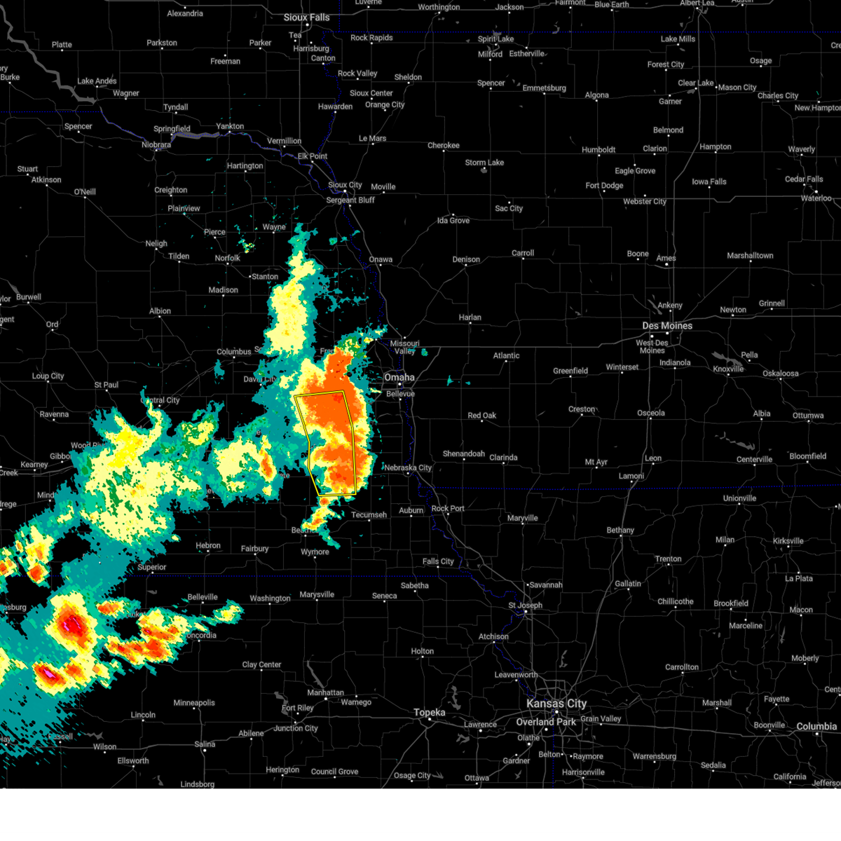 At 528 pm cdt, severe thunderstorms were located along a line extending from 3 miles west of gretna to 3 miles southeast of murdock to 4 miles southwest of syracuse, moving east at 30 mph. these are destructive storms for portions of lancaster otoe saunders and cass counties (emergency management. at 523 pm, 81 mph winds were observed in greenwood). Hazards include 80 mph wind gusts and quarter size hail. Flying debris will be dangerous to those caught without shelter. mobile homes will be heavily damaged. expect considerable damage to roofs, windows, and vehicles. extensive tree damage and power outages are likely. Locations impacted include, lincoln, wahoo, waverly, ashland, hickman, eagle, ceresco, bennet, firth, greenwood, palmyra, weston, panama, roca, douglas, davey, ithaca, walton, holmes lake park, and alvo. At 528 pm cdt, severe thunderstorms were located along a line extending from 3 miles west of gretna to 3 miles southeast of murdock to 4 miles southwest of syracuse, moving east at 30 mph. these are destructive storms for portions of lancaster otoe saunders and cass counties (emergency management. at 523 pm, 81 mph winds were observed in greenwood). Hazards include 80 mph wind gusts and quarter size hail. Flying debris will be dangerous to those caught without shelter. mobile homes will be heavily damaged. expect considerable damage to roofs, windows, and vehicles. extensive tree damage and power outages are likely. Locations impacted include, lincoln, wahoo, waverly, ashland, hickman, eagle, ceresco, bennet, firth, greenwood, palmyra, weston, panama, roca, douglas, davey, ithaca, walton, holmes lake park, and alvo.
|
| 7/31/2024 5:02 PM CDT |
 At 501 pm cdt, severe thunderstorms were located along a line extending from 3 miles northeast of ceresco to 3 miles north of walton to 2 miles southwest of panama, moving east at 30 mph. these are destructive storms for lancaster, saunders, otoe, and cass counties (public. these storms have produced widespread damage to trees and powerlines in lancaster county). Hazards include 80 mph wind gusts and quarter size hail. Flying debris will be dangerous to those caught without shelter. mobile homes will be heavily damaged. expect considerable damage to roofs, windows, and vehicles. extensive tree damage and power outages are likely. Locations impacted include, lincoln, wahoo, waverly, ashland, hickman, eagle, ceresco, bennet, firth, valparaiso, greenwood, palmyra, malcolm, panama, roca, hallam, douglas, raymond, davey, and ithaca. At 501 pm cdt, severe thunderstorms were located along a line extending from 3 miles northeast of ceresco to 3 miles north of walton to 2 miles southwest of panama, moving east at 30 mph. these are destructive storms for lancaster, saunders, otoe, and cass counties (public. these storms have produced widespread damage to trees and powerlines in lancaster county). Hazards include 80 mph wind gusts and quarter size hail. Flying debris will be dangerous to those caught without shelter. mobile homes will be heavily damaged. expect considerable damage to roofs, windows, and vehicles. extensive tree damage and power outages are likely. Locations impacted include, lincoln, wahoo, waverly, ashland, hickman, eagle, ceresco, bennet, firth, valparaiso, greenwood, palmyra, malcolm, panama, roca, hallam, douglas, raymond, davey, and ithaca.
|
| 7/31/2024 4:55 PM CDT |
 Svroax the national weather service in omaha has issued a * severe thunderstorm warning for, lancaster county in southeastern nebraska, western otoe county in southeastern nebraska, southern saunders county in east central nebraska, southwestern cass county in southeastern nebraska, * until 600 pm cdt. * at 453 pm cdt, severe thunderstorms were located along a line extending from near valparaiso to lincoln to 3 miles northeast of hallam, moving east at 25 mph. these are destructive storms for lancaster, saunders, cass, and otoe counties (public. we have received numerous observations of 70 to 80 mph gusts in lancaster county, including in lincoln). Hazards include 80 mph wind gusts and quarter size hail. Flying debris will be dangerous to those caught without shelter. mobile homes will be heavily damaged. expect considerable damage to roofs, windows, and vehicles. Extensive tree damage and power outages are likely. Svroax the national weather service in omaha has issued a * severe thunderstorm warning for, lancaster county in southeastern nebraska, western otoe county in southeastern nebraska, southern saunders county in east central nebraska, southwestern cass county in southeastern nebraska, * until 600 pm cdt. * at 453 pm cdt, severe thunderstorms were located along a line extending from near valparaiso to lincoln to 3 miles northeast of hallam, moving east at 25 mph. these are destructive storms for lancaster, saunders, cass, and otoe counties (public. we have received numerous observations of 70 to 80 mph gusts in lancaster county, including in lincoln). Hazards include 80 mph wind gusts and quarter size hail. Flying debris will be dangerous to those caught without shelter. mobile homes will be heavily damaged. expect considerable damage to roofs, windows, and vehicles. Extensive tree damage and power outages are likely.
|
| 7/31/2024 4:46 PM CDT |
 At 446 pm cdt, severe thunderstorms were located along a line extending from 4 miles west of ceresco to lincoln to 4 miles northwest of hallam, moving east at 50 mph (law enforcement. at 442 pm a downed tree and downed powerlines were reported in crete). Hazards include 70 mph wind gusts and quarter size hail. Hail damage to vehicles is expected. expect considerable tree damage. wind damage is also likely to mobile homes, roofs, and outbuildings. Locations impacted include, lincoln, waverly, hickman, bennet, firth, malcolm, panama, roca, hallam, raymond, davey, sprague, lincoln airport, emerald, walton, holmes lake park, pioneers park, denton, branched oak state recreation area, and stagecoach state recreation area. At 446 pm cdt, severe thunderstorms were located along a line extending from 4 miles west of ceresco to lincoln to 4 miles northwest of hallam, moving east at 50 mph (law enforcement. at 442 pm a downed tree and downed powerlines were reported in crete). Hazards include 70 mph wind gusts and quarter size hail. Hail damage to vehicles is expected. expect considerable tree damage. wind damage is also likely to mobile homes, roofs, and outbuildings. Locations impacted include, lincoln, waverly, hickman, bennet, firth, malcolm, panama, roca, hallam, raymond, davey, sprague, lincoln airport, emerald, walton, holmes lake park, pioneers park, denton, branched oak state recreation area, and stagecoach state recreation area.
|
| 7/31/2024 4:29 PM CDT |
 Svroax the national weather service in omaha has issued a * severe thunderstorm warning for, lancaster county in southeastern nebraska, * until 530 pm cdt. * at 428 pm cdt, severe thunderstorms were located along a line extending from 3 miles east of bee to near milford to 8 miles south of dorchester, moving east at 50 mph (public. at 420 pm, a 63 mph wind gust was observed 6 miles southwest of friend). Hazards include 70 mph wind gusts and quarter size hail. Hail damage to vehicles is expected. expect considerable tree damage. Wind damage is also likely to mobile homes, roofs, and outbuildings. Svroax the national weather service in omaha has issued a * severe thunderstorm warning for, lancaster county in southeastern nebraska, * until 530 pm cdt. * at 428 pm cdt, severe thunderstorms were located along a line extending from 3 miles east of bee to near milford to 8 miles south of dorchester, moving east at 50 mph (public. at 420 pm, a 63 mph wind gust was observed 6 miles southwest of friend). Hazards include 70 mph wind gusts and quarter size hail. Hail damage to vehicles is expected. expect considerable tree damage. Wind damage is also likely to mobile homes, roofs, and outbuildings.
|
| 7/10/2024 7:14 PM CDT |
 The storm which prompted the warning has weakened below severe limits, and no longer poses an immediate threat to life or property. therefore, the warning will be allowed to expire. however, small hail, gusty winds and heavy rain are still possible with this thunderstorm. a severe thunderstorm watch remains in effect until 1000 pm cdt for southeastern nebraska. The storm which prompted the warning has weakened below severe limits, and no longer poses an immediate threat to life or property. therefore, the warning will be allowed to expire. however, small hail, gusty winds and heavy rain are still possible with this thunderstorm. a severe thunderstorm watch remains in effect until 1000 pm cdt for southeastern nebraska.
|
| 7/10/2024 6:48 PM CDT |
 Svroax the national weather service in omaha has issued a * severe thunderstorm warning for, southeastern lancaster county in southeastern nebraska, southwestern otoe county in southeastern nebraska, * until 715 pm cdt. * at 648 pm cdt, a severe thunderstorm was located near douglas, or 18 miles southeast of lincoln, moving east at 20 mph (radar indicated). Hazards include 60 mph wind gusts and quarter size hail. Hail damage to vehicles is expected. Expect wind damage to roofs, siding, and trees. Svroax the national weather service in omaha has issued a * severe thunderstorm warning for, southeastern lancaster county in southeastern nebraska, southwestern otoe county in southeastern nebraska, * until 715 pm cdt. * at 648 pm cdt, a severe thunderstorm was located near douglas, or 18 miles southeast of lincoln, moving east at 20 mph (radar indicated). Hazards include 60 mph wind gusts and quarter size hail. Hail damage to vehicles is expected. Expect wind damage to roofs, siding, and trees.
|
| 7/6/2024 7:26 PM CDT |
 The storms which prompted the warning have moved out of the area. therefore, the warning will be allowed to expire. however, gusty winds and heavy rain are still possible with these thunderstorms. a severe thunderstorm watch remains in effect until midnight cdt for southeastern nebraska. The storms which prompted the warning have moved out of the area. therefore, the warning will be allowed to expire. however, gusty winds and heavy rain are still possible with these thunderstorms. a severe thunderstorm watch remains in effect until midnight cdt for southeastern nebraska.
|
| 7/6/2024 6:54 PM CDT |
 At 653 pm cdt, severe thunderstorms were located along a line extending from 4 miles north of sprague to 4 miles southeast of cortland to 5 miles west of holmesville, moving east at 45 mph (radar indicated). Hazards include 60 mph wind gusts. Expect damage to roofs, siding, and trees. Locations impacted include, lincoln, beatrice, hickman, bennet, firth, adams, cortland, panama, clatonia, roca, hallam, pickrell, sprague, filley, virginia, holmesville, walton, holmes lake park, pioneers park, and denton. At 653 pm cdt, severe thunderstorms were located along a line extending from 4 miles north of sprague to 4 miles southeast of cortland to 5 miles west of holmesville, moving east at 45 mph (radar indicated). Hazards include 60 mph wind gusts. Expect damage to roofs, siding, and trees. Locations impacted include, lincoln, beatrice, hickman, bennet, firth, adams, cortland, panama, clatonia, roca, hallam, pickrell, sprague, filley, virginia, holmesville, walton, holmes lake park, pioneers park, and denton.
|
| 7/6/2024 6:54 PM CDT |
 the severe thunderstorm warning has been cancelled and is no longer in effect the severe thunderstorm warning has been cancelled and is no longer in effect
|
| 7/6/2024 6:45 PM CDT |
 At 645 pm cdt, severe thunderstorms were located along a line extending from 6 miles southeast of pleasant dale to 4 miles east of clatonia to 5 miles northeast of diller, moving east at 50 mph (radar indicated). Hazards include 60 mph wind gusts and quarter size hail. Hail damage to vehicles is expected. expect wind damage to roofs, siding, and trees. Locations impacted include, lincoln, beatrice, crete, wilber, hickman, bennet, firth, adams, de witt, cortland, plymouth, panama, clatonia, roca, hallam, pleasant dale, pickrell, sprague, filley, and virginia. At 645 pm cdt, severe thunderstorms were located along a line extending from 6 miles southeast of pleasant dale to 4 miles east of clatonia to 5 miles northeast of diller, moving east at 50 mph (radar indicated). Hazards include 60 mph wind gusts and quarter size hail. Hail damage to vehicles is expected. expect wind damage to roofs, siding, and trees. Locations impacted include, lincoln, beatrice, crete, wilber, hickman, bennet, firth, adams, de witt, cortland, plymouth, panama, clatonia, roca, hallam, pleasant dale, pickrell, sprague, filley, and virginia.
|
| 7/6/2024 6:23 PM CDT |
 Svroax the national weather service in omaha has issued a * severe thunderstorm warning for, southern lancaster county in southeastern nebraska, northeastern jefferson county in southeastern nebraska, southeastern seward county in southeastern nebraska, eastern saline county in southeastern nebraska, gage county in southeastern nebraska, * until 730 pm cdt. * at 623 pm cdt, severe thunderstorms were located along a line extending from 4 miles northwest of dorchester to 4 miles west of wilber to 2 miles northwest of jansen, moving east at 50 mph (radar indicated). Hazards include 60 mph wind gusts and quarter size hail. Hail damage to vehicles is expected. Expect wind damage to roofs, siding, and trees. Svroax the national weather service in omaha has issued a * severe thunderstorm warning for, southern lancaster county in southeastern nebraska, northeastern jefferson county in southeastern nebraska, southeastern seward county in southeastern nebraska, eastern saline county in southeastern nebraska, gage county in southeastern nebraska, * until 730 pm cdt. * at 623 pm cdt, severe thunderstorms were located along a line extending from 4 miles northwest of dorchester to 4 miles west of wilber to 2 miles northwest of jansen, moving east at 50 mph (radar indicated). Hazards include 60 mph wind gusts and quarter size hail. Hail damage to vehicles is expected. Expect wind damage to roofs, siding, and trees.
|
| 7/2/2024 12:17 AM CDT |
 At 1216 am cdt, a severe thunderstorm was located 3 miles northeast of walton, or 9 miles east of lincoln, moving east at 35 mph (radar indicated). Hazards include 60 mph wind gusts and quarter size hail. Hail damage to vehicles is expected. expect wind damage to roofs, siding, and trees. Locations impacted include, northeastern lincoln, waverly, eagle, bennet, palmyra, and walton. At 1216 am cdt, a severe thunderstorm was located 3 miles northeast of walton, or 9 miles east of lincoln, moving east at 35 mph (radar indicated). Hazards include 60 mph wind gusts and quarter size hail. Hail damage to vehicles is expected. expect wind damage to roofs, siding, and trees. Locations impacted include, northeastern lincoln, waverly, eagle, bennet, palmyra, and walton.
|
| 7/2/2024 12:05 AM CDT |
 the severe thunderstorm warning has been cancelled and is no longer in effect the severe thunderstorm warning has been cancelled and is no longer in effect
|
| 7/2/2024 12:05 AM CDT |
 At 1203 am cdt, a severe thunderstorm was located over eastern lincoln, moving east at 35 mph (radar indicated). Hazards include 60 mph wind gusts and quarter size hail. Hail damage to vehicles is expected. expect wind damage to roofs, siding, and trees. Locations impacted include, lincoln, waverly, eagle, bennet, palmyra, roca, holmes lake park, walton, lincoln airport, and pioneers park. At 1203 am cdt, a severe thunderstorm was located over eastern lincoln, moving east at 35 mph (radar indicated). Hazards include 60 mph wind gusts and quarter size hail. Hail damage to vehicles is expected. expect wind damage to roofs, siding, and trees. Locations impacted include, lincoln, waverly, eagle, bennet, palmyra, roca, holmes lake park, walton, lincoln airport, and pioneers park.
|
| 7/1/2024 11:46 PM CDT |
 Svroax the national weather service in omaha has issued a * severe thunderstorm warning for, central lancaster county in southeastern nebraska, eastern seward county in southeastern nebraska, northwestern otoe county in southeastern nebraska, southwestern cass county in southeastern nebraska, * until 1230 am cdt. * at 1146 pm cdt, a severe thunderstorm was located 3 miles southwest of pioneers park, or 9 miles southwest of lincoln, moving east at 35 mph (radar indicated). Hazards include 60 mph wind gusts and quarter size hail. Hail damage to vehicles is expected. Expect wind damage to roofs, siding, and trees. Svroax the national weather service in omaha has issued a * severe thunderstorm warning for, central lancaster county in southeastern nebraska, eastern seward county in southeastern nebraska, northwestern otoe county in southeastern nebraska, southwestern cass county in southeastern nebraska, * until 1230 am cdt. * at 1146 pm cdt, a severe thunderstorm was located 3 miles southwest of pioneers park, or 9 miles southwest of lincoln, moving east at 35 mph (radar indicated). Hazards include 60 mph wind gusts and quarter size hail. Hail damage to vehicles is expected. Expect wind damage to roofs, siding, and trees.
|
| 7/1/2024 11:05 PM CDT |
 At 1105 pm cdt, severe thunderstorms were located along a line extending from 5 miles southeast of ceresco to 4 miles north of walton to 2 miles west of roca, moving east at 40 mph (radar indicated). Hazards include 60 mph wind gusts and quarter size hail. Hail damage to vehicles is expected. expect wind damage to roofs, siding, and trees. Locations impacted include, lincoln, crete, waverly, ashland, hickman, eagle, bennet, elmwood, greenwood, palmyra, panama, murdock, roca, hallam, raymond, davey, sprague, lincoln airport, emerald, and walton. At 1105 pm cdt, severe thunderstorms were located along a line extending from 5 miles southeast of ceresco to 4 miles north of walton to 2 miles west of roca, moving east at 40 mph (radar indicated). Hazards include 60 mph wind gusts and quarter size hail. Hail damage to vehicles is expected. expect wind damage to roofs, siding, and trees. Locations impacted include, lincoln, crete, waverly, ashland, hickman, eagle, bennet, elmwood, greenwood, palmyra, panama, murdock, roca, hallam, raymond, davey, sprague, lincoln airport, emerald, and walton.
|
| 7/1/2024 10:48 PM CDT |
 Svroax the national weather service in omaha has issued a * severe thunderstorm warning for, lancaster county in southeastern nebraska, northwestern otoe county in southeastern nebraska, east central saline county in southeastern nebraska, southeastern saunders county in east central nebraska, western cass county in southeastern nebraska, * until 1130 pm cdt. * at 1047 pm cdt, severe thunderstorms were located along a line extending from near raymond to near emerald to 2 miles east of crete, moving northeast at 45 mph (radar indicated). Hazards include 60 mph wind gusts and quarter size hail. Hail damage to vehicles is expected. Expect wind damage to roofs, siding, and trees. Svroax the national weather service in omaha has issued a * severe thunderstorm warning for, lancaster county in southeastern nebraska, northwestern otoe county in southeastern nebraska, east central saline county in southeastern nebraska, southeastern saunders county in east central nebraska, western cass county in southeastern nebraska, * until 1130 pm cdt. * at 1047 pm cdt, severe thunderstorms were located along a line extending from near raymond to near emerald to 2 miles east of crete, moving northeast at 45 mph (radar indicated). Hazards include 60 mph wind gusts and quarter size hail. Hail damage to vehicles is expected. Expect wind damage to roofs, siding, and trees.
|
| 6/26/2024 12:58 AM CDT |
 Svroax the national weather service in omaha has issued a * severe thunderstorm warning for, east central lancaster county in southeastern nebraska, western otoe county in southeastern nebraska, southwestern cass county in southeastern nebraska, * until 145 am cdt. * at 1258 am cdt, severe thunderstorms were located along a line extending from 2 miles east of murdock to 2 miles south of walton, moving southeast at 30 mph (radar indicated). Hazards include 60 mph wind gusts. expect damage to roofs, siding, and trees Svroax the national weather service in omaha has issued a * severe thunderstorm warning for, east central lancaster county in southeastern nebraska, western otoe county in southeastern nebraska, southwestern cass county in southeastern nebraska, * until 145 am cdt. * at 1258 am cdt, severe thunderstorms were located along a line extending from 2 miles east of murdock to 2 miles south of walton, moving southeast at 30 mph (radar indicated). Hazards include 60 mph wind gusts. expect damage to roofs, siding, and trees
|
| 6/18/2024 6:27 PM CDT |
 the severe thunderstorm warning has been cancelled and is no longer in effect the severe thunderstorm warning has been cancelled and is no longer in effect
|
| 6/18/2024 6:12 PM CDT |
 the severe thunderstorm warning has been cancelled and is no longer in effect the severe thunderstorm warning has been cancelled and is no longer in effect
|
| 6/18/2024 6:12 PM CDT |
 At 611 pm cdt, severe thunderstorms were located along a line extending from 6 miles southwest of pioneers park to 5 miles north of western, moving east at 35 mph (radar indicated). Hazards include 60 mph wind gusts. Expect damage to roofs, siding, and trees. Locations impacted include, hickman, bennet, firth, panama, roca, hallam, sprague, stagecoach state recreation area, wagon train state recreation area, olive creek state recreation area, bluestem state recreation area, and yankee hill lake. At 611 pm cdt, severe thunderstorms were located along a line extending from 6 miles southwest of pioneers park to 5 miles north of western, moving east at 35 mph (radar indicated). Hazards include 60 mph wind gusts. Expect damage to roofs, siding, and trees. Locations impacted include, hickman, bennet, firth, panama, roca, hallam, sprague, stagecoach state recreation area, wagon train state recreation area, olive creek state recreation area, bluestem state recreation area, and yankee hill lake.
|
| 6/18/2024 6:02 PM CDT |
 Svroax the national weather service in omaha has issued a * severe thunderstorm warning for, southern lancaster county in southeastern nebraska, northwestern gage county in southeastern nebraska, * until 645 pm cdt. * at 601 pm cdt, severe thunderstorms were located along a line extending from 4 miles north of crete to 4 miles east of milligan, moving east at 35 mph (radar indicated). Hazards include 60 mph wind gusts. expect damage to roofs, siding, and trees Svroax the national weather service in omaha has issued a * severe thunderstorm warning for, southern lancaster county in southeastern nebraska, northwestern gage county in southeastern nebraska, * until 645 pm cdt. * at 601 pm cdt, severe thunderstorms were located along a line extending from 4 miles north of crete to 4 miles east of milligan, moving east at 35 mph (radar indicated). Hazards include 60 mph wind gusts. expect damage to roofs, siding, and trees
|
| 6/15/2024 6:02 PM CDT |
 the severe thunderstorm warning has been cancelled and is no longer in effect the severe thunderstorm warning has been cancelled and is no longer in effect
|
| 6/15/2024 6:02 PM CDT |
 At 601 pm cdt, a severe thunderstorm was located 3 miles south of walton, or 7 miles southeast of lincoln, moving northeast at 55 mph (radar indicated). Hazards include 60 mph wind gusts. Expect damage to roofs, siding, and trees. Locations impacted include, lincoln, waverly, hickman, eagle, bennet, palmyra, roca, hallam, sprague, walton, holmes lake park, yankee hill lake, stagecoach state recreation area, wagon train state recreation area, olive creek state recreation area, and bluestem state recreation area. At 601 pm cdt, a severe thunderstorm was located 3 miles south of walton, or 7 miles southeast of lincoln, moving northeast at 55 mph (radar indicated). Hazards include 60 mph wind gusts. Expect damage to roofs, siding, and trees. Locations impacted include, lincoln, waverly, hickman, eagle, bennet, palmyra, roca, hallam, sprague, walton, holmes lake park, yankee hill lake, stagecoach state recreation area, wagon train state recreation area, olive creek state recreation area, and bluestem state recreation area.
|
| 6/15/2024 5:43 PM CDT |
 Svroax the national weather service in omaha has issued a * severe thunderstorm warning for, southern lancaster county in southeastern nebraska, northwestern otoe county in southeastern nebraska, east central saline county in southeastern nebraska, northwestern gage county in southeastern nebraska, southwestern cass county in southeastern nebraska, * until 615 pm cdt. * at 543 pm cdt, a severe thunderstorm was located 3 miles southwest of sprague, or 15 miles southwest of lincoln, moving northeast at 55 mph (radar indicated). Hazards include 60 mph wind gusts. expect damage to roofs, siding, and trees Svroax the national weather service in omaha has issued a * severe thunderstorm warning for, southern lancaster county in southeastern nebraska, northwestern otoe county in southeastern nebraska, east central saline county in southeastern nebraska, northwestern gage county in southeastern nebraska, southwestern cass county in southeastern nebraska, * until 615 pm cdt. * at 543 pm cdt, a severe thunderstorm was located 3 miles southwest of sprague, or 15 miles southwest of lincoln, moving northeast at 55 mph (radar indicated). Hazards include 60 mph wind gusts. expect damage to roofs, siding, and trees
|
| 6/7/2024 9:12 PM CDT |
 The storm which prompted the warning has weakened below severe limits, and no longer poses an immediate threat to life or property. therefore, the warning will be allowed to expire. however, gusty winds are still possible with this thunderstorm as it moves eastward. a severe thunderstorm watch remains in effect until 1100 pm cdt for southeastern nebraska. The storm which prompted the warning has weakened below severe limits, and no longer poses an immediate threat to life or property. therefore, the warning will be allowed to expire. however, gusty winds are still possible with this thunderstorm as it moves eastward. a severe thunderstorm watch remains in effect until 1100 pm cdt for southeastern nebraska.
|
| 6/7/2024 9:01 PM CDT |
 At 901 pm cdt, a severe thunderstorm was located near elmwood, or 19 miles east of lincoln, moving east at 40 mph (radar indicated). Hazards include 60 mph wind gusts. Expect damage to roofs, siding, and trees. Locations impacted include, eastern lincoln, waverly, eagle, bennet, elmwood, greenwood, palmyra, holmes lake park, walton, and alvo. At 901 pm cdt, a severe thunderstorm was located near elmwood, or 19 miles east of lincoln, moving east at 40 mph (radar indicated). Hazards include 60 mph wind gusts. Expect damage to roofs, siding, and trees. Locations impacted include, eastern lincoln, waverly, eagle, bennet, elmwood, greenwood, palmyra, holmes lake park, walton, and alvo.
|
| 6/7/2024 9:01 PM CDT |
 the severe thunderstorm warning has been cancelled and is no longer in effect the severe thunderstorm warning has been cancelled and is no longer in effect
|
| 6/7/2024 8:59 PM CDT |
 At 858 pm cdt, a severe thunderstorm was located near elmwood, or 18 miles east of lincoln, moving east at 40 mph (radar indicated). Hazards include 60 mph wind gusts. Expect damage to roofs, siding, and trees. Locations impacted include, eastern lincoln, waverly, ashland, eagle, ceresco, bennet, elmwood, greenwood, palmyra, murdock, walton, holmes lake park, alvo, mahoney state park, and camp carol joy holling. At 858 pm cdt, a severe thunderstorm was located near elmwood, or 18 miles east of lincoln, moving east at 40 mph (radar indicated). Hazards include 60 mph wind gusts. Expect damage to roofs, siding, and trees. Locations impacted include, eastern lincoln, waverly, ashland, eagle, ceresco, bennet, elmwood, greenwood, palmyra, murdock, walton, holmes lake park, alvo, mahoney state park, and camp carol joy holling.
|
| 6/7/2024 8:48 PM CDT |
 At 848 pm cdt, a severe thunderstorm was located near eagle, or 12 miles east of lincoln, moving east at 40 mph (radar indicated). Hazards include 60 mph wind gusts. Expect damage to roofs, siding, and trees. Locations impacted include, lincoln, waverly, ashland, eagle, ceresco, bennet, elmwood, greenwood, palmyra, murdock, raymond, davey, lincoln airport, walton, holmes lake park, pioneers park, alvo, yankee hill lake, mahoney state park, and camp carol joy holling. At 848 pm cdt, a severe thunderstorm was located near eagle, or 12 miles east of lincoln, moving east at 40 mph (radar indicated). Hazards include 60 mph wind gusts. Expect damage to roofs, siding, and trees. Locations impacted include, lincoln, waverly, ashland, eagle, ceresco, bennet, elmwood, greenwood, palmyra, murdock, raymond, davey, lincoln airport, walton, holmes lake park, pioneers park, alvo, yankee hill lake, mahoney state park, and camp carol joy holling.
|
| 6/7/2024 8:43 PM CDT |
 At 842 pm cdt, a severe thunderstorm was located 4 miles southeast of waverly, or 13 miles northeast of lincoln, moving east at 45 mph (radar indicated). Hazards include 60 mph wind gusts. Expect damage to roofs, siding, and trees. Locations impacted include, lincoln, waverly, ashland, eagle, ceresco, bennet, elmwood, valparaiso, greenwood, palmyra, malcolm, murdock, raymond, davey, lincoln airport, emerald, walton, holmes lake park, pioneers park, and denton. At 842 pm cdt, a severe thunderstorm was located 4 miles southeast of waverly, or 13 miles northeast of lincoln, moving east at 45 mph (radar indicated). Hazards include 60 mph wind gusts. Expect damage to roofs, siding, and trees. Locations impacted include, lincoln, waverly, ashland, eagle, ceresco, bennet, elmwood, valparaiso, greenwood, palmyra, malcolm, murdock, raymond, davey, lincoln airport, emerald, walton, holmes lake park, pioneers park, and denton.
|
| 6/7/2024 8:35 PM CDT |
 At 835 pm cdt, a severe thunderstorm was located over waverly, or 9 miles northeast of lincoln, moving east at 45 mph (trained weather spotters). Hazards include 60 mph wind gusts. Expect damage to roofs, siding, and trees. Locations impacted include, lincoln, waverly, ashland, eagle, ceresco, bennet, elmwood, valparaiso, greenwood, palmyra, malcolm, weston, murdock, raymond, davey, ithaca, lincoln airport, emerald, walton, and holmes lake park. At 835 pm cdt, a severe thunderstorm was located over waverly, or 9 miles northeast of lincoln, moving east at 45 mph (trained weather spotters). Hazards include 60 mph wind gusts. Expect damage to roofs, siding, and trees. Locations impacted include, lincoln, waverly, ashland, eagle, ceresco, bennet, elmwood, valparaiso, greenwood, palmyra, malcolm, weston, murdock, raymond, davey, ithaca, lincoln airport, emerald, walton, and holmes lake park.
|
| 6/7/2024 8:35 PM CDT |
 the severe thunderstorm warning has been cancelled and is no longer in effect the severe thunderstorm warning has been cancelled and is no longer in effect
|
| 6/7/2024 8:26 PM CDT |
 At 826 pm cdt, a severe thunderstorm was located 3 miles south of davey, or 8 miles north of lincoln, moving east at 45 mph (trained weather spotters). Hazards include 60 mph wind gusts. Expect damage to roofs, siding, and trees. Locations impacted include, lincoln, seward, waverly, ashland, milford, eagle, ceresco, bennet, elmwood, valparaiso, greenwood, palmyra, malcolm, brainard, weston, murdock, garland, pleasant dale, dwight, and bee. At 826 pm cdt, a severe thunderstorm was located 3 miles south of davey, or 8 miles north of lincoln, moving east at 45 mph (trained weather spotters). Hazards include 60 mph wind gusts. Expect damage to roofs, siding, and trees. Locations impacted include, lincoln, seward, waverly, ashland, milford, eagle, ceresco, bennet, elmwood, valparaiso, greenwood, palmyra, malcolm, brainard, weston, murdock, garland, pleasant dale, dwight, and bee.
|
| 6/7/2024 8:22 PM CDT |
 At 821 pm cdt, a severe thunderstorm was located over raymond, or 10 miles north of lincoln, moving east at 45 mph (radar indicated). Hazards include 60 mph wind gusts. Expect damage to roofs, siding, and trees. Locations impacted include, lincoln, seward, waverly, ashland, milford, eagle, ceresco, bennet, elmwood, valparaiso, greenwood, palmyra, malcolm, brainard, weston, murdock, garland, pleasant dale, dwight, and bee. At 821 pm cdt, a severe thunderstorm was located over raymond, or 10 miles north of lincoln, moving east at 45 mph (radar indicated). Hazards include 60 mph wind gusts. Expect damage to roofs, siding, and trees. Locations impacted include, lincoln, seward, waverly, ashland, milford, eagle, ceresco, bennet, elmwood, valparaiso, greenwood, palmyra, malcolm, brainard, weston, murdock, garland, pleasant dale, dwight, and bee.
|
| 6/7/2024 8:08 PM CDT |
 Svroax the national weather service in omaha has issued a * severe thunderstorm warning for, lancaster county in southeastern nebraska, eastern seward county in southeastern nebraska, northwestern otoe county in southeastern nebraska, southeastern butler county in east central nebraska, southern saunders county in east central nebraska, western cass county in southeastern nebraska, * until 915 pm cdt. * at 807 pm cdt, a severe thunderstorm was located 4 miles north of garland, or 9 miles northeast of seward, moving east at 45 mph (radar indicated). Hazards include 60 mph wind gusts. expect damage to roofs, siding, and trees Svroax the national weather service in omaha has issued a * severe thunderstorm warning for, lancaster county in southeastern nebraska, eastern seward county in southeastern nebraska, northwestern otoe county in southeastern nebraska, southeastern butler county in east central nebraska, southern saunders county in east central nebraska, western cass county in southeastern nebraska, * until 915 pm cdt. * at 807 pm cdt, a severe thunderstorm was located 4 miles north of garland, or 9 miles northeast of seward, moving east at 45 mph (radar indicated). Hazards include 60 mph wind gusts. expect damage to roofs, siding, and trees
|
| 5/24/2024 2:49 AM CDT |
 At 249 am cdt, severe thunderstorms were located along a line extending from 4 miles northeast of syracuse to near tecumseh to 3 miles west of summerfield, moving east at 60 mph (radar indicated). Hazards include 70 mph wind gusts and quarter size hail. Hail damage to vehicles is expected. expect considerable tree damage. wind damage is also likely to mobile homes, roofs, and outbuildings. Locations impacted include, nebraska city, auburn, tecumseh, pawnee city, syracuse, wymore, hamburg, humboldt, peru, bennet, adams, palmyra, farragut, sterling, blue springs, johnson, cook, unadilla, riverton, and table rock. At 249 am cdt, severe thunderstorms were located along a line extending from 4 miles northeast of syracuse to near tecumseh to 3 miles west of summerfield, moving east at 60 mph (radar indicated). Hazards include 70 mph wind gusts and quarter size hail. Hail damage to vehicles is expected. expect considerable tree damage. wind damage is also likely to mobile homes, roofs, and outbuildings. Locations impacted include, nebraska city, auburn, tecumseh, pawnee city, syracuse, wymore, hamburg, humboldt, peru, bennet, adams, palmyra, farragut, sterling, blue springs, johnson, cook, unadilla, riverton, and table rock.
|
| 5/24/2024 2:39 AM CDT |
 At 239 am cdt, severe thunderstorms were located along a line extending from 4 miles northeast of palmyra to 4 miles southwest of cook to 2 miles east of barneston, moving east at 60 mph (radar indicated). Hazards include 60 mph wind gusts and quarter size hail. Hail damage to vehicles is expected. expect wind damage to roofs, siding, and trees. Locations impacted include, beatrice, fairbury, tecumseh, pawnee city, crete, syracuse, wilber, hickman, wymore, bennet, firth, adams, palmyra, de witt, cortland, sterling, plymouth, blue springs, cook, and unadilla. At 239 am cdt, severe thunderstorms were located along a line extending from 4 miles northeast of palmyra to 4 miles southwest of cook to 2 miles east of barneston, moving east at 60 mph (radar indicated). Hazards include 60 mph wind gusts and quarter size hail. Hail damage to vehicles is expected. expect wind damage to roofs, siding, and trees. Locations impacted include, beatrice, fairbury, tecumseh, pawnee city, crete, syracuse, wilber, hickman, wymore, bennet, firth, adams, palmyra, de witt, cortland, sterling, plymouth, blue springs, cook, and unadilla.
|
| 5/24/2024 2:32 AM CDT |
 Svroax the national weather service in omaha has issued a * severe thunderstorm warning for, southern fremont county in southwestern iowa, southwestern page county in southwestern iowa, southeastern lancaster county in southeastern nebraska, johnson county in southeastern nebraska, nemaha county in southeastern nebraska, otoe county in southeastern nebraska, richardson county in southeastern nebraska, pawnee county in southeastern nebraska, gage county in southeastern nebraska, * until 315 am cdt. * at 231 am cdt, severe thunderstorms were located along a line extending from near palmyra to 4 miles south of adams to 5 miles southeast of odell, moving east at 60 mph (radar indicated). Hazards include 70 mph wind gusts and quarter size hail. Hail damage to vehicles is expected. expect considerable tree damage. Wind damage is also likely to mobile homes, roofs, and outbuildings. Svroax the national weather service in omaha has issued a * severe thunderstorm warning for, southern fremont county in southwestern iowa, southwestern page county in southwestern iowa, southeastern lancaster county in southeastern nebraska, johnson county in southeastern nebraska, nemaha county in southeastern nebraska, otoe county in southeastern nebraska, richardson county in southeastern nebraska, pawnee county in southeastern nebraska, gage county in southeastern nebraska, * until 315 am cdt. * at 231 am cdt, severe thunderstorms were located along a line extending from near palmyra to 4 miles south of adams to 5 miles southeast of odell, moving east at 60 mph (radar indicated). Hazards include 70 mph wind gusts and quarter size hail. Hail damage to vehicles is expected. expect considerable tree damage. Wind damage is also likely to mobile homes, roofs, and outbuildings.
|
| 5/24/2024 1:54 AM CDT |
 Svroax the national weather service in omaha has issued a * severe thunderstorm warning for, southern lancaster county in southeastern nebraska, johnson county in southeastern nebraska, jefferson county in southeastern nebraska, southern seward county in southeastern nebraska, southwestern otoe county in southeastern nebraska, saline county in southeastern nebraska, pawnee county in southeastern nebraska, gage county in southeastern nebraska, * until 245 am cdt. * at 154 am cdt, severe thunderstorms were located along a line extending from 4 miles northwest of dorchester to 2 miles north of swanton to near mahaska, moving east at 60 mph (radar indicated). Hazards include 60 mph wind gusts and quarter size hail. Hail damage to vehicles is expected. Expect wind damage to roofs, siding, and trees. Svroax the national weather service in omaha has issued a * severe thunderstorm warning for, southern lancaster county in southeastern nebraska, johnson county in southeastern nebraska, jefferson county in southeastern nebraska, southern seward county in southeastern nebraska, southwestern otoe county in southeastern nebraska, saline county in southeastern nebraska, pawnee county in southeastern nebraska, gage county in southeastern nebraska, * until 245 am cdt. * at 154 am cdt, severe thunderstorms were located along a line extending from 4 miles northwest of dorchester to 2 miles north of swanton to near mahaska, moving east at 60 mph (radar indicated). Hazards include 60 mph wind gusts and quarter size hail. Hail damage to vehicles is expected. Expect wind damage to roofs, siding, and trees.
|
| 5/19/2024 6:22 PM CDT |
 The storm which prompted the warning has moved out of the area. therefore, the warning will be allowed to expire. remember, a severe thunderstorm warning still remains in effect for portions of otoe county until 7 pm cdt. The storm which prompted the warning has moved out of the area. therefore, the warning will be allowed to expire. remember, a severe thunderstorm warning still remains in effect for portions of otoe county until 7 pm cdt.
|
| 5/19/2024 6:12 PM CDT |
 At 611 pm cdt, a severe thunderstorm was located 3 miles south of unadilla, or 18 miles north of tecumseh, moving east at 45 mph (radar indicated). Hazards include 60 mph wind gusts and quarter size hail. Hail damage to vehicles is expected. expect wind damage to roofs, siding, and trees. Locations impacted include, syracuse, bennet, adams, palmyra, sterling, cook, unadilla, panama, douglas, otoe, burr, and st mary. At 611 pm cdt, a severe thunderstorm was located 3 miles south of unadilla, or 18 miles north of tecumseh, moving east at 45 mph (radar indicated). Hazards include 60 mph wind gusts and quarter size hail. Hail damage to vehicles is expected. expect wind damage to roofs, siding, and trees. Locations impacted include, syracuse, bennet, adams, palmyra, sterling, cook, unadilla, panama, douglas, otoe, burr, and st mary.
|
| 5/19/2024 6:01 PM CDT |
 At 600 pm cdt, a severe thunderstorm was located over panama, or 16 miles southeast of lincoln, moving east at 35 mph (radar indicated). Hazards include 60 mph wind gusts and quarter size hail. Hail damage to vehicles is expected. expect wind damage to roofs, siding, and trees. Locations impacted include, syracuse, hickman, bennet, firth, adams, palmyra, sterling, cook, unadilla, panama, douglas, otoe, burr, st mary, stagecoach state recreation area, and wagon train state recreation area. At 600 pm cdt, a severe thunderstorm was located over panama, or 16 miles southeast of lincoln, moving east at 35 mph (radar indicated). Hazards include 60 mph wind gusts and quarter size hail. Hail damage to vehicles is expected. expect wind damage to roofs, siding, and trees. Locations impacted include, syracuse, hickman, bennet, firth, adams, palmyra, sterling, cook, unadilla, panama, douglas, otoe, burr, st mary, stagecoach state recreation area, and wagon train state recreation area.
|
| 5/19/2024 5:46 PM CDT |
 Svroax the national weather service in omaha has issued a * severe thunderstorm warning for, southeastern lancaster county in southeastern nebraska, northern johnson county in southeastern nebraska, western otoe county in southeastern nebraska, northeastern gage county in southeastern nebraska, * until 630 pm cdt. * at 545 pm cdt, a severe thunderstorm was located over hickman, or 13 miles south of lincoln, moving east at 40 mph (radar indicated). Hazards include 70 mph wind gusts and quarter size hail. Hail damage to vehicles is expected. expect considerable tree damage. Wind damage is also likely to mobile homes, roofs, and outbuildings. Svroax the national weather service in omaha has issued a * severe thunderstorm warning for, southeastern lancaster county in southeastern nebraska, northern johnson county in southeastern nebraska, western otoe county in southeastern nebraska, northeastern gage county in southeastern nebraska, * until 630 pm cdt. * at 545 pm cdt, a severe thunderstorm was located over hickman, or 13 miles south of lincoln, moving east at 40 mph (radar indicated). Hazards include 70 mph wind gusts and quarter size hail. Hail damage to vehicles is expected. expect considerable tree damage. Wind damage is also likely to mobile homes, roofs, and outbuildings.
|
| 5/6/2024 7:47 PM CDT |
 Svroax the national weather service in omaha has issued a * severe thunderstorm warning for, western sarpy county in east central nebraska, northeastern lancaster county in southeastern nebraska, northwestern johnson county in southeastern nebraska, otoe county in southeastern nebraska, south central douglas county in east central nebraska, southeastern saunders county in east central nebraska, cass county in southeastern nebraska, * until 830 pm cdt. * at 747 pm cdt, severe thunderstorms were located along a line extending from 2 miles west of waverly to 5 miles northeast of sterling, moving northeast at 50 mph (radar indicated). Hazards include 60 mph wind gusts and quarter size hail. Hail damage to vehicles is expected. Expect wind damage to roofs, siding, and trees. Svroax the national weather service in omaha has issued a * severe thunderstorm warning for, western sarpy county in east central nebraska, northeastern lancaster county in southeastern nebraska, northwestern johnson county in southeastern nebraska, otoe county in southeastern nebraska, south central douglas county in east central nebraska, southeastern saunders county in east central nebraska, cass county in southeastern nebraska, * until 830 pm cdt. * at 747 pm cdt, severe thunderstorms were located along a line extending from 2 miles west of waverly to 5 miles northeast of sterling, moving northeast at 50 mph (radar indicated). Hazards include 60 mph wind gusts and quarter size hail. Hail damage to vehicles is expected. Expect wind damage to roofs, siding, and trees.
|
| 5/4/2024 1:10 AM CDT |
 The storms which prompted the warning have weakened below severe limits, and no longer pose an immediate threat to life or property. therefore, the warning will be allowed to expire. however, small hail is still possible with these thunderstorms. a severe thunderstorm watch remains in effect until 400 am cdt for southeastern nebraska. The storms which prompted the warning have weakened below severe limits, and no longer pose an immediate threat to life or property. therefore, the warning will be allowed to expire. however, small hail is still possible with these thunderstorms. a severe thunderstorm watch remains in effect until 400 am cdt for southeastern nebraska.
|
| 5/4/2024 12:56 AM CDT |
 At 1255 am cdt, severe thunderstorms were located along a line extending from 2 miles southwest of roca to 3 miles south of firth to 2 miles southeast of pickrell, moving east at 45 mph (radar indicated). Hazards include 60 mph wind gusts and quarter size hail. Hail damage to vehicles is expected. expect wind damage to roofs, siding, and trees. Locations impacted include, beatrice, hickman, bennet, firth, adams, cortland, panama, roca, hallam, pickrell, sprague, filley, virginia, stagecoach state recreation area, homestead national historical park, rockford, wagon train state recreation area, and bluestem state recreation area. At 1255 am cdt, severe thunderstorms were located along a line extending from 2 miles southwest of roca to 3 miles south of firth to 2 miles southeast of pickrell, moving east at 45 mph (radar indicated). Hazards include 60 mph wind gusts and quarter size hail. Hail damage to vehicles is expected. expect wind damage to roofs, siding, and trees. Locations impacted include, beatrice, hickman, bennet, firth, adams, cortland, panama, roca, hallam, pickrell, sprague, filley, virginia, stagecoach state recreation area, homestead national historical park, rockford, wagon train state recreation area, and bluestem state recreation area.
|
| 5/4/2024 12:56 AM CDT |
 the severe thunderstorm warning has been cancelled and is no longer in effect the severe thunderstorm warning has been cancelled and is no longer in effect
|
| 5/4/2024 12:47 AM CDT |
 At 1247 am cdt, severe thunderstorms were located along a line extending from 2 miles west of sprague to 2 miles south of cortland to 4 miles northwest of beatrice, moving east at 45 mph (radar indicated). Hazards include 60 mph wind gusts and quarter size hail. Hail damage to vehicles is expected. expect wind damage to roofs, siding, and trees. Locations impacted include, beatrice, hickman, bennet, firth, adams, de witt, cortland, plymouth, panama, clatonia, roca, hallam, pickrell, sprague, filley, virginia, stagecoach state recreation area, homestead national historical park, rockford, and wagon train state recreation area. At 1247 am cdt, severe thunderstorms were located along a line extending from 2 miles west of sprague to 2 miles south of cortland to 4 miles northwest of beatrice, moving east at 45 mph (radar indicated). Hazards include 60 mph wind gusts and quarter size hail. Hail damage to vehicles is expected. expect wind damage to roofs, siding, and trees. Locations impacted include, beatrice, hickman, bennet, firth, adams, de witt, cortland, plymouth, panama, clatonia, roca, hallam, pickrell, sprague, filley, virginia, stagecoach state recreation area, homestead national historical park, rockford, and wagon train state recreation area.
|
| 5/4/2024 12:39 AM CDT |
 At 1239 am cdt, severe thunderstorms were located along a line extending from 3 miles southeast of crete to 2 miles southeast of clatonia to 4 miles east of plymouth, moving east at 45 mph (radar indicated). Hazards include 60 mph wind gusts and quarter size hail. Hail damage to vehicles is expected. expect wind damage to roofs, siding, and trees. Locations impacted include, beatrice, crete, wilber, hickman, bennet, firth, adams, de witt, cortland, plymouth, panama, clatonia, roca, hallam, pickrell, sprague, filley, virginia, stagecoach state recreation area, and homestead national historical park. At 1239 am cdt, severe thunderstorms were located along a line extending from 3 miles southeast of crete to 2 miles southeast of clatonia to 4 miles east of plymouth, moving east at 45 mph (radar indicated). Hazards include 60 mph wind gusts and quarter size hail. Hail damage to vehicles is expected. expect wind damage to roofs, siding, and trees. Locations impacted include, beatrice, crete, wilber, hickman, bennet, firth, adams, de witt, cortland, plymouth, panama, clatonia, roca, hallam, pickrell, sprague, filley, virginia, stagecoach state recreation area, and homestead national historical park.
|
| 5/4/2024 12:28 AM CDT |
 Svroax the national weather service in omaha has issued a * severe thunderstorm warning for, southern lancaster county in southeastern nebraska, northeastern jefferson county in southeastern nebraska, southeastern saline county in southeastern nebraska, northern gage county in southeastern nebraska, * until 115 am cdt. * at 1227 am cdt, severe thunderstorms were located along a line extending from 5 miles southwest of crete to 2 miles west of de witt to 3 miles southwest of plymouth, moving east at 45 mph (radar indicated). Hazards include 60 mph wind gusts and quarter size hail. Hail damage to vehicles is expected. Expect wind damage to roofs, siding, and trees. Svroax the national weather service in omaha has issued a * severe thunderstorm warning for, southern lancaster county in southeastern nebraska, northeastern jefferson county in southeastern nebraska, southeastern saline county in southeastern nebraska, northern gage county in southeastern nebraska, * until 115 am cdt. * at 1227 am cdt, severe thunderstorms were located along a line extending from 5 miles southwest of crete to 2 miles west of de witt to 3 miles southwest of plymouth, moving east at 45 mph (radar indicated). Hazards include 60 mph wind gusts and quarter size hail. Hail damage to vehicles is expected. Expect wind damage to roofs, siding, and trees.
|
| 5/2/2024 3:01 AM CDT |
 At 301 am cdt, severe thunderstorms were located along a line extending from near walton to 3 miles southeast of bennet to 6 miles northwest of filley, moving east at 45 mph (public). Hazards include 60 mph wind gusts and quarter size hail. Hail damage to vehicles is expected. expect wind damage to roofs, siding, and trees. Locations impacted include, lincoln, hickman, bennet, firth, adams, panama, roca, pickrell, holmes lake park, walton, stagecoach state recreation area, and wagon train state recreation area. At 301 am cdt, severe thunderstorms were located along a line extending from near walton to 3 miles southeast of bennet to 6 miles northwest of filley, moving east at 45 mph (public). Hazards include 60 mph wind gusts and quarter size hail. Hail damage to vehicles is expected. expect wind damage to roofs, siding, and trees. Locations impacted include, lincoln, hickman, bennet, firth, adams, panama, roca, pickrell, holmes lake park, walton, stagecoach state recreation area, and wagon train state recreation area.
|
| 5/2/2024 3:01 AM CDT |
 the severe thunderstorm warning has been cancelled and is no longer in effect the severe thunderstorm warning has been cancelled and is no longer in effect
|
| 5/2/2024 2:44 AM CDT |
 At 244 am cdt, severe thunderstorms were located along a line extending from near pioneers park to near hickman to 4 miles east of steele city, moving east at 45 mph (radar indicated). Hazards include 60 mph wind gusts and quarter size hail. Hail damage to vehicles is expected. expect wind damage to roofs, siding, and trees. Locations impacted include, lincoln, beatrice, hickman, wymore, bennet, firth, adams, de witt, cortland, plymouth, blue springs, odell, diller, panama, clatonia, roca, hallam, pickrell, sprague, and endicott. At 244 am cdt, severe thunderstorms were located along a line extending from near pioneers park to near hickman to 4 miles east of steele city, moving east at 45 mph (radar indicated). Hazards include 60 mph wind gusts and quarter size hail. Hail damage to vehicles is expected. expect wind damage to roofs, siding, and trees. Locations impacted include, lincoln, beatrice, hickman, wymore, bennet, firth, adams, de witt, cortland, plymouth, blue springs, odell, diller, panama, clatonia, roca, hallam, pickrell, sprague, and endicott.
|
| 5/2/2024 2:34 AM CDT |
 At 234 am cdt, severe thunderstorms were located along a line extending from 3 miles southeast of pleasant dale to 2 miles southwest of sprague to 2 miles west of steele city, moving east at 45 mph (radar indicated). Hazards include 60 mph wind gusts and quarter size hail. Hail damage to vehicles is expected. expect wind damage to roofs, siding, and trees. Locations impacted include, lincoln, beatrice, fairbury, crete, milford, wilber, hickman, wymore, bennet, firth, dorchester, adams, de witt, cortland, plymouth, blue springs, odell, diller, panama, and clatonia. At 234 am cdt, severe thunderstorms were located along a line extending from 3 miles southeast of pleasant dale to 2 miles southwest of sprague to 2 miles west of steele city, moving east at 45 mph (radar indicated). Hazards include 60 mph wind gusts and quarter size hail. Hail damage to vehicles is expected. expect wind damage to roofs, siding, and trees. Locations impacted include, lincoln, beatrice, fairbury, crete, milford, wilber, hickman, wymore, bennet, firth, dorchester, adams, de witt, cortland, plymouth, blue springs, odell, diller, panama, and clatonia.
|
| 5/2/2024 2:23 AM CDT |
 Svroax the national weather service in omaha has issued a * severe thunderstorm warning for, southern lancaster county in southeastern nebraska, jefferson county in southeastern nebraska, southeastern seward county in southeastern nebraska, eastern saline county in southeastern nebraska, gage county in southeastern nebraska, * until 315 am cdt. * at 223 am cdt, severe thunderstorms were located along a line extending from 3 miles southwest of milford to 4 miles south of crete to 4 miles south of endicott, moving east at 45 mph (radar indicated). Hazards include 60 mph wind gusts and quarter size hail. Hail damage to vehicles is expected. Expect wind damage to roofs, siding, and trees. Svroax the national weather service in omaha has issued a * severe thunderstorm warning for, southern lancaster county in southeastern nebraska, jefferson county in southeastern nebraska, southeastern seward county in southeastern nebraska, eastern saline county in southeastern nebraska, gage county in southeastern nebraska, * until 315 am cdt. * at 223 am cdt, severe thunderstorms were located along a line extending from 3 miles southwest of milford to 4 miles south of crete to 4 miles south of endicott, moving east at 45 mph (radar indicated). Hazards include 60 mph wind gusts and quarter size hail. Hail damage to vehicles is expected. Expect wind damage to roofs, siding, and trees.
|
| 10/3/2023 8:49 PM CDT |
 At 847 pm cdt, severe thunderstorms were located along a line extending from 4 miles north of bennet to 3 miles northwest of adams to 5 miles northwest of filley, moving northeast at 60 mph (radar indicated. these storms have a history of producing tree damage, but have recently weakened). Hazards include 60 mph wind gusts and penny size hail. Expect damage to roofs, siding, and trees. locations impacted include, adams, palmyra, sterling, douglas and unadilla. hail threat, radar indicated max hail size, 0. 75 in wind threat, radar indicated max wind gust, 60 mph. At 847 pm cdt, severe thunderstorms were located along a line extending from 4 miles north of bennet to 3 miles northwest of adams to 5 miles northwest of filley, moving northeast at 60 mph (radar indicated. these storms have a history of producing tree damage, but have recently weakened). Hazards include 60 mph wind gusts and penny size hail. Expect damage to roofs, siding, and trees. locations impacted include, adams, palmyra, sterling, douglas and unadilla. hail threat, radar indicated max hail size, 0. 75 in wind threat, radar indicated max wind gust, 60 mph.
|
| 10/3/2023 8:31 PM CDT |
 At 830 pm cdt, severe thunderstorms were located along a line extending from 5 miles west of hallam to 4 miles southeast of de witt to 5 miles east of harbine, moving northeast at 60 mph (emergency management. this storm has a history of producing widespread tree damage in jefferson county). Hazards include 70 mph wind gusts and penny size hail. Expect considerable tree damage. Damage is likely to mobile homes, roofs, and outbuildings. At 830 pm cdt, severe thunderstorms were located along a line extending from 5 miles west of hallam to 4 miles southeast of de witt to 5 miles east of harbine, moving northeast at 60 mph (emergency management. this storm has a history of producing widespread tree damage in jefferson county). Hazards include 70 mph wind gusts and penny size hail. Expect considerable tree damage. Damage is likely to mobile homes, roofs, and outbuildings.
|
| 7/29/2023 8:51 AM CDT |
 At 851 am cdt, severe thunderstorms were located along a line extending from 4 miles northeast of roca to 2 miles southwest of unadilla to 2 miles east of tecumseh to 4 miles northeast of summerfield, moving east at 45 mph (radar indicated). Hazards include 70 mph wind gusts and nickel size hail. Expect considerable tree damage. damage is likely to mobile homes, roofs, and outbuildings. locations impacted include, lincoln, waverly, hickman, eagle, bennet, firth, adams, greenwood, palmyra, sterling, malcolm, panama, roca, hallam, pleasant dale, douglas, raymond, sprague, burchard, and liberty. thunderstorm damage threat, considerable hail threat, radar indicated max hail size, 0. 88 in wind threat, observed max wind gust, 70 mph. At 851 am cdt, severe thunderstorms were located along a line extending from 4 miles northeast of roca to 2 miles southwest of unadilla to 2 miles east of tecumseh to 4 miles northeast of summerfield, moving east at 45 mph (radar indicated). Hazards include 70 mph wind gusts and nickel size hail. Expect considerable tree damage. damage is likely to mobile homes, roofs, and outbuildings. locations impacted include, lincoln, waverly, hickman, eagle, bennet, firth, adams, greenwood, palmyra, sterling, malcolm, panama, roca, hallam, pleasant dale, douglas, raymond, sprague, burchard, and liberty. thunderstorm damage threat, considerable hail threat, radar indicated max hail size, 0. 88 in wind threat, observed max wind gust, 70 mph.
|
| 7/29/2023 8:36 AM CDT |
 At 835 am cdt, severe thunderstorms with a history of strong wind gusts were located along a line extending from 3 miles northwest of douglas to 4 miles south of sterling to 2 miles east of liberty, moving east at 55 mph (radar indicated). Hazards include 70 mph wind gusts and penny size hail. Expect considerable tree damage. damage is likely to mobile homes, roofs, and outbuildings. severe thunderstorms will be near, sterling, douglas, and burchard around 840 am cdt. tecumseh, pawnee city, syracuse, cook, and elk creek around 845 am cdt. table rock around 850 am cdt. johnson, talmage, du bois, and lorton around 855 am cdt. other locations in the path of these severe thunderstorms include humboldt, brock, auburn, dawson and julian. people attending otoe county fair should seek safe shelter immediately! this includes interstate 29 between mile markers 1 and 20. thunderstorm damage threat, considerable hail threat, radar indicated max hail size, 0. 75 in wind threat, observed max wind gust, 70 mph. At 835 am cdt, severe thunderstorms with a history of strong wind gusts were located along a line extending from 3 miles northwest of douglas to 4 miles south of sterling to 2 miles east of liberty, moving east at 55 mph (radar indicated). Hazards include 70 mph wind gusts and penny size hail. Expect considerable tree damage. damage is likely to mobile homes, roofs, and outbuildings. severe thunderstorms will be near, sterling, douglas, and burchard around 840 am cdt. tecumseh, pawnee city, syracuse, cook, and elk creek around 845 am cdt. table rock around 850 am cdt. johnson, talmage, du bois, and lorton around 855 am cdt. other locations in the path of these severe thunderstorms include humboldt, brock, auburn, dawson and julian. people attending otoe county fair should seek safe shelter immediately! this includes interstate 29 between mile markers 1 and 20. thunderstorm damage threat, considerable hail threat, radar indicated max hail size, 0. 75 in wind threat, observed max wind gust, 70 mph.
|
| 7/29/2023 8:30 AM CDT |
 At 830 am cdt, severe thunderstorms were located along a line extending from 2 miles southeast of pleasant dale to near panama to 2 miles northwest of barneston, moving east at 45 mph (radar indicated). Hazards include 70 mph wind gusts and nickel size hail. Expect considerable tree damage. damage is likely to mobile homes, roofs, and outbuildings. locations impacted include, lincoln, beatrice, tecumseh, crete, waverly, wilber, hickman, wymore, eagle, bennet, firth, adams, greenwood, palmyra, de witt, cortland, sterling, plymouth, malcolm, and blue springs. thunderstorm damage threat, considerable hail threat, radar indicated max hail size, 0. 88 in wind threat, observed max wind gust, 70 mph. At 830 am cdt, severe thunderstorms were located along a line extending from 2 miles southeast of pleasant dale to near panama to 2 miles northwest of barneston, moving east at 45 mph (radar indicated). Hazards include 70 mph wind gusts and nickel size hail. Expect considerable tree damage. damage is likely to mobile homes, roofs, and outbuildings. locations impacted include, lincoln, beatrice, tecumseh, crete, waverly, wilber, hickman, wymore, eagle, bennet, firth, adams, greenwood, palmyra, de witt, cortland, sterling, plymouth, malcolm, and blue springs. thunderstorm damage threat, considerable hail threat, radar indicated max hail size, 0. 88 in wind threat, observed max wind gust, 70 mph.
|
| 7/29/2023 8:23 AM CDT |
 At 823 am cdt, severe thunderstorms were located along a line extending from 3 miles north of pleasant dale to 4 miles southwest of adams to 3 miles northwest of odell, moving east at 45 mph (weather instrument measurement). Hazards include 70 mph wind gusts and quarter size hail. Hail damage to vehicles is expected. expect considerable tree damage. wind damage is also likely to mobile homes, roofs, and outbuildings. locations impacted include, lincoln, beatrice, tecumseh, crete, waverly, wilber, hickman, wymore, eagle, bennet, firth, adams, greenwood, palmyra, de witt, cortland, sterling, plymouth, malcolm, and blue springs. thunderstorm damage threat, considerable hail threat, radar indicated max hail size, 1. 00 in wind threat, observed max wind gust, 70 mph. At 823 am cdt, severe thunderstorms were located along a line extending from 3 miles north of pleasant dale to 4 miles southwest of adams to 3 miles northwest of odell, moving east at 45 mph (weather instrument measurement). Hazards include 70 mph wind gusts and quarter size hail. Hail damage to vehicles is expected. expect considerable tree damage. wind damage is also likely to mobile homes, roofs, and outbuildings. locations impacted include, lincoln, beatrice, tecumseh, crete, waverly, wilber, hickman, wymore, eagle, bennet, firth, adams, greenwood, palmyra, de witt, cortland, sterling, plymouth, malcolm, and blue springs. thunderstorm damage threat, considerable hail threat, radar indicated max hail size, 1. 00 in wind threat, observed max wind gust, 70 mph.
|
| 7/29/2023 8:09 AM CDT |
 At 809 am cdt, severe thunderstorms were located along a line extending from 4 miles south of seward to 4 miles northwest of pickrell to 2 miles east of endicott, moving east at 50 mph (public). Hazards include 70 mph wind gusts and quarter size hail. Hail damage to vehicles is expected. expect considerable tree damage. wind damage is also likely to mobile homes, roofs, and outbuildings. locations impacted include, lincoln, beatrice, tecumseh, crete, waverly, wilber, hickman, wymore, eagle, bennet, firth, adams, greenwood, palmyra, de witt, cortland, sterling, plymouth, malcolm, and blue springs. thunderstorm damage threat, considerable hail threat, radar indicated max hail size, 1. 00 in wind threat, observed max wind gust, 70 mph. At 809 am cdt, severe thunderstorms were located along a line extending from 4 miles south of seward to 4 miles northwest of pickrell to 2 miles east of endicott, moving east at 50 mph (public). Hazards include 70 mph wind gusts and quarter size hail. Hail damage to vehicles is expected. expect considerable tree damage. wind damage is also likely to mobile homes, roofs, and outbuildings. locations impacted include, lincoln, beatrice, tecumseh, crete, waverly, wilber, hickman, wymore, eagle, bennet, firth, adams, greenwood, palmyra, de witt, cortland, sterling, plymouth, malcolm, and blue springs. thunderstorm damage threat, considerable hail threat, radar indicated max hail size, 1. 00 in wind threat, observed max wind gust, 70 mph.
|
| 7/29/2023 7:53 AM CDT |
 At 752 am cdt, severe thunderstorms were located along a line extending from 3 miles east of utica to 2 miles southeast of swanton to 3 miles northeast of reynolds, moving east at 45 mph (radar indicated). Hazards include 70 mph wind gusts and penny size hail. Expect considerable tree damage. Damage is likely to mobile homes, roofs, and outbuildings. At 752 am cdt, severe thunderstorms were located along a line extending from 3 miles east of utica to 2 miles southeast of swanton to 3 miles northeast of reynolds, moving east at 45 mph (radar indicated). Hazards include 70 mph wind gusts and penny size hail. Expect considerable tree damage. Damage is likely to mobile homes, roofs, and outbuildings.
|
| 7/28/2023 7:29 PM CDT |
 At 729 pm cdt, a severe thunderstorm was located over panama, or 16 miles southeast of lincoln, moving southeast at 10 mph (radar indicated). Hazards include golf ball size hail and 60 mph wind gusts. People and animals outdoors will be injured. expect hail damage to roofs, siding, windows, and vehicles. expect wind damage to roofs, siding, and trees. locations impacted include, hickman, bennet, panama, douglas, and wagon train state recreation area. thunderstorm damage threat, considerable hail threat, radar indicated max hail size, 1. 75 in wind threat, radar indicated max wind gust, 60 mph. At 729 pm cdt, a severe thunderstorm was located over panama, or 16 miles southeast of lincoln, moving southeast at 10 mph (radar indicated). Hazards include golf ball size hail and 60 mph wind gusts. People and animals outdoors will be injured. expect hail damage to roofs, siding, windows, and vehicles. expect wind damage to roofs, siding, and trees. locations impacted include, hickman, bennet, panama, douglas, and wagon train state recreation area. thunderstorm damage threat, considerable hail threat, radar indicated max hail size, 1. 75 in wind threat, radar indicated max wind gust, 60 mph.
|
| 7/28/2023 7:20 PM CDT |
 At 720 pm cdt, a severe thunderstorm was located near panama, or 14 miles southeast of lincoln, moving southeast at 10 mph (radar indicated). Hazards include golf ball size hail and 60 mph wind gusts. People and animals outdoors will be injured. expect hail damage to roofs, siding, windows, and vehicles. expect wind damage to roofs, siding, and trees. locations impacted include, hickman, bennet, panama, douglas, and wagon train state recreation area. thunderstorm damage threat, considerable hail threat, radar indicated max hail size, 1. 75 in wind threat, radar indicated max wind gust, 60 mph. At 720 pm cdt, a severe thunderstorm was located near panama, or 14 miles southeast of lincoln, moving southeast at 10 mph (radar indicated). Hazards include golf ball size hail and 60 mph wind gusts. People and animals outdoors will be injured. expect hail damage to roofs, siding, windows, and vehicles. expect wind damage to roofs, siding, and trees. locations impacted include, hickman, bennet, panama, douglas, and wagon train state recreation area. thunderstorm damage threat, considerable hail threat, radar indicated max hail size, 1. 75 in wind threat, radar indicated max wind gust, 60 mph.
|
| 7/28/2023 7:14 PM CDT |
 At 714 pm cdt, a severe thunderstorm was located 3 miles southwest of bennet, or 12 miles southeast of lincoln, moving south at 5 mph (radar indicated). Hazards include ping pong ball size hail and 60 mph wind gusts. People and animals outdoors will be injured. expect hail damage to roofs, siding, windows, and vehicles. Expect wind damage to roofs, siding, and trees. At 714 pm cdt, a severe thunderstorm was located 3 miles southwest of bennet, or 12 miles southeast of lincoln, moving south at 5 mph (radar indicated). Hazards include ping pong ball size hail and 60 mph wind gusts. People and animals outdoors will be injured. expect hail damage to roofs, siding, windows, and vehicles. Expect wind damage to roofs, siding, and trees.
|
| 7/12/2023 6:50 AM CDT |
 At 650 am cdt, severe thunderstorms were located along a line extending from 2 miles east of audubon to 6 miles south of atlantic to 2 miles south of randolph to 2 miles north of unadilla, moving southeast at 65 mph (public). Hazards include 70 mph wind gusts. Expect considerable tree damage. damage is likely to mobile homes, roofs, and outbuildings. locations impacted include, eastern omaha, lincoln, council bluffs, bellevue, papillion, red oak, harlan, gretna, offutt afb, la vista, plattsmouth, glenwood, carter lake, waverly, syracuse, springfield, oakland, malvern, sidney and louisville. people attending westfair amphitheater should seek safe shelter immediately! thunderstorm damage threat, considerable hail threat, radar indicated max hail size, <. 75 in wind threat, observed max wind gust, 70 mph. At 650 am cdt, severe thunderstorms were located along a line extending from 2 miles east of audubon to 6 miles south of atlantic to 2 miles south of randolph to 2 miles north of unadilla, moving southeast at 65 mph (public). Hazards include 70 mph wind gusts. Expect considerable tree damage. damage is likely to mobile homes, roofs, and outbuildings. locations impacted include, eastern omaha, lincoln, council bluffs, bellevue, papillion, red oak, harlan, gretna, offutt afb, la vista, plattsmouth, glenwood, carter lake, waverly, syracuse, springfield, oakland, malvern, sidney and louisville. people attending westfair amphitheater should seek safe shelter immediately! thunderstorm damage threat, considerable hail threat, radar indicated max hail size, <. 75 in wind threat, observed max wind gust, 70 mph.
|
| 7/12/2023 6:40 AM CDT |
 At 640 am cdt, severe thunderstorms were located along a line extending from union to 3 miles north of roca, moving southeast at 50 mph (radar indicated). Hazards include 60 mph wind gusts. Expect damage to roofs, siding, and trees. severe thunderstorms will be near, union and nehawka around 645 am cdt. nebraska city around 650 am cdt. firth around 655 am cdt. douglas around 700 am cdt. other locations in the path of these severe thunderstorms include adams, sterling, peru, crab orchard, tecumseh and brownville. this includes interstate 80 in nebraska between mile markers 395 and 420. hail threat, radar indicated max hail size, <. 75 in wind threat, radar indicated max wind gust, 60 mph. At 640 am cdt, severe thunderstorms were located along a line extending from union to 3 miles north of roca, moving southeast at 50 mph (radar indicated). Hazards include 60 mph wind gusts. Expect damage to roofs, siding, and trees. severe thunderstorms will be near, union and nehawka around 645 am cdt. nebraska city around 650 am cdt. firth around 655 am cdt. douglas around 700 am cdt. other locations in the path of these severe thunderstorms include adams, sterling, peru, crab orchard, tecumseh and brownville. this includes interstate 80 in nebraska between mile markers 395 and 420. hail threat, radar indicated max hail size, <. 75 in wind threat, radar indicated max wind gust, 60 mph.
|
| 7/12/2023 6:33 AM CDT |
 At 633 am cdt, severe thunderstorms were located along a line extending from 3 miles northeast of irwin to 4 miles southeast of avoca to 2 miles southeast of plattsmouth to 3 miles north of walton, moving southeast at 65 mph (weather instrument measurement). Hazards include 70 mph wind gusts. Expect considerable tree damage. damage is likely to mobile homes, roofs, and outbuildings. locations impacted include, tabor, elmwood, sidney, unadilla, randolph and syracuse. people attending westfair amphitheater should seek safe shelter immediately! thunderstorm damage threat, considerable hail threat, radar indicated max hail size, <. 75 in wind threat, observed max wind gust, 70 mph. At 633 am cdt, severe thunderstorms were located along a line extending from 3 miles northeast of irwin to 4 miles southeast of avoca to 2 miles southeast of plattsmouth to 3 miles north of walton, moving southeast at 65 mph (weather instrument measurement). Hazards include 70 mph wind gusts. Expect considerable tree damage. damage is likely to mobile homes, roofs, and outbuildings. locations impacted include, tabor, elmwood, sidney, unadilla, randolph and syracuse. people attending westfair amphitheater should seek safe shelter immediately! thunderstorm damage threat, considerable hail threat, radar indicated max hail size, <. 75 in wind threat, observed max wind gust, 70 mph.
|
| 7/12/2023 6:05 AM CDT |
 At 605 am cdt, severe thunderstorms were located along a line extending from 2 miles east of ute to near logan to 5 miles southeast of yutan to 2 miles southwest of dwight, moving southeast at 65 mph (weather instrument measurement). Hazards include 70 mph wind gusts. Expect considerable tree damage. damage is likely to mobile homes, roofs, and outbuildings. severe thunderstorms will be near, gretna, millard, logan, ute and zorinsky lake around 610 am cdt. springfield, neola, valparaiso, persia, prairie queen recreation area, wehrspann lake, walnut creek recreation area and chalco around 615 am cdt. papillion, louisville, shelby, minden, cedar creek, malcolm and raymond around 620 am cdt. bellevue, offutt afb, avoca, defiance, davey and lincoln airport around 625 am cdt. other locations in the path of these severe thunderstorms include lincoln, plattsmouth, waverly, walnut, murray, irwin, hancock, beaver lake, holmes lake park, pacific junction, walton, tabor, eagle, bennet, elmwood and palmyra. people attending westfair amphitheater should seek safe shelter immediately! this includes the following highways, interstate 29 between mile markers 15 and 82. interstate 80 in iowa between mile markers 1 and 48. interstate 80 in nebraska between mile markers 382 and 454. thunderstorm damage threat, considerable hail threat, radar indicated max hail size, <. 75 in wind threat, observed max wind gust, 70 mph. At 605 am cdt, severe thunderstorms were located along a line extending from 2 miles east of ute to near logan to 5 miles southeast of yutan to 2 miles southwest of dwight, moving southeast at 65 mph (weather instrument measurement). Hazards include 70 mph wind gusts. Expect considerable tree damage. damage is likely to mobile homes, roofs, and outbuildings. severe thunderstorms will be near, gretna, millard, logan, ute and zorinsky lake around 610 am cdt. springfield, neola, valparaiso, persia, prairie queen recreation area, wehrspann lake, walnut creek recreation area and chalco around 615 am cdt. papillion, louisville, shelby, minden, cedar creek, malcolm and raymond around 620 am cdt. bellevue, offutt afb, avoca, defiance, davey and lincoln airport around 625 am cdt. other locations in the path of these severe thunderstorms include lincoln, plattsmouth, waverly, walnut, murray, irwin, hancock, beaver lake, holmes lake park, pacific junction, walton, tabor, eagle, bennet, elmwood and palmyra. people attending westfair amphitheater should seek safe shelter immediately! this includes the following highways, interstate 29 between mile markers 15 and 82. interstate 80 in iowa between mile markers 1 and 48. interstate 80 in nebraska between mile markers 382 and 454. thunderstorm damage threat, considerable hail threat, radar indicated max hail size, <. 75 in wind threat, observed max wind gust, 70 mph.
|
| 7/4/2023 7:50 PM CDT |
 At 750 pm cdt, severe thunderstorms were located along a line extending from 3 miles northwest of weeping water to 4 miles northeast of douglas to 3 miles west of adams, moving southeast at 30 mph (radar indicated). Hazards include 70 mph wind gusts and quarter size hail. Hail damage to vehicles is expected. expect considerable tree damage. wind damage is also likely to mobile homes, roofs, and outbuildings. severe thunderstorms will be near, adams and douglas around 755 pm cdt. sterling and nehawka around 810 pm cdt. other locations in the path of these severe thunderstorms include cook, crab orchard, filley, syracuse, tecumseh, dunbar and lorton. this includes interstate 80 in nebraska between mile markers 418 and 420. thunderstorm damage threat, considerable hail threat, radar indicated max hail size, 1. 00 in wind threat, radar indicated max wind gust, 70 mph. At 750 pm cdt, severe thunderstorms were located along a line extending from 3 miles northwest of weeping water to 4 miles northeast of douglas to 3 miles west of adams, moving southeast at 30 mph (radar indicated). Hazards include 70 mph wind gusts and quarter size hail. Hail damage to vehicles is expected. expect considerable tree damage. wind damage is also likely to mobile homes, roofs, and outbuildings. severe thunderstorms will be near, adams and douglas around 755 pm cdt. sterling and nehawka around 810 pm cdt. other locations in the path of these severe thunderstorms include cook, crab orchard, filley, syracuse, tecumseh, dunbar and lorton. this includes interstate 80 in nebraska between mile markers 418 and 420. thunderstorm damage threat, considerable hail threat, radar indicated max hail size, 1. 00 in wind threat, radar indicated max wind gust, 70 mph.
|
| 7/4/2023 7:43 PM CDT | Storm damage reported in lancaster county NE, 0.4 miles E of Bennet, NE |
| 7/4/2023 7:39 PM CDT |
 At 738 pm cdt, severe thunderstorms were located along a line extending from 2 miles southwest of wehrspann lake to 2 miles southwest of louisville to near elmwood to 4 miles northeast of palmyra to 3 miles southeast of hickman, moving southeast at 35 mph (public). Hazards include 60 mph wind gusts and quarter size hail. Hail damage to vehicles is expected. expect wind damage to roofs, siding, and trees. these severe storms will be near, weeping water, unadilla, avoca and douglas around 750 pm cdt. hail threat, radar indicated max hail size, 1. 00 in wind threat, observed max wind gust, 60 mph. At 738 pm cdt, severe thunderstorms were located along a line extending from 2 miles southwest of wehrspann lake to 2 miles southwest of louisville to near elmwood to 4 miles northeast of palmyra to 3 miles southeast of hickman, moving southeast at 35 mph (public). Hazards include 60 mph wind gusts and quarter size hail. Hail damage to vehicles is expected. expect wind damage to roofs, siding, and trees. these severe storms will be near, weeping water, unadilla, avoca and douglas around 750 pm cdt. hail threat, radar indicated max hail size, 1. 00 in wind threat, observed max wind gust, 60 mph.
|
| 7/4/2023 7:31 PM CDT |
 At 731 pm cdt, severe thunderstorms were located along a line extending from near gretna to 5 miles west of louisville to 3 miles northwest of elmwood to 2 miles west of roca, moving southeast at 30 mph (radar indicated). Hazards include 60 mph wind gusts and quarter size hail. Hail damage to vehicles is expected. expect wind damage to roofs, siding, and trees. these severe storms will be near, gretna and murdock around 735 pm cdt. other locations in the path of these severe thunderstorms include louisville, elmwood, springfield, weeping water, bennet, cedar creek, panama, avoca and douglas. hail threat, radar indicated max hail size, 1. 00 in wind threat, radar indicated max wind gust, 60 mph. At 731 pm cdt, severe thunderstorms were located along a line extending from near gretna to 5 miles west of louisville to 3 miles northwest of elmwood to 2 miles west of roca, moving southeast at 30 mph (radar indicated). Hazards include 60 mph wind gusts and quarter size hail. Hail damage to vehicles is expected. expect wind damage to roofs, siding, and trees. these severe storms will be near, gretna and murdock around 735 pm cdt. other locations in the path of these severe thunderstorms include louisville, elmwood, springfield, weeping water, bennet, cedar creek, panama, avoca and douglas. hail threat, radar indicated max hail size, 1. 00 in wind threat, radar indicated max wind gust, 60 mph.
|
| 7/4/2023 7:15 PM CDT |
 At 714 pm cdt, severe thunderstorms were located along a line extending from 2 miles south of yutan to near ashland to 2 miles southwest of greenwood to 5 miles southwest of pioneers park, moving southeast at 35 mph (radar indicated). Hazards include 60 mph wind gusts and quarter size hail. Hail damage to vehicles is expected. expect wind damage to roofs, siding, and trees. severe thunderstorms will be near, ashland and greenwood around 720 pm cdt. eagle around 725 pm cdt. gretna and murdock around 730 pm cdt. other locations in the path of these severe thunderstorms include louisville, elmwood, roca, hickman, springfield, weeping water, bennet, cedar creek, panama, avoca and douglas. this includes interstate 80 in nebraska between mile markers 390 and 437. hail threat, radar indicated max hail size, 1. 00 in wind threat, radar indicated max wind gust, 60 mph. At 714 pm cdt, severe thunderstorms were located along a line extending from 2 miles south of yutan to near ashland to 2 miles southwest of greenwood to 5 miles southwest of pioneers park, moving southeast at 35 mph (radar indicated). Hazards include 60 mph wind gusts and quarter size hail. Hail damage to vehicles is expected. expect wind damage to roofs, siding, and trees. severe thunderstorms will be near, ashland and greenwood around 720 pm cdt. eagle around 725 pm cdt. gretna and murdock around 730 pm cdt. other locations in the path of these severe thunderstorms include louisville, elmwood, roca, hickman, springfield, weeping water, bennet, cedar creek, panama, avoca and douglas. this includes interstate 80 in nebraska between mile markers 390 and 437. hail threat, radar indicated max hail size, 1. 00 in wind threat, radar indicated max wind gust, 60 mph.
|
| 6/30/2023 4:27 AM CDT |
 The severe thunderstorm warning for southeastern lancaster, northwestern johnson, western otoe, northeastern gage and southwestern cass counties will expire at 430 am cdt, the storm which prompted the warning has weakened below severe limits, and no longer poses an immediate threat to life or property. therefore, the warning will be allowed to expire. however gusty winds are still possible with this thunderstorm. The severe thunderstorm warning for southeastern lancaster, northwestern johnson, western otoe, northeastern gage and southwestern cass counties will expire at 430 am cdt, the storm which prompted the warning has weakened below severe limits, and no longer poses an immediate threat to life or property. therefore, the warning will be allowed to expire. however gusty winds are still possible with this thunderstorm.
|
| 6/30/2023 4:18 AM CDT |
 At 417 am cdt, a severe thunderstorm was located near unadilla, or 21 miles west of nebraska city, moving east at 35 mph (radar indicated). Hazards include 60 mph wind gusts and penny size hail. Expect damage to roofs, siding, and trees. locations impacted include, eastern lincoln, syracuse, hickman, eagle, bennet, elmwood, firth, adams, palmyra, sterling, unadilla, panama, avoca, douglas, walton, alvo, burr, st mary, stagecoach state recreation area and wagon train state recreation area. hail threat, radar indicated max hail size, 0. 75 in wind threat, radar indicated max wind gust, 60 mph. At 417 am cdt, a severe thunderstorm was located near unadilla, or 21 miles west of nebraska city, moving east at 35 mph (radar indicated). Hazards include 60 mph wind gusts and penny size hail. Expect damage to roofs, siding, and trees. locations impacted include, eastern lincoln, syracuse, hickman, eagle, bennet, elmwood, firth, adams, palmyra, sterling, unadilla, panama, avoca, douglas, walton, alvo, burr, st mary, stagecoach state recreation area and wagon train state recreation area. hail threat, radar indicated max hail size, 0. 75 in wind threat, radar indicated max wind gust, 60 mph.
|
| 6/30/2023 4:08 AM CDT |
 At 408 am cdt, a severe thunderstorm was located near palmyra, or 16 miles east of lincoln, moving east at 35 mph (radar indicated). Hazards include 60 mph wind gusts and penny size hail. Expect damage to roofs, siding, and trees. locations impacted include, unadilla, syracuse and avoca. hail threat, radar indicated max hail size, 0. 75 in wind threat, radar indicated max wind gust, 60 mph. At 408 am cdt, a severe thunderstorm was located near palmyra, or 16 miles east of lincoln, moving east at 35 mph (radar indicated). Hazards include 60 mph wind gusts and penny size hail. Expect damage to roofs, siding, and trees. locations impacted include, unadilla, syracuse and avoca. hail threat, radar indicated max hail size, 0. 75 in wind threat, radar indicated max wind gust, 60 mph.
|
| 6/30/2023 3:56 AM CDT |
 At 355 am cdt, a severe thunderstorm was located 3 miles southeast of walton, or 9 miles southeast of lincoln, moving east at 35 mph (radar indicated). Hazards include 60 mph wind gusts and penny size hail. Expect damage to roofs, siding, and trees. this severe thunderstorm will be near, eagle around 400 am cdt. palmyra around 410 am cdt. elmwood around 415 am cdt. other locations in the path of this severe thunderstorm include unadilla, syracuse and avoca. this includes interstate 80 in nebraska between mile markers 409 and 415. hail threat, radar indicated max hail size, 0. 75 in wind threat, radar indicated max wind gust, 60 mph. At 355 am cdt, a severe thunderstorm was located 3 miles southeast of walton, or 9 miles southeast of lincoln, moving east at 35 mph (radar indicated). Hazards include 60 mph wind gusts and penny size hail. Expect damage to roofs, siding, and trees. this severe thunderstorm will be near, eagle around 400 am cdt. palmyra around 410 am cdt. elmwood around 415 am cdt. other locations in the path of this severe thunderstorm include unadilla, syracuse and avoca. this includes interstate 80 in nebraska between mile markers 409 and 415. hail threat, radar indicated max hail size, 0. 75 in wind threat, radar indicated max wind gust, 60 mph.
|
| 5/7/2023 11:43 PM CDT |
 At 1141 pm cdt, severe thunderstorms were located along a line extending from bennet to 5 miles southwest of cook to 3 miles northeast of table rock, moving east at 35 mph (emergency management). Hazards include 60 mph wind gusts and nickel size hail. though these storms have a history of wind gusts to 70 mph, recent radar data suggests they have weakened slightly. Expect damage to roofs, siding, and trees. locations impacted include, tecumseh, cook, johnson, unadilla, talmage, brock, lorton, syracuse, julian and dunbar. hail threat, radar indicated max hail size, 0. 88 in wind threat, observed max wind gust, 60 mph. At 1141 pm cdt, severe thunderstorms were located along a line extending from bennet to 5 miles southwest of cook to 3 miles northeast of table rock, moving east at 35 mph (emergency management). Hazards include 60 mph wind gusts and nickel size hail. though these storms have a history of wind gusts to 70 mph, recent radar data suggests they have weakened slightly. Expect damage to roofs, siding, and trees. locations impacted include, tecumseh, cook, johnson, unadilla, talmage, brock, lorton, syracuse, julian and dunbar. hail threat, radar indicated max hail size, 0. 88 in wind threat, observed max wind gust, 60 mph.
|
| 5/7/2023 11:10 PM CDT |
 At 1109 pm cdt, severe thunderstorms were located along a line extending from 5 miles east of crete to 6 miles southwest of adams to 3 miles west of burchard, moving northeast at 35 mph (emergency management. there have been several reports of wind gusts to 70 mph with this line of storms). Hazards include 70 mph wind gusts and nickel size hail. Expect considerable tree damage. damage is likely to mobile homes, roofs, and outbuildings. severe thunderstorms will be near, burchard and lewiston around 1115 pm cdt. adams and crab orchard around 1120 pm cdt. other locations in the path of these severe thunderstorms include pawnee city, hickman, firth, sterling, roca, table rock, elk creek, tecumseh, bennet, panama, humboldt, palmyra, cook, douglas, johnson, unadilla, talmage, lorton, stella and brock. thunderstorm damage threat, considerable hail threat, radar indicated max hail size, 0. 88 in wind threat, observed max wind gust, 70 mph. At 1109 pm cdt, severe thunderstorms were located along a line extending from 5 miles east of crete to 6 miles southwest of adams to 3 miles west of burchard, moving northeast at 35 mph (emergency management. there have been several reports of wind gusts to 70 mph with this line of storms). Hazards include 70 mph wind gusts and nickel size hail. Expect considerable tree damage. damage is likely to mobile homes, roofs, and outbuildings. severe thunderstorms will be near, burchard and lewiston around 1115 pm cdt. adams and crab orchard around 1120 pm cdt. other locations in the path of these severe thunderstorms include pawnee city, hickman, firth, sterling, roca, table rock, elk creek, tecumseh, bennet, panama, humboldt, palmyra, cook, douglas, johnson, unadilla, talmage, lorton, stella and brock. thunderstorm damage threat, considerable hail threat, radar indicated max hail size, 0. 88 in wind threat, observed max wind gust, 70 mph.
|
| 4/14/2023 6:30 PM CDT |
 At 630 pm cdt, a severe thunderstorm was located over palmyra, or 18 miles southeast of lincoln, moving northeast at 40 mph (radar indicated). Hazards include 60 mph wind gusts and quarter size hail. Hail damage to vehicles is expected. expect wind damage to roofs, siding, and trees. this severe thunderstorm will be near, eagle around 640 pm cdt. elmwood around 645 pm cdt. other locations in the path of this severe thunderstorm include weeping water, murdock, louisville and cedar creek. this includes interstate 80 in nebraska between mile markers 418 and 426. hail threat, radar indicated max hail size, 1. 00 in wind threat, radar indicated max wind gust, 60 mph. At 630 pm cdt, a severe thunderstorm was located over palmyra, or 18 miles southeast of lincoln, moving northeast at 40 mph (radar indicated). Hazards include 60 mph wind gusts and quarter size hail. Hail damage to vehicles is expected. expect wind damage to roofs, siding, and trees. this severe thunderstorm will be near, eagle around 640 pm cdt. elmwood around 645 pm cdt. other locations in the path of this severe thunderstorm include weeping water, murdock, louisville and cedar creek. this includes interstate 80 in nebraska between mile markers 418 and 426. hail threat, radar indicated max hail size, 1. 00 in wind threat, radar indicated max wind gust, 60 mph.
|
| 10/11/2022 11:24 PM CDT |
 At 1124 pm cdt, severe thunderstorms were located along a line extending from 3 miles east of bennet to 3 miles south of diller, moving east at 30 mph (radar indicated). Hazards include 60 mph wind gusts. Expect damage to roofs, siding, and trees. severe thunderstorms will be near, bennet and panama around 1130 pm cdt. other locations in the path of these severe thunderstorms include barneston. hail threat, radar indicated max hail size, <. 75 in wind threat, radar indicated max wind gust, 60 mph. At 1124 pm cdt, severe thunderstorms were located along a line extending from 3 miles east of bennet to 3 miles south of diller, moving east at 30 mph (radar indicated). Hazards include 60 mph wind gusts. Expect damage to roofs, siding, and trees. severe thunderstorms will be near, bennet and panama around 1130 pm cdt. other locations in the path of these severe thunderstorms include barneston. hail threat, radar indicated max hail size, <. 75 in wind threat, radar indicated max wind gust, 60 mph.
|
| 10/11/2022 11:03 PM CDT |
 At 1103 pm cdt, severe thunderstorms were located along a line extending from 2 miles west of hallam to 4 miles southwest of endicott, moving east at 40 mph (trained weather spotters). Hazards include 70 mph wind gusts. Expect considerable tree damage. damage is likely to mobile homes, roofs, and outbuildings. locations impacted include, clatonia, hallam, sprague, cortland, hickman, diller, firth, adams, odell, panama, wymore, blue springs and barneston. thunderstorm damage threat, considerable hail threat, radar indicated max hail size, <. 75 in wind threat, radar indicated max wind gust, 70 mph. At 1103 pm cdt, severe thunderstorms were located along a line extending from 2 miles west of hallam to 4 miles southwest of endicott, moving east at 40 mph (trained weather spotters). Hazards include 70 mph wind gusts. Expect considerable tree damage. damage is likely to mobile homes, roofs, and outbuildings. locations impacted include, clatonia, hallam, sprague, cortland, hickman, diller, firth, adams, odell, panama, wymore, blue springs and barneston. thunderstorm damage threat, considerable hail threat, radar indicated max hail size, <. 75 in wind threat, radar indicated max wind gust, 70 mph.
|
| 10/11/2022 10:48 PM CDT |
 At 1048 pm cdt, severe thunderstorms were located along a line extending from 3 miles north of wilber to 3 miles southeast of reynolds, moving east at 40 mph (radar indicated). Hazards include 70 mph wind gusts. Expect considerable tree damage. damage is likely to mobile homes, roofs, and outbuildings. severe thunderstorms will be near, crete and wilber around 1055 pm cdt. clatonia around 1100 pm cdt. hallam around 1105 pm cdt. other locations in the path of these severe thunderstorms include cortland, sprague, steele city, hickman, firth, diller, panama, adams and odell. thunderstorm damage threat, considerable hail threat, radar indicated max hail size, <. 75 in wind threat, radar indicated max wind gust, 70 mph. At 1048 pm cdt, severe thunderstorms were located along a line extending from 3 miles north of wilber to 3 miles southeast of reynolds, moving east at 40 mph (radar indicated). Hazards include 70 mph wind gusts. Expect considerable tree damage. damage is likely to mobile homes, roofs, and outbuildings. severe thunderstorms will be near, crete and wilber around 1055 pm cdt. clatonia around 1100 pm cdt. hallam around 1105 pm cdt. other locations in the path of these severe thunderstorms include cortland, sprague, steele city, hickman, firth, diller, panama, adams and odell. thunderstorm damage threat, considerable hail threat, radar indicated max hail size, <. 75 in wind threat, radar indicated max wind gust, 70 mph.
|
| 6/17/2022 1:04 AM CDT |
 At 104 am cdt, a severe thunderstorm was located over malcolm, or 10 miles northwest of lincoln, moving southeast at 40 mph (radar indicated). Hazards include quarter size hail. Damage to vehicles is expected. this severe thunderstorm will be near, lincoln airport around 110 am cdt. pioneers park around 115 am cdt. lincoln and holmes lake park around 120 am cdt. other locations in the path of this severe thunderstorm include walton and bennet. this includes interstate 80 in nebraska between mile markers 390 and 414. hail threat, radar indicated max hail size, 1. 00 in wind threat, radar indicated max wind gust, <50 mph. At 104 am cdt, a severe thunderstorm was located over malcolm, or 10 miles northwest of lincoln, moving southeast at 40 mph (radar indicated). Hazards include quarter size hail. Damage to vehicles is expected. this severe thunderstorm will be near, lincoln airport around 110 am cdt. pioneers park around 115 am cdt. lincoln and holmes lake park around 120 am cdt. other locations in the path of this severe thunderstorm include walton and bennet. this includes interstate 80 in nebraska between mile markers 390 and 414. hail threat, radar indicated max hail size, 1. 00 in wind threat, radar indicated max wind gust, <50 mph.
|
| 6/16/2022 9:56 PM CDT |
 The severe thunderstorm warning for central lancaster, east central seward, northwestern otoe and southwestern cass counties will expire at 1000 pm cdt, the storm which prompted the warning has moved out of the area. therefore, the warning will be allowed to expire. remember, a severe thunderstorm warning still remains in effect for southwest lincoln until 1030 pm. The severe thunderstorm warning for central lancaster, east central seward, northwestern otoe and southwestern cass counties will expire at 1000 pm cdt, the storm which prompted the warning has moved out of the area. therefore, the warning will be allowed to expire. remember, a severe thunderstorm warning still remains in effect for southwest lincoln until 1030 pm.
|
| 6/16/2022 9:54 PM CDT |
 At 954 pm cdt, a severe thunderstorm was located 4 miles northwest of roca, or 7 miles south of lincoln, moving east at 30 mph (radar indicated). Hazards include 60 mph wind gusts and quarter size hail. Hail damage to vehicles is expected. expect wind damage to roofs, siding, and trees. this severe thunderstorm will be near, holmes lake park around 1000 pm cdt. hickman and roca around 1005 pm cdt. other locations in the path of this severe thunderstorm include bennet, panama, palmyra and douglas. hail threat, radar indicated max hail size, 1. 00 in wind threat, radar indicated max wind gust, 60 mph. At 954 pm cdt, a severe thunderstorm was located 4 miles northwest of roca, or 7 miles south of lincoln, moving east at 30 mph (radar indicated). Hazards include 60 mph wind gusts and quarter size hail. Hail damage to vehicles is expected. expect wind damage to roofs, siding, and trees. this severe thunderstorm will be near, holmes lake park around 1000 pm cdt. hickman and roca around 1005 pm cdt. other locations in the path of this severe thunderstorm include bennet, panama, palmyra and douglas. hail threat, radar indicated max hail size, 1. 00 in wind threat, radar indicated max wind gust, 60 mph.
|
| 6/16/2022 9:44 PM CDT |
 At 944 pm cdt, a severe thunderstorm was located over northeastern lincoln, moving east at 35 mph (radar indicated). Hazards include 60 mph wind gusts and half dollar size hail. Hail damage to vehicles is expected. expect wind damage to roofs, siding, and trees. locations impacted include, walton, eagle and palmyra. hail threat, observed max hail size, 1. 25 in wind threat, radar indicated max wind gust, 60 mph. At 944 pm cdt, a severe thunderstorm was located over northeastern lincoln, moving east at 35 mph (radar indicated). Hazards include 60 mph wind gusts and half dollar size hail. Hail damage to vehicles is expected. expect wind damage to roofs, siding, and trees. locations impacted include, walton, eagle and palmyra. hail threat, observed max hail size, 1. 25 in wind threat, radar indicated max wind gust, 60 mph.
|
| 6/16/2022 9:26 PM CDT |
 At 925 pm cdt, a severe thunderstorm was located 3 miles northwest of emerald, or 10 miles west of lincoln, moving east at 35 mph. this storm has a history of producing 1.25 to 1.75 inch hail (radar indicated). Hazards include golf ball size hail and 60 mph wind gusts. People and animals outdoors will be injured. expect hail damage to roofs, siding, windows, and vehicles. expect wind damage to roofs, siding, and trees. this severe storm will be near, emerald around 930 pm cdt. lincoln airport and pioneers park around 935 pm cdt. other locations in the path of this severe thunderstorm include lincoln, holmes lake park, walton, waverly and eagle. thunderstorm damage threat, considerable hail threat, observed max hail size, 1. 75 in wind threat, radar indicated max wind gust, 60 mph. At 925 pm cdt, a severe thunderstorm was located 3 miles northwest of emerald, or 10 miles west of lincoln, moving east at 35 mph. this storm has a history of producing 1.25 to 1.75 inch hail (radar indicated). Hazards include golf ball size hail and 60 mph wind gusts. People and animals outdoors will be injured. expect hail damage to roofs, siding, windows, and vehicles. expect wind damage to roofs, siding, and trees. this severe storm will be near, emerald around 930 pm cdt. lincoln airport and pioneers park around 935 pm cdt. other locations in the path of this severe thunderstorm include lincoln, holmes lake park, walton, waverly and eagle. thunderstorm damage threat, considerable hail threat, observed max hail size, 1. 75 in wind threat, radar indicated max wind gust, 60 mph.
|
| 6/16/2022 9:21 PM CDT |
 At 921 pm cdt, a severe thunderstorm was located 3 miles north of pleasant dale, or 9 miles southeast of seward, moving east at 35 mph (radar indicated). Hazards include golf ball size hail and 60 mph wind gusts. People and animals outdoors will be injured. expect hail damage to roofs, siding, windows, and vehicles. expect wind damage to roofs, siding, and trees. this severe thunderstorm will be near, malcolm and emerald around 930 pm cdt. lincoln airport and pioneers park around 935 pm cdt. other locations in the path of this severe thunderstorm include lincoln, holmes lake park, walton, waverly and eagle. this includes interstate 80 in nebraska between mile markers 385 and 418. thunderstorm damage threat, considerable hail threat, radar indicated max hail size, 1. 75 in wind threat, radar indicated max wind gust, 60 mph. At 921 pm cdt, a severe thunderstorm was located 3 miles north of pleasant dale, or 9 miles southeast of seward, moving east at 35 mph (radar indicated). Hazards include golf ball size hail and 60 mph wind gusts. People and animals outdoors will be injured. expect hail damage to roofs, siding, windows, and vehicles. expect wind damage to roofs, siding, and trees. this severe thunderstorm will be near, malcolm and emerald around 930 pm cdt. lincoln airport and pioneers park around 935 pm cdt. other locations in the path of this severe thunderstorm include lincoln, holmes lake park, walton, waverly and eagle. this includes interstate 80 in nebraska between mile markers 385 and 418. thunderstorm damage threat, considerable hail threat, radar indicated max hail size, 1. 75 in wind threat, radar indicated max wind gust, 60 mph.
|
| 5/12/2022 7:17 PM CDT |
 At 716 pm cdt, a severe thunderstorm was located over clatonia, or 15 miles north of beatrice, moving northeast at 40 mph (radar indicated). Hazards include 60 mph wind gusts and quarter size hail. Hail damage to vehicles is expected. expect wind damage to roofs, siding, and trees. locations impacted include, cortland, hallam, sprague, hickman, roca and southern lincoln. hail threat, radar indicated max hail size, 1. 00 in wind threat, radar indicated max wind gust, 60 mph. At 716 pm cdt, a severe thunderstorm was located over clatonia, or 15 miles north of beatrice, moving northeast at 40 mph (radar indicated). Hazards include 60 mph wind gusts and quarter size hail. Hail damage to vehicles is expected. expect wind damage to roofs, siding, and trees. locations impacted include, cortland, hallam, sprague, hickman, roca and southern lincoln. hail threat, radar indicated max hail size, 1. 00 in wind threat, radar indicated max wind gust, 60 mph.
|
| 5/12/2022 7:01 PM CDT |
 At 701 pm cdt, a severe thunderstorm was located over de witt, or 12 miles northwest of beatrice, moving northeast at 40 mph (radar indicated). Hazards include 60 mph wind gusts and quarter size hail. Hail damage to vehicles is expected. expect wind damage to roofs, siding, and trees. this severe thunderstorm will be near, wilber and clatonia around 710 pm cdt. cortland and hallam around 720 pm cdt. other locations in the path of this severe thunderstorm include crete, sprague, hickman and roca. hail threat, radar indicated max hail size, 1. 00 in wind threat, radar indicated max wind gust, 60 mph. At 701 pm cdt, a severe thunderstorm was located over de witt, or 12 miles northwest of beatrice, moving northeast at 40 mph (radar indicated). Hazards include 60 mph wind gusts and quarter size hail. Hail damage to vehicles is expected. expect wind damage to roofs, siding, and trees. this severe thunderstorm will be near, wilber and clatonia around 710 pm cdt. cortland and hallam around 720 pm cdt. other locations in the path of this severe thunderstorm include crete, sprague, hickman and roca. hail threat, radar indicated max hail size, 1. 00 in wind threat, radar indicated max wind gust, 60 mph.
|
| 4/29/2022 8:53 PM CDT |
 The severe thunderstorm warning for southeastern lancaster, western otoe and southern cass counties will expire at 900 pm cdt, the storms which prompted the warning have moved out of the area. therefore, the warning will be allowed to expire. however hail and gusty winds are still possible with additional thunderstorms in the area. a tornado watch remains in effect until 1100 pm cdt for southeastern nebraska. a severe thunderstorm watch remains in effect until midnight cdt for southeastern nebraska. The severe thunderstorm warning for southeastern lancaster, western otoe and southern cass counties will expire at 900 pm cdt, the storms which prompted the warning have moved out of the area. therefore, the warning will be allowed to expire. however hail and gusty winds are still possible with additional thunderstorms in the area. a tornado watch remains in effect until 1100 pm cdt for southeastern nebraska. a severe thunderstorm watch remains in effect until midnight cdt for southeastern nebraska.
|
| 4/29/2022 8:08 PM CDT |
 At 808 pm cdt, severe thunderstorms were located along a line extending from panama to near douglas to 5 miles east of sterling, moving northeast at 55 mph (radar indicated). Hazards include 70 mph wind gusts and half dollar size hail. Hail damage to vehicles is expected. expect considerable tree damage. wind damage is also likely to mobile homes, roofs, and outbuildings. severe thunderstorms will be near, palmyra around 815 pm cdt. unadilla around 820 pm cdt. syracuse around 825 pm cdt. other locations in the path of these severe thunderstorms include elmwood, weeping water, avoca, murdock, nehawka and murray. this includes interstate 80 in nebraska between mile markers 414 and 418. thunderstorm damage threat, considerable hail threat, radar indicated max hail size, 1. 25 in wind threat, radar indicated max wind gust, 70 mph. At 808 pm cdt, severe thunderstorms were located along a line extending from panama to near douglas to 5 miles east of sterling, moving northeast at 55 mph (radar indicated). Hazards include 70 mph wind gusts and half dollar size hail. Hail damage to vehicles is expected. expect considerable tree damage. wind damage is also likely to mobile homes, roofs, and outbuildings. severe thunderstorms will be near, palmyra around 815 pm cdt. unadilla around 820 pm cdt. syracuse around 825 pm cdt. other locations in the path of these severe thunderstorms include elmwood, weeping water, avoca, murdock, nehawka and murray. this includes interstate 80 in nebraska between mile markers 414 and 418. thunderstorm damage threat, considerable hail threat, radar indicated max hail size, 1. 25 in wind threat, radar indicated max wind gust, 70 mph.
|
| 4/12/2022 8:35 PM CDT |
 At 835 pm cdt, severe thunderstorms were located along a line extending from 4 miles northeast of syracuse to 5 miles southeast of odell, moving east at 35 mph (radar indicated). Hazards include 60 mph wind gusts and quarter size hail. Hail damage to vehicles is expected. expect wind damage to roofs, siding, and trees. locations impacted include, syracuse. hail threat, radar indicated max hail size, 1. 00 in wind threat, radar indicated max wind gust, 60 mph. At 835 pm cdt, severe thunderstorms were located along a line extending from 4 miles northeast of syracuse to 5 miles southeast of odell, moving east at 35 mph (radar indicated). Hazards include 60 mph wind gusts and quarter size hail. Hail damage to vehicles is expected. expect wind damage to roofs, siding, and trees. locations impacted include, syracuse. hail threat, radar indicated max hail size, 1. 00 in wind threat, radar indicated max wind gust, 60 mph.
|
| 4/12/2022 8:15 PM CDT |
 At 815 pm cdt, severe thunderstorms were located along a line extending from near palmyra to 4 miles east of hollenberg, moving east at 30 mph (radar indicated). Hazards include 60 mph wind gusts and quarter size hail. Hail damage to vehicles is expected. expect wind damage to roofs, siding, and trees. severe thunderstorms will be near, bennet and palmyra around 820 pm cdt. unadilla around 830 pm cdt. other locations in the path of these severe thunderstorms include syracuse. hail threat, radar indicated max hail size, 1. 00 in wind threat, radar indicated max wind gust, 60 mph. At 815 pm cdt, severe thunderstorms were located along a line extending from near palmyra to 4 miles east of hollenberg, moving east at 30 mph (radar indicated). Hazards include 60 mph wind gusts and quarter size hail. Hail damage to vehicles is expected. expect wind damage to roofs, siding, and trees. severe thunderstorms will be near, bennet and palmyra around 820 pm cdt. unadilla around 830 pm cdt. other locations in the path of these severe thunderstorms include syracuse. hail threat, radar indicated max hail size, 1. 00 in wind threat, radar indicated max wind gust, 60 mph.
|
| 4/12/2022 7:58 PM CDT |
 At 758 pm cdt, severe thunderstorms were located along a line extending from 6 miles northwest of bennet to near pickrell, moving east at 35 mph (radar indicated). Hazards include 60 mph wind gusts and quarter size hail. Hail damage to vehicles is expected. expect wind damage to roofs, siding, and trees. locations impacted include, wilber, hickman, bennet, firth, palmyra, de witt, cortland, panama, clatonia, hallam, pickrell, douglas, adams, roca, sprague, swanton, stagecoach state recreation area, wagon train state recreation area, olive creek state recreation area and bluestem state recreation area. hail threat, radar indicated max hail size, 1. 00 in wind threat, radar indicated max wind gust, 60 mph. At 758 pm cdt, severe thunderstorms were located along a line extending from 6 miles northwest of bennet to near pickrell, moving east at 35 mph (radar indicated). Hazards include 60 mph wind gusts and quarter size hail. Hail damage to vehicles is expected. expect wind damage to roofs, siding, and trees. locations impacted include, wilber, hickman, bennet, firth, palmyra, de witt, cortland, panama, clatonia, hallam, pickrell, douglas, adams, roca, sprague, swanton, stagecoach state recreation area, wagon train state recreation area, olive creek state recreation area and bluestem state recreation area. hail threat, radar indicated max hail size, 1. 00 in wind threat, radar indicated max wind gust, 60 mph.
|
| 4/12/2022 7:40 PM CDT |
 At 739 pm cdt, severe thunderstorms were located along a line extending from 6 miles southwest of lincoln to near de witt, moving east at 35 mph (radar indicated). Hazards include 60 mph wind gusts and quarter size hail. Hail damage to vehicles is expected. Expect wind damage to roofs, siding, and trees. At 739 pm cdt, severe thunderstorms were located along a line extending from 6 miles southwest of lincoln to near de witt, moving east at 35 mph (radar indicated). Hazards include 60 mph wind gusts and quarter size hail. Hail damage to vehicles is expected. Expect wind damage to roofs, siding, and trees.
|
| 12/15/2021 3:44 PM CST | Storm damage reported in lancaster county NE, 0.4 miles E of Bennet, NE |
| 8/31/2021 6:54 AM CDT |
 At 653 am cdt, a severe thunderstorm was located 6 miles southwest of syracuse, or 27 miles southeast of lincoln, moving southeast at 40 mph (radar indicated). Hazards include 60 mph wind gusts. Expect damage to roofs, siding, and trees. locations impacted include, syracuse, hickman, bennet, firth, palmyra, cortland, sterling, cook, unadilla, panama, talmage, hallam, douglas, lorton, adams, roca, dunbar, otoe, sprague and burr. hail threat, radar indicated max hail size, <. 75 in wind threat, radar indicated max wind gust, 60 mph. At 653 am cdt, a severe thunderstorm was located 6 miles southwest of syracuse, or 27 miles southeast of lincoln, moving southeast at 40 mph (radar indicated). Hazards include 60 mph wind gusts. Expect damage to roofs, siding, and trees. locations impacted include, syracuse, hickman, bennet, firth, palmyra, cortland, sterling, cook, unadilla, panama, talmage, hallam, douglas, lorton, adams, roca, dunbar, otoe, sprague and burr. hail threat, radar indicated max hail size, <. 75 in wind threat, radar indicated max wind gust, 60 mph.
|
| 8/31/2021 6:41 AM CDT |
 At 640 am cdt, a severe thunderstorm was located over bennet, or 14 miles southeast of lincoln, moving southeast at 40 mph (radar indicated). Hazards include 60 mph wind gusts. Expect damage to roofs, siding, and trees. locations impacted include, unadilla, douglas, syracuse, cook, talmage and lorton. hail threat, radar indicated max hail size, <. 75 in wind threat, radar indicated max wind gust, 60 mph. At 640 am cdt, a severe thunderstorm was located over bennet, or 14 miles southeast of lincoln, moving southeast at 40 mph (radar indicated). Hazards include 60 mph wind gusts. Expect damage to roofs, siding, and trees. locations impacted include, unadilla, douglas, syracuse, cook, talmage and lorton. hail threat, radar indicated max hail size, <. 75 in wind threat, radar indicated max wind gust, 60 mph.
|
| 8/31/2021 6:28 AM CDT |
 At 628 am cdt, a severe thunderstorm was located over southeastern lincoln, moving southeast at 35 mph (radar indicated). Hazards include 60 mph wind gusts. Expect damage to roofs, siding, and trees. this severe thunderstorm will be near, bennet and panama around 640 am cdt. palmyra around 645 am cdt. other locations in the path of this severe thunderstorm include unadilla, douglas, syracuse, cook, lorton and talmage. this includes interstate 80 in nebraska between mile markers 411 and 414. hail threat, radar indicated max hail size, <. 75 in wind threat, radar indicated max wind gust, 60 mph. At 628 am cdt, a severe thunderstorm was located over southeastern lincoln, moving southeast at 35 mph (radar indicated). Hazards include 60 mph wind gusts. Expect damage to roofs, siding, and trees. this severe thunderstorm will be near, bennet and panama around 640 am cdt. palmyra around 645 am cdt. other locations in the path of this severe thunderstorm include unadilla, douglas, syracuse, cook, lorton and talmage. this includes interstate 80 in nebraska between mile markers 411 and 414. hail threat, radar indicated max hail size, <. 75 in wind threat, radar indicated max wind gust, 60 mph.
|
| 7/10/2021 12:31 AM CDT |
 At 1230 am cdt, severe thunderstorms were located along a line extending from omaha to 5 miles southeast of sterling, moving east at 60 mph (trained weather spotters). Hazards include 75 mph wind gusts and penny size hail. Expect considerable tree damage. damage is likely to mobile homes, roofs, and outbuildings. Locations impacted include, southern omaha, lincoln, council bluffs, bellevue, papillion, la vista, plattsmouth, ralston, gretna, waverly, ashland, syracuse, tecumseh, hickman, springfield, yutan, louisville, weeping water, bennet and elmwood. At 1230 am cdt, severe thunderstorms were located along a line extending from omaha to 5 miles southeast of sterling, moving east at 60 mph (trained weather spotters). Hazards include 75 mph wind gusts and penny size hail. Expect considerable tree damage. damage is likely to mobile homes, roofs, and outbuildings. Locations impacted include, southern omaha, lincoln, council bluffs, bellevue, papillion, la vista, plattsmouth, ralston, gretna, waverly, ashland, syracuse, tecumseh, hickman, springfield, yutan, louisville, weeping water, bennet and elmwood.
|
| 7/10/2021 12:25 AM CDT |
 At 1224 am cdt, severe thunderstorms were located along a line extending from 4 miles west of millard to 5 miles southwest of sterling, moving east at 55 mph (public). Hazards include 70 mph wind gusts and penny size hail. Expect considerable tree damage. damage is likely to mobile homes, roofs, and outbuildings. Locations impacted include, southern omaha, lincoln, council bluffs, bellevue, papillion, la vista, plattsmouth, ralston, gretna, waverly, ashland, syracuse, tecumseh, hickman, springfield, yutan, louisville, weeping water, bennet and elmwood. At 1224 am cdt, severe thunderstorms were located along a line extending from 4 miles west of millard to 5 miles southwest of sterling, moving east at 55 mph (public). Hazards include 70 mph wind gusts and penny size hail. Expect considerable tree damage. damage is likely to mobile homes, roofs, and outbuildings. Locations impacted include, southern omaha, lincoln, council bluffs, bellevue, papillion, la vista, plattsmouth, ralston, gretna, waverly, ashland, syracuse, tecumseh, hickman, springfield, yutan, louisville, weeping water, bennet and elmwood.
|
| 7/9/2021 11:55 PM CDT |
 At 1154 pm cdt, severe thunderstorms were located along a line extending from weston to de witt, moving east at 60 mph (radar indicated). Hazards include 75 mph wind gusts and penny size hail. Expect considerable tree damage. damage is likely to mobile homes, roofs, and outbuildings. severe thunderstorms will be near, weston around 1200 am cdt. yutan around 1210 am cdt. other locations in the path of these severe thunderstorms include gretna, elkhorn, sterling, millard, papillion, la vista, ralston, tecumseh, bellevue, cook and council bluffs. this includes the following highways, interstate 29 between mile markers 37 and 53. interstate 80 in iowa between mile markers 1 and 5. Interstate 80 in nebraska between mile markers 395 and 454. At 1154 pm cdt, severe thunderstorms were located along a line extending from weston to de witt, moving east at 60 mph (radar indicated). Hazards include 75 mph wind gusts and penny size hail. Expect considerable tree damage. damage is likely to mobile homes, roofs, and outbuildings. severe thunderstorms will be near, weston around 1200 am cdt. yutan around 1210 am cdt. other locations in the path of these severe thunderstorms include gretna, elkhorn, sterling, millard, papillion, la vista, ralston, tecumseh, bellevue, cook and council bluffs. this includes the following highways, interstate 29 between mile markers 37 and 53. interstate 80 in iowa between mile markers 1 and 5. Interstate 80 in nebraska between mile markers 395 and 454.
|
| 6/24/2021 5:31 PM CDT |
 At 530 pm cdt, a severe thunderstorm was located near palmyra, or 20 miles east of lincoln, moving east at 15 mph (radar indicated). Hazards include 60 mph wind gusts and quarter size hail. Hail damage to vehicles is expected. expect wind damage to roofs, siding, and trees. Locations impacted include, syracuse, bennet, elmwood, palmyra, unadilla, panama, douglas, lorton and otoe. At 530 pm cdt, a severe thunderstorm was located near palmyra, or 20 miles east of lincoln, moving east at 15 mph (radar indicated). Hazards include 60 mph wind gusts and quarter size hail. Hail damage to vehicles is expected. expect wind damage to roofs, siding, and trees. Locations impacted include, syracuse, bennet, elmwood, palmyra, unadilla, panama, douglas, lorton and otoe.
|
| 6/24/2021 5:10 PM CDT |
 At 509 pm cdt, a severe thunderstorm was located over palmyra, or 17 miles southeast of lincoln, moving northeast at 20 mph (radar indicated). Hazards include 60 mph wind gusts and quarter size hail. Hail damage to vehicles is expected. Expect wind damage to roofs, siding, and trees. At 509 pm cdt, a severe thunderstorm was located over palmyra, or 17 miles southeast of lincoln, moving northeast at 20 mph (radar indicated). Hazards include 60 mph wind gusts and quarter size hail. Hail damage to vehicles is expected. Expect wind damage to roofs, siding, and trees.
|
| 6/24/2021 3:12 AM CDT |
 At 311 am cdt, severe thunderstorms were located along a line extending from near glenwood to near panama, moving southeast at 50 mph (radar indicated. papillion, ne reported a 41mph gust at 3:04 am). Hazards include 60 mph wind gusts. Expect damage to roofs, siding, and trees. Locations impacted include, plattsmouth, glenwood, pacific junction, sterling, malvern and tecumseh. At 311 am cdt, severe thunderstorms were located along a line extending from near glenwood to near panama, moving southeast at 50 mph (radar indicated. papillion, ne reported a 41mph gust at 3:04 am). Hazards include 60 mph wind gusts. Expect damage to roofs, siding, and trees. Locations impacted include, plattsmouth, glenwood, pacific junction, sterling, malvern and tecumseh.
|
| 6/24/2021 2:54 AM CDT |
 At 251 am cdt, severe thunderstorms were located along a line extending from omaha to 4 miles northwest of hickman, moving southeast at 50 mph (radar indicated. a 42 mph gust was recorded at valley, ne at 2:53 am). Hazards include 60 mph wind gusts. Expect damage to roofs, siding, and trees. severe thunderstorms will be near, papillion and la vista around 255 am cdt. bellevue and offutt afb around 300 am cdt. plattsmouth, firth and panama around 305 am cdt. glenwood, pacific junction and douglas around 310 am cdt. other locations in the path of these severe thunderstorms include malvern and sterling. this includes the following highways, interstate 29 between mile markers 25 and 42. Interstate 80 in nebraska near mile marker 418, and between mile markers 423 and 426. At 251 am cdt, severe thunderstorms were located along a line extending from omaha to 4 miles northwest of hickman, moving southeast at 50 mph (radar indicated. a 42 mph gust was recorded at valley, ne at 2:53 am). Hazards include 60 mph wind gusts. Expect damage to roofs, siding, and trees. severe thunderstorms will be near, papillion and la vista around 255 am cdt. bellevue and offutt afb around 300 am cdt. plattsmouth, firth and panama around 305 am cdt. glenwood, pacific junction and douglas around 310 am cdt. other locations in the path of these severe thunderstorms include malvern and sterling. this includes the following highways, interstate 29 between mile markers 25 and 42. Interstate 80 in nebraska near mile marker 418, and between mile markers 423 and 426.
|
| 6/24/2021 2:51 AM CDT |
 At 250 am cdt, severe thunderstorms were located along a line extending from omaha to 7 miles northwest of hickman, moving southeast at 50 mph (radar indicated). Hazards include 60 mph wind gusts. Expect damage to roofs, siding, and trees. severe thunderstorms will be near, papillion and la vista around 255 am cdt. bellevue, bennet and offutt afb around 300 am cdt. firth and panama around 305 am cdt. plattsmouth and douglas around 310 am cdt. other locations in the path of these severe thunderstorms include glenwood, pacific junction, sterling, malvern and tecumseh. this includes the following highways, interstate 29 between mile markers 10 and 42. Interstate 80 in nebraska between mile markers 411 and 444. At 250 am cdt, severe thunderstorms were located along a line extending from omaha to 7 miles northwest of hickman, moving southeast at 50 mph (radar indicated). Hazards include 60 mph wind gusts. Expect damage to roofs, siding, and trees. severe thunderstorms will be near, papillion and la vista around 255 am cdt. bellevue, bennet and offutt afb around 300 am cdt. firth and panama around 305 am cdt. plattsmouth and douglas around 310 am cdt. other locations in the path of these severe thunderstorms include glenwood, pacific junction, sterling, malvern and tecumseh. this includes the following highways, interstate 29 between mile markers 10 and 42. Interstate 80 in nebraska between mile markers 411 and 444.
|
| 6/24/2021 2:37 AM CDT |
 At 236 am cdt, severe thunderstorms were located along a line extending from near ashland to 4 miles southwest of dorchester, moving southeast at 55 mph (radar indicated). Hazards include 60 mph wind gusts. Expect damage to roofs, siding, and trees. these severe storms will be near, louisville around 240 am cdt. Other locations in the path of these severe thunderstorms include elmwood, murdock, wilber, weeping water and de witt. At 236 am cdt, severe thunderstorms were located along a line extending from near ashland to 4 miles southwest of dorchester, moving southeast at 55 mph (radar indicated). Hazards include 60 mph wind gusts. Expect damage to roofs, siding, and trees. these severe storms will be near, louisville around 240 am cdt. Other locations in the path of these severe thunderstorms include elmwood, murdock, wilber, weeping water and de witt.
|
| 6/24/2021 2:24 AM CDT |
 At 223 am cdt, severe thunderstorms were located along a line extending from 7 miles southeast of mead to 4 miles south of beaver crossing, moving southeast at 55 mph (radar indicated). Hazards include 60 mph wind gusts. Expect damage to roofs, siding, and trees. severe thunderstorms will be near, greenwood around 235 am cdt. louisville and murdock around 240 am cdt. other locations in the path of these severe thunderstorms include wilber, elmwood, weeping water and de witt. This includes interstate 80 in nebraska between mile markers 369 and 426. At 223 am cdt, severe thunderstorms were located along a line extending from 7 miles southeast of mead to 4 miles south of beaver crossing, moving southeast at 55 mph (radar indicated). Hazards include 60 mph wind gusts. Expect damage to roofs, siding, and trees. severe thunderstorms will be near, greenwood around 235 am cdt. louisville and murdock around 240 am cdt. other locations in the path of these severe thunderstorms include wilber, elmwood, weeping water and de witt. This includes interstate 80 in nebraska between mile markers 369 and 426.
|
| 10/11/2020 10:23 PM CDT |
 The severe thunderstorm warning for southwestern sarpy, eastern lancaster, western otoe, southeastern saunders and cass counties will expire at 1030 pm cdt, this severe thunderstorm warning has been replaced with a new severe thunderstorm warning, which expires at 1100 pm cdt. a severe thunderstorm watch remains in effect until midnight cdt for southeastern and east central nebraska. The severe thunderstorm warning for southwestern sarpy, eastern lancaster, western otoe, southeastern saunders and cass counties will expire at 1030 pm cdt, this severe thunderstorm warning has been replaced with a new severe thunderstorm warning, which expires at 1100 pm cdt. a severe thunderstorm watch remains in effect until midnight cdt for southeastern and east central nebraska.
|
| 10/11/2020 10:15 PM CDT |
 At 1015 pm cdt, severe thunderstorms were located along a line extending from near springfield to 4 miles north of sterling to near oketo, moving east at 50 mph (radar indicated). Hazards include 65 mph wind gusts. expect damage to roofs, siding, and trees At 1015 pm cdt, severe thunderstorms were located along a line extending from near springfield to 4 miles north of sterling to near oketo, moving east at 50 mph (radar indicated). Hazards include 65 mph wind gusts. expect damage to roofs, siding, and trees
|
| 10/11/2020 9:57 PM CDT |
 At 957 pm cdt, severe thunderstorms were located along a line extending from 6 miles north of hickman to 6 miles south of fairbury, moving east at 50 mph (radar indicated). Hazards include 65 mph wind gusts. Expect damage to roofs, siding, and trees. Locations impacted include, beatrice, crete, fairbury, wilber, hickman, friend, bennet, firth, dorchester, de witt, cortland, plymouth, diller, panama, western, clatonia, hallam, pickrell, roca and daykin. At 957 pm cdt, severe thunderstorms were located along a line extending from 6 miles north of hickman to 6 miles south of fairbury, moving east at 50 mph (radar indicated). Hazards include 65 mph wind gusts. Expect damage to roofs, siding, and trees. Locations impacted include, beatrice, crete, fairbury, wilber, hickman, friend, bennet, firth, dorchester, de witt, cortland, plymouth, diller, panama, western, clatonia, hallam, pickrell, roca and daykin.
|
| 10/11/2020 9:57 PM CDT |
 A severe thunderstorm warning remains in effect until 1015 pm cdt for southern lancaster. jefferson. saline and western gage counties. At 957 pm cdt, severe thunderstorms were located along a line extending from 6 miles north of hickman to 6 miles south of fairbury, moving east at 50 mph. A severe thunderstorm warning remains in effect until 1015 pm cdt for southern lancaster. jefferson. saline and western gage counties. At 957 pm cdt, severe thunderstorms were located along a line extending from 6 miles north of hickman to 6 miles south of fairbury, moving east at 50 mph.
|
| 10/11/2020 9:57 PM CDT |
 At 957 pm cdt, severe thunderstorms were located along a line extending from 6 miles north of hickman to 6 miles south of fairbury, moving east at 50 mph (radar indicated). Hazards include 65 mph wind gusts. Expect damage to roofs, siding, and trees. Locations impacted include, beatrice, crete, fairbury, wilber, hickman, friend, bennet, firth, dorchester, de witt, cortland, plymouth, diller, panama, western, clatonia, hallam, pickrell, roca and daykin. At 957 pm cdt, severe thunderstorms were located along a line extending from 6 miles north of hickman to 6 miles south of fairbury, moving east at 50 mph (radar indicated). Hazards include 65 mph wind gusts. Expect damage to roofs, siding, and trees. Locations impacted include, beatrice, crete, fairbury, wilber, hickman, friend, bennet, firth, dorchester, de witt, cortland, plymouth, diller, panama, western, clatonia, hallam, pickrell, roca and daykin.
|
| 10/11/2020 9:54 PM CDT |
 At 954 pm cdt, severe thunderstorms were located along a line extending from 7 miles west of ashland to near hallam, moving east at 50 mph (radar indicated). Hazards include 65 mph wind gusts. expect damage to roofs, siding, and trees At 954 pm cdt, severe thunderstorms were located along a line extending from 7 miles west of ashland to near hallam, moving east at 50 mph (radar indicated). Hazards include 65 mph wind gusts. expect damage to roofs, siding, and trees
|
| 10/11/2020 9:38 PM CDT |
 At 938 pm cdt, severe thunderstorms were located along a line extending from 4 miles north of crete to hubbell, moving east at 50 mph (radar indicated). Hazards include 65 mph wind gusts. expect damage to roofs, siding, and trees At 938 pm cdt, severe thunderstorms were located along a line extending from 4 miles north of crete to hubbell, moving east at 50 mph (radar indicated). Hazards include 65 mph wind gusts. expect damage to roofs, siding, and trees
|
| 8/16/2020 6:08 PM CDT |
 At 608 pm cdt, a severe thunderstorm was located 9 miles northwest of lincoln, moving southeast at 45 mph (radar indicated). Hazards include 60 mph wind gusts and quarter size hail. Hail damage to vehicles is expected. Expect wind damage to roofs, siding, and trees. At 608 pm cdt, a severe thunderstorm was located 9 miles northwest of lincoln, moving southeast at 45 mph (radar indicated). Hazards include 60 mph wind gusts and quarter size hail. Hail damage to vehicles is expected. Expect wind damage to roofs, siding, and trees.
|
| 8/16/2020 6:03 PM CDT |
 At 602 pm cdt, a severe thunderstorm was located over cook, or 34 miles northeast of beatrice, moving southeast at 50 mph (radar indicated). Hazards include 60 mph wind gusts and quarter size hail. Hail damage to vehicles is expected. expect wind damage to roofs, siding, and trees. Locations impacted include, syracuse, bennet, palmyra, sterling, cook, unadilla, avoca, talmage, douglas, lorton, dunbar, otoe and burr. At 602 pm cdt, a severe thunderstorm was located over cook, or 34 miles northeast of beatrice, moving southeast at 50 mph (radar indicated). Hazards include 60 mph wind gusts and quarter size hail. Hail damage to vehicles is expected. expect wind damage to roofs, siding, and trees. Locations impacted include, syracuse, bennet, palmyra, sterling, cook, unadilla, avoca, talmage, douglas, lorton, dunbar, otoe and burr.
|
| 8/16/2020 5:34 PM CDT |
 At 534 pm cdt, a severe thunderstorm was located near palmyra, or 14 miles east of lincoln, moving southeast at 50 mph (radar indicated). Hazards include 70 mph wind gusts and quarter size hail. Hail damage to vehicles is expected. expect considerable tree damage. Wind damage is also likely to mobile homes, roofs, and outbuildings. At 534 pm cdt, a severe thunderstorm was located near palmyra, or 14 miles east of lincoln, moving southeast at 50 mph (radar indicated). Hazards include 70 mph wind gusts and quarter size hail. Hail damage to vehicles is expected. expect considerable tree damage. Wind damage is also likely to mobile homes, roofs, and outbuildings.
|
| 8/16/2020 5:26 PM CDT |
 At 526 pm cdt, a severe thunderstorm was located 6 miles southwest of lincoln, moving south at 50 mph (radar indicated). Hazards include 70 mph wind gusts and quarter size hail. Hail damage to vehicles is expected. expect considerable tree damage. wind damage is also likely to mobile homes, roofs, and outbuildings. locations impacted include, lincoln, waverly, hickman, bennet, firth, greenwood, panama, hallam, eagle, malcolm, roca, denton, raymond, davey, sprague, stagecoach state recreation area, wagon train state recreation area, olive creek state recreation area, conestoga state recreation area and bluestem state recreation area. This includes interstate 80 in nebraska between mile markers 392 and 415. At 526 pm cdt, a severe thunderstorm was located 6 miles southwest of lincoln, moving south at 50 mph (radar indicated). Hazards include 70 mph wind gusts and quarter size hail. Hail damage to vehicles is expected. expect considerable tree damage. wind damage is also likely to mobile homes, roofs, and outbuildings. locations impacted include, lincoln, waverly, hickman, bennet, firth, greenwood, panama, hallam, eagle, malcolm, roca, denton, raymond, davey, sprague, stagecoach state recreation area, wagon train state recreation area, olive creek state recreation area, conestoga state recreation area and bluestem state recreation area. This includes interstate 80 in nebraska between mile markers 392 and 415.
|
| 8/16/2020 5:14 PM CDT |
 At 513 pm cdt, a severe thunderstorm was located over northwestern lincoln, moving south at 50 mph (radar indicated). Hazards include 70 mph wind gusts and quarter size hail. Hail damage to vehicles is expected. expect considerable tree damage. wind damage is also likely to mobile homes, roofs, and outbuildings. locations impacted include, lincoln, waverly, hickman, bennet, firth, valparaiso, greenwood, panama, hallam, eagle, ceresco, malcolm, roca, denton, raymond, davey, ithaca, sprague, branched oak state recreation area and stagecoach state recreation area. This includes interstate 80 in nebraska between mile markers 392 and 415. At 513 pm cdt, a severe thunderstorm was located over northwestern lincoln, moving south at 50 mph (radar indicated). Hazards include 70 mph wind gusts and quarter size hail. Hail damage to vehicles is expected. expect considerable tree damage. wind damage is also likely to mobile homes, roofs, and outbuildings. locations impacted include, lincoln, waverly, hickman, bennet, firth, valparaiso, greenwood, panama, hallam, eagle, ceresco, malcolm, roca, denton, raymond, davey, ithaca, sprague, branched oak state recreation area and stagecoach state recreation area. This includes interstate 80 in nebraska between mile markers 392 and 415.
|
| 8/16/2020 5:02 PM CDT |
 At 502 pm cdt, a severe thunderstorm was located 5 miles south of valparaiso, or 14 miles northwest of lincoln, moving south at 50 mph (radar indicated). Hazards include 60 mph wind gusts and quarter size hail. Hail damage to vehicles is expected. Expect wind damage to roofs, siding, and trees. At 502 pm cdt, a severe thunderstorm was located 5 miles south of valparaiso, or 14 miles northwest of lincoln, moving south at 50 mph (radar indicated). Hazards include 60 mph wind gusts and quarter size hail. Hail damage to vehicles is expected. Expect wind damage to roofs, siding, and trees.
|
| 8/10/2020 9:25 AM CDT |
 At 924 am cdt, severe thunderstorms were located along a line extending from 5 miles north of glenwood to 6 miles northwest of bennet, moving southeast at 60 mph (trained weather spotters). Hazards include 60 mph wind gusts. Expect damage to roofs, siding, and trees. severe thunderstorms will be near, south lincoln at 925 am cdt. glenwood around 930 am cdt. malvern around 935 am cdt. emerson, unadilla and douglas around 940 am cdt. syracuse around 945 am cdt. red oak around 950 am cdt. essex, stanton, talmage and lorton around 955 am cdt. other locations impacted by these severe thunderstorms include thurman, grant, camp catron, manley, hastings, coburg, burr, waubonsie state park, silver city and pierce recreation area. This includes interstate 29 between mile markers 1 and 39. At 924 am cdt, severe thunderstorms were located along a line extending from 5 miles north of glenwood to 6 miles northwest of bennet, moving southeast at 60 mph (trained weather spotters). Hazards include 60 mph wind gusts. Expect damage to roofs, siding, and trees. severe thunderstorms will be near, south lincoln at 925 am cdt. glenwood around 930 am cdt. malvern around 935 am cdt. emerson, unadilla and douglas around 940 am cdt. syracuse around 945 am cdt. red oak around 950 am cdt. essex, stanton, talmage and lorton around 955 am cdt. other locations impacted by these severe thunderstorms include thurman, grant, camp catron, manley, hastings, coburg, burr, waubonsie state park, silver city and pierce recreation area. This includes interstate 29 between mile markers 1 and 39.
|
| 7/9/2020 1:27 AM CDT |
 The severe thunderstorm warning for lancaster and southwestern saunders counties will expire at 130 am cdt, the storms which prompted the warning have mostly pushed eastward. however, winds of 50 to 55 mph may still occur with these storms in lancaster county until around 145 am cdt. the warning will be allowed to expire. a severe thunderstorm watch remains in effect until 500 am cdt for southeastern and east central nebraska. The severe thunderstorm warning for lancaster and southwestern saunders counties will expire at 130 am cdt, the storms which prompted the warning have mostly pushed eastward. however, winds of 50 to 55 mph may still occur with these storms in lancaster county until around 145 am cdt. the warning will be allowed to expire. a severe thunderstorm watch remains in effect until 500 am cdt for southeastern and east central nebraska.
|
| 7/9/2020 1:12 AM CDT |
 At 111 am cdt, severe thunderstorms were located along a line extending from 9 miles west of ashland to 5 miles north of bennet to 4 miles east of firth, moving east at 45 mph (radar indicated). Hazards include 75 mph wind gusts. Expect considerable tree damage. damage is likely to mobile homes, roofs, and outbuildings. locations impacted include, lincoln, waverly, hickman, bennet, firth, valparaiso, panama, hallam, ceresco, malcolm, roca, denton, raymond, davey, ithaca, sprague, branched oak state recreation area, pawnee state recreation area, stagecoach state recreation area and wagon train state recreation area. This includes interstate 80 in nebraska between mile markers 390 and 414. At 111 am cdt, severe thunderstorms were located along a line extending from 9 miles west of ashland to 5 miles north of bennet to 4 miles east of firth, moving east at 45 mph (radar indicated). Hazards include 75 mph wind gusts. Expect considerable tree damage. damage is likely to mobile homes, roofs, and outbuildings. locations impacted include, lincoln, waverly, hickman, bennet, firth, valparaiso, panama, hallam, ceresco, malcolm, roca, denton, raymond, davey, ithaca, sprague, branched oak state recreation area, pawnee state recreation area, stagecoach state recreation area and wagon train state recreation area. This includes interstate 80 in nebraska between mile markers 390 and 414.
|
| 7/9/2020 1:04 AM CDT |
 At 103 am cdt, severe thunderstorms were located along a line extending from 8 miles southeast of weston to lincoln to firth, moving east at 50 mph (radar indicated). Hazards include 75 mph wind gusts. Expect considerable tree damage. damage is likely to mobile homes, roofs, and outbuildings. locations impacted include, lincoln, seward, crete, waverly, milford, hickman, bennet, firth, dorchester, valparaiso, panama, garland, hallam, pleasant dale, dwight, bee, ceresco, malcolm, roca and denton. This includes interstate 80 in nebraska between mile markers 379 and 414. At 103 am cdt, severe thunderstorms were located along a line extending from 8 miles southeast of weston to lincoln to firth, moving east at 50 mph (radar indicated). Hazards include 75 mph wind gusts. Expect considerable tree damage. damage is likely to mobile homes, roofs, and outbuildings. locations impacted include, lincoln, seward, crete, waverly, milford, hickman, bennet, firth, dorchester, valparaiso, panama, garland, hallam, pleasant dale, dwight, bee, ceresco, malcolm, roca and denton. This includes interstate 80 in nebraska between mile markers 379 and 414.
|
| 7/9/2020 12:58 AM CDT |
 At 1256 am cdt, severe thunderstorms were located along a line extending from near valparaiso to near lincoln to near hallam, moving east at 50 mph. the strongest winds are along the leading edge of these storms but strong winds are occurring back behind the leading edge of the line as well (radar indicated). Hazards include 70 mph wind gusts. Expect considerable tree damage. damage is likely to mobile homes, roofs, and outbuildings. locations impacted include, lincoln, seward, crete, waverly, milford, hickman, bennet, firth, dorchester, valparaiso, panama, garland, hallam, pleasant dale, dwight, bee, ceresco, malcolm, roca and denton. This includes interstate 80 in nebraska between mile markers 379 and 414. At 1256 am cdt, severe thunderstorms were located along a line extending from near valparaiso to near lincoln to near hallam, moving east at 50 mph. the strongest winds are along the leading edge of these storms but strong winds are occurring back behind the leading edge of the line as well (radar indicated). Hazards include 70 mph wind gusts. Expect considerable tree damage. damage is likely to mobile homes, roofs, and outbuildings. locations impacted include, lincoln, seward, crete, waverly, milford, hickman, bennet, firth, dorchester, valparaiso, panama, garland, hallam, pleasant dale, dwight, bee, ceresco, malcolm, roca and denton. This includes interstate 80 in nebraska between mile markers 379 and 414.
|
| 7/9/2020 12:48 AM CDT |
 At 1248 am cdt, severe thunderstorms were located along a line extending from valparaiso to 5 miles east of pleasant dale to 5 miles northeast of wilber, moving east at 60 mph (radar indicated). Hazards include 70 mph wind gusts. Expect considerable tree damage. damage is likely to mobile homes, roofs, and outbuildings. locations impacted include, lincoln, seward, crete, waverly, milford, hickman, bennet, firth, dorchester, valparaiso, panama, garland, hallam, pleasant dale, dwight, bee, ceresco, malcolm, roca and denton. This includes interstate 80 in nebraska between mile markers 379 and 414. At 1248 am cdt, severe thunderstorms were located along a line extending from valparaiso to 5 miles east of pleasant dale to 5 miles northeast of wilber, moving east at 60 mph (radar indicated). Hazards include 70 mph wind gusts. Expect considerable tree damage. damage is likely to mobile homes, roofs, and outbuildings. locations impacted include, lincoln, seward, crete, waverly, milford, hickman, bennet, firth, dorchester, valparaiso, panama, garland, hallam, pleasant dale, dwight, bee, ceresco, malcolm, roca and denton. This includes interstate 80 in nebraska between mile markers 379 and 414.
|
| 7/9/2020 12:38 AM CDT |
 At 1238 am cdt, severe thunderstorms were located along a line extending from dwight to milford to 8 miles south of dorchester, moving east at 45 mph (radar indicated). Hazards include 65 mph wind gusts. expect damage to roofs, siding, and trees At 1238 am cdt, severe thunderstorms were located along a line extending from dwight to milford to 8 miles south of dorchester, moving east at 45 mph (radar indicated). Hazards include 65 mph wind gusts. expect damage to roofs, siding, and trees
|
| 6/28/2020 3:25 AM CDT |
 The severe thunderstorm warning for southern lancaster and gage counties will expire at 330 am cdt, the storms which prompted the warning continue to move eastward. a new severe thunderstorm warning is in effect for areas along and ahead of the line including eastern gage and southeastern lancaster county. The severe thunderstorm warning for southern lancaster and gage counties will expire at 330 am cdt, the storms which prompted the warning continue to move eastward. a new severe thunderstorm warning is in effect for areas along and ahead of the line including eastern gage and southeastern lancaster county.
|
| 6/28/2020 3:19 AM CDT |
 At 319 am cdt, severe thunderstorms were located along a line extending from bennet to 6 miles northeast of oketo, moving east at 40 mph (radar indicated). Hazards include 60 mph wind gusts and half dollar size hail. Hail damage to vehicles is expected. expect wind damage to roofs, siding, and trees. Locations impacted include, beatrice, hickman, wymore, bennet, firth, cortland, blue springs, odell, panama, clatonia, hallam, pickrell, adams, roca, sprague, filley, barneston, liberty, virginia and stagecoach state recreation area. At 319 am cdt, severe thunderstorms were located along a line extending from bennet to 6 miles northeast of oketo, moving east at 40 mph (radar indicated). Hazards include 60 mph wind gusts and half dollar size hail. Hail damage to vehicles is expected. expect wind damage to roofs, siding, and trees. Locations impacted include, beatrice, hickman, wymore, bennet, firth, cortland, blue springs, odell, panama, clatonia, hallam, pickrell, adams, roca, sprague, filley, barneston, liberty, virginia and stagecoach state recreation area.
|
| 6/28/2020 3:09 AM CDT |
 At 308 am cdt, severe thunderstorms were located along a line extending from near hickman to near oketo, moving east at 50 mph (radar indicated). Hazards include 70 mph wind gusts and ping pong ball size hail. People and animals outdoors will be injured. expect hail damage to roofs, siding, windows, and vehicles. expect considerable tree damage. wind damage is also likely to mobile homes, roofs, and outbuildings. Locations impacted include, beatrice, crete, wilber, hickman, wymore, bennet, firth, de witt, cortland, plymouth, blue springs, odell, diller, panama, clatonia, hallam, pickrell, adams, roca and sprague. At 308 am cdt, severe thunderstorms were located along a line extending from near hickman to near oketo, moving east at 50 mph (radar indicated). Hazards include 70 mph wind gusts and ping pong ball size hail. People and animals outdoors will be injured. expect hail damage to roofs, siding, windows, and vehicles. expect considerable tree damage. wind damage is also likely to mobile homes, roofs, and outbuildings. Locations impacted include, beatrice, crete, wilber, hickman, wymore, bennet, firth, de witt, cortland, plymouth, blue springs, odell, diller, panama, clatonia, hallam, pickrell, adams, roca and sprague.
|
| 6/28/2020 3:03 AM CDT |
 At 302 am cdt, severe thunderstorms were located along a line extending from 6 miles west of hickman to near odell, moving east at 45 mph. the main hail threat is across northern gage county. the wind threat is for all of the warned area (radar indicated). Hazards include 70 mph wind gusts and ping pong ball size hail. People and animals outdoors will be injured. expect hail damage to roofs, siding, windows, and vehicles. expect considerable tree damage. wind damage is also likely to mobile homes, roofs, and outbuildings. Locations impacted include, beatrice, crete, wilber, hickman, wymore, bennet, firth, de witt, cortland, plymouth, blue springs, odell, diller, panama, clatonia, hallam, pickrell, adams, roca and sprague. At 302 am cdt, severe thunderstorms were located along a line extending from 6 miles west of hickman to near odell, moving east at 45 mph. the main hail threat is across northern gage county. the wind threat is for all of the warned area (radar indicated). Hazards include 70 mph wind gusts and ping pong ball size hail. People and animals outdoors will be injured. expect hail damage to roofs, siding, windows, and vehicles. expect considerable tree damage. wind damage is also likely to mobile homes, roofs, and outbuildings. Locations impacted include, beatrice, crete, wilber, hickman, wymore, bennet, firth, de witt, cortland, plymouth, blue springs, odell, diller, panama, clatonia, hallam, pickrell, adams, roca and sprague.
|
| 6/28/2020 2:57 AM CDT |
 At 257 am cdt, severe thunderstorms were located along a line extending from 7 miles northeast of crete to near odell, moving east at 45 mph. the main hail threat is just west of pickrell (radar indicated). Hazards include 70 mph wind gusts and ping pong ball size hail. People and animals outdoors will be injured. expect hail damage to roofs, siding, windows, and vehicles. expect considerable tree damage. wind damage is also likely to mobile homes, roofs, and outbuildings. Locations impacted include, beatrice, crete, wilber, hickman, wymore, bennet, firth, de witt, cortland, plymouth, blue springs, odell, diller, panama, clatonia, hallam, pickrell, adams, roca and sprague. At 257 am cdt, severe thunderstorms were located along a line extending from 7 miles northeast of crete to near odell, moving east at 45 mph. the main hail threat is just west of pickrell (radar indicated). Hazards include 70 mph wind gusts and ping pong ball size hail. People and animals outdoors will be injured. expect hail damage to roofs, siding, windows, and vehicles. expect considerable tree damage. wind damage is also likely to mobile homes, roofs, and outbuildings. Locations impacted include, beatrice, crete, wilber, hickman, wymore, bennet, firth, de witt, cortland, plymouth, blue springs, odell, diller, panama, clatonia, hallam, pickrell, adams, roca and sprague.
|
| 6/28/2020 2:51 AM CDT |
 At 250 am cdt, severe thunderstorms were located along a line extending from 4 miles north of crete to 4 miles southwest of odell, moving east at 45 mph. another area of storms with hail was located just east of dewitt, moving east at 40 mph (radar indicated). Hazards include 65 mph wind gusts and quarter size hail. Hail damage to vehicles is expected. expect wind damage to roofs, siding, and trees. Locations impacted include, beatrice, crete, wilber, hickman, wymore, bennet, firth, de witt, cortland, plymouth, blue springs, odell, diller, panama, clatonia, hallam, pickrell, adams, roca and sprague. At 250 am cdt, severe thunderstorms were located along a line extending from 4 miles north of crete to 4 miles southwest of odell, moving east at 45 mph. another area of storms with hail was located just east of dewitt, moving east at 40 mph (radar indicated). Hazards include 65 mph wind gusts and quarter size hail. Hail damage to vehicles is expected. expect wind damage to roofs, siding, and trees. Locations impacted include, beatrice, crete, wilber, hickman, wymore, bennet, firth, de witt, cortland, plymouth, blue springs, odell, diller, panama, clatonia, hallam, pickrell, adams, roca and sprague.
|
| 6/28/2020 2:46 AM CDT |
 At 245 am cdt, severe thunderstorms were located along a line extending from 5 miles northeast of dorchester to 5 miles east of hollenberg, moving east at 45 mph (radar indicated). Hazards include 65 mph wind gusts and quarter size hail. Hail damage to vehicles is expected. Expect wind damage to roofs, siding, and trees. At 245 am cdt, severe thunderstorms were located along a line extending from 5 miles northeast of dorchester to 5 miles east of hollenberg, moving east at 45 mph (radar indicated). Hazards include 65 mph wind gusts and quarter size hail. Hail damage to vehicles is expected. Expect wind damage to roofs, siding, and trees.
|
| 6/22/2020 5:47 PM CDT |
 At 547 pm cdt, a severe thunderstorm was located over douglas, or 19 miles southeast of lincoln, moving southeast at 50 mph (trained weather spotters). Hazards include 60 mph wind gusts. Expect damage to roofs, siding, and trees. Locations impacted include, southeastern lincoln, hickman, bennet, firth, palmyra, cortland, unadilla, panama, douglas, eagle, adams, roca, sprague, stagecoach state recreation area, wagon train state recreation area and bluestem state recreation area. At 547 pm cdt, a severe thunderstorm was located over douglas, or 19 miles southeast of lincoln, moving southeast at 50 mph (trained weather spotters). Hazards include 60 mph wind gusts. Expect damage to roofs, siding, and trees. Locations impacted include, southeastern lincoln, hickman, bennet, firth, palmyra, cortland, unadilla, panama, douglas, eagle, adams, roca, sprague, stagecoach state recreation area, wagon train state recreation area and bluestem state recreation area.
|
| 6/22/2020 5:45 PM CDT |
 At 545 pm cdt, severe thunderstorms were located along a line extending from 5 miles southeast of elmwood to near bennet to 4 miles southwest of cortland, moving east at 55 mph (trained weather spotters). Hazards include 60 mph wind gusts and nickel size hail. expect damage to roofs, siding, and trees At 545 pm cdt, severe thunderstorms were located along a line extending from 5 miles southeast of elmwood to near bennet to 4 miles southwest of cortland, moving east at 55 mph (trained weather spotters). Hazards include 60 mph wind gusts and nickel size hail. expect damage to roofs, siding, and trees
|
| 6/22/2020 5:26 PM CDT |
 At 526 pm cdt, a severe thunderstorm was located over southeastern lincoln, moving southeast at 50 mph (radar indicated). Hazards include 60 mph wind gusts. expect damage to roofs, siding, and trees At 526 pm cdt, a severe thunderstorm was located over southeastern lincoln, moving southeast at 50 mph (radar indicated). Hazards include 60 mph wind gusts. expect damage to roofs, siding, and trees
|
| 6/18/2020 5:36 PM CDT |
 The severe thunderstorm warning for southeastern lancaster and northwestern otoe counties will expire at 545 pm cdt, the storm which prompted the warning continues to weaken below severe limits, and no longer poses an immediate threat to life or property. therefore, the warning will be allowed to expire. however gusty winds and heavy rain are still possible with this thunderstorm. The severe thunderstorm warning for southeastern lancaster and northwestern otoe counties will expire at 545 pm cdt, the storm which prompted the warning continues to weaken below severe limits, and no longer poses an immediate threat to life or property. therefore, the warning will be allowed to expire. however gusty winds and heavy rain are still possible with this thunderstorm.
|
| 6/18/2020 5:11 PM CDT |
 At 511 pm cdt, a severe thunderstorm was located over bennet, or 15 miles southeast of lincoln, moving northeast at 10 mph (radar indicated). Hazards include 60 mph wind gusts and half dollar size hail. Hail damage to vehicles is expected. expect wind damage to roofs, siding, and trees. Locations impacted include, bennet, palmyra, unadilla, panama, douglas and wagon train state recreation area. At 511 pm cdt, a severe thunderstorm was located over bennet, or 15 miles southeast of lincoln, moving northeast at 10 mph (radar indicated). Hazards include 60 mph wind gusts and half dollar size hail. Hail damage to vehicles is expected. expect wind damage to roofs, siding, and trees. Locations impacted include, bennet, palmyra, unadilla, panama, douglas and wagon train state recreation area.
|
| 6/18/2020 4:58 PM CDT | Quarter sized hail reported 0.4 miles E of Bennet, NE |
| 6/18/2020 4:58 PM CDT |
 At 458 pm cdt, a severe thunderstorm was located over bennet, or 15 miles southeast of lincoln, moving northeast at 10 mph (radar indicated). Hazards include 60 mph wind gusts and half dollar size hail. Hail damage to vehicles is expected. Expect wind damage to roofs, siding, and trees. At 458 pm cdt, a severe thunderstorm was located over bennet, or 15 miles southeast of lincoln, moving northeast at 10 mph (radar indicated). Hazards include 60 mph wind gusts and half dollar size hail. Hail damage to vehicles is expected. Expect wind damage to roofs, siding, and trees.
|
| 6/18/2020 4:49 PM CDT |
 At 443 pm cdt, a severe thunderstorm was located over panama, or 15 miles southeast of lincoln, moving northeast at 15 mph (radar indicated). Hazards include ping pong ball size hail and 60 mph wind gusts. People and animals outdoors will be injured. expect hail damage to roofs, siding, windows, and vehicles. expect wind damage to roofs, siding, and trees. Locations impacted include, hickman, bennet, panama, douglas and wagon train state recreation area. At 443 pm cdt, a severe thunderstorm was located over panama, or 15 miles southeast of lincoln, moving northeast at 15 mph (radar indicated). Hazards include ping pong ball size hail and 60 mph wind gusts. People and animals outdoors will be injured. expect hail damage to roofs, siding, windows, and vehicles. expect wind damage to roofs, siding, and trees. Locations impacted include, hickman, bennet, panama, douglas and wagon train state recreation area.
|
| 6/18/2020 4:43 PM CDT |
 At 443 pm cdt, a severe thunderstorm was located over panama, or 15 miles southeast of lincoln, moving northeast at 15 mph (radar indicated). Hazards include ping pong ball size hail and 60 mph wind gusts. People and animals outdoors will be injured. expect hail damage to roofs, siding, windows, and vehicles. expect wind damage to roofs, siding, and trees. Locations impacted include, hickman, bennet, panama, douglas and wagon train state recreation area. At 443 pm cdt, a severe thunderstorm was located over panama, or 15 miles southeast of lincoln, moving northeast at 15 mph (radar indicated). Hazards include ping pong ball size hail and 60 mph wind gusts. People and animals outdoors will be injured. expect hail damage to roofs, siding, windows, and vehicles. expect wind damage to roofs, siding, and trees. Locations impacted include, hickman, bennet, panama, douglas and wagon train state recreation area.
|
| 6/18/2020 4:30 PM CDT |
 At 430 pm cdt, a severe thunderstorm was located over panama, or 15 miles southeast of lincoln, moving northeast at 15 mph (radar indicated). Hazards include ping pong ball size hail and 60 mph wind gusts. People and animals outdoors will be injured. expect hail damage to roofs, siding, windows, and vehicles. expect wind damage to roofs, siding, and trees. Locations impacted include, hickman, bennet, firth, panama, douglas, roca, stagecoach state recreation area and wagon train state recreation area. At 430 pm cdt, a severe thunderstorm was located over panama, or 15 miles southeast of lincoln, moving northeast at 15 mph (radar indicated). Hazards include ping pong ball size hail and 60 mph wind gusts. People and animals outdoors will be injured. expect hail damage to roofs, siding, windows, and vehicles. expect wind damage to roofs, siding, and trees. Locations impacted include, hickman, bennet, firth, panama, douglas, roca, stagecoach state recreation area and wagon train state recreation area.
|
| 6/18/2020 4:23 PM CDT |
 At 423 pm cdt, a severe thunderstorm was located near hickman, or 16 miles south of lincoln, moving northeast at 15 mph (radar indicated). Hazards include 60 mph wind gusts and quarter size hail. Hail damage to vehicles is expected. Expect wind damage to roofs, siding, and trees. At 423 pm cdt, a severe thunderstorm was located near hickman, or 16 miles south of lincoln, moving northeast at 15 mph (radar indicated). Hazards include 60 mph wind gusts and quarter size hail. Hail damage to vehicles is expected. Expect wind damage to roofs, siding, and trees.
|
| 6/18/2020 4:17 PM CDT |
 At 417 pm cdt, a severe thunderstorm was located over hickman, or 13 miles south of lincoln, moving northeast at 20 mph (radar indicated). Hazards include 60 mph wind gusts and quarter size hail. Hail damage to vehicles is expected. expect wind damage to roofs, siding, and trees. Locations impacted include, southeastern lincoln, hickman, bennet, palmyra, eagle, roca, stagecoach state recreation area and wagon train state recreation area. At 417 pm cdt, a severe thunderstorm was located over hickman, or 13 miles south of lincoln, moving northeast at 20 mph (radar indicated). Hazards include 60 mph wind gusts and quarter size hail. Hail damage to vehicles is expected. expect wind damage to roofs, siding, and trees. Locations impacted include, southeastern lincoln, hickman, bennet, palmyra, eagle, roca, stagecoach state recreation area and wagon train state recreation area.
|
| 6/18/2020 4:10 PM CDT |
 At 409 pm cdt, a severe thunderstorm was located south hickman, or 14 miles south of lincoln, moving north at 25 mph. another storm was located west of bennet, but weakening (radar indicated). Hazards include 60 mph wind gusts and quarter size hail. Hail damage to vehicles is expected. expect wind damage to roofs, siding, and trees. Locations impacted include, southeastern lincoln, hickman, bennet, palmyra, eagle, roca, stagecoach state recreation area and wagon train state recreation area. At 409 pm cdt, a severe thunderstorm was located south hickman, or 14 miles south of lincoln, moving north at 25 mph. another storm was located west of bennet, but weakening (radar indicated). Hazards include 60 mph wind gusts and quarter size hail. Hail damage to vehicles is expected. expect wind damage to roofs, siding, and trees. Locations impacted include, southeastern lincoln, hickman, bennet, palmyra, eagle, roca, stagecoach state recreation area and wagon train state recreation area.
|
| 6/18/2020 3:53 PM CDT |
 At 352 pm cdt, a severe thunderstorm was located near hickman, or 9 miles south of lincoln, moving northeast at 20 mph (radar indicated). Hazards include 60 mph wind gusts and quarter size hail. Hail damage to vehicles is expected. Expect wind damage to roofs, siding, and trees. At 352 pm cdt, a severe thunderstorm was located near hickman, or 9 miles south of lincoln, moving northeast at 20 mph (radar indicated). Hazards include 60 mph wind gusts and quarter size hail. Hail damage to vehicles is expected. Expect wind damage to roofs, siding, and trees.
|
| 6/9/2020 7:28 PM CDT |
 At 728 pm cdt, a severe thunderstorm was located near bennet, or 16 miles southeast of lincoln, moving northeast at 50 mph (radar indicated). Hazards include 60 mph wind gusts and quarter size hail. Hail damage to vehicles is expected. Expect wind damage to roofs, siding, and trees. At 728 pm cdt, a severe thunderstorm was located near bennet, or 16 miles southeast of lincoln, moving northeast at 50 mph (radar indicated). Hazards include 60 mph wind gusts and quarter size hail. Hail damage to vehicles is expected. Expect wind damage to roofs, siding, and trees.
|
| 6/9/2020 7:21 PM CDT |
 At 721 pm cdt, a severe thunderstorm was located over southeastern lincoln, moving north at 60 mph (radar indicated). Hazards include 60 mph wind gusts and quarter size hail. Hail damage to vehicles is expected. expect wind damage to roofs, siding, and trees. locations impacted include, lincoln, hickman, bennet, firth, cortland, panama, hallam, roca, sprague, stagecoach state recreation area, wagon train state recreation area, olive creek state recreation area and bluestem state recreation area. This includes interstate 80 in nebraska between mile markers 397 and 401. At 721 pm cdt, a severe thunderstorm was located over southeastern lincoln, moving north at 60 mph (radar indicated). Hazards include 60 mph wind gusts and quarter size hail. Hail damage to vehicles is expected. expect wind damage to roofs, siding, and trees. locations impacted include, lincoln, hickman, bennet, firth, cortland, panama, hallam, roca, sprague, stagecoach state recreation area, wagon train state recreation area, olive creek state recreation area and bluestem state recreation area. This includes interstate 80 in nebraska between mile markers 397 and 401.
|
| 6/9/2020 7:00 PM CDT |
 At 700 pm cdt, a severe thunderstorm was located near cortland, or 15 miles north of beatrice, moving north at 60 mph (radar indicated). Hazards include 60 mph wind gusts and quarter size hail. Hail damage to vehicles is expected. Expect wind damage to roofs, siding, and trees. At 700 pm cdt, a severe thunderstorm was located near cortland, or 15 miles north of beatrice, moving north at 60 mph (radar indicated). Hazards include 60 mph wind gusts and quarter size hail. Hail damage to vehicles is expected. Expect wind damage to roofs, siding, and trees.
|
| 6/4/2020 11:54 PM CDT |
 At 1153 pm cdt, the leading edge of a line of severe thunderstorms were located along a line extending from 5 miles south of greenwood to panama, moving southeast at 45 mph (trained weather spotters. there have been numerous reports of 60 to 70 mph wind across the lincoln area). Hazards include 70 mph wind gusts and penny size hail. Expect considerable tree damage. damage is likely to mobile homes, roofs, and outbuildings. locations impacted include, lincoln, waverly, hickman, bennet, panama, ceresco, roca, davey and wagon train state recreation area. This includes interstate 80 in nebraska between mile markers 395 and 414. At 1153 pm cdt, the leading edge of a line of severe thunderstorms were located along a line extending from 5 miles south of greenwood to panama, moving southeast at 45 mph (trained weather spotters. there have been numerous reports of 60 to 70 mph wind across the lincoln area). Hazards include 70 mph wind gusts and penny size hail. Expect considerable tree damage. damage is likely to mobile homes, roofs, and outbuildings. locations impacted include, lincoln, waverly, hickman, bennet, panama, ceresco, roca, davey and wagon train state recreation area. This includes interstate 80 in nebraska between mile markers 395 and 414.
|
| 6/4/2020 11:41 PM CDT |
 At 1140 pm cdt, severe thunderstorms were located along a line extending from 5 miles northwest of waverly to 6 miles northwest of hickman, moving southeast at 50 mph. lincoln will experience the strongest part of this storm (trained weather spotters. 69 mph wind gust was measured at the lincoln airport). Hazards include 75 mph wind gusts and nickel size hail. Expect considerable tree damage. damage is likely to mobile homes, roofs, and outbuildings. locations impacted include, lincoln, waverly, hickman, bennet, valparaiso, panama, ceresco, malcolm, roca, denton, raymond, davey, sprague, branched oak state recreation area, pawnee state recreation area, stagecoach state recreation area, wagon train state recreation area and conestoga state recreation area. This includes interstate 80 in nebraska between mile markers 390 and 414. At 1140 pm cdt, severe thunderstorms were located along a line extending from 5 miles northwest of waverly to 6 miles northwest of hickman, moving southeast at 50 mph. lincoln will experience the strongest part of this storm (trained weather spotters. 69 mph wind gust was measured at the lincoln airport). Hazards include 75 mph wind gusts and nickel size hail. Expect considerable tree damage. damage is likely to mobile homes, roofs, and outbuildings. locations impacted include, lincoln, waverly, hickman, bennet, valparaiso, panama, ceresco, malcolm, roca, denton, raymond, davey, sprague, branched oak state recreation area, pawnee state recreation area, stagecoach state recreation area, wagon train state recreation area and conestoga state recreation area. This includes interstate 80 in nebraska between mile markers 390 and 414.
|
| 6/4/2020 11:31 PM CDT |
 At 1128 pm cdt, severe thunderstorms were located along a line extending from 5 miles southeast of valparaiso to 5 miles southeast of pleasant dale, moving southeast at 45 mph. the strongest portion of the storm is likely to impact lincoln (trained weather spottersreported 60 mph wind in seward with this storm). Hazards include 70 mph wind gusts and quarter size hail. Hail damage to vehicles is expected. expect considerable tree damage. wind damage is also likely to mobile homes, roofs, and outbuildings. these severe storms will be near, northwest lincoln around 1130 pm cdt lincoln and waverly around 1140 pm cdt. hickman and bennet around 1150 pm cdt. panama around 1155 pm cdt. other locations impacted by these severe thunderstorms include davey, branched oak state recreation area, sprague, malcolm, raymond, pawnee state recreation area, stagecoach state recreation area, denton, wagon train state recreation area and ceresco. This includes interstate 80 in nebraska between mile markers 385 and 414. At 1128 pm cdt, severe thunderstorms were located along a line extending from 5 miles southeast of valparaiso to 5 miles southeast of pleasant dale, moving southeast at 45 mph. the strongest portion of the storm is likely to impact lincoln (trained weather spottersreported 60 mph wind in seward with this storm). Hazards include 70 mph wind gusts and quarter size hail. Hail damage to vehicles is expected. expect considerable tree damage. wind damage is also likely to mobile homes, roofs, and outbuildings. these severe storms will be near, northwest lincoln around 1130 pm cdt lincoln and waverly around 1140 pm cdt. hickman and bennet around 1150 pm cdt. panama around 1155 pm cdt. other locations impacted by these severe thunderstorms include davey, branched oak state recreation area, sprague, malcolm, raymond, pawnee state recreation area, stagecoach state recreation area, denton, wagon train state recreation area and ceresco. This includes interstate 80 in nebraska between mile markers 385 and 414.
|
| 6/4/2020 11:13 PM CDT |
 At 1112 pm cdt, severe thunderstorms were located along a line extending from dwight to near seward, moving southeast at 45 mph (radar indicated. this storm has a history of producing up to 60 mph winds). Hazards include 65 mph wind gusts and quarter size hail. Hail damage to vehicles is expected. expect wind damage to roofs, siding, and trees. severe thunderstorms will be near, valparaiso and pleasant dale around 1125 pm cdt. lincoln around 1145 pm cdt. waverly around 1150 pm cdt. hickman around 1155 pm cdt. bennet and panama around 1200 am cdt. other locations impacted by these severe thunderstorms include davey, branched oak state recreation area, sprague, malcolm, raymond, pawnee state recreation area, stagecoach state recreation area, denton, wagon train state recreation area and ceresco. This includes interstate 80 in nebraska between mile markers 385 and 414. At 1112 pm cdt, severe thunderstorms were located along a line extending from dwight to near seward, moving southeast at 45 mph (radar indicated. this storm has a history of producing up to 60 mph winds). Hazards include 65 mph wind gusts and quarter size hail. Hail damage to vehicles is expected. expect wind damage to roofs, siding, and trees. severe thunderstorms will be near, valparaiso and pleasant dale around 1125 pm cdt. lincoln around 1145 pm cdt. waverly around 1150 pm cdt. hickman around 1155 pm cdt. bennet and panama around 1200 am cdt. other locations impacted by these severe thunderstorms include davey, branched oak state recreation area, sprague, malcolm, raymond, pawnee state recreation area, stagecoach state recreation area, denton, wagon train state recreation area and ceresco. This includes interstate 80 in nebraska between mile markers 385 and 414.
|
| 6/3/2020 11:20 PM CDT |
 At 1120 pm cdt, a severe thunderstorm was located 5 miles northwest of bennet, or 7 miles southeast of lincoln, moving southeast at 40 mph (radar indicated). Hazards include 65 mph wind gusts. Expect damage to roofs, siding, and trees. locations impacted include, lincoln, bennet, eagle, malcolm, raymond, branched oak state recreation area and pawnee state recreation area. This includes interstate 80 in nebraska between mile markers 385 and 409. At 1120 pm cdt, a severe thunderstorm was located 5 miles northwest of bennet, or 7 miles southeast of lincoln, moving southeast at 40 mph (radar indicated). Hazards include 65 mph wind gusts. Expect damage to roofs, siding, and trees. locations impacted include, lincoln, bennet, eagle, malcolm, raymond, branched oak state recreation area and pawnee state recreation area. This includes interstate 80 in nebraska between mile markers 385 and 409.
|
| 6/3/2020 11:11 PM CDT |
 At 1111 pm cdt, severe thunderstorms were located along a line extending from 4 miles northwest of murdock to 9 miles southwest of sterling to 4 miles north of hollenberg, moving southeast at 40 mph (radar indicated). Hazards include 65 mph wind gusts. expect damage to roofs, siding, and trees At 1111 pm cdt, severe thunderstorms were located along a line extending from 4 miles northwest of murdock to 9 miles southwest of sterling to 4 miles north of hollenberg, moving southeast at 40 mph (radar indicated). Hazards include 65 mph wind gusts. expect damage to roofs, siding, and trees
|
| 6/3/2020 10:53 PM CDT |
 At 1053 pm cdt, a severe thunderstorm was located over northwestern lincoln, moving southeast at 45 mph (radar indicated). Hazards include 65 mph wind gusts. expect damage to roofs, siding, and trees At 1053 pm cdt, a severe thunderstorm was located over northwestern lincoln, moving southeast at 45 mph (radar indicated). Hazards include 65 mph wind gusts. expect damage to roofs, siding, and trees
|
| 6/3/2020 10:30 PM CDT |
 At 1030 pm cdt, a severe thunderstorm was located 7 miles northwest of wilber, or 25 miles northwest of beatrice, moving southeast at 40 mph (trained weather spotters). Hazards include 65 mph wind gusts. Expect damage to roofs, siding, and trees. locations impacted include, southern lincoln, beatrice, crete, milford, wilber, hickman, friend, utica, bennet, firth, dorchester, de witt, cortland, plymouth, beaver crossing, western, clatonia, hallam, pleasant dale and pickrell. This includes interstate 80 in nebraska between mile markers 366 and 385. At 1030 pm cdt, a severe thunderstorm was located 7 miles northwest of wilber, or 25 miles northwest of beatrice, moving southeast at 40 mph (trained weather spotters). Hazards include 65 mph wind gusts. Expect damage to roofs, siding, and trees. locations impacted include, southern lincoln, beatrice, crete, milford, wilber, hickman, friend, utica, bennet, firth, dorchester, de witt, cortland, plymouth, beaver crossing, western, clatonia, hallam, pleasant dale and pickrell. This includes interstate 80 in nebraska between mile markers 366 and 385.
|
| 6/3/2020 10:13 PM CDT |
 At 1012 pm cdt, a severe thunderstorm was located near dorchester, or 28 miles southeast of york, moving southeast at 45 mph (radar indicated). Hazards include 70 mph wind gusts. Expect considerable tree damage. damage is likely to mobile homes, roofs, and outbuildings. locations impacted include, southern lincoln, beatrice, seward, crete, milford, wilber, hickman, friend, utica, bennet, firth, dorchester, de witt, cortland, plymouth, beaver crossing, staplehurst, western, clatonia and hallam. This includes interstate 80 in nebraska between mile markers 366 and 395. At 1012 pm cdt, a severe thunderstorm was located near dorchester, or 28 miles southeast of york, moving southeast at 45 mph (radar indicated). Hazards include 70 mph wind gusts. Expect considerable tree damage. damage is likely to mobile homes, roofs, and outbuildings. locations impacted include, southern lincoln, beatrice, seward, crete, milford, wilber, hickman, friend, utica, bennet, firth, dorchester, de witt, cortland, plymouth, beaver crossing, staplehurst, western, clatonia and hallam. This includes interstate 80 in nebraska between mile markers 366 and 395.
|
| 6/3/2020 9:55 PM CDT |
 At 955 pm cdt, a severe thunderstorm was located near mccool junction, or 11 miles south of york, moving southeast at 45 mph (radar indicated). Hazards include 70 mph wind gusts. Expect considerable tree damage. Damage is likely to mobile homes, roofs, and outbuildings. At 955 pm cdt, a severe thunderstorm was located near mccool junction, or 11 miles south of york, moving southeast at 45 mph (radar indicated). Hazards include 70 mph wind gusts. Expect considerable tree damage. Damage is likely to mobile homes, roofs, and outbuildings.
|
| 5/24/2020 5:23 AM CDT |
 At 523 am cdt, severe thunderstorms were located along a line extending from near papillion to 4 miles south of elmwood to near sterling, moving east at 35 mph (radar indicated). Hazards include 65 mph wind gusts and penny size hail. Expect damage to roofs, siding, and trees. locations impacted include, southwestern omaha, lincoln, papillion, la vista, ralston, gretna, waverly, ashland, springfield, yutan, louisville, bennet, elmwood, mead, greenwood, palmyra, cedar creek, murdock, millard and eagle. This includes interstate 80 in nebraska between mile markers 401 and 444. At 523 am cdt, severe thunderstorms were located along a line extending from near papillion to 4 miles south of elmwood to near sterling, moving east at 35 mph (radar indicated). Hazards include 65 mph wind gusts and penny size hail. Expect damage to roofs, siding, and trees. locations impacted include, southwestern omaha, lincoln, papillion, la vista, ralston, gretna, waverly, ashland, springfield, yutan, louisville, bennet, elmwood, mead, greenwood, palmyra, cedar creek, murdock, millard and eagle. This includes interstate 80 in nebraska between mile markers 401 and 444.
|
| 5/24/2020 5:17 AM CDT |
 At 517 am cdt, severe thunderstorms were located along a line extending from omaha to near greenwood to near hickman, moving east at 30 mph (radar indicated). Hazards include 65 mph wind gusts. expect damage to roofs, siding, and trees At 517 am cdt, severe thunderstorms were located along a line extending from omaha to near greenwood to near hickman, moving east at 30 mph (radar indicated). Hazards include 65 mph wind gusts. expect damage to roofs, siding, and trees
|
| 5/24/2020 4:54 AM CDT |
 At 454 am cdt, severe thunderstorms were located along a line extending from near yutan to near waverly to near hallam, moving southeast at 35 mph (radar indicated). Hazards include 75 mph wind gusts and penny size hail. Expect considerable tree damage. Damage is likely to mobile homes, roofs, and outbuildings. At 454 am cdt, severe thunderstorms were located along a line extending from near yutan to near waverly to near hallam, moving southeast at 35 mph (radar indicated). Hazards include 75 mph wind gusts and penny size hail. Expect considerable tree damage. Damage is likely to mobile homes, roofs, and outbuildings.
|
| 9/18/2019 6:15 PM CDT |
 At 614 pm cdt, a severe thunderstorm was located over panama, or 17 miles southeast of lincoln, moving northeast at 20 mph (radar indicated). Hazards include 60 mph wind gusts and quarter size hail. Hail damage to vehicles is expected. Expect wind damage to roofs, siding, and trees. At 614 pm cdt, a severe thunderstorm was located over panama, or 17 miles southeast of lincoln, moving northeast at 20 mph (radar indicated). Hazards include 60 mph wind gusts and quarter size hail. Hail damage to vehicles is expected. Expect wind damage to roofs, siding, and trees.
|
| 9/18/2019 5:55 PM CDT |
 At 555 pm cdt, a severe thunderstorm was located over firth, or 20 miles south of lincoln, moving northeast at 20 mph (radar indicated). Hazards include 60 mph wind gusts and quarter size hail. Hail damage to vehicles is expected. expect wind damage to roofs, siding, and trees. Locations impacted include, hickman, bennet, firth, panama, douglas, adams, stagecoach state recreation area and wagon train state recreation area. At 555 pm cdt, a severe thunderstorm was located over firth, or 20 miles south of lincoln, moving northeast at 20 mph (radar indicated). Hazards include 60 mph wind gusts and quarter size hail. Hail damage to vehicles is expected. expect wind damage to roofs, siding, and trees. Locations impacted include, hickman, bennet, firth, panama, douglas, adams, stagecoach state recreation area and wagon train state recreation area.
|
| 9/18/2019 5:46 PM CDT |
 At 546 pm cdt, a severe thunderstorm was located over firth, or 18 miles northeast of beatrice, moving northeast at 20 mph (radar indicated). Hazards include 60 mph wind gusts and quarter size hail. Hail damage to vehicles is expected. Expect wind damage to roofs, siding, and trees. At 546 pm cdt, a severe thunderstorm was located over firth, or 18 miles northeast of beatrice, moving northeast at 20 mph (radar indicated). Hazards include 60 mph wind gusts and quarter size hail. Hail damage to vehicles is expected. Expect wind damage to roofs, siding, and trees.
|
| 6/26/2019 6:25 AM CDT |
 The severe thunderstorm warning for southern lancaster, southeastern seward, saline and northern gage counties will expire at 630 am cdt, the storms which prompted the warning have weakened below severe limits, and no longer pose an immediate threat to life or property. therefore, the warning will be allowed to expire. however gusty winds and heavy rain are still possible with these thunderstorms as they continue to push southward through the next hour. a severe thunderstorm watch also remains in effect until 1000 am cdt for southeastern nebraska. The severe thunderstorm warning for southern lancaster, southeastern seward, saline and northern gage counties will expire at 630 am cdt, the storms which prompted the warning have weakened below severe limits, and no longer pose an immediate threat to life or property. therefore, the warning will be allowed to expire. however gusty winds and heavy rain are still possible with these thunderstorms as they continue to push southward through the next hour. a severe thunderstorm watch also remains in effect until 1000 am cdt for southeastern nebraska.
|
| 6/26/2019 6:08 AM CDT |
 At 608 am cdt, severe thunderstorms were located along a line extending from 6 miles northwest of bennet to 6 miles south of dorchester, moving southeast at 30 mph (radar indicated). Hazards include 60 mph wind gusts. Expect damage to roofs, siding, and trees. locations impacted include, lincoln, crete, wilber, hickman, bennet, firth, dorchester, cortland, panama, clatonia, hallam, pleasant dale, adams, roca, denton, sprague, swan creek reservoir number 2, swan creek wildlife management area, stagecoach state recreation area and 11 miles west of wilber. This includes interstate 80 in nebraska between mile markers 390 and 401. At 608 am cdt, severe thunderstorms were located along a line extending from 6 miles northwest of bennet to 6 miles south of dorchester, moving southeast at 30 mph (radar indicated). Hazards include 60 mph wind gusts. Expect damage to roofs, siding, and trees. locations impacted include, lincoln, crete, wilber, hickman, bennet, firth, dorchester, cortland, panama, clatonia, hallam, pleasant dale, adams, roca, denton, sprague, swan creek reservoir number 2, swan creek wildlife management area, stagecoach state recreation area and 11 miles west of wilber. This includes interstate 80 in nebraska between mile markers 390 and 401.
|
| 6/26/2019 5:44 AM CDT |
 The national weather service in omaha has issued a * severe thunderstorm warning for. lancaster county in southeastern nebraska. southeastern seward county in southeastern nebraska. saline county in southeastern nebraska. Northern gage county in southeastern nebraska. The national weather service in omaha has issued a * severe thunderstorm warning for. lancaster county in southeastern nebraska. southeastern seward county in southeastern nebraska. saline county in southeastern nebraska. Northern gage county in southeastern nebraska.
|
| 6/21/2019 3:13 AM CDT |
 At 313 am cdt, a severe thunderstorm was located near lincoln, moving northeast at 45 mph (radar indicated). Hazards include 60 mph wind gusts. expect damage to roofs, siding, and trees At 313 am cdt, a severe thunderstorm was located near lincoln, moving northeast at 45 mph (radar indicated). Hazards include 60 mph wind gusts. expect damage to roofs, siding, and trees
|
| 6/21/2019 2:37 AM CDT |
 At 236 am cdt, a severe thunderstorm was located near milford, or 22 miles west of lincoln, moving northeast at 45 mph (radar indicated). Hazards include 65 mph wind gusts. expect damage to roofs, siding, and trees At 236 am cdt, a severe thunderstorm was located near milford, or 22 miles west of lincoln, moving northeast at 45 mph (radar indicated). Hazards include 65 mph wind gusts. expect damage to roofs, siding, and trees
|
| 5/27/2019 11:22 PM CDT |
 The severe thunderstorm warning for southeastern lancaster, northwestern johnson, southwestern otoe and northern gage counties will expire at 1130 pm cdt, the storm which prompted the warning has weakened below severe limits, and no longer poses an immediate threat to life or property. therefore, the warning will be allowed to expire. however heavy rain is still possible with this thunderstorm. a severe thunderstorm watch remains in effect until 400 am cdt for southeastern nebraska. The severe thunderstorm warning for southeastern lancaster, northwestern johnson, southwestern otoe and northern gage counties will expire at 1130 pm cdt, the storm which prompted the warning has weakened below severe limits, and no longer poses an immediate threat to life or property. therefore, the warning will be allowed to expire. however heavy rain is still possible with this thunderstorm. a severe thunderstorm watch remains in effect until 400 am cdt for southeastern nebraska.
|
| 5/27/2019 10:55 PM CDT |
 At 1055 pm cdt, a severe thunderstorm was located near firth, or 15 miles northeast of beatrice, moving northeast at 25 mph (radar indicated). Hazards include 60 mph wind gusts and quarter size hail. Hail damage to vehicles is expected. Expect wind damage to roofs, siding, and trees. At 1055 pm cdt, a severe thunderstorm was located near firth, or 15 miles northeast of beatrice, moving northeast at 25 mph (radar indicated). Hazards include 60 mph wind gusts and quarter size hail. Hail damage to vehicles is expected. Expect wind damage to roofs, siding, and trees.
|
| 5/5/2019 6:31 PM CDT |
 At 631 pm cdt, a severe thunderstorm was located near palmyra, or 19 miles east of lincoln, moving east at 25 mph (radar indicated). Hazards include 70 mph wind gusts and ping pong ball size hail. People and animals outdoors will be injured. expect hail damage to roofs, siding, windows, and vehicles. expect considerable tree damage. wind damage is also likely to mobile homes, roofs, and outbuildings. Locations impacted include, syracuse, weeping water, bennet, elmwood, palmyra, cook, unadilla, avoca, nehawka, douglas, eagle, dunbar, otoe, alvo and burr. At 631 pm cdt, a severe thunderstorm was located near palmyra, or 19 miles east of lincoln, moving east at 25 mph (radar indicated). Hazards include 70 mph wind gusts and ping pong ball size hail. People and animals outdoors will be injured. expect hail damage to roofs, siding, windows, and vehicles. expect considerable tree damage. wind damage is also likely to mobile homes, roofs, and outbuildings. Locations impacted include, syracuse, weeping water, bennet, elmwood, palmyra, cook, unadilla, avoca, nehawka, douglas, eagle, dunbar, otoe, alvo and burr.
|
| 5/5/2019 6:24 PM CDT |
 The tornado warning for southeastern lancaster, northwestern otoe and southwestern cass counties will expire at 630 pm cdt, the storm which prompted the warning has moved out of the area. therefore, the warning will be allowed to expire. a severe thunderstorm watch remains in effect until 1000 pm cdt for southeastern nebraska. remember, a severe thunderstorm warning still remains in effect for eastern lancaster and western parts of cass and otoe counties. The tornado warning for southeastern lancaster, northwestern otoe and southwestern cass counties will expire at 630 pm cdt, the storm which prompted the warning has moved out of the area. therefore, the warning will be allowed to expire. a severe thunderstorm watch remains in effect until 1000 pm cdt for southeastern nebraska. remember, a severe thunderstorm warning still remains in effect for eastern lancaster and western parts of cass and otoe counties.
|
| 5/5/2019 6:23 PM CDT |
 At 622 pm cdt, a severe thunderstorm was located near palmyra, or 16 miles east of lincoln, moving east at 30 mph (radar indicated). Hazards include 70 mph wind gusts and ping pong ball size hail. People and animals outdoors will be injured. expect hail damage to roofs, siding, windows, and vehicles. expect considerable tree damage. Wind damage is also likely to mobile homes, roofs, and outbuildings. At 622 pm cdt, a severe thunderstorm was located near palmyra, or 16 miles east of lincoln, moving east at 30 mph (radar indicated). Hazards include 70 mph wind gusts and ping pong ball size hail. People and animals outdoors will be injured. expect hail damage to roofs, siding, windows, and vehicles. expect considerable tree damage. Wind damage is also likely to mobile homes, roofs, and outbuildings.
|
| 5/5/2019 6:17 PM CDT |
 At 617 pm cdt, a severe thunderstorm capable of producing a tornado was located over bennet, or 13 miles southeast of lincoln, moving southeast at 25 mph (radar indicated rotation). Hazards include tornado and quarter size hail. Flying debris will be dangerous to those caught without shelter. mobile homes will be damaged or destroyed. damage to roofs, windows, and vehicles will occur. tree damage is likely. this dangerous storm will be near, palmyra and panama around 625 pm cdt. Other locations impacted by this tornadic thunderstorm include eagle and wagon train state recreation area. At 617 pm cdt, a severe thunderstorm capable of producing a tornado was located over bennet, or 13 miles southeast of lincoln, moving southeast at 25 mph (radar indicated rotation). Hazards include tornado and quarter size hail. Flying debris will be dangerous to those caught without shelter. mobile homes will be damaged or destroyed. damage to roofs, windows, and vehicles will occur. tree damage is likely. this dangerous storm will be near, palmyra and panama around 625 pm cdt. Other locations impacted by this tornadic thunderstorm include eagle and wagon train state recreation area.
|
| 5/5/2019 6:06 PM CDT |
 At 606 pm cdt, a severe thunderstorm capable of producing a tornado was located near bennet, or 8 miles southeast of lincoln, moving southeast at 30 mph (radar indicated rotation). Hazards include tornado and quarter size hail. Flying debris will be dangerous to those caught without shelter. mobile homes will be damaged or destroyed. damage to roofs, windows, and vehicles will occur. tree damage is likely. this dangerous storm will be near, bennet around 615 pm cdt. palmyra around 625 pm cdt. other locations impacted by this tornadic thunderstorm include stagecoach state recreation area, sprague, wagon train state recreation area, roca and eagle. This includes interstate 80 in nebraska between mile markers 395 and 407. At 606 pm cdt, a severe thunderstorm capable of producing a tornado was located near bennet, or 8 miles southeast of lincoln, moving southeast at 30 mph (radar indicated rotation). Hazards include tornado and quarter size hail. Flying debris will be dangerous to those caught without shelter. mobile homes will be damaged or destroyed. damage to roofs, windows, and vehicles will occur. tree damage is likely. this dangerous storm will be near, bennet around 615 pm cdt. palmyra around 625 pm cdt. other locations impacted by this tornadic thunderstorm include stagecoach state recreation area, sprague, wagon train state recreation area, roca and eagle. This includes interstate 80 in nebraska between mile markers 395 and 407.
|
| 5/5/2019 5:57 PM CDT |
 At 556 pm cdt, a severe thunderstorm capable of producing a tornado was located over southeastern lincoln, moving southeast at 25 mph (radar indicated rotation). Hazards include tornado and ping pong ball size hail. Flying debris will be dangerous to those caught without shelter. mobile homes will be damaged or destroyed. damage to roofs, windows, and vehicles will occur. tree damage is likely. this dangerous storm will be near, hickman and bennet around 620 pm cdt. palmyra and panama around 630 pm cdt. other locations impacted by this tornadic thunderstorm include stagecoach state recreation area, sprague, wagon train state recreation area, roca and eagle. This includes interstate 80 in nebraska between mile markers 395 and 407. At 556 pm cdt, a severe thunderstorm capable of producing a tornado was located over southeastern lincoln, moving southeast at 25 mph (radar indicated rotation). Hazards include tornado and ping pong ball size hail. Flying debris will be dangerous to those caught without shelter. mobile homes will be damaged or destroyed. damage to roofs, windows, and vehicles will occur. tree damage is likely. this dangerous storm will be near, hickman and bennet around 620 pm cdt. palmyra and panama around 630 pm cdt. other locations impacted by this tornadic thunderstorm include stagecoach state recreation area, sprague, wagon train state recreation area, roca and eagle. This includes interstate 80 in nebraska between mile markers 395 and 407.
|
| 4/10/2019 9:48 PM CDT |
 At 947 pm cdt, severe thunderstorms were located along a line extending from near waverly to near bennet, moving north at 25 mph (radar indicated). Hazards include 60 mph wind gusts and quarter size hail. Hail damage to vehicles is expected. expect wind damage to roofs, siding, and trees. locations impacted include, eastern lincoln, gretna, waverly, ashland, springfield, louisville, bennet, elmwood, greenwood, palmyra, cedar creek, murdock, eagle, alvo, memphis, south bend, louisville state recreation area, koa campground, schramm park state recreation area and platte river state park. This includes interstate 80 in nebraska between mile markers 411 and 437. At 947 pm cdt, severe thunderstorms were located along a line extending from near waverly to near bennet, moving north at 25 mph (radar indicated). Hazards include 60 mph wind gusts and quarter size hail. Hail damage to vehicles is expected. expect wind damage to roofs, siding, and trees. locations impacted include, eastern lincoln, gretna, waverly, ashland, springfield, louisville, bennet, elmwood, greenwood, palmyra, cedar creek, murdock, eagle, alvo, memphis, south bend, louisville state recreation area, koa campground, schramm park state recreation area and platte river state park. This includes interstate 80 in nebraska between mile markers 411 and 437.
|
| 4/10/2019 9:34 PM CDT |
 At 933 pm cdt, severe thunderstorms were located along a line extending from near lincoln to hickman, moving north at 25 mph (radar indicated). Hazards include 60 mph wind gusts and quarter size hail. Hail damage to vehicles is expected. expect wind damage to roofs, siding, and trees. locations impacted include, lincoln, gretna, waverly, ashland, hickman, springfield, louisville, bennet, elmwood, firth, valparaiso, greenwood, palmyra, cedar creek, panama, murdock, eagle, ceresco, raymond and davey. This includes interstate 80 in nebraska between mile markers 401 and 437. At 933 pm cdt, severe thunderstorms were located along a line extending from near lincoln to hickman, moving north at 25 mph (radar indicated). Hazards include 60 mph wind gusts and quarter size hail. Hail damage to vehicles is expected. expect wind damage to roofs, siding, and trees. locations impacted include, lincoln, gretna, waverly, ashland, hickman, springfield, louisville, bennet, elmwood, firth, valparaiso, greenwood, palmyra, cedar creek, panama, murdock, eagle, ceresco, raymond and davey. This includes interstate 80 in nebraska between mile markers 401 and 437.
|
| 4/10/2019 9:03 PM CDT |
 At 903 pm cdt, severe thunderstorms were located along a line extending from 6 miles south of lincoln to near cortland, moving north at 40 mph (radar indicated). Hazards include golf ball size hail and 60 mph wind gusts. People and animals outdoors will be injured. expect hail damage to roofs, siding, windows, and vehicles. Expect wind damage to roofs, siding, and trees. At 903 pm cdt, severe thunderstorms were located along a line extending from 6 miles south of lincoln to near cortland, moving north at 40 mph (radar indicated). Hazards include golf ball size hail and 60 mph wind gusts. People and animals outdoors will be injured. expect hail damage to roofs, siding, windows, and vehicles. Expect wind damage to roofs, siding, and trees.
|
| 4/10/2019 8:49 PM CDT |
 At 821 pm cdt, severe thunderstorms were located along a line extending from 7 miles west of blue springs to near haddam, moving northeast at 40 mph (radar indicated). Hazards include golf ball size hail and 60 mph wind gusts. People and animals outdoors will be injured. expect hail damage to roofs, siding, windows, and vehicles. Expect wind damage to roofs, siding, and trees. At 821 pm cdt, severe thunderstorms were located along a line extending from 7 miles west of blue springs to near haddam, moving northeast at 40 mph (radar indicated). Hazards include golf ball size hail and 60 mph wind gusts. People and animals outdoors will be injured. expect hail damage to roofs, siding, windows, and vehicles. Expect wind damage to roofs, siding, and trees.
|
| 4/10/2019 8:21 PM CDT |
 At 821 pm cdt, severe thunderstorms were located along a line extending from 7 miles west of blue springs to near haddam, moving northeast at 40 mph (radar indicated). Hazards include golf ball size hail and 60 mph wind gusts. People and animals outdoors will be injured. expect hail damage to roofs, siding, windows, and vehicles. Expect wind damage to roofs, siding, and trees. At 821 pm cdt, severe thunderstorms were located along a line extending from 7 miles west of blue springs to near haddam, moving northeast at 40 mph (radar indicated). Hazards include golf ball size hail and 60 mph wind gusts. People and animals outdoors will be injured. expect hail damage to roofs, siding, windows, and vehicles. Expect wind damage to roofs, siding, and trees.
|
| 9/20/2018 8:17 PM CDT |
 At 817 pm cdt, severe thunderstorms were located along a line extending from near greenwood to near unadilla to 10 miles northwest of pawnee city, moving northeast at 50 mph (radar indicated). Hazards include 60 mph wind gusts. Expect damage to roofs, siding, and trees. locations impacted include, waverly, syracuse, tecumseh, bennet, elmwood, palmyra, sterling, johnson, cook, unadilla, panama, murdock, talmage, douglas, eagle, adams, otoe, alvo, elk creek and steinauer. This includes interstate 80 in nebraska between mile markers 409 and 415. At 817 pm cdt, severe thunderstorms were located along a line extending from near greenwood to near unadilla to 10 miles northwest of pawnee city, moving northeast at 50 mph (radar indicated). Hazards include 60 mph wind gusts. Expect damage to roofs, siding, and trees. locations impacted include, waverly, syracuse, tecumseh, bennet, elmwood, palmyra, sterling, johnson, cook, unadilla, panama, murdock, talmage, douglas, eagle, adams, otoe, alvo, elk creek and steinauer. This includes interstate 80 in nebraska between mile markers 409 and 415.
|
| 9/20/2018 8:02 PM CDT |
 At 801 pm cdt, a severe thunderstorm was located 4 miles east of firth, or 20 miles northeast of beatrice, moving northeast at 50 mph (trained weather spotters). Hazards include 60 mph wind gusts. expect damage to roofs, siding, and trees At 801 pm cdt, a severe thunderstorm was located 4 miles east of firth, or 20 miles northeast of beatrice, moving northeast at 50 mph (trained weather spotters). Hazards include 60 mph wind gusts. expect damage to roofs, siding, and trees
|
| 9/1/2018 9:51 PM CDT |
 The severe thunderstorm warning for southeastern lancaster, western otoe and southwestern cass counties will expire at 1000 pm cdt, the storm which prompted the warning has weakened below severe limits, and no longer poses an immediate threat to life or property. therefore, the warning will be allowed to expire. however small hail, gusty winds and heavy rain are still possible with this thunderstorm. a severe thunderstorm watch remains in effect until 1100 pm cdt for southeastern nebraska. to report severe weather, contact your nearest law enforcement agency. they will relay your report to the national weather service omaha. The severe thunderstorm warning for southeastern lancaster, western otoe and southwestern cass counties will expire at 1000 pm cdt, the storm which prompted the warning has weakened below severe limits, and no longer poses an immediate threat to life or property. therefore, the warning will be allowed to expire. however small hail, gusty winds and heavy rain are still possible with this thunderstorm. a severe thunderstorm watch remains in effect until 1100 pm cdt for southeastern nebraska. to report severe weather, contact your nearest law enforcement agency. they will relay your report to the national weather service omaha.
|
| 9/1/2018 9:28 PM CDT |
 At 927 pm cdt, severe thunderstorms were located along a line extending from 3 miles northeast of pleasant dale to near bennet, moving northeast at 55 mph. these are very dangerous storms (trained weather spotters reported power outages in lincoln). Hazards include 80 mph wind gusts and quarter size hail. Flying debris will be dangerous to those caught without shelter. mobile homes will be heavily damaged. expect considerable damage to roofs, windows, and vehicles. extensive tree damage and power outages are likely. locations impacted include, lincoln, crete, hickman, bennet, firth, pleasant dale, malcolm, roca, denton, sprague, pawnee state recreation area, stagecoach state recreation area, walnut creek recreation area, wagon train state recreation area, olive creek state recreation area, conestoga state recreation area and bluestem state recreation area. People attending memorial stadium should seek safe shelter immediately! this includes interstate 80 in nebraska between mile markers 388 and 401. At 927 pm cdt, severe thunderstorms were located along a line extending from 3 miles northeast of pleasant dale to near bennet, moving northeast at 55 mph. these are very dangerous storms (trained weather spotters reported power outages in lincoln). Hazards include 80 mph wind gusts and quarter size hail. Flying debris will be dangerous to those caught without shelter. mobile homes will be heavily damaged. expect considerable damage to roofs, windows, and vehicles. extensive tree damage and power outages are likely. locations impacted include, lincoln, crete, hickman, bennet, firth, pleasant dale, malcolm, roca, denton, sprague, pawnee state recreation area, stagecoach state recreation area, walnut creek recreation area, wagon train state recreation area, olive creek state recreation area, conestoga state recreation area and bluestem state recreation area. People attending memorial stadium should seek safe shelter immediately! this includes interstate 80 in nebraska between mile markers 388 and 401.
|
| 9/1/2018 9:23 PM CDT |
 At 923 pm cdt, a severe thunderstorm was located near palmyra, or 18 miles southeast of lincoln, moving northeast at 45 mph (radar indicated). Hazards include ping pong ball size hail and 60 mph wind gusts. People and animals outdoors will be injured. expect hail damage to roofs, siding, windows, and vehicles. Expect wind damage to roofs, siding, and trees. At 923 pm cdt, a severe thunderstorm was located near palmyra, or 18 miles southeast of lincoln, moving northeast at 45 mph (radar indicated). Hazards include ping pong ball size hail and 60 mph wind gusts. People and animals outdoors will be injured. expect hail damage to roofs, siding, windows, and vehicles. Expect wind damage to roofs, siding, and trees.
|
| 9/1/2018 9:19 PM CDT |
 At 918 pm cdt, severe thunderstorms were located along a line extending from 3 miles east of pleasant dale to lincoln to 5 miles northwest of bennet, moving northeast at 55 mph. these are very dangerous storms (trained weather spotters). Hazards include 80 mph wind gusts. Flying debris will be dangerous to those caught without shelter. mobile homes will be heavily damaged. expect considerable damage to roofs, windows, and vehicles. Extensive tree damage and power outages are likely. At 918 pm cdt, severe thunderstorms were located along a line extending from 3 miles east of pleasant dale to lincoln to 5 miles northwest of bennet, moving northeast at 55 mph. these are very dangerous storms (trained weather spotters). Hazards include 80 mph wind gusts. Flying debris will be dangerous to those caught without shelter. mobile homes will be heavily damaged. expect considerable damage to roofs, windows, and vehicles. Extensive tree damage and power outages are likely.
|
| 9/1/2018 9:12 PM CDT |
 At 910 pm cdt, severe thunderstorms were located along a line extending from 6 miles south of dorchester to 4 miles east of clatonia, and are nearly stationary. these are very dangerous storms (spotters reported 69 mph winds west of firth in southern lancaster county). Hazards include 80 mph wind gusts and quarter size hail. Flying debris will be dangerous to those caught without shelter. mobile homes will be heavily damaged. expect considerable damage to roofs, windows, and vehicles. extensive tree damage and power outages are likely. locations impacted include, lincoln, crete, wilber, hickman, bennet, firth, dorchester, de witt, cortland, clatonia, hallam, pleasant dale, pickrell, malcolm, roca, denton, sprague, swan creek reservoir number 2, swan creek wildlife management area and stagecoach state recreation area. People attending memorial stadium should seek safe shelter immediately! this includes interstate 80 in nebraska between mile markers 388 and 401. At 910 pm cdt, severe thunderstorms were located along a line extending from 6 miles south of dorchester to 4 miles east of clatonia, and are nearly stationary. these are very dangerous storms (spotters reported 69 mph winds west of firth in southern lancaster county). Hazards include 80 mph wind gusts and quarter size hail. Flying debris will be dangerous to those caught without shelter. mobile homes will be heavily damaged. expect considerable damage to roofs, windows, and vehicles. extensive tree damage and power outages are likely. locations impacted include, lincoln, crete, wilber, hickman, bennet, firth, dorchester, de witt, cortland, clatonia, hallam, pleasant dale, pickrell, malcolm, roca, denton, sprague, swan creek reservoir number 2, swan creek wildlife management area and stagecoach state recreation area. People attending memorial stadium should seek safe shelter immediately! this includes interstate 80 in nebraska between mile markers 388 and 401.
|
| 9/1/2018 8:59 PM CDT |
 The national weather service in omaha has issued a * severe thunderstorm warning for. southern lancaster county in southeastern nebraska. southeastern seward county in southeastern nebraska. saline county in southeastern nebraska. Northwestern gage county in southeastern nebraska. The national weather service in omaha has issued a * severe thunderstorm warning for. southern lancaster county in southeastern nebraska. southeastern seward county in southeastern nebraska. saline county in southeastern nebraska. Northwestern gage county in southeastern nebraska.
|
| 9/1/2018 7:38 PM CDT |
 At 738 pm cdt, severe thunderstorms were located along a line extending from near bennet to near palmyra, moving northeast at 15 mph. storm spotters reported 1 inch hail and trees down in palmyra (trained weather spotters). Hazards include ping pong ball size hail and 60 mph wind gusts. People and animals outdoors will be injured. expect hail damage to roofs, siding, windows, and vehicles. expect wind damage to roofs, siding, and trees. Locations impacted include, bennet, elmwood, palmyra, unadilla, panama and eagle. At 738 pm cdt, severe thunderstorms were located along a line extending from near bennet to near palmyra, moving northeast at 15 mph. storm spotters reported 1 inch hail and trees down in palmyra (trained weather spotters). Hazards include ping pong ball size hail and 60 mph wind gusts. People and animals outdoors will be injured. expect hail damage to roofs, siding, windows, and vehicles. expect wind damage to roofs, siding, and trees. Locations impacted include, bennet, elmwood, palmyra, unadilla, panama and eagle.
|
| 9/1/2018 7:27 PM CDT |
 At 726 pm cdt, severe thunderstorms were located along a line extending from 3 miles southwest of bennet to palmyra, moving northeast at 20 mph (radar indicated). Hazards include 60 mph wind gusts and half dollar size hail. Hail damage to vehicles is expected. expect wind damage to roofs, siding, and trees. Locations impacted include, hickman, bennet, elmwood, firth, palmyra, unadilla, panama, eagle, roca, stagecoach state recreation area and wagon train state recreation area. At 726 pm cdt, severe thunderstorms were located along a line extending from 3 miles southwest of bennet to palmyra, moving northeast at 20 mph (radar indicated). Hazards include 60 mph wind gusts and half dollar size hail. Hail damage to vehicles is expected. expect wind damage to roofs, siding, and trees. Locations impacted include, hickman, bennet, elmwood, firth, palmyra, unadilla, panama, eagle, roca, stagecoach state recreation area and wagon train state recreation area.
|
| 9/1/2018 7:15 PM CDT |
 At 715 pm cdt, a severe thunderstorm was located over bennet, or 14 miles southeast of lincoln, moving northeast at 20 mph (radar indicated). Hazards include 60 mph wind gusts and half dollar size hail. Hail damage to vehicles is expected. Expect wind damage to roofs, siding, and trees. At 715 pm cdt, a severe thunderstorm was located over bennet, or 14 miles southeast of lincoln, moving northeast at 20 mph (radar indicated). Hazards include 60 mph wind gusts and half dollar size hail. Hail damage to vehicles is expected. Expect wind damage to roofs, siding, and trees.
|
| 6/30/2018 7:20 PM CDT |
 At 720 pm cdt, a severe thunderstorm was located 4 miles north of hallam, or 16 miles southwest of lincoln, moving northeast at 30 mph (radar indicated). Hazards include 60 mph wind gusts. expect damage to roofs, siding, and trees At 720 pm cdt, a severe thunderstorm was located 4 miles north of hallam, or 16 miles southwest of lincoln, moving northeast at 30 mph (radar indicated). Hazards include 60 mph wind gusts. expect damage to roofs, siding, and trees
|
| 6/30/2018 6:38 PM CDT |
 At 637 pm cdt, a severe thunderstorm was located over hickman, or 12 miles south of lincoln, moving northeast at 25 mph (radar indicated). Hazards include 60 mph wind gusts. expect damage to roofs, siding, and trees At 637 pm cdt, a severe thunderstorm was located over hickman, or 12 miles south of lincoln, moving northeast at 25 mph (radar indicated). Hazards include 60 mph wind gusts. expect damage to roofs, siding, and trees
|
| 6/25/2018 6:41 PM CDT |
 At 622 pm cdt, a severe thunderstorm was located 5 miles west of bennet, or 8 miles southeast of lincoln, moving northeast at 40 mph (radar indicated. at 6:20 pm, an uprooted tree was reported in roca). Hazards include 60 mph wind gusts and penny size hail. Expect damage to roofs, siding, and trees. locations impacted include, lincoln, hickman, bennet, roca, sprague, stagecoach state recreation area and wagon train state recreation area. This includes interstate 80 in nebraska between mile markers 395 and 397. At 622 pm cdt, a severe thunderstorm was located 5 miles west of bennet, or 8 miles southeast of lincoln, moving northeast at 40 mph (radar indicated. at 6:20 pm, an uprooted tree was reported in roca). Hazards include 60 mph wind gusts and penny size hail. Expect damage to roofs, siding, and trees. locations impacted include, lincoln, hickman, bennet, roca, sprague, stagecoach state recreation area and wagon train state recreation area. This includes interstate 80 in nebraska between mile markers 395 and 397.
|
| 6/25/2018 6:24 PM CDT |
 At 622 pm cdt, a severe thunderstorm was located 5 miles west of bennet, or 8 miles southeast of lincoln, moving northeast at 40 mph (radar indicated. at 6:20 pm, an uprooted tree was reported in roca). Hazards include 60 mph wind gusts and penny size hail. Expect damage to roofs, siding, and trees. locations impacted include, lincoln, hickman, bennet, roca, sprague, stagecoach state recreation area and wagon train state recreation area. This includes interstate 80 in nebraska between mile markers 395 and 397. At 622 pm cdt, a severe thunderstorm was located 5 miles west of bennet, or 8 miles southeast of lincoln, moving northeast at 40 mph (radar indicated. at 6:20 pm, an uprooted tree was reported in roca). Hazards include 60 mph wind gusts and penny size hail. Expect damage to roofs, siding, and trees. locations impacted include, lincoln, hickman, bennet, roca, sprague, stagecoach state recreation area and wagon train state recreation area. This includes interstate 80 in nebraska between mile markers 395 and 397.
|
| 6/25/2018 6:12 PM CDT |
 At 611 pm cdt, a severe thunderstorm was located 4 miles west of hickman, or 14 miles south of lincoln, moving northeast at 35 mph (radar indicated). Hazards include 60 mph wind gusts and penny size hail. expect damage to roofs, siding, and trees At 611 pm cdt, a severe thunderstorm was located 4 miles west of hickman, or 14 miles south of lincoln, moving northeast at 35 mph (radar indicated). Hazards include 60 mph wind gusts and penny size hail. expect damage to roofs, siding, and trees
|
| 6/9/2018 4:12 AM CDT |
 The severe thunderstorm warning for northwestern mills. western pottawattamie. southwestern harrison. southeastern burt. lancaster. western johnson. jefferson. douglas. southeastern saline. eastern saunders. sarpy. washington. eastern dodge. otoe. gage and cass counties will expire at 415 am cdt. The storms which prompted the warning have weakened below severe. The severe thunderstorm warning for northwestern mills. western pottawattamie. southwestern harrison. southeastern burt. lancaster. western johnson. jefferson. douglas. southeastern saline. eastern saunders. sarpy. washington. eastern dodge. otoe. gage and cass counties will expire at 415 am cdt. The storms which prompted the warning have weakened below severe.
|
| 6/9/2018 3:41 AM CDT |
 At 338 am cdt, severe thunderstorms were located along a line extending from 6 miles south of tekamah to 3 miles southwest of gretna to near firth to 4 miles northeast of mahaska, moving east at 50 mph (radar indicated. wind gusts of 50 to 70 mph have been reported with the outflow preceeding the line of storms). Hazards include 70 mph wind gusts. Expect considerable tree damage. damage is likely to mobile homes, roofs, and outbuildings. locations impacted include, omaha, lincoln, beatrice, council bluffs, bellevue, fremont, papillion, la vista, blair, plattsmouth, ralston, gretna, fairbury, waverly, missouri valley, ashland, syracuse, valley, wilber and tekamah. this includes the following highways, interstate 29 between mile markers 42 and 92. interstate 80 in iowa between mile markers 1 and 5. Interstate 80 in nebraska between mile markers 399 and 454. At 338 am cdt, severe thunderstorms were located along a line extending from 6 miles south of tekamah to 3 miles southwest of gretna to near firth to 4 miles northeast of mahaska, moving east at 50 mph (radar indicated. wind gusts of 50 to 70 mph have been reported with the outflow preceeding the line of storms). Hazards include 70 mph wind gusts. Expect considerable tree damage. damage is likely to mobile homes, roofs, and outbuildings. locations impacted include, omaha, lincoln, beatrice, council bluffs, bellevue, fremont, papillion, la vista, blair, plattsmouth, ralston, gretna, fairbury, waverly, missouri valley, ashland, syracuse, valley, wilber and tekamah. this includes the following highways, interstate 29 between mile markers 42 and 92. interstate 80 in iowa between mile markers 1 and 5. Interstate 80 in nebraska between mile markers 399 and 454.
|
| 6/9/2018 3:25 AM CDT |
 At 324 am cdt, severe thunderstorms were located along a line extending from 5 miles south of craig to 5 miles south of mead to near hallam to near hubbell, moving east at 40 mph (radar indicated). Hazards include 70 mph wind gusts. Expect considerable tree damage. Damage is likely to mobile homes, roofs, and outbuildings. At 324 am cdt, severe thunderstorms were located along a line extending from 5 miles south of craig to 5 miles south of mead to near hallam to near hubbell, moving east at 40 mph (radar indicated). Hazards include 70 mph wind gusts. Expect considerable tree damage. Damage is likely to mobile homes, roofs, and outbuildings.
|
| 5/14/2018 1:11 AM CDT |
 The severe thunderstorm warning for southeastern lancaster, northwestern johnson, southwestern otoe and northern gage counties will expire at 115 am cdt, the storm which prompted the warning has weakened below severe limits, and no longer poses an immediate threat to life or property. therefore the warning will be allowed to expire. however small hail and very heavy rain are still possible with this thunderstorm. The severe thunderstorm warning for southeastern lancaster, northwestern johnson, southwestern otoe and northern gage counties will expire at 115 am cdt, the storm which prompted the warning has weakened below severe limits, and no longer poses an immediate threat to life or property. therefore the warning will be allowed to expire. however small hail and very heavy rain are still possible with this thunderstorm.
|
| 5/14/2018 12:47 AM CDT |
 At 1247 am cdt, a severe thunderstorm was located near pickrell, or 4 miles northeast of beatrice, moving northeast at 35 mph (radar indicated). Hazards include quarter size hail. Damage to vehicles is expected. locations impacted include, beatrice, hickman, bennet, firth, cortland, sterling, panama, pickrell, douglas, adams, filley, virginia, burr, crab orchard, stagecoach state recreation area, rockford state recreation area and wagon train state recreation area. this includes the following highways, highway 136 in nebraska between mile markers 173 and 203. highway 2 in nebraska near mile marker 469. Highway 77 in nebraska between mile markers 19 and 43. At 1247 am cdt, a severe thunderstorm was located near pickrell, or 4 miles northeast of beatrice, moving northeast at 35 mph (radar indicated). Hazards include quarter size hail. Damage to vehicles is expected. locations impacted include, beatrice, hickman, bennet, firth, cortland, sterling, panama, pickrell, douglas, adams, filley, virginia, burr, crab orchard, stagecoach state recreation area, rockford state recreation area and wagon train state recreation area. this includes the following highways, highway 136 in nebraska between mile markers 173 and 203. highway 2 in nebraska near mile marker 469. Highway 77 in nebraska between mile markers 19 and 43.
|
| 5/14/2018 12:44 AM CDT |
 At 1244 am cdt, a severe thunderstorm was located near pickrell, or 6 miles northeast of beatrice, moving northeast at 55 mph (radar indicated). Hazards include quarter size hail. damage to vehicles is expected At 1244 am cdt, a severe thunderstorm was located near pickrell, or 6 miles northeast of beatrice, moving northeast at 55 mph (radar indicated). Hazards include quarter size hail. damage to vehicles is expected
|
| 6/29/2017 7:26 PM CDT |
 At 1226 am cdt, a severe thunderstorm was located 6 miles east of douglas, or 27 miles southeast of lincoln, moving east at 35 mph (radar indicated). Hazards include ping pong ball size hail. People and animals outdoors will be injured. expect damage to roofs, siding, windows, and vehicles. locations impacted include, syracuse, bennet, palmyra, cook, unadilla, panama, douglas, dunbar, burr and wagon train state recreation area. This includes highway 2 in nebraska between mile markers 472 and 496. At 1226 am cdt, a severe thunderstorm was located 6 miles east of douglas, or 27 miles southeast of lincoln, moving east at 35 mph (radar indicated). Hazards include ping pong ball size hail. People and animals outdoors will be injured. expect damage to roofs, siding, windows, and vehicles. locations impacted include, syracuse, bennet, palmyra, cook, unadilla, panama, douglas, dunbar, burr and wagon train state recreation area. This includes highway 2 in nebraska between mile markers 472 and 496.
|
| 6/29/2017 7:15 PM CDT |
 At 1215 am cdt, a severe thunderstorm was located over douglas, or 20 miles southeast of lincoln, moving southeast at 40 mph (radar indicated). Hazards include ping pong ball size hail. People and animals outdoors will be injured. expect damage to roofs, siding, windows, and vehicles. locations impacted include, eastern lincoln, syracuse, hickman, bennet, palmyra, cook, unadilla, panama, douglas, roca, dunbar, burr and wagon train state recreation area. This includes highway 2 in nebraska between mile markers 466 and 496. At 1215 am cdt, a severe thunderstorm was located over douglas, or 20 miles southeast of lincoln, moving southeast at 40 mph (radar indicated). Hazards include ping pong ball size hail. People and animals outdoors will be injured. expect damage to roofs, siding, windows, and vehicles. locations impacted include, eastern lincoln, syracuse, hickman, bennet, palmyra, cook, unadilla, panama, douglas, roca, dunbar, burr and wagon train state recreation area. This includes highway 2 in nebraska between mile markers 466 and 496.
|
| 6/29/2017 7:00 PM CDT |
 At 1159 pm cdt, a severe thunderstorm was located over bennet, or 13 miles southeast of lincoln, moving east at 30 mph (radar indicated). Hazards include ping pong ball size hail. People and animals outdoors will be injured. Expect damage to roofs, siding, windows, and vehicles. At 1159 pm cdt, a severe thunderstorm was located over bennet, or 13 miles southeast of lincoln, moving east at 30 mph (radar indicated). Hazards include ping pong ball size hail. People and animals outdoors will be injured. Expect damage to roofs, siding, windows, and vehicles.
|
| 6/29/2017 6:29 PM CDT |
 At 1128 pm cdt, a severe thunderstorm was located 6 miles southwest of lincoln, moving southeast at 30 mph (radar indicated). Hazards include ping pong ball size hail. People and animals outdoors will be injured. Expect damage to roofs, siding, windows, and vehicles. At 1128 pm cdt, a severe thunderstorm was located 6 miles southwest of lincoln, moving southeast at 30 mph (radar indicated). Hazards include ping pong ball size hail. People and animals outdoors will be injured. Expect damage to roofs, siding, windows, and vehicles.
|
| 6/16/2017 8:51 PM CDT |
 At 850 pm cdt, severe thunderstorms were located along a line extending from near elmwood to 6 miles west of hickman to 4 miles northwest of friend, moving southeast at 45 mph (radar indicated). Hazards include 70 mph wind gusts. Expect considerable tree damage. Damage is likely to mobile homes, roofs, and outbuildings. At 850 pm cdt, severe thunderstorms were located along a line extending from near elmwood to 6 miles west of hickman to 4 miles northwest of friend, moving southeast at 45 mph (radar indicated). Hazards include 70 mph wind gusts. Expect considerable tree damage. Damage is likely to mobile homes, roofs, and outbuildings.
|
| 6/12/2017 7:56 AM CDT |
 At 756 am cdt, a severe thunderstorm was located over hickman, or 12 miles south of lincoln, moving east at 15 mph (radar indicated). Hazards include quarter size hail. Damage to vehicles is expected. locations impacted include, southern lincoln, hickman, bennet, panama, roca, denton, sprague, stagecoach state recreation area, wagon train state recreation area, conestoga state recreation area and bluestem state recreation area. this includes the following highways, highway 2 in nebraska between mile markers 466 and 469. Highway 77 in nebraska between mile markers 45 and 60. At 756 am cdt, a severe thunderstorm was located over hickman, or 12 miles south of lincoln, moving east at 15 mph (radar indicated). Hazards include quarter size hail. Damage to vehicles is expected. locations impacted include, southern lincoln, hickman, bennet, panama, roca, denton, sprague, stagecoach state recreation area, wagon train state recreation area, conestoga state recreation area and bluestem state recreation area. this includes the following highways, highway 2 in nebraska between mile markers 466 and 469. Highway 77 in nebraska between mile markers 45 and 60.
|
| 6/12/2017 7:44 AM CDT |
 At 744 am cdt, a severe thunderstorm was located over hickman, or 12 miles south of lincoln, moving east at 15 mph (radar indicated). Hazards include half dollar size hail. damage to vehicles is expected At 744 am cdt, a severe thunderstorm was located over hickman, or 12 miles south of lincoln, moving east at 15 mph (radar indicated). Hazards include half dollar size hail. damage to vehicles is expected
|
| 5/17/2017 1:41 PM CDT |
 The severe thunderstorm warning for southeastern lancaster and northwestern otoe counties will expire at 145 pm cdt, the storm which prompted the warning has weakened below severe limits, and no longer poses an immediate threat to life or property. therefore the warning will be allowed to expire. however small hail and gusty winds are still possible with this thunderstorm. a tornado watch remains in effect until 700 pm cdt for southeastern nebraska. The severe thunderstorm warning for southeastern lancaster and northwestern otoe counties will expire at 145 pm cdt, the storm which prompted the warning has weakened below severe limits, and no longer poses an immediate threat to life or property. therefore the warning will be allowed to expire. however small hail and gusty winds are still possible with this thunderstorm. a tornado watch remains in effect until 700 pm cdt for southeastern nebraska.
|
| 5/17/2017 1:26 PM CDT |
 At 126 pm cdt, a severe thunderstorm was located over hickman, or 14 miles south of lincoln, moving north at 30 mph (radar indicated). Hazards include 60 mph wind gusts and quarter size hail. Hail damage to vehicles is expected. expect wind damage to roofs, siding, and trees. locations impacted include, southeastern lincoln, hickman, bennet, firth, panama, roca, stagecoach state recreation area and wagon train state recreation area. this includes the following highways, highway 2 in nebraska between mile markers 466 and 472. highway 77 in nebraska between mile markers 42 and 51. A tornado watch remains in effect until 700 pm cdt for southeastern nebraska. At 126 pm cdt, a severe thunderstorm was located over hickman, or 14 miles south of lincoln, moving north at 30 mph (radar indicated). Hazards include 60 mph wind gusts and quarter size hail. Hail damage to vehicles is expected. expect wind damage to roofs, siding, and trees. locations impacted include, southeastern lincoln, hickman, bennet, firth, panama, roca, stagecoach state recreation area and wagon train state recreation area. this includes the following highways, highway 2 in nebraska between mile markers 466 and 472. highway 77 in nebraska between mile markers 42 and 51. A tornado watch remains in effect until 700 pm cdt for southeastern nebraska.
|
| 5/17/2017 1:15 PM CDT |
 At 115 pm cdt, a severe thunderstorm was located near cortland, or 18 miles north of beatrice, moving north at 30 mph (radar indicated). Hazards include 60 mph wind gusts and quarter size hail. Hail damage to vehicles is expected. Expect wind damage to roofs, siding, and trees. At 115 pm cdt, a severe thunderstorm was located near cortland, or 18 miles north of beatrice, moving north at 30 mph (radar indicated). Hazards include 60 mph wind gusts and quarter size hail. Hail damage to vehicles is expected. Expect wind damage to roofs, siding, and trees.
|
| 5/17/2017 3:10 AM CDT |
 The severe thunderstorm warning for eastern lancaster county will expire at 315 am cdt, the storms which prompted the warning have weakened below severe limits, and no longer pose an immediate threat to life or property. therefore the warning will be allowed to expire. however gusty winds and heavy rain are still possible with these thunderstorms as they exit the area. The severe thunderstorm warning for eastern lancaster county will expire at 315 am cdt, the storms which prompted the warning have weakened below severe limits, and no longer pose an immediate threat to life or property. therefore the warning will be allowed to expire. however gusty winds and heavy rain are still possible with these thunderstorms as they exit the area.
|
| 5/17/2017 2:58 AM CDT |
 At 257 am cdt, severe thunderstorms were located along a line extending from near ceresco to 4 miles west of waverly to near hickman, moving east at 50 mph (radar indicated). Hazards include 60 mph wind gusts. Expect damage to roofs, siding, and trees. locations impacted include, lincoln, waverly, hickman, bennet, panama, roca, davey, stagecoach state recreation area and wagon train state recreation area. this includes the following highways, highway 2 in nebraska between mile markers 466 and 469. highway 77 in nebraska between mile markers 48 and 60, and between mile markers 71 and 77. Interstate 80 in nebraska between mile markers 399 and 412. At 257 am cdt, severe thunderstorms were located along a line extending from near ceresco to 4 miles west of waverly to near hickman, moving east at 50 mph (radar indicated). Hazards include 60 mph wind gusts. Expect damage to roofs, siding, and trees. locations impacted include, lincoln, waverly, hickman, bennet, panama, roca, davey, stagecoach state recreation area and wagon train state recreation area. this includes the following highways, highway 2 in nebraska between mile markers 466 and 469. highway 77 in nebraska between mile markers 48 and 60, and between mile markers 71 and 77. Interstate 80 in nebraska between mile markers 399 and 412.
|
| 5/17/2017 2:49 AM CDT |
 At 249 am cdt, severe thunderstorms were located along a line extending from near weston to 4 miles north of lincoln to 4 miles northeast of hallam, moving east at 50 mph (radar indicated). Hazards include 60 mph wind gusts. Expect damage to roofs, siding, and trees. locations impacted include, lincoln, wahoo, waverly, hickman, bennet, valparaiso, weston, panama, ceresco, roca, raymond, davey, ithaca, sprague, malmo, colon, stagecoach state recreation area, wagon train state recreation area and bluestem state recreation area. this includes the following highways, highway 2 in nebraska between mile markers 466 and 472. highway 77 in nebraska between mile markers 48 and 97. highway 92 in nebraska between mile markers 438 and 452. Interstate 80 in nebraska between mile markers 395 and 412. At 249 am cdt, severe thunderstorms were located along a line extending from near weston to 4 miles north of lincoln to 4 miles northeast of hallam, moving east at 50 mph (radar indicated). Hazards include 60 mph wind gusts. Expect damage to roofs, siding, and trees. locations impacted include, lincoln, wahoo, waverly, hickman, bennet, valparaiso, weston, panama, ceresco, roca, raymond, davey, ithaca, sprague, malmo, colon, stagecoach state recreation area, wagon train state recreation area and bluestem state recreation area. this includes the following highways, highway 2 in nebraska between mile markers 466 and 472. highway 77 in nebraska between mile markers 48 and 97. highway 92 in nebraska between mile markers 438 and 452. Interstate 80 in nebraska between mile markers 395 and 412.
|
| 5/17/2017 2:41 AM CDT |
 At 241 am cdt, severe thunderstorms were located along a line extending from 6 miles west of weston to 6 miles northwest of lincoln to 4 miles northwest of hallam, moving east at 40 mph (radar indicated). Hazards include 60 mph wind gusts. Expect damage to roofs, siding, and trees. locations impacted include, lincoln, wahoo, waverly, hickman, bennet, firth, valparaiso, weston, panama, hallam, ceresco, malcolm, roca, denton, raymond, davey, ithaca, sprague, malmo and colon. people attending sherman field and haymarket park should seek safe shelter immediately! this includes the following highways, highway 2 in nebraska between mile markers 466 and 472. highway 77 in nebraska between mile markers 42 and 97. highway 92 in nebraska between mile markers 433 and 452. Interstate 80 in nebraska between mile markers 390 and 412. At 241 am cdt, severe thunderstorms were located along a line extending from 6 miles west of weston to 6 miles northwest of lincoln to 4 miles northwest of hallam, moving east at 40 mph (radar indicated). Hazards include 60 mph wind gusts. Expect damage to roofs, siding, and trees. locations impacted include, lincoln, wahoo, waverly, hickman, bennet, firth, valparaiso, weston, panama, hallam, ceresco, malcolm, roca, denton, raymond, davey, ithaca, sprague, malmo and colon. people attending sherman field and haymarket park should seek safe shelter immediately! this includes the following highways, highway 2 in nebraska between mile markers 466 and 472. highway 77 in nebraska between mile markers 42 and 97. highway 92 in nebraska between mile markers 433 and 452. Interstate 80 in nebraska between mile markers 390 and 412.
|
| 5/17/2017 2:27 AM CDT |
 At 227 am cdt, severe thunderstorms were located along a line extending from near bee to 3 miles northwest of pleasant dale to 5 miles northwest of wilber, moving east at 50 mph (radar indicated). Hazards include 60 mph wind gusts. expect damage to roofs, siding, and trees At 227 am cdt, severe thunderstorms were located along a line extending from near bee to 3 miles northwest of pleasant dale to 5 miles northwest of wilber, moving east at 50 mph (radar indicated). Hazards include 60 mph wind gusts. expect damage to roofs, siding, and trees
|
| 4/19/2017 6:18 PM CDT |
 At 617 pm cdt, severe thunderstorms were located along a line extending from near bennet to 3 miles southeast of cortland, moving east at 30 mph (radar indicated). Hazards include 60 mph wind gusts and quarter size hail. Hail damage to vehicles is expected. expect wind damage to roofs, siding, and trees. locations impacted include, hickman, bennet, firth, palmyra, cortland, panama, adams, stagecoach state recreation area and wagon train state recreation area. this includes the following highways, highway 2 in nebraska between mile markers 469 and 475. highway 77 in nebraska between mile markers 35 and 39. A tornado watch remains in effect until 1000 pm cdt for southeastern nebraska. At 617 pm cdt, severe thunderstorms were located along a line extending from near bennet to 3 miles southeast of cortland, moving east at 30 mph (radar indicated). Hazards include 60 mph wind gusts and quarter size hail. Hail damage to vehicles is expected. expect wind damage to roofs, siding, and trees. locations impacted include, hickman, bennet, firth, palmyra, cortland, panama, adams, stagecoach state recreation area and wagon train state recreation area. this includes the following highways, highway 2 in nebraska between mile markers 469 and 475. highway 77 in nebraska between mile markers 35 and 39. A tornado watch remains in effect until 1000 pm cdt for southeastern nebraska.
|
| 4/19/2017 6:01 PM CDT |
 At 600 pm cdt, severe thunderstorms were located along a line extending from 4 miles west of bennet to near wilber, moving east at 25 mph (radar indicated). Hazards include 60 mph wind gusts and half dollar size hail. Hail damage to vehicles is expected. expect wind damage to roofs, siding, and trees. locations impacted include, southeastern lincoln, hickman, bennet, firth, palmyra, cortland, panama, clatonia, hallam, adams, roca, sprague, stagecoach state recreation area and wagon train state recreation area. this includes the following highways, highway 2 in nebraska between mile markers 466 and 475. highway 77 in nebraska between mile markers 35 and 54. A tornado watch remains in effect until 1000 pm cdt for southeastern nebraska. At 600 pm cdt, severe thunderstorms were located along a line extending from 4 miles west of bennet to near wilber, moving east at 25 mph (radar indicated). Hazards include 60 mph wind gusts and half dollar size hail. Hail damage to vehicles is expected. expect wind damage to roofs, siding, and trees. locations impacted include, southeastern lincoln, hickman, bennet, firth, palmyra, cortland, panama, clatonia, hallam, adams, roca, sprague, stagecoach state recreation area and wagon train state recreation area. this includes the following highways, highway 2 in nebraska between mile markers 466 and 475. highway 77 in nebraska between mile markers 35 and 54. A tornado watch remains in effect until 1000 pm cdt for southeastern nebraska.
|
| 4/19/2017 5:42 PM CDT |
 At 542 pm cdt, severe thunderstorms were located along a line extending from 6 miles northwest of hickman to 3 miles west of wilber, moving east at 25 mph (radar indicated). Hazards include 60 mph wind gusts and half dollar size hail. Hail damage to vehicles is expected. Expect wind damage to roofs, siding, and trees. At 542 pm cdt, severe thunderstorms were located along a line extending from 6 miles northwest of hickman to 3 miles west of wilber, moving east at 25 mph (radar indicated). Hazards include 60 mph wind gusts and half dollar size hail. Hail damage to vehicles is expected. Expect wind damage to roofs, siding, and trees.
|
| 4/9/2017 9:21 PM CDT |
 At 921 pm cdt, a severe thunderstorm was located near hickman, or 16 miles south of lincoln, moving east at 40 mph (radar indicated). Hazards include quarter size hail. Damage to vehicles is expected. locations impacted include, hickman, bennet, firth, cortland, panama, pickrell, adams, roca, stagecoach state recreation area and wagon train state recreation area. this includes the following highways, highway 2 in nebraska near mile marker 469. Highway 77 in nebraska between mile markers 35 and 48. At 921 pm cdt, a severe thunderstorm was located near hickman, or 16 miles south of lincoln, moving east at 40 mph (radar indicated). Hazards include quarter size hail. Damage to vehicles is expected. locations impacted include, hickman, bennet, firth, cortland, panama, pickrell, adams, roca, stagecoach state recreation area and wagon train state recreation area. this includes the following highways, highway 2 in nebraska near mile marker 469. Highway 77 in nebraska between mile markers 35 and 48.
|
| 4/9/2017 9:15 PM CDT |
 At 915 pm cdt, a severe thunderstorm was located 4 miles northeast of hallam, or 17 miles south of lincoln, moving east at 40 mph (radar indicated). Hazards include quarter size hail. Damage to vehicles is expected. locations impacted include, southeastern lincoln, hickman, bennet, firth, cortland, panama, hallam, pickrell, adams, roca, sprague, stagecoach state recreation area, wagon train state recreation area, olive creek state recreation area and bluestem state recreation area. this includes the following highways, highway 2 in nebraska between mile markers 466 and 469. Highway 77 in nebraska between mile markers 26 and 54. At 915 pm cdt, a severe thunderstorm was located 4 miles northeast of hallam, or 17 miles south of lincoln, moving east at 40 mph (radar indicated). Hazards include quarter size hail. Damage to vehicles is expected. locations impacted include, southeastern lincoln, hickman, bennet, firth, cortland, panama, hallam, pickrell, adams, roca, sprague, stagecoach state recreation area, wagon train state recreation area, olive creek state recreation area and bluestem state recreation area. this includes the following highways, highway 2 in nebraska between mile markers 466 and 469. Highway 77 in nebraska between mile markers 26 and 54.
|
| 4/9/2017 9:11 PM CDT |
 At 910 pm cdt, a severe thunderstorm was located over panama, or 17 miles southeast of lincoln, moving east at 45 mph (radar indicated). Hazards include 60 mph wind gusts and quarter size hail. Hail damage to vehicles is expected. Expect wind damage to roofs, siding, and trees. At 910 pm cdt, a severe thunderstorm was located over panama, or 17 miles southeast of lincoln, moving east at 45 mph (radar indicated). Hazards include 60 mph wind gusts and quarter size hail. Hail damage to vehicles is expected. Expect wind damage to roofs, siding, and trees.
|
| 4/9/2017 9:06 PM CDT |
 At 905 pm cdt, a severe thunderstorm was located near hallam, or 20 miles north of beatrice, moving east at 40 mph (radar indicated). Hazards include half dollar size hail. Damage to vehicles is expected. locations impacted include, southeastern lincoln, beatrice, crete, hickman, bennet, firth, de witt, cortland, panama, clatonia, hallam, pickrell, adams, roca, sprague, stagecoach state recreation area, wagon train state recreation area, olive creek state recreation area and bluestem state recreation area. this includes the following highways, highway 2 in nebraska between mile markers 466 and 469. Highway 77 in nebraska between mile markers 24 and 57. At 905 pm cdt, a severe thunderstorm was located near hallam, or 20 miles north of beatrice, moving east at 40 mph (radar indicated). Hazards include half dollar size hail. Damage to vehicles is expected. locations impacted include, southeastern lincoln, beatrice, crete, hickman, bennet, firth, de witt, cortland, panama, clatonia, hallam, pickrell, adams, roca, sprague, stagecoach state recreation area, wagon train state recreation area, olive creek state recreation area and bluestem state recreation area. this includes the following highways, highway 2 in nebraska between mile markers 466 and 469. Highway 77 in nebraska between mile markers 24 and 57.
|
| 4/9/2017 8:52 PM CDT |
 At 851 pm cdt, a severe thunderstorm was located 4 miles northwest of wilber, or 23 miles northwest of beatrice, moving east at 40 mph (radar indicated). Hazards include half dollar size hail. damage to vehicles is expected At 851 pm cdt, a severe thunderstorm was located 4 miles northwest of wilber, or 23 miles northwest of beatrice, moving east at 40 mph (radar indicated). Hazards include half dollar size hail. damage to vehicles is expected
|
| 8/16/2016 8:22 PM CDT |
 The severe thunderstorm warning for southwestern cass, northwestern otoe and east central lancaster counties will expire at 830 pm cdt, the storm which prompted the warning has moved south of the area. therefore, the warning will be allowed to expire. to report severe weather, contact your nearest law enforcement agency. they will relay your report to the national weather service omaha. The severe thunderstorm warning for southwestern cass, northwestern otoe and east central lancaster counties will expire at 830 pm cdt, the storm which prompted the warning has moved south of the area. therefore, the warning will be allowed to expire. to report severe weather, contact your nearest law enforcement agency. they will relay your report to the national weather service omaha.
|
| 8/16/2016 8:02 PM CDT |
 At 801 pm cdt, a severe thunderstorm was located near bennet, or 15 miles southeast of lincoln, moving southeast at 5 mph. one inch hail was reported 3 miles east of bennet at 800 pm (radar indicated). Hazards include ping pong ball size hail. People and animals outdoors will be injured. expect damage to roofs, siding, windows, and vehicles. locations impacted include, palmyra and unadilla. This includes highway 2 in nebraska between mile markers 472 and 484. At 801 pm cdt, a severe thunderstorm was located near bennet, or 15 miles southeast of lincoln, moving southeast at 5 mph. one inch hail was reported 3 miles east of bennet at 800 pm (radar indicated). Hazards include ping pong ball size hail. People and animals outdoors will be injured. expect damage to roofs, siding, windows, and vehicles. locations impacted include, palmyra and unadilla. This includes highway 2 in nebraska between mile markers 472 and 484.
|
| 8/16/2016 7:39 PM CDT |
 At 739 pm cdt, a severe thunderstorm was located 6 miles north of palmyra, or 13 miles east of lincoln, moving southeast at 10 mph (radar indicated). Hazards include ping pong ball size hail. People and animals outdoors will be injured. Expect damage to roofs, siding, windows, and vehicles. At 739 pm cdt, a severe thunderstorm was located 6 miles north of palmyra, or 13 miles east of lincoln, moving southeast at 10 mph (radar indicated). Hazards include ping pong ball size hail. People and animals outdoors will be injured. Expect damage to roofs, siding, windows, and vehicles.
|
| 5/26/2016 4:23 PM CDT |
 The severe thunderstorm warning for northeastern gage and southern lancaster counties will expire at 430 pm cdt, the storm which prompted the warning has weakened below severe limits, and no longer poses an immediate threat to life or property. therefore the warning will be allowed to expire. a tornado watch remains in effect until 1000 pm cdt for southeastern nebraska. The severe thunderstorm warning for northeastern gage and southern lancaster counties will expire at 430 pm cdt, the storm which prompted the warning has weakened below severe limits, and no longer poses an immediate threat to life or property. therefore the warning will be allowed to expire. a tornado watch remains in effect until 1000 pm cdt for southeastern nebraska.
|
| 5/26/2016 4:03 PM CDT |
 At 403 pm cdt, a severe thunderstorm was located 4 miles west of hickman, or 14 miles south of lincoln, moving east at 25 mph (radar indicated). Hazards include 60 mph wind gusts and quarter size hail. Hail damage to vehicles is expected. Expect wind damage to roofs, siding and trees. At 403 pm cdt, a severe thunderstorm was located 4 miles west of hickman, or 14 miles south of lincoln, moving east at 25 mph (radar indicated). Hazards include 60 mph wind gusts and quarter size hail. Hail damage to vehicles is expected. Expect wind damage to roofs, siding and trees.
|
| 5/9/2016 6:11 PM CDT | The tornado warning for southwestern cass, east central lancaster and northwestern otoe counties will expire at 615 pm cdt, the tornado threat has diminished, therefore the tornado warning has been cancelled. however, large hail and damaging winds remain likely and a severe thunderstorm warning remains in effect for the area. a severe thunderstorm watch remains in effect until midnight cdt for southeastern nebraska. |
| 5/9/2016 5:52 PM CDT |
 At 551 pm cdt, a severe thunderstorm capable of producing a tornado was located 5 miles north of bennet, or 12 miles east of lincoln, moving northeast at 10 mph (radar indicated rotation). Hazards include tornado and golf ball size hail. Flying debris will be dangerous to those caught without shelter. mobile homes will be damaged or destroyed. damage to roofs, windows and vehicles will occur. tree damage is likely. this dangerous storm will be near, palmyra around 555 pm cdt. other locations impacted by this tornadic thunderstorm include eagle. This includes highway 2 in nebraska between mile markers 466 and 475. At 551 pm cdt, a severe thunderstorm capable of producing a tornado was located 5 miles north of bennet, or 12 miles east of lincoln, moving northeast at 10 mph (radar indicated rotation). Hazards include tornado and golf ball size hail. Flying debris will be dangerous to those caught without shelter. mobile homes will be damaged or destroyed. damage to roofs, windows and vehicles will occur. tree damage is likely. this dangerous storm will be near, palmyra around 555 pm cdt. other locations impacted by this tornadic thunderstorm include eagle. This includes highway 2 in nebraska between mile markers 466 and 475.
|
| 5/9/2016 5:39 PM CDT |
 At 539 pm cdt, a severe thunderstorm capable of producing a tornado was located 4 miles north of bennet, or 10 miles southeast of lincoln, moving northeast at 15 mph (radar indicated rotation). Hazards include tornado and hail up to three inches in diameter. Flying debris will be dangerous to those caught without shelter. mobile homes will be damaged or destroyed. damage to roofs, windows and vehicles will occur. tree damage is likely. this dangerous storm will be near, palmyra around 545 pm cdt. other locations impacted by this tornadic thunderstorm include eagle. This includes highway 2 in nebraska between mile markers 466 and 475. At 539 pm cdt, a severe thunderstorm capable of producing a tornado was located 4 miles north of bennet, or 10 miles southeast of lincoln, moving northeast at 15 mph (radar indicated rotation). Hazards include tornado and hail up to three inches in diameter. Flying debris will be dangerous to those caught without shelter. mobile homes will be damaged or destroyed. damage to roofs, windows and vehicles will occur. tree damage is likely. this dangerous storm will be near, palmyra around 545 pm cdt. other locations impacted by this tornadic thunderstorm include eagle. This includes highway 2 in nebraska between mile markers 466 and 475.
|
| 5/9/2016 5:00 PM CDT |
 At 456 pm cdt, a confirmed tornado was located near hickman, or 10 miles south of lincoln, moving southwest at 15 mph (weather spotters confirmed tornado). Hazards include damaging tornado and baseball size hail. Flying debris will be dangerous to those caught without shelter. mobile homes will be damaged or destroyed. damage to roofs, windows and vehicles will occur. tree damage is likely. this tornadic thunderstorm will remain over mainly rural areas of east central lancaster county. This includes highway 2 in nebraska between mile markers 466 and 469. At 456 pm cdt, a confirmed tornado was located near hickman, or 10 miles south of lincoln, moving southwest at 15 mph (weather spotters confirmed tornado). Hazards include damaging tornado and baseball size hail. Flying debris will be dangerous to those caught without shelter. mobile homes will be damaged or destroyed. damage to roofs, windows and vehicles will occur. tree damage is likely. this tornadic thunderstorm will remain over mainly rural areas of east central lancaster county. This includes highway 2 in nebraska between mile markers 466 and 469.
|
| 5/9/2016 4:50 PM CDT |
 At 449 pm cdt, a severe thunderstorm capable of producing a tornado was located near bennet, or 9 miles southeast of lincoln, moving southeast at 10 mph (radar indicated rotation). Hazards include tornado and quarter size hail. Flying debris will be dangerous to those caught without shelter. mobile homes will be damaged or destroyed. damage to roofs, windows and vehicles will occur. tree damage is likely. this dangerous storm will be near, bennet around 510 pm cdt. This includes highway 2 in nebraska between mile markers 466 and 469. At 449 pm cdt, a severe thunderstorm capable of producing a tornado was located near bennet, or 9 miles southeast of lincoln, moving southeast at 10 mph (radar indicated rotation). Hazards include tornado and quarter size hail. Flying debris will be dangerous to those caught without shelter. mobile homes will be damaged or destroyed. damage to roofs, windows and vehicles will occur. tree damage is likely. this dangerous storm will be near, bennet around 510 pm cdt. This includes highway 2 in nebraska between mile markers 466 and 469.
|
| 9/18/2015 9:37 AM CDT |
 At 937 am cdt, a severe thunderstorm was located over palmyra, or 16 miles southeast of lincoln, moving northeast at 30 mph (radar indicated). Hazards include quarter size hail. Damage to vehicles is expected. locations impacted include, hickman, bennet, firth, palmyra, panama, douglas, roca, wagon train state recreation area and stagecoach state recreation area. this includes the following highways, highway 2 in nebraska between mile markers 466 and 478. Highway 77 in nebraska between milemarkers 42 and 45. At 937 am cdt, a severe thunderstorm was located over palmyra, or 16 miles southeast of lincoln, moving northeast at 30 mph (radar indicated). Hazards include quarter size hail. Damage to vehicles is expected. locations impacted include, hickman, bennet, firth, palmyra, panama, douglas, roca, wagon train state recreation area and stagecoach state recreation area. this includes the following highways, highway 2 in nebraska between mile markers 466 and 478. Highway 77 in nebraska between milemarkers 42 and 45.
|
| 9/18/2015 9:11 AM CDT |
 At 910 am cdt, a severe thunderstorm was located over firth, or 18 miles south of lincoln, moving northeast at 30 mph (radar indicated). Hazards include 60 mph wind gusts and quarter size hail. Hail damage to vehicles is expected. Expect wind damage to roofs, siding and trees. At 910 am cdt, a severe thunderstorm was located over firth, or 18 miles south of lincoln, moving northeast at 30 mph (radar indicated). Hazards include 60 mph wind gusts and quarter size hail. Hail damage to vehicles is expected. Expect wind damage to roofs, siding and trees.
|
| 9/6/2015 7:55 PM CDT |
 The severe thunderstorm warning for southwestern cass, east central lancaster and northwestern otoe counties will expire at 800 pm cdt, the storm which prompted the warning has weakened below severe limits and exited the warned area. therefore the warning will be allowed to expire. however small hail, .gusty winds and heavy rain are still possible with this thunderstorm. a severe thunderstorm watch remains in effect until 100 am cdt for southeastern nebraska. The severe thunderstorm warning for southwestern cass, east central lancaster and northwestern otoe counties will expire at 800 pm cdt, the storm which prompted the warning has weakened below severe limits and exited the warned area. therefore the warning will be allowed to expire. however small hail, .gusty winds and heavy rain are still possible with this thunderstorm. a severe thunderstorm watch remains in effect until 100 am cdt for southeastern nebraska.
|
| 9/6/2015 7:36 PM CDT |
 At 736 pm cdt, a severe thunderstorm was located near elmwood, or 19 miles east of lincoln, moving east at 25 mph (law enforcement quarter sized hail with this storm). Hazards include 60 mph wind gusts and quarter size hail. Hail damage to vehicles is expected. expect wind damage to roofs, siding and trees. locations impacted include, waverly, weeping water, bennet, elmwood, palmyra, unadilla, avoca, murdock, eagle, manley, otoe and alvo. this includes the following highways, highway 2 in nebraska between mile markers 469 and 484. Interstate 80 in nebraska between mile markers 411 and 415. At 736 pm cdt, a severe thunderstorm was located near elmwood, or 19 miles east of lincoln, moving east at 25 mph (law enforcement quarter sized hail with this storm). Hazards include 60 mph wind gusts and quarter size hail. Hail damage to vehicles is expected. expect wind damage to roofs, siding and trees. locations impacted include, waverly, weeping water, bennet, elmwood, palmyra, unadilla, avoca, murdock, eagle, manley, otoe and alvo. this includes the following highways, highway 2 in nebraska between mile markers 469 and 484. Interstate 80 in nebraska between mile markers 411 and 415.
|
| 9/6/2015 7:23 PM CDT |
 At 723 pm cdt, a severe thunderstorm was located near palmyra, or 17 miles east of lincoln, moving east at 25 mph (radar indicated). Hazards include 70 mph wind gusts and quarter size hail. Hail damage to vehicles is expected. expect considerable tree damage. wind damage is also likely to mobile homes, roofs and outbuildings. locations impacted include, waverly, weeping water, bennet, elmwood, palmyra, unadilla, avoca, murdock, eagle, manley, otoe and alvo. this includes the following highways, highway 2 in nebraska between mile markers 469 and 484. Interstate 80 in nebraska between mile markers 411 and 415. At 723 pm cdt, a severe thunderstorm was located near palmyra, or 17 miles east of lincoln, moving east at 25 mph (radar indicated). Hazards include 70 mph wind gusts and quarter size hail. Hail damage to vehicles is expected. expect considerable tree damage. wind damage is also likely to mobile homes, roofs and outbuildings. locations impacted include, waverly, weeping water, bennet, elmwood, palmyra, unadilla, avoca, murdock, eagle, manley, otoe and alvo. this includes the following highways, highway 2 in nebraska between mile markers 469 and 484. Interstate 80 in nebraska between mile markers 411 and 415.
|
| 9/6/2015 7:14 PM CDT |
 At 713 pm cdt, a severe thunderstorm was located near palmyra, or 12 miles east of lincoln, moving east at 25 mph (radar indicated). Hazards include 60 mph wind gusts and quarter size hail. Hail damage to vehicles is expected. Expect wind damage to roofs, siding and trees. At 713 pm cdt, a severe thunderstorm was located near palmyra, or 12 miles east of lincoln, moving east at 25 mph (radar indicated). Hazards include 60 mph wind gusts and quarter size hail. Hail damage to vehicles is expected. Expect wind damage to roofs, siding and trees.
|
| 9/6/2015 6:44 PM CDT |
 At 644 pm cdt, a severe thunderstorm was located near lincoln, moving northeast at 15 mph (radar indicated). Hazards include ping pong ball size hail and 60 mph wind gusts. People and animals outdoors will be injured. expect hail damage to roofs, siding, windows and vehicles. Expect wind damage to roofs, siding and trees. At 644 pm cdt, a severe thunderstorm was located near lincoln, moving northeast at 15 mph (radar indicated). Hazards include ping pong ball size hail and 60 mph wind gusts. People and animals outdoors will be injured. expect hail damage to roofs, siding, windows and vehicles. Expect wind damage to roofs, siding and trees.
|
| 7/25/2015 12:22 AM CDT |
 At 1221 am cdt, a severe thunderstorm was located over northeastern lincoln, moving northeast at 10 mph (radar indicated). Hazards include 60 mph wind gusts and quarter size hail. Hail damage to vehicles is expected. expect wind damage to roofs, siding and trees. winds gusted to 58 mph at the lincoln airport at 1211 am cdt. Locations impacted include, lincoln, waverly, bennet, elmwood, greenwood, palmyra, unadilla, murdock, douglas, eagle, roca, raymond, davey, alvo, south bend, schramm park state recreation area, mahoney state park and wagon train state recreation area. At 1221 am cdt, a severe thunderstorm was located over northeastern lincoln, moving northeast at 10 mph (radar indicated). Hazards include 60 mph wind gusts and quarter size hail. Hail damage to vehicles is expected. expect wind damage to roofs, siding and trees. winds gusted to 58 mph at the lincoln airport at 1211 am cdt. Locations impacted include, lincoln, waverly, bennet, elmwood, greenwood, palmyra, unadilla, murdock, douglas, eagle, roca, raymond, davey, alvo, south bend, schramm park state recreation area, mahoney state park and wagon train state recreation area.
|
| 7/25/2015 12:06 AM CDT |
 At 1206 am cdt, a severe thunderstorm was located over northeastern lincoln, moving northeast at 10 mph (radar indicated). Hazards include 60 mph wind gusts and quarter size hail. Hail damage to vehicles is expected. Expect wind damage to roofs, siding and trees. At 1206 am cdt, a severe thunderstorm was located over northeastern lincoln, moving northeast at 10 mph (radar indicated). Hazards include 60 mph wind gusts and quarter size hail. Hail damage to vehicles is expected. Expect wind damage to roofs, siding and trees.
|
| 5/6/2015 11:23 PM CDT | The tornado warning for southeastern lancaster and west central otoe counties will expire at 1130 pm cdt, the storm which prompted the warning has weakened below severe limits, and no longer appears capable of producing a tornado. therefore the warning will be allowed to expire. however gusty winds are still possible with this thunderstorm. a tornado watch remains in effect until 200 am cdt for southeastern nebraska. |
| 5/6/2015 11:15 PM CDT | Quarter sized hail reported 2.1 miles S of Bennet, NE |
| 5/6/2015 11:14 PM CDT | At 1113 pm cdt, a severe thunderstorm capable of producing a tornado was located near panama, or 21 miles southeast of lincoln, moving northeast at 35 mph (radar indicated rotation). Hazards include tornado. Flying debris will be dangerous to those caught without shelter. mobile homes will be damaged or destroyed. damage to roofs, windows and vehicles will occur. tree damage is likely. this dangerous storm will be near, palmyra around 1130 pm cdt. Radar indicated. |
| 5/6/2015 11:09 PM CDT | At 1108 pm cdt, a severe thunderstorm capable of producing a tornado was located between adams and panana, moving northeast at 55 mph. the other circulation had decreased (radar indicated rotation). Hazards include tornado. Flying debris will be dangerous to those caught without shelter. mobile homes will be damaged or destroyed. damage to roofs, windows and vehicles will occur. tree damage is likely. this dangerous storm will be near, bennet around 1120 pm cdt. palmyra around 1125 pm cdt. other locations impacted by this tornadic thunderstorm include wagon train state recreation area. this includes highway 2 in nebraska between mile markers 469 and 478. Radar indicated. |
| 5/6/2015 11:00 PM CDT | At 1058 pm cdt, a severe thunderstorm capable of producing a tornado was located near firth, or 17 miles south of lincoln, moving northeast at 40 mph. another possible tornado appeared to be developing west of adams, also moving northeast (radar indicated rotation). Hazards include tornado. Flying debris will be dangerous to those caught without shelter. mobile homes will be damaged or destroyed. damage to roofs, windows and vehicles will occur. tree damage is likely. this dangerous storm will be near, panama around 1105 pm cdt. bennet around 1115 pm cdt. palmyra around 1120 pm cdt. other locations impacted by this tornadic thunderstorm include stagecoach state recreation area and wagon train state recreation area. this includes the following highways, highway 2 in nebraska between mile markers 469 and 478. highway 77 in nebraska between milemarkers 35 and 41. Radar indicated. |
| 5/3/2015 8:05 PM CDT | At 805 pm cdt, a severe thunderstorm was located near bennet, or near lincoln, moving east at 20 mph (radar indicated). Hazards include golf ball size hail. People and animals outdoors will be injured. expect damage to roofs, siding, windows and vehicles. locations impacted include, eastern lincoln, bennet, palmyra, douglas, roca and wagon train state recreation area. this includes the following highways, highway 2 in nebraska between mile markers 466 and 475. highway 77 in nebraska between milemarkers 51 and 57. 1. 75in. |
| 5/3/2015 7:44 PM CDT | At 744 pm cdt, a severe thunderstorm was located near lincoln, moving east at 20 mph (radar indicated). Hazards include golf ball size hail. People and animals outdoors will be injured. Expect damage to roofs, siding, windows and vehicles. |
| 5/3/2015 6:29 PM CDT | At 629 pm cdt, a severe thunderstorm was located near hickman, or 13 miles southeast of lincoln, moving east at 15 mph (radar indicated). Hazards include quarter size hail. damage to vehicles is expected |
| 5/3/2015 6:16 PM CDT | At 616 pm cdt, a severe thunderstorm was located over hickman, or 12 miles south of lincoln, moving east at 10 mph (radar indicated). Hazards include golf ball size hail. People and animals outdoors will be injured. expect damage to roofs, siding, windows and vehicles. locations impacted include, hickman, bennet, panama, roca and wagon train state recreation area. this includes highway 2 in nebraska near mile marker 469. 1. 75in. |
| 5/3/2015 6:03 PM CDT | At 602 pm cdt, a severe thunderstorm was located near lincoln, moving northeast at 10 mph (radar indicated). Hazards include quarter size hail. Damage to vehicles is expected. locations impacted include, southeastern lincoln, bennet and roca. this includes the following highways, highway 2 in nebraska between mile markers 466 and 469. highway 77 in nebraska between milemarkers 51 and 54. 1. 00in. |
| 5/3/2015 6:00 PM CDT | At 600 pm cdt, a severe thunderstorm was located over hickman, or 11 miles south of lincoln, moving east at 10 mph (radar indicated). Hazards include 60 mph wind gusts and quarter size hail. Hail damage to vehicles is expected. Expect wind damage to roofs, siding and trees. |
| 5/3/2015 5:44 PM CDT | At 544 pm cdt, a severe thunderstorm was located 7 miles northwest of hickman, or 8 miles south of lincoln, moving northeast at 10 mph (radar indicated). Hazards include quarter size hail. damage to vehicles is expected |
| 8/31/2014 6:50 PM CDT | Half Dollar sized hail reported 0.4 miles E of Bennet, NE |
| 8/31/2014 6:45 PM CDT | Quarter sized hail reported 0.4 miles E of Bennet, NE |
| 7/7/2014 8:12 PM CDT | Quarter sized hail reported 0.7 miles W of Bennet, NE |
| 10/3/2013 10:27 PM CDT | Trees blown down and garage door blown in in lancaster county NE, 0.4 miles E of Bennet, NE |
| 3/29/2012 7:53 PM CDT | Quarter sized hail reported 0.4 miles E of Bennet, NE |
| 1/1/0001 12:00 AM | Quarter sized hail reported 0.4 miles E of Bennet, NE, hail lasted about 10 minutes. |
| 1/1/0001 12:00 AM | Ping Pong Ball sized hail reported 2.7 miles S of Bennet, NE |
| 1/1/0001 12:00 AM | Quarter sized hail reported 2.1 miles ESE of Bennet, NE |
Hail Maps for Bennet, NE
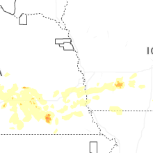

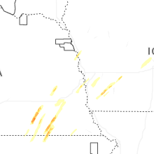
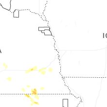
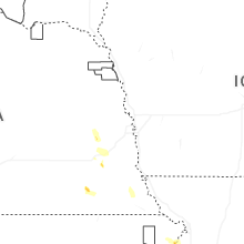
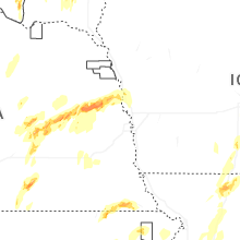


Connect with Interactive Hail Maps