

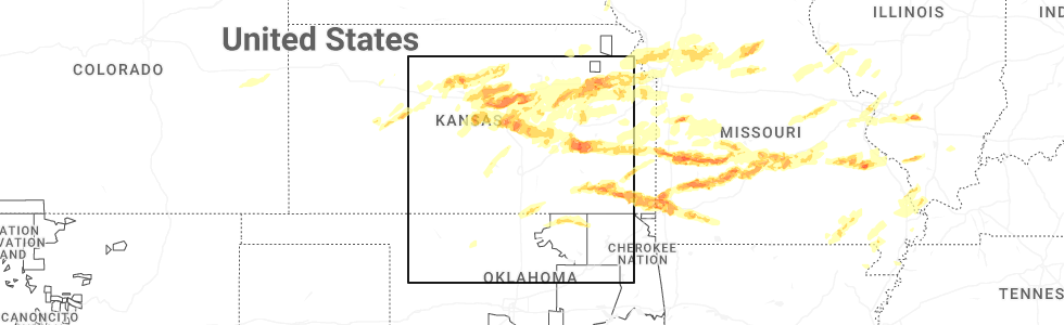
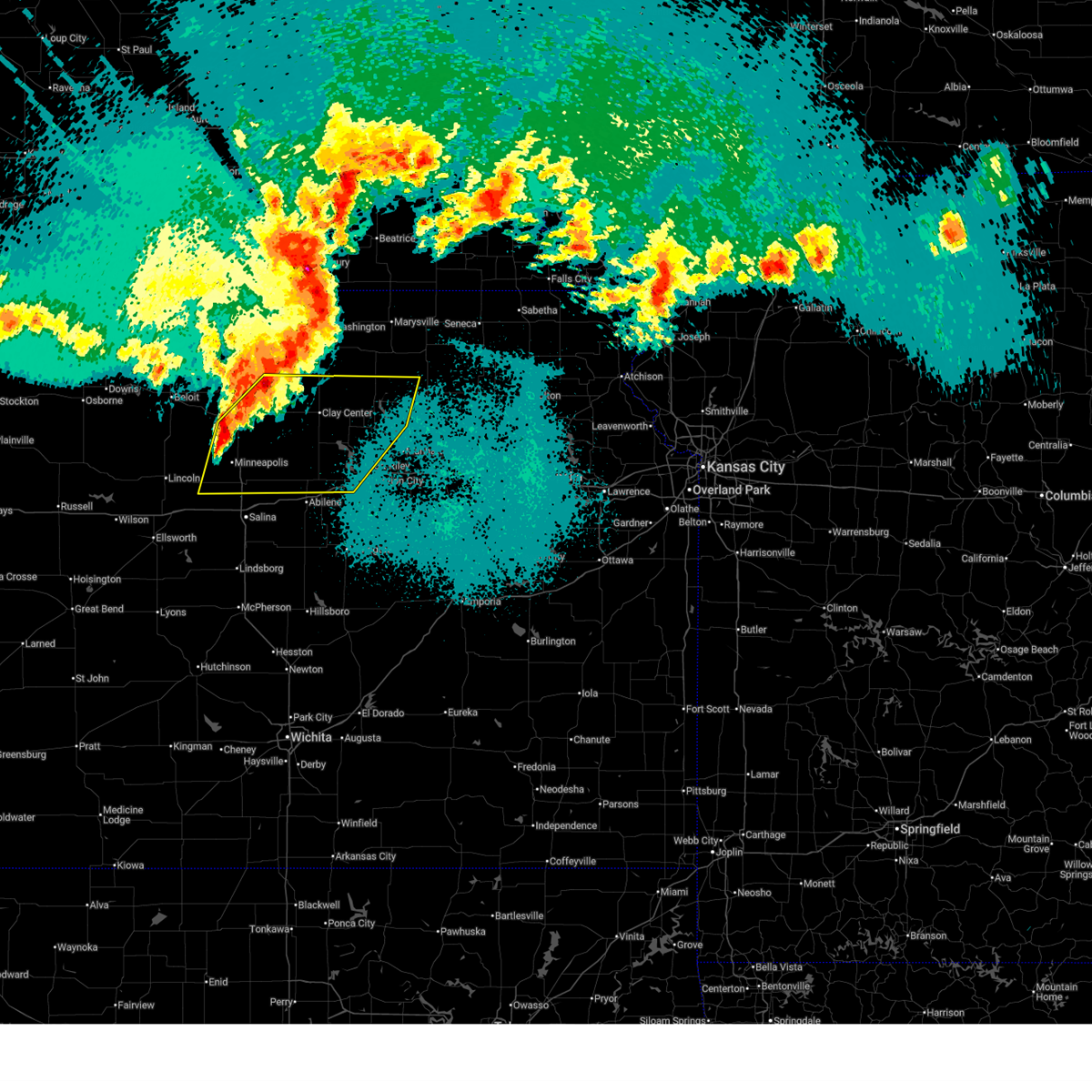
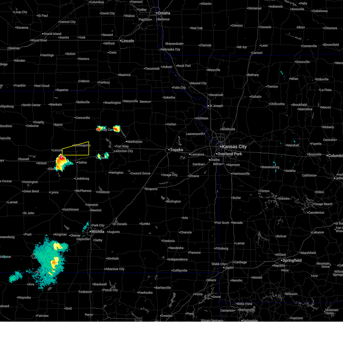
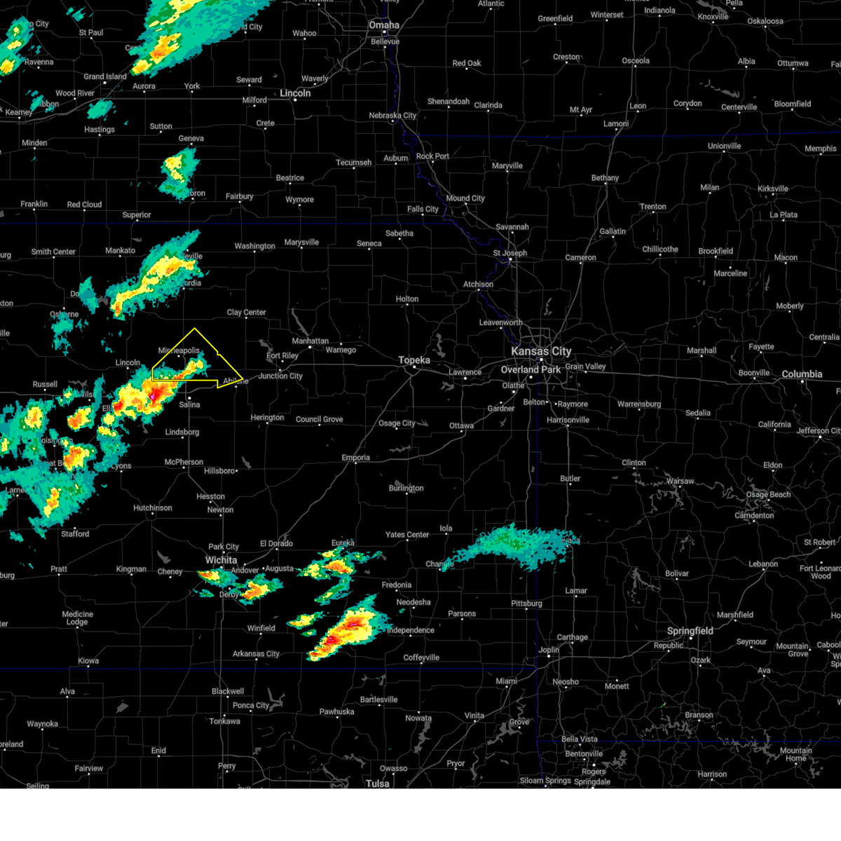
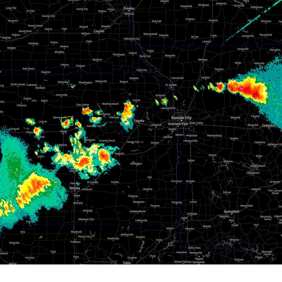
Hail Map for Bennington, KS
The Bennington, KS area has had 16 reports of on-the-ground hail by trained spotters, and has been under severe weather warnings 29 times during the past 12 months. Doppler radar has detected hail at or near Bennington, KS on 99 occasions, including 8 occasions during the past year.
| Name: | Bennington, KS |
| Where Located: | 56.3 miles W of Manhattan, KS |
| Map: | Google Map for Bennington, KS |
| Population: | 672 |
| Housing Units: | 283 |
| More Info: | Search Google for Bennington, KS |
4
The Top Recent Hail Date for Bennington, KS is Sunday, April 26, 2026 (7th out of 99)
Hail and Wind Damage Spotted near Bennington, KS
| Date / Time | Report Details |
|---|---|
| 6/10/2026 6:29 PM CDT |
 At 628 pm cdt, a severe thunderstorm was located 5 miles southwest of talmage, moving east at 30 mph (radar indicated). Hazards include golf ball size hail and 60 mph wind gusts. People and animals outdoors will be injured. expect hail damage to roofs, siding, windows, and vehicles. expect wind damage to roofs, siding, and trees. Locations impacted include, bennington, manchester, niles, and talmage. At 628 pm cdt, a severe thunderstorm was located 5 miles southwest of talmage, moving east at 30 mph (radar indicated). Hazards include golf ball size hail and 60 mph wind gusts. People and animals outdoors will be injured. expect hail damage to roofs, siding, windows, and vehicles. expect wind damage to roofs, siding, and trees. Locations impacted include, bennington, manchester, niles, and talmage.
|
| 6/10/2026 6:05 PM CDT |
 Svrtop the national weather service in topeka has issued a * severe thunderstorm warning for, northwestern dickinson county in central kansas, southeastern ottawa county in north central kansas, * until 645 pm cdt. * at 604 pm cdt, a severe thunderstorm was located 5 miles south of bennington, moving east at 30 mph (radar indicated). Hazards include 60 mph wind gusts and quarter size hail. Hail damage to vehicles is expected. Expect wind damage to roofs, siding, and trees. Svrtop the national weather service in topeka has issued a * severe thunderstorm warning for, northwestern dickinson county in central kansas, southeastern ottawa county in north central kansas, * until 645 pm cdt. * at 604 pm cdt, a severe thunderstorm was located 5 miles south of bennington, moving east at 30 mph (radar indicated). Hazards include 60 mph wind gusts and quarter size hail. Hail damage to vehicles is expected. Expect wind damage to roofs, siding, and trees.
|
| 6/8/2026 9:40 PM CDT |
 At 939 pm cdt, severe thunderstorms were located along a line extending from 3 miles northeast of oak hill to near bennington, moving southeast at 35 mph (radar indicated. observation sites across the warned area have measured wind gusts 55 to 65 mph over the past 15 minutes). Hazards include 70 mph wind gusts and quarter size hail. Hail damage to vehicles is expected. expect considerable tree damage. wind damage is also likely to mobile homes, roofs, and outbuildings. Locations impacted include, minneapolis, bennington, miltonvale, tescott, culver, wells, manchester, longford, aurora, oak hill, and niles. At 939 pm cdt, severe thunderstorms were located along a line extending from 3 miles northeast of oak hill to near bennington, moving southeast at 35 mph (radar indicated. observation sites across the warned area have measured wind gusts 55 to 65 mph over the past 15 minutes). Hazards include 70 mph wind gusts and quarter size hail. Hail damage to vehicles is expected. expect considerable tree damage. wind damage is also likely to mobile homes, roofs, and outbuildings. Locations impacted include, minneapolis, bennington, miltonvale, tescott, culver, wells, manchester, longford, aurora, oak hill, and niles.
|
| 6/8/2026 9:14 PM CDT |
 Svrtop the national weather service in topeka has issued a * severe thunderstorm warning for, northwestern dickinson county in central kansas, ottawa county in north central kansas, southwestern clay county in north central kansas, southeastern cloud county in north central kansas, * until 1000 pm cdt. * at 914 pm cdt, a severe thunderstorm was located near culver, moving southeast at 45 mph (radar indicated). Hazards include 70 mph wind gusts and ping pong ball size hail. People and animals outdoors will be injured. expect hail damage to roofs, siding, windows, and vehicles. expect considerable tree damage. Wind damage is also likely to mobile homes, roofs, and outbuildings. Svrtop the national weather service in topeka has issued a * severe thunderstorm warning for, northwestern dickinson county in central kansas, ottawa county in north central kansas, southwestern clay county in north central kansas, southeastern cloud county in north central kansas, * until 1000 pm cdt. * at 914 pm cdt, a severe thunderstorm was located near culver, moving southeast at 45 mph (radar indicated). Hazards include 70 mph wind gusts and ping pong ball size hail. People and animals outdoors will be injured. expect hail damage to roofs, siding, windows, and vehicles. expect considerable tree damage. Wind damage is also likely to mobile homes, roofs, and outbuildings.
|
| 6/8/2026 8:53 PM CDT |
 At 852 pm cdt, a severe thunderstorm was located near new cambria, moving east at 15 mph (emergency management. at 8:50 pm, golf-ball size hail was reported in solomon). Hazards include golf ball size hail and 60 mph wind gusts. People and animals outdoors will be injured. expect hail damage to roofs, siding, windows, and vehicles. expect wind damage to roofs, siding, and trees. locations impacted include, solomon, bennington, culver, wells, and niles. This includes interstate 70 between mile markers 267 and 271. At 852 pm cdt, a severe thunderstorm was located near new cambria, moving east at 15 mph (emergency management. at 8:50 pm, golf-ball size hail was reported in solomon). Hazards include golf ball size hail and 60 mph wind gusts. People and animals outdoors will be injured. expect hail damage to roofs, siding, windows, and vehicles. expect wind damage to roofs, siding, and trees. locations impacted include, solomon, bennington, culver, wells, and niles. This includes interstate 70 between mile markers 267 and 271.
|
| 6/8/2026 8:41 PM CDT |
 Svrtop the national weather service in topeka has issued a * severe thunderstorm warning for, west central dickinson county in central kansas, southeastern ottawa county in north central kansas, * until 930 pm cdt. * at 841 pm cdt, a severe thunderstorm was located over new cambria, moving east at 15 mph (radar indicated). Hazards include ping pong ball size hail and 60 mph wind gusts. People and animals outdoors will be injured. expect hail damage to roofs, siding, windows, and vehicles. Expect wind damage to roofs, siding, and trees. Svrtop the national weather service in topeka has issued a * severe thunderstorm warning for, west central dickinson county in central kansas, southeastern ottawa county in north central kansas, * until 930 pm cdt. * at 841 pm cdt, a severe thunderstorm was located over new cambria, moving east at 15 mph (radar indicated). Hazards include ping pong ball size hail and 60 mph wind gusts. People and animals outdoors will be injured. expect hail damage to roofs, siding, windows, and vehicles. Expect wind damage to roofs, siding, and trees.
|
| 5/18/2026 4:32 PM CDT | Quarter sized hail reported 4.6 miles WSW of Bennington, KS |
| 5/18/2026 4:30 PM CDT |
 At 430 pm cdt, a severe thunderstorm was located over wells, moving northeast at 50 mph (radar indicated). Hazards include golf ball size hail and 60 mph wind gusts. People and animals outdoors will be injured. expect hail damage to roofs, siding, windows, and vehicles. expect wind damage to roofs, siding, and trees. Locations impacted include, minneapolis, bennington, wells, manchester, and longford. At 430 pm cdt, a severe thunderstorm was located over wells, moving northeast at 50 mph (radar indicated). Hazards include golf ball size hail and 60 mph wind gusts. People and animals outdoors will be injured. expect hail damage to roofs, siding, windows, and vehicles. expect wind damage to roofs, siding, and trees. Locations impacted include, minneapolis, bennington, wells, manchester, and longford.
|
| 5/18/2026 4:10 PM CDT |
 Svrtop the national weather service in topeka has issued a * severe thunderstorm warning for, northwestern dickinson county in central kansas, ottawa county in north central kansas, southwestern clay county in north central kansas, * until 445 pm cdt. * at 410 pm cdt, a severe thunderstorm was located over culver, moving northeast at 50 mph (radar indicated). Hazards include ping pong ball size hail and 60 mph wind gusts. People and animals outdoors will be injured. expect hail damage to roofs, siding, windows, and vehicles. Expect wind damage to roofs, siding, and trees. Svrtop the national weather service in topeka has issued a * severe thunderstorm warning for, northwestern dickinson county in central kansas, ottawa county in north central kansas, southwestern clay county in north central kansas, * until 445 pm cdt. * at 410 pm cdt, a severe thunderstorm was located over culver, moving northeast at 50 mph (radar indicated). Hazards include ping pong ball size hail and 60 mph wind gusts. People and animals outdoors will be injured. expect hail damage to roofs, siding, windows, and vehicles. Expect wind damage to roofs, siding, and trees.
|
| 5/17/2026 11:37 PM CDT |
 Svrtop the national weather service in topeka has issued a * severe thunderstorm warning for, southeastern ottawa county in north central kansas, * until 1215 am cdt. * at 1137 pm cdt, a severe thunderstorm was located near minneapolis, moving east at 25 mph (radar indicated). Hazards include 60 mph wind gusts. expect damage to roofs, siding, and trees Svrtop the national weather service in topeka has issued a * severe thunderstorm warning for, southeastern ottawa county in north central kansas, * until 1215 am cdt. * at 1137 pm cdt, a severe thunderstorm was located near minneapolis, moving east at 25 mph (radar indicated). Hazards include 60 mph wind gusts. expect damage to roofs, siding, and trees
|
| 5/17/2026 10:13 PM CDT |
 Svrtop the national weather service in topeka has issued a * severe thunderstorm warning for, ottawa county in north central kansas, * until 1100 pm cdt. * at 1013 pm cdt, a severe thunderstorm was located 4 miles north of culver, moving northeast at 30 mph (radar indicated). Hazards include 60 mph wind gusts and quarter size hail. Hail damage to vehicles is expected. Expect wind damage to roofs, siding, and trees. Svrtop the national weather service in topeka has issued a * severe thunderstorm warning for, ottawa county in north central kansas, * until 1100 pm cdt. * at 1013 pm cdt, a severe thunderstorm was located 4 miles north of culver, moving northeast at 30 mph (radar indicated). Hazards include 60 mph wind gusts and quarter size hail. Hail damage to vehicles is expected. Expect wind damage to roofs, siding, and trees.
|
| 5/17/2026 9:58 PM CDT |
 At 957 pm cdt, a severe thunderstorm was located near minneapolis, moving northeast at 30 mph (emergency management reported golf ball size hail in tescott). Hazards include golf ball size hail. People and animals outdoors will be injured. expect damage to roofs, siding, windows, and vehicles. Locations impacted include, minneapolis, bennington, tescott, wells, manchester, longford, oak hill, and ada. At 957 pm cdt, a severe thunderstorm was located near minneapolis, moving northeast at 30 mph (emergency management reported golf ball size hail in tescott). Hazards include golf ball size hail. People and animals outdoors will be injured. expect damage to roofs, siding, windows, and vehicles. Locations impacted include, minneapolis, bennington, tescott, wells, manchester, longford, oak hill, and ada.
|
| 5/17/2026 9:41 PM CDT |
 Svrtop the national weather service in topeka has issued a * severe thunderstorm warning for, northwestern dickinson county in central kansas, ottawa county in north central kansas, southwestern clay county in north central kansas, * until 1015 pm cdt. * at 941 pm cdt, a severe thunderstorm was located near wells, moving east at 45 mph (radar indicated). Hazards include golf ball size hail. People and animals outdoors will be injured. Expect damage to roofs, siding, windows, and vehicles. Svrtop the national weather service in topeka has issued a * severe thunderstorm warning for, northwestern dickinson county in central kansas, ottawa county in north central kansas, southwestern clay county in north central kansas, * until 1015 pm cdt. * at 941 pm cdt, a severe thunderstorm was located near wells, moving east at 45 mph (radar indicated). Hazards include golf ball size hail. People and animals outdoors will be injured. Expect damage to roofs, siding, windows, and vehicles.
|
| 5/17/2026 9:31 PM CDT |
 At 930 pm cdt, a severe thunderstorm was located near minneapolis, moving east at 40 mph (trained weather spotters reported golf ball size hail in tescott at 929 pm). Hazards include golf ball size hail and 70 mph wind gusts. People and animals outdoors will be injured. expect hail damage to roofs, siding, windows, and vehicles. expect considerable tree damage. wind damage is also likely to mobile homes, roofs, and outbuildings. Locations impacted include, minneapolis, bennington, tescott, culver, wells, niles, and ada. At 930 pm cdt, a severe thunderstorm was located near minneapolis, moving east at 40 mph (trained weather spotters reported golf ball size hail in tescott at 929 pm). Hazards include golf ball size hail and 70 mph wind gusts. People and animals outdoors will be injured. expect hail damage to roofs, siding, windows, and vehicles. expect considerable tree damage. wind damage is also likely to mobile homes, roofs, and outbuildings. Locations impacted include, minneapolis, bennington, tescott, culver, wells, niles, and ada.
|
| 5/17/2026 8:57 PM CDT |
 Svrtop the national weather service in topeka has issued a * severe thunderstorm warning for, ottawa county in north central kansas, * until 945 pm cdt. * at 857 pm cdt, a severe thunderstorm was located near beverly, moving east at 45 mph (radar indicated). Hazards include 70 mph wind gusts and half dollar size hail. Hail damage to vehicles is expected. expect considerable tree damage. Wind damage is also likely to mobile homes, roofs, and outbuildings. Svrtop the national weather service in topeka has issued a * severe thunderstorm warning for, ottawa county in north central kansas, * until 945 pm cdt. * at 857 pm cdt, a severe thunderstorm was located near beverly, moving east at 45 mph (radar indicated). Hazards include 70 mph wind gusts and half dollar size hail. Hail damage to vehicles is expected. expect considerable tree damage. Wind damage is also likely to mobile homes, roofs, and outbuildings.
|
| 5/17/2026 8:16 PM CDT |
 Svrtop the national weather service in topeka has issued a * severe thunderstorm warning for, ottawa county in north central kansas, * until 900 pm cdt. * at 816 pm cdt, a severe thunderstorm was located near beverly, moving east at 55 mph (radar indicated). Hazards include 70 mph wind gusts and quarter size hail. Hail damage to vehicles is expected. expect considerable tree damage. Wind damage is also likely to mobile homes, roofs, and outbuildings. Svrtop the national weather service in topeka has issued a * severe thunderstorm warning for, ottawa county in north central kansas, * until 900 pm cdt. * at 816 pm cdt, a severe thunderstorm was located near beverly, moving east at 55 mph (radar indicated). Hazards include 70 mph wind gusts and quarter size hail. Hail damage to vehicles is expected. expect considerable tree damage. Wind damage is also likely to mobile homes, roofs, and outbuildings.
|
| 5/17/2026 12:11 AM CDT |
 At 1211 am cdt, severe thunderstorms were located along a line extending from 8 miles north of randolph to near leonardville to near talmage, moving east at 65 mph (radar indicated). Hazards include 70 mph wind gusts and quarter size hail. Hail damage to vehicles is expected. expect considerable tree damage. wind damage is also likely to mobile homes, roofs, and outbuildings. locations impacted include, junction city, clay center, chapman, wakefield, riley, bennington, clifton, miltonvale, milford, leonardville, olsburg, morganville, randolph, green, wells, manchester, longford, vining, oak hill, and talmage. This includes interstate 70 between mile markers 283 and 294. At 1211 am cdt, severe thunderstorms were located along a line extending from 8 miles north of randolph to near leonardville to near talmage, moving east at 65 mph (radar indicated). Hazards include 70 mph wind gusts and quarter size hail. Hail damage to vehicles is expected. expect considerable tree damage. wind damage is also likely to mobile homes, roofs, and outbuildings. locations impacted include, junction city, clay center, chapman, wakefield, riley, bennington, clifton, miltonvale, milford, leonardville, olsburg, morganville, randolph, green, wells, manchester, longford, vining, oak hill, and talmage. This includes interstate 70 between mile markers 283 and 294.
|
| 5/16/2026 11:53 PM CDT |
 Svrtop the national weather service in topeka has issued a * severe thunderstorm warning for, northern dickinson county in central kansas, northwestern geary county in east central kansas, riley county in northeastern kansas, ottawa county in north central kansas, northwestern pottawatomie county in northeastern kansas, clay county in north central kansas, southeastern cloud county in north central kansas, * until 1230 am cdt. * at 1153 pm cdt, severe thunderstorms were located along a line extending from 6 miles southeast of palmer to 4 miles southeast of idana to near bennington, moving east at 55 mph (radar indicated). Hazards include 70 mph wind gusts and quarter size hail. Hail damage to vehicles is expected. expect considerable tree damage. Wind damage is also likely to mobile homes, roofs, and outbuildings. Svrtop the national weather service in topeka has issued a * severe thunderstorm warning for, northern dickinson county in central kansas, northwestern geary county in east central kansas, riley county in northeastern kansas, ottawa county in north central kansas, northwestern pottawatomie county in northeastern kansas, clay county in north central kansas, southeastern cloud county in north central kansas, * until 1230 am cdt. * at 1153 pm cdt, severe thunderstorms were located along a line extending from 6 miles southeast of palmer to 4 miles southeast of idana to near bennington, moving east at 55 mph (radar indicated). Hazards include 70 mph wind gusts and quarter size hail. Hail damage to vehicles is expected. expect considerable tree damage. Wind damage is also likely to mobile homes, roofs, and outbuildings.
|
| 5/14/2026 7:56 PM CDT |
 At 755 pm cdt, a severe thunderstorm was located near bennington, moving east at 45 mph (trained weather spotters. at 7:45 pm, quarter size hail was reported in culver). Hazards include 60 mph wind gusts and quarter size hail. Hail damage to vehicles is expected. expect wind damage to roofs, siding, and trees. Locations impacted include, bennington and niles. At 755 pm cdt, a severe thunderstorm was located near bennington, moving east at 45 mph (trained weather spotters. at 7:45 pm, quarter size hail was reported in culver). Hazards include 60 mph wind gusts and quarter size hail. Hail damage to vehicles is expected. expect wind damage to roofs, siding, and trees. Locations impacted include, bennington and niles.
|
| 5/14/2026 7:52 PM CDT |
 At 751 pm cdt, a severe thunderstorm was located near bennington, moving east at 45 mph (radar indicated). Hazards include 60 mph wind gusts and half dollar size hail. Hail damage to vehicles is expected. expect wind damage to roofs, siding, and trees. Locations impacted include, bennington and niles. At 751 pm cdt, a severe thunderstorm was located near bennington, moving east at 45 mph (radar indicated). Hazards include 60 mph wind gusts and half dollar size hail. Hail damage to vehicles is expected. expect wind damage to roofs, siding, and trees. Locations impacted include, bennington and niles.
|
| 5/14/2026 7:41 PM CDT |
 At 741 pm cdt, a severe thunderstorm was located over culver, moving east at 40 mph (radar indicated). Hazards include 60 mph wind gusts and half dollar size hail. Hail damage to vehicles is expected. expect wind damage to roofs, siding, and trees. Locations impacted include, bennington, culver, and niles. At 741 pm cdt, a severe thunderstorm was located over culver, moving east at 40 mph (radar indicated). Hazards include 60 mph wind gusts and half dollar size hail. Hail damage to vehicles is expected. expect wind damage to roofs, siding, and trees. Locations impacted include, bennington, culver, and niles.
|
| 5/14/2026 7:25 PM CDT |
 Svrtop the national weather service in topeka has issued a * severe thunderstorm warning for, southern ottawa county in north central kansas, * until 815 pm cdt. * at 725 pm cdt, a severe thunderstorm was located 6 miles south of tescott, moving east at 45 mph (radar indicated). Hazards include 60 mph wind gusts and half dollar size hail. Hail damage to vehicles is expected. Expect wind damage to roofs, siding, and trees. Svrtop the national weather service in topeka has issued a * severe thunderstorm warning for, southern ottawa county in north central kansas, * until 815 pm cdt. * at 725 pm cdt, a severe thunderstorm was located 6 miles south of tescott, moving east at 45 mph (radar indicated). Hazards include 60 mph wind gusts and half dollar size hail. Hail damage to vehicles is expected. Expect wind damage to roofs, siding, and trees.
|
| 4/27/2026 2:41 AM CDT |
 The storms which prompted the warning have weakened below severe limits, and no longer pose an immediate threat to life or property. therefore, the warning will be allowed to expire. however, small hail and gusty winds are still possible with these thunderstorms. a severe thunderstorm watch remains in effect until 400 am cdt for central and north central kansas. The storms which prompted the warning have weakened below severe limits, and no longer pose an immediate threat to life or property. therefore, the warning will be allowed to expire. however, small hail and gusty winds are still possible with these thunderstorms. a severe thunderstorm watch remains in effect until 400 am cdt for central and north central kansas.
|
| 4/27/2026 2:24 AM CDT |
 At 224 am cdt, severe thunderstorms were located along a line extending from 8 miles southwest of aurora to 4 miles south of minneapolis, moving northeast at 50 mph (radar indicated). Hazards include 60 mph wind gusts and quarter size hail. Hail damage to vehicles is expected. expect wind damage to roofs, siding, and trees. Locations impacted include, minneapolis, bennington, miltonvale, delphos, tescott, culver, wells, niles, and ada. At 224 am cdt, severe thunderstorms were located along a line extending from 8 miles southwest of aurora to 4 miles south of minneapolis, moving northeast at 50 mph (radar indicated). Hazards include 60 mph wind gusts and quarter size hail. Hail damage to vehicles is expected. expect wind damage to roofs, siding, and trees. Locations impacted include, minneapolis, bennington, miltonvale, delphos, tescott, culver, wells, niles, and ada.
|
| 4/27/2026 1:58 AM CDT |
 Svrtop the national weather service in topeka has issued a * severe thunderstorm warning for, ottawa county in north central kansas, southern cloud county in north central kansas, * until 245 am cdt. * at 158 am cdt, severe thunderstorms were located along a line extending from 6 miles northeast of barnard to 5 miles southwest of beverly, moving northeast at 50 mph (radar indicated). Hazards include 60 mph wind gusts and quarter size hail. Hail damage to vehicles is expected. Expect wind damage to roofs, siding, and trees. Svrtop the national weather service in topeka has issued a * severe thunderstorm warning for, ottawa county in north central kansas, southern cloud county in north central kansas, * until 245 am cdt. * at 158 am cdt, severe thunderstorms were located along a line extending from 6 miles northeast of barnard to 5 miles southwest of beverly, moving northeast at 50 mph (radar indicated). Hazards include 60 mph wind gusts and quarter size hail. Hail damage to vehicles is expected. Expect wind damage to roofs, siding, and trees.
|
| 4/27/2026 1:36 AM CDT |
 The storm which prompted the warning has weakened below severe limits, and no longer poses an immediate threat to life or property. therefore, the warning will be allowed to expire. however, small hail and gusty winds are still possible with this thunderstorm. a severe thunderstorm watch remains in effect until 400 am cdt for central and north central kansas. The storm which prompted the warning has weakened below severe limits, and no longer poses an immediate threat to life or property. therefore, the warning will be allowed to expire. however, small hail and gusty winds are still possible with this thunderstorm. a severe thunderstorm watch remains in effect until 400 am cdt for central and north central kansas.
|
| 4/27/2026 1:14 AM CDT |
 Svrtop the national weather service in topeka has issued a * severe thunderstorm warning for, northwestern dickinson county in central kansas, southern ottawa county in north central kansas, southwestern clay county in north central kansas, * until 145 am cdt. * at 113 am cdt, a severe thunderstorm was located near culver, moving east at 45 mph (radar indicated). Hazards include half dollar size hail. damage to vehicles is expected Svrtop the national weather service in topeka has issued a * severe thunderstorm warning for, northwestern dickinson county in central kansas, southern ottawa county in north central kansas, southwestern clay county in north central kansas, * until 145 am cdt. * at 113 am cdt, a severe thunderstorm was located near culver, moving east at 45 mph (radar indicated). Hazards include half dollar size hail. damage to vehicles is expected
|
| 4/27/2026 12:49 AM CDT |
 Svrtop the national weather service in topeka has issued a * severe thunderstorm warning for, northwestern dickinson county in central kansas, ottawa county in north central kansas, southwestern clay county in north central kansas, * until 115 am cdt. * at 1248 am cdt, a severe thunderstorm was located near culver, moving east at 45 mph (radar indicated). Hazards include half dollar size hail. damage to vehicles is expected Svrtop the national weather service in topeka has issued a * severe thunderstorm warning for, northwestern dickinson county in central kansas, ottawa county in north central kansas, southwestern clay county in north central kansas, * until 115 am cdt. * at 1248 am cdt, a severe thunderstorm was located near culver, moving east at 45 mph (radar indicated). Hazards include half dollar size hail. damage to vehicles is expected
|
| 7/21/2025 7:18 PM CDT |
 the severe thunderstorm warning has been cancelled and is no longer in effect the severe thunderstorm warning has been cancelled and is no longer in effect
|
| 7/21/2025 7:01 PM CDT |
 Svrtop the national weather service in topeka has issued a * severe thunderstorm warning for, southern ottawa county in north central kansas, * until 730 pm cdt. * at 700 pm cdt, a severe thunderstorm was located near culver, moving northeast at 25 mph (radar indicated). Hazards include 60 mph wind gusts and penny size hail. expect damage to roofs, siding, and trees Svrtop the national weather service in topeka has issued a * severe thunderstorm warning for, southern ottawa county in north central kansas, * until 730 pm cdt. * at 700 pm cdt, a severe thunderstorm was located near culver, moving northeast at 25 mph (radar indicated). Hazards include 60 mph wind gusts and penny size hail. expect damage to roofs, siding, and trees
|
| 6/17/2025 2:24 AM CDT |
 The storms which prompted the warning have moved out of the area. therefore, the warning will be allowed to expire. a severe thunderstorm watch remains in effect until 700 am cdt for north central kansas. remember, a severe thunderstorm warning still remains in effect for eastern areas of ottawa and cloud counties. The storms which prompted the warning have moved out of the area. therefore, the warning will be allowed to expire. a severe thunderstorm watch remains in effect until 700 am cdt for north central kansas. remember, a severe thunderstorm warning still remains in effect for eastern areas of ottawa and cloud counties.
|
| 6/17/2025 2:19 AM CDT |
 At 219 am cdt, a severe thunderstorm was located near wells, or 11 miles east of minneapolis, moving east at 25 mph. this is a destructive storm (radar indicated). Hazards include 80 mph wind gusts and quarter size hail. Flying debris will be dangerous to those caught without shelter. mobile homes will be heavily damaged. expect considerable damage to roofs, windows, and vehicles. extensive tree damage and power outages are likely. Locations impacted include, minneapolis, bennington, culver, wells, and niles. At 219 am cdt, a severe thunderstorm was located near wells, or 11 miles east of minneapolis, moving east at 25 mph. this is a destructive storm (radar indicated). Hazards include 80 mph wind gusts and quarter size hail. Flying debris will be dangerous to those caught without shelter. mobile homes will be heavily damaged. expect considerable damage to roofs, windows, and vehicles. extensive tree damage and power outages are likely. Locations impacted include, minneapolis, bennington, culver, wells, and niles.
|
| 6/17/2025 2:14 AM CDT | Personal weather statio in ottawa county KS, 2.5 miles S of Bennington, KS |
| 6/17/2025 2:00 AM CDT |
 Svrtop the national weather service in topeka has issued a * severe thunderstorm warning for, ottawa county in north central kansas, * until 230 am cdt. * at 200 am cdt, a severe thunderstorm was located near minneapolis, moving east at 25 mph. this is a destructive storm (radar indicated). Hazards include 80 mph wind gusts and quarter size hail. Flying debris will be dangerous to those caught without shelter. mobile homes will be heavily damaged. expect considerable damage to roofs, windows, and vehicles. Extensive tree damage and power outages are likely. Svrtop the national weather service in topeka has issued a * severe thunderstorm warning for, ottawa county in north central kansas, * until 230 am cdt. * at 200 am cdt, a severe thunderstorm was located near minneapolis, moving east at 25 mph. this is a destructive storm (radar indicated). Hazards include 80 mph wind gusts and quarter size hail. Flying debris will be dangerous to those caught without shelter. mobile homes will be heavily damaged. expect considerable damage to roofs, windows, and vehicles. Extensive tree damage and power outages are likely.
|
| 6/17/2025 1:51 AM CDT |
 At 151 am cdt, severe thunderstorms were located along a line extending from 5 miles southwest of minneapolis to 7 miles northeast of delphos to near concordia, moving east at 30 mph (radar indicated). Hazards include 70 mph wind gusts and ping pong ball size hail. People and animals outdoors will be injured. expect hail damage to roofs, siding, windows, and vehicles. expect considerable tree damage. wind damage is also likely to mobile homes, roofs, and outbuildings. Locations impacted include, concordia, minneapolis, clyde, bennington, miltonvale, glasco, delphos, tescott, culver, wells, aurora, niles, and ada. At 151 am cdt, severe thunderstorms were located along a line extending from 5 miles southwest of minneapolis to 7 miles northeast of delphos to near concordia, moving east at 30 mph (radar indicated). Hazards include 70 mph wind gusts and ping pong ball size hail. People and animals outdoors will be injured. expect hail damage to roofs, siding, windows, and vehicles. expect considerable tree damage. wind damage is also likely to mobile homes, roofs, and outbuildings. Locations impacted include, concordia, minneapolis, clyde, bennington, miltonvale, glasco, delphos, tescott, culver, wells, aurora, niles, and ada.
|
| 6/17/2025 1:33 AM CDT |
 At 133 am cdt, severe thunderstorms were located along a line extending from near ada to glasco to 5 miles southeast of jamestown, moving east at 20 mph (radar indicated). Hazards include 70 mph wind gusts and quarter size hail. Hail damage to vehicles is expected. expect considerable tree damage. wind damage is also likely to mobile homes, roofs, and outbuildings. Locations impacted include, concordia, minneapolis, clyde, bennington, miltonvale, glasco, delphos, tescott, culver, wells, aurora, niles, and ada. At 133 am cdt, severe thunderstorms were located along a line extending from near ada to glasco to 5 miles southeast of jamestown, moving east at 20 mph (radar indicated). Hazards include 70 mph wind gusts and quarter size hail. Hail damage to vehicles is expected. expect considerable tree damage. wind damage is also likely to mobile homes, roofs, and outbuildings. Locations impacted include, concordia, minneapolis, clyde, bennington, miltonvale, glasco, delphos, tescott, culver, wells, aurora, niles, and ada.
|
| 6/17/2025 1:19 AM CDT |
 Svrtop the national weather service in topeka has issued a * severe thunderstorm warning for, ottawa county in north central kansas, cloud county in north central kansas, * until 230 am cdt. * at 118 am cdt, a severe thunderstorm was located over simpson, or 10 miles east of beloit, moving east at 30 mph (radar indicated). Hazards include 60 mph wind gusts and quarter size hail. Hail damage to vehicles is expected. Expect wind damage to roofs, siding, and trees. Svrtop the national weather service in topeka has issued a * severe thunderstorm warning for, ottawa county in north central kansas, cloud county in north central kansas, * until 230 am cdt. * at 118 am cdt, a severe thunderstorm was located over simpson, or 10 miles east of beloit, moving east at 30 mph (radar indicated). Hazards include 60 mph wind gusts and quarter size hail. Hail damage to vehicles is expected. Expect wind damage to roofs, siding, and trees.
|
| 4/22/2025 9:06 PM CDT |
 At 905 pm cdt, a severe thunderstorm was located near wells, moving northeast at 25 mph (radar indicated). Hazards include 60 mph wind gusts and quarter size hail. Hail damage to vehicles is expected. expect wind damage to roofs, siding, and trees. Locations impacted include, wells and bennington. At 905 pm cdt, a severe thunderstorm was located near wells, moving northeast at 25 mph (radar indicated). Hazards include 60 mph wind gusts and quarter size hail. Hail damage to vehicles is expected. expect wind damage to roofs, siding, and trees. Locations impacted include, wells and bennington.
|
| 4/22/2025 8:58 PM CDT |
 Svrtop the national weather service in topeka has issued a * severe thunderstorm warning for, eastern ottawa county in north central kansas, * until 930 pm cdt. * at 857 pm cdt, a severe thunderstorm was located near bennington, moving northeast at 25 mph (radar indicated). Hazards include 60 mph wind gusts and quarter size hail. Hail damage to vehicles is expected. Expect wind damage to roofs, siding, and trees. Svrtop the national weather service in topeka has issued a * severe thunderstorm warning for, eastern ottawa county in north central kansas, * until 930 pm cdt. * at 857 pm cdt, a severe thunderstorm was located near bennington, moving northeast at 25 mph (radar indicated). Hazards include 60 mph wind gusts and quarter size hail. Hail damage to vehicles is expected. Expect wind damage to roofs, siding, and trees.
|
| 4/22/2025 8:51 PM CDT |
 At 850 pm cdt, a severe thunderstorm was located near niles, moving northeast at 20 mph. a second severe thunderstorm was located 7 miles west of bennington, moving northeast at 20 mph (radar indicated). Hazards include 60 mph wind gusts and quarter size hail. Hail damage to vehicles is expected. expect wind damage to roofs, siding, and trees. locations impacted include, solomon, culver, niles, minneapolis, bennington, and talmage. This includes interstate 70 between mile markers 267 and 270. At 850 pm cdt, a severe thunderstorm was located near niles, moving northeast at 20 mph. a second severe thunderstorm was located 7 miles west of bennington, moving northeast at 20 mph (radar indicated). Hazards include 60 mph wind gusts and quarter size hail. Hail damage to vehicles is expected. expect wind damage to roofs, siding, and trees. locations impacted include, solomon, culver, niles, minneapolis, bennington, and talmage. This includes interstate 70 between mile markers 267 and 270.
|
| 4/22/2025 8:38 PM CDT |
 Svrtop the national weather service in topeka has issued a * severe thunderstorm warning for, northwestern dickinson county in central kansas, southern ottawa county in north central kansas, * until 900 pm cdt. * at 836 pm cdt, a severe thunderstorm was located near niles, moving northeast at 15 mph. a second severe thunderstorm was located 8 miles east of tescott, moving northeast at 20 mph (radar indicated). Hazards include 60 mph wind gusts and half dollar size hail. Hail damage to vehicles is expected. Expect wind damage to roofs, siding, and trees. Svrtop the national weather service in topeka has issued a * severe thunderstorm warning for, northwestern dickinson county in central kansas, southern ottawa county in north central kansas, * until 900 pm cdt. * at 836 pm cdt, a severe thunderstorm was located near niles, moving northeast at 15 mph. a second severe thunderstorm was located 8 miles east of tescott, moving northeast at 20 mph (radar indicated). Hazards include 60 mph wind gusts and half dollar size hail. Hail damage to vehicles is expected. Expect wind damage to roofs, siding, and trees.
|
| 4/22/2025 8:34 PM CDT |
 At 834 pm cdt, a severe thunderstorm was located near culver, moving northeast at 30 mph (radar indicated). Hazards include 60 mph wind gusts and quarter size hail. Hail damage to vehicles is expected. expect wind damage to roofs, siding, and trees. Locations impacted include, bennington, culver, and tescott. At 834 pm cdt, a severe thunderstorm was located near culver, moving northeast at 30 mph (radar indicated). Hazards include 60 mph wind gusts and quarter size hail. Hail damage to vehicles is expected. expect wind damage to roofs, siding, and trees. Locations impacted include, bennington, culver, and tescott.
|
| 4/22/2025 8:23 PM CDT |
 At 823 pm cdt, a severe thunderstorm was located near culver, moving northeast at 25 mph (radar indicated). Hazards include 60 mph wind gusts and quarter size hail. Hail damage to vehicles is expected. expect wind damage to roofs, siding, and trees. Locations impacted include, bennington, culver, and tescott. At 823 pm cdt, a severe thunderstorm was located near culver, moving northeast at 25 mph (radar indicated). Hazards include 60 mph wind gusts and quarter size hail. Hail damage to vehicles is expected. expect wind damage to roofs, siding, and trees. Locations impacted include, bennington, culver, and tescott.
|
| 4/22/2025 8:15 PM CDT |
 Svrtop the national weather service in topeka has issued a * severe thunderstorm warning for, southwestern ottawa county in north central kansas, * until 845 pm cdt. * at 814 pm cdt, a severe thunderstorm was located 4 miles southwest of culver, moving northeast at 30 mph (radar indicated). Hazards include 60 mph wind gusts and half dollar size hail. Hail damage to vehicles is expected. Expect wind damage to roofs, siding, and trees. Svrtop the national weather service in topeka has issued a * severe thunderstorm warning for, southwestern ottawa county in north central kansas, * until 845 pm cdt. * at 814 pm cdt, a severe thunderstorm was located 4 miles southwest of culver, moving northeast at 30 mph (radar indicated). Hazards include 60 mph wind gusts and half dollar size hail. Hail damage to vehicles is expected. Expect wind damage to roofs, siding, and trees.
|
| 4/2/2025 12:15 AM CDT |
 The storms which prompted the warning have weakened below severe limits, and no longer pose an immediate threat to life or property. therefore, the warning will be allowed to expire. however, gusty winds are still possible with these thunderstorms. a severe thunderstorm watch remains in effect until 300 am cdt for central and north central kansas. The storms which prompted the warning have weakened below severe limits, and no longer pose an immediate threat to life or property. therefore, the warning will be allowed to expire. however, gusty winds are still possible with these thunderstorms. a severe thunderstorm watch remains in effect until 300 am cdt for central and north central kansas.
|
| 4/1/2025 11:40 PM CDT |
 Svrtop the national weather service in topeka has issued a * severe thunderstorm warning for, northwestern dickinson county in central kansas, southeastern ottawa county in north central kansas, southern clay county in north central kansas, * until 1215 am cdt. * at 1139 pm cdt, severe thunderstorms were located along a line extending from 4 miles east of oak hill to manchester to near niles, moving east at 30 mph (radar indicated). Hazards include 60 mph wind gusts and quarter size hail. Hail damage to vehicles is expected. Expect wind damage to roofs, siding, and trees. Svrtop the national weather service in topeka has issued a * severe thunderstorm warning for, northwestern dickinson county in central kansas, southeastern ottawa county in north central kansas, southern clay county in north central kansas, * until 1215 am cdt. * at 1139 pm cdt, severe thunderstorms were located along a line extending from 4 miles east of oak hill to manchester to near niles, moving east at 30 mph (radar indicated). Hazards include 60 mph wind gusts and quarter size hail. Hail damage to vehicles is expected. Expect wind damage to roofs, siding, and trees.
|
| 4/1/2025 9:51 PM CDT |
 Svrtop the national weather service in topeka has issued a * severe thunderstorm warning for, northwestern dickinson county in central kansas, southeastern ottawa county in north central kansas, southwestern clay county in north central kansas, * until 1030 pm cdt. * at 951 pm cdt, a severe thunderstorm was located 5 miles north of niles, moving northeast at 45 mph (radar indicated). Hazards include 60 mph wind gusts and quarter size hail. Hail damage to vehicles is expected. Expect wind damage to roofs, siding, and trees. Svrtop the national weather service in topeka has issued a * severe thunderstorm warning for, northwestern dickinson county in central kansas, southeastern ottawa county in north central kansas, southwestern clay county in north central kansas, * until 1030 pm cdt. * at 951 pm cdt, a severe thunderstorm was located 5 miles north of niles, moving northeast at 45 mph (radar indicated). Hazards include 60 mph wind gusts and quarter size hail. Hail damage to vehicles is expected. Expect wind damage to roofs, siding, and trees.
|
| 4/1/2025 9:16 PM CDT |
 At 916 pm cdt, a severe thunderstorm was located near manchester, moving east at 40 mph (radar indicated). Hazards include two inch hail and 70 mph wind gusts. People and animals outdoors will be injured. expect hail damage to roofs, siding, windows, and vehicles. expect considerable tree damage. wind damage is also likely to mobile homes, roofs, and outbuildings. Locations impacted include, manchester, longford, niles, oak hill, bennington, and talmage. At 916 pm cdt, a severe thunderstorm was located near manchester, moving east at 40 mph (radar indicated). Hazards include two inch hail and 70 mph wind gusts. People and animals outdoors will be injured. expect hail damage to roofs, siding, windows, and vehicles. expect considerable tree damage. wind damage is also likely to mobile homes, roofs, and outbuildings. Locations impacted include, manchester, longford, niles, oak hill, bennington, and talmage.
|
| 4/1/2025 9:03 PM CDT |
 At 903 pm cdt, a severe thunderstorm capable of producing a tornado was located 4 miles northwest of niles, moving northeast at 35 mph (radar indicated rotation). Hazards include tornado and tennis ball size hail. Flying debris will be dangerous to those caught without shelter. mobile homes will be damaged or destroyed. damage to roofs, windows, and vehicles will occur. tree damage is likely. Locations impacted include, bennington. At 903 pm cdt, a severe thunderstorm capable of producing a tornado was located 4 miles northwest of niles, moving northeast at 35 mph (radar indicated rotation). Hazards include tornado and tennis ball size hail. Flying debris will be dangerous to those caught without shelter. mobile homes will be damaged or destroyed. damage to roofs, windows, and vehicles will occur. tree damage is likely. Locations impacted include, bennington.
|
| 4/1/2025 8:59 PM CDT |
 Svrtop the national weather service in topeka has issued a * severe thunderstorm warning for, northern dickinson county in central kansas, southeastern ottawa county in north central kansas, southern clay county in north central kansas, * until 945 pm cdt. * at 859 pm cdt, a severe thunderstorm was located near bennington, moving east at 40 mph (radar indicated). Hazards include tennis ball size hail and 70 mph wind gusts. People and animals outdoors will be injured. expect hail damage to roofs, siding, windows, and vehicles. expect considerable tree damage. Wind damage is also likely to mobile homes, roofs, and outbuildings. Svrtop the national weather service in topeka has issued a * severe thunderstorm warning for, northern dickinson county in central kansas, southeastern ottawa county in north central kansas, southern clay county in north central kansas, * until 945 pm cdt. * at 859 pm cdt, a severe thunderstorm was located near bennington, moving east at 40 mph (radar indicated). Hazards include tennis ball size hail and 70 mph wind gusts. People and animals outdoors will be injured. expect hail damage to roofs, siding, windows, and vehicles. expect considerable tree damage. Wind damage is also likely to mobile homes, roofs, and outbuildings.
|
| 4/1/2025 8:54 PM CDT | Quarter sized hail reported 0.3 miles NNW of Bennington, KS |
| 4/1/2025 8:54 PM CDT | Storm damage reported in ottawa county KS, 0.5 miles NE of Bennington, KS |
| 4/1/2025 8:53 PM CDT |
 Tortop the national weather service in topeka has issued a * tornado warning for, southeastern ottawa county in north central kansas, * until 915 pm cdt. * at 853 pm cdt, a severe thunderstorm capable of producing a tornado was located near bennington, moving northeast at 35 mph (radar indicated rotation). Hazards include tornado and tennis ball size hail. Flying debris will be dangerous to those caught without shelter. mobile homes will be damaged or destroyed. damage to roofs, windows, and vehicles will occur. Tree damage is likely. Tortop the national weather service in topeka has issued a * tornado warning for, southeastern ottawa county in north central kansas, * until 915 pm cdt. * at 853 pm cdt, a severe thunderstorm capable of producing a tornado was located near bennington, moving northeast at 35 mph (radar indicated rotation). Hazards include tornado and tennis ball size hail. Flying debris will be dangerous to those caught without shelter. mobile homes will be damaged or destroyed. damage to roofs, windows, and vehicles will occur. Tree damage is likely.
|
| 4/1/2025 8:51 PM CDT |
 At 850 pm cdt, a severe thunderstorm was located 4 miles southwest of bennington, moving northeast at 35 mph (radar indicated). Hazards include tennis ball size hail and 70 mph wind gusts. People and animals outdoors will be injured. expect hail damage to roofs, siding, windows, and vehicles. expect considerable tree damage. wind damage is also likely to mobile homes, roofs, and outbuildings. Locations impacted include, manchester, culver, niles, wells, and bennington. At 850 pm cdt, a severe thunderstorm was located 4 miles southwest of bennington, moving northeast at 35 mph (radar indicated). Hazards include tennis ball size hail and 70 mph wind gusts. People and animals outdoors will be injured. expect hail damage to roofs, siding, windows, and vehicles. expect considerable tree damage. wind damage is also likely to mobile homes, roofs, and outbuildings. Locations impacted include, manchester, culver, niles, wells, and bennington.
|
| 4/1/2025 8:47 PM CDT |
 At 846 pm cdt, a severe thunderstorm was located 4 miles southeast of wells, moving northeast at 65 mph (radar indicated). Hazards include tennis ball size hail and 70 mph wind gusts. People and animals outdoors will be injured. expect hail damage to roofs, siding, windows, and vehicles. expect considerable tree damage. wind damage is also likely to mobile homes, roofs, and outbuildings. locations impacted include, culver, niles, minneapolis, tescott, talmage, solomon, manchester, wells, and bennington. This includes interstate 70 between mile markers 267 and 270. At 846 pm cdt, a severe thunderstorm was located 4 miles southeast of wells, moving northeast at 65 mph (radar indicated). Hazards include tennis ball size hail and 70 mph wind gusts. People and animals outdoors will be injured. expect hail damage to roofs, siding, windows, and vehicles. expect considerable tree damage. wind damage is also likely to mobile homes, roofs, and outbuildings. locations impacted include, culver, niles, minneapolis, tescott, talmage, solomon, manchester, wells, and bennington. This includes interstate 70 between mile markers 267 and 270.
|
| 4/1/2025 8:23 PM CDT |
 Svrtop the national weather service in topeka has issued a * severe thunderstorm warning for, northwestern dickinson county in central kansas, ottawa county in north central kansas, * until 900 pm cdt. * at 823 pm cdt, a severe thunderstorm was located 7 miles north of brookville, moving northeast at 65 mph (radar indicated). Hazards include ping pong ball size hail and 60 mph wind gusts. People and animals outdoors will be injured. expect hail damage to roofs, siding, windows, and vehicles. Expect wind damage to roofs, siding, and trees. Svrtop the national weather service in topeka has issued a * severe thunderstorm warning for, northwestern dickinson county in central kansas, ottawa county in north central kansas, * until 900 pm cdt. * at 823 pm cdt, a severe thunderstorm was located 7 miles north of brookville, moving northeast at 65 mph (radar indicated). Hazards include ping pong ball size hail and 60 mph wind gusts. People and animals outdoors will be injured. expect hail damage to roofs, siding, windows, and vehicles. Expect wind damage to roofs, siding, and trees.
|
| 3/27/2025 7:13 PM CDT |
 the severe thunderstorm warning has been cancelled and is no longer in effect the severe thunderstorm warning has been cancelled and is no longer in effect
|
| 3/27/2025 6:57 PM CDT |
 Svrtop the national weather service in topeka has issued a * severe thunderstorm warning for, southwestern ottawa county in north central kansas, * until 730 pm cdt. * at 656 pm cdt, a severe thunderstorm was located near tescott, moving east at 30 mph (radar indicated). Hazards include 60 mph wind gusts and quarter size hail. Hail damage to vehicles is expected. Expect wind damage to roofs, siding, and trees. Svrtop the national weather service in topeka has issued a * severe thunderstorm warning for, southwestern ottawa county in north central kansas, * until 730 pm cdt. * at 656 pm cdt, a severe thunderstorm was located near tescott, moving east at 30 mph (radar indicated). Hazards include 60 mph wind gusts and quarter size hail. Hail damage to vehicles is expected. Expect wind damage to roofs, siding, and trees.
|
| 9/20/2024 7:19 PM CDT |
 At 719 pm cdt, severe thunderstorms were located along a line extending from 4 miles northeast of bennington to 5 miles north of gypsum to 6 miles north of canton, moving east at 30 mph (radar indicated). Hazards include 70 mph wind gusts and penny size hail. Expect considerable tree damage. damage is likely to mobile homes, roofs, and outbuildings. locations impacted include, abilene, solomon, enterprise, bennington, hope, manchester, carlton, niles, and talmage. This includes interstate 70 between mile markers 267 and 279. At 719 pm cdt, severe thunderstorms were located along a line extending from 4 miles northeast of bennington to 5 miles north of gypsum to 6 miles north of canton, moving east at 30 mph (radar indicated). Hazards include 70 mph wind gusts and penny size hail. Expect considerable tree damage. damage is likely to mobile homes, roofs, and outbuildings. locations impacted include, abilene, solomon, enterprise, bennington, hope, manchester, carlton, niles, and talmage. This includes interstate 70 between mile markers 267 and 279.
|
| 9/20/2024 7:13 PM CDT |
 At 711 pm cdt, severe thunderstorms were located along a line extending from near bennington to 4 miles northwest of gypsum to 5 miles north of canton, moving east-northeast at 30 mph (radar indicated). Hazards include 70 mph wind gusts and penny size hail. Expect considerable tree damage. damage is likely to mobile homes, roofs, and outbuildings. locations impacted include, abilene, minneapolis, solomon, enterprise, bennington, hope, manchester, carlton, niles, and talmage. this includes interstate 70 between mile markers 267 and 279. At 7:04 pm cdt, the automated weather station at the salina, ks airport measured a 67 mph wind gust. At 711 pm cdt, severe thunderstorms were located along a line extending from near bennington to 4 miles northwest of gypsum to 5 miles north of canton, moving east-northeast at 30 mph (radar indicated). Hazards include 70 mph wind gusts and penny size hail. Expect considerable tree damage. damage is likely to mobile homes, roofs, and outbuildings. locations impacted include, abilene, minneapolis, solomon, enterprise, bennington, hope, manchester, carlton, niles, and talmage. this includes interstate 70 between mile markers 267 and 279. At 7:04 pm cdt, the automated weather station at the salina, ks airport measured a 67 mph wind gust.
|
| 9/20/2024 7:08 PM CDT |
 At 706 pm cdt, a severe thunderstorm was located over bennington, moving northeast at 45 mph (radar indicated). Hazards include 60 mph wind gusts and penny size hail. Expect damage to roofs, siding, and trees. locations impacted include, bennington, culver, and niles. A new severe thunderstorm warning has been issued until 7:45 pm for southeast ottawa county. At 706 pm cdt, a severe thunderstorm was located over bennington, moving northeast at 45 mph (radar indicated). Hazards include 60 mph wind gusts and penny size hail. Expect damage to roofs, siding, and trees. locations impacted include, bennington, culver, and niles. A new severe thunderstorm warning has been issued until 7:45 pm for southeast ottawa county.
|
| 9/20/2024 7:00 PM CDT |
 Svrtop the national weather service in topeka has issued a * severe thunderstorm warning for, western dickinson county in central kansas, southeastern ottawa county in north central kansas, * until 745 pm cdt. * at 659 pm cdt, severe thunderstorms were located along a line extending from near bennington to 3 miles northwest of gypsum to 5 miles west of moundridge, moving east at 35 mph (radar indicated). Hazards include 60 mph wind gusts and penny size hail. expect damage to roofs, siding, and trees Svrtop the national weather service in topeka has issued a * severe thunderstorm warning for, western dickinson county in central kansas, southeastern ottawa county in north central kansas, * until 745 pm cdt. * at 659 pm cdt, severe thunderstorms were located along a line extending from near bennington to 3 miles northwest of gypsum to 5 miles west of moundridge, moving east at 35 mph (radar indicated). Hazards include 60 mph wind gusts and penny size hail. expect damage to roofs, siding, and trees
|
| 9/20/2024 6:54 PM CDT |
 At 653 pm cdt, a severe thunderstorm was located over culver, moving northeast at 35 mph (radar indicated). Hazards include 60 mph wind gusts and penny size hail. Expect damage to roofs, siding, and trees. Locations impacted include, minneapolis, bennington, tescott, culver, and niles. At 653 pm cdt, a severe thunderstorm was located over culver, moving northeast at 35 mph (radar indicated). Hazards include 60 mph wind gusts and penny size hail. Expect damage to roofs, siding, and trees. Locations impacted include, minneapolis, bennington, tescott, culver, and niles.
|
| 9/20/2024 6:46 PM CDT |
 At 645 pm cdt, a severe thunderstorm was located near culver, moving northeast at 40 mph (radar indicated). Hazards include 60 mph wind gusts. Expect damage to roofs, siding, and trees. locations impacted include, minneapolis, bennington, tescott, culver, wells, niles, and ada. At 6:20pm, a 60 mph wind gust was reported 2 miles west-southwest of glendale. At 645 pm cdt, a severe thunderstorm was located near culver, moving northeast at 40 mph (radar indicated). Hazards include 60 mph wind gusts. Expect damage to roofs, siding, and trees. locations impacted include, minneapolis, bennington, tescott, culver, wells, niles, and ada. At 6:20pm, a 60 mph wind gust was reported 2 miles west-southwest of glendale.
|
| 9/20/2024 6:36 PM CDT |
 Svrtop the national weather service in topeka has issued a * severe thunderstorm warning for, ottawa county in north central kansas, * until 715 pm cdt. * at 636 pm cdt, a severe thunderstorm was located 5 miles north of brookville, moving northeast at 45 mph (radar indicated). Hazards include 60 mph wind gusts. expect damage to roofs, siding, and trees Svrtop the national weather service in topeka has issued a * severe thunderstorm warning for, ottawa county in north central kansas, * until 715 pm cdt. * at 636 pm cdt, a severe thunderstorm was located 5 miles north of brookville, moving northeast at 45 mph (radar indicated). Hazards include 60 mph wind gusts. expect damage to roofs, siding, and trees
|
| 8/14/2024 7:58 PM CDT |
 the severe thunderstorm warning has been cancelled and is no longer in effect the severe thunderstorm warning has been cancelled and is no longer in effect
|
| 8/14/2024 7:37 PM CDT |
 Svrtop the national weather service in topeka has issued a * severe thunderstorm warning for, western ottawa county in north central kansas, * until 815 pm cdt. * at 736 pm cdt, severe thunderstorms were located 5 miles south of beverly, moving northeast at 35 mph (radar indicated). Hazards include 60 mph wind gusts. expect damage to roofs, siding, and trees Svrtop the national weather service in topeka has issued a * severe thunderstorm warning for, western ottawa county in north central kansas, * until 815 pm cdt. * at 736 pm cdt, severe thunderstorms were located 5 miles south of beverly, moving northeast at 35 mph (radar indicated). Hazards include 60 mph wind gusts. expect damage to roofs, siding, and trees
|
| 7/31/2024 7:27 PM CDT |
 Svrtop the national weather service in topeka has issued a * severe thunderstorm warning for, northwestern dickinson county in central kansas, southeastern ottawa county in north central kansas, southwestern clay county in north central kansas, * until 815 pm cdt. * at 726 pm cdt, a severe thunderstorm was located over niles, moving east at 30 mph (radar indicated). Hazards include 60 mph wind gusts and quarter size hail. Hail damage to vehicles is expected. Expect wind damage to roofs, siding, and trees. Svrtop the national weather service in topeka has issued a * severe thunderstorm warning for, northwestern dickinson county in central kansas, southeastern ottawa county in north central kansas, southwestern clay county in north central kansas, * until 815 pm cdt. * at 726 pm cdt, a severe thunderstorm was located over niles, moving east at 30 mph (radar indicated). Hazards include 60 mph wind gusts and quarter size hail. Hail damage to vehicles is expected. Expect wind damage to roofs, siding, and trees.
|
| 7/31/2024 7:04 PM CDT |
 Svrtop the national weather service in topeka has issued a * severe thunderstorm warning for, southern ottawa county in north central kansas, * until 730 pm cdt. * at 704 pm cdt, a severe thunderstorm was located near culver, moving east at 30 mph (radar indicated). Hazards include 60 mph wind gusts and quarter size hail. Hail damage to vehicles is expected. Expect wind damage to roofs, siding, and trees. Svrtop the national weather service in topeka has issued a * severe thunderstorm warning for, southern ottawa county in north central kansas, * until 730 pm cdt. * at 704 pm cdt, a severe thunderstorm was located near culver, moving east at 30 mph (radar indicated). Hazards include 60 mph wind gusts and quarter size hail. Hail damage to vehicles is expected. Expect wind damage to roofs, siding, and trees.
|
| 7/16/2024 5:38 AM CDT |
 At 538 am cdt, severe thunderstorms were located along a line extending from 4 miles northwest of idana to 7 miles east of longford to 3 miles south of enterprise, moving east at 60 mph (radar indicated). Hazards include 70 mph wind gusts and quarter size hail. Hail damage to vehicles is expected. expect considerable tree damage. wind damage is also likely to mobile homes, roofs, and outbuildings. locations impacted include, junction city, abilene, clay center, minneapolis, chapman, solomon, wakefield, enterprise, bennington, miltonvale, milford, delphos, morganville, wells, manchester, longford, oak hill, niles, talmage, and idana. This includes interstate 70 between mile markers 267 and 297. At 538 am cdt, severe thunderstorms were located along a line extending from 4 miles northwest of idana to 7 miles east of longford to 3 miles south of enterprise, moving east at 60 mph (radar indicated). Hazards include 70 mph wind gusts and quarter size hail. Hail damage to vehicles is expected. expect considerable tree damage. wind damage is also likely to mobile homes, roofs, and outbuildings. locations impacted include, junction city, abilene, clay center, minneapolis, chapman, solomon, wakefield, enterprise, bennington, miltonvale, milford, delphos, morganville, wells, manchester, longford, oak hill, niles, talmage, and idana. This includes interstate 70 between mile markers 267 and 297.
|
| 7/16/2024 5:27 AM CDT |
 Svrtop the national weather service in topeka has issued a * severe thunderstorm warning for, dickinson county in central kansas, western geary county in east central kansas, southwestern riley county in northeastern kansas, northwestern morris county in east central kansas, ottawa county in north central kansas, clay county in north central kansas, southeastern cloud county in north central kansas, * until 600 am cdt. * at 525 am cdt, severe thunderstorms were located along a line extending from 4 miles west of miltonvale to 3 miles west of longford to 6 miles southeast of solomon, moving east at 60 mph (radar indicated. at 517 am, a 79 mph wind gust was observed at a local weather station 5 miles west of niles). Hazards include 70 mph wind gusts and penny size hail. Expect considerable tree damage. Damage is likely to mobile homes, roofs, and outbuildings. Svrtop the national weather service in topeka has issued a * severe thunderstorm warning for, dickinson county in central kansas, western geary county in east central kansas, southwestern riley county in northeastern kansas, northwestern morris county in east central kansas, ottawa county in north central kansas, clay county in north central kansas, southeastern cloud county in north central kansas, * until 600 am cdt. * at 525 am cdt, severe thunderstorms were located along a line extending from 4 miles west of miltonvale to 3 miles west of longford to 6 miles southeast of solomon, moving east at 60 mph (radar indicated. at 517 am, a 79 mph wind gust was observed at a local weather station 5 miles west of niles). Hazards include 70 mph wind gusts and penny size hail. Expect considerable tree damage. Damage is likely to mobile homes, roofs, and outbuildings.
|
| 7/16/2024 5:21 AM CDT |
 At 521 am cdt, severe thunderstorms were located along a line extending from 5 miles southwest of aurora to 4 miles west of oak hill to 4 miles southeast of solomon, moving east at 50 mph (radar indicated. a 54 mph wind gust was observed 3nne of culver at 510 am). Hazards include 70 mph wind gusts and penny size hail. Expect considerable tree damage. damage is likely to mobile homes, roofs, and outbuildings. Locations impacted include, minneapolis, bennington, miltonvale, delphos, tescott, culver, wells, manchester, longford, oak hill, niles, talmage, and ada. At 521 am cdt, severe thunderstorms were located along a line extending from 5 miles southwest of aurora to 4 miles west of oak hill to 4 miles southeast of solomon, moving east at 50 mph (radar indicated. a 54 mph wind gust was observed 3nne of culver at 510 am). Hazards include 70 mph wind gusts and penny size hail. Expect considerable tree damage. damage is likely to mobile homes, roofs, and outbuildings. Locations impacted include, minneapolis, bennington, miltonvale, delphos, tescott, culver, wells, manchester, longford, oak hill, niles, talmage, and ada.
|
| 7/16/2024 4:57 AM CDT |
 Svrtop the national weather service in topeka has issued a * severe thunderstorm warning for, northwestern dickinson county in central kansas, ottawa county in north central kansas, southwestern clay county in north central kansas, southern cloud county in north central kansas, * until 530 am cdt. * at 456 am cdt, severe thunderstorms were located along a line extending from 5 miles southwest of simpson to 4 miles east of ada to 3 miles west of salina, moving east at 50 mph (radar indicated). Hazards include 70 mph wind gusts and penny size hail. Expect considerable tree damage. Damage is likely to mobile homes, roofs, and outbuildings. Svrtop the national weather service in topeka has issued a * severe thunderstorm warning for, northwestern dickinson county in central kansas, ottawa county in north central kansas, southwestern clay county in north central kansas, southern cloud county in north central kansas, * until 530 am cdt. * at 456 am cdt, severe thunderstorms were located along a line extending from 5 miles southwest of simpson to 4 miles east of ada to 3 miles west of salina, moving east at 50 mph (radar indicated). Hazards include 70 mph wind gusts and penny size hail. Expect considerable tree damage. Damage is likely to mobile homes, roofs, and outbuildings.
|
| 7/16/2024 4:38 AM CDT |
 Svrtop the national weather service in topeka has issued a * severe thunderstorm warning for, ottawa county in north central kansas, southern cloud county in north central kansas, * until 500 am cdt. * at 437 am cdt, severe thunderstorms were located along a line extending from near barnard to near beverly to 5 miles west of brookville, moving east at 50 mph. these are destructive storms for tescott, minneapolis, ada and wells (radar indicated). Hazards include 80 mph wind gusts and penny size hail. Flying debris will be dangerous to those caught without shelter. mobile homes will be heavily damaged. expect considerable damage to roofs, windows, and vehicles. Extensive tree damage and power outages are likely. Svrtop the national weather service in topeka has issued a * severe thunderstorm warning for, ottawa county in north central kansas, southern cloud county in north central kansas, * until 500 am cdt. * at 437 am cdt, severe thunderstorms were located along a line extending from near barnard to near beverly to 5 miles west of brookville, moving east at 50 mph. these are destructive storms for tescott, minneapolis, ada and wells (radar indicated). Hazards include 80 mph wind gusts and penny size hail. Flying debris will be dangerous to those caught without shelter. mobile homes will be heavily damaged. expect considerable damage to roofs, windows, and vehicles. Extensive tree damage and power outages are likely.
|
| 7/4/2024 12:38 AM CDT |
 At 1238 am cdt, severe thunderstorms were located along a line extending from near oak hill to 5 miles southwest of manchester to 5 miles southeast of salina, moving east at 45 mph (at 12:28am, law enforcement reported 55 to 65mph winds in culver). Hazards include 70 mph wind gusts. Expect considerable tree damage. damage is likely to mobile homes, roofs, and outbuildings. Locations impacted include, minneapolis, bennington, wells, and niles. At 1238 am cdt, severe thunderstorms were located along a line extending from near oak hill to 5 miles southwest of manchester to 5 miles southeast of salina, moving east at 45 mph (at 12:28am, law enforcement reported 55 to 65mph winds in culver). Hazards include 70 mph wind gusts. Expect considerable tree damage. damage is likely to mobile homes, roofs, and outbuildings. Locations impacted include, minneapolis, bennington, wells, and niles.
|
| 7/4/2024 12:26 AM CDT |
 At 1225 am cdt, severe thunderstorms were located along a line extending from 6 miles southwest of miltonvale to bennington to 3 miles northeast of smolan, moving east at 45 mph (radar indicated). Hazards include 60 mph wind gusts. Expect damage to roofs, siding, and trees. Locations impacted include, minneapolis, bennington, delphos, tescott, culver, wells, niles, and ada. At 1225 am cdt, severe thunderstorms were located along a line extending from 6 miles southwest of miltonvale to bennington to 3 miles northeast of smolan, moving east at 45 mph (radar indicated). Hazards include 60 mph wind gusts. Expect damage to roofs, siding, and trees. Locations impacted include, minneapolis, bennington, delphos, tescott, culver, wells, niles, and ada.
|
| 7/4/2024 12:22 AM CDT |
 At 1221 am cdt, severe thunderstorms were located along a line extending from 6 miles southwest of miltonvale to near bennington to 5 miles northwest of smolan, moving east at 40 mph (radar indicated). Hazards include 70 mph wind gusts. Expect considerable tree damage. damage is likely to mobile homes, roofs, and outbuildings. Locations impacted include, minneapolis, bennington, delphos, tescott, culver, wells, niles, and ada. At 1221 am cdt, severe thunderstorms were located along a line extending from 6 miles southwest of miltonvale to near bennington to 5 miles northwest of smolan, moving east at 40 mph (radar indicated). Hazards include 70 mph wind gusts. Expect considerable tree damage. damage is likely to mobile homes, roofs, and outbuildings. Locations impacted include, minneapolis, bennington, delphos, tescott, culver, wells, niles, and ada.
|
| 7/4/2024 12:13 AM CDT |
 At 1213 am cdt, severe thunderstorms were located along a line extending from 3 miles east of delphos to 4 miles north of culver to 3 miles east of brookville, moving east at 50 mph (radar indicated). Hazards include 70 mph wind gusts. Expect considerable tree damage. damage is likely to mobile homes, roofs, and outbuildings. Locations impacted include, minneapolis, bennington, delphos, tescott, culver, wells, niles, and ada. At 1213 am cdt, severe thunderstorms were located along a line extending from 3 miles east of delphos to 4 miles north of culver to 3 miles east of brookville, moving east at 50 mph (radar indicated). Hazards include 70 mph wind gusts. Expect considerable tree damage. damage is likely to mobile homes, roofs, and outbuildings. Locations impacted include, minneapolis, bennington, delphos, tescott, culver, wells, niles, and ada.
|
| 7/4/2024 12:01 AM CDT |
 Svrtop the national weather service in topeka has issued a * severe thunderstorm warning for, ottawa county in north central kansas, * until 1245 am cdt. * at 1200 am cdt, severe thunderstorms were located along a line extending from 6 miles southwest of glasco to near beverly to 7 miles west of brookville, moving east at 45 mph (radar indicated). Hazards include 70 mph wind gusts. a trained spotter 3 miles southeast of sylvan grove reported 70mph winds. Expect considerable tree damage. Damage is likely to mobile homes, roofs, and outbuildings. Svrtop the national weather service in topeka has issued a * severe thunderstorm warning for, ottawa county in north central kansas, * until 1245 am cdt. * at 1200 am cdt, severe thunderstorms were located along a line extending from 6 miles southwest of glasco to near beverly to 7 miles west of brookville, moving east at 45 mph (radar indicated). Hazards include 70 mph wind gusts. a trained spotter 3 miles southeast of sylvan grove reported 70mph winds. Expect considerable tree damage. Damage is likely to mobile homes, roofs, and outbuildings.
|
| 6/26/2024 3:37 AM CDT |
 Svrtop the national weather service in topeka has issued a * severe thunderstorm warning for, dickinson county in central kansas, eastern ottawa county in north central kansas, southwestern clay county in north central kansas, * until 445 am cdt. * at 337 am cdt, severe thunderstorms were located along a line extending from 4 miles northeast of oak hill to near wells, moving southeast at 45 mph (radar indicated). Hazards include 60 mph wind gusts. expect damage to roofs, siding, and trees Svrtop the national weather service in topeka has issued a * severe thunderstorm warning for, dickinson county in central kansas, eastern ottawa county in north central kansas, southwestern clay county in north central kansas, * until 445 am cdt. * at 337 am cdt, severe thunderstorms were located along a line extending from 4 miles northeast of oak hill to near wells, moving southeast at 45 mph (radar indicated). Hazards include 60 mph wind gusts. expect damage to roofs, siding, and trees
|
| 6/15/2024 4:34 PM CDT |
 At 434 pm cdt, a severe thunderstorm was located 6 miles southeast of wells, moving northeast at 35 mph (radar indicated). Hazards include 60 mph wind gusts and penny size hail. Expect damage to roofs, siding, and trees. locations impacted include, solomon, bennington, wells, manchester, longford, niles, and talmage. This includes interstate 70 between mile markers 267 and 269. At 434 pm cdt, a severe thunderstorm was located 6 miles southeast of wells, moving northeast at 35 mph (radar indicated). Hazards include 60 mph wind gusts and penny size hail. Expect damage to roofs, siding, and trees. locations impacted include, solomon, bennington, wells, manchester, longford, niles, and talmage. This includes interstate 70 between mile markers 267 and 269.
|
| 6/15/2024 4:14 PM CDT |
 Svrtop the national weather service in topeka has issued a * severe thunderstorm warning for, northwestern dickinson county in central kansas, eastern ottawa county in north central kansas, southwestern clay county in north central kansas, * until 500 pm cdt. * at 413 pm cdt, a severe thunderstorm was located over salina, moving northeast at 35 mph (radar indicated). Hazards include 70 mph wind gusts. Expect considerable tree damage. Damage is likely to mobile homes, roofs, and outbuildings. Svrtop the national weather service in topeka has issued a * severe thunderstorm warning for, northwestern dickinson county in central kansas, eastern ottawa county in north central kansas, southwestern clay county in north central kansas, * until 500 pm cdt. * at 413 pm cdt, a severe thunderstorm was located over salina, moving northeast at 35 mph (radar indicated). Hazards include 70 mph wind gusts. Expect considerable tree damage. Damage is likely to mobile homes, roofs, and outbuildings.
|
| 6/13/2024 8:31 PM CDT |
 the severe thunderstorm warning has been cancelled and is no longer in effect the severe thunderstorm warning has been cancelled and is no longer in effect
|
| 6/13/2024 8:26 PM CDT |
 At 824 pm cdt, a severe thunderstorm was located 4 miles northwest of niles, moving southeast at 30 mph (emergency management reported quarter size hail around minneapolis around 810 pm cdt). Hazards include 60 mph wind gusts and quarter size hail. Hail damage to vehicles is expected. expect wind damage to roofs, siding, and trees. Locations impacted include, bennington. At 824 pm cdt, a severe thunderstorm was located 4 miles northwest of niles, moving southeast at 30 mph (emergency management reported quarter size hail around minneapolis around 810 pm cdt). Hazards include 60 mph wind gusts and quarter size hail. Hail damage to vehicles is expected. expect wind damage to roofs, siding, and trees. Locations impacted include, bennington.
|
| 6/13/2024 8:19 PM CDT |
 At 817 pm cdt, a severe thunderstorm was located near wells, moving east at 20 mph (emergency management reported quarter size hail at minneapolis around 810 pm cdt). Hazards include 60 mph wind gusts and quarter size hail. Hail damage to vehicles is expected. expect wind damage to roofs, siding, and trees. Locations impacted include, bennington and wells. At 817 pm cdt, a severe thunderstorm was located near wells, moving east at 20 mph (emergency management reported quarter size hail at minneapolis around 810 pm cdt). Hazards include 60 mph wind gusts and quarter size hail. Hail damage to vehicles is expected. expect wind damage to roofs, siding, and trees. Locations impacted include, bennington and wells.
|
| 6/13/2024 8:09 PM CDT |
 Svrtop the national weather service in topeka has issued a * severe thunderstorm warning for, southeastern ottawa county in north central kansas, * until 845 pm cdt. * at 809 pm cdt, a severe thunderstorm was located near minneapolis, moving east at 20 mph (radar indicated). Hazards include 60 mph wind gusts and half dollar size hail. Hail damage to vehicles is expected. Expect wind damage to roofs, siding, and trees. Svrtop the national weather service in topeka has issued a * severe thunderstorm warning for, southeastern ottawa county in north central kansas, * until 845 pm cdt. * at 809 pm cdt, a severe thunderstorm was located near minneapolis, moving east at 20 mph (radar indicated). Hazards include 60 mph wind gusts and half dollar size hail. Hail damage to vehicles is expected. Expect wind damage to roofs, siding, and trees.
|
| 6/13/2024 6:55 PM CDT |
 Svrtop the national weather service in topeka has issued a * severe thunderstorm warning for, northwestern dickinson county in central kansas, southeastern ottawa county in north central kansas, southwestern clay county in north central kansas, * until 745 pm cdt. * at 654 pm cdt, a severe thunderstorm was located near manchester, moving southeast at 15 mph (radar indicated). Hazards include ping pong ball size hail and 60 mph wind gusts. People and animals outdoors will be injured. expect hail damage to roofs, siding, windows, and vehicles. Expect wind damage to roofs, siding, and trees. Svrtop the national weather service in topeka has issued a * severe thunderstorm warning for, northwestern dickinson county in central kansas, southeastern ottawa county in north central kansas, southwestern clay county in north central kansas, * until 745 pm cdt. * at 654 pm cdt, a severe thunderstorm was located near manchester, moving southeast at 15 mph (radar indicated). Hazards include ping pong ball size hail and 60 mph wind gusts. People and animals outdoors will be injured. expect hail damage to roofs, siding, windows, and vehicles. Expect wind damage to roofs, siding, and trees.
|
| 6/13/2024 6:39 PM CDT |
 At 638 pm cdt, a severe thunderstorm was located near longford, moving south at 20 mph (public). Hazards include ping pong ball size hail and 60 mph wind gusts. People and animals outdoors will be injured. expect hail damage to roofs, siding, windows, and vehicles. expect wind damage to roofs, siding, and trees. locations impacted include, abilene, solomon, enterprise, bennington, manchester, longford, niles, moonlight, and talmage. This includes interstate 70 between mile markers 267 and 282. At 638 pm cdt, a severe thunderstorm was located near longford, moving south at 20 mph (public). Hazards include ping pong ball size hail and 60 mph wind gusts. People and animals outdoors will be injured. expect hail damage to roofs, siding, windows, and vehicles. expect wind damage to roofs, siding, and trees. locations impacted include, abilene, solomon, enterprise, bennington, manchester, longford, niles, moonlight, and talmage. This includes interstate 70 between mile markers 267 and 282.
|
| 6/13/2024 6:37 PM CDT |
 At 637 pm cdt, a severe thunderstorm was located over longford, moving south at 20 mph (trained weather spotters). Hazards include 60 mph wind gusts and half dollar size hail. Hail damage to vehicles is expected. expect wind damage to roofs, siding, and trees. locations impacted include, abilene, solomon, enterprise, bennington, manchester, longford, niles, moonlight, and talmage. This includes interstate 70 between mile markers 267 and 282. At 637 pm cdt, a severe thunderstorm was located over longford, moving south at 20 mph (trained weather spotters). Hazards include 60 mph wind gusts and half dollar size hail. Hail damage to vehicles is expected. expect wind damage to roofs, siding, and trees. locations impacted include, abilene, solomon, enterprise, bennington, manchester, longford, niles, moonlight, and talmage. This includes interstate 70 between mile markers 267 and 282.
|
| 6/13/2024 6:12 PM CDT |
 Svrtop the national weather service in topeka has issued a * severe thunderstorm warning for, northwestern dickinson county in central kansas, southeastern ottawa county in north central kansas, southwestern clay county in north central kansas, * until 700 pm cdt. * at 611 pm cdt, a severe thunderstorm was located 6 miles north of niles, moving south at 15 mph (radar indicated). Hazards include 60 mph wind gusts and half dollar size hail. Hail damage to vehicles is expected. Expect wind damage to roofs, siding, and trees. Svrtop the national weather service in topeka has issued a * severe thunderstorm warning for, northwestern dickinson county in central kansas, southeastern ottawa county in north central kansas, southwestern clay county in north central kansas, * until 700 pm cdt. * at 611 pm cdt, a severe thunderstorm was located 6 miles north of niles, moving south at 15 mph (radar indicated). Hazards include 60 mph wind gusts and half dollar size hail. Hail damage to vehicles is expected. Expect wind damage to roofs, siding, and trees.
|
| 5/25/2024 10:54 PM CDT |
 Svrtop the national weather service in topeka has issued a * severe thunderstorm warning for, eastern ottawa county in north central kansas, * until 1130 pm cdt. * at 1054 pm cdt, a severe thunderstorm was located 4 miles north of bennington, moving east at 35 mph (radar indicated). Hazards include 60 mph wind gusts and quarter size hail. Hail damage to vehicles is expected. Expect wind damage to roofs, siding, and trees. Svrtop the national weather service in topeka has issued a * severe thunderstorm warning for, eastern ottawa county in north central kansas, * until 1130 pm cdt. * at 1054 pm cdt, a severe thunderstorm was located 4 miles north of bennington, moving east at 35 mph (radar indicated). Hazards include 60 mph wind gusts and quarter size hail. Hail damage to vehicles is expected. Expect wind damage to roofs, siding, and trees.
|
| 5/19/2024 6:02 PM CDT |
 At 601 pm cdt, severe thunderstorms were located along a line extending from 3 miles east of bennington to 3 miles south of new cambria to near assaria, moving east at 25 mph (trained weather spotters. at 5:58pm, ping pong ball size hail was reported 5 miles south of bennington). Hazards include golf ball size hail and 70 mph wind gusts. People and animals outdoors will be injured. expect hail damage to roofs, siding, windows, and vehicles. expect considerable tree damage. wind damage is also likely to mobile homes, roofs, and outbuildings. locations impacted include, abilene, solomon, bennington, manchester, carlton, niles, and talmage. This includes interstate 70 between mile markers 267 and 277. At 601 pm cdt, severe thunderstorms were located along a line extending from 3 miles east of bennington to 3 miles south of new cambria to near assaria, moving east at 25 mph (trained weather spotters. at 5:58pm, ping pong ball size hail was reported 5 miles south of bennington). Hazards include golf ball size hail and 70 mph wind gusts. People and animals outdoors will be injured. expect hail damage to roofs, siding, windows, and vehicles. expect considerable tree damage. wind damage is also likely to mobile homes, roofs, and outbuildings. locations impacted include, abilene, solomon, bennington, manchester, carlton, niles, and talmage. This includes interstate 70 between mile markers 267 and 277.
|
| 5/19/2024 5:57 PM CDT | Quarter sized hail reported 4.2 miles NW of Bennington, KS |
| 5/19/2024 5:50 PM CDT | Quarter sized hail reported 5.1 miles NNE of Bennington, KS |
| 5/19/2024 5:49 PM CDT |
 At 548 pm cdt, severe thunderstorms were located along a line extending from near bennington to near salina to 3 miles south of smolan, moving east at 30 mph (trained weather spotters. at 5:37pm, trained spotters reported ping-pong ball size hail and 60mph winds in culver). Hazards include 70 mph wind gusts and ping pong ball size hail. People and animals outdoors will be injured. expect hail damage to roofs, siding, windows, and vehicles. expect considerable tree damage. wind damage is also likely to mobile homes, roofs, and outbuildings. locations impacted include, abilene, solomon, bennington, culver, manchester, carlton, niles, and talmage. This includes interstate 70 between mile markers 267 and 277. At 548 pm cdt, severe thunderstorms were located along a line extending from near bennington to near salina to 3 miles south of smolan, moving east at 30 mph (trained weather spotters. at 5:37pm, trained spotters reported ping-pong ball size hail and 60mph winds in culver). Hazards include 70 mph wind gusts and ping pong ball size hail. People and animals outdoors will be injured. expect hail damage to roofs, siding, windows, and vehicles. expect considerable tree damage. wind damage is also likely to mobile homes, roofs, and outbuildings. locations impacted include, abilene, solomon, bennington, culver, manchester, carlton, niles, and talmage. This includes interstate 70 between mile markers 267 and 277.
|
| 5/19/2024 5:42 PM CDT |
 Svrtop the national weather service in topeka has issued a * severe thunderstorm warning for, western dickinson county in central kansas, southeastern ottawa county in north central kansas, * until 630 pm cdt. * at 542 pm cdt, severe thunderstorms were located along a line extending from 3 miles west of bennington to 4 miles northwest of salina to 5 miles southwest of smolan, moving east at 25 mph (radar indicated). Hazards include 70 mph wind gusts and ping pong ball size hail. People and animals outdoors will be injured. expect hail damage to roofs, siding, windows, and vehicles. expect considerable tree damage. Wind damage is also likely to mobile homes, roofs, and outbuildings. Svrtop the national weather service in topeka has issued a * severe thunderstorm warning for, western dickinson county in central kansas, southeastern ottawa county in north central kansas, * until 630 pm cdt. * at 542 pm cdt, severe thunderstorms were located along a line extending from 3 miles west of bennington to 4 miles northwest of salina to 5 miles southwest of smolan, moving east at 25 mph (radar indicated). Hazards include 70 mph wind gusts and ping pong ball size hail. People and animals outdoors will be injured. expect hail damage to roofs, siding, windows, and vehicles. expect considerable tree damage. Wind damage is also likely to mobile homes, roofs, and outbuildings.
|
| 5/19/2024 5:23 PM CDT |
 At 522 pm cdt, severe thunderstorms were located along a line extending from 5 miles southwest of minneapolis to 6 miles northeast of brookville to 10 miles northwest of marquette, moving southeast at 25 mph (radar indicated). Hazards include 70 mph wind gusts and ping pong ball size hail. People and animals outdoors will be injured. expect hail damage to roofs, siding, windows, and vehicles. expect considerable tree damage. wind damage is also likely to mobile homes, roofs, and outbuildings. Locations impacted include, bennington, tescott, culver, and niles. At 522 pm cdt, severe thunderstorms were located along a line extending from 5 miles southwest of minneapolis to 6 miles northeast of brookville to 10 miles northwest of marquette, moving southeast at 25 mph (radar indicated). Hazards include 70 mph wind gusts and ping pong ball size hail. People and animals outdoors will be injured. expect hail damage to roofs, siding, windows, and vehicles. expect considerable tree damage. wind damage is also likely to mobile homes, roofs, and outbuildings. Locations impacted include, bennington, tescott, culver, and niles.
|
| 5/19/2024 5:06 PM CDT |
 At 505 pm cdt, severe thunderstorms were located along a line extending from 3 miles south of ada to 5 miles northwest of brookville to 7 miles east of kanopolis, moving east at 30 mph (radar indicated). Hazards include golf ball size hail and 70 mph wind gusts. People and animals outdoors will be injured. expect hail damage to roofs, siding, windows, and vehicles. expect considerable tree damage. wind damage is also likely to mobile homes, roofs, and outbuildings. Locations impacted include, minneapolis, bennington, tescott, culver, wells, and niles. At 505 pm cdt, severe thunderstorms were located along a line extending from 3 miles south of ada to 5 miles northwest of brookville to 7 miles east of kanopolis, moving east at 30 mph (radar indicated). Hazards include golf ball size hail and 70 mph wind gusts. People and animals outdoors will be injured. expect hail damage to roofs, siding, windows, and vehicles. expect considerable tree damage. wind damage is also likely to mobile homes, roofs, and outbuildings. Locations impacted include, minneapolis, bennington, tescott, culver, wells, and niles.
|
| 5/19/2024 4:54 PM CDT |
 At 454 pm cdt, severe thunderstorms were located along a line extending from 5 miles north of beverly to 9 miles northwest of brookville to near kanopolis, moving east at 40 mph (radar indicated). Hazards include golf ball size hail and 70 mph wind gusts. People and animals outdoors will be injured. expect hail damage to roofs, siding, windows, and vehicles. expect considerable tree damage. wind damage is also likely to mobile homes, roofs, and outbuildings. Locations impacted include, minneapolis, bennington, tescott, culver, wells, and niles. At 454 pm cdt, severe thunderstorms were located along a line extending from 5 miles north of beverly to 9 miles northwest of brookville to near kanopolis, moving east at 40 mph (radar indicated). Hazards include golf ball size hail and 70 mph wind gusts. People and animals outdoors will be injured. expect hail damage to roofs, siding, windows, and vehicles. expect considerable tree damage. wind damage is also likely to mobile homes, roofs, and outbuildings. Locations impacted include, minneapolis, bennington, tescott, culver, wells, and niles.
|
| 5/19/2024 4:39 PM CDT |
 Svrtop the national weather service in topeka has issued a * severe thunderstorm warning for, southern ottawa county in north central kansas, * until 545 pm cdt. * at 439 pm cdt, severe thunderstorms were located along a line extending from 4 miles north of lincoln to 11 miles north of kanopolis to 3 miles west of ellsworth, moving east at 40 mph (radar indicated). Hazards include golf ball size hail and 70 mph wind gusts. People and animals outdoors will be injured. expect hail damage to roofs, siding, windows, and vehicles. expect considerable tree damage. Wind damage is also likely to mobile homes, roofs, and outbuildings. Svrtop the national weather service in topeka has issued a * severe thunderstorm warning for, southern ottawa county in north central kansas, * until 545 pm cdt. * at 439 pm cdt, severe thunderstorms were located along a line extending from 4 miles north of lincoln to 11 miles north of kanopolis to 3 miles west of ellsworth, moving east at 40 mph (radar indicated). Hazards include golf ball size hail and 70 mph wind gusts. People and animals outdoors will be injured. expect hail damage to roofs, siding, windows, and vehicles. expect considerable tree damage. Wind damage is also likely to mobile homes, roofs, and outbuildings.
|
| 5/6/2024 6:27 PM CDT |
 Svrtop the national weather service in topeka has issued a * severe thunderstorm warning for, northwestern dickinson county in central kansas, northwestern riley county in northeastern kansas, eastern ottawa county in north central kansas, washington county in north central kansas, clay county in north central kansas, * until 700 pm cdt. * at 627 pm cdt, severe thunderstorms were located along a line extending from near morrowville to 4 miles west of morganville to 4 miles south of bennington, moving east-northeast at 30 mph (radar indicated). Hazards include 60 mph wind gusts and nickel size hail. expect damage to roofs, siding, and trees Svrtop the national weather service in topeka has issued a * severe thunderstorm warning for, northwestern dickinson county in central kansas, northwestern riley county in northeastern kansas, eastern ottawa county in north central kansas, washington county in north central kansas, clay county in north central kansas, * until 700 pm cdt. * at 627 pm cdt, severe thunderstorms were located along a line extending from near morrowville to 4 miles west of morganville to 4 miles south of bennington, moving east-northeast at 30 mph (radar indicated). Hazards include 60 mph wind gusts and nickel size hail. expect damage to roofs, siding, and trees
|
| 5/6/2024 6:12 PM CDT |
 The storm which prompted the warning has weakened below severe limits, and has exited the warned area. therefore, the warning will be allowed to expire. however, small hail and gusty winds are still possible with this thunderstorm. a tornado watch remains in effect until 1100 pm cdt for central and north central kansas. The storm which prompted the warning has weakened below severe limits, and has exited the warned area. therefore, the warning will be allowed to expire. however, small hail and gusty winds are still possible with this thunderstorm. a tornado watch remains in effect until 1100 pm cdt for central and north central kansas.
|
| 5/6/2024 5:51 PM CDT |
 Svrtop the national weather service in topeka has issued a * severe thunderstorm warning for, ottawa county in north central kansas, * until 615 pm cdt. * at 550 pm cdt, a severe thunderstorm was located 5 miles south of tescott, moving northeast at 50 mph (radar indicated). Hazards include 60 mph wind gusts and quarter size hail. Hail damage to vehicles is expected. Expect wind damage to roofs, siding, and trees. Svrtop the national weather service in topeka has issued a * severe thunderstorm warning for, ottawa county in north central kansas, * until 615 pm cdt. * at 550 pm cdt, a severe thunderstorm was located 5 miles south of tescott, moving northeast at 50 mph (radar indicated). Hazards include 60 mph wind gusts and quarter size hail. Hail damage to vehicles is expected. Expect wind damage to roofs, siding, and trees.
|
| 4/6/2024 4:51 PM CDT |
 At 451 pm cdt, severe thunderstorms were located along a line extending from deshler to 7 miles southwest of vining to near assaria, moving north at 55 mph (radar indicated). Hazards include 70 mph wind gusts and quarter size hail. Hail damage to vehicles is expected. expect considerable tree damage. wind damage is also likely to mobile homes, roofs, and outbuildings. Locations impacted include, concordia, belleville, clyde, clifton, miltonvale, scandia, cuba, norway, wells, republic, munden, manchester, narka, longford, agenda, aurora, vining, oak hill, niles, and talmage. At 451 pm cdt, severe thunderstorms were located along a line extending from deshler to 7 miles southwest of vining to near assaria, moving north at 55 mph (radar indicated). Hazards include 70 mph wind gusts and quarter size hail. Hail damage to vehicles is expected. expect considerable tree damage. wind damage is also likely to mobile homes, roofs, and outbuildings. Locations impacted include, concordia, belleville, clyde, clifton, miltonvale, scandia, cuba, norway, wells, republic, munden, manchester, narka, longford, agenda, aurora, vining, oak hill, niles, and talmage.
|
| 4/6/2024 4:41 PM CDT |
 Svrtop the national weather service in topeka has issued a * severe thunderstorm warning for, northwestern dickinson county in central kansas, ottawa county in north central kansas, republic county in north central kansas, southwestern washington county in north central kansas, western clay county in north central kansas, cloud county in north central kansas, * until 515 pm cdt. * at 440 pm cdt, severe thunderstorms were located along a line extending from byron to near miltonvale to 4 miles southeast of lindsborg, moving north at 55 mph (radar indicated). Hazards include 70 mph wind gusts and nickel size hail. Expect considerable tree damage. Damage is likely to mobile homes, roofs, and outbuildings. Svrtop the national weather service in topeka has issued a * severe thunderstorm warning for, northwestern dickinson county in central kansas, ottawa county in north central kansas, republic county in north central kansas, southwestern washington county in north central kansas, western clay county in north central kansas, cloud county in north central kansas, * until 515 pm cdt. * at 440 pm cdt, severe thunderstorms were located along a line extending from byron to near miltonvale to 4 miles southeast of lindsborg, moving north at 55 mph (radar indicated). Hazards include 70 mph wind gusts and nickel size hail. Expect considerable tree damage. Damage is likely to mobile homes, roofs, and outbuildings.
|
| 4/6/2024 4:26 PM CDT |
 At 425 pm cdt, severe thunderstorms were located along a line extending from near courtland to 6 miles northeast of delphos to 3 miles northwest of mcpherson, moving northeast at 55 mph (radar indicated). Hazards include 70 mph wind gusts and quarter size hail. Hail damage to vehicles is expected. expect considerable tree damage. wind damage is also likely to mobile homes, roofs, and outbuildings. Locations impacted include, concordia, minneapolis, belleville, clyde, bennington, miltonvale, glasco, scandia, delphos, jamestown, courtland, cuba, norway, culver, wells, republic, munden, narka, agenda, and aurora. At 425 pm cdt, severe thunderstorms were located along a line extending from near courtland to 6 miles northeast of delphos to 3 miles northwest of mcpherson, moving northeast at 55 mph (radar indicated). Hazards include 70 mph wind gusts and quarter size hail. Hail damage to vehicles is expected. expect considerable tree damage. wind damage is also likely to mobile homes, roofs, and outbuildings. Locations impacted include, concordia, minneapolis, belleville, clyde, bennington, miltonvale, glasco, scandia, delphos, jamestown, courtland, cuba, norway, culver, wells, republic, munden, narka, agenda, and aurora.
|
| 4/6/2024 4:14 PM CDT |
 Svrtop the national weather service in topeka has issued a * severe thunderstorm warning for, ottawa county in north central kansas, republic county in north central kansas, cloud county in north central kansas, * until 445 pm cdt. * at 413 pm cdt, severe thunderstorms were located along a line extending from 4 miles east of randall to 4 miles south of delphos to near inman, moving northeast at 55 mph (radar indicated). Hazards include 70 mph wind gusts. Expect considerable tree damage. Damage is likely to mobile homes, roofs, and outbuildings. Svrtop the national weather service in topeka has issued a * severe thunderstorm warning for, ottawa county in north central kansas, republic county in north central kansas, cloud county in north central kansas, * until 445 pm cdt. * at 413 pm cdt, severe thunderstorms were located along a line extending from 4 miles east of randall to 4 miles south of delphos to near inman, moving northeast at 55 mph (radar indicated). Hazards include 70 mph wind gusts. Expect considerable tree damage. Damage is likely to mobile homes, roofs, and outbuildings.
|
| 3/13/2024 11:18 PM CDT |
 Svrtop the national weather service in topeka has issued a * severe thunderstorm warning for, ottawa county in north central kansas, southeastern cloud county in north central kansas, * until 1145 pm cdt. * at 1117 pm cdt, severe thunderstorms were located along a line extending from 7 miles east of delphos to 5 miles east of culver, moving east at 35 mph (radar indicated). Hazards include 60 mph wind gusts and quarter size hail. Hail damage to vehicles is expected. Expect wind damage to roofs, siding, and trees. Svrtop the national weather service in topeka has issued a * severe thunderstorm warning for, ottawa county in north central kansas, southeastern cloud county in north central kansas, * until 1145 pm cdt. * at 1117 pm cdt, severe thunderstorms were located along a line extending from 7 miles east of delphos to 5 miles east of culver, moving east at 35 mph (radar indicated). Hazards include 60 mph wind gusts and quarter size hail. Hail damage to vehicles is expected. Expect wind damage to roofs, siding, and trees.
|
| 7/22/2023 6:27 PM CDT |
 At 626 pm cdt, a severe thunderstorm was located near ada, moving south at 30 mph (radar indicated). Hazards include 60 mph wind gusts and quarter size hail. Hail damage to vehicles is expected. expect wind damage to roofs, siding, and trees. locations impacted include, minneapolis, bennington, culver, niles and ada. hail threat, radar indicated max hail size, 1. 00 in wind threat, radar indicated max wind gust, 60 mph. At 626 pm cdt, a severe thunderstorm was located near ada, moving south at 30 mph (radar indicated). Hazards include 60 mph wind gusts and quarter size hail. Hail damage to vehicles is expected. expect wind damage to roofs, siding, and trees. locations impacted include, minneapolis, bennington, culver, niles and ada. hail threat, radar indicated max hail size, 1. 00 in wind threat, radar indicated max wind gust, 60 mph.
|
| 7/22/2023 6:14 PM CDT |
 At 613 pm cdt, a severe thunderstorm was located near delphos, moving southeast at 30 mph (radar indicated). Hazards include 60 mph wind gusts and half dollar size hail. Hail damage to vehicles is expected. Expect wind damage to roofs, siding, and trees. At 613 pm cdt, a severe thunderstorm was located near delphos, moving southeast at 30 mph (radar indicated). Hazards include 60 mph wind gusts and half dollar size hail. Hail damage to vehicles is expected. Expect wind damage to roofs, siding, and trees.
|
| 7/22/2023 5:54 PM CDT |
 The severe thunderstorm warning for southeastern ottawa county will expire at 600 pm cdt, the storm which prompted the warning has weakened below severe limits, and no longer poses an immediate threat to life or property. therefore, the warning will be allowed to expire. however gusty winds are still possible with this thunderstorm. a severe thunderstorm watch remains in effect until 1100 pm cdt for north central kansas. The severe thunderstorm warning for southeastern ottawa county will expire at 600 pm cdt, the storm which prompted the warning has weakened below severe limits, and no longer poses an immediate threat to life or property. therefore, the warning will be allowed to expire. however gusty winds are still possible with this thunderstorm. a severe thunderstorm watch remains in effect until 1100 pm cdt for north central kansas.
|
| 7/22/2023 5:43 PM CDT |
 At 543 pm cdt, a severe thunderstorm was located 4 miles north of bennington, moving south at 15 mph (radar indicated). Hazards include 60 mph wind gusts and quarter size hail. Hail damage to vehicles is expected. expect wind damage to roofs, siding, and trees. locations impacted include, minneapolis, bennington, wells and niles. hail threat, radar indicated max hail size, 1. 00 in wind threat, radar indicated max wind gust, 60 mph. At 543 pm cdt, a severe thunderstorm was located 4 miles north of bennington, moving south at 15 mph (radar indicated). Hazards include 60 mph wind gusts and quarter size hail. Hail damage to vehicles is expected. expect wind damage to roofs, siding, and trees. locations impacted include, minneapolis, bennington, wells and niles. hail threat, radar indicated max hail size, 1. 00 in wind threat, radar indicated max wind gust, 60 mph.
|
| 7/22/2023 5:25 PM CDT |
 At 525 pm cdt, a severe thunderstorm was located near wells, moving south at 20 mph (radar indicated). Hazards include 60 mph wind gusts and quarter size hail. Hail damage to vehicles is expected. Expect wind damage to roofs, siding, and trees. At 525 pm cdt, a severe thunderstorm was located near wells, moving south at 20 mph (radar indicated). Hazards include 60 mph wind gusts and quarter size hail. Hail damage to vehicles is expected. Expect wind damage to roofs, siding, and trees.
|
| 7/22/2023 5:01 PM CDT |
 At 501 pm cdt, a severe thunderstorm was located 6 miles north of wells, moving south at 35 mph (radar indicated). Hazards include 60 mph wind gusts and quarter size hail. Hail damage to vehicles is expected. expect wind damage to roofs, siding, and trees. locations impacted include, minneapolis, bennington and wells. hail threat, radar indicated max hail size, 1. 00 in wind threat, radar indicated max wind gust, 60 mph. At 501 pm cdt, a severe thunderstorm was located 6 miles north of wells, moving south at 35 mph (radar indicated). Hazards include 60 mph wind gusts and quarter size hail. Hail damage to vehicles is expected. expect wind damage to roofs, siding, and trees. locations impacted include, minneapolis, bennington and wells. hail threat, radar indicated max hail size, 1. 00 in wind threat, radar indicated max wind gust, 60 mph.
|
| 7/22/2023 4:52 PM CDT |
 At 452 pm cdt, a severe thunderstorm was located 8 miles west of miltonvale, moving south at 35 mph (radar indicated). Hazards include ping pong ball size hail and 60 mph wind gusts. People and animals outdoors will be injured. expect hail damage to roofs, siding, windows, and vehicles. Expect wind damage to roofs, siding, and trees. At 452 pm cdt, a severe thunderstorm was located 8 miles west of miltonvale, moving south at 35 mph (radar indicated). Hazards include ping pong ball size hail and 60 mph wind gusts. People and animals outdoors will be injured. expect hail damage to roofs, siding, windows, and vehicles. Expect wind damage to roofs, siding, and trees.
|
| 6/30/2023 10:11 PM CDT |
 The severe thunderstorm warning for ottawa and southwestern cloud counties will expire at 1015 pm cdt, the storms which prompted the warning have weakened below severe limits, and no longer pose an immediate threat to life or property. therefore, the warning will be allowed to expire. however small hail, gusty winds and heavy rain are still possible with these thunderstorms. a severe thunderstorm watch remains in effect until 1100 pm cdt for north central kansas. The severe thunderstorm warning for ottawa and southwestern cloud counties will expire at 1015 pm cdt, the storms which prompted the warning have weakened below severe limits, and no longer pose an immediate threat to life or property. therefore, the warning will be allowed to expire. however small hail, gusty winds and heavy rain are still possible with these thunderstorms. a severe thunderstorm watch remains in effect until 1100 pm cdt for north central kansas.
|
| 6/30/2023 9:51 PM CDT |
 At 950 pm cdt, severe thunderstorms were located along a line extending from 4 miles northeast of simpson to near delphos to 4 miles north of salina, moving east at 60 mph (radar indicated). Hazards include 60 mph wind gusts and quarter size hail. Hail damage to vehicles is expected. expect wind damage to roofs, siding, and trees. locations impacted include, minneapolis, bennington, glasco, delphos, tescott, culver, wells and ada. hail threat, radar indicated max hail size, 1. 00 in wind threat, radar indicated max wind gust, 60 mph. At 950 pm cdt, severe thunderstorms were located along a line extending from 4 miles northeast of simpson to near delphos to 4 miles north of salina, moving east at 60 mph (radar indicated). Hazards include 60 mph wind gusts and quarter size hail. Hail damage to vehicles is expected. expect wind damage to roofs, siding, and trees. locations impacted include, minneapolis, bennington, glasco, delphos, tescott, culver, wells and ada. hail threat, radar indicated max hail size, 1. 00 in wind threat, radar indicated max wind gust, 60 mph.
|
| 6/30/2023 9:36 PM CDT |
 At 935 pm cdt, severe thunderstorms were located along a line extending from near beloit to 6 miles southwest of simpson to 7 miles south of tescott, moving east at 60 mph (radar indicated). Hazards include 60 mph wind gusts and quarter size hail. Hail damage to vehicles is expected. Expect wind damage to roofs, siding, and trees. At 935 pm cdt, severe thunderstorms were located along a line extending from near beloit to 6 miles southwest of simpson to 7 miles south of tescott, moving east at 60 mph (radar indicated). Hazards include 60 mph wind gusts and quarter size hail. Hail damage to vehicles is expected. Expect wind damage to roofs, siding, and trees.
|
| 5/9/2023 2:07 PM CDT |
 The severe thunderstorm warning for northern dickinson, southeastern ottawa, clay, southwestern washington and northeastern cloud counties will expire at 215 pm cdt, the storms which prompted the warning have moved out of the area. therefore, the warning will be allowed to expire. a severe thunderstorm watch remains in effect until 600 pm cdt for central, north central, northeastern and east central kansas. remember, a severe thunderstorm warning still remains in effect for portions of dickinson, clay, and washington counties until 245 pm cdt. The severe thunderstorm warning for northern dickinson, southeastern ottawa, clay, southwestern washington and northeastern cloud counties will expire at 215 pm cdt, the storms which prompted the warning have moved out of the area. therefore, the warning will be allowed to expire. a severe thunderstorm watch remains in effect until 600 pm cdt for central, north central, northeastern and east central kansas. remember, a severe thunderstorm warning still remains in effect for portions of dickinson, clay, and washington counties until 245 pm cdt.
|
| 5/9/2023 1:55 PM CDT |
 At 155 pm cdt, severe thunderstorms were located along a line extending from 7 miles south of barnes to 5 miles west of junction city, moving east at 35 mph (trained weather spotters). Hazards include 70 mph wind gusts and ping pong ball size hail. People and animals outdoors will be injured. expect hail damage to roofs, siding, windows, and vehicles. expect considerable tree damage. wind damage is also likely to mobile homes, roofs, and outbuildings. locations impacted include, clay center, chapman, wakefield, clyde, bennington, clifton, linn, greenleaf, morganville, green, palmer, manchester, longford, vining, oak hill, talmage, idana and moonlight. this includes interstate 70 between mile markers 280 and 289. thunderstorm damage threat, considerable hail threat, radar indicated max hail size, 1. 50 in wind threat, observed max wind gust, 70 mph. At 155 pm cdt, severe thunderstorms were located along a line extending from 7 miles south of barnes to 5 miles west of junction city, moving east at 35 mph (trained weather spotters). Hazards include 70 mph wind gusts and ping pong ball size hail. People and animals outdoors will be injured. expect hail damage to roofs, siding, windows, and vehicles. expect considerable tree damage. wind damage is also likely to mobile homes, roofs, and outbuildings. locations impacted include, clay center, chapman, wakefield, clyde, bennington, clifton, linn, greenleaf, morganville, green, palmer, manchester, longford, vining, oak hill, talmage, idana and moonlight. this includes interstate 70 between mile markers 280 and 289. thunderstorm damage threat, considerable hail threat, radar indicated max hail size, 1. 50 in wind threat, observed max wind gust, 70 mph.
|
| 5/9/2023 1:54 PM CDT |
 At 154 pm cdt, a severe thunderstorm was located 4 miles northwest of niles, moving east at 25 mph (radar indicated). Hazards include 60 mph wind gusts and quarter size hail. Hail damage to vehicles is expected. expect wind damage to roofs, siding, and trees. locations impacted include, abilene, solomon, bennington and niles. this includes interstate 70 between mile markers 267 and 280. hail threat, radar indicated max hail size, 1. 00 in wind threat, radar indicated max wind gust, 60 mph. At 154 pm cdt, a severe thunderstorm was located 4 miles northwest of niles, moving east at 25 mph (radar indicated). Hazards include 60 mph wind gusts and quarter size hail. Hail damage to vehicles is expected. expect wind damage to roofs, siding, and trees. locations impacted include, abilene, solomon, bennington and niles. this includes interstate 70 between mile markers 267 and 280. hail threat, radar indicated max hail size, 1. 00 in wind threat, radar indicated max wind gust, 60 mph.
|
| 5/9/2023 1:38 PM CDT |
 At 138 pm cdt, severe thunderstorms were located along a line extending from near palmer to 3 miles north of moonlight, moving east at 40 mph (trained weather spotters). Hazards include golf ball size hail and 70 mph wind gusts. People and animals outdoors will be injured. expect hail damage to roofs, siding, windows, and vehicles. expect considerable tree damage. wind damage is also likely to mobile homes, roofs, and outbuildings. locations impacted include, clay center, chapman, wakefield, clyde, bennington, clifton, miltonvale, linn, greenleaf, morganville, green, wells, palmer, manchester, longford, agenda, aurora, vining, oak hill and talmage. this includes interstate 70 between mile markers 280 and 289. thunderstorm damage threat, considerable hail threat, radar indicated max hail size, 1. 75 in wind threat, observed max wind gust, 70 mph. At 138 pm cdt, severe thunderstorms were located along a line extending from near palmer to 3 miles north of moonlight, moving east at 40 mph (trained weather spotters). Hazards include golf ball size hail and 70 mph wind gusts. People and animals outdoors will be injured. expect hail damage to roofs, siding, windows, and vehicles. expect considerable tree damage. wind damage is also likely to mobile homes, roofs, and outbuildings. locations impacted include, clay center, chapman, wakefield, clyde, bennington, clifton, miltonvale, linn, greenleaf, morganville, green, wells, palmer, manchester, longford, agenda, aurora, vining, oak hill and talmage. this includes interstate 70 between mile markers 280 and 289. thunderstorm damage threat, considerable hail threat, radar indicated max hail size, 1. 75 in wind threat, observed max wind gust, 70 mph.
|
| 5/9/2023 1:31 PM CDT |
 At 130 pm cdt, a severe thunderstorm was located near culver, moving east at 25 mph (radar indicated). Hazards include 60 mph wind gusts and quarter size hail. Hail damage to vehicles is expected. Expect wind damage to roofs, siding, and trees. At 130 pm cdt, a severe thunderstorm was located near culver, moving east at 25 mph (radar indicated). Hazards include 60 mph wind gusts and quarter size hail. Hail damage to vehicles is expected. Expect wind damage to roofs, siding, and trees.
|
| 5/9/2023 1:08 PM CDT |
 At 107 pm cdt, severe thunderstorms were located along a line extending from 4 miles south of agenda to 5 miles southeast of wells, moving east at 35 mph (trained weather spotters). Hazards include two inch hail and 70 mph wind gusts. People and animals outdoors will be injured. expect hail damage to roofs, siding, windows, and vehicles. expect considerable tree damage. Wind damage is also likely to mobile homes, roofs, and outbuildings. At 107 pm cdt, severe thunderstorms were located along a line extending from 4 miles south of agenda to 5 miles southeast of wells, moving east at 35 mph (trained weather spotters). Hazards include two inch hail and 70 mph wind gusts. People and animals outdoors will be injured. expect hail damage to roofs, siding, windows, and vehicles. expect considerable tree damage. Wind damage is also likely to mobile homes, roofs, and outbuildings.
|
| 4/20/2023 2:33 AM CDT |
 At 232 am cdt, severe thunderstorms were located along a line extending from 4 miles northwest of hanover to 6 miles south of barnes to 4 miles northeast of wakefield, moving northeast at 60 mph (trained weather spotters). Hazards include 60 mph wind gusts and quarter size hail. Hail damage to vehicles is expected. expect wind damage to roofs, siding, and trees. locations impacted include, clay center, minneapolis, washington, wakefield, bennington, clifton, linn, greenleaf, tescott, morganville, morrowville, green, culver, wells, palmer, haddam, manchester, mahaska, longford and vining. hail threat, radar indicated max hail size, 1. 00 in wind threat, radar indicated max wind gust, 60 mph. At 232 am cdt, severe thunderstorms were located along a line extending from 4 miles northwest of hanover to 6 miles south of barnes to 4 miles northeast of wakefield, moving northeast at 60 mph (trained weather spotters). Hazards include 60 mph wind gusts and quarter size hail. Hail damage to vehicles is expected. expect wind damage to roofs, siding, and trees. locations impacted include, clay center, minneapolis, washington, wakefield, bennington, clifton, linn, greenleaf, tescott, morganville, morrowville, green, culver, wells, palmer, haddam, manchester, mahaska, longford and vining. hail threat, radar indicated max hail size, 1. 00 in wind threat, radar indicated max wind gust, 60 mph.
|
| 4/20/2023 2:05 AM CDT |
 At 205 am cdt, severe thunderstorms were located along a line extending from 5 miles east of agenda to near idana to 4 miles west of talmage, moving northeast at 55 mph (trained weather spotters reported 60 mph winds in clyde). Hazards include 60 mph wind gusts and quarter size hail. Hail damage to vehicles is expected. expect wind damage to roofs, siding, and trees. locations impacted include, concordia, clay center, minneapolis, belleville, washington, wakefield, clyde, bennington, clifton, miltonvale, linn, delphos, greenleaf, tescott, morganville, cuba, morrowville, green, culver and wells. hail threat, radar indicated max hail size, 1. 00 in wind threat, radar indicated max wind gust, 60 mph. At 205 am cdt, severe thunderstorms were located along a line extending from 5 miles east of agenda to near idana to 4 miles west of talmage, moving northeast at 55 mph (trained weather spotters reported 60 mph winds in clyde). Hazards include 60 mph wind gusts and quarter size hail. Hail damage to vehicles is expected. expect wind damage to roofs, siding, and trees. locations impacted include, concordia, clay center, minneapolis, belleville, washington, wakefield, clyde, bennington, clifton, miltonvale, linn, delphos, greenleaf, tescott, morganville, cuba, morrowville, green, culver and wells. hail threat, radar indicated max hail size, 1. 00 in wind threat, radar indicated max wind gust, 60 mph.
|
| 4/20/2023 1:56 AM CDT |
 At 155 am cdt, severe thunderstorms were located along a line extending from 4 miles northwest of clyde to 4 miles west of talmage, moving northeast at 60 mph (trained weather spotters reported 65 mph winds and quarter size hail in glasco). Hazards include 60 mph wind gusts and quarter size hail. Hail damage to vehicles is expected. Expect wind damage to roofs, siding, and trees. At 155 am cdt, severe thunderstorms were located along a line extending from 4 miles northwest of clyde to 4 miles west of talmage, moving northeast at 60 mph (trained weather spotters reported 65 mph winds and quarter size hail in glasco). Hazards include 60 mph wind gusts and quarter size hail. Hail damage to vehicles is expected. Expect wind damage to roofs, siding, and trees.
|
| 4/20/2023 1:39 AM CDT |
 At 139 am cdt, a severe thunderstorm was located 8 miles west of miltonvale, moving northeast at 55 mph (radar indicated). Hazards include 60 mph wind gusts and quarter size hail. Hail damage to vehicles is expected. expect wind damage to roofs, siding, and trees. locations impacted include, minneapolis, bennington, miltonvale, glasco, delphos, tescott, culver, wells, aurora, niles and ada. hail threat, radar indicated max hail size, 1. 00 in wind threat, radar indicated max wind gust, 60 mph. At 139 am cdt, a severe thunderstorm was located 8 miles west of miltonvale, moving northeast at 55 mph (radar indicated). Hazards include 60 mph wind gusts and quarter size hail. Hail damage to vehicles is expected. expect wind damage to roofs, siding, and trees. locations impacted include, minneapolis, bennington, miltonvale, glasco, delphos, tescott, culver, wells, aurora, niles and ada. hail threat, radar indicated max hail size, 1. 00 in wind threat, radar indicated max wind gust, 60 mph.
|
| 4/20/2023 1:11 AM CDT |
 At 111 am cdt, a severe thunderstorm was located 4 miles southeast of barnard, moving northeast at 55 mph (radar indicated). Hazards include 60 mph wind gusts and quarter size hail. Hail damage to vehicles is expected. Expect wind damage to roofs, siding, and trees. At 111 am cdt, a severe thunderstorm was located 4 miles southeast of barnard, moving northeast at 55 mph (radar indicated). Hazards include 60 mph wind gusts and quarter size hail. Hail damage to vehicles is expected. Expect wind damage to roofs, siding, and trees.
|
| 7/28/2022 4:58 AM CDT |
 The severe thunderstorm warning for ottawa and southern cloud counties will expire at 500 am cdt, the storms which prompted the warning have weakened below severe limits, and no longer pose an immediate threat to life or property. therefore, the warning will be allowed to expire. however small hail, gusty winds and heavy rain are still possible with these thunderstorms. The severe thunderstorm warning for ottawa and southern cloud counties will expire at 500 am cdt, the storms which prompted the warning have weakened below severe limits, and no longer pose an immediate threat to life or property. therefore, the warning will be allowed to expire. however small hail, gusty winds and heavy rain are still possible with these thunderstorms.
|
| 7/28/2022 4:55 AM CDT |
 At 454 am cdt, severe thunderstorms were located along a line extending from 7 miles southwest of miltonvale to 6 miles southeast of wells to 3 miles west of niles, moving east at 40 mph (at 440 am...a trained weather spotters reported a 12 inch tree branch was blown down). Hazards include 60 mph wind gusts. Expect damage to roofs, siding, and trees. locations impacted include, minneapolis, bennington, delphos, tescott, culver and wells. hail threat, radar indicated max hail size, <. 75 in wind threat, radar indicated max wind gust, 60 mph. At 454 am cdt, severe thunderstorms were located along a line extending from 7 miles southwest of miltonvale to 6 miles southeast of wells to 3 miles west of niles, moving east at 40 mph (at 440 am...a trained weather spotters reported a 12 inch tree branch was blown down). Hazards include 60 mph wind gusts. Expect damage to roofs, siding, and trees. locations impacted include, minneapolis, bennington, delphos, tescott, culver and wells. hail threat, radar indicated max hail size, <. 75 in wind threat, radar indicated max wind gust, 60 mph.
|
| 7/28/2022 4:51 AM CDT |
 At 449 am cdt, severe thunderstorms were located along a line extending from 7 miles east of delphos to 3 miles northeast of bennington to 7 miles west of niles, moving east at 40 mph (at 440 am...law enforcement estimated 60 mph wind gust with power outage). Hazards include 60 mph wind gusts. Expect damage to roofs, siding, and trees. locations impacted include, minneapolis, bennington, delphos, tescott, culver and wells. hail threat, radar indicated max hail size, <. 75 in wind threat, radar indicated max wind gust, 60 mph. At 449 am cdt, severe thunderstorms were located along a line extending from 7 miles east of delphos to 3 miles northeast of bennington to 7 miles west of niles, moving east at 40 mph (at 440 am...law enforcement estimated 60 mph wind gust with power outage). Hazards include 60 mph wind gusts. Expect damage to roofs, siding, and trees. locations impacted include, minneapolis, bennington, delphos, tescott, culver and wells. hail threat, radar indicated max hail size, <. 75 in wind threat, radar indicated max wind gust, 60 mph.
|
| 7/28/2022 4:42 AM CDT |
 At 442 am cdt, severe thunderstorms were located along a line extending from 3 miles east of delphos to near bennington to 4 miles east of culver, moving east at 40 mph (radar indicated). Hazards include 60 mph wind gusts and penny size hail. Expect damage to roofs, siding, and trees. locations impacted include, minneapolis, bennington, delphos, tescott, culver and wells. hail threat, radar indicated max hail size, 0. 75 in wind threat, radar indicated max wind gust, 60 mph. At 442 am cdt, severe thunderstorms were located along a line extending from 3 miles east of delphos to near bennington to 4 miles east of culver, moving east at 40 mph (radar indicated). Hazards include 60 mph wind gusts and penny size hail. Expect damage to roofs, siding, and trees. locations impacted include, minneapolis, bennington, delphos, tescott, culver and wells. hail threat, radar indicated max hail size, 0. 75 in wind threat, radar indicated max wind gust, 60 mph.
|
| 7/28/2022 4:25 AM CDT |
 At 425 am cdt, a severe thunderstorm was located near ada, moving southeast at 35 mph (radar indicated). Hazards include 60 mph wind gusts and quarter size hail. Hail damage to vehicles is expected. Expect wind damage to roofs, siding, and trees. At 425 am cdt, a severe thunderstorm was located near ada, moving southeast at 35 mph (radar indicated). Hazards include 60 mph wind gusts and quarter size hail. Hail damage to vehicles is expected. Expect wind damage to roofs, siding, and trees.
|
| 7/6/2022 9:17 PM CDT |
 At 916 pm cdt, a severe thunderstorm was located near minneapolis, moving northeast at 30 mph (radar indicated). Hazards include 60 mph wind gusts and penny size hail. Expect damage to roofs, siding, and trees. locations impacted include, minneapolis, bennington and wells. hail threat, radar indicated max hail size, 0. 75 in wind threat, radar indicated max wind gust, 60 mph. At 916 pm cdt, a severe thunderstorm was located near minneapolis, moving northeast at 30 mph (radar indicated). Hazards include 60 mph wind gusts and penny size hail. Expect damage to roofs, siding, and trees. locations impacted include, minneapolis, bennington and wells. hail threat, radar indicated max hail size, 0. 75 in wind threat, radar indicated max wind gust, 60 mph.
|
| 7/6/2022 8:58 PM CDT |
 At 858 pm cdt, a severe thunderstorm was located 4 miles north of culver, moving northeast at 25 mph (radar indicated). Hazards include 60 mph wind gusts and penny size hail. expect damage to roofs, siding, and trees At 858 pm cdt, a severe thunderstorm was located 4 miles north of culver, moving northeast at 25 mph (radar indicated). Hazards include 60 mph wind gusts and penny size hail. expect damage to roofs, siding, and trees
|
| 6/21/2022 7:51 PM CDT |
 At 750 pm cdt, severe thunderstorms were located along a line extending from 5 miles west of longford to near enterprise to near herington, moving east at 30 mph (emergency management reported a tree down on the north side of abilene along interstate 70). Hazards include 70 mph wind gusts and quarter size hail. Hail damage to vehicles is expected. expect considerable tree damage. wind damage is also likely to mobile homes, roofs, and outbuildings. locations impacted include, abilene, herington, minneapolis, chapman, solomon, enterprise, bennington, hope, woodbine, wells, manchester, longford, carlton, niles, talmage and moonlight. this includes interstate 70 between mile markers 267 and 289. thunderstorm damage threat, considerable hail threat, radar indicated max hail size, 1. 00 in wind threat, observed max wind gust, 70 mph. At 750 pm cdt, severe thunderstorms were located along a line extending from 5 miles west of longford to near enterprise to near herington, moving east at 30 mph (emergency management reported a tree down on the north side of abilene along interstate 70). Hazards include 70 mph wind gusts and quarter size hail. Hail damage to vehicles is expected. expect considerable tree damage. wind damage is also likely to mobile homes, roofs, and outbuildings. locations impacted include, abilene, herington, minneapolis, chapman, solomon, enterprise, bennington, hope, woodbine, wells, manchester, longford, carlton, niles, talmage and moonlight. this includes interstate 70 between mile markers 267 and 289. thunderstorm damage threat, considerable hail threat, radar indicated max hail size, 1. 00 in wind threat, observed max wind gust, 70 mph.
|
| 6/21/2022 7:45 PM CDT |
 At 744 pm cdt, severe thunderstorms were located along a line extending from 4 miles northeast of wells to near abilene to 3 miles northeast of ramona, moving east at 30 mph (radar indicated). Hazards include 60 mph wind gusts and quarter size hail. Hail damage to vehicles is expected. Expect wind damage to roofs, siding, and trees. At 744 pm cdt, severe thunderstorms were located along a line extending from 4 miles northeast of wells to near abilene to 3 miles northeast of ramona, moving east at 30 mph (radar indicated). Hazards include 60 mph wind gusts and quarter size hail. Hail damage to vehicles is expected. Expect wind damage to roofs, siding, and trees.
|
| 6/21/2022 7:42 PM CDT | 8 inch diameter tree blown over (45 feet tall). winds estimated at least 60 mp in ottawa county KS, 1.6 miles NW of Bennington, KS |
| 6/21/2022 7:15 PM CDT |
 At 715 pm cdt, a severe thunderstorm was located 4 miles northwest of bennington, moving east at 15 mph (radar indicated). Hazards include 60 mph wind gusts and quarter size hail. Hail damage to vehicles is expected. Expect wind damage to roofs, siding, and trees. At 715 pm cdt, a severe thunderstorm was located 4 miles northwest of bennington, moving east at 15 mph (radar indicated). Hazards include 60 mph wind gusts and quarter size hail. Hail damage to vehicles is expected. Expect wind damage to roofs, siding, and trees.
|
| 6/7/2022 11:40 PM CDT |
 The severe thunderstorm warning for northern dickinson, northwestern geary, southwestern riley, southern ottawa, west central pottawatomie and southern clay counties will expire at 1145 pm cdt, the storms which prompted the warning have moved out of the area. therefore, the warning will be allowed to expire. however gusty winds and heavy rain are still possible with these thunderstorms. a severe thunderstorm watch remains in effect until 500 am cdt for central, north central, northeastern and east central kansas. The severe thunderstorm warning for northern dickinson, northwestern geary, southwestern riley, southern ottawa, west central pottawatomie and southern clay counties will expire at 1145 pm cdt, the storms which prompted the warning have moved out of the area. therefore, the warning will be allowed to expire. however gusty winds and heavy rain are still possible with these thunderstorms. a severe thunderstorm watch remains in effect until 500 am cdt for central, north central, northeastern and east central kansas.
|
| 6/7/2022 11:23 PM CDT |
 At 1123 pm cdt, severe thunderstorms were located along a line extending from 5 miles east of olsburg to 3 miles northwest of milford lake to 3 miles northeast of culver, moving southeast at 45 mph (radar indicated). Hazards include 60 mph wind gusts and penny size hail. Expect damage to roofs, siding, and trees. locations impacted include, abilene, minneapolis, westmoreland, solomon, wakefield, riley, bennington, milford, tescott, culver, wells, manchester, longford, niles, talmage, milford lake, moonlight, keats and tuttle creek lake. this includes interstate 70 between mile markers 267 and 277. hail threat, radar indicated max hail size, 0. 75 in wind threat, radar indicated max wind gust, 60 mph. At 1123 pm cdt, severe thunderstorms were located along a line extending from 5 miles east of olsburg to 3 miles northwest of milford lake to 3 miles northeast of culver, moving southeast at 45 mph (radar indicated). Hazards include 60 mph wind gusts and penny size hail. Expect damage to roofs, siding, and trees. locations impacted include, abilene, minneapolis, westmoreland, solomon, wakefield, riley, bennington, milford, tescott, culver, wells, manchester, longford, niles, talmage, milford lake, moonlight, keats and tuttle creek lake. this includes interstate 70 between mile markers 267 and 277. hail threat, radar indicated max hail size, 0. 75 in wind threat, radar indicated max wind gust, 60 mph.
|
| 6/7/2022 11:19 PM CDT |
 At 1118 pm cdt, severe thunderstorms were located along a line extending from 5 miles northeast of olsburg to near wakefield to 4 miles north of culver, moving southeast at 50 mph (radar indicated). Hazards include 70 mph wind gusts and nickel size hail. Expect considerable tree damage. damage is likely to mobile homes, roofs, and outbuildings. locations impacted include, abilene, clay center, minneapolis, blue rapids, westmoreland, blaine, solomon, wakefield, riley, waterville, bennington, miltonvale, milford, leonardville, delphos, tescott, olsburg, randolph, green and culver. this includes interstate 70 between mile markers 267 and 277. thunderstorm damage threat, considerable hail threat, radar indicated max hail size, 0. 88 in wind threat, radar indicated max wind gust, 70 mph. At 1118 pm cdt, severe thunderstorms were located along a line extending from 5 miles northeast of olsburg to near wakefield to 4 miles north of culver, moving southeast at 50 mph (radar indicated). Hazards include 70 mph wind gusts and nickel size hail. Expect considerable tree damage. damage is likely to mobile homes, roofs, and outbuildings. locations impacted include, abilene, clay center, minneapolis, blue rapids, westmoreland, blaine, solomon, wakefield, riley, waterville, bennington, miltonvale, milford, leonardville, delphos, tescott, olsburg, randolph, green and culver. this includes interstate 70 between mile markers 267 and 277. thunderstorm damage threat, considerable hail threat, radar indicated max hail size, 0. 88 in wind threat, radar indicated max wind gust, 70 mph.
|
| 6/7/2022 10:54 PM CDT |
 At 1053 pm cdt, severe thunderstorms were located along a line extending from 3 miles north of waterville to miltonvale to 6 miles west of delphos, moving southeast at 45 mph (radar indicated). Hazards include 70 mph wind gusts and quarter size hail. Hail damage to vehicles is expected. expect considerable tree damage. Wind damage is also likely to mobile homes, roofs, and outbuildings. At 1053 pm cdt, severe thunderstorms were located along a line extending from 3 miles north of waterville to miltonvale to 6 miles west of delphos, moving southeast at 45 mph (radar indicated). Hazards include 70 mph wind gusts and quarter size hail. Hail damage to vehicles is expected. expect considerable tree damage. Wind damage is also likely to mobile homes, roofs, and outbuildings.
|
| 5/17/2022 10:21 PM CDT |
 At 1021 pm cdt, severe thunderstorms were located along a line extending from 4 miles west of oak hill to near gypsum, moving east at 40 mph (radar indicated). Hazards include 60 mph wind gusts and penny size hail. Expect damage to roofs, siding, and trees. locations impacted include, minneapolis, bennington, delphos, wells and niles. hail threat, radar indicated max hail size, 0. 75 in wind threat, radar indicated max wind gust, 60 mph. At 1021 pm cdt, severe thunderstorms were located along a line extending from 4 miles west of oak hill to near gypsum, moving east at 40 mph (radar indicated). Hazards include 60 mph wind gusts and penny size hail. Expect damage to roofs, siding, and trees. locations impacted include, minneapolis, bennington, delphos, wells and niles. hail threat, radar indicated max hail size, 0. 75 in wind threat, radar indicated max wind gust, 60 mph.
|
| 5/17/2022 10:00 PM CDT |
 At 959 pm cdt, severe thunderstorms were located along a line extending from 7 miles east of delphos to 5 miles west of smolan, moving east at 30 mph (radar indicated). Hazards include 60 mph wind gusts and nickel size hail. Expect damage to roofs, siding, and trees. locations impacted include, minneapolis, bennington, delphos, tescott, culver, wells, niles and ada. hail threat, radar indicated max hail size, 0. 88 in wind threat, radar indicated max wind gust, 60 mph. At 959 pm cdt, severe thunderstorms were located along a line extending from 7 miles east of delphos to 5 miles west of smolan, moving east at 30 mph (radar indicated). Hazards include 60 mph wind gusts and nickel size hail. Expect damage to roofs, siding, and trees. locations impacted include, minneapolis, bennington, delphos, tescott, culver, wells, niles and ada. hail threat, radar indicated max hail size, 0. 88 in wind threat, radar indicated max wind gust, 60 mph.
|
| 5/17/2022 9:46 PM CDT |
 At 945 pm cdt, severe thunderstorms were located along a line extending from 3 miles southeast of delphos to near brookville, moving east at 40 mph (radar indicated). Hazards include 60 mph wind gusts. Expect damage to roofs, siding, and trees. locations impacted include, minneapolis, bennington, delphos, tescott, culver, wells, niles and ada. hail threat, radar indicated max hail size, <. 75 in wind threat, radar indicated max wind gust, 60 mph. At 945 pm cdt, severe thunderstorms were located along a line extending from 3 miles southeast of delphos to near brookville, moving east at 40 mph (radar indicated). Hazards include 60 mph wind gusts. Expect damage to roofs, siding, and trees. locations impacted include, minneapolis, bennington, delphos, tescott, culver, wells, niles and ada. hail threat, radar indicated max hail size, <. 75 in wind threat, radar indicated max wind gust, 60 mph.
|
| 5/17/2022 9:25 PM CDT |
 At 925 pm cdt, severe thunderstorms were located along a line extending from 6 miles south of simpson to 9 miles northeast of ellsworth, moving east at 50 mph (radar indicated). Hazards include 60 mph wind gusts. expect damage to roofs, siding, and trees At 925 pm cdt, severe thunderstorms were located along a line extending from 6 miles south of simpson to 9 miles northeast of ellsworth, moving east at 50 mph (radar indicated). Hazards include 60 mph wind gusts. expect damage to roofs, siding, and trees
|
| 5/15/2022 6:55 AM CDT |
 At 654 am cdt, a severe thunderstorm was located 4 miles southeast of culver, moving east at 30 mph (at 650 am a trained weather spotter reported half dollar size hail). Hazards include 60 mph wind gusts and half dollar size hail. Hail damage to vehicles is expected. expect wind damage to roofs, siding, and trees. locations impacted include, bennington, culver and niles. hail threat, radar indicated max hail size, 1. 25 in wind threat, radar indicated max wind gust, 60 mph. At 654 am cdt, a severe thunderstorm was located 4 miles southeast of culver, moving east at 30 mph (at 650 am a trained weather spotter reported half dollar size hail). Hazards include 60 mph wind gusts and half dollar size hail. Hail damage to vehicles is expected. expect wind damage to roofs, siding, and trees. locations impacted include, bennington, culver and niles. hail threat, radar indicated max hail size, 1. 25 in wind threat, radar indicated max wind gust, 60 mph.
|
| 5/15/2022 6:49 AM CDT |
 At 648 am cdt, a severe thunderstorm was located near culver, moving east at 35 mph (radar indicated). Hazards include 60 mph wind gusts and half dollar size hail. Hail damage to vehicles is expected. expect wind damage to roofs, siding, and trees. locations impacted include, bennington, culver and niles. hail threat, radar indicated max hail size, 1. 25 in wind threat, radar indicated max wind gust, 60 mph. At 648 am cdt, a severe thunderstorm was located near culver, moving east at 35 mph (radar indicated). Hazards include 60 mph wind gusts and half dollar size hail. Hail damage to vehicles is expected. expect wind damage to roofs, siding, and trees. locations impacted include, bennington, culver and niles. hail threat, radar indicated max hail size, 1. 25 in wind threat, radar indicated max wind gust, 60 mph.
|
| 5/15/2022 6:44 AM CDT |
 At 644 am cdt, a severe thunderstorm was located over culver, moving east at 30 mph (trained weather spotters. at 642 am a trained spotter reported quarter size hail in tescott). Hazards include ping pong ball size hail and 60 mph wind gusts. People and animals outdoors will be injured. expect hail damage to roofs, siding, windows, and vehicles. expect wind damage to roofs, siding, and trees. locations impacted include, bennington, tescott, culver and niles. hail threat, observed max hail size, 1. 50 in wind threat, radar indicated max wind gust, 60 mph. At 644 am cdt, a severe thunderstorm was located over culver, moving east at 30 mph (trained weather spotters. at 642 am a trained spotter reported quarter size hail in tescott). Hazards include ping pong ball size hail and 60 mph wind gusts. People and animals outdoors will be injured. expect hail damage to roofs, siding, windows, and vehicles. expect wind damage to roofs, siding, and trees. locations impacted include, bennington, tescott, culver and niles. hail threat, observed max hail size, 1. 50 in wind threat, radar indicated max wind gust, 60 mph.
|
| 5/15/2022 6:35 AM CDT |
 At 634 am cdt, a severe thunderstorm was located over tescott, moving southeast at 35 mph (radar indicated). Hazards include ping pong ball size hail and 60 mph wind gusts. People and animals outdoors will be injured. expect hail damage to roofs, siding, windows, and vehicles. expect wind damage to roofs, siding, and trees. locations impacted include, bennington, tescott, culver and niles. hail threat, radar indicated max hail size, 1. 50 in wind threat, radar indicated max wind gust, 60 mph. At 634 am cdt, a severe thunderstorm was located over tescott, moving southeast at 35 mph (radar indicated). Hazards include ping pong ball size hail and 60 mph wind gusts. People and animals outdoors will be injured. expect hail damage to roofs, siding, windows, and vehicles. expect wind damage to roofs, siding, and trees. locations impacted include, bennington, tescott, culver and niles. hail threat, radar indicated max hail size, 1. 50 in wind threat, radar indicated max wind gust, 60 mph.
|
| 5/15/2022 6:25 AM CDT |
 At 625 am cdt, a severe thunderstorm was located near beverly, moving east at 30 mph (radar indicated). Hazards include quarter size hail. damage to vehicles is expected At 625 am cdt, a severe thunderstorm was located near beverly, moving east at 30 mph (radar indicated). Hazards include quarter size hail. damage to vehicles is expected
|
| 4/12/2022 8:48 PM CDT |
 At 848 pm cdt, severe thunderstorms were located along a line extending from near clay center to 4 miles east of oak hill to 4 miles north of salina, moving northeast at 60 mph (radar indicated). Hazards include 60 mph wind gusts and quarter size hail. Hail damage to vehicles is expected. expect wind damage to roofs, siding, and trees. locations impacted include, solomon, bennington, culver, wells, manchester, longford, oak hill, niles and talmage. this includes interstate 70 near mile marker 267. hail threat, radar indicated max hail size, 1. 00 in wind threat, radar indicated max wind gust, 60 mph. At 848 pm cdt, severe thunderstorms were located along a line extending from near clay center to 4 miles east of oak hill to 4 miles north of salina, moving northeast at 60 mph (radar indicated). Hazards include 60 mph wind gusts and quarter size hail. Hail damage to vehicles is expected. expect wind damage to roofs, siding, and trees. locations impacted include, solomon, bennington, culver, wells, manchester, longford, oak hill, niles and talmage. this includes interstate 70 near mile marker 267. hail threat, radar indicated max hail size, 1. 00 in wind threat, radar indicated max wind gust, 60 mph.
|
| 4/12/2022 8:26 PM CDT |
 At 825 pm cdt, severe thunderstorms were located along a line extending from 4 miles southwest of morganville to 3 miles northwest of oak hill to 3 miles southeast of culver, moving east at 35 mph (public. at 8:19pm, ping pong ball size hail was reported in minneapolis). Hazards include ping pong ball size hail and 60 mph wind gusts. People and animals outdoors will be injured. expect hail damage to roofs, siding, windows, and vehicles. Expect wind damage to roofs, siding, and trees. At 825 pm cdt, severe thunderstorms were located along a line extending from 4 miles southwest of morganville to 3 miles northwest of oak hill to 3 miles southeast of culver, moving east at 35 mph (public. at 8:19pm, ping pong ball size hail was reported in minneapolis). Hazards include ping pong ball size hail and 60 mph wind gusts. People and animals outdoors will be injured. expect hail damage to roofs, siding, windows, and vehicles. Expect wind damage to roofs, siding, and trees.
|
| 4/12/2022 8:08 PM CDT |
 At 807 pm cdt, severe thunderstorms were located along a line extending from 5 miles northeast of miltonvale to 7 miles west of oak hill to 5 miles southwest of culver, moving east at 35 mph (radar indicated). Hazards include 60 mph wind gusts and quarter size hail. Hail damage to vehicles is expected. expect wind damage to roofs, siding, and trees. locations impacted include, minneapolis, solomon, bennington, tescott, culver, wells, manchester, longford, oak hill, niles and talmage. this includes interstate 70 between mile markers 267 and 270. hail threat, radar indicated max hail size, 1. 00 in wind threat, radar indicated max wind gust, 60 mph. At 807 pm cdt, severe thunderstorms were located along a line extending from 5 miles northeast of miltonvale to 7 miles west of oak hill to 5 miles southwest of culver, moving east at 35 mph (radar indicated). Hazards include 60 mph wind gusts and quarter size hail. Hail damage to vehicles is expected. expect wind damage to roofs, siding, and trees. locations impacted include, minneapolis, solomon, bennington, tescott, culver, wells, manchester, longford, oak hill, niles and talmage. this includes interstate 70 between mile markers 267 and 270. hail threat, radar indicated max hail size, 1. 00 in wind threat, radar indicated max wind gust, 60 mph.
|
| 4/12/2022 7:43 PM CDT |
 At 742 pm cdt, severe thunderstorms were located along a line extending from 4 miles south of aurora to 7 miles east of delphos to 4 miles south of tescott, moving east at 35 mph (radar indicated). Hazards include 60 mph wind gusts and quarter size hail. Hail damage to vehicles is expected. Expect wind damage to roofs, siding, and trees. At 742 pm cdt, severe thunderstorms were located along a line extending from 4 miles south of aurora to 7 miles east of delphos to 4 miles south of tescott, moving east at 35 mph (radar indicated). Hazards include 60 mph wind gusts and quarter size hail. Hail damage to vehicles is expected. Expect wind damage to roofs, siding, and trees.
|
| 12/15/2021 4:00 PM CST | Blown-over semi at mile marker 165 on us-81. delayed repor in ottawa county KS, 2.7 miles ENE of Bennington, KS |
| 12/15/2021 3:05 PM CST |
 At 302 pm cst, severe thunderstorms were located along a line extending from 6 miles north of fairbury to 4 miles northeast of morrowville to near manchester, moving northeast at 60 mph. these are destructive storms! (trained weather spotters. reports of tree damage have been reported about 2 miles east of agenda at 302 pm). Hazards include 80 mph wind gusts. Flying debris will be dangerous to those caught without shelter. mobile homes will be heavily damaged. expect considerable damage to roofs, windows, and vehicles. extensive tree damage and power outages are likely. locations impacted include, clay center, washington, wakefield, clyde, hanover, bennington, clifton, miltonvale, linn, greenleaf, morganville, barnes, morrowville, green, wells, palmer, haddam, manchester, mahaska and longford. thunderstorm damage threat, destructive hail threat, radar indicated max hail size, <. 75 in wind threat, observed max wind gust, 80 mph. At 302 pm cst, severe thunderstorms were located along a line extending from 6 miles north of fairbury to 4 miles northeast of morrowville to near manchester, moving northeast at 60 mph. these are destructive storms! (trained weather spotters. reports of tree damage have been reported about 2 miles east of agenda at 302 pm). Hazards include 80 mph wind gusts. Flying debris will be dangerous to those caught without shelter. mobile homes will be heavily damaged. expect considerable damage to roofs, windows, and vehicles. extensive tree damage and power outages are likely. locations impacted include, clay center, washington, wakefield, clyde, hanover, bennington, clifton, miltonvale, linn, greenleaf, morganville, barnes, morrowville, green, wells, palmer, haddam, manchester, mahaska and longford. thunderstorm damage threat, destructive hail threat, radar indicated max hail size, <. 75 in wind threat, observed max wind gust, 80 mph.
|
| 12/15/2021 2:47 PM CST | Corrects previous tstm wnd dmg report from 3 wsw bennington. blown-over semi at mile marker 165 on us-81. delayed report. time corrected based on radar dat in ottawa county KS, 2.7 miles ENE of Bennington, KS |
| 12/15/2021 2:42 PM CST |
 At 240 pm cst, severe thunderstorms were located along a line extending from 5 miles north of hubbell to near agenda to 4 miles east of culver, moving northeast at 60 mph. these are destructive storms! (trained weather spotters). Hazards include 80 mph wind gusts. Flying debris will be dangerous to those caught without shelter. mobile homes will be heavily damaged. expect considerable damage to roofs, windows, and vehicles. Extensive tree damage and power outages are likely. At 240 pm cst, severe thunderstorms were located along a line extending from 5 miles north of hubbell to near agenda to 4 miles east of culver, moving northeast at 60 mph. these are destructive storms! (trained weather spotters). Hazards include 80 mph wind gusts. Flying debris will be dangerous to those caught without shelter. mobile homes will be heavily damaged. expect considerable damage to roofs, windows, and vehicles. Extensive tree damage and power outages are likely.
|
| 12/15/2021 2:35 PM CST |
 At 233 pm cst, severe thunderstorms were located along a line extending from 5 miles north of chester to 3 miles northwest of munden to near bennington, moving east at 55 mph. these are destructive storms! (trained weather spotters. spotters reported 84 mph wind gusts as well as damage near courtland at 228 pm). Hazards include 80 mph wind gusts. Flying debris will be dangerous to those caught without shelter. mobile homes will be heavily damaged. expect considerable damage to roofs, windows, and vehicles. extensive tree damage and power outages are likely. locations impacted include, concordia, minneapolis, belleville, clyde, bennington, miltonvale, glasco, scandia, delphos, tescott, jamestown, cuba, norway, culver, wells, republic, munden, narka, agenda and aurora. thunderstorm damage threat, destructive hail threat, radar indicated max hail size, <. 75 in wind threat, radar indicated max wind gust, 80 mph. At 233 pm cst, severe thunderstorms were located along a line extending from 5 miles north of chester to 3 miles northwest of munden to near bennington, moving east at 55 mph. these are destructive storms! (trained weather spotters. spotters reported 84 mph wind gusts as well as damage near courtland at 228 pm). Hazards include 80 mph wind gusts. Flying debris will be dangerous to those caught without shelter. mobile homes will be heavily damaged. expect considerable damage to roofs, windows, and vehicles. extensive tree damage and power outages are likely. locations impacted include, concordia, minneapolis, belleville, clyde, bennington, miltonvale, glasco, scandia, delphos, tescott, jamestown, cuba, norway, culver, wells, republic, munden, narka, agenda and aurora. thunderstorm damage threat, destructive hail threat, radar indicated max hail size, <. 75 in wind threat, radar indicated max wind gust, 80 mph.
|
| 12/15/2021 2:22 PM CST |
 At 221 pm cst, severe thunderstorms were located along a line extending from 3 miles northwest of byron to near republic to culver, moving east at 55 mph (radar indicated). Hazards include 70 mph wind gusts. Expect considerable tree damage. damage is likely to mobile homes, roofs, and outbuildings. locations impacted include, concordia, minneapolis, belleville, clyde, bennington, miltonvale, glasco, scandia, delphos, tescott, jamestown, courtland, cuba, norway, culver, wells, republic, munden, narka and agenda. thunderstorm damage threat, considerable hail threat, radar indicated max hail size, <. 75 in wind threat, radar indicated max wind gust, 70 mph. At 221 pm cst, severe thunderstorms were located along a line extending from 3 miles northwest of byron to near republic to culver, moving east at 55 mph (radar indicated). Hazards include 70 mph wind gusts. Expect considerable tree damage. damage is likely to mobile homes, roofs, and outbuildings. locations impacted include, concordia, minneapolis, belleville, clyde, bennington, miltonvale, glasco, scandia, delphos, tescott, jamestown, courtland, cuba, norway, culver, wells, republic, munden, narka and agenda. thunderstorm damage threat, considerable hail threat, radar indicated max hail size, <. 75 in wind threat, radar indicated max wind gust, 70 mph.
|
| 12/15/2021 1:57 PM CST |
 At 154 pm cst, severe thunderstorms were located along a line extending from 3 miles southwest of lawrence to near mankato to 9 miles south of lincoln, moving east at 55 mph. these are destructive storms! (radar indicated). Hazards include 80 mph wind gusts. Flying debris will be dangerous to those caught without shelter. mobile homes will be heavily damaged. expect considerable damage to roofs, windows, and vehicles. Extensive tree damage and power outages are likely. At 154 pm cst, severe thunderstorms were located along a line extending from 3 miles southwest of lawrence to near mankato to 9 miles south of lincoln, moving east at 55 mph. these are destructive storms! (radar indicated). Hazards include 80 mph wind gusts. Flying debris will be dangerous to those caught without shelter. mobile homes will be heavily damaged. expect considerable damage to roofs, windows, and vehicles. Extensive tree damage and power outages are likely.
|
| 9/2/2021 2:40 PM CDT |
 The severe thunderstorm warning for southwestern ottawa county will expire at 245 pm cdt, the storm which prompted the warning has weakened below severe limits, and no longer poses an immediate threat to life or property. therefore, the warning will be allowed to expire. however gusty winds are still possible with this thunderstorm. The severe thunderstorm warning for southwestern ottawa county will expire at 245 pm cdt, the storm which prompted the warning has weakened below severe limits, and no longer poses an immediate threat to life or property. therefore, the warning will be allowed to expire. however gusty winds are still possible with this thunderstorm.
|
| 9/2/2021 2:25 PM CDT |
 At 225 pm cdt, a severe thunderstorm was located over culver, moving northeast at 30 mph (radar indicated). Hazards include 60 mph wind gusts and quarter size hail. Hail damage to vehicles is expected. expect wind damage to roofs, siding, and trees. locations impacted include, minneapolis, bennington and culver. hail threat, radar indicated max hail size, 1. 00 in wind threat, radar indicated max wind gust, 60 mph. At 225 pm cdt, a severe thunderstorm was located over culver, moving northeast at 30 mph (radar indicated). Hazards include 60 mph wind gusts and quarter size hail. Hail damage to vehicles is expected. expect wind damage to roofs, siding, and trees. locations impacted include, minneapolis, bennington and culver. hail threat, radar indicated max hail size, 1. 00 in wind threat, radar indicated max wind gust, 60 mph.
|
| 9/2/2021 1:59 PM CDT |
 At 159 pm cdt, a severe thunderstorm was located 7 miles south of beverly, moving northeast at 30 mph (radar indicated). Hazards include 60 mph wind gusts and quarter size hail. Hail damage to vehicles is expected. Expect wind damage to roofs, siding, and trees. At 159 pm cdt, a severe thunderstorm was located 7 miles south of beverly, moving northeast at 30 mph (radar indicated). Hazards include 60 mph wind gusts and quarter size hail. Hail damage to vehicles is expected. Expect wind damage to roofs, siding, and trees.
|
| 8/20/2021 5:57 PM CDT |
 At 557 pm cdt, a severe thunderstorm was located 6 miles south of miltonvale, moving northeast at 40 mph (trained weather spotters). Hazards include 60 mph wind gusts and quarter size hail. Hail damage to vehicles is expected. expect wind damage to roofs, siding, and trees. locations impacted include, minneapolis, bennington, miltonvale, wells, manchester, longford, oak hill, talmage and idana. hail threat, radar indicated max hail size, 1. 00 in wind threat, observed max wind gust, 60 mph. At 557 pm cdt, a severe thunderstorm was located 6 miles south of miltonvale, moving northeast at 40 mph (trained weather spotters). Hazards include 60 mph wind gusts and quarter size hail. Hail damage to vehicles is expected. expect wind damage to roofs, siding, and trees. locations impacted include, minneapolis, bennington, miltonvale, wells, manchester, longford, oak hill, talmage and idana. hail threat, radar indicated max hail size, 1. 00 in wind threat, observed max wind gust, 60 mph.
|
| 8/20/2021 5:40 PM CDT |
 At 540 pm cdt, a severe thunderstorm was located 5 miles northeast of minneapolis, moving northeast at 40 mph (radar indicated). Hazards include 60 mph wind gusts and quarter size hail. Hail damage to vehicles is expected. Expect wind damage to roofs, siding, and trees. At 540 pm cdt, a severe thunderstorm was located 5 miles northeast of minneapolis, moving northeast at 40 mph (radar indicated). Hazards include 60 mph wind gusts and quarter size hail. Hail damage to vehicles is expected. Expect wind damage to roofs, siding, and trees.
|
| 8/7/2021 9:11 PM CDT |
 The severe thunderstorm warning for ottawa and southern cloud counties will expire at 915 pm cdt, the storms which prompted the warning have moved out of the area. therefore, the warning will be allowed to expire. however gusty winds are still possible with these thunderstorms. a severe thunderstorm watch remains in effect until 100 am cdt for central and north central kansas. remember, a severe thunderstorm warning still remains in effect for southeast ottawa county until 1000 pm cdt. The severe thunderstorm warning for ottawa and southern cloud counties will expire at 915 pm cdt, the storms which prompted the warning have moved out of the area. therefore, the warning will be allowed to expire. however gusty winds are still possible with these thunderstorms. a severe thunderstorm watch remains in effect until 100 am cdt for central and north central kansas. remember, a severe thunderstorm warning still remains in effect for southeast ottawa county until 1000 pm cdt.
|
| 8/7/2021 9:00 PM CDT |
 At 859 pm cdt, severe thunderstorms were located along a line extending from 5 miles southwest of clyde to 4 miles southwest of bennington, moving east at 50 mph (radar indicated). Hazards include 60 mph wind gusts. Expect damage to roofs, siding, and trees. locations impacted include, minneapolis, clyde, bennington, miltonvale, delphos, tescott, culver, wells, aurora and niles. hail threat, radar indicated max hail size, <. 75 in wind threat, radar indicated max wind gust, 60 mph. At 859 pm cdt, severe thunderstorms were located along a line extending from 5 miles southwest of clyde to 4 miles southwest of bennington, moving east at 50 mph (radar indicated). Hazards include 60 mph wind gusts. Expect damage to roofs, siding, and trees. locations impacted include, minneapolis, clyde, bennington, miltonvale, delphos, tescott, culver, wells, aurora and niles. hail threat, radar indicated max hail size, <. 75 in wind threat, radar indicated max wind gust, 60 mph.
|
| 8/7/2021 8:42 PM CDT |
 At 842 pm cdt, severe thunderstorms were located along a line extending from 7 miles south of concordia to 6 miles south of tescott, moving northeast at 50 mph (radar indicated). Hazards include 60 mph wind gusts. expect damage to roofs, siding, and trees At 842 pm cdt, severe thunderstorms were located along a line extending from 7 miles south of concordia to 6 miles south of tescott, moving northeast at 50 mph (radar indicated). Hazards include 60 mph wind gusts. expect damage to roofs, siding, and trees
|
| 7/9/2020 1:56 AM CDT |
 At 155 am cdt, severe thunderstorms were located along a line extending from 5 miles northwest of bern to near louisville to 3 miles southwest of new cambria, moving southeast at 50 mph (radar indicated). Hazards include 60 mph wind gusts and penny size hail. Expect damage to roofs, siding, and trees. locations impacted include, manhattan, junction city, abilene, wamego, hiawatha, sabetha, minneapolis, seneca, alma, westmoreland, blaine, st. marys, ogden, grandview plaza, chapman, solomon, enterprise, onaga, bennington and st. george. This includes interstate 70 between mile markers 267 and 337. At 155 am cdt, severe thunderstorms were located along a line extending from 5 miles northwest of bern to near louisville to 3 miles southwest of new cambria, moving southeast at 50 mph (radar indicated). Hazards include 60 mph wind gusts and penny size hail. Expect damage to roofs, siding, and trees. locations impacted include, manhattan, junction city, abilene, wamego, hiawatha, sabetha, minneapolis, seneca, alma, westmoreland, blaine, st. marys, ogden, grandview plaza, chapman, solomon, enterprise, onaga, bennington and st. george. This includes interstate 70 between mile markers 267 and 337.
|
| 7/9/2020 1:42 AM CDT |
 At 141 am cdt, severe thunderstorms were located along a line extending from near axtell to 5 miles east of olsburg to near longford, moving east at 50 mph (automated weather station in marysville at 135 am cdt). Hazards include 70 mph wind gusts and penny size hail. Expect considerable tree damage. damage is likely to mobile homes, roofs, and outbuildings. Locations impacted include, marysville, minneapolis, blue rapids, wakefield, riley, frankfort, waterville, bennington, milford, leonardville, axtell, tescott, olsburg, beattie, randolph, summerfield, green, culver, wells and manchester. At 141 am cdt, severe thunderstorms were located along a line extending from near axtell to 5 miles east of olsburg to near longford, moving east at 50 mph (automated weather station in marysville at 135 am cdt). Hazards include 70 mph wind gusts and penny size hail. Expect considerable tree damage. damage is likely to mobile homes, roofs, and outbuildings. Locations impacted include, marysville, minneapolis, blue rapids, wakefield, riley, frankfort, waterville, bennington, milford, leonardville, axtell, tescott, olsburg, beattie, randolph, summerfield, green, culver, wells and manchester.
|
| 7/9/2020 1:35 AM CDT |
 At 135 am cdt, severe thunderstorms were located along a line extending from 3 miles southeast of summerfield to near tuttle creek lake to 4 miles south of tescott, moving southeast at 55 mph (radar indicated). Hazards include 60 mph wind gusts and penny size hail. expect damage to roofs, siding, and trees At 135 am cdt, severe thunderstorms were located along a line extending from 3 miles southeast of summerfield to near tuttle creek lake to 4 miles south of tescott, moving southeast at 55 mph (radar indicated). Hazards include 60 mph wind gusts and penny size hail. expect damage to roofs, siding, and trees
|
| 7/9/2020 1:07 AM CDT |
 At 107 am cdt, severe thunderstorms were located along a line extending from 5 miles southeast of odell to 4 miles north of green to 4 miles northeast of ada, moving east at 50 mph (radar indicated). Hazards include 60 mph wind gusts and penny size hail. expect damage to roofs, siding, and trees At 107 am cdt, severe thunderstorms were located along a line extending from 5 miles southeast of odell to 4 miles north of green to 4 miles northeast of ada, moving east at 50 mph (radar indicated). Hazards include 60 mph wind gusts and penny size hail. expect damage to roofs, siding, and trees
|
| 7/2/2020 11:12 PM CDT |
 At 1112 pm cdt, severe thunderstorms were located along a line extending from 4 miles northeast of byron to near aurora to near salina, moving east at 35 mph (radar indicated). Hazards include 60 mph wind gusts. Expect damage to roofs, siding, and trees. Locations impacted include, concordia, minneapolis, bennington, miltonvale, glasco, delphos, tescott, jamestown, culver, wells, aurora and ada. At 1112 pm cdt, severe thunderstorms were located along a line extending from 4 miles northeast of byron to near aurora to near salina, moving east at 35 mph (radar indicated). Hazards include 60 mph wind gusts. Expect damage to roofs, siding, and trees. Locations impacted include, concordia, minneapolis, bennington, miltonvale, glasco, delphos, tescott, jamestown, culver, wells, aurora and ada.
|
| 7/2/2020 11:02 PM CDT |
 At 1101 pm cdt, severe thunderstorms were located along a line extending from 3 miles northwest of byron to 4 miles west of aurora to 4 miles northwest of smolan, moving east at 25 mph (trained weather spotters estimated 60 mph wind gusts at 1049 pm in culver). Hazards include 60 mph wind gusts and penny size hail. Expect damage to roofs, siding, and trees. Locations impacted include, concordia, minneapolis, bennington, miltonvale, glasco, delphos, tescott, jamestown, culver, wells, aurora and ada. At 1101 pm cdt, severe thunderstorms were located along a line extending from 3 miles northwest of byron to 4 miles west of aurora to 4 miles northwest of smolan, moving east at 25 mph (trained weather spotters estimated 60 mph wind gusts at 1049 pm in culver). Hazards include 60 mph wind gusts and penny size hail. Expect damage to roofs, siding, and trees. Locations impacted include, concordia, minneapolis, bennington, miltonvale, glasco, delphos, tescott, jamestown, culver, wells, aurora and ada.
|
| 7/2/2020 10:42 PM CDT |
 At 1042 pm cdt, severe thunderstorms were located along a line extending from near jamestown to 8 miles southwest of concordia to near brookville, moving east at 35 mph (radar indicated). Hazards include 60 mph wind gusts and penny size hail. expect damage to roofs, siding, and trees At 1042 pm cdt, severe thunderstorms were located along a line extending from near jamestown to 8 miles southwest of concordia to near brookville, moving east at 35 mph (radar indicated). Hazards include 60 mph wind gusts and penny size hail. expect damage to roofs, siding, and trees
|
| 6/4/2020 12:15 AM CDT |
 At 1215 am cdt, a severe thunderstorm was located over bennington, moving east at 35 mph (radar indicated). Hazards include 60 mph wind gusts and quarter size hail. Hail damage to vehicles is expected. Expect wind damage to roofs, siding, and trees. At 1215 am cdt, a severe thunderstorm was located over bennington, moving east at 35 mph (radar indicated). Hazards include 60 mph wind gusts and quarter size hail. Hail damage to vehicles is expected. Expect wind damage to roofs, siding, and trees.
|
| 5/24/2020 9:06 PM CDT |
 At 906 pm cdt, a severe thunderstorm was located over culver, moving north at 10 mph (radar indicated). Hazards include 60 mph wind gusts and half dollar size hail. Hail damage to vehicles is expected. Expect wind damage to roofs, siding, and trees. At 906 pm cdt, a severe thunderstorm was located over culver, moving north at 10 mph (radar indicated). Hazards include 60 mph wind gusts and half dollar size hail. Hail damage to vehicles is expected. Expect wind damage to roofs, siding, and trees.
|
| 5/4/2020 8:32 AM CDT |
 At 832 am cdt, severe thunderstorms were located along a line extending from 3 miles south of minneapolis to near talmage, moving east at 30 mph (trained weather spotters). Hazards include tennis ball size hail and 70 mph wind gusts. People and animals outdoors will be injured. expect hail damage to roofs, siding, windows, and vehicles. expect considerable tree damage. wind damage is also likely to mobile homes, roofs, and outbuildings. Locations impacted include, minneapolis, bennington, wells, manchester, longford, talmage and niles. At 832 am cdt, severe thunderstorms were located along a line extending from 3 miles south of minneapolis to near talmage, moving east at 30 mph (trained weather spotters). Hazards include tennis ball size hail and 70 mph wind gusts. People and animals outdoors will be injured. expect hail damage to roofs, siding, windows, and vehicles. expect considerable tree damage. wind damage is also likely to mobile homes, roofs, and outbuildings. Locations impacted include, minneapolis, bennington, wells, manchester, longford, talmage and niles.
|
| 5/4/2020 8:24 AM CDT |
 At 824 am cdt, severe thunderstorms were located along a line extending from 5 miles southwest of minneapolis to near manchester, moving east at 30 mph (trained weather spotters). Hazards include golf ball size hail and 70 mph wind gusts. People and animals outdoors will be injured. expect hail damage to roofs, siding, windows, and vehicles. expect considerable tree damage. wind damage is also likely to mobile homes, roofs, and outbuildings. Locations impacted include, minneapolis, bennington, wells, manchester, longford, talmage and niles. At 824 am cdt, severe thunderstorms were located along a line extending from 5 miles southwest of minneapolis to near manchester, moving east at 30 mph (trained weather spotters). Hazards include golf ball size hail and 70 mph wind gusts. People and animals outdoors will be injured. expect hail damage to roofs, siding, windows, and vehicles. expect considerable tree damage. wind damage is also likely to mobile homes, roofs, and outbuildings. Locations impacted include, minneapolis, bennington, wells, manchester, longford, talmage and niles.
|
| 5/4/2020 8:16 AM CDT |
 At 816 am cdt, severe thunderstorms were located along a line extending from 4 miles northeast of tescott to 4 miles southwest of manchester, moving east at 30 mph (radar indicated). Hazards include golf ball size hail and 70 mph wind gusts. People and animals outdoors will be injured. expect hail damage to roofs, siding, windows, and vehicles. expect considerable tree damage. Wind damage is also likely to mobile homes, roofs, and outbuildings. At 816 am cdt, severe thunderstorms were located along a line extending from 4 miles northeast of tescott to 4 miles southwest of manchester, moving east at 30 mph (radar indicated). Hazards include golf ball size hail and 70 mph wind gusts. People and animals outdoors will be injured. expect hail damage to roofs, siding, windows, and vehicles. expect considerable tree damage. Wind damage is also likely to mobile homes, roofs, and outbuildings.
|
| 5/4/2020 7:52 AM CDT |
 At 752 am cdt, a severe thunderstorm was located 4 miles northwest of culver, moving northeast at 40 mph (trained weather spotters). Hazards include golf ball size hail and 70 mph wind gusts. People and animals outdoors will be injured. expect hail damage to roofs, siding, windows, and vehicles. expect considerable tree damage. wind damage is also likely to mobile homes, roofs, and outbuildings. Locations impacted include, minneapolis, bennington, tescott, culver, wells and niles. At 752 am cdt, a severe thunderstorm was located 4 miles northwest of culver, moving northeast at 40 mph (trained weather spotters). Hazards include golf ball size hail and 70 mph wind gusts. People and animals outdoors will be injured. expect hail damage to roofs, siding, windows, and vehicles. expect considerable tree damage. wind damage is also likely to mobile homes, roofs, and outbuildings. Locations impacted include, minneapolis, bennington, tescott, culver, wells and niles.
|
| 5/4/2020 7:33 AM CDT |
 At 732 am cdt, a severe thunderstorm was located over beverly, moving northeast at 40 mph (trained weather spotters. quarter size hail was reported in lincoln with this storm at 7:21 am). Hazards include golf ball size hail. People and animals outdoors will be injured. Expect damage to roofs, siding, windows, and vehicles. At 732 am cdt, a severe thunderstorm was located over beverly, moving northeast at 40 mph (trained weather spotters. quarter size hail was reported in lincoln with this storm at 7:21 am). Hazards include golf ball size hail. People and animals outdoors will be injured. Expect damage to roofs, siding, windows, and vehicles.
|
| 9/24/2019 7:54 PM CDT |
 The severe thunderstorm warning for southeastern ottawa county will expire at 800 pm cdt, the storm which prompted the warning has weakened below severe limits, and no longer poses an immediate threat to life or property. therefore, the warning will be allowed to expire. however small hail and gusty winds are still possible with this thunderstorm. a severe thunderstorm watch remains in effect until midnight cdt for central and north central kansas. The severe thunderstorm warning for southeastern ottawa county will expire at 800 pm cdt, the storm which prompted the warning has weakened below severe limits, and no longer poses an immediate threat to life or property. therefore, the warning will be allowed to expire. however small hail and gusty winds are still possible with this thunderstorm. a severe thunderstorm watch remains in effect until midnight cdt for central and north central kansas.
|
| 9/24/2019 7:42 PM CDT |
 At 741 pm cdt, a severe thunderstorm was located near bennington, moving southeast at 30 mph (radar indicated). Hazards include 60 mph wind gusts and quarter size hail. Hail damage to vehicles is expected. expect wind damage to roofs, siding, and trees. Locations impacted include, minneapolis, bennington and wells. At 741 pm cdt, a severe thunderstorm was located near bennington, moving southeast at 30 mph (radar indicated). Hazards include 60 mph wind gusts and quarter size hail. Hail damage to vehicles is expected. expect wind damage to roofs, siding, and trees. Locations impacted include, minneapolis, bennington and wells.
|
| 9/24/2019 7:13 PM CDT |
 At 713 pm cdt, a severe thunderstorm was located 4 miles west of minneapolis, moving southeast at 30 mph (radar indicated). Hazards include 60 mph wind gusts and half dollar size hail. Hail damage to vehicles is expected. Expect wind damage to roofs, siding, and trees. At 713 pm cdt, a severe thunderstorm was located 4 miles west of minneapolis, moving southeast at 30 mph (radar indicated). Hazards include 60 mph wind gusts and half dollar size hail. Hail damage to vehicles is expected. Expect wind damage to roofs, siding, and trees.
|
| 8/29/2019 11:27 PM CDT |
 The severe thunderstorm warning for ottawa county will expire at 1130 pm cdt, the storm which prompted the warning has weakened below severe limits, and no longer poses an immediate threat to life or property. therefore, the warning will be allowed to expire. however gusty winds and heavy rain are still possible with this thunderstorm. a severe thunderstorm watch remains in effect until 300 am cdt for north central kansas. The severe thunderstorm warning for ottawa county will expire at 1130 pm cdt, the storm which prompted the warning has weakened below severe limits, and no longer poses an immediate threat to life or property. therefore, the warning will be allowed to expire. however gusty winds and heavy rain are still possible with this thunderstorm. a severe thunderstorm watch remains in effect until 300 am cdt for north central kansas.
|
| 8/29/2019 10:45 PM CDT |
 At 1045 pm cdt, a severe thunderstorm was located over barnard, moving southeast at 40 mph (radar indicated). Hazards include 60 mph wind gusts and quarter size hail. Hail damage to vehicles is expected. Expect wind damage to roofs, siding, and trees. At 1045 pm cdt, a severe thunderstorm was located over barnard, moving southeast at 40 mph (radar indicated). Hazards include 60 mph wind gusts and quarter size hail. Hail damage to vehicles is expected. Expect wind damage to roofs, siding, and trees.
|
| 8/29/2019 10:27 PM CDT |
 At 1026 pm cdt, severe thunderstorms were located along a line extending from near agenda to 4 miles southwest of miltonvale to 5 miles south of delphos, moving southeast at 40 mph (radar indicated. an automated weather station in concordia reported a wind gust of 58 mph). Hazards include 60 mph wind gusts. Expect damage to roofs, siding, and trees. Locations impacted include, concordia, minneapolis, belleville, clyde, bennington, clifton, miltonvale, glasco, delphos, tescott, morganville, culver, wells, palmer, manchester, longford, agenda, aurora, vining and oak hill. At 1026 pm cdt, severe thunderstorms were located along a line extending from near agenda to 4 miles southwest of miltonvale to 5 miles south of delphos, moving southeast at 40 mph (radar indicated. an automated weather station in concordia reported a wind gust of 58 mph). Hazards include 60 mph wind gusts. Expect damage to roofs, siding, and trees. Locations impacted include, concordia, minneapolis, belleville, clyde, bennington, clifton, miltonvale, glasco, delphos, tescott, morganville, culver, wells, palmer, manchester, longford, agenda, aurora, vining and oak hill.
|
| 8/29/2019 10:00 PM CDT |
 At 959 pm cdt, severe thunderstorms were located along a line extending from near belleville to 8 miles northeast of glasco to 5 miles southwest of asherville, moving southeast at 40 mph (radar indicated. a 60 mph wind gust was recently reported in jewell). Hazards include 60 mph wind gusts. expect damage to roofs, siding, and trees At 959 pm cdt, severe thunderstorms were located along a line extending from near belleville to 8 miles northeast of glasco to 5 miles southwest of asherville, moving southeast at 40 mph (radar indicated. a 60 mph wind gust was recently reported in jewell). Hazards include 60 mph wind gusts. expect damage to roofs, siding, and trees
|
| 8/11/2019 4:22 AM CDT |
 At 421 am cdt, a severe thunderstorm was located near manchester, moving east at 35 mph (radar indicated). Hazards include 60 mph wind gusts. Expect damage to roofs, siding, and trees. Locations impacted include, bennington, wells, manchester, longford, oak hill, niles, moonlight and talmage. At 421 am cdt, a severe thunderstorm was located near manchester, moving east at 35 mph (radar indicated). Hazards include 60 mph wind gusts. Expect damage to roofs, siding, and trees. Locations impacted include, bennington, wells, manchester, longford, oak hill, niles, moonlight and talmage.
|
| 8/11/2019 4:08 AM CDT |
 At 408 am cdt, a severe thunderstorm was located near wells, moving northeast at 35 mph (radar indicated). Hazards include 60 mph wind gusts. expect damage to roofs, siding, and trees At 408 am cdt, a severe thunderstorm was located near wells, moving northeast at 35 mph (radar indicated). Hazards include 60 mph wind gusts. expect damage to roofs, siding, and trees
|
| 6/22/2019 5:30 PM CDT |
 At 529 pm cdt, severe thunderstorms were located along a line extending from 4 miles northeast of moonlight to 3 miles east of bennington, moving north at 25 mph (radar indicated). Hazards include 60 mph wind gusts and quarter size hail. Hail damage to vehicles is expected. Expect wind damage to roofs, siding, and trees. At 529 pm cdt, severe thunderstorms were located along a line extending from 4 miles northeast of moonlight to 3 miles east of bennington, moving north at 25 mph (radar indicated). Hazards include 60 mph wind gusts and quarter size hail. Hail damage to vehicles is expected. Expect wind damage to roofs, siding, and trees.
|
| 6/22/2019 4:52 PM CDT |
 At 452 pm cdt, a severe thunderstorm was located 4 miles northwest of salina, moving northeast at 30 mph (radar indicated). Hazards include 60 mph wind gusts and half dollar size hail. Hail damage to vehicles is expected. expect wind damage to roofs, siding, and trees. this severe thunderstorm will be near, culver around 500 pm cdt. bennington and niles around 520 pm cdt. Wells around 530 pm cdt. At 452 pm cdt, a severe thunderstorm was located 4 miles northwest of salina, moving northeast at 30 mph (radar indicated). Hazards include 60 mph wind gusts and half dollar size hail. Hail damage to vehicles is expected. expect wind damage to roofs, siding, and trees. this severe thunderstorm will be near, culver around 500 pm cdt. bennington and niles around 520 pm cdt. Wells around 530 pm cdt.
|
| 5/27/2019 1:54 AM CDT |
 The severe thunderstorm warning for ottawa county will expire at 200 am cdt, the storms which prompted the warning have moved out of the area. therefore, the warning will be allowed to expire. however gusty winds are still possible with these thunderstorms. a second severe thunderstorm remains in effect for eastern ottawa county until 230 am. a severe thunderstorm watch remains in effect until 500 am cdt for north central kansas. to report severe weather, contact your nearest law enforcement agency. they will relay your report to the national weather service topeka. The severe thunderstorm warning for ottawa county will expire at 200 am cdt, the storms which prompted the warning have moved out of the area. therefore, the warning will be allowed to expire. however gusty winds are still possible with these thunderstorms. a second severe thunderstorm remains in effect for eastern ottawa county until 230 am. a severe thunderstorm watch remains in effect until 500 am cdt for north central kansas. to report severe weather, contact your nearest law enforcement agency. they will relay your report to the national weather service topeka.
|
| 5/27/2019 1:36 AM CDT |
 At 136 am cdt, severe thunderstorms were located along a line extending from 3 miles southwest of glasco to 3 miles west of niles to 5 miles north of moundridge, moving northeast at 70 mph. these are very dangerous storms (76 mph winds were measured in salina at 132 am). Hazards include 80 mph wind gusts and penny size hail. Flying debris will be dangerous to those caught without shelter. mobile homes will be heavily damaged. expect considerable damage to roofs, windows, and vehicles. extensive tree damage and power outages are likely. These severe storms will be near, bennington and niles around 140 am cdt. At 136 am cdt, severe thunderstorms were located along a line extending from 3 miles southwest of glasco to 3 miles west of niles to 5 miles north of moundridge, moving northeast at 70 mph. these are very dangerous storms (76 mph winds were measured in salina at 132 am). Hazards include 80 mph wind gusts and penny size hail. Flying debris will be dangerous to those caught without shelter. mobile homes will be heavily damaged. expect considerable damage to roofs, windows, and vehicles. extensive tree damage and power outages are likely. These severe storms will be near, bennington and niles around 140 am cdt.
|
| 5/27/2019 1:29 AM CDT |
 At 129 am cdt, severe thunderstorms were located along a line extending from near barnard to 4 miles southeast of culver to 4 miles east of inman, moving northeast at 50 mph (trained weather spotters reported 70 mph winds in culver at 127 am). Hazards include 70 mph wind gusts and penny size hail. Expect considerable tree damage. damage is likely to mobile homes, roofs, and outbuildings. these severe storms will be near, culver around 135 am cdt. bennington around 140 am cdt. niles around 145 am cdt. Delphos and wells around 150 am cdt. At 129 am cdt, severe thunderstorms were located along a line extending from near barnard to 4 miles southeast of culver to 4 miles east of inman, moving northeast at 50 mph (trained weather spotters reported 70 mph winds in culver at 127 am). Hazards include 70 mph wind gusts and penny size hail. Expect considerable tree damage. damage is likely to mobile homes, roofs, and outbuildings. these severe storms will be near, culver around 135 am cdt. bennington around 140 am cdt. niles around 145 am cdt. Delphos and wells around 150 am cdt.
|
| 5/27/2019 1:07 AM CDT |
 At 107 am cdt, severe thunderstorms were located along a line extending from 5 miles northeast of sylvan grove to 6 miles west of brookville to near hutchinson, moving northeast at 60 mph (radar indicated). Hazards include 70 mph wind gusts and penny size hail. Expect considerable tree damage. damage is likely to mobile homes, roofs, and outbuildings. these severe storms will be near, culver around 125 am cdt. bennington around 135 am cdt. Wells around 140 am cdt. At 107 am cdt, severe thunderstorms were located along a line extending from 5 miles northeast of sylvan grove to 6 miles west of brookville to near hutchinson, moving northeast at 60 mph (radar indicated). Hazards include 70 mph wind gusts and penny size hail. Expect considerable tree damage. damage is likely to mobile homes, roofs, and outbuildings. these severe storms will be near, culver around 125 am cdt. bennington around 135 am cdt. Wells around 140 am cdt.
|
| 5/27/2019 12:56 AM CDT |
 At 1256 am cdt, severe thunderstorms were located along a line extending from 4 miles west of sylvan grove to 4 miles south of kanopolis to near partridge, moving northeast at 50 mph (radar indicated). Hazards include 70 mph wind gusts and penny size hail. Expect considerable tree damage. damage is likely to mobile homes, roofs, and outbuildings. severe thunderstorms will be near, bennington and delphos around 145 am cdt. Niles around 150 am cdt. At 1256 am cdt, severe thunderstorms were located along a line extending from 4 miles west of sylvan grove to 4 miles south of kanopolis to near partridge, moving northeast at 50 mph (radar indicated). Hazards include 70 mph wind gusts and penny size hail. Expect considerable tree damage. damage is likely to mobile homes, roofs, and outbuildings. severe thunderstorms will be near, bennington and delphos around 145 am cdt. Niles around 150 am cdt.
|
| 5/24/2019 2:53 AM CDT |
 At 252 am cdt, severe thunderstorms were located along a line extending from 4 miles southeast of belleville to 9 miles east of delphos to near bennington, moving northeast at 50 mph (radar indicated). Hazards include 60 mph wind gusts and quarter size hail. Hail damage to vehicles is expected. expect wind damage to roofs, siding, and trees. Locations impacted include, concordia, minneapolis, clyde, bennington, miltonvale, cuba, wells, agenda, aurora and niles. At 252 am cdt, severe thunderstorms were located along a line extending from 4 miles southeast of belleville to 9 miles east of delphos to near bennington, moving northeast at 50 mph (radar indicated). Hazards include 60 mph wind gusts and quarter size hail. Hail damage to vehicles is expected. expect wind damage to roofs, siding, and trees. Locations impacted include, concordia, minneapolis, clyde, bennington, miltonvale, cuba, wells, agenda, aurora and niles.
|
| 5/24/2019 2:37 AM CDT |
 At 236 am cdt, severe thunderstorms were located along a line extending from near norway to near ada to 8 miles northwest of brookville, moving northeast at 55 mph (radar indicated). Hazards include 60 mph wind gusts and half dollar size hail. Hail damage to vehicles is expected. expect wind damage to roofs, siding, and trees. Locations impacted include, concordia, minneapolis, clyde, bennington, miltonvale, glasco, delphos, tescott, jamestown, cuba, norway, culver, wells, agenda, aurora, niles and ada. At 236 am cdt, severe thunderstorms were located along a line extending from near norway to near ada to 8 miles northwest of brookville, moving northeast at 55 mph (radar indicated). Hazards include 60 mph wind gusts and half dollar size hail. Hail damage to vehicles is expected. expect wind damage to roofs, siding, and trees. Locations impacted include, concordia, minneapolis, clyde, bennington, miltonvale, glasco, delphos, tescott, jamestown, cuba, norway, culver, wells, agenda, aurora, niles and ada.
|
| 5/24/2019 2:17 AM CDT |
 At 215 am cdt, severe thunderstorms were located along a line extending from 4 miles north of beloit to near lincoln to near ellsworth, moving northeast at 50 mph (radar indicated). Hazards include 60 mph wind gusts and quarter size hail. Hail damage to vehicles is expected. Expect wind damage to roofs, siding, and trees. At 215 am cdt, severe thunderstorms were located along a line extending from 4 miles north of beloit to near lincoln to near ellsworth, moving northeast at 50 mph (radar indicated). Hazards include 60 mph wind gusts and quarter size hail. Hail damage to vehicles is expected. Expect wind damage to roofs, siding, and trees.
|
| 5/23/2019 7:30 PM CDT |
 At 729 pm cdt, a severe thunderstorm was located near bennington, moving northeast at 50 mph (radar indicated). Hazards include 60 mph wind gusts and quarter size hail. Hail damage to vehicles is expected. Expect wind damage to roofs, siding, and trees. At 729 pm cdt, a severe thunderstorm was located near bennington, moving northeast at 50 mph (radar indicated). Hazards include 60 mph wind gusts and quarter size hail. Hail damage to vehicles is expected. Expect wind damage to roofs, siding, and trees.
|
| 5/21/2019 6:08 PM CDT | Quarter sized hail reported 0.3 miles NNW of Bennington, KS, hail up to the size of quarters. |
| 5/21/2019 5:29 PM CDT |
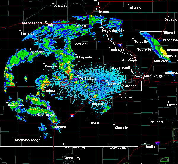 A severe thunderstorm warning remains in effect until 600 pm cdt for eastern ottawa county. at 528 pm cdt, a severe thunderstorm was located near niles, moving north at 25 mph. another severe thunderstorm was located near saline, moving northeast at 30 mph. hazard. 60 mph wind gusts and half dollar size hail. A severe thunderstorm warning remains in effect until 600 pm cdt for eastern ottawa county. at 528 pm cdt, a severe thunderstorm was located near niles, moving north at 25 mph. another severe thunderstorm was located near saline, moving northeast at 30 mph. hazard. 60 mph wind gusts and half dollar size hail.
|
| 5/21/2019 5:14 PM CDT |
 The national weather service in topeka has issued a * severe thunderstorm warning for. eastern ottawa county in north central kansas. until 600 pm cdt. At 514 pm cdt, a severe thunderstorm was located 6 miles west of new cambria, moving northeast at 25 mph. The national weather service in topeka has issued a * severe thunderstorm warning for. eastern ottawa county in north central kansas. until 600 pm cdt. At 514 pm cdt, a severe thunderstorm was located 6 miles west of new cambria, moving northeast at 25 mph.
|
| 5/21/2019 12:29 PM CDT |
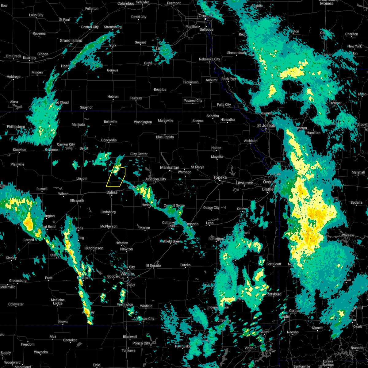 A severe thunderstorm warning remains in effect until 600 pm cdt for eastern ottawa county. at 528 pm cdt, a severe thunderstorm was located near niles, moving north at 25 mph. another severe thunderstorm was located near saline, moving northeast at 30 mph. hazard. 60 mph wind gusts and half dollar size hail. A severe thunderstorm warning remains in effect until 600 pm cdt for eastern ottawa county. at 528 pm cdt, a severe thunderstorm was located near niles, moving north at 25 mph. another severe thunderstorm was located near saline, moving northeast at 30 mph. hazard. 60 mph wind gusts and half dollar size hail.
|
| 5/6/2019 4:33 PM CDT |
 At 432 pm cdt, a severe thunderstorm was located near wells, moving east at 35 mph (radar indicated). Hazards include golf ball size hail and 60 mph wind gusts. People and animals outdoors will be injured. expect hail damage to roofs, siding, windows, and vehicles. expect wind damage to roofs, siding, and trees. this severe thunderstorm will be near, manchester and longford around 450 pm cdt. talmage around 500 pm cdt. moonlight around 510 pm cdt. This includes interstate 70 between mile markers 276 and 289. At 432 pm cdt, a severe thunderstorm was located near wells, moving east at 35 mph (radar indicated). Hazards include golf ball size hail and 60 mph wind gusts. People and animals outdoors will be injured. expect hail damage to roofs, siding, windows, and vehicles. expect wind damage to roofs, siding, and trees. this severe thunderstorm will be near, manchester and longford around 450 pm cdt. talmage around 500 pm cdt. moonlight around 510 pm cdt. This includes interstate 70 between mile markers 276 and 289.
|
| 3/28/2019 8:08 AM CDT |
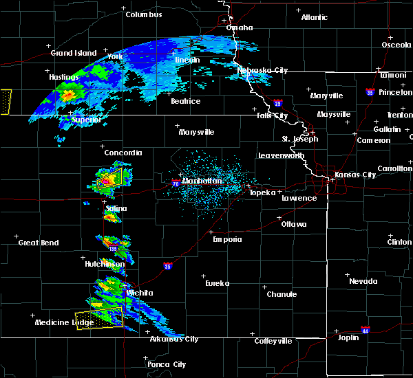 At 808 am cdt, a severe thunderstorm was located near wells, moving northeast at 25 mph (radar indicated). Hazards include golf ball size hail. People and animals outdoors will be injured. expect damage to roofs, siding, windows, and vehicles. This severe thunderstorm will remain over mainly rural areas of southeastern ottawa county. At 808 am cdt, a severe thunderstorm was located near wells, moving northeast at 25 mph (radar indicated). Hazards include golf ball size hail. People and animals outdoors will be injured. expect damage to roofs, siding, windows, and vehicles. This severe thunderstorm will remain over mainly rural areas of southeastern ottawa county.
|
| 3/28/2019 8:03 AM CDT |
 At 803 am cdt, a severe thunderstorm was located 4 miles southwest of wells, moving northeast at 25 mph (radar indicated). Hazards include ping pong ball size hail. People and animals outdoors will be injured. expect damage to roofs, siding, windows, and vehicles. This severe storm will be near, wells around 810 am cdt. At 803 am cdt, a severe thunderstorm was located 4 miles southwest of wells, moving northeast at 25 mph (radar indicated). Hazards include ping pong ball size hail. People and animals outdoors will be injured. expect damage to roofs, siding, windows, and vehicles. This severe storm will be near, wells around 810 am cdt.
|
| 3/28/2019 7:59 AM CDT |
 At 759 am cdt, a severe thunderstorm was located 4 miles northwest of bennington, moving northeast at 25 mph (radar indicated). Hazards include quarter size hail. Damage to vehicles is expected. This severe thunderstorm will be near, wells around 810 am cdt. At 759 am cdt, a severe thunderstorm was located 4 miles northwest of bennington, moving northeast at 25 mph (radar indicated). Hazards include quarter size hail. Damage to vehicles is expected. This severe thunderstorm will be near, wells around 810 am cdt.
|
| 9/2/2018 5:54 PM CDT |
 At 554 pm cdt, severe thunderstorms were located along a line extending from 3 miles northeast of culver to near bennington, and are nearly stationary (radar indicated). Hazards include 60 mph wind gusts and quarter size hail. Hail damage to vehicles is expected. expect wind damage to roofs, siding, and trees. Locations impacted include, minneapolis, bennington and wells. At 554 pm cdt, severe thunderstorms were located along a line extending from 3 miles northeast of culver to near bennington, and are nearly stationary (radar indicated). Hazards include 60 mph wind gusts and quarter size hail. Hail damage to vehicles is expected. expect wind damage to roofs, siding, and trees. Locations impacted include, minneapolis, bennington and wells.
|
| 9/2/2018 5:43 PM CDT |
 At 543 pm cdt, a severe thunderstorm was located over bennington, moving northeast at 5 mph (radar indicated). Hazards include 60 mph wind gusts and quarter size hail. Hail damage to vehicles is expected. Expect wind damage to roofs, siding, and trees. At 543 pm cdt, a severe thunderstorm was located over bennington, moving northeast at 5 mph (radar indicated). Hazards include 60 mph wind gusts and quarter size hail. Hail damage to vehicles is expected. Expect wind damage to roofs, siding, and trees.
|
| 9/2/2018 5:14 PM CDT | Estimated 60 to 70 mph wind gusts... very heavy rainfal in ottawa county KS, 4.3 miles ENE of Bennington, KS |
| 9/2/2018 5:10 PM CDT |
 At 510 pm cdt, a severe thunderstorm was located near bennington, moving northeast at 15 mph (radar indicated). Hazards include 60 mph wind gusts and nickel size hail. Expect damage to roofs, siding, and trees. Locations impacted include, minneapolis, bennington, culver, wells and niles. At 510 pm cdt, a severe thunderstorm was located near bennington, moving northeast at 15 mph (radar indicated). Hazards include 60 mph wind gusts and nickel size hail. Expect damage to roofs, siding, and trees. Locations impacted include, minneapolis, bennington, culver, wells and niles.
|
| 9/2/2018 5:04 PM CDT |
 At 504 pm cdt, a severe thunderstorm was located 4 miles northeast of culver, moving northeast at 10 mph (radar indicated). Hazards include 60 mph wind gusts and nickel size hail. Expect damage to roofs, siding, and trees. Locations impacted include, minneapolis, bennington, culver, wells and niles. At 504 pm cdt, a severe thunderstorm was located 4 miles northeast of culver, moving northeast at 10 mph (radar indicated). Hazards include 60 mph wind gusts and nickel size hail. Expect damage to roofs, siding, and trees. Locations impacted include, minneapolis, bennington, culver, wells and niles.
|
| 9/2/2018 4:53 PM CDT |
 At 453 pm cdt, a severe thunderstorm was located near culver, moving northeast at 15 mph (radar indicated). Hazards include 60 mph wind gusts and nickel size hail. Expect damage to roofs, siding, and trees. Locations impacted include, minneapolis, bennington, culver, wells and niles. At 453 pm cdt, a severe thunderstorm was located near culver, moving northeast at 15 mph (radar indicated). Hazards include 60 mph wind gusts and nickel size hail. Expect damage to roofs, siding, and trees. Locations impacted include, minneapolis, bennington, culver, wells and niles.
|
| 9/2/2018 4:44 PM CDT |
 At 444 pm cdt, a severe thunderstorm was located over culver, moving northeast at 15 mph (radar indicated). Hazards include 60 mph wind gusts and nickel size hail. expect damage to roofs, siding, and trees At 444 pm cdt, a severe thunderstorm was located over culver, moving northeast at 15 mph (radar indicated). Hazards include 60 mph wind gusts and nickel size hail. expect damage to roofs, siding, and trees
|
| 7/19/2018 1:54 PM CDT |
 At 154 pm cdt, severe thunderstorms were located along a line extending from 3 miles south of miltonvale to near oak hill to near solomon, moving east at 35 mph (radar indicated). Hazards include 60 mph wind gusts. Expect damage to roofs, siding, and trees. Locations impacted include, bennington, wells and niles. At 154 pm cdt, severe thunderstorms were located along a line extending from 3 miles south of miltonvale to near oak hill to near solomon, moving east at 35 mph (radar indicated). Hazards include 60 mph wind gusts. Expect damage to roofs, siding, and trees. Locations impacted include, bennington, wells and niles.
|
| 7/19/2018 1:49 PM CDT |
 At 148 pm cdt, severe thunderstorms were located along a line extending from near miltonvale to near oak hill to near solomon, moving east at 30 mph (radar indicated). Hazards include 60 mph wind gusts. Expect damage to roofs, siding, and trees. Locations impacted include, minneapolis, bennington, culver, wells and niles. At 148 pm cdt, severe thunderstorms were located along a line extending from near miltonvale to near oak hill to near solomon, moving east at 30 mph (radar indicated). Hazards include 60 mph wind gusts. Expect damage to roofs, siding, and trees. Locations impacted include, minneapolis, bennington, culver, wells and niles.
|
| 7/19/2018 1:30 PM CDT |
 At 130 pm cdt, severe thunderstorms were located along a line extending from 4 miles southwest of miltonvale to 6 miles west of oak hill to near niles, moving east at 35 mph (trained weather spotters. these storms have a history of producing damaging winds). Hazards include 70 mph wind gusts and quarter size hail. Hail damage to vehicles is expected. expect considerable tree damage. wind damage is also likely to mobile homes, roofs, and outbuildings. Locations impacted include, minneapolis, bennington, delphos, culver, wells and niles. At 130 pm cdt, severe thunderstorms were located along a line extending from 4 miles southwest of miltonvale to 6 miles west of oak hill to near niles, moving east at 35 mph (trained weather spotters. these storms have a history of producing damaging winds). Hazards include 70 mph wind gusts and quarter size hail. Hail damage to vehicles is expected. expect considerable tree damage. wind damage is also likely to mobile homes, roofs, and outbuildings. Locations impacted include, minneapolis, bennington, delphos, culver, wells and niles.
|
| 7/19/2018 1:22 PM CDT |
 At 121 pm cdt, severe thunderstorms were located along a line extending from 7 miles west of miltonvale to 8 miles north of wells to near niles, moving east at 35 mph (radar indicated). Hazards include 70 mph wind gusts and quarter size hail. Hail damage to vehicles is expected. expect considerable tree damage. wind damage is also likely to mobile homes, roofs, and outbuildings. Locations impacted include, minneapolis, bennington, delphos, culver, wells and niles. At 121 pm cdt, severe thunderstorms were located along a line extending from 7 miles west of miltonvale to 8 miles north of wells to near niles, moving east at 35 mph (radar indicated). Hazards include 70 mph wind gusts and quarter size hail. Hail damage to vehicles is expected. expect considerable tree damage. wind damage is also likely to mobile homes, roofs, and outbuildings. Locations impacted include, minneapolis, bennington, delphos, culver, wells and niles.
|
| 7/19/2018 1:14 PM CDT |
 At 113 pm cdt, severe thunderstorms were located along a line extending from 5 miles northeast of delphos to 9 miles northwest of wells to 4 miles south of bennington, moving east at 35 mph (radar indicated). Hazards include 70 mph wind gusts and quarter size hail. Hail damage to vehicles is expected. expect considerable tree damage. Wind damage is also likely to mobile homes, roofs, and outbuildings. At 113 pm cdt, severe thunderstorms were located along a line extending from 5 miles northeast of delphos to 9 miles northwest of wells to 4 miles south of bennington, moving east at 35 mph (radar indicated). Hazards include 70 mph wind gusts and quarter size hail. Hail damage to vehicles is expected. expect considerable tree damage. Wind damage is also likely to mobile homes, roofs, and outbuildings.
|
| 7/19/2018 12:49 PM CDT |
 At 1249 pm cdt, a severe thunderstorm was located over tescott, moving east at 30 mph (radar indicated). Hazards include 70 mph wind gusts and half dollar size hail. Hail damage to vehicles is expected. expect considerable tree damage. Wind damage is also likely to mobile homes, roofs, and outbuildings. At 1249 pm cdt, a severe thunderstorm was located over tescott, moving east at 30 mph (radar indicated). Hazards include 70 mph wind gusts and half dollar size hail. Hail damage to vehicles is expected. expect considerable tree damage. Wind damage is also likely to mobile homes, roofs, and outbuildings.
|
| 6/19/2018 10:18 PM CDT |
 At 1018 pm cdt, severe thunderstorms were located along a line extending from 6 miles east of longford to near talmage to 3 miles southwest of solomon, moving southeast at 30 mph (radar indicated). Hazards include 60 mph wind gusts. Expect damage to roofs, siding, and trees. locations impacted include, abilene, chapman, solomon, wakefield, enterprise, bennington, wells, manchester, longford, oak hill, niles, talmage and moonlight. This includes interstate 70 between mile markers 267 and 288. At 1018 pm cdt, severe thunderstorms were located along a line extending from 6 miles east of longford to near talmage to 3 miles southwest of solomon, moving southeast at 30 mph (radar indicated). Hazards include 60 mph wind gusts. Expect damage to roofs, siding, and trees. locations impacted include, abilene, chapman, solomon, wakefield, enterprise, bennington, wells, manchester, longford, oak hill, niles, talmage and moonlight. This includes interstate 70 between mile markers 267 and 288.
|
| 6/19/2018 9:55 PM CDT |
 At 955 pm cdt, severe thunderstorms were located along a line extending from 6 miles west of oak hill to near bennington, moving southeast at 30 mph (radar indicated). Hazards include 60 mph wind gusts. expect damage to roofs, siding, and trees At 955 pm cdt, severe thunderstorms were located along a line extending from 6 miles west of oak hill to near bennington, moving southeast at 30 mph (radar indicated). Hazards include 60 mph wind gusts. expect damage to roofs, siding, and trees
|
| 5/3/2018 7:55 PM CDT |
 At 755 pm cdt, a severe thunderstorm was located 4 miles south of bennington, moving east at 45 mph (trained weather spotters). Hazards include 60 mph wind gusts and half dollar size hail. Hail damage to vehicles is expected. expect wind damage to roofs, siding, and trees. this severe storm will be near, niles around 805 pm cdt. abilene, solomon, manchester and talmage around 815 pm cdt. This includes interstate 70 between mile markers 267 and 276. At 755 pm cdt, a severe thunderstorm was located 4 miles south of bennington, moving east at 45 mph (trained weather spotters). Hazards include 60 mph wind gusts and half dollar size hail. Hail damage to vehicles is expected. expect wind damage to roofs, siding, and trees. this severe storm will be near, niles around 805 pm cdt. abilene, solomon, manchester and talmage around 815 pm cdt. This includes interstate 70 between mile markers 267 and 276.
|
| 5/3/2018 7:42 PM CDT |
 At 742 pm cdt, a severe thunderstorm was located over culver, moving east at 55 mph (trained weather spotters). Hazards include 60 mph wind gusts and half dollar size hail. Hail damage to vehicles is expected. expect wind damage to roofs, siding, and trees. this severe thunderstorm will be near, bennington around 755 pm cdt. niles around 800 pm cdt. solomon around 805 pm cdt. manchester around 810 pm cdt. abilene and talmage around 815 pm cdt. This includes interstate 70 between mile markers 267 and 276. At 742 pm cdt, a severe thunderstorm was located over culver, moving east at 55 mph (trained weather spotters). Hazards include 60 mph wind gusts and half dollar size hail. Hail damage to vehicles is expected. expect wind damage to roofs, siding, and trees. this severe thunderstorm will be near, bennington around 755 pm cdt. niles around 800 pm cdt. solomon around 805 pm cdt. manchester around 810 pm cdt. abilene and talmage around 815 pm cdt. This includes interstate 70 between mile markers 267 and 276.
|
| 5/2/2018 4:44 PM CDT |
 At 444 pm cdt, a severe squall line capable of producing both tornadoes and extensive straight line wind damage was located along a line extending from 5 miles east of wells to 5 miles west of manchester to niles, moving northeast at 50 mph (radar indicated rotation). Hazards include tornado and half dollar size hail. Flying debris will be dangerous to those caught without shelter. mobile homes will be damaged or destroyed. damage to roofs, windows, and vehicles will occur. tree damage is likely. Locations impacted include, bennington, wells and niles. At 444 pm cdt, a severe squall line capable of producing both tornadoes and extensive straight line wind damage was located along a line extending from 5 miles east of wells to 5 miles west of manchester to niles, moving northeast at 50 mph (radar indicated rotation). Hazards include tornado and half dollar size hail. Flying debris will be dangerous to those caught without shelter. mobile homes will be damaged or destroyed. damage to roofs, windows, and vehicles will occur. tree damage is likely. Locations impacted include, bennington, wells and niles.
|
| 5/2/2018 4:32 PM CDT |
 At 432 pm cdt, a severe squall line capable of producing both tornadoes and extensive straight line wind damage was located along a line extending from 5 miles southwest of wells to 3 miles south of bennington, moving east at 45 mph (radar indicated rotation). Hazards include tornado and half dollar size hail. Flying debris will be dangerous to those caught without shelter. mobile homes will be damaged or destroyed. damage to roofs, windows, and vehicles will occur. tree damage is likely. Locations impacted include, bennington, culver, wells and niles. At 432 pm cdt, a severe squall line capable of producing both tornadoes and extensive straight line wind damage was located along a line extending from 5 miles southwest of wells to 3 miles south of bennington, moving east at 45 mph (radar indicated rotation). Hazards include tornado and half dollar size hail. Flying debris will be dangerous to those caught without shelter. mobile homes will be damaged or destroyed. damage to roofs, windows, and vehicles will occur. tree damage is likely. Locations impacted include, bennington, culver, wells and niles.
|
| 5/2/2018 4:21 PM CDT |
 At 421 pm cdt, severe thunderstorms capable of producing both tornadoes and extensive straight line wind damage were located along a line extending from 4 miles northeast of tescott to near culver, moving northeast at 45 mph (radar indicated rotation). Hazards include tornado and half dollar size hail. Flying debris will be dangerous to those caught without shelter. mobile homes will be damaged or destroyed. damage to roofs, windows, and vehicles will occur. tree damage is likely. these dangerous storms will be near, bennington around 440 pm cdt. Wells around 445 pm cdt. At 421 pm cdt, severe thunderstorms capable of producing both tornadoes and extensive straight line wind damage were located along a line extending from 4 miles northeast of tescott to near culver, moving northeast at 45 mph (radar indicated rotation). Hazards include tornado and half dollar size hail. Flying debris will be dangerous to those caught without shelter. mobile homes will be damaged or destroyed. damage to roofs, windows, and vehicles will occur. tree damage is likely. these dangerous storms will be near, bennington around 440 pm cdt. Wells around 445 pm cdt.
|
| 5/1/2018 8:08 PM CDT |
 At 807 pm cdt, a confirmed extremely dangerous tornado was located 4 miles south of minneapolis, moving northeast at 30 mph. an additional tornado may be forming 5 miles nw of bennington. this is a particularly dangerous situation. take cover now! (law enforcement confirmed tornado). Hazards include damaging tornado. You are in a life-threatening situation. flying debris may be deadly to those caught without shelter. mobile homes will be destroyed. considerable damage to homes, businesses, and vehicles is likely and complete destruction is possible. the tornado will be near, bennington around 815 pm cdt. Wells around 825 pm cdt. At 807 pm cdt, a confirmed extremely dangerous tornado was located 4 miles south of minneapolis, moving northeast at 30 mph. an additional tornado may be forming 5 miles nw of bennington. this is a particularly dangerous situation. take cover now! (law enforcement confirmed tornado). Hazards include damaging tornado. You are in a life-threatening situation. flying debris may be deadly to those caught without shelter. mobile homes will be destroyed. considerable damage to homes, businesses, and vehicles is likely and complete destruction is possible. the tornado will be near, bennington around 815 pm cdt. Wells around 825 pm cdt.
|
| 5/1/2018 7:54 PM CDT |
 At 753 pm cdt, a confirmed large and extremely dangerous tornado was located near tescott, moving northeast at 30 mph. this is a particularly dangerous situation. take cover now! (law enforcement confirmed tornado). Hazards include damaging tornado. You are in a life-threatening situation. flying debris may be deadly to those caught without shelter. mobile homes will be destroyed. considerable damage to homes, businesses, and vehicles is likely and complete destruction is possible. the tornado will be near, minneapolis around 810 pm cdt. bennington around 815 pm cdt. Wells around 825 pm cdt. At 753 pm cdt, a confirmed large and extremely dangerous tornado was located near tescott, moving northeast at 30 mph. this is a particularly dangerous situation. take cover now! (law enforcement confirmed tornado). Hazards include damaging tornado. You are in a life-threatening situation. flying debris may be deadly to those caught without shelter. mobile homes will be destroyed. considerable damage to homes, businesses, and vehicles is likely and complete destruction is possible. the tornado will be near, minneapolis around 810 pm cdt. bennington around 815 pm cdt. Wells around 825 pm cdt.
|
| 10/6/2017 9:27 PM CDT |
 The severe thunderstorm warning for southeastern ottawa county will expire at 930 pm cdt, the storm which prompted the warning has moved out of the area. therefore the warning will be allowed to expire. a severe thunderstorm watch remains in effect until 1100 pm cdt for central and north central kansas. remember, a tornado warning still remains in effect for northwest dickinson, east central ottawa and southwestern clay counties until 930 pm. The severe thunderstorm warning for southeastern ottawa county will expire at 930 pm cdt, the storm which prompted the warning has moved out of the area. therefore the warning will be allowed to expire. a severe thunderstorm watch remains in effect until 1100 pm cdt for central and north central kansas. remember, a tornado warning still remains in effect for northwest dickinson, east central ottawa and southwestern clay counties until 930 pm.
|
| 10/6/2017 9:10 PM CDT |
 At 910 pm cdt, a severe thunderstorm was located 4 miles east of bennington, moving east at 35 mph (radar indicated). Hazards include 60 mph wind gusts and nickel size hail. Expect damage to roofs, siding, and trees. Locations impacted include, bennington, wells and niles. At 910 pm cdt, a severe thunderstorm was located 4 miles east of bennington, moving east at 35 mph (radar indicated). Hazards include 60 mph wind gusts and nickel size hail. Expect damage to roofs, siding, and trees. Locations impacted include, bennington, wells and niles.
|
| 10/6/2017 8:56 PM CDT |
 At 856 pm cdt, a severe thunderstorm was located 4 miles northeast of culver, moving northeast at 35 mph (radar indicated). Hazards include 60 mph wind gusts and quarter size hail. Hail damage to vehicles is expected. Expect wind damage to roofs, siding, and trees. At 856 pm cdt, a severe thunderstorm was located 4 miles northeast of culver, moving northeast at 35 mph (radar indicated). Hazards include 60 mph wind gusts and quarter size hail. Hail damage to vehicles is expected. Expect wind damage to roofs, siding, and trees.
|
| 10/6/2017 7:44 PM CDT |
 At 744 pm cdt, severe thunderstorms were located along a line extending from 7 miles southwest of asherville to 3 miles northeast of lincoln, moving east at 45 mph (radar indicated). Hazards include 70 mph wind gusts and quarter size hail. Hail damage to vehicles is expected. expect considerable tree damage. Wind damage is also likely to mobile homes, roofs, and outbuildings. At 744 pm cdt, severe thunderstorms were located along a line extending from 7 miles southwest of asherville to 3 miles northeast of lincoln, moving east at 45 mph (radar indicated). Hazards include 70 mph wind gusts and quarter size hail. Hail damage to vehicles is expected. expect considerable tree damage. Wind damage is also likely to mobile homes, roofs, and outbuildings.
|
| 8/16/2017 6:41 AM CDT |
 The severe thunderstorm warning for northwestern dickinson, northwestern riley, ottawa, southern washington, clay and eastern cloud counties will expire at 645 am cdt, the storms which prompted the warning have weakened below severe limits, and no longer pose an immediate threat to life or property. therefore the warning will be allowed to expire. however gusty winds are still possible with these thunderstorms. The severe thunderstorm warning for northwestern dickinson, northwestern riley, ottawa, southern washington, clay and eastern cloud counties will expire at 645 am cdt, the storms which prompted the warning have weakened below severe limits, and no longer pose an immediate threat to life or property. therefore the warning will be allowed to expire. however gusty winds are still possible with these thunderstorms.
|
| 8/16/2017 6:14 AM CDT |
 At 613 am cdt, severe thunderstorms were located along a line extending from 5 miles south of fairbury to 5 miles northeast of morganville to near manchester, moving east at 35 mph (radar indicated). Hazards include 60 mph wind gusts and penny size hail. expect damage to roofs, siding, and trees At 613 am cdt, severe thunderstorms were located along a line extending from 5 miles south of fairbury to 5 miles northeast of morganville to near manchester, moving east at 35 mph (radar indicated). Hazards include 60 mph wind gusts and penny size hail. expect damage to roofs, siding, and trees
|
| 8/16/2017 5:45 AM CDT |
 At 544 am cdt, severe thunderstorms were located along a line extending from 4 miles north of hubbell to 5 miles northeast of aurora to 4 miles west of bennington, moving east at 35 mph (67 mph wind gusts measured at concordia airport at 538 pm). Hazards include 70 mph wind gusts and penny size hail. Expect considerable tree damage. Damage is likely to mobile homes, roofs, and outbuildings. At 544 am cdt, severe thunderstorms were located along a line extending from 4 miles north of hubbell to 5 miles northeast of aurora to 4 miles west of bennington, moving east at 35 mph (67 mph wind gusts measured at concordia airport at 538 pm). Hazards include 70 mph wind gusts and penny size hail. Expect considerable tree damage. Damage is likely to mobile homes, roofs, and outbuildings.
|
| 6/15/2017 5:25 PM CDT |
 At 524 pm cdt, a severe thunderstorm was located near talmage, moving east at 25 mph (trained weather spotters reported a 60 mph wind gust 4 miles northwest of solomon at 525 pm). Hazards include golf ball size hail and 60 mph wind gusts. People and animals outdoors will be injured. expect hail damage to roofs, siding, windows, and vehicles. expect wind damage to roofs, siding, and trees. locations impacted include, junction city, grandview plaza, chapman, wakefield, riley, bennington, milford, wells, manchester, longford, oak hill, niles, talmage, milford lake and moonlight. This includes interstate 70 between mile markers 282 and 300. At 524 pm cdt, a severe thunderstorm was located near talmage, moving east at 25 mph (trained weather spotters reported a 60 mph wind gust 4 miles northwest of solomon at 525 pm). Hazards include golf ball size hail and 60 mph wind gusts. People and animals outdoors will be injured. expect hail damage to roofs, siding, windows, and vehicles. expect wind damage to roofs, siding, and trees. locations impacted include, junction city, grandview plaza, chapman, wakefield, riley, bennington, milford, wells, manchester, longford, oak hill, niles, talmage, milford lake and moonlight. This includes interstate 70 between mile markers 282 and 300.
|
| 6/15/2017 4:59 PM CDT |
 At 458 pm cdt, a severe thunderstorm was located near niles, moving east at 25 mph (radar indicated). Hazards include golf ball size hail and 60 mph wind gusts. People and animals outdoors will be injured. expect hail damage to roofs, siding, windows, and vehicles. Expect wind damage to roofs, siding, and trees. At 458 pm cdt, a severe thunderstorm was located near niles, moving east at 25 mph (radar indicated). Hazards include golf ball size hail and 60 mph wind gusts. People and animals outdoors will be injured. expect hail damage to roofs, siding, windows, and vehicles. Expect wind damage to roofs, siding, and trees.
|
| 6/15/2017 4:28 PM CDT |
 At 427 pm cdt, a severe thunderstorm was located over culver, moving east at 40 mph (trained weather spotters reported quarter sized hail in culver at 425 pm). Hazards include golf ball size hail and 60 mph wind gusts. People and animals outdoors will be injured. expect hail damage to roofs, siding, windows, and vehicles. expect wind damage to roofs, siding, and trees. Locations impacted include, minneapolis, bennington, delphos, tescott, culver, wells, niles and ada. At 427 pm cdt, a severe thunderstorm was located over culver, moving east at 40 mph (trained weather spotters reported quarter sized hail in culver at 425 pm). Hazards include golf ball size hail and 60 mph wind gusts. People and animals outdoors will be injured. expect hail damage to roofs, siding, windows, and vehicles. expect wind damage to roofs, siding, and trees. Locations impacted include, minneapolis, bennington, delphos, tescott, culver, wells, niles and ada.
|
| 6/15/2017 4:21 PM CDT |
 At 420 pm cdt, a severe thunderstorm was located 4 miles south of tescott, moving east at 40 mph (radar indicated). Hazards include golf ball size hail and 60 mph wind gusts. People and animals outdoors will be injured. expect hail damage to roofs, siding, windows, and vehicles. Expect wind damage to roofs, siding, and trees. At 420 pm cdt, a severe thunderstorm was located 4 miles south of tescott, moving east at 40 mph (radar indicated). Hazards include golf ball size hail and 60 mph wind gusts. People and animals outdoors will be injured. expect hail damage to roofs, siding, windows, and vehicles. Expect wind damage to roofs, siding, and trees.
|
| 5/25/2017 11:13 PM CDT |
 The severe thunderstorm warning for ottawa and southeastern cloud counties will expire at 1115 pm cdt. the storm which prompted the warning has weakened below severe limits, and no longer poses an immediate threat to life or property. therefore the warning will be allowed to expire. However small hail and gusty winds are still possible with this thunderstorm. The severe thunderstorm warning for ottawa and southeastern cloud counties will expire at 1115 pm cdt. the storm which prompted the warning has weakened below severe limits, and no longer poses an immediate threat to life or property. therefore the warning will be allowed to expire. However small hail and gusty winds are still possible with this thunderstorm.
|
| 5/25/2017 11:05 PM CDT |
 At 1105 pm cdt, a severe thunderstorm was located 4 miles southeast of delphos, moving northeast at 35 mph (radar indicated). Hazards include 60 mph wind gusts and quarter size hail. Hail damage to vehicles is expected. expect wind damage to roofs, siding, and trees. Locations impacted include, minneapolis, bennington, miltonvale, delphos and wells. At 1105 pm cdt, a severe thunderstorm was located 4 miles southeast of delphos, moving northeast at 35 mph (radar indicated). Hazards include 60 mph wind gusts and quarter size hail. Hail damage to vehicles is expected. expect wind damage to roofs, siding, and trees. Locations impacted include, minneapolis, bennington, miltonvale, delphos and wells.
|
| 5/25/2017 10:49 PM CDT |
 At 1047 pm cdt, severe thunderstorms were located along a line extending from 4 miles north of ada to 7 miles south of tescott, moving east at 45 mph (radar indicated). Hazards include 60 mph wind gusts and half dollar size hail. Hail damage to vehicles is expected. expect wind damage to roofs, siding, and trees. locations impacted include, minneapolis, bennington, miltonvale, delphos, tescott, culver, wells, niles and ada. this storm has a history of producing damaging winds and hail. Damaging wind is possible along this entire line of storms while the best chance for large hail will be in northern ottawa county. At 1047 pm cdt, severe thunderstorms were located along a line extending from 4 miles north of ada to 7 miles south of tescott, moving east at 45 mph (radar indicated). Hazards include 60 mph wind gusts and half dollar size hail. Hail damage to vehicles is expected. expect wind damage to roofs, siding, and trees. locations impacted include, minneapolis, bennington, miltonvale, delphos, tescott, culver, wells, niles and ada. this storm has a history of producing damaging winds and hail. Damaging wind is possible along this entire line of storms while the best chance for large hail will be in northern ottawa county.
|
| 5/25/2017 10:29 PM CDT |
 At 1029 pm cdt, severe thunderstorms were located along a line extending from near barnard to 10 miles northeast of kanopolis, moving east at 45 mph (radar indicated. these storms have a history of producing damaging winds and large hail). Hazards include 60 mph wind gusts and half dollar size hail. Hail damage to vehicles is expected. Expect wind damage to roofs, siding, and trees. At 1029 pm cdt, severe thunderstorms were located along a line extending from near barnard to 10 miles northeast of kanopolis, moving east at 45 mph (radar indicated. these storms have a history of producing damaging winds and large hail). Hazards include 60 mph wind gusts and half dollar size hail. Hail damage to vehicles is expected. Expect wind damage to roofs, siding, and trees.
|
| 5/18/2017 6:44 PM CDT |
 At 644 pm cdt, a severe thunderstorm capable of producing a tornado was located near niles, moving northeast at 35 mph (radar indicated rotation). Hazards include tornado and quarter size hail. Flying debris will be dangerous to those caught without shelter. mobile homes will be damaged or destroyed. damage to roofs, windows, and vehicles will occur. tree damage is likely. locations impacted include, bennington and niles. Time, mot, loc 2344z 237deg 113kt 3902 9743. At 644 pm cdt, a severe thunderstorm capable of producing a tornado was located near niles, moving northeast at 35 mph (radar indicated rotation). Hazards include tornado and quarter size hail. Flying debris will be dangerous to those caught without shelter. mobile homes will be damaged or destroyed. damage to roofs, windows, and vehicles will occur. tree damage is likely. locations impacted include, bennington and niles. Time, mot, loc 2344z 237deg 113kt 3902 9743.
|
| 5/18/2017 6:33 PM CDT |
 At 633 pm cdt, a confirmed tornado was located near new cambria, moving northeast at 35 mph (emergency management confirmed tornado). Hazards include damaging tornado and golf ball size hail. Flying debris will be dangerous to those caught without shelter. mobile homes will be damaged or destroyed. damage to roofs, windows, and vehicles will occur. tree damage is likely. locations impacted include, abilene, solomon, bennington, manchester, niles and talmage. This includes interstate 70 between mile markers 267 and 276. At 633 pm cdt, a confirmed tornado was located near new cambria, moving northeast at 35 mph (emergency management confirmed tornado). Hazards include damaging tornado and golf ball size hail. Flying debris will be dangerous to those caught without shelter. mobile homes will be damaged or destroyed. damage to roofs, windows, and vehicles will occur. tree damage is likely. locations impacted include, abilene, solomon, bennington, manchester, niles and talmage. This includes interstate 70 between mile markers 267 and 276.
|
| 5/18/2017 6:27 PM CDT |
 At 626 pm cdt, a severe thunderstorm capable of producing a tornado was located near salina, moving northeast at 35 mph (radar indicated rotation). Hazards include tornado and golf ball size hail. Flying debris will be dangerous to those caught without shelter. mobile homes will be damaged or destroyed. damage to roofs, windows, and vehicles will occur. Tree damage is likely. At 626 pm cdt, a severe thunderstorm capable of producing a tornado was located near salina, moving northeast at 35 mph (radar indicated rotation). Hazards include tornado and golf ball size hail. Flying debris will be dangerous to those caught without shelter. mobile homes will be damaged or destroyed. damage to roofs, windows, and vehicles will occur. Tree damage is likely.
|
| 4/19/2017 7:15 PM CDT |
 At 715 pm cdt, severe thunderstorms were located along a line extending from 5 miles west of manchester to 4 miles south of bennington, moving east at 40 mph (radar indicated). Hazards include 70 mph wind gusts and quarter size hail. Hail damage to vehicles is expected. expect considerable tree damage. wind damage is also likely to mobile homes, roofs, and outbuildings. these severe storms will be near, manchester around 725 pm cdt. solomon and talmage around 730 pm cdt. This includes interstate 70 between mile markers 267 and 274. At 715 pm cdt, severe thunderstorms were located along a line extending from 5 miles west of manchester to 4 miles south of bennington, moving east at 40 mph (radar indicated). Hazards include 70 mph wind gusts and quarter size hail. Hail damage to vehicles is expected. expect considerable tree damage. wind damage is also likely to mobile homes, roofs, and outbuildings. these severe storms will be near, manchester around 725 pm cdt. solomon and talmage around 730 pm cdt. This includes interstate 70 between mile markers 267 and 274.
|
| 4/19/2017 6:51 PM CDT |
 At 651 pm cdt, severe thunderstorms were located along a line extending from minneapolis to near tescott, moving east at 40 mph (radar indicated). Hazards include golf ball size hail and 70 mph wind gusts. People and animals outdoors will be injured. expect hail damage to roofs, siding, windows, and vehicles. expect considerable tree damage. wind damage is also likely to mobile homes, roofs, and outbuildings. severe thunderstorms will be near, minneapolis around 655 pm cdt. wells around 705 pm cdt. bennington around 715 pm cdt. manchester and niles around 725 pm cdt. solomon and talmage around 730 pm cdt. This includes interstate 70 between mile markers 267 and 274. At 651 pm cdt, severe thunderstorms were located along a line extending from minneapolis to near tescott, moving east at 40 mph (radar indicated). Hazards include golf ball size hail and 70 mph wind gusts. People and animals outdoors will be injured. expect hail damage to roofs, siding, windows, and vehicles. expect considerable tree damage. wind damage is also likely to mobile homes, roofs, and outbuildings. severe thunderstorms will be near, minneapolis around 655 pm cdt. wells around 705 pm cdt. bennington around 715 pm cdt. manchester and niles around 725 pm cdt. solomon and talmage around 730 pm cdt. This includes interstate 70 between mile markers 267 and 274.
|
| 4/19/2017 6:27 PM CDT |
 At 627 pm cdt, a severe thunderstorm was located near beverly, moving east at 50 mph (radar indicated). Hazards include two inch hail and 60 mph wind gusts. People and animals outdoors will be injured. expect hail damage to roofs, siding, windows, and vehicles. expect wind damage to roofs, siding, and trees. Locations impacted include, minneapolis, bennington, tescott, culver and ada. At 627 pm cdt, a severe thunderstorm was located near beverly, moving east at 50 mph (radar indicated). Hazards include two inch hail and 60 mph wind gusts. People and animals outdoors will be injured. expect hail damage to roofs, siding, windows, and vehicles. expect wind damage to roofs, siding, and trees. Locations impacted include, minneapolis, bennington, tescott, culver and ada.
|
| 4/19/2017 6:21 PM CDT |
 At 620 pm cdt, a severe thunderstorm was located 4 miles east of lincoln, moving east at 35 mph (trained weather spotters reported quarter sized hail in lincoln at 617 pm). Hazards include ping pong ball size hail and 60 mph wind gusts. People and animals outdoors will be injured. expect hail damage to roofs, siding, windows, and vehicles. Expect wind damage to roofs, siding, and trees. At 620 pm cdt, a severe thunderstorm was located 4 miles east of lincoln, moving east at 35 mph (trained weather spotters reported quarter sized hail in lincoln at 617 pm). Hazards include ping pong ball size hail and 60 mph wind gusts. People and animals outdoors will be injured. expect hail damage to roofs, siding, windows, and vehicles. Expect wind damage to roofs, siding, and trees.
|
| 10/4/2016 6:02 PM CDT |
 At 558 pm cdt, a severe thunderstorm was located near longford, moving northeast at 35 mph. a second severe storm located 4 miles south of bennington has moved into the warned area (radar indicated). Hazards include 60 mph wind gusts and half dollar size hail. Hail damage to vehicles is expected. expect wind damage to roofs, siding, and trees. locations impacted include, minneapolis, bennington, wells, manchester, longford, oak hill and niles. A tornado watch remains in effect until 900 pm cdt for north central and central kansas. At 558 pm cdt, a severe thunderstorm was located near longford, moving northeast at 35 mph. a second severe storm located 4 miles south of bennington has moved into the warned area (radar indicated). Hazards include 60 mph wind gusts and half dollar size hail. Hail damage to vehicles is expected. expect wind damage to roofs, siding, and trees. locations impacted include, minneapolis, bennington, wells, manchester, longford, oak hill and niles. A tornado watch remains in effect until 900 pm cdt for north central and central kansas.
|
| 10/4/2016 5:41 PM CDT |
 At 541 pm cdt, a severe thunderstorm was located near wells, moving northeast at 35 mph (radar indicated). Hazards include 60 mph wind gusts and half dollar size hail. Hail damage to vehicles is expected. Expect wind damage to roofs, siding, and trees. At 541 pm cdt, a severe thunderstorm was located near wells, moving northeast at 35 mph (radar indicated). Hazards include 60 mph wind gusts and half dollar size hail. Hail damage to vehicles is expected. Expect wind damage to roofs, siding, and trees.
|
| 10/4/2016 5:26 PM CDT |
 At 526 pm cdt, a severe thunderstorm was located 5 miles northeast of culver, moving east at 20 mph (radar indicated). Hazards include two inch hail and 60 mph wind gusts. People and animals outdoors will be injured. expect hail damage to roofs, siding, windows, and vehicles. expect wind damage to roofs, siding, and trees. locations impacted include, minneapolis, bennington, tescott, culver and wells. A tornado watch remains in effect until 900 pm cdt for north central kansas. At 526 pm cdt, a severe thunderstorm was located 5 miles northeast of culver, moving east at 20 mph (radar indicated). Hazards include two inch hail and 60 mph wind gusts. People and animals outdoors will be injured. expect hail damage to roofs, siding, windows, and vehicles. expect wind damage to roofs, siding, and trees. locations impacted include, minneapolis, bennington, tescott, culver and wells. A tornado watch remains in effect until 900 pm cdt for north central kansas.
|
| 10/4/2016 4:54 PM CDT |
 At 454 pm cdt, a severe thunderstorm was located 4 miles north of tescott, moving northeast at 30 mph (radar indicated). Hazards include two inch hail and 60 mph wind gusts. People and animals outdoors will be injured. expect hail damage to roofs, siding, windows, and vehicles. Expect wind damage to roofs, siding, and trees. At 454 pm cdt, a severe thunderstorm was located 4 miles north of tescott, moving northeast at 30 mph (radar indicated). Hazards include two inch hail and 60 mph wind gusts. People and animals outdoors will be injured. expect hail damage to roofs, siding, windows, and vehicles. Expect wind damage to roofs, siding, and trees.
|
| 7/28/2016 6:56 PM CDT |
 The severe thunderstorm warning for clay, cloud, ottawa and northwestern dickinson counties will expire at 700 pm cdt, the storms which prompted the warning have weakened below severe limits, and no longer pose an immediate threat to life or property. therefore the warning will be allowed to expire. however gusty winds and heavy rain are still possible with these thunderstorms. a severe thunderstorm watch remains in effect until 1100 pm cdt for north central and central kansas. The severe thunderstorm warning for clay, cloud, ottawa and northwestern dickinson counties will expire at 700 pm cdt, the storms which prompted the warning have weakened below severe limits, and no longer pose an immediate threat to life or property. therefore the warning will be allowed to expire. however gusty winds and heavy rain are still possible with these thunderstorms. a severe thunderstorm watch remains in effect until 1100 pm cdt for north central and central kansas.
|
| 7/28/2016 6:44 PM CDT |
 At 642 pm cdt, severe thunderstorms were located along a line extending from vining to near oak hill to 5 miles north of niles, moving east at 45 mph (radar indicated). Hazards include 60 mph wind gusts and penny size hail. Expect damage to roofs. siding. and trees. Locations impacted include, concordia, clay center, minneapolis, wakefield, bennington, clifton, miltonvale, glasco, delphos, jamestown, morganville, green, wells, manchester, longford, aurora, vining, oak hill, ada and moonlight. At 642 pm cdt, severe thunderstorms were located along a line extending from vining to near oak hill to 5 miles north of niles, moving east at 45 mph (radar indicated). Hazards include 60 mph wind gusts and penny size hail. Expect damage to roofs. siding. and trees. Locations impacted include, concordia, clay center, minneapolis, wakefield, bennington, clifton, miltonvale, glasco, delphos, jamestown, morganville, green, wells, manchester, longford, aurora, vining, oak hill, ada and moonlight.
|
| 7/28/2016 6:33 PM CDT |
 At 632 pm cdt, severe thunderstorms were located along a line extending from clyde to oak hill to near niles, moving east at 55 mph (radar indicated). Hazards include 70 mph wind gusts and penny size hail. Expect considerable tree damage. damage is likely to mobile homes, roofs, and outbuildings. Locations impacted include, concordia, clay center, minneapolis, wakefield, bennington, clifton, miltonvale, glasco, delphos, jamestown, morganville, green, wells, manchester, longford, aurora, vining, oak hill, ada and moonlight. At 632 pm cdt, severe thunderstorms were located along a line extending from clyde to oak hill to near niles, moving east at 55 mph (radar indicated). Hazards include 70 mph wind gusts and penny size hail. Expect considerable tree damage. damage is likely to mobile homes, roofs, and outbuildings. Locations impacted include, concordia, clay center, minneapolis, wakefield, bennington, clifton, miltonvale, glasco, delphos, jamestown, morganville, green, wells, manchester, longford, aurora, vining, oak hill, ada and moonlight.
|
| 7/28/2016 6:19 PM CDT |
 At 617 pm cdt, severe thunderstorms were located along a line extending from near concordia to 7 miles southwest of aurora to near minneapolis, moving east at 60 mph (trained weather spotters. at 612 pm cdt a spotter estimated a 70 mph wind gust 4 miles northeast of delphos). Hazards include 70 mph wind gusts and penny size hail. Expect considerable tree damage. damage is likely to mobile homes, roofs, and outbuildings. Locations impacted include, concordia, clay center, minneapolis, wakefield, bennington, clifton, miltonvale, glasco, delphos, jamestown, morganville, green, wells, manchester, longford, aurora, vining, oak hill, ada and moonlight. At 617 pm cdt, severe thunderstorms were located along a line extending from near concordia to 7 miles southwest of aurora to near minneapolis, moving east at 60 mph (trained weather spotters. at 612 pm cdt a spotter estimated a 70 mph wind gust 4 miles northeast of delphos). Hazards include 70 mph wind gusts and penny size hail. Expect considerable tree damage. damage is likely to mobile homes, roofs, and outbuildings. Locations impacted include, concordia, clay center, minneapolis, wakefield, bennington, clifton, miltonvale, glasco, delphos, jamestown, morganville, green, wells, manchester, longford, aurora, vining, oak hill, ada and moonlight.
|
| 7/28/2016 6:12 PM CDT |
 At 610 pm cdt, severe thunderstorms were located along a line extending from norway to 6 miles east of glasco to near ada, moving east at 60 mph (trained weather spotter reported 70 mph wind gust 6 miles north of glasco). Hazards include 70 mph wind gusts and penny size hail. Expect considerable tree damage. Damage is likely to mobile homes, roofs, and outbuildings. At 610 pm cdt, severe thunderstorms were located along a line extending from norway to 6 miles east of glasco to near ada, moving east at 60 mph (trained weather spotter reported 70 mph wind gust 6 miles north of glasco). Hazards include 70 mph wind gusts and penny size hail. Expect considerable tree damage. Damage is likely to mobile homes, roofs, and outbuildings.
|
| 7/13/2016 8:04 AM CDT |
 At 803 am cdt, severe thunderstorms were located along a line extending from near clay center to near wakefield to tampa, moving east at 50 mph (trained weather spotters estimated 60 mph wind gusts 1 mile south of longford). Hazards include 60 mph wind gusts. Expect damage to roofs. siding. and trees. locations impacted include, abilene, herington, chapman, wakefield, enterprise, bennington, hope, woodbine, wells, manchester, longford, carlton, oak hill, moonlight, niles and talmage. This includes interstate 70 between mile markers 268 and 289. At 803 am cdt, severe thunderstorms were located along a line extending from near clay center to near wakefield to tampa, moving east at 50 mph (trained weather spotters estimated 60 mph wind gusts 1 mile south of longford). Hazards include 60 mph wind gusts. Expect damage to roofs. siding. and trees. locations impacted include, abilene, herington, chapman, wakefield, enterprise, bennington, hope, woodbine, wells, manchester, longford, carlton, oak hill, moonlight, niles and talmage. This includes interstate 70 between mile markers 268 and 289.
|
| 7/13/2016 7:51 AM CDT |
 At 750 am cdt, severe thunderstorms were located along a line extending from near miltonvale to near solomon to 10 miles north of canton, moving east at 45 mph (radar indicated). Hazards include ping pong ball size hail and 60 mph wind gusts. People and animals outdoors will be injured. expect hail damage to roofs, siding, windows, and vehicles. expect wind damage to roofs, siding, and trees. locations impacted include, abilene, herington, chapman, wakefield, enterprise, bennington, hope, woodbine, wells, manchester, longford, carlton, oak hill, moonlight, niles and talmage. This includes interstate 70 between mile markers 268 and 289. At 750 am cdt, severe thunderstorms were located along a line extending from near miltonvale to near solomon to 10 miles north of canton, moving east at 45 mph (radar indicated). Hazards include ping pong ball size hail and 60 mph wind gusts. People and animals outdoors will be injured. expect hail damage to roofs, siding, windows, and vehicles. expect wind damage to roofs, siding, and trees. locations impacted include, abilene, herington, chapman, wakefield, enterprise, bennington, hope, woodbine, wells, manchester, longford, carlton, oak hill, moonlight, niles and talmage. This includes interstate 70 between mile markers 268 and 289.
|
| 7/13/2016 7:42 AM CDT |
 At 741 am cdt, severe thunderstorms were located along a line extending from 5 miles southwest of miltonvale to niles to 8 miles southeast of lindsborg, moving east at 50 mph (radar indicated). Hazards include 60 mph wind gusts and penny size hail. Expect damage to roofs. siding. And trees. At 741 am cdt, severe thunderstorms were located along a line extending from 5 miles southwest of miltonvale to niles to 8 miles southeast of lindsborg, moving east at 50 mph (radar indicated). Hazards include 60 mph wind gusts and penny size hail. Expect damage to roofs. siding. And trees.
|
| 7/13/2016 7:32 AM CDT | At 732 am cdt, severe thunderstorms were located along a line extending from 6 miles north of concordia to near niles to 6 miles southeast of lindsborg, moving east at 50 mph (radar indicated). Hazards include 60 mph wind gusts and penny size hail. Expect damage to roofs. siding. and trees. Locations impacted include, concordia, minneapolis, clyde, bennington, miltonvale, glasco, delphos, tescott, jamestown, culver, wells, aurora, ada and niles. |
| 7/13/2016 7:13 AM CDT |
 At 712 am cdt, severe thunderstorms were located along a line extending from near jamestown to 7 miles south of beverly to 7 miles east of geneseo, moving east at 45 mph (radar indicated). Hazards include 60 mph wind gusts and penny size hail. Expect damage to roofs. siding. and trees. Locations impacted include, concordia, minneapolis, clyde, bennington, miltonvale, glasco, delphos, tescott, jamestown, culver, wells, aurora, ada and niles. At 712 am cdt, severe thunderstorms were located along a line extending from near jamestown to 7 miles south of beverly to 7 miles east of geneseo, moving east at 45 mph (radar indicated). Hazards include 60 mph wind gusts and penny size hail. Expect damage to roofs. siding. and trees. Locations impacted include, concordia, minneapolis, clyde, bennington, miltonvale, glasco, delphos, tescott, jamestown, culver, wells, aurora, ada and niles.
|
| 7/13/2016 7:01 AM CDT |
 At 659 am cdt, severe thunderstorms were located along a line extending from 6 miles south of jewell to 10 miles north of ellsworth to near chase, moving east at 40 mph (radar indicated). Hazards include 60 mph wind gusts and penny size hail. Expect damage to roofs. siding. And trees. At 659 am cdt, severe thunderstorms were located along a line extending from 6 miles south of jewell to 10 miles north of ellsworth to near chase, moving east at 40 mph (radar indicated). Hazards include 60 mph wind gusts and penny size hail. Expect damage to roofs. siding. And trees.
|
| 6/28/2016 3:55 AM CDT |
 At 355 am cdt, a severe thunderstorm was located over wells, moving southeast at 40 mph (radar indicated). Hazards include 60 mph wind gusts. Expect damage to roofs. siding. and trees. Locations impacted include, minneapolis, bennington, wells and niles. At 355 am cdt, a severe thunderstorm was located over wells, moving southeast at 40 mph (radar indicated). Hazards include 60 mph wind gusts. Expect damage to roofs. siding. and trees. Locations impacted include, minneapolis, bennington, wells and niles.
|
| 6/28/2016 3:35 AM CDT |
 At 335 am cdt, a severe thunderstorm was located 6 miles northeast of delphos, moving south at 40 mph (radar indicated). Hazards include 60 mph wind gusts. Expect damage to roofs. siding. And trees. At 335 am cdt, a severe thunderstorm was located 6 miles northeast of delphos, moving south at 40 mph (radar indicated). Hazards include 60 mph wind gusts. Expect damage to roofs. siding. And trees.
|
| 5/26/2016 9:37 PM CDT |
 At 936 pm cdt, a severe thunderstorm was located near niles, moving east at 40 mph (radar indicated. spotters reported 50 to 55mph winds 4 miles east northeast of culver at 921pm). Hazards include 60 mph wind gusts. Expect damage to roofs. siding. and trees. locations impacted include, abilene, minneapolis, solomon, bennington, miltonvale, delphos, tescott, culver, wells, manchester, longford, oak hill, ada, niles, talmage and idana. this includes interstate 70 between mile markers 267 and 276. A tornado watch remains in effect until 1000 pm cdt for north central kansas. At 936 pm cdt, a severe thunderstorm was located near niles, moving east at 40 mph (radar indicated. spotters reported 50 to 55mph winds 4 miles east northeast of culver at 921pm). Hazards include 60 mph wind gusts. Expect damage to roofs. siding. and trees. locations impacted include, abilene, minneapolis, solomon, bennington, miltonvale, delphos, tescott, culver, wells, manchester, longford, oak hill, ada, niles, talmage and idana. this includes interstate 70 between mile markers 267 and 276. A tornado watch remains in effect until 1000 pm cdt for north central kansas.
|
| 5/26/2016 9:08 PM CDT |
 At 908 pm cdt, a severe thunderstorm was located near minneapolis, moving east at 40 mph (radar indicated). Hazards include 60 mph wind gusts. Expect damage to roofs. siding. And trees. At 908 pm cdt, a severe thunderstorm was located near minneapolis, moving east at 40 mph (radar indicated). Hazards include 60 mph wind gusts. Expect damage to roofs. siding. And trees.
|
| 5/25/2016 7:40 PM CDT |
 At 739 pm cdt, a severe thunderstorm was located near bennington, moving northeast at 30 mph (radar indicated). Hazards include tennis ball size hail and 60 mph wind gusts. People and animals outdoors will be injured. expect hail damage to roofs, siding, windows, and vehicles. Expect wind damage to roofs, siding, and trees. At 739 pm cdt, a severe thunderstorm was located near bennington, moving northeast at 30 mph (radar indicated). Hazards include tennis ball size hail and 60 mph wind gusts. People and animals outdoors will be injured. expect hail damage to roofs, siding, windows, and vehicles. Expect wind damage to roofs, siding, and trees.
|
| 5/25/2016 6:45 PM CDT |
 At 643 pm cdt, a severe thunderstorm capable of producing a tornado was located over bennington, moving east at 15 mph (radar indicated rotation). Hazards include tornado and tennis ball size hail. Flying debris will be dangerous to those caught without shelter. mobile homes will be damaged or destroyed. damage to roofs, windows, and vehicles will occur. tree damage is likely. This storm will remain over mainly rural areas of southeastern ottawa county between bennington and niles through 7 pm. At 643 pm cdt, a severe thunderstorm capable of producing a tornado was located over bennington, moving east at 15 mph (radar indicated rotation). Hazards include tornado and tennis ball size hail. Flying debris will be dangerous to those caught without shelter. mobile homes will be damaged or destroyed. damage to roofs, windows, and vehicles will occur. tree damage is likely. This storm will remain over mainly rural areas of southeastern ottawa county between bennington and niles through 7 pm.
|
| 5/25/2016 6:43 PM CDT | Golf Ball sized hail reported 0.3 miles NNW of Bennington, KS |
| 5/25/2016 6:29 PM CDT |
 At 628 pm cdt, a severe thunderstorm capable of producing a tornado was located just west of bennington, moving east at 15 mph (radar indicated rotation). Hazards include tornado and hail up to two inches in diameter. Flying debris will be dangerous to those caught without shelter. mobile homes will be damaged or destroyed. damage to roofs, windows, and vehicles will occur. tree damage is likely. This dangerous storm will be near, bennington around 645 pm cdt. At 628 pm cdt, a severe thunderstorm capable of producing a tornado was located just west of bennington, moving east at 15 mph (radar indicated rotation). Hazards include tornado and hail up to two inches in diameter. Flying debris will be dangerous to those caught without shelter. mobile homes will be damaged or destroyed. damage to roofs, windows, and vehicles will occur. tree damage is likely. This dangerous storm will be near, bennington around 645 pm cdt.
|
| 5/25/2016 6:05 PM CDT |
 At 605 pm cdt, a severe thunderstorm capable of producing a tornado was located near minneapolis, moving east at 20 mph (weather spotters reported a funnel cloud southwest of minneapolis at 605 pm). Hazards include tornado and hail up to two inches in diameter. Flying debris will be dangerous to those caught without shelter. mobile homes will be damaged or destroyed. damage to roofs, windows, and vehicles will occur. tree damage is likely. this dangerous storm will be near, minneapolis around 610 pm cdt. Bennington and wells around 630 pm cdt. At 605 pm cdt, a severe thunderstorm capable of producing a tornado was located near minneapolis, moving east at 20 mph (weather spotters reported a funnel cloud southwest of minneapolis at 605 pm). Hazards include tornado and hail up to two inches in diameter. Flying debris will be dangerous to those caught without shelter. mobile homes will be damaged or destroyed. damage to roofs, windows, and vehicles will occur. tree damage is likely. this dangerous storm will be near, minneapolis around 610 pm cdt. Bennington and wells around 630 pm cdt.
|
| 5/24/2016 10:27 PM CDT | The national weather service in topeka has issued a * severe thunderstorm warning for. clay county in north central kansas. southwestern washington county in north central kansas. southeastern republic county in north central kansas. Cloud county in north central kansas. |
| 4/24/2016 6:28 PM CDT | Quarter sized hail reported 0.4 miles SSW of Bennington, KS |
| 4/24/2016 6:10 PM CDT |
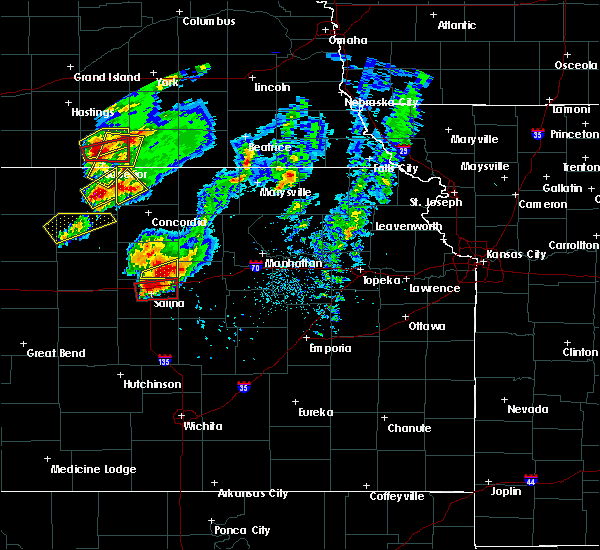 At 609 pm cdt, a severe thunderstorm was located near niles, moving northeast at 30 mph (radar indicated). Hazards include two inch hail and 60 mph wind gusts. People and animals outdoors will be injured. expect hail damage to roofs, siding, windows, and vehicles. expect wind damage to roofs, siding, and trees. locations impacted include, bennington and niles. A tornado watch remains in effect until 1100 pm cdt for north central kansas. At 609 pm cdt, a severe thunderstorm was located near niles, moving northeast at 30 mph (radar indicated). Hazards include two inch hail and 60 mph wind gusts. People and animals outdoors will be injured. expect hail damage to roofs, siding, windows, and vehicles. expect wind damage to roofs, siding, and trees. locations impacted include, bennington and niles. A tornado watch remains in effect until 1100 pm cdt for north central kansas.
|
| 4/24/2016 5:59 PM CDT |
 At 558 pm cdt, a severe thunderstorm was located near culver, moving northeast at 25 mph (trained weather spotters reported golf ball size hail at 553 pm cdt). Hazards include golf ball size hail. People and animals outdoors will be injured. expect damage to roofs, siding, windows, and vehicles. locations impacted include, bennington, culver and niles. A tornado watch remains in effect until 1100 pm cdt for north central kansas. At 558 pm cdt, a severe thunderstorm was located near culver, moving northeast at 25 mph (trained weather spotters reported golf ball size hail at 553 pm cdt). Hazards include golf ball size hail. People and animals outdoors will be injured. expect damage to roofs, siding, windows, and vehicles. locations impacted include, bennington, culver and niles. A tornado watch remains in effect until 1100 pm cdt for north central kansas.
|
| 4/24/2016 5:43 PM CDT |
 At 540 pm cdt, a severe thunderstorm was located near culver, moving east-northeast at 25 mph (radar indicated). Hazards include golf ball size hail and 60 mph wind gusts. People and animals outdoors will be injured. expect hail damage to roofs, siding, windows, and vehicles. Expect wind damage to roofs, siding, and trees. At 540 pm cdt, a severe thunderstorm was located near culver, moving east-northeast at 25 mph (radar indicated). Hazards include golf ball size hail and 60 mph wind gusts. People and animals outdoors will be injured. expect hail damage to roofs, siding, windows, and vehicles. Expect wind damage to roofs, siding, and trees.
|
| 6/5/2015 1:04 AM CDT | At 101 am cdt, severe thunderstorms were located along a line extending from scottsville to 5 miles west of manchester to 5 miles northeast of chapman, and moving south at 25 mph (radar indicated). Hazards include 60 mph wind gusts and penny size hail. Expect damage to roofs. Siding and trees. |
| 5/6/2015 8:32 PM CDT | At 829 pm cdt, a severe thunderstorm capable of producing a tornado was located 4 miles south of minneapolis, and moving northeast at 45 mph (radar indicated rotation). Hazards include tornado and half dollar size hail. Flying debris will be dangerous to those caught without shelter. mobile homes will be damaged or destroyed. damage to roofs, windows and vehicles will occur. tree damage is likely. this dangerous storm will be near, wells around 840 pm cdt. Radar indicated. |
| 5/6/2015 8:20 PM CDT | At 818 pm cdt, a severe thunderstorm capable of producing a tornado was located near culver, and moving northeast at 30 mph (weather spotters reported funnel cloud south of culver). Hazards include tornado and half dollar size hail. Flying debris will be dangerous to those caught without shelter. mobile homes will be damaged or destroyed. damage to roofs, windows and vehicles will occur. tree damage is likely. this dangerous storm will be near, minneapolis around 835 pm cdt. wells around 845 pm cdt. Radar indicated. |
| 8/17/2014 10:40 PM CDT | Along the gust front in ottawa county KS, 1.6 miles SW of Bennington, KS |
| 8/17/2014 10:37 PM CDT | Ping Pong Ball sized hail reported 0.3 miles NNW of Bennington, KS |
| 6/15/2014 12:51 AM CDT | Reported tree limbs down on house...size unknown. also had some power flashe in ottawa county KS, 3.9 miles S of Bennington, KS |
| 6/15/2014 12:43 AM CDT | Brief power loss and small tree limbs dow in ottawa county KS, 1.6 miles SW of Bennington, KS |
| 6/1/2014 7:38 PM CDT | 4 to 8 inch diameter trees...up to 30 feet in length...down and closing kansas highway 18 south of benningto in ottawa county KS, 3 miles N of Bennington, KS |
| 7/9/2013 9:23 PM CDT | Quarter sized hail reported 3.9 miles W of Bennington, KS |
| 5/19/2013 5:10 PM CDT | Quarter sized hail reported 0.3 miles NNW of Bennington, KS |
| 5/19/2013 2:57 PM CDT | Quarter sized hail reported 3.4 miles NNE of Bennington, KS |
| 7/18/2012 9:00 PM CDT | Also pea size hail reported with the wind gus in ottawa county KS, 2.2 miles NE of Bennington, KS |
| 7/18/2012 8:00 PM CDT | Damage around lake goodwin...roof of home blown off...multiple trees blocking goodwin drive in ottawa county KS, 5.7 miles SSW of Bennington, KS |
| 1/1/0001 12:00 AM | Half Dollar sized hail reported 2.5 miles NNE of Bennington, KS, via spotter network |
| 1/1/0001 12:00 AM | Quarter sized hail reported 3.1 miles E of Bennington, KS, delayed report via nssl severe hazards analysis and verification experiment. |
| 1/1/0001 12:00 AM | Quarter sized hail reported 4.4 miles N of Bennington, KS |
| 1/1/0001 12:00 AM | Half Dollar sized hail reported 4.4 miles N of Bennington, KS |
| 1/1/0001 12:00 AM | Golf Ball sized hail reported 0.3 miles NNW of Bennington, KS |
Hail Maps for Bennington, KS
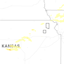
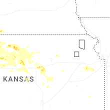

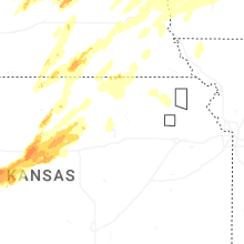
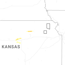

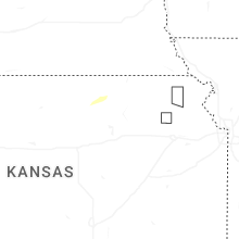
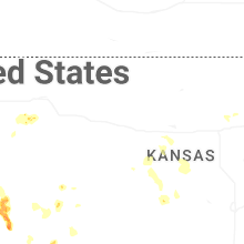


Connect with Interactive Hail Maps