

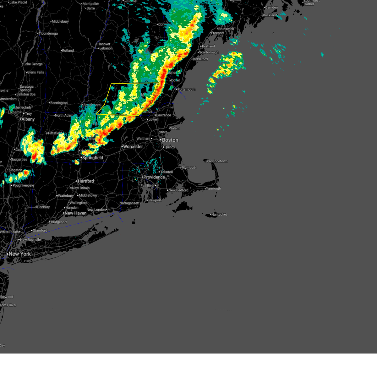
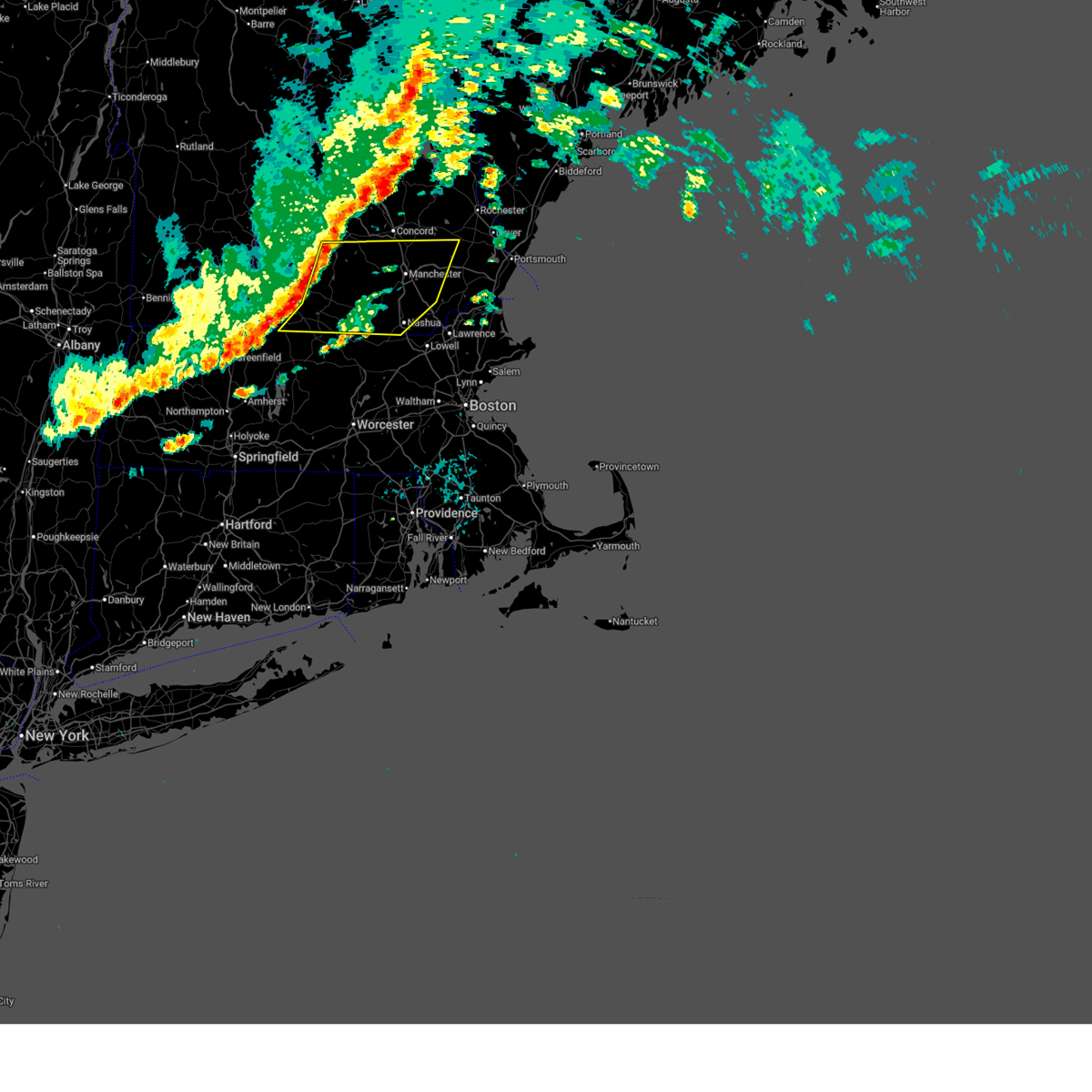
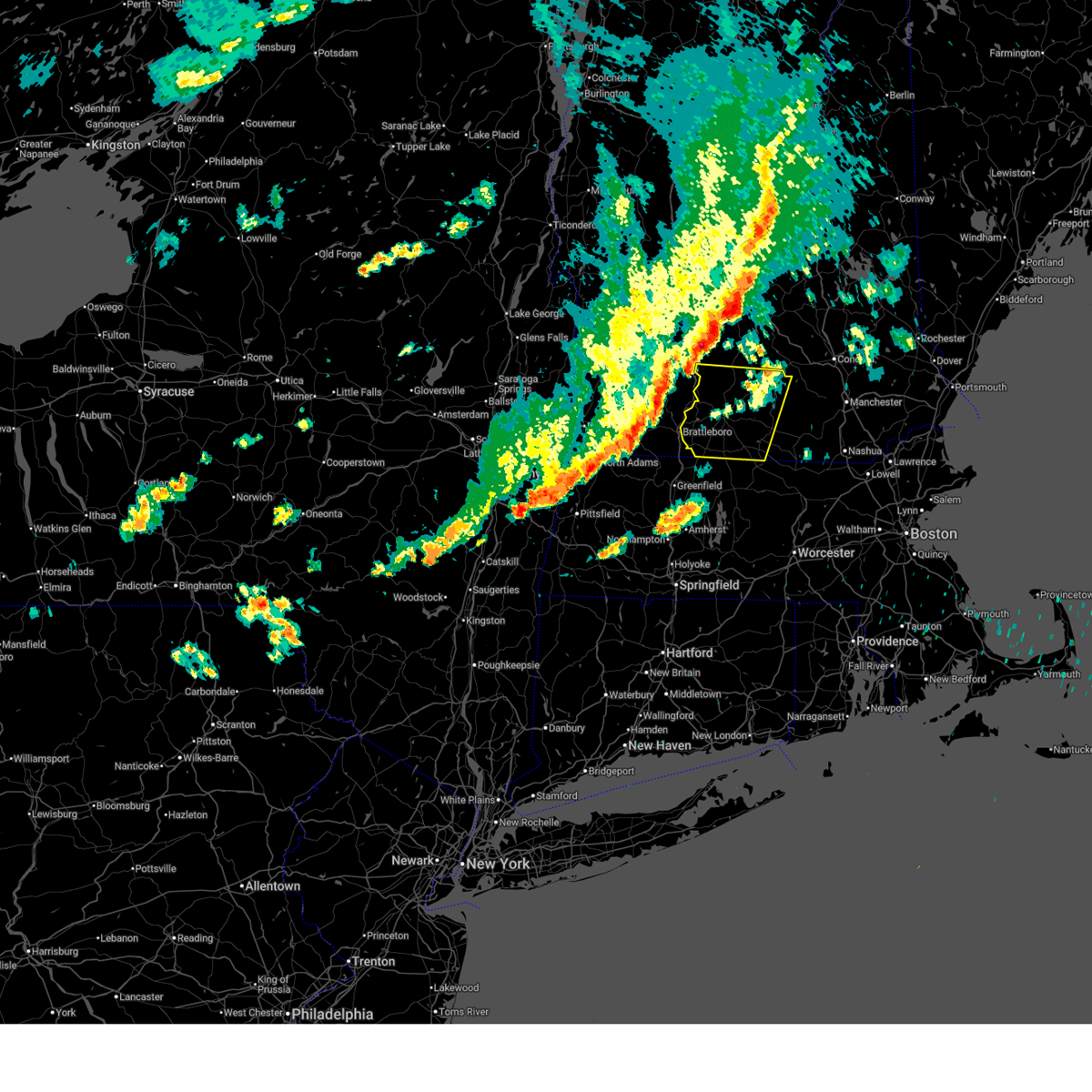
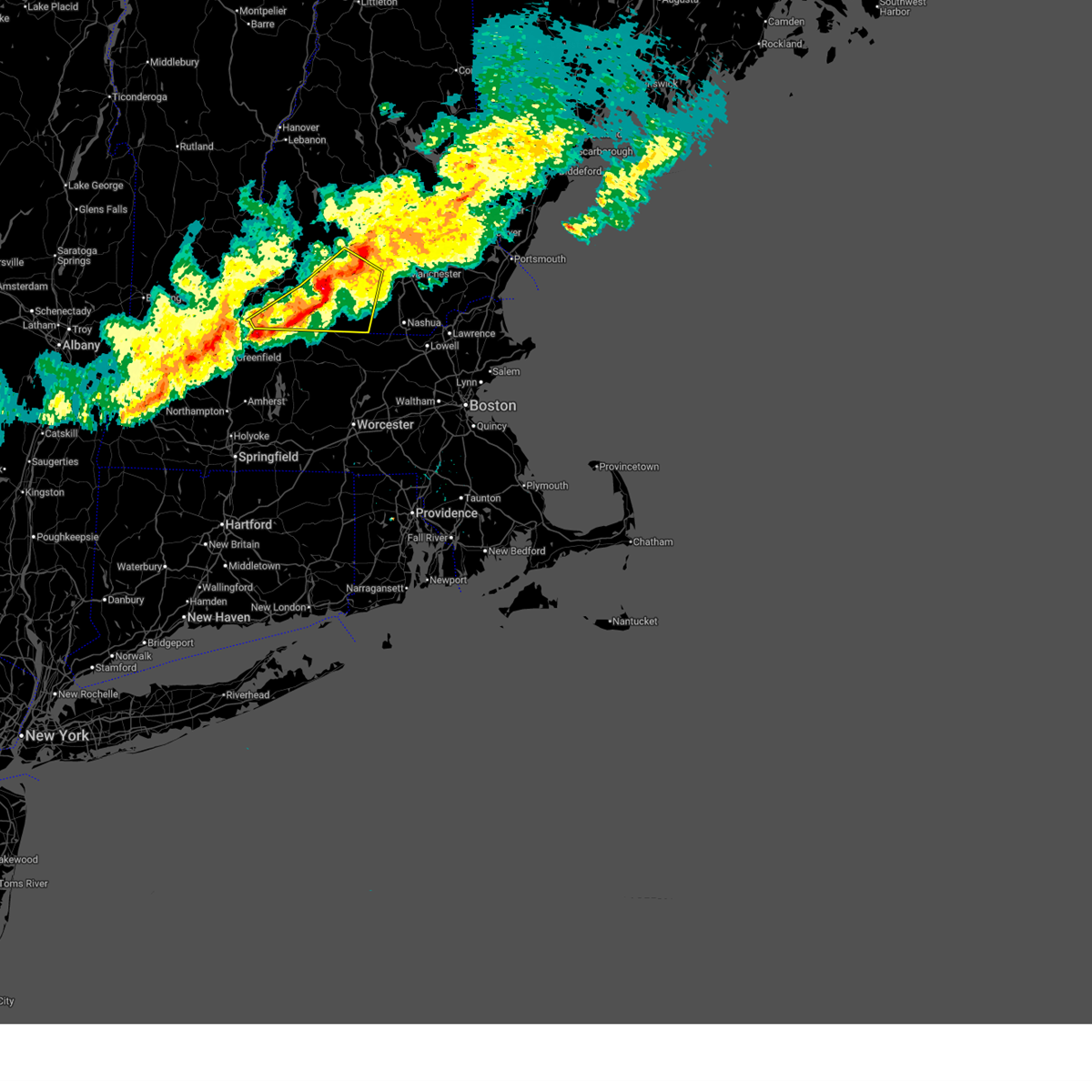
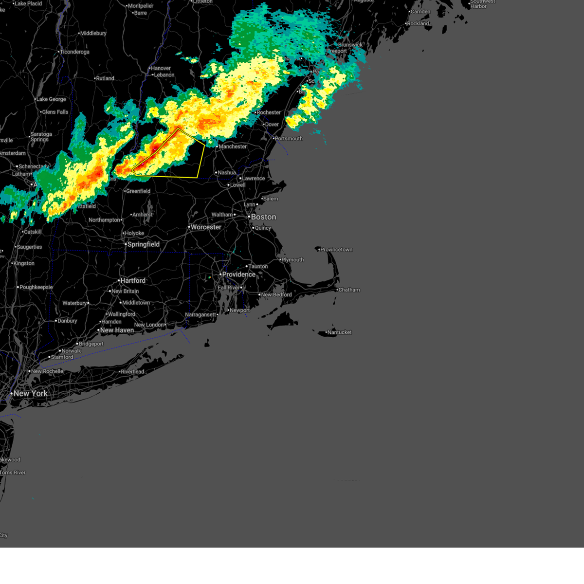
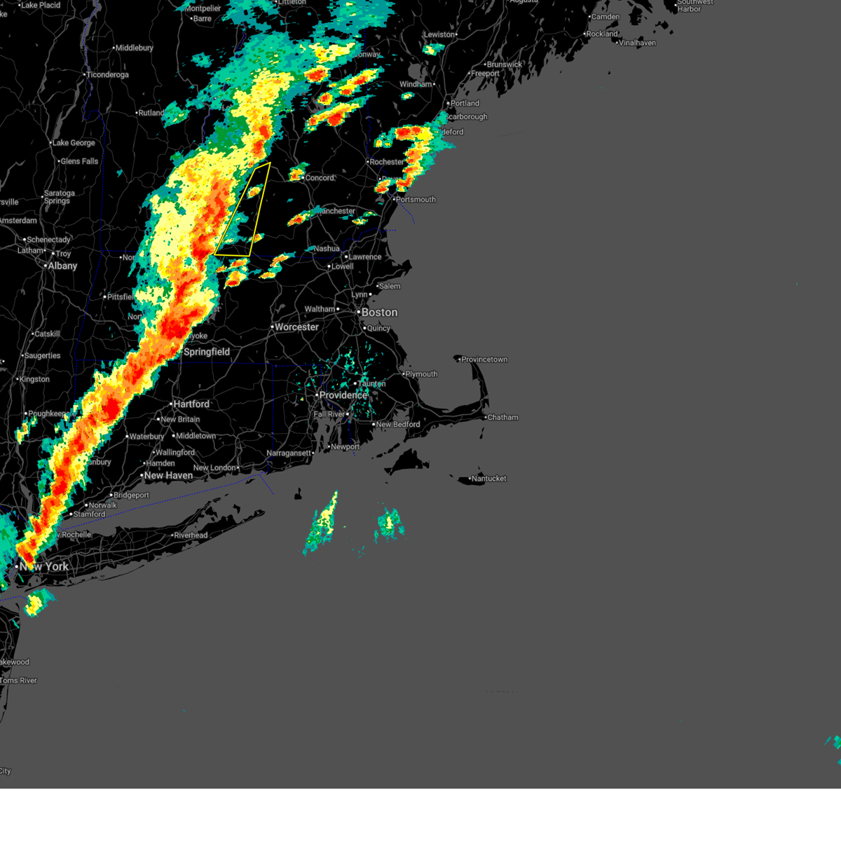
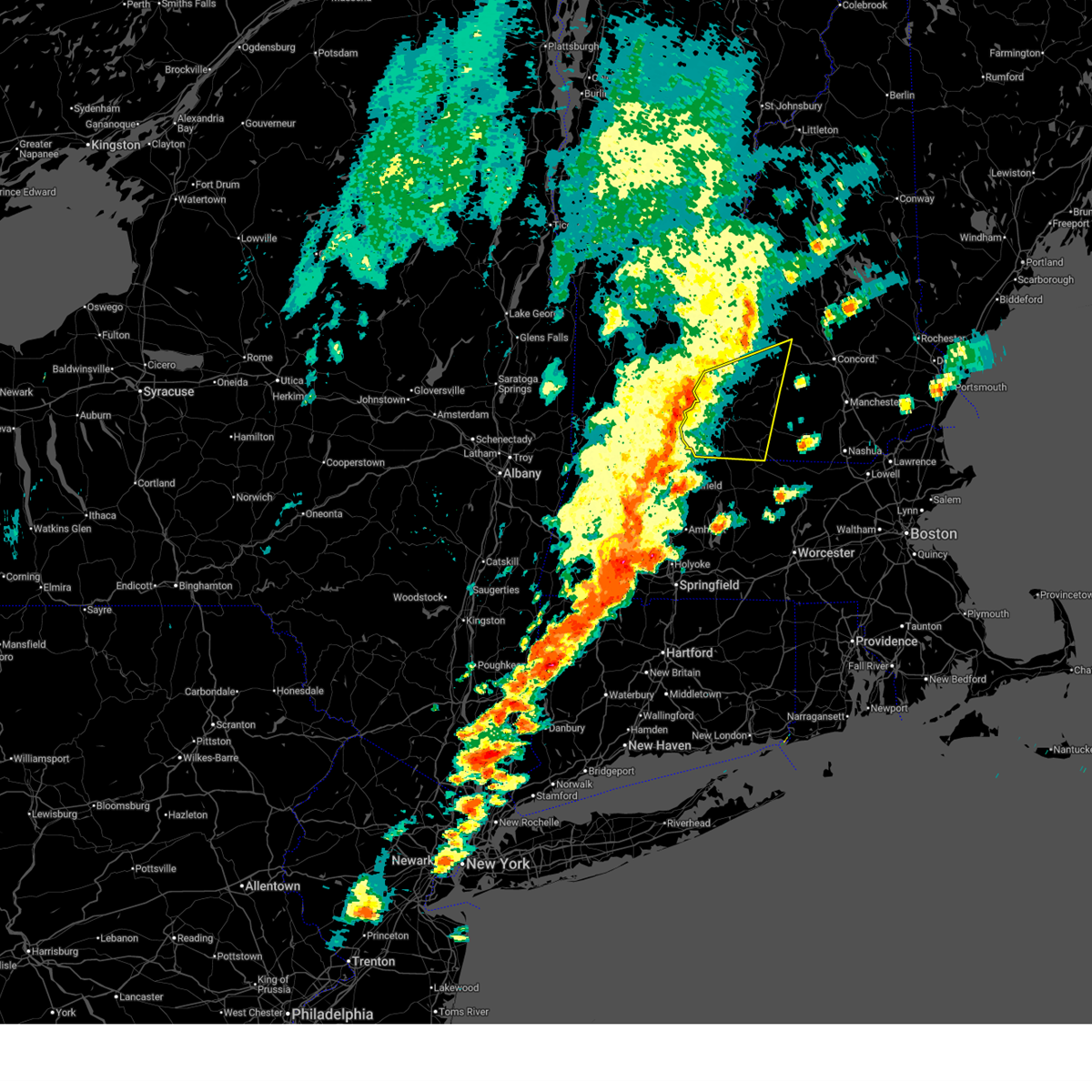
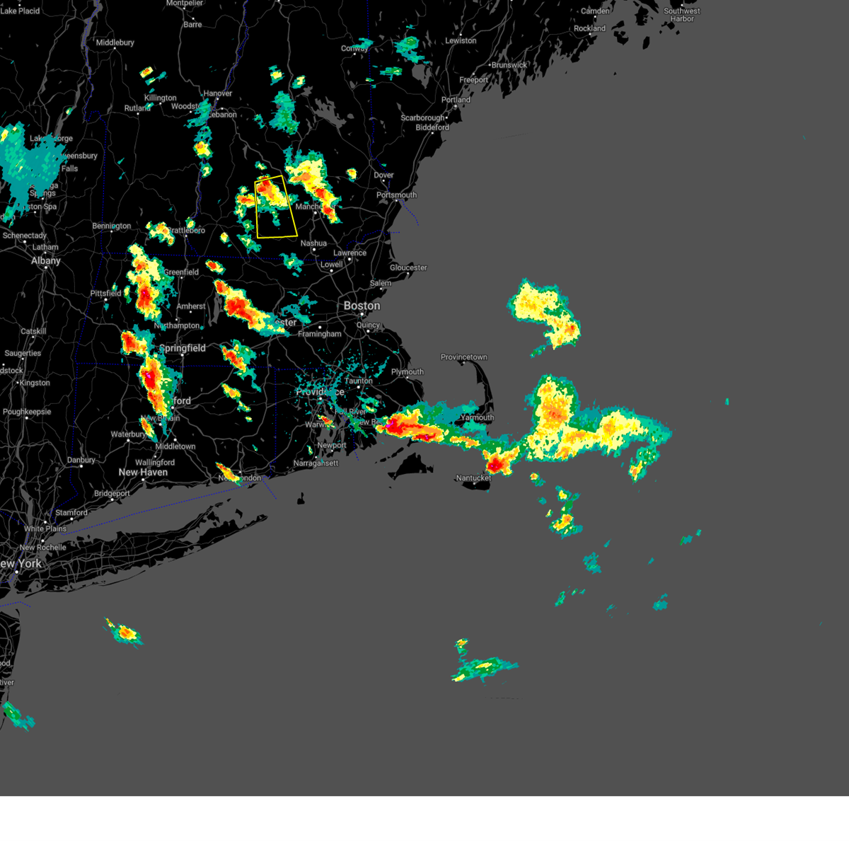
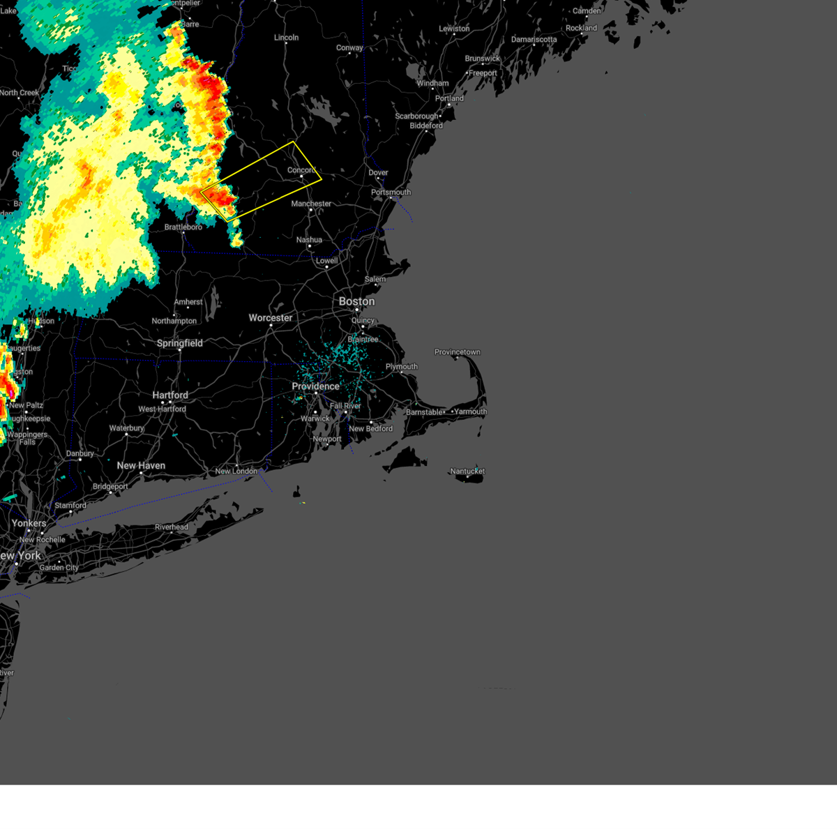
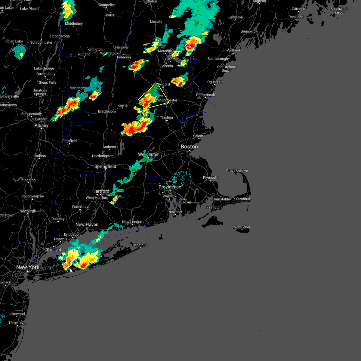
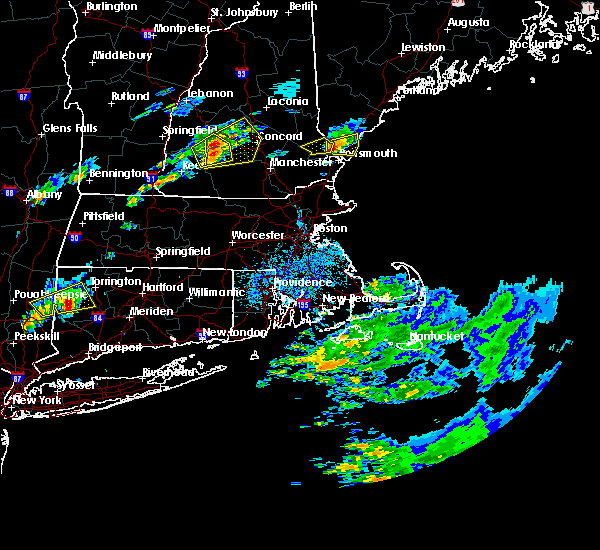
Hail Map for Bennington, NH
The Bennington, NH area has had 3 reports of on-the-ground hail by trained spotters, and has been under severe weather warnings 9 times during the past 12 months. Doppler radar has detected hail at or near Bennington, NH on 11 occasions.
| Name: | Bennington, NH |
| Where Located: | 85.6 miles NNW of Providence, RI |
| Map: | Google Map for Bennington, NH |
| Population: | 381 |
| Housing Units: | 154 |
| More Info: | Search Google for Bennington, NH |
5
The Top Recent Hail Date for Bennington, NH is Monday, August 5, 2024 (4th out of 11)

Hail and Wind Damage Spotted near Bennington, NH
| Date / Time | Report Details |
|---|---|
| 6/18/2026 4:58 PM EDT |
 The storms which prompted the warning have moved out of the area. therefore, the warning will be allowed to expire. a tornado watch remains in effect until 700 pm edt for southern and central new hampshire. The storms which prompted the warning have moved out of the area. therefore, the warning will be allowed to expire. a tornado watch remains in effect until 700 pm edt for southern and central new hampshire.
|
| 6/18/2026 4:04 PM EDT |
 Svrgyx the national weather service in gray maine has issued a * severe thunderstorm warning for, western rockingham county in southern new hampshire, southeastern cheshire county in southern new hampshire, hillsborough county in southern new hampshire, southeastern merrimack county in central new hampshire, * until 500 pm edt. * at 404 pm edt, severe thunderstorms were located along a line extending from near henniker to near jaffrey to near richmond, moving east at 35 mph (radar indicated). Hazards include 60 mph wind gusts and penny size hail. expect damage to roofs, siding, and trees Svrgyx the national weather service in gray maine has issued a * severe thunderstorm warning for, western rockingham county in southern new hampshire, southeastern cheshire county in southern new hampshire, hillsborough county in southern new hampshire, southeastern merrimack county in central new hampshire, * until 500 pm edt. * at 404 pm edt, severe thunderstorms were located along a line extending from near henniker to near jaffrey to near richmond, moving east at 35 mph (radar indicated). Hazards include 60 mph wind gusts and penny size hail. expect damage to roofs, siding, and trees
|
| 6/18/2026 3:18 PM EDT |
 Svrgyx the national weather service in gray maine has issued a * severe thunderstorm warning for, southwestern sullivan county in central new hampshire, cheshire county in southern new hampshire, northwestern hillsborough county in southern new hampshire, * until 415 pm edt. * at 316 pm edt, severe thunderstorms were located along a line extending from 6 miles southwest of charlestown to 18 miles west of hinsdale, moving east at 45 mph (radar indicated). Hazards include 60 mph wind gusts. expect damage to roofs, siding, and trees Svrgyx the national weather service in gray maine has issued a * severe thunderstorm warning for, southwestern sullivan county in central new hampshire, cheshire county in southern new hampshire, northwestern hillsborough county in southern new hampshire, * until 415 pm edt. * at 316 pm edt, severe thunderstorms were located along a line extending from 6 miles southwest of charlestown to 18 miles west of hinsdale, moving east at 45 mph (radar indicated). Hazards include 60 mph wind gusts. expect damage to roofs, siding, and trees
|
| 4/14/2026 7:10 PM EDT | Trees and wires dow in hillsborough county NH, 6.4 miles WNW of Bennington, NH |
| 4/14/2026 7:09 PM EDT |
 At 709 pm edt, severe thunderstorms were located along a line extending from near weare to near peterborough to near richmond, moving southeast at 50 mph (radar indicated). Hazards include 70 mph wind gusts and penny size hail. Expect considerable tree damage. damage is likely to mobile homes, roofs, and outbuildings. locations impacted include, marlborough, rindge, new boston, dublin, hancock, new ipswich, sharon, jaffrey, deering, mount vernon, lyndeborough, mont vernon, bennington, swanzey, milford, greenville, wilton, fitzwilliam, harrisville, and troy. This also includes, mount monadnock and north pack monadnock. At 709 pm edt, severe thunderstorms were located along a line extending from near weare to near peterborough to near richmond, moving southeast at 50 mph (radar indicated). Hazards include 70 mph wind gusts and penny size hail. Expect considerable tree damage. damage is likely to mobile homes, roofs, and outbuildings. locations impacted include, marlborough, rindge, new boston, dublin, hancock, new ipswich, sharon, jaffrey, deering, mount vernon, lyndeborough, mont vernon, bennington, swanzey, milford, greenville, wilton, fitzwilliam, harrisville, and troy. This also includes, mount monadnock and north pack monadnock.
|
| 4/14/2026 6:59 PM EDT |
 Svrgyx the national weather service in gray maine has issued a * severe thunderstorm warning for, southern cheshire county in southern new hampshire, western hillsborough county in southern new hampshire, * until 745 pm edt. * at 658 pm edt, severe thunderstorms were located along a line extending from near hillsborough to harrisville to winchester, moving southeast at 50 mph (radar indicated). Hazards include 60 mph wind gusts and penny size hail. expect damage to roofs, siding, and trees Svrgyx the national weather service in gray maine has issued a * severe thunderstorm warning for, southern cheshire county in southern new hampshire, western hillsborough county in southern new hampshire, * until 745 pm edt. * at 658 pm edt, severe thunderstorms were located along a line extending from near hillsborough to harrisville to winchester, moving southeast at 50 mph (radar indicated). Hazards include 60 mph wind gusts and penny size hail. expect damage to roofs, siding, and trees
|
| 9/6/2025 3:41 PM EDT |
 The storms which prompted the warning have weakened below severe limits, and have exited the warned area. therefore, the warning will be allowed to expire. a severe thunderstorm watch remains in effect until 800 pm edt for southern and central new hampshire. The storms which prompted the warning have weakened below severe limits, and have exited the warned area. therefore, the warning will be allowed to expire. a severe thunderstorm watch remains in effect until 800 pm edt for southern and central new hampshire.
|
| 9/6/2025 3:27 PM EDT |
 the severe thunderstorm warning has been cancelled and is no longer in effect the severe thunderstorm warning has been cancelled and is no longer in effect
|
| 9/6/2025 3:27 PM EDT |
 At 326 pm edt, severe thunderstorms were located along a line extending from near hillsborough to near fitzwilliam, moving east at 40 mph (radar indicated). Hazards include 60 mph wind gusts and penny size hail. Expect damage to roofs, siding, and trees. locations impacted include, antrim, marlborough, rindge, windsor, dublin, hancock, jaffrey, warner, hillsborough, bennington, nelson, fitzwilliam, harrisville, troy, richmond, bradford, peterborough, sharon, henniker, and deering. this also includes, mount monadnock. This includes interstate 89 near mile marker 20. At 326 pm edt, severe thunderstorms were located along a line extending from near hillsborough to near fitzwilliam, moving east at 40 mph (radar indicated). Hazards include 60 mph wind gusts and penny size hail. Expect damage to roofs, siding, and trees. locations impacted include, antrim, marlborough, rindge, windsor, dublin, hancock, jaffrey, warner, hillsborough, bennington, nelson, fitzwilliam, harrisville, troy, richmond, bradford, peterborough, sharon, henniker, and deering. this also includes, mount monadnock. This includes interstate 89 near mile marker 20.
|
| 9/6/2025 2:40 PM EDT |
 Svrgyx the national weather service in gray maine has issued a * severe thunderstorm warning for, southeastern sullivan county in central new hampshire, cheshire county in southern new hampshire, northwestern hillsborough county in southern new hampshire, southwestern merrimack county in central new hampshire, * until 345 pm edt. * at 240 pm edt, severe thunderstorms were located along a line extending from near walpole to 7 miles southwest of hinsdale, moving northeast at 30 mph (radar indicated). Hazards include 60 mph wind gusts and nickel size hail. expect damage to roofs, siding, and trees Svrgyx the national weather service in gray maine has issued a * severe thunderstorm warning for, southeastern sullivan county in central new hampshire, cheshire county in southern new hampshire, northwestern hillsborough county in southern new hampshire, southwestern merrimack county in central new hampshire, * until 345 pm edt. * at 240 pm edt, severe thunderstorms were located along a line extending from near walpole to 7 miles southwest of hinsdale, moving northeast at 30 mph (radar indicated). Hazards include 60 mph wind gusts and nickel size hail. expect damage to roofs, siding, and trees
|
| 8/26/2024 2:07 PM EDT |
 The storm which prompted the warning has weakened below severe limits, and no longer poses an immediate threat to life or property. therefore, the warning will be allowed to expire. a severe thunderstorm watch remains in effect until 700 pm edt for southern and central new hampshire. The storm which prompted the warning has weakened below severe limits, and no longer poses an immediate threat to life or property. therefore, the warning will be allowed to expire. a severe thunderstorm watch remains in effect until 700 pm edt for southern and central new hampshire.
|
| 8/26/2024 1:34 PM EDT |
 Svrgyx the national weather service in gray maine has issued a * severe thunderstorm warning for, northwestern hillsborough county in southern new hampshire, southwestern merrimack county in central new hampshire, * until 215 pm edt. * at 134 pm edt, a severe thunderstorm was located over henniker, moving south at 30 mph (radar indicated). Hazards include 60 mph wind gusts and quarter size hail. Hail damage to vehicles is expected. Expect wind damage to roofs, siding, and trees. Svrgyx the national weather service in gray maine has issued a * severe thunderstorm warning for, northwestern hillsborough county in southern new hampshire, southwestern merrimack county in central new hampshire, * until 215 pm edt. * at 134 pm edt, a severe thunderstorm was located over henniker, moving south at 30 mph (radar indicated). Hazards include 60 mph wind gusts and quarter size hail. Hail damage to vehicles is expected. Expect wind damage to roofs, siding, and trees.
|
| 8/26/2024 12:58 PM EDT |
 The storm which prompted the warning has weakened below severe limits, and has exited the warned area. therefore, the warning will be allowed to expire. The storm which prompted the warning has weakened below severe limits, and has exited the warned area. therefore, the warning will be allowed to expire.
|
| 8/26/2024 11:55 AM EDT |
 Svrgyx the national weather service in gray maine has issued a * severe thunderstorm warning for, southeastern cheshire county in southern new hampshire, southwestern hillsborough county in southern new hampshire, * until 100 pm edt. * at 1155 am edt, a severe thunderstorm was located over hancock, or 11 miles northeast of jaffrey, moving southeast at 15 mph (radar indicated). Hazards include 60 mph wind gusts and quarter size hail. Hail damage to vehicles is expected. Expect wind damage to roofs, siding, and trees. Svrgyx the national weather service in gray maine has issued a * severe thunderstorm warning for, southeastern cheshire county in southern new hampshire, southwestern hillsborough county in southern new hampshire, * until 100 pm edt. * at 1155 am edt, a severe thunderstorm was located over hancock, or 11 miles northeast of jaffrey, moving southeast at 15 mph (radar indicated). Hazards include 60 mph wind gusts and quarter size hail. Hail damage to vehicles is expected. Expect wind damage to roofs, siding, and trees.
|
| 8/15/2024 3:39 PM EDT |
 The storms which prompted the warning have weakened below severe limits, and no longer pose an immediate threat to life or property. therefore, the warning will be allowed to expire. however, gusty winds and heavy rain are still possible with these thunderstorms. The storms which prompted the warning have weakened below severe limits, and no longer pose an immediate threat to life or property. therefore, the warning will be allowed to expire. however, gusty winds and heavy rain are still possible with these thunderstorms.
|
| 8/15/2024 3:06 PM EDT |
 Svrgyx the national weather service in gray maine has issued a * severe thunderstorm warning for, southwestern rockingham county in southern new hampshire, hillsborough county in southern new hampshire, south central merrimack county in central new hampshire, * until 345 pm edt. * at 306 pm edt, severe thunderstorms were located along a line extending from near henniker to litchfield to near salem, moving south at 25 mph (radar indicated). Hazards include 60 mph wind gusts and quarter size hail. Hail damage to vehicles is expected. Expect wind damage to roofs, siding, and trees. Svrgyx the national weather service in gray maine has issued a * severe thunderstorm warning for, southwestern rockingham county in southern new hampshire, hillsborough county in southern new hampshire, south central merrimack county in central new hampshire, * until 345 pm edt. * at 306 pm edt, severe thunderstorms were located along a line extending from near henniker to litchfield to near salem, moving south at 25 mph (radar indicated). Hazards include 60 mph wind gusts and quarter size hail. Hail damage to vehicles is expected. Expect wind damage to roofs, siding, and trees.
|
| 8/5/2024 3:07 PM EDT |
 At 305 pm edt, a severe thunderstorm was located over greenfield, or 12 miles northeast of jaffrey, moving east at 30 mph (radar indicated). Hazards include 60 mph wind gusts and quarter size hail. Hail damage to vehicles is expected. expect wind damage to roofs, siding, and trees. locations impacted include, merrimack, bedford, milford, amherst, hollis, peterborough, new boston, mont vernon, greenfield, lyndeborough, francestown, bennington, goffstown, mount vernon, wilton, temple, hancock, and weare. This also includes, north pack monadnock. At 305 pm edt, a severe thunderstorm was located over greenfield, or 12 miles northeast of jaffrey, moving east at 30 mph (radar indicated). Hazards include 60 mph wind gusts and quarter size hail. Hail damage to vehicles is expected. expect wind damage to roofs, siding, and trees. locations impacted include, merrimack, bedford, milford, amherst, hollis, peterborough, new boston, mont vernon, greenfield, lyndeborough, francestown, bennington, goffstown, mount vernon, wilton, temple, hancock, and weare. This also includes, north pack monadnock.
|
| 8/5/2024 3:07 PM EDT |
 the severe thunderstorm warning has been cancelled and is no longer in effect the severe thunderstorm warning has been cancelled and is no longer in effect
|
| 8/5/2024 2:48 PM EDT |
 Svrgyx the national weather service in gray maine has issued a * severe thunderstorm warning for, east central cheshire county in southern new hampshire, southwestern hillsborough county in southern new hampshire, * until 345 pm edt. * at 247 pm edt, a severe thunderstorm was located over nelson, or 10 miles north of jaffrey, moving east at 25 mph (radar indicated). Hazards include golf ball size hail and 60 mph wind gusts. People and animals outdoors will be injured. expect hail damage to roofs, siding, windows, and vehicles. Expect wind damage to roofs, siding, and trees. Svrgyx the national weather service in gray maine has issued a * severe thunderstorm warning for, east central cheshire county in southern new hampshire, southwestern hillsborough county in southern new hampshire, * until 345 pm edt. * at 247 pm edt, a severe thunderstorm was located over nelson, or 10 miles north of jaffrey, moving east at 25 mph (radar indicated). Hazards include golf ball size hail and 60 mph wind gusts. People and animals outdoors will be injured. expect hail damage to roofs, siding, windows, and vehicles. Expect wind damage to roofs, siding, and trees.
|
| 7/16/2024 7:44 PM EDT |
 The storms which prompted the warning have moved out of the area. therefore, the warning will be allowed to expire. however, heavy rain is still possible with these thunderstorms. a severe thunderstorm watch remains in effect until 100 am edt for southern and central new hampshire. The storms which prompted the warning have moved out of the area. therefore, the warning will be allowed to expire. however, heavy rain is still possible with these thunderstorms. a severe thunderstorm watch remains in effect until 100 am edt for southern and central new hampshire.
|
| 7/16/2024 7:42 PM EDT |
 Svrgyx the national weather service in gray maine has issued a * severe thunderstorm warning for, rockingham county in southern new hampshire, southwestern strafford county in central new hampshire, southeastern cheshire county in southern new hampshire, hillsborough county in southern new hampshire, southeastern merrimack county in central new hampshire, * until 830 pm edt. * at 741 pm edt, severe thunderstorms were located along a line extending from near deering to near new ipswich, moving east at 60 mph (radar indicated). Hazards include 60 mph wind gusts. expect damage to roofs, siding, and trees Svrgyx the national weather service in gray maine has issued a * severe thunderstorm warning for, rockingham county in southern new hampshire, southwestern strafford county in central new hampshire, southeastern cheshire county in southern new hampshire, hillsborough county in southern new hampshire, southeastern merrimack county in central new hampshire, * until 830 pm edt. * at 741 pm edt, severe thunderstorms were located along a line extending from near deering to near new ipswich, moving east at 60 mph (radar indicated). Hazards include 60 mph wind gusts. expect damage to roofs, siding, and trees
|
| 7/16/2024 6:49 PM EDT |
 Svrgyx the national weather service in gray maine has issued a * severe thunderstorm warning for, southern sullivan county in central new hampshire, cheshire county in southern new hampshire, western hillsborough county in southern new hampshire, * until 745 pm edt. * at 649 pm edt, severe thunderstorms were located along a line extending from 15 miles west of chesterfield to 6 miles west of hinsdale to 16 miles southwest of winchester, moving east at 70 mph (radar indicated). Hazards include 70 mph wind gusts. Expect considerable tree damage. Damage is likely to mobile homes, roofs, and outbuildings. Svrgyx the national weather service in gray maine has issued a * severe thunderstorm warning for, southern sullivan county in central new hampshire, cheshire county in southern new hampshire, western hillsborough county in southern new hampshire, * until 745 pm edt. * at 649 pm edt, severe thunderstorms were located along a line extending from 15 miles west of chesterfield to 6 miles west of hinsdale to 16 miles southwest of winchester, moving east at 70 mph (radar indicated). Hazards include 70 mph wind gusts. Expect considerable tree damage. Damage is likely to mobile homes, roofs, and outbuildings.
|
| 6/23/2024 5:56 PM EDT |
 The storm which prompted the warning has moved out of the area. therefore, the warning will be allowed to expire. a tornado watch remains in effect until 800 pm edt for southern and central new hampshire. The storm which prompted the warning has moved out of the area. therefore, the warning will be allowed to expire. a tornado watch remains in effect until 800 pm edt for southern and central new hampshire.
|
| 6/23/2024 5:11 PM EDT |
 Svrgyx the national weather service in gray maine has issued a * severe thunderstorm warning for, central hillsborough county in southern new hampshire, * until 600 pm edt. * at 510 pm edt, a severe thunderstorm was located over hancock, or 9 miles north of jaffrey, moving east at 50 mph (radar indicated). Hazards include 60 mph wind gusts and quarter size hail. Hail damage to vehicles is expected. Expect wind damage to roofs, siding, and trees. Svrgyx the national weather service in gray maine has issued a * severe thunderstorm warning for, central hillsborough county in southern new hampshire, * until 600 pm edt. * at 510 pm edt, a severe thunderstorm was located over hancock, or 9 miles north of jaffrey, moving east at 50 mph (radar indicated). Hazards include 60 mph wind gusts and quarter size hail. Hail damage to vehicles is expected. Expect wind damage to roofs, siding, and trees.
|
| 6/19/2024 3:45 PM EDT |
 At 343 pm edt, a severe thunderstorm was located over stoddard, or 13 miles northeast of keene, moving east at 20 mph (radar indicated). Hazards include 60 mph wind gusts and quarter size hail. Hail damage to vehicles is expected. expect wind damage to roofs, siding, and trees. locations impacted include, keene, henniker, peterborough, antrim, greenfield, bradford, dublin, francestown, bennington, harrisville, nelson, gilsum, windsor, hancock, walpole, deering, warner, hillsborough, alstead, and marlow. This includes interstate 89 between mile markers 17 and 21. At 343 pm edt, a severe thunderstorm was located over stoddard, or 13 miles northeast of keene, moving east at 20 mph (radar indicated). Hazards include 60 mph wind gusts and quarter size hail. Hail damage to vehicles is expected. expect wind damage to roofs, siding, and trees. locations impacted include, keene, henniker, peterborough, antrim, greenfield, bradford, dublin, francestown, bennington, harrisville, nelson, gilsum, windsor, hancock, walpole, deering, warner, hillsborough, alstead, and marlow. This includes interstate 89 between mile markers 17 and 21.
|
| 6/19/2024 3:08 PM EDT |
 Svrgyx the national weather service in gray maine has issued a * severe thunderstorm warning for, southern sullivan county in central new hampshire, northern cheshire county in southern new hampshire, northwestern hillsborough county in southern new hampshire, southwestern merrimack county in central new hampshire, * until 400 pm edt. * at 307 pm edt, a severe thunderstorm was located over alstead, or 12 miles north of keene, moving east at 25 mph (radar indicated). Hazards include 60 mph wind gusts and quarter size hail. Hail damage to vehicles is expected. Expect wind damage to roofs, siding, and trees. Svrgyx the national weather service in gray maine has issued a * severe thunderstorm warning for, southern sullivan county in central new hampshire, northern cheshire county in southern new hampshire, northwestern hillsborough county in southern new hampshire, southwestern merrimack county in central new hampshire, * until 400 pm edt. * at 307 pm edt, a severe thunderstorm was located over alstead, or 12 miles north of keene, moving east at 25 mph (radar indicated). Hazards include 60 mph wind gusts and quarter size hail. Hail damage to vehicles is expected. Expect wind damage to roofs, siding, and trees.
|
| 9/8/2023 6:37 PM EDT |
 At 637 pm edt, severe thunderstorms were located along a line extending from near antrim to near peterborough to near rindge, moving northeast at 45 mph (radar indicated). Hazards include 60 mph wind gusts and nickel size hail. expect damage to roofs, siding, and trees At 637 pm edt, severe thunderstorms were located along a line extending from near antrim to near peterborough to near rindge, moving northeast at 45 mph (radar indicated). Hazards include 60 mph wind gusts and nickel size hail. expect damage to roofs, siding, and trees
|
| 9/7/2023 10:32 PM EDT |
 At 1032 pm edt, a severe thunderstorm was located over sullivan, or 8 miles northeast of keene, moving northeast at 35 mph (radar indicated). Hazards include 60 mph wind gusts and quarter size hail. Expect wind damage to trees and power lines. Minor hail damage to vehicles is possible. At 1032 pm edt, a severe thunderstorm was located over sullivan, or 8 miles northeast of keene, moving northeast at 35 mph (radar indicated). Hazards include 60 mph wind gusts and quarter size hail. Expect wind damage to trees and power lines. Minor hail damage to vehicles is possible.
|
| 7/27/2023 3:29 PM EDT |
 At 328 pm edt, a severe thunderstorm was located over greenfield, or 13 miles northeast of jaffrey, moving east at 30 mph (radar indicated). Hazards include 60 mph wind gusts and penny size hail. Expect damage to roofs, siding, and trees. Locations impacted include, bedford, amherst, peterborough, new boston, mont vernon, greenfield, lyndeborough, francestown, bennington, mount vernon, hancock, weare, goffstown, deering and temple. At 328 pm edt, a severe thunderstorm was located over greenfield, or 13 miles northeast of jaffrey, moving east at 30 mph (radar indicated). Hazards include 60 mph wind gusts and penny size hail. Expect damage to roofs, siding, and trees. Locations impacted include, bedford, amherst, peterborough, new boston, mont vernon, greenfield, lyndeborough, francestown, bennington, mount vernon, hancock, weare, goffstown, deering and temple.
|
| 7/27/2023 3:14 PM EDT |
 At 314 pm edt, a severe thunderstorm was located near hancock, or 7 miles north of jaffrey, moving east at 40 mph (radar indicated). Hazards include 60 mph wind gusts and penny size hail. expect damage to roofs, siding, and trees At 314 pm edt, a severe thunderstorm was located near hancock, or 7 miles north of jaffrey, moving east at 40 mph (radar indicated). Hazards include 60 mph wind gusts and penny size hail. expect damage to roofs, siding, and trees
|
| 7/13/2023 9:55 PM EDT |
 The severe thunderstorm warning for southeastern sullivan, cheshire, western hillsborough and southwestern merrimack counties will expire at 1000 pm edt, the storms which prompted the warning have weakened below severe limits, and have exited the warned area. therefore, the warning will be allowed to expire. however gusty winds are still possible with these thunderstorms. The severe thunderstorm warning for southeastern sullivan, cheshire, western hillsborough and southwestern merrimack counties will expire at 1000 pm edt, the storms which prompted the warning have weakened below severe limits, and have exited the warned area. therefore, the warning will be allowed to expire. however gusty winds are still possible with these thunderstorms.
|
| 7/13/2023 9:34 PM EDT |
 At 933 pm edt, severe thunderstorms were located along a line extending from alstead to fitzwilliam, moving northeast at 30 mph (trained weather spotters. an observed gust of 67 mph was recorded on a hand held anemometer with these storms). Hazards include 60 mph wind gusts. Expect damage to roofs, siding, and trees. locations impacted include, keene, jaffrey, henniker, new london, peterborough, winchester, antrim, greenfield, lyndeborough, bradford, dublin, francestown, bennington, richmond, harrisville, nelson, rindge, walpole, alstead and swanzey. this includes interstate 89 between mile markers 28 and 30. hail threat, radar indicated max hail size, <. 75 in wind threat, radar indicated max wind gust, 60 mph. At 933 pm edt, severe thunderstorms were located along a line extending from alstead to fitzwilliam, moving northeast at 30 mph (trained weather spotters. an observed gust of 67 mph was recorded on a hand held anemometer with these storms). Hazards include 60 mph wind gusts. Expect damage to roofs, siding, and trees. locations impacted include, keene, jaffrey, henniker, new london, peterborough, winchester, antrim, greenfield, lyndeborough, bradford, dublin, francestown, bennington, richmond, harrisville, nelson, rindge, walpole, alstead and swanzey. this includes interstate 89 between mile markers 28 and 30. hail threat, radar indicated max hail size, <. 75 in wind threat, radar indicated max wind gust, 60 mph.
|
| 7/13/2023 9:01 PM EDT |
 At 901 pm edt, severe thunderstorms were located along a line extending from 6 miles west of westmoreland to 10 miles south of winchester, moving northeast at 30 mph (radar indicated). Hazards include 60 mph wind gusts. expect damage to roofs, siding, and trees At 901 pm edt, severe thunderstorms were located along a line extending from 6 miles west of westmoreland to 10 miles south of winchester, moving northeast at 30 mph (radar indicated). Hazards include 60 mph wind gusts. expect damage to roofs, siding, and trees
|
| 6/2/2023 6:40 PM EDT | Quarter sized hail reported 0.4 miles N of Bennington, NH, delayed report...broadcast media and multiple social media observed hail of quarter-size falling for 10 minutes. |
| 9/13/2022 8:19 PM EDT |
 At 819 pm edt, a severe thunderstorm was located over wilton, or 13 miles east of jaffrey, moving east at 20 mph (radar indicated). Hazards include 60 mph wind gusts and penny size hail. Expect damage to roofs, siding, and trees. Locations impacted include, nashua, merrimack, bedford, milford, amherst, hollis, peterborough, new boston, mont vernon, greenfield, lyndeborough, hancock, francestown, bennington, sharon, new ipswich, mount vernon, greenville, wilton and brookline. At 819 pm edt, a severe thunderstorm was located over wilton, or 13 miles east of jaffrey, moving east at 20 mph (radar indicated). Hazards include 60 mph wind gusts and penny size hail. Expect damage to roofs, siding, and trees. Locations impacted include, nashua, merrimack, bedford, milford, amherst, hollis, peterborough, new boston, mont vernon, greenfield, lyndeborough, hancock, francestown, bennington, sharon, new ipswich, mount vernon, greenville, wilton and brookline.
|
| 9/13/2022 8:06 PM EDT | Trees and wires down. time estimated by rada in hillsborough county NH, 2.9 miles NNW of Bennington, NH |
| 9/13/2022 8:00 PM EDT |
 At 800 pm edt, a severe thunderstorm was located over sharon, or near jaffrey, moving east at 20 mph (radar indicated). Hazards include 60 mph wind gusts and penny size hail. expect damage to roofs, siding, and trees At 800 pm edt, a severe thunderstorm was located over sharon, or near jaffrey, moving east at 20 mph (radar indicated). Hazards include 60 mph wind gusts and penny size hail. expect damage to roofs, siding, and trees
|
| 9/13/2022 7:08 PM EDT |
 At 707 pm edt, a severe thunderstorm was located near richmond, or 15 miles southwest of jaffrey, moving northeast at 30 mph (radar indicated). Hazards include 60 mph wind gusts and penny size hail. expect damage to roofs, siding, and trees At 707 pm edt, a severe thunderstorm was located near richmond, or 15 miles southwest of jaffrey, moving northeast at 30 mph (radar indicated). Hazards include 60 mph wind gusts and penny size hail. expect damage to roofs, siding, and trees
|
| 8/26/2022 3:05 PM EDT | At 305 pm edt, a severe thunderstorm was located over henniker, moving northeast at 40 mph (radar indicated). Hazards include 60 mph wind gusts and penny size hail. Expect damage to roofs, siding, and trees. locations impacted include, henniker, peterborough, antrim, greenfield, lyndeborough, hancock, bradford, francestown, bennington, windsor, deering, hillsborough, weare, lempster and washington. hail threat, radar indicated max hail size, 0. 75 in wind threat, radar indicated max wind gust, 60 mph. |
| 8/26/2022 2:29 PM EDT | At 229 pm edt, a severe thunderstorm was located over gilsum, or near keene, moving northeast at 40 mph (radar indicated). Hazards include 60 mph wind gusts and quarter size hail. Hail damage to vehicles is expected. Expect wind damage to roofs, siding, and trees. |
| 8/7/2022 3:27 PM EDT | Social media reports of tree limbs scattered across nh hwy 136 near the lake. time estimated by rada in hillsborough county NH, 7.4 miles WNW of Bennington, NH |
| 7/21/2022 5:19 PM EDT |
 At 519 pm edt, severe thunderstorms were located along a line extending from marlow to nelson to near hinsdale, moving east at 30 mph (radar indicated). Hazards include 60 mph wind gusts. expect damage to roofs, siding, and trees At 519 pm edt, severe thunderstorms were located along a line extending from marlow to nelson to near hinsdale, moving east at 30 mph (radar indicated). Hazards include 60 mph wind gusts. expect damage to roofs, siding, and trees
|
| 7/21/2022 3:43 PM EDT |
 At 343 pm edt, a severe thunderstorm was located near weare, or 11 miles southeast of henniker, moving east at 35 mph (radar indicated). Hazards include 60 mph wind gusts and quarter size hail. Hail damage to vehicles is expected. expect wind damage to roofs, siding, and trees. locations impacted include, manchester, concord, henniker, hooksett, hopkinton, new boston, antrim, greenfield, lyndeborough, hancock, francestown, bennington, goffstown, deering, weare, hillsborough, bow and dunbarton. this includes the following highways, interstate 293 between mile markers 8 and 11. interstate 89 between mile markers 3 and 11. interstate 93 between mile markers 23 and 26. hail threat, radar indicated max hail size, 1. 00 in wind threat, radar indicated max wind gust, 60 mph. At 343 pm edt, a severe thunderstorm was located near weare, or 11 miles southeast of henniker, moving east at 35 mph (radar indicated). Hazards include 60 mph wind gusts and quarter size hail. Hail damage to vehicles is expected. expect wind damage to roofs, siding, and trees. locations impacted include, manchester, concord, henniker, hooksett, hopkinton, new boston, antrim, greenfield, lyndeborough, hancock, francestown, bennington, goffstown, deering, weare, hillsborough, bow and dunbarton. this includes the following highways, interstate 293 between mile markers 8 and 11. interstate 89 between mile markers 3 and 11. interstate 93 between mile markers 23 and 26. hail threat, radar indicated max hail size, 1. 00 in wind threat, radar indicated max wind gust, 60 mph.
|
| 7/21/2022 3:12 PM EDT |
 At 312 pm edt, a severe thunderstorm was located over hancock, or 11 miles north of jaffrey, moving east at 35 mph (radar indicated). Hazards include ping pong ball size hail and 60 mph wind gusts. People and animals outdoors will be injured. expect hail damage to roofs, siding, windows, and vehicles. expect wind damage to roofs, siding, and trees. locations impacted include, manchester, concord, henniker, hooksett, peterborough, hopkinton, new boston, antrim, greenfield, lyndeborough, francestown, bennington, harrisville, windsor, hancock, goffstown, deering, hillsborough, weare and bow. this includes the following highways, interstate 293 between mile markers 8 and 11. interstate 89 between mile markers 3 and 13. Interstate 93 between mile markers 23 and 26. At 312 pm edt, a severe thunderstorm was located over hancock, or 11 miles north of jaffrey, moving east at 35 mph (radar indicated). Hazards include ping pong ball size hail and 60 mph wind gusts. People and animals outdoors will be injured. expect hail damage to roofs, siding, windows, and vehicles. expect wind damage to roofs, siding, and trees. locations impacted include, manchester, concord, henniker, hooksett, peterborough, hopkinton, new boston, antrim, greenfield, lyndeborough, francestown, bennington, harrisville, windsor, hancock, goffstown, deering, hillsborough, weare and bow. this includes the following highways, interstate 293 between mile markers 8 and 11. interstate 89 between mile markers 3 and 13. Interstate 93 between mile markers 23 and 26.
|
| 7/21/2022 3:08 PM EDT |
 At 308 pm edt, a severe thunderstorm was located over harrisville, or 10 miles north of jaffrey, moving east at 35 mph (radar indicated). Hazards include ping pong ball size hail and 60 mph wind gusts. People and animals outdoors will be injured. expect hail damage to roofs, siding, windows, and vehicles. Expect wind damage to roofs, siding, and trees. At 308 pm edt, a severe thunderstorm was located over harrisville, or 10 miles north of jaffrey, moving east at 35 mph (radar indicated). Hazards include ping pong ball size hail and 60 mph wind gusts. People and animals outdoors will be injured. expect hail damage to roofs, siding, windows, and vehicles. Expect wind damage to roofs, siding, and trees.
|
| 7/12/2022 5:32 PM EDT | Reported by amateur radi in hillsborough county NH, 5.9 miles WNW of Bennington, NH |
| 7/12/2022 5:23 PM EDT |
 At 522 pm edt, a severe thunderstorm was located near bedford, or 7 miles west of manchester, moving east at 50 mph (radar indicated). Hazards include 60 mph wind gusts and quarter size hail. Hail damage to vehicles is expected. expect wind damage to roofs, siding, and trees. locations impacted include, manchester, merrimack, bedford, milford, amherst, litchfield, peterborough, new boston, antrim, mont vernon, greenfield, lyndeborough, dublin, francestown, bennington, hancock, goffstown, deering, mount vernon and weare. this includes the following highways, interstate 293 between mile markers 1 and 9. interstate 93 between mile markers 18 and 23. hail threat, radar indicated max hail size, 1. 00 in wind threat, radar indicated max wind gust, 60 mph. At 522 pm edt, a severe thunderstorm was located near bedford, or 7 miles west of manchester, moving east at 50 mph (radar indicated). Hazards include 60 mph wind gusts and quarter size hail. Hail damage to vehicles is expected. expect wind damage to roofs, siding, and trees. locations impacted include, manchester, merrimack, bedford, milford, amherst, litchfield, peterborough, new boston, antrim, mont vernon, greenfield, lyndeborough, dublin, francestown, bennington, hancock, goffstown, deering, mount vernon and weare. this includes the following highways, interstate 293 between mile markers 1 and 9. interstate 93 between mile markers 18 and 23. hail threat, radar indicated max hail size, 1. 00 in wind threat, radar indicated max wind gust, 60 mph.
|
| 7/12/2022 4:55 PM EDT |
 At 454 pm edt, a severe thunderstorm was located near nelson, or 13 miles north of jaffrey, moving east at 50 mph (radar indicated). Hazards include 60 mph wind gusts and quarter size hail. Hail damage to vehicles is expected. Expect wind damage to roofs, siding, and trees. At 454 pm edt, a severe thunderstorm was located near nelson, or 13 miles north of jaffrey, moving east at 50 mph (radar indicated). Hazards include 60 mph wind gusts and quarter size hail. Hail damage to vehicles is expected. Expect wind damage to roofs, siding, and trees.
|
| 5/22/2022 7:00 PM EDT | Quarter sized hail reported 5.7 miles W of Bennington, NH, reported by weather spotter. |
| 5/16/2022 7:00 PM EDT | Trees down on hwy 47 in francestown. time estimated by rada in hillsborough county NH, 5.2 miles WNW of Bennington, NH |
| 5/16/2022 6:56 PM EDT | Tree down on wire in hillsborough county NH, 7.2 miles W of Bennington, NH |
| 5/16/2022 6:45 PM EDT |
 At 644 pm edt, severe thunderstorms were located along a line extending from newport to windsor to near troy, moving northeast at 40 mph (radar indicated). Hazards include 60 mph wind gusts and penny size hail. expect damage to roofs, siding, and trees At 644 pm edt, severe thunderstorms were located along a line extending from newport to windsor to near troy, moving northeast at 40 mph (radar indicated). Hazards include 60 mph wind gusts and penny size hail. expect damage to roofs, siding, and trees
|
| 5/16/2022 6:20 PM EDT |
 At 619 pm edt, severe thunderstorms were located along a line extending from 6 miles southwest of charlestown to near chesterfield to 23 miles south of hinsdale, moving east at 35 mph (radar indicated). Hazards include 60 mph wind gusts and nickel size hail. Expect damage to roofs, siding, and trees. locations impacted include, keene, claremont, jaffrey, henniker, peterborough, hopkinton, new boston, charlestown, winchester, antrim, mont vernon, greenfield, lyndeborough, bradford, dublin, francestown, bennington, richmond, harrisville and nelson. this includes interstate 89 between mile markers 18 and 30. hail threat, radar indicated max hail size, 0. 88 in wind threat, radar indicated max wind gust, 60 mph. At 619 pm edt, severe thunderstorms were located along a line extending from 6 miles southwest of charlestown to near chesterfield to 23 miles south of hinsdale, moving east at 35 mph (radar indicated). Hazards include 60 mph wind gusts and nickel size hail. Expect damage to roofs, siding, and trees. locations impacted include, keene, claremont, jaffrey, henniker, peterborough, hopkinton, new boston, charlestown, winchester, antrim, mont vernon, greenfield, lyndeborough, bradford, dublin, francestown, bennington, richmond, harrisville and nelson. this includes interstate 89 between mile markers 18 and 30. hail threat, radar indicated max hail size, 0. 88 in wind threat, radar indicated max wind gust, 60 mph.
|
| 5/16/2022 5:43 PM EDT |
 At 543 pm edt, severe thunderstorms were located along a line extending from 22 miles west of westmoreland to 14 miles west of hinsdale to 41 miles southwest of winchester, moving east at 35 mph (radar indicated). Hazards include 60 mph wind gusts and nickel size hail. expect damage to roofs, siding, and trees At 543 pm edt, severe thunderstorms were located along a line extending from 22 miles west of westmoreland to 14 miles west of hinsdale to 41 miles southwest of winchester, moving east at 35 mph (radar indicated). Hazards include 60 mph wind gusts and nickel size hail. expect damage to roofs, siding, and trees
|
| 3/7/2022 9:36 PM EST | Multiple trees... wires down. radar estimated tim in hillsborough county NH, 6.4 miles WNW of Bennington, NH |
| 3/7/2022 9:28 PM EST |
 At 927 pm est, severe thunderstorms were located along a line extending from antrim to fitzwilliam to 19 miles southwest of hinsdale, moving east at 65 mph (radar indicated). Hazards include 60 mph wind gusts. Expect damage to roofs, siding, and trees. locations impacted include, manchester, nashua, jaffrey, henniker, merrimack, bedford, milford, hooksett, amherst, litchfield, hollis, peterborough, new boston, winchester, antrim, marlborough, mont vernon, greenfield, lyndeborough and dublin. hail threat, radar indicated max hail size, <. 75 in wind threat, radar indicated max wind gust, 60 mph. At 927 pm est, severe thunderstorms were located along a line extending from antrim to fitzwilliam to 19 miles southwest of hinsdale, moving east at 65 mph (radar indicated). Hazards include 60 mph wind gusts. Expect damage to roofs, siding, and trees. locations impacted include, manchester, nashua, jaffrey, henniker, merrimack, bedford, milford, hooksett, amherst, litchfield, hollis, peterborough, new boston, winchester, antrim, marlborough, mont vernon, greenfield, lyndeborough and dublin. hail threat, radar indicated max hail size, <. 75 in wind threat, radar indicated max wind gust, 60 mph.
|
| 3/7/2022 9:00 PM EST |
 At 859 pm est, severe thunderstorms were located along a line extending from 10 miles west of walpole to 10 miles west of hinsdale to 40 miles southwest of winchester, moving east at 60 mph (radar indicated). Hazards include 60 mph wind gusts. expect damage to roofs, siding, and trees At 859 pm est, severe thunderstorms were located along a line extending from 10 miles west of walpole to 10 miles west of hinsdale to 40 miles southwest of winchester, moving east at 60 mph (radar indicated). Hazards include 60 mph wind gusts. expect damage to roofs, siding, and trees
|
| 9/15/2021 5:09 PM EDT |
 At 509 pm edt, severe thunderstorms were located along a line extending from hillsborough to dublin to 6 miles southwest of richmond, moving east at 25 mph (radar indicated). Hazards include 60 mph wind gusts and quarter size hail. Hail damage to vehicles is expected. Expect wind damage to roofs, siding, and trees. At 509 pm edt, severe thunderstorms were located along a line extending from hillsborough to dublin to 6 miles southwest of richmond, moving east at 25 mph (radar indicated). Hazards include 60 mph wind gusts and quarter size hail. Hail damage to vehicles is expected. Expect wind damage to roofs, siding, and trees.
|
| 9/15/2021 4:24 PM EDT |
 At 424 pm edt, a severe thunderstorm was located over bradford, or 10 miles south of new london, moving east at 40 mph (radar indicated). Hazards include 60 mph wind gusts and quarter size hail. Hail damage to vehicles is expected. expect wind damage to roofs, siding, and trees. locations impacted include, concord, franklin, henniker, new london, hopkinton, new boston, antrim, canterbury, greenfield, hancock, bradford, francestown, bennington, danbury, nelson, gilsum, windsor, deering, warner and hillsborough. hail threat, radar indicated max hail size, 1. 00 in wind threat, radar indicated max wind gust, 60 mph. At 424 pm edt, a severe thunderstorm was located over bradford, or 10 miles south of new london, moving east at 40 mph (radar indicated). Hazards include 60 mph wind gusts and quarter size hail. Hail damage to vehicles is expected. expect wind damage to roofs, siding, and trees. locations impacted include, concord, franklin, henniker, new london, hopkinton, new boston, antrim, canterbury, greenfield, hancock, bradford, francestown, bennington, danbury, nelson, gilsum, windsor, deering, warner and hillsborough. hail threat, radar indicated max hail size, 1. 00 in wind threat, radar indicated max wind gust, 60 mph.
|
| 9/15/2021 4:07 PM EDT |
 At 407 pm edt, a severe thunderstorm was located 7 miles north of marlow, or 11 miles southeast of claremont, moving east at 40 mph (radar indicated). Hazards include 60 mph wind gusts and quarter size hail. Hail damage to vehicles is expected. Expect wind damage to roofs, siding, and trees. At 407 pm edt, a severe thunderstorm was located 7 miles north of marlow, or 11 miles southeast of claremont, moving east at 40 mph (radar indicated). Hazards include 60 mph wind gusts and quarter size hail. Hail damage to vehicles is expected. Expect wind damage to roofs, siding, and trees.
|
| 7/20/2021 11:37 PM EDT |
 The severe thunderstorm warning for southeastern cheshire, hillsborough, southeastern belknap and southeastern merrimack counties will expire at 1145 pm edt, the storms which prompted the warning have weakened below severe limits, and have exited the warned area. therefore, the warning will be allowed to expire. however heavy rain is still possible with these thunderstorms. The severe thunderstorm warning for southeastern cheshire, hillsborough, southeastern belknap and southeastern merrimack counties will expire at 1145 pm edt, the storms which prompted the warning have weakened below severe limits, and have exited the warned area. therefore, the warning will be allowed to expire. however heavy rain is still possible with these thunderstorms.
|
| 7/20/2021 10:57 PM EDT |
 At 1057 pm edt, severe thunderstorms were located along a line extending from near warner to near richmond, moving east at 30 mph (radar indicated). Hazards include 60 mph wind gusts and quarter size hail. Hail damage to vehicles is expected. Expect wind damage to roofs, siding, and trees. At 1057 pm edt, severe thunderstorms were located along a line extending from near warner to near richmond, moving east at 30 mph (radar indicated). Hazards include 60 mph wind gusts and quarter size hail. Hail damage to vehicles is expected. Expect wind damage to roofs, siding, and trees.
|
| 5/26/2021 6:30 PM EDT |
 At 629 pm edt, severe thunderstorms were located along a line extending from near canterbury to near hopkinton to near new ipswich, moving east at 40 mph (radar indicated). Hazards include 60 mph wind gusts. Expect damage to roofs, siding, and trees. locations impacted include, manchester, nashua, concord, derry, rochester, franklin, jaffrey, henniker, merrimack, northwood, bedford, milford, hooksett, amherst, barrington, litchfield, hollis, farmington, epping and peterborough. this also includes, north pack monadnock. this includes the following highways, interstate 293 between mile markers 1 and 11. interstate 89 between mile markers 0 and 17. Interstate 93 between mile markers 8 and 54. At 629 pm edt, severe thunderstorms were located along a line extending from near canterbury to near hopkinton to near new ipswich, moving east at 40 mph (radar indicated). Hazards include 60 mph wind gusts. Expect damage to roofs, siding, and trees. locations impacted include, manchester, nashua, concord, derry, rochester, franklin, jaffrey, henniker, merrimack, northwood, bedford, milford, hooksett, amherst, barrington, litchfield, hollis, farmington, epping and peterborough. this also includes, north pack monadnock. this includes the following highways, interstate 293 between mile markers 1 and 11. interstate 89 between mile markers 0 and 17. Interstate 93 between mile markers 8 and 54.
|
| 5/26/2021 5:58 PM EDT |
 At 557 pm edt, severe thunderstorms were located along a line extending from near bradford to near windsor to near richmond, moving east at 40 mph. these storms have a history of producing wind damage (radar indicated). Hazards include 60 mph wind gusts. expect damage to roofs, siding, and trees At 557 pm edt, severe thunderstorms were located along a line extending from near bradford to near windsor to near richmond, moving east at 40 mph. these storms have a history of producing wind damage (radar indicated). Hazards include 60 mph wind gusts. expect damage to roofs, siding, and trees
|
| 5/26/2021 5:14 PM EDT |
 At 514 pm edt, severe thunderstorms were located along a line extending from 11 miles west of charlestown to 12 miles west of chesterfield to 20 miles southwest of hinsdale, moving east at 45 mph (radar indicated). Hazards include 60 mph wind gusts. expect damage to roofs, siding, and trees At 514 pm edt, severe thunderstorms were located along a line extending from 11 miles west of charlestown to 12 miles west of chesterfield to 20 miles southwest of hinsdale, moving east at 45 mph (radar indicated). Hazards include 60 mph wind gusts. expect damage to roofs, siding, and trees
|
| 10/7/2020 5:42 PM EDT |
 The severe thunderstorm warning for southeastern cheshire and southwestern hillsborough counties will expire at 545 pm edt, the storms which prompted the warning have moved out of the area. therefore, the warning will be allowed to expire. The severe thunderstorm warning for southeastern cheshire and southwestern hillsborough counties will expire at 545 pm edt, the storms which prompted the warning have moved out of the area. therefore, the warning will be allowed to expire.
|
| 10/7/2020 4:59 PM EDT |
 The national weather service in gray maine has issued a * severe thunderstorm warning for. southeastern cheshire county in southern new hampshire. southwestern hillsborough county in southern new hampshire. until 545 pm edt. At 458 pm edt, severe thunderstorms were located along a line. The national weather service in gray maine has issued a * severe thunderstorm warning for. southeastern cheshire county in southern new hampshire. southwestern hillsborough county in southern new hampshire. until 545 pm edt. At 458 pm edt, severe thunderstorms were located along a line.
|
| 8/4/2020 2:19 PM EDT |
 At 219 pm edt, a severe thunderstorm capable of producing a tornado was located near dublin, or near jaffrey, moving north at 60 mph (radar indicated rotation). Hazards include tornado. Flying debris will be dangerous to those caught without shelter. mobile homes will be damaged or destroyed. damage to roofs, windows, and vehicles will occur. tree damage is likely. this dangerous storm will be near, hancock and hancock around 225 pm edt. harrisville and nelson around 230 pm edt. windsor and stoddard around 235 pm edt. This also includes, north pack monadnock. At 219 pm edt, a severe thunderstorm capable of producing a tornado was located near dublin, or near jaffrey, moving north at 60 mph (radar indicated rotation). Hazards include tornado. Flying debris will be dangerous to those caught without shelter. mobile homes will be damaged or destroyed. damage to roofs, windows, and vehicles will occur. tree damage is likely. this dangerous storm will be near, hancock and hancock around 225 pm edt. harrisville and nelson around 230 pm edt. windsor and stoddard around 235 pm edt. This also includes, north pack monadnock.
|
| 8/4/2020 2:06 PM EDT |
 At 206 pm edt, a severe thunderstorm capable of producing a tornado was located over new ipswich, or 9 miles southeast of jaffrey, moving north at 70 mph (radar indicated rotation). Hazards include tornado. Flying debris will be dangerous to those caught without shelter. mobile homes will be damaged or destroyed. damage to roofs, windows, and vehicles will occur. tree damage is likely. this dangerous storm will be near, peterborough and temple around 215 pm edt. greenfield, hancock, nelson and hancock around 220 pm edt. antrim, bennington, hillsborough and windsor around 225 pm edt. henniker, bradford, stoddard and deering around 230 pm edt. This also includes, north pack monadnock. At 206 pm edt, a severe thunderstorm capable of producing a tornado was located over new ipswich, or 9 miles southeast of jaffrey, moving north at 70 mph (radar indicated rotation). Hazards include tornado. Flying debris will be dangerous to those caught without shelter. mobile homes will be damaged or destroyed. damage to roofs, windows, and vehicles will occur. tree damage is likely. this dangerous storm will be near, peterborough and temple around 215 pm edt. greenfield, hancock, nelson and hancock around 220 pm edt. antrim, bennington, hillsborough and windsor around 225 pm edt. henniker, bradford, stoddard and deering around 230 pm edt. This also includes, north pack monadnock.
|
| 7/8/2020 4:40 PM EDT |
 At 440 pm edt, a severe thunderstorm was located over harrisville, or 7 miles north of jaffrey, moving east at 15 mph (radar indicated). Hazards include 60 mph wind gusts and quarter size hail. Hail damage to vehicles is expected. Expect wind damage to roofs, siding, and trees. At 440 pm edt, a severe thunderstorm was located over harrisville, or 7 miles north of jaffrey, moving east at 15 mph (radar indicated). Hazards include 60 mph wind gusts and quarter size hail. Hail damage to vehicles is expected. Expect wind damage to roofs, siding, and trees.
|
| 7/5/2020 7:55 PM EDT |
 At 755 pm edt, a severe thunderstorm was located over gilsum, or near keene, moving southeast at 30 mph (radar indicated). Hazards include 60 mph wind gusts and quarter size hail. Hail damage to vehicles is expected. Expect wind damage to roofs, siding, and trees. At 755 pm edt, a severe thunderstorm was located over gilsum, or near keene, moving southeast at 30 mph (radar indicated). Hazards include 60 mph wind gusts and quarter size hail. Hail damage to vehicles is expected. Expect wind damage to roofs, siding, and trees.
|
| 5/15/2020 7:55 PM EDT |
 At 755 pm edt, severe thunderstorms were located along a line extending from near bradford to near peterborough to near fitzwilliam, moving east at 50 mph (radar indicated). Hazards include 70 mph wind gusts and penny size hail. Expect considerable tree damage. damage is likely to mobile homes, roofs, and outbuildings. locations impacted include, nashua, jaffrey, henniker, merrimack, bedford, milford, amherst, hollis, peterborough, hopkinton, new boston, antrim, mont vernon, greenfield, lyndeborough, bradford, dublin, francestown, bennington and harrisville. this also includes, north pack monadnock. This includes interstate 89 between mile markers 8 and 20. At 755 pm edt, severe thunderstorms were located along a line extending from near bradford to near peterborough to near fitzwilliam, moving east at 50 mph (radar indicated). Hazards include 70 mph wind gusts and penny size hail. Expect considerable tree damage. damage is likely to mobile homes, roofs, and outbuildings. locations impacted include, nashua, jaffrey, henniker, merrimack, bedford, milford, amherst, hollis, peterborough, hopkinton, new boston, antrim, mont vernon, greenfield, lyndeborough, bradford, dublin, francestown, bennington and harrisville. this also includes, north pack monadnock. This includes interstate 89 between mile markers 8 and 20.
|
| 5/15/2020 7:37 PM EDT |
 At 736 pm edt, severe thunderstorms were located along a line extending from near newport to near roxbury to near winchester, moving east at 50 mph (radar indicated). Hazards include 70 mph wind gusts and penny size hail. Expect considerable tree damage. Damage is likely to mobile homes, roofs, and outbuildings. At 736 pm edt, severe thunderstorms were located along a line extending from near newport to near roxbury to near winchester, moving east at 50 mph (radar indicated). Hazards include 70 mph wind gusts and penny size hail. Expect considerable tree damage. Damage is likely to mobile homes, roofs, and outbuildings.
|
| 8/17/2018 8:17 PM EDT |
 At 817 pm edt, a severe thunderstorm was located over hancock, or 8 miles north of jaffrey, moving northeast at 25 mph (radar indicated). Hazards include 60 mph wind gusts and quarter size hail. Hail damage to vehicles is expected. Expect wind damage to roofs, siding, and trees. At 817 pm edt, a severe thunderstorm was located over hancock, or 8 miles north of jaffrey, moving northeast at 25 mph (radar indicated). Hazards include 60 mph wind gusts and quarter size hail. Hail damage to vehicles is expected. Expect wind damage to roofs, siding, and trees.
|
| 8/17/2018 7:51 PM EDT |
 At 750 pm edt, a severe thunderstorm capable of producing a tornado was located over dublin, or near jaffrey, moving northeast at 30 mph (radar indicated rotation). Hazards include tornado. Flying debris will be dangerous to those caught without shelter. mobile homes will be damaged or destroyed. damage to roofs, windows, and vehicles will occur. tree damage is likely. this dangerous storm will be near, peterborough, hancock and hancock around 805 pm edt. greenfield around 810 pm edt. Antrim, lyndeborough, francestown, bennington and deering around 815 pm edt. At 750 pm edt, a severe thunderstorm capable of producing a tornado was located over dublin, or near jaffrey, moving northeast at 30 mph (radar indicated rotation). Hazards include tornado. Flying debris will be dangerous to those caught without shelter. mobile homes will be damaged or destroyed. damage to roofs, windows, and vehicles will occur. tree damage is likely. this dangerous storm will be near, peterborough, hancock and hancock around 805 pm edt. greenfield around 810 pm edt. Antrim, lyndeborough, francestown, bennington and deering around 815 pm edt.
|
| 8/17/2018 7:24 PM EDT |
 At 723 pm edt, a severe thunderstorm was located over jaffrey, moving northeast at 30 mph (radar indicated). Hazards include 60 mph wind gusts and quarter size hail. Hail damage to vehicles is expected. Expect wind damage to roofs, siding, and trees. At 723 pm edt, a severe thunderstorm was located over jaffrey, moving northeast at 30 mph (radar indicated). Hazards include 60 mph wind gusts and quarter size hail. Hail damage to vehicles is expected. Expect wind damage to roofs, siding, and trees.
|
| 7/28/2018 7:18 PM EDT |
 At 717 pm edt, severe thunderstorms were located along a line extending from near warner to near nelson, moving east at 30 mph (radar indicated). Hazards include 60 mph wind gusts and penny size hail. Expect damage to roofs, siding, and trees. locations impacted include, henniker, hopkinton, antrim, canterbury, greenfield, bradford, francestown, bennington, harrisville, nelson, windsor, hancock, deering, warner, hillsborough, weare, boscawen, webster and sulton. this includes the following highways, interstate 89 between mile markers 11 and 21. Interstate 93 between mile markers 49 and 50. At 717 pm edt, severe thunderstorms were located along a line extending from near warner to near nelson, moving east at 30 mph (radar indicated). Hazards include 60 mph wind gusts and penny size hail. Expect damage to roofs, siding, and trees. locations impacted include, henniker, hopkinton, antrim, canterbury, greenfield, bradford, francestown, bennington, harrisville, nelson, windsor, hancock, deering, warner, hillsborough, weare, boscawen, webster and sulton. this includes the following highways, interstate 89 between mile markers 11 and 21. Interstate 93 between mile markers 49 and 50.
|
| 7/28/2018 6:46 PM EDT |
 At 646 pm edt, severe thunderstorms were located along a line extending from near windsor to near chesterfield, moving east at 30 mph (radar indicated). Hazards include 60 mph wind gusts and penny size hail. expect damage to roofs, siding, and trees At 646 pm edt, severe thunderstorms were located along a line extending from near windsor to near chesterfield, moving east at 30 mph (radar indicated). Hazards include 60 mph wind gusts and penny size hail. expect damage to roofs, siding, and trees
|
| 7/28/2018 4:08 PM EDT |
 At 408 pm edt, severe thunderstorms were located along a line extending from bradford to hillsborough to near hancock, moving east at 20 mph (radar indicated. this storm also has a history of producing wind damage). Hazards include 60 mph wind gusts and quarter size hail. Hail damage to vehicles is expected. Expect wind damage to roofs, siding, and trees. At 408 pm edt, severe thunderstorms were located along a line extending from bradford to hillsborough to near hancock, moving east at 20 mph (radar indicated. this storm also has a history of producing wind damage). Hazards include 60 mph wind gusts and quarter size hail. Hail damage to vehicles is expected. Expect wind damage to roofs, siding, and trees.
|
| 7/10/2018 7:10 PM EDT | Trees and wires down on pleasant pond roa in hillsborough county NH, 5.7 miles W of Bennington, NH |
| 7/10/2018 6:57 PM EDT |
 At 657 pm edt, a severe thunderstorm was located over bennington, or 10 miles south of henniker, moving east at 30 mph (radar indicated). Hazards include 60 mph wind gusts and penny size hail. Expect damage to roofs, siding, and trees. Locations impacted include, peterborough, new boston, antrim, mont vernon, greenfield, lyndeborough, francestown, bennington, hancock, deering, weare, windsor, hillsborough, wilton and mount vernon. At 657 pm edt, a severe thunderstorm was located over bennington, or 10 miles south of henniker, moving east at 30 mph (radar indicated). Hazards include 60 mph wind gusts and penny size hail. Expect damage to roofs, siding, and trees. Locations impacted include, peterborough, new boston, antrim, mont vernon, greenfield, lyndeborough, francestown, bennington, hancock, deering, weare, windsor, hillsborough, wilton and mount vernon.
|
| 7/10/2018 6:47 PM EDT |
 At 646 pm edt, a severe thunderstorm was located over bennington, or 11 miles southwest of henniker, moving east at 35 mph (radar indicated). Hazards include 60 mph wind gusts and quarter size hail. Hail damage to vehicles is expected. expect wind damage to roofs, siding, and trees. locations impacted include, peterborough, new boston, antrim, mont vernon, greenfield, lyndeborough, dublin, francestown, bennington, harrisville, nelson, windsor, hancock, deering, temple, weare, wilton, roxbury, hillsborough and mount vernon. This also includes, north pack monadnock. At 646 pm edt, a severe thunderstorm was located over bennington, or 11 miles southwest of henniker, moving east at 35 mph (radar indicated). Hazards include 60 mph wind gusts and quarter size hail. Hail damage to vehicles is expected. expect wind damage to roofs, siding, and trees. locations impacted include, peterborough, new boston, antrim, mont vernon, greenfield, lyndeborough, dublin, francestown, bennington, harrisville, nelson, windsor, hancock, deering, temple, weare, wilton, roxbury, hillsborough and mount vernon. This also includes, north pack monadnock.
|
| 7/10/2018 6:24 PM EDT |
 At 623 pm edt, a severe thunderstorm was located near marlow, or 10 miles northeast of keene, moving east at 35 mph (radar indicated). Hazards include 60 mph wind gusts and quarter size hail. Hail damage to vehicles is expected. Expect wind damage to roofs, siding, and trees. At 623 pm edt, a severe thunderstorm was located near marlow, or 10 miles northeast of keene, moving east at 35 mph (radar indicated). Hazards include 60 mph wind gusts and quarter size hail. Hail damage to vehicles is expected. Expect wind damage to roofs, siding, and trees.
|
| 6/18/2018 5:28 PM EDT |
 At 528 pm edt, severe thunderstorms were located along a line extending from 6 miles south of newport to antrim to near richmond, moving east at 50 mph (radar indicated). Hazards include 60 mph wind gusts. Expect damage to roofs, siding, and trees. locations impacted include, keene, jaffrey, swanzey, peterborough, winchester, antrim, greenfield, bradford, dublin, francestown, bennington, richmond, harrisville, nelson, marlborough, rindge, windsor, hancock, marlow and roxbury. This also includes, mount monadnock. At 528 pm edt, severe thunderstorms were located along a line extending from 6 miles south of newport to antrim to near richmond, moving east at 50 mph (radar indicated). Hazards include 60 mph wind gusts. Expect damage to roofs, siding, and trees. locations impacted include, keene, jaffrey, swanzey, peterborough, winchester, antrim, greenfield, bradford, dublin, francestown, bennington, richmond, harrisville, nelson, marlborough, rindge, windsor, hancock, marlow and roxbury. This also includes, mount monadnock.
|
| 6/18/2018 5:12 PM EDT |
 At 511 pm edt, severe thunderstorms were located along a line extending from charlestown to near surry to 8 miles south of hinsdale, moving east at 50 mph (radar indicated). Hazards include 60 mph wind gusts. Expect damage to roofs, siding, and trees. locations impacted include, keene, jaffrey, peterborough, charlestown, winchester, antrim, greenfield, bradford, dublin, francestown, bennington, richmond, harrisville, nelson, marlborough, gilsum, rindge, windsor, hancock and walpole. This also includes, mount monadnock. At 511 pm edt, severe thunderstorms were located along a line extending from charlestown to near surry to 8 miles south of hinsdale, moving east at 50 mph (radar indicated). Hazards include 60 mph wind gusts. Expect damage to roofs, siding, and trees. locations impacted include, keene, jaffrey, peterborough, charlestown, winchester, antrim, greenfield, bradford, dublin, francestown, bennington, richmond, harrisville, nelson, marlborough, gilsum, rindge, windsor, hancock and walpole. This also includes, mount monadnock.
|
| 6/18/2018 4:47 PM EDT |
 At 447 pm edt, severe thunderstorms were located along a line extending from 20 miles west of charlestown to 12 miles west of westmoreland to 24 miles southwest of hinsdale, moving east at 50 mph (radar indicated). Hazards include 60 mph wind gusts. expect damage to roofs, siding, and trees At 447 pm edt, severe thunderstorms were located along a line extending from 20 miles west of charlestown to 12 miles west of westmoreland to 24 miles southwest of hinsdale, moving east at 50 mph (radar indicated). Hazards include 60 mph wind gusts. expect damage to roofs, siding, and trees
|
| 5/4/2018 10:06 PM EDT |
 At 940 pm edt, severe thunderstorms were located along a line extending from near canaan to bradford to hancock to near fitzwilliam, moving east at 55 mph (radar indicated). Hazards include 60 mph wind gusts. Expect damage to roofs, siding, and trees. locations impacted include, concord, keene, franklin, jaffrey, henniker, new london, milford, swanzey, peterborough, hopkinton, new boston, winchester, antrim, mont vernon, greenfield, lyndeborough, bradford, dublin, francestown and bennington. this also includes, mount monadnock, north pack monadnock, mount kearsage, and mount sunapee. This includes interstate 89 between mile markers 7 and 46. At 940 pm edt, severe thunderstorms were located along a line extending from near canaan to bradford to hancock to near fitzwilliam, moving east at 55 mph (radar indicated). Hazards include 60 mph wind gusts. Expect damage to roofs, siding, and trees. locations impacted include, concord, keene, franklin, jaffrey, henniker, new london, milford, swanzey, peterborough, hopkinton, new boston, winchester, antrim, mont vernon, greenfield, lyndeborough, bradford, dublin, francestown and bennington. this also includes, mount monadnock, north pack monadnock, mount kearsage, and mount sunapee. This includes interstate 89 between mile markers 7 and 46.
|
| 5/4/2018 9:40 PM EDT |
 At 908 pm edt, severe thunderstorms were located along a line extending from 17 miles west of hanover to 8 miles northwest of charlestown to 7 miles west of westmoreland to 8 miles west of hinsdale, moving east at 55 mph (radar indicated). Hazards include 60 mph wind gusts. expect damage to roofs, siding, and trees At 908 pm edt, severe thunderstorms were located along a line extending from 17 miles west of hanover to 8 miles northwest of charlestown to 7 miles west of westmoreland to 8 miles west of hinsdale, moving east at 55 mph (radar indicated). Hazards include 60 mph wind gusts. expect damage to roofs, siding, and trees
|
| 5/4/2018 9:09 PM EDT |
 At 908 pm edt, severe thunderstorms were located along a line extending from 17 miles west of hanover to 8 miles northwest of charlestown to 7 miles west of westmoreland to 8 miles west of hinsdale, moving east at 55 mph (radar indicated). Hazards include 60 mph wind gusts. expect damage to roofs, siding, and trees At 908 pm edt, severe thunderstorms were located along a line extending from 17 miles west of hanover to 8 miles northwest of charlestown to 7 miles west of westmoreland to 8 miles west of hinsdale, moving east at 55 mph (radar indicated). Hazards include 60 mph wind gusts. expect damage to roofs, siding, and trees
|
| 8/22/2017 10:38 PM EDT | Rt 202 tree down blocking roa in hillsborough county NH, 0.6 miles NE of Bennington, NH |
| 8/22/2017 10:35 PM EDT | Tree down blocking mountain road in francestown in hillsborough county NH, 5.7 miles W of Bennington, NH |
| 8/22/2017 10:28 PM EDT |
 At 1028 pm edt, severe thunderstorms were located along a line extending from near warner to deering to peterborough to near richmond, moving east at 45 mph (radar indicated). Hazards include 60 mph wind gusts. Expect damage to trees, and power lines. locations impacted include, concord, keene, jaffrey, henniker, bedford, milford, amherst, swanzey, peterborough, hopkinton, new boston, loudon, winchester, antrim, mont vernon, canterbury, greenfield, lyndeborough, bradford and dublin. this also includes, mount monadnock and north pack monadnock. this includes the following highways, interstate 89 between mile markers 0 and 19. Interstate 93 between mile markers 33 and 45. At 1028 pm edt, severe thunderstorms were located along a line extending from near warner to deering to peterborough to near richmond, moving east at 45 mph (radar indicated). Hazards include 60 mph wind gusts. Expect damage to trees, and power lines. locations impacted include, concord, keene, jaffrey, henniker, bedford, milford, amherst, swanzey, peterborough, hopkinton, new boston, loudon, winchester, antrim, mont vernon, canterbury, greenfield, lyndeborough, bradford and dublin. this also includes, mount monadnock and north pack monadnock. this includes the following highways, interstate 89 between mile markers 0 and 19. Interstate 93 between mile markers 33 and 45.
|
| 8/22/2017 10:21 PM EDT |
 At 1021 pm edt, severe thunderstorms were located along a line extending from near bradford to near deering to dublin to near richmond, moving east at 45 mph (radar indicated). Hazards include 60 mph wind gusts. Expect damage to trees, and power lines. locations impacted include, concord, keene, jaffrey, henniker, bedford, milford, amherst, swanzey, peterborough, hopkinton, new boston, loudon, winchester, antrim, mont vernon, canterbury, greenfield, lyndeborough, bradford and dublin. this also includes, mount monadnock and north pack monadnock. this includes the following highways, interstate 89 between mile markers 0 and 19. Interstate 93 between mile markers 33 and 45. At 1021 pm edt, severe thunderstorms were located along a line extending from near bradford to near deering to dublin to near richmond, moving east at 45 mph (radar indicated). Hazards include 60 mph wind gusts. Expect damage to trees, and power lines. locations impacted include, concord, keene, jaffrey, henniker, bedford, milford, amherst, swanzey, peterborough, hopkinton, new boston, loudon, winchester, antrim, mont vernon, canterbury, greenfield, lyndeborough, bradford and dublin. this also includes, mount monadnock and north pack monadnock. this includes the following highways, interstate 89 between mile markers 0 and 19. Interstate 93 between mile markers 33 and 45.
|
| 8/22/2017 10:08 PM EDT |
 At 1008 pm edt, severe thunderstorms were located along a line extending from 6 miles southeast of newport to near nelson to near troy to near hinsdale, moving east at 45 mph (radar indicated). Hazards include 60 mph wind gusts. expect damage to trees, and power lines At 1008 pm edt, severe thunderstorms were located along a line extending from 6 miles southeast of newport to near nelson to near troy to near hinsdale, moving east at 45 mph (radar indicated). Hazards include 60 mph wind gusts. expect damage to trees, and power lines
|
| 7/8/2017 1:20 PM EDT | Tree and wires down on new boston roa in hillsborough county NH, 6.7 miles W of Bennington, NH |
| 7/8/2017 1:20 PM EDT | Trees and wires down on dennison pond road in hillsborough county NH, 5.7 miles W of Bennington, NH |
| 7/8/2017 12:58 PM EDT |
 The national weather service in gray maine has issued a * severe thunderstorm warning for. york county in southwestern maine. northwestern rockingham county in southern new hampshire. strafford county in central new hampshire. Southeastern cheshire county in southern new hampshire. The national weather service in gray maine has issued a * severe thunderstorm warning for. york county in southwestern maine. northwestern rockingham county in southern new hampshire. strafford county in central new hampshire. Southeastern cheshire county in southern new hampshire.
|
| 7/8/2017 12:58 PM EDT |
 At 1257 pm edt, severe thunderstorms were located along a line extending from near effingham to 9 miles south of richmond, moving east at 35 mph (public). Hazards include 60 mph wind gusts and penny size hail. expect damage to trees, and power lines At 1257 pm edt, severe thunderstorms were located along a line extending from near effingham to 9 miles south of richmond, moving east at 35 mph (public). Hazards include 60 mph wind gusts and penny size hail. expect damage to trees, and power lines
|
| 7/8/2017 12:41 PM EDT |
 At 1241 pm edt, severe thunderstorms were located along a line extending from near sandwich to 6 miles south of hinsdale, moving east at 25 mph (public). Hazards include 60 mph wind gusts. Expect damage to trees, and power lines. locations impacted include, concord, keene, laconia, franklin, jaffrey, henniker, moultonborough, ossipee, meredith, plymouth, peterborough, hopkinton, new boston, loudon, alton, winchester, gilmanton, antrim, canterbury and holderness. this also includes, lake winnipesaukee, squam lake, mount monadnock, north pack monadnock, and mount kearsage. this includes the following highways, interstate 89 between mile markers 2 and 27. Interstate 93 between mile markers 38 and 77. At 1241 pm edt, severe thunderstorms were located along a line extending from near sandwich to 6 miles south of hinsdale, moving east at 25 mph (public). Hazards include 60 mph wind gusts. Expect damage to trees, and power lines. locations impacted include, concord, keene, laconia, franklin, jaffrey, henniker, moultonborough, ossipee, meredith, plymouth, peterborough, hopkinton, new boston, loudon, alton, winchester, gilmanton, antrim, canterbury and holderness. this also includes, lake winnipesaukee, squam lake, mount monadnock, north pack monadnock, and mount kearsage. this includes the following highways, interstate 89 between mile markers 2 and 27. Interstate 93 between mile markers 38 and 77.
|
| 7/8/2017 12:16 PM EDT |
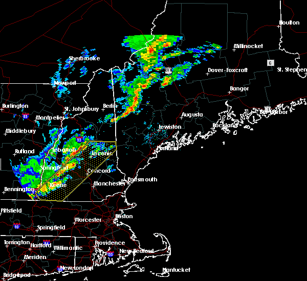 At 1216 pm edt, severe thunderstorms were located along a line extending from near sandwich to 9 miles southwest of hinsdale, moving east at 25 mph (public). Hazards include 60 mph wind gusts. expect damage to trees, and power lines At 1216 pm edt, severe thunderstorms were located along a line extending from near sandwich to 9 miles southwest of hinsdale, moving east at 25 mph (public). Hazards include 60 mph wind gusts. expect damage to trees, and power lines
|
| 6/27/2017 12:09 PM EDT |
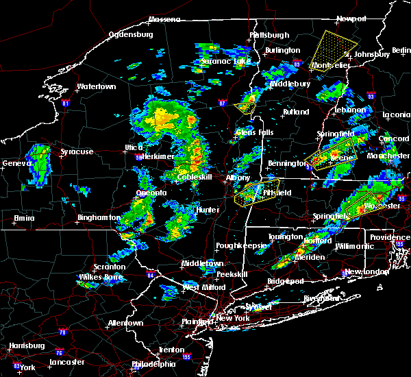 At 408 pm edt, a severe thunderstorm was located over westmoreland, or 8 miles west of keene, moving northeast at 30 mph (radar indicated). Hazards include 60 mph wind gusts and quarter size hail. Minor hail damage to vehicles is possible. Expect wind damage to roofs, siding, and trees. At 408 pm edt, a severe thunderstorm was located over westmoreland, or 8 miles west of keene, moving northeast at 30 mph (radar indicated). Hazards include 60 mph wind gusts and quarter size hail. Minor hail damage to vehicles is possible. Expect wind damage to roofs, siding, and trees.
|
| 6/19/2017 6:09 PM EDT |
 At 608 pm edt, severe thunderstorms were located along a line extending from near warner to near lyndeborough, moving northeast at 45 mph. some of the strongest winds will be headed toward weare and concord (radar indicated and law enforcement reported). Hazards include 60 mph wind gusts. Expect damage to trees, and power lines. locations impacted include, manchester, concord, merrimack, franklin, henniker, new london, bedford, milford, hooksett, amherst, litchfield, peterborough, hopkinton, new boston, loudon, epsom, antrim, mont vernon, canterbury and greenfield. this also includes, north pack monadnock and mount kearsage. this includes the following highways, interstate 293 between mile markers 1 and 11. interstate 89 between mile markers 0 and 30. Interstate 93 between mile markers 18 and 56. At 608 pm edt, severe thunderstorms were located along a line extending from near warner to near lyndeborough, moving northeast at 45 mph. some of the strongest winds will be headed toward weare and concord (radar indicated and law enforcement reported). Hazards include 60 mph wind gusts. Expect damage to trees, and power lines. locations impacted include, manchester, concord, merrimack, franklin, henniker, new london, bedford, milford, hooksett, amherst, litchfield, peterborough, hopkinton, new boston, loudon, epsom, antrim, mont vernon, canterbury and greenfield. this also includes, north pack monadnock and mount kearsage. this includes the following highways, interstate 293 between mile markers 1 and 11. interstate 89 between mile markers 0 and 30. Interstate 93 between mile markers 18 and 56.
|
| 6/19/2017 5:41 PM EDT |
 At 540 pm edt, severe thunderstorms were located along a line extending from near marlow to near jaffrey, moving northeast at 45 mph (radar indicuated and law enforcement reported). Hazards include 60 mph wind gusts. expect damage to trees, and power lines At 540 pm edt, severe thunderstorms were located along a line extending from near marlow to near jaffrey, moving northeast at 45 mph (radar indicuated and law enforcement reported). Hazards include 60 mph wind gusts. expect damage to trees, and power lines
|
| 5/18/2017 9:37 PM EDT |
 At 937 pm edt, severe thunderstorms were located along a line extending from near bradford to peterborough to 13 miles south of fitzwilliam, moving east at 45 mph (radar indicated). Hazards include 60 mph wind gusts. expect damage to trees, and power lines At 937 pm edt, severe thunderstorms were located along a line extending from near bradford to peterborough to 13 miles south of fitzwilliam, moving east at 45 mph (radar indicated). Hazards include 60 mph wind gusts. expect damage to trees, and power lines
|
| 5/18/2017 9:25 PM EDT |
 At 925 pm edt, severe thunderstorms were located along a line extending from 6 miles northeast of claremont to near marlow to marlborough to 9 miles south of winchester, moving east at 50 mph (radar indicated). Hazards include 60 mph wind gusts. Expect damage to trees, and power lines. locations impacted include, keene, claremont, jaffrey, henniker, new london, swanzey, peterborough, charlestown, winchester, antrim, greenfield, lyndeborough, bradford, dublin, francestown, bennington, danbury, richmond, harrisville and nelson. This includes interstate 89 between mile markers 19 and 40. At 925 pm edt, severe thunderstorms were located along a line extending from 6 miles northeast of claremont to near marlow to marlborough to 9 miles south of winchester, moving east at 50 mph (radar indicated). Hazards include 60 mph wind gusts. Expect damage to trees, and power lines. locations impacted include, keene, claremont, jaffrey, henniker, new london, swanzey, peterborough, charlestown, winchester, antrim, greenfield, lyndeborough, bradford, dublin, francestown, bennington, danbury, richmond, harrisville and nelson. This includes interstate 89 between mile markers 19 and 40.
|
| 5/18/2017 8:42 PM EDT |
 At 841 pm edt, severe thunderstorms were located along a line extending from 24 miles west of charlestown to 13 miles west of westmoreland to 13 miles west of hinsdale to 36 miles southwest of winchester, moving east at 50 mph (radar indicated). Hazards include 60 mph wind gusts. expect damage to trees, and power lines At 841 pm edt, severe thunderstorms were located along a line extending from 24 miles west of charlestown to 13 miles west of westmoreland to 13 miles west of hinsdale to 36 miles southwest of winchester, moving east at 50 mph (radar indicated). Hazards include 60 mph wind gusts. expect damage to trees, and power lines
|
| 9/11/2016 9:06 AM EDT |
 At 906 am edt, severe thunderstorms were located along a line extending from near franklin to near sharon, moving east at 55 mph (radar indicated). Hazards include 60 mph wind gusts. Expect damage to roofs. siding. And trees. At 906 am edt, severe thunderstorms were located along a line extending from near franklin to near sharon, moving east at 55 mph (radar indicated). Hazards include 60 mph wind gusts. Expect damage to roofs. siding. And trees.
|
| 9/11/2016 8:23 AM EDT |
 At 822 am edt, severe thunderstorms were located along a line extending from 6 miles southwest of enfield to 6 miles southwest of hinsdale, moving east at 35 mph. this line of storms has the history of producing wind damage (radar indicated). Hazards include 60 mph wind gusts. Expect damage to roofs. siding. And trees. At 822 am edt, severe thunderstorms were located along a line extending from 6 miles southwest of enfield to 6 miles southwest of hinsdale, moving east at 35 mph. this line of storms has the history of producing wind damage (radar indicated). Hazards include 60 mph wind gusts. Expect damage to roofs. siding. And trees.
|
| 8/13/2016 8:04 PM EDT |
 At 803 pm edt, severe thunderstorms were located along a line extending from near nelson to bennington, moving northeast at 35 mph (radar indicated). Hazards include 60 mph wind gusts and nickel size hail. Expect damage to roofs. siding. and trees. Locations impacted include, henniker, peterborough, new boston, antrim, greenfield, dublin, francestown, bennington, harrisville, nelson, hancock, deering, weare, windsor and hillsborough. At 803 pm edt, severe thunderstorms were located along a line extending from near nelson to bennington, moving northeast at 35 mph (radar indicated). Hazards include 60 mph wind gusts and nickel size hail. Expect damage to roofs. siding. and trees. Locations impacted include, henniker, peterborough, new boston, antrim, greenfield, dublin, francestown, bennington, harrisville, nelson, hancock, deering, weare, windsor and hillsborough.
|
| 8/13/2016 7:23 PM EDT |
 At 723 pm edt, severe thunderstorms were located along a line extending from near nelson to hancock, moving east at 30 mph (radar indicated). Hazards include 60 mph wind gusts and quarter size hail. Hail damage to vehicles is expected. Expect wind damage to roofs, siding, and trees. At 723 pm edt, severe thunderstorms were located along a line extending from near nelson to hancock, moving east at 30 mph (radar indicated). Hazards include 60 mph wind gusts and quarter size hail. Hail damage to vehicles is expected. Expect wind damage to roofs, siding, and trees.
|
| 7/23/2016 6:30 PM EDT |
 At 630 pm edt, severe thunderstorms were located along a line extending from newington to manchester to swanzey, moving southeast at 25 mph (radar indicated). Hazards include 60 mph wind gusts and nickel size hail. Expect damage to roofs. siding. and trees. Locations impacted include, manchester, nashua, derry, merrimack, keene, portsmouth, hampton, durham, exeter, jaffrey, salem, northwood, dover, bedford, milford, hooksett, somersworth, amherst, barrington and litchfield. At 630 pm edt, severe thunderstorms were located along a line extending from newington to manchester to swanzey, moving southeast at 25 mph (radar indicated). Hazards include 60 mph wind gusts and nickel size hail. Expect damage to roofs. siding. and trees. Locations impacted include, manchester, nashua, derry, merrimack, keene, portsmouth, hampton, durham, exeter, jaffrey, salem, northwood, dover, bedford, milford, hooksett, somersworth, amherst, barrington and litchfield.
|
| 7/23/2016 6:15 PM EDT | Trees and power lines down at nh-136 e and ferson roa in hillsborough county NH, 5.7 miles W of Bennington, NH |
| 7/23/2016 6:08 PM EDT |
 At 608 pm edt, severe thunderstorms were located along a line extending from near dover to goffstown to walpole, moving southeast at 25 mph (radar indicated). Hazards include 60 mph wind gusts and nickel size hail. Expect damage to roofs. siding. And trees. At 608 pm edt, severe thunderstorms were located along a line extending from near dover to goffstown to walpole, moving southeast at 25 mph (radar indicated). Hazards include 60 mph wind gusts and nickel size hail. Expect damage to roofs. siding. And trees.
|
| 7/23/2016 5:21 PM EDT |
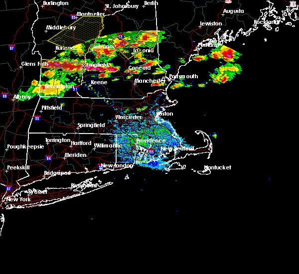 At 521 pm edt, severe thunderstorms were located along a line extending from 9 miles southwest of ascutney to warner, moving east at 45 mph (radar indicated). Hazards include 60 mph wind gusts and quarter size hail. Hail damage to vehicles is expected. Expect wind damage to roofs, siding, and trees. At 521 pm edt, severe thunderstorms were located along a line extending from 9 miles southwest of ascutney to warner, moving east at 45 mph (radar indicated). Hazards include 60 mph wind gusts and quarter size hail. Hail damage to vehicles is expected. Expect wind damage to roofs, siding, and trees.
|
| 8/25/2015 5:41 PM EDT |
 The severe thunderstorm warning for northwestern hillsborough county will expire at 545 pm edt, the storm which prompted the warning has moved out of the area. therefore the warning will be allowed to expire. remember that a flash flood warning continues for much of this area through 10 pm edt. to report severe weather, contact your nearest law enforcement agency. they will relay your report to the national weather service gray maine. The severe thunderstorm warning for northwestern hillsborough county will expire at 545 pm edt, the storm which prompted the warning has moved out of the area. therefore the warning will be allowed to expire. remember that a flash flood warning continues for much of this area through 10 pm edt. to report severe weather, contact your nearest law enforcement agency. they will relay your report to the national weather service gray maine.
|
| 8/25/2015 5:19 PM EDT |
 At 518 pm edt, doppler radar indicated a severe thunderstorm capable of producing quarter size hail and damaging winds in excess of 60 mph. this storm was located over weare, or 10 miles southeast of henniker, moving northeast at 35 mph. locations impacted include, henniker, peterborough, new boston, greenfield, francestown, bennington, deering, weare, hancock and goffstown. a flash flood warning is also in effect for this area. At 518 pm edt, doppler radar indicated a severe thunderstorm capable of producing quarter size hail and damaging winds in excess of 60 mph. this storm was located over weare, or 10 miles southeast of henniker, moving northeast at 35 mph. locations impacted include, henniker, peterborough, new boston, greenfield, francestown, bennington, deering, weare, hancock and goffstown. a flash flood warning is also in effect for this area.
|
| 8/25/2015 5:03 PM EDT |
 At 502 pm edt, doppler radar indicated a severe thunderstorm capable of producing quarter size hail and damaging winds in excess of 60 mph. this storm was located over francestown, or 12 miles south of henniker, moving northeast at 20 mph. locations impacted include, henniker, peterborough, new boston, antrim, greenfield, lyndeborough, hancock, francestown, bennington, harrisville, deering, weare, goffstown and hillsborough. At 502 pm edt, doppler radar indicated a severe thunderstorm capable of producing quarter size hail and damaging winds in excess of 60 mph. this storm was located over francestown, or 12 miles south of henniker, moving northeast at 20 mph. locations impacted include, henniker, peterborough, new boston, antrim, greenfield, lyndeborough, hancock, francestown, bennington, harrisville, deering, weare, goffstown and hillsborough.
|
| 8/25/2015 4:54 PM EDT |
 At 454 pm edt, doppler radar indicated a severe thunderstorm capable of producing quarter size hail and damaging winds in excess of 60 mph. this storm was located over francestown, or 13 miles south of henniker, and moving northeast at 20 mph. At 454 pm edt, doppler radar indicated a severe thunderstorm capable of producing quarter size hail and damaging winds in excess of 60 mph. this storm was located over francestown, or 13 miles south of henniker, and moving northeast at 20 mph.
|
| 8/15/2015 6:44 PM EDT |
 At 643 pm edt, doppler radar indicated a severe thunderstorm capable of producing quarter size hail and damaging winds in excess of 60 mph. this storm was located over swanzey, or near keene, and moving east at 25 mph. At 643 pm edt, doppler radar indicated a severe thunderstorm capable of producing quarter size hail and damaging winds in excess of 60 mph. this storm was located over swanzey, or near keene, and moving east at 25 mph.
|
| 8/4/2015 1:55 PM EDT | Quarter sized hail reported 5.7 miles W of Bennington, NH |
| 8/4/2015 1:40 PM EDT |
 At 140 pm edt, doppler radar indicated a severe thunderstorm capable of producing half dollar size hail and damaging winds in excess of 60 mph. this storm was located over rindge, or near jaffrey, moving northeast at 50 mph. locations impacted include, jaffrey, bedford, milford, amherst, peterborough, rindge, new boston, new ipswich, wilton, antrim, mont vernon, fitzwilliam, troy, greenville, greenfield, lyndeborough, hancock, dublin, francestown and bennington. At 140 pm edt, doppler radar indicated a severe thunderstorm capable of producing half dollar size hail and damaging winds in excess of 60 mph. this storm was located over rindge, or near jaffrey, moving northeast at 50 mph. locations impacted include, jaffrey, bedford, milford, amherst, peterborough, rindge, new boston, new ipswich, wilton, antrim, mont vernon, fitzwilliam, troy, greenville, greenfield, lyndeborough, hancock, dublin, francestown and bennington.
|
| 8/4/2015 1:40 PM EDT |
 At 140 pm edt, doppler radar indicated a severe thunderstorm capable of producing damaging winds in excess of 60 mph. this storm was located near bennington, or 8 miles south of henniker, moving east at 35 mph. penny size hail may also accompany the damaging winds. locations impacted include, western concord, henniker, amherst, peterborough, hopkinton, new boston, antrim, mont vernon, greenfield, lyndeborough, hancock, dublin, francestown, bennington, harrisville, warner, bow, boscawen, dunbarton and washington. At 140 pm edt, doppler radar indicated a severe thunderstorm capable of producing damaging winds in excess of 60 mph. this storm was located near bennington, or 8 miles south of henniker, moving east at 35 mph. penny size hail may also accompany the damaging winds. locations impacted include, western concord, henniker, amherst, peterborough, hopkinton, new boston, antrim, mont vernon, greenfield, lyndeborough, hancock, dublin, francestown, bennington, harrisville, warner, bow, boscawen, dunbarton and washington.
|
| 8/4/2015 1:34 PM EDT |
 At 134 pm edt, doppler radar indicated a severe thunderstorm capable of producing quarter size hail and damaging winds in excess of 60 mph. this storm was located near winchendon, or 9 miles south of jaffrey, and moving northeast at 50 mph. At 134 pm edt, doppler radar indicated a severe thunderstorm capable of producing quarter size hail and damaging winds in excess of 60 mph. this storm was located near winchendon, or 9 miles south of jaffrey, and moving northeast at 50 mph.
|
| 8/4/2015 1:28 PM EDT |
 At 128 pm edt, doppler radar indicated a severe thunderstorm capable of producing quarter size hail and damaging winds in excess of 60 mph. this storm was located over antrim, or 13 miles north of jaffrey, and moving east at 35 mph. At 128 pm edt, doppler radar indicated a severe thunderstorm capable of producing quarter size hail and damaging winds in excess of 60 mph. this storm was located over antrim, or 13 miles north of jaffrey, and moving east at 35 mph.
|
| 8/4/2015 1:22 PM EDT |
 At 121 pm edt, doppler radar indicated a severe thunderstorm capable of producing damaging winds in excess of 60 mph. this storm was located over antrim, or 13 miles southwest of henniker, moving east at 35 mph. penny size hail may also accompany the damaging winds. locations impacted include, keene, henniker, swanzey, peterborough, hopkinton, new boston, antrim, marlborough, greenfield, lyndeborough, hancock, bradford, dublin, francestown, bennington, harrisville, gilsum, surry, nelson and sullivan. At 121 pm edt, doppler radar indicated a severe thunderstorm capable of producing damaging winds in excess of 60 mph. this storm was located over antrim, or 13 miles southwest of henniker, moving east at 35 mph. penny size hail may also accompany the damaging winds. locations impacted include, keene, henniker, swanzey, peterborough, hopkinton, new boston, antrim, marlborough, greenfield, lyndeborough, hancock, bradford, dublin, francestown, bennington, harrisville, gilsum, surry, nelson and sullivan.
|
| 8/4/2015 12:58 PM EDT |
 At 1258 pm edt, doppler radar indicated a severe thunderstorm capable of producing quarter size hail and damaging winds in excess of 60 mph. this storm was located over roxbury, or near keene, moving east at 25 mph. locations impacted include, keene, jaffrey, henniker, swanzey, peterborough, rindge, hopkinton, new boston, new ipswich, winchester, hinsdale, wilton, chesterfield, antrim, marlborough, fitzwilliam, troy, greenville, westmoreland and greenfield. At 1258 pm edt, doppler radar indicated a severe thunderstorm capable of producing quarter size hail and damaging winds in excess of 60 mph. this storm was located over roxbury, or near keene, moving east at 25 mph. locations impacted include, keene, jaffrey, henniker, swanzey, peterborough, rindge, hopkinton, new boston, new ipswich, winchester, hinsdale, wilton, chesterfield, antrim, marlborough, fitzwilliam, troy, greenville, westmoreland and greenfield.
|
| 8/4/2015 12:46 PM EDT |
 At 1246 pm edt, doppler radar indicated a severe thunderstorm capable of producing quarter size hail and damaging winds in excess of 60 mph. this storm was located over keene, moving east at 30 mph. locations impacted include, keene, jaffrey, henniker, swanzey, peterborough, rindge, hopkinton, new boston, new ipswich, winchester, hinsdale, wilton, chesterfield, antrim, marlborough, fitzwilliam, troy, greenville, westmoreland and greenfield. At 1246 pm edt, doppler radar indicated a severe thunderstorm capable of producing quarter size hail and damaging winds in excess of 60 mph. this storm was located over keene, moving east at 30 mph. locations impacted include, keene, jaffrey, henniker, swanzey, peterborough, rindge, hopkinton, new boston, new ipswich, winchester, hinsdale, wilton, chesterfield, antrim, marlborough, fitzwilliam, troy, greenville, westmoreland and greenfield.
|
| 8/3/2015 6:26 PM EDT |
 At 625 pm edt, doppler radar indicated a line of severe thunderstorms capable of producing damaging winds in excess of 60 mph. these storms were located along a line extending from holderness to near franklin to hancock, moving east at 40 mph. locations impacted include, keene, franklin, henniker, new london, meredith, hopkinton, antrim, hancock, bradford, francestown, bennington, danbury, harrisville, gilsum, nelson, sullivan, roxbury, warner, mount sunapee state park and wadleigh state park. At 625 pm edt, doppler radar indicated a line of severe thunderstorms capable of producing damaging winds in excess of 60 mph. these storms were located along a line extending from holderness to near franklin to hancock, moving east at 40 mph. locations impacted include, keene, franklin, henniker, new london, meredith, hopkinton, antrim, hancock, bradford, francestown, bennington, danbury, harrisville, gilsum, nelson, sullivan, roxbury, warner, mount sunapee state park and wadleigh state park.
|
| 8/3/2015 5:57 PM EDT |
 At 556 pm edt, doppler radar indicated a line of severe thunderstorms capable of producing damaging winds in excess of 60 mph. these storms were located along a line extending from groton to new london to near keene, and moving east at 40 mph. At 556 pm edt, doppler radar indicated a line of severe thunderstorms capable of producing damaging winds in excess of 60 mph. these storms were located along a line extending from groton to new london to near keene, and moving east at 40 mph.
|
| 7/1/2015 6:16 PM EDT |
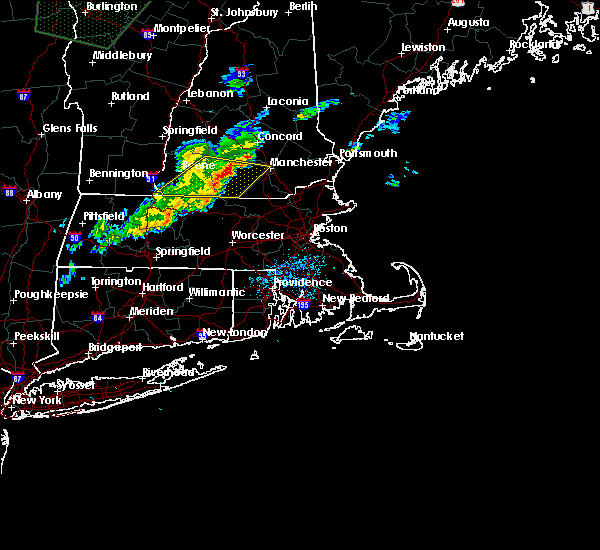 At 616 pm edt, doppler radar indicated a line of severe thunderstorms capable of producing damaging winds in excess of 60 mph. these storms were located along a line extending from near new boston to royalston, moving east at 30 mph. locations impacted include, merrimack, jaffrey, bedford, milford, amherst, peterborough, rindge, new boston, new ipswich, brookline, wilton, mont vernon, fitzwilliam, greenville, greenfield, lyndeborough, hancock, dublin, francestown and bennington. At 616 pm edt, doppler radar indicated a line of severe thunderstorms capable of producing damaging winds in excess of 60 mph. these storms were located along a line extending from near new boston to royalston, moving east at 30 mph. locations impacted include, merrimack, jaffrey, bedford, milford, amherst, peterborough, rindge, new boston, new ipswich, brookline, wilton, mont vernon, fitzwilliam, greenville, greenfield, lyndeborough, hancock, dublin, francestown and bennington.
|
| 7/1/2015 5:52 PM EDT |
 At 552 pm edt, doppler radar indicated a line of severe thunderstorms capable of producing damaging winds in excess of 60 mph. these storms were located along a line extending from bennington to near warwick, and moving east at 30 mph. At 552 pm edt, doppler radar indicated a line of severe thunderstorms capable of producing damaging winds in excess of 60 mph. these storms were located along a line extending from bennington to near warwick, and moving east at 30 mph.
|
| 5/27/2015 7:28 PM EDT | The severe thunderstorm warning for southwestern hillsborough and central cheshire counties will expire at 730 pm edt, the storms which prompted the warning have weakened below severe limits, and no longer poses an immediate threat to life or property. therefore the warning will be allowed to expire. however gusty winds are still possible with these thunderstorms. |
| 5/27/2015 7:13 PM EDT | At 712 pm edt, doppler radar indicated a line of severe thunderstorms capable of producing damaging winds in excess of 60 mph. these storms were located along a line extending from roxbury to near dublin to near rindge to near phillipston, moving northeast at 55 mph. locations impacted include, keene, jaffrey, swanzey, peterborough, rindge, new ipswich, wilton, antrim, marlborough, fitzwilliam, troy, greenfield, lyndeborough, hancock, dublin, francestown, bennington, temple, royalston and richmond. |
| 5/27/2015 6:47 PM EDT | At 646 pm edt, doppler radar indicated a line of severe thunderstorms capable of producing damaging winds in excess of 60 mph. these storms were located along a line extending from near vernon to northfield to wendell to near amherst, and moving northeast at 55 mph. |
| 7/2/2014 4:14 PM EDT | Tree and wires down on bennington road and mountain road in hillsborough county NH, 6.4 miles WNW of Bennington, NH |
| 10/7/2013 6:00 PM EDT | Tree and wires down on new hampshire turnpike southboun in hillsborough county NH, 6.4 miles WNW of Bennington, NH |
| 9/12/2013 2:20 PM EDT | Tree and wires down on south bennington road in hillsborough county NH, 0.6 miles NE of Bennington, NH |
| 9/12/2013 2:20 PM EDT | Tree on house on greenfield road. tree on car and multiple wires dow in hillsborough county NH, 0.6 miles NE of Bennington, NH |
| 9/12/2013 2:20 PM EDT | Tree and wires down on sawmill road in hillsborough county NH, 5.3 miles NW of Bennington, NH |
| 8/5/2012 3:40 PM EDT | Tree and wires down on route 202 at route 137 in hillsborough county NH, 0.6 miles NE of Bennington, NH |
Hail Maps for Bennington, NH


Connect with Interactive Hail Maps