

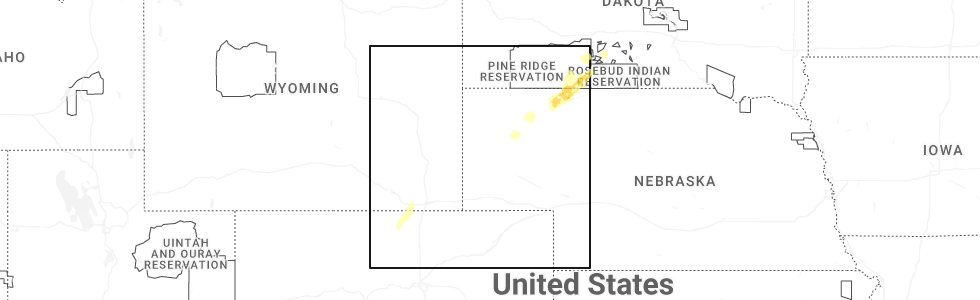
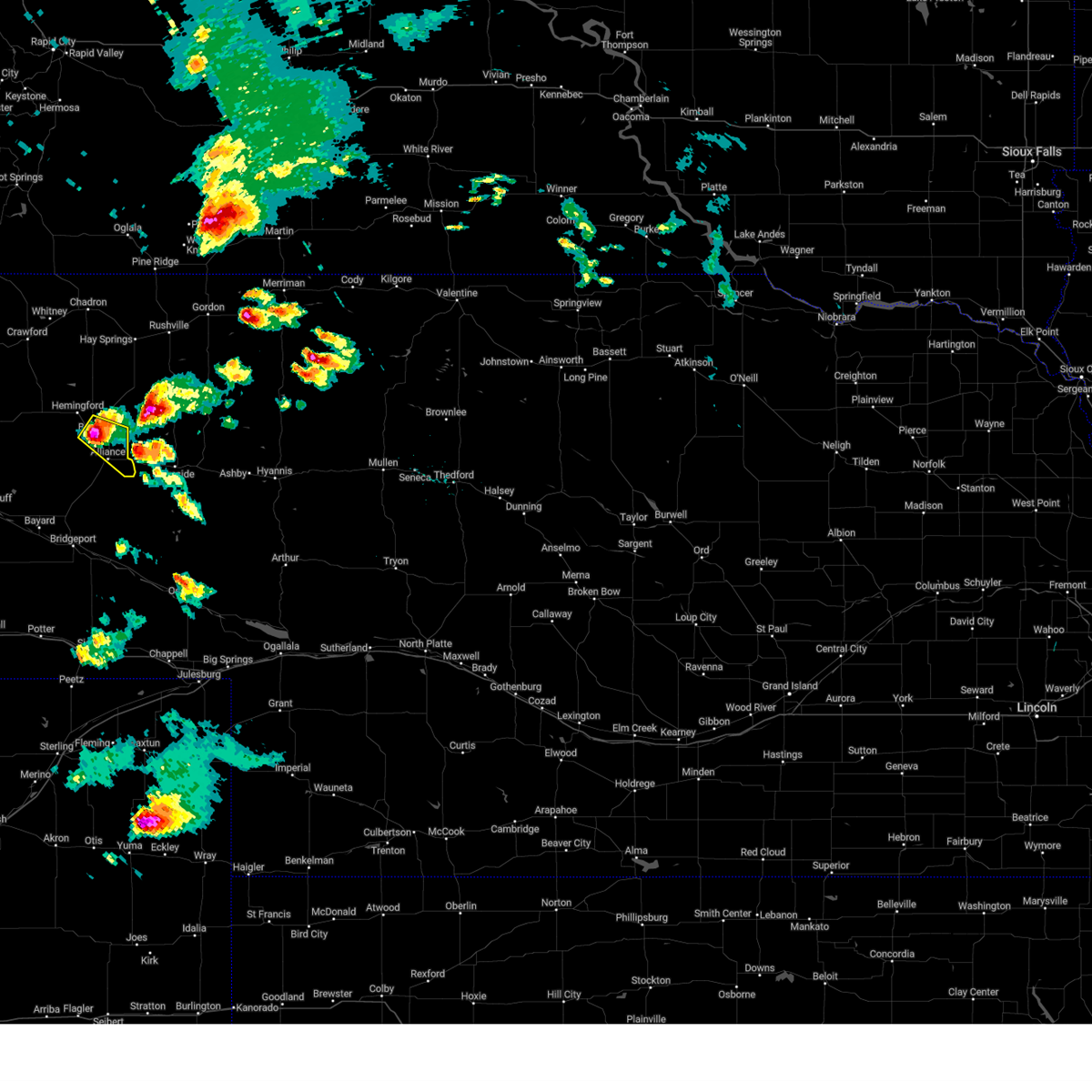
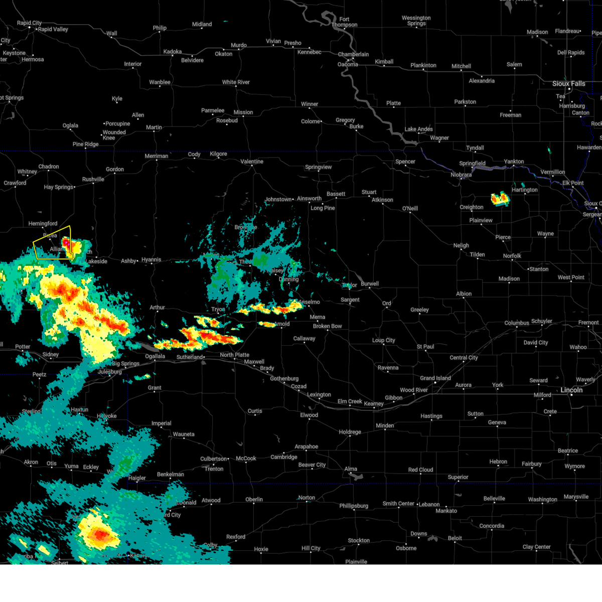
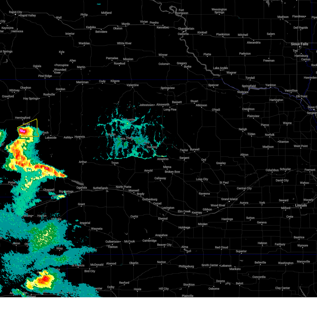
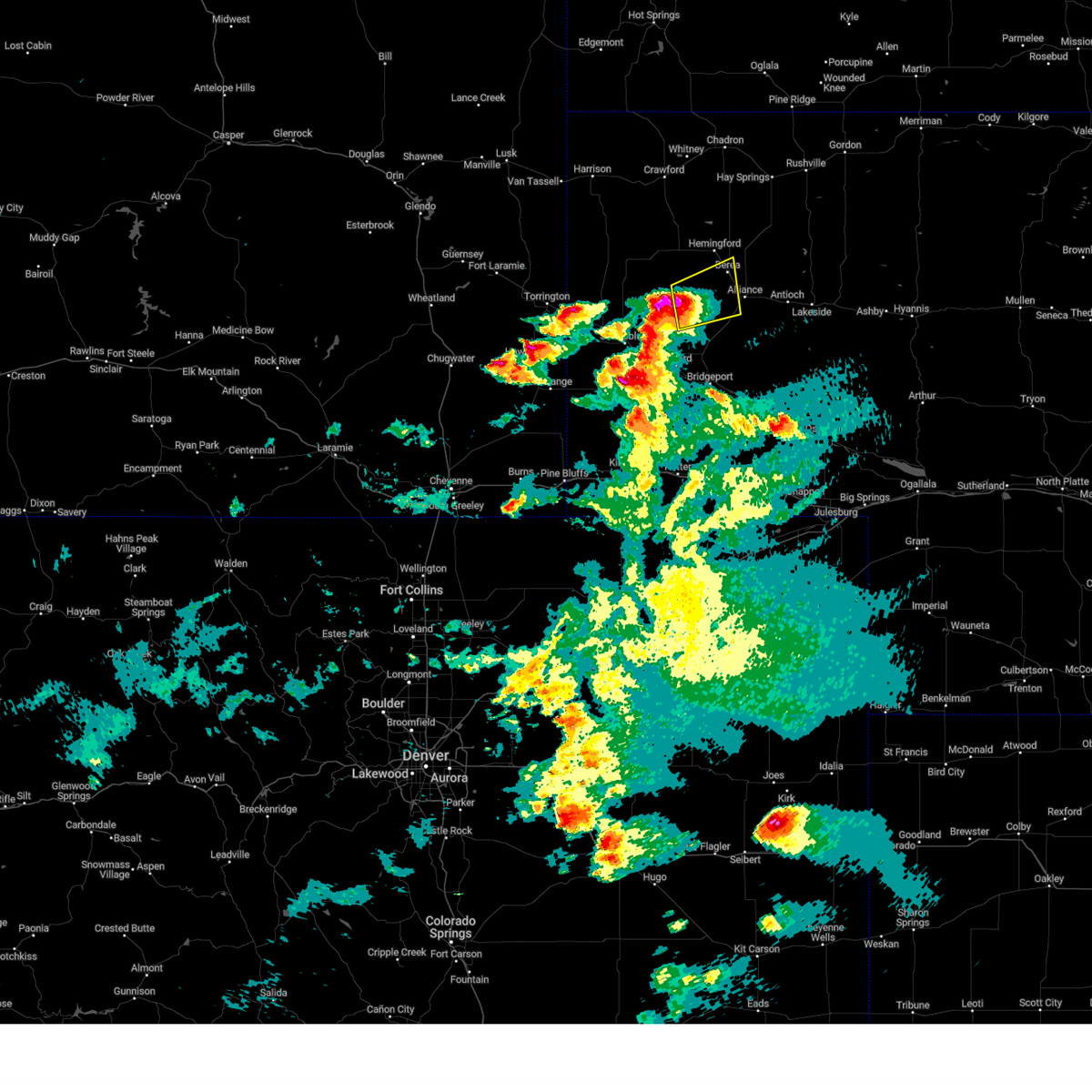
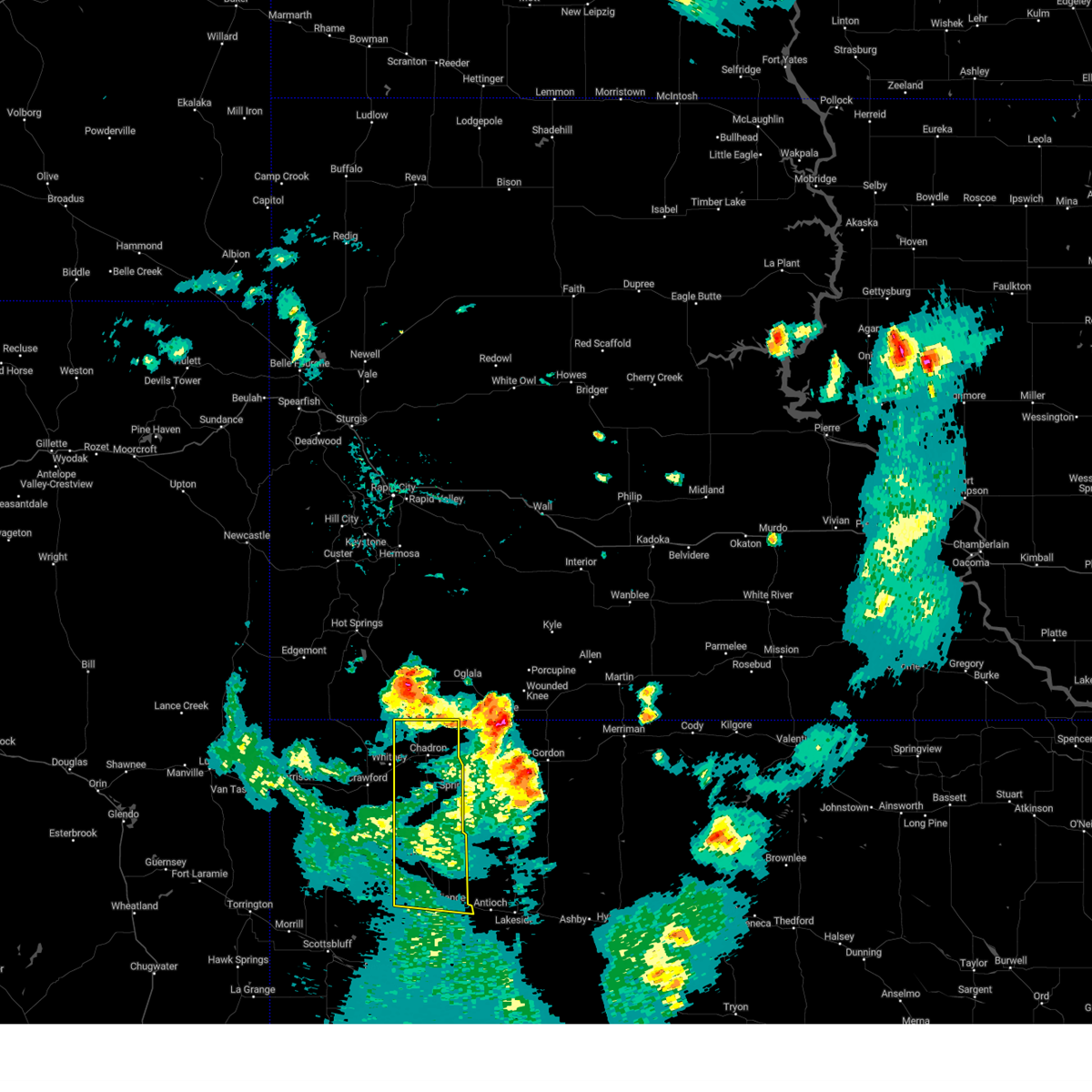
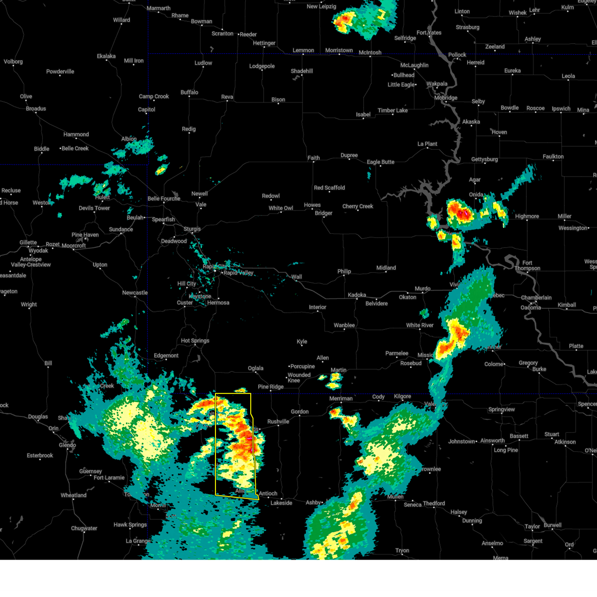
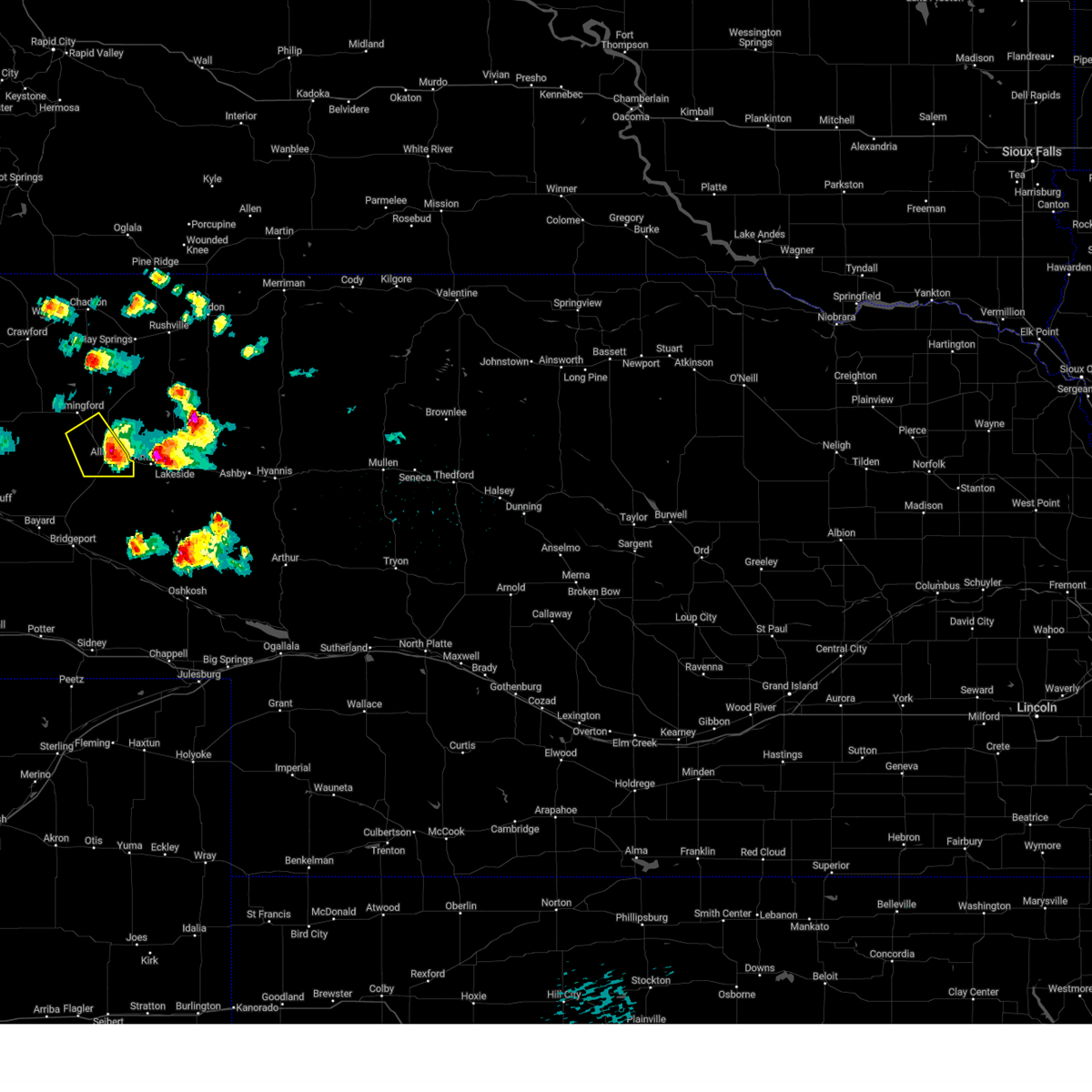
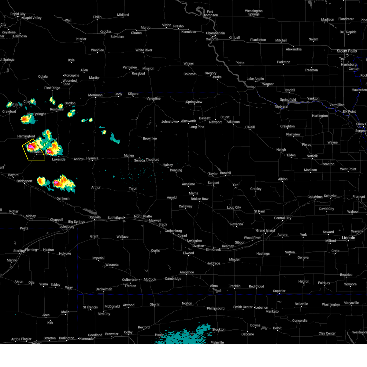
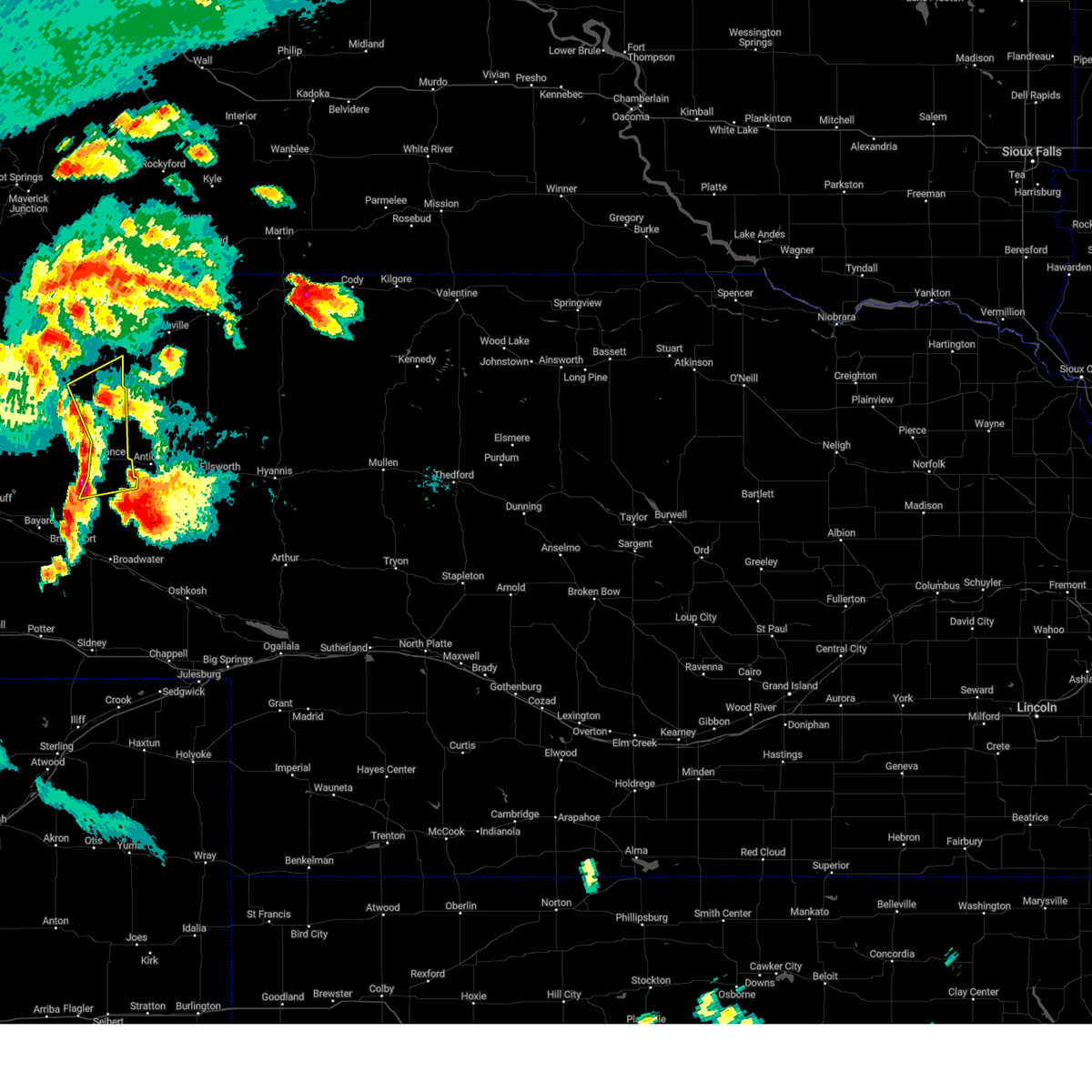
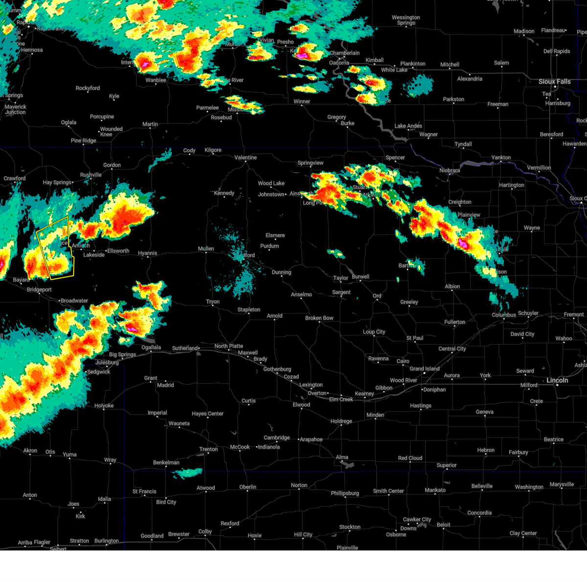
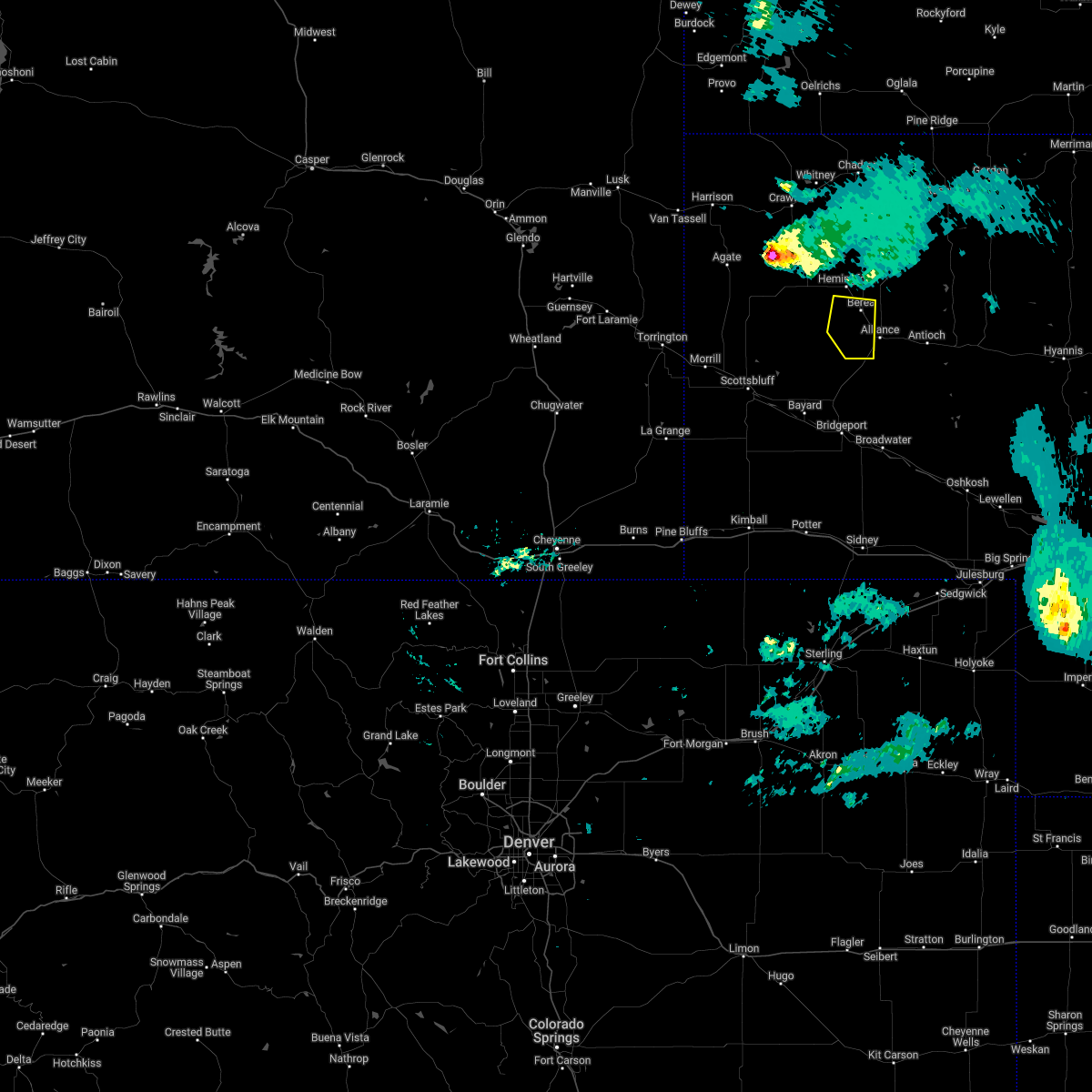
Hail Map for Berea, NE
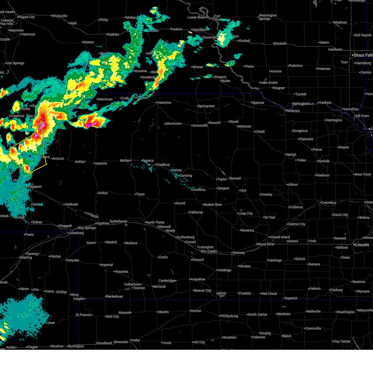
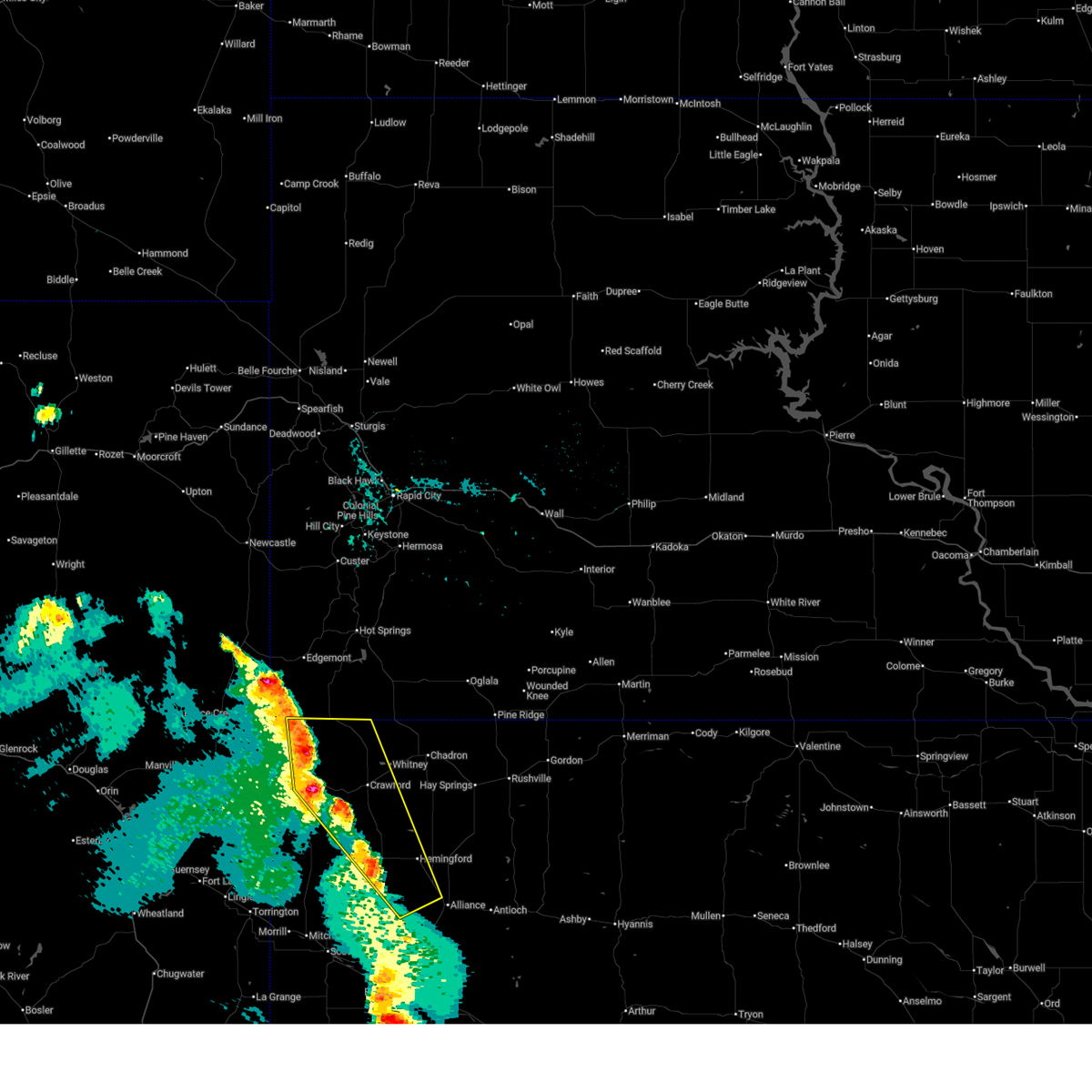
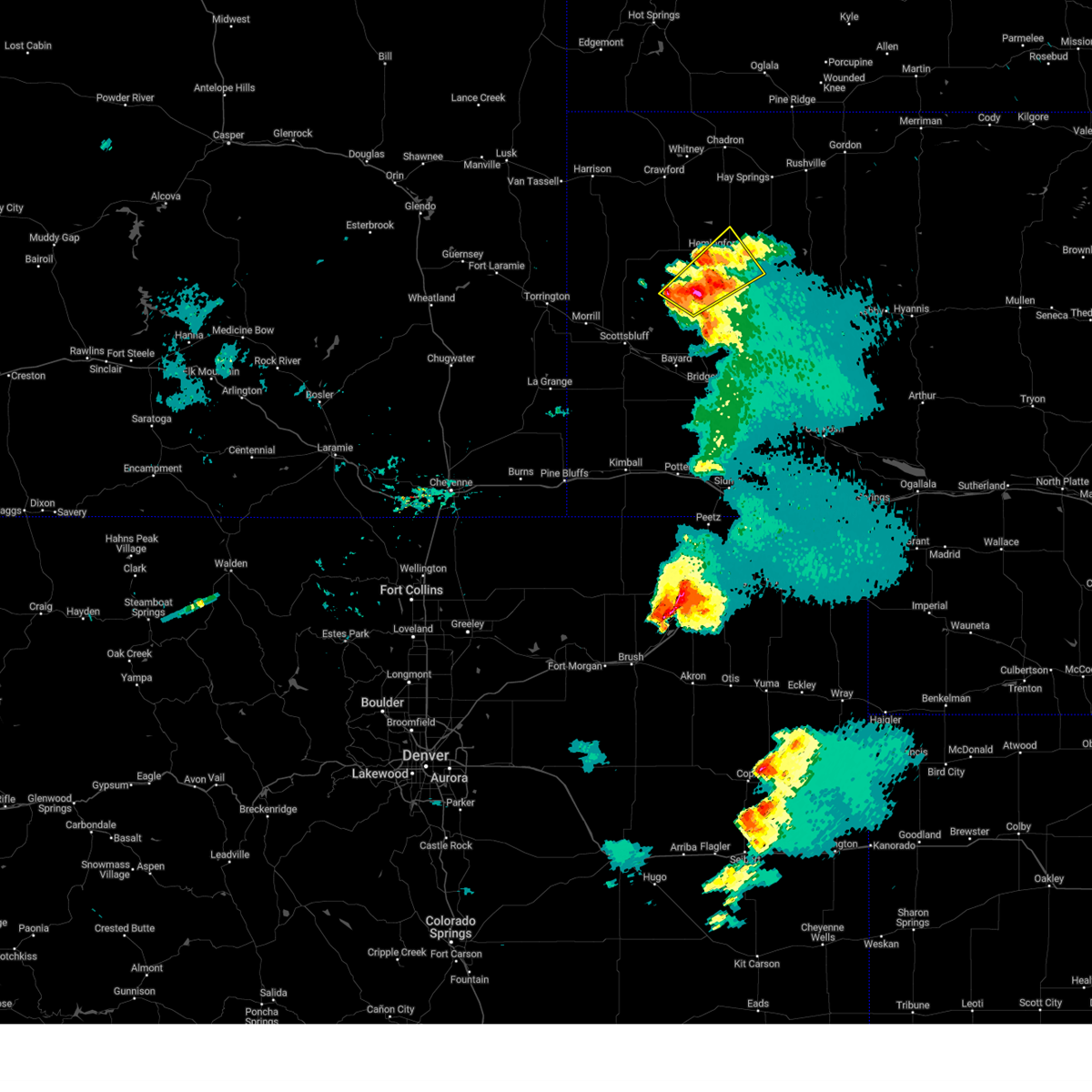
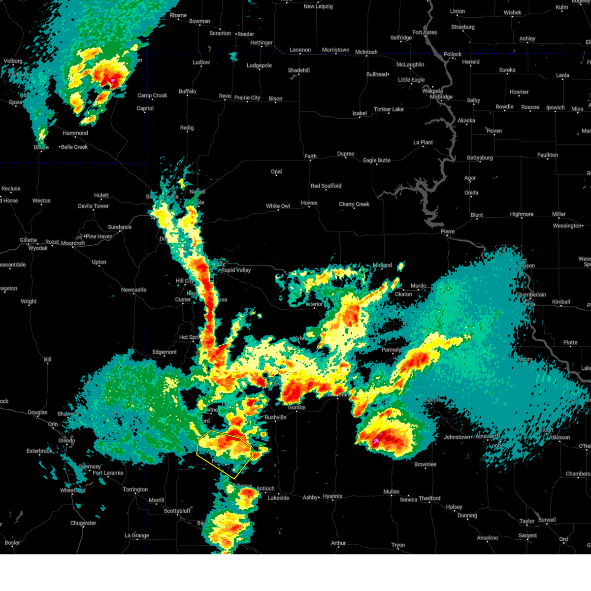
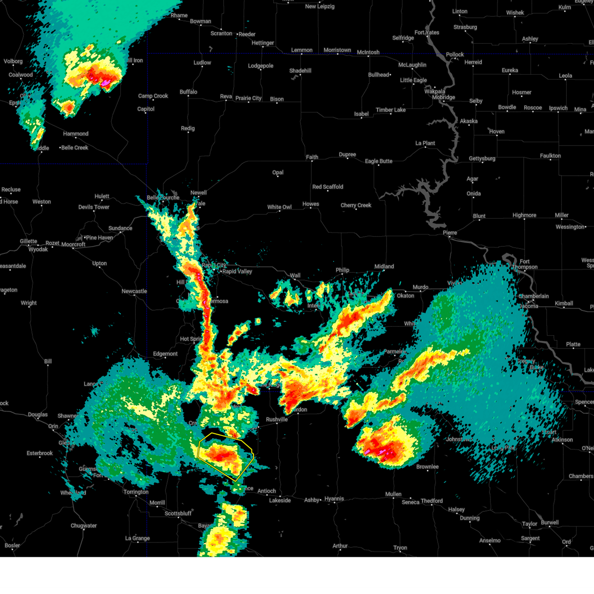
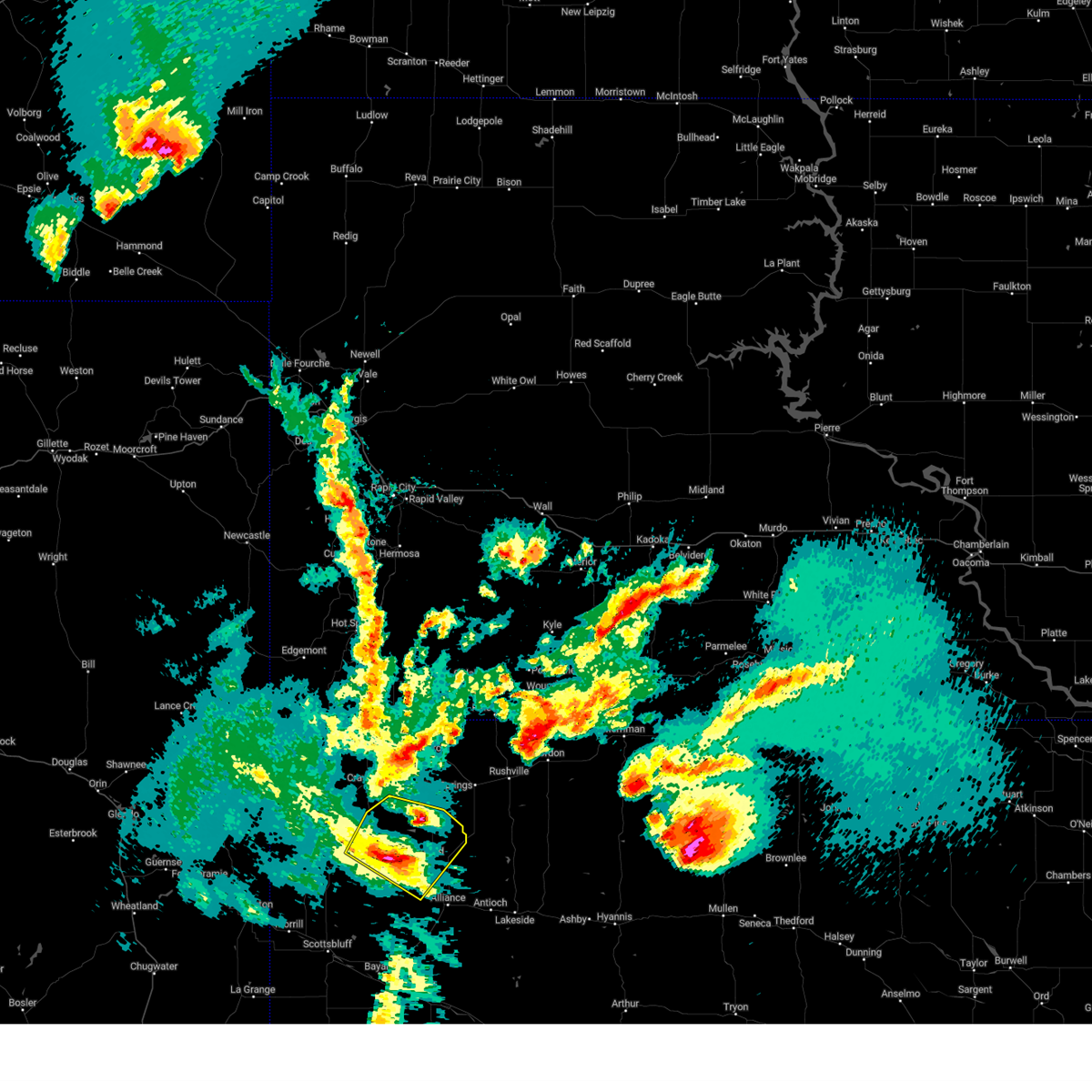
The Berea, NE area has had 0 reports of on-the-ground hail by trained spotters, and has been under severe weather warnings 6 times during the past 12 months. Doppler radar has detected hail at or near Berea, NE on 88 occasions, including 3 occasions during the past year.
| Name: | Berea, NE |
| Where Located: | 42.8 miles NE of Scottsbluff, NE |
| Map: | Google Map for Berea, NE |
| Population: | 41 |
| Housing Units: | 26 |
| More Info: | Search Google for Berea, NE |
1
The Top Recent Hail Date for Berea, NE is Saturday, October 4, 2025 (25th out of 88)
Hail and Wind Damage Spotted near Berea, NE
| Date / Time | Report Details |
|---|---|
| 6/27/2026 6:00 PM MDT |
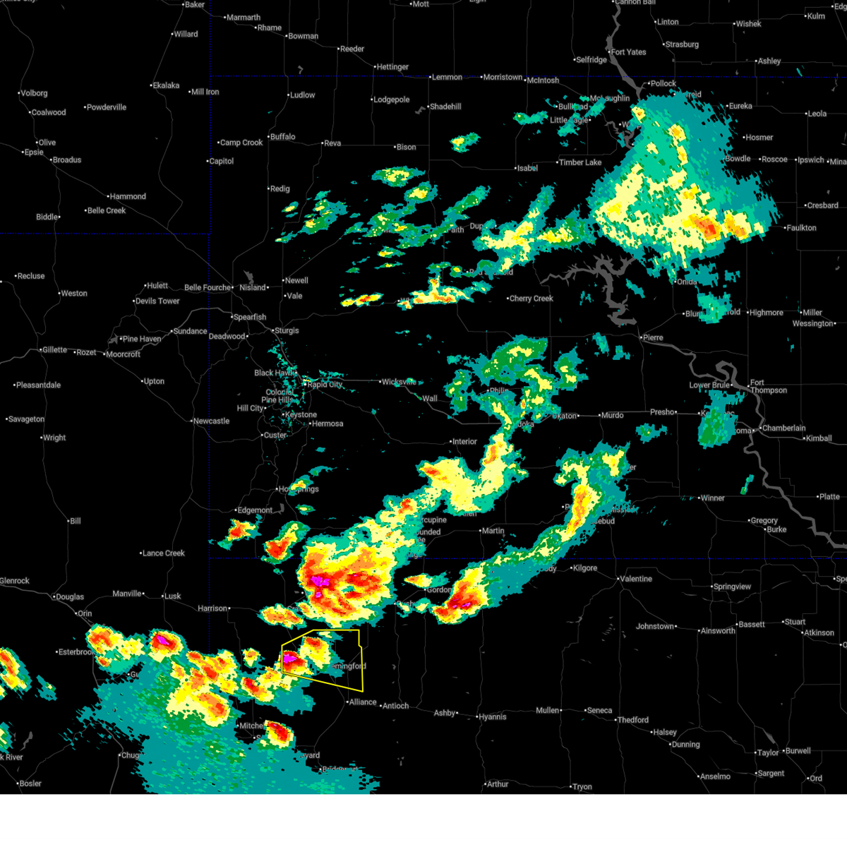
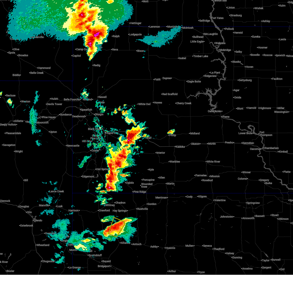 At 600 pm mdt, a severe thunderstorm was located near hemingford, or 18 miles north of alliance, moving north at 20 mph (radar indicated). Hazards include golf ball size hail and 60 mph wind gusts. People and animals outdoors will be injured. expect hail damage to roofs, siding, windows, and vehicles. expect wind damage to roofs, siding, and trees. Locations impacted include, hemingford, box butte county fairgrounds, and berea. At 600 pm mdt, a severe thunderstorm was located near hemingford, or 18 miles north of alliance, moving north at 20 mph (radar indicated). Hazards include golf ball size hail and 60 mph wind gusts. People and animals outdoors will be injured. expect hail damage to roofs, siding, windows, and vehicles. expect wind damage to roofs, siding, and trees. Locations impacted include, hemingford, box butte county fairgrounds, and berea.
|
| 6/27/2026 5:43 PM MDT |
 Svrcys the national weather service in cheyenne has issued a * severe thunderstorm warning for, northeastern box butte county in the panhandle of nebraska, southeastern dawes county in the panhandle of nebraska, * until 630 pm mdt. * at 543 pm mdt, a severe thunderstorm was located near hemingford, or 15 miles northwest of alliance, moving north at 25 mph (radar indicated). Hazards include 60 mph wind gusts and quarter size hail. Hail damage to vehicles is expected. Expect wind damage to roofs, siding, and trees. Svrcys the national weather service in cheyenne has issued a * severe thunderstorm warning for, northeastern box butte county in the panhandle of nebraska, southeastern dawes county in the panhandle of nebraska, * until 630 pm mdt. * at 543 pm mdt, a severe thunderstorm was located near hemingford, or 15 miles northwest of alliance, moving north at 25 mph (radar indicated). Hazards include 60 mph wind gusts and quarter size hail. Hail damage to vehicles is expected. Expect wind damage to roofs, siding, and trees.
|
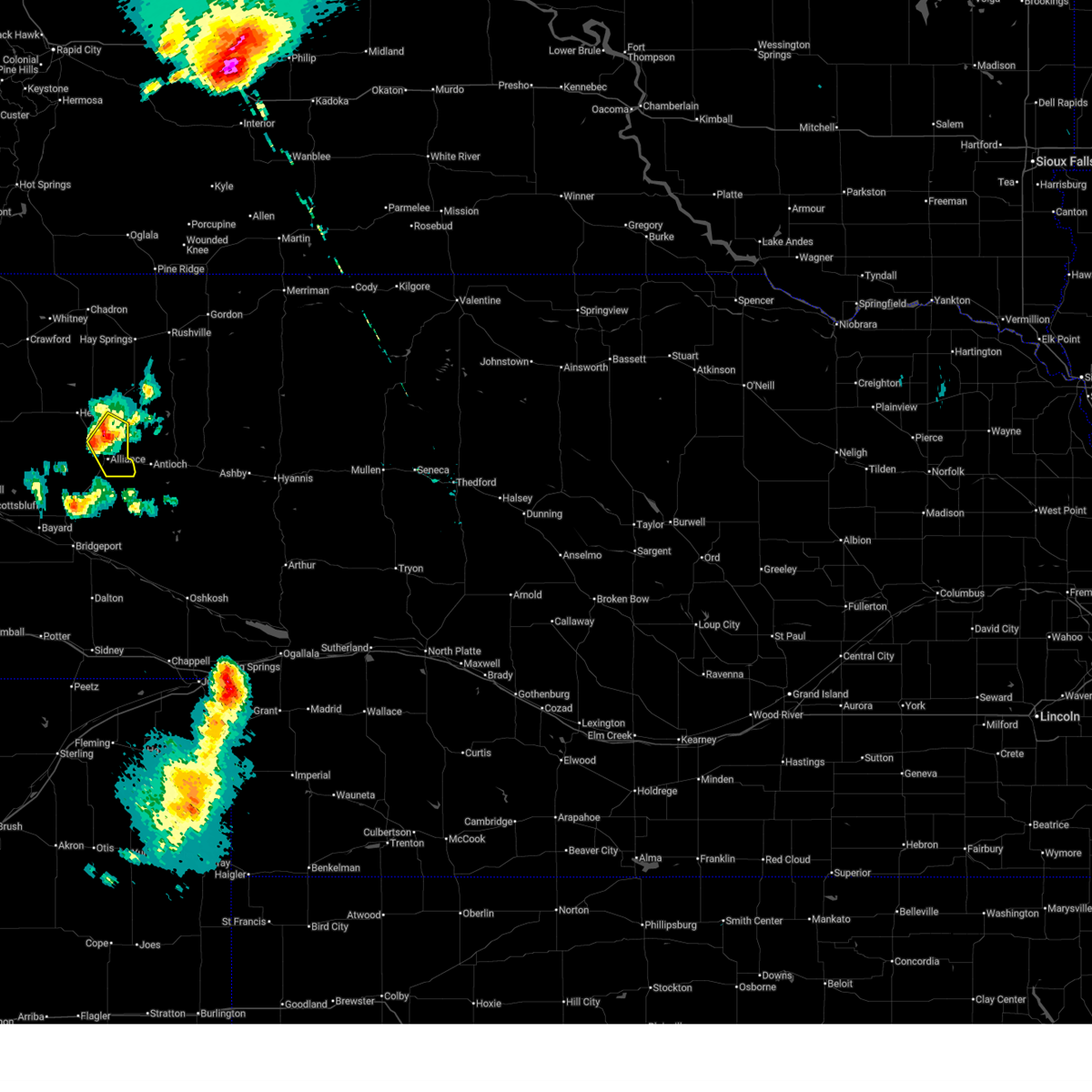
| 6/8/2026 9:24 PM MDT |
 The storm which prompted the warning has weakened below severe limits, and has exited the warned area. therefore, the warning will be allowed to expire. a severe thunderstorm watch remains in effect until 1100 pm mdt for the panhandle of nebraska. The storm which prompted the warning has weakened below severe limits, and has exited the warned area. therefore, the warning will be allowed to expire. a severe thunderstorm watch remains in effect until 1100 pm mdt for the panhandle of nebraska.
|
| 6/8/2026 8:52 PM MDT |
 At 852 pm mdt, a severe thunderstorm was located 7 miles northeast of angora, or 14 miles southwest of alliance, moving east at 35 mph (radar indicated). Hazards include 60 mph wind gusts and quarter size hail. Hail damage to vehicles is expected. expect wind damage to roofs, siding, and trees. Locations impacted include, alliance, alliance municipal airport, and wild horse butte. At 852 pm mdt, a severe thunderstorm was located 7 miles northeast of angora, or 14 miles southwest of alliance, moving east at 35 mph (radar indicated). Hazards include 60 mph wind gusts and quarter size hail. Hail damage to vehicles is expected. expect wind damage to roofs, siding, and trees. Locations impacted include, alliance, alliance municipal airport, and wild horse butte.
|
| 6/8/2026 8:27 PM MDT |
 Svrcys the national weather service in cheyenne has issued a * severe thunderstorm warning for, southeastern box butte county in the panhandle of nebraska, east central scotts bluff county in the panhandle of nebraska, northern morrill county in the panhandle of nebraska, * until 930 pm mdt. * at 826 pm mdt, a severe thunderstorm was located near angora, or 21 miles east of scottsbluff, moving northeast at 15 mph (radar indicated). Hazards include 60 mph wind gusts and quarter size hail. Hail damage to vehicles is expected. Expect wind damage to roofs, siding, and trees. Svrcys the national weather service in cheyenne has issued a * severe thunderstorm warning for, southeastern box butte county in the panhandle of nebraska, east central scotts bluff county in the panhandle of nebraska, northern morrill county in the panhandle of nebraska, * until 930 pm mdt. * at 826 pm mdt, a severe thunderstorm was located near angora, or 21 miles east of scottsbluff, moving northeast at 15 mph (radar indicated). Hazards include 60 mph wind gusts and quarter size hail. Hail damage to vehicles is expected. Expect wind damage to roofs, siding, and trees.
|
| 6/1/2026 5:34 PM MDT |
 Svrcys the national weather service in cheyenne has issued a * severe thunderstorm warning for, box butte county in the panhandle of nebraska, morrill county in the panhandle of nebraska, * until 645 pm mdt. * at 534 pm mdt, severe thunderstorms were located along a line extending from 7 miles north of kilpatrick lake to 12 miles southwest of alliance to near angora to near chimney rock national historic site, moving east at 40 mph (radar indicated). Hazards include 60 mph wind gusts and quarter size hail. Hail damage to vehicles is expected. Expect wind damage to roofs, siding, and trees. Svrcys the national weather service in cheyenne has issued a * severe thunderstorm warning for, box butte county in the panhandle of nebraska, morrill county in the panhandle of nebraska, * until 645 pm mdt. * at 534 pm mdt, severe thunderstorms were located along a line extending from 7 miles north of kilpatrick lake to 12 miles southwest of alliance to near angora to near chimney rock national historic site, moving east at 40 mph (radar indicated). Hazards include 60 mph wind gusts and quarter size hail. Hail damage to vehicles is expected. Expect wind damage to roofs, siding, and trees.
|
| 6/29/2025 7:59 PM MDT |
 The storm which prompted the warning has weakened below severe limits, and no longer poses an immediate threat to life or property. therefore, the warning will be allowed to expire. however, gusty winds and heavy rain are still possible with this thunderstorm. a severe thunderstorm watch remains in effect until 900 pm mdt for the panhandle of nebraska. The storm which prompted the warning has weakened below severe limits, and no longer poses an immediate threat to life or property. therefore, the warning will be allowed to expire. however, gusty winds and heavy rain are still possible with this thunderstorm. a severe thunderstorm watch remains in effect until 900 pm mdt for the panhandle of nebraska.
|
| 6/29/2025 7:24 PM MDT |
 Svrcys the national weather service in cheyenne has issued a * severe thunderstorm warning for, box butte county in the panhandle of nebraska, north central morrill county in the panhandle of nebraska, southeastern dawes county in the panhandle of nebraska, * until 830 pm mdt. * at 724 pm mdt, severe thunderstorms were located along a line extending from 9 miles south of hay springs to 14 miles northeast of berea to near kilpatrick lake to 9 miles north of lake alice, moving east at 30 mph (radar indicated). Hazards include 60 mph wind gusts and quarter size hail. Hail damage to vehicles is expected. Expect wind damage to roofs, siding, and trees. Svrcys the national weather service in cheyenne has issued a * severe thunderstorm warning for, box butte county in the panhandle of nebraska, north central morrill county in the panhandle of nebraska, southeastern dawes county in the panhandle of nebraska, * until 830 pm mdt. * at 724 pm mdt, severe thunderstorms were located along a line extending from 9 miles south of hay springs to 14 miles northeast of berea to near kilpatrick lake to 9 miles north of lake alice, moving east at 30 mph (radar indicated). Hazards include 60 mph wind gusts and quarter size hail. Hail damage to vehicles is expected. Expect wind damage to roofs, siding, and trees.
|
| 6/29/2025 6:50 PM MDT |
 Svrcys the national weather service in cheyenne has issued a * severe thunderstorm warning for, northern box butte county in the panhandle of nebraska, southeastern dawes county in the panhandle of nebraska, * until 800 pm mdt. * at 650 pm mdt, a severe thunderstorm was located 7 miles northeast of flahertys corner, or 29 miles northwest of alliance, moving east at 25 mph (radar indicated). Hazards include ping pong ball size hail and 60 mph wind gusts. People and animals outdoors will be injured. expect hail damage to roofs, siding, windows, and vehicles. Expect wind damage to roofs, siding, and trees. Svrcys the national weather service in cheyenne has issued a * severe thunderstorm warning for, northern box butte county in the panhandle of nebraska, southeastern dawes county in the panhandle of nebraska, * until 800 pm mdt. * at 650 pm mdt, a severe thunderstorm was located 7 miles northeast of flahertys corner, or 29 miles northwest of alliance, moving east at 25 mph (radar indicated). Hazards include ping pong ball size hail and 60 mph wind gusts. People and animals outdoors will be injured. expect hail damage to roofs, siding, windows, and vehicles. Expect wind damage to roofs, siding, and trees.
|
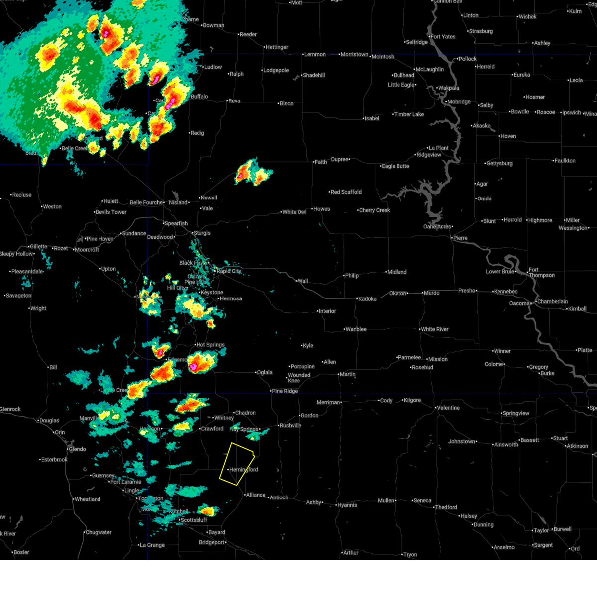
| 6/28/2025 6:11 PM MDT |
 Svrcys the national weather service in cheyenne has issued a * severe thunderstorm warning for, southeastern box butte county in the panhandle of nebraska, * until 700 pm mdt. * at 611 pm mdt, a severe thunderstorm was located near berea, or 7 miles north of alliance, moving southeast at 20 mph (radar indicated). Hazards include 60 mph wind gusts and quarter size hail. Hail damage to vehicles is expected. Expect wind damage to roofs, siding, and trees. Svrcys the national weather service in cheyenne has issued a * severe thunderstorm warning for, southeastern box butte county in the panhandle of nebraska, * until 700 pm mdt. * at 611 pm mdt, a severe thunderstorm was located near berea, or 7 miles north of alliance, moving southeast at 20 mph (radar indicated). Hazards include 60 mph wind gusts and quarter size hail. Hail damage to vehicles is expected. Expect wind damage to roofs, siding, and trees.
|
| 6/13/2025 6:14 PM MDT |
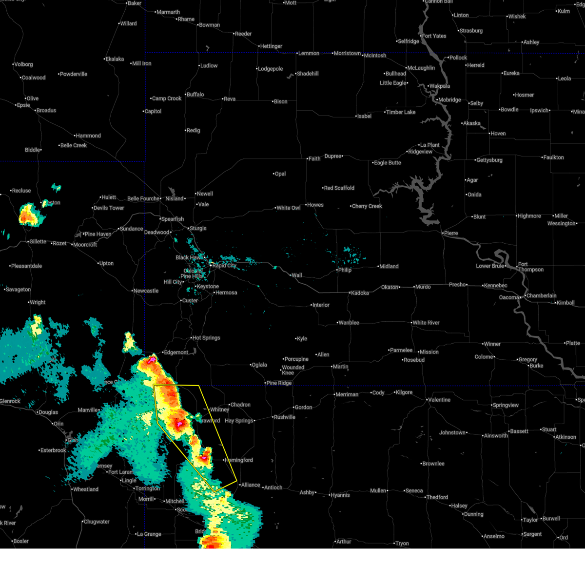 A new severe thunderstorm warning has been issued for eastern sioux, northern box butte, and much of dawes counties until 715 pm. a severe thunderstorm watch remains in effect until 1000 pm mdt for the panhandle of nebraska. A new severe thunderstorm warning has been issued for eastern sioux, northern box butte, and much of dawes counties until 715 pm. a severe thunderstorm watch remains in effect until 1000 pm mdt for the panhandle of nebraska.
|
| 6/13/2025 5:54 PM MDT |
 At 553 pm mdt, severe thunderstorms were located along a line extending from near montrose to near crawford to near box butte county fairgrounds, moving east at 35 mph (radar indicated). Hazards include 60 mph wind gusts and quarter size hail. Hail damage to vehicles is expected. expect wind damage to roofs, siding, and trees. Locations impacted include, crawford, hemingford, harrison, whitney lake, soldier creek campground, box butte reservoir, montrose, fort robinson state park, box butte county fairgrounds, berea, flahertys corner, marsland, belmont, and toadstool geological park and campground. At 553 pm mdt, severe thunderstorms were located along a line extending from near montrose to near crawford to near box butte county fairgrounds, moving east at 35 mph (radar indicated). Hazards include 60 mph wind gusts and quarter size hail. Hail damage to vehicles is expected. expect wind damage to roofs, siding, and trees. Locations impacted include, crawford, hemingford, harrison, whitney lake, soldier creek campground, box butte reservoir, montrose, fort robinson state park, box butte county fairgrounds, berea, flahertys corner, marsland, belmont, and toadstool geological park and campground.
|
| 6/13/2025 5:54 PM MDT |
 the severe thunderstorm warning has been cancelled and is no longer in effect the severe thunderstorm warning has been cancelled and is no longer in effect
|
| 6/13/2025 5:16 PM MDT |
 Svrcys the national weather service in cheyenne has issued a * severe thunderstorm warning for, western box butte county in the panhandle of nebraska, northeastern scotts bluff county in the panhandle of nebraska, northwestern morrill county in the panhandle of nebraska, western dawes county in the panhandle of nebraska, sioux county in the panhandle of nebraska, * until 615 pm mdt. * at 516 pm mdt, severe thunderstorms were located along a line extending from near van tassell to 7 miles east of agate fossil beds national monument to 6 miles west of kilpatrick lake, moving northeast at 35 mph (radar indicated). Hazards include 60 mph wind gusts and quarter size hail. Hail damage to vehicles is expected. Expect wind damage to roofs, siding, and trees. Svrcys the national weather service in cheyenne has issued a * severe thunderstorm warning for, western box butte county in the panhandle of nebraska, northeastern scotts bluff county in the panhandle of nebraska, northwestern morrill county in the panhandle of nebraska, western dawes county in the panhandle of nebraska, sioux county in the panhandle of nebraska, * until 615 pm mdt. * at 516 pm mdt, severe thunderstorms were located along a line extending from near van tassell to 7 miles east of agate fossil beds national monument to 6 miles west of kilpatrick lake, moving northeast at 35 mph (radar indicated). Hazards include 60 mph wind gusts and quarter size hail. Hail damage to vehicles is expected. Expect wind damage to roofs, siding, and trees.
|
| 5/23/2025 6:25 PM MDT |
 The storm which prompted the warning has moved out of the area. therefore, the warning will be allowed to expire. however, gusty winds are still possible with this thunderstorm. a severe thunderstorm watch remains in effect until 900 pm mdt for the panhandle of nebraska. The storm which prompted the warning has moved out of the area. therefore, the warning will be allowed to expire. however, gusty winds are still possible with this thunderstorm. a severe thunderstorm watch remains in effect until 900 pm mdt for the panhandle of nebraska.
|
| 5/23/2025 5:51 PM MDT |
 Svrcys the national weather service in cheyenne has issued a * severe thunderstorm warning for, northeastern box butte county in the panhandle of nebraska, southeastern dawes county in the panhandle of nebraska, * until 630 pm mdt. * at 550 pm mdt, a severe thunderstorm was located 8 miles east of hemingford, or 16 miles north of alliance, moving northeast at 45 mph (radar indicated). Hazards include ping pong ball size hail and 60 mph wind gusts. People and animals outdoors will be injured. expect hail damage to roofs, siding, windows, and vehicles. Expect wind damage to roofs, siding, and trees. Svrcys the national weather service in cheyenne has issued a * severe thunderstorm warning for, northeastern box butte county in the panhandle of nebraska, southeastern dawes county in the panhandle of nebraska, * until 630 pm mdt. * at 550 pm mdt, a severe thunderstorm was located 8 miles east of hemingford, or 16 miles north of alliance, moving northeast at 45 mph (radar indicated). Hazards include ping pong ball size hail and 60 mph wind gusts. People and animals outdoors will be injured. expect hail damage to roofs, siding, windows, and vehicles. Expect wind damage to roofs, siding, and trees.
|
| 5/23/2025 5:20 PM MDT |
 Svrcys the national weather service in cheyenne has issued a * severe thunderstorm warning for, central box butte county in the panhandle of nebraska, northwestern morrill county in the panhandle of nebraska, southeastern dawes county in the panhandle of nebraska, * until 600 pm mdt. * at 520 pm mdt, a severe thunderstorm was located near kilpatrick lake, or 16 miles west of alliance, moving northeast at 45 mph (radar indicated). Hazards include ping pong ball size hail and 60 mph wind gusts. People and animals outdoors will be injured. expect hail damage to roofs, siding, windows, and vehicles. Expect wind damage to roofs, siding, and trees. Svrcys the national weather service in cheyenne has issued a * severe thunderstorm warning for, central box butte county in the panhandle of nebraska, northwestern morrill county in the panhandle of nebraska, southeastern dawes county in the panhandle of nebraska, * until 600 pm mdt. * at 520 pm mdt, a severe thunderstorm was located near kilpatrick lake, or 16 miles west of alliance, moving northeast at 45 mph (radar indicated). Hazards include ping pong ball size hail and 60 mph wind gusts. People and animals outdoors will be injured. expect hail damage to roofs, siding, windows, and vehicles. Expect wind damage to roofs, siding, and trees.
|
| 4/27/2025 9:10 PM MDT |
 The storms which prompted the warning have weakened below severe limits, and have exited the warned area. therefore, the warning will be allowed to expire. however, gusty winds over 40 mph are still possible with these thunderstorms. a tornado watch remains in effect until 1100 pm mdt for the panhandle of nebraska. The storms which prompted the warning have weakened below severe limits, and have exited the warned area. therefore, the warning will be allowed to expire. however, gusty winds over 40 mph are still possible with these thunderstorms. a tornado watch remains in effect until 1100 pm mdt for the panhandle of nebraska.
|
| 4/27/2025 9:00 PM MDT |
 At 900 pm mdt, severe thunderstorms were located along a line extending from near box butte campground to 12 miles northeast of berea, moving northeast at 40 mph (radar indicated). Hazards include 60 mph wind gusts and half dollar size hail. Hail damage to vehicles is expected. expect wind damage to roofs, siding, and trees. Locations impacted include, marsland, belmont, box butte campground, box butte county fairgrounds, box butte reservoir, berea, hemingford, and box butte dam. At 900 pm mdt, severe thunderstorms were located along a line extending from near box butte campground to 12 miles northeast of berea, moving northeast at 40 mph (radar indicated). Hazards include 60 mph wind gusts and half dollar size hail. Hail damage to vehicles is expected. expect wind damage to roofs, siding, and trees. Locations impacted include, marsland, belmont, box butte campground, box butte county fairgrounds, box butte reservoir, berea, hemingford, and box butte dam.
|
| 4/27/2025 9:00 PM MDT |
 the severe thunderstorm warning has been cancelled and is no longer in effect the severe thunderstorm warning has been cancelled and is no longer in effect
|
| 4/27/2025 8:36 PM MDT |
 Svrcys the national weather service in cheyenne has issued a * severe thunderstorm warning for, northern box butte county in the panhandle of nebraska, southern dawes county in the panhandle of nebraska, southeastern sioux county in the panhandle of nebraska, * until 915 pm mdt. * at 836 pm mdt, severe thunderstorms were located along a line extending from near flahertys corner to near berea, moving northeast at 40 mph (radar indicated). Hazards include ping pong ball size hail and 60 mph wind gusts. People and animals outdoors will be injured. expect hail damage to roofs, siding, windows, and vehicles. Expect wind damage to roofs, siding, and trees. Svrcys the national weather service in cheyenne has issued a * severe thunderstorm warning for, northern box butte county in the panhandle of nebraska, southern dawes county in the panhandle of nebraska, southeastern sioux county in the panhandle of nebraska, * until 915 pm mdt. * at 836 pm mdt, severe thunderstorms were located along a line extending from near flahertys corner to near berea, moving northeast at 40 mph (radar indicated). Hazards include ping pong ball size hail and 60 mph wind gusts. People and animals outdoors will be injured. expect hail damage to roofs, siding, windows, and vehicles. Expect wind damage to roofs, siding, and trees.
|
| 8/11/2024 4:01 PM MDT |
 Svrcys the national weather service in cheyenne has issued a * severe thunderstorm warning for, southeastern box butte county in the panhandle of nebraska, * until 445 pm mdt. * at 400 pm mdt, a severe thunderstorm was located over berea, or 7 miles northwest of alliance, moving southeast at 35 mph (radar indicated). Hazards include 60 mph wind gusts and quarter size hail. Hail damage to vehicles is expected. Expect wind damage to roofs, siding, and trees. Svrcys the national weather service in cheyenne has issued a * severe thunderstorm warning for, southeastern box butte county in the panhandle of nebraska, * until 445 pm mdt. * at 400 pm mdt, a severe thunderstorm was located over berea, or 7 miles northwest of alliance, moving southeast at 35 mph (radar indicated). Hazards include 60 mph wind gusts and quarter size hail. Hail damage to vehicles is expected. Expect wind damage to roofs, siding, and trees.
|
| 8/7/2024 7:11 PM MDT |
 The storm which prompted the warning has moved out of the area. therefore, the warning will be allowed to expire. The storm which prompted the warning has moved out of the area. therefore, the warning will be allowed to expire.
|
| 8/7/2024 6:29 PM MDT |
 Svrcys the national weather service in cheyenne has issued a * severe thunderstorm warning for, southeastern box butte county in the panhandle of nebraska, * until 715 pm mdt. * at 627 pm mdt, a severe thunderstorm was located near berea, or 10 miles west of alliance, moving east at 25 mph. this thunderstorm has a history of producing large hail (radar indicated). Hazards include ping pong ball size hail and 60 mph wind gusts. People and animals outdoors will be injured. expect hail damage to roofs, siding, windows, and vehicles. Expect wind damage to roofs, siding, and trees. Svrcys the national weather service in cheyenne has issued a * severe thunderstorm warning for, southeastern box butte county in the panhandle of nebraska, * until 715 pm mdt. * at 627 pm mdt, a severe thunderstorm was located near berea, or 10 miles west of alliance, moving east at 25 mph. this thunderstorm has a history of producing large hail (radar indicated). Hazards include ping pong ball size hail and 60 mph wind gusts. People and animals outdoors will be injured. expect hail damage to roofs, siding, windows, and vehicles. Expect wind damage to roofs, siding, and trees.
|
| 8/7/2024 5:51 PM MDT |
 Svrcys the national weather service in cheyenne has issued a * severe thunderstorm warning for, southwestern box butte county in the panhandle of nebraska, northwestern morrill county in the panhandle of nebraska, * until 630 pm mdt. * at 550 pm mdt, a severe thunderstorm was located over kilpatrick lake, or 21 miles northeast of scottsbluff, moving east at 25 mph (radar indicated). Hazards include golf ball size hail and 60 mph wind gusts. People and animals outdoors will be injured. expect hail damage to roofs, siding, windows, and vehicles. Expect wind damage to roofs, siding, and trees. Svrcys the national weather service in cheyenne has issued a * severe thunderstorm warning for, southwestern box butte county in the panhandle of nebraska, northwestern morrill county in the panhandle of nebraska, * until 630 pm mdt. * at 550 pm mdt, a severe thunderstorm was located over kilpatrick lake, or 21 miles northeast of scottsbluff, moving east at 25 mph (radar indicated). Hazards include golf ball size hail and 60 mph wind gusts. People and animals outdoors will be injured. expect hail damage to roofs, siding, windows, and vehicles. Expect wind damage to roofs, siding, and trees.
|
| 7/27/2024 8:11 PM MDT |
 The storms which prompted the warning have weakened below severe limits, and have exited the warned area. therefore, the warning will be allowed to expire. however, gusty winds and heavy rain are still possible with these thunderstorms. The storms which prompted the warning have weakened below severe limits, and have exited the warned area. therefore, the warning will be allowed to expire. however, gusty winds and heavy rain are still possible with these thunderstorms.
|
| 7/27/2024 7:30 PM MDT |
 Svrcys the national weather service in cheyenne has issued a * severe thunderstorm warning for, central box butte county in the panhandle of nebraska, dawes county in the panhandle of nebraska, * until 815 pm mdt. * at 729 pm mdt, severe thunderstorms were located along a line extending from 13 miles south of oelrichs to 12 miles northeast of berea, moving east at 45 mph (radar indicated). Hazards include 70 mph wind gusts. Expect considerable tree damage. Damage is likely to mobile homes, roofs, and outbuildings. Svrcys the national weather service in cheyenne has issued a * severe thunderstorm warning for, central box butte county in the panhandle of nebraska, dawes county in the panhandle of nebraska, * until 815 pm mdt. * at 729 pm mdt, severe thunderstorms were located along a line extending from 13 miles south of oelrichs to 12 miles northeast of berea, moving east at 45 mph (radar indicated). Hazards include 70 mph wind gusts. Expect considerable tree damage. Damage is likely to mobile homes, roofs, and outbuildings.
|
| 7/19/2024 5:49 PM MDT |
 the severe thunderstorm warning has been cancelled and is no longer in effect the severe thunderstorm warning has been cancelled and is no longer in effect
|
| 7/19/2024 5:43 PM MDT |
 At 542 pm mdt, a severe thunderstorm was located near berea, or near alliance, moving south at 30 mph (radar indicated). Hazards include 60 mph wind gusts and penny size hail. Expect damage to roofs, siding, and trees. Locations impacted include, alliance and berea. At 542 pm mdt, a severe thunderstorm was located near berea, or near alliance, moving south at 30 mph (radar indicated). Hazards include 60 mph wind gusts and penny size hail. Expect damage to roofs, siding, and trees. Locations impacted include, alliance and berea.
|
| 7/19/2024 5:31 PM MDT |
 At 531 pm mdt, a severe thunderstorm was located over berea, or 11 miles northwest of alliance, moving southeast at 35 mph (radar indicated). Hazards include 60 mph wind gusts and penny size hail. Expect damage to roofs, siding, and trees. Locations impacted include, alliance, hemingford, box butte county fairgrounds, and berea. At 531 pm mdt, a severe thunderstorm was located over berea, or 11 miles northwest of alliance, moving southeast at 35 mph (radar indicated). Hazards include 60 mph wind gusts and penny size hail. Expect damage to roofs, siding, and trees. Locations impacted include, alliance, hemingford, box butte county fairgrounds, and berea.
|
| 7/19/2024 5:15 PM MDT |
 Svrcys the national weather service in cheyenne has issued a * severe thunderstorm warning for, central box butte county in the panhandle of nebraska, * until 600 pm mdt. * at 515 pm mdt, a severe thunderstorm was located over box butte county fairgrounds, or 19 miles northwest of alliance, moving south at 30 mph (radar indicated). Hazards include 60 mph wind gusts and quarter size hail. Hail damage to vehicles is expected. Expect wind damage to roofs, siding, and trees. Svrcys the national weather service in cheyenne has issued a * severe thunderstorm warning for, central box butte county in the panhandle of nebraska, * until 600 pm mdt. * at 515 pm mdt, a severe thunderstorm was located over box butte county fairgrounds, or 19 miles northwest of alliance, moving south at 30 mph (radar indicated). Hazards include 60 mph wind gusts and quarter size hail. Hail damage to vehicles is expected. Expect wind damage to roofs, siding, and trees.
|
| 6/20/2024 4:40 PM MDT |
 Svrcys the national weather service in cheyenne has issued a * severe thunderstorm warning for, eastern box butte county in the panhandle of nebraska, morrill county in the panhandle of nebraska, * until 530 pm mdt. * at 439 pm mdt, severe thunderstorms were located along a line extending from 11 miles northeast of berea to 6 miles southwest of alliance to near angora to near redington, moving northeast at 40 mph (radar indicated. these storms have a history of producing widespread wind damage). Hazards include 70 mph wind gusts and quarter size hail. Hail damage to vehicles is expected. expect considerable tree damage. Wind damage is also likely to mobile homes, roofs, and outbuildings. Svrcys the national weather service in cheyenne has issued a * severe thunderstorm warning for, eastern box butte county in the panhandle of nebraska, morrill county in the panhandle of nebraska, * until 530 pm mdt. * at 439 pm mdt, severe thunderstorms were located along a line extending from 11 miles northeast of berea to 6 miles southwest of alliance to near angora to near redington, moving northeast at 40 mph (radar indicated. these storms have a history of producing widespread wind damage). Hazards include 70 mph wind gusts and quarter size hail. Hail damage to vehicles is expected. expect considerable tree damage. Wind damage is also likely to mobile homes, roofs, and outbuildings.
|
| 6/20/2024 3:18 PM MDT |
 Svrcys the national weather service in cheyenne has issued a * severe thunderstorm warning for, northeastern box butte county in the panhandle of nebraska, southeastern dawes county in the panhandle of nebraska, * until 400 pm mdt. * at 318 pm mdt, a severe thunderstorm was located over hemingford, or 15 miles northwest of alliance, moving northeast at 30 mph (radar indicated). Hazards include ping pong ball size hail and 60 mph wind gusts. People and animals outdoors will be injured. expect hail damage to roofs, siding, windows, and vehicles. Expect wind damage to roofs, siding, and trees. Svrcys the national weather service in cheyenne has issued a * severe thunderstorm warning for, northeastern box butte county in the panhandle of nebraska, southeastern dawes county in the panhandle of nebraska, * until 400 pm mdt. * at 318 pm mdt, a severe thunderstorm was located over hemingford, or 15 miles northwest of alliance, moving northeast at 30 mph (radar indicated). Hazards include ping pong ball size hail and 60 mph wind gusts. People and animals outdoors will be injured. expect hail damage to roofs, siding, windows, and vehicles. Expect wind damage to roofs, siding, and trees.
|
| 6/16/2024 9:56 PM MDT |
 The storms which prompted the warning have weakened below severe limits, and no longer pose an immediate threat to life or property. therefore, the warning will be allowed to expire. however, gusty winds are still possible with these thunderstorms. a severe thunderstorm watch remains in effect until 500 am mdt for the panhandle of nebraska. The storms which prompted the warning have weakened below severe limits, and no longer pose an immediate threat to life or property. therefore, the warning will be allowed to expire. however, gusty winds are still possible with these thunderstorms. a severe thunderstorm watch remains in effect until 500 am mdt for the panhandle of nebraska.
|
| 6/16/2024 9:23 PM MDT |
 At 922 pm mdt, severe thunderstorms were located along a line extending from 20 miles south of rushville to 7 miles north of kilpatrick lake, moving northeast at 25 mph (radar indicated). Hazards include 60 mph wind gusts and quarter size hail. Hail damage to vehicles is expected. expect wind damage to roofs, siding, and trees. these severe storms will be near, hemingford and box butte county fairgrounds around 930 pm mdt. box butte reservoir around 955 pm mdt. box butte campground around 1000 pm mdt. Other locations impacted by these severe thunderstorms include wild horse butte, belmont, marsland, and box butte dam. At 922 pm mdt, severe thunderstorms were located along a line extending from 20 miles south of rushville to 7 miles north of kilpatrick lake, moving northeast at 25 mph (radar indicated). Hazards include 60 mph wind gusts and quarter size hail. Hail damage to vehicles is expected. expect wind damage to roofs, siding, and trees. these severe storms will be near, hemingford and box butte county fairgrounds around 930 pm mdt. box butte reservoir around 955 pm mdt. box butte campground around 1000 pm mdt. Other locations impacted by these severe thunderstorms include wild horse butte, belmont, marsland, and box butte dam.
|
| 6/16/2024 9:02 PM MDT |
 Svrcys the national weather service in cheyenne has issued a * severe thunderstorm warning for, box butte county in the panhandle of nebraska, southern dawes county in the panhandle of nebraska, * until 1000 pm mdt. * at 901 pm mdt, severe thunderstorms were located along a line extending from 19 miles northeast of antioch to kilpatrick lake, moving northeast at 35 mph (radar indicated). Hazards include 60 mph wind gusts and quarter size hail. Hail damage to vehicles is expected. expect wind damage to roofs, siding, and trees. severe thunderstorms will be near, kilpatrick lake and berea around 905 pm mdt. hemingford and box butte county fairgrounds around 920 pm mdt. box butte reservoir around 940 pm mdt. box butte campground around 945 pm mdt. Other locations impacted by these severe thunderstorms include wild horse butte, belmont, marsland, and box butte dam. Svrcys the national weather service in cheyenne has issued a * severe thunderstorm warning for, box butte county in the panhandle of nebraska, southern dawes county in the panhandle of nebraska, * until 1000 pm mdt. * at 901 pm mdt, severe thunderstorms were located along a line extending from 19 miles northeast of antioch to kilpatrick lake, moving northeast at 35 mph (radar indicated). Hazards include 60 mph wind gusts and quarter size hail. Hail damage to vehicles is expected. expect wind damage to roofs, siding, and trees. severe thunderstorms will be near, kilpatrick lake and berea around 905 pm mdt. hemingford and box butte county fairgrounds around 920 pm mdt. box butte reservoir around 940 pm mdt. box butte campground around 945 pm mdt. Other locations impacted by these severe thunderstorms include wild horse butte, belmont, marsland, and box butte dam.
|
| 6/1/2024 6:59 PM MDT |
 The storm which prompted the warning has weakened below severe limits, and no longer poses an immediate threat to life or property. therefore, the warning will be allowed to expire. a severe thunderstorm watch remains in effect until 1100 pm mdt for the panhandle of nebraska. The storm which prompted the warning has weakened below severe limits, and no longer poses an immediate threat to life or property. therefore, the warning will be allowed to expire. a severe thunderstorm watch remains in effect until 1100 pm mdt for the panhandle of nebraska.
|
| 6/1/2024 6:53 PM MDT |
 At 653 pm mdt, a severe thunderstorm was located near hemingford, or 17 miles north of alliance, moving east at 20 mph (radar indicated). Hazards include ping pong ball size hail and 60 mph wind gusts. People and animals outdoors will be injured. expect hail damage to roofs, siding, windows, and vehicles. expect wind damage to roofs, siding, and trees. Locations impacted include, hemingford, box butte county fairgrounds, berea, and wild horse butte. At 653 pm mdt, a severe thunderstorm was located near hemingford, or 17 miles north of alliance, moving east at 20 mph (radar indicated). Hazards include ping pong ball size hail and 60 mph wind gusts. People and animals outdoors will be injured. expect hail damage to roofs, siding, windows, and vehicles. expect wind damage to roofs, siding, and trees. Locations impacted include, hemingford, box butte county fairgrounds, berea, and wild horse butte.
|
| 6/1/2024 6:18 PM MDT |
 Svrcys the national weather service in cheyenne has issued a * severe thunderstorm warning for, northern box butte county in the panhandle of nebraska, southeastern dawes county in the panhandle of nebraska, * until 700 pm mdt. * at 618 pm mdt, a severe thunderstorm was located near box butte county fairgrounds, or 21 miles northwest of alliance, moving east at 25 mph (radar indicated). Hazards include ping pong ball size hail and 60 mph wind gusts. People and animals outdoors will be injured. expect hail damage to roofs, siding, windows, and vehicles. Expect wind damage to roofs, siding, and trees. Svrcys the national weather service in cheyenne has issued a * severe thunderstorm warning for, northern box butte county in the panhandle of nebraska, southeastern dawes county in the panhandle of nebraska, * until 700 pm mdt. * at 618 pm mdt, a severe thunderstorm was located near box butte county fairgrounds, or 21 miles northwest of alliance, moving east at 25 mph (radar indicated). Hazards include ping pong ball size hail and 60 mph wind gusts. People and animals outdoors will be injured. expect hail damage to roofs, siding, windows, and vehicles. Expect wind damage to roofs, siding, and trees.
|
| 6/1/2024 2:23 AM MDT |
 The storm which prompted the warning has moved out of the area. therefore, the warning will be allowed to expire. The storm which prompted the warning has moved out of the area. therefore, the warning will be allowed to expire.
|
| 6/1/2024 1:59 AM MDT |
 At 158 am mdt, a severe thunderstorm was located over berea, or near alliance, moving southeast at 30 mph (radar indicated). Hazards include tennis ball size hail and 60 mph wind gusts. People and animals outdoors will be injured. expect hail damage to roofs, siding, windows, and vehicles. expect wind damage to roofs, siding, and trees. Locations impacted include, alliance, berea, and alliance municipal airport. At 158 am mdt, a severe thunderstorm was located over berea, or near alliance, moving southeast at 30 mph (radar indicated). Hazards include tennis ball size hail and 60 mph wind gusts. People and animals outdoors will be injured. expect hail damage to roofs, siding, windows, and vehicles. expect wind damage to roofs, siding, and trees. Locations impacted include, alliance, berea, and alliance municipal airport.
|
| 6/1/2024 1:44 AM MDT |
 Svrcys the national weather service in cheyenne has issued a * severe thunderstorm warning for, eastern box butte county in the panhandle of nebraska, * until 230 am mdt. * at 143 am mdt, a severe thunderstorm was located over berea, or 10 miles northwest of alliance, moving southeast at 30 mph (radar indicated). Hazards include 60 mph wind gusts and quarter size hail. Hail damage to vehicles is expected. Expect wind damage to roofs, siding, and trees. Svrcys the national weather service in cheyenne has issued a * severe thunderstorm warning for, eastern box butte county in the panhandle of nebraska, * until 230 am mdt. * at 143 am mdt, a severe thunderstorm was located over berea, or 10 miles northwest of alliance, moving southeast at 30 mph (radar indicated). Hazards include 60 mph wind gusts and quarter size hail. Hail damage to vehicles is expected. Expect wind damage to roofs, siding, and trees.
|
| 5/29/2024 4:29 PM MDT |
 Svrcys the national weather service in cheyenne has issued a * severe thunderstorm warning for, southeastern box butte county in the panhandle of nebraska, southeastern scotts bluff county in the panhandle of nebraska, northwestern cheyenne county in the panhandle of nebraska, northeastern kimball county in the panhandle of nebraska, morrill county in the panhandle of nebraska, eastern banner county in the panhandle of nebraska, * until 515 pm mdt. * at 428 pm mdt, severe thunderstorms were located along a line extending from near alliance to 8 miles northeast of dix, moving east at 30 mph (radar indicated). Hazards include 60 mph wind gusts and quarter size hail. Hail damage to vehicles is expected. Expect wind damage to roofs, siding, and trees. Svrcys the national weather service in cheyenne has issued a * severe thunderstorm warning for, southeastern box butte county in the panhandle of nebraska, southeastern scotts bluff county in the panhandle of nebraska, northwestern cheyenne county in the panhandle of nebraska, northeastern kimball county in the panhandle of nebraska, morrill county in the panhandle of nebraska, eastern banner county in the panhandle of nebraska, * until 515 pm mdt. * at 428 pm mdt, severe thunderstorms were located along a line extending from near alliance to 8 miles northeast of dix, moving east at 30 mph (radar indicated). Hazards include 60 mph wind gusts and quarter size hail. Hail damage to vehicles is expected. Expect wind damage to roofs, siding, and trees.
|
| 5/19/2024 2:13 PM MDT |
 The storm which prompted the warning has weakened below severe limits, and has exited the warned area. therefore, the warning will be allowed to expire. however, small hail is still possible with this thunderstorm. a severe thunderstorm watch remains in effect until 800 pm mdt for the panhandle of nebraska. The storm which prompted the warning has weakened below severe limits, and has exited the warned area. therefore, the warning will be allowed to expire. however, small hail is still possible with this thunderstorm. a severe thunderstorm watch remains in effect until 800 pm mdt for the panhandle of nebraska.
|
| 5/19/2024 1:54 PM MDT |
 At 154 pm mdt, a severe thunderstorm was located 7 miles southwest of box butte county fairgrounds, or 17 miles northwest of alliance, moving east at 30 mph (radar indicated). Hazards include 60 mph wind gusts and quarter size hail. Hail damage to vehicles is expected. expect wind damage to roofs, siding, and trees. Locations impacted include, hemingford, box butte county fairgrounds, and berea. At 154 pm mdt, a severe thunderstorm was located 7 miles southwest of box butte county fairgrounds, or 17 miles northwest of alliance, moving east at 30 mph (radar indicated). Hazards include 60 mph wind gusts and quarter size hail. Hail damage to vehicles is expected. expect wind damage to roofs, siding, and trees. Locations impacted include, hemingford, box butte county fairgrounds, and berea.
|
| 5/19/2024 1:36 PM MDT |
 Svrcys the national weather service in cheyenne has issued a * severe thunderstorm warning for, central box butte county in the panhandle of nebraska, * until 215 pm mdt. * at 136 pm mdt, a severe thunderstorm was located 7 miles northwest of kilpatrick lake, or 25 miles west of alliance, moving east at 30 mph (radar indicated). Hazards include 60 mph wind gusts and half dollar size hail. Hail damage to vehicles is expected. Expect wind damage to roofs, siding, and trees. Svrcys the national weather service in cheyenne has issued a * severe thunderstorm warning for, central box butte county in the panhandle of nebraska, * until 215 pm mdt. * at 136 pm mdt, a severe thunderstorm was located 7 miles northwest of kilpatrick lake, or 25 miles west of alliance, moving east at 30 mph (radar indicated). Hazards include 60 mph wind gusts and half dollar size hail. Hail damage to vehicles is expected. Expect wind damage to roofs, siding, and trees.
|
| 10/2/2023 5:58 PM MDT |
 The severe thunderstorm warning for eastern box butte and northern morrill counties will expire at 600 pm mdt. the storms which prompted the warning have weakened below severe limits, and no longer pose an immediate threat to life or property. therefore, the warning will be allowed to expire. However, small hail and gusty winds are still possible with these thunderstorms. The severe thunderstorm warning for eastern box butte and northern morrill counties will expire at 600 pm mdt. the storms which prompted the warning have weakened below severe limits, and no longer pose an immediate threat to life or property. therefore, the warning will be allowed to expire. However, small hail and gusty winds are still possible with these thunderstorms.
|
| 10/2/2023 5:51 PM MDT |
 At 551 pm mdt, severe thunderstorms were located along a line extending from 12 miles east of hemingford to 6 miles east of wild horse butte to near alliance airport to 12 miles east of angora, moving north at 55 mph (trained weather spotters). Hazards include 60 mph wind gusts and quarter size hail. Hail damage to vehicles is expected. expect wind damage to roofs, siding, and trees. locations impacted include, alliance, hemingford, wild horse butte, alliance airport, berea, angora and the intersection of highway 385 and l62. hail threat, radar indicated max hail size, 1. 00 in wind threat, radar indicated max wind gust, 60 mph. At 551 pm mdt, severe thunderstorms were located along a line extending from 12 miles east of hemingford to 6 miles east of wild horse butte to near alliance airport to 12 miles east of angora, moving north at 55 mph (trained weather spotters). Hazards include 60 mph wind gusts and quarter size hail. Hail damage to vehicles is expected. expect wind damage to roofs, siding, and trees. locations impacted include, alliance, hemingford, wild horse butte, alliance airport, berea, angora and the intersection of highway 385 and l62. hail threat, radar indicated max hail size, 1. 00 in wind threat, radar indicated max wind gust, 60 mph.
|
| 10/2/2023 5:39 PM MDT |
 At 538 pm mdt, severe thunderstorms were located along a line extending from near wild horse butte to near alliance airport to 13 miles southwest of antioch to 9 miles northeast of the intersection of highway 385 and 92, moving north at 50 mph (trained weather spotters. wind gusts in excess of 60 mph have been confirmed with these storms). Hazards include 60 mph wind gusts and quarter size hail. Hail damage to vehicles is expected. expect wind damage to roofs, siding, and trees. locations impacted include, alliance, bridgeport, hemingford, wild horse butte, alliance airport, northport, bridgeport state recreation area, angora, the intersection of highway 385 and 92, court house and jail rocks, berea, the intersection of highway 385 and l62 and broadwater. hail threat, radar indicated max hail size, 1. 00 in wind threat, radar indicated max wind gust, 60 mph. At 538 pm mdt, severe thunderstorms were located along a line extending from near wild horse butte to near alliance airport to 13 miles southwest of antioch to 9 miles northeast of the intersection of highway 385 and 92, moving north at 50 mph (trained weather spotters. wind gusts in excess of 60 mph have been confirmed with these storms). Hazards include 60 mph wind gusts and quarter size hail. Hail damage to vehicles is expected. expect wind damage to roofs, siding, and trees. locations impacted include, alliance, bridgeport, hemingford, wild horse butte, alliance airport, northport, bridgeport state recreation area, angora, the intersection of highway 385 and 92, court house and jail rocks, berea, the intersection of highway 385 and l62 and broadwater. hail threat, radar indicated max hail size, 1. 00 in wind threat, radar indicated max wind gust, 60 mph.
|
| 10/2/2023 5:18 PM MDT |
 At 518 pm mdt, severe thunderstorms were located along a line extending from 6 miles southwest of alliance to 9 miles south of alliance airport to 11 miles east of northport to near the intersection of highway 385 and 92, moving north at 55 mph (radar indicated). Hazards include 60 mph wind gusts and quarter size hail. Hail damage to vehicles is expected. Expect wind damage to roofs, siding, and trees. At 518 pm mdt, severe thunderstorms were located along a line extending from 6 miles southwest of alliance to 9 miles south of alliance airport to 11 miles east of northport to near the intersection of highway 385 and 92, moving north at 55 mph (radar indicated). Hazards include 60 mph wind gusts and quarter size hail. Hail damage to vehicles is expected. Expect wind damage to roofs, siding, and trees.
|
| 8/10/2023 5:37 PM MDT |
 The severe thunderstorm warning for northeastern box butte and southeastern dawes counties will expire at 545 pm mdt, the storm which prompted the warning has moved out of the area. therefore, the warning will be allowed to expire. The severe thunderstorm warning for northeastern box butte and southeastern dawes counties will expire at 545 pm mdt, the storm which prompted the warning has moved out of the area. therefore, the warning will be allowed to expire.
|
| 8/10/2023 5:24 PM MDT |
 At 523 pm mdt, a severe thunderstorm was located 7 miles northwest of wild horse butte, or 18 miles north of alliance, moving southeast at 40 mph (radar indicated). Hazards include 60 mph wind gusts and quarter size hail. Hail damage to vehicles is expected. expect wind damage to roofs, siding, and trees. locations impacted include, hemingford, wild horse butte, berea and box butte dam. hail threat, radar indicated max hail size, 1. 00 in wind threat, radar indicated max wind gust, 60 mph. At 523 pm mdt, a severe thunderstorm was located 7 miles northwest of wild horse butte, or 18 miles north of alliance, moving southeast at 40 mph (radar indicated). Hazards include 60 mph wind gusts and quarter size hail. Hail damage to vehicles is expected. expect wind damage to roofs, siding, and trees. locations impacted include, hemingford, wild horse butte, berea and box butte dam. hail threat, radar indicated max hail size, 1. 00 in wind threat, radar indicated max wind gust, 60 mph.
|
| 8/10/2023 5:08 PM MDT |
 At 508 pm mdt, a severe thunderstorm was located over box butte dam, or 25 miles southwest of hay springs, moving southeast at 40 mph (radar indicated). Hazards include 60 mph wind gusts and quarter size hail. Hail damage to vehicles is expected. Expect wind damage to roofs, siding, and trees. At 508 pm mdt, a severe thunderstorm was located over box butte dam, or 25 miles southwest of hay springs, moving southeast at 40 mph (radar indicated). Hazards include 60 mph wind gusts and quarter size hail. Hail damage to vehicles is expected. Expect wind damage to roofs, siding, and trees.
|
| 7/30/2023 8:03 PM MDT |
 At 803 pm mdt, severe thunderstorms were located along a line extending from 9 miles east of box butte dam to near wild horse butte to near alliance airport, moving east at 35 mph (radar indicated). Hazards include 60 mph wind gusts and nickel size hail. Expect damage to roofs, siding, and trees. locations impacted include, alliance, wild horse butte, box butte campground, berea, alliance airport and box butte dam. hail threat, radar indicated max hail size, 0. 88 in wind threat, radar indicated max wind gust, 60 mph. At 803 pm mdt, severe thunderstorms were located along a line extending from 9 miles east of box butte dam to near wild horse butte to near alliance airport, moving east at 35 mph (radar indicated). Hazards include 60 mph wind gusts and nickel size hail. Expect damage to roofs, siding, and trees. locations impacted include, alliance, wild horse butte, box butte campground, berea, alliance airport and box butte dam. hail threat, radar indicated max hail size, 0. 88 in wind threat, radar indicated max wind gust, 60 mph.
|
| 7/30/2023 7:52 PM MDT |
 At 752 pm mdt, severe thunderstorms were located along a line extending from near box butte dam to near wild horse butte to 9 miles southwest of alliance airport, moving east at 35 mph (radar indicated). Hazards include 60 mph wind gusts and nickel size hail. expect damage to roofs, siding, and trees At 752 pm mdt, severe thunderstorms were located along a line extending from near box butte dam to near wild horse butte to 9 miles southwest of alliance airport, moving east at 35 mph (radar indicated). Hazards include 60 mph wind gusts and nickel size hail. expect damage to roofs, siding, and trees
|
| 7/3/2023 10:15 PM MDT |
 At 1015 pm mdt, severe thunderstorms were located along a line extending from near slim butte to 10 miles south of hay springs to near alliance airport, moving northeast at 40 mph (radar indicated). Hazards include 60 mph wind gusts. Expect damage to roofs, siding, and trees. locations impacted include, alliance, chadron, wild horse butte, alliance airport, chadron campground, red cloud campground and chadron st park. hail threat, radar indicated max hail size, <. 75 in wind threat, radar indicated max wind gust, 60 mph. At 1015 pm mdt, severe thunderstorms were located along a line extending from near slim butte to 10 miles south of hay springs to near alliance airport, moving northeast at 40 mph (radar indicated). Hazards include 60 mph wind gusts. Expect damage to roofs, siding, and trees. locations impacted include, alliance, chadron, wild horse butte, alliance airport, chadron campground, red cloud campground and chadron st park. hail threat, radar indicated max hail size, <. 75 in wind threat, radar indicated max wind gust, 60 mph.
|
| 7/3/2023 9:49 PM MDT |
 At 949 pm mdt, severe thunderstorms were located along a line extending from 6 miles west of oelrichs to 7 miles north of chadron airport to 8 miles east of box butte dam to near alliance airport, moving east at 35 mph (radar indicated). Hazards include 70 mph wind gusts. Expect considerable tree damage. Damage is likely to mobile homes, roofs, and outbuildings. At 949 pm mdt, severe thunderstorms were located along a line extending from 6 miles west of oelrichs to 7 miles north of chadron airport to 8 miles east of box butte dam to near alliance airport, moving east at 35 mph (radar indicated). Hazards include 70 mph wind gusts. Expect considerable tree damage. Damage is likely to mobile homes, roofs, and outbuildings.
|
| 6/28/2023 5:48 PM MDT |
 At 547 pm mdt, a severe thunderstorm was located 8 miles west of box butte campground, or 26 miles southwest of chadron, moving east at 25 mph (radar indicated). Hazards include ping pong ball size hail and 60 mph wind gusts. People and animals outdoors will be injured. expect hail damage to roofs, siding, windows, and vehicles. expect wind damage to roofs, siding, and trees. this severe storm will be near, box butte campground around 610 pm mdt. box butte dam around 615 pm mdt. hemingford around 620 pm mdt. other locations impacted by this severe thunderstorm include marsland. hail threat, radar indicated max hail size, 1. 50 in wind threat, radar indicated max wind gust, 60 mph. At 547 pm mdt, a severe thunderstorm was located 8 miles west of box butte campground, or 26 miles southwest of chadron, moving east at 25 mph (radar indicated). Hazards include ping pong ball size hail and 60 mph wind gusts. People and animals outdoors will be injured. expect hail damage to roofs, siding, windows, and vehicles. expect wind damage to roofs, siding, and trees. this severe storm will be near, box butte campground around 610 pm mdt. box butte dam around 615 pm mdt. hemingford around 620 pm mdt. other locations impacted by this severe thunderstorm include marsland. hail threat, radar indicated max hail size, 1. 50 in wind threat, radar indicated max wind gust, 60 mph.
|
| 6/28/2023 5:31 PM MDT |
 At 530 pm mdt, a severe thunderstorm was located 10 miles south of crawford, or 29 miles southwest of chadron, moving east at 35 mph (radar indicated). Hazards include ping pong ball size hail and 60 mph wind gusts. People and animals outdoors will be injured. expect hail damage to roofs, siding, windows, and vehicles. expect wind damage to roofs, siding, and trees. this severe storm will be near, box butte campground around 555 pm mdt. box butte dam around 600 pm mdt. hemingford around 605 pm mdt. other locations impacted by this severe thunderstorm include marsland. hail threat, radar indicated max hail size, 1. 50 in wind threat, radar indicated max wind gust, 60 mph. At 530 pm mdt, a severe thunderstorm was located 10 miles south of crawford, or 29 miles southwest of chadron, moving east at 35 mph (radar indicated). Hazards include ping pong ball size hail and 60 mph wind gusts. People and animals outdoors will be injured. expect hail damage to roofs, siding, windows, and vehicles. expect wind damage to roofs, siding, and trees. this severe storm will be near, box butte campground around 555 pm mdt. box butte dam around 600 pm mdt. hemingford around 605 pm mdt. other locations impacted by this severe thunderstorm include marsland. hail threat, radar indicated max hail size, 1. 50 in wind threat, radar indicated max wind gust, 60 mph.
|
| 6/28/2023 5:12 PM MDT |
 At 512 pm mdt, a severe thunderstorm was located 8 miles southwest of fort robinson campground, or 34 miles southwest of chadron, moving southeast at 45 mph (radar indicated). Hazards include ping pong ball size hail and 60 mph wind gusts. People and animals outdoors will be injured. expect hail damage to roofs, siding, windows, and vehicles. expect wind damage to roofs, siding, and trees. this severe thunderstorm will be near, box butte campground around 545 pm mdt. box butte dam around 550 pm mdt. hemingford around 555 pm mdt. other locations impacted by this severe thunderstorm include fort robinson and marsland. hail threat, radar indicated max hail size, 1. 50 in wind threat, radar indicated max wind gust, 60 mph. At 512 pm mdt, a severe thunderstorm was located 8 miles southwest of fort robinson campground, or 34 miles southwest of chadron, moving southeast at 45 mph (radar indicated). Hazards include ping pong ball size hail and 60 mph wind gusts. People and animals outdoors will be injured. expect hail damage to roofs, siding, windows, and vehicles. expect wind damage to roofs, siding, and trees. this severe thunderstorm will be near, box butte campground around 545 pm mdt. box butte dam around 550 pm mdt. hemingford around 555 pm mdt. other locations impacted by this severe thunderstorm include fort robinson and marsland. hail threat, radar indicated max hail size, 1. 50 in wind threat, radar indicated max wind gust, 60 mph.
|
| 6/23/2023 9:12 PM MDT |
 At 912 pm mdt, a severe thunderstorm was located 10 miles east of angora, or 12 miles south of alliance, moving northeast at 35 mph (public). Hazards include two inch hail and 60 mph wind gusts. People and animals outdoors will be injured. expect hail damage to roofs, siding, windows, and vehicles. Expect wind damage to roofs, siding, and trees. At 912 pm mdt, a severe thunderstorm was located 10 miles east of angora, or 12 miles south of alliance, moving northeast at 35 mph (public). Hazards include two inch hail and 60 mph wind gusts. People and animals outdoors will be injured. expect hail damage to roofs, siding, windows, and vehicles. Expect wind damage to roofs, siding, and trees.
|
| 8/14/2022 9:28 PM MDT |
 The severe thunderstorm warning for eastern box butte, northeastern morrill and southeastern dawes counties will expire at 930 pm mdt, the storms which prompted the warning have moved out of the area. therefore, the warning will be allowed to expire. to report severe weather, contact your nearest law enforcement agency. they will relay your report to the national weather service cheyenne. The severe thunderstorm warning for eastern box butte, northeastern morrill and southeastern dawes counties will expire at 930 pm mdt, the storms which prompted the warning have moved out of the area. therefore, the warning will be allowed to expire. to report severe weather, contact your nearest law enforcement agency. they will relay your report to the national weather service cheyenne.
|
| 8/14/2022 8:51 PM MDT |
 At 851 pm mdt, severe thunderstorms were located along a line extending from 7 miles northeast of box butte dam to near wild horse butte to near antioch, moving northeast at 20 mph (radar indicated). Hazards include 60 mph wind gusts. expect damage to roofs, siding, and trees At 851 pm mdt, severe thunderstorms were located along a line extending from 7 miles northeast of box butte dam to near wild horse butte to near antioch, moving northeast at 20 mph (radar indicated). Hazards include 60 mph wind gusts. expect damage to roofs, siding, and trees
|
| 7/27/2022 4:23 PM MDT |
 At 423 pm mdt, severe thunderstorms were located along a line extending from 10 miles northeast of wild horse butte to near hemingford, moving southeast at 30 mph (radar indicated). Hazards include 60 mph wind gusts and quarter size hail. Hail damage to vehicles is expected. Expect wind damage to roofs, siding, and trees. At 423 pm mdt, severe thunderstorms were located along a line extending from 10 miles northeast of wild horse butte to near hemingford, moving southeast at 30 mph (radar indicated). Hazards include 60 mph wind gusts and quarter size hail. Hail damage to vehicles is expected. Expect wind damage to roofs, siding, and trees.
|
| 7/5/2022 7:54 PM MDT |
 The severe thunderstorm warning for central box butte and south central dawes counties will expire at 800 pm mdt, the storms which prompted the warning have weakened below severe limits, and no longer pose an immediate threat to life or property. therefore, the warning will be allowed to expire. however small hail, gusty winds and heavy rain are still possible with these thunderstorms. The severe thunderstorm warning for central box butte and south central dawes counties will expire at 800 pm mdt, the storms which prompted the warning have weakened below severe limits, and no longer pose an immediate threat to life or property. therefore, the warning will be allowed to expire. however small hail, gusty winds and heavy rain are still possible with these thunderstorms.
|
| 7/5/2022 7:48 PM MDT |
 At 748 pm mdt, severe thunderstorms were located along a line extending from 7 miles northeast of box butte dam to 7 miles northeast of angora, moving east at 30 mph (radar indicated). Hazards include 60 mph wind gusts and quarter size hail. Hail damage to vehicles is expected. expect wind damage to roofs, siding, and trees. locations impacted include, hemingford, box butte campground, berea and box butte dam. hail threat, radar indicated max hail size, 1. 00 in wind threat, radar indicated max wind gust, 60 mph. At 748 pm mdt, severe thunderstorms were located along a line extending from 7 miles northeast of box butte dam to 7 miles northeast of angora, moving east at 30 mph (radar indicated). Hazards include 60 mph wind gusts and quarter size hail. Hail damage to vehicles is expected. expect wind damage to roofs, siding, and trees. locations impacted include, hemingford, box butte campground, berea and box butte dam. hail threat, radar indicated max hail size, 1. 00 in wind threat, radar indicated max wind gust, 60 mph.
|
| 7/5/2022 7:19 PM MDT |
 At 719 pm mdt, severe thunderstorms were located along a line extending from 9 miles northwest of box butte campground to 7 miles north of moomaws corner, moving east at 30 mph (radar indicated). Hazards include 60 mph wind gusts and half dollar size hail. Hail damage to vehicles is expected. expect wind damage to roofs, siding, and trees. locations impacted include, hemingford, kilpatrick lake, box butte campground, berea, flahertys corner, box butte dam and marsland. hail threat, radar indicated max hail size, 1. 25 in wind threat, radar indicated max wind gust, 60 mph. At 719 pm mdt, severe thunderstorms were located along a line extending from 9 miles northwest of box butte campground to 7 miles north of moomaws corner, moving east at 30 mph (radar indicated). Hazards include 60 mph wind gusts and half dollar size hail. Hail damage to vehicles is expected. expect wind damage to roofs, siding, and trees. locations impacted include, hemingford, kilpatrick lake, box butte campground, berea, flahertys corner, box butte dam and marsland. hail threat, radar indicated max hail size, 1. 25 in wind threat, radar indicated max wind gust, 60 mph.
|
| 7/5/2022 6:56 PM MDT |
 At 655 pm mdt, severe thunderstorms were located along a line extending from 12 miles south of fort robinson campground to lake minatare campground, moving east at 30 mph (radar indicated. this severe thunderstorm has had large, damaging hail reported in sioux county southwest of agate, nebraska earlier this evening). Hazards include 60 mph wind gusts and quarter size hail. Hail damage to vehicles is expected. Expect wind damage to roofs, siding, and trees. At 655 pm mdt, severe thunderstorms were located along a line extending from 12 miles south of fort robinson campground to lake minatare campground, moving east at 30 mph (radar indicated. this severe thunderstorm has had large, damaging hail reported in sioux county southwest of agate, nebraska earlier this evening). Hazards include 60 mph wind gusts and quarter size hail. Hail damage to vehicles is expected. Expect wind damage to roofs, siding, and trees.
|
| 6/20/2022 2:34 PM MDT |
 At 233 pm mdt, a severe thunderstorm was located 8 miles east of flahertys corner, or 24 miles northwest of alliance, moving northeast at 30 mph (radar indicated). Hazards include ping pong ball size hail and 60 mph wind gusts. People and animals outdoors will be injured. expect hail damage to roofs, siding, windows, and vehicles. expect wind damage to roofs, siding, and trees. locations impacted include, hemingford, wild horse butte, box butte campground and box butte dam. hail threat, radar indicated max hail size, 1. 50 in wind threat, radar indicated max wind gust, 60 mph. At 233 pm mdt, a severe thunderstorm was located 8 miles east of flahertys corner, or 24 miles northwest of alliance, moving northeast at 30 mph (radar indicated). Hazards include ping pong ball size hail and 60 mph wind gusts. People and animals outdoors will be injured. expect hail damage to roofs, siding, windows, and vehicles. expect wind damage to roofs, siding, and trees. locations impacted include, hemingford, wild horse butte, box butte campground and box butte dam. hail threat, radar indicated max hail size, 1. 50 in wind threat, radar indicated max wind gust, 60 mph.
|
| 6/20/2022 2:19 PM MDT |
 At 219 pm mdt, a severe thunderstorm was located 7 miles south of flahertys corner, or 27 miles northeast of scottsbluff, moving northeast at 30 mph (radar indicated). Hazards include ping pong ball size hail and 60 mph wind gusts. People and animals outdoors will be injured. expect hail damage to roofs, siding, windows, and vehicles. Expect wind damage to roofs, siding, and trees. At 219 pm mdt, a severe thunderstorm was located 7 miles south of flahertys corner, or 27 miles northeast of scottsbluff, moving northeast at 30 mph (radar indicated). Hazards include ping pong ball size hail and 60 mph wind gusts. People and animals outdoors will be injured. expect hail damage to roofs, siding, windows, and vehicles. Expect wind damage to roofs, siding, and trees.
|
| 6/7/2022 4:26 PM MDT |
 The severe thunderstorm warning for southeastern box butte county will expire at 430 pm mdt, the storm which prompted the warning has moved out of the area. therefore, the warning will be allowed to expire. a severe thunderstorm watch remains in effect until 700 pm mdt for the panhandle of nebraska. The severe thunderstorm warning for southeastern box butte county will expire at 430 pm mdt, the storm which prompted the warning has moved out of the area. therefore, the warning will be allowed to expire. a severe thunderstorm watch remains in effect until 700 pm mdt for the panhandle of nebraska.
|
| 6/7/2022 3:56 PM MDT |
 At 353 pm mdt, a severe thunderstorm was located near berea, or near alliance, moving southeast at 55 mph. at 342 pm mdt, trained spotters reported wind gusts of 60 mph in hemingford (trained weather spotters). Hazards include 60 mph wind gusts and half dollar size hail. Hail damage to vehicles is expected. expect wind damage to roofs, siding, and trees. additional damage from wind drived hail is possible. locations impacted include, alliance, hemingford, wild horse butte, berea and alliance airport. hail threat, radar indicated max hail size, 1. 25 in wind threat, radar indicated max wind gust, 60 mph. At 353 pm mdt, a severe thunderstorm was located near berea, or near alliance, moving southeast at 55 mph. at 342 pm mdt, trained spotters reported wind gusts of 60 mph in hemingford (trained weather spotters). Hazards include 60 mph wind gusts and half dollar size hail. Hail damage to vehicles is expected. expect wind damage to roofs, siding, and trees. additional damage from wind drived hail is possible. locations impacted include, alliance, hemingford, wild horse butte, berea and alliance airport. hail threat, radar indicated max hail size, 1. 25 in wind threat, radar indicated max wind gust, 60 mph.
|
| 6/7/2022 3:42 PM MDT |
 At 342 pm mdt, a severe thunderstorm was located near hemingford, or 15 miles northwest of alliance, moving southeast at 55 mph (radar indicated). Hazards include 60 mph wind gusts and quarter size hail. Hail damage to vehicles is expected. Expect wind damage to roofs, siding, and trees. At 342 pm mdt, a severe thunderstorm was located near hemingford, or 15 miles northwest of alliance, moving southeast at 55 mph (radar indicated). Hazards include 60 mph wind gusts and quarter size hail. Hail damage to vehicles is expected. Expect wind damage to roofs, siding, and trees.
|
| 6/6/2022 1:40 AM MDT |
 At 139 am mdt, a severe thunderstorm was located near berea, or 7 miles west of alliance, moving southeast at 40 mph (radar indicated). Hazards include 60 mph wind gusts and quarter size hail. Hail damage to vehicles is expected. expect wind damage to roofs, siding, and trees. locations impacted include, berea. hail threat, radar indicated max hail size, 1. 00 in wind threat, radar indicated max wind gust, 60 mph. At 139 am mdt, a severe thunderstorm was located near berea, or 7 miles west of alliance, moving southeast at 40 mph (radar indicated). Hazards include 60 mph wind gusts and quarter size hail. Hail damage to vehicles is expected. expect wind damage to roofs, siding, and trees. locations impacted include, berea. hail threat, radar indicated max hail size, 1. 00 in wind threat, radar indicated max wind gust, 60 mph.
|
| 6/6/2022 1:28 AM MDT |
 At 128 am mdt, a severe thunderstorm was located near berea, or 14 miles northwest of alliance, moving southeast at 40 mph (radar indicated). Hazards include two inch hail and 60 mph wind gusts. People and animals outdoors will be injured. expect hail damage to roofs, siding, windows, and vehicles. expect wind damage to roofs, siding, and trees. locations impacted include, hemingford and berea. thunderstorm damage threat, considerable hail threat, radar indicated max hail size, 2. 00 in wind threat, radar indicated max wind gust, 60 mph. At 128 am mdt, a severe thunderstorm was located near berea, or 14 miles northwest of alliance, moving southeast at 40 mph (radar indicated). Hazards include two inch hail and 60 mph wind gusts. People and animals outdoors will be injured. expect hail damage to roofs, siding, windows, and vehicles. expect wind damage to roofs, siding, and trees. locations impacted include, hemingford and berea. thunderstorm damage threat, considerable hail threat, radar indicated max hail size, 2. 00 in wind threat, radar indicated max wind gust, 60 mph.
|
| 6/6/2022 1:14 AM MDT |
 At 113 am mdt, a severe thunderstorm was located 9 miles east of flahertys corner, or 24 miles northwest of alliance, moving southeast at 35 mph (radar indicated). Hazards include two inch hail and 60 mph wind gusts. People and animals outdoors will be injured. expect hail damage to roofs, siding, windows, and vehicles. expect wind damage to roofs, siding, and trees. locations impacted include, hemingford and berea. thunderstorm damage threat, considerable hail threat, radar indicated max hail size, 2. 00 in wind threat, radar indicated max wind gust, 60 mph. At 113 am mdt, a severe thunderstorm was located 9 miles east of flahertys corner, or 24 miles northwest of alliance, moving southeast at 35 mph (radar indicated). Hazards include two inch hail and 60 mph wind gusts. People and animals outdoors will be injured. expect hail damage to roofs, siding, windows, and vehicles. expect wind damage to roofs, siding, and trees. locations impacted include, hemingford and berea. thunderstorm damage threat, considerable hail threat, radar indicated max hail size, 2. 00 in wind threat, radar indicated max wind gust, 60 mph.
|
| 6/6/2022 1:02 AM MDT |
 At 102 am mdt, a severe thunderstorm was located near flahertys corner, or 30 miles northwest of alliance, moving southeast at 45 mph (radar indicated). Hazards include ping pong ball size hail and 60 mph wind gusts. People and animals outdoors will be injured. expect hail damage to roofs, siding, windows, and vehicles. Expect wind damage to roofs, siding, and trees. At 102 am mdt, a severe thunderstorm was located near flahertys corner, or 30 miles northwest of alliance, moving southeast at 45 mph (radar indicated). Hazards include ping pong ball size hail and 60 mph wind gusts. People and animals outdoors will be injured. expect hail damage to roofs, siding, windows, and vehicles. Expect wind damage to roofs, siding, and trees.
|
| 5/29/2022 4:59 PM MDT |
 At 459 pm mdt, severe thunderstorms were located along a line extending from near whitney lake to 13 miles south of alliance airport, moving northeast at 55 mph (radar indicated). Hazards include 60 mph wind gusts and penny size hail. blowing dust will reduce visibilities. expect damage to roofs, siding, and trees At 459 pm mdt, severe thunderstorms were located along a line extending from near whitney lake to 13 miles south of alliance airport, moving northeast at 55 mph (radar indicated). Hazards include 60 mph wind gusts and penny size hail. blowing dust will reduce visibilities. expect damage to roofs, siding, and trees
|
| 5/29/2022 4:47 PM MDT |
 At 446 pm mdt, severe thunderstorms were located along a line extending from near chadron airport to near wild horse butte to 8 miles southeast of the intersection of highway 385 and 92, moving east at 45 mph (radar indicated). Hazards include 60 mph wind gusts and penny size hail. blowing dust will reduce visibilities. Expect damage to roofs, siding, and trees. locations impacted include, alliance, chadron, bridgeport, bayard, crawford, hemingford, potter, dalton, gurley, alliance airport, northport, montrose, angora, box butte dam, fort robinson campground, chadron campground, court house and jail rocks, berea, flahertys corner and chadron airport. this includes interstate 80 in nebraska between mile markers 39 and 42. hail threat, radar indicated max hail size, 0. 75 in wind threat, radar indicated max wind gust, 60 mph. At 446 pm mdt, severe thunderstorms were located along a line extending from near chadron airport to near wild horse butte to 8 miles southeast of the intersection of highway 385 and 92, moving east at 45 mph (radar indicated). Hazards include 60 mph wind gusts and penny size hail. blowing dust will reduce visibilities. Expect damage to roofs, siding, and trees. locations impacted include, alliance, chadron, bridgeport, bayard, crawford, hemingford, potter, dalton, gurley, alliance airport, northport, montrose, angora, box butte dam, fort robinson campground, chadron campground, court house and jail rocks, berea, flahertys corner and chadron airport. this includes interstate 80 in nebraska between mile markers 39 and 42. hail threat, radar indicated max hail size, 0. 75 in wind threat, radar indicated max wind gust, 60 mph.
|
| 5/29/2022 4:38 PM MDT |
 At 437 pm mdt, severe thunderstorms were located along a line extending from near whitney lake to near wild horse butte to 6 miles southeast of the intersection of highway 385 and 92, moving northeast at 45 mph (radar indicated). Hazards include 60 mph wind gusts. Expect damage to roofs, siding, and trees. Blowing dust will reduce visibilities. At 437 pm mdt, severe thunderstorms were located along a line extending from near whitney lake to near wild horse butte to 6 miles southeast of the intersection of highway 385 and 92, moving northeast at 45 mph (radar indicated). Hazards include 60 mph wind gusts. Expect damage to roofs, siding, and trees. Blowing dust will reduce visibilities.
|
| 5/29/2022 4:21 PM MDT |
 At 420 pm mdt, severe thunderstorms were located along a line extending from near fort robinson campground to near berea to near dalton, moving east at 45 mph (radar indicated). Hazards include 60 mph wind gusts. Expect damage to roofs, siding, and trees. blowing dust will reduce visibilities. locations impacted include, alliance, chadron, bridgeport, bayard, crawford, hemingford, potter, dalton, harrison, gurley, alliance airport, northport, montrose, angora, box butte dam, fort robinson campground, chadron campground, court house and jail rocks, berea and flahertys corner. this includes interstate 80 in nebraska between mile markers 35 and 42. hail threat, radar indicated max hail size, <. 75 in wind threat, radar indicated max wind gust, 60 mph. At 420 pm mdt, severe thunderstorms were located along a line extending from near fort robinson campground to near berea to near dalton, moving east at 45 mph (radar indicated). Hazards include 60 mph wind gusts. Expect damage to roofs, siding, and trees. blowing dust will reduce visibilities. locations impacted include, alliance, chadron, bridgeport, bayard, crawford, hemingford, potter, dalton, harrison, gurley, alliance airport, northport, montrose, angora, box butte dam, fort robinson campground, chadron campground, court house and jail rocks, berea and flahertys corner. this includes interstate 80 in nebraska between mile markers 35 and 42. hail threat, radar indicated max hail size, <. 75 in wind threat, radar indicated max wind gust, 60 mph.
|
| 5/29/2022 3:56 PM MDT |
 At 354 pm mdt, severe thunderstorms were located along a line extending from 8 miles southeast of harrison to near kilpatrick lake to 6 miles north of potter, moving northeast at 45 mph (radar indicated). Hazards include 60 mph wind gusts. expect damage to roofs, siding, and trees At 354 pm mdt, severe thunderstorms were located along a line extending from 8 miles southeast of harrison to near kilpatrick lake to 6 miles north of potter, moving northeast at 45 mph (radar indicated). Hazards include 60 mph wind gusts. expect damage to roofs, siding, and trees
|
| 5/8/2022 10:56 PM MDT |
 At 1056 pm mdt, a severe thunderstorm was located near box butte dam, or 22 miles northwest of alliance, moving northeast at 50 mph (radar indicated). Hazards include 60 mph wind gusts and quarter size hail. Hail damage to vehicles is expected. expect wind damage to roofs, siding, and trees. locations impacted include, hemingford, wild horse butte, box butte campground, berea, box butte dam and chadron st park. hail threat, radar indicated max hail size, 1. 00 in wind threat, radar indicated max wind gust, 60 mph. At 1056 pm mdt, a severe thunderstorm was located near box butte dam, or 22 miles northwest of alliance, moving northeast at 50 mph (radar indicated). Hazards include 60 mph wind gusts and quarter size hail. Hail damage to vehicles is expected. expect wind damage to roofs, siding, and trees. locations impacted include, hemingford, wild horse butte, box butte campground, berea, box butte dam and chadron st park. hail threat, radar indicated max hail size, 1. 00 in wind threat, radar indicated max wind gust, 60 mph.
|
| 5/8/2022 10:37 PM MDT |
 At 1037 pm mdt, a severe thunderstorm was located 10 miles southwest of hemingford, or 21 miles northwest of alliance, moving northeast at 50 mph (radar indicated). Hazards include 60 mph wind gusts and quarter size hail. Hail damage to vehicles is expected. Expect wind damage to roofs, siding, and trees. At 1037 pm mdt, a severe thunderstorm was located 10 miles southwest of hemingford, or 21 miles northwest of alliance, moving northeast at 50 mph (radar indicated). Hazards include 60 mph wind gusts and quarter size hail. Hail damage to vehicles is expected. Expect wind damage to roofs, siding, and trees.
|
| 8/26/2021 10:20 PM MDT |
 The severe thunderstorm warning for northern box butte and southeastern dawes counties will expire at 1030 pm mdt, the storm which prompted the warning has weakened below severe limits, and no longer poses an immediate threat to life or property. therefore, the warning will be allowed to expire. The severe thunderstorm warning for northern box butte and southeastern dawes counties will expire at 1030 pm mdt, the storm which prompted the warning has weakened below severe limits, and no longer poses an immediate threat to life or property. therefore, the warning will be allowed to expire.
|
| 8/26/2021 9:42 PM MDT |
 At 942 pm mdt, a severe thunderstorm was located near hemingford, or 20 miles northwest of alliance, moving northeast at 30 mph (radar indicated). Hazards include 60 mph wind gusts and quarter size hail. Hail damage to vehicles is expected. Expect wind damage to roofs, siding, and trees. At 942 pm mdt, a severe thunderstorm was located near hemingford, or 20 miles northwest of alliance, moving northeast at 30 mph (radar indicated). Hazards include 60 mph wind gusts and quarter size hail. Hail damage to vehicles is expected. Expect wind damage to roofs, siding, and trees.
|
| 8/14/2021 5:08 PM MDT |
 At 507 pm mdt, a severe thunderstorm was located near flahertys corner, or 27 miles northwest of alliance, moving south at 30 mph (radar indicated). Hazards include golf ball size hail and 60 mph wind gusts. People and animals outdoors will be injured. expect hail damage to roofs, siding, windows, and vehicles. expect wind damage to roofs, siding, and trees. locations impacted include, alliance, hemingford, kilpatrick lake, berea, flahertys corner and alliance airport. thunderstorm damage threat, considerable hail threat, radar indicated max hail size, 1. 75 in wind threat, radar indicated max wind gust, 60 mph. At 507 pm mdt, a severe thunderstorm was located near flahertys corner, or 27 miles northwest of alliance, moving south at 30 mph (radar indicated). Hazards include golf ball size hail and 60 mph wind gusts. People and animals outdoors will be injured. expect hail damage to roofs, siding, windows, and vehicles. expect wind damage to roofs, siding, and trees. locations impacted include, alliance, hemingford, kilpatrick lake, berea, flahertys corner and alliance airport. thunderstorm damage threat, considerable hail threat, radar indicated max hail size, 1. 75 in wind threat, radar indicated max wind gust, 60 mph.
|
| 8/14/2021 4:50 PM MDT |
 At 450 pm mdt, a severe thunderstorm was located 8 miles northeast of flahertys corner, or 33 miles southwest of chadron, moving south at 30 mph (radar indicated). Hazards include golf ball size hail and 60 mph wind gusts. People and animals outdoors will be injured. expect hail damage to roofs, siding, windows, and vehicles. Expect wind damage to roofs, siding, and trees. At 450 pm mdt, a severe thunderstorm was located 8 miles northeast of flahertys corner, or 33 miles southwest of chadron, moving south at 30 mph (radar indicated). Hazards include golf ball size hail and 60 mph wind gusts. People and animals outdoors will be injured. expect hail damage to roofs, siding, windows, and vehicles. Expect wind damage to roofs, siding, and trees.
|
| 7/9/2021 10:04 PM MDT |
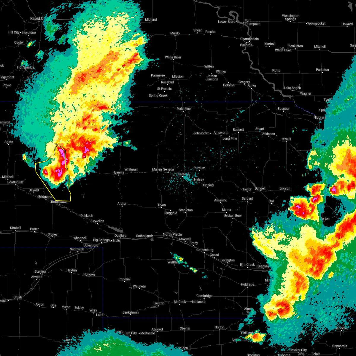 At 1002 pm mdt, a severe thunderstorm was located over alliance airport, or near alliance, moving southeast at 60 mph. this is a very dangerous storm (trained weather spotters. 70 to 80 mph winds have been confirmed in and around alliance with this storm!). Hazards include 80 mph wind gusts and golf ball size hail. Flying debris will be dangerous to those caught without shelter. mobile homes will be heavily damaged. expect considerable damage to roofs, windows, and vehicles. extensive tree damage and power outages are likely. this severe thunderstorm will continue to impact the city of alliance. Other locations impacted include, angora. At 1002 pm mdt, a severe thunderstorm was located over alliance airport, or near alliance, moving southeast at 60 mph. this is a very dangerous storm (trained weather spotters. 70 to 80 mph winds have been confirmed in and around alliance with this storm!). Hazards include 80 mph wind gusts and golf ball size hail. Flying debris will be dangerous to those caught without shelter. mobile homes will be heavily damaged. expect considerable damage to roofs, windows, and vehicles. extensive tree damage and power outages are likely. this severe thunderstorm will continue to impact the city of alliance. Other locations impacted include, angora.
|
| 7/9/2021 9:47 PM MDT |
 At 945 pm mdt, a severe thunderstorm was located near berea, or 9 miles west of alliance, moving southeast at 65 mph. this includes the city of alliance! clean up may be underway from earlier intense thunderstorms. seek shelter immediately inside a sturdy structure and away from windows! this is a very dangerous storm (radar indicated). Hazards include 80 mph wind gusts and golf ball size hail. Flying debris will be dangerous to those caught without shelter. mobile homes will be heavily damaged. expect considerable damage to roofs, windows, and vehicles. extensive tree damage and power outages are likely. this severe storm will be near, alliance around 955 pm mdt. alliance airport around 1000 pm mdt. Other locations impacted by this severe thunderstorm include marsland. At 945 pm mdt, a severe thunderstorm was located near berea, or 9 miles west of alliance, moving southeast at 65 mph. this includes the city of alliance! clean up may be underway from earlier intense thunderstorms. seek shelter immediately inside a sturdy structure and away from windows! this is a very dangerous storm (radar indicated). Hazards include 80 mph wind gusts and golf ball size hail. Flying debris will be dangerous to those caught without shelter. mobile homes will be heavily damaged. expect considerable damage to roofs, windows, and vehicles. extensive tree damage and power outages are likely. this severe storm will be near, alliance around 955 pm mdt. alliance airport around 1000 pm mdt. Other locations impacted by this severe thunderstorm include marsland.
|
| 7/9/2021 9:33 PM MDT |
 This includes the city of alliance! * at 932 pm mdt, a severe thunderstorm was located 9 miles east of flahertys corner, or 23 miles northwest of alliance, moving southeast at 65 mph. this is a very dangerous storm. seek shelter immediately inside a sturdy structure! (radar indicated). Hazards include 80 mph wind gusts and golf ball size hail. Flying debris will be dangerous to those caught without shelter. mobile homes will be heavily damaged. expect considerable damage to roofs, windows, and vehicles. Extensive tree damage and power outages are likely. This includes the city of alliance! * at 932 pm mdt, a severe thunderstorm was located 9 miles east of flahertys corner, or 23 miles northwest of alliance, moving southeast at 65 mph. this is a very dangerous storm. seek shelter immediately inside a sturdy structure! (radar indicated). Hazards include 80 mph wind gusts and golf ball size hail. Flying debris will be dangerous to those caught without shelter. mobile homes will be heavily damaged. expect considerable damage to roofs, windows, and vehicles. Extensive tree damage and power outages are likely.
|
| 7/9/2021 5:58 PM MDT |
 At 556 pm mdt, a severe thunderstorm was located over alliance airport, or near alliance, moving southeast at 25 mph. additional storms were located west of alliance moving southeast, including a tornado warned storm until 615 pm mdt. this is a very dangerous storm (trained weather spotters). Hazards include baseball size hail and 60 mph wind gusts. People and animals outdoors will be severely injured. Expect shattered windows, extensive damage to roofs, siding, and vehicles. At 556 pm mdt, a severe thunderstorm was located over alliance airport, or near alliance, moving southeast at 25 mph. additional storms were located west of alliance moving southeast, including a tornado warned storm until 615 pm mdt. this is a very dangerous storm (trained weather spotters). Hazards include baseball size hail and 60 mph wind gusts. People and animals outdoors will be severely injured. Expect shattered windows, extensive damage to roofs, siding, and vehicles.
|
| 7/9/2021 5:27 PM MDT |
 At 525 pm mdt, a severe thunderstorm was located over berea, or 7 miles northwest of alliance, moving southeast at 25 mph. additional storms were located west of hemingford also moving southeast. two inch hail was reported 9 miles south-southwest of marsland at 522 pm mdt. this is a very dangerous storm (trained spotter reported). Hazards include baseball size hail and 60 mph wind gusts. People and animals outdoors will be severely injured. expect shattered windows, extensive damage to roofs, siding, and vehicles. Locations impacted include, alliance, hemingford, wild horse butte, berea and alliance airport. At 525 pm mdt, a severe thunderstorm was located over berea, or 7 miles northwest of alliance, moving southeast at 25 mph. additional storms were located west of hemingford also moving southeast. two inch hail was reported 9 miles south-southwest of marsland at 522 pm mdt. this is a very dangerous storm (trained spotter reported). Hazards include baseball size hail and 60 mph wind gusts. People and animals outdoors will be severely injured. expect shattered windows, extensive damage to roofs, siding, and vehicles. Locations impacted include, alliance, hemingford, wild horse butte, berea and alliance airport.
|
| 7/9/2021 5:08 PM MDT |
 At 508 pm mdt, a severe thunderstorm was located near berea, or 14 miles northwest of alliance, moving southeast at 25 mph. this is a very dangerous storm (radar indicated). Hazards include baseball size hail and 60 mph wind gusts. People and animals outdoors will be severely injured. Expect shattered windows, extensive damage to roofs, siding, and vehicles. At 508 pm mdt, a severe thunderstorm was located near berea, or 14 miles northwest of alliance, moving southeast at 25 mph. this is a very dangerous storm (radar indicated). Hazards include baseball size hail and 60 mph wind gusts. People and animals outdoors will be severely injured. Expect shattered windows, extensive damage to roofs, siding, and vehicles.
|
| 7/9/2021 4:57 PM MDT |
 At 456 pm mdt, a severe thunderstorm was located near hemingford, or 18 miles northwest of alliance, moving southeast at 30 mph (radar indicated). Hazards include tennis ball size hail and 60 mph wind gusts. People and animals outdoors will be injured. expect hail damage to roofs, siding, windows, and vehicles. expect wind damage to roofs, siding, and trees. Locations impacted include, hemingford, box butte campground, berea, box butte dam and marsland. At 456 pm mdt, a severe thunderstorm was located near hemingford, or 18 miles northwest of alliance, moving southeast at 30 mph (radar indicated). Hazards include tennis ball size hail and 60 mph wind gusts. People and animals outdoors will be injured. expect hail damage to roofs, siding, windows, and vehicles. expect wind damage to roofs, siding, and trees. Locations impacted include, hemingford, box butte campground, berea, box butte dam and marsland.
|
| 7/9/2021 4:50 PM MDT |
 At 449 pm mdt, a severe thunderstorm was located near hemingford, or 23 miles northwest of alliance, moving southeast at 25 mph. trained spotters reported half dollar size hail west of hemingford at 442 pm mdt (trained weather spotters). Hazards include golf ball size hail and 60 mph wind gusts. People and animals outdoors will be injured. expect hail damage to roofs, siding, windows, and vehicles. expect wind damage to roofs, siding, and trees. Locations impacted include, hemingford, box butte campground, berea, box butte dam and marsland. At 449 pm mdt, a severe thunderstorm was located near hemingford, or 23 miles northwest of alliance, moving southeast at 25 mph. trained spotters reported half dollar size hail west of hemingford at 442 pm mdt (trained weather spotters). Hazards include golf ball size hail and 60 mph wind gusts. People and animals outdoors will be injured. expect hail damage to roofs, siding, windows, and vehicles. expect wind damage to roofs, siding, and trees. Locations impacted include, hemingford, box butte campground, berea, box butte dam and marsland.
|
| 7/9/2021 4:30 PM MDT |
 At 429 pm mdt, a severe thunderstorm was located 9 miles northeast of flahertys corner, or 32 miles northwest of alliance, moving southeast at 25 mph (radar indicated). Hazards include golf ball size hail and 60 mph wind gusts. People and animals outdoors will be injured. expect hail damage to roofs, siding, windows, and vehicles. Expect wind damage to roofs, siding, and trees. At 429 pm mdt, a severe thunderstorm was located 9 miles northeast of flahertys corner, or 32 miles northwest of alliance, moving southeast at 25 mph (radar indicated). Hazards include golf ball size hail and 60 mph wind gusts. People and animals outdoors will be injured. expect hail damage to roofs, siding, windows, and vehicles. Expect wind damage to roofs, siding, and trees.
|
| 6/13/2021 8:07 PM MDT |
 The severe thunderstorm warning for northeastern box butte and southeastern dawes counties will expire at 815 pm mdt, the storms which prompted the warning have weakened below severe limits, and have exited the warned area. therefore, the warning will be allowed to expire. a severe thunderstorm watch remains in effect until 1000 pm mdt for the panhandle of nebraska. to report severe weather, contact your nearest law enforcement agency. they will relay your report to the national weather service cheyenne. The severe thunderstorm warning for northeastern box butte and southeastern dawes counties will expire at 815 pm mdt, the storms which prompted the warning have weakened below severe limits, and have exited the warned area. therefore, the warning will be allowed to expire. a severe thunderstorm watch remains in effect until 1000 pm mdt for the panhandle of nebraska. to report severe weather, contact your nearest law enforcement agency. they will relay your report to the national weather service cheyenne.
|
| 6/13/2021 7:47 PM MDT |
 At 746 pm mdt, severe thunderstorms were located along a line extending from 8 miles southeast of red cloud campground to 9 miles east of box butte dam to near hemingford, moving east at 25 mph (trained weather spotters. these storms have a history of producing very strong winds in excess of 70 mph). Hazards include 70 mph wind gusts and ping pong ball size hail. People and animals outdoors will be injured. expect hail damage to roofs, siding, windows, and vehicles. expect considerable tree damage. wind damage is also likely to mobile homes, roofs, and outbuildings. Locations impacted include, hemingford, wild horse butte, box butte campground, red cloud campground, berea, box butte dam and chadron st park. At 746 pm mdt, severe thunderstorms were located along a line extending from 8 miles southeast of red cloud campground to 9 miles east of box butte dam to near hemingford, moving east at 25 mph (trained weather spotters. these storms have a history of producing very strong winds in excess of 70 mph). Hazards include 70 mph wind gusts and ping pong ball size hail. People and animals outdoors will be injured. expect hail damage to roofs, siding, windows, and vehicles. expect considerable tree damage. wind damage is also likely to mobile homes, roofs, and outbuildings. Locations impacted include, hemingford, wild horse butte, box butte campground, red cloud campground, berea, box butte dam and chadron st park.
|
| 6/13/2021 7:38 PM MDT |
 At 738 pm mdt, severe thunderstorms were located along a line extending from near alliance to 9 miles east of angora to near court house and jail rocks, moving east at 30 mph (radar indicated). Hazards include 70 mph wind gusts and half dollar size hail. Hail damage to vehicles is expected. expect considerable tree damage. Wind damage is also likely to mobile homes, roofs, and outbuildings. At 738 pm mdt, severe thunderstorms were located along a line extending from near alliance to 9 miles east of angora to near court house and jail rocks, moving east at 30 mph (radar indicated). Hazards include 70 mph wind gusts and half dollar size hail. Hail damage to vehicles is expected. expect considerable tree damage. Wind damage is also likely to mobile homes, roofs, and outbuildings.
|
| 6/13/2021 7:34 PM MDT |
 At 734 pm mdt, severe thunderstorms were located along a line extending from 11 miles southeast of red cloud campground to near box butte dam to 6 miles west of hemingford to near flahertys corner, moving east at 25 mph (trained weather spotters. at 730 pm mdt, a wind gust to 72 mph was measured 6 miles east southeast of box butte dam). Hazards include 70 mph wind gusts and ping pong ball size hail. People and animals outdoors will be injured. expect hail damage to roofs, siding, windows, and vehicles. expect considerable tree damage. wind damage is also likely to mobile homes, roofs, and outbuildings. Locations impacted include, hemingford, wild horse butte, box butte campground, red cloud campground, berea, flahertys corner, box butte dam, marsland and chadron st park. At 734 pm mdt, severe thunderstorms were located along a line extending from 11 miles southeast of red cloud campground to near box butte dam to 6 miles west of hemingford to near flahertys corner, moving east at 25 mph (trained weather spotters. at 730 pm mdt, a wind gust to 72 mph was measured 6 miles east southeast of box butte dam). Hazards include 70 mph wind gusts and ping pong ball size hail. People and animals outdoors will be injured. expect hail damage to roofs, siding, windows, and vehicles. expect considerable tree damage. wind damage is also likely to mobile homes, roofs, and outbuildings. Locations impacted include, hemingford, wild horse butte, box butte campground, red cloud campground, berea, flahertys corner, box butte dam, marsland and chadron st park.
|
| 6/13/2021 7:27 PM MDT |
 At 726 pm mdt, severe thunderstorms were located along a line extending from 10 miles southeast of red cloud campground to near box butte dam to 7 miles west of hemingford to near flahertys corner, moving east at 25 mph (radar indicated). Hazards include 70 mph wind gusts and ping pong ball size hail. People and animals outdoors will be injured. expect hail damage to roofs, siding, windows, and vehicles. expect considerable tree damage. Wind damage is also likely to mobile homes, roofs, and outbuildings. At 726 pm mdt, severe thunderstorms were located along a line extending from 10 miles southeast of red cloud campground to near box butte dam to 7 miles west of hemingford to near flahertys corner, moving east at 25 mph (radar indicated). Hazards include 70 mph wind gusts and ping pong ball size hail. People and animals outdoors will be injured. expect hail damage to roofs, siding, windows, and vehicles. expect considerable tree damage. Wind damage is also likely to mobile homes, roofs, and outbuildings.
|
| 6/13/2021 7:05 PM MDT |
 At 705 pm mdt, severe thunderstorms were located along a line extending from near box butte campground to 8 miles west of box butte dam to 6 miles north of flahertys corner to near agate bed national monument, moving southeast at 10 mph (radar indicated). Hazards include golf ball size hail and 70 mph wind gusts. People and animals outdoors will be injured. expect hail damage to roofs, siding, windows, and vehicles. expect considerable tree damage. wind damage is also likely to mobile homes, roofs, and outbuildings. Locations impacted include, hemingford, wild horse butte, box butte campground, berea, flahertys corner, box butte dam and marsland. At 705 pm mdt, severe thunderstorms were located along a line extending from near box butte campground to 8 miles west of box butte dam to 6 miles north of flahertys corner to near agate bed national monument, moving southeast at 10 mph (radar indicated). Hazards include golf ball size hail and 70 mph wind gusts. People and animals outdoors will be injured. expect hail damage to roofs, siding, windows, and vehicles. expect considerable tree damage. wind damage is also likely to mobile homes, roofs, and outbuildings. Locations impacted include, hemingford, wild horse butte, box butte campground, berea, flahertys corner, box butte dam and marsland.
|
| 6/13/2021 6:42 PM MDT |
 At 642 pm mdt, severe thunderstorms were located along a line extending from 8 miles northwest of box butte campground to 13 miles west of box butte dam to 10 miles northwest of flahertys corner to 7 miles north of agate bed national monument, moving southeast at 10 mph (radar indicated). Hazards include golf ball size hail and 70 mph wind gusts. People and animals outdoors will be injured. expect hail damage to roofs, siding, windows, and vehicles. expect considerable tree damage. Wind damage is also likely to mobile homes, roofs, and outbuildings. At 642 pm mdt, severe thunderstorms were located along a line extending from 8 miles northwest of box butte campground to 13 miles west of box butte dam to 10 miles northwest of flahertys corner to 7 miles north of agate bed national monument, moving southeast at 10 mph (radar indicated). Hazards include golf ball size hail and 70 mph wind gusts. People and animals outdoors will be injured. expect hail damage to roofs, siding, windows, and vehicles. expect considerable tree damage. Wind damage is also likely to mobile homes, roofs, and outbuildings.
|
| 5/26/2021 6:12 PM MDT |
 At 612 pm mdt, a severe thunderstorm was located near hemingford, or 16 miles northwest of alliance, moving east at 30 mph (radar indicated). Hazards include ping pong ball size hail and 60 mph wind gusts. People and animals outdoors will be injured. expect hail damage to roofs, siding, windows, and vehicles. Expect wind damage to roofs, siding, and trees. At 612 pm mdt, a severe thunderstorm was located near hemingford, or 16 miles northwest of alliance, moving east at 30 mph (radar indicated). Hazards include ping pong ball size hail and 60 mph wind gusts. People and animals outdoors will be injured. expect hail damage to roofs, siding, windows, and vehicles. Expect wind damage to roofs, siding, and trees.
|
| 5/26/2021 5:41 PM MDT |
 At 540 pm mdt, severe thunderstorms were located along a line extending from near hemingford to 7 miles northwest of kilpatrick lake, moving east at 35 mph (radar indicated). Hazards include golf ball size hail and 60 mph wind gusts. People and animals outdoors will be injured. expect hail damage to roofs, siding, windows, and vehicles. Expect wind damage to roofs, siding, and trees. At 540 pm mdt, severe thunderstorms were located along a line extending from near hemingford to 7 miles northwest of kilpatrick lake, moving east at 35 mph (radar indicated). Hazards include golf ball size hail and 60 mph wind gusts. People and animals outdoors will be injured. expect hail damage to roofs, siding, windows, and vehicles. Expect wind damage to roofs, siding, and trees.
|
| 8/15/2020 3:56 PM MDT |
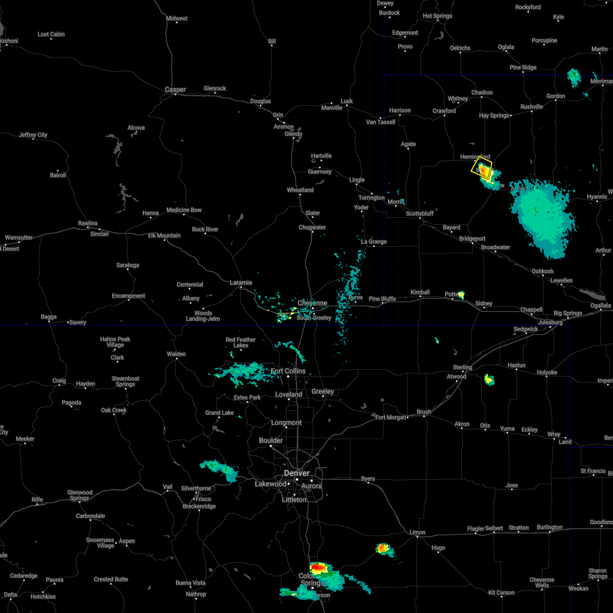 The severe thunderstorm warning for central box butte county will expire at 400 pm mdt, the storm which prompted the warning has weakened below severe limits. therefore, the warning will be allowed to expire. however gusty winds and heavy rain are still possible with this thunderstorm. The severe thunderstorm warning for central box butte county will expire at 400 pm mdt, the storm which prompted the warning has weakened below severe limits. therefore, the warning will be allowed to expire. however gusty winds and heavy rain are still possible with this thunderstorm.
|
| 8/15/2020 3:46 PM MDT |
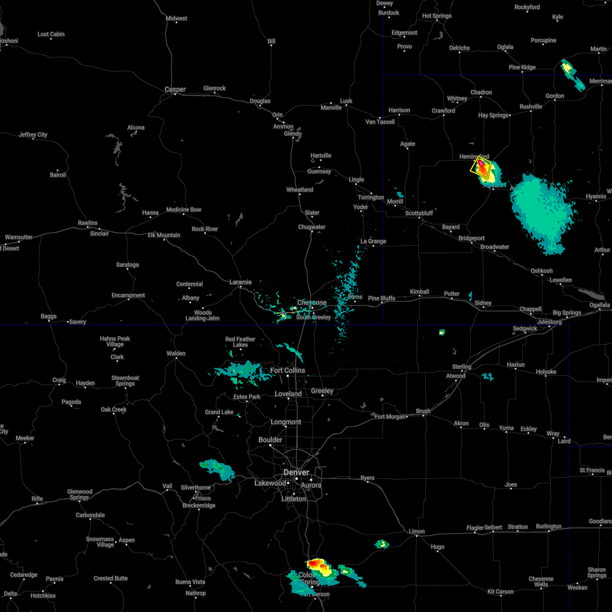 At 344 pm mdt, a severe thunderstorm was located near hemingford, or 15 miles northwest of alliance, moving south at 10 mph. this is a very dangerous storm (radar indicated. at 335 pm...a trained weather spotter reported three and a quarter inch diameter hail 3 miles northeast of hemingford). Hazards include three inch hail and 60 mph wind gusts. People and animals outdoors will be severely injured. expect shattered windows, extensive damage to roofs, siding, and vehicles. This severe storm will be near, berea around 430 pm mdt. At 344 pm mdt, a severe thunderstorm was located near hemingford, or 15 miles northwest of alliance, moving south at 10 mph. this is a very dangerous storm (radar indicated. at 335 pm...a trained weather spotter reported three and a quarter inch diameter hail 3 miles northeast of hemingford). Hazards include three inch hail and 60 mph wind gusts. People and animals outdoors will be severely injured. expect shattered windows, extensive damage to roofs, siding, and vehicles. This severe storm will be near, berea around 430 pm mdt.
|
| 8/15/2020 3:38 PM MDT |
 At 337 pm mdt, a severe thunderstorm was located near hemingford, or 16 miles northwest of alliance, moving south at 10 mph (radar indicated. at 329 pm...a trained storm spotter reported baseball size hail 4 miles northeast of hemingford). Hazards include tennis ball size hail and 60 mph wind gusts. People and animals outdoors will be injured. expect hail damage to roofs, siding, windows, and vehicles. expect wind damage to roofs, siding, and trees. this severe storm will be near, hemingford around 345 pm mdt. Berea around 415 pm mdt. At 337 pm mdt, a severe thunderstorm was located near hemingford, or 16 miles northwest of alliance, moving south at 10 mph (radar indicated. at 329 pm...a trained storm spotter reported baseball size hail 4 miles northeast of hemingford). Hazards include tennis ball size hail and 60 mph wind gusts. People and animals outdoors will be injured. expect hail damage to roofs, siding, windows, and vehicles. expect wind damage to roofs, siding, and trees. this severe storm will be near, hemingford around 345 pm mdt. Berea around 415 pm mdt.
|
| 8/15/2020 3:26 PM MDT |
 At 325 pm mdt, a severe thunderstorm was located near hemingford, or 17 miles northwest of alliance, moving south at 15 mph (radar indicated). Hazards include 60 mph wind gusts and half dollar size hail. Hail damage to vehicles is expected. expect wind damage to roofs, siding, and trees. This severe storm will be near, hemingford around 330 pm mdt. At 325 pm mdt, a severe thunderstorm was located near hemingford, or 17 miles northwest of alliance, moving south at 15 mph (radar indicated). Hazards include 60 mph wind gusts and half dollar size hail. Hail damage to vehicles is expected. expect wind damage to roofs, siding, and trees. This severe storm will be near, hemingford around 330 pm mdt.
|
| 8/15/2020 3:16 PM MDT |
 At 316 pm mdt, a severe thunderstorm was located near box butte dam, or 21 miles north of alliance, moving southwest at 15 mph (radar indicated). Hazards include 60 mph wind gusts and half dollar size hail. Hail damage to vehicles is expected. expect wind damage to roofs, siding, and trees. This severe thunderstorm will be near, hemingford around 340 pm mdt. At 316 pm mdt, a severe thunderstorm was located near box butte dam, or 21 miles north of alliance, moving southwest at 15 mph (radar indicated). Hazards include 60 mph wind gusts and half dollar size hail. Hail damage to vehicles is expected. expect wind damage to roofs, siding, and trees. This severe thunderstorm will be near, hemingford around 340 pm mdt.
|
| 7/19/2020 9:22 PM MDT |
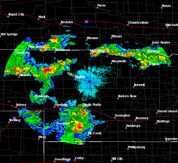 A severe thunderstorm warning remains in effect until 1000 pm mdt for northeastern box butte county. at 922 pm mdt, a severe thunderstorm was located near hemingford, or 17 miles north of alliance, moving southeast at 15 mph. hazard. golf ball size hail and 60 mph wind gusts. source. Radar indicated. A severe thunderstorm warning remains in effect until 1000 pm mdt for northeastern box butte county. at 922 pm mdt, a severe thunderstorm was located near hemingford, or 17 miles north of alliance, moving southeast at 15 mph. hazard. golf ball size hail and 60 mph wind gusts. source. Radar indicated.
|
| 7/19/2020 8:54 PM MDT |
 At 854 pm mdt, a severe thunderstorm was located near box butte dam, or 21 miles north of alliance, moving southeast at 15 mph (radar indicated). Hazards include golf ball size hail and 60 mph wind gusts. People and animals outdoors will be injured. expect hail damage to roofs, siding, windows, and vehicles. Expect wind damage to roofs, siding, and trees. At 854 pm mdt, a severe thunderstorm was located near box butte dam, or 21 miles north of alliance, moving southeast at 15 mph (radar indicated). Hazards include golf ball size hail and 60 mph wind gusts. People and animals outdoors will be injured. expect hail damage to roofs, siding, windows, and vehicles. Expect wind damage to roofs, siding, and trees.
|
| 7/9/2020 8:16 PM MDT |
 At 816 pm mdt, a severe thunderstorm was located near alliance, moving southeast at 30 mph (radar indicated). Hazards include 60 mph wind gusts and quarter size hail. Hail damage to vehicles is expected. expect wind damage to roofs, siding, and trees. Locations impacted include, alliance, wild horse butte, berea and alliance airport. At 816 pm mdt, a severe thunderstorm was located near alliance, moving southeast at 30 mph (radar indicated). Hazards include 60 mph wind gusts and quarter size hail. Hail damage to vehicles is expected. expect wind damage to roofs, siding, and trees. Locations impacted include, alliance, wild horse butte, berea and alliance airport.
|
| 7/9/2020 8:07 PM MDT |
 At 806 pm mdt, severe thunderstorms were located along a line extending from near wild horse butte to 7 miles west of alliance, moving east at 35 mph (radar indicated). Hazards include golf ball size hail and 60 mph wind gusts. People and animals outdoors will be injured. expect hail damage to roofs, siding, windows, and vehicles. expect wind damage to roofs, siding, and trees. Locations impacted include, alliance, hemingford, wild horse butte, berea and alliance airport. At 806 pm mdt, severe thunderstorms were located along a line extending from near wild horse butte to 7 miles west of alliance, moving east at 35 mph (radar indicated). Hazards include golf ball size hail and 60 mph wind gusts. People and animals outdoors will be injured. expect hail damage to roofs, siding, windows, and vehicles. expect wind damage to roofs, siding, and trees. Locations impacted include, alliance, hemingford, wild horse butte, berea and alliance airport.
|
| 7/9/2020 7:54 PM MDT |
 At 754 pm mdt, severe thunderstorms were located along a line extending from near wild horse butte to 7 miles east of kilpatrick lake, moving southeast at 25 mph (radar indicated). Hazards include golf ball size hail and 60 mph wind gusts. People and animals outdoors will be injured. expect hail damage to roofs, siding, windows, and vehicles. expect wind damage to roofs, siding, and trees. Locations impacted include, alliance, hemingford, wild horse butte, berea and alliance airport. At 754 pm mdt, severe thunderstorms were located along a line extending from near wild horse butte to 7 miles east of kilpatrick lake, moving southeast at 25 mph (radar indicated). Hazards include golf ball size hail and 60 mph wind gusts. People and animals outdoors will be injured. expect hail damage to roofs, siding, windows, and vehicles. expect wind damage to roofs, siding, and trees. Locations impacted include, alliance, hemingford, wild horse butte, berea and alliance airport.
|
| 7/9/2020 7:37 PM MDT |
 At 737 pm mdt, severe thunderstorms were located along a line extending from near wild horse butte to near kilpatrick lake, moving east at 35 mph (radar indicated). Hazards include golf ball size hail and 60 mph wind gusts. People and animals outdoors will be injured. expect hail damage to roofs, siding, windows, and vehicles. Expect wind damage to roofs, siding, and trees. At 737 pm mdt, severe thunderstorms were located along a line extending from near wild horse butte to near kilpatrick lake, moving east at 35 mph (radar indicated). Hazards include golf ball size hail and 60 mph wind gusts. People and animals outdoors will be injured. expect hail damage to roofs, siding, windows, and vehicles. Expect wind damage to roofs, siding, and trees.
|
| 7/8/2020 5:36 PM MDT |
 At 536 pm mdt, severe thunderstorms were located along a line extending from near chadron to near hemingford, moving east at 25 mph (radar indicated). Hazards include 70 mph wind gusts and ping pong ball size hail. People and animals outdoors will be injured. expect hail damage to roofs, siding, windows, and vehicles. expect considerable tree damage. Wind damage is also likely to mobile homes, roofs, and outbuildings. At 536 pm mdt, severe thunderstorms were located along a line extending from near chadron to near hemingford, moving east at 25 mph (radar indicated). Hazards include 70 mph wind gusts and ping pong ball size hail. People and animals outdoors will be injured. expect hail damage to roofs, siding, windows, and vehicles. expect considerable tree damage. Wind damage is also likely to mobile homes, roofs, and outbuildings.
|
| 7/2/2020 6:53 PM MDT |
 The severe thunderstorm warning for north central box butte and southeastern dawes counties will expire at 700 pm mdt, the storm which prompted the warning has weakened below severe limits, and no longer poses an immediate threat to life or property. therefore, the warning will be allowed to expire. however small hail and gusty winds are still possible with this thunderstorm. to report severe weather, contact your nearest law enforcement agency. they will relay your report to the national weather service cheyenne. The severe thunderstorm warning for north central box butte and southeastern dawes counties will expire at 700 pm mdt, the storm which prompted the warning has weakened below severe limits, and no longer poses an immediate threat to life or property. therefore, the warning will be allowed to expire. however small hail and gusty winds are still possible with this thunderstorm. to report severe weather, contact your nearest law enforcement agency. they will relay your report to the national weather service cheyenne.
|
| 7/2/2020 6:31 PM MDT |
 At 631 pm mdt, a severe thunderstorm was located near box butte campground, or 24 miles northwest of alliance, moving east at 15 mph (radar indicated). Hazards include 60 mph wind gusts and quarter size hail. Hail damage to vehicles is expected. expect wind damage to roofs, siding, and trees. Locations impacted include, hemingford, box butte campground, berea and box butte dam. At 631 pm mdt, a severe thunderstorm was located near box butte campground, or 24 miles northwest of alliance, moving east at 15 mph (radar indicated). Hazards include 60 mph wind gusts and quarter size hail. Hail damage to vehicles is expected. expect wind damage to roofs, siding, and trees. Locations impacted include, hemingford, box butte campground, berea and box butte dam.
|
| 7/2/2020 6:08 PM MDT |
 At 608 pm mdt, a severe thunderstorm was located 9 miles southwest of box butte campground, or 28 miles northwest of alliance, moving east at 20 mph (radar indicated). Hazards include golf ball size hail and 60 mph wind gusts. People and animals outdoors will be injured. expect hail damage to roofs, siding, windows, and vehicles. Expect wind damage to roofs, siding, and trees. At 608 pm mdt, a severe thunderstorm was located 9 miles southwest of box butte campground, or 28 miles northwest of alliance, moving east at 20 mph (radar indicated). Hazards include golf ball size hail and 60 mph wind gusts. People and animals outdoors will be injured. expect hail damage to roofs, siding, windows, and vehicles. Expect wind damage to roofs, siding, and trees.
|
| 6/6/2020 7:30 PM MDT |
 At 729 pm mdt, severe thunderstorms were located along a line extending from 7 miles north of whitney lake to near sunol, moving east at 50 mph (radar indicated). Hazards include 70 mph wind gusts. Expect considerable tree damage. Damage is likely to mobile homes, roofs, and outbuildings. At 729 pm mdt, severe thunderstorms were located along a line extending from 7 miles north of whitney lake to near sunol, moving east at 50 mph (radar indicated). Hazards include 70 mph wind gusts. Expect considerable tree damage. Damage is likely to mobile homes, roofs, and outbuildings.
|
| 6/6/2020 7:12 PM MDT |
 The severe thunderstorm warning for box butte, dawes and northern sioux counties will expire at 715 pm mdt, the storms which prompted the warning have moved out of the area. therefore, the warning will be allowed to expire. however gusty winds to 45 mph are still possible with these thunderstorms. a severe thunderstorm watch remains in effect until 800 pm mdt for the panhandle of nebraska. The severe thunderstorm warning for box butte, dawes and northern sioux counties will expire at 715 pm mdt, the storms which prompted the warning have moved out of the area. therefore, the warning will be allowed to expire. however gusty winds to 45 mph are still possible with these thunderstorms. a severe thunderstorm watch remains in effect until 800 pm mdt for the panhandle of nebraska.
|
| 6/6/2020 6:55 PM MDT |
 At 653 pm mdt, severe thunderstorms were located along a line extending from 8 miles south of oelrichs to 12 miles south of hay springs, moving north at 55 mph. at 642 pm mdt, chadron municipal airport reported 75 mph wind gust (mesonet station). Hazards include 70 mph wind gusts. Expect considerable tree damage. damage is likely to mobile homes, roofs, and outbuildings. Locations impacted include, alliance, chadron, crawford, hemingford, harrison, wild horse butte, alliance airport, whitney lake, box butte campground, red cloud campground, montrose, box butte dam, kilpatrick lake, fort robinson campground, chadron campground, berea, flahertys corner, chadron airport, whitney and marsland. At 653 pm mdt, severe thunderstorms were located along a line extending from 8 miles south of oelrichs to 12 miles south of hay springs, moving north at 55 mph. at 642 pm mdt, chadron municipal airport reported 75 mph wind gust (mesonet station). Hazards include 70 mph wind gusts. Expect considerable tree damage. damage is likely to mobile homes, roofs, and outbuildings. Locations impacted include, alliance, chadron, crawford, hemingford, harrison, wild horse butte, alliance airport, whitney lake, box butte campground, red cloud campground, montrose, box butte dam, kilpatrick lake, fort robinson campground, chadron campground, berea, flahertys corner, chadron airport, whitney and marsland.
|
| 6/6/2020 6:32 PM MDT |
 At 630 pm mdt, severe thunderstorms were located along a line extending from near montrose to near berea, moving northeast at 65 mph. at 621 pm mdt, alliance municipal airport asos reported 73 mph wind gust (mesonet station). Hazards include 70 mph wind gusts. Expect considerable tree damage. damage is likely to mobile homes, roofs, and outbuildings. Locations impacted include, alliance, chadron, crawford, hemingford, harrison, alliance airport, montrose, angora, box butte dam, fort robinson campground, chadron campground, berea, flahertys corner, chadron airport, wild horse butte, whitney lake, box butte campground, red cloud campground, agate bed national monument and kilpatrick lake. At 630 pm mdt, severe thunderstorms were located along a line extending from near montrose to near berea, moving northeast at 65 mph. at 621 pm mdt, alliance municipal airport asos reported 73 mph wind gust (mesonet station). Hazards include 70 mph wind gusts. Expect considerable tree damage. damage is likely to mobile homes, roofs, and outbuildings. Locations impacted include, alliance, chadron, crawford, hemingford, harrison, alliance airport, montrose, angora, box butte dam, fort robinson campground, chadron campground, berea, flahertys corner, chadron airport, wild horse butte, whitney lake, box butte campground, red cloud campground, agate bed national monument and kilpatrick lake.
|
| 6/6/2020 5:58 PM MDT |
 At 556 pm mdt, severe thunderstorms were located along a line extending from 9 miles northwest of agate bed national monument to near bayard, moving northeast at 65 mph (radar indicated). Hazards include 70 mph wind gusts. Expect considerable tree damage. Damage is likely to mobile homes, roofs, and outbuildings. At 556 pm mdt, severe thunderstorms were located along a line extending from 9 miles northwest of agate bed national monument to near bayard, moving northeast at 65 mph (radar indicated). Hazards include 70 mph wind gusts. Expect considerable tree damage. Damage is likely to mobile homes, roofs, and outbuildings.
|
| 9/20/2019 7:36 PM MDT |
 The severe thunderstorm warning for eastern box butte and southeastern dawes counties will expire at 745 pm mdt, the storm which prompted the warning has weakened below severe limits, and has exited the warned area. therefore, the warning will be allowed to expire. however gusty winds are still possible with this thunderstorm. a severe thunderstorm watch remains in effect until 100 am mdt for the panhandle of nebraska. The severe thunderstorm warning for eastern box butte and southeastern dawes counties will expire at 745 pm mdt, the storm which prompted the warning has weakened below severe limits, and has exited the warned area. therefore, the warning will be allowed to expire. however gusty winds are still possible with this thunderstorm. a severe thunderstorm watch remains in effect until 100 am mdt for the panhandle of nebraska.
|
| 9/20/2019 6:53 PM MDT |
 At 640 pm mdt, trained spotters in berea reported quarter size hail from a severe thunderstorm located near berea, or 11 miles north of alliance, moving northeast at 25 mph (trained weather spotters). Hazards include 60 mph wind gusts and half dollar size hail. Hail damage to vehicles is expected. expect wind damage to roofs, siding, and trees. Locations impacted include, hemingford, wild horse butte, box butte campground, berea and box butte dam. At 640 pm mdt, trained spotters in berea reported quarter size hail from a severe thunderstorm located near berea, or 11 miles north of alliance, moving northeast at 25 mph (trained weather spotters). Hazards include 60 mph wind gusts and half dollar size hail. Hail damage to vehicles is expected. expect wind damage to roofs, siding, and trees. Locations impacted include, hemingford, wild horse butte, box butte campground, berea and box butte dam.
|
| 9/20/2019 6:28 PM MDT |
 At 627 pm mdt, a severe thunderstorm was located 7 miles west of berea, or 14 miles northwest of alliance, moving northeast at 25 mph (radar indicated). Hazards include 60 mph wind gusts and half dollar size hail. Hail damage to vehicles is expected. Expect wind damage to roofs, siding, and trees. At 627 pm mdt, a severe thunderstorm was located 7 miles west of berea, or 14 miles northwest of alliance, moving northeast at 25 mph (radar indicated). Hazards include 60 mph wind gusts and half dollar size hail. Hail damage to vehicles is expected. Expect wind damage to roofs, siding, and trees.
|
| 9/20/2019 6:07 PM MDT |
 At 606 pm mdt, a severe thunderstorm was located near kilpatrick lake, or 20 miles west of alliance, moving northeast at 25 mph (radar indicated). Hazards include ping pong ball size hail and 60 mph wind gusts. People and animals outdoors will be injured. expect hail damage to roofs, siding, windows, and vehicles. expect wind damage to roofs, siding, and trees. Locations impacted include, hemingford, kilpatrick lake and berea. At 606 pm mdt, a severe thunderstorm was located near kilpatrick lake, or 20 miles west of alliance, moving northeast at 25 mph (radar indicated). Hazards include ping pong ball size hail and 60 mph wind gusts. People and animals outdoors will be injured. expect hail damage to roofs, siding, windows, and vehicles. expect wind damage to roofs, siding, and trees. Locations impacted include, hemingford, kilpatrick lake and berea.
|
| 9/20/2019 5:45 PM MDT |
 At 544 pm mdt, a severe thunderstorm was located near kilpatrick lake, or 25 miles northeast of scottsbluff, moving northeast at 30 mph (radar indicated). Hazards include ping pong ball size hail and 60 mph wind gusts. People and animals outdoors will be injured. expect hail damage to roofs, siding, windows, and vehicles. expect wind damage to roofs, siding, and trees. Locations impacted include, hemingford, kilpatrick lake and berea. At 544 pm mdt, a severe thunderstorm was located near kilpatrick lake, or 25 miles northeast of scottsbluff, moving northeast at 30 mph (radar indicated). Hazards include ping pong ball size hail and 60 mph wind gusts. People and animals outdoors will be injured. expect hail damage to roofs, siding, windows, and vehicles. expect wind damage to roofs, siding, and trees. Locations impacted include, hemingford, kilpatrick lake and berea.
|
| 9/20/2019 5:28 PM MDT |
 At 528 pm mdt, a severe thunderstorm was located 10 miles northeast of lake alice, or 19 miles northeast of scottsbluff, moving northeast at 25 mph (radar indicated). Hazards include ping pong ball size hail and 60 mph wind gusts. People and animals outdoors will be injured. expect hail damage to roofs, siding, windows, and vehicles. Expect wind damage to roofs, siding, and trees. At 528 pm mdt, a severe thunderstorm was located 10 miles northeast of lake alice, or 19 miles northeast of scottsbluff, moving northeast at 25 mph (radar indicated). Hazards include ping pong ball size hail and 60 mph wind gusts. People and animals outdoors will be injured. expect hail damage to roofs, siding, windows, and vehicles. Expect wind damage to roofs, siding, and trees.
|
| 9/10/2019 7:19 PM MDT |
 At 718 pm mdt, a severe thunderstorm was located near wild horse butte, or near alliance, moving east at 35 mph (radar indicated). Hazards include two inch hail and 60 mph wind gusts. People and animals outdoors will be injured. expect hail damage to roofs, siding, windows, and vehicles. expect wind damage to roofs, siding, and trees. Locations impacted include, alliance, wild horse butte and berea. At 718 pm mdt, a severe thunderstorm was located near wild horse butte, or near alliance, moving east at 35 mph (radar indicated). Hazards include two inch hail and 60 mph wind gusts. People and animals outdoors will be injured. expect hail damage to roofs, siding, windows, and vehicles. expect wind damage to roofs, siding, and trees. Locations impacted include, alliance, wild horse butte and berea.
|
| 9/10/2019 7:03 PM MDT |
 At 702 pm mdt, a severe thunderstorm was located near berea, or 11 miles northwest of alliance, moving east at 35 mph (radar indicated). Hazards include ping pong ball size hail and 60 mph wind gusts. People and animals outdoors will be injured. expect hail damage to roofs, siding, windows, and vehicles. Expect wind damage to roofs, siding, and trees. At 702 pm mdt, a severe thunderstorm was located near berea, or 11 miles northwest of alliance, moving east at 35 mph (radar indicated). Hazards include ping pong ball size hail and 60 mph wind gusts. People and animals outdoors will be injured. expect hail damage to roofs, siding, windows, and vehicles. Expect wind damage to roofs, siding, and trees.
|
| 8/21/2019 12:11 AM MDT |
 A severe thunderstorm warning remains in effect until 1245 am mdt for southeastern box butte. cheyenne. eastern kimball. morrill and southeastern banner counties. at 1210 am mdt, severe thunderstorms were located along a line extending from near ellsworth to westplains, moving east at 35 mph. These are very dangerous storms. A severe thunderstorm warning remains in effect until 1245 am mdt for southeastern box butte. cheyenne. eastern kimball. morrill and southeastern banner counties. at 1210 am mdt, severe thunderstorms were located along a line extending from near ellsworth to westplains, moving east at 35 mph. These are very dangerous storms.
|
| 8/20/2019 11:39 PM MDT |
 At 1138 pm mdt, severe thunderstorms were located along a line extending from 8 miles east of wild horse butte to 12 miles east of panorama point, moving east at 35 mph. these are very dangerous storms (radar indicated). Hazards include 80 mph wind gusts and quarter size hail. Flying debris will be dangerous to those caught without shelter. mobile homes will be heavily damaged. expect considerable damage to roofs, windows, and vehicles. Extensive tree damage and power outages are likely. At 1138 pm mdt, severe thunderstorms were located along a line extending from 8 miles east of wild horse butte to 12 miles east of panorama point, moving east at 35 mph. these are very dangerous storms (radar indicated). Hazards include 80 mph wind gusts and quarter size hail. Flying debris will be dangerous to those caught without shelter. mobile homes will be heavily damaged. expect considerable damage to roofs, windows, and vehicles. Extensive tree damage and power outages are likely.
|
| 8/20/2019 11:22 PM MDT |
 At 1121 pm mdt, severe thunderstorms were located along a line extending from near box butte dam to near hillsdale, moving east at 15 mph. a meteorologist at kneb reports large trees down in scotts bluff county. one tree had a diameter of 3 feet (trained weather spotters). Hazards include 70 mph wind gusts and half dollar size hail. Hail damage to vehicles is expected. expect considerable tree damage. wind damage is also likely to mobile homes, roofs, and outbuildings. locations impacted include, alliance, kimball, bridgeport, bayard, pine bluffs, minatare, hemingford, dix, albin, oliver campground, northport, angora, oliver reservoir, court house and jail rocks, harrisburg, berea, wild horse butte, chimney rock state park, bridgeport state recreation area and kilpatrick lake. this includes the following highways, interstate 80 in wyoming between mile markers 390 and 402. Interstate 80 in nebraska between mile markers 1 and 33. At 1121 pm mdt, severe thunderstorms were located along a line extending from near box butte dam to near hillsdale, moving east at 15 mph. a meteorologist at kneb reports large trees down in scotts bluff county. one tree had a diameter of 3 feet (trained weather spotters). Hazards include 70 mph wind gusts and half dollar size hail. Hail damage to vehicles is expected. expect considerable tree damage. wind damage is also likely to mobile homes, roofs, and outbuildings. locations impacted include, alliance, kimball, bridgeport, bayard, pine bluffs, minatare, hemingford, dix, albin, oliver campground, northport, angora, oliver reservoir, court house and jail rocks, harrisburg, berea, wild horse butte, chimney rock state park, bridgeport state recreation area and kilpatrick lake. this includes the following highways, interstate 80 in wyoming between mile markers 390 and 402. Interstate 80 in nebraska between mile markers 1 and 33.
|
| 8/20/2019 11:09 PM MDT |
 At 1108 pm mdt, severe thunderstorms were located along a line extending from near box butte dam to 6 miles west of hillsdale, moving south at 15 mph. at 11 pm mdt, a trained spotter reported half dollar size hail in albin (trained weather spotters). Hazards include 70 mph wind gusts and half dollar size hail. Hail damage to vehicles is expected. expect considerable tree damage. wind damage is also likely to mobile homes, roofs, and outbuildings. locations impacted include, scottsbluff, alliance, kimball, gering, bridgeport, bayard, terrytown, pine bluffs, minatare, hemingford, burns, dix, albin, oliver campground, wildcat hills state recreation area, northport, angora, wildcat hills campground, box butte dam and oliver reservoir. this includes the following highways, interstate 80 in wyoming between mile markers 388 and 402. Interstate 80 in nebraska between mile markers 1 and 33. At 1108 pm mdt, severe thunderstorms were located along a line extending from near box butte dam to 6 miles west of hillsdale, moving south at 15 mph. at 11 pm mdt, a trained spotter reported half dollar size hail in albin (trained weather spotters). Hazards include 70 mph wind gusts and half dollar size hail. Hail damage to vehicles is expected. expect considerable tree damage. wind damage is also likely to mobile homes, roofs, and outbuildings. locations impacted include, scottsbluff, alliance, kimball, gering, bridgeport, bayard, terrytown, pine bluffs, minatare, hemingford, burns, dix, albin, oliver campground, wildcat hills state recreation area, northport, angora, wildcat hills campground, box butte dam and oliver reservoir. this includes the following highways, interstate 80 in wyoming between mile markers 388 and 402. Interstate 80 in nebraska between mile markers 1 and 33.
|
| 8/20/2019 11:00 PM MDT |
 At 1059 pm mdt, severe thunderstorms were located along a line extending from 6 miles north of box butte campground to 7 miles west of hillsdale, moving south at 15 mph. at 1044 pm mdt, the scottsbluff airport asos measured a gust to 73 mph (radar indicated). Hazards include 70 mph wind gusts and quarter size hail. Hail damage to vehicles is expected. expect considerable tree damage. wind damage is also likely to mobile homes, roofs, and outbuildings. locations impacted include, scottsbluff, alliance, kimball, gering, mitchell, bridgeport, bayard, terrytown, pine bluffs, minatare, hemingford, la grange, burns, dix, albin, oliver campground, wildcat hills state recreation area, northport, angora and wildcat hills campground. this includes the following highways, interstate 80 in wyoming between mile markers 387 and 402. Interstate 80 in nebraska between mile markers 1 and 33. At 1059 pm mdt, severe thunderstorms were located along a line extending from 6 miles north of box butte campground to 7 miles west of hillsdale, moving south at 15 mph. at 1044 pm mdt, the scottsbluff airport asos measured a gust to 73 mph (radar indicated). Hazards include 70 mph wind gusts and quarter size hail. Hail damage to vehicles is expected. expect considerable tree damage. wind damage is also likely to mobile homes, roofs, and outbuildings. locations impacted include, scottsbluff, alliance, kimball, gering, mitchell, bridgeport, bayard, terrytown, pine bluffs, minatare, hemingford, la grange, burns, dix, albin, oliver campground, wildcat hills state recreation area, northport, angora and wildcat hills campground. this includes the following highways, interstate 80 in wyoming between mile markers 387 and 402. Interstate 80 in nebraska between mile markers 1 and 33.
|
| 8/20/2019 11:00 PM MDT |
 At 1050 pm mdt, severe thunderstorms were located along a line extending from 7 miles north of box butte campground to 8 miles northwest of hillsdale, moving south at 15 mph (radar indicated). Hazards include 70 mph wind gusts and quarter size hail. Hail damage to vehicles is expected. expect considerable tree damage. Wind damage is also likely to mobile homes, roofs, and outbuildings. At 1050 pm mdt, severe thunderstorms were located along a line extending from 7 miles north of box butte campground to 8 miles northwest of hillsdale, moving south at 15 mph (radar indicated). Hazards include 70 mph wind gusts and quarter size hail. Hail damage to vehicles is expected. expect considerable tree damage. Wind damage is also likely to mobile homes, roofs, and outbuildings.
|
| 8/20/2019 10:50 PM MDT |
 The national weather service in cheyenne has issued a * severe thunderstorm warning for. box butte county in the panhandle of nebraska. scotts bluff county in the panhandle of nebraska. northwestern cheyenne county in the panhandle of nebraska. Kimball county in the panhandle of nebraska. The national weather service in cheyenne has issued a * severe thunderstorm warning for. box butte county in the panhandle of nebraska. scotts bluff county in the panhandle of nebraska. northwestern cheyenne county in the panhandle of nebraska. Kimball county in the panhandle of nebraska.
|
| 8/20/2019 10:42 PM MDT |
 At 1039 pm mdt, severe thunderstorms were located along a line extending from near chadron to near whitaker, moving east at 10 mph. at 1032 pm, a meteorologist at kneb in scottsbluff, nebraska reported a gust to near 70 mph. the scottsbluff airport weather station also measured a gust to 58 mph (trained weather spotters). Hazards include 70 mph wind gusts and quarter size hail. Hail damage to vehicles is expected. expect considerable tree damage. wind damage is also likely to mobile homes, roofs, and outbuildings. Locations impacted include, scottsbluff, gering, mitchell, terrytown, morrill, minatare, hemingford, la grange, lyman, wildcat hills state recreation area, stegall, wildcat hills campground, hawk springs, box butte dam, hawk springs campground, hubbard hill, berea, flahertys corner, gun barrel and lake minatare. At 1039 pm mdt, severe thunderstorms were located along a line extending from near chadron to near whitaker, moving east at 10 mph. at 1032 pm, a meteorologist at kneb in scottsbluff, nebraska reported a gust to near 70 mph. the scottsbluff airport weather station also measured a gust to 58 mph (trained weather spotters). Hazards include 70 mph wind gusts and quarter size hail. Hail damage to vehicles is expected. expect considerable tree damage. wind damage is also likely to mobile homes, roofs, and outbuildings. Locations impacted include, scottsbluff, gering, mitchell, terrytown, morrill, minatare, hemingford, la grange, lyman, wildcat hills state recreation area, stegall, wildcat hills campground, hawk springs, box butte dam, hawk springs campground, hubbard hill, berea, flahertys corner, gun barrel and lake minatare.
|
| 8/20/2019 10:38 PM MDT |
 At 1037 pm mdt, severe thunderstorms were located along a line extending from near chadron to near whitaker, moving northeast at 10 mph (radar indicated). Hazards include 70 mph wind gusts and quarter size hail. Hail damage to vehicles is expected. expect considerable tree damage. wind damage is also likely to mobile homes, roofs, and outbuildings. Locations impacted include, scottsbluff, gering, mitchell, terrytown, morrill, minatare, hemingford, la grange, lyman, wildcat hills state recreation area, stegall, wildcat hills campground, hawk springs, box butte dam, hawk springs campground, hubbard hill, berea, flahertys corner, gun barrel and lake minatare. At 1037 pm mdt, severe thunderstorms were located along a line extending from near chadron to near whitaker, moving northeast at 10 mph (radar indicated). Hazards include 70 mph wind gusts and quarter size hail. Hail damage to vehicles is expected. expect considerable tree damage. wind damage is also likely to mobile homes, roofs, and outbuildings. Locations impacted include, scottsbluff, gering, mitchell, terrytown, morrill, minatare, hemingford, la grange, lyman, wildcat hills state recreation area, stegall, wildcat hills campground, hawk springs, box butte dam, hawk springs campground, hubbard hill, berea, flahertys corner, gun barrel and lake minatare.
|
| 8/20/2019 10:23 PM MDT |
 At 1023 pm mdt, severe thunderstorms were located along a line extending from near chadron campground to near whitaker, moving northeast at 10 mph (radar indicated). Hazards include 70 mph wind gusts and quarter size hail. Hail damage to vehicles is expected. expect considerable tree damage. wind damage is also likely to mobile homes, roofs, and outbuildings. locations impacted include, scottsbluff, torrington, chadron, gering, mitchell, terrytown, morrill, minatare, hemingford, la grange, lyman, yoder, wildcat hills state recreation area, stegall, wildcat hills campground, hawk springs, box butte dam, hawk springs campground, hubbard hill and chadron campground. This includes interstate 25 in wyoming between mile markers 38 and 41. At 1023 pm mdt, severe thunderstorms were located along a line extending from near chadron campground to near whitaker, moving northeast at 10 mph (radar indicated). Hazards include 70 mph wind gusts and quarter size hail. Hail damage to vehicles is expected. expect considerable tree damage. wind damage is also likely to mobile homes, roofs, and outbuildings. locations impacted include, scottsbluff, torrington, chadron, gering, mitchell, terrytown, morrill, minatare, hemingford, la grange, lyman, yoder, wildcat hills state recreation area, stegall, wildcat hills campground, hawk springs, box butte dam, hawk springs campground, hubbard hill and chadron campground. This includes interstate 25 in wyoming between mile markers 38 and 41.
|
| 8/20/2019 10:07 PM MDT |
 At 1006 pm mdt, severe thunderstorms were located along a line extending from near chadron campground to near whitaker, moving northeast at 10 mph (radar indicated). Hazards include 70 mph wind gusts and quarter size hail. Hail damage to vehicles is expected. expect considerable tree damage. Wind damage is also likely to mobile homes, roofs, and outbuildings. At 1006 pm mdt, severe thunderstorms were located along a line extending from near chadron campground to near whitaker, moving northeast at 10 mph (radar indicated). Hazards include 70 mph wind gusts and quarter size hail. Hail damage to vehicles is expected. expect considerable tree damage. Wind damage is also likely to mobile homes, roofs, and outbuildings.
|
| 8/16/2019 1:18 AM MDT |
 A severe thunderstorm warning remains in effect until 200 am mdt for southern box butte and northern morrill counties. at 116 am mdt, a severe thunderstorm was located 10 miles west of alliance, moving east at 45 mph. prepare now for large destructive hail to tennis ball size! multiple storm spotters have reported large hail with this very dangerous storm. Move to an interior room. A severe thunderstorm warning remains in effect until 200 am mdt for southern box butte and northern morrill counties. at 116 am mdt, a severe thunderstorm was located 10 miles west of alliance, moving east at 45 mph. prepare now for large destructive hail to tennis ball size! multiple storm spotters have reported large hail with this very dangerous storm. Move to an interior room.
|
| 8/16/2019 12:58 AM MDT |
 At 1257 am mdt, a severe thunderstorm was located near kilpatrick lake, or 18 miles west of alliance, moving east at 45 mph. this storm has a history of producing large destructive hail! move to shelter away from windows (radar indicated). Hazards include two inch hail and 60 mph wind gusts. People and animals outdoors will be injured. expect hail damage to roofs, siding, windows, and vehicles. expect wind damage to roofs, siding, and trees. Locations impacted include, alliance, kilpatrick lake, berea, alliance airport and angora. At 1257 am mdt, a severe thunderstorm was located near kilpatrick lake, or 18 miles west of alliance, moving east at 45 mph. this storm has a history of producing large destructive hail! move to shelter away from windows (radar indicated). Hazards include two inch hail and 60 mph wind gusts. People and animals outdoors will be injured. expect hail damage to roofs, siding, windows, and vehicles. expect wind damage to roofs, siding, and trees. Locations impacted include, alliance, kilpatrick lake, berea, alliance airport and angora.
|
| 8/16/2019 12:40 AM MDT |
 At 1238 am mdt, a severe thunderstorm was located 10 miles northeast of lake alice, or 19 miles northeast of scottsbluff, moving east at 45 mph. this storm has a history of producing large destructive hail! move to safety indoors away from windows (radar indicated). Hazards include ping pong ball size hail and 60 mph wind gusts. People and animals outdoors will be injured. expect hail damage to roofs, siding, windows, and vehicles. Expect wind damage to roofs, siding, and trees. At 1238 am mdt, a severe thunderstorm was located 10 miles northeast of lake alice, or 19 miles northeast of scottsbluff, moving east at 45 mph. this storm has a history of producing large destructive hail! move to safety indoors away from windows (radar indicated). Hazards include ping pong ball size hail and 60 mph wind gusts. People and animals outdoors will be injured. expect hail damage to roofs, siding, windows, and vehicles. Expect wind damage to roofs, siding, and trees.
|
| 8/1/2019 3:46 PM MDT |
 At 346 pm mdt, a severe thunderstorm was located over kilpatrick lake, or 19 miles west of alliance, moving east at 15 mph (radar indicated). Hazards include 60 mph wind gusts and quarter size hail. Hail damage to vehicles is expected. Expect wind damage to roofs, siding, and trees. At 346 pm mdt, a severe thunderstorm was located over kilpatrick lake, or 19 miles west of alliance, moving east at 15 mph (radar indicated). Hazards include 60 mph wind gusts and quarter size hail. Hail damage to vehicles is expected. Expect wind damage to roofs, siding, and trees.
|
| 7/29/2019 6:37 PM MDT |
 At 637 pm mdt, a severe thunderstorm was located 8 miles west of berea, or 16 miles northwest of alliance, moving southeast at 15 mph (radar indicated). Hazards include two inch hail and 60 mph wind gusts. People and animals outdoors will be injured. expect hail damage to roofs, siding, windows, and vehicles. expect wind damage to roofs, siding, and trees. Locations impacted include, berea. At 637 pm mdt, a severe thunderstorm was located 8 miles west of berea, or 16 miles northwest of alliance, moving southeast at 15 mph (radar indicated). Hazards include two inch hail and 60 mph wind gusts. People and animals outdoors will be injured. expect hail damage to roofs, siding, windows, and vehicles. expect wind damage to roofs, siding, and trees. Locations impacted include, berea.
|
| 7/29/2019 6:23 PM MDT |
 At 623 pm mdt, a severe thunderstorm was located 7 miles southwest of hemingford, or 17 miles northwest of alliance, moving southeast at 50 mph (radar indicated). Hazards include two inch hail and 60 mph wind gusts. People and animals outdoors will be injured. expect hail damage to roofs, siding, windows, and vehicles. expect wind damage to roofs, siding, and trees. Locations impacted include, hemingford and berea. At 623 pm mdt, a severe thunderstorm was located 7 miles southwest of hemingford, or 17 miles northwest of alliance, moving southeast at 50 mph (radar indicated). Hazards include two inch hail and 60 mph wind gusts. People and animals outdoors will be injured. expect hail damage to roofs, siding, windows, and vehicles. expect wind damage to roofs, siding, and trees. Locations impacted include, hemingford and berea.
|
| 7/29/2019 6:17 PM MDT |
 At 617 pm mdt, a severe thunderstorm was located 7 miles west of hemingford, or 21 miles northwest of alliance, moving southeast at 40 mph (radar indicated). Hazards include two inch hail and 60 mph wind gusts. People and animals outdoors will be injured. expect hail damage to roofs, siding, windows, and vehicles. expect wind damage to roofs, siding, and trees. Locations impacted include, hemingford and berea. At 617 pm mdt, a severe thunderstorm was located 7 miles west of hemingford, or 21 miles northwest of alliance, moving southeast at 40 mph (radar indicated). Hazards include two inch hail and 60 mph wind gusts. People and animals outdoors will be injured. expect hail damage to roofs, siding, windows, and vehicles. expect wind damage to roofs, siding, and trees. Locations impacted include, hemingford and berea.
|
| 7/29/2019 6:10 PM MDT |
 At 610 pm mdt, a severe thunderstorm was located 8 miles west of hemingford, or 24 miles northwest of alliance, moving southeast at 25 mph (radar indicated). Hazards include golf ball size hail and 60 mph wind gusts. People and animals outdoors will be injured. expect hail damage to roofs, siding, windows, and vehicles. expect wind damage to roofs, siding, and trees. Locations impacted include, hemingford, box butte campground, berea and box butte dam. At 610 pm mdt, a severe thunderstorm was located 8 miles west of hemingford, or 24 miles northwest of alliance, moving southeast at 25 mph (radar indicated). Hazards include golf ball size hail and 60 mph wind gusts. People and animals outdoors will be injured. expect hail damage to roofs, siding, windows, and vehicles. expect wind damage to roofs, siding, and trees. Locations impacted include, hemingford, box butte campground, berea and box butte dam.
|
| 7/29/2019 5:58 PM MDT |
 At 557 pm mdt, a severe thunderstorm was located 8 miles west of box butte campground, or 30 miles southwest of chadron, moving southeast at 25 mph (radar indicated). Hazards include 60 mph wind gusts and quarter size hail. Hail damage to vehicles is expected. Expect wind damage to roofs, siding, and trees. At 557 pm mdt, a severe thunderstorm was located 8 miles west of box butte campground, or 30 miles southwest of chadron, moving southeast at 25 mph (radar indicated). Hazards include 60 mph wind gusts and quarter size hail. Hail damage to vehicles is expected. Expect wind damage to roofs, siding, and trees.
|
| 7/3/2019 6:25 PM MDT |
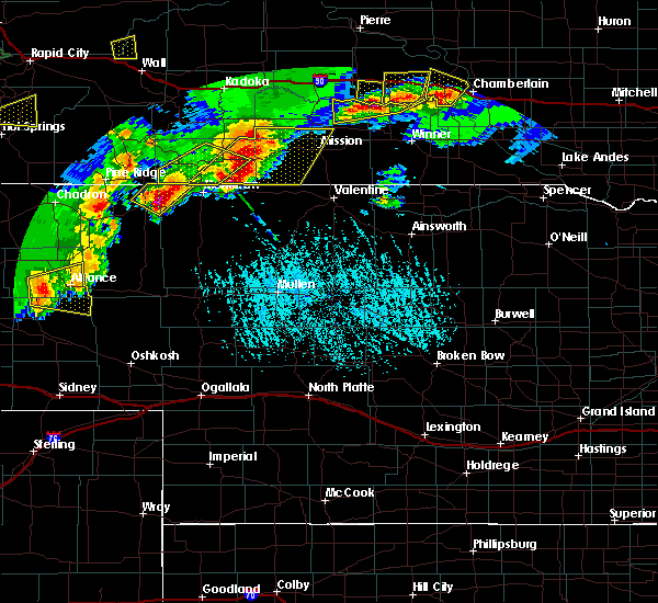 At 625 pm mdt, a severe thunderstorm was located 9 miles west of alliance, moving east at 30 mph (radar indicated). Hazards include 60 mph wind gusts and penny size hail. expect damage to roofs, siding, and trees At 625 pm mdt, a severe thunderstorm was located 9 miles west of alliance, moving east at 30 mph (radar indicated). Hazards include 60 mph wind gusts and penny size hail. expect damage to roofs, siding, and trees
|
| 6/30/2019 10:14 PM MDT |
 At 1013 pm mdt, severe thunderstorms were located along a line extending from 8 miles east of harrisburg to court house and jail rocks to 6 miles south of lisco, moving east at 40 mph (at 10:11 pm trained weather spotters reported tree damage and wind gusts of 65 to 70 mph near chimney rock). Hazards include 70 mph wind gusts. Expect considerable tree damage. damage is likely to mobile homes, roofs, and outbuildings. Locations impacted include, alliance, bridgeport, bayard, minatare, lake minatare campground, alliance airport, northport, chimney rock state park, bridgeport state recreation area, angora, kilpatrick lake, the intersection of highway 385 and 92, berea, moomaws corner, lake minatare, south bayard junction, the intersection of highway 385 and l62, broadwater, melbeta and mcgrew. At 1013 pm mdt, severe thunderstorms were located along a line extending from 8 miles east of harrisburg to court house and jail rocks to 6 miles south of lisco, moving east at 40 mph (at 10:11 pm trained weather spotters reported tree damage and wind gusts of 65 to 70 mph near chimney rock). Hazards include 70 mph wind gusts. Expect considerable tree damage. damage is likely to mobile homes, roofs, and outbuildings. Locations impacted include, alliance, bridgeport, bayard, minatare, lake minatare campground, alliance airport, northport, chimney rock state park, bridgeport state recreation area, angora, kilpatrick lake, the intersection of highway 385 and 92, berea, moomaws corner, lake minatare, south bayard junction, the intersection of highway 385 and l62, broadwater, melbeta and mcgrew.
|
| 6/30/2019 10:06 PM MDT |
 At 1006 pm mdt, severe thunderstorms were located along a line extending from 6 miles east of harrisburg to near court house and jail rocks to 9 miles south of lisco, moving northeast at 40 mph (radar indicated). Hazards include 60 mph wind gusts. expect damage to roofs, siding, and trees At 1006 pm mdt, severe thunderstorms were located along a line extending from 6 miles east of harrisburg to near court house and jail rocks to 9 miles south of lisco, moving northeast at 40 mph (radar indicated). Hazards include 60 mph wind gusts. expect damage to roofs, siding, and trees
|
| 6/25/2019 4:57 PM MDT |
 At 456 pm mdt, a severe thunderstorm was located near flahertys corner, or 29 miles northeast of scottsbluff, moving east at 40 mph (radar indicated). Hazards include 60 mph wind gusts and half dollar size hail. Hail damage to vehicles is expected. Expect wind damage to roofs, siding, and trees. At 456 pm mdt, a severe thunderstorm was located near flahertys corner, or 29 miles northeast of scottsbluff, moving east at 40 mph (radar indicated). Hazards include 60 mph wind gusts and half dollar size hail. Hail damage to vehicles is expected. Expect wind damage to roofs, siding, and trees.
|
| 6/20/2019 6:12 PM MDT |
 The severe thunderstorm warning for eastern box butte county will expire at 615 pm mdt, the storm which prompted the warning has weakened below severe limits, and no longer poses an immediate threat to life or property. therefore, the warning will be allowed to expire. however small hail and gusty winds are still possible with this thunderstorm. a tornado watch remains in effect until 1000 pm mdt for the panhandle of nebraska. to report severe weather, contact your nearest law enforcement agency. they will relay your report to the national weather service cheyenne. The severe thunderstorm warning for eastern box butte county will expire at 615 pm mdt, the storm which prompted the warning has weakened below severe limits, and no longer poses an immediate threat to life or property. therefore, the warning will be allowed to expire. however small hail and gusty winds are still possible with this thunderstorm. a tornado watch remains in effect until 1000 pm mdt for the panhandle of nebraska. to report severe weather, contact your nearest law enforcement agency. they will relay your report to the national weather service cheyenne.
|
| 6/20/2019 5:55 PM MDT |
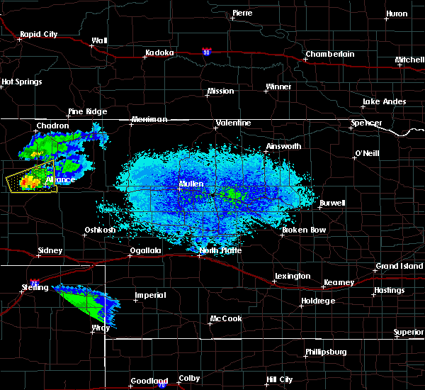 At 534 pm mdt, a severe thunderstorm was located 7 miles east of kilpatrick lake, or 14 miles west of alliance, moving east at 40 mph (radar indicated). Hazards include 60 mph wind gusts and quarter size hail. Hail damage to vehicles is expected. Expect wind damage to roofs, siding, and trees. At 534 pm mdt, a severe thunderstorm was located 7 miles east of kilpatrick lake, or 14 miles west of alliance, moving east at 40 mph (radar indicated). Hazards include 60 mph wind gusts and quarter size hail. Hail damage to vehicles is expected. Expect wind damage to roofs, siding, and trees.
|
| 6/20/2019 5:35 PM MDT |
 At 534 pm mdt, a severe thunderstorm was located 7 miles east of kilpatrick lake, or 14 miles west of alliance, moving east at 40 mph (radar indicated). Hazards include 60 mph wind gusts and quarter size hail. Hail damage to vehicles is expected. Expect wind damage to roofs, siding, and trees. At 534 pm mdt, a severe thunderstorm was located 7 miles east of kilpatrick lake, or 14 miles west of alliance, moving east at 40 mph (radar indicated). Hazards include 60 mph wind gusts and quarter size hail. Hail damage to vehicles is expected. Expect wind damage to roofs, siding, and trees.
|
| 5/16/2019 5:19 PM MDT |
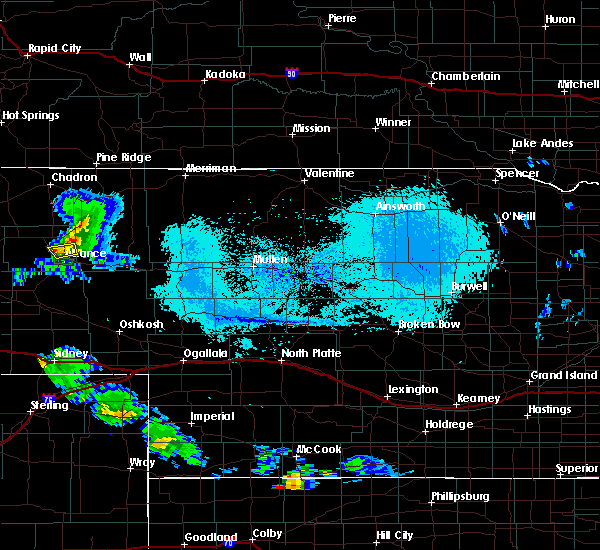 At 519 pm mdt, a severe thunderstorm was located near alliance, moving east at 10 mph (radar indicated). Hazards include 60 mph wind gusts and quarter size hail. Hail damage to vehicles is expected. expect wind damage to roofs, siding, and trees. Locations impacted include, berea. At 519 pm mdt, a severe thunderstorm was located near alliance, moving east at 10 mph (radar indicated). Hazards include 60 mph wind gusts and quarter size hail. Hail damage to vehicles is expected. expect wind damage to roofs, siding, and trees. Locations impacted include, berea.
|
| 5/16/2019 5:08 PM MDT |
 At 507 pm mdt, a severe thunderstorm was located near alliance, moving northeast at 10 mph (radar indicated). Hazards include 60 mph wind gusts and quarter size hail. Hail damage to vehicles is expected. expect wind damage to roofs, siding, and trees. Locations impacted include, alliance and berea. At 507 pm mdt, a severe thunderstorm was located near alliance, moving northeast at 10 mph (radar indicated). Hazards include 60 mph wind gusts and quarter size hail. Hail damage to vehicles is expected. expect wind damage to roofs, siding, and trees. Locations impacted include, alliance and berea.
|
| 5/16/2019 4:55 PM MDT |
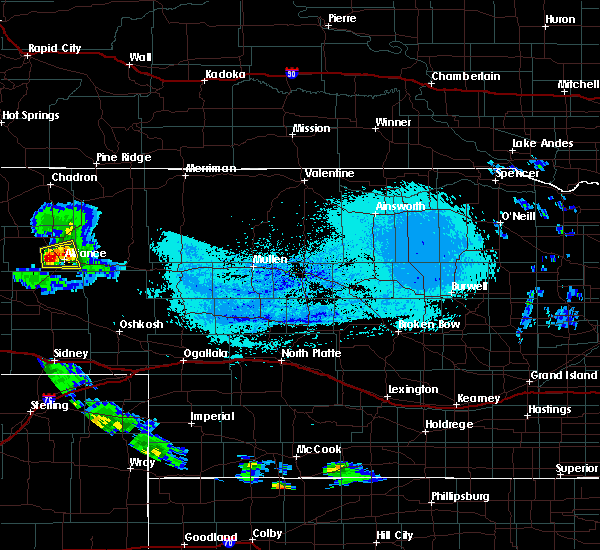 At 454 pm mdt, a severe thunderstorm was located over alliance, moving east at 10 mph (radar indicated). Hazards include 60 mph wind gusts and quarter size hail. Hail damage to vehicles is expected. Expect wind damage to roofs, siding, and trees. At 454 pm mdt, a severe thunderstorm was located over alliance, moving east at 10 mph (radar indicated). Hazards include 60 mph wind gusts and quarter size hail. Hail damage to vehicles is expected. Expect wind damage to roofs, siding, and trees.
|
| 5/16/2019 4:48 PM MDT |
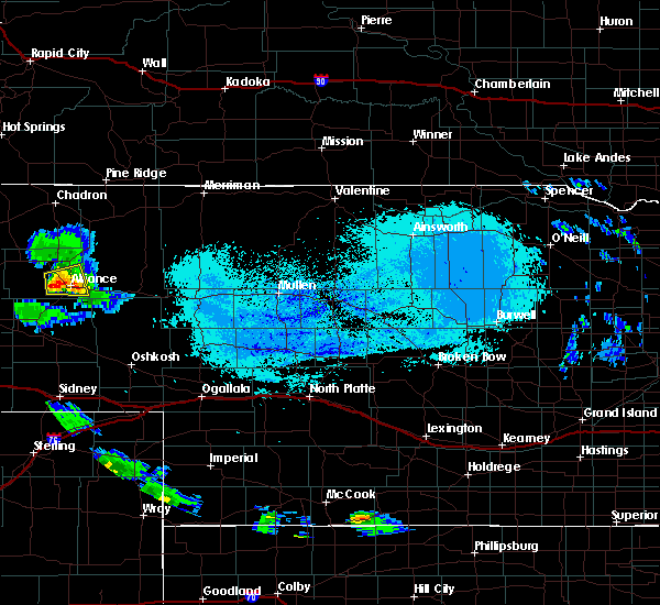 At 447 pm mdt, a severe thunderstorm was located over alliance, moving east at 20 mph (radar indicated). Hazards include 60 mph wind gusts and quarter size hail. Hail damage to vehicles is expected. expect wind damage to roofs, siding, and trees. Locations impacted include, alliance, wild horse butte, berea and alliance airport. At 447 pm mdt, a severe thunderstorm was located over alliance, moving east at 20 mph (radar indicated). Hazards include 60 mph wind gusts and quarter size hail. Hail damage to vehicles is expected. expect wind damage to roofs, siding, and trees. Locations impacted include, alliance, wild horse butte, berea and alliance airport.
|
| 5/16/2019 4:36 PM MDT |
 At 434 pm mdt, a severe thunderstorm was located near alliance, moving east at 20 mph (radar indicated). Hazards include 60 mph wind gusts and quarter size hail. Some hail damage is possible. expect some wind damage to roofs, siding, and trees. Locations impacted include, alliance, wild horse butte, berea and alliance airport. At 434 pm mdt, a severe thunderstorm was located near alliance, moving east at 20 mph (radar indicated). Hazards include 60 mph wind gusts and quarter size hail. Some hail damage is possible. expect some wind damage to roofs, siding, and trees. Locations impacted include, alliance, wild horse butte, berea and alliance airport.
|
| 5/16/2019 4:25 PM MDT |
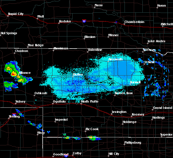 At 424 pm mdt, a severe thunderstorm was located 7 miles south of berea, or 7 miles west of alliance, moving northeast at 15 mph (radar indicated). Hazards include 60 mph wind gusts and quarter size hail. Hail damage to vehicles is expected. expect wind damage to roofs, siding, and trees. Locations impacted include, alliance, wild horse butte, berea and alliance airport. At 424 pm mdt, a severe thunderstorm was located 7 miles south of berea, or 7 miles west of alliance, moving northeast at 15 mph (radar indicated). Hazards include 60 mph wind gusts and quarter size hail. Hail damage to vehicles is expected. expect wind damage to roofs, siding, and trees. Locations impacted include, alliance, wild horse butte, berea and alliance airport.
|
| 5/16/2019 4:15 PM MDT |
 At 414 pm mdt, a severe thunderstorm was located 9 miles southwest of berea, or 9 miles west of alliance, moving northeast at 15 mph (radar indicated). Hazards include 60 mph wind gusts and quarter size hail. Hail damage to vehicles is expected. Expect wind damage to roofs, siding, and trees. At 414 pm mdt, a severe thunderstorm was located 9 miles southwest of berea, or 9 miles west of alliance, moving northeast at 15 mph (radar indicated). Hazards include 60 mph wind gusts and quarter size hail. Hail damage to vehicles is expected. Expect wind damage to roofs, siding, and trees.
|
| 7/18/2018 12:14 AM MDT |
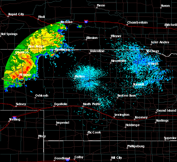 At 1214 am mdt, severe thunderstorms were located along a line extending from 10 miles northeast of wild horse butte to near kilpatrick lake, moving southeast at 35 mph (radar indicated). Hazards include 70 mph wind gusts and quarter size hail. Hail damage to vehicles is expected. expect considerable tree damage. Wind damage is also likely to mobile homes, roofs, and outbuildings. At 1214 am mdt, severe thunderstorms were located along a line extending from 10 miles northeast of wild horse butte to near kilpatrick lake, moving southeast at 35 mph (radar indicated). Hazards include 70 mph wind gusts and quarter size hail. Hail damage to vehicles is expected. expect considerable tree damage. Wind damage is also likely to mobile homes, roofs, and outbuildings.
|
| 7/16/2018 9:53 PM MDT |
 At 952 pm mdt, severe thunderstorms were located along a line extending from 11 miles north of lake alice to minatare to 6 miles southeast of harrisburg, moving east at 55 mph (radar indicated). Hazards include 60 mph wind gusts. expect damage to roofs, siding, and trees At 952 pm mdt, severe thunderstorms were located along a line extending from 11 miles north of lake alice to minatare to 6 miles southeast of harrisburg, moving east at 55 mph (radar indicated). Hazards include 60 mph wind gusts. expect damage to roofs, siding, and trees
|
| 6/29/2018 7:32 PM MDT |
 At 732 pm mdt, severe thunderstorms were located along a line extending from 7 miles west of alliance to near northport, moving east at 30 mph (radar indicated). Hazards include 60 mph wind gusts and quarter size hail. Hail damage to vehicles is expected. Expect wind damage to roofs, siding, and trees. At 732 pm mdt, severe thunderstorms were located along a line extending from 7 miles west of alliance to near northport, moving east at 30 mph (radar indicated). Hazards include 60 mph wind gusts and quarter size hail. Hail damage to vehicles is expected. Expect wind damage to roofs, siding, and trees.
|
| 6/29/2018 7:26 PM MDT |
 At 726 pm mdt, a severe thunderstorm was located near hemingford, or 20 miles northwest of alliance, moving east at 20 mph (radar indicated). Hazards include golf ball size hail and 60 mph wind gusts. People and animals outdoors will be injured. expect hail damage to roofs, siding, windows, and vehicles. Expect wind damage to roofs, siding, and trees. At 726 pm mdt, a severe thunderstorm was located near hemingford, or 20 miles northwest of alliance, moving east at 20 mph (radar indicated). Hazards include golf ball size hail and 60 mph wind gusts. People and animals outdoors will be injured. expect hail damage to roofs, siding, windows, and vehicles. Expect wind damage to roofs, siding, and trees.
|
| 6/8/2018 8:19 PM MDT |
 The national weather service in cheyenne has issued a * severe thunderstorm warning for. northeastern box butte county in the panhandle of nebraska. Until 900 pm mdt * at 818 pm mdt, severe thunderstorms were located along a line extending from 10 miles north of wild horse butte to near berea,. The national weather service in cheyenne has issued a * severe thunderstorm warning for. northeastern box butte county in the panhandle of nebraska. Until 900 pm mdt * at 818 pm mdt, severe thunderstorms were located along a line extending from 10 miles north of wild horse butte to near berea,.
|
| 6/6/2018 9:27 PM MDT |
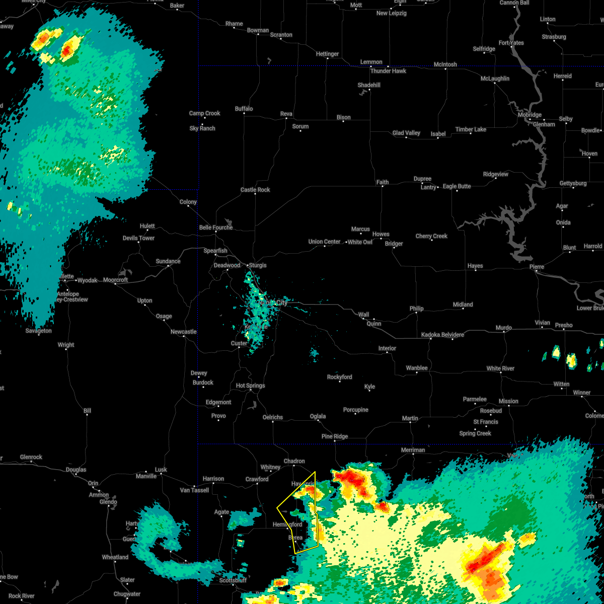 The severe thunderstorm warning for northeastern box butte and southeastern dawes counties will expire at 930 pm mdt, the storms which prompted the warning have weakened below severe limits, and have exited the warned area. therefore the warning will be allowed to expire. a severe thunderstorm watch remains in effect until 100 am mdt for the panhandle of nebraska. to report severe weather, contact your nearest law enforcement agency. they will relay your report to the national weather service cheyenne. The severe thunderstorm warning for northeastern box butte and southeastern dawes counties will expire at 930 pm mdt, the storms which prompted the warning have weakened below severe limits, and have exited the warned area. therefore the warning will be allowed to expire. a severe thunderstorm watch remains in effect until 100 am mdt for the panhandle of nebraska. to report severe weather, contact your nearest law enforcement agency. they will relay your report to the national weather service cheyenne.
|
| 6/6/2018 9:06 PM MDT |
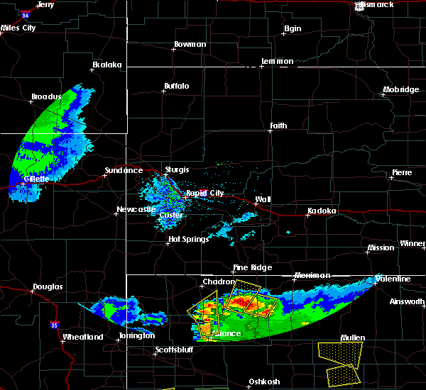 At 906 pm mdt, severe thunderstorms were located along a line extending from 9 miles east of box butte dam to near wild horse butte, moving northeast at 20 mph (radar indicated). Hazards include 60 mph wind gusts and quarter size hail. Hail damage to vehicles is expected. expect wind damage to roofs, siding, and trees. Locations impacted include, wild horse butte, box butte campground, berea and box butte dam. At 906 pm mdt, severe thunderstorms were located along a line extending from 9 miles east of box butte dam to near wild horse butte, moving northeast at 20 mph (radar indicated). Hazards include 60 mph wind gusts and quarter size hail. Hail damage to vehicles is expected. expect wind damage to roofs, siding, and trees. Locations impacted include, wild horse butte, box butte campground, berea and box butte dam.
|
| 6/6/2018 8:50 PM MDT |
 At 849 pm mdt, severe thunderstorms were located along a line extending from near box butte dam to berea, moving northeast at 20 mph (radar indicated). Hazards include 60 mph wind gusts and half dollar size hail. Hail damage to vehicles is expected. Expect wind damage to roofs, siding, and trees. At 849 pm mdt, severe thunderstorms were located along a line extending from near box butte dam to berea, moving northeast at 20 mph (radar indicated). Hazards include 60 mph wind gusts and half dollar size hail. Hail damage to vehicles is expected. Expect wind damage to roofs, siding, and trees.
|
| 6/6/2018 7:48 PM MDT |
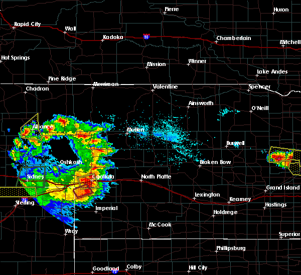 At 748 pm mdt, a severe thunderstorm was located over alliance, moving east at 10 mph (radar indicated). Hazards include 60 mph wind gusts and half dollar size hail. Hail damage to vehicles is expected. Expect wind damage to roofs, siding, and trees. At 748 pm mdt, a severe thunderstorm was located over alliance, moving east at 10 mph (radar indicated). Hazards include 60 mph wind gusts and half dollar size hail. Hail damage to vehicles is expected. Expect wind damage to roofs, siding, and trees.
|
| 5/27/2018 7:06 PM MDT |
 At 705 pm mdt, severe thunderstorms were located along a line extending from near mitchell to near lake minatare campground to south bayard junction, moving north at 35 mph (radar indicated). Hazards include 60 mph wind gusts and quarter size hail. Hail damage to vehicles is expected. expect wind damage to roofs, siding, and trees. Locations impacted include, scottsbluff, alliance, gering, mitchell, bayard, terrytown, minatare, hemingford, wildcat hills state recreation area, alliance airport, angora, wildcat hills campground, hubbard hill, berea, lake minatare, wild horse butte, lake minatare campground, chimney rock state park, scotts bluff national monument and kilpatrick lake. At 705 pm mdt, severe thunderstorms were located along a line extending from near mitchell to near lake minatare campground to south bayard junction, moving north at 35 mph (radar indicated). Hazards include 60 mph wind gusts and quarter size hail. Hail damage to vehicles is expected. expect wind damage to roofs, siding, and trees. Locations impacted include, scottsbluff, alliance, gering, mitchell, bayard, terrytown, minatare, hemingford, wildcat hills state recreation area, alliance airport, angora, wildcat hills campground, hubbard hill, berea, lake minatare, wild horse butte, lake minatare campground, chimney rock state park, scotts bluff national monument and kilpatrick lake.
|
| 5/27/2018 6:48 PM MDT |
 At 648 pm mdt, severe thunderstorms were located along a line extending from 8 miles west of wildcat hills campground to near wildcat hills state recreation area to near redington, moving northeast at 45 mph (radar indicated). Hazards include 60 mph wind gusts and quarter size hail. Hail damage to vehicles is expected. expect wind damage to roofs, siding, and trees. Locations impacted include, scottsbluff, alliance, gering, mitchell, bayard, terrytown, minatare, hemingford, wildcat hills state recreation area, alliance airport, angora, wildcat hills campground, hubbard hill, berea, lake minatare, wild horse butte, lake minatare campground, chimney rock state park, scotts bluff national monument and kilpatrick lake. At 648 pm mdt, severe thunderstorms were located along a line extending from 8 miles west of wildcat hills campground to near wildcat hills state recreation area to near redington, moving northeast at 45 mph (radar indicated). Hazards include 60 mph wind gusts and quarter size hail. Hail damage to vehicles is expected. expect wind damage to roofs, siding, and trees. Locations impacted include, scottsbluff, alliance, gering, mitchell, bayard, terrytown, minatare, hemingford, wildcat hills state recreation area, alliance airport, angora, wildcat hills campground, hubbard hill, berea, lake minatare, wild horse butte, lake minatare campground, chimney rock state park, scotts bluff national monument and kilpatrick lake.
|
| 5/10/2018 4:18 PM MDT |
 At 418 pm mdt, a severe thunderstorm was located 7 miles north of wild horse butte, or 18 miles north of alliance, moving northeast at 25 mph (radar indicated). Hazards include 60 mph wind gusts and quarter size hail. Hail damage to vehicles is expected. Expect wind damage to roofs, siding, and trees. At 418 pm mdt, a severe thunderstorm was located 7 miles north of wild horse butte, or 18 miles north of alliance, moving northeast at 25 mph (radar indicated). Hazards include 60 mph wind gusts and quarter size hail. Hail damage to vehicles is expected. Expect wind damage to roofs, siding, and trees.
|
| 8/26/2017 5:32 PM MDT |
 At 532 pm mdt, a severe thunderstorm was located 7 miles north of wild horse butte, or 18 miles north of alliance, moving southeast at 25 mph (radar indicated). Hazards include golf ball size hail. People and animals outdoors will be injured. expect damage to roofs, siding, windows, and vehicles. This severe storm will be near, wild horse butte around 550 pm mdt. At 532 pm mdt, a severe thunderstorm was located 7 miles north of wild horse butte, or 18 miles north of alliance, moving southeast at 25 mph (radar indicated). Hazards include golf ball size hail. People and animals outdoors will be injured. expect damage to roofs, siding, windows, and vehicles. This severe storm will be near, wild horse butte around 550 pm mdt.
|
| 8/26/2017 5:19 PM MDT |
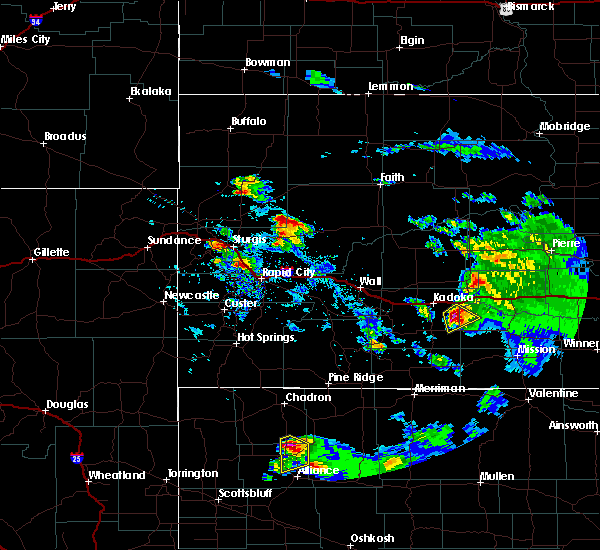 At 517 pm mdt, a severe thunderstorm was located near box butte dam, or 21 miles southwest of hay springs, moving south at 20 mph (radar indicated. at 517 pm mdt, golfball size hail was reported 23 miles south of chadron, or 12 miles north northeast of hemingford). Hazards include golf ball size hail. People and animals outdoors will be injured. expect damage to roofs, siding, windows, and vehicles. this severe storm will be near, wild horse butte around 555 pm mdt. Berea around 600 pm mdt. At 517 pm mdt, a severe thunderstorm was located near box butte dam, or 21 miles southwest of hay springs, moving south at 20 mph (radar indicated. at 517 pm mdt, golfball size hail was reported 23 miles south of chadron, or 12 miles north northeast of hemingford). Hazards include golf ball size hail. People and animals outdoors will be injured. expect damage to roofs, siding, windows, and vehicles. this severe storm will be near, wild horse butte around 555 pm mdt. Berea around 600 pm mdt.
|
| 8/26/2017 4:54 PM MDT |
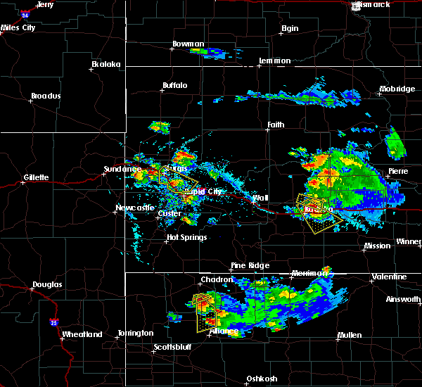 At 453 pm mdt, a severe thunderstorm was located 7 miles south of red cloud campground, or 15 miles southwest of hay springs, moving south at 30 mph (radar indicated). Hazards include two inch hail and 60 mph wind gusts. People and animals outdoors will be injured. expect hail damage to roofs, siding, windows, and vehicles. expect wind damage to roofs, siding, and trees. This severe thunderstorm will be near, wild horse butte around 545 pm mdt. At 453 pm mdt, a severe thunderstorm was located 7 miles south of red cloud campground, or 15 miles southwest of hay springs, moving south at 30 mph (radar indicated). Hazards include two inch hail and 60 mph wind gusts. People and animals outdoors will be injured. expect hail damage to roofs, siding, windows, and vehicles. expect wind damage to roofs, siding, and trees. This severe thunderstorm will be near, wild horse butte around 545 pm mdt.
|
| 8/15/2017 5:59 PM MDT |
 At 559 pm mdt, severe thunderstorms were located along a line extending from 6 miles northwest of flahertys corner to near kilpatrick lake, moving northeast at 25 mph (radar indicated). Hazards include 60 mph wind gusts and half dollar size hail. Hail damage to vehicles is expected. expect wind damage to roofs, siding, and trees. these severe storms will be near, alliance and berea around 630 pm mdt. Other locations impacted by these severe thunderstorms include marsland. At 559 pm mdt, severe thunderstorms were located along a line extending from 6 miles northwest of flahertys corner to near kilpatrick lake, moving northeast at 25 mph (radar indicated). Hazards include 60 mph wind gusts and half dollar size hail. Hail damage to vehicles is expected. expect wind damage to roofs, siding, and trees. these severe storms will be near, alliance and berea around 630 pm mdt. Other locations impacted by these severe thunderstorms include marsland.
|
| 8/15/2017 5:40 PM MDT |
 At 540 pm mdt, severe thunderstorms were located along a line extending from 8 miles southeast of agate bed national monument to near kilpatrick lake, moving northeast at 15 mph (radar indicated). Hazards include 60 mph wind gusts and half dollar size hail. Hail damage to vehicles is expected. Expect wind damage to roofs, siding, and trees. At 540 pm mdt, severe thunderstorms were located along a line extending from 8 miles southeast of agate bed national monument to near kilpatrick lake, moving northeast at 15 mph (radar indicated). Hazards include 60 mph wind gusts and half dollar size hail. Hail damage to vehicles is expected. Expect wind damage to roofs, siding, and trees.
|
| 8/12/2017 3:08 PM MDT |
 At 308 pm mdt, a severe thunderstorm was located near berea, or near alliance, moving southeast at 25 mph (radar indicated. golf ball sized hail was reported west of berea with this storm). Hazards include tennis ball size hail and 60 mph wind gusts. People and animals outdoors will be injured. expect hail damage to roofs, siding, windows, and vehicles. expect wind damage to roofs, siding, and trees. Locations impacted include, alliance, alliance airport and berea. At 308 pm mdt, a severe thunderstorm was located near berea, or near alliance, moving southeast at 25 mph (radar indicated. golf ball sized hail was reported west of berea with this storm). Hazards include tennis ball size hail and 60 mph wind gusts. People and animals outdoors will be injured. expect hail damage to roofs, siding, windows, and vehicles. expect wind damage to roofs, siding, and trees. Locations impacted include, alliance, alliance airport and berea.
|
| 8/12/2017 2:54 PM MDT |
 At 254 pm mdt, a severe thunderstorm was located near berea, or 12 miles northwest of alliance, moving southeast at 25 mph (radar indicated). Hazards include tennis ball size hail and 60 mph wind gusts. People and animals outdoors will be injured. expect hail damage to roofs, siding, windows, and vehicles. Expect wind damage to roofs, siding, and trees. At 254 pm mdt, a severe thunderstorm was located near berea, or 12 miles northwest of alliance, moving southeast at 25 mph (radar indicated). Hazards include tennis ball size hail and 60 mph wind gusts. People and animals outdoors will be injured. expect hail damage to roofs, siding, windows, and vehicles. Expect wind damage to roofs, siding, and trees.
|
| 8/12/2017 2:42 PM MDT |
 At 242 pm mdt, a severe thunderstorm was located near hemingford, or 16 miles northwest of alliance, moving southeast at 25 mph (radar indicated). Hazards include golf ball size hail and 60 mph wind gusts. People and animals outdoors will be injured. expect hail damage to roofs, siding, windows, and vehicles. expect wind damage to roofs, siding, and trees. Locations impacted include, hemingford. At 242 pm mdt, a severe thunderstorm was located near hemingford, or 16 miles northwest of alliance, moving southeast at 25 mph (radar indicated). Hazards include golf ball size hail and 60 mph wind gusts. People and animals outdoors will be injured. expect hail damage to roofs, siding, windows, and vehicles. expect wind damage to roofs, siding, and trees. Locations impacted include, hemingford.
|
| 8/12/2017 2:33 PM MDT |
 At 232 pm mdt, a severe thunderstorm was located near hemingford, or 20 miles northwest of alliance, moving east at 15 mph (radar indicated). Hazards include two inch hail and 60 mph wind gusts. People and animals outdoors will be injured. expect hail damage to roofs, siding, windows, and vehicles. expect wind damage to roofs, siding, and trees. Locations impacted include, hemingford. At 232 pm mdt, a severe thunderstorm was located near hemingford, or 20 miles northwest of alliance, moving east at 15 mph (radar indicated). Hazards include two inch hail and 60 mph wind gusts. People and animals outdoors will be injured. expect hail damage to roofs, siding, windows, and vehicles. expect wind damage to roofs, siding, and trees. Locations impacted include, hemingford.
|
| 8/12/2017 2:14 PM MDT |
 At 213 pm mdt, a severe thunderstorm was located 8 miles southwest of box butte campground, or 27 miles northwest of alliance, moving east at 15 mph (radar indicated). Hazards include golf ball size hail and 60 mph wind gusts. People and animals outdoors will be injured. expect hail damage to roofs, siding, windows, and vehicles. Expect wind damage to roofs, siding, and trees. At 213 pm mdt, a severe thunderstorm was located 8 miles southwest of box butte campground, or 27 miles northwest of alliance, moving east at 15 mph (radar indicated). Hazards include golf ball size hail and 60 mph wind gusts. People and animals outdoors will be injured. expect hail damage to roofs, siding, windows, and vehicles. Expect wind damage to roofs, siding, and trees.
|
| 7/27/2017 7:42 PM MDT |
 The severe thunderstorm warning for eastern box butte and north central morrill counties will expire at 745 pm mdt, the storm which prompted the warning has weakened below severe limits, and no longer poses an immediate threat to life or property. therefore the warning will be allowed to expire. however small hail, gusty winds and heavy rain are still possible with this thunderstorm. The severe thunderstorm warning for eastern box butte and north central morrill counties will expire at 745 pm mdt, the storm which prompted the warning has weakened below severe limits, and no longer poses an immediate threat to life or property. therefore the warning will be allowed to expire. however small hail, gusty winds and heavy rain are still possible with this thunderstorm.
|
| 7/27/2017 7:12 PM MDT |
 At 712 pm mdt, a severe thunderstorm was located near hemingford, or 15 miles northwest of alliance, moving southeast at 30 mph (radar indicated). Hazards include 70 mph wind gusts and quarter size hail. Hail damage to vehicles is expected. expect considerable tree damage. Wind damage is also likely to mobile homes, roofs, and outbuildings. At 712 pm mdt, a severe thunderstorm was located near hemingford, or 15 miles northwest of alliance, moving southeast at 30 mph (radar indicated). Hazards include 70 mph wind gusts and quarter size hail. Hail damage to vehicles is expected. expect considerable tree damage. Wind damage is also likely to mobile homes, roofs, and outbuildings.
|
| 7/27/2017 6:49 PM MDT |
 At 649 pm mdt, a severe thunderstorm was located 7 miles southwest of box butte campground, or 27 miles northwest of alliance, moving southeast at 30 mph (trained weather spotters. at 635 pm a trained spotter reported half dollar size hail 10 south southeast of crawford). Hazards include 70 mph wind gusts and half dollar size hail. Hail damage to vehicles is expected. expect considerable tree damage. Wind damage is also likely to mobile homes, roofs, and outbuildings. At 649 pm mdt, a severe thunderstorm was located 7 miles southwest of box butte campground, or 27 miles northwest of alliance, moving southeast at 30 mph (trained weather spotters. at 635 pm a trained spotter reported half dollar size hail 10 south southeast of crawford). Hazards include 70 mph wind gusts and half dollar size hail. Hail damage to vehicles is expected. expect considerable tree damage. Wind damage is also likely to mobile homes, roofs, and outbuildings.
|
| 7/27/2017 5:12 PM MDT |
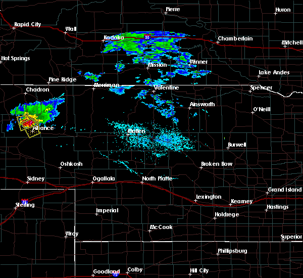 At 512 pm mdt, a severe thunderstorm was located near wild horse butte, or 9 miles north of alliance, moving southeast at 20 mph. this is a very dangerous storm (radar indicated). Hazards include 80 mph wind gusts and half dollar size hail. Flying debris will be dangerous to those caught without shelter. mobile homes will be heavily damaged. expect considerable damage to roofs, windows, and vehicles. Extensive tree damage and power outages are likely. At 512 pm mdt, a severe thunderstorm was located near wild horse butte, or 9 miles north of alliance, moving southeast at 20 mph. this is a very dangerous storm (radar indicated). Hazards include 80 mph wind gusts and half dollar size hail. Flying debris will be dangerous to those caught without shelter. mobile homes will be heavily damaged. expect considerable damage to roofs, windows, and vehicles. Extensive tree damage and power outages are likely.
|
| 7/27/2017 5:00 PM MDT |
 At 459 pm mdt, a severe thunderstorm was located near hemingford, or 16 miles northwest of alliance, moving southeast at 20 mph (trained weather spotters. at 445 pm, spotters reported trees down 7 miles north of hemingford). Hazards include 60 mph wind gusts and quarter size hail. Hail damage to vehicles is expected. expect wind damage to roofs, siding, and trees. Locations impacted include, hemingford, wild horse butte and berea. At 459 pm mdt, a severe thunderstorm was located near hemingford, or 16 miles northwest of alliance, moving southeast at 20 mph (trained weather spotters. at 445 pm, spotters reported trees down 7 miles north of hemingford). Hazards include 60 mph wind gusts and quarter size hail. Hail damage to vehicles is expected. expect wind damage to roofs, siding, and trees. Locations impacted include, hemingford, wild horse butte and berea.
|
| 7/27/2017 4:42 PM MDT |
 At 442 pm mdt, a severe thunderstorm was located near box butte dam, or 22 miles northwest of alliance, moving southeast at 20 mph (radar indicated). Hazards include 60 mph wind gusts and quarter size hail. Hail damage to vehicles is expected. Expect wind damage to roofs, siding, and trees. At 442 pm mdt, a severe thunderstorm was located near box butte dam, or 22 miles northwest of alliance, moving southeast at 20 mph (radar indicated). Hazards include 60 mph wind gusts and quarter size hail. Hail damage to vehicles is expected. Expect wind damage to roofs, siding, and trees.
|
| 10/3/2016 2:58 PM MDT |
 At 258 pm mdt, severe thunderstorms were located along a line extending from 11 miles northwest of chadron airport to 9 miles northeast of box butte dam to near alliance, moving east at 50 mph (radar indicated). Hazards include 60 mph wind gusts and quarter size hail. Hail damage to vehicles is expected. expect wind damage to roofs, siding, and trees. These severe thunderstorms will remain over mainly rural areas of dawes and eastern box butte counties, including the following locations: whitney and chadron st park. At 258 pm mdt, severe thunderstorms were located along a line extending from 11 miles northwest of chadron airport to 9 miles northeast of box butte dam to near alliance, moving east at 50 mph (radar indicated). Hazards include 60 mph wind gusts and quarter size hail. Hail damage to vehicles is expected. expect wind damage to roofs, siding, and trees. These severe thunderstorms will remain over mainly rural areas of dawes and eastern box butte counties, including the following locations: whitney and chadron st park.
|
| 7/29/2016 2:42 PM MDT |
 At 242 pm mdt, a severe thunderstorm was located 7 miles southwest of hemingford, or 19 miles northwest of alliance, moving southeast at 15 mph (radar indicated). Hazards include 60 mph wind gusts and half dollar size hail. Hail damage to vehicles is expected. Expect wind damage to roofs, siding, and trees. At 242 pm mdt, a severe thunderstorm was located 7 miles southwest of hemingford, or 19 miles northwest of alliance, moving southeast at 15 mph (radar indicated). Hazards include 60 mph wind gusts and half dollar size hail. Hail damage to vehicles is expected. Expect wind damage to roofs, siding, and trees.
|
| 7/26/2016 8:33 PM MDT |
 At 833 pm mdt, severe thunderstorms were located along a line extending from near wild horse butte to 8 miles northeast of kilpatrick lake, moving southeast at 35 mph (radar indicated). Hazards include 60 mph wind gusts. Expect damage to roofs. siding. and trees. Locations impacted include, alliance, hemingford, wild horse butte, berea and alliance airport. At 833 pm mdt, severe thunderstorms were located along a line extending from near wild horse butte to 8 miles northeast of kilpatrick lake, moving southeast at 35 mph (radar indicated). Hazards include 60 mph wind gusts. Expect damage to roofs. siding. and trees. Locations impacted include, alliance, hemingford, wild horse butte, berea and alliance airport.
|
| 7/26/2016 8:15 PM MDT |
 At 814 pm mdt, severe thunderstorms were located along a line extending from 6 miles northeast of wild horse butte to near berea, moving south at 30 mph (radar indicated). Hazards include 60 mph wind gusts and half dollar size hail. Hail damage to vehicles is expected. Expect wind damage to roofs, siding, and trees. At 814 pm mdt, severe thunderstorms were located along a line extending from 6 miles northeast of wild horse butte to near berea, moving south at 30 mph (radar indicated). Hazards include 60 mph wind gusts and half dollar size hail. Hail damage to vehicles is expected. Expect wind damage to roofs, siding, and trees.
|
| 7/22/2016 3:09 PM MDT |
 At 309 pm mdt, severe thunderstorms were located along a line extending from near flahertys corner to near wild horse butte, moving northeast at 15 mph (radar indicated). Hazards include ping pong ball size hail. People and animals outdoors will be injured. Expect damage to roofs, siding, windows, and vehicles. At 309 pm mdt, severe thunderstorms were located along a line extending from near flahertys corner to near wild horse butte, moving northeast at 15 mph (radar indicated). Hazards include ping pong ball size hail. People and animals outdoors will be injured. Expect damage to roofs, siding, windows, and vehicles.
|
| 7/22/2016 2:52 PM MDT |
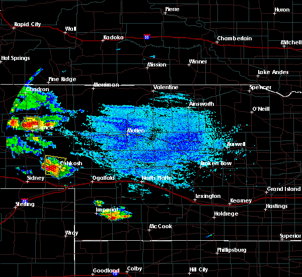 At 252 pm mdt, a severe thunderstorm was located over berea, or 9 miles northwest of alliance, moving northeast at 15 mph (radar indicated). Hazards include 60 mph wind gusts and quarter size hail. Hail damage to vehicles is expected. expect wind damage to roofs, siding, and trees. Locations impacted include, wild horse butte and berea. At 252 pm mdt, a severe thunderstorm was located over berea, or 9 miles northwest of alliance, moving northeast at 15 mph (radar indicated). Hazards include 60 mph wind gusts and quarter size hail. Hail damage to vehicles is expected. expect wind damage to roofs, siding, and trees. Locations impacted include, wild horse butte and berea.
|
| 7/22/2016 2:37 PM MDT |
 At 237 pm mdt, a severe thunderstorm was located over berea, or 7 miles northwest of alliance, moving northeast at 15 mph (radar indicated). Hazards include ping pong ball size hail and 60 mph wind gusts. People and animals outdoors will be injured. expect hail damage to roofs, siding, windows, and vehicles. Expect wind damage to roofs, siding, and trees. At 237 pm mdt, a severe thunderstorm was located over berea, or 7 miles northwest of alliance, moving northeast at 15 mph (radar indicated). Hazards include ping pong ball size hail and 60 mph wind gusts. People and animals outdoors will be injured. expect hail damage to roofs, siding, windows, and vehicles. Expect wind damage to roofs, siding, and trees.
|
| 7/18/2016 4:47 PM MDT |
 At 446 pm mdt, a severe thunderstorm was located 8 miles south of kilpatrick lake, or 21 miles east of scottsbluff, moving east at 30 mph (radar indicated). Hazards include 60 mph wind gusts and penny size hail. Expect damage to roofs. siding. and trees. This severe thunderstorm will remain over mainly rural areas of northwestern morrill and western box butte counties. At 446 pm mdt, a severe thunderstorm was located 8 miles south of kilpatrick lake, or 21 miles east of scottsbluff, moving east at 30 mph (radar indicated). Hazards include 60 mph wind gusts and penny size hail. Expect damage to roofs. siding. and trees. This severe thunderstorm will remain over mainly rural areas of northwestern morrill and western box butte counties.
|
| 7/18/2016 4:32 PM MDT |
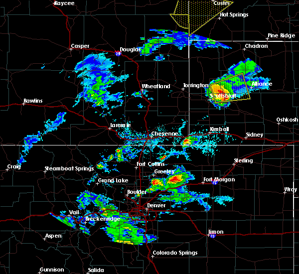 At 431 pm mdt, a severe thunderstorm was located near lake minatare, or 13 miles northeast of scottsbluff, moving east at 25 mph (radar indicated). Hazards include 60 mph wind gusts and penny size hail. Expect damage to roofs. siding. and trees. This severe storm will be near, angora around 515 pm mdt. At 431 pm mdt, a severe thunderstorm was located near lake minatare, or 13 miles northeast of scottsbluff, moving east at 25 mph (radar indicated). Hazards include 60 mph wind gusts and penny size hail. Expect damage to roofs. siding. and trees. This severe storm will be near, angora around 515 pm mdt.
|
| 7/18/2016 4:18 PM MDT |
 At 417 pm mdt, a severe thunderstorm was located over lake alice, or 9 miles northeast of scottsbluff, moving east at 35 mph (radar indicated). Hazards include 60 mph wind gusts and penny size hail. Expect damage to roofs. siding. and trees. this severe thunderstorm will be near, kilpatrick lake around 445 pm mdt. Berea around 515 pm mdt. At 417 pm mdt, a severe thunderstorm was located over lake alice, or 9 miles northeast of scottsbluff, moving east at 35 mph (radar indicated). Hazards include 60 mph wind gusts and penny size hail. Expect damage to roofs. siding. and trees. this severe thunderstorm will be near, kilpatrick lake around 445 pm mdt. Berea around 515 pm mdt.
|
| 6/28/2016 6:58 PM MDT | The severe thunderstorm warning for northeastern morrill and southeastern box butte counties will expire at 700 pm mdt, the storm which prompted the warning has moved out of the area. therefore the warning will be allowed to expire. a severe thunderstorm watch remains in effect until 900 pm mdt for central nebraska. remember, a severe thunderstorm warning still remains in effect for northeastern morrill county and southeastern box butte county in the panhandle of nebraska. |
| 6/28/2016 6:47 PM MDT |
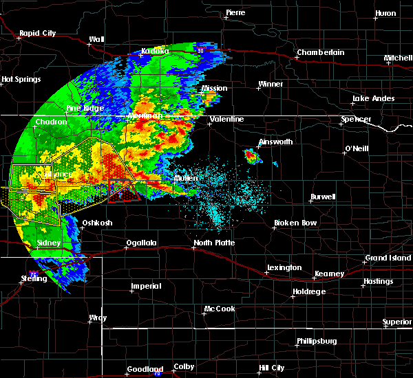 At 647 pm mdt, a severe thunderstorm was located over tralnor lake, or 21 miles southeast of alliance, moving southeast at 45 mph (radar indicated). Hazards include 60 mph wind gusts and penny size hail. Expect damage to roofs. siding. and trees. This severe thunderstorm will remain over mainly rural areas of northeastern morrill and southeastern box butte counties. At 647 pm mdt, a severe thunderstorm was located over tralnor lake, or 21 miles southeast of alliance, moving southeast at 45 mph (radar indicated). Hazards include 60 mph wind gusts and penny size hail. Expect damage to roofs. siding. and trees. This severe thunderstorm will remain over mainly rural areas of northeastern morrill and southeastern box butte counties.
|
| 6/28/2016 6:26 PM MDT |
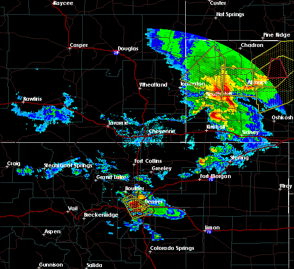 At 625 pm mdt, a severe thunderstorm was located near alliance airport, or near alliance, moving south at 40 mph (radar indicated. at 623 pm mdt...a wind gust to 58 mph was reported at alliance airport). Hazards include 60 mph wind gusts and quarter size hail. Hail damage to vehicles is expected. expect wind damage to roofs, siding, and trees. This severe thunderstorm will remain over mainly rural areas of northern morrill and southern box butte counties. At 625 pm mdt, a severe thunderstorm was located near alliance airport, or near alliance, moving south at 40 mph (radar indicated. at 623 pm mdt...a wind gust to 58 mph was reported at alliance airport). Hazards include 60 mph wind gusts and quarter size hail. Hail damage to vehicles is expected. expect wind damage to roofs, siding, and trees. This severe thunderstorm will remain over mainly rural areas of northern morrill and southern box butte counties.
|
| 6/28/2016 6:04 PM MDT |
 At 604 pm mdt, a severe thunderstorm was located over wild horse butte, or 13 miles north of alliance, moving southeast at 45 mph (trained weather spotters). Hazards include 70 mph wind gusts and quarter size hail. Hail damage to vehicles is expected. expect considerable tree damage. wind damage is also likely to mobile homes, roofs, and outbuildings. This severe thunderstorm will remain over mainly rural areas of northern morrill, south central dawes and box butte counties, including the following locations: marsland. At 604 pm mdt, a severe thunderstorm was located over wild horse butte, or 13 miles north of alliance, moving southeast at 45 mph (trained weather spotters). Hazards include 70 mph wind gusts and quarter size hail. Hail damage to vehicles is expected. expect considerable tree damage. wind damage is also likely to mobile homes, roofs, and outbuildings. This severe thunderstorm will remain over mainly rural areas of northern morrill, south central dawes and box butte counties, including the following locations: marsland.
|
| 6/28/2016 6:01 PM MDT |
 At 559 pm mdt, a severe thunderstorm was located near wild horse butte, or 15 miles north of alliance, moving southeast at 45 mph (trained weather spotters. at 554 pm mdt...a national weather service employee reported winds gusting to 60 mph just west of hemingford). Hazards include 60 mph wind gusts and quarter size hail. Hail damage to vehicles is expected. expect wind damage to roofs, siding, and trees. This severe storm will be near, wild horse butte around 605 pm mdt. At 559 pm mdt, a severe thunderstorm was located near wild horse butte, or 15 miles north of alliance, moving southeast at 45 mph (trained weather spotters. at 554 pm mdt...a national weather service employee reported winds gusting to 60 mph just west of hemingford). Hazards include 60 mph wind gusts and quarter size hail. Hail damage to vehicles is expected. expect wind damage to roofs, siding, and trees. This severe storm will be near, wild horse butte around 605 pm mdt.
|
| 6/28/2016 5:40 PM MDT |
 At 538 pm mdt, a severe thunderstorm was located over box butte dam, or 24 miles southwest of hay springs, moving south at 40 mph. this is a very dangerous storm (radar indicated. at 507 pm mdt...a wind gust to 84 mph was reported at the chadron airport). Hazards include 80 mph wind gusts and quarter size hail. Flying debris will be dangerous to those caught without shelter. mobile homes will be heavily damaged. expect considerable damage to roofs, windows, and vehicles. extensive tree damage and power outages are likely. this severe thunderstorm will be near, hemingford around 550 pm mdt. wild horse butte around 600 pm mdt. Other locations impacted by this severe thunderstorm include chadron st park. At 538 pm mdt, a severe thunderstorm was located over box butte dam, or 24 miles southwest of hay springs, moving south at 40 mph. this is a very dangerous storm (radar indicated. at 507 pm mdt...a wind gust to 84 mph was reported at the chadron airport). Hazards include 80 mph wind gusts and quarter size hail. Flying debris will be dangerous to those caught without shelter. mobile homes will be heavily damaged. expect considerable damage to roofs, windows, and vehicles. extensive tree damage and power outages are likely. this severe thunderstorm will be near, hemingford around 550 pm mdt. wild horse butte around 600 pm mdt. Other locations impacted by this severe thunderstorm include chadron st park.
|
| 6/27/2016 9:10 PM MDT |
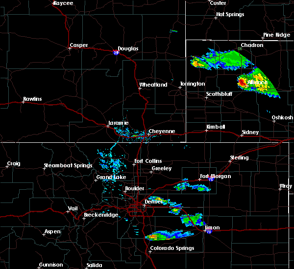 At 910 pm mdt, a severe thunderstorm was located over berea, or 7 miles northwest of alliance, moving southeast at 30 mph (radar indicated). Hazards include 60 mph wind gusts and quarter size hail. Hail damage to vehicles is expected. Expect wind damage to roofs, siding, and trees. At 910 pm mdt, a severe thunderstorm was located over berea, or 7 miles northwest of alliance, moving southeast at 30 mph (radar indicated). Hazards include 60 mph wind gusts and quarter size hail. Hail damage to vehicles is expected. Expect wind damage to roofs, siding, and trees.
|
| 6/27/2016 7:59 PM MDT |
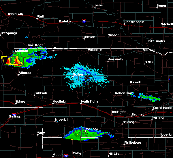 At 758 pm mdt, a severe thunderstorm was located 7 miles east of box butte dam, or 19 miles southwest of hay springs, moving south at 30 mph (radar indicated). Hazards include ping pong ball size hail and 60 mph wind gusts. People and animals outdoors will be injured. expect hail damage to roofs, siding, windows, and vehicles. expect wind damage to roofs, siding, and trees. this severe thunderstorm will be near, wild horse butte around 830 pm mdt. berea around 835 pm mdt. this warning replaces the previous severe thunderstorm warning that was in effect. A tornado watch remains in effect until 1000 pm mdt for central nebraska. At 758 pm mdt, a severe thunderstorm was located 7 miles east of box butte dam, or 19 miles southwest of hay springs, moving south at 30 mph (radar indicated). Hazards include ping pong ball size hail and 60 mph wind gusts. People and animals outdoors will be injured. expect hail damage to roofs, siding, windows, and vehicles. expect wind damage to roofs, siding, and trees. this severe thunderstorm will be near, wild horse butte around 830 pm mdt. berea around 835 pm mdt. this warning replaces the previous severe thunderstorm warning that was in effect. A tornado watch remains in effect until 1000 pm mdt for central nebraska.
|
| 6/12/2016 8:57 PM MDT | The severe thunderstorm warning for northwestern cheyenne, eastern banner, morrill, southeastern sioux, eastern scotts bluff, kimball, southern box butte and southeastern laramie counties will expire at 900 pm mdt, the storms which prompted the warning have weakened below severe limits, and no longer pose an immediate threat to life or property. therefore the warning will be allowed to expire. however heavy rain is still possible with these thunderstorms. to report severe weather, contact your nearest law enforcement agency. they will relay your report to the national weather service cheyenne. |
| 6/12/2016 8:57 PM MDT | The severe thunderstorm warning for northwestern cheyenne, eastern banner, morrill, southeastern sioux, eastern scotts bluff, kimball, southern box butte and southeastern laramie counties will expire at 900 pm mdt, the storms which prompted the warning have weakened below severe limits, and no longer pose an immediate threat to life or property. therefore the warning will be allowed to expire. however heavy rain is still possible with these thunderstorms. to report severe weather, contact your nearest law enforcement agency. they will relay your report to the national weather service cheyenne. |
| 6/12/2016 8:11 PM MDT |
 At 810 pm mdt, severe thunderstorms were located along a line extending from 8 miles east of flahertys corner to 6 miles east of lake minatare to near redington to 8 miles north of potter to 6 miles southwest of kimball airport, moving northeast at 25 mph (radar indicated). Hazards include 60 mph wind gusts and nickel size hail. Expect damage to roofs. siding. And trees. At 810 pm mdt, severe thunderstorms were located along a line extending from 8 miles east of flahertys corner to 6 miles east of lake minatare to near redington to 8 miles north of potter to 6 miles southwest of kimball airport, moving northeast at 25 mph (radar indicated). Hazards include 60 mph wind gusts and nickel size hail. Expect damage to roofs. siding. And trees.
|
| 6/12/2016 7:38 PM MDT |
 At 737 pm mdt, severe thunderstorms were located along a line extending from 7 miles west of hemingford to near kilpatrick lake to near moomaws corner to 8 miles southeast of harrisburg to near panorama point, moving east at 45 mph (radar indicated). Hazards include 60 mph wind gusts and nickel size hail. Expect damage to roofs. siding. And trees. At 737 pm mdt, severe thunderstorms were located along a line extending from 7 miles west of hemingford to near kilpatrick lake to near moomaws corner to 8 miles southeast of harrisburg to near panorama point, moving east at 45 mph (radar indicated). Hazards include 60 mph wind gusts and nickel size hail. Expect damage to roofs. siding. And trees.
|
| 6/12/2016 7:24 PM MDT |
 At 723 pm mdt, severe thunderstorms were located along a line extending from near flahertys corner to 7 miles northeast of lake alice to near minatare to 11 miles southwest of harrisburg, moving east at 40 mph (reports received from kneb of 60 to 69 mph winds west of scottsbluff arounf 705pm). Hazards include 60 mph wind gusts and nickel size hail. Expect damage to roofs. siding. and trees. Locations impacted include, scottsbluff, gering, bayard, terrytown, minatare, lake alice, redington, moomaws corner, harrisburg, angora, scotts bluff national monument, lake minatare, the intersection of highway 385 and l62, south bayard junction, berea, chimney rock state park, wildcat hills campground, kilpatrick lake, wildcat hills state recreation area and wild horse butte. At 723 pm mdt, severe thunderstorms were located along a line extending from near flahertys corner to 7 miles northeast of lake alice to near minatare to 11 miles southwest of harrisburg, moving east at 40 mph (reports received from kneb of 60 to 69 mph winds west of scottsbluff arounf 705pm). Hazards include 60 mph wind gusts and nickel size hail. Expect damage to roofs. siding. and trees. Locations impacted include, scottsbluff, gering, bayard, terrytown, minatare, lake alice, redington, moomaws corner, harrisburg, angora, scotts bluff national monument, lake minatare, the intersection of highway 385 and l62, south bayard junction, berea, chimney rock state park, wildcat hills campground, kilpatrick lake, wildcat hills state recreation area and wild horse butte.
|
| 6/12/2016 7:03 PM MDT |
 At 703 pm mdt, severe thunderstorms were located along a line extending from 9 miles southwest of flahertys corner to lake alice to near wildcat hills campground to near albin, moving east at 45 mph (radar indicated). Hazards include 60 mph wind gusts and nickel size hail. Expect damage to roofs. siding. And trees. At 703 pm mdt, severe thunderstorms were located along a line extending from 9 miles southwest of flahertys corner to lake alice to near wildcat hills campground to near albin, moving east at 45 mph (radar indicated). Hazards include 60 mph wind gusts and nickel size hail. Expect damage to roofs. siding. And trees.
|
| 5/24/2016 6:18 PM MDT | The national weather service in cheyenne has issued a * severe thunderstorm warning for. cheyenne county in the panhandle of nebraska. morrill county in the panhandle of nebraska. southern box butte county in the panhandle of nebraska. Until 700 pm mdt. |
| 6/25/2015 5:35 PM MDT | National weather service employee driving through the area encountered 65 mph winds and 1.25 inch diameter hail north of alliance in box butte county NE, 5.7 miles WSW of Berea, NE |
| 6/25/2015 5:13 PM MDT |
 At 513 pm mdt, a severe thunderstorm was located near hemingford, or 21 miles northwest of alliance, moving southeast at 40 mph. this is a very dangerous storm (radar indicated). Hazards include three inch hail and 60 mph wind gusts. People and animals outdoors will be severely injured. Expect shattered windows, extensive damage to roofs, siding and vehicles. At 513 pm mdt, a severe thunderstorm was located near hemingford, or 21 miles northwest of alliance, moving southeast at 40 mph. this is a very dangerous storm (radar indicated). Hazards include three inch hail and 60 mph wind gusts. People and animals outdoors will be severely injured. Expect shattered windows, extensive damage to roofs, siding and vehicles.
|
| 6/25/2015 1:00 PM MDT |
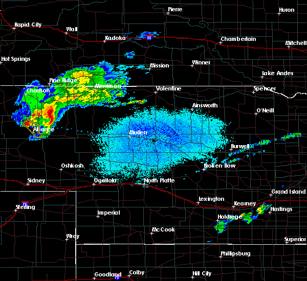 At 1259 pm mdt, a severe thunderstorm was located near wild horse butte, or 9 miles north of alliance, moving southeast at 35 mph (radar indicated). Hazards include quarter size hail and 60 mph wind gusts. Hail damage to vehicles is expected. expect wind damage to roofs, siding and trees. this severe thunderstorm will be near, alliance around 115 pm mdt. alliance airport around 120 pm mdt. This replaces the earlier severe thunderstorm in effect for box butte county. At 1259 pm mdt, a severe thunderstorm was located near wild horse butte, or 9 miles north of alliance, moving southeast at 35 mph (radar indicated). Hazards include quarter size hail and 60 mph wind gusts. Hail damage to vehicles is expected. expect wind damage to roofs, siding and trees. this severe thunderstorm will be near, alliance around 115 pm mdt. alliance airport around 120 pm mdt. This replaces the earlier severe thunderstorm in effect for box butte county.
|
| 6/6/2015 5:36 PM MDT | At 536 pm mdt, a severe thunderstorm was located over berea, or 11 miles northwest of alliance, moving east at 25 mph (radar indicated). Hazards include quarter size hail and 60 mph wind gusts. Hail damage to vehicles is expected. expect wind damage to roofs, siding and trees. this severe thunderstorm will be near, berea around 540 pm mdt. wild horse butte around 555 pm mdt. Alliance around 605 pm mdt. |
Hail Maps for Berea, NE
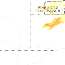
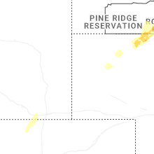
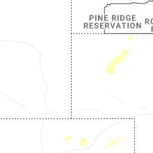
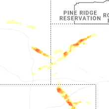


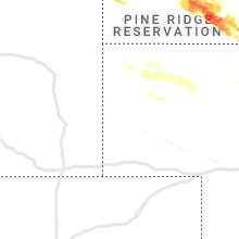


Connect with Interactive Hail Maps