

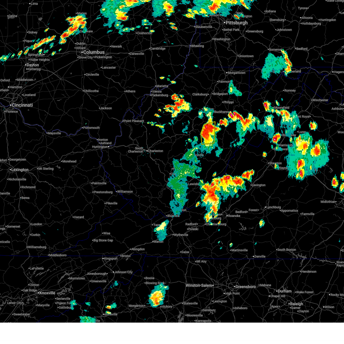
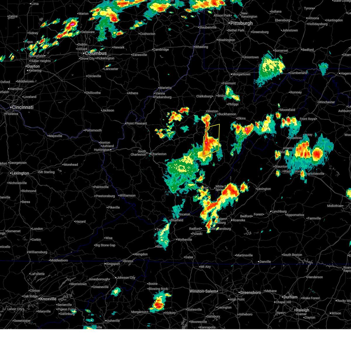
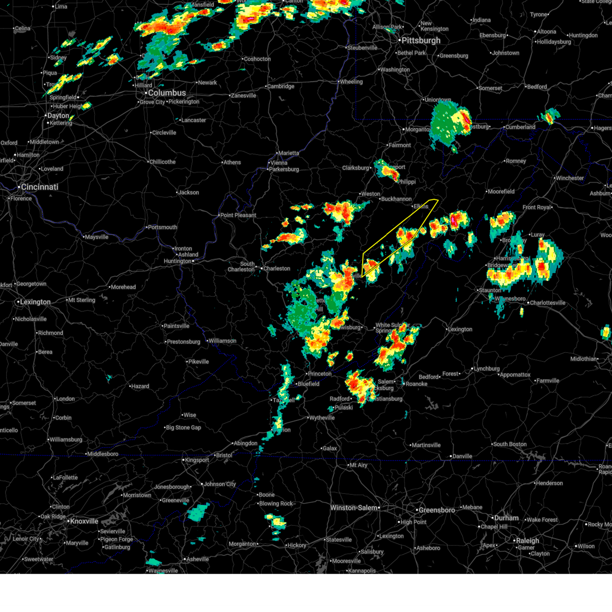
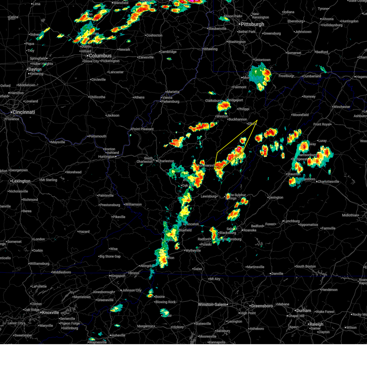
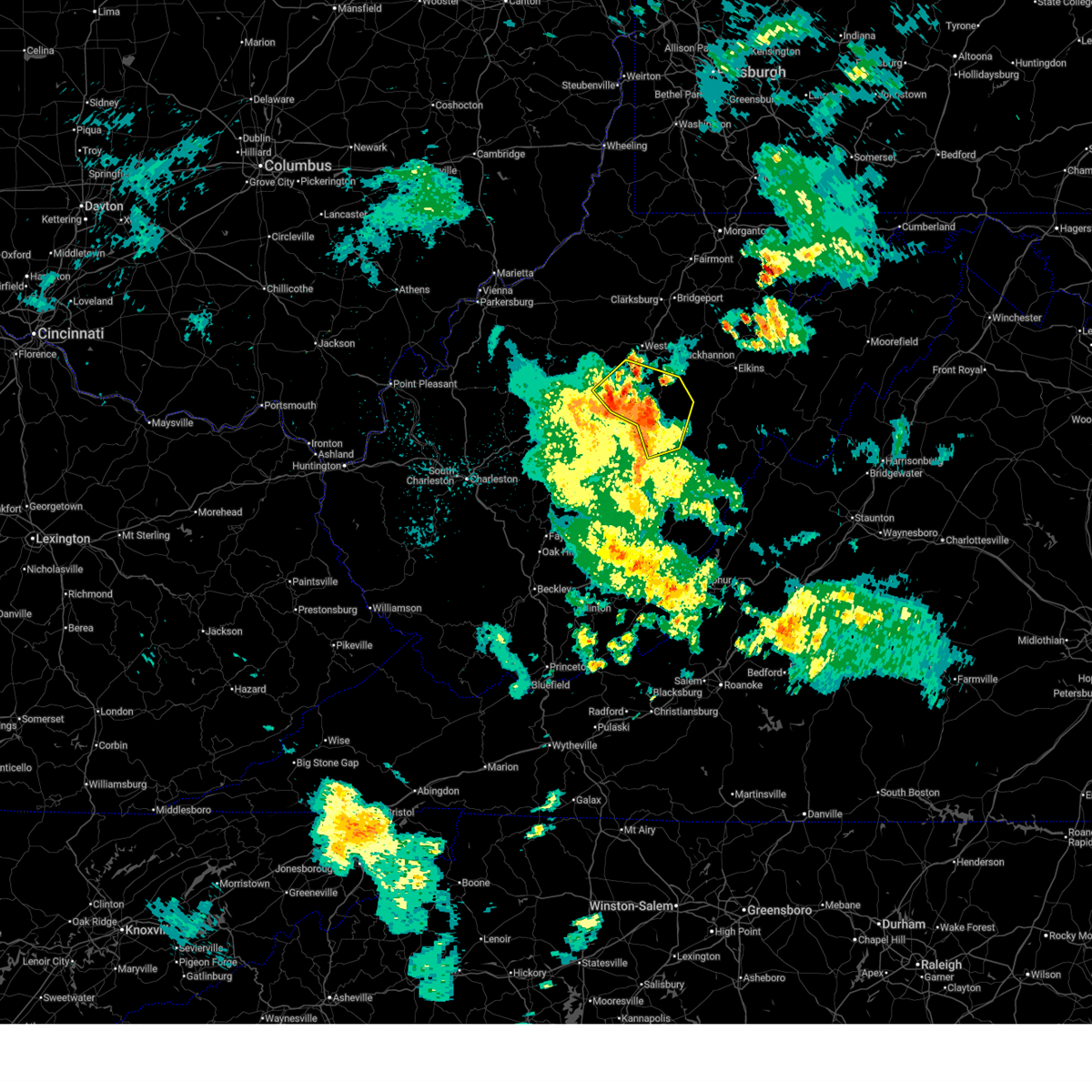
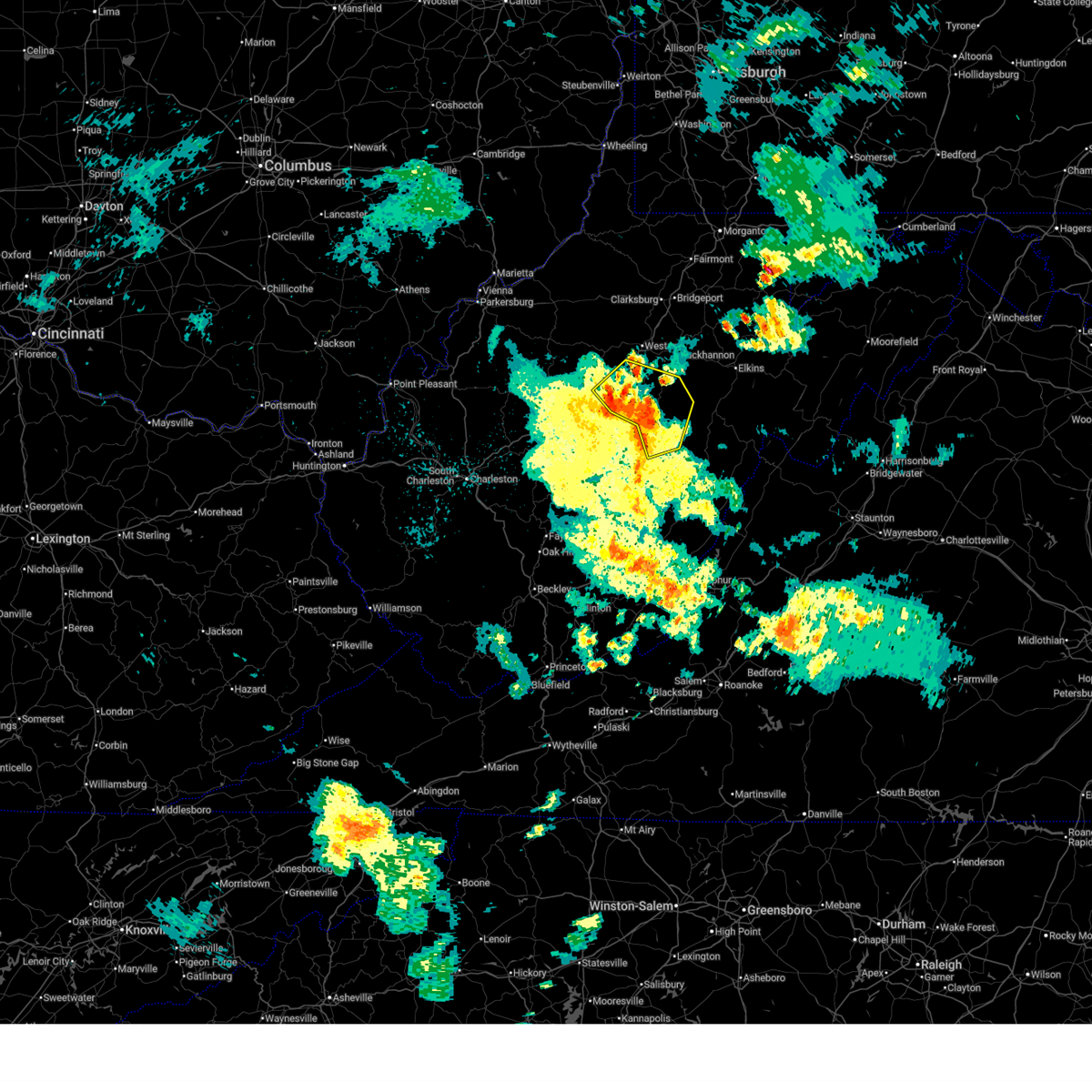
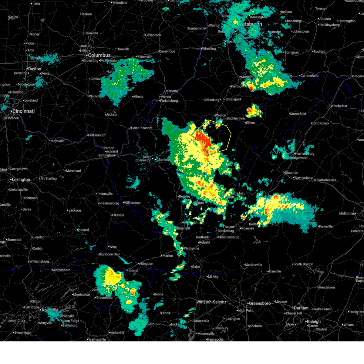
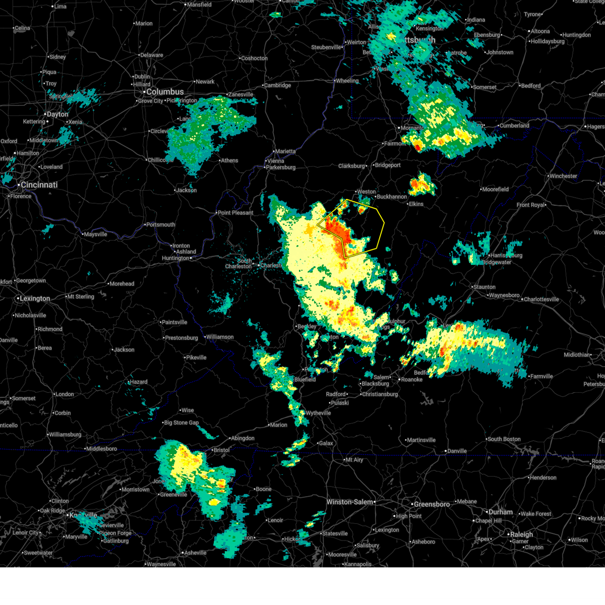
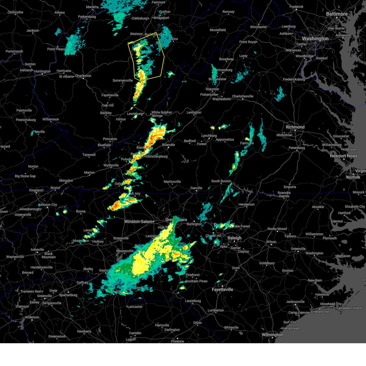
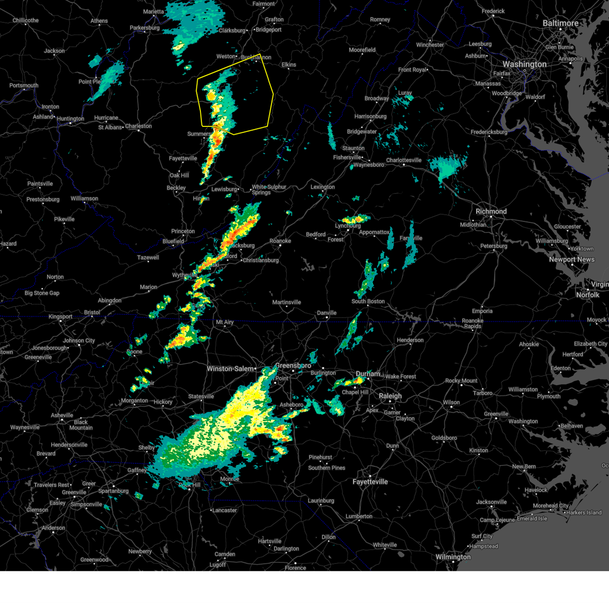
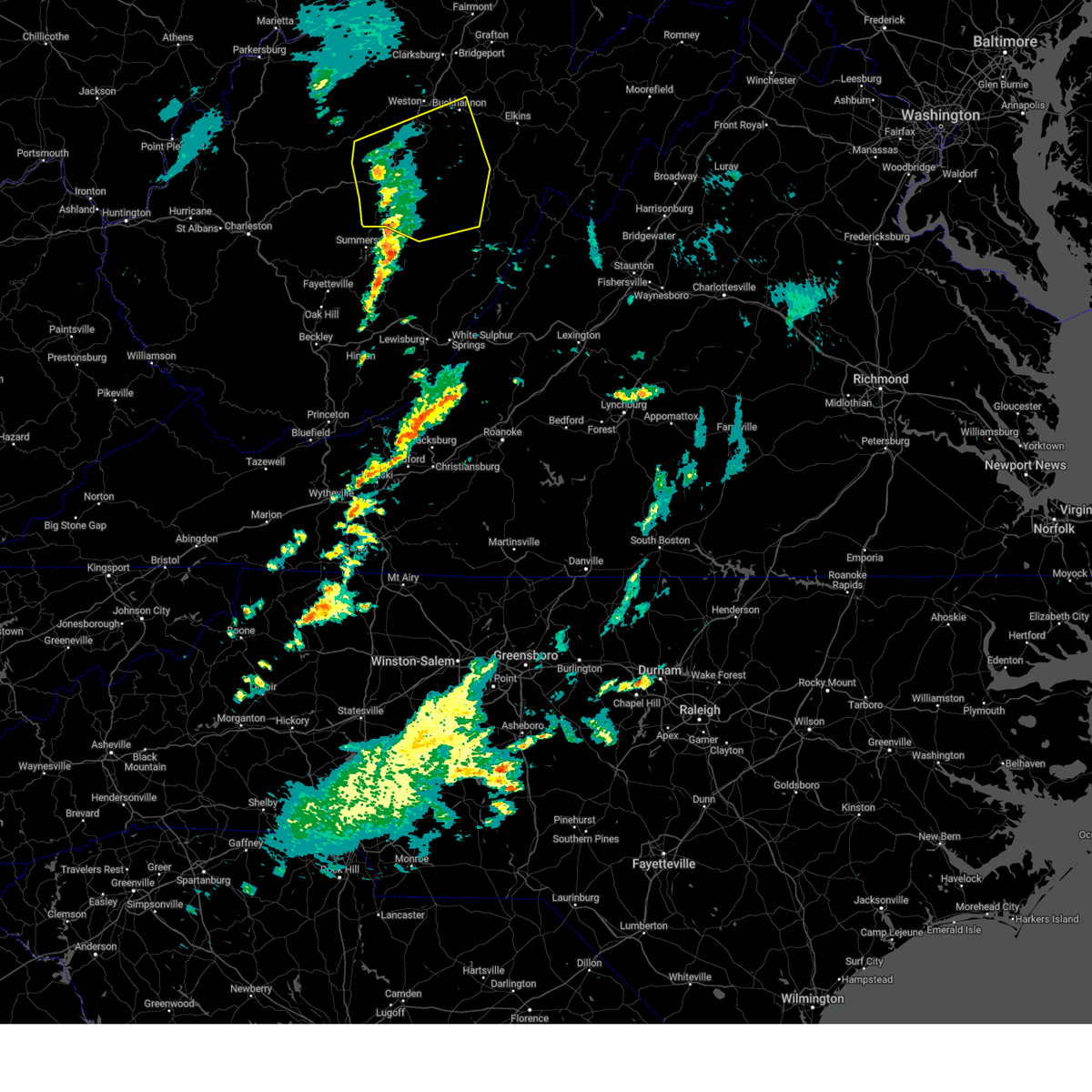
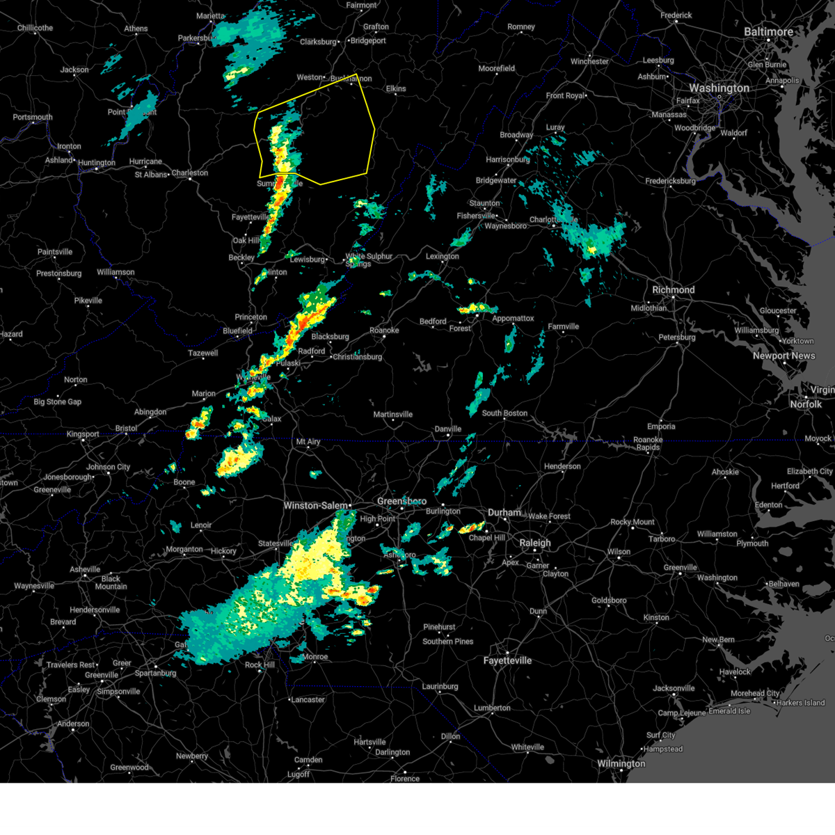
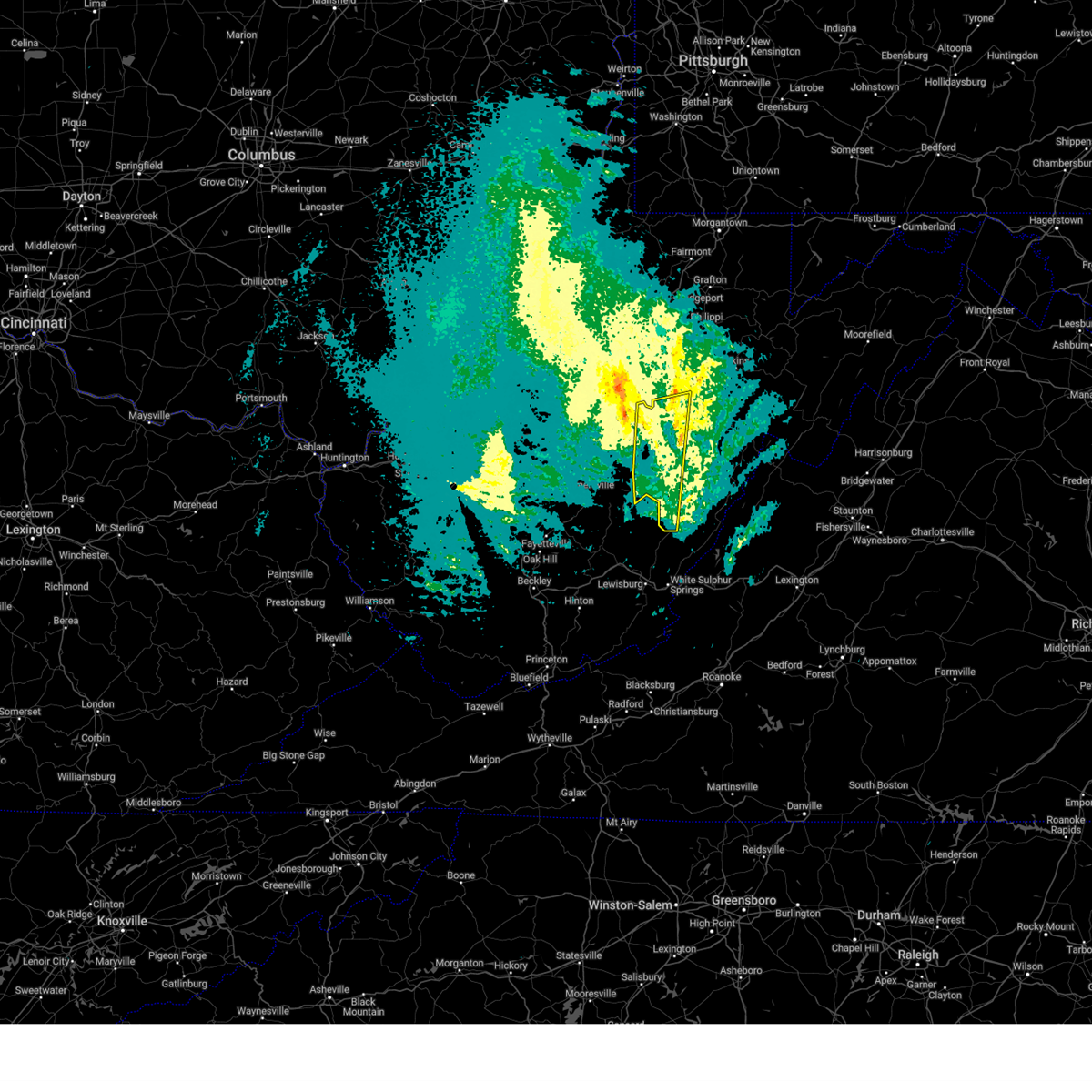
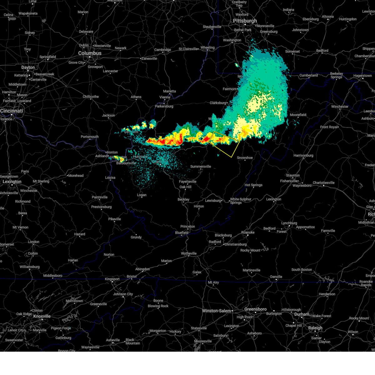
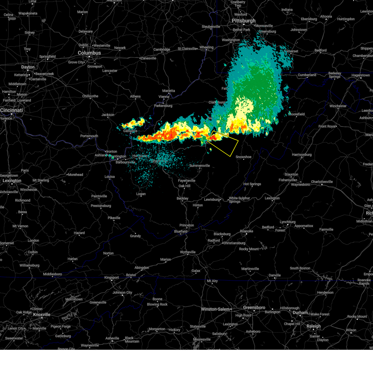
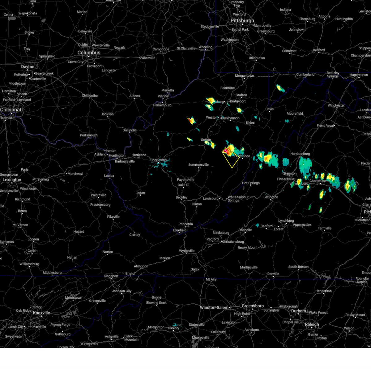
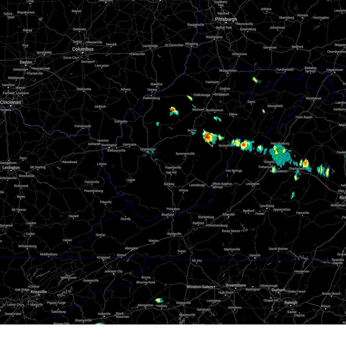
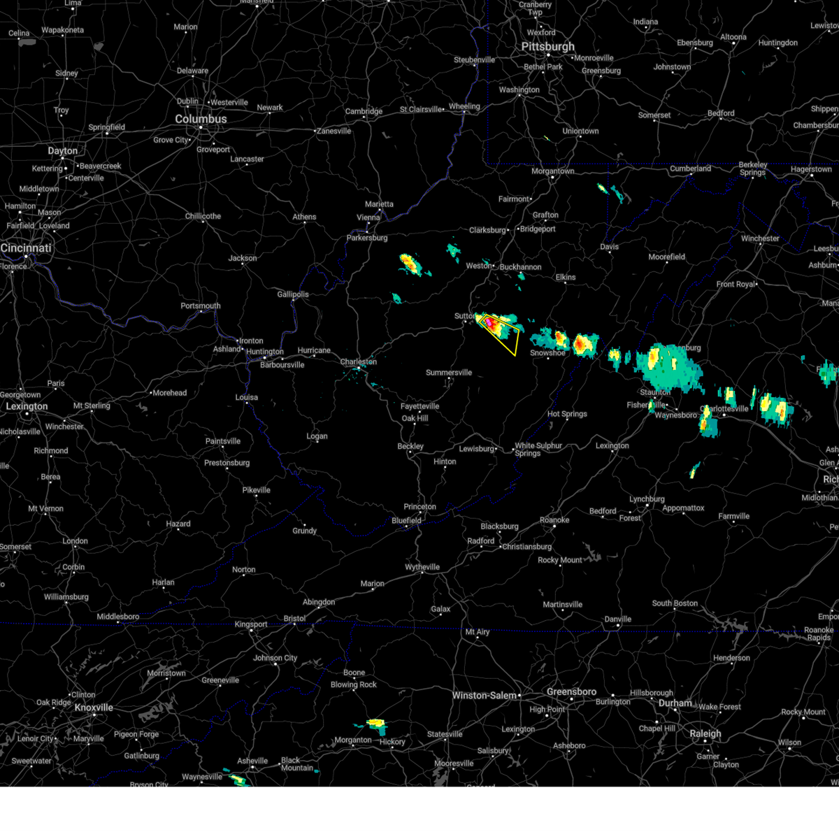
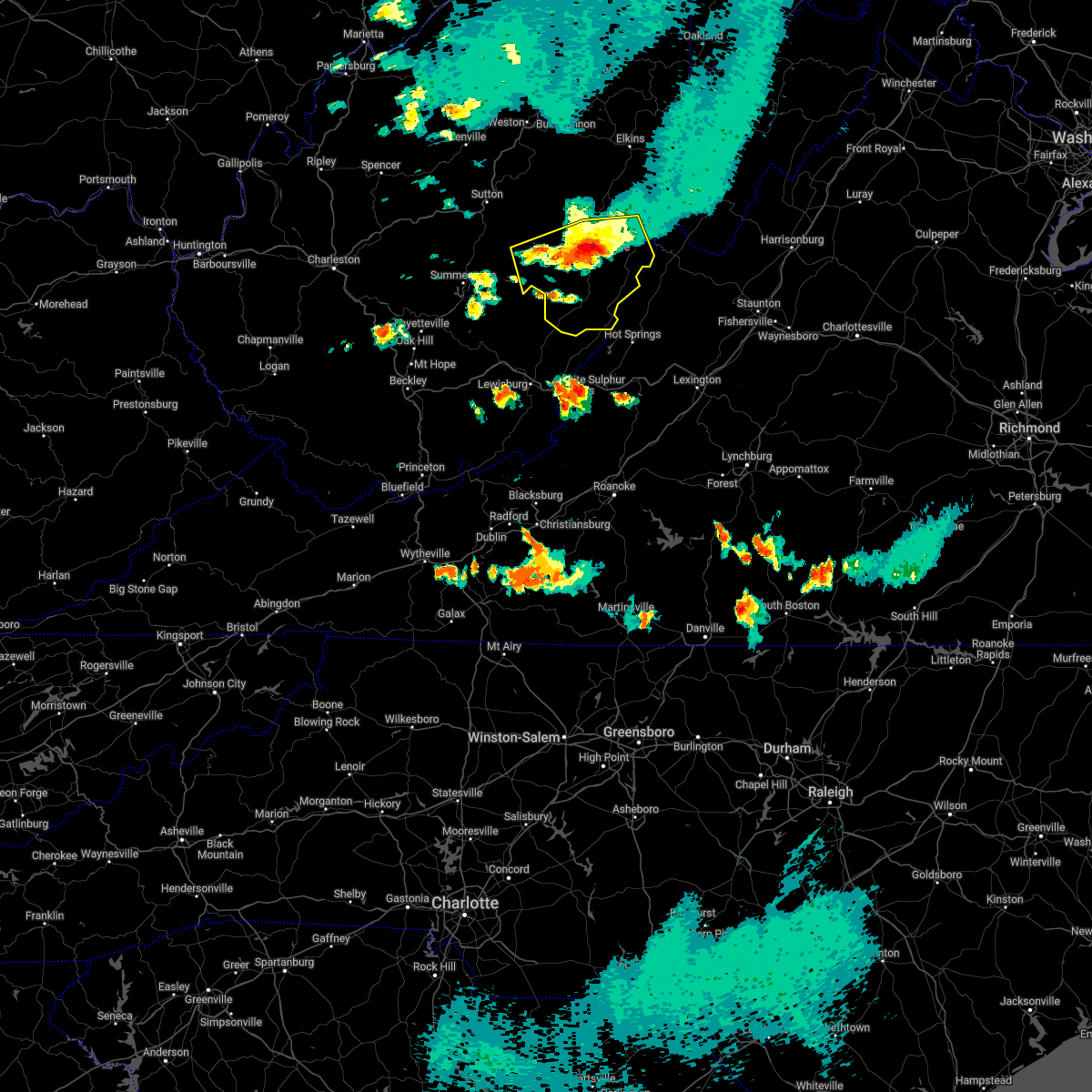
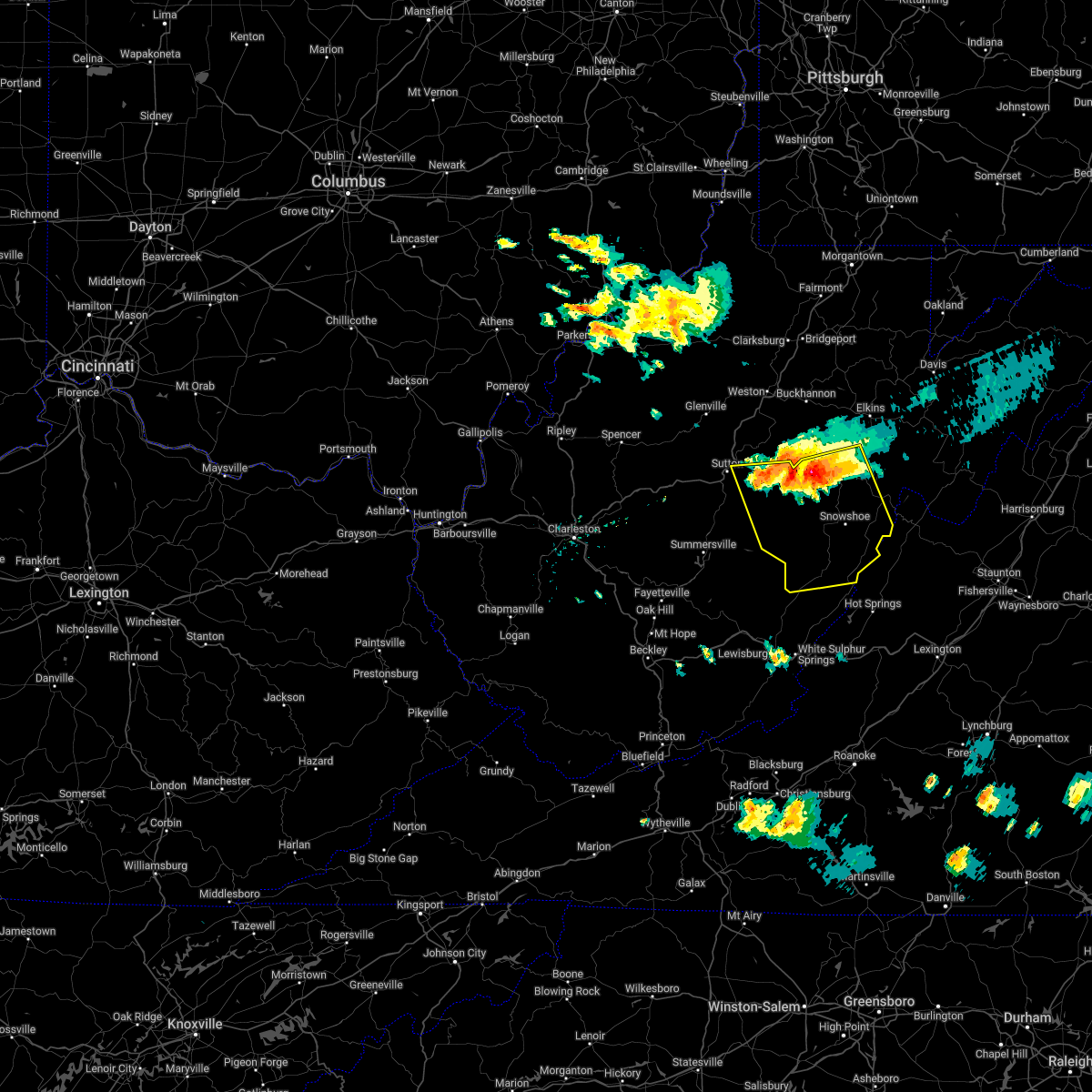
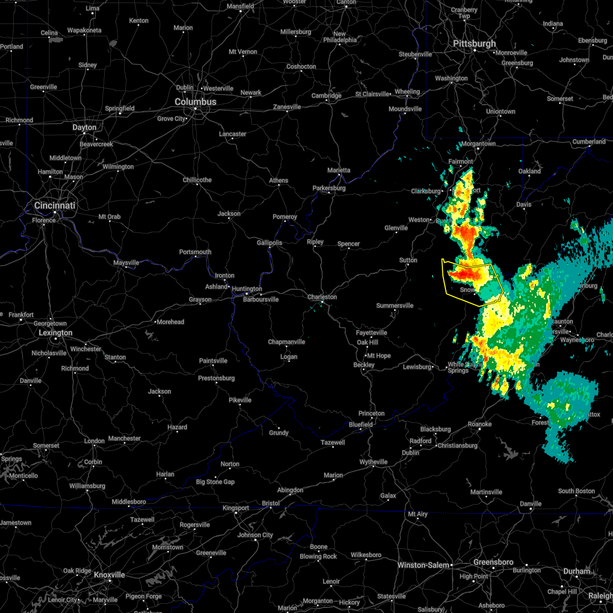
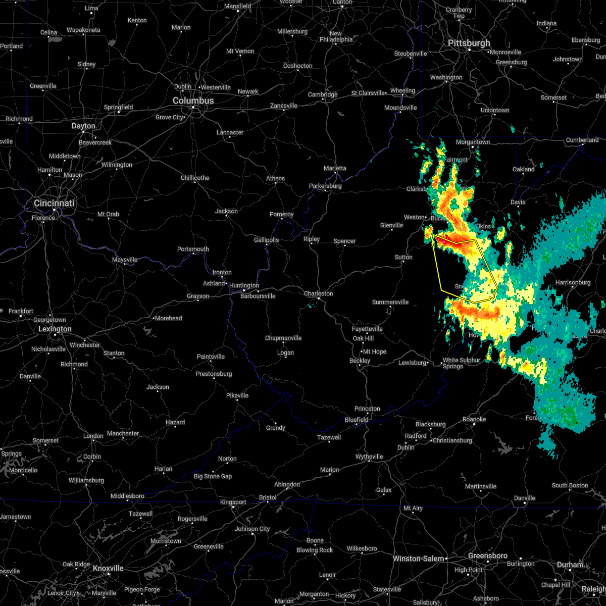
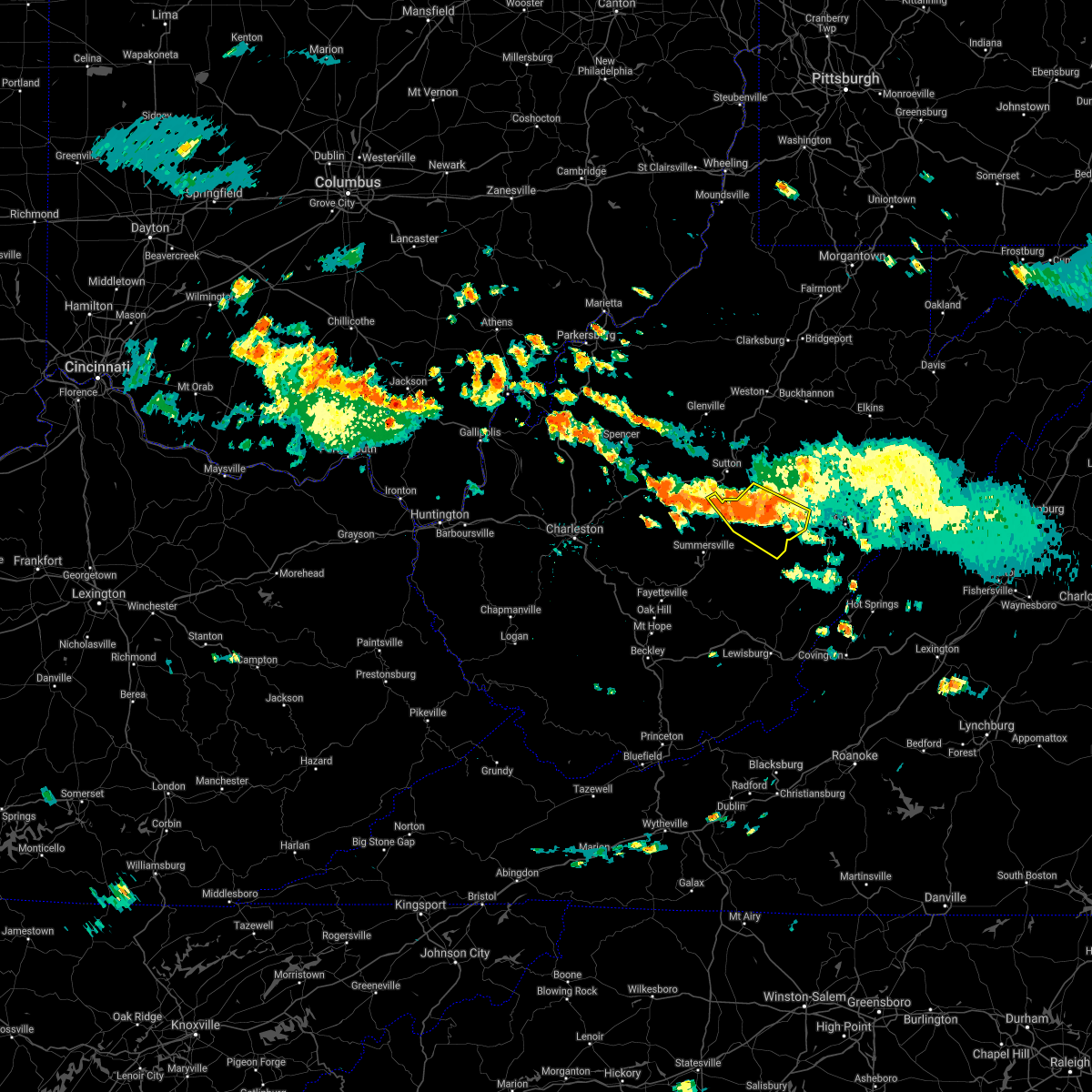
Hail Map for Bergoo, WV
The Bergoo, WV area has had 0 reports of on-the-ground hail by trained spotters, and has been under severe weather warnings 8 times during the past 12 months. Doppler radar has detected hail at or near Bergoo, WV on 22 occasions.
| Name: | Bergoo, WV |
| Where Located: | 39 miles SW of Elkins, WV |
| Map: | Google Map for Bergoo, WV |
| Population: | 94 |
| Housing Units: | 88 |
| More Info: | Search Google for Bergoo, WV |
3
The Top Recent Hail Date for Bergoo, WV is Saturday, August 31, 2024 (4th out of 22)

Hail and Wind Damage Spotted near Bergoo, WV
| Date / Time | Report Details |
|---|---|
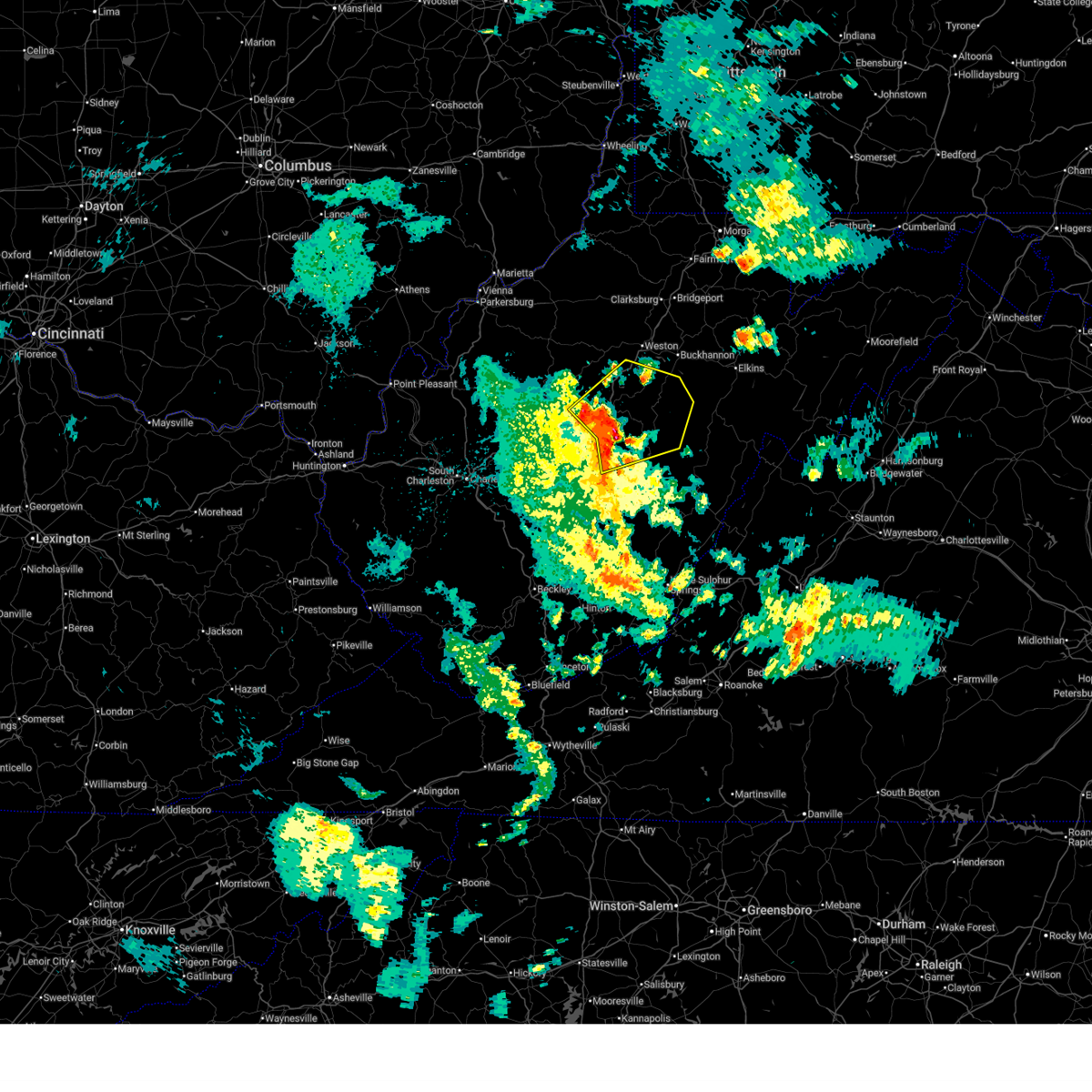
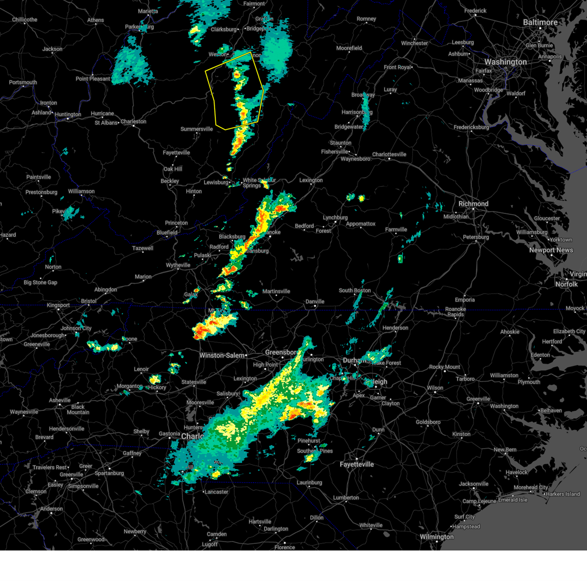
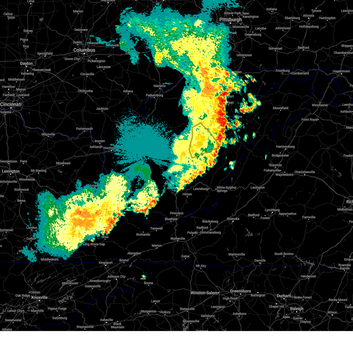
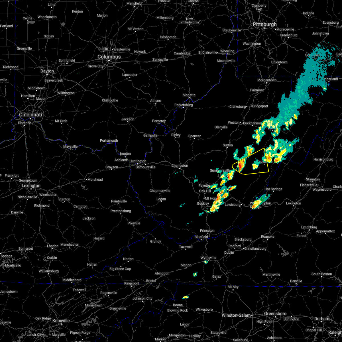
| 7/4/2026 4:07 PM EDT |
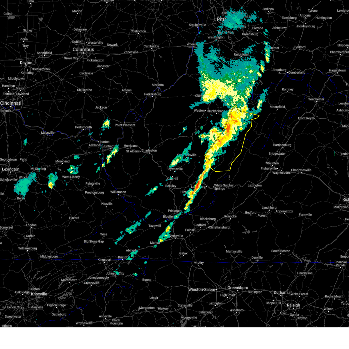
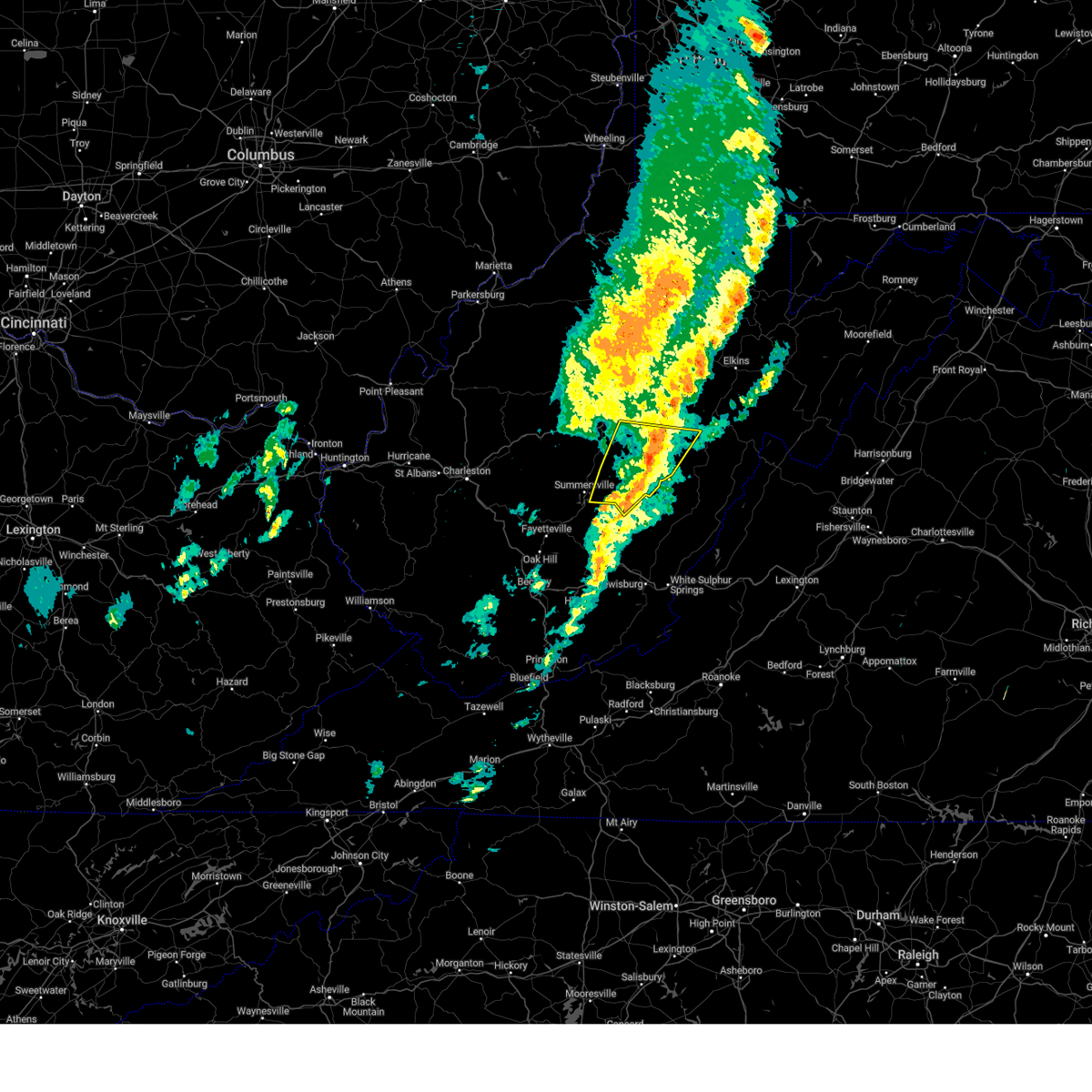
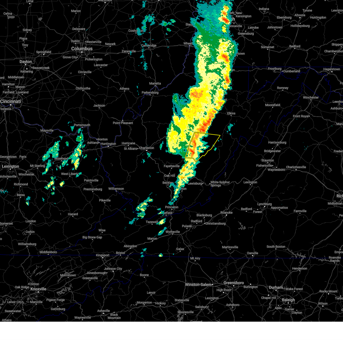
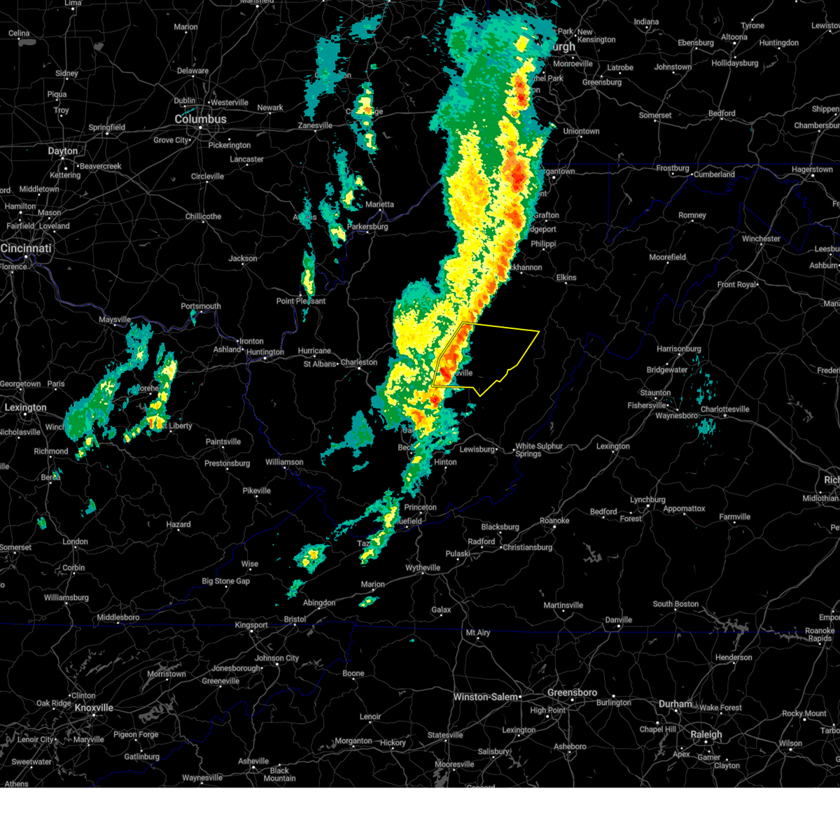
 At 406 pm edt, severe thunderstorms were located along a line extending from near rock cave to near addison (webster springs), moving northeast at 25 mph (radar indicated). Hazards include 60 mph wind gusts and quarter size hail. Hail damage to vehicles is expected. expect wind damage to roofs, siding, and trees. Locations impacted include, webster springs, addison (webster springs), holly river state park, diana, alexander, eden, pickens, cleveland, waneta, alton, hacker valley, kanawha head, and bergoo. At 406 pm edt, severe thunderstorms were located along a line extending from near rock cave to near addison (webster springs), moving northeast at 25 mph (radar indicated). Hazards include 60 mph wind gusts and quarter size hail. Hail damage to vehicles is expected. expect wind damage to roofs, siding, and trees. Locations impacted include, webster springs, addison (webster springs), holly river state park, diana, alexander, eden, pickens, cleveland, waneta, alton, hacker valley, kanawha head, and bergoo.
|
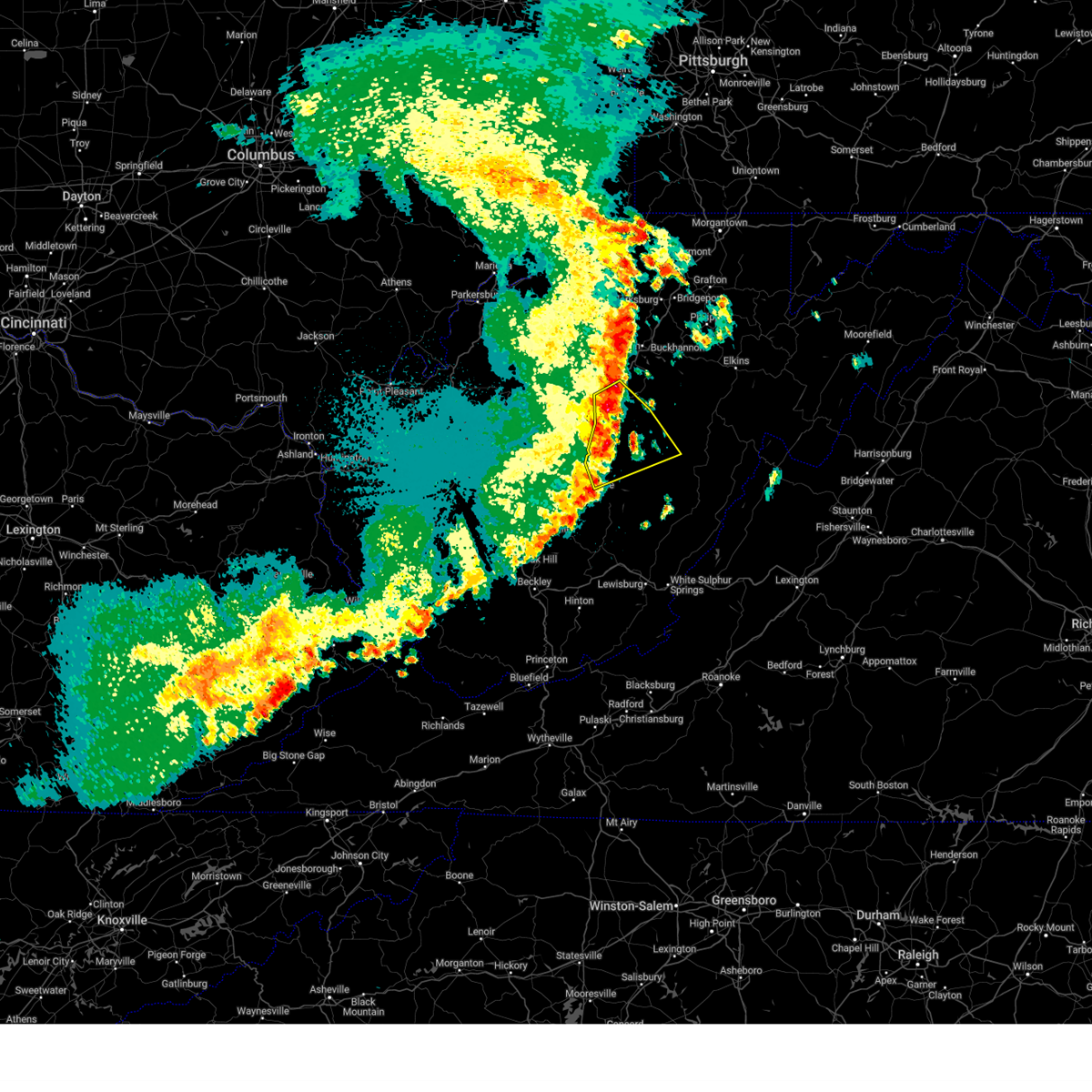
| 7/4/2026 3:45 PM EDT |
 Svrrlx the national weather service in charleston west virginia has issued a * severe thunderstorm warning for, southwestern randolph county in northeastern west virginia, south central lewis county in northern west virginia, southwestern upshur county in northeastern west virginia, webster county in northeastern west virginia, * until 415 pm edt. * at 344 pm edt, severe thunderstorms were located along a line extending from 7 miles northwest of holly river state park to 6 miles northeast of richwood, moving northeast at 20 mph (radar indicated). Hazards include 60 mph wind gusts and half dollar size hail. Hail damage to vehicles is expected. Expect wind damage to roofs, siding, and trees. Svrrlx the national weather service in charleston west virginia has issued a * severe thunderstorm warning for, southwestern randolph county in northeastern west virginia, south central lewis county in northern west virginia, southwestern upshur county in northeastern west virginia, webster county in northeastern west virginia, * until 415 pm edt. * at 344 pm edt, severe thunderstorms were located along a line extending from 7 miles northwest of holly river state park to 6 miles northeast of richwood, moving northeast at 20 mph (radar indicated). Hazards include 60 mph wind gusts and half dollar size hail. Hail damage to vehicles is expected. Expect wind damage to roofs, siding, and trees.
|
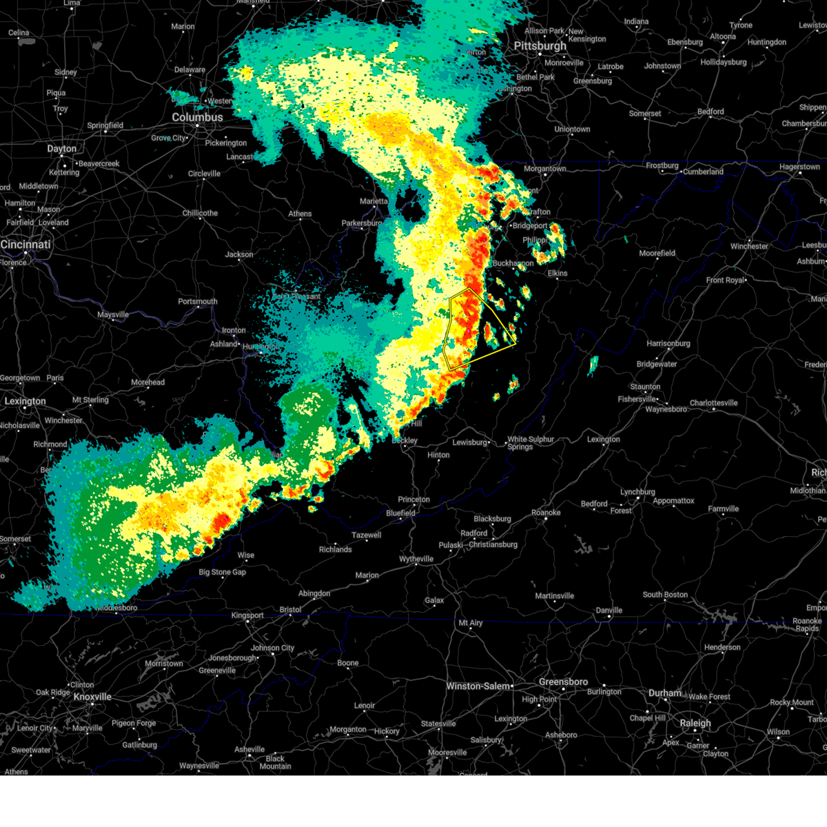
| 7/4/2026 3:15 PM EDT |
 Svrrlx the national weather service in charleston west virginia has issued a * severe thunderstorm warning for, central randolph county in northeastern west virginia, central pocahontas county in northeastern west virginia, southeastern webster county in northeastern west virginia, * until 345 pm edt. * at 314 pm edt, severe thunderstorms were located along a line extending from 6 miles southeast of mill creek to 7 miles southeast of addison (webster springs), moving northeast at 20 mph (radar indicated). Hazards include 60 mph wind gusts and quarter size hail. Hail damage to vehicles is expected. Expect wind damage to roofs, siding, and trees. Svrrlx the national weather service in charleston west virginia has issued a * severe thunderstorm warning for, central randolph county in northeastern west virginia, central pocahontas county in northeastern west virginia, southeastern webster county in northeastern west virginia, * until 345 pm edt. * at 314 pm edt, severe thunderstorms were located along a line extending from 6 miles southeast of mill creek to 7 miles southeast of addison (webster springs), moving northeast at 20 mph (radar indicated). Hazards include 60 mph wind gusts and quarter size hail. Hail damage to vehicles is expected. Expect wind damage to roofs, siding, and trees.
|
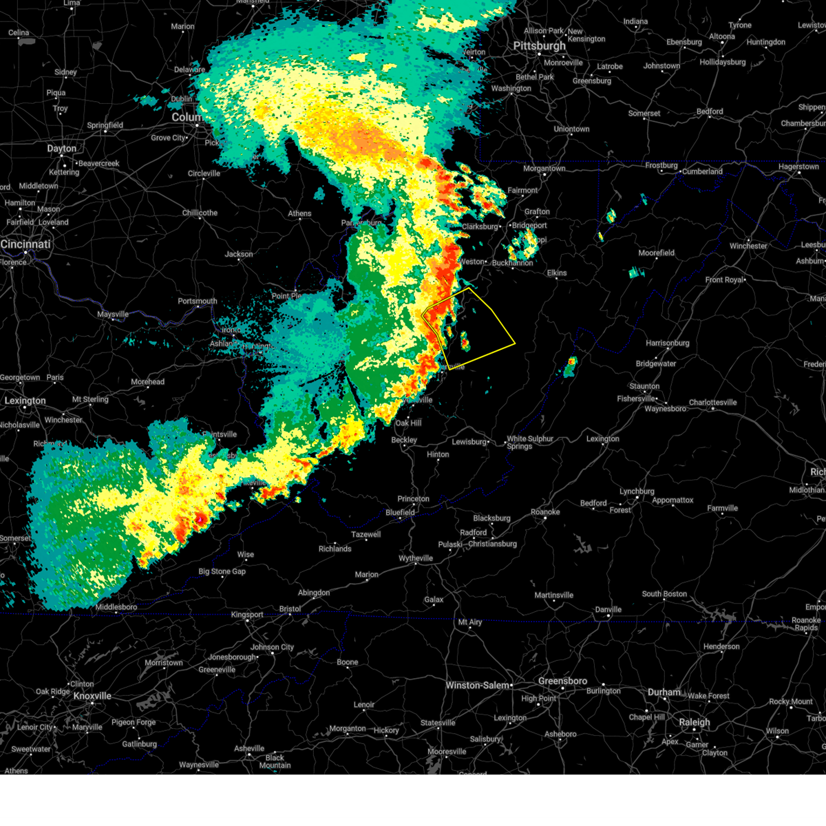
| 7/4/2026 2:45 PM EDT |
 Svrrlx the national weather service in charleston west virginia has issued a * severe thunderstorm warning for, central randolph county in northeastern west virginia, west central pocahontas county in northeastern west virginia, eastern nicholas county in southeastern west virginia, southeastern webster county in northeastern west virginia, * until 315 pm edt. * at 245 pm edt, severe thunderstorms were located along a line extending from 10 miles south of mill creek to near richwood, moving northeast at 30 mph (radar indicated). Hazards include 60 mph wind gusts and quarter size hail. Hail damage to vehicles is expected. Expect wind damage to roofs, siding, and trees. Svrrlx the national weather service in charleston west virginia has issued a * severe thunderstorm warning for, central randolph county in northeastern west virginia, west central pocahontas county in northeastern west virginia, eastern nicholas county in southeastern west virginia, southeastern webster county in northeastern west virginia, * until 315 pm edt. * at 245 pm edt, severe thunderstorms were located along a line extending from 10 miles south of mill creek to near richwood, moving northeast at 30 mph (radar indicated). Hazards include 60 mph wind gusts and quarter size hail. Hail damage to vehicles is expected. Expect wind damage to roofs, siding, and trees.
|
| 6/18/2026 7:44 AM EDT |
 Svrrlx the national weather service in charleston west virginia has issued a * severe thunderstorm warning for, randolph county in northeastern west virginia, pocahontas county in northeastern west virginia, eastern taylor county in northern west virginia, northeastern nicholas county in southeastern west virginia, southeastern lewis county in northern west virginia, southeastern braxton county in north central west virginia, upshur county in northeastern west virginia, webster county in northeastern west virginia, east central clay county in north central west virginia, barbour county in northeastern west virginia, * until 815 am edt. * at 744 am edt, severe thunderstorms were located along a line extending from 6 miles east of rowlesburg to near belington to 7 miles northwest of holly river state park, moving east at 40 mph (radar indicated). Hazards include 60 mph wind gusts. expect damage to roofs, siding, and trees Svrrlx the national weather service in charleston west virginia has issued a * severe thunderstorm warning for, randolph county in northeastern west virginia, pocahontas county in northeastern west virginia, eastern taylor county in northern west virginia, northeastern nicholas county in southeastern west virginia, southeastern lewis county in northern west virginia, southeastern braxton county in north central west virginia, upshur county in northeastern west virginia, webster county in northeastern west virginia, east central clay county in north central west virginia, barbour county in northeastern west virginia, * until 815 am edt. * at 744 am edt, severe thunderstorms were located along a line extending from 6 miles east of rowlesburg to near belington to 7 miles northwest of holly river state park, moving east at 40 mph (radar indicated). Hazards include 60 mph wind gusts. expect damage to roofs, siding, and trees
|
| 6/18/2026 7:17 AM EDT |
 Svrrlx the national weather service in charleston west virginia has issued a * severe thunderstorm warning for, calhoun county in north central west virginia, southwestern randolph county in northeastern west virginia, eastern kanawha county in central west virginia, southern upshur county in northeastern west virginia, eastern roane county in central west virginia, webster county in northeastern west virginia, nicholas county in southeastern west virginia, southwestern gilmer county in north central west virginia, southeastern lewis county in northern west virginia, braxton county in north central west virginia, clay county in north central west virginia, northern fayette county in southeastern west virginia, northeastern boone county in central west virginia, * until 745 am edt. * at 716 am edt, severe thunderstorms were located along a line extending from 10 miles northeast of glenville to glen to near van, moving east at 55 mph (radar indicated). Hazards include 60 mph wind gusts. expect damage to roofs, siding, and trees Svrrlx the national weather service in charleston west virginia has issued a * severe thunderstorm warning for, calhoun county in north central west virginia, southwestern randolph county in northeastern west virginia, eastern kanawha county in central west virginia, southern upshur county in northeastern west virginia, eastern roane county in central west virginia, webster county in northeastern west virginia, nicholas county in southeastern west virginia, southwestern gilmer county in north central west virginia, southeastern lewis county in northern west virginia, braxton county in north central west virginia, clay county in north central west virginia, northern fayette county in southeastern west virginia, northeastern boone county in central west virginia, * until 745 am edt. * at 716 am edt, severe thunderstorms were located along a line extending from 10 miles northeast of glenville to glen to near van, moving east at 55 mph (radar indicated). Hazards include 60 mph wind gusts. expect damage to roofs, siding, and trees
|
| 6/11/2026 6:20 PM EDT |
 At 620 pm edt, a severe thunderstorm was located near addison (webster springs), or near webster springs, moving east at 35 mph (radar indicated). Hazards include 60 mph wind gusts. Expect damage to roofs, siding, and trees. Locations impacted include, webster springs, addison (webster springs), cowen, upper glade, and bergoo. At 620 pm edt, a severe thunderstorm was located near addison (webster springs), or near webster springs, moving east at 35 mph (radar indicated). Hazards include 60 mph wind gusts. Expect damage to roofs, siding, and trees. Locations impacted include, webster springs, addison (webster springs), cowen, upper glade, and bergoo.
|
| 6/11/2026 5:53 PM EDT |
 Svrrlx the national weather service in charleston west virginia has issued a * severe thunderstorm warning for, west central pocahontas county in northeastern west virginia, northeastern nicholas county in southeastern west virginia, webster county in northeastern west virginia, * until 630 pm edt. * at 552 pm edt, a severe thunderstorm was located near camden on gauley, or 10 miles west of webster springs, moving east at 20 mph (radar indicated). Hazards include 60 mph wind gusts. expect damage to roofs, siding, and trees Svrrlx the national weather service in charleston west virginia has issued a * severe thunderstorm warning for, west central pocahontas county in northeastern west virginia, northeastern nicholas county in southeastern west virginia, webster county in northeastern west virginia, * until 630 pm edt. * at 552 pm edt, a severe thunderstorm was located near camden on gauley, or 10 miles west of webster springs, moving east at 20 mph (radar indicated). Hazards include 60 mph wind gusts. expect damage to roofs, siding, and trees
|
| 6/14/2025 12:07 AM EDT |
 The storms which prompted the warning have weakened below severe limits, and no longer pose an immediate threat to life or property. therefore, the warning will be allowed to expire. however, gusty winds and heavy rain are still possible with these thunderstorms. The storms which prompted the warning have weakened below severe limits, and no longer pose an immediate threat to life or property. therefore, the warning will be allowed to expire. however, gusty winds and heavy rain are still possible with these thunderstorms.
|
| 6/14/2025 12:02 AM EDT |
 At 1202 am edt, severe thunderstorms were located along a line extending from 11 miles southeast of glenville to near rock cave to near holly river state park to near addison (webster springs), moving east at 30 mph (radar indicated). Hazards include 60 mph wind gusts. Expect damage to roofs, siding, and trees. Locations impacted include, webster springs, addison (webster springs), holly river state park, rock cave, burnsville, flatwoods, diana, alexander, eden, sand run, helvetia, pickens, cleveland, waneta, alton, exchange, heaters, walkersville, hacker valley, and kanawha head. At 1202 am edt, severe thunderstorms were located along a line extending from 11 miles southeast of glenville to near rock cave to near holly river state park to near addison (webster springs), moving east at 30 mph (radar indicated). Hazards include 60 mph wind gusts. Expect damage to roofs, siding, and trees. Locations impacted include, webster springs, addison (webster springs), holly river state park, rock cave, burnsville, flatwoods, diana, alexander, eden, sand run, helvetia, pickens, cleveland, waneta, alton, exchange, heaters, walkersville, hacker valley, and kanawha head.
|
| 6/13/2025 11:42 PM EDT |
 the severe thunderstorm warning has been cancelled and is no longer in effect the severe thunderstorm warning has been cancelled and is no longer in effect
|
| 6/13/2025 11:42 PM EDT |
 At 1142 pm edt, severe thunderstorms were located along a line extending from 7 miles southeast of cedar creek state park to 8 miles northeast of sutton to 9 miles west of holly river state park to 6 miles northeast of camden on gauley, moving northeast at 30 mph (radar indicated). Hazards include 60 mph wind gusts. Expect damage to roofs, siding, and trees. Locations impacted include, sutton, webster springs, gassaway, addison (webster springs), holly river state park, rock cave, burnsville, flatwoods, alexander, eden, helvetia, pickens, cleveland, waneta, hacker valley, kanawha head, ireland, french creek, erbacon, and diana. At 1142 pm edt, severe thunderstorms were located along a line extending from 7 miles southeast of cedar creek state park to 8 miles northeast of sutton to 9 miles west of holly river state park to 6 miles northeast of camden on gauley, moving northeast at 30 mph (radar indicated). Hazards include 60 mph wind gusts. Expect damage to roofs, siding, and trees. Locations impacted include, sutton, webster springs, gassaway, addison (webster springs), holly river state park, rock cave, burnsville, flatwoods, alexander, eden, helvetia, pickens, cleveland, waneta, hacker valley, kanawha head, ireland, french creek, erbacon, and diana.
|
| 6/13/2025 11:30 PM EDT |
 Svrrlx the national weather service in charleston west virginia has issued a * severe thunderstorm warning for, southwestern randolph county in northeastern west virginia, north central nicholas county in southeastern west virginia, east central gilmer county in north central west virginia, southern lewis county in northern west virginia, braxton county in north central west virginia, southwestern upshur county in northeastern west virginia, webster county in northeastern west virginia, * until 1215 am edt. * at 1130 pm edt, severe thunderstorms were located along a line extending from 7 miles northwest of gassaway to near sutton to 10 miles northeast of birch river to near camden on gauley, moving northeast at 25 mph (radar indicated). Hazards include 60 mph wind gusts. expect damage to roofs, siding, and trees Svrrlx the national weather service in charleston west virginia has issued a * severe thunderstorm warning for, southwestern randolph county in northeastern west virginia, north central nicholas county in southeastern west virginia, east central gilmer county in north central west virginia, southern lewis county in northern west virginia, braxton county in north central west virginia, southwestern upshur county in northeastern west virginia, webster county in northeastern west virginia, * until 1215 am edt. * at 1130 pm edt, severe thunderstorms were located along a line extending from 7 miles northwest of gassaway to near sutton to 10 miles northeast of birch river to near camden on gauley, moving northeast at 25 mph (radar indicated). Hazards include 60 mph wind gusts. expect damage to roofs, siding, and trees
|
| 5/30/2025 3:29 PM EDT |
 The storms which prompted the warning have weakened below severe limits, and no longer pose an immediate threat to life or property. therefore, the warning will be allowed to expire. however, gusty winds are still possible with these thunderstorms. a tornado watch remains in effect until 800 pm edt for northern, southeastern, north central and northeastern west virginia. The storms which prompted the warning have weakened below severe limits, and no longer pose an immediate threat to life or property. therefore, the warning will be allowed to expire. however, gusty winds are still possible with these thunderstorms. a tornado watch remains in effect until 800 pm edt for northern, southeastern, north central and northeastern west virginia.
|
| 5/30/2025 3:29 PM EDT |
 Svrrlx the national weather service in charleston west virginia has issued a * severe thunderstorm warning for, randolph county in northeastern west virginia, northern pocahontas county in northeastern west virginia, lewis county in northern west virginia, upshur county in northeastern west virginia, northeastern webster county in northeastern west virginia, barbour county in northeastern west virginia, south central harrison county in northern west virginia, * until 430 pm edt. * at 328 pm edt, severe thunderstorms were located along a line extending from near weston to near holly river state park to 6 miles southeast of addison (webster springs), moving east at 40 mph (radar indicated). Hazards include 60 mph wind gusts. expect damage to roofs, siding, and trees Svrrlx the national weather service in charleston west virginia has issued a * severe thunderstorm warning for, randolph county in northeastern west virginia, northern pocahontas county in northeastern west virginia, lewis county in northern west virginia, upshur county in northeastern west virginia, northeastern webster county in northeastern west virginia, barbour county in northeastern west virginia, south central harrison county in northern west virginia, * until 430 pm edt. * at 328 pm edt, severe thunderstorms were located along a line extending from near weston to near holly river state park to 6 miles southeast of addison (webster springs), moving east at 40 mph (radar indicated). Hazards include 60 mph wind gusts. expect damage to roofs, siding, and trees
|
| 5/30/2025 3:10 PM EDT |
 At 310 pm edt, severe thunderstorms were located along a line extending from 9 miles southwest of stonewall jackson to 10 miles northwest of webster springs to 6 miles east of camden-on-gauley, moving east at 40 mph (radar indicated). Hazards include 60 mph wind gusts. Expect damage to roofs, siding, and trees. Locations impacted include, buckhannon, webster springs, addison (webster springs), camden-on-gauley, holly river state park, camden on gauley, rock cave, cowen, burnsville, flatwoods, alexander, eden, upper glade, helvetia, pickens, cleveland, waneta, boggs, hacker valley, and kanawha head. At 310 pm edt, severe thunderstorms were located along a line extending from 9 miles southwest of stonewall jackson to 10 miles northwest of webster springs to 6 miles east of camden-on-gauley, moving east at 40 mph (radar indicated). Hazards include 60 mph wind gusts. Expect damage to roofs, siding, and trees. Locations impacted include, buckhannon, webster springs, addison (webster springs), camden-on-gauley, holly river state park, camden on gauley, rock cave, cowen, burnsville, flatwoods, alexander, eden, upper glade, helvetia, pickens, cleveland, waneta, boggs, hacker valley, and kanawha head.
|
| 5/30/2025 3:10 PM EDT |
 the severe thunderstorm warning has been cancelled and is no longer in effect the severe thunderstorm warning has been cancelled and is no longer in effect
|
| 5/30/2025 3:02 PM EDT | Trees down at bergoo road. time estimated by rada in webster county WV, 0.4 miles SSE of Bergoo, WV |
| 5/30/2025 2:49 PM EDT |
 At 249 pm edt, severe thunderstorms were located along a line extending from near cedar creek state park to near birch river to 7 miles northwest of craigsville, moving east at 45 mph (radar indicated). Hazards include 60 mph wind gusts. Expect damage to roofs, siding, and trees. Locations impacted include, buckhannon, sutton, webster springs, gassaway, addison (webster springs), camden-on-gauley, birch river, holly river state park, camden on gauley, rock cave, cowen, burnsville, flatwoods, alexander, eden, rosedale, upper glade, helvetia, pickens, and cleveland. At 249 pm edt, severe thunderstorms were located along a line extending from near cedar creek state park to near birch river to 7 miles northwest of craigsville, moving east at 45 mph (radar indicated). Hazards include 60 mph wind gusts. Expect damage to roofs, siding, and trees. Locations impacted include, buckhannon, sutton, webster springs, gassaway, addison (webster springs), camden-on-gauley, birch river, holly river state park, camden on gauley, rock cave, cowen, burnsville, flatwoods, alexander, eden, rosedale, upper glade, helvetia, pickens, and cleveland.
|
| 5/30/2025 2:49 PM EDT |
 the severe thunderstorm warning has been cancelled and is no longer in effect the severe thunderstorm warning has been cancelled and is no longer in effect
|
| 5/30/2025 2:37 PM EDT |
 Svrrlx the national weather service in charleston west virginia has issued a * severe thunderstorm warning for, southeastern calhoun county in north central west virginia, southwestern randolph county in northeastern west virginia, west central pocahontas county in northeastern west virginia, northeastern nicholas county in southeastern west virginia, southern gilmer county in north central west virginia, southeastern lewis county in northern west virginia, braxton county in north central west virginia, upshur county in northeastern west virginia, webster county in northeastern west virginia, northeastern clay county in north central west virginia, * until 330 pm edt. * at 237 pm edt, severe thunderstorms were located along a line extending from 8 miles east of arnoldsburg to 6 miles west of birch river to 8 miles north of summersville, moving east at 40 mph (radar indicated). Hazards include 60 mph wind gusts. expect damage to roofs, siding, and trees Svrrlx the national weather service in charleston west virginia has issued a * severe thunderstorm warning for, southeastern calhoun county in north central west virginia, southwestern randolph county in northeastern west virginia, west central pocahontas county in northeastern west virginia, northeastern nicholas county in southeastern west virginia, southern gilmer county in north central west virginia, southeastern lewis county in northern west virginia, braxton county in north central west virginia, upshur county in northeastern west virginia, webster county in northeastern west virginia, northeastern clay county in north central west virginia, * until 330 pm edt. * at 237 pm edt, severe thunderstorms were located along a line extending from 8 miles east of arnoldsburg to 6 miles west of birch river to 8 miles north of summersville, moving east at 40 mph (radar indicated). Hazards include 60 mph wind gusts. expect damage to roofs, siding, and trees
|
| 4/29/2025 11:21 PM EDT |
 The storms which prompted the warning have weakened below severe limits, and have exited the warned area. therefore, the warning will be allowed to expire. The storms which prompted the warning have weakened below severe limits, and have exited the warned area. therefore, the warning will be allowed to expire.
|
| 4/29/2025 10:54 PM EDT |
 the severe thunderstorm warning has been cancelled and is no longer in effect the severe thunderstorm warning has been cancelled and is no longer in effect
|
| 4/29/2025 10:54 PM EDT |
 At 1054 pm edt, severe thunderstorms were located along a line extending from 10 miles west of rock cave to camden-on-gauley, moving east at 55 mph (radar indicated). Hazards include 60 mph wind gusts. Expect damage to roofs, siding, and trees. Locations impacted include, diana, gassaway, birch river, sutton, flatwoods, addison (webster springs), upper glade, boggs, cowen, exchange, little birch, heaters, calvin, webster springs, hacker valley, camden on gauley, bergoo, camden-on-gauley, centralia, and erbacon. At 1054 pm edt, severe thunderstorms were located along a line extending from 10 miles west of rock cave to camden-on-gauley, moving east at 55 mph (radar indicated). Hazards include 60 mph wind gusts. Expect damage to roofs, siding, and trees. Locations impacted include, diana, gassaway, birch river, sutton, flatwoods, addison (webster springs), upper glade, boggs, cowen, exchange, little birch, heaters, calvin, webster springs, hacker valley, camden on gauley, bergoo, camden-on-gauley, centralia, and erbacon.
|
| 4/29/2025 10:37 PM EDT |
 Svrrlx the national weather service in charleston west virginia has issued a * severe thunderstorm warning for, northeastern nicholas county in southeastern west virginia, braxton county in north central west virginia, webster county in northeastern west virginia, northeastern clay county in north central west virginia, * until 1130 pm edt. * at 1037 pm edt, a severe thunderstorm was located 7 miles northeast of clay, moving east at 35 mph (radar indicated). Hazards include 60 mph wind gusts. expect damage to roofs, siding, and trees Svrrlx the national weather service in charleston west virginia has issued a * severe thunderstorm warning for, northeastern nicholas county in southeastern west virginia, braxton county in north central west virginia, webster county in northeastern west virginia, northeastern clay county in north central west virginia, * until 1130 pm edt. * at 1037 pm edt, a severe thunderstorm was located 7 miles northeast of clay, moving east at 35 mph (radar indicated). Hazards include 60 mph wind gusts. expect damage to roofs, siding, and trees
|
| 4/14/2025 7:20 PM EDT |
 Svrrlx the national weather service in charleston west virginia has issued a * severe thunderstorm warning for, randolph county in northeastern west virginia, pocahontas county in northeastern west virginia, southeastern nicholas county in southeastern west virginia, southern upshur county in northeastern west virginia, central webster county in northeastern west virginia, * until 800 pm edt. * at 718 pm edt, a severe thunderstorm was located over camden-on-gauley, or 10 miles southwest of webster springs, moving east at 60 mph (radar indicated). Hazards include 60 mph wind gusts and nickel size hail. expect damage to roofs, siding, and trees Svrrlx the national weather service in charleston west virginia has issued a * severe thunderstorm warning for, randolph county in northeastern west virginia, pocahontas county in northeastern west virginia, southeastern nicholas county in southeastern west virginia, southern upshur county in northeastern west virginia, central webster county in northeastern west virginia, * until 800 pm edt. * at 718 pm edt, a severe thunderstorm was located over camden-on-gauley, or 10 miles southwest of webster springs, moving east at 60 mph (radar indicated). Hazards include 60 mph wind gusts and nickel size hail. expect damage to roofs, siding, and trees
|
| 4/5/2025 6:51 PM EDT |
 the severe thunderstorm warning has been cancelled and is no longer in effect the severe thunderstorm warning has been cancelled and is no longer in effect
|
| 4/5/2025 6:51 PM EDT |
 At 650 pm edt, a severe thunderstorm was located 11 miles southeast of holly river state park, or 12 miles east of webster springs, moving east at 45 mph (radar indicated). Hazards include 70 mph wind gusts and quarter size hail. Hail damage to vehicles is expected. expect considerable tree damage. wind damage is also likely to mobile homes, roofs, and outbuildings. Locations impacted include, monterville, valley head, mingo, and waneta. At 650 pm edt, a severe thunderstorm was located 11 miles southeast of holly river state park, or 12 miles east of webster springs, moving east at 45 mph (radar indicated). Hazards include 70 mph wind gusts and quarter size hail. Hail damage to vehicles is expected. expect considerable tree damage. wind damage is also likely to mobile homes, roofs, and outbuildings. Locations impacted include, monterville, valley head, mingo, and waneta.
|
| 4/5/2025 6:28 PM EDT |
 Svrrlx the national weather service in charleston west virginia has issued a * severe thunderstorm warning for, southwestern randolph county in northeastern west virginia, central pocahontas county in northeastern west virginia, central webster county in northeastern west virginia, * until 700 pm edt. * at 627 pm edt, a severe thunderstorm was located near webster springs, moving east at 45 mph (radar indicated). Hazards include 70 mph wind gusts and half dollar size hail. Hail damage to vehicles is expected. expect considerable tree damage. Wind damage is also likely to mobile homes, roofs, and outbuildings. Svrrlx the national weather service in charleston west virginia has issued a * severe thunderstorm warning for, southwestern randolph county in northeastern west virginia, central pocahontas county in northeastern west virginia, central webster county in northeastern west virginia, * until 700 pm edt. * at 627 pm edt, a severe thunderstorm was located near webster springs, moving east at 45 mph (radar indicated). Hazards include 70 mph wind gusts and half dollar size hail. Hail damage to vehicles is expected. expect considerable tree damage. Wind damage is also likely to mobile homes, roofs, and outbuildings.
|
| 3/16/2025 1:58 PM EDT |
 The storms which prompted the warning have weakened below severe limits, and no longer pose an immediate threat to life or property. therefore, the warning will be allowed to expire. however, gusty winds are still possible with these thunderstorms. a tornado watch remains in effect until 400 pm edt for northeastern west virginia. The storms which prompted the warning have weakened below severe limits, and no longer pose an immediate threat to life or property. therefore, the warning will be allowed to expire. however, gusty winds are still possible with these thunderstorms. a tornado watch remains in effect until 400 pm edt for northeastern west virginia.
|
| 3/16/2025 1:28 PM EDT |
 the severe thunderstorm warning has been cancelled and is no longer in effect the severe thunderstorm warning has been cancelled and is no longer in effect
|
| 3/16/2025 1:28 PM EDT |
 At 128 pm edt, severe thunderstorms were located along a line extending from near hendricks to 6 miles east of dailey to 8 miles south of mill creek to 8 miles west of snowshoe to 6 miles north of leonard, moving east at 20 mph (radar indicated). Hazards include 60 mph wind gusts. Expect damage to roofs, siding, and trees. Locations impacted include, cass scenic railroad, arbovale, cheat bridge, dryfork, huttonsville, elkins, glady, minnehaha springs, montrose, waneta, beverly, boyer, bowden, buckeye, womelsdorf (coalton), marlinton, snowshoe, bergoo, dunmore, and monterville. At 128 pm edt, severe thunderstorms were located along a line extending from near hendricks to 6 miles east of dailey to 8 miles south of mill creek to 8 miles west of snowshoe to 6 miles north of leonard, moving east at 20 mph (radar indicated). Hazards include 60 mph wind gusts. Expect damage to roofs, siding, and trees. Locations impacted include, cass scenic railroad, arbovale, cheat bridge, dryfork, huttonsville, elkins, glady, minnehaha springs, montrose, waneta, beverly, boyer, bowden, buckeye, womelsdorf (coalton), marlinton, snowshoe, bergoo, dunmore, and monterville.
|
| 3/16/2025 12:58 PM EDT |
 Svrrlx the national weather service in charleston west virginia has issued a * severe thunderstorm warning for, randolph county in northeastern west virginia, pocahontas county in northeastern west virginia, southeastern nicholas county in southeastern west virginia, southeastern upshur county in northeastern west virginia, eastern webster county in northeastern west virginia, southeastern barbour county in northeastern west virginia, * until 200 pm edt. * at 1257 pm edt, severe thunderstorms were located along a line extending from 10 miles northwest of parsons to 8 miles southwest of belington to 7 miles east of holly river state park to near richwood, moving east at 35 mph (radar indicated). Hazards include 60 mph wind gusts. expect damage to roofs, siding, and trees Svrrlx the national weather service in charleston west virginia has issued a * severe thunderstorm warning for, randolph county in northeastern west virginia, pocahontas county in northeastern west virginia, southeastern nicholas county in southeastern west virginia, southeastern upshur county in northeastern west virginia, eastern webster county in northeastern west virginia, southeastern barbour county in northeastern west virginia, * until 200 pm edt. * at 1257 pm edt, severe thunderstorms were located along a line extending from 10 miles northwest of parsons to 8 miles southwest of belington to 7 miles east of holly river state park to near richwood, moving east at 35 mph (radar indicated). Hazards include 60 mph wind gusts. expect damage to roofs, siding, and trees
|
| 3/16/2025 12:58 PM EDT |
 The storms which prompted the warning have moved out of the area. therefore, the warning will be allowed to expire. however, small hail, gusty winds and heavy rain are still possible with these thunderstorms. a tornado watch remains in effect until 400 pm edt for southeastern, north central and northeastern west virginia. The storms which prompted the warning have moved out of the area. therefore, the warning will be allowed to expire. however, small hail, gusty winds and heavy rain are still possible with these thunderstorms. a tornado watch remains in effect until 400 pm edt for southeastern, north central and northeastern west virginia.
|
| 3/16/2025 12:39 PM EDT |
 the severe thunderstorm warning has been cancelled and is no longer in effect the severe thunderstorm warning has been cancelled and is no longer in effect
|
| 3/16/2025 12:39 PM EDT |
 At 1239 pm edt, severe thunderstorms were located along a line extending from 8 miles west of holly river state park to camden on gauley to 6 miles south of craigsville, moving east at 20 mph (radar indicated). Hazards include 60 mph wind gusts. Expect damage to roofs, siding, and trees. Locations impacted include, diana, monterville, richwood, canvas, craigsville, addison (webster springs), upper glade, waneta, boggs, cowen, calvin, webster springs, camden on gauley, bergoo, camden-on-gauley, centralia, and erbacon. At 1239 pm edt, severe thunderstorms were located along a line extending from 8 miles west of holly river state park to camden on gauley to 6 miles south of craigsville, moving east at 20 mph (radar indicated). Hazards include 60 mph wind gusts. Expect damage to roofs, siding, and trees. Locations impacted include, diana, monterville, richwood, canvas, craigsville, addison (webster springs), upper glade, waneta, boggs, cowen, calvin, webster springs, camden on gauley, bergoo, camden-on-gauley, centralia, and erbacon.
|
| 3/16/2025 12:17 PM EDT |
 Svrrlx the national weather service in charleston west virginia has issued a * severe thunderstorm warning for, southwestern randolph county in northeastern west virginia, nicholas county in southeastern west virginia, southeastern braxton county in north central west virginia, webster county in northeastern west virginia, east central clay county in north central west virginia, * until 100 pm edt. * at 1216 pm edt, severe thunderstorms were located along a line extending from 6 miles east of sutton to 6 miles south of birch river to near summersville, moving east at 15 mph (radar indicated). Hazards include 60 mph wind gusts. expect damage to roofs, siding, and trees Svrrlx the national weather service in charleston west virginia has issued a * severe thunderstorm warning for, southwestern randolph county in northeastern west virginia, nicholas county in southeastern west virginia, southeastern braxton county in north central west virginia, webster county in northeastern west virginia, east central clay county in north central west virginia, * until 100 pm edt. * at 1216 pm edt, severe thunderstorms were located along a line extending from 6 miles east of sutton to 6 miles south of birch river to near summersville, moving east at 15 mph (radar indicated). Hazards include 60 mph wind gusts. expect damage to roofs, siding, and trees
|
| 2/16/2025 12:28 PM EST |
 The storms which prompted the warning have moved out of the area. therefore, the warning will be allowed to expire. however, gusty winds are still possible with lingering showers. The storms which prompted the warning have moved out of the area. therefore, the warning will be allowed to expire. however, gusty winds are still possible with lingering showers.
|
| 2/16/2025 12:20 PM EST |
 At 1218 pm est, severe thunderstorms were located along a line extending from 6 miles south of holly river state park to near renick, moving east at 55 mph (radar indicated). Hazards include 60 mph wind gusts. Expect damage to roofs, siding, and trees. Locations impacted include, diana, alexander, cranberry mountain nature center, eden, addison (webster springs), upper glade, helvetia, pickens, cleveland, waneta, holly river state park, webster springs, hacker valley, bergoo, and richwood. At 1218 pm est, severe thunderstorms were located along a line extending from 6 miles south of holly river state park to near renick, moving east at 55 mph (radar indicated). Hazards include 60 mph wind gusts. Expect damage to roofs, siding, and trees. Locations impacted include, diana, alexander, cranberry mountain nature center, eden, addison (webster springs), upper glade, helvetia, pickens, cleveland, waneta, holly river state park, webster springs, hacker valley, bergoo, and richwood.
|
| 2/16/2025 12:20 PM EST |
 the severe thunderstorm warning has been cancelled and is no longer in effect the severe thunderstorm warning has been cancelled and is no longer in effect
|
| 2/16/2025 11:50 AM EST |
 Svrrlx the national weather service in charleston west virginia has issued a * severe thunderstorm warning for, southwestern randolph county in northeastern west virginia, southwestern pocahontas county in northeastern west virginia, nicholas county in southeastern west virginia, south central lewis county in northern west virginia, braxton county in north central west virginia, southwestern upshur county in northeastern west virginia, webster county in northeastern west virginia, northeastern clay county in north central west virginia, * until 1230 pm est. * at 1149 am est, severe thunderstorms were located along a line extending from 6 miles northwest of gassaway to near bingham, moving east at 65 mph (radar indicated). Hazards include 70 mph wind gusts. Expect considerable tree damage. Damage is likely to mobile homes, roofs, and outbuildings. Svrrlx the national weather service in charleston west virginia has issued a * severe thunderstorm warning for, southwestern randolph county in northeastern west virginia, southwestern pocahontas county in northeastern west virginia, nicholas county in southeastern west virginia, south central lewis county in northern west virginia, braxton county in north central west virginia, southwestern upshur county in northeastern west virginia, webster county in northeastern west virginia, northeastern clay county in north central west virginia, * until 1230 pm est. * at 1149 am est, severe thunderstorms were located along a line extending from 6 miles northwest of gassaway to near bingham, moving east at 65 mph (radar indicated). Hazards include 70 mph wind gusts. Expect considerable tree damage. Damage is likely to mobile homes, roofs, and outbuildings.
|
| 5/26/2024 6:26 PM EDT |
 The storm which prompted the warning has moved out of the area. therefore, the warning will be allowed to expire. however, gusty winds are still possible with this thunderstorm. a severe thunderstorm watch remains in effect until 900 pm edt for southeastern, north central and northeastern west virginia. The storm which prompted the warning has moved out of the area. therefore, the warning will be allowed to expire. however, gusty winds are still possible with this thunderstorm. a severe thunderstorm watch remains in effect until 900 pm edt for southeastern, north central and northeastern west virginia.
|
| 5/26/2024 6:03 PM EDT |
 At 602 pm edt, a severe thunderstorm was located over camden on gauley, or 11 miles southwest of webster springs, moving northeast at 45 mph (radar indicated). Hazards include 70 mph wind gusts and penny size hail. Expect considerable tree damage. damage is likely to mobile homes, roofs, and outbuildings. Locations impacted include, summersville, richwood, marlinton, sutton, webster springs, gassaway, addison (webster springs), camden-on-gauley, birch river, craigsville, big otter, camden on gauley, harrison, cowen, burnsville, flatwoods, hillsboro, sand fork, little birch, and buckeye. At 602 pm edt, a severe thunderstorm was located over camden on gauley, or 11 miles southwest of webster springs, moving northeast at 45 mph (radar indicated). Hazards include 70 mph wind gusts and penny size hail. Expect considerable tree damage. damage is likely to mobile homes, roofs, and outbuildings. Locations impacted include, summersville, richwood, marlinton, sutton, webster springs, gassaway, addison (webster springs), camden-on-gauley, birch river, craigsville, big otter, camden on gauley, harrison, cowen, burnsville, flatwoods, hillsboro, sand fork, little birch, and buckeye.
|
| 5/26/2024 5:45 PM EDT |
 Svrrlx the national weather service in charleston west virginia has issued a * severe thunderstorm warning for, southeastern calhoun county in north central west virginia, southwestern pocahontas county in northeastern west virginia, nicholas county in southeastern west virginia, southern gilmer county in north central west virginia, braxton county in north central west virginia, webster county in northeastern west virginia, northeastern clay county in north central west virginia, * until 630 pm edt. * at 545 pm edt, a severe thunderstorm was located near summersville, moving northeast at 45 mph (radar indicated). Hazards include 70 mph wind gusts and penny size hail. Expect considerable tree damage. Damage is likely to mobile homes, roofs, and outbuildings. Svrrlx the national weather service in charleston west virginia has issued a * severe thunderstorm warning for, southeastern calhoun county in north central west virginia, southwestern pocahontas county in northeastern west virginia, nicholas county in southeastern west virginia, southern gilmer county in north central west virginia, braxton county in north central west virginia, webster county in northeastern west virginia, northeastern clay county in north central west virginia, * until 630 pm edt. * at 545 pm edt, a severe thunderstorm was located near summersville, moving northeast at 45 mph (radar indicated). Hazards include 70 mph wind gusts and penny size hail. Expect considerable tree damage. Damage is likely to mobile homes, roofs, and outbuildings.
|
| 5/8/2024 5:15 AM EDT |
 Svrrlx the national weather service in charleston west virginia has issued a * severe thunderstorm warning for, southwestern randolph county in northeastern west virginia, central pocahontas county in northeastern west virginia, northeastern webster county in northeastern west virginia, * until 600 am edt. * at 514 am edt, a severe thunderstorm was located 7 miles east of addison (webster springs), or 7 miles east of webster springs, moving east at 55 mph (radar indicated). Hazards include 60 mph wind gusts and quarter size hail. Hail damage to vehicles is expected. Expect wind damage to roofs, siding, and trees. Svrrlx the national weather service in charleston west virginia has issued a * severe thunderstorm warning for, southwestern randolph county in northeastern west virginia, central pocahontas county in northeastern west virginia, northeastern webster county in northeastern west virginia, * until 600 am edt. * at 514 am edt, a severe thunderstorm was located 7 miles east of addison (webster springs), or 7 miles east of webster springs, moving east at 55 mph (radar indicated). Hazards include 60 mph wind gusts and quarter size hail. Hail damage to vehicles is expected. Expect wind damage to roofs, siding, and trees.
|
| 4/17/2024 11:24 PM EDT |
 At 1124 pm edt, a severe thunderstorm was located near holly river state park, or 13 miles north of webster springs, moving southeast at 30 mph (radar indicated). Hazards include 60 mph wind gusts and quarter size hail from it and other thunderstorms in the area. Hail damage to vehicles is expected. expect wind damage to roofs, siding, and trees. Locations impacted include, holly river state park, flatwoods, diana, eden, helvetia, pickens, cleveland, waneta, heaters, hacker valley, kanawha head, bergoo, centralia, and falls mills. At 1124 pm edt, a severe thunderstorm was located near holly river state park, or 13 miles north of webster springs, moving southeast at 30 mph (radar indicated). Hazards include 60 mph wind gusts and quarter size hail from it and other thunderstorms in the area. Hail damage to vehicles is expected. expect wind damage to roofs, siding, and trees. Locations impacted include, holly river state park, flatwoods, diana, eden, helvetia, pickens, cleveland, waneta, heaters, hacker valley, kanawha head, bergoo, centralia, and falls mills.
|
| 4/17/2024 11:07 PM EDT |
 Svrrlx the national weather service in charleston west virginia has issued a * severe thunderstorm warning for, west central randolph county in northeastern west virginia, south central lewis county in northern west virginia, northeastern braxton county in north central west virginia, southwestern upshur county in northeastern west virginia, northeastern webster county in northeastern west virginia, * until 1130 pm edt. * at 1106 pm edt, a severe thunderstorm was located 9 miles northeast of sutton, moving southeast at 35 mph (radar indicated). Hazards include 60 mph wind gusts and quarter size hail. Hail damage to vehicles is expected. Expect wind damage to roofs, siding, and trees. Svrrlx the national weather service in charleston west virginia has issued a * severe thunderstorm warning for, west central randolph county in northeastern west virginia, south central lewis county in northern west virginia, northeastern braxton county in north central west virginia, southwestern upshur county in northeastern west virginia, northeastern webster county in northeastern west virginia, * until 1130 pm edt. * at 1106 pm edt, a severe thunderstorm was located 9 miles northeast of sutton, moving southeast at 35 mph (radar indicated). Hazards include 60 mph wind gusts and quarter size hail. Hail damage to vehicles is expected. Expect wind damage to roofs, siding, and trees.
|
| 4/15/2024 5:42 PM EDT |
 The storm which prompted the warning has moved out of the area. therefore, the warning will be allowed to expire. a severe thunderstorm watch remains in effect until 1000 pm edt for northeastern west virginia. remember, a severe thunderstorm warning still remains in effect for portions of webster county until 615 pm edt. The storm which prompted the warning has moved out of the area. therefore, the warning will be allowed to expire. a severe thunderstorm watch remains in effect until 1000 pm edt for northeastern west virginia. remember, a severe thunderstorm warning still remains in effect for portions of webster county until 615 pm edt.
|
| 4/15/2024 5:40 PM EDT |
 Svrrlx the national weather service in charleston west virginia has issued a * severe thunderstorm warning for, southwestern randolph county in northeastern west virginia, west central pocahontas county in northeastern west virginia, east central webster county in northeastern west virginia, * until 615 pm edt. * at 540 pm edt, a severe thunderstorm was located near addison (webster springs), or near webster springs, moving southeast at 30 mph (radar indicated). Hazards include 60 mph wind gusts and quarter size hail. Hail damage to vehicles is expected. Expect wind damage to roofs, siding, and trees. Svrrlx the national weather service in charleston west virginia has issued a * severe thunderstorm warning for, southwestern randolph county in northeastern west virginia, west central pocahontas county in northeastern west virginia, east central webster county in northeastern west virginia, * until 615 pm edt. * at 540 pm edt, a severe thunderstorm was located near addison (webster springs), or near webster springs, moving southeast at 30 mph (radar indicated). Hazards include 60 mph wind gusts and quarter size hail. Hail damage to vehicles is expected. Expect wind damage to roofs, siding, and trees.
|
| 4/15/2024 5:28 PM EDT |
 the severe thunderstorm warning has been cancelled and is no longer in effect the severe thunderstorm warning has been cancelled and is no longer in effect
|
| 4/15/2024 5:28 PM EDT |
 At 528 pm edt, a severe thunderstorm was located near holly river state park, or 7 miles north of webster springs, moving southeast at 35 mph (radar indicated). Hazards include 60 mph wind gusts and quarter size hail. Hail damage to vehicles is expected. expect wind damage to roofs, siding, and trees. Locations impacted include, bergoo and hacker valley. At 528 pm edt, a severe thunderstorm was located near holly river state park, or 7 miles north of webster springs, moving southeast at 35 mph (radar indicated). Hazards include 60 mph wind gusts and quarter size hail. Hail damage to vehicles is expected. expect wind damage to roofs, siding, and trees. Locations impacted include, bergoo and hacker valley.
|
| 4/15/2024 5:13 PM EDT |
 Svrrlx the national weather service in charleston west virginia has issued a * severe thunderstorm warning for, east central braxton county in north central west virginia, northeastern webster county in northeastern west virginia, * until 545 pm edt. * at 513 pm edt, a severe thunderstorm was located 9 miles west of holly river state park, or 10 miles east of sutton, moving southeast at 35 mph (radar indicated). Hazards include 60 mph wind gusts and quarter size hail. Hail damage to vehicles is expected. Expect wind damage to roofs, siding, and trees. Svrrlx the national weather service in charleston west virginia has issued a * severe thunderstorm warning for, east central braxton county in north central west virginia, northeastern webster county in northeastern west virginia, * until 545 pm edt. * at 513 pm edt, a severe thunderstorm was located 9 miles west of holly river state park, or 10 miles east of sutton, moving southeast at 35 mph (radar indicated). Hazards include 60 mph wind gusts and quarter size hail. Hail damage to vehicles is expected. Expect wind damage to roofs, siding, and trees.
|
| 4/2/2024 12:57 PM EDT |
 The storms which prompted the warning have weakened below severe limits, and have exited the warned area. therefore, the warning will be allowed to expire. however, gusty winds are still possible with these thunderstorms. to report severe weather, contact your nearest law enforcement agency. they will relay your report to the national weather service charleston west virginia. The storms which prompted the warning have weakened below severe limits, and have exited the warned area. therefore, the warning will be allowed to expire. however, gusty winds are still possible with these thunderstorms. to report severe weather, contact your nearest law enforcement agency. they will relay your report to the national weather service charleston west virginia.
|
| 4/2/2024 12:26 PM EDT |
 the severe thunderstorm warning has been cancelled and is no longer in effect the severe thunderstorm warning has been cancelled and is no longer in effect
|
| 4/2/2024 12:26 PM EDT |
 At 1224 pm edt, severe thunderstorms were located along a line extending from near buckhannon to near holly river state park to 10 miles east of addison (webster springs) to near leonard, moving east at 70 mph (radar indicated). Hazards include 70 mph wind gusts. Expect considerable tree damage. damage is likely to mobile homes, roofs, and outbuildings. Locations impacted include, elkins, buckhannon, philippi, marlinton, cass scenic railroad, audra state park, greenbank, belington, mill creek, snowshoe, dailey, holly river state park, mingo, beverly, junior, durbin, hillsboro, womelsdorf (coalton), huttonsville, and montrose. At 1224 pm edt, severe thunderstorms were located along a line extending from near buckhannon to near holly river state park to 10 miles east of addison (webster springs) to near leonard, moving east at 70 mph (radar indicated). Hazards include 70 mph wind gusts. Expect considerable tree damage. damage is likely to mobile homes, roofs, and outbuildings. Locations impacted include, elkins, buckhannon, philippi, marlinton, cass scenic railroad, audra state park, greenbank, belington, mill creek, snowshoe, dailey, holly river state park, mingo, beverly, junior, durbin, hillsboro, womelsdorf (coalton), huttonsville, and montrose.
|
| 4/2/2024 12:05 PM EDT |
 At 1204 pm edt, severe thunderstorms were located along a line extending from 9 miles west of stonewall jackson to near sutton to 6 miles northeast of camden on gauley to 6 miles north of quinwood, moving east at 70 mph (radar indicated). Hazards include 70 mph wind gusts. Expect considerable tree damage. damage is likely to mobile homes, roofs, and outbuildings. Locations impacted include, elkins, buckhannon, weston, philippi, richwood, marlinton, audra state park, greenbank, webster springs, cass scenic railroad, belington, addison (webster springs), mill creek, camden-on-gauley, snowshoe, dailey, holly river state park, stonewall jackson, camden on gauley, and rock cave. At 1204 pm edt, severe thunderstorms were located along a line extending from 9 miles west of stonewall jackson to near sutton to 6 miles northeast of camden on gauley to 6 miles north of quinwood, moving east at 70 mph (radar indicated). Hazards include 70 mph wind gusts. Expect considerable tree damage. damage is likely to mobile homes, roofs, and outbuildings. Locations impacted include, elkins, buckhannon, weston, philippi, richwood, marlinton, audra state park, greenbank, webster springs, cass scenic railroad, belington, addison (webster springs), mill creek, camden-on-gauley, snowshoe, dailey, holly river state park, stonewall jackson, camden on gauley, and rock cave.
|
| 4/2/2024 12:05 PM EDT |
 the severe thunderstorm warning has been cancelled and is no longer in effect the severe thunderstorm warning has been cancelled and is no longer in effect
|
| 4/2/2024 11:44 AM EDT |
 Svrrlx the national weather service in charleston west virginia has issued a * severe thunderstorm warning for, southeastern calhoun county in north central west virginia, randolph county in northeastern west virginia, upshur county in northeastern west virginia, webster county in northeastern west virginia, southern barbour county in northeastern west virginia, pocahontas county in northeastern west virginia, southeastern ritchie county in northwestern west virginia, nicholas county in southeastern west virginia, gilmer county in north central west virginia, lewis county in northern west virginia, braxton county in north central west virginia, northeastern clay county in north central west virginia, northeastern fayette county in southeastern west virginia, * until 100 pm edt. * at 1144 am edt, severe thunderstorms were located along a line extending from 9 miles north of grantsville to 6 miles east of arnoldsburg to 8 miles east of clay to near ansted, moving east at 65 mph (radar indicated). Hazards include 70 mph wind gusts. Expect considerable tree damage. Damage is likely to mobile homes, roofs, and outbuildings. Svrrlx the national weather service in charleston west virginia has issued a * severe thunderstorm warning for, southeastern calhoun county in north central west virginia, randolph county in northeastern west virginia, upshur county in northeastern west virginia, webster county in northeastern west virginia, southern barbour county in northeastern west virginia, pocahontas county in northeastern west virginia, southeastern ritchie county in northwestern west virginia, nicholas county in southeastern west virginia, gilmer county in north central west virginia, lewis county in northern west virginia, braxton county in north central west virginia, northeastern clay county in north central west virginia, northeastern fayette county in southeastern west virginia, * until 100 pm edt. * at 1144 am edt, severe thunderstorms were located along a line extending from 9 miles north of grantsville to 6 miles east of arnoldsburg to 8 miles east of clay to near ansted, moving east at 65 mph (radar indicated). Hazards include 70 mph wind gusts. Expect considerable tree damage. Damage is likely to mobile homes, roofs, and outbuildings.
|
| 8/7/2023 1:56 PM EDT |
 At 155 pm edt, a severe thunderstorm was located 8 miles west of snowshoe, or 12 miles west of cass scenic railroad, moving east at 40 mph (radar indicated). Hazards include 60 mph wind gusts and quarter size hail. Hail damage to vehicles is expected. expect wind damage to roofs, siding, and trees. locations impacted include, cass scenic railroad, greenbank, snowshoe, mingo, monterville, arbovale, slaty fork, and valley head. hail threat, radar indicated max hail size, 1. 00 in wind threat, radar indicated max wind gust, 60 mph. At 155 pm edt, a severe thunderstorm was located 8 miles west of snowshoe, or 12 miles west of cass scenic railroad, moving east at 40 mph (radar indicated). Hazards include 60 mph wind gusts and quarter size hail. Hail damage to vehicles is expected. expect wind damage to roofs, siding, and trees. locations impacted include, cass scenic railroad, greenbank, snowshoe, mingo, monterville, arbovale, slaty fork, and valley head. hail threat, radar indicated max hail size, 1. 00 in wind threat, radar indicated max wind gust, 60 mph.
|
| 8/7/2023 1:43 PM EDT |
 At 142 pm edt, a severe thunderstorm was located near addison (webster springs), or 7 miles southeast of webster springs, moving east at 40 mph (radar indicated). Hazards include 60 mph wind gusts and quarter size hail. Hail damage to vehicles is expected. Expect wind damage to roofs, siding, and trees. At 142 pm edt, a severe thunderstorm was located near addison (webster springs), or 7 miles southeast of webster springs, moving east at 40 mph (radar indicated). Hazards include 60 mph wind gusts and quarter size hail. Hail damage to vehicles is expected. Expect wind damage to roofs, siding, and trees.
|
| 7/28/2023 4:50 PM EDT | Tree down on point mountain road... state route 15... east of webster spring in webster county WV, 3.3 miles SE of Bergoo, WV |
| 7/28/2023 4:36 PM EDT |
 At 436 pm edt, severe thunderstorms were located along a line extending from 8 miles southeast of buckhannon to near quinwood, moving east at 35 mph (radar indicated). Hazards include 60 mph wind gusts and penny size hail. expect damage to roofs, siding, and trees At 436 pm edt, severe thunderstorms were located along a line extending from 8 miles southeast of buckhannon to near quinwood, moving east at 35 mph (radar indicated). Hazards include 60 mph wind gusts and penny size hail. expect damage to roofs, siding, and trees
|
| 8/4/2022 2:05 PM EDT |
 At 205 pm edt, a severe thunderstorm was located 11 miles east of addison (webster springs), or 11 miles east of webster springs, moving east at 30 mph (radar indicated). Hazards include 60 mph wind gusts and penny size hail. expect damage to roofs, siding, and trees At 205 pm edt, a severe thunderstorm was located 11 miles east of addison (webster springs), or 11 miles east of webster springs, moving east at 30 mph (radar indicated). Hazards include 60 mph wind gusts and penny size hail. expect damage to roofs, siding, and trees
|
| 6/16/2022 10:40 PM EDT |
 At 1040 pm edt, severe thunderstorms were located along a line extending from near greenbank to 6 miles southwest of snowshoe to 7 miles east of camden-on-gauley, moving south at 40 mph (radar indicated). Hazards include ping pong ball size hail and 60 mph wind gusts. People and animals outdoors will be injured. expect hail damage to roofs, siding, windows, and vehicles. Expect wind damage to roofs, siding, and trees. At 1040 pm edt, severe thunderstorms were located along a line extending from near greenbank to 6 miles southwest of snowshoe to 7 miles east of camden-on-gauley, moving south at 40 mph (radar indicated). Hazards include ping pong ball size hail and 60 mph wind gusts. People and animals outdoors will be injured. expect hail damage to roofs, siding, windows, and vehicles. Expect wind damage to roofs, siding, and trees.
|
| 6/16/2022 10:13 PM EDT |
 At 1013 pm edt, severe thunderstorms were located along a line extending from near mill creek to 8 miles southeast of sutton, moving south at 45 mph (radar indicated). Hazards include 60 mph wind gusts and quarter size hail. Hail damage to vehicles is expected. Expect wind damage to roofs, siding, and trees. At 1013 pm edt, severe thunderstorms were located along a line extending from near mill creek to 8 miles southeast of sutton, moving south at 45 mph (radar indicated). Hazards include 60 mph wind gusts and quarter size hail. Hail damage to vehicles is expected. Expect wind damage to roofs, siding, and trees.
|
| 6/14/2022 12:22 PM EDT |
 At 1222 pm edt, severe thunderstorms were located along a line extending from 8 miles south of mill creek to 12 miles north of snowshoe to near holly river state park, moving south at 45 mph (radar indicated). Hazards include 60 mph wind gusts and nickel size hail. Expect damage to roofs, siding, and trees. locations impacted include, cass scenic railroad, greenbank, holly river state park, snowshoe, mingo, durbin, dunmore, monterville, arbovale, cheat bridge, bartow, slaty fork, pickens, waneta, boyer, valley head and bergoo. hail threat, radar indicated max hail size, 0. 88 in wind threat, radar indicated max wind gust, 60 mph. At 1222 pm edt, severe thunderstorms were located along a line extending from 8 miles south of mill creek to 12 miles north of snowshoe to near holly river state park, moving south at 45 mph (radar indicated). Hazards include 60 mph wind gusts and nickel size hail. Expect damage to roofs, siding, and trees. locations impacted include, cass scenic railroad, greenbank, holly river state park, snowshoe, mingo, durbin, dunmore, monterville, arbovale, cheat bridge, bartow, slaty fork, pickens, waneta, boyer, valley head and bergoo. hail threat, radar indicated max hail size, 0. 88 in wind threat, radar indicated max wind gust, 60 mph.
|
| 6/14/2022 12:03 PM EDT |
 At 1202 pm edt, severe thunderstorms were located along a line extending from near mill creek to 12 miles west of dailey to near rock cave, moving south at 45 mph (radar indicated). Hazards include 60 mph wind gusts and nickel size hail. expect damage to roofs, siding, and trees At 1202 pm edt, severe thunderstorms were located along a line extending from near mill creek to 12 miles west of dailey to near rock cave, moving south at 45 mph (radar indicated). Hazards include 60 mph wind gusts and nickel size hail. expect damage to roofs, siding, and trees
|
| 6/14/2022 11:30 AM EDT |
 At 1130 am edt, severe thunderstorms were located along a line extending from 8 miles north of greenbank to 6 miles northeast of snowshoe to 7 miles south of holly river state park, moving southeast at 55 mph (radar indicated). Hazards include 60 mph wind gusts and penny size hail. expect damage to roofs, siding, and trees At 1130 am edt, severe thunderstorms were located along a line extending from 8 miles north of greenbank to 6 miles northeast of snowshoe to 7 miles south of holly river state park, moving southeast at 55 mph (radar indicated). Hazards include 60 mph wind gusts and penny size hail. expect damage to roofs, siding, and trees
|
| 3/31/2022 3:29 PM EDT |
 At 326 pm edt, a severe thunderstorm was located near addison, moving east at 50 mph (radar indicated). Hazards include 60 mph wind gusts and dime size hail. Expect damage to roofs, siding, and trees. locations impacted include, webster springs, addison (webster springs), camden-on-gauley, snowshoe, camden on gauley, mingo, cowen, monterville, slaty fork, upper glade, waneta, edray, valley head and bergoo. hail threat, radar indicated max hail size, 0. 75 in wind threat, radar indicated max wind gust, 60 mph. At 326 pm edt, a severe thunderstorm was located near addison, moving east at 50 mph (radar indicated). Hazards include 60 mph wind gusts and dime size hail. Expect damage to roofs, siding, and trees. locations impacted include, webster springs, addison (webster springs), camden-on-gauley, snowshoe, camden on gauley, mingo, cowen, monterville, slaty fork, upper glade, waneta, edray, valley head and bergoo. hail threat, radar indicated max hail size, 0. 75 in wind threat, radar indicated max wind gust, 60 mph.
|
| 3/31/2022 3:11 PM EDT |
 At 310 pm edt, a severe thunderstorm was located over craigsville, or 7 miles northwest of richwood, moving east at 50 mph (radar indicated). Hazards include 60 mph wind gusts and quarter size hail. Hail damage to vehicles is expected. Expect wind damage to roofs, siding, and trees. At 310 pm edt, a severe thunderstorm was located over craigsville, or 7 miles northwest of richwood, moving east at 50 mph (radar indicated). Hazards include 60 mph wind gusts and quarter size hail. Hail damage to vehicles is expected. Expect wind damage to roofs, siding, and trees.
|
| 6/28/2021 3:57 PM EDT |
 At 357 pm edt, a severe thunderstorm was located 9 miles southeast of holly river state park, or 11 miles northeast of webster springs, moving north at 15 mph (radar indicated). Hazards include 60 mph wind gusts and penny size hail. expect damage to roofs, siding, and trees At 357 pm edt, a severe thunderstorm was located 9 miles southeast of holly river state park, or 11 miles northeast of webster springs, moving north at 15 mph (radar indicated). Hazards include 60 mph wind gusts and penny size hail. expect damage to roofs, siding, and trees
|
| 6/13/2021 6:54 PM EDT |
 The severe thunderstorm warning for southwestern pocahontas, nicholas, east central kanawha, south central braxton, southeastern roane, webster, clay and northern fayette counties will expire at 700 pm edt, the storms which prompted the warning have moved out of the area. therefore, the warning will be allowed to expire. a severe thunderstorm watch remains in effect until 700 pm edt for central, southeastern, north central and northeastern west virginia. a severe thunderstorm watch also remains in effect until 1000 pm edt for southeastern west virginia. remember, a severe thunderstorm warning still remains in effect for portions of fayette, the southern half of nicholas, southern half of webster, and western pocahontas counties. The severe thunderstorm warning for southwestern pocahontas, nicholas, east central kanawha, south central braxton, southeastern roane, webster, clay and northern fayette counties will expire at 700 pm edt, the storms which prompted the warning have moved out of the area. therefore, the warning will be allowed to expire. a severe thunderstorm watch remains in effect until 700 pm edt for central, southeastern, north central and northeastern west virginia. a severe thunderstorm watch also remains in effect until 1000 pm edt for southeastern west virginia. remember, a severe thunderstorm warning still remains in effect for portions of fayette, the southern half of nicholas, southern half of webster, and western pocahontas counties.
|
| 6/13/2021 6:49 PM EDT |
 At 649 pm edt, severe thunderstorms were located along a line extending from 11 miles northwest of marlinton to near richwood to near smithers, moving south at 25 mph (radar indicated). Hazards include 60 mph wind gusts and quarter size hail. Hail damage to vehicles is expected. Expect wind damage to roofs, siding, and trees. At 649 pm edt, severe thunderstorms were located along a line extending from 11 miles northwest of marlinton to near richwood to near smithers, moving south at 25 mph (radar indicated). Hazards include 60 mph wind gusts and quarter size hail. Hail damage to vehicles is expected. Expect wind damage to roofs, siding, and trees.
|
| 6/13/2021 6:40 PM EDT |
 At 640 pm edt, severe thunderstorms were located along a line extending from 7 miles west of marlinton to 6 miles southeast of glen, moving southeast at 40 mph (radar indicated). Hazards include 60 mph wind gusts and quarter size hail. Hail damage to vehicles is expected. expect wind damage to roofs, siding, and trees. Locations impacted include, summersville, richwood, marlinton, clay, webster springs, ansted, smithers, addison (webster springs), gauley bridge, camden-on-gauley, glen, birch river, craigsville, big otter, camden on gauley, wallback, amma, harrison, cowen and hillsboro. At 640 pm edt, severe thunderstorms were located along a line extending from 7 miles west of marlinton to 6 miles southeast of glen, moving southeast at 40 mph (radar indicated). Hazards include 60 mph wind gusts and quarter size hail. Hail damage to vehicles is expected. expect wind damage to roofs, siding, and trees. Locations impacted include, summersville, richwood, marlinton, clay, webster springs, ansted, smithers, addison (webster springs), gauley bridge, camden-on-gauley, glen, birch river, craigsville, big otter, camden on gauley, wallback, amma, harrison, cowen and hillsboro.
|
| 6/13/2021 6:18 PM EDT |
 At 617 pm edt, severe thunderstorms were located along a line extending from 8 miles southeast of addison (webster springs) to near amma, moving southeast at 40 mph (radar indicated). Hazards include 60 mph wind gusts and quarter size hail. Hail damage to vehicles is expected. Expect wind damage to roofs, siding, and trees. At 617 pm edt, severe thunderstorms were located along a line extending from 8 miles southeast of addison (webster springs) to near amma, moving southeast at 40 mph (radar indicated). Hazards include 60 mph wind gusts and quarter size hail. Hail damage to vehicles is expected. Expect wind damage to roofs, siding, and trees.
|
| 8/27/2020 3:51 PM EDT |
 The severe thunderstorm warning for northeastern nicholas and webster counties will expire at 400 pm edt, the storm which prompted the warning has weakened below severe limits, and no longer poses an immediate threat to life or property. therefore, the warning will be allowed to expire. however heavy rain is still possible with this thunderstorm. to report severe weather, contact your nearest law enforcement agency. they will relay your report to the national weather service charleston west virginia. The severe thunderstorm warning for northeastern nicholas and webster counties will expire at 400 pm edt, the storm which prompted the warning has weakened below severe limits, and no longer poses an immediate threat to life or property. therefore, the warning will be allowed to expire. however heavy rain is still possible with this thunderstorm. to report severe weather, contact your nearest law enforcement agency. they will relay your report to the national weather service charleston west virginia.
|
| 8/27/2020 3:28 PM EDT |
 At 327 pm edt, a severe thunderstorm was located near webster springs, moving southeast at 40 mph (radar indicated). Hazards include 60 mph wind gusts. Expect damage to roofs, siding, and trees. Locations impacted include, webster springs, addison (webster springs), camden-on-gauley, birch river, camden on gauley, cowen, boggs, diana, upper glade, bergoo and erbacon. At 327 pm edt, a severe thunderstorm was located near webster springs, moving southeast at 40 mph (radar indicated). Hazards include 60 mph wind gusts. Expect damage to roofs, siding, and trees. Locations impacted include, webster springs, addison (webster springs), camden-on-gauley, birch river, camden on gauley, cowen, boggs, diana, upper glade, bergoo and erbacon.
|
| 8/27/2020 3:10 PM EDT |
 At 309 pm edt, a severe thunderstorm was located near birch river, or near sutton, moving southeast at 25 mph (radar indicated). Hazards include 60 mph wind gusts and penny size hail. expect damage to roofs, siding, and trees At 309 pm edt, a severe thunderstorm was located near birch river, or near sutton, moving southeast at 25 mph (radar indicated). Hazards include 60 mph wind gusts and penny size hail. expect damage to roofs, siding, and trees
|
| 4/9/2020 2:41 AM EDT |
 At 240 am edt, severe thunderstorms were located along a line extending from belington to near leonard, moving east at 60 mph (radar indicated). Hazards include 60 mph wind gusts. Expect damage to roofs, siding, and trees. Locations impacted include, elkins, philippi, marlinton, cass scenic railroad, audra state park, greenbank, belington, mill creek, snowshoe, dailey, mingo, beverly, junior, durbin, hillsboro, womelsdorf (coalton), huttonsville, montrose, harman and alexander. At 240 am edt, severe thunderstorms were located along a line extending from belington to near leonard, moving east at 60 mph (radar indicated). Hazards include 60 mph wind gusts. Expect damage to roofs, siding, and trees. Locations impacted include, elkins, philippi, marlinton, cass scenic railroad, audra state park, greenbank, belington, mill creek, snowshoe, dailey, mingo, beverly, junior, durbin, hillsboro, womelsdorf (coalton), huttonsville, montrose, harman and alexander.
|
| 4/9/2020 2:30 AM EDT |
 At 229 am edt, severe thunderstorms were located along a line extending from near buckhannon to near duo, moving east at 60 mph (radar indicated). Hazards include 70 mph wind gusts and quarter size hail. Hail damage to vehicles is expected. expect considerable tree damage. wind damage is also likely to mobile homes, roofs, and outbuildings. Locations impacted include, elkins, buckhannon, weston, philippi, richwood, marlinton, audra state park, greenbank, webster springs, cass scenic railroad, belington, addison (webster springs), mill creek, camden-on-gauley, snowshoe, dailey, craigsville, camden on gauley, rock cave and holly river state. At 229 am edt, severe thunderstorms were located along a line extending from near buckhannon to near duo, moving east at 60 mph (radar indicated). Hazards include 70 mph wind gusts and quarter size hail. Hail damage to vehicles is expected. expect considerable tree damage. wind damage is also likely to mobile homes, roofs, and outbuildings. Locations impacted include, elkins, buckhannon, weston, philippi, richwood, marlinton, audra state park, greenbank, webster springs, cass scenic railroad, belington, addison (webster springs), mill creek, camden-on-gauley, snowshoe, dailey, craigsville, camden on gauley, rock cave and holly river state.
|
| 4/9/2020 2:04 AM EDT |
 At 203 am edt, severe thunderstorms were located along a line extending from 7 miles west of stonewall jackson to 6 miles north of babcock state park, moving east at 60 mph (radar indicated). Hazards include 70 mph wind gusts and quarter size hail. Hail damage to vehicles is expected. expect considerable tree damage. Wind damage is also likely to mobile homes, roofs, and outbuildings. At 203 am edt, severe thunderstorms were located along a line extending from 7 miles west of stonewall jackson to 6 miles north of babcock state park, moving east at 60 mph (radar indicated). Hazards include 70 mph wind gusts and quarter size hail. Hail damage to vehicles is expected. expect considerable tree damage. Wind damage is also likely to mobile homes, roofs, and outbuildings.
|
| 4/8/2020 4:53 AM EDT | Trees down with power ou in webster county WV, 5.5 miles SW of Bergoo, WV |
| 1/11/2020 9:20 PM EST |
 At 920 pm est, severe thunderstorms were located along a line extending from near sutton to near camden-on-gauley to bingham, moving northeast at 55 mph (radar indicated). Hazards include 70 mph wind gusts. Expect considerable tree damage. damage is likely to mobile homes, roofs, and outbuildings. Locations impacted include, richwood, webster springs, addison (webster springs), camden-on-gauley, birch river, craigsville, camden on gauley, holly river state, cowen, diana, canvas, upper glade, nettie, cleveland, boggs, calvin, hacker valley, bergoo and erbacon. At 920 pm est, severe thunderstorms were located along a line extending from near sutton to near camden-on-gauley to bingham, moving northeast at 55 mph (radar indicated). Hazards include 70 mph wind gusts. Expect considerable tree damage. damage is likely to mobile homes, roofs, and outbuildings. Locations impacted include, richwood, webster springs, addison (webster springs), camden-on-gauley, birch river, craigsville, camden on gauley, holly river state, cowen, diana, canvas, upper glade, nettie, cleveland, boggs, calvin, hacker valley, bergoo and erbacon.
|
| 1/11/2020 8:57 PM EST |
 The national weather service in charleston west virginia has issued a * severe thunderstorm warning for. southwestern randolph county in northeastern west virginia. nicholas county in southeastern west virginia. webster county in northeastern west virginia. Fayette county in southeastern west virginia. The national weather service in charleston west virginia has issued a * severe thunderstorm warning for. southwestern randolph county in northeastern west virginia. nicholas county in southeastern west virginia. webster county in northeastern west virginia. Fayette county in southeastern west virginia.
|
| 10/31/2019 3:29 PM EDT |
 At 328 pm edt, severe thunderstorms were located along a line extending from near newburg to 9 miles northwest of snowshoe, moving northeast at 60 mph (radar indicated). Hazards include 60 mph wind gusts. Expect damage to roofs, siding, and trees. Locations impacted include, clarksburg, elkins, buckhannon, grafton, philippi, audra state park, cass scenic railroad, greenbank, bridgeport, belington, stonewood, addison (webster springs), anmoore, mill creek, snowshoe, dailey, rock cave, holly river state, mingo and beverly. At 328 pm edt, severe thunderstorms were located along a line extending from near newburg to 9 miles northwest of snowshoe, moving northeast at 60 mph (radar indicated). Hazards include 60 mph wind gusts. Expect damage to roofs, siding, and trees. Locations impacted include, clarksburg, elkins, buckhannon, grafton, philippi, audra state park, cass scenic railroad, greenbank, bridgeport, belington, stonewood, addison (webster springs), anmoore, mill creek, snowshoe, dailey, rock cave, holly river state, mingo and beverly.
|
| 10/31/2019 3:19 PM EDT |
 At 318 pm edt, severe thunderstorms were located along a line extending from fairmont to 8 miles east of addison (webster springs), moving northeast at 60 mph (radar indicated). Hazards include 60 mph wind gusts. Expect damage to roofs, siding, and trees. Locations impacted include, clarksburg, elkins, buckhannon, grafton, weston, philippi, richwood, audra state park, webster springs, cass scenic railroad, greenbank, bridgeport, shinnston, belington, stonewood, nutter fort, lumberport, addison (webster springs), anmoore and mill creek. At 318 pm edt, severe thunderstorms were located along a line extending from fairmont to 8 miles east of addison (webster springs), moving northeast at 60 mph (radar indicated). Hazards include 60 mph wind gusts. Expect damage to roofs, siding, and trees. Locations impacted include, clarksburg, elkins, buckhannon, grafton, weston, philippi, richwood, audra state park, webster springs, cass scenic railroad, greenbank, bridgeport, shinnston, belington, stonewood, nutter fort, lumberport, addison (webster springs), anmoore and mill creek.
|
| 10/31/2019 3:06 PM EDT |
 At 305 pm edt, severe thunderstorms were located along a line extending from lumberport to 8 miles northeast of richwood, moving northeast at 60 mph (radar indicated). Hazards include 60 mph wind gusts. Expect damage to roofs, siding, and trees. Locations impacted include, clarksburg, elkins, buckhannon, grafton, weston, philippi, richwood, audra state park, webster springs, cass scenic railroad, greenbank, bridgeport, shinnston, belington, stonewood, nutter fort, lumberport, addison (webster springs), anmoore and mill creek. At 305 pm edt, severe thunderstorms were located along a line extending from lumberport to 8 miles northeast of richwood, moving northeast at 60 mph (radar indicated). Hazards include 60 mph wind gusts. Expect damage to roofs, siding, and trees. Locations impacted include, clarksburg, elkins, buckhannon, grafton, weston, philippi, richwood, audra state park, webster springs, cass scenic railroad, greenbank, bridgeport, shinnston, belington, stonewood, nutter fort, lumberport, addison (webster springs), anmoore and mill creek.
|
| 10/31/2019 2:43 PM EDT |
 At 242 pm edt, severe thunderstorms were located along a line extending from 7 miles southwest of salem to 6 miles north of quinwood, moving northeast at 60 mph (radar indicated). Hazards include 60 mph wind gusts. expect damage to roofs, siding, and trees At 242 pm edt, severe thunderstorms were located along a line extending from 7 miles southwest of salem to 6 miles north of quinwood, moving northeast at 60 mph (radar indicated). Hazards include 60 mph wind gusts. expect damage to roofs, siding, and trees
|
| 6/2/2019 4:41 PM EDT |
 At 441 pm edt, a severe thunderstorm was located 7 miles northeast of addison (webster springs), or 7 miles east of webster springs, moving southeast at 20 mph (radar indicated). Hazards include 60 mph wind gusts and quarter size hail. Hail damage to vehicles is expected. Expect wind damage to roofs, siding, and trees. At 441 pm edt, a severe thunderstorm was located 7 miles northeast of addison (webster springs), or 7 miles east of webster springs, moving southeast at 20 mph (radar indicated). Hazards include 60 mph wind gusts and quarter size hail. Hail damage to vehicles is expected. Expect wind damage to roofs, siding, and trees.
|
| 6/2/2019 4:32 PM EDT |
 At 431 pm edt, a severe thunderstorm was located near addison, or near webster springs, moving southeast at 25 mph (radar indicated). Hazards include 60 mph wind gusts and quarter size hail. Hail damage to vehicles is expected. expect wind damage to roofs, siding, and trees. Locations impacted include, webster springs, addison (webster springs), monterville, bergoo and waneta. At 431 pm edt, a severe thunderstorm was located near addison, or near webster springs, moving southeast at 25 mph (radar indicated). Hazards include 60 mph wind gusts and quarter size hail. Hail damage to vehicles is expected. expect wind damage to roofs, siding, and trees. Locations impacted include, webster springs, addison (webster springs), monterville, bergoo and waneta.
|
| 6/2/2019 4:18 PM EDT |
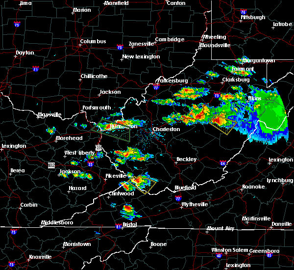 At 418 pm edt, a severe thunderstorm was located near webster springs, moving southeast at 25 mph (radar indicated). Hazards include 60 mph wind gusts and quarter size hail. Hail damage to vehicles is expected. Expect wind damage to roofs, siding, and trees. At 418 pm edt, a severe thunderstorm was located near webster springs, moving southeast at 25 mph (radar indicated). Hazards include 60 mph wind gusts and quarter size hail. Hail damage to vehicles is expected. Expect wind damage to roofs, siding, and trees.
|
| 5/29/2019 1:27 PM EDT |
 The severe thunderstorm warning for west central pocahontas, northeastern nicholas and southern webster counties will expire at 130 pm edt, the storm which prompted the warning has weakened below severe limits, and no longer poses an immediate threat to life or property. therefore, the warning will be allowed to expire. however small hail, gusty winds and heavy rain are still possible with this thunderstorm. a severe thunderstorm watch remains in effect until 700 pm edt for southeastern and northeastern west virginia. The severe thunderstorm warning for west central pocahontas, northeastern nicholas and southern webster counties will expire at 130 pm edt, the storm which prompted the warning has weakened below severe limits, and no longer poses an immediate threat to life or property. therefore, the warning will be allowed to expire. however small hail, gusty winds and heavy rain are still possible with this thunderstorm. a severe thunderstorm watch remains in effect until 700 pm edt for southeastern and northeastern west virginia.
|
| 5/29/2019 1:16 PM EDT |
 At 116 pm edt, a severe thunderstorm was located near addison (webster springs), or near webster springs, moving east at 45 mph (radar indicated). Hazards include 60 mph wind gusts and quarter size hail. Hail damage to vehicles is expected. expect wind damage to roofs, siding, and trees. Locations impacted include, richwood, webster springs, addison (webster springs), camden-on-gauley, camden on gauley, craigsville, cowen, boggs, upper glade and bergoo. At 116 pm edt, a severe thunderstorm was located near addison (webster springs), or near webster springs, moving east at 45 mph (radar indicated). Hazards include 60 mph wind gusts and quarter size hail. Hail damage to vehicles is expected. expect wind damage to roofs, siding, and trees. Locations impacted include, richwood, webster springs, addison (webster springs), camden-on-gauley, camden on gauley, craigsville, cowen, boggs, upper glade and bergoo.
|
| 5/29/2019 12:51 PM EDT |
 At 1251 pm edt, a severe thunderstorm was located near craigsville, or 8 miles northeast of summersville, moving east at 45 mph (radar indicated). Hazards include 60 mph wind gusts and quarter size hail. Hail damage to vehicles is expected. Expect wind damage to roofs, siding, and trees. At 1251 pm edt, a severe thunderstorm was located near craigsville, or 8 miles northeast of summersville, moving east at 45 mph (radar indicated). Hazards include 60 mph wind gusts and quarter size hail. Hail damage to vehicles is expected. Expect wind damage to roofs, siding, and trees.
|
| 5/26/2019 8:40 PM EDT |
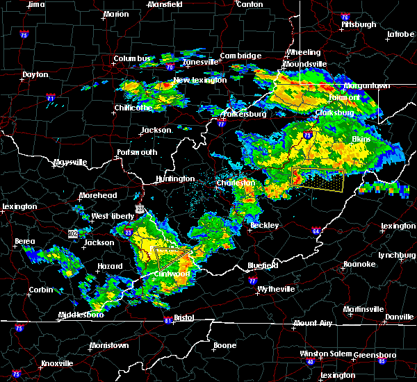 At 839 pm edt, a severe thunderstorm was located near webster springs, moving east at 50 mph (radar indicated). Hazards include 60 mph wind gusts and quarter size hail. Hail damage to vehicles is expected. Expect wind damage to roofs, siding, and trees. At 839 pm edt, a severe thunderstorm was located near webster springs, moving east at 50 mph (radar indicated). Hazards include 60 mph wind gusts and quarter size hail. Hail damage to vehicles is expected. Expect wind damage to roofs, siding, and trees.
|
| 4/14/2019 10:38 PM EDT |
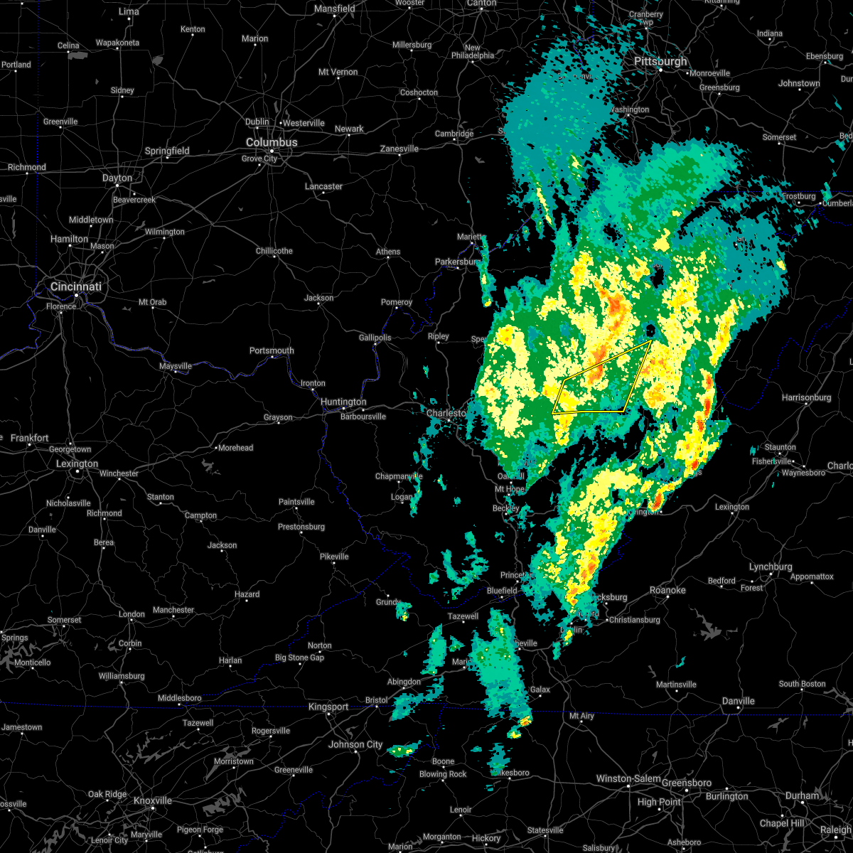 The severe thunderstorm warning for west central randolph, north central nicholas, southeastern braxton, southeastern upshur and webster counties will expire at 1045 pm edt, the storms which prompted the warning have weakened below severe limits, and no longer pose an immediate threat to life or property. therefore, the warning will be allowed to expire. a severe thunderstorm watch remains in effect until 200 am edt for southeastern, north central and northeastern west virginia. The severe thunderstorm warning for west central randolph, north central nicholas, southeastern braxton, southeastern upshur and webster counties will expire at 1045 pm edt, the storms which prompted the warning have weakened below severe limits, and no longer pose an immediate threat to life or property. therefore, the warning will be allowed to expire. a severe thunderstorm watch remains in effect until 200 am edt for southeastern, north central and northeastern west virginia.
|
| 4/14/2019 10:32 PM EDT |
 At 1032 pm edt, severe thunderstorms were located along a line extending from 7 miles southeast of sutton to near birch river to near summersville, moving northeast at 55 mph (radar indicated). Hazards include 60 mph wind gusts. Expect damage to roofs, siding, and trees. Locations impacted include, webster springs, addison (webster springs), birch river, holly river state, cowen, diana, eden, upper glade, helvetia, pickens, waneta, boggs, little birch, hacker valley, bergoo, centralia and erbacon. At 1032 pm edt, severe thunderstorms were located along a line extending from 7 miles southeast of sutton to near birch river to near summersville, moving northeast at 55 mph (radar indicated). Hazards include 60 mph wind gusts. Expect damage to roofs, siding, and trees. Locations impacted include, webster springs, addison (webster springs), birch river, holly river state, cowen, diana, eden, upper glade, helvetia, pickens, waneta, boggs, little birch, hacker valley, bergoo, centralia and erbacon.
|
| 4/14/2019 10:21 PM EDT |
 At 1021 pm edt, severe thunderstorms were located along a line extending from near birch river to 9 miles northwest of craigsville to near summersville, moving northeast at 55 mph (radar indicated). Hazards include 60 mph wind gusts. expect damage to roofs, siding, and trees At 1021 pm edt, severe thunderstorms were located along a line extending from near birch river to 9 miles northwest of craigsville to near summersville, moving northeast at 55 mph (radar indicated). Hazards include 60 mph wind gusts. expect damage to roofs, siding, and trees
|
| 4/14/2019 9:47 PM EDT |
 At 946 pm edt, severe thunderstorms were located along a line extending from near dailey to beartown state park, moving east at 45 mph (radar indicated). Hazards include 70 mph wind gusts. Expect considerable tree damage. damage is likely to mobile homes, roofs, and outbuildings. Locations impacted include, marlinton, cass scenic railroad, greenbank, webster springs, addison (webster springs), mill creek, snowshoe, holly river state, mingo, durbin, hillsboro, huttonsville, alexander, arbovale, cheat bridge, eden, minnehaha springs, helvetia, pickens and waneta. At 946 pm edt, severe thunderstorms were located along a line extending from near dailey to beartown state park, moving east at 45 mph (radar indicated). Hazards include 70 mph wind gusts. Expect considerable tree damage. damage is likely to mobile homes, roofs, and outbuildings. Locations impacted include, marlinton, cass scenic railroad, greenbank, webster springs, addison (webster springs), mill creek, snowshoe, holly river state, mingo, durbin, hillsboro, huttonsville, alexander, arbovale, cheat bridge, eden, minnehaha springs, helvetia, pickens and waneta.
|
| 4/14/2019 9:10 PM EDT |
 At 910 pm edt, severe thunderstorms were located along a line extending from near rock cave to near bingham, moving east at 45 mph (radar indicated). Hazards include 70 mph wind gusts. Expect considerable tree damage. Damage is likely to mobile homes, roofs, and outbuildings. At 910 pm edt, severe thunderstorms were located along a line extending from near rock cave to near bingham, moving east at 45 mph (radar indicated). Hazards include 70 mph wind gusts. Expect considerable tree damage. Damage is likely to mobile homes, roofs, and outbuildings.
|
| 4/14/2019 8:46 PM EDT |
 At 845 pm edt, severe thunderstorms were located along a line extending from near gassaway to 6 miles east of clay to near ansted, moving east at 30 mph (radar indicated). Hazards include 60 mph wind gusts and penny size hail. Expect damage to roofs, siding, and trees. Locations impacted include, summersville, richwood, sutton, clay, webster springs, ansted, gassaway, addison (webster springs), gauley bridge, camden-on-gauley, birch river, hawks nest state park, craigsville, big otter, camden on gauley, holly river state, wallback, harrison, cowen and flatwoods. At 845 pm edt, severe thunderstorms were located along a line extending from near gassaway to 6 miles east of clay to near ansted, moving east at 30 mph (radar indicated). Hazards include 60 mph wind gusts and penny size hail. Expect damage to roofs, siding, and trees. Locations impacted include, summersville, richwood, sutton, clay, webster springs, ansted, gassaway, addison (webster springs), gauley bridge, camden-on-gauley, birch river, hawks nest state park, craigsville, big otter, camden on gauley, holly river state, wallback, harrison, cowen and flatwoods.
|
| 4/14/2019 8:14 PM EDT |
 At 814 pm edt, severe thunderstorms were located along a line extending from 7 miles north of big otter to near glen to near powellton, moving east at 30 mph (radar indicated). Hazards include 60 mph wind gusts and penny size hail. expect damage to roofs, siding, and trees At 814 pm edt, severe thunderstorms were located along a line extending from 7 miles north of big otter to near glen to near powellton, moving east at 30 mph (radar indicated). Hazards include 60 mph wind gusts and penny size hail. expect damage to roofs, siding, and trees
|
| 10/28/2018 8:40 PM EDT |
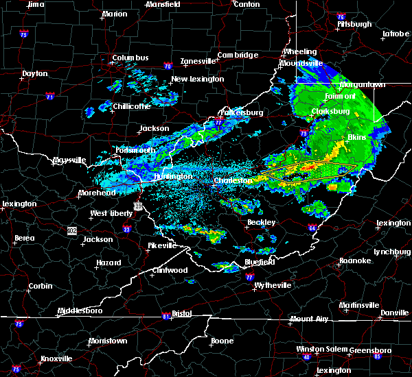 The severe thunderstorm warning for southwestern randolph, northeastern pocahontas, north central nicholas, southeastern braxton, webster and east central clay counties will expire at 845 pm edt, the storms which prompted the warning have weakened below severe limits, and no longer pose an immediate threat to life or property. therefore, the warning will be allowed to expire. however small hail and gusty winds are still possible with these thunderstorms. to report severe weather, contact your nearest law enforcement agency. they will relay your report to the national weather service charleston west virginia. The severe thunderstorm warning for southwestern randolph, northeastern pocahontas, north central nicholas, southeastern braxton, webster and east central clay counties will expire at 845 pm edt, the storms which prompted the warning have weakened below severe limits, and no longer pose an immediate threat to life or property. therefore, the warning will be allowed to expire. however small hail and gusty winds are still possible with these thunderstorms. to report severe weather, contact your nearest law enforcement agency. they will relay your report to the national weather service charleston west virginia.
|
| 10/28/2018 8:34 PM EDT |
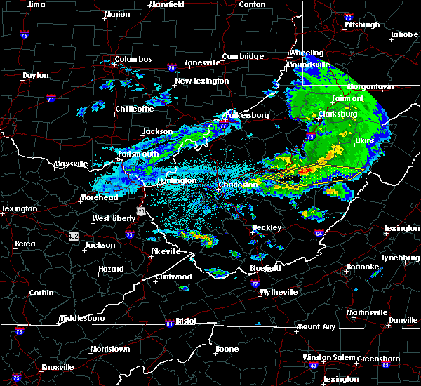 At 834 pm edt, severe thunderstorms were located along a line extending from holly river state to 10 miles southeast of sutton to near birch river, moving east at 50 mph (radar indicated). Hazards include 60 mph wind gusts and quarter size hail. Hail damage to vehicles is expected. expect wind damage to roofs, siding, and trees. Locations impacted include, webster springs, addison (webster springs), birch river, holly river state, harrison, mingo, cowen, durbin, diana, monterville, cheat bridge, upper glade, pickens, waneta, boggs, little birch, hacker valley, valley head, bergoo and centralia. At 834 pm edt, severe thunderstorms were located along a line extending from holly river state to 10 miles southeast of sutton to near birch river, moving east at 50 mph (radar indicated). Hazards include 60 mph wind gusts and quarter size hail. Hail damage to vehicles is expected. expect wind damage to roofs, siding, and trees. Locations impacted include, webster springs, addison (webster springs), birch river, holly river state, harrison, mingo, cowen, durbin, diana, monterville, cheat bridge, upper glade, pickens, waneta, boggs, little birch, hacker valley, valley head, bergoo and centralia.
|
| 10/28/2018 8:20 PM EDT |
 At 819 pm edt, severe thunderstorms were located along a line extending from near holly river state to 9 miles southeast of sutton to near birch river, moving east at 50 mph (radar indicated). Hazards include 60 mph wind gusts and quarter size hail. Hail damage to vehicles is expected. Expect wind damage to roofs, siding, and trees. At 819 pm edt, severe thunderstorms were located along a line extending from near holly river state to 9 miles southeast of sutton to near birch river, moving east at 50 mph (radar indicated). Hazards include 60 mph wind gusts and quarter size hail. Hail damage to vehicles is expected. Expect wind damage to roofs, siding, and trees.
|
| 7/22/2017 9:24 PM EDT |
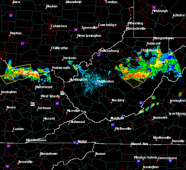 The severe thunderstorm warning for southwestern randolph, southwestern upshur and northern webster counties will expire at 930 pm edt, the storm which prompted the warning has weakened below severe limits, and no longer poses an immediate threat to life or property. therefore the warning will be allowed to expire. however gusty winds and heavy rain are still possible with this thunderstorm. a severe thunderstorm watch remains in effect until 1000 pm edt for north central and northeastern west virginia. The severe thunderstorm warning for southwestern randolph, southwestern upshur and northern webster counties will expire at 930 pm edt, the storm which prompted the warning has weakened below severe limits, and no longer poses an immediate threat to life or property. therefore the warning will be allowed to expire. however gusty winds and heavy rain are still possible with this thunderstorm. a severe thunderstorm watch remains in effect until 1000 pm edt for north central and northeastern west virginia.
|
| 7/22/2017 9:14 PM EDT |
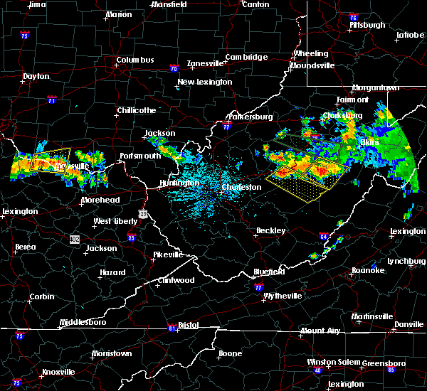 At 914 pm edt, a severe thunderstorm was located near holly river state, or 9 miles northeast of webster springs, moving southeast at 25 mph (radar indicated). Hazards include 60 mph wind gusts. Expect damage to roofs, siding, and trees. locations impacted include, webster springs, addison (webster springs), holly river state, diana, monterville, eden, helvetia, pickens, cleveland, waneta, hacker valley, kanawha head and bergoo. At 914 pm edt, a severe thunderstorm was located near holly river state, or 9 miles northeast of webster springs, moving southeast at 25 mph (radar indicated). Hazards include 60 mph wind gusts. Expect damage to roofs, siding, and trees. locations impacted include, webster springs, addison (webster springs), holly river state, diana, monterville, eden, helvetia, pickens, cleveland, waneta, hacker valley, kanawha head and bergoo.
|
| 7/22/2017 8:45 PM EDT |
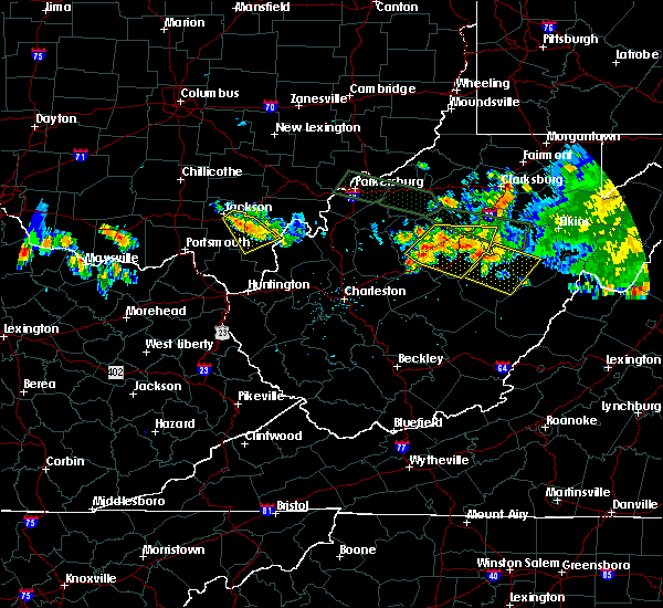 At 845 pm edt, a severe thunderstorm was located 9 miles west of holly river state, or 11 miles east of sutton, moving east at 30 mph (radar indicated). Hazards include 60 mph wind gusts and half dollar size hail. Hail damage to vehicles is expected. Expect wind damage to roofs, siding, and trees. At 845 pm edt, a severe thunderstorm was located 9 miles west of holly river state, or 11 miles east of sutton, moving east at 30 mph (radar indicated). Hazards include 60 mph wind gusts and half dollar size hail. Hail damage to vehicles is expected. Expect wind damage to roofs, siding, and trees.
|
| 3/1/2017 10:44 AM EST |
 At 1043 am est, severe thunderstorms were located along a line extending from 6 miles west of holly river state to near pineville, moving east at 65 mph (radar indicated). Hazards include 70 mph wind gusts. Expect considerable tree damage. Damage is likely to mobile homes, roofs, and outbuildings. At 1043 am est, severe thunderstorms were located along a line extending from 6 miles west of holly river state to near pineville, moving east at 65 mph (radar indicated). Hazards include 70 mph wind gusts. Expect considerable tree damage. Damage is likely to mobile homes, roofs, and outbuildings.
|
| 6/16/2016 6:23 PM EDT |
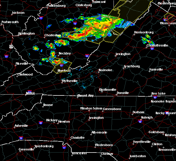 At 622 pm edt, severe thunderstorms were located along a line extending from 6 miles southeast of holly river state to near addison (webster springs) to near camden on gauley, moving east at 65 mph (radar indicated). Hazards include 70 mph wind gusts. Expect considerable tree damage. Damage is likely to mobile homes, roofs, and outbuildings. At 622 pm edt, severe thunderstorms were located along a line extending from 6 miles southeast of holly river state to near addison (webster springs) to near camden on gauley, moving east at 65 mph (radar indicated). Hazards include 70 mph wind gusts. Expect considerable tree damage. Damage is likely to mobile homes, roofs, and outbuildings.
|
| 6/4/2016 4:43 PM EDT | The severe thunderstorm warning for west central pocahontas, southwestern randolph and east central webster counties will expire at 445 pm edt, the storm which prompted the warning has weakened below severe limits, and no longer poses an immediate threat to life or property. therefore the warning will be allowed to expire. however small hail, gusty winds and heavy rain are still possible with this thunderstorm. |
| 6/4/2016 4:31 PM EDT |
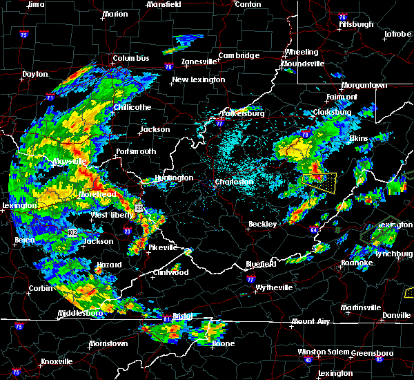 At 430 pm edt, a severe thunderstorm was located near addison (webster springs), or 7 miles east of webster springs, moving east at 35 mph (radar indicated). Hazards include 60 mph wind gusts and half dollar size hail. Hail damage to vehicles is expected. expect wind damage to roofs, siding, and trees. Locations impacted include, webster springs, addison (webster springs), mingo, edray, bergoo and slaty fork. At 430 pm edt, a severe thunderstorm was located near addison (webster springs), or 7 miles east of webster springs, moving east at 35 mph (radar indicated). Hazards include 60 mph wind gusts and half dollar size hail. Hail damage to vehicles is expected. expect wind damage to roofs, siding, and trees. Locations impacted include, webster springs, addison (webster springs), mingo, edray, bergoo and slaty fork.
|
| 6/4/2016 4:13 PM EDT |
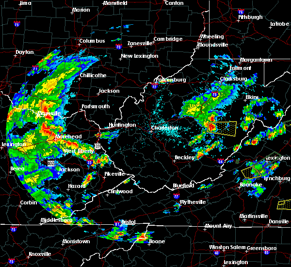 At 413 pm edt, a severe thunderstorm was located near webster springs, moving east at 45 mph (radar indicated). Hazards include 60 mph wind gusts and half dollar size hail. Hail damage to vehicles is expected. Expect wind damage to roofs, siding, and trees. At 413 pm edt, a severe thunderstorm was located near webster springs, moving east at 45 mph (radar indicated). Hazards include 60 mph wind gusts and half dollar size hail. Hail damage to vehicles is expected. Expect wind damage to roofs, siding, and trees.
|
| 7/14/2015 7:02 PM EDT |
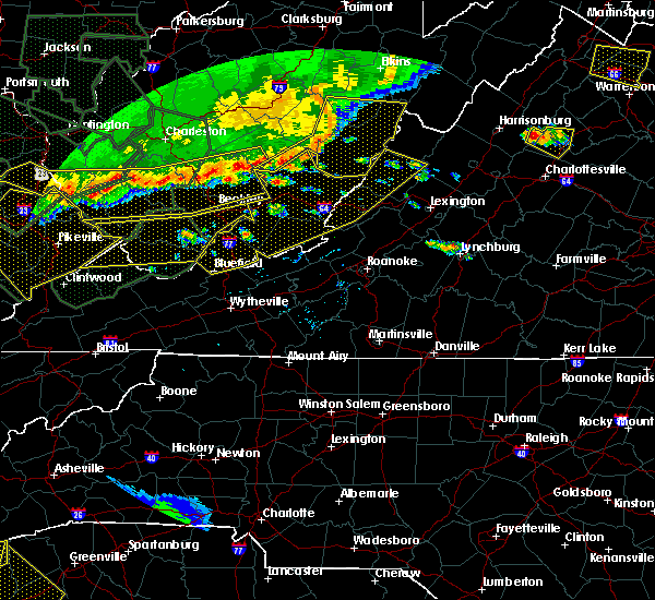 At 701 pm edt, doppler radar indicated a line of severe thunderstorms capable of producing damaging winds in excess of 60 mph. these storms were located along a line extending from 6 miles east of holly river state to 13 miles northwest of cass scenic railroad to 9 miles southwest of snowshoe to 10 miles northeast of leonard to 6 miles north of quinwood, moving east at 40 mph. locations impacted include, richwood, marlinton, cass scenic railroad, greenbank, snowshoe, mingo, durbin, hillsboro, nettie, waneta, cheat bridge, frost, pickens, valley head, monterville, buckeye, cranberry mountain nature center, boyer, slaty fork and arbovale. At 701 pm edt, doppler radar indicated a line of severe thunderstorms capable of producing damaging winds in excess of 60 mph. these storms were located along a line extending from 6 miles east of holly river state to 13 miles northwest of cass scenic railroad to 9 miles southwest of snowshoe to 10 miles northeast of leonard to 6 miles north of quinwood, moving east at 40 mph. locations impacted include, richwood, marlinton, cass scenic railroad, greenbank, snowshoe, mingo, durbin, hillsboro, nettie, waneta, cheat bridge, frost, pickens, valley head, monterville, buckeye, cranberry mountain nature center, boyer, slaty fork and arbovale.
|
| 7/14/2015 6:30 PM EDT |
 At 629 pm edt, doppler radar indicated a line of severe thunderstorms capable of producing damaging winds in excess of 60 mph. these storms were located along a line extending from 10 miles south of stonewall jackson to near craigsville to near pratt, moving east at 60 mph. locations impacted include, summersville, fayetteville, richwood, sutton, webster springs, oak hill, montgomery, ansted, cedar grove, east bank, gassaway, glasgow, smithers, addison (webster springs), gauley bridge, pratt, camden-on-gauley, craigsville, camden on gauley and birch river. At 629 pm edt, doppler radar indicated a line of severe thunderstorms capable of producing damaging winds in excess of 60 mph. these storms were located along a line extending from 10 miles south of stonewall jackson to near craigsville to near pratt, moving east at 60 mph. locations impacted include, summersville, fayetteville, richwood, sutton, webster springs, oak hill, montgomery, ansted, cedar grove, east bank, gassaway, glasgow, smithers, addison (webster springs), gauley bridge, pratt, camden-on-gauley, craigsville, camden on gauley and birch river.
|
| 7/14/2015 6:23 PM EDT |
 At 622 pm edt, doppler radar indicated a line of severe thunderstorms capable of producing damaging winds in excess of 60 mph. these storms were located along a line extending from 6 miles southeast of sutton to near camden on gauley to 8 miles west of summersville, and moving southeast at 50 mph. At 622 pm edt, doppler radar indicated a line of severe thunderstorms capable of producing damaging winds in excess of 60 mph. these storms were located along a line extending from 6 miles southeast of sutton to near camden on gauley to 8 miles west of summersville, and moving southeast at 50 mph.
|
| 7/14/2015 5:48 PM EDT |
 At 547 pm edt, doppler radar indicated a line of severe thunderstorms capable of producing damaging winds in excess of 60 mph. these storms were located along a line extending from near arnoldsburg to amma to cross lanes, and moving east at 50 mph. At 547 pm edt, doppler radar indicated a line of severe thunderstorms capable of producing damaging winds in excess of 60 mph. these storms were located along a line extending from near arnoldsburg to amma to cross lanes, and moving east at 50 mph.
|
| 6/26/2015 9:57 PM EDT | At 956 pm edt, doppler radar indicated a line of severe thunderstorms capable of producing quarter size hail and damaging winds in excess of 60 mph. these storms were located along a line extending from 9 miles south of audra state park to near camden on gauley, moving east at 35 mph. locations impacted include, elkins, webster springs, addison (webster springs), mill creek, camden-on-gauley, holly river state, dailey, camden on gauley, mingo, beverly, cowen, junior, womelsdorf (coalton), huttonsville, diana, waneta, hacker valley, tallmansville, pickens and bowden. |
| 6/26/2015 9:25 PM EDT | At 924 pm edt, doppler radar indicated a line of severe thunderstorms capable of producing quarter size hail and damaging winds in excess of 60 mph. these storms were located along a line extending from near rock cave to near summersville, and moving east at 35 mph. |
| 6/21/2015 6:40 PM EDT |
 At 637 pm edt, doppler radar indicated a severe thunderstorm capable of producing half dollar size hail and damaging winds in excess of 60 mph. this storm was located near webster springs, moving southeast at 35 mph. locations impacted include, webster springs, addison (webster springs), erbacon, diana, waneta and bergoo. At 637 pm edt, doppler radar indicated a severe thunderstorm capable of producing half dollar size hail and damaging winds in excess of 60 mph. this storm was located near webster springs, moving southeast at 35 mph. locations impacted include, webster springs, addison (webster springs), erbacon, diana, waneta and bergoo.
|
| 6/21/2015 6:14 PM EDT |
 At 614 pm edt, doppler radar indicated a severe thunderstorm capable of producing half dollar size hail and damaging winds in excess of 60 mph. this storm was located near sutton, and moving east at 25 mph. At 614 pm edt, doppler radar indicated a severe thunderstorm capable of producing half dollar size hail and damaging winds in excess of 60 mph. this storm was located near sutton, and moving east at 25 mph.
|
| 4/10/2015 10:32 AM EDT | A severe thunderstorm warning remains in effect until 1100 am edt for central webster. southwestern randolph and central pocahontas counties. at 1029 am edt. national weather service doppler radar continued to indicate a severe thunderstorm capable of producing quarter size hail. and damaging winds in excess of 60 mph. This storm was. |
| 4/10/2015 10:16 AM EDT | The national weather service in charleston has issued a * severe thunderstorm warning for. west central pocahontas county in west virginia. southwestern randolph county in west virginia. central webster county in west virginia. This includes the city of webster springs. |
Hail Maps for Bergoo, WV


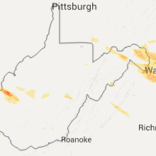


Connect with Interactive Hail Maps