

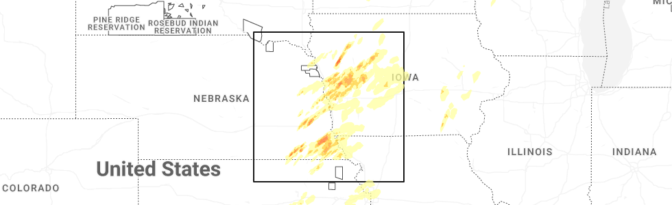
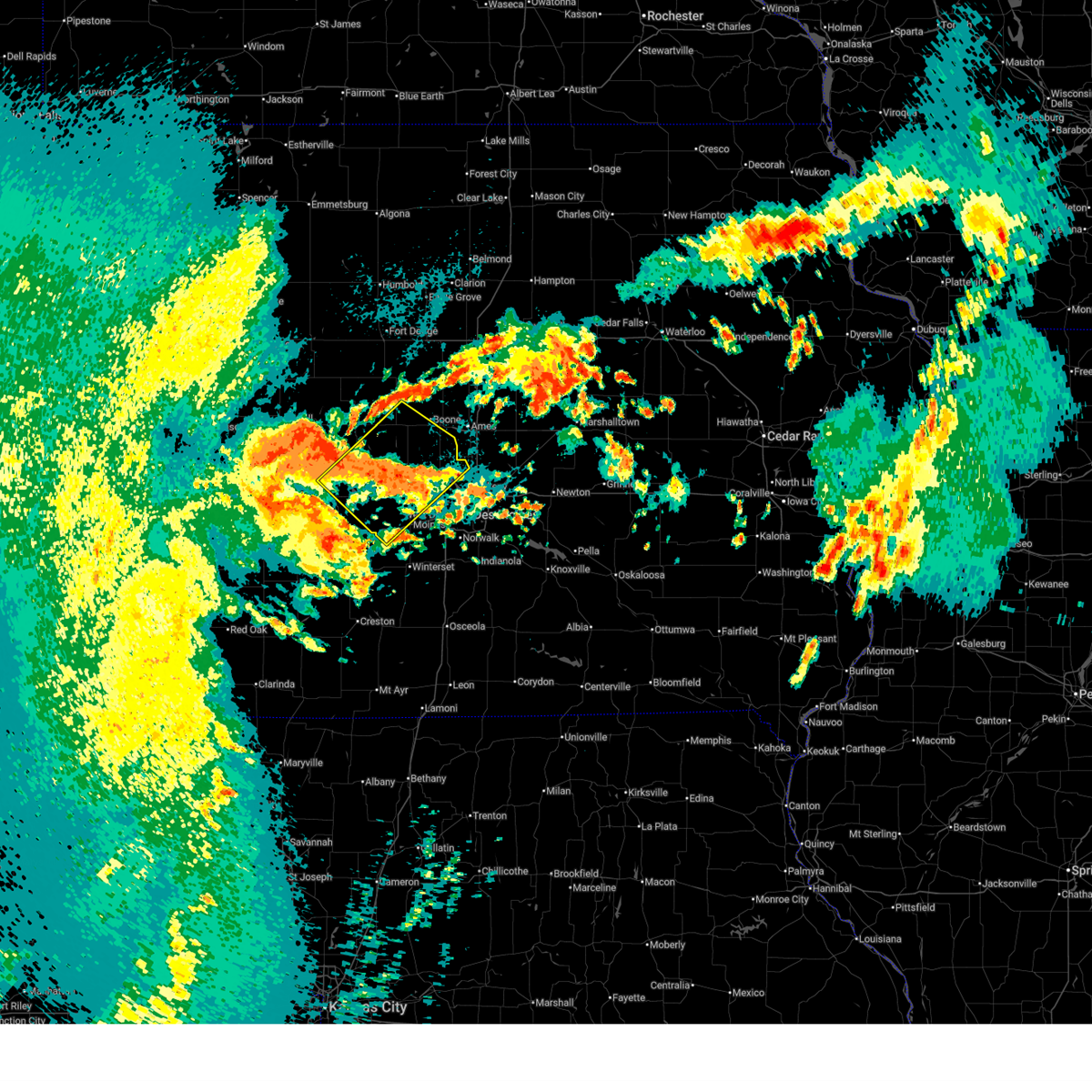
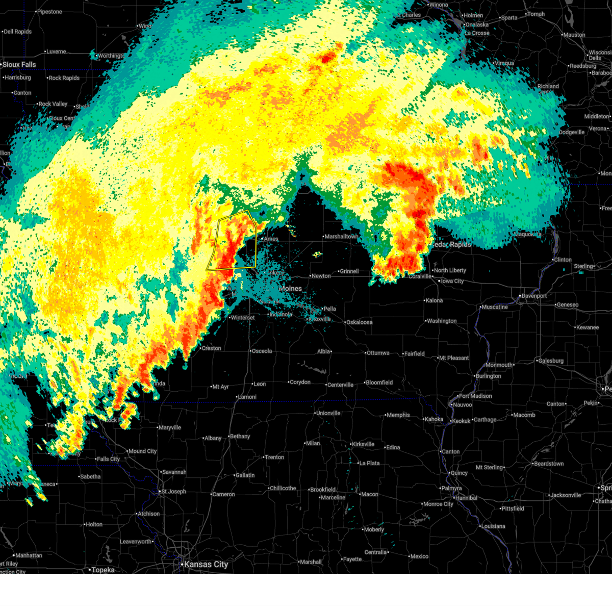
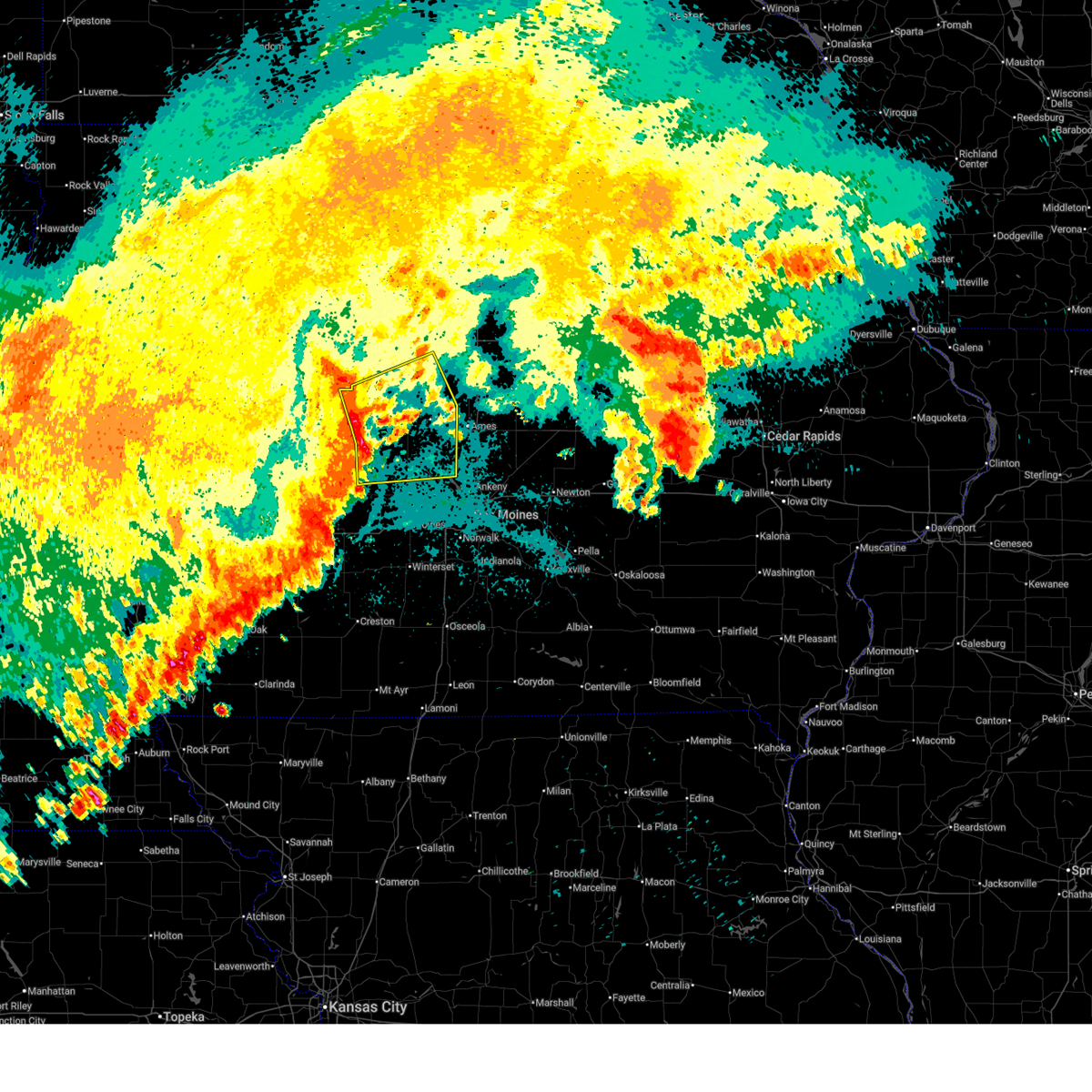
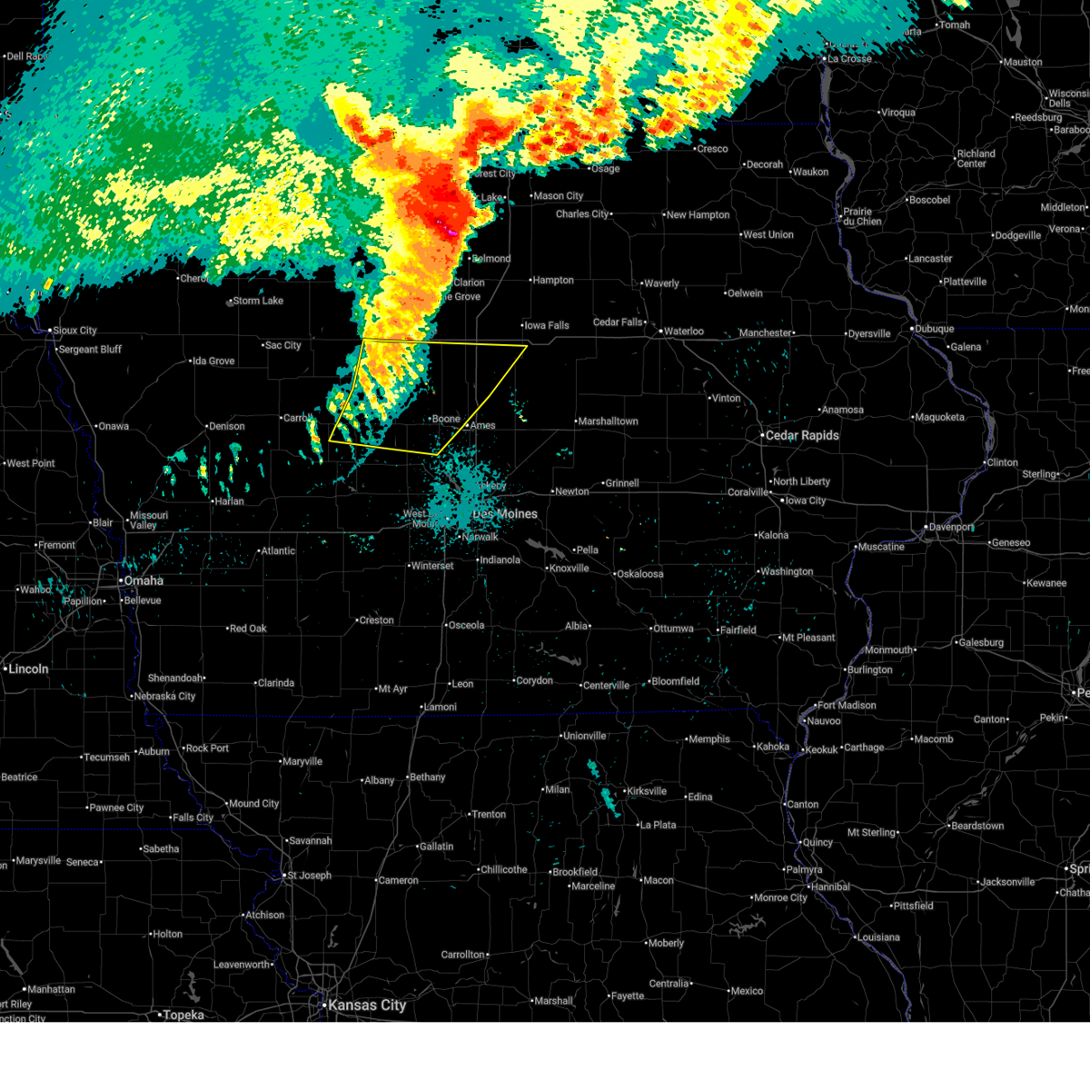
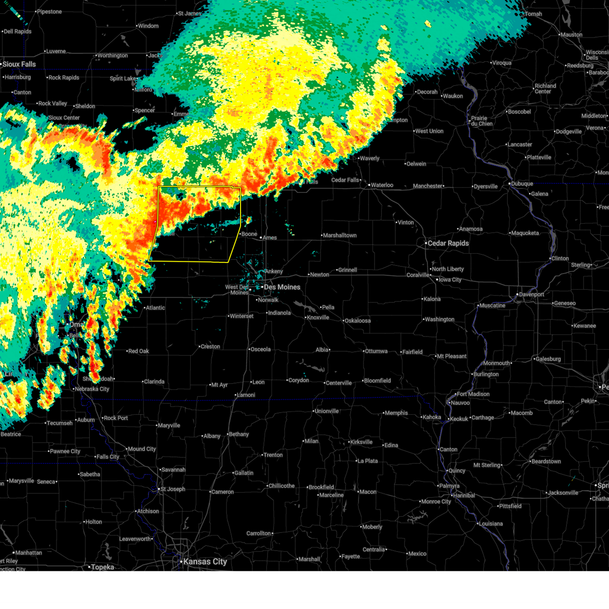
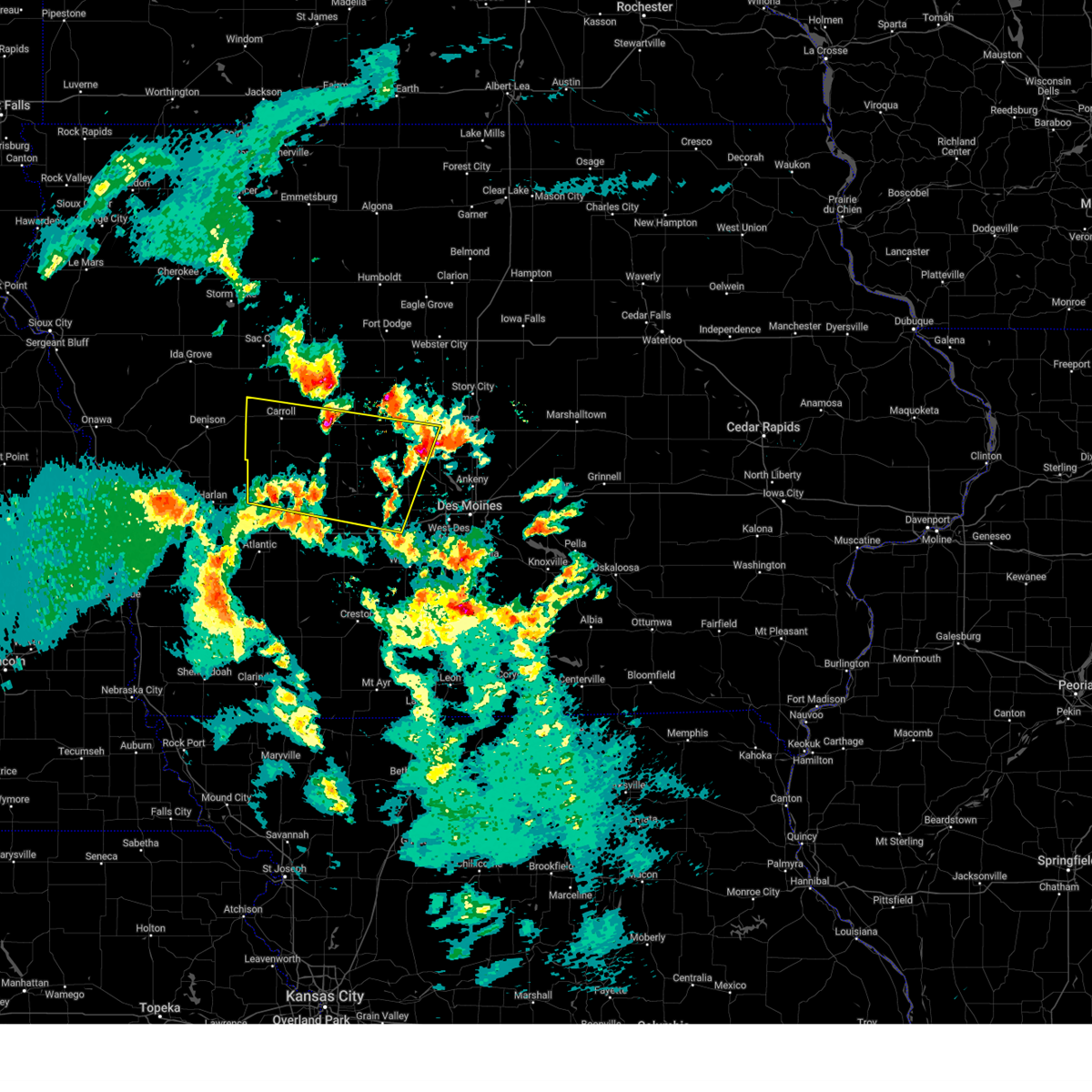
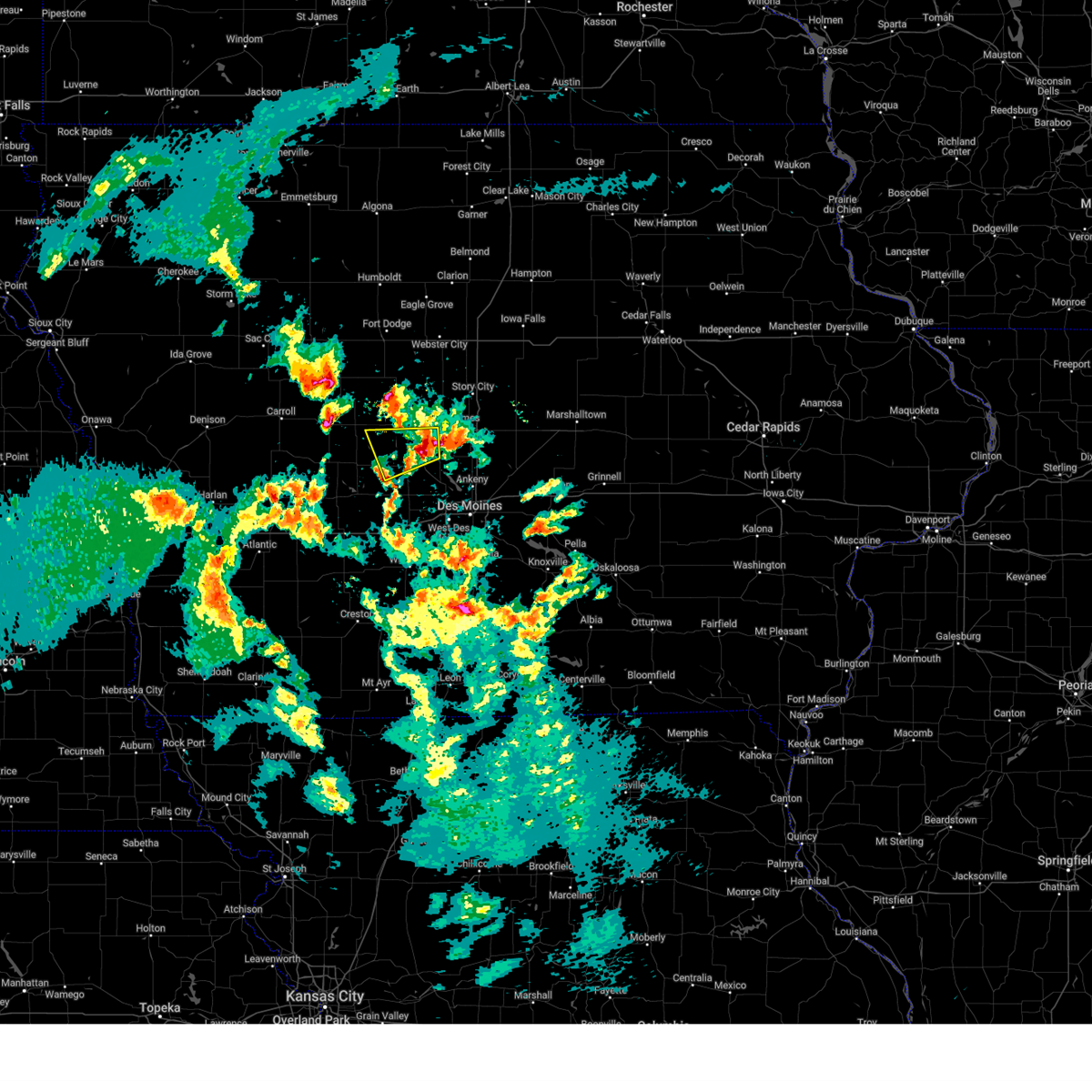
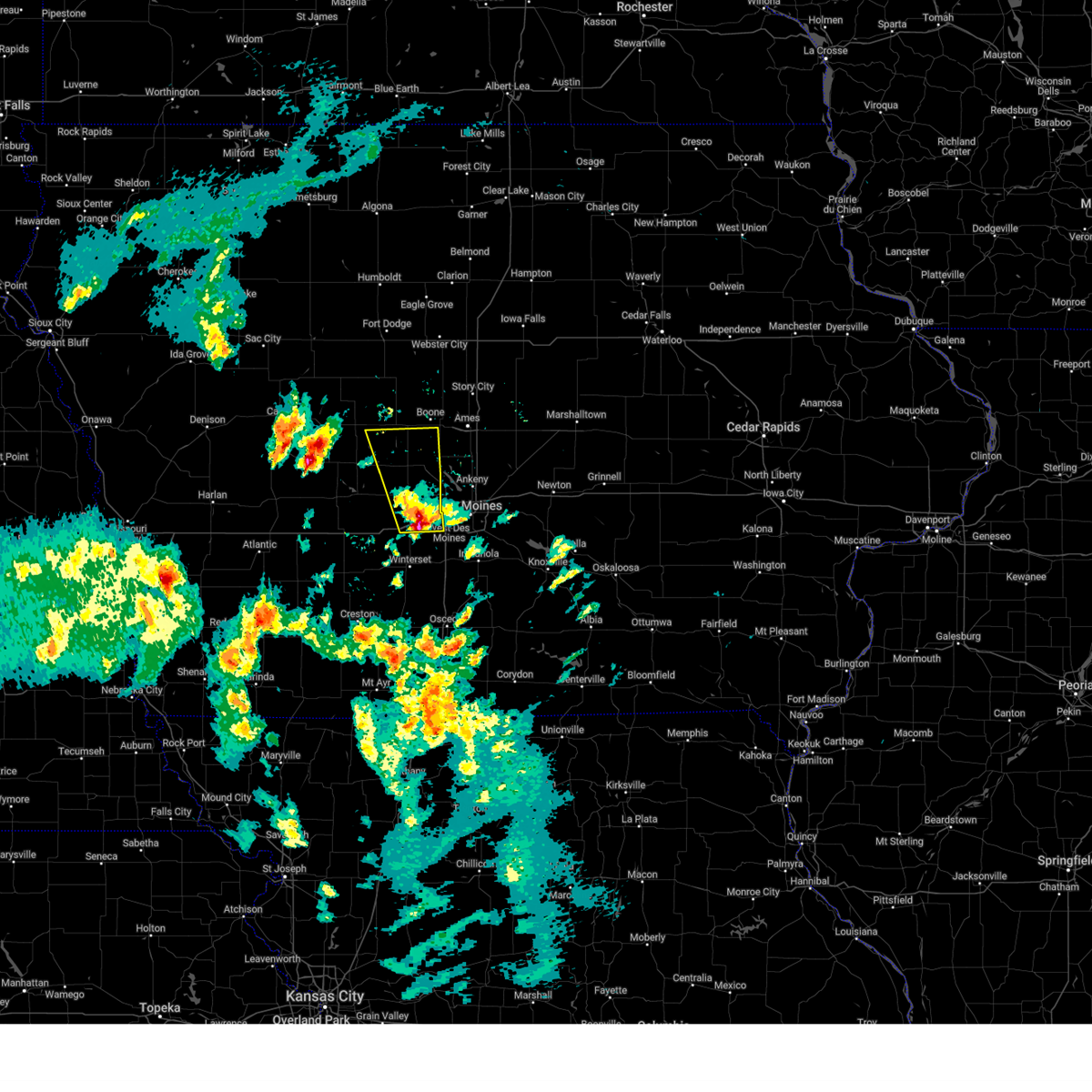
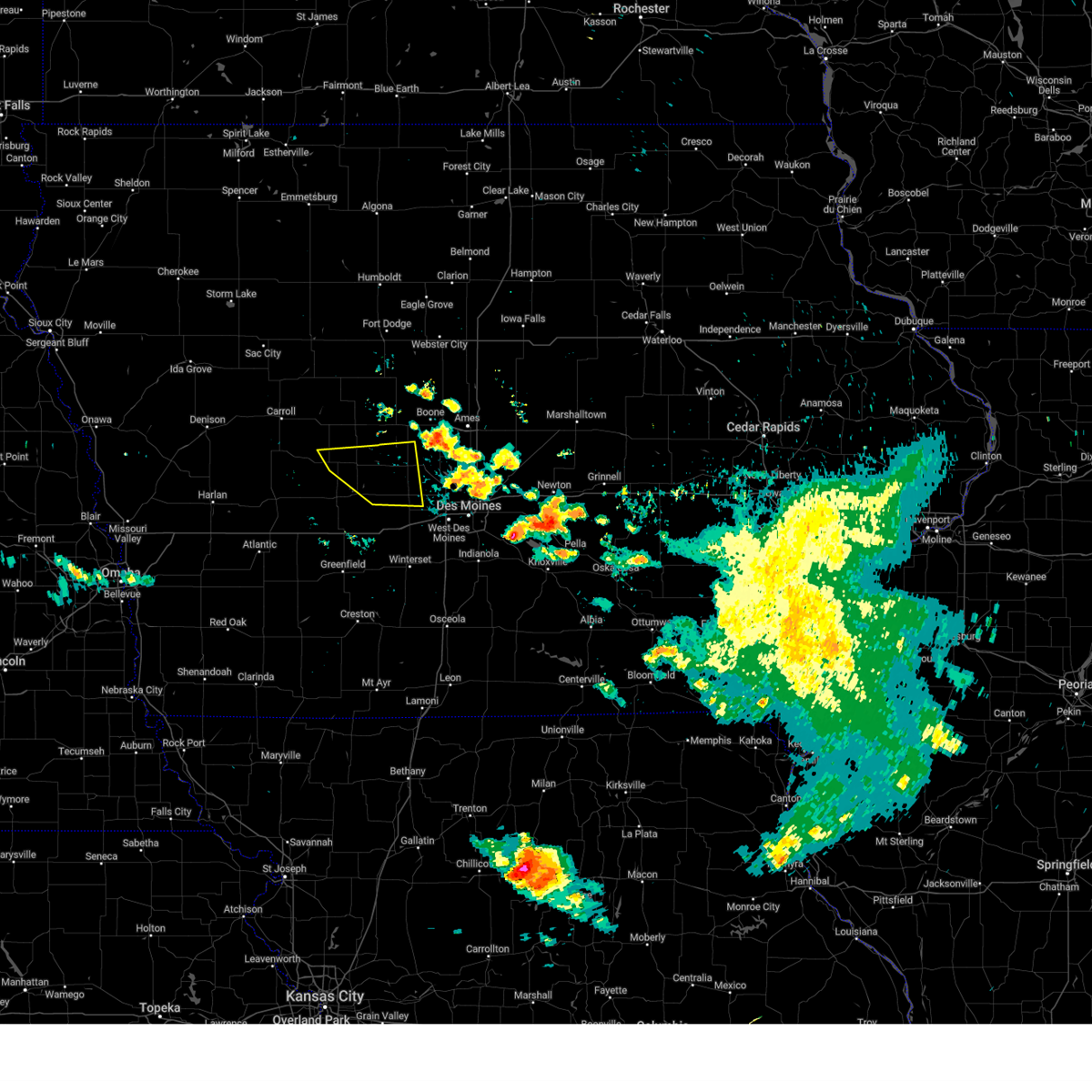
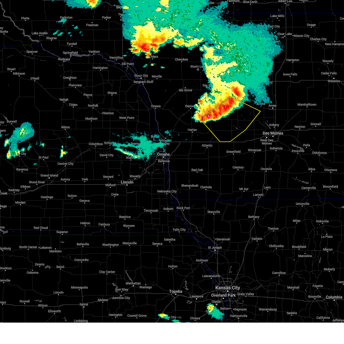
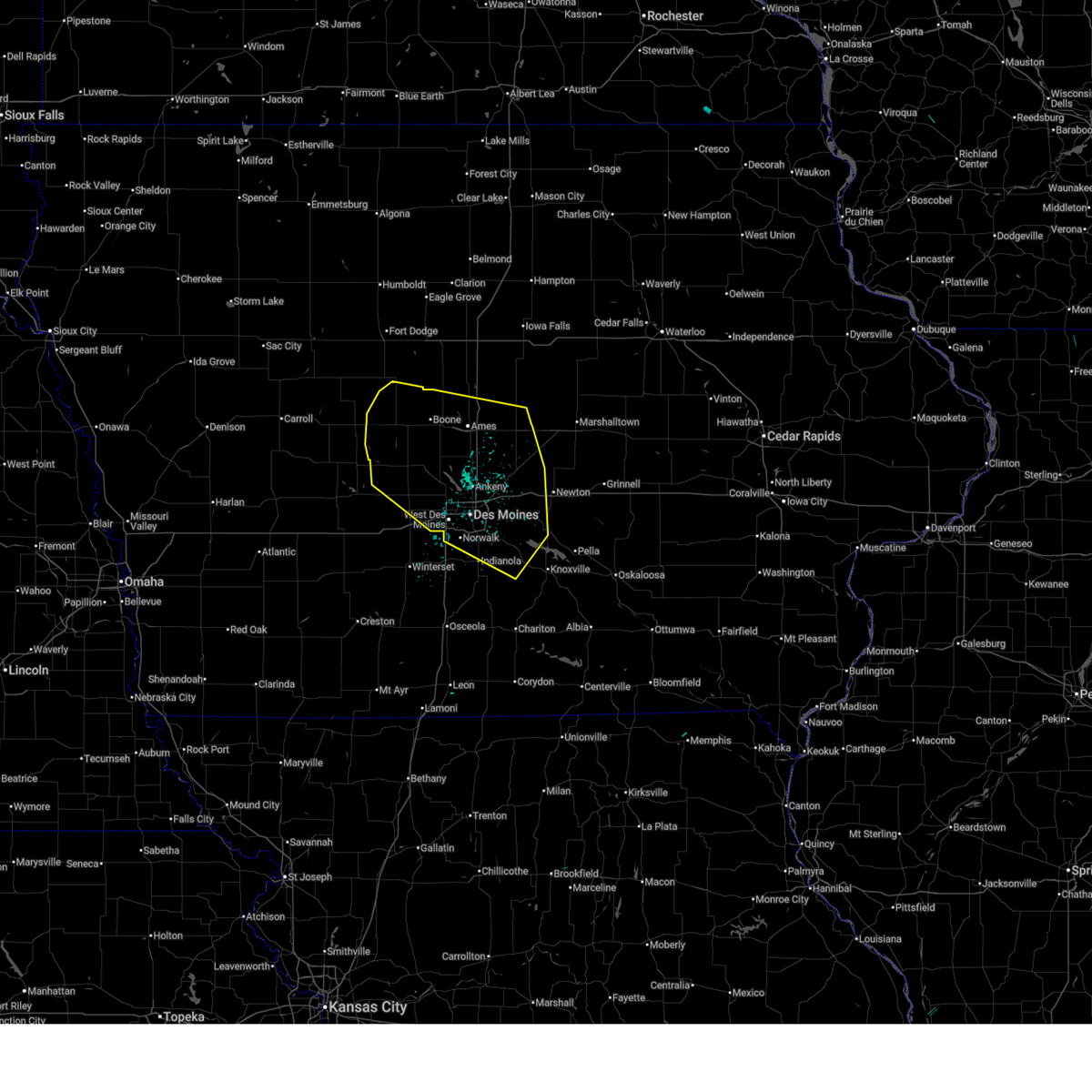
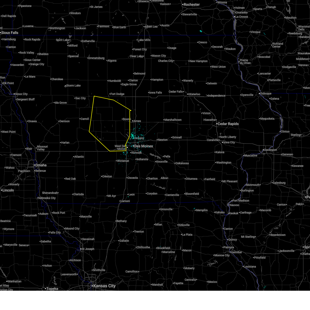
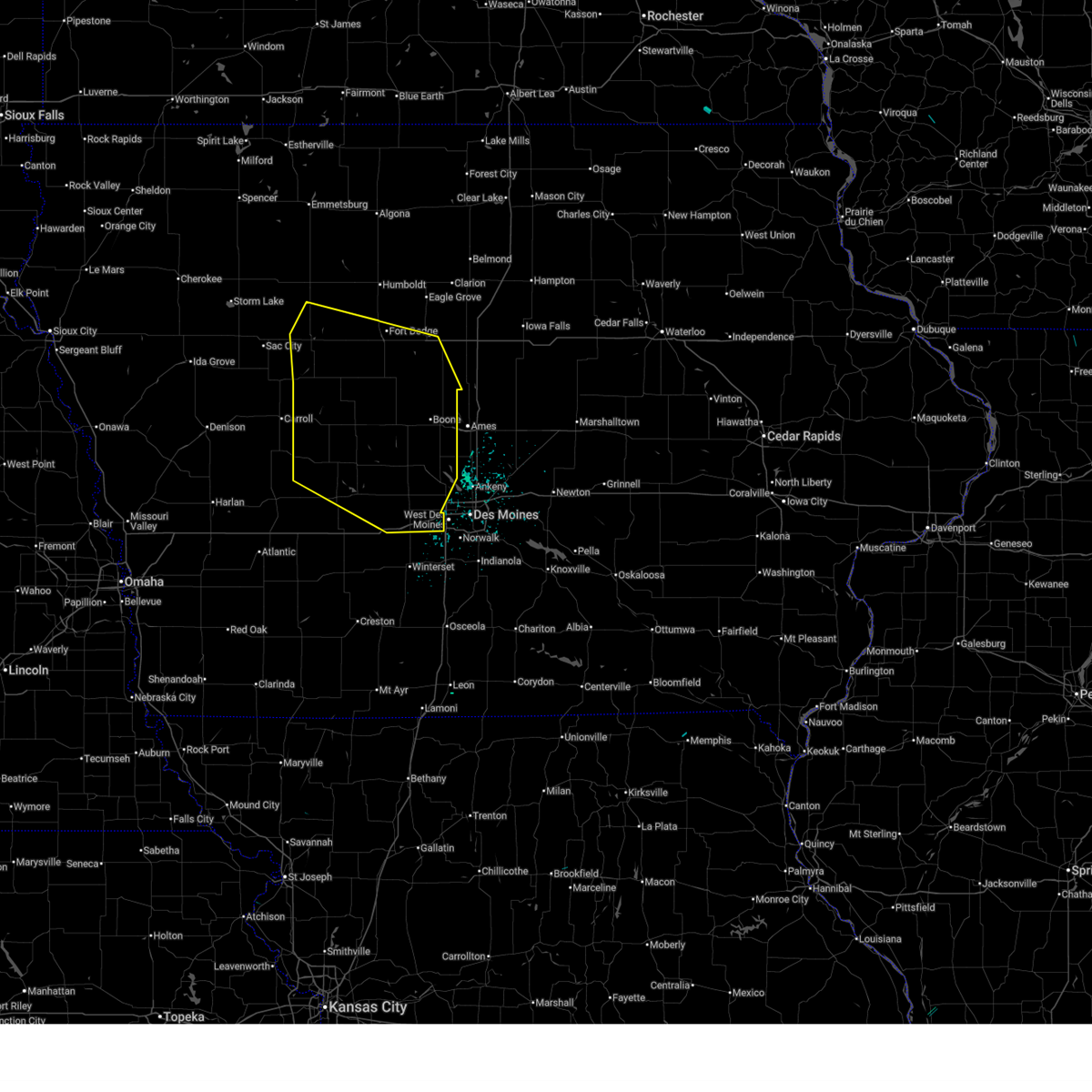
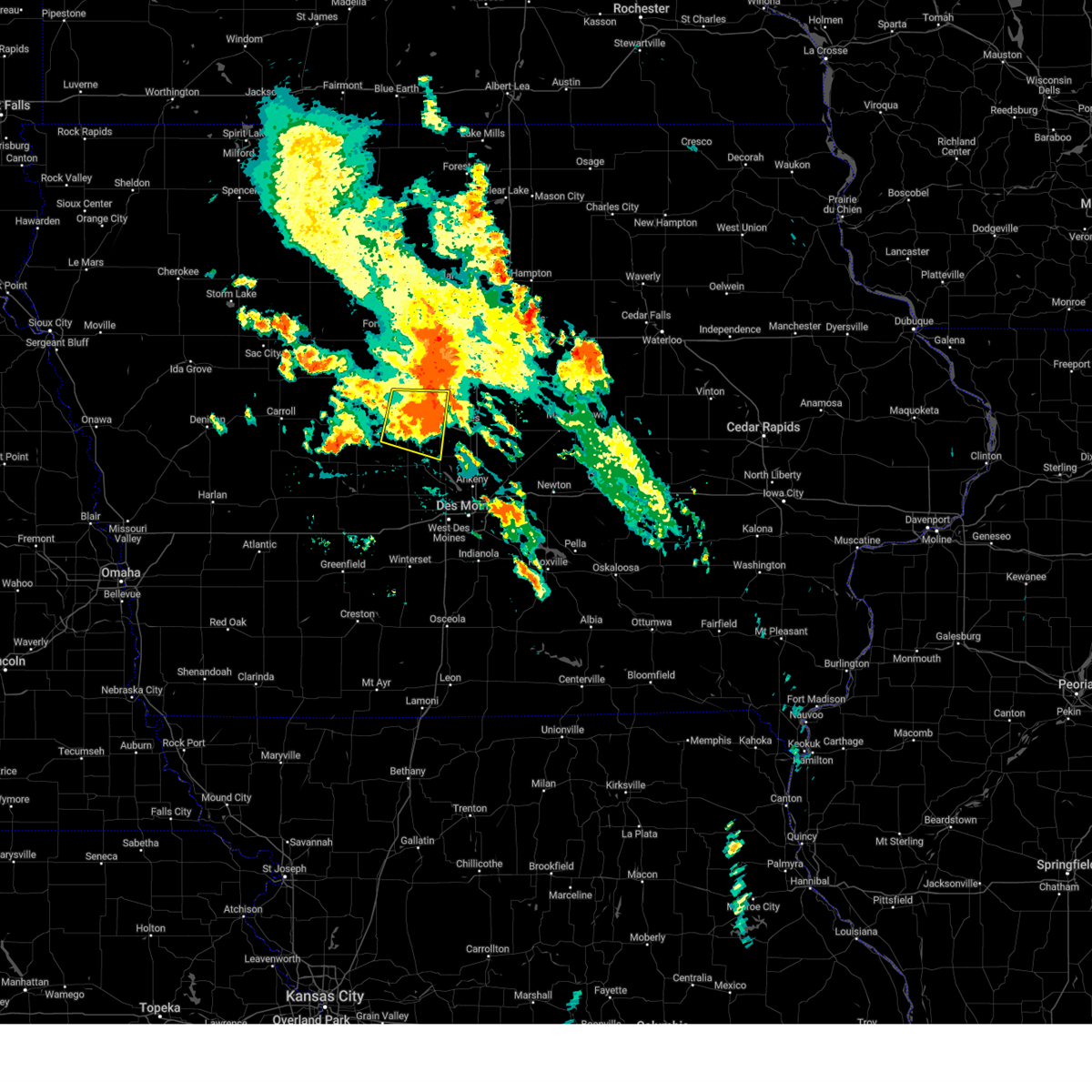
Hail Map for Berkley, IA
The Berkley, IA area has had 0 reports of on-the-ground hail by trained spotters, and has been under severe weather warnings 20 times during the past 12 months. Doppler radar has detected hail at or near Berkley, IA on 74 occasions, including 4 occasions during the past year.
| Name: | Berkley, IA |
| Where Located: | 35.6 miles NW of Des Moines, IA |
| Map: | Google Map for Berkley, IA |
| Population: | 32 |
| Housing Units: | 14 |
| More Info: | Search Google for Berkley, IA |
2
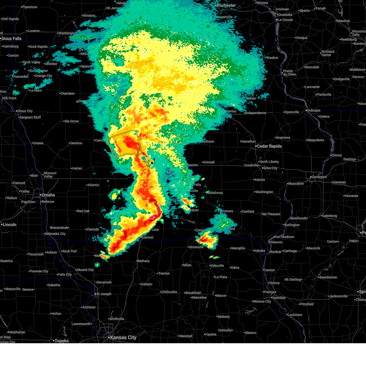
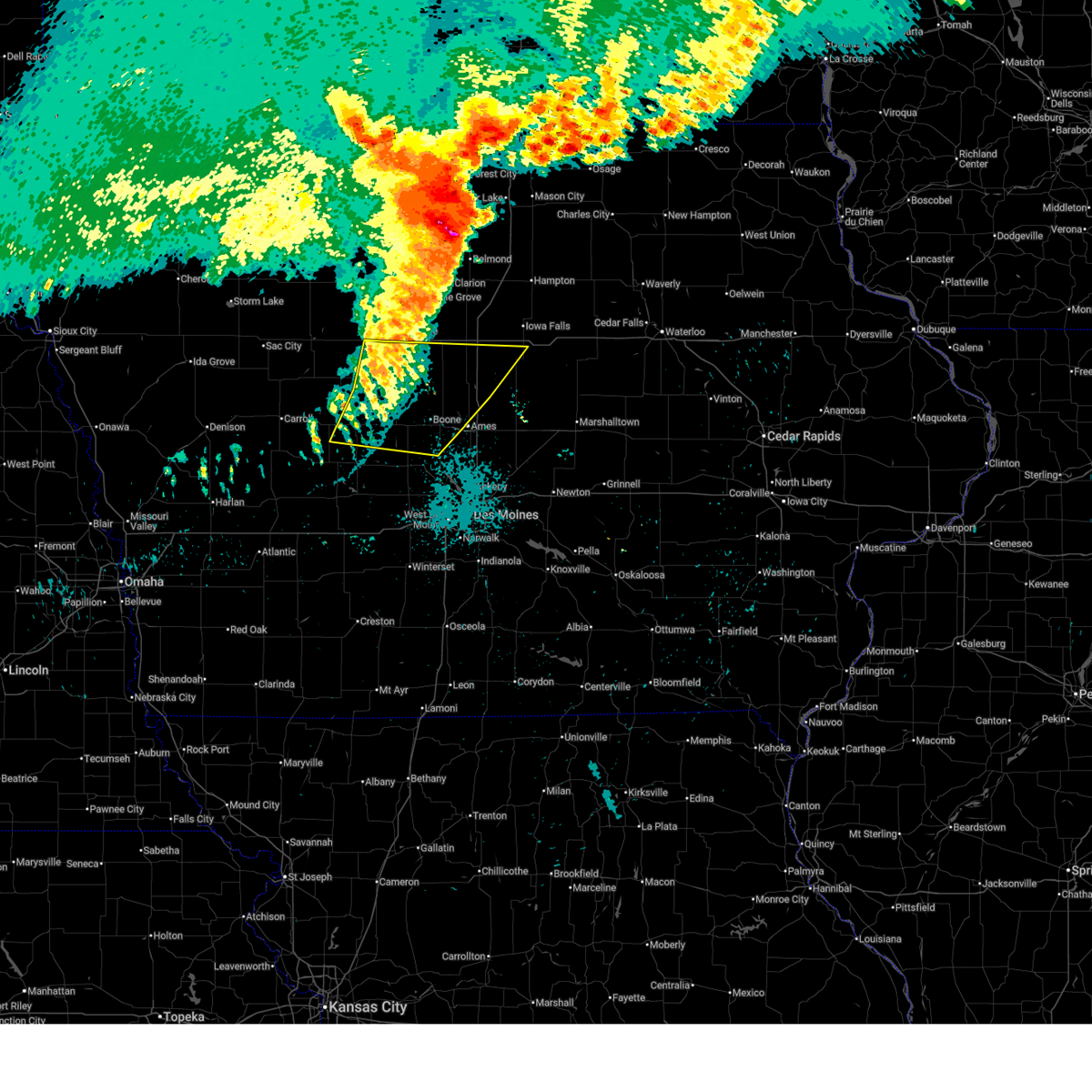
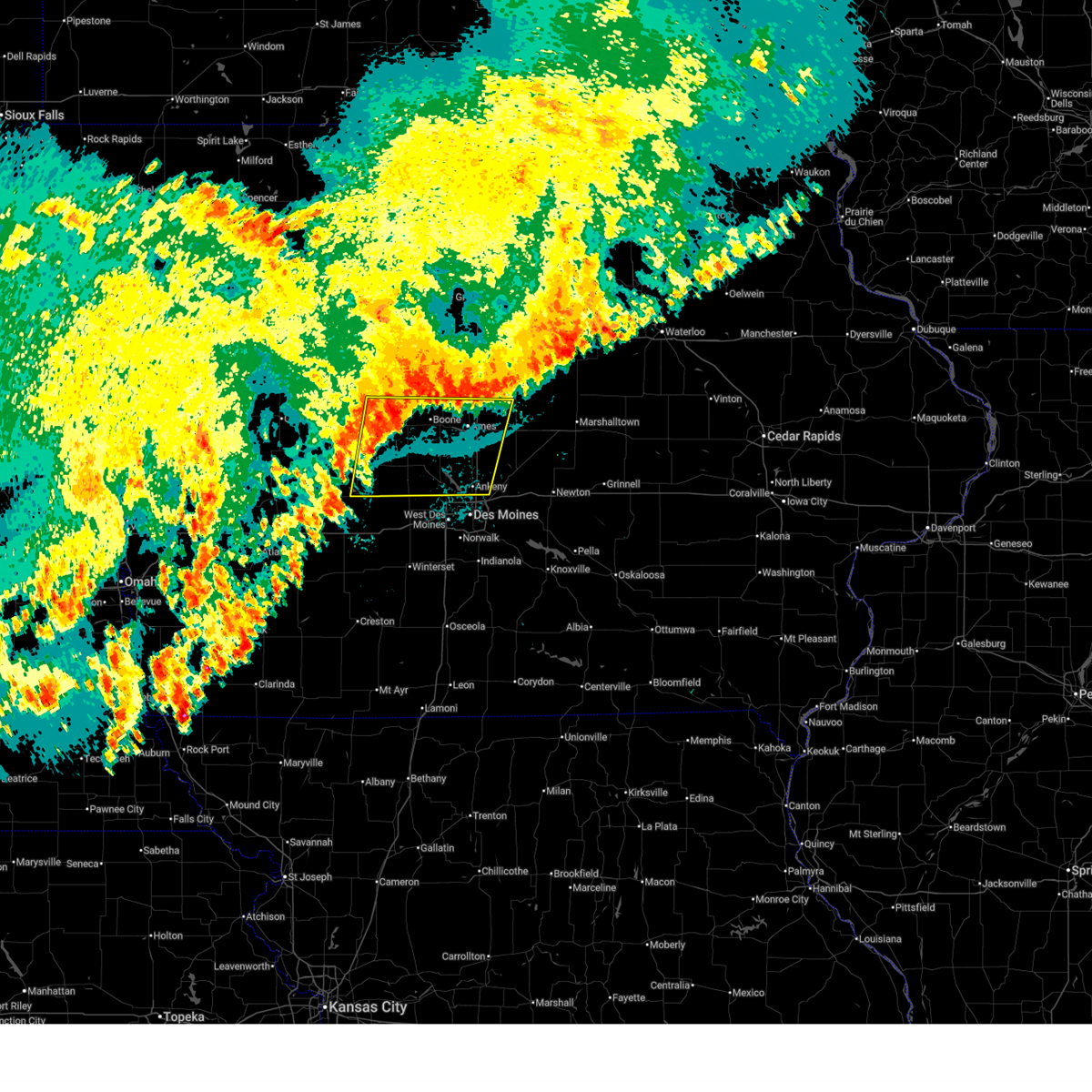
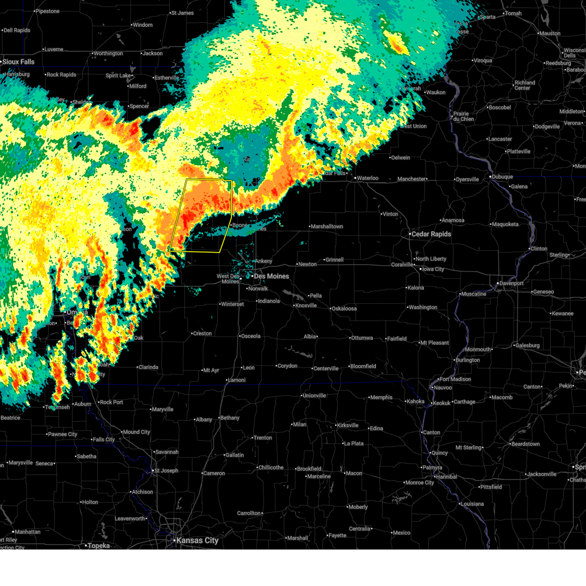
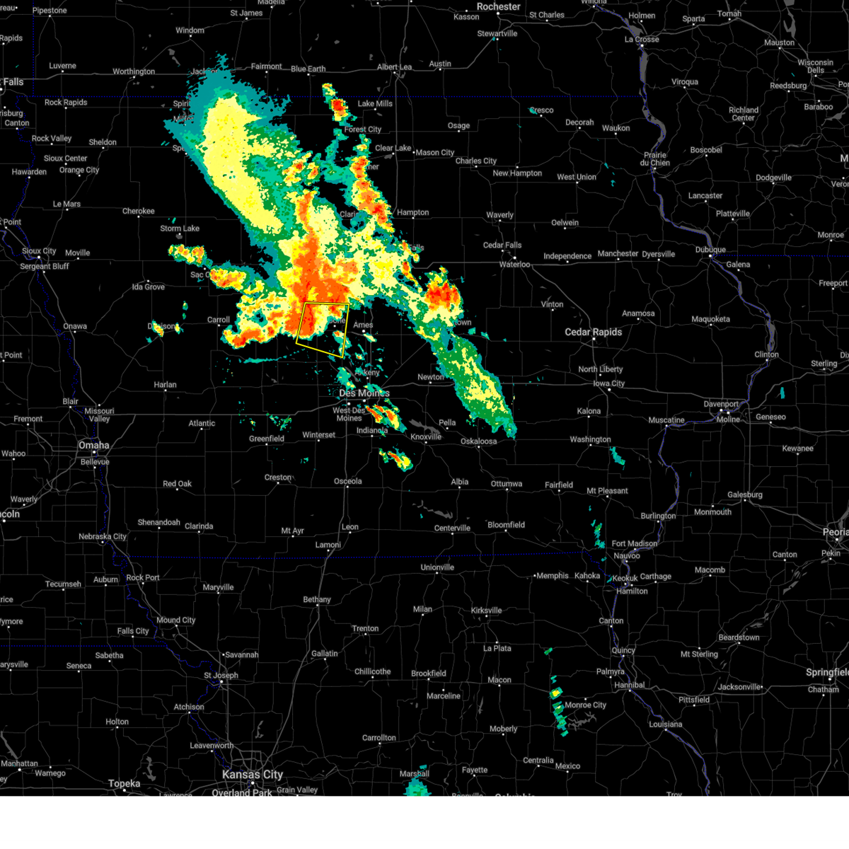
The Top Recent Hail Date for Berkley, IA is Thursday, April 23, 2026 (5th out of 74)
Hail and Wind Damage Spotted near Berkley, IA
| Date / Time | Report Details |
|---|---|
| 6/11/2026 7:22 AM CDT |
 At 721 am cdt, a severe thunderstorm was located over berkley, or 10 miles north of perry, moving east at 50 mph (trained weather spotters). Hazards include 60 mph wind gusts and nickel size hail. Expect damage to roofs, siding, and trees. Locations impacted include, jefferson, ogden, grand junction, scranton, bagley, rippey, paton, jamaica, boxholm, pilot mound, dana, beaver, berkley, and jefferson municipal airport. At 721 am cdt, a severe thunderstorm was located over berkley, or 10 miles north of perry, moving east at 50 mph (trained weather spotters). Hazards include 60 mph wind gusts and nickel size hail. Expect damage to roofs, siding, and trees. Locations impacted include, jefferson, ogden, grand junction, scranton, bagley, rippey, paton, jamaica, boxholm, pilot mound, dana, beaver, berkley, and jefferson municipal airport.
|
| 5/17/2026 9:59 PM CDT |
 At 959 pm cdt, severe thunderstorms were located along a line extending from boxholm to near jamaica to 7 miles northeast of exira to 4 miles northwest of anita, moving southeast at 30 mph (radar indicated). Hazards include 60 mph wind gusts. Expect damage to roofs, siding, and trees. Locations impacted include, boone, carroll, perry, jefferson, audubon, guthrie center, ogden, lake city, coon rapids, glidden, panora, gowrie, lake panorama, boone speedway, exira, dayton, grand junction, adair, stratford, and elk horn. At 959 pm cdt, severe thunderstorms were located along a line extending from boxholm to near jamaica to 7 miles northeast of exira to 4 miles northwest of anita, moving southeast at 30 mph (radar indicated). Hazards include 60 mph wind gusts. Expect damage to roofs, siding, and trees. Locations impacted include, boone, carroll, perry, jefferson, audubon, guthrie center, ogden, lake city, coon rapids, glidden, panora, gowrie, lake panorama, boone speedway, exira, dayton, grand junction, adair, stratford, and elk horn.
|
| 5/17/2026 9:26 PM CDT |
 Svrdmx the national weather service in des moines has issued a * severe thunderstorm warning for, greene county in west central iowa, southern webster county in central iowa, guthrie county in west central iowa, audubon county in west central iowa, southeastern sac county in west central iowa, southern calhoun county in west central iowa, eastern crawford county in west central iowa, southwestern hamilton county in central iowa, boone county in central iowa, carroll county in west central iowa, northwestern dallas county in central iowa, * until 1045 pm cdt. * at 926 pm cdt, severe thunderstorms were located along a line extending from churdan to 4 miles south of ralston to 7 miles east of irwin to near marne, moving southeast at 35 mph (radar indicated). Hazards include 60 mph wind gusts and penny size hail. expect damage to roofs, siding, and trees Svrdmx the national weather service in des moines has issued a * severe thunderstorm warning for, greene county in west central iowa, southern webster county in central iowa, guthrie county in west central iowa, audubon county in west central iowa, southeastern sac county in west central iowa, southern calhoun county in west central iowa, eastern crawford county in west central iowa, southwestern hamilton county in central iowa, boone county in central iowa, carroll county in west central iowa, northwestern dallas county in central iowa, * until 1045 pm cdt. * at 926 pm cdt, severe thunderstorms were located along a line extending from churdan to 4 miles south of ralston to 7 miles east of irwin to near marne, moving southeast at 35 mph (radar indicated). Hazards include 60 mph wind gusts and penny size hail. expect damage to roofs, siding, and trees
|
| 4/23/2026 6:58 PM CDT |
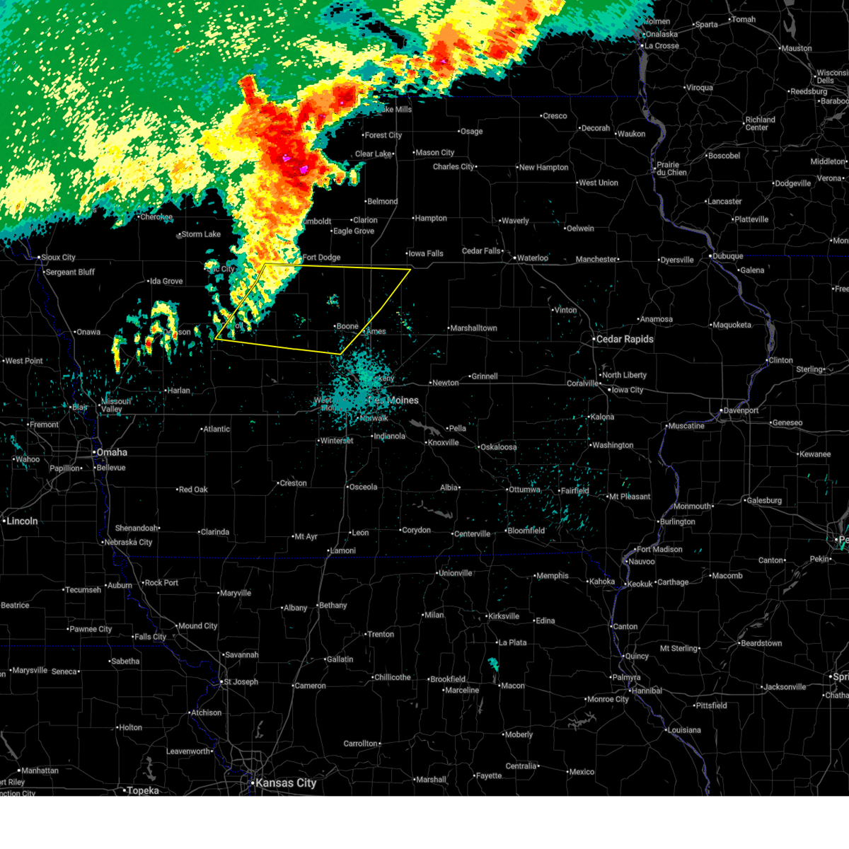
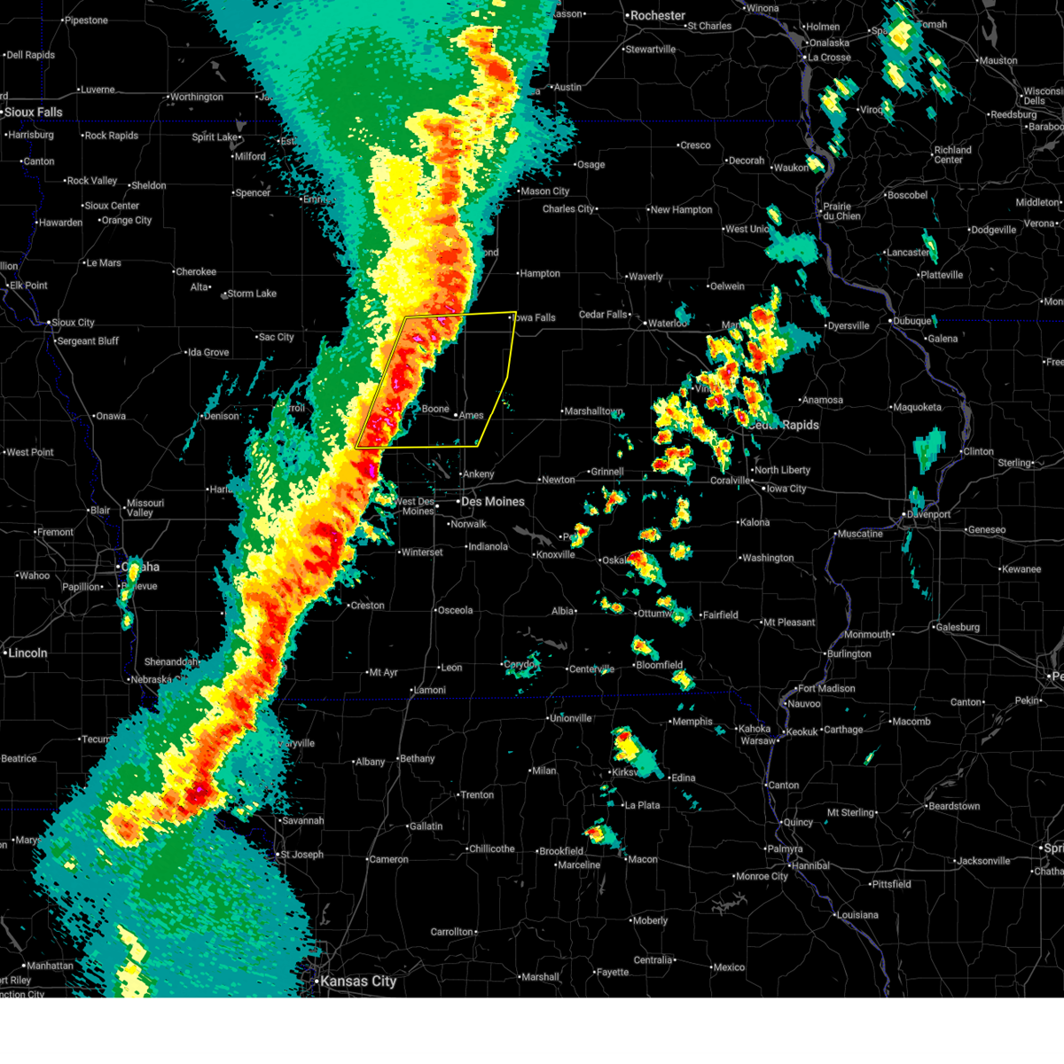 Svrdmx the national weather service in des moines has issued a * severe thunderstorm warning for, southeastern greene county in west central iowa, story county in central iowa, western hardin county in central iowa, southeastern webster county in central iowa, hamilton county in central iowa, boone county in central iowa, * until 800 pm cdt. * at 658 pm cdt, severe thunderstorms were located along a line extending from near webster city to 6 miles south of stanhope to bouton, moving east at 35 mph (radar indicated). Hazards include 60 mph wind gusts and quarter size hail. Hail damage to vehicles is expected. Expect wind damage to roofs, siding, and trees. Svrdmx the national weather service in des moines has issued a * severe thunderstorm warning for, southeastern greene county in west central iowa, story county in central iowa, western hardin county in central iowa, southeastern webster county in central iowa, hamilton county in central iowa, boone county in central iowa, * until 800 pm cdt. * at 658 pm cdt, severe thunderstorms were located along a line extending from near webster city to 6 miles south of stanhope to bouton, moving east at 35 mph (radar indicated). Hazards include 60 mph wind gusts and quarter size hail. Hail damage to vehicles is expected. Expect wind damage to roofs, siding, and trees.
|
| 4/23/2026 6:10 PM CDT |
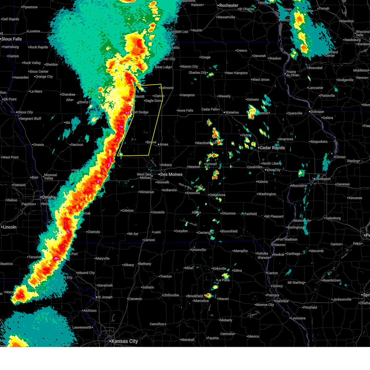 Svrdmx the national weather service in des moines has issued a * severe thunderstorm warning for, eastern greene county in west central iowa, eastern webster county in central iowa, wright county in north central iowa, eastern humboldt county in north central iowa, hamilton county in central iowa, boone county in central iowa, * until 700 pm cdt. * at 609 pm cdt, severe thunderstorms were located along a line extending from near renwick to vincent to near bagley, moving northeast at 45 mph (radar indicated). Hazards include 60 mph wind gusts and quarter size hail. Hail damage to vehicles is expected. Expect wind damage to roofs, siding, and trees. Svrdmx the national weather service in des moines has issued a * severe thunderstorm warning for, eastern greene county in west central iowa, eastern webster county in central iowa, wright county in north central iowa, eastern humboldt county in north central iowa, hamilton county in central iowa, boone county in central iowa, * until 700 pm cdt. * at 609 pm cdt, severe thunderstorms were located along a line extending from near renwick to vincent to near bagley, moving northeast at 45 mph (radar indicated). Hazards include 60 mph wind gusts and quarter size hail. Hail damage to vehicles is expected. Expect wind damage to roofs, siding, and trees.
|
| 9/22/2025 11:11 PM CDT | The storm which prompted the warning has weakened below severe limits, and has exited the warned area. therefore, the warning will be allowed to expire. |
| 9/22/2025 10:23 PM CDT | Svrdmx the national weather service in des moines has issued a * severe thunderstorm warning for, central greene county in west central iowa, southwestern boone county in central iowa, * until 1115 pm cdt. * at 1023 pm cdt, a severe thunderstorm was located near jefferson municipal airport, or near jefferson, moving southeast at 15 mph (radar indicated). Hazards include 60 mph wind gusts and quarter size hail. Hail damage to vehicles is expected. Expect wind damage to roofs, siding, and trees. |
| 8/10/2025 5:33 AM CDT |
 the severe thunderstorm warning has been cancelled and is no longer in effect the severe thunderstorm warning has been cancelled and is no longer in effect
|
| 8/10/2025 5:25 AM CDT |
 the severe thunderstorm warning has been cancelled and is no longer in effect the severe thunderstorm warning has been cancelled and is no longer in effect
|
| 8/10/2025 5:25 AM CDT |
 At 524 am cdt, severe thunderstorms were located along a line extending from near jefferson municipal airport to 4 miles east of minburn to waukee, moving northeast at 40 mph (radar indicated). Hazards include 60 mph wind gusts. Expect damage to roofs, siding, and trees. Locations impacted include, boone, perry, adel, madrid, ogden, dallas center, granger, panora, woodward, lake panorama, boone speedway, big creek lake, saylorville lake, redfield, grand junction, minburn, sheldahl, bagley, rippey, and yale. At 524 am cdt, severe thunderstorms were located along a line extending from near jefferson municipal airport to 4 miles east of minburn to waukee, moving northeast at 40 mph (radar indicated). Hazards include 60 mph wind gusts. Expect damage to roofs, siding, and trees. Locations impacted include, boone, perry, adel, madrid, ogden, dallas center, granger, panora, woodward, lake panorama, boone speedway, big creek lake, saylorville lake, redfield, grand junction, minburn, sheldahl, bagley, rippey, and yale.
|
| 8/10/2025 4:57 AM CDT |
 Svrdmx the national weather service in des moines has issued a * severe thunderstorm warning for, northwestern polk county in central iowa, southeastern greene county in west central iowa, northwestern madison county in south central iowa, eastern guthrie county in west central iowa, southwestern boone county in central iowa, dallas county in central iowa, * until 545 am cdt. * at 457 am cdt, severe thunderstorms were located along a line extending from near bayard to redfield to near earlham, moving northeast at 60 mph (radar indicated). Hazards include 60 mph wind gusts. expect damage to roofs, siding, and trees Svrdmx the national weather service in des moines has issued a * severe thunderstorm warning for, northwestern polk county in central iowa, southeastern greene county in west central iowa, northwestern madison county in south central iowa, eastern guthrie county in west central iowa, southwestern boone county in central iowa, dallas county in central iowa, * until 545 am cdt. * at 457 am cdt, severe thunderstorms were located along a line extending from near bayard to redfield to near earlham, moving northeast at 60 mph (radar indicated). Hazards include 60 mph wind gusts. expect damage to roofs, siding, and trees
|
| 7/30/2025 2:25 AM CDT |
 At 225 am cdt, severe thunderstorms were located along a line extending from 6 miles south of stanhope to boone speedway to 4 miles south of woodward, moving east at 35 mph (trained weather spotters). Hazards include 60 mph wind gusts. Expect damage to roofs, siding, and trees. Locations impacted include, boone, perry, polk city, madrid, ogden, granger, woodward, big creek lake, boone speedway, saylorville lake, sheldahl, rippey, boxholm, pilot mound, dawson, bouton, luther, fraser, beaver, and berkley. At 225 am cdt, severe thunderstorms were located along a line extending from 6 miles south of stanhope to boone speedway to 4 miles south of woodward, moving east at 35 mph (trained weather spotters). Hazards include 60 mph wind gusts. Expect damage to roofs, siding, and trees. Locations impacted include, boone, perry, polk city, madrid, ogden, granger, woodward, big creek lake, boone speedway, saylorville lake, sheldahl, rippey, boxholm, pilot mound, dawson, bouton, luther, fraser, beaver, and berkley.
|
| 7/30/2025 1:46 AM CDT |
 Svrdmx the national weather service in des moines has issued a * severe thunderstorm warning for, northwestern polk county in central iowa, eastern greene county in west central iowa, southeastern webster county in central iowa, northeastern guthrie county in west central iowa, southwestern hamilton county in central iowa, boone county in central iowa, northern dallas county in central iowa, * until 245 am cdt. * at 144 am cdt, severe thunderstorms were located along a line extending from 4 miles west of dana to near rippey to 5 miles southeast of lakin slough game management area, moving northeast at 30 mph (trained weather spotters. a personal weather station recorded a 58 mph wind gust near bayard). Hazards include 60 mph wind gusts. expect damage to roofs, siding, and trees Svrdmx the national weather service in des moines has issued a * severe thunderstorm warning for, northwestern polk county in central iowa, eastern greene county in west central iowa, southeastern webster county in central iowa, northeastern guthrie county in west central iowa, southwestern hamilton county in central iowa, boone county in central iowa, northern dallas county in central iowa, * until 245 am cdt. * at 144 am cdt, severe thunderstorms were located along a line extending from 4 miles west of dana to near rippey to 5 miles southeast of lakin slough game management area, moving northeast at 30 mph (trained weather spotters. a personal weather station recorded a 58 mph wind gust near bayard). Hazards include 60 mph wind gusts. expect damage to roofs, siding, and trees
|
| 7/29/2025 12:01 AM CDT |
 At 1200 am cdt, severe thunderstorms were located along a line extending from webster city municipal airport to 4 miles southeast of stratford to near dawson, moving east at 50 mph (radar indicated). Hazards include 60 mph wind gusts. Expect damage to roofs, siding, and trees. locations impacted include, ames, boone, webster city, jefferson, story city, ogden, roland, jewell junction, gilbert, gowrie, boone speedway, dayton, grand junction, stratford, coalville, radcliffe, otho, ellsworth, stanhope, and lehigh. This includes interstate 35 between mile markers 120 and 141. At 1200 am cdt, severe thunderstorms were located along a line extending from webster city municipal airport to 4 miles southeast of stratford to near dawson, moving east at 50 mph (radar indicated). Hazards include 60 mph wind gusts. Expect damage to roofs, siding, and trees. locations impacted include, ames, boone, webster city, jefferson, story city, ogden, roland, jewell junction, gilbert, gowrie, boone speedway, dayton, grand junction, stratford, coalville, radcliffe, otho, ellsworth, stanhope, and lehigh. This includes interstate 35 between mile markers 120 and 141.
|
| 7/29/2025 12:01 AM CDT |
 the severe thunderstorm warning has been cancelled and is no longer in effect the severe thunderstorm warning has been cancelled and is no longer in effect
|
| 7/28/2025 11:32 PM CDT |
 Svrdmx the national weather service in des moines has issued a * severe thunderstorm warning for, northwestern story county in central iowa, greene county in west central iowa, southwestern hardin county in central iowa, southern webster county in central iowa, southeastern calhoun county in west central iowa, hamilton county in central iowa, northeastern carroll county in west central iowa, boone county in central iowa, * until 1230 am cdt. * at 1131 pm cdt, severe thunderstorms were located along a line extending from fort dodge to near gowrie to 4 miles southwest of ralston, moving east at 50 mph (radar indicated). Hazards include 60 mph wind gusts. expect damage to roofs, siding, and trees Svrdmx the national weather service in des moines has issued a * severe thunderstorm warning for, northwestern story county in central iowa, greene county in west central iowa, southwestern hardin county in central iowa, southern webster county in central iowa, southeastern calhoun county in west central iowa, hamilton county in central iowa, northeastern carroll county in west central iowa, boone county in central iowa, * until 1230 am cdt. * at 1131 pm cdt, severe thunderstorms were located along a line extending from fort dodge to near gowrie to 4 miles southwest of ralston, moving east at 50 mph (radar indicated). Hazards include 60 mph wind gusts. expect damage to roofs, siding, and trees
|
| 7/24/2025 12:45 AM CDT |
 Svrdmx the national weather service in des moines has issued a * severe thunderstorm warning for, northwestern polk county in central iowa, western story county in central iowa, eastern greene county in west central iowa, northeastern guthrie county in west central iowa, boone county in central iowa, northern dallas county in central iowa, * until 130 am cdt. * at 1244 am cdt, severe thunderstorms were located along a line extending from near fraser to 4 miles north of linden, moving east at 40 mph (radar indicated). Hazards include 60 mph wind gusts. expect damage to roofs, siding, and trees Svrdmx the national weather service in des moines has issued a * severe thunderstorm warning for, northwestern polk county in central iowa, western story county in central iowa, eastern greene county in west central iowa, northeastern guthrie county in west central iowa, boone county in central iowa, northern dallas county in central iowa, * until 130 am cdt. * at 1244 am cdt, severe thunderstorms were located along a line extending from near fraser to 4 miles north of linden, moving east at 40 mph (radar indicated). Hazards include 60 mph wind gusts. expect damage to roofs, siding, and trees
|
| 7/24/2025 12:32 AM CDT |
 At 1232 am cdt, severe thunderstorms were located along a line extending from moorland to dana to near bagley, moving east at 55 mph (radar indicated). Hazards include 60 mph wind gusts. Expect damage to roofs, siding, and trees. Locations impacted include, fort dodge, boone, perry, jefferson, ogden, gowrie, dayton, grand junction, stratford, coalville, scranton, otho, bayard, lehigh, duncombe, churdan, callender, farnhamville, bagley, and harcourt. At 1232 am cdt, severe thunderstorms were located along a line extending from moorland to dana to near bagley, moving east at 55 mph (radar indicated). Hazards include 60 mph wind gusts. Expect damage to roofs, siding, and trees. Locations impacted include, fort dodge, boone, perry, jefferson, ogden, gowrie, dayton, grand junction, stratford, coalville, scranton, otho, bayard, lehigh, duncombe, churdan, callender, farnhamville, bagley, and harcourt.
|
| 7/24/2025 12:32 AM CDT |
 the severe thunderstorm warning has been cancelled and is no longer in effect the severe thunderstorm warning has been cancelled and is no longer in effect
|
| 7/24/2025 12:06 AM CDT |
 Svrdmx the national weather service in des moines has issued a * severe thunderstorm warning for, greene county in west central iowa, webster county in central iowa, northern guthrie county in west central iowa, northeastern audubon county in west central iowa, calhoun county in west central iowa, southwestern hamilton county in central iowa, eastern carroll county in west central iowa, western boone county in central iowa, northwestern dallas county in central iowa, * until 1245 am cdt. * at 1206 am cdt, severe thunderstorms were located along a line extending from near south twin lake to near hobbs county park to near dedham, moving east at 55 mph (radar indicated). Hazards include 60 mph wind gusts. expect damage to roofs, siding, and trees Svrdmx the national weather service in des moines has issued a * severe thunderstorm warning for, greene county in west central iowa, webster county in central iowa, northern guthrie county in west central iowa, northeastern audubon county in west central iowa, calhoun county in west central iowa, southwestern hamilton county in central iowa, eastern carroll county in west central iowa, western boone county in central iowa, northwestern dallas county in central iowa, * until 1245 am cdt. * at 1206 am cdt, severe thunderstorms were located along a line extending from near south twin lake to near hobbs county park to near dedham, moving east at 55 mph (radar indicated). Hazards include 60 mph wind gusts. expect damage to roofs, siding, and trees
|
| 3/14/2025 5:35 PM CDT |
 Svrdmx the national weather service in des moines has issued a * severe thunderstorm warning for, greene county in west central iowa, guthrie county in west central iowa, audubon county in west central iowa, southeastern crawford county in west central iowa, carroll county in west central iowa, southwestern boone county in central iowa, dallas county in central iowa, * until 615 pm cdt. * at 535 pm cdt, severe thunderstorms were located along a line extending from 4 miles north of kimballton to near earlham, moving north at 45 mph (radar indicated). Hazards include 70 mph wind gusts and quarter size hail. Hail damage to vehicles is expected. expect considerable tree damage. Wind damage is also likely to mobile homes, roofs, and outbuildings. Svrdmx the national weather service in des moines has issued a * severe thunderstorm warning for, greene county in west central iowa, guthrie county in west central iowa, audubon county in west central iowa, southeastern crawford county in west central iowa, carroll county in west central iowa, southwestern boone county in central iowa, dallas county in central iowa, * until 615 pm cdt. * at 535 pm cdt, severe thunderstorms were located along a line extending from 4 miles north of kimballton to near earlham, moving north at 45 mph (radar indicated). Hazards include 70 mph wind gusts and quarter size hail. Hail damage to vehicles is expected. expect considerable tree damage. Wind damage is also likely to mobile homes, roofs, and outbuildings.
|
| 3/14/2025 5:30 PM CDT |
 At 530 pm cdt, a severe thunderstorm was located 5 miles southwest of ledges state park, or 8 miles southwest of boone, moving north at 50 mph (radar indicated). Hazards include 60 mph wind gusts and quarter size hail. Hail damage to vehicles is expected. expect wind damage to roofs, siding, and trees. Locations impacted include, dawson, perry, rippey, perry municipal airport, woodward, ledges state park, berkley, bouton, madrid, and luther. At 530 pm cdt, a severe thunderstorm was located 5 miles southwest of ledges state park, or 8 miles southwest of boone, moving north at 50 mph (radar indicated). Hazards include 60 mph wind gusts and quarter size hail. Hail damage to vehicles is expected. expect wind damage to roofs, siding, and trees. Locations impacted include, dawson, perry, rippey, perry municipal airport, woodward, ledges state park, berkley, bouton, madrid, and luther.
|
| 3/14/2025 5:15 PM CDT |
 At 514 pm cdt, a severe thunderstorm was located near minburn, or 8 miles southeast of perry, moving north at 50 mph (radar indicated). Hazards include 60 mph wind gusts and quarter size hail. Hail damage to vehicles is expected. expect wind damage to roofs, siding, and trees. Locations impacted include, rippey, perry municipal airport, minburn, berkley, dallas center, granger, perry, woodward, ledges state park, madrid, bouton, dawson, luther, and grimes. At 514 pm cdt, a severe thunderstorm was located near minburn, or 8 miles southeast of perry, moving north at 50 mph (radar indicated). Hazards include 60 mph wind gusts and quarter size hail. Hail damage to vehicles is expected. expect wind damage to roofs, siding, and trees. Locations impacted include, rippey, perry municipal airport, minburn, berkley, dallas center, granger, perry, woodward, ledges state park, madrid, bouton, dawson, luther, and grimes.
|
| 3/14/2025 4:56 PM CDT |
 Svrdmx the national weather service in des moines has issued a * severe thunderstorm warning for, southeastern greene county in west central iowa, southwestern boone county in central iowa, dallas county in central iowa, * until 545 pm cdt. * at 456 pm cdt, a severe thunderstorm was located over van meter, or near adel, moving north at 50 mph (radar indicated). Hazards include 60 mph wind gusts and quarter size hail. Hail damage to vehicles is expected. Expect wind damage to roofs, siding, and trees. Svrdmx the national weather service in des moines has issued a * severe thunderstorm warning for, southeastern greene county in west central iowa, southwestern boone county in central iowa, dallas county in central iowa, * until 545 pm cdt. * at 456 pm cdt, a severe thunderstorm was located over van meter, or near adel, moving north at 50 mph (radar indicated). Hazards include 60 mph wind gusts and quarter size hail. Hail damage to vehicles is expected. Expect wind damage to roofs, siding, and trees.
|
| 7/31/2024 1:45 AM CDT |
 At 145 am cdt, a severe thunderstorm was located near lakin slough game management area, or 8 miles west of perry, moving east at 40 mph (radar indicated). Hazards include golf ball size hail and 60 mph wind gusts. People and animals outdoors will be injured. expect hail damage to roofs, siding, windows, and vehicles. expect wind damage to roofs, siding, and trees. Locations impacted include, perry, dallas center, panora, lake panorama, bayard, minburn, bagley, rippey, yale, jamaica, linden, dawson, bouton, berkley, perry municipal airport, lakin slough game management area, and springbrook state park. At 145 am cdt, a severe thunderstorm was located near lakin slough game management area, or 8 miles west of perry, moving east at 40 mph (radar indicated). Hazards include golf ball size hail and 60 mph wind gusts. People and animals outdoors will be injured. expect hail damage to roofs, siding, windows, and vehicles. expect wind damage to roofs, siding, and trees. Locations impacted include, perry, dallas center, panora, lake panorama, bayard, minburn, bagley, rippey, yale, jamaica, linden, dawson, bouton, berkley, perry municipal airport, lakin slough game management area, and springbrook state park.
|
| 7/31/2024 1:33 AM CDT |
 At 133 am cdt, a severe thunderstorm was located near minburn, or 7 miles south of perry, moving east at 35 mph (radar indicated). Hazards include 60 mph wind gusts and half dollar size hail. Hail damage to vehicles is expected. expect wind damage to roofs, siding, and trees. Locations impacted include, perry, dallas center, panora, lake panorama, bayard, minburn, bagley, rippey, yale, jamaica, linden, dawson, bouton, berkley, perry municipal airport, lakin slough game management area, and springbrook state park. At 133 am cdt, a severe thunderstorm was located near minburn, or 7 miles south of perry, moving east at 35 mph (radar indicated). Hazards include 60 mph wind gusts and half dollar size hail. Hail damage to vehicles is expected. expect wind damage to roofs, siding, and trees. Locations impacted include, perry, dallas center, panora, lake panorama, bayard, minburn, bagley, rippey, yale, jamaica, linden, dawson, bouton, berkley, perry municipal airport, lakin slough game management area, and springbrook state park.
|
| 7/31/2024 1:15 AM CDT |
 Svrdmx the national weather service in des moines has issued a * severe thunderstorm warning for, southern greene county in west central iowa, northeastern guthrie county in west central iowa, southwestern boone county in central iowa, northwestern dallas county in central iowa, * until 200 am cdt. * at 114 am cdt, a severe thunderstorm was located near panora, or 10 miles east of guthrie center, moving east at 40 mph (radar indicated). Hazards include 60 mph wind gusts and half dollar size hail. Hail damage to vehicles is expected. Expect wind damage to roofs, siding, and trees. Svrdmx the national weather service in des moines has issued a * severe thunderstorm warning for, southern greene county in west central iowa, northeastern guthrie county in west central iowa, southwestern boone county in central iowa, northwestern dallas county in central iowa, * until 200 am cdt. * at 114 am cdt, a severe thunderstorm was located near panora, or 10 miles east of guthrie center, moving east at 40 mph (radar indicated). Hazards include 60 mph wind gusts and half dollar size hail. Hail damage to vehicles is expected. Expect wind damage to roofs, siding, and trees.
|
| 7/30/2024 8:57 AM CDT |
 At 856 am cdt, severe thunderstorms were located along a line extending from near panora to guthrie center to near exira, moving south at 35 mph (radar indicated). Hazards include 60 mph wind gusts and penny size hail. Expect damage to roofs, siding, and trees. Locations impacted include, perry, jefferson, audubon, guthrie center, ogden, coon rapids, panora, lake panorama, grand junction, adair, bayard, casey, bagley, rippey, yale, jamaica, linden, dawson, beaver, and berkley. At 856 am cdt, severe thunderstorms were located along a line extending from near panora to guthrie center to near exira, moving south at 35 mph (radar indicated). Hazards include 60 mph wind gusts and penny size hail. Expect damage to roofs, siding, and trees. Locations impacted include, perry, jefferson, audubon, guthrie center, ogden, coon rapids, panora, lake panorama, grand junction, adair, bayard, casey, bagley, rippey, yale, jamaica, linden, dawson, beaver, and berkley.
|
| 7/30/2024 8:53 AM CDT |
 Svrdmx the national weather service in des moines has issued a * severe thunderstorm warning for, polk county in central iowa, story county in central iowa, eastern greene county in west central iowa, northeastern madison county in south central iowa, northeastern guthrie county in west central iowa, boone county in central iowa, dallas county in central iowa, northwestern warren county in south central iowa, * until 1000 am cdt. * at 853 am cdt, severe thunderstorms were located along a line extending from fraser to 4 miles north of bouton to near panora, moving southeast at 45 mph (radar indicated). Hazards include 60 mph wind gusts and nickel size hail. expect damage to roofs, siding, and trees Svrdmx the national weather service in des moines has issued a * severe thunderstorm warning for, polk county in central iowa, story county in central iowa, eastern greene county in west central iowa, northeastern madison county in south central iowa, northeastern guthrie county in west central iowa, boone county in central iowa, dallas county in central iowa, northwestern warren county in south central iowa, * until 1000 am cdt. * at 853 am cdt, severe thunderstorms were located along a line extending from fraser to 4 miles north of bouton to near panora, moving southeast at 45 mph (radar indicated). Hazards include 60 mph wind gusts and nickel size hail. expect damage to roofs, siding, and trees
|
| 7/30/2024 8:44 AM CDT |
 At 842 am cdt, severe thunderstorms were located along a line extending from near beaver to near bagley to near audubon county airport, moving southeast at 45 mph (radar indicated. the carroll aiport recorded a peak wind gust of 55 mph around 815am). Hazards include 60 mph wind gusts and quarter size hail. Hail damage to vehicles is expected. expect wind damage to roofs, siding, and trees. Locations impacted include, perry, jefferson, audubon, guthrie center, ogden, coon rapids, panora, lake panorama, grand junction, adair, scranton, bayard, casey, churdan, bagley, rippey, dedham, yale, jamaica, and linden. At 842 am cdt, severe thunderstorms were located along a line extending from near beaver to near bagley to near audubon county airport, moving southeast at 45 mph (radar indicated. the carroll aiport recorded a peak wind gust of 55 mph around 815am). Hazards include 60 mph wind gusts and quarter size hail. Hail damage to vehicles is expected. expect wind damage to roofs, siding, and trees. Locations impacted include, perry, jefferson, audubon, guthrie center, ogden, coon rapids, panora, lake panorama, grand junction, adair, scranton, bayard, casey, churdan, bagley, rippey, dedham, yale, jamaica, and linden.
|
| 7/30/2024 8:25 AM CDT |
 Svrdmx the national weather service in des moines has issued a * severe thunderstorm warning for, greene county in west central iowa, guthrie county in west central iowa, audubon county in west central iowa, southern carroll county in west central iowa, southwestern boone county in central iowa, northwestern dallas county in central iowa, * until 915 am cdt. * at 825 am cdt, severe thunderstorms were located along a line extending from 4 miles southeast of churdan to 4 miles northeast of coon rapids to near gray, moving southeast at 35 mph (radar indicated). Hazards include 60 mph wind gusts and quarter size hail. Hail damage to vehicles is expected. Expect wind damage to roofs, siding, and trees. Svrdmx the national weather service in des moines has issued a * severe thunderstorm warning for, greene county in west central iowa, guthrie county in west central iowa, audubon county in west central iowa, southern carroll county in west central iowa, southwestern boone county in central iowa, northwestern dallas county in central iowa, * until 915 am cdt. * at 825 am cdt, severe thunderstorms were located along a line extending from 4 miles southeast of churdan to 4 miles northeast of coon rapids to near gray, moving southeast at 35 mph (radar indicated). Hazards include 60 mph wind gusts and quarter size hail. Hail damage to vehicles is expected. Expect wind damage to roofs, siding, and trees.
|
| 7/30/2024 2:23 AM CDT |
 Svrdmx the national weather service in des moines has issued a * severe thunderstorm warning for, polk county in central iowa, story county in central iowa, eastern greene county in west central iowa, southwestern marshall county in central iowa, southeastern webster county in central iowa, northwestern marion county in south central iowa, western jasper county in central iowa, boone county in central iowa, dallas county in central iowa, northern warren county in south central iowa, * until 315 am cdt. * at 222 am cdt, severe thunderstorms were located along a line extending from 4 miles southeast of stratford to near boone municipal airport to 4 miles northeast of madrid to near saylorville lake to near waukee, moving southeast at 50 mph (radar indicated). Hazards include 60 mph wind gusts. Expect damage to roofs, siding, and trees. severe thunderstorms will be near, des moines, ames, west des moines, ankeny, urbandale, johnston, clive and norwalk around 230 am cdt. altoona, pleasant hill, nevada, bondurant, southridge mall, adventureland amusement park, iowa state fairgrounds and prairie meadows around 235 am cdt. carlisle and roland around 240 am cdt. Other locations in the path of these severe thunderstorms include indianola, mitchellville, maxwell, spring hill, valeria, colfax, colo, hartford, runnells, collins, mingo, ackworth, prairie city, swan, sandyville, prairie city krohn airport, pleasantville, baxter, rhodes and monroe. Svrdmx the national weather service in des moines has issued a * severe thunderstorm warning for, polk county in central iowa, story county in central iowa, eastern greene county in west central iowa, southwestern marshall county in central iowa, southeastern webster county in central iowa, northwestern marion county in south central iowa, western jasper county in central iowa, boone county in central iowa, dallas county in central iowa, northern warren county in south central iowa, * until 315 am cdt. * at 222 am cdt, severe thunderstorms were located along a line extending from 4 miles southeast of stratford to near boone municipal airport to 4 miles northeast of madrid to near saylorville lake to near waukee, moving southeast at 50 mph (radar indicated). Hazards include 60 mph wind gusts. Expect damage to roofs, siding, and trees. severe thunderstorms will be near, des moines, ames, west des moines, ankeny, urbandale, johnston, clive and norwalk around 230 am cdt. altoona, pleasant hill, nevada, bondurant, southridge mall, adventureland amusement park, iowa state fairgrounds and prairie meadows around 235 am cdt. carlisle and roland around 240 am cdt. Other locations in the path of these severe thunderstorms include indianola, mitchellville, maxwell, spring hill, valeria, colfax, colo, hartford, runnells, collins, mingo, ackworth, prairie city, swan, sandyville, prairie city krohn airport, pleasantville, baxter, rhodes and monroe.
|
| 7/30/2024 2:05 AM CDT |
 At 205 am cdt, severe thunderstorms were located along a line extending from lizard creek state recreation area to near dayton to near ogden to perry to near linden, moving east at 50 mph (radar indicated). Hazards include 60 mph wind gusts. Expect damage to roofs, siding, and trees. these severe storms will be near, boone, adel, ogden, dallas center, woodward, boone speedway, dayton and redfield around 210 am cdt. waukee, madrid, granger, de soto and luther around 215 am cdt. Other locations in the path of these severe thunderstorms include west des moines, urbandale, johnston, clive, grimes, polk city, van meter, saylorville lake and jordan creek town center. At 205 am cdt, severe thunderstorms were located along a line extending from lizard creek state recreation area to near dayton to near ogden to perry to near linden, moving east at 50 mph (radar indicated). Hazards include 60 mph wind gusts. Expect damage to roofs, siding, and trees. these severe storms will be near, boone, adel, ogden, dallas center, woodward, boone speedway, dayton and redfield around 210 am cdt. waukee, madrid, granger, de soto and luther around 215 am cdt. Other locations in the path of these severe thunderstorms include west des moines, urbandale, johnston, clive, grimes, polk city, van meter, saylorville lake and jordan creek town center.
|
| 7/30/2024 2:05 AM CDT |
 the severe thunderstorm warning has been cancelled and is no longer in effect the severe thunderstorm warning has been cancelled and is no longer in effect
|
| 7/30/2024 1:56 AM CDT |
 At 156 am cdt, severe thunderstorms were located along a line extending from barnum to near harcourt to beaver to dawson to near panora, moving east at 50 mph (radar indicated). Hazards include 60 mph wind gusts. Expect damage to roofs, siding, and trees. these severe storms will be near, fort dodge, perry, ogden, dayton, redfield, coalville, otho and lehigh around 200 am cdt. Other locations in the path of these severe thunderstorms include boone, dallas center, woodward, minburn, fraser, ledges state park, brushy creek st recreation area, adel, de soto, boone speedway, stratford, duncombe, luther, boone municipal airport, urbandale, clive, waukee, grimes, madrid, granger, van meter, saylorville lake, west des moines, johnston, polk city, big creek lake, stanhope, sheldahl, webster city municipal airport, webster city and jordan creek town center. At 156 am cdt, severe thunderstorms were located along a line extending from barnum to near harcourt to beaver to dawson to near panora, moving east at 50 mph (radar indicated). Hazards include 60 mph wind gusts. Expect damage to roofs, siding, and trees. these severe storms will be near, fort dodge, perry, ogden, dayton, redfield, coalville, otho and lehigh around 200 am cdt. Other locations in the path of these severe thunderstorms include boone, dallas center, woodward, minburn, fraser, ledges state park, brushy creek st recreation area, adel, de soto, boone speedway, stratford, duncombe, luther, boone municipal airport, urbandale, clive, waukee, grimes, madrid, granger, van meter, saylorville lake, west des moines, johnston, polk city, big creek lake, stanhope, sheldahl, webster city municipal airport, webster city and jordan creek town center.
|
| 7/30/2024 1:43 AM CDT |
 Svrdmx the national weather service in des moines has issued a * severe thunderstorm warning for, northwestern polk county in central iowa, greene county in west central iowa, webster county in central iowa, guthrie county in west central iowa, southeastern pocahontas county in northwestern iowa, northeastern audubon county in west central iowa, calhoun county in west central iowa, southwestern hamilton county in central iowa, eastern carroll county in west central iowa, boone county in central iowa, dallas county in central iowa, * until 230 am cdt. * at 142 am cdt, severe thunderstorms were located along a line extending from near manson to somers to 5 miles west of dana to 4 miles northeast of bagley to near guthrie center, moving east at 50 mph (radar indicated). Hazards include 60 mph wind gusts. Expect damage to roofs, siding, and trees. severe thunderstorms will be near, panora, gowrie, lake panorama, grand junction, callender, harcourt, rippey and yale around 150 am cdt. fort dodge, perry, ogden, dayton, otho, boxholm and berkley around 155 am cdt. fort dodge regional airport, redfield, coalville, lehigh, diamondhead lake, minburn, pilot mound and bouton around 200 am cdt. Other locations in the path of these severe thunderstorms include boone, adel, dallas center, woodward, stratford, ledges state park, brushy creek st recreation area, madrid, de soto, boone speedway, duncombe, luther, boone municipal airport, urbandale, clive, waukee, grimes, granger, van meter, saylorville lake, big creek lake and stanhope. Svrdmx the national weather service in des moines has issued a * severe thunderstorm warning for, northwestern polk county in central iowa, greene county in west central iowa, webster county in central iowa, guthrie county in west central iowa, southeastern pocahontas county in northwestern iowa, northeastern audubon county in west central iowa, calhoun county in west central iowa, southwestern hamilton county in central iowa, eastern carroll county in west central iowa, boone county in central iowa, dallas county in central iowa, * until 230 am cdt. * at 142 am cdt, severe thunderstorms were located along a line extending from near manson to somers to 5 miles west of dana to 4 miles northeast of bagley to near guthrie center, moving east at 50 mph (radar indicated). Hazards include 60 mph wind gusts. Expect damage to roofs, siding, and trees. severe thunderstorms will be near, panora, gowrie, lake panorama, grand junction, callender, harcourt, rippey and yale around 150 am cdt. fort dodge, perry, ogden, dayton, otho, boxholm and berkley around 155 am cdt. fort dodge regional airport, redfield, coalville, lehigh, diamondhead lake, minburn, pilot mound and bouton around 200 am cdt. Other locations in the path of these severe thunderstorms include boone, adel, dallas center, woodward, stratford, ledges state park, brushy creek st recreation area, madrid, de soto, boone speedway, duncombe, luther, boone municipal airport, urbandale, clive, waukee, grimes, granger, van meter, saylorville lake, big creek lake and stanhope.
|
| 7/28/2024 8:17 PM CDT |
 The storm which prompted the warning has moved out of the area with a new warning issued for eastern boone and into story county. therefore, the warning has been allowed to expire. The storm which prompted the warning has moved out of the area with a new warning issued for eastern boone and into story county. therefore, the warning has been allowed to expire.
|
| 7/28/2024 8:00 PM CDT |
 the severe thunderstorm warning has been cancelled and is no longer in effect the severe thunderstorm warning has been cancelled and is no longer in effect
|
| 7/28/2024 8:00 PM CDT |
 At 800 pm cdt, a severe thunderstorm was located near ogden, or near boone, moving east at 40 mph (radar indicated). Hazards include 60 mph wind gusts and penny size hail. Expect damage to roofs, siding, and trees. Locations impacted include, boone, madrid, ogden, boone speedway, boxholm, pilot mound, luther, fraser, beaver, berkley, boone municipal airport, and ledges state park. At 800 pm cdt, a severe thunderstorm was located near ogden, or near boone, moving east at 40 mph (radar indicated). Hazards include 60 mph wind gusts and penny size hail. Expect damage to roofs, siding, and trees. Locations impacted include, boone, madrid, ogden, boone speedway, boxholm, pilot mound, luther, fraser, beaver, berkley, boone municipal airport, and ledges state park.
|
| 7/28/2024 7:52 PM CDT |
 At 752 pm cdt, a severe thunderstorm was located over ogden, or 9 miles west of boone, moving east at 40 mph (radar indicated). Hazards include 60 mph wind gusts and penny size hail. Expect damage to roofs, siding, and trees. Locations impacted include, boone, jefferson, madrid, ogden, boone speedway, dayton, grand junction, stratford, harcourt, paton, boxholm, pilot mound, luther, fraser, dana, beaver, berkley, jefferson municipal airport, boone municipal airport, and ledges state park. At 752 pm cdt, a severe thunderstorm was located over ogden, or 9 miles west of boone, moving east at 40 mph (radar indicated). Hazards include 60 mph wind gusts and penny size hail. Expect damage to roofs, siding, and trees. Locations impacted include, boone, jefferson, madrid, ogden, boone speedway, dayton, grand junction, stratford, harcourt, paton, boxholm, pilot mound, luther, fraser, dana, beaver, berkley, jefferson municipal airport, boone municipal airport, and ledges state park.
|
| 7/28/2024 7:35 PM CDT |
 Svrdmx the national weather service in des moines has issued a * severe thunderstorm warning for, northeastern greene county in west central iowa, southeastern webster county in central iowa, southwestern hamilton county in central iowa, boone county in central iowa, * until 815 pm cdt. * at 735 pm cdt, a severe thunderstorm was located near dana, or 5 miles northeast of jefferson, moving east at 25 mph (radar indicated). Hazards include 60 mph wind gusts and penny size hail. expect damage to roofs, siding, and trees Svrdmx the national weather service in des moines has issued a * severe thunderstorm warning for, northeastern greene county in west central iowa, southeastern webster county in central iowa, southwestern hamilton county in central iowa, boone county in central iowa, * until 815 pm cdt. * at 735 pm cdt, a severe thunderstorm was located near dana, or 5 miles northeast of jefferson, moving east at 25 mph (radar indicated). Hazards include 60 mph wind gusts and penny size hail. expect damage to roofs, siding, and trees
|
| 5/24/2024 4:40 AM CDT |
 Svrdmx the national weather service in des moines has issued a * severe thunderstorm warning for, polk county in central iowa, story county in central iowa, northern madison county in south central iowa, webster county in central iowa, southern wright county in north central iowa, western jasper county in central iowa, boone county in central iowa, hamilton county in central iowa, northern warren county in south central iowa, eastern greene county in west central iowa, southwestern hardin county in central iowa, northeastern calhoun county in west central iowa, southeastern humboldt county in north central iowa, dallas county in central iowa, * until 530 am cdt. * at 439 am cdt, severe thunderstorms were located along a line extending from lizard creek state recreation area to near ogden to near waukee, moving east at 55 mph (trained weather spotters). Hazards include 60 mph wind gusts and penny size hail. expect damage to roofs, siding, and trees Svrdmx the national weather service in des moines has issued a * severe thunderstorm warning for, polk county in central iowa, story county in central iowa, northern madison county in south central iowa, webster county in central iowa, southern wright county in north central iowa, western jasper county in central iowa, boone county in central iowa, hamilton county in central iowa, northern warren county in south central iowa, eastern greene county in west central iowa, southwestern hardin county in central iowa, northeastern calhoun county in west central iowa, southeastern humboldt county in north central iowa, dallas county in central iowa, * until 530 am cdt. * at 439 am cdt, severe thunderstorms were located along a line extending from lizard creek state recreation area to near ogden to near waukee, moving east at 55 mph (trained weather spotters). Hazards include 60 mph wind gusts and penny size hail. expect damage to roofs, siding, and trees
|
| 5/24/2024 4:34 AM CDT |
 the severe thunderstorm warning has been cancelled and is no longer in effect the severe thunderstorm warning has been cancelled and is no longer in effect
|
| 5/24/2024 4:34 AM CDT |
 At 433 am cdt, severe thunderstorms were located along a line extending from near barnum to near boxholm to 5 miles southwest of minburn to near winterset, moving east at 55 mph (emergency management). Hazards include 60 mph wind gusts and penny size hail. Expect damage to roofs, siding, and trees. locations impacted include, west des moines, fort dodge, waukee, boone, creston, perry, winterset, jefferson, adel, rockwell city, dakota city, humboldt, ogden, manson, stuart, dallas center, earlham, panora, de soto, and gowrie. This includes interstate 80 between mile markers 89 and 117. At 433 am cdt, severe thunderstorms were located along a line extending from near barnum to near boxholm to 5 miles southwest of minburn to near winterset, moving east at 55 mph (emergency management). Hazards include 60 mph wind gusts and penny size hail. Expect damage to roofs, siding, and trees. locations impacted include, west des moines, fort dodge, waukee, boone, creston, perry, winterset, jefferson, adel, rockwell city, dakota city, humboldt, ogden, manson, stuart, dallas center, earlham, panora, de soto, and gowrie. This includes interstate 80 between mile markers 89 and 117.
|
| 5/24/2024 4:24 AM CDT |
 the severe thunderstorm warning has been cancelled and is no longer in effect the severe thunderstorm warning has been cancelled and is no longer in effect
|
| 5/24/2024 4:24 AM CDT |
 At 423 am cdt, severe thunderstorms were located along a line extending from near manson to dana to near linden to 4 miles north of macksburg, moving east at 55 mph (radar indicated). Hazards include 60 mph wind gusts and penny size hail. Expect damage to roofs, siding, and trees. locations impacted include, west des moines, fort dodge, waukee, boone, creston, perry, winterset, jefferson, adel, greenfield, rockwell city, guthrie center, dakota city, humboldt, ogden, lake city, manson, stuart, dallas center, and earlham. This includes interstate 80 between mile markers 80 and 117. At 423 am cdt, severe thunderstorms were located along a line extending from near manson to dana to near linden to 4 miles north of macksburg, moving east at 55 mph (radar indicated). Hazards include 60 mph wind gusts and penny size hail. Expect damage to roofs, siding, and trees. locations impacted include, west des moines, fort dodge, waukee, boone, creston, perry, winterset, jefferson, adel, greenfield, rockwell city, guthrie center, dakota city, humboldt, ogden, lake city, manson, stuart, dallas center, and earlham. This includes interstate 80 between mile markers 80 and 117.
|
| 5/24/2024 3:56 AM CDT |
 Svrdmx the national weather service in des moines has issued a * severe thunderstorm warning for, madison county in south central iowa, webster county in central iowa, southeastern pocahontas county in northwestern iowa, eastern audubon county in west central iowa, southeastern sac county in west central iowa, western boone county in central iowa, adair county in southwestern iowa, greene county in west central iowa, eastern cass county in southwestern iowa, union county in south central iowa, guthrie county in west central iowa, adams county in southwestern iowa, calhoun county in west central iowa, south central humboldt county in north central iowa, northeastern taylor county in southwestern iowa, eastern carroll county in west central iowa, western clarke county in south central iowa, dallas county in central iowa, * until 445 am cdt. * at 355 am cdt, severe thunderstorms were located along a line extending from near sac city municipal airport to 4 miles southwest of ralston to 4 miles north of adair to 6 miles southeast of bridgewater, moving east at 55 mph (personal weather station near audubon reported 62 mph wind gust at 339 am). Hazards include 60 mph wind gusts and quarter size hail. Hail damage to vehicles is expected. Expect wind damage to roofs, siding, and trees. Svrdmx the national weather service in des moines has issued a * severe thunderstorm warning for, madison county in south central iowa, webster county in central iowa, southeastern pocahontas county in northwestern iowa, eastern audubon county in west central iowa, southeastern sac county in west central iowa, western boone county in central iowa, adair county in southwestern iowa, greene county in west central iowa, eastern cass county in southwestern iowa, union county in south central iowa, guthrie county in west central iowa, adams county in southwestern iowa, calhoun county in west central iowa, south central humboldt county in north central iowa, northeastern taylor county in southwestern iowa, eastern carroll county in west central iowa, western clarke county in south central iowa, dallas county in central iowa, * until 445 am cdt. * at 355 am cdt, severe thunderstorms were located along a line extending from near sac city municipal airport to 4 miles southwest of ralston to 4 miles north of adair to 6 miles southeast of bridgewater, moving east at 55 mph (personal weather station near audubon reported 62 mph wind gust at 339 am). Hazards include 60 mph wind gusts and quarter size hail. Hail damage to vehicles is expected. Expect wind damage to roofs, siding, and trees.
|
| 5/21/2024 4:16 PM CDT |
 At 416 pm cdt, a severe thunderstorm was located over beaver, or 12 miles east of jefferson, moving northeast at 50 mph (radar indicated). Hazards include 60 mph wind gusts and quarter size hail. Hail damage to vehicles is expected. expect wind damage to roofs, siding, and trees. Locations impacted include, boone, ogden, dayton, grand junction, stratford, rippey, paton, boxholm, pilot mound, fraser, dana, beaver, berkley, and brushy creek st recreation area. At 416 pm cdt, a severe thunderstorm was located over beaver, or 12 miles east of jefferson, moving northeast at 50 mph (radar indicated). Hazards include 60 mph wind gusts and quarter size hail. Hail damage to vehicles is expected. expect wind damage to roofs, siding, and trees. Locations impacted include, boone, ogden, dayton, grand junction, stratford, rippey, paton, boxholm, pilot mound, fraser, dana, beaver, berkley, and brushy creek st recreation area.
|
| 5/21/2024 4:16 PM CDT |
 the severe thunderstorm warning has been cancelled and is no longer in effect the severe thunderstorm warning has been cancelled and is no longer in effect
|
| 5/21/2024 4:01 PM CDT |
 Svrdmx the national weather service in des moines has issued a * severe thunderstorm warning for, eastern greene county in west central iowa, southeastern webster county in central iowa, northeastern guthrie county in west central iowa, northern boone county in central iowa, southwestern hamilton county in central iowa, * until 445 pm cdt. * at 401 pm cdt, a severe thunderstorm was located 5 miles south of jefferson municipal airport, or 6 miles southeast of jefferson, moving northeast at 50 mph (radar indicated). Hazards include 60 mph wind gusts and quarter size hail. Hail damage to vehicles is expected. Expect wind damage to roofs, siding, and trees. Svrdmx the national weather service in des moines has issued a * severe thunderstorm warning for, eastern greene county in west central iowa, southeastern webster county in central iowa, northeastern guthrie county in west central iowa, northern boone county in central iowa, southwestern hamilton county in central iowa, * until 445 pm cdt. * at 401 pm cdt, a severe thunderstorm was located 5 miles south of jefferson municipal airport, or 6 miles southeast of jefferson, moving northeast at 50 mph (radar indicated). Hazards include 60 mph wind gusts and quarter size hail. Hail damage to vehicles is expected. Expect wind damage to roofs, siding, and trees.
|
| 5/21/2024 3:43 PM CDT |
 At 342 pm cdt, a severe thunderstorm was located near jefferson, moving northeast at 40 mph (trained weather spotters). Hazards include 60 mph wind gusts and quarter size hail. Hail damage to vehicles is expected. expect wind damage to roofs, siding, and trees. Locations impacted include, jefferson, glidden, grand junction, scranton, bayard, churdan, farnhamville, lohrville, bagley, rippey, paton, ralston, dana, beaver, berkley, and jefferson municipal airport. At 342 pm cdt, a severe thunderstorm was located near jefferson, moving northeast at 40 mph (trained weather spotters). Hazards include 60 mph wind gusts and quarter size hail. Hail damage to vehicles is expected. expect wind damage to roofs, siding, and trees. Locations impacted include, jefferson, glidden, grand junction, scranton, bayard, churdan, farnhamville, lohrville, bagley, rippey, paton, ralston, dana, beaver, berkley, and jefferson municipal airport.
|
| 5/21/2024 3:43 PM CDT |
 the severe thunderstorm warning has been cancelled and is no longer in effect the severe thunderstorm warning has been cancelled and is no longer in effect
|
| 5/21/2024 3:25 PM CDT |
 At 323 pm cdt, a severe thunderstorm was located near churdan, or 12 miles northwest of jefferson, moving northeast at 80 mph. this is a destructive storm for carroll, greene and calhoun counties (trained weather spotters). Hazards include 80 mph wind gusts and quarter size hail. Flying debris will be dangerous to those caught without shelter. mobile homes will be heavily damaged. expect considerable damage to roofs, windows, and vehicles. extensive tree damage and power outages are likely. Locations impacted include, carroll, jefferson, coon rapids, glidden, grand junction, scranton, bayard, churdan, farnhamville, lohrville, bagley, rippey, dedham, paton, lidderdale, lanesboro, willey, ralston, dana, and beaver. At 323 pm cdt, a severe thunderstorm was located near churdan, or 12 miles northwest of jefferson, moving northeast at 80 mph. this is a destructive storm for carroll, greene and calhoun counties (trained weather spotters). Hazards include 80 mph wind gusts and quarter size hail. Flying debris will be dangerous to those caught without shelter. mobile homes will be heavily damaged. expect considerable damage to roofs, windows, and vehicles. extensive tree damage and power outages are likely. Locations impacted include, carroll, jefferson, coon rapids, glidden, grand junction, scranton, bayard, churdan, farnhamville, lohrville, bagley, rippey, dedham, paton, lidderdale, lanesboro, willey, ralston, dana, and beaver.
|
| 5/21/2024 3:11 PM CDT |
 Svrdmx the national weather service in des moines has issued a * severe thunderstorm warning for, greene county in west central iowa, southwestern webster county in central iowa, northwestern guthrie county in west central iowa, northeastern audubon county in west central iowa, southeastern calhoun county in west central iowa, west central boone county in central iowa, southeastern carroll county in west central iowa, * until 400 pm cdt. * at 310 pm cdt, a severe thunderstorm was located near dedham, or 11 miles northeast of audubon, moving northeast at 50 mph (radar indicated). Hazards include 70 mph wind gusts and quarter size hail. Hail damage to vehicles is expected. expect considerable tree damage. Wind damage is also likely to mobile homes, roofs, and outbuildings. Svrdmx the national weather service in des moines has issued a * severe thunderstorm warning for, greene county in west central iowa, southwestern webster county in central iowa, northwestern guthrie county in west central iowa, northeastern audubon county in west central iowa, southeastern calhoun county in west central iowa, west central boone county in central iowa, southeastern carroll county in west central iowa, * until 400 pm cdt. * at 310 pm cdt, a severe thunderstorm was located near dedham, or 11 miles northeast of audubon, moving northeast at 50 mph (radar indicated). Hazards include 70 mph wind gusts and quarter size hail. Hail damage to vehicles is expected. expect considerable tree damage. Wind damage is also likely to mobile homes, roofs, and outbuildings.
|
| 5/21/2024 12:34 AM CDT |
 the severe thunderstorm warning has been cancelled and is no longer in effect the severe thunderstorm warning has been cancelled and is no longer in effect
|
| 5/21/2024 12:14 AM CDT |
 At 1213 am cdt, severe thunderstorms were located along a line extending from 4 miles south of breda to near minburn, moving northeast at 20 mph (radar indicated). Hazards include 60 mph wind gusts and quarter size hail. Hail damage to vehicles is expected. expect wind damage to roofs, siding, and trees. Locations impacted include, boone, carroll, perry, jefferson, adel, madrid, ogden, lake city, dallas center, glidden, woodward, boone speedway, grand junction, scranton, bayard, churdan, farnhamville, lohrville, minburn, and bagley. At 1213 am cdt, severe thunderstorms were located along a line extending from 4 miles south of breda to near minburn, moving northeast at 20 mph (radar indicated). Hazards include 60 mph wind gusts and quarter size hail. Hail damage to vehicles is expected. expect wind damage to roofs, siding, and trees. Locations impacted include, boone, carroll, perry, jefferson, adel, madrid, ogden, lake city, dallas center, glidden, woodward, boone speedway, grand junction, scranton, bayard, churdan, farnhamville, lohrville, minburn, and bagley.
|
| 5/21/2024 12:14 AM CDT |
 the severe thunderstorm warning has been cancelled and is no longer in effect the severe thunderstorm warning has been cancelled and is no longer in effect
|
| 5/20/2024 11:58 PM CDT |
 Svrdmx the national weather service in des moines has issued a * severe thunderstorm warning for, greene county in west central iowa, southwestern webster county in central iowa, northeastern guthrie county in west central iowa, southeastern sac county in west central iowa, southern calhoun county in west central iowa, boone county in central iowa, carroll county in west central iowa, northwestern dallas county in central iowa, * until 1245 am cdt. * at 1158 pm cdt, severe thunderstorms were located along a line extending from arcadia to 6 miles northwest of adel, moving northeast at 20 mph (radar indicated). Hazards include 60 mph wind gusts and quarter size hail. Hail damage to vehicles is expected. Expect wind damage to roofs, siding, and trees. Svrdmx the national weather service in des moines has issued a * severe thunderstorm warning for, greene county in west central iowa, southwestern webster county in central iowa, northeastern guthrie county in west central iowa, southeastern sac county in west central iowa, southern calhoun county in west central iowa, boone county in central iowa, carroll county in west central iowa, northwestern dallas county in central iowa, * until 1245 am cdt. * at 1158 pm cdt, severe thunderstorms were located along a line extending from arcadia to 6 miles northwest of adel, moving northeast at 20 mph (radar indicated). Hazards include 60 mph wind gusts and quarter size hail. Hail damage to vehicles is expected. Expect wind damage to roofs, siding, and trees.
|
| 5/8/2024 6:53 PM CDT |
 At 653 pm cdt, a severe thunderstorm was located over bouton, or near perry, moving northeast at 35 mph (radar indicated). Hazards include 60 mph wind gusts and quarter size hail. Hail damage to vehicles is expected. expect wind damage to roofs, siding, and trees. Locations impacted include, perry, madrid, ogden, woodward, bouton, luther, berkley, perry municipal airport, and ledges state park. At 653 pm cdt, a severe thunderstorm was located over bouton, or near perry, moving northeast at 35 mph (radar indicated). Hazards include 60 mph wind gusts and quarter size hail. Hail damage to vehicles is expected. expect wind damage to roofs, siding, and trees. Locations impacted include, perry, madrid, ogden, woodward, bouton, luther, berkley, perry municipal airport, and ledges state park.
|
| 5/8/2024 6:39 PM CDT |
 Svrdmx the national weather service in des moines has issued a * severe thunderstorm warning for, southern boone county in central iowa, northern dallas county in central iowa, * until 730 pm cdt. * at 639 pm cdt, a severe thunderstorm was located over minburn, or 6 miles south of perry, moving northeast at 35 mph (radar indicated). Hazards include 60 mph wind gusts and quarter size hail. Hail damage to vehicles is expected. Expect wind damage to roofs, siding, and trees. Svrdmx the national weather service in des moines has issued a * severe thunderstorm warning for, southern boone county in central iowa, northern dallas county in central iowa, * until 730 pm cdt. * at 639 pm cdt, a severe thunderstorm was located over minburn, or 6 miles south of perry, moving northeast at 35 mph (radar indicated). Hazards include 60 mph wind gusts and quarter size hail. Hail damage to vehicles is expected. Expect wind damage to roofs, siding, and trees.
|
| 5/8/2024 6:13 PM CDT |
 Svrdmx the national weather service in des moines has issued a * severe thunderstorm warning for, northeastern greene county in west central iowa, southeastern webster county in central iowa, boone county in central iowa, southwestern hamilton county in central iowa, * until 700 pm cdt. * at 612 pm cdt, a severe thunderstorm was located over ogden, or 6 miles west of boone, moving northeast at 40 mph (radar indicated). Hazards include 60 mph wind gusts and penny size hail. expect damage to roofs, siding, and trees Svrdmx the national weather service in des moines has issued a * severe thunderstorm warning for, northeastern greene county in west central iowa, southeastern webster county in central iowa, boone county in central iowa, southwestern hamilton county in central iowa, * until 700 pm cdt. * at 612 pm cdt, a severe thunderstorm was located over ogden, or 6 miles west of boone, moving northeast at 40 mph (radar indicated). Hazards include 60 mph wind gusts and penny size hail. expect damage to roofs, siding, and trees
|
| 4/30/2024 6:15 PM CDT |
 the severe thunderstorm warning has been cancelled and is no longer in effect the severe thunderstorm warning has been cancelled and is no longer in effect
|
| 4/30/2024 6:15 PM CDT |
 At 614 pm cdt, a severe thunderstorm was located near ledges state park, or 5 miles southwest of boone, moving east at 50 mph (radar indicated). Hazards include 60 mph wind gusts and quarter size hail. Hail damage to vehicles is expected. expect wind damage to roofs, siding, and trees. Locations impacted include, boone, perry, jefferson, madrid, ogden, woodward, boone speedway, grand junction, sheldahl, rippey, pilot mound, dawson, bouton, luther, fraser, dana, beaver, berkley, jefferson municipal airport, and boone municipal airport. At 614 pm cdt, a severe thunderstorm was located near ledges state park, or 5 miles southwest of boone, moving east at 50 mph (radar indicated). Hazards include 60 mph wind gusts and quarter size hail. Hail damage to vehicles is expected. expect wind damage to roofs, siding, and trees. Locations impacted include, boone, perry, jefferson, madrid, ogden, woodward, boone speedway, grand junction, sheldahl, rippey, pilot mound, dawson, bouton, luther, fraser, dana, beaver, berkley, jefferson municipal airport, and boone municipal airport.
|
| 4/30/2024 6:02 PM CDT |
 At 601 pm cdt, a severe thunderstorm was located over rippey, or 8 miles northwest of perry, moving east at 55 mph (radar indicated). Hazards include 60 mph wind gusts and quarter size hail. Hail damage to vehicles is expected. expect wind damage to roofs, siding, and trees. Locations impacted include, boone, perry, jefferson, madrid, ogden, woodward, boone speedway, grand junction, scranton, sheldahl, bagley, rippey, jamaica, pilot mound, dawson, bouton, luther, fraser, dana, and beaver. At 601 pm cdt, a severe thunderstorm was located over rippey, or 8 miles northwest of perry, moving east at 55 mph (radar indicated). Hazards include 60 mph wind gusts and quarter size hail. Hail damage to vehicles is expected. expect wind damage to roofs, siding, and trees. Locations impacted include, boone, perry, jefferson, madrid, ogden, woodward, boone speedway, grand junction, scranton, sheldahl, bagley, rippey, jamaica, pilot mound, dawson, bouton, luther, fraser, dana, and beaver.
|
| 4/30/2024 6:02 PM CDT |
 the severe thunderstorm warning has been cancelled and is no longer in effect the severe thunderstorm warning has been cancelled and is no longer in effect
|
| 4/30/2024 5:39 PM CDT |
 Svrdmx the national weather service in des moines has issued a * severe thunderstorm warning for, greene county in west central iowa, northeastern guthrie county in west central iowa, boone county in central iowa, east central carroll county in west central iowa, northwestern dallas county in central iowa, * until 630 pm cdt. * at 539 pm cdt, a severe thunderstorm was located 6 miles south of scranton, or 8 miles southwest of jefferson, moving east at 50 mph (radar indicated). Hazards include 60 mph wind gusts and quarter size hail. Hail damage to vehicles is expected. Expect wind damage to roofs, siding, and trees. Svrdmx the national weather service in des moines has issued a * severe thunderstorm warning for, greene county in west central iowa, northeastern guthrie county in west central iowa, boone county in central iowa, east central carroll county in west central iowa, northwestern dallas county in central iowa, * until 630 pm cdt. * at 539 pm cdt, a severe thunderstorm was located 6 miles south of scranton, or 8 miles southwest of jefferson, moving east at 50 mph (radar indicated). Hazards include 60 mph wind gusts and quarter size hail. Hail damage to vehicles is expected. Expect wind damage to roofs, siding, and trees.
|
| 9/23/2023 1:09 PM CDT |
 At 108 pm cdt, severe thunderstorms were located along a line extending from near gilmore city to near farnhamville to 6 miles southwest of ralston, moving northeast at 40 mph (radar indicated). Hazards include 60 mph wind gusts and quarter size hail. Hail damage to vehicles is expected. Expect wind damage to roofs, siding, and trees. At 108 pm cdt, severe thunderstorms were located along a line extending from near gilmore city to near farnhamville to 6 miles southwest of ralston, moving northeast at 40 mph (radar indicated). Hazards include 60 mph wind gusts and quarter size hail. Hail damage to vehicles is expected. Expect wind damage to roofs, siding, and trees.
|
| 8/5/2023 10:14 PM CDT |
 At 1014 pm cdt, severe thunderstorms were located along a line extending from 4 miles southeast of churdan to 5 miles north of bagley to near bayard, moving southeast at 40 mph (radar indicated). Hazards include 60 mph wind gusts. expect damage to roofs, siding, and trees At 1014 pm cdt, severe thunderstorms were located along a line extending from 4 miles southeast of churdan to 5 miles north of bagley to near bayard, moving southeast at 40 mph (radar indicated). Hazards include 60 mph wind gusts. expect damage to roofs, siding, and trees
|
| 8/5/2023 10:00 PM CDT |
 At 959 pm cdt, severe thunderstorms were located along a line extending from near churdan to near scranton to 4 miles south of dedham, moving east at 40 mph (radar indicated). Hazards include 60 mph wind gusts. Expect damage to roofs, siding, and trees. locations impacted include, carroll, perry, jefferson, audubon, guthrie center, lake city, manning, coon rapids, glidden, panora, lake panorama, exira, grand junction, adair, scranton, bayard, casey, churdan, templeton and auburn. hail threat, radar indicated max hail size, <. 75 in wind threat, radar indicated max wind gust, 60 mph. At 959 pm cdt, severe thunderstorms were located along a line extending from near churdan to near scranton to 4 miles south of dedham, moving east at 40 mph (radar indicated). Hazards include 60 mph wind gusts. Expect damage to roofs, siding, and trees. locations impacted include, carroll, perry, jefferson, audubon, guthrie center, lake city, manning, coon rapids, glidden, panora, lake panorama, exira, grand junction, adair, scranton, bayard, casey, churdan, templeton and auburn. hail threat, radar indicated max hail size, <. 75 in wind threat, radar indicated max wind gust, 60 mph.
|
| 8/5/2023 9:34 PM CDT |
 At 933 pm cdt, severe thunderstorms were located along a line extending from auburn to swan lake state park to manilla, moving southeast at 45 mph (radar indicated). Hazards include 60 mph wind gusts. Expect damage to roofs, siding, and trees. locations impacted include, carroll, denison, perry, jefferson, audubon, guthrie center, lake city, manning, coon rapids, glidden, lake view, panora, black hawk lake, lake panorama, exira, grand junction, wall lake, adair, manilla and scranton. hail threat, radar indicated max hail size, <. 75 in wind threat, radar indicated max wind gust, 60 mph. At 933 pm cdt, severe thunderstorms were located along a line extending from auburn to swan lake state park to manilla, moving southeast at 45 mph (radar indicated). Hazards include 60 mph wind gusts. Expect damage to roofs, siding, and trees. locations impacted include, carroll, denison, perry, jefferson, audubon, guthrie center, lake city, manning, coon rapids, glidden, lake view, panora, black hawk lake, lake panorama, exira, grand junction, wall lake, adair, manilla and scranton. hail threat, radar indicated max hail size, <. 75 in wind threat, radar indicated max wind gust, 60 mph.
|
| 8/5/2023 9:28 PM CDT |
 At 928 pm cdt, severe thunderstorms were located along a line extending from near lidderdale to halbur to near irwin, moving southeast at 60 mph (radar indicated). Hazards include 60 mph wind gusts. expect damage to roofs, siding, and trees At 928 pm cdt, severe thunderstorms were located along a line extending from near lidderdale to halbur to near irwin, moving southeast at 60 mph (radar indicated). Hazards include 60 mph wind gusts. expect damage to roofs, siding, and trees
|
| 7/12/2023 7:41 AM CDT |
 At 740 am cdt, a severe thunderstorm was located near winterset, moving east at 55 mph (radar indicated). Hazards include 60 mph wind gusts and nickel size hail. Expect damage to roofs, siding, and trees. this severe thunderstorm will be near, east peru around 745 am cdt. truro and patterson around 750 am cdt. avenue of the saints event center, st. charles, martensdale, st. marys and bevington around 755 am cdt. new virginia around 800 am cdt. other locations in the path of this severe thunderstorm include lake ahquabi state park and otter creek county park. this includes the following highways, interstate 35 between mile markers 30 and 72, and between mile markers 87 and 120. interstate 80 between mile markers 96 and 146. interstate 235 between mile markers 1 and 14. hail threat, radar indicated max hail size, 0. 88 in wind threat, radar indicated max wind gust, 60 mph. At 740 am cdt, a severe thunderstorm was located near winterset, moving east at 55 mph (radar indicated). Hazards include 60 mph wind gusts and nickel size hail. Expect damage to roofs, siding, and trees. this severe thunderstorm will be near, east peru around 745 am cdt. truro and patterson around 750 am cdt. avenue of the saints event center, st. charles, martensdale, st. marys and bevington around 755 am cdt. new virginia around 800 am cdt. other locations in the path of this severe thunderstorm include lake ahquabi state park and otter creek county park. this includes the following highways, interstate 35 between mile markers 30 and 72, and between mile markers 87 and 120. interstate 80 between mile markers 96 and 146. interstate 235 between mile markers 1 and 14. hail threat, radar indicated max hail size, 0. 88 in wind threat, radar indicated max wind gust, 60 mph.
|
| 7/11/2022 4:44 AM CDT |
 At 443 am cdt, severe thunderstorms were located along a line extending from 6 miles southeast of gowrie to near boone to near woodward, moving east at 50 mph (radar indicated). Hazards include 60 mph wind gusts and nickel size hail. expect damage to roofs, siding, and trees At 443 am cdt, severe thunderstorms were located along a line extending from 6 miles southeast of gowrie to near boone to near woodward, moving east at 50 mph (radar indicated). Hazards include 60 mph wind gusts and nickel size hail. expect damage to roofs, siding, and trees
|
| 7/11/2022 4:20 AM CDT |
 At 419 am cdt, severe thunderstorms were located along a line extending from near gowrie to near jefferson to 9 miles north of lake panorama, moving east at 65 mph (radar indicated). Hazards include 70 mph wind gusts and quarter size hail. Hail damage to vehicles is expected. expect considerable tree damage. Wind damage is also likely to mobile homes, roofs, and outbuildings. At 419 am cdt, severe thunderstorms were located along a line extending from near gowrie to near jefferson to 9 miles north of lake panorama, moving east at 65 mph (radar indicated). Hazards include 70 mph wind gusts and quarter size hail. Hail damage to vehicles is expected. expect considerable tree damage. Wind damage is also likely to mobile homes, roofs, and outbuildings.
|
| 6/15/2022 2:25 AM CDT |
 The severe thunderstorm warning for southeastern greene, eastern guthrie, boone and dallas counties will expire at 230 am cdt, the storms which prompted the warning have weakened below severe limits, and have exited some of the warned area. therefore, the warning will be allowed to expire. however heavy rain is still possible with these thunderstorms. a severe thunderstorm watch remains in effect until 400 am cdt for central, south central, southwestern and west central iowa. The severe thunderstorm warning for southeastern greene, eastern guthrie, boone and dallas counties will expire at 230 am cdt, the storms which prompted the warning have weakened below severe limits, and have exited some of the warned area. therefore, the warning will be allowed to expire. however heavy rain is still possible with these thunderstorms. a severe thunderstorm watch remains in effect until 400 am cdt for central, south central, southwestern and west central iowa.
|
| 6/15/2022 1:41 AM CDT |
 At 139 am cdt, severe thunderstorms were located along a line extending from near jefferson to near stuart, moving northeast at 55 mph (radar indicated. at 134 am, guthrie county emergency management reported 65 mph wind near the intersection of 310th street and highway 25). Hazards include 60 mph wind gusts and penny size hail. expect damage to roofs, siding, and trees At 139 am cdt, severe thunderstorms were located along a line extending from near jefferson to near stuart, moving northeast at 55 mph (radar indicated. at 134 am, guthrie county emergency management reported 65 mph wind near the intersection of 310th street and highway 25). Hazards include 60 mph wind gusts and penny size hail. expect damage to roofs, siding, and trees
|
| 6/11/2022 5:07 PM CDT |
 At 506 pm cdt, a severe thunderstorm was located near ogden, or 13 miles west of boone, moving southeast at 30 mph (radar indicated). Hazards include 60 mph wind gusts and quarter size hail. Hail damage to vehicles is expected. expect wind damage to roofs, siding, and trees. this severe storm will be near, beaver around 510 pm cdt. other locations in the path of this severe thunderstorm include ogden and berkley. hail threat, radar indicated max hail size, 1. 00 in wind threat, radar indicated max wind gust, 60 mph. At 506 pm cdt, a severe thunderstorm was located near ogden, or 13 miles west of boone, moving southeast at 30 mph (radar indicated). Hazards include 60 mph wind gusts and quarter size hail. Hail damage to vehicles is expected. expect wind damage to roofs, siding, and trees. this severe storm will be near, beaver around 510 pm cdt. other locations in the path of this severe thunderstorm include ogden and berkley. hail threat, radar indicated max hail size, 1. 00 in wind threat, radar indicated max wind gust, 60 mph.
|
| 6/11/2022 4:50 PM CDT |
 At 450 pm cdt, a severe thunderstorm was located 7 miles south of gowrie, or 12 miles northeast of jefferson, moving southeast at 30 mph (radar indicated). Hazards include golf ball size hail and 60 mph wind gusts. People and animals outdoors will be injured. expect hail damage to roofs, siding, windows, and vehicles. expect wind damage to roofs, siding, and trees. this severe storm will be near, boxholm and dana around 500 pm cdt. grand junction around 505 pm cdt. other locations in the path of this severe thunderstorm include pilot mound, beaver, ogden and berkley. thunderstorm damage threat, considerable hail threat, radar indicated max hail size, 1. 75 in wind threat, radar indicated max wind gust, 60 mph. At 450 pm cdt, a severe thunderstorm was located 7 miles south of gowrie, or 12 miles northeast of jefferson, moving southeast at 30 mph (radar indicated). Hazards include golf ball size hail and 60 mph wind gusts. People and animals outdoors will be injured. expect hail damage to roofs, siding, windows, and vehicles. expect wind damage to roofs, siding, and trees. this severe storm will be near, boxholm and dana around 500 pm cdt. grand junction around 505 pm cdt. other locations in the path of this severe thunderstorm include pilot mound, beaver, ogden and berkley. thunderstorm damage threat, considerable hail threat, radar indicated max hail size, 1. 75 in wind threat, radar indicated max wind gust, 60 mph.
|
| 6/11/2022 4:45 PM CDT |
 At 444 pm cdt, a severe thunderstorm was located near gowrie, or 13 miles north of jefferson, moving southeast at 30 mph (radar indicated). Hazards include 60 mph wind gusts and quarter size hail. Hail damage to vehicles is expected. expect wind damage to roofs, siding, and trees. this severe thunderstorm will be near, paton around 450 pm cdt. boxholm and dana around 500 pm cdt. other locations in the path of this severe thunderstorm include grand junction, beaver, ogden and berkley. hail threat, radar indicated max hail size, 1. 00 in wind threat, radar indicated max wind gust, 60 mph. At 444 pm cdt, a severe thunderstorm was located near gowrie, or 13 miles north of jefferson, moving southeast at 30 mph (radar indicated). Hazards include 60 mph wind gusts and quarter size hail. Hail damage to vehicles is expected. expect wind damage to roofs, siding, and trees. this severe thunderstorm will be near, paton around 450 pm cdt. boxholm and dana around 500 pm cdt. other locations in the path of this severe thunderstorm include grand junction, beaver, ogden and berkley. hail threat, radar indicated max hail size, 1. 00 in wind threat, radar indicated max wind gust, 60 mph.
|
| 4/23/2022 5:56 PM CDT |
 At 556 pm cdt, severe thunderstorms were located along a line extending from near dakota city to lake panorama, moving northeast at 35 mph (radar indicated). Hazards include 60 mph wind gusts. expect damage to roofs, siding, and trees At 556 pm cdt, severe thunderstorms were located along a line extending from near dakota city to lake panorama, moving northeast at 35 mph (radar indicated). Hazards include 60 mph wind gusts. expect damage to roofs, siding, and trees
|
| 4/12/2022 9:46 PM CDT |
 At 946 pm cdt, severe thunderstorms were located along a line extending from 9 miles west of gowrie to near coon rapids, moving east at 55 mph (radar indicated). Hazards include 60 mph wind gusts. Expect damage to roofs, siding, and trees. severe thunderstorms will be near, gowrie around 955 pm cdt. other locations in the path of these severe thunderstorms include ogden. hail threat, radar indicated max hail size, <. 75 in wind threat, radar indicated max wind gust, 60 mph. At 946 pm cdt, severe thunderstorms were located along a line extending from 9 miles west of gowrie to near coon rapids, moving east at 55 mph (radar indicated). Hazards include 60 mph wind gusts. Expect damage to roofs, siding, and trees. severe thunderstorms will be near, gowrie around 955 pm cdt. other locations in the path of these severe thunderstorms include ogden. hail threat, radar indicated max hail size, <. 75 in wind threat, radar indicated max wind gust, 60 mph.
|
| 12/15/2021 6:02 PM CST |
 At 601 pm cst, severe thunderstorms were located along a line extending from 6 miles north of union slogh to near webster city, moving northeast at 80 mph. these are destructive storms for portions of central and northern iowa (radar indicated). Hazards include 80 mph wind gusts. Flying debris will be dangerous to those caught without shelter. mobile homes will be heavily damaged. expect considerable damage to roofs, windows, and vehicles. extensive tree damage and power outages are likely. Locations impacted include, fort dodge, boone, algona, emmetsburg, dakota city, humboldt, madrid, ogden, gowrie, swan lake, five island lake, ingham lake, iowa lake, fort dodge regional airport, high lake, okamanpedan lake, boone speedway, armstrong, graettinger and dayton. At 601 pm cst, severe thunderstorms were located along a line extending from 6 miles north of union slogh to near webster city, moving northeast at 80 mph. these are destructive storms for portions of central and northern iowa (radar indicated). Hazards include 80 mph wind gusts. Flying debris will be dangerous to those caught without shelter. mobile homes will be heavily damaged. expect considerable damage to roofs, windows, and vehicles. extensive tree damage and power outages are likely. Locations impacted include, fort dodge, boone, algona, emmetsburg, dakota city, humboldt, madrid, ogden, gowrie, swan lake, five island lake, ingham lake, iowa lake, fort dodge regional airport, high lake, okamanpedan lake, boone speedway, armstrong, graettinger and dayton.
|
| 12/15/2021 5:48 PM CST |
 At 547 pm cst, severe thunderstorms were located along a line extending from 9 miles east of five island lake to 10 miles east of gowrie, moving northeast at 80 mph. these are destructive storms for portions of central and northern iowa (radar indicated). Hazards include 80 mph wind gusts. Flying debris will be dangerous to those caught without shelter. mobile homes will be heavily damaged. expect considerable damage to roofs, windows, and vehicles. extensive tree damage and power outages are likely. These severe thunderstorms will remain over mainly rural areas of greene, emmet, webster, pocahontas, kossuth, eastern calhoun, humboldt, boone and palo alto counties, including the following locations, ayrshire, woodman hollow state park, kearney state park, curlew, whittemore, ottosen, pomeroy, jolley, jefferson municipal airport and swea city. At 547 pm cst, severe thunderstorms were located along a line extending from 9 miles east of five island lake to 10 miles east of gowrie, moving northeast at 80 mph. these are destructive storms for portions of central and northern iowa (radar indicated). Hazards include 80 mph wind gusts. Flying debris will be dangerous to those caught without shelter. mobile homes will be heavily damaged. expect considerable damage to roofs, windows, and vehicles. extensive tree damage and power outages are likely. These severe thunderstorms will remain over mainly rural areas of greene, emmet, webster, pocahontas, kossuth, eastern calhoun, humboldt, boone and palo alto counties, including the following locations, ayrshire, woodman hollow state park, kearney state park, curlew, whittemore, ottosen, pomeroy, jolley, jefferson municipal airport and swea city.
|
| 12/15/2021 5:19 PM CST |
 At 518 pm cst, severe thunderstorms were located along a line extending from sioux rapids to near coon rapids, moving northeast at 80 mph. these are destructive storms for portions of central iowa (radar indicated). Hazards include 80 mph wind gusts. Flying debris will be dangerous to those caught without shelter. mobile homes will be heavily damaged. expect considerable damage to roofs, windows, and vehicles. extensive tree damage and power outages are likely. severe thunderstorms will be near, silver lake and rush lake around 530 pm cst. jefferson around 535 pm cst. Other locations in the path of these severe thunderstorms include emmetsburg and five island lake. At 518 pm cst, severe thunderstorms were located along a line extending from sioux rapids to near coon rapids, moving northeast at 80 mph. these are destructive storms for portions of central iowa (radar indicated). Hazards include 80 mph wind gusts. Flying debris will be dangerous to those caught without shelter. mobile homes will be heavily damaged. expect considerable damage to roofs, windows, and vehicles. extensive tree damage and power outages are likely. severe thunderstorms will be near, silver lake and rush lake around 530 pm cst. jefferson around 535 pm cst. Other locations in the path of these severe thunderstorms include emmetsburg and five island lake.
|
| 7/9/2021 1:18 PM CDT |
 At 116 pm cdt, a severe thunderstorm was located near woodward, or 9 miles northeast of perry, moving southeast at 30 mph (radar indicated. this storm has a history of producing golf ball sized hail and even larger hail is possible). Hazards include tennis ball size hail and 60 mph wind gusts. People and animals outdoors will be injured. expect hail damage to roofs, siding, windows, and vehicles. expect wind damage to roofs, siding, and trees. locations impacted include, ames, boone, perry, huxley, madrid, ogden, dallas center, slater, granger, woodward, boone speedway, big creek lake, saylorville lake, minburn, sheldahl, kelley, rippey, bouton, luther and berkley. This includes interstate 35 between mile markers 106 and 109. At 116 pm cdt, a severe thunderstorm was located near woodward, or 9 miles northeast of perry, moving southeast at 30 mph (radar indicated. this storm has a history of producing golf ball sized hail and even larger hail is possible). Hazards include tennis ball size hail and 60 mph wind gusts. People and animals outdoors will be injured. expect hail damage to roofs, siding, windows, and vehicles. expect wind damage to roofs, siding, and trees. locations impacted include, ames, boone, perry, huxley, madrid, ogden, dallas center, slater, granger, woodward, boone speedway, big creek lake, saylorville lake, minburn, sheldahl, kelley, rippey, bouton, luther and berkley. This includes interstate 35 between mile markers 106 and 109.
|
| 7/9/2021 1:01 PM CDT |
 At 100 pm cdt, a severe thunderstorm was located over ogden, or 10 miles west of boone, moving southeast at 30 mph (radar indicated. this storm has a history of producing large hail and the storm is intensifying). Hazards include tennis ball size hail and 60 mph wind gusts. People and animals outdoors will be injured. expect hail damage to roofs, siding, windows, and vehicles. Expect wind damage to roofs, siding, and trees. At 100 pm cdt, a severe thunderstorm was located over ogden, or 10 miles west of boone, moving southeast at 30 mph (radar indicated. this storm has a history of producing large hail and the storm is intensifying). Hazards include tennis ball size hail and 60 mph wind gusts. People and animals outdoors will be injured. expect hail damage to roofs, siding, windows, and vehicles. Expect wind damage to roofs, siding, and trees.
|
| 5/25/2021 7:05 PM CDT |
 At 705 pm cdt, a severe thunderstorm was located near lake panorama, or 11 miles northeast of guthrie center, moving east at 35 mph (radar indicated). Hazards include quarter size hail. damage to vehicles is expected At 705 pm cdt, a severe thunderstorm was located near lake panorama, or 11 miles northeast of guthrie center, moving east at 35 mph (radar indicated). Hazards include quarter size hail. damage to vehicles is expected
|
| 8/10/2020 10:25 AM CDT |
 At 1024 am cdt, severe thunderstorms were located along a line extending from near gowrie to 9 miles northwest of perry to near stuart, moving east at 55 mph (trained weather spotters and numerous other reports with 70 mph plus winds reported with these storms). Hazards include 70 mph wind gusts and quarter size hail. Hail damage to vehicles is expected. expect considerable tree damage. wind damage is also likely to mobile homes, roofs, and outbuildings. locations impacted include, west des moines, urbandale, johnston, clive, waukee, boone, grimes, perry, jefferson, adel, guthrie center, polk city, madrid, ogden, stuart, dallas center, earlham, granger, panora and de soto. this includes the following highways, interstate 35 between mile markers 67 and 72. interstate 80 between mile markers 100 and 129. Interstate 235 near mile marker 1. At 1024 am cdt, severe thunderstorms were located along a line extending from near gowrie to 9 miles northwest of perry to near stuart, moving east at 55 mph (trained weather spotters and numerous other reports with 70 mph plus winds reported with these storms). Hazards include 70 mph wind gusts and quarter size hail. Hail damage to vehicles is expected. expect considerable tree damage. wind damage is also likely to mobile homes, roofs, and outbuildings. locations impacted include, west des moines, urbandale, johnston, clive, waukee, boone, grimes, perry, jefferson, adel, guthrie center, polk city, madrid, ogden, stuart, dallas center, earlham, granger, panora and de soto. this includes the following highways, interstate 35 between mile markers 67 and 72. interstate 80 between mile markers 100 and 129. Interstate 235 near mile marker 1.
|
| 8/10/2020 10:11 AM CDT |
 At 1011 am cdt, severe thunderstorms were located along a line extending from 11 miles east of lake city to near jefferson to 8 miles west of stuart, moving east at 55 mph (radar indicated). Hazards include 70 mph wind gusts and quarter size hail. Hail damage to vehicles is expected. expect considerable tree damage. Wind damage is also likely to mobile homes, roofs, and outbuildings. At 1011 am cdt, severe thunderstorms were located along a line extending from 11 miles east of lake city to near jefferson to 8 miles west of stuart, moving east at 55 mph (radar indicated). Hazards include 70 mph wind gusts and quarter size hail. Hail damage to vehicles is expected. expect considerable tree damage. Wind damage is also likely to mobile homes, roofs, and outbuildings.
|
| 6/5/2020 4:28 AM CDT |
 The severe thunderstorm warning for southern greene, eastern guthrie, southwestern boone and northwestern dallas counties will expire at 430 am cdt, the storms which prompted the warning have moved out of the area. therefore, the warning will be allowed to expire. a severe thunderstorm watch remains in effect until 700 am cdt for central and west central iowa. remember, a severe thunderstorm warning still remains in effect for portions of boone, dallas and guthrie counties. The severe thunderstorm warning for southern greene, eastern guthrie, southwestern boone and northwestern dallas counties will expire at 430 am cdt, the storms which prompted the warning have moved out of the area. therefore, the warning will be allowed to expire. a severe thunderstorm watch remains in effect until 700 am cdt for central and west central iowa. remember, a severe thunderstorm warning still remains in effect for portions of boone, dallas and guthrie counties.
|
| 6/5/2020 4:05 AM CDT |
 At 404 am cdt, severe thunderstorms were located along a line extending from near ogden to near lake panorama, moving southeast at 35 mph (trained weather spotters reported trees and powerlines down in jefferson with this storm). Hazards include 70 mph wind gusts. Expect considerable tree damage. damage is likely to mobile homes, roofs, and outbuildings. Locations impacted include, boone, perry, jefferson, madrid, ogden, panora, woodward, lake panorama, boone speedway, grand junction, bayard, minburn, bagley, rippey, yale, jamaica, linden, boxholm, dawson and bouton. At 404 am cdt, severe thunderstorms were located along a line extending from near ogden to near lake panorama, moving southeast at 35 mph (trained weather spotters reported trees and powerlines down in jefferson with this storm). Hazards include 70 mph wind gusts. Expect considerable tree damage. damage is likely to mobile homes, roofs, and outbuildings. Locations impacted include, boone, perry, jefferson, madrid, ogden, panora, woodward, lake panorama, boone speedway, grand junction, bayard, minburn, bagley, rippey, yale, jamaica, linden, boxholm, dawson and bouton.
|
| 6/5/2020 3:45 AM CDT |
 At 345 am cdt, severe thunderstorms were located along a line extending from 8 miles northwest of ogden to 6 miles northeast of coon rapids, moving southeast at 30 mph (radar indicated). Hazards include 70 mph wind gusts. Expect considerable tree damage. Damage is likely to mobile homes, roofs, and outbuildings. At 345 am cdt, severe thunderstorms were located along a line extending from 8 miles northwest of ogden to 6 miles northeast of coon rapids, moving southeast at 30 mph (radar indicated). Hazards include 70 mph wind gusts. Expect considerable tree damage. Damage is likely to mobile homes, roofs, and outbuildings.
|
| 5/26/2020 2:13 PM CDT |
 The tornado warning for southwestern boone county will expire at 215 pm cdt, the storm which prompted the warning has weakened below severe limits, and no longer appears capable of producing a tornado. therefore, the warning will be allowed to expire. a tornado watch remains in effect until 800 pm cdt for central iowa. The tornado warning for southwestern boone county will expire at 215 pm cdt, the storm which prompted the warning has weakened below severe limits, and no longer appears capable of producing a tornado. therefore, the warning will be allowed to expire. a tornado watch remains in effect until 800 pm cdt for central iowa.
|
| 5/26/2020 2:05 PM CDT |
 At 204 pm cdt, a severe thunderstorm capable of producing a tornado was located near perry, moving north at 25 mph (radar indicated rotation). Hazards include tornado. Flying debris will be dangerous to those caught without shelter. mobile homes will be damaged or destroyed. damage to roofs, windows, and vehicles will occur. tree damage is likely. Locations impacted include, berkley. At 204 pm cdt, a severe thunderstorm capable of producing a tornado was located near perry, moving north at 25 mph (radar indicated rotation). Hazards include tornado. Flying debris will be dangerous to those caught without shelter. mobile homes will be damaged or destroyed. damage to roofs, windows, and vehicles will occur. tree damage is likely. Locations impacted include, berkley.
|
| 5/26/2020 1:49 PM CDT |
 At 149 pm cdt, a severe thunderstorm capable of producing a tornado was located near woodward, or 7 miles southeast of perry, moving north at 25 mph (radar indicated rotation). Hazards include tornado. Flying debris will be dangerous to those caught without shelter. mobile homes will be damaged or destroyed. damage to roofs, windows, and vehicles will occur. tree damage is likely. This tornadic thunderstorm will remain over mainly rural areas of southwestern boone and north central dallas counties, including the following locations, berkley and bouton. At 149 pm cdt, a severe thunderstorm capable of producing a tornado was located near woodward, or 7 miles southeast of perry, moving north at 25 mph (radar indicated rotation). Hazards include tornado. Flying debris will be dangerous to those caught without shelter. mobile homes will be damaged or destroyed. damage to roofs, windows, and vehicles will occur. tree damage is likely. This tornadic thunderstorm will remain over mainly rural areas of southwestern boone and north central dallas counties, including the following locations, berkley and bouton.
|
| 9/14/2019 3:08 PM CDT |
 The severe thunderstorm warning for east central greene and western boone counties will expire at 315 pm cdt. the storm which prompted the warning has weakened below severe limits, and no longer poses an immediate threat to life or property. Therefore, the warning will be allowed to expire. The severe thunderstorm warning for east central greene and western boone counties will expire at 315 pm cdt. the storm which prompted the warning has weakened below severe limits, and no longer poses an immediate threat to life or property. Therefore, the warning will be allowed to expire.
|
| 9/14/2019 2:53 PM CDT |
 The national weather service in des moines has issued a * severe thunderstorm warning for. east central greene county in west central iowa. western boone county in central iowa. until 315 pm cdt. At 252 pm cdt, a severe thunderstorm was located 7 miles east of. The national weather service in des moines has issued a * severe thunderstorm warning for. east central greene county in west central iowa. western boone county in central iowa. until 315 pm cdt. At 252 pm cdt, a severe thunderstorm was located 7 miles east of.
|
| 9/9/2019 4:39 PM CDT |
 At 439 pm cdt, severe thunderstorms were located along a line extending from near perry to near granger to waukee, moving northeast at 30 mph (radar indicated). Hazards include 60 mph wind gusts and penny size hail. expect damage to roofs, siding, and trees At 439 pm cdt, severe thunderstorms were located along a line extending from near perry to near granger to waukee, moving northeast at 30 mph (radar indicated). Hazards include 60 mph wind gusts and penny size hail. expect damage to roofs, siding, and trees
|
| 8/20/2019 5:06 AM CDT |
 At 505 am cdt, the center of a cluster of spirally strong to severe thunderstorms was located 7 miles northwest of adel, moving east at 30 mph (radar indicated). Hazards include 60 mph wind gusts and quarter size hail. Hail damage to vehicles is expected. expect wind damage to roofs, siding, and trees. locations impacted include, west des moines, urbandale, clive, waukee, grimes, perry, winterset, adel, guthrie center, stuart, dallas center, earlham, granger, panora, de soto, woodward, van meter, jordan creek town center, lake panorama and avenue of the saints event center. This includes interstate 80 between mile markers 80 and 121. At 505 am cdt, the center of a cluster of spirally strong to severe thunderstorms was located 7 miles northwest of adel, moving east at 30 mph (radar indicated). Hazards include 60 mph wind gusts and quarter size hail. Hail damage to vehicles is expected. expect wind damage to roofs, siding, and trees. locations impacted include, west des moines, urbandale, clive, waukee, grimes, perry, winterset, adel, guthrie center, stuart, dallas center, earlham, granger, panora, de soto, woodward, van meter, jordan creek town center, lake panorama and avenue of the saints event center. This includes interstate 80 between mile markers 80 and 121.
|
| 8/20/2019 4:35 AM CDT |
 At 435 am cdt, a severe thunderstorm was located near perry, moving east at 40 mph (radar indicated). Hazards include 60 mph wind gusts and quarter size hail. Hail damage to vehicles is expected. Expect wind damage to roofs, siding, and trees. At 435 am cdt, a severe thunderstorm was located near perry, moving east at 40 mph (radar indicated). Hazards include 60 mph wind gusts and quarter size hail. Hail damage to vehicles is expected. Expect wind damage to roofs, siding, and trees.
|
| 7/20/2019 4:51 PM CDT |
 The severe thunderstorm warning for southeastern greene and southwestern boone counties will expire at 500 pm cdt, the severe thunderstorm which prompted the warning has weakened. therefore, the warning will be allowed to expire. however gusty winds are still possible with this thunderstorm. to report severe weather, contact your nearest law enforcement agency. they will relay your report to the national weather service des moines . remember, a severe thunderstorm warning still remains in effect for southern and southeast boone county until 515 pm cdt. The severe thunderstorm warning for southeastern greene and southwestern boone counties will expire at 500 pm cdt, the severe thunderstorm which prompted the warning has weakened. therefore, the warning will be allowed to expire. however gusty winds are still possible with this thunderstorm. to report severe weather, contact your nearest law enforcement agency. they will relay your report to the national weather service des moines . remember, a severe thunderstorm warning still remains in effect for southern and southeast boone county until 515 pm cdt.
|
| 7/20/2019 4:30 PM CDT |
 At 430 pm cdt, a severe thunderstorm was located 7 miles north of perry, moving southeast at 45 mph (radar indicated). Hazards include 60 mph wind gusts and penny size hail. Expect damage to roofs, siding, and trees. Locations impacted include, ogden, rippey, beaver and berkley. At 430 pm cdt, a severe thunderstorm was located 7 miles north of perry, moving southeast at 45 mph (radar indicated). Hazards include 60 mph wind gusts and penny size hail. Expect damage to roofs, siding, and trees. Locations impacted include, ogden, rippey, beaver and berkley.
|
| 7/20/2019 4:14 PM CDT |
 At 413 pm cdt, a severe thunderstorm was located near jefferson, moving southeast at 45 mph (radar indicated). Hazards include 60 mph wind gusts and penny size hail. expect damage to roofs, siding, and trees At 413 pm cdt, a severe thunderstorm was located near jefferson, moving southeast at 45 mph (radar indicated). Hazards include 60 mph wind gusts and penny size hail. expect damage to roofs, siding, and trees
|
| 7/3/2019 4:17 PM CDT |
 The severe thunderstorm warning for northwestern polk, southern boone and dallas counties has expired, the storm which prompted the warning has weakened just below severe limits, and no longer poses an immediate threat to life or property. therefore, the warning has been allowed to expire. however gusty winds to 50 mph and heavy rain are still possible with this thunderstorm. The severe thunderstorm warning for northwestern polk, southern boone and dallas counties has expired, the storm which prompted the warning has weakened just below severe limits, and no longer poses an immediate threat to life or property. therefore, the warning has been allowed to expire. however gusty winds to 50 mph and heavy rain are still possible with this thunderstorm.
|
| 7/3/2019 3:39 PM CDT |
 At 339 pm cdt, a severe thunderstorm was located near perry, moving southeast at 40 mph (radar indicated). Hazards include 60 mph wind gusts and penny size hail. expect damage to roofs, siding, and trees At 339 pm cdt, a severe thunderstorm was located near perry, moving southeast at 40 mph (radar indicated). Hazards include 60 mph wind gusts and penny size hail. expect damage to roofs, siding, and trees
|
| 7/3/2019 3:29 PM CDT |
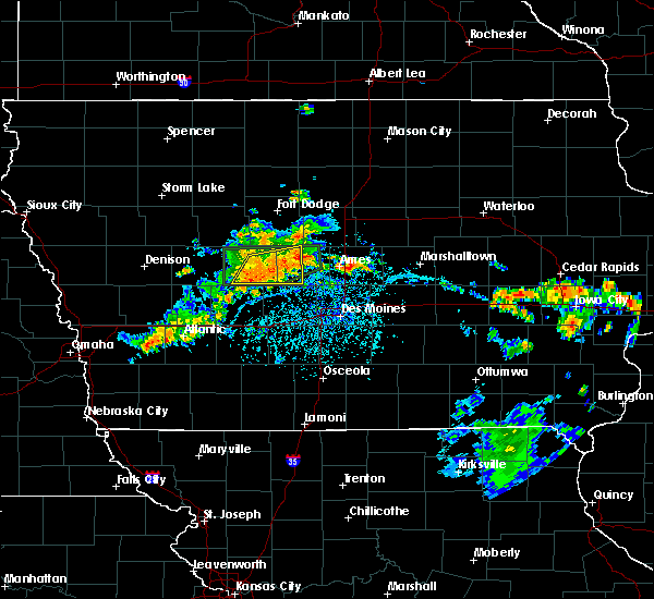 At 328 pm cdt, the leading edge of gusty winds with a severe thunderstorm was located 8 miles southwest of ogden, or 8 miles north of perry, moving east at 30 mph (radar indicated). Hazards include 60 mph wind gusts. Expect damage to roofs, siding, and trees. Locations impacted include, jefferson, ogden, grand junction, rippey, boxholm, pilot mound, fraser, dana, beaver, berkley and jefferson municipal airport. At 328 pm cdt, the leading edge of gusty winds with a severe thunderstorm was located 8 miles southwest of ogden, or 8 miles north of perry, moving east at 30 mph (radar indicated). Hazards include 60 mph wind gusts. Expect damage to roofs, siding, and trees. Locations impacted include, jefferson, ogden, grand junction, rippey, boxholm, pilot mound, fraser, dana, beaver, berkley and jefferson municipal airport.
|
| 7/3/2019 3:09 PM CDT |
 At 309 pm cdt, a severe thunderstorm was located near jefferson, moving east at 30 mph (radar indicated). Hazards include 60 mph wind gusts. expect damage to roofs, siding, and trees At 309 pm cdt, a severe thunderstorm was located near jefferson, moving east at 30 mph (radar indicated). Hazards include 60 mph wind gusts. expect damage to roofs, siding, and trees
|
| 4/11/2019 12:33 AM CDT |
 At 1233 am cdt, severe thunderstorms were located along a line extending from 7 miles northeast of jefferson to 6 miles southwest of ogden to perry, moving northeast at 60 mph (radar indicated). Hazards include 60 mph wind gusts and quarter size hail. Hail damage to vehicles is expected. expect wind damage to roofs, siding, and trees. Locations impacted include, perry, jefferson, ogden, woodward, grand junction, scranton, rippey, paton, boxholm, dawson, bouton, dana, beaver, berkley, perry municipal airport, jefferson municipal airport and ledges state park. At 1233 am cdt, severe thunderstorms were located along a line extending from 7 miles northeast of jefferson to 6 miles southwest of ogden to perry, moving northeast at 60 mph (radar indicated). Hazards include 60 mph wind gusts and quarter size hail. Hail damage to vehicles is expected. expect wind damage to roofs, siding, and trees. Locations impacted include, perry, jefferson, ogden, woodward, grand junction, scranton, rippey, paton, boxholm, dawson, bouton, dana, beaver, berkley, perry municipal airport, jefferson municipal airport and ledges state park.
|
| 4/11/2019 12:19 AM CDT |
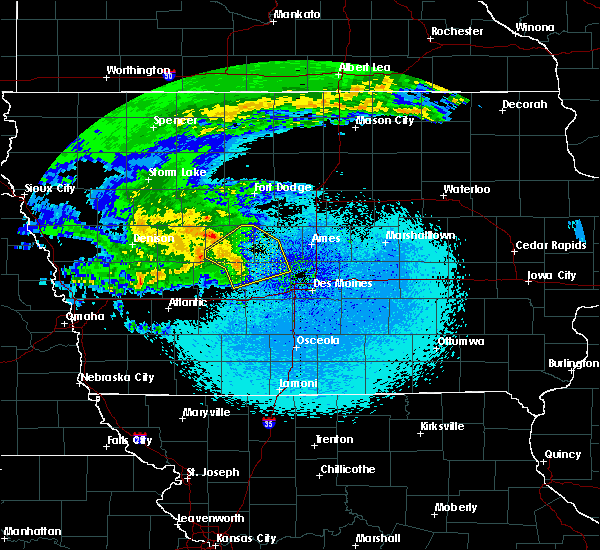 At 1219 am cdt, severe thunderstorms were located along a line extending from 7 miles northeast of coon rapids to near lake panorama to near panora, moving northeast at 60 mph (radar indicated). Hazards include 60 mph wind gusts and quarter size hail. Hail damage to vehicles is expected. expect wind damage to roofs, siding, and trees. Locations impacted include, perry, jefferson, ogden, dallas center, granger, panora, woodward, lake panorama, grand junction, scranton, bayard, minburn, bagley, rippey, yale, paton, jamaica, linden, boxholm and dawson. At 1219 am cdt, severe thunderstorms were located along a line extending from 7 miles northeast of coon rapids to near lake panorama to near panora, moving northeast at 60 mph (radar indicated). Hazards include 60 mph wind gusts and quarter size hail. Hail damage to vehicles is expected. expect wind damage to roofs, siding, and trees. Locations impacted include, perry, jefferson, ogden, dallas center, granger, panora, woodward, lake panorama, grand junction, scranton, bayard, minburn, bagley, rippey, yale, paton, jamaica, linden, boxholm and dawson.
|
| 4/11/2019 12:04 AM CDT |
 At 1203 am cdt, severe thunderstorms were located along a line extending from 7 miles southwest of coon rapids to near guthrie center to 10 miles west of stuart, moving northeast at 60 mph (radar indicated). Hazards include 60 mph wind gusts and quarter size hail. Hail damage to vehicles is expected. Expect wind damage to roofs, siding, and trees. At 1203 am cdt, severe thunderstorms were located along a line extending from 7 miles southwest of coon rapids to near guthrie center to 10 miles west of stuart, moving northeast at 60 mph (radar indicated). Hazards include 60 mph wind gusts and quarter size hail. Hail damage to vehicles is expected. Expect wind damage to roofs, siding, and trees.
|
| 10/8/2018 6:55 PM CDT |
 At 654 pm cdt, a tornado producing storm was located near perry, moving northeast at 35 mph (radar confirmed tornado). Hazards include damaging tornado. Flying debris will be dangerous to those caught without shelter. mobile homes will be damaged or destroyed. damage to roofs, windows, and vehicles will occur. tree damage is likely. this tornadic storm will be near, ogden around 705 pm cdt. boone speedway around 715 pm cdt. boone around 720 pm cdt. Other locations impacted by this tornadic thunderstorm include berkley, ledges state park and boone municipal airport. At 654 pm cdt, a tornado producing storm was located near perry, moving northeast at 35 mph (radar confirmed tornado). Hazards include damaging tornado. Flying debris will be dangerous to those caught without shelter. mobile homes will be damaged or destroyed. damage to roofs, windows, and vehicles will occur. tree damage is likely. this tornadic storm will be near, ogden around 705 pm cdt. boone speedway around 715 pm cdt. boone around 720 pm cdt. Other locations impacted by this tornadic thunderstorm include berkley, ledges state park and boone municipal airport.
|
| 6/30/2018 9:20 PM CDT |
 At 919 pm cdt, severe thunderstorms were located along a line extending from 6 miles west of perry to 9 miles west of dallas center to near earlham, moving northeast at 30 mph (radar indicated). Hazards include 60 mph wind gusts. Expect damage to roofs, siding, and trees. locations impacted include, west des moines, urbandale, clive, waukee, grimes, perry, adel, dallas center, granger, panora, de soto, woodward, van meter, jordan creek town center, lake panorama, redfield, dexter, diamondhead lake, minburn and rippey. This includes interstate 80 between mile markers 100 and 121. At 919 pm cdt, severe thunderstorms were located along a line extending from 6 miles west of perry to 9 miles west of dallas center to near earlham, moving northeast at 30 mph (radar indicated). Hazards include 60 mph wind gusts. Expect damage to roofs, siding, and trees. locations impacted include, west des moines, urbandale, clive, waukee, grimes, perry, adel, dallas center, granger, panora, de soto, woodward, van meter, jordan creek town center, lake panorama, redfield, dexter, diamondhead lake, minburn and rippey. This includes interstate 80 between mile markers 100 and 121.
|
| 6/30/2018 9:08 PM CDT |
 At 907 pm cdt, severe thunderstorms were located along a line extending from near panora to 10 miles northeast of stuart to near earlham, moving northeast at 30 mph (radar indicated). Hazards include 60 mph wind gusts. expect damage to roofs, siding, and trees At 907 pm cdt, severe thunderstorms were located along a line extending from near panora to 10 miles northeast of stuart to near earlham, moving northeast at 30 mph (radar indicated). Hazards include 60 mph wind gusts. expect damage to roofs, siding, and trees
|
| 6/30/2018 5:53 PM CDT |
 At 553 pm cdt, a severe thunderstorm was located near woodward, or 8 miles northeast of perry, moving north at 25 mph (radar indicated). Hazards include 60 mph wind gusts. Expect damage to roofs, siding, and trees. Locations impacted include, boone, perry, madrid, ogden, dallas center, woodward, boone speedway, minburn, rippey, bouton, luther, berkley, boone municipal airport and ledges state park. At 553 pm cdt, a severe thunderstorm was located near woodward, or 8 miles northeast of perry, moving north at 25 mph (radar indicated). Hazards include 60 mph wind gusts. Expect damage to roofs, siding, and trees. Locations impacted include, boone, perry, madrid, ogden, dallas center, woodward, boone speedway, minburn, rippey, bouton, luther, berkley, boone municipal airport and ledges state park.
|
| 6/30/2018 5:43 PM CDT |
 At 543 pm cdt, a severe thunderstorm was located over woodward, or 7 miles east of perry, moving north at 25 mph (radar indicated). Hazards include 60 mph wind gusts. expect damage to roofs, siding, and trees At 543 pm cdt, a severe thunderstorm was located over woodward, or 7 miles east of perry, moving north at 25 mph (radar indicated). Hazards include 60 mph wind gusts. expect damage to roofs, siding, and trees
|
| 6/20/2018 2:22 PM CDT |
 At 221 pm cdt, a severe thunderstorm capable of producing a tornado was located over perry, moving northeast at 10 mph (radar indicated rotation). Hazards include tornado. Flying debris will be dangerous to those caught without shelter. mobile homes will be damaged or destroyed. damage to roofs, windows, and vehicles will occur. tree damage is likely. this dangerous storm will be near, perry around 235 pm cdt. Other locations impacted by this tornadic thunderstorm include rippey, perry municipal airport and berkley. At 221 pm cdt, a severe thunderstorm capable of producing a tornado was located over perry, moving northeast at 10 mph (radar indicated rotation). Hazards include tornado. Flying debris will be dangerous to those caught without shelter. mobile homes will be damaged or destroyed. damage to roofs, windows, and vehicles will occur. tree damage is likely. this dangerous storm will be near, perry around 235 pm cdt. Other locations impacted by this tornadic thunderstorm include rippey, perry municipal airport and berkley.
|
| 6/19/2018 2:33 AM CDT |
 At 232 am cdt, a severe thunderstorm was located near jefferson, moving east at 25 mph (radar indicated). Hazards include 60 mph wind gusts. Expect damage to roofs, siding, and trees. Locations impacted include, jefferson, ogden, grand junction, scranton, churdan, rippey, paton, boxholm, pilot mound, fraser, dana, beaver, berkley and jefferson municipal airport. At 232 am cdt, a severe thunderstorm was located near jefferson, moving east at 25 mph (radar indicated). Hazards include 60 mph wind gusts. Expect damage to roofs, siding, and trees. Locations impacted include, jefferson, ogden, grand junction, scranton, churdan, rippey, paton, boxholm, pilot mound, fraser, dana, beaver, berkley and jefferson municipal airport.
|
| 6/19/2018 2:07 AM CDT |
 At 207 am cdt, a severe thunderstorm was located 8 miles west of jefferson, moving east at 25 mph (radar indicated). Hazards include 60 mph wind gusts. expect damage to roofs, siding, and trees At 207 am cdt, a severe thunderstorm was located 8 miles west of jefferson, moving east at 25 mph (radar indicated). Hazards include 60 mph wind gusts. expect damage to roofs, siding, and trees
|
| 6/6/2018 6:14 PM CDT |
 At 614 pm cdt, severe thunderstorms were located along a line extending from near granger to near dallas center to 8 miles north of lake panorama, moving south at 20 mph (radar indicated). Hazards include tennis ball size hail and 70 mph wind gusts. People and animals outdoors will be injured. expect hail damage to roofs, siding, windows, and vehicles. expect considerable tree damage. wind damage is also likely to mobile homes, roofs, and outbuildings. locations impacted include, west des moines, urbandale, clive, waukee, grimes, perry, adel, guthrie center, madrid, stuart, dallas center, earlham, granger, panora, de soto, woodward, van meter, jordan creek town center, lake panorama and redfield. This includes interstate 80 between mile markers 100 and 121. At 614 pm cdt, severe thunderstorms were located along a line extending from near granger to near dallas center to 8 miles north of lake panorama, moving south at 20 mph (radar indicated). Hazards include tennis ball size hail and 70 mph wind gusts. People and animals outdoors will be injured. expect hail damage to roofs, siding, windows, and vehicles. expect considerable tree damage. wind damage is also likely to mobile homes, roofs, and outbuildings. locations impacted include, west des moines, urbandale, clive, waukee, grimes, perry, adel, guthrie center, madrid, stuart, dallas center, earlham, granger, panora, de soto, woodward, van meter, jordan creek town center, lake panorama and redfield. This includes interstate 80 between mile markers 100 and 121.
|
| 6/6/2018 6:00 PM CDT |
 At 600 pm cdt, severe thunderstorms were located along a line extending from big creek lake to near woodward to 8 miles north of lake panorama, moving south at 30 mph (radar indicated). Hazards include golf ball size hail and 70 mph wind gusts. People and animals outdoors will be injured. expect hail damage to roofs, siding, windows, and vehicles. expect considerable tree damage. wind damage is also likely to mobile homes, roofs, and outbuildings. locations impacted include, west des moines, urbandale, clive, waukee, grimes, perry, jefferson, adel, guthrie center, madrid, stuart, dallas center, earlham, granger, panora, de soto, woodward, van meter, jordan creek town center and lake panorama. This includes interstate 80 between mile markers 100 and 121. At 600 pm cdt, severe thunderstorms were located along a line extending from big creek lake to near woodward to 8 miles north of lake panorama, moving south at 30 mph (radar indicated). Hazards include golf ball size hail and 70 mph wind gusts. People and animals outdoors will be injured. expect hail damage to roofs, siding, windows, and vehicles. expect considerable tree damage. wind damage is also likely to mobile homes, roofs, and outbuildings. locations impacted include, west des moines, urbandale, clive, waukee, grimes, perry, jefferson, adel, guthrie center, madrid, stuart, dallas center, earlham, granger, panora, de soto, woodward, van meter, jordan creek town center and lake panorama. This includes interstate 80 between mile markers 100 and 121.
|
| 6/6/2018 5:57 PM CDT |
 At 556 pm cdt, severe thunderstorms were located along a line extending from near big creek lake to 7 miles west of perry, moving south at 35 mph (radar indicated). Hazards include 70 mph wind gusts and quarter size hail. Hail damage to vehicles is expected. expect considerable tree damage. Wind damage is also likely to mobile homes, roofs, and outbuildings. At 556 pm cdt, severe thunderstorms were located along a line extending from near big creek lake to 7 miles west of perry, moving south at 35 mph (radar indicated). Hazards include 70 mph wind gusts and quarter size hail. Hail damage to vehicles is expected. expect considerable tree damage. Wind damage is also likely to mobile homes, roofs, and outbuildings.
|
| 6/6/2018 5:50 PM CDT |
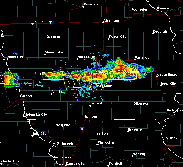 At 550 pm cdt, severe thunderstorms were located along a line extending from slater to near granger to near perry, moving south at 15 mph (radar indicated). Hazards include 70 mph wind gusts and quarter size hail. Hail damage to vehicles is expected. expect considerable tree damage. wind damage is also likely to mobile homes, roofs, and outbuildings. Locations impacted include, ankeny, johnston, perry, polk city, madrid, granger, woodward, big creek lake, saylorville lake, minburn, sheldahl, bouton, luther, berkley, perry municipal airport, big creek state park and ledges state park. At 550 pm cdt, severe thunderstorms were located along a line extending from slater to near granger to near perry, moving south at 15 mph (radar indicated). Hazards include 70 mph wind gusts and quarter size hail. Hail damage to vehicles is expected. expect considerable tree damage. wind damage is also likely to mobile homes, roofs, and outbuildings. Locations impacted include, ankeny, johnston, perry, polk city, madrid, granger, woodward, big creek lake, saylorville lake, minburn, sheldahl, bouton, luther, berkley, perry municipal airport, big creek state park and ledges state park.
|
| 6/6/2018 5:25 PM CDT |
 At 525 pm cdt, a severe thunderstorm was located over woodward, or 10 miles east of perry, moving southeast at 25 mph (radar indicated). Hazards include 60 mph wind gusts and quarter size hail. Hail damage to vehicles is expected. Expect wind damage to roofs, siding, and trees. At 525 pm cdt, a severe thunderstorm was located over woodward, or 10 miles east of perry, moving southeast at 25 mph (radar indicated). Hazards include 60 mph wind gusts and quarter size hail. Hail damage to vehicles is expected. Expect wind damage to roofs, siding, and trees.
|
| 6/6/2018 5:09 PM CDT |
 At 508 pm cdt, a severe thunderstorm was located near iowa state center, or near ames, moving east at 20 mph. a second severe storm was located near berkley moving east southeast at 20 mph (radar indicated). Hazards include 60 mph wind gusts and quarter size hail. Hail damage to vehicles is expected. expect wind damage to roofs, siding, and trees. locations impacted include, ames, boone, nevada, story city, madrid, ogden, slater, gilbert, iowa state center, boone speedway, kelley, luther, berkley, boone municipal airport, ledges state park and ames municipal airport. This includes interstate 35 between mile markers 110 and 121. At 508 pm cdt, a severe thunderstorm was located near iowa state center, or near ames, moving east at 20 mph. a second severe storm was located near berkley moving east southeast at 20 mph (radar indicated). Hazards include 60 mph wind gusts and quarter size hail. Hail damage to vehicles is expected. expect wind damage to roofs, siding, and trees. locations impacted include, ames, boone, nevada, story city, madrid, ogden, slater, gilbert, iowa state center, boone speedway, kelley, luther, berkley, boone municipal airport, ledges state park and ames municipal airport. This includes interstate 35 between mile markers 110 and 121.
|
| 6/6/2018 5:00 PM CDT |
 At 500 pm cdt, a severe thunderstorm was located near boone speedway, or near boone, moving east at 20 mph. a second severe storm was located near berkley moving east at 15 mph (radar indicated). Hazards include 60 mph wind gusts and quarter size hail. Hail damage to vehicles is expected. expect wind damage to roofs, siding, and trees. locations impacted include, ames, boone, nevada, story city, madrid, ogden, slater, gilbert, iowa state center, boone speedway, grand junction, kelley, rippey, pilot mound, luther, fraser, beaver, berkley, boone municipal airport and ledges state park. This includes interstate 35 between mile markers 110 and 121. At 500 pm cdt, a severe thunderstorm was located near boone speedway, or near boone, moving east at 20 mph. a second severe storm was located near berkley moving east at 15 mph (radar indicated). Hazards include 60 mph wind gusts and quarter size hail. Hail damage to vehicles is expected. expect wind damage to roofs, siding, and trees. locations impacted include, ames, boone, nevada, story city, madrid, ogden, slater, gilbert, iowa state center, boone speedway, grand junction, kelley, rippey, pilot mound, luther, fraser, beaver, berkley, boone municipal airport and ledges state park. This includes interstate 35 between mile markers 110 and 121.
|
| 6/6/2018 4:40 PM CDT |
 At 439 pm cdt, a severe thunderstorm was located near ogden, or near boone, moving northeast at 25 mph. there are a cluster of storms across the warning area that all may be severe moving northeast at 25 mph (radar indicated). Hazards include 60 mph wind gusts and quarter size hail. Hail damage to vehicles is expected. Expect wind damage to roofs, siding, and trees. At 439 pm cdt, a severe thunderstorm was located near ogden, or near boone, moving northeast at 25 mph. there are a cluster of storms across the warning area that all may be severe moving northeast at 25 mph (radar indicated). Hazards include 60 mph wind gusts and quarter size hail. Hail damage to vehicles is expected. Expect wind damage to roofs, siding, and trees.
|
| 5/1/2018 8:45 PM CDT |
 At 844 pm cdt, a severe thunderstorm was located near perry, moving northeast at 60 mph (radar indicated). Hazards include 60 mph wind gusts and penny size hail. Expect damage to roofs, siding, and trees. Locations impacted include, perry, ogden, woodward, grand junction, rippey, jamaica, dawson, bouton, beaver, berkley, perry municipal airport and lakin slough game management area. At 844 pm cdt, a severe thunderstorm was located near perry, moving northeast at 60 mph (radar indicated). Hazards include 60 mph wind gusts and penny size hail. Expect damage to roofs, siding, and trees. Locations impacted include, perry, ogden, woodward, grand junction, rippey, jamaica, dawson, bouton, beaver, berkley, perry municipal airport and lakin slough game management area.
|
| 5/1/2018 8:35 PM CDT |
 At 834 pm cdt, a severe thunderstorm was located 7 miles northeast of lake panorama, or 12 miles northeast of guthrie center, moving northeast at 50 mph (radar indicated). Hazards include 60 mph wind gusts and nickel size hail. Expect damage to roofs, siding, and trees. Locations impacted include, perry, ogden, woodward, lake panorama, grand junction, bagley, rippey, yale, jamaica, dawson, bouton, beaver, berkley, perry municipal airport, lakin slough game management area and springbrook state park. At 834 pm cdt, a severe thunderstorm was located 7 miles northeast of lake panorama, or 12 miles northeast of guthrie center, moving northeast at 50 mph (radar indicated). Hazards include 60 mph wind gusts and nickel size hail. Expect damage to roofs, siding, and trees. Locations impacted include, perry, ogden, woodward, lake panorama, grand junction, bagley, rippey, yale, jamaica, dawson, bouton, beaver, berkley, perry municipal airport, lakin slough game management area and springbrook state park.
|
| 5/1/2018 8:17 PM CDT |
 At 816 pm cdt, a severe thunderstorm was located near guthrie center, moving northeast at 60 mph (radar indicated). Hazards include 60 mph wind gusts and nickel size hail. expect damage to roofs, siding, and trees At 816 pm cdt, a severe thunderstorm was located near guthrie center, moving northeast at 60 mph (radar indicated). Hazards include 60 mph wind gusts and nickel size hail. expect damage to roofs, siding, and trees
|
| 5/1/2018 4:51 PM CDT |
 At 450 pm cdt, a severe thunderstorm was located near woodward, or 9 miles northeast of perry, moving northeast at 35 mph (trained weather spotters reported golfball sized hail in woodward at 448 pm). Hazards include ping pong ball size hail and 60 mph wind gusts. People and animals outdoors will be injured. expect hail damage to roofs, siding, windows, and vehicles. expect wind damage to roofs, siding, and trees. locations impacted include, ames, boone, perry, story city, madrid, ogden, roland, gilbert, woodward, boone speedway, minburn, bouton, luther, fraser, perry municipal airport, boone municipal airport and ledges state park. This includes interstate 35 between mile markers 121 and 126. At 450 pm cdt, a severe thunderstorm was located near woodward, or 9 miles northeast of perry, moving northeast at 35 mph (trained weather spotters reported golfball sized hail in woodward at 448 pm). Hazards include ping pong ball size hail and 60 mph wind gusts. People and animals outdoors will be injured. expect hail damage to roofs, siding, windows, and vehicles. expect wind damage to roofs, siding, and trees. locations impacted include, ames, boone, perry, story city, madrid, ogden, roland, gilbert, woodward, boone speedway, minburn, bouton, luther, fraser, perry municipal airport, boone municipal airport and ledges state park. This includes interstate 35 between mile markers 121 and 126.
|
| 5/1/2018 4:35 PM CDT |
 At 435 pm cdt, a severe thunderstorm was located near perry, moving northeast at 40 mph (radar indicated). Hazards include 60 mph wind gusts and quarter size hail. Hail damage to vehicles is expected. Expect wind damage to roofs, siding, and trees. At 435 pm cdt, a severe thunderstorm was located near perry, moving northeast at 40 mph (radar indicated). Hazards include 60 mph wind gusts and quarter size hail. Hail damage to vehicles is expected. Expect wind damage to roofs, siding, and trees.
|
| 4/13/2018 6:52 PM CDT |
 At 652 pm cdt, a severe thunderstorm was located near perry, moving northeast at 55 mph (radar indicated). Hazards include 60 mph wind gusts. expect damage to roofs, siding, and trees At 652 pm cdt, a severe thunderstorm was located near perry, moving northeast at 55 mph (radar indicated). Hazards include 60 mph wind gusts. expect damage to roofs, siding, and trees
|
| 5/17/2017 4:40 PM CDT |
 At 440 pm cdt, severe thunderstorms were located along a line extending from 10 miles northwest of boone to near nevada to near colfax, moving northeast at 70 mph (trained weather spotters. these storms have a history of producing wind gusts from 60 to 70 mph with numerous trees down and minor structural damage). Hazards include 70 mph wind gusts. Expect considerable tree damage. damage is likely to mobile homes, roofs, and outbuildings. locations impacted include, ames, ankeny, newton, altoona, boone, nevada, jefferson, bondurant, story city, huxley, madrid, mitchellville, colfax, ogden, prairie city, slater, state center, roland, baxter and gilbert. this includes the following highways, interstate 35 between mile markers 91 and 126. interstate 80 between mile markers 141 and 164. A tornado watch remains in effect until 700 pm cdt for central and west central iowa. At 440 pm cdt, severe thunderstorms were located along a line extending from 10 miles northwest of boone to near nevada to near colfax, moving northeast at 70 mph (trained weather spotters. these storms have a history of producing wind gusts from 60 to 70 mph with numerous trees down and minor structural damage). Hazards include 70 mph wind gusts. Expect considerable tree damage. damage is likely to mobile homes, roofs, and outbuildings. locations impacted include, ames, ankeny, newton, altoona, boone, nevada, jefferson, bondurant, story city, huxley, madrid, mitchellville, colfax, ogden, prairie city, slater, state center, roland, baxter and gilbert. this includes the following highways, interstate 35 between mile markers 91 and 126. interstate 80 between mile markers 141 and 164. A tornado watch remains in effect until 700 pm cdt for central and west central iowa.
|
| 5/17/2017 4:17 PM CDT |
 At 415 pm cdt, severe thunderstorms were located along a line extending from 7 miles south of jefferson to near grimes to near carlisle, moving north at 60 mph (trained weather spotters. at 410 pm...65 to 70 mph winds were reported in west des moines). Hazards include 70 mph wind gusts. Expect considerable tree damage. Damage is likely to mobile homes, roofs, and outbuildings. At 415 pm cdt, severe thunderstorms were located along a line extending from 7 miles south of jefferson to near grimes to near carlisle, moving north at 60 mph (trained weather spotters. at 410 pm...65 to 70 mph winds were reported in west des moines). Hazards include 70 mph wind gusts. Expect considerable tree damage. Damage is likely to mobile homes, roofs, and outbuildings.
|
| 5/16/2017 9:15 PM CDT |
 At 915 pm cdt, a severe thunderstorm was located near perry, moving northeast at 60 mph (radar indicated). Hazards include 60 mph wind gusts and quarter size hail. Hail damage to vehicles is expected. expect wind damage to roofs, siding, and trees. Locations impacted include, boone, perry, jefferson, madrid, ogden, dallas center, granger, woodward, boone speedway, grand junction, minburn, bagley, rippey, yale, paton, jamaica, boxholm, pilot mound, dawson and bouton. At 915 pm cdt, a severe thunderstorm was located near perry, moving northeast at 60 mph (radar indicated). Hazards include 60 mph wind gusts and quarter size hail. Hail damage to vehicles is expected. expect wind damage to roofs, siding, and trees. Locations impacted include, boone, perry, jefferson, madrid, ogden, dallas center, granger, woodward, boone speedway, grand junction, minburn, bagley, rippey, yale, paton, jamaica, boxholm, pilot mound, dawson and bouton.
|
| 5/16/2017 8:57 PM CDT |
 At 857 pm cdt, a severe thunderstorm was located near panora, or 10 miles northeast of guthrie center, moving northeast at 60 mph (radar indicated). Hazards include 60 mph wind gusts and quarter size hail. Hail damage to vehicles is expected. Expect wind damage to roofs, siding, and trees. At 857 pm cdt, a severe thunderstorm was located near panora, or 10 miles northeast of guthrie center, moving northeast at 60 mph (radar indicated). Hazards include 60 mph wind gusts and quarter size hail. Hail damage to vehicles is expected. Expect wind damage to roofs, siding, and trees.
|
| 3/6/2017 6:36 PM CST |
 At 635 pm cst, severe thunderstorms were located along a line extending from near story city to 12 miles east of green valley lake, moving east at 55 mph (radar indicated). Hazards include 60 mph wind gusts and quarter size hail. Hail damage to vehicles is expected. expect wind damage to roofs, siding, and trees. locations impacted include, boone, perry, winterset, adel, madrid, ogden, dallas center, earlham, de soto, woodward, van meter, boone speedway, redfield, dexter, diamondhead lake, minburn, pilot mound, bouton, luther and macksburg. this includes interstate 80 between mile markers 95 and 114. A tornado watch remains in effect until 1000 pm cst for central, south central, southwestern and west central iowa. At 635 pm cst, severe thunderstorms were located along a line extending from near story city to 12 miles east of green valley lake, moving east at 55 mph (radar indicated). Hazards include 60 mph wind gusts and quarter size hail. Hail damage to vehicles is expected. expect wind damage to roofs, siding, and trees. locations impacted include, boone, perry, winterset, adel, madrid, ogden, dallas center, earlham, de soto, woodward, van meter, boone speedway, redfield, dexter, diamondhead lake, minburn, pilot mound, bouton, luther and macksburg. this includes interstate 80 between mile markers 95 and 114. A tornado watch remains in effect until 1000 pm cst for central, south central, southwestern and west central iowa.
|
| 3/6/2017 6:03 PM CST |
 At 603 pm cst, severe thunderstorms were located along a line extending from 8 miles southeast of gowrie to 8 miles northeast of lake icaria, moving east at 40 mph (radar indicated). Hazards include 60 mph wind gusts and quarter size hail. Hail damage to vehicles is expected. Expect wind damage to roofs, siding, and trees. At 603 pm cst, severe thunderstorms were located along a line extending from 8 miles southeast of gowrie to 8 miles northeast of lake icaria, moving east at 40 mph (radar indicated). Hazards include 60 mph wind gusts and quarter size hail. Hail damage to vehicles is expected. Expect wind damage to roofs, siding, and trees.
|
| 7/6/2016 12:19 AM CDT |
 At 1218 am cdt, a severe thunderstorm was located 7 miles north of boone, moving east at 55 mph (at 1140 pm lake city weather station reported 62 mph wind gusts). Hazards include 60 mph wind gusts and quarter size hail. Hail damage to vehicles is expected. expect wind damage to roofs, siding, and trees. Locations impacted include, jefferson, ogden, gowrie, dayton, grand junction, scranton, lehigh, churdan, farnhamville, lohrville, harcourt, rippey, paton, boxholm, pilot mound, fraser, ralston, dana, beaver and berkley. At 1218 am cdt, a severe thunderstorm was located 7 miles north of boone, moving east at 55 mph (at 1140 pm lake city weather station reported 62 mph wind gusts). Hazards include 60 mph wind gusts and quarter size hail. Hail damage to vehicles is expected. expect wind damage to roofs, siding, and trees. Locations impacted include, jefferson, ogden, gowrie, dayton, grand junction, scranton, lehigh, churdan, farnhamville, lohrville, harcourt, rippey, paton, boxholm, pilot mound, fraser, ralston, dana, beaver and berkley.
|
| 7/5/2016 11:48 PM CDT |
 At 1147 pm cdt, a severe thunderstorm was located 7 miles north of jefferson, moving east at 55 mph (carroll airport reported 69 mph winds at 1143 pm). Hazards include 70 mph wind gusts and quarter size hail. Hail damage to vehicles is expected. expect considerable tree damage. wind damage is also likely to mobile homes, roofs, and outbuildings. Locations impacted include, jefferson, ogden, lake city, glidden, gowrie, dayton, grand junction, coalville, scranton, otho, lehigh, duncombe, churdan, callender, farnhamville, lohrville, harcourt, rippey, paton and boxholm. At 1147 pm cdt, a severe thunderstorm was located 7 miles north of jefferson, moving east at 55 mph (carroll airport reported 69 mph winds at 1143 pm). Hazards include 70 mph wind gusts and quarter size hail. Hail damage to vehicles is expected. expect considerable tree damage. wind damage is also likely to mobile homes, roofs, and outbuildings. Locations impacted include, jefferson, ogden, lake city, glidden, gowrie, dayton, grand junction, coalville, scranton, otho, lehigh, duncombe, churdan, callender, farnhamville, lohrville, harcourt, rippey, paton and boxholm.
|
| 7/5/2016 11:32 PM CDT |
 At 1131 pm cdt, a severe thunderstorm was located over glidden, or 7 miles east of carroll, moving east at 55 mph (radar indicated). Hazards include 70 mph wind gusts and quarter size hail. Hail damage to vehicles is expected. expect considerable tree damage. Wind damage is also likely to mobile homes, roofs, and outbuildings. At 1131 pm cdt, a severe thunderstorm was located over glidden, or 7 miles east of carroll, moving east at 55 mph (radar indicated). Hazards include 70 mph wind gusts and quarter size hail. Hail damage to vehicles is expected. expect considerable tree damage. Wind damage is also likely to mobile homes, roofs, and outbuildings.
|
| 6/14/2016 6:44 PM CDT |
 At 643 pm cdt, a severe thunderstorm was located near ogden, or 10 miles west of boone, moving east at 45 mph (radar indicated). Hazards include 60 mph wind gusts and nickel size hail. Expect damage to roofs. siding. and trees. Locations impacted include, jefferson, grand junction, rippey, beaver, berkley and jefferson municipal airport. At 643 pm cdt, a severe thunderstorm was located near ogden, or 10 miles west of boone, moving east at 45 mph (radar indicated). Hazards include 60 mph wind gusts and nickel size hail. Expect damage to roofs. siding. and trees. Locations impacted include, jefferson, grand junction, rippey, beaver, berkley and jefferson municipal airport.
|
| 6/14/2016 6:17 PM CDT |
 At 617 pm cdt, a severe thunderstorm was located 6 miles southwest of jefferson, moving east at 45 mph (radar indicated). Hazards include 60 mph wind gusts and nickel size hail. Expect damage to roofs. siding. And trees. At 617 pm cdt, a severe thunderstorm was located 6 miles southwest of jefferson, moving east at 45 mph (radar indicated). Hazards include 60 mph wind gusts and nickel size hail. Expect damage to roofs. siding. And trees.
|
| 5/30/2016 6:27 PM CDT |
 At 627 pm cdt, a severe thunderstorm was located 5 miles northwest of perry, moving north at 15 mph (radar indicated). Hazards include 60 mph wind gusts and quarter size hail. Hail damage to vehicles is expected. expect wind damage to roofs, siding, and trees. Locations impacted include, perry, rippey, berkley and perry municipal airport. At 627 pm cdt, a severe thunderstorm was located 5 miles northwest of perry, moving north at 15 mph (radar indicated). Hazards include 60 mph wind gusts and quarter size hail. Hail damage to vehicles is expected. expect wind damage to roofs, siding, and trees. Locations impacted include, perry, rippey, berkley and perry municipal airport.
|
| 5/30/2016 6:11 PM CDT |
 At 611 pm cdt, a severe thunderstorm was located near perry, moving north at 15 mph (radar indicated). Hazards include 60 mph wind gusts and quarter size hail. Hail damage to vehicles is expected. Expect wind damage to roofs, siding, and trees. At 611 pm cdt, a severe thunderstorm was located near perry, moving north at 15 mph (radar indicated). Hazards include 60 mph wind gusts and quarter size hail. Hail damage to vehicles is expected. Expect wind damage to roofs, siding, and trees.
|
| 5/26/2016 3:37 AM CDT |
 The severe thunderstorm warning for southwestern story, southwestern hamilton, northwestern polk, boone and northeastern dallas counties will expire at 345 am cdt, the storms which prompted the warning have weakened below severe limits, and exited the warned area. therefore the warning will be allowed to expire. The severe thunderstorm warning for southwestern story, southwestern hamilton, northwestern polk, boone and northeastern dallas counties will expire at 345 am cdt, the storms which prompted the warning have weakened below severe limits, and exited the warned area. therefore the warning will be allowed to expire.
|
| 5/26/2016 3:26 AM CDT |
 At 326 am cdt, severe thunderstorms were located along a line extending from 6 miles northeast of story city to 4 miles northwest of perry, moving east at 50 mph (radar indicated). Hazards include 60 mph wind gusts. Expect damage to roofs. siding. and trees. Locations impacted include, ames, boone, madrid, ogden, slater, woodward, boone speedway, sheldahl, kelley, bouton, luther, berkley, ledges state park, boone municipal airport and big creek state park. At 326 am cdt, severe thunderstorms were located along a line extending from 6 miles northeast of story city to 4 miles northwest of perry, moving east at 50 mph (radar indicated). Hazards include 60 mph wind gusts. Expect damage to roofs. siding. and trees. Locations impacted include, ames, boone, madrid, ogden, slater, woodward, boone speedway, sheldahl, kelley, bouton, luther, berkley, ledges state park, boone municipal airport and big creek state park.
|
| 5/26/2016 3:18 AM CDT |
 At 317 am cdt, severe thunderstorms were located along a line extending from 4 miles south of jewell junction to 10 miles northeast of lake panorama, moving southeast at 55 mph (radar indicated). Hazards include 60 mph wind gusts. Expect damage to roofs. siding. and trees. Locations impacted include, ames, boone, perry, madrid, ogden, slater, woodward, boone speedway, stratford, stanhope, minburn, sheldahl, kelley, boxholm, pilot mound, bouton, luther, fraser, beaver and berkley. At 317 am cdt, severe thunderstorms were located along a line extending from 4 miles south of jewell junction to 10 miles northeast of lake panorama, moving southeast at 55 mph (radar indicated). Hazards include 60 mph wind gusts. Expect damage to roofs. siding. and trees. Locations impacted include, ames, boone, perry, madrid, ogden, slater, woodward, boone speedway, stratford, stanhope, minburn, sheldahl, kelley, boxholm, pilot mound, bouton, luther, fraser, beaver and berkley.
|
| 5/26/2016 2:54 AM CDT |
 At 254 am cdt, severe thunderstorms were located along a line extending from 4 miles north of lake city to 7 miles south of panora, moving east at 60 mph (radar indicated). Hazards include 60 mph wind gusts and penny size hail. Expect damage to roofs. siding. And trees. At 254 am cdt, severe thunderstorms were located along a line extending from 4 miles north of lake city to 7 miles south of panora, moving east at 60 mph (radar indicated). Hazards include 60 mph wind gusts and penny size hail. Expect damage to roofs. siding. And trees.
|
| 11/11/2015 3:09 PM CST |
 At 309 pm cst, a severe thunderstorm capable of producing a tornado was located 4 miles west of dallas center, or 6 miles northwest of adel, moving northeast at 40 mph (radar indicated rotation). Hazards include tornado. Flying debris will be dangerous to those caught without shelter. mobile homes will be damaged or destroyed. damage to roofs, windows and vehicles will occur. tree damage is likely. this dangerous storm will be near, woodward around 330 pm cst. madrid around 335 pm cst. Other locations impacted by this tornadic thunderstorm include bouton, berkley, perry municipal airport and minburn. At 309 pm cst, a severe thunderstorm capable of producing a tornado was located 4 miles west of dallas center, or 6 miles northwest of adel, moving northeast at 40 mph (radar indicated rotation). Hazards include tornado. Flying debris will be dangerous to those caught without shelter. mobile homes will be damaged or destroyed. damage to roofs, windows and vehicles will occur. tree damage is likely. this dangerous storm will be near, woodward around 330 pm cst. madrid around 335 pm cst. Other locations impacted by this tornadic thunderstorm include bouton, berkley, perry municipal airport and minburn.
|
| 11/11/2015 2:46 PM CST |
 At 246 pm cst, severe thunderstorms were located along a line extending from 8 miles northwest of carroll to 7 miles southeast of coon rapids to 7 miles west of winterset, moving northeast at 50 mph (radar indicated). Hazards include 60 mph wind gusts and quarter size hail. Hail damage to vehicles is expected. Expect wind damage to roofs, siding and trees. At 246 pm cst, severe thunderstorms were located along a line extending from 8 miles northwest of carroll to 7 miles southeast of coon rapids to 7 miles west of winterset, moving northeast at 50 mph (radar indicated). Hazards include 60 mph wind gusts and quarter size hail. Hail damage to vehicles is expected. Expect wind damage to roofs, siding and trees.
|
| 6/7/2015 1:36 AM CDT | At 135 am cdt, a severe thunderstorm was located 6 miles east of boone speedway, or 7 miles southeast of boone, moving east at 45 mph (radar indicated). Hazards include 60 mph wind gusts. Expect damage to roofs. siding and trees. Locations impacted include, boone, madrid, ogden, woodward, boone speedway, sheldahl, luther, berkley, boone municipal airport and ledges state park. |
| 6/7/2015 12:59 AM CDT | At 1259 am cdt, a severe thunderstorm was located 4 miles northeast of jefferson, moving east at 55 mph (radar indicated). Hazards include 60 mph wind gusts. Expect damage to roofs. Siding and trees. |
| 5/17/2015 3:43 AM CDT | At 342 am cdt, a severe thunderstorm was located 6 miles south of ogden, or 8 miles north of perry, moving north at 40 mph (radar indicated). Hazards include 60 mph wind gusts. Expect damage to roofs. siding and trees. this severe storm will be near, ogden around 350 am cdt. other locations impacted by this severe thunderstorm include grand junction, berkley, rippey, ledges state park and beaver. Possible. |
| 5/17/2015 3:23 AM CDT | At 322 am cdt, a severe thunderstorm was located 6 miles north of dallas center, or 6 miles southeast of perry, moving north at 40 mph (radar indicated). Hazards include 60 mph wind gusts. Expect damage to roofs. siding and trees. this severe storm will be near, perry around 335 am cdt. ogden around 350 am cdt. other locations impacted by this severe thunderstorm include grand junction, rippey, beaver, minburn, berkley, bouton, ledges state park and perry municipal airport. 75in. |
| 5/17/2015 3:11 AM CDT | At 310 am cdt, a severe thunderstorm was located over dallas center, or near adel, moving north at 35 mph (radar indicated). Hazards include 60 mph wind gusts. Expect damage to roofs. siding and trees. this severe thunderstorm will be near, woodward around 330 am cdt. perry around 335 am cdt. ogden around 350 am cdt. other locations impacted by this severe thunderstorm include grand junction, rippey, beaver, minburn, berkley, bouton, ledges state park and perry municipal airport. 75in. |
| 8/31/2014 12:07 PM CDT | Storm damage reported in boone county IA, 0.3 miles SW of Berkley, IA |
Hail Maps for Berkley, IA


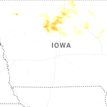

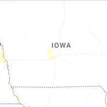
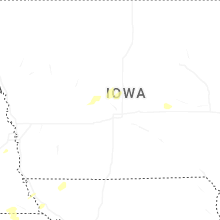
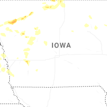
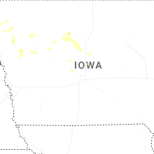

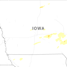


Connect with Interactive Hail Maps