

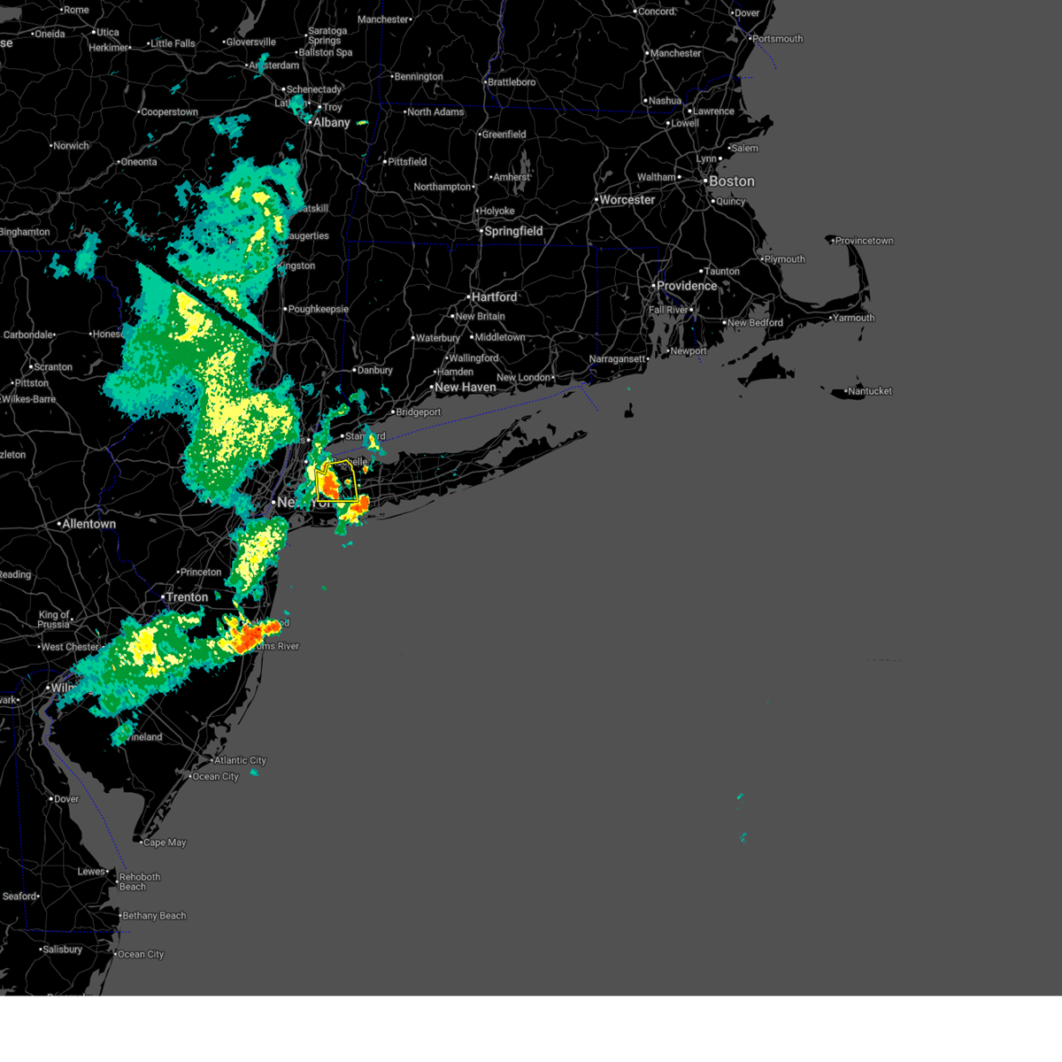
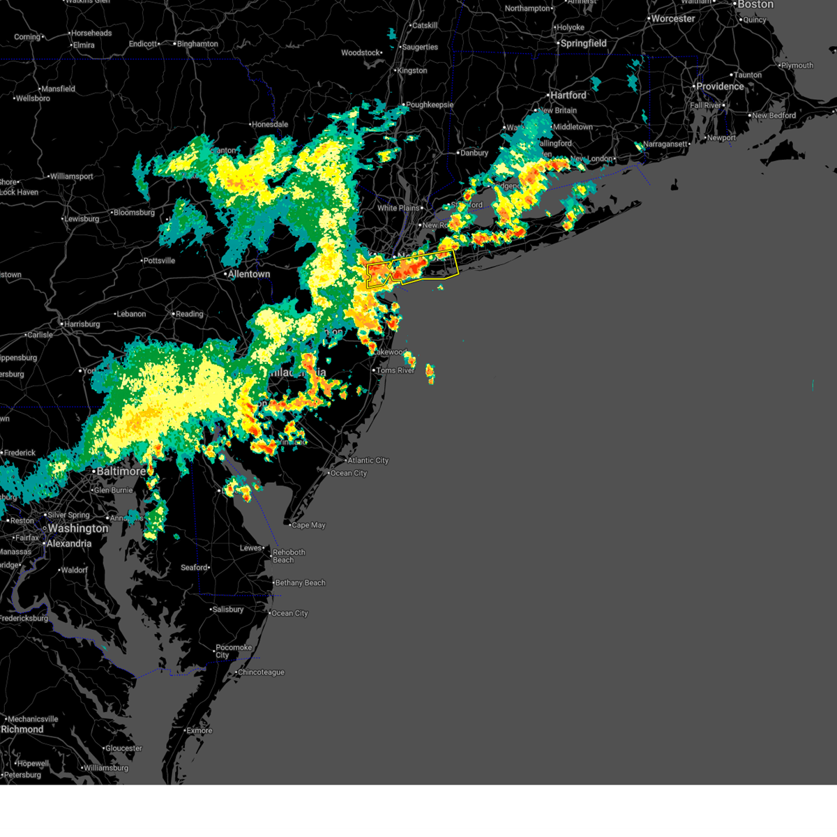
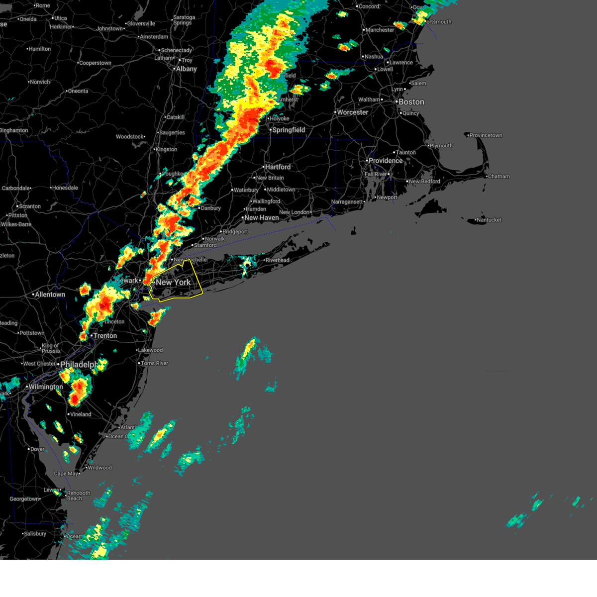
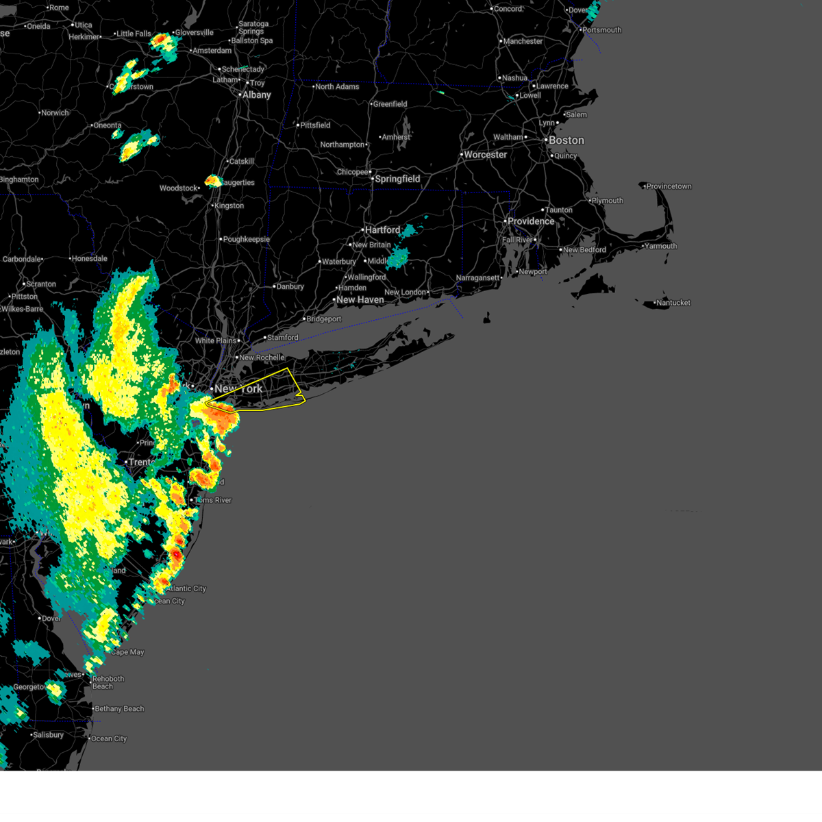
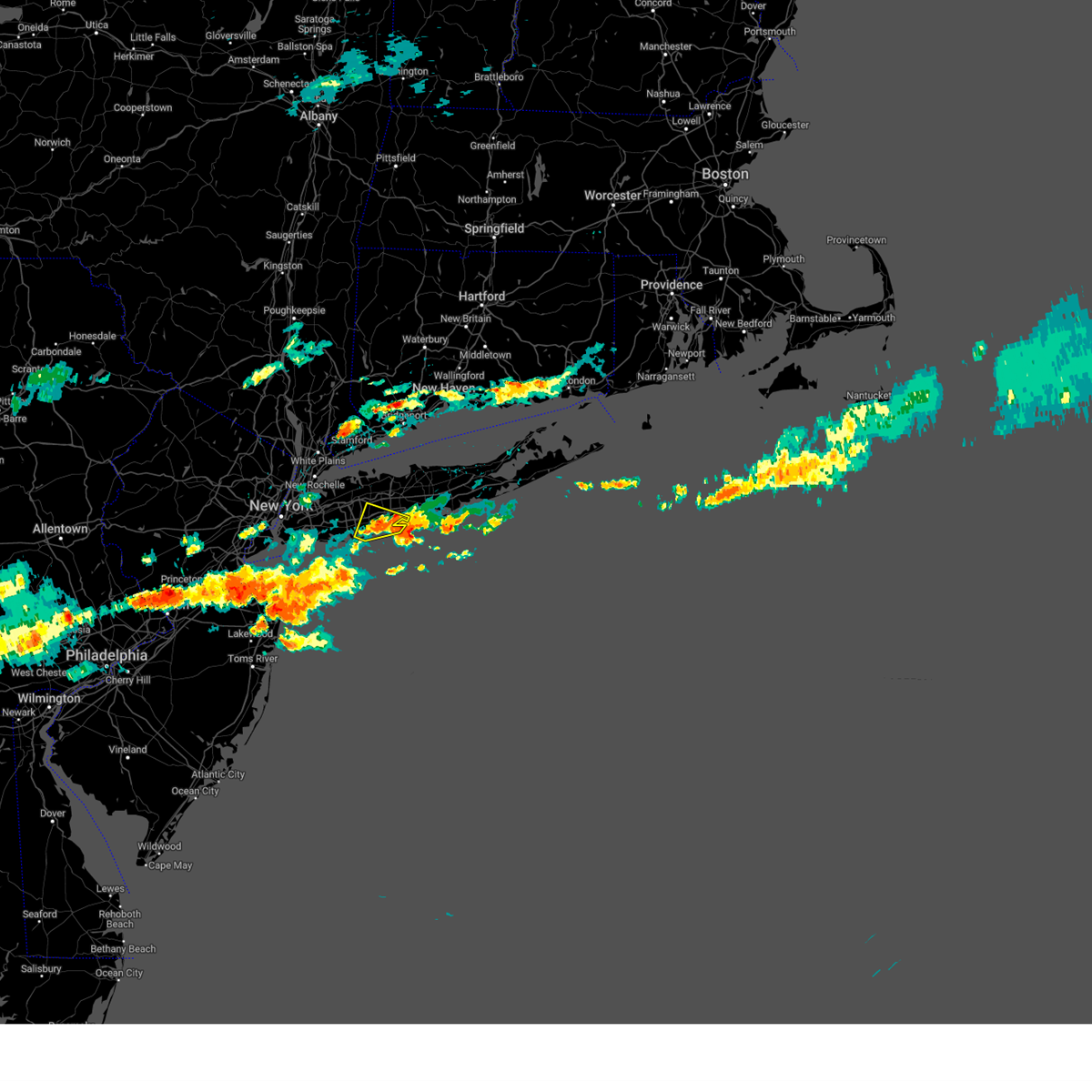
Hail Map for Bethpage, NY
The Bethpage, NY area has had 0 reports of on-the-ground hail by trained spotters, and has been under severe weather warnings 17 times during the past 12 months. Doppler radar has detected hail at or near Bethpage, NY on 15 occasions.
| Name: | Bethpage, NY |
| Where Located: | 26.9 miles E of Brooklyn, NY |
| Map: | Google Map for Bethpage, NY |
| Population: | 16429 |
| Housing Units: | 6051 |
| More Info: | Search Google for Bethpage, NY |
5
The Top Recent Hail Date for Bethpage, NY is Sunday, September 25, 2022 (1st out of 15)

Hail and Wind Damage Spotted near Bethpage, NY
| Date / Time | Report Details |
|---|---|
| 6/12/2026 12:03 AM EDT |
 At 1202 am edt, a severe thunderstorm was located over manhasset, or near mineola, moving east at 30 mph (radar indicated). Hazards include 70 mph wind gusts and penny size hail. Expect considerable tree damage. damage is likely to mobile homes, roofs, and outbuildings. this severe storm will be near, westbury and hicksville around 1210 am edt. Plainview and syosset around 1215 am edt. At 1202 am edt, a severe thunderstorm was located over manhasset, or near mineola, moving east at 30 mph (radar indicated). Hazards include 70 mph wind gusts and penny size hail. Expect considerable tree damage. damage is likely to mobile homes, roofs, and outbuildings. this severe storm will be near, westbury and hicksville around 1210 am edt. Plainview and syosset around 1215 am edt.
|
| 6/11/2026 11:45 PM EDT |
 Svrokx the national weather service in upton ny has issued a * severe thunderstorm warning for, queens county in southeastern new york, bronx county in southeastern new york, northern nassau county in southeastern new york, * until 1230 am edt. * at 1145 pm edt, a severe thunderstorm was located over whitestone, or over flushing, moving east at 25 mph (radar indicated). Hazards include 70 mph wind gusts and penny size hail. Expect considerable tree damage. damage is likely to mobile homes, roofs, and outbuildings. this severe thunderstorm will be near, great neck and throgs neck bridge around 1150 pm edt. port washington around 1155 pm edt. mineola around 1200 am edt. westbury and brookville around 1205 am edt. hicksville around 1210 am edt. Plainview and syosset around 1215 am edt. Svrokx the national weather service in upton ny has issued a * severe thunderstorm warning for, queens county in southeastern new york, bronx county in southeastern new york, northern nassau county in southeastern new york, * until 1230 am edt. * at 1145 pm edt, a severe thunderstorm was located over whitestone, or over flushing, moving east at 25 mph (radar indicated). Hazards include 70 mph wind gusts and penny size hail. Expect considerable tree damage. damage is likely to mobile homes, roofs, and outbuildings. this severe thunderstorm will be near, great neck and throgs neck bridge around 1150 pm edt. port washington around 1155 pm edt. mineola around 1200 am edt. westbury and brookville around 1205 am edt. hicksville around 1210 am edt. Plainview and syosset around 1215 am edt.
|
| 6/6/2026 7:54 PM EDT |
 Svrokx the national weather service in upton ny has issued a * severe thunderstorm warning for, western suffolk county in southeastern new york, nassau county in southeastern new york, * until 900 pm edt. * at 752 pm edt, severe thunderstorms were located along a line extending from scarsdale to flushing to oakwood, moving east at 40 mph (asos reported). Hazards include 60 mph wind gusts and penny size hail. Expect damage to trees and power lines. severe thunderstorms will be near, glen cove and port washington around 800 pm edt. garden city and mineola around 805 pm edt. westbury and oyster bay around 810 pm edt. syosset and hicksville around 815 pm edt. levittown and freeport around 820 pm edt. huntington station and huntington around 825 pm edt. massapequa and northport around 830 pm edt. commack and deer park around 835 pm edt. brentwood and babylon around 840 pm edt. Islip and hauppauge around 845 pm edt. Svrokx the national weather service in upton ny has issued a * severe thunderstorm warning for, western suffolk county in southeastern new york, nassau county in southeastern new york, * until 900 pm edt. * at 752 pm edt, severe thunderstorms were located along a line extending from scarsdale to flushing to oakwood, moving east at 40 mph (asos reported). Hazards include 60 mph wind gusts and penny size hail. Expect damage to trees and power lines. severe thunderstorms will be near, glen cove and port washington around 800 pm edt. garden city and mineola around 805 pm edt. westbury and oyster bay around 810 pm edt. syosset and hicksville around 815 pm edt. levittown and freeport around 820 pm edt. huntington station and huntington around 825 pm edt. massapequa and northport around 830 pm edt. commack and deer park around 835 pm edt. brentwood and babylon around 840 pm edt. Islip and hauppauge around 845 pm edt.
|
| 5/20/2026 7:19 PM EDT |
 At 719 pm edt, a severe thunderstorm was located over freeport, moving east at 30 mph (radar indicated). Hazards include 60 mph wind gusts and penny size hail. Expect damage to trees and power lines. This severe storm will be near, massapequa and wantagh around 725 pm edt. At 719 pm edt, a severe thunderstorm was located over freeport, moving east at 30 mph (radar indicated). Hazards include 60 mph wind gusts and penny size hail. Expect damage to trees and power lines. This severe storm will be near, massapequa and wantagh around 725 pm edt.
|
| 5/20/2026 6:51 PM EDT |
 Svrokx the national weather service in upton ny has issued a * severe thunderstorm warning for, hudson county in northeastern new jersey, southeastern union county in northeastern new jersey, queens county in southeastern new york, richmond county in southeastern new york, kings county in southeastern new york, southern nassau county in southeastern new york, * until 730 pm edt. * at 651 pm edt, a severe thunderstorm was located over rockaway beach, moving east at 30 mph (radar indicated). Hazards include 60 mph wind gusts and penny size hail. Expect damage to trees and power lines. this severe thunderstorm will be near, valley stream and lynbrook around 655 pm edt. long beach and oceanside around 700 pm edt. freeport and baldwin around 705 pm edt. wantagh around 715 pm edt. Massapequa around 720 pm edt. Svrokx the national weather service in upton ny has issued a * severe thunderstorm warning for, hudson county in northeastern new jersey, southeastern union county in northeastern new jersey, queens county in southeastern new york, richmond county in southeastern new york, kings county in southeastern new york, southern nassau county in southeastern new york, * until 730 pm edt. * at 651 pm edt, a severe thunderstorm was located over rockaway beach, moving east at 30 mph (radar indicated). Hazards include 60 mph wind gusts and penny size hail. Expect damage to trees and power lines. this severe thunderstorm will be near, valley stream and lynbrook around 655 pm edt. long beach and oceanside around 700 pm edt. freeport and baldwin around 705 pm edt. wantagh around 715 pm edt. Massapequa around 720 pm edt.
|
| 3/17/2026 12:19 AM EDT |
 Svrokx the national weather service in upton ny has issued a * severe thunderstorm warning for, hudson county in northeastern new jersey, southeastern bergen county in northeastern new jersey, southern westchester county in southeastern new york, queens county in southeastern new york, bronx county in southeastern new york, kings county in southeastern new york, new york (manhattan) county in southeastern new york, nassau county in southeastern new york, * until 100 am edt. * at 1219 am edt, severe thunderstorms were located along a line extending from caldwell to near linden to near keansburg to holmdel, moving northeast at 50 mph (radar indicated). Hazards include 60 mph wind gusts. Expect damage to trees and power lines. severe thunderstorms will be near, jersey city and hoboken around 1225 am edt. flatbush and hackensack around 1230 am edt. mott haven and bergenfield around 1235 am edt. jamaica and yonkers around 1240 am edt. new rochelle and valley stream around 1245 am edt. Long beach and garden city around 1250 am edt. Svrokx the national weather service in upton ny has issued a * severe thunderstorm warning for, hudson county in northeastern new jersey, southeastern bergen county in northeastern new jersey, southern westchester county in southeastern new york, queens county in southeastern new york, bronx county in southeastern new york, kings county in southeastern new york, new york (manhattan) county in southeastern new york, nassau county in southeastern new york, * until 100 am edt. * at 1219 am edt, severe thunderstorms were located along a line extending from caldwell to near linden to near keansburg to holmdel, moving northeast at 50 mph (radar indicated). Hazards include 60 mph wind gusts. Expect damage to trees and power lines. severe thunderstorms will be near, jersey city and hoboken around 1225 am edt. flatbush and hackensack around 1230 am edt. mott haven and bergenfield around 1235 am edt. jamaica and yonkers around 1240 am edt. new rochelle and valley stream around 1245 am edt. Long beach and garden city around 1250 am edt.
|
| 12/19/2025 4:47 PM EST |
 the severe thunderstorm warning has been cancelled and is no longer in effect the severe thunderstorm warning has been cancelled and is no longer in effect
|
| 12/19/2025 4:47 PM EST |
 At 446 pm est, severe thunderstorms were located along a line extending from near lake carmel to near wilton to near centerport to farmingdale, moving east at 45 mph (trained weather spotters). Hazards include 60 mph wind gusts. Expect damage to trees and power lines. these severe storms will be near, norwalk and danbury around 450 pm est. brentwood and smithtown around 455 pm est. Hauppauge around 500 pm est. At 446 pm est, severe thunderstorms were located along a line extending from near lake carmel to near wilton to near centerport to farmingdale, moving east at 45 mph (trained weather spotters). Hazards include 60 mph wind gusts. Expect damage to trees and power lines. these severe storms will be near, norwalk and danbury around 450 pm est. brentwood and smithtown around 455 pm est. Hauppauge around 500 pm est.
|
| 12/19/2025 4:12 PM EST |
 Svrokx the national weather service in upton ny has issued a * severe thunderstorm warning for, fairfield county in southern connecticut, westchester county in southeastern new york, east central orange county in southeastern new york, putnam county in southeastern new york, queens county in southeastern new york, bronx county in southeastern new york, western suffolk county in southeastern new york, kings county in southeastern new york, rockland county in southeastern new york, nassau county in southeastern new york, * until 500 pm est. * at 410 pm est, showers with embedded thunderstorms were located along a line extending from near chester to near nyack to east tremont to flatbush, moving east at 45 mph (trained weather spotters). Hazards include 60 mph wind gusts. Expect damage to trees and power lines. severe thunderstorms will be near, jamaica and yonkers around 415 pm est. valley stream and port chester around 420 pm est. garden city and lynbrook around 425 pm est. stamford and westbury around 430 pm est. levittown and plainview around 435 pm est. norwalk and huntington station around 440 pm est. danbury and dix hills around 445 pm est. Commack and deer park around 450 pm est. Svrokx the national weather service in upton ny has issued a * severe thunderstorm warning for, fairfield county in southern connecticut, westchester county in southeastern new york, east central orange county in southeastern new york, putnam county in southeastern new york, queens county in southeastern new york, bronx county in southeastern new york, western suffolk county in southeastern new york, kings county in southeastern new york, rockland county in southeastern new york, nassau county in southeastern new york, * until 500 pm est. * at 410 pm est, showers with embedded thunderstorms were located along a line extending from near chester to near nyack to east tremont to flatbush, moving east at 45 mph (trained weather spotters). Hazards include 60 mph wind gusts. Expect damage to trees and power lines. severe thunderstorms will be near, jamaica and yonkers around 415 pm est. valley stream and port chester around 420 pm est. garden city and lynbrook around 425 pm est. stamford and westbury around 430 pm est. levittown and plainview around 435 pm est. norwalk and huntington station around 440 pm est. danbury and dix hills around 445 pm est. Commack and deer park around 450 pm est.
|
| 9/6/2025 4:09 PM EDT |
 The storms which prompted the warning have weakened below severe limits, and no longer pose an immediate threat to life or property. therefore, the warning will be allowed to expire. a severe thunderstorm watch remains in effect until 800 pm edt for southeastern new york. The storms which prompted the warning have weakened below severe limits, and no longer pose an immediate threat to life or property. therefore, the warning will be allowed to expire. a severe thunderstorm watch remains in effect until 800 pm edt for southeastern new york.
|
| 9/6/2025 4:00 PM EDT |
 the severe thunderstorm warning has been cancelled and is no longer in effect the severe thunderstorm warning has been cancelled and is no longer in effect
|
| 9/6/2025 4:00 PM EDT |
 At 400 pm edt, severe thunderstorms were located along a line extending from sands point to near manhasset to mineola to baldwin to lido beach, moving east at 75 mph (radar indicated). Hazards include 60 mph wind gusts. Expect damage to trees and power lines. These severe storms will be near, levittown and glen cove around 405 pm edt. At 400 pm edt, severe thunderstorms were located along a line extending from sands point to near manhasset to mineola to baldwin to lido beach, moving east at 75 mph (radar indicated). Hazards include 60 mph wind gusts. Expect damage to trees and power lines. These severe storms will be near, levittown and glen cove around 405 pm edt.
|
| 9/6/2025 3:52 PM EDT |
 the severe thunderstorm warning has been cancelled and is no longer in effect the severe thunderstorm warning has been cancelled and is no longer in effect
|
| 9/6/2025 3:52 PM EDT |
 At 351 pm edt, severe thunderstorms were located along a line extending from throgs neck bridge to elmont to atlantic beach, moving east at 40 mph (radar indicated). Hazards include 60 mph wind gusts. Expect damage to trees and power lines. these severe storms will be near, freeport and valley stream around 355 pm edt. levittown and glen cove around 400 pm edt. Massapequa and jones beach around 405 pm edt. At 351 pm edt, severe thunderstorms were located along a line extending from throgs neck bridge to elmont to atlantic beach, moving east at 40 mph (radar indicated). Hazards include 60 mph wind gusts. Expect damage to trees and power lines. these severe storms will be near, freeport and valley stream around 355 pm edt. levittown and glen cove around 400 pm edt. Massapequa and jones beach around 405 pm edt.
|
| 9/6/2025 3:39 PM EDT |
 At 338 pm edt, a severe thunderstorm was located over ozone park, or near crown heights, moving east at 50 mph (radar indicated). Hazards include 60 mph wind gusts. Expect damage to trees and power lines. this severe storm will be near, jamaica and valley stream around 345 pm edt. mineola and westbury around 350 pm edt. Levittown and hicksville around 355 pm edt. At 338 pm edt, a severe thunderstorm was located over ozone park, or near crown heights, moving east at 50 mph (radar indicated). Hazards include 60 mph wind gusts. Expect damage to trees and power lines. this severe storm will be near, jamaica and valley stream around 345 pm edt. mineola and westbury around 350 pm edt. Levittown and hicksville around 355 pm edt.
|
| 9/6/2025 3:39 PM EDT |
 the severe thunderstorm warning has been cancelled and is no longer in effect the severe thunderstorm warning has been cancelled and is no longer in effect
|
| 9/6/2025 3:23 PM EDT |
 Svrokx the national weather service in upton ny has issued a * severe thunderstorm warning for, hudson county in northeastern new jersey, southeastern union county in northeastern new jersey, queens county in southeastern new york, richmond county in southeastern new york, bronx county in southeastern new york, kings county in southeastern new york, new york (manhattan) county in southeastern new york, nassau county in southeastern new york, * until 415 pm edt. * at 322 pm edt, a severe thunderstorm was located over tompkinsville, or over the verrazano narrows bridge, moving east at 35 mph (radar indicated). Hazards include 60 mph wind gusts and penny size hail. Expect damage to trees and power lines. this severe thunderstorm will be near, flatbush and coney island around 330 pm edt. canarsie and brooklyn heights around 335 pm edt. forest hills and howard beach around 340 pm edt. jamaica and kennedy airport around 345 pm edt. elmont around 350 pm edt. valley stream and garden city around 355 pm edt. mineola and hempstead around 400 pm edt. Westbury around 405 pm edt. Svrokx the national weather service in upton ny has issued a * severe thunderstorm warning for, hudson county in northeastern new jersey, southeastern union county in northeastern new jersey, queens county in southeastern new york, richmond county in southeastern new york, bronx county in southeastern new york, kings county in southeastern new york, new york (manhattan) county in southeastern new york, nassau county in southeastern new york, * until 415 pm edt. * at 322 pm edt, a severe thunderstorm was located over tompkinsville, or over the verrazano narrows bridge, moving east at 35 mph (radar indicated). Hazards include 60 mph wind gusts and penny size hail. Expect damage to trees and power lines. this severe thunderstorm will be near, flatbush and coney island around 330 pm edt. canarsie and brooklyn heights around 335 pm edt. forest hills and howard beach around 340 pm edt. jamaica and kennedy airport around 345 pm edt. elmont around 350 pm edt. valley stream and garden city around 355 pm edt. mineola and hempstead around 400 pm edt. Westbury around 405 pm edt.
|
| 6/19/2025 7:28 PM EDT |
 The storms which prompted the warning have weakened. therefore, the warning will be allowed to expire. however, gusty winds of 30 mph are still possible with these thunderstorms. a severe thunderstorm watch remains in effect until 900 pm edt for southeastern new york. The storms which prompted the warning have weakened. therefore, the warning will be allowed to expire. however, gusty winds of 30 mph are still possible with these thunderstorms. a severe thunderstorm watch remains in effect until 900 pm edt for southeastern new york.
|
| 6/19/2025 7:21 PM EDT |
 At 721 pm edt, severe thunderstorms were located along a line extending from valley stream to lynbrook to freeport to near jones beach to 7 miles southeast of lido beach, moving northeast at 60 mph (radar indicated). Hazards include 60 mph wind gusts. Expect damage to trees and power lines. these severe storms will be near, levittown and freeport around 725 pm edt. lindenhurst and plainview around 730 pm edt. deer park and robert moses state park around 735 pm edt. Dix hills around 740 pm edt. At 721 pm edt, severe thunderstorms were located along a line extending from valley stream to lynbrook to freeport to near jones beach to 7 miles southeast of lido beach, moving northeast at 60 mph (radar indicated). Hazards include 60 mph wind gusts. Expect damage to trees and power lines. these severe storms will be near, levittown and freeport around 725 pm edt. lindenhurst and plainview around 730 pm edt. deer park and robert moses state park around 735 pm edt. Dix hills around 740 pm edt.
|
| 6/19/2025 7:07 PM EDT |
 Svrokx the national weather service in upton ny has issued a * severe thunderstorm warning for, queens county in southeastern new york, western suffolk county in southeastern new york, kings county in southeastern new york, nassau county in southeastern new york, * until 730 pm edt. * at 707 pm edt, severe thunderstorms were located along a line extending from sheepshead bay to rockaway beach to near atlantic beach to 10 miles south of long beach, moving east at 60 mph (radar indicated). Hazards include 60 mph wind gusts. Expect damage to trees and power lines. severe thunderstorms will be near, valley stream and long beach around 710 pm edt. freeport and jones beach around 715 pm edt. garden city and massapequa around 720 pm edt. Levittown and lindenhurst around 725 pm edt. Svrokx the national weather service in upton ny has issued a * severe thunderstorm warning for, queens county in southeastern new york, western suffolk county in southeastern new york, kings county in southeastern new york, nassau county in southeastern new york, * until 730 pm edt. * at 707 pm edt, severe thunderstorms were located along a line extending from sheepshead bay to rockaway beach to near atlantic beach to 10 miles south of long beach, moving east at 60 mph (radar indicated). Hazards include 60 mph wind gusts. Expect damage to trees and power lines. severe thunderstorms will be near, valley stream and long beach around 710 pm edt. freeport and jones beach around 715 pm edt. garden city and massapequa around 720 pm edt. Levittown and lindenhurst around 725 pm edt.
|
| 6/19/2025 5:50 PM EDT |
 The storm which prompted the warning has moved out of the area. therefore, the warning will be allowed to expire. a severe thunderstorm watch remains in effect until 900 pm edt for southeastern new york. The storm which prompted the warning has moved out of the area. therefore, the warning will be allowed to expire. a severe thunderstorm watch remains in effect until 900 pm edt for southeastern new york.
|
| 6/19/2025 5:27 PM EDT |
 At 527 pm edt, a severe thunderstorm was located over brookville, or near glen cove, moving northeast at 35 mph (radar indicated). Hazards include 60 mph wind gusts and quarter size hail. Minor hail damage to vehicles is possible. expect wind damage to trees and power lines. this severe storm will be near, syosset and oyster bay around 530 pm edt. huntington station and huntington around 535 pm edt. Centerport around 540 pm edt. At 527 pm edt, a severe thunderstorm was located over brookville, or near glen cove, moving northeast at 35 mph (radar indicated). Hazards include 60 mph wind gusts and quarter size hail. Minor hail damage to vehicles is possible. expect wind damage to trees and power lines. this severe storm will be near, syosset and oyster bay around 530 pm edt. huntington station and huntington around 535 pm edt. Centerport around 540 pm edt.
|
| 6/19/2025 5:27 PM EDT |
 the severe thunderstorm warning has been cancelled and is no longer in effect the severe thunderstorm warning has been cancelled and is no longer in effect
|
| 6/19/2025 5:10 PM EDT |
 Svrokx the national weather service in upton ny has issued a * severe thunderstorm warning for, queens county in southeastern new york, bronx county in southeastern new york, west central suffolk county in southeastern new york, nassau county in southeastern new york, * until 600 pm edt. * at 510 pm edt, a severe thunderstorm was located over bayside, or near flushing, moving northeast at 30 mph (radar indicated). Hazards include 60 mph wind gusts and quarter size hail. Minor hail damage to vehicles is possible. expect wind damage to trees and power lines. this severe thunderstorm will be near, great neck and port washington around 515 pm edt. mineola and brookville around 520 pm edt. glen cove and oyster bay around 525 pm edt. syosset and woodbury around 530 pm edt. huntington station and huntington around 535 pm edt. Centerport around 540 pm edt. Svrokx the national weather service in upton ny has issued a * severe thunderstorm warning for, queens county in southeastern new york, bronx county in southeastern new york, west central suffolk county in southeastern new york, nassau county in southeastern new york, * until 600 pm edt. * at 510 pm edt, a severe thunderstorm was located over bayside, or near flushing, moving northeast at 30 mph (radar indicated). Hazards include 60 mph wind gusts and quarter size hail. Minor hail damage to vehicles is possible. expect wind damage to trees and power lines. this severe thunderstorm will be near, great neck and port washington around 515 pm edt. mineola and brookville around 520 pm edt. glen cove and oyster bay around 525 pm edt. syosset and woodbury around 530 pm edt. huntington station and huntington around 535 pm edt. Centerport around 540 pm edt.
|
| 8/6/2024 4:15 PM EDT |
 The storm which prompted the warning has weakened below severe limits, and no longer poses an immediate threat to life or property. therefore, the warning has been allowed to expire. however, small hail, gusty winds and heavy rain are still possible with this thunderstorm. The storm which prompted the warning has weakened below severe limits, and no longer poses an immediate threat to life or property. therefore, the warning has been allowed to expire. however, small hail, gusty winds and heavy rain are still possible with this thunderstorm.
|
| 8/6/2024 4:01 PM EDT |
 At 401 pm edt, a severe thunderstorm was located near captree state park, or near robert moses state park, moving east at 20 mph (radar indicated). Hazards include 60 mph wind gusts and quarter size hail. Minor hail damage to vehicles is possible. expect wind damage to trees and power lines. This severe thunderstorm will remain over mainly rural areas of western suffolk and southeastern nassau counties. At 401 pm edt, a severe thunderstorm was located near captree state park, or near robert moses state park, moving east at 20 mph (radar indicated). Hazards include 60 mph wind gusts and quarter size hail. Minor hail damage to vehicles is possible. expect wind damage to trees and power lines. This severe thunderstorm will remain over mainly rural areas of western suffolk and southeastern nassau counties.
|
| 8/6/2024 3:32 PM EDT |
 Svrokx the national weather service in upton ny has issued a * severe thunderstorm warning for, western suffolk county in southeastern new york, southeastern nassau county in southeastern new york, * until 415 pm edt. * at 332 pm edt, a severe thunderstorm was located over amityville, or over lindenhurst, moving east at 10 mph (radar indicated). Hazards include 60 mph wind gusts and quarter size hail. Minor hail damage to vehicles is possible. expect wind damage to trees and power lines. this severe thunderstorm will be near, babylon and gilgo state park around 340 pm edt. Robert moses state park and captree state park around 350 pm edt. Svrokx the national weather service in upton ny has issued a * severe thunderstorm warning for, western suffolk county in southeastern new york, southeastern nassau county in southeastern new york, * until 415 pm edt. * at 332 pm edt, a severe thunderstorm was located over amityville, or over lindenhurst, moving east at 10 mph (radar indicated). Hazards include 60 mph wind gusts and quarter size hail. Minor hail damage to vehicles is possible. expect wind damage to trees and power lines. this severe thunderstorm will be near, babylon and gilgo state park around 340 pm edt. Robert moses state park and captree state park around 350 pm edt.
|
| 8/3/2024 5:22 PM EDT |
 Svrokx the national weather service in upton ny has issued a * severe thunderstorm warning for, southern fairfield county in southern connecticut, southeastern bergen county in northeastern new jersey, southern westchester county in southeastern new york, queens county in southeastern new york, bronx county in southeastern new york, west central suffolk county in southeastern new york, new york (manhattan) county in southeastern new york, northern nassau county in southeastern new york, * until 615 pm edt. * at 521 pm edt, a severe thunderstorm was located over harlem, or over mott haven, moving northeast at 20 mph (radar indicated). Hazards include 60 mph wind gusts and quarter size hail. Minor hail damage to vehicles is possible. expect wind damage to trees and power lines. this severe thunderstorm will be near, east tremont and riverdale around 525 pm edt. city island around 535 pm edt. new rochelle and bronxville around 540 pm edt. Rye around 555 pm edt. Svrokx the national weather service in upton ny has issued a * severe thunderstorm warning for, southern fairfield county in southern connecticut, southeastern bergen county in northeastern new jersey, southern westchester county in southeastern new york, queens county in southeastern new york, bronx county in southeastern new york, west central suffolk county in southeastern new york, new york (manhattan) county in southeastern new york, northern nassau county in southeastern new york, * until 615 pm edt. * at 521 pm edt, a severe thunderstorm was located over harlem, or over mott haven, moving northeast at 20 mph (radar indicated). Hazards include 60 mph wind gusts and quarter size hail. Minor hail damage to vehicles is possible. expect wind damage to trees and power lines. this severe thunderstorm will be near, east tremont and riverdale around 525 pm edt. city island around 535 pm edt. new rochelle and bronxville around 540 pm edt. Rye around 555 pm edt.
|
| 7/16/2024 7:58 PM EDT |
 the severe thunderstorm warning has been cancelled and is no longer in effect the severe thunderstorm warning has been cancelled and is no longer in effect
|
| 7/16/2024 7:39 PM EDT |
 Svrokx the national weather service in upton ny has issued a * severe thunderstorm warning for, western suffolk county in southeastern new york, southern nassau county in southeastern new york, * until 830 pm edt. * at 739 pm edt, a severe thunderstorm was located over lido beach, or near freeport, moving east at 40 mph (radar indicated). Hazards include 60 mph wind gusts. Expect damage to trees and power lines. this severe thunderstorm will be near, massapequa and jones beach around 745 pm edt. amityville and gilgo state park around 750 pm edt. lindenhurst and babylon around 755 pm edt. robert moses state park and captree state park around 800 pm edt. Sayville around 820 pm edt. Svrokx the national weather service in upton ny has issued a * severe thunderstorm warning for, western suffolk county in southeastern new york, southern nassau county in southeastern new york, * until 830 pm edt. * at 739 pm edt, a severe thunderstorm was located over lido beach, or near freeport, moving east at 40 mph (radar indicated). Hazards include 60 mph wind gusts. Expect damage to trees and power lines. this severe thunderstorm will be near, massapequa and jones beach around 745 pm edt. amityville and gilgo state park around 750 pm edt. lindenhurst and babylon around 755 pm edt. robert moses state park and captree state park around 800 pm edt. Sayville around 820 pm edt.
|
| 6/30/2024 3:54 PM EDT |
 the severe thunderstorm warning has been cancelled and is no longer in effect the severe thunderstorm warning has been cancelled and is no longer in effect
|
| 6/30/2024 3:22 PM EDT |
 Svrokx the national weather service in upton ny has issued a * severe thunderstorm warning for, hudson county in northeastern new jersey, eastern passaic county in northeastern new jersey, bergen county in northeastern new jersey, northern essex county in northeastern new jersey, southern westchester county in southeastern new york, queens county in southeastern new york, bronx county in southeastern new york, west central suffolk county in southeastern new york, new york (manhattan) county in southeastern new york, northern nassau county in southeastern new york, * until 415 pm edt. * at 321 pm edt, a severe thunderstorm was located near fairfield, or near wayne, moving east at 35 mph (radar indicated). Hazards include 60 mph wind gusts and quarter size hail. Minor hail damage to vehicles is possible. expect wind damage to trees and power lines. this severe thunderstorm will be near, paterson and passaic around 325 pm edt. hackensack and teterboro around 330 pm edt. bergenfield and paramus around 335 pm edt. fort lee around 340 pm edt. riverdale around 345 pm edt. yonkers and east tremont around 350 pm edt. new rochelle and city island around 355 pm edt. sands point around 400 pm edt. Glen cove and rye around 405 pm edt. Svrokx the national weather service in upton ny has issued a * severe thunderstorm warning for, hudson county in northeastern new jersey, eastern passaic county in northeastern new jersey, bergen county in northeastern new jersey, northern essex county in northeastern new jersey, southern westchester county in southeastern new york, queens county in southeastern new york, bronx county in southeastern new york, west central suffolk county in southeastern new york, new york (manhattan) county in southeastern new york, northern nassau county in southeastern new york, * until 415 pm edt. * at 321 pm edt, a severe thunderstorm was located near fairfield, or near wayne, moving east at 35 mph (radar indicated). Hazards include 60 mph wind gusts and quarter size hail. Minor hail damage to vehicles is possible. expect wind damage to trees and power lines. this severe thunderstorm will be near, paterson and passaic around 325 pm edt. hackensack and teterboro around 330 pm edt. bergenfield and paramus around 335 pm edt. fort lee around 340 pm edt. riverdale around 345 pm edt. yonkers and east tremont around 350 pm edt. new rochelle and city island around 355 pm edt. sands point around 400 pm edt. Glen cove and rye around 405 pm edt.
|
| 6/26/2024 9:43 PM EDT |
 The storm which prompted the warning has moved out of the area. therefore, the warning will be allowed to expire. a severe thunderstorm watch remains in effect until midnight edt for southeastern new york. The storm which prompted the warning has moved out of the area. therefore, the warning will be allowed to expire. a severe thunderstorm watch remains in effect until midnight edt for southeastern new york.
|
| 6/26/2024 8:47 PM EDT |
 Svrokx the national weather service in upton ny has issued a * severe thunderstorm warning for, western suffolk county in southeastern new york, nassau county in southeastern new york, * until 945 pm edt. * at 847 pm edt, a severe thunderstorm was located over lower east side, or near crown heights, moving east at 30 mph (radar indicated). Hazards include 60 mph wind gusts and penny size hail. Expect damage to trees and power lines. this severe thunderstorm will be near, elmont around 905 pm edt. garden city and mineola around 910 pm edt. westbury around 915 pm edt. levittown and hicksville around 920 pm edt. plainview and massapequa around 930 pm edt. Lindenhurst and melville around 935 pm edt. Svrokx the national weather service in upton ny has issued a * severe thunderstorm warning for, western suffolk county in southeastern new york, nassau county in southeastern new york, * until 945 pm edt. * at 847 pm edt, a severe thunderstorm was located over lower east side, or near crown heights, moving east at 30 mph (radar indicated). Hazards include 60 mph wind gusts and penny size hail. Expect damage to trees and power lines. this severe thunderstorm will be near, elmont around 905 pm edt. garden city and mineola around 910 pm edt. westbury around 915 pm edt. levittown and hicksville around 920 pm edt. plainview and massapequa around 930 pm edt. Lindenhurst and melville around 935 pm edt.
|
| 5/23/2024 10:40 AM EDT |
 The storms which prompted the warning have exited and weakened below severe limits. therefore, the warning will be allowed to expire. The storms which prompted the warning have exited and weakened below severe limits. therefore, the warning will be allowed to expire.
|
| 5/23/2024 9:54 AM EDT |
 Svrokx the national weather service in upton ny has issued a * severe thunderstorm warning for, fairfield county in southern connecticut, west central new haven county in southern connecticut, hudson county in northeastern new jersey, eastern bergen county in northeastern new jersey, eastern putnam county in southeastern new york, queens county in southeastern new york, bronx county in southeastern new york, richmond county in southeastern new york, kings county in southeastern new york, rockland county in southeastern new york, westchester county in southeastern new york, west central suffolk county in southeastern new york, new york (manhattan) county in southeastern new york, nassau county in southeastern new york, * until 1045 am edt. * at 954 am edt, severe thunderstorms were located along a line extending from yorktown heights to yonkers to park slope, moving east at 55 mph (radar indicated). Hazards include 60 mph wind gusts. Expect damage to trees and power lines. severe thunderstorms will be near, jamaica and new rochelle around 1000 am edt. stamford and danbury around 1005 am edt. garden city and mineola around 1010 am edt. norwalk and syosset around 1015 am edt. levittown and huntington station around 1020 am edt. bridgeport and shelton around 1025 am edt. commack and deer park around 1030 am edt. Naugatuck and middlebury around 1035 am edt. Svrokx the national weather service in upton ny has issued a * severe thunderstorm warning for, fairfield county in southern connecticut, west central new haven county in southern connecticut, hudson county in northeastern new jersey, eastern bergen county in northeastern new jersey, eastern putnam county in southeastern new york, queens county in southeastern new york, bronx county in southeastern new york, richmond county in southeastern new york, kings county in southeastern new york, rockland county in southeastern new york, westchester county in southeastern new york, west central suffolk county in southeastern new york, new york (manhattan) county in southeastern new york, nassau county in southeastern new york, * until 1045 am edt. * at 954 am edt, severe thunderstorms were located along a line extending from yorktown heights to yonkers to park slope, moving east at 55 mph (radar indicated). Hazards include 60 mph wind gusts. Expect damage to trees and power lines. severe thunderstorms will be near, jamaica and new rochelle around 1000 am edt. stamford and danbury around 1005 am edt. garden city and mineola around 1010 am edt. norwalk and syosset around 1015 am edt. levittown and huntington station around 1020 am edt. bridgeport and shelton around 1025 am edt. commack and deer park around 1030 am edt. Naugatuck and middlebury around 1035 am edt.
|
| 8/13/2023 3:08 AM EDT |
 The severe thunderstorm warning for south central westchester, queens, bronx, western suffolk, kings, new york (manhattan) and nassau counties will expire at 315 am edt, the storms which prompted the warning will move east of the area by around 315 am. therefore, the warning will be allowed to expire. to report severe weather, contact your nearest law enforcement agency. they will relay your report to the national weather service upton ny. remember, a severe thunderstorm warning still remains in effect for suffolk county till 4am. The severe thunderstorm warning for south central westchester, queens, bronx, western suffolk, kings, new york (manhattan) and nassau counties will expire at 315 am edt, the storms which prompted the warning will move east of the area by around 315 am. therefore, the warning will be allowed to expire. to report severe weather, contact your nearest law enforcement agency. they will relay your report to the national weather service upton ny. remember, a severe thunderstorm warning still remains in effect for suffolk county till 4am.
|
| 8/13/2023 2:58 AM EDT |
 At 257 am edt, severe thunderstorms were located along a line extending from near bayville to westbury to near long beach, moving east at 50 mph (radar indicated). Hazards include 60 mph wind gusts. Expect damage to trees and power lines. severe thunderstorms will be near, plainview and massapequa around 300 am edt. huntington station and huntington around 305 am edt. commack and deer park around 310 am edt. islip and brentwood around 315 am edt. ronkonkoma and stony brook around 320 am edt. centereach and port jefferson around 325 am edt. medford and patchogue around 330 am edt. middle island and rocky point around 335 am edt. shirley and wading river around 340 am edt. manorville and center moriches around 345 am edt. westhampton around 350 am edt. riverhead around 355 am edt. hail threat, radar indicated max hail size, <. 75 in wind threat, radar indicated max wind gust, 60 mph. At 257 am edt, severe thunderstorms were located along a line extending from near bayville to westbury to near long beach, moving east at 50 mph (radar indicated). Hazards include 60 mph wind gusts. Expect damage to trees and power lines. severe thunderstorms will be near, plainview and massapequa around 300 am edt. huntington station and huntington around 305 am edt. commack and deer park around 310 am edt. islip and brentwood around 315 am edt. ronkonkoma and stony brook around 320 am edt. centereach and port jefferson around 325 am edt. medford and patchogue around 330 am edt. middle island and rocky point around 335 am edt. shirley and wading river around 340 am edt. manorville and center moriches around 345 am edt. westhampton around 350 am edt. riverhead around 355 am edt. hail threat, radar indicated max hail size, <. 75 in wind threat, radar indicated max wind gust, 60 mph.
|
| 8/13/2023 2:49 AM EDT |
 At 248 am edt, severe thunderstorms were located along a line extending from tappan to great neck to 9 miles east of highlands, moving northeast at 50 mph (radar indicated). Hazards include 60 mph wind gusts. Expect damage to trees and power lines. these severe storms will be near, freeport and valley stream around 255 am edt. levittown and plainview around 300 am edt. huntington station and massapequa around 305 am edt. amityville and centerport around 310 am edt. hail threat, radar indicated max hail size, <. 75 in wind threat, radar indicated max wind gust, 60 mph. At 248 am edt, severe thunderstorms were located along a line extending from tappan to great neck to 9 miles east of highlands, moving northeast at 50 mph (radar indicated). Hazards include 60 mph wind gusts. Expect damage to trees and power lines. these severe storms will be near, freeport and valley stream around 255 am edt. levittown and plainview around 300 am edt. huntington station and massapequa around 305 am edt. amityville and centerport around 310 am edt. hail threat, radar indicated max hail size, <. 75 in wind threat, radar indicated max wind gust, 60 mph.
|
| 8/13/2023 2:15 AM EDT |
 At 215 am edt, severe thunderstorms were located along a line extending from mountain lakes to elizabeth to east freehold, moving northeast at 50 mph (radar indicated). Hazards include 60 mph wind gusts. Expect damage to trees and power lines. severe thunderstorms will be near, flatbush and ridgefield around 225 am edt. mott haven and hackensack around 230 am edt. flushing and east tremont around 235 am edt. jamaica and yonkers around 240 am edt. new rochelle and valley stream around 245 am edt. white plains and long beach around 250 am edt. freeport and port chester around 255 am edt. stamford and levittown around 300 am edt. huntington station and huntington around 305 am edt. hail threat, radar indicated max hail size, <. 75 in wind threat, radar indicated max wind gust, 60 mph. At 215 am edt, severe thunderstorms were located along a line extending from mountain lakes to elizabeth to east freehold, moving northeast at 50 mph (radar indicated). Hazards include 60 mph wind gusts. Expect damage to trees and power lines. severe thunderstorms will be near, flatbush and ridgefield around 225 am edt. mott haven and hackensack around 230 am edt. flushing and east tremont around 235 am edt. jamaica and yonkers around 240 am edt. new rochelle and valley stream around 245 am edt. white plains and long beach around 250 am edt. freeport and port chester around 255 am edt. stamford and levittown around 300 am edt. huntington station and huntington around 305 am edt. hail threat, radar indicated max hail size, <. 75 in wind threat, radar indicated max wind gust, 60 mph.
|
| 7/29/2023 8:06 PM EDT |
 At 805 pm edt, severe thunderstorms were located along a line extending from westport to garden city, moving east at 45 mph (radar indicated). Hazards include 70 mph wind gusts. Expect considerable tree damage. damage is likely to mobile homes, roofs, and outbuildings. locations impacted include, islip, brentwood, commack, huntington station, centereach, deer park, lindenhurst, plainview, medford, massapequa, hauppauge, ronkonkoma, huntington, stony brook, and babylon. thunderstorm damage threat, considerable hail threat, radar indicated max hail size, <. 75 in wind threat, radar indicated max wind gust, 70 mph. At 805 pm edt, severe thunderstorms were located along a line extending from westport to garden city, moving east at 45 mph (radar indicated). Hazards include 70 mph wind gusts. Expect considerable tree damage. damage is likely to mobile homes, roofs, and outbuildings. locations impacted include, islip, brentwood, commack, huntington station, centereach, deer park, lindenhurst, plainview, medford, massapequa, hauppauge, ronkonkoma, huntington, stony brook, and babylon. thunderstorm damage threat, considerable hail threat, radar indicated max hail size, <. 75 in wind threat, radar indicated max wind gust, 70 mph.
|
| 7/29/2023 7:41 PM EDT |
 At 741 pm edt, severe thunderstorms were located along a line extending from near greenwich to near jackson heights, moving east at 45 mph (radar indicated). Hazards include 60 mph wind gusts. expect damage to trees and power lines At 741 pm edt, severe thunderstorms were located along a line extending from near greenwich to near jackson heights, moving east at 45 mph (radar indicated). Hazards include 60 mph wind gusts. expect damage to trees and power lines
|
| 6/6/2023 3:40 PM EDT |
 At 340 pm edt, a severe thunderstorm was located over amityville, or over lindenhurst, moving southeast at 45 mph (trained weather spotters). Hazards include 60 mph wind gusts and quarter size hail. Minor hail damage to vehicles is possible. expect wind damage to trees and power lines. this severe storm will be near, robert moses state park and gilgo state park around 350 pm edt. hail threat, observed max hail size, 1. 00 in wind threat, radar indicated max wind gust, 60 mph. At 340 pm edt, a severe thunderstorm was located over amityville, or over lindenhurst, moving southeast at 45 mph (trained weather spotters). Hazards include 60 mph wind gusts and quarter size hail. Minor hail damage to vehicles is possible. expect wind damage to trees and power lines. this severe storm will be near, robert moses state park and gilgo state park around 350 pm edt. hail threat, observed max hail size, 1. 00 in wind threat, radar indicated max wind gust, 60 mph.
|
| 6/6/2023 3:16 PM EDT |
 At 316 pm edt, a severe thunderstorm was located over bayville, or near glen cove, moving southeast at 45 mph (trained weather spotters). Hazards include 60 mph wind gusts and quarter size hail. Minor hail damage to vehicles is possible. expect wind damage to trees and power lines. this severe thunderstorm will be near, huntington and oyster bay around 325 pm edt. huntington station and plainview around 330 pm edt. levittown and farmingdale around 335 pm edt. deer park and massapequa around 340 pm edt. lindenhurst and babylon around 345 pm edt. robert moses state park and captree state park around 350 pm edt. hail threat, observed max hail size, 1. 00 in wind threat, radar indicated max wind gust, 60 mph. At 316 pm edt, a severe thunderstorm was located over bayville, or near glen cove, moving southeast at 45 mph (trained weather spotters). Hazards include 60 mph wind gusts and quarter size hail. Minor hail damage to vehicles is possible. expect wind damage to trees and power lines. this severe thunderstorm will be near, huntington and oyster bay around 325 pm edt. huntington station and plainview around 330 pm edt. levittown and farmingdale around 335 pm edt. deer park and massapequa around 340 pm edt. lindenhurst and babylon around 345 pm edt. robert moses state park and captree state park around 350 pm edt. hail threat, observed max hail size, 1. 00 in wind threat, radar indicated max wind gust, 60 mph.
|
| 12/23/2022 1:14 PM EST |
 At 112 pm est, showers with isolated thunderstorms producing damaging winds were located along a line extending from plainview to 11 miles south of robert moses state park, moving northeast at 45 mph (radar indicated). Hazards include 60 mph wind gusts. expect damage to trees and power lines At 112 pm est, showers with isolated thunderstorms producing damaging winds were located along a line extending from plainview to 11 miles south of robert moses state park, moving northeast at 45 mph (radar indicated). Hazards include 60 mph wind gusts. expect damage to trees and power lines
|
| 12/23/2022 1:04 PM EST |
 At 103 pm est, showers producing damaging winds were located along a line extending from little neck to baldwin, moving northeast at 35 mph (radar indicated). Hazards include 60 mph wind gusts. Expect damage to trees and power lines. locations impacted include, jamaica, levittown, freeport, valley stream, long beach, garden city, massapequa, lynbrook, mineola, woodmere, westbury, rockaway beach, farmingdale, kennedy airport and forest hills. hail threat, radar indicated max hail size, <. 75 in wind threat, radar indicated max wind gust, 60 mph. At 103 pm est, showers producing damaging winds were located along a line extending from little neck to baldwin, moving northeast at 35 mph (radar indicated). Hazards include 60 mph wind gusts. Expect damage to trees and power lines. locations impacted include, jamaica, levittown, freeport, valley stream, long beach, garden city, massapequa, lynbrook, mineola, woodmere, westbury, rockaway beach, farmingdale, kennedy airport and forest hills. hail threat, radar indicated max hail size, <. 75 in wind threat, radar indicated max wind gust, 60 mph.
|
| 12/23/2022 12:36 PM EST |
 At 1234 pm est, showers producing damaging winds were located along a line extending from bensonhurst to near sheepshead bay, moving northeast at 35 mph (radar indicated). Hazards include 60 mph wind gusts. expect damage to trees and power lines At 1234 pm est, showers producing damaging winds were located along a line extending from bensonhurst to near sheepshead bay, moving northeast at 35 mph (radar indicated). Hazards include 60 mph wind gusts. expect damage to trees and power lines
|
| 9/25/2022 10:07 PM EDT |
 At 1007 pm edt, a severe thunderstorm was located over brookville, or over westbury, moving east at 35 mph (radar indicated). Hazards include 60 mph wind gusts and penny size hail. Expect damage to trees and power lines. this severe thunderstorm will be near, levittown and hicksville around 1010 pm edt. plainview and syosset around 1015 pm edt. melville and cold spring harbor around 1020 pm edt. huntington station and deer park around 1025 pm edt. northport and dix hills around 1030 pm edt. brentwood and commack around 1035 pm edt. hauppauge and smithtown around 1040 pm edt. centereach and stony brook around 1045 pm edt. hail threat, radar indicated max hail size, 0. 75 in wind threat, radar indicated max wind gust, 60 mph. At 1007 pm edt, a severe thunderstorm was located over brookville, or over westbury, moving east at 35 mph (radar indicated). Hazards include 60 mph wind gusts and penny size hail. Expect damage to trees and power lines. this severe thunderstorm will be near, levittown and hicksville around 1010 pm edt. plainview and syosset around 1015 pm edt. melville and cold spring harbor around 1020 pm edt. huntington station and deer park around 1025 pm edt. northport and dix hills around 1030 pm edt. brentwood and commack around 1035 pm edt. hauppauge and smithtown around 1040 pm edt. centereach and stony brook around 1045 pm edt. hail threat, radar indicated max hail size, 0. 75 in wind threat, radar indicated max wind gust, 60 mph.
|
| 9/25/2022 10:03 PM EDT |
 At 1003 pm edt, a severe thunderstorm was located over brookville, or over westbury, moving east at 35 mph (radar indicated). Hazards include 60 mph wind gusts and penny size hail. Expect damage to trees and power lines. this severe thunderstorm will be near, bayville around 1010 pm edt. huntington station and plainview around 1015 pm edt. hail threat, radar indicated max hail size, 0. 75 in wind threat, radar indicated max wind gust, 60 mph. At 1003 pm edt, a severe thunderstorm was located over brookville, or over westbury, moving east at 35 mph (radar indicated). Hazards include 60 mph wind gusts and penny size hail. Expect damage to trees and power lines. this severe thunderstorm will be near, bayville around 1010 pm edt. huntington station and plainview around 1015 pm edt. hail threat, radar indicated max hail size, 0. 75 in wind threat, radar indicated max wind gust, 60 mph.
|
| 7/25/2022 2:13 PM EDT |
 The severe thunderstorm warning for west central suffolk and northeastern nassau counties will expire at 215 pm edt, the storm which prompted the warning has weakened below severe limits, and no longer poses an immediate threat to life or property. therefore, the warning will be allowed to expire. however gusty winds are still possible with this thunderstorm. a severe thunderstorm watch remains in effect until 800 pm edt for southeastern new york. The severe thunderstorm warning for west central suffolk and northeastern nassau counties will expire at 215 pm edt, the storm which prompted the warning has weakened below severe limits, and no longer poses an immediate threat to life or property. therefore, the warning will be allowed to expire. however gusty winds are still possible with this thunderstorm. a severe thunderstorm watch remains in effect until 800 pm edt for southeastern new york.
|
| 7/25/2022 2:04 PM EDT |
 At 203 pm edt, a severe thunderstorm was located over brookville, or over syosset, moving east at 30 mph (radar indicated). Hazards include 60 mph wind gusts and penny size hail. Expect damage to trees and power lines. this severe storm will be near, woodbury around 210 pm edt. melville and cold spring harbor around 215 pm edt. huntington station and huntington around 220 pm edt. centerport around 225 pm edt. hail threat, radar indicated max hail size, 0. 75 in wind threat, radar indicated max wind gust, 60 mph. At 203 pm edt, a severe thunderstorm was located over brookville, or over syosset, moving east at 30 mph (radar indicated). Hazards include 60 mph wind gusts and penny size hail. Expect damage to trees and power lines. this severe storm will be near, woodbury around 210 pm edt. melville and cold spring harbor around 215 pm edt. huntington station and huntington around 220 pm edt. centerport around 225 pm edt. hail threat, radar indicated max hail size, 0. 75 in wind threat, radar indicated max wind gust, 60 mph.
|
| 7/25/2022 1:53 PM EDT |
 At 153 pm edt, a severe thunderstorm was located over woodbury, or over plainview, moving east at 30 mph (radar indicated). Hazards include 60 mph wind gusts and quarter size hail. Minor hail damage to vehicles is possible. expect wind damage to trees and power lines. this severe storm will be near, huntington around 200 pm edt. centerport around 205 pm edt. hail threat, radar indicated max hail size, 1. 00 in wind threat, radar indicated max wind gust, 60 mph. At 153 pm edt, a severe thunderstorm was located over woodbury, or over plainview, moving east at 30 mph (radar indicated). Hazards include 60 mph wind gusts and quarter size hail. Minor hail damage to vehicles is possible. expect wind damage to trees and power lines. this severe storm will be near, huntington around 200 pm edt. centerport around 205 pm edt. hail threat, radar indicated max hail size, 1. 00 in wind threat, radar indicated max wind gust, 60 mph.
|
| 7/25/2022 1:29 PM EDT |
 At 128 pm edt, a severe thunderstorm was located over manhasset, or over great neck, moving east at 30 mph (radar indicated). Hazards include 60 mph wind gusts and quarter size hail. Minor hail damage to vehicles is possible. expect wind damage to trees and power lines. this severe thunderstorm will be near, glen cove and hempstead around 135 pm edt. westbury around 140 pm edt. levittown and hicksville around 145 pm edt. syosset and oyster bay around 150 pm edt. plainview and farmingdale around 155 pm edt. huntington station and huntington around 200 pm edt. centerport around 205 pm edt. hail threat, radar indicated max hail size, 1. 00 in wind threat, radar indicated max wind gust, 60 mph. At 128 pm edt, a severe thunderstorm was located over manhasset, or over great neck, moving east at 30 mph (radar indicated). Hazards include 60 mph wind gusts and quarter size hail. Minor hail damage to vehicles is possible. expect wind damage to trees and power lines. this severe thunderstorm will be near, glen cove and hempstead around 135 pm edt. westbury around 140 pm edt. levittown and hicksville around 145 pm edt. syosset and oyster bay around 150 pm edt. plainview and farmingdale around 155 pm edt. huntington station and huntington around 200 pm edt. centerport around 205 pm edt. hail threat, radar indicated max hail size, 1. 00 in wind threat, radar indicated max wind gust, 60 mph.
|
| 7/21/2022 2:58 PM EDT |
 At 257 pm edt, a severe thunderstorm was located over melville, or near deer park, moving east at 25 mph (radar indicated). Hazards include 70 mph wind gusts and ping pong ball size hail. People and animals outdoors will be injured. expect hail damage to roofs, siding, windows, and vehicles. expect considerable tree damage. wind damage is also likely to mobile homes, roofs, and outbuildings. this severe storm will be near, deer park and babylon around 305 pm edt. commack around 310 pm edt. brentwood and bay shore around 315 pm edt. islip, hauppauge and smithtown around 320 pm edt. ronkonkoma around 330 pm edt. other locations impacted by this severe thunderstorm include islip terrace, nesconset, brightwaters, east farmingdale, st. James, baywood, bethpage, lake grove, south huntington and east northport. At 257 pm edt, a severe thunderstorm was located over melville, or near deer park, moving east at 25 mph (radar indicated). Hazards include 70 mph wind gusts and ping pong ball size hail. People and animals outdoors will be injured. expect hail damage to roofs, siding, windows, and vehicles. expect considerable tree damage. wind damage is also likely to mobile homes, roofs, and outbuildings. this severe storm will be near, deer park and babylon around 305 pm edt. commack around 310 pm edt. brentwood and bay shore around 315 pm edt. islip, hauppauge and smithtown around 320 pm edt. ronkonkoma around 330 pm edt. other locations impacted by this severe thunderstorm include islip terrace, nesconset, brightwaters, east farmingdale, st. James, baywood, bethpage, lake grove, south huntington and east northport.
|
| 7/21/2022 2:37 PM EDT |
 At 236 pm edt, a severe thunderstorm was located over brookville, or over syosset, moving east at 25 mph (radar indicated). Hazards include 70 mph wind gusts and ping pong ball size hail. People and animals outdoors will be injured. expect hail damage to roofs, siding, windows, and vehicles. expect considerable tree damage. wind damage is also likely to mobile homes, roofs, and outbuildings. this severe thunderstorm will be near, levittown and syosset around 240 pm edt. plainview and woodbury around 245 pm edt. huntington, farmingdale and cold spring harbor around 250 pm edt. huntington station and melville around 255 pm edt. lindenhurst and dix hills around 300 pm edt. deer park and babylon around 305 pm edt. commack around 310 pm edt. islip, brentwood, hauppauge, ronkonkoma, smithtown and bay shore around 315 pm edt. other locations impacted by this severe thunderstorm include islip terrace, nesconset, east meadow, carle place, jericho, old brookville, upper brookville, roslyn heights, east northport and east islip. thunderstorm damage threat, considerable hail threat, radar indicated max hail size, 1. 50 in wind threat, radar indicated max wind gust, 70 mph. At 236 pm edt, a severe thunderstorm was located over brookville, or over syosset, moving east at 25 mph (radar indicated). Hazards include 70 mph wind gusts and ping pong ball size hail. People and animals outdoors will be injured. expect hail damage to roofs, siding, windows, and vehicles. expect considerable tree damage. wind damage is also likely to mobile homes, roofs, and outbuildings. this severe thunderstorm will be near, levittown and syosset around 240 pm edt. plainview and woodbury around 245 pm edt. huntington, farmingdale and cold spring harbor around 250 pm edt. huntington station and melville around 255 pm edt. lindenhurst and dix hills around 300 pm edt. deer park and babylon around 305 pm edt. commack around 310 pm edt. islip, brentwood, hauppauge, ronkonkoma, smithtown and bay shore around 315 pm edt. other locations impacted by this severe thunderstorm include islip terrace, nesconset, east meadow, carle place, jericho, old brookville, upper brookville, roslyn heights, east northport and east islip. thunderstorm damage threat, considerable hail threat, radar indicated max hail size, 1. 50 in wind threat, radar indicated max wind gust, 70 mph.
|
| 7/21/2022 2:23 PM EDT |
 At 223 pm edt, severe thunderstorms were located along a line extending from huntington station to manhasset, moving east at 30 mph (radar indicated). Hazards include 60 mph wind gusts and quarter size hail. Minor hail damage to vehicles is possible. expect wind damage to trees and power lines. Locations impacted include, huntington station, glen cove, plainview, syosset, mineola, huntington, westbury, great neck, oyster bay, bayside, hicksville, melville, port washington, woodbury and manhasset. At 223 pm edt, severe thunderstorms were located along a line extending from huntington station to manhasset, moving east at 30 mph (radar indicated). Hazards include 60 mph wind gusts and quarter size hail. Minor hail damage to vehicles is possible. expect wind damage to trees and power lines. Locations impacted include, huntington station, glen cove, plainview, syosset, mineola, huntington, westbury, great neck, oyster bay, bayside, hicksville, melville, port washington, woodbury and manhasset.
|
| 7/21/2022 1:54 PM EDT |
 At 153 pm edt, a severe thunderstorm was located over manhasset, or over great neck, moving east at 25 mph (radar indicated). Hazards include 60 mph wind gusts and quarter size hail. Minor hail damage to vehicles is possible. expect wind damage to trees and power lines. this severe thunderstorm will be near, glen cove around 205 pm edt. westbury around 210 pm edt. brookville around 215 pm edt. hicksville and bayville around 220 pm edt. syosset and oyster bay around 225 pm edt. plainview around 230 pm edt. woodbury around 235 pm edt. melville and cold spring harbor around 240 pm edt. Huntington station and huntington around 245 pm edt. At 153 pm edt, a severe thunderstorm was located over manhasset, or over great neck, moving east at 25 mph (radar indicated). Hazards include 60 mph wind gusts and quarter size hail. Minor hail damage to vehicles is possible. expect wind damage to trees and power lines. this severe thunderstorm will be near, glen cove around 205 pm edt. westbury around 210 pm edt. brookville around 215 pm edt. hicksville and bayville around 220 pm edt. syosset and oyster bay around 225 pm edt. plainview around 230 pm edt. woodbury around 235 pm edt. melville and cold spring harbor around 240 pm edt. Huntington station and huntington around 245 pm edt.
|
| 7/1/2022 5:42 PM EDT |
 At 542 pm edt, a severe thunderstorm was located over coney island, moving northeast at 30 mph (radar indicated). Hazards include 60 mph wind gusts and penny size hail. Expect damage to trees and power lines. this severe thunderstorm will be near, sheepshead bay around 545 pm edt. flatbush around 550 pm edt. canarsie around 555 pm edt. rockaway beach and howard beach around 600 pm edt. kennedy airport around 605 pm edt. jamaica and long beach around 610 pm edt. valley stream and lynbrook around 615 pm edt. garden city and baldwin around 620 pm edt. freeport and mineola around 625 pm edt. levittown and massapequa around 630 pm edt. hail threat, radar indicated max hail size, 0. 75 in wind threat, radar indicated max wind gust, 60 mph. At 542 pm edt, a severe thunderstorm was located over coney island, moving northeast at 30 mph (radar indicated). Hazards include 60 mph wind gusts and penny size hail. Expect damage to trees and power lines. this severe thunderstorm will be near, sheepshead bay around 545 pm edt. flatbush around 550 pm edt. canarsie around 555 pm edt. rockaway beach and howard beach around 600 pm edt. kennedy airport around 605 pm edt. jamaica and long beach around 610 pm edt. valley stream and lynbrook around 615 pm edt. garden city and baldwin around 620 pm edt. freeport and mineola around 625 pm edt. levittown and massapequa around 630 pm edt. hail threat, radar indicated max hail size, 0. 75 in wind threat, radar indicated max wind gust, 60 mph.
|
| 3/7/2022 9:44 PM EST |
 At 944 pm est, severe thunderstorms were located along a line extending from near bayville to near jamaica to near sandy hook, moving east at 55 mph (radar indicated). Hazards include 60 mph wind gusts. Expect damage to trees and power lines. severe thunderstorms will be near, long beach and garden city around 950 pm est. levittown and freeport around 955 pm est. massapequa and farmingdale around 1000 pm est. brentwood and commack around 1005 pm est. islip and hauppauge around 1010 pm est. centereach and ronkonkoma around 1015 pm est. hail threat, radar indicated max hail size, <. 75 in wind threat, radar indicated max wind gust, 60 mph. At 944 pm est, severe thunderstorms were located along a line extending from near bayville to near jamaica to near sandy hook, moving east at 55 mph (radar indicated). Hazards include 60 mph wind gusts. Expect damage to trees and power lines. severe thunderstorms will be near, long beach and garden city around 950 pm est. levittown and freeport around 955 pm est. massapequa and farmingdale around 1000 pm est. brentwood and commack around 1005 pm est. islip and hauppauge around 1010 pm est. centereach and ronkonkoma around 1015 pm est. hail threat, radar indicated max hail size, <. 75 in wind threat, radar indicated max wind gust, 60 mph.
|
| 2/18/2022 6:37 AM EST |
 At 637 am est, severe thunderstorms were located along a line extending from co-op city to near morganville, moving east at 45 mph (radar indicated). Hazards include 65 mph wind gusts. Expect considerable tree damage. damage is likely to mobile homes, roofs, and outbuildings. severe thunderstorms will be near, flushing and great neck around 645 am est. manhasset around 650 am est. garden city and mineola around 655 am est. levittown and syosset around 700 am est. plainview and woodbury around 705 am est. thunderstorm damage threat, considerable hail threat, radar indicated max hail size, <. 75 in wind threat, radar indicated max wind gust, 70 mph. At 637 am est, severe thunderstorms were located along a line extending from co-op city to near morganville, moving east at 45 mph (radar indicated). Hazards include 65 mph wind gusts. Expect considerable tree damage. damage is likely to mobile homes, roofs, and outbuildings. severe thunderstorms will be near, flushing and great neck around 645 am est. manhasset around 650 am est. garden city and mineola around 655 am est. levittown and syosset around 700 am est. plainview and woodbury around 705 am est. thunderstorm damage threat, considerable hail threat, radar indicated max hail size, <. 75 in wind threat, radar indicated max wind gust, 70 mph.
|
| 11/13/2021 2:53 PM EST |
 At 252 pm est, a severe thunderstorm capable of producing a tornado was located over levittown, moving northeast at 35 mph (radar indicated rotation). Hazards include tornado and quarter size hail. Flying debris will be dangerous to those caught without shelter. mobile homes will be damaged or destroyed. damage to roofs, windows, and vehicles will occur. tree damage is likely. this dangerous storm will be near, farmingdale around 300 pm est. plainview and melville around 305 pm est. huntington station and deer park around 310 pm est. huntington and dix hills around 315 pm est. Commack and centerport around 320 pm est. At 252 pm est, a severe thunderstorm capable of producing a tornado was located over levittown, moving northeast at 35 mph (radar indicated rotation). Hazards include tornado and quarter size hail. Flying debris will be dangerous to those caught without shelter. mobile homes will be damaged or destroyed. damage to roofs, windows, and vehicles will occur. tree damage is likely. this dangerous storm will be near, farmingdale around 300 pm est. plainview and melville around 305 pm est. huntington station and deer park around 310 pm est. huntington and dix hills around 315 pm est. Commack and centerport around 320 pm est.
|
| 9/1/2021 11:12 PM EDT |
 The severe thunderstorm warning for western suffolk and eastern nassau counties will expire at 1115 pm edt, the storms which prompted the warning have moved out of the area. therefore, the warning will be allowed to expire. however gusty winds and heavy rain are still possible with these thunderstorms. a tornado watch remains in effect until 100 am edt for southeastern new york. to report severe weather, contact your nearest law enforcement agency. they will relay your report to the national weather service upton ny. The severe thunderstorm warning for western suffolk and eastern nassau counties will expire at 1115 pm edt, the storms which prompted the warning have moved out of the area. therefore, the warning will be allowed to expire. however gusty winds and heavy rain are still possible with these thunderstorms. a tornado watch remains in effect until 100 am edt for southeastern new york. to report severe weather, contact your nearest law enforcement agency. they will relay your report to the national weather service upton ny.
|
| 9/1/2021 10:44 PM EDT |
 At 1043 pm edt, severe thunderstorms were located along a line extending from elmont to 9 miles south of rockaway beach, moving northeast at 25 mph (radar indicated). Hazards include 60 mph wind gusts. Expect damage to trees and power lines. severe thunderstorms will be near, valley stream and lynbrook around 1050 pm edt. garden city and mineola around 1055 pm edt. levittown and westbury around 1105 pm edt. long beach and farmingdale around 1110 pm edt. plainview around 1115 pm edt. syosset and oceanside around 1120 pm edt. oyster bay and jones beach around 1125 pm edt. Freeport and massapequa around 1130 pm edt. At 1043 pm edt, severe thunderstorms were located along a line extending from elmont to 9 miles south of rockaway beach, moving northeast at 25 mph (radar indicated). Hazards include 60 mph wind gusts. Expect damage to trees and power lines. severe thunderstorms will be near, valley stream and lynbrook around 1050 pm edt. garden city and mineola around 1055 pm edt. levittown and westbury around 1105 pm edt. long beach and farmingdale around 1110 pm edt. plainview around 1115 pm edt. syosset and oceanside around 1120 pm edt. oyster bay and jones beach around 1125 pm edt. Freeport and massapequa around 1130 pm edt.
|
| 9/1/2021 10:30 PM EDT |
 At 1030 pm edt, severe thunderstorms were located along a line extending from near stamford to wantagh, moving east at 15 mph (radar indicated). Hazards include 60 mph wind gusts. Expect damage to trees and power lines. severe thunderstorms will be near, massapequa around 1040 pm edt. cold spring harbor around 1045 pm edt. farmingdale around 1050 pm edt. huntington and amityville around 1055 pm edt. lindenhurst and centerport around 1105 pm edt. northport around 1110 pm edt. Babylon and robert moses state park around 1115 pm edt. At 1030 pm edt, severe thunderstorms were located along a line extending from near stamford to wantagh, moving east at 15 mph (radar indicated). Hazards include 60 mph wind gusts. Expect damage to trees and power lines. severe thunderstorms will be near, massapequa around 1040 pm edt. cold spring harbor around 1045 pm edt. farmingdale around 1050 pm edt. huntington and amityville around 1055 pm edt. lindenhurst and centerport around 1105 pm edt. northport around 1110 pm edt. Babylon and robert moses state park around 1115 pm edt.
|
| 7/25/2021 10:58 PM EDT |
 At 1058 pm edt, a severe thunderstorm was located over orangeburg, or over tappan, moving southeast at 30 mph (radar indicated). Hazards include 60 mph wind gusts and quarter size hail. Minor hail damage to vehicles is possible. expect wind damage to trees and power lines. this severe thunderstorm will be near, hawthorne around 1105 pm edt. dobbs ferry around 1110 pm edt. yonkers and white plains around 1115 pm edt. new rochelle and harrison around 1120 pm edt. port chester and rye around 1125 pm edt. throgs neck bridge and sands point around 1130 pm edt. glen cove and great neck around 1135 pm edt. manhasset and bayville around 1140 pm edt. mineola and oyster bay around 1145 pm edt. garden city and syosset around 1150 pm edt. Huntington station and plainview around 1155 pm edt. At 1058 pm edt, a severe thunderstorm was located over orangeburg, or over tappan, moving southeast at 30 mph (radar indicated). Hazards include 60 mph wind gusts and quarter size hail. Minor hail damage to vehicles is possible. expect wind damage to trees and power lines. this severe thunderstorm will be near, hawthorne around 1105 pm edt. dobbs ferry around 1110 pm edt. yonkers and white plains around 1115 pm edt. new rochelle and harrison around 1120 pm edt. port chester and rye around 1125 pm edt. throgs neck bridge and sands point around 1130 pm edt. glen cove and great neck around 1135 pm edt. manhasset and bayville around 1140 pm edt. mineola and oyster bay around 1145 pm edt. garden city and syosset around 1150 pm edt. Huntington station and plainview around 1155 pm edt.
|
| 7/8/2021 5:34 PM EDT |
 At 533 pm edt, the leading edge of a severe thunderstorm was located along a line extending from plainview to near farmingdale to amityville. the storm was moving northeast at 25 mph (radar indicated). Hazards include 60 mph wind gusts and quarter size hail. Minor hail damage to vehicles is possible. expect wind damage to trees and power lines. these severe storms will be near, huntington station around 540 pm edt. deer park, babylon and dix hills around 545 pm edt. northport around 550 pm edt. brentwood, commack and bay shore around 555 pm edt. islip and hauppauge around 600 pm edt. smithtown around 605 pm edt. ronkonkoma around 610 pm edt. Stony brook and holbrook around 615 pm edt. At 533 pm edt, the leading edge of a severe thunderstorm was located along a line extending from plainview to near farmingdale to amityville. the storm was moving northeast at 25 mph (radar indicated). Hazards include 60 mph wind gusts and quarter size hail. Minor hail damage to vehicles is possible. expect wind damage to trees and power lines. these severe storms will be near, huntington station around 540 pm edt. deer park, babylon and dix hills around 545 pm edt. northport around 550 pm edt. brentwood, commack and bay shore around 555 pm edt. islip and hauppauge around 600 pm edt. smithtown around 605 pm edt. ronkonkoma around 610 pm edt. Stony brook and holbrook around 615 pm edt.
|
| 7/8/2021 5:16 PM EDT |
 At 516 pm edt, a severe thunderstorm was located over wantagh, or over freeport, moving northeast at 35 mph (radar indicated). Hazards include 60 mph wind gusts and quarter size hail. Minor hail damage to vehicles is possible. expect wind damage to trees and power lines. this severe thunderstorm will be near, massapequa around 520 pm edt. levittown, hicksville and amityville around 525 pm edt. lindenhurst, plainview and farmingdale around 530 pm edt. babylon, melville and woodbury around 535 pm edt. huntington station, deer park and dix hills around 540 pm edt. islip, brentwood and bay shore around 545 pm edt. commack, hauppauge and northport around 550 pm edt. Smithtown around 555 pm edt. At 516 pm edt, a severe thunderstorm was located over wantagh, or over freeport, moving northeast at 35 mph (radar indicated). Hazards include 60 mph wind gusts and quarter size hail. Minor hail damage to vehicles is possible. expect wind damage to trees and power lines. this severe thunderstorm will be near, massapequa around 520 pm edt. levittown, hicksville and amityville around 525 pm edt. lindenhurst, plainview and farmingdale around 530 pm edt. babylon, melville and woodbury around 535 pm edt. huntington station, deer park and dix hills around 540 pm edt. islip, brentwood and bay shore around 545 pm edt. commack, hauppauge and northport around 550 pm edt. Smithtown around 555 pm edt.
|
| 7/6/2021 7:12 PM EDT |
 The severe thunderstorm warning for southern fairfield, hudson, southeastern union, southeastern bergen, southern westchester, queens, richmond, bronx, western suffolk, kings, new york (manhattan) and nassau counties will expire at 715 pm edt, the storms which prompted the warning are exiting the warned area. therefore, the warning will be allowed to expire. a severe thunderstorm watch remains in effect until 1000 pm edt for southern connecticut, northeastern new jersey, and southeastern new york. to report severe weather, contact your nearest law enforcement agency. they will relay your report to the national weather service upton ny. The severe thunderstorm warning for southern fairfield, hudson, southeastern union, southeastern bergen, southern westchester, queens, richmond, bronx, western suffolk, kings, new york (manhattan) and nassau counties will expire at 715 pm edt, the storms which prompted the warning are exiting the warned area. therefore, the warning will be allowed to expire. a severe thunderstorm watch remains in effect until 1000 pm edt for southern connecticut, northeastern new jersey, and southeastern new york. to report severe weather, contact your nearest law enforcement agency. they will relay your report to the national weather service upton ny.
|
| 7/6/2021 6:28 PM EDT |
 At 626 pm edt, severe thunderstorms were located along a line extending from near dobbs ferry to flushing to huguenot, moving southeast at 60 mph (radar indicated). Hazards include 70 mph wind gusts. Expect damage to trees and power lines. severe thunderstorms will be near, jamaica and new rochelle around 630 pm edt. valley stream and port chester around 635 pm edt. long beach and glen cove around 640 pm edt. levittown and freeport around 645 pm edt. plainview and massapequa around 650 pm edt. huntington station and lindenhurst around 655 pm edt. brentwood and commack around 700 pm edt. islip and hauppauge around 705 pm edt. Centereach and ronkonkoma around 710 pm edt. At 626 pm edt, severe thunderstorms were located along a line extending from near dobbs ferry to flushing to huguenot, moving southeast at 60 mph (radar indicated). Hazards include 70 mph wind gusts. Expect damage to trees and power lines. severe thunderstorms will be near, jamaica and new rochelle around 630 pm edt. valley stream and port chester around 635 pm edt. long beach and glen cove around 640 pm edt. levittown and freeport around 645 pm edt. plainview and massapequa around 650 pm edt. huntington station and lindenhurst around 655 pm edt. brentwood and commack around 700 pm edt. islip and hauppauge around 705 pm edt. Centereach and ronkonkoma around 710 pm edt.
|
| 6/4/2021 4:54 PM EDT |
 At 453 pm edt, severe thunderstorms were located along a line extending from near oyster bay to hicksville to near long beach, moving east at 30 mph (radar indicated). Hazards include 60 mph wind gusts and penny size hail. Expect damage to trees and power lines. these severe storms will be near, levittown and plainview around 500 pm edt. melville and amityville around 505 pm edt. huntington station and lindenhurst around 510 pm edt. deer park and babylon around 515 pm edt. commack and bay shore around 520 pm edt. robert moses state park around 530 pm edt. This includes the following new york state covid tent site jones beach. At 453 pm edt, severe thunderstorms were located along a line extending from near oyster bay to hicksville to near long beach, moving east at 30 mph (radar indicated). Hazards include 60 mph wind gusts and penny size hail. Expect damage to trees and power lines. these severe storms will be near, levittown and plainview around 500 pm edt. melville and amityville around 505 pm edt. huntington station and lindenhurst around 510 pm edt. deer park and babylon around 515 pm edt. commack and bay shore around 520 pm edt. robert moses state park around 530 pm edt. This includes the following new york state covid tent site jones beach.
|
| 6/4/2021 4:19 PM EDT |
 At 418 pm edt, severe thunderstorms were located along a line extending from near riverdale to flushing to coney island, moving east at 35 mph (radar indicated). Hazards include 60 mph wind gusts and penny size hail. Expect damage to trees and power lines. severe thunderstorms will be near, jamaica and new rochelle around 425 pm edt. valley stream and elmont around 430 pm edt. garden city and mineola around 435 pm edt. glen cove and woodmere around 440 pm edt. long beach and lynbrook around 445 pm edt. levittown and plainview around 450 pm edt. freeport and massapequa around 455 pm edt. huntington station and deer park around 500 pm edt. This includes the following new york state covid tent sites lehman college, bay plaza, new rochelle, aqueduct racetrack, jones beach, and beverly road in brooklyn. At 418 pm edt, severe thunderstorms were located along a line extending from near riverdale to flushing to coney island, moving east at 35 mph (radar indicated). Hazards include 60 mph wind gusts and penny size hail. Expect damage to trees and power lines. severe thunderstorms will be near, jamaica and new rochelle around 425 pm edt. valley stream and elmont around 430 pm edt. garden city and mineola around 435 pm edt. glen cove and woodmere around 440 pm edt. long beach and lynbrook around 445 pm edt. levittown and plainview around 450 pm edt. freeport and massapequa around 455 pm edt. huntington station and deer park around 500 pm edt. This includes the following new york state covid tent sites lehman college, bay plaza, new rochelle, aqueduct racetrack, jones beach, and beverly road in brooklyn.
|
| 5/26/2021 7:44 PM EDT |
 At 744 pm edt, a severe thunderstorm was located over farmingdale, moving east at 45 mph (radar indicated). Hazards include 60 mph wind gusts and penny size hail. Expect damage to trees and power lines. this severe thunderstorm will be near, deer park and babylon around 750 pm edt. commack and bay shore around 755 pm edt. islip and brentwood around 800 pm edt. ronkonkoma around 805 pm edt. centereach and holbrook around 810 pm edt. medford and patchogue around 815 pm edt. middle island and yaphank around 820 pm edt. shirley and mastic around 825 pm edt. This includes the following new york state covid tent site suny stony brook. At 744 pm edt, a severe thunderstorm was located over farmingdale, moving east at 45 mph (radar indicated). Hazards include 60 mph wind gusts and penny size hail. Expect damage to trees and power lines. this severe thunderstorm will be near, deer park and babylon around 750 pm edt. commack and bay shore around 755 pm edt. islip and brentwood around 800 pm edt. ronkonkoma around 805 pm edt. centereach and holbrook around 810 pm edt. medford and patchogue around 815 pm edt. middle island and yaphank around 820 pm edt. shirley and mastic around 825 pm edt. This includes the following new york state covid tent site suny stony brook.
|
| 4/21/2021 3:17 PM EDT |
 At 317 pm edt, severe thunderstorms were located along a line extending from darien to 10 miles south of lido beach, moving east at 20 mph (radar indicated). Hazards include 60 mph wind gusts. expect damage to trees and power lines At 317 pm edt, severe thunderstorms were located along a line extending from darien to 10 miles south of lido beach, moving east at 20 mph (radar indicated). Hazards include 60 mph wind gusts. expect damage to trees and power lines
|
| 11/15/2020 9:24 PM EST |
 At 924 pm est, severe thunderstorms were located along a line extending from near southington to near gilgo state park, moving east at 50 mph (radar indicated). Hazards include 60 mph wind gusts. Expect damage to trees and power lines. these severe storms will be near, wallingford and wolcott around 930 pm est. meriden and middletown around 935 pm est. sayville and cromwell around 940 pm est. patchogue and portland around 945 pm est. shirley and mastic around 955 pm est. Center moriches around 1000 pm est. At 924 pm est, severe thunderstorms were located along a line extending from near southington to near gilgo state park, moving east at 50 mph (radar indicated). Hazards include 60 mph wind gusts. Expect damage to trees and power lines. these severe storms will be near, wallingford and wolcott around 930 pm est. meriden and middletown around 935 pm est. sayville and cromwell around 940 pm est. patchogue and portland around 945 pm est. shirley and mastic around 955 pm est. Center moriches around 1000 pm est.
|
| 11/15/2020 8:41 PM EST |
 At 840 pm est, severe thunderstorms were located along a line extending from lake carmel to near sandy hook, moving east at 70 mph (radar indicated). Hazards include 60 mph wind gusts. Expect damage to trees and power lines. severe thunderstorms will be near, brewster around 845 pm est. danbury and bethel around 850 pm est. long beach and newtown around 855 pm est. freeport and jones beach around 900 pm est. massapequa and southbury around 905 pm est. waterbury and lindenhurst around 910 pm est. islip and brentwood around 915 pm est. ronkonkoma and sayville around 920 pm est. patchogue and holbrook around 925 pm est. shirley and medford around 930 pm est. manorville and center moriches around 935 pm est. Calverton around 940 pm est. At 840 pm est, severe thunderstorms were located along a line extending from lake carmel to near sandy hook, moving east at 70 mph (radar indicated). Hazards include 60 mph wind gusts. Expect damage to trees and power lines. severe thunderstorms will be near, brewster around 845 pm est. danbury and bethel around 850 pm est. long beach and newtown around 855 pm est. freeport and jones beach around 900 pm est. massapequa and southbury around 905 pm est. waterbury and lindenhurst around 910 pm est. islip and brentwood around 915 pm est. ronkonkoma and sayville around 920 pm est. patchogue and holbrook around 925 pm est. shirley and medford around 930 pm est. manorville and center moriches around 935 pm est. Calverton around 940 pm est.
|
| 8/27/2020 8:14 PM EDT |
 At 813 pm edt, a severe thunderstorm was located over garden city, moving east at 45 mph (radar indicated). Hazards include 60 mph wind gusts and penny size hail. Expect damage to trees and power lines. this severe thunderstorm will be near, baldwin around 820 pm edt. freeport and levittown around 825 pm edt. farmingdale and massapequa around 830 pm edt. lindenhurst and amityville around 835 pm edt. babylon and gilgo state park around 840 pm edt. Robert moses state park and captree state park around 845 pm edt. At 813 pm edt, a severe thunderstorm was located over garden city, moving east at 45 mph (radar indicated). Hazards include 60 mph wind gusts and penny size hail. Expect damage to trees and power lines. this severe thunderstorm will be near, baldwin around 820 pm edt. freeport and levittown around 825 pm edt. farmingdale and massapequa around 830 pm edt. lindenhurst and amityville around 835 pm edt. babylon and gilgo state park around 840 pm edt. Robert moses state park and captree state park around 845 pm edt.
|
| 8/3/2020 8:56 PM EDT |
 The national weather service in upton ny has issued a * severe thunderstorm warning for. queens county in southeastern new york. west central suffolk county in southeastern new york. kings county in southeastern new york. Nassau county in southeastern new york. The national weather service in upton ny has issued a * severe thunderstorm warning for. queens county in southeastern new york. west central suffolk county in southeastern new york. kings county in southeastern new york. Nassau county in southeastern new york.
|
| 7/1/2020 6:02 PM EDT |
 At 601 pm edt, a severe thunderstorm was located over woodbury, or over syosset, moving east at 5 mph (radar indicated). Hazards include quarter size hail. Minor damage to vehicles is possible. this severe thunderstorm will be near, cold spring harbor around 610 pm edt. farmingdale around 615 pm edt. huntington and melville around 630 pm edt. huntington station around 635 pm edt. centerport around 650 pm edt. Northport and commack around 700 pm edt. At 601 pm edt, a severe thunderstorm was located over woodbury, or over syosset, moving east at 5 mph (radar indicated). Hazards include quarter size hail. Minor damage to vehicles is possible. this severe thunderstorm will be near, cold spring harbor around 610 pm edt. farmingdale around 615 pm edt. huntington and melville around 630 pm edt. huntington station around 635 pm edt. centerport around 650 pm edt. Northport and commack around 700 pm edt.
|
| 6/6/2020 3:18 PM EDT |
 At 318 pm edt, a severe thunderstorm was located over syosset, moving east at 60 mph (radar indicated). Hazards include 60 mph wind gusts and quarter size hail. Minor hail damage to vehicles is possible. expect wind damage to trees and power lines. this severe thunderstorm will be near, dix hills and centerport around 325 pm edt. commack and brentwood around 330 pm edt. Hauppauge and smithtown around 335 pm edt. At 318 pm edt, a severe thunderstorm was located over syosset, moving east at 60 mph (radar indicated). Hazards include 60 mph wind gusts and quarter size hail. Minor hail damage to vehicles is possible. expect wind damage to trees and power lines. this severe thunderstorm will be near, dix hills and centerport around 325 pm edt. commack and brentwood around 330 pm edt. Hauppauge and smithtown around 335 pm edt.
|
| 4/21/2020 3:33 PM EDT |
 At 332 pm edt, severe thunderstorms were located along a line extending from 7 miles north of port jefferson to 9 miles southeast of lido beach, moving east at 45 mph (radar indicated). Hazards include 60 mph wind gusts. Expect damage to trees and power lines. These severe thunderstorms will remain over mainly rural areas of western suffolk and eastern nassau counties. At 332 pm edt, severe thunderstorms were located along a line extending from 7 miles north of port jefferson to 9 miles southeast of lido beach, moving east at 45 mph (radar indicated). Hazards include 60 mph wind gusts. Expect damage to trees and power lines. These severe thunderstorms will remain over mainly rural areas of western suffolk and eastern nassau counties.
|
| 4/21/2020 2:56 PM EDT |
 At 255 pm edt, severe thunderstorms were located along a line extending from near stamford to navesink, moving east at 45 mph (radar indicated). Hazards include 60 mph wind gusts. Expect damage to trees and power lines. severe thunderstorms will be near, northport and centerport around 305 pm edt. Port jefferson around 325 pm edt. At 255 pm edt, severe thunderstorms were located along a line extending from near stamford to navesink, moving east at 45 mph (radar indicated). Hazards include 60 mph wind gusts. Expect damage to trees and power lines. severe thunderstorms will be near, northport and centerport around 305 pm edt. Port jefferson around 325 pm edt.
|
| 4/9/2020 2:15 PM EDT |
 At 215 pm edt, severe thunderstorms were located along a line extending from near oyster bay to manasquan, moving east at 55 mph (radar indicated). Hazards include 60 mph wind gusts and quarter size hail. Minor hail damage to vehicles is possible. expect wind damage to trees and power lines. severe thunderstorms will be near, oyster bay and glen cove around 220 pm edt. huntington and huntington station around 225 pm edt. northport and commack around 230 pm edt. hauppauge and brentwood around 235 pm edt. stony brook and ronkonkoma around 240 pm edt. patchogue and port jefferson around 245 pm edt. Middle island and medford around 250 pm edt. At 215 pm edt, severe thunderstorms were located along a line extending from near oyster bay to manasquan, moving east at 55 mph (radar indicated). Hazards include 60 mph wind gusts and quarter size hail. Minor hail damage to vehicles is possible. expect wind damage to trees and power lines. severe thunderstorms will be near, oyster bay and glen cove around 220 pm edt. huntington and huntington station around 225 pm edt. northport and commack around 230 pm edt. hauppauge and brentwood around 235 pm edt. stony brook and ronkonkoma around 240 pm edt. patchogue and port jefferson around 245 pm edt. Middle island and medford around 250 pm edt.
|
| 8/22/2019 9:25 PM EDT |
 The national weather service in upton ny has issued a * severe thunderstorm warning for. western suffolk county in southeastern new york. east central nassau county in southeastern new york. until 1030 pm edt. At 925 pm edt, a severe thunderstorm was located over lindenhurst,. The national weather service in upton ny has issued a * severe thunderstorm warning for. western suffolk county in southeastern new york. east central nassau county in southeastern new york. until 1030 pm edt. At 925 pm edt, a severe thunderstorm was located over lindenhurst,.
|
| 8/7/2019 6:37 PM EDT |
 At 636 pm edt, a severe thunderstorm was located over hicksville, or over westbury, moving east at 25 mph (radar indicated). Hazards include 60 mph wind gusts. Expect damage to trees and power lines. this severe storm will be near, massapequa and oyster bay around 640 pm edt. Plainview and syosset around 645 pm edt. At 636 pm edt, a severe thunderstorm was located over hicksville, or over westbury, moving east at 25 mph (radar indicated). Hazards include 60 mph wind gusts. Expect damage to trees and power lines. this severe storm will be near, massapequa and oyster bay around 640 pm edt. Plainview and syosset around 645 pm edt.
|
| 8/7/2019 6:22 PM EDT |
 At 621 pm edt, a severe thunderstorm was located over garden city, moving east at 25 mph (radar indicated). Hazards include 60 mph wind gusts. Expect damage to trees and power lines. this severe storm will be near, garden city and mineola around 625 pm edt. freeport around 630 pm edt. westbury and brookville around 635 pm edt. levittown and massapequa around 640 pm edt. Plainview and syosset around 645 pm edt. At 621 pm edt, a severe thunderstorm was located over garden city, moving east at 25 mph (radar indicated). Hazards include 60 mph wind gusts. Expect damage to trees and power lines. this severe storm will be near, garden city and mineola around 625 pm edt. freeport around 630 pm edt. westbury and brookville around 635 pm edt. levittown and massapequa around 640 pm edt. Plainview and syosset around 645 pm edt.
|
| 8/7/2019 6:05 PM EDT |
 The national weather service in upton ny has issued a * severe thunderstorm warning for. queens county in southeastern new york. bronx county in southeastern new york. kings county in southeastern new york. New york (manhattan) county in southeastern new york. The national weather service in upton ny has issued a * severe thunderstorm warning for. queens county in southeastern new york. bronx county in southeastern new york. kings county in southeastern new york. New york (manhattan) county in southeastern new york.
|
| 7/22/2019 7:14 PM EDT |
 At 713 pm edt, severe thunderstorms were located along a line extending from near brookville to near farmingdale to near islip to 9 miles southeast of robert moses state park to 27 miles south of captree state park, moving northeast at 85 mph (radar indicated). Hazards include 60 mph wind gusts. Expect damage to trees and power lines. severe thunderstorms will be near, islip and brentwood around 720 pm edt. centereach and medford around 725 pm edt. shirley and middle island around 730 pm edt. manorville and wading river around 735 pm edt. riverhead and westhampton around 740 pm edt. mattituck around 745 pm edt. peconic around 750 pm edt. southold and southampton around 755 pm edt. Sag harbor and bridgehampton around 800 pm edt. At 713 pm edt, severe thunderstorms were located along a line extending from near brookville to near farmingdale to near islip to 9 miles southeast of robert moses state park to 27 miles south of captree state park, moving northeast at 85 mph (radar indicated). Hazards include 60 mph wind gusts. Expect damage to trees and power lines. severe thunderstorms will be near, islip and brentwood around 720 pm edt. centereach and medford around 725 pm edt. shirley and middle island around 730 pm edt. manorville and wading river around 735 pm edt. riverhead and westhampton around 740 pm edt. mattituck around 745 pm edt. peconic around 750 pm edt. southold and southampton around 755 pm edt. Sag harbor and bridgehampton around 800 pm edt.
|
| 7/22/2019 6:35 PM EDT |
 The national weather service in upton ny has issued a * severe thunderstorm warning for. hudson county in northeastern new jersey. southern union county in northeastern new jersey. queens county in southeastern new york. Richmond county in southeastern new york. The national weather service in upton ny has issued a * severe thunderstorm warning for. hudson county in northeastern new jersey. southern union county in northeastern new jersey. queens county in southeastern new york. Richmond county in southeastern new york.
|
| 7/22/2019 6:35 PM EDT |
 At 634 pm edt, severe thunderstorms were located along a line extending from near edison to near highlands to 21 miles east of mantoloking, moving east at 65 mph (radar indicated). Hazards include 60 mph wind gusts. Expect damage to trees and power lines. severe thunderstorms will be near, jersey city and bayonne around 650 pm edt. flatbush and crown heights around 655 pm edt. flushing and rockaway beach around 700 pm edt. jamaica and valley stream around 705 pm edt. freeport and garden city around 710 pm edt. Levittown and plainview around 715 pm edt. At 634 pm edt, severe thunderstorms were located along a line extending from near edison to near highlands to 21 miles east of mantoloking, moving east at 65 mph (radar indicated). Hazards include 60 mph wind gusts. Expect damage to trees and power lines. severe thunderstorms will be near, jersey city and bayonne around 650 pm edt. flatbush and crown heights around 655 pm edt. flushing and rockaway beach around 700 pm edt. jamaica and valley stream around 705 pm edt. freeport and garden city around 710 pm edt. Levittown and plainview around 715 pm edt.
|
| 7/21/2019 11:27 PM EDT |
 The severe thunderstorm warning for queens. kings and southern nassau counties will expire at 1130 pm edt. the storms which prompted the warning have weakened. therefore, the warning will be allowed to expire. However gusty winds are still possible with these thunderstorms. The severe thunderstorm warning for queens. kings and southern nassau counties will expire at 1130 pm edt. the storms which prompted the warning have weakened. therefore, the warning will be allowed to expire. However gusty winds are still possible with these thunderstorms.
|
| 7/21/2019 11:06 PM EDT |
 At 1105 pm edt, outflow winds associated with severe thunderstorms were located along a line extending from near sheepshead bay to 7 miles east of highlands, moving east at 35 mph (radar indicated). Hazards include 60 mph wind gusts. Expect damage to trees and power lines. severe thunderstorms will be near, howard beach around 1110 pm edt. rockaway beach around 1115 pm edt. kennedy airport and cedarhurst around 1120 pm edt. valley stream and long beach around 1125 pm edt. Freeport and garden city around 1130 pm edt. At 1105 pm edt, outflow winds associated with severe thunderstorms were located along a line extending from near sheepshead bay to 7 miles east of highlands, moving east at 35 mph (radar indicated). Hazards include 60 mph wind gusts. Expect damage to trees and power lines. severe thunderstorms will be near, howard beach around 1110 pm edt. rockaway beach around 1115 pm edt. kennedy airport and cedarhurst around 1120 pm edt. valley stream and long beach around 1125 pm edt. Freeport and garden city around 1130 pm edt.
|
| 6/29/2019 3:34 PM EDT |
 At 333 pm edt, a severe thunderstorm was located over baldwin, or over lynbrook, moving east at 30 mph (radar indicated). Hazards include 60 mph wind gusts and penny size hail. Expect damage to trees and power lines. this severe thunderstorm will be near, levittown and jones beach around 350 pm edt. massapequa around 355 pm edt. farmingdale around 400 pm edt. amityville around 405 pm edt. lindenhurst and gilgo state park around 410 pm edt. Islip and babylon around 415 pm edt. At 333 pm edt, a severe thunderstorm was located over baldwin, or over lynbrook, moving east at 30 mph (radar indicated). Hazards include 60 mph wind gusts and penny size hail. Expect damage to trees and power lines. this severe thunderstorm will be near, levittown and jones beach around 350 pm edt. massapequa around 355 pm edt. farmingdale around 400 pm edt. amityville around 405 pm edt. lindenhurst and gilgo state park around 410 pm edt. Islip and babylon around 415 pm edt.
|
| 6/2/2019 10:02 PM EDT |
 At 1001 pm edt, severe thunderstorms were located along a line extending from lynbrook to near jones beach to 6 miles southeast of lido beach, moving northeast at 45 mph (radar indicated). Hazards include 60 mph wind gusts and penny size hail. Expect damage to trees and power lines. severe thunderstorms will be near, massapequa and westbury around 1010 pm edt. levittown and lindenhurst around 1015 pm edt. plainview and syosset around 1020 pm edt. huntington station and deer park around 1025 pm edt. islip and brentwood around 1030 pm edt. hauppauge and northport around 1035 pm edt. ronkonkoma and patchogue around 1040 pm edt. Centereach and medford around 1045 pm edt. At 1001 pm edt, severe thunderstorms were located along a line extending from lynbrook to near jones beach to 6 miles southeast of lido beach, moving northeast at 45 mph (radar indicated). Hazards include 60 mph wind gusts and penny size hail. Expect damage to trees and power lines. severe thunderstorms will be near, massapequa and westbury around 1010 pm edt. levittown and lindenhurst around 1015 pm edt. plainview and syosset around 1020 pm edt. huntington station and deer park around 1025 pm edt. islip and brentwood around 1030 pm edt. hauppauge and northport around 1035 pm edt. ronkonkoma and patchogue around 1040 pm edt. Centereach and medford around 1045 pm edt.
|
| 6/2/2019 6:18 PM EDT |
 A severe thunderstorm warning remains in effect until 630 pm edt for southern nassau county. at 618 pm edt, a severe thunderstorm was located over oceanside, or over long beach, moving east at 40 mph. hazard. 60 mph wind gusts and quarter size hail. source. Radar indicated. A severe thunderstorm warning remains in effect until 630 pm edt for southern nassau county. at 618 pm edt, a severe thunderstorm was located over oceanside, or over long beach, moving east at 40 mph. hazard. 60 mph wind gusts and quarter size hail. source. Radar indicated.
|
| 6/2/2019 6:01 PM EDT |
 At 601 pm edt, a severe thunderstorm was located over howard beach, or near kennedy airport, moving east at 25 mph (radar indicated). Hazards include 60 mph wind gusts and quarter size hail. Minor hail damage to vehicles is possible. expect wind damage to trees and power lines. this severe storm will be near, rockaway beach around 605 pm edt. jamaica and kennedy airport around 610 pm edt. woodmere and cedarhurst around 615 pm edt. valley stream and long beach around 620 pm edt. garden city and mineola around 625 pm edt. Levittown and freeport around 630 pm edt. At 601 pm edt, a severe thunderstorm was located over howard beach, or near kennedy airport, moving east at 25 mph (radar indicated). Hazards include 60 mph wind gusts and quarter size hail. Minor hail damage to vehicles is possible. expect wind damage to trees and power lines. this severe storm will be near, rockaway beach around 605 pm edt. jamaica and kennedy airport around 610 pm edt. woodmere and cedarhurst around 615 pm edt. valley stream and long beach around 620 pm edt. garden city and mineola around 625 pm edt. Levittown and freeport around 630 pm edt.
|
| 6/2/2019 5:50 PM EDT |
 At 550 pm edt, a severe thunderstorm was located over flatbush, moving east at 25 mph (radar indicated). Hazards include quarter size hail. Minor damage to vehicles is possible. this severe thunderstorm will be near, canarsie around 555 pm edt. forest hills and howard beach around 600 pm edt. rockaway beach around 605 pm edt. jamaica and kennedy airport around 610 pm edt. woodmere and cedarhurst around 615 pm edt. valley stream and long beach around 620 pm edt. garden city and mineola around 625 pm edt. Levittown and freeport around 630 pm edt. At 550 pm edt, a severe thunderstorm was located over flatbush, moving east at 25 mph (radar indicated). Hazards include quarter size hail. Minor damage to vehicles is possible. this severe thunderstorm will be near, canarsie around 555 pm edt. forest hills and howard beach around 600 pm edt. rockaway beach around 605 pm edt. jamaica and kennedy airport around 610 pm edt. woodmere and cedarhurst around 615 pm edt. valley stream and long beach around 620 pm edt. garden city and mineola around 625 pm edt. Levittown and freeport around 630 pm edt.
|
| 5/26/2019 6:01 PM EDT |
 At 601 pm edt, a severe thunderstorm was located over whitestone, or over flushing, moving southeast at 40 mph (radar indicated). Hazards include 60 mph wind gusts. Expect damage to trees and power lines. this severe storm will be near, great neck and little neck around 605 pm edt. elmont and manhasset around 610 pm edt. valley stream and garden city around 615 pm edt. westbury and hempstead around 620 pm edt. levittown and freeport around 625 pm edt. Massapequa and farmingdale around 630 pm edt. At 601 pm edt, a severe thunderstorm was located over whitestone, or over flushing, moving southeast at 40 mph (radar indicated). Hazards include 60 mph wind gusts. Expect damage to trees and power lines. this severe storm will be near, great neck and little neck around 605 pm edt. elmont and manhasset around 610 pm edt. valley stream and garden city around 615 pm edt. westbury and hempstead around 620 pm edt. levittown and freeport around 625 pm edt. Massapequa and farmingdale around 630 pm edt.
|
| 5/26/2019 5:47 PM EDT |
 At 547 pm edt, a severe thunderstorm was located over harlem, or over mott haven, moving southeast at 35 mph (radar indicated). Hazards include 60 mph wind gusts. Expect damage to trees and power lines. this severe thunderstorm will be near, laguardia airport and jackson heights around 555 pm edt. flushing and throgs neck bridge around 600 pm edt. jamaica and great neck around 605 pm edt. kennedy airport and manhasset around 610 pm edt. valley stream and garden city around 615 pm edt. lynbrook and westbury around 620 pm edt. levittown and freeport around 625 pm edt. Massapequa and jones beach around 630 pm edt. At 547 pm edt, a severe thunderstorm was located over harlem, or over mott haven, moving southeast at 35 mph (radar indicated). Hazards include 60 mph wind gusts. Expect damage to trees and power lines. this severe thunderstorm will be near, laguardia airport and jackson heights around 555 pm edt. flushing and throgs neck bridge around 600 pm edt. jamaica and great neck around 605 pm edt. kennedy airport and manhasset around 610 pm edt. valley stream and garden city around 615 pm edt. lynbrook and westbury around 620 pm edt. levittown and freeport around 625 pm edt. Massapequa and jones beach around 630 pm edt.
|
| 8/2/2018 10:32 PM EDT |
 At 1032 pm edt, a severe thunderstorm capable of producing a tornado was located over sands point, or near great neck, moving east at 20 mph (radar indicated rotation). Hazards include tornado. Flying debris will be dangerous to those caught without shelter. mobile homes will be damaged or destroyed. damage to roofs, windows, and vehicles will occur. tree damage is likely. this dangerous storm will be near, manhasset and sands point around 1035 pm edt. port washington around 1040 pm edt. Glen cove and oyster bay around 1045 pm edt. At 1032 pm edt, a severe thunderstorm capable of producing a tornado was located over sands point, or near great neck, moving east at 20 mph (radar indicated rotation). Hazards include tornado. Flying debris will be dangerous to those caught without shelter. mobile homes will be damaged or destroyed. damage to roofs, windows, and vehicles will occur. tree damage is likely. this dangerous storm will be near, manhasset and sands point around 1035 pm edt. port washington around 1040 pm edt. Glen cove and oyster bay around 1045 pm edt.
|
| 8/2/2018 10:18 PM EDT |
 At 1018 pm edt, a severe thunderstorm capable of producing a tornado was located over whitestone, or over flushing, moving east at 20 mph (radar indicated rotation). Hazards include tornado. Flying debris will be dangerous to those caught without shelter. mobile homes will be damaged or destroyed. damage to roofs, windows, and vehicles will occur. tree damage is likely. this dangerous storm will be near, bayside around 1025 pm edt. great neck and city island around 1030 pm edt. garden city and port washington around 1040 pm edt. Glen cove and mineola around 1045 pm edt. At 1018 pm edt, a severe thunderstorm capable of producing a tornado was located over whitestone, or over flushing, moving east at 20 mph (radar indicated rotation). Hazards include tornado. Flying debris will be dangerous to those caught without shelter. mobile homes will be damaged or destroyed. damage to roofs, windows, and vehicles will occur. tree damage is likely. this dangerous storm will be near, bayside around 1025 pm edt. great neck and city island around 1030 pm edt. garden city and port washington around 1040 pm edt. Glen cove and mineola around 1045 pm edt.
|
| 5/15/2018 6:11 PM EDT |
 The severe thunderstorm warning for new london, southeastern new haven, middlesex, queens, suffolk, kings and nassau counties will expire at 615 pm edt, the storms which prompted the warning have weakened below severe limits, and no longer pose an immediate threat to life or property. therefore, the warning will be allowed to expire. however small hail and gusty winds are still possible with these thunderstorms across far eastern new london county in connecticut, and across the south shore and east end of long island. The severe thunderstorm warning for new london, southeastern new haven, middlesex, queens, suffolk, kings and nassau counties will expire at 615 pm edt, the storms which prompted the warning have weakened below severe limits, and no longer pose an immediate threat to life or property. therefore, the warning will be allowed to expire. however small hail and gusty winds are still possible with these thunderstorms across far eastern new london county in connecticut, and across the south shore and east end of long island.
|
| 5/15/2018 5:28 PM EDT |
 At 527 pm edt, severe thunderstorms were located along a line extending from near colchester to near guilford to port jefferson to sheepshead bay, moving east at 60 mph (radar indicated). Hazards include 60 mph wind gusts. Expect damage to trees and power lines. severe thunderstorms will be near, colchester and middle island around 535 pm edt. manorville and wading river around 540 pm edt. jewett city and freeport around 545 pm edt. massapequa and mattituck around 550 pm edt. fishers island and shinnecock hills around 555 pm edt. southampton and bridgehampton around 600 pm edt. East hampton around 605 pm edt. At 527 pm edt, severe thunderstorms were located along a line extending from near colchester to near guilford to port jefferson to sheepshead bay, moving east at 60 mph (radar indicated). Hazards include 60 mph wind gusts. Expect damage to trees and power lines. severe thunderstorms will be near, colchester and middle island around 535 pm edt. manorville and wading river around 540 pm edt. jewett city and freeport around 545 pm edt. massapequa and mattituck around 550 pm edt. fishers island and shinnecock hills around 555 pm edt. southampton and bridgehampton around 600 pm edt. East hampton around 605 pm edt.
|
| 5/15/2018 5:19 PM EDT |
 At 516 pm edt, severe thunderstorms were located along a line extending from near tolland to plainville to near hamden to stamford to kearny to near white house station, moving east at 50 mph (trained weather spotters and automated surface observations, with numerous reports of wind damage). Hazards include 70 mph wind gusts and nickel size hail. Expect considerable tree damage. damage is likely to mobile homes, roofs, and outbuildings. Locations impacted include, newark, jersey city, jamaica, yonkers, paterson, bridgeport, new haven, elizabeth, stamford, flatbush, waterbury, norwalk, danbury, new rochelle and flushing. At 516 pm edt, severe thunderstorms were located along a line extending from near tolland to plainville to near hamden to stamford to kearny to near white house station, moving east at 50 mph (trained weather spotters and automated surface observations, with numerous reports of wind damage). Hazards include 70 mph wind gusts and nickel size hail. Expect considerable tree damage. damage is likely to mobile homes, roofs, and outbuildings. Locations impacted include, newark, jersey city, jamaica, yonkers, paterson, bridgeport, new haven, elizabeth, stamford, flatbush, waterbury, norwalk, danbury, new rochelle and flushing.
|
| 5/15/2018 4:51 PM EDT |
 At 448 pm edt, severe thunderstorms were located along a line extending from near windsor locks to sherman to danbury to near pomona to boonton to near bloomsbury, moving east at 45 mph (mesonet observations and trained weather spotters. the new york state mesonet site at beacon reported winds of 78 mph at 420 pm). Hazards include 70 mph wind gusts and quarter size hail. Minor hail damage to vehicles is possible. expect considerable tree damage. Wind damage is also likely to mobile homes, roofs, and outbuildings. At 448 pm edt, severe thunderstorms were located along a line extending from near windsor locks to sherman to danbury to near pomona to boonton to near bloomsbury, moving east at 45 mph (mesonet observations and trained weather spotters. the new york state mesonet site at beacon reported winds of 78 mph at 420 pm). Hazards include 70 mph wind gusts and quarter size hail. Minor hail damage to vehicles is possible. expect considerable tree damage. Wind damage is also likely to mobile homes, roofs, and outbuildings.
|
| 7/11/2017 5:38 PM EDT |
 At 537 pm edt, a severe thunderstorm was located over brookville, mineola and near westbury, moving east at 40 mph (radar indicated). Hazards include 60 mph wind gusts and quarter size hail. Hail damage to vehicles is expected. expect wind damage to roofs, siding, and trees. This severe thunderstorm will remain over mainly rural areas of queens, bronx, western suffolk and nassau counties. At 537 pm edt, a severe thunderstorm was located over brookville, mineola and near westbury, moving east at 40 mph (radar indicated). Hazards include 60 mph wind gusts and quarter size hail. Hail damage to vehicles is expected. expect wind damage to roofs, siding, and trees. This severe thunderstorm will remain over mainly rural areas of queens, bronx, western suffolk and nassau counties.
|
| 7/11/2017 5:20 PM EDT |
 At 520 pm edt, a severe thunderstorm was located over whitestone, or over flushing, moving east at 40 mph (radar indicated). Hazards include 60 mph wind gusts and quarter size hail. Hail damage to vehicles is expected. expect wind damage to roofs, siding, and trees. this severe thunderstorm will be near, little neck around 525 pm edt. great neck and elmont around 530 pm edt. glen cove and garden city around 535 pm edt. westbury and brookville around 540 pm edt. Levittown and huntington station around 545 pm edt. At 520 pm edt, a severe thunderstorm was located over whitestone, or over flushing, moving east at 40 mph (radar indicated). Hazards include 60 mph wind gusts and quarter size hail. Hail damage to vehicles is expected. expect wind damage to roofs, siding, and trees. this severe thunderstorm will be near, little neck around 525 pm edt. great neck and elmont around 530 pm edt. glen cove and garden city around 535 pm edt. westbury and brookville around 540 pm edt. Levittown and huntington station around 545 pm edt.
|
| 5/14/2017 4:54 PM EDT |
 At 454 pm edt, severe thunderstorms were located along a line extending from riverdale to union city to near union, moving southeast at 45 mph (radar indicated). Hazards include 60 mph wind gusts. Expect damage to roofs, siding, and trees. severe thunderstorms will be near, new rochelle and east tremont around 500 pm edt. flatbush and flushing around 505 pm edt. jamaica and great neck around 510 pm edt. coney island and garden city around 515 pm edt. valley stream and long beach around 520 pm edt. levittown and freeport around 525 pm edt. Massapequa around 530 pm edt. At 454 pm edt, severe thunderstorms were located along a line extending from riverdale to union city to near union, moving southeast at 45 mph (radar indicated). Hazards include 60 mph wind gusts. Expect damage to roofs, siding, and trees. severe thunderstorms will be near, new rochelle and east tremont around 500 pm edt. flatbush and flushing around 505 pm edt. jamaica and great neck around 510 pm edt. coney island and garden city around 515 pm edt. valley stream and long beach around 520 pm edt. levittown and freeport around 525 pm edt. Massapequa around 530 pm edt.
|
| 8/12/2016 7:25 PM EDT |
 At 723 pm edt, a severe thunderstorm was located over glen cove, moving east at 30 mph (spotter and radar indicated). Hazards include 60 mph wind gusts. Expect damage to roofs. siding. and trees. this severe thunderstorm will be near, bayville and brookville around 730 pm edt. oyster bay, syosset and hicksville around 735 pm edt. plainview and woodbury around 740 pm edt. huntington, cold spring harbor and melville around 745 pm edt. centerport around 750 pm edt. northport and dix hills around 755 pm edt. commack and brentwood around 800 pm edt. Hauppauge and smithtown around 805 pm edt. At 723 pm edt, a severe thunderstorm was located over glen cove, moving east at 30 mph (spotter and radar indicated). Hazards include 60 mph wind gusts. Expect damage to roofs. siding. and trees. this severe thunderstorm will be near, bayville and brookville around 730 pm edt. oyster bay, syosset and hicksville around 735 pm edt. plainview and woodbury around 740 pm edt. huntington, cold spring harbor and melville around 745 pm edt. centerport around 750 pm edt. northport and dix hills around 755 pm edt. commack and brentwood around 800 pm edt. Hauppauge and smithtown around 805 pm edt.
|
| 7/25/2016 4:37 PM EDT |
 At 436 pm edt, a severe thunderstorm was located over jamaica, moving east at 35 mph (radar indicated). Hazards include 60 mph wind gusts and quarter size hail. Hail damage to vehicles is expected. expect wind damage to roofs, siding, and trees. Locations impacted include, freeport, valley stream, garden city, lynbrook, mineola, westbury, farmingdale, levittown, kennedy airport, woodmere, flushing, massapequa, jamaica, hempstead, cedarhurst, baldwin, ozone park, wantagh, lido beach and clearview expressway. At 436 pm edt, a severe thunderstorm was located over jamaica, moving east at 35 mph (radar indicated). Hazards include 60 mph wind gusts and quarter size hail. Hail damage to vehicles is expected. expect wind damage to roofs, siding, and trees. Locations impacted include, freeport, valley stream, garden city, lynbrook, mineola, westbury, farmingdale, levittown, kennedy airport, woodmere, flushing, massapequa, jamaica, hempstead, cedarhurst, baldwin, ozone park, wantagh, lido beach and clearview expressway.
|
| 7/25/2016 4:27 PM EDT |
 At 427 pm edt, a severe thunderstorm was located over jackson heights, or over flushing, moving east at 35 mph (radar indicated). Hazards include 60 mph wind gusts and penny size hail. Expect damage to roofs. siding. and trees. this severe thunderstorm will be near, throgs neck bridge, whitestone and ozone park around 430 pm edt. great neck, jamaica, clearview expressway, bayside and howard beach around 435 pm edt. kennedy airport, little neck and manhasset around 440 pm edt. valley stream, garden city, lynbrook, mineola, woodmere, cedarhurst and elmont around 445 pm edt. westbury, hempstead and oceanside around 450 pm edt. freeport, baldwin, hicksville and lido beach around 455 pm edt. farmingdale, massapequa, levittown and wantagh around 500 pm edt. Other locations impacted by this severe thunderstorm include west hempstead, thomaston, bellerose, east rockaway, north wantagh, east williston, herricks, east meadow, bellmore and east massapequa. At 427 pm edt, a severe thunderstorm was located over jackson heights, or over flushing, moving east at 35 mph (radar indicated). Hazards include 60 mph wind gusts and penny size hail. Expect damage to roofs. siding. and trees. this severe thunderstorm will be near, throgs neck bridge, whitestone and ozone park around 430 pm edt. great neck, jamaica, clearview expressway, bayside and howard beach around 435 pm edt. kennedy airport, little neck and manhasset around 440 pm edt. valley stream, garden city, lynbrook, mineola, woodmere, cedarhurst and elmont around 445 pm edt. westbury, hempstead and oceanside around 450 pm edt. freeport, baldwin, hicksville and lido beach around 455 pm edt. farmingdale, massapequa, levittown and wantagh around 500 pm edt. Other locations impacted by this severe thunderstorm include west hempstead, thomaston, bellerose, east rockaway, north wantagh, east williston, herricks, east meadow, bellmore and east massapequa.
|
| 7/14/2016 4:44 PM EDT |
 At 443 pm edt, a severe thunderstorm was located over huntington station, moving east at 50 mph (radar indicated. at 358 pm...a tree fell on a car at branchbrook drive in newark nj). Hazards include 60 mph wind gusts. Expect damage to roofs. siding. and trees. Locations impacted include, new york, oyster bay, huntington, yonkers, stamford, new rochelle, glen cove, garden city, mineola, rye, westbury, great neck, northport, commack, syosset, midtown manhattan, east tremont, mott haven, flushing and huntington station. At 443 pm edt, a severe thunderstorm was located over huntington station, moving east at 50 mph (radar indicated. at 358 pm...a tree fell on a car at branchbrook drive in newark nj). Hazards include 60 mph wind gusts. Expect damage to roofs. siding. and trees. Locations impacted include, new york, oyster bay, huntington, yonkers, stamford, new rochelle, glen cove, garden city, mineola, rye, westbury, great neck, northport, commack, syosset, midtown manhattan, east tremont, mott haven, flushing and huntington station.
|
| 7/14/2016 4:12 PM EDT |
 At 410 pm edt, a severe thunderstorm was located over mott haven, moving east at 50 mph (radar indicated. at 345 pm a tree was reported down on north avenue in westfield nj). Hazards include 60 mph wind gusts. Expect damage to roofs. siding. And trees. At 410 pm edt, a severe thunderstorm was located over mott haven, moving east at 50 mph (radar indicated. at 345 pm a tree was reported down on north avenue in westfield nj). Hazards include 60 mph wind gusts. Expect damage to roofs. siding. And trees.
|
| 2/16/2016 2:47 PM EST |
 At 246 pm est, doppler radar indicated a strong storm capable of producing damaging winds in excess of 60 mph. this storm was located over rockaway beach, and moving northeast at 45 mph. * this severe thunderstorm will be near, crown heights and canarsie around 250 pm est. kennedy airport, cedarhurst, howard beach and ozone park around 255 pm est. valley stream, lynbrook, jamaica, woodmere, flushing, forest hills and oceanside around 300 pm est. freeport, garden city, hempstead, baldwin, elmont, little neck and clearview expressway around 305 pm est. mineola, westbury, great neck, manhasset and port washington around 310 pm est. oyster bay, syosset, levittown, bayville, brookville and hicksville around 315 pm est. other locations impacted by this severe thunderstorm include west hempstead, thomaston, east hills, east rockaway, jericho, east williston, herricks, east meadow, hewlett and munsey park. At 246 pm est, doppler radar indicated a strong storm capable of producing damaging winds in excess of 60 mph. this storm was located over rockaway beach, and moving northeast at 45 mph. * this severe thunderstorm will be near, crown heights and canarsie around 250 pm est. kennedy airport, cedarhurst, howard beach and ozone park around 255 pm est. valley stream, lynbrook, jamaica, woodmere, flushing, forest hills and oceanside around 300 pm est. freeport, garden city, hempstead, baldwin, elmont, little neck and clearview expressway around 305 pm est. mineola, westbury, great neck, manhasset and port washington around 310 pm est. oyster bay, syosset, levittown, bayville, brookville and hicksville around 315 pm est. other locations impacted by this severe thunderstorm include west hempstead, thomaston, east hills, east rockaway, jericho, east williston, herricks, east meadow, hewlett and munsey park.
|
| 7/30/2015 3:20 PM EDT |
 At 320 pm edt, doppler radar indicated a severe thunderstorm capable of producing damaging winds in excess of 60 mph. this storm was located over brookville, or near oyster bay, moving east at 25 mph. At 320 pm edt, doppler radar indicated a severe thunderstorm capable of producing damaging winds in excess of 60 mph. this storm was located over brookville, or near oyster bay, moving east at 25 mph.
|
| 7/30/2015 2:50 PM EDT |
 At 250 pm edt, doppler radar indicated a line of severe thunderstorms capable of producing damaging winds in excess of 60 mph. these storms were located along a line extending from cardinal spellman hs to jamaica, and moving northeast at 35 mph. At 250 pm edt, doppler radar indicated a line of severe thunderstorms capable of producing damaging winds in excess of 60 mph. these storms were located along a line extending from cardinal spellman hs to jamaica, and moving northeast at 35 mph.
|
| 6/23/2015 6:37 PM EDT |
 At 637 pm edt, doppler radar indicated a severe thunderstorm capable of producing quarter size hail and destructive winds in excess of 70 mph. this storm was located over brookville, or near westbury, moving east at 35 mph. locations impacted include, oyster bay, glen cove, garden city, mineola, westbury, great neck, farmingdale, levittown, syosset, plainview, hempstead, woodbury, bayville, brookville, sands point, hicksville, manhasset, port washington, melville and elmont. At 637 pm edt, doppler radar indicated a severe thunderstorm capable of producing quarter size hail and destructive winds in excess of 70 mph. this storm was located over brookville, or near westbury, moving east at 35 mph. locations impacted include, oyster bay, glen cove, garden city, mineola, westbury, great neck, farmingdale, levittown, syosset, plainview, hempstead, woodbury, bayville, brookville, sands point, hicksville, manhasset, port washington, melville and elmont.
|
| 6/23/2015 6:19 PM EDT |
 At 618 pm edt, doppler radar indicated a severe thunderstorm capable of producing damaging winds in excess of 60 mph. this storm was located over flushing, moving east at 35 mph. nickel size hail may also accompany the damaging winds. locations impacted include, oyster bay, valley stream, glen cove, garden city, mineola, westbury, great neck, farmingdale, levittown, kennedy airport, syosset, flushing, plainview, laguardia airport, jamaica, hempstead, woodbury, bayville, brookville and sands point. At 618 pm edt, doppler radar indicated a severe thunderstorm capable of producing damaging winds in excess of 60 mph. this storm was located over flushing, moving east at 35 mph. nickel size hail may also accompany the damaging winds. locations impacted include, oyster bay, valley stream, glen cove, garden city, mineola, westbury, great neck, farmingdale, levittown, kennedy airport, syosset, flushing, plainview, laguardia airport, jamaica, hempstead, woodbury, bayville, brookville and sands point.
|
| 6/23/2015 5:58 PM EDT |
 At 557 pm edt, doppler radar indicated a severe thunderstorm capable of producing damaging winds in excess of 60 mph. this storm was located over jersey city, and moving east at 35 mph. nickel size hail may also accompany the damaging winds. At 557 pm edt, doppler radar indicated a severe thunderstorm capable of producing damaging winds in excess of 60 mph. this storm was located over jersey city, and moving east at 35 mph. nickel size hail may also accompany the damaging winds.
|
| 4/22/2015 3:57 PM EDT | At 357 pm edt, doppler radar indicated a line of severe thunderstorms capable of producing damaging winds in excess of 60 mph. these storms were located along a line extending from forest hills to near sandy hook, and moving east at 35 mph. penny size hail may also accompany the damaging winds. |
Hail Maps for Bethpage, NY


Connect with Interactive Hail Maps