

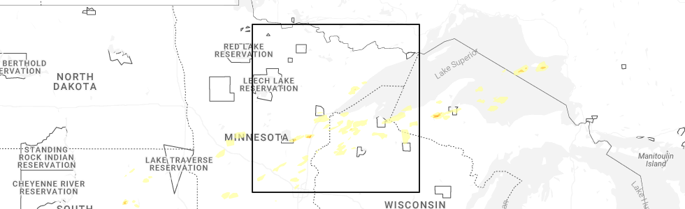
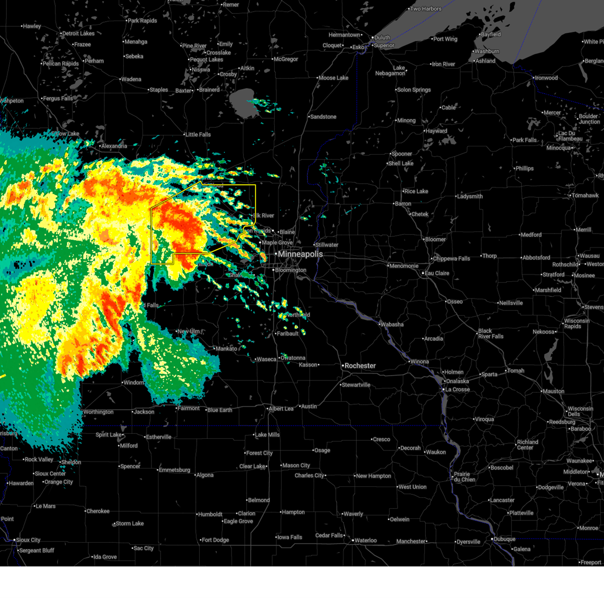
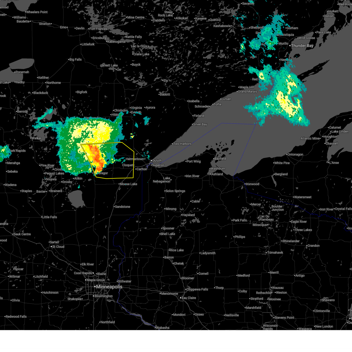
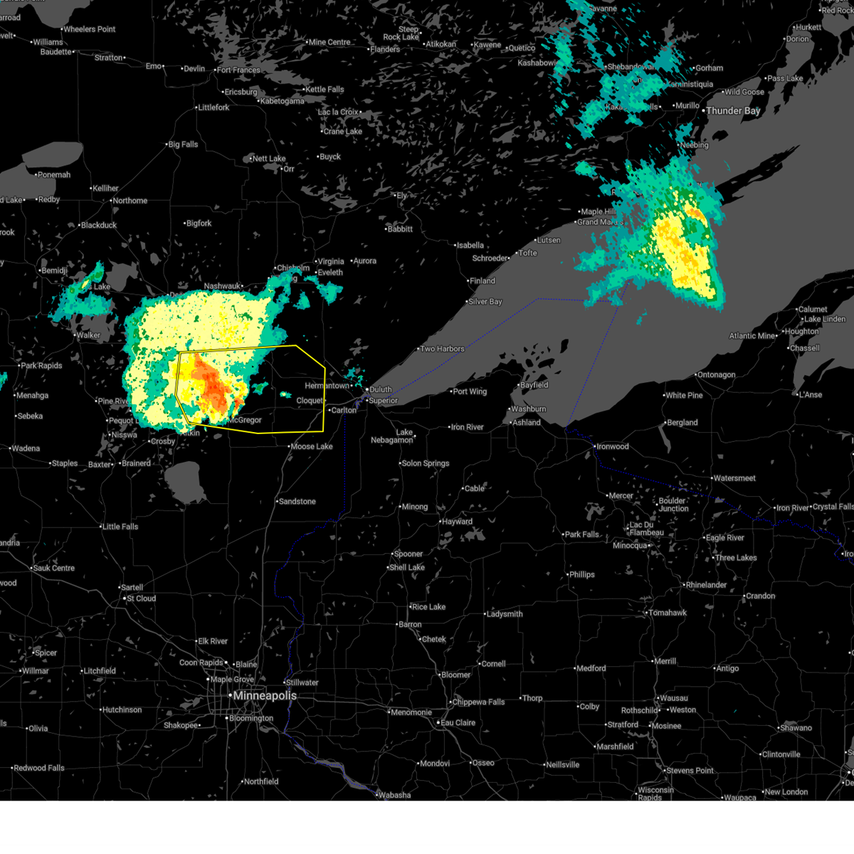
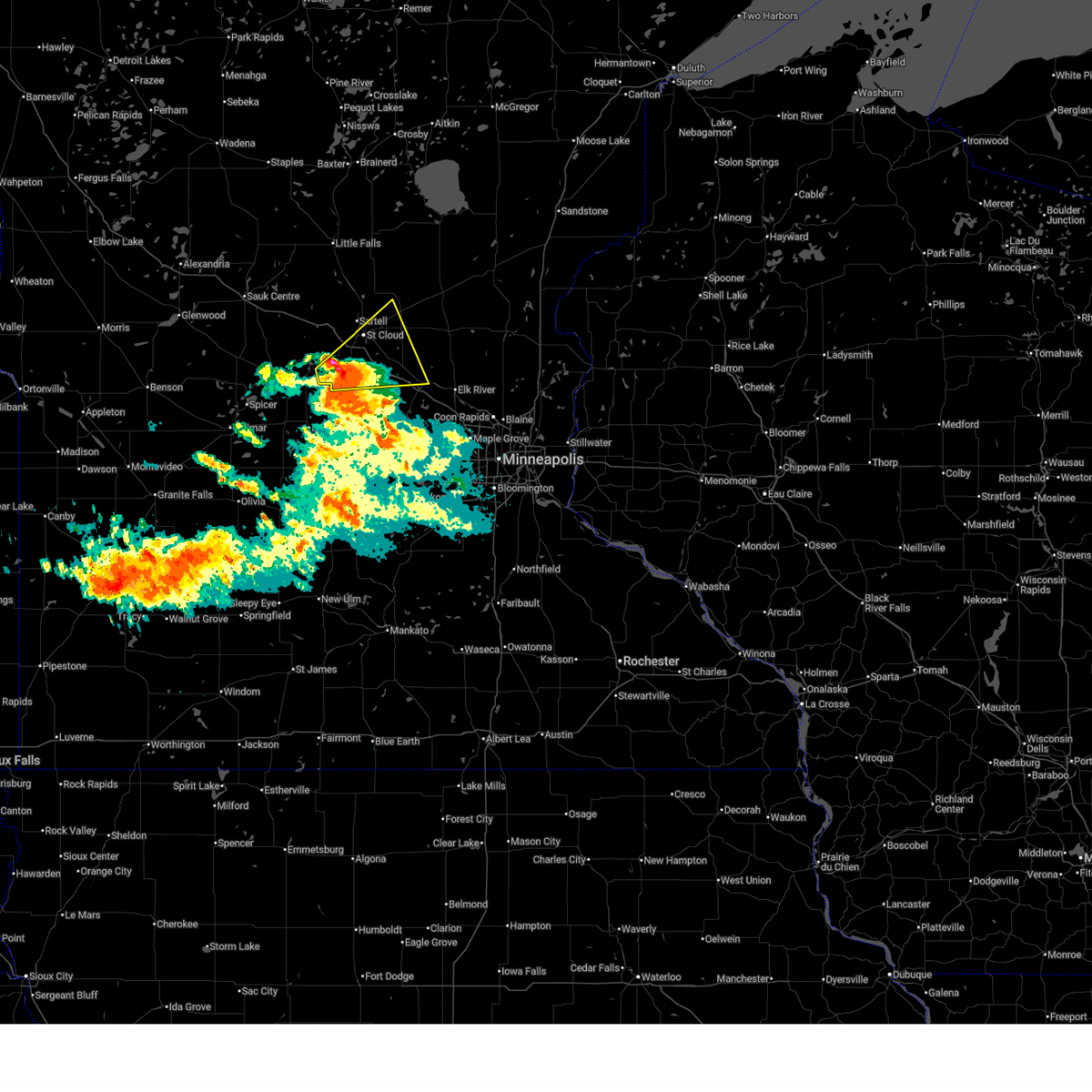
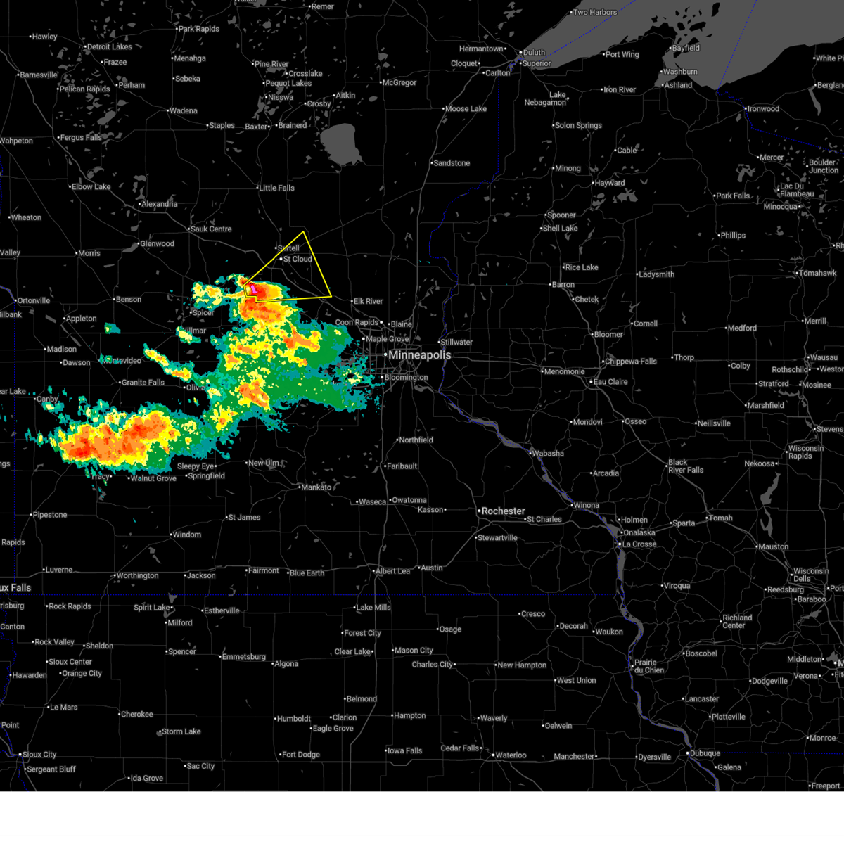
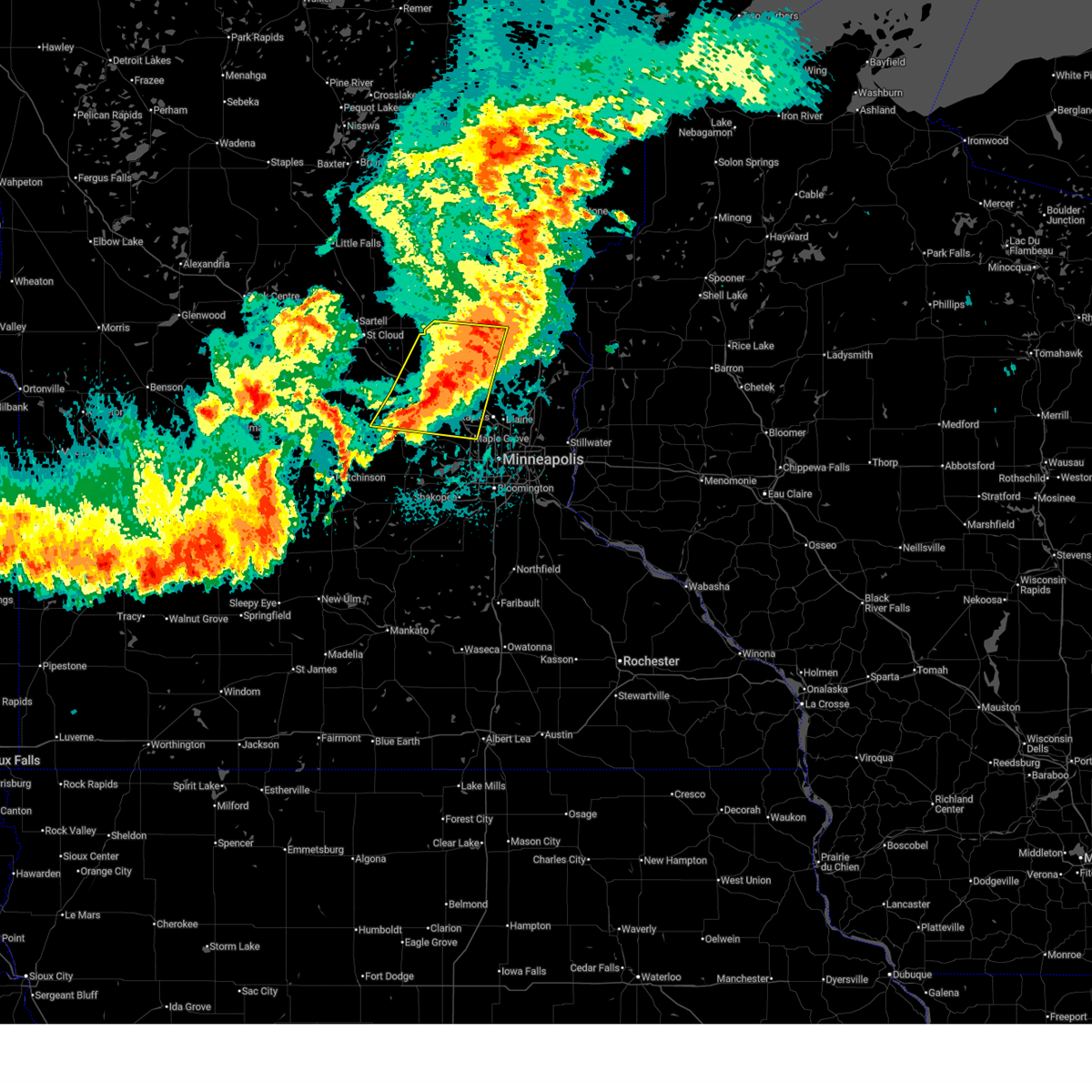
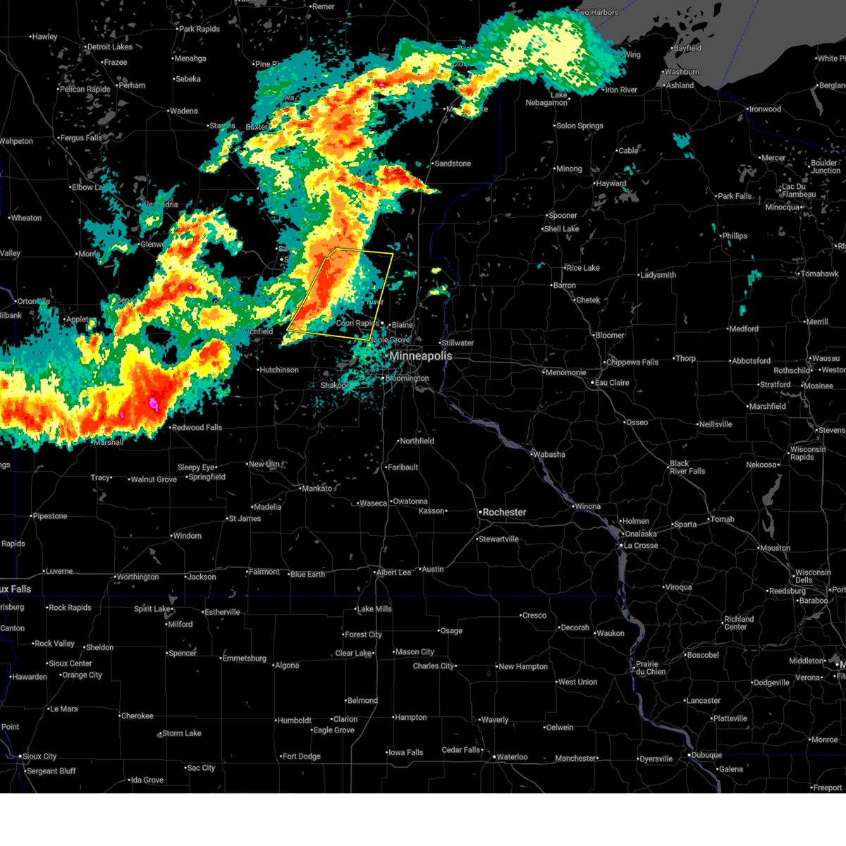
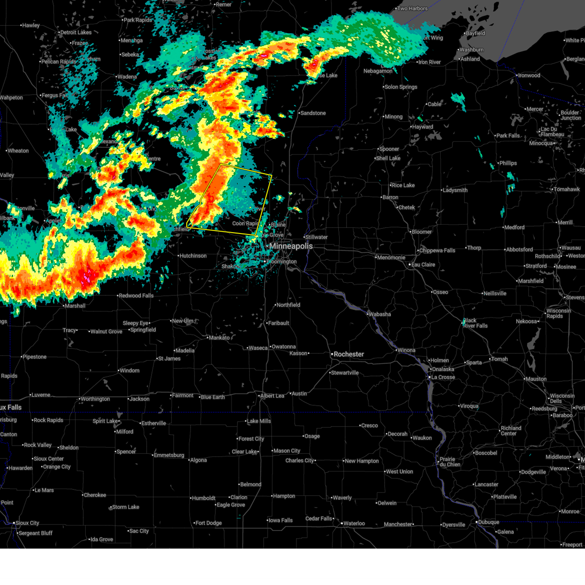
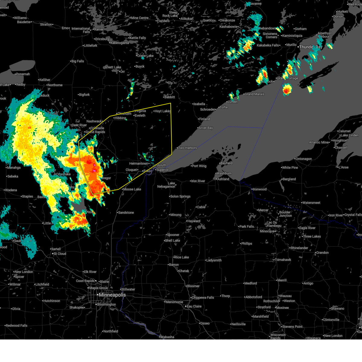
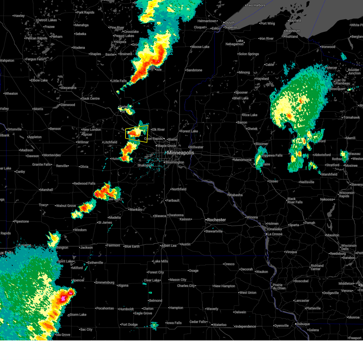
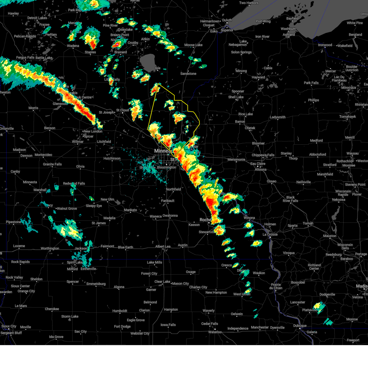
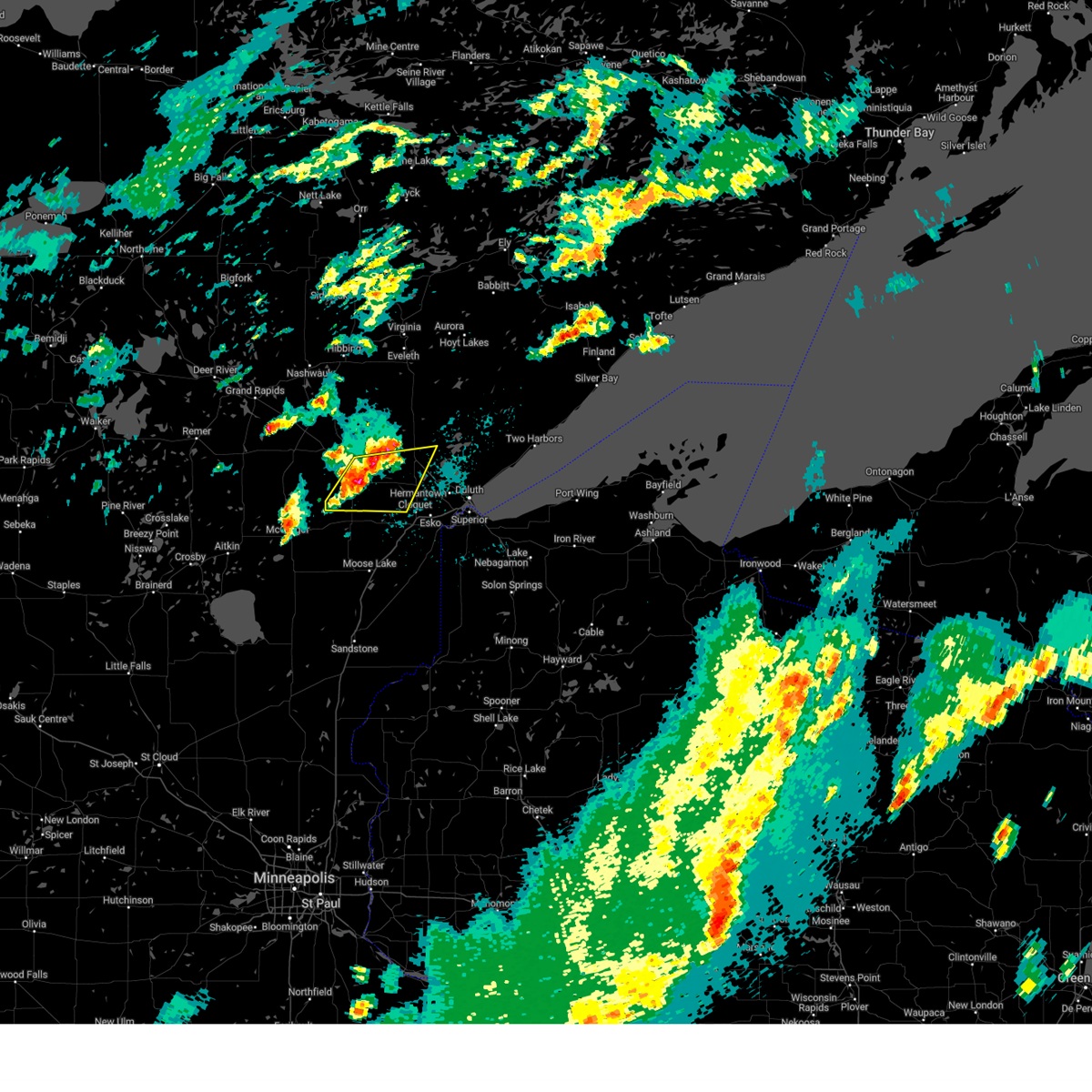
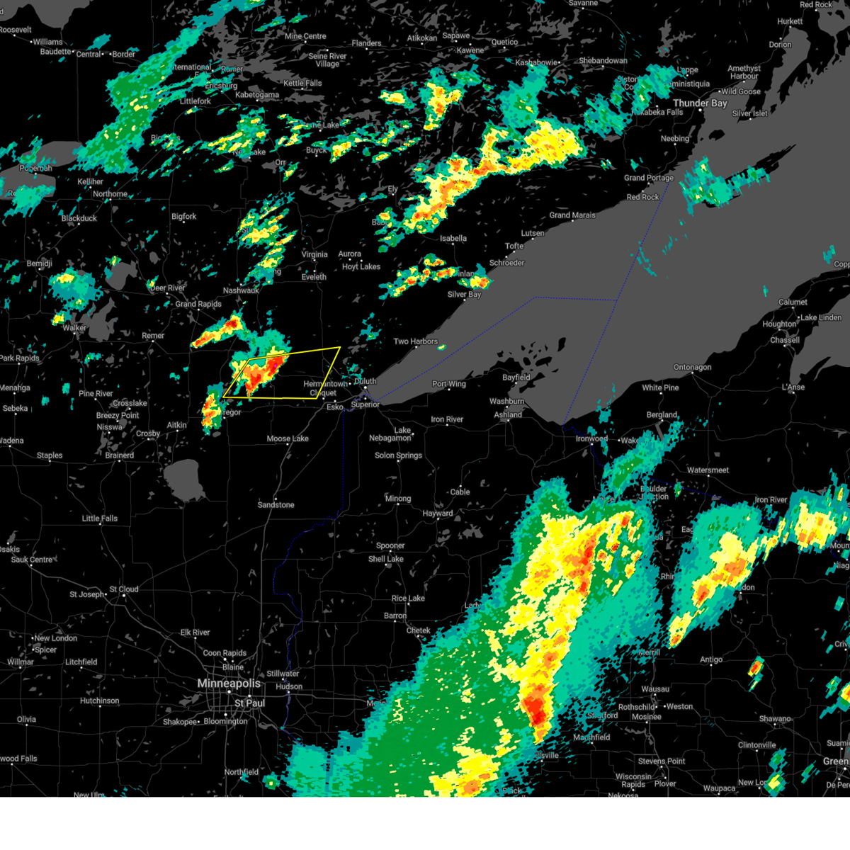
Hail Map for Big Lake, MN
The Big Lake, MN area has had 19 reports of on-the-ground hail by trained spotters, and has been under severe weather warnings 32 times during the past 12 months. Doppler radar has detected hail at or near Big Lake, MN on 110 occasions, including 5 occasions during the past year.
| Name: | Big Lake, MN |
| Where Located: | 34.5 miles NW of Minneapolis, MN |
| Map: | Google Map for Big Lake, MN |
| Population: | 10060 |
| Housing Units: | 3640 |
| More Info: | Search Google for Big Lake, MN |
1
The Top Recent Hail Date for Big Lake, MN is Tuesday, July 15, 2025 (46th out of 110)
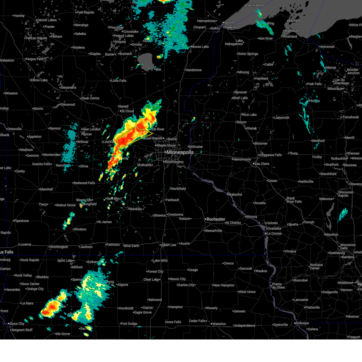
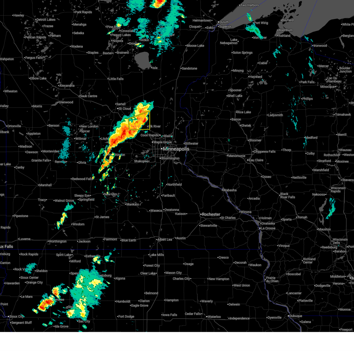
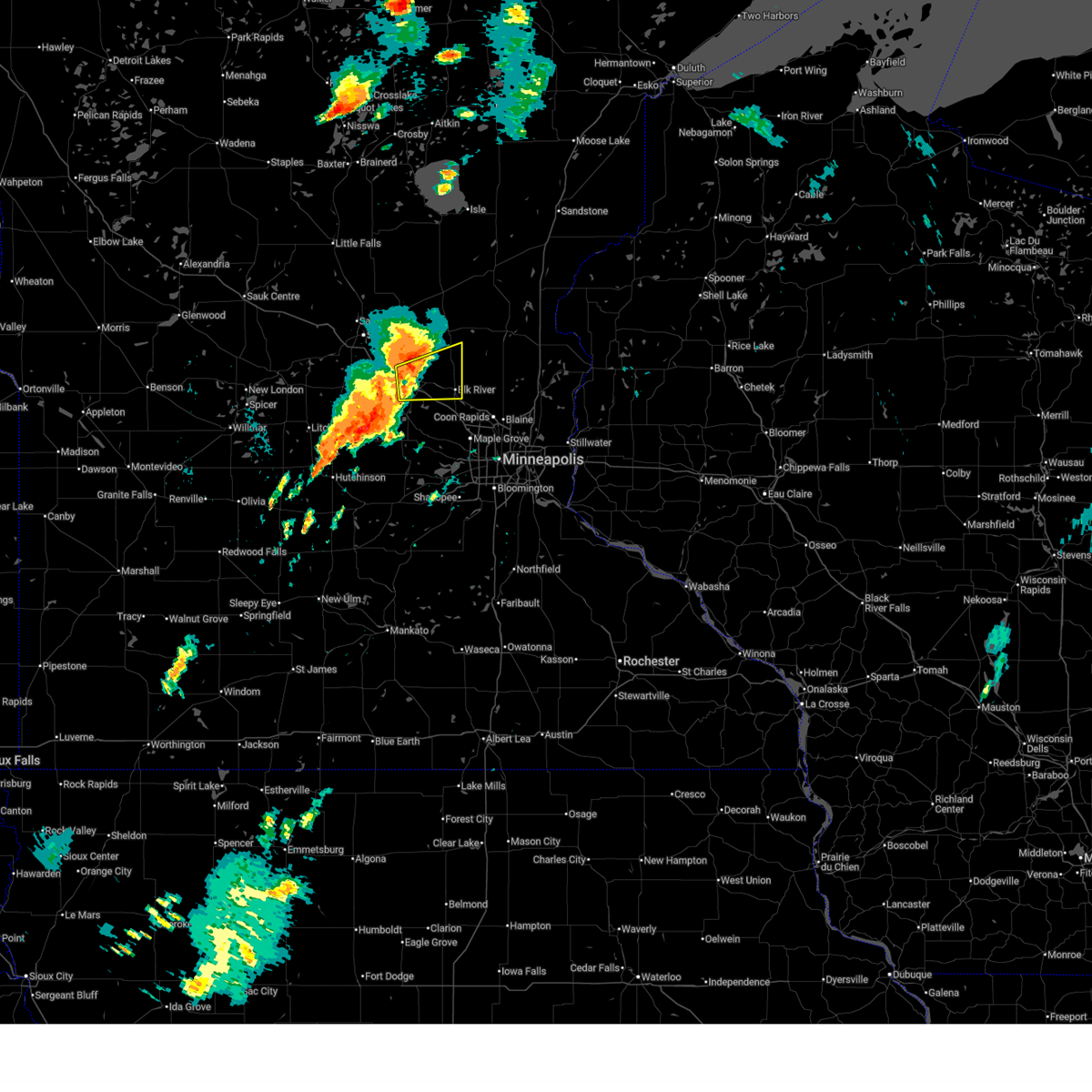
Hail and Wind Damage Spotted near Big Lake, MN
| Date / Time | Report Details |
|---|---|
| 8/16/2025 6:42 AM CDT |
 The storms which prompted the warning have weakened below severe limits, and no longer pose an immediate threat to life or property. therefore, the warning will be allowed to expire. however, heavy rain is still possible with these thunderstorms. to report severe weather, contact your nearest law enforcement agency. they will send your report to the national weather service office. The storms which prompted the warning have weakened below severe limits, and no longer pose an immediate threat to life or property. therefore, the warning will be allowed to expire. however, heavy rain is still possible with these thunderstorms. to report severe weather, contact your nearest law enforcement agency. they will send your report to the national weather service office.
|
| 8/16/2025 6:26 AM CDT |
 At 626 am cdt, severe thunderstorms were located along a line from near foreston to near rogers, or along a line from 24 miles west of cambridge to 17 miles east of buffalo, moving northeast at 55 mph (radar indicated). Hazards include 60 mph wind gusts and quarter size hail. Hail damage to vehicles is expected. expect wind damage to roofs, siding, and trees. locations impacted include, buffalo, ramsey, elk river, st. michael, otsego, monticello, big lake, st. Francis, albertville, zimmerman, princeton, becker, rockford, annandale, montrose, cokato, maple lake, howard lake, clearwater and dassel. At 626 am cdt, severe thunderstorms were located along a line from near foreston to near rogers, or along a line from 24 miles west of cambridge to 17 miles east of buffalo, moving northeast at 55 mph (radar indicated). Hazards include 60 mph wind gusts and quarter size hail. Hail damage to vehicles is expected. expect wind damage to roofs, siding, and trees. locations impacted include, buffalo, ramsey, elk river, st. michael, otsego, monticello, big lake, st. Francis, albertville, zimmerman, princeton, becker, rockford, annandale, montrose, cokato, maple lake, howard lake, clearwater and dassel.
|
| 8/16/2025 6:26 AM CDT |
 the severe thunderstorm warning has been cancelled and is no longer in effect the severe thunderstorm warning has been cancelled and is no longer in effect
|
| 8/16/2025 6:11 AM CDT |
 At 611 am cdt, severe thunderstorms were located along a line from 6 miles south of foley to near rockford, or along a line from 12 miles east of st. cloud to 6 miles east of buffalo, moving northeast at 55 mph (radar indicated). Hazards include 60 mph wind gusts and quarter size hail. Hail damage to vehicles is expected. expect wind damage to roofs, siding, and trees. locations impacted include, st. cloud, buffalo, ramsey, elk river, st. michael, otsego, sauk rapids, monticello, big lake, st. francis, albertville, waite park, st. Joseph, zimmerman, princeton, becker, rockford, cold spring, annandale and montrose. At 611 am cdt, severe thunderstorms were located along a line from 6 miles south of foley to near rockford, or along a line from 12 miles east of st. cloud to 6 miles east of buffalo, moving northeast at 55 mph (radar indicated). Hazards include 60 mph wind gusts and quarter size hail. Hail damage to vehicles is expected. expect wind damage to roofs, siding, and trees. locations impacted include, st. cloud, buffalo, ramsey, elk river, st. michael, otsego, sauk rapids, monticello, big lake, st. francis, albertville, waite park, st. Joseph, zimmerman, princeton, becker, rockford, cold spring, annandale and montrose.
|
| 8/16/2025 5:52 AM CDT |
 Svrmpx the national weather service in the twin cities has issued a * severe thunderstorm warning for, meeker county in central minnesota, sherburne county in central minnesota, southeastern stearns county in central minnesota, wright county in central minnesota, * until 645 am cdt. * at 552 am cdt, severe thunderstorms were located along a line from 5 miles south of waite park to over howard lake, or along a line from 6 miles southwest of st. cloud to 14 miles southwest of buffalo, moving northeast at 55 mph (radar indicated). Hazards include 60 mph wind gusts and quarter size hail. Hail damage to vehicles is expected. Expect wind damage to roofs, siding, and trees. Svrmpx the national weather service in the twin cities has issued a * severe thunderstorm warning for, meeker county in central minnesota, sherburne county in central minnesota, southeastern stearns county in central minnesota, wright county in central minnesota, * until 645 am cdt. * at 552 am cdt, severe thunderstorms were located along a line from 5 miles south of waite park to over howard lake, or along a line from 6 miles southwest of st. cloud to 14 miles southwest of buffalo, moving northeast at 55 mph (radar indicated). Hazards include 60 mph wind gusts and quarter size hail. Hail damage to vehicles is expected. Expect wind damage to roofs, siding, and trees.
|
| 8/9/2025 2:29 AM CDT |
 Svrmpx the national weather service in the twin cities has issued a * severe thunderstorm warning for, central wright county in central minnesota, * until 315 am cdt. * at 229 am cdt, a severe thunderstorm was located near howard lake, or 12 miles west of buffalo, moving northeast at 30 mph (trained spotters reported). Hazards include quarter size hail. damage to vehicles is expected Svrmpx the national weather service in the twin cities has issued a * severe thunderstorm warning for, central wright county in central minnesota, * until 315 am cdt. * at 229 am cdt, a severe thunderstorm was located near howard lake, or 12 miles west of buffalo, moving northeast at 30 mph (trained spotters reported). Hazards include quarter size hail. damage to vehicles is expected
|
| 8/9/2025 2:17 AM CDT |
 the severe thunderstorm warning has been cancelled and is no longer in effect the severe thunderstorm warning has been cancelled and is no longer in effect
|
| 8/9/2025 1:52 AM CDT |
 At 152 am cdt, a severe thunderstorm was located over big lake, or 13 miles northeast of buffalo, moving east at 30 mph (radar indicated). Hazards include 60 mph wind gusts and quarter size hail. Hail damage to vehicles is expected. expect wind damage to roofs, siding, and trees. locations impacted include, ramsey, elk river, otsego, monticello, big lake, st. Francis, zimmerman, becker, orrock, silver creek, enfield and lake maria state park. At 152 am cdt, a severe thunderstorm was located over big lake, or 13 miles northeast of buffalo, moving east at 30 mph (radar indicated). Hazards include 60 mph wind gusts and quarter size hail. Hail damage to vehicles is expected. expect wind damage to roofs, siding, and trees. locations impacted include, ramsey, elk river, otsego, monticello, big lake, st. Francis, zimmerman, becker, orrock, silver creek, enfield and lake maria state park.
|
| 8/9/2025 1:39 AM CDT |
 Svrmpx the national weather service in the twin cities has issued a * severe thunderstorm warning for, southeastern sherburne county in central minnesota, northeastern wright county in central minnesota, * until 230 am cdt. * at 139 am cdt, a severe thunderstorm was located near becker, or 10 miles north of buffalo, moving east at 25 mph (radar indicated). Hazards include 60 mph wind gusts and quarter size hail. Hail damage to vehicles is expected. Expect wind damage to roofs, siding, and trees. Svrmpx the national weather service in the twin cities has issued a * severe thunderstorm warning for, southeastern sherburne county in central minnesota, northeastern wright county in central minnesota, * until 230 am cdt. * at 139 am cdt, a severe thunderstorm was located near becker, or 10 miles north of buffalo, moving east at 25 mph (radar indicated). Hazards include 60 mph wind gusts and quarter size hail. Hail damage to vehicles is expected. Expect wind damage to roofs, siding, and trees.
|
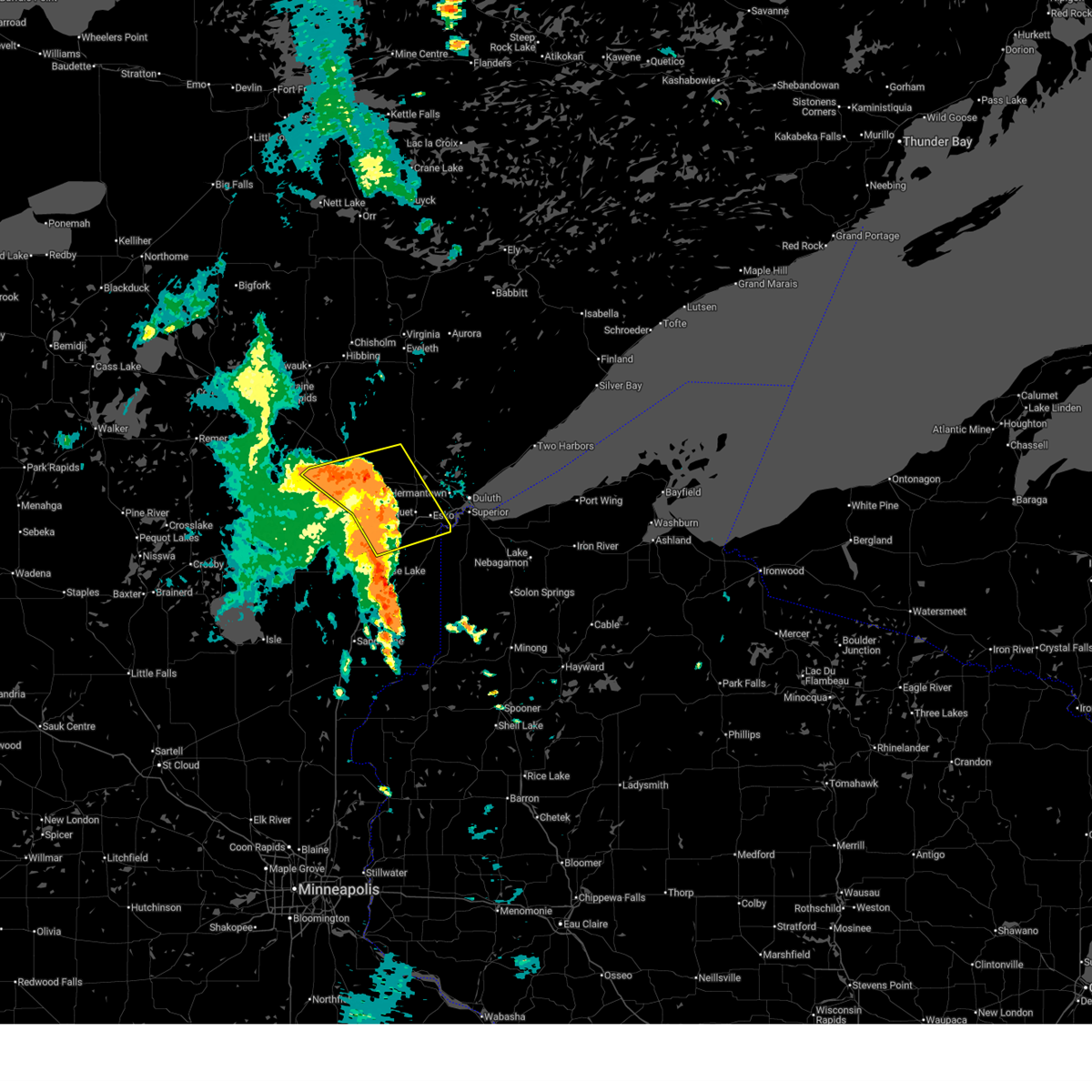
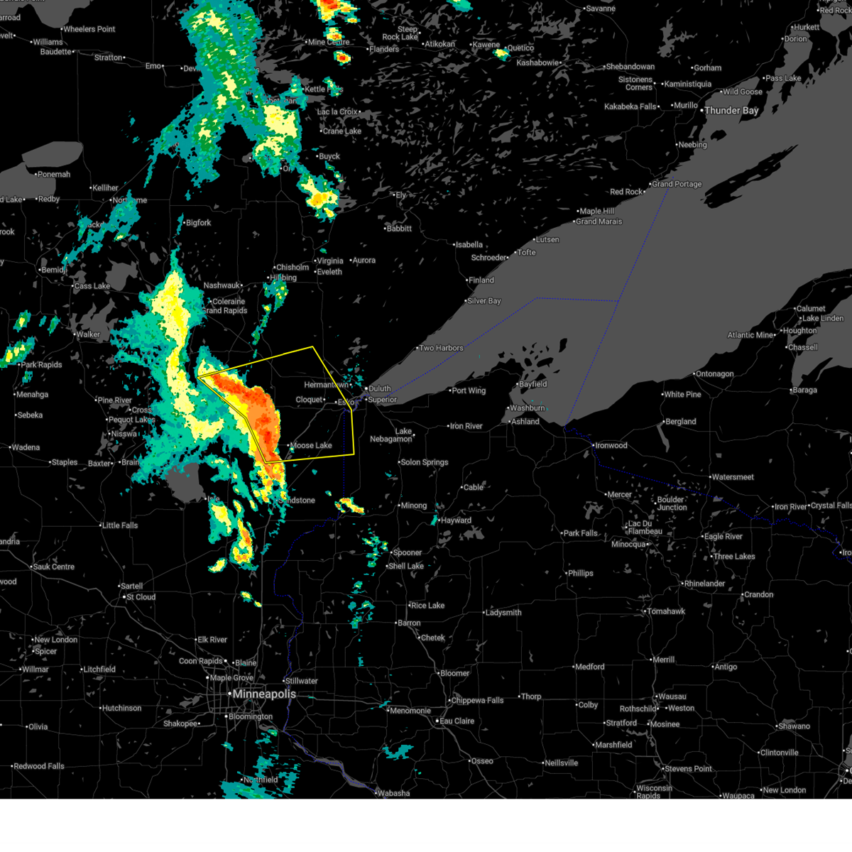
| 8/8/2025 9:50 AM CDT |
 At 949 am cdt, severe thunderstorms were located along a line extending from 8 miles north of floodwood to 6 miles south of meadowlands to near brookston to near cloquet, moving northeast at 50 mph (trained weather spotters reported trees and power lines down 5 miles northwest of tamarack in aitkin county with these storms). Hazards include 70 mph wind gusts and penny size hail. Expect considerable tree damage. damage is likely to mobile homes, roofs, and outbuildings. Locations impacted include, cloquet, scanlon, carlton, floodwood, thomson, brookston, fond du lac band cloquet area, saginaw, jay cooke state park, fond du lac band sawyer area, fond du lac band brookston area, mahnomen, alborn, culver, gowan, burnett, sawyer, prosit, and esko. At 949 am cdt, severe thunderstorms were located along a line extending from 8 miles north of floodwood to 6 miles south of meadowlands to near brookston to near cloquet, moving northeast at 50 mph (trained weather spotters reported trees and power lines down 5 miles northwest of tamarack in aitkin county with these storms). Hazards include 70 mph wind gusts and penny size hail. Expect considerable tree damage. damage is likely to mobile homes, roofs, and outbuildings. Locations impacted include, cloquet, scanlon, carlton, floodwood, thomson, brookston, fond du lac band cloquet area, saginaw, jay cooke state park, fond du lac band sawyer area, fond du lac band brookston area, mahnomen, alborn, culver, gowan, burnett, sawyer, prosit, and esko.
|
| 8/8/2025 9:50 AM CDT |
 the severe thunderstorm warning has been cancelled and is no longer in effect the severe thunderstorm warning has been cancelled and is no longer in effect
|
| 8/8/2025 9:43 AM CDT |
 Svrdlh the national weather service in duluth mn has issued a * severe thunderstorm warning for, northeastern aitkin county in east central minnesota, southern st. louis county in northeastern minnesota, northeastern carlton county in northeastern minnesota, southwestern lake county in northeastern minnesota, * until 1045 am cdt. * at 942 am cdt, severe thunderstorms were located along a line extending from near floodwood to 8 miles south of meadowlands to brookston to near fond du lac band cloquet area, moving northeast at 55 mph (trained weather spotters reported numerous trees down near round lake in aitkin county). Hazards include 70 mph wind gusts and penny size hail. Expect considerable tree damage. Damage is likely to mobile homes, roofs, and outbuildings. Svrdlh the national weather service in duluth mn has issued a * severe thunderstorm warning for, northeastern aitkin county in east central minnesota, southern st. louis county in northeastern minnesota, northeastern carlton county in northeastern minnesota, southwestern lake county in northeastern minnesota, * until 1045 am cdt. * at 942 am cdt, severe thunderstorms were located along a line extending from near floodwood to 8 miles south of meadowlands to brookston to near fond du lac band cloquet area, moving northeast at 55 mph (trained weather spotters reported numerous trees down near round lake in aitkin county). Hazards include 70 mph wind gusts and penny size hail. Expect considerable tree damage. Damage is likely to mobile homes, roofs, and outbuildings.
|
| 8/8/2025 9:38 AM CDT |
 At 937 am cdt, severe thunderstorms were located along a line extending from 6 miles northeast of savanna portage state park to near floodwood to near brookston to near fond du lac band sawyer area, moving northeast at 50 mph (radar indicated). Hazards include 70 mph wind gusts and penny size hail. Expect considerable tree damage. damage is likely to mobile homes, roofs, and outbuildings. these severe storms will be near, cloquet, scanlon, floodwood, brookston, fond du lac band cloquet area, and fond du lac band brookston area around 945 am cdt. saginaw around 950 am cdt. Other locations impacted by these severe thunderstorms include gowan, mahnomen, culver, esko, scotts corner, burnett, kettle lake, sawyer, prosit, and fond du lac. At 937 am cdt, severe thunderstorms were located along a line extending from 6 miles northeast of savanna portage state park to near floodwood to near brookston to near fond du lac band sawyer area, moving northeast at 50 mph (radar indicated). Hazards include 70 mph wind gusts and penny size hail. Expect considerable tree damage. damage is likely to mobile homes, roofs, and outbuildings. these severe storms will be near, cloquet, scanlon, floodwood, brookston, fond du lac band cloquet area, and fond du lac band brookston area around 945 am cdt. saginaw around 950 am cdt. Other locations impacted by these severe thunderstorms include gowan, mahnomen, culver, esko, scotts corner, burnett, kettle lake, sawyer, prosit, and fond du lac.
|
| 8/8/2025 9:38 AM CDT |
 the severe thunderstorm warning has been cancelled and is no longer in effect the severe thunderstorm warning has been cancelled and is no longer in effect
|
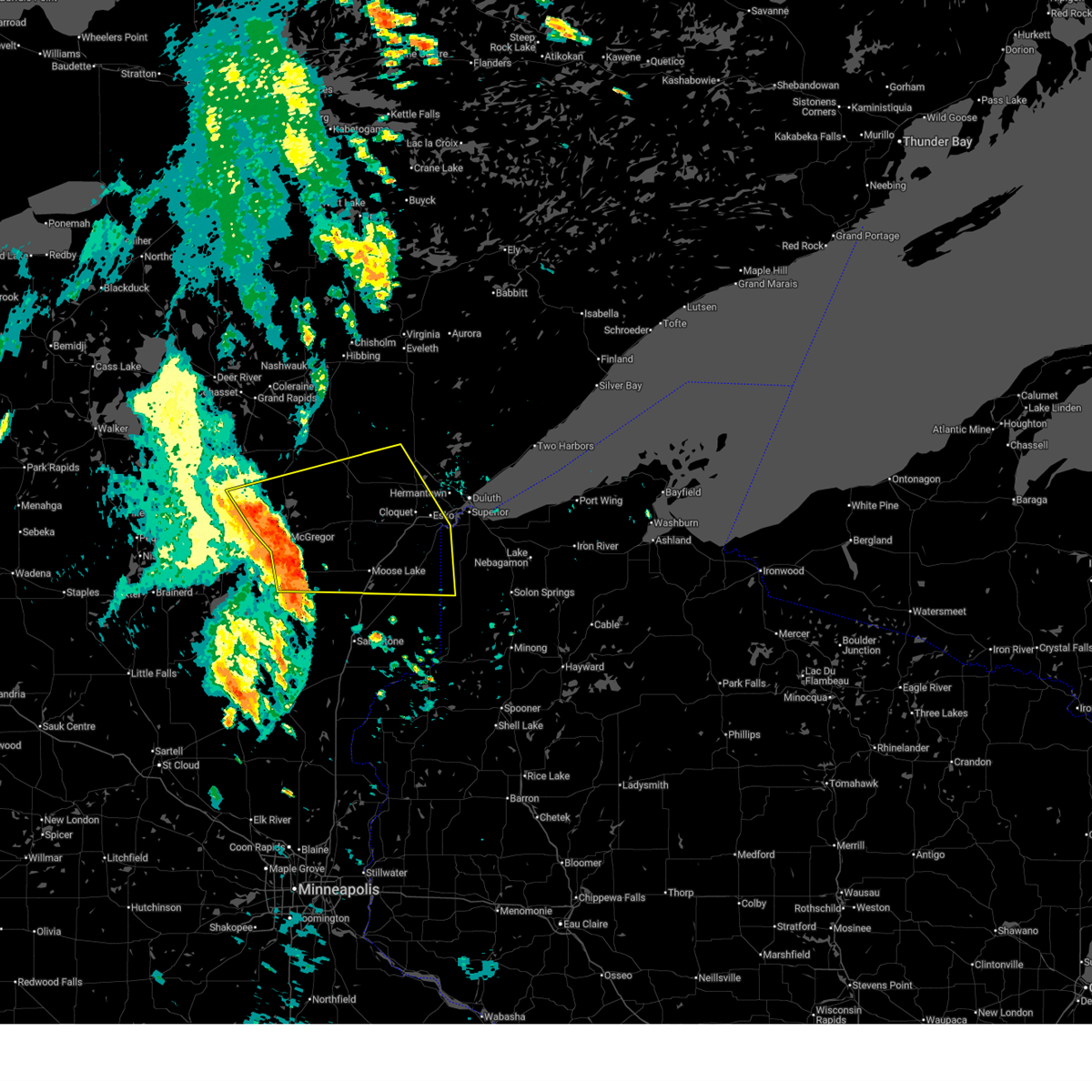
| 8/8/2025 9:24 AM CDT |
 At 924 am cdt, severe thunderstorms were located along a line extending from near big sandy lake to 8 miles northeast of tamarack to near cromwell to near kettle river, moving northeast at 50 mph (radar indicated). Hazards include 70 mph wind gusts and penny size hail. Expect considerable tree damage. damage is likely to mobile homes, roofs, and outbuildings. these severe storms will be near, moose lake, barnum, cromwell, fond du lac band sawyer area, moose lake state park, and savanna portage state park around 930 am cdt. mahtowa and fond du lac band brookston area around 935 am cdt. cloquet, floodwood, and fond du lac band cloquet area around 940 am cdt. brookston around 945 am cdt. scanlon, carlton, wrenshall, thomson, and jay cooke state park around 950 am cdt. saginaw around 955 am cdt. duluth around 1000 am cdt. Other locations impacted by these severe thunderstorms include gowan, pleasant valley, sheshebee, wright, burnett, denham, sawyer, prosit, automba, and fond du lac. At 924 am cdt, severe thunderstorms were located along a line extending from near big sandy lake to 8 miles northeast of tamarack to near cromwell to near kettle river, moving northeast at 50 mph (radar indicated). Hazards include 70 mph wind gusts and penny size hail. Expect considerable tree damage. damage is likely to mobile homes, roofs, and outbuildings. these severe storms will be near, moose lake, barnum, cromwell, fond du lac band sawyer area, moose lake state park, and savanna portage state park around 930 am cdt. mahtowa and fond du lac band brookston area around 935 am cdt. cloquet, floodwood, and fond du lac band cloquet area around 940 am cdt. brookston around 945 am cdt. scanlon, carlton, wrenshall, thomson, and jay cooke state park around 950 am cdt. saginaw around 955 am cdt. duluth around 1000 am cdt. Other locations impacted by these severe thunderstorms include gowan, pleasant valley, sheshebee, wright, burnett, denham, sawyer, prosit, automba, and fond du lac.
|
| 8/8/2025 8:58 AM CDT |
 Svrdlh the national weather service in duluth mn has issued a * severe thunderstorm warning for, northern aitkin county in east central minnesota, northeastern pine county in east central minnesota, southwestern st. louis county in northeastern minnesota, carlton county in northeastern minnesota, west central douglas county in northwestern wisconsin, * until 1000 am cdt. * at 857 am cdt, severe thunderstorms were located along a line extending from near palisade to 6 miles northwest of mcgregor to near mille lacs band east lake area to 11 miles north of mcgrath, moving east at 45 mph (radar indicated). Hazards include 70 mph wind gusts and penny size hail. Expect considerable tree damage. damage is likely to mobile homes, roofs, and outbuildings. severe thunderstorms will be near, big sandy lake, mcgregor, tamarack, libby, and savanna portage state park around 905 am cdt. kettle river around 915 am cdt. moose lake and cromwell around 920 am cdt. moose lake state park around 925 am cdt. barnum, mahtowa, and fond du lac band sawyer area around 930 am cdt. nemadji and fond du lac band brookston area around 935 am cdt. cloquet and fond du lac band cloquet area around 940 am cdt. carlton, holyoke, and jay cooke state park around 945 am cdt. Other locations impacted by these severe thunderstorms include gowan, waukenabo, sheshebee, duquette, wright, denham, sawyer, rice lake wildlife refuge, prosit, and automba. Svrdlh the national weather service in duluth mn has issued a * severe thunderstorm warning for, northern aitkin county in east central minnesota, northeastern pine county in east central minnesota, southwestern st. louis county in northeastern minnesota, carlton county in northeastern minnesota, west central douglas county in northwestern wisconsin, * until 1000 am cdt. * at 857 am cdt, severe thunderstorms were located along a line extending from near palisade to 6 miles northwest of mcgregor to near mille lacs band east lake area to 11 miles north of mcgrath, moving east at 45 mph (radar indicated). Hazards include 70 mph wind gusts and penny size hail. Expect considerable tree damage. damage is likely to mobile homes, roofs, and outbuildings. severe thunderstorms will be near, big sandy lake, mcgregor, tamarack, libby, and savanna portage state park around 905 am cdt. kettle river around 915 am cdt. moose lake and cromwell around 920 am cdt. moose lake state park around 925 am cdt. barnum, mahtowa, and fond du lac band sawyer area around 930 am cdt. nemadji and fond du lac band brookston area around 935 am cdt. cloquet and fond du lac band cloquet area around 940 am cdt. carlton, holyoke, and jay cooke state park around 945 am cdt. Other locations impacted by these severe thunderstorms include gowan, waukenabo, sheshebee, duquette, wright, denham, sawyer, rice lake wildlife refuge, prosit, and automba.
|
| 7/27/2025 6:46 PM CDT |
 Tormpx the national weather service in the twin cities has issued a * tornado warning for, southeastern sherburne county in central minnesota, central wright county in central minnesota, northwest hennepin county in east central minnesota, * until 715 pm cdt. * at 646 pm cdt, a severe thunderstorm capable of producing a tornado was located over maple lake, or 9 miles northwest of buffalo, moving east at 50 mph (radar indicated rotation). Hazards include tornado and quarter size hail. Flying debris will be dangerous to those caught without shelter. mobile homes will be damaged or destroyed. damage to roofs, windows and vehicles will occur. Tree damage is likely. Tormpx the national weather service in the twin cities has issued a * tornado warning for, southeastern sherburne county in central minnesota, central wright county in central minnesota, northwest hennepin county in east central minnesota, * until 715 pm cdt. * at 646 pm cdt, a severe thunderstorm capable of producing a tornado was located over maple lake, or 9 miles northwest of buffalo, moving east at 50 mph (radar indicated rotation). Hazards include tornado and quarter size hail. Flying debris will be dangerous to those caught without shelter. mobile homes will be damaged or destroyed. damage to roofs, windows and vehicles will occur. Tree damage is likely.
|
| 7/22/2025 4:24 PM CDT |
 the severe thunderstorm warning has been cancelled and is no longer in effect the severe thunderstorm warning has been cancelled and is no longer in effect
|
| 7/22/2025 4:04 PM CDT |
 At 404 pm cdt, a severe thunderstorm was located near saginaw, or near cloquet, moving east at 45 mph (radar indicated). Hazards include 60 mph wind gusts and nickel size hail. Expect damage to roofs, siding, and trees. Locations impacted include, hermantown, pike lake near duluth, duluth, city of rice lake, french river and mcquade harbor. At 404 pm cdt, a severe thunderstorm was located near saginaw, or near cloquet, moving east at 45 mph (radar indicated). Hazards include 60 mph wind gusts and nickel size hail. Expect damage to roofs, siding, and trees. Locations impacted include, hermantown, pike lake near duluth, duluth, city of rice lake, french river and mcquade harbor.
|
| 7/22/2025 3:42 PM CDT |
 Svrdlh the national weather service in duluth mn has issued a * severe thunderstorm warning for, southern st. louis county in northeastern minnesota, carlton county in northeastern minnesota, northwestern douglas county in northwestern wisconsin, * until 445 pm cdt. * at 342 pm cdt, a severe thunderstorm was located over fond du lac band brookston area, or 13 miles west of cloquet, moving east at 45 mph (radar indicated). Hazards include 60 mph wind gusts and nickel size hail. Expect damage to roofs, siding, and trees. this severe thunderstorm will be near, fond du lac band sawyer area and fond du lac band brookston area around 345 pm cdt. cloquet and fond du lac band cloquet area around 350 pm cdt. brookston around 355 pm cdt. saginaw around 400 pm cdt. Other locations in the path of this severe thunderstorm include hermantown, pike lake near duluth, duluth, city of rice lake, french river and mcquade harbor. Svrdlh the national weather service in duluth mn has issued a * severe thunderstorm warning for, southern st. louis county in northeastern minnesota, carlton county in northeastern minnesota, northwestern douglas county in northwestern wisconsin, * until 445 pm cdt. * at 342 pm cdt, a severe thunderstorm was located over fond du lac band brookston area, or 13 miles west of cloquet, moving east at 45 mph (radar indicated). Hazards include 60 mph wind gusts and nickel size hail. Expect damage to roofs, siding, and trees. this severe thunderstorm will be near, fond du lac band sawyer area and fond du lac band brookston area around 345 pm cdt. cloquet and fond du lac band cloquet area around 350 pm cdt. brookston around 355 pm cdt. saginaw around 400 pm cdt. Other locations in the path of this severe thunderstorm include hermantown, pike lake near duluth, duluth, city of rice lake, french river and mcquade harbor.
|
| 7/22/2025 3:25 PM CDT |
 At 325 pm cdt, a severe thunderstorm was located near floodwood, or 15 miles northeast of big sandy lake, moving east at 55 mph (radar indicated). Hazards include 70 mph wind gusts and nickel size hail. Expect considerable tree damage. damage is likely to mobile homes, roofs, and outbuildings. Locations impacted include, cloquet, big sandy lake, mahtowa, floodwood, cromwell, brookston, tamarack, fond du lac band brookston area, fond du lac band cloquet area, savanna portage state park, fond du lac band sawyer area, jacobson, mahnomen, culver, ball bluff, wright, balsam, gowan, sheshebee, and burnett. At 325 pm cdt, a severe thunderstorm was located near floodwood, or 15 miles northeast of big sandy lake, moving east at 55 mph (radar indicated). Hazards include 70 mph wind gusts and nickel size hail. Expect considerable tree damage. damage is likely to mobile homes, roofs, and outbuildings. Locations impacted include, cloquet, big sandy lake, mahtowa, floodwood, cromwell, brookston, tamarack, fond du lac band brookston area, fond du lac band cloquet area, savanna portage state park, fond du lac band sawyer area, jacobson, mahnomen, culver, ball bluff, wright, balsam, gowan, sheshebee, and burnett.
|
| 7/22/2025 3:18 PM CDT |
 At 318 pm cdt, a severe thunderstorm was located over savanna portage state park, or 9 miles northeast of big sandy lake, moving east at 55 mph (radar indicated). Hazards include 70 mph wind gusts and quarter size hail. Hail damage to vehicles is expected. expect considerable tree damage. wind damage is also likely to mobile homes, roofs, and outbuildings. Locations impacted include, savanna portage state park, floodwood and fond du lac band brookston area. At 318 pm cdt, a severe thunderstorm was located over savanna portage state park, or 9 miles northeast of big sandy lake, moving east at 55 mph (radar indicated). Hazards include 70 mph wind gusts and quarter size hail. Hail damage to vehicles is expected. expect considerable tree damage. wind damage is also likely to mobile homes, roofs, and outbuildings. Locations impacted include, savanna portage state park, floodwood and fond du lac band brookston area.
|
| 7/22/2025 3:03 PM CDT |
 Svrdlh the national weather service in duluth mn has issued a * severe thunderstorm warning for, northern aitkin county in east central minnesota, southwestern st. louis county in northeastern minnesota, northwestern carlton county in northeastern minnesota, * until 345 pm cdt. * at 302 pm cdt, a severe thunderstorm was located over libby, or near big sandy lake, moving east at 55 mph (radar indicated. at 2:55 pm a 55 mph wind gust was reported near palisade). Hazards include 70 mph wind gusts and quarter size hail. Hail damage to vehicles is expected. expect considerable tree damage. wind damage is also likely to mobile homes, roofs, and outbuildings. this severe thunderstorm will be near, big sandy lake, libby, and savanna portage state park around 305 pm cdt. Other locations in the path of this severe thunderstorm include fond du lac band brookston area and brookston. Svrdlh the national weather service in duluth mn has issued a * severe thunderstorm warning for, northern aitkin county in east central minnesota, southwestern st. louis county in northeastern minnesota, northwestern carlton county in northeastern minnesota, * until 345 pm cdt. * at 302 pm cdt, a severe thunderstorm was located over libby, or near big sandy lake, moving east at 55 mph (radar indicated. at 2:55 pm a 55 mph wind gust was reported near palisade). Hazards include 70 mph wind gusts and quarter size hail. Hail damage to vehicles is expected. expect considerable tree damage. wind damage is also likely to mobile homes, roofs, and outbuildings. this severe thunderstorm will be near, big sandy lake, libby, and savanna portage state park around 305 pm cdt. Other locations in the path of this severe thunderstorm include fond du lac band brookston area and brookston.
|
| 7/18/2025 9:16 PM CDT |
 At 916 pm cdt, a severe thunderstorm was located 5 miles northeast of kimball, or 12 miles south of st. cloud, moving east at 50 mph (broadcast media reported). Hazards include golf ball size hail. People and animals outdoors will be injured. expect damage to roofs, siding, windows, and vehicles. locations impacted include, st. Cloud, sauk rapids, monticello, big lake, waite park, becker, foley, rockville, clearwater, kimball, clear lake, luxemburg, st cloud airport, st augusta, hasty, fairhaven, enfield, duelm, lake maria state park and pleasant lake. At 916 pm cdt, a severe thunderstorm was located 5 miles northeast of kimball, or 12 miles south of st. cloud, moving east at 50 mph (broadcast media reported). Hazards include golf ball size hail. People and animals outdoors will be injured. expect damage to roofs, siding, windows, and vehicles. locations impacted include, st. Cloud, sauk rapids, monticello, big lake, waite park, becker, foley, rockville, clearwater, kimball, clear lake, luxemburg, st cloud airport, st augusta, hasty, fairhaven, enfield, duelm, lake maria state park and pleasant lake.
|
| 7/18/2025 9:11 PM CDT |
 Svrmpx the national weather service in the twin cities has issued a * severe thunderstorm warning for, south central benton county in central minnesota, northwestern sherburne county in central minnesota, southeastern stearns county in central minnesota, northwestern wright county in central minnesota, * until 945 pm cdt. * at 911 pm cdt, a severe thunderstorm was located near kimball, or 14 miles southwest of st. cloud, moving east at 50 mph (radar indicated). Hazards include ping pong ball size hail. People and animals outdoors will be injured. Expect damage to roofs, siding, windows, and vehicles. Svrmpx the national weather service in the twin cities has issued a * severe thunderstorm warning for, south central benton county in central minnesota, northwestern sherburne county in central minnesota, southeastern stearns county in central minnesota, northwestern wright county in central minnesota, * until 945 pm cdt. * at 911 pm cdt, a severe thunderstorm was located near kimball, or 14 miles southwest of st. cloud, moving east at 50 mph (radar indicated). Hazards include ping pong ball size hail. People and animals outdoors will be injured. Expect damage to roofs, siding, windows, and vehicles.
|
| 6/28/2025 11:14 PM CDT |
 The severe thunderstorm warning that was previously in effect has been reissued for isanti, hennepin, anoka, wright, and sherburne counties and is in effect until 1200 am cdt. please refer to that bulletin for the latest severe weather information. however, gusty winds are still possible with this thunderstorm. a tornado watch remains in effect until 100 am cdt for portions of central and east central minnesota. The severe thunderstorm warning that was previously in effect has been reissued for isanti, hennepin, anoka, wright, and sherburne counties and is in effect until 1200 am cdt. please refer to that bulletin for the latest severe weather information. however, gusty winds are still possible with this thunderstorm. a tornado watch remains in effect until 100 am cdt for portions of central and east central minnesota.
|
| 6/28/2025 10:50 PM CDT |
 At 1050 pm cdt, a severe thunderstorm was located over st. michael, or 8 miles northeast of buffalo, moving southeast at 40 mph (radar indicated). Hazards include 60 mph wind gusts and small hail. Expect damage to roofs, siding, and trees. locations impacted include, buffalo, cambridge, brooklyn park, maple grove, coon rapids, andover, ramsey, champlin, elk river, anoka, st. michael, otsego, monticello, big lake, rogers, st. Francis, albertville, corcoran, isanti and zimmerman. At 1050 pm cdt, a severe thunderstorm was located over st. michael, or 8 miles northeast of buffalo, moving southeast at 40 mph (radar indicated). Hazards include 60 mph wind gusts and small hail. Expect damage to roofs, siding, and trees. locations impacted include, buffalo, cambridge, brooklyn park, maple grove, coon rapids, andover, ramsey, champlin, elk river, anoka, st. michael, otsego, monticello, big lake, rogers, st. Francis, albertville, corcoran, isanti and zimmerman.
|
| 6/28/2025 10:50 PM CDT |
 the severe thunderstorm warning has been cancelled and is no longer in effect the severe thunderstorm warning has been cancelled and is no longer in effect
|
| 6/28/2025 10:28 PM CDT |
 Svrmpx the national weather service in the twin cities has issued a * severe thunderstorm warning for, southeastern benton county in central minnesota, sherburne county in central minnesota, wright county in central minnesota, northwestern anoka county in east central minnesota, northwest hennepin and northeast hennepin county in east central minnesota, southwestern isanti county in east central minnesota, southwestern mille lacs county in east central minnesota, * until 1115 pm cdt. * at 1028 pm cdt, a severe thunderstorm was located near becker, or 15 miles north of buffalo, moving east at 45 mph (radar indicated). Hazards include 60 mph wind gusts and small hail. expect damage to roofs, siding, and trees Svrmpx the national weather service in the twin cities has issued a * severe thunderstorm warning for, southeastern benton county in central minnesota, sherburne county in central minnesota, wright county in central minnesota, northwestern anoka county in east central minnesota, northwest hennepin and northeast hennepin county in east central minnesota, southwestern isanti county in east central minnesota, southwestern mille lacs county in east central minnesota, * until 1115 pm cdt. * at 1028 pm cdt, a severe thunderstorm was located near becker, or 15 miles north of buffalo, moving east at 45 mph (radar indicated). Hazards include 60 mph wind gusts and small hail. expect damage to roofs, siding, and trees
|
| 6/23/2025 3:30 AM CDT |
 At 330 am cdt, severe thunderstorms were located along a line extending from 12 miles northeast of swan river to near toivola to near canyon to near mahtowa, moving northeast at 65 mph (radar indicated). Hazards include 60 mph wind gusts and nickel size hail. Expect damage to roofs, siding, and trees. Locations impacted include, hibbing, cloquet, hermantown, scanlon, carlton, cotton, thomson, pike lake near duluth, saginaw, fond du lac band cloquet area, island lake, boulder lake, duluth, proctor, cherry, whiteface reservoir, city of rice lake, eveleth, mountain iron, gilbert, virginia, hoyt lakes, fairbanks, wolf lake, aurora, babbitt, biwabik, brimson, mcquade harbor and french river. At 330 am cdt, severe thunderstorms were located along a line extending from 12 miles northeast of swan river to near toivola to near canyon to near mahtowa, moving northeast at 65 mph (radar indicated). Hazards include 60 mph wind gusts and nickel size hail. Expect damage to roofs, siding, and trees. Locations impacted include, hibbing, cloquet, hermantown, scanlon, carlton, cotton, thomson, pike lake near duluth, saginaw, fond du lac band cloquet area, island lake, boulder lake, duluth, proctor, cherry, whiteface reservoir, city of rice lake, eveleth, mountain iron, gilbert, virginia, hoyt lakes, fairbanks, wolf lake, aurora, babbitt, biwabik, brimson, mcquade harbor and french river.
|
| 6/23/2025 3:30 AM CDT |
 the severe thunderstorm warning has been cancelled and is no longer in effect the severe thunderstorm warning has been cancelled and is no longer in effect
|
| 6/23/2025 3:02 AM CDT |
 Svrdlh the national weather service in duluth mn has issued a * severe thunderstorm warning for, southeastern itasca county in north central minnesota, northeastern aitkin county in east central minnesota, southern st. louis county in northeastern minnesota, carlton county in northeastern minnesota, * until 400 am cdt. * at 301 am cdt, severe thunderstorms were located along a line extending from near hill city to jacobson to near cromwell to 8 miles west of kettle river, moving northeast at 55 mph (radar indicated. wind gusts to 62 mph have been observerd with this storm in aitkin county). Hazards include 70 mph wind gusts and quarter size hail. Hail damage to vehicles is expected. expect considerable tree damage. wind damage is also likely to mobile homes, roofs, and outbuildings. severe thunderstorms will be near, swan river, cromwell, kettle river, jacobson, and savanna portage state park around 305 am cdt. floodwood, warba, fond du lac band sawyer area, and fond du lac band brookston area around 310 am cdt. cloquet, mahtowa, brookston, meadowlands, and fond du lac band cloquet area around 320 am cdt. Other locations in the path of these severe thunderstorms include toivola, scanlon, carlton, saginaw, hibbing, hermantown, thomson, canyon, pike lake near duluth, jay cooke state park, proctor, cotton, island lake, duluth, city of rice lake and boulder lake. Svrdlh the national weather service in duluth mn has issued a * severe thunderstorm warning for, southeastern itasca county in north central minnesota, northeastern aitkin county in east central minnesota, southern st. louis county in northeastern minnesota, carlton county in northeastern minnesota, * until 400 am cdt. * at 301 am cdt, severe thunderstorms were located along a line extending from near hill city to jacobson to near cromwell to 8 miles west of kettle river, moving northeast at 55 mph (radar indicated. wind gusts to 62 mph have been observerd with this storm in aitkin county). Hazards include 70 mph wind gusts and quarter size hail. Hail damage to vehicles is expected. expect considerable tree damage. wind damage is also likely to mobile homes, roofs, and outbuildings. severe thunderstorms will be near, swan river, cromwell, kettle river, jacobson, and savanna portage state park around 305 am cdt. floodwood, warba, fond du lac band sawyer area, and fond du lac band brookston area around 310 am cdt. cloquet, mahtowa, brookston, meadowlands, and fond du lac band cloquet area around 320 am cdt. Other locations in the path of these severe thunderstorms include toivola, scanlon, carlton, saginaw, hibbing, hermantown, thomson, canyon, pike lake near duluth, jay cooke state park, proctor, cotton, island lake, duluth, city of rice lake and boulder lake.
|
| 6/21/2025 2:40 AM CDT |
 At 240 am cdt, severe thunderstorms were located along a line extending from cotton to near cromwell to near upper south long lake, moving east at 55 mph (radar indicated). Hazards include 70 mph wind gusts and penny size hail. Expect considerable tree damage. damage is likely to mobile homes, roofs, and outbuildings. Locations impacted include, duluth, superior, brainerd, cloquet, big sandy lake, mille lacs lake, hermantown, baxter, proctor, crosby, aitkin, scanlon, carlton, hill city, mahtowa, barnum, ironton, deerwood, floodwood, and wrenshall. At 240 am cdt, severe thunderstorms were located along a line extending from cotton to near cromwell to near upper south long lake, moving east at 55 mph (radar indicated). Hazards include 70 mph wind gusts and penny size hail. Expect considerable tree damage. damage is likely to mobile homes, roofs, and outbuildings. Locations impacted include, duluth, superior, brainerd, cloquet, big sandy lake, mille lacs lake, hermantown, baxter, proctor, crosby, aitkin, scanlon, carlton, hill city, mahtowa, barnum, ironton, deerwood, floodwood, and wrenshall.
|
| 6/21/2025 2:40 AM CDT |
 the severe thunderstorm warning has been cancelled and is no longer in effect the severe thunderstorm warning has been cancelled and is no longer in effect
|
| 6/21/2025 2:30 AM CDT |
 At 230 am cdt, severe thunderstorms were located along a line extending from 6 miles west of cotton to near tamarack to near brainerd, moving east at 55 mph (radar indicated). Hazards include 70 mph wind gusts and penny size hail. Expect considerable tree damage. damage is likely to mobile homes, roofs, and outbuildings. Locations impacted include, mille lacs lake, mcgregor, tamarack, mille lacs band east lake area, fond du lac band brookston area, cromwell, brookston, canyon, fond du lac band sawyer area, malmo, cloquet, saginaw, fond du lac band cloquet area, island lake, boulder lake, hermantown, mahtowa, kettle river, pike lake near duluth, duluth, scanlon, carlton, barnum, thomson, city of rice lake, jay cooke state park, proctor, moose lake, wrenshall and superior. At 230 am cdt, severe thunderstorms were located along a line extending from 6 miles west of cotton to near tamarack to near brainerd, moving east at 55 mph (radar indicated). Hazards include 70 mph wind gusts and penny size hail. Expect considerable tree damage. damage is likely to mobile homes, roofs, and outbuildings. Locations impacted include, mille lacs lake, mcgregor, tamarack, mille lacs band east lake area, fond du lac band brookston area, cromwell, brookston, canyon, fond du lac band sawyer area, malmo, cloquet, saginaw, fond du lac band cloquet area, island lake, boulder lake, hermantown, mahtowa, kettle river, pike lake near duluth, duluth, scanlon, carlton, barnum, thomson, city of rice lake, jay cooke state park, proctor, moose lake, wrenshall and superior.
|
| 6/21/2025 1:59 AM CDT |
 Svrdlh the national weather service in duluth mn has issued a * severe thunderstorm warning for, southeastern itasca county in north central minnesota, aitkin county in east central minnesota, southern cass county in north central minnesota, northern pine county in east central minnesota, southern st. louis county in northeastern minnesota, carlton county in northeastern minnesota, crow wing county in east central minnesota, southwestern lake county in northeastern minnesota, * until 300 am cdt. * at 159 am cdt, severe thunderstorms were located along a line extending from near pengilly to 6 miles south of swatara to near staples airport, moving east at 55 mph (radar indicated). Hazards include 70 mph wind gusts and penny size hail. Expect considerable tree damage. damage is likely to mobile homes, roofs, and outbuildings. severe thunderstorms will be near, breezy point, pequot lakes, crosslake, nisswa, gull lake, jacobson, and merrifield around 205 am cdt. brainerd, baxter, crosby, ironton, cuyuna, palisade, and cuyuna country state park around 210 am cdt. big sandy lake, deerwood, libby, and savanna portage state park around 215 am cdt. Other locations in the path of these severe thunderstorms include aitkin, floodwood, mcgregor, meadowlands, upper south long lake, tamarack, mille lacs lake, garrison, mille lacs band east lake area, fond du lac band brookston area, cromwell, brookston, canyon and fond du lac band sawyer area. Svrdlh the national weather service in duluth mn has issued a * severe thunderstorm warning for, southeastern itasca county in north central minnesota, aitkin county in east central minnesota, southern cass county in north central minnesota, northern pine county in east central minnesota, southern st. louis county in northeastern minnesota, carlton county in northeastern minnesota, crow wing county in east central minnesota, southwestern lake county in northeastern minnesota, * until 300 am cdt. * at 159 am cdt, severe thunderstorms were located along a line extending from near pengilly to 6 miles south of swatara to near staples airport, moving east at 55 mph (radar indicated). Hazards include 70 mph wind gusts and penny size hail. Expect considerable tree damage. damage is likely to mobile homes, roofs, and outbuildings. severe thunderstorms will be near, breezy point, pequot lakes, crosslake, nisswa, gull lake, jacobson, and merrifield around 205 am cdt. brainerd, baxter, crosby, ironton, cuyuna, palisade, and cuyuna country state park around 210 am cdt. big sandy lake, deerwood, libby, and savanna portage state park around 215 am cdt. Other locations in the path of these severe thunderstorms include aitkin, floodwood, mcgregor, meadowlands, upper south long lake, tamarack, mille lacs lake, garrison, mille lacs band east lake area, fond du lac band brookston area, cromwell, brookston, canyon and fond du lac band sawyer area.
|
| 6/16/2025 7:05 PM CDT |
 the severe thunderstorm warning has been cancelled and is no longer in effect the severe thunderstorm warning has been cancelled and is no longer in effect
|
| 6/16/2025 6:50 PM CDT |
 At 649 pm cdt, severe thunderstorms were located along a line extending from near fond du lac band sawyer area to near fond du lac band cloquet area to near holyoke, moving northeast at 50 mph (radar indicated). Hazards include 60 mph wind gusts. Expect damage to roofs, siding, and trees. Locations impacted include, duluth, superior, cloquet, hermantown, proctor, scanlon, carlton, mahtowa, wrenshall, oliver, thomson, brookston, jay cooke state park, saginaw, fond du lac band brookston area, fond du lac band cloquet area, pike lake near duluth, fond du lac band sawyer area, city of rice lake, and island lake. At 649 pm cdt, severe thunderstorms were located along a line extending from near fond du lac band sawyer area to near fond du lac band cloquet area to near holyoke, moving northeast at 50 mph (radar indicated). Hazards include 60 mph wind gusts. Expect damage to roofs, siding, and trees. Locations impacted include, duluth, superior, cloquet, hermantown, proctor, scanlon, carlton, mahtowa, wrenshall, oliver, thomson, brookston, jay cooke state park, saginaw, fond du lac band brookston area, fond du lac band cloquet area, pike lake near duluth, fond du lac band sawyer area, city of rice lake, and island lake.
|
| 6/16/2025 6:50 PM CDT |
 the severe thunderstorm warning has been cancelled and is no longer in effect the severe thunderstorm warning has been cancelled and is no longer in effect
|
| 6/16/2025 6:28 PM CDT |
 Svrdlh the national weather service in duluth mn has issued a * severe thunderstorm warning for, east central aitkin county in east central minnesota, southwestern st. louis county in northeastern minnesota, carlton county in northeastern minnesota, northwestern douglas county in northwestern wisconsin, * until 715 pm cdt. * at 628 pm cdt, severe thunderstorms were located along a line extending from near tamarack to 6 miles south of cromwell to near kettle river, moving northeast at 50 mph (radar indicated). Hazards include 60 mph wind gusts and quarter size hail. Hail damage to vehicles is expected. Expect wind damage to roofs, siding, and trees. Svrdlh the national weather service in duluth mn has issued a * severe thunderstorm warning for, east central aitkin county in east central minnesota, southwestern st. louis county in northeastern minnesota, carlton county in northeastern minnesota, northwestern douglas county in northwestern wisconsin, * until 715 pm cdt. * at 628 pm cdt, severe thunderstorms were located along a line extending from near tamarack to 6 miles south of cromwell to near kettle river, moving northeast at 50 mph (radar indicated). Hazards include 60 mph wind gusts and quarter size hail. Hail damage to vehicles is expected. Expect wind damage to roofs, siding, and trees.
|
| 6/16/2025 6:11 PM CDT |
 the severe thunderstorm warning has been cancelled and is no longer in effect the severe thunderstorm warning has been cancelled and is no longer in effect
|
| 6/16/2025 5:58 PM CDT |
 Svrmpx the national weather service in the twin cities has issued a * severe thunderstorm warning for, southeastern sherburne county in central minnesota, central wright county in central minnesota, northwest hennepin county in east central minnesota, * until 645 pm cdt. * at 558 pm cdt, a severe thunderstorm was located over maple lake, or 7 miles northwest of buffalo, moving east at 25 mph (radar indicated). Hazards include quarter size hail. Damage to vehicles is expected. this severe thunderstorm will be near, maple lake around 600 pm cdt. buffalo around 615 pm cdt. st. Michael, monticello, otsego, albertville and big lake around 625 pm cdt. Svrmpx the national weather service in the twin cities has issued a * severe thunderstorm warning for, southeastern sherburne county in central minnesota, central wright county in central minnesota, northwest hennepin county in east central minnesota, * until 645 pm cdt. * at 558 pm cdt, a severe thunderstorm was located over maple lake, or 7 miles northwest of buffalo, moving east at 25 mph (radar indicated). Hazards include quarter size hail. Damage to vehicles is expected. this severe thunderstorm will be near, maple lake around 600 pm cdt. buffalo around 615 pm cdt. st. Michael, monticello, otsego, albertville and big lake around 625 pm cdt.
|
| 5/15/2025 2:41 PM CDT |
 Svrmpx the national weather service in the twin cities has issued a * severe thunderstorm warning for, eastern sherburne county in central minnesota, anoka county in east central minnesota, chisago county in east central minnesota, northeast hennepin county in east central minnesota, isanti county in east central minnesota, southwestern kanabec county in east central minnesota, southeastern mille lacs county in east central minnesota, northern ramsey county in east central minnesota, northern washington county in east central minnesota, * until 330 pm cdt. * at 241 pm cdt, a line of severe thunderstorms were located from near elk river to over vadnais heights, or along a line from 17 miles northeast of buffalo to 6 miles north of st. paul, moving northeast at 50 mph (radar indicated). Hazards include 60 mph wind gusts and quarter size hail. Hail damage to vehicles is expected. Expect wind damage to roofs, siding, and trees. Svrmpx the national weather service in the twin cities has issued a * severe thunderstorm warning for, eastern sherburne county in central minnesota, anoka county in east central minnesota, chisago county in east central minnesota, northeast hennepin county in east central minnesota, isanti county in east central minnesota, southwestern kanabec county in east central minnesota, southeastern mille lacs county in east central minnesota, northern ramsey county in east central minnesota, northern washington county in east central minnesota, * until 330 pm cdt. * at 241 pm cdt, a line of severe thunderstorms were located from near elk river to over vadnais heights, or along a line from 17 miles northeast of buffalo to 6 miles north of st. paul, moving northeast at 50 mph (radar indicated). Hazards include 60 mph wind gusts and quarter size hail. Hail damage to vehicles is expected. Expect wind damage to roofs, siding, and trees.
|
| 4/28/2025 8:50 PM CDT |
 the severe thunderstorm warning has been cancelled and is no longer in effect the severe thunderstorm warning has been cancelled and is no longer in effect
|
| 4/28/2025 8:50 PM CDT |
 At 849 pm cdt, severe thunderstorms were located along a line extending from 6 miles north of brookston to 7 miles northwest of fond du lac band brookston area, moving east at 45 mph (radar indicated). Hazards include 60 mph wind gusts and quarter size hail. Hail damage to vehicles is expected. expect wind damage to roofs, siding, and trees. These severe storms will be near, brookston and fond du lac band brookston area around 855 pm cdt. At 849 pm cdt, severe thunderstorms were located along a line extending from 6 miles north of brookston to 7 miles northwest of fond du lac band brookston area, moving east at 45 mph (radar indicated). Hazards include 60 mph wind gusts and quarter size hail. Hail damage to vehicles is expected. expect wind damage to roofs, siding, and trees. These severe storms will be near, brookston and fond du lac band brookston area around 855 pm cdt.
|
| 4/28/2025 8:39 PM CDT |
 At 837 pm cdt, severe thunderstorms were located along a line extending from 7 miles east of floodwood to 7 miles east of savanna portage state park, moving east at 45 mph (a trained weather spotter reported a wall cloud with visible rotation approximately 5 miles north of tamarack). Hazards include 60 mph wind gusts and half dollar size hail. Hail damage to vehicles is expected. expect wind damage to roofs, siding, and trees. these severe storms will be near, fond du lac band brookston area around 845 pm cdt. Other locations in the path of these severe thunderstorms include brookston. At 837 pm cdt, severe thunderstorms were located along a line extending from 7 miles east of floodwood to 7 miles east of savanna portage state park, moving east at 45 mph (a trained weather spotter reported a wall cloud with visible rotation approximately 5 miles north of tamarack). Hazards include 60 mph wind gusts and half dollar size hail. Hail damage to vehicles is expected. expect wind damage to roofs, siding, and trees. these severe storms will be near, fond du lac band brookston area around 845 pm cdt. Other locations in the path of these severe thunderstorms include brookston.
|
| 4/28/2025 8:29 PM CDT |
 Svrdlh the national weather service in duluth mn has issued a * severe thunderstorm warning for, east central aitkin county in east central minnesota, southwestern st. louis county in northeastern minnesota, northwestern carlton county in northeastern minnesota, * until 915 pm cdt. * at 828 pm cdt, severe thunderstorms were located along a line extending from near floodwood to near savanna portage state park, moving east at 45 mph (radar indicated). Hazards include 60 mph wind gusts and half dollar size hail. Hail damage to vehicles is expected. expect wind damage to roofs, siding, and trees. severe thunderstorms will be near, fond du lac band brookston area around 835 pm cdt. Other locations in the path of these severe thunderstorms include brookston. Svrdlh the national weather service in duluth mn has issued a * severe thunderstorm warning for, east central aitkin county in east central minnesota, southwestern st. louis county in northeastern minnesota, northwestern carlton county in northeastern minnesota, * until 915 pm cdt. * at 828 pm cdt, severe thunderstorms were located along a line extending from near floodwood to near savanna portage state park, moving east at 45 mph (radar indicated). Hazards include 60 mph wind gusts and half dollar size hail. Hail damage to vehicles is expected. expect wind damage to roofs, siding, and trees. severe thunderstorms will be near, fond du lac band brookston area around 835 pm cdt. Other locations in the path of these severe thunderstorms include brookston.
|
| 3/28/2025 3:59 PM CDT |
 At 358 pm cdt, a severe thunderstorm was located over mahtowa, or 12 miles southwest of cloquet, moving east at 55 mph (radar indicated). Hazards include ping pong ball size hail. People and animals outdoors will be injured. expect damage to roofs, siding, windows, and vehicles. spotters report hail is covering the ground in the wake of the storm. this severe storm will be near, mahtowa around 405 pm cdt. jay cooke state park and wrenshall around 410 pm cdt. pattison state park around 420 pm cdt. south range around 430 pm cdt. Other locations impacted by this severe thunderstorm include chaffey, pleasant valley, gary new duluth, scotts corner, morgan park, patzau, kettle lake, amnicon lake, sawyer, and lyman lake. At 358 pm cdt, a severe thunderstorm was located over mahtowa, or 12 miles southwest of cloquet, moving east at 55 mph (radar indicated). Hazards include ping pong ball size hail. People and animals outdoors will be injured. expect damage to roofs, siding, windows, and vehicles. spotters report hail is covering the ground in the wake of the storm. this severe storm will be near, mahtowa around 405 pm cdt. jay cooke state park and wrenshall around 410 pm cdt. pattison state park around 420 pm cdt. south range around 430 pm cdt. Other locations impacted by this severe thunderstorm include chaffey, pleasant valley, gary new duluth, scotts corner, morgan park, patzau, kettle lake, amnicon lake, sawyer, and lyman lake.
|
| 3/28/2025 3:59 PM CDT |
 the severe thunderstorm warning has been cancelled and is no longer in effect the severe thunderstorm warning has been cancelled and is no longer in effect
|
| 3/28/2025 3:45 PM CDT |
 At 345 pm cdt, a severe thunderstorm was located near cromwell, or 20 miles southeast of big sandy lake, moving east at 60 mph (radar indicated). Hazards include ping pong ball size hail. People and animals outdoors will be injured. expect damage to roofs, siding, windows, and vehicles. this severe storm will be near, mahtowa around 355 pm cdt. jay cooke state park and wrenshall around 410 pm cdt. pattison state park around 420 pm cdt. south range around 430 pm cdt. hawthorne and poplar around 435 pm cdt. Other locations impacted by this severe thunderstorm include wentworth, pleasant valley, gary new duluth, morgan park, wright, amnicon lake, sawyer, fond du lac, automba, and chaffey. At 345 pm cdt, a severe thunderstorm was located near cromwell, or 20 miles southeast of big sandy lake, moving east at 60 mph (radar indicated). Hazards include ping pong ball size hail. People and animals outdoors will be injured. expect damage to roofs, siding, windows, and vehicles. this severe storm will be near, mahtowa around 355 pm cdt. jay cooke state park and wrenshall around 410 pm cdt. pattison state park around 420 pm cdt. south range around 430 pm cdt. hawthorne and poplar around 435 pm cdt. Other locations impacted by this severe thunderstorm include wentworth, pleasant valley, gary new duluth, morgan park, wright, amnicon lake, sawyer, fond du lac, automba, and chaffey.
|
| 3/28/2025 3:35 PM CDT |
 Svrdlh the national weather service in duluth mn has issued a * severe thunderstorm warning for, northeastern pine county in east central minnesota, south central st. louis county in northeastern minnesota, carlton county in northeastern minnesota, northwestern douglas county in northwestern wisconsin, * until 430 pm cdt. * at 334 pm cdt, a severe thunderstorm was located over tamarack, or 12 miles southeast of big sandy lake, moving east at 55 mph (radar indicated). Hazards include half dollar size hail. Damage to vehicles is expected. this severe thunderstorm will be near, mahtowa and fond du lac band sawyer area around 355 pm cdt. fond du lac band cloquet area around 400 pm cdt. wrenshall and carlton around 405 pm cdt. jay cooke state park and thomson around 410 pm cdt. duluth around 415 pm cdt. oliver around 420 pm cdt. Other locations impacted by this severe thunderstorm include cody, park point, billings park, gary new duluth, morgan park, wright, amnicon lake, sawyer, spirit valley, and automba. Svrdlh the national weather service in duluth mn has issued a * severe thunderstorm warning for, northeastern pine county in east central minnesota, south central st. louis county in northeastern minnesota, carlton county in northeastern minnesota, northwestern douglas county in northwestern wisconsin, * until 430 pm cdt. * at 334 pm cdt, a severe thunderstorm was located over tamarack, or 12 miles southeast of big sandy lake, moving east at 55 mph (radar indicated). Hazards include half dollar size hail. Damage to vehicles is expected. this severe thunderstorm will be near, mahtowa and fond du lac band sawyer area around 355 pm cdt. fond du lac band cloquet area around 400 pm cdt. wrenshall and carlton around 405 pm cdt. jay cooke state park and thomson around 410 pm cdt. duluth around 415 pm cdt. oliver around 420 pm cdt. Other locations impacted by this severe thunderstorm include cody, park point, billings park, gary new duluth, morgan park, wright, amnicon lake, sawyer, spirit valley, and automba.
|
| 9/19/2024 6:27 PM CDT |
 Some of the storms which prompted the warning have weakened below severe limits. tornado warnings remain in effect for portions of south central st. louis county and northeast pine county. a tornado watch remains in effect until 1100 pm cdt for northeastern and east central minnesota, and northwestern wisconsin. Some of the storms which prompted the warning have weakened below severe limits. tornado warnings remain in effect for portions of south central st. louis county and northeast pine county. a tornado watch remains in effect until 1100 pm cdt for northeastern and east central minnesota, and northwestern wisconsin.
|
| 9/19/2024 6:02 PM CDT |
 At 602 pm cdt, severe thunderstorms were located along a line extending from near saginaw to near thomson to near holyoke to 6 miles northwest of duxbury, moving northeast at 30 mph (radar indicated). Hazards include ping pong ball size hail and 60 mph wind gusts. People and animals outdoors will be injured. expect hail damage to roofs, siding, windows, and vehicles. expect wind damage to roofs, siding, and trees. Locations impacted include, duluth, superior, cloquet, hermantown, proctor, scanlon, carlton, wrenshall, oliver, holyoke, thomson, brookston, jay cooke state park, pike lake near duluth, city of rice lake, saginaw, foxboro, island lake, fond du lac band cloquet area, and boulder lake. At 602 pm cdt, severe thunderstorms were located along a line extending from near saginaw to near thomson to near holyoke to 6 miles northwest of duxbury, moving northeast at 30 mph (radar indicated). Hazards include ping pong ball size hail and 60 mph wind gusts. People and animals outdoors will be injured. expect hail damage to roofs, siding, windows, and vehicles. expect wind damage to roofs, siding, and trees. Locations impacted include, duluth, superior, cloquet, hermantown, proctor, scanlon, carlton, wrenshall, oliver, holyoke, thomson, brookston, jay cooke state park, pike lake near duluth, city of rice lake, saginaw, foxboro, island lake, fond du lac band cloquet area, and boulder lake.
|
| 9/19/2024 5:43 PM CDT |
 Svrdlh the national weather service in duluth mn has issued a * severe thunderstorm warning for, northeastern pine county in east central minnesota, south central st. louis county in northeastern minnesota, eastern carlton county in northeastern minnesota, northwestern douglas county in northwestern wisconsin, * until 630 pm cdt. * at 543 pm cdt, severe thunderstorms were located along a line extending from near fond du lac band cloquet area to near wrenshall to 6 miles south of nemadji to bruno to near askov, moving northeast at 30 mph (radar indicated). Hazards include ping pong ball size hail and 60 mph wind gusts. People and animals outdoors will be injured. expect hail damage to roofs, siding, windows, and vehicles. Expect wind damage to roofs, siding, and trees. Svrdlh the national weather service in duluth mn has issued a * severe thunderstorm warning for, northeastern pine county in east central minnesota, south central st. louis county in northeastern minnesota, eastern carlton county in northeastern minnesota, northwestern douglas county in northwestern wisconsin, * until 630 pm cdt. * at 543 pm cdt, severe thunderstorms were located along a line extending from near fond du lac band cloquet area to near wrenshall to 6 miles south of nemadji to bruno to near askov, moving northeast at 30 mph (radar indicated). Hazards include ping pong ball size hail and 60 mph wind gusts. People and animals outdoors will be injured. expect hail damage to roofs, siding, windows, and vehicles. Expect wind damage to roofs, siding, and trees.
|
| 9/19/2024 5:29 PM CDT |
 At 529 pm cdt, severe thunderstorms were located along a line extending from mahtowa to near bruno, moving northeast at 35 mph (radar indicated). Hazards include ping pong ball size hail and 60 mph wind gusts. People and animals outdoors will be injured. expect hail damage to roofs, siding, windows, and vehicles. expect wind damage to roofs, siding, and trees. Locations impacted include, cloquet, scanlon, carlton, mahtowa, barnum, willow river, wrenshall, thomson, bruno, moose lake state park, fond du lac band cloquet area, nemadji, fond du lac band sawyer area, jay cooke state park, fond du lac band brookston area, grand lake, mahnomen, sturgeon lake, nickerson, and kerrick. At 529 pm cdt, severe thunderstorms were located along a line extending from mahtowa to near bruno, moving northeast at 35 mph (radar indicated). Hazards include ping pong ball size hail and 60 mph wind gusts. People and animals outdoors will be injured. expect hail damage to roofs, siding, windows, and vehicles. expect wind damage to roofs, siding, and trees. Locations impacted include, cloquet, scanlon, carlton, mahtowa, barnum, willow river, wrenshall, thomson, bruno, moose lake state park, fond du lac band cloquet area, nemadji, fond du lac band sawyer area, jay cooke state park, fond du lac band brookston area, grand lake, mahnomen, sturgeon lake, nickerson, and kerrick.
|
| 9/19/2024 5:14 PM CDT |
 At 513 pm cdt, severe thunderstorms were located along a line extending from moose lake state park to near askov, moving east at 35 mph (radar indicated). Hazards include ping pong ball size hail and 60 mph wind gusts. People and animals outdoors will be injured. expect hail damage to roofs, siding, windows, and vehicles. expect wind damage to roofs, siding, and trees. Locations impacted include, bruno and nemadji. At 513 pm cdt, severe thunderstorms were located along a line extending from moose lake state park to near askov, moving east at 35 mph (radar indicated). Hazards include ping pong ball size hail and 60 mph wind gusts. People and animals outdoors will be injured. expect hail damage to roofs, siding, windows, and vehicles. expect wind damage to roofs, siding, and trees. Locations impacted include, bruno and nemadji.
|
| 9/19/2024 4:59 PM CDT |
 Svrdlh the national weather service in duluth mn has issued a * severe thunderstorm warning for, northern pine county in east central minnesota, south central st. louis county in northeastern minnesota, carlton county in northeastern minnesota, * until 545 pm cdt. * at 459 pm cdt, severe thunderstorms were located along a line extending from near willow river to banning state park, moving northeast at 35 mph (radar indicated). Hazards include 60 mph wind gusts and half dollar size hail. Hail damage to vehicles is expected. expect wind damage to roofs, siding, and trees. severe thunderstorms will be near, moose lake, willow river, askov, rutledge, banning state park, and moose lake state park around 505 pm cdt. barnum around 510 pm cdt. mahtowa and bruno around 515 pm cdt. Other locations in the path of these severe thunderstorms include nemadji. Svrdlh the national weather service in duluth mn has issued a * severe thunderstorm warning for, northern pine county in east central minnesota, south central st. louis county in northeastern minnesota, carlton county in northeastern minnesota, * until 545 pm cdt. * at 459 pm cdt, severe thunderstorms were located along a line extending from near willow river to banning state park, moving northeast at 35 mph (radar indicated). Hazards include 60 mph wind gusts and half dollar size hail. Hail damage to vehicles is expected. expect wind damage to roofs, siding, and trees. severe thunderstorms will be near, moose lake, willow river, askov, rutledge, banning state park, and moose lake state park around 505 pm cdt. barnum around 510 pm cdt. mahtowa and bruno around 515 pm cdt. Other locations in the path of these severe thunderstorms include nemadji.
|
| 7/14/2024 12:38 AM CDT |
 The storm which prompted the warning has moved out of the area. therefore, the warning will be allowed to expire. however, small hail and heavy rain are still possible with this thunderstorm. a severe thunderstorm watch remains in effect until 400 am cdt for central and east central minnesota. remember, a severe thunderstorm warning still remains in effect for northeast wright county. The storm which prompted the warning has moved out of the area. therefore, the warning will be allowed to expire. however, small hail and heavy rain are still possible with this thunderstorm. a severe thunderstorm watch remains in effect until 400 am cdt for central and east central minnesota. remember, a severe thunderstorm warning still remains in effect for northeast wright county.
|
| 7/14/2024 12:29 AM CDT | Tea Cup sized hail reported 110.2 miles NNE of Big Lake, MN, phoned in report. |
| 7/14/2024 12:19 AM CDT |
 At 1219 am cdt, a severe thunderstorm was located over big lake, or 12 miles northeast of buffalo, moving east at 25 mph (trained weather spotters). Hazards include two inch hail. People and animals outdoors will be injured. expect damage to roofs, siding, windows, and vehicles. locations impacted include, elk river, st. Michael, otsego, monticello, big lake, albertville, and hanover. At 1219 am cdt, a severe thunderstorm was located over big lake, or 12 miles northeast of buffalo, moving east at 25 mph (trained weather spotters). Hazards include two inch hail. People and animals outdoors will be injured. expect damage to roofs, siding, windows, and vehicles. locations impacted include, elk river, st. Michael, otsego, monticello, big lake, albertville, and hanover.
|
| 7/14/2024 12:17 AM CDT |
 At 1217 am cdt, a severe thunderstorm was located over big lake, or 12 miles northeast of buffalo, moving east at 25 mph (law enforcement). Hazards include golf ball size hail. People and animals outdoors will be injured. expect damage to roofs, siding, windows, and vehicles. locations impacted include, elk river, st. Michael, otsego, monticello, big lake, albertville, and hanover. At 1217 am cdt, a severe thunderstorm was located over big lake, or 12 miles northeast of buffalo, moving east at 25 mph (law enforcement). Hazards include golf ball size hail. People and animals outdoors will be injured. expect damage to roofs, siding, windows, and vehicles. locations impacted include, elk river, st. Michael, otsego, monticello, big lake, albertville, and hanover.
|
| 7/14/2024 12:15 AM CDT | Golf Ball sized hail reported 108.7 miles NNE of Big Lake, MN |
| 7/13/2024 11:59 PM CDT |
 The storm which prompted the warning has moved out of the area. therefore, the warning will be allowed to expire. however, small hail and heavy rain are still possible with this thunderstorm. a severe thunderstorm watch remains in effect until 400 am cdt for central minnesota. remember, a severe thunderstorm warning still remains in effect for southern sherburne county until 1245 am. The storm which prompted the warning has moved out of the area. therefore, the warning will be allowed to expire. however, small hail and heavy rain are still possible with this thunderstorm. a severe thunderstorm watch remains in effect until 400 am cdt for central minnesota. remember, a severe thunderstorm warning still remains in effect for southern sherburne county until 1245 am.
|
| 7/13/2024 11:59 PM CDT |
 Svrmpx the national weather service in the twin cities has issued a * severe thunderstorm warning for, northeastern wright county in central minnesota, southeastern sherburne county in central minnesota, * until 1245 am cdt. * at 1158 pm cdt, a severe thunderstorm was located near becker, or 10 miles north of buffalo, moving southeast at 20 mph (radar indicated). Hazards include ping pong ball size hail. People and animals outdoors will be injured. Expect damage to roofs, siding, windows, and vehicles. Svrmpx the national weather service in the twin cities has issued a * severe thunderstorm warning for, northeastern wright county in central minnesota, southeastern sherburne county in central minnesota, * until 1245 am cdt. * at 1158 pm cdt, a severe thunderstorm was located near becker, or 10 miles north of buffalo, moving southeast at 20 mph (radar indicated). Hazards include ping pong ball size hail. People and animals outdoors will be injured. Expect damage to roofs, siding, windows, and vehicles.
|
| 7/13/2024 11:37 PM CDT |
 At 1137 pm cdt, a severe thunderstorm was located over becker, or 15 miles southeast of st. cloud, moving east at 25 mph (trained weather spotters). Hazards include golf ball size hail and 60 mph wind gusts. People and animals outdoors will be injured. expect hail damage to roofs, siding, windows, and vehicles. expect wind damage to roofs, siding, and trees. Locations impacted include, monticello, big lake, becker, clearwater, clear lake, orrock, sherburne national wildlife refuge, enfield, and hasty. At 1137 pm cdt, a severe thunderstorm was located over becker, or 15 miles southeast of st. cloud, moving east at 25 mph (trained weather spotters). Hazards include golf ball size hail and 60 mph wind gusts. People and animals outdoors will be injured. expect hail damage to roofs, siding, windows, and vehicles. expect wind damage to roofs, siding, and trees. Locations impacted include, monticello, big lake, becker, clearwater, clear lake, orrock, sherburne national wildlife refuge, enfield, and hasty.
|
| 7/13/2024 11:33 PM CDT |
 the severe thunderstorm warning has been cancelled and is no longer in effect the severe thunderstorm warning has been cancelled and is no longer in effect
|
| 7/13/2024 11:33 PM CDT |
 At 1133 pm cdt, a severe thunderstorm was located near clear lake, or 13 miles southeast of st. cloud, moving southeast at 25 mph (radar indicated). Hazards include 60 mph wind gusts and half dollar size hail. Hail damage to vehicles is expected. expect wind damage to roofs, siding, and trees. Locations impacted include, monticello, big lake, becker, clearwater, clear lake, orrock, sherburne national wildlife refuge, enfield, and hasty. At 1133 pm cdt, a severe thunderstorm was located near clear lake, or 13 miles southeast of st. cloud, moving southeast at 25 mph (radar indicated). Hazards include 60 mph wind gusts and half dollar size hail. Hail damage to vehicles is expected. expect wind damage to roofs, siding, and trees. Locations impacted include, monticello, big lake, becker, clearwater, clear lake, orrock, sherburne national wildlife refuge, enfield, and hasty.
|
| 7/13/2024 11:10 PM CDT |
 Svrmpx the national weather service in the twin cities has issued a * severe thunderstorm warning for, north central wright county in central minnesota, sherburne county in central minnesota, east central stearns county in central minnesota, * until midnight cdt. * at 1110 pm cdt, a severe thunderstorm was located near st. cloud, moving east at 25 mph (radar indicated). Hazards include 60 mph wind gusts and quarter size hail. Hail damage to vehicles is expected. Expect wind damage to roofs, siding, and trees. Svrmpx the national weather service in the twin cities has issued a * severe thunderstorm warning for, north central wright county in central minnesota, sherburne county in central minnesota, east central stearns county in central minnesota, * until midnight cdt. * at 1110 pm cdt, a severe thunderstorm was located near st. cloud, moving east at 25 mph (radar indicated). Hazards include 60 mph wind gusts and quarter size hail. Hail damage to vehicles is expected. Expect wind damage to roofs, siding, and trees.
|
| 6/12/2024 10:14 PM CDT | Half Dollar sized hail reported 108.7 miles NNE of Big Lake, MN |
| 6/12/2024 7:45 PM CDT |
 Svrmpx the national weather service in the twin cities has issued a * severe thunderstorm warning for, central sherburne county in central minnesota, * until 815 pm cdt. * at 745 pm cdt, a severe thunderstorm was located over becker, or 17 miles southeast of st. cloud, moving southeast at 50 mph (radar indicated). Hazards include 60 mph wind gusts. expect damage to roofs, siding, and trees Svrmpx the national weather service in the twin cities has issued a * severe thunderstorm warning for, central sherburne county in central minnesota, * until 815 pm cdt. * at 745 pm cdt, a severe thunderstorm was located over becker, or 17 miles southeast of st. cloud, moving southeast at 50 mph (radar indicated). Hazards include 60 mph wind gusts. expect damage to roofs, siding, and trees
|
| 6/12/2024 7:22 PM CDT |
 Svrdlh the national weather service in duluth mn has issued a * severe thunderstorm warning for, northeastern pine county in east central minnesota, south central st. louis county in northeastern minnesota, carlton county in northeastern minnesota, northwestern douglas county in northwestern wisconsin, * until 800 pm cdt. * at 721 pm cdt, a severe thunderstorm was located near mahtowa, or 9 miles southwest of cloquet, moving southeast at 35 mph (radar indicated). Hazards include ping pong ball size hail and 60 mph wind gusts. People and animals outdoors will be injured. expect hail damage to roofs, siding, windows, and vehicles. expect wind damage to roofs, siding, and trees. this severe thunderstorm will be near, mahtowa around 725 pm cdt. Other locations in the path of this severe thunderstorm include holyoke and foxboro. Svrdlh the national weather service in duluth mn has issued a * severe thunderstorm warning for, northeastern pine county in east central minnesota, south central st. louis county in northeastern minnesota, carlton county in northeastern minnesota, northwestern douglas county in northwestern wisconsin, * until 800 pm cdt. * at 721 pm cdt, a severe thunderstorm was located near mahtowa, or 9 miles southwest of cloquet, moving southeast at 35 mph (radar indicated). Hazards include ping pong ball size hail and 60 mph wind gusts. People and animals outdoors will be injured. expect hail damage to roofs, siding, windows, and vehicles. expect wind damage to roofs, siding, and trees. this severe thunderstorm will be near, mahtowa around 725 pm cdt. Other locations in the path of this severe thunderstorm include holyoke and foxboro.
|
| 6/12/2024 7:11 PM CDT |
 At 710 pm cdt, a severe thunderstorm was located near cromwell, or 14 miles west of cloquet, moving southeast at 30 mph (radar indicated). Hazards include golf ball size hail and 70 mph wind gusts. People and animals outdoors will be injured. expect hail damage to roofs, siding, windows, and vehicles. expect considerable tree damage. wind damage is also likely to mobile homes, roofs, and outbuildings. this severe storm will be near, fond du lac band sawyer area around 715 pm cdt. mahtowa and fond du lac band cloquet area around 725 pm cdt. Other locations impacted by this severe thunderstorm include mahnomen, grand lake, esko, pleasant valley, munger, scotts corner, wright, kettle lake, sawyer, and twig. At 710 pm cdt, a severe thunderstorm was located near cromwell, or 14 miles west of cloquet, moving southeast at 30 mph (radar indicated). Hazards include golf ball size hail and 70 mph wind gusts. People and animals outdoors will be injured. expect hail damage to roofs, siding, windows, and vehicles. expect considerable tree damage. wind damage is also likely to mobile homes, roofs, and outbuildings. this severe storm will be near, fond du lac band sawyer area around 715 pm cdt. mahtowa and fond du lac band cloquet area around 725 pm cdt. Other locations impacted by this severe thunderstorm include mahnomen, grand lake, esko, pleasant valley, munger, scotts corner, wright, kettle lake, sawyer, and twig.
|
| 6/12/2024 6:59 PM CDT |
 At 658 pm cdt, a severe thunderstorm was located near cromwell, or 17 miles east of big sandy lake, moving east at 35 mph (radar indicated). Hazards include two inch hail and 70 mph wind gusts. People and animals outdoors will be injured. expect hail damage to roofs, siding, windows, and vehicles. expect considerable tree damage. wind damage is also likely to mobile homes, roofs, and outbuildings. Locations impacted include, cromwell, fond du lac band sawyer area, fond du lac band cloquet area, cloquet, mahtowa, carlton, wrenshall and jay cooke state park. At 658 pm cdt, a severe thunderstorm was located near cromwell, or 17 miles east of big sandy lake, moving east at 35 mph (radar indicated). Hazards include two inch hail and 70 mph wind gusts. People and animals outdoors will be injured. expect hail damage to roofs, siding, windows, and vehicles. expect considerable tree damage. wind damage is also likely to mobile homes, roofs, and outbuildings. Locations impacted include, cromwell, fond du lac band sawyer area, fond du lac band cloquet area, cloquet, mahtowa, carlton, wrenshall and jay cooke state park.
|
| 6/12/2024 6:59 PM CDT |
 the severe thunderstorm warning has been cancelled and is no longer in effect the severe thunderstorm warning has been cancelled and is no longer in effect
|
| 6/12/2024 6:59 PM CDT |
 At 659 pm cdt, a severe thunderstorm was located near cromwell, or 18 miles east of big sandy lake, moving southeast at 35 mph (radar indicated). Hazards include two inch hail and 70 mph wind gusts. People and animals outdoors will be injured. expect hail damage to roofs, siding, windows, and vehicles. expect considerable tree damage. wind damage is also likely to mobile homes, roofs, and outbuildings. this severe storm will be near, cromwell and fond du lac band sawyer area around 705 pm cdt. fond du lac band cloquet area around 720 pm cdt. cloquet and mahtowa around 725 pm cdt. carlton around 735 pm cdt. wrenshall and jay cooke state park around 740 pm cdt. Other locations impacted by this severe thunderstorm include gowan, grand lake, pleasant valley, twig, munger, sheshebee, wright, burnett, sawyer, and automba. At 659 pm cdt, a severe thunderstorm was located near cromwell, or 18 miles east of big sandy lake, moving southeast at 35 mph (radar indicated). Hazards include two inch hail and 70 mph wind gusts. People and animals outdoors will be injured. expect hail damage to roofs, siding, windows, and vehicles. expect considerable tree damage. wind damage is also likely to mobile homes, roofs, and outbuildings. this severe storm will be near, cromwell and fond du lac band sawyer area around 705 pm cdt. fond du lac band cloquet area around 720 pm cdt. cloquet and mahtowa around 725 pm cdt. carlton around 735 pm cdt. wrenshall and jay cooke state park around 740 pm cdt. Other locations impacted by this severe thunderstorm include gowan, grand lake, pleasant valley, twig, munger, sheshebee, wright, burnett, sawyer, and automba.
|
| 6/12/2024 6:42 PM CDT |
 Svrdlh the national weather service in duluth mn has issued a * severe thunderstorm warning for, northeastern aitkin county in east central minnesota, southwestern st. louis county in northeastern minnesota, carlton county in northeastern minnesota, * until 745 pm cdt. * at 642 pm cdt, a severe thunderstorm was located near savanna portage state park, or 9 miles east of big sandy lake, moving east at 35 mph (radar indicated). Hazards include two inch hail and 70 mph wind gusts. People and animals outdoors will be injured. expect hail damage to roofs, siding, windows, and vehicles. expect considerable tree damage. wind damage is also likely to mobile homes, roofs, and outbuildings. this severe thunderstorm will be near, cromwell around 655 pm cdt. Other locations in the path of this severe thunderstorm include fond du lac band sawyer area, fond du lac band cloquet area, cloquet, mahtowa, carlton, wrenshall and jay cooke state park. Svrdlh the national weather service in duluth mn has issued a * severe thunderstorm warning for, northeastern aitkin county in east central minnesota, southwestern st. louis county in northeastern minnesota, carlton county in northeastern minnesota, * until 745 pm cdt. * at 642 pm cdt, a severe thunderstorm was located near savanna portage state park, or 9 miles east of big sandy lake, moving east at 35 mph (radar indicated). Hazards include two inch hail and 70 mph wind gusts. People and animals outdoors will be injured. expect hail damage to roofs, siding, windows, and vehicles. expect considerable tree damage. wind damage is also likely to mobile homes, roofs, and outbuildings. this severe thunderstorm will be near, cromwell around 655 pm cdt. Other locations in the path of this severe thunderstorm include fond du lac band sawyer area, fond du lac band cloquet area, cloquet, mahtowa, carlton, wrenshall and jay cooke state park.
|
| 6/12/2024 6:03 PM CDT |
 Svrdlh the national weather service in duluth mn has issued a * severe thunderstorm warning for, southeastern itasca county in north central minnesota, northeastern aitkin county in east central minnesota, southern st. louis county in northeastern minnesota, northern carlton county in northeastern minnesota, * until 645 pm cdt. * at 602 pm cdt, severe thunderstorms were located along a line extending from near hibbing to near floodwood to near big sandy lake, moving east at 70 mph (radar indicated). Hazards include ping pong ball size hail and 60 mph wind gusts. People and animals outdoors will be injured. expect hail damage to roofs, siding, windows, and vehicles. expect wind damage to roofs, siding, and trees. severe thunderstorms will be near, floodwood, meadowlands, and fond du lac band brookston area around 610 pm cdt. cotton, brookston, and canyon around 615 pm cdt. fond du lac band sawyer area around 620 pm cdt. Other locations in the path of these severe thunderstorms include cloquet, pike lake near duluth, saginaw, boulder lake, island lake, whiteface reservoir, fond du lac band cloquet area, duluth, hermantown, scanlon, city of rice lake, proctor and wolf lake. Svrdlh the national weather service in duluth mn has issued a * severe thunderstorm warning for, southeastern itasca county in north central minnesota, northeastern aitkin county in east central minnesota, southern st. louis county in northeastern minnesota, northern carlton county in northeastern minnesota, * until 645 pm cdt. * at 602 pm cdt, severe thunderstorms were located along a line extending from near hibbing to near floodwood to near big sandy lake, moving east at 70 mph (radar indicated). Hazards include ping pong ball size hail and 60 mph wind gusts. People and animals outdoors will be injured. expect hail damage to roofs, siding, windows, and vehicles. expect wind damage to roofs, siding, and trees. severe thunderstorms will be near, floodwood, meadowlands, and fond du lac band brookston area around 610 pm cdt. cotton, brookston, and canyon around 615 pm cdt. fond du lac band sawyer area around 620 pm cdt. Other locations in the path of these severe thunderstorms include cloquet, pike lake near duluth, saginaw, boulder lake, island lake, whiteface reservoir, fond du lac band cloquet area, duluth, hermantown, scanlon, city of rice lake, proctor and wolf lake.
|
| 8/11/2023 4:27 PM CDT | Ping Pong Ball sized hail reported 108.8 miles NNE of Big Lake, MN, report from mping: ping pong ball (1.50 in.). |
| 8/11/2023 4:22 PM CDT |
 At 421 pm cdt, severe thunderstorms were located along a line extending from near east bethel to 5 miles northeast of maple lake, moving southeast at 35 mph (radar indicated). Hazards include two inch hail and 70 mph wind gusts. People and animals outdoors will be injured. expect hail damage to roofs, siding, windows, and vehicles. expect considerable tree damage. wind damage is also likely to mobile homes, roofs, and outbuildings. these severe storms will be near, ham lake around 425 pm cdt. big lake around 435 pm cdt. other locations in the path of these severe thunderstorms include albertville, st. michael, maple grove, champlin, otsego, rogers and corcoran. thunderstorm damage threat, considerable hail threat, radar indicated max hail size, 2. 00 in wind threat, radar indicated max wind gust, 70 mph. At 421 pm cdt, severe thunderstorms were located along a line extending from near east bethel to 5 miles northeast of maple lake, moving southeast at 35 mph (radar indicated). Hazards include two inch hail and 70 mph wind gusts. People and animals outdoors will be injured. expect hail damage to roofs, siding, windows, and vehicles. expect considerable tree damage. wind damage is also likely to mobile homes, roofs, and outbuildings. these severe storms will be near, ham lake around 425 pm cdt. big lake around 435 pm cdt. other locations in the path of these severe thunderstorms include albertville, st. michael, maple grove, champlin, otsego, rogers and corcoran. thunderstorm damage threat, considerable hail threat, radar indicated max hail size, 2. 00 in wind threat, radar indicated max wind gust, 70 mph.
|
| 8/11/2023 4:15 PM CDT |
 At 415 pm cdt, severe thunderstorms were located along a line extending from east bethel to 6 miles north of maple lake, moving east at 40 mph (radar indicated). Hazards include 60 mph wind gusts and half dollar size hail. Hail damage to vehicles is expected. expect wind damage to roofs, siding, and trees. these severe storms will be near, ham lake and east bethel around 420 pm cdt. other locations in the path of these severe thunderstorms include big lake, albertville, st. michael, otsego, rogers, maple grove, corcoran, andover, ramsey, champlin, brooklyn park, coon rapids and anoka. hail threat, radar indicated max hail size, 1. 25 in wind threat, radar indicated max wind gust, 60 mph. At 415 pm cdt, severe thunderstorms were located along a line extending from east bethel to 6 miles north of maple lake, moving east at 40 mph (radar indicated). Hazards include 60 mph wind gusts and half dollar size hail. Hail damage to vehicles is expected. expect wind damage to roofs, siding, and trees. these severe storms will be near, ham lake and east bethel around 420 pm cdt. other locations in the path of these severe thunderstorms include big lake, albertville, st. michael, otsego, rogers, maple grove, corcoran, andover, ramsey, champlin, brooklyn park, coon rapids and anoka. hail threat, radar indicated max hail size, 1. 25 in wind threat, radar indicated max wind gust, 60 mph.
|
| 8/11/2023 4:09 PM CDT |
 At 409 pm cdt, a severe thunderstorm was located near monticello, or 10 miles north of buffalo, moving east at 45 mph (radar indicated). Hazards include 60 mph wind gusts and half dollar size hail. Hail damage to vehicles is expected. expect wind damage to roofs, siding, and trees. this severe thunderstorm will be near, big lake around 420 pm cdt. albertville around 425 pm cdt. other locations in the path of this severe thunderstorm include elk river, st. michael, otsego, rogers, andover, ramsey, champlin, anoka, brooklyn park, coon rapids and ham lake. hail threat, radar indicated max hail size, 1. 25 in wind threat, radar indicated max wind gust, 60 mph. At 409 pm cdt, a severe thunderstorm was located near monticello, or 10 miles north of buffalo, moving east at 45 mph (radar indicated). Hazards include 60 mph wind gusts and half dollar size hail. Hail damage to vehicles is expected. expect wind damage to roofs, siding, and trees. this severe thunderstorm will be near, big lake around 420 pm cdt. albertville around 425 pm cdt. other locations in the path of this severe thunderstorm include elk river, st. michael, otsego, rogers, andover, ramsey, champlin, anoka, brooklyn park, coon rapids and ham lake. hail threat, radar indicated max hail size, 1. 25 in wind threat, radar indicated max wind gust, 60 mph.
|
| 7/26/2023 12:15 AM CDT |
 At 1215 am cdt, a severe thunderstorm was located over cokato, or 16 miles southwest of buffalo, moving southeast at 45 mph (radar indicated). Hazards include 60 mph wind gusts and quarter size hail. Hail damage to vehicles is expected. expect wind damage to roofs, siding, and trees. this severe thunderstorm will be near, howard lake around 1220 am cdt. montrose around 1225 am cdt. watertown around 1235 am cdt. other locations in the path of this severe thunderstorm include mayer, st. bonifacius, waconia and victoria. hail threat, radar indicated max hail size, 1. 00 in wind threat, radar indicated max wind gust, 60 mph. At 1215 am cdt, a severe thunderstorm was located over cokato, or 16 miles southwest of buffalo, moving southeast at 45 mph (radar indicated). Hazards include 60 mph wind gusts and quarter size hail. Hail damage to vehicles is expected. expect wind damage to roofs, siding, and trees. this severe thunderstorm will be near, howard lake around 1220 am cdt. montrose around 1225 am cdt. watertown around 1235 am cdt. other locations in the path of this severe thunderstorm include mayer, st. bonifacius, waconia and victoria. hail threat, radar indicated max hail size, 1. 00 in wind threat, radar indicated max wind gust, 60 mph.
|
| 7/24/2023 3:26 PM CDT |
 At 326 pm cdt, a severe thunderstorm was located near st. cloud, moving southeast at 20 mph (radar indicated). Hazards include 60 mph wind gusts and quarter size hail. Hail damage to vehicles is expected. expect wind damage to roofs, siding, and trees. this severe thunderstorm will be near, clear lake around 345 pm cdt. clearwater around 350 pm cdt. becker around 400 pm cdt. other locations impacted by this severe thunderstorm include enfield, st cloud airport and hasty. hail threat, radar indicated max hail size, 1. 00 in wind threat, radar indicated max wind gust, 60 mph. At 326 pm cdt, a severe thunderstorm was located near st. cloud, moving southeast at 20 mph (radar indicated). Hazards include 60 mph wind gusts and quarter size hail. Hail damage to vehicles is expected. expect wind damage to roofs, siding, and trees. this severe thunderstorm will be near, clear lake around 345 pm cdt. clearwater around 350 pm cdt. becker around 400 pm cdt. other locations impacted by this severe thunderstorm include enfield, st cloud airport and hasty. hail threat, radar indicated max hail size, 1. 00 in wind threat, radar indicated max wind gust, 60 mph.
|
| 7/22/2023 4:36 PM CDT |
 The severe thunderstorm warning for northeastern wright and central sherburne counties will expire at 445 pm cdt, the storm which prompted the warning has weakened below severe limits, and no longer poses an immediate threat to life or property. therefore, the warning will be allowed to expire. however small hail and heavy rain are still possible with this thunderstorm. The severe thunderstorm warning for northeastern wright and central sherburne counties will expire at 445 pm cdt, the storm which prompted the warning has weakened below severe limits, and no longer poses an immediate threat to life or property. therefore, the warning will be allowed to expire. however small hail and heavy rain are still possible with this thunderstorm.
|
| 7/22/2023 4:28 PM CDT |
 At 428 pm cdt, a severe thunderstorm was located near becker, or 17 miles north of buffalo, moving southeast at 25 mph (radar indicated). Hazards include 60 mph wind gusts and quarter size hail. Hail damage to vehicles is expected. expect wind damage to roofs, siding, and trees. locations impacted include, monticello, big lake, st. michael, otsego and albertville. hail threat, radar indicated max hail size, 1. 00 in wind threat, radar indicated max wind gust, 60 mph. At 428 pm cdt, a severe thunderstorm was located near becker, or 17 miles north of buffalo, moving southeast at 25 mph (radar indicated). Hazards include 60 mph wind gusts and quarter size hail. Hail damage to vehicles is expected. expect wind damage to roofs, siding, and trees. locations impacted include, monticello, big lake, st. michael, otsego and albertville. hail threat, radar indicated max hail size, 1. 00 in wind threat, radar indicated max wind gust, 60 mph.
|
| 7/22/2023 4:10 PM CDT |
 At 409 pm cdt, a severe thunderstorm was located over becker, or 14 miles north of buffalo, moving southeast at 30 mph (radar indicated). Hazards include 60 mph wind gusts and quarter size hail. Hail damage to vehicles is expected. expect wind damage to roofs, siding, and trees. this severe thunderstorm will be near, monticello around 415 pm cdt. big lake around 420 pm cdt. other locations in the path of this severe thunderstorm include albertville, st. michael and otsego. hail threat, radar indicated max hail size, 1. 00 in wind threat, radar indicated max wind gust, 60 mph. At 409 pm cdt, a severe thunderstorm was located over becker, or 14 miles north of buffalo, moving southeast at 30 mph (radar indicated). Hazards include 60 mph wind gusts and quarter size hail. Hail damage to vehicles is expected. expect wind damage to roofs, siding, and trees. this severe thunderstorm will be near, monticello around 415 pm cdt. big lake around 420 pm cdt. other locations in the path of this severe thunderstorm include albertville, st. michael and otsego. hail threat, radar indicated max hail size, 1. 00 in wind threat, radar indicated max wind gust, 60 mph.
|
| 7/13/2023 9:07 PM CDT |
 The severe thunderstorm warning for central sherburne county will expire at 915 pm cdt, the storm which prompted the warning has weakened below severe limits, and has exited the warned area. therefore, the warning will be allowed to expire. a severe thunderstorm watch remains in effect until midnight cdt for central minnesota. The severe thunderstorm warning for central sherburne county will expire at 915 pm cdt, the storm which prompted the warning has weakened below severe limits, and has exited the warned area. therefore, the warning will be allowed to expire. a severe thunderstorm watch remains in effect until midnight cdt for central minnesota.
|
| 7/13/2023 9:01 PM CDT |
 At 900 pm cdt, a severe thunderstorm was located near big lake, or 16 miles northeast of buffalo, moving southeast at 45 mph (radar indicated). Hazards include 60 mph wind gusts and quarter size hail. Hail damage to vehicles is expected. expect wind damage to roofs, siding, and trees. locations impacted include, big lake, zimmerman, becker, orrock and sherburne national wildlife refuge. hail threat, radar indicated max hail size, 1. 00 in wind threat, radar indicated max wind gust, 60 mph. At 900 pm cdt, a severe thunderstorm was located near big lake, or 16 miles northeast of buffalo, moving southeast at 45 mph (radar indicated). Hazards include 60 mph wind gusts and quarter size hail. Hail damage to vehicles is expected. expect wind damage to roofs, siding, and trees. locations impacted include, big lake, zimmerman, becker, orrock and sherburne national wildlife refuge. hail threat, radar indicated max hail size, 1. 00 in wind threat, radar indicated max wind gust, 60 mph.
|
| 7/13/2023 8:51 PM CDT |
 At 851 pm cdt, a severe thunderstorm was located near becker, or 17 miles north of buffalo, moving southeast at 45 mph (radar indicated). Hazards include 60 mph wind gusts and quarter size hail. Hail damage to vehicles is expected. expect wind damage to roofs, siding, and trees. locations impacted include, big lake and zimmerman. hail threat, radar indicated max hail size, 1. 00 in wind threat, radar indicated max wind gust, 60 mph. At 851 pm cdt, a severe thunderstorm was located near becker, or 17 miles north of buffalo, moving southeast at 45 mph (radar indicated). Hazards include 60 mph wind gusts and quarter size hail. Hail damage to vehicles is expected. expect wind damage to roofs, siding, and trees. locations impacted include, big lake and zimmerman. hail threat, radar indicated max hail size, 1. 00 in wind threat, radar indicated max wind gust, 60 mph.
|
| 7/13/2023 8:39 PM CDT |
 At 838 pm cdt, a severe thunderstorm was located near clear lake, or 9 miles east of st. cloud, moving southeast at 40 mph (radar indicated). Hazards include 60 mph wind gusts and quarter size hail. Hail damage to vehicles is expected. expect wind damage to roofs, siding, and trees. this severe thunderstorm will be near, becker around 850 pm cdt. other locations in the path of this severe thunderstorm include big lake and zimmerman. hail threat, radar indicated max hail size, 1. 00 in wind threat, radar indicated max wind gust, 60 mph. At 838 pm cdt, a severe thunderstorm was located near clear lake, or 9 miles east of st. cloud, moving southeast at 40 mph (radar indicated). Hazards include 60 mph wind gusts and quarter size hail. Hail damage to vehicles is expected. expect wind damage to roofs, siding, and trees. this severe thunderstorm will be near, becker around 850 pm cdt. other locations in the path of this severe thunderstorm include big lake and zimmerman. hail threat, radar indicated max hail size, 1. 00 in wind threat, radar indicated max wind gust, 60 mph.
|
| 7/13/2023 8:27 PM CDT | Ping Pong Ball sized hail reported 107.2 miles NNE of Big Lake, MN, report from mping: ping pong ball (1.50 in.). |
| 7/13/2023 8:26 PM CDT |
 At 825 pm cdt, a severe thunderstorm was located over big lake, or 12 miles northeast of buffalo, moving southeast at 35 mph (radar indicated). Hazards include golf ball size hail and 60 mph wind gusts. People and animals outdoors will be injured. expect hail damage to roofs, siding, windows, and vehicles. expect wind damage to roofs, siding, and trees. this severe thunderstorm will be near, albertville around 835 pm cdt. elk river around 840 pm cdt. st. michael and otsego around 845 pm cdt. other locations in the path of this severe thunderstorm include ramsey and anoka. thunderstorm damage threat, considerable hail threat, radar indicated max hail size, 1. 75 in wind threat, radar indicated max wind gust, 60 mph. At 825 pm cdt, a severe thunderstorm was located over big lake, or 12 miles northeast of buffalo, moving southeast at 35 mph (radar indicated). Hazards include golf ball size hail and 60 mph wind gusts. People and animals outdoors will be injured. expect hail damage to roofs, siding, windows, and vehicles. expect wind damage to roofs, siding, and trees. this severe thunderstorm will be near, albertville around 835 pm cdt. elk river around 840 pm cdt. st. michael and otsego around 845 pm cdt. other locations in the path of this severe thunderstorm include ramsey and anoka. thunderstorm damage threat, considerable hail threat, radar indicated max hail size, 1. 75 in wind threat, radar indicated max wind gust, 60 mph.
|
| 7/13/2023 8:15 PM CDT |
 At 815 pm cdt, a severe thunderstorm was located over big lake, or 14 miles northeast of buffalo, moving east at 30 mph (emergency management). Hazards include golf ball size hail and 60 mph wind gusts. People and animals outdoors will be injured. expect hail damage to roofs, siding, windows, and vehicles. expect wind damage to roofs, siding, and trees. locations impacted include, ramsey, elk river, otsego, monticello, big lake, zimmerman, becker and orrock. thunderstorm damage threat, considerable hail threat, radar indicated max hail size, 1. 75 in wind threat, radar indicated max wind gust, 60 mph. At 815 pm cdt, a severe thunderstorm was located over big lake, or 14 miles northeast of buffalo, moving east at 30 mph (emergency management). Hazards include golf ball size hail and 60 mph wind gusts. People and animals outdoors will be injured. expect hail damage to roofs, siding, windows, and vehicles. expect wind damage to roofs, siding, and trees. locations impacted include, ramsey, elk river, otsego, monticello, big lake, zimmerman, becker and orrock. thunderstorm damage threat, considerable hail threat, radar indicated max hail size, 1. 75 in wind threat, radar indicated max wind gust, 60 mph.
|
| 7/13/2023 8:04 PM CDT |
 At 803 pm cdt, a severe thunderstorm was located near becker, or 15 miles north of buffalo, moving east at 45 mph (emergency management). Hazards include golf ball size hail and 60 mph wind gusts. People and animals outdoors will be injured. expect hail damage to roofs, siding, windows, and vehicles. expect wind damage to roofs, siding, and trees. locations impacted include, ramsey, elk river, otsego, monticello, big lake, zimmerman, becker, orrock and sherburne national wildlife refuge. thunderstorm damage threat, considerable hail threat, radar indicated max hail size, 1. 75 in wind threat, radar indicated max wind gust, 60 mph. At 803 pm cdt, a severe thunderstorm was located near becker, or 15 miles north of buffalo, moving east at 45 mph (emergency management). Hazards include golf ball size hail and 60 mph wind gusts. People and animals outdoors will be injured. expect hail damage to roofs, siding, windows, and vehicles. expect wind damage to roofs, siding, and trees. locations impacted include, ramsey, elk river, otsego, monticello, big lake, zimmerman, becker, orrock and sherburne national wildlife refuge. thunderstorm damage threat, considerable hail threat, radar indicated max hail size, 1. 75 in wind threat, radar indicated max wind gust, 60 mph.
|
| 7/13/2023 7:57 PM CDT |
 At 757 pm cdt, a severe thunderstorm was located over becker, or 15 miles southeast of st. cloud, moving east at 40 mph (radar indicated). Hazards include golf ball size hail and 60 mph wind gusts. People and animals outdoors will be injured. expect hail damage to roofs, siding, windows, and vehicles. expect wind damage to roofs, siding, and trees. locations impacted include, monticello, big lake, zimmerman, elk river, otsego and ramsey. thunderstorm damage threat, considerable hail threat, radar indicated max hail size, 1. 75 in wind threat, radar indicated max wind gust, 60 mph. At 757 pm cdt, a severe thunderstorm was located over becker, or 15 miles southeast of st. cloud, moving east at 40 mph (radar indicated). Hazards include golf ball size hail and 60 mph wind gusts. People and animals outdoors will be injured. expect hail damage to roofs, siding, windows, and vehicles. expect wind damage to roofs, siding, and trees. locations impacted include, monticello, big lake, zimmerman, elk river, otsego and ramsey. thunderstorm damage threat, considerable hail threat, radar indicated max hail size, 1. 75 in wind threat, radar indicated max wind gust, 60 mph.
|
| 7/13/2023 7:44 PM CDT |
 At 744 pm cdt, a severe thunderstorm was located over clear lake, or 7 miles southeast of st. cloud, moving east at 45 mph (radar indicated). Hazards include golf ball size hail and 60 mph wind gusts. People and animals outdoors will be injured. expect hail damage to roofs, siding, windows, and vehicles. expect wind damage to roofs, siding, and trees. this severe thunderstorm will be near, becker around 755 pm cdt. monticello around 800 pm cdt. other locations in the path of this severe thunderstorm include big lake, zimmerman, elk river and ramsey. thunderstorm damage threat, considerable hail threat, radar indicated max hail size, 1. 75 in wind threat, radar indicated max wind gust, 60 mph. At 744 pm cdt, a severe thunderstorm was located over clear lake, or 7 miles southeast of st. cloud, moving east at 45 mph (radar indicated). Hazards include golf ball size hail and 60 mph wind gusts. People and animals outdoors will be injured. expect hail damage to roofs, siding, windows, and vehicles. expect wind damage to roofs, siding, and trees. this severe thunderstorm will be near, becker around 755 pm cdt. monticello around 800 pm cdt. other locations in the path of this severe thunderstorm include big lake, zimmerman, elk river and ramsey. thunderstorm damage threat, considerable hail threat, radar indicated max hail size, 1. 75 in wind threat, radar indicated max wind gust, 60 mph.
|
| 7/12/2022 8:16 PM CDT |
 At 816 pm cdt, a severe thunderstorm was located over albertville, or 10 miles east of buffalo, moving southeast at 40 mph (radar indicated). Hazards include 60 mph wind gusts and penny size hail. Expect damage to roofs, siding, and trees. this severe thunderstorm will be near, rogers around 825 pm cdt. maple grove, champlin, corcoran and medina around 830 pm cdt. other locations in the path of this severe thunderstorm include brooklyn park. hail threat, radar indicated max hail size, 0. 75 in wind threat, radar indicated max wind gust, 60 mph. At 816 pm cdt, a severe thunderstorm was located over albertville, or 10 miles east of buffalo, moving southeast at 40 mph (radar indicated). Hazards include 60 mph wind gusts and penny size hail. Expect damage to roofs, siding, and trees. this severe thunderstorm will be near, rogers around 825 pm cdt. maple grove, champlin, corcoran and medina around 830 pm cdt. other locations in the path of this severe thunderstorm include brooklyn park. hail threat, radar indicated max hail size, 0. 75 in wind threat, radar indicated max wind gust, 60 mph.
|
| 6/25/2022 12:51 AM CDT |
 The severe thunderstorm warning for east central aitkin, southern st. louis and northern carlton counties will expire at 100 am cdt, the storms which prompted the warning have weakened below severe limits, and no longer pose an immediate threat to life or property. therefore, the warning will be allowed to expire. however gusty winds to 40 mph are still possible with these thunderstorms. a severe thunderstorm watch remains in effect until 300 am cdt for northeastern and east central minnesota. The severe thunderstorm warning for east central aitkin, southern st. louis and northern carlton counties will expire at 100 am cdt, the storms which prompted the warning have weakened below severe limits, and no longer pose an immediate threat to life or property. therefore, the warning will be allowed to expire. however gusty winds to 40 mph are still possible with these thunderstorms. a severe thunderstorm watch remains in effect until 300 am cdt for northeastern and east central minnesota.
|
| 6/25/2022 12:42 AM CDT |
 At 1241 am cdt, severe thunderstorms were located along a line extending from 6 miles northwest of mountain iron, to 9 miles northwest of cotton, to near meadowlands, to near floodwood, to near tamarack, moving east at 45 mph (radar indicated). Hazards include 60 mph wind gusts. Expect damage to roofs, siding, and trees. these severe storms will be near, mountain iron around 1245 am cdt. virginia, eveleth and cotton around 1250 am cdt. gilbert and canyon around 1255 am cdt. brookston and fond du lac band sawyer area around 100 am cdt. biwabik and fond du lac band brookston area around 105 am cdt. cloquet, aurora, mahtowa, embarrass, saginaw and whiteface reservoir around 110 am cdt. hoyt lakes, fond du lac band cloquet area, island lake and boulder lake around 115 am cdt. scanlon, carlton and pike lake near duluth around 120 am cdt. other locations impacted by these severe thunderstorms include comstock lake, franklin, gowan, iron junction, grand lake, kinney, fredenberg, kelsey, wright and fish lake. hail threat, radar indicated max hail size, <. 75 in wind threat, radar indicated max wind gust, 60 mph. At 1241 am cdt, severe thunderstorms were located along a line extending from 6 miles northwest of mountain iron, to 9 miles northwest of cotton, to near meadowlands, to near floodwood, to near tamarack, moving east at 45 mph (radar indicated). Hazards include 60 mph wind gusts. Expect damage to roofs, siding, and trees. these severe storms will be near, mountain iron around 1245 am cdt. virginia, eveleth and cotton around 1250 am cdt. gilbert and canyon around 1255 am cdt. brookston and fond du lac band sawyer area around 100 am cdt. biwabik and fond du lac band brookston area around 105 am cdt. cloquet, aurora, mahtowa, embarrass, saginaw and whiteface reservoir around 110 am cdt. hoyt lakes, fond du lac band cloquet area, island lake and boulder lake around 115 am cdt. scanlon, carlton and pike lake near duluth around 120 am cdt. other locations impacted by these severe thunderstorms include comstock lake, franklin, gowan, iron junction, grand lake, kinney, fredenberg, kelsey, wright and fish lake. hail threat, radar indicated max hail size, <. 75 in wind threat, radar indicated max wind gust, 60 mph.
|
| 6/25/2022 12:25 AM CDT |
 At 1225 am cdt, severe thunderstorms were located along a line extending from 10 miles north of chisholm, to 8 miles southeast of hibbing, to 9 miles southwest of toivola, to 9 miles northeast of libby, to near big sandy lake, moving east at 50 mph (radar indicated). Hazards include 60 mph wind gusts and penny size hail. Expect damage to roofs, siding, and trees. these severe storms will be near, toivola around 1230 am cdt. meadowlands around 1235 am cdt. buhl and floodwood around 1240 am cdt. mountain iron around 1245 am cdt. virginia, eveleth, cotton and cromwell around 1250 am cdt. gilbert, brookston and canyon around 1255 am cdt. biwabik, fond du lac band brookston area and fond du lac band sawyer area around 100 am cdt. cloquet, aurora, mahtowa, saginaw and pike lake near duluth around 105 am cdt. other locations impacted by these severe thunderstorms include franklin, buck lake, side lake, kinney, swan lake, fish lake, silica, little swan, leonidas and west two rivers reservoir. hail threat, radar indicated max hail size, 0. 75 in wind threat, radar indicated max wind gust, 60 mph. At 1225 am cdt, severe thunderstorms were located along a line extending from 10 miles north of chisholm, to 8 miles southeast of hibbing, to 9 miles southwest of toivola, to 9 miles northeast of libby, to near big sandy lake, moving east at 50 mph (radar indicated). Hazards include 60 mph wind gusts and penny size hail. Expect damage to roofs, siding, and trees. these severe storms will be near, toivola around 1230 am cdt. meadowlands around 1235 am cdt. buhl and floodwood around 1240 am cdt. mountain iron around 1245 am cdt. virginia, eveleth, cotton and cromwell around 1250 am cdt. gilbert, brookston and canyon around 1255 am cdt. biwabik, fond du lac band brookston area and fond du lac band sawyer area around 100 am cdt. cloquet, aurora, mahtowa, saginaw and pike lake near duluth around 105 am cdt. other locations impacted by these severe thunderstorms include franklin, buck lake, side lake, kinney, swan lake, fish lake, silica, little swan, leonidas and west two rivers reservoir. hail threat, radar indicated max hail size, 0. 75 in wind threat, radar indicated max wind gust, 60 mph.
|
| 6/25/2022 12:12 AM CDT |
 At 1212 am cdt, severe thunderstorms were located along a line extending from 10 miles south of togo, to near pengilly, to near swan river, to 6 miles south of jacobson, to 6 miles north of palisade, moving east at 50 mph (radar indicated). Hazards include 70 mph wind gusts and quarter size hail. Hail damage to vehicles is expected. expect considerable tree damage. wind damage is also likely to mobile homes, roofs, and outbuildings. these severe storms will be near, hibbing around 1220 am cdt. Other locations in the path of these severe thunderstorms include floodwood, toivola, tamarack, buhl, meadowlands, mountain iron, virginia, eveleth, cotton, cromwell, gilbert, brookston, canyon, fond du lac band brookston area, cloquet, fond du lac band sawyer area, biwabik and saginaw. At 1212 am cdt, severe thunderstorms were located along a line extending from 10 miles south of togo, to near pengilly, to near swan river, to 6 miles south of jacobson, to 6 miles north of palisade, moving east at 50 mph (radar indicated). Hazards include 70 mph wind gusts and quarter size hail. Hail damage to vehicles is expected. expect considerable tree damage. wind damage is also likely to mobile homes, roofs, and outbuildings. these severe storms will be near, hibbing around 1220 am cdt. Other locations in the path of these severe thunderstorms include floodwood, toivola, tamarack, buhl, meadowlands, mountain iron, virginia, eveleth, cotton, cromwell, gilbert, brookston, canyon, fond du lac band brookston area, cloquet, fond du lac band sawyer area, biwabik and saginaw.
|
| 6/25/2022 12:02 AM CDT |
 At 1202 am cdt, severe thunderstorms were located along a line extending from 12 miles southwest of togo, to pengilly, to near warba, to 7 miles southeast of hill city, to near swatara, moving east at 50 mph (radar indicated). Hazards include 70 mph wind gusts and quarter size hail. Hail damage to vehicles is expected. expect considerable tree damage. wind damage is also likely to mobile homes, roofs, and outbuildings. severe thunderstorms will be near, pengilly around 1205 am cdt. keewatin, nashwauk, swan river, warba and jacobson around 1210 am cdt. hibbing and libby around 1220 am cdt. Other locations in the path of these severe thunderstorms include big sandy lake, toivola, floodwood, tamarack, buhl, meadowlands and mountain iron. At 1202 am cdt, severe thunderstorms were located along a line extending from 12 miles southwest of togo, to pengilly, to near warba, to 7 miles southeast of hill city, to near swatara, moving east at 50 mph (radar indicated). Hazards include 70 mph wind gusts and quarter size hail. Hail damage to vehicles is expected. expect considerable tree damage. wind damage is also likely to mobile homes, roofs, and outbuildings. severe thunderstorms will be near, pengilly around 1205 am cdt. keewatin, nashwauk, swan river, warba and jacobson around 1210 am cdt. hibbing and libby around 1220 am cdt. Other locations in the path of these severe thunderstorms include big sandy lake, toivola, floodwood, tamarack, buhl, meadowlands and mountain iron.
|
| 6/23/2022 8:57 PM CDT |
 At 857 pm cdt, a severe thunderstorm was located near saginaw, or near cloquet, moving east at 45 mph (radar indicated). Hazards include 60 mph wind gusts and half dollar size hail. Hail damage to vehicles is expected. expect wind damage to roofs, siding, and trees. this severe storm will be near, pike lake near duluth around 910 pm cdt. other locations in the path of this severe thunderstorm include hermantown and proctor. hail threat, radar indicated max hail size, 1. 25 in wind threat, radar indicated max wind gust, 60 mph. At 857 pm cdt, a severe thunderstorm was located near saginaw, or near cloquet, moving east at 45 mph (radar indicated). Hazards include 60 mph wind gusts and half dollar size hail. Hail damage to vehicles is expected. expect wind damage to roofs, siding, and trees. this severe storm will be near, pike lake near duluth around 910 pm cdt. other locations in the path of this severe thunderstorm include hermantown and proctor. hail threat, radar indicated max hail size, 1. 25 in wind threat, radar indicated max wind gust, 60 mph.
|
| 6/23/2022 8:51 PM CDT |
 At 851 pm cdt, a severe thunderstorm was located near fond du lac band cloquet area, or near cloquet, moving east at 45 mph (radar indicated). Hazards include 60 mph wind gusts and quarter size hail. Hail damage to vehicles is expected. expect wind damage to roofs, siding, and trees. this severe storm will be near, cloquet around 855 pm cdt. scanlon around 900 pm cdt. other locations in the path of this severe thunderstorm include saginaw, proctor, pike lake near duluth and hermantown. hail threat, radar indicated max hail size, 1. 00 in wind threat, radar indicated max wind gust, 60 mph. At 851 pm cdt, a severe thunderstorm was located near fond du lac band cloquet area, or near cloquet, moving east at 45 mph (radar indicated). Hazards include 60 mph wind gusts and quarter size hail. Hail damage to vehicles is expected. expect wind damage to roofs, siding, and trees. this severe storm will be near, cloquet around 855 pm cdt. scanlon around 900 pm cdt. other locations in the path of this severe thunderstorm include saginaw, proctor, pike lake near duluth and hermantown. hail threat, radar indicated max hail size, 1. 00 in wind threat, radar indicated max wind gust, 60 mph.
|
| 6/23/2022 8:41 PM CDT |
 At 840 pm cdt, a severe thunderstorm was located over fond du lac band brookston area, or 12 miles west of cloquet, moving east at 45 mph (radar indicated). Hazards include 60 mph wind gusts and quarter size hail. Hail damage to vehicles is expected. expect wind damage to roofs, siding, and trees. this severe thunderstorm will be near, fond du lac band sawyer area around 845 pm cdt. brookston around 855 pm cdt. cloquet and scanlon around 900 pm cdt. other locations in the path of this severe thunderstorm include saginaw, proctor, pike lake near duluth and hermantown. hail threat, radar indicated max hail size, 1. 00 in wind threat, radar indicated max wind gust, 60 mph. At 840 pm cdt, a severe thunderstorm was located over fond du lac band brookston area, or 12 miles west of cloquet, moving east at 45 mph (radar indicated). Hazards include 60 mph wind gusts and quarter size hail. Hail damage to vehicles is expected. expect wind damage to roofs, siding, and trees. this severe thunderstorm will be near, fond du lac band sawyer area around 845 pm cdt. brookston around 855 pm cdt. cloquet and scanlon around 900 pm cdt. other locations in the path of this severe thunderstorm include saginaw, proctor, pike lake near duluth and hermantown. hail threat, radar indicated max hail size, 1. 00 in wind threat, radar indicated max wind gust, 60 mph.
|
| 6/23/2022 8:25 PM CDT |
 At 824 pm cdt, a severe thunderstorm was located over carlton, or near cloquet, moving east at 45 mph (radar indicated). Hazards include 60 mph wind gusts and quarter size hail. Hail damage to vehicles is expected. expect wind damage to roofs, siding, and trees. locations impacted include, oliver. hail threat, radar indicated max hail size, 1. 00 in wind threat, radar indicated max wind gust, 60 mph. At 824 pm cdt, a severe thunderstorm was located over carlton, or near cloquet, moving east at 45 mph (radar indicated). Hazards include 60 mph wind gusts and quarter size hail. Hail damage to vehicles is expected. expect wind damage to roofs, siding, and trees. locations impacted include, oliver. hail threat, radar indicated max hail size, 1. 00 in wind threat, radar indicated max wind gust, 60 mph.
|
| 6/23/2022 8:00 PM CDT |
 At 800 pm cdt, a severe thunderstorm was located 7 miles northeast of kettle river, or 18 miles southwest of cloquet, moving east at 45 mph (radar indicated). Hazards include 60 mph wind gusts and half dollar size hail. Hail damage to vehicles is expected. expect wind damage to roofs, siding, and trees. this severe thunderstorm will be near, barnum and fond du lac band sawyer area around 805 pm cdt. mahtowa around 815 pm cdt. other locations in the path of this severe thunderstorm include fond du lac band cloquet area, scanlon, carlton, wrenshall, thomson and oliver. hail threat, radar indicated max hail size, 1. 25 in wind threat, radar indicated max wind gust, 60 mph. At 800 pm cdt, a severe thunderstorm was located 7 miles northeast of kettle river, or 18 miles southwest of cloquet, moving east at 45 mph (radar indicated). Hazards include 60 mph wind gusts and half dollar size hail. Hail damage to vehicles is expected. expect wind damage to roofs, siding, and trees. this severe thunderstorm will be near, barnum and fond du lac band sawyer area around 805 pm cdt. mahtowa around 815 pm cdt. other locations in the path of this severe thunderstorm include fond du lac band cloquet area, scanlon, carlton, wrenshall, thomson and oliver. hail threat, radar indicated max hail size, 1. 25 in wind threat, radar indicated max wind gust, 60 mph.
|
| 6/20/2022 11:35 PM CDT |
 At 1135 pm cdt, severe thunderstorms were located along a line extending from 6 miles north of st. francis to near ramsey, moving northeast at 55 mph (radar indicated). Hazards include 60 mph wind gusts. Expect damage to roofs, siding, and trees. these severe thunderstorms will remain over mainly rural areas of northwestern anoka, southwestern isanti and southeastern sherburne counties, including the following locations, nowthen and oak grove. hail threat, radar indicated max hail size, <. 75 in wind threat, radar indicated max wind gust, 60 mph. At 1135 pm cdt, severe thunderstorms were located along a line extending from 6 miles north of st. francis to near ramsey, moving northeast at 55 mph (radar indicated). Hazards include 60 mph wind gusts. Expect damage to roofs, siding, and trees. these severe thunderstorms will remain over mainly rural areas of northwestern anoka, southwestern isanti and southeastern sherburne counties, including the following locations, nowthen and oak grove. hail threat, radar indicated max hail size, <. 75 in wind threat, radar indicated max wind gust, 60 mph.
|
| 6/20/2022 11:25 PM CDT |
 At 1125 pm cdt, severe thunderstorms were located along a line extending from near zimmerman to st. michael, moving northeast at 60 mph (radar indicated). Hazards include 60 mph wind gusts. Expect damage to roofs, siding, and trees. these severe storms will be near, st. francis around 1130 pm cdt. ramsey and champlin around 1135 pm cdt. andover and anoka around 1140 pm cdt. other locations impacted by these severe thunderstorms include nowthen, oak grove, buffalo airport, dayton and hanover. hail threat, radar indicated max hail size, <. 75 in wind threat, radar indicated max wind gust, 60 mph. At 1125 pm cdt, severe thunderstorms were located along a line extending from near zimmerman to st. michael, moving northeast at 60 mph (radar indicated). Hazards include 60 mph wind gusts. Expect damage to roofs, siding, and trees. these severe storms will be near, st. francis around 1130 pm cdt. ramsey and champlin around 1135 pm cdt. andover and anoka around 1140 pm cdt. other locations impacted by these severe thunderstorms include nowthen, oak grove, buffalo airport, dayton and hanover. hail threat, radar indicated max hail size, <. 75 in wind threat, radar indicated max wind gust, 60 mph.
|
| 6/20/2022 11:14 PM CDT |
 At 1114 pm cdt, severe thunderstorms were located along a line extending from monticello to near buffalo, moving northeast at 50 mph (law enforcement). Hazards include 60 mph wind gusts. Expect damage to roofs, siding, and trees. severe thunderstorms will be near, big lake around 1120 pm cdt. elk river and zimmerman around 1125 pm cdt. st. francis and albertville around 1130 pm cdt. st. michael, otsego and rogers around 1135 pm cdt. ramsey and champlin around 1140 pm cdt. andover and anoka around 1145 pm cdt. other locations impacted by these severe thunderstorms include nowthen, hanover, buffalo airport, silver creek, rassat, oak grove, dayton and greenfield. hail threat, radar indicated max hail size, <. 75 in wind threat, radar indicated max wind gust, 60 mph. At 1114 pm cdt, severe thunderstorms were located along a line extending from monticello to near buffalo, moving northeast at 50 mph (law enforcement). Hazards include 60 mph wind gusts. Expect damage to roofs, siding, and trees. severe thunderstorms will be near, big lake around 1120 pm cdt. elk river and zimmerman around 1125 pm cdt. st. francis and albertville around 1130 pm cdt. st. michael, otsego and rogers around 1135 pm cdt. ramsey and champlin around 1140 pm cdt. andover and anoka around 1145 pm cdt. other locations impacted by these severe thunderstorms include nowthen, hanover, buffalo airport, silver creek, rassat, oak grove, dayton and greenfield. hail threat, radar indicated max hail size, <. 75 in wind threat, radar indicated max wind gust, 60 mph.
|
| 6/20/2022 11:14 PM CDT |
 At 1113 pm cdt, severe thunderstorms were located along a line extending from near tamarack, to near kettle river, to 6 miles northwest of willow river, moving northeast at 55 mph (radar indicated). Hazards include 60 mph wind gusts and penny size hail. Expect damage to roofs, siding, and trees. locations impacted include, cloquet, mahtowa, barnum, cromwell, kettle river, tamarack, fond du lac band cloquet area, nemadji, fond du lac band sawyer area, sturgeon lake, nickerson, automba, wright, denham, arthyde, moose lake state park, sawyer, ronald, and kettle lake. hail threat, radar indicated max hail size, 0. 75 in wind threat, radar indicated max wind gust, 60 mph. At 1113 pm cdt, severe thunderstorms were located along a line extending from near tamarack, to near kettle river, to 6 miles northwest of willow river, moving northeast at 55 mph (radar indicated). Hazards include 60 mph wind gusts and penny size hail. Expect damage to roofs, siding, and trees. locations impacted include, cloquet, mahtowa, barnum, cromwell, kettle river, tamarack, fond du lac band cloquet area, nemadji, fond du lac band sawyer area, sturgeon lake, nickerson, automba, wright, denham, arthyde, moose lake state park, sawyer, ronald, and kettle lake. hail threat, radar indicated max hail size, 0. 75 in wind threat, radar indicated max wind gust, 60 mph.
|
| 6/20/2022 11:00 PM CDT |
 At 1100 pm cdt, severe thunderstorms were located along a line extending from near tamarack, to 7 miles east of mille lacs band east lake area, to 9 miles northeast of mcgrath, moving northeast at 55 mph (radar indicated). Hazards include 60 mph wind gusts and penny size hail. Expect damage to roofs, siding, and trees. locations impacted include, kettle river, moose lake, cromwell, barnum, fond du lac band sawyer area, mahtowa, nemadji, fond du lac band cloquet area and cloquet. hail threat, radar indicated max hail size, 0. 75 in wind threat, radar indicated max wind gust, 60 mph. At 1100 pm cdt, severe thunderstorms were located along a line extending from near tamarack, to 7 miles east of mille lacs band east lake area, to 9 miles northeast of mcgrath, moving northeast at 55 mph (radar indicated). Hazards include 60 mph wind gusts and penny size hail. Expect damage to roofs, siding, and trees. locations impacted include, kettle river, moose lake, cromwell, barnum, fond du lac band sawyer area, mahtowa, nemadji, fond du lac band cloquet area and cloquet. hail threat, radar indicated max hail size, 0. 75 in wind threat, radar indicated max wind gust, 60 mph.
|
| 6/20/2022 10:43 PM CDT |
 At 1043 pm cdt, severe thunderstorms were located along a line extending from 7 miles west of mcgregor, to 7 miles southwest of mille lacs band east lake area, to near mcgrath, moving east at 55 mph (radar indicated). Hazards include 60 mph wind gusts and nickel size hail. Expect damage to roofs, siding, and trees. severe thunderstorms will be near, mcgregor and mille lacs band east lake area around 1050 pm cdt. other locations in the path of these severe thunderstorms include tamarack, cromwell, kettle river, moose lake, fond du lac band sawyer area, barnum, cloquet, mahtowa, nemadji and fond du lac band cloquet area. hail threat, radar indicated max hail size, 0. 88 in wind threat, radar indicated max wind gust, 60 mph. At 1043 pm cdt, severe thunderstorms were located along a line extending from 7 miles west of mcgregor, to 7 miles southwest of mille lacs band east lake area, to near mcgrath, moving east at 55 mph (radar indicated). Hazards include 60 mph wind gusts and nickel size hail. Expect damage to roofs, siding, and trees. severe thunderstorms will be near, mcgregor and mille lacs band east lake area around 1050 pm cdt. other locations in the path of these severe thunderstorms include tamarack, cromwell, kettle river, moose lake, fond du lac band sawyer area, barnum, cloquet, mahtowa, nemadji and fond du lac band cloquet area. hail threat, radar indicated max hail size, 0. 88 in wind threat, radar indicated max wind gust, 60 mph.
|
| 6/20/2022 10:31 PM CDT |
 At 1031 pm cdt, a severe thunderstorm was located near tamarack, or 8 miles east of big sandy lake, moving northeast at 50 mph (law enforcement). Hazards include 60 mph wind gusts. Expect damage to roofs, siding, and trees. this severe thunderstorm will remain over mainly rural areas of east central aitkin, southwestern st. louis and northwestern carlton counties, including the following locations, gowan, flowage lake, sheshebee, wright, lawler, kettle lake, balsam, sawyer and savanna portage state park. hail threat, radar indicated max hail size, <. 75 in wind threat, radar indicated max wind gust, 60 mph. At 1031 pm cdt, a severe thunderstorm was located near tamarack, or 8 miles east of big sandy lake, moving northeast at 50 mph (law enforcement). Hazards include 60 mph wind gusts. Expect damage to roofs, siding, and trees. this severe thunderstorm will remain over mainly rural areas of east central aitkin, southwestern st. louis and northwestern carlton counties, including the following locations, gowan, flowage lake, sheshebee, wright, lawler, kettle lake, balsam, sawyer and savanna portage state park. hail threat, radar indicated max hail size, <. 75 in wind threat, radar indicated max wind gust, 60 mph.
|
| 6/20/2022 10:16 PM CDT |
 At 1015 pm cdt, a severe thunderstorm was located near mcgregor, or 10 miles south of big sandy lake, moving northeast at 50 mph. law enforcement reports numerous trees down between aitkin and mcgregor (law enforcement). Hazards include 60 mph wind gusts. Expect damage to roofs, siding, and trees. this severe thunderstorm will be near, big sandy lake around 1025 pm cdt. tamarack around 1030 pm cdt. floodwood around 1050 pm cdt. other locations impacted by this severe thunderstorm include gowan, gun lake, sheshebee, wright, lawler, savanna portage state park, sawyer, island, rice lake wildlife refuge and flowage lake. hail threat, radar indicated max hail size, <. 75 in wind threat, radar indicated max wind gust, 60 mph. At 1015 pm cdt, a severe thunderstorm was located near mcgregor, or 10 miles south of big sandy lake, moving northeast at 50 mph. law enforcement reports numerous trees down between aitkin and mcgregor (law enforcement). Hazards include 60 mph wind gusts. Expect damage to roofs, siding, and trees. this severe thunderstorm will be near, big sandy lake around 1025 pm cdt. tamarack around 1030 pm cdt. floodwood around 1050 pm cdt. other locations impacted by this severe thunderstorm include gowan, gun lake, sheshebee, wright, lawler, savanna portage state park, sawyer, island, rice lake wildlife refuge and flowage lake. hail threat, radar indicated max hail size, <. 75 in wind threat, radar indicated max wind gust, 60 mph.
|
| 5/30/2022 8:33 PM CDT |
 At 833 pm cdt, severe thunderstorms were located along a line extending from near fond du lac band cloquet area, to holyoke, to 8 miles north of cloverton, moving northeast at 55 mph (law enforcement). Hazards include 70 mph wind gusts and penny size hail. Expect considerable tree damage. damage is likely to mobile homes, roofs, and outbuildings. Locations impacted include, superior, cloquet, hermantown, proctor, scanlon, carlton, mahtowa, wrenshall, oliver, dairyland, holyoke, thomson, cloverton, wisconsin point, nemadji, south range, duxbury, saginaw, foxboro, and fond du lac band cloquet area. At 833 pm cdt, severe thunderstorms were located along a line extending from near fond du lac band cloquet area, to holyoke, to 8 miles north of cloverton, moving northeast at 55 mph (law enforcement). Hazards include 70 mph wind gusts and penny size hail. Expect considerable tree damage. damage is likely to mobile homes, roofs, and outbuildings. Locations impacted include, superior, cloquet, hermantown, proctor, scanlon, carlton, mahtowa, wrenshall, oliver, dairyland, holyoke, thomson, cloverton, wisconsin point, nemadji, south range, duxbury, saginaw, foxboro, and fond du lac band cloquet area.
|
| 5/30/2022 8:17 PM CDT |
 At 817 pm cdt, severe thunderstorms were located along a line extending from near barnum, to 7 miles northeast of bruno, to duxbury, moving northeast at 65 mph (law enforcement). Hazards include 70 mph wind gusts and quarter size hail. Hail damage to vehicles is expected. expect considerable tree damage. wind damage is also likely to mobile homes, roofs, and outbuildings. This storm has a history of producing wind damage. At 817 pm cdt, severe thunderstorms were located along a line extending from near barnum, to 7 miles northeast of bruno, to duxbury, moving northeast at 65 mph (law enforcement). Hazards include 70 mph wind gusts and quarter size hail. Hail damage to vehicles is expected. expect considerable tree damage. wind damage is also likely to mobile homes, roofs, and outbuildings. This storm has a history of producing wind damage.
|
| 5/30/2022 6:58 PM CDT |
 At 657 pm cdt, severe thunderstorms were located along a line extending from foley to near zimmerman to near ramsey, moving northeast at 65 mph (public). Hazards include 70 mph wind gusts and half dollar size hail. Hail damage to vehicles is expected. expect considerable tree damage. wind damage is also likely to mobile homes, roofs, and outbuildings. locations impacted include, ham lake, cambridge, east bethel, isanti, milaca and bock. thunderstorm damage threat, considerable hail threat, radar indicated max hail size, 1. 25 in wind threat, radar indicated max wind gust, 70 mph. At 657 pm cdt, severe thunderstorms were located along a line extending from foley to near zimmerman to near ramsey, moving northeast at 65 mph (public). Hazards include 70 mph wind gusts and half dollar size hail. Hail damage to vehicles is expected. expect considerable tree damage. wind damage is also likely to mobile homes, roofs, and outbuildings. locations impacted include, ham lake, cambridge, east bethel, isanti, milaca and bock. thunderstorm damage threat, considerable hail threat, radar indicated max hail size, 1. 25 in wind threat, radar indicated max wind gust, 70 mph.
|
| 5/30/2022 6:57 PM CDT | 18 inch diameter tree dow in sherburne county MN, 108.1 miles NNE of Big Lake, MN |
| 5/30/2022 6:50 PM CDT | Quarter sized hail reported 109.8 miles NNE of Big Lake, MN |
| 5/30/2022 6:41 PM CDT |
 At 640 pm cdt, severe thunderstorms were located along a line extending from near waite park to monticello to near corcoran, moving northeast at 65 mph (public). Hazards include golf ball size hail and 70 mph wind gusts. People and animals outdoors will be injured. expect hail damage to roofs, siding, windows, and vehicles. expect considerable tree damage. wind damage is also likely to mobile homes, roofs, and outbuildings. severe thunderstorms will be near, maple grove, big lake and albertville around 645 pm cdt. brooklyn park, elk river, otsego, rogers and zimmerman around 650 pm cdt. coon rapids, ramsey, champlin, anoka and st. francis around 655 pm cdt. andover and princeton around 700 pm cdt. other locations in the path of these severe thunderstorms include cambridge and milaca. thunderstorm damage threat, considerable hail threat, radar indicated max hail size, 1. 75 in wind threat, radar indicated max wind gust, 70 mph. At 640 pm cdt, severe thunderstorms were located along a line extending from near waite park to monticello to near corcoran, moving northeast at 65 mph (public). Hazards include golf ball size hail and 70 mph wind gusts. People and animals outdoors will be injured. expect hail damage to roofs, siding, windows, and vehicles. expect considerable tree damage. wind damage is also likely to mobile homes, roofs, and outbuildings. severe thunderstorms will be near, maple grove, big lake and albertville around 645 pm cdt. brooklyn park, elk river, otsego, rogers and zimmerman around 650 pm cdt. coon rapids, ramsey, champlin, anoka and st. francis around 655 pm cdt. andover and princeton around 700 pm cdt. other locations in the path of these severe thunderstorms include cambridge and milaca. thunderstorm damage threat, considerable hail threat, radar indicated max hail size, 1. 75 in wind threat, radar indicated max wind gust, 70 mph.
|
| 5/30/2022 6:39 PM CDT |
 At 639 pm cdt, a severe thunderstorm capable of producing a tornado was located over buffalo, moving northeast at 70 mph (radar indicated rotation). Hazards include tornado and golf ball size hail. Flying debris will be dangerous to those caught without shelter. mobile homes will be damaged or destroyed. damage to roofs, windows, and vehicles will occur. tree damage is likely. this dangerous storm will be near, monticello around 650 pm cdt. Other locations impacted by this tornadic thunderstorm include buffalo airport. At 639 pm cdt, a severe thunderstorm capable of producing a tornado was located over buffalo, moving northeast at 70 mph (radar indicated rotation). Hazards include tornado and golf ball size hail. Flying debris will be dangerous to those caught without shelter. mobile homes will be damaged or destroyed. damage to roofs, windows, and vehicles will occur. tree damage is likely. this dangerous storm will be near, monticello around 650 pm cdt. Other locations impacted by this tornadic thunderstorm include buffalo airport.
|
| 5/30/2022 6:31 PM CDT |
 At 631 pm cdt, a severe thunderstorm capable of producing a tornado was located over montrose, or 10 miles southwest of buffalo, moving northeast at 70 mph (radar indicated rotation). Hazards include tornado and ping pong ball size hail. Flying debris will be dangerous to those caught without shelter. mobile homes will be damaged or destroyed. damage to roofs, windows, and vehicles will occur. tree damage is likely. this dangerous storm will be near, delano around 635 pm cdt. buffalo around 640 pm cdt. monticello and albertville around 650 pm cdt. Other locations impacted by this tornadic thunderstorm include rassat, buffalo airport, silver creek and waverly. At 631 pm cdt, a severe thunderstorm capable of producing a tornado was located over montrose, or 10 miles southwest of buffalo, moving northeast at 70 mph (radar indicated rotation). Hazards include tornado and ping pong ball size hail. Flying debris will be dangerous to those caught without shelter. mobile homes will be damaged or destroyed. damage to roofs, windows, and vehicles will occur. tree damage is likely. this dangerous storm will be near, delano around 635 pm cdt. buffalo around 640 pm cdt. monticello and albertville around 650 pm cdt. Other locations impacted by this tornadic thunderstorm include rassat, buffalo airport, silver creek and waverly.
|
| 5/30/2022 6:20 AM CDT |
 At 620 am cdt, severe thunderstorms were located along a line extending from near warba, to 6 miles southeast of floodwood, to 9 miles northwest of dairyland, moving east at 55 mph (radar indicated). Hazards include 60 mph wind gusts and penny size hail. Expect damage to roofs, siding, and trees. locations impacted include, superior, hibbing, cloquet, hermantown, proctor, coleraine, hawthorne, keewatin, scanlon, nashwauk, carlton, swan river, mahtowa, poplar, floodwood, cotton, wrenshall, oliver, taconite, and cromwell. hail threat, radar indicated max hail size, 0. 75 in wind threat, radar indicated max wind gust, 60 mph. At 620 am cdt, severe thunderstorms were located along a line extending from near warba, to 6 miles southeast of floodwood, to 9 miles northwest of dairyland, moving east at 55 mph (radar indicated). Hazards include 60 mph wind gusts and penny size hail. Expect damage to roofs, siding, and trees. locations impacted include, superior, hibbing, cloquet, hermantown, proctor, coleraine, hawthorne, keewatin, scanlon, nashwauk, carlton, swan river, mahtowa, poplar, floodwood, cotton, wrenshall, oliver, taconite, and cromwell. hail threat, radar indicated max hail size, 0. 75 in wind threat, radar indicated max wind gust, 60 mph.
|
| 5/30/2022 6:03 AM CDT |
 At 603 am cdt, severe thunderstorms were located along a line extending from near hill city, to 6 miles northwest of cromwell, to near duxbury, moving east at 55 mph (radar indicated). Hazards include 60 mph wind gusts and penny size hail. Expect damage to roofs, siding, and trees. locations impacted include, fond du lac band sawyer area, swan river, fond du lac band brookston area, cloquet, fond du lac band cloquet area, scanlon, carlton, floodwood, wrenshall, thomson, superior, proctor, oliver and meadowlands. hail threat, radar indicated max hail size, 0. 75 in wind threat, radar indicated max wind gust, 60 mph. At 603 am cdt, severe thunderstorms were located along a line extending from near hill city, to 6 miles northwest of cromwell, to near duxbury, moving east at 55 mph (radar indicated). Hazards include 60 mph wind gusts and penny size hail. Expect damage to roofs, siding, and trees. locations impacted include, fond du lac band sawyer area, swan river, fond du lac band brookston area, cloquet, fond du lac band cloquet area, scanlon, carlton, floodwood, wrenshall, thomson, superior, proctor, oliver and meadowlands. hail threat, radar indicated max hail size, 0. 75 in wind threat, radar indicated max wind gust, 60 mph.
|
| 5/30/2022 5:49 AM CDT |
 At 548 am cdt, severe thunderstorms were located along a line extending from swatara, to near tamarack, to 6 miles west of mille lacs band lena lake area, moving northeast at 55 mph (radar indicated). Hazards include 60 mph wind gusts and penny size hail. Expect damage to roofs, siding, and trees. severe thunderstorms will be near, tamarack around 555 am cdt. duxbury around 600 am cdt. cromwell and cloverton around 605 am cdt. other locations in the path of these severe thunderstorms include floodwood, warba, gunn, taconite, foxboro, keewatin, nashwauk, meadowlands and pengilly. hail threat, radar indicated max hail size, 0. 75 in wind threat, radar indicated max wind gust, 60 mph. At 548 am cdt, severe thunderstorms were located along a line extending from swatara, to near tamarack, to 6 miles west of mille lacs band lena lake area, moving northeast at 55 mph (radar indicated). Hazards include 60 mph wind gusts and penny size hail. Expect damage to roofs, siding, and trees. severe thunderstorms will be near, tamarack around 555 am cdt. duxbury around 600 am cdt. cromwell and cloverton around 605 am cdt. other locations in the path of these severe thunderstorms include floodwood, warba, gunn, taconite, foxboro, keewatin, nashwauk, meadowlands and pengilly. hail threat, radar indicated max hail size, 0. 75 in wind threat, radar indicated max wind gust, 60 mph.
|
| 5/30/2022 4:47 AM CDT |
 At 446 am cdt, a severe thunderstorm was located over cloquet, moving northeast at 50 mph (radar indicated). Hazards include ping pong ball size hail and 60 mph wind gusts. People and animals outdoors will be injured. expect hail damage to roofs, siding, windows, and vehicles. expect wind damage to roofs, siding, and trees. locations impacted include, cloquet, hermantown, proctor, scanlon, carlton, mahtowa, thomson, brookston, fond du lac band cloquet area, pike lake near duluth, fond du lac band sawyer area, saginaw, fond du lac band brookston area, grand lake, mahnomen, culver, twig, munger, burnett, and sawyer. hail threat, radar indicated max hail size, 1. 50 in wind threat, radar indicated max wind gust, 60 mph. At 446 am cdt, a severe thunderstorm was located over cloquet, moving northeast at 50 mph (radar indicated). Hazards include ping pong ball size hail and 60 mph wind gusts. People and animals outdoors will be injured. expect hail damage to roofs, siding, windows, and vehicles. expect wind damage to roofs, siding, and trees. locations impacted include, cloquet, hermantown, proctor, scanlon, carlton, mahtowa, thomson, brookston, fond du lac band cloquet area, pike lake near duluth, fond du lac band sawyer area, saginaw, fond du lac band brookston area, grand lake, mahnomen, culver, twig, munger, burnett, and sawyer. hail threat, radar indicated max hail size, 1. 50 in wind threat, radar indicated max wind gust, 60 mph.
|
| 5/30/2022 4:31 AM CDT |
 At 430 am cdt, a severe thunderstorm was located near mahtowa, or 13 miles southwest of cloquet, moving northeast at 50 mph (public reports of hail up to one and a half inches in moose lake). Hazards include ping pong ball size hail and 60 mph wind gusts. People and animals outdoors will be injured. expect hail damage to roofs, siding, windows, and vehicles. expect wind damage to roofs, siding, and trees. locations impacted include, fond du lac band sawyer area, scanlon, carlton, fond du lac band brookston area, fond du lac band cloquet area, cloquet, saginaw, hermantown and pike lake near duluth. hail threat, radar indicated max hail size, 1. 50 in wind threat, radar indicated max wind gust, 60 mph. At 430 am cdt, a severe thunderstorm was located near mahtowa, or 13 miles southwest of cloquet, moving northeast at 50 mph (public reports of hail up to one and a half inches in moose lake). Hazards include ping pong ball size hail and 60 mph wind gusts. People and animals outdoors will be injured. expect hail damage to roofs, siding, windows, and vehicles. expect wind damage to roofs, siding, and trees. locations impacted include, fond du lac band sawyer area, scanlon, carlton, fond du lac band brookston area, fond du lac band cloquet area, cloquet, saginaw, hermantown and pike lake near duluth. hail threat, radar indicated max hail size, 1. 50 in wind threat, radar indicated max wind gust, 60 mph.
|
| 5/30/2022 4:12 AM CDT |
 At 412 am cdt, a severe thunderstorm was located near kettle river, or 26 miles southwest of cloquet, moving northeast at 50 mph (radar indicated). Hazards include 60 mph wind gusts and quarter size hail. Hail damage to vehicles is expected. expect wind damage to roofs, siding, and trees. this severe thunderstorm will be near, moose lake around 415 am cdt. barnum around 425 am cdt. mahtowa and fond du lac band sawyer area around 430 am cdt. other locations in the path of this severe thunderstorm include fond du lac band brookston area, fond du lac band cloquet area, cloquet, scanlon, brookston, saginaw, hermantown and pike lake near duluth. hail threat, radar indicated max hail size, 1. 00 in wind threat, radar indicated max wind gust, 60 mph. At 412 am cdt, a severe thunderstorm was located near kettle river, or 26 miles southwest of cloquet, moving northeast at 50 mph (radar indicated). Hazards include 60 mph wind gusts and quarter size hail. Hail damage to vehicles is expected. expect wind damage to roofs, siding, and trees. this severe thunderstorm will be near, moose lake around 415 am cdt. barnum around 425 am cdt. mahtowa and fond du lac band sawyer area around 430 am cdt. other locations in the path of this severe thunderstorm include fond du lac band brookston area, fond du lac band cloquet area, cloquet, scanlon, brookston, saginaw, hermantown and pike lake near duluth. hail threat, radar indicated max hail size, 1. 00 in wind threat, radar indicated max wind gust, 60 mph.
|
| 5/18/2022 4:10 PM CDT |
 At 409 pm cdt, severe thunderstorms were located along a line extending from 7 miles south of whiteface reservoir, to near pike lake near duluth, to near barnum, moving east at 50 mph (radar indicated). Hazards include 70 mph wind gusts and nickel size hail. Expect considerable tree damage. damage is likely to mobile homes, roofs, and outbuildings. severe thunderstorms will be near, hermantown around 415 pm cdt. superior and city of rice lake around 420 pm cdt. other locations in the path of these severe thunderstorms include holyoke, highland lake, french river, thomas lake near brimson, stoney point, foxboro, knife river, castle danger, split rock lighthouse, hawthorne, solon springs, port wing and herbster. thunderstorm damage threat, considerable hail threat, radar indicated max hail size, 0. 88 in wind threat, radar indicated max wind gust, 70 mph. At 409 pm cdt, severe thunderstorms were located along a line extending from 7 miles south of whiteface reservoir, to near pike lake near duluth, to near barnum, moving east at 50 mph (radar indicated). Hazards include 70 mph wind gusts and nickel size hail. Expect considerable tree damage. damage is likely to mobile homes, roofs, and outbuildings. severe thunderstorms will be near, hermantown around 415 pm cdt. superior and city of rice lake around 420 pm cdt. other locations in the path of these severe thunderstorms include holyoke, highland lake, french river, thomas lake near brimson, stoney point, foxboro, knife river, castle danger, split rock lighthouse, hawthorne, solon springs, port wing and herbster. thunderstorm damage threat, considerable hail threat, radar indicated max hail size, 0. 88 in wind threat, radar indicated max wind gust, 70 mph.
|
| 5/18/2022 4:01 PM CDT |
 At 401 pm cdt, severe thunderstorms were located along a line extending from 6 miles southeast of cotton, to saginaw, to fond du lac band sawyer area, moving east at 55 mph (radar indicated). Hazards include 70 mph wind gusts and quarter size hail. Hail damage to vehicles is expected. expect considerable tree damage. wind damage is also likely to mobile homes, roofs, and outbuildings. locations impacted include, pike lake near duluth, boulder lake, hermantown, carlton, wrenshall, thomson, island lake, city of rice lake and proctor. thunderstorm damage threat, considerable hail threat, radar indicated max hail size, 1. 00 in wind threat, radar indicated max wind gust, 70 mph. At 401 pm cdt, severe thunderstorms were located along a line extending from 6 miles southeast of cotton, to saginaw, to fond du lac band sawyer area, moving east at 55 mph (radar indicated). Hazards include 70 mph wind gusts and quarter size hail. Hail damage to vehicles is expected. expect considerable tree damage. wind damage is also likely to mobile homes, roofs, and outbuildings. locations impacted include, pike lake near duluth, boulder lake, hermantown, carlton, wrenshall, thomson, island lake, city of rice lake and proctor. thunderstorm damage threat, considerable hail threat, radar indicated max hail size, 1. 00 in wind threat, radar indicated max wind gust, 70 mph.
|
| 5/18/2022 3:39 PM CDT |
 At 339 pm cdt, severe thunderstorms were located along a line extending from near meadowlands, to 6 miles southeast of floodwood, to 7 miles northeast of tamarack, moving east at 55 mph (radar indicated). Hazards include 70 mph wind gusts and quarter size hail. Hail damage to vehicles is expected. expect considerable tree damage. wind damage is also likely to mobile homes, roofs, and outbuildings. severe thunderstorms will be near, meadowlands around 345 pm cdt. brookston around 350 pm cdt. cotton, fond du lac band sawyer area and canyon around 355 pm cdt. other locations in the path of these severe thunderstorms include saginaw, fond du lac band brookston area, cloquet, hermantown, scanlon, carlton, boulder lake, pike lake near duluth, fond du lac band cloquet area, proctor, wrenshall, thomson, city of rice lake and island lake. thunderstorm damage threat, considerable hail threat, radar indicated max hail size, 1. 00 in wind threat, radar indicated max wind gust, 70 mph. At 339 pm cdt, severe thunderstorms were located along a line extending from near meadowlands, to 6 miles southeast of floodwood, to 7 miles northeast of tamarack, moving east at 55 mph (radar indicated). Hazards include 70 mph wind gusts and quarter size hail. Hail damage to vehicles is expected. expect considerable tree damage. wind damage is also likely to mobile homes, roofs, and outbuildings. severe thunderstorms will be near, meadowlands around 345 pm cdt. brookston around 350 pm cdt. cotton, fond du lac band sawyer area and canyon around 355 pm cdt. other locations in the path of these severe thunderstorms include saginaw, fond du lac band brookston area, cloquet, hermantown, scanlon, carlton, boulder lake, pike lake near duluth, fond du lac band cloquet area, proctor, wrenshall, thomson, city of rice lake and island lake. thunderstorm damage threat, considerable hail threat, radar indicated max hail size, 1. 00 in wind threat, radar indicated max wind gust, 70 mph.
|
| 5/18/2022 3:30 PM CDT |
 At 330 pm cdt, a severe thunderstorm was located near tamarack, or 9 miles southeast of big sandy lake, moving east at 35 mph (radar indicated). Hazards include 60 mph wind gusts and quarter size hail. Hail damage to vehicles is expected. expect wind damage to roofs, siding, and trees. this severe storm will be near, tamarack around 335 pm cdt. Other locations in the path of this severe thunderstorm include cromwell, fond du lac band sawyer area and mahtowa. At 330 pm cdt, a severe thunderstorm was located near tamarack, or 9 miles southeast of big sandy lake, moving east at 35 mph (radar indicated). Hazards include 60 mph wind gusts and quarter size hail. Hail damage to vehicles is expected. expect wind damage to roofs, siding, and trees. this severe storm will be near, tamarack around 335 pm cdt. Other locations in the path of this severe thunderstorm include cromwell, fond du lac band sawyer area and mahtowa.
|
| 5/18/2022 3:23 PM CDT |
 At 323 pm cdt, a severe thunderstorm was located over mcgregor, or 8 miles south of big sandy lake, moving east at 35 mph (radar indicated). Hazards include 60 mph wind gusts and quarter size hail. Hail damage to vehicles is expected. expect wind damage to roofs, siding, and trees. this severe thunderstorm will be near, tamarack around 335 pm cdt. other locations in the path of this severe thunderstorm include cromwell, fond du lac band sawyer area and mahtowa. hail threat, radar indicated max hail size, 1. 00 in wind threat, radar indicated max wind gust, 60 mph. At 323 pm cdt, a severe thunderstorm was located over mcgregor, or 8 miles south of big sandy lake, moving east at 35 mph (radar indicated). Hazards include 60 mph wind gusts and quarter size hail. Hail damage to vehicles is expected. expect wind damage to roofs, siding, and trees. this severe thunderstorm will be near, tamarack around 335 pm cdt. other locations in the path of this severe thunderstorm include cromwell, fond du lac band sawyer area and mahtowa. hail threat, radar indicated max hail size, 1. 00 in wind threat, radar indicated max wind gust, 60 mph.
|
| 5/12/2022 8:18 PM CDT |
 At 816 pm cdt, a gust front was located along a line extending from near ramsey to near eden prairie to 5 miles northeast of new prague, moving east at 50 mph (radar indicated). Hazards include 60 mph wind gusts. Expect damage to roofs, siding, and trees. the gust front will be near, andover, savage, ramsey and anoka around 820 pm cdt. burnsville, edina, ham lake and elko new market around 825 pm cdt. lakeville, richfield, east bethel and msp international airport around 830 pm cdt. bloomington around 835 pm cdt. mendota heights around 840 pm cdt. other locations impacted by these severe thunderstorms include nowthen, robbinsdale, flying cloud airport, cedar, north minneapolis, mall of america, helena, rassat, marystown and plato. thunderstorms with heavy rain will follow the gust front by up to 30 minutes. hail threat, radar indicated max hail size, <. 75 in wind threat, radar indicated max wind gust, 60 mph. At 816 pm cdt, a gust front was located along a line extending from near ramsey to near eden prairie to 5 miles northeast of new prague, moving east at 50 mph (radar indicated). Hazards include 60 mph wind gusts. Expect damage to roofs, siding, and trees. the gust front will be near, andover, savage, ramsey and anoka around 820 pm cdt. burnsville, edina, ham lake and elko new market around 825 pm cdt. lakeville, richfield, east bethel and msp international airport around 830 pm cdt. bloomington around 835 pm cdt. mendota heights around 840 pm cdt. other locations impacted by these severe thunderstorms include nowthen, robbinsdale, flying cloud airport, cedar, north minneapolis, mall of america, helena, rassat, marystown and plato. thunderstorms with heavy rain will follow the gust front by up to 30 minutes. hail threat, radar indicated max hail size, <. 75 in wind threat, radar indicated max wind gust, 60 mph.
|
| 5/12/2022 8:02 PM CDT |
 At 802 pm cdt, severe thunderstorms were located along a line extending from near otsego to near cologne to near belle plaine, moving east at 50 mph (radar indicated). Hazards include 60 mph wind gusts. Expect damage to roofs, siding, and trees. these severe storms will be near, elk river, st. michael, big lake and albertville around 805 pm cdt. chaska, chanhassen and otsego around 810 pm cdt. ramsey, st. francis and excelsior around 815 pm cdt. eden prairie, shakopee, andover, savage and prior lake around 820 pm cdt. burnsville, minnetonka, edina, st. louis park and hopkins around 825 pm cdt. lakeville, richfield, east bethel and msp international airport around 830 pm cdt. hail threat, radar indicated max hail size, <. 75 in wind threat, radar indicated max wind gust, 60 mph. At 802 pm cdt, severe thunderstorms were located along a line extending from near otsego to near cologne to near belle plaine, moving east at 50 mph (radar indicated). Hazards include 60 mph wind gusts. Expect damage to roofs, siding, and trees. these severe storms will be near, elk river, st. michael, big lake and albertville around 805 pm cdt. chaska, chanhassen and otsego around 810 pm cdt. ramsey, st. francis and excelsior around 815 pm cdt. eden prairie, shakopee, andover, savage and prior lake around 820 pm cdt. burnsville, minnetonka, edina, st. louis park and hopkins around 825 pm cdt. lakeville, richfield, east bethel and msp international airport around 830 pm cdt. hail threat, radar indicated max hail size, <. 75 in wind threat, radar indicated max wind gust, 60 mph.
|
| 5/12/2022 7:45 PM CDT |
 At 744 pm cdt, severe thunderstorms were located along a line extending from near montrose to green isle to near le sueur, moving east at 50 mph (radar indicated). Hazards include 60 mph wind gusts. Expect damage to roofs, siding, and trees. severe thunderstorms will be near, buffalo around 750 pm cdt. delano around 755 pm cdt. belle plaine, rockford and cologne around 800 pm cdt. new prague, jordan, medina, independence and maple plain around 805 pm cdt. maple grove, st. michael, otsego, rogers and corcoran around 810 pm cdt. plymouth around 815 pm cdt. minneapolis, brooklyn park, shakopee, brooklyn center and savage around 820 pm cdt. coon rapids, burnsville, fridley, columbia heights and spring lake park around 825 pm cdt. hail threat, radar indicated max hail size, <. 75 in wind threat, radar indicated max wind gust, 60 mph. At 744 pm cdt, severe thunderstorms were located along a line extending from near montrose to green isle to near le sueur, moving east at 50 mph (radar indicated). Hazards include 60 mph wind gusts. Expect damage to roofs, siding, and trees. severe thunderstorms will be near, buffalo around 750 pm cdt. delano around 755 pm cdt. belle plaine, rockford and cologne around 800 pm cdt. new prague, jordan, medina, independence and maple plain around 805 pm cdt. maple grove, st. michael, otsego, rogers and corcoran around 810 pm cdt. plymouth around 815 pm cdt. minneapolis, brooklyn park, shakopee, brooklyn center and savage around 820 pm cdt. coon rapids, burnsville, fridley, columbia heights and spring lake park around 825 pm cdt. hail threat, radar indicated max hail size, <. 75 in wind threat, radar indicated max wind gust, 60 mph.
|
| 5/12/2022 11:55 AM CDT |
 At 1155 am cdt, a severe thunderstorm was located 7 miles west of princeton, or 22 miles east of st. cloud, moving northeast at 35 mph (radar indicated). Hazards include 60 mph wind gusts and half dollar size hail. Hail damage to vehicles is expected. expect wind damage to roofs, siding, and trees. locations impacted include, big lake, zimmerman, princeton, orrock, santiago, spencer brook, sherburne national wildlife refuge and princeton airport. hail threat, radar indicated max hail size, 1. 25 in wind threat, radar indicated max wind gust, 60 mph. At 1155 am cdt, a severe thunderstorm was located 7 miles west of princeton, or 22 miles east of st. cloud, moving northeast at 35 mph (radar indicated). Hazards include 60 mph wind gusts and half dollar size hail. Hail damage to vehicles is expected. expect wind damage to roofs, siding, and trees. locations impacted include, big lake, zimmerman, princeton, orrock, santiago, spencer brook, sherburne national wildlife refuge and princeton airport. hail threat, radar indicated max hail size, 1. 25 in wind threat, radar indicated max wind gust, 60 mph.
|
| 5/12/2022 11:42 AM CDT |
 At 1142 am cdt, a severe thunderstorm was located near becker, or 17 miles southeast of st. cloud, moving northeast at 35 mph (rwis). Hazards include 60 mph wind gusts. expect damage to roofs, siding, and trees At 1142 am cdt, a severe thunderstorm was located near becker, or 17 miles southeast of st. cloud, moving northeast at 35 mph (rwis). Hazards include 60 mph wind gusts. expect damage to roofs, siding, and trees
|
| 5/11/2022 8:31 PM CDT |
 At 830 pm cdt, a severe thunderstorm was located near princeton, or 21 miles west of cambridge, moving northeast at 45 mph (radar indicated). Hazards include 60 mph wind gusts and quarter size hail. Hail damage to vehicles is expected. expect wind damage to roofs, siding, and trees. locations impacted include, princeton. hail threat, radar indicated max hail size, 1. 00 in wind threat, radar indicated max wind gust, 60 mph. At 830 pm cdt, a severe thunderstorm was located near princeton, or 21 miles west of cambridge, moving northeast at 45 mph (radar indicated). Hazards include 60 mph wind gusts and quarter size hail. Hail damage to vehicles is expected. expect wind damage to roofs, siding, and trees. locations impacted include, princeton. hail threat, radar indicated max hail size, 1. 00 in wind threat, radar indicated max wind gust, 60 mph.
|
| 5/11/2022 8:02 PM CDT |
 At 801 pm cdt, a severe thunderstorm was located near becker, or 11 miles north of buffalo, moving northeast at 55 mph (radar indicated). Hazards include 60 mph wind gusts and quarter size hail. Hail damage to vehicles is expected. expect wind damage to roofs, siding, and trees. this severe thunderstorm will be near, becker and clear lake around 810 pm cdt. hail threat, radar indicated max hail size, 1. 00 in wind threat, radar indicated max wind gust, 60 mph. At 801 pm cdt, a severe thunderstorm was located near becker, or 11 miles north of buffalo, moving northeast at 55 mph (radar indicated). Hazards include 60 mph wind gusts and quarter size hail. Hail damage to vehicles is expected. expect wind damage to roofs, siding, and trees. this severe thunderstorm will be near, becker and clear lake around 810 pm cdt. hail threat, radar indicated max hail size, 1. 00 in wind threat, radar indicated max wind gust, 60 mph.
|
| 5/11/2022 3:35 PM CDT | Golf Ball sized hail reported 102.7 miles NNE of Big Lake, MN, reported via email. photo included. |
| 5/11/2022 3:25 PM CDT | Ping Pong Ball sized hail reported 102.7 miles NNE of Big Lake, MN, ground covered with hail. |
| 5/11/2022 3:20 PM CDT | Golf Ball sized hail reported 105.1 miles NNE of Big Lake, MN, reported at eagle lake. time estimated by radar. |
| 5/11/2022 3:18 PM CDT |
 At 318 pm cdt, a severe thunderstorm was located near zimmerman, or 19 miles northeast of buffalo, moving north at 40 mph (radar indicated). Hazards include quarter size hail. Damage to vehicles is expected. this severe thunderstorm will be near, princeton around 335 pm cdt. hail threat, radar indicated max hail size, 1. 00 in wind threat, radar indicated max wind gust, <50 mph. At 318 pm cdt, a severe thunderstorm was located near zimmerman, or 19 miles northeast of buffalo, moving north at 40 mph (radar indicated). Hazards include quarter size hail. Damage to vehicles is expected. this severe thunderstorm will be near, princeton around 335 pm cdt. hail threat, radar indicated max hail size, 1. 00 in wind threat, radar indicated max wind gust, <50 mph.
|
| 5/11/2022 3:15 PM CDT | Tennis Ball sized hail reported 108.1 miles NNE of Big Lake, MN, reported via facebook. photo included. |
| 5/11/2022 3:15 PM CDT | Hen Egg sized hail reported 108.1 miles NNE of Big Lake, MN, reported via facebook. photo with ruler measurement included. time estimated by radar. |
| 5/9/2022 9:26 AM CDT |
 At 926 am cdt, a severe thunderstorm was located near otsego, or 15 miles northeast of buffalo, moving east at 50 mph (radar indicated). Hazards include two inch hail and 60 mph wind gusts. People and animals outdoors will be injured. expect hail damage to roofs, siding, windows, and vehicles. expect wind damage to roofs, siding, and trees. this severe thunderstorm will be near, elk river around 930 am cdt. ramsey and st. francis around 935 am cdt. andover around 940 am cdt. other locations in the path of this severe thunderstorm include ham lake and east bethel. thunderstorm damage threat, considerable hail threat, radar indicated max hail size, 2. 00 in wind threat, radar indicated max wind gust, 60 mph. At 926 am cdt, a severe thunderstorm was located near otsego, or 15 miles northeast of buffalo, moving east at 50 mph (radar indicated). Hazards include two inch hail and 60 mph wind gusts. People and animals outdoors will be injured. expect hail damage to roofs, siding, windows, and vehicles. expect wind damage to roofs, siding, and trees. this severe thunderstorm will be near, elk river around 930 am cdt. ramsey and st. francis around 935 am cdt. andover around 940 am cdt. other locations in the path of this severe thunderstorm include ham lake and east bethel. thunderstorm damage threat, considerable hail threat, radar indicated max hail size, 2. 00 in wind threat, radar indicated max wind gust, 60 mph.
|
| 5/9/2022 9:25 AM CDT | Half Dollar sized hail reported 103.9 miles NNE of Big Lake, MN |
| 5/9/2022 9:23 AM CDT |
 At 922 am cdt, a severe thunderstorm was located near zimmerman, or 20 miles northeast of buffalo, moving east at 50 mph (radar indicated). Hazards include ping pong ball size hail and 60 mph wind gusts. People and animals outdoors will be injured. expect hail damage to roofs, siding, windows, and vehicles. expect wind damage to roofs, siding, and trees. this severe thunderstorm will be near, st. francis around 930 am cdt. other locations in the path of this severe thunderstorm include cambridge and isanti. hail threat, radar indicated max hail size, 1. 50 in wind threat, radar indicated max wind gust, 60 mph. At 922 am cdt, a severe thunderstorm was located near zimmerman, or 20 miles northeast of buffalo, moving east at 50 mph (radar indicated). Hazards include ping pong ball size hail and 60 mph wind gusts. People and animals outdoors will be injured. expect hail damage to roofs, siding, windows, and vehicles. expect wind damage to roofs, siding, and trees. this severe thunderstorm will be near, st. francis around 930 am cdt. other locations in the path of this severe thunderstorm include cambridge and isanti. hail threat, radar indicated max hail size, 1. 50 in wind threat, radar indicated max wind gust, 60 mph.
|
| 5/9/2022 9:16 AM CDT |
 At 915 am cdt, a severe thunderstorm was located near big lake, or 14 miles north of buffalo, moving northeast at 70 mph (radar indicated). Hazards include 70 mph wind gusts and half dollar size hail. Hail damage to vehicles is expected. expect considerable tree damage. wind damage is also likely to mobile homes, roofs, and outbuildings. locations impacted include, elk river. thunderstorm damage threat, considerable hail threat, radar indicated max hail size, 1. 25 in wind threat, radar indicated max wind gust, 70 mph. At 915 am cdt, a severe thunderstorm was located near big lake, or 14 miles north of buffalo, moving northeast at 70 mph (radar indicated). Hazards include 70 mph wind gusts and half dollar size hail. Hail damage to vehicles is expected. expect considerable tree damage. wind damage is also likely to mobile homes, roofs, and outbuildings. locations impacted include, elk river. thunderstorm damage threat, considerable hail threat, radar indicated max hail size, 1. 25 in wind threat, radar indicated max wind gust, 70 mph.
|
| 5/9/2022 9:15 AM CDT |
 At 915 am cdt, a severe thunderstorm was located near princeton, or 21 miles west of cambridge, moving northeast at 70 mph (public). Hazards include golf ball size hail and 70 mph wind gusts. People and animals outdoors will be injured. expect hail damage to roofs, siding, windows, and vehicles. expect considerable tree damage. wind damage is also likely to mobile homes, roofs, and outbuildings. locations impacted include, big lake, zimmerman, princeton, becker, clear lake, foreston, orrock, santiago, silver creek, glendorado, sherburne national wildlife refuge and enfield. thunderstorm damage threat, considerable hail threat, observed max hail size, 1. 75 in wind threat, radar indicated max wind gust, 70 mph. At 915 am cdt, a severe thunderstorm was located near princeton, or 21 miles west of cambridge, moving northeast at 70 mph (public). Hazards include golf ball size hail and 70 mph wind gusts. People and animals outdoors will be injured. expect hail damage to roofs, siding, windows, and vehicles. expect considerable tree damage. wind damage is also likely to mobile homes, roofs, and outbuildings. locations impacted include, big lake, zimmerman, princeton, becker, clear lake, foreston, orrock, santiago, silver creek, glendorado, sherburne national wildlife refuge and enfield. thunderstorm damage threat, considerable hail threat, observed max hail size, 1. 75 in wind threat, radar indicated max wind gust, 70 mph.
|
| 5/9/2022 9:07 AM CDT |
 At 906 am cdt, a severe thunderstorm was located 9 miles south of foley, or 16 miles east of st. cloud, moving northeast at 70 mph (public reported golf ball size hail in st. cloud at 850 am cdt). Hazards include golf ball size hail and 70 mph wind gusts. People and animals outdoors will be injured. expect hail damage to roofs, siding, windows, and vehicles. expect considerable tree damage. wind damage is also likely to mobile homes, roofs, and outbuildings. locations impacted include, princeton and foreston. thunderstorm damage threat, considerable hail threat, observed max hail size, 1. 75 in wind threat, radar indicated max wind gust, 70 mph. At 906 am cdt, a severe thunderstorm was located 9 miles south of foley, or 16 miles east of st. cloud, moving northeast at 70 mph (public reported golf ball size hail in st. cloud at 850 am cdt). Hazards include golf ball size hail and 70 mph wind gusts. People and animals outdoors will be injured. expect hail damage to roofs, siding, windows, and vehicles. expect considerable tree damage. wind damage is also likely to mobile homes, roofs, and outbuildings. locations impacted include, princeton and foreston. thunderstorm damage threat, considerable hail threat, observed max hail size, 1. 75 in wind threat, radar indicated max wind gust, 70 mph.
|
| 5/9/2022 8:58 AM CDT |
 At 858 am cdt, a severe thunderstorm was located over annandale, or 12 miles west of buffalo, moving northeast at 70 mph (radar indicated). Hazards include 60 mph wind gusts and half dollar size hail. Hail damage to vehicles is expected. expect wind damage to roofs, siding, and trees. this severe thunderstorm will be near, buffalo around 905 am cdt. monticello around 910 am cdt. big lake around 915 am cdt. other locations in the path of this severe thunderstorm include elk river. hail threat, radar indicated max hail size, 1. 25 in wind threat, radar indicated max wind gust, 60 mph. At 858 am cdt, a severe thunderstorm was located over annandale, or 12 miles west of buffalo, moving northeast at 70 mph (radar indicated). Hazards include 60 mph wind gusts and half dollar size hail. Hail damage to vehicles is expected. expect wind damage to roofs, siding, and trees. this severe thunderstorm will be near, buffalo around 905 am cdt. monticello around 910 am cdt. big lake around 915 am cdt. other locations in the path of this severe thunderstorm include elk river. hail threat, radar indicated max hail size, 1. 25 in wind threat, radar indicated max wind gust, 60 mph.
|
| 5/9/2022 8:50 AM CDT |
 At 849 am cdt, a severe thunderstorm was located 6 miles northeast of kimball, or 13 miles south of st. cloud, moving northeast at 70 mph (law enforcement reported golf ball size hail in kimball at 843 am cdt). Hazards include golf ball size hail and 60 mph wind gusts. People and animals outdoors will be injured. expect hail damage to roofs, siding, windows, and vehicles. expect wind damage to roofs, siding, and trees. this severe thunderstorm will be near, clearwater around 855 am cdt. st. cloud and clear lake around 900 am cdt. becker around 905 am cdt. other locations in the path of this severe thunderstorm include princeton and foreston. thunderstorm damage threat, considerable hail threat, observed max hail size, 1. 75 in wind threat, radar indicated max wind gust, 60 mph. At 849 am cdt, a severe thunderstorm was located 6 miles northeast of kimball, or 13 miles south of st. cloud, moving northeast at 70 mph (law enforcement reported golf ball size hail in kimball at 843 am cdt). Hazards include golf ball size hail and 60 mph wind gusts. People and animals outdoors will be injured. expect hail damage to roofs, siding, windows, and vehicles. expect wind damage to roofs, siding, and trees. this severe thunderstorm will be near, clearwater around 855 am cdt. st. cloud and clear lake around 900 am cdt. becker around 905 am cdt. other locations in the path of this severe thunderstorm include princeton and foreston. thunderstorm damage threat, considerable hail threat, observed max hail size, 1. 75 in wind threat, radar indicated max wind gust, 60 mph.
|
| 8/24/2021 5:57 AM CDT |
 At 556 am cdt, a severe thunderstorm was located near monticello, or near buffalo, moving east at 45 mph (radar indicated). Hazards include 60 mph wind gusts and quarter size hail. Hail damage to vehicles is expected. expect wind damage to roofs, siding, and trees. this severe thunderstorm will be near, albertville around 605 am cdt. maple grove, st. michael, otsego, rogers and corcoran around 615 am cdt. other locations in the path of this severe thunderstorm include champlin, brooklyn park, plymouth and anoka. hail threat, radar indicated max hail size, 1. 00 in wind threat, radar indicated max wind gust, 60 mph. At 556 am cdt, a severe thunderstorm was located near monticello, or near buffalo, moving east at 45 mph (radar indicated). Hazards include 60 mph wind gusts and quarter size hail. Hail damage to vehicles is expected. expect wind damage to roofs, siding, and trees. this severe thunderstorm will be near, albertville around 605 am cdt. maple grove, st. michael, otsego, rogers and corcoran around 615 am cdt. other locations in the path of this severe thunderstorm include champlin, brooklyn park, plymouth and anoka. hail threat, radar indicated max hail size, 1. 00 in wind threat, radar indicated max wind gust, 60 mph.
|
| 8/24/2021 5:29 AM CDT | At 529 am cdt, a severe thunderstorm was located 6 miles southeast of rockville, or 9 miles south of st. cloud, moving southeast at 45 mph (radar indicated). Hazards include 60 mph wind gusts and quarter size hail. Hail damage to vehicles is expected. expect wind damage to roofs, siding, and trees. this severe thunderstorm will be near, clearwater around 540 am cdt. clear lake around 545 am cdt. other locations in the path of this severe thunderstorm include becker, monticello, maple lake and big lake. hail threat, radar indicated max hail size, 1. 00 in wind threat, radar indicated max wind gust, 60 mph. |
| 7/26/2021 8:28 PM CDT |
 At 827 pm cdt, severe thunderstorms were located along a line extending from near cromwell, to near kettle river, to 9 miles south of tamarack, moving southeast at 45 mph (radar indicated). Hazards include 70 mph wind gusts and ping pong ball size hail. People and animals outdoors will be injured. expect hail damage to roofs, siding, windows, and vehicles. expect considerable tree damage. wind damage is also likely to mobile homes, roofs, and outbuildings. Locations impacted include, mahtowa, barnum, willow river, cromwell, kettle river, nemadji, fond du lac reservation, sturgeon lake, automba, denham, moose lake state park, sawyer, and kettle lake. At 827 pm cdt, severe thunderstorms were located along a line extending from near cromwell, to near kettle river, to 9 miles south of tamarack, moving southeast at 45 mph (radar indicated). Hazards include 70 mph wind gusts and ping pong ball size hail. People and animals outdoors will be injured. expect hail damage to roofs, siding, windows, and vehicles. expect considerable tree damage. wind damage is also likely to mobile homes, roofs, and outbuildings. Locations impacted include, mahtowa, barnum, willow river, cromwell, kettle river, nemadji, fond du lac reservation, sturgeon lake, automba, denham, moose lake state park, sawyer, and kettle lake.
|
| 7/26/2021 8:17 PM CDT |
 At 817 pm cdt, severe thunderstorms were located along a line extending from 10 miles west of fond du lac reservation, to near cromwell, to near tamarack, moving southeast at 45 mph (radar indicated). Hazards include 70 mph wind gusts and ping pong ball size hail. People and animals outdoors will be injured. expect hail damage to roofs, siding, windows, and vehicles. expect considerable tree damage. wind damage is also likely to mobile homes, roofs, and outbuildings. Locations impacted include, mahtowa, barnum, willow river, cromwell, kettle river, tamarack, nemadji, fond du lac reservation, sturgeon lake, automba, wright, denham, arthyde, moose lake state park, sawyer, ronald, and kettle lake. At 817 pm cdt, severe thunderstorms were located along a line extending from 10 miles west of fond du lac reservation, to near cromwell, to near tamarack, moving southeast at 45 mph (radar indicated). Hazards include 70 mph wind gusts and ping pong ball size hail. People and animals outdoors will be injured. expect hail damage to roofs, siding, windows, and vehicles. expect considerable tree damage. wind damage is also likely to mobile homes, roofs, and outbuildings. Locations impacted include, mahtowa, barnum, willow river, cromwell, kettle river, tamarack, nemadji, fond du lac reservation, sturgeon lake, automba, wright, denham, arthyde, moose lake state park, sawyer, ronald, and kettle lake.
|
| 7/26/2021 8:07 PM CDT |
 At 752 pm cdt, severe thunderstorms were located along a line extending from near floodwood, to 9 miles northeast of big sandy lake, to libby, moving southeast at 45 mph. these are very dangerous storms (radar indicated). Hazards include 80 mph wind gusts and two inch hail. Flying debris will be dangerous to those caught without shelter. mobile homes will be heavily damaged. expect considerable damage to roofs, windows, and vehicles. extensive tree damage and power outages are likely. severe thunderstorms will be near, mcgregor and tamarack around 810 pm cdt. other locations in the path of these severe thunderstorms include cromwell, kettle river, moose lake, mahtowa, barnum, willow river and nemadji. This warning replaces earlier warnings for this storm. At 752 pm cdt, severe thunderstorms were located along a line extending from near floodwood, to 9 miles northeast of big sandy lake, to libby, moving southeast at 45 mph. these are very dangerous storms (radar indicated). Hazards include 80 mph wind gusts and two inch hail. Flying debris will be dangerous to those caught without shelter. mobile homes will be heavily damaged. expect considerable damage to roofs, windows, and vehicles. extensive tree damage and power outages are likely. severe thunderstorms will be near, mcgregor and tamarack around 810 pm cdt. other locations in the path of these severe thunderstorms include cromwell, kettle river, moose lake, mahtowa, barnum, willow river and nemadji. This warning replaces earlier warnings for this storm.
|
| 7/26/2021 7:53 PM CDT |
 At 752 pm cdt, severe thunderstorms were located along a line extending from near floodwood, to 9 miles northeast of big sandy lake, to libby, moving southeast at 45 mph. these are very dangerous storms (radar indicated). Hazards include 80 mph wind gusts and two inch hail. Flying debris will be dangerous to those caught without shelter. mobile homes will be heavily damaged. expect considerable damage to roofs, windows, and vehicles. extensive tree damage and power outages are likely. severe thunderstorms will be near, mcgregor and tamarack around 810 pm cdt. other locations in the path of these severe thunderstorms include cromwell, kettle river, moose lake, mahtowa, barnum, willow river and nemadji. This warning replaces earlier warnings for this storm. At 752 pm cdt, severe thunderstorms were located along a line extending from near floodwood, to 9 miles northeast of big sandy lake, to libby, moving southeast at 45 mph. these are very dangerous storms (radar indicated). Hazards include 80 mph wind gusts and two inch hail. Flying debris will be dangerous to those caught without shelter. mobile homes will be heavily damaged. expect considerable damage to roofs, windows, and vehicles. extensive tree damage and power outages are likely. severe thunderstorms will be near, mcgregor and tamarack around 810 pm cdt. other locations in the path of these severe thunderstorms include cromwell, kettle river, moose lake, mahtowa, barnum, willow river and nemadji. This warning replaces earlier warnings for this storm.
|
| 4/5/2021 9:36 PM CDT |
 The severe thunderstorm warning for north central wright and sherburne counties will expire at 945 pm cdt, the storm which prompted the warning has weakened below severe limits, and no longer poses an immediate threat to life or property. therefore, the warning will be allowed to expire. however small hail is still possible with this thunderstorm. The severe thunderstorm warning for north central wright and sherburne counties will expire at 945 pm cdt, the storm which prompted the warning has weakened below severe limits, and no longer poses an immediate threat to life or property. therefore, the warning will be allowed to expire. however small hail is still possible with this thunderstorm.
|
| 4/5/2021 9:25 PM CDT |
 At 924 pm cdt, a severe thunderstorm was located over becker, or 15 miles north of buffalo, moving east at 50 mph (trained weather spotters). Hazards include 60 mph wind gusts and quarter size hail. Hail damage to vehicles is expected. expect wind damage to roofs, siding, and trees. this severe storm will be near, big lake around 935 pm cdt. elk river and zimmerman around 940 pm cdt. princeton around 950 pm cdt. Other locations impacted by this severe thunderstorm include sherburne national wildlife refuge, enfield, orrock and hasty. At 924 pm cdt, a severe thunderstorm was located over becker, or 15 miles north of buffalo, moving east at 50 mph (trained weather spotters). Hazards include 60 mph wind gusts and quarter size hail. Hail damage to vehicles is expected. expect wind damage to roofs, siding, and trees. this severe storm will be near, big lake around 935 pm cdt. elk river and zimmerman around 940 pm cdt. princeton around 950 pm cdt. Other locations impacted by this severe thunderstorm include sherburne national wildlife refuge, enfield, orrock and hasty.
|
| 4/5/2021 9:16 PM CDT |
 At 916 pm cdt, a severe thunderstorm was located over clearwater, or 15 miles northwest of buffalo, moving east at 50 mph. trained weather spotters reported 1 inch hail in fairhaven (trained weather spotters). Hazards include 60 mph wind gusts and quarter size hail. Hail damage to vehicles is expected. expect wind damage to roofs, siding, and trees. this severe thunderstorm will be near, clear lake around 920 pm cdt. monticello and becker around 925 pm cdt. big lake around 935 pm cdt. elk river and zimmerman around 940 pm cdt. princeton around 945 pm cdt. Other locations impacted by this severe thunderstorm include sherburne national wildlife refuge, enfield, orrock, hasty and silver creek. At 916 pm cdt, a severe thunderstorm was located over clearwater, or 15 miles northwest of buffalo, moving east at 50 mph. trained weather spotters reported 1 inch hail in fairhaven (trained weather spotters). Hazards include 60 mph wind gusts and quarter size hail. Hail damage to vehicles is expected. expect wind damage to roofs, siding, and trees. this severe thunderstorm will be near, clear lake around 920 pm cdt. monticello and becker around 925 pm cdt. big lake around 935 pm cdt. elk river and zimmerman around 940 pm cdt. princeton around 945 pm cdt. Other locations impacted by this severe thunderstorm include sherburne national wildlife refuge, enfield, orrock, hasty and silver creek.
|
| 4/5/2021 8:26 PM CDT |
 At 826 pm cdt, a severe thunderstorm was located over albertville, or 11 miles east of buffalo, moving northeast at 30 mph (radar indicated). Hazards include 60 mph wind gusts and quarter size hail. Hail damage to vehicles is expected. expect wind damage to roofs, siding, and trees. this severe thunderstorm will be near, otsego around 835 pm cdt. ramsey and st. francis around 845 pm cdt. andover and anoka around 850 pm cdt. ham lake around 900 pm cdt. east bethel around 915 pm cdt. Other locations impacted by this severe thunderstorm include nowthen, oak grove, bethel and cedar. At 826 pm cdt, a severe thunderstorm was located over albertville, or 11 miles east of buffalo, moving northeast at 30 mph (radar indicated). Hazards include 60 mph wind gusts and quarter size hail. Hail damage to vehicles is expected. expect wind damage to roofs, siding, and trees. this severe thunderstorm will be near, otsego around 835 pm cdt. ramsey and st. francis around 845 pm cdt. andover and anoka around 850 pm cdt. ham lake around 900 pm cdt. east bethel around 915 pm cdt. Other locations impacted by this severe thunderstorm include nowthen, oak grove, bethel and cedar.
|
| 9/6/2020 12:15 AM CDT |
 At 1215 am cdt, a severe thunderstorm was located near kimball, or 21 miles west of buffalo, moving east at 45 mph (radar indicated). Hazards include ping pong ball size hail. People and animals outdoors will be injured. expect damage to roofs, siding, windows, and vehicles. this severe thunderstorm will be near, annandale around 1225 am cdt. maple lake around 1235 am cdt. buffalo around 1240 am cdt. monticello around 1245 am cdt. albertville around 1255 am cdt. st. michael and otsego around 100 am cdt. Other locations impacted by this severe thunderstorm include hanover, buffalo airport, silver creek, french lake, south haven, rassat and greenfield. At 1215 am cdt, a severe thunderstorm was located near kimball, or 21 miles west of buffalo, moving east at 45 mph (radar indicated). Hazards include ping pong ball size hail. People and animals outdoors will be injured. expect damage to roofs, siding, windows, and vehicles. this severe thunderstorm will be near, annandale around 1225 am cdt. maple lake around 1235 am cdt. buffalo around 1240 am cdt. monticello around 1245 am cdt. albertville around 1255 am cdt. st. michael and otsego around 100 am cdt. Other locations impacted by this severe thunderstorm include hanover, buffalo airport, silver creek, french lake, south haven, rassat and greenfield.
|
| 8/14/2020 7:57 PM CDT |
 At 756 pm cdt, severe thunderstorms were located along a line extending from fond du lac reservation, to near hermantown, to wisconsin point, to near south range, moving northeast at 45 mph (radar indicated). Hazards include 60 mph wind gusts. Expect damage to roofs, siding, and trees. Locations impacted include, duluth, superior, cloquet, hermantown, proctor, scanlon, oliver, brookston, wisconsin point, pike lake near duluth, city of rice lake, french river, south range, saginaw, fond du lac reservation, island lake, knife river, grand lake, fredenberg, and mahnomen. At 756 pm cdt, severe thunderstorms were located along a line extending from fond du lac reservation, to near hermantown, to wisconsin point, to near south range, moving northeast at 45 mph (radar indicated). Hazards include 60 mph wind gusts. Expect damage to roofs, siding, and trees. Locations impacted include, duluth, superior, cloquet, hermantown, proctor, scanlon, oliver, brookston, wisconsin point, pike lake near duluth, city of rice lake, french river, south range, saginaw, fond du lac reservation, island lake, knife river, grand lake, fredenberg, and mahnomen.
|
| 8/14/2020 7:42 PM CDT |
 At 742 pm cdt, severe thunderstorms were located along a line extending from 6 miles southwest of fond du lac reservation, to near carlton, to near wrenshall, to near foxboro, moving northeast at 45 mph (radar indicated). Hazards include 70 mph wind gusts. Expect considerable tree damage. damage is likely to mobile homes, roofs, and outbuildings. Locations impacted include, duluth, superior, cloquet, hermantown, proctor, hawthorne, lake nebagamon, scanlon, carlton, maple, mahtowa, poplar, wrenshall, oliver, thomson, brookston, wisconsin point, pike lake near duluth, city of rice lake, and french river. At 742 pm cdt, severe thunderstorms were located along a line extending from 6 miles southwest of fond du lac reservation, to near carlton, to near wrenshall, to near foxboro, moving northeast at 45 mph (radar indicated). Hazards include 70 mph wind gusts. Expect considerable tree damage. damage is likely to mobile homes, roofs, and outbuildings. Locations impacted include, duluth, superior, cloquet, hermantown, proctor, hawthorne, lake nebagamon, scanlon, carlton, maple, mahtowa, poplar, wrenshall, oliver, thomson, brookston, wisconsin point, pike lake near duluth, city of rice lake, and french river.
|
| 8/14/2020 7:41 PM CDT |
 At 741 pm cdt, severe thunderstorms were located along a line extending from 6 miles southwest of fond du lac reservation, to near carlton, to near wrenshall, to near foxboro, moving northeast at 50 mph (radar indicated). Hazards include 70 mph wind gusts. Expect considerable tree damage. Damage is likely to mobile homes, roofs, and outbuildings. At 741 pm cdt, severe thunderstorms were located along a line extending from 6 miles southwest of fond du lac reservation, to near carlton, to near wrenshall, to near foxboro, moving northeast at 50 mph (radar indicated). Hazards include 70 mph wind gusts. Expect considerable tree damage. Damage is likely to mobile homes, roofs, and outbuildings.
|
| 8/9/2020 11:05 PM CDT |
 At 1104 pm cdt, a severe thunderstorm was located over st. michael, or 10 miles east of buffalo, moving southeast at 5 mph (radar indicated). Hazards include golf ball size hail and 60 mph wind gusts. People and animals outdoors will be injured. expect hail damage to roofs, siding, windows, and vehicles. expect wind damage to roofs, siding, and trees. locations impacted include, elk river, st. Michael, otsego, monticello, big lake, rogers and albertville. At 1104 pm cdt, a severe thunderstorm was located over st. michael, or 10 miles east of buffalo, moving southeast at 5 mph (radar indicated). Hazards include golf ball size hail and 60 mph wind gusts. People and animals outdoors will be injured. expect hail damage to roofs, siding, windows, and vehicles. expect wind damage to roofs, siding, and trees. locations impacted include, elk river, st. Michael, otsego, monticello, big lake, rogers and albertville.
|
| 8/9/2020 10:27 PM CDT |
 At 1026 pm cdt, a severe thunderstorm was located near otsego, or 11 miles northeast of buffalo, moving east at 20 mph (radar indicated). Hazards include 60 mph wind gusts and quarter size hail. Hail damage to vehicles is expected. Expect wind damage to roofs, siding, and trees. At 1026 pm cdt, a severe thunderstorm was located near otsego, or 11 miles northeast of buffalo, moving east at 20 mph (radar indicated). Hazards include 60 mph wind gusts and quarter size hail. Hail damage to vehicles is expected. Expect wind damage to roofs, siding, and trees.
|
| 7/18/2020 12:26 AM CDT |
 At 1226 am cdt, severe thunderstorms were located along a line extending from 9 miles north of foley to near st. cloud to near paynesville, moving southeast at 50 mph (radar indicated). Hazards include 60 mph wind gusts. Expect damage to roofs, siding, and trees. severe thunderstorms will be near, st. cloud, milaca and foreston around 1240 am cdt. clearwater, clear lake and bock around 1245 am cdt. watkins around 1250 am cdt. princeton, becker and kimball around 1255 am cdt. elk river, big lake, zimmerman and annandale around 105 am cdt. st. francis around 110 am cdt. Cambridge and maple lake around 115 am cdt. At 1226 am cdt, severe thunderstorms were located along a line extending from 9 miles north of foley to near st. cloud to near paynesville, moving southeast at 50 mph (radar indicated). Hazards include 60 mph wind gusts. Expect damage to roofs, siding, and trees. severe thunderstorms will be near, st. cloud, milaca and foreston around 1240 am cdt. clearwater, clear lake and bock around 1245 am cdt. watkins around 1250 am cdt. princeton, becker and kimball around 1255 am cdt. elk river, big lake, zimmerman and annandale around 105 am cdt. st. francis around 110 am cdt. Cambridge and maple lake around 115 am cdt.
|
| 7/9/2020 12:14 AM CDT |
 At 1214 am cdt, a severe thunderstorm was located near mahtowa, or 7 miles southwest of cloquet, moving northeast at 30 mph (radar indicated). Hazards include quarter size hail. Damage to vehicles is expected. Locations impacted include, cloquet, scanlon, carlton, mahtowa, barnum, wrenshall, thomson, fond du lac reservation, jay cooke state park, scotts corner, kettle lake, and sawyer. At 1214 am cdt, a severe thunderstorm was located near mahtowa, or 7 miles southwest of cloquet, moving northeast at 30 mph (radar indicated). Hazards include quarter size hail. Damage to vehicles is expected. Locations impacted include, cloquet, scanlon, carlton, mahtowa, barnum, wrenshall, thomson, fond du lac reservation, jay cooke state park, scotts corner, kettle lake, and sawyer.
|
| 7/9/2020 12:00 AM CDT |
 At 1200 am cdt, a severe thunderstorm was located near barnum, or 17 miles southwest of cloquet, moving northeast at 30 mph (radar indicated). Hazards include 60 mph wind gusts and quarter size hail. Hail damage to vehicles is expected. Expect wind damage to roofs, siding, and trees. At 1200 am cdt, a severe thunderstorm was located near barnum, or 17 miles southwest of cloquet, moving northeast at 30 mph (radar indicated). Hazards include 60 mph wind gusts and quarter size hail. Hail damage to vehicles is expected. Expect wind damage to roofs, siding, and trees.
|
| 9/2/2019 10:06 PM CDT |
 At 1006 pm cdt, severe thunderstorms were located along a line extending from near isanti to medina to near norwood young america, moving east at 60 mph (radar indicated). Hazards include 60 mph wind gusts and quarter size hail. Hail damage to vehicles is expected. expect wind damage to roofs, siding, and trees. locations impacted include, minneapolis, st. Paul, buffalo, bloomington, brooklyn park, plymouth, maple grove, coon rapids, eden prairie, blaine, minnetonka and edina. At 1006 pm cdt, severe thunderstorms were located along a line extending from near isanti to medina to near norwood young america, moving east at 60 mph (radar indicated). Hazards include 60 mph wind gusts and quarter size hail. Hail damage to vehicles is expected. expect wind damage to roofs, siding, and trees. locations impacted include, minneapolis, st. Paul, buffalo, bloomington, brooklyn park, plymouth, maple grove, coon rapids, eden prairie, blaine, minnetonka and edina.
|
| 9/2/2019 9:46 PM CDT |
 At 946 pm cdt, severe thunderstorms were located along a line extending from near zimmerman to near montrose to near glencoe, moving east at 60 mph (radar indicated). Hazards include 60 mph wind gusts and quarter size hail. Hail damage to vehicles is expected. Expect wind damage to roofs, siding, and trees. At 946 pm cdt, severe thunderstorms were located along a line extending from near zimmerman to near montrose to near glencoe, moving east at 60 mph (radar indicated). Hazards include 60 mph wind gusts and quarter size hail. Hail damage to vehicles is expected. Expect wind damage to roofs, siding, and trees.
|
| 7/26/2019 7:31 PM CDT |
 At 731 pm cdt, a severe thunderstorm was located over elk river, or 16 miles northeast of buffalo, moving southeast at 25 mph (radar indicated). Hazards include golf ball size hail and 60 mph wind gusts. People and animals outdoors will be injured. expect hail damage to roofs, siding, windows, and vehicles. expect wind damage to roofs, siding, and trees. locations impacted include, ramsey, elk river, st. michael, otsego, monticello, big lake, st. Francis, albertville, zimmerman and nowthen. At 731 pm cdt, a severe thunderstorm was located over elk river, or 16 miles northeast of buffalo, moving southeast at 25 mph (radar indicated). Hazards include golf ball size hail and 60 mph wind gusts. People and animals outdoors will be injured. expect hail damage to roofs, siding, windows, and vehicles. expect wind damage to roofs, siding, and trees. locations impacted include, ramsey, elk river, st. michael, otsego, monticello, big lake, st. Francis, albertville, zimmerman and nowthen.
|
| 7/26/2019 7:23 PM CDT |
 At 723 pm cdt, a severe thunderstorm was located near elk river, or 15 miles northeast of buffalo, moving southeast at 25 mph (radar indicated). Hazards include golf ball size hail and 60 mph wind gusts. People and animals outdoors will be injured. expect hail damage to roofs, siding, windows, and vehicles. expect wind damage to roofs, siding, and trees. locations impacted include, ramsey, elk river, st. michael, otsego, monticello, big lake, st. Francis, albertville, zimmerman and nowthen. At 723 pm cdt, a severe thunderstorm was located near elk river, or 15 miles northeast of buffalo, moving southeast at 25 mph (radar indicated). Hazards include golf ball size hail and 60 mph wind gusts. People and animals outdoors will be injured. expect hail damage to roofs, siding, windows, and vehicles. expect wind damage to roofs, siding, and trees. locations impacted include, ramsey, elk river, st. michael, otsego, monticello, big lake, st. Francis, albertville, zimmerman and nowthen.
|
| 7/26/2019 7:17 PM CDT | Hen Egg sized hail reported 105.1 miles NNE of Big Lake, MN |
| 7/26/2019 7:11 PM CDT |
 At 711 pm cdt, a severe thunderstorm was located near big lake, or 15 miles northeast of buffalo, moving southeast at 25 mph (radar indicated). Hazards include golf ball size hail and 60 mph wind gusts. People and animals outdoors will be injured. expect hail damage to roofs, siding, windows, and vehicles. Expect wind damage to roofs, siding, and trees. At 711 pm cdt, a severe thunderstorm was located near big lake, or 15 miles northeast of buffalo, moving southeast at 25 mph (radar indicated). Hazards include golf ball size hail and 60 mph wind gusts. People and animals outdoors will be injured. expect hail damage to roofs, siding, windows, and vehicles. Expect wind damage to roofs, siding, and trees.
|
| 7/26/2019 6:30 PM CDT |
 At 630 pm cdt, a severe thunderstorm was located near big lake, or 13 miles north of buffalo, moving southeast at 30 mph (radar indicated). Hazards include golf ball size hail and 60 mph wind gusts. People and animals outdoors will be injured. expect hail damage to roofs, siding, windows, and vehicles. Expect wind damage to roofs, siding, and trees. At 630 pm cdt, a severe thunderstorm was located near big lake, or 13 miles north of buffalo, moving southeast at 30 mph (radar indicated). Hazards include golf ball size hail and 60 mph wind gusts. People and animals outdoors will be injured. expect hail damage to roofs, siding, windows, and vehicles. Expect wind damage to roofs, siding, and trees.
|
| 7/26/2019 6:18 PM CDT |
 At 617 pm cdt, a severe thunderstorm was located near clear lake, or 15 miles southeast of st. cloud, moving southeast at 30 mph (radar indicated). Hazards include two inch hail and 60 mph wind gusts. People and animals outdoors will be injured. expect hail damage to roofs, siding, windows, and vehicles. expect wind damage to roofs, siding, and trees. this severe storm will be near, becker around 625 pm cdt. big lake around 630 pm cdt. Other locations impacted by this severe thunderstorm include sherburne national wildlife refuge, orrock, santiago, st cloud airport and princeton airport. At 617 pm cdt, a severe thunderstorm was located near clear lake, or 15 miles southeast of st. cloud, moving southeast at 30 mph (radar indicated). Hazards include two inch hail and 60 mph wind gusts. People and animals outdoors will be injured. expect hail damage to roofs, siding, windows, and vehicles. expect wind damage to roofs, siding, and trees. this severe storm will be near, becker around 625 pm cdt. big lake around 630 pm cdt. Other locations impacted by this severe thunderstorm include sherburne national wildlife refuge, orrock, santiago, st cloud airport and princeton airport.
|
| 7/26/2019 5:57 PM CDT |
 The national weather service in the twin cities has issued a * severe thunderstorm warning for. sherburne county in central minnesota. until 630 pm cdt. at 556 pm cdt, a severe thunderstorm was located near clear lake, or 14 miles southeast of st. Cloud, moving east at 30 mph. The national weather service in the twin cities has issued a * severe thunderstorm warning for. sherburne county in central minnesota. until 630 pm cdt. at 556 pm cdt, a severe thunderstorm was located near clear lake, or 14 miles southeast of st. Cloud, moving east at 30 mph.
|
| 7/15/2019 4:58 PM CDT |
 The severe thunderstorm warning for east central wright and southeastern sherburne counties will expire at 500 pm cdt, the storm which prompted the warning has weakened below severe limits, and no longer poses an immediate threat to life or property. therefore, the warning will be allowed to expire. a severe thunderstorm watch remains in effect until 1000 pm cdt for central and east central minnesota. to report severe weather, contact your nearest law enforcement agency. they will relay your report to the national weather service the twin cities. The severe thunderstorm warning for east central wright and southeastern sherburne counties will expire at 500 pm cdt, the storm which prompted the warning has weakened below severe limits, and no longer poses an immediate threat to life or property. therefore, the warning will be allowed to expire. a severe thunderstorm watch remains in effect until 1000 pm cdt for central and east central minnesota. to report severe weather, contact your nearest law enforcement agency. they will relay your report to the national weather service the twin cities.
|
| 7/15/2019 4:51 PM CDT |
 At 437 pm cdt, a severe thunderstorm was located near albertville, or 10 miles northeast of buffalo, moving east at 25 mph (radar indicated. at 432 pm cdt, quarter size hail was reported in monticello). Hazards include half dollar size hail. Damage to vehicles is expected. locations impacted include, buffalo, elk river, st. Michael, otsego, monticello, big lake and albertville. At 437 pm cdt, a severe thunderstorm was located near albertville, or 10 miles northeast of buffalo, moving east at 25 mph (radar indicated. at 432 pm cdt, quarter size hail was reported in monticello). Hazards include half dollar size hail. Damage to vehicles is expected. locations impacted include, buffalo, elk river, st. Michael, otsego, monticello, big lake and albertville.
|
| 7/15/2019 4:39 PM CDT |
 At 437 pm cdt, a severe thunderstorm was located near albertville, or 10 miles northeast of buffalo, moving east at 25 mph (radar indicated. at 432 pm cdt, quarter size hail was reported in monticello). Hazards include half dollar size hail. Damage to vehicles is expected. locations impacted include, buffalo, elk river, st. Michael, otsego, monticello, big lake and albertville. At 437 pm cdt, a severe thunderstorm was located near albertville, or 10 miles northeast of buffalo, moving east at 25 mph (radar indicated. at 432 pm cdt, quarter size hail was reported in monticello). Hazards include half dollar size hail. Damage to vehicles is expected. locations impacted include, buffalo, elk river, st. Michael, otsego, monticello, big lake and albertville.
|
| 7/15/2019 4:24 PM CDT |
 At 423 pm cdt, a severe thunderstorm was located near monticello, or near buffalo, moving east at 30 mph (radar indicated). Hazards include half dollar size hail. damage to vehicles is expected At 423 pm cdt, a severe thunderstorm was located near monticello, or near buffalo, moving east at 30 mph (radar indicated). Hazards include half dollar size hail. damage to vehicles is expected
|
| 6/27/2019 9:27 AM CDT |
 At 927 am cdt, a severe thunderstorm was located near buffalo, moving northeast at 45 mph (radar indicated). Hazards include 60 mph wind gusts and penny size hail. expect damage to roofs, siding, and trees At 927 am cdt, a severe thunderstorm was located near buffalo, moving northeast at 45 mph (radar indicated). Hazards include 60 mph wind gusts and penny size hail. expect damage to roofs, siding, and trees
|
| 6/4/2019 5:27 PM CDT |
 The severe thunderstorm warning for south central st. louis and northeastern carlton counties will expire at 530 pm cdt, the storm which prompted the warning has weakened below severe limits, and no longer poses an immediate threat to life or property. therefore, the warning will be allowed to expire. however heavy rain is still expected with this thunderstorm. a severe thunderstorm watch remains in effect until 800 pm cdt for northeastern minnesota, and northwestern wisconsin. The severe thunderstorm warning for south central st. louis and northeastern carlton counties will expire at 530 pm cdt, the storm which prompted the warning has weakened below severe limits, and no longer poses an immediate threat to life or property. therefore, the warning will be allowed to expire. however heavy rain is still expected with this thunderstorm. a severe thunderstorm watch remains in effect until 800 pm cdt for northeastern minnesota, and northwestern wisconsin.
|
| 6/4/2019 5:11 PM CDT |
 At 511 pm cdt, a severe thunderstorm was located near cloquet, moving east at 10 mph (radar indicated). Hazards include 60 mph wind gusts and quarter size hail. Hail damage to vehicles is expected. expect wind damage to roofs, siding, and trees. Locations impacted include, duluth, cloquet, hermantown, scanlon, carlton, mahtowa, wrenshall, thomson, fond du lac reservation, mahnomen, munger, sawyer, jay cooke state park, esko, and scotts corner. At 511 pm cdt, a severe thunderstorm was located near cloquet, moving east at 10 mph (radar indicated). Hazards include 60 mph wind gusts and quarter size hail. Hail damage to vehicles is expected. expect wind damage to roofs, siding, and trees. Locations impacted include, duluth, cloquet, hermantown, scanlon, carlton, mahtowa, wrenshall, thomson, fond du lac reservation, mahnomen, munger, sawyer, jay cooke state park, esko, and scotts corner.
|
| 6/4/2019 4:59 PM CDT |
 At 458 pm cdt, a severe thunderstorm was located near cloquet, moving east at 15 mph (radar indicated). Hazards include 60 mph wind gusts and half dollar size hail. Hail damage to vehicles is expected. Expect wind damage to roofs, siding, and trees. At 458 pm cdt, a severe thunderstorm was located near cloquet, moving east at 15 mph (radar indicated). Hazards include 60 mph wind gusts and half dollar size hail. Hail damage to vehicles is expected. Expect wind damage to roofs, siding, and trees.
|
| 6/4/2019 4:46 PM CDT |
 At 446 pm cdt, severe thunderstorms were located along a line extending from near island lake, to 7 miles north of mahtowa, moving east at 20 mph (radar indicated). Hazards include ping pong ball size hail and 60 mph wind gusts. the largest hail will occur on the southern part of the line near sawyer and moving toward cloquet. People and animals outdoors will be injured. expect hail damage to roofs, siding, windows, and vehicles. expect wind damage to roofs, siding, and trees. Locations impacted include, duluth, cloquet, hermantown, proctor, scanlon, carlton, thomson, brookston, boulder lake, saginaw, fond du lac reservation, island lake, pike lake near duluth, city of rice lake, grand lake, fredenberg, mahnomen, alborn, culver, and fish lake. At 446 pm cdt, severe thunderstorms were located along a line extending from near island lake, to 7 miles north of mahtowa, moving east at 20 mph (radar indicated). Hazards include ping pong ball size hail and 60 mph wind gusts. the largest hail will occur on the southern part of the line near sawyer and moving toward cloquet. People and animals outdoors will be injured. expect hail damage to roofs, siding, windows, and vehicles. expect wind damage to roofs, siding, and trees. Locations impacted include, duluth, cloquet, hermantown, proctor, scanlon, carlton, thomson, brookston, boulder lake, saginaw, fond du lac reservation, island lake, pike lake near duluth, city of rice lake, grand lake, fredenberg, mahnomen, alborn, culver, and fish lake.
|
| 6/4/2019 4:40 PM CDT |
 At 439 pm cdt, severe thunderstorms were located along a line extending from near canyon, to 6 miles north of mahtowa, moving east to northeast at 20 mph (radar indicated). Hazards include 60 mph wind gusts and quarter size hail. Hail damage to vehicles is expected. expect wind damage to roofs, siding, and trees. Locations impacted include, duluth, cloquet, hermantown, proctor, scanlon, carlton, thomson, brookston, boulder lake, saginaw, fond du lac reservation, island lake, pike lake near duluth, city of rice lake, grand lake, fredenberg, mahnomen, alborn, culver, and fish lake. At 439 pm cdt, severe thunderstorms were located along a line extending from near canyon, to 6 miles north of mahtowa, moving east to northeast at 20 mph (radar indicated). Hazards include 60 mph wind gusts and quarter size hail. Hail damage to vehicles is expected. expect wind damage to roofs, siding, and trees. Locations impacted include, duluth, cloquet, hermantown, proctor, scanlon, carlton, thomson, brookston, boulder lake, saginaw, fond du lac reservation, island lake, pike lake near duluth, city of rice lake, grand lake, fredenberg, mahnomen, alborn, culver, and fish lake.
|
| 6/4/2019 4:30 PM CDT |
 At 429 pm cdt, severe thunderstorms were located along a line extending from brookston, to 6 miles east of cromwell, moving northeast at 20 mph (radar indicated). Hazards include 60 mph wind gusts and quarter size hail. Hail damage to vehicles is expected. Expect wind damage to roofs, siding, and trees. At 429 pm cdt, severe thunderstorms were located along a line extending from brookston, to 6 miles east of cromwell, moving northeast at 20 mph (radar indicated). Hazards include 60 mph wind gusts and quarter size hail. Hail damage to vehicles is expected. Expect wind damage to roofs, siding, and trees.
|
| 6/4/2019 4:09 PM CDT |
 At 409 pm cdt, a severe thunderstorm was located over cromwell, or 17 miles west of cloquet, moving east at 15 mph (radar indicated). Hazards include 60 mph wind gusts and quarter size hail. Hail damage to vehicles is expected. expect wind damage to roofs, siding, and trees. Locations impacted include, cloquet, mahtowa, cromwell, fond du lac reservation, mahnomen, kettle lake, and sawyer. At 409 pm cdt, a severe thunderstorm was located over cromwell, or 17 miles west of cloquet, moving east at 15 mph (radar indicated). Hazards include 60 mph wind gusts and quarter size hail. Hail damage to vehicles is expected. expect wind damage to roofs, siding, and trees. Locations impacted include, cloquet, mahtowa, cromwell, fond du lac reservation, mahnomen, kettle lake, and sawyer.
|
| 6/4/2019 4:02 PM CDT |
 At 402 pm cdt, a severe thunderstorm was located over cromwell, or 18 miles west of cloquet, moving east at 25 mph (radar indicated). Hazards include 60 mph wind gusts and quarter size hail. Hail damage to vehicles is expected. Expect wind damage to roofs, siding, and trees. At 402 pm cdt, a severe thunderstorm was located over cromwell, or 18 miles west of cloquet, moving east at 25 mph (radar indicated). Hazards include 60 mph wind gusts and quarter size hail. Hail damage to vehicles is expected. Expect wind damage to roofs, siding, and trees.
|
| 9/15/2018 1:44 AM CDT |
 At 144 am cdt, severe thunderstorms were located along a line extending from 7 miles northeast of canyon, to pike lake near duluth, to near fond du lac reservation, moving east at 30 mph (radar indicated). Hazards include 70 mph wind gusts and nickel size hail. Expect considerable tree damage. Damage is likely to mobile homes, roofs, and outbuildings. At 144 am cdt, severe thunderstorms were located along a line extending from 7 miles northeast of canyon, to pike lake near duluth, to near fond du lac reservation, moving east at 30 mph (radar indicated). Hazards include 70 mph wind gusts and nickel size hail. Expect considerable tree damage. Damage is likely to mobile homes, roofs, and outbuildings.
|
| 9/15/2018 1:31 AM CDT |
 At 131 am cdt, severe thunderstorms were located along a line extending from near cotton, to near canyon, to near brookston, moving east at 40 mph (radar indicated). Hazards include 70 mph wind gusts and quarter size hail. Hail damage to vehicles is expected. expect considerable tree damage. wind damage is also likely to mobile homes, roofs, and outbuildings. Locations impacted include, cloquet, hermantown, scanlon, carlton, cotton, brookston, boulder lake, saginaw, fond du lac reservation, island lake, pike lake near duluth, canyon, city of rice lake, grand lake, fredenberg, mahnomen, alborn, culver, fish lake, and shaw. At 131 am cdt, severe thunderstorms were located along a line extending from near cotton, to near canyon, to near brookston, moving east at 40 mph (radar indicated). Hazards include 70 mph wind gusts and quarter size hail. Hail damage to vehicles is expected. expect considerable tree damage. wind damage is also likely to mobile homes, roofs, and outbuildings. Locations impacted include, cloquet, hermantown, scanlon, carlton, cotton, brookston, boulder lake, saginaw, fond du lac reservation, island lake, pike lake near duluth, canyon, city of rice lake, grand lake, fredenberg, mahnomen, alborn, culver, fish lake, and shaw.
|
| 9/15/2018 1:18 AM CDT |
 At 118 am cdt, severe thunderstorms were located along a line extending from near cotton, to near canyon, to 8 miles southeast of floodwood, moving east at 40 mph (radar indicated). Hazards include 70 mph wind gusts and quarter size hail. Hail damage to vehicles is expected. expect considerable tree damage. wind damage is also likely to mobile homes, roofs, and outbuildings. Locations impacted include, cloquet, hermantown, scanlon, carlton, cotton, brookston, boulder lake, saginaw, fond du lac reservation, island lake, pike lake near duluth, canyon, city of rice lake, grand lake, fredenberg, mahnomen, alborn, culver, kelsey, and gowan. At 118 am cdt, severe thunderstorms were located along a line extending from near cotton, to near canyon, to 8 miles southeast of floodwood, moving east at 40 mph (radar indicated). Hazards include 70 mph wind gusts and quarter size hail. Hail damage to vehicles is expected. expect considerable tree damage. wind damage is also likely to mobile homes, roofs, and outbuildings. Locations impacted include, cloquet, hermantown, scanlon, carlton, cotton, brookston, boulder lake, saginaw, fond du lac reservation, island lake, pike lake near duluth, canyon, city of rice lake, grand lake, fredenberg, mahnomen, alborn, culver, kelsey, and gowan.
|
| 9/15/2018 1:01 AM CDT |
 At 101 am cdt, severe thunderstorms were located along a line extending from near toivola, to near meadowlands, to 6 miles south of floodwood, moving east at 40 mph (radar indicated). Hazards include 70 mph wind gusts and quarter size hail. Hail damage to vehicles is expected. expect considerable tree damage. Wind damage is also likely to mobile homes, roofs, and outbuildings. At 101 am cdt, severe thunderstorms were located along a line extending from near toivola, to near meadowlands, to 6 miles south of floodwood, moving east at 40 mph (radar indicated). Hazards include 70 mph wind gusts and quarter size hail. Hail damage to vehicles is expected. expect considerable tree damage. Wind damage is also likely to mobile homes, roofs, and outbuildings.
|
| 8/31/2018 9:51 PM CDT |
 At 951 pm cdt, a severe thunderstorm was located over fond du lac reservation, or 7 miles northwest of cloquet, moving east at 50 mph (radar indicated). Hazards include 70 mph wind gusts and quarter size hail. Hail damage to vehicles is expected. expect considerable tree damage. wind damage is also likely to mobile homes, roofs, and outbuildings. Locations impacted include, cloquet, brookston, fond du lac reservation, and mahnomen. At 951 pm cdt, a severe thunderstorm was located over fond du lac reservation, or 7 miles northwest of cloquet, moving east at 50 mph (radar indicated). Hazards include 70 mph wind gusts and quarter size hail. Hail damage to vehicles is expected. expect considerable tree damage. wind damage is also likely to mobile homes, roofs, and outbuildings. Locations impacted include, cloquet, brookston, fond du lac reservation, and mahnomen.
|
| 8/31/2018 9:41 PM CDT |
 The national weather service in duluth mn has issued a * severe thunderstorm warning for. south central st. louis county in northeastern minnesota. north central carlton county in northeastern minnesota. Until 1015 pm cdt * at 940 pm cdt, a severe thunderstorm was located 7 miles northeast. The national weather service in duluth mn has issued a * severe thunderstorm warning for. south central st. louis county in northeastern minnesota. north central carlton county in northeastern minnesota. Until 1015 pm cdt * at 940 pm cdt, a severe thunderstorm was located 7 miles northeast.
|
| 8/31/2018 8:02 PM CDT |
 At 802 pm cdt, dangerous severe thunderstorms were located along a line extending from near toivola, to near brookston, to 7 miles southwest of cloquet, moving east-northeast at 60 mph. these are very dangerous storms with a history of producing widespread wind damage across aitkin county between 7 and 8 pm (radar indicated). Hazards include 90 mph wind gusts and penny size hail. You are in a life-threatening situation. flying debris may be deadly to those caught without shelter. mobile homes will be heavily damaged or destroyed. homes and businesses will have substantial roof and window damage. Expect extensive tree damage and power outages. At 802 pm cdt, dangerous severe thunderstorms were located along a line extending from near toivola, to near brookston, to 7 miles southwest of cloquet, moving east-northeast at 60 mph. these are very dangerous storms with a history of producing widespread wind damage across aitkin county between 7 and 8 pm (radar indicated). Hazards include 90 mph wind gusts and penny size hail. You are in a life-threatening situation. flying debris may be deadly to those caught without shelter. mobile homes will be heavily damaged or destroyed. homes and businesses will have substantial roof and window damage. Expect extensive tree damage and power outages.
|
| 8/31/2018 7:52 PM CDT |
 At 752 pm cdt, dangerous severe thunderstorms were located along a line extending from near floodwood, to near cromwell, moving east at 55 mph. these are very dangerous storms (radar indicated. widespread and severe wind damage reports have been received from aitkin county with these storms within the past 30 minutes). Hazards include 90 mph wind gusts and penny size hail. You are in a life-threatening situation. flying debris may be deadly to those caught without shelter. mobile homes will be heavily damaged or destroyed. homes and businesses will have substantial roof and window damage. expect extensive tree damage and power outages. locations impacted include, cloquet, scanlon, carlton, floodwood, cromwell, thomson, brookston, saginaw, fond du lac reservation, canyon, grand lake, mahnomen, alborn, culver, gowan, sawyer, prosit, esko, twig, and munger. People in brookston, independence, alborn, and along highway 33 between independence and cloquet should seek shelter immediately!!. At 752 pm cdt, dangerous severe thunderstorms were located along a line extending from near floodwood, to near cromwell, moving east at 55 mph. these are very dangerous storms (radar indicated. widespread and severe wind damage reports have been received from aitkin county with these storms within the past 30 minutes). Hazards include 90 mph wind gusts and penny size hail. You are in a life-threatening situation. flying debris may be deadly to those caught without shelter. mobile homes will be heavily damaged or destroyed. homes and businesses will have substantial roof and window damage. expect extensive tree damage and power outages. locations impacted include, cloquet, scanlon, carlton, floodwood, cromwell, thomson, brookston, saginaw, fond du lac reservation, canyon, grand lake, mahnomen, alborn, culver, gowan, sawyer, prosit, esko, twig, and munger. People in brookston, independence, alborn, and along highway 33 between independence and cloquet should seek shelter immediately!!.
|
| 8/31/2018 7:39 PM CDT |
 At 739 pm cdt, dangerous severe thunderstorms were located along a line extending from 7 miles east of jacobson, to near tamarack, moving east at 65 mph. these are very dangerous storms (radar indicated). Hazards include 90 mph wind gusts and penny size hail. You are in a life-threatening situation. flying debris may be deadly to those caught without shelter. mobile homes will be heavily damaged or destroyed. homes and businesses will have substantial roof and window damage. expect extensive tree damage and power outages. locations impacted include, cloquet, big sandy lake, scanlon, carlton, mahtowa, floodwood, wrenshall, cromwell, thomson, brookston, tamarack, saginaw, fond du lac reservation, canyon, grand lake, mahnomen, alborn, culver, ball bluff, and wright. people in the savanna portage state park, floodwood, and gowan areas will be impacted by the strongest winds. Seek shelter now!. At 739 pm cdt, dangerous severe thunderstorms were located along a line extending from 7 miles east of jacobson, to near tamarack, moving east at 65 mph. these are very dangerous storms (radar indicated). Hazards include 90 mph wind gusts and penny size hail. You are in a life-threatening situation. flying debris may be deadly to those caught without shelter. mobile homes will be heavily damaged or destroyed. homes and businesses will have substantial roof and window damage. expect extensive tree damage and power outages. locations impacted include, cloquet, big sandy lake, scanlon, carlton, mahtowa, floodwood, wrenshall, cromwell, thomson, brookston, tamarack, saginaw, fond du lac reservation, canyon, grand lake, mahnomen, alborn, culver, ball bluff, and wright. people in the savanna portage state park, floodwood, and gowan areas will be impacted by the strongest winds. Seek shelter now!.
|
| 8/31/2018 7:28 PM CDT |
 The national weather service in duluth mn has issued a * severe thunderstorm warning for. northeastern aitkin county in east central minnesota. southwestern st. louis county in northeastern minnesota. northern carlton county in northeastern minnesota. Until 815 pm cdt. The national weather service in duluth mn has issued a * severe thunderstorm warning for. northeastern aitkin county in east central minnesota. southwestern st. louis county in northeastern minnesota. northern carlton county in northeastern minnesota. Until 815 pm cdt.
|
| 8/31/2018 2:30 AM CDT | Half Dollar sized hail reported 109.8 miles NNE of Big Lake, MN, social media picture of large hail near big lake. |
| 8/26/2018 4:36 PM CDT |
 At 436 pm cdt, a severe thunderstorm was located near fond du lac reservation, or 8 miles west of cloquet, moving northeast at 35 mph (radar indicated). Hazards include 60 mph wind gusts and penny size hail. Expect damage to roofs, siding, and trees. Locations impacted include, cloquet, scanlon, mahtowa, fond du lac reservation, mahnomen, and sawyer. At 436 pm cdt, a severe thunderstorm was located near fond du lac reservation, or 8 miles west of cloquet, moving northeast at 35 mph (radar indicated). Hazards include 60 mph wind gusts and penny size hail. Expect damage to roofs, siding, and trees. Locations impacted include, cloquet, scanlon, mahtowa, fond du lac reservation, mahnomen, and sawyer.
|
| 8/26/2018 4:22 PM CDT |
 At 422 pm cdt, a severe thunderstorm was located near mahtowa, or 14 miles southwest of cloquet, moving northeast at 35 mph (radar indicated). Hazards include 60 mph wind gusts and penny size hail. expect damage to roofs, siding, and trees At 422 pm cdt, a severe thunderstorm was located near mahtowa, or 14 miles southwest of cloquet, moving northeast at 35 mph (radar indicated). Hazards include 60 mph wind gusts and penny size hail. expect damage to roofs, siding, and trees
|
| 8/26/2018 5:20 AM CDT |
 At 519 am cdt, severe thunderstorms were located along a line extending from 9 miles northwest of bock to near princeton airport to near becker, moving northeast at 45 mph (radar indicated). Hazards include half dollar size hail. damage to vehicles is expected At 519 am cdt, severe thunderstorms were located along a line extending from 9 miles northwest of bock to near princeton airport to near becker, moving northeast at 45 mph (radar indicated). Hazards include half dollar size hail. damage to vehicles is expected
|
| 8/3/2018 7:47 PM CDT |
 At 732 pm cdt, severe thunderstorms were located along a line extending from near st cloud airport to becker to near buffalo, moving northeast at 55 mph (radar indicated). Hazards include 60 mph wind gusts. Expect damage to roofs, siding, and trees. severe thunderstorms will be near, st. michael, big lake, albertville, zimmerman and foley around 745 pm cdt. elk river and otsego around 750 pm cdt. Princeton around 755 pm cdt. At 732 pm cdt, severe thunderstorms were located along a line extending from near st cloud airport to becker to near buffalo, moving northeast at 55 mph (radar indicated). Hazards include 60 mph wind gusts. Expect damage to roofs, siding, and trees. severe thunderstorms will be near, st. michael, big lake, albertville, zimmerman and foley around 745 pm cdt. elk river and otsego around 750 pm cdt. Princeton around 755 pm cdt.
|
| 8/3/2018 7:33 PM CDT |
 At 732 pm cdt, severe thunderstorms were located along a line extending from near st cloud airport to becker to near buffalo, moving northeast at 55 mph (radar indicated). Hazards include 60 mph wind gusts. Expect damage to roofs, siding, and trees. severe thunderstorms will be near, st. michael, big lake, albertville, zimmerman and foley around 745 pm cdt. elk river and otsego around 750 pm cdt. Princeton around 755 pm cdt. At 732 pm cdt, severe thunderstorms were located along a line extending from near st cloud airport to becker to near buffalo, moving northeast at 55 mph (radar indicated). Hazards include 60 mph wind gusts. Expect damage to roofs, siding, and trees. severe thunderstorms will be near, st. michael, big lake, albertville, zimmerman and foley around 745 pm cdt. elk river and otsego around 750 pm cdt. Princeton around 755 pm cdt.
|
| 6/30/2018 3:28 AM CDT |
 At 327 am cdt, severe thunderstorms were located along a line extending from 7 miles west of boulder lake, to near proctor, to 6 miles north of duxbury, moving east at 45 mph (radar indicated). Hazards include 60 mph wind gusts and quarter size hail. Hail damage to vehicles is expected. expect wind damage to roofs, siding, and trees. these severe storms will be near, hermantown, proctor and oliver around 335 am cdt. duluth, boulder lake and island lake around 340 am cdt. superior, dairyland, wisconsin point and south range around 345 am cdt. Other locations impacted by these severe thunderstorms include cody, billings park, gary new duluth, duquette, fish lake, moose junction, amnicon lake, banning state park, spirit valley, and jay cooke state park. At 327 am cdt, severe thunderstorms were located along a line extending from 7 miles west of boulder lake, to near proctor, to 6 miles north of duxbury, moving east at 45 mph (radar indicated). Hazards include 60 mph wind gusts and quarter size hail. Hail damage to vehicles is expected. expect wind damage to roofs, siding, and trees. these severe storms will be near, hermantown, proctor and oliver around 335 am cdt. duluth, boulder lake and island lake around 340 am cdt. superior, dairyland, wisconsin point and south range around 345 am cdt. Other locations impacted by these severe thunderstorms include cody, billings park, gary new duluth, duquette, fish lake, moose junction, amnicon lake, banning state park, spirit valley, and jay cooke state park.
|
| 6/30/2018 3:16 AM CDT |
 At 315 am cdt, severe thunderstorms were located along a line extending from near canyon, to scanlon, to near bruno, moving east at 45 mph (radar indicated). Hazards include 60 mph wind gusts and quarter size hail. Hail damage to vehicles is expected. expect wind damage to roofs, siding, and trees. these severe storms will be near, carlton, wrenshall and thomson around 320 am cdt. hermantown and proctor around 330 am cdt. oliver, boulder lake and cloverton around 335 am cdt. superior and island lake around 340 am cdt. dairyland, wisconsin point and south range around 345 am cdt. Other locations impacted by these severe thunderstorms include cody, billings park, gary new duluth, duquette, fish lake, moose junction, amnicon lake, banning state park, spirit valley, and jay cooke state park. At 315 am cdt, severe thunderstorms were located along a line extending from near canyon, to scanlon, to near bruno, moving east at 45 mph (radar indicated). Hazards include 60 mph wind gusts and quarter size hail. Hail damage to vehicles is expected. expect wind damage to roofs, siding, and trees. these severe storms will be near, carlton, wrenshall and thomson around 320 am cdt. hermantown and proctor around 330 am cdt. oliver, boulder lake and cloverton around 335 am cdt. superior and island lake around 340 am cdt. dairyland, wisconsin point and south range around 345 am cdt. Other locations impacted by these severe thunderstorms include cody, billings park, gary new duluth, duquette, fish lake, moose junction, amnicon lake, banning state park, spirit valley, and jay cooke state park.
|
| 6/30/2018 3:00 AM CDT |
 At 259 am cdt, severe thunderstorms were located along a line extending from near meadowlands, to 6 miles southwest of fond du lac reservation, to near askov, moving east at 45 mph (radar indicated). Hazards include 60 mph wind gusts and quarter size hail. Hail damage to vehicles is expected. expect wind damage to roofs, siding, and trees. severe thunderstorms will be near, cloquet around 310 am cdt. scanlon, fond du lac reservation and canyon around 315 am cdt. carlton, wrenshall and thomson around 320 am cdt. hermantown, proctor and oliver around 330 am cdt. boulder lake, cloverton and island lake around 335 am cdt. duluth and superior around 340 am cdt. dairyland, wisconsin point and south range around 345 am cdt. Other locations impacted by these severe thunderstorms include cody, billings park, gary new duluth, duquette, fish lake, moose junction, amnicon lake, banning state park, spirit valley, and jay cooke state park. At 259 am cdt, severe thunderstorms were located along a line extending from near meadowlands, to 6 miles southwest of fond du lac reservation, to near askov, moving east at 45 mph (radar indicated). Hazards include 60 mph wind gusts and quarter size hail. Hail damage to vehicles is expected. expect wind damage to roofs, siding, and trees. severe thunderstorms will be near, cloquet around 310 am cdt. scanlon, fond du lac reservation and canyon around 315 am cdt. carlton, wrenshall and thomson around 320 am cdt. hermantown, proctor and oliver around 330 am cdt. boulder lake, cloverton and island lake around 335 am cdt. duluth and superior around 340 am cdt. dairyland, wisconsin point and south range around 345 am cdt. Other locations impacted by these severe thunderstorms include cody, billings park, gary new duluth, duquette, fish lake, moose junction, amnicon lake, banning state park, spirit valley, and jay cooke state park.
|
| 6/30/2018 2:49 AM CDT |
 At 248 am cdt, severe thunderstorms were located along a line extending from 6 miles southwest of meadowlands, to 6 miles north of kettle river, to 6 miles west of rutledge, moving east at 45 mph (radar indicated). Hazards include 60 mph wind gusts and quarter size hail. Hail damage to vehicles is expected. expect wind damage to roofs, siding, and trees. Locations impacted include, big sandy lake, sandstone, mahtowa, barnum, floodwood, willow river, cromwell, rutledge, kettle river, tamarack, mcgrath, fond du lac reservation, sturgeon lake, finlayson, automba, wright, balsam, denham, gowan, and arthyde. At 248 am cdt, severe thunderstorms were located along a line extending from 6 miles southwest of meadowlands, to 6 miles north of kettle river, to 6 miles west of rutledge, moving east at 45 mph (radar indicated). Hazards include 60 mph wind gusts and quarter size hail. Hail damage to vehicles is expected. expect wind damage to roofs, siding, and trees. Locations impacted include, big sandy lake, sandstone, mahtowa, barnum, floodwood, willow river, cromwell, rutledge, kettle river, tamarack, mcgrath, fond du lac reservation, sturgeon lake, finlayson, automba, wright, balsam, denham, gowan, and arthyde.
|
| 6/30/2018 2:42 AM CDT |
 At 242 am cdt, severe thunderstorms were located along a line extending from 6 miles north of floodwood, to near kettle river, to 8 miles east of mcgrath, moving east at 45 mph (radar indicated). Hazards include 60 mph wind gusts and quarter size hail. Hail damage to vehicles is expected. expect wind damage to roofs, siding, and trees. Locations impacted include, big sandy lake, sandstone, mahtowa, barnum, floodwood, willow river, mcgregor, cromwell, rutledge, kettle river, tamarack, mcgrath, libby, fond du lac reservation, jacobson, sturgeon lake, finlayson, ball bluff, automba, and wright. At 242 am cdt, severe thunderstorms were located along a line extending from 6 miles north of floodwood, to near kettle river, to 8 miles east of mcgrath, moving east at 45 mph (radar indicated). Hazards include 60 mph wind gusts and quarter size hail. Hail damage to vehicles is expected. expect wind damage to roofs, siding, and trees. Locations impacted include, big sandy lake, sandstone, mahtowa, barnum, floodwood, willow river, mcgregor, cromwell, rutledge, kettle river, tamarack, mcgrath, libby, fond du lac reservation, jacobson, sturgeon lake, finlayson, ball bluff, automba, and wright.
|
| 6/30/2018 2:28 AM CDT |
 At 227 am cdt, severe thunderstorms were located along a line extending from near jacobson, to 8 miles south of tamarack, to near mcgrath, moving east at 45 mph (radar indicated). Hazards include 60 mph wind gusts and quarter size hail. Hail damage to vehicles is expected. expect wind damage to roofs, siding, and trees. severe thunderstorms will be near, floodwood around 240 am cdt. kettle river around 245 am cdt. cromwell around 250 am cdt. barnum around 255 am cdt. mahtowa, willow river and rutledge around 300 am cdt. Other locations impacted by these severe thunderstorms include gowan, finlayson, arthyde, sheshebee, wright, dads corner, denham, sawyer, banning state park, and rice lake wildlife refuge. At 227 am cdt, severe thunderstorms were located along a line extending from near jacobson, to 8 miles south of tamarack, to near mcgrath, moving east at 45 mph (radar indicated). Hazards include 60 mph wind gusts and quarter size hail. Hail damage to vehicles is expected. expect wind damage to roofs, siding, and trees. severe thunderstorms will be near, floodwood around 240 am cdt. kettle river around 245 am cdt. cromwell around 250 am cdt. barnum around 255 am cdt. mahtowa, willow river and rutledge around 300 am cdt. Other locations impacted by these severe thunderstorms include gowan, finlayson, arthyde, sheshebee, wright, dads corner, denham, sawyer, banning state park, and rice lake wildlife refuge.
|
| 6/28/2018 4:26 PM CDT |
 At 425 pm cdt, a severe thunderstorm was located over mahtowa, or 14 miles southwest of cloquet, moving southeast at 30 mph (radar indicated). Hazards include 70 mph wind gusts and half dollar size hail. Hail damage to vehicles is expected. expect considerable tree damage. wind damage is also likely to mobile homes, roofs, and outbuildings. this severe thunderstorm will be near, nemadji around 435 pm cdt. holyoke around 455 pm cdt. foxboro around 500 pm cdt. Other locations impacted by this severe thunderstorm include moose lake state park, belden, pleasant valley, duquette, sawyer, kingsdale, chaffey, jay cooke state park, harlis, and pattison state park. At 425 pm cdt, a severe thunderstorm was located over mahtowa, or 14 miles southwest of cloquet, moving southeast at 30 mph (radar indicated). Hazards include 70 mph wind gusts and half dollar size hail. Hail damage to vehicles is expected. expect considerable tree damage. wind damage is also likely to mobile homes, roofs, and outbuildings. this severe thunderstorm will be near, nemadji around 435 pm cdt. holyoke around 455 pm cdt. foxboro around 500 pm cdt. Other locations impacted by this severe thunderstorm include moose lake state park, belden, pleasant valley, duquette, sawyer, kingsdale, chaffey, jay cooke state park, harlis, and pattison state park.
|
| 6/28/2018 4:26 PM CDT |
 The national weather service in duluth mn has issued a * severe thunderstorm warning for. northeastern pine county in east central minnesota. southeastern carlton county in northeastern minnesota. west central douglas county in northwestern wisconsin. Until 515 pm cdt. The national weather service in duluth mn has issued a * severe thunderstorm warning for. northeastern pine county in east central minnesota. southeastern carlton county in northeastern minnesota. west central douglas county in northwestern wisconsin. Until 515 pm cdt.
|
| 6/28/2018 4:10 PM CDT |
 A severe thunderstorm warning remains in effect until 430 pm cdt for northeastern carlton county. at 409 pm cdt, a severe thunderstorm was located near cromwell, or 16 miles southwest of cloquet, moving southeast at 25 mph. hazard. 70 mph wind gusts and ping pong ball size hail. source. Radar indicated. A severe thunderstorm warning remains in effect until 430 pm cdt for northeastern carlton county. at 409 pm cdt, a severe thunderstorm was located near cromwell, or 16 miles southwest of cloquet, moving southeast at 25 mph. hazard. 70 mph wind gusts and ping pong ball size hail. source. Radar indicated.
|
| 6/28/2018 3:49 PM CDT |
 The national weather service in duluth mn has issued a * severe thunderstorm warning for. southwestern st. louis county in northeastern minnesota. northeastern carlton county in northeastern minnesota. Until 430 pm cdt * at 348 pm cdt, a severe thunderstorm was located near cromwell, or. The national weather service in duluth mn has issued a * severe thunderstorm warning for. southwestern st. louis county in northeastern minnesota. northeastern carlton county in northeastern minnesota. Until 430 pm cdt * at 348 pm cdt, a severe thunderstorm was located near cromwell, or.
|
| 6/17/2018 2:53 PM CDT |
 The severe thunderstorm warning for south central st. louis and northeastern carlton counties will expire at 300 pm cdt, the storm which prompted the warning has weakened below severe limits, and no longer poses an immediate threat to life or property. therefore, the warning will be allowed to expire. however gusty winds are still possible with this thunderstorm. a tornado watch remains in effect until 900 pm cdt for northeastern minnesota. The severe thunderstorm warning for south central st. louis and northeastern carlton counties will expire at 300 pm cdt, the storm which prompted the warning has weakened below severe limits, and no longer poses an immediate threat to life or property. therefore, the warning will be allowed to expire. however gusty winds are still possible with this thunderstorm. a tornado watch remains in effect until 900 pm cdt for northeastern minnesota.
|
| 6/17/2018 2:49 PM CDT |
 At 248 pm cdt, a severe thunderstorm was located near hermantown, or 7 miles northeast of cloquet, moving northeast at 45 mph (radar indicated). Hazards include 70 mph wind gusts and quarter size hail. Hail damage to vehicles is expected. expect considerable tree damage. wind damage is also likely to mobile homes, roofs, and outbuildings. locations impacted include, cloquet, scanlon, carlton, wrenshall, thomson, brookston, saginaw, fond du lac reservation, mahnomen, culver, burnett, jay cooke state park, and esko. A tornado watch remains in effect until 900 pm cdt for northeastern minnesota. At 248 pm cdt, a severe thunderstorm was located near hermantown, or 7 miles northeast of cloquet, moving northeast at 45 mph (radar indicated). Hazards include 70 mph wind gusts and quarter size hail. Hail damage to vehicles is expected. expect considerable tree damage. wind damage is also likely to mobile homes, roofs, and outbuildings. locations impacted include, cloquet, scanlon, carlton, wrenshall, thomson, brookston, saginaw, fond du lac reservation, mahnomen, culver, burnett, jay cooke state park, and esko. A tornado watch remains in effect until 900 pm cdt for northeastern minnesota.
|
| 6/17/2018 2:34 PM CDT |
 At 234 pm cdt, a severe thunderstorm was located near cloquet, moving east at 45 mph (radar indicated). Hazards include 70 mph wind gusts and quarter size hail. Hail damage to vehicles is expected. expect considerable tree damage. wind damage is also likely to mobile homes, roofs, and outbuildings. locations impacted include, cloquet, scanlon, carlton, mahtowa, wrenshall, thomson, brookston, saginaw, fond du lac reservation, mahnomen, culver, burnett, sawyer, jay cooke state park, and esko. A tornado watch remains in effect until 900 pm cdt for northeastern minnesota. At 234 pm cdt, a severe thunderstorm was located near cloquet, moving east at 45 mph (radar indicated). Hazards include 70 mph wind gusts and quarter size hail. Hail damage to vehicles is expected. expect considerable tree damage. wind damage is also likely to mobile homes, roofs, and outbuildings. locations impacted include, cloquet, scanlon, carlton, mahtowa, wrenshall, thomson, brookston, saginaw, fond du lac reservation, mahnomen, culver, burnett, sawyer, jay cooke state park, and esko. A tornado watch remains in effect until 900 pm cdt for northeastern minnesota.
|
| 6/17/2018 2:25 PM CDT |
 At 225 pm cdt, a severe thunderstorm was located near cromwell, or 13 miles west of cloquet, moving northeast at 50 mph (radar indicated). Hazards include 70 mph wind gusts and quarter size hail. Hail damage to vehicles is expected. expect considerable tree damage. Wind damage is also likely to mobile homes, roofs, and outbuildings. At 225 pm cdt, a severe thunderstorm was located near cromwell, or 13 miles west of cloquet, moving northeast at 50 mph (radar indicated). Hazards include 70 mph wind gusts and quarter size hail. Hail damage to vehicles is expected. expect considerable tree damage. Wind damage is also likely to mobile homes, roofs, and outbuildings.
|
| 6/17/2018 2:05 PM CDT |
 At 204 pm cdt, severe thunderstorms were located along a line extending from near tamarack, to 10 miles west of kettle river, to near mcgrath, moving east at 65 mph (radar indicated). Hazards include 70 mph wind gusts and quarter size hail. Hail damage to vehicles is expected. expect considerable tree damage. Wind damage is also likely to mobile homes, roofs, and outbuildings. At 204 pm cdt, severe thunderstorms were located along a line extending from near tamarack, to 10 miles west of kettle river, to near mcgrath, moving east at 65 mph (radar indicated). Hazards include 70 mph wind gusts and quarter size hail. Hail damage to vehicles is expected. expect considerable tree damage. Wind damage is also likely to mobile homes, roofs, and outbuildings.
|
| 6/17/2018 2:01 PM CDT |
 At 200 pm cdt, a severe thunderstorm was located over cloquet, moving east at 30 mph (radar indicated). Hazards include 70 mph wind gusts and half dollar size hail. Hail damage to vehicles is expected. expect considerable tree damage. wind damage is also likely to mobile homes, roofs, and outbuildings. locations impacted include, cloquet, scanlon, carlton, wrenshall, thomson, saginaw, fond du lac reservation, mahnomen, esko, sawyer, and jay cooke state park. A tornado watch remains in effect until 900 pm cdt for northeastern minnesota. At 200 pm cdt, a severe thunderstorm was located over cloquet, moving east at 30 mph (radar indicated). Hazards include 70 mph wind gusts and half dollar size hail. Hail damage to vehicles is expected. expect considerable tree damage. wind damage is also likely to mobile homes, roofs, and outbuildings. locations impacted include, cloquet, scanlon, carlton, wrenshall, thomson, saginaw, fond du lac reservation, mahnomen, esko, sawyer, and jay cooke state park. A tornado watch remains in effect until 900 pm cdt for northeastern minnesota.
|
| 6/17/2018 1:50 PM CDT |
 At 149 pm cdt, a severe thunderstorm was located near fond du lac reservation, just west of cloquet, moving east at 30 mph (radar indicated). Hazards include 70 mph wind gusts and half dollar size hail. Hail damage to vehicles is expected. expect considerable tree damage. wind damage is also likely to mobile homes, roofs, and outbuildings. locations impacted include, cloquet, scanlon, carlton, wrenshall, cromwell, thomson, saginaw, fond du lac reservation, mahnomen, sawyer, esko, kettle lake, and jay cooke state park. A tornado watch remains in effect until 900 pm cdt for northeastern minnesota. At 149 pm cdt, a severe thunderstorm was located near fond du lac reservation, just west of cloquet, moving east at 30 mph (radar indicated). Hazards include 70 mph wind gusts and half dollar size hail. Hail damage to vehicles is expected. expect considerable tree damage. wind damage is also likely to mobile homes, roofs, and outbuildings. locations impacted include, cloquet, scanlon, carlton, wrenshall, cromwell, thomson, saginaw, fond du lac reservation, mahnomen, sawyer, esko, kettle lake, and jay cooke state park. A tornado watch remains in effect until 900 pm cdt for northeastern minnesota.
|
| 6/17/2018 1:32 PM CDT |
 At 132 pm cdt, a severe thunderstorm was located near cromwell, or 16 miles west of cloquet, moving east at 30 mph (radar indicated). Hazards include 70 mph wind gusts and half dollar size hail. Hail damage to vehicles is expected. expect considerable tree damage. Wind damage is also likely to mobile homes, roofs, and outbuildings. At 132 pm cdt, a severe thunderstorm was located near cromwell, or 16 miles west of cloquet, moving east at 30 mph (radar indicated). Hazards include 70 mph wind gusts and half dollar size hail. Hail damage to vehicles is expected. expect considerable tree damage. Wind damage is also likely to mobile homes, roofs, and outbuildings.
|
| 6/17/2018 1:18 PM CDT |
 At 118 pm cdt, a severe thunderstorm was located 7 miles south of floodwood, or 19 miles west of cloquet, moving east at 25 mph (radar indicated). Hazards include 60 mph wind gusts and quarter size hail. Hail damage to vehicles is expected. expect wind damage to roofs, siding, and trees. locations impacted include, cromwell, brookston, tamarack, fond du lac reservation, alborn, wright, gowan, and savanna portage state park. A tornado watch remains in effect until 900 pm cdt for northeastern and east central minnesota. At 118 pm cdt, a severe thunderstorm was located 7 miles south of floodwood, or 19 miles west of cloquet, moving east at 25 mph (radar indicated). Hazards include 60 mph wind gusts and quarter size hail. Hail damage to vehicles is expected. expect wind damage to roofs, siding, and trees. locations impacted include, cromwell, brookston, tamarack, fond du lac reservation, alborn, wright, gowan, and savanna portage state park. A tornado watch remains in effect until 900 pm cdt for northeastern and east central minnesota.
|
| 6/17/2018 1:01 PM CDT |
 At 100 pm cdt, a severe thunderstorm was located 10 miles southwest of floodwood, or 11 miles east of big sandy lake, moving east at 25 mph (radar indicated). Hazards include 70 mph wind gusts and quarter size hail. Hail damage to vehicles is expected. expect considerable tree damage. Wind damage is also likely to mobile homes, roofs, and outbuildings. At 100 pm cdt, a severe thunderstorm was located 10 miles southwest of floodwood, or 11 miles east of big sandy lake, moving east at 25 mph (radar indicated). Hazards include 70 mph wind gusts and quarter size hail. Hail damage to vehicles is expected. expect considerable tree damage. Wind damage is also likely to mobile homes, roofs, and outbuildings.
|
| 6/15/2018 12:31 PM CDT |
 At 1231 pm cdt, severe thunderstorms were located along a line extending from 6 miles east of canyon, to near saginaw, to cloquet, moving east at 50 mph (radar indicated). Hazards include 60 mph wind gusts and penny size hail. expect damage to roofs, siding, and trees At 1231 pm cdt, severe thunderstorms were located along a line extending from 6 miles east of canyon, to near saginaw, to cloquet, moving east at 50 mph (radar indicated). Hazards include 60 mph wind gusts and penny size hail. expect damage to roofs, siding, and trees
|
| 5/29/2018 4:56 PM CDT |
 The severe thunderstorm warning for north central wright and western sherburne counties will expire at 500 pm cdt, the storm which prompted the warning has weakened below severe limits, and has exited the warned area. therefore, the warning will be allowed to expire. however gusty winds are still possible with this thunderstorm. a severe thunderstorm watch remains in effect until 800 pm cdt for central minnesota. The severe thunderstorm warning for north central wright and western sherburne counties will expire at 500 pm cdt, the storm which prompted the warning has weakened below severe limits, and has exited the warned area. therefore, the warning will be allowed to expire. however gusty winds are still possible with this thunderstorm. a severe thunderstorm watch remains in effect until 800 pm cdt for central minnesota.
|
| 5/29/2018 4:52 PM CDT |
 At 452 pm cdt, a severe thunderstorm was located over santiago, or 17 miles east of st. cloud, moving north at 50 mph (radar indicated). Hazards include 60 mph wind gusts and nickel size hail. Expect damage to roofs, siding, and trees. locations impacted include, st. Cloud, buffalo, monticello, big lake, becker, maple lake, clearwater, clear lake, santiago, silver creek, enfield and buffalo airport. At 452 pm cdt, a severe thunderstorm was located over santiago, or 17 miles east of st. cloud, moving north at 50 mph (radar indicated). Hazards include 60 mph wind gusts and nickel size hail. Expect damage to roofs, siding, and trees. locations impacted include, st. Cloud, buffalo, monticello, big lake, becker, maple lake, clearwater, clear lake, santiago, silver creek, enfield and buffalo airport.
|
| 5/29/2018 4:40 PM CDT |
 At 440 pm cdt, a severe thunderstorm was located over becker, or 16 miles north of buffalo, moving north at 55 mph (radar indicated). Hazards include 60 mph wind gusts and nickel size hail. Expect damage to roofs, siding, and trees. This severe thunderstorm will remain over mainly rural areas of north central wright and western sherburne counties, including the following locations: enfield, buffalo airport, santiago, hasty, silver creek and st cloud airport. At 440 pm cdt, a severe thunderstorm was located over becker, or 16 miles north of buffalo, moving north at 55 mph (radar indicated). Hazards include 60 mph wind gusts and nickel size hail. Expect damage to roofs, siding, and trees. This severe thunderstorm will remain over mainly rural areas of north central wright and western sherburne counties, including the following locations: enfield, buffalo airport, santiago, hasty, silver creek and st cloud airport.
|
| 5/29/2018 4:26 PM CDT |
 At 426 pm cdt, a severe thunderstorm was located over maple lake, or near buffalo, moving north at 50 mph (radar indicated). Hazards include 60 mph wind gusts and quarter size hail. Hail damage to vehicles is expected. expect wind damage to roofs, siding, and trees. this severe thunderstorm will be near, monticello around 435 pm cdt. big lake, becker and clear lake around 440 pm cdt. other locations impacted by this severe thunderstorm include enfield, buffalo airport, santiago, hasty, silver creek and st cloud airport. this includes the following highways, interstate 94 in minnesota between mile markers 179 and 193. u. s. Highway 10 in minnesota between mile markers 181 and 202. At 426 pm cdt, a severe thunderstorm was located over maple lake, or near buffalo, moving north at 50 mph (radar indicated). Hazards include 60 mph wind gusts and quarter size hail. Hail damage to vehicles is expected. expect wind damage to roofs, siding, and trees. this severe thunderstorm will be near, monticello around 435 pm cdt. big lake, becker and clear lake around 440 pm cdt. other locations impacted by this severe thunderstorm include enfield, buffalo airport, santiago, hasty, silver creek and st cloud airport. this includes the following highways, interstate 94 in minnesota between mile markers 179 and 193. u. s. Highway 10 in minnesota between mile markers 181 and 202.
|
| 5/28/2018 5:53 PM CDT |
 At 553 pm cdt, a severe thunderstorm was located over east bethel, or 15 miles south of cambridge, moving north at 25 mph (trained weather spotters). Hazards include golf ball size hail and 60 mph wind gusts. People and animals outdoors will be injured. expect hail damage to roofs, siding, windows, and vehicles. expect wind damage to roofs, siding, and trees. This severe thunderstorm will remain over mainly rural areas of anoka and southeastern sherburne counties, including the following locations: nowthen, blaine airport, hilltop, oak grove, cedar, circle pines, lexington and centerville. At 553 pm cdt, a severe thunderstorm was located over east bethel, or 15 miles south of cambridge, moving north at 25 mph (trained weather spotters). Hazards include golf ball size hail and 60 mph wind gusts. People and animals outdoors will be injured. expect hail damage to roofs, siding, windows, and vehicles. expect wind damage to roofs, siding, and trees. This severe thunderstorm will remain over mainly rural areas of anoka and southeastern sherburne counties, including the following locations: nowthen, blaine airport, hilltop, oak grove, cedar, circle pines, lexington and centerville.
|
| 5/28/2018 5:29 PM CDT |
 At 528 pm cdt, a severe thunderstorm was located over blaine, or 15 miles north of minneapolis, moving north at 25 mph (radar indicated). Hazards include 60 mph wind gusts and quarter size hail. Hail damage to vehicles is expected. expect wind damage to roofs, siding, and trees. this severe thunderstorm will be near, ham lake around 545 pm cdt. forest lake and east bethel around 600 pm cdt. other locations impacted by this severe thunderstorm include nowthen, hanover, willernie, hilltop, cedar, circle pines, dayton, lexington, pine springs and osseo. this includes the following highways, interstate 35 between mile markers 130 and 132. interstate 94 in minnesota between mile markers 199 and 205. u. s. highway 10 in minnesota between mile markers 206 and 217. u. s. highway 169 between mile markers 159 and 162. u. s. Highway 8 in minnesota between mile markers 0 and 1. At 528 pm cdt, a severe thunderstorm was located over blaine, or 15 miles north of minneapolis, moving north at 25 mph (radar indicated). Hazards include 60 mph wind gusts and quarter size hail. Hail damage to vehicles is expected. expect wind damage to roofs, siding, and trees. this severe thunderstorm will be near, ham lake around 545 pm cdt. forest lake and east bethel around 600 pm cdt. other locations impacted by this severe thunderstorm include nowthen, hanover, willernie, hilltop, cedar, circle pines, dayton, lexington, pine springs and osseo. this includes the following highways, interstate 35 between mile markers 130 and 132. interstate 94 in minnesota between mile markers 199 and 205. u. s. highway 10 in minnesota between mile markers 206 and 217. u. s. highway 169 between mile markers 159 and 162. u. s. Highway 8 in minnesota between mile markers 0 and 1.
|
| 9/22/2017 8:52 AM CDT |
 The severe thunderstorm warning for central carlton county will expire at 900 am cdt, the storm which prompted the warning has weakened below severe limits, and no longer poses an immediate threat to life or property. therefore, the warning will be allowed to expire. however, gusty winds are still possible with this thunderstorm. The severe thunderstorm warning for central carlton county will expire at 900 am cdt, the storm which prompted the warning has weakened below severe limits, and no longer poses an immediate threat to life or property. therefore, the warning will be allowed to expire. however, gusty winds are still possible with this thunderstorm.
|
| 9/22/2017 8:45 AM CDT |
 At 844 am cdt, a severe thunderstorm was located 7 miles northwest of mahtowa, or 11 miles southwest of cloquet, moving northeast at 40 mph (radar indicated). Hazards include 60 mph wind gusts and half dollar size hail. Hail damage to vehicles is expected. expect wind damage to roofs, siding, and trees. Locations impacted include, mahtowa, barnum, cromwell, kettle lake, and sawyer. At 844 am cdt, a severe thunderstorm was located 7 miles northwest of mahtowa, or 11 miles southwest of cloquet, moving northeast at 40 mph (radar indicated). Hazards include 60 mph wind gusts and half dollar size hail. Hail damage to vehicles is expected. expect wind damage to roofs, siding, and trees. Locations impacted include, mahtowa, barnum, cromwell, kettle lake, and sawyer.
|
| 9/22/2017 8:23 AM CDT |
 At 823 am cdt, a severe thunderstorm was located near kettle river, or 24 miles southeast of big sandy lake, moving northeast at 40 mph (radar indicated). Hazards include golf ball size hail and 60 mph wind gusts. People and animals outdoors will be injured. expect hail damage to roofs, siding, windows, and vehicles. Expect wind damage to roofs, siding, and trees. At 823 am cdt, a severe thunderstorm was located near kettle river, or 24 miles southeast of big sandy lake, moving northeast at 40 mph (radar indicated). Hazards include golf ball size hail and 60 mph wind gusts. People and animals outdoors will be injured. expect hail damage to roofs, siding, windows, and vehicles. Expect wind damage to roofs, siding, and trees.
|
| 9/22/2017 6:49 AM CDT |
 At 649 am cdt, a severe thunderstorm was located near hermantown, or 8 miles northeast of cloquet, moving northeast at 50 mph (radar indicated). Hazards include 60 mph wind gusts and quarter size hail. Hail damage to vehicles is expected. expect wind damage to roofs, siding, and trees. Locations impacted include, duluth, superior, cloquet, hermantown, proctor, scanlon, carlton, mahtowa, wrenshall, oliver, thomson, pike lake near duluth, saginaw, island lake, boulder lake, grand lake, fredenberg, mahnomen, irving, and cody. At 649 am cdt, a severe thunderstorm was located near hermantown, or 8 miles northeast of cloquet, moving northeast at 50 mph (radar indicated). Hazards include 60 mph wind gusts and quarter size hail. Hail damage to vehicles is expected. expect wind damage to roofs, siding, and trees. Locations impacted include, duluth, superior, cloquet, hermantown, proctor, scanlon, carlton, mahtowa, wrenshall, oliver, thomson, pike lake near duluth, saginaw, island lake, boulder lake, grand lake, fredenberg, mahnomen, irving, and cody.
|
| 9/22/2017 6:41 AM CDT |
 At 641 am cdt, a severe thunderstorm was located over cloquet, moving northeast at 45 mph (radar indicated). Hazards include 60 mph wind gusts and quarter size hail. Hail damage to vehicles is expected. Expect wind damage to roofs, siding, and trees. At 641 am cdt, a severe thunderstorm was located over cloquet, moving northeast at 45 mph (radar indicated). Hazards include 60 mph wind gusts and quarter size hail. Hail damage to vehicles is expected. Expect wind damage to roofs, siding, and trees.
|
| 9/20/2017 3:04 AM CDT |
 At 304 am cdt, severe thunderstorms were located along a line extending from scanlon, to 9 miles southeast of hinckley, moving east at 65 mph (radar indicated). Hazards include 60 mph wind gusts and penny size hail. Expect damage to roofs, siding, and trees. Locations impacted include, cloquet, pine city, hinckley, sandstone, scanlon, carlton, mahtowa, barnum, willow river, wrenshall, askov, rutledge, holyoke, kettle river, thomson, bruno, cloverton, duxbury, nemadji, and sturgeon lake. At 304 am cdt, severe thunderstorms were located along a line extending from scanlon, to 9 miles southeast of hinckley, moving east at 65 mph (radar indicated). Hazards include 60 mph wind gusts and penny size hail. Expect damage to roofs, siding, and trees. Locations impacted include, cloquet, pine city, hinckley, sandstone, scanlon, carlton, mahtowa, barnum, willow river, wrenshall, askov, rutledge, holyoke, kettle river, thomson, bruno, cloverton, duxbury, nemadji, and sturgeon lake.
|
| 9/20/2017 2:51 AM CDT |
 At 251 am cdt, severe thunderstorms were located along a line extending from 8 miles southwest of brookston, to 6 miles south of barnum, to hinckley, moving east at 60 mph (radar indicated). Hazards include 70 mph wind gusts and penny size hail. Expect considerable tree damage. damage is likely to mobile homes, roofs, and outbuildings. Locations impacted include, cloquet, pine city, hinckley, sandstone, scanlon, carlton, mahtowa, barnum, willow river, wrenshall, askov, cromwell, rutledge, holyoke, kettle river, thomson, brook park, bruno, henriette, and cloverton. At 251 am cdt, severe thunderstorms were located along a line extending from 8 miles southwest of brookston, to 6 miles south of barnum, to hinckley, moving east at 60 mph (radar indicated). Hazards include 70 mph wind gusts and penny size hail. Expect considerable tree damage. damage is likely to mobile homes, roofs, and outbuildings. Locations impacted include, cloquet, pine city, hinckley, sandstone, scanlon, carlton, mahtowa, barnum, willow river, wrenshall, askov, cromwell, rutledge, holyoke, kettle river, thomson, brook park, bruno, henriette, and cloverton.
|
| 9/20/2017 2:39 AM CDT |
 At 239 am cdt, severe thunderstorms were located along a line extending from 7 miles northwest of cromwell, to near willow river, to near hinckley, moving east at 70 mph (radar indicated). Hazards include 70 mph wind gusts and penny size hail. Expect considerable tree damage. damage is likely to mobile homes, roofs, and outbuildings. locations impacted include, cloquet, pine city, hinckley, sandstone, scanlon, carlton, mahtowa, barnum, willow river, wrenshall, askov, cromwell, rutledge, holyoke, kettle river, thomson, brook park, bruno, tamarack, and henriette. This also includes interstate 35 between cloquet and pine city. At 239 am cdt, severe thunderstorms were located along a line extending from 7 miles northwest of cromwell, to near willow river, to near hinckley, moving east at 70 mph (radar indicated). Hazards include 70 mph wind gusts and penny size hail. Expect considerable tree damage. damage is likely to mobile homes, roofs, and outbuildings. locations impacted include, cloquet, pine city, hinckley, sandstone, scanlon, carlton, mahtowa, barnum, willow river, wrenshall, askov, cromwell, rutledge, holyoke, kettle river, thomson, brook park, bruno, tamarack, and henriette. This also includes interstate 35 between cloquet and pine city.
|
| 9/20/2017 2:29 AM CDT |
 At 229 am cdt, severe thunderstorms were located along a line extending from 6 miles north of tamarack, to 12 miles northeast of mcgrath, to 12 miles west of hinckley, moving east at 65 mph (radar indicated). Hazards include 70 mph wind gusts and penny size hail. Expect considerable tree damage. Damage is likely to mobile homes, roofs, and outbuildings. At 229 am cdt, severe thunderstorms were located along a line extending from 6 miles north of tamarack, to 12 miles northeast of mcgrath, to 12 miles west of hinckley, moving east at 65 mph (radar indicated). Hazards include 70 mph wind gusts and penny size hail. Expect considerable tree damage. Damage is likely to mobile homes, roofs, and outbuildings.
|
| 7/21/2017 8:32 PM CDT |
 At 832 pm cdt, a severe thunderstorm was located over wrenshall, or 9 miles southeast of cloquet, moving east at 35 mph (radar indicated). Hazards include 60 mph wind gusts and penny size hail. Expect damage to roofs, siding, and trees. this severe storm will be near, foxboro around 845 pm cdt. Other locations impacted by this severe thunderstorm include pleasant valley, gary new duluth, munger, morgan park, sawyer, fond du lac, mahnomen, jay cooke state park, norton park, and esko. At 832 pm cdt, a severe thunderstorm was located over wrenshall, or 9 miles southeast of cloquet, moving east at 35 mph (radar indicated). Hazards include 60 mph wind gusts and penny size hail. Expect damage to roofs, siding, and trees. this severe storm will be near, foxboro around 845 pm cdt. Other locations impacted by this severe thunderstorm include pleasant valley, gary new duluth, munger, morgan park, sawyer, fond du lac, mahnomen, jay cooke state park, norton park, and esko.
|
| 7/21/2017 8:20 PM CDT |
 At 820 pm cdt, a severe thunderstorm was located near carlton, or near cloquet, moving east at 30 mph (radar indicated). Hazards include 60 mph wind gusts and penny size hail. Expect damage to roofs, siding, and trees. this severe storm will be near, scanlon around 825 pm cdt. carlton around 830 pm cdt. wrenshall and thomson around 835 pm cdt. oliver and foxboro around 845 pm cdt. Other locations impacted by this severe thunderstorm include gowan, cody, grand lake, pleasant valley, gary new duluth, munger, morgan park, sawyer, spirit valley, and fond du lac. At 820 pm cdt, a severe thunderstorm was located near carlton, or near cloquet, moving east at 30 mph (radar indicated). Hazards include 60 mph wind gusts and penny size hail. Expect damage to roofs, siding, and trees. this severe storm will be near, scanlon around 825 pm cdt. carlton around 830 pm cdt. wrenshall and thomson around 835 pm cdt. oliver and foxboro around 845 pm cdt. Other locations impacted by this severe thunderstorm include gowan, cody, grand lake, pleasant valley, gary new duluth, munger, morgan park, sawyer, spirit valley, and fond du lac.
|
| 7/21/2017 7:59 PM CDT |
 At 757 pm cdt, a severe thunderstorm was located near cromwell, or 12 miles west of cloquet, moving east at 35 mph (radar indicated). Hazards include 60 mph wind gusts and nickel size hail. Expect damage to roofs, siding, and trees. this severe thunderstorm will be near, mahtowa and barnum around 810 pm cdt. scanlon around 820 pm cdt. carlton, wrenshall and thomson around 825 pm cdt. holyoke around 830 pm cdt. oliver and foxboro around 840 pm cdt. Other locations impacted by this severe thunderstorm include gowan, cody, grand lake, gary new duluth, morgan park, wright, sawyer, spirit valley, jay cooke state park, and norton park. At 757 pm cdt, a severe thunderstorm was located near cromwell, or 12 miles west of cloquet, moving east at 35 mph (radar indicated). Hazards include 60 mph wind gusts and nickel size hail. Expect damage to roofs, siding, and trees. this severe thunderstorm will be near, mahtowa and barnum around 810 pm cdt. scanlon around 820 pm cdt. carlton, wrenshall and thomson around 825 pm cdt. holyoke around 830 pm cdt. oliver and foxboro around 840 pm cdt. Other locations impacted by this severe thunderstorm include gowan, cody, grand lake, gary new duluth, morgan park, wright, sawyer, spirit valley, jay cooke state park, and norton park.
|
| 7/21/2017 7:38 PM CDT |
 At 737 pm cdt, a severe thunderstorm was located 7 miles northwest of cromwell, or 16 miles east of big sandy lake, moving east at 40 mph (radar indicated). Hazards include 70 mph wind gusts and quarter size hail. Hail damage to vehicles is expected. expect considerable tree damage. wind damage is also likely to mobile homes, roofs, and outbuildings. this severe storm will be near, cloquet around 800 pm cdt. Other locations impacted by this severe thunderstorm include gowan, grand lake, ball bluff, sheshebee, wright, savanna portage state park, burnett, wawina, sawyer, and island. At 737 pm cdt, a severe thunderstorm was located 7 miles northwest of cromwell, or 16 miles east of big sandy lake, moving east at 40 mph (radar indicated). Hazards include 70 mph wind gusts and quarter size hail. Hail damage to vehicles is expected. expect considerable tree damage. wind damage is also likely to mobile homes, roofs, and outbuildings. this severe storm will be near, cloquet around 800 pm cdt. Other locations impacted by this severe thunderstorm include gowan, grand lake, ball bluff, sheshebee, wright, savanna portage state park, burnett, wawina, sawyer, and island.
|
| 7/21/2017 7:14 PM CDT |
 At 714 pm cdt, a severe thunderstorm was located near libby, or near big sandy lake, moving east at 50 mph (radar indicated). Hazards include 70 mph wind gusts and quarter size hail. Hail damage to vehicles is expected. expect considerable tree damage. wind damage is also likely to mobile homes, roofs, and outbuildings. this severe thunderstorm will be near, tamarack around 725 pm cdt. cromwell around 740 pm cdt. cloquet and mahtowa around 755 pm cdt. Other locations impacted by this severe thunderstorm include gowan, grand lake, ball bluff, sheshebee, wright, savanna portage state park, burnett, wawina, sawyer, and island. At 714 pm cdt, a severe thunderstorm was located near libby, or near big sandy lake, moving east at 50 mph (radar indicated). Hazards include 70 mph wind gusts and quarter size hail. Hail damage to vehicles is expected. expect considerable tree damage. wind damage is also likely to mobile homes, roofs, and outbuildings. this severe thunderstorm will be near, tamarack around 725 pm cdt. cromwell around 740 pm cdt. cloquet and mahtowa around 755 pm cdt. Other locations impacted by this severe thunderstorm include gowan, grand lake, ball bluff, sheshebee, wright, savanna portage state park, burnett, wawina, sawyer, and island.
|
| 7/17/2017 7:20 PM CDT |
 At 720 pm cdt, severe thunderstorms were located along a line extending from near brookston, to near askov, moving east at 25 mph (radar indicated). Hazards include 60 mph wind gusts and quarter size hail. Hail damage to vehicles is expected. expect wind damage to roofs, siding, and trees. these severe storms will be near, cloquet around 730 pm cdt. Other locations impacted by these severe thunderstorms include finlayson, moose lake state park, sturgeon lake, kettle lake, denham, sawyer, and banning state park. At 720 pm cdt, severe thunderstorms were located along a line extending from near brookston, to near askov, moving east at 25 mph (radar indicated). Hazards include 60 mph wind gusts and quarter size hail. Hail damage to vehicles is expected. expect wind damage to roofs, siding, and trees. these severe storms will be near, cloquet around 730 pm cdt. Other locations impacted by these severe thunderstorms include finlayson, moose lake state park, sturgeon lake, kettle lake, denham, sawyer, and banning state park.
|
| 7/17/2017 7:09 PM CDT |
 At 657 pm cdt, severe thunderstorms were located along a line extending from 9 miles southwest of brookston, to 6 miles west of sandstone, moving east at 40 mph (radar indicated). Hazards include 60 mph wind gusts and quarter size hail. Hail damage to vehicles is expected. expect wind damage to roofs, siding, and trees. these severe storms will be near, cloquet and askov around 715 pm cdt. bruno around 720 pm cdt. Other locations impacted by these severe thunderstorms include finlayson, arthyde, moose lake state park, wright, dads corner, denham, sawyer, banning state park, automba, and mahnomen. At 657 pm cdt, severe thunderstorms were located along a line extending from 9 miles southwest of brookston, to 6 miles west of sandstone, moving east at 40 mph (radar indicated). Hazards include 60 mph wind gusts and quarter size hail. Hail damage to vehicles is expected. expect wind damage to roofs, siding, and trees. these severe storms will be near, cloquet and askov around 715 pm cdt. bruno around 720 pm cdt. Other locations impacted by these severe thunderstorms include finlayson, arthyde, moose lake state park, wright, dads corner, denham, sawyer, banning state park, automba, and mahnomen.
|
| 7/17/2017 6:58 PM CDT |
 At 657 pm cdt, severe thunderstorms were located along a line extending from 9 miles southwest of brookston, to 6 miles west of sandstone, moving east at 40 mph (radar indicated). Hazards include 60 mph wind gusts and quarter size hail. Hail damage to vehicles is expected. expect wind damage to roofs, siding, and trees. these severe storms will be near, cloquet and askov around 715 pm cdt. bruno around 720 pm cdt. Other locations impacted by these severe thunderstorms include finlayson, arthyde, moose lake state park, wright, dads corner, denham, sawyer, banning state park, automba, and mahnomen. At 657 pm cdt, severe thunderstorms were located along a line extending from 9 miles southwest of brookston, to 6 miles west of sandstone, moving east at 40 mph (radar indicated). Hazards include 60 mph wind gusts and quarter size hail. Hail damage to vehicles is expected. expect wind damage to roofs, siding, and trees. these severe storms will be near, cloquet and askov around 715 pm cdt. bruno around 720 pm cdt. Other locations impacted by these severe thunderstorms include finlayson, arthyde, moose lake state park, wright, dads corner, denham, sawyer, banning state park, automba, and mahnomen.
|
| 7/17/2017 6:43 PM CDT |
 At 643 pm cdt, severe thunderstorms were located along a line extending from 10 miles southwest of floodwood, to 6 miles south of mcgrath, moving east at 25 mph (radar indicated). Hazards include 60 mph wind gusts and quarter size hail. Hail damage to vehicles is expected. expect wind damage to roofs, siding, and trees. severe thunderstorms will be near, rutledge around 725 pm cdt. askov around 735 pm cdt. cloquet around 740 pm cdt. bruno around 745 pm cdt. Other locations impacted by these severe thunderstorms include finlayson, arthyde, moose lake state park, sheshebee, wright, lawler, dads corner, denham, sawyer, and banning state park. At 643 pm cdt, severe thunderstorms were located along a line extending from 10 miles southwest of floodwood, to 6 miles south of mcgrath, moving east at 25 mph (radar indicated). Hazards include 60 mph wind gusts and quarter size hail. Hail damage to vehicles is expected. expect wind damage to roofs, siding, and trees. severe thunderstorms will be near, rutledge around 725 pm cdt. askov around 735 pm cdt. cloquet around 740 pm cdt. bruno around 745 pm cdt. Other locations impacted by these severe thunderstorms include finlayson, arthyde, moose lake state park, sheshebee, wright, lawler, dads corner, denham, sawyer, and banning state park.
|
| 7/12/2017 2:27 AM CDT |
 The severe thunderstorm warning for northwestern anoka, south central isanti and southeastern sherburne counties will expire at 230 am cdt, the storms which prompted the warning have weakened below severe limits, and have exited the warned area. therefore the warning will be allowed to expire. a severe thunderstorm watch remains in effect until 400 am cdt for central and east central minnesota. The severe thunderstorm warning for northwestern anoka, south central isanti and southeastern sherburne counties will expire at 230 am cdt, the storms which prompted the warning have weakened below severe limits, and have exited the warned area. therefore the warning will be allowed to expire. a severe thunderstorm watch remains in effect until 400 am cdt for central and east central minnesota.
|
| 7/12/2017 2:11 AM CDT |
 At 211 am cdt, severe thunderstorms were located along a line extending from cambridge to st. francis to near monticello, moving southeast at 50 mph (radar indicated). Hazards include 60 mph wind gusts. Expect damage to roofs, siding, and trees. these severe storms will be near, cambridge and isanti around 215 am cdt. east bethel around 220 am cdt. otsego around 225 am cdt. Other locations impacted by these severe thunderstorms include bodum, athens, bethel, cambridge airport and oak grove. At 211 am cdt, severe thunderstorms were located along a line extending from cambridge to st. francis to near monticello, moving southeast at 50 mph (radar indicated). Hazards include 60 mph wind gusts. Expect damage to roofs, siding, and trees. these severe storms will be near, cambridge and isanti around 215 am cdt. east bethel around 220 am cdt. otsego around 225 am cdt. Other locations impacted by these severe thunderstorms include bodum, athens, bethel, cambridge airport and oak grove.
|
| 7/12/2017 1:59 AM CDT |
 At 158 am cdt, severe thunderstorms were located along a line extending from near dalbo to near spencer brook to hasty, moving southeast at 45 mph (radar indicated). Hazards include 60 mph wind gusts. Expect damage to roofs, siding, and trees. these severe storms will be near, st. francis around 205 am cdt. big lake around 210 am cdt. cambridge and isanti around 215 am cdt. east bethel around 225 am cdt. Other locations impacted by these severe thunderstorms include sherburne national wildlife refuge, grandy, orrock, spencer brook, dalbo, bodum, athens, bethel, stanchfield and cambridge airport. At 158 am cdt, severe thunderstorms were located along a line extending from near dalbo to near spencer brook to hasty, moving southeast at 45 mph (radar indicated). Hazards include 60 mph wind gusts. Expect damage to roofs, siding, and trees. these severe storms will be near, st. francis around 205 am cdt. big lake around 210 am cdt. cambridge and isanti around 215 am cdt. east bethel around 225 am cdt. Other locations impacted by these severe thunderstorms include sherburne national wildlife refuge, grandy, orrock, spencer brook, dalbo, bodum, athens, bethel, stanchfield and cambridge airport.
|
| 7/12/2017 1:47 AM CDT |
 At 146 am cdt, severe thunderstorms were located along a line extending from near bock to near princeton to near st augusta, moving southeast at 45 mph (radar indicated). Hazards include 60 mph wind gusts. Expect damage to roofs, siding, and trees. severe thunderstorms will be near, princeton and bock around 150 am cdt. becker around 205 am cdt. monticello around 210 am cdt. cambridge, big lake and isanti around 215 am cdt. east bethel around 220 am cdt. Otsego around 230 am cdt. At 146 am cdt, severe thunderstorms were located along a line extending from near bock to near princeton to near st augusta, moving southeast at 45 mph (radar indicated). Hazards include 60 mph wind gusts. Expect damage to roofs, siding, and trees. severe thunderstorms will be near, princeton and bock around 150 am cdt. becker around 205 am cdt. monticello around 210 am cdt. cambridge, big lake and isanti around 215 am cdt. east bethel around 220 am cdt. Otsego around 230 am cdt.
|
| 7/12/2017 1:44 AM CDT |
 At 143 am cdt, severe thunderstorms were located along a line extending from near bock to near pease to near st augusta, moving southeast at 40 mph (radar indicated). Hazards include 60 mph wind gusts. Expect damage to roofs, siding, and trees. severe thunderstorms will be near, princeton around 150 am cdt. becker around 205 am cdt. monticello around 210 am cdt. cambridge, big lake and isanti around 215 am cdt. east bethel around 220 am cdt. Otsego around 230 am cdt. At 143 am cdt, severe thunderstorms were located along a line extending from near bock to near pease to near st augusta, moving southeast at 40 mph (radar indicated). Hazards include 60 mph wind gusts. Expect damage to roofs, siding, and trees. severe thunderstorms will be near, princeton around 150 am cdt. becker around 205 am cdt. monticello around 210 am cdt. cambridge, big lake and isanti around 215 am cdt. east bethel around 220 am cdt. Otsego around 230 am cdt.
|
| 7/9/2017 9:12 PM CDT |
 At 911 pm cdt, a severe thunderstorm was located near duelm, or 14 miles east of st. cloud, moving southeast at 30 mph (radar indicated). Hazards include ping pong ball size hail and 60 mph wind gusts. People and animals outdoors will be injured. expect hail damage to roofs, siding, windows, and vehicles. expect wind damage to roofs, siding, and trees. this severe storm will be near, becker around 925 pm cdt. big lake around 940 pm cdt. other locations impacted by this severe thunderstorm include duelm and santiago. A tornado watch remains in effect until 100 am cdt for central minnesota. At 911 pm cdt, a severe thunderstorm was located near duelm, or 14 miles east of st. cloud, moving southeast at 30 mph (radar indicated). Hazards include ping pong ball size hail and 60 mph wind gusts. People and animals outdoors will be injured. expect hail damage to roofs, siding, windows, and vehicles. expect wind damage to roofs, siding, and trees. this severe storm will be near, becker around 925 pm cdt. big lake around 940 pm cdt. other locations impacted by this severe thunderstorm include duelm and santiago. A tornado watch remains in effect until 100 am cdt for central minnesota.
|
| 7/9/2017 8:55 PM CDT |
 At 855 pm cdt, a severe thunderstorm was located over parent, or 9 miles northeast of st. cloud, moving south at 30 mph (radar indicated). Hazards include ping pong ball size hail and 60 mph wind gusts. People and animals outdoors will be injured. expect hail damage to roofs, siding, windows, and vehicles. expect wind damage to roofs, siding, and trees. this severe thunderstorm will be near, clear lake around 920 pm cdt. becker and clearwater around 925 pm cdt. big lake around 940 pm cdt. other locations impacted by this severe thunderstorm include duelm, mayhew, santiago, parent, st cloud airport and ronneby. this includes u. s. highway 10 in minnesota between mile markers 183 and 206. A tornado watch remains in effect until 100 am cdt for central minnesota. At 855 pm cdt, a severe thunderstorm was located over parent, or 9 miles northeast of st. cloud, moving south at 30 mph (radar indicated). Hazards include ping pong ball size hail and 60 mph wind gusts. People and animals outdoors will be injured. expect hail damage to roofs, siding, windows, and vehicles. expect wind damage to roofs, siding, and trees. this severe thunderstorm will be near, clear lake around 920 pm cdt. becker and clearwater around 925 pm cdt. big lake around 940 pm cdt. other locations impacted by this severe thunderstorm include duelm, mayhew, santiago, parent, st cloud airport and ronneby. this includes u. s. highway 10 in minnesota between mile markers 183 and 206. A tornado watch remains in effect until 100 am cdt for central minnesota.
|
| 7/6/2017 5:17 AM CDT |
 At 515 am cdt, severe thunderstorms were located along a line extending from near toivola, to near cloquet, to near bruno, moving east at 50 mph (radar indicated). Hazards include 70 mph wind gusts and quarter size hail. Hail damage to vehicles is expected. expect considerable tree damage. wind damage is also likely to mobile homes, roofs, and outbuildings. Locations impacted include, duluth, superior, cloquet, hermantown, proctor, scanlon, carlton, mahtowa, barnum, floodwood, cotton, willow river, wrenshall, oliver, cromwell, holyoke, kettle river, toivola, thomson, and brookston. At 515 am cdt, severe thunderstorms were located along a line extending from near toivola, to near cloquet, to near bruno, moving east at 50 mph (radar indicated). Hazards include 70 mph wind gusts and quarter size hail. Hail damage to vehicles is expected. expect considerable tree damage. wind damage is also likely to mobile homes, roofs, and outbuildings. Locations impacted include, duluth, superior, cloquet, hermantown, proctor, scanlon, carlton, mahtowa, barnum, floodwood, cotton, willow river, wrenshall, oliver, cromwell, holyoke, kettle river, toivola, thomson, and brookston.
|
| 7/6/2017 5:02 AM CDT |
 At 502 am cdt, severe thunderstorms were located along a line extending from 8 miles west of toivola, to 6 miles north of cromwell, to 6 miles west of willow river, moving east at 50 mph (radar indicated). Hazards include 70 mph wind gusts and quarter size hail. Hail damage to vehicles is expected. expect considerable tree damage. wind damage is also likely to mobile homes, roofs, and outbuildings. locations impacted include, duluth, superior, cloquet, hermantown, proctor, scanlon, carlton, swan river, mahtowa, barnum, floodwood, cotton, willow river, wrenshall, oliver, cromwell, holyoke, warba, kettle river, and toivola. This also includes interstate 35 between barnum and duluth and state highway 61 between duluth and two harbors. At 502 am cdt, severe thunderstorms were located along a line extending from 8 miles west of toivola, to 6 miles north of cromwell, to 6 miles west of willow river, moving east at 50 mph (radar indicated). Hazards include 70 mph wind gusts and quarter size hail. Hail damage to vehicles is expected. expect considerable tree damage. wind damage is also likely to mobile homes, roofs, and outbuildings. locations impacted include, duluth, superior, cloquet, hermantown, proctor, scanlon, carlton, swan river, mahtowa, barnum, floodwood, cotton, willow river, wrenshall, oliver, cromwell, holyoke, warba, kettle river, and toivola. This also includes interstate 35 between barnum and duluth and state highway 61 between duluth and two harbors.
|
| 7/6/2017 4:44 AM CDT |
 At 443 am cdt, severe thunderstorms were located along a line extending from near warba, to 6 miles north of tamarack, to 6 miles north of mcgrath, moving east at 50 mph (radar indicated). Hazards include 70 mph wind gusts and quarter size hail. Hail damage to vehicles is expected. expect considerable tree damage. Wind damage is also likely to mobile homes, roofs, and outbuildings. At 443 am cdt, severe thunderstorms were located along a line extending from near warba, to 6 miles north of tamarack, to 6 miles north of mcgrath, moving east at 50 mph (radar indicated). Hazards include 70 mph wind gusts and quarter size hail. Hail damage to vehicles is expected. expect considerable tree damage. Wind damage is also likely to mobile homes, roofs, and outbuildings.
|
| 6/11/2017 8:39 AM CDT |
 At 839 am cdt, severe thunderstorms were located along a line extending from near athens to richfield, moving east at 60 mph (radar indicated). Hazards include golf ball size hail and 60 mph wind gusts. People and animals outdoors will be injured. expect hail damage to roofs, siding, windows, and vehicles. expect wind damage to roofs, siding, and trees. These severe thunderstorms will remain over mainly rural areas of east central wright, western hennepin and central carver counties, including the following locations: loretto, hanover, greenfield, greenwood, deephaven, shorewood, long lake, hamel and woodland. At 839 am cdt, severe thunderstorms were located along a line extending from near athens to richfield, moving east at 60 mph (radar indicated). Hazards include golf ball size hail and 60 mph wind gusts. People and animals outdoors will be injured. expect hail damage to roofs, siding, windows, and vehicles. expect wind damage to roofs, siding, and trees. These severe thunderstorms will remain over mainly rural areas of east central wright, western hennepin and central carver counties, including the following locations: loretto, hanover, greenfield, greenwood, deephaven, shorewood, long lake, hamel and woodland.
|
| 6/11/2017 8:21 AM CDT |
 At 821 am cdt, severe thunderstorms were located along a line extending from near orrock to near victoria, moving east at 60 mph (radar indicated). Hazards include golf ball size hail and 60 mph wind gusts. People and animals outdoors will be injured. expect hail damage to roofs, siding, windows, and vehicles. expect wind damage to roofs, siding, and trees. these severe storms will be near, eden prairie and shakopee around 830 am cdt. Other locations impacted by these severe thunderstorms include loretto, enfield, hanover, buffalo airport, silver creek, greenwood, deephaven, hamburg, woodland and greenfield. At 821 am cdt, severe thunderstorms were located along a line extending from near orrock to near victoria, moving east at 60 mph (radar indicated). Hazards include golf ball size hail and 60 mph wind gusts. People and animals outdoors will be injured. expect hail damage to roofs, siding, windows, and vehicles. expect wind damage to roofs, siding, and trees. these severe storms will be near, eden prairie and shakopee around 830 am cdt. Other locations impacted by these severe thunderstorms include loretto, enfield, hanover, buffalo airport, silver creek, greenwood, deephaven, hamburg, woodland and greenfield.
|
| 6/11/2017 7:50 AM CDT |
 At 749 am cdt, severe thunderstorms were located along a line extending from near kimball to near sumter, moving east at 60 mph (radar indicated). Hazards include golf ball size hail and 60 mph wind gusts. People and animals outdoors will be injured. expect hail damage to roofs, siding, windows, and vehicles. expect wind damage to roofs, siding, and trees. severe thunderstorms will be near, annandale around 755 am cdt. norwood young america around 805 am cdt. monticello, mayer and cologne around 810 am cdt. waconia and st. bonifacius around 815 am cdt. chaska, chanhassen, mound, victoria and carver around 820 am cdt. excelsior around 825 am cdt. eden prairie and shakopee around 830 am cdt. other locations impacted by these severe thunderstorms include loretto, enfield, hanover, buffalo airport, silver creek, greenwood, deephaven, hamburg, woodland and greenfield. this includes the following highways, interstate 94 in minnesota between mile markers 185 and 205. u. s. Highway 12 between mile markers 126 and 140. At 749 am cdt, severe thunderstorms were located along a line extending from near kimball to near sumter, moving east at 60 mph (radar indicated). Hazards include golf ball size hail and 60 mph wind gusts. People and animals outdoors will be injured. expect hail damage to roofs, siding, windows, and vehicles. expect wind damage to roofs, siding, and trees. severe thunderstorms will be near, annandale around 755 am cdt. norwood young america around 805 am cdt. monticello, mayer and cologne around 810 am cdt. waconia and st. bonifacius around 815 am cdt. chaska, chanhassen, mound, victoria and carver around 820 am cdt. excelsior around 825 am cdt. eden prairie and shakopee around 830 am cdt. other locations impacted by these severe thunderstorms include loretto, enfield, hanover, buffalo airport, silver creek, greenwood, deephaven, hamburg, woodland and greenfield. this includes the following highways, interstate 94 in minnesota between mile markers 185 and 205. u. s. Highway 12 between mile markers 126 and 140.
|
| 3/6/2017 6:43 PM CST | Several utility poles down. plus numerous 20 inch diameter tree in sherburne county MN, 100.4 miles NNE of Big Lake, MN |
| 3/6/2017 5:41 PM CST | Trees down... power lines down... and part of roof missin in sherburne county MN, 100.7 miles NNE of Big Lake, MN |
| 3/6/2017 5:35 PM CST |
 At 534 pm cst, a severe thunderstorm capable of producing a tornado was located over big lake, or 12 miles northeast of buffalo, moving northeast at 35 mph (radar indicated rotation). Hazards include tornado and ping pong ball size hail. Flying debris will be dangerous to those caught without shelter. mobile homes will be damaged or destroyed. damage to roofs, windows, and vehicles will occur. tree damage is likely. this dangerous storm will be near, elk river around 545 pm cst. Zimmerman around 550 pm cst. At 534 pm cst, a severe thunderstorm capable of producing a tornado was located over big lake, or 12 miles northeast of buffalo, moving northeast at 35 mph (radar indicated rotation). Hazards include tornado and ping pong ball size hail. Flying debris will be dangerous to those caught without shelter. mobile homes will be damaged or destroyed. damage to roofs, windows, and vehicles will occur. tree damage is likely. this dangerous storm will be near, elk river around 545 pm cst. Zimmerman around 550 pm cst.
|
| 3/6/2017 5:26 PM CST |
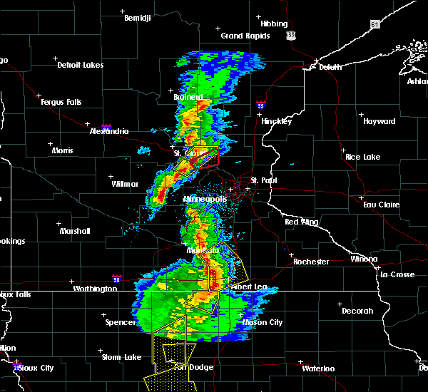 At 525 pm cst, a severe thunderstorm capable of producing a tornado was located over monticello, moving northeast at 35 mph (radar indicated rotation). Hazards include tornado and ping pong ball size hail. Flying debris will be dangerous to those caught without shelter. mobile homes will be damaged or destroyed. damage to roofs, windows, and vehicles will occur. tree damage is likely. this dangerous storm will be near, monticello around 530 pm cst. big lake around 540 pm cst. elk river and zimmerman around 550 pm cst. st. Francis around 600 pm cst. At 525 pm cst, a severe thunderstorm capable of producing a tornado was located over monticello, moving northeast at 35 mph (radar indicated rotation). Hazards include tornado and ping pong ball size hail. Flying debris will be dangerous to those caught without shelter. mobile homes will be damaged or destroyed. damage to roofs, windows, and vehicles will occur. tree damage is likely. this dangerous storm will be near, monticello around 530 pm cst. big lake around 540 pm cst. elk river and zimmerman around 550 pm cst. st. Francis around 600 pm cst.
|
| 3/6/2017 5:11 PM CST |
 At 511 pm cst, a severe thunderstorm was located over maple lake, or 7 miles northwest of buffalo, moving northeast at 60 mph (trained weather spotters). Hazards include golf ball size hail and 60 mph wind gusts. People and animals outdoors will be injured. expect hail damage to roofs, siding, windows, and vehicles. expect wind damage to roofs, siding, and trees. this severe thunderstorm will be near, monticello around 520 pm cst. big lake and becker around 525 pm cst. zimmerman around 530 pm cst. princeton around 540 pm cst. other locations impacted by this severe thunderstorm include enfield, santiago, orrock, silver creek, hasty, and rassat. A tornado watch remains in effect until 1000 pm cst for central and east central minnesota. At 511 pm cst, a severe thunderstorm was located over maple lake, or 7 miles northwest of buffalo, moving northeast at 60 mph (trained weather spotters). Hazards include golf ball size hail and 60 mph wind gusts. People and animals outdoors will be injured. expect hail damage to roofs, siding, windows, and vehicles. expect wind damage to roofs, siding, and trees. this severe thunderstorm will be near, monticello around 520 pm cst. big lake and becker around 525 pm cst. zimmerman around 530 pm cst. princeton around 540 pm cst. other locations impacted by this severe thunderstorm include enfield, santiago, orrock, silver creek, hasty, and rassat. A tornado watch remains in effect until 1000 pm cst for central and east central minnesota.
|
| 8/19/2016 2:45 AM CDT |
 At 245 am cdt, severe thunderstorms were located along a line extending from near buffalo to st. louis park, moving northeast at 30 mph (radar indicated). Hazards include 60 mph wind gusts. Expect damage to roofs. siding. and trees. severe thunderstorms will be near, st. louis park, richfield and msp international airport around 250 am cdt. plymouth and golden valley around 255 am cdt. minneapolis and albertville around 300 am cdt. brooklyn center, columbia heights, st. michael and big lake around 305 am cdt. roseville, fridley and spring lake park around 310 am cdt. shoreview, elk river, new brighton and mounds view around 315 am cdt. vadnais heights, arden hills and zimmerman around 320 am cdt. st. francis around 325 am cdt. other locations impacted by these severe thunderstorms include fort snelling, north minneapolis, osseo, new hope, north st. paul, bethel, birchwood, como park, crystal airport and univ of mn minneapolis campus. this includes the following highways, interstate 35 between mile markers 128 and 132. interstate 94 in minnesota between mile markers 197 and 249. u. s. highway 10 in minnesota between mile markers 206 and 240. u. s. highway 12 between mile markers 151 and 156. u. s. highway 169 between mile markers 125 and 175. u. s. highway 8 in minnesota near mile marker 0. u. s. Highway 61 between mile markers 134 and 161. At 245 am cdt, severe thunderstorms were located along a line extending from near buffalo to st. louis park, moving northeast at 30 mph (radar indicated). Hazards include 60 mph wind gusts. Expect damage to roofs. siding. and trees. severe thunderstorms will be near, st. louis park, richfield and msp international airport around 250 am cdt. plymouth and golden valley around 255 am cdt. minneapolis and albertville around 300 am cdt. brooklyn center, columbia heights, st. michael and big lake around 305 am cdt. roseville, fridley and spring lake park around 310 am cdt. shoreview, elk river, new brighton and mounds view around 315 am cdt. vadnais heights, arden hills and zimmerman around 320 am cdt. st. francis around 325 am cdt. other locations impacted by these severe thunderstorms include fort snelling, north minneapolis, osseo, new hope, north st. paul, bethel, birchwood, como park, crystal airport and univ of mn minneapolis campus. this includes the following highways, interstate 35 between mile markers 128 and 132. interstate 94 in minnesota between mile markers 197 and 249. u. s. highway 10 in minnesota between mile markers 206 and 240. u. s. highway 12 between mile markers 151 and 156. u. s. highway 169 between mile markers 125 and 175. u. s. highway 8 in minnesota near mile marker 0. u. s. Highway 61 between mile markers 134 and 161.
|
| 8/4/2016 4:37 AM CDT |
 At 434 am cdt, severe thunderstorms were located along a line extending from boulder lake, to near oliver, moving east at 50 mph (radar indicated). Hazards include 70 mph wind gusts and penny size hail. Expect considerable tree damage. damage is likely to mobile homes, roofs, and outbuildings. these severe storms will be near, south range and wisconsin point around 445 am cdt. hawthorne around 450 am cdt. poplar in douglas county around 455 am cdt. two harbors, lake nebagamon and maple around 500 am cdt. Other locations impacted by these severe thunderstorms include prosit, billings park, lakewood twp, pattison state park, chester park, wentworth, morley hts/parkview, alborn, patzau and waino. At 434 am cdt, severe thunderstorms were located along a line extending from boulder lake, to near oliver, moving east at 50 mph (radar indicated). Hazards include 70 mph wind gusts and penny size hail. Expect considerable tree damage. damage is likely to mobile homes, roofs, and outbuildings. these severe storms will be near, south range and wisconsin point around 445 am cdt. hawthorne around 450 am cdt. poplar in douglas county around 455 am cdt. two harbors, lake nebagamon and maple around 500 am cdt. Other locations impacted by these severe thunderstorms include prosit, billings park, lakewood twp, pattison state park, chester park, wentworth, morley hts/parkview, alborn, patzau and waino.
|
| 8/4/2016 4:15 AM CDT |
 At 414 am cdt, severe thunderstorms were located along a line extending from canyon, to near nemadji, moving east at 50 mph (radar indicated). Hazards include 70 mph wind gusts and penny size hail. Expect considerable tree damage. damage is likely to mobile homes, roofs, and outbuildings. severe thunderstorms will be near, foxboro around 425 am cdt. duluth and boulder lake around 430 am cdt. superior around 440 am cdt. hawthorne around 450 am cdt. poplar in douglas county around 455 am cdt. two harbors, lake nebagamon, maple and brule around 500 am cdt. Other locations impacted by these severe thunderstorms include prosit, billings park, lakewood twp, pattison state park, chester park, wentworth, morley hts/parkview, alborn, patzau and waino. At 414 am cdt, severe thunderstorms were located along a line extending from canyon, to near nemadji, moving east at 50 mph (radar indicated). Hazards include 70 mph wind gusts and penny size hail. Expect considerable tree damage. damage is likely to mobile homes, roofs, and outbuildings. severe thunderstorms will be near, foxboro around 425 am cdt. duluth and boulder lake around 430 am cdt. superior around 440 am cdt. hawthorne around 450 am cdt. poplar in douglas county around 455 am cdt. two harbors, lake nebagamon, maple and brule around 500 am cdt. Other locations impacted by these severe thunderstorms include prosit, billings park, lakewood twp, pattison state park, chester park, wentworth, morley hts/parkview, alborn, patzau and waino.
|
| 7/24/2016 1:29 AM CDT |
 At 129 am cdt, severe thunderstorms were located along a line extending from near tamarack, to 7 miles southeast of mcgrath, moving east at 40 mph (radar indicated). Hazards include 60 mph wind gusts and nickel size hail. Expect damage to roofs. siding. And trees. At 129 am cdt, severe thunderstorms were located along a line extending from near tamarack, to 7 miles southeast of mcgrath, moving east at 40 mph (radar indicated). Hazards include 60 mph wind gusts and nickel size hail. Expect damage to roofs. siding. And trees.
|
| 7/21/2016 3:35 AM CDT |
 At 335 am cdt, severe thunderstorms were located along a line extending from near whiteface reservoir, to near oliver, moving east at 45 mph. these are very dangerous storms (trained weather spotters). Hazards include 80 mph wind gusts and half dollar size hail. Flying debris will be dangerous to those caught without shelter. mobile homes will be heavily damaged. expect considerable damage to roofs, windows, and vehicles. extensive tree damage and power outages are likely. these severe storms will be near, superior, fairbanks and wolf lake around 345 am cdt. south range, brimson and wisconsin point around 350 am cdt. Other locations impacted by these severe thunderstorms include prosit, billings park, lakewood twp, chester park, morley hts/parkview, alborn, east hillside, taft, congdon park and twig. At 335 am cdt, severe thunderstorms were located along a line extending from near whiteface reservoir, to near oliver, moving east at 45 mph. these are very dangerous storms (trained weather spotters). Hazards include 80 mph wind gusts and half dollar size hail. Flying debris will be dangerous to those caught without shelter. mobile homes will be heavily damaged. expect considerable damage to roofs, windows, and vehicles. extensive tree damage and power outages are likely. these severe storms will be near, superior, fairbanks and wolf lake around 345 am cdt. south range, brimson and wisconsin point around 350 am cdt. Other locations impacted by these severe thunderstorms include prosit, billings park, lakewood twp, chester park, morley hts/parkview, alborn, east hillside, taft, congdon park and twig.
|
| 7/21/2016 3:21 AM CDT |
 At 319 am cdt, severe thunderstorms were located along a line extending from 6 miles west of whiteface reservoir, to near wrenshall, moving east at 55 mph (radar indicated). Hazards include 70 mph wind gusts and half dollar size hail. Hail damage to vehicles is expected. expect considerable tree damage. wind damage is also likely to mobile homes, roofs, and outbuildings. these severe storms will be near, whiteface reservoir around 330 am cdt. oliver and duluth around 335 am cdt. fairbanks, wolf lake and wisconsin point around 340 am cdt. superior, south range and brimson around 345 am cdt. Other locations impacted by these severe thunderstorms include prosit, billings park, lakewood twp, chester park, morley hts/parkview, alborn, east hillside, gowan, taft and congdon park. At 319 am cdt, severe thunderstorms were located along a line extending from 6 miles west of whiteface reservoir, to near wrenshall, moving east at 55 mph (radar indicated). Hazards include 70 mph wind gusts and half dollar size hail. Hail damage to vehicles is expected. expect considerable tree damage. wind damage is also likely to mobile homes, roofs, and outbuildings. these severe storms will be near, whiteface reservoir around 330 am cdt. oliver and duluth around 335 am cdt. fairbanks, wolf lake and wisconsin point around 340 am cdt. superior, south range and brimson around 345 am cdt. Other locations impacted by these severe thunderstorms include prosit, billings park, lakewood twp, chester park, morley hts/parkview, alborn, east hillside, gowan, taft and congdon park.
|
| 7/21/2016 3:00 AM CDT |
 At 257 am cdt, severe thunderstorms were located along a line extending from near cherry, to near cromwell, moving east at 45 mph (radar indicated). Hazards include 60 mph wind gusts. Expect damage to roofs. siding. and trees. severe thunderstorms will be near, eveleth around 315 am cdt. cloquet around 325 am cdt. scanlon and carlton around 330 am cdt. wrenshall and thomson around 335 am cdt. whiteface reservoir around 340 am cdt. duluth, proctor and oliver around 345 am cdt. superior and wolf lake around 350 am cdt. Other locations impacted by these severe thunderstorms include prosit, billings park, lakewood twp, chester park, morley hts/parkview, alborn, east hillside, gowan, taft and congdon park. At 257 am cdt, severe thunderstorms were located along a line extending from near cherry, to near cromwell, moving east at 45 mph (radar indicated). Hazards include 60 mph wind gusts. Expect damage to roofs. siding. and trees. severe thunderstorms will be near, eveleth around 315 am cdt. cloquet around 325 am cdt. scanlon and carlton around 330 am cdt. wrenshall and thomson around 335 am cdt. whiteface reservoir around 340 am cdt. duluth, proctor and oliver around 345 am cdt. superior and wolf lake around 350 am cdt. Other locations impacted by these severe thunderstorms include prosit, billings park, lakewood twp, chester park, morley hts/parkview, alborn, east hillside, gowan, taft and congdon park.
|
| 7/11/2016 9:10 PM CDT |
 The tornado warning for southeastern sherburne county will expire at 915 pm cdt, the storm which prompted the warning has weakened below severe limits, and no longer appears capable of producing a tornado. therefore the warning will be allowed to expire. however heavy rain is still possible with this thunderstorm. a tornado watch remains in effect until 1000 pm cdt for central and east central minnesota. The tornado warning for southeastern sherburne county will expire at 915 pm cdt, the storm which prompted the warning has weakened below severe limits, and no longer appears capable of producing a tornado. therefore the warning will be allowed to expire. however heavy rain is still possible with this thunderstorm. a tornado watch remains in effect until 1000 pm cdt for central and east central minnesota.
|
| 7/11/2016 9:00 PM CDT |
 At 900 pm cdt, a severe thunderstorm capable of producing a tornado was located over elk river, or 17 miles northeast of buffalo, moving northeast at 30 mph (radar indicated rotation). Hazards include tornado and quarter size hail. Flying debris will be dangerous to those caught without shelter. mobile homes will be damaged or destroyed. damage to roofs, windows, and vehicles will occur. tree damage is likely. this dangerous storm will be near, zimmerman around 905 pm cdt. this includes the following highways, u. s. highway 10 in minnesota between mile markers 207 and 209. u. s. Highway 169 between mile markers 161 and 169. At 900 pm cdt, a severe thunderstorm capable of producing a tornado was located over elk river, or 17 miles northeast of buffalo, moving northeast at 30 mph (radar indicated rotation). Hazards include tornado and quarter size hail. Flying debris will be dangerous to those caught without shelter. mobile homes will be damaged or destroyed. damage to roofs, windows, and vehicles will occur. tree damage is likely. this dangerous storm will be near, zimmerman around 905 pm cdt. this includes the following highways, u. s. highway 10 in minnesota between mile markers 207 and 209. u. s. Highway 169 between mile markers 161 and 169.
|
| 7/11/2016 8:50 PM CDT |
 At 849 pm cdt, a severe thunderstorm capable of producing a tornado was located over big lake, or 11 miles northeast of buffalo, moving northeast at 30 mph (radar indicated rotation). Hazards include tornado and quarter size hail. Flying debris will be dangerous to those caught without shelter. mobile homes will be damaged or destroyed. damage to roofs, windows, and vehicles will occur. tree damage is likely. this dangerous storm will be near, elk river and zimmerman around 905 pm cdt. this includes the following highways, u. s. highway 10 in minnesota between mile markers 201 and 209. u. s. Highway 169 between mile markers 161 and 169. At 849 pm cdt, a severe thunderstorm capable of producing a tornado was located over big lake, or 11 miles northeast of buffalo, moving northeast at 30 mph (radar indicated rotation). Hazards include tornado and quarter size hail. Flying debris will be dangerous to those caught without shelter. mobile homes will be damaged or destroyed. damage to roofs, windows, and vehicles will occur. tree damage is likely. this dangerous storm will be near, elk river and zimmerman around 905 pm cdt. this includes the following highways, u. s. highway 10 in minnesota between mile markers 201 and 209. u. s. Highway 169 between mile markers 161 and 169.
|
| 7/11/2016 8:44 PM CDT |
 At 843 pm cdt, a severe thunderstorm was located over monticello, or 7 miles north of buffalo, moving northeast at 40 mph (trained weather spotters). Hazards include 60 mph wind gusts and quarter size hail. Hail damage to vehicles is expected. expect wind damage to roofs, siding, and trees. this severe thunderstorm will be near, big lake around 850 pm cdt. albertville around 855 pm cdt. elk river around 900 pm cdt. zimmerman around 905 pm cdt. ramsey and st. francis around 910 pm cdt. other locations impacted by this severe thunderstorm include silver creek. A tornado watch remains in effect until 1000 pm cdt for central and east central minnesota. At 843 pm cdt, a severe thunderstorm was located over monticello, or 7 miles north of buffalo, moving northeast at 40 mph (trained weather spotters). Hazards include 60 mph wind gusts and quarter size hail. Hail damage to vehicles is expected. expect wind damage to roofs, siding, and trees. this severe thunderstorm will be near, big lake around 850 pm cdt. albertville around 855 pm cdt. elk river around 900 pm cdt. zimmerman around 905 pm cdt. ramsey and st. francis around 910 pm cdt. other locations impacted by this severe thunderstorm include silver creek. A tornado watch remains in effect until 1000 pm cdt for central and east central minnesota.
|
| 7/5/2016 5:09 PM CDT |
 At 509 pm cdt, a severe thunderstorm was located over rogers, or 12 miles east of buffalo, moving east at 60 mph (radar indicated). Hazards include 60 mph wind gusts and quarter size hail. Hail damage to vehicles is expected. expect wind damage to roofs, siding, and trees. this severe thunderstorm will remain over mainly rural areas of southeastern sherburne and northeastern wright counties. A tornado watch remains in effect until 900 pm cdt for central minnesota. At 509 pm cdt, a severe thunderstorm was located over rogers, or 12 miles east of buffalo, moving east at 60 mph (radar indicated). Hazards include 60 mph wind gusts and quarter size hail. Hail damage to vehicles is expected. expect wind damage to roofs, siding, and trees. this severe thunderstorm will remain over mainly rural areas of southeastern sherburne and northeastern wright counties. A tornado watch remains in effect until 900 pm cdt for central minnesota.
|
| 7/5/2016 4:47 PM CDT |
 At 447 pm cdt, a severe thunderstorm was located near silver creek, or 11 miles northwest of buffalo, moving east at 55 mph (radar indicated). Hazards include 60 mph wind gusts and quarter size hail. Hail damage to vehicles is expected. expect wind damage to roofs, siding, and trees. this severe thunderstorm will be near, monticello around 455 pm cdt. big lake around 500 pm cdt. albertville around 505 pm cdt. st. michael and otsego around 510 pm cdt. other locations impacted by this severe thunderstorm include enfield, hasty and silver creek. this includes the following highways, interstate 94 in minnesota between mile markers 179 and 205. u. s. highway 10 in minnesota between mile markers 189 and 217. u. s. highway 169 between mile markers 159 and 166. A tornado watch remains in effect until 900 pm cdt for central minnesota. At 447 pm cdt, a severe thunderstorm was located near silver creek, or 11 miles northwest of buffalo, moving east at 55 mph (radar indicated). Hazards include 60 mph wind gusts and quarter size hail. Hail damage to vehicles is expected. expect wind damage to roofs, siding, and trees. this severe thunderstorm will be near, monticello around 455 pm cdt. big lake around 500 pm cdt. albertville around 505 pm cdt. st. michael and otsego around 510 pm cdt. other locations impacted by this severe thunderstorm include enfield, hasty and silver creek. this includes the following highways, interstate 94 in minnesota between mile markers 179 and 205. u. s. highway 10 in minnesota between mile markers 189 and 217. u. s. highway 169 between mile markers 159 and 166. A tornado watch remains in effect until 900 pm cdt for central minnesota.
|
| 6/25/2016 4:52 PM CDT |
 At 451 pm cdt, a severe thunderstorm was located over proctor, or 7 miles west of superior, moving east at 40 mph (radar indicated. this storm has a history of producing wind damage in the cromwell and cloquet areas). Hazards include 70 mph wind gusts and quarter size hail. Hail damage to vehicles is expected. expect considerable tree damage. wind damage is also likely to mobile homes, roofs, and outbuildings. locations impacted include, duluth, superior, cloquet, hermantown, two harbors, proctor, hawthorne, lake nebagamon, scanlon, carlton, maple, brule, barnum, mahtowa, poplar in douglas county, wrenshall, oliver, holyoke, thomson and brookston. A tornado watch remains in effect until 900 pm cdt for northeastern minnesota, and northwestern wisconsin. At 451 pm cdt, a severe thunderstorm was located over proctor, or 7 miles west of superior, moving east at 40 mph (radar indicated. this storm has a history of producing wind damage in the cromwell and cloquet areas). Hazards include 70 mph wind gusts and quarter size hail. Hail damage to vehicles is expected. expect considerable tree damage. wind damage is also likely to mobile homes, roofs, and outbuildings. locations impacted include, duluth, superior, cloquet, hermantown, two harbors, proctor, hawthorne, lake nebagamon, scanlon, carlton, maple, brule, barnum, mahtowa, poplar in douglas county, wrenshall, oliver, holyoke, thomson and brookston. A tornado watch remains in effect until 900 pm cdt for northeastern minnesota, and northwestern wisconsin.
|
| 6/25/2016 4:46 PM CDT |
 At 445 pm cdt, severe thunderstorms were located along a line extending from near kettle river to 8 miles south of mcgrath, moving east at 55 mph (radar indicated). Hazards include 70 mph wind gusts and nickel size hail. Expect considerable tree damage. damage is likely to mobile homes, roofs, and outbuildings. locations impacted include, cloquet, mille lacs lake, hermantown, sandstone, scanlon, carlton, barnum, mahtowa, willow river, wrenshall, askov, malmo, cromwell, rutledge, kettle river, thomson, bruno, tamarack, mcgrath and nemadji. A tornado watch remains in effect until 900 pm cdt for northeastern minnesota. At 445 pm cdt, severe thunderstorms were located along a line extending from near kettle river to 8 miles south of mcgrath, moving east at 55 mph (radar indicated). Hazards include 70 mph wind gusts and nickel size hail. Expect considerable tree damage. damage is likely to mobile homes, roofs, and outbuildings. locations impacted include, cloquet, mille lacs lake, hermantown, sandstone, scanlon, carlton, barnum, mahtowa, willow river, wrenshall, askov, malmo, cromwell, rutledge, kettle river, thomson, bruno, tamarack, mcgrath and nemadji. A tornado watch remains in effect until 900 pm cdt for northeastern minnesota.
|
| 6/25/2016 4:36 PM CDT |
 At 435 pm cdt, a severe thunderstorm was located near carlton, or near cloquet, moving east at 50 mph. this is a very dangerous storm (radar indicated). Hazards include 80 mph wind gusts and quarter size hail. Flying debris will be dangerous to those caught without shelter. mobile homes will be heavily damaged. expect considerable damage to roofs, windows, and vehicles. Extensive tree damage and power outages are likely. At 435 pm cdt, a severe thunderstorm was located near carlton, or near cloquet, moving east at 50 mph. this is a very dangerous storm (radar indicated). Hazards include 80 mph wind gusts and quarter size hail. Flying debris will be dangerous to those caught without shelter. mobile homes will be heavily damaged. expect considerable damage to roofs, windows, and vehicles. Extensive tree damage and power outages are likely.
|
| 6/25/2016 4:28 PM CDT |
 At 426 pm cdt, dangerous severe thunderstorms were located along a line extending from near brookston to near mahtowa to 7 miles northwest of rutledge, moving east at 50 mph (radar indicated). Hazards include 80 mph wind gusts and nickel size hail. Flying debris will be dangerous to those caught without shelter. mobile homes will be heavily damaged. expect considerable damage to roofs, windows, and vehicles. extensive tree damage and power outages are likely. locations impacted include, cloquet, mille lacs lake, hermantown, sandstone, scanlon, carlton, barnum, mahtowa, willow river, wrenshall, mcgregor, askov, malmo, cromwell, rutledge, kettle river, thomson, brookston, bruno and tamarack. A tornado watch remains in effect until 900 pm cdt for northeastern minnesota. At 426 pm cdt, dangerous severe thunderstorms were located along a line extending from near brookston to near mahtowa to 7 miles northwest of rutledge, moving east at 50 mph (radar indicated). Hazards include 80 mph wind gusts and nickel size hail. Flying debris will be dangerous to those caught without shelter. mobile homes will be heavily damaged. expect considerable damage to roofs, windows, and vehicles. extensive tree damage and power outages are likely. locations impacted include, cloquet, mille lacs lake, hermantown, sandstone, scanlon, carlton, barnum, mahtowa, willow river, wrenshall, mcgregor, askov, malmo, cromwell, rutledge, kettle river, thomson, brookston, bruno and tamarack. A tornado watch remains in effect until 900 pm cdt for northeastern minnesota.
|
| 6/25/2016 4:21 PM CDT |
 At 419 pm cdt, severe thunderstorms were located along a line extending from 7 miles northeast of cromwell to 7 miles west of mahtowa to 6 miles east of mcgrath, moving east at 65 mph. these are very dangerous storms. radar indicates that a narrow corridor of very strong winds, perhaps up to 80 mph will affect areas along the highway 210 corridor from cromwell to cloquet (radar indicated). Hazards include 80 mph wind gusts and quarter size hail. Flying debris will be dangerous to those caught without shelter. mobile homes will be heavily damaged. expect considerable damage to roofs, windows, and vehicles. extensive tree damage and power outages are likely. locations impacted include, cloquet, mille lacs lake, hermantown, sandstone, scanlon, carlton, barnum, mahtowa, willow river, wrenshall, mcgregor, askov, malmo, cromwell, rutledge, kettle river, thomson, brookston, bruno and tamarack. A tornado watch remains in effect until 900 pm cdt for northeastern minnesota. At 419 pm cdt, severe thunderstorms were located along a line extending from 7 miles northeast of cromwell to 7 miles west of mahtowa to 6 miles east of mcgrath, moving east at 65 mph. these are very dangerous storms. radar indicates that a narrow corridor of very strong winds, perhaps up to 80 mph will affect areas along the highway 210 corridor from cromwell to cloquet (radar indicated). Hazards include 80 mph wind gusts and quarter size hail. Flying debris will be dangerous to those caught without shelter. mobile homes will be heavily damaged. expect considerable damage to roofs, windows, and vehicles. extensive tree damage and power outages are likely. locations impacted include, cloquet, mille lacs lake, hermantown, sandstone, scanlon, carlton, barnum, mahtowa, willow river, wrenshall, mcgregor, askov, malmo, cromwell, rutledge, kettle river, thomson, brookston, bruno and tamarack. A tornado watch remains in effect until 900 pm cdt for northeastern minnesota.
|
| 6/25/2016 4:07 PM CDT |
 At 406 pm cdt, severe thunderstorms were located along a line extending from 7 miles north of cromwell to 6 miles northwest of kettle river to 6 miles north of isle, moving east at 50 mph (radar indicated). Hazards include 70 mph wind gusts and quarter size hail. Hail damage to vehicles is expected. expect considerable tree damage. Wind damage is also likely to mobile homes, roofs, and outbuildings. At 406 pm cdt, severe thunderstorms were located along a line extending from 7 miles north of cromwell to 6 miles northwest of kettle river to 6 miles north of isle, moving east at 50 mph (radar indicated). Hazards include 70 mph wind gusts and quarter size hail. Hail damage to vehicles is expected. expect considerable tree damage. Wind damage is also likely to mobile homes, roofs, and outbuildings.
|
| 6/19/2016 9:56 PM CDT |
 The severe thunderstorm warning for eastern carlton and northwestern douglas counties will expire at 1000 pm cdt, the storm which prompted the warning has weakened below severe limits, and no longer pose an immediate threat to life or property. therefore the warning will be allowed to expire. however small hail and gusty winds are still possible with this thunderstorm. a severe thunderstorm watch remains in effect until 1100 pm cdt for northeastern minnesota, and northwestern wisconsin. The severe thunderstorm warning for eastern carlton and northwestern douglas counties will expire at 1000 pm cdt, the storm which prompted the warning has weakened below severe limits, and no longer pose an immediate threat to life or property. therefore the warning will be allowed to expire. however small hail and gusty winds are still possible with this thunderstorm. a severe thunderstorm watch remains in effect until 1100 pm cdt for northeastern minnesota, and northwestern wisconsin.
|
| 6/19/2016 9:19 PM CDT |
 At 919 pm cdt, a severe thunderstorm was located near mahtowa, or 7 miles southwest of cloquet, moving east at 55 mph (radar indicated). Hazards include golf ball size hail and 70 mph wind gusts. People and animals outdoors will be injured. expect hail damage to roofs, siding, windows, and vehicles. expect considerable tree damage. wind damage is also likely to mobile homes, roofs, and outbuildings. this severe thunderstorm will be near, scanlon around 925 pm cdt. carlton, wrenshall and thomson around 930 pm cdt. oliver around 940 pm cdt. superior around 945 pm cdt. south range and wisconsin point around 950 pm cdt. Other locations impacted by this severe thunderstorm include billings park, pattison state park, sawyer, scotts corner, pleasant valley, jay cooke state park, esko, amnicon lake and patzau. At 919 pm cdt, a severe thunderstorm was located near mahtowa, or 7 miles southwest of cloquet, moving east at 55 mph (radar indicated). Hazards include golf ball size hail and 70 mph wind gusts. People and animals outdoors will be injured. expect hail damage to roofs, siding, windows, and vehicles. expect considerable tree damage. wind damage is also likely to mobile homes, roofs, and outbuildings. this severe thunderstorm will be near, scanlon around 925 pm cdt. carlton, wrenshall and thomson around 930 pm cdt. oliver around 940 pm cdt. superior around 945 pm cdt. south range and wisconsin point around 950 pm cdt. Other locations impacted by this severe thunderstorm include billings park, pattison state park, sawyer, scotts corner, pleasant valley, jay cooke state park, esko, amnicon lake and patzau.
|
| 6/19/2016 9:06 PM CDT |
 At 906 pm cdt, severe thunderstorms were located along a line extending from south range to 7 miles east of dairyland, moving east at 45 mph (radar indicated). Hazards include 70 mph wind gusts and ping pong ball size hail. People and animals outdoors will be injured. expect hail damage to roofs, siding, windows, and vehicles. expect considerable tree damage. wind damage is also likely to mobile homes, roofs, and outbuildings. these severe storms will be near, hawthorne, maple, poplar in douglas county and gordon around 915 pm cdt. Other locations impacted by these severe thunderstorms include pattison state park, lyman lake, scotts corner, wentworth, nickerson, pleasant valley, belden, patzau, chaffey and kingsdale. At 906 pm cdt, severe thunderstorms were located along a line extending from south range to 7 miles east of dairyland, moving east at 45 mph (radar indicated). Hazards include 70 mph wind gusts and ping pong ball size hail. People and animals outdoors will be injured. expect hail damage to roofs, siding, windows, and vehicles. expect considerable tree damage. wind damage is also likely to mobile homes, roofs, and outbuildings. these severe storms will be near, hawthorne, maple, poplar in douglas county and gordon around 915 pm cdt. Other locations impacted by these severe thunderstorms include pattison state park, lyman lake, scotts corner, wentworth, nickerson, pleasant valley, belden, patzau, chaffey and kingsdale.
|
| 6/19/2016 9:06 PM CDT |
 At 905 pm cdt, a severe thunderstorm capable of producing a tornado was located near clear lake, or 14 miles southeast of st. cloud, moving east at 40 mph (radar indicated rotation). Hazards include tornado and quarter size hail. Flying debris will be dangerous to those caught without shelter. mobile homes will be damaged or destroyed. damage to roofs, windows, and vehicles will occur. tree damage is likely. locations impacted include, st. Cloud, big lake, becker, clearwater, clear lake, santiago and st cloud airport. At 905 pm cdt, a severe thunderstorm capable of producing a tornado was located near clear lake, or 14 miles southeast of st. cloud, moving east at 40 mph (radar indicated rotation). Hazards include tornado and quarter size hail. Flying debris will be dangerous to those caught without shelter. mobile homes will be damaged or destroyed. damage to roofs, windows, and vehicles will occur. tree damage is likely. locations impacted include, st. Cloud, big lake, becker, clearwater, clear lake, santiago and st cloud airport.
|
| 6/19/2016 8:57 PM CDT |
 At 856 pm cdt, a severe thunderstorm capable of producing a tornado was located near clear lake, or 9 miles southeast of st. cloud, moving east at 40 mph (radar indicated rotation). Hazards include tornado and quarter size hail. Flying debris will be dangerous to those caught without shelter. mobile homes will be damaged or destroyed. damage to roofs, windows, and vehicles will occur. tree damage is likely. locations impacted include, st. Cloud, big lake, becker, clearwater, clear lake, santiago, glendorado, st cloud airport, duelm and st augusta. At 856 pm cdt, a severe thunderstorm capable of producing a tornado was located near clear lake, or 9 miles southeast of st. cloud, moving east at 40 mph (radar indicated rotation). Hazards include tornado and quarter size hail. Flying debris will be dangerous to those caught without shelter. mobile homes will be damaged or destroyed. damage to roofs, windows, and vehicles will occur. tree damage is likely. locations impacted include, st. Cloud, big lake, becker, clearwater, clear lake, santiago, glendorado, st cloud airport, duelm and st augusta.
|
| 6/19/2016 8:47 PM CDT |
 At 846 pm cdt, a severe thunderstorm capable of producing a tornado was located over st augusta, or near st. cloud, moving east at 35 mph (radar indicated rotation). Hazards include tornado and quarter size hail. Flying debris will be dangerous to those caught without shelter. mobile homes will be damaged or destroyed. damage to roofs, windows, and vehicles will occur. tree damage is likely. locations impacted include, st. Cloud, sauk rapids, big lake, waite park, becker, rockville, clearwater, clear lake, santiago, glendorado, luxemburg and st cloud airport. At 846 pm cdt, a severe thunderstorm capable of producing a tornado was located over st augusta, or near st. cloud, moving east at 35 mph (radar indicated rotation). Hazards include tornado and quarter size hail. Flying debris will be dangerous to those caught without shelter. mobile homes will be damaged or destroyed. damage to roofs, windows, and vehicles will occur. tree damage is likely. locations impacted include, st. Cloud, sauk rapids, big lake, waite park, becker, rockville, clearwater, clear lake, santiago, glendorado, luxemburg and st cloud airport.
|
| 6/19/2016 8:47 PM CDT |
 At 846 pm cdt, severe thunderstorms were located along a line extending from oliver to near dairyland, moving east at 50 mph (radar indicated). Hazards include 70 mph wind gusts and ping pong ball size hail. People and animals outdoors will be injured. expect hail damage to roofs, siding, windows, and vehicles. expect considerable tree damage. wind damage is also likely to mobile homes, roofs, and outbuildings. these severe storms will be near, superior around 850 pm cdt. wisconsin point around 855 pm cdt. south range around 900 pm cdt. hawthorne around 905 pm cdt. poplar in douglas county, solon springs and gordon around 910 pm cdt. lake nebagamon and maple around 915 pm cdt. Other locations impacted by these severe thunderstorms include pattison state park, lyman lake, scotts corner, wentworth, nickerson, pleasant valley, belden, patzau, chaffey and kingsdale. At 846 pm cdt, severe thunderstorms were located along a line extending from oliver to near dairyland, moving east at 50 mph (radar indicated). Hazards include 70 mph wind gusts and ping pong ball size hail. People and animals outdoors will be injured. expect hail damage to roofs, siding, windows, and vehicles. expect considerable tree damage. wind damage is also likely to mobile homes, roofs, and outbuildings. these severe storms will be near, superior around 850 pm cdt. wisconsin point around 855 pm cdt. south range around 900 pm cdt. hawthorne around 905 pm cdt. poplar in douglas county, solon springs and gordon around 910 pm cdt. lake nebagamon and maple around 915 pm cdt. Other locations impacted by these severe thunderstorms include pattison state park, lyman lake, scotts corner, wentworth, nickerson, pleasant valley, belden, patzau, chaffey and kingsdale.
|
| 6/19/2016 8:30 PM CDT |
 At 830 pm cdt, a severe thunderstorm capable of producing a tornado was located over rockville, or 11 miles southwest of st. cloud, moving east at 40 mph (radar indicated rotation). Hazards include tornado. Flying debris will be dangerous to those caught without shelter. mobile homes will be damaged or destroyed. damage to roofs, windows, and vehicles will occur. tree damage is likely. this tornadic thunderstorm will remain over mainly rural areas of southeastern stearns, northwestern sherburne and southeastern benton counties, including the following locations: glendorado, parent, luxemburg, st cloud airport, duelm, santiago, pleasant lake and st augusta. this includes the following highways, interstate 94 in minnesota between mile markers 159 and 178. u. s. Highway 10 in minnesota between mile markers 176 and 198. At 830 pm cdt, a severe thunderstorm capable of producing a tornado was located over rockville, or 11 miles southwest of st. cloud, moving east at 40 mph (radar indicated rotation). Hazards include tornado. Flying debris will be dangerous to those caught without shelter. mobile homes will be damaged or destroyed. damage to roofs, windows, and vehicles will occur. tree damage is likely. this tornadic thunderstorm will remain over mainly rural areas of southeastern stearns, northwestern sherburne and southeastern benton counties, including the following locations: glendorado, parent, luxemburg, st cloud airport, duelm, santiago, pleasant lake and st augusta. this includes the following highways, interstate 94 in minnesota between mile markers 159 and 178. u. s. Highway 10 in minnesota between mile markers 176 and 198.
|
| 6/19/2016 8:24 PM CDT |
 At 823 pm cdt, severe thunderstorms were located along a line extending from 6 miles north of mahtowa to near bruno, moving east at 55 mph (radar indicated). Hazards include 70 mph wind gusts and ping pong ball size hail. People and animals outdoors will be injured. expect hail damage to roofs, siding, windows, and vehicles. expect considerable tree damage. wind damage is also likely to mobile homes, roofs, and outbuildings. severe thunderstorms will be near, carlton, wrenshall and thomson around 835 pm cdt. oliver and dairyland around 845 pm cdt. superior around 850 pm cdt. south range and wisconsin point around 855 pm cdt. hawthorne around 900 pm cdt. maple, poplar in douglas county and gordon around 905 pm cdt. lake nebagamon around 910 pm cdt. Other locations impacted by these severe thunderstorms include pattison state park, lyman lake, scotts corner, wentworth, nickerson, pleasant valley, belden, patzau, chaffey and kingsdale. At 823 pm cdt, severe thunderstorms were located along a line extending from 6 miles north of mahtowa to near bruno, moving east at 55 mph (radar indicated). Hazards include 70 mph wind gusts and ping pong ball size hail. People and animals outdoors will be injured. expect hail damage to roofs, siding, windows, and vehicles. expect considerable tree damage. wind damage is also likely to mobile homes, roofs, and outbuildings. severe thunderstorms will be near, carlton, wrenshall and thomson around 835 pm cdt. oliver and dairyland around 845 pm cdt. superior around 850 pm cdt. south range and wisconsin point around 855 pm cdt. hawthorne around 900 pm cdt. maple, poplar in douglas county and gordon around 905 pm cdt. lake nebagamon around 910 pm cdt. Other locations impacted by these severe thunderstorms include pattison state park, lyman lake, scotts corner, wentworth, nickerson, pleasant valley, belden, patzau, chaffey and kingsdale.
|
| 8/8/2015 5:11 PM CDT |
 A severe thunderstorm warning remains in effect until 530 pm cdt for western carlton county. at 510 pm cdt. a severe thunderstorm was located near cromwell. or 15 miles northwest of moose lake state park. moving east at 30 mph. hazard. golf ball size hail and 60 mph wind gusts. source. Radar indicated. A severe thunderstorm warning remains in effect until 530 pm cdt for western carlton county. at 510 pm cdt. a severe thunderstorm was located near cromwell. or 15 miles northwest of moose lake state park. moving east at 30 mph. hazard. golf ball size hail and 60 mph wind gusts. source. Radar indicated.
|
| 8/8/2015 5:03 PM CDT |
 The national weather service in duluth mn has issued a * severe thunderstorm warning for. western carlton county in northeastern minnesota. east central aitkin county in east central minnesota. until 530 pm cdt * at 501 pm cdt. A severe thunderstorm was located near tamarack. The national weather service in duluth mn has issued a * severe thunderstorm warning for. western carlton county in northeastern minnesota. east central aitkin county in east central minnesota. until 530 pm cdt * at 501 pm cdt. A severe thunderstorm was located near tamarack.
|
| 7/18/2015 12:46 AM CDT |
 At 1246 am cdt, severe thunderstorms were located along a line extending from nowthen to near st. paul to eagan, moving east at 45 mph (radar indicated). Hazards include 60 mph wind gusts. Expect damage to roofs. siding and trees. these severe storms will be near, st. paul, eagan, maplewood, inver grove heights and roseville around 1250 am cdt. cottage grove, oakdale, white bear lake and st. paul park around 1255 am cdt. woodbury around 100 am cdt. blaine, hastings, lino lakes, lake elmo and bayport around 105 am cdt. hudson and prescott around 110 am cdt. forest lake and hugo around 115 am cdt. other locations impacted by these severe thunderstorms include north minneapolis, flying cloud airport, south st paul airport, afton state park, lakeland shores, new hope, north st. Paul, south st paul, como park and st paul park. At 1246 am cdt, severe thunderstorms were located along a line extending from nowthen to near st. paul to eagan, moving east at 45 mph (radar indicated). Hazards include 60 mph wind gusts. Expect damage to roofs. siding and trees. these severe storms will be near, st. paul, eagan, maplewood, inver grove heights and roseville around 1250 am cdt. cottage grove, oakdale, white bear lake and st. paul park around 1255 am cdt. woodbury around 100 am cdt. blaine, hastings, lino lakes, lake elmo and bayport around 105 am cdt. hudson and prescott around 110 am cdt. forest lake and hugo around 115 am cdt. other locations impacted by these severe thunderstorms include north minneapolis, flying cloud airport, south st paul airport, afton state park, lakeland shores, new hope, north st. Paul, south st paul, como park and st paul park.
|
| 7/18/2015 12:26 AM CDT |
 At 1226 am cdt, severe thunderstorms were located along a line extending from near big lake to wayzata to near flying cloud airport, moving east at 45 mph (radar indicated). Hazards include 60 mph wind gusts. Expect damage to roofs. siding and trees. severe thunderstorms will be near, plymouth, eden prairie, minnetonka, st. louis park and shakopee around 1230 am cdt. minneapolis, edina, brooklyn center and golden valley around 1235 am cdt. burnsville, richfield and columbia heights around 1240 am cdt. bloomington, roseville, st. michael, otsego and st. francis around 1245 am cdt. eagan, ramsey, champlin, rosemount and mendota heights around 1250 am cdt. st. paul, maplewood, inver grove heights, andover and south st. paul around 1255 am cdt. coon rapids, cottage grove, oakdale, ham lake and st. paul park around 100 am cdt. woodbury, lake elmo and afton around 105 am cdt. other locations impacted by these severe thunderstorms include north minneapolis, flying cloud airport, south st paul airport, afton state park, lakeland shores, new hope, north st. paul, south st paul, como park and st paul park. this includes the following highways, interstate 35 between mile markers 128 and 133. interstate 94 in minnesota between mile markers 194 and 258. u. s. highway 10 in minnesota between mile markers 195 and 302. u. s. highway 12 between mile markers 153 and 156. u. s. highway 169 between mile markers 118 and 165. u. s. highway 212 between mile markers 155 and 162. u. s. highway 8 in minnesota between mile markers 0 and 1. u. s. Highway 61 between mile markers 119 and 162. At 1226 am cdt, severe thunderstorms were located along a line extending from near big lake to wayzata to near flying cloud airport, moving east at 45 mph (radar indicated). Hazards include 60 mph wind gusts. Expect damage to roofs. siding and trees. severe thunderstorms will be near, plymouth, eden prairie, minnetonka, st. louis park and shakopee around 1230 am cdt. minneapolis, edina, brooklyn center and golden valley around 1235 am cdt. burnsville, richfield and columbia heights around 1240 am cdt. bloomington, roseville, st. michael, otsego and st. francis around 1245 am cdt. eagan, ramsey, champlin, rosemount and mendota heights around 1250 am cdt. st. paul, maplewood, inver grove heights, andover and south st. paul around 1255 am cdt. coon rapids, cottage grove, oakdale, ham lake and st. paul park around 100 am cdt. woodbury, lake elmo and afton around 105 am cdt. other locations impacted by these severe thunderstorms include north minneapolis, flying cloud airport, south st paul airport, afton state park, lakeland shores, new hope, north st. paul, south st paul, como park and st paul park. this includes the following highways, interstate 35 between mile markers 128 and 133. interstate 94 in minnesota between mile markers 194 and 258. u. s. highway 10 in minnesota between mile markers 195 and 302. u. s. highway 12 between mile markers 153 and 156. u. s. highway 169 between mile markers 118 and 165. u. s. highway 212 between mile markers 155 and 162. u. s. highway 8 in minnesota between mile markers 0 and 1. u. s. Highway 61 between mile markers 119 and 162.
|
| 7/18/2015 12:21 AM CDT |
 At 1220 am cdt, severe thunderstorms were located along a line extending from near monticello to loretto to near victoria, moving east at 35 mph (radar indicated). Hazards include 60 mph wind gusts and penny size hail. Expect damage to roofs. siding and trees. these severe storms will be near, chanhassen, mound, orono, medina and maple plain around 1225 am cdt. plymouth, eden prairie, minnetonka, shakopee and elk river around 1230 am cdt. other locations impacted by these severe thunderstorms include woodland, flying cloud airport, greenfield, buffalo airport, rassat, dayton, hamel, hanover, silver creek and enfield. this includes the following highways, interstate 94 in minnesota between mile markers 179 and 217. u. s. highway 10 in minnesota between mile markers 189 and 217. u. s. highway 12 between mile markers 130 and 156. u. s. highway 169 between mile markers 118 and 121, and between mile markers 159 and 166. u. s. Highway 212 between mile markers 155 and 161. At 1220 am cdt, severe thunderstorms were located along a line extending from near monticello to loretto to near victoria, moving east at 35 mph (radar indicated). Hazards include 60 mph wind gusts and penny size hail. Expect damage to roofs. siding and trees. these severe storms will be near, chanhassen, mound, orono, medina and maple plain around 1225 am cdt. plymouth, eden prairie, minnetonka, shakopee and elk river around 1230 am cdt. other locations impacted by these severe thunderstorms include woodland, flying cloud airport, greenfield, buffalo airport, rassat, dayton, hamel, hanover, silver creek and enfield. this includes the following highways, interstate 94 in minnesota between mile markers 179 and 217. u. s. highway 10 in minnesota between mile markers 189 and 217. u. s. highway 12 between mile markers 130 and 156. u. s. highway 169 between mile markers 118 and 121, and between mile markers 159 and 166. u. s. Highway 212 between mile markers 155 and 161.
|
| 7/17/2015 11:52 PM CDT |
 At 1151 pm cdt, severe thunderstorms were located along a line extending from near st augusta to near waverly to new germany, moving east at 35 mph (radar indicated). Hazards include 60 mph wind gusts and penny size hail. Expect damage to roofs. siding and trees. severe thunderstorms will be near, buffalo and montrose around 1200 am cdt. delano and st. bonifacius around 1210 am cdt. monticello, becker and rockford around 1215 am cdt. independence and maple plain around 1220 am cdt. chanhassen, big lake, mound, orono and minnetrista around 1225 am cdt. plymouth, eden prairie, minnetonka, shakopee and elk river around 1230 am cdt. other locations impacted by these severe thunderstorms include woodland, flying cloud airport, greenfield, waverly, buffalo airport, rassat, dayton, hamel, hanover and silver creek. this includes the following highways, interstate 94 in minnesota between mile markers 179 and 217. u. s. highway 10 in minnesota between mile markers 189 and 217. u. s. highway 12 between mile markers 123 and 156. u. s. highway 169 between mile markers 118 and 121, and between mile markers 159 and 166. u. s. Highway 212 between mile markers 155 and 161. At 1151 pm cdt, severe thunderstorms were located along a line extending from near st augusta to near waverly to new germany, moving east at 35 mph (radar indicated). Hazards include 60 mph wind gusts and penny size hail. Expect damage to roofs. siding and trees. severe thunderstorms will be near, buffalo and montrose around 1200 am cdt. delano and st. bonifacius around 1210 am cdt. monticello, becker and rockford around 1215 am cdt. independence and maple plain around 1220 am cdt. chanhassen, big lake, mound, orono and minnetrista around 1225 am cdt. plymouth, eden prairie, minnetonka, shakopee and elk river around 1230 am cdt. other locations impacted by these severe thunderstorms include woodland, flying cloud airport, greenfield, waverly, buffalo airport, rassat, dayton, hamel, hanover and silver creek. this includes the following highways, interstate 94 in minnesota between mile markers 179 and 217. u. s. highway 10 in minnesota between mile markers 189 and 217. u. s. highway 12 between mile markers 123 and 156. u. s. highway 169 between mile markers 118 and 121, and between mile markers 159 and 166. u. s. Highway 212 between mile markers 155 and 161.
|
| 7/12/2015 10:06 PM CDT |
 At 1005 pm cdt, severe thunderstorms were located along a line extending from near corcoran to rassat, moving southeast at 30 mph (trained weather spotters). Hazards include 60 mph wind gusts and penny size hail. Expect damage to roofs. siding and trees. these severe thunderstorms will remain over mainly rural areas of wright county, including the following locations, hanover, buffalo airport, smith lake, rassat, waverly and greenfield. This includes interstate 94 in minnesota between mile markers 193 and 205. At 1005 pm cdt, severe thunderstorms were located along a line extending from near corcoran to rassat, moving southeast at 30 mph (trained weather spotters). Hazards include 60 mph wind gusts and penny size hail. Expect damage to roofs. siding and trees. these severe thunderstorms will remain over mainly rural areas of wright county, including the following locations, hanover, buffalo airport, smith lake, rassat, waverly and greenfield. This includes interstate 94 in minnesota between mile markers 193 and 205.
|
| 7/12/2015 9:58 PM CDT |
 At 957 pm cdt, severe thunderstorms were located along a line extending from near rogers to near maple lake, moving southeast at 30 mph (trained weather spotters). Hazards include 60 mph wind gusts and quarter size hail. Hail damage to vehicles is expected. expect wind damage to roofs, siding and trees. these severe storms will be near, st. michael, otsego and independence around 1005 pm cdt. howard lake around 1010 pm cdt. other locations impacted by these severe thunderstorms include hanover, smith lake, south haven, silver creek, enfield, waverly, french lake, buffalo airport, rassat and hasty. this includes interstate 94 in minnesota between mile markers 180 and 205. A tornado watch remains in effect until 100 am cdt for east central minnesota. At 957 pm cdt, severe thunderstorms were located along a line extending from near rogers to near maple lake, moving southeast at 30 mph (trained weather spotters). Hazards include 60 mph wind gusts and quarter size hail. Hail damage to vehicles is expected. expect wind damage to roofs, siding and trees. these severe storms will be near, st. michael, otsego and independence around 1005 pm cdt. howard lake around 1010 pm cdt. other locations impacted by these severe thunderstorms include hanover, smith lake, south haven, silver creek, enfield, waverly, french lake, buffalo airport, rassat and hasty. this includes interstate 94 in minnesota between mile markers 180 and 205. A tornado watch remains in effect until 100 am cdt for east central minnesota.
|
| 7/12/2015 9:50 PM CDT |
 At 950 pm cdt, a severe thunderstorm was located near zimmerman, or 16 miles southwest of cambridge, moving southeast at 25 mph (radar indicated). Hazards include 60 mph wind gusts and penny size hail. Expect damage to roofs. siding and trees. locations impacted include, cambridge, ramsey, elk river, big lake, st. francis, isanti, zimmerman, princeton, becker, clear lake, oak grove and nowthen. A tornado watch remains in effect until 100 am cdt for east central minnesota. At 950 pm cdt, a severe thunderstorm was located near zimmerman, or 16 miles southwest of cambridge, moving southeast at 25 mph (radar indicated). Hazards include 60 mph wind gusts and penny size hail. Expect damage to roofs. siding and trees. locations impacted include, cambridge, ramsey, elk river, big lake, st. francis, isanti, zimmerman, princeton, becker, clear lake, oak grove and nowthen. A tornado watch remains in effect until 100 am cdt for east central minnesota.
|
| 7/12/2015 9:20 PM CDT |
 At 919 pm cdt, severe thunderstorms were located along a line extending from enfield to near st nicholas, moving southeast at 25 mph (trained weather spotters reported a measured 69 mph wind gust with this line of storms). Hazards include 70 mph wind gusts and half dollar size hail. Hail damage to vehicles is expected. expect considerable tree damage. wind damage is also likely to mobile homes, roofs and outbuildings. these severe storms will be near, monticello around 925 pm cdt. big lake around 935 pm cdt. albertville around 950 pm cdt. annandale around 955 pm cdt. st. michael and otsego around 1000 pm cdt. independence and maple lake around 1010 pm cdt. buffalo, montrose and howard lake around 1015 pm cdt. other locations impacted by these severe thunderstorms include buffalo airport, pleasant lake, darwin, rassat, luxemburg, south haven, enfield, roscoe, st. martin and french lake. this includes interstate 94 in minnesota between mile markers 158 and 205. A tornado watch remains in effect until 100 am cdt for east central minnesota. At 919 pm cdt, severe thunderstorms were located along a line extending from enfield to near st nicholas, moving southeast at 25 mph (trained weather spotters reported a measured 69 mph wind gust with this line of storms). Hazards include 70 mph wind gusts and half dollar size hail. Hail damage to vehicles is expected. expect considerable tree damage. wind damage is also likely to mobile homes, roofs and outbuildings. these severe storms will be near, monticello around 925 pm cdt. big lake around 935 pm cdt. albertville around 950 pm cdt. annandale around 955 pm cdt. st. michael and otsego around 1000 pm cdt. independence and maple lake around 1010 pm cdt. buffalo, montrose and howard lake around 1015 pm cdt. other locations impacted by these severe thunderstorms include buffalo airport, pleasant lake, darwin, rassat, luxemburg, south haven, enfield, roscoe, st. martin and french lake. this includes interstate 94 in minnesota between mile markers 158 and 205. A tornado watch remains in effect until 100 am cdt for east central minnesota.
|
| 7/12/2015 8:59 PM CDT |
 At 858 pm cdt, a severe thunderstorm was located over parent, or 11 miles east of st. cloud, moving southeast at 25 mph (radar indicated). Hazards include 70 mph wind gusts and quarter size hail. Hail damage to vehicles is expected. expect considerable tree damage. Wind damage is also likely to mobile homes, roofs and outbuildings. At 858 pm cdt, a severe thunderstorm was located over parent, or 11 miles east of st. cloud, moving southeast at 25 mph (radar indicated). Hazards include 70 mph wind gusts and quarter size hail. Hail damage to vehicles is expected. expect considerable tree damage. Wind damage is also likely to mobile homes, roofs and outbuildings.
|
| 7/12/2015 8:54 PM CDT |
 At 853 pm cdt, severe thunderstorms were located along a line extending from clear lake to near richmond, moving southeast at 35 mph (trained weather spotters). Hazards include 70 mph wind gusts and half dollar size hail. Hail damage to vehicles is expected. expect considerable tree damage. wind damage is also likely to mobile homes, roofs and outbuildings. severe thunderstorms will be near, clearwater around 900 pm cdt. monticello and watkins around 915 pm cdt. big lake around 920 pm cdt. kimball around 925 pm cdt. albertville and annandale around 935 pm cdt. st. michael and otsego around 945 pm cdt. maple lake around 950 pm cdt. buffalo around 1000 pm cdt. other locations impacted by these severe thunderstorms include greenleaf, buffalo airport, pleasant lake, darwin, rassat, luxemburg, south haven, enfield, roscoe and st. martin. this includes interstate 94 in minnesota between mile markers 158 and 205. A tornado watch remains in effect until 100 am cdt for east central minnesota. At 853 pm cdt, severe thunderstorms were located along a line extending from clear lake to near richmond, moving southeast at 35 mph (trained weather spotters). Hazards include 70 mph wind gusts and half dollar size hail. Hail damage to vehicles is expected. expect considerable tree damage. wind damage is also likely to mobile homes, roofs and outbuildings. severe thunderstorms will be near, clearwater around 900 pm cdt. monticello and watkins around 915 pm cdt. big lake around 920 pm cdt. kimball around 925 pm cdt. albertville and annandale around 935 pm cdt. st. michael and otsego around 945 pm cdt. maple lake around 950 pm cdt. buffalo around 1000 pm cdt. other locations impacted by these severe thunderstorms include greenleaf, buffalo airport, pleasant lake, darwin, rassat, luxemburg, south haven, enfield, roscoe and st. martin. this includes interstate 94 in minnesota between mile markers 158 and 205. A tornado watch remains in effect until 100 am cdt for east central minnesota.
|
| 6/9/2015 7:31 PM CDT |
 At 730 pm cdt, a severe thunderstorm was located over elk river, or 15 miles northeast of buffalo, moving east at 40 mph (radar indicated). Hazards include 60 mph wind gusts and quarter size hail. Hail damage to vehicles is expected. expect wind damage to roofs, siding and trees. this severe storm will be near, elk river around 735 pm cdt. This includes interstate 94 in minnesota between mile markers 196 and 203. At 730 pm cdt, a severe thunderstorm was located over elk river, or 15 miles northeast of buffalo, moving east at 40 mph (radar indicated). Hazards include 60 mph wind gusts and quarter size hail. Hail damage to vehicles is expected. expect wind damage to roofs, siding and trees. this severe storm will be near, elk river around 735 pm cdt. This includes interstate 94 in minnesota between mile markers 196 and 203.
|
| 6/9/2015 7:18 PM CDT |
 At 717 pm cdt, a severe thunderstorm was located over big lake, or 11 miles north of buffalo, moving east at 40 mph (radar indicated). Hazards include 60 mph wind gusts and half dollar size hail. Hail damage to vehicles is expected. expect wind damage to roofs, siding and trees. this severe thunderstorm will be near, elk river, albertville and zimmerman around 730 pm cdt. st. michael and otsego around 740 pm cdt. This includes interstate 94 in minnesota between mile markers 190 and 203. At 717 pm cdt, a severe thunderstorm was located over big lake, or 11 miles north of buffalo, moving east at 40 mph (radar indicated). Hazards include 60 mph wind gusts and half dollar size hail. Hail damage to vehicles is expected. expect wind damage to roofs, siding and trees. this severe thunderstorm will be near, elk river, albertville and zimmerman around 730 pm cdt. st. michael and otsego around 740 pm cdt. This includes interstate 94 in minnesota between mile markers 190 and 203.
|
| 6/9/2015 7:13 PM CDT | Golf Ball sized hail reported 109.6 miles NNE of Big Lake, MN |
| 9/19/2013 10:02 AM CDT | Ping Pong Ball sized hail reported 108.8 miles NNE of Big Lake, MN |
| 6/21/2013 3:19 AM CDT | 1 to 2 foot trees down in sherburne county MN, 4.5 miles S of Big Lake, MN |
| 6/21/2013 3:10 AM CDT | 1 to 2 foot trees down in sherburne county MN, 4.5 miles S of Big Lake, MN |
| 1/1/0001 12:00 AM | 2 foot trees down. damage is in the town of orroc in sherburne county MN, 7.3 miles S of Big Lake, MN |
| 1/1/0001 12:00 AM | Storm damage reported in sherburne county MN, 1.7 miles N of Big Lake, MN |
| 7/1/2011 6:02 PM CDT | Baseball sized hail reported 104.2 miles NNE of Big Lake, MN |
| 1/1/0001 12:00 AM | Storm damage reported in sherburne county MN, 1.7 miles N of Big Lake, MN |
| 1/1/0001 12:00 AM | Golf Ball sized hail reported 106.1 miles NNE of Big Lake, MN |
| 1/1/0001 12:00 AM | Hen Egg sized hail reported 108.4 miles NNE of Big Lake, MN, county road 81 and highway 10 |
Hail Maps for Big Lake, MN
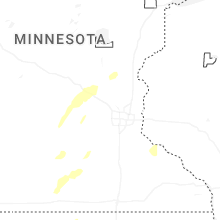
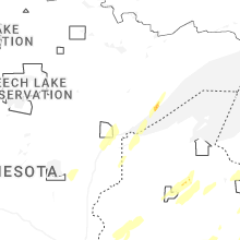
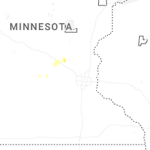
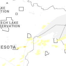
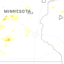


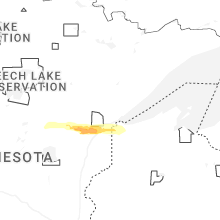


Connect with Interactive Hail Maps