

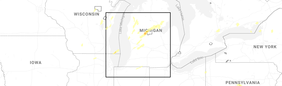
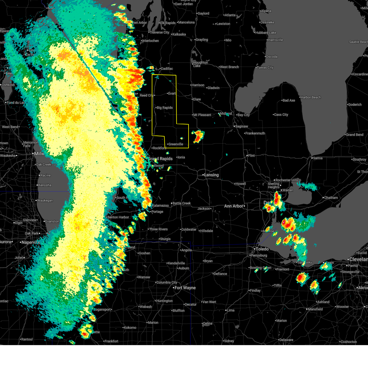
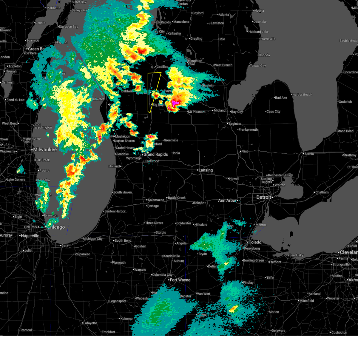
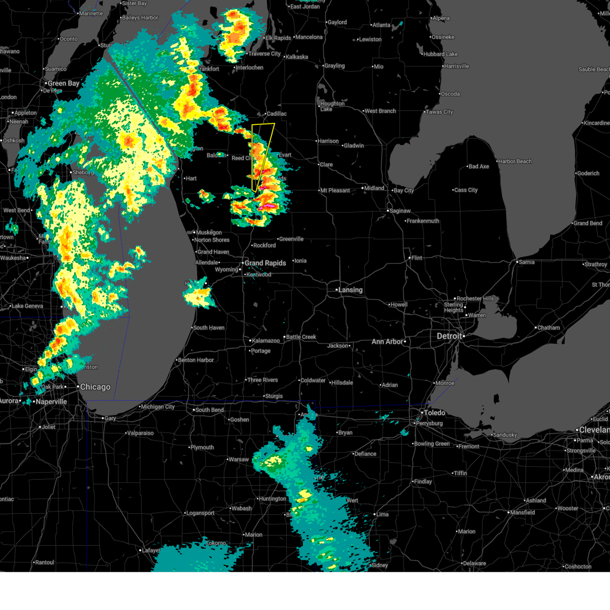
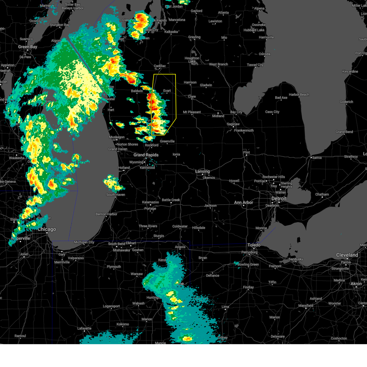
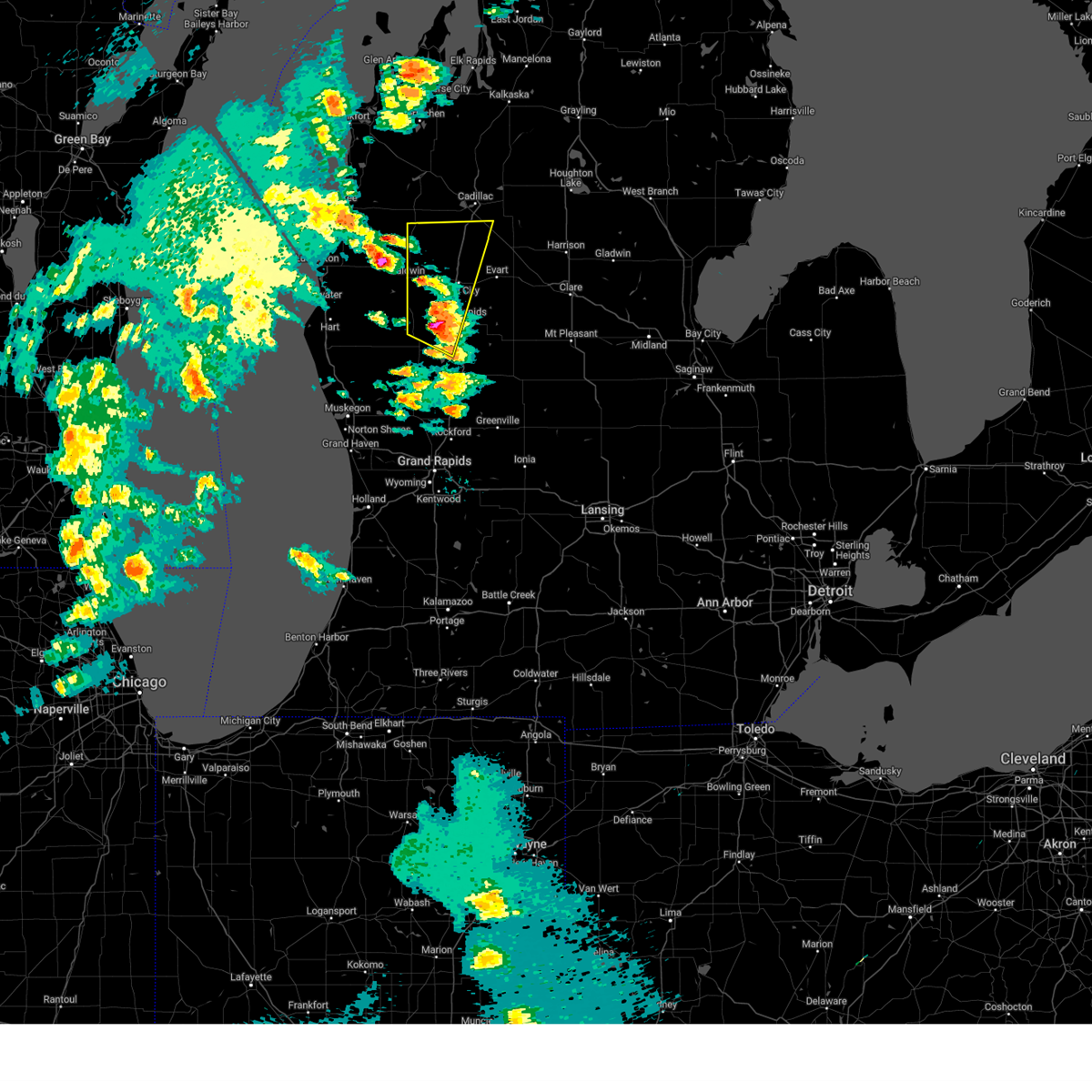
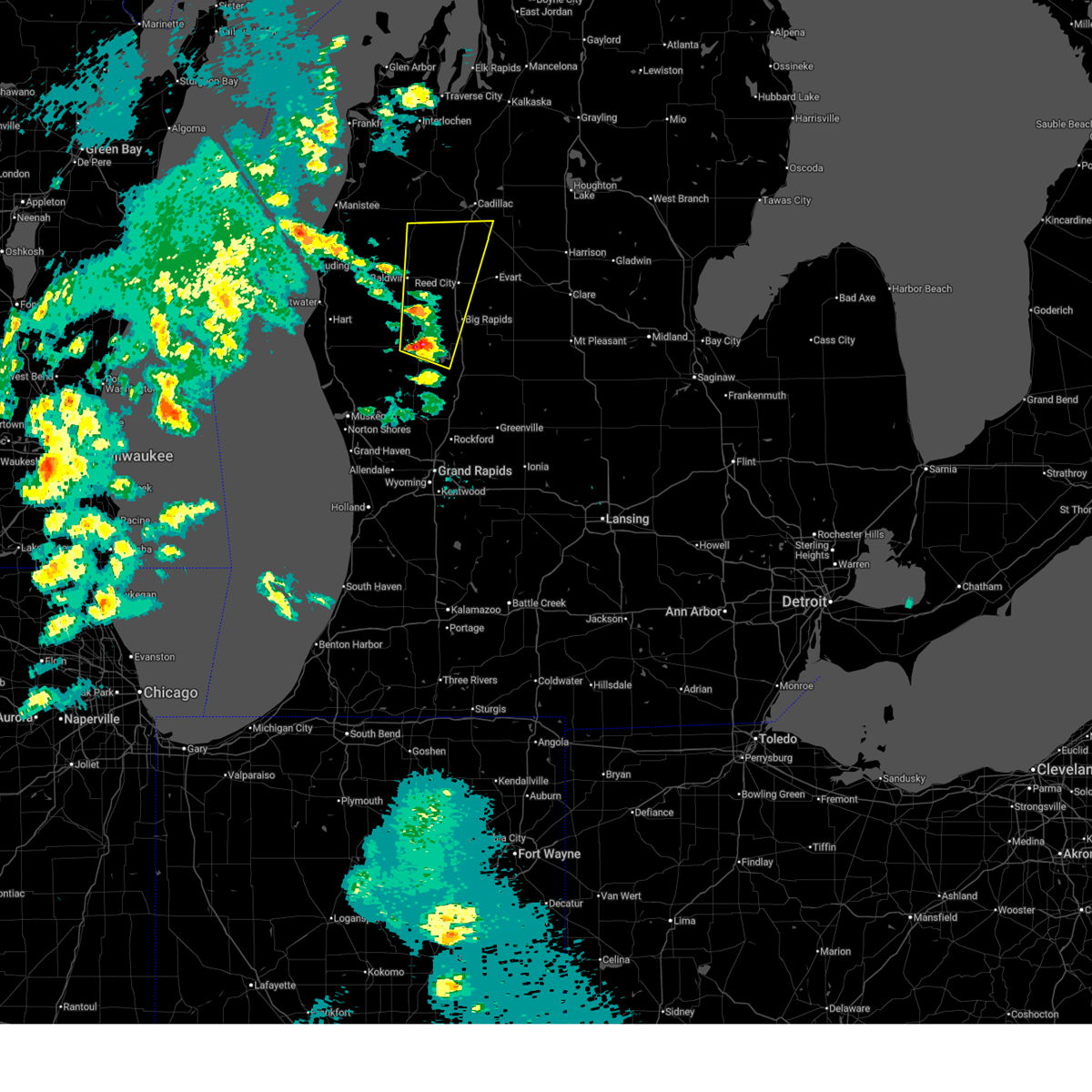
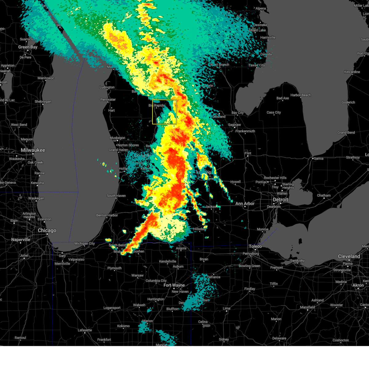
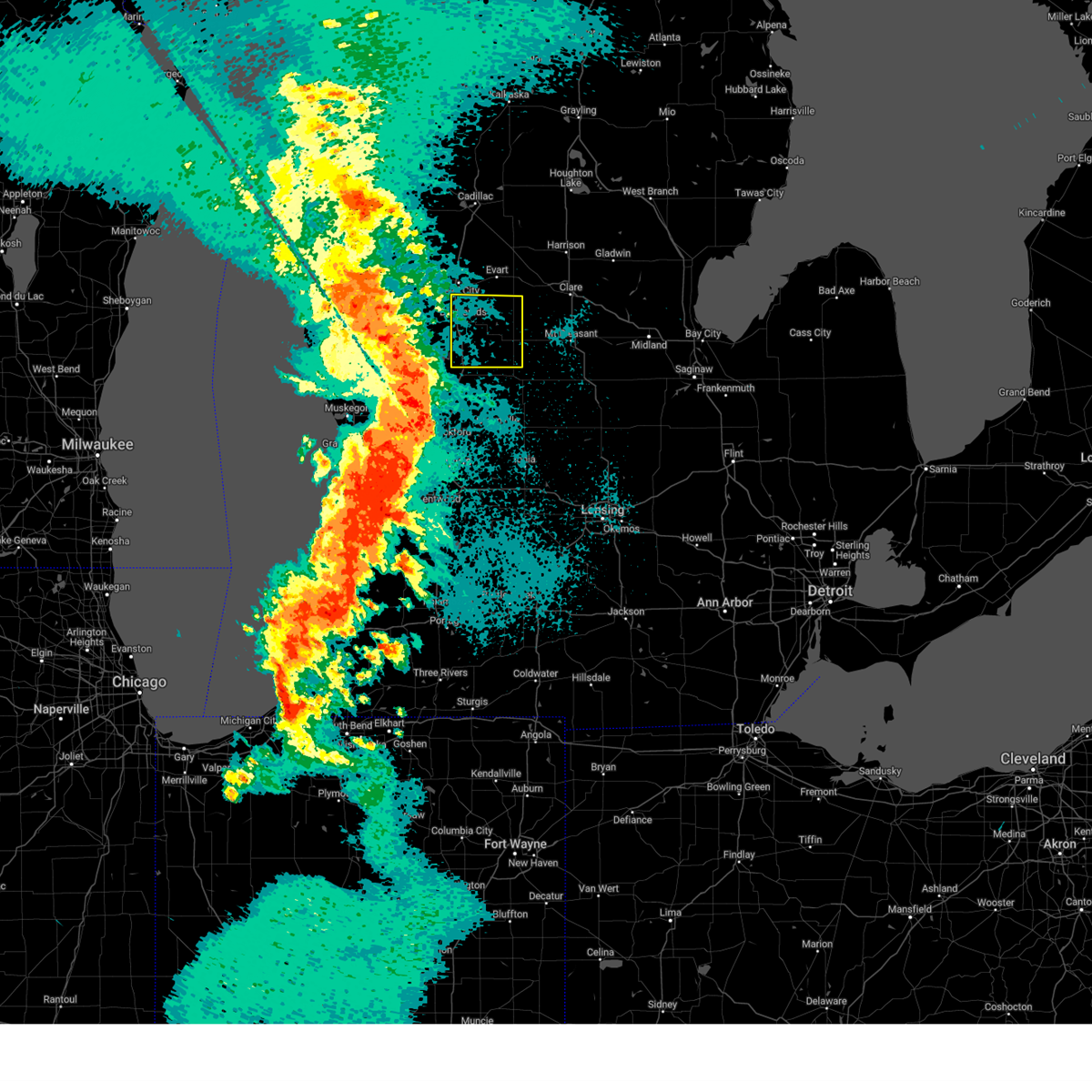
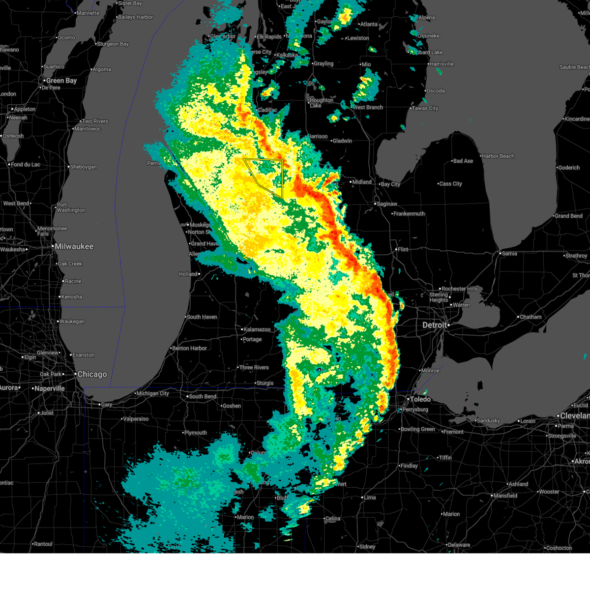
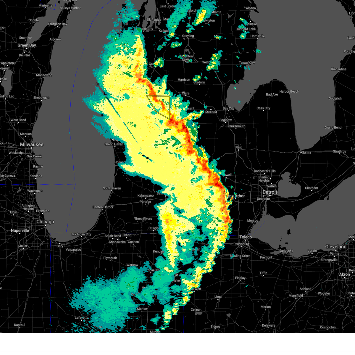
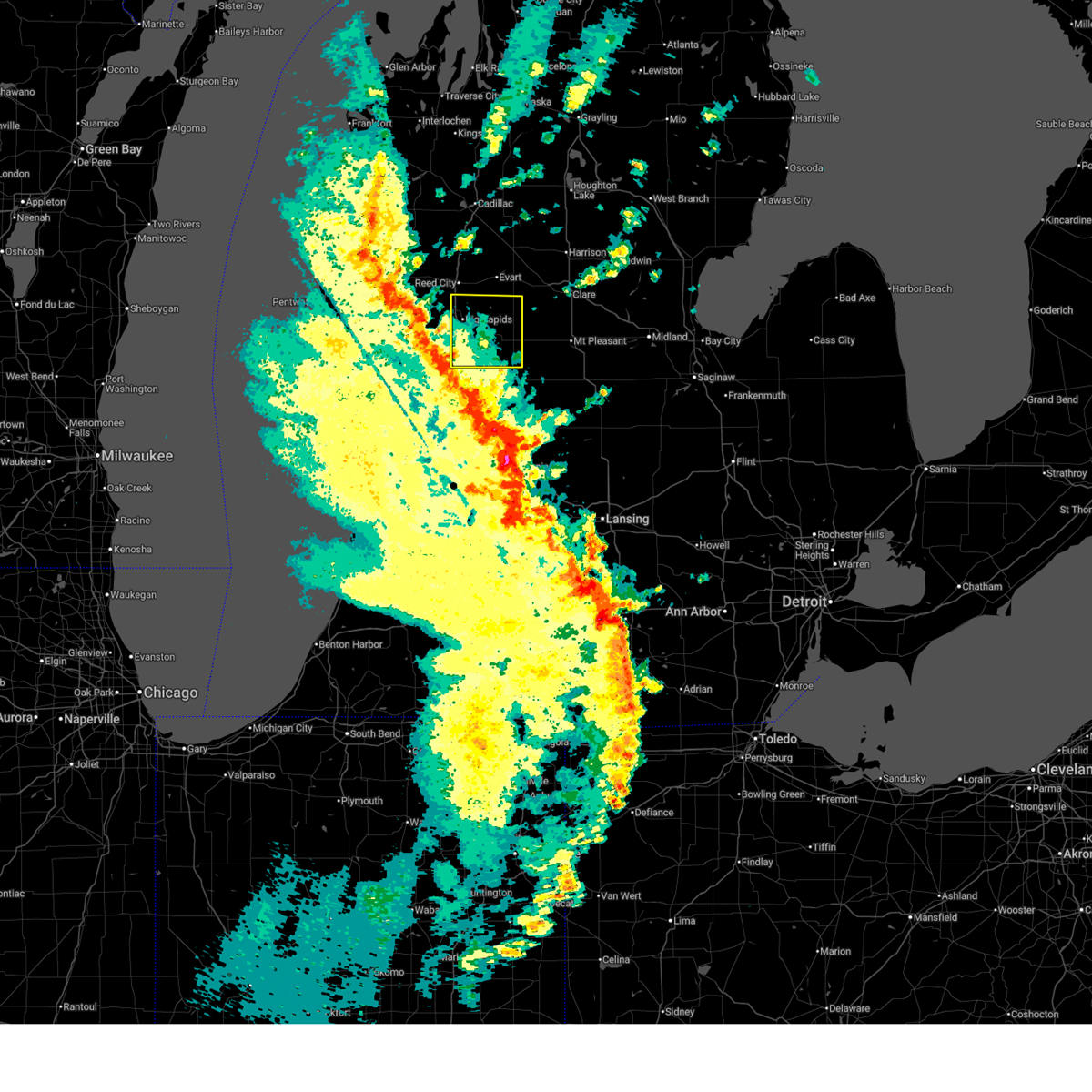
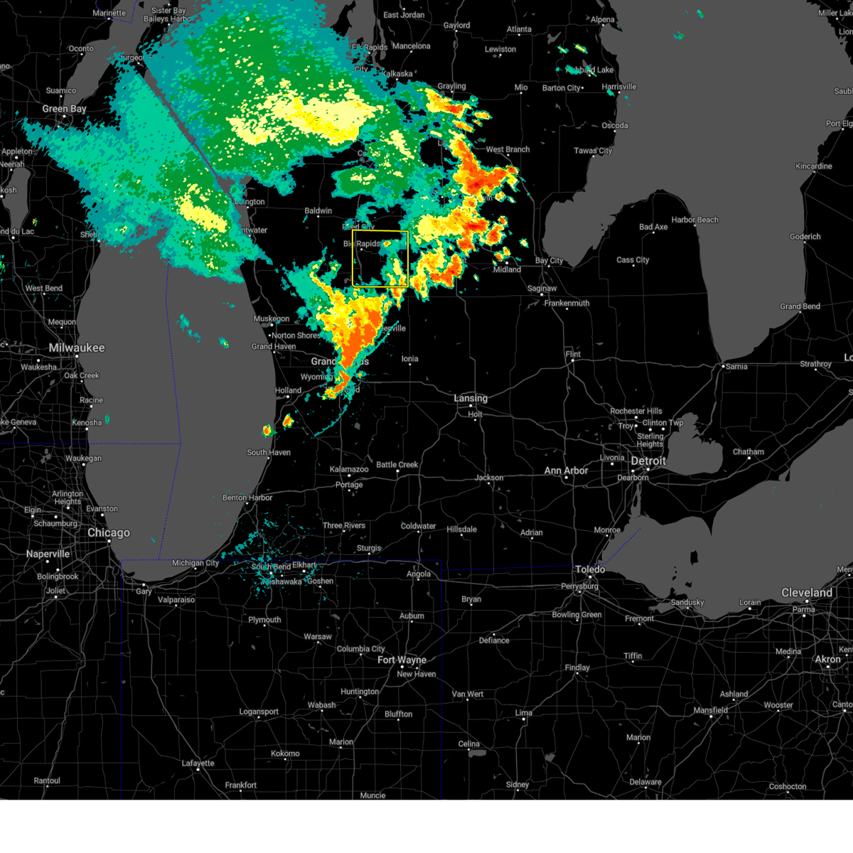
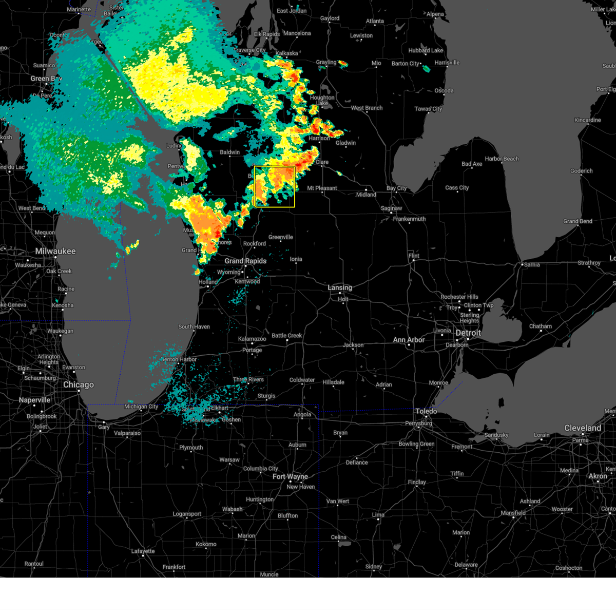
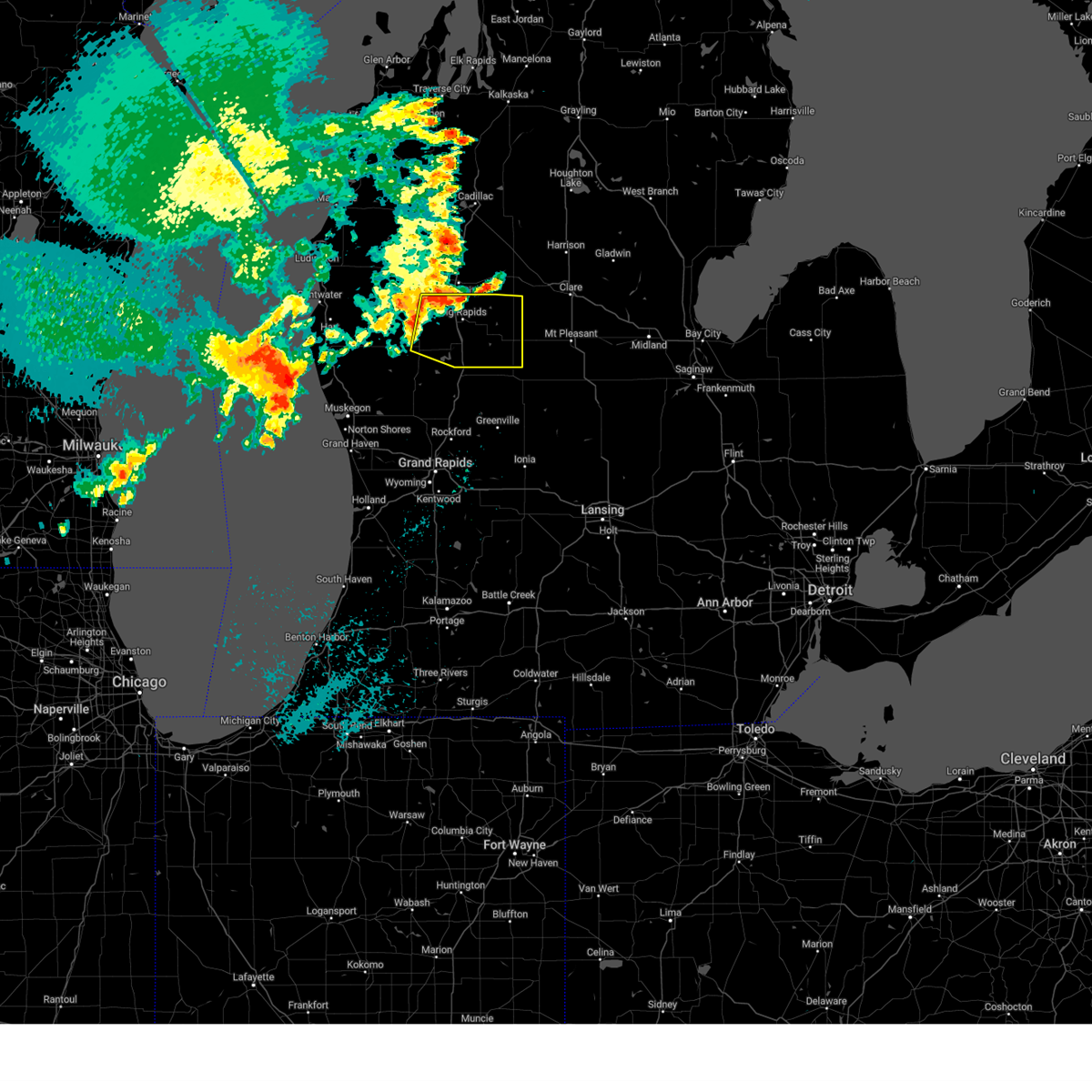
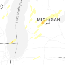
Hail Map for Big Rapids, MI
The Big Rapids, MI area has had 3 reports of on-the-ground hail by trained spotters, and has been under severe weather warnings 4 times during the past 12 months. Doppler radar has detected hail at or near Big Rapids, MI on 29 occasions.
| Name: | Big Rapids, MI |
| Where Located: | 51.5 miles N of Grand Rapids, MI |
| Map: | Google Map for Big Rapids, MI |
| Population: | 10601 |
| Housing Units: | 3623 |
| More Info: | Search Google for Big Rapids, MI |
0
The Top Recent Hail Date for Big Rapids, MI is Friday, May 16, 2025 (29th out of 29)
Hail and Wind Damage Spotted near Big Rapids, MI
| Date / Time | Report Details |
|---|---|
| 6/10/2026 8:00 PM EDT |
 The storms which prompted the warning have moved out of the area. therefore, the warning has been allowed to expire. a severe thunderstorm watch remains in effect until 1100 pm edt for central, south central and southwestern michigan. The storms which prompted the warning have moved out of the area. therefore, the warning has been allowed to expire. a severe thunderstorm watch remains in effect until 1100 pm edt for central, south central and southwestern michigan.
|
| 6/10/2026 7:40 PM EDT |
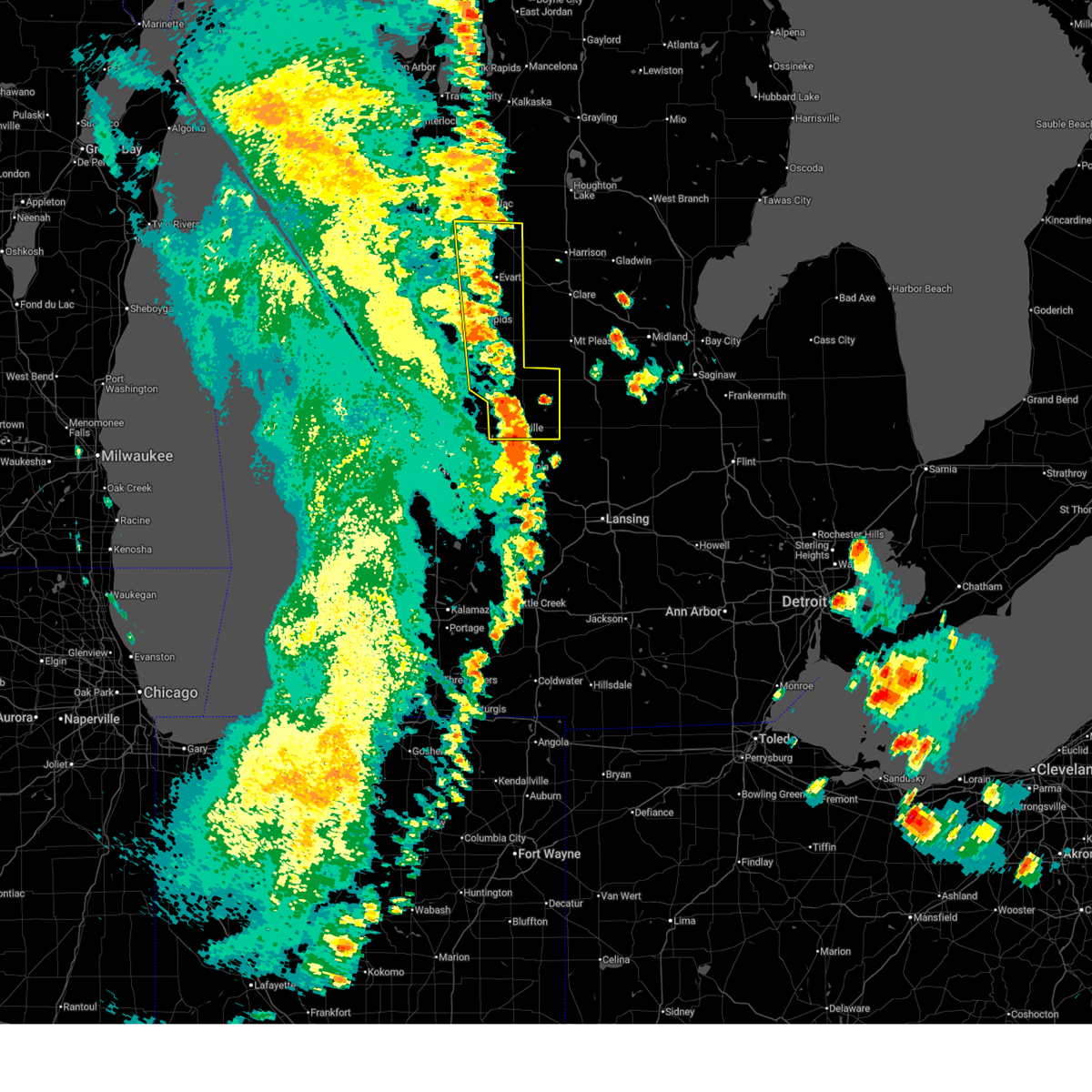 At 740 pm edt, severe thunderstorms were located along a line extending from 7 miles southwest of mcbain to near mecosta to 9 miles east of belding, moving east at 20 mph (radar indicated). Hazards include 60 mph wind gusts. Expect damage to roofs, siding, and trees. Locations impacted include, big rapids, greenville, evart, stanton, reed city, edmore, carson city, lakeview, marion, morley, mecosta, canadian lakes, crystal, sidney, remus, highland, millbrook, sheridan, barryton, hersey,. At 740 pm edt, severe thunderstorms were located along a line extending from 7 miles southwest of mcbain to near mecosta to 9 miles east of belding, moving east at 20 mph (radar indicated). Hazards include 60 mph wind gusts. Expect damage to roofs, siding, and trees. Locations impacted include, big rapids, greenville, evart, stanton, reed city, edmore, carson city, lakeview, marion, morley, mecosta, canadian lakes, crystal, sidney, remus, highland, millbrook, sheridan, barryton, hersey,.
|
| 6/10/2026 7:24 PM EDT |
 At 723 pm edt, severe thunderstorms were located along a line extending from cadillac to 6 miles southeast of reed city to near morley, moving northeast at 60 mph (radar indicated). Hazards include 60 mph wind gusts. Expect damage to roofs, siding, and trees. Locations impacted include, big rapids, greenville, evart, stanton, reed city, howard city, edmore, carson city, lakeview, marion, morley, mecosta, canadian lakes, crystal, sidney, remus, highland, millbrook, sheridan, paris,. At 723 pm edt, severe thunderstorms were located along a line extending from cadillac to 6 miles southeast of reed city to near morley, moving northeast at 60 mph (radar indicated). Hazards include 60 mph wind gusts. Expect damage to roofs, siding, and trees. Locations impacted include, big rapids, greenville, evart, stanton, reed city, howard city, edmore, carson city, lakeview, marion, morley, mecosta, canadian lakes, crystal, sidney, remus, highland, millbrook, sheridan, paris,.
|
| 6/10/2026 7:07 PM EDT |
 Svrgrr the national weather service in grand rapids has issued a * severe thunderstorm warning for, osceola county in central michigan, mecosta county in central michigan, montcalm county in central michigan, * until 800 pm edt. * at 706 pm edt, severe thunderstorms were located along a line extending from near hoxeyville to 8 miles east of newaygo, moving northeast at 60 mph (radar indicated). Hazards include 60 mph wind gusts. expect damage to roofs, siding, and trees Svrgrr the national weather service in grand rapids has issued a * severe thunderstorm warning for, osceola county in central michigan, mecosta county in central michigan, montcalm county in central michigan, * until 800 pm edt. * at 706 pm edt, severe thunderstorms were located along a line extending from near hoxeyville to 8 miles east of newaygo, moving northeast at 60 mph (radar indicated). Hazards include 60 mph wind gusts. expect damage to roofs, siding, and trees
|
| 5/16/2025 9:12 PM EDT |
 The storm which prompted the warning has weakened below severe limits, and has exited the warned area. therefore, the warning will be allowed to expire. The storm which prompted the warning has weakened below severe limits, and has exited the warned area. therefore, the warning will be allowed to expire.
|
| 5/16/2025 8:21 PM EDT |
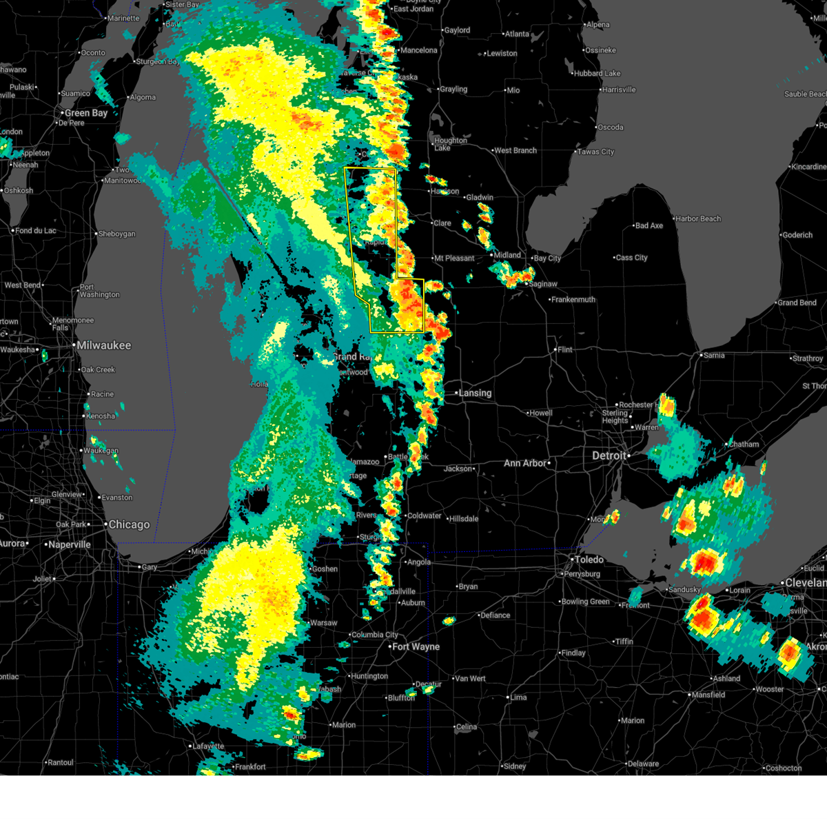
 At 821 pm edt, severe thunderstorms were located along a line extending from 8 miles southeast of reed city to 5 miles southeast of big rapids to near morley, moving northeast at 45 mph (radar indicated. at 817 pm half dollar sized hail was reported near big rapids). Hazards include ping pong ball size hail and 60 mph wind gusts. People and animals outdoors will be injured. expect hail damage to roofs, siding, windows, and vehicles. expect wind damage to roofs, siding, and trees. Locations impacted include, big rapids, evart, reed city, howard city, lakeview, marion, morley, mecosta, canadian lakes, remus, highland, millbrook, paris, barryton, hersey, le roy, tustin, stanwood, pierson, sylvester,. At 821 pm edt, severe thunderstorms were located along a line extending from 8 miles southeast of reed city to 5 miles southeast of big rapids to near morley, moving northeast at 45 mph (radar indicated. at 817 pm half dollar sized hail was reported near big rapids). Hazards include ping pong ball size hail and 60 mph wind gusts. People and animals outdoors will be injured. expect hail damage to roofs, siding, windows, and vehicles. expect wind damage to roofs, siding, and trees. Locations impacted include, big rapids, evart, reed city, howard city, lakeview, marion, morley, mecosta, canadian lakes, remus, highland, millbrook, paris, barryton, hersey, le roy, tustin, stanwood, pierson, sylvester,.
|
| 5/16/2025 8:18 PM EDT |
 At 818 pm edt, a severe thunderstorm was located over reed city, or 11 miles north of big rapids, moving northeast at 30 mph (public. at 817 pm half dollar sized hail was reported near big rapids). Hazards include ping pong ball size hail and 60 mph wind gusts. People and animals outdoors will be injured. expect hail damage to roofs, siding, windows, and vehicles. expect wind damage to roofs, siding, and trees. Locations impacted include, big rapids, reed city, paris, hersey, le roy, tustin, roben-hood airport, rose lake, dighton, ashton,. At 818 pm edt, a severe thunderstorm was located over reed city, or 11 miles north of big rapids, moving northeast at 30 mph (public. at 817 pm half dollar sized hail was reported near big rapids). Hazards include ping pong ball size hail and 60 mph wind gusts. People and animals outdoors will be injured. expect hail damage to roofs, siding, windows, and vehicles. expect wind damage to roofs, siding, and trees. Locations impacted include, big rapids, reed city, paris, hersey, le roy, tustin, roben-hood airport, rose lake, dighton, ashton,.
|
| 5/16/2025 8:18 PM EDT |
 the severe thunderstorm warning has been cancelled and is no longer in effect the severe thunderstorm warning has been cancelled and is no longer in effect
|
| 5/16/2025 8:15 PM EDT | Half Dollar sized hail reported 0.8 miles SSE of Big Rapids, MI, north state st at west ave by the airport. |
| 5/16/2025 8:12 PM EDT |
 Svrgrr the national weather service in grand rapids has issued a * severe thunderstorm warning for, osceola county in central michigan, mecosta county in central michigan, northwestern montcalm county in central michigan, * until 915 pm edt. * at 811 pm edt, severe thunderstorms were located along a line extending from near big rapids to stanwood to howard city, moving northeast at 45 mph (radar indicated). Hazards include 60 mph wind gusts and quarter size hail. Hail damage to vehicles is expected. Expect wind damage to roofs, siding, and trees. Svrgrr the national weather service in grand rapids has issued a * severe thunderstorm warning for, osceola county in central michigan, mecosta county in central michigan, northwestern montcalm county in central michigan, * until 915 pm edt. * at 811 pm edt, severe thunderstorms were located along a line extending from near big rapids to stanwood to howard city, moving northeast at 45 mph (radar indicated). Hazards include 60 mph wind gusts and quarter size hail. Hail damage to vehicles is expected. Expect wind damage to roofs, siding, and trees.
|
| 5/16/2025 8:06 PM EDT |
 At 805 pm edt, a severe thunderstorm was located 6 miles northwest of big rapids, moving northeast at 50 mph (public. at 801pm ping pong ball sized hail was reported 6 miles west of big rapids). Hazards include ping pong ball size hail and 60 mph wind gusts. People and animals outdoors will be injured. expect hail damage to roofs, siding, windows, and vehicles. expect wind damage to roofs, siding, and trees. Locations impacted include, big rapids, reed city, luther, chase, paris, hersey, le roy, tustin, hawkins, nirvana, idlewild, woodville, ashton, roben-hood airport, bristol, rose lake, dighton,. At 805 pm edt, a severe thunderstorm was located 6 miles northwest of big rapids, moving northeast at 50 mph (public. at 801pm ping pong ball sized hail was reported 6 miles west of big rapids). Hazards include ping pong ball size hail and 60 mph wind gusts. People and animals outdoors will be injured. expect hail damage to roofs, siding, windows, and vehicles. expect wind damage to roofs, siding, and trees. Locations impacted include, big rapids, reed city, luther, chase, paris, hersey, le roy, tustin, hawkins, nirvana, idlewild, woodville, ashton, roben-hood airport, bristol, rose lake, dighton,.
|
| 5/16/2025 8:01 PM EDT | Ping Pong Ball sized hail reported 6.9 miles E of Big Rapids, MI, report from mping: ping pong ball (1.50 in.). |
| 5/16/2025 7:55 PM EDT |
 At 755 pm edt, a severe thunderstorm was located 10 miles west of big rapids, moving northeast at 35 mph (radar indicated). Hazards include ping pong ball size hail and 60 mph wind gusts. People and animals outdoors will be injured. expect hail damage to roofs, siding, windows, and vehicles. expect wind damage to roofs, siding, and trees. Locations impacted include, big rapids, baldwin, reed city, luther, chase, paris, hersey, le roy, tustin, brohman, hawkins, nirvana, wolf lake, idlewild, woodville, ashton, roben-hood airport, bristol, rose lake, dighton,. At 755 pm edt, a severe thunderstorm was located 10 miles west of big rapids, moving northeast at 35 mph (radar indicated). Hazards include ping pong ball size hail and 60 mph wind gusts. People and animals outdoors will be injured. expect hail damage to roofs, siding, windows, and vehicles. expect wind damage to roofs, siding, and trees. Locations impacted include, big rapids, baldwin, reed city, luther, chase, paris, hersey, le roy, tustin, brohman, hawkins, nirvana, wolf lake, idlewild, woodville, ashton, roben-hood airport, bristol, rose lake, dighton,.
|
| 5/16/2025 7:44 PM EDT |
 Svrgrr the national weather service in grand rapids has issued a * severe thunderstorm warning for, northeastern newaygo county in west central michigan, western osceola county in central michigan, lake county in west central michigan, northwestern mecosta county in central michigan, * until 915 pm edt. * at 744 pm edt, a severe thunderstorm was located near white cloud, moving northeast at 30 mph (radar indicated). Hazards include 60 mph wind gusts and penny size hail. expect damage to roofs, siding, and trees Svrgrr the national weather service in grand rapids has issued a * severe thunderstorm warning for, northeastern newaygo county in west central michigan, western osceola county in central michigan, lake county in west central michigan, northwestern mecosta county in central michigan, * until 915 pm edt. * at 744 pm edt, a severe thunderstorm was located near white cloud, moving northeast at 30 mph (radar indicated). Hazards include 60 mph wind gusts and penny size hail. expect damage to roofs, siding, and trees
|
| 5/15/2025 11:21 PM EDT |
 the severe thunderstorm warning has been cancelled and is no longer in effect the severe thunderstorm warning has been cancelled and is no longer in effect
|
| 5/15/2025 10:20 PM EDT |
 Svrgrr the national weather service in grand rapids has issued a * severe thunderstorm warning for, mecosta county in central michigan, * until 1145 pm edt. * at 1020 pm edt, severe thunderstorms were located along a line extending from 5 miles west of baldwin to 7 miles north of white cloud to 8 miles east of newaygo, moving east at 45 mph (radar indicated). Hazards include 70 mph wind gusts. Expect considerable tree damage. Damage is likely to mobile homes, roofs, and outbuildings. Svrgrr the national weather service in grand rapids has issued a * severe thunderstorm warning for, mecosta county in central michigan, * until 1145 pm edt. * at 1020 pm edt, severe thunderstorms were located along a line extending from 5 miles west of baldwin to 7 miles north of white cloud to 8 miles east of newaygo, moving east at 45 mph (radar indicated). Hazards include 70 mph wind gusts. Expect considerable tree damage. Damage is likely to mobile homes, roofs, and outbuildings.
|
| 3/30/2025 6:53 PM EDT |
 The storm which prompted the warning has moved out of the area. therefore, the warning will be allowed to expire. The storm which prompted the warning has moved out of the area. therefore, the warning will be allowed to expire.
|
| 3/30/2025 6:41 PM EDT |
 At 641 pm edt, a severe thunderstorm was located 6 miles north of mecosta, or 13 miles east of big rapids, moving northeast at 45 mph (radar indicated). Hazards include 70 mph wind gusts. Expect considerable tree damage. damage is likely to mobile homes, roofs, and outbuildings. Locations impacted include, canadian lakes, sylvester, rodney, barryton, chippewa lake, remus, mecosta, paris, millbrook, big rapids,. At 641 pm edt, a severe thunderstorm was located 6 miles north of mecosta, or 13 miles east of big rapids, moving northeast at 45 mph (radar indicated). Hazards include 70 mph wind gusts. Expect considerable tree damage. damage is likely to mobile homes, roofs, and outbuildings. Locations impacted include, canadian lakes, sylvester, rodney, barryton, chippewa lake, remus, mecosta, paris, millbrook, big rapids,.
|
| 3/30/2025 6:16 PM EDT |
 Svrgrr the national weather service in grand rapids has issued a * severe thunderstorm warning for, mecosta county in central michigan, * until 700 pm edt. * at 616 pm edt, a severe thunderstorm was located near morley, or 13 miles east of white cloud, moving northeast at 60 mph (radar indicated). Hazards include 70 mph wind gusts. Expect considerable tree damage. Damage is likely to mobile homes, roofs, and outbuildings. Svrgrr the national weather service in grand rapids has issued a * severe thunderstorm warning for, mecosta county in central michigan, * until 700 pm edt. * at 616 pm edt, a severe thunderstorm was located near morley, or 13 miles east of white cloud, moving northeast at 60 mph (radar indicated). Hazards include 70 mph wind gusts. Expect considerable tree damage. Damage is likely to mobile homes, roofs, and outbuildings.
|
| 8/27/2024 3:30 PM EDT |
 The storms which prompted the warning have weakened below severe limits, and have exited the warned area. therefore, the warning has been allowed to expire. a severe thunderstorm watch remains in effect until 800 pm edt for central michigan. The storms which prompted the warning have weakened below severe limits, and have exited the warned area. therefore, the warning has been allowed to expire. a severe thunderstorm watch remains in effect until 800 pm edt for central michigan.
|
| 8/27/2024 3:09 PM EDT |
 the severe thunderstorm warning has been cancelled and is no longer in effect the severe thunderstorm warning has been cancelled and is no longer in effect
|
| 8/27/2024 3:09 PM EDT |
 At 308 pm edt, severe thunderstorms were located along a line extending from farwell to near morley, moving east at 30 mph (radar indicated). Hazards include 60 mph wind gusts. Expect damage to roofs, siding, and trees. Locations impacted include, big rapids, morley, mecosta, canadian lakes, remus, millbrook, paris, barryton, stanwood, sylvester, rodney, altona, roben-hood airport, chippewa lake,. At 308 pm edt, severe thunderstorms were located along a line extending from farwell to near morley, moving east at 30 mph (radar indicated). Hazards include 60 mph wind gusts. Expect damage to roofs, siding, and trees. Locations impacted include, big rapids, morley, mecosta, canadian lakes, remus, millbrook, paris, barryton, stanwood, sylvester, rodney, altona, roben-hood airport, chippewa lake,.
|
| 8/27/2024 2:31 PM EDT |
 Svrgrr the national weather service in grand rapids has issued a * severe thunderstorm warning for, northeastern newaygo county in west central michigan, mecosta county in central michigan, * until 330 pm edt. * at 230 pm edt, a severe thunderstorm was located 10 miles west of big rapids, moving east at 30 mph (radar indicated). Hazards include 60 mph wind gusts. expect damage to roofs, siding, and trees Svrgrr the national weather service in grand rapids has issued a * severe thunderstorm warning for, northeastern newaygo county in west central michigan, mecosta county in central michigan, * until 330 pm edt. * at 230 pm edt, a severe thunderstorm was located 10 miles west of big rapids, moving east at 30 mph (radar indicated). Hazards include 60 mph wind gusts. expect damage to roofs, siding, and trees
|
| 6/20/2024 4:56 PM EDT |
 The storm which prompted the warning has weakened below severe limits, and no longer poses an immediate threat to life or property. therefore, the warning will be allowed to expire. however, small hail and gusty winds are still possible with this thunderstorm. The storm which prompted the warning has weakened below severe limits, and no longer poses an immediate threat to life or property. therefore, the warning will be allowed to expire. however, small hail and gusty winds are still possible with this thunderstorm.
|
| 6/20/2024 4:48 PM EDT |
 At 448 pm edt, a severe thunderstorm was located over big rapids, moving north at 20 mph (radar indicated). Hazards include 60 mph wind gusts and quarter size hail. Hail damage to vehicles is expected. expect wind damage to roofs, siding, and trees. Locations impacted include, big rapids, canadian lakes, roben-hood airport, rodney,. At 448 pm edt, a severe thunderstorm was located over big rapids, moving north at 20 mph (radar indicated). Hazards include 60 mph wind gusts and quarter size hail. Hail damage to vehicles is expected. expect wind damage to roofs, siding, and trees. Locations impacted include, big rapids, canadian lakes, roben-hood airport, rodney,.
|
| 6/20/2024 4:40 PM EDT |
 the severe thunderstorm warning has been cancelled and is no longer in effect the severe thunderstorm warning has been cancelled and is no longer in effect
|
| 6/20/2024 4:40 PM EDT |
 At 440 pm edt, a severe thunderstorm was located near big rapids, moving north at 20 mph (radar indicated). Hazards include 60 mph wind gusts and quarter size hail. Hail damage to vehicles is expected. expect wind damage to roofs, siding, and trees. Locations impacted include, big rapids, morley, canadian lakes, stanwood, roben-hood airport, rodney,. At 440 pm edt, a severe thunderstorm was located near big rapids, moving north at 20 mph (radar indicated). Hazards include 60 mph wind gusts and quarter size hail. Hail damage to vehicles is expected. expect wind damage to roofs, siding, and trees. Locations impacted include, big rapids, morley, canadian lakes, stanwood, roben-hood airport, rodney,.
|
| 6/20/2024 4:28 PM EDT |
 the severe thunderstorm warning has been cancelled and is no longer in effect the severe thunderstorm warning has been cancelled and is no longer in effect
|
| 6/20/2024 4:28 PM EDT |
 At 428 pm edt, a severe thunderstorm was located 7 miles south of big rapids, moving north at 20 mph (radar indicated). Hazards include 70 mph wind gusts and quarter size hail. Hail damage to vehicles is expected. expect considerable tree damage. wind damage is also likely to mobile homes, roofs, and outbuildings. Locations impacted include, big rapids, morley, canadian lakes, stanwood, roben-hood airport, rodney,. At 428 pm edt, a severe thunderstorm was located 7 miles south of big rapids, moving north at 20 mph (radar indicated). Hazards include 70 mph wind gusts and quarter size hail. Hail damage to vehicles is expected. expect considerable tree damage. wind damage is also likely to mobile homes, roofs, and outbuildings. Locations impacted include, big rapids, morley, canadian lakes, stanwood, roben-hood airport, rodney,.
|
| 6/20/2024 4:17 PM EDT |
 At 414 pm edt, a severe thunderstorm was located near morley, or 11 miles south of big rapids, moving north at 20 mph (radar indicated). Hazards include quarter size hail and 70 mph wind gusts. People and animals outdoors will be injured. expect hail damage to roofs, siding, windows, and vehicles. expect considerable tree damage. wind damage is also likely to mobile homes, roofs, and outbuildings. Locations impacted include, big rapids, morley, canadian lakes, croton, stanwood, roben-hood airport, rodney, croton heights, indian lake,. At 414 pm edt, a severe thunderstorm was located near morley, or 11 miles south of big rapids, moving north at 20 mph (radar indicated). Hazards include quarter size hail and 70 mph wind gusts. People and animals outdoors will be injured. expect hail damage to roofs, siding, windows, and vehicles. expect considerable tree damage. wind damage is also likely to mobile homes, roofs, and outbuildings. Locations impacted include, big rapids, morley, canadian lakes, croton, stanwood, roben-hood airport, rodney, croton heights, indian lake,.
|
| 6/20/2024 3:59 PM EDT |
 Svrgrr the national weather service in grand rapids has issued a * severe thunderstorm warning for, eastern newaygo county in west central michigan, western mecosta county in central michigan, northwestern montcalm county in central michigan, * until 500 pm edt. * at 358 pm edt, a severe thunderstorm was located near howard city, or 12 miles east of newaygo, moving north at 20 mph (radar indicated). Hazards include 60 mph wind gusts and quarter size hail. Hail damage to vehicles is expected. Expect wind damage to roofs, siding, and trees. Svrgrr the national weather service in grand rapids has issued a * severe thunderstorm warning for, eastern newaygo county in west central michigan, western mecosta county in central michigan, northwestern montcalm county in central michigan, * until 500 pm edt. * at 358 pm edt, a severe thunderstorm was located near howard city, or 12 miles east of newaygo, moving north at 20 mph (radar indicated). Hazards include 60 mph wind gusts and quarter size hail. Hail damage to vehicles is expected. Expect wind damage to roofs, siding, and trees.
|
| 5/20/2024 7:40 PM EDT |
 The storm which prompted the warning has weakened below severe limits, and no longer appears capable of producing a tornado. therefore, the warning will be allowed to expire. however, gusty winds are still possible with this thunderstorm. a severe thunderstorm watch remains in effect until 1000 pm edt for central michigan. The storm which prompted the warning has weakened below severe limits, and no longer appears capable of producing a tornado. therefore, the warning will be allowed to expire. however, gusty winds are still possible with this thunderstorm. a severe thunderstorm watch remains in effect until 1000 pm edt for central michigan.
|
| 5/20/2024 7:03 PM EDT |
 Torgrr the national weather service in grand rapids has issued a * tornado warning for, mecosta county in central michigan, * until 745 pm edt. * at 703 pm edt, a severe thunderstorm capable of producing a tornado was located near morley, or 10 miles south of big rapids, moving northeast at 60 mph (radar indicated rotation). Hazards include tornado. Flying debris will be dangerous to those caught without shelter. mobile homes will be damaged or destroyed. damage to roofs, windows, and vehicles will occur. tree damage is likely. This dangerous storm will be near, canadian lakes around 710 pm edt. Torgrr the national weather service in grand rapids has issued a * tornado warning for, mecosta county in central michigan, * until 745 pm edt. * at 703 pm edt, a severe thunderstorm capable of producing a tornado was located near morley, or 10 miles south of big rapids, moving northeast at 60 mph (radar indicated rotation). Hazards include tornado. Flying debris will be dangerous to those caught without shelter. mobile homes will be damaged or destroyed. damage to roofs, windows, and vehicles will occur. tree damage is likely. This dangerous storm will be near, canadian lakes around 710 pm edt.
|
| 5/20/2024 6:57 PM EDT |
 At 657 pm edt, severe thunderstorms were located along a line extending from 8 miles west of morley to near howard city, moving northeast at 50 mph (radar indicated). Hazards include 70 mph wind gusts. Expect considerable tree damage. damage is likely to mobile homes, roofs, and outbuildings. Locations impacted include, big rapids, greenville, stanton, howard city, lakeview, morley, mecosta, canadian lakes, sidney, remus, millbrook, sheridan, paris, barryton, stanwood, pierson, sylvester, westville, gowen, entrican,. At 657 pm edt, severe thunderstorms were located along a line extending from 8 miles west of morley to near howard city, moving northeast at 50 mph (radar indicated). Hazards include 70 mph wind gusts. Expect considerable tree damage. damage is likely to mobile homes, roofs, and outbuildings. Locations impacted include, big rapids, greenville, stanton, howard city, lakeview, morley, mecosta, canadian lakes, sidney, remus, millbrook, sheridan, paris, barryton, stanwood, pierson, sylvester, westville, gowen, entrican,.
|
| 5/20/2024 6:49 PM EDT |
 Svrgrr the national weather service in grand rapids has issued a * severe thunderstorm warning for, mecosta county in central michigan, western montcalm county in central michigan, * until 745 pm edt. * at 648 pm edt, severe thunderstorms were located along a line extending from near reed city to 9 miles southwest of howard city, moving northeast at 70 mph (radar indicated). Hazards include 60 mph wind gusts. expect damage to roofs, siding, and trees Svrgrr the national weather service in grand rapids has issued a * severe thunderstorm warning for, mecosta county in central michigan, western montcalm county in central michigan, * until 745 pm edt. * at 648 pm edt, severe thunderstorms were located along a line extending from near reed city to 9 miles southwest of howard city, moving northeast at 70 mph (radar indicated). Hazards include 60 mph wind gusts. expect damage to roofs, siding, and trees
|
| 11/6/2023 9:23 AM EST |
 At 922 am est, severe thunderstorms were located along a line extending from 7 miles east of white cloud to near grant, moving east at 55 mph (radar indicated). Hazards include 60 mph wind gusts and quarter size hail. Hail damage to vehicles is expected. Expect wind damage to roofs, siding, and trees. At 922 am est, severe thunderstorms were located along a line extending from 7 miles east of white cloud to near grant, moving east at 55 mph (radar indicated). Hazards include 60 mph wind gusts and quarter size hail. Hail damage to vehicles is expected. Expect wind damage to roofs, siding, and trees.
|
| 8/11/2023 4:39 PM EDT |
 At 439 pm edt, a severe thunderstorm was located near big rapids, moving east at 25 mph (radar indicated). Hazards include 60 mph wind gusts and penny size hail. Expect damage to roofs, siding, and trees. this severe thunderstorm will be near, canadian lakes around 450 pm edt. mecosta around 500 pm edt. Other locations impacted by this severe thunderstorm include roben-hood airport, rodney, barryton, chippewa lake, remus and paris. At 439 pm edt, a severe thunderstorm was located near big rapids, moving east at 25 mph (radar indicated). Hazards include 60 mph wind gusts and penny size hail. Expect damage to roofs, siding, and trees. this severe thunderstorm will be near, canadian lakes around 450 pm edt. mecosta around 500 pm edt. Other locations impacted by this severe thunderstorm include roben-hood airport, rodney, barryton, chippewa lake, remus and paris.
|
| 7/20/2023 12:09 PM EDT |
 At 1208 pm edt, severe thunderstorms were located along a line extending from 5 miles southwest of big rapids to 7 miles southeast of white cloud to 7 miles west of grant, moving east at 45 mph (radar indicated). Hazards include 60 mph wind gusts and penny size hail. Expect damage to roofs, siding, and trees. severe thunderstorms will be near, big rapids around 1215 pm edt. morley around 1225 pm edt. canadian lakes around 1235 pm edt. howard city and mecosta around 1240 pm edt. lakeview around 1255 pm edt. Other locations impacted by these severe thunderstorms include langston, sylvester, rodney, entrican, six lakes, amble, pierson, millbrook, barryton and altona. At 1208 pm edt, severe thunderstorms were located along a line extending from 5 miles southwest of big rapids to 7 miles southeast of white cloud to 7 miles west of grant, moving east at 45 mph (radar indicated). Hazards include 60 mph wind gusts and penny size hail. Expect damage to roofs, siding, and trees. severe thunderstorms will be near, big rapids around 1215 pm edt. morley around 1225 pm edt. canadian lakes around 1235 pm edt. howard city and mecosta around 1240 pm edt. lakeview around 1255 pm edt. Other locations impacted by these severe thunderstorms include langston, sylvester, rodney, entrican, six lakes, amble, pierson, millbrook, barryton and altona.
|
| 6/25/2023 5:08 PM EDT |
 At 508 pm edt, a severe thunderstorm was located near lakeview, or 17 miles northwest of stanton, moving north at 45 mph (radar indicated). Hazards include 60 mph wind gusts and penny size hail. expect damage to roofs, siding, and trees At 508 pm edt, a severe thunderstorm was located near lakeview, or 17 miles northwest of stanton, moving north at 45 mph (radar indicated). Hazards include 60 mph wind gusts and penny size hail. expect damage to roofs, siding, and trees
|
| 8/29/2022 3:52 PM EDT |
 The severe thunderstorm warning for eastern newaygo and western mecosta counties will expire at 400 pm edt, the severe thunderstorm which prompted the warning has moved out of the warned area. therefore, the warning will be allowed to expire. a severe thunderstorm watch remains in effect until 800 pm edt for central, southwestern and west central michigan. The severe thunderstorm warning for eastern newaygo and western mecosta counties will expire at 400 pm edt, the severe thunderstorm which prompted the warning has moved out of the warned area. therefore, the warning will be allowed to expire. a severe thunderstorm watch remains in effect until 800 pm edt for central, southwestern and west central michigan.
|
| 8/29/2022 3:33 PM EDT |
 At 332 pm edt, a severe thunderstorm was located near canadian lakes, or 7 miles southeast of big rapids, moving east at 45 mph (radar indicated). Hazards include 60 mph wind gusts and quarter size hail. Hail damage to vehicles is expected. expect wind damage to roofs, siding, and trees. locations impacted include, big rapids, morley, croton, paris, stanwood, roben-hood airport, rodney, hawkins, woodville, chippewa lake, croton heights, hail threat, radar indicated max hail size, 1. 00 in wind threat, radar indicated max wind gust, 60 mph. At 332 pm edt, a severe thunderstorm was located near canadian lakes, or 7 miles southeast of big rapids, moving east at 45 mph (radar indicated). Hazards include 60 mph wind gusts and quarter size hail. Hail damage to vehicles is expected. expect wind damage to roofs, siding, and trees. locations impacted include, big rapids, morley, croton, paris, stanwood, roben-hood airport, rodney, hawkins, woodville, chippewa lake, croton heights, hail threat, radar indicated max hail size, 1. 00 in wind threat, radar indicated max wind gust, 60 mph.
|
| 8/29/2022 3:01 PM EDT | At 301 pm edt, a severe thunderstorm was located near white cloud, moving east at 50 mph (radar indicated). Hazards include 60 mph wind gusts and quarter size hail. Hail damage to vehicles is expected. Expect wind damage to roofs, siding, and trees. |
| 8/29/2022 2:09 PM EDT | At 209 pm edt, a severe thunderstorm was located 11 miles southeast of baldwin, moving northeast at 35 mph (radar indicated). Hazards include 60 mph wind gusts and quarter size hail. Hail damage to vehicles is expected. expect wind damage to roofs, siding, and trees. locations impacted include, big rapids, evart, reed city, chase, paris, hersey, hawkins, woodville, ashton, roben-hood airport, bitely, nartron field, hail threat, radar indicated max hail size, 1. 00 in wind threat, radar indicated max wind gust, 60 mph. |
| 8/29/2022 1:47 PM EDT | At 147 pm edt, a severe thunderstorm was located 7 miles northeast of hesperia, or 11 miles northwest of white cloud, moving northeast at 35 mph (radar indicated). Hazards include 60 mph wind gusts and quarter size hail. Hail damage to vehicles is expected. Expect wind damage to roofs, siding, and trees. |
| 5/11/2022 1:27 PM EDT |
 At 127 pm edt, a severe thunderstorm was located over big rapids, and is nearly stationary (radar indicated). Hazards include 60 mph wind gusts and quarter size hail. Hail damage to vehicles is expected. expect wind damage to roofs, siding, and trees. locations impacted include, big rapids, paris, stanwood, hail threat, radar indicated max hail size, 1. 00 in wind threat, radar indicated max wind gust, 60 mph. At 127 pm edt, a severe thunderstorm was located over big rapids, and is nearly stationary (radar indicated). Hazards include 60 mph wind gusts and quarter size hail. Hail damage to vehicles is expected. expect wind damage to roofs, siding, and trees. locations impacted include, big rapids, paris, stanwood, hail threat, radar indicated max hail size, 1. 00 in wind threat, radar indicated max wind gust, 60 mph.
|
| 5/11/2022 1:10 PM EDT |
 At 110 pm edt, a severe thunderstorm was located over big rapids, moving southeast at 5 mph (radar indicated). Hazards include 60 mph wind gusts and quarter size hail. Hail damage to vehicles is expected. Expect wind damage to roofs, siding, and trees. At 110 pm edt, a severe thunderstorm was located over big rapids, moving southeast at 5 mph (radar indicated). Hazards include 60 mph wind gusts and quarter size hail. Hail damage to vehicles is expected. Expect wind damage to roofs, siding, and trees.
|
| 9/7/2021 2:41 PM EDT |
 At 241 pm edt, severe thunderstorms were located along a line extending from near clare to near canadian lakes to near grant, moving east at 50 mph (radar indicated). Hazards include 60 mph wind gusts and penny size hail. Expect damage to roofs, siding, and trees. locations impacted include, mount pleasant, big rapids, clare, newaygo, white cloud, fremont, shepherd, grant, morley, mecosta, rosebush, canadian lakes, lake isabella, croton, bridgeton, remus, millbrook, barryton, stanwood, brinton, hail threat, radar indicated max hail size, 0. 75 in wind threat, radar indicated max wind gust, 60 mph. At 241 pm edt, severe thunderstorms were located along a line extending from near clare to near canadian lakes to near grant, moving east at 50 mph (radar indicated). Hazards include 60 mph wind gusts and penny size hail. Expect damage to roofs, siding, and trees. locations impacted include, mount pleasant, big rapids, clare, newaygo, white cloud, fremont, shepherd, grant, morley, mecosta, rosebush, canadian lakes, lake isabella, croton, bridgeton, remus, millbrook, barryton, stanwood, brinton, hail threat, radar indicated max hail size, 0. 75 in wind threat, radar indicated max wind gust, 60 mph.
|
| 9/7/2021 2:20 PM EDT |
 At 219 pm edt, a severe thunderstorm was located over white cloud, moving east at 65 mph (radar indicated). Hazards include 60 mph wind gusts and penny size hail. expect damage to roofs, siding, and trees At 219 pm edt, a severe thunderstorm was located over white cloud, moving east at 65 mph (radar indicated). Hazards include 60 mph wind gusts and penny size hail. expect damage to roofs, siding, and trees
|
| 8/27/2021 8:54 PM EDT |
 The severe thunderstorm warning for northeastern newaygo and northwestern mecosta counties will expire at 900 pm edt, the storm which prompted the warning has weakened below severe limits, and no longer poses an immediate threat to life or property. therefore, the warning will be allowed to expire. however, small hail, gusty winds and lightning are still possible with this thunderstorm. The severe thunderstorm warning for northeastern newaygo and northwestern mecosta counties will expire at 900 pm edt, the storm which prompted the warning has weakened below severe limits, and no longer poses an immediate threat to life or property. therefore, the warning will be allowed to expire. however, small hail, gusty winds and lightning are still possible with this thunderstorm.
|
| 8/27/2021 8:36 PM EDT |
 At 835 pm edt, a severe thunderstorm was located near big rapids, moving southeast at 20 mph (radar indicated). Hazards include 60 mph wind gusts and quarter size hail. Hail damage to vehicles is expected. expect wind damage to roofs, siding, and trees. locations impacted include, big rapids, paris, hawkins, hail threat, radar indicated max hail size, 1. 00 in wind threat, radar indicated max wind gust, 60 mph. At 835 pm edt, a severe thunderstorm was located near big rapids, moving southeast at 20 mph (radar indicated). Hazards include 60 mph wind gusts and quarter size hail. Hail damage to vehicles is expected. expect wind damage to roofs, siding, and trees. locations impacted include, big rapids, paris, hawkins, hail threat, radar indicated max hail size, 1. 00 in wind threat, radar indicated max wind gust, 60 mph.
|
| 8/27/2021 8:12 PM EDT |
 At 812 pm edt, a severe thunderstorm was located 9 miles southwest of reed city, or 10 miles southeast of baldwin, moving southeast at 25 mph (radar indicated). Hazards include 60 mph wind gusts and quarter size hail. Hail damage to vehicles is expected. Expect wind damage to roofs, siding, and trees. At 812 pm edt, a severe thunderstorm was located 9 miles southwest of reed city, or 10 miles southeast of baldwin, moving southeast at 25 mph (radar indicated). Hazards include 60 mph wind gusts and quarter size hail. Hail damage to vehicles is expected. Expect wind damage to roofs, siding, and trees.
|
| 8/24/2021 5:10 PM EDT |
 At 510 pm edt, severe thunderstorms were located along a line extending from 8 miles southwest of mitchell state park to 7 miles southwest of howard city, moving east at 5 mph (radar indicated). Hazards include 60 mph wind gusts. expect damage to roofs, siding, and trees At 510 pm edt, severe thunderstorms were located along a line extending from 8 miles southwest of mitchell state park to 7 miles southwest of howard city, moving east at 5 mph (radar indicated). Hazards include 60 mph wind gusts. expect damage to roofs, siding, and trees
|
| 8/10/2021 11:35 PM EDT |
 The severe thunderstorm warning for calhoun, ionia, osceola, eaton, mecosta and montcalm counties will expire at 1145 pm edt, the storms which prompted the warning have moved out of the area. therefore, the warning will be allowed to expire. a severe thunderstorm watch remains in effect until 300 am edt for south central, central and southwestern michigan. The severe thunderstorm warning for calhoun, ionia, osceola, eaton, mecosta and montcalm counties will expire at 1145 pm edt, the storms which prompted the warning have moved out of the area. therefore, the warning will be allowed to expire. a severe thunderstorm watch remains in effect until 300 am edt for south central, central and southwestern michigan.
|
| 8/10/2021 10:41 PM EDT |
 At 1040 pm edt, severe thunderstorms were located along a line extending from near copemish to near reed city to near rockford to middleville to portage, moving east at 55 mph (radar indicated). Hazards include 60 mph wind gusts. expect damage to roofs, siding, and trees At 1040 pm edt, severe thunderstorms were located along a line extending from near copemish to near reed city to near rockford to middleville to portage, moving east at 55 mph (radar indicated). Hazards include 60 mph wind gusts. expect damage to roofs, siding, and trees
|
| 6/26/2021 3:31 PM EDT |
 At 331 pm edt, a severe thunderstorm was located near canadian lakes, or 15 miles southeast of big rapids, moving northeast at 35 mph (radar indicated). Hazards include 60 mph wind gusts. Expect damage to roofs, siding, and trees. this severe thunderstorm will be near, mecosta around 340 pm edt. Other locations impacted by this severe thunderstorm include rodney, sylvester, barryton, millbrook, altona, chippewa lake, remus, stanwood and paris. At 331 pm edt, a severe thunderstorm was located near canadian lakes, or 15 miles southeast of big rapids, moving northeast at 35 mph (radar indicated). Hazards include 60 mph wind gusts. Expect damage to roofs, siding, and trees. this severe thunderstorm will be near, mecosta around 340 pm edt. Other locations impacted by this severe thunderstorm include rodney, sylvester, barryton, millbrook, altona, chippewa lake, remus, stanwood and paris.
|
| 8/28/2020 3:27 PM EDT |
 At 327 pm edt, a severe thunderstorm was located 7 miles southwest of big rapids, moving east at 50 mph (radar indicated). Hazards include 60 mph wind gusts. expect damage to roofs, siding, and trees At 327 pm edt, a severe thunderstorm was located 7 miles southwest of big rapids, moving east at 50 mph (radar indicated). Hazards include 60 mph wind gusts. expect damage to roofs, siding, and trees
|
| 6/10/2020 12:50 PM EDT |
 At 1250 pm edt, severe thunderstorms were located along a line extending from near big rapids to near lakeview to 7 miles south of stanton, moving northeast at 60 mph (radar indicated). Hazards include 60 mph wind gusts. Expect damage to roofs, siding, and trees. Locations impacted include, big rapids, greenville, stanton, white cloud, howard city, edmore, carson city, lakeview, morley, mecosta, canadian lakes, croton, crystal, sidney, remus, millbrook, sheridan, paris, barryton, stanwood,. At 1250 pm edt, severe thunderstorms were located along a line extending from near big rapids to near lakeview to 7 miles south of stanton, moving northeast at 60 mph (radar indicated). Hazards include 60 mph wind gusts. Expect damage to roofs, siding, and trees. Locations impacted include, big rapids, greenville, stanton, white cloud, howard city, edmore, carson city, lakeview, morley, mecosta, canadian lakes, croton, crystal, sidney, remus, millbrook, sheridan, paris, barryton, stanwood,.
|
| 6/10/2020 12:09 PM EDT |
 At 1209 pm edt, severe thunderstorms were located along a line extending from near fruitport to near kentwood, moving northeast at 60 mph (radar indicated). Hazards include 60 mph wind gusts. expect damage to roofs, siding, and trees At 1209 pm edt, severe thunderstorms were located along a line extending from near fruitport to near kentwood, moving northeast at 60 mph (radar indicated). Hazards include 60 mph wind gusts. expect damage to roofs, siding, and trees
|
| 6/3/2020 1:27 AM EDT |
 The severe thunderstorm warning for kent, ionia, southern osceola, mecosta and montcalm counties will expire at 130 am edt, the storms which prompted the warning have weakened below severe limits, and no longer pose an immediate threat to life or property. therefore, the warning will be allowed to expire. however gusty winds are still possible with these thunderstorms through 200 am. a severe thunderstorm watch remains in effect until 400 am edt for central, south central, southwestern and west central michigan. The severe thunderstorm warning for kent, ionia, southern osceola, mecosta and montcalm counties will expire at 130 am edt, the storms which prompted the warning have weakened below severe limits, and no longer pose an immediate threat to life or property. therefore, the warning will be allowed to expire. however gusty winds are still possible with these thunderstorms through 200 am. a severe thunderstorm watch remains in effect until 400 am edt for central, south central, southwestern and west central michigan.
|
| 6/3/2020 12:58 AM EDT |
 At 1255 am edt, severe thunderstorms were located along a line extending from 5 miles northwest of barryton to near belding, moving east at 35 mph (radar indicated). Hazards include 60 mph wind gusts. Expect damage to roofs, siding, and trees. Locations impacted include, grand rapids, ionia, big rapids, greenville, belding, portland, lowell, evart, stanton, wyoming, kentwood, walker, east grand rapids, rockford, sparta, reed city, lake odessa, howard city, caledonia, saranac,. At 1255 am edt, severe thunderstorms were located along a line extending from 5 miles northwest of barryton to near belding, moving east at 35 mph (radar indicated). Hazards include 60 mph wind gusts. Expect damage to roofs, siding, and trees. Locations impacted include, grand rapids, ionia, big rapids, greenville, belding, portland, lowell, evart, stanton, wyoming, kentwood, walker, east grand rapids, rockford, sparta, reed city, lake odessa, howard city, caledonia, saranac,.
|
| 6/3/2020 12:42 AM EDT | Trees dow in mecosta county MI, 2.1 miles N of Big Rapids, MI |
| 6/3/2020 12:26 AM EDT |
 At 1225 am edt, severe thunderstorms were located along a line extending from near reed city to near walker, moving east at 50 mph (radar indicated). Hazards include 60 mph wind gusts. expect damage to roofs, siding, and trees At 1225 am edt, severe thunderstorms were located along a line extending from near reed city to near walker, moving east at 50 mph (radar indicated). Hazards include 60 mph wind gusts. expect damage to roofs, siding, and trees
|
| 4/7/2020 7:14 PM EDT |
 At 713 pm edt, a severe thunderstorm was located 7 miles south of evart, moving east at 60 mph (radar indicated). Hazards include 60 mph wind gusts and quarter size hail. Hail damage to vehicles is expected. Expect wind damage to roofs, siding, and trees. At 713 pm edt, a severe thunderstorm was located 7 miles south of evart, moving east at 60 mph (radar indicated). Hazards include 60 mph wind gusts and quarter size hail. Hail damage to vehicles is expected. Expect wind damage to roofs, siding, and trees.
|
| 9/11/2019 5:18 PM EDT |
 At 516 pm edt, a severe thunderstorm capable of producing a tornado was located 6 miles southwest of big rapids, moving east at 25 mph (radar indicated rotation). Hazards include tornado. Flying debris will be dangerous to those caught without shelter. mobile homes will be damaged or destroyed. damage to roofs, windows, and vehicles will occur. tree damage is likely. This dangerous storm will pass between big rapids and stanwood. At 516 pm edt, a severe thunderstorm capable of producing a tornado was located 6 miles southwest of big rapids, moving east at 25 mph (radar indicated rotation). Hazards include tornado. Flying debris will be dangerous to those caught without shelter. mobile homes will be damaged or destroyed. damage to roofs, windows, and vehicles will occur. tree damage is likely. This dangerous storm will pass between big rapids and stanwood.
|
| 9/11/2019 4:59 PM EDT |
 The national weather service in grand rapids has issued a * tornado warning for. northeastern newaygo county in west central michigan. northwestern mecosta county in central michigan. until 530 pm edt. At 459 pm edt, a severe thunderstorm capable of producing a tornado. The national weather service in grand rapids has issued a * tornado warning for. northeastern newaygo county in west central michigan. northwestern mecosta county in central michigan. until 530 pm edt. At 459 pm edt, a severe thunderstorm capable of producing a tornado.
|
| 7/20/2019 3:11 PM EDT |
 At 311 pm edt, a severe thunderstorm was located over reed city, or 10 miles north of big rapids, moving east at 40 mph (radar indicated). Hazards include 60 mph wind gusts and penny size hail. expect damage to roofs, siding, and trees At 311 pm edt, a severe thunderstorm was located over reed city, or 10 miles north of big rapids, moving east at 40 mph (radar indicated). Hazards include 60 mph wind gusts and penny size hail. expect damage to roofs, siding, and trees
|
| 7/20/2019 11:25 AM EDT |
 At 1124 am edt, a severe thunderstorm was located over mecosta, or 13 miles southeast of big rapids, moving southeast at 30 mph. radar is estimate large hail of quarter size or greater. the big rapids airport recently gusted to near 50 mph. wind gusts of up to 60 mph remain possible (radar indicated). Hazards include 60 mph wind gusts and quarter size hail. Hail damage to vehicles is expected. expect wind damage to roofs, siding, and trees. Locations impacted include, big rapids, mecosta, barryton, paris, rodney, hawkins, chippewa lake,. At 1124 am edt, a severe thunderstorm was located over mecosta, or 13 miles southeast of big rapids, moving southeast at 30 mph. radar is estimate large hail of quarter size or greater. the big rapids airport recently gusted to near 50 mph. wind gusts of up to 60 mph remain possible (radar indicated). Hazards include 60 mph wind gusts and quarter size hail. Hail damage to vehicles is expected. expect wind damage to roofs, siding, and trees. Locations impacted include, big rapids, mecosta, barryton, paris, rodney, hawkins, chippewa lake,.
|
| 7/20/2019 10:58 AM EDT |
 At 1057 am edt, a severe thunderstorm was located over big rapids, moving southeast at 35 mph (radar indicated). Hazards include 60 mph wind gusts and quarter size hail. Hail damage to vehicles is expected. Expect wind damage to roofs, siding, and trees. At 1057 am edt, a severe thunderstorm was located over big rapids, moving southeast at 35 mph (radar indicated). Hazards include 60 mph wind gusts and quarter size hail. Hail damage to vehicles is expected. Expect wind damage to roofs, siding, and trees.
|
| 8/28/2018 8:00 PM EDT | Numerous trees and power lines down in the area... some blocking roads. trees crushed a few camper trailer in mecosta county MI, 4.9 miles S of Big Rapids, MI |
| 8/28/2018 7:48 PM EDT |
 At 748 pm edt, severe thunderstorms were located along a line extending from near mcbain to near reed city to 8 miles northeast of white cloud to near newaygo, moving east at 75 mph (radar indicated). Hazards include 60 mph wind gusts. Expect damage to roofs, siding, and trees. Locations impacted include, big rapids, newaygo, evart, white cloud, fremont, reed city, grant, marion, morley, mecosta, barryton, canadian lakes, croton, bridgeton, highland, chase, paris, hersey, le roy, tustin,. At 748 pm edt, severe thunderstorms were located along a line extending from near mcbain to near reed city to 8 miles northeast of white cloud to near newaygo, moving east at 75 mph (radar indicated). Hazards include 60 mph wind gusts. Expect damage to roofs, siding, and trees. Locations impacted include, big rapids, newaygo, evart, white cloud, fremont, reed city, grant, marion, morley, mecosta, barryton, canadian lakes, croton, bridgeton, highland, chase, paris, hersey, le roy, tustin,.
|
| 8/28/2018 7:37 PM EDT |
 At 737 pm edt, severe thunderstorms were located along a line extending from mitchell state park to 9 miles southeast of baldwin to 6 miles northwest of white cloud to 7 miles west of fremont, moving east at 75 mph (radar indicated). Hazards include 60 mph wind gusts. Expect damage to roofs, siding, and trees. Locations impacted include, big rapids, newaygo, evart, white cloud, baldwin, fremont, reed city, hesperia, grant, marion, morley, mecosta, barryton, luther, canadian lakes, croton, bridgeton, highland, chase, paris,. At 737 pm edt, severe thunderstorms were located along a line extending from mitchell state park to 9 miles southeast of baldwin to 6 miles northwest of white cloud to 7 miles west of fremont, moving east at 75 mph (radar indicated). Hazards include 60 mph wind gusts. Expect damage to roofs, siding, and trees. Locations impacted include, big rapids, newaygo, evart, white cloud, baldwin, fremont, reed city, hesperia, grant, marion, morley, mecosta, barryton, luther, canadian lakes, croton, bridgeton, highland, chase, paris,.
|
| 8/28/2018 7:14 PM EDT |
 At 714 pm edt, severe thunderstorms were located along a line extending from near dublin to 7 miles east of hart to 5 miles south of shelby to 11 miles west of montague, moving east at 75 mph (radar indicated). Hazards include 60 mph wind gusts. expect damage to roofs, siding, and trees At 714 pm edt, severe thunderstorms were located along a line extending from near dublin to 7 miles east of hart to 5 miles south of shelby to 11 miles west of montague, moving east at 75 mph (radar indicated). Hazards include 60 mph wind gusts. expect damage to roofs, siding, and trees
|
| 9/8/2015 2:31 PM EDT |
 At 231 pm edt, a severe thunderstorm was located near mecosta, moving northeast at 50 mph (radar indicated). Hazards include 60 mph wind gusts. Expect damage to roofs. Siding and trees. At 231 pm edt, a severe thunderstorm was located near mecosta, moving northeast at 50 mph (radar indicated). Hazards include 60 mph wind gusts. Expect damage to roofs. Siding and trees.
|
| 9/3/2015 8:21 AM EDT |
 The severe thunderstorm warning for southern osceola, northeastern newaygo, southeastern lake and western mecosta counties will expire at 830 am edt, the storms which prompted the warning have weakened below severe limits, and no longer pose an immediate threat to life or property. therefore the warning will be allowed to expire. however gusty winds and heavy rain are still possible with these thunderstorms. The severe thunderstorm warning for southern osceola, northeastern newaygo, southeastern lake and western mecosta counties will expire at 830 am edt, the storms which prompted the warning have weakened below severe limits, and no longer pose an immediate threat to life or property. therefore the warning will be allowed to expire. however gusty winds and heavy rain are still possible with these thunderstorms.
|
| 9/3/2015 7:55 AM EDT |
 At 754 am edt, severe thunderstorms were located along a line extending from 7 miles northeast of reed city to 11 miles west of big rapids, moving east at 30 mph (radar indicated). Hazards include 60 mph wind gusts and quarter size hail. Hail damage to vehicles is expected. expect wind damage to roofs, siding and trees. Locations impacted include, big rapids, evart, baldwin, reed city, luther, chase, paris, hersey, le roy, stanwood, rodney, idlewild, hawkins, bitely, avondale, nirvana, chippewa lake, woodville, woodland park, ashton,. At 754 am edt, severe thunderstorms were located along a line extending from 7 miles northeast of reed city to 11 miles west of big rapids, moving east at 30 mph (radar indicated). Hazards include 60 mph wind gusts and quarter size hail. Hail damage to vehicles is expected. expect wind damage to roofs, siding and trees. Locations impacted include, big rapids, evart, baldwin, reed city, luther, chase, paris, hersey, le roy, stanwood, rodney, idlewild, hawkins, bitely, avondale, nirvana, chippewa lake, woodville, woodland park, ashton,.
|
| 9/3/2015 7:27 AM EDT |
 At 726 am edt, severe thunderstorms were located along a line extending from luther to 10 miles southwest of baldwin, moving east at 25 mph (radar indicated). Hazards include 60 mph wind gusts and quarter size hail. Hail damage to vehicles is expected. Expect wind damage to roofs, siding and trees. At 726 am edt, severe thunderstorms were located along a line extending from luther to 10 miles southwest of baldwin, moving east at 25 mph (radar indicated). Hazards include 60 mph wind gusts and quarter size hail. Hail damage to vehicles is expected. Expect wind damage to roofs, siding and trees.
|
| 7/14/2015 1:09 AM EDT |
 The severe thunderstorm warning for newaygo, mecosta and northwestern montcalm counties will expire at 115 am edt, the storms which prompted the warning have moved out of the area. therefore the warning will be allowed to expire. The severe thunderstorm warning for newaygo, mecosta and northwestern montcalm counties will expire at 115 am edt, the storms which prompted the warning have moved out of the area. therefore the warning will be allowed to expire.
|
| 7/14/2015 12:39 AM EDT |
 At 1238 am edt, severe thunderstorms were located along a line extending from near reed city to 6 miles southeast of howard city, moving east at 45 mph (radar indicated). Hazards include 60 mph wind gusts. Expect damage to roofs. siding and trees. Locations impacted include, big rapids, newaygo, stanton, white cloud, howard city, edmore, lakeview, grant, morley, mecosta, barryton, canadian lakes, croton, paris, stanwood, mcbride, pierson, rodney, langston, six lakes,. At 1238 am edt, severe thunderstorms were located along a line extending from near reed city to 6 miles southeast of howard city, moving east at 45 mph (radar indicated). Hazards include 60 mph wind gusts. Expect damage to roofs. siding and trees. Locations impacted include, big rapids, newaygo, stanton, white cloud, howard city, edmore, lakeview, grant, morley, mecosta, barryton, canadian lakes, croton, paris, stanwood, mcbride, pierson, rodney, langston, six lakes,.
|
| 7/14/2015 12:27 AM EDT |
 At 1227 am edt, severe thunderstorms were located along a line extending from 7 miles southwest of reed city to 8 miles southwest of howard city, moving east at 40 mph (radar indicated). Hazards include 60 mph wind gusts. Expect damage to roofs. Siding and trees. At 1227 am edt, severe thunderstorms were located along a line extending from 7 miles southwest of reed city to 8 miles southwest of howard city, moving east at 40 mph (radar indicated). Hazards include 60 mph wind gusts. Expect damage to roofs. Siding and trees.
|
| 5/26/2015 5:34 PM EDT | At 533 pm edt, a severe thunderstorm was located near reed city, moving northeast at 30 mph (radar indicated). Hazards include 60 mph wind gusts. Expect damage to roofs. siding and trees. this severe thunderstorm will be near, reed city around 545 pm edt. evart around 600 pm edt. marion around 625 pm edt. Other locations impacted by this severe thunderstorm include bristol, tustin, dighton, highland, park lake, ina, le roy, pisgah heights, hawkins and avondale. |
| 4/10/2015 12:22 AM EDT | The severe thunderstorm warning for northwestern montcalm and mecosta counties will expire at 1230 am edt. The line of storms which prompted the warning has weakened across the warned area. |
| 4/10/2015 12:11 AM EDT | A severe thunderstorm warning remains in effect for northwestern montcalm and mecosta counties until 1230 am edt. at 1209 am edt. severe thunderstorms were located along a line extending from tubbs lake to canadian lakes to howard city. and moving northeast at 50 mph. hazard. 60 mph wind gusts. |
| 4/9/2015 11:55 PM EDT | A severe thunderstorm warning remains in effect for central newaygo. northwestern montcalm and mecosta counties until 1230 am edt. at 1154 pm edt. severe thunderstorms were located along a line extending from tubbs lake to morley to 6 miles south of croton heights. And moving northeast at 50 mph. |
| 4/9/2015 11:28 PM EDT | The national weather service in grand rapids has issued a * severe thunderstorm warning for. mecosta county in central michigan. northwestern montcalm county in central michigan. central newaygo county in west central michigan. Until 1230 am edt. |
| 7/27/2014 4:04 PM EDT | Quarter sized hail reported 3.5 miles NW of Big Rapids, MI, report relayed by media of quarter size hail that fell for approximately 6 minutes near big rapids. |
| 4/12/2014 9:00 PM EDT | Emergency manager reports that a trailer has been blown over and numerous trees down and power outages in big rapid in mecosta county MI, 0.1 miles W of Big Rapids, MI |
| 4/12/2014 9:00 PM EDT | Significant wind damage in green township. time approximate. two overturned trailers and several large trees uproote in mecosta county MI, 5.4 miles SW of Big Rapids, MI |
| 8/27/2013 8:05 AM EDT | Report relayed by abc 29/8. 8 inch limbs down with a few tree and power lines near 19 mile rd and newcosta rd in newaygo county MI, 4.8 miles SE of Big Rapids, MI |
| 8/27/2013 7:23 AM EDT | Report relayed by abc 29/8 that big rapids twp. fire dept verified a few downed trees and powers lines. damage was rather sporadic and not on a wide scal in mecosta county MI, 0.1 miles W of Big Rapids, MI |
| 8/27/2013 4:40 AM EDT | Multiple large healthy trees blown down. time estimated by rada in mecosta county MI, 4.9 miles S of Big Rapids, MI |
| 5/3/2012 4:00 PM EDT | Tree down blocking roa in mecosta county MI, 7.2 miles W of Big Rapids, MI |
| 1/1/0001 12:00 AM | 15 trees reported down in the city of big rapids. some were snapped at the base and all the trees were aliv in mecosta county MI, 0.1 miles W of Big Rapids, MI |
| 1/1/0001 12:00 AM | Mecosta county road commission reports numerous downed trees across the county. time is radar estimate in mecosta county MI, 0.1 miles W of Big Rapids, MI |
Hail Maps for Big Rapids, MI


Connect with Interactive Hail Maps