

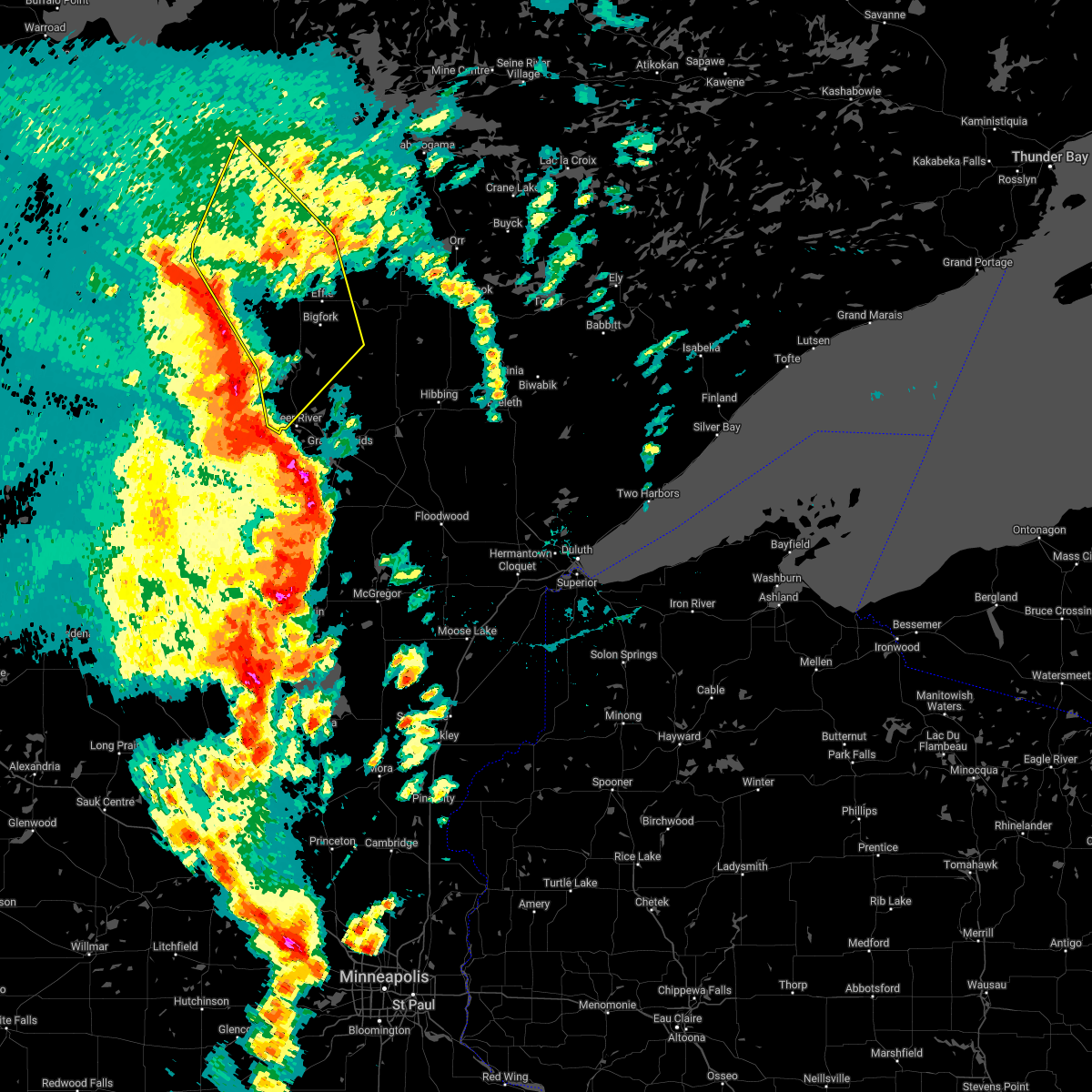
Hail Map for Bigfork, MN
The Bigfork, MN area has had 8 reports of on-the-ground hail by trained spotters, and has been under severe weather warnings 8 times during the past 12 months. Doppler radar has detected hail at or near Bigfork, MN on 30 occasions, including 1 occasion during the past year.
| Name: | Bigfork, MN |
| Where Located: | 60.2 miles S of International Falls, MN |
| Map: | Google Map for Bigfork, MN |
| Population: | 446 |
| Housing Units: | 241 |
| More Info: | Search Google for Bigfork, MN |
4
The Top Recent Hail Date for Bigfork, MN is Friday, September 12, 2025 (7th out of 30)
Hail and Wind Damage Spotted near Bigfork, MN
| Date / Time | Report Details |
|---|---|
| 7/27/2025 6:00 AM CDT |
 The storms which prompted the warning have moved out of the area. therefore, the warning has been allowed to expire. remember, a severe thunderstorm warning now covers the downstream portion of this storm. The storms which prompted the warning have moved out of the area. therefore, the warning has been allowed to expire. remember, a severe thunderstorm warning now covers the downstream portion of this storm.
|
| 7/27/2025 5:34 AM CDT |
 At 534 am cdt, severe thunderstorms were located along a line extending from near gemmell to near alvwood to near nevis, moving east at 40 mph (radar indicated). Hazards include 70 mph wind gusts and quarter size hail. Hail damage to vehicles is expected. expect considerable tree damage. wind damage is also likely to mobile homes, roofs, and outbuildings. Locations impacted include, squaw lake, leech lake, lake winnibigoshish, oslund, bena, federal dam, inger, bigfork, boy river, ball club, marcell and scenic state park. At 534 am cdt, severe thunderstorms were located along a line extending from near gemmell to near alvwood to near nevis, moving east at 40 mph (radar indicated). Hazards include 70 mph wind gusts and quarter size hail. Hail damage to vehicles is expected. expect considerable tree damage. wind damage is also likely to mobile homes, roofs, and outbuildings. Locations impacted include, squaw lake, leech lake, lake winnibigoshish, oslund, bena, federal dam, inger, bigfork, boy river, ball club, marcell and scenic state park.
|
| 7/27/2025 5:34 AM CDT |
 the severe thunderstorm warning has been cancelled and is no longer in effect the severe thunderstorm warning has been cancelled and is no longer in effect
|
| 7/27/2025 5:05 AM CDT |
 Svrdlh the national weather service in duluth mn has issued a * severe thunderstorm warning for, northwestern itasca county in north central minnesota, northern cass county in north central minnesota, southern koochiching county in north central minnesota, * until 600 am cdt. * at 505 am cdt, severe thunderstorms were located along a line extending from near kelliher to near tenstrike to near osage, moving east at 40 mph (radar indicated). Hazards include 60 mph wind gusts and quarter size hail. Hail damage to vehicles is expected. expect wind damage to roofs, siding, and trees. severe thunderstorms will be near, northome and mizpah around 515 am cdt. alvwood around 520 am cdt. gemmell and lake winnibigoshish around 525 am cdt. Other locations in the path of these severe thunderstorms include leech lake, walker, squaw lake, margie, oslund and bena. Svrdlh the national weather service in duluth mn has issued a * severe thunderstorm warning for, northwestern itasca county in north central minnesota, northern cass county in north central minnesota, southern koochiching county in north central minnesota, * until 600 am cdt. * at 505 am cdt, severe thunderstorms were located along a line extending from near kelliher to near tenstrike to near osage, moving east at 40 mph (radar indicated). Hazards include 60 mph wind gusts and quarter size hail. Hail damage to vehicles is expected. expect wind damage to roofs, siding, and trees. severe thunderstorms will be near, northome and mizpah around 515 am cdt. alvwood around 520 am cdt. gemmell and lake winnibigoshish around 525 am cdt. Other locations in the path of these severe thunderstorms include leech lake, walker, squaw lake, margie, oslund and bena.
|
| 7/4/2025 7:07 PM CDT |
 The storms which prompted the warning have weakened below severe limits, and no longer pose an immediate threat to life or property. therefore, the warning will be allowed to expire. however, gusty winds and heavy rain are still possible with these thunderstorms. a severe thunderstorm watch remains in effect until 900 pm cdt for north central and northeastern minnesota. to report severe weather, contact your nearest law enforcement agency. they will relay your report to the national weather service duluth mn. The storms which prompted the warning have weakened below severe limits, and no longer pose an immediate threat to life or property. therefore, the warning will be allowed to expire. however, gusty winds and heavy rain are still possible with these thunderstorms. a severe thunderstorm watch remains in effect until 900 pm cdt for north central and northeastern minnesota. to report severe weather, contact your nearest law enforcement agency. they will relay your report to the national weather service duluth mn.
|
| 7/4/2025 6:53 PM CDT |
 At 653 pm cdt, severe thunderstorms were located along a line extending from 9 miles northeast of ash lake to near togo, moving east at 35 mph (radar indicated). Hazards include 60 mph wind gusts and penny size hail. Expect damage to roofs, siding, and trees. these severe storms will be near, orr, meadow brook, gheen, voyageurs national park, and pelican lake around 700 pm cdt. Other locations impacted by these severe thunderstorms include bois forte band nett lake area, snake trail, celina, greaney, craigville, black duck lake, stony brook, sand point lake, bois forte band deer creek area, and linden grove. At 653 pm cdt, severe thunderstorms were located along a line extending from 9 miles northeast of ash lake to near togo, moving east at 35 mph (radar indicated). Hazards include 60 mph wind gusts and penny size hail. Expect damage to roofs, siding, and trees. these severe storms will be near, orr, meadow brook, gheen, voyageurs national park, and pelican lake around 700 pm cdt. Other locations impacted by these severe thunderstorms include bois forte band nett lake area, snake trail, celina, greaney, craigville, black duck lake, stony brook, sand point lake, bois forte band deer creek area, and linden grove.
|
| 7/4/2025 6:37 PM CDT |
 At 637 pm cdt, severe thunderstorms were located along a line extending from 6 miles northwest of ash lake to 10 miles east of scenic state park, moving east at 20 mph (radar indicated). Hazards include 70 mph wind gusts and nickel size hail. Expect considerable tree damage. damage is likely to mobile homes, roofs, and outbuildings. Locations impacted include, nett lake, ash lake, togo, pelican lake, cusson, orr, meadow brook and mccarthy beach state park. At 637 pm cdt, severe thunderstorms were located along a line extending from 6 miles northwest of ash lake to 10 miles east of scenic state park, moving east at 20 mph (radar indicated). Hazards include 70 mph wind gusts and nickel size hail. Expect considerable tree damage. damage is likely to mobile homes, roofs, and outbuildings. Locations impacted include, nett lake, ash lake, togo, pelican lake, cusson, orr, meadow brook and mccarthy beach state park.
|
| 7/4/2025 6:19 PM CDT |
 Svrdlh the national weather service in duluth mn has issued a * severe thunderstorm warning for, northeastern itasca county in north central minnesota, southeastern koochiching county in north central minnesota, northwestern st. louis county in northeastern minnesota, * until 715 pm cdt. * at 618 pm cdt, severe thunderstorms were located along a line extending from 11 miles north of nett lake to 10 miles northwest of togo, moving east at 25 mph (radar indicated). Hazards include 70 mph wind gusts and nickel size hail. Expect considerable tree damage. damage is likely to mobile homes, roofs, and outbuildings. severe thunderstorms will be near, nett lake around 625 pm cdt. Other locations in the path of these severe thunderstorms include ash lake, pelican lake and cusson. Svrdlh the national weather service in duluth mn has issued a * severe thunderstorm warning for, northeastern itasca county in north central minnesota, southeastern koochiching county in north central minnesota, northwestern st. louis county in northeastern minnesota, * until 715 pm cdt. * at 618 pm cdt, severe thunderstorms were located along a line extending from 11 miles north of nett lake to 10 miles northwest of togo, moving east at 25 mph (radar indicated). Hazards include 70 mph wind gusts and nickel size hail. Expect considerable tree damage. damage is likely to mobile homes, roofs, and outbuildings. severe thunderstorms will be near, nett lake around 625 pm cdt. Other locations in the path of these severe thunderstorms include ash lake, pelican lake and cusson.
|
| 6/21/2025 1:46 AM CDT |
 At 145 am cdt, severe thunderstorms were located along a line extending from near effie to 11 miles east of marcell to pokegama dam, moving east at 65 mph. these are destructive storms for northern cass and itasca counties (radar indicated). Hazards include 90 mph wind gusts and penny size hail. You are in a life-threatening situation. flying debris may be deadly to those caught without shelter. mobile homes will be heavily damaged or destroyed. homes and businesses will have substantial roof and window damage. expect extensive tree damage and power outages. Locations impacted include, grand rapids, walker, cohasset, coleraine, keewatin, nashwauk, deer river, marcell, bigfork, taconite, warba, effie, zemple, boy river, pengilly, scenic state park, inger, days high landing, schoolcraft state park, and hill annex mine state park. At 145 am cdt, severe thunderstorms were located along a line extending from near effie to 11 miles east of marcell to pokegama dam, moving east at 65 mph. these are destructive storms for northern cass and itasca counties (radar indicated). Hazards include 90 mph wind gusts and penny size hail. You are in a life-threatening situation. flying debris may be deadly to those caught without shelter. mobile homes will be heavily damaged or destroyed. homes and businesses will have substantial roof and window damage. expect extensive tree damage and power outages. Locations impacted include, grand rapids, walker, cohasset, coleraine, keewatin, nashwauk, deer river, marcell, bigfork, taconite, warba, effie, zemple, boy river, pengilly, scenic state park, inger, days high landing, schoolcraft state park, and hill annex mine state park.
|
| 6/21/2025 1:44 AM CDT |
 Tordlh the national weather service in duluth mn has issued a * tornado warning for, northeastern itasca county in north central minnesota, west central st. louis county in northeastern minnesota, * until 215 am cdt. * at 144 am cdt, severe thunderstorms capable of producing a tornado were located along a line extending from near bigfork to near scenic state park to 12 miles north of taconite, moving east at 70 mph (radar indicated rotation). Hazards include tornado. Flying debris will be dangerous to those caught without shelter. mobile homes will be damaged or destroyed. damage to roofs, windows, and vehicles will occur. tree damage is likely. these dangerous storms will be near, scenic state park around 150 am cdt. hibbing around 155 am cdt. Togo and mccarthy beach state park around 200 am cdt. Tordlh the national weather service in duluth mn has issued a * tornado warning for, northeastern itasca county in north central minnesota, west central st. louis county in northeastern minnesota, * until 215 am cdt. * at 144 am cdt, severe thunderstorms capable of producing a tornado were located along a line extending from near bigfork to near scenic state park to 12 miles north of taconite, moving east at 70 mph (radar indicated rotation). Hazards include tornado. Flying debris will be dangerous to those caught without shelter. mobile homes will be damaged or destroyed. damage to roofs, windows, and vehicles will occur. tree damage is likely. these dangerous storms will be near, scenic state park around 150 am cdt. hibbing around 155 am cdt. Togo and mccarthy beach state park around 200 am cdt.
|
| 6/21/2025 1:34 AM CDT |
 At 133 am cdt, severe thunderstorms were located along a line extending from 10 miles west of bigfork to near marcell to schoolcraft state park, moving east at 65 mph. these are destructive storms for northern cass and itasca counties (radar indicated). Hazards include 90 mph wind gusts and penny size hail. You are in a life-threatening situation. flying debris may be deadly to those caught without shelter. mobile homes will be heavily damaged or destroyed. homes and businesses will have substantial roof and window damage. expect extensive tree damage and power outages. Locations impacted include, grand rapids, cohasset, bigfork, effie, pokegama dam, scenic state park, coleraine, taconite, gunn, nashwauk, hill annex mine state park, pengilly, keewatin and togo. At 133 am cdt, severe thunderstorms were located along a line extending from 10 miles west of bigfork to near marcell to schoolcraft state park, moving east at 65 mph. these are destructive storms for northern cass and itasca counties (radar indicated). Hazards include 90 mph wind gusts and penny size hail. You are in a life-threatening situation. flying debris may be deadly to those caught without shelter. mobile homes will be heavily damaged or destroyed. homes and businesses will have substantial roof and window damage. expect extensive tree damage and power outages. Locations impacted include, grand rapids, cohasset, bigfork, effie, pokegama dam, scenic state park, coleraine, taconite, gunn, nashwauk, hill annex mine state park, pengilly, keewatin and togo.
|
| 6/21/2025 1:23 AM CDT |
 Tordlh the national weather service in duluth mn has issued a * tornado warning for, northern itasca county in north central minnesota, southeastern koochiching county in north central minnesota, * until 145 am cdt. * at 122 am cdt, a severe thunderstorm capable of producing a tornado was located near inger, or 32 miles northwest of grand rapids, moving east at 85 mph (radar indicated rotation). Hazards include tornado. Flying debris will be dangerous to those caught without shelter. mobile homes will be damaged or destroyed. damage to roofs, windows, and vehicles will occur. tree damage is likely. This dangerous storm will be near, scenic state park around 130 am cdt. Tordlh the national weather service in duluth mn has issued a * tornado warning for, northern itasca county in north central minnesota, southeastern koochiching county in north central minnesota, * until 145 am cdt. * at 122 am cdt, a severe thunderstorm capable of producing a tornado was located near inger, or 32 miles northwest of grand rapids, moving east at 85 mph (radar indicated rotation). Hazards include tornado. Flying debris will be dangerous to those caught without shelter. mobile homes will be damaged or destroyed. damage to roofs, windows, and vehicles will occur. tree damage is likely. This dangerous storm will be near, scenic state park around 130 am cdt.
|
| 6/21/2025 1:07 AM CDT |
 At 106 am cdt, severe thunderstorms were located along a line extending from near kelliher to 10 miles northwest of lake winnibigoshish to near laporte, moving east at 70 mph. these are destructive storms for northern cass and itasca counties (radar indicated). Hazards include 90 mph wind gusts and penny size hail. You are in a life-threatening situation. flying debris may be deadly to those caught without shelter. mobile homes will be heavily damaged or destroyed. homes and businesses will have substantial roof and window damage. expect extensive tree damage and power outages. Locations impacted include, grand rapids, walker, cohasset, coleraine, deer river, marcell, bigfork, remer, taconite, northome, longville, effie, bena, federal dam, squaw lake, zemple, mizpah, boy river, alvwood, and leech lake. At 106 am cdt, severe thunderstorms were located along a line extending from near kelliher to 10 miles northwest of lake winnibigoshish to near laporte, moving east at 70 mph. these are destructive storms for northern cass and itasca counties (radar indicated). Hazards include 90 mph wind gusts and penny size hail. You are in a life-threatening situation. flying debris may be deadly to those caught without shelter. mobile homes will be heavily damaged or destroyed. homes and businesses will have substantial roof and window damage. expect extensive tree damage and power outages. Locations impacted include, grand rapids, walker, cohasset, coleraine, deer river, marcell, bigfork, remer, taconite, northome, longville, effie, bena, federal dam, squaw lake, zemple, mizpah, boy river, alvwood, and leech lake.
|
| 6/21/2025 1:02 AM CDT |
 Svrdlh the national weather service in duluth mn has issued a * severe thunderstorm warning for, itasca county in north central minnesota, northern cass county in north central minnesota, southeastern koochiching county in north central minnesota, * until 200 am cdt. * at 101 am cdt, severe thunderstorms were located along a line extending from near blackduck to 9 miles west of lake winnibigoshish to near leech lake, moving east at 65 mph. these are destructive storms for northern cass and itasca counties (radar indicated). Hazards include 90 mph wind gusts and penny size hail. You are in a life-threatening situation. flying debris may be deadly to those caught without shelter. mobile homes will be heavily damaged or destroyed. homes and businesses will have substantial roof and window damage. expect extensive tree damage and power outages. severe thunderstorms will be near, leech lake and lake winnibigoshish around 105 am cdt. bena, federal dam, and alvwood around 110 am cdt. squaw lake and boy river around 115 am cdt. oslund, inger, and ball club around 120 am cdt. Other locations in the path of these severe thunderstorms include deer river, marcell, zemple, days high landing, schoolcraft state park, cohasset, bigfork, grand rapids, coleraine, effie, pokegama dam, pokegama lake and scenic state park. Svrdlh the national weather service in duluth mn has issued a * severe thunderstorm warning for, itasca county in north central minnesota, northern cass county in north central minnesota, southeastern koochiching county in north central minnesota, * until 200 am cdt. * at 101 am cdt, severe thunderstorms were located along a line extending from near blackduck to 9 miles west of lake winnibigoshish to near leech lake, moving east at 65 mph. these are destructive storms for northern cass and itasca counties (radar indicated). Hazards include 90 mph wind gusts and penny size hail. You are in a life-threatening situation. flying debris may be deadly to those caught without shelter. mobile homes will be heavily damaged or destroyed. homes and businesses will have substantial roof and window damage. expect extensive tree damage and power outages. severe thunderstorms will be near, leech lake and lake winnibigoshish around 105 am cdt. bena, federal dam, and alvwood around 110 am cdt. squaw lake and boy river around 115 am cdt. oslund, inger, and ball club around 120 am cdt. Other locations in the path of these severe thunderstorms include deer river, marcell, zemple, days high landing, schoolcraft state park, cohasset, bigfork, grand rapids, coleraine, effie, pokegama dam, pokegama lake and scenic state park.
|
| 6/21/2025 12:48 AM CDT |
 the severe thunderstorm warning has been cancelled and is no longer in effect the severe thunderstorm warning has been cancelled and is no longer in effect
|
| 6/21/2025 12:48 AM CDT |
 At 1246 am cdt, severe thunderstorms were located along a line extending from near effie to near mccarthy beach state park to eveleth, moving northeast at 45 mph (radar indicated). Hazards include two inch hail and 60 mph wind gusts. People and animals outdoors will be injured. expect hail damage to roofs, siding, windows, and vehicles. expect wind damage to roofs, siding, and trees. Locations impacted include, hibbing, lake vermilion, virginia, chisholm, eveleth, mountain iron, hoyt lakes, gilbert, aurora, babbitt, keewatin, buhl, nashwauk, biwabik, cherry, embarrass, cook, marcell, bigfork, and orr. At 1246 am cdt, severe thunderstorms were located along a line extending from near effie to near mccarthy beach state park to eveleth, moving northeast at 45 mph (radar indicated). Hazards include two inch hail and 60 mph wind gusts. People and animals outdoors will be injured. expect hail damage to roofs, siding, windows, and vehicles. expect wind damage to roofs, siding, and trees. Locations impacted include, hibbing, lake vermilion, virginia, chisholm, eveleth, mountain iron, hoyt lakes, gilbert, aurora, babbitt, keewatin, buhl, nashwauk, biwabik, cherry, embarrass, cook, marcell, bigfork, and orr.
|
| 6/21/2025 12:30 AM CDT |
 Svrdlh the national weather service in duluth mn has issued a * severe thunderstorm warning for, itasca county in north central minnesota, northern cass county in north central minnesota, southwestern koochiching county in north central minnesota, * until 130 am cdt. * at 1230 am cdt, severe thunderstorms were located along a line extending from 6 miles northeast of clearbrook to 11 miles southwest of wilton to near many point lake, moving east at 70 mph (radar indicated). Hazards include 70 mph wind gusts and half dollar size hail. Hail damage to vehicles is expected. expect considerable tree damage. Wind damage is also likely to mobile homes, roofs, and outbuildings. Svrdlh the national weather service in duluth mn has issued a * severe thunderstorm warning for, itasca county in north central minnesota, northern cass county in north central minnesota, southwestern koochiching county in north central minnesota, * until 130 am cdt. * at 1230 am cdt, severe thunderstorms were located along a line extending from 6 miles northeast of clearbrook to 11 miles southwest of wilton to near many point lake, moving east at 70 mph (radar indicated). Hazards include 70 mph wind gusts and half dollar size hail. Hail damage to vehicles is expected. expect considerable tree damage. Wind damage is also likely to mobile homes, roofs, and outbuildings.
|
| 6/21/2025 12:22 AM CDT |
 At 1221 am cdt, severe thunderstorms were located along a line extending from 6 miles northeast of inger to 8 miles north of hill annex mine state park to 7 miles north of toivola, moving northeast at 45 mph (radar indicated). Hazards include tennis ball size hail and 70 mph wind gusts. People and animals outdoors will be injured. expect hail damage to roofs, siding, windows, and vehicles. expect considerable tree damage. wind damage is also likely to mobile homes, roofs, and outbuildings. Locations impacted include, hibbing, keewatin, nashwauk, marcell, chisholm, cherry, bigfork, scenic state park, mountain iron, buhl, eveleth, effie, virginia, gilbert, mccarthy beach state park, biwabik, togo, cook and meadow brook. At 1221 am cdt, severe thunderstorms were located along a line extending from 6 miles northeast of inger to 8 miles north of hill annex mine state park to 7 miles north of toivola, moving northeast at 45 mph (radar indicated). Hazards include tennis ball size hail and 70 mph wind gusts. People and animals outdoors will be injured. expect hail damage to roofs, siding, windows, and vehicles. expect considerable tree damage. wind damage is also likely to mobile homes, roofs, and outbuildings. Locations impacted include, hibbing, keewatin, nashwauk, marcell, chisholm, cherry, bigfork, scenic state park, mountain iron, buhl, eveleth, effie, virginia, gilbert, mccarthy beach state park, biwabik, togo, cook and meadow brook.
|
| 6/21/2025 12:04 AM CDT |
 Svrdlh the national weather service in duluth mn has issued a * severe thunderstorm warning for, itasca county in north central minnesota, northeastern cass county in north central minnesota, southern koochiching county in north central minnesota, southern st. louis county in northeastern minnesota, * until 100 am cdt. * at 1204 am cdt, severe thunderstorms were located along a line extending from near inger to near coleraine to 8 miles northeast of swan river, moving northeast at 45 mph (radar indicated). Hazards include golf ball size hail and 60 mph wind gusts. People and animals outdoors will be injured. expect hail damage to roofs, siding, windows, and vehicles. expect wind damage to roofs, siding, and trees. severe thunderstorms will be near, hibbing, nashwauk, taconite, inger, hill annex mine state park, and pengilly around 1210 am cdt. keewatin and marcell around 1215 am cdt. Other locations in the path of these severe thunderstorms include chisholm, cherry, bigfork, scenic state park, mountain iron, buhl, virginia, eveleth, gilbert, effie, mccarthy beach state park and togo. Svrdlh the national weather service in duluth mn has issued a * severe thunderstorm warning for, itasca county in north central minnesota, northeastern cass county in north central minnesota, southern koochiching county in north central minnesota, southern st. louis county in northeastern minnesota, * until 100 am cdt. * at 1204 am cdt, severe thunderstorms were located along a line extending from near inger to near coleraine to 8 miles northeast of swan river, moving northeast at 45 mph (radar indicated). Hazards include golf ball size hail and 60 mph wind gusts. People and animals outdoors will be injured. expect hail damage to roofs, siding, windows, and vehicles. expect wind damage to roofs, siding, and trees. severe thunderstorms will be near, hibbing, nashwauk, taconite, inger, hill annex mine state park, and pengilly around 1210 am cdt. keewatin and marcell around 1215 am cdt. Other locations in the path of these severe thunderstorms include chisholm, cherry, bigfork, scenic state park, mountain iron, buhl, virginia, eveleth, gilbert, effie, mccarthy beach state park and togo.
|
| 6/20/2025 11:57 PM CDT |
 At 1157 pm cdt, severe thunderstorms were located along a line extending from ball club to grand rapids to near warba, moving northeast at 30 mph (radar indicated). Hazards include golf ball size hail and 60 mph wind gusts. People and animals outdoors will be injured. expect hail damage to roofs, siding, windows, and vehicles. expect wind damage to roofs, siding, and trees. Locations impacted include, hibbing, grand rapids, cohasset, coleraine, keewatin, nashwauk, deer river, swan river, marcell, bigfork, taconite, warba, toivola, meadowlands, bena, squaw lake, zemple, alvwood, pengilly, and lake winnibigoshish. At 1157 pm cdt, severe thunderstorms were located along a line extending from ball club to grand rapids to near warba, moving northeast at 30 mph (radar indicated). Hazards include golf ball size hail and 60 mph wind gusts. People and animals outdoors will be injured. expect hail damage to roofs, siding, windows, and vehicles. expect wind damage to roofs, siding, and trees. Locations impacted include, hibbing, grand rapids, cohasset, coleraine, keewatin, nashwauk, deer river, swan river, marcell, bigfork, taconite, warba, toivola, meadowlands, bena, squaw lake, zemple, alvwood, pengilly, and lake winnibigoshish.
|
| 6/20/2025 11:57 PM CDT |
 the severe thunderstorm warning has been cancelled and is no longer in effect the severe thunderstorm warning has been cancelled and is no longer in effect
|
| 6/20/2025 11:44 PM CDT |
 At 1144 pm cdt, severe thunderstorms were located along a line extending from near ball club to near pokegama dam to near jacobson, moving northeast at 30 mph (radar indicated). Hazards include 60 mph wind gusts and quarter size hail. Hail damage to vehicles is expected. expect wind damage to roofs, siding, and trees. Locations impacted include, grand rapids, cohasset, coleraine, deer river, warba, zemple, ball club, pokegama dam, days high landing, gunn, swan river, taconite, nashwauk, hill annex mine state park, pengilly, hibbing and keewatin. At 1144 pm cdt, severe thunderstorms were located along a line extending from near ball club to near pokegama dam to near jacobson, moving northeast at 30 mph (radar indicated). Hazards include 60 mph wind gusts and quarter size hail. Hail damage to vehicles is expected. expect wind damage to roofs, siding, and trees. Locations impacted include, grand rapids, cohasset, coleraine, deer river, warba, zemple, ball club, pokegama dam, days high landing, gunn, swan river, taconite, nashwauk, hill annex mine state park, pengilly, hibbing and keewatin.
|
| 6/20/2025 11:24 PM CDT |
 Svrdlh the national weather service in duluth mn has issued a * severe thunderstorm warning for, itasca county in north central minnesota, northeastern aitkin county in east central minnesota, northern cass county in north central minnesota, southwestern st. louis county in northeastern minnesota, * until 1230 am cdt. * at 1123 pm cdt, severe thunderstorms were located along a line extending from near boy river to 6 miles northeast of remer to near hill city, moving northeast at 30 mph (radar indicated). Hazards include 60 mph wind gusts and quarter size hail. Hail damage to vehicles is expected. expect wind damage to roofs, siding, and trees. severe thunderstorms will be near, cohasset and federal dam around 1130 pm cdt. days high landing, schoolcraft state park, and pokegama lake around 1135 pm cdt. grand rapids and ball club around 1140 pm cdt. Other locations in the path of these severe thunderstorms include coleraine, warba, zemple, pokegama dam, gunn, deer river, swan river, taconite, hill annex mine state park, nashwauk and pengilly. Svrdlh the national weather service in duluth mn has issued a * severe thunderstorm warning for, itasca county in north central minnesota, northeastern aitkin county in east central minnesota, northern cass county in north central minnesota, southwestern st. louis county in northeastern minnesota, * until 1230 am cdt. * at 1123 pm cdt, severe thunderstorms were located along a line extending from near boy river to 6 miles northeast of remer to near hill city, moving northeast at 30 mph (radar indicated). Hazards include 60 mph wind gusts and quarter size hail. Hail damage to vehicles is expected. expect wind damage to roofs, siding, and trees. severe thunderstorms will be near, cohasset and federal dam around 1130 pm cdt. days high landing, schoolcraft state park, and pokegama lake around 1135 pm cdt. grand rapids and ball club around 1140 pm cdt. Other locations in the path of these severe thunderstorms include coleraine, warba, zemple, pokegama dam, gunn, deer river, swan river, taconite, hill annex mine state park, nashwauk and pengilly.
|
| 8/3/2024 11:02 AM CDT |
 At 1102 am cdt, a severe thunderstorm was located near bigfork, or 34 miles north of grand rapids, moving southeast at 45 mph (radar indicated). Hazards include 60 mph wind gusts and quarter size hail. Hail damage to vehicles is expected. expect wind damage to roofs, siding, and trees. Locations impacted include, marcell, bigfork, effie, scenic state park, north star lake, talmoon, gunn lake, coon lake, spider lake, and bois forte band deer creek area. At 1102 am cdt, a severe thunderstorm was located near bigfork, or 34 miles north of grand rapids, moving southeast at 45 mph (radar indicated). Hazards include 60 mph wind gusts and quarter size hail. Hail damage to vehicles is expected. expect wind damage to roofs, siding, and trees. Locations impacted include, marcell, bigfork, effie, scenic state park, north star lake, talmoon, gunn lake, coon lake, spider lake, and bois forte band deer creek area.
|
| 8/3/2024 11:02 AM CDT |
 the severe thunderstorm warning has been cancelled and is no longer in effect the severe thunderstorm warning has been cancelled and is no longer in effect
|
| 8/3/2024 10:45 AM CDT |
 At 1045 am cdt, a severe thunderstorm was located 10 miles north of oslund, moving southeast at 40 mph (radar indicated). Hazards include 60 mph wind gusts and quarter size hail. Hail damage to vehicles is expected. expect wind damage to roofs, siding, and trees. Locations impacted include, marcell, bigfork, effie, scenic state park, spring lake, wirt, north star lake, talmoon, gunn lake, coon lake, spider lake, and bois forte band deer creek area. At 1045 am cdt, a severe thunderstorm was located 10 miles north of oslund, moving southeast at 40 mph (radar indicated). Hazards include 60 mph wind gusts and quarter size hail. Hail damage to vehicles is expected. expect wind damage to roofs, siding, and trees. Locations impacted include, marcell, bigfork, effie, scenic state park, spring lake, wirt, north star lake, talmoon, gunn lake, coon lake, spider lake, and bois forte band deer creek area.
|
| 8/3/2024 10:23 AM CDT |
 Svrdlh the national weather service in duluth mn has issued a * severe thunderstorm warning for, northeastern itasca county in north central minnesota, southwestern koochiching county in north central minnesota, * until 1115 am cdt. * at 1022 am cdt, a severe thunderstorm was located over mizpah, moving southeast at 45 mph (radar indicated). Hazards include 60 mph wind gusts and quarter size hail. Hail damage to vehicles is expected. Expect wind damage to roofs, siding, and trees. Svrdlh the national weather service in duluth mn has issued a * severe thunderstorm warning for, northeastern itasca county in north central minnesota, southwestern koochiching county in north central minnesota, * until 1115 am cdt. * at 1022 am cdt, a severe thunderstorm was located over mizpah, moving southeast at 45 mph (radar indicated). Hazards include 60 mph wind gusts and quarter size hail. Hail damage to vehicles is expected. Expect wind damage to roofs, siding, and trees.
|
| 7/13/2024 7:38 PM CDT |
 Svrdlh the national weather service in duluth mn has issued a * severe thunderstorm warning for, northwestern itasca county in north central minnesota, south central koochiching county in north central minnesota, * until 830 pm cdt. * at 738 pm cdt, a severe thunderstorm was located near alvwood, or 38 miles northeast of bemidji, moving east at 30 mph (radar indicated). Hazards include 60 mph wind gusts and quarter size hail. Hail damage to vehicles is expected. Expect wind damage to roofs, siding, and trees. Svrdlh the national weather service in duluth mn has issued a * severe thunderstorm warning for, northwestern itasca county in north central minnesota, south central koochiching county in north central minnesota, * until 830 pm cdt. * at 738 pm cdt, a severe thunderstorm was located near alvwood, or 38 miles northeast of bemidji, moving east at 30 mph (radar indicated). Hazards include 60 mph wind gusts and quarter size hail. Hail damage to vehicles is expected. Expect wind damage to roofs, siding, and trees.
|
| 6/18/2024 3:48 PM CDT |
 the severe thunderstorm warning has been cancelled and is no longer in effect the severe thunderstorm warning has been cancelled and is no longer in effect
|
| 6/18/2024 3:14 PM CDT |
 At 314 pm cdt, severe thunderstorms were located along a line extending from 11 miles southeast of scenic state park to 11 miles northwest of coleraine to zemple, moving east at 35 mph (radar indicated). Hazards include 60 mph wind gusts. Expect damage to roofs, siding, and trees. these severe storms will be near, cohasset around 320 pm cdt. grand rapids and taconite around 325 pm cdt. Other locations in the path of these severe thunderstorms include coleraine, hibbing, nashwauk, hill annex mine state park, keewatin and pengilly. At 314 pm cdt, severe thunderstorms were located along a line extending from 11 miles southeast of scenic state park to 11 miles northwest of coleraine to zemple, moving east at 35 mph (radar indicated). Hazards include 60 mph wind gusts. Expect damage to roofs, siding, and trees. these severe storms will be near, cohasset around 320 pm cdt. grand rapids and taconite around 325 pm cdt. Other locations in the path of these severe thunderstorms include coleraine, hibbing, nashwauk, hill annex mine state park, keewatin and pengilly.
|
| 6/18/2024 3:09 PM CDT |
 Svrdlh the national weather service in duluth mn has issued a * severe thunderstorm warning for, eastern itasca county in north central minnesota, northeastern cass county in north central minnesota, west central st. louis county in northeastern minnesota, * until 400 pm cdt. * at 309 pm cdt, severe thunderstorms were located along a line extending from 8 miles southeast of scenic state park to 10 miles south of marcell to near deer river, moving east at 35 mph (radar indicated). Hazards include 60 mph wind gusts. Expect damage to roofs, siding, and trees. severe thunderstorms will be near, cohasset, deer river, and zemple around 315 pm cdt. grand rapids around 320 pm cdt. coleraine, taconite, and pokegama dam around 325 pm cdt. Other locations in the path of these severe thunderstorms include nashwauk, hibbing, gunn, hill annex mine state park, keewatin, pengilly and chisholm. Svrdlh the national weather service in duluth mn has issued a * severe thunderstorm warning for, eastern itasca county in north central minnesota, northeastern cass county in north central minnesota, west central st. louis county in northeastern minnesota, * until 400 pm cdt. * at 309 pm cdt, severe thunderstorms were located along a line extending from 8 miles southeast of scenic state park to 10 miles south of marcell to near deer river, moving east at 35 mph (radar indicated). Hazards include 60 mph wind gusts. Expect damage to roofs, siding, and trees. severe thunderstorms will be near, cohasset, deer river, and zemple around 315 pm cdt. grand rapids around 320 pm cdt. coleraine, taconite, and pokegama dam around 325 pm cdt. Other locations in the path of these severe thunderstorms include nashwauk, hibbing, gunn, hill annex mine state park, keewatin, pengilly and chisholm.
|
| 6/18/2024 5:59 AM CDT |
 The storms which prompted the warning have weakened. therefore, the warning will be allowed to expire. a severe thunderstorm watch remains in effect until 900 am cdt for north central and east central minnesota. The storms which prompted the warning have weakened. therefore, the warning will be allowed to expire. a severe thunderstorm watch remains in effect until 900 am cdt for north central and east central minnesota.
|
| 6/18/2024 5:52 AM CDT |
 At 552 am cdt, severe thunderstorms were located along a line extending from 10 miles southeast of big falls to near poplar, moving east at 40 mph (radar indicated). Hazards include 60 mph wind gusts and penny size hail. Expect damage to roofs, siding, and trees. Locations impacted include, walker, pequot lakes, pine river, marcell, bigfork, wabedo, hackensack, backus, northome, poplar, longville, effie, bena, federal dam, squaw lake, mizpah, boy river, alvwood, leech lake, and gemmell. At 552 am cdt, severe thunderstorms were located along a line extending from 10 miles southeast of big falls to near poplar, moving east at 40 mph (radar indicated). Hazards include 60 mph wind gusts and penny size hail. Expect damage to roofs, siding, and trees. Locations impacted include, walker, pequot lakes, pine river, marcell, bigfork, wabedo, hackensack, backus, northome, poplar, longville, effie, bena, federal dam, squaw lake, mizpah, boy river, alvwood, leech lake, and gemmell.
|
| 6/18/2024 5:35 AM CDT |
 At 535 am cdt, severe thunderstorms were located along a line extending from near margie to 6 miles east of sebeka, moving east at 40 mph (radar indicated). Hazards include 60 mph wind gusts and nickel size hail. Expect damage to roofs, siding, and trees. Locations impacted include, walker, pequot lakes, pine river, marcell, bigfork, wabedo, hackensack, backus, northome, poplar, longville, effie, bena, federal dam, squaw lake, mizpah, boy river, alvwood, leech lake, and gemmell. At 535 am cdt, severe thunderstorms were located along a line extending from near margie to 6 miles east of sebeka, moving east at 40 mph (radar indicated). Hazards include 60 mph wind gusts and nickel size hail. Expect damage to roofs, siding, and trees. Locations impacted include, walker, pequot lakes, pine river, marcell, bigfork, wabedo, hackensack, backus, northome, poplar, longville, effie, bena, federal dam, squaw lake, mizpah, boy river, alvwood, leech lake, and gemmell.
|
| 6/18/2024 5:26 AM CDT |
 At 526 am cdt, severe thunderstorms were located along a line extending from near margie to sebeka, moving east at 40 mph (radar indicated). Hazards include 60 mph wind gusts and quarter size hail. Hail damage to vehicles is expected. expect wind damage to roofs, siding, and trees. Locations impacted include, walker, squaw lake, margie, lake winnibigoshish, leech lake, oslund, hackensack, bena, federal dam, backus, poplar, inger, effie, woman lake, pine river, bigfork, longville, boy river, ball club, marcell, wabedo, scenic state park and pequot lakes. At 526 am cdt, severe thunderstorms were located along a line extending from near margie to sebeka, moving east at 40 mph (radar indicated). Hazards include 60 mph wind gusts and quarter size hail. Hail damage to vehicles is expected. expect wind damage to roofs, siding, and trees. Locations impacted include, walker, squaw lake, margie, lake winnibigoshish, leech lake, oslund, hackensack, bena, federal dam, backus, poplar, inger, effie, woman lake, pine river, bigfork, longville, boy river, ball club, marcell, wabedo, scenic state park and pequot lakes.
|
| 6/18/2024 5:02 AM CDT |
 Svrdlh the national weather service in duluth mn has issued a * severe thunderstorm warning for, northwestern itasca county in north central minnesota, cass county in north central minnesota, southern koochiching county in north central minnesota, northwestern crow wing county in east central minnesota, * until 600 am cdt. * at 500 am cdt, severe thunderstorms were located along a line extending from 10 miles east of waskish to 11 miles north of new york mills, moving east at 40 mph (radar indicated). Hazards include 60 mph wind gusts and quarter size hail. Hail damage to vehicles is expected. expect wind damage to roofs, siding, and trees. severe thunderstorms will be near, northome around 505 am cdt. mizpah around 510 am cdt. alvwood and gemmell around 515 am cdt. margie, lake winnibigoshish, and leech lake around 520 am cdt. Other locations in the path of these severe thunderstorms include walker, squaw lake, oslund, hackensack, bena and federal dam. Svrdlh the national weather service in duluth mn has issued a * severe thunderstorm warning for, northwestern itasca county in north central minnesota, cass county in north central minnesota, southern koochiching county in north central minnesota, northwestern crow wing county in east central minnesota, * until 600 am cdt. * at 500 am cdt, severe thunderstorms were located along a line extending from 10 miles east of waskish to 11 miles north of new york mills, moving east at 40 mph (radar indicated). Hazards include 60 mph wind gusts and quarter size hail. Hail damage to vehicles is expected. expect wind damage to roofs, siding, and trees. severe thunderstorms will be near, northome around 505 am cdt. mizpah around 510 am cdt. alvwood and gemmell around 515 am cdt. margie, lake winnibigoshish, and leech lake around 520 am cdt. Other locations in the path of these severe thunderstorms include walker, squaw lake, oslund, hackensack, bena and federal dam.
|
| 7/27/2023 1:49 AM CDT |
 At 149 am cdt, a severe thunderstorm was located near alvwood, or 28 miles northeast of bemidji, moving east at 50 mph (radar indicated). Hazards include 60 mph wind gusts and quarter size hail. Hail damage to vehicles is expected. expect wind damage to roofs, siding, and trees. this severe thunderstorm will be near, squaw lake around 200 am cdt. oslund around 205 am cdt. other locations in the path of this severe thunderstorm include inger and marcell. hail threat, radar indicated max hail size, 1. 00 in wind threat, radar indicated max wind gust, 60 mph. At 149 am cdt, a severe thunderstorm was located near alvwood, or 28 miles northeast of bemidji, moving east at 50 mph (radar indicated). Hazards include 60 mph wind gusts and quarter size hail. Hail damage to vehicles is expected. expect wind damage to roofs, siding, and trees. this severe thunderstorm will be near, squaw lake around 200 am cdt. oslund around 205 am cdt. other locations in the path of this severe thunderstorm include inger and marcell. hail threat, radar indicated max hail size, 1. 00 in wind threat, radar indicated max wind gust, 60 mph.
|
| 7/22/2023 2:50 PM CDT | Half Dollar sized hail reported 10.7 miles NNW of Bigfork, MN |
| 7/22/2023 2:39 PM CDT | Tennis Ball sized hail reported 10.3 miles N of Bigfork, MN, reported golf ball to tennis ball sized hail along highway 38 which caused dents in vehicle. |
| 7/22/2023 2:31 PM CDT | Ping Pong Ball sized hail reported 8.1 miles N of Bigfork, MN, report via social media with photo. |
| 7/19/2023 4:28 PM CDT |
 The severe thunderstorm warning for north central itasca county will expire at 430 pm cdt, the storm which prompted the warning has moved out of the area. therefore, the warning will be allowed to expire. a severe thunderstorm watch remains in effect until 1000 pm cdt for north central minnesota. The severe thunderstorm warning for north central itasca county will expire at 430 pm cdt, the storm which prompted the warning has moved out of the area. therefore, the warning will be allowed to expire. a severe thunderstorm watch remains in effect until 1000 pm cdt for north central minnesota.
|
| 7/19/2023 4:15 PM CDT | Baseball sized hail reported 11 miles N of Bigfork, MN, report via social media with video. observer reports they have broken windows and a dented car. time estimated from radar. |
| 7/19/2023 4:00 PM CDT |
 At 400 pm cdt, a severe thunderstorm was located near marcell, or 27 miles northwest of grand rapids, moving east at 35 mph (radar indicated). Hazards include 60 mph wind gusts and quarter size hail. Hail damage to vehicles is expected. expect wind damage to roofs, siding, and trees. Locations impacted include, marcell. At 400 pm cdt, a severe thunderstorm was located near marcell, or 27 miles northwest of grand rapids, moving east at 35 mph (radar indicated). Hazards include 60 mph wind gusts and quarter size hail. Hail damage to vehicles is expected. expect wind damage to roofs, siding, and trees. Locations impacted include, marcell.
|
| 7/19/2023 3:40 PM CDT |
 At 339 pm cdt, a severe thunderstorm was located near inger, or 34 miles northwest of grand rapids, moving east at 15 mph (radar indicated). Hazards include 60 mph wind gusts and quarter size hail. Hail damage to vehicles is expected. expect wind damage to roofs, siding, and trees. this severe thunderstorm will be near, inger around 350 pm cdt. Other locations in the path of this severe thunderstorm include marcell. At 339 pm cdt, a severe thunderstorm was located near inger, or 34 miles northwest of grand rapids, moving east at 15 mph (radar indicated). Hazards include 60 mph wind gusts and quarter size hail. Hail damage to vehicles is expected. expect wind damage to roofs, siding, and trees. this severe thunderstorm will be near, inger around 350 pm cdt. Other locations in the path of this severe thunderstorm include marcell.
|
| 8/2/2022 3:30 PM CDT | Half Dollar sized hail reported 13.3 miles WNW of Bigfork, MN, report via social media with picture. |
| 6/24/2022 11:54 PM CDT |
 At 1154 pm cdt, severe thunderstorms were located along a line extending from near effie, to 14 miles east of marcell, to coleraine, to 7 miles southwest of gunn, to near hill city, moving east at 45 mph (radar indicated). Hazards include 70 mph wind gusts and quarter size hail. Hail damage to vehicles is expected. expect considerable tree damage. wind damage is also likely to mobile homes, roofs, and outbuildings. these severe storms will be near, taconite around 1200 am cdt. Other locations in the path of these severe thunderstorms include pengilly, warba, nashwauk and togo. At 1154 pm cdt, severe thunderstorms were located along a line extending from near effie, to 14 miles east of marcell, to coleraine, to 7 miles southwest of gunn, to near hill city, moving east at 45 mph (radar indicated). Hazards include 70 mph wind gusts and quarter size hail. Hail damage to vehicles is expected. expect considerable tree damage. wind damage is also likely to mobile homes, roofs, and outbuildings. these severe storms will be near, taconite around 1200 am cdt. Other locations in the path of these severe thunderstorms include pengilly, warba, nashwauk and togo.
|
| 6/24/2022 11:46 PM CDT | Itasca county sherriff reports trees down over the road north of bigfork. time estimated from rada in itasca county MN, 2.4 miles SSW of Bigfork, MN |
| 6/24/2022 11:43 PM CDT |
 At 1140 pm cdt, severe thunderstorms were located along a line extending from 7 miles west of effie, to near marcell, to near cohasset, to 8 miles south of days high landing, to near remer, moving east at 45 mph. these are destructive storms for deer river, cohasset, days high landing, highway 2 between deer river and cohasset, and state highway 6 between highway 2 and remer (radar indicated). Hazards include 80 mph wind gusts and quarter size hail. Flying debris will be dangerous to those caught without shelter. mobile homes will be heavily damaged. expect considerable damage to roofs, windows, and vehicles. extensive tree damage and power outages are likely. these severe storms will be near, pokegama dam around 1145 pm cdt. grand rapids, cohasset, pokegama lake and gunn around 1150 pm cdt. Other locations in the path of these severe thunderstorms include coleraine, taconite, pengilly, warba, nashwauk and togo. At 1140 pm cdt, severe thunderstorms were located along a line extending from 7 miles west of effie, to near marcell, to near cohasset, to 8 miles south of days high landing, to near remer, moving east at 45 mph. these are destructive storms for deer river, cohasset, days high landing, highway 2 between deer river and cohasset, and state highway 6 between highway 2 and remer (radar indicated). Hazards include 80 mph wind gusts and quarter size hail. Flying debris will be dangerous to those caught without shelter. mobile homes will be heavily damaged. expect considerable damage to roofs, windows, and vehicles. extensive tree damage and power outages are likely. these severe storms will be near, pokegama dam around 1145 pm cdt. grand rapids, cohasset, pokegama lake and gunn around 1150 pm cdt. Other locations in the path of these severe thunderstorms include coleraine, taconite, pengilly, warba, nashwauk and togo.
|
| 6/24/2022 11:31 PM CDT |
 At 1128 pm cdt, severe thunderstorms were located along a line extending from 8 miles southeast of gemmell, to 6 miles west of marcell, to near deer river, to 6 miles east of boy river, to 6 miles northeast of longville, moving east at 50 mph. these are destructive storms for bena, ball club, deer river, boy river, highway 2 between bena and deer river, cass county highway 4, cass county highway 65, and cass county highway 74 (radar indicated). Hazards include 80 mph wind gusts and quarter size hail. Flying debris will be dangerous to those caught without shelter. mobile homes will be heavily damaged. expect considerable damage to roofs, windows, and vehicles. extensive tree damage and power outages are likely. these severe storms will be near, deer river, marcell, zemple and days high landing around 1135 pm cdt. pokegama dam around 1145 pm cdt. grand rapids, cohasset, bigfork, effie, pokegama lake and gunn around 1150 pm cdt. coleraine around 1155 pm cdt. taconite around 1200 am cdt. pengilly around 1205 am cdt. warba around 1210 am cdt. nashwauk around 1215 am cdt. Other locations impacted by these severe thunderstorms include buck lake, blackberry, calumet, max, ball club lake, swan lake, stony brook, bovey, mud lake and bois forte band deer creek area. At 1128 pm cdt, severe thunderstorms were located along a line extending from 8 miles southeast of gemmell, to 6 miles west of marcell, to near deer river, to 6 miles east of boy river, to 6 miles northeast of longville, moving east at 50 mph. these are destructive storms for bena, ball club, deer river, boy river, highway 2 between bena and deer river, cass county highway 4, cass county highway 65, and cass county highway 74 (radar indicated). Hazards include 80 mph wind gusts and quarter size hail. Flying debris will be dangerous to those caught without shelter. mobile homes will be heavily damaged. expect considerable damage to roofs, windows, and vehicles. extensive tree damage and power outages are likely. these severe storms will be near, deer river, marcell, zemple and days high landing around 1135 pm cdt. pokegama dam around 1145 pm cdt. grand rapids, cohasset, bigfork, effie, pokegama lake and gunn around 1150 pm cdt. coleraine around 1155 pm cdt. taconite around 1200 am cdt. pengilly around 1205 am cdt. warba around 1210 am cdt. nashwauk around 1215 am cdt. Other locations impacted by these severe thunderstorms include buck lake, blackberry, calumet, max, ball club lake, swan lake, stony brook, bovey, mud lake and bois forte band deer creek area.
|
| 6/24/2022 11:30 PM CDT | Report of trees down from itasca county sheriff. time estimated from sheriff and rada in itasca county MN, 11 miles N of Bigfork, MN |
| 6/24/2022 11:20 PM CDT |
 At 1119 pm cdt, severe thunderstorms were located along a line extending from near mizpah, to inger, to ball club, to near longville, moving east at 55 mph. these are destructive storms for bena, ball club, deer river, highway 2 between deer river and bena (radar indicated). Hazards include 80 mph wind gusts and quarter size hail. Flying debris will be dangerous to those caught without shelter. mobile homes will be heavily damaged. expect considerable damage to roofs, windows, and vehicles. extensive tree damage and power outages are likely. these severe storms will be near, ball club around 1125 pm cdt. deer river, zemple and days high landing around 1130 pm cdt. marcell and remer around 1135 pm cdt. pokegama dam around 1140 pm cdt. grand rapids, bigfork, effie and gunn around 1145 pm cdt. coleraine around 1150 pm cdt. taconite around 1155 pm cdt. pengilly around 1200 am cdt. Other locations impacted by these severe thunderstorms include buck lake, calumet, swan lake, stony brook, orth, bowstring, wirt, la prairie, sugar lake and rosy. At 1119 pm cdt, severe thunderstorms were located along a line extending from near mizpah, to inger, to ball club, to near longville, moving east at 55 mph. these are destructive storms for bena, ball club, deer river, highway 2 between deer river and bena (radar indicated). Hazards include 80 mph wind gusts and quarter size hail. Flying debris will be dangerous to those caught without shelter. mobile homes will be heavily damaged. expect considerable damage to roofs, windows, and vehicles. extensive tree damage and power outages are likely. these severe storms will be near, ball club around 1125 pm cdt. deer river, zemple and days high landing around 1130 pm cdt. marcell and remer around 1135 pm cdt. pokegama dam around 1140 pm cdt. grand rapids, bigfork, effie and gunn around 1145 pm cdt. coleraine around 1150 pm cdt. taconite around 1155 pm cdt. pengilly around 1200 am cdt. Other locations impacted by these severe thunderstorms include buck lake, calumet, swan lake, stony brook, orth, bowstring, wirt, la prairie, sugar lake and rosy.
|
| 6/24/2022 11:13 PM CDT |
 At 1113 pm cdt, a severe thunderstorm capable of producing a tornado was located near lake winnibigoshish, or 33 miles northwest of grand rapids, moving east at 65 mph (radar indicated rotation). Hazards include tornado. Flying debris will be dangerous to those caught without shelter. mobile homes will be damaged or destroyed. damage to roofs, windows, and vehicles will occur. tree damage is likely. Locations impacted include, marcell, bigfork, squaw lake, oslund, inger, lake winnibigoshish, spring lake, bowstring, sand lake, max, wirt, gunn lake, jessie lake, whitefish lake, north star lake, bowstring lake, talmoon, cut foot sioux lake, and spider lake. At 1113 pm cdt, a severe thunderstorm capable of producing a tornado was located near lake winnibigoshish, or 33 miles northwest of grand rapids, moving east at 65 mph (radar indicated rotation). Hazards include tornado. Flying debris will be dangerous to those caught without shelter. mobile homes will be damaged or destroyed. damage to roofs, windows, and vehicles will occur. tree damage is likely. Locations impacted include, marcell, bigfork, squaw lake, oslund, inger, lake winnibigoshish, spring lake, bowstring, sand lake, max, wirt, gunn lake, jessie lake, whitefish lake, north star lake, bowstring lake, talmoon, cut foot sioux lake, and spider lake.
|
| 6/24/2022 11:09 PM CDT |
 At 1108 pm cdt, severe thunderstorms were located along a line extending from mizpah, to 6 miles northwest of oslund, to near lake winnibigoshish, to near leech lake, moving east at 45 mph (radar indicated). Hazards include 70 mph wind gusts and quarter size hail. Hail damage to vehicles is expected. expect considerable tree damage. wind damage is also likely to mobile homes, roofs, and outbuildings. severe thunderstorms will be near, oslund and inger around 1115 pm cdt. deer river around 1130 pm cdt. bigfork and remer around 1135 pm cdt. effie around 1145 pm cdt. coleraine around 1150 pm cdt. cohasset and pokegama lake around 1155 pm cdt. taconite and gunn around 1200 am cdt. pengilly around 1205 am cdt. Other locations impacted by these severe thunderstorms include buck lake, calumet, swan lake, stony brook, orth, bowstring, wirt, la prairie, sugar lake and rosy. At 1108 pm cdt, severe thunderstorms were located along a line extending from mizpah, to 6 miles northwest of oslund, to near lake winnibigoshish, to near leech lake, moving east at 45 mph (radar indicated). Hazards include 70 mph wind gusts and quarter size hail. Hail damage to vehicles is expected. expect considerable tree damage. wind damage is also likely to mobile homes, roofs, and outbuildings. severe thunderstorms will be near, oslund and inger around 1115 pm cdt. deer river around 1130 pm cdt. bigfork and remer around 1135 pm cdt. effie around 1145 pm cdt. coleraine around 1150 pm cdt. cohasset and pokegama lake around 1155 pm cdt. taconite and gunn around 1200 am cdt. pengilly around 1205 am cdt. Other locations impacted by these severe thunderstorms include buck lake, calumet, swan lake, stony brook, orth, bowstring, wirt, la prairie, sugar lake and rosy.
|
| 6/24/2022 11:02 PM CDT |
 At 1102 pm cdt, a severe thunderstorm capable of producing a tornado was located 9 miles northwest of lake winnibigoshish, or 26 miles east of bemidji, moving northeast at 55 mph (radar indicated rotation). Hazards include tornado. Flying debris will be dangerous to those caught without shelter. mobile homes will be damaged or destroyed. damage to roofs, windows, and vehicles will occur. tree damage is likely. Locations impacted include, marcell, bigfork, squaw lake, oslund, inger, lake winnibigoshish, spring lake, bowstring, sand lake, max, wirt, rosy, portage lake, gunn lake, dixon lake, jessie lake, whitefish lake, north star lake, bowstring lake, and talmoon. At 1102 pm cdt, a severe thunderstorm capable of producing a tornado was located 9 miles northwest of lake winnibigoshish, or 26 miles east of bemidji, moving northeast at 55 mph (radar indicated rotation). Hazards include tornado. Flying debris will be dangerous to those caught without shelter. mobile homes will be damaged or destroyed. damage to roofs, windows, and vehicles will occur. tree damage is likely. Locations impacted include, marcell, bigfork, squaw lake, oslund, inger, lake winnibigoshish, spring lake, bowstring, sand lake, max, wirt, rosy, portage lake, gunn lake, dixon lake, jessie lake, whitefish lake, north star lake, bowstring lake, and talmoon.
|
| 6/24/2022 10:58 PM CDT |
 At 1058 pm cdt, a severe thunderstorm capable of producing a tornado was located 7 miles northwest of marcell, or 33 miles north of grand rapids, moving east at 70 mph (radar indicated rotation). Hazards include tornado. Flying debris will be dangerous to those caught without shelter. mobile homes will be damaged or destroyed. damage to roofs, windows, and vehicles will occur. tree damage is likely. This tornadic thunderstorm will remain over mainly rural areas of northwestern itasca and north central cass counties, including the following locations, rosy, max, portage lake, decker lake, gunn lake, dixon lake, schley, sand lake, jessie lake and spring lake. At 1058 pm cdt, a severe thunderstorm capable of producing a tornado was located 7 miles northwest of marcell, or 33 miles north of grand rapids, moving east at 70 mph (radar indicated rotation). Hazards include tornado. Flying debris will be dangerous to those caught without shelter. mobile homes will be damaged or destroyed. damage to roofs, windows, and vehicles will occur. tree damage is likely. This tornadic thunderstorm will remain over mainly rural areas of northwestern itasca and north central cass counties, including the following locations, rosy, max, portage lake, decker lake, gunn lake, dixon lake, schley, sand lake, jessie lake and spring lake.
|
| 6/20/2022 9:39 PM CDT |
 At 938 pm cdt, severe thunderstorms were located along a line extending from near bigfork, to keewatin, moving northeast at 65 mph (radar indicated). Hazards include 60 mph wind gusts. Expect damage to roofs, siding, and trees. these severe storms will be near, chisholm around 950 pm cdt. other locations impacted by these severe thunderstorms include buck lake, side lake, kinney, calumet, swan lake, stony brook, bovey, perch lake, silica and bois forte band deer creek area. hail threat, radar indicated max hail size, <. 75 in wind threat, radar indicated max wind gust, 60 mph. At 938 pm cdt, severe thunderstorms were located along a line extending from near bigfork, to keewatin, moving northeast at 65 mph (radar indicated). Hazards include 60 mph wind gusts. Expect damage to roofs, siding, and trees. these severe storms will be near, chisholm around 950 pm cdt. other locations impacted by these severe thunderstorms include buck lake, side lake, kinney, calumet, swan lake, stony brook, bovey, perch lake, silica and bois forte band deer creek area. hail threat, radar indicated max hail size, <. 75 in wind threat, radar indicated max wind gust, 60 mph.
|
| 6/20/2022 9:31 PM CDT |
 At 930 pm cdt, severe thunderstorms were located along a line extending from 7 miles northwest of marcell, to near pengilly, moving northeast at 65 mph (radar indicated). Hazards include 60 mph wind gusts. Expect damage to roofs, siding, and trees. these severe storms will be near, keewatin around 935 pm cdt. bigfork around 940 pm cdt. hibbing, chisholm and effie around 945 pm cdt. other locations impacted by these severe thunderstorms include buck lake, side lake, kinney, calumet, swan lake, stony brook, bovey, perch lake, silica and bois forte band deer creek area. hail threat, radar indicated max hail size, <. 75 in wind threat, radar indicated max wind gust, 60 mph. At 930 pm cdt, severe thunderstorms were located along a line extending from 7 miles northwest of marcell, to near pengilly, moving northeast at 65 mph (radar indicated). Hazards include 60 mph wind gusts. Expect damage to roofs, siding, and trees. these severe storms will be near, keewatin around 935 pm cdt. bigfork around 940 pm cdt. hibbing, chisholm and effie around 945 pm cdt. other locations impacted by these severe thunderstorms include buck lake, side lake, kinney, calumet, swan lake, stony brook, bovey, perch lake, silica and bois forte band deer creek area. hail threat, radar indicated max hail size, <. 75 in wind threat, radar indicated max wind gust, 60 mph.
|
| 6/20/2022 9:16 PM CDT |
 At 914 pm cdt, severe thunderstorms were located along a line extending from near inger, to near warba, moving northeast at 65 mph. we have received some reports of tree and structural damage from grand rapids west towards cohasset (trained weather spotters). Hazards include 60 mph wind gusts. Expect damage to roofs, siding, and trees. severe thunderstorms will be near, marcell and pengilly around 925 pm cdt. keewatin and nashwauk around 930 pm cdt. bigfork around 935 pm cdt. hibbing, chisholm and effie around 940 pm cdt. other locations impacted by these severe thunderstorms include buck lake, side lake, kinney, calumet, swan lake, stony brook, silica, bowstring, la prairie and leetonia. hail threat, radar indicated max hail size, <. 75 in wind threat, radar indicated max wind gust, 60 mph. At 914 pm cdt, severe thunderstorms were located along a line extending from near inger, to near warba, moving northeast at 65 mph. we have received some reports of tree and structural damage from grand rapids west towards cohasset (trained weather spotters). Hazards include 60 mph wind gusts. Expect damage to roofs, siding, and trees. severe thunderstorms will be near, marcell and pengilly around 925 pm cdt. keewatin and nashwauk around 930 pm cdt. bigfork around 935 pm cdt. hibbing, chisholm and effie around 940 pm cdt. other locations impacted by these severe thunderstorms include buck lake, side lake, kinney, calumet, swan lake, stony brook, silica, bowstring, la prairie and leetonia. hail threat, radar indicated max hail size, <. 75 in wind threat, radar indicated max wind gust, 60 mph.
|
| 5/30/2022 7:00 PM CDT |
 At 659 pm cdt, severe thunderstorms were located along a line extending from 9 miles northwest of margie, to 9 miles west of effie, to 7 miles southwest of marcell, moving northeast at 55 mph (radar indicated). Hazards include 70 mph wind gusts and penny size hail. Expect considerable tree damage. damage is likely to mobile homes, roofs, and outbuildings. Locations impacted include, marcell, bigfork, big falls, northome, effie, squaw lake, mizpah, oslund, inger, gemmell, ball club, margie, spring lake, bowstring, sand lake, max, wirt, ball club lake, bois forte band deer creek area, and grand falls. At 659 pm cdt, severe thunderstorms were located along a line extending from 9 miles northwest of margie, to 9 miles west of effie, to 7 miles southwest of marcell, moving northeast at 55 mph (radar indicated). Hazards include 70 mph wind gusts and penny size hail. Expect considerable tree damage. damage is likely to mobile homes, roofs, and outbuildings. Locations impacted include, marcell, bigfork, big falls, northome, effie, squaw lake, mizpah, oslund, inger, gemmell, ball club, margie, spring lake, bowstring, sand lake, max, wirt, ball club lake, bois forte band deer creek area, and grand falls.
|
| 5/30/2022 6:45 PM CDT |
 At 644 pm cdt, severe thunderstorms were located along a line extending from near mizpah, to near oslund, to near ball club, moving northeast at 55 mph (radar indicated). Hazards include 70 mph wind gusts and quarter size hail. Hail damage to vehicles is expected. expect considerable tree damage. Wind damage is also likely to mobile homes, roofs, and outbuildings. At 644 pm cdt, severe thunderstorms were located along a line extending from near mizpah, to near oslund, to near ball club, moving northeast at 55 mph (radar indicated). Hazards include 70 mph wind gusts and quarter size hail. Hail damage to vehicles is expected. expect considerable tree damage. Wind damage is also likely to mobile homes, roofs, and outbuildings.
|
| 7/28/2021 10:32 AM CDT |
 At 1032 am cdt, a severe thunderstorm was located 8 miles west of marcell, or 31 miles northwest of grand rapids, moving east at 40 mph (radar indicated). Hazards include two inch hail. People and animals outdoors will be injured. expect damage to roofs, siding, windows, and vehicles. Locations impacted include, marcell. At 1032 am cdt, a severe thunderstorm was located 8 miles west of marcell, or 31 miles northwest of grand rapids, moving east at 40 mph (radar indicated). Hazards include two inch hail. People and animals outdoors will be injured. expect damage to roofs, siding, windows, and vehicles. Locations impacted include, marcell.
|
| 7/28/2021 10:16 AM CDT |
 At 1015 am cdt, a severe thunderstorm was located over oslund, or 38 miles east of bemidji, moving east at 40 mph (radar indicated). Hazards include two inch hail. People and animals outdoors will be injured. expect damage to roofs, siding, windows, and vehicles. this severe storm will be near, oslund around 1020 am cdt. inger around 1025 am cdt. Other locations in the path of this severe thunderstorm include marcell. At 1015 am cdt, a severe thunderstorm was located over oslund, or 38 miles east of bemidji, moving east at 40 mph (radar indicated). Hazards include two inch hail. People and animals outdoors will be injured. expect damage to roofs, siding, windows, and vehicles. this severe storm will be near, oslund around 1020 am cdt. inger around 1025 am cdt. Other locations in the path of this severe thunderstorm include marcell.
|
| 7/28/2021 10:05 AM CDT |
 At 1005 am cdt, a severe thunderstorm was located near alvwood, or 32 miles northeast of bemidji, moving east at 40 mph (radar indicated). Hazards include quarter size hail. Damage to vehicles is expected. this severe thunderstorm will be near, squaw lake around 1015 am cdt. oslund around 1020 am cdt. inger around 1025 am cdt. Other locations in the path of this severe thunderstorm include marcell. At 1005 am cdt, a severe thunderstorm was located near alvwood, or 32 miles northeast of bemidji, moving east at 40 mph (radar indicated). Hazards include quarter size hail. Damage to vehicles is expected. this severe thunderstorm will be near, squaw lake around 1015 am cdt. oslund around 1020 am cdt. inger around 1025 am cdt. Other locations in the path of this severe thunderstorm include marcell.
|
| 7/23/2021 5:58 PM CDT |
 At 558 pm cdt, severe thunderstorms were located along a line extending from near bigfork, to near oslund, to near squaw lake, moving east at 30 mph (radar indicated). Hazards include 70 mph wind gusts and quarter size hail. Hail damage to vehicles is expected. expect considerable tree damage. wind damage is also likely to mobile homes, roofs, and outbuildings. Locations impacted include, bigfork, effie and marcell. At 558 pm cdt, severe thunderstorms were located along a line extending from near bigfork, to near oslund, to near squaw lake, moving east at 30 mph (radar indicated). Hazards include 70 mph wind gusts and quarter size hail. Hail damage to vehicles is expected. expect considerable tree damage. wind damage is also likely to mobile homes, roofs, and outbuildings. Locations impacted include, bigfork, effie and marcell.
|
| 7/23/2021 5:34 PM CDT |
 At 534 pm cdt, severe thunderstorms were located along a line extending from 9 miles southeast of mizpah, to near squaw lake, to 6 miles southwest of alvwood, moving east-southeast at 30 mph (radar indicated). Hazards include 70 mph wind gusts and quarter size hail. Hail damage to vehicles is expected. expect considerable tree damage. wind damage is also likely to mobile homes, roofs, and outbuildings. severe thunderstorms will be near, squaw lake around 540 pm cdt. oslund around 545 pm cdt. Other locations in the path of these severe thunderstorms include inger, bigfork and marcell. At 534 pm cdt, severe thunderstorms were located along a line extending from 9 miles southeast of mizpah, to near squaw lake, to 6 miles southwest of alvwood, moving east-southeast at 30 mph (radar indicated). Hazards include 70 mph wind gusts and quarter size hail. Hail damage to vehicles is expected. expect considerable tree damage. wind damage is also likely to mobile homes, roofs, and outbuildings. severe thunderstorms will be near, squaw lake around 540 pm cdt. oslund around 545 pm cdt. Other locations in the path of these severe thunderstorms include inger, bigfork and marcell.
|
| 8/9/2020 5:56 PM CDT |
 At 550 pm cdt, a severe thunderstorm was located near inger, or 29 miles northwest of grand rapids, moving east at 45 mph (radar indicated). Hazards include 60 mph wind gusts and penny size hail. Expect damage to roofs, siding, and trees. Locations impacted include, marcell, bigfork, squaw lake, oslund, inger, lake winnibigoshish, spring lake, bowstring, sand lake, max, jessie lake, whitefish lake, north star lake, bowstring lake, talmoon, cut foot sioux lake, and spider lake. At 550 pm cdt, a severe thunderstorm was located near inger, or 29 miles northwest of grand rapids, moving east at 45 mph (radar indicated). Hazards include 60 mph wind gusts and penny size hail. Expect damage to roofs, siding, and trees. Locations impacted include, marcell, bigfork, squaw lake, oslund, inger, lake winnibigoshish, spring lake, bowstring, sand lake, max, jessie lake, whitefish lake, north star lake, bowstring lake, talmoon, cut foot sioux lake, and spider lake.
|
| 8/9/2020 5:51 PM CDT |
 At 550 pm cdt, a severe thunderstorm was located near inger, or 29 miles northwest of grand rapids, moving east at 45 mph (radar indicated). Hazards include 60 mph wind gusts and penny size hail. Expect damage to roofs, siding, and trees. Locations impacted include, marcell, bigfork, squaw lake, oslund, inger, lake winnibigoshish, spring lake, bowstring, sand lake, max, jessie lake, whitefish lake, north star lake, bowstring lake, talmoon, cut foot sioux lake, and spider lake. At 550 pm cdt, a severe thunderstorm was located near inger, or 29 miles northwest of grand rapids, moving east at 45 mph (radar indicated). Hazards include 60 mph wind gusts and penny size hail. Expect damage to roofs, siding, and trees. Locations impacted include, marcell, bigfork, squaw lake, oslund, inger, lake winnibigoshish, spring lake, bowstring, sand lake, max, jessie lake, whitefish lake, north star lake, bowstring lake, talmoon, cut foot sioux lake, and spider lake.
|
| 8/9/2020 5:41 PM CDT |
 At 540 pm cdt, a severe thunderstorm was located over inger, or 33 miles northwest of grand rapids, moving east at 45 mph (radar indicated). Hazards include 70 mph wind gusts and penny size hail. Expect considerable tree damage. damage is likely to mobile homes, roofs, and outbuildings. Locations impacted include, marcell, bigfork, squaw lake, oslund, inger, lake winnibigoshish, spring lake, bowstring, sand lake, max, jessie lake, whitefish lake, north star lake, bowstring lake, talmoon, cut foot sioux lake, and spider lake. At 540 pm cdt, a severe thunderstorm was located over inger, or 33 miles northwest of grand rapids, moving east at 45 mph (radar indicated). Hazards include 70 mph wind gusts and penny size hail. Expect considerable tree damage. damage is likely to mobile homes, roofs, and outbuildings. Locations impacted include, marcell, bigfork, squaw lake, oslund, inger, lake winnibigoshish, spring lake, bowstring, sand lake, max, jessie lake, whitefish lake, north star lake, bowstring lake, talmoon, cut foot sioux lake, and spider lake.
|
| 8/9/2020 5:28 PM CDT |
 At 528 pm cdt, a severe thunderstorm was located 7 miles southwest of squaw lake, or 30 miles east of bemidji, moving east at 45 mph (radar indicated). Hazards include 70 mph wind gusts and nickel size hail. Expect considerable tree damage. Damage is likely to mobile homes, roofs, and outbuildings. At 528 pm cdt, a severe thunderstorm was located 7 miles southwest of squaw lake, or 30 miles east of bemidji, moving east at 45 mph (radar indicated). Hazards include 70 mph wind gusts and nickel size hail. Expect considerable tree damage. Damage is likely to mobile homes, roofs, and outbuildings.
|
| 6/1/2020 9:54 PM CDT |
 The severe thunderstorm warning for northeastern itasca county will expire at 1000 pm cdt, the storm which prompted the warning has weakened below severe limits, and no longer poses an immediate threat to life or property. therefore, the warning will be allowed to expire. however small hail is still possible with this thunderstorm. The severe thunderstorm warning for northeastern itasca county will expire at 1000 pm cdt, the storm which prompted the warning has weakened below severe limits, and no longer poses an immediate threat to life or property. therefore, the warning will be allowed to expire. however small hail is still possible with this thunderstorm.
|
| 6/1/2020 9:39 PM CDT | Ping Pong Ball sized hail reported 7 miles NE of Bigfork, MN |
| 6/1/2020 9:39 PM CDT |
 At 929 pm cdt, a severe thunderstorm was located near marcell, or 30 miles northwest of grand rapids, moving east at 45 mph (radar indicated). Hazards include quarter size hail. damage to vehicles is expected At 929 pm cdt, a severe thunderstorm was located near marcell, or 30 miles northwest of grand rapids, moving east at 45 mph (radar indicated). Hazards include quarter size hail. damage to vehicles is expected
|
| 6/1/2020 9:30 PM CDT |
 At 929 pm cdt, a severe thunderstorm was located near marcell, or 30 miles northwest of grand rapids, moving east at 45 mph (radar indicated). Hazards include quarter size hail. damage to vehicles is expected At 929 pm cdt, a severe thunderstorm was located near marcell, or 30 miles northwest of grand rapids, moving east at 45 mph (radar indicated). Hazards include quarter size hail. damage to vehicles is expected
|
| 7/15/2019 3:00 PM CDT | Several large poplar trees down in ditch along hwy 38 3 miles south of marcell. time estimate in itasca county MN, 12.9 miles N of Bigfork, MN |
| 7/15/2019 2:51 PM CDT |
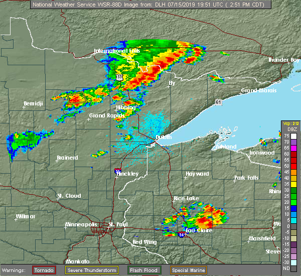 At 250 pm cdt, a severe thunderstorm was located near marcell, or 32 miles north of grand rapids, moving east at 40 mph (radar indicated). Hazards include 60 mph wind gusts and quarter size hail. Hail damage to vehicles is expected. expect wind damage to roofs, siding, and trees. Locations impacted include, marcell, bigfork, spring lake, jessie lake, talmoon, and bowstring lake. At 250 pm cdt, a severe thunderstorm was located near marcell, or 32 miles north of grand rapids, moving east at 40 mph (radar indicated). Hazards include 60 mph wind gusts and quarter size hail. Hail damage to vehicles is expected. expect wind damage to roofs, siding, and trees. Locations impacted include, marcell, bigfork, spring lake, jessie lake, talmoon, and bowstring lake.
|
| 7/15/2019 2:39 PM CDT |
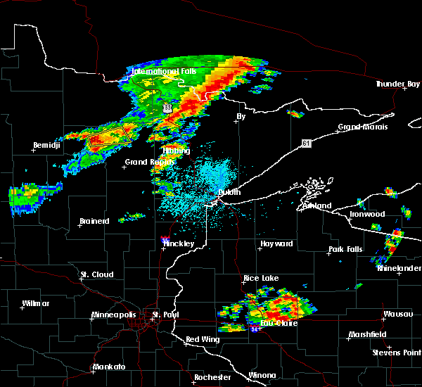 At 222 pm cdt, a severe thunderstorm was located over oslund, or 36 miles northwest of grand rapids, moving northeast at 25 mph (radar indicated). Hazards include 60 mph wind gusts and quarter size hail. Hail damage to vehicles is expected. Expect wind damage to roofs, siding, and trees. At 222 pm cdt, a severe thunderstorm was located over oslund, or 36 miles northwest of grand rapids, moving northeast at 25 mph (radar indicated). Hazards include 60 mph wind gusts and quarter size hail. Hail damage to vehicles is expected. Expect wind damage to roofs, siding, and trees.
|
| 7/15/2019 2:22 PM CDT |
 At 222 pm cdt, a severe thunderstorm was located over oslund, or 36 miles northwest of grand rapids, moving northeast at 25 mph (radar indicated). Hazards include 60 mph wind gusts and quarter size hail. Hail damage to vehicles is expected. Expect wind damage to roofs, siding, and trees. At 222 pm cdt, a severe thunderstorm was located over oslund, or 36 miles northwest of grand rapids, moving northeast at 25 mph (radar indicated). Hazards include 60 mph wind gusts and quarter size hail. Hail damage to vehicles is expected. Expect wind damage to roofs, siding, and trees.
|
| 7/15/2019 1:32 PM CDT |
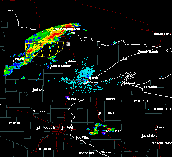 At 132 pm cdt, severe thunderstorms were located along a line extending from near margie, to 8 miles east of gemmell, to near alvwood, moving east at 40 mph (radar indicated). Hazards include 60 mph wind gusts and quarter size hail. Hail damage to vehicles is expected. expect wind damage to roofs, siding, and trees. these severe storms will be near, big falls and margie around 135 pm cdt. squaw lake around 145 pm cdt. Other locations impacted by these severe thunderstorms include deer creek reservation, orth, whitefish lake, bois forte reservation, craigville, wirt, coon lake and scenic state park. At 132 pm cdt, severe thunderstorms were located along a line extending from near margie, to 8 miles east of gemmell, to near alvwood, moving east at 40 mph (radar indicated). Hazards include 60 mph wind gusts and quarter size hail. Hail damage to vehicles is expected. expect wind damage to roofs, siding, and trees. these severe storms will be near, big falls and margie around 135 pm cdt. squaw lake around 145 pm cdt. Other locations impacted by these severe thunderstorms include deer creek reservation, orth, whitefish lake, bois forte reservation, craigville, wirt, coon lake and scenic state park.
|
| 7/15/2019 1:17 PM CDT |
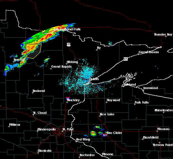 At 116 pm cdt, severe thunderstorms were located along a line extending from 7 miles west of margie, to gemmell, to 7 miles northwest of alvwood, moving east at 50 mph (doppler radar indicated. there was a public report of trees down across minnesota highway 72 4 miles south of waskish with this storm around 1 pm). Hazards include 60 mph wind gusts and quarter size hail. Hail damage to vehicles is expected. expect wind damage to roofs, siding, and trees. severe thunderstorms will be near, gemmell around 120 pm cdt. northome and margie around 125 pm cdt. big falls around 130 pm cdt. squaw lake around 135 pm cdt. bigfork and effie around 200 pm cdt. Other locations impacted by these severe thunderstorms include deer creek reservation, orth, whitefish lake, bois forte reservation, craigville, grand falls, wirt, coon lake and scenic state park. At 116 pm cdt, severe thunderstorms were located along a line extending from 7 miles west of margie, to gemmell, to 7 miles northwest of alvwood, moving east at 50 mph (doppler radar indicated. there was a public report of trees down across minnesota highway 72 4 miles south of waskish with this storm around 1 pm). Hazards include 60 mph wind gusts and quarter size hail. Hail damage to vehicles is expected. expect wind damage to roofs, siding, and trees. severe thunderstorms will be near, gemmell around 120 pm cdt. northome and margie around 125 pm cdt. big falls around 130 pm cdt. squaw lake around 135 pm cdt. bigfork and effie around 200 pm cdt. Other locations impacted by these severe thunderstorms include deer creek reservation, orth, whitefish lake, bois forte reservation, craigville, grand falls, wirt, coon lake and scenic state park.
|
| 6/30/2019 2:30 AM CDT |
 At 230 am cdt, severe thunderstorms were located along a line extending from 15 miles northwest of nashwauk, to 9 miles northwest of coleraine, to zemple, moving southeast at 40 mph (radar indicated). Hazards include golf ball size hail and 60 mph wind gusts. People and animals outdoors will be injured. expect hail damage to roofs, siding, windows, and vehicles. expect wind damage to roofs, siding, and trees. Locations impacted include, grand rapids, cohasset, coleraine, deer river, marcell, bigfork, taconite, zemple, days high landing, pokegama dam, gunn, ball club, lake winnibigoshish, blackberry, bovey, marble, la prairie, calumet, bowstring, and buck lake. At 230 am cdt, severe thunderstorms were located along a line extending from 15 miles northwest of nashwauk, to 9 miles northwest of coleraine, to zemple, moving southeast at 40 mph (radar indicated). Hazards include golf ball size hail and 60 mph wind gusts. People and animals outdoors will be injured. expect hail damage to roofs, siding, windows, and vehicles. expect wind damage to roofs, siding, and trees. Locations impacted include, grand rapids, cohasset, coleraine, deer river, marcell, bigfork, taconite, zemple, days high landing, pokegama dam, gunn, ball club, lake winnibigoshish, blackberry, bovey, marble, la prairie, calumet, bowstring, and buck lake.
|
| 6/30/2019 2:21 AM CDT |
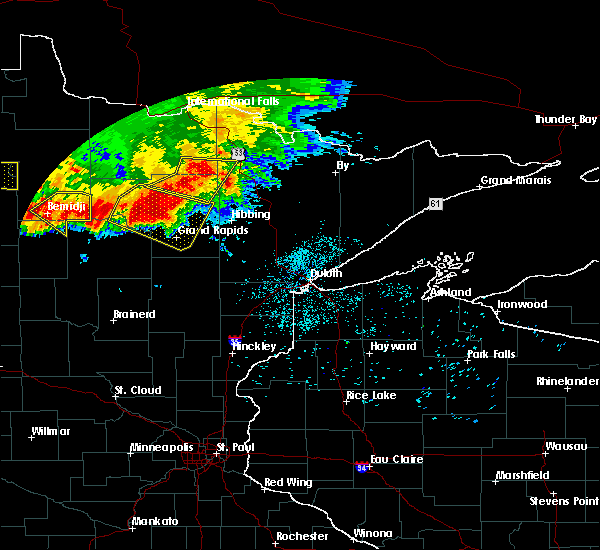 At 221 am cdt, severe thunderstorms were located along a line extending from 10 miles southwest of nett lake, to near togo, to 16 miles east of effie, to 12 miles east of bigfork, moving east at 45 mph (radar indicated). Hazards include 60 mph wind gusts and quarter size hail. Hail damage to vehicles is expected. expect wind damage to roofs, siding, and trees. Locations impacted include, bigfork, effie, togo, pelican lake, stony brook, deer creek reservation, celina, greaney, bear lake, coon lake, scenic state park, and bois forte reservation. At 221 am cdt, severe thunderstorms were located along a line extending from 10 miles southwest of nett lake, to near togo, to 16 miles east of effie, to 12 miles east of bigfork, moving east at 45 mph (radar indicated). Hazards include 60 mph wind gusts and quarter size hail. Hail damage to vehicles is expected. expect wind damage to roofs, siding, and trees. Locations impacted include, bigfork, effie, togo, pelican lake, stony brook, deer creek reservation, celina, greaney, bear lake, coon lake, scenic state park, and bois forte reservation.
|
| 6/30/2019 2:09 AM CDT |
 At 209 am cdt, severe thunderstorms were located along a line extending from near bigfork, to 6 miles southwest of marcell, to 6 miles east of lake winnibigoshish, moving southeast at 45 mph (radar indicated). Hazards include golf ball size hail and 60 mph wind gusts. People and animals outdoors will be injured. expect hail damage to roofs, siding, windows, and vehicles. expect wind damage to roofs, siding, and trees. Locations impacted include, grand rapids, cohasset, coleraine, nashwauk, deer river, marcell, bigfork, taconite, squaw lake, zemple, oslund, inger, days high landing, pokegama dam, gunn, ball club, lake winnibigoshish, spring lake, blackberry, and bovey. At 209 am cdt, severe thunderstorms were located along a line extending from near bigfork, to 6 miles southwest of marcell, to 6 miles east of lake winnibigoshish, moving southeast at 45 mph (radar indicated). Hazards include golf ball size hail and 60 mph wind gusts. People and animals outdoors will be injured. expect hail damage to roofs, siding, windows, and vehicles. expect wind damage to roofs, siding, and trees. Locations impacted include, grand rapids, cohasset, coleraine, nashwauk, deer river, marcell, bigfork, taconite, squaw lake, zemple, oslund, inger, days high landing, pokegama dam, gunn, ball club, lake winnibigoshish, spring lake, blackberry, and bovey.
|
| 6/30/2019 2:04 AM CDT |
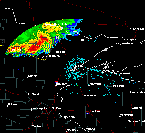 At 204 am cdt, severe thunderstorms were located along a line extending from 17 miles southeast of big falls, to 17 miles west of togo, to near effie, to bigfork, moving east at 45 mph (radar indicated). Hazards include 60 mph wind gusts and quarter size hail. Hail damage to vehicles is expected. expect wind damage to roofs, siding, and trees. Locations impacted include, bigfork, effie, togo, pelican lake, stony brook, celina, greaney, craigville, deer creek reservation, bear lake, coon lake, scenic state park, and bois forte reservation. At 204 am cdt, severe thunderstorms were located along a line extending from 17 miles southeast of big falls, to 17 miles west of togo, to near effie, to bigfork, moving east at 45 mph (radar indicated). Hazards include 60 mph wind gusts and quarter size hail. Hail damage to vehicles is expected. expect wind damage to roofs, siding, and trees. Locations impacted include, bigfork, effie, togo, pelican lake, stony brook, celina, greaney, craigville, deer creek reservation, bear lake, coon lake, scenic state park, and bois forte reservation.
|
| 6/30/2019 1:44 AM CDT |
 At 144 am cdt, severe thunderstorms were located along a line extending from 6 miles northeast of oslund, to near inger, to near lake winnibigoshish, moving southeast at 35 mph (radar indicated). Hazards include ping pong ball size hail and 60 mph wind gusts. People and animals outdoors will be injured. expect hail damage to roofs, siding, windows, and vehicles. Expect wind damage to roofs, siding, and trees. At 144 am cdt, severe thunderstorms were located along a line extending from 6 miles northeast of oslund, to near inger, to near lake winnibigoshish, moving southeast at 35 mph (radar indicated). Hazards include ping pong ball size hail and 60 mph wind gusts. People and animals outdoors will be injured. expect hail damage to roofs, siding, windows, and vehicles. Expect wind damage to roofs, siding, and trees.
|
| 6/30/2019 1:41 AM CDT |
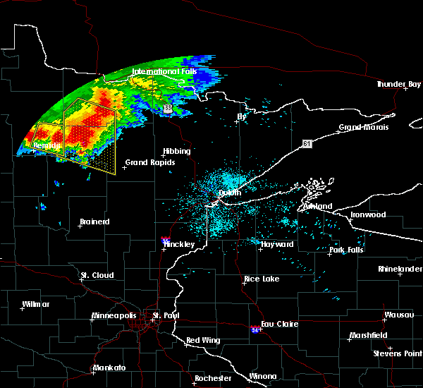 At 140 am cdt, severe thunderstorms were located along a line extending from 8 miles southeast of margie, to 10 miles northeast of oslund, moving east at 40 mph (radar indicated). Hazards include 60 mph wind gusts and quarter size hail. Hail damage to vehicles is expected. Expect wind damage to roofs, siding, and trees. At 140 am cdt, severe thunderstorms were located along a line extending from 8 miles southeast of margie, to 10 miles northeast of oslund, moving east at 40 mph (radar indicated). Hazards include 60 mph wind gusts and quarter size hail. Hail damage to vehicles is expected. Expect wind damage to roofs, siding, and trees.
|
| 6/30/2019 1:33 AM CDT |
 At 133 am cdt, severe thunderstorms were located along a line extending from near gemmell, to near lake winnibigoshish, moving east at 45 mph (radar indicated). Hazards include ping pong ball size hail and 60 mph wind gusts. People and animals outdoors will be injured. expect hail damage to roofs, siding, windows, and vehicles. expect wind damage to roofs, siding, and trees. these severe storms will be near, ball club around 145 am cdt. Other locations impacted by these severe thunderstorms include rosy, max, ball club lake, portage lake, decker lake, mud lake, dixon lake, sand lake, six mile lake and jessie lake. At 133 am cdt, severe thunderstorms were located along a line extending from near gemmell, to near lake winnibigoshish, moving east at 45 mph (radar indicated). Hazards include ping pong ball size hail and 60 mph wind gusts. People and animals outdoors will be injured. expect hail damage to roofs, siding, windows, and vehicles. expect wind damage to roofs, siding, and trees. these severe storms will be near, ball club around 145 am cdt. Other locations impacted by these severe thunderstorms include rosy, max, ball club lake, portage lake, decker lake, mud lake, dixon lake, sand lake, six mile lake and jessie lake.
|
| 6/30/2019 1:25 AM CDT |
 At 125 am cdt, severe thunderstorms were located along a line extending from near gemmell, to near lake winnibigoshish, moving southeast at 45 mph (radar indicated). Hazards include ping pong ball size hail and 60 mph wind gusts. People and animals outdoors will be injured. expect hail damage to roofs, siding, windows, and vehicles. expect wind damage to roofs, siding, and trees. these severe storms will be near, lake winnibigoshish around 135 am cdt. inger around 140 am cdt. ball club around 145 am cdt. Other locations impacted by these severe thunderstorms include rosy, max, ball club lake, portage lake, decker lake, mud lake, dixon lake, sand lake, six mile lake and jessie lake. At 125 am cdt, severe thunderstorms were located along a line extending from near gemmell, to near lake winnibigoshish, moving southeast at 45 mph (radar indicated). Hazards include ping pong ball size hail and 60 mph wind gusts. People and animals outdoors will be injured. expect hail damage to roofs, siding, windows, and vehicles. expect wind damage to roofs, siding, and trees. these severe storms will be near, lake winnibigoshish around 135 am cdt. inger around 140 am cdt. ball club around 145 am cdt. Other locations impacted by these severe thunderstorms include rosy, max, ball club lake, portage lake, decker lake, mud lake, dixon lake, sand lake, six mile lake and jessie lake.
|
| 6/30/2019 1:06 AM CDT |
 At 106 am cdt, severe thunderstorms were located along a line extending from 9 miles southeast of waskish, to 10 miles southwest of alvwood, moving east at 45 mph (radar indicated). Hazards include 60 mph wind gusts and quarter size hail. Hail damage to vehicles is expected. expect wind damage to roofs, siding, and trees. these severe storms will be near, lake winnibigoshish, gemmell and oslund around 125 am cdt. inger and margie around 130 am cdt. marcell around 145 am cdt. Other locations impacted by these severe thunderstorms include rosy, max, ball club lake, portage lake, decker lake, mud lake, dixon lake, sand lake, six mile lake and jessie lake. At 106 am cdt, severe thunderstorms were located along a line extending from 9 miles southeast of waskish, to 10 miles southwest of alvwood, moving east at 45 mph (radar indicated). Hazards include 60 mph wind gusts and quarter size hail. Hail damage to vehicles is expected. expect wind damage to roofs, siding, and trees. these severe storms will be near, lake winnibigoshish, gemmell and oslund around 125 am cdt. inger and margie around 130 am cdt. marcell around 145 am cdt. Other locations impacted by these severe thunderstorms include rosy, max, ball club lake, portage lake, decker lake, mud lake, dixon lake, sand lake, six mile lake and jessie lake.
|
| 6/30/2019 12:55 AM CDT |
 At 1254 am cdt, severe thunderstorms were located along a line extending from near kelliher, to 12 miles southeast of tenstrike, moving southeast at 45 mph (radar indicated). Hazards include 60 mph wind gusts and half dollar size hail. Hail damage to vehicles is expected. expect wind damage to roofs, siding, and trees. severe thunderstorms will be near, mizpah around 110 am cdt. northome and gemmell around 115 am cdt. bena and lake winnibigoshish around 120 am cdt. ball club around 130 am cdt. deer river and zemple around 140 am cdt. bigfork, effie and days high landing around 145 am cdt. Other locations impacted by these severe thunderstorms include rosy, max, ball club lake, portage lake, decker lake, mud lake, dixon lake, sand lake, six mile lake and jessie lake. At 1254 am cdt, severe thunderstorms were located along a line extending from near kelliher, to 12 miles southeast of tenstrike, moving southeast at 45 mph (radar indicated). Hazards include 60 mph wind gusts and half dollar size hail. Hail damage to vehicles is expected. expect wind damage to roofs, siding, and trees. severe thunderstorms will be near, mizpah around 110 am cdt. northome and gemmell around 115 am cdt. bena and lake winnibigoshish around 120 am cdt. ball club around 130 am cdt. deer river and zemple around 140 am cdt. bigfork, effie and days high landing around 145 am cdt. Other locations impacted by these severe thunderstorms include rosy, max, ball club lake, portage lake, decker lake, mud lake, dixon lake, sand lake, six mile lake and jessie lake.
|
| 7/2/2018 12:38 AM CDT |
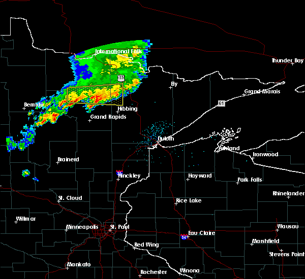 The severe thunderstorm warning for northeastern itasca, southeastern koochiching and west central st. louis counties will expire at 1245 am cdt, the storm which prompted the warning has weakened below severe limits, and no longer poses an immediate threat to life or property. therefore, the warning will be allowed to expire. however gusty winds and heavy rain are still possible with this thunderstorm. The severe thunderstorm warning for northeastern itasca, southeastern koochiching and west central st. louis counties will expire at 1245 am cdt, the storm which prompted the warning has weakened below severe limits, and no longer poses an immediate threat to life or property. therefore, the warning will be allowed to expire. however gusty winds and heavy rain are still possible with this thunderstorm.
|
| 7/2/2018 12:18 AM CDT |
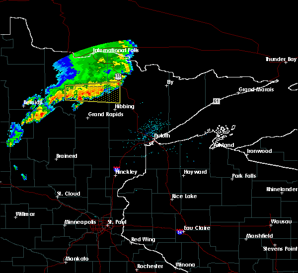 At 1218 am cdt, a severe thunderstorm was located 8 miles southeast of effie, or 36 miles northwest of hibbing, moving east at 40 mph (radar indicated). Hazards include 60 mph wind gusts and penny size hail. Expect damage to roofs, siding, and trees. Locations impacted include, bigfork, meadow brook, effie, togo, spring lake, perch lake, linden grove, stony brook, wirt, side lake, snake trail, celina, greaney, craigville, deer creek reservation, whitefish lake, stingy lake, bear lake, coon lake, and scenic state park. At 1218 am cdt, a severe thunderstorm was located 8 miles southeast of effie, or 36 miles northwest of hibbing, moving east at 40 mph (radar indicated). Hazards include 60 mph wind gusts and penny size hail. Expect damage to roofs, siding, and trees. Locations impacted include, bigfork, meadow brook, effie, togo, spring lake, perch lake, linden grove, stony brook, wirt, side lake, snake trail, celina, greaney, craigville, deer creek reservation, whitefish lake, stingy lake, bear lake, coon lake, and scenic state park.
|
| 7/2/2018 12:03 AM CDT |
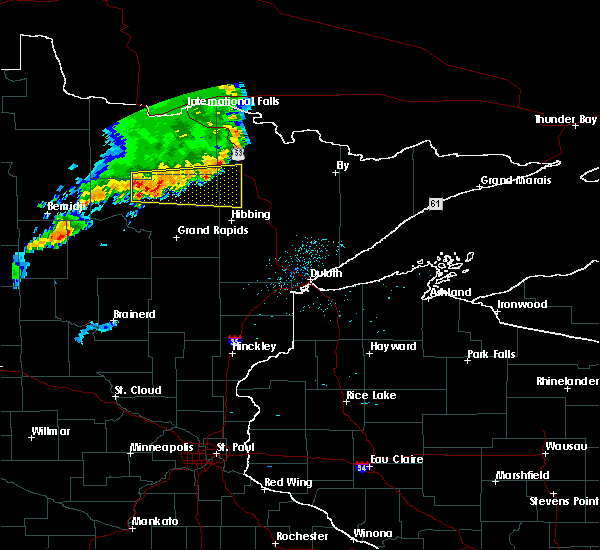 At 1203 am cdt, a severe thunderstorm was located near bigfork, moving east at 40 mph (radar indicated). Hazards include 60 mph wind gusts and penny size hail. expect damage to roofs, siding, and trees At 1203 am cdt, a severe thunderstorm was located near bigfork, moving east at 40 mph (radar indicated). Hazards include 60 mph wind gusts and penny size hail. expect damage to roofs, siding, and trees
|
| 7/1/2018 11:43 PM CDT |
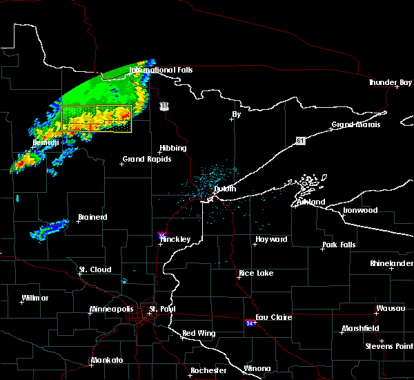 At 1143 pm cdt, a severe thunderstorm was located 8 miles northwest of effie, moving east at 45 mph (radar indicated). Hazards include 60 mph wind gusts and quarter size hail. Hail damage to vehicles is expected. expect wind damage to roofs, siding, and trees. Locations impacted include, bigfork, northome, effie, mizpah, gemmell, margie, wirt, deer creek reservation, orth, craigville, coon lake, and scenic state park. At 1143 pm cdt, a severe thunderstorm was located 8 miles northwest of effie, moving east at 45 mph (radar indicated). Hazards include 60 mph wind gusts and quarter size hail. Hail damage to vehicles is expected. expect wind damage to roofs, siding, and trees. Locations impacted include, bigfork, northome, effie, mizpah, gemmell, margie, wirt, deer creek reservation, orth, craigville, coon lake, and scenic state park.
|
| 7/1/2018 11:24 PM CDT |
 At 1123 pm cdt, a severe thunderstorm was located near gemmell, moving east at 45 mph (radar indicated). Hazards include 60 mph wind gusts and quarter size hail. Hail damage to vehicles is expected. expect wind damage to roofs, siding, and trees. Locations impacted include, bigfork, northome, effie, mizpah, gemmell, margie, wirt, deer creek reservation, orth, craigville, coon lake, and scenic state park. At 1123 pm cdt, a severe thunderstorm was located near gemmell, moving east at 45 mph (radar indicated). Hazards include 60 mph wind gusts and quarter size hail. Hail damage to vehicles is expected. expect wind damage to roofs, siding, and trees. Locations impacted include, bigfork, northome, effie, mizpah, gemmell, margie, wirt, deer creek reservation, orth, craigville, coon lake, and scenic state park.
|
| 7/1/2018 11:15 PM CDT |
 At 1115 pm cdt, a severe thunderstorm was located over mizpah, moving east at 50 mph (radar indicated). Hazards include 60 mph wind gusts and quarter size hail. Hail damage to vehicles is expected. Expect wind damage to roofs, siding, and trees. At 1115 pm cdt, a severe thunderstorm was located over mizpah, moving east at 50 mph (radar indicated). Hazards include 60 mph wind gusts and quarter size hail. Hail damage to vehicles is expected. Expect wind damage to roofs, siding, and trees.
|
| 6/29/2018 7:05 AM CDT |
 At 704 am cdt, severe thunderstorms were located along a line extending from 7 miles southwest of kabetogama, to near ash lake, to near gheen, to 6 miles southwest of cook, to 6 miles northwest of chisholm, moving east at 75 mph. these are very dangerous storms (radar indicated). Hazards include 80 mph wind gusts and quarter size hail. Flying debris will be dangerous to those caught without shelter. mobile homes will be heavily damaged. expect considerable damage to roofs, windows, and vehicles. extensive tree damage and power outages are likely. Locations impacted include, hibbing, lake vermilion, mountain iron, littlefork, cook, tower, marcell, bigfork, nett lake, orr, big falls, meadow brook, ash lake, kabetogama, effie, crane lake, gheen, voyageurs national park, buyck, and cusson. At 704 am cdt, severe thunderstorms were located along a line extending from 7 miles southwest of kabetogama, to near ash lake, to near gheen, to 6 miles southwest of cook, to 6 miles northwest of chisholm, moving east at 75 mph. these are very dangerous storms (radar indicated). Hazards include 80 mph wind gusts and quarter size hail. Flying debris will be dangerous to those caught without shelter. mobile homes will be heavily damaged. expect considerable damage to roofs, windows, and vehicles. extensive tree damage and power outages are likely. Locations impacted include, hibbing, lake vermilion, mountain iron, littlefork, cook, tower, marcell, bigfork, nett lake, orr, big falls, meadow brook, ash lake, kabetogama, effie, crane lake, gheen, voyageurs national park, buyck, and cusson.
|
| 6/29/2018 6:49 AM CDT |
 At 649 am cdt, severe thunderstorms were located along a line extending from 8 miles southeast of littlefork, to 12 miles west of ash lake, to 7 miles south of nett lake, to togo, to 12 miles northwest of nashwauk, moving east at 80 mph. these are very dangerous storms (radar indicated). Hazards include 80 mph wind gusts. Flying debris will be dangerous to those caught without shelter. mobile homes will be heavily damaged. expect considerable damage to roofs, windows, and vehicles. extensive tree damage and power outages are likely. Locations impacted include, hibbing, lake vermilion, mountain iron, littlefork, cook, tower, marcell, bigfork, nett lake, orr, big falls, meadow brook, ash lake, kabetogama, effie, crane lake, gheen, voyageurs national park, buyck, and cusson. At 649 am cdt, severe thunderstorms were located along a line extending from 8 miles southeast of littlefork, to 12 miles west of ash lake, to 7 miles south of nett lake, to togo, to 12 miles northwest of nashwauk, moving east at 80 mph. these are very dangerous storms (radar indicated). Hazards include 80 mph wind gusts. Flying debris will be dangerous to those caught without shelter. mobile homes will be heavily damaged. expect considerable damage to roofs, windows, and vehicles. extensive tree damage and power outages are likely. Locations impacted include, hibbing, lake vermilion, mountain iron, littlefork, cook, tower, marcell, bigfork, nett lake, orr, big falls, meadow brook, ash lake, kabetogama, effie, crane lake, gheen, voyageurs national park, buyck, and cusson.
|
| 6/29/2018 6:36 AM CDT |
 At 635 am cdt, severe thunderstorms were located along a line extending from 10 miles north of big falls, to 15 miles south of littlefork, to 18 miles northwest of togo, to 6 miles east of effie, to near bigfork, to near marcell, moving east at 80 mph. these are very dangerous storms (radar indicated). Hazards include 80 mph wind gusts. Flying debris will be dangerous to those caught without shelter. mobile homes will be heavily damaged. expect considerable damage to roofs, windows, and vehicles. extensive tree damage and power outages are likely. Locations impacted include, hibbing, international falls, lake vermilion, mountain iron, littlefork, cook, tower, marcell, bigfork, nett lake, orr, big falls, meadow brook, ash lake, kabetogama, effie, squaw lake, crane lake, gheen, and pelland. At 635 am cdt, severe thunderstorms were located along a line extending from 10 miles north of big falls, to 15 miles south of littlefork, to 18 miles northwest of togo, to 6 miles east of effie, to near bigfork, to near marcell, moving east at 80 mph. these are very dangerous storms (radar indicated). Hazards include 80 mph wind gusts. Flying debris will be dangerous to those caught without shelter. mobile homes will be heavily damaged. expect considerable damage to roofs, windows, and vehicles. extensive tree damage and power outages are likely. Locations impacted include, hibbing, international falls, lake vermilion, mountain iron, littlefork, cook, tower, marcell, bigfork, nett lake, orr, big falls, meadow brook, ash lake, kabetogama, effie, squaw lake, crane lake, gheen, and pelland.
|
| 6/29/2018 6:18 AM CDT |
 At 617 am cdt, severe thunderstorms were located along a line extending from 12 miles northeast of waskish, to near margie, to 11 miles southeast of gemmell, to oslund, to near lake winnibigoshish, moving east at 75 mph. these are very dangerous storms (radar indicated. trained spotters near kelliher and northwest of bemidji reported numerous trees down with this storm). Hazards include 80 mph wind gusts. Flying debris will be dangerous to those caught without shelter. mobile homes will be heavily damaged. expect considerable damage to roofs, windows, and vehicles. Extensive tree damage and power outages are likely. At 617 am cdt, severe thunderstorms were located along a line extending from 12 miles northeast of waskish, to near margie, to 11 miles southeast of gemmell, to oslund, to near lake winnibigoshish, moving east at 75 mph. these are very dangerous storms (radar indicated. trained spotters near kelliher and northwest of bemidji reported numerous trees down with this storm). Hazards include 80 mph wind gusts. Flying debris will be dangerous to those caught without shelter. mobile homes will be heavily damaged. expect considerable damage to roofs, windows, and vehicles. Extensive tree damage and power outages are likely.
|
| 9/20/2017 2:23 AM CDT |
 At 221 am cdt, severe thunderstorms were located along a line extending from near oslund, to near coleraine, moving northeast at 70 mph (radar indicated). Hazards include 60 mph wind gusts. Expect damage to roofs, siding, and trees. Locations impacted include, cohasset, coleraine, deer river, marcell, bigfork, taconite, zemple, oslund, inger, pokegama dam, spring lake, bovey, la prairie, bowstring, sand lake, max, wirt, buck lake, and balsam lake. At 221 am cdt, severe thunderstorms were located along a line extending from near oslund, to near coleraine, moving northeast at 70 mph (radar indicated). Hazards include 60 mph wind gusts. Expect damage to roofs, siding, and trees. Locations impacted include, cohasset, coleraine, deer river, marcell, bigfork, taconite, zemple, oslund, inger, pokegama dam, spring lake, bovey, la prairie, bowstring, sand lake, max, wirt, buck lake, and balsam lake.
|
| 9/20/2017 2:10 AM CDT |
 At 210 am cdt, severe thunderstorms were located along a line extending from near lake winnibigoshish, to near days high landing, moving northeast at 65 mph (radar indicated). Hazards include 60 mph wind gusts and nickel size hail. expect damage to roofs, siding, and trees At 210 am cdt, severe thunderstorms were located along a line extending from near lake winnibigoshish, to near days high landing, moving northeast at 65 mph (radar indicated). Hazards include 60 mph wind gusts and nickel size hail. expect damage to roofs, siding, and trees
|
| 9/14/2017 3:58 PM CDT |
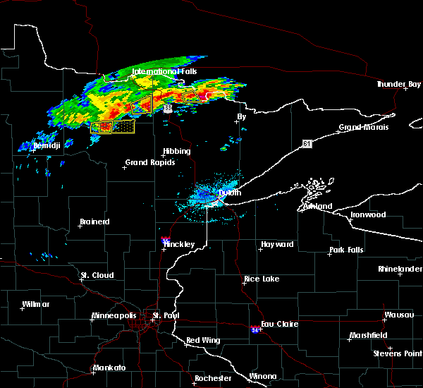 At 358 pm cdt, a severe thunderstorm was located near effie, moving east at 35 mph (radar indicated). Hazards include 60 mph wind gusts and quarter size hail. Hail damage to vehicles is expected. Expect wind damage to roofs, siding, and trees. At 358 pm cdt, a severe thunderstorm was located near effie, moving east at 35 mph (radar indicated). Hazards include 60 mph wind gusts and quarter size hail. Hail damage to vehicles is expected. Expect wind damage to roofs, siding, and trees.
|
| 7/6/2017 5:13 AM CDT |
 At 512 am cdt, severe thunderstorms were located along a line extending from 10 miles southwest of togo, to 10 miles northwest of toivola, moving east at 50 mph (radar indicated). Hazards include 70 mph wind gusts and ping pong ball size hail. People and animals outdoors will be injured. expect hail damage to roofs, siding, windows, and vehicles. expect considerable tree damage. wind damage is also likely to mobile homes, roofs, and outbuildings. these severe thunderstorms will remain over mainly rural areas of northeastern itasca and west central st. Louis counties, including the following locations: buck lake, iron junction, side lake, kinney, calumet, swan lake, stony brook, perch lake, silica and balsam lake. At 512 am cdt, severe thunderstorms were located along a line extending from 10 miles southwest of togo, to 10 miles northwest of toivola, moving east at 50 mph (radar indicated). Hazards include 70 mph wind gusts and ping pong ball size hail. People and animals outdoors will be injured. expect hail damage to roofs, siding, windows, and vehicles. expect considerable tree damage. wind damage is also likely to mobile homes, roofs, and outbuildings. these severe thunderstorms will remain over mainly rural areas of northeastern itasca and west central st. Louis counties, including the following locations: buck lake, iron junction, side lake, kinney, calumet, swan lake, stony brook, perch lake, silica and balsam lake.
|
| 7/6/2017 5:03 AM CDT |
 At 502 am cdt, severe thunderstorms were located along a line extending from 8 miles east of bigfork, to 7 miles south of pengilly, moving east at 50 mph (radar indicated). Hazards include 70 mph wind gusts and ping pong ball size hail. People and animals outdoors will be injured. expect hail damage to roofs, siding, windows, and vehicles. expect considerable tree damage. wind damage is also likely to mobile homes, roofs, and outbuildings. these severe storms will be near, togo around 520 am cdt. Other locations impacted by these severe thunderstorms include buck lake, iron junction, side lake, kinney, calumet, swan lake, stony brook, perch lake, silica, and balsam lake. At 502 am cdt, severe thunderstorms were located along a line extending from 8 miles east of bigfork, to 7 miles south of pengilly, moving east at 50 mph (radar indicated). Hazards include 70 mph wind gusts and ping pong ball size hail. People and animals outdoors will be injured. expect hail damage to roofs, siding, windows, and vehicles. expect considerable tree damage. wind damage is also likely to mobile homes, roofs, and outbuildings. these severe storms will be near, togo around 520 am cdt. Other locations impacted by these severe thunderstorms include buck lake, iron junction, side lake, kinney, calumet, swan lake, stony brook, perch lake, silica, and balsam lake.
|
| 7/6/2017 4:52 AM CDT | Large double spruce tree uprooted. tree damaged northwest side of the home it fell on. time estimated from rada in itasca county MN, 0.6 miles NE of Bigfork, MN |
| 7/6/2017 4:49 AM CDT |
 At 448 am cdt, severe thunderstorms were located along a line extending from near bigfork, to near gunn, moving east at 50 mph (radar indicated). Hazards include ping pong ball size hail and 60 mph wind gusts. People and animals outdoors will be injured. expect hail damage to roofs, siding, windows, and vehicles. expect wind damage to roofs, siding, and trees. severe thunderstorms will be near, coleraine and taconite around 455 am cdt. pengilly around 500 am cdt. togo around 520 am cdt. Other locations impacted by these severe thunderstorms include buck lake, iron junction, side lake, kinney, calumet, swan lake, bovey, stony brook, perch lake, and silica. At 448 am cdt, severe thunderstorms were located along a line extending from near bigfork, to near gunn, moving east at 50 mph (radar indicated). Hazards include ping pong ball size hail and 60 mph wind gusts. People and animals outdoors will be injured. expect hail damage to roofs, siding, windows, and vehicles. expect wind damage to roofs, siding, and trees. severe thunderstorms will be near, coleraine and taconite around 455 am cdt. pengilly around 500 am cdt. togo around 520 am cdt. Other locations impacted by these severe thunderstorms include buck lake, iron junction, side lake, kinney, calumet, swan lake, bovey, stony brook, perch lake, and silica.
|
| 6/13/2017 9:55 PM CDT | Ping Pong Ball sized hail reported 14.6 miles WNW of Bigfork, MN, time estimated from radar. |
| 7/21/2016 2:36 AM CDT |
 At 235 am cdt, severe thunderstorms were located along a line extending from near togo, to libby, moving east at 55 mph. these are very dangerous storms (trained weather spotters reported numerous trees down and winds of 70 mph or greater). Hazards include 80 mph wind gusts and quarter size hail. Flying debris will be dangerous to those caught without shelter. mobile homes will be heavily damaged. expect considerable damage to roofs, windows, and vehicles. extensive tree damage and power outages are likely. these severe storms will be near, togo around 240 am cdt. meadow brook around 250 am cdt. floodwood around 255 am cdt. cook around 300 am cdt. Other locations impacted by these severe thunderstorms include savanna portage state park, perch lake, deer lake northern itasca county, scenic state park, hart lake, gowan, bowstring, ball bluff, little swan and leetonia. At 235 am cdt, severe thunderstorms were located along a line extending from near togo, to libby, moving east at 55 mph. these are very dangerous storms (trained weather spotters reported numerous trees down and winds of 70 mph or greater). Hazards include 80 mph wind gusts and quarter size hail. Flying debris will be dangerous to those caught without shelter. mobile homes will be heavily damaged. expect considerable damage to roofs, windows, and vehicles. extensive tree damage and power outages are likely. these severe storms will be near, togo around 240 am cdt. meadow brook around 250 am cdt. floodwood around 255 am cdt. cook around 300 am cdt. Other locations impacted by these severe thunderstorms include savanna portage state park, perch lake, deer lake northern itasca county, scenic state park, hart lake, gowan, bowstring, ball bluff, little swan and leetonia.
|
| 7/21/2016 2:23 AM CDT |
 At 221 am cdt, severe thunderstorms were located along a line extending from 7 miles southeast of effie, to 7 miles southeast of swatara, moving east at 60 mph. these are very dangerous storms (trained weather spotters reported winds to 70 mph and many downed trees as these storms moved through). Hazards include 80 mph wind gusts and quarter size hail. Flying debris will be dangerous to those caught without shelter. mobile homes will be heavily damaged. expect considerable damage to roofs, windows, and vehicles. extensive tree damage and power outages are likely. these severe storms will be near, grand rapids around 230 am cdt. togo around 235 am cdt. meadow brook around 245 am cdt. floodwood around 255 am cdt. cook around 300 am cdt. Other locations impacted by these severe thunderstorms include savanna portage state park, perch lake, washburn lake, deer lake northern itasca county, scenic state park, wirt, hart lake, gowan, bowstring and ball bluff. At 221 am cdt, severe thunderstorms were located along a line extending from 7 miles southeast of effie, to 7 miles southeast of swatara, moving east at 60 mph. these are very dangerous storms (trained weather spotters reported winds to 70 mph and many downed trees as these storms moved through). Hazards include 80 mph wind gusts and quarter size hail. Flying debris will be dangerous to those caught without shelter. mobile homes will be heavily damaged. expect considerable damage to roofs, windows, and vehicles. extensive tree damage and power outages are likely. these severe storms will be near, grand rapids around 230 am cdt. togo around 235 am cdt. meadow brook around 245 am cdt. floodwood around 255 am cdt. cook around 300 am cdt. Other locations impacted by these severe thunderstorms include savanna portage state park, perch lake, washburn lake, deer lake northern itasca county, scenic state park, wirt, hart lake, gowan, bowstring and ball bluff.
|
| 7/21/2016 2:01 AM CDT |
 At 158 am cdt, severe thunderstorms were located along a line extending from 10 miles northeast of oslund, to near outing, moving east at 60 mph (emergency management. spotters reported winds up to 70 mph at moondance jam). Hazards include 70 mph wind gusts and quarter size hail. Hail damage to vehicles is expected. expect considerable tree damage. wind damage is also likely to mobile homes, roofs, and outbuildings. severe thunderstorms will be near, bigfork around 210 am cdt. effie and grand rapids around 215 am cdt. togo around 235 am cdt. floodwood around 250 am cdt. cook around 255 am cdt. mountain iron around 300 am cdt. Other locations impacted by these severe thunderstorms include savanna portage state park, perch lake, cut foot sioux lake, washburn lake, deer lake northern itasca county, scenic state park, wirt, hart lake, gowan and bowstring. At 158 am cdt, severe thunderstorms were located along a line extending from 10 miles northeast of oslund, to near outing, moving east at 60 mph (emergency management. spotters reported winds up to 70 mph at moondance jam). Hazards include 70 mph wind gusts and quarter size hail. Hail damage to vehicles is expected. expect considerable tree damage. wind damage is also likely to mobile homes, roofs, and outbuildings. severe thunderstorms will be near, bigfork around 210 am cdt. effie and grand rapids around 215 am cdt. togo around 235 am cdt. floodwood around 250 am cdt. cook around 255 am cdt. mountain iron around 300 am cdt. Other locations impacted by these severe thunderstorms include savanna portage state park, perch lake, cut foot sioux lake, washburn lake, deer lake northern itasca county, scenic state park, wirt, hart lake, gowan and bowstring.
|
| 7/5/2016 6:07 PM CDT | Mesonet station effm in itasca county MN, 2.3 miles S of Bigfork, MN |
| 7/5/2016 5:57 PM CDT | Mesonet station effm in itasca county MN, 2.3 miles S of Bigfork, MN |
| 7/5/2016 5:51 PM CDT |
 At 550 pm cdt, severe thunderstorms were located along a line extending from 9 miles west of togo to 8 miles northwest of coleraine to near remer, moving east at 60 mph (radar indicated. trees were reported blown down along with nickel size hail northwest of ball club with these storms). Hazards include 60 mph wind gusts and nickel size hail. Expect damage to roofs. siding. and trees. Locations impacted include, hibbing, grand rapids, chisholm, mountain iron, cohasset, coleraine, keewatin, buhl, nashwauk, deer river, swan river, cook, marcell, bigfork, taconite, meadow brook, warba, effie, and pengilly. At 550 pm cdt, severe thunderstorms were located along a line extending from 9 miles west of togo to 8 miles northwest of coleraine to near remer, moving east at 60 mph (radar indicated. trees were reported blown down along with nickel size hail northwest of ball club with these storms). Hazards include 60 mph wind gusts and nickel size hail. Expect damage to roofs. siding. and trees. Locations impacted include, hibbing, grand rapids, chisholm, mountain iron, cohasset, coleraine, keewatin, buhl, nashwauk, deer river, swan river, cook, marcell, bigfork, taconite, meadow brook, warba, effie, and pengilly.
|
| 7/5/2016 5:37 PM CDT |
 At 536 pm cdt, severe thunderstorms were located along a line extending from near effie to 6 miles northeast of deer river to near boy river, moving east at 55 mph (radar indicated). Hazards include 60 mph wind gusts and nickel size hail. Expect damage to roofs. siding. And trees. At 536 pm cdt, severe thunderstorms were located along a line extending from near effie to 6 miles northeast of deer river to near boy river, moving east at 55 mph (radar indicated). Hazards include 60 mph wind gusts and nickel size hail. Expect damage to roofs. siding. And trees.
|
| 7/5/2016 5:01 PM CDT |
 At 500 pm cdt, a severe thunderstorm was located 12 miles northwest of lake winnibigoshish, or 20 miles east of bemidji, moving east at 50 mph (radar indicated. several trees were blown down and boats over turned on lake bemidji as this storm moved across the bemidji area betwee 445 and 455 pm). Hazards include 60 mph wind gusts. Expect damage to roofs. siding. And trees. At 500 pm cdt, a severe thunderstorm was located 12 miles northwest of lake winnibigoshish, or 20 miles east of bemidji, moving east at 50 mph (radar indicated. several trees were blown down and boats over turned on lake bemidji as this storm moved across the bemidji area betwee 445 and 455 pm). Hazards include 60 mph wind gusts. Expect damage to roofs. siding. And trees.
|
| 9/6/2015 4:08 PM CDT | 4 inch diameter pine tree partially blocking cr 49 at mn 3 in itasca county MN, 14.3 miles N of Bigfork, MN |
| 7/2/2012 8:00 PM CDT | Trees down at a campground south of town in itasca county MN, 13 miles N of Bigfork, MN |
| 6/10/2012 6:35 PM CDT | 1 foot diameter trees blown over in itasca county MN, 0.2 miles SSW of Bigfork, MN |
| 1/1/0001 12:00 AM | Golf Ball sized hail reported 11 miles N of Bigfork, MN, ongoing. neighbors car window broken due to hail. |
Hail Maps for Bigfork, MN
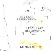


Connect with Interactive Hail Maps