

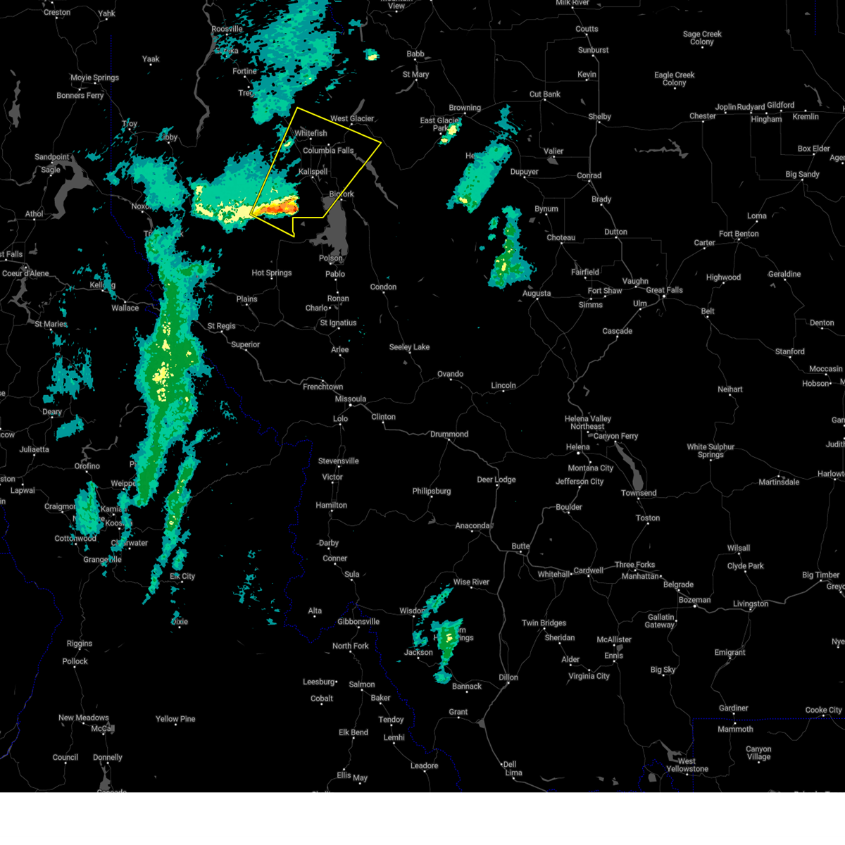
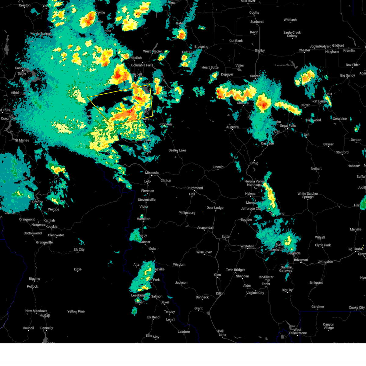
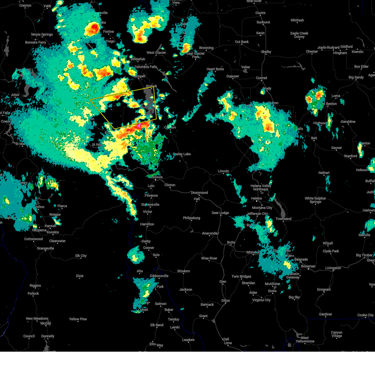
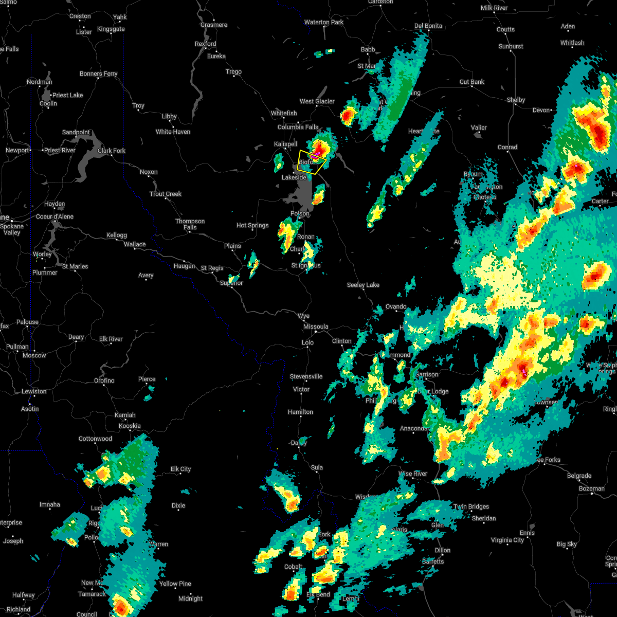
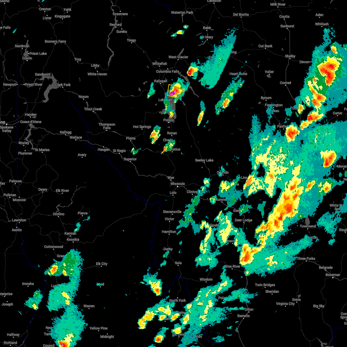
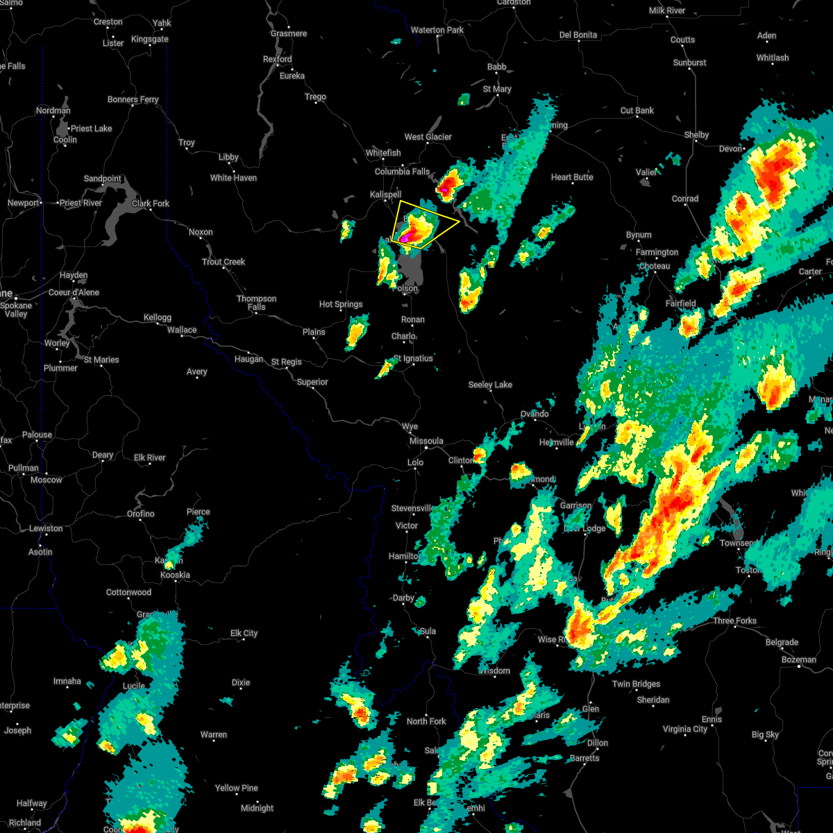
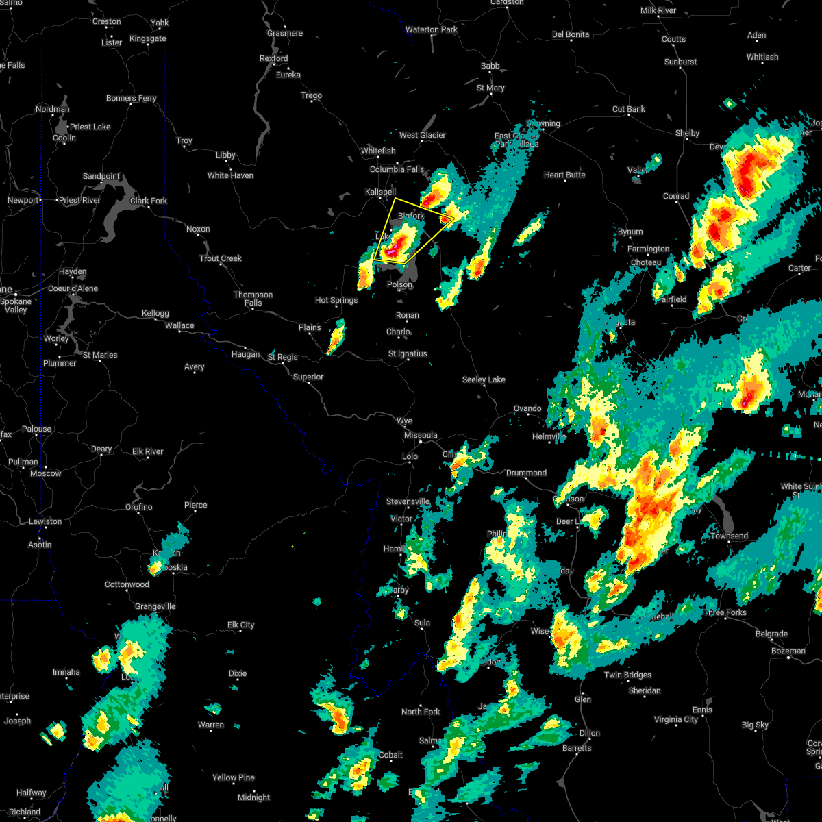
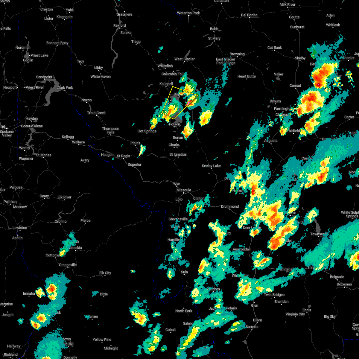
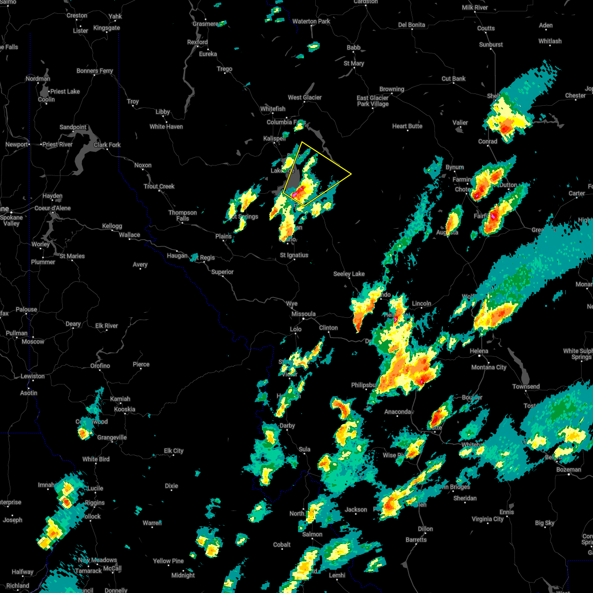
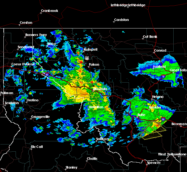
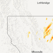
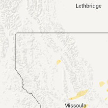
Hail Map for Bigfork, MT
The Bigfork, MT area has had 13 reports of on-the-ground hail by trained spotters, and has been under severe weather warnings 0 times during the past 12 months. Doppler radar has detected hail at or near Bigfork, MT on 12 occasions.
| Name: | Bigfork, MT |
| Where Located: | 25.9 miles SSE of Whitefish, MT |
| Map: | Google Map for Bigfork, MT |
| Population: | 4270 |
| Housing Units: | 3243 |
| More Info: | Search Google for Bigfork, MT |
1
The Top Recent Hail Date for Bigfork, MT is Monday, August 19, 2024 (7th out of 12)

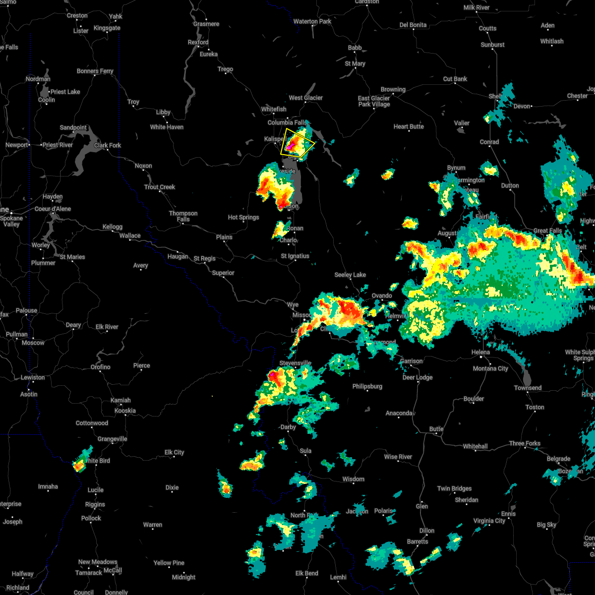
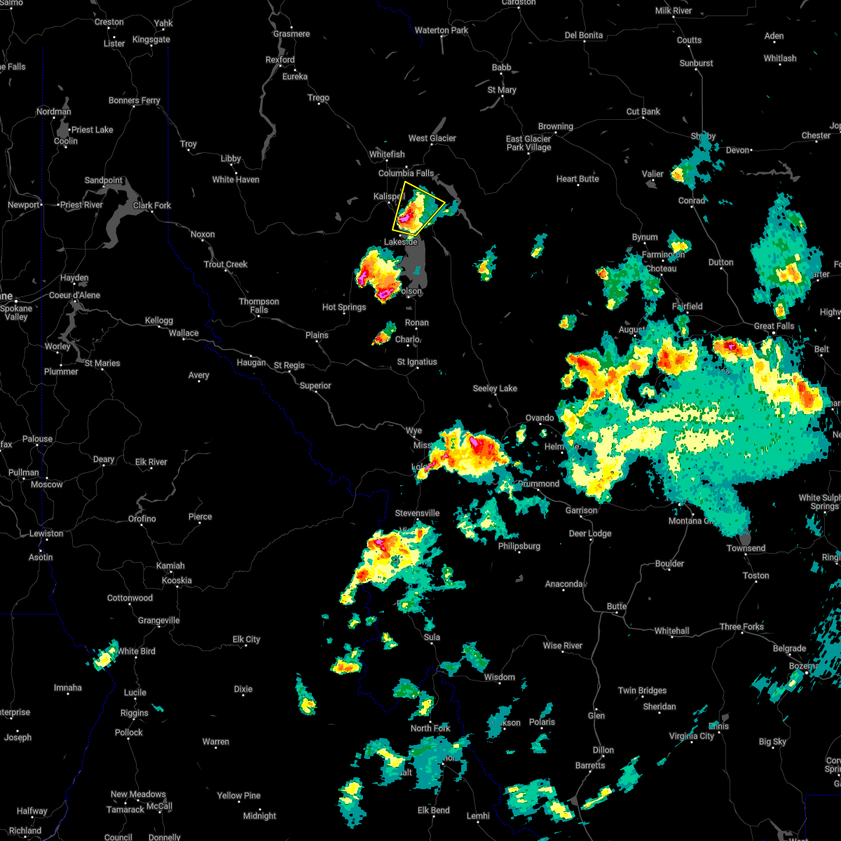
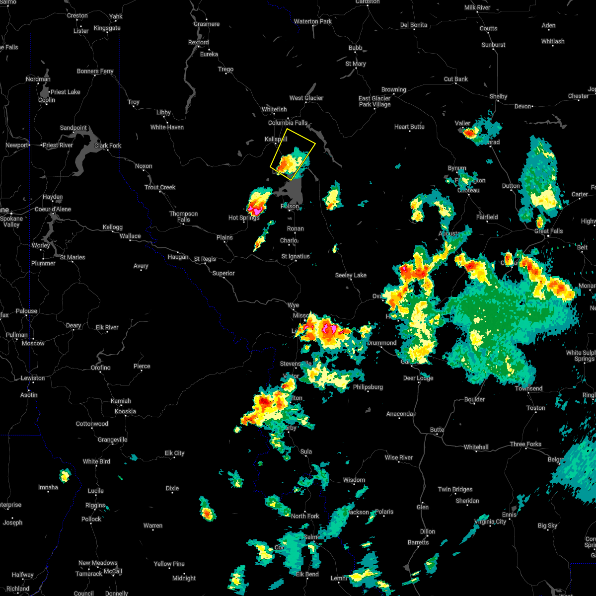
Hail and Wind Damage Spotted near Bigfork, MT
| Date / Time | Report Details |
|---|---|
| 5/12/2025 12:27 AM MDT |
 Svrmso the national weather service in missoula has issued a * severe thunderstorm warning for, southwestern flathead county in northwestern montana, * until 115 am mdt. * at 1226 am mdt, a severe thunderstorm was located 17 miles southwest of kalispell, moving northeast at 45 mph (trained weather spotters). Hazards include 60 mph wind gusts and quarter size hail. Hail damage to vehicles is expected. Expect wind damage to roofs, siding, and trees. Svrmso the national weather service in missoula has issued a * severe thunderstorm warning for, southwestern flathead county in northwestern montana, * until 115 am mdt. * at 1226 am mdt, a severe thunderstorm was located 17 miles southwest of kalispell, moving northeast at 45 mph (trained weather spotters). Hazards include 60 mph wind gusts and quarter size hail. Hail damage to vehicles is expected. Expect wind damage to roofs, siding, and trees.
|
| 8/23/2024 6:40 PM MDT | Widespread power outages in bigfork area from damaged transmission line in flathead county MT, 3.1 miles NE of Bigfork, MT |
| 8/23/2024 5:50 PM MDT | Flathead electric coop reports damaged transmission lines in many lakes area with thousands of customers without powe in flathead county MT, 1.9 miles SSE of Bigfork, MT |
| 8/23/2024 5:41 PM MDT |
 The storms which prompted the warning have weakened below severe limits, and no longer pose an immediate threat to life or property. therefore, the warning will be allowed to expire. however, gusty winds are still possible with these thunderstorms. a severe thunderstorm watch remains in effect until 900 pm mdt for northwestern montana. The storms which prompted the warning have weakened below severe limits, and no longer pose an immediate threat to life or property. therefore, the warning will be allowed to expire. however, gusty winds are still possible with these thunderstorms. a severe thunderstorm watch remains in effect until 900 pm mdt for northwestern montana.
|
| 8/23/2024 5:40 PM MDT | Corrects previous tstm wnd dmg report from bigfork. widespread power outages in bigfork area from damaged transmission line in flathead county MT, 3.1 miles NE of Bigfork, MT |
| 8/23/2024 5:13 PM MDT |
 Svrmso the national weather service in missoula has issued a * severe thunderstorm warning for, northwestern lake county in northwestern montana, southern lincoln county in northwestern montana, central sanders county in northwestern montana, southwestern flathead county in northwestern montana, * until 545 pm mdt. * at 513 pm mdt, severe thunderstorms were located along a line extending from polson to 12 miles northeast of plains, moving northwest at 65 mph (radar indicated). Hazards include 60 mph wind gusts and penny size hail. expect damage to roofs, siding, and trees Svrmso the national weather service in missoula has issued a * severe thunderstorm warning for, northwestern lake county in northwestern montana, southern lincoln county in northwestern montana, central sanders county in northwestern montana, southwestern flathead county in northwestern montana, * until 545 pm mdt. * at 513 pm mdt, severe thunderstorms were located along a line extending from polson to 12 miles northeast of plains, moving northwest at 65 mph (radar indicated). Hazards include 60 mph wind gusts and penny size hail. expect damage to roofs, siding, and trees
|
| 8/19/2024 7:00 PM MDT | Ping Pong Ball sized hail reported 3.4 miles NNW of Bigfork, MT |
| 7/9/2022 5:39 PM MDT |
 The severe thunderstorm warning for northern lake and central flathead counties will expire at 545 pm mdt, the storm which prompted the warning has moved out of the area. therefore, the warning will be allowed to expire. a severe thunderstorm watch remains in effect until 1000 pm mdt for northwestern montana. The severe thunderstorm warning for northern lake and central flathead counties will expire at 545 pm mdt, the storm which prompted the warning has moved out of the area. therefore, the warning will be allowed to expire. a severe thunderstorm watch remains in effect until 1000 pm mdt for northwestern montana.
|
| 7/9/2022 5:30 PM MDT | Ping Pong Ball sized hail reported 3.3 miles ENE of Bigfork, MT, photo retrieved via social media. time estimated via radar. |
| 7/9/2022 5:30 PM MDT |
 At 530 pm mdt, a severe thunderstorm was located near woods bay, or 18 miles southeast of evergreen, moving northeast at 30 mph (trained weather spotters). Hazards include ping pong ball size hail and 60 mph wind gusts. People and animals outdoors will be injured. expect hail damage to roofs, siding, windows, and vehicles. expect wind damage to roofs, siding, and trees. locations impacted include, bigfork. hail threat, radar indicated max hail size, 1. 50 in wind threat, radar indicated max wind gust, 60 mph. At 530 pm mdt, a severe thunderstorm was located near woods bay, or 18 miles southeast of evergreen, moving northeast at 30 mph (trained weather spotters). Hazards include ping pong ball size hail and 60 mph wind gusts. People and animals outdoors will be injured. expect hail damage to roofs, siding, windows, and vehicles. expect wind damage to roofs, siding, and trees. locations impacted include, bigfork. hail threat, radar indicated max hail size, 1. 50 in wind threat, radar indicated max wind gust, 60 mph.
|
| 7/9/2022 5:26 PM MDT | Quarter sized hail reported 3.1 miles NE of Bigfork, MT |
| 7/9/2022 5:24 PM MDT | Ping Pong Ball sized hail reported 3.1 miles NE of Bigfork, MT |
| 7/9/2022 5:21 PM MDT |
 At 521 pm mdt, a severe thunderstorm was located over woods bay, or 18 miles southeast of kalispell, moving northeast at 30 mph (radar indicated). Hazards include two inch hail and 60 mph wind gusts. People and animals outdoors will be injured. expect hail damage to roofs, siding, windows, and vehicles. expect wind damage to roofs, siding, and trees. locations impacted include, woods bay, bigfork, somers and lakeside. thunderstorm damage threat, considerable hail threat, radar indicated max hail size, 2. 00 in wind threat, radar indicated max wind gust, 60 mph. At 521 pm mdt, a severe thunderstorm was located over woods bay, or 18 miles southeast of kalispell, moving northeast at 30 mph (radar indicated). Hazards include two inch hail and 60 mph wind gusts. People and animals outdoors will be injured. expect hail damage to roofs, siding, windows, and vehicles. expect wind damage to roofs, siding, and trees. locations impacted include, woods bay, bigfork, somers and lakeside. thunderstorm damage threat, considerable hail threat, radar indicated max hail size, 2. 00 in wind threat, radar indicated max wind gust, 60 mph.
|
| 7/9/2022 5:20 PM MDT |
 At 520 pm mdt, a severe thunderstorm was located over woods bay, or 19 miles southeast of kalispell, moving northeast at 30 mph (radar indicated). Hazards include two inch hail and 60 mph wind gusts. People and animals outdoors will be injured. expect hail damage to roofs, siding, windows, and vehicles. expect wind damage to roofs, siding, and trees. locations impacted include, woods bay, bigfork, somers and lakeside. thunderstorm damage threat, considerable hail threat, radar indicated max hail size, 2. 00 in wind threat, radar indicated max wind gust, 60 mph. At 520 pm mdt, a severe thunderstorm was located over woods bay, or 19 miles southeast of kalispell, moving northeast at 30 mph (radar indicated). Hazards include two inch hail and 60 mph wind gusts. People and animals outdoors will be injured. expect hail damage to roofs, siding, windows, and vehicles. expect wind damage to roofs, siding, and trees. locations impacted include, woods bay, bigfork, somers and lakeside. thunderstorm damage threat, considerable hail threat, radar indicated max hail size, 2. 00 in wind threat, radar indicated max wind gust, 60 mph.
|
| 7/9/2022 5:14 PM MDT |
 At 513 pm mdt, a severe thunderstorm was located near woods bay, or 18 miles north of polson, moving northeast at 30 mph (radar indicated). Hazards include golf ball size hail and 60 mph wind gusts. People and animals outdoors will be injured. expect hail damage to roofs, siding, windows, and vehicles. expect wind damage to roofs, siding, and trees. locations impacted include, woods bay, bigfork, somers and lakeside. thunderstorm damage threat, considerable hail threat, radar indicated max hail size, 1. 75 in wind threat, radar indicated max wind gust, 60 mph. At 513 pm mdt, a severe thunderstorm was located near woods bay, or 18 miles north of polson, moving northeast at 30 mph (radar indicated). Hazards include golf ball size hail and 60 mph wind gusts. People and animals outdoors will be injured. expect hail damage to roofs, siding, windows, and vehicles. expect wind damage to roofs, siding, and trees. locations impacted include, woods bay, bigfork, somers and lakeside. thunderstorm damage threat, considerable hail threat, radar indicated max hail size, 1. 75 in wind threat, radar indicated max wind gust, 60 mph.
|
| 7/9/2022 5:14 PM MDT |
 At 514 pm mdt, a severe thunderstorm was located near woods bay, or 19 miles north of polson, moving northeast at 30 mph (radar indicated). Hazards include golf ball size hail and 60 mph wind gusts. People and animals outdoors will be injured. expect hail damage to roofs, siding, windows, and vehicles. expect wind damage to roofs, siding, and trees. locations impacted include, woods bay, bigfork, somers and lakeside. thunderstorm damage threat, considerable hail threat, radar indicated max hail size, 1. 75 in wind threat, radar indicated max wind gust, 60 mph. At 514 pm mdt, a severe thunderstorm was located near woods bay, or 19 miles north of polson, moving northeast at 30 mph (radar indicated). Hazards include golf ball size hail and 60 mph wind gusts. People and animals outdoors will be injured. expect hail damage to roofs, siding, windows, and vehicles. expect wind damage to roofs, siding, and trees. locations impacted include, woods bay, bigfork, somers and lakeside. thunderstorm damage threat, considerable hail threat, radar indicated max hail size, 1. 75 in wind threat, radar indicated max wind gust, 60 mph.
|
| 7/9/2022 5:05 PM MDT |
 At 505 pm mdt, a severe thunderstorm was located 7 miles southwest of woods bay, or 15 miles north of polson, moving northeast at 25 mph (radar indicated). Hazards include golf ball size hail and 60 mph wind gusts. People and animals outdoors will be injured. expect hail damage to roofs, siding, windows, and vehicles. Expect wind damage to roofs, siding, and trees. At 505 pm mdt, a severe thunderstorm was located 7 miles southwest of woods bay, or 15 miles north of polson, moving northeast at 25 mph (radar indicated). Hazards include golf ball size hail and 60 mph wind gusts. People and animals outdoors will be injured. expect hail damage to roofs, siding, windows, and vehicles. Expect wind damage to roofs, siding, and trees.
|
| 7/9/2022 5:01 PM MDT |
 At 501 pm mdt, a severe thunderstorm was located 8 miles northeast of big arm, or 14 miles north of polson, moving northeast at 25 mph (radar indicated). Hazards include ping pong ball size hail and 60 mph wind gusts. People and animals outdoors will be injured. expect hail damage to roofs, siding, windows, and vehicles. Expect wind damage to roofs, siding, and trees. At 501 pm mdt, a severe thunderstorm was located 8 miles northeast of big arm, or 14 miles north of polson, moving northeast at 25 mph (radar indicated). Hazards include ping pong ball size hail and 60 mph wind gusts. People and animals outdoors will be injured. expect hail damage to roofs, siding, windows, and vehicles. Expect wind damage to roofs, siding, and trees.
|
| 7/9/2022 4:34 PM MDT |
 At 434 pm mdt, a severe thunderstorm was located near kings point, or 8 miles north of polson, moving northeast at 30 mph (radar indicated). Hazards include ping pong ball size hail and 60 mph wind gusts. People and animals outdoors will be injured. expect hail damage to roofs, siding, windows, and vehicles. Expect wind damage to roofs, siding, and trees. At 434 pm mdt, a severe thunderstorm was located near kings point, or 8 miles north of polson, moving northeast at 30 mph (radar indicated). Hazards include ping pong ball size hail and 60 mph wind gusts. People and animals outdoors will be injured. expect hail damage to roofs, siding, windows, and vehicles. Expect wind damage to roofs, siding, and trees.
|
| 7/7/2022 8:21 PM MDT |
 At 821 pm mdt, a severe thunderstorm was located near bigfork, or 8 miles southeast of evergreen, moving northeast at 20 mph (radar indicated). Hazards include ping pong ball size hail and 60 mph wind gusts. People and animals outdoors will be injured. expect hail damage to roofs, siding, windows, and vehicles. expect wind damage to roofs, siding, and trees. locations impacted include, creston. hail threat, radar indicated max hail size, 1. 50 in wind threat, radar indicated max wind gust, 60 mph. At 821 pm mdt, a severe thunderstorm was located near bigfork, or 8 miles southeast of evergreen, moving northeast at 20 mph (radar indicated). Hazards include ping pong ball size hail and 60 mph wind gusts. People and animals outdoors will be injured. expect hail damage to roofs, siding, windows, and vehicles. expect wind damage to roofs, siding, and trees. locations impacted include, creston. hail threat, radar indicated max hail size, 1. 50 in wind threat, radar indicated max wind gust, 60 mph.
|
| 7/7/2022 8:18 PM MDT | Quarter sized hail reported 5.2 miles SE of Bigfork, MT |
| 7/7/2022 8:09 PM MDT |
 At 809 pm mdt, a severe thunderstorm was located near bigfork, or 9 miles southeast of kalispell, moving northeast at 20 mph (radar indicated). Hazards include 60 mph wind gusts and half dollar size hail. Hail damage to vehicles is expected. expect wind damage to roofs, siding, and trees. locations impacted include, bigfork, creston, somers and lakeside. hail threat, radar indicated max hail size, 1. 25 in wind threat, radar indicated max wind gust, 60 mph. At 809 pm mdt, a severe thunderstorm was located near bigfork, or 9 miles southeast of kalispell, moving northeast at 20 mph (radar indicated). Hazards include 60 mph wind gusts and half dollar size hail. Hail damage to vehicles is expected. expect wind damage to roofs, siding, and trees. locations impacted include, bigfork, creston, somers and lakeside. hail threat, radar indicated max hail size, 1. 25 in wind threat, radar indicated max wind gust, 60 mph.
|
| 7/7/2022 8:02 PM MDT |
 At 802 pm mdt, a severe thunderstorm was located near bigfork, or 11 miles southeast of kalispell, moving northeast at 20 mph (radar indicated). Hazards include ping pong ball size hail and 60 mph wind gusts. People and animals outdoors will be injured. expect hail damage to roofs, siding, windows, and vehicles. expect wind damage to roofs, siding, and trees. locations impacted include, bigfork, creston, somers and lakeside. hail threat, radar indicated max hail size, 1. 50 in wind threat, radar indicated max wind gust, 60 mph. At 802 pm mdt, a severe thunderstorm was located near bigfork, or 11 miles southeast of kalispell, moving northeast at 20 mph (radar indicated). Hazards include ping pong ball size hail and 60 mph wind gusts. People and animals outdoors will be injured. expect hail damage to roofs, siding, windows, and vehicles. expect wind damage to roofs, siding, and trees. locations impacted include, bigfork, creston, somers and lakeside. hail threat, radar indicated max hail size, 1. 50 in wind threat, radar indicated max wind gust, 60 mph.
|
| 7/7/2022 7:55 PM MDT |
 At 755 pm mdt, a severe thunderstorm was located 7 miles southwest of bigfork, or 12 miles south of kalispell, moving northeast at 20 mph (radar indicated). Hazards include ping pong ball size hail and 60 mph wind gusts. People and animals outdoors will be injured. expect hail damage to roofs, siding, windows, and vehicles. Expect wind damage to roofs, siding, and trees. At 755 pm mdt, a severe thunderstorm was located 7 miles southwest of bigfork, or 12 miles south of kalispell, moving northeast at 20 mph (radar indicated). Hazards include ping pong ball size hail and 60 mph wind gusts. People and animals outdoors will be injured. expect hail damage to roofs, siding, windows, and vehicles. Expect wind damage to roofs, siding, and trees.
|
| 6/24/2020 8:15 PM MDT | Quarter sized hail reported 2.8 miles NNE of Bigfork, MT |
| 6/24/2020 4:29 PM MDT |
 At 428 pm mdt, severe thunderstorms were located along a line extending from 9 miles southwest of whitefish to 7 miles southeast of kalispell, moving northeast at 30 mph (public). Hazards include golf ball size hail and 70 mph wind gusts. People and animals outdoors will be injured. expect hail damage to roofs, siding, windows, and vehicles. expect considerable tree damage. wind damage is also likely to mobile homes, roofs, and outbuildings. Locations impacted include, kalispell, evergreen, whitefish, columbia falls, bigfork, kila, somers, creston, la salle and lakeside. At 428 pm mdt, severe thunderstorms were located along a line extending from 9 miles southwest of whitefish to 7 miles southeast of kalispell, moving northeast at 30 mph (public). Hazards include golf ball size hail and 70 mph wind gusts. People and animals outdoors will be injured. expect hail damage to roofs, siding, windows, and vehicles. expect considerable tree damage. wind damage is also likely to mobile homes, roofs, and outbuildings. Locations impacted include, kalispell, evergreen, whitefish, columbia falls, bigfork, kila, somers, creston, la salle and lakeside.
|
| 6/24/2020 4:12 PM MDT |
 At 411 pm mdt, severe thunderstorms were located along a line extending from 17 miles southwest of whitefish to 7 miles south of kalispell, moving east at 30 mph (radar indicated). Hazards include 70 mph wind gusts and quarter size hail. Hail damage to vehicles is expected. expect considerable tree damage. Wind damage is also likely to mobile homes, roofs, and outbuildings. At 411 pm mdt, severe thunderstorms were located along a line extending from 17 miles southwest of whitefish to 7 miles south of kalispell, moving east at 30 mph (radar indicated). Hazards include 70 mph wind gusts and quarter size hail. Hail damage to vehicles is expected. expect considerable tree damage. Wind damage is also likely to mobile homes, roofs, and outbuildings.
|
| 5/31/2020 8:42 AM MDT |
 The severe thunderstorm warning for north central lake and west central flathead counties will expire at 845 am mdt, the storms which prompted the warning have moved out of the area. therefore, the warning will be allowed to expire. The severe thunderstorm warning for north central lake and west central flathead counties will expire at 845 am mdt, the storms which prompted the warning have moved out of the area. therefore, the warning will be allowed to expire.
|
| 5/31/2020 8:25 AM MDT |
 At 822 am mdt, severe thunderstorms were located along a line extending from 26 miles west of whitefish to 6 miles north of swan lake, moving northeast at 55 mph (widespread reports of tree damage and poweroutages have been recieved). Hazards include 60 mph wind gusts. Expect damage to roofs, siding, and trees. These severe thunderstorms will remain over mainly rural areas of north central lake and west central flathead counties, including the following locations, blacktail, stryker, olney, pinnacle, radnor, martin city, coram, creston, lupfer and essex. At 822 am mdt, severe thunderstorms were located along a line extending from 26 miles west of whitefish to 6 miles north of swan lake, moving northeast at 55 mph (widespread reports of tree damage and poweroutages have been recieved). Hazards include 60 mph wind gusts. Expect damage to roofs, siding, and trees. These severe thunderstorms will remain over mainly rural areas of north central lake and west central flathead counties, including the following locations, blacktail, stryker, olney, pinnacle, radnor, martin city, coram, creston, lupfer and essex.
|
| 5/31/2020 8:14 AM MDT |
 At 813 am mdt, severe thunderstorms were located along a line extending from 25 miles east of libby to near swan lake, moving northeast at 55 mph (radar indicated). Hazards include 60 mph wind gusts. expect damage to roofs, siding, and trees At 813 am mdt, severe thunderstorms were located along a line extending from 25 miles east of libby to near swan lake, moving northeast at 55 mph (radar indicated). Hazards include 60 mph wind gusts. expect damage to roofs, siding, and trees
|
| 8/11/2019 3:39 PM MDT |
 The severe thunderstorm warning for northwestern lake and southwestern flathead counties will expire at 345 pm mdt, the storm which prompted the warning has weakened below severe limits. therefore, the warning will be allowed to expire. however gusty winds and lightning are still possible with this thunderstorm. The severe thunderstorm warning for northwestern lake and southwestern flathead counties will expire at 345 pm mdt, the storm which prompted the warning has weakened below severe limits. therefore, the warning will be allowed to expire. however gusty winds and lightning are still possible with this thunderstorm.
|
| 8/11/2019 3:09 PM MDT |
 At 309 pm mdt, a severe thunderstorm was located near big arm, or 14 miles northwest of polson, moving east at 20 mph (radar indicated). Hazards include 60 mph wind gusts and quarter size hail. Hail damage to vehicles is expected. Expect wind damage to roofs, siding, and trees. At 309 pm mdt, a severe thunderstorm was located near big arm, or 14 miles northwest of polson, moving east at 20 mph (radar indicated). Hazards include 60 mph wind gusts and quarter size hail. Hail damage to vehicles is expected. Expect wind damage to roofs, siding, and trees.
|
| 4/7/2017 12:45 PM MDT | Emergency manager reports trees down everywher in lake county MT, 13.9 miles NW of Bigfork, MT |
| 5/13/2013 7:30 PM MDT | Very large uprooted tree in flathead county MT, 8.2 miles SE of Bigfork, MT |
| 6/26/2012 6:15 AM MDT | Quarter sized hail reported 4.1 miles SE of Bigfork, MT, hail was one to two inches deep and the largest stones were one inch in diameter |
| 1/1/0001 12:00 AM | Downed power lines in flathead county MT, 5.7 miles E of Bigfork, MT |
| 1/1/0001 12:00 AM | Hen Egg sized hail reported 16.9 miles N of Bigfork, MT, 2 inch diameter hail fell for a duration of three minutes at yellow bay |
| 1/1/0001 12:00 AM | Ping Pong Ball sized hail reported 16.9 miles N of Bigfork, MT, ping pong ball size hail measured at yellow bay. |
| 1/1/0001 12:00 AM | Ping Pong Ball sized hail reported 16.1 miles N of Bigfork, MT, ping pong ball size hail measured at yellow bay. |
| 1/1/0001 12:00 AM | Hen Egg sized hail reported 16.9 miles N of Bigfork, MT, 2 inch diameter hail fell for a duration of three minutes at yellow bay |
| 1/1/0001 12:00 AM | Hen Egg sized hail reported 15.4 miles N of Bigfork, MT, 2 inch diameter hail fell for a duration of three minutes at yellow bay |
| 1/1/0001 12:00 AM | Quarter sized hail reported 1.6 miles E of Bigfork, MT, also reported dents in hood of truck 5 miles north of bigfork. |
Hail Maps for Bigfork, MT


Connect with Interactive Hail Maps