

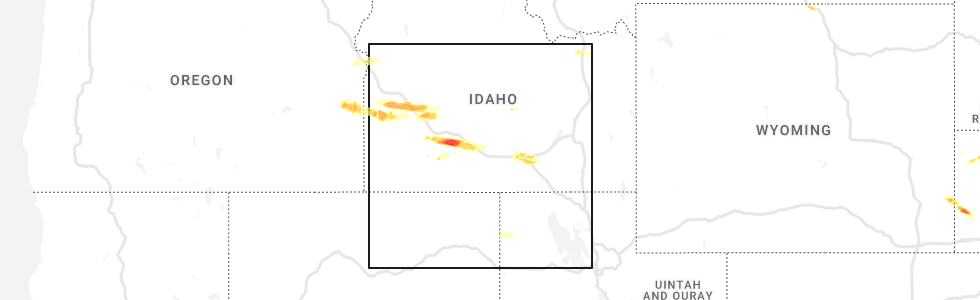
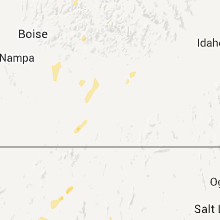
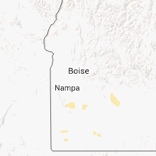
Hail Map for Bliss, ID
The Bliss, ID area has had 0 reports of on-the-ground hail by trained spotters, and has been under severe weather warnings 3 times during the past 12 months. Doppler radar has detected hail at or near Bliss, ID on 6 occasions.
| Name: | Bliss, ID |
| Where Located: | 35.1 miles NW of Twin Falls, ID |
| Map: | Google Map for Bliss, ID |
| Population: | 318 |
| Housing Units: | 138 |
| More Info: | Search Google for Bliss, ID |
0
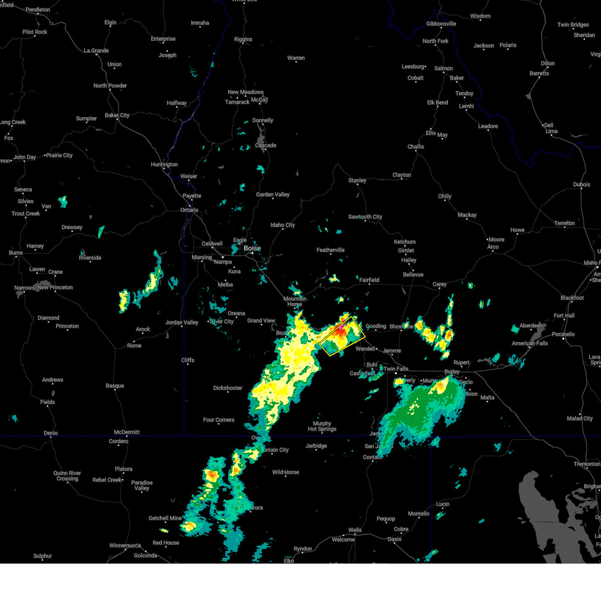
The Top Recent Hail Date for Bliss, ID is Sunday, June 5, 2022 (2nd out of 6)
Hail and Wind Damage Spotted near Bliss, ID
| Date / Time | Report Details |
|---|---|
| 5/31/2023 5:43 PM MDT |
 The severe thunderstorm warning for northwestern twin falls, southeastern elmore, eastern owyhee and west central gooding counties will expire at 545 pm mdt, the storm which prompted the warning has weakened below severe limits, and no longer poses an immediate threat to life or property. therefore, the warning will be allowed to expire. however small hail, gusty winds and heavy rain are still possible with this thunderstorm. when safe to do so, please relay storm reports to the national weather service in boise via local law enforcement, or national weather service boise facebook and twitter accounts. The severe thunderstorm warning for northwestern twin falls, southeastern elmore, eastern owyhee and west central gooding counties will expire at 545 pm mdt, the storm which prompted the warning has weakened below severe limits, and no longer poses an immediate threat to life or property. therefore, the warning will be allowed to expire. however small hail, gusty winds and heavy rain are still possible with this thunderstorm. when safe to do so, please relay storm reports to the national weather service in boise via local law enforcement, or national weather service boise facebook and twitter accounts.
|
| 5/31/2023 5:18 PM MDT |
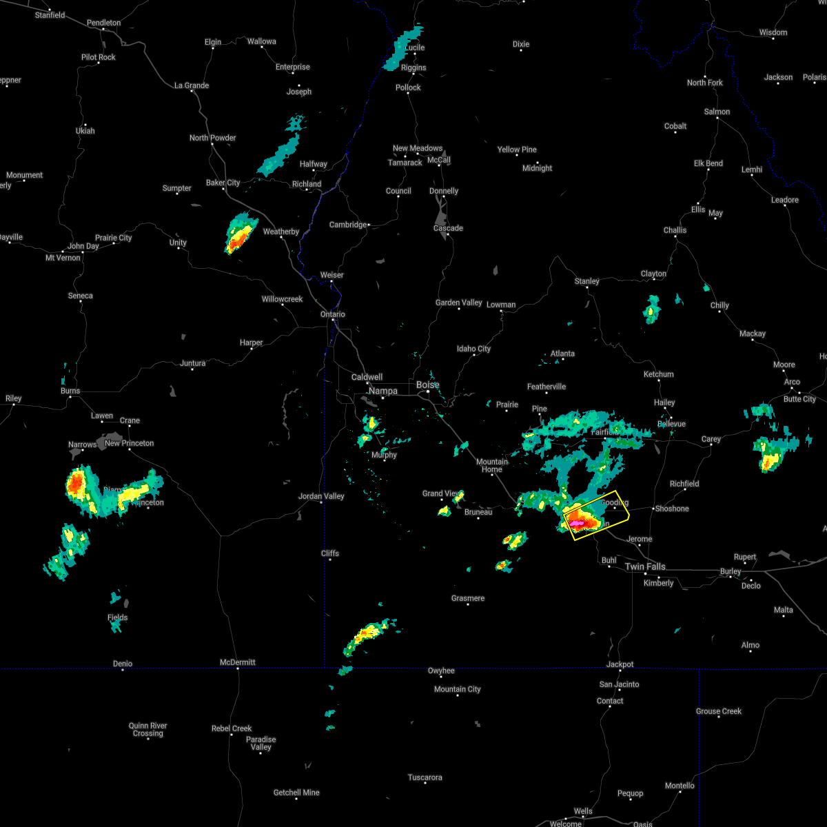
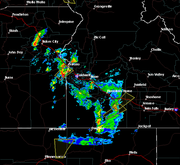
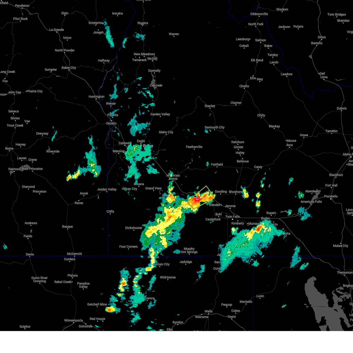 At 518 pm mdt, a severe thunderstorm was located near twentymile butte, or 9 miles southeast of glenns ferry, moving northeast at 20 mph (radar indicated). Hazards include 60 mph wind gusts and half dollar size hail. Hail damage to vehicles is expected. expect wind damage to roofs, siding, and trees. this severe storm will be near, bliss around 550 pm mdt. hail threat, radar indicated max hail size, 1. 25 in wind threat, radar indicated max wind gust, 60 mph. At 518 pm mdt, a severe thunderstorm was located near twentymile butte, or 9 miles southeast of glenns ferry, moving northeast at 20 mph (radar indicated). Hazards include 60 mph wind gusts and half dollar size hail. Hail damage to vehicles is expected. expect wind damage to roofs, siding, and trees. this severe storm will be near, bliss around 550 pm mdt. hail threat, radar indicated max hail size, 1. 25 in wind threat, radar indicated max wind gust, 60 mph.
|
| 5/31/2023 4:55 PM MDT |
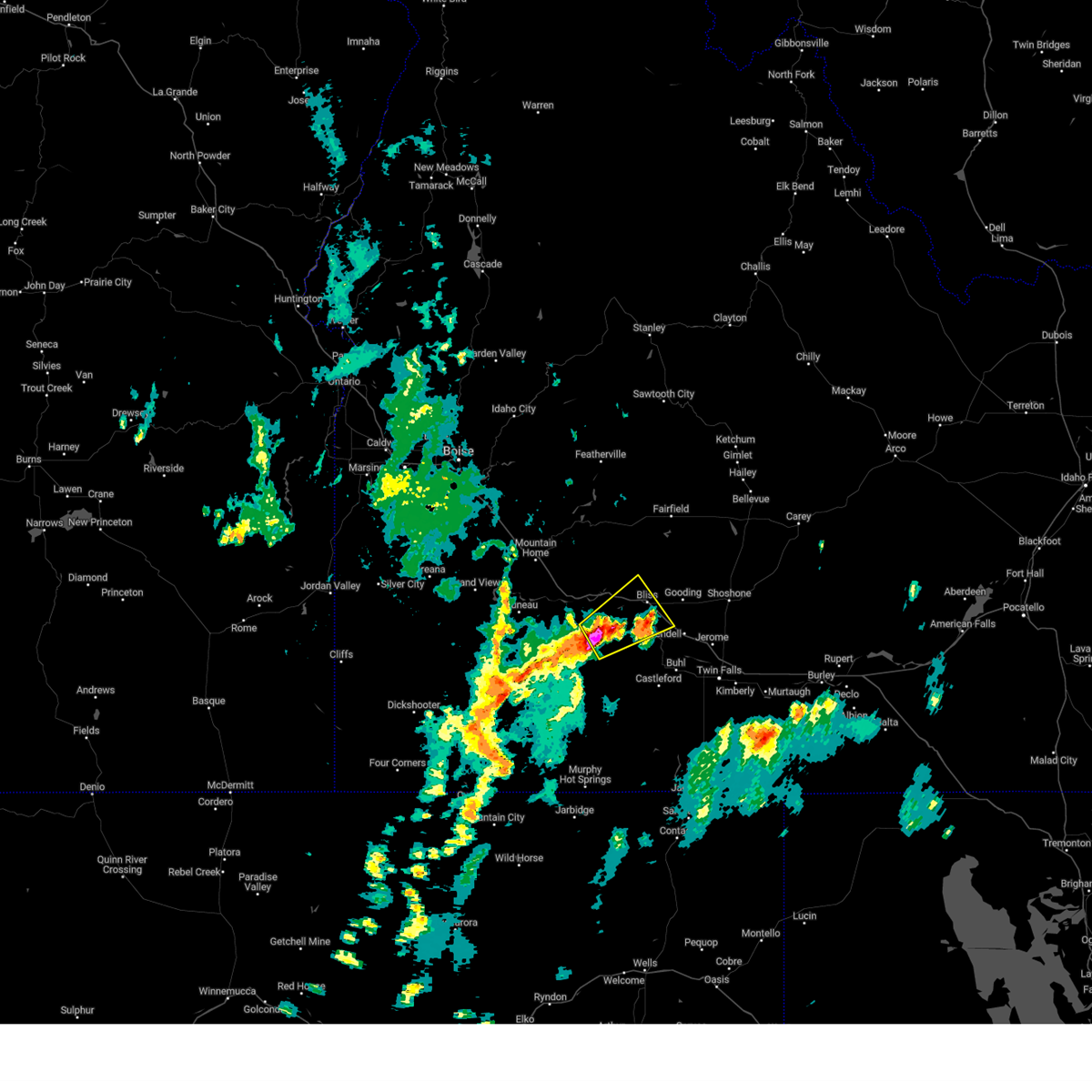 At 454 pm mdt, a severe thunderstorm was located near deadman flat, or 12 miles south of glenns ferry, moving northeast at 25 mph (radar indicated). Hazards include 60 mph wind gusts and half dollar size hail. Hail damage to vehicles is expected. expect wind damage to roofs, siding, and trees. this severe thunderstorm will be near, twentymile butte around 510 pm mdt. hagerman and bliss around 540 pm mdt. hail threat, radar indicated max hail size, 1. 25 in wind threat, radar indicated max wind gust, 60 mph. At 454 pm mdt, a severe thunderstorm was located near deadman flat, or 12 miles south of glenns ferry, moving northeast at 25 mph (radar indicated). Hazards include 60 mph wind gusts and half dollar size hail. Hail damage to vehicles is expected. expect wind damage to roofs, siding, and trees. this severe thunderstorm will be near, twentymile butte around 510 pm mdt. hagerman and bliss around 540 pm mdt. hail threat, radar indicated max hail size, 1. 25 in wind threat, radar indicated max wind gust, 60 mph.
|
| 6/5/2022 5:30 PM MDT |
 At 530 pm mdt, a severe thunderstorm was located over deadman flat, or 9 miles south of glenns ferry, moving east at 40 mph (radar indicated). Hazards include 60 mph wind gusts and quarter size hail. Hail damage to vehicles is expected. expect wind damage to roofs, siding, and trees. this severe thunderstorm will be near, twentymile butte around 540 pm mdt. bliss around 550 pm mdt. hagerman around 600 pm mdt. wendell, buhl and filer around 610 pm mdt. hail threat, radar indicated max hail size, 1. 00 in wind threat, radar indicated max wind gust, 60 mph. At 530 pm mdt, a severe thunderstorm was located over deadman flat, or 9 miles south of glenns ferry, moving east at 40 mph (radar indicated). Hazards include 60 mph wind gusts and quarter size hail. Hail damage to vehicles is expected. expect wind damage to roofs, siding, and trees. this severe thunderstorm will be near, twentymile butte around 540 pm mdt. bliss around 550 pm mdt. hagerman around 600 pm mdt. wendell, buhl and filer around 610 pm mdt. hail threat, radar indicated max hail size, 1. 00 in wind threat, radar indicated max wind gust, 60 mph.
|
| 8/26/2020 7:42 PM MDT |
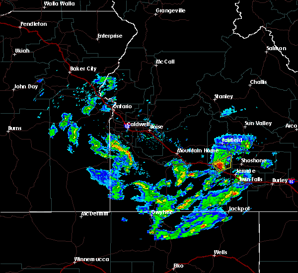
 At 740 pm mdt, a severe thunderstorm was located near bliss, or 13 miles west of gooding, moving northeast at 30 mph (radar indicated). Hazards include 60 mph wind gusts and quarter size hail. Hail damage to vehicles is expected. expect wind damage to roofs, siding, and trees. This severe storm will be near, south of bliss around 750 pm mdt. At 740 pm mdt, a severe thunderstorm was located near bliss, or 13 miles west of gooding, moving northeast at 30 mph (radar indicated). Hazards include 60 mph wind gusts and quarter size hail. Hail damage to vehicles is expected. expect wind damage to roofs, siding, and trees. This severe storm will be near, south of bliss around 750 pm mdt.
|
| 8/26/2020 7:21 PM MDT |
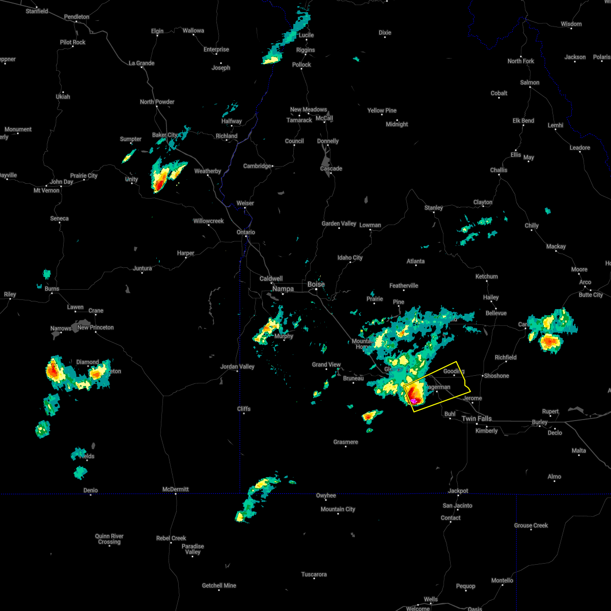 At 721 pm mdt, a severe thunderstorm was located near twentymile butte, or 17 miles southeast of glenns ferry, moving northeast at 35 mph (radar indicated). Hazards include two inch hail and 60 mph wind gusts. People and animals outdoors will be injured. expect hail damage to roofs, siding, windows, and vehicles. expect wind damage to roofs, siding, and trees. this severe thunderstorm will be near, hagerman and bliss around 740 pm mdt. wendell around 750 pm mdt. Gooding around 800 pm mdt. At 721 pm mdt, a severe thunderstorm was located near twentymile butte, or 17 miles southeast of glenns ferry, moving northeast at 35 mph (radar indicated). Hazards include two inch hail and 60 mph wind gusts. People and animals outdoors will be injured. expect hail damage to roofs, siding, windows, and vehicles. expect wind damage to roofs, siding, and trees. this severe thunderstorm will be near, hagerman and bliss around 740 pm mdt. wendell around 750 pm mdt. Gooding around 800 pm mdt.
|
| 8/26/2020 6:49 PM MDT |
 At 649 pm mdt, a severe thunderstorm was located near crows nest butte, or 19 miles south of glenns ferry, moving east at 40 mph (radar indicated). Hazards include golf ball size hail and 60 mph wind gusts. People and animals outdoors will be injured. expect hail damage to roofs, siding, windows, and vehicles. expect wind damage to roofs, siding, and trees. this severe thunderstorm will be near, crows nest butte around 650 pm mdt. deadman flat around 700 pm mdt. twentymile butte around 710 pm mdt. Hagerman, wendell and bliss around 730 pm mdt. At 649 pm mdt, a severe thunderstorm was located near crows nest butte, or 19 miles south of glenns ferry, moving east at 40 mph (radar indicated). Hazards include golf ball size hail and 60 mph wind gusts. People and animals outdoors will be injured. expect hail damage to roofs, siding, windows, and vehicles. expect wind damage to roofs, siding, and trees. this severe thunderstorm will be near, crows nest butte around 650 pm mdt. deadman flat around 700 pm mdt. twentymile butte around 710 pm mdt. Hagerman, wendell and bliss around 730 pm mdt.
|
| 4/30/2020 3:12 PM MDT |
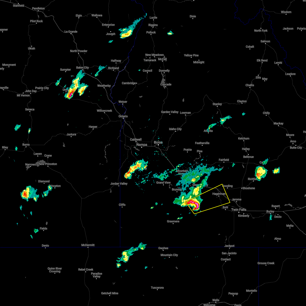
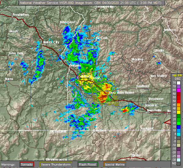 At 312 pm mdt, severe thunderstorms were located along a line extending from near trinity lakes to near hot spring, moving east at 60 mph (trained weather spotters). Hazards include 60 mph wind gusts and quarter size hail. Hail damage to vehicles is expected. expect wind damage to roofs, siding, and trees. severe thunderstorms will be near, pine, anderson dam, rocky bar and featherville around 320 pm mdt. gunsight peak, baumgartner campground and hill city around 330 pm mdt. glenns ferry, corral, deadman flat and twentymile butte around 340 pm mdt. fairfield, big peak, paradise peak and dollarhide summit around 350 pm mdt. Bliss, white arrow hot spring and davis mountain around 400 pm mdt. At 312 pm mdt, severe thunderstorms were located along a line extending from near trinity lakes to near hot spring, moving east at 60 mph (trained weather spotters). Hazards include 60 mph wind gusts and quarter size hail. Hail damage to vehicles is expected. expect wind damage to roofs, siding, and trees. severe thunderstorms will be near, pine, anderson dam, rocky bar and featherville around 320 pm mdt. gunsight peak, baumgartner campground and hill city around 330 pm mdt. glenns ferry, corral, deadman flat and twentymile butte around 340 pm mdt. fairfield, big peak, paradise peak and dollarhide summit around 350 pm mdt. Bliss, white arrow hot spring and davis mountain around 400 pm mdt.
|
| 6/4/2017 8:25 PM MDT |
 The severe thunderstorm warning for northern twin falls, jerome and southeastern gooding counties will expire at 830 pm mdt, the storm which prompted the warning has moved out of the area. therefore the warning will be allowed to expire. when safe to do so, please relay storm reports to the national weather service in boise via local law enforcement, or national weather service boise facebook and twitter accounts. The severe thunderstorm warning for northern twin falls, jerome and southeastern gooding counties will expire at 830 pm mdt, the storm which prompted the warning has moved out of the area. therefore the warning will be allowed to expire. when safe to do so, please relay storm reports to the national weather service in boise via local law enforcement, or national weather service boise facebook and twitter accounts.
|
| 6/4/2017 7:46 PM MDT |
 At 744 pm mdt, thunderstorm outflow winds associated with a cold front were located near wendell, or 12 miles south of gooding, moving east at 65 mph (radar indicated). Hazards include 60 to 70 mph wind gusts. Expect damage to roofs, siding, and trees. this severe thunderstorm will be near, jerome and filer around 750 pm mdt. twin falls, kimberly, hansen and minidoka national monument around 815 pm mdt. Hazelton, eden, milner dam and murtaugh around 825 pm mdt. At 744 pm mdt, thunderstorm outflow winds associated with a cold front were located near wendell, or 12 miles south of gooding, moving east at 65 mph (radar indicated). Hazards include 60 to 70 mph wind gusts. Expect damage to roofs, siding, and trees. this severe thunderstorm will be near, jerome and filer around 750 pm mdt. twin falls, kimberly, hansen and minidoka national monument around 815 pm mdt. Hazelton, eden, milner dam and murtaugh around 825 pm mdt.
|
| 5/5/2017 5:54 PM MDT |
 At 553 pm mdt, a severe thunderstorm was located 7 miles north of crows nest butte, or 18 miles south of glenns ferry, moving northeast at 30 mph (radar indicated). Hazards include 60 mph wind gusts and half dollar size hail. Hail damage to vehicles is expected. expect wind damage to roofs, siding, and trees. this severe thunderstorm will be near, deadman flat around 610 pm mdt. twentymile butte around 620 pm mdt. bliss around 650 pm mdt. White arrow hot spring around 700 pm mdt. At 553 pm mdt, a severe thunderstorm was located 7 miles north of crows nest butte, or 18 miles south of glenns ferry, moving northeast at 30 mph (radar indicated). Hazards include 60 mph wind gusts and half dollar size hail. Hail damage to vehicles is expected. expect wind damage to roofs, siding, and trees. this severe thunderstorm will be near, deadman flat around 610 pm mdt. twentymile butte around 620 pm mdt. bliss around 650 pm mdt. White arrow hot spring around 700 pm mdt.
|
| 10/24/2016 5:18 PM MDT |
 At 517 pm mdt, doppler radar indicated a severe thunderstorm capable of producing quarter size hail and damaging winds in excess of 60 mph. this storm was located near gooding, and moving northeast at 35 mph. * this severe thunderstorm will be near, gooding around 530 pm mdt. At 517 pm mdt, doppler radar indicated a severe thunderstorm capable of producing quarter size hail and damaging winds in excess of 60 mph. this storm was located near gooding, and moving northeast at 35 mph. * this severe thunderstorm will be near, gooding around 530 pm mdt.
|
| 5/24/2015 6:21 PM MDT | At 620 pm mdt, doppler radar indicated a severe thunderstorm capable of producing damaging winds in excess of 60 mph. this storm was located near davis mountain, or 16 miles southwest of fairfield, moving southwest at 10 mph. this severe storm will be near, white arrow hot spring and bliss around 640 pm mdt. |
| 5/24/2015 5:40 PM MDT | At 540 pm mdt, doppler radar indicated a severe thunderstorm capable of producing quarter size hail and damaging winds in excess of 60 mph. this storm was located over davis mountain, or 9 miles southwest of fairfield, and moving southwest at 10 mph. * this severe thunderstorm will be near, white arrow hot spring and bliss around 640 pm mdt. |
| 8/12/2014 3:55 PM MDT | Social media reported power lines down between hagerman and blis in gooding county ID, 3.4 miles NW of Bliss, ID |
Hail Maps for Bliss, ID


Connect with Interactive Hail Maps