

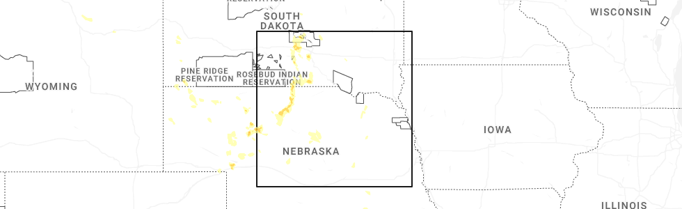
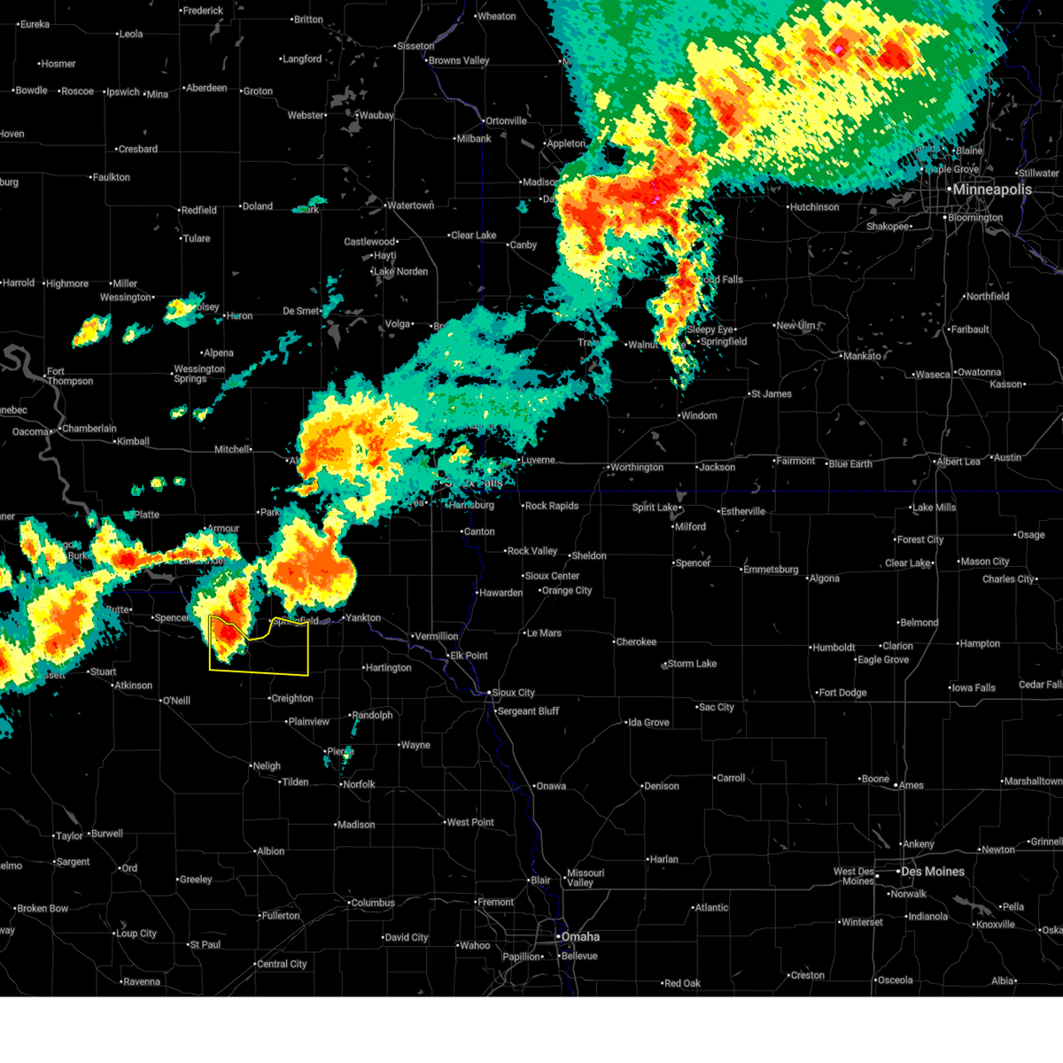
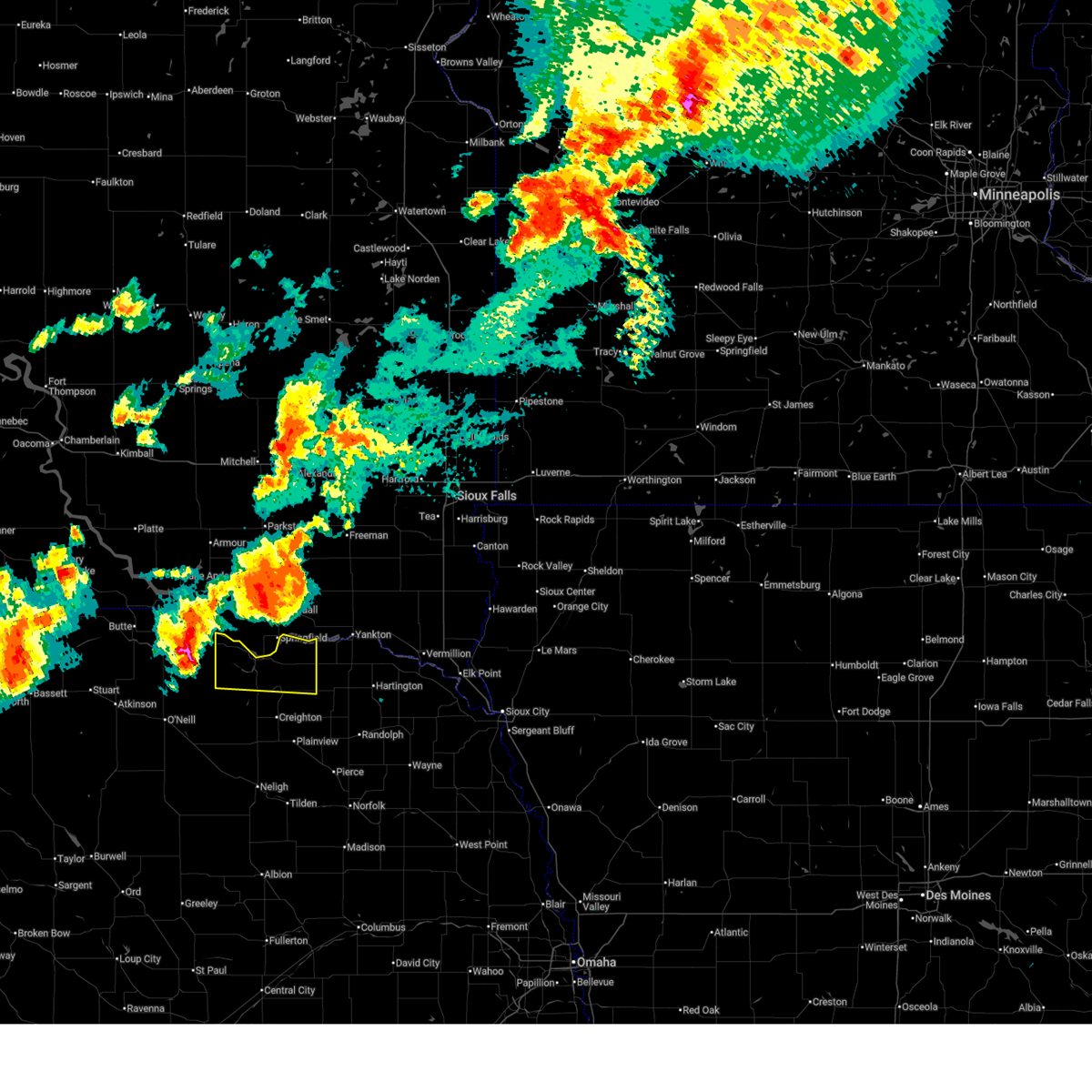
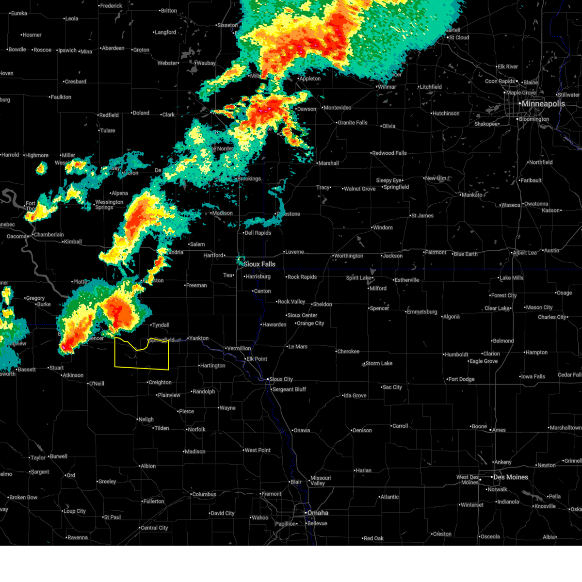
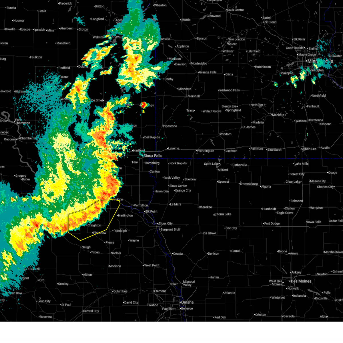
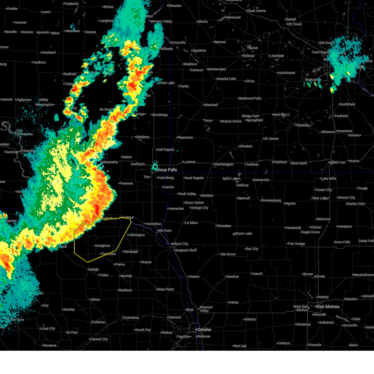
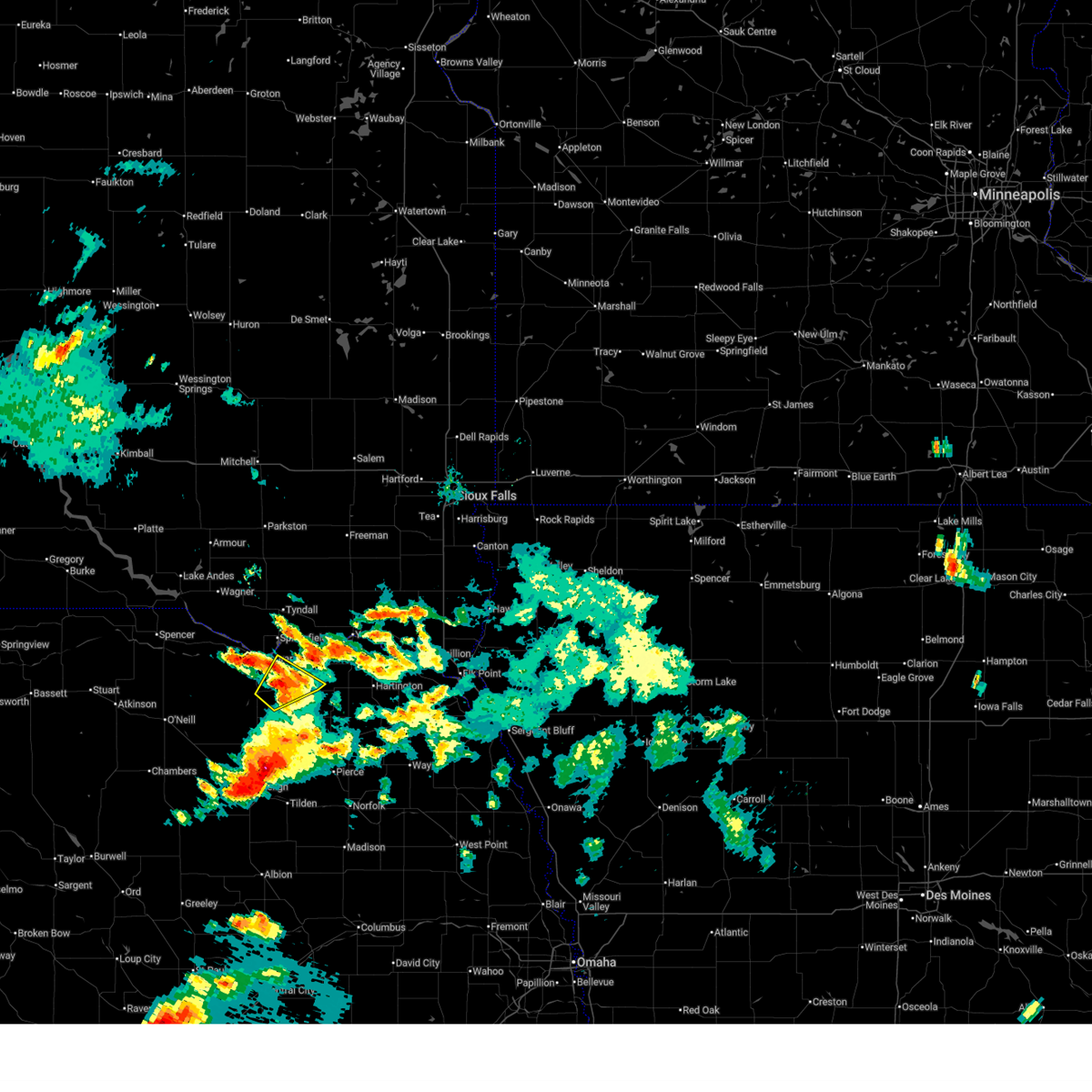
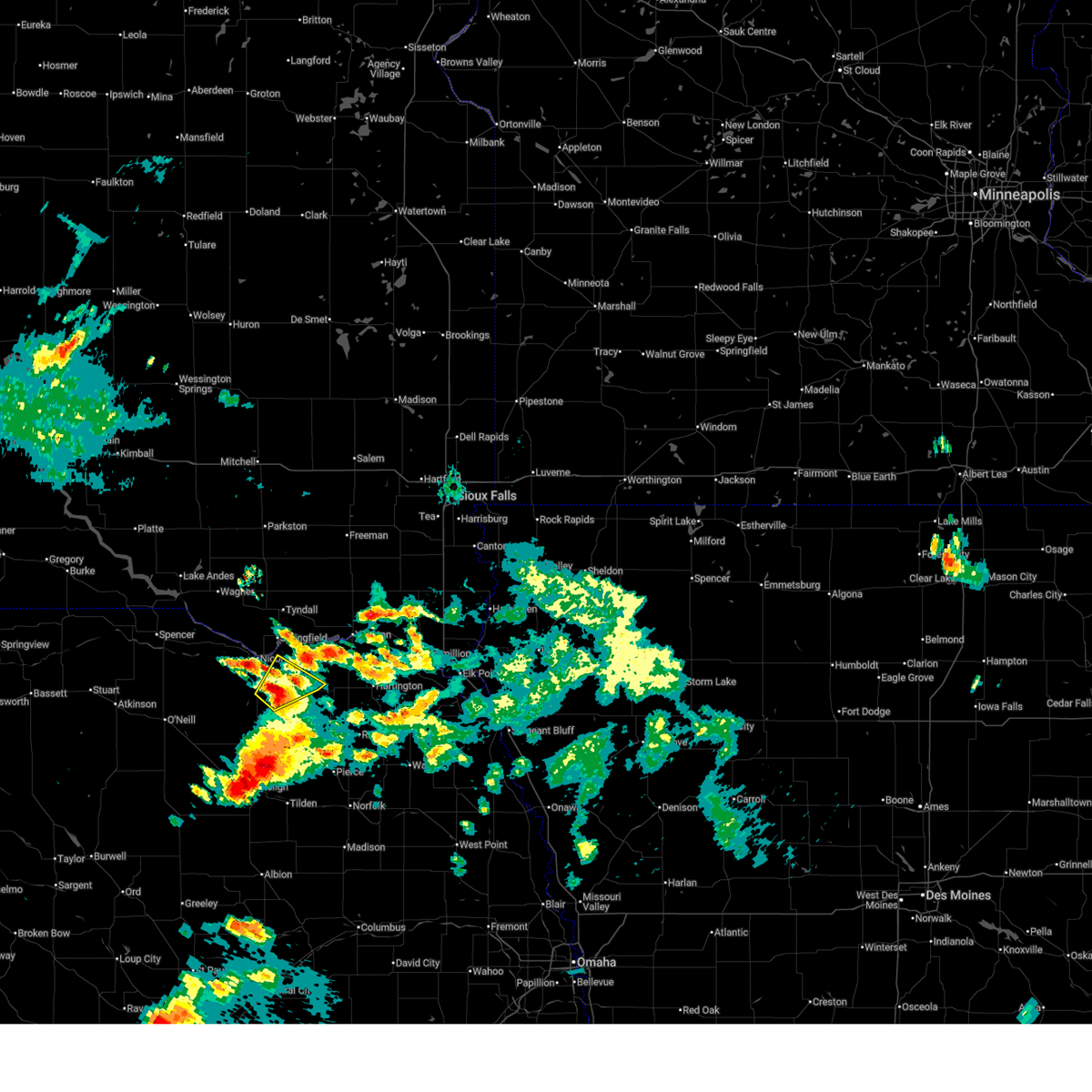
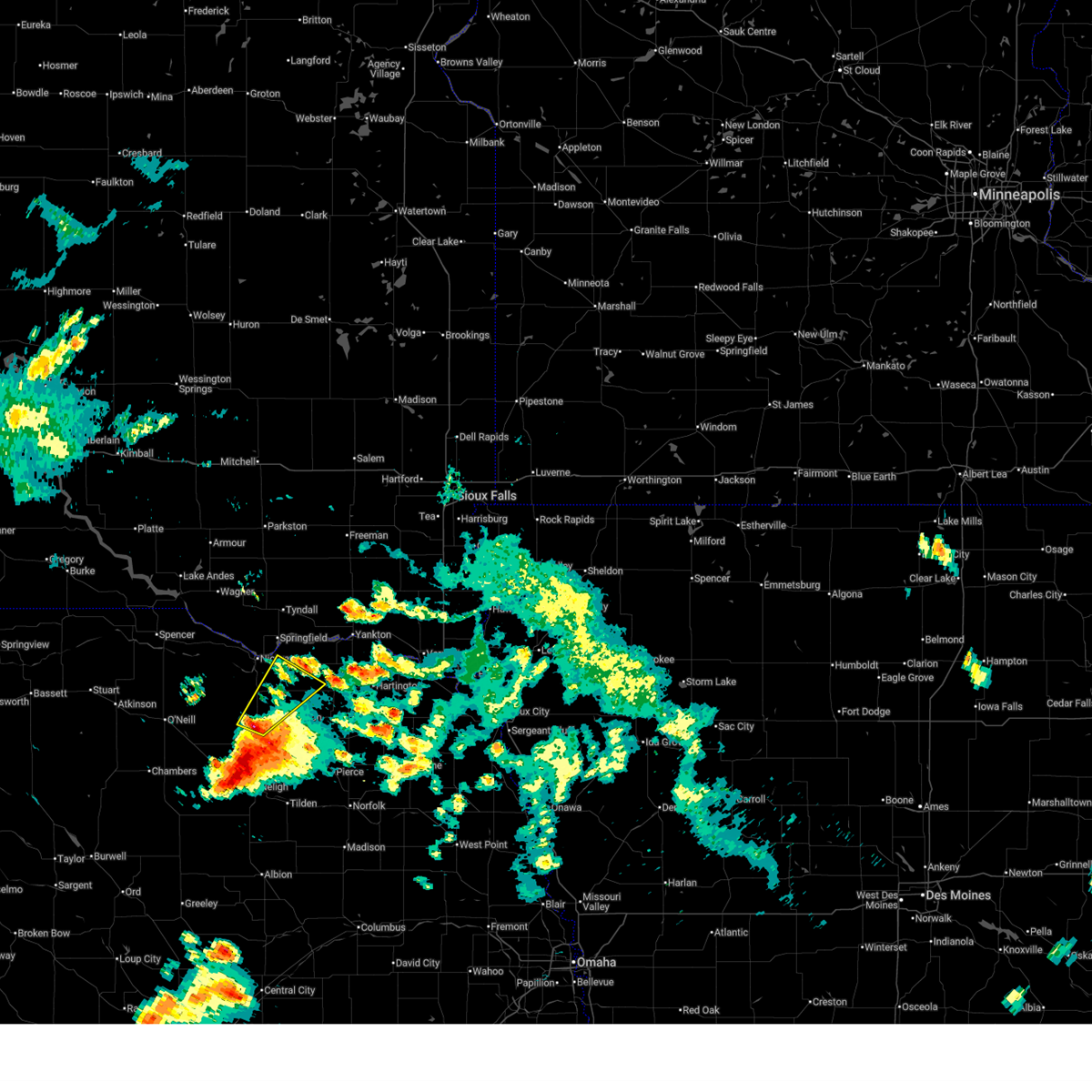
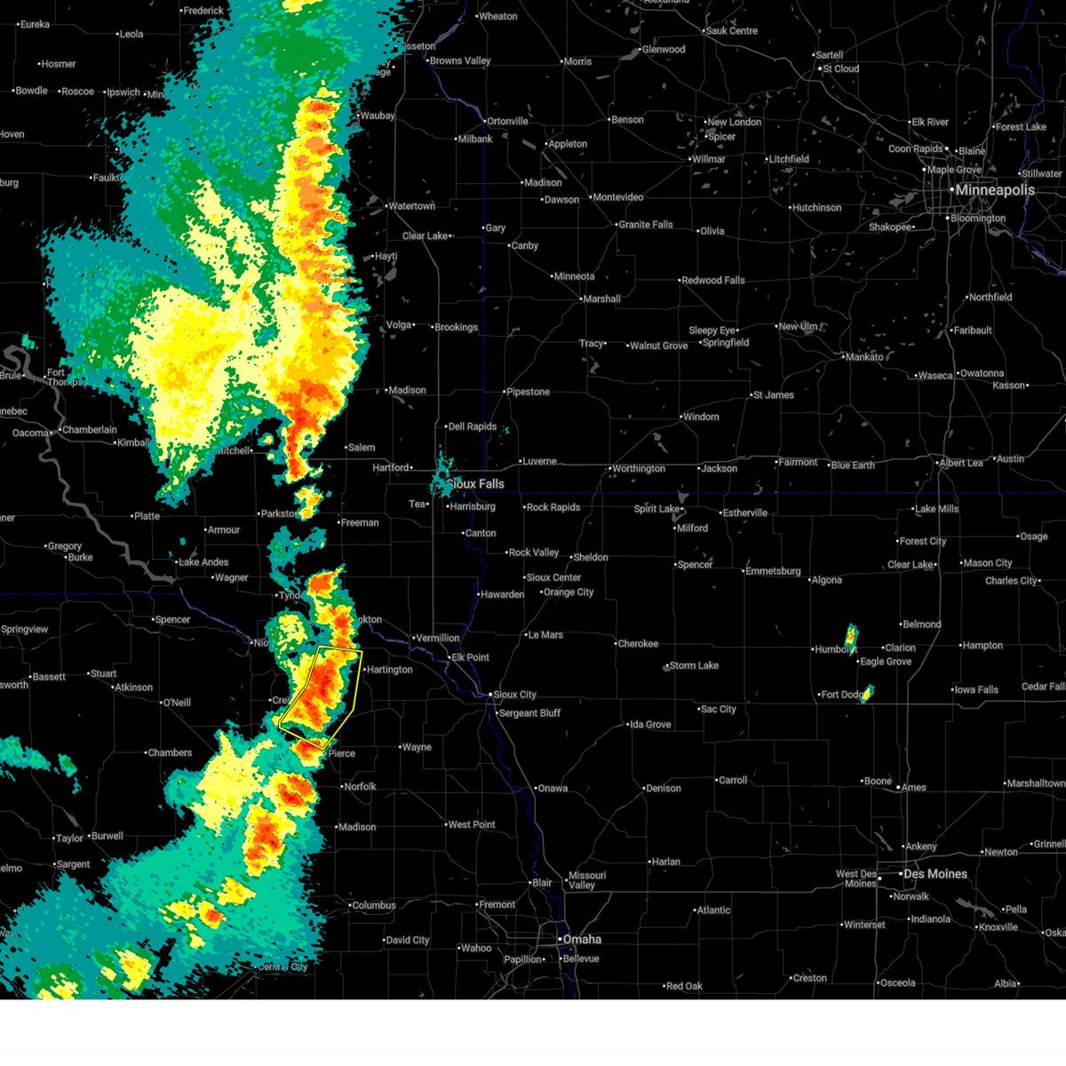
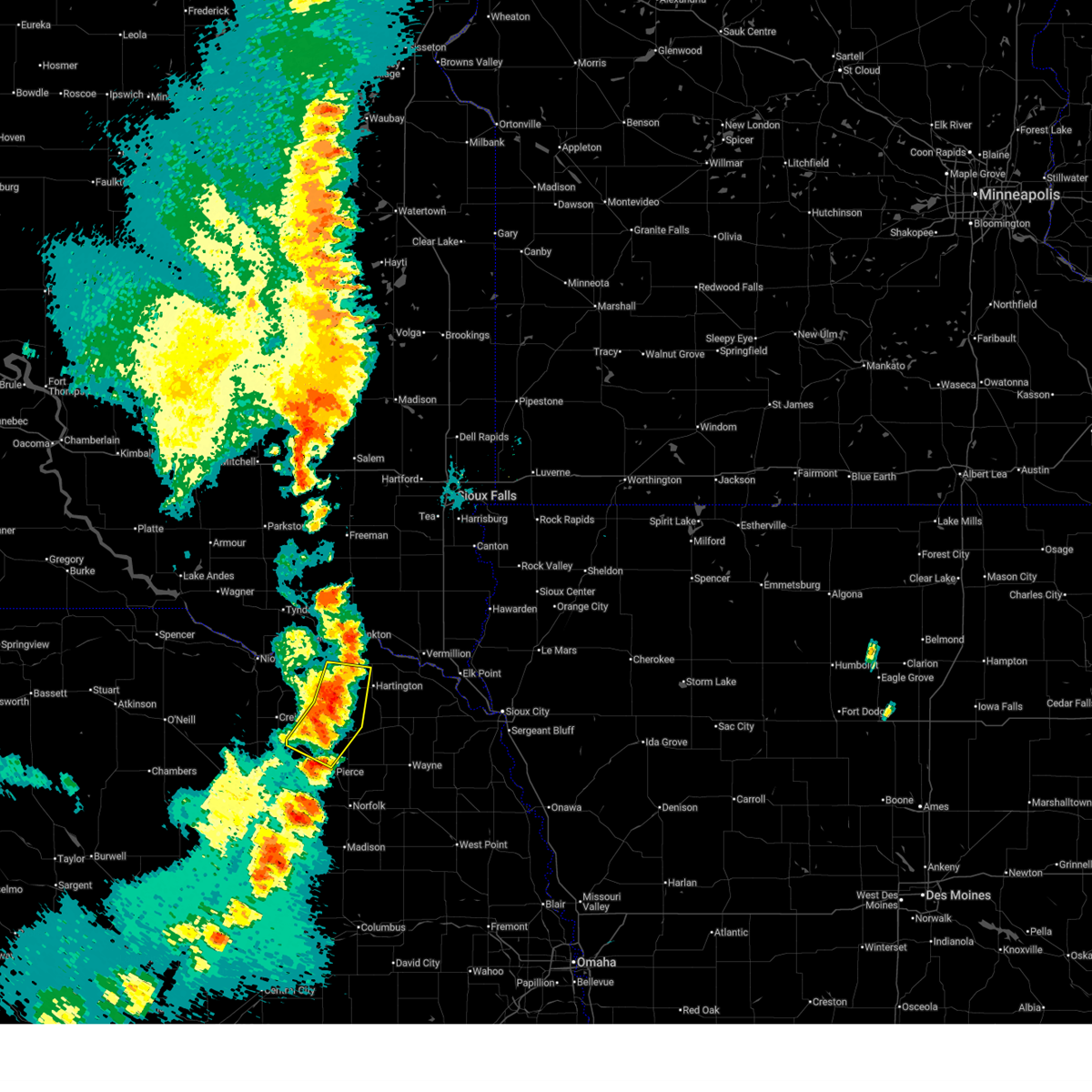
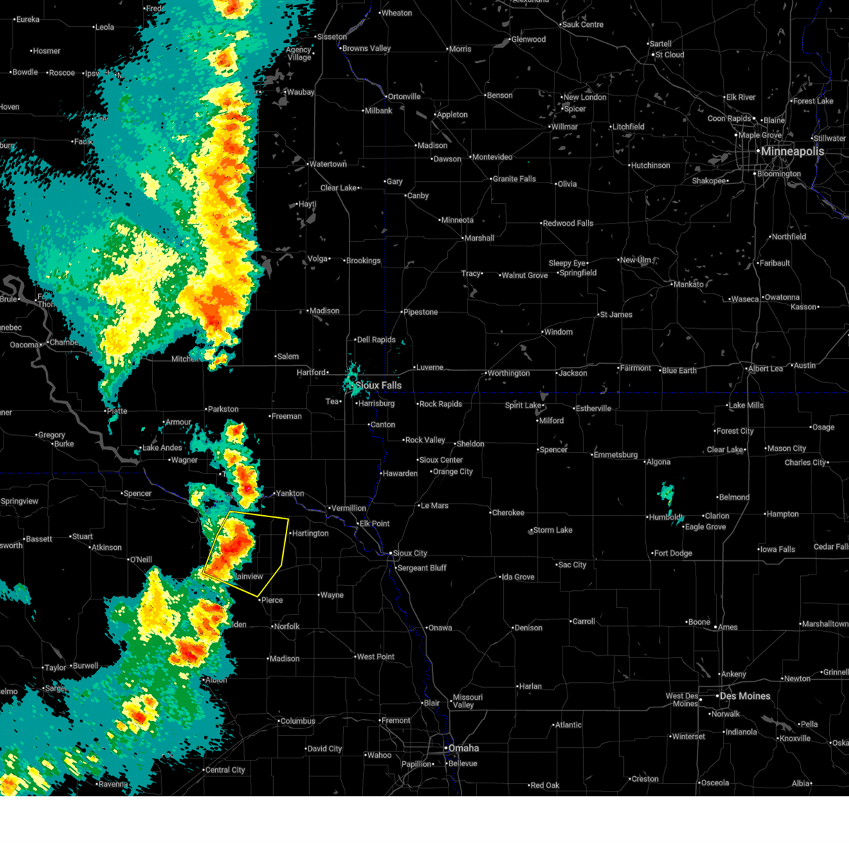
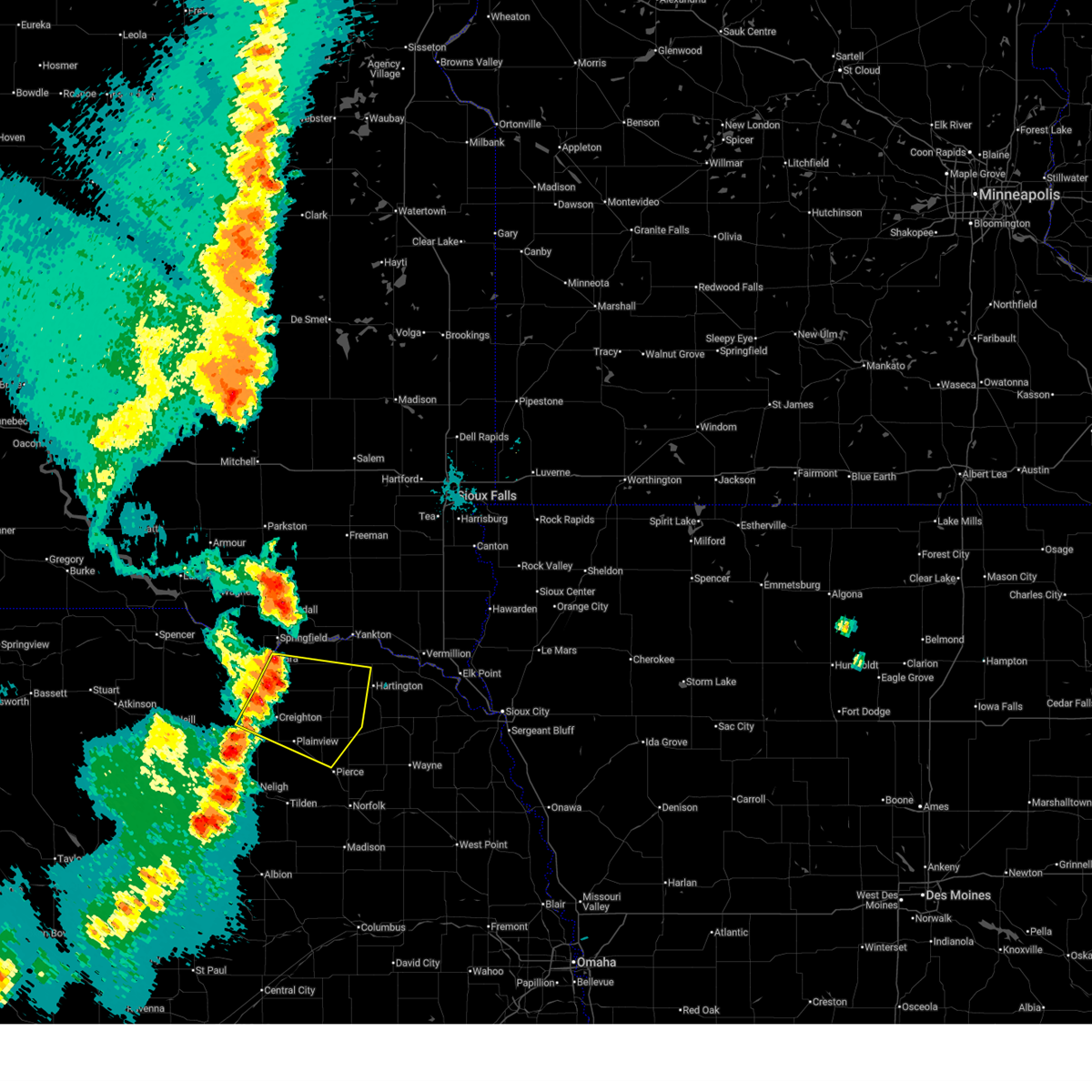
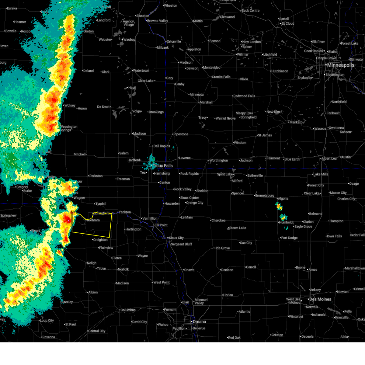
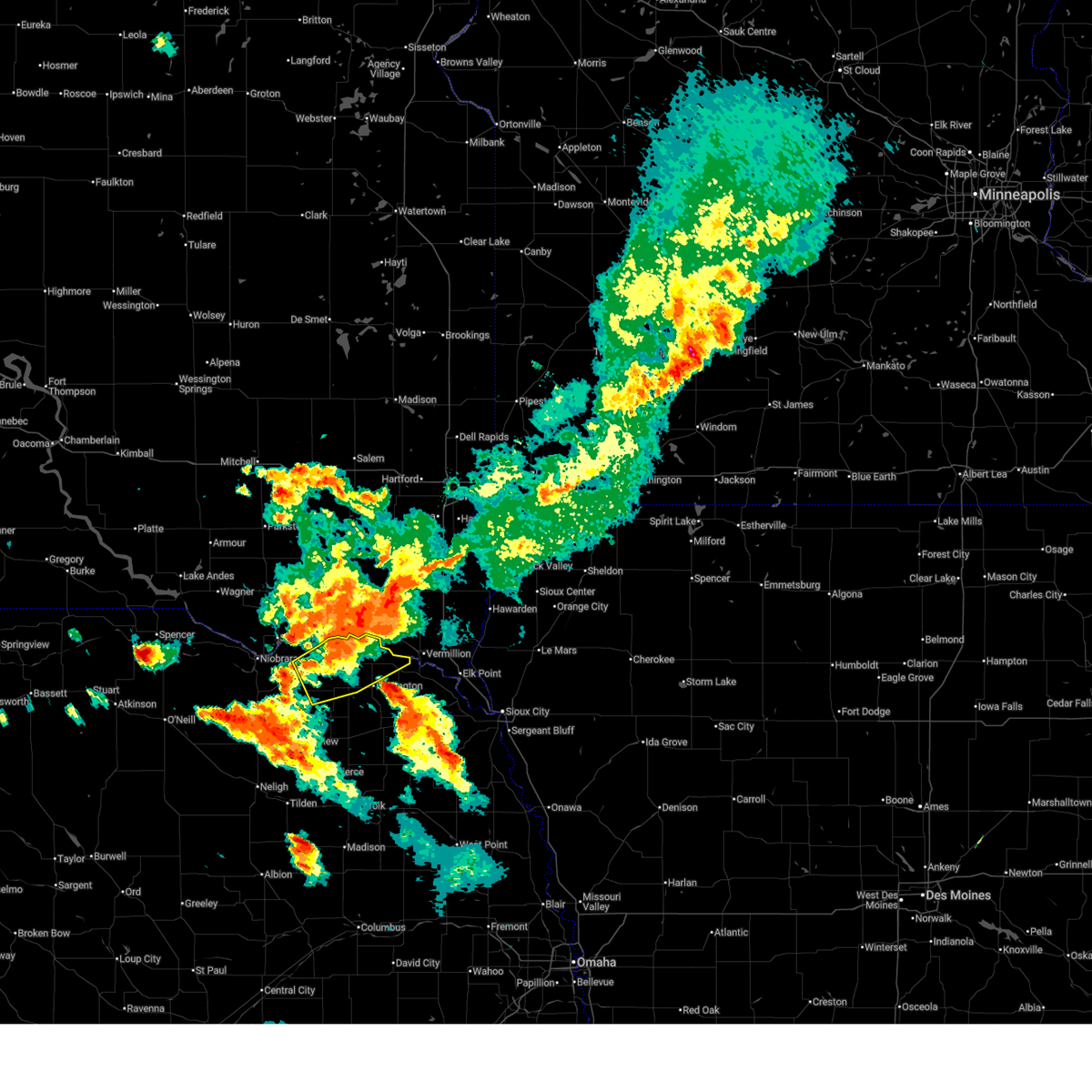
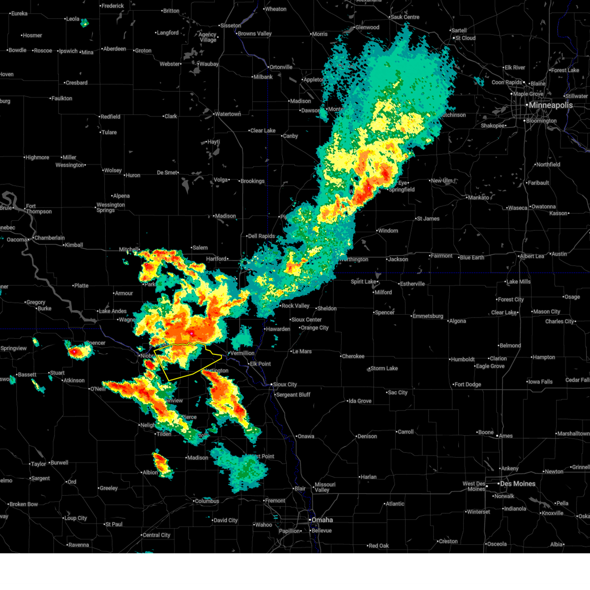
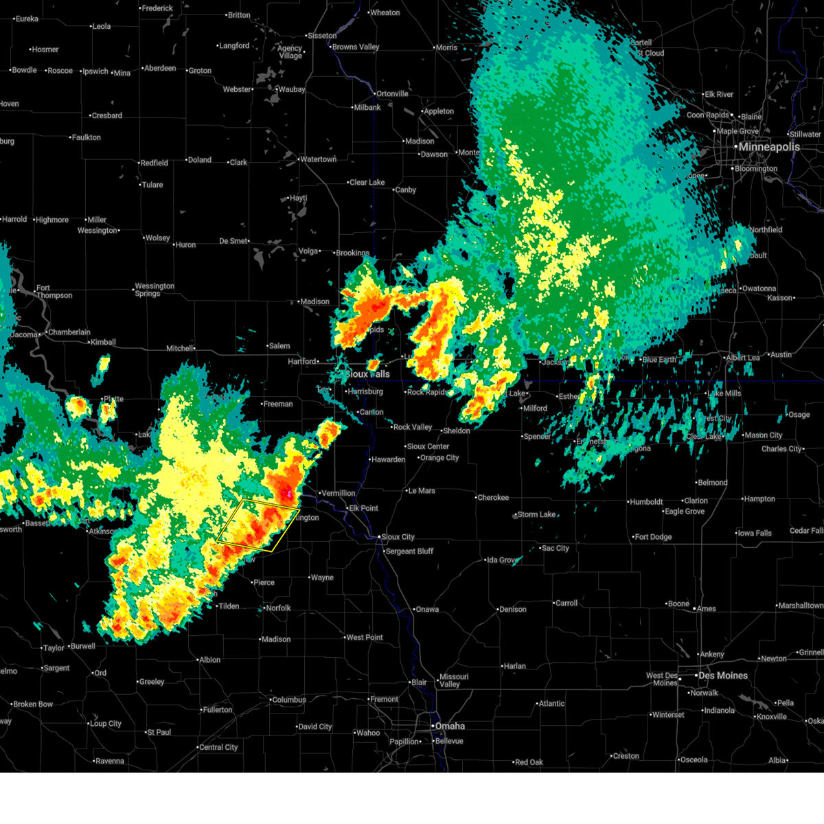
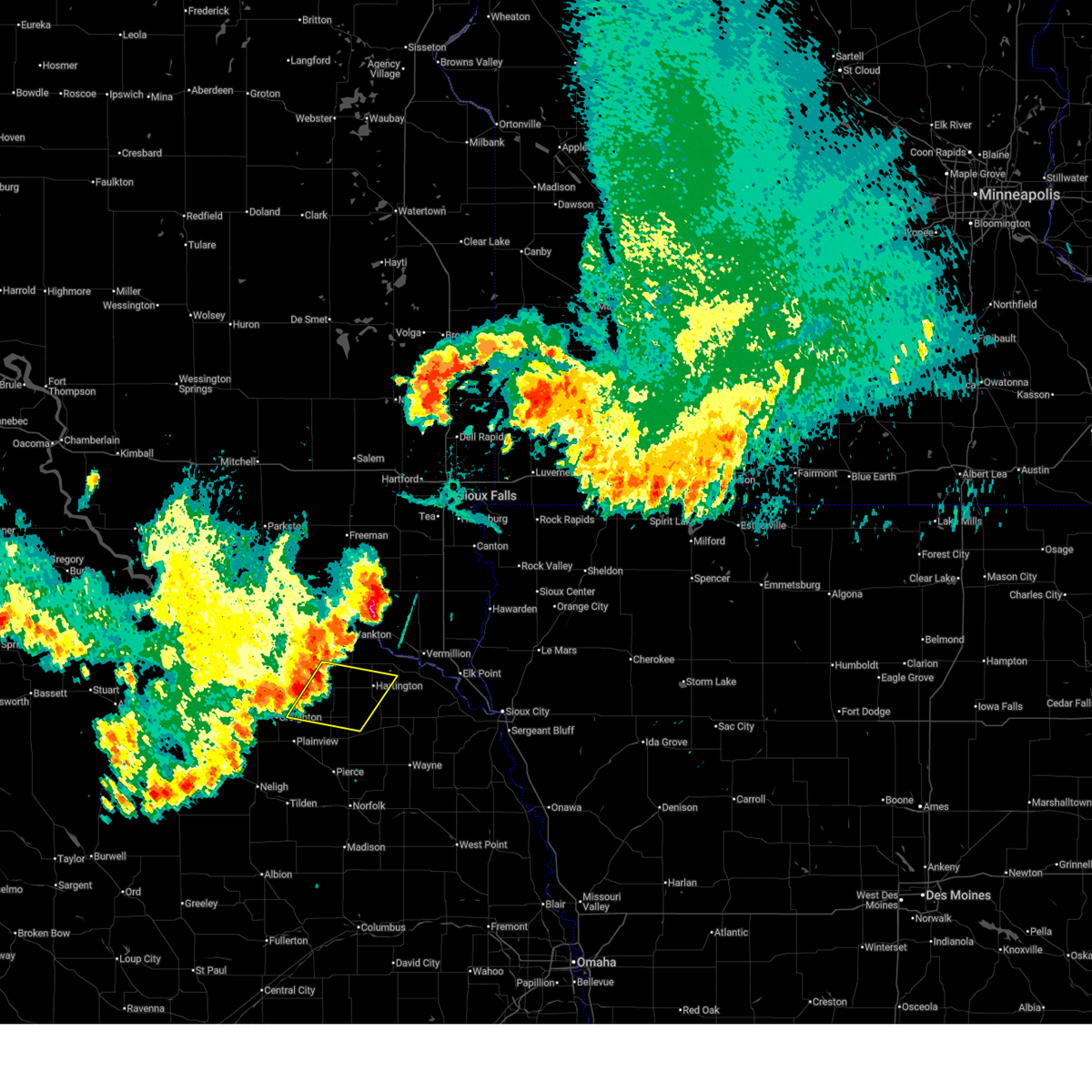
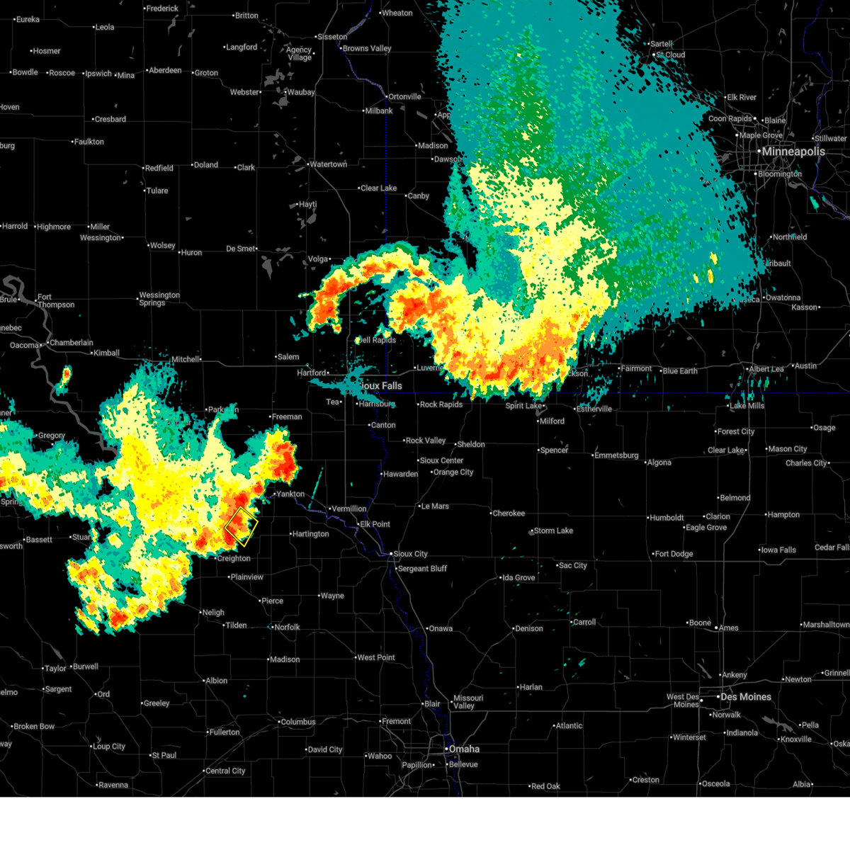
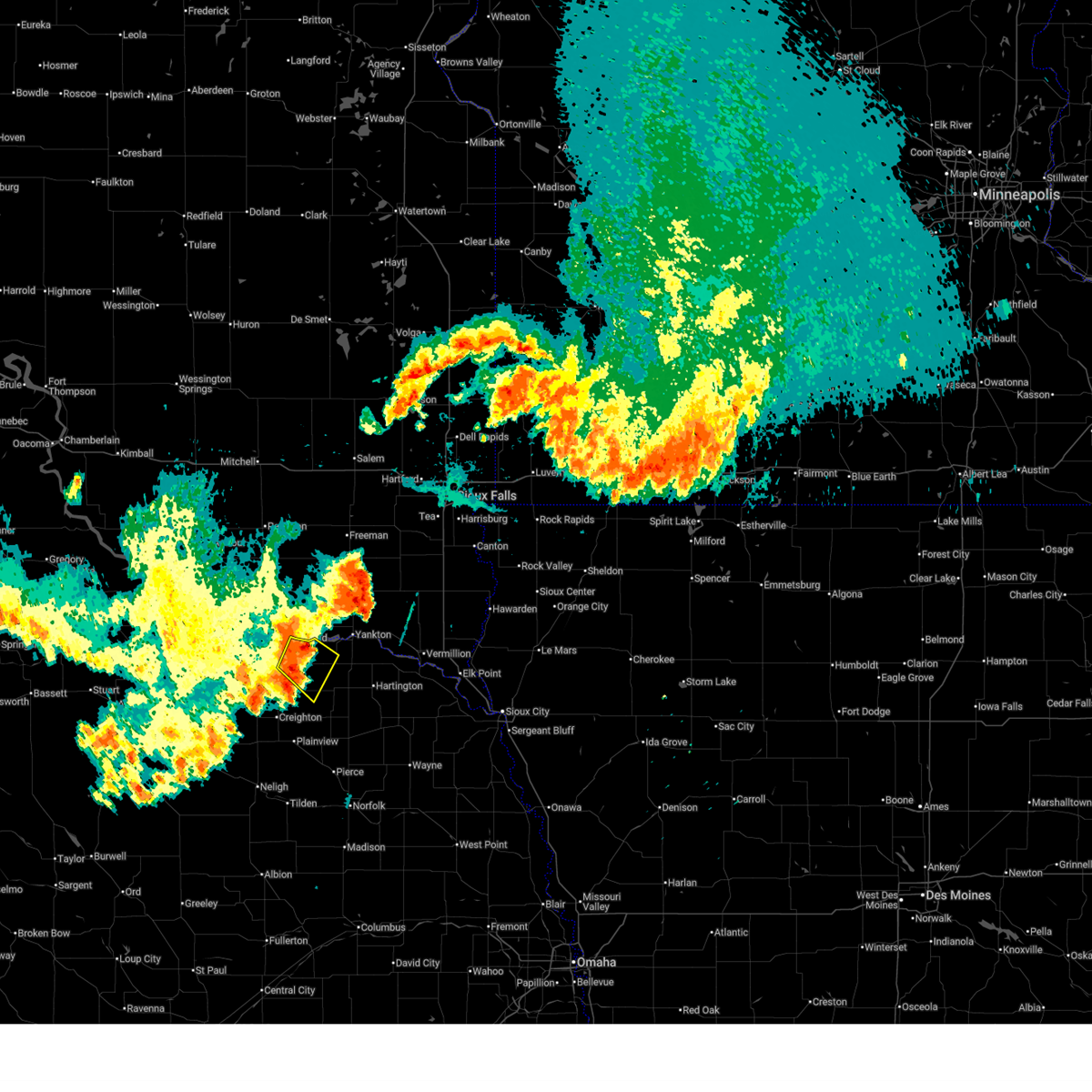
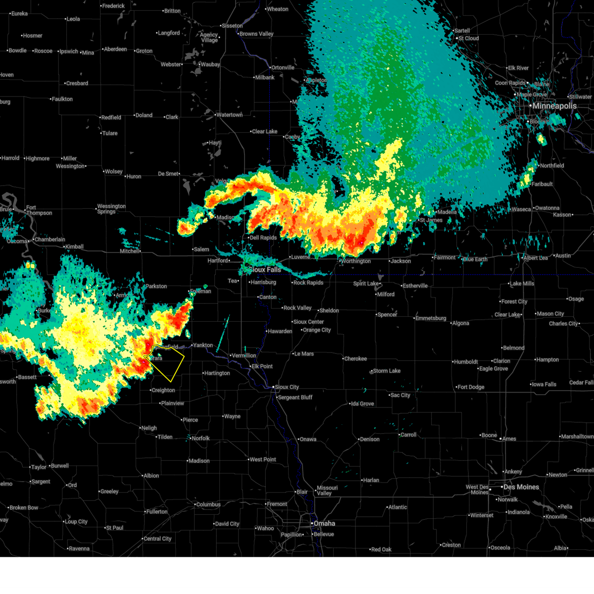
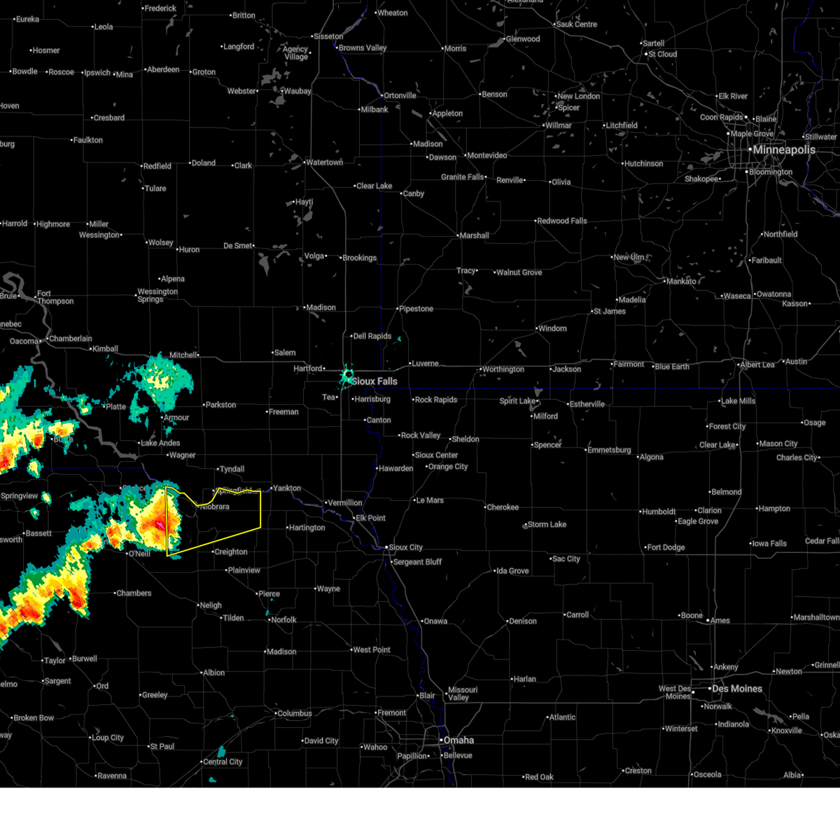
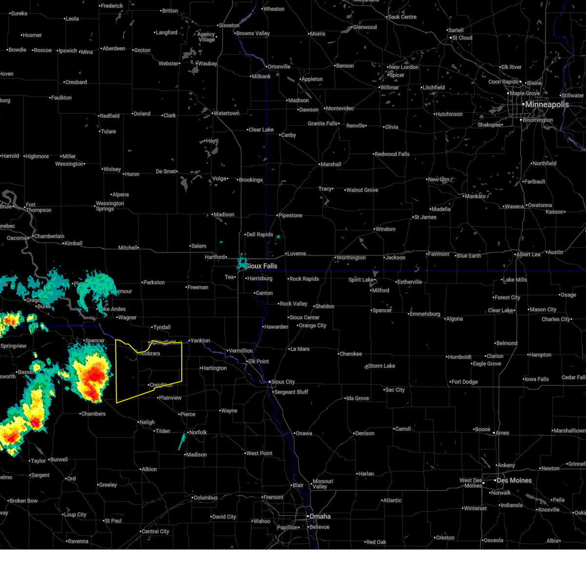
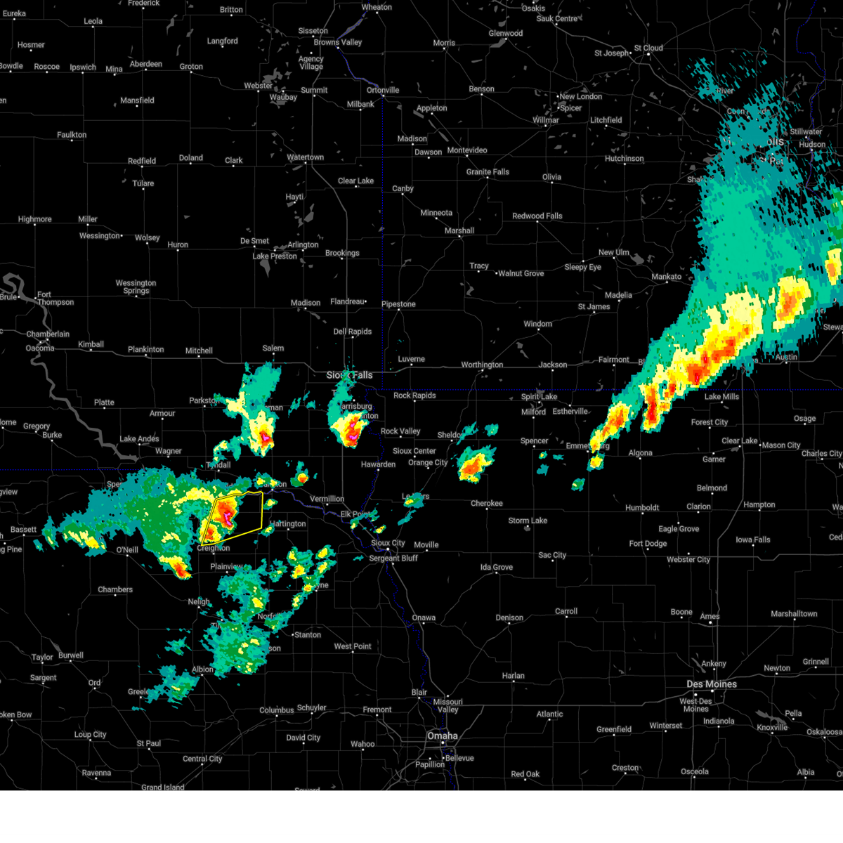
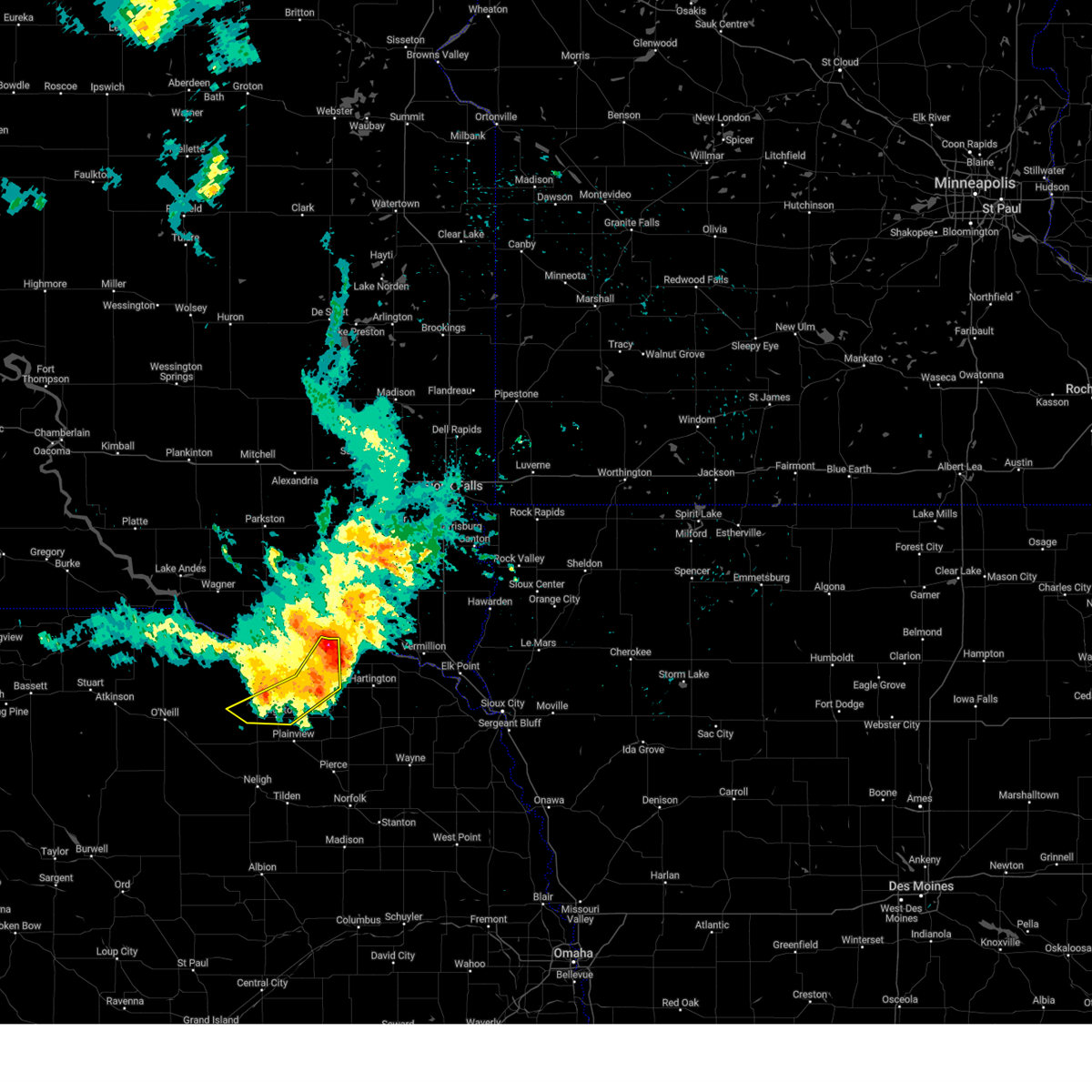
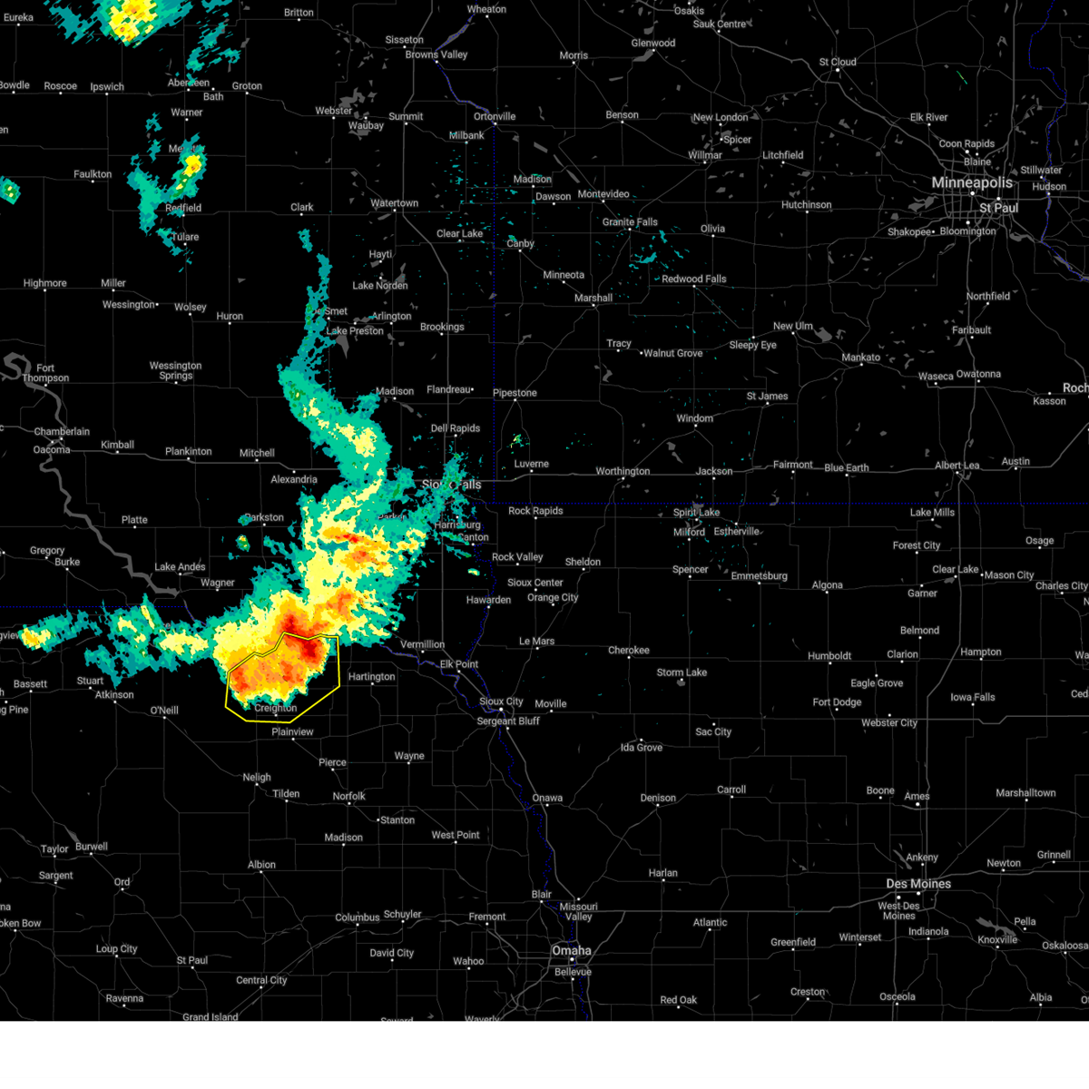
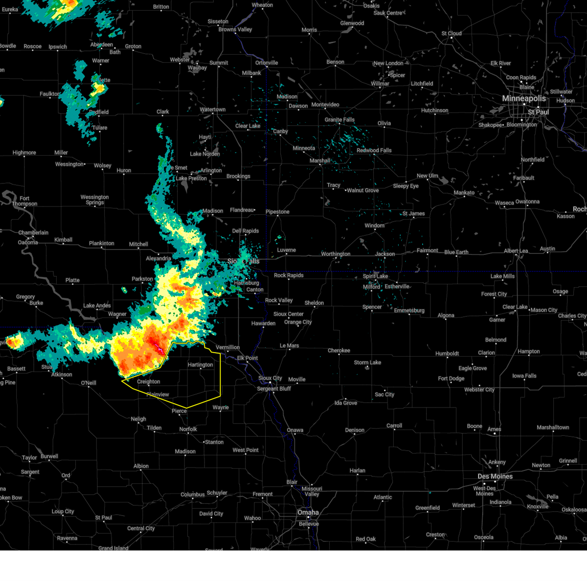
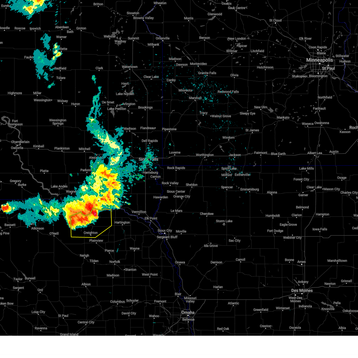
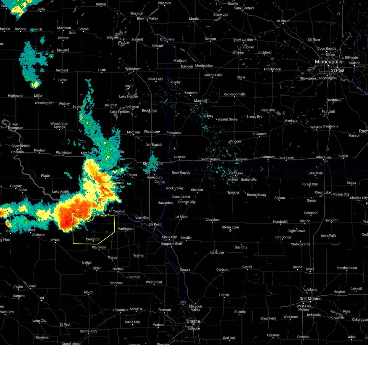
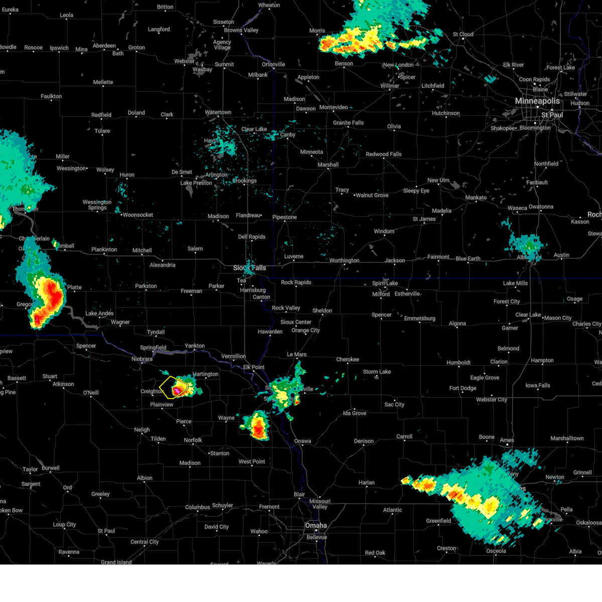
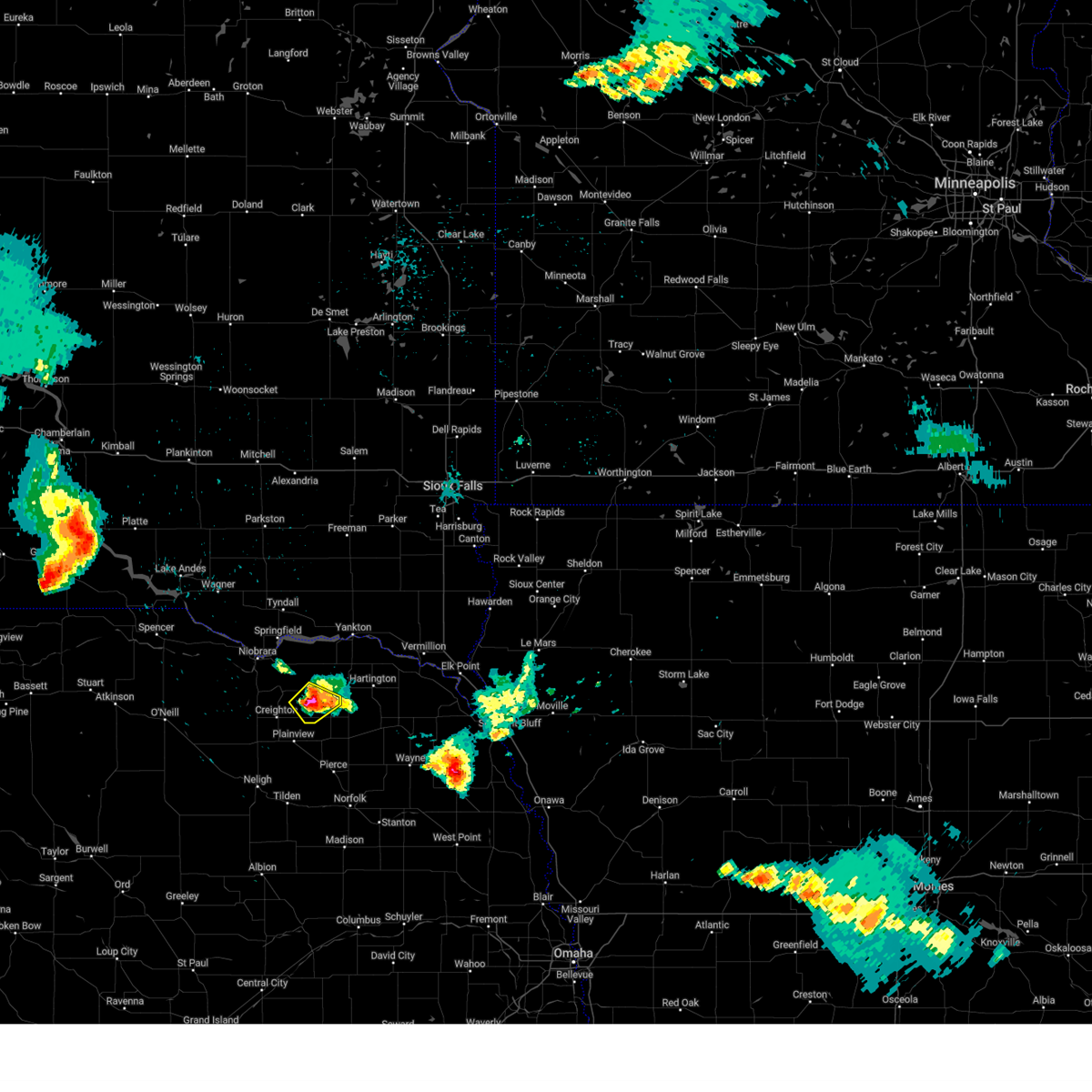
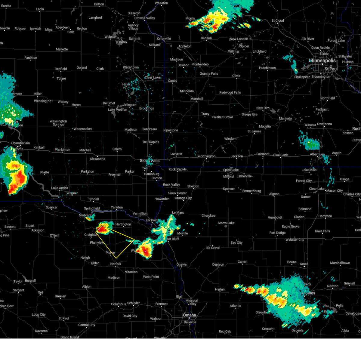
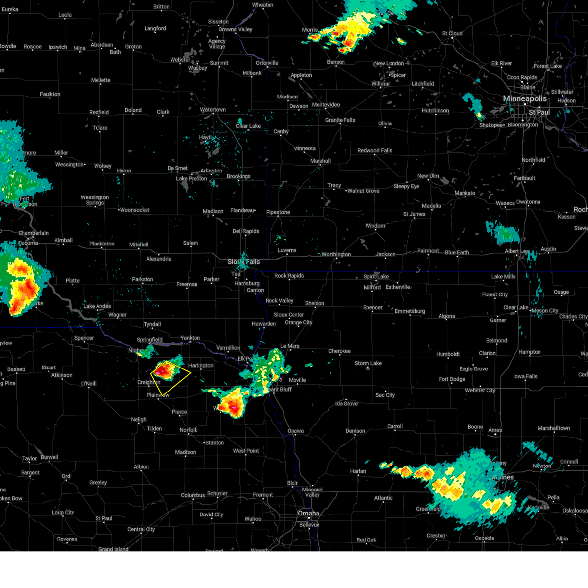
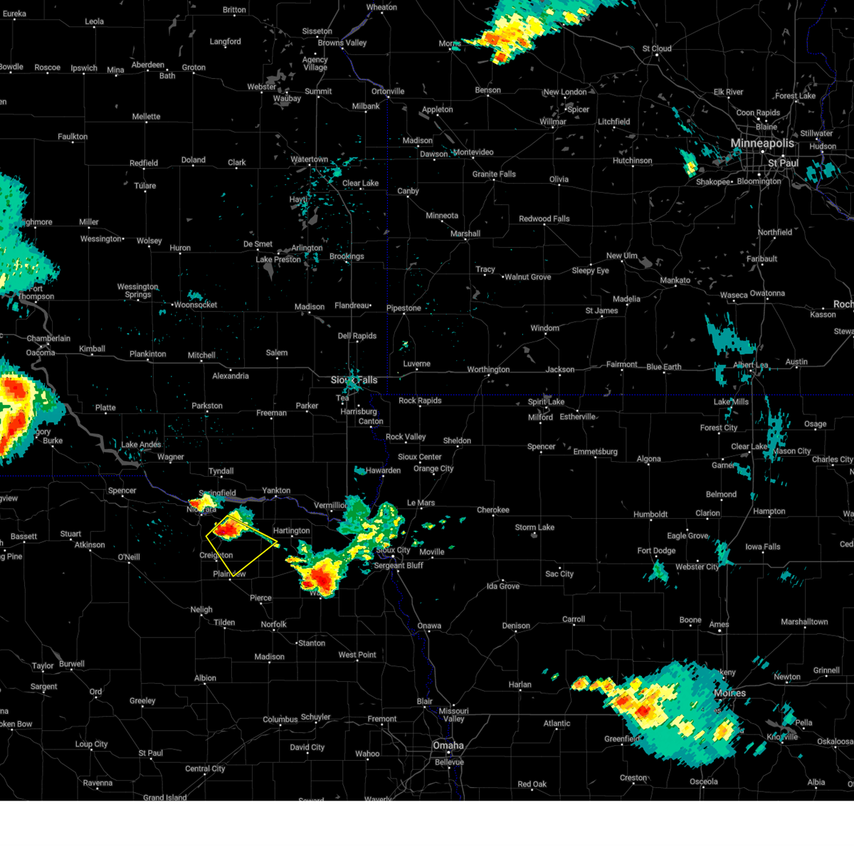
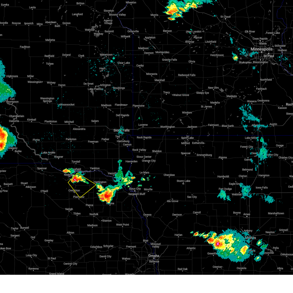
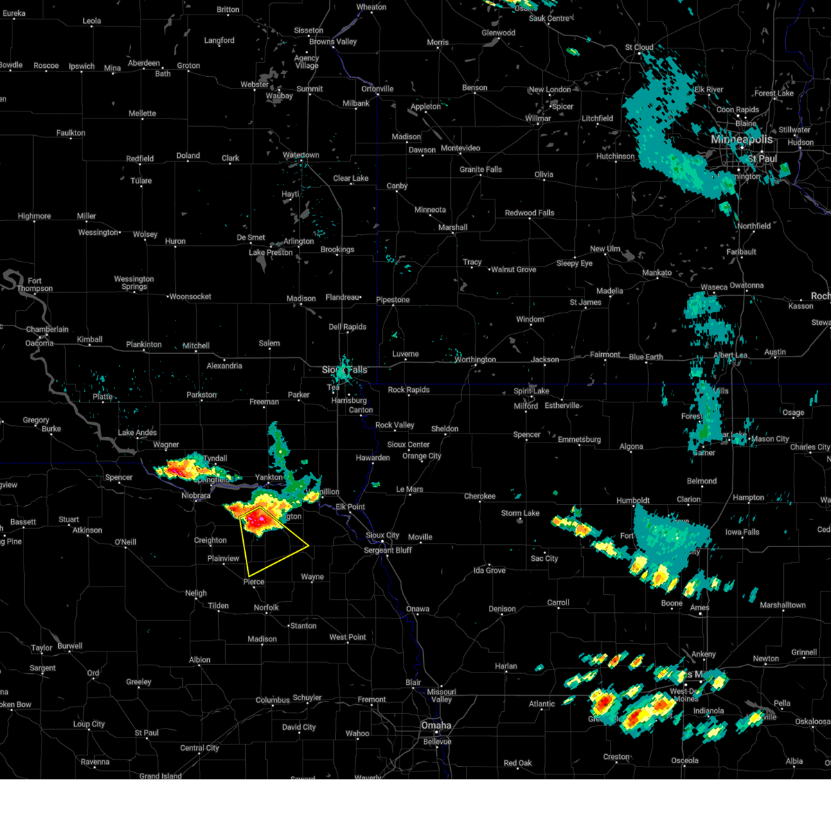
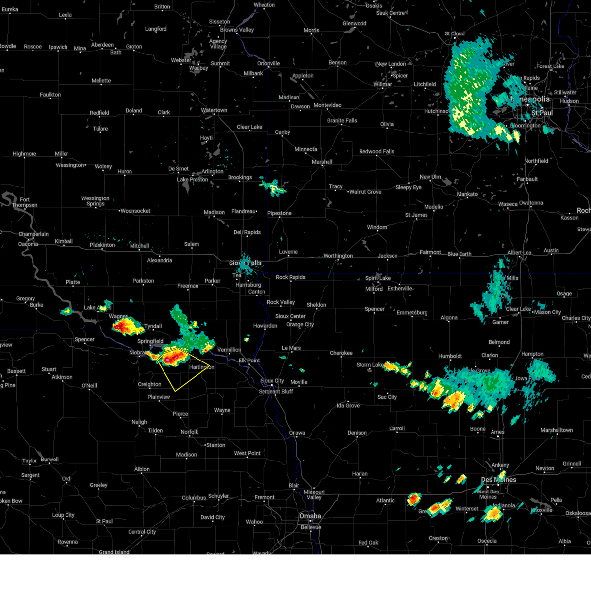
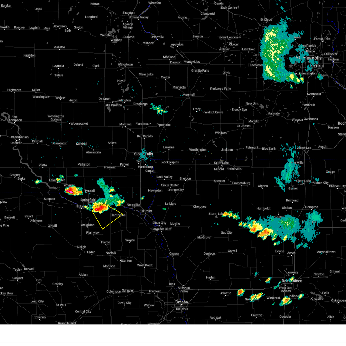
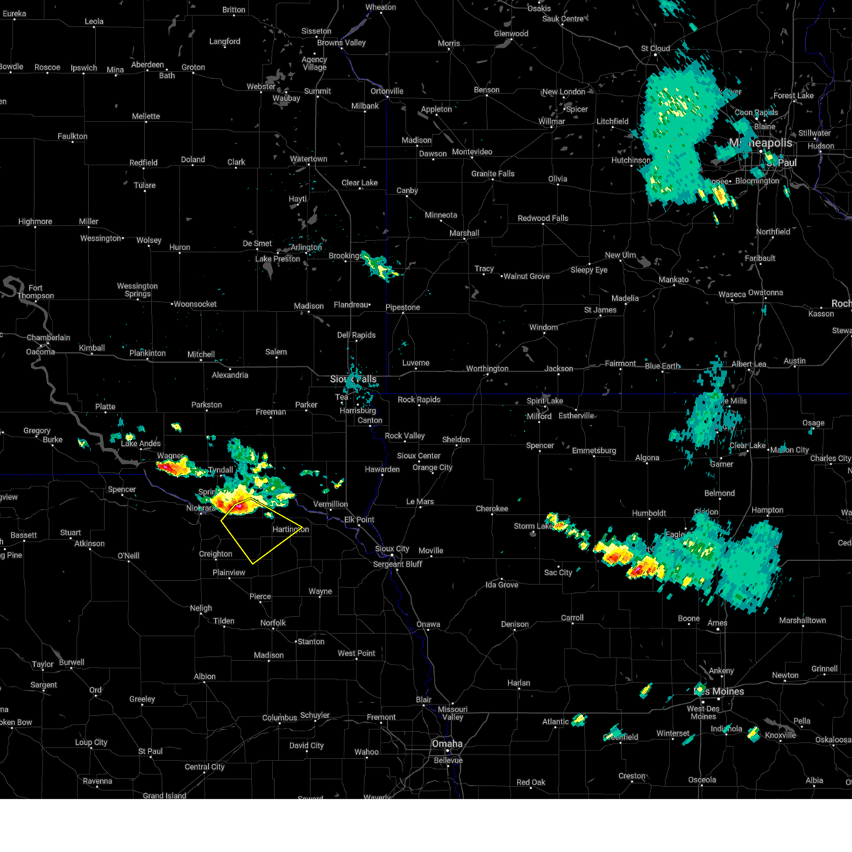
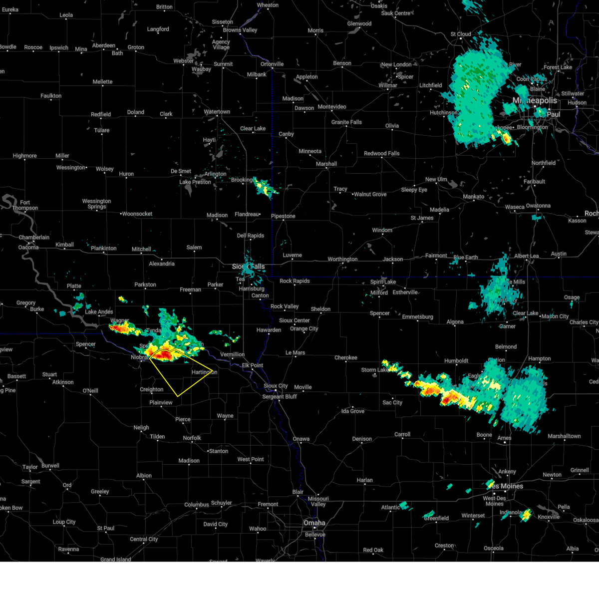
Hail Map for Bloomfield, NE
The Bloomfield, NE area has had 16 reports of on-the-ground hail by trained spotters, and has been under severe weather warnings 34 times during the past 12 months. Doppler radar has detected hail at or near Bloomfield, NE on 63 occasions, including 2 occasions during the past year.
| Name: | Bloomfield, NE |
| Where Located: | 52 miles E of Oneill, NE |
| Map: | Google Map for Bloomfield, NE |
| Population: | 1028 |
| Housing Units: | 565 |
| More Info: | Search Google for Bloomfield, NE |
0
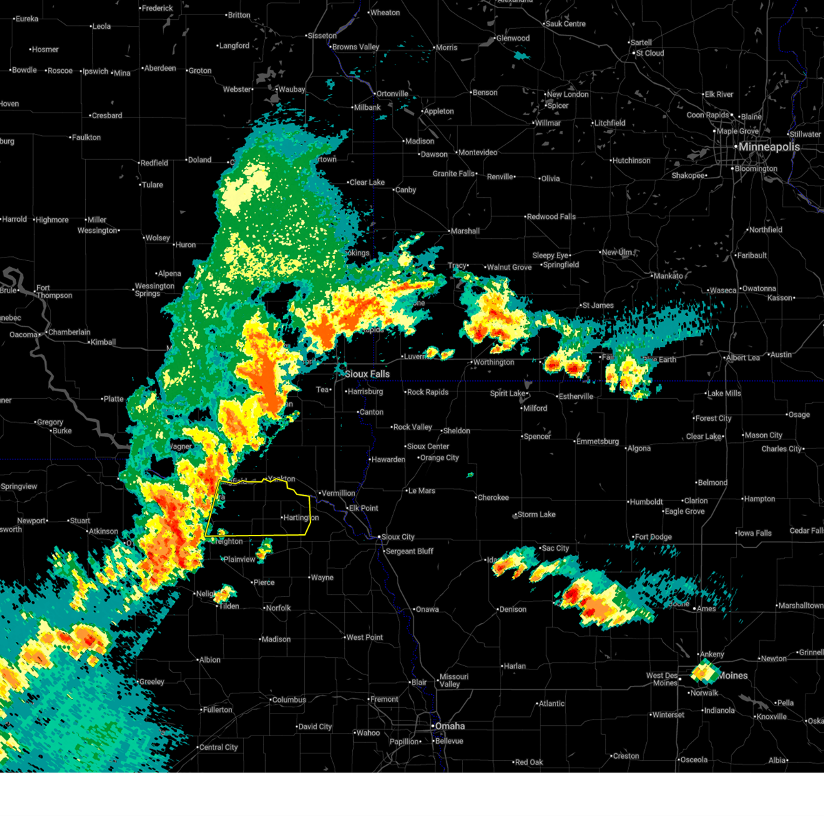
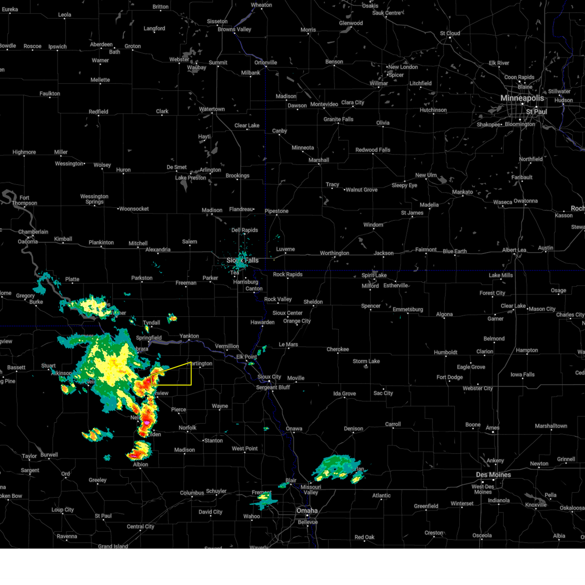
The Top Recent Hail Date for Bloomfield, NE is Sunday, August 3, 2025 (63rd out of 63)
Hail and Wind Damage Spotted near Bloomfield, NE
| Date / Time | Report Details |
|---|---|
| 7/29/2025 8:00 PM CDT |
 Svroax the national weather service in omaha has issued a * severe thunderstorm warning for, eastern knox county in northeastern nebraska, cedar county in northeastern nebraska, * until 900 pm cdt. * at 759 pm cdt, severe thunderstorms were located along a line extending from 4 miles east of santee to 3 miles east of winnetoon, moving east at 30 mph (radar indicated). Hazards include 60 mph wind gusts. Expect damage to roofs, siding, and trees. severe thunderstorms will be near, bloomfield around 810 pm cdt. other locations in the path of these severe thunderstorms include crofton, wausa, fordyce, st. Helena and hartington. Svroax the national weather service in omaha has issued a * severe thunderstorm warning for, eastern knox county in northeastern nebraska, cedar county in northeastern nebraska, * until 900 pm cdt. * at 759 pm cdt, severe thunderstorms were located along a line extending from 4 miles east of santee to 3 miles east of winnetoon, moving east at 30 mph (radar indicated). Hazards include 60 mph wind gusts. Expect damage to roofs, siding, and trees. severe thunderstorms will be near, bloomfield around 810 pm cdt. other locations in the path of these severe thunderstorms include crofton, wausa, fordyce, st. Helena and hartington.
|
| 7/28/2025 8:41 PM CDT |
 The storm which prompted the warning has weakened below severe limits, and no longer poses an immediate threat to life or property. therefore, the warning will be allowed to expire. a severe thunderstorm watch remains in effect until 100 am cdt for northeastern nebraska. to report severe weather, contact your nearest law enforcement agency. they will relay your report to the national weather service omaha. The storm which prompted the warning has weakened below severe limits, and no longer poses an immediate threat to life or property. therefore, the warning will be allowed to expire. a severe thunderstorm watch remains in effect until 100 am cdt for northeastern nebraska. to report severe weather, contact your nearest law enforcement agency. they will relay your report to the national weather service omaha.
|
| 7/28/2025 8:30 PM CDT |
 At 830 pm cdt, a severe thunderstorm was located near niobrara, or 17 miles south of tyndall, moving east at 35 mph (radar indicated). Hazards include 60 mph wind gusts and quarter size hail. Hail damage to vehicles is expected. expect wind damage to roofs, siding, and trees. Locations impacted include, bloomfield, verdigre, niobrara, santee, center, lindy, santee reservation, and niobrara state park. At 830 pm cdt, a severe thunderstorm was located near niobrara, or 17 miles south of tyndall, moving east at 35 mph (radar indicated). Hazards include 60 mph wind gusts and quarter size hail. Hail damage to vehicles is expected. expect wind damage to roofs, siding, and trees. Locations impacted include, bloomfield, verdigre, niobrara, santee, center, lindy, santee reservation, and niobrara state park.
|
| 7/28/2025 8:19 PM CDT |
 At 819 pm cdt, a severe thunderstorm was located 4 miles west of niobrara, or 21 miles southwest of tyndall, moving east at 35 mph (radar indicated). Hazards include 70 mph wind gusts and half dollar size hail. Hail damage to vehicles is expected. expect considerable tree damage. wind damage is also likely to mobile homes, roofs, and outbuildings. Locations impacted include, bloomfield, verdigre, niobrara, santee, center, verdel, lindy, santee reservation, and niobrara state park. At 819 pm cdt, a severe thunderstorm was located 4 miles west of niobrara, or 21 miles southwest of tyndall, moving east at 35 mph (radar indicated). Hazards include 70 mph wind gusts and half dollar size hail. Hail damage to vehicles is expected. expect considerable tree damage. wind damage is also likely to mobile homes, roofs, and outbuildings. Locations impacted include, bloomfield, verdigre, niobrara, santee, center, verdel, lindy, santee reservation, and niobrara state park.
|
| 7/28/2025 8:03 PM CDT |
 At 802 pm cdt, a severe thunderstorm was located 6 miles southwest of verdel, or 22 miles southeast of spencer, moving east at 40 mph (radar indicated). Hazards include golf ball size hail and 70 mph wind gusts. People and animals outdoors will be injured. expect hail damage to roofs, siding, windows, and vehicles. expect considerable tree damage. wind damage is also likely to mobile homes, roofs, and outbuildings. Locations impacted include, bloomfield, verdigre, niobrara, santee, center, verdel, lindy, santee reservation, and niobrara state park. At 802 pm cdt, a severe thunderstorm was located 6 miles southwest of verdel, or 22 miles southeast of spencer, moving east at 40 mph (radar indicated). Hazards include golf ball size hail and 70 mph wind gusts. People and animals outdoors will be injured. expect hail damage to roofs, siding, windows, and vehicles. expect considerable tree damage. wind damage is also likely to mobile homes, roofs, and outbuildings. Locations impacted include, bloomfield, verdigre, niobrara, santee, center, verdel, lindy, santee reservation, and niobrara state park.
|
| 7/28/2025 7:53 PM CDT |
 At 753 pm cdt, a severe thunderstorm was located 6 miles southeast of lynch, or 17 miles southeast of spencer, moving east at 45 mph (radar indicated). Hazards include ping pong ball size hail and 60 mph wind gusts. People and animals outdoors will be injured. expect hail damage to roofs, siding, windows, and vehicles. expect wind damage to roofs, siding, and trees. Locations impacted include, bloomfield, verdigre, niobrara, santee, center, verdel, lindy, santee reservation, and niobrara state park. At 753 pm cdt, a severe thunderstorm was located 6 miles southeast of lynch, or 17 miles southeast of spencer, moving east at 45 mph (radar indicated). Hazards include ping pong ball size hail and 60 mph wind gusts. People and animals outdoors will be injured. expect hail damage to roofs, siding, windows, and vehicles. expect wind damage to roofs, siding, and trees. Locations impacted include, bloomfield, verdigre, niobrara, santee, center, verdel, lindy, santee reservation, and niobrara state park.
|
| 7/28/2025 7:28 PM CDT |
 Svroax the national weather service in omaha has issued a * severe thunderstorm warning for, central knox county in northeastern nebraska, * until 845 pm cdt. * at 727 pm cdt, a severe thunderstorm was located 6 miles southwest of dante, or 16 miles southeast of pickstown, moving east at 25 mph (radar indicated). Hazards include 60 mph wind gusts. expect damage to roofs, siding, and trees Svroax the national weather service in omaha has issued a * severe thunderstorm warning for, central knox county in northeastern nebraska, * until 845 pm cdt. * at 727 pm cdt, a severe thunderstorm was located 6 miles southwest of dante, or 16 miles southeast of pickstown, moving east at 25 mph (radar indicated). Hazards include 60 mph wind gusts. expect damage to roofs, siding, and trees
|
| 7/15/2025 7:56 PM CDT |
 At 756 pm cdt, severe thunderstorms were located along a line extending from 4 miles north of crofton to 7 miles southwest of bloomfield to 8 miles northeast of orchard, moving east at 30 mph (radar indicated). Hazards include 60 mph wind gusts. Expect damage to roofs, siding, and trees. locations impacted include, creighton, bloomfield, crofton, winnetoon, wausa, fordyce, st. Helena and plainview. At 756 pm cdt, severe thunderstorms were located along a line extending from 4 miles north of crofton to 7 miles southwest of bloomfield to 8 miles northeast of orchard, moving east at 30 mph (radar indicated). Hazards include 60 mph wind gusts. Expect damage to roofs, siding, and trees. locations impacted include, creighton, bloomfield, crofton, winnetoon, wausa, fordyce, st. Helena and plainview.
|
| 7/15/2025 7:26 PM CDT |
 Svroax the national weather service in omaha has issued a * severe thunderstorm warning for, northwestern pierce county in northeastern nebraska, northern antelope county in northeastern nebraska, knox county in northeastern nebraska, northwestern cedar county in northeastern nebraska, * until 815 pm cdt. * at 725 pm cdt, severe thunderstorms were located along a line extending from 4 miles southwest of tabor to 4 miles north of verdigre to 9 miles north of page, moving southeast at 30 mph (radar indicated). Hazards include 60 mph wind gusts. Expect damage to roofs, siding, and trees. severe thunderstorms will be near, verdigre and center around 730 pm cdt. winnetoon around 740 pm cdt. Other locations in the path of these severe thunderstorms include creighton, bloomfield and crofton. Svroax the national weather service in omaha has issued a * severe thunderstorm warning for, northwestern pierce county in northeastern nebraska, northern antelope county in northeastern nebraska, knox county in northeastern nebraska, northwestern cedar county in northeastern nebraska, * until 815 pm cdt. * at 725 pm cdt, severe thunderstorms were located along a line extending from 4 miles southwest of tabor to 4 miles north of verdigre to 9 miles north of page, moving southeast at 30 mph (radar indicated). Hazards include 60 mph wind gusts. Expect damage to roofs, siding, and trees. severe thunderstorms will be near, verdigre and center around 730 pm cdt. winnetoon around 740 pm cdt. Other locations in the path of these severe thunderstorms include creighton, bloomfield and crofton.
|
| 7/10/2025 5:40 PM CDT |
 the severe thunderstorm warning has been cancelled and is no longer in effect the severe thunderstorm warning has been cancelled and is no longer in effect
|
| 7/10/2025 5:34 PM CDT |
 the severe thunderstorm warning has been cancelled and is no longer in effect the severe thunderstorm warning has been cancelled and is no longer in effect
|
| 7/10/2025 5:34 PM CDT |
 At 534 pm cdt, a severe thunderstorm was located over center, or 23 miles southwest of lewis and clark state recreation area, moving northeast at 45 mph (radar indicated). Hazards include 60 mph wind gusts and quarter size hail. Hail damage to vehicles is expected. expect wind damage to roofs, siding, and trees. This severe thunderstorm will remain over mainly rural areas of central knox county, including the following locations, santee reservation and bazile mills. At 534 pm cdt, a severe thunderstorm was located over center, or 23 miles southwest of lewis and clark state recreation area, moving northeast at 45 mph (radar indicated). Hazards include 60 mph wind gusts and quarter size hail. Hail damage to vehicles is expected. expect wind damage to roofs, siding, and trees. This severe thunderstorm will remain over mainly rural areas of central knox county, including the following locations, santee reservation and bazile mills.
|
| 7/10/2025 5:17 PM CDT |
 Svroax the national weather service in omaha has issued a * severe thunderstorm warning for, north central antelope county in northeastern nebraska, southeastern knox county in northeastern nebraska, * until 600 pm cdt. * at 516 pm cdt, a severe thunderstorm was located 5 miles southwest of winnetoon, or 22 miles north of neligh, moving northeast at 30 mph (radar indicated). Hazards include 60 mph wind gusts and quarter size hail. Hail damage to vehicles is expected. expect wind damage to roofs, siding, and trees. this severe thunderstorm will be near, creighton and winnetoon around 520 pm cdt. Center around 535 pm cdt. Svroax the national weather service in omaha has issued a * severe thunderstorm warning for, north central antelope county in northeastern nebraska, southeastern knox county in northeastern nebraska, * until 600 pm cdt. * at 516 pm cdt, a severe thunderstorm was located 5 miles southwest of winnetoon, or 22 miles north of neligh, moving northeast at 30 mph (radar indicated). Hazards include 60 mph wind gusts and quarter size hail. Hail damage to vehicles is expected. expect wind damage to roofs, siding, and trees. this severe thunderstorm will be near, creighton and winnetoon around 520 pm cdt. Center around 535 pm cdt.
|
| 7/9/2025 11:38 PM CDT |
 the severe thunderstorm warning has been cancelled and is no longer in effect the severe thunderstorm warning has been cancelled and is no longer in effect
|
| 7/9/2025 11:38 PM CDT |
 At 1138 pm cdt, severe thunderstorms were located along a line extending from 3 miles west of fordyce to 3 miles southeast of wausa to 10 miles west of pierce, moving east at 30 mph (radar indicated). Hazards include 60 mph wind gusts and quarter size hail. Hail damage to vehicles is expected. expect wind damage to roofs, siding, and trees. Locations impacted include, plainview, osmond, crofton, wausa, fordyce, pleasant valley, magnet, foster, mclean, and the highway 81 and 20 junction. At 1138 pm cdt, severe thunderstorms were located along a line extending from 3 miles west of fordyce to 3 miles southeast of wausa to 10 miles west of pierce, moving east at 30 mph (radar indicated). Hazards include 60 mph wind gusts and quarter size hail. Hail damage to vehicles is expected. expect wind damage to roofs, siding, and trees. Locations impacted include, plainview, osmond, crofton, wausa, fordyce, pleasant valley, magnet, foster, mclean, and the highway 81 and 20 junction.
|
| 7/9/2025 11:20 PM CDT |
 At 1120 pm cdt, severe thunderstorms were located along a line extending from 5 miles northwest of crofton to 3 miles south of bloomfield to 7 miles southwest of plainview, moving southeast at 30 mph (radar indicated). Hazards include 60 mph wind gusts and quarter size hail. Hail damage to vehicles is expected. expect wind damage to roofs, siding, and trees. Locations impacted include, crofton, wausa, osmond and fordyce. At 1120 pm cdt, severe thunderstorms were located along a line extending from 5 miles northwest of crofton to 3 miles south of bloomfield to 7 miles southwest of plainview, moving southeast at 30 mph (radar indicated). Hazards include 60 mph wind gusts and quarter size hail. Hail damage to vehicles is expected. expect wind damage to roofs, siding, and trees. Locations impacted include, crofton, wausa, osmond and fordyce.
|
| 7/9/2025 10:56 PM CDT |
 Svroax the national weather service in omaha has issued a * severe thunderstorm warning for, northern pierce county in northeastern nebraska, northeastern antelope county in northeastern nebraska, southeastern knox county in northeastern nebraska, southwestern cedar county in northeastern nebraska, * until 1145 pm cdt. * at 1056 pm cdt, severe thunderstorms were located along a line extending from 4 miles northeast of santee to 2 miles northeast of center to 9 miles east of orchard, moving southeast at 30 mph (radar indicated). Hazards include 60 mph wind gusts and quarter size hail. Hail damage to vehicles is expected. expect wind damage to roofs, siding, and trees. severe thunderstorms will be near, creighton around 1100 pm cdt. plainview and bloomfield around 1110 pm cdt. Other locations in the path of these severe thunderstorms include crofton, osmond, wausa and fordyce. Svroax the national weather service in omaha has issued a * severe thunderstorm warning for, northern pierce county in northeastern nebraska, northeastern antelope county in northeastern nebraska, southeastern knox county in northeastern nebraska, southwestern cedar county in northeastern nebraska, * until 1145 pm cdt. * at 1056 pm cdt, severe thunderstorms were located along a line extending from 4 miles northeast of santee to 2 miles northeast of center to 9 miles east of orchard, moving southeast at 30 mph (radar indicated). Hazards include 60 mph wind gusts and quarter size hail. Hail damage to vehicles is expected. expect wind damage to roofs, siding, and trees. severe thunderstorms will be near, creighton around 1100 pm cdt. plainview and bloomfield around 1110 pm cdt. Other locations in the path of these severe thunderstorms include crofton, osmond, wausa and fordyce.
|
| 7/9/2025 10:15 PM CDT |
 Svroax the national weather service in omaha has issued a * severe thunderstorm warning for, knox county in northeastern nebraska, * until 1100 pm cdt. * at 1015 pm cdt, a severe thunderstorm was located 5 miles southwest of verdel, or 23 miles east of spencer, moving east at 40 mph (radar indicated). Hazards include 60 mph wind gusts and quarter size hail. Hail damage to vehicles is expected. expect wind damage to roofs, siding, and trees. this severe thunderstorm will be near, verdel around 1020 pm cdt. Niobrara around 1025 pm cdt. Svroax the national weather service in omaha has issued a * severe thunderstorm warning for, knox county in northeastern nebraska, * until 1100 pm cdt. * at 1015 pm cdt, a severe thunderstorm was located 5 miles southwest of verdel, or 23 miles east of spencer, moving east at 40 mph (radar indicated). Hazards include 60 mph wind gusts and quarter size hail. Hail damage to vehicles is expected. expect wind damage to roofs, siding, and trees. this severe thunderstorm will be near, verdel around 1020 pm cdt. Niobrara around 1025 pm cdt.
|
| 7/7/2025 7:58 PM CDT |
 The storms which prompted the warning have moved out of the area. therefore, the warning will be allowed to expire. a severe thunderstorm watch remains in effect until 1000 pm cdt for northeastern nebraska. The storms which prompted the warning have moved out of the area. therefore, the warning will be allowed to expire. a severe thunderstorm watch remains in effect until 1000 pm cdt for northeastern nebraska.
|
| 7/7/2025 7:34 PM CDT |
 At 733 pm cdt, severe thunderstorms were located along a line extending from near newcastle to near coleridge to near wausa, moving southeast at 25 mph (radar indicated). Hazards include 60 mph wind gusts and quarter size hail. Hail damage to vehicles is expected. expect wind damage to roofs, siding, and trees. these severe storms will be near, laurel, coleridge, and belden around 740 pm cdt. Other locations in the path of these severe thunderstorms include randolph. At 733 pm cdt, severe thunderstorms were located along a line extending from near newcastle to near coleridge to near wausa, moving southeast at 25 mph (radar indicated). Hazards include 60 mph wind gusts and quarter size hail. Hail damage to vehicles is expected. expect wind damage to roofs, siding, and trees. these severe storms will be near, laurel, coleridge, and belden around 740 pm cdt. Other locations in the path of these severe thunderstorms include randolph.
|
| 7/7/2025 7:21 PM CDT |
 Svroax the national weather service in omaha has issued a * severe thunderstorm warning for, northeastern pierce county in northeastern nebraska, southeastern knox county in northeastern nebraska, cedar county in northeastern nebraska, * until 800 pm cdt. * at 721 pm cdt, severe thunderstorms were located along a line extending from near maskell to 3 miles south of hartington to 5 miles south of bloomfield, moving southeast at 25 mph (radar indicated). Hazards include 60 mph wind gusts and quarter size hail. Hail damage to vehicles is expected. expect wind damage to roofs, siding, and trees. severe thunderstorms will be near, wausa and coleridge around 725 pm cdt. Laurel, randolph, and belden around 735 pm cdt. Svroax the national weather service in omaha has issued a * severe thunderstorm warning for, northeastern pierce county in northeastern nebraska, southeastern knox county in northeastern nebraska, cedar county in northeastern nebraska, * until 800 pm cdt. * at 721 pm cdt, severe thunderstorms were located along a line extending from near maskell to 3 miles south of hartington to 5 miles south of bloomfield, moving southeast at 25 mph (radar indicated). Hazards include 60 mph wind gusts and quarter size hail. Hail damage to vehicles is expected. expect wind damage to roofs, siding, and trees. severe thunderstorms will be near, wausa and coleridge around 725 pm cdt. Laurel, randolph, and belden around 735 pm cdt.
|
| 7/7/2025 7:08 PM CDT |
 At 707 pm cdt, severe thunderstorms were located along a line extending from 3 miles southeast of meckling to 3 miles east of fordyce to 2 miles west of bloomfield, moving southeast at 20 mph (radar indicated). Hazards include 60 mph wind gusts and quarter size hail. Hail damage to vehicles is expected. expect wind damage to roofs, siding, and trees. These severe storms will be near, bloomfield around 715 pm cdt. At 707 pm cdt, severe thunderstorms were located along a line extending from 3 miles southeast of meckling to 3 miles east of fordyce to 2 miles west of bloomfield, moving southeast at 20 mph (radar indicated). Hazards include 60 mph wind gusts and quarter size hail. Hail damage to vehicles is expected. expect wind damage to roofs, siding, and trees. These severe storms will be near, bloomfield around 715 pm cdt.
|
| 7/7/2025 6:59 PM CDT |
 At 659 pm cdt, severe thunderstorms were located along a line extending from 2 miles northwest of meckling to 5 miles north of fordyce to 6 miles northwest of bloomfield, moving southeast at 15 mph (radar indicated). Hazards include 60 mph wind gusts and quarter size hail. Hail damage to vehicles is expected. expect wind damage to roofs, siding, and trees. these severe storms will be near, bloomfield, crofton, wynot, fordyce, and st. Helena around 705 pm cdt. At 659 pm cdt, severe thunderstorms were located along a line extending from 2 miles northwest of meckling to 5 miles north of fordyce to 6 miles northwest of bloomfield, moving southeast at 15 mph (radar indicated). Hazards include 60 mph wind gusts and quarter size hail. Hail damage to vehicles is expected. expect wind damage to roofs, siding, and trees. these severe storms will be near, bloomfield, crofton, wynot, fordyce, and st. Helena around 705 pm cdt.
|
| 7/7/2025 6:50 PM CDT |
 At 649 pm cdt, severe thunderstorms were located along a line extending from 4 miles northwest of meckling to 5 miles south of yankton to 8 miles northeast of center, moving east at 15 mph (weather instrument measurement). Hazards include 70 mph wind gusts and quarter size hail. Hail damage to vehicles is expected. expect considerable tree damage. wind damage is also likely to mobile homes, roofs, and outbuildings. these severe storms will be near, crofton and st. Helena around 655 pm cdt. At 649 pm cdt, severe thunderstorms were located along a line extending from 4 miles northwest of meckling to 5 miles south of yankton to 8 miles northeast of center, moving east at 15 mph (weather instrument measurement). Hazards include 70 mph wind gusts and quarter size hail. Hail damage to vehicles is expected. expect considerable tree damage. wind damage is also likely to mobile homes, roofs, and outbuildings. these severe storms will be near, crofton and st. Helena around 655 pm cdt.
|
| 7/7/2025 6:46 PM CDT |
 Svroax the national weather service in omaha has issued a * severe thunderstorm warning for, eastern knox county in northeastern nebraska, northern cedar county in northeastern nebraska, * until 730 pm cdt. * at 645 pm cdt, severe thunderstorms were located along a line extending from 4 miles southeast of volin to crofton to 2 miles north of center, moving southeast at 15 mph (radar indicated). Hazards include 60 mph wind gusts and quarter size hail. Hail damage to vehicles is expected. expect wind damage to roofs, siding, and trees. severe thunderstorms will be near, crofton and st. helena around 650 pm cdt. bloomfield and fordyce around 655 pm cdt. Wynot around 705 pm cdt. Svroax the national weather service in omaha has issued a * severe thunderstorm warning for, eastern knox county in northeastern nebraska, northern cedar county in northeastern nebraska, * until 730 pm cdt. * at 645 pm cdt, severe thunderstorms were located along a line extending from 4 miles southeast of volin to crofton to 2 miles north of center, moving southeast at 15 mph (radar indicated). Hazards include 60 mph wind gusts and quarter size hail. Hail damage to vehicles is expected. expect wind damage to roofs, siding, and trees. severe thunderstorms will be near, crofton and st. helena around 650 pm cdt. bloomfield and fordyce around 655 pm cdt. Wynot around 705 pm cdt.
|
| 6/29/2025 2:34 AM CDT |
 the severe thunderstorm warning has been cancelled and is no longer in effect the severe thunderstorm warning has been cancelled and is no longer in effect
|
| 6/29/2025 1:58 AM CDT |
 Svroax the national weather service in omaha has issued a * severe thunderstorm warning for, northeastern pierce county in northeastern nebraska, southeastern knox county in northeastern nebraska, southern cedar county in northeastern nebraska, * until 245 am cdt. * at 158 am cdt, severe thunderstorms were located along a line extending from 2 miles northwest of fordyce to 5 miles west of wausa, moving east at 35 mph (radar indicated). Hazards include 60 mph wind gusts and quarter size hail. Hail damage to vehicles is expected. expect wind damage to roofs, siding, and trees. Severe thunderstorms will be near, hartington, wausa, and fordyce around 205 am cdt. Svroax the national weather service in omaha has issued a * severe thunderstorm warning for, northeastern pierce county in northeastern nebraska, southeastern knox county in northeastern nebraska, southern cedar county in northeastern nebraska, * until 245 am cdt. * at 158 am cdt, severe thunderstorms were located along a line extending from 2 miles northwest of fordyce to 5 miles west of wausa, moving east at 35 mph (radar indicated). Hazards include 60 mph wind gusts and quarter size hail. Hail damage to vehicles is expected. expect wind damage to roofs, siding, and trees. Severe thunderstorms will be near, hartington, wausa, and fordyce around 205 am cdt.
|
| 6/29/2025 1:55 AM CDT |
 At 155 am cdt, a severe thunderstorm was located 4 miles north of bloomfield, or 14 miles south of lewis and clark state recreation area, moving southeast at 30 mph (radar indicated). Hazards include 60 mph wind gusts and quarter size hail. Hail damage to vehicles is expected. expect wind damage to roofs, siding, and trees. Locations impacted include, bloomfield, lindy, and santee reservation. At 155 am cdt, a severe thunderstorm was located 4 miles north of bloomfield, or 14 miles south of lewis and clark state recreation area, moving southeast at 30 mph (radar indicated). Hazards include 60 mph wind gusts and quarter size hail. Hail damage to vehicles is expected. expect wind damage to roofs, siding, and trees. Locations impacted include, bloomfield, lindy, and santee reservation.
|
| 6/29/2025 1:43 AM CDT |
 At 143 am cdt, a severe thunderstorm was located 9 miles north of bloomfield, or 13 miles southwest of lewis and clark state recreation area, moving southeast at 30 mph (radar indicated). Hazards include 60 mph wind gusts and quarter size hail. Hail damage to vehicles is expected. expect wind damage to roofs, siding, and trees. Locations impacted include, bloomfield, santee reservation, and lindy. At 143 am cdt, a severe thunderstorm was located 9 miles north of bloomfield, or 13 miles southwest of lewis and clark state recreation area, moving southeast at 30 mph (radar indicated). Hazards include 60 mph wind gusts and quarter size hail. Hail damage to vehicles is expected. expect wind damage to roofs, siding, and trees. Locations impacted include, bloomfield, santee reservation, and lindy.
|
| 6/29/2025 1:24 AM CDT |
 Svroax the national weather service in omaha has issued a * severe thunderstorm warning for, northeastern knox county in northeastern nebraska, * until 215 am cdt. * at 123 am cdt, a severe thunderstorm was located near santee, or 13 miles south of tyndall, moving southeast at 25 mph (radar indicated). Hazards include 60 mph wind gusts and quarter size hail. Hail damage to vehicles is expected. Expect wind damage to roofs, siding, and trees. Svroax the national weather service in omaha has issued a * severe thunderstorm warning for, northeastern knox county in northeastern nebraska, * until 215 am cdt. * at 123 am cdt, a severe thunderstorm was located near santee, or 13 miles south of tyndall, moving southeast at 25 mph (radar indicated). Hazards include 60 mph wind gusts and quarter size hail. Hail damage to vehicles is expected. Expect wind damage to roofs, siding, and trees.
|
| 6/22/2025 7:51 PM CDT |
 At 750 pm cdt, a severe thunderstorm was located 9 miles southwest of verdigre, or 23 miles east of o'neill, moving northeast at 60 mph (weather instrument measurement wind gust of 61 mph in o'neill at 7:28 pm). Hazards include ping pong ball size hail and 60 mph wind gusts. People and animals outdoors will be injured. expect hail damage to roofs, siding, windows, and vehicles. expect wind damage to roofs, siding, and trees. Locations impacted include, bloomfield, crofton, verdigre, niobrara, santee, center, winnetoon, verdel, lindy, santee reservation, weigand marina, lewis and clark state recreation area, and niobrara state park. At 750 pm cdt, a severe thunderstorm was located 9 miles southwest of verdigre, or 23 miles east of o'neill, moving northeast at 60 mph (weather instrument measurement wind gust of 61 mph in o'neill at 7:28 pm). Hazards include ping pong ball size hail and 60 mph wind gusts. People and animals outdoors will be injured. expect hail damage to roofs, siding, windows, and vehicles. expect wind damage to roofs, siding, and trees. Locations impacted include, bloomfield, crofton, verdigre, niobrara, santee, center, winnetoon, verdel, lindy, santee reservation, weigand marina, lewis and clark state recreation area, and niobrara state park.
|
| 6/22/2025 7:51 PM CDT |
 the severe thunderstorm warning has been cancelled and is no longer in effect the severe thunderstorm warning has been cancelled and is no longer in effect
|
| 6/22/2025 7:35 PM CDT |
 At 734 pm cdt, a severe thunderstorm was located near page, or 11 miles east of o'neill, moving northeast at 55 mph (weather instrument measurement wind gust of 61 mph in o'neill at 7:28 pm). Hazards include ping pong ball size hail and 60 mph wind gusts. People and animals outdoors will be injured. expect hail damage to roofs, siding, windows, and vehicles. expect wind damage to roofs, siding, and trees. Locations impacted include, creighton, bloomfield, crofton, wausa, verdigre, orchard, niobrara, santee, center, winnetoon, verdel, bazile mills, lindy, santee reservation, weigand marina, lewis and clark state recreation area, ashfall fossil beds state historical park, the highway 14 and 59 junction, grove lake recreation area, and niobrara state park. At 734 pm cdt, a severe thunderstorm was located near page, or 11 miles east of o'neill, moving northeast at 55 mph (weather instrument measurement wind gust of 61 mph in o'neill at 7:28 pm). Hazards include ping pong ball size hail and 60 mph wind gusts. People and animals outdoors will be injured. expect hail damage to roofs, siding, windows, and vehicles. expect wind damage to roofs, siding, and trees. Locations impacted include, creighton, bloomfield, crofton, wausa, verdigre, orchard, niobrara, santee, center, winnetoon, verdel, bazile mills, lindy, santee reservation, weigand marina, lewis and clark state recreation area, ashfall fossil beds state historical park, the highway 14 and 59 junction, grove lake recreation area, and niobrara state park.
|
| 6/22/2025 7:31 PM CDT |
 Svroax the national weather service in omaha has issued a * severe thunderstorm warning for, northern antelope county in northeastern nebraska, knox county in northeastern nebraska, * until 830 pm cdt. * at 731 pm cdt, a severe thunderstorm was located near page, or 9 miles east of o'neill, moving northeast at 55 mph (radar indicated). Hazards include ping pong ball size hail and 60 mph wind gusts. People and animals outdoors will be injured. expect hail damage to roofs, siding, windows, and vehicles. Expect wind damage to roofs, siding, and trees. Svroax the national weather service in omaha has issued a * severe thunderstorm warning for, northern antelope county in northeastern nebraska, knox county in northeastern nebraska, * until 830 pm cdt. * at 731 pm cdt, a severe thunderstorm was located near page, or 9 miles east of o'neill, moving northeast at 55 mph (radar indicated). Hazards include ping pong ball size hail and 60 mph wind gusts. People and animals outdoors will be injured. expect hail damage to roofs, siding, windows, and vehicles. Expect wind damage to roofs, siding, and trees.
|
| 6/14/2025 10:28 PM CDT |
 The storm which prompted the warning has weakened below severe limits, and no longer poses an immediate threat to life or property. therefore, the warning will be allowed to expire. The storm which prompted the warning has weakened below severe limits, and no longer poses an immediate threat to life or property. therefore, the warning will be allowed to expire.
|
| 6/14/2025 10:06 PM CDT |
 At 1005 pm cdt, a severe thunderstorm was located 4 miles northeast of bloomfield, or 14 miles south of lewis and clark state recreation area, moving south at 5 mph (radar indicated). Hazards include 60 mph wind gusts and quarter size hail. Hail damage to vehicles is expected. expect wind damage to roofs, siding, and trees. Locations impacted include, bloomfield. At 1005 pm cdt, a severe thunderstorm was located 4 miles northeast of bloomfield, or 14 miles south of lewis and clark state recreation area, moving south at 5 mph (radar indicated). Hazards include 60 mph wind gusts and quarter size hail. Hail damage to vehicles is expected. expect wind damage to roofs, siding, and trees. Locations impacted include, bloomfield.
|
| 6/14/2025 9:49 PM CDT |
 Svroax the national weather service in omaha has issued a * severe thunderstorm warning for, southeastern knox county in northeastern nebraska, west central cedar county in northeastern nebraska, * until 1030 pm cdt. * at 949 pm cdt, a severe thunderstorm was located 4 miles northeast of bloomfield, or 14 miles south of lewis and clark state recreation area, moving south at 10 mph (radar indicated). Hazards include 60 mph wind gusts and quarter size hail. Hail damage to vehicles is expected. expect wind damage to roofs, siding, and trees. This severe thunderstorm will be near, bloomfield around 955 pm cdt. Svroax the national weather service in omaha has issued a * severe thunderstorm warning for, southeastern knox county in northeastern nebraska, west central cedar county in northeastern nebraska, * until 1030 pm cdt. * at 949 pm cdt, a severe thunderstorm was located 4 miles northeast of bloomfield, or 14 miles south of lewis and clark state recreation area, moving south at 10 mph (radar indicated). Hazards include 60 mph wind gusts and quarter size hail. Hail damage to vehicles is expected. expect wind damage to roofs, siding, and trees. This severe thunderstorm will be near, bloomfield around 955 pm cdt.
|
| 4/28/2025 7:10 PM CDT | Half Dollar sized hail reported 4.9 miles S of Bloomfield, NE, delayed report. |
| 4/28/2025 6:39 PM CDT |
 At 639 pm cdt, a severe thunderstorm was located 8 miles northeast of center, or 16 miles southwest of lewis and clark state recreation area, moving east at 40 mph (trained weather spotters). Hazards include 60 mph wind gusts and quarter size hail. Hail damage to vehicles is expected. expect wind damage to roofs, siding, and trees. Locations impacted include, gavins point dam and campgrounds, center, bloomfield, lindy, santee reservation, weigand marina, lewis and clark state recreation area, and crofton. At 639 pm cdt, a severe thunderstorm was located 8 miles northeast of center, or 16 miles southwest of lewis and clark state recreation area, moving east at 40 mph (trained weather spotters). Hazards include 60 mph wind gusts and quarter size hail. Hail damage to vehicles is expected. expect wind damage to roofs, siding, and trees. Locations impacted include, gavins point dam and campgrounds, center, bloomfield, lindy, santee reservation, weigand marina, lewis and clark state recreation area, and crofton.
|
| 4/28/2025 6:36 PM CDT |
 At 636 pm cdt, a severe thunderstorm was located 8 miles northeast of center, or 16 miles southwest of lewis and clark state recreation area, moving east at 40 mph (radar indicated). Hazards include 60 mph wind gusts and quarter size hail. Hail damage to vehicles is expected. expect wind damage to roofs, siding, and trees. Locations impacted include, gavins point dam and campgrounds, center, bloomfield, lindy, santee reservation, weigand marina, lewis and clark state recreation area, and crofton. At 636 pm cdt, a severe thunderstorm was located 8 miles northeast of center, or 16 miles southwest of lewis and clark state recreation area, moving east at 40 mph (radar indicated). Hazards include 60 mph wind gusts and quarter size hail. Hail damage to vehicles is expected. expect wind damage to roofs, siding, and trees. Locations impacted include, gavins point dam and campgrounds, center, bloomfield, lindy, santee reservation, weigand marina, lewis and clark state recreation area, and crofton.
|
| 4/28/2025 6:29 PM CDT |
 At 629 pm cdt, a severe thunderstorm was located 7 miles north of center, or 18 miles southwest of lewis and clark state recreation area, moving northeast at 50 mph (radar indicated). Hazards include 60 mph wind gusts and quarter size hail. Hail damage to vehicles is expected. expect wind damage to roofs, siding, and trees. Locations impacted include, gavins point dam and campgrounds, center, bloomfield, lindy, verdigre, santee, santee reservation, weigand marina, lewis and clark state recreation area, and crofton. At 629 pm cdt, a severe thunderstorm was located 7 miles north of center, or 18 miles southwest of lewis and clark state recreation area, moving northeast at 50 mph (radar indicated). Hazards include 60 mph wind gusts and quarter size hail. Hail damage to vehicles is expected. expect wind damage to roofs, siding, and trees. Locations impacted include, gavins point dam and campgrounds, center, bloomfield, lindy, verdigre, santee, santee reservation, weigand marina, lewis and clark state recreation area, and crofton.
|
| 4/28/2025 6:20 PM CDT |
 Svroax the national weather service in omaha has issued a * severe thunderstorm warning for, central knox county in northeastern nebraska, * until 645 pm cdt. * at 619 pm cdt, a severe thunderstorm was located 4 miles north of verdigre, or 23 miles south of tyndall, moving northeast at 50 mph (radar indicated). Hazards include 60 mph wind gusts and quarter size hail. Hail damage to vehicles is expected. Expect wind damage to roofs, siding, and trees. Svroax the national weather service in omaha has issued a * severe thunderstorm warning for, central knox county in northeastern nebraska, * until 645 pm cdt. * at 619 pm cdt, a severe thunderstorm was located 4 miles north of verdigre, or 23 miles south of tyndall, moving northeast at 50 mph (radar indicated). Hazards include 60 mph wind gusts and quarter size hail. Hail damage to vehicles is expected. Expect wind damage to roofs, siding, and trees.
|
| 8/15/2024 12:44 PM CDT |
 Svroax the national weather service in omaha has issued a * severe thunderstorm warning for, southeastern knox county in northeastern nebraska, southwestern cedar county in northeastern nebraska, * until 130 pm cdt. * at 1243 pm cdt, a severe thunderstorm was located 5 miles northeast of creighton, or 28 miles northeast of neligh, moving east at 30 mph (radar indicated). Hazards include quarter size hail. damage to vehicles is expected Svroax the national weather service in omaha has issued a * severe thunderstorm warning for, southeastern knox county in northeastern nebraska, southwestern cedar county in northeastern nebraska, * until 130 pm cdt. * at 1243 pm cdt, a severe thunderstorm was located 5 miles northeast of creighton, or 28 miles northeast of neligh, moving east at 30 mph (radar indicated). Hazards include quarter size hail. damage to vehicles is expected
|
| 7/31/2024 9:27 PM CDT |
 the severe thunderstorm warning has been cancelled and is no longer in effect the severe thunderstorm warning has been cancelled and is no longer in effect
|
| 7/31/2024 9:08 PM CDT |
 Svroax the national weather service in omaha has issued a * severe thunderstorm warning for, northwestern pierce county in northeastern nebraska, northeastern antelope county in northeastern nebraska, eastern knox county in northeastern nebraska, west central cedar county in northeastern nebraska, * until 1000 pm cdt. * at 907 pm cdt, severe thunderstorms were located along a line extending from 7 miles northeast of center to 2 miles southwest of winnetoon, moving east at 30 mph (radar indicated). Hazards include ping pong ball size hail and 60 mph wind gusts. People and animals outdoors will be injured. expect hail damage to roofs, siding, windows, and vehicles. Expect wind damage to roofs, siding, and trees. Svroax the national weather service in omaha has issued a * severe thunderstorm warning for, northwestern pierce county in northeastern nebraska, northeastern antelope county in northeastern nebraska, eastern knox county in northeastern nebraska, west central cedar county in northeastern nebraska, * until 1000 pm cdt. * at 907 pm cdt, severe thunderstorms were located along a line extending from 7 miles northeast of center to 2 miles southwest of winnetoon, moving east at 30 mph (radar indicated). Hazards include ping pong ball size hail and 60 mph wind gusts. People and animals outdoors will be injured. expect hail damage to roofs, siding, windows, and vehicles. Expect wind damage to roofs, siding, and trees.
|
| 7/29/2024 10:44 PM CDT |
 The storms which prompted the warning have moved out of the area. therefore, the warning will be allowed to expire. a severe thunderstorm watch remains in effect until 200 am cdt for northeastern nebraska. The storms which prompted the warning have moved out of the area. therefore, the warning will be allowed to expire. a severe thunderstorm watch remains in effect until 200 am cdt for northeastern nebraska.
|
| 7/29/2024 10:36 PM CDT |
 At 1036 pm cdt, severe thunderstorms were located along a line extending from 3 miles northeast of crofton to 6 miles southwest of fordyce to 5 miles west of creighton, moving east at 35 mph (radar indicated). Hazards include 60 mph wind gusts and quarter size hail. Hail damage to vehicles is expected. expect wind damage to roofs, siding, and trees. Locations impacted include, creighton, bloomfield, crofton, center, winnetoon, bazile mills, the highway 14 and 59 junction, weigand marina, lewis and clark state recreation area, and santee reservation. At 1036 pm cdt, severe thunderstorms were located along a line extending from 3 miles northeast of crofton to 6 miles southwest of fordyce to 5 miles west of creighton, moving east at 35 mph (radar indicated). Hazards include 60 mph wind gusts and quarter size hail. Hail damage to vehicles is expected. expect wind damage to roofs, siding, and trees. Locations impacted include, creighton, bloomfield, crofton, center, winnetoon, bazile mills, the highway 14 and 59 junction, weigand marina, lewis and clark state recreation area, and santee reservation.
|
| 7/29/2024 10:23 PM CDT |
 At 1023 pm cdt, severe thunderstorms were located along a line extending from 4 miles southwest of lewis and clark state recreation area to 6 miles north of bloomfield to 9 miles west of winnetoon, moving east at 35 mph (radar indicated). Hazards include 60 mph wind gusts and quarter size hail. Hail damage to vehicles is expected. expect wind damage to roofs, siding, and trees. Locations impacted include, creighton, bloomfield, crofton, verdigre, niobrara, santee, center, winnetoon, bazile mills, lindy, santee reservation, weigand marina, lewis and clark state recreation area, the highway 14 and 59 junction, and niobrara state park. At 1023 pm cdt, severe thunderstorms were located along a line extending from 4 miles southwest of lewis and clark state recreation area to 6 miles north of bloomfield to 9 miles west of winnetoon, moving east at 35 mph (radar indicated). Hazards include 60 mph wind gusts and quarter size hail. Hail damage to vehicles is expected. expect wind damage to roofs, siding, and trees. Locations impacted include, creighton, bloomfield, crofton, verdigre, niobrara, santee, center, winnetoon, bazile mills, lindy, santee reservation, weigand marina, lewis and clark state recreation area, the highway 14 and 59 junction, and niobrara state park.
|
| 7/29/2024 10:22 PM CDT |
 Svroax the national weather service in omaha has issued a * severe thunderstorm warning for, northwestern wayne county in northeastern nebraska, northern pierce county in northeastern nebraska, northeastern antelope county in northeastern nebraska, southeastern knox county in northeastern nebraska, cedar county in northeastern nebraska, * until 1100 pm cdt. * at 1021 pm cdt, severe thunderstorms were located along a line extending from 2 miles east of lewis and clark state recreation area to near bloomfield to 9 miles southwest of verdigre, moving southeast at 50 mph (radar indicated). Hazards include 60 mph wind gusts and quarter size hail. Hail damage to vehicles is expected. Expect wind damage to roofs, siding, and trees. Svroax the national weather service in omaha has issued a * severe thunderstorm warning for, northwestern wayne county in northeastern nebraska, northern pierce county in northeastern nebraska, northeastern antelope county in northeastern nebraska, southeastern knox county in northeastern nebraska, cedar county in northeastern nebraska, * until 1100 pm cdt. * at 1021 pm cdt, severe thunderstorms were located along a line extending from 2 miles east of lewis and clark state recreation area to near bloomfield to 9 miles southwest of verdigre, moving southeast at 50 mph (radar indicated). Hazards include 60 mph wind gusts and quarter size hail. Hail damage to vehicles is expected. Expect wind damage to roofs, siding, and trees.
|
| 7/29/2024 10:13 PM CDT |
 At 1013 pm cdt, severe thunderstorms were located along a line extending from 7 miles west of lewis and clark state recreation area to 7 miles north of bloomfield to 11 miles southwest of verdigre, moving southeast at 45 mph (radar indicated). Hazards include 60 mph wind gusts and half dollar size hail. Hail damage to vehicles is expected. expect wind damage to roofs, siding, and trees. Locations impacted include, creighton, bloomfield, crofton, verdigre, niobrara, santee, center, winnetoon, bazile mills, lindy, santee reservation, weigand marina, lewis and clark state recreation area, the highway 14 and 59 junction, and niobrara state park. At 1013 pm cdt, severe thunderstorms were located along a line extending from 7 miles west of lewis and clark state recreation area to 7 miles north of bloomfield to 11 miles southwest of verdigre, moving southeast at 45 mph (radar indicated). Hazards include 60 mph wind gusts and half dollar size hail. Hail damage to vehicles is expected. expect wind damage to roofs, siding, and trees. Locations impacted include, creighton, bloomfield, crofton, verdigre, niobrara, santee, center, winnetoon, bazile mills, lindy, santee reservation, weigand marina, lewis and clark state recreation area, the highway 14 and 59 junction, and niobrara state park.
|
| 7/29/2024 9:53 PM CDT |
 Svroax the national weather service in omaha has issued a * severe thunderstorm warning for, knox county in northeastern nebraska, * until 1045 pm cdt. * at 952 pm cdt, severe thunderstorms were located along a line extending from 2 miles southeast of tyndall to near verdel to 13 miles south of lynch, moving southeast at 35 mph (radar indicated). Hazards include 60 mph wind gusts and quarter size hail. Hail damage to vehicles is expected. Expect wind damage to roofs, siding, and trees. Svroax the national weather service in omaha has issued a * severe thunderstorm warning for, knox county in northeastern nebraska, * until 1045 pm cdt. * at 952 pm cdt, severe thunderstorms were located along a line extending from 2 miles southeast of tyndall to near verdel to 13 miles south of lynch, moving southeast at 35 mph (radar indicated). Hazards include 60 mph wind gusts and quarter size hail. Hail damage to vehicles is expected. Expect wind damage to roofs, siding, and trees.
|
| 7/29/2024 2:12 AM CDT |
 The storm which prompted the warning has moved out of the area. therefore, the warning will be allowed to expire. remember, a severe thunderstorm warning still remains in effect for southeast knox county. The storm which prompted the warning has moved out of the area. therefore, the warning will be allowed to expire. remember, a severe thunderstorm warning still remains in effect for southeast knox county.
|
| 7/29/2024 2:02 AM CDT |
 the severe thunderstorm warning has been cancelled and is no longer in effect the severe thunderstorm warning has been cancelled and is no longer in effect
|
| 7/29/2024 2:02 AM CDT |
 At 202 am cdt, a severe thunderstorm was located near wausa, or 17 miles southwest of hartington, moving southeast at 30 mph (radar indicated). Hazards include 60 mph wind gusts and half dollar size hail. Hail damage to vehicles is expected. expect wind damage to roofs, siding, and trees. Locations impacted include, bloomfield and wausa. At 202 am cdt, a severe thunderstorm was located near wausa, or 17 miles southwest of hartington, moving southeast at 30 mph (radar indicated). Hazards include 60 mph wind gusts and half dollar size hail. Hail damage to vehicles is expected. expect wind damage to roofs, siding, and trees. Locations impacted include, bloomfield and wausa.
|
| 7/29/2024 1:59 AM CDT |
 Svroax the national weather service in omaha has issued a * severe thunderstorm warning for, northwestern wayne county in northeastern nebraska, northeastern pierce county in northeastern nebraska, southeastern knox county in northeastern nebraska, southern cedar county in northeastern nebraska, * until 245 am cdt. * at 159 am cdt, a severe thunderstorm was located 5 miles west of wausa, or 21 miles southwest of hartington, moving southeast at 35 mph (radar indicated). Hazards include 60 mph wind gusts and half dollar size hail. Hail damage to vehicles is expected. Expect wind damage to roofs, siding, and trees. Svroax the national weather service in omaha has issued a * severe thunderstorm warning for, northwestern wayne county in northeastern nebraska, northeastern pierce county in northeastern nebraska, southeastern knox county in northeastern nebraska, southern cedar county in northeastern nebraska, * until 245 am cdt. * at 159 am cdt, a severe thunderstorm was located 5 miles west of wausa, or 21 miles southwest of hartington, moving southeast at 35 mph (radar indicated). Hazards include 60 mph wind gusts and half dollar size hail. Hail damage to vehicles is expected. Expect wind damage to roofs, siding, and trees.
|
| 7/29/2024 1:52 AM CDT |
 At 151 am cdt, a severe thunderstorm was located 5 miles west of wausa, or 19 miles west of hartington, moving southeast at 30 mph (radar indicated). Hazards include 60 mph wind gusts and half dollar size hail. Hail damage to vehicles is expected. expect wind damage to roofs, siding, and trees. Locations impacted include, bloomfield, wausa, and santee reservation. At 151 am cdt, a severe thunderstorm was located 5 miles west of wausa, or 19 miles west of hartington, moving southeast at 30 mph (radar indicated). Hazards include 60 mph wind gusts and half dollar size hail. Hail damage to vehicles is expected. expect wind damage to roofs, siding, and trees. Locations impacted include, bloomfield, wausa, and santee reservation.
|
| 7/29/2024 1:38 AM CDT |
 At 138 am cdt, a severe thunderstorm was located 4 miles west of bloomfield, or 21 miles southwest of lewis and clark state recreation area, moving southeast at 30 mph (radar indicated). Hazards include 60 mph wind gusts and half dollar size hail. Hail damage to vehicles is expected. expect wind damage to roofs, siding, and trees. Locations impacted include, bloomfield, wausa, center, and santee reservation. At 138 am cdt, a severe thunderstorm was located 4 miles west of bloomfield, or 21 miles southwest of lewis and clark state recreation area, moving southeast at 30 mph (radar indicated). Hazards include 60 mph wind gusts and half dollar size hail. Hail damage to vehicles is expected. expect wind damage to roofs, siding, and trees. Locations impacted include, bloomfield, wausa, center, and santee reservation.
|
| 7/29/2024 1:25 AM CDT |
 Svroax the national weather service in omaha has issued a * severe thunderstorm warning for, northwestern pierce county in northeastern nebraska, eastern knox county in northeastern nebraska, west central cedar county in northeastern nebraska, * until 215 am cdt. * at 124 am cdt, a severe thunderstorm was located 3 miles northeast of center, or 21 miles southwest of lewis and clark state recreation area, moving southeast at 30 mph (radar indicated). Hazards include 60 mph wind gusts and quarter size hail. Hail damage to vehicles is expected. Expect wind damage to roofs, siding, and trees. Svroax the national weather service in omaha has issued a * severe thunderstorm warning for, northwestern pierce county in northeastern nebraska, eastern knox county in northeastern nebraska, west central cedar county in northeastern nebraska, * until 215 am cdt. * at 124 am cdt, a severe thunderstorm was located 3 miles northeast of center, or 21 miles southwest of lewis and clark state recreation area, moving southeast at 30 mph (radar indicated). Hazards include 60 mph wind gusts and quarter size hail. Hail damage to vehicles is expected. Expect wind damage to roofs, siding, and trees.
|
| 7/29/2024 12:33 AM CDT |
 At 1233 am cdt, a severe thunderstorm was located 6 miles northeast of wausa, or 10 miles west of hartington, moving southeast at 20 mph (radar indicated). Hazards include ping pong ball size hail and 60 mph wind gusts. People and animals outdoors will be injured. expect hail damage to roofs, siding, windows, and vehicles. expect wind damage to roofs, siding, and trees. Locations impacted include, bloomfield, randolph, wausa, coleridge, belden, pleasant valley, magnet, mclean, the highway 81 and 20 junction, and camp assurance. At 1233 am cdt, a severe thunderstorm was located 6 miles northeast of wausa, or 10 miles west of hartington, moving southeast at 20 mph (radar indicated). Hazards include ping pong ball size hail and 60 mph wind gusts. People and animals outdoors will be injured. expect hail damage to roofs, siding, windows, and vehicles. expect wind damage to roofs, siding, and trees. Locations impacted include, bloomfield, randolph, wausa, coleridge, belden, pleasant valley, magnet, mclean, the highway 81 and 20 junction, and camp assurance.
|
| 7/29/2024 12:28 AM CDT |
 The storm which prompted the warning has moved out of the area. therefore, the warning will be allowed to expire. remember, a severe thunderstorm warning still remains in effect for eastern knox county and western cedar county. The storm which prompted the warning has moved out of the area. therefore, the warning will be allowed to expire. remember, a severe thunderstorm warning still remains in effect for eastern knox county and western cedar county.
|
| 7/29/2024 12:26 AM CDT |
 Svroax the national weather service in omaha has issued a * severe thunderstorm warning for, northeastern pierce county in northeastern nebraska, southeastern knox county in northeastern nebraska, southern cedar county in northeastern nebraska, * until 115 am cdt. * at 1226 am cdt, a severe thunderstorm was located 6 miles east of bloomfield, or 12 miles west of hartington, moving southeast at 20 mph (radar indicated). Hazards include ping pong ball size hail and 60 mph wind gusts. People and animals outdoors will be injured. expect hail damage to roofs, siding, windows, and vehicles. Expect wind damage to roofs, siding, and trees. Svroax the national weather service in omaha has issued a * severe thunderstorm warning for, northeastern pierce county in northeastern nebraska, southeastern knox county in northeastern nebraska, southern cedar county in northeastern nebraska, * until 115 am cdt. * at 1226 am cdt, a severe thunderstorm was located 6 miles east of bloomfield, or 12 miles west of hartington, moving southeast at 20 mph (radar indicated). Hazards include ping pong ball size hail and 60 mph wind gusts. People and animals outdoors will be injured. expect hail damage to roofs, siding, windows, and vehicles. Expect wind damage to roofs, siding, and trees.
|
| 7/29/2024 12:12 AM CDT |
 At 1212 am cdt, a severe thunderstorm was located 7 miles south of crofton, or 11 miles west of hartington, moving southeast at 35 mph (radar indicated). Hazards include ping pong ball size hail and 60 mph wind gusts. People and animals outdoors will be injured. expect hail damage to roofs, siding, windows, and vehicles. expect wind damage to roofs, siding, and trees. Locations impacted include, hartington, bloomfield, crofton, wausa, fordyce, pleasant valley, lindy, and santee reservation. At 1212 am cdt, a severe thunderstorm was located 7 miles south of crofton, or 11 miles west of hartington, moving southeast at 35 mph (radar indicated). Hazards include ping pong ball size hail and 60 mph wind gusts. People and animals outdoors will be injured. expect hail damage to roofs, siding, windows, and vehicles. expect wind damage to roofs, siding, and trees. Locations impacted include, hartington, bloomfield, crofton, wausa, fordyce, pleasant valley, lindy, and santee reservation.
|
| 7/29/2024 12:08 AM CDT |
 At 1208 am cdt, a severe thunderstorm was located 5 miles southwest of crofton, or 14 miles west of hartington, moving southeast at 35 mph (radar indicated). Hazards include 60 mph wind gusts and half dollar size hail. Hail damage to vehicles is expected. expect wind damage to roofs, siding, and trees. Locations impacted include, hartington, bloomfield, crofton, wausa, fordyce, pleasant valley, lindy, and santee reservation. At 1208 am cdt, a severe thunderstorm was located 5 miles southwest of crofton, or 14 miles west of hartington, moving southeast at 35 mph (radar indicated). Hazards include 60 mph wind gusts and half dollar size hail. Hail damage to vehicles is expected. expect wind damage to roofs, siding, and trees. Locations impacted include, hartington, bloomfield, crofton, wausa, fordyce, pleasant valley, lindy, and santee reservation.
|
| 7/29/2024 12:02 AM CDT |
 At 1202 am cdt, a severe thunderstorm was located 5 miles southwest of crofton, or 12 miles south of lewis and clark state recreation area, moving southeast at 35 mph (radar indicated). Hazards include 60 mph wind gusts and quarter size hail. Hail damage to vehicles is expected. expect wind damage to roofs, siding, and trees. Locations impacted include, hartington, bloomfield, crofton, wausa, fordyce, pleasant valley, lindy, santee reservation, and weigand marina. At 1202 am cdt, a severe thunderstorm was located 5 miles southwest of crofton, or 12 miles south of lewis and clark state recreation area, moving southeast at 35 mph (radar indicated). Hazards include 60 mph wind gusts and quarter size hail. Hail damage to vehicles is expected. expect wind damage to roofs, siding, and trees. Locations impacted include, hartington, bloomfield, crofton, wausa, fordyce, pleasant valley, lindy, santee reservation, and weigand marina.
|
| 7/28/2024 11:52 PM CDT |
 Svroax the national weather service in omaha has issued a * severe thunderstorm warning for, eastern knox county in northeastern nebraska, northwestern cedar county in northeastern nebraska, * until 1230 am cdt. * at 1152 pm cdt, a severe thunderstorm was located 8 miles west of crofton, or 10 miles southwest of lewis and clark state recreation area, moving southeast at 35 mph (radar indicated). Hazards include 60 mph wind gusts and quarter size hail. Hail damage to vehicles is expected. Expect wind damage to roofs, siding, and trees. Svroax the national weather service in omaha has issued a * severe thunderstorm warning for, eastern knox county in northeastern nebraska, northwestern cedar county in northeastern nebraska, * until 1230 am cdt. * at 1152 pm cdt, a severe thunderstorm was located 8 miles west of crofton, or 10 miles southwest of lewis and clark state recreation area, moving southeast at 35 mph (radar indicated). Hazards include 60 mph wind gusts and quarter size hail. Hail damage to vehicles is expected. Expect wind damage to roofs, siding, and trees.
|
| 7/14/2024 4:13 AM CDT |
 The storms which prompted the warning have weakened below severe limits, and no longer pose an immediate threat to life or property. therefore, the warning will be allowed to expire. however, gusty winds are still possible with these thunderstorms. a severe thunderstorm watch remains in effect until 800 am cdt for northeastern nebraska. to report severe weather, contact your nearest law enforcement agency. they will relay your report to the national weather service omaha. The storms which prompted the warning have weakened below severe limits, and no longer pose an immediate threat to life or property. therefore, the warning will be allowed to expire. however, gusty winds are still possible with these thunderstorms. a severe thunderstorm watch remains in effect until 800 am cdt for northeastern nebraska. to report severe weather, contact your nearest law enforcement agency. they will relay your report to the national weather service omaha.
|
| 7/14/2024 3:37 AM CDT |
 Svroax the national weather service in omaha has issued a * severe thunderstorm warning for, northern antelope county in northeastern nebraska, knox county in northeastern nebraska, northwestern cedar county in northeastern nebraska, * until 415 am cdt. * at 337 am cdt, severe thunderstorms were located along a line extending from 5 miles southwest of kaylor to 7 miles northeast of o'neill, moving southeast at 60 mph (radar indicated). Hazards include 60 mph wind gusts. expect damage to roofs, siding, and trees Svroax the national weather service in omaha has issued a * severe thunderstorm warning for, northern antelope county in northeastern nebraska, knox county in northeastern nebraska, northwestern cedar county in northeastern nebraska, * until 415 am cdt. * at 337 am cdt, severe thunderstorms were located along a line extending from 5 miles southwest of kaylor to 7 miles northeast of o'neill, moving southeast at 60 mph (radar indicated). Hazards include 60 mph wind gusts. expect damage to roofs, siding, and trees
|
| 6/25/2024 9:53 PM CDT |
 the severe thunderstorm warning has been cancelled and is no longer in effect the severe thunderstorm warning has been cancelled and is no longer in effect
|
| 6/25/2024 9:43 PM CDT |
 At 943 pm cdt, a severe thunderstorm was located 4 miles northwest of bloomfield, or 17 miles southwest of lewis and clark state recreation area, moving southeast at 25 mph (radar indicated). Hazards include half dollar size hail. Damage to vehicles is expected. Locations impacted include, bloomfield, wausa, santee reservation, and lindy. At 943 pm cdt, a severe thunderstorm was located 4 miles northwest of bloomfield, or 17 miles southwest of lewis and clark state recreation area, moving southeast at 25 mph (radar indicated). Hazards include half dollar size hail. Damage to vehicles is expected. Locations impacted include, bloomfield, wausa, santee reservation, and lindy.
|
| 6/25/2024 9:29 PM CDT |
 Svroax the national weather service in omaha has issued a * severe thunderstorm warning for, eastern knox county in northeastern nebraska, * until 1015 pm cdt. * at 929 pm cdt, a severe thunderstorm was located 8 miles southeast of santee, or 14 miles southwest of lewis and clark state recreation area, moving southeast at 25 mph (radar indicated). Hazards include half dollar size hail. damage to vehicles is expected Svroax the national weather service in omaha has issued a * severe thunderstorm warning for, eastern knox county in northeastern nebraska, * until 1015 pm cdt. * at 929 pm cdt, a severe thunderstorm was located 8 miles southeast of santee, or 14 miles southwest of lewis and clark state recreation area, moving southeast at 25 mph (radar indicated). Hazards include half dollar size hail. damage to vehicles is expected
|
| 6/25/2024 8:08 PM CDT |
 At 807 pm cdt, a severe thunderstorm was located 6 miles southwest of fordyce, or 8 miles west of hartington, moving east at 25 mph (trained weather spotters. at 805 pm cdt, enter 2" diameter hail was reported in bloomfield). Hazards include two inch hail and 60 mph wind gusts. People and animals outdoors will be injured. expect hail damage to roofs, siding, windows, and vehicles. expect wind damage to roofs, siding, and trees. Locations impacted include, hartington, bloomfield, fordyce, and pleasant valley. At 807 pm cdt, a severe thunderstorm was located 6 miles southwest of fordyce, or 8 miles west of hartington, moving east at 25 mph (trained weather spotters. at 805 pm cdt, enter 2" diameter hail was reported in bloomfield). Hazards include two inch hail and 60 mph wind gusts. People and animals outdoors will be injured. expect hail damage to roofs, siding, windows, and vehicles. expect wind damage to roofs, siding, and trees. Locations impacted include, hartington, bloomfield, fordyce, and pleasant valley.
|
| 6/25/2024 8:02 PM CDT | Golf Ball sized hail reported 0.1 miles SE of Bloomfield, NE, roof damage reported. |
| 6/25/2024 8:00 PM CDT | Hen Egg sized hail reported 0.1 miles SE of Bloomfield, NE |
| 6/25/2024 7:56 PM CDT |
 Svroax the national weather service in omaha has issued a * severe thunderstorm warning for, east central knox county in northeastern nebraska, northwestern cedar county in northeastern nebraska, * until 845 pm cdt. * at 756 pm cdt, a severe thunderstorm was located 5 miles east of bloomfield, or 14 miles west of hartington, moving east at 25 mph (radar indicated). Hazards include 60 mph wind gusts and quarter size hail. Hail damage to vehicles is expected. Expect wind damage to roofs, siding, and trees. Svroax the national weather service in omaha has issued a * severe thunderstorm warning for, east central knox county in northeastern nebraska, northwestern cedar county in northeastern nebraska, * until 845 pm cdt. * at 756 pm cdt, a severe thunderstorm was located 5 miles east of bloomfield, or 14 miles west of hartington, moving east at 25 mph (radar indicated). Hazards include 60 mph wind gusts and quarter size hail. Hail damage to vehicles is expected. Expect wind damage to roofs, siding, and trees.
|
| 6/25/2024 7:55 PM CDT | Golf Ball sized hail reported 1.4 miles S of Bloomfield, NE |
| 6/25/2024 7:54 PM CDT |
 At 753 pm cdt, a severe thunderstorm was located 4 miles southwest of wausa, or 20 miles southwest of hartington, moving southeast at 15 mph. another severe thunderstorm was located just east of bloomfield moving east at 20 mph (radar indicated). Hazards include 60 mph wind gusts and quarter size hail. Hail damage to vehicles is expected. expect wind damage to roofs, siding, and trees. Locations impacted include, bloomfield, wausa, and santee reservation. At 753 pm cdt, a severe thunderstorm was located 4 miles southwest of wausa, or 20 miles southwest of hartington, moving southeast at 15 mph. another severe thunderstorm was located just east of bloomfield moving east at 20 mph (radar indicated). Hazards include 60 mph wind gusts and quarter size hail. Hail damage to vehicles is expected. expect wind damage to roofs, siding, and trees. Locations impacted include, bloomfield, wausa, and santee reservation.
|
| 6/25/2024 7:45 PM CDT | Quarter sized hail reported 0.1 miles SE of Bloomfield, NE |
| 6/25/2024 7:26 PM CDT |
 Svroax the national weather service in omaha has issued a * severe thunderstorm warning for, north central pierce county in northeastern nebraska, southeastern knox county in northeastern nebraska, west central cedar county in northeastern nebraska, * until 815 pm cdt. * at 725 pm cdt, a severe thunderstorm was located 5 miles southwest of bloomfield, or 23 miles west of hartington, moving southeast at 10 mph (radar indicated). Hazards include 60 mph wind gusts and quarter size hail. Hail damage to vehicles is expected. Expect wind damage to roofs, siding, and trees. Svroax the national weather service in omaha has issued a * severe thunderstorm warning for, north central pierce county in northeastern nebraska, southeastern knox county in northeastern nebraska, west central cedar county in northeastern nebraska, * until 815 pm cdt. * at 725 pm cdt, a severe thunderstorm was located 5 miles southwest of bloomfield, or 23 miles west of hartington, moving southeast at 10 mph (radar indicated). Hazards include 60 mph wind gusts and quarter size hail. Hail damage to vehicles is expected. Expect wind damage to roofs, siding, and trees.
|
| 5/24/2024 12:23 AM CDT |
 Svroax the national weather service in omaha has issued a * severe thunderstorm warning for, northwestern madison county in northeastern nebraska, northwestern wayne county in northeastern nebraska, pierce county in northeastern nebraska, southeastern antelope county in northeastern nebraska, southeastern knox county in northeastern nebraska, southern cedar county in northeastern nebraska, * until 115 am cdt. * at 1223 am cdt, a severe thunderstorm was located 5 miles north of pierce, or 17 miles north of norfolk, moving northeast at 40 mph (radar indicated). Hazards include 60 mph wind gusts and quarter size hail. Hail damage to vehicles is expected. Expect wind damage to roofs, siding, and trees. Svroax the national weather service in omaha has issued a * severe thunderstorm warning for, northwestern madison county in northeastern nebraska, northwestern wayne county in northeastern nebraska, pierce county in northeastern nebraska, southeastern antelope county in northeastern nebraska, southeastern knox county in northeastern nebraska, southern cedar county in northeastern nebraska, * until 115 am cdt. * at 1223 am cdt, a severe thunderstorm was located 5 miles north of pierce, or 17 miles north of norfolk, moving northeast at 40 mph (radar indicated). Hazards include 60 mph wind gusts and quarter size hail. Hail damage to vehicles is expected. Expect wind damage to roofs, siding, and trees.
|
| 5/20/2024 8:45 PM CDT | Half Dollar sized hail reported 1.4 miles S of Bloomfield, NE |
| 5/20/2024 8:37 PM CDT |
 At 837 pm cdt, a severe thunderstorm was located 3 miles west of bloomfield, or 20 miles southwest of lewis and clark state recreation area, moving northeast at 30 mph (radar indicated). Hazards include 60 mph wind gusts and quarter size hail. Hail damage to vehicles is expected. expect wind damage to roofs, siding, and trees. Locations impacted include, bloomfield, lindy, and santee reservation. At 837 pm cdt, a severe thunderstorm was located 3 miles west of bloomfield, or 20 miles southwest of lewis and clark state recreation area, moving northeast at 30 mph (radar indicated). Hazards include 60 mph wind gusts and quarter size hail. Hail damage to vehicles is expected. expect wind damage to roofs, siding, and trees. Locations impacted include, bloomfield, lindy, and santee reservation.
|
| 5/20/2024 8:25 PM CDT |
 At 825 pm cdt, a severe thunderstorm was located 5 miles southeast of center, or 25 miles southwest of lewis and clark state recreation area, moving northeast at 30 mph (radar indicated). Hazards include 60 mph wind gusts and quarter size hail. Hail damage to vehicles is expected. expect wind damage to roofs, siding, and trees. Locations impacted include, bloomfield, center, lindy, and santee reservation. At 825 pm cdt, a severe thunderstorm was located 5 miles southeast of center, or 25 miles southwest of lewis and clark state recreation area, moving northeast at 30 mph (radar indicated). Hazards include 60 mph wind gusts and quarter size hail. Hail damage to vehicles is expected. expect wind damage to roofs, siding, and trees. Locations impacted include, bloomfield, center, lindy, and santee reservation.
|
| 5/20/2024 8:14 PM CDT |
 Svroax the national weather service in omaha has issued a * severe thunderstorm warning for, southeastern knox county in northeastern nebraska, * until 900 pm cdt. * at 814 pm cdt, a severe thunderstorm was located near creighton, or 26 miles north of neligh, moving northeast at 30 mph (radar indicated). Hazards include 60 mph wind gusts and quarter size hail. Hail damage to vehicles is expected. Expect wind damage to roofs, siding, and trees. Svroax the national weather service in omaha has issued a * severe thunderstorm warning for, southeastern knox county in northeastern nebraska, * until 900 pm cdt. * at 814 pm cdt, a severe thunderstorm was located near creighton, or 26 miles north of neligh, moving northeast at 30 mph (radar indicated). Hazards include 60 mph wind gusts and quarter size hail. Hail damage to vehicles is expected. Expect wind damage to roofs, siding, and trees.
|
| 4/15/2024 11:58 PM CDT |
 The storm which prompted the warning has weakened below severe limits, and no longer poses an immediate threat to life or property. therefore, the warning will be allowed to expire. however, hail up to dime size is still possible with this thunderstorm. The storm which prompted the warning has weakened below severe limits, and no longer poses an immediate threat to life or property. therefore, the warning will be allowed to expire. however, hail up to dime size is still possible with this thunderstorm.
|
| 4/15/2024 11:43 PM CDT |
 the severe thunderstorm warning has been cancelled and is no longer in effect the severe thunderstorm warning has been cancelled and is no longer in effect
|
| 4/15/2024 11:43 PM CDT |
 At 1143 pm cdt, a severe thunderstorm was located 4 miles north of plainview, or 24 miles northeast of neligh, moving north at 50 mph (radar indicated). Hazards include quarter size hail. Damage to vehicles is expected. Locations impacted include, plainview, creighton, bloomfield, osmond, crofton, wausa, center, bazile mills, lindy, and santee reservation. At 1143 pm cdt, a severe thunderstorm was located 4 miles north of plainview, or 24 miles northeast of neligh, moving north at 50 mph (radar indicated). Hazards include quarter size hail. Damage to vehicles is expected. Locations impacted include, plainview, creighton, bloomfield, osmond, crofton, wausa, center, bazile mills, lindy, and santee reservation.
|
| 4/15/2024 11:28 PM CDT |
 At 1128 pm cdt, a severe thunderstorm was located 4 miles west of osmond, or 23 miles northeast of neligh, moving north at 45 mph (radar indicated). Hazards include quarter size hail. Damage to vehicles is expected. Locations impacted include, plainview, creighton, bloomfield, randolph, osmond, crofton, wausa, fordyce, center, pleasant valley, magnet, foster, mclean, bazile mills, lindy, santee reservation, menominee, and the highway 81 and 20 junction. At 1128 pm cdt, a severe thunderstorm was located 4 miles west of osmond, or 23 miles northeast of neligh, moving north at 45 mph (radar indicated). Hazards include quarter size hail. Damage to vehicles is expected. Locations impacted include, plainview, creighton, bloomfield, randolph, osmond, crofton, wausa, fordyce, center, pleasant valley, magnet, foster, mclean, bazile mills, lindy, santee reservation, menominee, and the highway 81 and 20 junction.
|
| 4/15/2024 11:15 PM CDT |
 Svroax the national weather service in omaha has issued a * severe thunderstorm warning for, pierce county in northeastern nebraska, northeastern antelope county in northeastern nebraska, eastern knox county in northeastern nebraska, western cedar county in northeastern nebraska, * until midnight cdt. * at 1115 pm cdt, a severe thunderstorm was located 7 miles west of pierce, or 18 miles northwest of norfolk, moving north at 45 mph (radar indicated). Hazards include quarter size hail. damage to vehicles is expected Svroax the national weather service in omaha has issued a * severe thunderstorm warning for, pierce county in northeastern nebraska, northeastern antelope county in northeastern nebraska, eastern knox county in northeastern nebraska, western cedar county in northeastern nebraska, * until midnight cdt. * at 1115 pm cdt, a severe thunderstorm was located 7 miles west of pierce, or 18 miles northwest of norfolk, moving north at 45 mph (radar indicated). Hazards include quarter size hail. damage to vehicles is expected
|
| 7/24/2023 2:06 AM CDT |
 At 206 am cdt, a severe thunderstorm was located 4 miles south of santee, or 15 miles south of tyndall, moving east at 30 mph (radar indicated). Hazards include ping pong ball size hail. People and animals outdoors will be injured. expect damage to roofs, siding, windows, and vehicles. this severe thunderstorm will remain over mainly rural areas of eastern knox county, including the following locations, santee reservation and lindy. hail threat, radar indicated max hail size, 1. 50 in wind threat, radar indicated max wind gust, <50 mph. At 206 am cdt, a severe thunderstorm was located 4 miles south of santee, or 15 miles south of tyndall, moving east at 30 mph (radar indicated). Hazards include ping pong ball size hail. People and animals outdoors will be injured. expect damage to roofs, siding, windows, and vehicles. this severe thunderstorm will remain over mainly rural areas of eastern knox county, including the following locations, santee reservation and lindy. hail threat, radar indicated max hail size, 1. 50 in wind threat, radar indicated max wind gust, <50 mph.
|
| 7/24/2023 1:54 AM CDT |
 At 154 am cdt, a severe thunderstorm was located 4 miles northeast of niobrara, or 14 miles south of tyndall, moving east at 30 mph (radar indicated). Hazards include ping pong ball size hail. People and animals outdoors will be injured. expect damage to roofs, siding, windows, and vehicles. this severe thunderstorm will be near, santee around 205 am cdt. hail threat, radar indicated max hail size, 1. 50 in wind threat, radar indicated max wind gust, <50 mph. At 154 am cdt, a severe thunderstorm was located 4 miles northeast of niobrara, or 14 miles south of tyndall, moving east at 30 mph (radar indicated). Hazards include ping pong ball size hail. People and animals outdoors will be injured. expect damage to roofs, siding, windows, and vehicles. this severe thunderstorm will be near, santee around 205 am cdt. hail threat, radar indicated max hail size, 1. 50 in wind threat, radar indicated max wind gust, <50 mph.
|
| 7/22/2023 4:22 PM CDT |
 The severe thunderstorm warning for eastern knox county will expire at 430 pm cdt, the storm which prompted the warning has weakened below severe limits, and no longer poses an immediate threat to life or property. therefore, the warning will be allowed to expire. however gusty winds are still possible with this thunderstorm. The severe thunderstorm warning for eastern knox county will expire at 430 pm cdt, the storm which prompted the warning has weakened below severe limits, and no longer poses an immediate threat to life or property. therefore, the warning will be allowed to expire. however gusty winds are still possible with this thunderstorm.
|
| 7/22/2023 4:19 PM CDT |
 At 419 pm cdt, a severe thunderstorm was located 6 miles northeast of center, or 18 miles southwest of lewis and clark state recreation area, moving southeast at 30 mph (radar indicated). Hazards include 60 mph wind gusts and quarter size hail. Hail damage to vehicles is expected. expect wind damage to roofs, siding, and trees. locations impacted include, bloomfield, santee reservation and lindy. hail threat, radar indicated max hail size, 1. 00 in wind threat, radar indicated max wind gust, 60 mph. At 419 pm cdt, a severe thunderstorm was located 6 miles northeast of center, or 18 miles southwest of lewis and clark state recreation area, moving southeast at 30 mph (radar indicated). Hazards include 60 mph wind gusts and quarter size hail. Hail damage to vehicles is expected. expect wind damage to roofs, siding, and trees. locations impacted include, bloomfield, santee reservation and lindy. hail threat, radar indicated max hail size, 1. 00 in wind threat, radar indicated max wind gust, 60 mph.
|
| 7/22/2023 3:58 PM CDT |
 At 357 pm cdt, a severe thunderstorm was located 3 miles south of springfield, or 13 miles south of tyndall, moving southeast at 25 mph (radar indicated). Hazards include 60 mph wind gusts and quarter size hail. Hail damage to vehicles is expected. Expect wind damage to roofs, siding, and trees. At 357 pm cdt, a severe thunderstorm was located 3 miles south of springfield, or 13 miles south of tyndall, moving southeast at 25 mph (radar indicated). Hazards include 60 mph wind gusts and quarter size hail. Hail damage to vehicles is expected. Expect wind damage to roofs, siding, and trees.
|
| 7/19/2023 7:19 PM CDT |
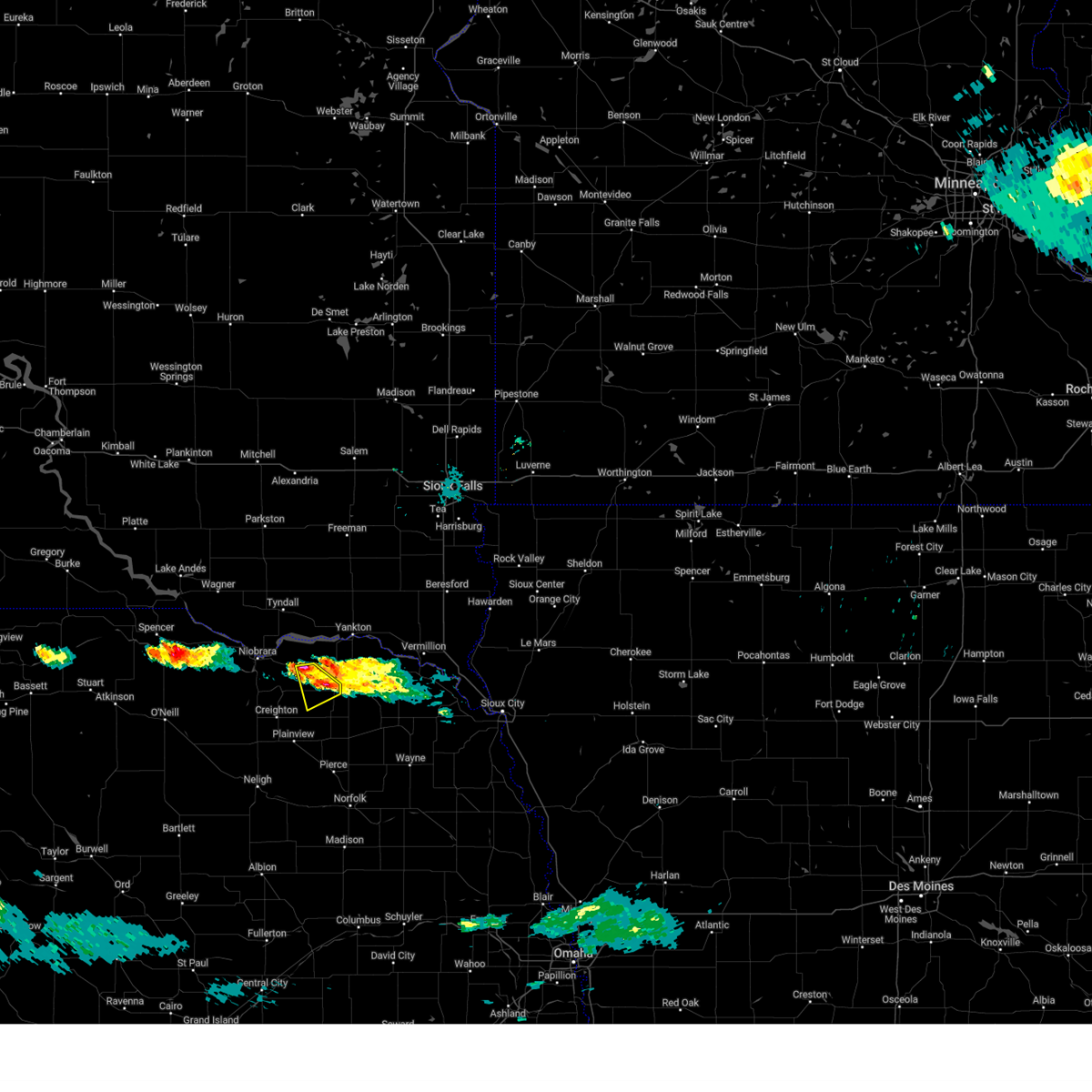 At 719 pm cdt, a severe thunderstorm was located 3 miles east of bloomfield, or 16 miles west of hartington, moving southeast at 20 mph (radar indicated). Hazards include 60 mph wind gusts and quarter size hail. Hail damage to vehicles is expected. expect wind damage to roofs, siding, and trees. locations impacted include, bloomfield and santee reservation. hail threat, observed max hail size, 1. 00 in wind threat, radar indicated max wind gust, 60 mph. At 719 pm cdt, a severe thunderstorm was located 3 miles east of bloomfield, or 16 miles west of hartington, moving southeast at 20 mph (radar indicated). Hazards include 60 mph wind gusts and quarter size hail. Hail damage to vehicles is expected. expect wind damage to roofs, siding, and trees. locations impacted include, bloomfield and santee reservation. hail threat, observed max hail size, 1. 00 in wind threat, radar indicated max wind gust, 60 mph.
|
| 7/19/2023 7:02 PM CDT | Quarter sized hail reported 7 miles S of Bloomfield, NE, estimated due to hail ongoing. |
| 7/19/2023 6:55 PM CDT |
 At 654 pm cdt, a severe thunderstorm was located 7 miles north of bloomfield, or 13 miles southwest of lewis and clark state recreation area, moving southeast at 15 mph (radar indicated). Hazards include 60 mph wind gusts and quarter size hail. Hail damage to vehicles is expected. Expect wind damage to roofs, siding, and trees. At 654 pm cdt, a severe thunderstorm was located 7 miles north of bloomfield, or 13 miles southwest of lewis and clark state recreation area, moving southeast at 15 mph (radar indicated). Hazards include 60 mph wind gusts and quarter size hail. Hail damage to vehicles is expected. Expect wind damage to roofs, siding, and trees.
|
| 7/12/2023 4:20 AM CDT |
 At 420 am cdt, severe thunderstorms were located along a line extending from 5 miles northeast of crofton to 11 miles northwest of ericson, moving southeast at 55 mph (radar indicated). Hazards include 70 mph wind gusts and quarter size hail. Hail damage to vehicles is expected. expect considerable tree damage. wind damage is also likely to mobile homes, roofs, and outbuildings. severe thunderstorms will be near, yankton and crofton around 425 am cdt. fordyce and st. helena around 430 am cdt. hartington and wynot around 435 am cdt. thunderstorm damage threat, considerable hail threat, radar indicated max hail size, 1. 00 in wind threat, radar indicated max wind gust, 70 mph. At 420 am cdt, severe thunderstorms were located along a line extending from 5 miles northeast of crofton to 11 miles northwest of ericson, moving southeast at 55 mph (radar indicated). Hazards include 70 mph wind gusts and quarter size hail. Hail damage to vehicles is expected. expect considerable tree damage. wind damage is also likely to mobile homes, roofs, and outbuildings. severe thunderstorms will be near, yankton and crofton around 425 am cdt. fordyce and st. helena around 430 am cdt. hartington and wynot around 435 am cdt. thunderstorm damage threat, considerable hail threat, radar indicated max hail size, 1. 00 in wind threat, radar indicated max wind gust, 70 mph.
|
| 7/12/2023 3:44 AM CDT |
 At 343 am cdt, severe thunderstorms were located along a line extending from 6 miles northwest of tyndall to 13 miles east of rose, moving southeast at 75 mph (radar indicated). Hazards include 60 mph wind gusts and quarter size hail. Hail damage to vehicles is expected. Expect wind damage to roofs, siding, and trees. At 343 am cdt, severe thunderstorms were located along a line extending from 6 miles northwest of tyndall to 13 miles east of rose, moving southeast at 75 mph (radar indicated). Hazards include 60 mph wind gusts and quarter size hail. Hail damage to vehicles is expected. Expect wind damage to roofs, siding, and trees.
|
| 7/10/2023 4:39 PM CDT |
 At 439 pm cdt, a severe thunderstorm was located 4 miles north of wausa, or 15 miles west of hartington, moving south at 30 mph (radar indicated). Hazards include golf ball size hail and 60 mph wind gusts. People and animals outdoors will be injured. expect hail damage to roofs, siding, windows, and vehicles. expect wind damage to roofs, siding, and trees. this severe thunderstorm will be near, wausa around 445 pm cdt. other locations in the path of this severe thunderstorm include randolph. thunderstorm damage threat, considerable hail threat, radar indicated max hail size, 1. 75 in wind threat, radar indicated max wind gust, 60 mph. At 439 pm cdt, a severe thunderstorm was located 4 miles north of wausa, or 15 miles west of hartington, moving south at 30 mph (radar indicated). Hazards include golf ball size hail and 60 mph wind gusts. People and animals outdoors will be injured. expect hail damage to roofs, siding, windows, and vehicles. expect wind damage to roofs, siding, and trees. this severe thunderstorm will be near, wausa around 445 pm cdt. other locations in the path of this severe thunderstorm include randolph. thunderstorm damage threat, considerable hail threat, radar indicated max hail size, 1. 75 in wind threat, radar indicated max wind gust, 60 mph.
|
| 7/10/2023 4:31 PM CDT | Large trees blown dow in knox county NE, 0.5 miles W of Bloomfield, NE |
| 7/10/2023 4:13 PM CDT |
 At 413 pm cdt, a severe thunderstorm was located 4 miles southwest of crofton, or 13 miles south of lewis and clark state recreation area, moving southeast at 30 mph (radar indicated). Hazards include 60 mph wind gusts and half dollar size hail. Hail damage to vehicles is expected. expect wind damage to roofs, siding, and trees. locations impacted include, fordyce. hail threat, radar indicated max hail size, 1. 25 in wind threat, radar indicated max wind gust, 60 mph. At 413 pm cdt, a severe thunderstorm was located 4 miles southwest of crofton, or 13 miles south of lewis and clark state recreation area, moving southeast at 30 mph (radar indicated). Hazards include 60 mph wind gusts and half dollar size hail. Hail damage to vehicles is expected. expect wind damage to roofs, siding, and trees. locations impacted include, fordyce. hail threat, radar indicated max hail size, 1. 25 in wind threat, radar indicated max wind gust, 60 mph.
|
| 7/10/2023 3:53 PM CDT |
 At 353 pm cdt, a severe thunderstorm was located 9 miles southeast of santee, or 10 miles southwest of lewis and clark state recreation area, moving southeast at 30 mph (radar indicated). Hazards include 60 mph wind gusts and quarter size hail. Hail damage to vehicles is expected. expect wind damage to roofs, siding, and trees. this severe thunderstorm will be near, crofton around 410 pm cdt. other locations in the path of this severe thunderstorm include fordyce. hail threat, radar indicated max hail size, 1. 00 in wind threat, radar indicated max wind gust, 60 mph. At 353 pm cdt, a severe thunderstorm was located 9 miles southeast of santee, or 10 miles southwest of lewis and clark state recreation area, moving southeast at 30 mph (radar indicated). Hazards include 60 mph wind gusts and quarter size hail. Hail damage to vehicles is expected. expect wind damage to roofs, siding, and trees. this severe thunderstorm will be near, crofton around 410 pm cdt. other locations in the path of this severe thunderstorm include fordyce. hail threat, radar indicated max hail size, 1. 00 in wind threat, radar indicated max wind gust, 60 mph.
|
| 7/10/2023 3:28 PM CDT |
 At 328 pm cdt, a severe thunderstorm was located 5 miles southwest of tabor, or 8 miles west of lewis and clark state recreation area, moving south at 40 mph (radar indicated). Hazards include 60 mph wind gusts and quarter size hail. Hail damage to vehicles is expected. expect wind damage to roofs, siding, and trees. locations impacted include, crofton and bloomfield. hail threat, radar indicated max hail size, 1. 00 in wind threat, radar indicated max wind gust, 60 mph. At 328 pm cdt, a severe thunderstorm was located 5 miles southwest of tabor, or 8 miles west of lewis and clark state recreation area, moving south at 40 mph (radar indicated). Hazards include 60 mph wind gusts and quarter size hail. Hail damage to vehicles is expected. expect wind damage to roofs, siding, and trees. locations impacted include, crofton and bloomfield. hail threat, radar indicated max hail size, 1. 00 in wind threat, radar indicated max wind gust, 60 mph.
|
| 7/10/2023 3:09 PM CDT |
 At 309 pm cdt, a severe thunderstorm was located 4 miles southeast of tyndall, moving southeast at 20 mph (radar indicated). Hazards include 60 mph wind gusts and quarter size hail. Hail damage to vehicles is expected. expect wind damage to roofs, siding, and trees. this severe thunderstorm will be near, santee around 320 pm cdt. other locations in the path of this severe thunderstorm include crofton. hail threat, radar indicated max hail size, 1. 00 in wind threat, radar indicated max wind gust, 60 mph. At 309 pm cdt, a severe thunderstorm was located 4 miles southeast of tyndall, moving southeast at 20 mph (radar indicated). Hazards include 60 mph wind gusts and quarter size hail. Hail damage to vehicles is expected. expect wind damage to roofs, siding, and trees. this severe thunderstorm will be near, santee around 320 pm cdt. other locations in the path of this severe thunderstorm include crofton. hail threat, radar indicated max hail size, 1. 00 in wind threat, radar indicated max wind gust, 60 mph.
|
| 6/24/2023 5:39 PM CDT | At 539 pm cdt, a severe thunderstorm was located 5 miles south of crofton, or 13 miles west of hartington, moving east at 30 mph (radar indicated). Hazards include 60 mph wind gusts and half dollar size hail. Hail damage to vehicles is expected. expect wind damage to roofs, siding, and trees. locations impacted include, fordyce and hartington. hail threat, radar indicated max hail size, 1. 25 in wind threat, radar indicated max wind gust, 60 mph. |
| 6/24/2023 5:26 PM CDT | At 526 pm cdt, a severe thunderstorm was located 6 miles north of bloomfield, or 13 miles southwest of lewis and clark state recreation area, moving east at 30 mph (radar indicated). Hazards include 60 mph wind gusts and half dollar size hail. Hail damage to vehicles is expected. expect wind damage to roofs, siding, and trees. this severe thunderstorm will be near, bloomfield around 530 pm cdt. crofton around 540 pm cdt. other locations in the path of this severe thunderstorm include fordyce and hartington. hail threat, radar indicated max hail size, 1. 25 in wind threat, radar indicated max wind gust, 60 mph. |
| 6/24/2023 5:16 PM CDT | At 516 pm cdt, a severe thunderstorm was located 3 miles west of crofton, or 8 miles south of lewis and clark state recreation area, moving east at 45 mph (public). Hazards include 60 mph wind gusts and half dollar size hail. Hail damage to vehicles is expected. expect wind damage to roofs, siding, and trees. locations impacted include, bloomfield, crofton, santee reservation and lindy. hail threat, observed max hail size, 1. 25 in wind threat, radar indicated max wind gust, 60 mph. |
| 6/24/2023 5:07 PM CDT | At 506 pm cdt, a severe thunderstorm was located 8 miles southeast of santee, or 11 miles southwest of lewis and clark state recreation area, moving east at 45 mph (law enforcement reported quarter size hail). Hazards include 60 mph wind gusts and quarter size hail. Hail damage to vehicles is expected. expect wind damage to roofs, siding, and trees. locations impacted include, bloomfield, crofton, niobrara, santee reservation and lindy. hail threat, observed max hail size, 1. 00 in wind threat, radar indicated max wind gust, 60 mph. |
| 6/24/2023 4:56 PM CDT | At 455 pm cdt, a severe thunderstorm was located 4 miles south of santee, or 14 miles south of tyndall, moving east at 45 mph (radar indicated). Hazards include golf ball size hail and 60 mph wind gusts. People and animals outdoors will be injured. expect hail damage to roofs, siding, windows, and vehicles. expect wind damage to roofs, siding, and trees. locations impacted include, crofton. thunderstorm damage threat, considerable hail threat, radar indicated max hail size, 1. 75 in wind threat, radar indicated max wind gust, 60 mph. |
| 6/24/2023 4:41 PM CDT | At 441 pm cdt, a severe thunderstorm was located 3 miles northwest of niobrara, or 17 miles southwest of tyndall, moving east at 45 mph (radar indicated). Hazards include golf ball size hail and 60 mph wind gusts. People and animals outdoors will be injured. expect hail damage to roofs, siding, windows, and vehicles. expect wind damage to roofs, siding, and trees. this severe thunderstorm will be near, santee around 455 pm cdt. other locations in the path of this severe thunderstorm include crofton. thunderstorm damage threat, considerable hail threat, radar indicated max hail size, 1. 75 in wind threat, radar indicated max wind gust, 60 mph. |
| 6/24/2023 3:28 AM CDT |
 At 328 am cdt, severe thunderstorms were located along a line extending from 2 miles west of lewis and clark state recreation area to 3 miles northwest of osmond, moving east at 55 mph (radar indicated). Hazards include 60 mph wind gusts and quarter size hail. Hail damage to vehicles is expected. expect wind damage to roofs, siding, and trees. severe thunderstorms will be near, randolph around 345 am cdt. other locations in the path of these severe thunderstorms include belden, coleridge and laurel. hail threat, radar indicated max hail size, 1. 00 in wind threat, radar indicated max wind gust, 60 mph. At 328 am cdt, severe thunderstorms were located along a line extending from 2 miles west of lewis and clark state recreation area to 3 miles northwest of osmond, moving east at 55 mph (radar indicated). Hazards include 60 mph wind gusts and quarter size hail. Hail damage to vehicles is expected. expect wind damage to roofs, siding, and trees. severe thunderstorms will be near, randolph around 345 am cdt. other locations in the path of these severe thunderstorms include belden, coleridge and laurel. hail threat, radar indicated max hail size, 1. 00 in wind threat, radar indicated max wind gust, 60 mph.
|
| 6/24/2023 3:04 AM CDT |
 At 304 am cdt, severe thunderstorms were located along a line extending from 2 miles southeast of dante to 4 miles southwest of verdigre to 6 miles northeast of orchard, moving east at 65 mph (radar indicated). Hazards include 70 mph wind gusts and quarter size hail. Hail damage to vehicles is expected. expect considerable tree damage. wind damage is also likely to mobile homes, roofs, and outbuildings. these severe storms will be near, winnetoon around 310 am cdt. other locations in the path of these severe thunderstorms include creighton, center, plainview, bloomfield, osmond and wausa. thunderstorm damage threat, considerable hail threat, radar indicated max hail size, 1. 00 in wind threat, radar indicated max wind gust, 70 mph. At 304 am cdt, severe thunderstorms were located along a line extending from 2 miles southeast of dante to 4 miles southwest of verdigre to 6 miles northeast of orchard, moving east at 65 mph (radar indicated). Hazards include 70 mph wind gusts and quarter size hail. Hail damage to vehicles is expected. expect considerable tree damage. wind damage is also likely to mobile homes, roofs, and outbuildings. these severe storms will be near, winnetoon around 310 am cdt. other locations in the path of these severe thunderstorms include creighton, center, plainview, bloomfield, osmond and wausa. thunderstorm damage threat, considerable hail threat, radar indicated max hail size, 1. 00 in wind threat, radar indicated max wind gust, 70 mph.
|
| 6/24/2023 2:52 AM CDT |
 At 252 am cdt, severe thunderstorms were located along a line extending from 2 miles east of marty to 13 miles north of orchard to 3 miles southeast of page, moving east at 55 mph (radar indicated). Hazards include 70 mph wind gusts and quarter size hail. Hail damage to vehicles is expected. expect considerable tree damage. wind damage is also likely to mobile homes, roofs, and outbuildings. severe thunderstorms will be near, verdigre around 305 am cdt. winnetoon around 310 am cdt. other locations in the path of these severe thunderstorms include creighton, center, plainview, bloomfield, osmond and wausa. thunderstorm damage threat, considerable hail threat, radar indicated max hail size, 1. 00 in wind threat, radar indicated max wind gust, 70 mph. At 252 am cdt, severe thunderstorms were located along a line extending from 2 miles east of marty to 13 miles north of orchard to 3 miles southeast of page, moving east at 55 mph (radar indicated). Hazards include 70 mph wind gusts and quarter size hail. Hail damage to vehicles is expected. expect considerable tree damage. wind damage is also likely to mobile homes, roofs, and outbuildings. severe thunderstorms will be near, verdigre around 305 am cdt. winnetoon around 310 am cdt. other locations in the path of these severe thunderstorms include creighton, center, plainview, bloomfield, osmond and wausa. thunderstorm damage threat, considerable hail threat, radar indicated max hail size, 1. 00 in wind threat, radar indicated max wind gust, 70 mph.
|
| 6/23/2023 6:25 PM CDT |
 At 625 pm cdt, a severe thunderstorm was located 5 miles east of bloomfield, or 13 miles west of hartington, moving east at 20 mph (radar indicated). Hazards include quarter size hail. Damage to vehicles is expected. this severe thunderstorm will be near, fordyce around 645 pm cdt. other locations in the path of this severe thunderstorm include hartington. hail threat, radar indicated max hail size, 1. 00 in wind threat, radar indicated max wind gust, <50 mph. At 625 pm cdt, a severe thunderstorm was located 5 miles east of bloomfield, or 13 miles west of hartington, moving east at 20 mph (radar indicated). Hazards include quarter size hail. Damage to vehicles is expected. this severe thunderstorm will be near, fordyce around 645 pm cdt. other locations in the path of this severe thunderstorm include hartington. hail threat, radar indicated max hail size, 1. 00 in wind threat, radar indicated max wind gust, <50 mph.
|
| 6/23/2023 5:42 PM CDT |
 At 541 pm cdt, a severe thunderstorm was located 4 miles north of center, or 21 miles southwest of lewis and clark state recreation area, moving northeast at 20 mph (radar indicated). Hazards include quarter size hail. Damage to vehicles is expected. this severe thunderstorm will remain over mainly rural areas of northeastern knox county, including the following locations, santee reservation and lindy. hail threat, radar indicated max hail size, 1. 00 in wind threat, radar indicated max wind gust, <50 mph. At 541 pm cdt, a severe thunderstorm was located 4 miles north of center, or 21 miles southwest of lewis and clark state recreation area, moving northeast at 20 mph (radar indicated). Hazards include quarter size hail. Damage to vehicles is expected. this severe thunderstorm will remain over mainly rural areas of northeastern knox county, including the following locations, santee reservation and lindy. hail threat, radar indicated max hail size, 1. 00 in wind threat, radar indicated max wind gust, <50 mph.
|
| 5/29/2023 6:51 PM CDT |
 At 651 pm cdt, a severe thunderstorm was located 5 miles southeast of center, or 25 miles southwest of lewis and clark state recreation area, moving northeast at 15 mph (radar indicated). Hazards include 60 mph wind gusts and quarter size hail. Hail damage to vehicles is expected. expect wind damage to roofs, siding, and trees. locations impacted include, bloomfield, lindy and santee reservation. hail threat, radar indicated max hail size, 1. 00 in wind threat, radar indicated max wind gust, 60 mph. At 651 pm cdt, a severe thunderstorm was located 5 miles southeast of center, or 25 miles southwest of lewis and clark state recreation area, moving northeast at 15 mph (radar indicated). Hazards include 60 mph wind gusts and quarter size hail. Hail damage to vehicles is expected. expect wind damage to roofs, siding, and trees. locations impacted include, bloomfield, lindy and santee reservation. hail threat, radar indicated max hail size, 1. 00 in wind threat, radar indicated max wind gust, 60 mph.
|
| 5/29/2023 6:32 PM CDT |
 At 632 pm cdt, a severe thunderstorm was located over creighton, or 25 miles north of neligh, moving northeast at 20 mph (radar indicated). Hazards include 60 mph wind gusts and quarter size hail. Hail damage to vehicles is expected. Expect wind damage to roofs, siding, and trees. At 632 pm cdt, a severe thunderstorm was located over creighton, or 25 miles north of neligh, moving northeast at 20 mph (radar indicated). Hazards include 60 mph wind gusts and quarter size hail. Hail damage to vehicles is expected. Expect wind damage to roofs, siding, and trees.
|
| 5/12/2023 6:25 PM CDT |
 At 625 pm cdt, a severe thunderstorm capable of producing a tornado was located 3 miles northwest of bloomfield, or 16 miles southwest of lewis and clark state recreation area, moving northwest at 40 mph (radar indicated rotation). Hazards include tornado. Flying debris will be dangerous to those caught without shelter. mobile homes will be damaged or destroyed. damage to roofs, windows, and vehicles will occur. tree damage is likely. Locations impacted include, bloomfield, santee reservation and lindy. At 625 pm cdt, a severe thunderstorm capable of producing a tornado was located 3 miles northwest of bloomfield, or 16 miles southwest of lewis and clark state recreation area, moving northwest at 40 mph (radar indicated rotation). Hazards include tornado. Flying debris will be dangerous to those caught without shelter. mobile homes will be damaged or destroyed. damage to roofs, windows, and vehicles will occur. tree damage is likely. Locations impacted include, bloomfield, santee reservation and lindy.
|
| 5/12/2023 6:09 PM CDT |
 At 608 pm cdt, a severe thunderstorm capable of producing a tornado was located over wausa, or 17 miles southwest of hartington, moving northwest at 30 mph (radar indicated rotation). Hazards include tornado. Flying debris will be dangerous to those caught without shelter. mobile homes will be damaged or destroyed. damage to roofs, windows, and vehicles will occur. Tree damage is likely. At 608 pm cdt, a severe thunderstorm capable of producing a tornado was located over wausa, or 17 miles southwest of hartington, moving northwest at 30 mph (radar indicated rotation). Hazards include tornado. Flying debris will be dangerous to those caught without shelter. mobile homes will be damaged or destroyed. damage to roofs, windows, and vehicles will occur. Tree damage is likely.
|
| 4/19/2023 2:24 AM CDT |
 The severe thunderstorm warning for northeastern knox and west central cedar counties will expire at 230 am cdt, the storm which prompted the warning has weakened below severe limits, and no longer poses an immediate threat to life or property. therefore, the warning will be allowed to expire. to report severe weather, contact your nearest law enforcement agency. they will relay your report to the national weather service omaha. The severe thunderstorm warning for northeastern knox and west central cedar counties will expire at 230 am cdt, the storm which prompted the warning has weakened below severe limits, and no longer poses an immediate threat to life or property. therefore, the warning will be allowed to expire. to report severe weather, contact your nearest law enforcement agency. they will relay your report to the national weather service omaha.
|
| 4/19/2023 2:13 AM CDT |
 At 213 am cdt, a severe thunderstorm was located 4 miles west of crofton, or 10 miles south of lewis and clark state recreation area, moving northeast at 30 mph (radar indicated). Hazards include quarter size hail. Damage to vehicles is expected. Locations impacted include, bloomfield, crofton, weigand marina and santee reservation. At 213 am cdt, a severe thunderstorm was located 4 miles west of crofton, or 10 miles south of lewis and clark state recreation area, moving northeast at 30 mph (radar indicated). Hazards include quarter size hail. Damage to vehicles is expected. Locations impacted include, bloomfield, crofton, weigand marina and santee reservation.
|
| 4/19/2023 1:54 AM CDT |
 At 154 am cdt, a severe thunderstorm was located near bloomfield, or 19 miles southwest of lewis and clark state recreation area, moving northeast at 35 mph (radar indicated). Hazards include quarter size hail. damage to vehicles is expected At 154 am cdt, a severe thunderstorm was located near bloomfield, or 19 miles southwest of lewis and clark state recreation area, moving northeast at 35 mph (radar indicated). Hazards include quarter size hail. damage to vehicles is expected
|
| 8/1/2022 9:57 PM CDT |
 The severe thunderstorm warning for eastern knox and northwestern cedar counties will expire at 1000 pm cdt, the storm which prompted the warning has weakened below severe limits, and no longer poses an immediate threat to life or property. therefore, the warning will be allowed to expire. a severe thunderstorm watch remains in effect until 100 am cdt for northeastern nebraska. to report severe weather, contact your nearest law enforcement agency. they will relay your report to the national weather service omaha. The severe thunderstorm warning for eastern knox and northwestern cedar counties will expire at 1000 pm cdt, the storm which prompted the warning has weakened below severe limits, and no longer poses an immediate threat to life or property. therefore, the warning will be allowed to expire. a severe thunderstorm watch remains in effect until 100 am cdt for northeastern nebraska. to report severe weather, contact your nearest law enforcement agency. they will relay your report to the national weather service omaha.
|
| 8/1/2022 9:48 PM CDT |
 At 947 pm cdt, a severe thunderstorm cluster was located near bloomfield, or 13 miles south of lewis and clark state recreation area, moving east at 30 mph (radar indicated). Hazards include 60 mph wind gusts and quarter size hail. Hail damage to vehicles is expected. expect wind damage to roofs, siding, and trees. locations impacted include, crofton and fordyce. hail threat, radar indicated max hail size, 1. 00 in wind threat, radar indicated max wind gust, 60 mph. At 947 pm cdt, a severe thunderstorm cluster was located near bloomfield, or 13 miles south of lewis and clark state recreation area, moving east at 30 mph (radar indicated). Hazards include 60 mph wind gusts and quarter size hail. Hail damage to vehicles is expected. expect wind damage to roofs, siding, and trees. locations impacted include, crofton and fordyce. hail threat, radar indicated max hail size, 1. 00 in wind threat, radar indicated max wind gust, 60 mph.
|
| 8/1/2022 9:19 PM CDT |
 At 919 pm cdt, a severe thunderstorm was located 4 miles northeast of center, or 20 miles southwest of lewis and clark state recreation area, moving east at 40 mph (radar indicated). Hazards include 60 mph wind gusts and quarter size hail. Hail damage to vehicles is expected. expect wind damage to roofs, siding, and trees. this severe thunderstorm will be near, bloomfield around 935 pm cdt. other locations in the path of this severe thunderstorm include crofton and fordyce. hail threat, radar indicated max hail size, 1. 00 in wind threat, radar indicated max wind gust, 60 mph. At 919 pm cdt, a severe thunderstorm was located 4 miles northeast of center, or 20 miles southwest of lewis and clark state recreation area, moving east at 40 mph (radar indicated). Hazards include 60 mph wind gusts and quarter size hail. Hail damage to vehicles is expected. expect wind damage to roofs, siding, and trees. this severe thunderstorm will be near, bloomfield around 935 pm cdt. other locations in the path of this severe thunderstorm include crofton and fordyce. hail threat, radar indicated max hail size, 1. 00 in wind threat, radar indicated max wind gust, 60 mph.
|
| 7/5/2022 4:10 PM CDT |
 At 410 pm cdt, severe thunderstorms were located along a line extending from 3 miles southeast of vermillion to 7 miles southwest of clearwater, moving southeast at 35 mph (radar indicated). Hazards include 60 mph wind gusts and quarter size hail. Hail damage to vehicles is expected. expect wind damage to roofs, siding, and trees. locations impacted include, elgin. hail threat, radar indicated max hail size, 1. 00 in wind threat, radar indicated max wind gust, 60 mph. At 410 pm cdt, severe thunderstorms were located along a line extending from 3 miles southeast of vermillion to 7 miles southwest of clearwater, moving southeast at 35 mph (radar indicated). Hazards include 60 mph wind gusts and quarter size hail. Hail damage to vehicles is expected. expect wind damage to roofs, siding, and trees. locations impacted include, elgin. hail threat, radar indicated max hail size, 1. 00 in wind threat, radar indicated max wind gust, 60 mph.
|
| 7/5/2022 4:00 PM CDT |
 At 359 pm cdt, severe thunderstorms were located along a line extending from 2 miles north of vermillion to 6 miles west of clearwater, moving southeast at 35 mph (radar indicated). Hazards include 60 mph wind gusts and quarter size hail. Hail damage to vehicles is expected. expect wind damage to roofs, siding, and trees. severe thunderstorms will be near, clearwater around 405 pm cdt. other locations in the path of these severe thunderstorms include elgin. hail threat, radar indicated max hail size, 1. 00 in wind threat, radar indicated max wind gust, 60 mph. At 359 pm cdt, severe thunderstorms were located along a line extending from 2 miles north of vermillion to 6 miles west of clearwater, moving southeast at 35 mph (radar indicated). Hazards include 60 mph wind gusts and quarter size hail. Hail damage to vehicles is expected. expect wind damage to roofs, siding, and trees. severe thunderstorms will be near, clearwater around 405 pm cdt. other locations in the path of these severe thunderstorms include elgin. hail threat, radar indicated max hail size, 1. 00 in wind threat, radar indicated max wind gust, 60 mph.
|
| 7/5/2022 3:42 PM CDT |
 At 340 pm cdt, severe thunderstorms were located along a line extending from 6 miles east of wakonda to near orchard, moving southeast at 40 mph (radar indicated). Hazards include 60 mph wind gusts and quarter size hail. Hail damage to vehicles is expected. expect wind damage to roofs, siding, and trees. these severe thunderstorms will remain over mainly rural areas of northwestern pierce, northern antelope, knox and northern cedar counties, including the following locations, brunswick, lindy, pleasant valley, santee reservation, weigand marina, lewis and clark state recreation area, brooky bottom, bow valley, menominee and royal. hail threat, radar indicated max hail size, 1. 00 in wind threat, radar indicated max wind gust, 60 mph. At 340 pm cdt, severe thunderstorms were located along a line extending from 6 miles east of wakonda to near orchard, moving southeast at 40 mph (radar indicated). Hazards include 60 mph wind gusts and quarter size hail. Hail damage to vehicles is expected. expect wind damage to roofs, siding, and trees. these severe thunderstorms will remain over mainly rural areas of northwestern pierce, northern antelope, knox and northern cedar counties, including the following locations, brunswick, lindy, pleasant valley, santee reservation, weigand marina, lewis and clark state recreation area, brooky bottom, bow valley, menominee and royal. hail threat, radar indicated max hail size, 1. 00 in wind threat, radar indicated max wind gust, 60 mph.
|
| 7/5/2022 3:25 PM CDT |
 At 324 pm cdt, severe thunderstorms were located along a line extending from 2 miles north of wakonda to page, moving southeast at 45 mph (radar indicated). Hazards include 60 mph wind gusts and quarter size hail. Hail damage to vehicles is expected. expect wind damage to roofs, siding, and trees. these severe thunderstorms will remain over mainly rural areas of northwestern pierce, northern antelope, knox and northern cedar counties, including the following locations, brunswick, lindy, pleasant valley, santee reservation, weigand marina, lewis and clark state recreation area, brooky bottom, bow valley, menominee and royal. hail threat, radar indicated max hail size, 1. 00 in wind threat, radar indicated max wind gust, 60 mph. At 324 pm cdt, severe thunderstorms were located along a line extending from 2 miles north of wakonda to page, moving southeast at 45 mph (radar indicated). Hazards include 60 mph wind gusts and quarter size hail. Hail damage to vehicles is expected. expect wind damage to roofs, siding, and trees. these severe thunderstorms will remain over mainly rural areas of northwestern pierce, northern antelope, knox and northern cedar counties, including the following locations, brunswick, lindy, pleasant valley, santee reservation, weigand marina, lewis and clark state recreation area, brooky bottom, bow valley, menominee and royal. hail threat, radar indicated max hail size, 1. 00 in wind threat, radar indicated max wind gust, 60 mph.
|
| 6/15/2022 1:00 AM CDT |
 At 1259 am cdt, a severe thunderstorm was located 4 miles west of bloomfield, or 19 miles southwest of lewis and clark state recreation area, moving northeast at 60 mph (radar indicated). Hazards include ping pong ball size hail and 60 mph wind gusts. People and animals outdoors will be injured. expect hail damage to roofs, siding, windows, and vehicles. expect wind damage to roofs, siding, and trees. this severe thunderstorm will be near, crofton around 115 am cdt. other locations in the path of this severe thunderstorm include yankton. hail threat, radar indicated max hail size, 1. 50 in wind threat, radar indicated max wind gust, 60 mph. At 1259 am cdt, a severe thunderstorm was located 4 miles west of bloomfield, or 19 miles southwest of lewis and clark state recreation area, moving northeast at 60 mph (radar indicated). Hazards include ping pong ball size hail and 60 mph wind gusts. People and animals outdoors will be injured. expect hail damage to roofs, siding, windows, and vehicles. expect wind damage to roofs, siding, and trees. this severe thunderstorm will be near, crofton around 115 am cdt. other locations in the path of this severe thunderstorm include yankton. hail threat, radar indicated max hail size, 1. 50 in wind threat, radar indicated max wind gust, 60 mph.
|
| 5/30/2022 12:57 AM CDT |
 At 1257 am cdt, a severe thunderstorm capable of producing a tornado was located near crofton, or 8 miles south of lewis and clark state recreation area, moving northeast at 40 mph (radar indicated rotation). Hazards include tornado and ping pong ball size hail. Flying debris will be dangerous to those caught without shelter. mobile homes will be damaged or destroyed. damage to roofs, windows, and vehicles will occur. tree damage is likely. Locations impacted include, bloomfield, crofton, weigand marina, lindy and santee reservation. At 1257 am cdt, a severe thunderstorm capable of producing a tornado was located near crofton, or 8 miles south of lewis and clark state recreation area, moving northeast at 40 mph (radar indicated rotation). Hazards include tornado and ping pong ball size hail. Flying debris will be dangerous to those caught without shelter. mobile homes will be damaged or destroyed. damage to roofs, windows, and vehicles will occur. tree damage is likely. Locations impacted include, bloomfield, crofton, weigand marina, lindy and santee reservation.
|
| 5/30/2022 12:49 AM CDT |
 At 1249 am cdt, a severe thunderstorm capable of producing a tornado was located 6 miles north of bloomfield, or 13 miles south of lewis and clark state recreation area, moving northeast at 40 mph (radar indicated rotation). Hazards include tornado and golf ball size hail. Flying debris will be dangerous to those caught without shelter. mobile homes will be damaged or destroyed. damage to roofs, windows, and vehicles will occur. tree damage is likely. Locations impacted include, crofton. At 1249 am cdt, a severe thunderstorm capable of producing a tornado was located 6 miles north of bloomfield, or 13 miles south of lewis and clark state recreation area, moving northeast at 40 mph (radar indicated rotation). Hazards include tornado and golf ball size hail. Flying debris will be dangerous to those caught without shelter. mobile homes will be damaged or destroyed. damage to roofs, windows, and vehicles will occur. tree damage is likely. Locations impacted include, crofton.
|
| 5/30/2022 12:30 AM CDT |
 At 1229 am cdt, a severe thunderstorm capable of producing a tornado was located 4 miles southeast of center, or 23 miles southwest of lewis and clark state recreation area, moving northeast at 40 mph (radar indicated rotation). Hazards include tornado and golf ball size hail. Flying debris will be dangerous to those caught without shelter. mobile homes will be damaged or destroyed. damage to roofs, windows, and vehicles will occur. tree damage is likely. this dangerous storm will be near, bloomfield around 1240 am cdt. Other locations in the path of this tornadic thunderstorm include crofton. At 1229 am cdt, a severe thunderstorm capable of producing a tornado was located 4 miles southeast of center, or 23 miles southwest of lewis and clark state recreation area, moving northeast at 40 mph (radar indicated rotation). Hazards include tornado and golf ball size hail. Flying debris will be dangerous to those caught without shelter. mobile homes will be damaged or destroyed. damage to roofs, windows, and vehicles will occur. tree damage is likely. this dangerous storm will be near, bloomfield around 1240 am cdt. Other locations in the path of this tornadic thunderstorm include crofton.
|
| 5/12/2022 4:12 PM CDT |
 At 411 pm cdt, severe thunderstorms were located along a line extending from near santee to 6 miles northeast of bloomfield to 6 miles east of wausa to near hoskins, moving northeast at 70 mph. these are destructive storms! (radar indicated). Hazards include 90 mph wind gusts and penny size hail. You are in a life-threatening situation. flying debris may be deadly to those caught without shelter. mobile homes will be heavily damaged or destroyed. homes and businesses will have substantial roof and window damage. expect extensive tree damage and power outages. these severe storms will be near, crofton around 415 pm cdt. other locations in the path of these severe thunderstorms include hartington, fordyce, yankton, wayne, st. helena, laurel and wynot. thunderstorm damage threat, destructive hail threat, radar indicated max hail size, 0. 75 in wind threat, radar indicated max wind gust, 90 mph. At 411 pm cdt, severe thunderstorms were located along a line extending from near santee to 6 miles northeast of bloomfield to 6 miles east of wausa to near hoskins, moving northeast at 70 mph. these are destructive storms! (radar indicated). Hazards include 90 mph wind gusts and penny size hail. You are in a life-threatening situation. flying debris may be deadly to those caught without shelter. mobile homes will be heavily damaged or destroyed. homes and businesses will have substantial roof and window damage. expect extensive tree damage and power outages. these severe storms will be near, crofton around 415 pm cdt. other locations in the path of these severe thunderstorms include hartington, fordyce, yankton, wayne, st. helena, laurel and wynot. thunderstorm damage threat, destructive hail threat, radar indicated max hail size, 0. 75 in wind threat, radar indicated max wind gust, 90 mph.
|
| 5/12/2022 3:59 PM CDT |
 At 358 pm cdt, severe thunderstorms were located along a line extending from 5 miles north of verdigre to 2 miles northeast of pierce, moving northeast at 75 mph. these are destructive storms! (radar indicated). Hazards include 90 mph wind gusts and penny size hail. You are in a life-threatening situation. flying debris may be deadly to those caught without shelter. mobile homes will be heavily damaged or destroyed. homes and businesses will have substantial roof and window damage. expect extensive tree damage and power outages. severe thunderstorms will be near, randolph around 410 pm cdt. santee and belden around 415 pm cdt. other locations in the path of these severe thunderstorms include laurel, coleridge, hartington and wynot. thunderstorm damage threat, destructive hail threat, radar indicated max hail size, 0. 75 in wind threat, radar indicated max wind gust, 90 mph. At 358 pm cdt, severe thunderstorms were located along a line extending from 5 miles north of verdigre to 2 miles northeast of pierce, moving northeast at 75 mph. these are destructive storms! (radar indicated). Hazards include 90 mph wind gusts and penny size hail. You are in a life-threatening situation. flying debris may be deadly to those caught without shelter. mobile homes will be heavily damaged or destroyed. homes and businesses will have substantial roof and window damage. expect extensive tree damage and power outages. severe thunderstorms will be near, randolph around 410 pm cdt. santee and belden around 415 pm cdt. other locations in the path of these severe thunderstorms include laurel, coleridge, hartington and wynot. thunderstorm damage threat, destructive hail threat, radar indicated max hail size, 0. 75 in wind threat, radar indicated max wind gust, 90 mph.
|
| 8/25/2021 4:12 PM CDT |
 At 411 pm cdt, severe thunderstorms were located along a line extending from 4 miles west of lewis and clark state recreation area to near bloomfield, moving east at 30 mph (at 401 pm, trained weather spotters reported ping pong ball sized hail in springfield, south dakota). Hazards include ping pong ball size hail and 60 mph wind gusts. People and animals outdoors will be injured. expect hail damage to roofs, siding, windows, and vehicles. Expect wind damage to roofs, siding, and trees. At 411 pm cdt, severe thunderstorms were located along a line extending from 4 miles west of lewis and clark state recreation area to near bloomfield, moving east at 30 mph (at 401 pm, trained weather spotters reported ping pong ball sized hail in springfield, south dakota). Hazards include ping pong ball size hail and 60 mph wind gusts. People and animals outdoors will be injured. expect hail damage to roofs, siding, windows, and vehicles. Expect wind damage to roofs, siding, and trees.
|
| 7/9/2021 10:12 PM CDT |
 At 1011 pm cdt, severe thunderstorms were located along a line extending from randolph to 4 miles northeast of neligh, moving southeast at 65 mph (radar indicated). Hazards include 60 mph wind gusts and quarter size hail. Hail damage to vehicles is expected. expect wind damage to roofs, siding, and trees. severe thunderstorms will be near, randolph around 1015 pm cdt. meadow grove and carroll around 1025 pm cdt. wayne and battle creek around 1030 pm cdt. Other locations in the path of these severe thunderstorms include hadar and norfolk. At 1011 pm cdt, severe thunderstorms were located along a line extending from randolph to 4 miles northeast of neligh, moving southeast at 65 mph (radar indicated). Hazards include 60 mph wind gusts and quarter size hail. Hail damage to vehicles is expected. expect wind damage to roofs, siding, and trees. severe thunderstorms will be near, randolph around 1015 pm cdt. meadow grove and carroll around 1025 pm cdt. wayne and battle creek around 1030 pm cdt. Other locations in the path of these severe thunderstorms include hadar and norfolk.
|
| 6/11/2021 6:27 AM CDT |
 The severe thunderstorm warning for northwestern wayne, pierce, antelope, southern knox and cedar counties will expire at 630 am cdt, the storms which prompted the warning have weakened. therefore, the warning will be allowed to expire. however gusty winds are still possible with these thunderstorms. a severe thunderstorm watch remains in effect until 1100 am cdt for northeastern nebraska. The severe thunderstorm warning for northwestern wayne, pierce, antelope, southern knox and cedar counties will expire at 630 am cdt, the storms which prompted the warning have weakened. therefore, the warning will be allowed to expire. however gusty winds are still possible with these thunderstorms. a severe thunderstorm watch remains in effect until 1100 am cdt for northeastern nebraska.
|
| 6/11/2021 6:07 AM CDT |
 At 607 am cdt, severe thunderstorms were located along a line extending from near wynot to 5 miles southwest of hartington to near ewing, moving southeast at 40 mph (radar indicated). Hazards include 60 mph wind gusts. Expect damage to roofs, siding, and trees. these severe storms will be near, hartington and wynot around 610 am cdt. coleridge around 615 am cdt. Other locations in the path of these severe thunderstorms include neligh. At 607 am cdt, severe thunderstorms were located along a line extending from near wynot to 5 miles southwest of hartington to near ewing, moving southeast at 40 mph (radar indicated). Hazards include 60 mph wind gusts. Expect damage to roofs, siding, and trees. these severe storms will be near, hartington and wynot around 610 am cdt. coleridge around 615 am cdt. Other locations in the path of these severe thunderstorms include neligh.
|
| 6/11/2021 5:55 AM CDT |
 At 554 am cdt, severe thunderstorms were located along a line extending from near yankton to 7 miles northeast of bloomfield to 6 miles northwest of orchard, moving southeast at 40 mph (radar indicated). Hazards include 60 mph wind gusts. Expect damage to roofs, siding, and trees. severe thunderstorms will be near, hartington around 605 am cdt. wynot around 610 am cdt. Other locations in the path of these severe thunderstorms include neligh and coleridge. At 554 am cdt, severe thunderstorms were located along a line extending from near yankton to 7 miles northeast of bloomfield to 6 miles northwest of orchard, moving southeast at 40 mph (radar indicated). Hazards include 60 mph wind gusts. Expect damage to roofs, siding, and trees. severe thunderstorms will be near, hartington around 605 am cdt. wynot around 610 am cdt. Other locations in the path of these severe thunderstorms include neligh and coleridge.
|
| 8/10/2020 7:26 AM CDT |
 The severe thunderstorm warning for eastern knox and northwestern cedar counties will expire at 730 am cdt, the storms which prompted the warning have moved out of the warned area. therefore, the warning will be allowed to expire. a severe thunderstorm watch remains in effect until 1100 am cdt for northeastern nebraska. remember, a severe thunderstorm warning still remains in effect for portions of cedar county until 845 am cdt. The severe thunderstorm warning for eastern knox and northwestern cedar counties will expire at 730 am cdt, the storms which prompted the warning have moved out of the warned area. therefore, the warning will be allowed to expire. a severe thunderstorm watch remains in effect until 1100 am cdt for northeastern nebraska. remember, a severe thunderstorm warning still remains in effect for portions of cedar county until 845 am cdt.
|
| 8/10/2020 7:07 AM CDT |
 At 706 am cdt, severe thunderstorms were located along a line extending from near volin to 4 miles southwest of wausa, moving east at 45 mph (radar indicated). Hazards include 60 mph wind gusts and quarter size hail. Hail damage to vehicles is expected. expect wind damage to roofs, siding, and trees. locations impacted include, bloomfield, santee, crofton, pleasant valley, fordyce, st. helena, center, gavins point dam and campgrounds, st. Helena boat dock, lindy and lewis and clark state recreation area. At 706 am cdt, severe thunderstorms were located along a line extending from near volin to 4 miles southwest of wausa, moving east at 45 mph (radar indicated). Hazards include 60 mph wind gusts and quarter size hail. Hail damage to vehicles is expected. expect wind damage to roofs, siding, and trees. locations impacted include, bloomfield, santee, crofton, pleasant valley, fordyce, st. helena, center, gavins point dam and campgrounds, st. Helena boat dock, lindy and lewis and clark state recreation area.
|
| 8/10/2020 6:38 AM CDT |
 At 638 am cdt, severe thunderstorms were located along a line extending from near tabor to 7 miles southwest of verdigre, moving east at 35 mph (radar indicated). Hazards include 60 mph wind gusts and quarter size hail. Hail damage to vehicles is expected. Expect wind damage to roofs, siding, and trees. At 638 am cdt, severe thunderstorms were located along a line extending from near tabor to 7 miles southwest of verdigre, moving east at 35 mph (radar indicated). Hazards include 60 mph wind gusts and quarter size hail. Hail damage to vehicles is expected. Expect wind damage to roofs, siding, and trees.
|
| 8/9/2020 12:53 AM CDT |
 The severe thunderstorm warning for northwestern pierce, northern antelope and knox counties will expire at 100 am cdt, the storms which prompted the warning have weakened below severe limits, and no longer pose an immediate threat to life or property. therefore, the warning will be allowed to expire. however gusty winds up to 50 mph and heavy rain are still possible with these thunderstorms through 130 am. a severe thunderstorm watch remains in effect until 500 am cdt for northeastern nebraska. The severe thunderstorm warning for northwestern pierce, northern antelope and knox counties will expire at 100 am cdt, the storms which prompted the warning have weakened below severe limits, and no longer pose an immediate threat to life or property. therefore, the warning will be allowed to expire. however gusty winds up to 50 mph and heavy rain are still possible with these thunderstorms through 130 am. a severe thunderstorm watch remains in effect until 500 am cdt for northeastern nebraska.
|
| 8/9/2020 12:39 AM CDT |
 At 1220 am cdt, severe thunderstorms were located along a line extending from 4 miles southeast of marty to 10 miles southwest of clearwater, moving east at 55 mph (radar indicated). Hazards include 60 mph wind gusts and penny size hail. expect damage to roofs, siding, and trees At 1220 am cdt, severe thunderstorms were located along a line extending from 4 miles southeast of marty to 10 miles southwest of clearwater, moving east at 55 mph (radar indicated). Hazards include 60 mph wind gusts and penny size hail. expect damage to roofs, siding, and trees
|
| 8/9/2020 12:21 AM CDT |
 At 1220 am cdt, severe thunderstorms were located along a line extending from 4 miles southeast of marty to 10 miles southwest of clearwater, moving east at 55 mph (radar indicated). Hazards include 60 mph wind gusts and penny size hail. expect damage to roofs, siding, and trees At 1220 am cdt, severe thunderstorms were located along a line extending from 4 miles southeast of marty to 10 miles southwest of clearwater, moving east at 55 mph (radar indicated). Hazards include 60 mph wind gusts and penny size hail. expect damage to roofs, siding, and trees
|
| 7/8/2020 10:10 PM CDT |
 The severe thunderstorm warning for knox county will expire at 1015 pm cdt, the storm which prompted the warning has weakened below severe limits, and no longer poses an immediate threat to life or property. therefore, the warning will be allowed to expire. however small hail and gusty winds to 50 mph will still possible with this thunderstorm. a severe thunderstorm watch remains in effect until 1100 pm cdt for northeastern nebraska. The severe thunderstorm warning for knox county will expire at 1015 pm cdt, the storm which prompted the warning has weakened below severe limits, and no longer poses an immediate threat to life or property. therefore, the warning will be allowed to expire. however small hail and gusty winds to 50 mph will still possible with this thunderstorm. a severe thunderstorm watch remains in effect until 1100 pm cdt for northeastern nebraska.
|
| 7/8/2020 10:02 PM CDT |
 At 1001 pm cdt, a severe thunderstorm was located 5 miles east of verdigre, or 27 miles southwest of lewis and clark state recreation area, moving northeast at 40 mph. this area of storms did produce winds of around 60 mph in the creighton area earlier (radar indicated). Hazards include 60 mph wind gusts and nickel size hail. Expect damage to roofs, siding, and trees. Locations impacted include, creighton, bloomfield, wausa, verdigre, niobrara, santee, crofton, center, winnetoon, bazile mills, lindy, lewis and clark state recreation area and the highway 14 and 59 junction. At 1001 pm cdt, a severe thunderstorm was located 5 miles east of verdigre, or 27 miles southwest of lewis and clark state recreation area, moving northeast at 40 mph. this area of storms did produce winds of around 60 mph in the creighton area earlier (radar indicated). Hazards include 60 mph wind gusts and nickel size hail. Expect damage to roofs, siding, and trees. Locations impacted include, creighton, bloomfield, wausa, verdigre, niobrara, santee, crofton, center, winnetoon, bazile mills, lindy, lewis and clark state recreation area and the highway 14 and 59 junction.
|
| 7/8/2020 9:56 PM CDT |
 At 955 pm cdt, severe thunderstorms were located along a line extending from springfield to creighton, moving east at 25 mph. winds of around 60 mph did occur around creighton at 945 pm cdt (radar indicated). Hazards include 60 mph wind gusts and penny size hail. Expect damage to roofs, siding, and trees. Locations impacted include, creighton, bloomfield, wausa, verdigre, niobrara, santee, crofton, center, winnetoon, bazile mills, lindy, lewis and clark state recreation area and the highway 14 and 59 junction. At 955 pm cdt, severe thunderstorms were located along a line extending from springfield to creighton, moving east at 25 mph. winds of around 60 mph did occur around creighton at 945 pm cdt (radar indicated). Hazards include 60 mph wind gusts and penny size hail. Expect damage to roofs, siding, and trees. Locations impacted include, creighton, bloomfield, wausa, verdigre, niobrara, santee, crofton, center, winnetoon, bazile mills, lindy, lewis and clark state recreation area and the highway 14 and 59 junction.
|
| 7/8/2020 9:49 PM CDT |
 At 947 pm cdt, severe thunderstorms were located along a line extending from springfield to creighton, moving east at 35 mph. the strongest storms were about 5 miles northwest of creighton (radar indicated). Hazards include 60 mph wind gusts and penny size hail. Expect damage to roofs, siding, and trees. Locations impacted include, creighton, bloomfield, wausa, verdigre, niobrara, santee, crofton, center, winnetoon, bazile mills, lindy, lewis and clark state recreation area and the highway 14 and 59 junction. At 947 pm cdt, severe thunderstorms were located along a line extending from springfield to creighton, moving east at 35 mph. the strongest storms were about 5 miles northwest of creighton (radar indicated). Hazards include 60 mph wind gusts and penny size hail. Expect damage to roofs, siding, and trees. Locations impacted include, creighton, bloomfield, wausa, verdigre, niobrara, santee, crofton, center, winnetoon, bazile mills, lindy, lewis and clark state recreation area and the highway 14 and 59 junction.
|
| 7/8/2020 9:40 PM CDT |
 At 939 pm cdt, severe thunderstorms were located along a line extending from 5 miles west of springfield to 5 miles west of creighton, moving east at 30 mph (radar indicated). Hazards include 60 mph wind gusts. Expect damage to roofs, siding, and trees. Locations impacted include, creighton, bloomfield, wausa, verdigre, niobrara, santee, crofton, center, winnetoon, bazile mills, lindy, lewis and clark state recreation area and the highway 14 and 59 junction. At 939 pm cdt, severe thunderstorms were located along a line extending from 5 miles west of springfield to 5 miles west of creighton, moving east at 30 mph (radar indicated). Hazards include 60 mph wind gusts. Expect damage to roofs, siding, and trees. Locations impacted include, creighton, bloomfield, wausa, verdigre, niobrara, santee, crofton, center, winnetoon, bazile mills, lindy, lewis and clark state recreation area and the highway 14 and 59 junction.
|
| 7/8/2020 9:32 PM CDT |
 At 931 pm cdt, severe thunderstorms were located along a line extending from 6 miles south of avon to 5 miles south of verdigre, moving east at 35 mph (radar indicated). Hazards include 60 mph wind gusts. expect damage to roofs, siding, and trees At 931 pm cdt, severe thunderstorms were located along a line extending from 6 miles south of avon to 5 miles south of verdigre, moving east at 35 mph (radar indicated). Hazards include 60 mph wind gusts. expect damage to roofs, siding, and trees
|
| 7/7/2020 3:11 AM CDT |
 The severe thunderstorm warning for northwestern pierce, central antelope, eastern knox and west central cedar counties will expire at 315 am cdt, the storms which prompted the warning have weakened below severe limits, and no longer pose an immediate threat to life or property. therefore, the warning will be allowed to expire. however gusty winds to 50 mph are still possible with these thunderstorms. a severe thunderstorm watch remains in effect until 800 am cdt for northeastern nebraska. The severe thunderstorm warning for northwestern pierce, central antelope, eastern knox and west central cedar counties will expire at 315 am cdt, the storms which prompted the warning have weakened below severe limits, and no longer pose an immediate threat to life or property. therefore, the warning will be allowed to expire. however gusty winds to 50 mph are still possible with these thunderstorms. a severe thunderstorm watch remains in effect until 800 am cdt for northeastern nebraska.
|
| 7/7/2020 3:06 AM CDT |
 At 306 am cdt, severe thunderstorms were located along a line extending from 5 miles northeast of bloomfield to near plainview to 4 miles south of clearwater, moving southeast at 45 mph (radar indicated). Hazards include 60 mph wind gusts. Expect damage to roofs, siding, and trees. Locations impacted include, neligh, plainview, bloomfield, osmond, wausa, clearwater, brunswick and lindy. At 306 am cdt, severe thunderstorms were located along a line extending from 5 miles northeast of bloomfield to near plainview to 4 miles south of clearwater, moving southeast at 45 mph (radar indicated). Hazards include 60 mph wind gusts. Expect damage to roofs, siding, and trees. Locations impacted include, neligh, plainview, bloomfield, osmond, wausa, clearwater, brunswick and lindy.
|
| 7/7/2020 2:50 AM CDT |
 At 250 am cdt, severe thunderstorms were located along a line extending from 7 miles south of santee to near creighton to 5 miles south of ewing, moving southeast at 45 mph (radar indicated). Hazards include 60 mph wind gusts. expect damage to roofs, siding, and trees At 250 am cdt, severe thunderstorms were located along a line extending from 7 miles south of santee to near creighton to 5 miles south of ewing, moving southeast at 45 mph (radar indicated). Hazards include 60 mph wind gusts. expect damage to roofs, siding, and trees
|
| 5/24/2020 3:03 AM CDT |
 At 302 am cdt, severe thunderstorms were located along a line extending from 8 miles southwest of lewis and clark state recreation area to 5 miles northeast of wausa to near pierce, moving northeast at 60 mph (this storm has a history of producing 75 mph wind gusts). Hazards include 75 mph wind gusts and penny size hail. Expect considerable tree damage. damage is likely to mobile homes, roofs, and outbuildings. locations impacted include, wayne, pierce, hartington, bloomfield, randolph, osmond, wausa, coleridge, winside, hadar, hoskins, carroll, wynot, laurel, crofton, pleasant valley, fordyce, belden, st. Helena and magnet. At 302 am cdt, severe thunderstorms were located along a line extending from 8 miles southwest of lewis and clark state recreation area to 5 miles northeast of wausa to near pierce, moving northeast at 60 mph (this storm has a history of producing 75 mph wind gusts). Hazards include 75 mph wind gusts and penny size hail. Expect considerable tree damage. damage is likely to mobile homes, roofs, and outbuildings. locations impacted include, wayne, pierce, hartington, bloomfield, randolph, osmond, wausa, coleridge, winside, hadar, hoskins, carroll, wynot, laurel, crofton, pleasant valley, fordyce, belden, st. Helena and magnet.
|
| 5/24/2020 2:50 AM CDT |
 At 250 am cdt, severe thunderstorms were located along a line extending from 9 miles northwest of bloomfield to 4 miles west of wausa to 6 miles north of meadow grove, moving northeast at 50 mph (radar indicated). Hazards include 60 mph wind gusts and penny size hail. Expect damage to roofs, siding, and trees. locations impacted include, wayne, pierce, hartington, plainview, bloomfield, randolph, osmond, wausa, coleridge, winside, hadar, hoskins, carroll, wynot, laurel, crofton, pleasant valley, fordyce, belden and st. Helena. At 250 am cdt, severe thunderstorms were located along a line extending from 9 miles northwest of bloomfield to 4 miles west of wausa to 6 miles north of meadow grove, moving northeast at 50 mph (radar indicated). Hazards include 60 mph wind gusts and penny size hail. Expect damage to roofs, siding, and trees. locations impacted include, wayne, pierce, hartington, plainview, bloomfield, randolph, osmond, wausa, coleridge, winside, hadar, hoskins, carroll, wynot, laurel, crofton, pleasant valley, fordyce, belden and st. Helena.
|
| 5/24/2020 2:33 AM CDT |
 At 232 am cdt, severe thunderstorms were located along a line extending from 8 miles southeast of niobrara to 9 miles northeast of oakdale, moving northeast at 50 mph (radar indicated. these storms have a history of producing wind gusts near 70). Hazards include 70 mph wind gusts. Expect considerable tree damage. Damage is likely to mobile homes, roofs, and outbuildings. At 232 am cdt, severe thunderstorms were located along a line extending from 8 miles southeast of niobrara to 9 miles northeast of oakdale, moving northeast at 50 mph (radar indicated. these storms have a history of producing wind gusts near 70). Hazards include 70 mph wind gusts. Expect considerable tree damage. Damage is likely to mobile homes, roofs, and outbuildings.
|
| 8/7/2019 11:39 PM CDT |
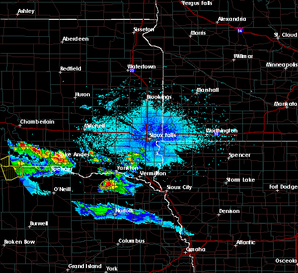 At 1138 pm cdt, a severe thunderstorm was located near bloomfield, or 22 miles south of lewis and clark state recreation area, moving southeast at 40 mph (trained weather spotters). Hazards include 60 mph wind gusts and quarter size hail. Hail damage to vehicles is expected. expect wind damage to roofs, siding, and trees. Locations impacted include, bloomfield. At 1138 pm cdt, a severe thunderstorm was located near bloomfield, or 22 miles south of lewis and clark state recreation area, moving southeast at 40 mph (trained weather spotters). Hazards include 60 mph wind gusts and quarter size hail. Hail damage to vehicles is expected. expect wind damage to roofs, siding, and trees. Locations impacted include, bloomfield.
|
| 8/7/2019 11:24 PM CDT |
 At 1123 pm cdt, a severe thunderstorm was located 6 miles northwest of bloomfield, or 15 miles southwest of lewis and clark state recreation area, moving southeast at 40 mph (trained weather spotters in santee reported power lines and tree limbs down at 11:05 pm ). Hazards include golf ball size hail and 60 mph wind gusts. People and animals outdoors will be injured. expect hail damage to roofs, siding, windows, and vehicles. expect wind damage to roofs, siding, and trees. Locations impacted include, bloomfield and lindy. At 1123 pm cdt, a severe thunderstorm was located 6 miles northwest of bloomfield, or 15 miles southwest of lewis and clark state recreation area, moving southeast at 40 mph (trained weather spotters in santee reported power lines and tree limbs down at 11:05 pm ). Hazards include golf ball size hail and 60 mph wind gusts. People and animals outdoors will be injured. expect hail damage to roofs, siding, windows, and vehicles. expect wind damage to roofs, siding, and trees. Locations impacted include, bloomfield and lindy.
|
| 8/7/2019 11:19 PM CDT |
 At 1118 pm cdt, a severe thunderstorm was located 9 miles northwest of bloomfield, or 14 miles southwest of lewis and clark state recreation area, moving southeast at 40 mph (trained weather spotters in santee reported power lines and tree limbs down at 11:05 pm). Hazards include golf ball size hail and 60 mph wind gusts. People and animals outdoors will be injured. expect hail damage to roofs, siding, windows, and vehicles. expect wind damage to roofs, siding, and trees. Locations impacted include, bloomfield, center and lindy. At 1118 pm cdt, a severe thunderstorm was located 9 miles northwest of bloomfield, or 14 miles southwest of lewis and clark state recreation area, moving southeast at 40 mph (trained weather spotters in santee reported power lines and tree limbs down at 11:05 pm). Hazards include golf ball size hail and 60 mph wind gusts. People and animals outdoors will be injured. expect hail damage to roofs, siding, windows, and vehicles. expect wind damage to roofs, siding, and trees. Locations impacted include, bloomfield, center and lindy.
|
| 8/7/2019 11:10 PM CDT |
 At 1109 pm cdt, a severe thunderstorm was located near santee, or 14 miles west of lewis and clark state recreation area, moving southeast at 40 mph (radar indicated). Hazards include golf ball size hail. People and animals outdoors will be injured. Expect damage to roofs, siding, windows, and vehicles. At 1109 pm cdt, a severe thunderstorm was located near santee, or 14 miles west of lewis and clark state recreation area, moving southeast at 40 mph (radar indicated). Hazards include golf ball size hail. People and animals outdoors will be injured. Expect damage to roofs, siding, windows, and vehicles.
|
| 8/7/2019 10:50 PM CDT |
 At 1050 pm cdt, a severe thunderstorm was located near tyndall, moving southeast at 40 mph (radar indicated). Hazards include golf ball size hail. People and animals outdoors will be injured. Expect damage to roofs, siding, windows, and vehicles. At 1050 pm cdt, a severe thunderstorm was located near tyndall, moving southeast at 40 mph (radar indicated). Hazards include golf ball size hail. People and animals outdoors will be injured. Expect damage to roofs, siding, windows, and vehicles.
|
| 7/26/2019 9:27 PM CDT |
 At 917 pm cdt, a severe thunderstorm was located 8 miles northwest of bloomfield, or 20 miles southwest of lewis and clark state recreation area, moving east at 25 mph. a spotter reported golfball size hail with this storm from 912 pm to 917 pm northwest of bloomfield (radar indicated). Hazards include golf ball size hail and 60 mph wind gusts. People and animals outdoors will be injured. expect hail damage to roofs, siding, windows, and vehicles. expect wind damage to roofs, siding, and trees. Locations impacted include, bloomfield, crofton, center, lewis and clark state recreation area and lindy. At 917 pm cdt, a severe thunderstorm was located 8 miles northwest of bloomfield, or 20 miles southwest of lewis and clark state recreation area, moving east at 25 mph. a spotter reported golfball size hail with this storm from 912 pm to 917 pm northwest of bloomfield (radar indicated). Hazards include golf ball size hail and 60 mph wind gusts. People and animals outdoors will be injured. expect hail damage to roofs, siding, windows, and vehicles. expect wind damage to roofs, siding, and trees. Locations impacted include, bloomfield, crofton, center, lewis and clark state recreation area and lindy.
|
| 7/26/2019 9:18 PM CDT |
 At 917 pm cdt, a severe thunderstorm was located 8 miles northwest of bloomfield, or 20 miles southwest of lewis and clark state recreation area, moving east at 25 mph. a spotter reported golfball size hail with this storm from 912 pm to 917 pm northwest of bloomfield (radar indicated). Hazards include golf ball size hail and 60 mph wind gusts. People and animals outdoors will be injured. expect hail damage to roofs, siding, windows, and vehicles. expect wind damage to roofs, siding, and trees. Locations impacted include, bloomfield, crofton, center, lewis and clark state recreation area and lindy. At 917 pm cdt, a severe thunderstorm was located 8 miles northwest of bloomfield, or 20 miles southwest of lewis and clark state recreation area, moving east at 25 mph. a spotter reported golfball size hail with this storm from 912 pm to 917 pm northwest of bloomfield (radar indicated). Hazards include golf ball size hail and 60 mph wind gusts. People and animals outdoors will be injured. expect hail damage to roofs, siding, windows, and vehicles. expect wind damage to roofs, siding, and trees. Locations impacted include, bloomfield, crofton, center, lewis and clark state recreation area and lindy.
|
| 7/26/2019 9:15 PM CDT |
 At 914 pm cdt, a severe thunderstorm was located 9 miles west of bloomfield, or 21 miles southwest of lewis and clark state recreation area, moving east at 25 mph. the storm has weakened slightly in the past 10 minutes, but is still capable of producing hail and strong winds (radar indicated). Hazards include 60 mph wind gusts and nickel size hail. Expect damage to roofs, siding, and trees. Locations impacted include, bloomfield, crofton, center, lewis and clark state recreation area and lindy. At 914 pm cdt, a severe thunderstorm was located 9 miles west of bloomfield, or 21 miles southwest of lewis and clark state recreation area, moving east at 25 mph. the storm has weakened slightly in the past 10 minutes, but is still capable of producing hail and strong winds (radar indicated). Hazards include 60 mph wind gusts and nickel size hail. Expect damage to roofs, siding, and trees. Locations impacted include, bloomfield, crofton, center, lewis and clark state recreation area and lindy.
|
| 7/26/2019 9:12 PM CDT | Golf Ball sized hail reported 5.5 miles SE of Bloomfield, NE |
| 7/26/2019 9:07 PM CDT |
 At 906 pm cdt, a severe thunderstorm was located 7 miles northeast of verdigre, or 23 miles southwest of lewis and clark state recreation area, moving east at 25 mph (radar indicated). Hazards include 60 mph wind gusts and quarter size hail. Hail damage to vehicles is expected. Expect wind damage to roofs, siding, and trees. At 906 pm cdt, a severe thunderstorm was located 7 miles northeast of verdigre, or 23 miles southwest of lewis and clark state recreation area, moving east at 25 mph (radar indicated). Hazards include 60 mph wind gusts and quarter size hail. Hail damage to vehicles is expected. Expect wind damage to roofs, siding, and trees.
|
| 7/17/2019 6:34 AM CDT |
 At 634 am cdt, severe thunderstorms were located along a line extending from near wynot to 7 miles east of wausa, moving east at 35 mph (radar indicated). Hazards include 60 mph wind gusts and nickel size hail. Expect damage to roofs, siding, and trees. locations impacted include, hartington, bloomfield, wausa, coleridge, wynot, crofton, pleasant valley, fordyce, st. helena, obert, lewis and clark state recreation area, brooky bottom, gavins point dam and campgrounds and st. Helena boat dock. At 634 am cdt, severe thunderstorms were located along a line extending from near wynot to 7 miles east of wausa, moving east at 35 mph (radar indicated). Hazards include 60 mph wind gusts and nickel size hail. Expect damage to roofs, siding, and trees. locations impacted include, hartington, bloomfield, wausa, coleridge, wynot, crofton, pleasant valley, fordyce, st. helena, obert, lewis and clark state recreation area, brooky bottom, gavins point dam and campgrounds and st. Helena boat dock.
|
| 7/17/2019 6:25 AM CDT |
 At 624 am cdt, severe thunderstorms were located along a line extending from around south yankton to near wausa, moving east at 45 mph (radar indicated). Hazards include 60 mph wind gusts and nickel size hail. Expect damage to roofs, siding, and trees. locations impacted include, hartington, bloomfield, wausa, coleridge, santee, wynot, crofton, pleasant valley, fordyce, st. helena, obert, lindy, lewis and clark state recreation area, brooky bottom, gavins point dam and campgrounds and st. Helena boat dock. At 624 am cdt, severe thunderstorms were located along a line extending from around south yankton to near wausa, moving east at 45 mph (radar indicated). Hazards include 60 mph wind gusts and nickel size hail. Expect damage to roofs, siding, and trees. locations impacted include, hartington, bloomfield, wausa, coleridge, santee, wynot, crofton, pleasant valley, fordyce, st. helena, obert, lindy, lewis and clark state recreation area, brooky bottom, gavins point dam and campgrounds and st. Helena boat dock.
|
| 7/17/2019 6:13 AM CDT |
 At 612 am cdt, a severe thunderstorm was located over bloomfield, or 19 miles southwest of lewis and clark state recreation area, moving east at 30 mph (radar indicated). Hazards include 60 mph wind gusts and quarter size hail. Hail damage to vehicles is expected. Expect wind damage to roofs, siding, and trees. At 612 am cdt, a severe thunderstorm was located over bloomfield, or 19 miles southwest of lewis and clark state recreation area, moving east at 30 mph (radar indicated). Hazards include 60 mph wind gusts and quarter size hail. Hail damage to vehicles is expected. Expect wind damage to roofs, siding, and trees.
|
| 7/5/2019 4:03 AM CDT |
 At 403 am cdt, severe thunderstorms were located along a line extending from 8 miles northeast of amelia to 12 miles north of bartlett to 7 miles southeast of ericson, moving east at 35 mph (radar indicated). Hazards include 60 mph wind gusts. expect damage to roofs, siding, and trees At 403 am cdt, severe thunderstorms were located along a line extending from 8 miles northeast of amelia to 12 miles north of bartlett to 7 miles southeast of ericson, moving east at 35 mph (radar indicated). Hazards include 60 mph wind gusts. expect damage to roofs, siding, and trees
|
| 5/27/2019 1:07 AM CDT |
 The severe thunderstorm warning for northwestern pierce, northern antelope, knox and northwestern cedar counties will expire at 115 am cdt, the storm which prompted the warning has moved out of the area. therefore, the warning will be allowed to expire. however gusty winds are still possible with showers moving through the area. to report severe weather, contact your nearest law enforcement agency. they will relay your report to the national weather service omaha. The severe thunderstorm warning for northwestern pierce, northern antelope, knox and northwestern cedar counties will expire at 115 am cdt, the storm which prompted the warning has moved out of the area. therefore, the warning will be allowed to expire. however gusty winds are still possible with showers moving through the area. to report severe weather, contact your nearest law enforcement agency. they will relay your report to the national weather service omaha.
|
| 5/27/2019 12:14 AM CDT |
 At 1213 am cdt, a severe thunderstorm was located near creighton, or 29 miles southwest of lewis and clark state recreation area, moving northeast at 60 mph (law enforcement. wind damage to trees and power lines has been reported in orchard, center and creighton). Hazards include 70 mph wind gusts. Expect considerable tree damage. Damage is likely to mobile homes, roofs, and outbuildings. At 1213 am cdt, a severe thunderstorm was located near creighton, or 29 miles southwest of lewis and clark state recreation area, moving northeast at 60 mph (law enforcement. wind damage to trees and power lines has been reported in orchard, center and creighton). Hazards include 70 mph wind gusts. Expect considerable tree damage. Damage is likely to mobile homes, roofs, and outbuildings.
|
| 7/18/2018 6:27 PM CDT |
 The severe thunderstorm warning for eastern knox and west central cedar counties will expire at 630 pm cdt, the storm which prompted the warning has weakened below severe limits, and no longer poses an immediate threat to life or property. therefore, the warning will be allowed to expire. however small hail is still possible with this thunderstorm. a tornado watch remains in effect until 1100 pm cdt for northeastern nebraska. The severe thunderstorm warning for eastern knox and west central cedar counties will expire at 630 pm cdt, the storm which prompted the warning has weakened below severe limits, and no longer poses an immediate threat to life or property. therefore, the warning will be allowed to expire. however small hail is still possible with this thunderstorm. a tornado watch remains in effect until 1100 pm cdt for northeastern nebraska.
|
| 7/18/2018 5:57 PM CDT |
 At 557 pm cdt, a severe thunderstorm was located 9 miles southwest of lewis and clark state recreation area, moving southeast at 35 mph (radar indicated). Hazards include 60 mph wind gusts and half dollar size hail. Hail damage to vehicles is expected. expect wind damage to roofs, siding, and trees. locations impacted include, bloomfield, wausa, pleasant valley and lindy. A tornado watch remains in effect until 1100 pm cdt for northeastern nebraska. At 557 pm cdt, a severe thunderstorm was located 9 miles southwest of lewis and clark state recreation area, moving southeast at 35 mph (radar indicated). Hazards include 60 mph wind gusts and half dollar size hail. Hail damage to vehicles is expected. expect wind damage to roofs, siding, and trees. locations impacted include, bloomfield, wausa, pleasant valley and lindy. A tornado watch remains in effect until 1100 pm cdt for northeastern nebraska.
|
| 7/18/2018 5:48 PM CDT |
 The national weather service in omaha has issued a * severe thunderstorm warning for. eastern knox county in northeastern nebraska. west central cedar county in northeastern nebraska. until 630 pm cdt. At 548 pm cdt, a severe thunderstorm was located 8 miles north of. The national weather service in omaha has issued a * severe thunderstorm warning for. eastern knox county in northeastern nebraska. west central cedar county in northeastern nebraska. until 630 pm cdt. At 548 pm cdt, a severe thunderstorm was located 8 miles north of.
|
| 7/4/2018 6:21 PM CDT |
 At 621 pm cdt, severe thunderstorms were located along a line extending from 8 miles south of lewis and clark state recreation area to 3 miles northeast of osmond, moving east at 40 mph (radar indicated). Hazards include 60 mph wind gusts and nickel size hail. Expect damage to roofs, siding, and trees. locations impacted include, yankton, hartington, bloomfield, wausa, crofton, pleasant valley, fordyce, st. helena, magnet, gavins point dam and campgrounds, lewis and clark state recreation area and st. Helena boat dock. At 621 pm cdt, severe thunderstorms were located along a line extending from 8 miles south of lewis and clark state recreation area to 3 miles northeast of osmond, moving east at 40 mph (radar indicated). Hazards include 60 mph wind gusts and nickel size hail. Expect damage to roofs, siding, and trees. locations impacted include, yankton, hartington, bloomfield, wausa, crofton, pleasant valley, fordyce, st. helena, magnet, gavins point dam and campgrounds, lewis and clark state recreation area and st. Helena boat dock.
|
| 7/4/2018 6:14 PM CDT |
 At 614 pm cdt, severe thunderstorms were located along a line extending from 8 miles southwest of lewis and clark state recreation area to 4 miles west of wausa to near plainview, moving east at 35 mph (radar indicated). Hazards include 60 mph wind gusts and nickel size hail. Expect damage to roofs, siding, and trees. locations impacted include, yankton, hartington, plainview, bloomfield, wausa, santee, crofton, pleasant valley, fordyce, st. helena, magnet, lindy, lewis and clark state recreation area, gavins point dam and campgrounds and st. Helena boat dock. At 614 pm cdt, severe thunderstorms were located along a line extending from 8 miles southwest of lewis and clark state recreation area to 4 miles west of wausa to near plainview, moving east at 35 mph (radar indicated). Hazards include 60 mph wind gusts and nickel size hail. Expect damage to roofs, siding, and trees. locations impacted include, yankton, hartington, plainview, bloomfield, wausa, santee, crofton, pleasant valley, fordyce, st. helena, magnet, lindy, lewis and clark state recreation area, gavins point dam and campgrounds and st. Helena boat dock.
|
| 7/4/2018 6:06 PM CDT |
 At 606 pm cdt, severe thunderstorms were located along a line extending from 9 miles southeast of santee to 7 miles north of plainview, moving northeast at 35 mph (radar indicated). Hazards include 60 mph wind gusts and quarter size hail. Hail damage to vehicles is expected. Expect wind damage to roofs, siding, and trees. At 606 pm cdt, severe thunderstorms were located along a line extending from 9 miles southeast of santee to 7 miles north of plainview, moving northeast at 35 mph (radar indicated). Hazards include 60 mph wind gusts and quarter size hail. Hail damage to vehicles is expected. Expect wind damage to roofs, siding, and trees.
|
| 7/4/2018 5:24 PM CDT |
 At 524 pm cdt, a severe thunderstorm was located near wausa, or 22 miles south of lewis and clark state recreation area, moving northeast at 20 mph (radar indicated). Hazards include 60 mph wind gusts and half dollar size hail. Hail damage to vehicles is expected. expect wind damage to roofs, siding, and trees. Locations impacted include, hartington, bloomfield, wausa, coleridge, crofton, pleasant valley, fordyce and magnet. At 524 pm cdt, a severe thunderstorm was located near wausa, or 22 miles south of lewis and clark state recreation area, moving northeast at 20 mph (radar indicated). Hazards include 60 mph wind gusts and half dollar size hail. Hail damage to vehicles is expected. expect wind damage to roofs, siding, and trees. Locations impacted include, hartington, bloomfield, wausa, coleridge, crofton, pleasant valley, fordyce and magnet.
|
| 7/4/2018 5:16 PM CDT |
 At 516 pm cdt, a severe thunderstorm was located near wausa, or 25 miles south of lewis and clark state recreation area, moving east at 15 mph. this storm has shown some rotation and should be monitored closely (radar indicated). Hazards include 60 mph wind gusts and half dollar size hail. Hail damage to vehicles is expected. expect wind damage to roofs, siding, and trees. Locations impacted include, hartington, bloomfield, wausa, coleridge, crofton, pleasant valley, fordyce and magnet. At 516 pm cdt, a severe thunderstorm was located near wausa, or 25 miles south of lewis and clark state recreation area, moving east at 15 mph. this storm has shown some rotation and should be monitored closely (radar indicated). Hazards include 60 mph wind gusts and half dollar size hail. Hail damage to vehicles is expected. expect wind damage to roofs, siding, and trees. Locations impacted include, hartington, bloomfield, wausa, coleridge, crofton, pleasant valley, fordyce and magnet.
|
| 7/4/2018 5:13 PM CDT |
 At 512 pm cdt, a severe thunderstorm was located 5 miles west of wausa, or 25 miles south of lewis and clark state recreation area, moving northeast at 15 mph. this storm has shown some rotation southwest of wausa (radar indicated). Hazards include 60 mph wind gusts and quarter size hail. Hail damage to vehicles is expected. Expect wind damage to roofs, siding, and trees. At 512 pm cdt, a severe thunderstorm was located 5 miles west of wausa, or 25 miles south of lewis and clark state recreation area, moving northeast at 15 mph. this storm has shown some rotation southwest of wausa (radar indicated). Hazards include 60 mph wind gusts and quarter size hail. Hail damage to vehicles is expected. Expect wind damage to roofs, siding, and trees.
|
| 7/4/2018 5:05 PM CDT |
 At 504 pm cdt, a severe thunderstorm was located 7 miles southwest of bloomfield, or 26 miles south of lewis and clark state recreation area, moving northeast at 20 mph. a second severe storm was about 4 miles northeast of center (radar indicated). Hazards include 60 mph wind gusts and half dollar size hail. Hail damage to vehicles is expected. expect wind damage to roofs, siding, and trees. Locations impacted include, creighton, bloomfield, center and bazile mills. At 504 pm cdt, a severe thunderstorm was located 7 miles southwest of bloomfield, or 26 miles south of lewis and clark state recreation area, moving northeast at 20 mph. a second severe storm was about 4 miles northeast of center (radar indicated). Hazards include 60 mph wind gusts and half dollar size hail. Hail damage to vehicles is expected. expect wind damage to roofs, siding, and trees. Locations impacted include, creighton, bloomfield, center and bazile mills.
|
| 7/4/2018 4:57 PM CDT |
 At 457 pm cdt, a severe thunderstorm was located 8 miles southwest of bloomfield, or 27 miles south of lewis and clark state recreation area, moving northeast at 20 mph. a second storm was located near center that likely had large hail, it was moving north at 20 mph (radar indicated). Hazards include 60 mph wind gusts and half dollar size hail. Hail damage to vehicles is expected. expect wind damage to roofs, siding, and trees. Locations impacted include, creighton, bloomfield, center and bazile mills. At 457 pm cdt, a severe thunderstorm was located 8 miles southwest of bloomfield, or 27 miles south of lewis and clark state recreation area, moving northeast at 20 mph. a second storm was located near center that likely had large hail, it was moving north at 20 mph (radar indicated). Hazards include 60 mph wind gusts and half dollar size hail. Hail damage to vehicles is expected. expect wind damage to roofs, siding, and trees. Locations impacted include, creighton, bloomfield, center and bazile mills.
|
| 7/4/2018 4:51 PM CDT |
 At 450 pm cdt, a severe thunderstorm was located 7 miles southwest of bloomfield, or 25 miles southwest of lewis and clark state recreation area, moving northeast at 20 mph (radar indicated). Hazards include 60 mph wind gusts and half dollar size hail. Hail damage to vehicles is expected. expect wind damage to roofs, siding, and trees. Locations impacted include, creighton, bloomfield, center and bazile mills. At 450 pm cdt, a severe thunderstorm was located 7 miles southwest of bloomfield, or 25 miles southwest of lewis and clark state recreation area, moving northeast at 20 mph (radar indicated). Hazards include 60 mph wind gusts and half dollar size hail. Hail damage to vehicles is expected. expect wind damage to roofs, siding, and trees. Locations impacted include, creighton, bloomfield, center and bazile mills.
|
| 7/4/2018 4:42 PM CDT |
 At 442 pm cdt, a severe thunderstorm was located 5 miles east of creighton, or 29 miles southwest of lewis and clark state recreation area, moving northeast at 15 mph (radar indicated). Hazards include 60 mph wind gusts and quarter size hail. Hail damage to vehicles is expected. expect wind damage to roofs, siding, and trees. Locations impacted include, creighton, bloomfield, center, winnetoon and bazile mills. At 442 pm cdt, a severe thunderstorm was located 5 miles east of creighton, or 29 miles southwest of lewis and clark state recreation area, moving northeast at 15 mph (radar indicated). Hazards include 60 mph wind gusts and quarter size hail. Hail damage to vehicles is expected. expect wind damage to roofs, siding, and trees. Locations impacted include, creighton, bloomfield, center, winnetoon and bazile mills.
|
| 7/4/2018 4:35 PM CDT |
 At 435 pm cdt, a severe thunderstorm was located 4 miles east of creighton, or 31 miles southwest of lewis and clark state recreation area, moving northeast at 10 mph (radar indicated). Hazards include 60 mph wind gusts and nickel size hail. Expect damage to roofs, siding, and trees. Locations impacted include, creighton, bloomfield, center, winnetoon and bazile mills. At 435 pm cdt, a severe thunderstorm was located 4 miles east of creighton, or 31 miles southwest of lewis and clark state recreation area, moving northeast at 10 mph (radar indicated). Hazards include 60 mph wind gusts and nickel size hail. Expect damage to roofs, siding, and trees. Locations impacted include, creighton, bloomfield, center, winnetoon and bazile mills.
|
| 7/4/2018 4:28 PM CDT |
 At 427 pm cdt, a severe thunderstorm was located near creighton, or 33 miles southwest of lewis and clark state recreation area, moving northeast at 10 mph (radar indicated). Hazards include 60 mph wind gusts and quarter size hail. Hail damage to vehicles is expected. Expect wind damage to roofs, siding, and trees. At 427 pm cdt, a severe thunderstorm was located near creighton, or 33 miles southwest of lewis and clark state recreation area, moving northeast at 10 mph (radar indicated). Hazards include 60 mph wind gusts and quarter size hail. Hail damage to vehicles is expected. Expect wind damage to roofs, siding, and trees.
|
| 6/30/2018 3:23 AM CDT |
 At 323 am cdt, a severe thunderstorm was located near bloomfield, or 19 miles southwest of lewis and clark state recreation area, moving northeast at 30 mph (radar indicated). Hazards include 60 mph wind gusts and quarter size hail. Hail damage to vehicles is expected. expect wind damage to roofs, siding, and trees. Locations impacted include, bloomfield and lindy. At 323 am cdt, a severe thunderstorm was located near bloomfield, or 19 miles southwest of lewis and clark state recreation area, moving northeast at 30 mph (radar indicated). Hazards include 60 mph wind gusts and quarter size hail. Hail damage to vehicles is expected. expect wind damage to roofs, siding, and trees. Locations impacted include, bloomfield and lindy.
|
| 6/30/2018 3:15 AM CDT |
 At 313 am cdt, a severe thunderstorm was located 8 miles southwest of bloomfield, or 25 miles southwest of lewis and clark state recreation area, moving northeast at 30 mph (law enforcement. at 302 am quarter size hail was reported in creighton). Hazards include 60 mph wind gusts and quarter size hail. Hail damage to vehicles is expected. expect wind damage to roofs, siding, and trees. Locations impacted include, bloomfield and lindy. At 313 am cdt, a severe thunderstorm was located 8 miles southwest of bloomfield, or 25 miles southwest of lewis and clark state recreation area, moving northeast at 30 mph (law enforcement. at 302 am quarter size hail was reported in creighton). Hazards include 60 mph wind gusts and quarter size hail. Hail damage to vehicles is expected. expect wind damage to roofs, siding, and trees. Locations impacted include, bloomfield and lindy.
|
| 6/30/2018 3:08 AM CDT |
 At 307 am cdt, a severe thunderstorm was located 4 miles northeast of creighton, or 28 miles southwest of lewis and clark state recreation area, moving northeast at 30 mph (law enforcement. at 302 am quarter size hail was reported in creighton). Hazards include 60 mph wind gusts and quarter size hail. Hail damage to vehicles is expected. expect wind damage to roofs, siding, and trees. Locations impacted include, creighton, bloomfield, center, winnetoon, bazile mills, lindy and the highway 14 and 59 junction. At 307 am cdt, a severe thunderstorm was located 4 miles northeast of creighton, or 28 miles southwest of lewis and clark state recreation area, moving northeast at 30 mph (law enforcement. at 302 am quarter size hail was reported in creighton). Hazards include 60 mph wind gusts and quarter size hail. Hail damage to vehicles is expected. expect wind damage to roofs, siding, and trees. Locations impacted include, creighton, bloomfield, center, winnetoon, bazile mills, lindy and the highway 14 and 59 junction.
|
| 6/30/2018 2:57 AM CDT |
 At 257 am cdt, a severe thunderstorm was located over creighton, or 34 miles southwest of lewis and clark state recreation area, moving northeast at 35 mph (radar indicated). Hazards include ping pong ball size hail and 60 mph wind gusts. People and animals outdoors will be injured. expect hail damage to roofs, siding, windows, and vehicles. Expect wind damage to roofs, siding, and trees. At 257 am cdt, a severe thunderstorm was located over creighton, or 34 miles southwest of lewis and clark state recreation area, moving northeast at 35 mph (radar indicated). Hazards include ping pong ball size hail and 60 mph wind gusts. People and animals outdoors will be injured. expect hail damage to roofs, siding, windows, and vehicles. Expect wind damage to roofs, siding, and trees.
|
| 6/23/2018 3:58 PM CDT |
 At 355 pm cdt, a severe thunderstorm was located near bloomfield, or 19 miles south of lewis and clark state recreation area, moving southeast at 20 mph (radar indicated). Hazards include 60 mph wind gusts and quarter size hail. Hail damage to vehicles is expected. Expect wind damage to roofs, siding, and trees. At 355 pm cdt, a severe thunderstorm was located near bloomfield, or 19 miles south of lewis and clark state recreation area, moving southeast at 20 mph (radar indicated). Hazards include 60 mph wind gusts and quarter size hail. Hail damage to vehicles is expected. Expect wind damage to roofs, siding, and trees.
|
| 6/23/2018 3:49 PM CDT |
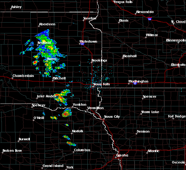 At 349 pm cdt, a severe thunderstorm was located near bloomfield, or 16 miles south of lewis and clark state recreation area, moving southeast at 15 mph (radar indicated). Hazards include quarter size hail. Damage to vehicles is expected. Locations impacted include, bloomfield. At 349 pm cdt, a severe thunderstorm was located near bloomfield, or 16 miles south of lewis and clark state recreation area, moving southeast at 15 mph (radar indicated). Hazards include quarter size hail. Damage to vehicles is expected. Locations impacted include, bloomfield.
|
| 6/23/2018 3:28 PM CDT |
 At 328 pm cdt, a severe thunderstorm was located 8 miles northwest of bloomfield, or 17 miles southwest of lewis and clark state recreation area, moving southeast at 10 mph (radar indicated). Hazards include quarter size hail. damage to vehicles is expected At 328 pm cdt, a severe thunderstorm was located 8 miles northwest of bloomfield, or 17 miles southwest of lewis and clark state recreation area, moving southeast at 10 mph (radar indicated). Hazards include quarter size hail. damage to vehicles is expected
|
| 6/1/2018 8:59 PM CDT |
 The national weather service in omaha has issued a * severe thunderstorm warning for. northwestern pierce county in northeastern nebraska. antelope county in northeastern nebraska. southern knox county in northeastern nebraska. Until 930 pm cdt. The national weather service in omaha has issued a * severe thunderstorm warning for. northwestern pierce county in northeastern nebraska. antelope county in northeastern nebraska. southern knox county in northeastern nebraska. Until 930 pm cdt.
|
| 6/1/2018 8:35 PM CDT |
 At 808 pm cdt, severe thunderstorms were located along a line extending from 9 miles south of dante to near ewing, moving northeast at 45 mph (radar indicated). Hazards include 60 mph wind gusts and quarter size hail. Hail damage to vehicles is expected. Expect wind damage to roofs, siding, and trees. At 808 pm cdt, severe thunderstorms were located along a line extending from 9 miles south of dante to near ewing, moving northeast at 45 mph (radar indicated). Hazards include 60 mph wind gusts and quarter size hail. Hail damage to vehicles is expected. Expect wind damage to roofs, siding, and trees.
|
| 6/1/2018 8:09 PM CDT |
 At 808 pm cdt, severe thunderstorms were located along a line extending from 9 miles south of dante to near ewing, moving northeast at 45 mph (radar indicated). Hazards include 60 mph wind gusts and quarter size hail. Hail damage to vehicles is expected. Expect wind damage to roofs, siding, and trees. At 808 pm cdt, severe thunderstorms were located along a line extending from 9 miles south of dante to near ewing, moving northeast at 45 mph (radar indicated). Hazards include 60 mph wind gusts and quarter size hail. Hail damage to vehicles is expected. Expect wind damage to roofs, siding, and trees.
|
| 6/16/2017 4:18 PM CDT |
 At 418 pm cdt, a severe thunderstorm was located 8 miles east of creighton, or 28 miles south of lewis and clark state recreation area, moving east at 30 mph (radar indicated). Hazards include quarter size hail. Damage to vehicles is expected. locations impacted include, bloomfield, wausa and santee reservation. This includes highway 20 in nebraska near mile marker 367. At 418 pm cdt, a severe thunderstorm was located 8 miles east of creighton, or 28 miles south of lewis and clark state recreation area, moving east at 30 mph (radar indicated). Hazards include quarter size hail. Damage to vehicles is expected. locations impacted include, bloomfield, wausa and santee reservation. This includes highway 20 in nebraska near mile marker 367.
|
| 6/16/2017 3:54 PM CDT |
 At 353 pm cdt, a severe thunderstorm was located 4 miles northwest of creighton, or 32 miles southwest of lewis and clark state recreation area, moving east at 30 mph (radar indicated). Hazards include quarter size hail. damage to vehicles is expected At 353 pm cdt, a severe thunderstorm was located 4 miles northwest of creighton, or 32 miles southwest of lewis and clark state recreation area, moving east at 30 mph (radar indicated). Hazards include quarter size hail. damage to vehicles is expected
|
| 5/15/2017 11:54 PM CDT |
 The severe thunderstorm warning for northeastern knox county will expire at midnight cdt, the storm which prompted the warning has moved out of the area. therefore the warning will be allowed to expire. however gusty winds are still possible with this thunderstorm. The severe thunderstorm warning for northeastern knox county will expire at midnight cdt, the storm which prompted the warning has moved out of the area. therefore the warning will be allowed to expire. however gusty winds are still possible with this thunderstorm.
|
| 5/15/2017 11:44 PM CDT |
 At 1144 pm cdt, a severe thunderstorm was located over santee, or 11 miles south of tyndall, moving northeast at 40 mph (radar indicated). Hazards include 60 mph wind gusts. Expect damage to roofs, siding, and trees. Locations impacted include, bloomfield, niobrara, santee, crofton, lindy, santee reservation and lewis and clark state recreation area. At 1144 pm cdt, a severe thunderstorm was located over santee, or 11 miles south of tyndall, moving northeast at 40 mph (radar indicated). Hazards include 60 mph wind gusts. Expect damage to roofs, siding, and trees. Locations impacted include, bloomfield, niobrara, santee, crofton, lindy, santee reservation and lewis and clark state recreation area.
|
| 5/15/2017 11:32 PM CDT |
 At 1132 pm cdt, a severe thunderstorm was located 6 miles southeast of niobrara, or 19 miles south of tyndall, moving northeast at 40 mph (radar indicated). Hazards include 60 mph wind gusts and penny size hail. Expect damage to roofs, siding, and trees. Locations impacted include, bloomfield, verdigre, niobrara, santee, crofton, center, verdel, lindy, santee reservation and lewis and clark state recreation area. At 1132 pm cdt, a severe thunderstorm was located 6 miles southeast of niobrara, or 19 miles south of tyndall, moving northeast at 40 mph (radar indicated). Hazards include 60 mph wind gusts and penny size hail. Expect damage to roofs, siding, and trees. Locations impacted include, bloomfield, verdigre, niobrara, santee, crofton, center, verdel, lindy, santee reservation and lewis and clark state recreation area.
|
| 5/15/2017 11:16 PM CDT |
 At 1115 pm cdt, a severe thunderstorm was located 4 miles southeast of verdigre, or 31 miles south of tyndall, moving northeast at 40 mph (radar indicated). Hazards include 60 mph wind gusts and penny size hail. expect damage to roofs, siding, and trees At 1115 pm cdt, a severe thunderstorm was located 4 miles southeast of verdigre, or 31 miles south of tyndall, moving northeast at 40 mph (radar indicated). Hazards include 60 mph wind gusts and penny size hail. expect damage to roofs, siding, and trees
|
| 7/6/2016 10:26 PM CDT | The severe thunderstorm warning for western cedar and southeastern knox counties will expire at 1030 pm cdt, the storms which prompted the warning have moved out of the warned area. a new warning has been issued farther east including parts of cedar county. a severe thunderstorm watch remains in effect until 200 am cdt for northeastern nebraska. |
| 7/6/2016 10:15 PM CDT |
 At 1015 pm cdt, severe thunderstorms were located along a line extending from 8 miles west of wynot to 7 miles west of wausa, moving east at 45 mph (radar indicated). Hazards include 60 mph wind gusts and nickel size hail. Expect damage to roofs. siding and trees. locations impacted include, hartington, creighton, bloomfield, wausa, crofton, pleasant valley, fordyce, st. helena, winnetoon, magnet, bazile mills, gavins point dam and campgrounds, the highway 14 and 59 junction and st. Helena boat dock. At 1015 pm cdt, severe thunderstorms were located along a line extending from 8 miles west of wynot to 7 miles west of wausa, moving east at 45 mph (radar indicated). Hazards include 60 mph wind gusts and nickel size hail. Expect damage to roofs. siding and trees. locations impacted include, hartington, creighton, bloomfield, wausa, crofton, pleasant valley, fordyce, st. helena, winnetoon, magnet, bazile mills, gavins point dam and campgrounds, the highway 14 and 59 junction and st. Helena boat dock.
|
| 7/6/2016 10:05 PM CDT |
 At 1004 pm cdt, severe thunderstorms were located along a line extending from 9 miles southeast of lewis and clark state recreation area to 4 miles east of creighton, moving east at 35 mph. some of these storms will produce damaging winds (radar indicated). Hazards include 70 mph wind gusts and nickel size hail. Expect considerable tree damage. damage is likely to mobile homes, roofs and outbuildings. locations impacted include, hartington, creighton, bloomfield, wausa, crofton, pleasant valley, fordyce, st. helena, center, winnetoon, magnet, bazile mills, gavins point dam and campgrounds, lewis and clark state recreation area, the highway 14 and 59 junction, lindy and st. Helena boat dock. At 1004 pm cdt, severe thunderstorms were located along a line extending from 9 miles southeast of lewis and clark state recreation area to 4 miles east of creighton, moving east at 35 mph. some of these storms will produce damaging winds (radar indicated). Hazards include 70 mph wind gusts and nickel size hail. Expect considerable tree damage. damage is likely to mobile homes, roofs and outbuildings. locations impacted include, hartington, creighton, bloomfield, wausa, crofton, pleasant valley, fordyce, st. helena, center, winnetoon, magnet, bazile mills, gavins point dam and campgrounds, lewis and clark state recreation area, the highway 14 and 59 junction, lindy and st. Helena boat dock.
|
| 7/6/2016 9:59 PM CDT |
 At 959 pm cdt, severe thunderstorms were located along a line extending from 4 miles southwest of yankton to 5 miles north of plainview, moving east at 40 mph (radar indicated). Hazards include 60 mph wind gusts and nickel size hail. Expect damage to roofs. siding and trees. locations impacted include, hartington, creighton, bloomfield, wausa, verdigre, santee, crofton, pleasant valley, fordyce, st. helena, center, winnetoon, magnet, bazile mills, gavins point dam and campgrounds, lewis and clark state recreation area, the highway 14 and 59 junction, lindy and st. Helena boat dock. At 959 pm cdt, severe thunderstorms were located along a line extending from 4 miles southwest of yankton to 5 miles north of plainview, moving east at 40 mph (radar indicated). Hazards include 60 mph wind gusts and nickel size hail. Expect damage to roofs. siding and trees. locations impacted include, hartington, creighton, bloomfield, wausa, verdigre, santee, crofton, pleasant valley, fordyce, st. helena, center, winnetoon, magnet, bazile mills, gavins point dam and campgrounds, lewis and clark state recreation area, the highway 14 and 59 junction, lindy and st. Helena boat dock.
|
| 7/6/2016 9:50 PM CDT |
 At 950 pm cdt, severe thunderstorms were located along a line extending from near lewis and clark state recreation area to 5 miles east of creighton, moving east at 50 mph (radar indicated). Hazards include 60 mph wind gusts and nickel size hail. Expect damage to roofs. siding and trees. locations impacted include, hartington, creighton, bloomfield, wausa, verdigre, santee, crofton, pleasant valley, fordyce, st. helena, center, winnetoon, magnet, bazile mills, gavins point dam and campgrounds, lewis and clark state recreation area, the highway 14 and 59 junction, lindy and st. Helena boat dock. At 950 pm cdt, severe thunderstorms were located along a line extending from near lewis and clark state recreation area to 5 miles east of creighton, moving east at 50 mph (radar indicated). Hazards include 60 mph wind gusts and nickel size hail. Expect damage to roofs. siding and trees. locations impacted include, hartington, creighton, bloomfield, wausa, verdigre, santee, crofton, pleasant valley, fordyce, st. helena, center, winnetoon, magnet, bazile mills, gavins point dam and campgrounds, lewis and clark state recreation area, the highway 14 and 59 junction, lindy and st. Helena boat dock.
|
| 7/6/2016 9:39 PM CDT |
 At 938 pm cdt, severe thunderstorms were located along a line extending from 6 miles west of lewis and clark state recreation area to 5 miles west of creighton, moving east at 55 mph (radar indicated). Hazards include 70 mph wind gusts and nickel size hail. Expect considerable tree damage. Damage is likely to mobile homes, roofs and outbuildings. At 938 pm cdt, severe thunderstorms were located along a line extending from 6 miles west of lewis and clark state recreation area to 5 miles west of creighton, moving east at 55 mph (radar indicated). Hazards include 70 mph wind gusts and nickel size hail. Expect considerable tree damage. Damage is likely to mobile homes, roofs and outbuildings.
|
| 6/17/2016 10:05 PM CDT |
 At 1004 pm cdt, severe thunderstorms were located along a line extending from 3 miles north of emerson to 6 miles northwest of verdigre, moving southwest at 30 mph (radar indicated). Hazards include 60 mph wind gusts and nickel size hail. Expect damage to roofs. siding and trees. locations impacted include, hartington, plainview, creighton, bloomfield, randolph, osmond, wausa, verdigre, coleridge, orchard, niobrara, santee, wynot, laurel, crofton, pleasant valley, fordyce, brunswick, belden and st. helena. this includes the following highways, highway 81 in nebraska between milemarkers 177 and 215. Highway 20 in nebraska between mile markers 329 and 398. At 1004 pm cdt, severe thunderstorms were located along a line extending from 3 miles north of emerson to 6 miles northwest of verdigre, moving southwest at 30 mph (radar indicated). Hazards include 60 mph wind gusts and nickel size hail. Expect damage to roofs. siding and trees. locations impacted include, hartington, plainview, creighton, bloomfield, randolph, osmond, wausa, verdigre, coleridge, orchard, niobrara, santee, wynot, laurel, crofton, pleasant valley, fordyce, brunswick, belden and st. helena. this includes the following highways, highway 81 in nebraska between milemarkers 177 and 215. Highway 20 in nebraska between mile markers 329 and 398.
|
| 6/17/2016 9:44 PM CDT |
 At 944 pm cdt, severe thunderstorms were located along a line extending from 3 miles west of jackson in dakota county to near niobrara, moving southwest at 35 mph (radar indicated). Hazards include 60 mph wind gusts and nickel size hail. Expect damage to roofs. Siding and trees. At 944 pm cdt, severe thunderstorms were located along a line extending from 3 miles west of jackson in dakota county to near niobrara, moving southwest at 35 mph (radar indicated). Hazards include 60 mph wind gusts and nickel size hail. Expect damage to roofs. Siding and trees.
|
| 6/17/2016 9:17 PM CDT |
 At 916 pm cdt, severe thunderstorms were located along a line extending from 3 miles south of vermillion to 4 miles south of tabor, moving south at 35 mph (radar indicated). Hazards include 60 mph wind gusts and nickel size hail. Expect damage to roofs. Siding and trees. At 916 pm cdt, severe thunderstorms were located along a line extending from 3 miles south of vermillion to 4 miles south of tabor, moving south at 35 mph (radar indicated). Hazards include 60 mph wind gusts and nickel size hail. Expect damage to roofs. Siding and trees.
|
| 5/25/2016 9:20 PM CDT |
 At 920 pm cdt, a severe thunderstorm was located 7 miles southwest of lewis and clark state recreation area, moving east at 30 mph (radar indicated). Hazards include 60 mph wind gusts and quarter size hail. Hail damage to vehicles is expected. expect wind damage to roofs, siding and trees. locations impacted include, bloomfield, verdigre, crofton, pleasant valley, center and lindy. This includes highway 81 in nebraska between milemarkers 197 and 200. At 920 pm cdt, a severe thunderstorm was located 7 miles southwest of lewis and clark state recreation area, moving east at 30 mph (radar indicated). Hazards include 60 mph wind gusts and quarter size hail. Hail damage to vehicles is expected. expect wind damage to roofs, siding and trees. locations impacted include, bloomfield, verdigre, crofton, pleasant valley, center and lindy. This includes highway 81 in nebraska between milemarkers 197 and 200.
|
| 5/25/2016 9:10 PM CDT |
 At 910 pm cdt, a severe thunderstorm was located 9 miles southeast of santee, or 14 miles southwest of lewis and clark state recreation area, moving east at 35 mph (radar indicated). Hazards include 60 mph wind gusts and quarter size hail. Hail damage to vehicles is expected. Expect wind damage to roofs, siding and trees. At 910 pm cdt, a severe thunderstorm was located 9 miles southeast of santee, or 14 miles southwest of lewis and clark state recreation area, moving east at 35 mph (radar indicated). Hazards include 60 mph wind gusts and quarter size hail. Hail damage to vehicles is expected. Expect wind damage to roofs, siding and trees.
|
| 5/25/2016 8:55 PM CDT |
 At 855 pm cdt, a severe thunderstorm was located 8 miles southeast of niobrara, or 20 miles south of tyndall, moving east at 25 mph (radar indicated). Hazards include golf ball size hail and 60 mph wind gusts. People and animals outdoors will be injured. expect hail damage to roofs, siding, windows and vehicles. expect wind damage to roofs, siding and trees. Locations impacted include, bloomfield, verdigre, niobrara, santee, center, lindy and lewis and clark state recreation area. At 855 pm cdt, a severe thunderstorm was located 8 miles southeast of niobrara, or 20 miles south of tyndall, moving east at 25 mph (radar indicated). Hazards include golf ball size hail and 60 mph wind gusts. People and animals outdoors will be injured. expect hail damage to roofs, siding, windows and vehicles. expect wind damage to roofs, siding and trees. Locations impacted include, bloomfield, verdigre, niobrara, santee, center, lindy and lewis and clark state recreation area.
|
| 5/25/2016 8:42 PM CDT |
 At 841 pm cdt, a severe thunderstorm was located 5 miles southeast of niobrara, or 21 miles south of tyndall, moving east at 30 mph (radar indicated). Hazards include two inch hail and 60 mph wind gusts. People and animals outdoors will be injured. expect hail damage to roofs, siding, windows and vehicles. Expect wind damage to roofs, siding and trees. At 841 pm cdt, a severe thunderstorm was located 5 miles southeast of niobrara, or 21 miles south of tyndall, moving east at 30 mph (radar indicated). Hazards include two inch hail and 60 mph wind gusts. People and animals outdoors will be injured. expect hail damage to roofs, siding, windows and vehicles. Expect wind damage to roofs, siding and trees.
|
| 9/22/2015 11:35 PM CDT | At 1135 pm cdt, a severe thunderstorm was located 8 miles east of wausa, or 26 miles south of lewis and clark state recreation area, moving northeast at 15 mph. this was part of a larger area of storms that cover parts of cedar and knox counties (radar indicated). Hazards include quarter size hail. Damage to vehicles is expected. locations impacted include, hartington, bloomfield, coleridge, wynot, crofton, pleasant valley, fordyce, st. helena, obert, gavins point dam and campgrounds, lewis and clark state recreation area, brooky bottom and lindy. This includes highway 81 in nebraska between milemarkers 186 and 215. |
| 9/22/2015 11:26 PM CDT | At 1125 pm cdt, severe thunderstorms were located along a line extending from 8 miles southeast of santee to 6 miles west of coleridge, moving northeast at 10 mph (radar indicated). Hazards include quarter size hail. Damage to vehicles is expected. locations impacted include, hartington, bloomfield, coleridge, wynot, crofton, pleasant valley, fordyce, st. helena, obert, gavins point dam and campgrounds, lewis and clark state recreation area, brooky bottom and lindy. This includes highway 81 in nebraska between milemarkers 186 and 215. |
| 9/22/2015 11:20 PM CDT | At 1119 pm cdt, an area of strong to severe thunderstorms was located from around 7 miles southeast of santee to 4 miles west of coleridge, moving northeast at 10 mph. the strongest storm was near wausa (radar indicated). Hazards include quarter size hail. Damage to vehicles is expected. locations impacted include, hartington, bloomfield, coleridge, wynot, crofton, pleasant valley, fordyce, st. helena, obert, gavins point dam and campgrounds, lewis and clark state recreation area, brooky bottom and lindy. This includes highway 81 in nebraska between milemarkers 186 and 215. |
| 9/22/2015 11:04 PM CDT | At 1103 pm cdt, severe thunderstorms were located along a line extending from 9 miles north of bloomfield to 7 miles north of randolph, moving northeast at 10 mph (radar indicated). Hazards include quarter size hail. Damage to vehicles is expected. locations impacted include, hartington, bloomfield, coleridge, wynot, crofton, pleasant valley, fordyce, st. helena, obert, gavins point dam and campgrounds, lewis and clark state recreation area, brooky bottom and lindy. This includes highway 81 in nebraska between milemarkers 186 and 215. |
| 9/22/2015 10:57 PM CDT | At 1057 pm cdt, severe thunderstorms were located along a line extending from 4 miles northwest of bloomfield to near randolph, moving east at 10 mph (radar indicated). Hazards include quarter size hail. damage to vehicles is expected |
| 7/26/2015 12:13 AM CDT |
 At 1213 am cdt, a severe thunderstorm was located near bloomfield, or 15 miles south of lewis and clark state recreation area, moving southeast at 40 mph (radar indicated). Hazards include 60 mph wind gusts. Expect damage to roofs. siding and trees. Locations impacted include, bloomfield, wausa, crofton and lindy. At 1213 am cdt, a severe thunderstorm was located near bloomfield, or 15 miles south of lewis and clark state recreation area, moving southeast at 40 mph (radar indicated). Hazards include 60 mph wind gusts. Expect damage to roofs. siding and trees. Locations impacted include, bloomfield, wausa, crofton and lindy.
|
| 7/25/2015 11:57 PM CDT |
 At 1157 pm cdt, a severe thunderstorm was located near santee, or 14 miles south of tyndall, moving southeast at 30 mph (radar indicated). Hazards include 60 mph wind gusts and quarter size hail. Hail damage to vehicles is expected. Expect wind damage to roofs, siding and trees. At 1157 pm cdt, a severe thunderstorm was located near santee, or 14 miles south of tyndall, moving southeast at 30 mph (radar indicated). Hazards include 60 mph wind gusts and quarter size hail. Hail damage to vehicles is expected. Expect wind damage to roofs, siding and trees.
|
| 7/25/2015 11:54 PM CDT |
 At 1153 pm cdt, a severe thunderstorm was located near santee, or 14 miles south of tyndall, moving southeast at 30 mph (radar indicated). Hazards include 60 mph wind gusts and quarter size hail. Hail damage to vehicles is expected. expect wind damage to roofs, siding and trees. Locations impacted include, creighton, bloomfield, santee, center and bazile mills. At 1153 pm cdt, a severe thunderstorm was located near santee, or 14 miles south of tyndall, moving southeast at 30 mph (radar indicated). Hazards include 60 mph wind gusts and quarter size hail. Hail damage to vehicles is expected. expect wind damage to roofs, siding and trees. Locations impacted include, creighton, bloomfield, santee, center and bazile mills.
|
| 7/25/2015 11:49 PM CDT |
 At 1149 pm cdt, a severe thunderstorm was located near santee, or 14 miles south of tyndall, moving southeast at 50 mph (radar indicated). Hazards include 60 mph wind gusts and quarter size hail. Hail damage to vehicles is expected. expect wind damage to roofs, siding and trees. Locations impacted include, creighton, bloomfield, niobrara, santee, center and bazile mills. At 1149 pm cdt, a severe thunderstorm was located near santee, or 14 miles south of tyndall, moving southeast at 50 mph (radar indicated). Hazards include 60 mph wind gusts and quarter size hail. Hail damage to vehicles is expected. expect wind damage to roofs, siding and trees. Locations impacted include, creighton, bloomfield, niobrara, santee, center and bazile mills.
|
| 7/25/2015 11:36 PM CDT |
 At 1136 pm cdt, a severe thunderstorm was located 7 miles west of springfield, or 11 miles southwest of tyndall, moving southeast at 35 mph (radar indicated). Hazards include 60 mph wind gusts and quarter size hail. Hail damage to vehicles is expected. Expect wind damage to roofs, siding and trees. At 1136 pm cdt, a severe thunderstorm was located 7 miles west of springfield, or 11 miles southwest of tyndall, moving southeast at 35 mph (radar indicated). Hazards include 60 mph wind gusts and quarter size hail. Hail damage to vehicles is expected. Expect wind damage to roofs, siding and trees.
|
| 7/17/2015 9:40 PM CDT |
 At 939 pm cdt, a severe thunderstorm was located near bloomfield, or 13 miles south of lewis and clark state recreation area, moving north at 20 mph (radar indicated). Hazards include 60 mph wind gusts and quarter size hail. Hail damage to vehicles is expected. expect wind damage to roofs, siding and trees. Locations impacted include, bloomfield, crofton, lewis and clark state recreation area and lindy. At 939 pm cdt, a severe thunderstorm was located near bloomfield, or 13 miles south of lewis and clark state recreation area, moving north at 20 mph (radar indicated). Hazards include 60 mph wind gusts and quarter size hail. Hail damage to vehicles is expected. expect wind damage to roofs, siding and trees. Locations impacted include, bloomfield, crofton, lewis and clark state recreation area and lindy.
|
| 7/17/2015 9:19 PM CDT |
 At 919 pm cdt, a severe thunderstorm was located over bloomfield, or 20 miles south of lewis and clark state recreation area, moving northeast at 20 mph (radar indicated). Hazards include ping pong ball size hail and 60 mph wind gusts. People and animals outdoors will be injured. expect hail damage to roofs, siding, windows and vehicles. Expect wind damage to roofs, siding and trees. At 919 pm cdt, a severe thunderstorm was located over bloomfield, or 20 miles south of lewis and clark state recreation area, moving northeast at 20 mph (radar indicated). Hazards include ping pong ball size hail and 60 mph wind gusts. People and animals outdoors will be injured. expect hail damage to roofs, siding, windows and vehicles. Expect wind damage to roofs, siding and trees.
|
| 7/17/2015 8:46 PM CDT |
 At 846 pm cdt, severe thunderstorms were located along a line extending from 6 miles southeast of verdigre to 7 miles north of plainview to near osmond, moving north at 15 mph (radar indicated). Hazards include ping pong ball size hail and 60 mph wind gusts. People and animals outdoors will be injured. expect hail damage to roofs, siding, windows and vehicles. expect wind damage to roofs, siding and trees. locations impacted include, creighton, bloomfield, osmond, wausa, center, winnetoon, magnet, mclean and bazile mills. this includes the following highways, highway 81 in nebraska between milemarkers 185 and 194. Highway 20 in nebraska between mile markers 367 and 370. At 846 pm cdt, severe thunderstorms were located along a line extending from 6 miles southeast of verdigre to 7 miles north of plainview to near osmond, moving north at 15 mph (radar indicated). Hazards include ping pong ball size hail and 60 mph wind gusts. People and animals outdoors will be injured. expect hail damage to roofs, siding, windows and vehicles. expect wind damage to roofs, siding and trees. locations impacted include, creighton, bloomfield, osmond, wausa, center, winnetoon, magnet, mclean and bazile mills. this includes the following highways, highway 81 in nebraska between milemarkers 185 and 194. Highway 20 in nebraska between mile markers 367 and 370.
|
| 7/17/2015 8:32 PM CDT |
 At 832 pm cdt, severe thunderstorms were located along a line extending from near creighton to near plainview to osmond, moving north at 20 mph (radar indicated). Hazards include ping pong ball size hail and 60 mph wind gusts. People and animals outdoors will be injured. expect hail damage to roofs, siding, windows and vehicles. Expect wind damage to roofs, siding and trees. At 832 pm cdt, severe thunderstorms were located along a line extending from near creighton to near plainview to osmond, moving north at 20 mph (radar indicated). Hazards include ping pong ball size hail and 60 mph wind gusts. People and animals outdoors will be injured. expect hail damage to roofs, siding, windows and vehicles. Expect wind damage to roofs, siding and trees.
|
| 6/20/2015 2:52 AM CDT |
 At 252 am cdt, severe thunderstorms were located along a line extending from near santee to near dorsey, moving east at 60 mph (radar indicated). Hazards include 60 mph wind gusts. Expect damage to roofs. siding and trees. Locations impacted include, creighton, bloomfield, verdigre, niobrara, santee, crofton, center, winnetoon, verdel, bazile mills, gavins point dam and campgrounds, lewis and clark state recreation area, the highway 14 and 59 junction and lindy. At 252 am cdt, severe thunderstorms were located along a line extending from near santee to near dorsey, moving east at 60 mph (radar indicated). Hazards include 60 mph wind gusts. Expect damage to roofs. siding and trees. Locations impacted include, creighton, bloomfield, verdigre, niobrara, santee, crofton, center, winnetoon, verdel, bazile mills, gavins point dam and campgrounds, lewis and clark state recreation area, the highway 14 and 59 junction and lindy.
|
| 6/20/2015 2:36 AM CDT |
 At 236 am cdt, severe thunderstorms were located along a line extending from near tyndall to near emmet, moving east at 60 mph (radar indicated). Hazards include 60 mph wind gusts. Expect damage to roofs. Siding and trees. At 236 am cdt, severe thunderstorms were located along a line extending from near tyndall to near emmet, moving east at 60 mph (radar indicated). Hazards include 60 mph wind gusts. Expect damage to roofs. Siding and trees.
|
| 6/6/2015 7:20 PM CDT | At 720 pm cdt, a severe thunderstorm was located near creighton, or 27 miles southwest of lewis and clark state recreation area, moving east at 35 mph (radar indicated). Hazards include 60 mph wind gusts and quarter size hail. Hail damage to vehicles is expected. expect wind damage to roofs, siding and trees. locations impacted include, bloomfield, center, bazile mills and lindy. A tornado watch remains in effect until 900 pm cdt for northeastern nebraska. |
| 6/6/2015 6:59 PM CDT | At 659 pm cdt, a severe thunderstorm was located near verdigre, or 30 miles east of oneill, moving east at 40 mph (radar indicated). Hazards include 60 mph wind gusts and half dollar size hail. Hail damage to vehicles is expected. Expect wind damage to roofs, siding and trees. |
| 9/19/2014 9:40 PM CDT | Ping Pong Ball sized hail reported 0.1 miles SE of Bloomfield, NE |
| 9/19/2014 9:40 PM CDT | Golf Ball sized hail reported 0.1 miles SE of Bloomfield, NE, report from local police dept. |
| 9/19/2014 9:38 PM CDT | Ping Pong Ball sized hail reported 3.1 miles E of Bloomfield, NE |
| 9/19/2014 9:35 PM CDT | Quarter sized hail reported 3.1 miles E of Bloomfield, NE |
| 6/1/2014 2:11 PM CDT | Half Dollar sized hail reported 0.1 miles SE of Bloomfield, NE |
| 8/22/2011 1:10 AM CDT | Half Dollar sized hail reported 6.7 miles E of Bloomfield, NE |
| 1/1/0001 12:00 AM | 50 to 60 mph in bloomfiel in knox county NE, 0.1 miles SE of Bloomfield, NE |
| 8/18/2011 1:10 PM CDT | Grapefruit sized hail reported 6 miles WSW of Bloomfield, NE, hail up to softball size |
| 8/18/2011 1:07 PM CDT | Grapefruit sized hail reported 3 miles SSW of Bloomfield, NE, hail up to softball size broke out windshield in windrower. |
| 1/1/0001 12:00 AM | Tree down near dispatcher residence northwest of tow in knox county NE, 0.9 miles SE of Bloomfield, NE |
Hail Maps for Bloomfield, NE
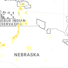
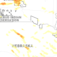
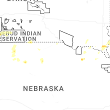
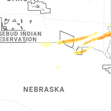


Connect with Interactive Hail Maps