

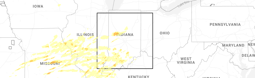
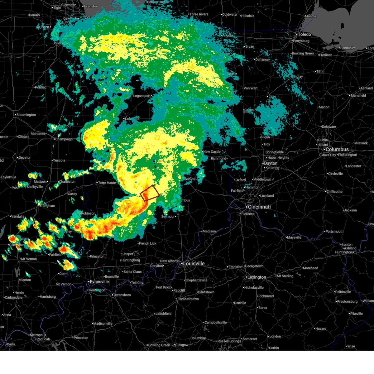
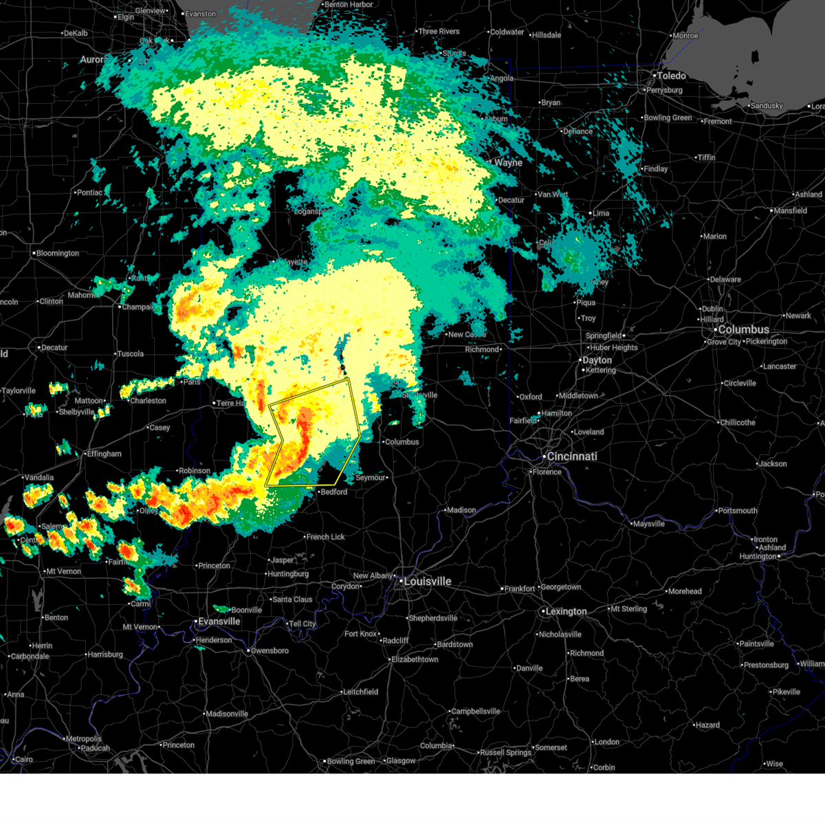
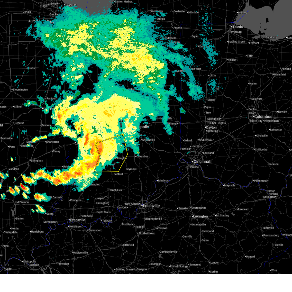
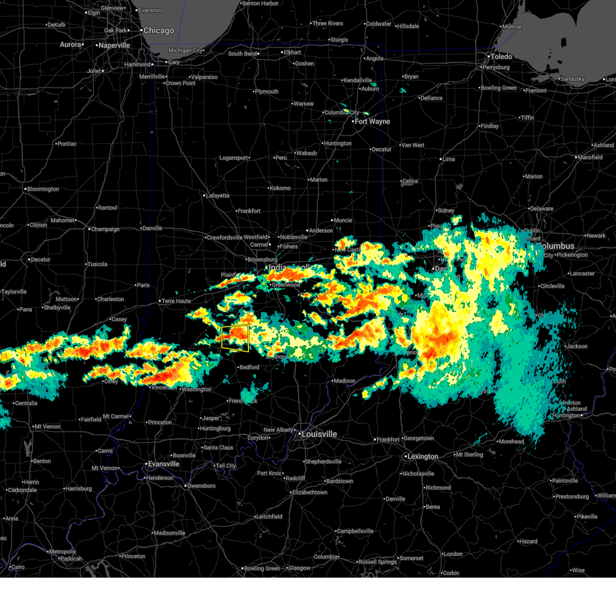
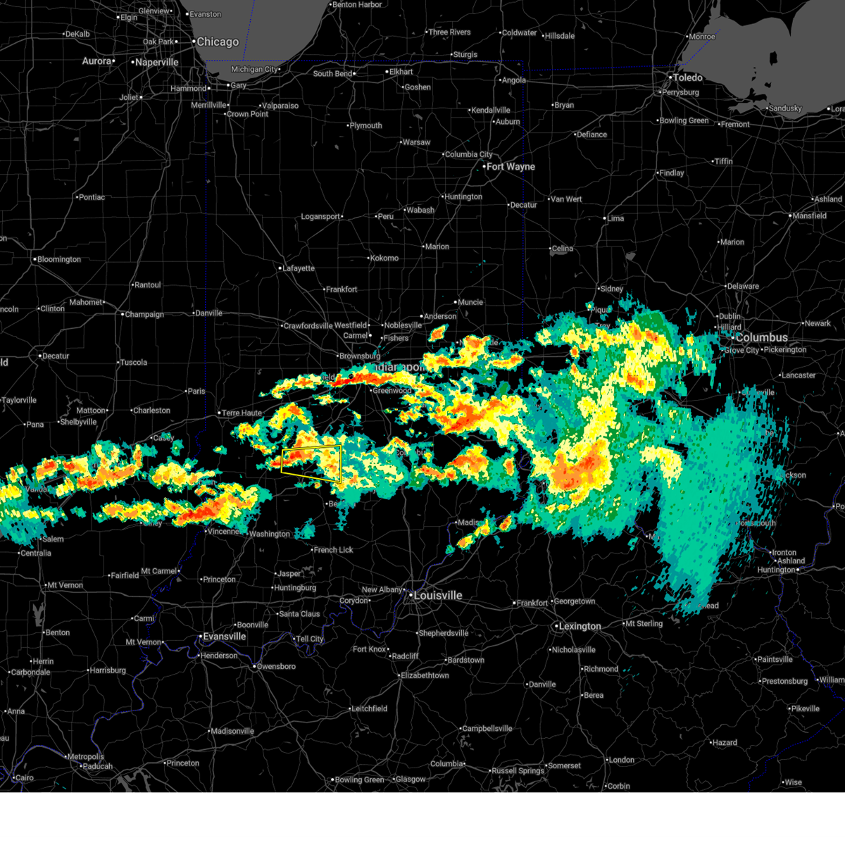
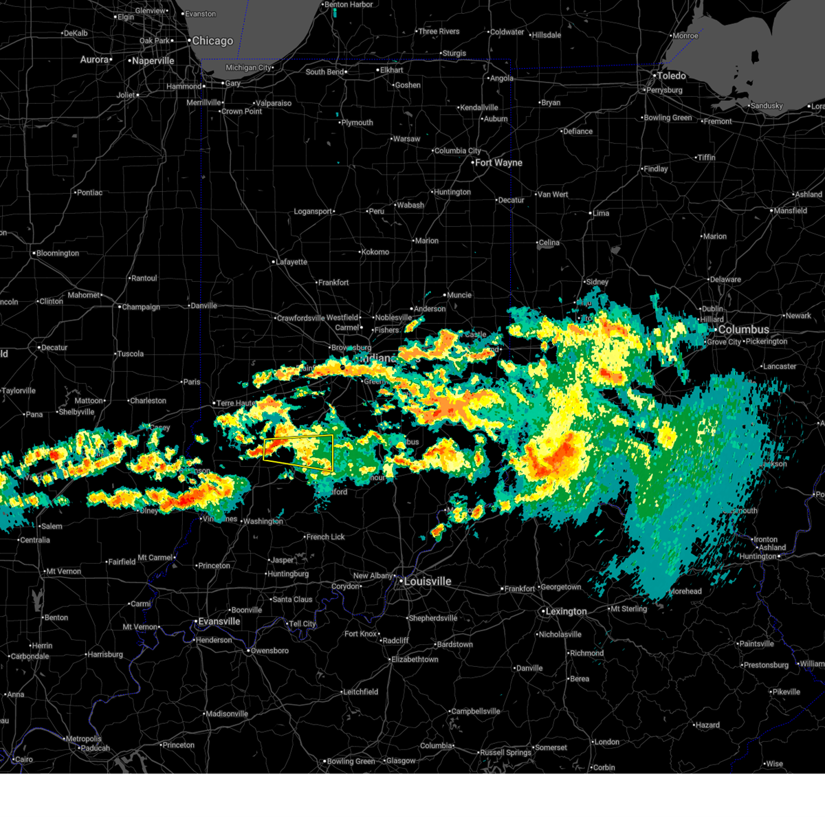
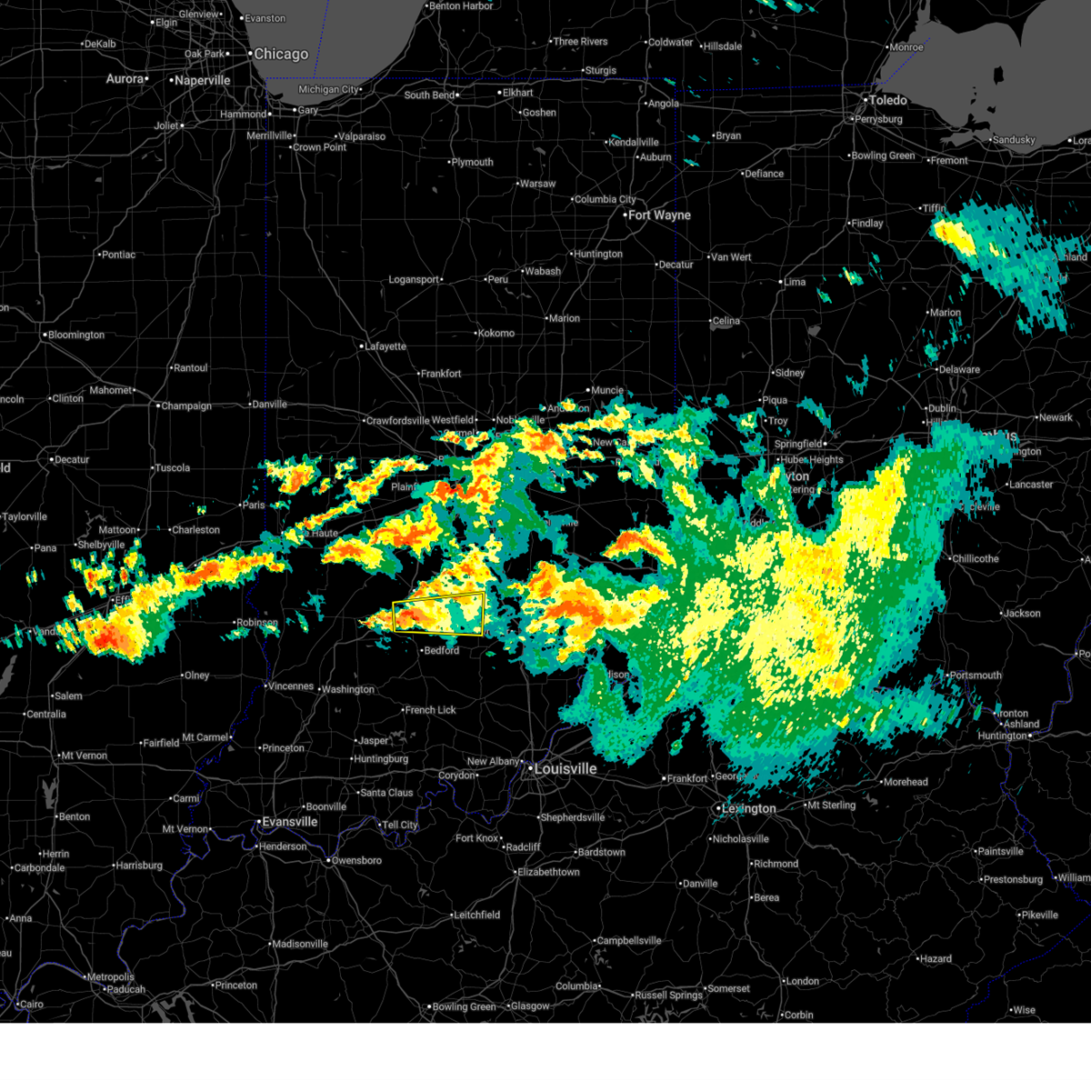
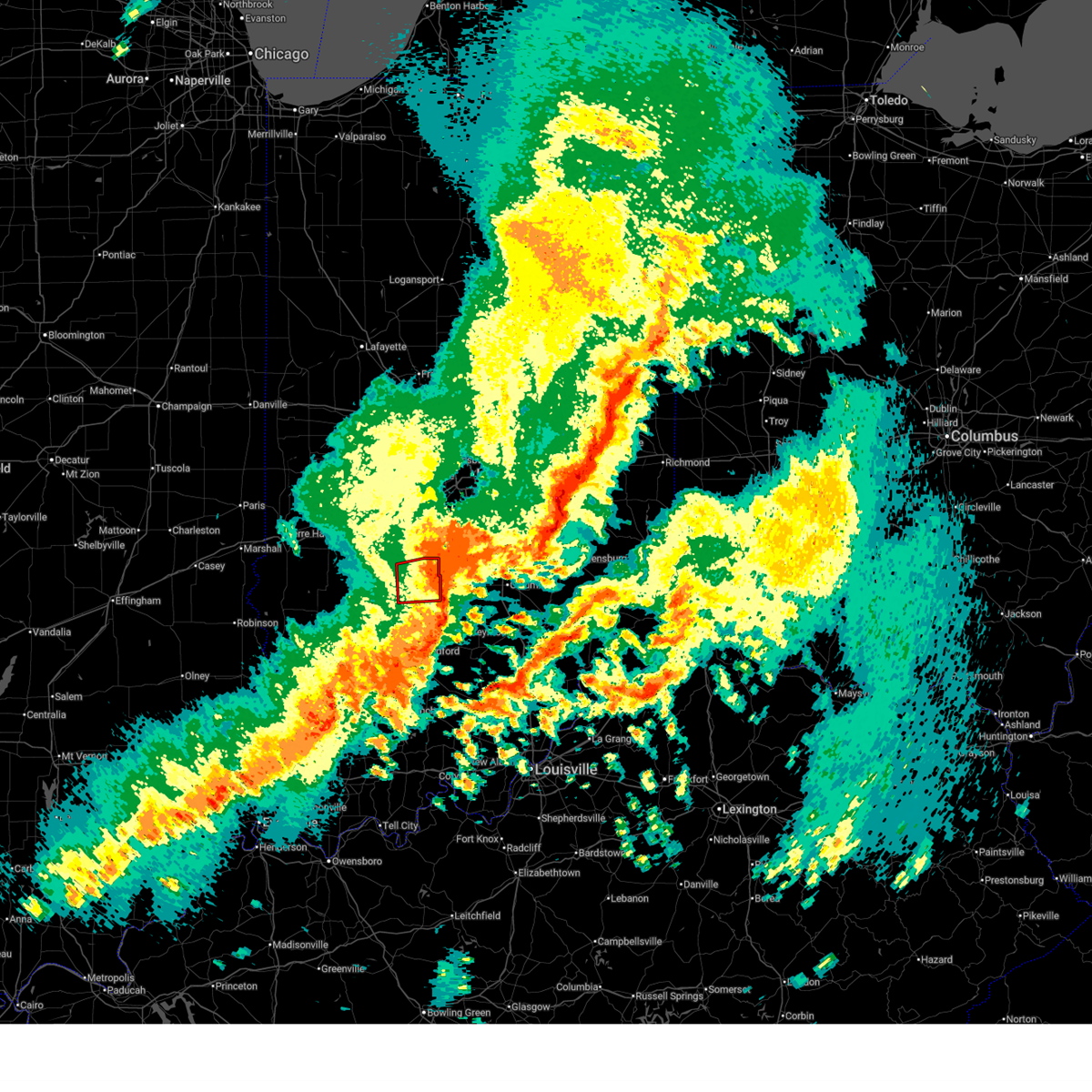
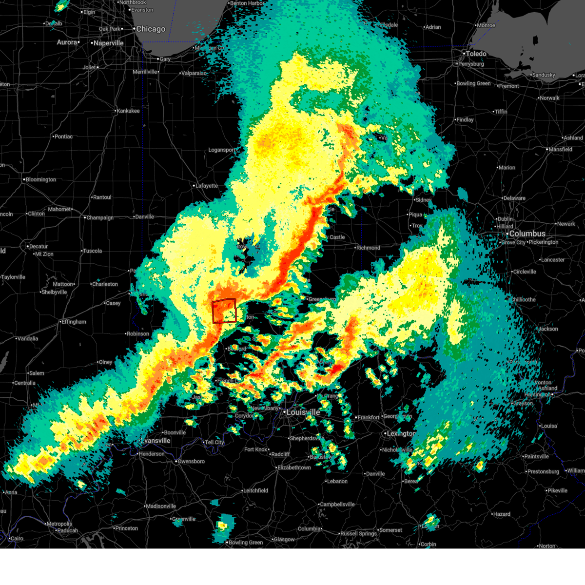
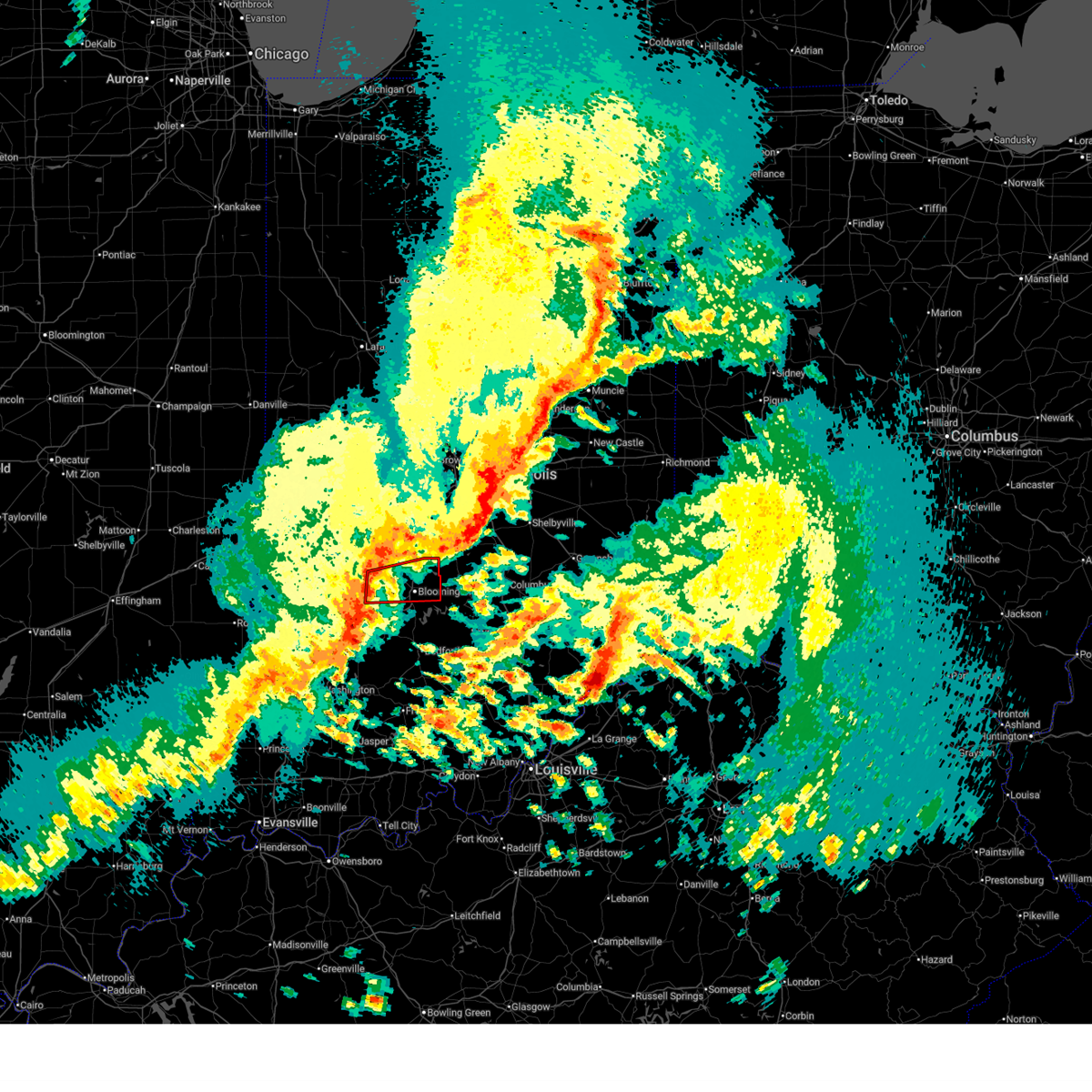
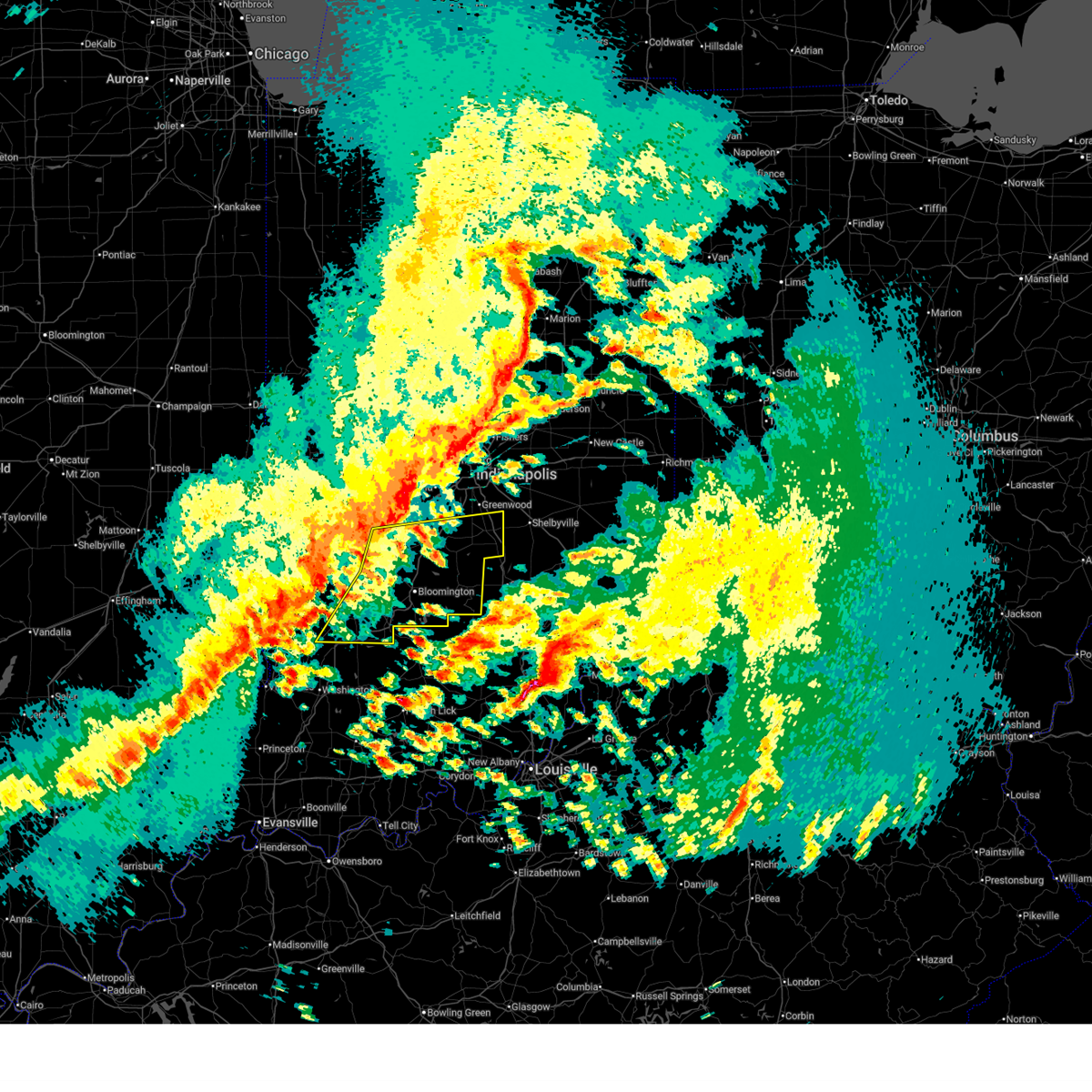
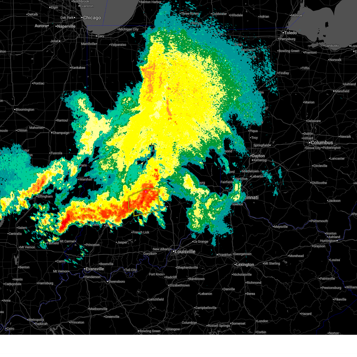
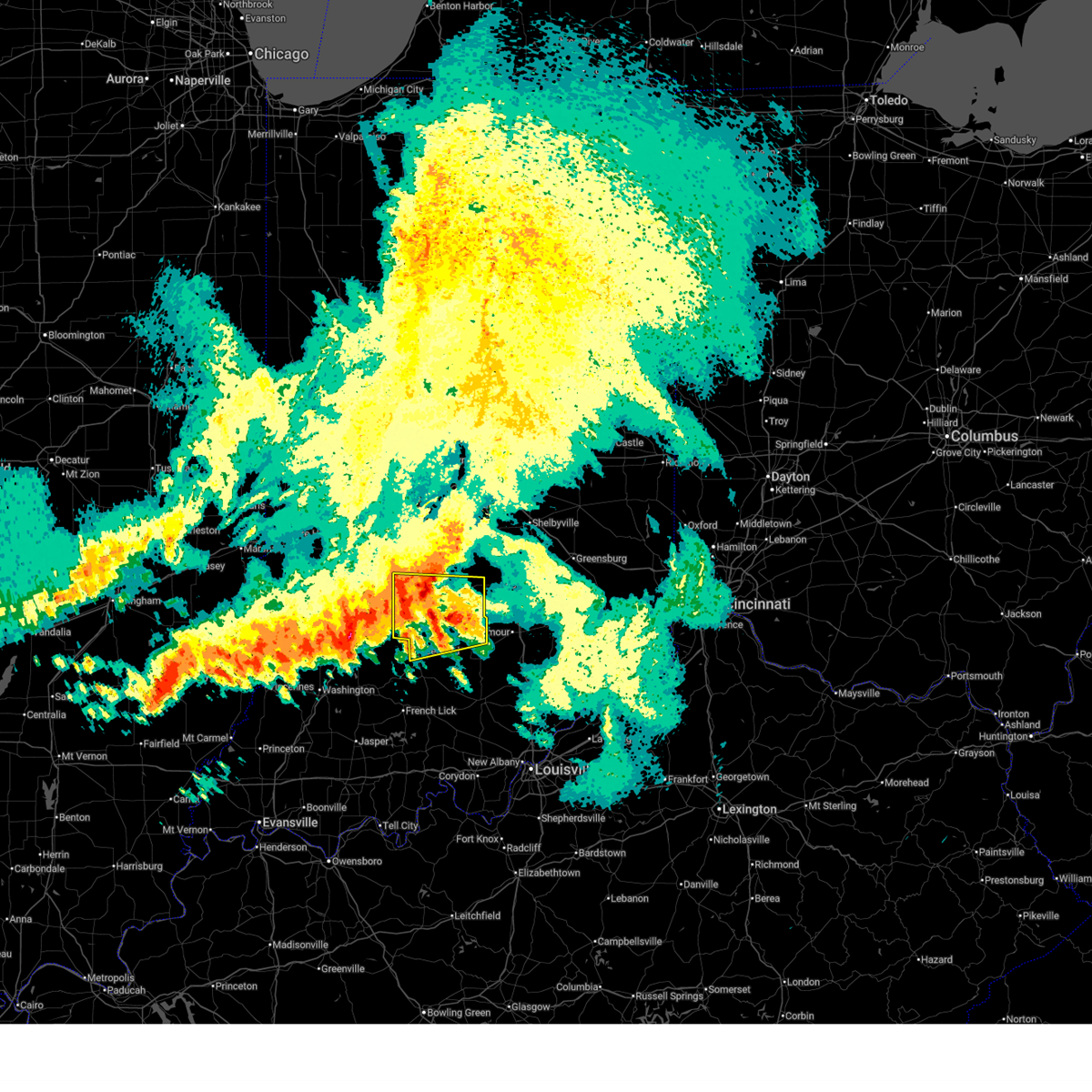
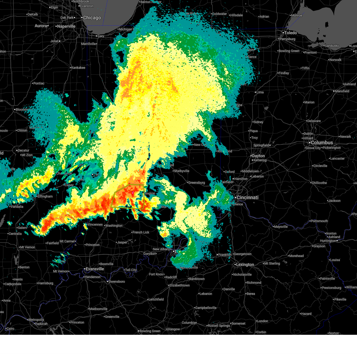
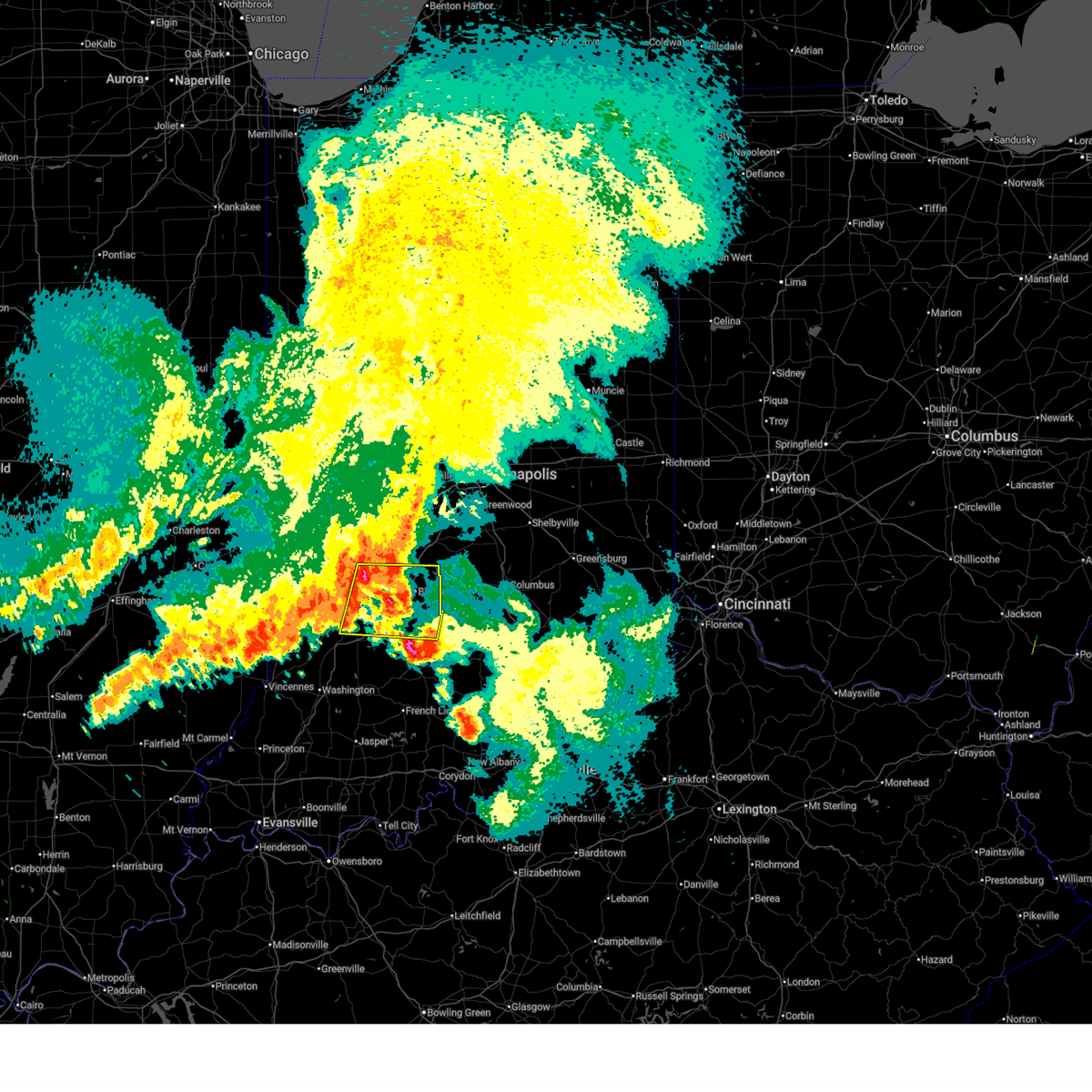
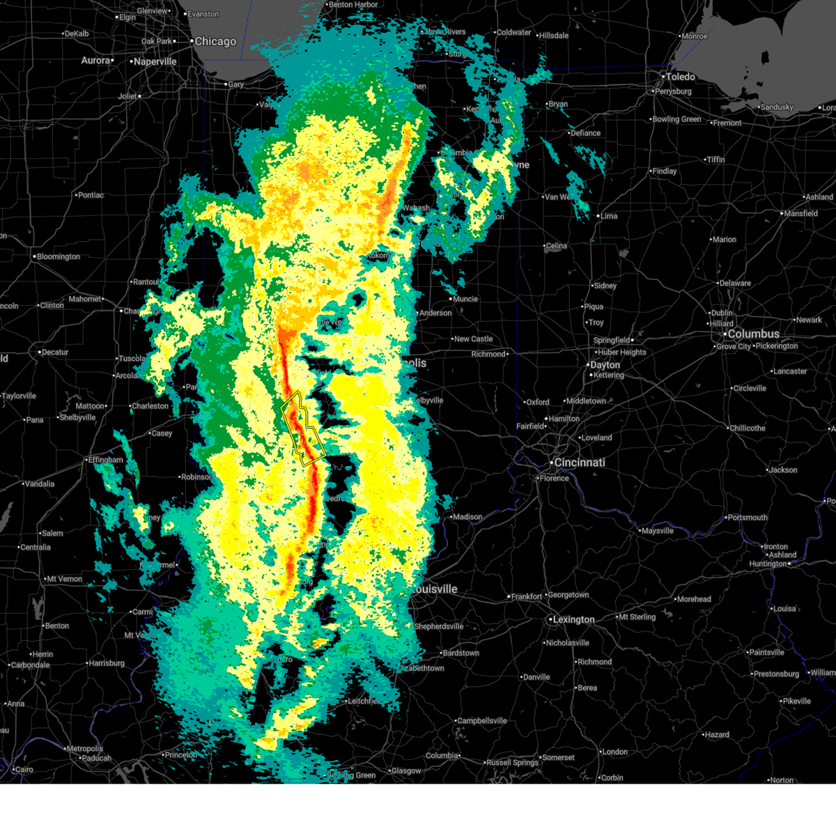
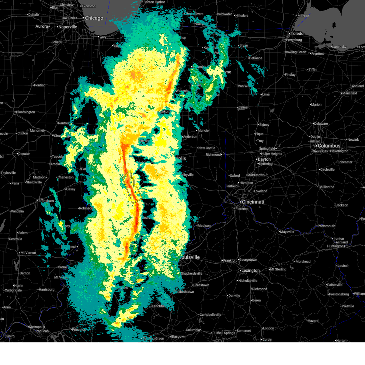
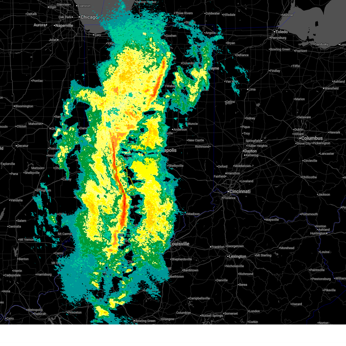
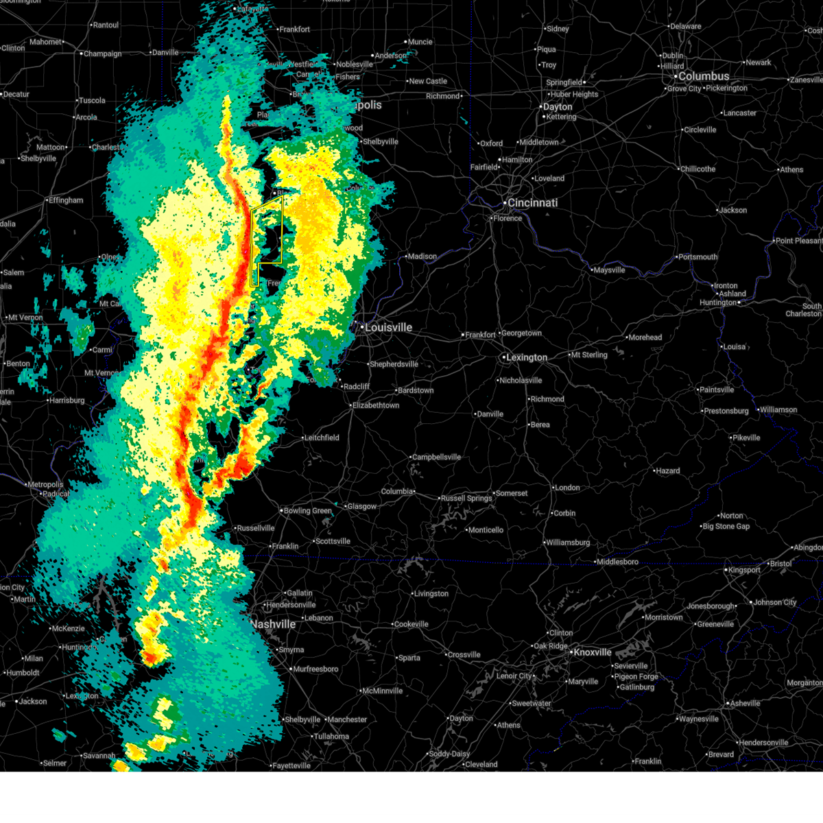
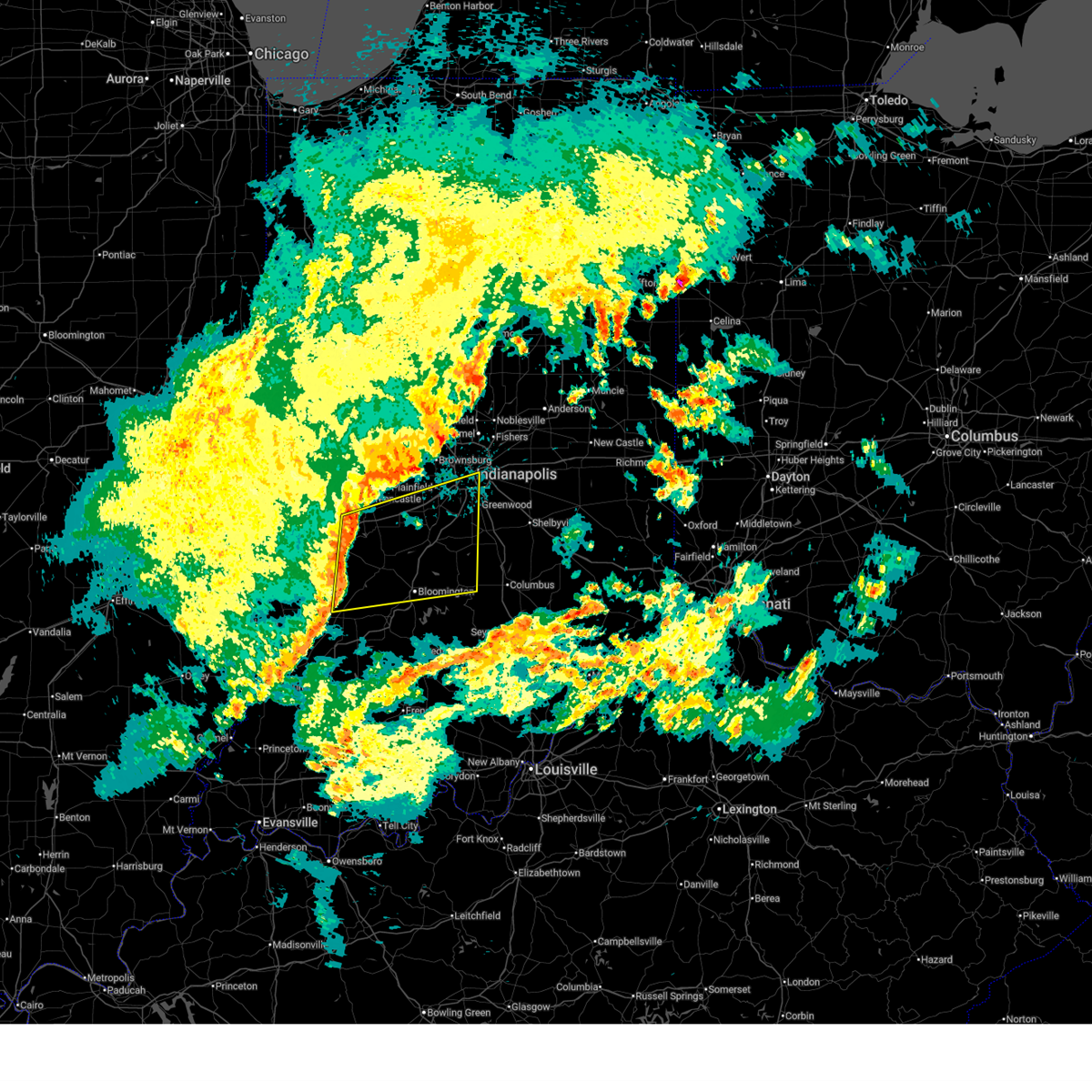
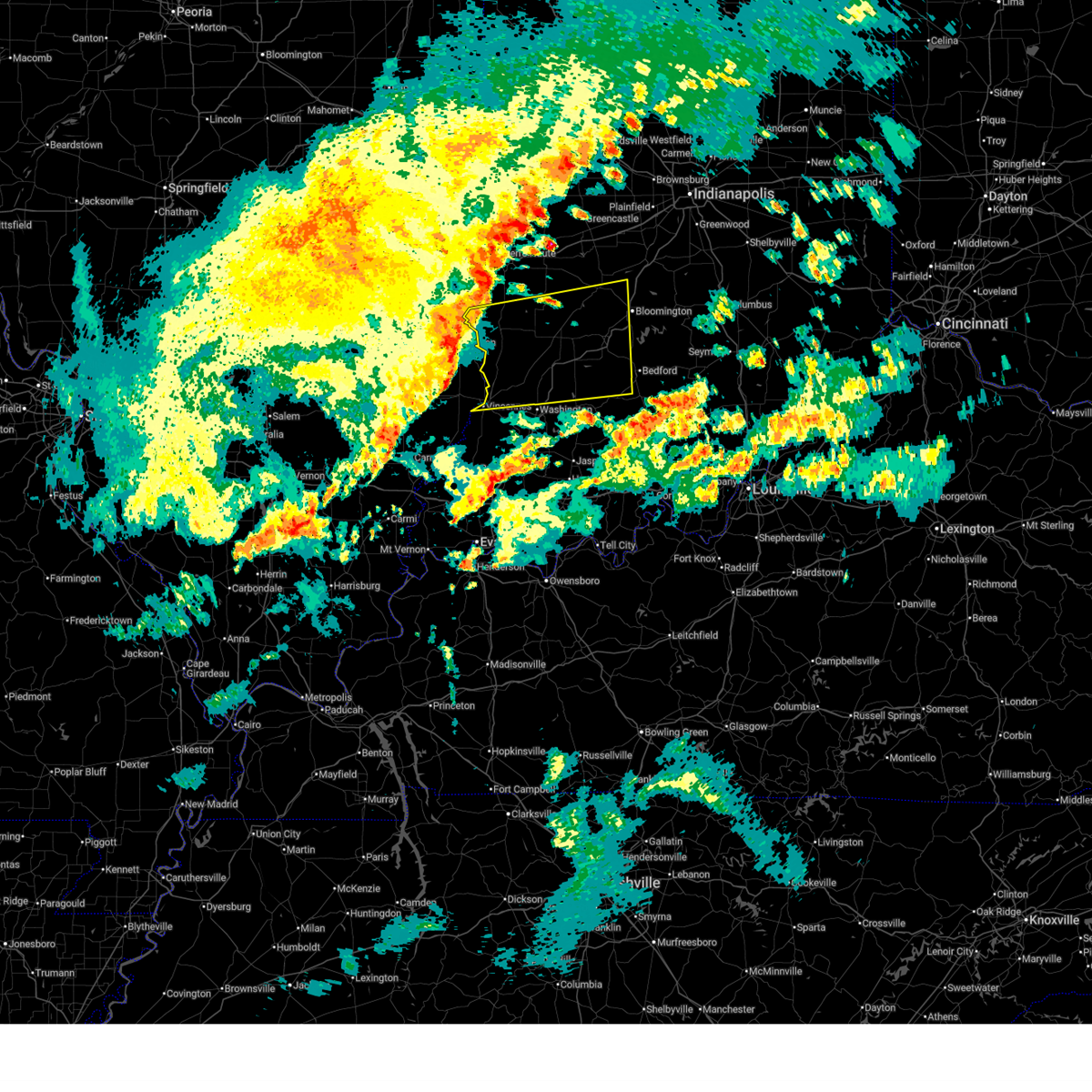
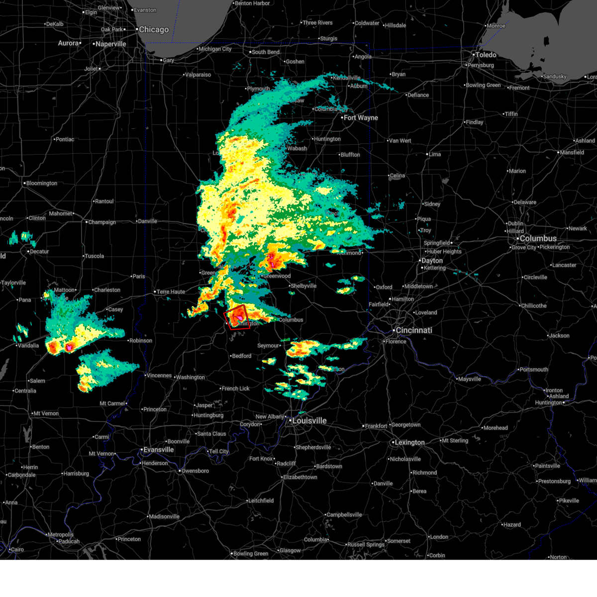
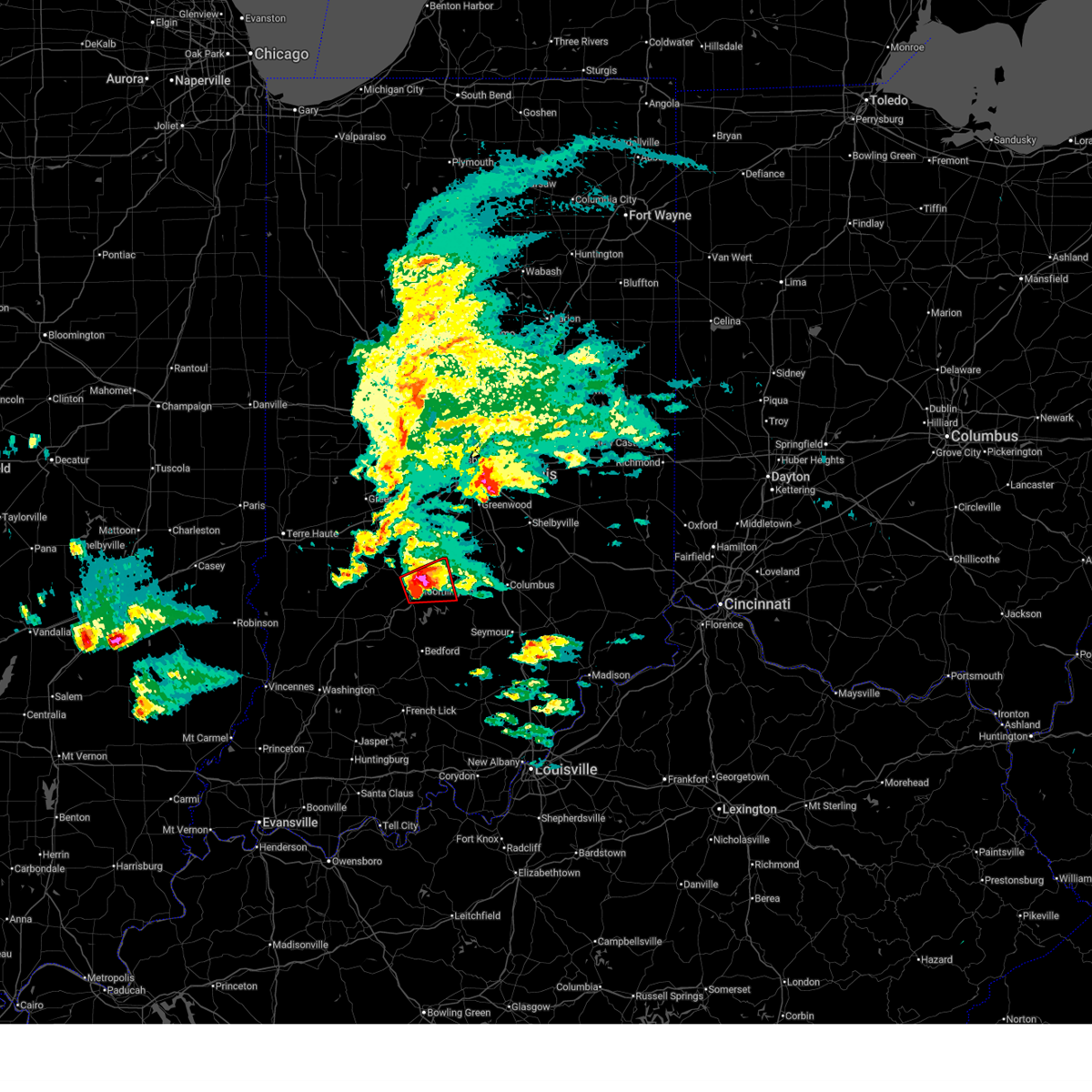
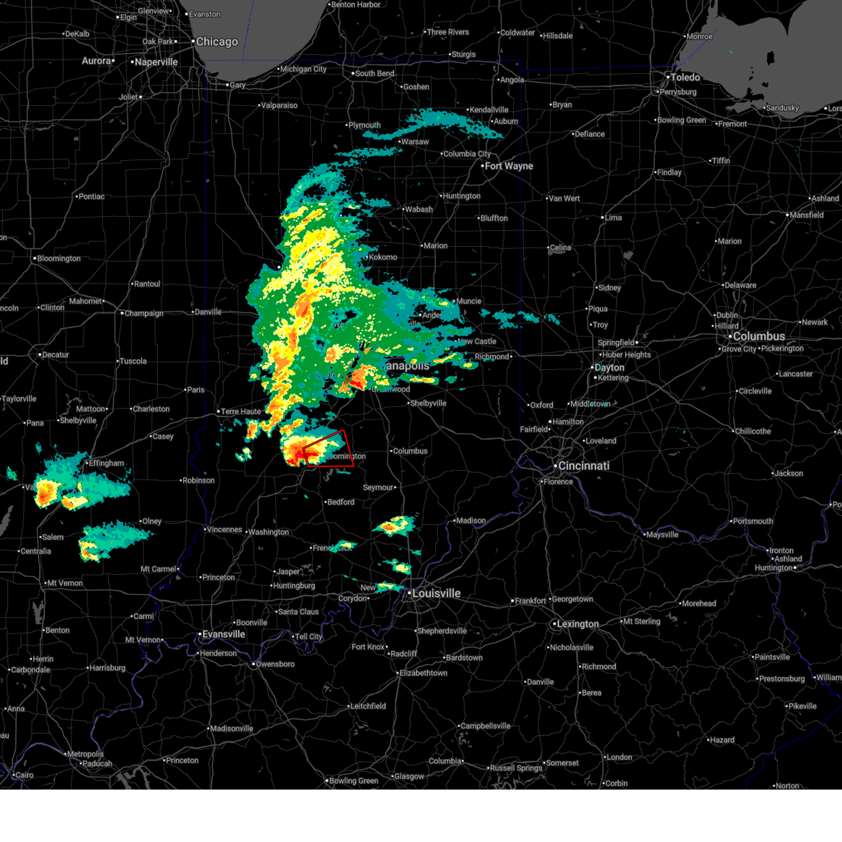
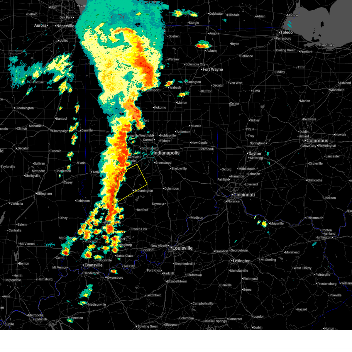
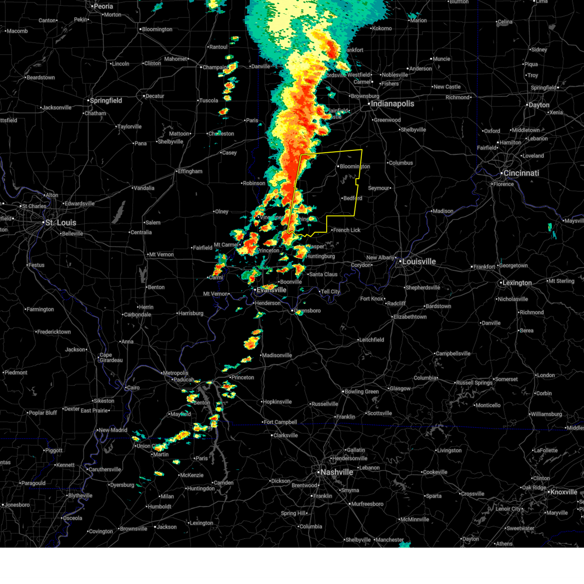
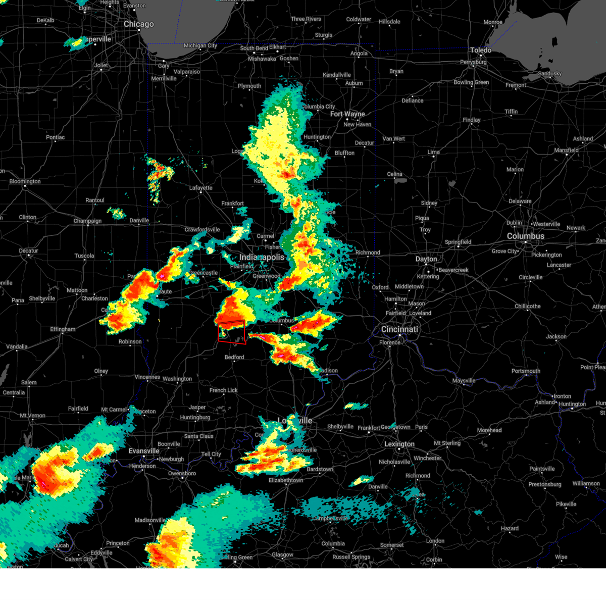
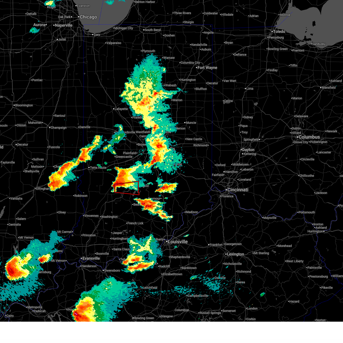
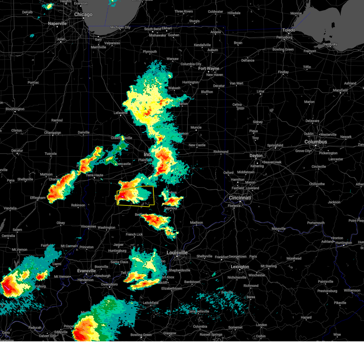
Hail Map for Bloomington, IN
The Bloomington, IN area has had 44 reports of on-the-ground hail by trained spotters, and has been under severe weather warnings 67 times during the past 12 months. Doppler radar has detected hail at or near Bloomington, IN on 68 occasions, including 5 occasions during the past year.
| Name: | Bloomington, IN |
| Where Located: | 46.9 miles SSW of Indianapolis, IN |
| Map: | Google Map for Bloomington, IN |
| Population: | 80405 |
| Housing Units: | 33239 |
| More Info: | Search Google for Bloomington, IN |
4
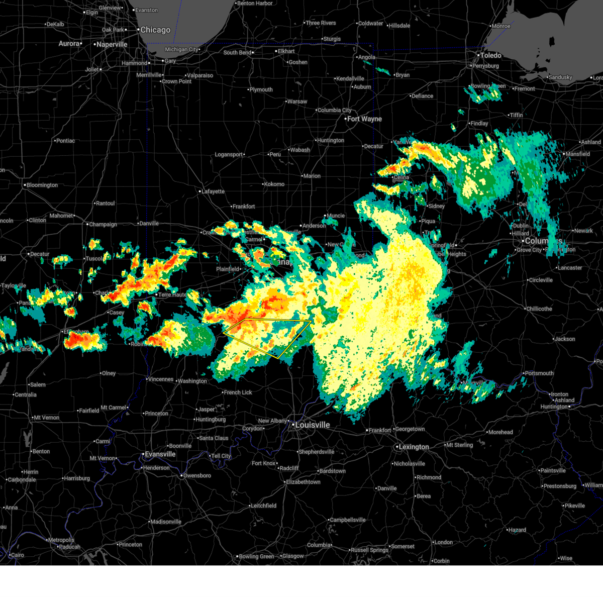
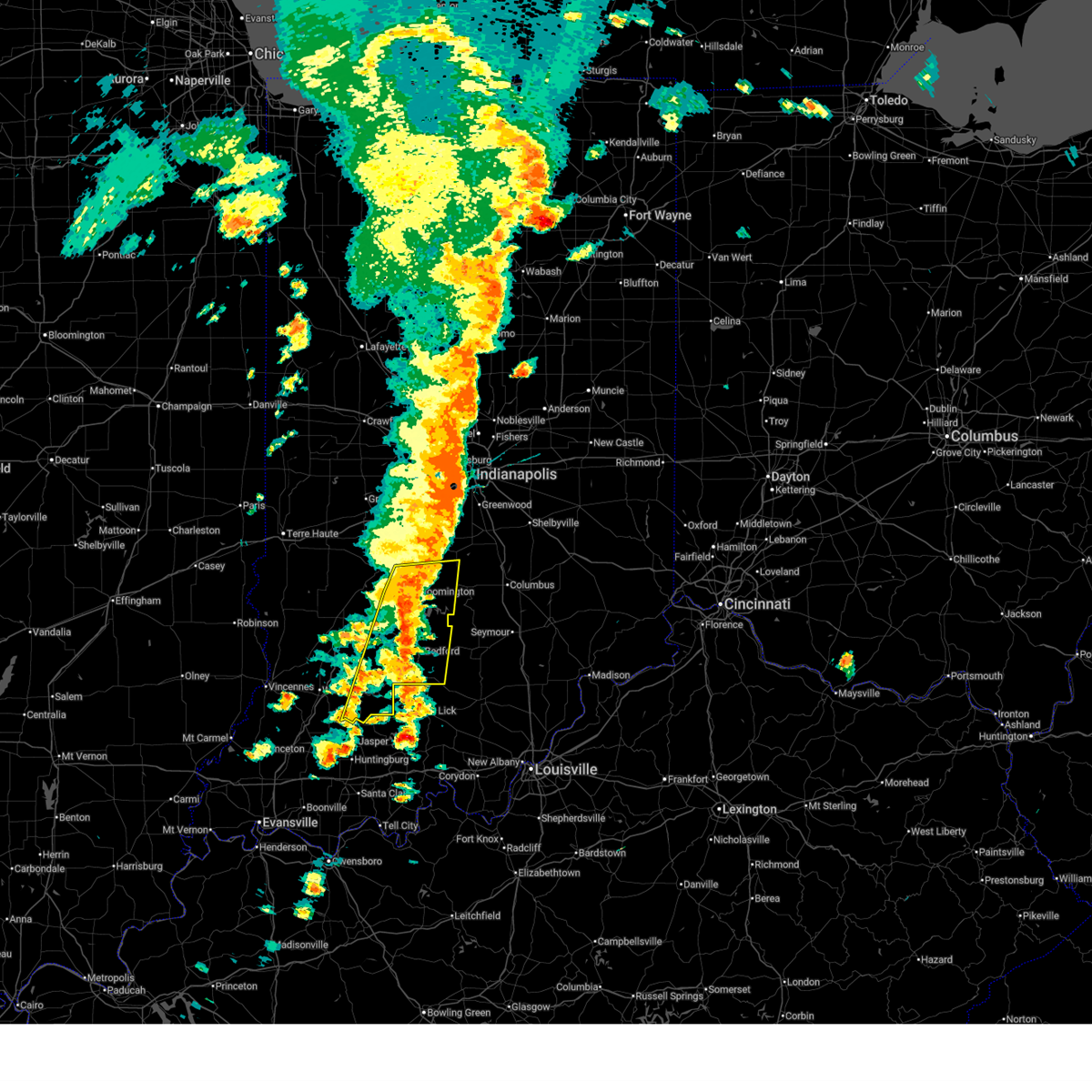
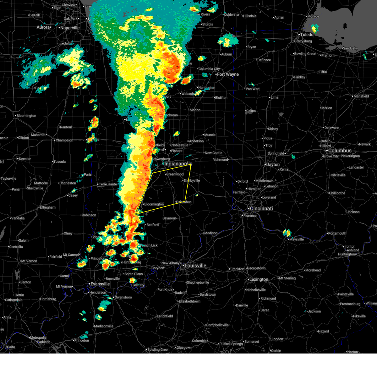
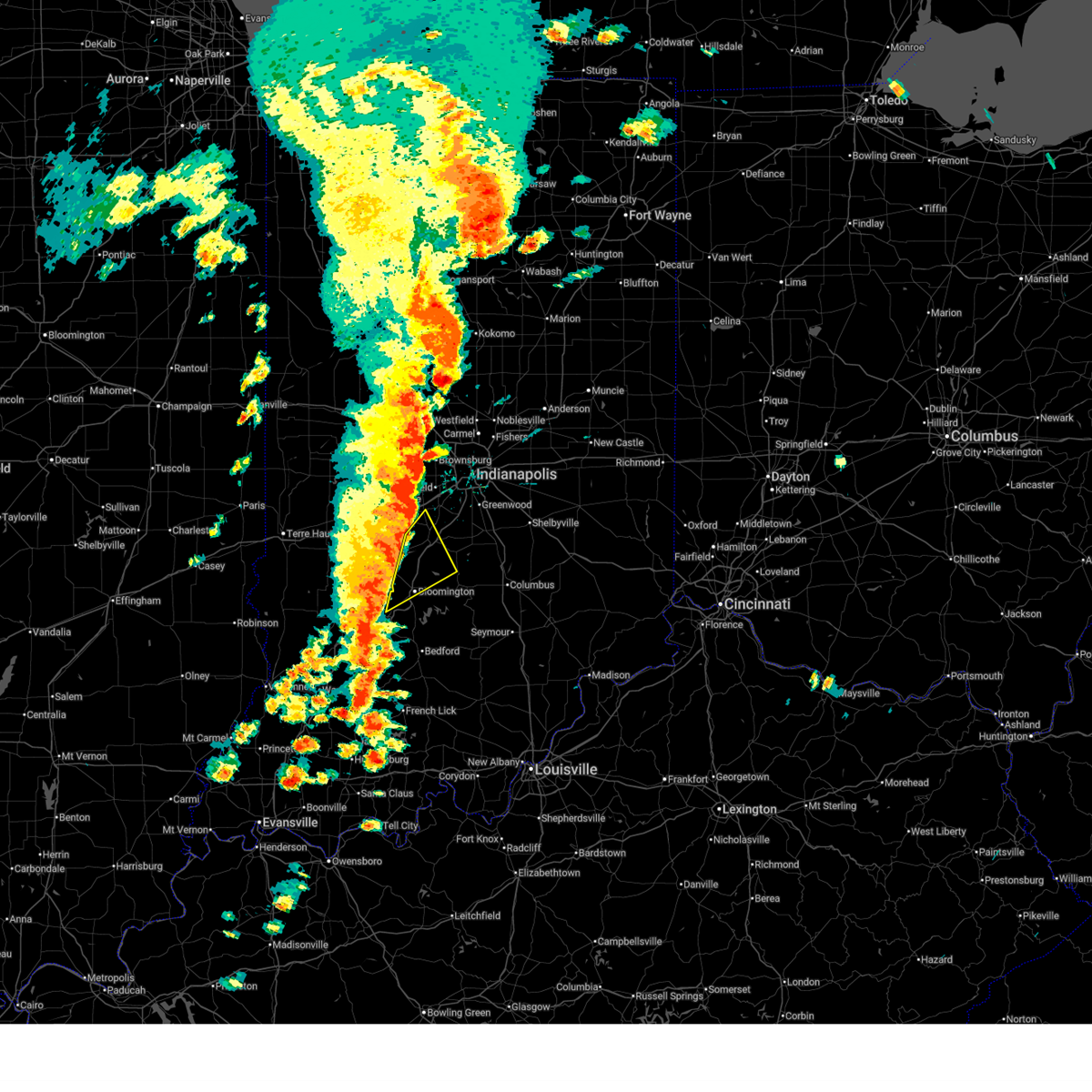
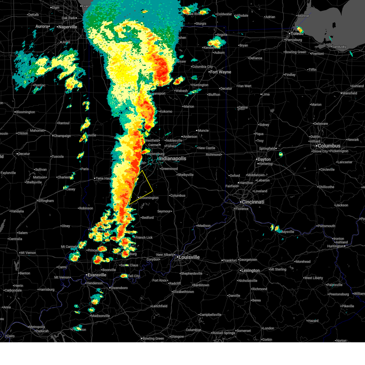
The Top Recent Hail Date for Bloomington, IN is Monday, April 27, 2026 (4th out of 68)
Hail and Wind Damage Spotted near Bloomington, IN
| Date / Time | Report Details |
|---|---|
| 6/21/2026 7:28 PM EDT |
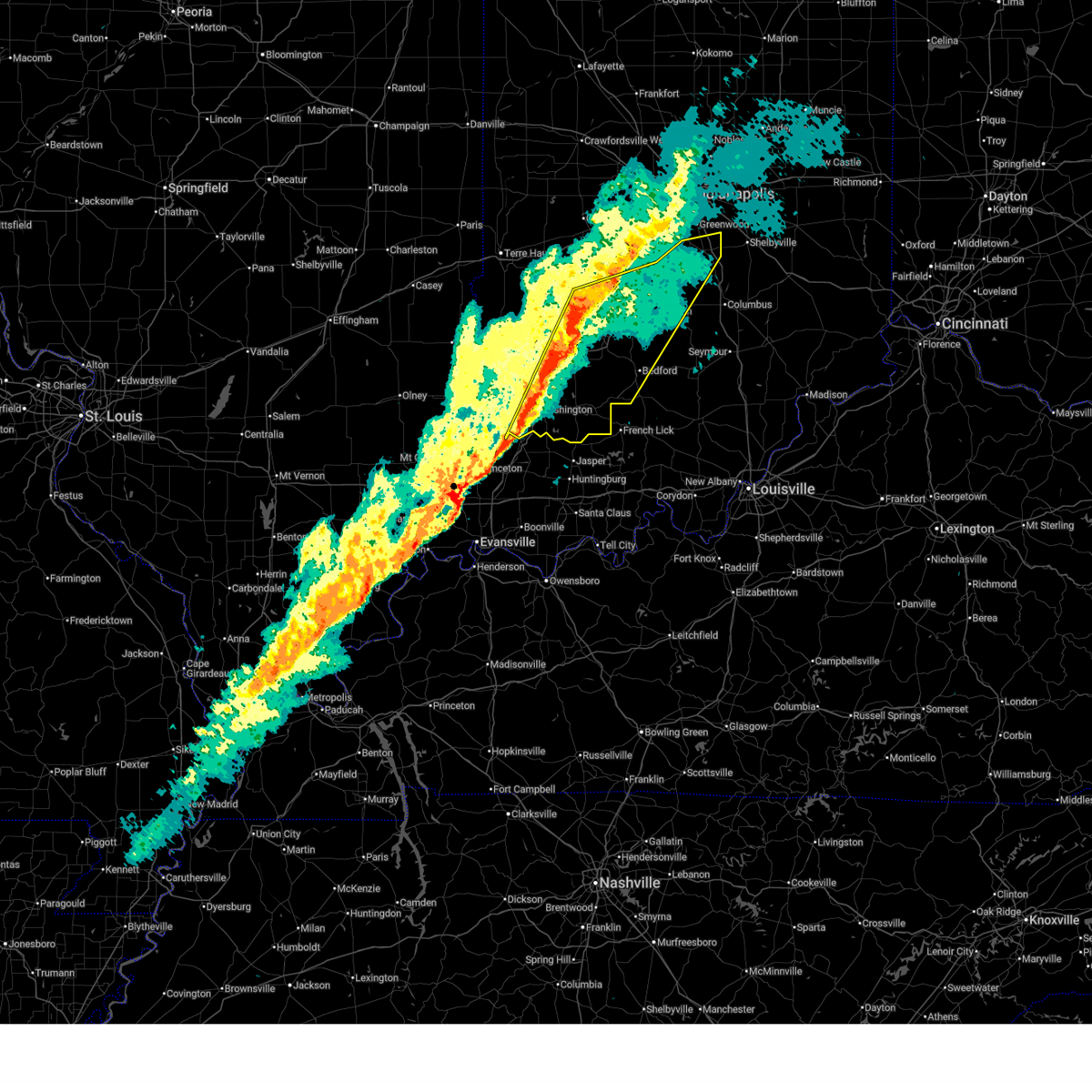
 At 727 pm edt, severe thunderstorms were located along a line extending from 7 miles northwest of martinsville to near bloomington to 11 miles southeast of bloomfield, moving east at 45 mph (radar indicated). Hazards include 60 mph wind gusts. Expect damage to roofs, siding, and trees. Locations impacted include, bloomington, martinsville, mooresville, nashville, ellettsville, brooklyn, morgantown, gosport, paragon, stinesville, bethany, quincy, smithville, lake lemon, beanblossom, bartlettsville, avoca, monroe reservoir, woodville hills, and elkinsville. At 727 pm edt, severe thunderstorms were located along a line extending from 7 miles northwest of martinsville to near bloomington to 11 miles southeast of bloomfield, moving east at 45 mph (radar indicated). Hazards include 60 mph wind gusts. Expect damage to roofs, siding, and trees. Locations impacted include, bloomington, martinsville, mooresville, nashville, ellettsville, brooklyn, morgantown, gosport, paragon, stinesville, bethany, quincy, smithville, lake lemon, beanblossom, bartlettsville, avoca, monroe reservoir, woodville hills, and elkinsville.
|
| 6/21/2026 7:25 PM EDT |
 Torind the national weather service in indianapolis has issued a * tornado warning for, northeastern monroe county in south central indiana, southeastern morgan county in central indiana, northwestern brown county in south central indiana, * until 745 pm edt. * at 725 pm edt, a severe thunderstorm capable of producing a tornado was located 7 miles north of bloomington, moving northeast at 35 mph (radar indicated rotation). Hazards include tornado. Flying debris will be dangerous to those caught without shelter. mobile homes will be damaged or destroyed. damage to roofs, windows, and vehicles will occur. Tree damage is likely. Torind the national weather service in indianapolis has issued a * tornado warning for, northeastern monroe county in south central indiana, southeastern morgan county in central indiana, northwestern brown county in south central indiana, * until 745 pm edt. * at 725 pm edt, a severe thunderstorm capable of producing a tornado was located 7 miles north of bloomington, moving northeast at 35 mph (radar indicated rotation). Hazards include tornado. Flying debris will be dangerous to those caught without shelter. mobile homes will be damaged or destroyed. damage to roofs, windows, and vehicles will occur. Tree damage is likely.
|
| 6/21/2026 7:20 PM EDT |
 At 719 pm edt, severe thunderstorms were located along a line extending from 11 miles northwest of martinsville to near bloomington to 7 miles southeast of bloomfield, moving east at 45 mph (radar indicated). Hazards include 60 mph wind gusts. Expect damage to roofs, siding, and trees. Locations impacted include, bloomington, martinsville, mooresville, spencer, nashville, ellettsville, brooklyn, morgantown, gosport, paragon, stinesville, bethany, quincy, smithville, lake lemon, beanblossom, bartlettsville, avoca, monroe reservoir, and woodville hills. At 719 pm edt, severe thunderstorms were located along a line extending from 11 miles northwest of martinsville to near bloomington to 7 miles southeast of bloomfield, moving east at 45 mph (radar indicated). Hazards include 60 mph wind gusts. Expect damage to roofs, siding, and trees. Locations impacted include, bloomington, martinsville, mooresville, spencer, nashville, ellettsville, brooklyn, morgantown, gosport, paragon, stinesville, bethany, quincy, smithville, lake lemon, beanblossom, bartlettsville, avoca, monroe reservoir, and woodville hills.
|
| 6/21/2026 7:10 PM EDT | Powerlines over the road. time estimated from rada in owen county IN, 7.9 miles E of Bloomington, IN |
| 6/21/2026 7:04 PM EDT |
 Svrind the national weather service in indianapolis has issued a * severe thunderstorm warning for, monroe county in south central indiana, morgan county in central indiana, brown county in south central indiana, western johnson county in central indiana, eastern owen county in west central indiana, eastern greene county in southwestern indiana, northern lawrence county in south central indiana, northwestern jackson county in south central indiana, south central putnam county in west central indiana, * until 745 pm edt. * at 704 pm edt, severe thunderstorms were located along a line extending from 11 miles south of greencastle to near spencer to 7 miles south of bloomfield, moving east at 45 mph (radar indicated). Hazards include 60 mph wind gusts. expect damage to roofs, siding, and trees Svrind the national weather service in indianapolis has issued a * severe thunderstorm warning for, monroe county in south central indiana, morgan county in central indiana, brown county in south central indiana, western johnson county in central indiana, eastern owen county in west central indiana, eastern greene county in southwestern indiana, northern lawrence county in south central indiana, northwestern jackson county in south central indiana, south central putnam county in west central indiana, * until 745 pm edt. * at 704 pm edt, severe thunderstorms were located along a line extending from 11 miles south of greencastle to near spencer to 7 miles south of bloomfield, moving east at 45 mph (radar indicated). Hazards include 60 mph wind gusts. expect damage to roofs, siding, and trees
|
| 6/18/2026 1:14 AM EDT |
 At 113 am edt, a severe thunderstorm was located over bloomington, moving east at 45 mph (radar indicated). Hazards include 60 mph wind gusts. Expect damage to roofs, siding, and trees. Locations impacted include, bloomington, ellettsville, indiana university, smithville, monroe reservoir, woodville hills, unionville, whitehall, and fairfax state recreation area. At 113 am edt, a severe thunderstorm was located over bloomington, moving east at 45 mph (radar indicated). Hazards include 60 mph wind gusts. Expect damage to roofs, siding, and trees. Locations impacted include, bloomington, ellettsville, indiana university, smithville, monroe reservoir, woodville hills, unionville, whitehall, and fairfax state recreation area.
|
| 6/18/2026 1:00 AM EDT |
 At 100 am edt, a severe thunderstorm was located 9 miles west of bloomington, moving east at 45 mph (radar indicated). Hazards include 60 mph wind gusts. Expect damage to roofs, siding, and trees. Locations impacted include, bloomington, ellettsville, indiana university, solsberry, smithville, monroe reservoir, woodville hills, freedom, unionville, and whitehall. At 100 am edt, a severe thunderstorm was located 9 miles west of bloomington, moving east at 45 mph (radar indicated). Hazards include 60 mph wind gusts. Expect damage to roofs, siding, and trees. Locations impacted include, bloomington, ellettsville, indiana university, solsberry, smithville, monroe reservoir, woodville hills, freedom, unionville, and whitehall.
|
| 6/18/2026 12:47 AM EDT |
 Svrind the national weather service in indianapolis has issued a * severe thunderstorm warning for, monroe county in south central indiana, southeastern owen county in west central indiana, northeastern greene county in southwestern indiana, * until 130 am edt. * at 1247 am edt, a severe thunderstorm was located 8 miles north of bloomfield, or 19 miles west of bloomington, moving east at 45 mph (radar indicated). Hazards include 60 mph wind gusts. expect damage to roofs, siding, and trees Svrind the national weather service in indianapolis has issued a * severe thunderstorm warning for, monroe county in south central indiana, southeastern owen county in west central indiana, northeastern greene county in southwestern indiana, * until 130 am edt. * at 1247 am edt, a severe thunderstorm was located 8 miles north of bloomfield, or 19 miles west of bloomington, moving east at 45 mph (radar indicated). Hazards include 60 mph wind gusts. expect damage to roofs, siding, and trees
|
| 6/17/2026 11:33 PM EDT |
 Svrind the national weather service in indianapolis has issued a * severe thunderstorm warning for, southern monroe county in south central indiana, southern brown county in south central indiana, northern lawrence county in south central indiana, northwestern jackson county in south central indiana, * until midnight edt. * at 1132 pm edt, a severe thunderstorm was located 9 miles south of bloomington, moving east at 45 mph (radar indicated). Hazards include 60 mph wind gusts. expect damage to roofs, siding, and trees Svrind the national weather service in indianapolis has issued a * severe thunderstorm warning for, southern monroe county in south central indiana, southern brown county in south central indiana, northern lawrence county in south central indiana, northwestern jackson county in south central indiana, * until midnight edt. * at 1132 pm edt, a severe thunderstorm was located 9 miles south of bloomington, moving east at 45 mph (radar indicated). Hazards include 60 mph wind gusts. expect damage to roofs, siding, and trees
|
| 6/17/2026 10:28 PM EDT |
 Svrind the national weather service in indianapolis has issued a * severe thunderstorm warning for, southern monroe county in south central indiana, southwestern decatur county in central indiana, brown county in south central indiana, southern bartholomew county in central indiana, northern jackson county in south central indiana, northwestern jennings county in southeastern indiana, * until 1115 pm edt. * at 1028 pm edt, severe thunderstorms were located along a line extending from near nashville to near bloomington, moving east at 45 mph (radar indicated). Hazards include 60 mph wind gusts. expect damage to roofs, siding, and trees Svrind the national weather service in indianapolis has issued a * severe thunderstorm warning for, southern monroe county in south central indiana, southwestern decatur county in central indiana, brown county in south central indiana, southern bartholomew county in central indiana, northern jackson county in south central indiana, northwestern jennings county in southeastern indiana, * until 1115 pm edt. * at 1028 pm edt, severe thunderstorms were located along a line extending from near nashville to near bloomington, moving east at 45 mph (radar indicated). Hazards include 60 mph wind gusts. expect damage to roofs, siding, and trees
|
| 6/17/2026 10:15 PM EDT |
 Torind the national weather service in indianapolis has issued a * tornado warning for, central monroe county in south central indiana, southern brown county in south central indiana, southwestern bartholomew county in central indiana, northwestern jackson county in south central indiana, * until 1045 pm edt. * at 1015 pm edt, a severe thunderstorm capable of producing a tornado was located near bloomington, moving east at 45 mph (radar indicated rotation). Hazards include tornado. Flying debris will be dangerous to those caught without shelter. mobile homes will be damaged or destroyed. damage to roofs, windows, and vehicles will occur. Tree damage is likely. Torind the national weather service in indianapolis has issued a * tornado warning for, central monroe county in south central indiana, southern brown county in south central indiana, southwestern bartholomew county in central indiana, northwestern jackson county in south central indiana, * until 1045 pm edt. * at 1015 pm edt, a severe thunderstorm capable of producing a tornado was located near bloomington, moving east at 45 mph (radar indicated rotation). Hazards include tornado. Flying debris will be dangerous to those caught without shelter. mobile homes will be damaged or destroyed. damage to roofs, windows, and vehicles will occur. Tree damage is likely.
|
| 6/17/2026 10:09 PM EDT |
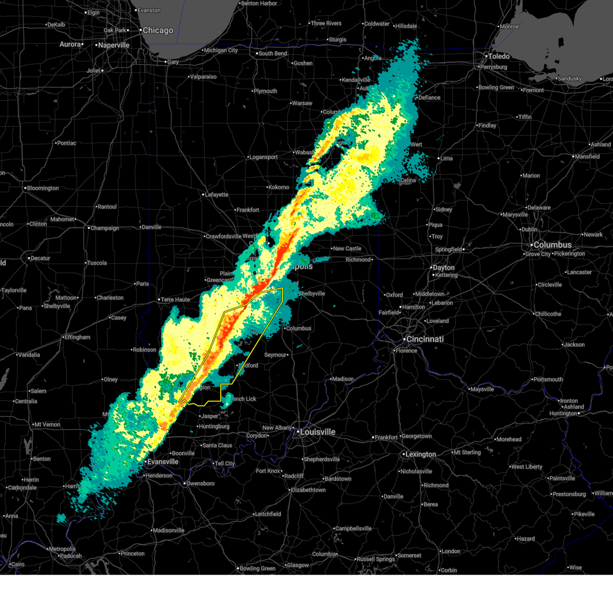
 At 1009 pm edt, severe thunderstorms were located along a line extending from bloomington to 8 miles north of bloomfield, moving east at 60 mph (radar indicated). Hazards include 60 mph wind gusts and penny size hail. Expect damage to roofs, siding, and trees. Locations impacted include, bloomington, spencer, ellettsville, clay city, indiana university, smithville, mccormicks creek state park, freedom, patricksburg, solsberry, monroe reservoir, woodville hills, elkinsville, and whitehall. At 1009 pm edt, severe thunderstorms were located along a line extending from bloomington to 8 miles north of bloomfield, moving east at 60 mph (radar indicated). Hazards include 60 mph wind gusts and penny size hail. Expect damage to roofs, siding, and trees. Locations impacted include, bloomington, spencer, ellettsville, clay city, indiana university, smithville, mccormicks creek state park, freedom, patricksburg, solsberry, monroe reservoir, woodville hills, elkinsville, and whitehall.
|
| 6/17/2026 9:56 PM EDT |
 Svrind the national weather service in indianapolis has issued a * severe thunderstorm warning for, southern vigo county in west central indiana, southern monroe county in south central indiana, southwestern brown county in south central indiana, northeastern sullivan county in southwestern indiana, southwestern clay county in west central indiana, southern owen county in west central indiana, northeastern greene county in southwestern indiana, * until 1030 pm edt. * at 955 pm edt, severe thunderstorms were located along a line extending from near spencer to 10 miles north of linton, moving east at 55 mph (radar indicated). Hazards include 60 mph wind gusts and penny size hail. expect damage to roofs, siding, and trees Svrind the national weather service in indianapolis has issued a * severe thunderstorm warning for, southern vigo county in west central indiana, southern monroe county in south central indiana, southwestern brown county in south central indiana, northeastern sullivan county in southwestern indiana, southwestern clay county in west central indiana, southern owen county in west central indiana, northeastern greene county in southwestern indiana, * until 1030 pm edt. * at 955 pm edt, severe thunderstorms were located along a line extending from near spencer to 10 miles north of linton, moving east at 55 mph (radar indicated). Hazards include 60 mph wind gusts and penny size hail. expect damage to roofs, siding, and trees
|
| 6/17/2026 9:54 PM EDT | Corrects previous non-tstm wnd dmg report from 7 sse paragon. reports of damage to vehicles on i-69 near hindusta in monroe county IN, 9.8 miles S of Bloomington, IN |
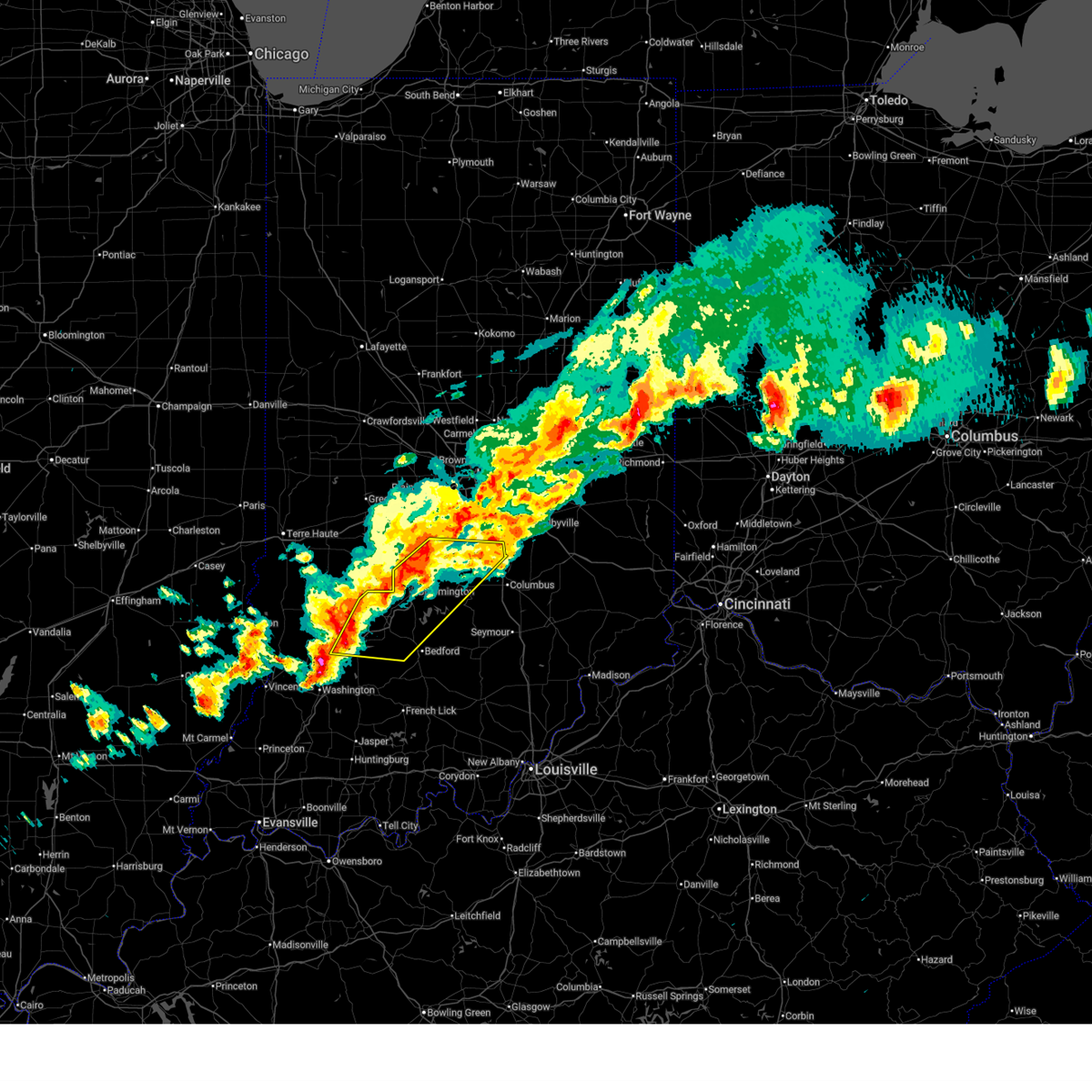
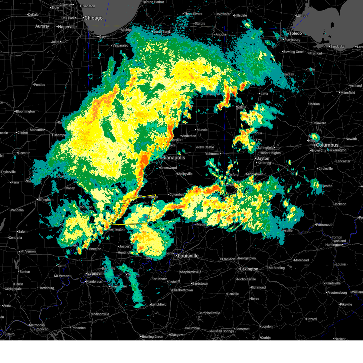
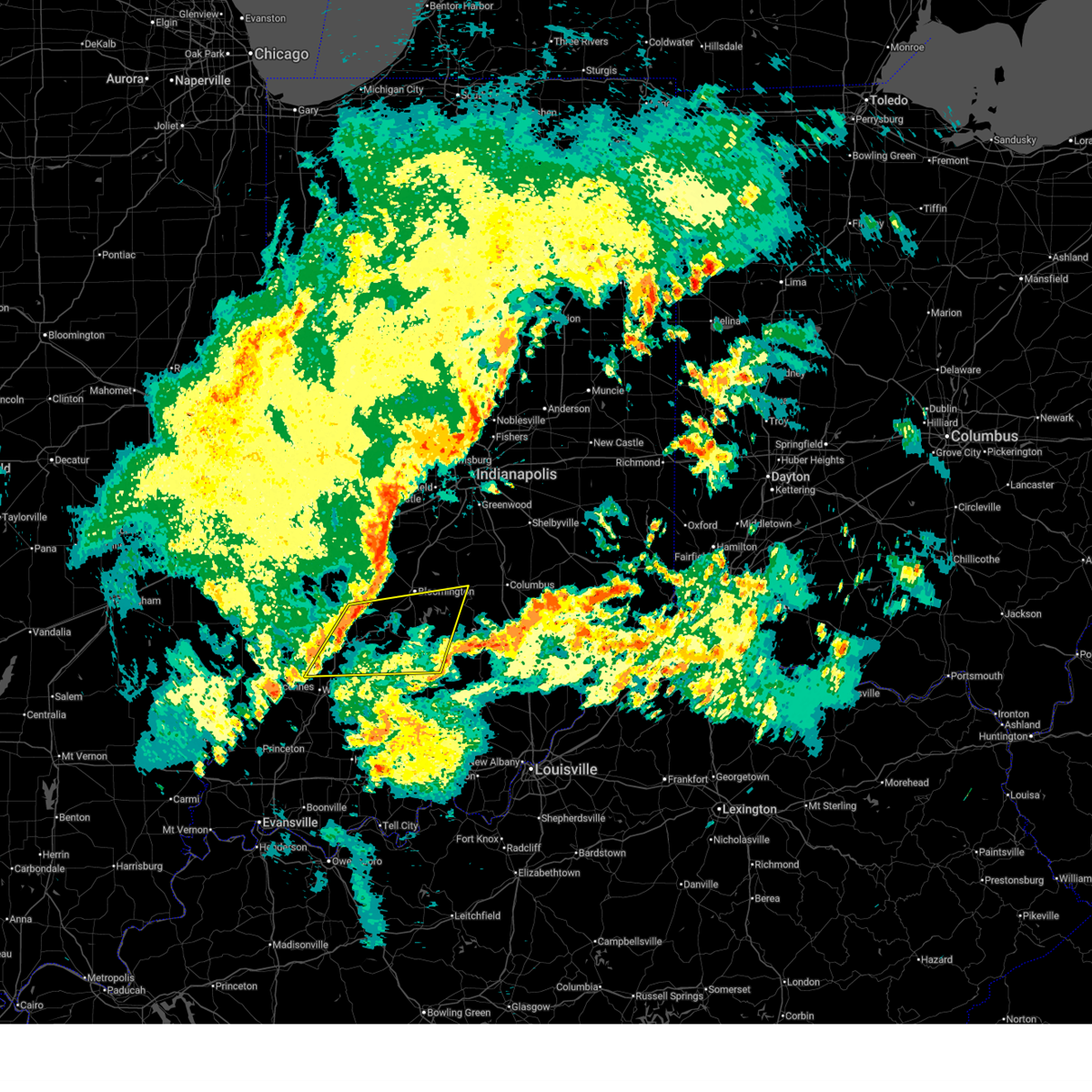
| 4/27/2026 11:43 PM EDT |
 The storm which prompted the warning has weakened below severe limits, and has exited the warned area. therefore, the warning will be allowed to expire. a severe thunderstorm watch remains in effect until 400 am edt for south central and central indiana. The storm which prompted the warning has weakened below severe limits, and has exited the warned area. therefore, the warning will be allowed to expire. a severe thunderstorm watch remains in effect until 400 am edt for south central and central indiana.
|
| 4/27/2026 11:32 PM EDT |
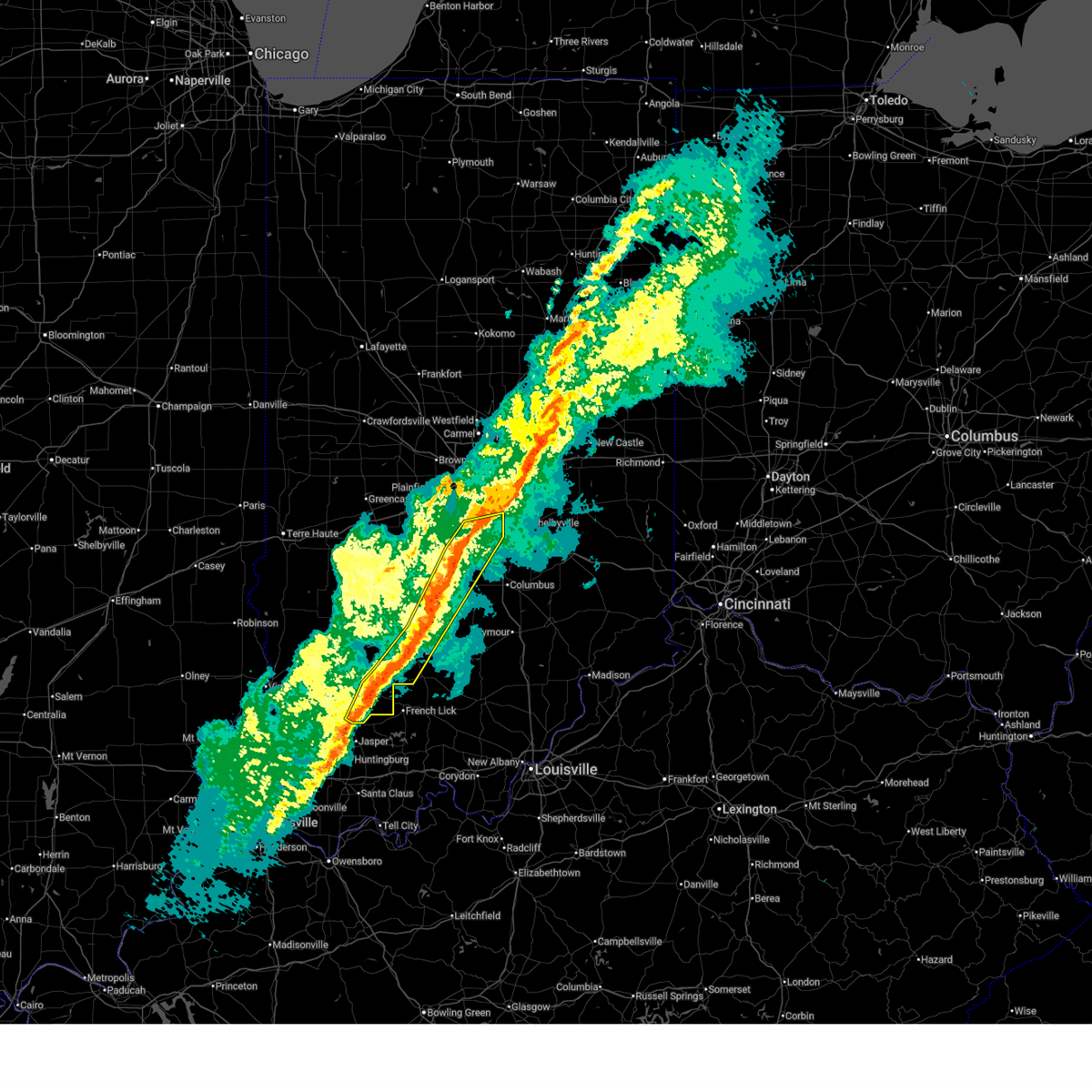
 At 1132 pm edt, severe thunderstorms were located along a line extending from 6 miles south of martinsville to 10 miles north of bedford, moving east at 65 mph (radar indicated). Hazards include 60 mph wind gusts and quarter size hail. Hail damage to vehicles is expected. expect wind damage to roofs, siding, and trees. locations impacted include, bloomington, franklin, martinsville, nashville, ellettsville, edinburgh, princes lakes, trafalgar, morgantown, paragon, stinesville, peoga, smithville, lake lemon, beanblossom, gnaw bone, spurgeons corner, monroe reservoir, woodville hills, and elkinsville. This includes interstate 65 between mile markers 84 and 90. At 1132 pm edt, severe thunderstorms were located along a line extending from 6 miles south of martinsville to 10 miles north of bedford, moving east at 65 mph (radar indicated). Hazards include 60 mph wind gusts and quarter size hail. Hail damage to vehicles is expected. expect wind damage to roofs, siding, and trees. locations impacted include, bloomington, franklin, martinsville, nashville, ellettsville, edinburgh, princes lakes, trafalgar, morgantown, paragon, stinesville, peoga, smithville, lake lemon, beanblossom, gnaw bone, spurgeons corner, monroe reservoir, woodville hills, and elkinsville. This includes interstate 65 between mile markers 84 and 90.
|
| 4/27/2026 11:31 PM EDT |
 At 1131 pm edt, a severe thunderstorm capable of producing a tornado was located near bloomington, moving east at 45 mph (radar indicated rotation). Hazards include tornado. Flying debris will be dangerous to those caught without shelter. mobile homes will be damaged or destroyed. damage to roofs, windows, and vehicles will occur. tree damage is likely. Locations impacted include, bloomington, ellettsville, stinesville, indiana university, woodville hills, lake lemon, unionville, and whitehall. At 1131 pm edt, a severe thunderstorm capable of producing a tornado was located near bloomington, moving east at 45 mph (radar indicated rotation). Hazards include tornado. Flying debris will be dangerous to those caught without shelter. mobile homes will be damaged or destroyed. damage to roofs, windows, and vehicles will occur. tree damage is likely. Locations impacted include, bloomington, ellettsville, stinesville, indiana university, woodville hills, lake lemon, unionville, and whitehall.
|
| 4/27/2026 11:12 PM EDT |
 Torind the national weather service in indianapolis has issued a * tornado warning for, central monroe county in south central indiana, southeastern owen county in west central indiana, northeastern greene county in southwestern indiana, * until 1145 pm edt. * at 1111 pm edt, a severe thunderstorm capable of producing a tornado was located near spencer, or 14 miles west of bloomington, moving east at 40 mph (radar indicated rotation). Hazards include tornado. Flying debris will be dangerous to those caught without shelter. mobile homes will be damaged or destroyed. damage to roofs, windows, and vehicles will occur. Tree damage is likely. Torind the national weather service in indianapolis has issued a * tornado warning for, central monroe county in south central indiana, southeastern owen county in west central indiana, northeastern greene county in southwestern indiana, * until 1145 pm edt. * at 1111 pm edt, a severe thunderstorm capable of producing a tornado was located near spencer, or 14 miles west of bloomington, moving east at 40 mph (radar indicated rotation). Hazards include tornado. Flying debris will be dangerous to those caught without shelter. mobile homes will be damaged or destroyed. damage to roofs, windows, and vehicles will occur. Tree damage is likely.
|
| 4/27/2026 10:46 PM EDT |
 Svrind the national weather service in indianapolis has issued a * severe thunderstorm warning for, monroe county in south central indiana, morgan county in central indiana, brown county in south central indiana, johnson county in central indiana, owen county in west central indiana, greene county in southwestern indiana, south central putnam county in west central indiana, * until 1145 pm edt. * at 1045 pm edt, severe thunderstorms were located along a line extending from 9 miles west of martinsville to near linton, moving east at 55 mph (radar indicated). Hazards include 60 mph wind gusts and quarter size hail. Hail damage to vehicles is expected. Expect wind damage to roofs, siding, and trees. Svrind the national weather service in indianapolis has issued a * severe thunderstorm warning for, monroe county in south central indiana, morgan county in central indiana, brown county in south central indiana, johnson county in central indiana, owen county in west central indiana, greene county in southwestern indiana, south central putnam county in west central indiana, * until 1145 pm edt. * at 1045 pm edt, severe thunderstorms were located along a line extending from 9 miles west of martinsville to near linton, moving east at 55 mph (radar indicated). Hazards include 60 mph wind gusts and quarter size hail. Hail damage to vehicles is expected. Expect wind damage to roofs, siding, and trees.
|
| 4/27/2026 4:15 PM EDT |
 At 415 pm edt, a severe thunderstorm was located 8 miles southeast of bloomington, moving east at 30 mph (trained weather spotters). Hazards include 60 mph wind gusts and quarter size hail. Hail damage to vehicles is expected. expect wind damage to roofs, siding, and trees. Locations impacted include, bloomington, bedford, nashville, oolitic, norman, heltonville, indiana university, smithville, freetown, gnaw bone, harrodsburg, bartlettsville, spurgeons corner, yellowwood lake, avoca, monroe reservoir, woodville hills, elkinsville, fairfax state recreation area, and kurtz. At 415 pm edt, a severe thunderstorm was located 8 miles southeast of bloomington, moving east at 30 mph (trained weather spotters). Hazards include 60 mph wind gusts and quarter size hail. Hail damage to vehicles is expected. expect wind damage to roofs, siding, and trees. Locations impacted include, bloomington, bedford, nashville, oolitic, norman, heltonville, indiana university, smithville, freetown, gnaw bone, harrodsburg, bartlettsville, spurgeons corner, yellowwood lake, avoca, monroe reservoir, woodville hills, elkinsville, fairfax state recreation area, and kurtz.
|
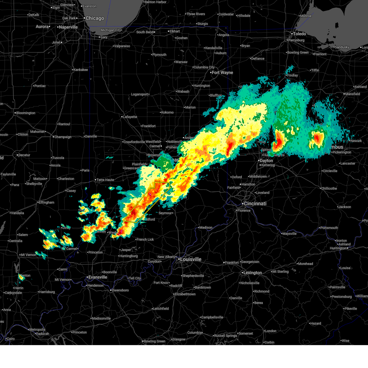
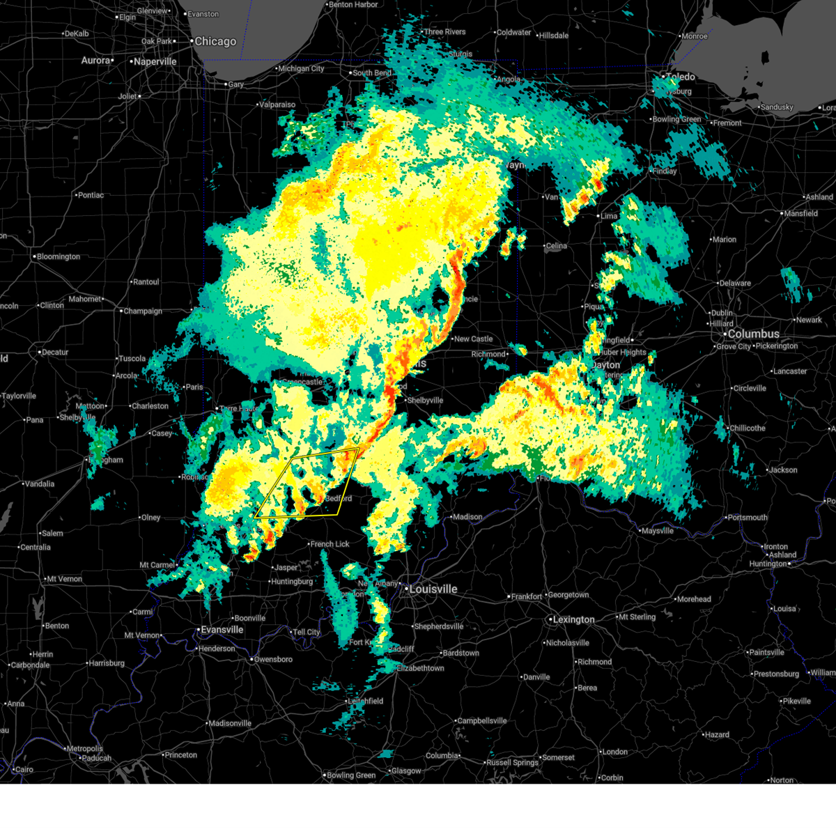
| 4/27/2026 4:02 PM EDT | Quarter sized hail reported 2 miles WNW of Bloomington, IN, report from mping: quarter (1.00 in.). |
| 4/27/2026 3:57 PM EDT |
 Svrind the national weather service in indianapolis has issued a * severe thunderstorm warning for, monroe county in south central indiana, brown county in south central indiana, northern lawrence county in south central indiana, northwestern jackson county in south central indiana, * until 445 pm edt. * at 356 pm edt, a severe thunderstorm was located 7 miles southwest of bloomington, moving east at 30 mph. a 61 mph thunderstorm wind gust was reported at the bloomington airport with 1 inch hail reported in town (trained weather spotters). Hazards include 60 mph wind gusts and quarter size hail. Hail damage to vehicles is expected. Expect wind damage to roofs, siding, and trees. Svrind the national weather service in indianapolis has issued a * severe thunderstorm warning for, monroe county in south central indiana, brown county in south central indiana, northern lawrence county in south central indiana, northwestern jackson county in south central indiana, * until 445 pm edt. * at 356 pm edt, a severe thunderstorm was located 7 miles southwest of bloomington, moving east at 30 mph. a 61 mph thunderstorm wind gust was reported at the bloomington airport with 1 inch hail reported in town (trained weather spotters). Hazards include 60 mph wind gusts and quarter size hail. Hail damage to vehicles is expected. Expect wind damage to roofs, siding, and trees.
|
| 4/27/2026 3:54 PM EDT | Half Dollar sized hail reported 3.5 miles NNW of Bloomington, IN, report from mping: half dollar (1.25 in.). |
| 4/27/2026 3:48 PM EDT | Quarter sized hail reported 0.8 miles SSE of Bloomington, IN, report from mping: quarter (1.00 in.). |
| 4/27/2026 3:47 PM EDT | Quarter sized hail reported 1.1 miles SW of Bloomington, IN, report from mping: quarter (1.00 in.). |
| 4/27/2026 3:44 PM EDT | Quarter sized hail reported 3.9 miles NNE of Bloomington, IN, report from mping: quarter (1.00 in.). |
| 4/27/2026 3:43 PM EDT | At kbm in monroe county IN, 4.1 miles E of Bloomington, IN |
| 4/27/2026 3:40 PM EDT |
 At 339 pm edt, a severe thunderstorm was located 9 miles southwest of bloomington, moving east at 50 mph (radar indicated). Hazards include 60 mph wind gusts and quarter size hail. Hail damage to vehicles is expected. expect wind damage to roofs, siding, and trees. Locations impacted include, bloomington, bloomfield, ellettsville, worthington, stinesville, indiana university, smithville, lake lemon, harrodsburg, bartlettsville, freedom, solsberry, monroe reservoir, woodville hills, fairfax state recreation area, unionville, and whitehall. At 339 pm edt, a severe thunderstorm was located 9 miles southwest of bloomington, moving east at 50 mph (radar indicated). Hazards include 60 mph wind gusts and quarter size hail. Hail damage to vehicles is expected. expect wind damage to roofs, siding, and trees. Locations impacted include, bloomington, bloomfield, ellettsville, worthington, stinesville, indiana university, smithville, lake lemon, harrodsburg, bartlettsville, freedom, solsberry, monroe reservoir, woodville hills, fairfax state recreation area, unionville, and whitehall.
|
| 4/27/2026 3:25 PM EDT |
 Svrind the national weather service in indianapolis has issued a * severe thunderstorm warning for, monroe county in south central indiana, southeastern owen county in west central indiana, eastern greene county in southwestern indiana, northwestern lawrence county in south central indiana, * until 400 pm edt. * at 324 pm edt, a severe thunderstorm was located near bloomfield, or 22 miles west of bloomington, moving east at 50 mph (radar indicated). Hazards include 60 mph wind gusts and quarter size hail. Hail damage to vehicles is expected. Expect wind damage to roofs, siding, and trees. Svrind the national weather service in indianapolis has issued a * severe thunderstorm warning for, monroe county in south central indiana, southeastern owen county in west central indiana, eastern greene county in southwestern indiana, northwestern lawrence county in south central indiana, * until 400 pm edt. * at 324 pm edt, a severe thunderstorm was located near bloomfield, or 22 miles west of bloomington, moving east at 50 mph (radar indicated). Hazards include 60 mph wind gusts and quarter size hail. Hail damage to vehicles is expected. Expect wind damage to roofs, siding, and trees.
|
| 3/22/2026 10:17 PM EDT |
 the severe thunderstorm warning has been cancelled and is no longer in effect the severe thunderstorm warning has been cancelled and is no longer in effect
|
| 3/22/2026 10:17 PM EDT |
 At 1017 pm edt, severe thunderstorms were located along a line extending from 8 miles southwest of franklin to 12 miles north of shoals, moving east at 50 mph (radar indicated). Hazards include 60 mph wind gusts and quarter size hail. Hail damage to vehicles is expected. expect wind damage to roofs, siding, and trees. locations impacted include, bloomington, nashville, edinburgh, princes lakes, oolitic, trafalgar, peoga, smithville, helmsburg, lake lemon, gnaw bone, beanblossom, harrodsburg, bartlettsville, yellowwood lake, avoca, spearsville, monroe reservoir, fairfax state recreation area, and woodville hills. This includes interstate 65 mile marker 79 and near mile marker 84. At 1017 pm edt, severe thunderstorms were located along a line extending from 8 miles southwest of franklin to 12 miles north of shoals, moving east at 50 mph (radar indicated). Hazards include 60 mph wind gusts and quarter size hail. Hail damage to vehicles is expected. expect wind damage to roofs, siding, and trees. locations impacted include, bloomington, nashville, edinburgh, princes lakes, oolitic, trafalgar, peoga, smithville, helmsburg, lake lemon, gnaw bone, beanblossom, harrodsburg, bartlettsville, yellowwood lake, avoca, spearsville, monroe reservoir, fairfax state recreation area, and woodville hills. This includes interstate 65 mile marker 79 and near mile marker 84.
|
| 3/22/2026 10:01 PM EDT | Corrects time of previous report for this locatio in monroe county IN, 4.7 miles WNW of Bloomington, IN |
| 3/22/2026 10:00 PM EDT |
 Svrind the national weather service in indianapolis has issued a * severe thunderstorm warning for, monroe county in south central indiana, southeastern morgan county in central indiana, brown county in south central indiana, southern johnson county in central indiana, northwestern bartholomew county in central indiana, northern martin county in southwestern indiana, northwestern lawrence county in south central indiana, eastern greene county in southwestern indiana, northeastern daviess county in southwestern indiana, * until 1045 pm edt. * at 1000 pm edt, severe thunderstorms were located along a line extending from 8 miles south of martinsville to 12 miles south of bloomfield, moving east at 50 mph (radar indicated). Hazards include 60 mph wind gusts and quarter size hail. Hail damage to vehicles is expected. Expect wind damage to roofs, siding, and trees. Svrind the national weather service in indianapolis has issued a * severe thunderstorm warning for, monroe county in south central indiana, southeastern morgan county in central indiana, brown county in south central indiana, southern johnson county in central indiana, northwestern bartholomew county in central indiana, northern martin county in southwestern indiana, northwestern lawrence county in south central indiana, eastern greene county in southwestern indiana, northeastern daviess county in southwestern indiana, * until 1045 pm edt. * at 1000 pm edt, severe thunderstorms were located along a line extending from 8 miles south of martinsville to 12 miles south of bloomfield, moving east at 50 mph (radar indicated). Hazards include 60 mph wind gusts and quarter size hail. Hail damage to vehicles is expected. Expect wind damage to roofs, siding, and trees.
|
| 3/22/2026 9:59 PM EDT | Time estimated from rada in monroe county IN, 4.7 miles WNW of Bloomington, IN |
| 3/15/2026 10:58 PM EDT |
 the severe thunderstorm warning has been cancelled and is no longer in effect the severe thunderstorm warning has been cancelled and is no longer in effect
|
| 3/15/2026 10:57 PM EDT |
 the severe thunderstorm warning has been cancelled and is no longer in effect the severe thunderstorm warning has been cancelled and is no longer in effect
|
| 3/15/2026 10:53 PM EDT | Tree downed near sr 4 in monroe county IN, 7.9 miles SW of Bloomington, IN |
| 3/15/2026 10:51 PM EDT |
 Svrind the national weather service in indianapolis has issued a * severe thunderstorm warning for, eastern monroe county in south central indiana, western brown county in south central indiana, northeastern lawrence county in south central indiana, northwestern jackson county in south central indiana, * until 1130 pm edt. * at 1051 pm edt, a severe thunderstorm was located near bloomington, moving northeast at 60 mph (radar indicated). Hazards include 60 mph wind gusts. expect damage to roofs, siding, and trees Svrind the national weather service in indianapolis has issued a * severe thunderstorm warning for, eastern monroe county in south central indiana, western brown county in south central indiana, northeastern lawrence county in south central indiana, northwestern jackson county in south central indiana, * until 1130 pm edt. * at 1051 pm edt, a severe thunderstorm was located near bloomington, moving northeast at 60 mph (radar indicated). Hazards include 60 mph wind gusts. expect damage to roofs, siding, and trees
|
| 3/15/2026 10:48 PM EDT |
 the severe thunderstorm warning has been cancelled and is no longer in effect the severe thunderstorm warning has been cancelled and is no longer in effect
|
| 3/15/2026 10:48 PM EDT |
 At 1048 pm edt, a severe thunderstorm was located over bedford, moving northeast at 65 mph (radar indicated). Hazards include 60 mph wind gusts. Expect damage to roofs, siding, and trees. Locations impacted include, bedford, mitchell, oolitic, avoca, smithville, fairfax state recreation area, and harrodsburg. At 1048 pm edt, a severe thunderstorm was located over bedford, moving northeast at 65 mph (radar indicated). Hazards include 60 mph wind gusts. Expect damage to roofs, siding, and trees. Locations impacted include, bedford, mitchell, oolitic, avoca, smithville, fairfax state recreation area, and harrodsburg.
|
| 3/15/2026 10:46 PM EDT |
 the severe thunderstorm warning has been cancelled and is no longer in effect the severe thunderstorm warning has been cancelled and is no longer in effect
|
| 3/15/2026 10:46 PM EDT |
 At 1046 pm edt, severe thunderstorms were located along a line extending from 11 miles south of greencastle to near bloomington, moving northeast at 50 mph (radar indicated). Hazards include 60 mph wind gusts. Expect damage to roofs, siding, and trees. locations impacted include, bloomington, spencer, ellettsville, cloverdale, gosport, stinesville, indiana university, quincy, mccormicks creek state park, devore, whitehall, and belle union. This includes interstate 70 between mile markers 43 and 46. At 1046 pm edt, severe thunderstorms were located along a line extending from 11 miles south of greencastle to near bloomington, moving northeast at 50 mph (radar indicated). Hazards include 60 mph wind gusts. Expect damage to roofs, siding, and trees. locations impacted include, bloomington, spencer, ellettsville, cloverdale, gosport, stinesville, indiana university, quincy, mccormicks creek state park, devore, whitehall, and belle union. This includes interstate 70 between mile markers 43 and 46.
|
| 3/15/2026 10:41 PM EDT |
 Svrind the national weather service in indianapolis has issued a * severe thunderstorm warning for, northwestern monroe county in south central indiana, owen county in west central indiana, northeastern greene county in southwestern indiana, southeastern putnam county in west central indiana, * until 1130 pm edt. * at 1041 pm edt, severe thunderstorms were located along a line extending from 10 miles northwest of spencer to 12 miles southwest of bloomington, moving northeast at 55 mph (radar indicated). Hazards include 60 mph wind gusts. expect damage to roofs, siding, and trees Svrind the national weather service in indianapolis has issued a * severe thunderstorm warning for, northwestern monroe county in south central indiana, owen county in west central indiana, northeastern greene county in southwestern indiana, southeastern putnam county in west central indiana, * until 1130 pm edt. * at 1041 pm edt, severe thunderstorms were located along a line extending from 10 miles northwest of spencer to 12 miles southwest of bloomington, moving northeast at 55 mph (radar indicated). Hazards include 60 mph wind gusts. expect damage to roofs, siding, and trees
|
| 3/15/2026 10:34 PM EDT |
 Svrind the national weather service in indianapolis has issued a * severe thunderstorm warning for, southwestern monroe county in south central indiana, eastern martin county in southwestern indiana, western lawrence county in south central indiana, southeastern greene county in southwestern indiana, * until 1115 pm edt. * at 1033 pm edt, a severe thunderstorm was located near shoals, or 16 miles southwest of bedford, moving northeast at 50 mph (radar indicated). Hazards include 60 mph wind gusts. expect damage to roofs, siding, and trees Svrind the national weather service in indianapolis has issued a * severe thunderstorm warning for, southwestern monroe county in south central indiana, eastern martin county in southwestern indiana, western lawrence county in south central indiana, southeastern greene county in southwestern indiana, * until 1115 pm edt. * at 1033 pm edt, a severe thunderstorm was located near shoals, or 16 miles southwest of bedford, moving northeast at 50 mph (radar indicated). Hazards include 60 mph wind gusts. expect damage to roofs, siding, and trees
|
| 3/11/2026 9:10 AM EDT |
 The storms which prompted the warning have weakened below severe limits, and have exited the warned area. therefore, the warning will be allowed to expire. however, gusty winds are still possible with these thunderstorms. a tornado watch remains in effect until noon edt for south central and southwestern indiana. The storms which prompted the warning have weakened below severe limits, and have exited the warned area. therefore, the warning will be allowed to expire. however, gusty winds are still possible with these thunderstorms. a tornado watch remains in effect until noon edt for south central and southwestern indiana.
|
| 3/11/2026 8:48 AM EDT |
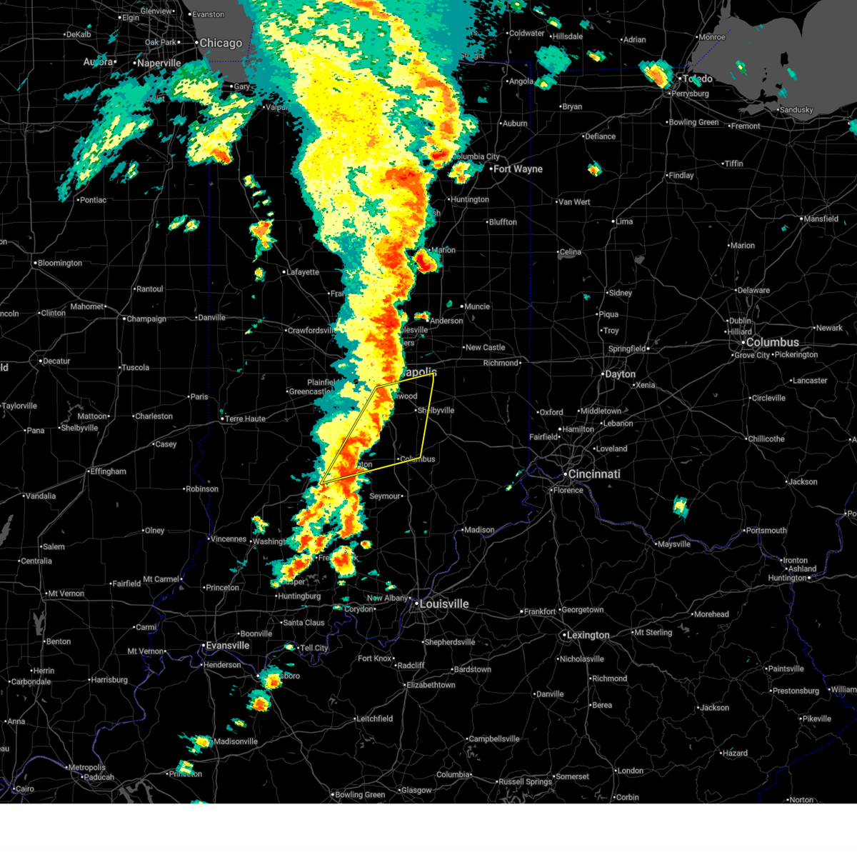
 At 847 am edt, severe thunderstorms were located along a line extending from near speedway to 7 miles northwest of nashville, moving east at 65 mph (radar indicated). Hazards include 60 mph wind gusts. Expect damage to roofs, siding, and trees. locations impacted include, indianapolis, bloomington, greenwood, plainfield, martinsville, mooresville, southport, nashville, ellettsville, bargersville, brooklyn, trafalgar, monrovia, morgantown, homecroft, bethany, monument circle, peoga, lake lemon, and gnaw bone. this includes the following highways, interstate 65 between mile markers 107 and 111. Interstate 70 between mile markers 61 and 80. At 847 am edt, severe thunderstorms were located along a line extending from near speedway to 7 miles northwest of nashville, moving east at 65 mph (radar indicated). Hazards include 60 mph wind gusts. Expect damage to roofs, siding, and trees. locations impacted include, indianapolis, bloomington, greenwood, plainfield, martinsville, mooresville, southport, nashville, ellettsville, bargersville, brooklyn, trafalgar, monrovia, morgantown, homecroft, bethany, monument circle, peoga, lake lemon, and gnaw bone. this includes the following highways, interstate 65 between mile markers 107 and 111. Interstate 70 between mile markers 61 and 80.
|
| 3/11/2026 8:48 AM EDT |
 the severe thunderstorm warning has been cancelled and is no longer in effect the severe thunderstorm warning has been cancelled and is no longer in effect
|
| 3/11/2026 8:46 AM EDT |
 At 846 am edt, severe thunderstorms were located along a line extending from near bloomington to 10 miles north of shoals, moving east at 50 mph (radar indicated). Hazards include 60 mph wind gusts. Expect damage to roofs, siding, and trees. Locations impacted include, bloomington, bedford, nashville, mitchell, odon, oolitic, crane, heltonville, smithville, indian springs, tunnelton, harrodsburg, bartlettsville, burns city, williams, avoca, solsberry, monroe reservoir, fairfax state recreation area, and woodville hills. At 846 am edt, severe thunderstorms were located along a line extending from near bloomington to 10 miles north of shoals, moving east at 50 mph (radar indicated). Hazards include 60 mph wind gusts. Expect damage to roofs, siding, and trees. Locations impacted include, bloomington, bedford, nashville, mitchell, odon, oolitic, crane, heltonville, smithville, indian springs, tunnelton, harrodsburg, bartlettsville, burns city, williams, avoca, solsberry, monroe reservoir, fairfax state recreation area, and woodville hills.
|
| 3/11/2026 8:46 AM EDT |
 the severe thunderstorm warning has been cancelled and is no longer in effect the severe thunderstorm warning has been cancelled and is no longer in effect
|
| 3/11/2026 8:45 AM EDT | Some tree limbs dow in monroe county IN, 1.7 miles SSE of Bloomington, IN |
| 3/11/2026 8:38 AM EDT |
 the severe thunderstorm warning has been cancelled and is no longer in effect the severe thunderstorm warning has been cancelled and is no longer in effect
|
| 3/11/2026 8:38 AM EDT |
 At 838 am edt, severe thunderstorms were located along a line extending from near plainfield to 6 miles northeast of bloomington, moving east at 65 mph (radar indicated). Hazards include 60 mph wind gusts. Expect damage to roofs, siding, and trees. locations impacted include, indianapolis, bloomington, greenwood, plainfield, martinsville, mooresville, southport, nashville, ellettsville, bargersville, brooklyn, trafalgar, monrovia, morgantown, gosport, homecroft, paragon, stinesville, bethany, and monument circle. this includes the following highways, interstate 65 between mile markers 107 and 111. Interstate 70 between mile markers 50 and 80. At 838 am edt, severe thunderstorms were located along a line extending from near plainfield to 6 miles northeast of bloomington, moving east at 65 mph (radar indicated). Hazards include 60 mph wind gusts. Expect damage to roofs, siding, and trees. locations impacted include, indianapolis, bloomington, greenwood, plainfield, martinsville, mooresville, southport, nashville, ellettsville, bargersville, brooklyn, trafalgar, monrovia, morgantown, gosport, homecroft, paragon, stinesville, bethany, and monument circle. this includes the following highways, interstate 65 between mile markers 107 and 111. Interstate 70 between mile markers 50 and 80.
|
| 3/11/2026 8:28 AM EDT |
 At 827 am edt, severe thunderstorms were located along a line extending from 10 miles southwest of danville to 7 miles west of bloomington, moving east at 65 mph (radar indicated). Hazards include 60 mph wind gusts. Expect damage to roofs, siding, and trees. locations impacted include, indianapolis, bloomington, greenwood, plainfield, martinsville, mooresville, spencer, southport, nashville, ellettsville, bargersville, cloverdale, brooklyn, trafalgar, monrovia, morgantown, gosport, homecroft, paragon, and stilesville. this includes the following highways, interstate 65 between mile markers 107 and 111. Interstate 70 between mile markers 40 and 80. At 827 am edt, severe thunderstorms were located along a line extending from 10 miles southwest of danville to 7 miles west of bloomington, moving east at 65 mph (radar indicated). Hazards include 60 mph wind gusts. Expect damage to roofs, siding, and trees. locations impacted include, indianapolis, bloomington, greenwood, plainfield, martinsville, mooresville, spencer, southport, nashville, ellettsville, bargersville, cloverdale, brooklyn, trafalgar, monrovia, morgantown, gosport, homecroft, paragon, and stilesville. this includes the following highways, interstate 65 between mile markers 107 and 111. Interstate 70 between mile markers 40 and 80.
|
| 3/11/2026 8:28 AM EDT |
 the severe thunderstorm warning has been cancelled and is no longer in effect the severe thunderstorm warning has been cancelled and is no longer in effect
|
| 3/11/2026 8:26 AM EDT |
 Svrind the national weather service in indianapolis has issued a * severe thunderstorm warning for, southern monroe county in south central indiana, southwestern brown county in south central indiana, northeastern knox county in southwestern indiana, northern martin county in southwestern indiana, lawrence county in south central indiana, eastern greene county in southwestern indiana, northwestern jackson county in south central indiana, northern daviess county in southwestern indiana, * until 915 am edt. * at 826 am edt, severe thunderstorms were located along a line extending from 6 miles northeast of bloomfield to 8 miles north of washington, moving east at 50 mph (radar indicated). Hazards include 60 mph wind gusts. expect damage to roofs, siding, and trees Svrind the national weather service in indianapolis has issued a * severe thunderstorm warning for, southern monroe county in south central indiana, southwestern brown county in south central indiana, northeastern knox county in southwestern indiana, northern martin county in southwestern indiana, lawrence county in south central indiana, eastern greene county in southwestern indiana, northwestern jackson county in south central indiana, northern daviess county in southwestern indiana, * until 915 am edt. * at 826 am edt, severe thunderstorms were located along a line extending from 6 miles northeast of bloomfield to 8 miles north of washington, moving east at 50 mph (radar indicated). Hazards include 60 mph wind gusts. expect damage to roofs, siding, and trees
|
| 3/11/2026 8:15 AM EDT |
 At 815 am edt, severe thunderstorms were located along a line extending from 12 miles north of bloomfield to 9 miles northeast of washington, moving east at 70 mph (radar indicated). Hazards include 60 mph wind gusts. Expect damage to roofs, siding, and trees. Locations impacted include, bloomington, linton, bloomfield, ellettsville, worthington, lyons, elnora, sandborn, switz city, newberry, crane, freedom, solsberry, owensburg, and whitehall. At 815 am edt, severe thunderstorms were located along a line extending from 12 miles north of bloomfield to 9 miles northeast of washington, moving east at 70 mph (radar indicated). Hazards include 60 mph wind gusts. Expect damage to roofs, siding, and trees. Locations impacted include, bloomington, linton, bloomfield, ellettsville, worthington, lyons, elnora, sandborn, switz city, newberry, crane, freedom, solsberry, owensburg, and whitehall.
|
| 3/11/2026 8:15 AM EDT |
 the severe thunderstorm warning has been cancelled and is no longer in effect the severe thunderstorm warning has been cancelled and is no longer in effect
|
| 3/11/2026 8:11 AM EDT |
 Svrind the national weather service in indianapolis has issued a * severe thunderstorm warning for, northern monroe county in south central indiana, morgan county in central indiana, northern brown county in south central indiana, western johnson county in central indiana, southern hendricks county in central indiana, eastern clay county in west central indiana, owen county in west central indiana, southwestern marion county in central indiana, northeastern greene county in southwestern indiana, southern putnam county in west central indiana, * until 900 am edt. * at 811 am edt, severe thunderstorms were located along a line extending from 8 miles southwest of greencastle to 6 miles north of bloomfield, moving east at 65 mph (radar indicated). Hazards include 60 mph wind gusts. expect damage to roofs, siding, and trees Svrind the national weather service in indianapolis has issued a * severe thunderstorm warning for, northern monroe county in south central indiana, morgan county in central indiana, northern brown county in south central indiana, western johnson county in central indiana, southern hendricks county in central indiana, eastern clay county in west central indiana, owen county in west central indiana, southwestern marion county in central indiana, northeastern greene county in southwestern indiana, southern putnam county in west central indiana, * until 900 am edt. * at 811 am edt, severe thunderstorms were located along a line extending from 8 miles southwest of greencastle to 6 miles north of bloomfield, moving east at 65 mph (radar indicated). Hazards include 60 mph wind gusts. expect damage to roofs, siding, and trees
|
| 3/11/2026 8:03 AM EDT | At 803 am edt, severe thunderstorms were located along a line extending from 10 miles northeast of sullivan to 6 miles northwest of washington, moving east at 70 mph (radar indicated). Hazards include 60 mph wind gusts. Expect damage to roofs, siding, and trees. Locations impacted include, bloomington, vincennes, linton, sullivan, bloomfield, spencer, ellettsville, bicknell, jasonville, worthington, odon, shelburn, dugger, hymera, lyons, carlisle, elnora, oaktown, bruceville, and plainville. |
| 3/11/2026 7:45 AM EDT |
 Svrind the national weather service in indianapolis has issued a * severe thunderstorm warning for, western monroe county in south central indiana, sullivan county in southwestern indiana, northeastern knox county in southwestern indiana, southwestern clay county in west central indiana, southern owen county in west central indiana, northern martin county in southwestern indiana, western lawrence county in south central indiana, greene county in southwestern indiana, northern daviess county in southwestern indiana, * until 830 am edt. * at 744 am edt, severe thunderstorms were located along a line extending from near hutsonville to near lawrenceville, moving east at 70 mph (radar indicated). Hazards include 60 mph wind gusts. expect damage to roofs, siding, and trees Svrind the national weather service in indianapolis has issued a * severe thunderstorm warning for, western monroe county in south central indiana, sullivan county in southwestern indiana, northeastern knox county in southwestern indiana, southwestern clay county in west central indiana, southern owen county in west central indiana, northern martin county in southwestern indiana, western lawrence county in south central indiana, greene county in southwestern indiana, northern daviess county in southwestern indiana, * until 830 am edt. * at 744 am edt, severe thunderstorms were located along a line extending from near hutsonville to near lawrenceville, moving east at 70 mph (radar indicated). Hazards include 60 mph wind gusts. expect damage to roofs, siding, and trees
|
| 2/19/2026 7:21 PM EST | Half Dollar sized hail reported 8.3 miles W of Bloomington, IN, corrects previous hail report from woodville hills. |
| 2/19/2026 7:18 PM EST |
 At 718 pm est, a confirmed tornado was located near nashville, or 8 miles east of bloomington, moving east at 45 mph (emergency management confirmed tornado). Hazards include damaging tornado and ping pong ball size hail. Flying debris will be dangerous to those caught without shelter. mobile homes will be damaged or destroyed. damage to roofs, windows, and vehicles will occur. tree damage is likely. Locations impacted include, bloomington, woodville hills, yellowwood lake, lake lemon, and unionville. At 718 pm est, a confirmed tornado was located near nashville, or 8 miles east of bloomington, moving east at 45 mph (emergency management confirmed tornado). Hazards include damaging tornado and ping pong ball size hail. Flying debris will be dangerous to those caught without shelter. mobile homes will be damaged or destroyed. damage to roofs, windows, and vehicles will occur. tree damage is likely. Locations impacted include, bloomington, woodville hills, yellowwood lake, lake lemon, and unionville.
|
| 2/19/2026 7:13 PM EST |
 At 713 pm est, a confirmed tornado was located near bloomington, moving east at 45 mph (emergency management confirmed tornado). Hazards include damaging tornado and ping pong ball size hail. Flying debris will be dangerous to those caught without shelter. mobile homes will be damaged or destroyed. damage to roofs, windows, and vehicles will occur. tree damage is likely. Locations impacted include, bloomington, ellettsville, yellowwood lake, indiana university, woodville hills, lake lemon, unionville, and whitehall. At 713 pm est, a confirmed tornado was located near bloomington, moving east at 45 mph (emergency management confirmed tornado). Hazards include damaging tornado and ping pong ball size hail. Flying debris will be dangerous to those caught without shelter. mobile homes will be damaged or destroyed. damage to roofs, windows, and vehicles will occur. tree damage is likely. Locations impacted include, bloomington, ellettsville, yellowwood lake, indiana university, woodville hills, lake lemon, unionville, and whitehall.
|
| 2/19/2026 7:05 PM EST | Delayed report. damage to monroe county humane association at 791 s fieldstone blvd... bloomington... i in monroe county IN, 3.5 miles E of Bloomington, IN |
| 2/19/2026 7:05 PM EST | Ping Pong Ball sized hail reported 2 miles WNW of Bloomington, IN, delayed report. time estimated from radar. report from mping: ping pong ball (1.50 in.). |
| 2/19/2026 7:01 PM EST | Bloomington monroe county airpor in monroe county IN, 4.1 miles E of Bloomington, IN |
| 2/19/2026 7:01 PM EST |
 Torind the national weather service in indianapolis has issued a * tornado warning for, central monroe county in south central indiana, western brown county in south central indiana, * until 730 pm est. * at 701 pm est, a confirmed large and extremely dangerous tornado was located near bloomington, moving east at 45 mph. this is a particularly dangerous situation. take cover now! (emergency management confirmed tornado). Hazards include damaging tornado. You are in a life-threatening situation. flying debris may be deadly to those caught without shelter. mobile homes will be destroyed. Considerable damage to homes, businesses, and vehicles is likely and complete destruction is possible. Torind the national weather service in indianapolis has issued a * tornado warning for, central monroe county in south central indiana, western brown county in south central indiana, * until 730 pm est. * at 701 pm est, a confirmed large and extremely dangerous tornado was located near bloomington, moving east at 45 mph. this is a particularly dangerous situation. take cover now! (emergency management confirmed tornado). Hazards include damaging tornado. You are in a life-threatening situation. flying debris may be deadly to those caught without shelter. mobile homes will be destroyed. Considerable damage to homes, businesses, and vehicles is likely and complete destruction is possible.
|
| 2/19/2026 7:00 PM EST | Quarter sized hail reported 5.2 miles E of Bloomington, IN, delayed report. deck was covered with quarter inch stones with full one inch stones mixed in about 1 to 2 per square foot. |
| 2/19/2026 6:57 PM EST |
 At 656 pm est, a confirmed tornado was located 8 miles west of bloomington, moving east at 40 mph (emergency management confirmed tornado). Hazards include damaging tornado and ping pong ball size hail. Flying debris will be dangerous to those caught without shelter. mobile homes will be damaged or destroyed. damage to roofs, windows, and vehicles will occur. tree damage is likely. Locations impacted include, bloomington, ellettsville, indiana university, solsberry, and whitehall. At 656 pm est, a confirmed tornado was located 8 miles west of bloomington, moving east at 40 mph (emergency management confirmed tornado). Hazards include damaging tornado and ping pong ball size hail. Flying debris will be dangerous to those caught without shelter. mobile homes will be damaged or destroyed. damage to roofs, windows, and vehicles will occur. tree damage is likely. Locations impacted include, bloomington, ellettsville, indiana university, solsberry, and whitehall.
|
| 2/19/2026 6:51 PM EST |
 At 651 pm est, a severe thunderstorm capable of producing a tornado was located 10 miles south of spencer, or 12 miles west of bloomington, moving east at 40 mph (radar indicated rotation). Hazards include tornado and ping pong ball size hail. Flying debris will be dangerous to those caught without shelter. mobile homes will be damaged or destroyed. damage to roofs, windows, and vehicles will occur. tree damage is likely. Locations impacted include, bloomington, ellettsville, stinesville, indiana university, solsberry, smithville, freedom, and whitehall. At 651 pm est, a severe thunderstorm capable of producing a tornado was located 10 miles south of spencer, or 12 miles west of bloomington, moving east at 40 mph (radar indicated rotation). Hazards include tornado and ping pong ball size hail. Flying debris will be dangerous to those caught without shelter. mobile homes will be damaged or destroyed. damage to roofs, windows, and vehicles will occur. tree damage is likely. Locations impacted include, bloomington, ellettsville, stinesville, indiana university, solsberry, smithville, freedom, and whitehall.
|
| 2/19/2026 6:39 PM EST |
 Torind the national weather service in indianapolis has issued a * tornado warning for, western monroe county in south central indiana, southeastern owen county in west central indiana, northeastern greene county in southwestern indiana, * until 715 pm est. * at 639 pm est, a severe thunderstorm capable of producing a tornado was located near bloomfield, or 20 miles west of bloomington, moving east at 40 mph (radar indicated rotation). Hazards include tornado and ping pong ball size hail. Flying debris will be dangerous to those caught without shelter. mobile homes will be damaged or destroyed. damage to roofs, windows, and vehicles will occur. Tree damage is likely. Torind the national weather service in indianapolis has issued a * tornado warning for, western monroe county in south central indiana, southeastern owen county in west central indiana, northeastern greene county in southwestern indiana, * until 715 pm est. * at 639 pm est, a severe thunderstorm capable of producing a tornado was located near bloomfield, or 20 miles west of bloomington, moving east at 40 mph (radar indicated rotation). Hazards include tornado and ping pong ball size hail. Flying debris will be dangerous to those caught without shelter. mobile homes will be damaged or destroyed. damage to roofs, windows, and vehicles will occur. Tree damage is likely.
|
| 2/19/2026 6:21 PM EST | Half Dollar sized hail reported 8.3 miles W of Bloomington, IN |
| 12/28/2025 8:28 PM EST |
 The storms which prompted the warning have moved out of the area. therefore, the warning will be allowed to expire. a tornado watch remains in effect until 1000 pm est for central, south central and southwestern indiana. The storms which prompted the warning have moved out of the area. therefore, the warning will be allowed to expire. a tornado watch remains in effect until 1000 pm est for central, south central and southwestern indiana.
|
| 12/28/2025 8:08 PM EST |
 At 807 pm est, severe thunderstorms were located along a line extending from near franklin to near shoals, moving northeast at 65 mph (radar indicated). Hazards include 60 mph wind gusts. Expect damage to roofs, siding, and trees. locations impacted include, bloomington, bedford, franklin, nashville, shoals, whiteland, bargersville, loogootee, princes lakes, oolitic, trafalgar, morgantown, alfordsville, peoga, smithville, lake lemon, beanblossom, bartlettsville, williams, and avoca. This includes interstate 65 between mile markers 85 and 94. At 807 pm est, severe thunderstorms were located along a line extending from near franklin to near shoals, moving northeast at 65 mph (radar indicated). Hazards include 60 mph wind gusts. Expect damage to roofs, siding, and trees. locations impacted include, bloomington, bedford, franklin, nashville, shoals, whiteland, bargersville, loogootee, princes lakes, oolitic, trafalgar, morgantown, alfordsville, peoga, smithville, lake lemon, beanblossom, bartlettsville, williams, and avoca. This includes interstate 65 between mile markers 85 and 94.
|
| 12/28/2025 8:08 PM EST |
 the severe thunderstorm warning has been cancelled and is no longer in effect the severe thunderstorm warning has been cancelled and is no longer in effect
|
| 12/28/2025 7:56 PM EST |
 At 755 pm est, severe thunderstorms were located along a line extending from near martinsville to 8 miles west of shoals, moving northeast at 65 mph (radar indicated). Hazards include 60 mph wind gusts. Expect damage to roofs, siding, and trees. locations impacted include, bloomington, bedford, franklin, martinsville, nashville, shoals, ellettsville, whiteland, bargersville, loogootee, princes lakes, oolitic, trafalgar, morgantown, montgomery, stinesville, cannelburg, alfordsville, smithville, and west boggs lake. This includes interstate 65 between mile markers 85 and 94. At 755 pm est, severe thunderstorms were located along a line extending from near martinsville to 8 miles west of shoals, moving northeast at 65 mph (radar indicated). Hazards include 60 mph wind gusts. Expect damage to roofs, siding, and trees. locations impacted include, bloomington, bedford, franklin, martinsville, nashville, shoals, ellettsville, whiteland, bargersville, loogootee, princes lakes, oolitic, trafalgar, morgantown, montgomery, stinesville, cannelburg, alfordsville, smithville, and west boggs lake. This includes interstate 65 between mile markers 85 and 94.
|
| 12/28/2025 7:56 PM EST |
 the severe thunderstorm warning has been cancelled and is no longer in effect the severe thunderstorm warning has been cancelled and is no longer in effect
|
| 12/28/2025 7:40 PM EST |
 Svrind the national weather service in indianapolis has issued a * severe thunderstorm warning for, monroe county in south central indiana, southeastern morgan county in central indiana, brown county in south central indiana, johnson county in central indiana, northwestern bartholomew county in central indiana, eastern knox county in southwestern indiana, southeastern owen county in west central indiana, martin county in southwestern indiana, lawrence county in south central indiana, greene county in southwestern indiana, northwestern jackson county in south central indiana, daviess county in southwestern indiana, * until 830 pm est. * at 739 pm est, severe thunderstorms were located along a line extending from 9 miles northeast of spencer to near petersburg, moving northeast at 65 mph (radar indicated). Hazards include 60 mph wind gusts. expect damage to roofs, siding, and trees Svrind the national weather service in indianapolis has issued a * severe thunderstorm warning for, monroe county in south central indiana, southeastern morgan county in central indiana, brown county in south central indiana, johnson county in central indiana, northwestern bartholomew county in central indiana, eastern knox county in southwestern indiana, southeastern owen county in west central indiana, martin county in southwestern indiana, lawrence county in south central indiana, greene county in southwestern indiana, northwestern jackson county in south central indiana, daviess county in southwestern indiana, * until 830 pm est. * at 739 pm est, severe thunderstorms were located along a line extending from 9 miles northeast of spencer to near petersburg, moving northeast at 65 mph (radar indicated). Hazards include 60 mph wind gusts. expect damage to roofs, siding, and trees
|
| 11/18/2025 4:55 PM EST | The storm which prompted the warning has weakened below severe limits, and has exited the warned area. therefore, the warning will be allowed to expire. |
| 11/18/2025 4:33 PM EST | the severe thunderstorm warning has been cancelled and is no longer in effect |
| 11/18/2025 4:33 PM EST | At 432 pm est, a severe thunderstorm was located 9 miles east of spencer, or 12 miles north of bloomington, moving east at 65 mph (radar indicated). Hazards include 60 mph wind gusts and quarter size hail. Hail damage to vehicles is expected. expect wind damage to roofs, siding, and trees. Locations impacted include, bloomington, martinsville, spencer, ellettsville, morgantown, gosport, paragon, stinesville, mahalasville, indiana university, quincy, mccormicks creek state park, lake lemon, yellowwood lake, woodville hills, unionville, devore, and whitehall. |
| 11/18/2025 4:18 PM EST | Svrind the national weather service in indianapolis has issued a * severe thunderstorm warning for, northern monroe county in south central indiana, southern morgan county in central indiana, northwestern brown county in south central indiana, east central clay county in west central indiana, owen county in west central indiana, south central putnam county in west central indiana, * until 500 pm est. * at 418 pm est, a severe thunderstorm was located 7 miles northwest of spencer, or 23 miles northwest of bloomington, moving east at 60 mph (radar indicated). Hazards include 60 mph wind gusts and quarter size hail. Hail damage to vehicles is expected. Expect wind damage to roofs, siding, and trees. |
| 11/18/2025 3:46 PM EST | the severe thunderstorm warning has been cancelled and is no longer in effect |
| 11/18/2025 3:46 PM EST | At 346 pm est, a severe thunderstorm was located near bloomington, moving east at 55 mph (radar indicated). Hazards include quarter size hail. Damage to vehicles is expected. Locations impacted include, bloomington, nashville, ellettsville, spearsville, helmsburg, lake lemon, gnaw bone, beanblossom, and unionville. |
| 11/18/2025 3:31 PM EST | Svrind the national weather service in indianapolis has issued a * severe thunderstorm warning for, central monroe county in south central indiana, brown county in south central indiana, southeastern owen county in west central indiana, * until 415 pm est. * at 331 pm est, a severe thunderstorm was located near spencer, or 14 miles west of bloomington, moving east at 55 mph (radar indicated). Hazards include half dollar size hail. damage to vehicles is expected |
| 6/18/2025 5:06 PM EDT | Four inches of water across roa in monroe county IN, 8.3 miles W of Bloomington, IN |
| 6/18/2025 5:06 PM EDT | Sixteen-inch diameter healthy live tree limbs broken and partially blocking roadwa in monroe county IN, 8.3 miles W of Bloomington, IN |
| 6/18/2025 5:06 PM EDT |
 At 506 pm edt, severe thunderstorms were located along a line extending from near greenfield to 7 miles southeast of nashville, moving east at 45 mph (radar indicated). Hazards include 60 mph wind gusts and penny size hail. Expect damage to roofs, siding, and trees. locations impacted include, indianapolis, bloomington, columbus, shelbyville, greenwood, franklin, southport, nashville, new whiteland, edinburgh, whiteland, bargersville, hope, flat rock, princes lakes, geneva, morristown, trafalgar, morgantown, and fairland. this includes the following highways, interstate 65 between mile markers 66 and 103. Interstate 74 between mile markers 98 and 119. At 506 pm edt, severe thunderstorms were located along a line extending from near greenfield to 7 miles southeast of nashville, moving east at 45 mph (radar indicated). Hazards include 60 mph wind gusts and penny size hail. Expect damage to roofs, siding, and trees. locations impacted include, indianapolis, bloomington, columbus, shelbyville, greenwood, franklin, southport, nashville, new whiteland, edinburgh, whiteland, bargersville, hope, flat rock, princes lakes, geneva, morristown, trafalgar, morgantown, and fairland. this includes the following highways, interstate 65 between mile markers 66 and 103. Interstate 74 between mile markers 98 and 119.
|
| 6/18/2025 4:38 PM EDT |
 At 438 pm edt, severe thunderstorms were located along a line extending from near bloomington to 6 miles northwest of paoli, moving east at 40 mph (radar indicated). Hazards include 70 mph wind gusts and nickel size hail. Expect considerable tree damage. damage is likely to mobile homes, roofs, and outbuildings. Locations impacted include, bloomington, bedford, shoals, ellettsville, mitchell, loogootee, oolitic, stinesville, alfordsville, smithville, west boggs lake, tunnelton, lake lemon, beanblossom, bartlettsville, burns city, williams, avoca, monroe reservoir, and woodville hills. At 438 pm edt, severe thunderstorms were located along a line extending from near bloomington to 6 miles northwest of paoli, moving east at 40 mph (radar indicated). Hazards include 70 mph wind gusts and nickel size hail. Expect considerable tree damage. damage is likely to mobile homes, roofs, and outbuildings. Locations impacted include, bloomington, bedford, shoals, ellettsville, mitchell, loogootee, oolitic, stinesville, alfordsville, smithville, west boggs lake, tunnelton, lake lemon, beanblossom, bartlettsville, burns city, williams, avoca, monroe reservoir, and woodville hills.
|
| 6/18/2025 4:32 PM EDT | Estimating 70 mph wind in monroe county IN, 0.8 miles SSW of Bloomington, IN |
| 6/18/2025 4:32 PM EDT |
 Svrind the national weather service in indianapolis has issued a * severe thunderstorm warning for, southern hancock county in central indiana, shelby county in central indiana, central monroe county in south central indiana, eastern morgan county in central indiana, brown county in south central indiana, johnson county in central indiana, northern bartholomew county in central indiana, southern marion county in central indiana, * until 515 pm edt. * at 431 pm edt, severe thunderstorms were located along a line extending from mooresville to 12 miles southwest of bloomington, moving east at 55 mph (radar indicated). Hazards include 70 mph wind gusts and penny size hail. Expect considerable tree damage. Damage is likely to mobile homes, roofs, and outbuildings. Svrind the national weather service in indianapolis has issued a * severe thunderstorm warning for, southern hancock county in central indiana, shelby county in central indiana, central monroe county in south central indiana, eastern morgan county in central indiana, brown county in south central indiana, johnson county in central indiana, northern bartholomew county in central indiana, southern marion county in central indiana, * until 515 pm edt. * at 431 pm edt, severe thunderstorms were located along a line extending from mooresville to 12 miles southwest of bloomington, moving east at 55 mph (radar indicated). Hazards include 70 mph wind gusts and penny size hail. Expect considerable tree damage. Damage is likely to mobile homes, roofs, and outbuildings.
|
| 6/18/2025 4:22 PM EDT |
 At 422 pm edt, a severe thunderstorm was located 10 miles west of martinsville, or 16 miles north of bloomington, moving northeast at 50 mph (radar indicated). Hazards include 70 mph wind gusts. Expect considerable tree damage. damage is likely to mobile homes, roofs, and outbuildings. Locations impacted include, bloomington, martinsville, ellettsville, monrovia, paragon, stinesville, mahalasville, indiana university, helmsburg, lake lemon, unionville, and whitehall. At 422 pm edt, a severe thunderstorm was located 10 miles west of martinsville, or 16 miles north of bloomington, moving northeast at 50 mph (radar indicated). Hazards include 70 mph wind gusts. Expect considerable tree damage. damage is likely to mobile homes, roofs, and outbuildings. Locations impacted include, bloomington, martinsville, ellettsville, monrovia, paragon, stinesville, mahalasville, indiana university, helmsburg, lake lemon, unionville, and whitehall.
|
| 6/18/2025 4:22 PM EDT |
 the severe thunderstorm warning has been cancelled and is no longer in effect the severe thunderstorm warning has been cancelled and is no longer in effect
|
| 6/18/2025 4:05 PM EDT |
 Svrind the national weather service in indianapolis has issued a * severe thunderstorm warning for, northern monroe county in south central indiana, western morgan county in central indiana, northwestern brown county in south central indiana, owen county in west central indiana, eastern greene county in southwestern indiana, * until 445 pm edt. * at 405 pm edt, a severe thunderstorm was located over spencer, or 18 miles northwest of bloomington, moving northeast at 50 mph (radar indicated). Hazards include 80 mph wind gusts. Flying debris will be dangerous to those caught without shelter. mobile homes will be heavily damaged. expect considerable damage to roofs, windows, and vehicles. Extensive tree damage and power outages are likely. Svrind the national weather service in indianapolis has issued a * severe thunderstorm warning for, northern monroe county in south central indiana, western morgan county in central indiana, northwestern brown county in south central indiana, owen county in west central indiana, eastern greene county in southwestern indiana, * until 445 pm edt. * at 405 pm edt, a severe thunderstorm was located over spencer, or 18 miles northwest of bloomington, moving northeast at 50 mph (radar indicated). Hazards include 80 mph wind gusts. Flying debris will be dangerous to those caught without shelter. mobile homes will be heavily damaged. expect considerable damage to roofs, windows, and vehicles. Extensive tree damage and power outages are likely.
|
| 6/18/2025 3:59 PM EDT |
 Svrind the national weather service in indianapolis has issued a * severe thunderstorm warning for, monroe county in south central indiana, western brown county in south central indiana, southern owen county in west central indiana, martin county in southwestern indiana, lawrence county in south central indiana, greene county in southwestern indiana, daviess county in southwestern indiana, * until 445 pm edt. * at 359 pm edt, severe thunderstorms were located along a line extending from 8 miles west of spencer to 10 miles northwest of jasper, moving east at 40 mph (radar indicated). Hazards include 70 mph wind gusts and nickel size hail. Expect considerable tree damage. Damage is likely to mobile homes, roofs, and outbuildings. Svrind the national weather service in indianapolis has issued a * severe thunderstorm warning for, monroe county in south central indiana, western brown county in south central indiana, southern owen county in west central indiana, martin county in southwestern indiana, lawrence county in south central indiana, greene county in southwestern indiana, daviess county in southwestern indiana, * until 445 pm edt. * at 359 pm edt, severe thunderstorms were located along a line extending from 8 miles west of spencer to 10 miles northwest of jasper, moving east at 40 mph (radar indicated). Hazards include 70 mph wind gusts and nickel size hail. Expect considerable tree damage. Damage is likely to mobile homes, roofs, and outbuildings.
|
| 5/16/2025 7:35 PM EDT | Ping Pong Ball sized hail reported 2.4 miles SE of Bloomington, IN |
| 5/16/2025 7:31 PM EDT |
 At 731 pm edt, a confirmed large and extremely dangerous tornado was located near bloomington, moving east at 45 mph. this is a particularly dangerous situation. take cover now! (weather spotters confirmed tornado). Hazards include damaging tornado. You are in a life-threatening situation. flying debris may be deadly to those caught without shelter. mobile homes will be destroyed. considerable damage to homes, businesses, and vehicles is likely and complete destruction is possible. Locations impacted include, bloomington, ellettsville, indiana university, smithville, monroe reservoir, woodville hills, charles deam wilderness, unionville, and whitehall. At 731 pm edt, a confirmed large and extremely dangerous tornado was located near bloomington, moving east at 45 mph. this is a particularly dangerous situation. take cover now! (weather spotters confirmed tornado). Hazards include damaging tornado. You are in a life-threatening situation. flying debris may be deadly to those caught without shelter. mobile homes will be destroyed. considerable damage to homes, businesses, and vehicles is likely and complete destruction is possible. Locations impacted include, bloomington, ellettsville, indiana university, smithville, monroe reservoir, woodville hills, charles deam wilderness, unionville, and whitehall.
|
| 5/16/2025 7:31 PM EDT |
 the tornado warning has been cancelled and is no longer in effect the tornado warning has been cancelled and is no longer in effect
|
| 5/16/2025 7:30 PM EDT | 100 trees dow in monroe county IN, 3.3 miles NE of Bloomington, IN |
| 5/16/2025 7:30 PM EDT | Golf Ball sized hail reported 5.2 miles SE of Bloomington, IN, report from mping: golf ball (1.75 in.). |
| 5/16/2025 7:28 PM EDT | Golf Ball sized hail reported 5.4 miles SE of Bloomington, IN |
| 5/16/2025 7:26 PM EDT | Golf Ball sized hail reported 3.2 miles SE of Bloomington, IN, report from mping: golf ball (1.75 in.). |
| 5/16/2025 7:18 PM EDT |
 Torind the national weather service in indianapolis has issued a * tornado warning for, southern monroe county in south central indiana, southeastern owen county in west central indiana, northeastern greene county in southwestern indiana, * until 745 pm edt. * at 717 pm edt, a severe thunderstorm capable of producing a tornado was located 9 miles northeast of bloomfield, or 15 miles west of bloomington, moving east at 45 mph. this storm has a history of producing tornadoes (radar indicated rotation). Hazards include tornado and baseball size hail. Flying debris will be dangerous to those caught without shelter. mobile homes will be damaged or destroyed. damage to roofs, windows, and vehicles will occur. Tree damage is likely. Torind the national weather service in indianapolis has issued a * tornado warning for, southern monroe county in south central indiana, southeastern owen county in west central indiana, northeastern greene county in southwestern indiana, * until 745 pm edt. * at 717 pm edt, a severe thunderstorm capable of producing a tornado was located 9 miles northeast of bloomfield, or 15 miles west of bloomington, moving east at 45 mph. this storm has a history of producing tornadoes (radar indicated rotation). Hazards include tornado and baseball size hail. Flying debris will be dangerous to those caught without shelter. mobile homes will be damaged or destroyed. damage to roofs, windows, and vehicles will occur. Tree damage is likely.
|
| 5/16/2025 7:13 PM EDT |
 Svrind the national weather service in indianapolis has issued a * severe thunderstorm warning for, monroe county in south central indiana, western brown county in south central indiana, southern owen county in west central indiana, northeastern greene county in southwestern indiana, * until 800 pm edt. * at 712 pm edt, a severe thunderstorm was located 7 miles northeast of bloomfield, or 17 miles west of bloomington, moving east at 45 mph. this is a destructive storm for ellettsville and bloomington (radar indicated). Hazards include baseball size hail and 70 mph wind gusts. People and animals outdoors will be severely injured. Expect shattered windows, extensive damage to roofs, siding, and vehicles. Svrind the national weather service in indianapolis has issued a * severe thunderstorm warning for, monroe county in south central indiana, western brown county in south central indiana, southern owen county in west central indiana, northeastern greene county in southwestern indiana, * until 800 pm edt. * at 712 pm edt, a severe thunderstorm was located 7 miles northeast of bloomfield, or 17 miles west of bloomington, moving east at 45 mph. this is a destructive storm for ellettsville and bloomington (radar indicated). Hazards include baseball size hail and 70 mph wind gusts. People and animals outdoors will be severely injured. Expect shattered windows, extensive damage to roofs, siding, and vehicles.
|
| 4/2/2025 10:57 PM EDT |
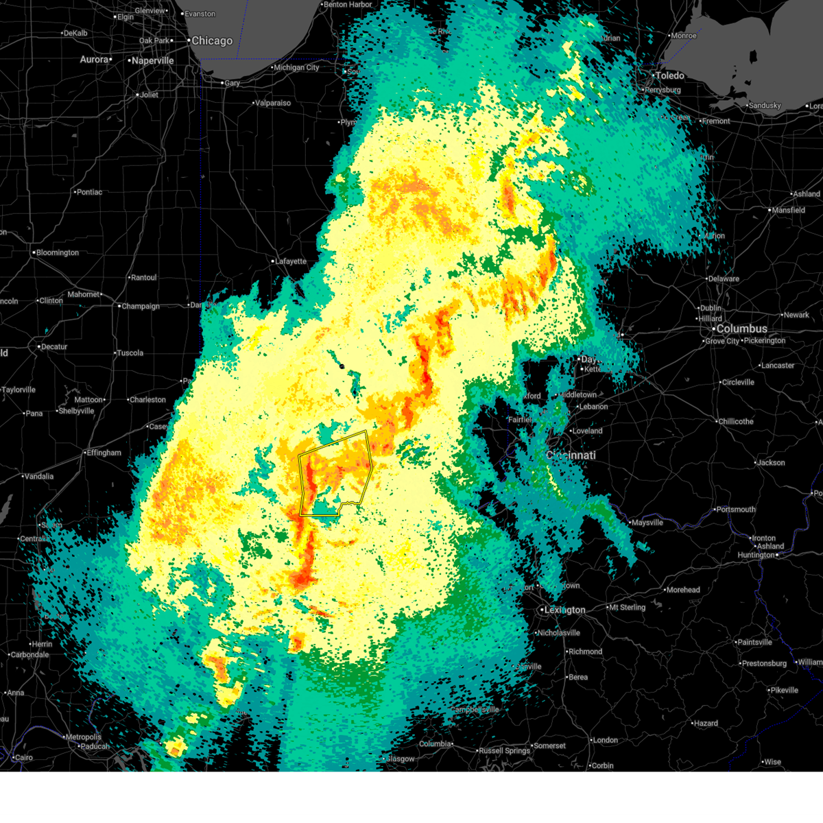 Svrind the national weather service in indianapolis has issued a * severe thunderstorm warning for, southern monroe county in south central indiana, southern brown county in south central indiana, southwestern bartholomew county in central indiana, lawrence county in south central indiana, western jackson county in south central indiana, * until 1130 pm edt. * at 1057 pm edt, severe thunderstorms were located along a line extending from near bloomington to bedford to 10 miles southeast of shoals, moving northeast at 40 mph (radar indicated). Hazards include 70 mph wind gusts and penny size hail. Expect considerable tree damage. Damage is likely to mobile homes, roofs, and outbuildings. Svrind the national weather service in indianapolis has issued a * severe thunderstorm warning for, southern monroe county in south central indiana, southern brown county in south central indiana, southwestern bartholomew county in central indiana, lawrence county in south central indiana, western jackson county in south central indiana, * until 1130 pm edt. * at 1057 pm edt, severe thunderstorms were located along a line extending from near bloomington to bedford to 10 miles southeast of shoals, moving northeast at 40 mph (radar indicated). Hazards include 70 mph wind gusts and penny size hail. Expect considerable tree damage. Damage is likely to mobile homes, roofs, and outbuildings.
|
| 4/2/2025 9:41 PM EDT |
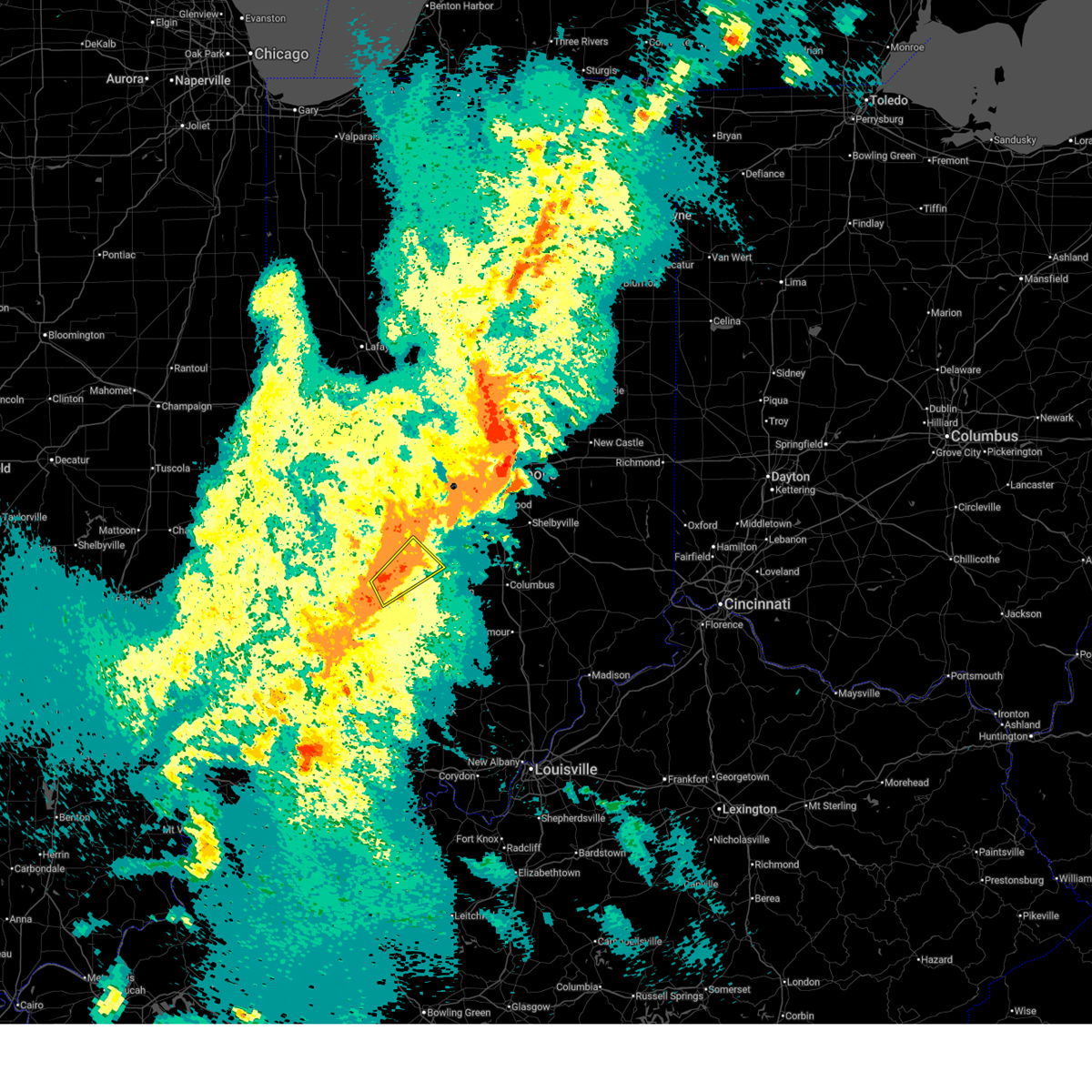 At 941 pm edt, a severe thunderstorm was located near spencer, or 11 miles west of bloomington, moving northeast at 45 mph (radar indicated). Hazards include 60 mph wind gusts and quarter size hail. Hail damage to vehicles is expected. expect wind damage to roofs, siding, and trees. Locations impacted include, gosport, paragon, stinesville, ellettsville, and bloomington. At 941 pm edt, a severe thunderstorm was located near spencer, or 11 miles west of bloomington, moving northeast at 45 mph (radar indicated). Hazards include 60 mph wind gusts and quarter size hail. Hail damage to vehicles is expected. expect wind damage to roofs, siding, and trees. Locations impacted include, gosport, paragon, stinesville, ellettsville, and bloomington.
|
| 4/2/2025 9:27 PM EDT |
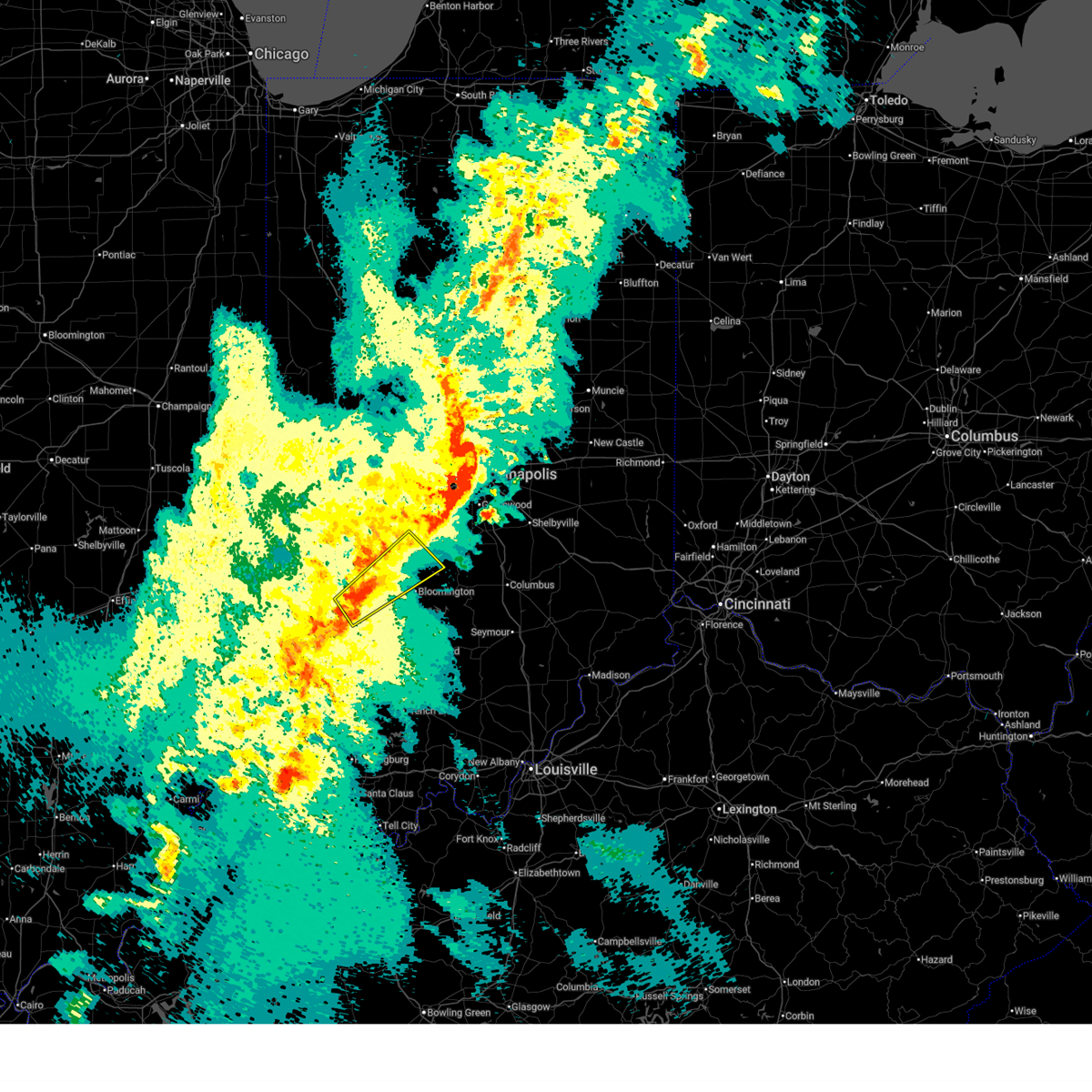 Svrind the national weather service in indianapolis has issued a * severe thunderstorm warning for, northern monroe county in south central indiana, southwestern morgan county in central indiana, western brown county in south central indiana, southeastern owen county in west central indiana, northeastern greene county in southwestern indiana, * until 1000 pm edt. * at 927 pm edt, a severe thunderstorm was located 8 miles northeast of bloomfield, or 18 miles west of bloomington, moving northeast at 60 mph (radar indicated). Hazards include 60 mph wind gusts and quarter size hail. Hail damage to vehicles is expected. Expect wind damage to roofs, siding, and trees. Svrind the national weather service in indianapolis has issued a * severe thunderstorm warning for, northern monroe county in south central indiana, southwestern morgan county in central indiana, western brown county in south central indiana, southeastern owen county in west central indiana, northeastern greene county in southwestern indiana, * until 1000 pm edt. * at 927 pm edt, a severe thunderstorm was located 8 miles northeast of bloomfield, or 18 miles west of bloomington, moving northeast at 60 mph (radar indicated). Hazards include 60 mph wind gusts and quarter size hail. Hail damage to vehicles is expected. Expect wind damage to roofs, siding, and trees.
|
| 4/2/2025 8:54 PM EDT |
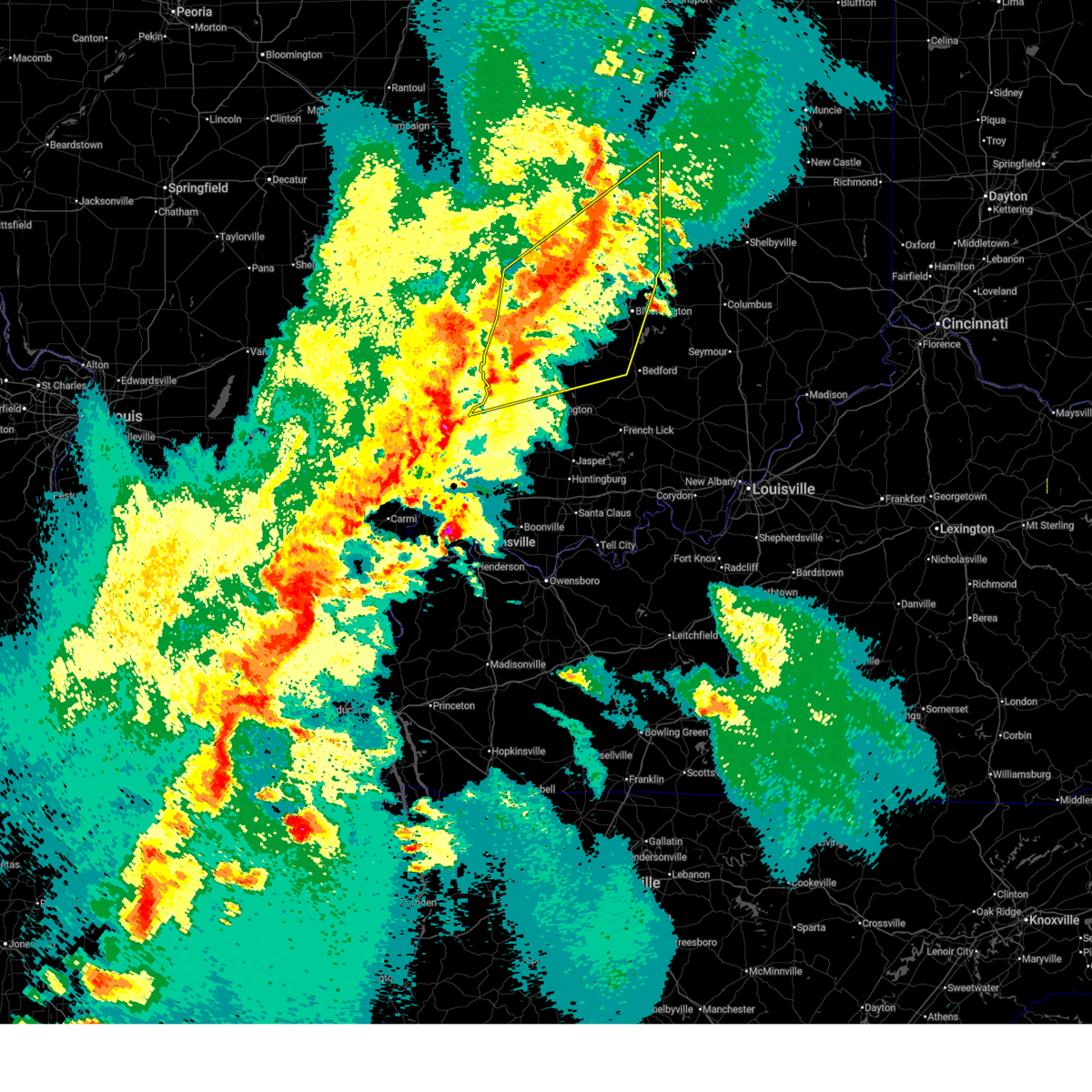 At 854 pm edt, a severe thunderstorm was located 8 miles east of greencastle, or 27 miles southeast of crawfordsville, moving northeast at 75 mph (radar indicated). Hazards include 70 mph wind gusts and quarter size hail. Hail damage to vehicles is expected. expect considerable tree damage. wind damage is also likely to mobile homes, roofs, and outbuildings. locations impacted include, newberry, pittsboro, bicknell, smithville, plainfield, fillmore, crane, carlisle, freedom, farmersburg, reelsville, vincennes university, dugger, elnora, pimento, pleasantville, brazil, worthington, martinsville, and eminence. this includes the following highways, interstate 65 between mile markers 131 and 132. interstate 70 between mile markers 13 and 67. Interstate 74 between mile markers 59 and 68. At 854 pm edt, a severe thunderstorm was located 8 miles east of greencastle, or 27 miles southeast of crawfordsville, moving northeast at 75 mph (radar indicated). Hazards include 70 mph wind gusts and quarter size hail. Hail damage to vehicles is expected. expect considerable tree damage. wind damage is also likely to mobile homes, roofs, and outbuildings. locations impacted include, newberry, pittsboro, bicknell, smithville, plainfield, fillmore, crane, carlisle, freedom, farmersburg, reelsville, vincennes university, dugger, elnora, pimento, pleasantville, brazil, worthington, martinsville, and eminence. this includes the following highways, interstate 65 between mile markers 131 and 132. interstate 70 between mile markers 13 and 67. Interstate 74 between mile markers 59 and 68.
|
| 4/2/2025 8:43 PM EDT |
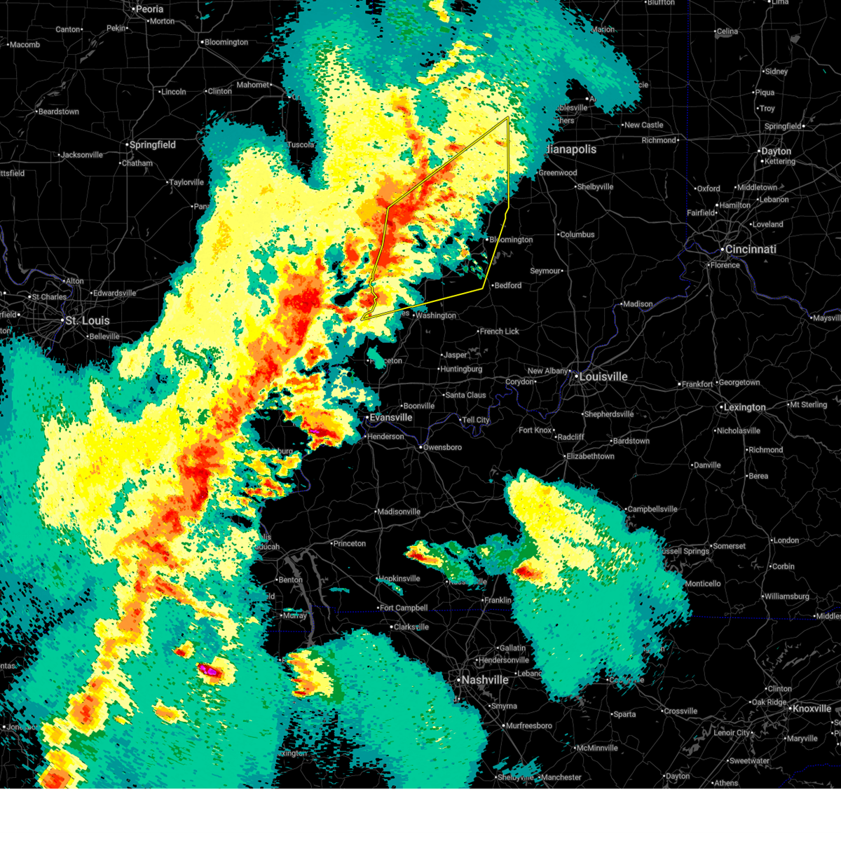 Svrind the national weather service in indianapolis has issued a * severe thunderstorm warning for, southeastern vigo county in west central indiana, monroe county in south central indiana, morgan county in central indiana, northern knox county in southwestern indiana, owen county in west central indiana, northern martin county in southwestern indiana, south central boone county in central indiana, northwestern lawrence county in south central indiana, southern putnam county in west central indiana, northern daviess county in southwestern indiana, sullivan county in southwestern indiana, hendricks county in central indiana, clay county in west central indiana, greene county in southwestern indiana, * until 930 pm edt. * at 843 pm edt, severe thunderstorms were located along a line extending from 8 miles east of brazil to 14 miles north of linton to 7 miles southeast of russellville, moving east at 70 mph (radar indicated). Hazards include 70 mph wind gusts and half dollar size hail. Hail damage to vehicles is expected. expect considerable tree damage. Wind damage is also likely to mobile homes, roofs, and outbuildings. Svrind the national weather service in indianapolis has issued a * severe thunderstorm warning for, southeastern vigo county in west central indiana, monroe county in south central indiana, morgan county in central indiana, northern knox county in southwestern indiana, owen county in west central indiana, northern martin county in southwestern indiana, south central boone county in central indiana, northwestern lawrence county in south central indiana, southern putnam county in west central indiana, northern daviess county in southwestern indiana, sullivan county in southwestern indiana, hendricks county in central indiana, clay county in west central indiana, greene county in southwestern indiana, * until 930 pm edt. * at 843 pm edt, severe thunderstorms were located along a line extending from 8 miles east of brazil to 14 miles north of linton to 7 miles southeast of russellville, moving east at 70 mph (radar indicated). Hazards include 70 mph wind gusts and half dollar size hail. Hail damage to vehicles is expected. expect considerable tree damage. Wind damage is also likely to mobile homes, roofs, and outbuildings.
|
| 3/30/2025 7:12 PM EDT |
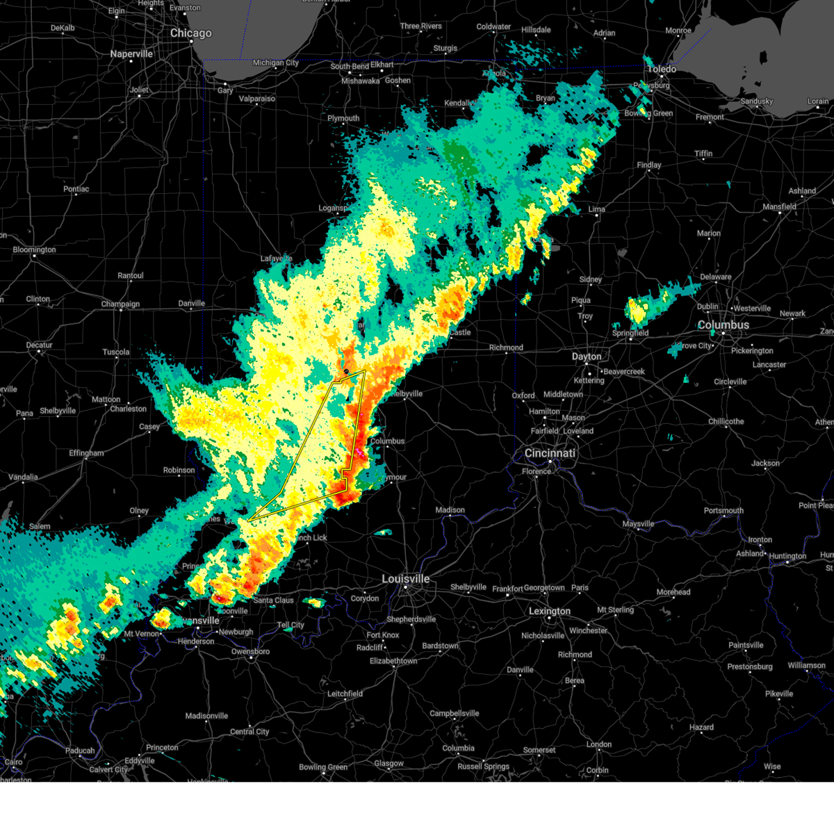 The storms which prompted the warning have moved out of the area. therefore, the warning will be allowed to expire. a tornado watch remains in effect until 800 pm edt for south central, central, southwestern and west central indiana. The storms which prompted the warning have moved out of the area. therefore, the warning will be allowed to expire. a tornado watch remains in effect until 800 pm edt for south central, central, southwestern and west central indiana.
|
| 3/30/2025 7:12 PM EDT |
 The storm which prompted the warning has moved out of the area. therefore, the warning will be allowed to expire. The storm which prompted the warning has moved out of the area. therefore, the warning will be allowed to expire.
|
| 3/30/2025 7:01 PM EDT |
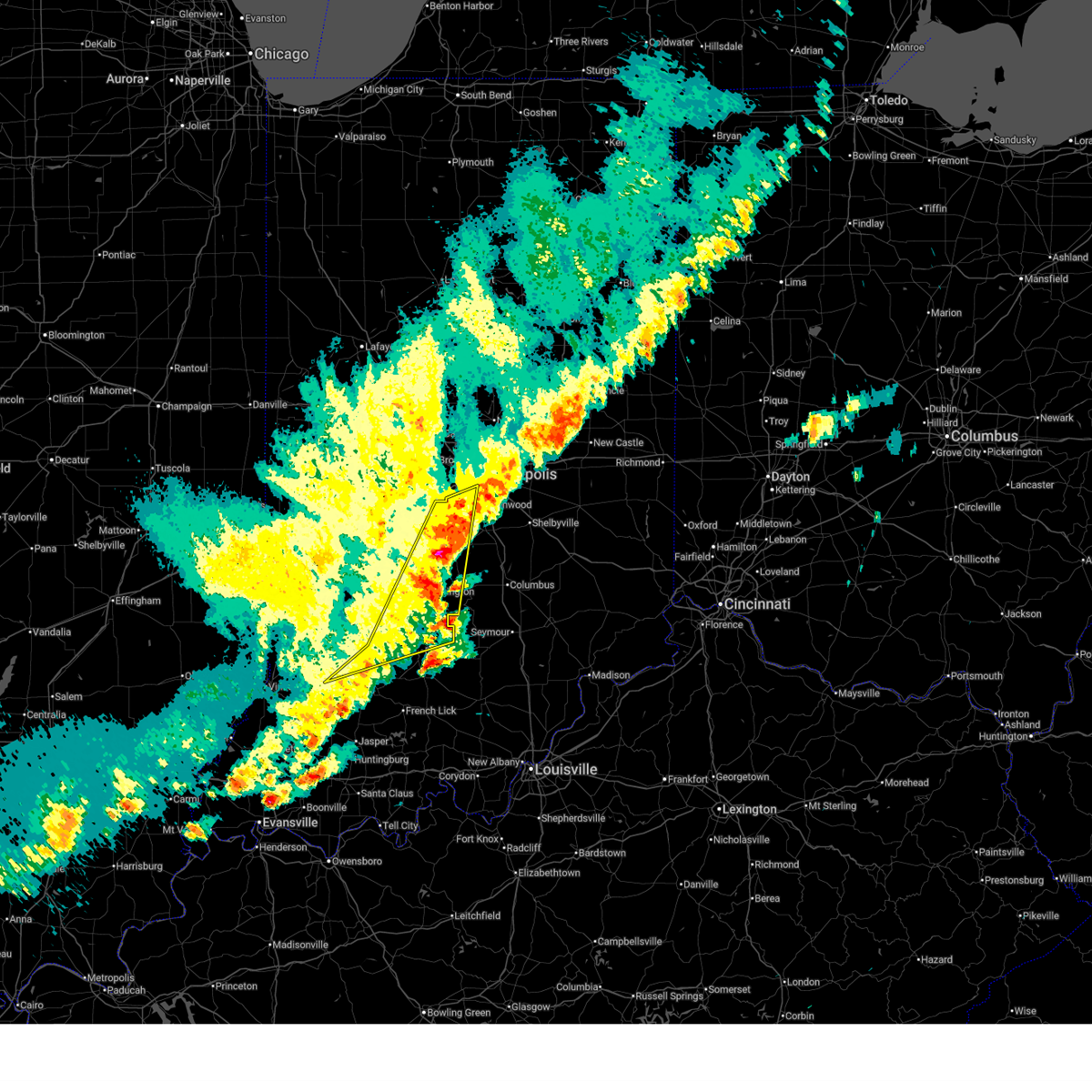 the severe thunderstorm warning has been cancelled and is no longer in effect the severe thunderstorm warning has been cancelled and is no longer in effect
|
| 3/30/2025 7:01 PM EDT |
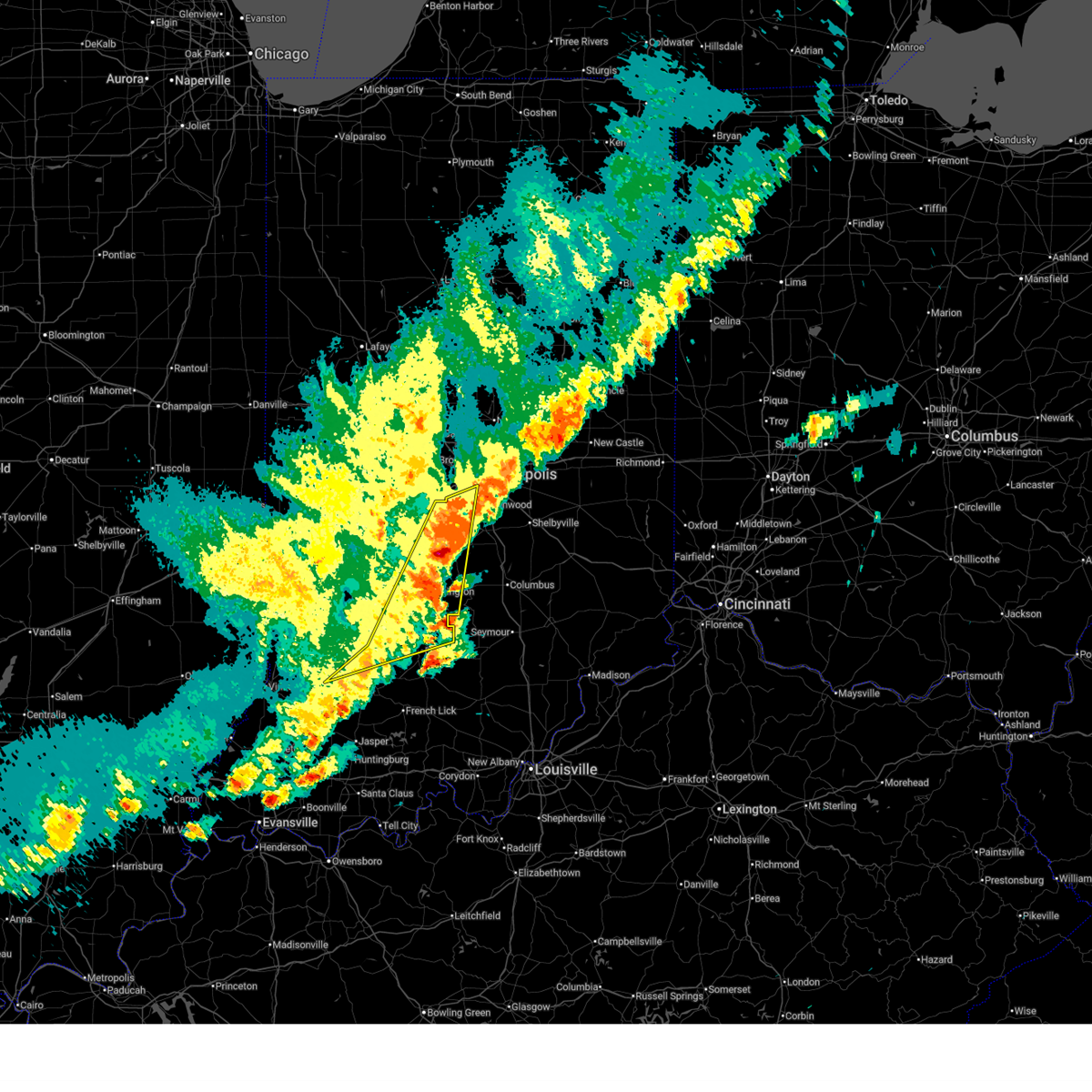 At 700 pm edt, severe thunderstorms were located along a line extending from near mooresville to 9 miles northeast of bedford, moving east at 60 mph (trained weather spotters). Hazards include 60 mph wind gusts and quarter size hail. Hail damage to vehicles is expected. expect wind damage to roofs, siding, and trees. Locations impacted include, morgantown, smithville, mooresville, lake lemon, brooklyn, beanblossom, bartlettsville, burns city, avoca, monroe reservoir, woodville hills, elkinsville, martinsville, centerton, charles deam wilderness, unionville, ellettsville, whitehall, heltonville, and mahalasville. At 700 pm edt, severe thunderstorms were located along a line extending from near mooresville to 9 miles northeast of bedford, moving east at 60 mph (trained weather spotters). Hazards include 60 mph wind gusts and quarter size hail. Hail damage to vehicles is expected. expect wind damage to roofs, siding, and trees. Locations impacted include, morgantown, smithville, mooresville, lake lemon, brooklyn, beanblossom, bartlettsville, burns city, avoca, monroe reservoir, woodville hills, elkinsville, martinsville, centerton, charles deam wilderness, unionville, ellettsville, whitehall, heltonville, and mahalasville.
|
| 3/30/2025 6:45 PM EDT |
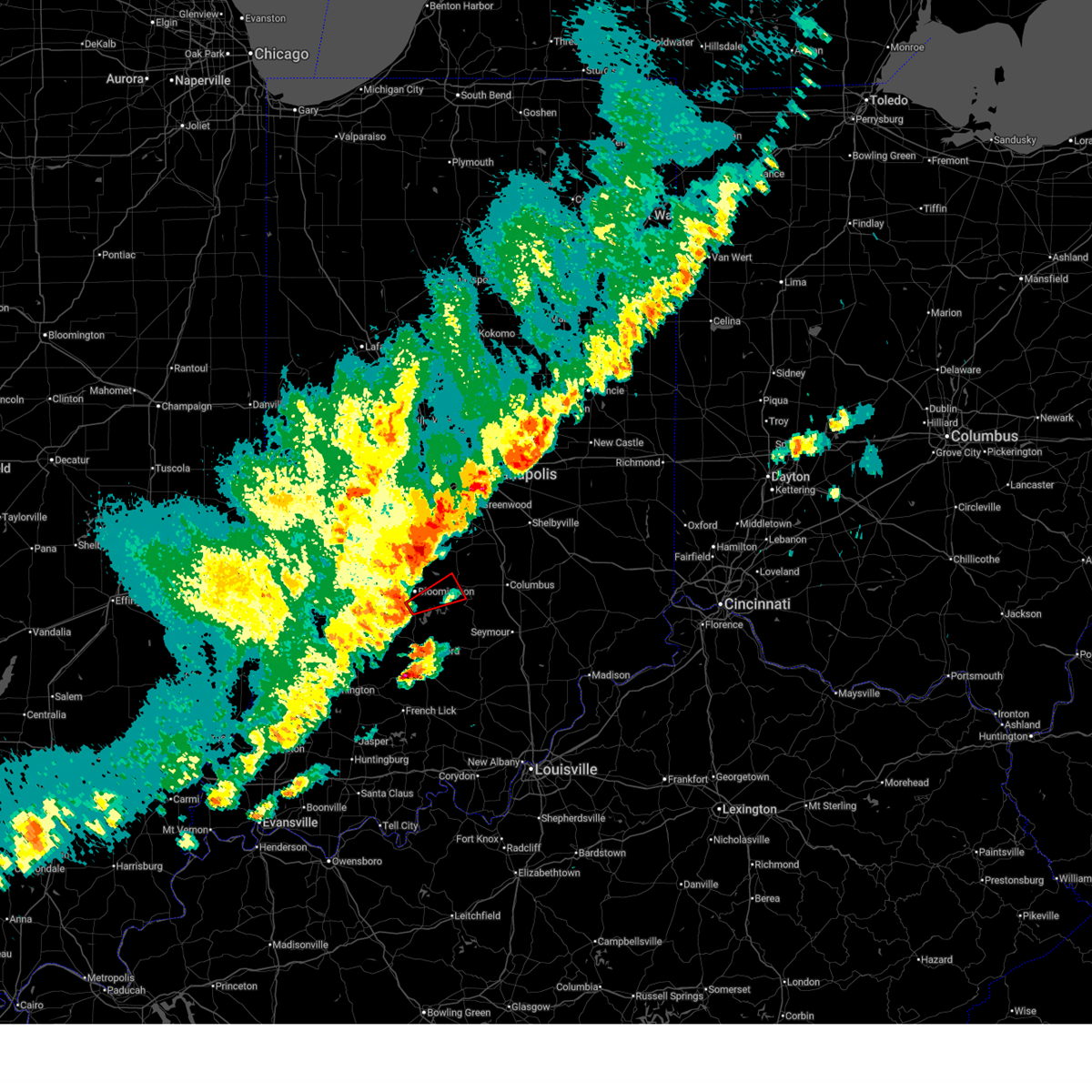 Torind the national weather service in indianapolis has issued a * tornado warning for, southeastern monroe county in south central indiana, southwestern brown county in south central indiana, * until 715 pm edt. * at 645 pm edt, severe thunderstorms capable of producing both tornadoes and extensive straight line wind damage were located near bloomington, moving northeast at 45 mph (radar indicated rotation). Hazards include tornado. Flying debris will be dangerous to those caught without shelter. mobile homes will be damaged or destroyed. damage to roofs, windows, and vehicles will occur. Tree damage is likely. Torind the national weather service in indianapolis has issued a * tornado warning for, southeastern monroe county in south central indiana, southwestern brown county in south central indiana, * until 715 pm edt. * at 645 pm edt, severe thunderstorms capable of producing both tornadoes and extensive straight line wind damage were located near bloomington, moving northeast at 45 mph (radar indicated rotation). Hazards include tornado. Flying debris will be dangerous to those caught without shelter. mobile homes will be damaged or destroyed. damage to roofs, windows, and vehicles will occur. Tree damage is likely.
|
| 3/30/2025 6:44 PM EDT |
 At 644 pm edt, severe thunderstorms were located along a line extending from near plainfield to 8 miles north of shoals, moving east at 55 mph (trained weather spotters). Hazards include 60 mph wind gusts and quarter size hail. Hail damage to vehicles is expected. expect wind damage to roofs, siding, and trees. Locations impacted include, newberry, morgantown, smithville, lake lemon, crane, beanblossom, bartlettsville, freedom, monroe reservoir, woodville hills, martinsville, eminence, charles deam wilderness, ellettsville, whitehall, gosport, heltonville, mahalasville, indian springs, and helmsburg. At 644 pm edt, severe thunderstorms were located along a line extending from near plainfield to 8 miles north of shoals, moving east at 55 mph (trained weather spotters). Hazards include 60 mph wind gusts and quarter size hail. Hail damage to vehicles is expected. expect wind damage to roofs, siding, and trees. Locations impacted include, newberry, morgantown, smithville, lake lemon, crane, beanblossom, bartlettsville, freedom, monroe reservoir, woodville hills, martinsville, eminence, charles deam wilderness, ellettsville, whitehall, gosport, heltonville, mahalasville, indian springs, and helmsburg.
|
| 3/30/2025 6:40 PM EDT | Delayed report...damage near lake monroe on in-446. a large tree over the roadway. farm in the area was reported to have roof damage to a barn. time estimated from rada in monroe county IN, 8.2 miles NW of Bloomington, IN |
| 3/30/2025 6:30 PM EDT |
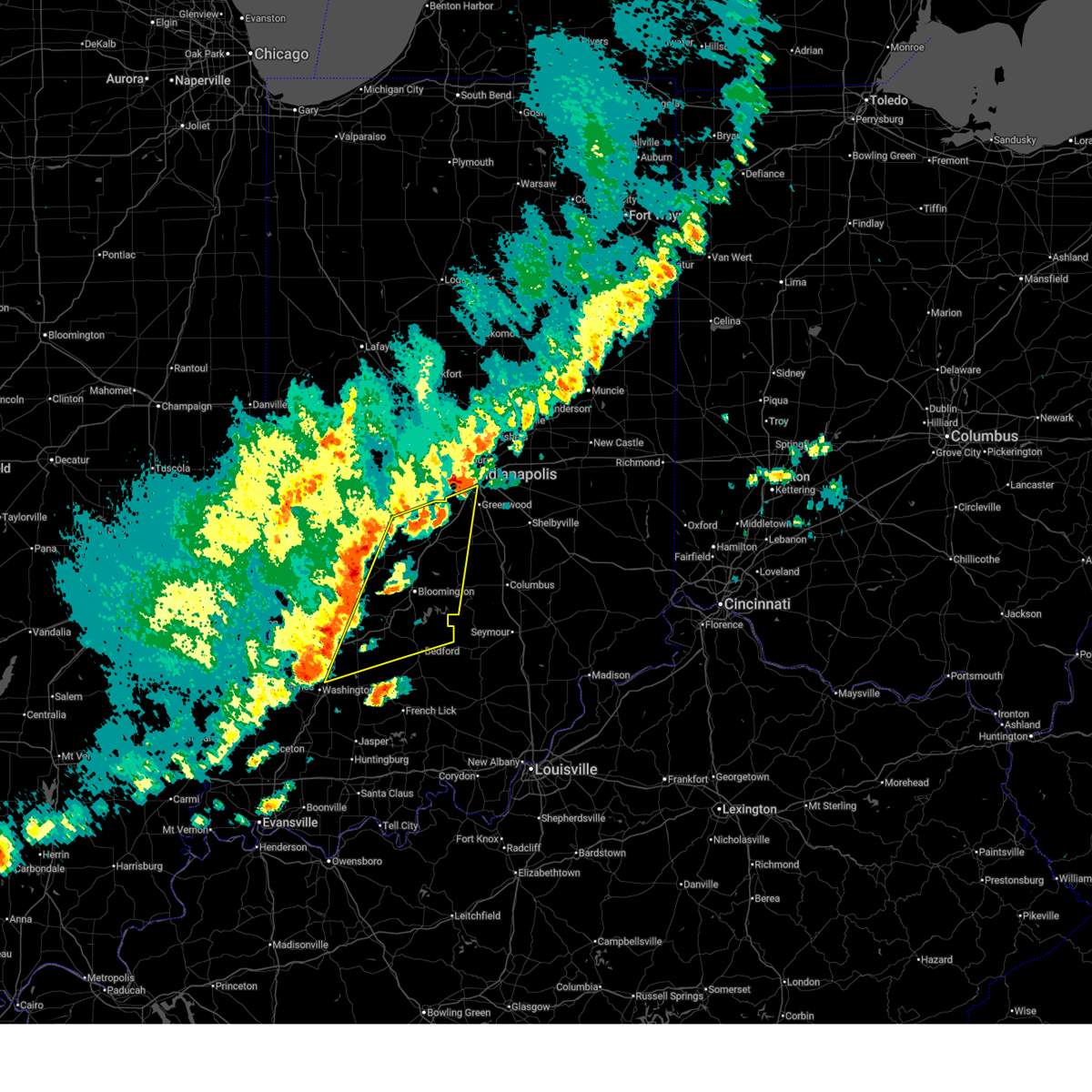 Svrind the national weather service in indianapolis has issued a * severe thunderstorm warning for, monroe county in south central indiana, morgan county in central indiana, western brown county in south central indiana, western johnson county in central indiana, eastern owen county in west central indiana, northern martin county in southwestern indiana, southwestern marion county in central indiana, eastern greene county in southwestern indiana, northern lawrence county in south central indiana, southeastern putnam county in west central indiana, northeastern daviess county in southwestern indiana, * until 715 pm edt. * at 629 pm edt, severe thunderstorms were located along a line extending from 10 miles southwest of danville to 9 miles northeast of washington, moving east at 50 mph (public). Hazards include 60 mph wind gusts and half dollar size hail. Hail damage to vehicles is expected. Expect wind damage to roofs, siding, and trees. Svrind the national weather service in indianapolis has issued a * severe thunderstorm warning for, monroe county in south central indiana, morgan county in central indiana, western brown county in south central indiana, western johnson county in central indiana, eastern owen county in west central indiana, northern martin county in southwestern indiana, southwestern marion county in central indiana, eastern greene county in southwestern indiana, northern lawrence county in south central indiana, southeastern putnam county in west central indiana, northeastern daviess county in southwestern indiana, * until 715 pm edt. * at 629 pm edt, severe thunderstorms were located along a line extending from 10 miles southwest of danville to 9 miles northeast of washington, moving east at 50 mph (public). Hazards include 60 mph wind gusts and half dollar size hail. Hail damage to vehicles is expected. Expect wind damage to roofs, siding, and trees.
|
| 3/30/2025 6:11 PM EDT |
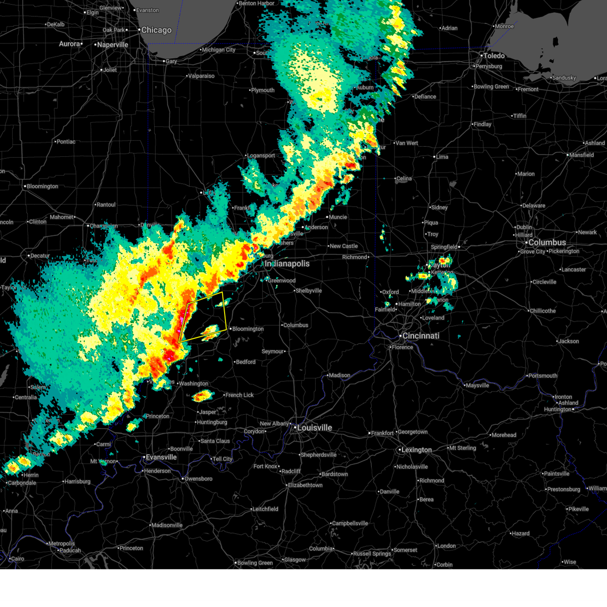 the severe thunderstorm warning has been cancelled and is no longer in effect the severe thunderstorm warning has been cancelled and is no longer in effect
|
| 3/30/2025 6:11 PM EDT |
 At 611 pm edt, a severe thunderstorm was located 11 miles west of spencer, or 24 miles southeast of terre haute, moving northeast at 50 mph (radar indicated). Hazards include 70 mph wind gusts and quarter size hail. Hail damage to vehicles is expected. expect considerable tree damage. wind damage is also likely to mobile homes, roofs, and outbuildings. Locations impacted include, patricksburg, gosport, coal city, bowling green, quincy, mccormicks creek state park, worthington, stinesville, spencer, devore, freedom, and ellettsville. At 611 pm edt, a severe thunderstorm was located 11 miles west of spencer, or 24 miles southeast of terre haute, moving northeast at 50 mph (radar indicated). Hazards include 70 mph wind gusts and quarter size hail. Hail damage to vehicles is expected. expect considerable tree damage. wind damage is also likely to mobile homes, roofs, and outbuildings. Locations impacted include, patricksburg, gosport, coal city, bowling green, quincy, mccormicks creek state park, worthington, stinesville, spencer, devore, freedom, and ellettsville.
|
| 3/30/2025 6:00 PM EDT |
 At 559 pm edt, a severe thunderstorm was located 13 miles north of linton, or 19 miles southeast of terre haute, moving east at 45 mph (radar indicated). Hazards include 60 mph wind gusts and quarter size hail. Hail damage to vehicles is expected. expect wind damage to roofs, siding, and trees. Locations impacted include, hymera, quincy, clay city, freedom, farmersburg, saline city, dugger, pimento, worthington, vicksburg, devore, ellettsville, jasonville, gosport, coal city, bowling green, mccormicks creek state park, shelburn, spencer, and patricksburg. At 559 pm edt, a severe thunderstorm was located 13 miles north of linton, or 19 miles southeast of terre haute, moving east at 45 mph (radar indicated). Hazards include 60 mph wind gusts and quarter size hail. Hail damage to vehicles is expected. expect wind damage to roofs, siding, and trees. Locations impacted include, hymera, quincy, clay city, freedom, farmersburg, saline city, dugger, pimento, worthington, vicksburg, devore, ellettsville, jasonville, gosport, coal city, bowling green, mccormicks creek state park, shelburn, spencer, and patricksburg.
|
| 3/30/2025 5:46 PM EDT |
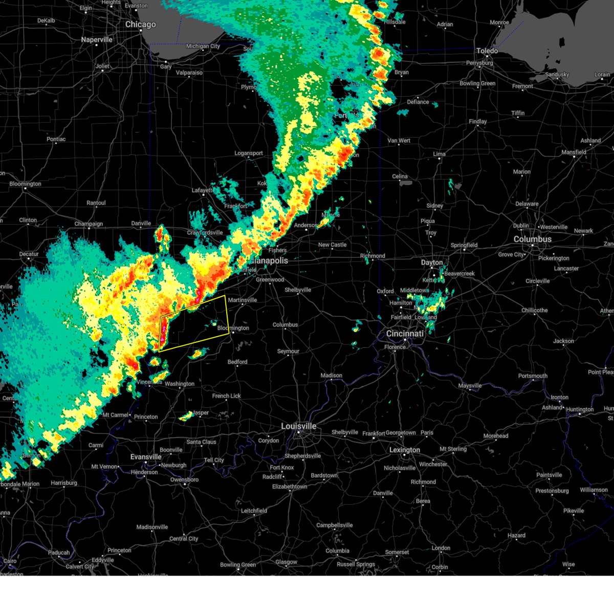 Svrind the national weather service in indianapolis has issued a * severe thunderstorm warning for, southeastern vigo county in west central indiana, northwestern monroe county in south central indiana, southwestern morgan county in central indiana, northeastern sullivan county in southwestern indiana, southern clay county in west central indiana, owen county in west central indiana, northern greene county in southwestern indiana, southern putnam county in west central indiana, * until 630 pm edt. * at 545 pm edt, severe thunderstorms were located along a line extending from near terre haute to near sullivan, moving northeast at 50 mph (radar indicated). Hazards include 60 mph wind gusts and quarter size hail. Hail damage to vehicles is expected. Expect wind damage to roofs, siding, and trees. Svrind the national weather service in indianapolis has issued a * severe thunderstorm warning for, southeastern vigo county in west central indiana, northwestern monroe county in south central indiana, southwestern morgan county in central indiana, northeastern sullivan county in southwestern indiana, southern clay county in west central indiana, owen county in west central indiana, northern greene county in southwestern indiana, southern putnam county in west central indiana, * until 630 pm edt. * at 545 pm edt, severe thunderstorms were located along a line extending from near terre haute to near sullivan, moving northeast at 50 mph (radar indicated). Hazards include 60 mph wind gusts and quarter size hail. Hail damage to vehicles is expected. Expect wind damage to roofs, siding, and trees.
|
| 3/19/2025 7:57 PM EDT |
 the severe thunderstorm warning has been cancelled and is no longer in effect the severe thunderstorm warning has been cancelled and is no longer in effect
|
| 3/19/2025 7:57 PM EDT |
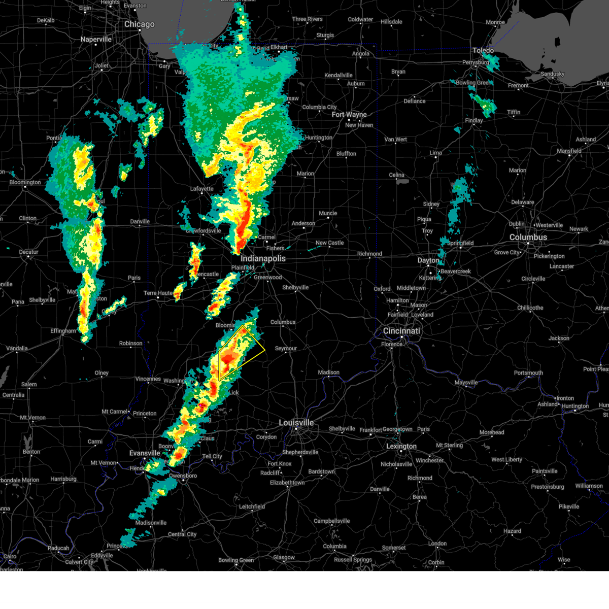 At 756 pm edt, severe thunderstorms were located along a line extending from 9 miles west of bedford to 10 miles northeast of shoals, moving northeast at 50 mph (radar indicated). Hazards include 60 mph wind gusts and quarter size hail. Hail damage to vehicles is expected. expect wind damage to roofs, siding, and trees. Locations impacted include, heltonville, norman, smithville, oolitic, huron, harrodsburg, bartlettsville, williams, avoca, monroe reservoir, fairfax state recreation area, woodville hills, elkinsville, silverville, bedford, kurtz, and charles deam wilderness. At 756 pm edt, severe thunderstorms were located along a line extending from 9 miles west of bedford to 10 miles northeast of shoals, moving northeast at 50 mph (radar indicated). Hazards include 60 mph wind gusts and quarter size hail. Hail damage to vehicles is expected. expect wind damage to roofs, siding, and trees. Locations impacted include, heltonville, norman, smithville, oolitic, huron, harrodsburg, bartlettsville, williams, avoca, monroe reservoir, fairfax state recreation area, woodville hills, elkinsville, silverville, bedford, kurtz, and charles deam wilderness.
|
| 3/19/2025 7:42 PM EDT |
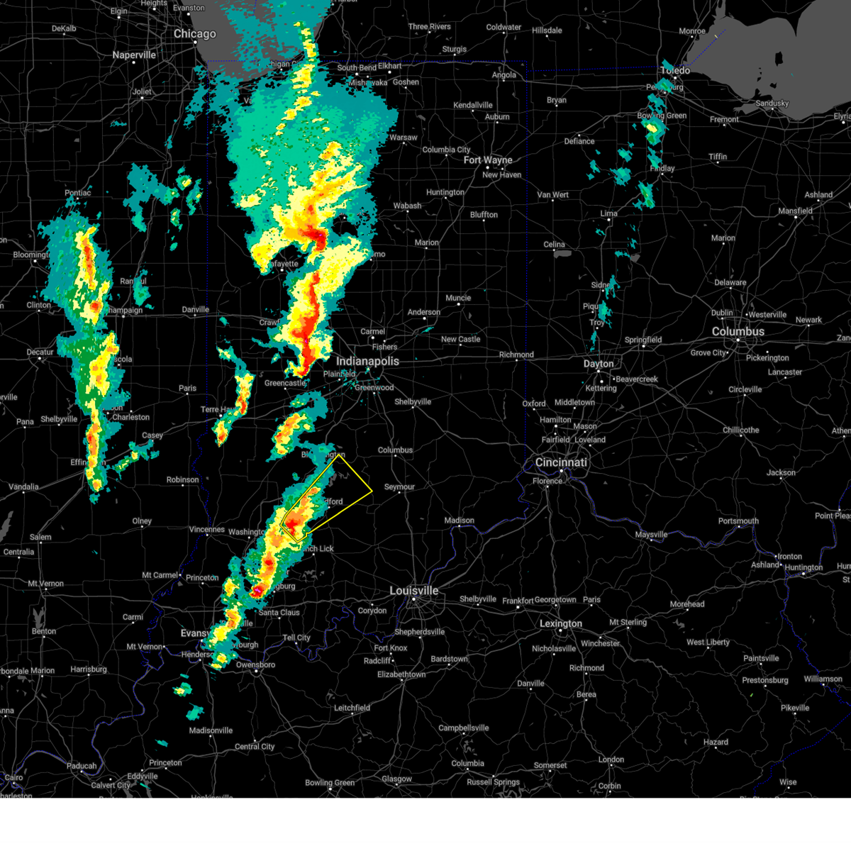 Svrind the national weather service in indianapolis has issued a * severe thunderstorm warning for, southeastern monroe county in south central indiana, southwestern brown county in south central indiana, northern martin county in southwestern indiana, lawrence county in south central indiana, southeastern greene county in southwestern indiana, northwestern jackson county in south central indiana, * until 815 pm edt. * at 741 pm edt, a severe thunderstorm was located near shoals, or 15 miles southwest of bedford, moving northeast at 55 mph (radar indicated). Hazards include 60 mph wind gusts and quarter size hail. Hail damage to vehicles is expected. Expect wind damage to roofs, siding, and trees. Svrind the national weather service in indianapolis has issued a * severe thunderstorm warning for, southeastern monroe county in south central indiana, southwestern brown county in south central indiana, northern martin county in southwestern indiana, lawrence county in south central indiana, southeastern greene county in southwestern indiana, northwestern jackson county in south central indiana, * until 815 pm edt. * at 741 pm edt, a severe thunderstorm was located near shoals, or 15 miles southwest of bedford, moving northeast at 55 mph (radar indicated). Hazards include 60 mph wind gusts and quarter size hail. Hail damage to vehicles is expected. Expect wind damage to roofs, siding, and trees.
|
| 3/15/2025 5:00 AM EDT | Asos station kbmg bloomingto in monroe county IN, 4.1 miles E of Bloomington, IN |
| 3/15/2025 4:22 AM EDT |
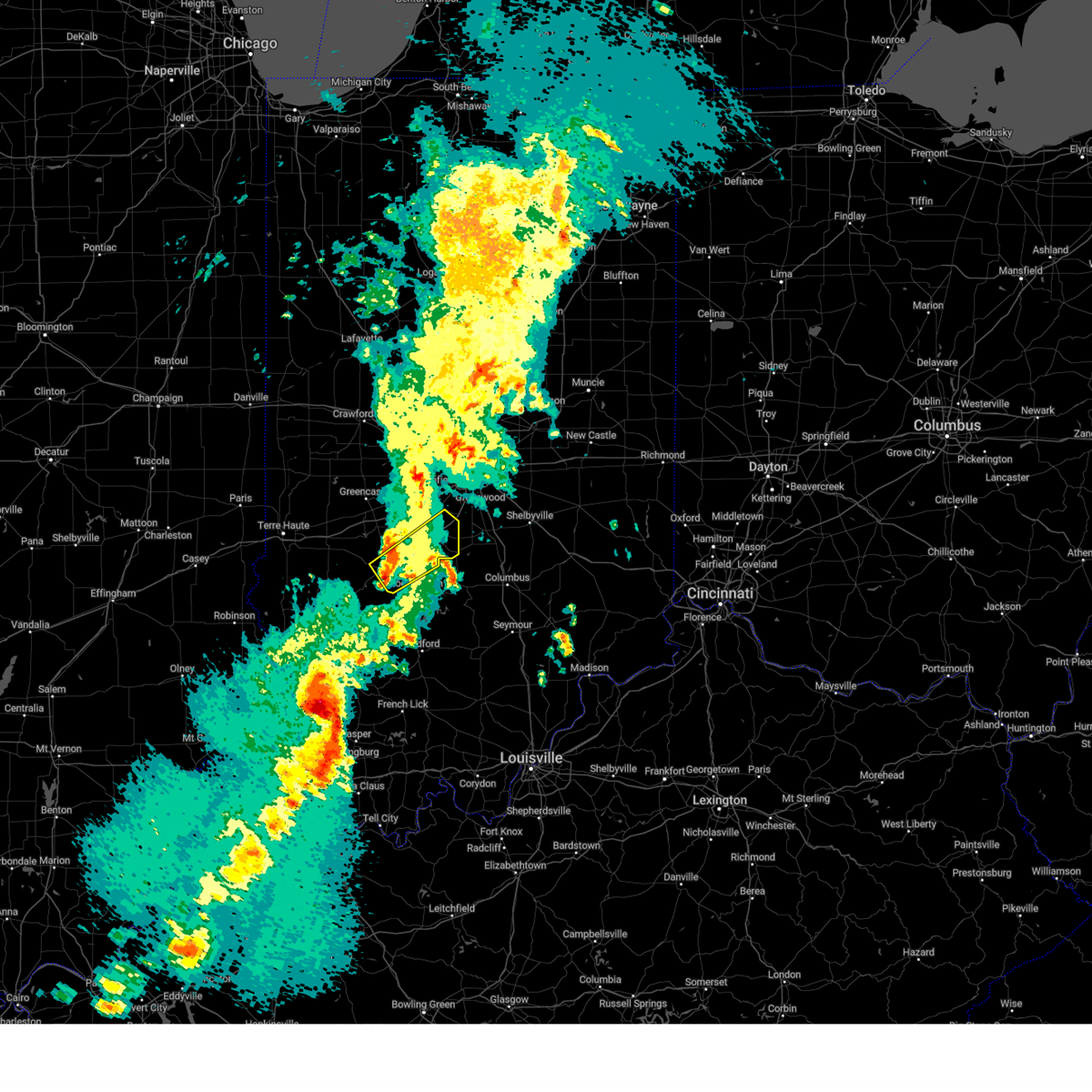 Svrind the national weather service in indianapolis has issued a * severe thunderstorm warning for, northwestern monroe county in south central indiana, morgan county in central indiana, southeastern owen county in west central indiana, * until 445 am edt. * at 422 am edt, a severe thunderstorm was located near spencer, or 12 miles northwest of bloomington, moving northeast at 50 mph (radar indicated). Hazards include 60 mph wind gusts. expect damage to roofs, siding, and trees Svrind the national weather service in indianapolis has issued a * severe thunderstorm warning for, northwestern monroe county in south central indiana, morgan county in central indiana, southeastern owen county in west central indiana, * until 445 am edt. * at 422 am edt, a severe thunderstorm was located near spencer, or 12 miles northwest of bloomington, moving northeast at 50 mph (radar indicated). Hazards include 60 mph wind gusts. expect damage to roofs, siding, and trees
|
| 8/30/2024 4:11 PM EDT |
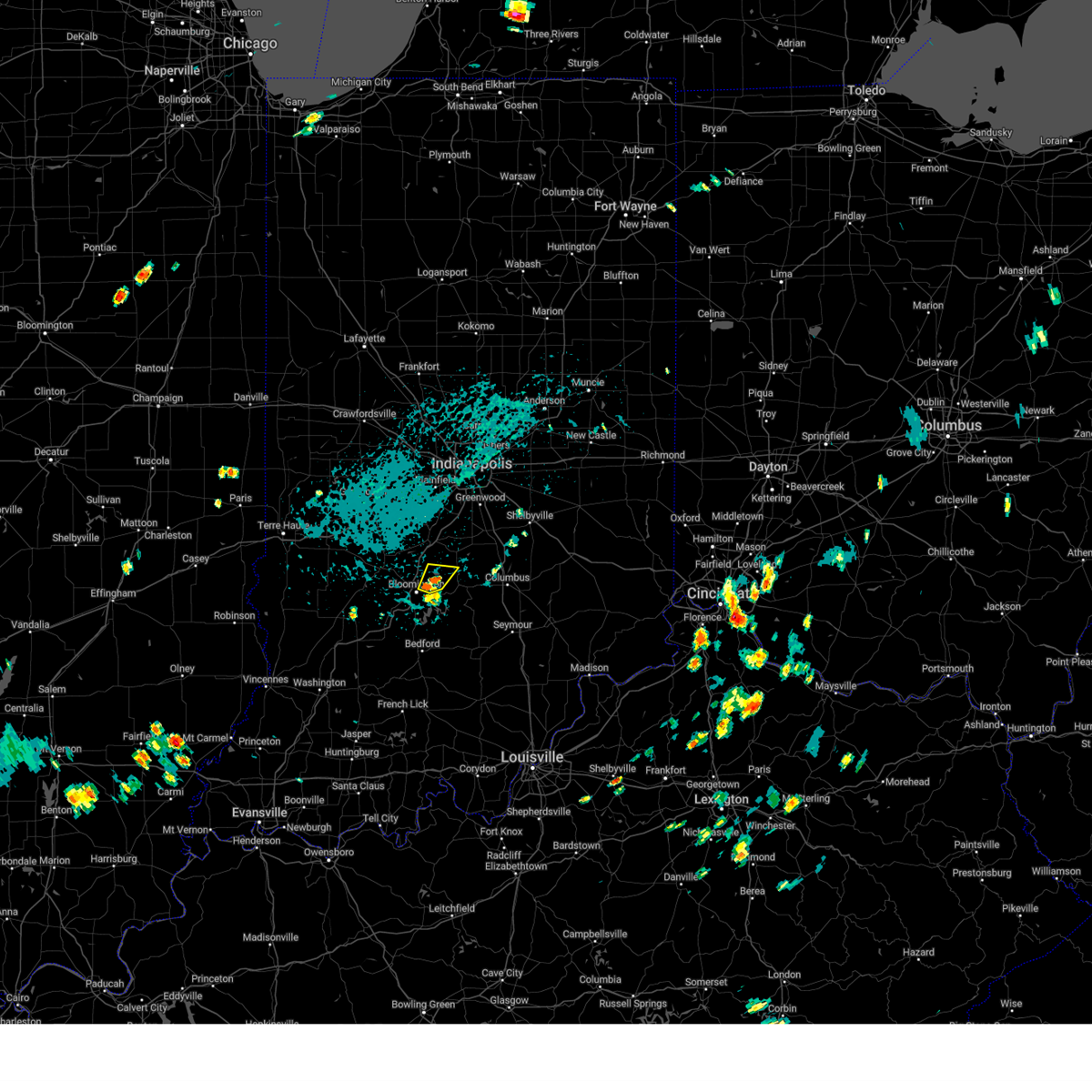 Svrind the national weather service in indianapolis has issued a * severe thunderstorm warning for, northeastern monroe county in south central indiana, northwestern brown county in south central indiana, * until 445 pm edt. * at 411 pm edt, a severe thunderstorm was located 7 miles northeast of bloomington, moving northeast at 10 mph (radar indicated). Hazards include 60 mph wind gusts and quarter size hail. Hail damage to vehicles is expected. Expect wind damage to roofs, siding, and trees. Svrind the national weather service in indianapolis has issued a * severe thunderstorm warning for, northeastern monroe county in south central indiana, northwestern brown county in south central indiana, * until 445 pm edt. * at 411 pm edt, a severe thunderstorm was located 7 miles northeast of bloomington, moving northeast at 10 mph (radar indicated). Hazards include 60 mph wind gusts and quarter size hail. Hail damage to vehicles is expected. Expect wind damage to roofs, siding, and trees.
|
| 8/30/2024 3:52 PM EDT | Portion of tree down on roof of home... many branches dow in monroe county IN, 3.5 miles WSW of Bloomington, IN |
| 7/29/2024 11:40 PM EDT |
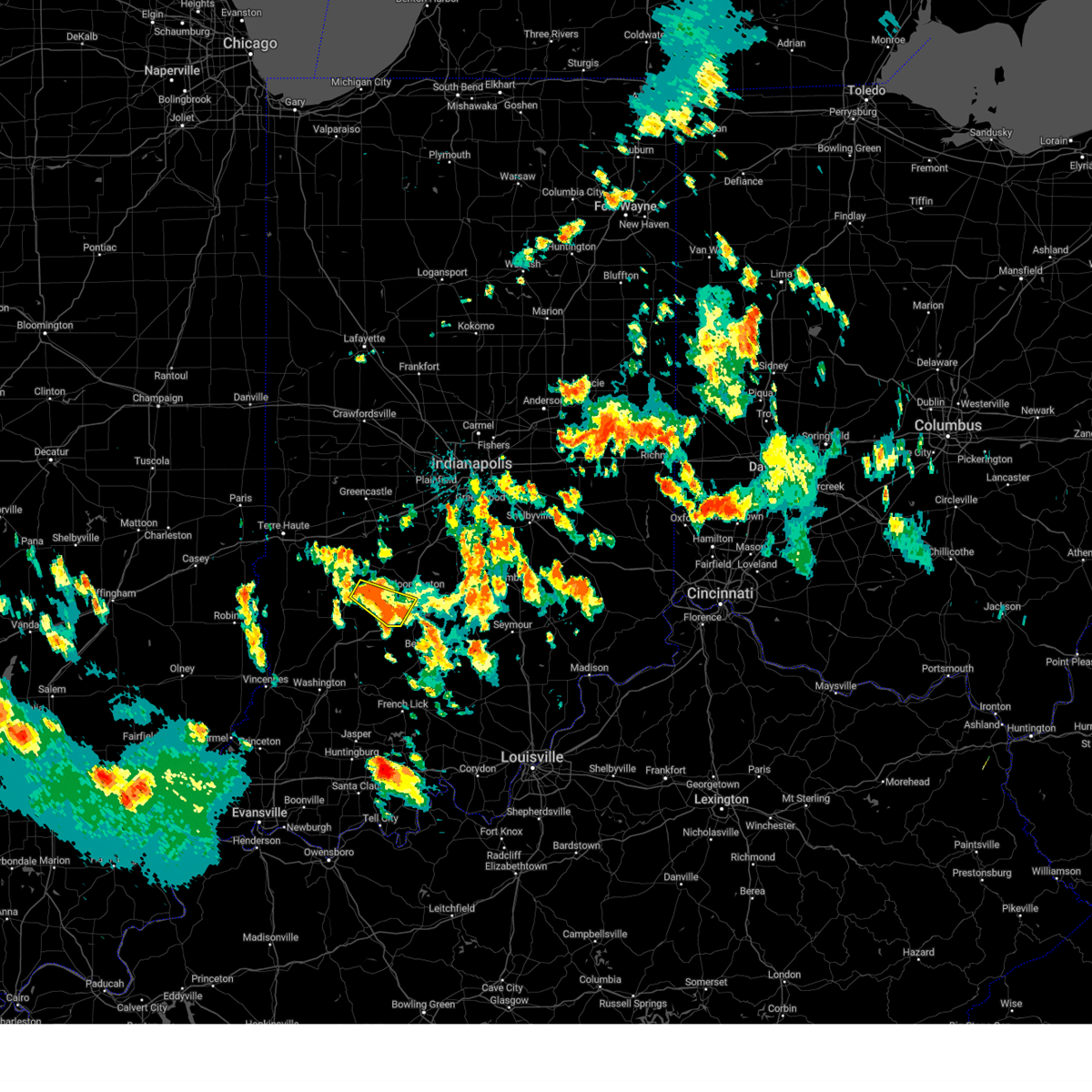 At 1140 pm edt, a severe thunderstorm was located 9 miles northeast of bloomfield, or 18 miles west of bloomington, moving southeast at 25 mph (radar indicated). Hazards include 60 mph wind gusts and penny size hail. Expect damage to roofs, siding, and trees. Locations impacted include, bloomington, freedom, and solsberry. At 1140 pm edt, a severe thunderstorm was located 9 miles northeast of bloomfield, or 18 miles west of bloomington, moving southeast at 25 mph (radar indicated). Hazards include 60 mph wind gusts and penny size hail. Expect damage to roofs, siding, and trees. Locations impacted include, bloomington, freedom, and solsberry.
|
| 7/29/2024 11:25 PM EDT |
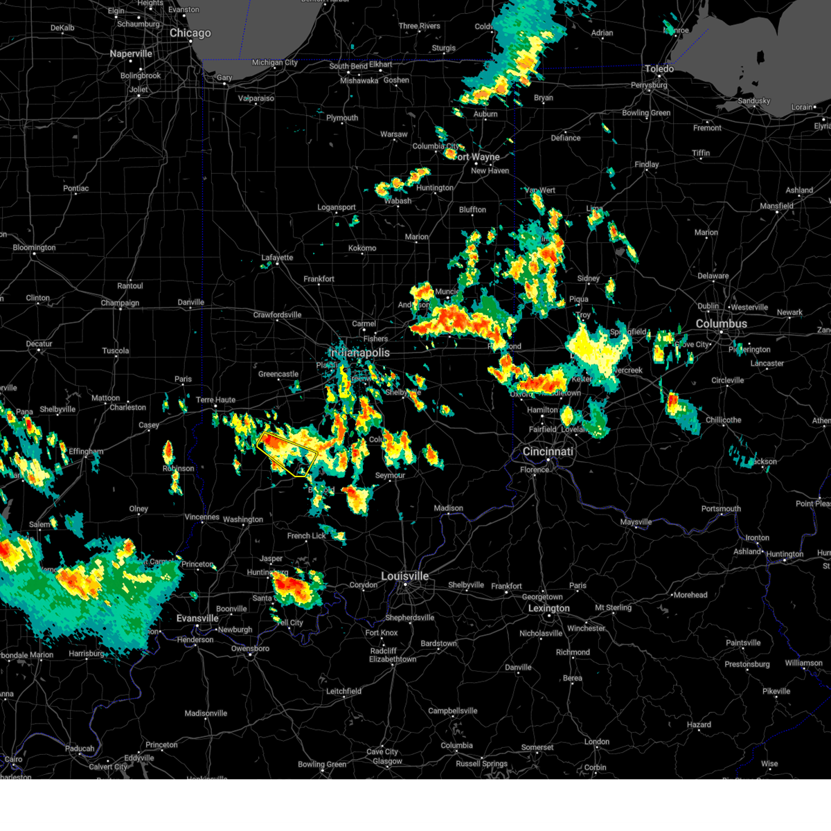 At 1125 pm edt, a severe thunderstorm was located 11 miles southwest of spencer, or 23 miles west of bloomington, moving southeast at 25 mph (radar indicated). Hazards include 60 mph wind gusts and quarter size hail. Hail damage to vehicles is expected. expect wind damage to roofs, siding, and trees. Locations impacted include, bloomington, freedom, and solsberry. At 1125 pm edt, a severe thunderstorm was located 11 miles southwest of spencer, or 23 miles west of bloomington, moving southeast at 25 mph (radar indicated). Hazards include 60 mph wind gusts and quarter size hail. Hail damage to vehicles is expected. expect wind damage to roofs, siding, and trees. Locations impacted include, bloomington, freedom, and solsberry.
|
| 7/29/2024 11:25 PM EDT |
 the severe thunderstorm warning has been cancelled and is no longer in effect the severe thunderstorm warning has been cancelled and is no longer in effect
|
| 7/29/2024 11:09 PM EDT |
 Svrind the national weather service in indianapolis has issued a * severe thunderstorm warning for, southwestern monroe county in south central indiana, south central clay county in west central indiana, southern owen county in west central indiana, northeastern greene county in southwestern indiana, * until midnight edt. * at 1109 pm edt, a severe thunderstorm was located 12 miles west of spencer, or 24 miles southeast of terre haute, moving southeast at 20 mph (radar indicated). Hazards include 60 mph wind gusts and half dollar size hail. Hail damage to vehicles is expected. Expect wind damage to roofs, siding, and trees. Svrind the national weather service in indianapolis has issued a * severe thunderstorm warning for, southwestern monroe county in south central indiana, south central clay county in west central indiana, southern owen county in west central indiana, northeastern greene county in southwestern indiana, * until midnight edt. * at 1109 pm edt, a severe thunderstorm was located 12 miles west of spencer, or 24 miles southeast of terre haute, moving southeast at 20 mph (radar indicated). Hazards include 60 mph wind gusts and half dollar size hail. Hail damage to vehicles is expected. Expect wind damage to roofs, siding, and trees.
|
| 7/9/2024 8:15 PM EDT |
 the severe thunderstorm warning has been cancelled and is no longer in effect the severe thunderstorm warning has been cancelled and is no longer in effect
|
| 7/9/2024 8:04 PM EDT |
 At 804 pm edt, a severe thunderstorm was located 9 miles east of bloomfield, or 15 miles southwest of bloomington, moving north at 30 mph (radar indicated). Hazards include 60 mph wind gusts. Expect damage to roofs, siding, and trees. Locations impacted include, ellettsville, freedom, solsberry, and owensburg. At 804 pm edt, a severe thunderstorm was located 9 miles east of bloomfield, or 15 miles southwest of bloomington, moving north at 30 mph (radar indicated). Hazards include 60 mph wind gusts. Expect damage to roofs, siding, and trees. Locations impacted include, ellettsville, freedom, solsberry, and owensburg.
|
| 7/9/2024 8:04 PM EDT |
 the severe thunderstorm warning has been cancelled and is no longer in effect the severe thunderstorm warning has been cancelled and is no longer in effect
|
| 7/9/2024 7:50 PM EDT |
 Svrind the national weather service in indianapolis has issued a * severe thunderstorm warning for, southwestern monroe county in south central indiana, southeastern owen county in west central indiana, northeastern martin county in southwestern indiana, northwestern lawrence county in south central indiana, eastern greene county in southwestern indiana, * until 830 pm edt. * at 750 pm edt, a severe thunderstorm was located 10 miles southeast of bloomfield, or 16 miles west of bedford, moving north at 35 mph (radar indicated). Hazards include 60 mph wind gusts. expect damage to roofs, siding, and trees Svrind the national weather service in indianapolis has issued a * severe thunderstorm warning for, southwestern monroe county in south central indiana, southeastern owen county in west central indiana, northeastern martin county in southwestern indiana, northwestern lawrence county in south central indiana, eastern greene county in southwestern indiana, * until 830 pm edt. * at 750 pm edt, a severe thunderstorm was located 10 miles southeast of bloomfield, or 16 miles west of bedford, moving north at 35 mph (radar indicated). Hazards include 60 mph wind gusts. expect damage to roofs, siding, and trees
|
| 6/25/2024 4:24 PM EDT |
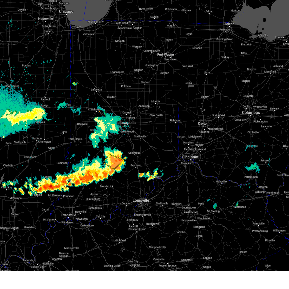 The storm which prompted the warning has moved out of the area. therefore, the warning will be allowed to expire. however, gusty winds are still possible with this thunderstorm. a severe thunderstorm watch remains in effect until 800 pm edt for south central indiana. The storm which prompted the warning has moved out of the area. therefore, the warning will be allowed to expire. however, gusty winds are still possible with this thunderstorm. a severe thunderstorm watch remains in effect until 800 pm edt for south central indiana.
|
| 6/25/2024 4:12 PM EDT | Peak wind speed is preliminar in monroe county IN, 4.1 miles E of Bloomington, IN |
| 6/25/2024 4:06 PM EDT | A tree and tree limbs were blown down by thunderstorm winds. details are unavailable due to amateur radio condition in monroe county IN, 4 miles W of Bloomington, IN |
| 6/25/2024 4:06 PM EDT | Three-inch diameter branches were blown down by thunderstorm wind in monroe county IN, 5.8 miles ENE of Bloomington, IN |
| 6/25/2024 4:05 PM EDT | Eight-inch tree branches were blown down by thunderstorm winds near the intersection of south olcott boulevard and east moores pike. pea-size hail accompanied the winds in monroe county IN, 3.5 miles W of Bloomington, IN |
| 6/25/2024 4:05 PM EDT | A 2.5-inch diameter healthy tree split due to thunderstorm winds. time approximate in monroe county IN, 2.4 miles E of Bloomington, IN |
| 6/25/2024 4:02 PM EDT | Tree branches of unknown size were blown down by thunderstorm wind in monroe county IN, 2.5 miles WNW of Bloomington, IN |
| 6/25/2024 3:58 PM EDT |
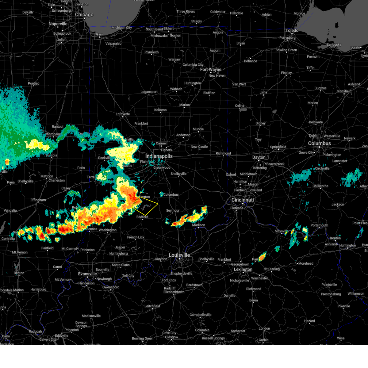 Svrind the national weather service in indianapolis has issued a * severe thunderstorm warning for, southern monroe county in south central indiana, southwestern brown county in south central indiana, north central lawrence county in south central indiana, northwestern jackson county in south central indiana, * until 430 pm edt. * at 357 pm edt, a severe thunderstorm was located near bloomington, moving southeast at 40 mph (radar indicated). Hazards include 60 mph wind gusts. expect damage to roofs, siding, and trees Svrind the national weather service in indianapolis has issued a * severe thunderstorm warning for, southern monroe county in south central indiana, southwestern brown county in south central indiana, north central lawrence county in south central indiana, northwestern jackson county in south central indiana, * until 430 pm edt. * at 357 pm edt, a severe thunderstorm was located near bloomington, moving southeast at 40 mph (radar indicated). Hazards include 60 mph wind gusts. expect damage to roofs, siding, and trees
|
| 6/25/2024 3:55 PM EDT | Storm damage reported in monroe county IN, 2.5 miles WNW of Bloomington, IN |
| 6/25/2024 3:47 PM EDT |
 the severe thunderstorm warning has been cancelled and is no longer in effect the severe thunderstorm warning has been cancelled and is no longer in effect
|
| 6/25/2024 3:47 PM EDT |
 At 346 pm edt, a severe thunderstorm was located near bloomington, moving east at 40 mph (radar indicated). Hazards include 60 mph wind gusts and quarter size hail. Hail damage to vehicles is expected. expect wind damage to roofs, siding, and trees. Locations impacted include, bloomington, spencer, ellettsville, worthington, indiana university, solsberry, mccormicks creek state park, freedom, and whitehall. At 346 pm edt, a severe thunderstorm was located near bloomington, moving east at 40 mph (radar indicated). Hazards include 60 mph wind gusts and quarter size hail. Hail damage to vehicles is expected. expect wind damage to roofs, siding, and trees. Locations impacted include, bloomington, spencer, ellettsville, worthington, indiana university, solsberry, mccormicks creek state park, freedom, and whitehall.
|
| 6/25/2024 3:22 PM EDT |
 Svrind the national weather service in indianapolis has issued a * severe thunderstorm warning for, northwestern monroe county in south central indiana, southeastern clay county in west central indiana, owen county in west central indiana, northwestern lawrence county in south central indiana, northeastern greene county in southwestern indiana, * until 400 pm edt. * at 322 pm edt, a severe thunderstorm was located 8 miles west of spencer, or 23 miles west of bloomington, moving east at 40 mph (radar indicated). Hazards include 60 mph wind gusts and quarter size hail. Hail damage to vehicles is expected. Expect wind damage to roofs, siding, and trees. Svrind the national weather service in indianapolis has issued a * severe thunderstorm warning for, northwestern monroe county in south central indiana, southeastern clay county in west central indiana, owen county in west central indiana, northwestern lawrence county in south central indiana, northeastern greene county in southwestern indiana, * until 400 pm edt. * at 322 pm edt, a severe thunderstorm was located 8 miles west of spencer, or 23 miles west of bloomington, moving east at 40 mph (radar indicated). Hazards include 60 mph wind gusts and quarter size hail. Hail damage to vehicles is expected. Expect wind damage to roofs, siding, and trees.
|
| 5/26/2024 10:44 PM EDT |
 the severe thunderstorm warning has been cancelled and is no longer in effect the severe thunderstorm warning has been cancelled and is no longer in effect
|
| 5/26/2024 10:44 PM EDT |
 At 1043 pm edt, severe thunderstorms were located along a line extending from 10 miles south of spencer to 16 miles east of bloomfield to near bedford to near paoli, moving east at 60 mph (radar indicated). Hazards include 60 mph wind gusts and penny size hail. Expect damage to roofs, siding, and trees. Locations impacted include, bloomington, bedford, bloomfield, ellettsville, mitchell, worthington, oolitic, smithville, tunnelton, bartlettsville, williams, avoca, monroe reservoir, woodville hills, charles deam wilderness, whitehall, heltonville, indiana university, indian springs, and huron. At 1043 pm edt, severe thunderstorms were located along a line extending from 10 miles south of spencer to 16 miles east of bloomfield to near bedford to near paoli, moving east at 60 mph (radar indicated). Hazards include 60 mph wind gusts and penny size hail. Expect damage to roofs, siding, and trees. Locations impacted include, bloomington, bedford, bloomfield, ellettsville, mitchell, worthington, oolitic, smithville, tunnelton, bartlettsville, williams, avoca, monroe reservoir, woodville hills, charles deam wilderness, whitehall, heltonville, indiana university, indian springs, and huron.
|
| 5/26/2024 10:32 PM EDT |
 the severe thunderstorm warning has been cancelled and is no longer in effect the severe thunderstorm warning has been cancelled and is no longer in effect
|
| 5/26/2024 10:32 PM EDT |
 At 1031 pm edt, severe thunderstorms were located along a line extending from near bloomfield to 18 miles southeast of linton to 6 miles north of shoals to 14 miles west of paoli, moving east at 70 mph (radar indicated). Hazards include 70 mph wind gusts and penny size hail. Expect considerable tree damage. damage is likely to mobile homes, roofs, and outbuildings. Locations impacted include, bloomington, bedford, linton, bloomfield, shoals, ellettsville, mitchell, loogootee, worthington, odon, oolitic, lyons, elnora, switz city, newberry, crane, smithville, west boggs lake, tunnelton, and bartlettsville. At 1031 pm edt, severe thunderstorms were located along a line extending from near bloomfield to 18 miles southeast of linton to 6 miles north of shoals to 14 miles west of paoli, moving east at 70 mph (radar indicated). Hazards include 70 mph wind gusts and penny size hail. Expect considerable tree damage. damage is likely to mobile homes, roofs, and outbuildings. Locations impacted include, bloomington, bedford, linton, bloomfield, shoals, ellettsville, mitchell, loogootee, worthington, odon, oolitic, lyons, elnora, switz city, newberry, crane, smithville, west boggs lake, tunnelton, and bartlettsville.
|
| 5/26/2024 10:23 PM EDT |
 At 1022 pm edt, severe thunderstorms were located along a line extending from 9 miles north of sullivan to near linton to 7 miles southeast of washington to 8 miles northeast of winslow, moving east at 60 mph (radar indicated). Hazards include 70 mph wind gusts and penny size hail. Expect considerable tree damage. damage is likely to mobile homes, roofs, and outbuildings. Locations impacted include, bloomington, bedford, washington, linton, sullivan, bloomfield, spencer, shoals, ellettsville, mitchell, bicknell, loogootee, jasonville, worthington, odon, shelburn, oolitic, farmersburg, dugger, and clay city. At 1022 pm edt, severe thunderstorms were located along a line extending from 9 miles north of sullivan to near linton to 7 miles southeast of washington to 8 miles northeast of winslow, moving east at 60 mph (radar indicated). Hazards include 70 mph wind gusts and penny size hail. Expect considerable tree damage. damage is likely to mobile homes, roofs, and outbuildings. Locations impacted include, bloomington, bedford, washington, linton, sullivan, bloomfield, spencer, shoals, ellettsville, mitchell, bicknell, loogootee, jasonville, worthington, odon, shelburn, oolitic, farmersburg, dugger, and clay city.
|
| 5/26/2024 10:12 PM EDT |
 Svrind the national weather service in indianapolis has issued a * severe thunderstorm warning for, southeastern vigo county in west central indiana, monroe county in south central indiana, southwestern morgan county in central indiana, sullivan county in southwestern indiana, southwestern brown county in south central indiana, eastern knox county in southwestern indiana, southern clay county in west central indiana, owen county in west central indiana, martin county in southwestern indiana, lawrence county in south central indiana, greene county in southwestern indiana, daviess county in southwestern indiana, * until 1100 pm edt. * at 1012 pm edt, severe thunderstorms were located along a line extending from 8 miles northwest of sullivan to near linton to near washington to near winslow, moving east at 60 mph (radar indicated). Hazards include 70 mph wind gusts and penny size hail. Expect considerable tree damage. Damage is likely to mobile homes, roofs, and outbuildings. Svrind the national weather service in indianapolis has issued a * severe thunderstorm warning for, southeastern vigo county in west central indiana, monroe county in south central indiana, southwestern morgan county in central indiana, sullivan county in southwestern indiana, southwestern brown county in south central indiana, eastern knox county in southwestern indiana, southern clay county in west central indiana, owen county in west central indiana, martin county in southwestern indiana, lawrence county in south central indiana, greene county in southwestern indiana, daviess county in southwestern indiana, * until 1100 pm edt. * at 1012 pm edt, severe thunderstorms were located along a line extending from 8 miles northwest of sullivan to near linton to near washington to near winslow, moving east at 60 mph (radar indicated). Hazards include 70 mph wind gusts and penny size hail. Expect considerable tree damage. Damage is likely to mobile homes, roofs, and outbuildings.
|
| 5/7/2024 10:52 PM EDT |
 At 1051 pm edt, a severe thunderstorm was located 7 miles west of bloomington, moving east at 40 mph (trained weather spotters). Hazards include golf ball size hail and 60 mph wind gusts. golf ball sized hail reported in elletsvile. People and animals outdoors will be injured. expect hail damage to roofs, siding, windows, and vehicles. expect wind damage to roofs, siding, and trees. Locations impacted include, bloomington, ellettsville, indiana university, woodville hills, lake lemon, unionville, and whitehall. At 1051 pm edt, a severe thunderstorm was located 7 miles west of bloomington, moving east at 40 mph (trained weather spotters). Hazards include golf ball size hail and 60 mph wind gusts. golf ball sized hail reported in elletsvile. People and animals outdoors will be injured. expect hail damage to roofs, siding, windows, and vehicles. expect wind damage to roofs, siding, and trees. Locations impacted include, bloomington, ellettsville, indiana university, woodville hills, lake lemon, unionville, and whitehall.
|
| 5/7/2024 10:44 PM EDT |
 At 1043 pm edt, a severe thunderstorm was located near spencer, or 13 miles west of bloomington, moving east at 40 mph (radar indicated). Hazards include ping pong ball size hail and 60 mph wind gusts. People and animals outdoors will be injured. expect hail damage to roofs, siding, windows, and vehicles. expect wind damage to roofs, siding, and trees. Locations impacted include, bloomington, spencer, ellettsville, indiana university, woodville hills, lake lemon, unionville, and whitehall. At 1043 pm edt, a severe thunderstorm was located near spencer, or 13 miles west of bloomington, moving east at 40 mph (radar indicated). Hazards include ping pong ball size hail and 60 mph wind gusts. People and animals outdoors will be injured. expect hail damage to roofs, siding, windows, and vehicles. expect wind damage to roofs, siding, and trees. Locations impacted include, bloomington, spencer, ellettsville, indiana university, woodville hills, lake lemon, unionville, and whitehall.
|
| 5/7/2024 10:35 PM EDT |
 Svrind the national weather service in indianapolis has issued a * severe thunderstorm warning for, central monroe county in south central indiana, southern owen county in west central indiana, northeastern greene county in southwestern indiana, * until 1115 pm edt. * at 1034 pm edt, a severe thunderstorm was located 9 miles southwest of spencer, or 19 miles west of bloomington, moving east at 40 mph (radar indicated). Hazards include 60 mph wind gusts and quarter size hail. Hail damage to vehicles is expected. Expect wind damage to roofs, siding, and trees. Svrind the national weather service in indianapolis has issued a * severe thunderstorm warning for, central monroe county in south central indiana, southern owen county in west central indiana, northeastern greene county in southwestern indiana, * until 1115 pm edt. * at 1034 pm edt, a severe thunderstorm was located 9 miles southwest of spencer, or 19 miles west of bloomington, moving east at 40 mph (radar indicated). Hazards include 60 mph wind gusts and quarter size hail. Hail damage to vehicles is expected. Expect wind damage to roofs, siding, and trees.
|
| 4/18/2024 10:49 PM EDT |
 Svrind the national weather service in indianapolis has issued a * severe thunderstorm warning for, southern monroe county in south central indiana, lawrence county in south central indiana, * until 1145 pm edt. * at 1049 pm edt, severe thunderstorms were located along a line extending from bloomfield to near shoals, moving east at 40 mph (radar indicated). Hazards include 60 mph wind gusts. expect damage to roofs, siding, and trees Svrind the national weather service in indianapolis has issued a * severe thunderstorm warning for, southern monroe county in south central indiana, lawrence county in south central indiana, * until 1145 pm edt. * at 1049 pm edt, severe thunderstorms were located along a line extending from bloomfield to near shoals, moving east at 40 mph (radar indicated). Hazards include 60 mph wind gusts. expect damage to roofs, siding, and trees
|
| 4/2/2024 4:33 PM EDT |
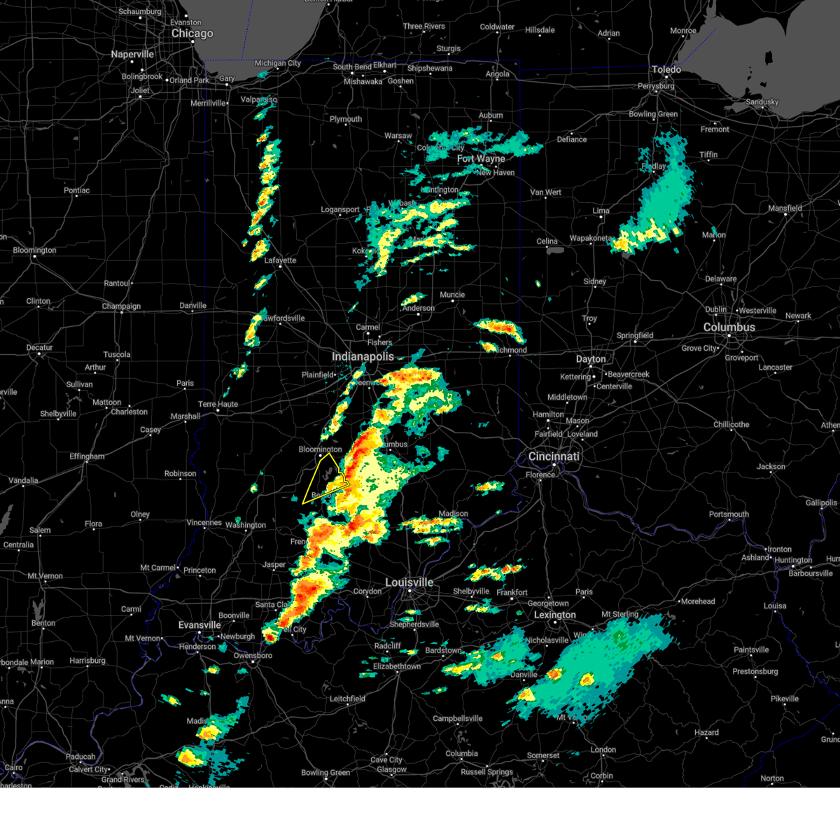 the severe thunderstorm warning has been cancelled and is no longer in effect the severe thunderstorm warning has been cancelled and is no longer in effect
|
| 4/2/2024 4:13 PM EDT |
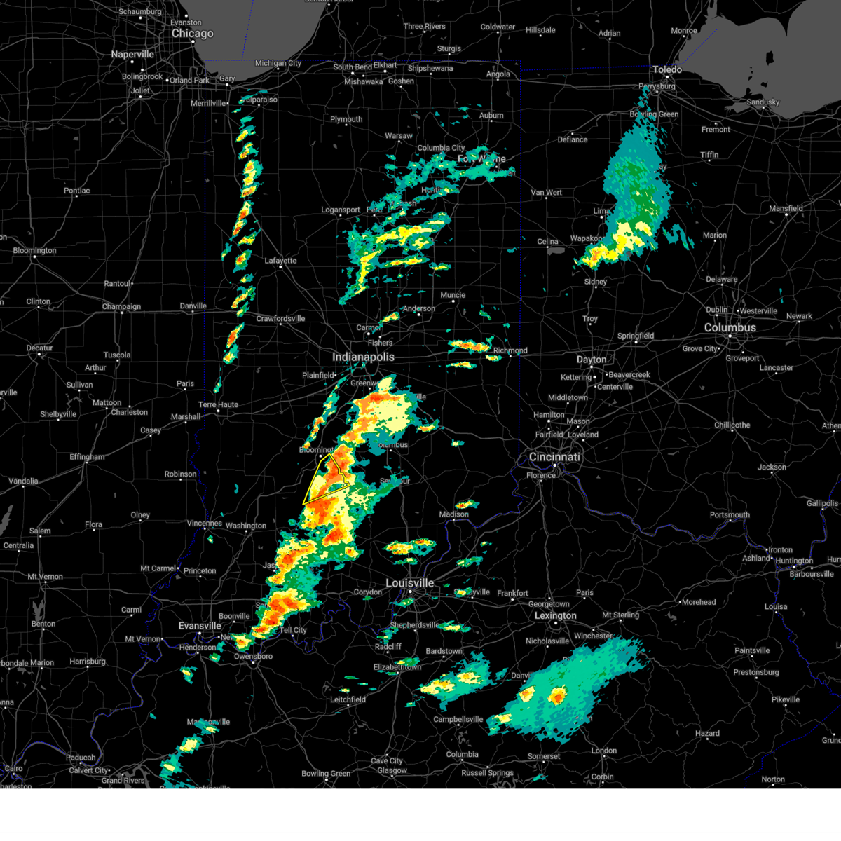 At 413 pm edt, a severe thunderstorm was located 9 miles southeast of bloomington, moving northeast at 70 mph (radar indicated). Hazards include 60 mph wind gusts and quarter size hail. Hail damage to vehicles is expected. expect wind damage to roofs, siding, and trees. Locations impacted include, bloomington, oolitic, avoca, smithville, monroe reservoir, fairfax state recreation area, silverville, charles deam wilderness, harrodsburg, and bartlettsville. At 413 pm edt, a severe thunderstorm was located 9 miles southeast of bloomington, moving northeast at 70 mph (radar indicated). Hazards include 60 mph wind gusts and quarter size hail. Hail damage to vehicles is expected. expect wind damage to roofs, siding, and trees. Locations impacted include, bloomington, oolitic, avoca, smithville, monroe reservoir, fairfax state recreation area, silverville, charles deam wilderness, harrodsburg, and bartlettsville.
|
| 4/2/2024 4:13 PM EDT |
 the severe thunderstorm warning has been cancelled and is no longer in effect the severe thunderstorm warning has been cancelled and is no longer in effect
|
| 4/2/2024 4:00 PM EDT | Large tree on road at west lost mans lane and north union valley road. law enforcement on scen in monroe county IN, 4.9 miles SSE of Bloomington, IN |
| 4/2/2024 3:57 PM EDT |
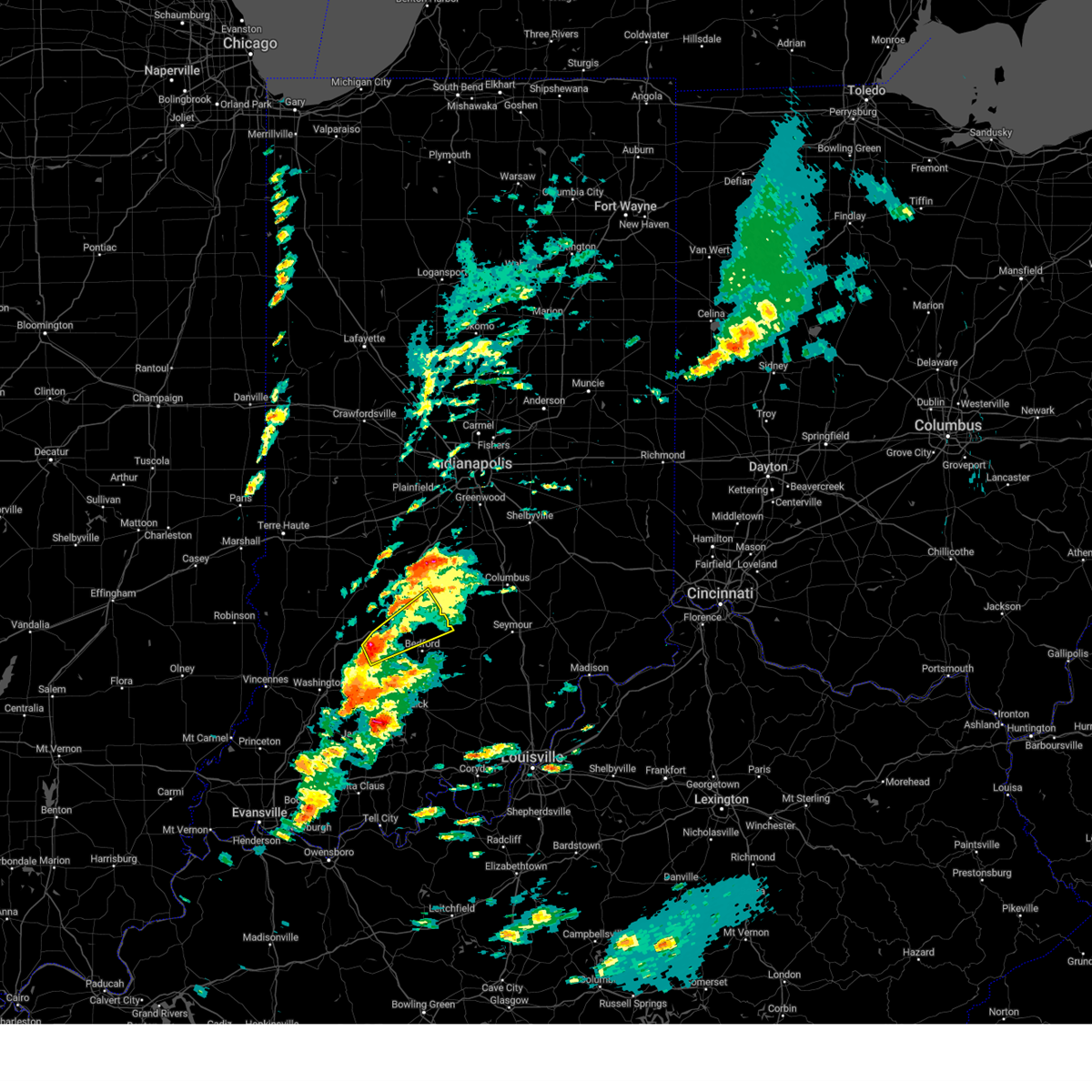 Svrind the national weather service in indianapolis has issued a * severe thunderstorm warning for, southern monroe county in south central indiana, northeastern martin county in southwestern indiana, southeastern greene county in southwestern indiana, northern lawrence county in south central indiana, * until 445 pm edt. * at 356 pm edt, a severe thunderstorm was located 13 miles southeast of bloomfield, or 14 miles west of bedford, moving northeast at 70 mph (radar indicated). Hazards include 60 mph wind gusts and quarter size hail. Hail damage to vehicles is expected. Expect wind damage to roofs, siding, and trees. Svrind the national weather service in indianapolis has issued a * severe thunderstorm warning for, southern monroe county in south central indiana, northeastern martin county in southwestern indiana, southeastern greene county in southwestern indiana, northern lawrence county in south central indiana, * until 445 pm edt. * at 356 pm edt, a severe thunderstorm was located 13 miles southeast of bloomfield, or 14 miles west of bedford, moving northeast at 70 mph (radar indicated). Hazards include 60 mph wind gusts and quarter size hail. Hail damage to vehicles is expected. Expect wind damage to roofs, siding, and trees.
|
| 4/2/2024 3:50 PM EDT |
 the severe thunderstorm warning has been cancelled and is no longer in effect the severe thunderstorm warning has been cancelled and is no longer in effect
|
| 4/2/2024 3:50 PM EDT |
 At 350 pm edt, a severe thunderstorm was located 9 miles south of martinsville, or 9 miles north of bloomington, moving northeast at 85 mph (radar indicated). Hazards include 60 mph wind gusts and quarter size hail. Hail damage to vehicles is expected. expect wind damage to roofs, siding, and trees. Locations impacted include, bloomington, martinsville, ellettsville, princes lakes, trafalgar, morgantown, mahalasville, peoga, helmsburg, lake lemon, beanblossom, waverly, spearsville, unionville, and whitehall. At 350 pm edt, a severe thunderstorm was located 9 miles south of martinsville, or 9 miles north of bloomington, moving northeast at 85 mph (radar indicated). Hazards include 60 mph wind gusts and quarter size hail. Hail damage to vehicles is expected. expect wind damage to roofs, siding, and trees. Locations impacted include, bloomington, martinsville, ellettsville, princes lakes, trafalgar, morgantown, mahalasville, peoga, helmsburg, lake lemon, beanblossom, waverly, spearsville, unionville, and whitehall.
|
| 4/2/2024 3:36 PM EDT |
 Svrind the national weather service in indianapolis has issued a * severe thunderstorm warning for, monroe county in south central indiana, southeastern morgan county in central indiana, southwestern johnson county in central indiana, northern brown county in south central indiana, northwestern bartholomew county in central indiana, southeastern owen county in west central indiana, northeastern greene county in southwestern indiana, * until 400 pm edt. * at 336 pm edt, a severe thunderstorm was located 11 miles northeast of bloomfield, or 13 miles west of bloomington, moving northeast at 85 mph (radar indicated). Hazards include 60 mph wind gusts and quarter size hail. Hail damage to vehicles is expected. Expect wind damage to roofs, siding, and trees. Svrind the national weather service in indianapolis has issued a * severe thunderstorm warning for, monroe county in south central indiana, southeastern morgan county in central indiana, southwestern johnson county in central indiana, northern brown county in south central indiana, northwestern bartholomew county in central indiana, southeastern owen county in west central indiana, northeastern greene county in southwestern indiana, * until 400 pm edt. * at 336 pm edt, a severe thunderstorm was located 11 miles northeast of bloomfield, or 13 miles west of bloomington, moving northeast at 85 mph (radar indicated). Hazards include 60 mph wind gusts and quarter size hail. Hail damage to vehicles is expected. Expect wind damage to roofs, siding, and trees.
|
| 4/2/2024 12:17 PM EDT | Golf Ball sized hail reported 2.5 miles WNW of Bloomington, IN, mainly 0.88 inch hail or smaller. time estimated from radar. |
| 4/1/2024 4:11 PM EDT |
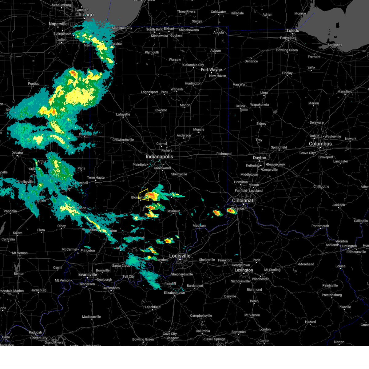 The storm which prompted the warning has weakened below severe limits, and has exited the warned area. therefore, the warning will be allowed to expire. The storm which prompted the warning has weakened below severe limits, and has exited the warned area. therefore, the warning will be allowed to expire.
|
| 4/1/2024 3:54 PM EDT |
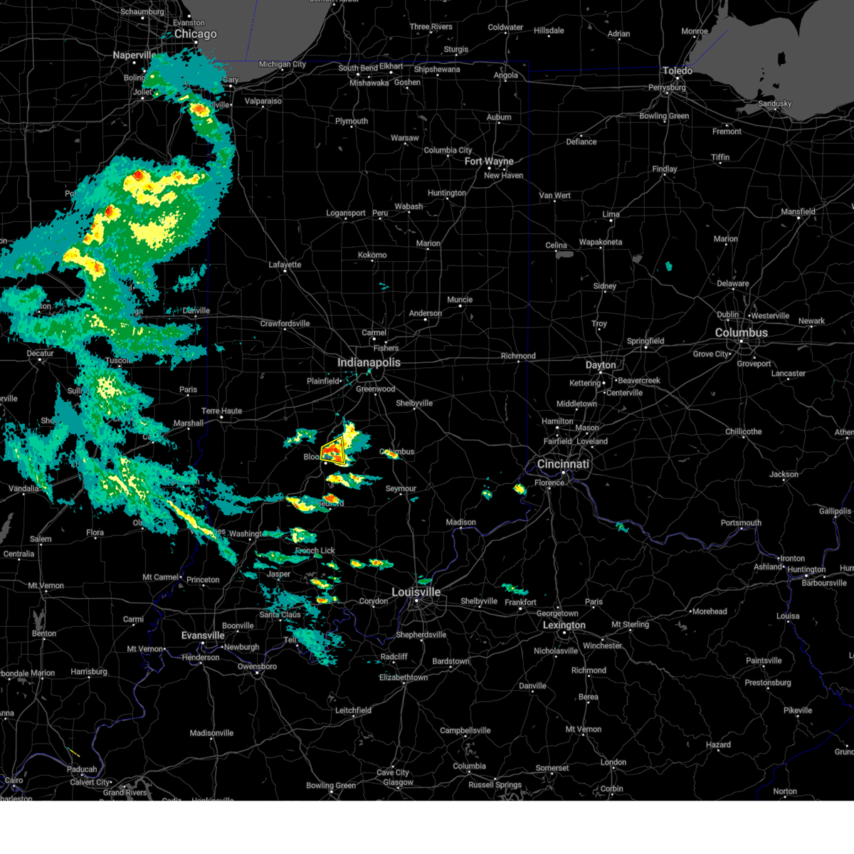 the severe thunderstorm warning has been cancelled and is no longer in effect the severe thunderstorm warning has been cancelled and is no longer in effect
|
| 4/1/2024 3:54 PM EDT |
 At 353 pm edt, a severe thunderstorm was located 7 miles north of bloomington, moving east at 35 mph (radar indicated). Hazards include 60 mph wind gusts and penny size hail. Expect damage to roofs, siding, and trees. Locations impacted include, bloomington, unionville, and lake lemon. At 353 pm edt, a severe thunderstorm was located 7 miles north of bloomington, moving east at 35 mph (radar indicated). Hazards include 60 mph wind gusts and penny size hail. Expect damage to roofs, siding, and trees. Locations impacted include, bloomington, unionville, and lake lemon.
|
| 4/1/2024 3:38 PM EDT |
 Svrind the national weather service in indianapolis has issued a * severe thunderstorm warning for, northern monroe county in south central indiana, south central morgan county in central indiana, southeastern owen county in west central indiana, * until 415 pm edt. * at 337 pm edt, a severe thunderstorm was located near spencer, or 9 miles northwest of bloomington, moving east at 35 mph (radar indicated). Hazards include 60 mph wind gusts and quarter size hail. Hail damage to vehicles is expected. Expect wind damage to roofs, siding, and trees. Svrind the national weather service in indianapolis has issued a * severe thunderstorm warning for, northern monroe county in south central indiana, south central morgan county in central indiana, southeastern owen county in west central indiana, * until 415 pm edt. * at 337 pm edt, a severe thunderstorm was located near spencer, or 9 miles northwest of bloomington, moving east at 35 mph (radar indicated). Hazards include 60 mph wind gusts and quarter size hail. Hail damage to vehicles is expected. Expect wind damage to roofs, siding, and trees.
|
| 3/14/2024 10:07 PM EDT |
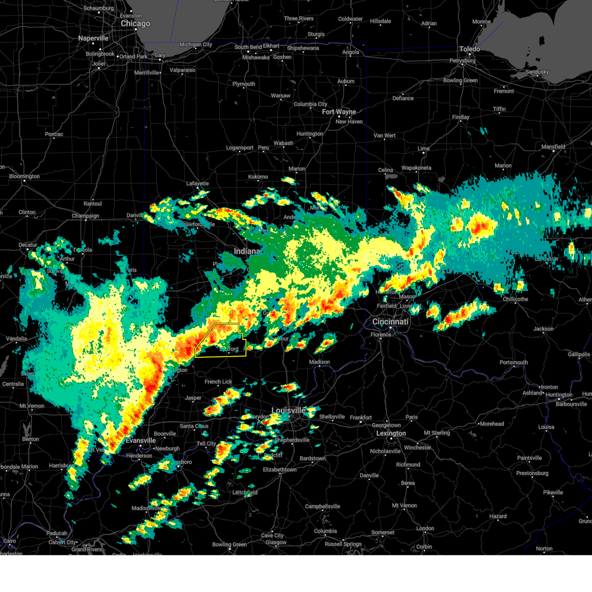 Svrind the national weather service in indianapolis has issued a * severe thunderstorm warning for, southern monroe county in south central indiana, northern martin county in southwestern indiana, southeastern greene county in southwestern indiana, northern lawrence county in south central indiana, * until 1045 pm edt. * at 1006 pm edt, severe thunderstorms were located along a line extending from 8 miles southwest of bloomington to 13 miles northeast of washington, moving east at 45 mph (radar indicated). Hazards include 60 mph wind gusts and quarter size hail. Hail damage to vehicles is expected. Expect wind damage to roofs, siding, and trees. Svrind the national weather service in indianapolis has issued a * severe thunderstorm warning for, southern monroe county in south central indiana, northern martin county in southwestern indiana, southeastern greene county in southwestern indiana, northern lawrence county in south central indiana, * until 1045 pm edt. * at 1006 pm edt, severe thunderstorms were located along a line extending from 8 miles southwest of bloomington to 13 miles northeast of washington, moving east at 45 mph (radar indicated). Hazards include 60 mph wind gusts and quarter size hail. Hail damage to vehicles is expected. Expect wind damage to roofs, siding, and trees.
|
| 3/14/2024 9:24 PM EDT |
 At 923 pm edt, severe thunderstorms were located along a line extending from near martinsville to near bloomington, moving east at 45 mph (radar indicated). Hazards include 60 mph wind gusts. Expect damage to roofs, siding, and trees. Locations impacted include, bloomington, greenwood, franklin, martinsville, mooresville, nashville, ellettsville, new whiteland, whiteland, bargersville, brooklyn, princes lakes, trafalgar, monrovia, morgantown, bethany, peoga, lake lemon, beanblossom, and gnaw bone. At 923 pm edt, severe thunderstorms were located along a line extending from near martinsville to near bloomington, moving east at 45 mph (radar indicated). Hazards include 60 mph wind gusts. Expect damage to roofs, siding, and trees. Locations impacted include, bloomington, greenwood, franklin, martinsville, mooresville, nashville, ellettsville, new whiteland, whiteland, bargersville, brooklyn, princes lakes, trafalgar, monrovia, morgantown, bethany, peoga, lake lemon, beanblossom, and gnaw bone.
|
| 3/14/2024 9:15 PM EDT |
 Svrind the national weather service in indianapolis has issued a * severe thunderstorm warning for, northern monroe county in south central indiana, morgan county in central indiana, western johnson county in central indiana, brown county in south central indiana, * until 1000 pm edt. * at 915 pm edt, severe thunderstorms were located along a line extending from 8 miles northwest of martinsville to 7 miles northwest of bloomington, moving east at 45 mph (radar indicated). Hazards include 60 mph wind gusts. expect damage to roofs, siding, and trees Svrind the national weather service in indianapolis has issued a * severe thunderstorm warning for, northern monroe county in south central indiana, morgan county in central indiana, western johnson county in central indiana, brown county in south central indiana, * until 1000 pm edt. * at 915 pm edt, severe thunderstorms were located along a line extending from 8 miles northwest of martinsville to 7 miles northwest of bloomington, moving east at 45 mph (radar indicated). Hazards include 60 mph wind gusts. expect damage to roofs, siding, and trees
|
| 2/28/2024 3:21 AM EST |
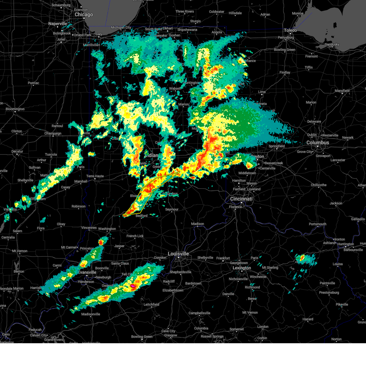 At 321 am est, severe thunderstorms were located along a line extending from 6 miles east of martinsville to 11 miles north of bloomington to 13 miles east of bloomfield, moving east at 55 mph (radar indicated). Hazards include 60 mph wind gusts and quarter size hail. Hail damage to vehicles is expected. expect wind damage to roofs, siding, and trees. these severe storms will be near, bloomington, trafalgar, morgantown, lake lemon, indiana university, smithville, whitehall, unionville, and mahalasville around 325 am est. franklin, woodville hills, monroe reservoir, beanblossom, and helmsburg around 330 am est. Other locations in the path of these severe thunderstorms include spearsville, yellowwood lake, princes lakes, peoga and shelbyville. At 321 am est, severe thunderstorms were located along a line extending from 6 miles east of martinsville to 11 miles north of bloomington to 13 miles east of bloomfield, moving east at 55 mph (radar indicated). Hazards include 60 mph wind gusts and quarter size hail. Hail damage to vehicles is expected. expect wind damage to roofs, siding, and trees. these severe storms will be near, bloomington, trafalgar, morgantown, lake lemon, indiana university, smithville, whitehall, unionville, and mahalasville around 325 am est. franklin, woodville hills, monroe reservoir, beanblossom, and helmsburg around 330 am est. Other locations in the path of these severe thunderstorms include spearsville, yellowwood lake, princes lakes, peoga and shelbyville.
|
| 2/28/2024 3:10 AM EST |
 At 310 am est, severe thunderstorms were located along a line extending from near martinsville to 7 miles east of spencer to near bloomfield, moving east at 55 mph (radar indicated). Hazards include 70 mph wind gusts and quarter size hail. Hail damage to vehicles is expected. expect considerable tree damage. wind damage is also likely to mobile homes, roofs, and outbuildings. these severe storms will be near, bloomington, martinsville, ellettsville, morgantown, solsberry, whitehall, and mahalasville around 315 am est. other locations in the path of these severe thunderstorms include indiana university, trafalgar, lake lemon, smithville, unionville, franklin, harrodsburg, woodville hills, monroe reservoir, beanblossom, helmsburg, yellowwood lake, princes lakes, spearsville, peoga and shelbyville. this includes the following highways, interstate 65 between mile markers 86 and 92. Interstate 74 between mile markers 112 and 113. At 310 am est, severe thunderstorms were located along a line extending from near martinsville to 7 miles east of spencer to near bloomfield, moving east at 55 mph (radar indicated). Hazards include 70 mph wind gusts and quarter size hail. Hail damage to vehicles is expected. expect considerable tree damage. wind damage is also likely to mobile homes, roofs, and outbuildings. these severe storms will be near, bloomington, martinsville, ellettsville, morgantown, solsberry, whitehall, and mahalasville around 315 am est. other locations in the path of these severe thunderstorms include indiana university, trafalgar, lake lemon, smithville, unionville, franklin, harrodsburg, woodville hills, monroe reservoir, beanblossom, helmsburg, yellowwood lake, princes lakes, spearsville, peoga and shelbyville. this includes the following highways, interstate 65 between mile markers 86 and 92. Interstate 74 between mile markers 112 and 113.
|
| 2/28/2024 2:58 AM EST |
 Svrind the national weather service in indianapolis has issued a * severe thunderstorm warning for, west central shelby county in central indiana, monroe county in south central indiana, southern morgan county in central indiana, southern johnson county in central indiana, northwestern brown county in south central indiana, northeastern knox county in southwestern indiana, southeastern owen county in west central indiana, north central martin county in southwestern indiana, northwestern lawrence county in south central indiana, greene county in southwestern indiana, northern daviess county in southwestern indiana, * until 345 am est. * at 257 am est, severe thunderstorms were located along a line extending from 12 miles northwest of bloomington to near spencer to 7 miles southwest of bloomfield, moving east at 55 mph (radar indicated). Hazards include 70 mph wind gusts and quarter size hail. Hail damage to vehicles is expected. expect considerable tree damage. wind damage is also likely to mobile homes, roofs, and outbuildings. severe thunderstorms will be near, bloomfield, ellettsville, stinesville, and solsberry around 305 am est. bloomington, martinsville, and mahalasville around 310 am est. morgantown, indiana university, and whitehall around 315 am est. this includes the following highways, interstate 65 between mile markers 86 and 92. Interstate 74 between mile markers 112 and 113. Svrind the national weather service in indianapolis has issued a * severe thunderstorm warning for, west central shelby county in central indiana, monroe county in south central indiana, southern morgan county in central indiana, southern johnson county in central indiana, northwestern brown county in south central indiana, northeastern knox county in southwestern indiana, southeastern owen county in west central indiana, north central martin county in southwestern indiana, northwestern lawrence county in south central indiana, greene county in southwestern indiana, northern daviess county in southwestern indiana, * until 345 am est. * at 257 am est, severe thunderstorms were located along a line extending from 12 miles northwest of bloomington to near spencer to 7 miles southwest of bloomfield, moving east at 55 mph (radar indicated). Hazards include 70 mph wind gusts and quarter size hail. Hail damage to vehicles is expected. expect considerable tree damage. wind damage is also likely to mobile homes, roofs, and outbuildings. severe thunderstorms will be near, bloomfield, ellettsville, stinesville, and solsberry around 305 am est. bloomington, martinsville, and mahalasville around 310 am est. morgantown, indiana university, and whitehall around 315 am est. this includes the following highways, interstate 65 between mile markers 86 and 92. Interstate 74 between mile markers 112 and 113.
|
| 2/28/2024 2:46 AM EST |
 At 246 am est, a severe thunderstorm was located near spencer, or 17 miles northwest of bloomington, moving northeast at 75 mph (radar indicated). Hazards include 60 mph wind gusts and quarter size hail. Hail damage to vehicles is expected. expect wind damage to roofs, siding, and trees. This severe storm will be near, gosport and paragon around 250 am est. At 246 am est, a severe thunderstorm was located near spencer, or 17 miles northwest of bloomington, moving northeast at 75 mph (radar indicated). Hazards include 60 mph wind gusts and quarter size hail. Hail damage to vehicles is expected. expect wind damage to roofs, siding, and trees. This severe storm will be near, gosport and paragon around 250 am est.
|
| 2/28/2024 2:32 AM EST |
 Svrind the national weather service in indianapolis has issued a * severe thunderstorm warning for, northwestern monroe county in south central indiana, southwestern morgan county in central indiana, southeastern clay county in west central indiana, owen county in west central indiana, northern greene county in southwestern indiana, * until 300 am est. * at 232 am est, a severe thunderstorm was located 14 miles north of linton, or 23 miles southeast of terre haute, moving northeast at 75 mph (radar indicated). Hazards include 60 mph wind gusts and quarter size hail. Hail damage to vehicles is expected. expect wind damage to roofs, siding, and trees. this severe thunderstorm will be near, patricksburg and coal city around 235 am est. spencer around 240 am est. gosport and mccormicks creek state park around 245 am est. Paragon around 250 am est. Svrind the national weather service in indianapolis has issued a * severe thunderstorm warning for, northwestern monroe county in south central indiana, southwestern morgan county in central indiana, southeastern clay county in west central indiana, owen county in west central indiana, northern greene county in southwestern indiana, * until 300 am est. * at 232 am est, a severe thunderstorm was located 14 miles north of linton, or 23 miles southeast of terre haute, moving northeast at 75 mph (radar indicated). Hazards include 60 mph wind gusts and quarter size hail. Hail damage to vehicles is expected. expect wind damage to roofs, siding, and trees. this severe thunderstorm will be near, patricksburg and coal city around 235 am est. spencer around 240 am est. gosport and mccormicks creek state park around 245 am est. Paragon around 250 am est.
|
| 8/26/2023 12:32 AM EDT |
 At 1231 am edt, severe thunderstorms were located along a line extending from 9 miles east of brazil to 8 miles west of spencer to 10 miles northwest of bloomfield, moving southeast at 30 mph (radar indicated). Hazards include 60 mph wind gusts. Expect damage to roofs, siding, and trees. severe thunderstorms will be near, cagles mill lake and freedom around 1235 am edt. spencer and mccormicks creek state park around 1240 am edt. devore around 1245 am edt. other locations in the path of these severe thunderstorms include ellettsville, gosport, stinesville, solsberry, bloomington and whitehall. this includes interstate 70 between mile markers 33 and 36. hail threat, radar indicated max hail size, <. 75 in wind threat, radar indicated max wind gust, 60 mph. At 1231 am edt, severe thunderstorms were located along a line extending from 9 miles east of brazil to 8 miles west of spencer to 10 miles northwest of bloomfield, moving southeast at 30 mph (radar indicated). Hazards include 60 mph wind gusts. Expect damage to roofs, siding, and trees. severe thunderstorms will be near, cagles mill lake and freedom around 1235 am edt. spencer and mccormicks creek state park around 1240 am edt. devore around 1245 am edt. other locations in the path of these severe thunderstorms include ellettsville, gosport, stinesville, solsberry, bloomington and whitehall. this includes interstate 70 between mile markers 33 and 36. hail threat, radar indicated max hail size, <. 75 in wind threat, radar indicated max wind gust, 60 mph.
|
| 7/17/2023 9:33 PM EDT |
 At 933 pm edt, a severe thunderstorm capable of producing a tornado was located near spencer, or 14 miles west of bloomington, moving east at 25 mph (radar indicated rotation). Hazards include tornado and quarter size hail. Flying debris will be dangerous to those caught without shelter. mobile homes will be damaged or destroyed. damage to roofs, windows, and vehicles will occur. tree damage is likely. this dangerous storm will be near, ellettsville around 950 pm edt. Other locations in the path of this tornadic thunderstorm include bloomington, whitehall and indiana university. At 933 pm edt, a severe thunderstorm capable of producing a tornado was located near spencer, or 14 miles west of bloomington, moving east at 25 mph (radar indicated rotation). Hazards include tornado and quarter size hail. Flying debris will be dangerous to those caught without shelter. mobile homes will be damaged or destroyed. damage to roofs, windows, and vehicles will occur. tree damage is likely. this dangerous storm will be near, ellettsville around 950 pm edt. Other locations in the path of this tornadic thunderstorm include bloomington, whitehall and indiana university.
|
| 7/17/2023 9:30 PM EDT |
 At 929 pm edt, a severe thunderstorm capable of producing a tornado was located near spencer, or 16 miles west of bloomington, moving east at 25 mph (radar indicated rotation). Hazards include tornado and quarter size hail. Flying debris will be dangerous to those caught without shelter. mobile homes will be damaged or destroyed. damage to roofs, windows, and vehicles will occur. tree damage is likely. this dangerous storm will be near, stinesville around 945 pm edt. Other locations in the path of this tornadic thunderstorm include ellettsville, bloomington, whitehall and indiana university. At 929 pm edt, a severe thunderstorm capable of producing a tornado was located near spencer, or 16 miles west of bloomington, moving east at 25 mph (radar indicated rotation). Hazards include tornado and quarter size hail. Flying debris will be dangerous to those caught without shelter. mobile homes will be damaged or destroyed. damage to roofs, windows, and vehicles will occur. tree damage is likely. this dangerous storm will be near, stinesville around 945 pm edt. Other locations in the path of this tornadic thunderstorm include ellettsville, bloomington, whitehall and indiana university.
|
| 7/17/2023 9:21 PM EDT |
 At 921 pm edt, a severe thunderstorm was located over spencer, or 16 miles northwest of bloomington, moving east at 30 mph (radar indicated). Hazards include quarter size hail. Damage to vehicles is expected. this severe thunderstorm will be near, stinesville around 935 pm edt. ellettsville around 940 pm edt. other locations in the path of this severe thunderstorm include bloomington and whitehall. hail threat, radar indicated max hail size, 1. 00 in wind threat, radar indicated max wind gust, <50 mph. At 921 pm edt, a severe thunderstorm was located over spencer, or 16 miles northwest of bloomington, moving east at 30 mph (radar indicated). Hazards include quarter size hail. Damage to vehicles is expected. this severe thunderstorm will be near, stinesville around 935 pm edt. ellettsville around 940 pm edt. other locations in the path of this severe thunderstorm include bloomington and whitehall. hail threat, radar indicated max hail size, 1. 00 in wind threat, radar indicated max wind gust, <50 mph.
|
| 7/17/2023 9:16 PM EDT |
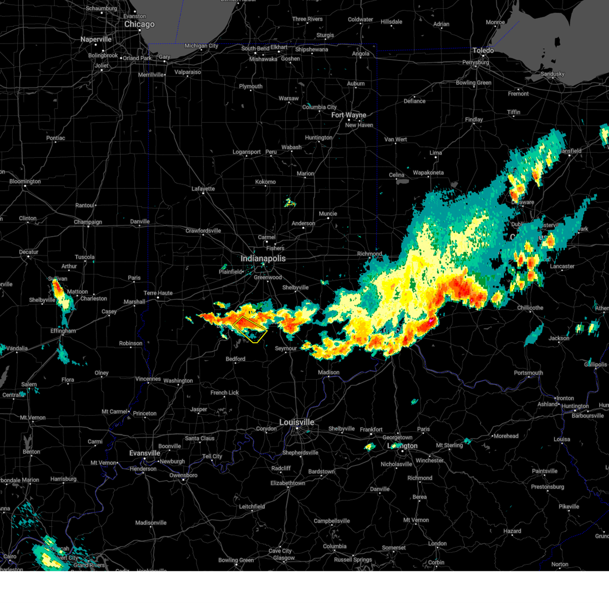 At 915 pm edt, a severe thunderstorm was located near bloomington, moving southeast at 20 mph (radar indicated). Hazards include 60 mph wind gusts and nickel size hail. Expect damage to roofs, siding, and trees. this severe thunderstorm will be near, woodville hills and yellowwood lake around 930 pm edt. other locations in the path of this severe thunderstorm include nashville, elkinsville, story and stone head. hail threat, radar indicated max hail size, 0. 88 in wind threat, radar indicated max wind gust, 60 mph. At 915 pm edt, a severe thunderstorm was located near bloomington, moving southeast at 20 mph (radar indicated). Hazards include 60 mph wind gusts and nickel size hail. Expect damage to roofs, siding, and trees. this severe thunderstorm will be near, woodville hills and yellowwood lake around 930 pm edt. other locations in the path of this severe thunderstorm include nashville, elkinsville, story and stone head. hail threat, radar indicated max hail size, 0. 88 in wind threat, radar indicated max wind gust, 60 mph.
|
| 7/17/2023 9:08 PM EDT |
 At 908 pm edt, a severe thunderstorm was located near bloomington, moving east at 20 mph (radar indicated). Hazards include half dollar size hail. Damage to vehicles is expected. locations impacted include, bloomington, ellettsville, lake lemon and unionville. hail threat, radar indicated max hail size, 1. 25 in wind threat, radar indicated max wind gust, <50 mph. At 908 pm edt, a severe thunderstorm was located near bloomington, moving east at 20 mph (radar indicated). Hazards include half dollar size hail. Damage to vehicles is expected. locations impacted include, bloomington, ellettsville, lake lemon and unionville. hail threat, radar indicated max hail size, 1. 25 in wind threat, radar indicated max wind gust, <50 mph.
|
| 7/17/2023 8:54 PM EDT |
 At 854 pm edt, a severe thunderstorm was located 8 miles north of bloomington, moving southeast at 25 mph (radar indicated). Hazards include ping pong ball size hail and 60 mph wind gusts. People and animals outdoors will be injured. expect hail damage to roofs, siding, windows, and vehicles. expect wind damage to roofs, siding, and trees. locations impacted include, bloomington, ellettsville, lake lemon and unionville. hail threat, radar indicated max hail size, 1. 50 in wind threat, radar indicated max wind gust, 60 mph. At 854 pm edt, a severe thunderstorm was located 8 miles north of bloomington, moving southeast at 25 mph (radar indicated). Hazards include ping pong ball size hail and 60 mph wind gusts. People and animals outdoors will be injured. expect hail damage to roofs, siding, windows, and vehicles. expect wind damage to roofs, siding, and trees. locations impacted include, bloomington, ellettsville, lake lemon and unionville. hail threat, radar indicated max hail size, 1. 50 in wind threat, radar indicated max wind gust, 60 mph.
|
| 7/17/2023 8:51 PM EDT |
 At 851 pm edt, a severe thunderstorm was located 9 miles northwest of bloomington, moving east at 20 mph (radar indicated). Hazards include 60 mph wind gusts and half dollar size hail. Hail damage to vehicles is expected. Expect wind damage to roofs, siding, and trees. At 851 pm edt, a severe thunderstorm was located 9 miles northwest of bloomington, moving east at 20 mph (radar indicated). Hazards include 60 mph wind gusts and half dollar size hail. Hail damage to vehicles is expected. Expect wind damage to roofs, siding, and trees.
|
| 7/5/2023 8:40 PM EDT |
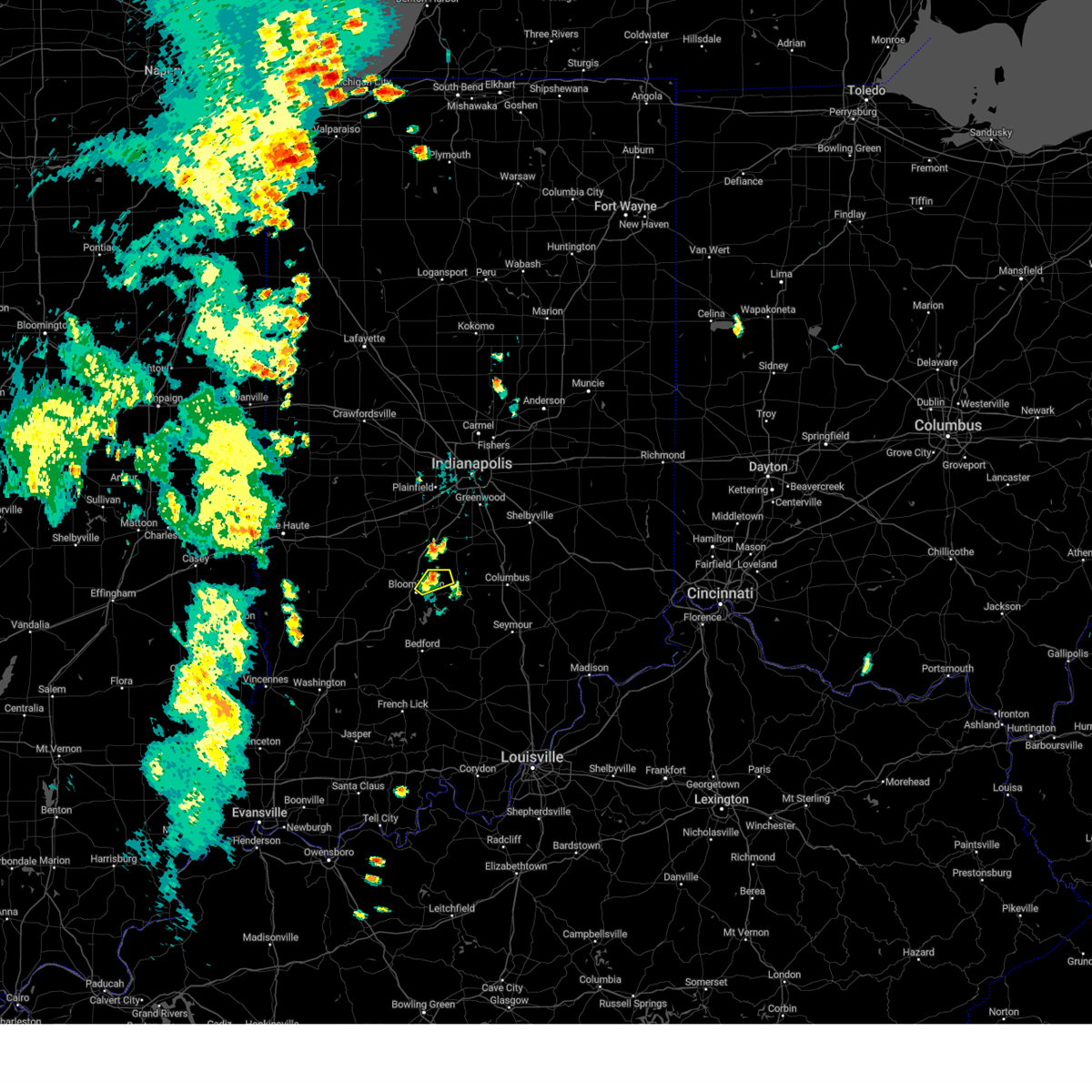 The severe thunderstorm warning for northeastern monroe and northwestern brown counties will expire at 845 pm edt, the storm which prompted the warning has weakened below severe limits, and no longer poses an immediate threat to life or property. therefore, the warning will be allowed to expire. The severe thunderstorm warning for northeastern monroe and northwestern brown counties will expire at 845 pm edt, the storm which prompted the warning has weakened below severe limits, and no longer poses an immediate threat to life or property. therefore, the warning will be allowed to expire.
|
| 7/5/2023 8:30 PM EDT |
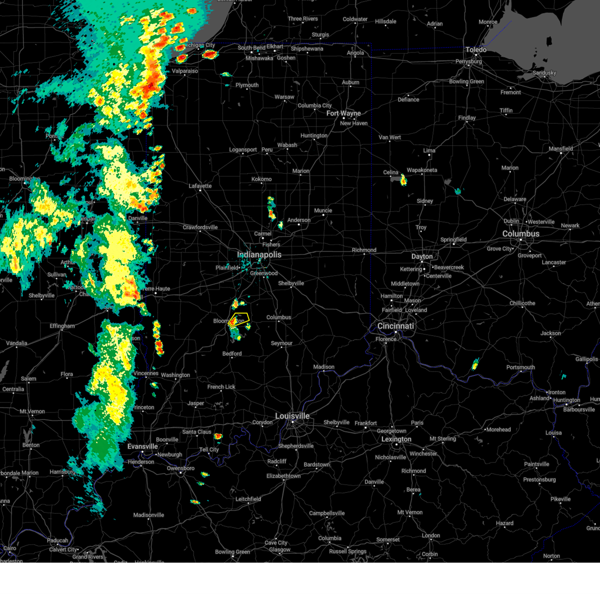 At 829 pm edt, a severe thunderstorm was located near bloomington, moving northeast at 15 mph (radar indicated). Hazards include 60 mph wind gusts and quarter size hail. Hail damage to vehicles is expected. expect wind damage to roofs, siding, and trees. locations impacted include, unionville and lake lemon. hail threat, radar indicated max hail size, 1. 00 in wind threat, radar indicated max wind gust, 60 mph. At 829 pm edt, a severe thunderstorm was located near bloomington, moving northeast at 15 mph (radar indicated). Hazards include 60 mph wind gusts and quarter size hail. Hail damage to vehicles is expected. expect wind damage to roofs, siding, and trees. locations impacted include, unionville and lake lemon. hail threat, radar indicated max hail size, 1. 00 in wind threat, radar indicated max wind gust, 60 mph.
|
| 7/5/2023 8:22 PM EDT |
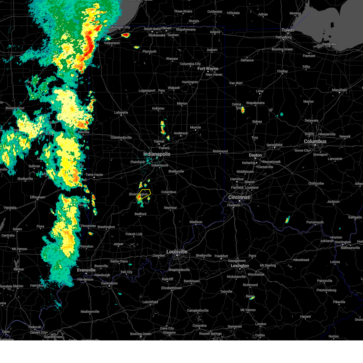 At 822 pm edt, a severe thunderstorm was located over bloomington, moving northeast at 25 mph (radar indicated). Hazards include 60 mph wind gusts and quarter size hail. Hail damage to vehicles is expected. expect wind damage to roofs, siding, and trees. this severe thunderstorm will be near, unionville and yellowwood lake around 835 pm edt. lake lemon around 840 pm edt. hail threat, radar indicated max hail size, 1. 00 in wind threat, radar indicated max wind gust, 60 mph. At 822 pm edt, a severe thunderstorm was located over bloomington, moving northeast at 25 mph (radar indicated). Hazards include 60 mph wind gusts and quarter size hail. Hail damage to vehicles is expected. expect wind damage to roofs, siding, and trees. this severe thunderstorm will be near, unionville and yellowwood lake around 835 pm edt. lake lemon around 840 pm edt. hail threat, radar indicated max hail size, 1. 00 in wind threat, radar indicated max wind gust, 60 mph.
|
| 7/2/2023 7:05 PM EDT | Quarter sized hail reported 2.3 miles NE of Bloomington, IN |
| 7/2/2023 7:05 PM EDT |
 At 704 pm edt, a severe thunderstorm was located near bloomington, moving northeast at 20 mph (radar indicated). Hazards include 60 mph wind gusts and quarter size hail. Hail damage to vehicles is expected. expect wind damage to roofs, siding, and trees. this severe storm will be near, bloomington around 710 pm edt. other locations in the path of this severe thunderstorm include indiana university, woodville hills and unionville. hail threat, radar indicated max hail size, 1. 00 in wind threat, radar indicated max wind gust, 60 mph. At 704 pm edt, a severe thunderstorm was located near bloomington, moving northeast at 20 mph (radar indicated). Hazards include 60 mph wind gusts and quarter size hail. Hail damage to vehicles is expected. expect wind damage to roofs, siding, and trees. this severe storm will be near, bloomington around 710 pm edt. other locations in the path of this severe thunderstorm include indiana university, woodville hills and unionville. hail threat, radar indicated max hail size, 1. 00 in wind threat, radar indicated max wind gust, 60 mph.
|
| 7/2/2023 7:02 PM EDT | Storm damage reported in monroe county IN, 3.6 miles NE of Bloomington, IN |
| 7/2/2023 6:52 PM EDT |
 At 652 pm edt, a severe thunderstorm was located 7 miles southwest of bloomington, moving northeast at 20 mph (radar indicated). Hazards include 60 mph wind gusts and quarter size hail. Hail damage to vehicles is expected. expect wind damage to roofs, siding, and trees. this severe thunderstorm will be near, bloomington, whitehall and smithville around 705 pm edt. other locations in the path of this severe thunderstorm include indiana university, monroe reservoir, unionville and woodville hills. hail threat, radar indicated max hail size, 1. 00 in wind threat, radar indicated max wind gust, 60 mph. At 652 pm edt, a severe thunderstorm was located 7 miles southwest of bloomington, moving northeast at 20 mph (radar indicated). Hazards include 60 mph wind gusts and quarter size hail. Hail damage to vehicles is expected. expect wind damage to roofs, siding, and trees. this severe thunderstorm will be near, bloomington, whitehall and smithville around 705 pm edt. other locations in the path of this severe thunderstorm include indiana university, monroe reservoir, unionville and woodville hills. hail threat, radar indicated max hail size, 1. 00 in wind threat, radar indicated max wind gust, 60 mph.
|
| 7/1/2023 1:26 AM EDT |
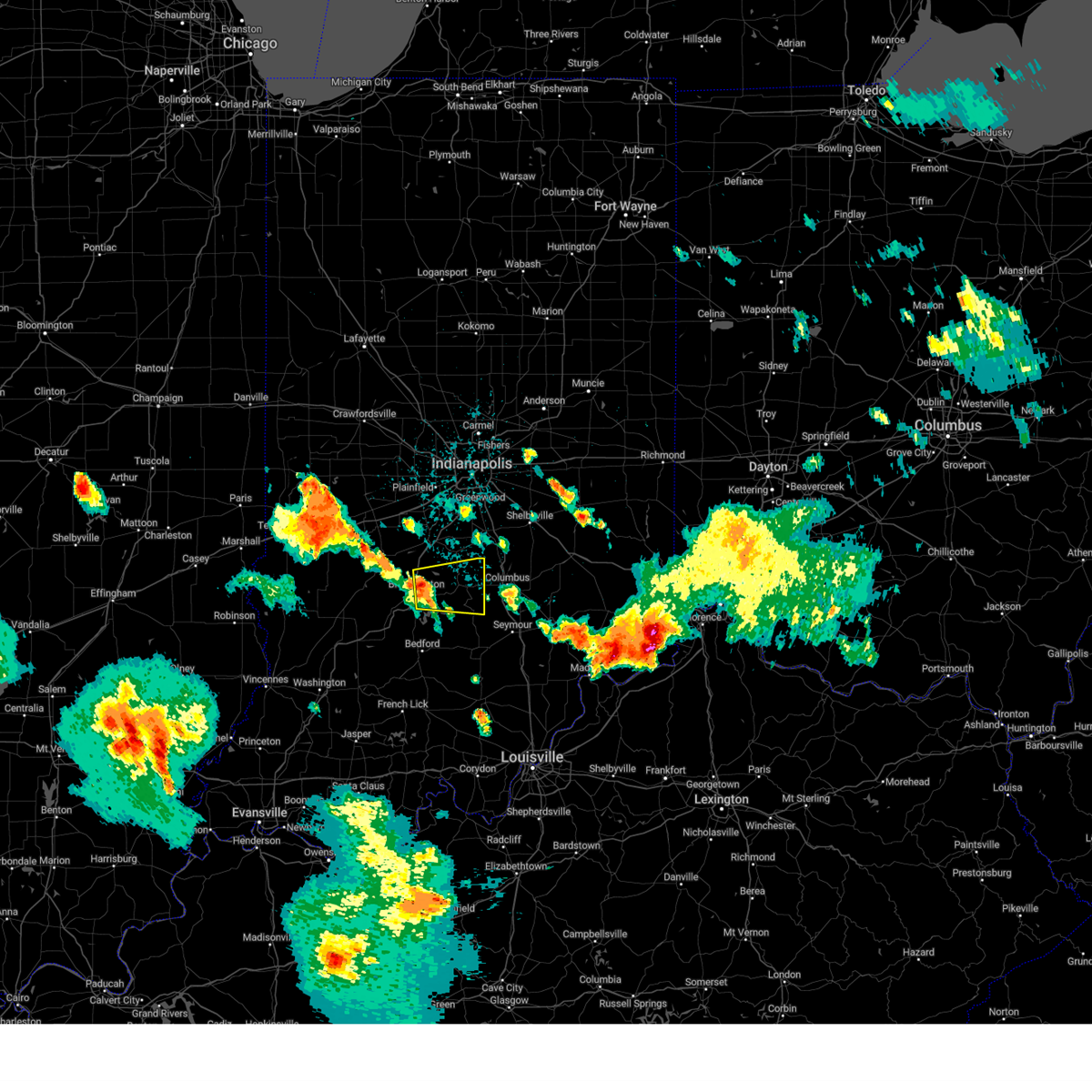 At 126 am edt, a severe thunderstorm was located near bloomington, moving east at 40 mph (radar indicated). Hazards include 60 mph wind gusts and quarter size hail. Hail damage to vehicles is expected. expect wind damage to roofs, siding, and trees. this severe thunderstorm will be near, woodville hills around 130 am edt. yellowwood lake around 135 am edt. helmsburg and beanblossom around 140 am edt. nashville and story around 145 am edt. other locations in the path of this severe thunderstorm include gnaw bone and stone head. hail threat, radar indicated max hail size, 1. 00 in wind threat, radar indicated max wind gust, 60 mph. At 126 am edt, a severe thunderstorm was located near bloomington, moving east at 40 mph (radar indicated). Hazards include 60 mph wind gusts and quarter size hail. Hail damage to vehicles is expected. expect wind damage to roofs, siding, and trees. this severe thunderstorm will be near, woodville hills around 130 am edt. yellowwood lake around 135 am edt. helmsburg and beanblossom around 140 am edt. nashville and story around 145 am edt. other locations in the path of this severe thunderstorm include gnaw bone and stone head. hail threat, radar indicated max hail size, 1. 00 in wind threat, radar indicated max wind gust, 60 mph.
|
| 6/29/2023 3:50 PM EDT | Several trees and power lines down across monroe county. duke energy reports widespread outages from the storms. time estimated from rada in monroe county IN, 2.3 miles NW of Bloomington, IN |
| 6/29/2023 3:48 PM EDT | Asos station kbmg bloomingto in monroe county IN, 4.1 miles E of Bloomington, IN |
| 6/29/2023 3:40 PM EDT |
 At 339 pm edt, severe thunderstorms were located along a line extending from near spencer to near vincennes, moving southeast at 60 mph (radar indicated). Hazards include 70 mph wind gusts and quarter size hail. Hail damage to vehicles is expected. expect considerable tree damage. wind damage is also likely to mobile homes, roofs, and outbuildings. severe thunderstorms will be near, ellettsville around 345 pm edt. indiana university and whitehall around 355 pm edt. other locations in the path of these severe thunderstorms include lake lemon, woodville hills, yellowwood lake, story, elkinsville, stone head, spurgeons corner, waymansville and cortland. this includes interstate 65 between mile markers 58 and 64. thunderstorm damage threat, considerable hail threat, radar indicated max hail size, 1. 00 in wind threat, radar indicated max wind gust, 70 mph. At 339 pm edt, severe thunderstorms were located along a line extending from near spencer to near vincennes, moving southeast at 60 mph (radar indicated). Hazards include 70 mph wind gusts and quarter size hail. Hail damage to vehicles is expected. expect considerable tree damage. wind damage is also likely to mobile homes, roofs, and outbuildings. severe thunderstorms will be near, ellettsville around 345 pm edt. indiana university and whitehall around 355 pm edt. other locations in the path of these severe thunderstorms include lake lemon, woodville hills, yellowwood lake, story, elkinsville, stone head, spurgeons corner, waymansville and cortland. this includes interstate 65 between mile markers 58 and 64. thunderstorm damage threat, considerable hail threat, radar indicated max hail size, 1. 00 in wind threat, radar indicated max wind gust, 70 mph.
|
| 6/29/2023 3:06 PM EDT |
 At 305 pm edt, severe thunderstorms were located along a line extending from 7 miles south of terre haute to hardinville, moving east at 85 mph (radar indicated). Hazards include 70 mph wind gusts and quarter size hail. Hail damage to vehicles is expected. expect considerable tree damage. wind damage is also likely to mobile homes, roofs, and outbuildings. severe thunderstorms will be near, clay city around 315 pm edt. oaktown and coal city around 320 pm edt. bruceville, freedom and freelandville around 325 pm edt. other locations in the path of these severe thunderstorms include bicknell, wheatland, edwardsport, washington, ellettsville, plainville, solsberry, bloomington, montgomery, cannelburg, whitehall, indiana university, shoals, loogootee, alfordsville, west boggs lake, smithville, lacy and fairfax state recreation area. thunderstorm damage threat, considerable hail threat, radar indicated max hail size, 1. 00 in wind threat, radar indicated max wind gust, 70 mph. At 305 pm edt, severe thunderstorms were located along a line extending from 7 miles south of terre haute to hardinville, moving east at 85 mph (radar indicated). Hazards include 70 mph wind gusts and quarter size hail. Hail damage to vehicles is expected. expect considerable tree damage. wind damage is also likely to mobile homes, roofs, and outbuildings. severe thunderstorms will be near, clay city around 315 pm edt. oaktown and coal city around 320 pm edt. bruceville, freedom and freelandville around 325 pm edt. other locations in the path of these severe thunderstorms include bicknell, wheatland, edwardsport, washington, ellettsville, plainville, solsberry, bloomington, montgomery, cannelburg, whitehall, indiana university, shoals, loogootee, alfordsville, west boggs lake, smithville, lacy and fairfax state recreation area. thunderstorm damage threat, considerable hail threat, radar indicated max hail size, 1. 00 in wind threat, radar indicated max wind gust, 70 mph.
|
| 6/25/2023 5:09 PM EDT |
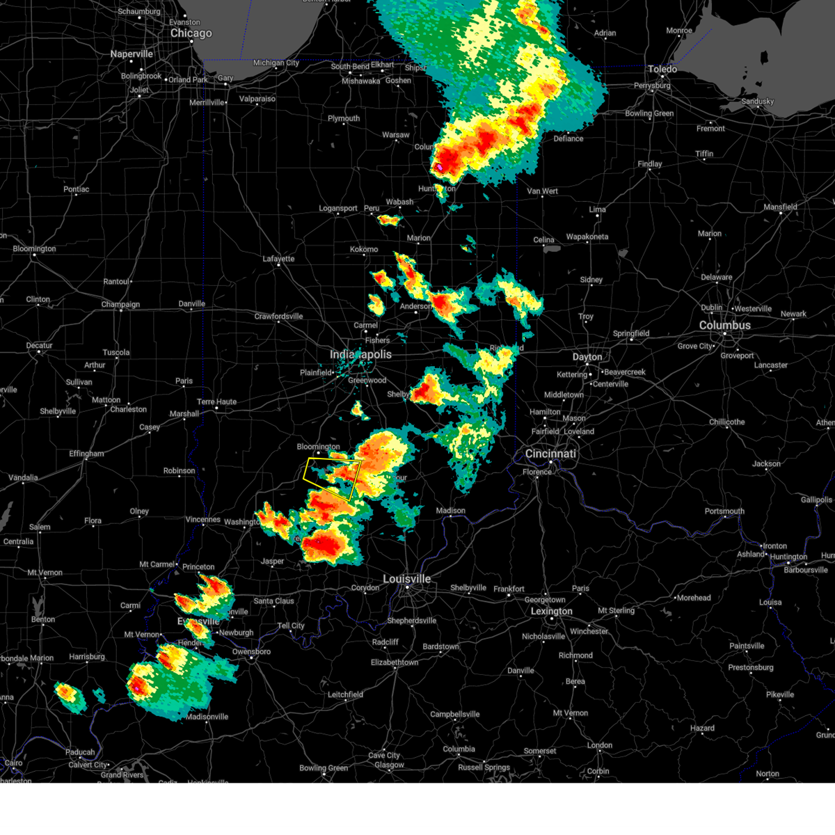 The severe thunderstorm warning for southern monroe, southwestern brown, northeastern lawrence and northwestern jackson counties will expire at 515 pm edt, the storm which prompted the warning has moved out of the area. therefore, the warning will be allowed to expire. a tornado watch remains in effect until 800 pm edt for south central indiana. to report severe weather, contact your nearest law enforcement agency. they will relay your report to the national weather service indianapolis. remember, a tornado warning still remains in effect for jackson county until 545 pm edt. The severe thunderstorm warning for southern monroe, southwestern brown, northeastern lawrence and northwestern jackson counties will expire at 515 pm edt, the storm which prompted the warning has moved out of the area. therefore, the warning will be allowed to expire. a tornado watch remains in effect until 800 pm edt for south central indiana. to report severe weather, contact your nearest law enforcement agency. they will relay your report to the national weather service indianapolis. remember, a tornado warning still remains in effect for jackson county until 545 pm edt.
|
| 6/25/2023 4:34 PM EDT |
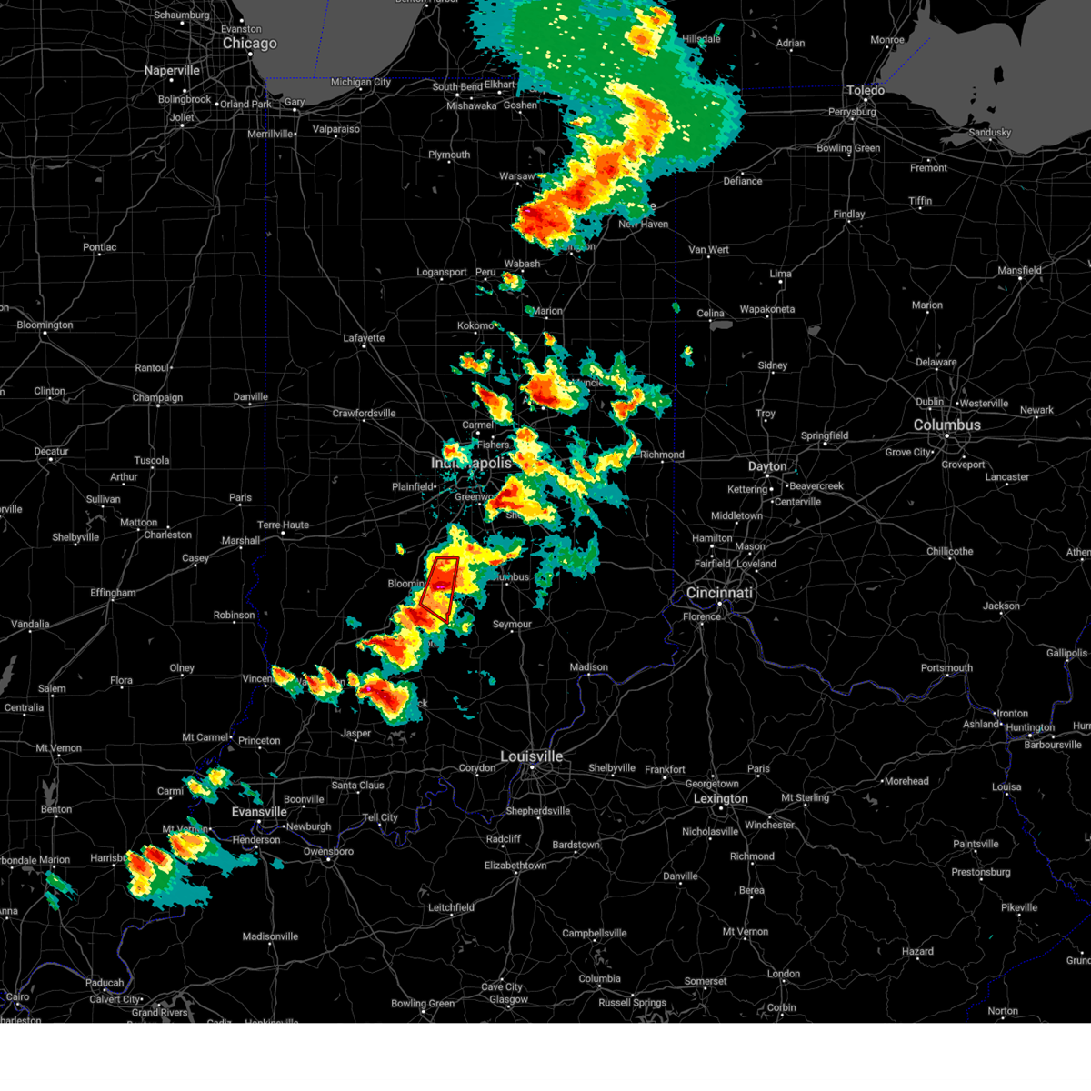 At 433 pm edt, a severe thunderstorm capable of producing a tornado was located 8 miles southwest of nashville, or 9 miles east of bloomington, moving east at 40 mph (radar indicated rotation). Hazards include tornado and baseball size hail. Flying debris will be dangerous to those caught without shelter. mobile homes will be damaged or destroyed. damage to roofs, windows, and vehicles will occur. tree damage is likely. This tornadic thunderstorm will remain over mainly rural areas of eastern monroe and western brown counties. At 433 pm edt, a severe thunderstorm capable of producing a tornado was located 8 miles southwest of nashville, or 9 miles east of bloomington, moving east at 40 mph (radar indicated rotation). Hazards include tornado and baseball size hail. Flying debris will be dangerous to those caught without shelter. mobile homes will be damaged or destroyed. damage to roofs, windows, and vehicles will occur. tree damage is likely. This tornadic thunderstorm will remain over mainly rural areas of eastern monroe and western brown counties.
|
| 6/25/2023 4:31 PM EDT |
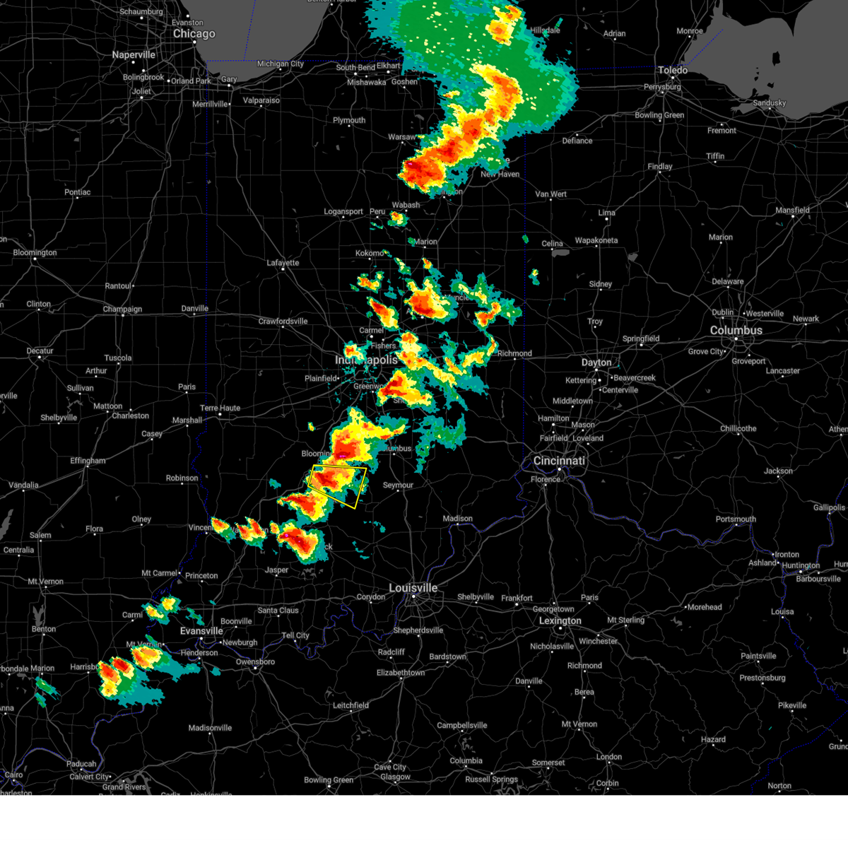 At 431 pm edt, a severe thunderstorm was located 8 miles south of bloomington, moving east at 20 mph (radar indicated). Hazards include 60 mph wind gusts and half dollar size hail. Hail damage to vehicles is expected. expect wind damage to roofs, siding, and trees. this severe thunderstorm will be near, fairfax state recreation area around 440 pm edt. monroe reservoir and bartlettsville around 445 pm edt. other locations in the path of this severe thunderstorm include charles deam wilderness, heltonville, norman, elkinsville and story. hail threat, radar indicated max hail size, 1. 25 in wind threat, radar indicated max wind gust, 60 mph. At 431 pm edt, a severe thunderstorm was located 8 miles south of bloomington, moving east at 20 mph (radar indicated). Hazards include 60 mph wind gusts and half dollar size hail. Hail damage to vehicles is expected. expect wind damage to roofs, siding, and trees. this severe thunderstorm will be near, fairfax state recreation area around 440 pm edt. monroe reservoir and bartlettsville around 445 pm edt. other locations in the path of this severe thunderstorm include charles deam wilderness, heltonville, norman, elkinsville and story. hail threat, radar indicated max hail size, 1. 25 in wind threat, radar indicated max wind gust, 60 mph.
|
| 6/25/2023 4:22 PM EDT |
 At 421 pm edt, a severe thunderstorm capable of producing a tornado was located over bloomington, moving east at 40 mph (radar indicated rotation). Hazards include tornado and baseball size hail. Flying debris will be dangerous to those caught without shelter. mobile homes will be damaged or destroyed. damage to roofs, windows, and vehicles will occur. tree damage is likely. this dangerous storm will be near, unionville around 425 pm edt. woodville hills and lake lemon around 430 pm edt. Other locations in the path of this tornadic thunderstorm include yellowwood lake and helmsburg. At 421 pm edt, a severe thunderstorm capable of producing a tornado was located over bloomington, moving east at 40 mph (radar indicated rotation). Hazards include tornado and baseball size hail. Flying debris will be dangerous to those caught without shelter. mobile homes will be damaged or destroyed. damage to roofs, windows, and vehicles will occur. tree damage is likely. this dangerous storm will be near, unionville around 425 pm edt. woodville hills and lake lemon around 430 pm edt. Other locations in the path of this tornadic thunderstorm include yellowwood lake and helmsburg.
|
| 6/25/2023 4:18 PM EDT | Half Dollar sized hail reported 4.3 miles SE of Bloomington, IN, report from mping: half dollar (1.25 in.). |
| 6/25/2023 4:16 PM EDT | Quarter sized hail reported 2 miles WNW of Bloomington, IN |
| 6/25/2023 4:15 PM EDT | Tennis Ball sized hail reported 4.9 miles SE of Bloomington, IN |
| 6/25/2023 4:10 PM EDT |
 At 410 pm edt, a severe thunderstorm capable of producing a tornado was located near spencer, or 11 miles northwest of bloomington, moving east at 35 mph (radar indicated rotation). Hazards include tornado and baseball size hail. Flying debris will be dangerous to those caught without shelter. mobile homes will be damaged or destroyed. damage to roofs, windows, and vehicles will occur. tree damage is likely. this dangerous storm will be near, ellettsville around 415 pm edt. bloomington, indiana university and whitehall around 425 pm edt. Other locations in the path of this tornadic thunderstorm include unionville, lake lemon, yellowwood lake, woodville hills and helmsburg. At 410 pm edt, a severe thunderstorm capable of producing a tornado was located near spencer, or 11 miles northwest of bloomington, moving east at 35 mph (radar indicated rotation). Hazards include tornado and baseball size hail. Flying debris will be dangerous to those caught without shelter. mobile homes will be damaged or destroyed. damage to roofs, windows, and vehicles will occur. tree damage is likely. this dangerous storm will be near, ellettsville around 415 pm edt. bloomington, indiana university and whitehall around 425 pm edt. Other locations in the path of this tornadic thunderstorm include unionville, lake lemon, yellowwood lake, woodville hills and helmsburg.
|
| 6/25/2023 3:55 PM EDT |
 At 354 pm edt, a severe thunderstorm capable of producing a tornado was located over spencer, or 16 miles northwest of bloomington, moving east at 40 mph (radar indicated rotation). Hazards include tornado and golf ball size hail. Flying debris will be dangerous to those caught without shelter. mobile homes will be damaged or destroyed. damage to roofs, windows, and vehicles will occur. tree damage is likely. this dangerous storm will be near, gosport around 400 pm edt. ellettsville and stinesville around 405 pm edt. Other locations in the path of this tornadic thunderstorm include bloomington, indiana university and whitehall. At 354 pm edt, a severe thunderstorm capable of producing a tornado was located over spencer, or 16 miles northwest of bloomington, moving east at 40 mph (radar indicated rotation). Hazards include tornado and golf ball size hail. Flying debris will be dangerous to those caught without shelter. mobile homes will be damaged or destroyed. damage to roofs, windows, and vehicles will occur. tree damage is likely. this dangerous storm will be near, gosport around 400 pm edt. ellettsville and stinesville around 405 pm edt. Other locations in the path of this tornadic thunderstorm include bloomington, indiana university and whitehall.
|
| 6/25/2023 3:47 PM EDT |
 At 347 pm edt, a severe thunderstorm capable of producing a tornado was located near spencer, or 21 miles northwest of bloomington, moving east at 40 mph (radar indicated rotation). Hazards include tornado and golf ball size hail. Flying debris will be dangerous to those caught without shelter. mobile homes will be damaged or destroyed. damage to roofs, windows, and vehicles will occur. tree damage is likely. this dangerous storm will be near, spencer and mccormicks creek state park around 355 pm edt. gosport around 400 pm edt. ellettsville and stinesville around 405 pm edt. Other locations in the path of this tornadic thunderstorm include bloomington, indiana university and whitehall. At 347 pm edt, a severe thunderstorm capable of producing a tornado was located near spencer, or 21 miles northwest of bloomington, moving east at 40 mph (radar indicated rotation). Hazards include tornado and golf ball size hail. Flying debris will be dangerous to those caught without shelter. mobile homes will be damaged or destroyed. damage to roofs, windows, and vehicles will occur. tree damage is likely. this dangerous storm will be near, spencer and mccormicks creek state park around 355 pm edt. gosport around 400 pm edt. ellettsville and stinesville around 405 pm edt. Other locations in the path of this tornadic thunderstorm include bloomington, indiana university and whitehall.
|
| 3/3/2023 2:48 PM EST |
 At 247 pm est, severe thunderstorms were located along a line extending from 8 miles southeast of bloomfield to 7 miles south of bedford to 7 miles southeast of paoli, moving northeast at 65 mph (radar indicated). Hazards include 60 mph wind gusts. Expect damage to roofs, siding, and trees. severe thunderstorms will be near, tunnelton and spring mill state park around 250 pm est. bedford, oolitic and solsberry around 255 pm est. heltonville, bartlettsville and harrodsburg around 300 pm est. bloomington, norman, whitehall, smithville, pleasant view and charles deam wilderness around 305 pm est. other locations in the path of these severe thunderstorms include ellettsville, indiana university, kurtz, freetown, elkinsville, woodville hills, brownstown, spurgeons corner, unionville, story, stone head, vallonia and yellowwood lake. hail threat, radar indicated max hail size, <. 75 in wind threat, radar indicated max wind gust, 60 mph. At 247 pm est, severe thunderstorms were located along a line extending from 8 miles southeast of bloomfield to 7 miles south of bedford to 7 miles southeast of paoli, moving northeast at 65 mph (radar indicated). Hazards include 60 mph wind gusts. Expect damage to roofs, siding, and trees. severe thunderstorms will be near, tunnelton and spring mill state park around 250 pm est. bedford, oolitic and solsberry around 255 pm est. heltonville, bartlettsville and harrodsburg around 300 pm est. bloomington, norman, whitehall, smithville, pleasant view and charles deam wilderness around 305 pm est. other locations in the path of these severe thunderstorms include ellettsville, indiana university, kurtz, freetown, elkinsville, woodville hills, brownstown, spurgeons corner, unionville, story, stone head, vallonia and yellowwood lake. hail threat, radar indicated max hail size, <. 75 in wind threat, radar indicated max wind gust, 60 mph.
|
| 2/27/2023 1:45 PM EST | Report from mping: 3-inch tree limbs broken; power poles broke in monroe county IN, 6.7 miles WNW of Bloomington, IN |
| 7/24/2022 7:40 PM EDT |
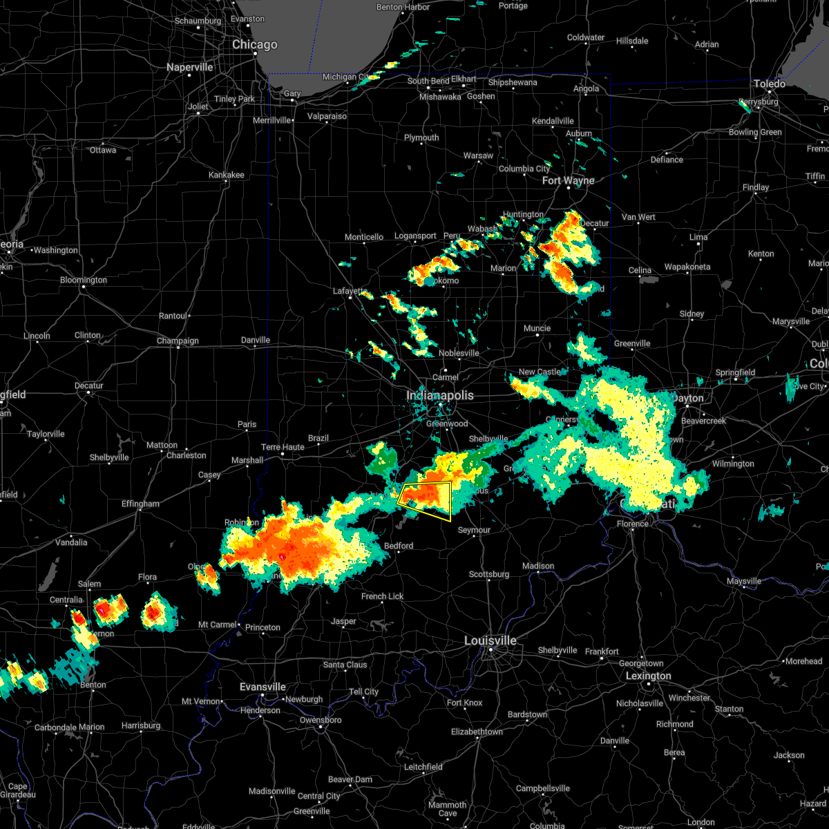 At 740 pm edt, a severe thunderstorm was located 7 miles east of bloomington, moving east at 25 mph (radar indicated). Hazards include 60 mph wind gusts and quarter size hail. Hail damage to vehicles is expected. expect wind damage to roofs, siding, and trees. this severe storm will be near, yellowwood lake around 745 pm edt. helmsburg around 750 pm edt. Other locations in the path of this severe thunderstorm include nashville, story, gnaw bone, stone head and spurgeons corner. At 740 pm edt, a severe thunderstorm was located 7 miles east of bloomington, moving east at 25 mph (radar indicated). Hazards include 60 mph wind gusts and quarter size hail. Hail damage to vehicles is expected. expect wind damage to roofs, siding, and trees. this severe storm will be near, yellowwood lake around 745 pm edt. helmsburg around 750 pm edt. Other locations in the path of this severe thunderstorm include nashville, story, gnaw bone, stone head and spurgeons corner.
|
| 7/24/2022 7:32 PM EDT |
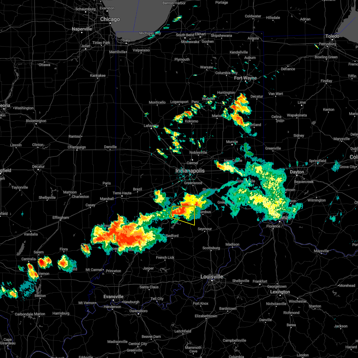 At 731 pm edt, a severe thunderstorm was located near bloomington, moving east at 25 mph (radar indicated). Hazards include 60 mph wind gusts and quarter size hail. Hail damage to vehicles is expected. expect wind damage to roofs, siding, and trees. this severe storm will be near, lake lemon around 735 pm edt. Other locations in the path of this severe thunderstorm include woodville hills, yellowwood lake, helmsburg, nashville, gnaw bone, story, stone head and spurgeons corner. At 731 pm edt, a severe thunderstorm was located near bloomington, moving east at 25 mph (radar indicated). Hazards include 60 mph wind gusts and quarter size hail. Hail damage to vehicles is expected. expect wind damage to roofs, siding, and trees. this severe storm will be near, lake lemon around 735 pm edt. Other locations in the path of this severe thunderstorm include woodville hills, yellowwood lake, helmsburg, nashville, gnaw bone, story, stone head and spurgeons corner.
|
| 7/24/2022 7:18 PM EDT |
 At 718 pm edt, a severe thunderstorm was located near bloomington, moving east at 25 mph (radar indicated). Hazards include 60 mph wind gusts and quarter size hail. Hail damage to vehicles is expected. expect wind damage to roofs, siding, and trees. this severe thunderstorm will be near, unionville around 730 pm edt. lake lemon around 735 pm edt. other locations in the path of this severe thunderstorm include woodville hills, yellowwood lake, helmsburg, beanblossom, nashville, story, gnaw bone and stone head. hail threat, radar indicated max hail size, 1. 00 in wind threat, radar indicated max wind gust, 60 mph. At 718 pm edt, a severe thunderstorm was located near bloomington, moving east at 25 mph (radar indicated). Hazards include 60 mph wind gusts and quarter size hail. Hail damage to vehicles is expected. expect wind damage to roofs, siding, and trees. this severe thunderstorm will be near, unionville around 730 pm edt. lake lemon around 735 pm edt. other locations in the path of this severe thunderstorm include woodville hills, yellowwood lake, helmsburg, beanblossom, nashville, story, gnaw bone and stone head. hail threat, radar indicated max hail size, 1. 00 in wind threat, radar indicated max wind gust, 60 mph.
|
| 5/21/2022 4:11 PM EDT | Winds at monroe lake 58 mph gust... also heavy rain with tree damag in monroe county IN, 4 miles NW of Bloomington, IN |
| 5/21/2022 3:29 PM EDT | Report from mping: 3-inch tree limbs broken; power poles broke in monroe county IN, 5.5 miles WNW of Bloomington, IN |
| 5/21/2022 3:20 PM EDT | Received a report via social media of trees and powerlines down on fairfax and strain ridge rd south of smithville... i in monroe county IN, 6.4 miles NNW of Bloomington, IN |
| 5/21/2022 3:20 PM EDT | Report from mping: 1-inch tree limbs broken; shingles blown of in monroe county IN, 1 miles NW of Bloomington, IN |
| 5/21/2022 3:16 PM EDT |
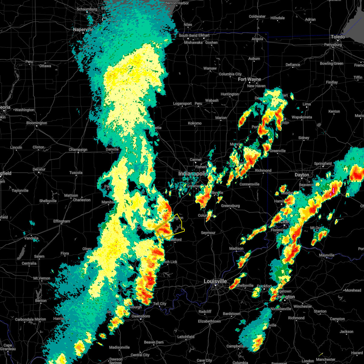 At 316 pm edt, a severe thunderstorm was located 11 miles southwest of bloomington, moving northeast at 40 mph (radar indicated). Hazards include 60 mph wind gusts and quarter size hail. Hail damage to vehicles is expected. expect wind damage to roofs, siding, and trees. locations impacted include, bloomington, harrodsburg, fairfax state recreation area, smithville, monroe reservoir, indiana university, whitehall, woodville hills and charles deam wilderness. hail threat, radar indicated max hail size, 1. 00 in wind threat, radar indicated max wind gust, 60 mph. At 316 pm edt, a severe thunderstorm was located 11 miles southwest of bloomington, moving northeast at 40 mph (radar indicated). Hazards include 60 mph wind gusts and quarter size hail. Hail damage to vehicles is expected. expect wind damage to roofs, siding, and trees. locations impacted include, bloomington, harrodsburg, fairfax state recreation area, smithville, monroe reservoir, indiana university, whitehall, woodville hills and charles deam wilderness. hail threat, radar indicated max hail size, 1. 00 in wind threat, radar indicated max wind gust, 60 mph.
|
| 5/21/2022 3:03 PM EDT |
 At 303 pm edt, a severe thunderstorm was located 8 miles southeast of bloomfield, or 18 miles northwest of bedford, moving northeast at 40 mph (radar indicated). Hazards include 60 mph wind gusts and quarter size hail. Hail damage to vehicles is expected. expect wind damage to roofs, siding, and trees. this severe thunderstorm will be near, solsberry around 315 pm edt. other locations in the path of this severe thunderstorm include harrodsburg, bloomington, smithville, monroe reservoir, indiana university, fairfax state recreation area and whitehall. hail threat, radar indicated max hail size, 1. 00 in wind threat, radar indicated max wind gust, 60 mph. At 303 pm edt, a severe thunderstorm was located 8 miles southeast of bloomfield, or 18 miles northwest of bedford, moving northeast at 40 mph (radar indicated). Hazards include 60 mph wind gusts and quarter size hail. Hail damage to vehicles is expected. expect wind damage to roofs, siding, and trees. this severe thunderstorm will be near, solsberry around 315 pm edt. other locations in the path of this severe thunderstorm include harrodsburg, bloomington, smithville, monroe reservoir, indiana university, fairfax state recreation area and whitehall. hail threat, radar indicated max hail size, 1. 00 in wind threat, radar indicated max wind gust, 60 mph.
|
| 5/19/2022 6:30 PM EDT |
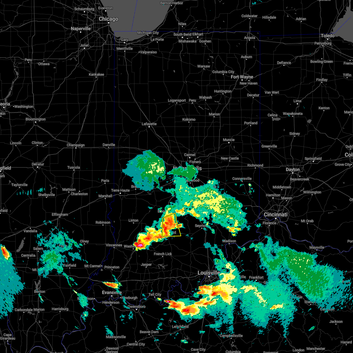 At 630 pm edt, severe thunderstorms were located along a line extending from near bloomington to bedford, moving east at 45 mph (radar indicated). Hazards include 60 mph wind gusts and quarter size hail. Hail damage to vehicles is expected. expect wind damage to roofs, siding, and trees. locations impacted include, woodville hills, heltonville and charles deam wilderness. hail threat, radar indicated max hail size, 1. 00 in wind threat, radar indicated max wind gust, 60 mph. At 630 pm edt, severe thunderstorms were located along a line extending from near bloomington to bedford, moving east at 45 mph (radar indicated). Hazards include 60 mph wind gusts and quarter size hail. Hail damage to vehicles is expected. expect wind damage to roofs, siding, and trees. locations impacted include, woodville hills, heltonville and charles deam wilderness. hail threat, radar indicated max hail size, 1. 00 in wind threat, radar indicated max wind gust, 60 mph.
|
| 5/19/2022 6:13 PM EDT |
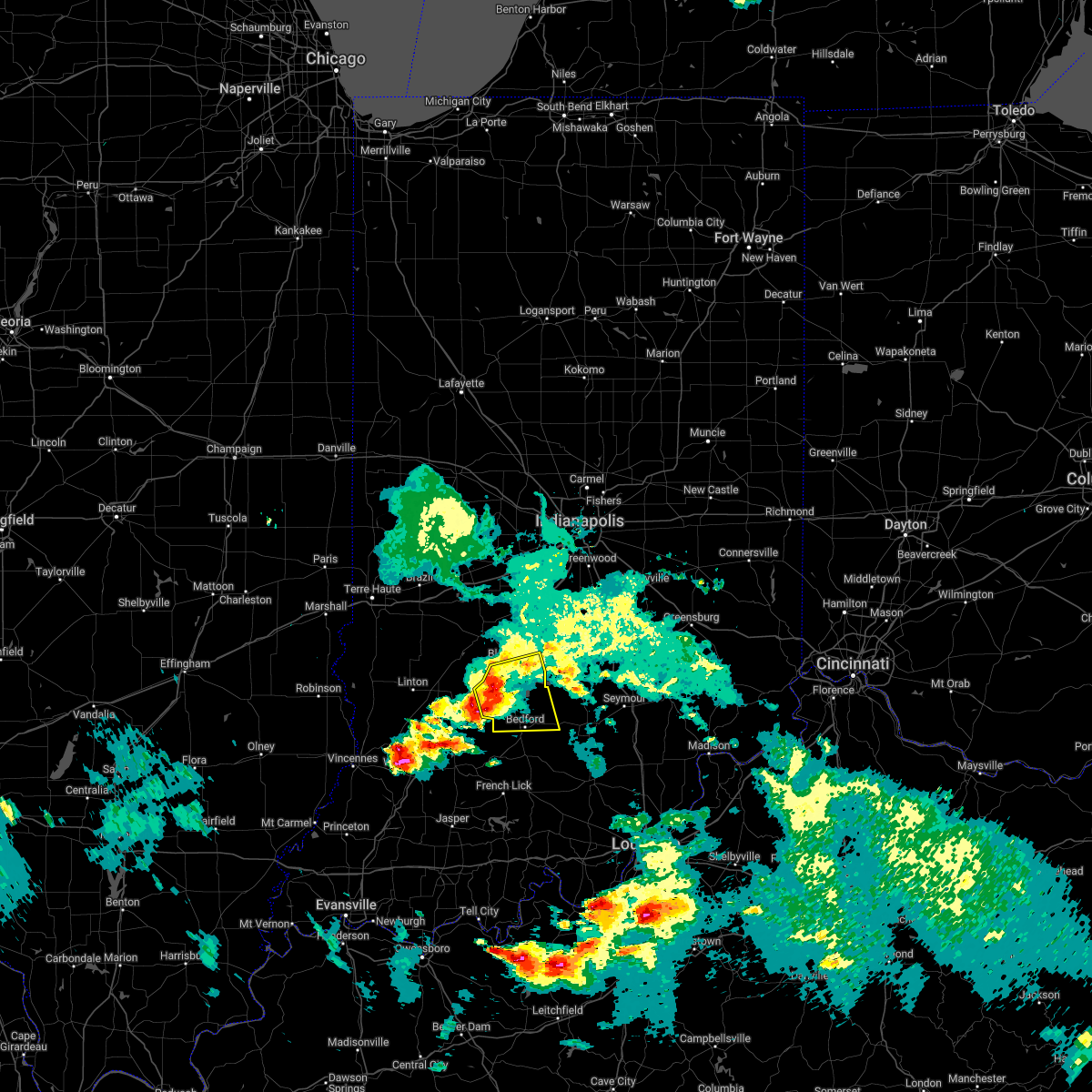 At 613 pm edt, severe thunderstorms were located along a line extending from 7 miles west of bloomington to 8 miles west of bedford, moving east at 30 mph (radar indicated). Hazards include 60 mph wind gusts and quarter size hail. Hail damage to vehicles is expected. expect wind damage to roofs, siding, and trees. severe thunderstorms will be near, bloomington, whitehall and avoca around 620 pm edt. oolitic, indiana university and smithville around 625 pm edt. bedford, monroe reservoir and bartlettsville around 630 pm edt. other locations in the path of these severe thunderstorms include woodville hills, heltonville and charles deam wilderness. hail threat, radar indicated max hail size, 1. 00 in wind threat, radar indicated max wind gust, 60 mph. At 613 pm edt, severe thunderstorms were located along a line extending from 7 miles west of bloomington to 8 miles west of bedford, moving east at 30 mph (radar indicated). Hazards include 60 mph wind gusts and quarter size hail. Hail damage to vehicles is expected. expect wind damage to roofs, siding, and trees. severe thunderstorms will be near, bloomington, whitehall and avoca around 620 pm edt. oolitic, indiana university and smithville around 625 pm edt. bedford, monroe reservoir and bartlettsville around 630 pm edt. other locations in the path of these severe thunderstorms include woodville hills, heltonville and charles deam wilderness. hail threat, radar indicated max hail size, 1. 00 in wind threat, radar indicated max wind gust, 60 mph.
|
| 12/11/2021 2:53 AM EST | Asos station kbmg bloomingto in monroe county IN, 4.1 miles E of Bloomington, IN |
| 6/19/2021 6:43 AM EDT |
 The severe thunderstorm warning for monroe, owen, northern martin, greene and northwestern lawrence counties will expire at 645 am edt, the storm which prompted the warning has weakened below severe limits, and no longer poses an immediate threat to life or property. therefore, the warning will be allowed to expire. however small hail, gusty winds and heavy rain are still possible with this thunderstorm. The severe thunderstorm warning for monroe, owen, northern martin, greene and northwestern lawrence counties will expire at 645 am edt, the storm which prompted the warning has weakened below severe limits, and no longer poses an immediate threat to life or property. therefore, the warning will be allowed to expire. however small hail, gusty winds and heavy rain are still possible with this thunderstorm.
|
| 6/19/2021 6:23 AM EDT |
 At 622 am edt, a severe thunderstorm was located near spencer, or 18 miles west of bloomington, moving southeast at 45 mph (radar indicated). Hazards include 60 mph wind gusts and quarter size hail. Hail damage to vehicles is expected. expect wind damage to roofs, siding, and trees. Locations impacted include, solsberry, bloomington, whitehall, harrodsburg, smithville and monroe reservoir. At 622 am edt, a severe thunderstorm was located near spencer, or 18 miles west of bloomington, moving southeast at 45 mph (radar indicated). Hazards include 60 mph wind gusts and quarter size hail. Hail damage to vehicles is expected. expect wind damage to roofs, siding, and trees. Locations impacted include, solsberry, bloomington, whitehall, harrodsburg, smithville and monroe reservoir.
|
| 6/19/2021 6:07 AM EDT |
 At 607 am edt, a severe thunderstorm was located 14 miles south of brazil, or 20 miles southeast of terre haute, moving southeast at 45 mph (radar indicated). Hazards include 60 mph wind gusts and quarter size hail. Hail damage to vehicles is expected. expect wind damage to roofs, siding, and trees. this severe thunderstorm will be near, patricksburg and coal city around 610 am edt. freedom and mccormicks creek state park around 625 am edt. Other locations in the path of this severe thunderstorm include solsberry, bloomington, harrodsburg and smithville. At 607 am edt, a severe thunderstorm was located 14 miles south of brazil, or 20 miles southeast of terre haute, moving southeast at 45 mph (radar indicated). Hazards include 60 mph wind gusts and quarter size hail. Hail damage to vehicles is expected. expect wind damage to roofs, siding, and trees. this severe thunderstorm will be near, patricksburg and coal city around 610 am edt. freedom and mccormicks creek state park around 625 am edt. Other locations in the path of this severe thunderstorm include solsberry, bloomington, harrodsburg and smithville.
|
| 6/19/2021 3:45 AM EDT |
 At 345 am edt, a severe thunderstorm was located near spencer, or 14 miles west of bloomington, moving east at 30 mph (radar indicated). Hazards include 60 mph wind gusts and quarter size hail. Hail damage to vehicles is expected. expect wind damage to roofs, siding, and trees. this severe thunderstorm will be near, ellettsville around 400 am edt. Other locations in the path of this severe thunderstorm include bloomington, whitehall and indiana university. At 345 am edt, a severe thunderstorm was located near spencer, or 14 miles west of bloomington, moving east at 30 mph (radar indicated). Hazards include 60 mph wind gusts and quarter size hail. Hail damage to vehicles is expected. expect wind damage to roofs, siding, and trees. this severe thunderstorm will be near, ellettsville around 400 am edt. Other locations in the path of this severe thunderstorm include bloomington, whitehall and indiana university.
|
| 6/18/2021 11:41 PM EDT |
 The severe thunderstorm warning for southern vigo, monroe, northeastern sullivan, southern clay, owen and northeastern greene counties will expire at 1145 pm edt, the storms which prompted the warning have weakened below severe limits, and no longer pose an immediate threat to life or property. therefore, the warning will be allowed to expire. however heavy rain is still possible with these thunderstorms. a severe thunderstorm watch remains in effect until 200 am edt for south central, central, southwestern and west central indiana. The severe thunderstorm warning for southern vigo, monroe, northeastern sullivan, southern clay, owen and northeastern greene counties will expire at 1145 pm edt, the storms which prompted the warning have weakened below severe limits, and no longer pose an immediate threat to life or property. therefore, the warning will be allowed to expire. however heavy rain is still possible with these thunderstorms. a severe thunderstorm watch remains in effect until 200 am edt for south central, central, southwestern and west central indiana.
|
| 6/18/2021 11:41 PM EDT |
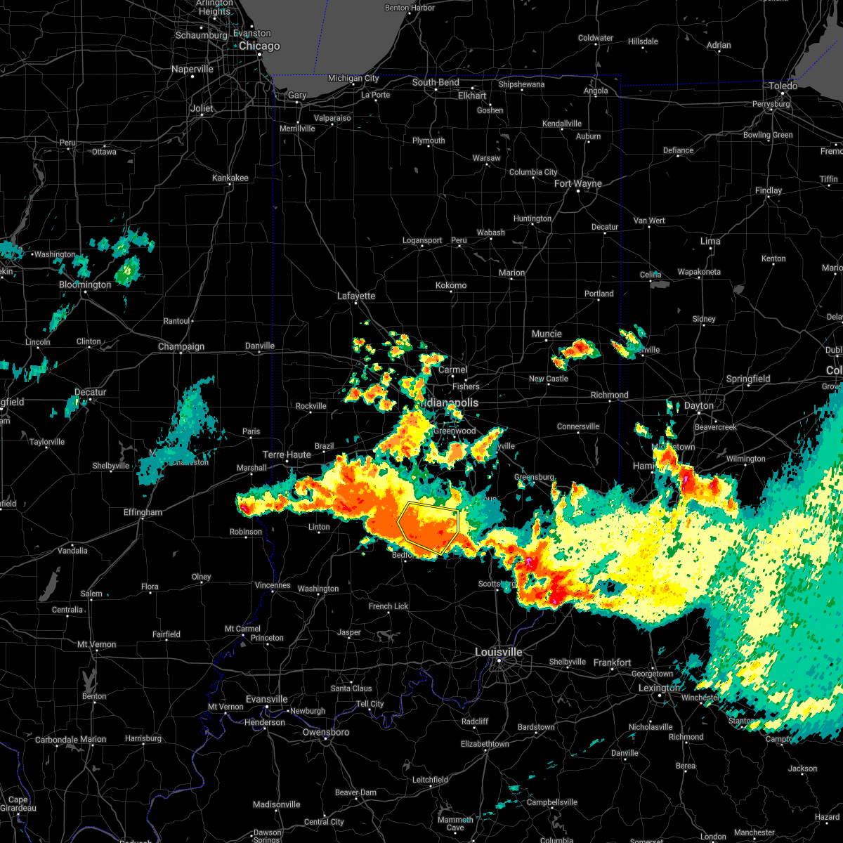 The severe thunderstorm warning for southeastern monroe, southern brown, northeastern lawrence and northwestern jackson counties will expire at 1145 pm edt, the storm which prompted the warning has weakened below severe limits, and no longer poses an immediate threat to life or property. therefore, the warning will be allowed to expire. however heavy rain is still possible with this thunderstorm. a severe thunderstorm watch remains in effect until 200 am edt for central and south central indiana. The severe thunderstorm warning for southeastern monroe, southern brown, northeastern lawrence and northwestern jackson counties will expire at 1145 pm edt, the storm which prompted the warning has weakened below severe limits, and no longer poses an immediate threat to life or property. therefore, the warning will be allowed to expire. however heavy rain is still possible with this thunderstorm. a severe thunderstorm watch remains in effect until 200 am edt for central and south central indiana.
|
| 6/18/2021 11:22 PM EDT |
 At 1122 pm edt, severe thunderstorms were located along a line extending from 13 miles west of spencer to near bloomington, moving east at 40 mph (radar indicated). Hazards include 60 mph wind gusts and quarter size hail. Hail damage to vehicles is expected. expect wind damage to roofs, siding, and trees. Locations impacted include, bloomington, spencer, ellettsville, prairieton, prairie creek, farmersburg, clay city, gosport, stinesville, coal city, indiana university, smithville, mccormicks creek state park, lake lemon, freedom, patricksburg, coalmont, saline city, pimento and monroe reservoir. At 1122 pm edt, severe thunderstorms were located along a line extending from 13 miles west of spencer to near bloomington, moving east at 40 mph (radar indicated). Hazards include 60 mph wind gusts and quarter size hail. Hail damage to vehicles is expected. expect wind damage to roofs, siding, and trees. Locations impacted include, bloomington, spencer, ellettsville, prairieton, prairie creek, farmersburg, clay city, gosport, stinesville, coal city, indiana university, smithville, mccormicks creek state park, lake lemon, freedom, patricksburg, coalmont, saline city, pimento and monroe reservoir.
|
| 6/18/2021 11:20 PM EDT |
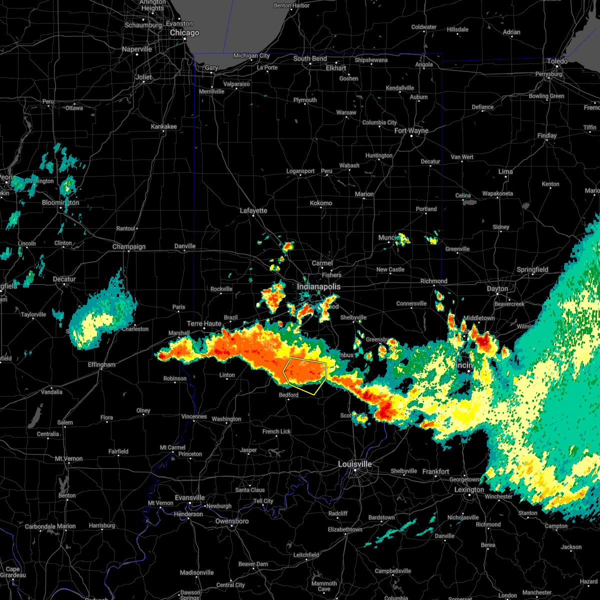 At 1120 pm edt, a severe thunderstorm was located 9 miles south of nashville, or 14 miles southeast of bloomington, moving southeast at 25 mph (radar indicated). Hazards include 60 mph wind gusts and quarter size hail. Hail damage to vehicles is expected. expect wind damage to roofs, siding, and trees. Locations impacted include, story, stone head, norman, spurgeons corner and kurtz. At 1120 pm edt, a severe thunderstorm was located 9 miles south of nashville, or 14 miles southeast of bloomington, moving southeast at 25 mph (radar indicated). Hazards include 60 mph wind gusts and quarter size hail. Hail damage to vehicles is expected. expect wind damage to roofs, siding, and trees. Locations impacted include, story, stone head, norman, spurgeons corner and kurtz.
|
| 6/18/2021 11:05 PM EDT |
 At 1105 pm edt, severe thunderstorms were located along a line extending from 16 miles north of linton to near bloomington, moving east at 40 mph (radar indicated). Hazards include ping pong ball size hail and 60 mph wind gusts. People and animals outdoors will be injured. expect hail damage to roofs, siding, windows, and vehicles. expect wind damage to roofs, siding, and trees. Locations impacted include, ellettsville, indiana university, whitehall, unionville, patricksburg, lake lemon, woodville hills, freedom, spencer, mccormicks creek state park, bloomington, smithville and monroe reservoir. At 1105 pm edt, severe thunderstorms were located along a line extending from 16 miles north of linton to near bloomington, moving east at 40 mph (radar indicated). Hazards include ping pong ball size hail and 60 mph wind gusts. People and animals outdoors will be injured. expect hail damage to roofs, siding, windows, and vehicles. expect wind damage to roofs, siding, and trees. Locations impacted include, ellettsville, indiana university, whitehall, unionville, patricksburg, lake lemon, woodville hills, freedom, spencer, mccormicks creek state park, bloomington, smithville and monroe reservoir.
|
| 6/18/2021 11:03 PM EDT |
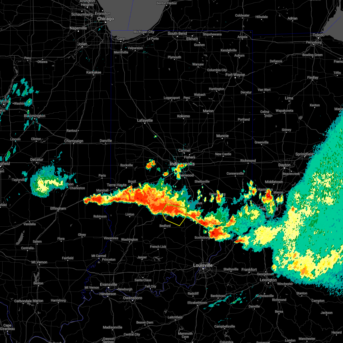 At 1103 pm edt, a severe thunderstorm was located near bloomington, moving southeast at 25 mph (radar indicated). Hazards include 60 mph wind gusts and quarter size hail. Hail damage to vehicles is expected. expect wind damage to roofs, siding, and trees. this severe thunderstorm will be near, charles deam wilderness around 1115 pm edt. Other locations in the path of this severe thunderstorm include elkinsville, story, stone head, norman, spurgeons corner and kurtz. At 1103 pm edt, a severe thunderstorm was located near bloomington, moving southeast at 25 mph (radar indicated). Hazards include 60 mph wind gusts and quarter size hail. Hail damage to vehicles is expected. expect wind damage to roofs, siding, and trees. this severe thunderstorm will be near, charles deam wilderness around 1115 pm edt. Other locations in the path of this severe thunderstorm include elkinsville, story, stone head, norman, spurgeons corner and kurtz.
|
| 6/18/2021 10:42 PM EDT |
 At 1041 pm edt, severe thunderstorms were located along a line extending from 9 miles southwest of terre haute to near spencer, moving east at 40 mph (radar indicated). Hazards include ping pong ball size hail and 60 mph wind gusts. People and animals outdoors will be injured. expect hail damage to roofs, siding, windows, and vehicles. expect wind damage to roofs, siding, and trees. severe thunderstorms will be near, spencer and mccormicks creek state park around 1050 pm edt. ellettsville and stinesville around 1100 pm edt. Other locations in the path of these severe thunderstorms include coalmont, saline city, bloomington, clay city, indiana university, whitehall, coal city, unionville, smithville, patricksburg, monroe reservoir, lake lemon, woodville hills and freedom. At 1041 pm edt, severe thunderstorms were located along a line extending from 9 miles southwest of terre haute to near spencer, moving east at 40 mph (radar indicated). Hazards include ping pong ball size hail and 60 mph wind gusts. People and animals outdoors will be injured. expect hail damage to roofs, siding, windows, and vehicles. expect wind damage to roofs, siding, and trees. severe thunderstorms will be near, spencer and mccormicks creek state park around 1050 pm edt. ellettsville and stinesville around 1100 pm edt. Other locations in the path of these severe thunderstorms include coalmont, saline city, bloomington, clay city, indiana university, whitehall, coal city, unionville, smithville, patricksburg, monroe reservoir, lake lemon, woodville hills and freedom.
|
| 6/18/2021 9:29 PM EDT |
 At 929 pm edt, a severe thunderstorm was located near spencer, or 14 miles northwest of bloomington, moving southeast at 25 mph (radar indicated). Hazards include quarter size hail. Damage to vehicles is expected. this severe thunderstorm will be near, stinesville around 940 pm edt. ellettsville around 945 pm edt. Other locations in the path of this severe thunderstorm include bloomington, unionville, lake lemon and woodville hills. At 929 pm edt, a severe thunderstorm was located near spencer, or 14 miles northwest of bloomington, moving southeast at 25 mph (radar indicated). Hazards include quarter size hail. Damage to vehicles is expected. this severe thunderstorm will be near, stinesville around 940 pm edt. ellettsville around 945 pm edt. Other locations in the path of this severe thunderstorm include bloomington, unionville, lake lemon and woodville hills.
|
| 6/18/2021 8:40 PM EDT | Quarter sized hail reported 10.8 miles SW of Bloomington, IN |
| 6/18/2021 8:38 PM EDT |
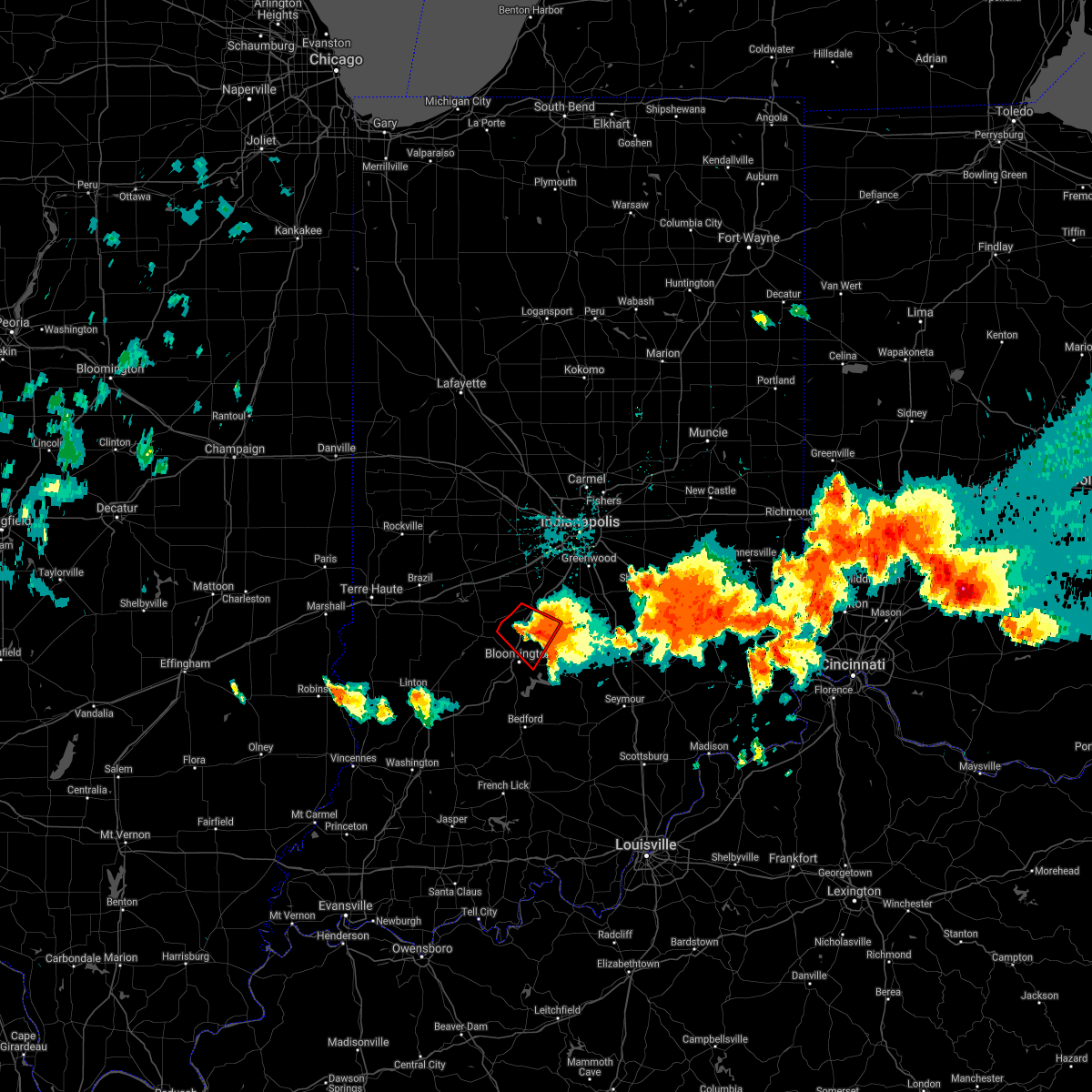 The tornado warning for northern monroe, south central morgan and northwestern brown counties will expire at 845 pm edt, the tornadic thunderstorm which prompted the warning has weakened. therefore, the warning will be allowed to expire. a severe thunderstorm watch remains in effect until 200 am edt for south central and central indiana. The tornado warning for northern monroe, south central morgan and northwestern brown counties will expire at 845 pm edt, the tornadic thunderstorm which prompted the warning has weakened. therefore, the warning will be allowed to expire. a severe thunderstorm watch remains in effect until 200 am edt for south central and central indiana.
|
| 6/18/2021 8:24 PM EDT |
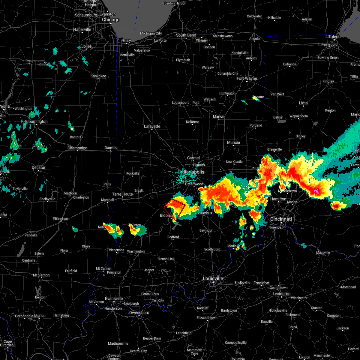 At 824 pm edt, a severe thunderstorm capable of producing a tornado was located 8 miles southwest of martinsville, or 12 miles north of bloomington, moving southeast at 25 mph (radar indicated rotation). Hazards include tornado and golf ball size hail. Flying debris will be dangerous to those caught without shelter. mobile homes will be damaged or destroyed. damage to roofs, windows, and vehicles will occur. tree damage is likely. Locations impacted include, bloomington, martinsville, paragon, stinesville, mahalasville, lake lemon and unionville. At 824 pm edt, a severe thunderstorm capable of producing a tornado was located 8 miles southwest of martinsville, or 12 miles north of bloomington, moving southeast at 25 mph (radar indicated rotation). Hazards include tornado and golf ball size hail. Flying debris will be dangerous to those caught without shelter. mobile homes will be damaged or destroyed. damage to roofs, windows, and vehicles will occur. tree damage is likely. Locations impacted include, bloomington, martinsville, paragon, stinesville, mahalasville, lake lemon and unionville.
|
| 6/18/2021 8:18 PM EDT |
 At 818 pm edt, a severe thunderstorm capable of producing a tornado was located 9 miles southwest of martinsville, or 13 miles north of bloomington, moving southeast at 25 mph (radar indicated rotation). Hazards include tornado. Flying debris will be dangerous to those caught without shelter. mobile homes will be damaged or destroyed. damage to roofs, windows, and vehicles will occur. Tree damage is likely. At 818 pm edt, a severe thunderstorm capable of producing a tornado was located 9 miles southwest of martinsville, or 13 miles north of bloomington, moving southeast at 25 mph (radar indicated rotation). Hazards include tornado. Flying debris will be dangerous to those caught without shelter. mobile homes will be damaged or destroyed. damage to roofs, windows, and vehicles will occur. Tree damage is likely.
|
| 6/18/2021 7:45 PM EDT |
 At 745 pm edt, a severe thunderstorm was located 11 miles west of martinsville, or 21 miles north of bloomington, moving southeast at 30 mph (radar indicated). Hazards include golf ball size hail and 60 mph wind gusts. People and animals outdoors will be injured. expect hail damage to roofs, siding, windows, and vehicles. expect wind damage to roofs, siding, and trees. this severe thunderstorm will be near, paragon around 755 pm edt. martinsville around 805 pm edt. other locations in the path of this severe thunderstorm include mahalasville, lake lemon and morgantown. This includes interstate 70 near mile marker 50. At 745 pm edt, a severe thunderstorm was located 11 miles west of martinsville, or 21 miles north of bloomington, moving southeast at 30 mph (radar indicated). Hazards include golf ball size hail and 60 mph wind gusts. People and animals outdoors will be injured. expect hail damage to roofs, siding, windows, and vehicles. expect wind damage to roofs, siding, and trees. this severe thunderstorm will be near, paragon around 755 pm edt. martinsville around 805 pm edt. other locations in the path of this severe thunderstorm include mahalasville, lake lemon and morgantown. This includes interstate 70 near mile marker 50.
|
| 8/10/2020 8:20 PM EDT |
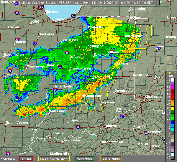 At 819 pm edt, a severe thunderstorm was located near nashville, or 11 miles east of bloomington, moving east at 35 mph (radar indicated). Hazards include 70 mph wind gusts. Expect considerable tree damage. damage is likely to mobile homes, roofs, and outbuildings. Locations impacted include, bloomington, nashville, indiana university, smithville, helmsburg, freetown, lake lemon, beanblossom, gnaw bone, spurgeons corner, yellowwood lake, spearsville, monroe reservoir, woodville hills, elkinsville, charles deam wilderness, stone head, unionville, story and whitehall. At 819 pm edt, a severe thunderstorm was located near nashville, or 11 miles east of bloomington, moving east at 35 mph (radar indicated). Hazards include 70 mph wind gusts. Expect considerable tree damage. damage is likely to mobile homes, roofs, and outbuildings. Locations impacted include, bloomington, nashville, indiana university, smithville, helmsburg, freetown, lake lemon, beanblossom, gnaw bone, spurgeons corner, yellowwood lake, spearsville, monroe reservoir, woodville hills, elkinsville, charles deam wilderness, stone head, unionville, story and whitehall.
|
| 8/10/2020 8:06 PM EDT |
 At 806 pm edt, a severe thunderstorm was located near nashville, or 9 miles east of bloomington, moving southeast at 30 mph (radar indicated). Hazards include 70 mph wind gusts. Expect considerable tree damage. damage is likely to mobile homes, roofs, and outbuildings. Locations impacted include, bloomington, nashville, ellettsville, stinesville, indiana university, smithville, helmsburg, freetown, lake lemon, beanblossom, gnaw bone, spurgeons corner, yellowwood lake, spearsville, solsberry, monroe reservoir, woodville hills, elkinsville, charles deam wilderness and stone head. At 806 pm edt, a severe thunderstorm was located near nashville, or 9 miles east of bloomington, moving southeast at 30 mph (radar indicated). Hazards include 70 mph wind gusts. Expect considerable tree damage. damage is likely to mobile homes, roofs, and outbuildings. Locations impacted include, bloomington, nashville, ellettsville, stinesville, indiana university, smithville, helmsburg, freetown, lake lemon, beanblossom, gnaw bone, spurgeons corner, yellowwood lake, spearsville, solsberry, monroe reservoir, woodville hills, elkinsville, charles deam wilderness and stone head.
|
| 8/10/2020 7:34 PM EDT |
 At 733 pm edt, a severe thunderstorm was located 8 miles east of spencer, or 11 miles northwest of bloomington, moving east at 45 mph (radar indicated). Hazards include 60 mph wind gusts. expect damage to roofs, siding, and trees At 733 pm edt, a severe thunderstorm was located 8 miles east of spencer, or 11 miles northwest of bloomington, moving east at 45 mph (radar indicated). Hazards include 60 mph wind gusts. expect damage to roofs, siding, and trees
|
| 7/21/2020 7:45 PM EDT | Several trees up to 4 inches in diameter were blown down across the roadway. location is approximat in monroe county IN, 7.7 miles S of Bloomington, IN |
| 7/19/2020 8:15 PM EDT | Tree across roa in monroe county IN, 6 miles WNW of Bloomington, IN |
| 7/19/2020 7:15 PM EDT | Corrects previous tstm wnd dmg report from 3 sw woodview hills. tree across road. time est from rada in monroe county IN, 6 miles WNW of Bloomington, IN |
| 7/19/2020 7:10 PM EDT | Multiple medium-large trees across road. time est from rada in monroe county IN, 6 miles WNW of Bloomington, IN |
| 7/19/2020 7:03 PM EDT |
 A severe thunderstorm warning remains in effect until 715 pm edt for monroe. south central morgan. brown. southwestern bartholomew. southeastern owen. northeastern greene. northern lawrence and northwestern jackson counties. At 703 pm edt, a severe thunderstorm was located over bloomington, moving southeast at 55 mph. A severe thunderstorm warning remains in effect until 715 pm edt for monroe. south central morgan. brown. southwestern bartholomew. southeastern owen. northeastern greene. northern lawrence and northwestern jackson counties. At 703 pm edt, a severe thunderstorm was located over bloomington, moving southeast at 55 mph.
|
| 7/19/2020 7:03 PM EDT |
 At 703 pm edt, a severe thunderstorm was located over bloomington, moving southeast at 55 mph (radar indicated). Hazards include 60 mph wind gusts. Expect damage to roofs, siding, and trees. Locations impacted include, bloomington, columbus, bedford, nashville, ellettsville, oolitic, stinesville, smithville, lake lemon, gnaw bone, bartlettsville, spurgeons corner, avoca, monroe reservoir, woodville hills, elkinsville, charles deam wilderness, stone head, unionville and story. At 703 pm edt, a severe thunderstorm was located over bloomington, moving southeast at 55 mph (radar indicated). Hazards include 60 mph wind gusts. Expect damage to roofs, siding, and trees. Locations impacted include, bloomington, columbus, bedford, nashville, ellettsville, oolitic, stinesville, smithville, lake lemon, gnaw bone, bartlettsville, spurgeons corner, avoca, monroe reservoir, woodville hills, elkinsville, charles deam wilderness, stone head, unionville and story.
|
| 7/19/2020 6:45 PM EDT |
 At 645 pm edt, a severe thunderstorm was located near bloomington, moving southeast at 45 mph (radar indicated). Hazards include 60 mph wind gusts. expect damage to roofs, siding, and trees At 645 pm edt, a severe thunderstorm was located near bloomington, moving southeast at 45 mph (radar indicated). Hazards include 60 mph wind gusts. expect damage to roofs, siding, and trees
|
| 7/12/2020 1:10 AM EDT |
 At 109 am edt, severe thunderstorms were located along a line extending from near mooresville to near bloomington to 12 miles east of bloomfield to 13 miles south of linton, moving southeast at 45 mph. the line has weakened since 1255 am (radar indicated). Hazards include 60 mph wind gusts and quarter size hail. Hail damage to vehicles is expected. expect wind damage to roofs, siding, and trees. locations impacted include, bloomington, plainfield, franklin, martinsville, mooresville, linton, bloomfield, nashville, ellettsville, new whiteland, whiteland, bargersville, bicknell, brooklyn, odon, princes lakes, trafalgar, monrovia, morgantown and lyons. this includes the following highways, interstate 65 between mile markers 89 and 93. Interstate 70 between mile markers 59 and 65. At 109 am edt, severe thunderstorms were located along a line extending from near mooresville to near bloomington to 12 miles east of bloomfield to 13 miles south of linton, moving southeast at 45 mph. the line has weakened since 1255 am (radar indicated). Hazards include 60 mph wind gusts and quarter size hail. Hail damage to vehicles is expected. expect wind damage to roofs, siding, and trees. locations impacted include, bloomington, plainfield, franklin, martinsville, mooresville, linton, bloomfield, nashville, ellettsville, new whiteland, whiteland, bargersville, bicknell, brooklyn, odon, princes lakes, trafalgar, monrovia, morgantown and lyons. this includes the following highways, interstate 65 between mile markers 89 and 93. Interstate 70 between mile markers 59 and 65.
|
| 7/12/2020 12:53 AM EDT |
 At 1252 am edt, severe thunderstorms were located along a line extending from near danville to near spencer to 7 miles north of bloomfield to 7 miles northeast of russellville, moving southeast at 45 mph (radar indicated). Hazards include 60 mph wind gusts and quarter size hail. Hail damage to vehicles is expected. Expect wind damage to roofs, siding, and trees. At 1252 am edt, severe thunderstorms were located along a line extending from near danville to near spencer to 7 miles north of bloomfield to 7 miles northeast of russellville, moving southeast at 45 mph (radar indicated). Hazards include 60 mph wind gusts and quarter size hail. Hail damage to vehicles is expected. Expect wind damage to roofs, siding, and trees.
|
| 7/11/2020 6:57 PM EDT |
 The severe thunderstorm warning for central monroe and southern brown counties will expire at 700 pm edt, the severe thunderstorm which prompted the warning has weakened. therefore, the warning will be allowed to expire. The severe thunderstorm warning for central monroe and southern brown counties will expire at 700 pm edt, the severe thunderstorm which prompted the warning has weakened. therefore, the warning will be allowed to expire.
|
| 7/11/2020 6:50 PM EDT |
 At 650 pm edt, a severe thunderstorm was located 9 miles southeast of bloomington, moving southeast at 45 mph (radar indicated). Hazards include 60 mph wind gusts and quarter size hail. Hail damage to vehicles is expected. expect wind damage to roofs, siding, and trees. Locations impacted include, bloomington, nashville, ellettsville, indiana university, lake lemon, yellowwood lake, monroe reservoir, woodville hills, elkinsville, charles deam wilderness, stone head, unionville, story and whitehall. At 650 pm edt, a severe thunderstorm was located 9 miles southeast of bloomington, moving southeast at 45 mph (radar indicated). Hazards include 60 mph wind gusts and quarter size hail. Hail damage to vehicles is expected. expect wind damage to roofs, siding, and trees. Locations impacted include, bloomington, nashville, ellettsville, indiana university, lake lemon, yellowwood lake, monroe reservoir, woodville hills, elkinsville, charles deam wilderness, stone head, unionville, story and whitehall.
|
| 7/11/2020 6:33 PM EDT |
 At 633 pm edt, a severe thunderstorm was located over bloomington, moving southeast at 30 mph (radar indicated). Hazards include 60 mph wind gusts and quarter size hail. Hail damage to vehicles is expected. expect wind damage to roofs, siding, and trees. Locations impacted include, bloomington, nashville, ellettsville, indiana university, helmsburg, lake lemon, beanblossom, gnaw bone, yellowwood lake, monroe reservoir, woodville hills, elkinsville, charles deam wilderness, stone head, unionville, story and whitehall. At 633 pm edt, a severe thunderstorm was located over bloomington, moving southeast at 30 mph (radar indicated). Hazards include 60 mph wind gusts and quarter size hail. Hail damage to vehicles is expected. expect wind damage to roofs, siding, and trees. Locations impacted include, bloomington, nashville, ellettsville, indiana university, helmsburg, lake lemon, beanblossom, gnaw bone, yellowwood lake, monroe reservoir, woodville hills, elkinsville, charles deam wilderness, stone head, unionville, story and whitehall.
|
| 7/11/2020 6:24 PM EDT |
 At 624 pm edt, a severe thunderstorm was located near bloomington, moving southeast at 40 mph (radar indicated). Hazards include 60 mph wind gusts and quarter size hail. Hail damage to vehicles is expected. Expect wind damage to roofs, siding, and trees. At 624 pm edt, a severe thunderstorm was located near bloomington, moving southeast at 40 mph (radar indicated). Hazards include 60 mph wind gusts and quarter size hail. Hail damage to vehicles is expected. Expect wind damage to roofs, siding, and trees.
|
| 4/8/2020 9:37 PM EDT | Half Dollar sized hail reported 6 miles WNW of Bloomington, IN, will not appear in products. quarter to half dollar size hail with moderate ground coverage with second storm. |
| 4/8/2020 9:25 PM EDT | Power flashes... sparks from pole outside propert in monroe county IN, 6 miles WNW of Bloomington, IN |
| 4/8/2020 9:16 PM EDT |
 At 915 pm edt, severe thunderstorms were located along a line extending from near nashville to 9 miles north of shoals to petersburg, moving east at 60 mph. these are very dangerous storms (radar indicated). Hazards include 80 mph wind gusts and quarter size hail. Flying debris will be dangerous to those caught without shelter. mobile homes will be heavily damaged. expect considerable damage to roofs, windows, and vehicles. extensive tree damage and power outages are likely. locations impacted include, bloomington, columbus, vincennes, seymour, bedford, washington, brownstown, bloomfield, nashville, shoals, ellettsville, mitchell, bicknell, loogootee, odon, oolitic, medora, elnora, monroe city and elizabethtown. This includes interstate 65 between mile markers 54 and 68. At 915 pm edt, severe thunderstorms were located along a line extending from near nashville to 9 miles north of shoals to petersburg, moving east at 60 mph. these are very dangerous storms (radar indicated). Hazards include 80 mph wind gusts and quarter size hail. Flying debris will be dangerous to those caught without shelter. mobile homes will be heavily damaged. expect considerable damage to roofs, windows, and vehicles. extensive tree damage and power outages are likely. locations impacted include, bloomington, columbus, vincennes, seymour, bedford, washington, brownstown, bloomfield, nashville, shoals, ellettsville, mitchell, bicknell, loogootee, odon, oolitic, medora, elnora, monroe city and elizabethtown. This includes interstate 65 between mile markers 54 and 68.
|
| 4/8/2020 8:59 PM EDT |
 At 859 pm edt, severe thunderstorms were located along a line extending from 7 miles northwest of bloomington to 11 miles south of linton to near st. francisville, moving southeast at 60 mph. these are very dangerous storms (radar indicated). Hazards include 80 mph wind gusts and quarter size hail. Flying debris will be dangerous to those caught without shelter. mobile homes will be heavily damaged. expect considerable damage to roofs, windows, and vehicles. Extensive tree damage and power outages are likely. At 859 pm edt, severe thunderstorms were located along a line extending from 7 miles northwest of bloomington to 11 miles south of linton to near st. francisville, moving southeast at 60 mph. these are very dangerous storms (radar indicated). Hazards include 80 mph wind gusts and quarter size hail. Flying debris will be dangerous to those caught without shelter. mobile homes will be heavily damaged. expect considerable damage to roofs, windows, and vehicles. Extensive tree damage and power outages are likely.
|
| 1/11/2020 7:39 AM EST | Report from mping: 1-inch tree limbs broken; shingles blown of in monroe county IN, 3.1 miles NW of Bloomington, IN |
| 8/20/2019 2:50 PM EDT |
 At 249 pm edt, severe thunderstorms were located along a line extending from 6 miles southeast of bloomington to 10 miles north of shoals to 6 miles west of petersburg, moving east at 50 mph (radar indicated). Hazards include 60 mph wind gusts. Expect damage to roofs, siding, and trees. Locations impacted include, bloomington, vincennes, washington, bloomfield, shoals, ellettsville, bicknell, loogootee, odon, lyons, elnora, monroe city, wheatland, bruceville, plainville, sandborn, montgomery, edwardsport, switz city and decker. At 249 pm edt, severe thunderstorms were located along a line extending from 6 miles southeast of bloomington to 10 miles north of shoals to 6 miles west of petersburg, moving east at 50 mph (radar indicated). Hazards include 60 mph wind gusts. Expect damage to roofs, siding, and trees. Locations impacted include, bloomington, vincennes, washington, bloomfield, shoals, ellettsville, bicknell, loogootee, odon, lyons, elnora, monroe city, wheatland, bruceville, plainville, sandborn, montgomery, edwardsport, switz city and decker.
|
| 8/20/2019 2:30 PM EDT |
 At 229 pm edt, a severe thunderstorm was located 9 miles southwest of linton, or 22 miles northeast of vincennes, moving east at 45 mph (radar indicated). Hazards include 60 mph wind gusts and penny size hail. expect damage to roofs, siding, and trees At 229 pm edt, a severe thunderstorm was located 9 miles southwest of linton, or 22 miles northeast of vincennes, moving east at 45 mph (radar indicated). Hazards include 60 mph wind gusts and penny size hail. expect damage to roofs, siding, and trees
|
| 7/3/2019 5:47 PM EDT |
 At 547 pm edt, a severe thunderstorm was located 10 miles west of bloomington, moving east at 5 mph (radar indicated). Hazards include 60 mph wind gusts and quarter size hail. Hail damage to vehicles is expected. Expect wind damage to roofs, siding, and trees. At 547 pm edt, a severe thunderstorm was located 10 miles west of bloomington, moving east at 5 mph (radar indicated). Hazards include 60 mph wind gusts and quarter size hail. Hail damage to vehicles is expected. Expect wind damage to roofs, siding, and trees.
|
| 6/30/2019 6:40 PM EDT |
 At 640 pm edt, a severe thunderstorm was located 9 miles northwest of bedford, moving south at 15 mph (radar indicated). Hazards include 70 mph wind gusts. Expect considerable tree damage. damage is likely to mobile homes, roofs, and outbuildings. Locations impacted include, bloomington, linton, bloomfield, nashville, oolitic, lyons, switz city, newberry, smithville, lake lemon, bartlettsville, avoca, monroe reservoir, woodville hills, elkinsville, charles deam wilderness, vicksburg, stone head, unionville and story. At 640 pm edt, a severe thunderstorm was located 9 miles northwest of bedford, moving south at 15 mph (radar indicated). Hazards include 70 mph wind gusts. Expect considerable tree damage. damage is likely to mobile homes, roofs, and outbuildings. Locations impacted include, bloomington, linton, bloomfield, nashville, oolitic, lyons, switz city, newberry, smithville, lake lemon, bartlettsville, avoca, monroe reservoir, woodville hills, elkinsville, charles deam wilderness, vicksburg, stone head, unionville and story.
|
| 6/30/2019 6:22 PM EDT |
 At 622 pm edt, a severe thunderstorm was located near bloomington, moving southeast at 15 mph (radar indicated). Hazards include 70 mph wind gusts. Expect considerable tree damage. Damage is likely to mobile homes, roofs, and outbuildings. At 622 pm edt, a severe thunderstorm was located near bloomington, moving southeast at 15 mph (radar indicated). Hazards include 70 mph wind gusts. Expect considerable tree damage. Damage is likely to mobile homes, roofs, and outbuildings.
|
| 6/30/2019 6:11 PM EDT | Corrects previous tstm wnd gst report from 3 wsw whitehal in monroe county IN, 4.1 miles E of Bloomington, IN |
| 6/30/2019 5:35 PM EDT | Live 6-inch diameter trees uprooted on curry pike road. exact location not available. time roughly estimated from radar. report received at 1840 local tim in monroe county IN, 2 miles ENE of Bloomington, IN |
| 6/30/2019 5:30 PM EDT |
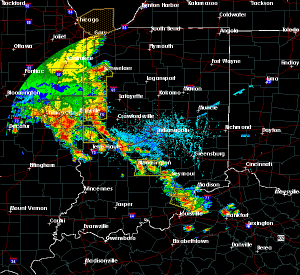 At 507 pm edt, a severe thunderstorm was located over nashville, or 15 miles east of bloomington, moving south at 10 mph (radar indicated). Hazards include 60 mph wind gusts and quarter size hail. Hail damage to vehicles is expected. Expect wind damage to roofs, siding, and trees. At 507 pm edt, a severe thunderstorm was located over nashville, or 15 miles east of bloomington, moving south at 10 mph (radar indicated). Hazards include 60 mph wind gusts and quarter size hail. Hail damage to vehicles is expected. Expect wind damage to roofs, siding, and trees.
|
| 6/30/2019 5:27 PM EDT | Quarter sized hail reported 6.1 miles SSW of Bloomington, IN |
| 6/30/2019 5:07 PM EDT |
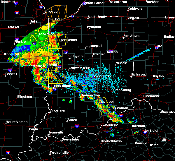 At 507 pm edt, a severe thunderstorm was located over nashville, or 15 miles east of bloomington, moving south at 10 mph (radar indicated). Hazards include 60 mph wind gusts and quarter size hail. Hail damage to vehicles is expected. Expect wind damage to roofs, siding, and trees. At 507 pm edt, a severe thunderstorm was located over nashville, or 15 miles east of bloomington, moving south at 10 mph (radar indicated). Hazards include 60 mph wind gusts and quarter size hail. Hail damage to vehicles is expected. Expect wind damage to roofs, siding, and trees.
|
| 6/24/2019 9:13 PM EDT |
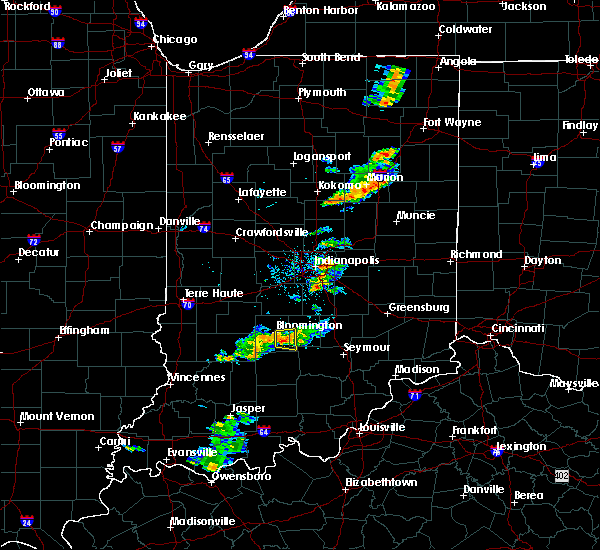 At 913 pm edt, a severe thunderstorm was located near bloomington, moving east at 25 mph (radar indicated). Hazards include 60 mph wind gusts and quarter size hail. Hail damage to vehicles is expected. expect wind damage to roofs, siding, and trees. Locations impacted include, bloomington, woodville hills, yellowwood lake, charles deam wilderness, smithville and monroe reservoir. At 913 pm edt, a severe thunderstorm was located near bloomington, moving east at 25 mph (radar indicated). Hazards include 60 mph wind gusts and quarter size hail. Hail damage to vehicles is expected. expect wind damage to roofs, siding, and trees. Locations impacted include, bloomington, woodville hills, yellowwood lake, charles deam wilderness, smithville and monroe reservoir.
|
| 6/24/2019 8:53 PM EDT |
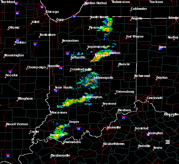 At 852 pm edt, a severe thunderstorm was located near bloomington, moving east at 20 mph (radar indicated). Hazards include 60 mph wind gusts and quarter size hail. Hail damage to vehicles is expected. Expect wind damage to roofs, siding, and trees. At 852 pm edt, a severe thunderstorm was located near bloomington, moving east at 20 mph (radar indicated). Hazards include 60 mph wind gusts and quarter size hail. Hail damage to vehicles is expected. Expect wind damage to roofs, siding, and trees.
|
| 6/23/2019 3:09 PM EDT |
 The severe thunderstorm warning for northwestern monroe, northeastern clay, eastern owen and southwestern putnam counties will expire at 315 pm edt, the storms which prompted the warning have moved out of the area. therefore, the warning will be allowed to expire. however gusty winds are still possible with these thunderstorms. a severe thunderstorm watch remains in effect until 800 pm edt for south central, central, southwestern and west central indiana. The severe thunderstorm warning for northwestern monroe, northeastern clay, eastern owen and southwestern putnam counties will expire at 315 pm edt, the storms which prompted the warning have moved out of the area. therefore, the warning will be allowed to expire. however gusty winds are still possible with these thunderstorms. a severe thunderstorm watch remains in effect until 800 pm edt for south central, central, southwestern and west central indiana.
|
| 6/23/2019 3:04 PM EDT |
 At 304 pm edt, severe thunderstorms were located along a line extending from 6 miles southwest of nashville to 6 miles northwest of brownstown to salem, moving east at 50 mph. this storm has a history of producing tree damage (public). Hazards include 60 mph wind gusts. Expect damage to roofs, siding, and trees. Locations impacted include, bloomington, brownstown, nashville, medora, heltonville, norman, smithville, tunnelton, freetown, bartlettsville, vallonia, yellowwood lake, spurgeons corner, pleasant view, spring mill state park, monroe reservoir, woodville hills, elkinsville, kurtz and charles deam wilderness. At 304 pm edt, severe thunderstorms were located along a line extending from 6 miles southwest of nashville to 6 miles northwest of brownstown to salem, moving east at 50 mph. this storm has a history of producing tree damage (public). Hazards include 60 mph wind gusts. Expect damage to roofs, siding, and trees. Locations impacted include, bloomington, brownstown, nashville, medora, heltonville, norman, smithville, tunnelton, freetown, bartlettsville, vallonia, yellowwood lake, spurgeons corner, pleasant view, spring mill state park, monroe reservoir, woodville hills, elkinsville, kurtz and charles deam wilderness.
|
| 6/23/2019 2:54 PM EDT |
 At 253 pm edt, severe thunderstorms were located along a line extending from near bloomington to 9 miles east of bedford to 7 miles west of salem, moving east at 50 mph (radar indicated). Hazards include 60 mph wind gusts. Expect damage to roofs, siding, and trees. Locations impacted include, bloomington, bedford, brownstown, nashville, mitchell, oolitic, medora, smithville, tunnelton, bartlettsville, vallonia, spurgeons corner, avoca, pleasant view, monroe reservoir, woodville hills, elkinsville, charles deam wilderness, story and heltonville. At 253 pm edt, severe thunderstorms were located along a line extending from near bloomington to 9 miles east of bedford to 7 miles west of salem, moving east at 50 mph (radar indicated). Hazards include 60 mph wind gusts. Expect damage to roofs, siding, and trees. Locations impacted include, bloomington, bedford, brownstown, nashville, mitchell, oolitic, medora, smithville, tunnelton, bartlettsville, vallonia, spurgeons corner, avoca, pleasant view, monroe reservoir, woodville hills, elkinsville, charles deam wilderness, story and heltonville.
|
| 6/23/2019 2:54 PM EDT |
 At 254 pm edt, severe thunderstorms were located along a line extending from 11 miles northwest of spencer to 9 miles west of bloomington, moving northeast at 40 mph (law enforcement). Hazards include 60 mph wind gusts and penny size hail. Expect damage to roofs, siding, and trees. locations impacted include, bloomington, greencastle, brazil, spencer, ellettsville, cloverdale, knightsville, gosport, harmony, stinesville, indiana university, quincy, mccormicks creek state park, reelsville, cagles mill lake, devore and whitehall. This includes interstate 70 between mile markers 27 and 44. At 254 pm edt, severe thunderstorms were located along a line extending from 11 miles northwest of spencer to 9 miles west of bloomington, moving northeast at 40 mph (law enforcement). Hazards include 60 mph wind gusts and penny size hail. Expect damage to roofs, siding, and trees. locations impacted include, bloomington, greencastle, brazil, spencer, ellettsville, cloverdale, knightsville, gosport, harmony, stinesville, indiana university, quincy, mccormicks creek state park, reelsville, cagles mill lake, devore and whitehall. This includes interstate 70 between mile markers 27 and 44.
|
| 6/23/2019 2:52 PM EDT |
 At 252 pm edt, severe thunderstorms were located along a line extending from 9 miles northeast of brazil to 7 miles northeast of spencer to 7 miles south of bloomington, moving northeast at 60 mph. this storm has a history of producing significant tree damage (law enforcement). Hazards include 60 mph wind gusts. expect damage to roofs, siding, and trees At 252 pm edt, severe thunderstorms were located along a line extending from 9 miles northeast of brazil to 7 miles northeast of spencer to 7 miles south of bloomington, moving northeast at 60 mph. this storm has a history of producing significant tree damage (law enforcement). Hazards include 60 mph wind gusts. expect damage to roofs, siding, and trees
|
| 6/23/2019 2:51 PM EDT | Pole barn destroyed... dump truck tipped over... and numerous large trees snapped and uproote in monroe county IN, 5.1 miles NNW of Bloomington, IN |
| 6/23/2019 2:32 PM EDT |
 At 231 pm edt, severe thunderstorms were located along a line extending from 13 miles south of brazil to bloomfield, moving northeast at 40 mph (radar indicated). Hazards include 60 mph wind gusts and penny size hail. Expect damage to roofs, siding, and trees. locations impacted include, bloomington, greencastle, bloomfield, spencer, ellettsville, cloverdale, worthington, knightsville, clay city, gosport, harmony, center point, stinesville, quincy, freedom, reelsville, saline city, cagles mill lake, devore and whitehall. This includes interstate 70 between mile markers 21 and 44. At 231 pm edt, severe thunderstorms were located along a line extending from 13 miles south of brazil to bloomfield, moving northeast at 40 mph (radar indicated). Hazards include 60 mph wind gusts and penny size hail. Expect damage to roofs, siding, and trees. locations impacted include, bloomington, greencastle, bloomfield, spencer, ellettsville, cloverdale, worthington, knightsville, clay city, gosport, harmony, center point, stinesville, quincy, freedom, reelsville, saline city, cagles mill lake, devore and whitehall. This includes interstate 70 between mile markers 21 and 44.
|
| 6/23/2019 2:24 PM EDT |
 At 224 pm edt, severe thunderstorms were located along a line extending from bloomfield to 10 miles north of shoals to 10 miles southwest of paoli, moving east at 50 mph (radar indicated). Hazards include 60 mph wind gusts. expect damage to roofs, siding, and trees At 224 pm edt, severe thunderstorms were located along a line extending from bloomfield to 10 miles north of shoals to 10 miles southwest of paoli, moving east at 50 mph (radar indicated). Hazards include 60 mph wind gusts. expect damage to roofs, siding, and trees
|
| 6/23/2019 2:12 PM EDT |
 At 210 pm edt, severe thunderstorms were located along a line extending from 9 miles north of sullivan to 9 miles south of linton, moving northeast at 40 mph (radar indicated). Hazards include 60 mph wind gusts and penny size hail. expect damage to roofs, siding, and trees At 210 pm edt, severe thunderstorms were located along a line extending from 9 miles north of sullivan to 9 miles south of linton, moving northeast at 40 mph (radar indicated). Hazards include 60 mph wind gusts and penny size hail. expect damage to roofs, siding, and trees
|
| 6/16/2019 5:57 PM EDT | Quarter sized hail reported 1.5 miles WSW of Bloomington, IN |
| 6/16/2019 5:42 PM EDT |
 At 541 pm edt, a severe thunderstorm was located 11 miles south of spencer, or 11 miles west of bloomington, moving east at 30 mph (radar indicated). Hazards include 60 mph wind gusts and half dollar size hail. Hail damage to vehicles is expected. expect wind damage to roofs, siding, and trees. Locations impacted include, bloomington, ellettsville, indiana university, solsberry, smithville, freedom and whitehall. At 541 pm edt, a severe thunderstorm was located 11 miles south of spencer, or 11 miles west of bloomington, moving east at 30 mph (radar indicated). Hazards include 60 mph wind gusts and half dollar size hail. Hail damage to vehicles is expected. expect wind damage to roofs, siding, and trees. Locations impacted include, bloomington, ellettsville, indiana university, solsberry, smithville, freedom and whitehall.
|
| 6/16/2019 5:29 PM EDT |
 At 528 pm edt, a severe thunderstorm was located 7 miles northeast of bloomfield, or 17 miles west of bloomington, moving east at 25 mph (radar indicated). Hazards include 60 mph wind gusts and quarter size hail. Hail damage to vehicles is expected. Expect wind damage to roofs, siding, and trees. At 528 pm edt, a severe thunderstorm was located 7 miles northeast of bloomfield, or 17 miles west of bloomington, moving east at 25 mph (radar indicated). Hazards include 60 mph wind gusts and quarter size hail. Hail damage to vehicles is expected. Expect wind damage to roofs, siding, and trees.
|
| 6/16/2019 4:40 AM EDT |
 The severe thunderstorm warning for monroe, western morgan, southwestern hendricks, owen, northeastern greene and southern putnam counties will expire at 445 am edt, the storm which prompted the warning has weakened below severe limits, and no longer poses an immediate threat to life or property. therefore, the warning will be allowed to expire. The severe thunderstorm warning for monroe, western morgan, southwestern hendricks, owen, northeastern greene and southern putnam counties will expire at 445 am edt, the storm which prompted the warning has weakened below severe limits, and no longer poses an immediate threat to life or property. therefore, the warning will be allowed to expire.
|
| 6/16/2019 4:36 AM EDT |
 At 435 am edt, a severe thunderstorm was located 10 miles east of greencastle, or 29 miles southwest of indianapolis, moving east at 55 mph (radar indicated). Hazards include 60 mph wind gusts. Expect damage to roofs, siding, and trees. locations impacted include, bloomington, martinsville, greencastle, bloomfield, spencer, ellettsville, cloverdale, worthington, monrovia, clayton, gosport, paragon, fillmore, coatesville, amo, stilesville, stinesville, quincy, smithville and freedom. This includes interstate 70 between mile markers 32 and 62. At 435 am edt, a severe thunderstorm was located 10 miles east of greencastle, or 29 miles southwest of indianapolis, moving east at 55 mph (radar indicated). Hazards include 60 mph wind gusts. Expect damage to roofs, siding, and trees. locations impacted include, bloomington, martinsville, greencastle, bloomfield, spencer, ellettsville, cloverdale, worthington, monrovia, clayton, gosport, paragon, fillmore, coatesville, amo, stilesville, stinesville, quincy, smithville and freedom. This includes interstate 70 between mile markers 32 and 62.
|
| 6/16/2019 4:23 AM EDT |
 At 422 am edt, a severe thunderstorm was located 12 miles south of greencastle, or 26 miles northwest of bloomington, moving east at 45 mph (radar indicated). Hazards include 60 mph wind gusts. Expect damage to roofs, siding, and trees. locations impacted include, bloomington, plainfield, brownsburg, martinsville, greencastle, danville, bloomfield, spencer, avon, ellettsville, pittsboro, cloverdale, worthington, monrovia, clayton, roachdale, gosport, bainbridge, paragon and fillmore. this includes the following highways, interstate 70 between mile markers 30 and 62. Interstate 74 between mile markers 57 and 64. At 422 am edt, a severe thunderstorm was located 12 miles south of greencastle, or 26 miles northwest of bloomington, moving east at 45 mph (radar indicated). Hazards include 60 mph wind gusts. Expect damage to roofs, siding, and trees. locations impacted include, bloomington, plainfield, brownsburg, martinsville, greencastle, danville, bloomfield, spencer, avon, ellettsville, pittsboro, cloverdale, worthington, monrovia, clayton, roachdale, gosport, bainbridge, paragon and fillmore. this includes the following highways, interstate 70 between mile markers 30 and 62. Interstate 74 between mile markers 57 and 64.
|
| 6/16/2019 4:02 AM EDT |
 At 401 am edt, a severe thunderstorm was located near brazil, or 11 miles east of terre haute, moving east at 55 mph (radar indicated). Hazards include 60 mph wind gusts. expect damage to roofs, siding, and trees At 401 am edt, a severe thunderstorm was located near brazil, or 11 miles east of terre haute, moving east at 55 mph (radar indicated). Hazards include 60 mph wind gusts. expect damage to roofs, siding, and trees
|
| 6/15/2019 7:37 PM EDT |
 The tornado warning for southwestern monroe county will expire at 745 pm edt, the storm which prompted the warning has moved out of the area. therefore, the warning will be allowed to expire. a tornado watch remains in effect until 1000 pm edt for south central indiana. The tornado warning for southwestern monroe county will expire at 745 pm edt, the storm which prompted the warning has moved out of the area. therefore, the warning will be allowed to expire. a tornado watch remains in effect until 1000 pm edt for south central indiana.
|
| 6/15/2019 7:25 PM EDT | Large trees snapped and uproote in monroe county IN, 10.5 miles S of Bloomington, IN |
| 6/15/2019 7:15 PM EDT |
 At 714 pm edt, a severe thunderstorm capable of producing a tornado was located 7 miles southwest of bloomington, moving east at 35 mph. this storm has a history of producing a tornado (radar indicated rotation). Hazards include tornado. Flying debris will be dangerous to those caught without shelter. mobile homes will be damaged or destroyed. damage to roofs, windows, and vehicles will occur. tree damage is likely. This dangerous storm will be near, bloomington, smithville and indiana university around 720 pm edt. At 714 pm edt, a severe thunderstorm capable of producing a tornado was located 7 miles southwest of bloomington, moving east at 35 mph. this storm has a history of producing a tornado (radar indicated rotation). Hazards include tornado. Flying debris will be dangerous to those caught without shelter. mobile homes will be damaged or destroyed. damage to roofs, windows, and vehicles will occur. tree damage is likely. This dangerous storm will be near, bloomington, smithville and indiana university around 720 pm edt.
|
| 6/15/2019 7:14 PM EDT |
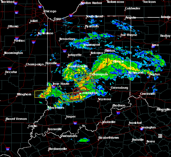 At 712 pm edt, a severe thunderstorm capable of producing a tornado was located 8 miles southwest of bloomington, moving east at 30 mph. this storm has a history of producing a tornado (radar indicated rotation). Hazards include tornado. Flying debris will be dangerous to those caught without shelter. mobile homes will be damaged or destroyed. damage to roofs, windows, and vehicles will occur. tree damage is likely. this dangerous storm will be near, bloomington around 720 pm edt. smithville around 725 pm edt. indiana university around 730 pm edt. monroe reservoir around 735 pm edt. charles deam wilderness around 740 pm edt. woodville hills around 745 pm edt. yellowwood lake around 750 pm edt. Elkinsville around 755 pm edt. At 712 pm edt, a severe thunderstorm capable of producing a tornado was located 8 miles southwest of bloomington, moving east at 30 mph. this storm has a history of producing a tornado (radar indicated rotation). Hazards include tornado. Flying debris will be dangerous to those caught without shelter. mobile homes will be damaged or destroyed. damage to roofs, windows, and vehicles will occur. tree damage is likely. this dangerous storm will be near, bloomington around 720 pm edt. smithville around 725 pm edt. indiana university around 730 pm edt. monroe reservoir around 735 pm edt. charles deam wilderness around 740 pm edt. woodville hills around 745 pm edt. yellowwood lake around 750 pm edt. Elkinsville around 755 pm edt.
|
| 6/15/2019 7:10 PM EDT | Storm damage reported in monroe county IN, 4.1 miles E of Bloomington, IN |
| 6/15/2019 7:03 PM EDT |
 At 703 pm edt, a confirmed tornado was located 10 miles east of bloomfield, or 14 miles southwest of bloomington, moving east at 30 mph (radar confirmed tornado). Hazards include damaging tornado. Flying debris will be dangerous to those caught without shelter. mobile homes will be damaged or destroyed. damage to roofs, windows, and vehicles will occur. tree damage is likely. this tornado will be near, bloomington and whitehall around 725 pm edt. Smithville and indiana university around 730 pm edt. At 703 pm edt, a confirmed tornado was located 10 miles east of bloomfield, or 14 miles southwest of bloomington, moving east at 30 mph (radar confirmed tornado). Hazards include damaging tornado. Flying debris will be dangerous to those caught without shelter. mobile homes will be damaged or destroyed. damage to roofs, windows, and vehicles will occur. tree damage is likely. this tornado will be near, bloomington and whitehall around 725 pm edt. Smithville and indiana university around 730 pm edt.
|
| 6/15/2019 6:55 PM EDT |
 At 654 pm edt, a severe thunderstorm capable of producing a tornado was located near bloomfield, or 18 miles southwest of bloomington, moving east at 30 mph (radar indicated rotation). Hazards include tornado. Flying debris will be dangerous to those caught without shelter. mobile homes will be damaged or destroyed. damage to roofs, windows, and vehicles will occur. tree damage is likely. this dangerous storm will be near, solsberry around 705 pm edt. bloomington around 725 pm edt. smithville and whitehall around 730 pm edt. Indiana university around 735 pm edt. At 654 pm edt, a severe thunderstorm capable of producing a tornado was located near bloomfield, or 18 miles southwest of bloomington, moving east at 30 mph (radar indicated rotation). Hazards include tornado. Flying debris will be dangerous to those caught without shelter. mobile homes will be damaged or destroyed. damage to roofs, windows, and vehicles will occur. tree damage is likely. this dangerous storm will be near, solsberry around 705 pm edt. bloomington around 725 pm edt. smithville and whitehall around 730 pm edt. Indiana university around 735 pm edt.
|
| 6/15/2019 6:43 PM EDT |
 At 642 pm edt, a severe thunderstorm was located near bloomfield, or 19 miles west of bloomington, moving east at 45 mph (radar indicated). Hazards include ping pong ball size hail and 60 mph wind gusts. People and animals outdoors will be injured. expect hail damage to roofs, siding, windows, and vehicles. expect wind damage to roofs, siding, and trees. Locations impacted include, bloomington, bloomfield, ellettsville, worthington, indiana university, smithville, harrodsburg, freedom, solsberry, monroe reservoir, fairfax state recreation area, charles deam wilderness, unionville, whitehall and woodville hills. At 642 pm edt, a severe thunderstorm was located near bloomfield, or 19 miles west of bloomington, moving east at 45 mph (radar indicated). Hazards include ping pong ball size hail and 60 mph wind gusts. People and animals outdoors will be injured. expect hail damage to roofs, siding, windows, and vehicles. expect wind damage to roofs, siding, and trees. Locations impacted include, bloomington, bloomfield, ellettsville, worthington, indiana university, smithville, harrodsburg, freedom, solsberry, monroe reservoir, fairfax state recreation area, charles deam wilderness, unionville, whitehall and woodville hills.
|
| 6/15/2019 6:26 PM EDT |
 At 625 pm edt, a severe thunderstorm was located over linton, or 32 miles southeast of terre haute, moving east at 45 mph. this storm is showing weak rotation and has a history of having stronger rotation (radar indicated). Hazards include 70 mph wind gusts and ping pong ball size hail. People and animals outdoors will be injured. expect hail damage to roofs, siding, windows, and vehicles. expect considerable tree damage. Wind damage is also likely to mobile homes, roofs, and outbuildings. At 625 pm edt, a severe thunderstorm was located over linton, or 32 miles southeast of terre haute, moving east at 45 mph. this storm is showing weak rotation and has a history of having stronger rotation (radar indicated). Hazards include 70 mph wind gusts and ping pong ball size hail. People and animals outdoors will be injured. expect hail damage to roofs, siding, windows, and vehicles. expect considerable tree damage. Wind damage is also likely to mobile homes, roofs, and outbuildings.
|
| 2/7/2019 12:54 PM EST | Large tree uproote in monroe county IN, 5.6 miles S of Bloomington, IN |
| 2/7/2019 12:37 PM EST |
 At 1237 pm est, a severe thunderstorm capable of producing a tornado was located 13 miles east of bloomfield, or 13 miles northwest of bedford, moving northeast at 65 mph (radar indicated rotation). Hazards include tornado. Flying debris will be dangerous to those caught without shelter. mobile homes will be damaged or destroyed. damage to roofs, windows, and vehicles will occur. tree damage is likely. this dangerous storm will be near, bloomington, harrodsburg and fairfax state recreation area around 1245 pm est. monroe reservoir, smithville, indiana university and bartlettsville around 1250 pm est. Woodville hills and charles deam wilderness around 1255 pm est. At 1237 pm est, a severe thunderstorm capable of producing a tornado was located 13 miles east of bloomfield, or 13 miles northwest of bedford, moving northeast at 65 mph (radar indicated rotation). Hazards include tornado. Flying debris will be dangerous to those caught without shelter. mobile homes will be damaged or destroyed. damage to roofs, windows, and vehicles will occur. tree damage is likely. this dangerous storm will be near, bloomington, harrodsburg and fairfax state recreation area around 1245 pm est. monroe reservoir, smithville, indiana university and bartlettsville around 1250 pm est. Woodville hills and charles deam wilderness around 1255 pm est.
|
| 8/15/2018 7:56 PM EDT |
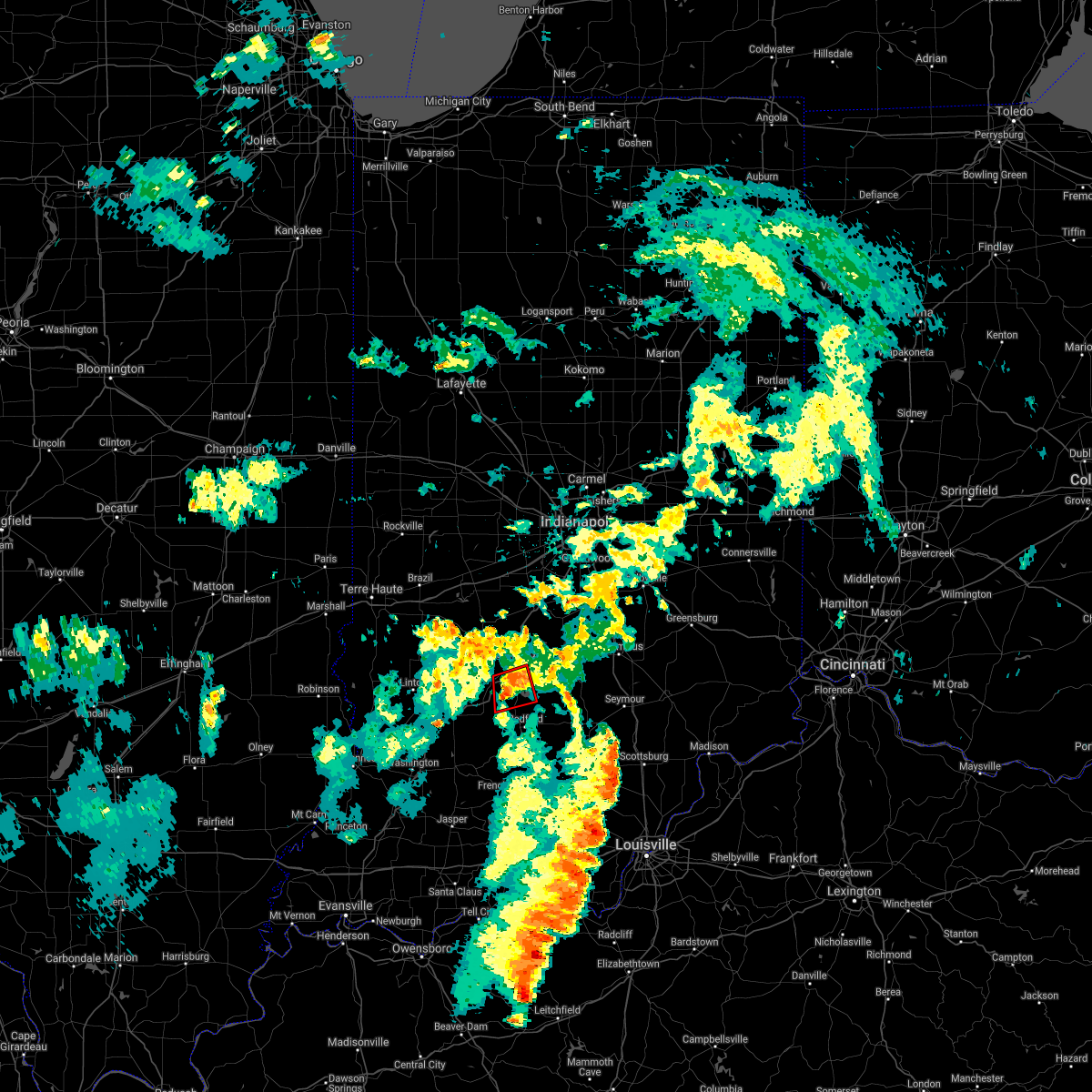 The tornado warning for southwestern monroe and northwestern lawrence counties will expire at 800 pm edt, the storm which prompted the warning has weakened below severe limits, and no longer appears capable of producing a tornado. therefore, the warning will be allowed to expire. The tornado warning for southwestern monroe and northwestern lawrence counties will expire at 800 pm edt, the storm which prompted the warning has weakened below severe limits, and no longer appears capable of producing a tornado. therefore, the warning will be allowed to expire.
|
| 8/15/2018 7:46 PM EDT |
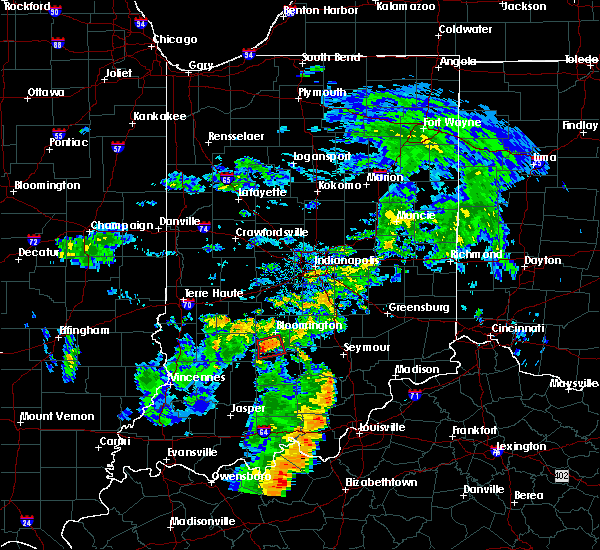 At 745 pm edt, a severe thunderstorm capable of producing a tornado was located 11 miles southwest of bloomington, moving east at 20 mph (radar indicated rotation). Hazards include tornado. Flying debris will be dangerous to those caught without shelter. mobile homes will be damaged or destroyed. damage to roofs, windows, and vehicles will occur. tree damage is likely. this dangerous storm will be near, harrodsburg around 755 pm edt. Fairfax state recreation area and smithville around 800 pm edt. At 745 pm edt, a severe thunderstorm capable of producing a tornado was located 11 miles southwest of bloomington, moving east at 20 mph (radar indicated rotation). Hazards include tornado. Flying debris will be dangerous to those caught without shelter. mobile homes will be damaged or destroyed. damage to roofs, windows, and vehicles will occur. tree damage is likely. this dangerous storm will be near, harrodsburg around 755 pm edt. Fairfax state recreation area and smithville around 800 pm edt.
|
| 8/15/2018 7:32 PM EDT |
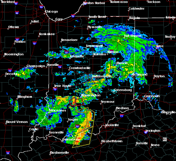 At 732 pm edt, a severe thunderstorm capable of producing a tornado was located 13 miles east of bloomfield, or 14 miles northwest of bedford, moving east at 20 mph (radar indicated rotation). Hazards include tornado. Flying debris will be dangerous to those caught without shelter. mobile homes will be damaged or destroyed. damage to roofs, windows, and vehicles will occur. tree damage is likely. This dangerous storm will be near, harrodsburg, fairfax state recreation area, smithville and bartlettsville around 800 pm edt. At 732 pm edt, a severe thunderstorm capable of producing a tornado was located 13 miles east of bloomfield, or 14 miles northwest of bedford, moving east at 20 mph (radar indicated rotation). Hazards include tornado. Flying debris will be dangerous to those caught without shelter. mobile homes will be damaged or destroyed. damage to roofs, windows, and vehicles will occur. tree damage is likely. This dangerous storm will be near, harrodsburg, fairfax state recreation area, smithville and bartlettsville around 800 pm edt.
|
| 6/10/2018 5:47 PM EDT |
 At 546 pm edt, severe thunderstorms were located along a line extending from near beech grove to near franklin to nashville to 6 miles southeast of bloomington, moving east at 45 mph (radar indicated). Hazards include 60 mph wind gusts. Expect damage to roofs, siding, and trees. locations impacted include, indianapolis, bloomington, greenwood, franklin, beech grove, southport, new whiteland, cumberland, edinburgh, whiteland, bargersville, warren park, princes lakes, trafalgar, homecroft, peoga, indiana university, helmsburg, lake lemon and beanblossom. this includes the following highways, interstate 65 between mile markers 84 and 107. interstate 70 near mile marker 92. Interstate 74 between mile markers 93 and 99. At 546 pm edt, severe thunderstorms were located along a line extending from near beech grove to near franklin to nashville to 6 miles southeast of bloomington, moving east at 45 mph (radar indicated). Hazards include 60 mph wind gusts. Expect damage to roofs, siding, and trees. locations impacted include, indianapolis, bloomington, greenwood, franklin, beech grove, southport, new whiteland, cumberland, edinburgh, whiteland, bargersville, warren park, princes lakes, trafalgar, homecroft, peoga, indiana university, helmsburg, lake lemon and beanblossom. this includes the following highways, interstate 65 between mile markers 84 and 107. interstate 70 near mile marker 92. Interstate 74 between mile markers 93 and 99.
|
| 6/10/2018 5:35 PM EDT |
 At 534 pm edt, severe thunderstorms were located along a line extending from near beech grove to 9 miles east of martinsville to 10 miles west of nashville to near bloomington, moving east at 45 mph (radar indicated). Hazards include 60 mph wind gusts. Expect damage to roofs, siding, and trees. locations impacted include, indianapolis, bloomington, greenwood, lawrence, franklin, beech grove, speedway, southport, ellettsville, new whiteland, cumberland, edinburgh, whiteland, bargersville, warren park, princes lakes, trafalgar, morgantown, homecroft and geist reservoir. this includes the following highways, interstate 65 between mile markers 84 and 117. interstate 70 between mile markers 70 and 93. Interstate 74 between mile markers 93 and 100. At 534 pm edt, severe thunderstorms were located along a line extending from near beech grove to 9 miles east of martinsville to 10 miles west of nashville to near bloomington, moving east at 45 mph (radar indicated). Hazards include 60 mph wind gusts. Expect damage to roofs, siding, and trees. locations impacted include, indianapolis, bloomington, greenwood, lawrence, franklin, beech grove, speedway, southport, ellettsville, new whiteland, cumberland, edinburgh, whiteland, bargersville, warren park, princes lakes, trafalgar, morgantown, homecroft and geist reservoir. this includes the following highways, interstate 65 between mile markers 84 and 117. interstate 70 between mile markers 70 and 93. Interstate 74 between mile markers 93 and 100.
|
| 6/10/2018 5:23 PM EDT |
 At 522 pm edt, severe thunderstorms were located along a line extending from near speedway to near martinsville to 9 miles north of bloomington to 7 miles south of spencer, moving east at 45 mph (radar indicated). Hazards include 60 mph wind gusts. expect damage to roofs, siding, and trees At 522 pm edt, severe thunderstorms were located along a line extending from near speedway to near martinsville to 9 miles north of bloomington to 7 miles south of spencer, moving east at 45 mph (radar indicated). Hazards include 60 mph wind gusts. expect damage to roofs, siding, and trees
|
| 6/1/2018 7:18 PM EDT |
 At 718 pm edt, a severe thunderstorm was located 11 miles northeast of bloomfield, or 12 miles southwest of bloomington, moving south at 25 mph (radar indicated). Hazards include 60 mph wind gusts and penny size hail. Expect damage to roofs, siding, and trees. Locations impacted include, bloomington, fairfax state recreation area, harrodsburg, solsberry and smithville. At 718 pm edt, a severe thunderstorm was located 11 miles northeast of bloomfield, or 12 miles southwest of bloomington, moving south at 25 mph (radar indicated). Hazards include 60 mph wind gusts and penny size hail. Expect damage to roofs, siding, and trees. Locations impacted include, bloomington, fairfax state recreation area, harrodsburg, solsberry and smithville.
|
| 6/1/2018 6:59 PM EDT |
 At 659 pm edt, a severe thunderstorm was located near spencer, or 13 miles west of bloomington, moving southeast at 25 mph (radar indicated). Hazards include 60 mph wind gusts and penny size hail. expect damage to roofs, siding, and trees At 659 pm edt, a severe thunderstorm was located near spencer, or 13 miles west of bloomington, moving southeast at 25 mph (radar indicated). Hazards include 60 mph wind gusts and penny size hail. expect damage to roofs, siding, and trees
|
| 5/31/2018 2:16 PM EDT |
 At 216 pm edt, a severe thunderstorm was located 7 miles west of seymour, moving east at 50 mph (radar indicated). Hazards include 60 mph wind gusts. Expect damage to roofs, siding, and trees. locations impacted include, bloomington, columbus, seymour, brownstown, crothersville, elizabethtown, jonesville, waymansville, freetown, vallonia, spurgeons corner, azalia, elkinsville, kurtz, cortland, stone head and story. This includes interstate 65 between mile markers 37 and 64. At 216 pm edt, a severe thunderstorm was located 7 miles west of seymour, moving east at 50 mph (radar indicated). Hazards include 60 mph wind gusts. Expect damage to roofs, siding, and trees. locations impacted include, bloomington, columbus, seymour, brownstown, crothersville, elizabethtown, jonesville, waymansville, freetown, vallonia, spurgeons corner, azalia, elkinsville, kurtz, cortland, stone head and story. This includes interstate 65 between mile markers 37 and 64.
|
| 5/31/2018 2:07 PM EDT | Healthy trees and branches down. size unknown. time estimated based on rada in monroe county IN, 1.9 miles W of Bloomington, IN |
| 5/31/2018 2:05 PM EDT |
 At 204 pm edt, a severe thunderstorm was located 10 miles northwest of brownstown, or 16 miles northeast of bedford, moving east at 50 mph (radar indicated). Hazards include 60 mph wind gusts. Expect damage to roofs, siding, and trees. locations impacted include, bloomington, columbus, seymour, brownstown, crothersville, medora, elizabethtown, jonesville, norman, smithville, waymansville, freetown, vallonia, spurgeons corner, azalia, pleasant view, elkinsville, kurtz, cortland and stone head. This includes interstate 65 between mile markers 37 and 64. At 204 pm edt, a severe thunderstorm was located 10 miles northwest of brownstown, or 16 miles northeast of bedford, moving east at 50 mph (radar indicated). Hazards include 60 mph wind gusts. Expect damage to roofs, siding, and trees. locations impacted include, bloomington, columbus, seymour, brownstown, crothersville, medora, elizabethtown, jonesville, norman, smithville, waymansville, freetown, vallonia, spurgeons corner, azalia, pleasant view, elkinsville, kurtz, cortland and stone head. This includes interstate 65 between mile markers 37 and 64.
|
| 5/31/2018 1:57 PM EDT | 8 inch live tree limb down along inverness farm road. time estimated from rada in monroe county IN, 5.3 miles WNW of Bloomington, IN |
| 5/31/2018 1:48 PM EDT |
 At 148 pm edt, a severe thunderstorm was located near bedford, moving east at 50 mph (radar indicated). Hazards include 60 mph wind gusts. expect damage to roofs, siding, and trees At 148 pm edt, a severe thunderstorm was located near bedford, moving east at 50 mph (radar indicated). Hazards include 60 mph wind gusts. expect damage to roofs, siding, and trees
|
| 4/3/2018 2:42 PM EDT |
 The severe thunderstorm warning for central monroe, southeastern morgan and northern brown counties will expire at 245 pm edt, the storm which prompted the warning has weakened below severe limits, and has exited the warned area. therefore, the warning will be allowed to expire. a tornado watch remains in effect until 800 pm edt for south central and central indiana. The severe thunderstorm warning for central monroe, southeastern morgan and northern brown counties will expire at 245 pm edt, the storm which prompted the warning has weakened below severe limits, and has exited the warned area. therefore, the warning will be allowed to expire. a tornado watch remains in effect until 800 pm edt for south central and central indiana.
|
| 4/3/2018 2:33 PM EDT |
 At 232 pm edt, a severe thunderstorm was located near bloomington, moving northeast at 65 mph (radar indicated). Hazards include 60 mph wind gusts and quarter size hail. Hail damage to vehicles is expected. expect wind damage to roofs, siding, and trees. locations impacted include, bloomington, martinsville, nashville, ellettsville, morgantown, mahalasville, indiana university, smithville, helmsburg, lake lemon, beanblossom, yellowwood lake, spearsville, woodville hills, unionville and whitehall. A tornado watch remains in effect until 800 pm edt for south central and central indiana. At 232 pm edt, a severe thunderstorm was located near bloomington, moving northeast at 65 mph (radar indicated). Hazards include 60 mph wind gusts and quarter size hail. Hail damage to vehicles is expected. expect wind damage to roofs, siding, and trees. locations impacted include, bloomington, martinsville, nashville, ellettsville, morgantown, mahalasville, indiana university, smithville, helmsburg, lake lemon, beanblossom, yellowwood lake, spearsville, woodville hills, unionville and whitehall. A tornado watch remains in effect until 800 pm edt for south central and central indiana.
|
| 4/3/2018 2:24 PM EDT |
 At 224 pm edt, a severe thunderstorm was located near bloomington, moving northeast at 65 mph (radar indicated). Hazards include 60 mph wind gusts and quarter size hail. Hail damage to vehicles is expected. expect wind damage to roofs, siding, and trees. locations impacted include, bloomington, martinsville, nashville, ellettsville, morgantown, mahalasville, indiana university, smithville, helmsburg, lake lemon, beanblossom, yellowwood lake, spearsville, solsberry, woodville hills, owensburg, unionville and whitehall. A tornado watch remains in effect until 800 pm edt for south central, central, southwestern and west central indiana. At 224 pm edt, a severe thunderstorm was located near bloomington, moving northeast at 65 mph (radar indicated). Hazards include 60 mph wind gusts and quarter size hail. Hail damage to vehicles is expected. expect wind damage to roofs, siding, and trees. locations impacted include, bloomington, martinsville, nashville, ellettsville, morgantown, mahalasville, indiana university, smithville, helmsburg, lake lemon, beanblossom, yellowwood lake, spearsville, solsberry, woodville hills, owensburg, unionville and whitehall. A tornado watch remains in effect until 800 pm edt for south central, central, southwestern and west central indiana.
|
| 4/3/2018 2:10 PM EDT |
 At 209 pm edt, a severe thunderstorm was located near bloomfield, or 21 miles southwest of bloomington, moving northeast at 65 mph (radar indicated). Hazards include 60 mph wind gusts and quarter size hail. Hail damage to vehicles is expected. Expect wind damage to roofs, siding, and trees. At 209 pm edt, a severe thunderstorm was located near bloomfield, or 21 miles southwest of bloomington, moving northeast at 65 mph (radar indicated). Hazards include 60 mph wind gusts and quarter size hail. Hail damage to vehicles is expected. Expect wind damage to roofs, siding, and trees.
|
| 11/5/2017 7:12 PM EST |
 At 712 pm est, a severe thunderstorm capable of producing a tornado was located near bloomington, moving east at 35 mph (radar indicated rotation). Hazards include tornado. Flying debris will be dangerous to those caught without shelter. mobile homes will be damaged or destroyed. damage to roofs, windows, and vehicles will occur. tree damage is likely. Locations impacted include, bloomington, woodville hills, elkinsville, yellowwood lake, story and monroe reservoir. At 712 pm est, a severe thunderstorm capable of producing a tornado was located near bloomington, moving east at 35 mph (radar indicated rotation). Hazards include tornado. Flying debris will be dangerous to those caught without shelter. mobile homes will be damaged or destroyed. damage to roofs, windows, and vehicles will occur. tree damage is likely. Locations impacted include, bloomington, woodville hills, elkinsville, yellowwood lake, story and monroe reservoir.
|
| 11/5/2017 7:04 PM EST |
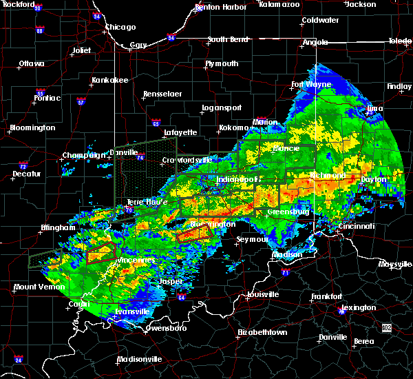 At 704 pm est, a severe thunderstorm capable of producing a tornado was located near bloomington, moving east at 35 mph (radar indicated rotation). Hazards include tornado. Flying debris will be dangerous to those caught without shelter. mobile homes will be damaged or destroyed. damage to roofs, windows, and vehicles will occur. tree damage is likely. Locations impacted include, bloomington, yellowwood lake, smithville, monroe reservoir, woodville hills, elkinsville, harrodsburg and story. At 704 pm est, a severe thunderstorm capable of producing a tornado was located near bloomington, moving east at 35 mph (radar indicated rotation). Hazards include tornado. Flying debris will be dangerous to those caught without shelter. mobile homes will be damaged or destroyed. damage to roofs, windows, and vehicles will occur. tree damage is likely. Locations impacted include, bloomington, yellowwood lake, smithville, monroe reservoir, woodville hills, elkinsville, harrodsburg and story.
|
| 11/5/2017 7:57 PM EDT |
 At 657 pm est, a severe thunderstorm capable of producing a tornado was located 9 miles southwest of bloomington, moving east at 35 mph (radar indicated rotation). Hazards include tornado. Flying debris will be dangerous to those caught without shelter. mobile homes will be damaged or destroyed. damage to roofs, windows, and vehicles will occur. tree damage is likely. this dangerous storm will be near, bloomington around 705 pm est. smithville around 710 pm est. monroe reservoir around 715 pm est. woodville hills around 720 pm est. yellowwood lake around 725 pm est. Story and elkinsville around 730 pm est. At 657 pm est, a severe thunderstorm capable of producing a tornado was located 9 miles southwest of bloomington, moving east at 35 mph (radar indicated rotation). Hazards include tornado. Flying debris will be dangerous to those caught without shelter. mobile homes will be damaged or destroyed. damage to roofs, windows, and vehicles will occur. tree damage is likely. this dangerous storm will be near, bloomington around 705 pm est. smithville around 710 pm est. monroe reservoir around 715 pm est. woodville hills around 720 pm est. yellowwood lake around 725 pm est. Story and elkinsville around 730 pm est.
|
| 11/5/2017 2:45 PM EDT | Golf Ball sized hail reported 11.2 miles NNW of Bloomington, IN, estimated winds of 50 to 55 mph. |
| 11/5/2017 2:19 PM EDT |
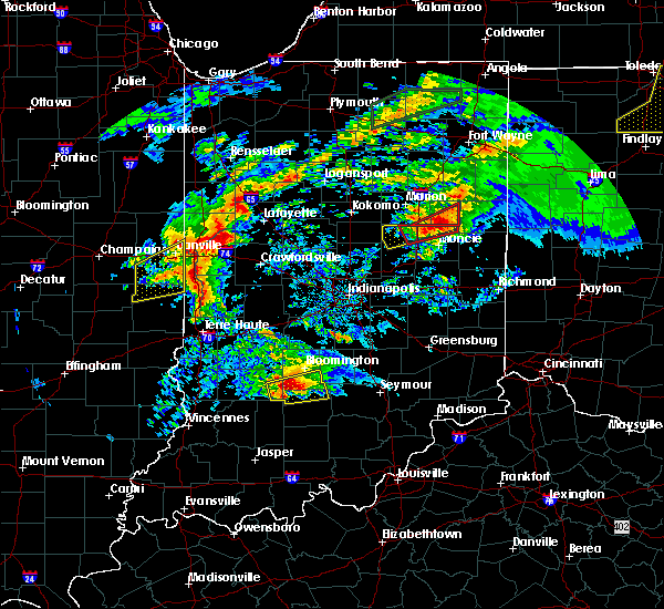 At 119 pm est, a severe thunderstorm capable of producing a tornado was located 12 miles northwest of bedford, moving east at 30 mph (radar indicated rotation). Hazards include tornado and quarter size hail. Flying debris will be dangerous to those caught without shelter. mobile homes will be damaged or destroyed. damage to roofs, windows, and vehicles will occur. tree damage is likely. this dangerous storm will be near, avoca around 125 pm est. oolitic and harrodsburg around 130 pm est. fairfax state recreation area and smithville around 135 pm est. monroe reservoir and bartlettsville around 140 pm est. heltonville around 145 pm est. Charles deam wilderness and woodville hills around 150 pm est. At 119 pm est, a severe thunderstorm capable of producing a tornado was located 12 miles northwest of bedford, moving east at 30 mph (radar indicated rotation). Hazards include tornado and quarter size hail. Flying debris will be dangerous to those caught without shelter. mobile homes will be damaged or destroyed. damage to roofs, windows, and vehicles will occur. tree damage is likely. this dangerous storm will be near, avoca around 125 pm est. oolitic and harrodsburg around 130 pm est. fairfax state recreation area and smithville around 135 pm est. monroe reservoir and bartlettsville around 140 pm est. heltonville around 145 pm est. Charles deam wilderness and woodville hills around 150 pm est.
|
| 11/5/2017 2:12 PM EDT |
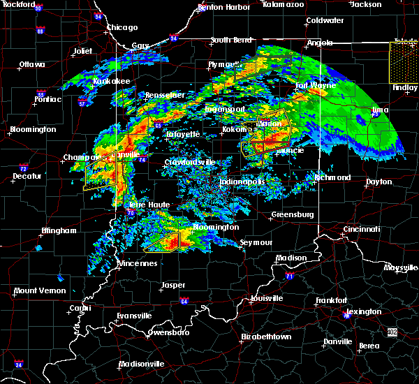 At 112 pm est, a severe thunderstorm was located 12 miles east of bloomfield, or 14 miles northwest of bedford, moving east at 40 mph (radar indicated). Hazards include 60 mph wind gusts and quarter size hail. Hail damage to vehicles is expected. Expect wind damage to roofs, siding, and trees. At 112 pm est, a severe thunderstorm was located 12 miles east of bloomfield, or 14 miles northwest of bedford, moving east at 40 mph (radar indicated). Hazards include 60 mph wind gusts and quarter size hail. Hail damage to vehicles is expected. Expect wind damage to roofs, siding, and trees.
|
| 7/7/2017 5:26 PM EDT | Quarter sized hail reported 11.3 miles SW of Bloomington, IN |
| 7/7/2017 5:25 PM EDT | Quarter sized hail reported 10.5 miles WSW of Bloomington, IN, report from near lake lemon. |
| 7/7/2017 5:24 PM EDT |
 At 522 pm edt, a severe thunderstorm was located near nashville, or 12 miles northeast of bloomington, moving southeast at 35 mph (radar indicated). Hazards include 60 mph wind gusts and quarter size hail. Hail damage to vehicles is expected. Expect wind damage to roofs, siding, and trees. At 522 pm edt, a severe thunderstorm was located near nashville, or 12 miles northeast of bloomington, moving southeast at 35 mph (radar indicated). Hazards include 60 mph wind gusts and quarter size hail. Hail damage to vehicles is expected. Expect wind damage to roofs, siding, and trees.
|
| 7/7/2017 5:17 PM EDT | Quarter sized hail reported 8.3 miles SW of Bloomington, IN, hail quarter size or large falling once again. |
| 7/7/2017 5:07 PM EDT | Quarter sized hail reported 8.3 miles SW of Bloomington, IN |
| 5/19/2017 2:00 PM EDT | Hen Egg sized hail reported 1.5 miles S of Bloomington, IN, reported at w 17th street bloomington... in. received via facebook. |
| 5/19/2017 1:55 PM EDT |
 At 154 pm edt, a severe thunderstorm was located 7 miles south of martinsville, or 11 miles northeast of bloomington, moving northeast at 45 mph (radar indicated. at 152 pm golf ball sized hail was reported at ellettsville). Hazards include golf ball size hail. People and animals outdoors will be injured. expect damage to roofs, siding, windows, and vehicles. Locations impacted include, bloomington, ellettsville, indiana university, unionville and whitehall. At 154 pm edt, a severe thunderstorm was located 7 miles south of martinsville, or 11 miles northeast of bloomington, moving northeast at 45 mph (radar indicated. at 152 pm golf ball sized hail was reported at ellettsville). Hazards include golf ball size hail. People and animals outdoors will be injured. expect damage to roofs, siding, windows, and vehicles. Locations impacted include, bloomington, ellettsville, indiana university, unionville and whitehall.
|
| 5/19/2017 1:50 PM EDT | Quarter sized hail reported 0.8 miles SSW of Bloomington, IN |
| 5/19/2017 1:42 PM EDT |
 At 141 pm edt, a severe thunderstorm was located near bloomington, moving northeast at 45 mph (radar indicated). Hazards include half dollar size hail. damage to vehicles is expected At 141 pm edt, a severe thunderstorm was located near bloomington, moving northeast at 45 mph (radar indicated). Hazards include half dollar size hail. damage to vehicles is expected
|
| 5/10/2017 11:34 PM EDT |
 At 1134 pm edt, severe thunderstorms were located along a line extending from greenwood to 11 miles southwest of franklin to 12 miles southeast of bloomington, moving east at 60 mph (radar indicated). Hazards include 70 mph wind gusts. Expect considerable tree damage. damage is likely to mobile homes, roofs, and outbuildings. locations impacted include, indianapolis, bloomington, columbus, shelbyville, seymour, greenwood, franklin, beech grove, southport, nashville, new whiteland, edinburgh, whiteland, bargersville, hope, flat rock, princes lakes, geneva, morristown and trafalgar. this includes the following highways, interstate 65 between mile markers 44 and 108. interstate 70 between mile markers 70 and 75. Interstate 74 between mile markers 97 and 122. At 1134 pm edt, severe thunderstorms were located along a line extending from greenwood to 11 miles southwest of franklin to 12 miles southeast of bloomington, moving east at 60 mph (radar indicated). Hazards include 70 mph wind gusts. Expect considerable tree damage. damage is likely to mobile homes, roofs, and outbuildings. locations impacted include, indianapolis, bloomington, columbus, shelbyville, seymour, greenwood, franklin, beech grove, southport, nashville, new whiteland, edinburgh, whiteland, bargersville, hope, flat rock, princes lakes, geneva, morristown and trafalgar. this includes the following highways, interstate 65 between mile markers 44 and 108. interstate 70 between mile markers 70 and 75. Interstate 74 between mile markers 97 and 122.
|
| 5/10/2017 11:23 PM EDT |
 At 1122 pm edt, severe thunderstorms were located along a line extending from near plainfield to near martinsville to 7 miles southwest of bloomington, moving east at 60 mph (radar indicated). Hazards include 70 mph wind gusts. Expect considerable tree damage. Damage is likely to mobile homes, roofs, and outbuildings. At 1122 pm edt, severe thunderstorms were located along a line extending from near plainfield to near martinsville to 7 miles southwest of bloomington, moving east at 60 mph (radar indicated). Hazards include 70 mph wind gusts. Expect considerable tree damage. Damage is likely to mobile homes, roofs, and outbuildings.
|
| 5/10/2017 11:16 PM EDT |
 At 1115 pm edt, severe thunderstorms were located along a line extending from near danville to martinsville to 11 miles southwest of bloomington, moving east at 55 mph (radar indicated). Hazards include 70 mph wind gusts. Expect considerable tree damage. damage is likely to mobile homes, roofs, and outbuildings. locations impacted include, bloomington, plainfield, martinsville, mooresville, danville, spencer, avon, ellettsville, brooklyn, worthington, monrovia, clayton, gosport, paragon, coatesville, amo, stilesville, stinesville, bethany and freedom. This includes interstate 70 between mile markers 49 and 68. At 1115 pm edt, severe thunderstorms were located along a line extending from near danville to martinsville to 11 miles southwest of bloomington, moving east at 55 mph (radar indicated). Hazards include 70 mph wind gusts. Expect considerable tree damage. damage is likely to mobile homes, roofs, and outbuildings. locations impacted include, bloomington, plainfield, martinsville, mooresville, danville, spencer, avon, ellettsville, brooklyn, worthington, monrovia, clayton, gosport, paragon, coatesville, amo, stilesville, stinesville, bethany and freedom. This includes interstate 70 between mile markers 49 and 68.
|
| 5/10/2017 11:09 PM EDT |
 At 1108 pm edt, severe thunderstorms were located along a line extending from 6 miles southwest of danville to 7 miles west of martinsville to 8 miles northeast of bloomfield, moving east at 60 mph (radar indicated). Hazards include 70 mph wind gusts. Expect considerable tree damage. damage is likely to mobile homes, roofs, and outbuildings. locations impacted include, bloomington, plainfield, martinsville, greencastle, mooresville, danville, spencer, avon, ellettsville, jasonville, cloverdale, brooklyn, worthington, monrovia, clayton, clay city, gosport, bainbridge, paragon and fillmore. This includes interstate 70 between mile markers 36 and 68. At 1108 pm edt, severe thunderstorms were located along a line extending from 6 miles southwest of danville to 7 miles west of martinsville to 8 miles northeast of bloomfield, moving east at 60 mph (radar indicated). Hazards include 70 mph wind gusts. Expect considerable tree damage. damage is likely to mobile homes, roofs, and outbuildings. locations impacted include, bloomington, plainfield, martinsville, greencastle, mooresville, danville, spencer, avon, ellettsville, jasonville, cloverdale, brooklyn, worthington, monrovia, clayton, clay city, gosport, bainbridge, paragon and fillmore. This includes interstate 70 between mile markers 36 and 68.
|
| 5/10/2017 10:59 PM EDT |
 At 1058 pm edt, severe thunderstorms were located along a line extending from 16 miles south of crawfordsville to 10 miles southeast of greencastle to 10 miles northwest of bloomfield, moving east at 55 mph (radar indicated). Hazards include 60 mph wind gusts. Expect damage to roofs, siding, and trees. locations impacted include, bloomington, plainfield, martinsville, greencastle, mooresville, danville, spencer, avon, ellettsville, jasonville, cloverdale, brooklyn, worthington, monrovia, clayton, clay city, gosport, bainbridge, paragon and fillmore. This includes interstate 70 between mile markers 25 and 68. At 1058 pm edt, severe thunderstorms were located along a line extending from 16 miles south of crawfordsville to 10 miles southeast of greencastle to 10 miles northwest of bloomfield, moving east at 55 mph (radar indicated). Hazards include 60 mph wind gusts. Expect damage to roofs, siding, and trees. locations impacted include, bloomington, plainfield, martinsville, greencastle, mooresville, danville, spencer, avon, ellettsville, jasonville, cloverdale, brooklyn, worthington, monrovia, clayton, clay city, gosport, bainbridge, paragon and fillmore. This includes interstate 70 between mile markers 25 and 68.
|
| 5/10/2017 10:46 PM EDT |
 At 1045 pm edt, severe thunderstorms were located along a line extending from 10 miles northeast of rockville to 9 miles southwest of greencastle to 15 miles north of linton, moving east at 55 mph (radar indicated). Hazards include 60 mph wind gusts. expect damage to roofs, siding, and trees At 1045 pm edt, severe thunderstorms were located along a line extending from 10 miles northeast of rockville to 9 miles southwest of greencastle to 15 miles north of linton, moving east at 55 mph (radar indicated). Hazards include 60 mph wind gusts. expect damage to roofs, siding, and trees
|
| 4/28/2017 7:12 PM EDT | A couple of trees (approx. 1.5 ft diameter) have fallen down. power has been knocked out. winds were estimated to be around 50-60 mp in monroe county IN, 3 miles NNE of Bloomington, IN |
| 4/28/2017 7:12 PM EDT | Power lines down. social media report. time radar estimate in monroe county IN, 4.3 miles NNW of Bloomington, IN |
| 1/10/2017 8:06 PM EST |
 At 806 pm est, severe thunderstorms were located along a line extending from 8 miles northeast of nashville to 10 miles southeast of bloomfield, moving east at 50 mph (radar indicated). Hazards include 60 mph wind gusts. Expect damage to roofs, siding, and trees. locations impacted include, bloomington, columbus, bedford, nashville, shoals, loogootee, odon, oolitic, plainville, crane, woodville hills, williams, heltonville, indiana university, west boggs lake, silverville, story, unionville, helmsburg and burns city. This includes interstate 65 between mile markers 64 and 69. At 806 pm est, severe thunderstorms were located along a line extending from 8 miles northeast of nashville to 10 miles southeast of bloomfield, moving east at 50 mph (radar indicated). Hazards include 60 mph wind gusts. Expect damage to roofs, siding, and trees. locations impacted include, bloomington, columbus, bedford, nashville, shoals, loogootee, odon, oolitic, plainville, crane, woodville hills, williams, heltonville, indiana university, west boggs lake, silverville, story, unionville, helmsburg and burns city. This includes interstate 65 between mile markers 64 and 69.
|
| 1/10/2017 7:48 PM EST |
 At 747 pm est, severe thunderstorms were located along a line extending from near martinsville to 8 miles south of linton, moving east at 50 mph (radar indicated). Hazards include 60 mph wind gusts. expect damage to roofs, siding, and trees At 747 pm est, severe thunderstorms were located along a line extending from near martinsville to 8 miles south of linton, moving east at 50 mph (radar indicated). Hazards include 60 mph wind gusts. expect damage to roofs, siding, and trees
|
| 8/24/2016 5:34 PM EDT |
 At 533 pm edt, a severe thunderstorm capable of producing a tornado was located over bloomington, moving east at 25 mph. a trained spotter reported a wall cloud near bloomington (radar indicated rotation). Hazards include tornado. Flying debris will be dangerous to those caught without shelter. mobile homes will be damaged or destroyed. damage to roofs, windows, and vehicles will occur. tree damage is likely. this dangerous storm will be near, unionville around 545 pm edt. woodville hills around 550 pm edt. yellowwood lake around 555 pm edt. Nashville and elkinsville around 600 pm edt. At 533 pm edt, a severe thunderstorm capable of producing a tornado was located over bloomington, moving east at 25 mph. a trained spotter reported a wall cloud near bloomington (radar indicated rotation). Hazards include tornado. Flying debris will be dangerous to those caught without shelter. mobile homes will be damaged or destroyed. damage to roofs, windows, and vehicles will occur. tree damage is likely. this dangerous storm will be near, unionville around 545 pm edt. woodville hills around 550 pm edt. yellowwood lake around 555 pm edt. Nashville and elkinsville around 600 pm edt.
|
| 7/13/2016 8:28 PM EDT |
 At 828 pm edt, a severe thunderstorm was located 10 miles northeast of bedford, moving northeast at 55 mph (radar indicated). Hazards include 60 mph wind gusts. Expect damage to roofs. siding. and trees. Locations impacted include, bloomington, bedford, nashville, mitchell, woodville hills, bartlettsville, heltonville, indiana university, tunnelton, elkinsville, fairfax state recreation area, smithville, yellowwood lake, charles deam wilderness, spring mill state park and monroe reservoir. At 828 pm edt, a severe thunderstorm was located 10 miles northeast of bedford, moving northeast at 55 mph (radar indicated). Hazards include 60 mph wind gusts. Expect damage to roofs. siding. and trees. Locations impacted include, bloomington, bedford, nashville, mitchell, woodville hills, bartlettsville, heltonville, indiana university, tunnelton, elkinsville, fairfax state recreation area, smithville, yellowwood lake, charles deam wilderness, spring mill state park and monroe reservoir.
|
| 7/13/2016 8:27 PM EDT |
 At 827 pm edt, a severe thunderstorm was located 7 miles southeast of mooresville, or 19 miles southwest of indianapolis, moving east at 55 mph (radar indicated). Hazards include 60 mph wind gusts. Expect damage to roofs. siding. and trees. locations impacted include, indianapolis, bloomington, greenwood, lawrence, plainfield, franklin, beech grove, martinsville, speedway, mooresville, southport, avon, ellettsville, new whiteland, cumberland, edinburgh, whiteland, bargersville, brooklyn and warren park. this includes the following highways, interstate 65 between mile markers 86 and 118. interstate 70 between mile markers 63 and 93. Interstate 74 between mile markers 93 and 99. At 827 pm edt, a severe thunderstorm was located 7 miles southeast of mooresville, or 19 miles southwest of indianapolis, moving east at 55 mph (radar indicated). Hazards include 60 mph wind gusts. Expect damage to roofs. siding. and trees. locations impacted include, indianapolis, bloomington, greenwood, lawrence, plainfield, franklin, beech grove, martinsville, speedway, mooresville, southport, avon, ellettsville, new whiteland, cumberland, edinburgh, whiteland, bargersville, brooklyn and warren park. this includes the following highways, interstate 65 between mile markers 86 and 118. interstate 70 between mile markers 63 and 93. Interstate 74 between mile markers 93 and 99.
|
| 7/13/2016 8:18 PM EDT |
 At 817 pm edt, a severe thunderstorm was located near martinsville, or 22 miles north of bloomington, moving northeast at 50 mph (radar indicated). Hazards include 60 mph wind gusts. Expect damage to roofs. siding. and trees. locations impacted include, indianapolis, bloomington, greenwood, lawrence, plainfield, franklin, beech grove, martinsville, speedway, mooresville, southport, avon, ellettsville, new whiteland, cumberland, edinburgh, whiteland, bargersville, brooklyn and warren park. this includes the following highways, interstate 65 between mile markers 86 and 118. interstate 70 between mile markers 57 and 93. Interstate 74 between mile markers 93 and 99. At 817 pm edt, a severe thunderstorm was located near martinsville, or 22 miles north of bloomington, moving northeast at 50 mph (radar indicated). Hazards include 60 mph wind gusts. Expect damage to roofs. siding. and trees. locations impacted include, indianapolis, bloomington, greenwood, lawrence, plainfield, franklin, beech grove, martinsville, speedway, mooresville, southport, avon, ellettsville, new whiteland, cumberland, edinburgh, whiteland, bargersville, brooklyn and warren park. this includes the following highways, interstate 65 between mile markers 86 and 118. interstate 70 between mile markers 57 and 93. Interstate 74 between mile markers 93 and 99.
|
| 7/13/2016 8:06 PM EDT |
 At 805 pm edt, a severe thunderstorm was located 10 miles north of shoals, or 17 miles west of bedford, moving northeast at 45 mph (radar indicated). Hazards include 60 mph wind gusts. Expect damage to roofs. siding. And trees. At 805 pm edt, a severe thunderstorm was located 10 miles north of shoals, or 17 miles west of bedford, moving northeast at 45 mph (radar indicated). Hazards include 60 mph wind gusts. Expect damage to roofs. siding. And trees.
|
| 7/13/2016 8:01 PM EDT |
 At 800 pm edt, a severe thunderstorms was located 10 miles west of martinsville, or 18 miles north of bloomington, moving northeast at 55 mph (radar indicated). Hazards include 60 mph wind gusts. Expect damage to roofs. siding. And trees. At 800 pm edt, a severe thunderstorms was located 10 miles west of martinsville, or 18 miles north of bloomington, moving northeast at 55 mph (radar indicated). Hazards include 60 mph wind gusts. Expect damage to roofs. siding. And trees.
|
| 6/15/2016 4:51 PM EDT |
 The severe thunderstorm warning for northeastern greene, western brown, southeastern owen and monroe counties will expire at 500 pm edt, the storm which prompted the warning has weakened below severe limits, and no longer poses an immediate threat to life or property. therefore the warning will be allowed to expire. however gusty winds and heavy rain are still possible with this thunderstorm. a severe thunderstorm watch remains in effect until 1100 pm edt for south central, west central and southwestern indiana. The severe thunderstorm warning for northeastern greene, western brown, southeastern owen and monroe counties will expire at 500 pm edt, the storm which prompted the warning has weakened below severe limits, and no longer poses an immediate threat to life or property. therefore the warning will be allowed to expire. however gusty winds and heavy rain are still possible with this thunderstorm. a severe thunderstorm watch remains in effect until 1100 pm edt for south central, west central and southwestern indiana.
|
| 6/15/2016 4:38 PM EDT |
 At 438 pm edt, a severe thunderstorm was located over bloomington, moving east at 30 mph (radar indicated). Hazards include 60 mph wind gusts. Expect damage to roofs. siding. and trees. Locations impacted include, bloomington, spencer, ellettsville, yellowwood lake, woodville hills, unionville, helmsburg, lake lemon, indiana university and whitehall. At 438 pm edt, a severe thunderstorm was located over bloomington, moving east at 30 mph (radar indicated). Hazards include 60 mph wind gusts. Expect damage to roofs. siding. and trees. Locations impacted include, bloomington, spencer, ellettsville, yellowwood lake, woodville hills, unionville, helmsburg, lake lemon, indiana university and whitehall.
|
| 6/15/2016 4:25 PM EDT |
 At 425 pm edt, a severe thunderstorm was located 7 miles southeast of spencer, or 9 miles west of bloomington, moving east at 30 mph (radar indicated). Hazards include 60 mph wind gusts and penny size hail. Expect damage to roofs. siding. And trees. At 425 pm edt, a severe thunderstorm was located 7 miles southeast of spencer, or 9 miles west of bloomington, moving east at 30 mph (radar indicated). Hazards include 60 mph wind gusts and penny size hail. Expect damage to roofs. siding. And trees.
|
| 3/31/2016 6:42 PM EDT | Quarter sized hail reported 2 miles SW of Bloomington, IN, report via twitter |
| 3/31/2016 6:38 PM EDT |
 At 638 pm edt, a severe thunderstorm was located 7 miles northwest of bloomington, moving northeast at 50 mph (radar indicated). Hazards include quarter size hail. damage to vehicles is expected At 638 pm edt, a severe thunderstorm was located 7 miles northwest of bloomington, moving northeast at 50 mph (radar indicated). Hazards include quarter size hail. damage to vehicles is expected
|
| 3/27/2016 8:22 PM EDT |
 At 822 pm edt, a severe thunderstorm was located 7 miles northeast of bloomington, moving northeast at 50 mph (radar indicated). Hazards include half dollar size hail. damage to vehicles is expected At 822 pm edt, a severe thunderstorm was located 7 miles northeast of bloomington, moving northeast at 50 mph (radar indicated). Hazards include half dollar size hail. damage to vehicles is expected
|
| 3/27/2016 8:21 PM EDT | Quarter sized hail reported 1.5 miles WSW of Bloomington, IN |
| 3/27/2016 8:18 PM EDT | Quarter sized hail reported 1.5 miles WSW of Bloomington, IN, 1 inch hail near iu football stadium |
| 12/23/2015 3:13 PM EST | At 313 pm est, severe thunderstorms were located along a line extending from 11 miles southeast of greencastle to 7 miles south of bloomington to 12 miles west of paoli, moving east at 55 mph (radar indicated). Hazards include 70 mph wind gusts. Expect considerable tree damage. damage is likely to mobile homes, roofs and outbuildings. locations impacted include, bloomington, bedford, martinsville, mooresville, spencer, shoals, ellettsville, mitchell, cloverdale, brooklyn, oolitic, monrovia, gosport, paragon, stinesville, bethany, woodville hills, williams, roland and heltonville. this includes interstate 70 between mile markers 40 and 58. A tornado watch remains in effect until 900 pm est for southwestern indiana. |
| 12/23/2015 2:57 PM EST | At 256 pm est, severe thunderstorms were located along a line extending from 12 miles east of brazil to 7 miles east of bloomfield to near jasper, moving east at 55 mph (radar indicated). Hazards include 60 mph wind gusts. Expect damage to roofs. Siding and trees. |
| 6/8/2015 1:25 AM EDT | The severe thunderstorm warning for northwestern brown, monroe and southeastern morgan counties will expire at 130 am edt/1230 am cdt/, the storm which prompted the warning has weakened and moved out of the warned area. |
| 6/8/2015 1:14 AM EDT | At 112 am edt, a severe thunderstorm was located 10 miles northeast of bloomington, and moving east at 35 mph (radar indicated). Hazards include 60 mph wind gusts. Expect damage to roofs. siding and trees. Locations impacted include, woodview hills, yellowwood lake, morgantown and helmsburg. |
| 6/8/2015 1:08 AM EDT | At 107 am edt, a severe thunderstorm was located 9 miles northeast of bloomington, and moving east at 35 mph (radar indicated). Hazards include 60 mph wind gusts. Expect damage to roofs. siding and trees. Locations impacted include, unionville, mahalasville, lake lemon, woodview hills, yellowwood lake, morgantown and helmsburg. |
| 6/8/2015 12:54 AM EDT | At 1252 am edt, a severe thunderstorm was located 7 miles east of spencer, and moving east at 40 mph (radar indicated). Hazards include 60 mph wind gusts. Expect damage to roofs. Siding and trees. |
| 4/8/2015 4:14 PM EDT | Baseball sized hail reported 8.3 miles SW of Bloomington, IN, on st rd 45 |
| 4/8/2015 4:10 PM EDT | The national weather service in indianapolis has issued a * tornado warning for. northern brown county in south central indiana. east central monroe county in south central indiana. until 445 pm edt * at 408 pm edt. A severe thunderstorm capable of producing a. |
| 4/8/2015 4:09 PM EDT | Golf Ball sized hail reported 8.3 miles SW of Bloomington, IN, at unionville school near st. rd 45 |
| 4/8/2015 3:59 PM EDT | A severe thunderstorm warning remains in effect for northwestern brown. northern monroe. southern morgan and southeastern owen counties until 430 pm edt. at 357 pm edt. a severe thunderstorm was located 5 miles northeast of bloomington. and moving east at 25 mph. hazard. Half dollar size hail. |
| 4/8/2015 3:48 PM EDT | The national weather service in indianapolis has issued a * severe thunderstorm warning for. northwestern brown county in south central indiana. northern monroe county in south central indiana. southern morgan county in central indiana. Southeastern owen county in west central indiana. |
| 4/2/2015 8:41 PM EDT | The severe thunderstorm warning for monroe county will expire at 845 pm edt/745 pm cdt/. the storm which prompted the warning has weakened below severe limits. And no longer poses an immediate threat to life or property. |
| 4/2/2015 8:32 PM EDT | A severe thunderstorm warning remains in effect for monroe county until 845 pm edt. at 831 pm edt. a severe thunderstorm was located 7 miles northwest of bloomington. and moving northeast at 40 mph. hazard. 60 mph wind gusts and quarter size hail. source. Radar indicated. |
| 4/2/2015 8:20 PM EDT | A severe thunderstorm warning remains in effect for northeastern greene. monroe and southeastern owen counties until 845 pm edt. at 818 pm edt. a severe thunderstorm was located 6 miles south of spencer. and moving northeast at 40 mph. hazard. 60 mph wind gusts and quarter size hail. source. Radar indicated. |
| 4/2/2015 7:55 PM EDT | The national weather service in indianapolis has issued a * severe thunderstorm warning for. eastern greene county in southwest indiana. northern lawrence county in south central indiana. monroe county in south central indiana. Southern owen county in west central indiana. |
| 4/2/2015 5:56 PM EST | Quarter sized hail reported 10.4 miles SW of Bloomington, IN |
| 5/22/2014 12:36 AM EDT | Quarter sized hail reported 3.6 miles NE of Bloomington, IN |
| 2/20/2014 8:48 PM EST | Storm damage reported in monroe county IN, 3.6 miles NE of Bloomington, IN |
| 2/20/2014 8:42 PM EST | Storm damage reported in monroe county IN, 3.6 miles NE of Bloomington, IN |
| 11/17/2013 4:38 PM EST | Storm damage reported in monroe county IN, 3.6 miles NE of Bloomington, IN |
| 7/23/2013 2:35 PM EDT | Half Dollar sized hail reported 3.5 miles WSW of Bloomington, IN |
| 7/23/2013 2:35 PM EDT | Several tree branches dow in monroe county IN, 3.5 miles WSW of Bloomington, IN |
| 7/23/2013 2:35 PM EDT | 1.25 inch tree branches down...not 1.25 inch hail in monroe county IN, 3.5 miles WSW of Bloomington, IN |
| 7/23/2013 2:15 PM EDT | A few trees down southwest of bloomington in monroe county IN, 4.5 miles NE of Bloomington, IN |
| 6/1/2013 3:26 AM EDT | Corrected report from near stanford....not stinesville in monroe county IN, 7.1 miles NE of Bloomington, IN |
| 1/30/2013 2:13 AM EST | State route 43 closed due to power lines across it. barn destroyed. time approx. based on rada in greene county IN, 12.3 miles ENE of Bloomington, IN |
| 1/30/2013 1:30 AM EST | Storm damage reported in monroe county IN, 3.6 miles NE of Bloomington, IN |
| 1/30/2013 1:23 AM EST | Storm damage reported in monroe county IN, 1.5 miles WSW of Bloomington, IN |
| 1/30/2013 1:13 AM EST | State route 43 closed due to power lines across it. barn destroyed. time approx. based on rada in greene county IN, 12.3 miles ENE of Bloomington, IN |
| 8/16/2012 5:50 PM EDT | Eight inch diameter limb downe in monroe county IN, 2.6 miles ESE of Bloomington, IN |
| 7/27/2012 4:09 PM EDT | On sr37 just north of tow in monroe county IN, 2 miles SW of Bloomington, IN |
| 7/8/2012 3:46 PM EDT | Hwy 37 and rockport r in monroe county IN, 0.7 miles NNE of Bloomington, IN |
| 5/1/2012 8:04 PM EDT | Ping Pong Ball sized hail reported 8.3 miles SW of Bloomington, IN |
| 3/23/2012 6:45 PM EDT | Quarter sized hail reported 1.5 miles WSW of Bloomington, IN, hail lasted about 10 minutes. |
| 3/23/2012 6:38 PM EDT | Half Dollar sized hail reported 1.5 miles WSW of Bloomington, IN |
| 3/23/2012 6:23 PM EDT | Quarter sized hail reported 7.2 miles NNE of Bloomington, IN |
| 1/1/0001 12:00 AM | Tree or tree limbs were blown down in monroe county IN, 6.2 miles SW of Bloomington, IN |
| 1/1/0001 12:00 AM | Three trees were blown down along state route 45...two at russel road...the other was further out of town to the southwest but at the second interesection of sr 45 and in monroe county IN, 1.5 miles WSW of Bloomington, IN |
| 1/1/0001 12:00 AM | Storm damage reported in monroe county IN, 3.6 miles NE of Bloomington, IN |
| 1/1/0001 12:00 AM | Quarter sized hail reported 1.5 miles NNE of Bloomington, IN |
| 1/1/0001 12:00 AM | Pea sized hail accompanied the win in monroe county IN, 1.5 miles WSW of Bloomington, IN |
| 1/1/0001 12:00 AM | Quarter sized hail reported 1.1 miles SE of Bloomington, IN, located near state road 48 and harstrait |
| 1/1/0001 12:00 AM | Several large trees dow in monroe county IN, 1.5 miles WSW of Bloomington, IN |
| 1/1/0001 12:00 AM | Trees down on south side of bloomingto in monroe county IN, 1.5 miles WSW of Bloomington, IN |
| 1/1/0001 12:00 AM | Storm damage reported in monroe county IN, 1.5 miles WSW of Bloomington, IN |
| 1/1/0001 12:00 AM | Many trees and limbs down...one was 2 feet in diameter at 2nd st and wayma in monroe county IN, 1.5 miles WSW of Bloomington, IN |
| 1/1/0001 12:00 AM | Quarter sized hail reported 1.5 miles WSW of Bloomington, IN, huntington park area |
| 1/1/0001 12:00 AM | Multiple trees down across bloomington...especially at 3rd and hawthorn as well as in windsor par in monroe county IN, 1.5 miles WSW of Bloomington, IN |
| 1/1/0001 12:00 AM | Four inch diameter tree branch down at 10th and walnu in monroe county IN, 1.5 miles WSW of Bloomington, IN |
| 1/1/0001 12:00 AM | Storm damage reported in monroe county IN, 0.7 miles NNE of Bloomington, IN |
| 1/1/0001 12:00 AM | Wind gusts estimated at 70 to 80 mph in bloomington. much debris noted as wel in monroe county IN, 1 miles NW of Bloomington, IN |
| 1/1/0001 12:00 AM | Storm damage reported in monroe county IN, 1.5 miles WSW of Bloomington, IN |
Hail Maps for Bloomington, IN

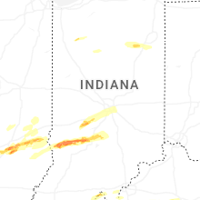
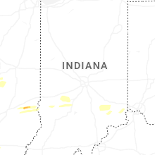


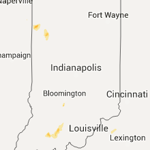


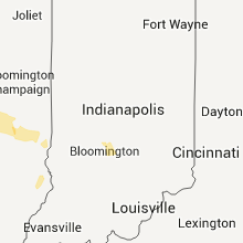


Connect with Interactive Hail Maps