

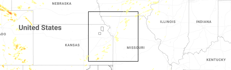
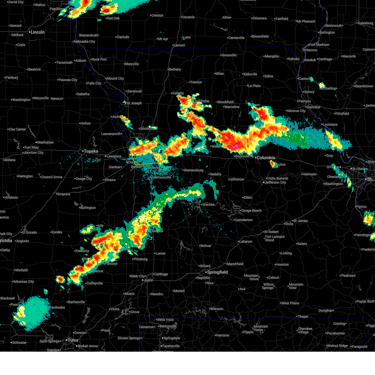
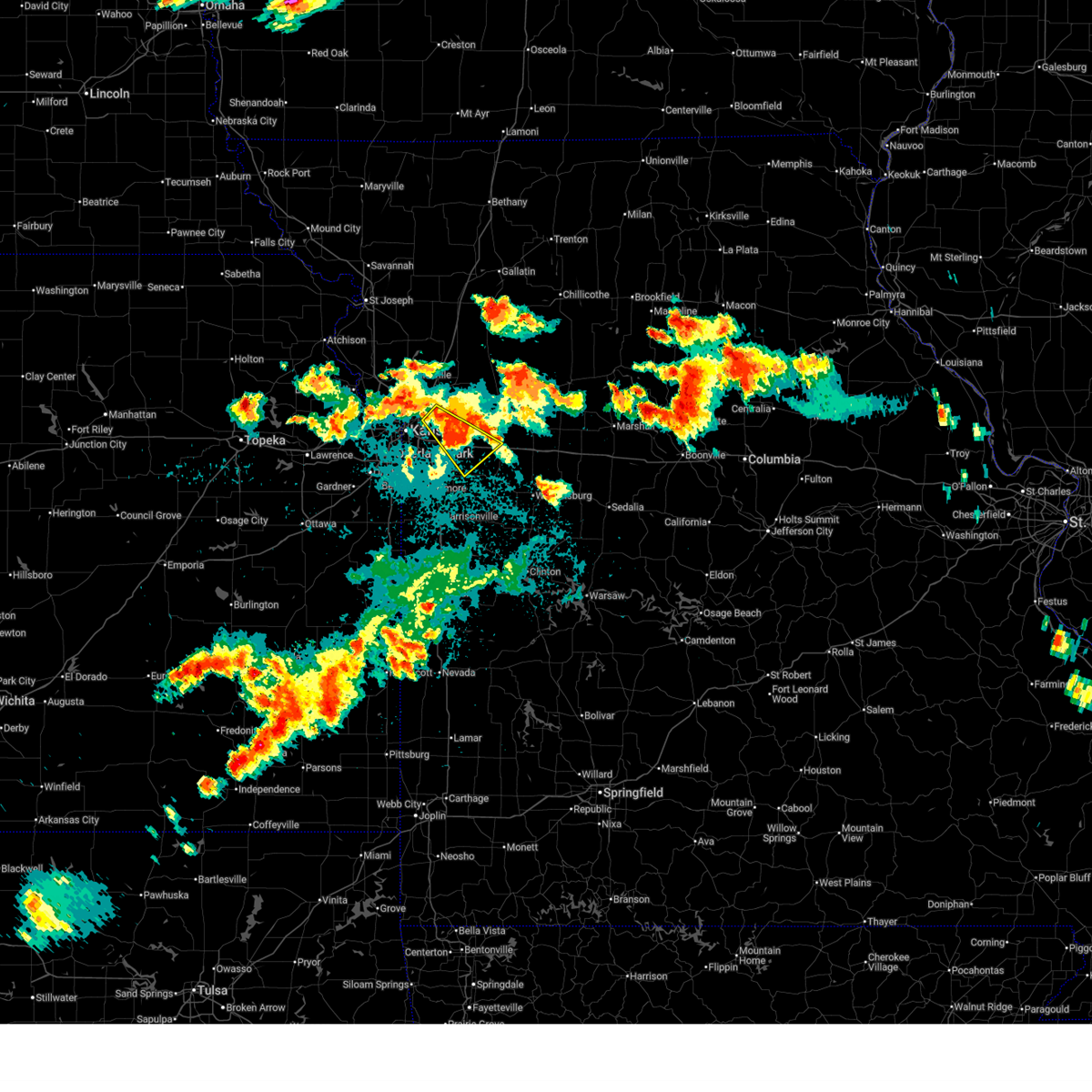
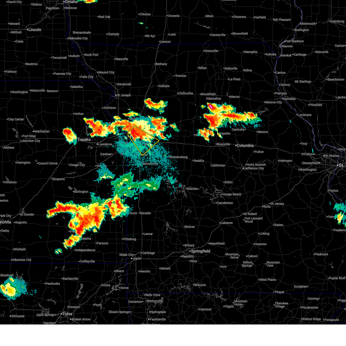
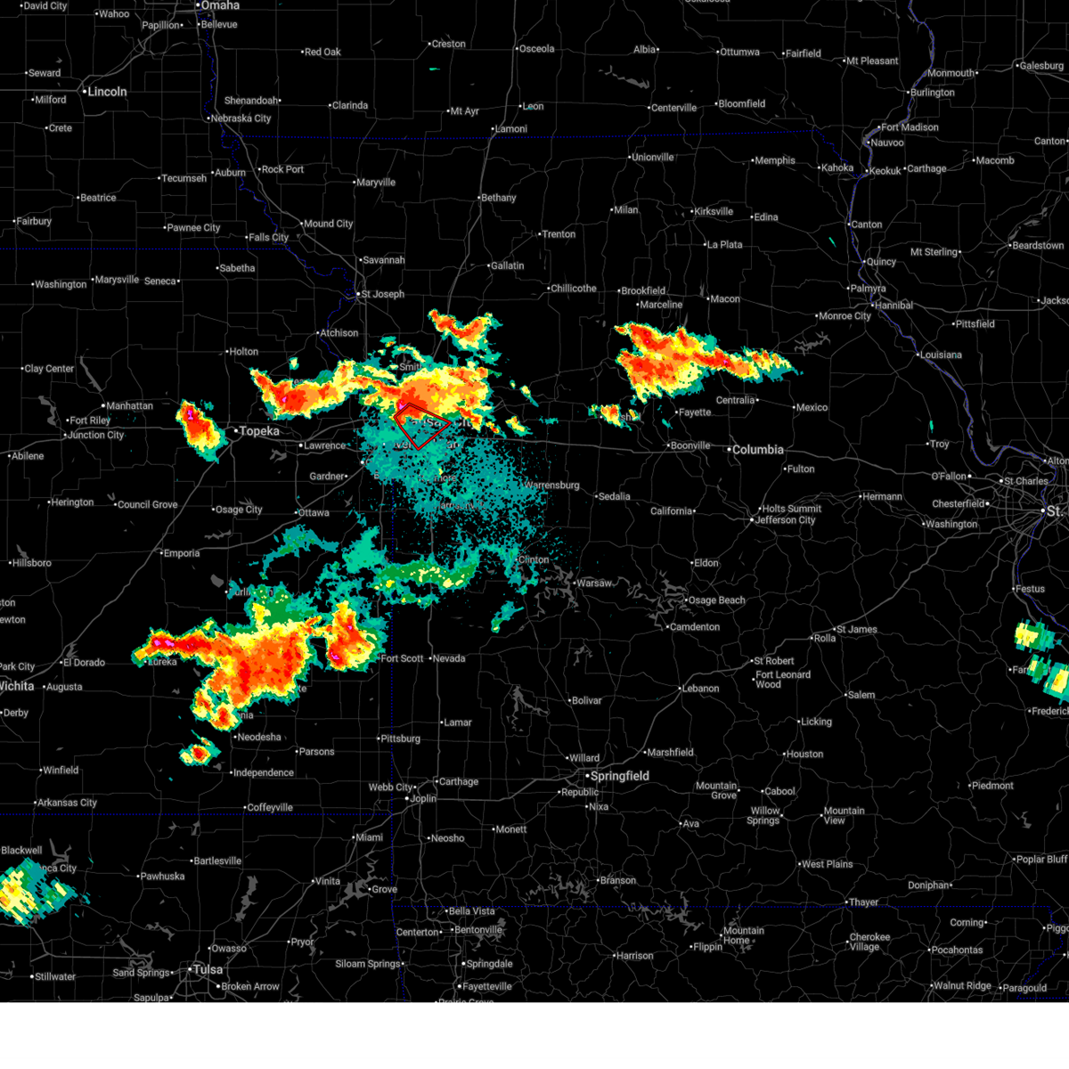
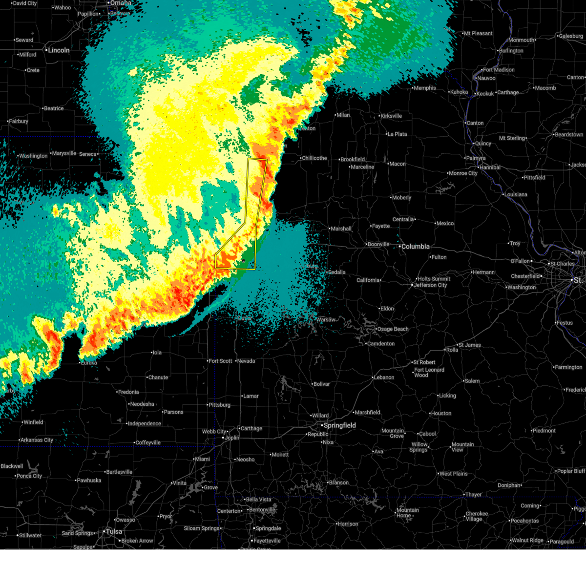
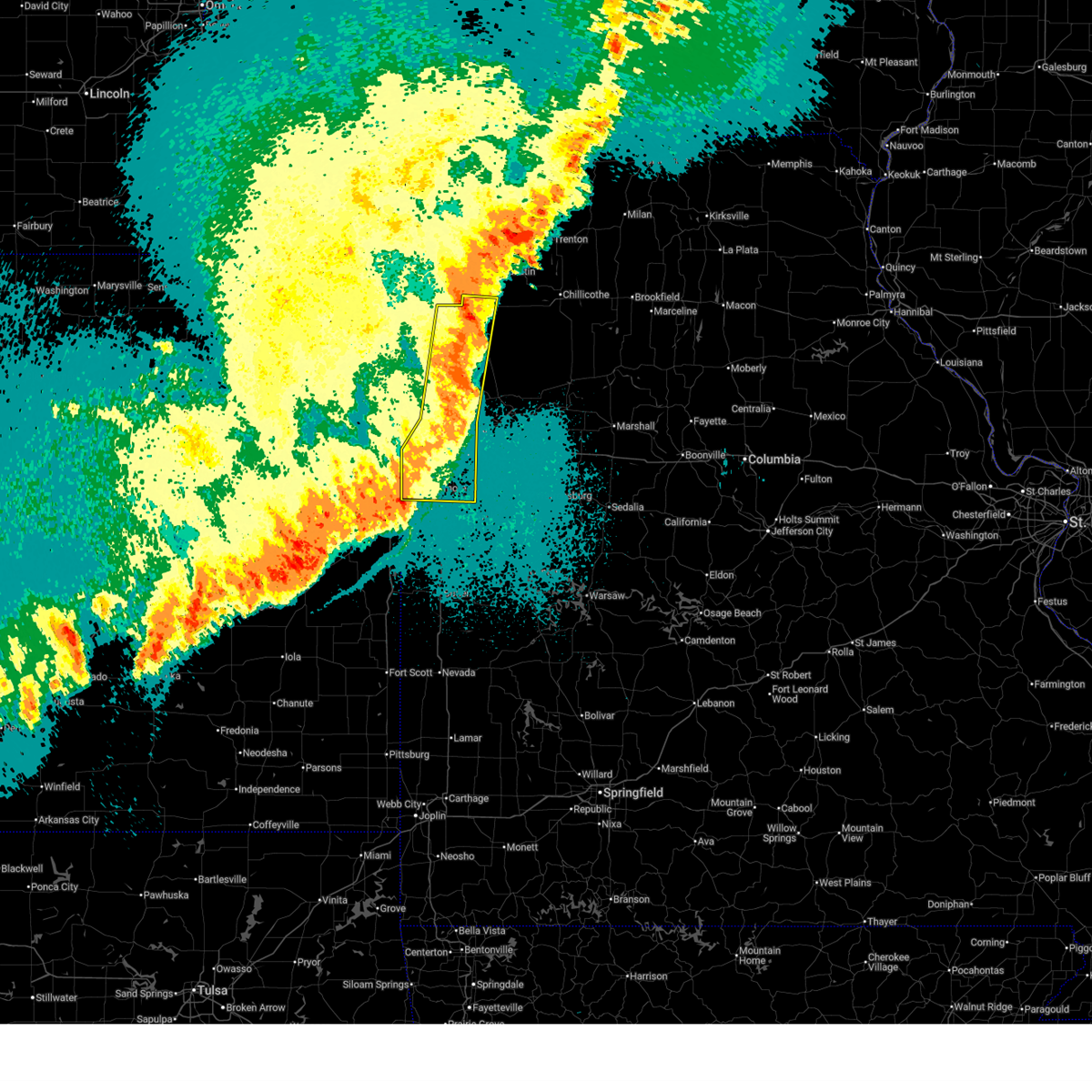
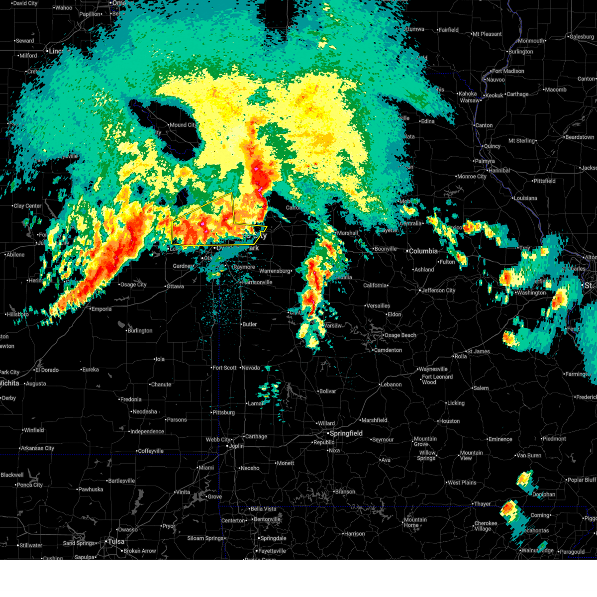
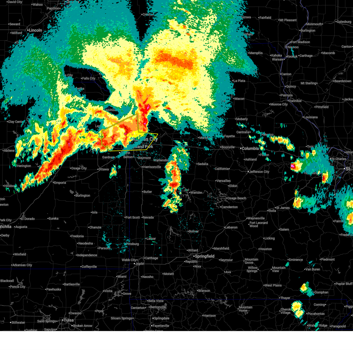
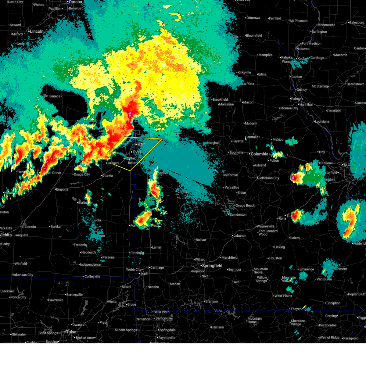
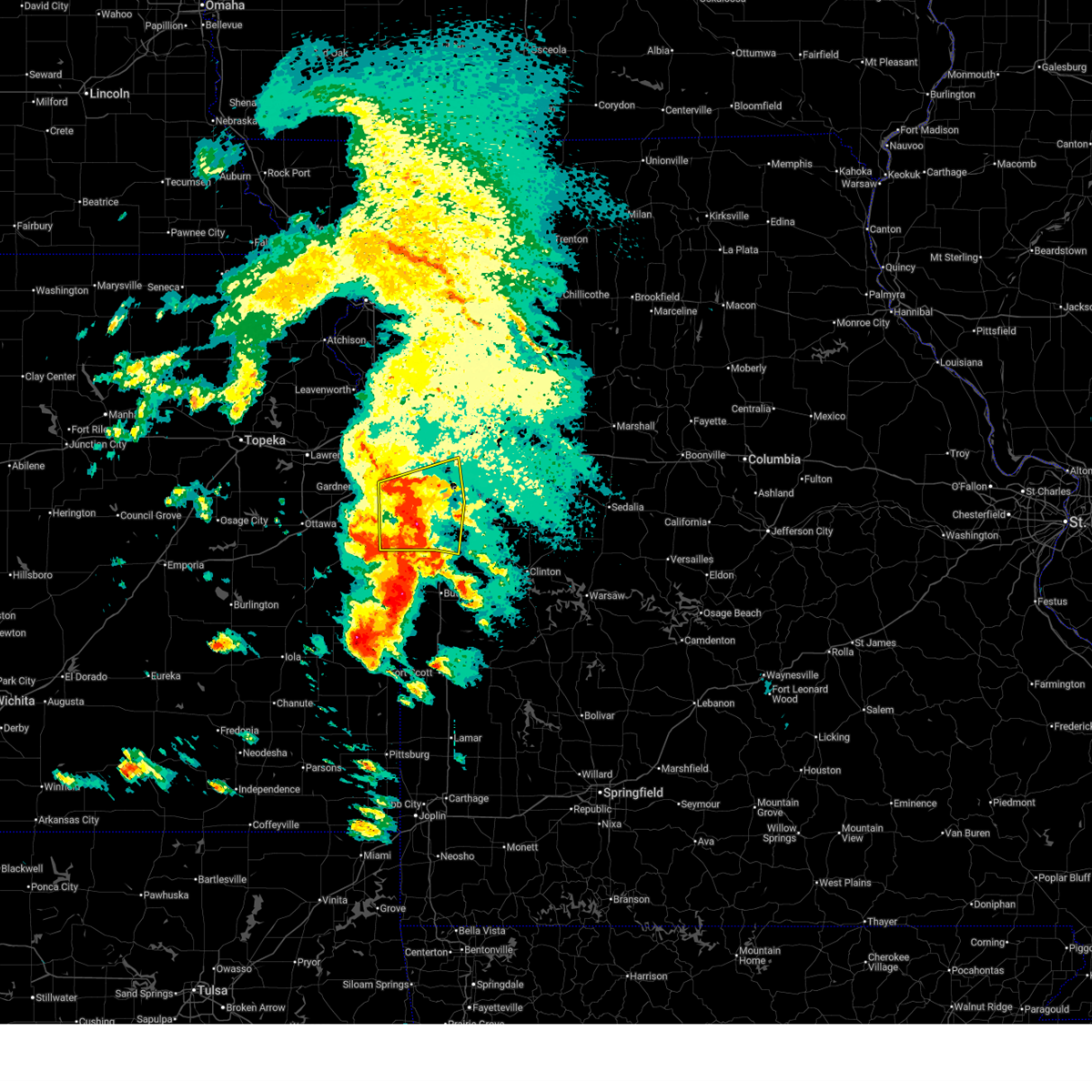
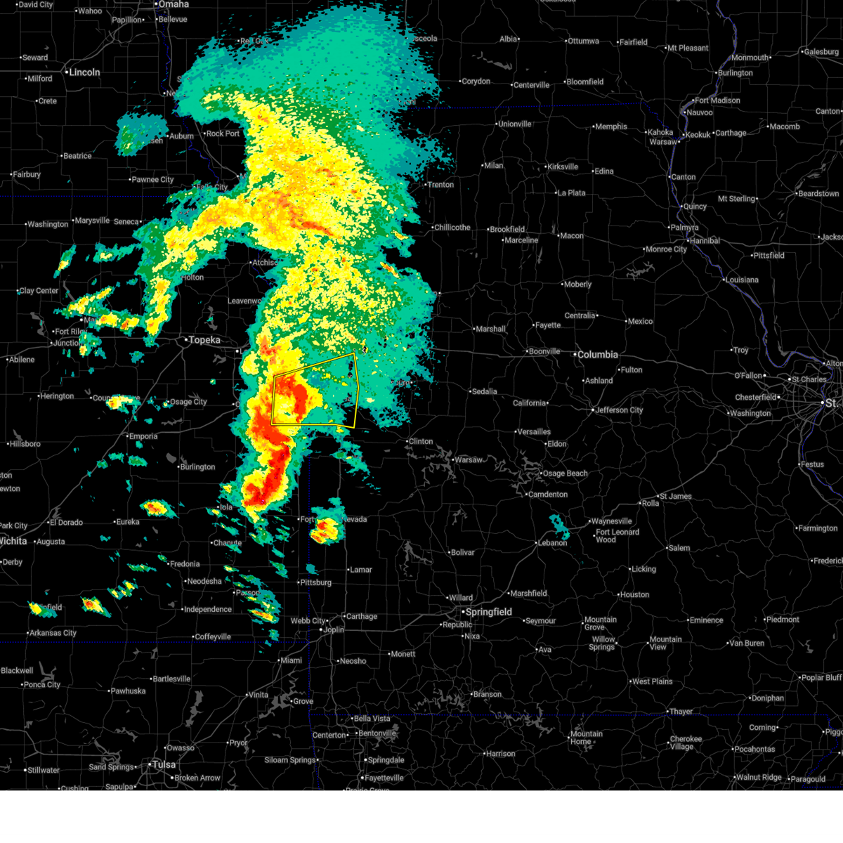
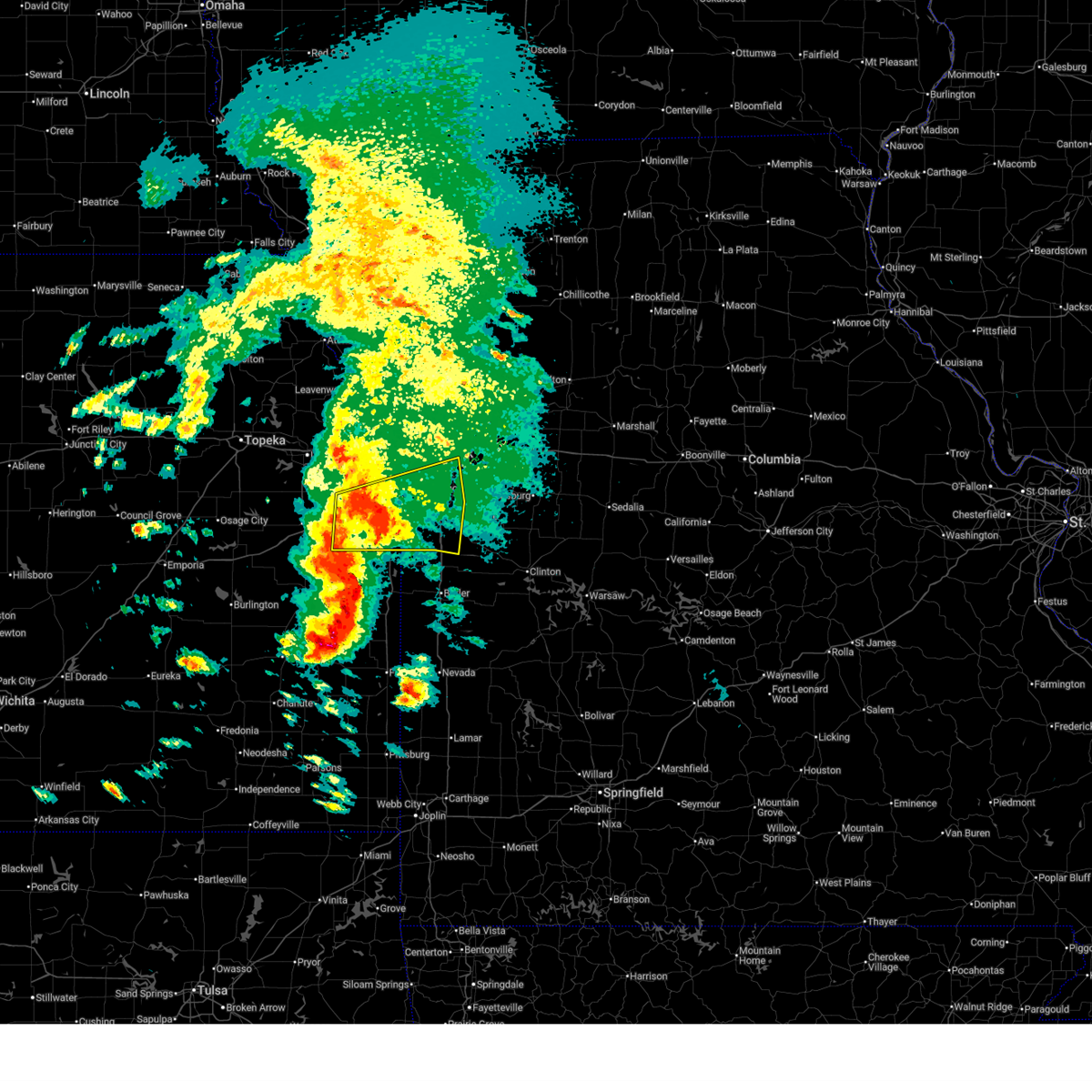
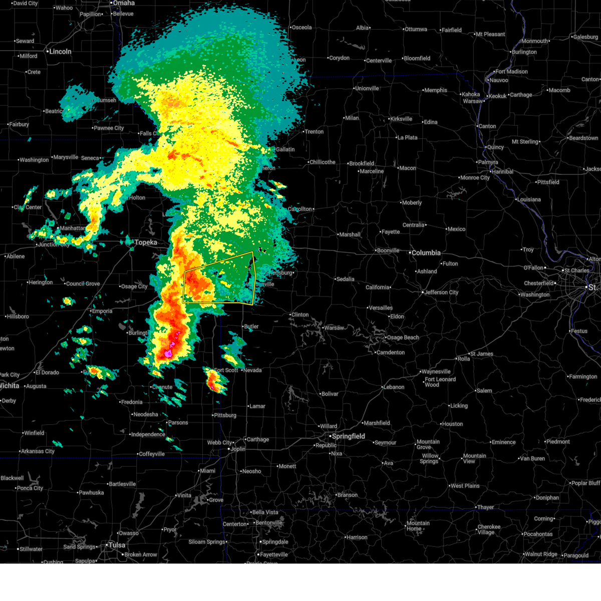
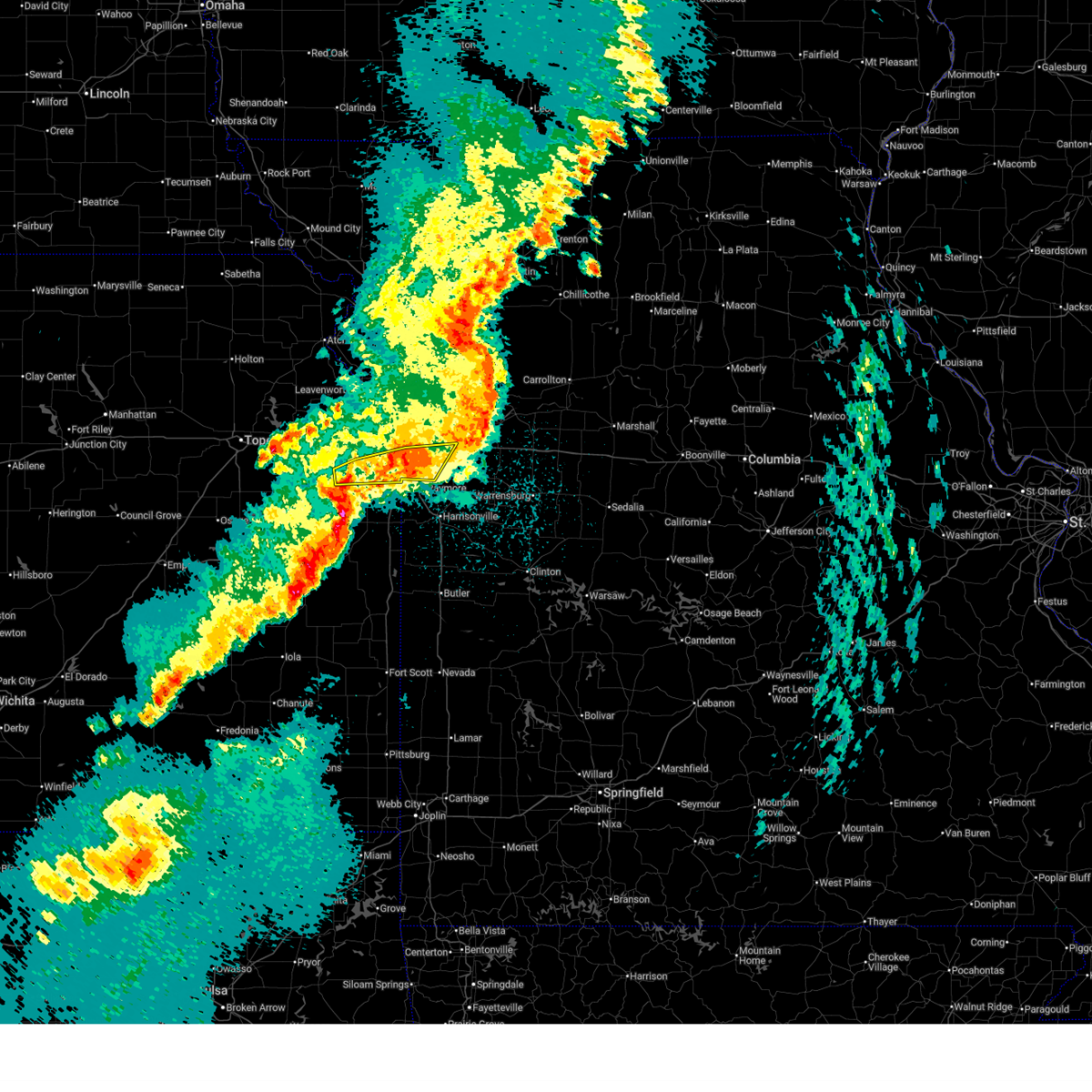
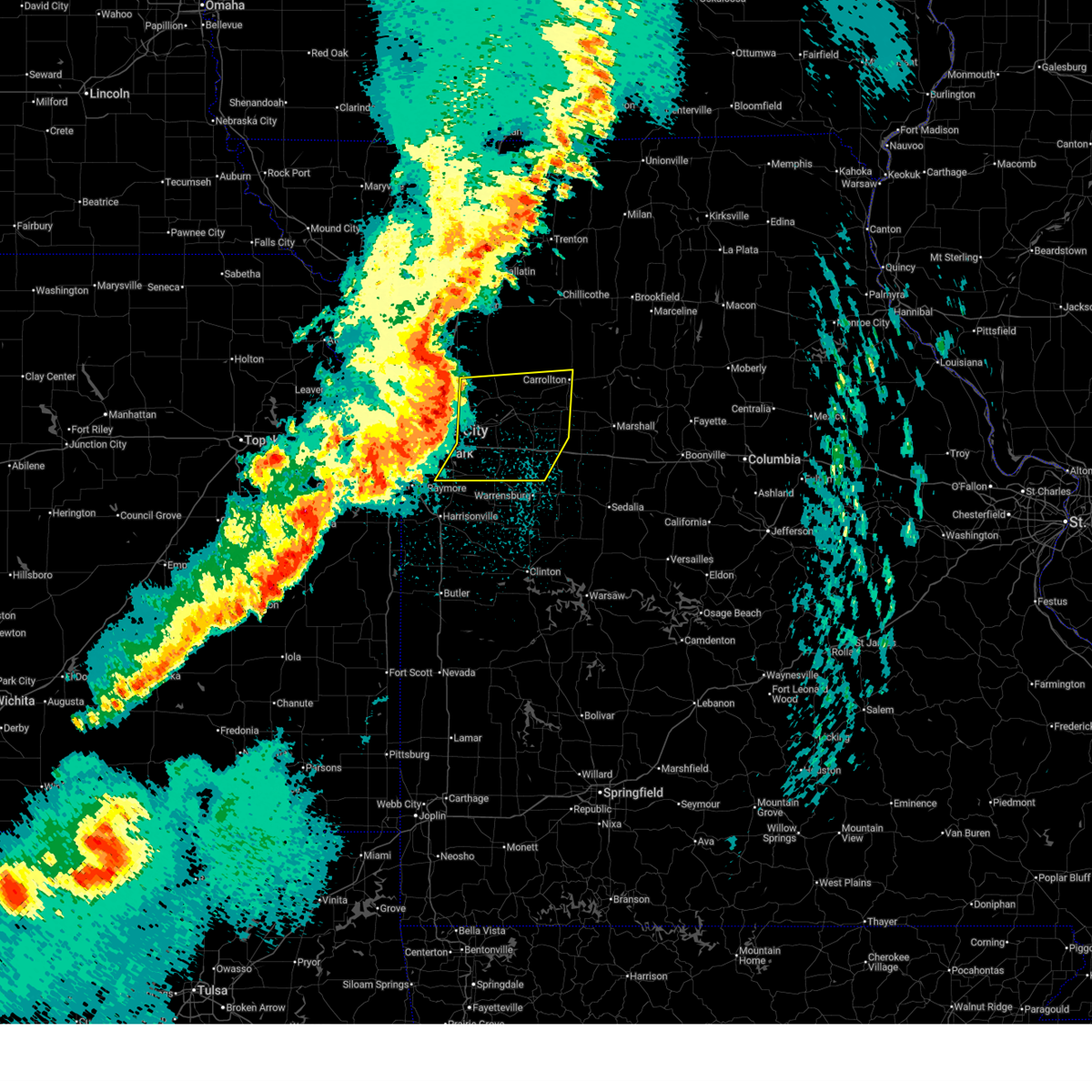
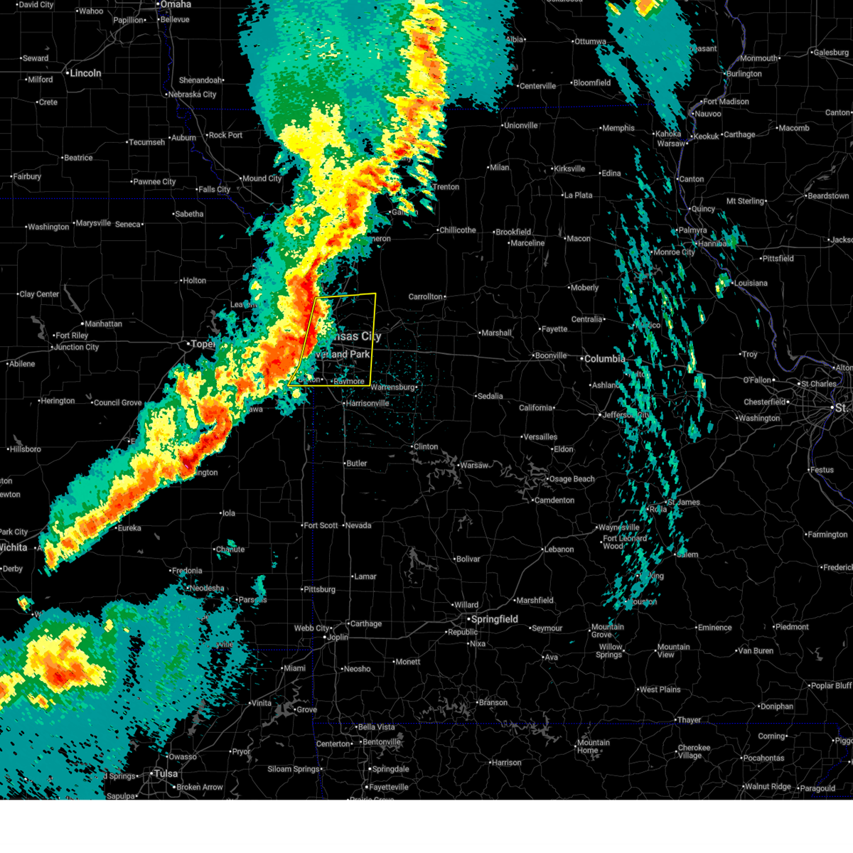
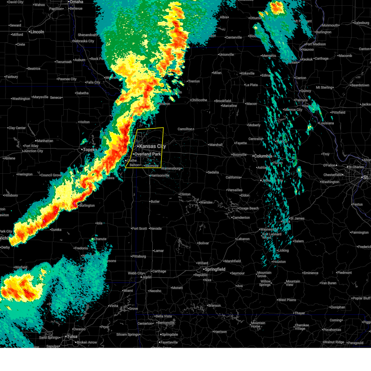
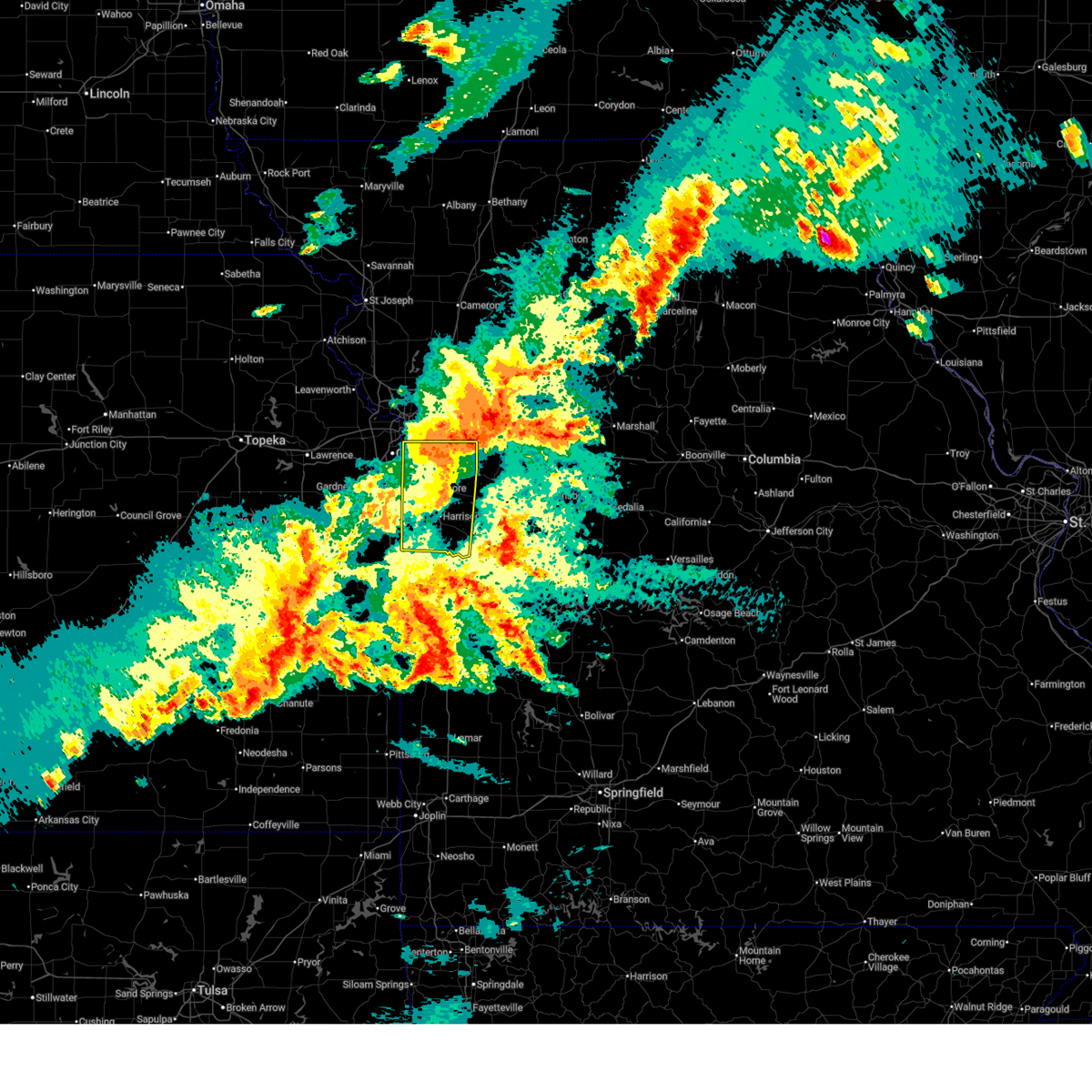
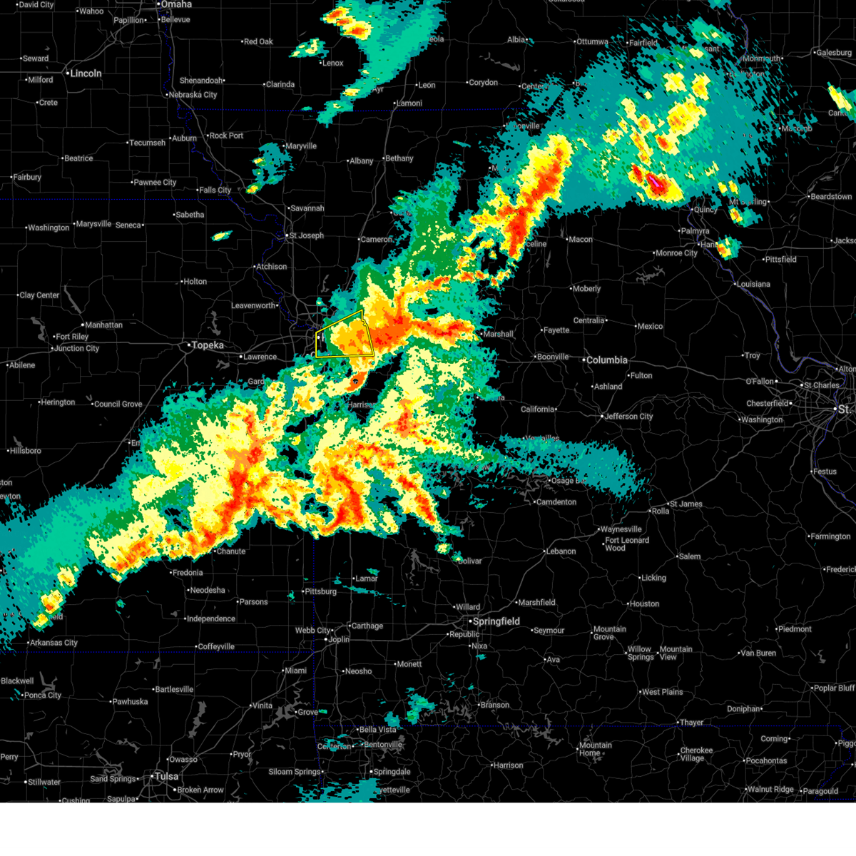
Hail Map for Blue Springs, MO
The Blue Springs, MO area has had 13 reports of on-the-ground hail by trained spotters, and has been under severe weather warnings 82 times during the past 12 months. Doppler radar has detected hail at or near Blue Springs, MO on 97 occasions, including 6 occasions during the past year.
| Name: | Blue Springs, MO |
| Where Located: | 17.6 miles ESE of Kansas City, MO |
| Map: | Google Map for Blue Springs, MO |
| Population: | 52575 |
| Housing Units: | 20643 |
| More Info: | Search Google for Blue Springs, MO |
3
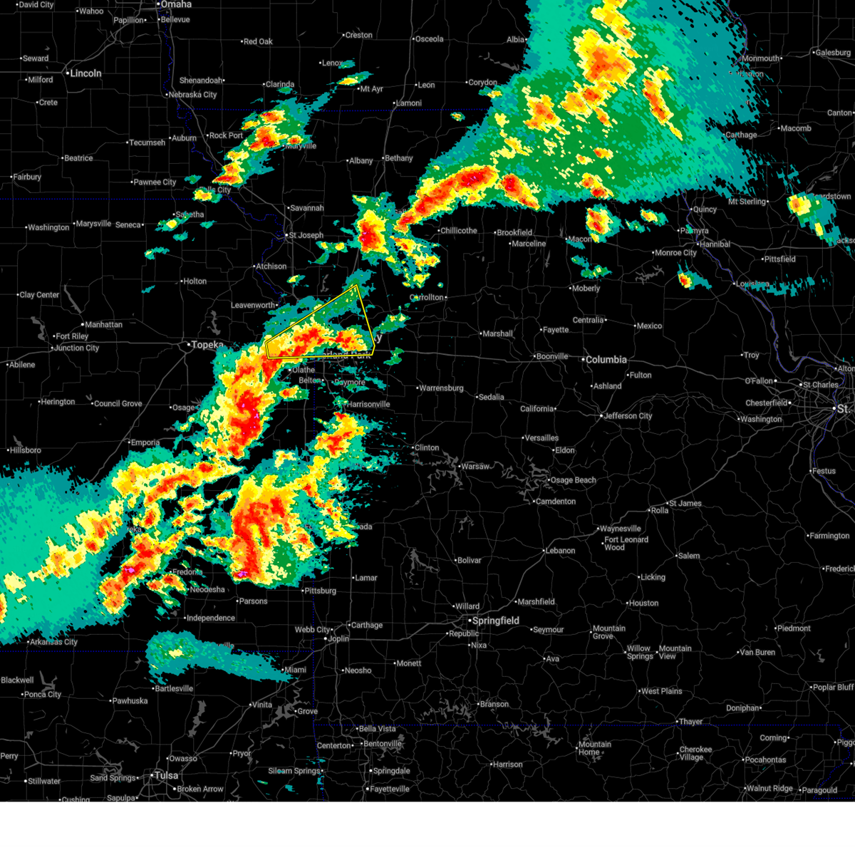
The Top Recent Hail Date for Blue Springs, MO is Friday, July 11, 2025 (8th out of 97)
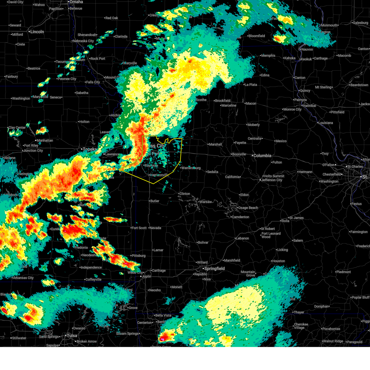
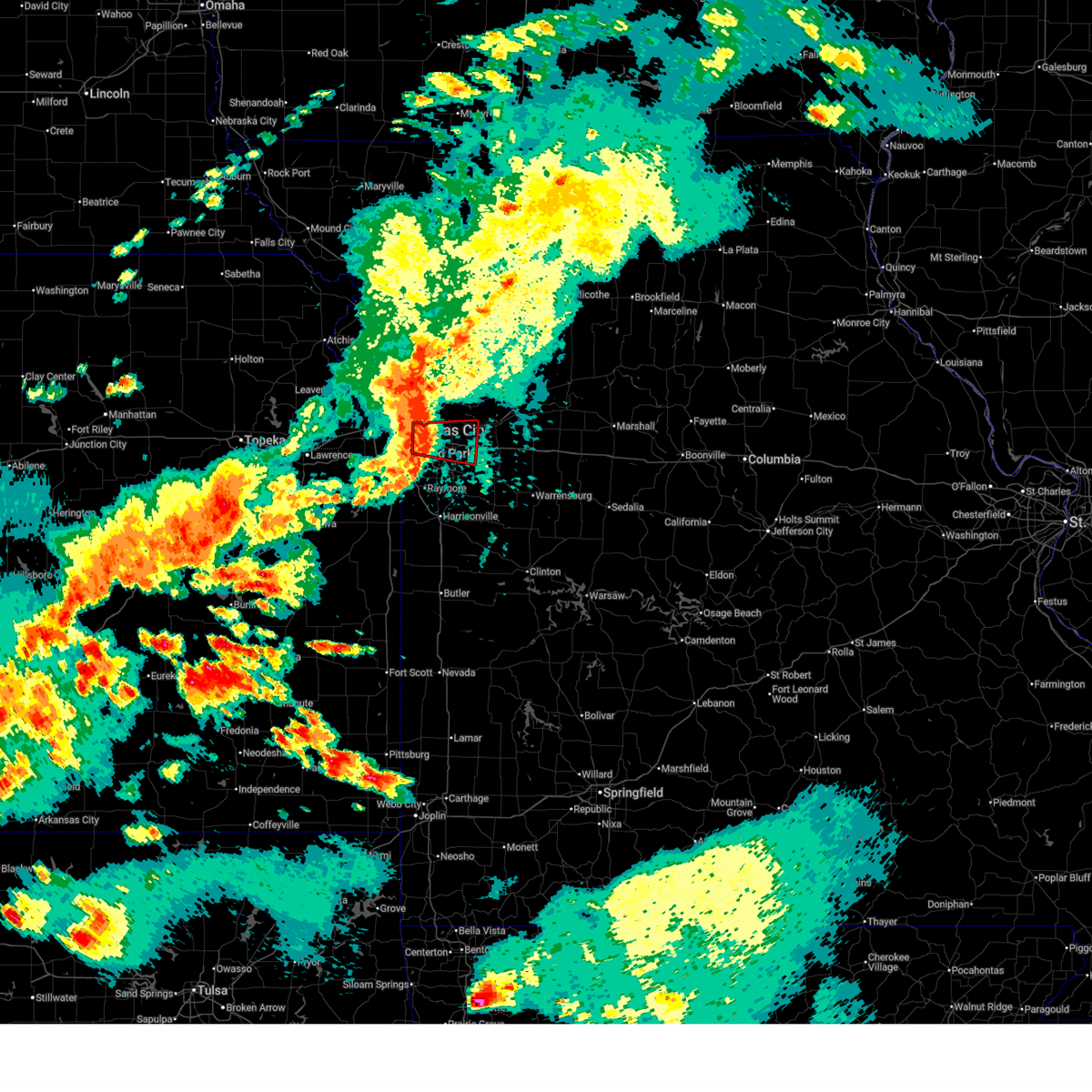
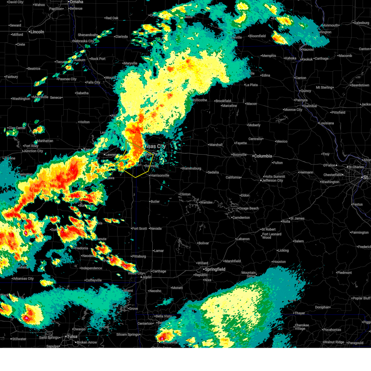
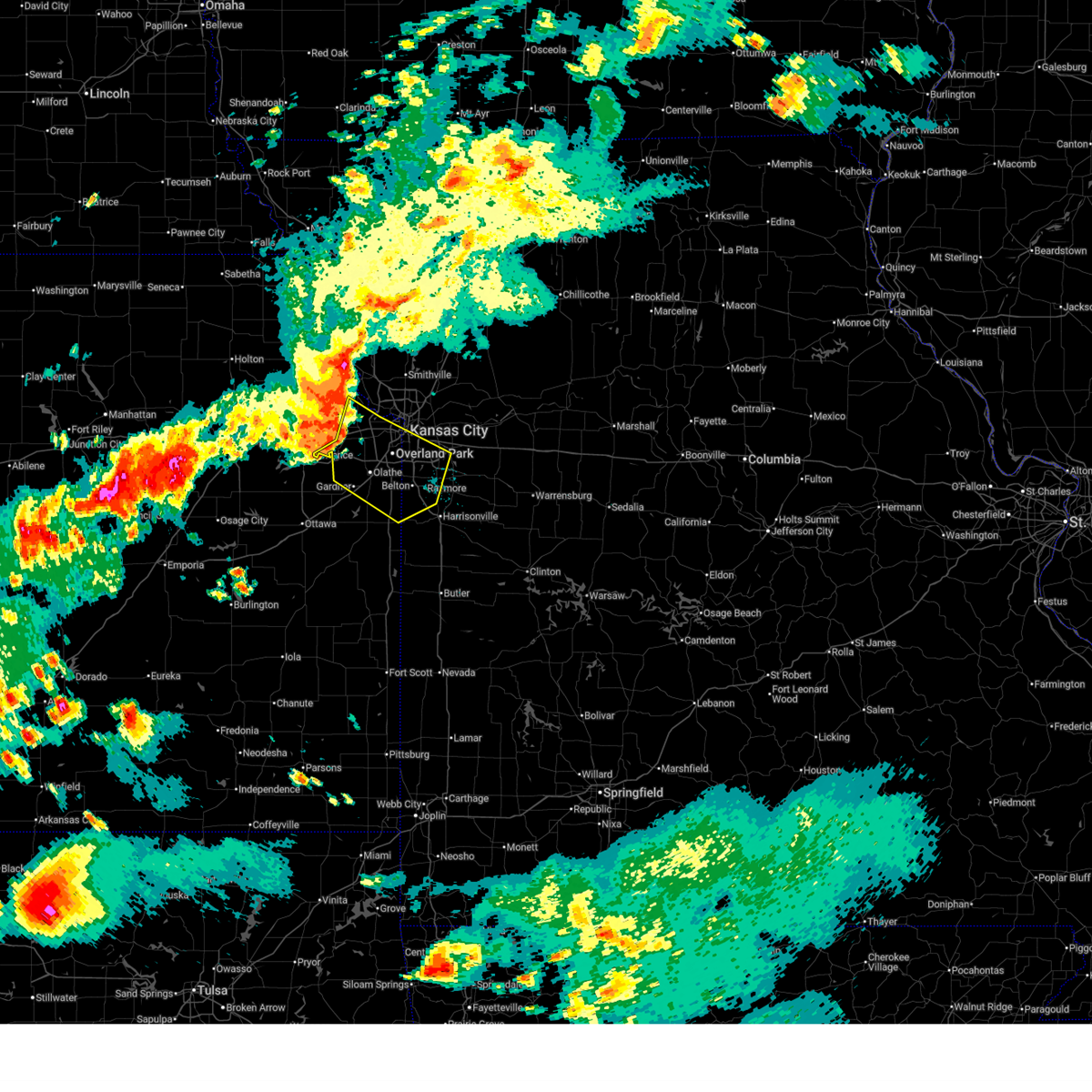
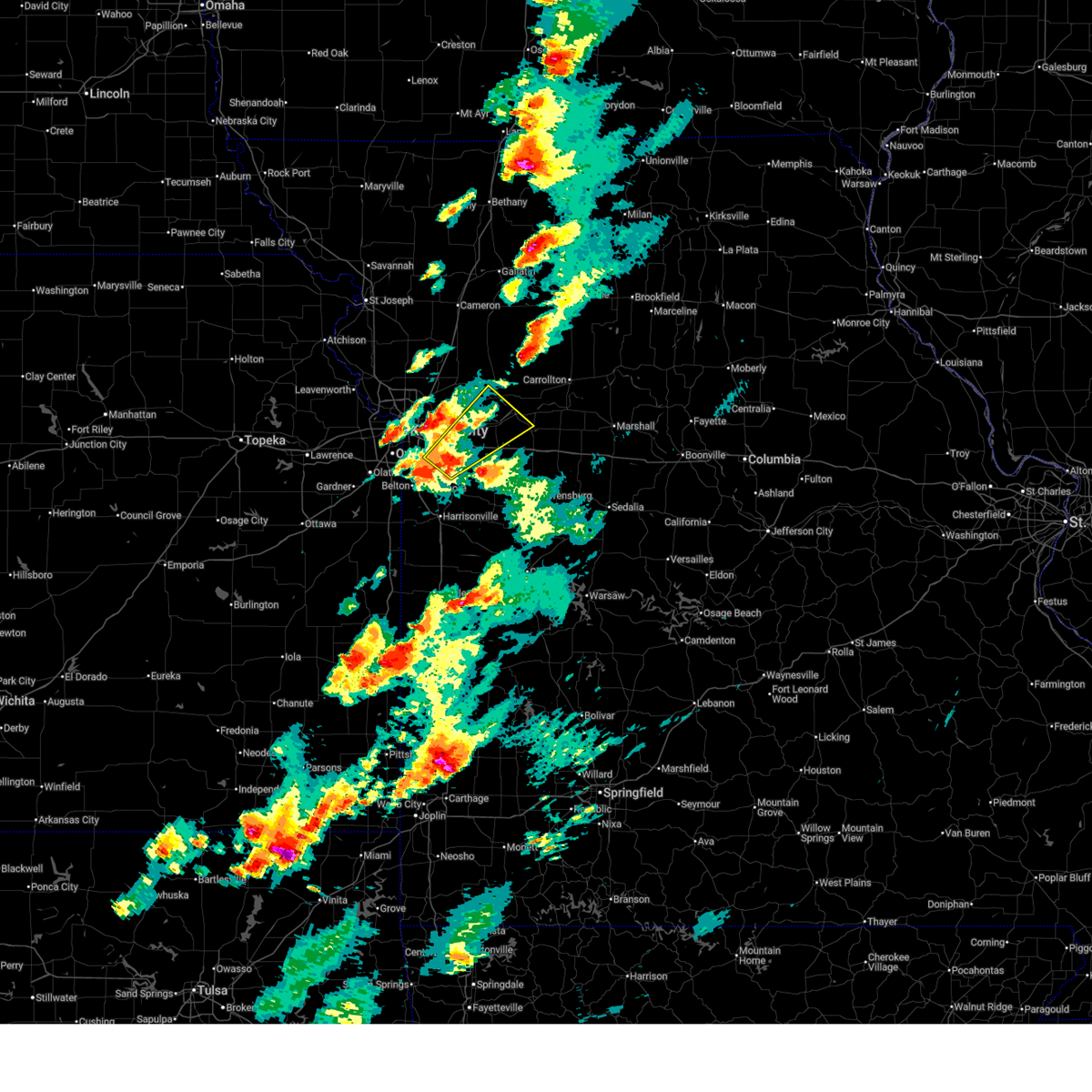
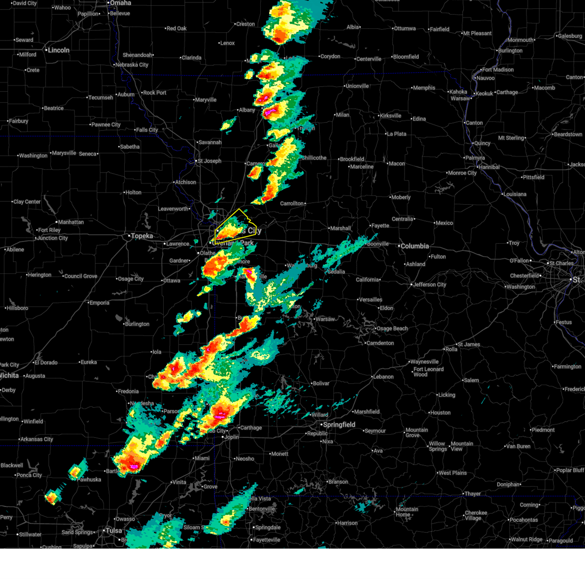
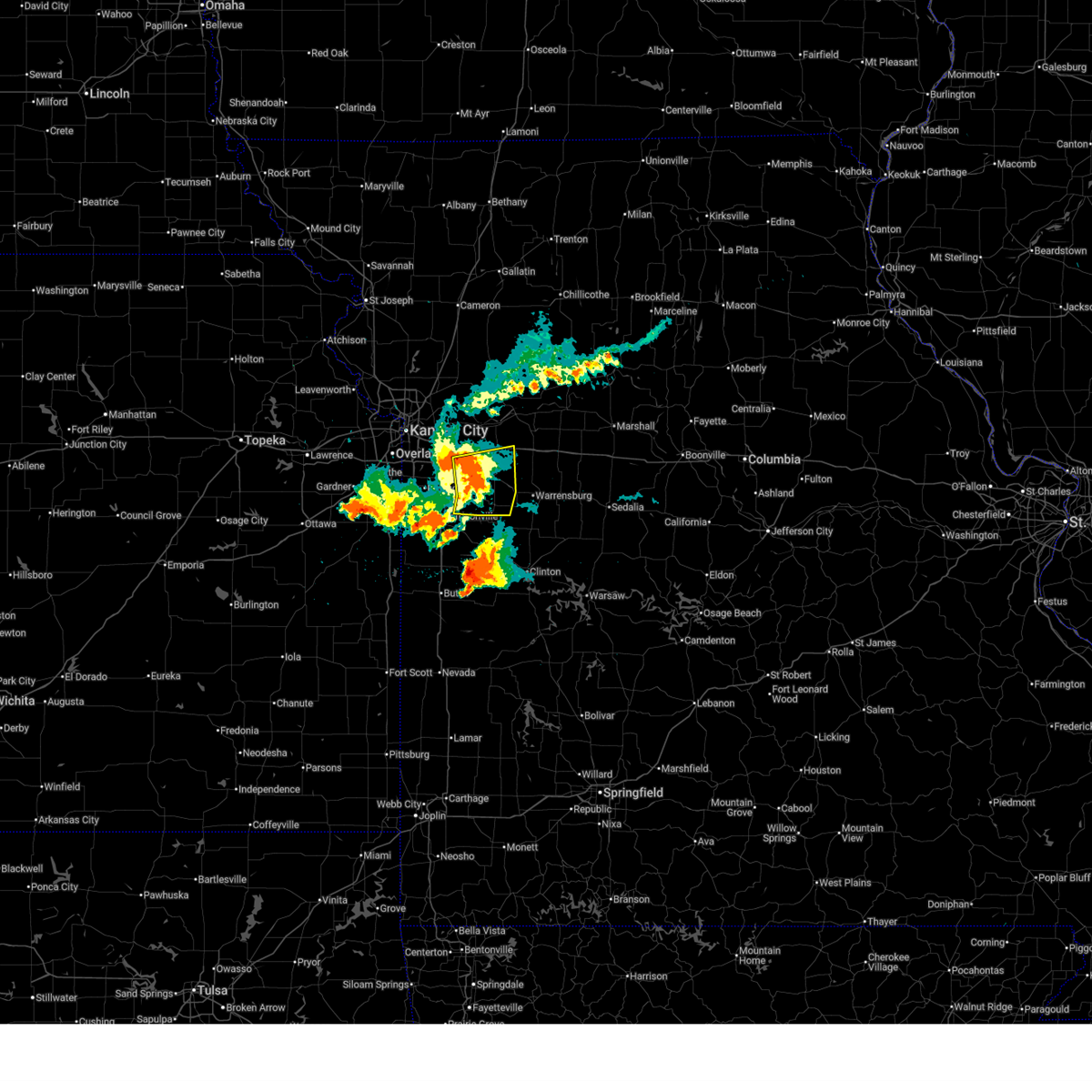
Hail and Wind Damage Spotted near Blue Springs, MO
| Date / Time | Report Details |
|---|---|
| 6/13/2026 9:20 PM CDT |
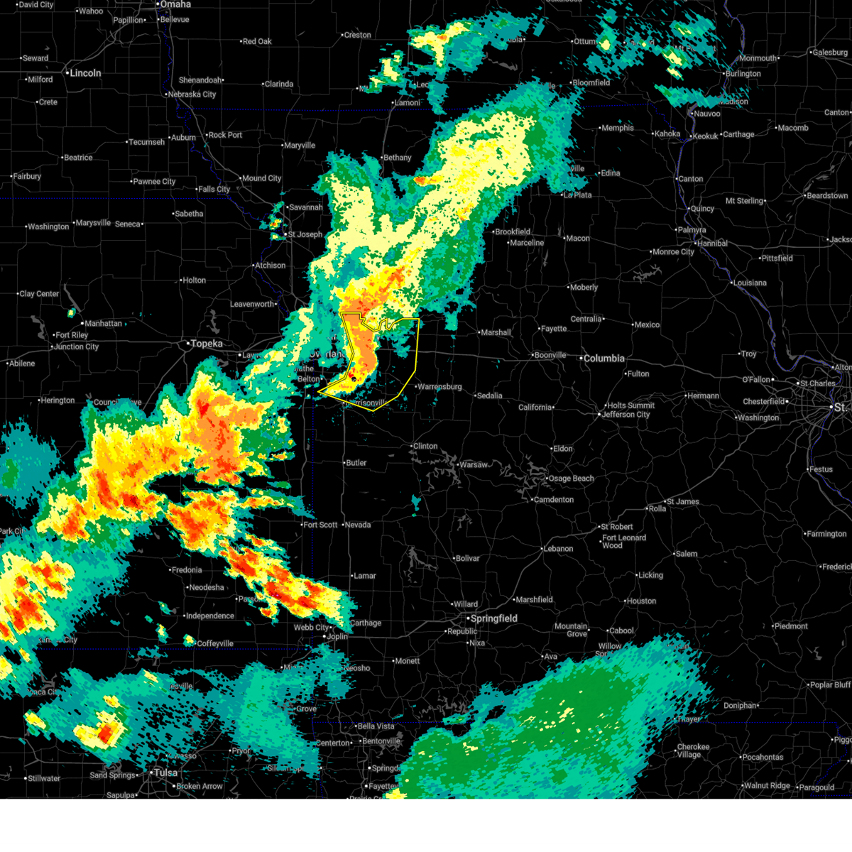 At 919 pm cdt, severe thunderstorms were located along a line extending from near levasy to 6 miles northeast of lone jack to near baldwin park to near lake annette, moving east at 45 mph (public report of 60 mph winds near oak grove). Hazards include 70 mph wind gusts and quarter size hail. Hail damage to vehicles is expected. expect considerable tree damage. wind damage is also likely to mobile homes, roofs, and outbuildings. locations impacted include, independence, blue springs, raymore, grain valley, harrisonville, pleasant hill, oak grove, odessa, greenwood, higginsville, lexington, peculiar, buckner, holden, lake lotawana, lake winnebago, lone jack, wellington, sibley, and east lynne. this includes the following highways, interstate 70 in missouri between mile markers 20 and 49. Interstate 49 between mile markers 165 and 170. At 919 pm cdt, severe thunderstorms were located along a line extending from near levasy to 6 miles northeast of lone jack to near baldwin park to near lake annette, moving east at 45 mph (public report of 60 mph winds near oak grove). Hazards include 70 mph wind gusts and quarter size hail. Hail damage to vehicles is expected. expect considerable tree damage. wind damage is also likely to mobile homes, roofs, and outbuildings. locations impacted include, independence, blue springs, raymore, grain valley, harrisonville, pleasant hill, oak grove, odessa, greenwood, higginsville, lexington, peculiar, buckner, holden, lake lotawana, lake winnebago, lone jack, wellington, sibley, and east lynne. this includes the following highways, interstate 70 in missouri between mile markers 20 and 49. Interstate 49 between mile markers 165 and 170.
|
| 6/13/2026 9:12 PM CDT |
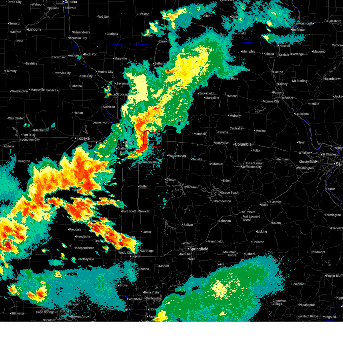 Toreax the national weather service in pleasant hill has issued a * tornado warning for, southwestern lafayette county in west central missouri, northeastern jackson county in west central missouri, * until 945 pm cdt. * at 912 pm cdt, a severe thunderstorm capable of producing a tornado was located near levasy, or near grain valley, moving east at 35 mph (radar indicated rotation). Hazards include tornado. Flying debris will be dangerous to those caught without shelter. mobile homes will be damaged or destroyed. damage to roofs, windows, and vehicles will occur. Tree damage is likely. Toreax the national weather service in pleasant hill has issued a * tornado warning for, southwestern lafayette county in west central missouri, northeastern jackson county in west central missouri, * until 945 pm cdt. * at 912 pm cdt, a severe thunderstorm capable of producing a tornado was located near levasy, or near grain valley, moving east at 35 mph (radar indicated rotation). Hazards include tornado. Flying debris will be dangerous to those caught without shelter. mobile homes will be damaged or destroyed. damage to roofs, windows, and vehicles will occur. Tree damage is likely.
|
| 6/13/2026 9:05 PM CDT |
 At 905 pm cdt, severe thunderstorms were located along a line extending from sibley to near lake lotawana to near lake winnebago to cleveland, moving east at 45 mph (radar indicated. line has history of 60-70 mph winds). Hazards include 70 mph wind gusts and quarter size hail. Hail damage to vehicles is expected. expect considerable tree damage. wind damage is also likely to mobile homes, roofs, and outbuildings. locations impacted include, kansas city, independence, lee's summit, blue springs, raytown, liberty, belton, raymore, grain valley, harrisonville, pleasant hill, oak grove, odessa, greenwood, higginsville, lexington, peculiar, sugar creek, buckner, and holden. this includes the following highways, interstate 70 in missouri between mile markers 10 and 49. interstate 35 in missouri between mile markers 13 and 16. interstate 470 between mile markers 5 and 16. Interstate 49 between mile markers 165 and 174. At 905 pm cdt, severe thunderstorms were located along a line extending from sibley to near lake lotawana to near lake winnebago to cleveland, moving east at 45 mph (radar indicated. line has history of 60-70 mph winds). Hazards include 70 mph wind gusts and quarter size hail. Hail damage to vehicles is expected. expect considerable tree damage. wind damage is also likely to mobile homes, roofs, and outbuildings. locations impacted include, kansas city, independence, lee's summit, blue springs, raytown, liberty, belton, raymore, grain valley, harrisonville, pleasant hill, oak grove, odessa, greenwood, higginsville, lexington, peculiar, sugar creek, buckner, and holden. this includes the following highways, interstate 70 in missouri between mile markers 10 and 49. interstate 35 in missouri between mile markers 13 and 16. interstate 470 between mile markers 5 and 16. Interstate 49 between mile markers 165 and 174.
|
| 6/13/2026 9:00 PM CDT | Mping report of downed tree limbs near oxford lane. time estimated from rada in jackson county MO, 1.4 miles SSE of Blue Springs, MO |
| 6/13/2026 8:59 PM CDT |
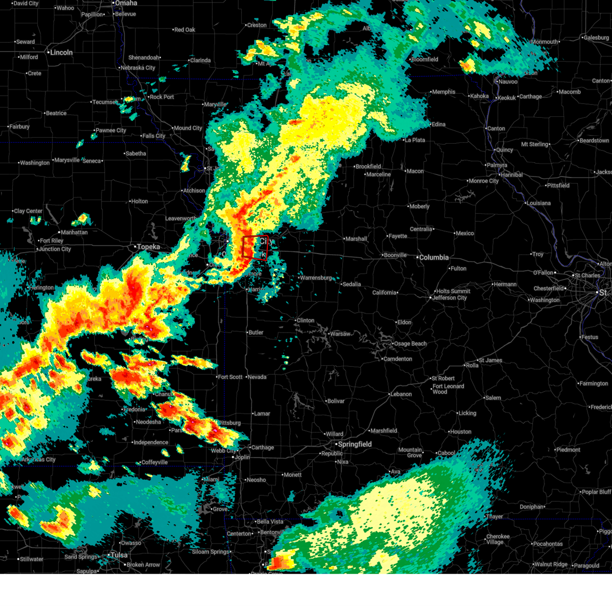 At 859 pm cdt, a severe thunderstorm capable of producing a tornado was located over blue springs, moving east at 40 mph (radar indicated rotation). Hazards include tornado. Flying debris will be dangerous to those caught without shelter. mobile homes will be damaged or destroyed. damage to roofs, windows, and vehicles will occur. tree damage is likely. locations impacted include, independence, lee's summit, blue springs, grain valley, sugar creek, buckner, lake lotawana, lake tapawingo, levasy, napoleon, unity village, and tarsney lakes. this includes the following highways, interstate 70 in missouri between mile markers 14 and 29. Interstate 470 between mile markers 11 and 16. At 859 pm cdt, a severe thunderstorm capable of producing a tornado was located over blue springs, moving east at 40 mph (radar indicated rotation). Hazards include tornado. Flying debris will be dangerous to those caught without shelter. mobile homes will be damaged or destroyed. damage to roofs, windows, and vehicles will occur. tree damage is likely. locations impacted include, independence, lee's summit, blue springs, grain valley, sugar creek, buckner, lake lotawana, lake tapawingo, levasy, napoleon, unity village, and tarsney lakes. this includes the following highways, interstate 70 in missouri between mile markers 14 and 29. Interstate 470 between mile markers 11 and 16.
|
| 6/13/2026 8:56 PM CDT | Downed tree limbs near route 7. time estimated from rada in jackson county MO, 0.4 miles WNW of Blue Springs, MO |
| 6/13/2026 8:53 PM CDT | Time estimated from rada in jackson county MO, 4.1 miles ESE of Blue Springs, MO |
| 6/13/2026 8:50 PM CDT |
 Svreax the national weather service in pleasant hill has issued a * severe thunderstorm warning for, northeastern miami county in east central kansas, southeastern johnson county in east central kansas, cass county in west central missouri, southeastern clay county in west central missouri, western lafayette county in west central missouri, jackson county in west central missouri, northwestern johnson county in west central missouri, * until 945 pm cdt. * at 849 pm cdt, severe thunderstorms were located along a line extending from river bend to near raytown to belton to near spring hill, moving east at 45 mph (radar indicated. line of thunderstorms has a history of producing 65-70 mph winds). Hazards include 70 mph wind gusts and quarter size hail. Hail damage to vehicles is expected. expect considerable tree damage. Wind damage is also likely to mobile homes, roofs, and outbuildings. Svreax the national weather service in pleasant hill has issued a * severe thunderstorm warning for, northeastern miami county in east central kansas, southeastern johnson county in east central kansas, cass county in west central missouri, southeastern clay county in west central missouri, western lafayette county in west central missouri, jackson county in west central missouri, northwestern johnson county in west central missouri, * until 945 pm cdt. * at 849 pm cdt, severe thunderstorms were located along a line extending from river bend to near raytown to belton to near spring hill, moving east at 45 mph (radar indicated. line of thunderstorms has a history of producing 65-70 mph winds). Hazards include 70 mph wind gusts and quarter size hail. Hail damage to vehicles is expected. expect considerable tree damage. Wind damage is also likely to mobile homes, roofs, and outbuildings.
|
| 6/13/2026 8:46 PM CDT |
 Toreax the national weather service in pleasant hill has issued a * tornado warning for, central jackson county in west central missouri, * until 915 pm cdt. * at 846 pm cdt, a severe thunderstorm capable of producing a tornado was located near independence, moving east at 40 mph (radar indicated rotation). Hazards include tornado. Flying debris will be dangerous to those caught without shelter. mobile homes will be damaged or destroyed. damage to roofs, windows, and vehicles will occur. Tree damage is likely. Toreax the national weather service in pleasant hill has issued a * tornado warning for, central jackson county in west central missouri, * until 915 pm cdt. * at 846 pm cdt, a severe thunderstorm capable of producing a tornado was located near independence, moving east at 40 mph (radar indicated rotation). Hazards include tornado. Flying debris will be dangerous to those caught without shelter. mobile homes will be damaged or destroyed. damage to roofs, windows, and vehicles will occur. Tree damage is likely.
|
| 6/13/2026 8:43 PM CDT |
 At 843 pm cdt, severe thunderstorms were located along a line extending from near lone jack to near kingsville to harrisonville, moving southeast at 70 mph (radar indicated). Hazards include 70 mph wind gusts and quarter size hail. Hail damage to vehicles is expected. expect considerable tree damage. wind damage is also likely to mobile homes, roofs, and outbuildings. locations impacted include, kansas city, overland park, olathe, independence, lee's summit, shawnee, blue springs, lenexa, leawood, raytown, liberty, gladstone, grandview, belton, prairie village, raymore, gardner, grain valley, merriam, and harrisonville. this includes the following highways, interstate 70 in missouri between mile markers 0 and 29. interstate 70 in kansas between mile markers 413 and 423. interstate 35 in missouri between mile markers 0 and 16. interstate 35 in kansas between mile markers 200 and 235. interstate 29 between mile markers 0 and 8. interstate 635 between mile markers 0 and 12. interstate 470 between mile markers 0 and 16. interstate 435 between mile markers 0 and 11, and between mile markers 49 and 83. Interstate 49 between mile markers 151 and 183. At 843 pm cdt, severe thunderstorms were located along a line extending from near lone jack to near kingsville to harrisonville, moving southeast at 70 mph (radar indicated). Hazards include 70 mph wind gusts and quarter size hail. Hail damage to vehicles is expected. expect considerable tree damage. wind damage is also likely to mobile homes, roofs, and outbuildings. locations impacted include, kansas city, overland park, olathe, independence, lee's summit, shawnee, blue springs, lenexa, leawood, raytown, liberty, gladstone, grandview, belton, prairie village, raymore, gardner, grain valley, merriam, and harrisonville. this includes the following highways, interstate 70 in missouri between mile markers 0 and 29. interstate 70 in kansas between mile markers 413 and 423. interstate 35 in missouri between mile markers 0 and 16. interstate 35 in kansas between mile markers 200 and 235. interstate 29 between mile markers 0 and 8. interstate 635 between mile markers 0 and 12. interstate 470 between mile markers 0 and 16. interstate 435 between mile markers 0 and 11, and between mile markers 49 and 83. Interstate 49 between mile markers 151 and 183.
|
| 6/13/2026 8:37 PM CDT |
 At 836 pm cdt, severe thunderstorms were located along a line extending from near raytown to near belton to near spring hill, moving southeast at 60 mph. these are destructive storms for kansas city metro (automated weather station kci reports 80 mph winds). Hazards include 80 mph wind gusts and quarter size hail. Flying debris will be dangerous to those caught without shelter. mobile homes will be heavily damaged. expect considerable damage to roofs, windows, and vehicles. extensive tree damage and power outages are likely. locations impacted include, overland park, olathe, lee's summit, shawnee, lenexa, leawood, raytown, grandview, belton, prairie village, raymore, gardner, merriam, mission, spring hill, greenwood, peculiar, edwardsville, fairway, and mission hills. this includes the following highways, interstate 70 in kansas between mile markers 412 and 422. interstate 35 in missouri between mile markers 0 and 2. interstate 35 in kansas between mile markers 207 and 235. interstate 635 between mile markers 0 and 6. interstate 470 between mile markers 0 and 13. interstate 435 between mile markers 0 and 12, near mile marker 18, and between mile markers 63 and 83. Interstate 49 between mile markers 166 and 183. At 836 pm cdt, severe thunderstorms were located along a line extending from near raytown to near belton to near spring hill, moving southeast at 60 mph. these are destructive storms for kansas city metro (automated weather station kci reports 80 mph winds). Hazards include 80 mph wind gusts and quarter size hail. Flying debris will be dangerous to those caught without shelter. mobile homes will be heavily damaged. expect considerable damage to roofs, windows, and vehicles. extensive tree damage and power outages are likely. locations impacted include, overland park, olathe, lee's summit, shawnee, lenexa, leawood, raytown, grandview, belton, prairie village, raymore, gardner, merriam, mission, spring hill, greenwood, peculiar, edwardsville, fairway, and mission hills. this includes the following highways, interstate 70 in kansas between mile markers 412 and 422. interstate 35 in missouri between mile markers 0 and 2. interstate 35 in kansas between mile markers 207 and 235. interstate 635 between mile markers 0 and 6. interstate 470 between mile markers 0 and 13. interstate 435 between mile markers 0 and 12, near mile marker 18, and between mile markers 63 and 83. Interstate 49 between mile markers 166 and 183.
|
| 6/13/2026 8:08 PM CDT |
 Svreax the national weather service in pleasant hill has issued a * severe thunderstorm warning for, wyandotte county in northeastern kansas, northeastern miami county in east central kansas, southern leavenworth county in northeastern kansas, johnson county in east central kansas, northwestern cass county in west central missouri, southwestern jackson county in west central missouri, * until 900 pm cdt. * at 807 pm cdt, severe thunderstorms were located along a line extending from near basehor to near linwood to near eudora, moving southeast at 55 mph. these are destructive storms for southern and western kansas city metro (emergency management reports 80 mph in lenavenworth county). Hazards include 80 mph wind gusts and quarter size hail. Flying debris will be dangerous to those caught without shelter. mobile homes will be heavily damaged. expect considerable damage to roofs, windows, and vehicles. Extensive tree damage and power outages are likely. Svreax the national weather service in pleasant hill has issued a * severe thunderstorm warning for, wyandotte county in northeastern kansas, northeastern miami county in east central kansas, southern leavenworth county in northeastern kansas, johnson county in east central kansas, northwestern cass county in west central missouri, southwestern jackson county in west central missouri, * until 900 pm cdt. * at 807 pm cdt, severe thunderstorms were located along a line extending from near basehor to near linwood to near eudora, moving southeast at 55 mph. these are destructive storms for southern and western kansas city metro (emergency management reports 80 mph in lenavenworth county). Hazards include 80 mph wind gusts and quarter size hail. Flying debris will be dangerous to those caught without shelter. mobile homes will be heavily damaged. expect considerable damage to roofs, windows, and vehicles. Extensive tree damage and power outages are likely.
|
| 6/13/2026 7:58 PM CDT |
 Svreax the national weather service in pleasant hill has issued a * severe thunderstorm warning for, wyandotte county in northeastern kansas, northern miami county in east central kansas, south central leavenworth county in northeastern kansas, johnson county in east central kansas, cass county in west central missouri, southern clay county in west central missouri, southeastern platte county in west central missouri, jackson county in west central missouri, * until 900 pm cdt. * at 758 pm cdt, severe thunderstorms were located along a line extending from 6 miles southwest of lansing to near tonganoxie to lawrence, moving southeast at 70 mph (radar indicated). Hazards include 70 mph wind gusts and quarter size hail. Hail damage to vehicles is expected. expect considerable tree damage. Wind damage is also likely to mobile homes, roofs, and outbuildings. Svreax the national weather service in pleasant hill has issued a * severe thunderstorm warning for, wyandotte county in northeastern kansas, northern miami county in east central kansas, south central leavenworth county in northeastern kansas, johnson county in east central kansas, cass county in west central missouri, southern clay county in west central missouri, southeastern platte county in west central missouri, jackson county in west central missouri, * until 900 pm cdt. * at 758 pm cdt, severe thunderstorms were located along a line extending from 6 miles southwest of lansing to near tonganoxie to lawrence, moving southeast at 70 mph (radar indicated). Hazards include 70 mph wind gusts and quarter size hail. Hail damage to vehicles is expected. expect considerable tree damage. Wind damage is also likely to mobile homes, roofs, and outbuildings.
|
| 6/9/2026 1:28 AM CDT | Mping report of minor tree damage. time estimated from rada in jackson county MO, 1.3 miles NW of Blue Springs, MO |
| 6/9/2026 1:28 AM CDT | Mping report of minor tree damage. time estimated from rada in jackson county MO, 1.2 miles NE of Blue Springs, MO |
| 6/9/2026 1:25 AM CDT |
 Svreax the national weather service in pleasant hill has issued a * severe thunderstorm warning for, cass county in west central missouri, western henry county in west central missouri, northern bates county in west central missouri, southwestern lafayette county in west central missouri, southern jackson county in west central missouri, western johnson county in west central missouri, * until 200 am cdt. * at 124 am cdt, a severe thunderstorm was located over baldwin park, or over pleasant hill, moving east at 60 mph (radar indicated). Hazards include 60 mph wind gusts. expect damage to roofs, siding, and trees Svreax the national weather service in pleasant hill has issued a * severe thunderstorm warning for, cass county in west central missouri, western henry county in west central missouri, northern bates county in west central missouri, southwestern lafayette county in west central missouri, southern jackson county in west central missouri, western johnson county in west central missouri, * until 200 am cdt. * at 124 am cdt, a severe thunderstorm was located over baldwin park, or over pleasant hill, moving east at 60 mph (radar indicated). Hazards include 60 mph wind gusts. expect damage to roofs, siding, and trees
|
| 6/9/2026 12:48 AM CDT |
 Svreax the national weather service in pleasant hill has issued a * severe thunderstorm warning for, wyandotte county in northeastern kansas, miami county in east central kansas, northern linn county in east central kansas, southwestern leavenworth county in northeastern kansas, johnson county in east central kansas, cass county in west central missouri, northwestern bates county in west central missouri, jackson county in west central missouri, * until 130 am cdt. * at 1248 am cdt, a severe thunderstorm was located near louisburg, moving east at 60 mph (radar indicated). Hazards include 70 mph wind gusts. Expect considerable tree damage. Damage is likely to mobile homes, roofs, and outbuildings. Svreax the national weather service in pleasant hill has issued a * severe thunderstorm warning for, wyandotte county in northeastern kansas, miami county in east central kansas, northern linn county in east central kansas, southwestern leavenworth county in northeastern kansas, johnson county in east central kansas, cass county in west central missouri, northwestern bates county in west central missouri, jackson county in west central missouri, * until 130 am cdt. * at 1248 am cdt, a severe thunderstorm was located near louisburg, moving east at 60 mph (radar indicated). Hazards include 70 mph wind gusts. Expect considerable tree damage. Damage is likely to mobile homes, roofs, and outbuildings.
|
| 6/1/2026 3:04 AM CDT |
 At 304 am cdt, severe thunderstorms were located along a line extending from near levasy to near lake tapawingo to near prairie village, moving southeast at 20 mph (radar indicated). Hazards include 60 mph wind gusts. Expect damage to roofs, siding, and trees. locations impacted include, kansas city, independence, lee's summit, blue springs, raytown, grain valley, north kansas city, sugar creek, buckner, courtney, lake tapawingo, sibley, levasy, river bend, kansas city downtown, birmingham, and unity village. this includes the following highways, interstate 70 in missouri between mile markers 1 and 29. interstate 35 in missouri between mile markers 1 and 4. interstate 470 between mile markers 0 and 4, and between mile markers 11 and 16. interstate 435 between mile markers 56 and 75. Interstate 49 near mile marker 183. At 304 am cdt, severe thunderstorms were located along a line extending from near levasy to near lake tapawingo to near prairie village, moving southeast at 20 mph (radar indicated). Hazards include 60 mph wind gusts. Expect damage to roofs, siding, and trees. locations impacted include, kansas city, independence, lee's summit, blue springs, raytown, grain valley, north kansas city, sugar creek, buckner, courtney, lake tapawingo, sibley, levasy, river bend, kansas city downtown, birmingham, and unity village. this includes the following highways, interstate 70 in missouri between mile markers 1 and 29. interstate 35 in missouri between mile markers 1 and 4. interstate 470 between mile markers 0 and 4, and between mile markers 11 and 16. interstate 435 between mile markers 56 and 75. Interstate 49 near mile marker 183.
|
| 6/1/2026 2:53 AM CDT |
 At 253 am cdt, severe thunderstorms were located along a line extending from near buckner to near independence to near lenexa, moving southeast at 25 mph (radar indicated). Hazards include 60 mph wind gusts and quarter size hail. Hail damage to vehicles is expected. expect wind damage to roofs, siding, and trees. locations impacted include, kansas city, overland park, independence, lee's summit, shawnee, blue springs, lenexa, leawood, raytown, grandview, prairie village, grain valley, merriam, mission, greenwood, north kansas city, fairway, mission hills, sugar creek, and buckner. this includes the following highways, interstate 70 in missouri between mile markers 0 and 29. interstate 70 in kansas between mile markers 419 and 423. interstate 35 in missouri between mile markers 0 and 5. interstate 35 in kansas between mile markers 225 and 235. interstate 635 between mile markers 0 and 4. interstate 470 between mile markers 0 and 16. interstate 435 between mile markers 56 and 80. Interstate 49 between mile markers 178 and 183. At 253 am cdt, severe thunderstorms were located along a line extending from near buckner to near independence to near lenexa, moving southeast at 25 mph (radar indicated). Hazards include 60 mph wind gusts and quarter size hail. Hail damage to vehicles is expected. expect wind damage to roofs, siding, and trees. locations impacted include, kansas city, overland park, independence, lee's summit, shawnee, blue springs, lenexa, leawood, raytown, grandview, prairie village, grain valley, merriam, mission, greenwood, north kansas city, fairway, mission hills, sugar creek, and buckner. this includes the following highways, interstate 70 in missouri between mile markers 0 and 29. interstate 70 in kansas between mile markers 419 and 423. interstate 35 in missouri between mile markers 0 and 5. interstate 35 in kansas between mile markers 225 and 235. interstate 635 between mile markers 0 and 4. interstate 470 between mile markers 0 and 16. interstate 435 between mile markers 56 and 80. Interstate 49 between mile markers 178 and 183.
|
| 6/1/2026 2:42 AM CDT |
 Svreax the national weather service in pleasant hill has issued a * severe thunderstorm warning for, central wyandotte county in northeastern kansas, northeastern johnson county in east central kansas, southwestern clay county in west central missouri, jackson county in west central missouri, * until 315 am cdt. * at 241 am cdt, severe thunderstorms were located along a line extending from near courtney to near raytown to lenexa, moving southeast at 35 mph (radar indicated). Hazards include 60 mph wind gusts and quarter size hail. Hail damage to vehicles is expected. Expect wind damage to roofs, siding, and trees. Svreax the national weather service in pleasant hill has issued a * severe thunderstorm warning for, central wyandotte county in northeastern kansas, northeastern johnson county in east central kansas, southwestern clay county in west central missouri, jackson county in west central missouri, * until 315 am cdt. * at 241 am cdt, severe thunderstorms were located along a line extending from near courtney to near raytown to lenexa, moving southeast at 35 mph (radar indicated). Hazards include 60 mph wind gusts and quarter size hail. Hail damage to vehicles is expected. Expect wind damage to roofs, siding, and trees.
|
| 6/1/2026 2:32 AM CDT |
 At 232 am cdt, a severe thunderstorm was located near odessa, moving southeast at 30 mph (radar indicated). Hazards include 60 mph wind gusts. Expect damage to roofs, siding, and trees. locations impacted include, blue springs, grain valley, oak grove, odessa, and bates city. This includes interstate 70 in missouri between mile markers 22 and 36. At 232 am cdt, a severe thunderstorm was located near odessa, moving southeast at 30 mph (radar indicated). Hazards include 60 mph wind gusts. Expect damage to roofs, siding, and trees. locations impacted include, blue springs, grain valley, oak grove, odessa, and bates city. This includes interstate 70 in missouri between mile markers 22 and 36.
|
| 6/1/2026 2:22 AM CDT |
 At 222 am cdt, a severe thunderstorm was located near grain valley, moving southeast at 25 mph (radar indicated). Hazards include 60 mph wind gusts and quarter size hail. Hail damage to vehicles is expected. expect wind damage to roofs, siding, and trees. locations impacted include, independence, blue springs, grain valley, oak grove, odessa, buckner, lake lotawana, lone jack, lake tapawingo, bates city, and tarsney lakes. This includes interstate 70 in missouri between mile markers 16 and 36. At 222 am cdt, a severe thunderstorm was located near grain valley, moving southeast at 25 mph (radar indicated). Hazards include 60 mph wind gusts and quarter size hail. Hail damage to vehicles is expected. expect wind damage to roofs, siding, and trees. locations impacted include, independence, blue springs, grain valley, oak grove, odessa, buckner, lake lotawana, lone jack, lake tapawingo, bates city, and tarsney lakes. This includes interstate 70 in missouri between mile markers 16 and 36.
|
| 6/1/2026 2:12 AM CDT |
 At 212 am cdt, a severe thunderstorm was located over blue springs, moving southeast at 30 mph (radar indicated). Hazards include 60 mph wind gusts and quarter size hail. Hail damage to vehicles is expected. expect wind damage to roofs, siding, and trees. locations impacted include, kansas city, independence, blue springs, liberty, grain valley, oak grove, odessa, sugar creek, buckner, lake lotawana, courtney, lone jack, lake tapawingo, river bend, bates city, birmingham, and tarsney lakes. This includes interstate 70 in missouri between mile markers 15 and 36. At 212 am cdt, a severe thunderstorm was located over blue springs, moving southeast at 30 mph (radar indicated). Hazards include 60 mph wind gusts and quarter size hail. Hail damage to vehicles is expected. expect wind damage to roofs, siding, and trees. locations impacted include, kansas city, independence, blue springs, liberty, grain valley, oak grove, odessa, sugar creek, buckner, lake lotawana, courtney, lone jack, lake tapawingo, river bend, bates city, birmingham, and tarsney lakes. This includes interstate 70 in missouri between mile markers 15 and 36.
|
| 6/1/2026 2:04 AM CDT |
 At 204 am cdt, a severe thunderstorm was located over independence, moving southeast at 20 mph (radar indicated). Hazards include 70 mph wind gusts and quarter size hail. Hail damage to vehicles is expected. expect considerable tree damage. wind damage is also likely to mobile homes, roofs, and outbuildings. locations impacted include, kansas city, independence, lee's summit, blue springs, liberty, grain valley, pleasant hill, oak grove, odessa, greenwood, sugar creek, buckner, lake lotawana, claycomo, courtney, pleasant valley, lone jack, lake tapawingo, glenaire, and river bend. this includes the following highways, interstate 70 in missouri between mile markers 11 and 36. interstate 35 in missouri between mile markers 13 and 17. interstate 470 between mile markers 9 and 16. Interstate 435 between mile markers 52 and 55, and near mile marker 58. At 204 am cdt, a severe thunderstorm was located over independence, moving southeast at 20 mph (radar indicated). Hazards include 70 mph wind gusts and quarter size hail. Hail damage to vehicles is expected. expect considerable tree damage. wind damage is also likely to mobile homes, roofs, and outbuildings. locations impacted include, kansas city, independence, lee's summit, blue springs, liberty, grain valley, pleasant hill, oak grove, odessa, greenwood, sugar creek, buckner, lake lotawana, claycomo, courtney, pleasant valley, lone jack, lake tapawingo, glenaire, and river bend. this includes the following highways, interstate 70 in missouri between mile markers 11 and 36. interstate 35 in missouri between mile markers 13 and 17. interstate 470 between mile markers 9 and 16. Interstate 435 between mile markers 52 and 55, and near mile marker 58.
|
| 6/1/2026 1:52 AM CDT |
 Svreax the national weather service in pleasant hill has issued a * severe thunderstorm warning for, northeastern cass county in west central missouri, southwestern clay county in west central missouri, west central lafayette county in west central missouri, jackson county in west central missouri, * until 245 am cdt. * at 152 am cdt, a severe thunderstorm was located near independence, moving southeast at 30 mph (radar indicated). Hazards include 70 mph wind gusts and quarter size hail. Hail damage to vehicles is expected. expect considerable tree damage. Wind damage is also likely to mobile homes, roofs, and outbuildings. Svreax the national weather service in pleasant hill has issued a * severe thunderstorm warning for, northeastern cass county in west central missouri, southwestern clay county in west central missouri, west central lafayette county in west central missouri, jackson county in west central missouri, * until 245 am cdt. * at 152 am cdt, a severe thunderstorm was located near independence, moving southeast at 30 mph (radar indicated). Hazards include 70 mph wind gusts and quarter size hail. Hail damage to vehicles is expected. expect considerable tree damage. Wind damage is also likely to mobile homes, roofs, and outbuildings.
|
| 6/1/2026 1:46 AM CDT |
 At 146 am cdt, a severe thunderstorm capable of producing a tornado was located near sugar creek, moving southeast at 20 mph (radar indicated rotation. kc downtown airport gusted to 74 mph). Hazards include tornado and quarter size hail. Flying debris will be dangerous to those caught without shelter. mobile homes will be damaged or destroyed. damage to roofs, windows, and vehicles will occur. tree damage is likely. locations impacted include, kansas city, independence, lee's summit, blue springs, raytown, north kansas city, sugar creek, avondale, kansas city downtown, birmingham, and randolph. this includes the following highways, interstate 70 in missouri between mile markers 2 and 18. interstate 35 in missouri between mile markers 3 and 6. interstate 470 between mile markers 14 and 16. Interstate 435 between mile markers 53 and 65. At 146 am cdt, a severe thunderstorm capable of producing a tornado was located near sugar creek, moving southeast at 20 mph (radar indicated rotation. kc downtown airport gusted to 74 mph). Hazards include tornado and quarter size hail. Flying debris will be dangerous to those caught without shelter. mobile homes will be damaged or destroyed. damage to roofs, windows, and vehicles will occur. tree damage is likely. locations impacted include, kansas city, independence, lee's summit, blue springs, raytown, north kansas city, sugar creek, avondale, kansas city downtown, birmingham, and randolph. this includes the following highways, interstate 70 in missouri between mile markers 2 and 18. interstate 35 in missouri between mile markers 3 and 6. interstate 470 between mile markers 14 and 16. Interstate 435 between mile markers 53 and 65.
|
| 5/18/2026 10:10 PM CDT |
 At 1009 pm cdt, severe thunderstorms were located along a line extending from hamilton to lake lotawana, moving east at 45 mph (automated weather station). Hazards include 60 mph wind gusts. Expect damage to roofs, siding, and trees. locations impacted include, kansas city, independence, lee's summit, blue springs, raytown, grandview, belton, raymore, grain valley, excelsior springs, cameron, pleasant hill, greenwood, peculiar, buckner, lawson, lake lotawana, hamilton, lake winnebago, and lone jack. this includes the following highways, interstate 70 in missouri between mile markers 14 and 29. interstate 470 between mile markers 1 and 16. Interstate 49 between mile markers 169 and 183. At 1009 pm cdt, severe thunderstorms were located along a line extending from hamilton to lake lotawana, moving east at 45 mph (automated weather station). Hazards include 60 mph wind gusts. Expect damage to roofs, siding, and trees. locations impacted include, kansas city, independence, lee's summit, blue springs, raytown, grandview, belton, raymore, grain valley, excelsior springs, cameron, pleasant hill, greenwood, peculiar, buckner, lawson, lake lotawana, hamilton, lake winnebago, and lone jack. this includes the following highways, interstate 70 in missouri between mile markers 14 and 29. interstate 470 between mile markers 1 and 16. Interstate 49 between mile markers 169 and 183.
|
| 5/18/2026 9:52 PM CDT |
 At 952 pm cdt, severe thunderstorms were located along a line extending from near kingston to near grandview, moving east at 50 mph (automated weather station). Hazards include 60 mph wind gusts and penny size hail. Expect damage to roofs, siding, and trees. locations impacted include, kansas city, independence, lee's summit, blue springs, leawood, raytown, liberty, grandview, belton, prairie village, raymore, grain valley, excelsior springs, cameron, kearney, pleasant hill, greenwood, peculiar, sugar creek, and buckner. this includes the following highways, interstate 70 in missouri between mile markers 5 and 29. interstate 35 in missouri between mile markers 15 and 53. interstate 470 between mile markers 0 and 16. interstate 435 between mile markers 57 and 75. Interstate 49 between mile markers 169 and 183. At 952 pm cdt, severe thunderstorms were located along a line extending from near kingston to near grandview, moving east at 50 mph (automated weather station). Hazards include 60 mph wind gusts and penny size hail. Expect damage to roofs, siding, and trees. locations impacted include, kansas city, independence, lee's summit, blue springs, leawood, raytown, liberty, grandview, belton, prairie village, raymore, grain valley, excelsior springs, cameron, kearney, pleasant hill, greenwood, peculiar, sugar creek, and buckner. this includes the following highways, interstate 70 in missouri between mile markers 5 and 29. interstate 35 in missouri between mile markers 15 and 53. interstate 470 between mile markers 0 and 16. interstate 435 between mile markers 57 and 75. Interstate 49 between mile markers 169 and 183.
|
| 5/18/2026 9:13 PM CDT |
 Svreax the national weather service in pleasant hill has issued a * severe thunderstorm warning for, northern cass county in west central missouri, southeastern buchanan county in northwestern missouri, clinton county in northwestern missouri, clay county in west central missouri, western ray county in west central missouri, western caldwell county in north central missouri, eastern platte county in west central missouri, jackson county in west central missouri, * until 1015 pm cdt. * at 913 pm cdt, severe thunderstorms were located along a line extending from gower to edgerton, moving east at 50 mph (automated weather station). Hazards include 70 mph wind gusts and penny size hail. Expect considerable tree damage. Damage is likely to mobile homes, roofs, and outbuildings. Svreax the national weather service in pleasant hill has issued a * severe thunderstorm warning for, northern cass county in west central missouri, southeastern buchanan county in northwestern missouri, clinton county in northwestern missouri, clay county in west central missouri, western ray county in west central missouri, western caldwell county in north central missouri, eastern platte county in west central missouri, jackson county in west central missouri, * until 1015 pm cdt. * at 913 pm cdt, severe thunderstorms were located along a line extending from gower to edgerton, moving east at 50 mph (automated weather station). Hazards include 70 mph wind gusts and penny size hail. Expect considerable tree damage. Damage is likely to mobile homes, roofs, and outbuildings.
|
| 4/27/2026 6:14 AM CDT |
 Svreax the national weather service in pleasant hill has issued a * severe thunderstorm warning for, cass county in west central missouri, northwestern henry county in west central missouri, southern lafayette county in west central missouri, southern jackson county in west central missouri, johnson county in west central missouri, * until 700 am cdt. * at 614 am cdt, severe thunderstorms were located along a line extending from near greenwood to near lake winnebago to near harrisonville, moving east at 45 mph (radar indicated). Hazards include 60 mph wind gusts and quarter size hail. Hail damage to vehicles is expected. Expect wind damage to roofs, siding, and trees. Svreax the national weather service in pleasant hill has issued a * severe thunderstorm warning for, cass county in west central missouri, northwestern henry county in west central missouri, southern lafayette county in west central missouri, southern jackson county in west central missouri, johnson county in west central missouri, * until 700 am cdt. * at 614 am cdt, severe thunderstorms were located along a line extending from near greenwood to near lake winnebago to near harrisonville, moving east at 45 mph (radar indicated). Hazards include 60 mph wind gusts and quarter size hail. Hail damage to vehicles is expected. Expect wind damage to roofs, siding, and trees.
|
| 4/27/2026 5:51 AM CDT |
 Svreax the national weather service in pleasant hill has issued a * severe thunderstorm warning for, northeastern miami county in east central kansas, eastern johnson county in east central kansas, cass county in west central missouri, southwestern jackson county in west central missouri, * until 615 am cdt. * at 551 am cdt, a severe thunderstorm was located over leawood, moving east at 50 mph (radar indicated). Hazards include 60 mph wind gusts and quarter size hail. Hail damage to vehicles is expected. Expect wind damage to roofs, siding, and trees. Svreax the national weather service in pleasant hill has issued a * severe thunderstorm warning for, northeastern miami county in east central kansas, eastern johnson county in east central kansas, cass county in west central missouri, southwestern jackson county in west central missouri, * until 615 am cdt. * at 551 am cdt, a severe thunderstorm was located over leawood, moving east at 50 mph (radar indicated). Hazards include 60 mph wind gusts and quarter size hail. Hail damage to vehicles is expected. Expect wind damage to roofs, siding, and trees.
|
| 4/27/2026 4:33 AM CDT |
 At 433 am cdt, severe thunderstorms were located along a line extending from near kansas city intl arpt to parkville to near lake quivira, moving northeast at 45 mph (radar indicated). Hazards include 70 mph wind gusts and quarter size hail. Hail damage to vehicles is expected. expect considerable tree damage. wind damage is also likely to mobile homes, roofs, and outbuildings. locations impacted include, kansas city, overland park, independence, lee's summit, shawnee, blue springs, leavenworth, raytown, liberty, gladstone, prairie village, grain valley, lansing, merriam, mission, smithville, bonner springs, parkville, tonganoxie, and platte city. this includes the following highways, interstate 70 in missouri between mile markers 0 and 25. interstate 70 in kansas between mile markers 410 and 423. interstate 35 in missouri between mile markers 0 and 18. interstate 35 in kansas between mile markers 228 and 235. interstate 29 between mile markers 0 and 20. interstate 635 between mile markers 0 and 12. interstate 470 between mile markers 15 and 16. interstate 435 between mile markers 6 and 66. Kansas turnpike between mile markers 209 and 226. At 433 am cdt, severe thunderstorms were located along a line extending from near kansas city intl arpt to parkville to near lake quivira, moving northeast at 45 mph (radar indicated). Hazards include 70 mph wind gusts and quarter size hail. Hail damage to vehicles is expected. expect considerable tree damage. wind damage is also likely to mobile homes, roofs, and outbuildings. locations impacted include, kansas city, overland park, independence, lee's summit, shawnee, blue springs, leavenworth, raytown, liberty, gladstone, prairie village, grain valley, lansing, merriam, mission, smithville, bonner springs, parkville, tonganoxie, and platte city. this includes the following highways, interstate 70 in missouri between mile markers 0 and 25. interstate 70 in kansas between mile markers 410 and 423. interstate 35 in missouri between mile markers 0 and 18. interstate 35 in kansas between mile markers 228 and 235. interstate 29 between mile markers 0 and 20. interstate 635 between mile markers 0 and 12. interstate 470 between mile markers 15 and 16. interstate 435 between mile markers 6 and 66. Kansas turnpike between mile markers 209 and 226.
|
| 4/27/2026 4:15 AM CDT |
 Svreax the national weather service in pleasant hill has issued a * severe thunderstorm warning for, wyandotte county in northeastern kansas, leavenworth county in northeastern kansas, northern johnson county in east central kansas, southwestern clinton county in northwestern missouri, western clay county in west central missouri, southwestern ray county in west central missouri, southeastern platte county in west central missouri, jackson county in west central missouri, * until 500 am cdt. * at 414 am cdt, severe thunderstorms were located along a line extending from excelsior estates to sibley to prairie village, moving east at 50 mph (radar indicated). Hazards include 70 mph wind gusts and quarter size hail. Hail damage to vehicles is expected. expect considerable tree damage. Wind damage is also likely to mobile homes, roofs, and outbuildings. Svreax the national weather service in pleasant hill has issued a * severe thunderstorm warning for, wyandotte county in northeastern kansas, leavenworth county in northeastern kansas, northern johnson county in east central kansas, southwestern clinton county in northwestern missouri, western clay county in west central missouri, southwestern ray county in west central missouri, southeastern platte county in west central missouri, jackson county in west central missouri, * until 500 am cdt. * at 414 am cdt, severe thunderstorms were located along a line extending from excelsior estates to sibley to prairie village, moving east at 50 mph (radar indicated). Hazards include 70 mph wind gusts and quarter size hail. Hail damage to vehicles is expected. expect considerable tree damage. Wind damage is also likely to mobile homes, roofs, and outbuildings.
|
| 4/27/2026 3:39 AM CDT |
 Svreax the national weather service in pleasant hill has issued a * severe thunderstorm warning for, wyandotte county in northeastern kansas, north central miami county in east central kansas, southeastern leavenworth county in northeastern kansas, johnson county in east central kansas, northwestern cass county in west central missouri, southwestern clay county in west central missouri, southwestern ray county in west central missouri, southeastern platte county in west central missouri, jackson county in west central missouri, * until 430 am cdt. * at 338 am cdt, severe thunderstorms were located along a line extending from ferrelview to weatherby lake to near eudora, moving east at 50 mph (radar indicated). Hazards include 70 mph wind gusts and quarter size hail. Hail damage to vehicles is expected. expect considerable tree damage. Wind damage is also likely to mobile homes, roofs, and outbuildings. Svreax the national weather service in pleasant hill has issued a * severe thunderstorm warning for, wyandotte county in northeastern kansas, north central miami county in east central kansas, southeastern leavenworth county in northeastern kansas, johnson county in east central kansas, northwestern cass county in west central missouri, southwestern clay county in west central missouri, southwestern ray county in west central missouri, southeastern platte county in west central missouri, jackson county in west central missouri, * until 430 am cdt. * at 338 am cdt, severe thunderstorms were located along a line extending from ferrelview to weatherby lake to near eudora, moving east at 50 mph (radar indicated). Hazards include 70 mph wind gusts and quarter size hail. Hail damage to vehicles is expected. expect considerable tree damage. Wind damage is also likely to mobile homes, roofs, and outbuildings.
|
| 4/26/2026 5:12 PM CDT |
 At 512 pm cdt, severe thunderstorms were located along a line extending from belton to near peculiar to near freeman, moving east at 30 mph (radar indicated). Hazards include 60 mph wind gusts and penny size hail. Expect damage to roofs, siding, and trees. locations impacted include, overland park, lee's summit, leawood, grandview, belton, raymore, harrisonville, pleasant hill, greenwood, peculiar, louisburg, lake lotawana, archie, lake winnebago, drexel, cleveland, freeman, east lynne, lake annette, and baldwin park. This includes interstate 49 between mile markers 148 and 179. At 512 pm cdt, severe thunderstorms were located along a line extending from belton to near peculiar to near freeman, moving east at 30 mph (radar indicated). Hazards include 60 mph wind gusts and penny size hail. Expect damage to roofs, siding, and trees. locations impacted include, overland park, lee's summit, leawood, grandview, belton, raymore, harrisonville, pleasant hill, greenwood, peculiar, louisburg, lake lotawana, archie, lake winnebago, drexel, cleveland, freeman, east lynne, lake annette, and baldwin park. This includes interstate 49 between mile markers 148 and 179.
|
| 4/26/2026 5:02 PM CDT |
 At 501 pm cdt, severe thunderstorms were located along a line extending from 6 miles south of overland park to near cleveland to near drexel, moving east at 25 mph (radar indicated). Hazards include 60 mph wind gusts and penny size hail. Expect damage to roofs, siding, and trees. locations impacted include, overland park, lee's summit, leawood, grandview, belton, raymore, gardner, harrisonville, pleasant hill, paola, spring hill, greenwood, peculiar, osawatomie, louisburg, lake lotawana, archie, lake winnebago, drexel, and cleveland. this includes the following highways, interstate 35 in kansas near mile marker 209. Interstate 49 between mile markers 148 and 180. At 501 pm cdt, severe thunderstorms were located along a line extending from 6 miles south of overland park to near cleveland to near drexel, moving east at 25 mph (radar indicated). Hazards include 60 mph wind gusts and penny size hail. Expect damage to roofs, siding, and trees. locations impacted include, overland park, lee's summit, leawood, grandview, belton, raymore, gardner, harrisonville, pleasant hill, paola, spring hill, greenwood, peculiar, osawatomie, louisburg, lake lotawana, archie, lake winnebago, drexel, and cleveland. this includes the following highways, interstate 35 in kansas near mile marker 209. Interstate 49 between mile markers 148 and 180.
|
| 4/26/2026 4:49 PM CDT |
 At 449 pm cdt, severe thunderstorms were located along a line extending from near spring hill to near louisburg to 6 miles northwest of drexel, moving east at 35 mph (radar indicated). Hazards include 60 mph wind gusts and penny size hail. Expect damage to roofs, siding, and trees. locations impacted include, overland park, lee's summit, leawood, grandview, belton, raymore, gardner, harrisonville, pleasant hill, paola, spring hill, greenwood, peculiar, osawatomie, louisburg, lake lotawana, edgerton, archie, lake winnebago, and drexel. this includes the following highways, interstate 35 in kansas between mile markers 200 and 209. Interstate 49 between mile markers 148 and 180. At 449 pm cdt, severe thunderstorms were located along a line extending from near spring hill to near louisburg to 6 miles northwest of drexel, moving east at 35 mph (radar indicated). Hazards include 60 mph wind gusts and penny size hail. Expect damage to roofs, siding, and trees. locations impacted include, overland park, lee's summit, leawood, grandview, belton, raymore, gardner, harrisonville, pleasant hill, paola, spring hill, greenwood, peculiar, osawatomie, louisburg, lake lotawana, edgerton, archie, lake winnebago, and drexel. this includes the following highways, interstate 35 in kansas between mile markers 200 and 209. Interstate 49 between mile markers 148 and 180.
|
| 4/26/2026 4:40 PM CDT |
 Svreax the national weather service in pleasant hill has issued a * severe thunderstorm warning for, miami county in east central kansas, southern johnson county in east central kansas, cass county in west central missouri, southwestern jackson county in west central missouri, * until 530 pm cdt. * at 439 pm cdt, severe thunderstorms were located along a line extending from near spring hill to near louisburg to near paola, moving east at 40 mph (radar indicated). Hazards include 60 mph wind gusts and penny size hail. expect damage to roofs, siding, and trees Svreax the national weather service in pleasant hill has issued a * severe thunderstorm warning for, miami county in east central kansas, southern johnson county in east central kansas, cass county in west central missouri, southwestern jackson county in west central missouri, * until 530 pm cdt. * at 439 pm cdt, severe thunderstorms were located along a line extending from near spring hill to near louisburg to near paola, moving east at 40 mph (radar indicated). Hazards include 60 mph wind gusts and penny size hail. expect damage to roofs, siding, and trees
|
| 4/23/2026 9:32 PM CDT |
 Svreax the national weather service in pleasant hill has issued a * severe thunderstorm warning for, central johnson county in east central kansas, southwestern jackson county in west central missouri, * until 1000 pm cdt. * at 932 pm cdt, a severe thunderstorm was located over leawood, moving east at 45 mph (radar indicated). Hazards include 60 mph wind gusts and nickel size hail. expect damage to roofs, siding, and trees Svreax the national weather service in pleasant hill has issued a * severe thunderstorm warning for, central johnson county in east central kansas, southwestern jackson county in west central missouri, * until 1000 pm cdt. * at 932 pm cdt, a severe thunderstorm was located over leawood, moving east at 45 mph (radar indicated). Hazards include 60 mph wind gusts and nickel size hail. expect damage to roofs, siding, and trees
|
| 4/23/2026 9:22 PM CDT |
 Svreax the national weather service in pleasant hill has issued a * severe thunderstorm warning for, east central clay county in west central missouri, southern ray county in west central missouri, southwestern carroll county in north central missouri, lafayette county in west central missouri, eastern jackson county in west central missouri, northwestern johnson county in west central missouri, * until 1000 pm cdt. * at 921 pm cdt, a severe thunderstorm was located over orrick, or near buckner, moving east at 55 mph (radar indicated). Hazards include 60 mph wind gusts and nickel size hail. expect damage to roofs, siding, and trees Svreax the national weather service in pleasant hill has issued a * severe thunderstorm warning for, east central clay county in west central missouri, southern ray county in west central missouri, southwestern carroll county in north central missouri, lafayette county in west central missouri, eastern jackson county in west central missouri, northwestern johnson county in west central missouri, * until 1000 pm cdt. * at 921 pm cdt, a severe thunderstorm was located over orrick, or near buckner, moving east at 55 mph (radar indicated). Hazards include 60 mph wind gusts and nickel size hail. expect damage to roofs, siding, and trees
|
| 4/23/2026 8:57 PM CDT |
 At 857 pm cdt, a severe thunderstorm was located over westwood hills, or over westwood, moving east at 45 mph (radar indicated). Hazards include 70 mph wind gusts and quarter size hail. Hail damage to vehicles is expected. expect considerable tree damage. wind damage is also likely to mobile homes, roofs, and outbuildings. locations impacted include, kansas city, overland park, olathe, independence, lee's summit, blue springs, leawood, raytown, liberty, gladstone, grandview, belton, prairie village, raymore, grain valley, excelsior springs, merriam, mission, smithville, and kearney. this includes the following highways, interstate 70 in missouri between mile markers 0 and 29. interstate 70 in kansas between mile markers 420 and 423. interstate 35 in missouri between mile markers 0 and 25. interstate 35 in kansas between mile markers 226 and 235. interstate 29 between mile markers 0 and 5. interstate 635 between mile markers 0 and 2, and between mile markers 9 and 12. interstate 470 between mile markers 0 and 16. interstate 435 between mile markers 40 and 81. Interstate 49 between mile markers 172 and 183. At 857 pm cdt, a severe thunderstorm was located over westwood hills, or over westwood, moving east at 45 mph (radar indicated). Hazards include 70 mph wind gusts and quarter size hail. Hail damage to vehicles is expected. expect considerable tree damage. wind damage is also likely to mobile homes, roofs, and outbuildings. locations impacted include, kansas city, overland park, olathe, independence, lee's summit, blue springs, leawood, raytown, liberty, gladstone, grandview, belton, prairie village, raymore, grain valley, excelsior springs, merriam, mission, smithville, and kearney. this includes the following highways, interstate 70 in missouri between mile markers 0 and 29. interstate 70 in kansas between mile markers 420 and 423. interstate 35 in missouri between mile markers 0 and 25. interstate 35 in kansas between mile markers 226 and 235. interstate 29 between mile markers 0 and 5. interstate 635 between mile markers 0 and 2, and between mile markers 9 and 12. interstate 470 between mile markers 0 and 16. interstate 435 between mile markers 40 and 81. Interstate 49 between mile markers 172 and 183.
|
| 4/23/2026 8:49 PM CDT |
 Svreax the national weather service in pleasant hill has issued a * severe thunderstorm warning for, east central wyandotte county in northeastern kansas, eastern johnson county in east central kansas, northern cass county in west central missouri, clay county in west central missouri, southwestern ray county in west central missouri, southeastern platte county in west central missouri, jackson county in west central missouri, * until 930 pm cdt. * at 849 pm cdt, a severe thunderstorm was located over merriam, moving east at 45 mph (radar indicated). Hazards include 70 mph wind gusts and quarter size hail. Hail damage to vehicles is expected. expect considerable tree damage. Wind damage is also likely to mobile homes, roofs, and outbuildings. Svreax the national weather service in pleasant hill has issued a * severe thunderstorm warning for, east central wyandotte county in northeastern kansas, eastern johnson county in east central kansas, northern cass county in west central missouri, clay county in west central missouri, southwestern ray county in west central missouri, southeastern platte county in west central missouri, jackson county in west central missouri, * until 930 pm cdt. * at 849 pm cdt, a severe thunderstorm was located over merriam, moving east at 45 mph (radar indicated). Hazards include 70 mph wind gusts and quarter size hail. Hail damage to vehicles is expected. expect considerable tree damage. Wind damage is also likely to mobile homes, roofs, and outbuildings.
|
| 4/17/2026 5:43 PM CDT |
 At 543 pm cdt, severe thunderstorms were located along a line extending from lake tapawingo to near pleasant hill, moving east at 45 mph (public). Hazards include 70 mph wind gusts. Expect considerable tree damage. damage is likely to mobile homes, roofs, and outbuildings. locations impacted include, kansas city, independence, lee's summit, blue springs, raytown, grandview, belton, raymore, grain valley, harrisonville, pleasant hill, greenwood, peculiar, lake lotawana, garden city, archie, lake winnebago, lone jack, drexel, and lake tapawingo. this includes the following highways, interstate 70 in missouri between mile markers 17 and 29. interstate 470 between mile markers 0 and 16. interstate 435 between mile markers 64 and 74. Interstate 49 between mile markers 147 and 183. At 543 pm cdt, severe thunderstorms were located along a line extending from lake tapawingo to near pleasant hill, moving east at 45 mph (public). Hazards include 70 mph wind gusts. Expect considerable tree damage. damage is likely to mobile homes, roofs, and outbuildings. locations impacted include, kansas city, independence, lee's summit, blue springs, raytown, grandview, belton, raymore, grain valley, harrisonville, pleasant hill, greenwood, peculiar, lake lotawana, garden city, archie, lake winnebago, lone jack, drexel, and lake tapawingo. this includes the following highways, interstate 70 in missouri between mile markers 17 and 29. interstate 470 between mile markers 0 and 16. interstate 435 between mile markers 64 and 74. Interstate 49 between mile markers 147 and 183.
|
| 4/17/2026 5:41 PM CDT |
 At 541 pm cdt, a severe thunderstorm was located over levasy, or near buckner, moving northeast at 70 mph (emergency management). Hazards include 60 mph wind gusts. Expect damage to roofs, siding, and trees. locations impacted include, kansas city, independence, lee's summit, blue springs, raytown, liberty, grain valley, north kansas city, sugar creek, buckner, claycomo, courtney, lake tapawingo, avondale, sibley, missouri city, river bend, kansas city downtown, birmingham, and randolph. this includes the following highways, interstate 70 in missouri between mile markers 1 and 28. interstate 35 in missouri between mile markers 1 and 6. interstate 470 between mile markers 12 and 16. Interstate 435 between mile markers 55 and 68. At 541 pm cdt, a severe thunderstorm was located over levasy, or near buckner, moving northeast at 70 mph (emergency management). Hazards include 60 mph wind gusts. Expect damage to roofs, siding, and trees. locations impacted include, kansas city, independence, lee's summit, blue springs, raytown, liberty, grain valley, north kansas city, sugar creek, buckner, claycomo, courtney, lake tapawingo, avondale, sibley, missouri city, river bend, kansas city downtown, birmingham, and randolph. this includes the following highways, interstate 70 in missouri between mile markers 1 and 28. interstate 35 in missouri between mile markers 1 and 6. interstate 470 between mile markers 12 and 16. Interstate 435 between mile markers 55 and 68.
|
| 4/17/2026 5:29 PM CDT |
 At 528 pm cdt, severe thunderstorms were located along a line extending from raytown to peculiar, moving east at 40 mph. these are destructive storms for southern jackson and northern cass counties (public). Hazards include 80 mph wind gusts and nickel size hail. Flying debris will be dangerous to those caught without shelter. mobile homes will be heavily damaged. expect considerable damage to roofs, windows, and vehicles. extensive tree damage and power outages are likely. locations impacted include, kansas city, independence, lee's summit, blue springs, raytown, grandview, belton, raymore, grain valley, harrisonville, pleasant hill, greenwood, peculiar, lake lotawana, garden city, archie, lake winnebago, lone jack, drexel, and lake tapawingo. this includes the following highways, interstate 70 in missouri between mile markers 17 and 29. interstate 470 between mile markers 0 and 16. interstate 435 between mile markers 64 and 74. Interstate 49 between mile markers 147 and 183. At 528 pm cdt, severe thunderstorms were located along a line extending from raytown to peculiar, moving east at 40 mph. these are destructive storms for southern jackson and northern cass counties (public). Hazards include 80 mph wind gusts and nickel size hail. Flying debris will be dangerous to those caught without shelter. mobile homes will be heavily damaged. expect considerable damage to roofs, windows, and vehicles. extensive tree damage and power outages are likely. locations impacted include, kansas city, independence, lee's summit, blue springs, raytown, grandview, belton, raymore, grain valley, harrisonville, pleasant hill, greenwood, peculiar, lake lotawana, garden city, archie, lake winnebago, lone jack, drexel, and lake tapawingo. this includes the following highways, interstate 70 in missouri between mile markers 17 and 29. interstate 470 between mile markers 0 and 16. interstate 435 between mile markers 64 and 74. Interstate 49 between mile markers 147 and 183.
|
| 4/17/2026 5:25 PM CDT |
 Svreax the national weather service in pleasant hill has issued a * severe thunderstorm warning for, central clay county in west central missouri, central jackson county in west central missouri, * until 600 pm cdt. * at 524 pm cdt, a severe thunderstorm was located over buckner, with severe winds extending west through the kansas city metropolitan area, moving east at 60 mph (emergency management). Hazards include 70 mph wind gusts and nickel size hail. Expect considerable tree damage. Damage is likely to mobile homes, roofs, and outbuildings. Svreax the national weather service in pleasant hill has issued a * severe thunderstorm warning for, central clay county in west central missouri, central jackson county in west central missouri, * until 600 pm cdt. * at 524 pm cdt, a severe thunderstorm was located over buckner, with severe winds extending west through the kansas city metropolitan area, moving east at 60 mph (emergency management). Hazards include 70 mph wind gusts and nickel size hail. Expect considerable tree damage. Damage is likely to mobile homes, roofs, and outbuildings.
|
| 4/17/2026 5:23 PM CDT | Mping report of trees uprooted near ashford court. time estimated from rada in jackson county MO, 3.7 miles SSE of Blue Springs, MO |
| 4/17/2026 5:02 PM CDT |
 Svreax the national weather service in pleasant hill has issued a * severe thunderstorm warning for, cass county in west central missouri, northern bates county in west central missouri, southern jackson county in west central missouri, * until 600 pm cdt. * at 502 pm cdt, severe thunderstorms were located along a line extending from near lenexa to near lane, moving east at 40 mph. these are destructive storms for cass and southern jackson counties (automated weather station). Hazards include 80 mph wind gusts and nickel size hail. Flying debris will be dangerous to those caught without shelter. mobile homes will be heavily damaged. expect considerable damage to roofs, windows, and vehicles. Extensive tree damage and power outages are likely. Svreax the national weather service in pleasant hill has issued a * severe thunderstorm warning for, cass county in west central missouri, northern bates county in west central missouri, southern jackson county in west central missouri, * until 600 pm cdt. * at 502 pm cdt, severe thunderstorms were located along a line extending from near lenexa to near lane, moving east at 40 mph. these are destructive storms for cass and southern jackson counties (automated weather station). Hazards include 80 mph wind gusts and nickel size hail. Flying debris will be dangerous to those caught without shelter. mobile homes will be heavily damaged. expect considerable damage to roofs, windows, and vehicles. Extensive tree damage and power outages are likely.
|
| 4/17/2026 4:54 PM CDT |
 At 454 pm cdt, a severe thunderstorm was located over avondale, or over north kansas city, moving northeast at 40 mph (automated weather station. the kansas city downtown airport reported a 63 mph wind gust). Hazards include 70 mph wind gusts and quarter size hail. Hail damage to vehicles is expected. expect considerable tree damage. wind damage is also likely to mobile homes, roofs, and outbuildings. locations impacted include, kansas city, overland park, independence, lee's summit, shawnee, blue springs, lenexa, leawood, raytown, liberty, gladstone, prairie village, grain valley, excelsior springs, merriam, mission, kearney, bonner springs, de soto, and parkville. this includes the following highways, interstate 70 in missouri between mile markers 0 and 29. interstate 70 in kansas between mile markers 410 and 423. interstate 35 in missouri between mile markers 0 and 26. interstate 35 in kansas between mile markers 225 and 235. interstate 29 between mile markers 0 and 7. interstate 635 between mile markers 0 and 12. interstate 470 between mile markers 12 and 16. interstate 435 between mile markers 3 and 16, and between mile markers 45 and 68. Kansas turnpike between mile markers 218 and 226. At 454 pm cdt, a severe thunderstorm was located over avondale, or over north kansas city, moving northeast at 40 mph (automated weather station. the kansas city downtown airport reported a 63 mph wind gust). Hazards include 70 mph wind gusts and quarter size hail. Hail damage to vehicles is expected. expect considerable tree damage. wind damage is also likely to mobile homes, roofs, and outbuildings. locations impacted include, kansas city, overland park, independence, lee's summit, shawnee, blue springs, lenexa, leawood, raytown, liberty, gladstone, prairie village, grain valley, excelsior springs, merriam, mission, kearney, bonner springs, de soto, and parkville. this includes the following highways, interstate 70 in missouri between mile markers 0 and 29. interstate 70 in kansas between mile markers 410 and 423. interstate 35 in missouri between mile markers 0 and 26. interstate 35 in kansas between mile markers 225 and 235. interstate 29 between mile markers 0 and 7. interstate 635 between mile markers 0 and 12. interstate 470 between mile markers 12 and 16. interstate 435 between mile markers 3 and 16, and between mile markers 45 and 68. Kansas turnpike between mile markers 218 and 226.
|
| 4/17/2026 4:44 PM CDT |
 Svreax the national weather service in pleasant hill has issued a * severe thunderstorm warning for, wyandotte county in northeastern kansas, south central leavenworth county in northeastern kansas, northern johnson county in east central kansas, clay county in west central missouri, southwestern ray county in west central missouri, southeastern platte county in west central missouri, central jackson county in west central missouri, * until 530 pm cdt. * at 444 pm cdt, a severe thunderstorm was located over kansas city kansas, moving northeast at 40 mph (radar indicated). Hazards include 60 mph wind gusts and quarter size hail. Hail damage to vehicles is expected. Expect wind damage to roofs, siding, and trees. Svreax the national weather service in pleasant hill has issued a * severe thunderstorm warning for, wyandotte county in northeastern kansas, south central leavenworth county in northeastern kansas, northern johnson county in east central kansas, clay county in west central missouri, southwestern ray county in west central missouri, southeastern platte county in west central missouri, central jackson county in west central missouri, * until 530 pm cdt. * at 444 pm cdt, a severe thunderstorm was located over kansas city kansas, moving northeast at 40 mph (radar indicated). Hazards include 60 mph wind gusts and quarter size hail. Hail damage to vehicles is expected. Expect wind damage to roofs, siding, and trees.
|
| 4/15/2026 5:19 PM CDT |
 At 519 pm cdt, a severe thunderstorm was located over courtney, moving northeast at 35 mph (radar indicated). Hazards include 60 mph wind gusts and quarter size hail. Hail damage to vehicles is expected. expect wind damage to roofs, siding, and trees. locations impacted include, kansas city, independence, lee's summit, blue springs, raytown, liberty, prairie village, north kansas city, mission hills, sugar creek, buckner, westwood, claycomo, courtney, lake tapawingo, westwood hills, sibley, missouri city, mission woods, and levasy. this includes the following highways, interstate 70 in missouri between mile markers 1 and 20. interstate 35 in missouri between mile markers 0 and 5. interstate 35 in kansas near mile marker 235. interstate 470 between mile markers 15 and 16. Interstate 435 between mile markers 54 and 67. At 519 pm cdt, a severe thunderstorm was located over courtney, moving northeast at 35 mph (radar indicated). Hazards include 60 mph wind gusts and quarter size hail. Hail damage to vehicles is expected. expect wind damage to roofs, siding, and trees. locations impacted include, kansas city, independence, lee's summit, blue springs, raytown, liberty, prairie village, north kansas city, mission hills, sugar creek, buckner, westwood, claycomo, courtney, lake tapawingo, westwood hills, sibley, missouri city, mission woods, and levasy. this includes the following highways, interstate 70 in missouri between mile markers 1 and 20. interstate 35 in missouri between mile markers 0 and 5. interstate 35 in kansas near mile marker 235. interstate 470 between mile markers 15 and 16. Interstate 435 between mile markers 54 and 67.
|
| 4/15/2026 5:14 PM CDT |
 Svreax the national weather service in pleasant hill has issued a * severe thunderstorm warning for, southwestern ray county in west central missouri, northwestern lafayette county in west central missouri, eastern jackson county in west central missouri, * until 600 pm cdt. * at 513 pm cdt, a severe thunderstorm was located near lake lotawana, moving northeast at 50 mph (radar indicated). Hazards include 60 mph wind gusts and quarter size hail. Hail damage to vehicles is expected. Expect wind damage to roofs, siding, and trees. Svreax the national weather service in pleasant hill has issued a * severe thunderstorm warning for, southwestern ray county in west central missouri, northwestern lafayette county in west central missouri, eastern jackson county in west central missouri, * until 600 pm cdt. * at 513 pm cdt, a severe thunderstorm was located near lake lotawana, moving northeast at 50 mph (radar indicated). Hazards include 60 mph wind gusts and quarter size hail. Hail damage to vehicles is expected. Expect wind damage to roofs, siding, and trees.
|
| 4/15/2026 5:02 PM CDT |
 Svreax the national weather service in pleasant hill has issued a * severe thunderstorm warning for, southeastern clay county in west central missouri, northern jackson county in west central missouri, * until 545 pm cdt. * at 502 pm cdt, a severe thunderstorm was located near raytown, moving northeast at 35 mph (radar indicated). Hazards include 60 mph wind gusts and quarter size hail. Hail damage to vehicles is expected. Expect wind damage to roofs, siding, and trees. Svreax the national weather service in pleasant hill has issued a * severe thunderstorm warning for, southeastern clay county in west central missouri, northern jackson county in west central missouri, * until 545 pm cdt. * at 502 pm cdt, a severe thunderstorm was located near raytown, moving northeast at 35 mph (radar indicated). Hazards include 60 mph wind gusts and quarter size hail. Hail damage to vehicles is expected. Expect wind damage to roofs, siding, and trees.
|
| 4/13/2026 9:26 PM CDT |
 At 926 pm cdt, severe thunderstorms were located along a line extending from near lone jack to near holden to near kingsville, moving east at 40 mph (radar indicated). Hazards include 70 mph wind gusts. Expect considerable tree damage. damage is likely to mobile homes, roofs, and outbuildings. locations impacted include, pleasant hill, oak grove, odessa, holden, lake lotawana, lone jack, east lynne, kingsville, baldwin park, lake lafayette, strasburg, gunn city, tarsney lakes, and pittsville. This includes interstate 70 in missouri between mile markers 39 and 42. At 926 pm cdt, severe thunderstorms were located along a line extending from near lone jack to near holden to near kingsville, moving east at 40 mph (radar indicated). Hazards include 70 mph wind gusts. Expect considerable tree damage. damage is likely to mobile homes, roofs, and outbuildings. locations impacted include, pleasant hill, oak grove, odessa, holden, lake lotawana, lone jack, east lynne, kingsville, baldwin park, lake lafayette, strasburg, gunn city, tarsney lakes, and pittsville. This includes interstate 70 in missouri between mile markers 39 and 42.
|
| 4/13/2026 9:17 PM CDT |
 At 916 pm cdt, severe thunderstorms were located along a line extending from near lake lotawana to near kingsville to near garden city, moving east at 45 mph (radar indicated). Hazards include 70 mph wind gusts. Expect considerable tree damage. damage is likely to mobile homes, roofs, and outbuildings. locations impacted include, lee's summit, raymore, harrisonville, pleasant hill, oak grove, odessa, greenwood, peculiar, holden, lake lotawana, lake winnebago, lone jack, east lynne, kingsville, baldwin park, lake lafayette, strasburg, gunn city, unity village, and la tour. this includes the following highways, interstate 70 in missouri between mile markers 38 and 42. interstate 470 between mile markers 6 and 10. Interstate 49 between mile markers 156 and 167. At 916 pm cdt, severe thunderstorms were located along a line extending from near lake lotawana to near kingsville to near garden city, moving east at 45 mph (radar indicated). Hazards include 70 mph wind gusts. Expect considerable tree damage. damage is likely to mobile homes, roofs, and outbuildings. locations impacted include, lee's summit, raymore, harrisonville, pleasant hill, oak grove, odessa, greenwood, peculiar, holden, lake lotawana, lake winnebago, lone jack, east lynne, kingsville, baldwin park, lake lafayette, strasburg, gunn city, unity village, and la tour. this includes the following highways, interstate 70 in missouri between mile markers 38 and 42. interstate 470 between mile markers 6 and 10. Interstate 49 between mile markers 156 and 167.
|
| 4/13/2026 9:04 PM CDT |
 Svreax the national weather service in pleasant hill has issued a * severe thunderstorm warning for, northeastern cass county in west central missouri, southwestern lafayette county in west central missouri, southeastern jackson county in west central missouri, western johnson county in west central missouri, * until 945 pm cdt. * at 903 pm cdt, severe thunderstorms were located along a line extending from near lee's summit to near lake winnebago to near freeman, moving east at 40 mph (radar indicated). Hazards include 70 mph wind gusts and penny size hail. Expect considerable tree damage. Damage is likely to mobile homes, roofs, and outbuildings. Svreax the national weather service in pleasant hill has issued a * severe thunderstorm warning for, northeastern cass county in west central missouri, southwestern lafayette county in west central missouri, southeastern jackson county in west central missouri, western johnson county in west central missouri, * until 945 pm cdt. * at 903 pm cdt, severe thunderstorms were located along a line extending from near lee's summit to near lake winnebago to near freeman, moving east at 40 mph (radar indicated). Hazards include 70 mph wind gusts and penny size hail. Expect considerable tree damage. Damage is likely to mobile homes, roofs, and outbuildings.
|
| 4/9/2026 11:34 PM CDT |
 the severe thunderstorm warning has been cancelled and is no longer in effect the severe thunderstorm warning has been cancelled and is no longer in effect
|
| 4/9/2026 11:34 PM CDT |
 At 1133 pm cdt, severe thunderstorms were located along a line extending from missouri city to independence to near leawood, moving east at 30 mph (radar indicated). Hazards include 60 mph wind gusts. Expect damage to roofs, siding, and trees. locations impacted include, kansas city, overland park, independence, lee's summit, shawnee, blue springs, lenexa, leawood, raytown, liberty, gladstone, prairie village, excelsior springs, merriam, mission, kearney, north kansas city, fairway, mission hills, and sugar creek. this includes the following highways, interstate 70 in missouri between mile markers 1 and 18. interstate 35 in missouri between mile markers 0 and 7, and between mile markers 9 and 27. interstate 35 in kansas between mile markers 223 and 232, and near mile marker 235. interstate 635 near mile marker 0. interstate 470 between mile markers 0 and 7, and between mile markers 13 and 16. interstate 435 between mile markers 2 and 3, and between mile markers 48 and 80. Interstate 49 between mile markers 182 and 183. At 1133 pm cdt, severe thunderstorms were located along a line extending from missouri city to independence to near leawood, moving east at 30 mph (radar indicated). Hazards include 60 mph wind gusts. Expect damage to roofs, siding, and trees. locations impacted include, kansas city, overland park, independence, lee's summit, shawnee, blue springs, lenexa, leawood, raytown, liberty, gladstone, prairie village, excelsior springs, merriam, mission, kearney, north kansas city, fairway, mission hills, and sugar creek. this includes the following highways, interstate 70 in missouri between mile markers 1 and 18. interstate 35 in missouri between mile markers 0 and 7, and between mile markers 9 and 27. interstate 35 in kansas between mile markers 223 and 232, and near mile marker 235. interstate 635 near mile marker 0. interstate 470 between mile markers 0 and 7, and between mile markers 13 and 16. interstate 435 between mile markers 2 and 3, and between mile markers 48 and 80. Interstate 49 between mile markers 182 and 183.
|
| 4/9/2026 11:27 PM CDT |
 At 1126 pm cdt, severe thunderstorms were located along a line extending from near missouri city to near courtney to mission hills, moving east at 50 mph (radar indicated). Hazards include 60 mph wind gusts. Expect damage to roofs, siding, and trees. locations impacted include, kansas city, overland park, independence, lee's summit, shawnee, blue springs, lenexa, leawood, raytown, liberty, gladstone, prairie village, excelsior springs, merriam, mission, kearney, parkville, edwardsville, north kansas city, and fairway. this includes the following highways, interstate 70 in missouri between mile markers 0 and 18. interstate 70 in kansas between mile markers 415 and 423. interstate 35 in missouri between mile markers 0 and 27. interstate 35 in kansas between mile markers 223 and 235. interstate 29 between mile markers 0 and 5. interstate 635 between mile markers 0 and 12. interstate 470 between mile markers 0 and 7, and between mile markers 13 and 16. interstate 435 between mile markers 2 and 9, and between mile markers 41 and 80. Interstate 49 between mile markers 182 and 183. At 1126 pm cdt, severe thunderstorms were located along a line extending from near missouri city to near courtney to mission hills, moving east at 50 mph (radar indicated). Hazards include 60 mph wind gusts. Expect damage to roofs, siding, and trees. locations impacted include, kansas city, overland park, independence, lee's summit, shawnee, blue springs, lenexa, leawood, raytown, liberty, gladstone, prairie village, excelsior springs, merriam, mission, kearney, parkville, edwardsville, north kansas city, and fairway. this includes the following highways, interstate 70 in missouri between mile markers 0 and 18. interstate 70 in kansas between mile markers 415 and 423. interstate 35 in missouri between mile markers 0 and 27. interstate 35 in kansas between mile markers 223 and 235. interstate 29 between mile markers 0 and 5. interstate 635 between mile markers 0 and 12. interstate 470 between mile markers 0 and 7, and between mile markers 13 and 16. interstate 435 between mile markers 2 and 9, and between mile markers 41 and 80. Interstate 49 between mile markers 182 and 183.
|
| 4/9/2026 11:17 PM CDT |
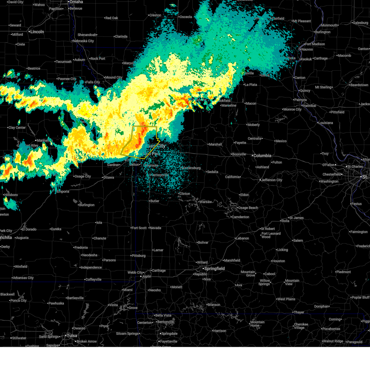 At 1117 pm cdt, severe thunderstorms were located along a line extending from near liberty to near sugar creek to near merriam, moving east at 60 mph (automated weather station). Hazards include 60 mph wind gusts. Expect damage to roofs, siding, and trees. locations impacted include, kansas city, overland park, independence, lee's summit, shawnee, blue springs, lenexa, leawood, raytown, liberty, gladstone, prairie village, excelsior springs, merriam, mission, smithville, kearney, bonner springs, parkville, and edwardsville. this includes the following highways, interstate 70 in missouri between mile markers 0 and 18. interstate 70 in kansas between mile markers 412 and 423. interstate 35 in missouri between mile markers 0 and 27. interstate 35 in kansas between mile markers 223 and 235. interstate 29 between mile markers 0 and 12. interstate 635 between mile markers 0 and 12. interstate 470 between mile markers 0 and 7, and between mile markers 13 and 16. interstate 435 between mile markers 2 and 12, and between mile markers 35 and 80. Interstate 49 between mile markers 182 and 183. At 1117 pm cdt, severe thunderstorms were located along a line extending from near liberty to near sugar creek to near merriam, moving east at 60 mph (automated weather station). Hazards include 60 mph wind gusts. Expect damage to roofs, siding, and trees. locations impacted include, kansas city, overland park, independence, lee's summit, shawnee, blue springs, lenexa, leawood, raytown, liberty, gladstone, prairie village, excelsior springs, merriam, mission, smithville, kearney, bonner springs, parkville, and edwardsville. this includes the following highways, interstate 70 in missouri between mile markers 0 and 18. interstate 70 in kansas between mile markers 412 and 423. interstate 35 in missouri between mile markers 0 and 27. interstate 35 in kansas between mile markers 223 and 235. interstate 29 between mile markers 0 and 12. interstate 635 between mile markers 0 and 12. interstate 470 between mile markers 0 and 7, and between mile markers 13 and 16. interstate 435 between mile markers 2 and 12, and between mile markers 35 and 80. Interstate 49 between mile markers 182 and 183.
|
| 4/9/2026 11:02 PM CDT |
 At 1102 pm cdt, severe thunderstorms were located along a line extending from near smithville to platte woods to bonner springs, moving east at 50 mph (automated weather station). Hazards include 60 mph wind gusts. Expect damage to roofs, siding, and trees. locations impacted include, kansas city, overland park, olathe, independence, lee's summit, shawnee, blue springs, lenexa, leawood, raytown, liberty, gladstone, grandview, prairie village, excelsior springs, merriam, mission, smithville, kearney, and bonner springs. this includes the following highways, interstate 70 in missouri between mile markers 0 and 18. interstate 70 in kansas between mile markers 410 and 423. interstate 35 in missouri between mile markers 0 and 27. interstate 35 in kansas between mile markers 219 and 235. interstate 29 between mile markers 0 and 12. interstate 635 between mile markers 0 and 12. interstate 470 between mile markers 0 and 7, and between mile markers 13 and 16. interstate 435 between mile markers 0 and 13, and between mile markers 35 and 83. kansas turnpike near mile marker 226. Interstate 49 between mile markers 181 and 183. At 1102 pm cdt, severe thunderstorms were located along a line extending from near smithville to platte woods to bonner springs, moving east at 50 mph (automated weather station). Hazards include 60 mph wind gusts. Expect damage to roofs, siding, and trees. locations impacted include, kansas city, overland park, olathe, independence, lee's summit, shawnee, blue springs, lenexa, leawood, raytown, liberty, gladstone, grandview, prairie village, excelsior springs, merriam, mission, smithville, kearney, and bonner springs. this includes the following highways, interstate 70 in missouri between mile markers 0 and 18. interstate 70 in kansas between mile markers 410 and 423. interstate 35 in missouri between mile markers 0 and 27. interstate 35 in kansas between mile markers 219 and 235. interstate 29 between mile markers 0 and 12. interstate 635 between mile markers 0 and 12. interstate 470 between mile markers 0 and 7, and between mile markers 13 and 16. interstate 435 between mile markers 0 and 13, and between mile markers 35 and 83. kansas turnpike near mile marker 226. Interstate 49 between mile markers 181 and 183.
|
| 3/10/2026 10:52 PM CDT |
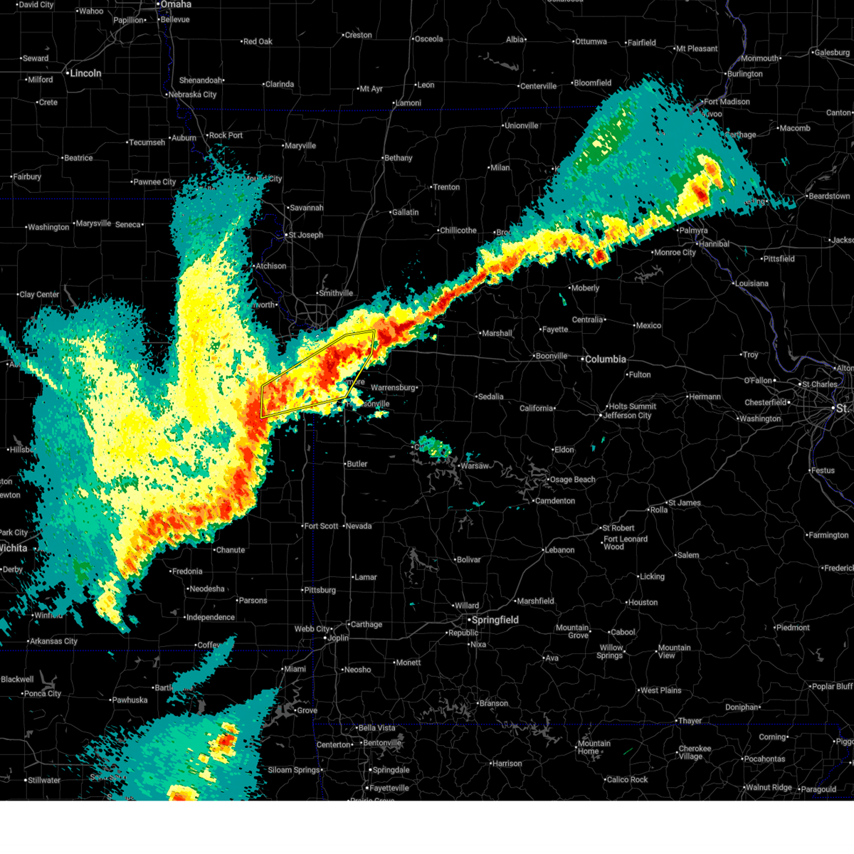 The storms which prompted the warning have weakened below severe limits, and no longer pose an immediate threat to life or property. therefore, the warning will be allowed to expire. however, heavy rain is still possible with these thunderstorms. a tornado watch remains in effect until midnight cdt for east central kansas, and west central missouri. The storms which prompted the warning have weakened below severe limits, and no longer pose an immediate threat to life or property. therefore, the warning will be allowed to expire. however, heavy rain is still possible with these thunderstorms. a tornado watch remains in effect until midnight cdt for east central kansas, and west central missouri.
|
| 3/10/2026 10:34 PM CDT |
 the severe thunderstorm warning has been cancelled and is no longer in effect the severe thunderstorm warning has been cancelled and is no longer in effect
|
| 3/10/2026 10:33 PM CDT |
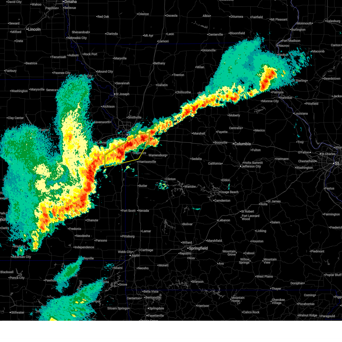 Svreax the national weather service in pleasant hill has issued a * severe thunderstorm warning for, northern miami county in east central kansas, southern johnson county in east central kansas, northwestern cass county in west central missouri, jackson county in west central missouri, * until 1100 pm cdt. * at 1032 pm cdt, multiple severe thunderstorms were located along a line extending from near blue springs to near grandview to near spring hill, moving northeast at 40 mph (radar indicated). Hazards include quarter size hail. damage to vehicles is expected Svreax the national weather service in pleasant hill has issued a * severe thunderstorm warning for, northern miami county in east central kansas, southern johnson county in east central kansas, northwestern cass county in west central missouri, jackson county in west central missouri, * until 1100 pm cdt. * at 1032 pm cdt, multiple severe thunderstorms were located along a line extending from near blue springs to near grandview to near spring hill, moving northeast at 40 mph (radar indicated). Hazards include quarter size hail. damage to vehicles is expected
|
| 3/10/2026 10:18 PM CDT |
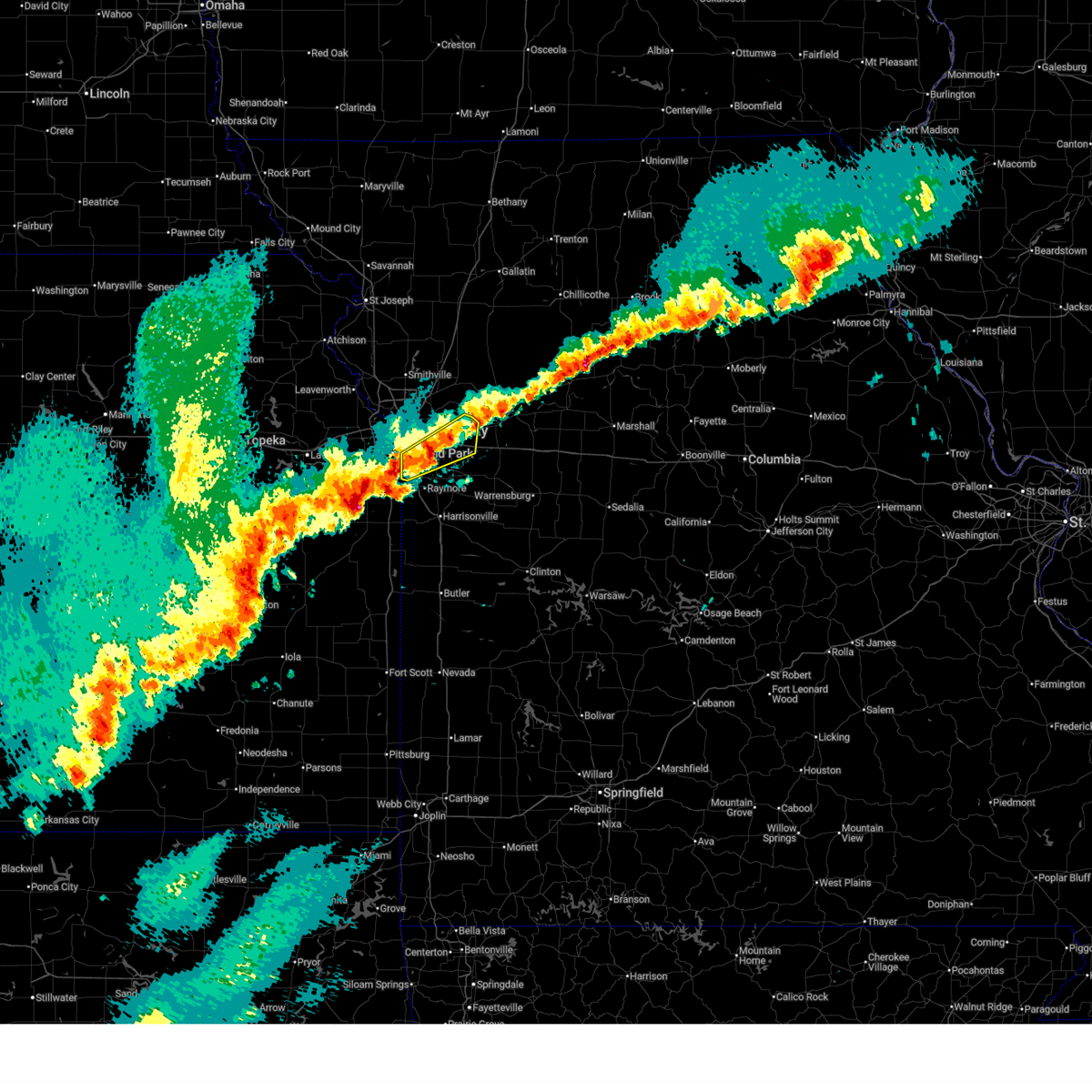 At 1018 pm cdt, a severe thunderstorm was located near lee's summit, moving east at 35 mph (radar indicated). Hazards include 60 mph wind gusts and quarter size hail. Hail damage to vehicles is expected. expect wind damage to roofs, siding, and trees. locations impacted include, kansas city, independence, lee's summit, blue springs, leawood, raytown, grandview, belton, grain valley, buckner, lake lotawana, lake tapawingo, sibley, levasy, napoleon, and unity village. this includes the following highways, interstate 70 in missouri between mile markers 10 and 28. interstate 470 between mile markers 0 and 16. interstate 435 between mile markers 65 and 75. Interstate 49 between mile markers 178 and 183. At 1018 pm cdt, a severe thunderstorm was located near lee's summit, moving east at 35 mph (radar indicated). Hazards include 60 mph wind gusts and quarter size hail. Hail damage to vehicles is expected. expect wind damage to roofs, siding, and trees. locations impacted include, kansas city, independence, lee's summit, blue springs, leawood, raytown, grandview, belton, grain valley, buckner, lake lotawana, lake tapawingo, sibley, levasy, napoleon, and unity village. this includes the following highways, interstate 70 in missouri between mile markers 10 and 28. interstate 470 between mile markers 0 and 16. interstate 435 between mile markers 65 and 75. Interstate 49 between mile markers 178 and 183.
|
| 3/10/2026 10:07 PM CDT |
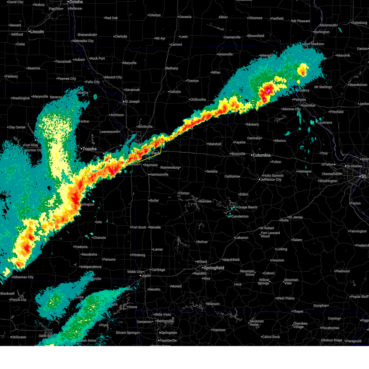 Svreax the national weather service in pleasant hill has issued a * severe thunderstorm warning for, central jackson county in west central missouri, * until 1045 pm cdt. * at 1007 pm cdt, a severe thunderstorm was located near raytown, moving northeast at 40 mph (radar indicated). Hazards include 60 mph wind gusts and quarter size hail. Hail damage to vehicles is expected. Expect wind damage to roofs, siding, and trees. Svreax the national weather service in pleasant hill has issued a * severe thunderstorm warning for, central jackson county in west central missouri, * until 1045 pm cdt. * at 1007 pm cdt, a severe thunderstorm was located near raytown, moving northeast at 40 mph (radar indicated). Hazards include 60 mph wind gusts and quarter size hail. Hail damage to vehicles is expected. Expect wind damage to roofs, siding, and trees.
|
| 3/7/2026 12:21 AM CST |
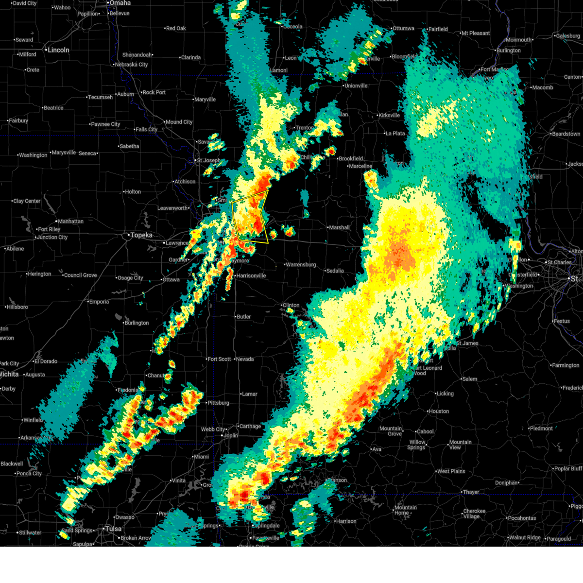 The storms which prompted the warning have weakened below severe limits, and no longer pose an immediate threat to life or property. therefore, the warning will be allowed to expire. however, gusty winds and heavy rain are still possible with these thunderstorms. a tornado watch remains in effect until 100 am cst for west central missouri. a tornado watch also remains in effect until 400 am cst for west central missouri. The storms which prompted the warning have weakened below severe limits, and no longer pose an immediate threat to life or property. therefore, the warning will be allowed to expire. however, gusty winds and heavy rain are still possible with these thunderstorms. a tornado watch remains in effect until 100 am cst for west central missouri. a tornado watch also remains in effect until 400 am cst for west central missouri.
|
| 3/7/2026 12:09 AM CST |
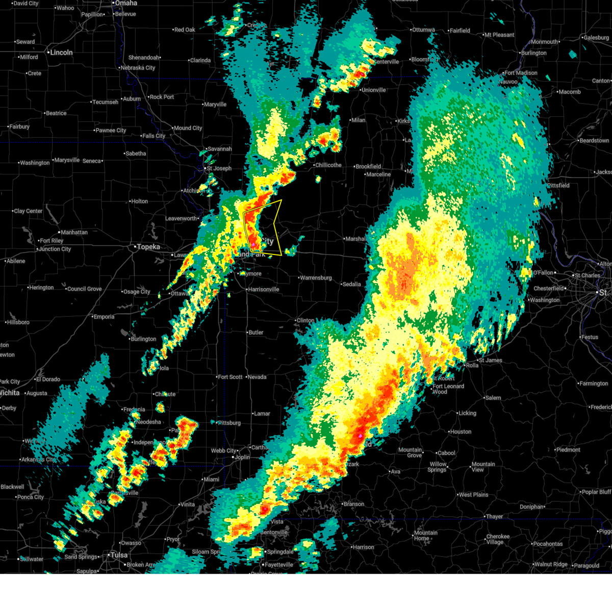 At 1209 am cst, severe thunderstorms were located along a line extending from excelsior springs to near missouri city to grain valley, moving east at 45 mph (radar indicated). Hazards include 60 mph wind gusts. Expect damage to roofs, siding, and trees. locations impacted include, independence, blue springs, grain valley, excelsior springs, kearney, oak grove, odessa, buckner, orrick, wellington, lake tapawingo, crystal lakes, sibley, missouri city, excelsior estates, levasy, woods heights, rayville, napoleon, and bates city. this includes the following highways, interstate 70 in missouri between mile markers 19 and 37. Interstate 35 in missouri between mile markers 24 and 25. At 1209 am cst, severe thunderstorms were located along a line extending from excelsior springs to near missouri city to grain valley, moving east at 45 mph (radar indicated). Hazards include 60 mph wind gusts. Expect damage to roofs, siding, and trees. locations impacted include, independence, blue springs, grain valley, excelsior springs, kearney, oak grove, odessa, buckner, orrick, wellington, lake tapawingo, crystal lakes, sibley, missouri city, excelsior estates, levasy, woods heights, rayville, napoleon, and bates city. this includes the following highways, interstate 70 in missouri between mile markers 19 and 37. Interstate 35 in missouri between mile markers 24 and 25.
|
| 3/7/2026 12:01 AM CST |
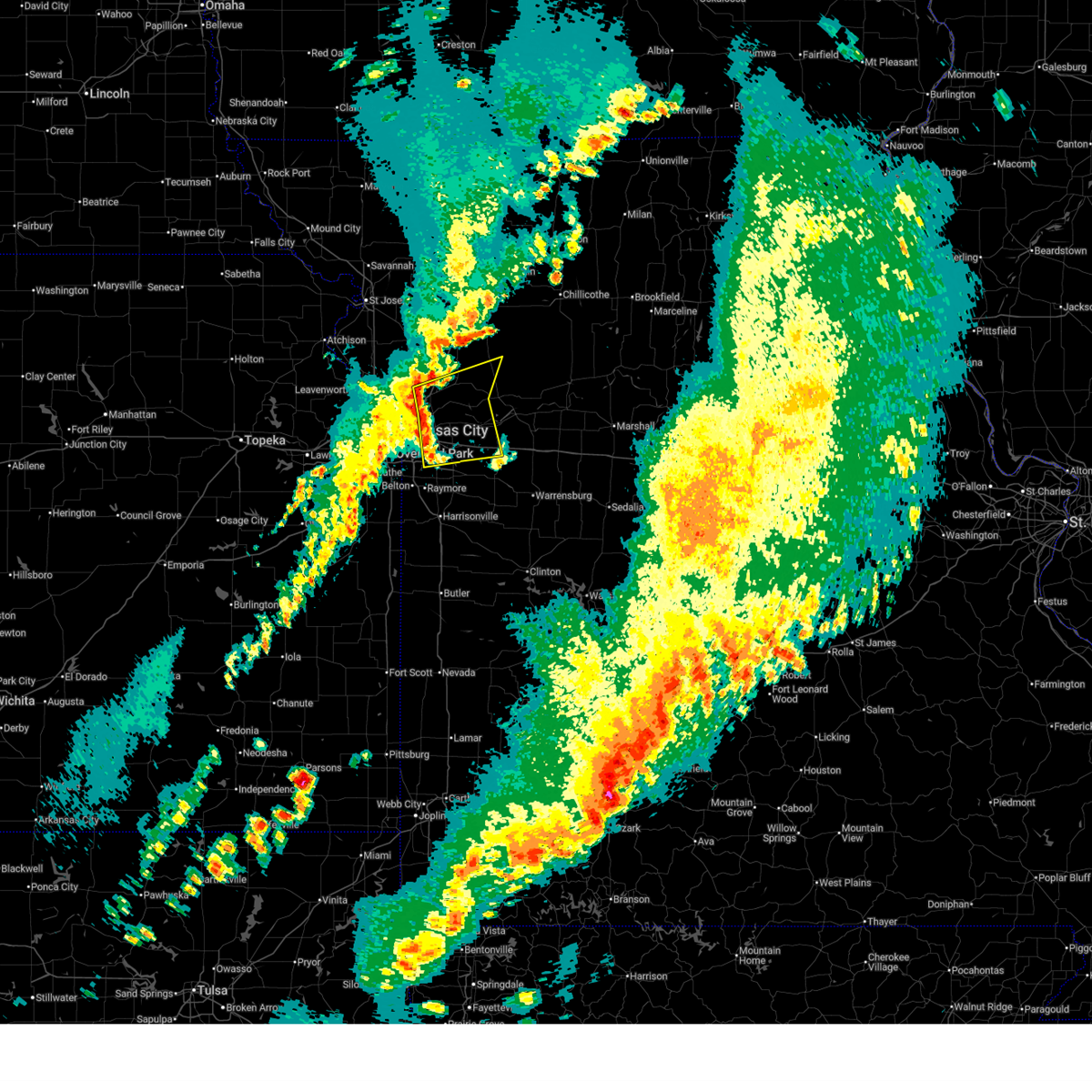 At 1200 am cst, severe thunderstorms were located along a line extending from near liberty to river bend to near lee's summit, moving east at 50 mph (radar indicated). Hazards include 60 mph wind gusts and penny size hail. Expect damage to roofs, siding, and trees. locations impacted include, kansas city, independence, lee's summit, blue springs, raytown, liberty, grain valley, excelsior springs, kearney, oak grove, odessa, sugar creek, buckner, lake lotawana, claycomo, courtney, pleasant valley, orrick, wellington, and lake tapawingo. this includes the following highways, interstate 70 in missouri between mile markers 9 and 37. interstate 35 in missouri between mile markers 12 and 25. interstate 470 between mile markers 5 and 16. Interstate 435 between mile markers 44 and 54, and between mile markers 58 and 59. At 1200 am cst, severe thunderstorms were located along a line extending from near liberty to river bend to near lee's summit, moving east at 50 mph (radar indicated). Hazards include 60 mph wind gusts and penny size hail. Expect damage to roofs, siding, and trees. locations impacted include, kansas city, independence, lee's summit, blue springs, raytown, liberty, grain valley, excelsior springs, kearney, oak grove, odessa, sugar creek, buckner, lake lotawana, claycomo, courtney, pleasant valley, orrick, wellington, and lake tapawingo. this includes the following highways, interstate 70 in missouri between mile markers 9 and 37. interstate 35 in missouri between mile markers 12 and 25. interstate 470 between mile markers 5 and 16. Interstate 435 between mile markers 44 and 54, and between mile markers 58 and 59.
|
| 3/7/2026 12:01 AM CST |
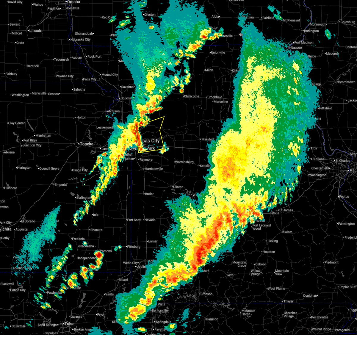 the severe thunderstorm warning has been cancelled and is no longer in effect the severe thunderstorm warning has been cancelled and is no longer in effect
|
| 3/6/2026 11:50 PM CST |
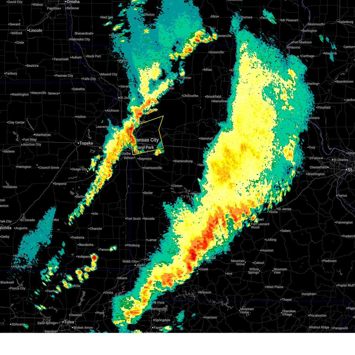 Svreax the national weather service in pleasant hill has issued a * severe thunderstorm warning for, east central wyandotte county in northeastern kansas, clay county in west central missouri, western ray county in west central missouri, southwestern lafayette county in west central missouri, southeastern platte county in west central missouri, jackson county in west central missouri, * until 1230 am cst. * at 1150 pm cst, severe thunderstorms were located along a line extending from near gladstone to northmoor to grandview, moving east at 45 mph (radar indicated). Hazards include 60 mph wind gusts and penny size hail. expect damage to roofs, siding, and trees Svreax the national weather service in pleasant hill has issued a * severe thunderstorm warning for, east central wyandotte county in northeastern kansas, clay county in west central missouri, western ray county in west central missouri, southwestern lafayette county in west central missouri, southeastern platte county in west central missouri, jackson county in west central missouri, * until 1230 am cst. * at 1150 pm cst, severe thunderstorms were located along a line extending from near gladstone to northmoor to grandview, moving east at 45 mph (radar indicated). Hazards include 60 mph wind gusts and penny size hail. expect damage to roofs, siding, and trees
|
| 9/18/2025 4:30 PM CDT | Svreax the national weather service in pleasant hill has issued a * severe thunderstorm warning for, southern ray county in west central missouri, northwestern lafayette county in west central missouri, northeastern jackson county in west central missouri, * until 500 pm cdt. * at 430 pm cdt, severe thunderstorms were located along a line extending from near blue springs to near grain valley to 7 miles east of lone jack, moving northeast at 45 mph (radar indicated). Hazards include 60 mph wind gusts and nickel size hail. expect damage to roofs, siding, and trees |
| 9/16/2025 7:08 PM CDT | The storm which prompted the warning has weakened below severe limits, and no longer poses an immediate threat to life or property. therefore, the warning will be allowed to expire. however, small hail, gusty winds and heavy rain are still possible with this thunderstorm. |
| 9/16/2025 7:03 PM CDT | At 702 pm cdt, a severe thunderstorm was located near lake tapawingo, or near blue springs, and is nearly stationary (radar indicated). Hazards include 60 mph wind gusts and nickel size hail. Expect damage to roofs, siding, and trees. locations impacted include, kansas city, independence, lee's summit, blue springs, and lake tapawingo. this includes the following highways, interstate 70 in missouri between mile markers 12 and 20. Interstate 470 between mile markers 12 and 16. |
| 9/16/2025 6:43 PM CDT | Svreax the national weather service in pleasant hill has issued a * severe thunderstorm warning for, central jackson county in west central missouri, * until 715 pm cdt. * at 643 pm cdt, a severe thunderstorm was located near lake tapawingo, or near blue springs, and is nearly stationary (radar indicated). Hazards include 60 mph wind gusts and quarter size hail. Hail damage to vehicles is expected. Expect wind damage to roofs, siding, and trees. |
| 8/19/2025 6:08 AM CDT |
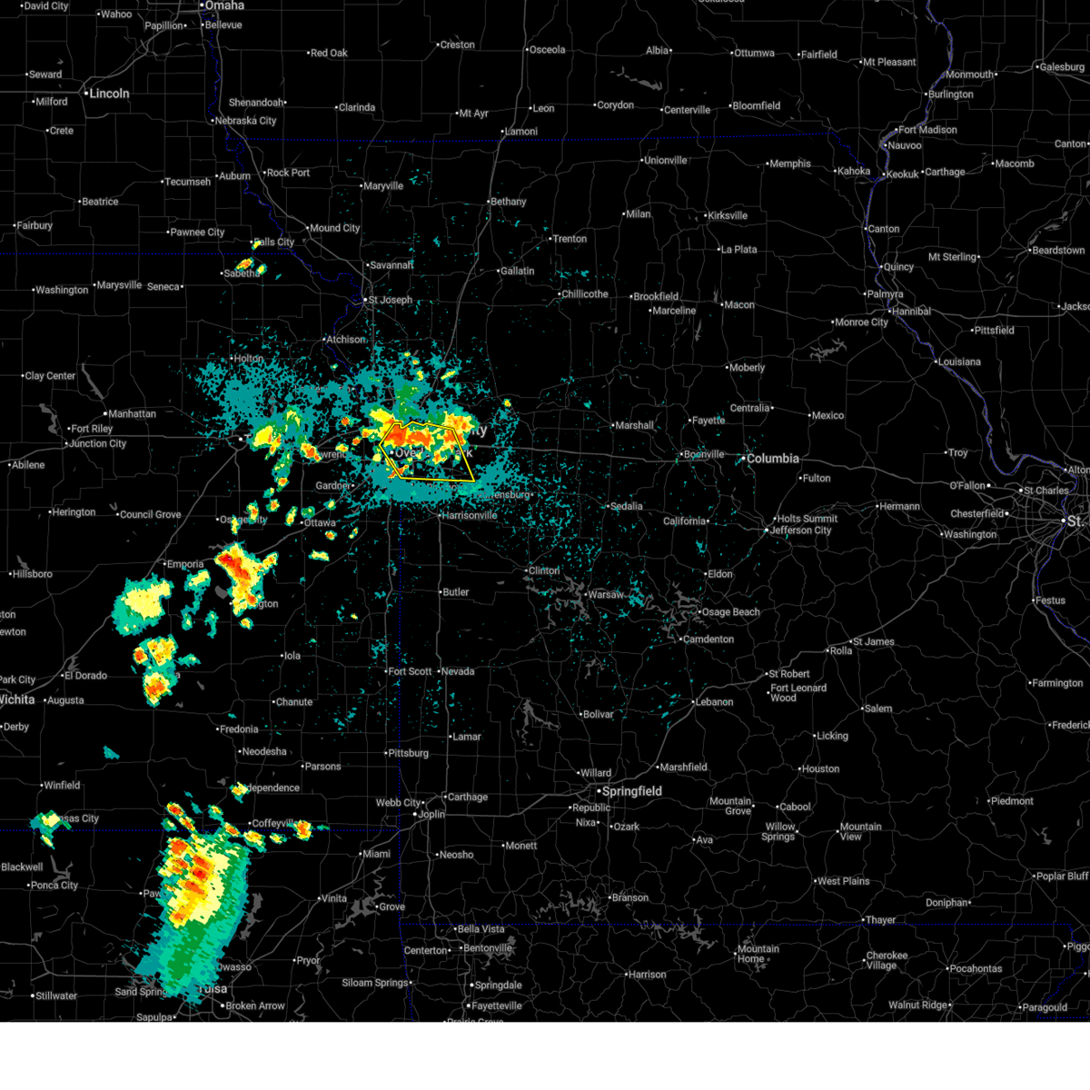 The storm which prompted the warning has weakened below severe limits, and no longer poses an immediate threat to life or property. therefore, the warning will be allowed to expire. however, gusty winds and heavy rain are still possible with this thunderstorm. The storm which prompted the warning has weakened below severe limits, and no longer poses an immediate threat to life or property. therefore, the warning will be allowed to expire. however, gusty winds and heavy rain are still possible with this thunderstorm.
|
| 8/19/2025 5:52 AM CDT |
 Svreax the national weather service in pleasant hill has issued a * severe thunderstorm warning for, east central wyandotte county in northeastern kansas, northeastern johnson county in east central kansas, jackson county in west central missouri, * until 615 am cdt. * at 552 am cdt, a severe thunderstorm was located over westwood hills, or over westwood, moving southeast at 30 mph (radar indicated). Hazards include 60 mph wind gusts and penny size hail. expect damage to roofs, siding, and trees Svreax the national weather service in pleasant hill has issued a * severe thunderstorm warning for, east central wyandotte county in northeastern kansas, northeastern johnson county in east central kansas, jackson county in west central missouri, * until 615 am cdt. * at 552 am cdt, a severe thunderstorm was located over westwood hills, or over westwood, moving southeast at 30 mph (radar indicated). Hazards include 60 mph wind gusts and penny size hail. expect damage to roofs, siding, and trees
|
| 7/17/2025 4:28 AM CDT |
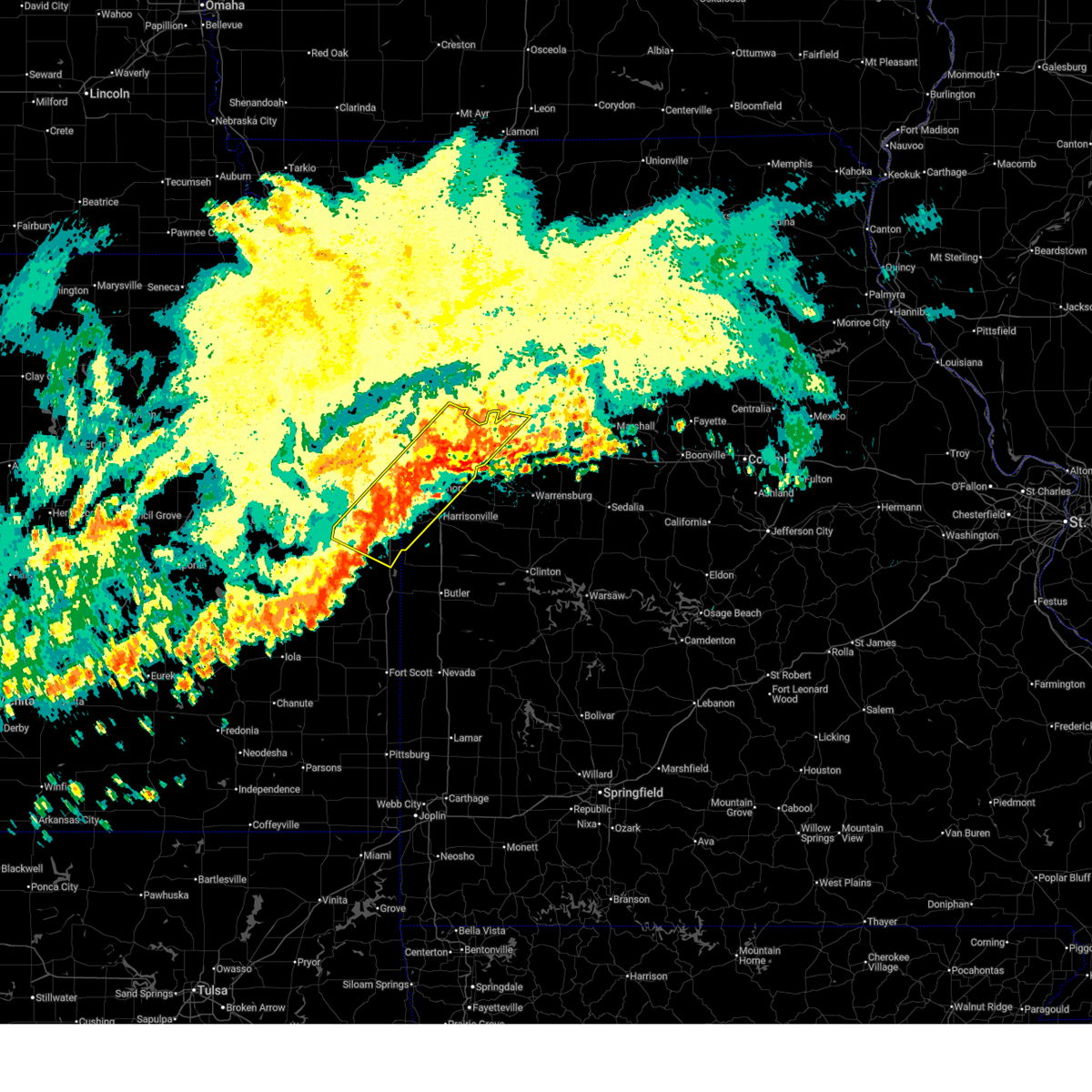 The storms which prompted the warning have weakened below severe limits, and no longer pose an immediate threat to life or property. therefore, the warning will be allowed to expire. however, gusty winds and heavy rain are still possible with these thunderstorms. The storms which prompted the warning have weakened below severe limits, and no longer pose an immediate threat to life or property. therefore, the warning will be allowed to expire. however, gusty winds and heavy rain are still possible with these thunderstorms.
|
| 7/17/2025 4:17 AM CDT |
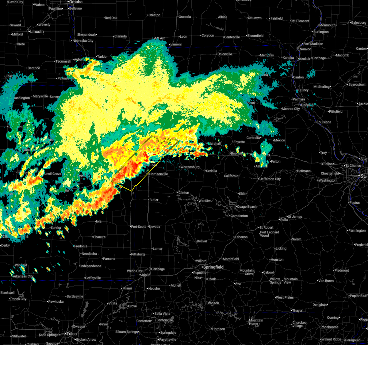 At 416 am cdt, severe thunderstorms were located along a line extending from near levasy to 6 miles southeast of paola, moving southeast at 25 mph (radar indicated). Hazards include 60 mph wind gusts. Expect damage to roofs, siding, and trees. locations impacted include, kansas city, overland park, olathe, independence, lee's summit, blue springs, leawood, raytown, grandview, belton, raymore, grain valley, harrisonville, pleasant hill, oak grove, paola, spring hill, odessa, greenwood, and lexington. this includes the following highways, interstate 70 in missouri between mile markers 8 and 37. interstate 470 between mile markers 0 and 16. interstate 435 between mile markers 62 and 78. Interstate 49 between mile markers 161 and 183. At 416 am cdt, severe thunderstorms were located along a line extending from near levasy to 6 miles southeast of paola, moving southeast at 25 mph (radar indicated). Hazards include 60 mph wind gusts. Expect damage to roofs, siding, and trees. locations impacted include, kansas city, overland park, olathe, independence, lee's summit, blue springs, leawood, raytown, grandview, belton, raymore, grain valley, harrisonville, pleasant hill, oak grove, paola, spring hill, odessa, greenwood, and lexington. this includes the following highways, interstate 70 in missouri between mile markers 8 and 37. interstate 470 between mile markers 0 and 16. interstate 435 between mile markers 62 and 78. Interstate 49 between mile markers 161 and 183.
|
| 7/17/2025 3:48 AM CDT |
 Svreax the national weather service in pleasant hill has issued a * severe thunderstorm warning for, miami county in east central kansas, southeastern johnson county in east central kansas, northwestern cass county in west central missouri, southwestern lafayette county in west central missouri, jackson county in west central missouri, * until 430 am cdt. * at 348 am cdt, severe thunderstorms were located along a line extending from near missouri city to near paola, moving east at 20 mph (radar indicated). Hazards include 60 mph wind gusts. expect damage to roofs, siding, and trees Svreax the national weather service in pleasant hill has issued a * severe thunderstorm warning for, miami county in east central kansas, southeastern johnson county in east central kansas, northwestern cass county in west central missouri, southwestern lafayette county in west central missouri, jackson county in west central missouri, * until 430 am cdt. * at 348 am cdt, severe thunderstorms were located along a line extending from near missouri city to near paola, moving east at 20 mph (radar indicated). Hazards include 60 mph wind gusts. expect damage to roofs, siding, and trees
|
| 7/17/2025 3:09 AM CDT |
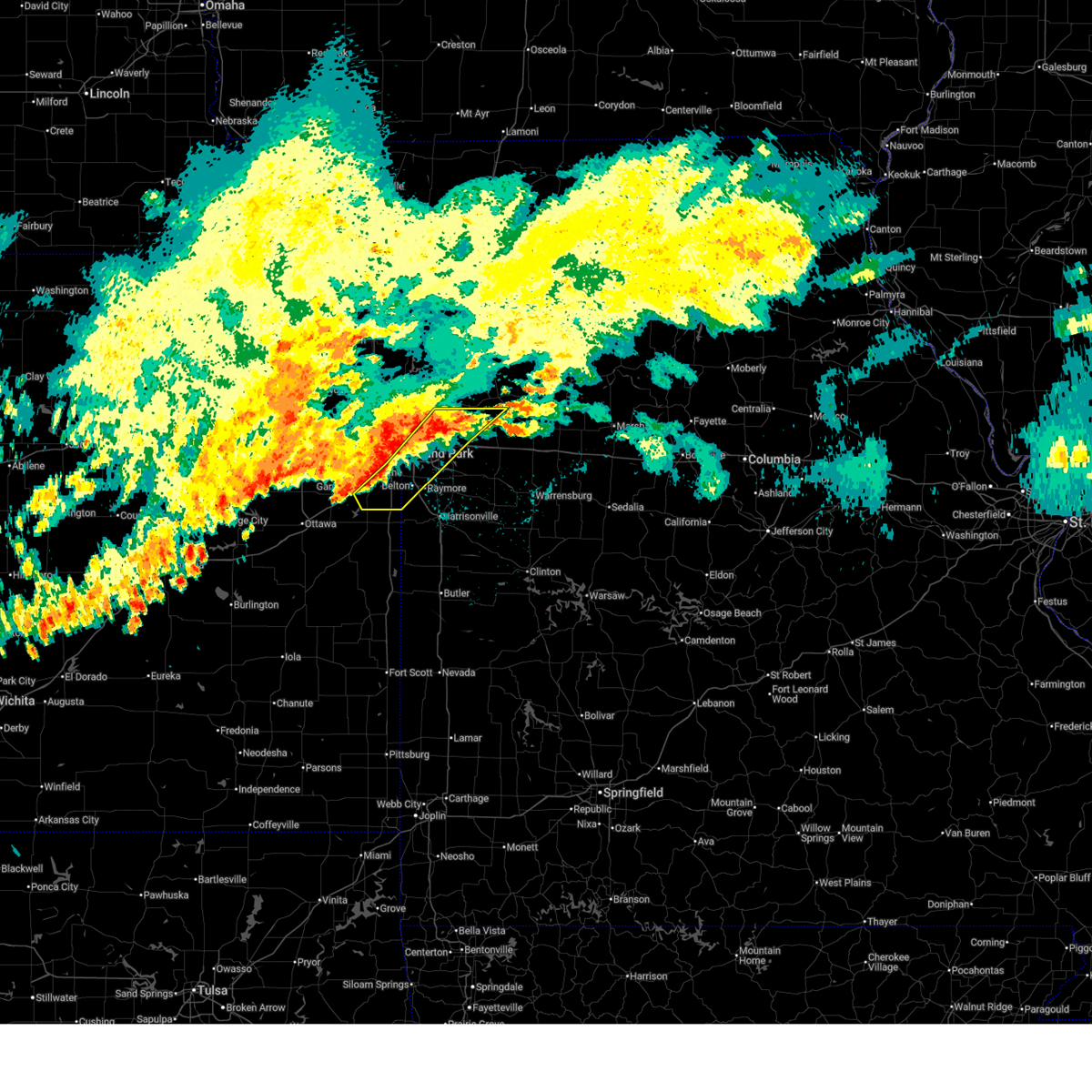 Svreax the national weather service in pleasant hill has issued a * severe thunderstorm warning for, northeastern miami county in east central kansas, southeastern johnson county in east central kansas, northwestern cass county in west central missouri, south central clay county in west central missouri, southwestern ray county in west central missouri, west central lafayette county in west central missouri, jackson county in west central missouri, * until 400 am cdt. * at 309 am cdt, severe thunderstorms were located along a line extending from near levasy to near prairie village to near gardner, moving east at 30 mph (radar indicated). Hazards include 60 mph wind gusts. expect damage to roofs, siding, and trees Svreax the national weather service in pleasant hill has issued a * severe thunderstorm warning for, northeastern miami county in east central kansas, southeastern johnson county in east central kansas, northwestern cass county in west central missouri, south central clay county in west central missouri, southwestern ray county in west central missouri, west central lafayette county in west central missouri, jackson county in west central missouri, * until 400 am cdt. * at 309 am cdt, severe thunderstorms were located along a line extending from near levasy to near prairie village to near gardner, moving east at 30 mph (radar indicated). Hazards include 60 mph wind gusts. expect damage to roofs, siding, and trees
|
| 7/16/2025 8:29 PM CDT |
 The storm which prompted the warning has weakened below severe limits, and no longer poses an immediate threat to life or property. therefore, the warning will be allowed to expire. however, gusty winds around 40 mph and heavy rain are still possible with this thunderstorm. The storm which prompted the warning has weakened below severe limits, and no longer poses an immediate threat to life or property. therefore, the warning will be allowed to expire. however, gusty winds around 40 mph and heavy rain are still possible with this thunderstorm.
|
| 7/16/2025 8:08 PM CDT |
 At 807 pm cdt, a severe thunderstorm was located over lake tapawingo, or near independence, moving southeast at 25 mph (public reports of trees down in eastern kansas city, independence, and eastern wyandotte county). Hazards include 60 mph wind gusts and quarter size hail. Hail damage to vehicles is expected. expect wind damage to roofs, siding, and trees. locations impacted include, kansas city, overland park, independence, lee's summit, shawnee, blue springs, leawood, raytown, grandview, belton, prairie village, grain valley, merriam, mission, fairway, mission hills, sugar creek, lake lotawana, westwood, and courtney. this includes the following highways, interstate 70 in missouri between mile markers 6 and 28. interstate 35 in missouri between mile markers 0 and 1. interstate 35 in kansas between mile markers 228 and 235. interstate 635 between mile markers 0 and 2. interstate 470 between mile markers 0 and 16. interstate 435 between mile markers 60 and 75. Interstate 49 between mile markers 177 and 183. At 807 pm cdt, a severe thunderstorm was located over lake tapawingo, or near independence, moving southeast at 25 mph (public reports of trees down in eastern kansas city, independence, and eastern wyandotte county). Hazards include 60 mph wind gusts and quarter size hail. Hail damage to vehicles is expected. expect wind damage to roofs, siding, and trees. locations impacted include, kansas city, overland park, independence, lee's summit, shawnee, blue springs, leawood, raytown, grandview, belton, prairie village, grain valley, merriam, mission, fairway, mission hills, sugar creek, lake lotawana, westwood, and courtney. this includes the following highways, interstate 70 in missouri between mile markers 6 and 28. interstate 35 in missouri between mile markers 0 and 1. interstate 35 in kansas between mile markers 228 and 235. interstate 635 between mile markers 0 and 2. interstate 470 between mile markers 0 and 16. interstate 435 between mile markers 60 and 75. Interstate 49 between mile markers 177 and 183.
|
| 7/16/2025 7:47 PM CDT |
 Svreax the national weather service in pleasant hill has issued a * severe thunderstorm warning for, east central wyandotte county in northeastern kansas, northeastern johnson county in east central kansas, jackson county in west central missouri, * until 830 pm cdt. * at 746 pm cdt, a severe thunderstorm was located near sugar creek, moving southeast at 25 mph (radar indicated). Hazards include 60 mph wind gusts and quarter size hail. Hail damage to vehicles is expected. Expect wind damage to roofs, siding, and trees. Svreax the national weather service in pleasant hill has issued a * severe thunderstorm warning for, east central wyandotte county in northeastern kansas, northeastern johnson county in east central kansas, jackson county in west central missouri, * until 830 pm cdt. * at 746 pm cdt, a severe thunderstorm was located near sugar creek, moving southeast at 25 mph (radar indicated). Hazards include 60 mph wind gusts and quarter size hail. Hail damage to vehicles is expected. Expect wind damage to roofs, siding, and trees.
|
| 7/11/2025 8:20 PM CDT |
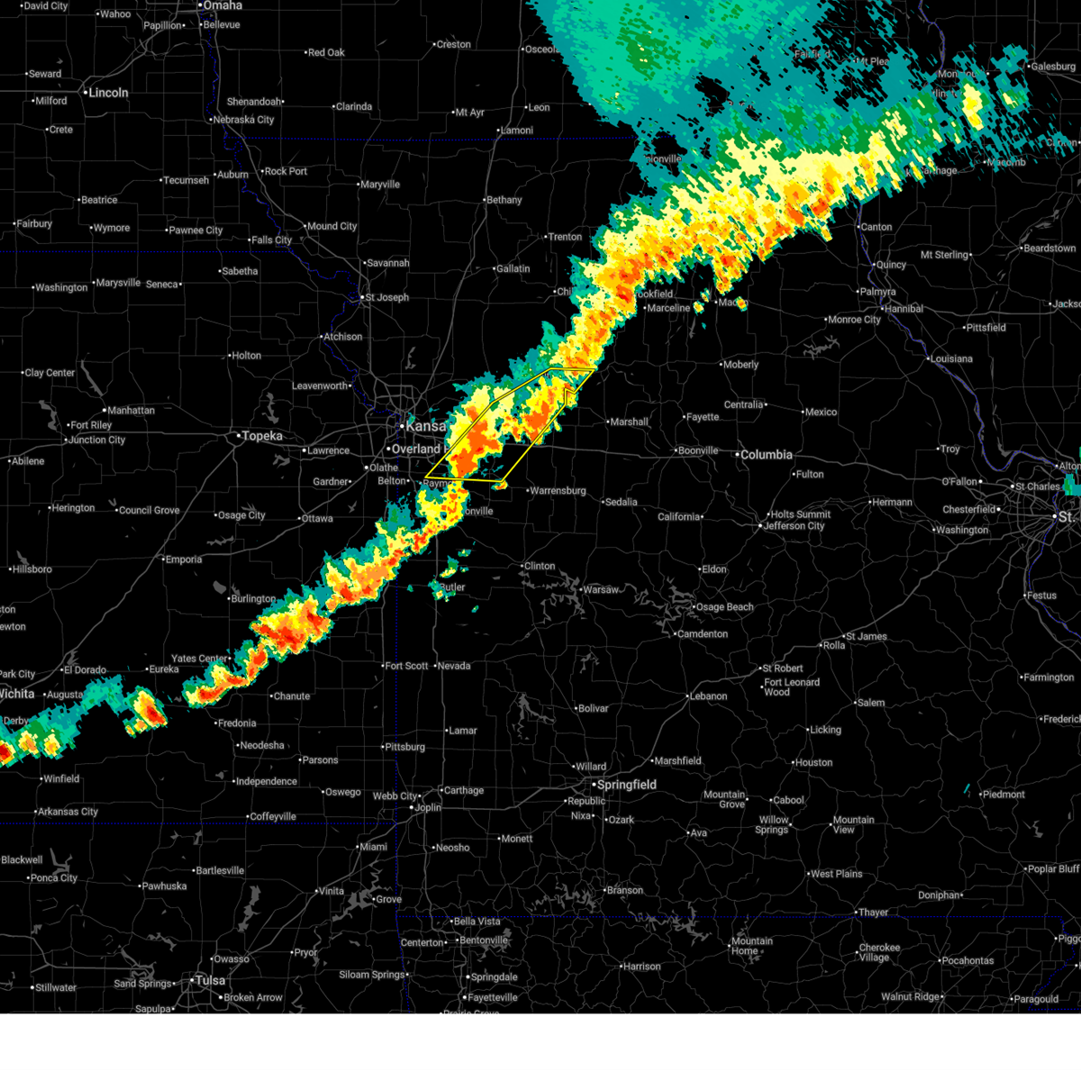 At 819 pm cdt, severe thunderstorms were located along a line extending from near carrollton to near lone jack, moving east at 20 mph (public. quarter size hail was reported south of oak grove, and wind damage has been reported in richmond and henrietta). Hazards include 60 mph wind gusts and quarter size hail. Hail damage to vehicles is expected. expect wind damage to roofs, siding, and trees. locations impacted include, lee's summit, grain valley, oak grove, odessa, greenwood, higginsville, lexington, carrollton, lake lotawana, lake winnebago, lone jack, waverly, wellington, norborne, hardin, corder, henrietta, mayview, wakenda, and lake lafayette. This includes interstate 70 in missouri between mile markers 25 and 50. At 819 pm cdt, severe thunderstorms were located along a line extending from near carrollton to near lone jack, moving east at 20 mph (public. quarter size hail was reported south of oak grove, and wind damage has been reported in richmond and henrietta). Hazards include 60 mph wind gusts and quarter size hail. Hail damage to vehicles is expected. expect wind damage to roofs, siding, and trees. locations impacted include, lee's summit, grain valley, oak grove, odessa, greenwood, higginsville, lexington, carrollton, lake lotawana, lake winnebago, lone jack, waverly, wellington, norborne, hardin, corder, henrietta, mayview, wakenda, and lake lafayette. This includes interstate 70 in missouri between mile markers 25 and 50.
|
| 7/11/2025 7:51 PM CDT |
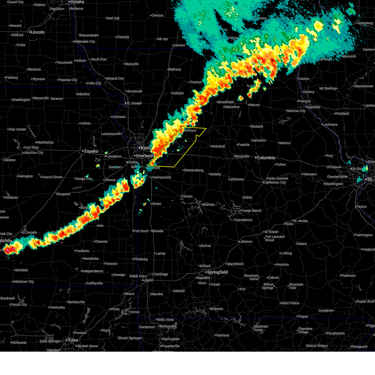 Svreax the national weather service in pleasant hill has issued a * severe thunderstorm warning for, north central cass county in west central missouri, southeastern ray county in west central missouri, southwestern carroll county in north central missouri, lafayette county in west central missouri, southeastern jackson county in west central missouri, northwestern johnson county in west central missouri, * until 830 pm cdt. * at 750 pm cdt, severe thunderstorms were located along a line extending from near norborne to greenwood, moving east at 20 mph (public). Hazards include 60 mph wind gusts and quarter size hail. Hail damage to vehicles is expected. Expect wind damage to roofs, siding, and trees. Svreax the national weather service in pleasant hill has issued a * severe thunderstorm warning for, north central cass county in west central missouri, southeastern ray county in west central missouri, southwestern carroll county in north central missouri, lafayette county in west central missouri, southeastern jackson county in west central missouri, northwestern johnson county in west central missouri, * until 830 pm cdt. * at 750 pm cdt, severe thunderstorms were located along a line extending from near norborne to greenwood, moving east at 20 mph (public). Hazards include 60 mph wind gusts and quarter size hail. Hail damage to vehicles is expected. Expect wind damage to roofs, siding, and trees.
|
| 7/11/2025 7:46 PM CDT | Mping report of tree limbs down on the south side of blue springs. time confirmed from rada in jackson county MO, 1.6 miles N of Blue Springs, MO |
| 7/11/2025 7:45 PM CDT | Three inch branches dow in jackson county MO, 3 miles N of Blue Springs, MO |
| 7/11/2025 7:45 PM CDT | Private weather senso in jackson county MO, 3.1 miles ESE of Blue Springs, MO |
| 7/11/2025 7:35 PM CDT | Social media report of trees down at a residence. time estimated from rada in jackson county MO, 1.6 miles N of Blue Springs, MO |
| 7/11/2025 7:35 PM CDT | Downed tree limbs and damage to the roof of a building. time estimated from rada in jackson county MO, 0.6 miles SW of Blue Springs, MO |
| 7/11/2025 7:29 PM CDT | Mping report of tree limbs down near ashford court. tmie estimated from rada in jackson county MO, 3.7 miles SSE of Blue Springs, MO |
| 7/11/2025 7:29 PM CDT | Multiple social media reports of trees down... including in the vicinity of 55th street. time estimated from rada in jackson county MO, 3.1 miles ESE of Blue Springs, MO |
| 7/11/2025 7:29 PM CDT |
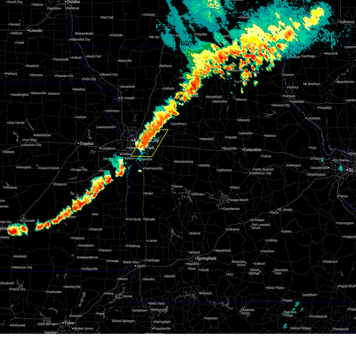 At 729 pm cdt, severe thunderstorms were located along a line extending from orrick to near lee's summit, moving east at 25 mph (radar indicated). Hazards include 60 mph wind gusts. Expect damage to roofs, siding, and trees. locations impacted include, kansas city, independence, lee's summit, blue springs, raytown, grandview, grain valley, richmond, greenwood, sugar creek, buckner, lake lotawana, lone jack, orrick, wellington, lake tapawingo, henrietta, sibley, missouri city, and levasy. this includes the following highways, interstate 70 in missouri between mile markers 10 and 32. interstate 470 between mile markers 0 and 16. interstate 435 between mile markers 68 and 71. Interstate 49 between mile markers 178 and 183. At 729 pm cdt, severe thunderstorms were located along a line extending from orrick to near lee's summit, moving east at 25 mph (radar indicated). Hazards include 60 mph wind gusts. Expect damage to roofs, siding, and trees. locations impacted include, kansas city, independence, lee's summit, blue springs, raytown, grandview, grain valley, richmond, greenwood, sugar creek, buckner, lake lotawana, lone jack, orrick, wellington, lake tapawingo, henrietta, sibley, missouri city, and levasy. this includes the following highways, interstate 70 in missouri between mile markers 10 and 32. interstate 470 between mile markers 0 and 16. interstate 435 between mile markers 68 and 71. Interstate 49 between mile markers 178 and 183.
|
| 7/11/2025 7:12 PM CDT |
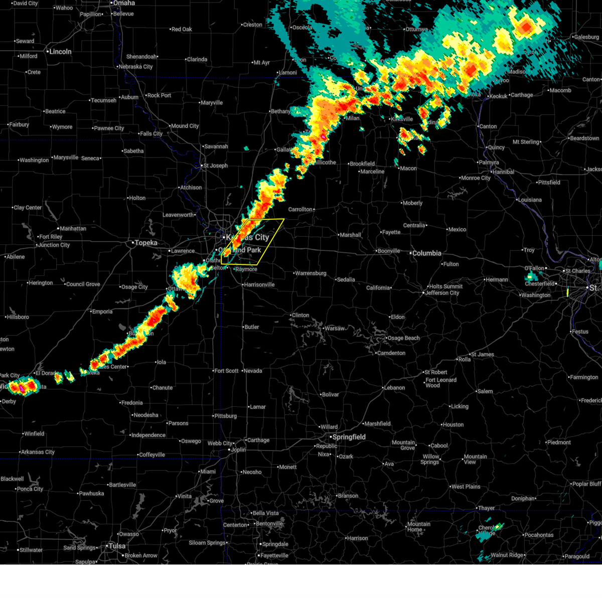 Svreax the national weather service in pleasant hill has issued a * severe thunderstorm warning for, southeastern clay county in west central missouri, southern ray county in west central missouri, west central lafayette county in west central missouri, jackson county in west central missouri, * until 800 pm cdt. * at 712 pm cdt, severe thunderstorms were located along a line extending from near missouri city to near grandview, moving east at 25 mph (radar indicated). Hazards include 60 mph wind gusts. expect damage to roofs, siding, and trees Svreax the national weather service in pleasant hill has issued a * severe thunderstorm warning for, southeastern clay county in west central missouri, southern ray county in west central missouri, west central lafayette county in west central missouri, jackson county in west central missouri, * until 800 pm cdt. * at 712 pm cdt, severe thunderstorms were located along a line extending from near missouri city to near grandview, moving east at 25 mph (radar indicated). Hazards include 60 mph wind gusts. expect damage to roofs, siding, and trees
|
| 6/26/2025 6:35 PM CDT |
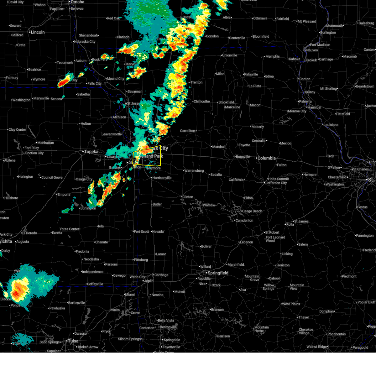 The storm which prompted the warning has weakened below severe limits, and no longer poses an immediate threat to life or property. therefore, the warning will be allowed to expire. however, gusty winds and heavy rain are still possible with this thunderstorm. a severe thunderstorm watch remains in effect until 900 pm cdt for northeastern kansas. The storm which prompted the warning has weakened below severe limits, and no longer poses an immediate threat to life or property. therefore, the warning will be allowed to expire. however, gusty winds and heavy rain are still possible with this thunderstorm. a severe thunderstorm watch remains in effect until 900 pm cdt for northeastern kansas.
|
| 6/26/2025 6:19 PM CDT |
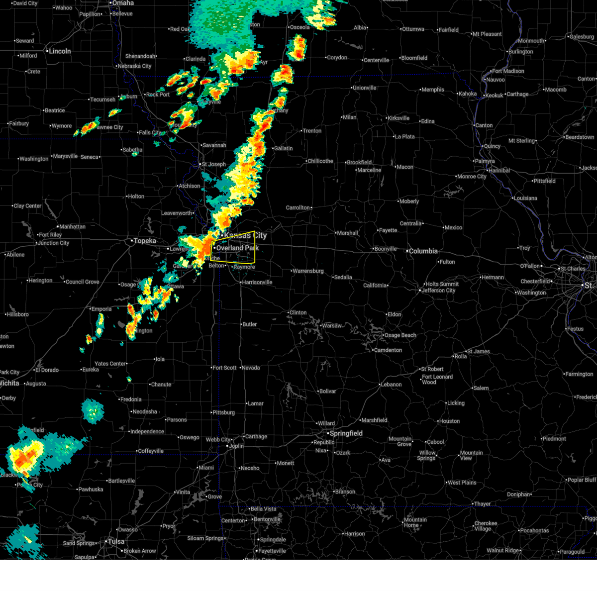 At 618 pm cdt, a severe thunderstorm was located over raytown, moving east at 25 mph (public. several reports of tree and power line damage have been received from the overland park, leawood, and south kansas city areas). Hazards include 70 mph wind gusts. Expect considerable tree damage. damage is likely to mobile homes, roofs, and outbuildings. locations impacted include, kansas city, overland park, independence, lee's summit, blue springs, leawood, raytown, grandview, prairie village, grain valley, merriam, mission, greenwood, fairway, mission hills, buckner, lake lotawana, westwood, lake winnebago, and lone jack. this includes the following highways, interstate 70 in missouri between mile markers 6 and 25. interstate 35 in kansas between mile markers 226 and 232. interstate 635 near mile marker 0. interstate 470 between mile markers 0 and 16. interstate 435 between mile markers 61 and 80. Interstate 49 between mile markers 178 and 183. At 618 pm cdt, a severe thunderstorm was located over raytown, moving east at 25 mph (public. several reports of tree and power line damage have been received from the overland park, leawood, and south kansas city areas). Hazards include 70 mph wind gusts. Expect considerable tree damage. damage is likely to mobile homes, roofs, and outbuildings. locations impacted include, kansas city, overland park, independence, lee's summit, blue springs, leawood, raytown, grandview, prairie village, grain valley, merriam, mission, greenwood, fairway, mission hills, buckner, lake lotawana, westwood, lake winnebago, and lone jack. this includes the following highways, interstate 70 in missouri between mile markers 6 and 25. interstate 35 in kansas between mile markers 226 and 232. interstate 635 near mile marker 0. interstate 470 between mile markers 0 and 16. interstate 435 between mile markers 61 and 80. Interstate 49 between mile markers 178 and 183.
|
| 6/26/2025 6:10 PM CDT |
 At 609 pm cdt, a severe thunderstorm was located near leawood, moving east at 25 mph (public. reports of trees down between overland park and leawood have been received). Hazards include 70 mph wind gusts. Expect considerable tree damage. damage is likely to mobile homes, roofs, and outbuildings. locations impacted include, kansas city, overland park, independence, lee's summit, blue springs, leawood, raytown, grandview, prairie village, grain valley, merriam, mission, greenwood, fairway, mission hills, buckner, lake lotawana, westwood, lake winnebago, and lone jack. this includes the following highways, interstate 70 in missouri between mile markers 6 and 25. interstate 35 in kansas between mile markers 226 and 232. interstate 635 near mile marker 0. interstate 470 between mile markers 0 and 16. interstate 435 between mile markers 61 and 80. Interstate 49 between mile markers 178 and 183. At 609 pm cdt, a severe thunderstorm was located near leawood, moving east at 25 mph (public. reports of trees down between overland park and leawood have been received). Hazards include 70 mph wind gusts. Expect considerable tree damage. damage is likely to mobile homes, roofs, and outbuildings. locations impacted include, kansas city, overland park, independence, lee's summit, blue springs, leawood, raytown, grandview, prairie village, grain valley, merriam, mission, greenwood, fairway, mission hills, buckner, lake lotawana, westwood, lake winnebago, and lone jack. this includes the following highways, interstate 70 in missouri between mile markers 6 and 25. interstate 35 in kansas between mile markers 226 and 232. interstate 635 near mile marker 0. interstate 470 between mile markers 0 and 16. interstate 435 between mile markers 61 and 80. Interstate 49 between mile markers 178 and 183.
|
| 6/26/2025 6:01 PM CDT |
 Svreax the national weather service in pleasant hill has issued a * severe thunderstorm warning for, east central wyandotte county in northeastern kansas, northeastern johnson county in east central kansas, jackson county in west central missouri, * until 645 pm cdt. * at 601 pm cdt, a severe thunderstorm was located over overland park, moving east at 25 mph (radar indicated). Hazards include 70 mph wind gusts. Expect considerable tree damage. Damage is likely to mobile homes, roofs, and outbuildings. Svreax the national weather service in pleasant hill has issued a * severe thunderstorm warning for, east central wyandotte county in northeastern kansas, northeastern johnson county in east central kansas, jackson county in west central missouri, * until 645 pm cdt. * at 601 pm cdt, a severe thunderstorm was located over overland park, moving east at 25 mph (radar indicated). Hazards include 70 mph wind gusts. Expect considerable tree damage. Damage is likely to mobile homes, roofs, and outbuildings.
|
| 6/3/2025 3:23 PM CDT |
 At 322 pm cdt, severe thunderstorms were located along a line extending from 6 miles northeast of braymer to near henrietta to near pleasant hill, moving east at 35 mph (radar indicated). Hazards include 60 mph wind gusts and penny size hail. Expect damage to roofs, siding, and trees. locations impacted include, independence, lee's summit, blue springs, raymore, grain valley, pleasant hill, oak grove, richmond, odessa, greenwood, lexington, peculiar, buckner, lake lotawana, lake winnebago, lone jack, braymer, orrick, wellington, and lake tapawingo. this includes the following highways, interstate 70 in missouri between mile markers 17 and 41. interstate 470 between mile markers 8 and 14. Interstate 49 near mile marker 169. At 322 pm cdt, severe thunderstorms were located along a line extending from 6 miles northeast of braymer to near henrietta to near pleasant hill, moving east at 35 mph (radar indicated). Hazards include 60 mph wind gusts and penny size hail. Expect damage to roofs, siding, and trees. locations impacted include, independence, lee's summit, blue springs, raymore, grain valley, pleasant hill, oak grove, richmond, odessa, greenwood, lexington, peculiar, buckner, lake lotawana, lake winnebago, lone jack, braymer, orrick, wellington, and lake tapawingo. this includes the following highways, interstate 70 in missouri between mile markers 17 and 41. interstate 470 between mile markers 8 and 14. Interstate 49 near mile marker 169.
|
| 6/3/2025 3:23 PM CDT |
 the severe thunderstorm warning has been cancelled and is no longer in effect the severe thunderstorm warning has been cancelled and is no longer in effect
|
| 6/3/2025 2:59 PM CDT | Several reports of downed trees north of lake tapawingo. time estimated from rada in jackson county MO, 3.7 miles SSE of Blue Springs, MO |
| 6/3/2025 2:53 PM CDT |
 Svreax the national weather service in pleasant hill has issued a * severe thunderstorm warning for, northern cass county in west central missouri, southeastern clinton county in northwestern missouri, eastern clay county in west central missouri, ray county in west central missouri, western carroll county in north central missouri, caldwell county in north central missouri, western lafayette county in west central missouri, jackson county in west central missouri, northwestern johnson county in west central missouri, southwestern livingston county in north central missouri, * until 345 pm cdt. * at 252 pm cdt, severe thunderstorms were located along a line extending from near polo to near buckner to near belton, moving east at 35 mph (public. several reports of wind damage have been received from the kc metro with these storms). Hazards include 70 mph wind gusts and penny size hail. Expect considerable tree damage. Damage is likely to mobile homes, roofs, and outbuildings. Svreax the national weather service in pleasant hill has issued a * severe thunderstorm warning for, northern cass county in west central missouri, southeastern clinton county in northwestern missouri, eastern clay county in west central missouri, ray county in west central missouri, western carroll county in north central missouri, caldwell county in north central missouri, western lafayette county in west central missouri, jackson county in west central missouri, northwestern johnson county in west central missouri, southwestern livingston county in north central missouri, * until 345 pm cdt. * at 252 pm cdt, severe thunderstorms were located along a line extending from near polo to near buckner to near belton, moving east at 35 mph (public. several reports of wind damage have been received from the kc metro with these storms). Hazards include 70 mph wind gusts and penny size hail. Expect considerable tree damage. Damage is likely to mobile homes, roofs, and outbuildings.
|
| 6/3/2025 2:49 PM CDT |
 the severe thunderstorm warning has been cancelled and is no longer in effect the severe thunderstorm warning has been cancelled and is no longer in effect
|
| 6/3/2025 2:49 PM CDT |
 At 249 pm cdt, severe thunderstorms were located along a line extending from near trimble to near independence to belton, moving northeast at 50 mph (public). Hazards include 70 mph wind gusts and nickel size hail. Expect considerable tree damage. damage is likely to mobile homes, roofs, and outbuildings. locations impacted include, kansas city, overland park, independence, lee's summit, blue springs, leawood, raytown, liberty, grandview, belton, raymore, grain valley, excelsior springs, kearney, pleasant hill, richmond, spring hill, greenwood, peculiar, and sugar creek. this includes the following highways, interstate 70 in missouri between mile markers 5 and 30. interstate 35 in missouri between mile markers 11 and 39. interstate 470 between mile markers 0 and 16. interstate 435 between mile markers 49 and 77. Interstate 49 between mile markers 167 and 183. At 249 pm cdt, severe thunderstorms were located along a line extending from near trimble to near independence to belton, moving northeast at 50 mph (public). Hazards include 70 mph wind gusts and nickel size hail. Expect considerable tree damage. damage is likely to mobile homes, roofs, and outbuildings. locations impacted include, kansas city, overland park, independence, lee's summit, blue springs, leawood, raytown, liberty, grandview, belton, raymore, grain valley, excelsior springs, kearney, pleasant hill, richmond, spring hill, greenwood, peculiar, and sugar creek. this includes the following highways, interstate 70 in missouri between mile markers 5 and 30. interstate 35 in missouri between mile markers 11 and 39. interstate 470 between mile markers 0 and 16. interstate 435 between mile markers 49 and 77. Interstate 49 between mile markers 167 and 183.
|
| 6/3/2025 2:42 PM CDT |
 the tornado warning has been cancelled and is no longer in effect the tornado warning has been cancelled and is no longer in effect
|
| 6/3/2025 2:42 PM CDT |
 At 241 pm cdt, a confirmed large and extremely dangerous tornado was located near independence, moving east at 45 mph. this is a particularly dangerous situation. take cover now! (radar confirmed tornado). Hazards include damaging tornado. You are in a life-threatening situation. flying debris may be deadly to those caught without shelter. mobile homes will be destroyed. considerable damage to homes, businesses, and vehicles is likely and complete destruction is possible. locations impacted include, independence, lee's summit, blue springs, grain valley, sugar creek, buckner, courtney, lake tapawingo, sibley, and levasy. this includes the following highways, interstate 70 in missouri between mile markers 13 and 22. Interstate 470 between mile markers 15 and 16. At 241 pm cdt, a confirmed large and extremely dangerous tornado was located near independence, moving east at 45 mph. this is a particularly dangerous situation. take cover now! (radar confirmed tornado). Hazards include damaging tornado. You are in a life-threatening situation. flying debris may be deadly to those caught without shelter. mobile homes will be destroyed. considerable damage to homes, businesses, and vehicles is likely and complete destruction is possible. locations impacted include, independence, lee's summit, blue springs, grain valley, sugar creek, buckner, courtney, lake tapawingo, sibley, and levasy. this includes the following highways, interstate 70 in missouri between mile markers 13 and 22. Interstate 470 between mile markers 15 and 16.
|
| 6/3/2025 2:40 PM CDT |
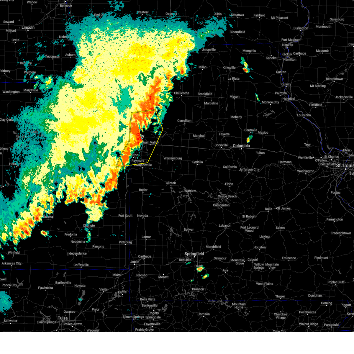 At 240 pm cdt, severe thunderstorms were located along a line extending from near smithville to near independence to 6 miles southwest of belton, moving northeast at 50 mph (automated weather station. several reports of 60 to 70 mph winds have been received as the storms have crossed the kc metro). Hazards include 70 mph wind gusts and nickel size hail. Expect considerable tree damage. damage is likely to mobile homes, roofs, and outbuildings. locations impacted include, kansas city, overland park, olathe, independence, lee's summit, blue springs, leawood, raytown, liberty, gladstone, grandview, belton, prairie village, raymore, grain valley, excelsior springs, mission, smithville, kearney, and pleasant hill. this includes the following highways, interstate 70 in missouri between mile markers 0 and 30. interstate 70 in kansas between mile markers 422 and 423. interstate 35 in missouri between mile markers 0 and 39. interstate 35 in kansas between mile markers 232 and 235. interstate 29 between mile markers 0 and 3. interstate 470 between mile markers 0 and 16. interstate 435 between mile markers 40 and 82. Interstate 49 between mile markers 167 and 183. At 240 pm cdt, severe thunderstorms were located along a line extending from near smithville to near independence to 6 miles southwest of belton, moving northeast at 50 mph (automated weather station. several reports of 60 to 70 mph winds have been received as the storms have crossed the kc metro). Hazards include 70 mph wind gusts and nickel size hail. Expect considerable tree damage. damage is likely to mobile homes, roofs, and outbuildings. locations impacted include, kansas city, overland park, olathe, independence, lee's summit, blue springs, leawood, raytown, liberty, gladstone, grandview, belton, prairie village, raymore, grain valley, excelsior springs, mission, smithville, kearney, and pleasant hill. this includes the following highways, interstate 70 in missouri between mile markers 0 and 30. interstate 70 in kansas between mile markers 422 and 423. interstate 35 in missouri between mile markers 0 and 39. interstate 35 in kansas between mile markers 232 and 235. interstate 29 between mile markers 0 and 3. interstate 470 between mile markers 0 and 16. interstate 435 between mile markers 40 and 82. Interstate 49 between mile markers 167 and 183.
|
| 6/3/2025 2:32 PM CDT |
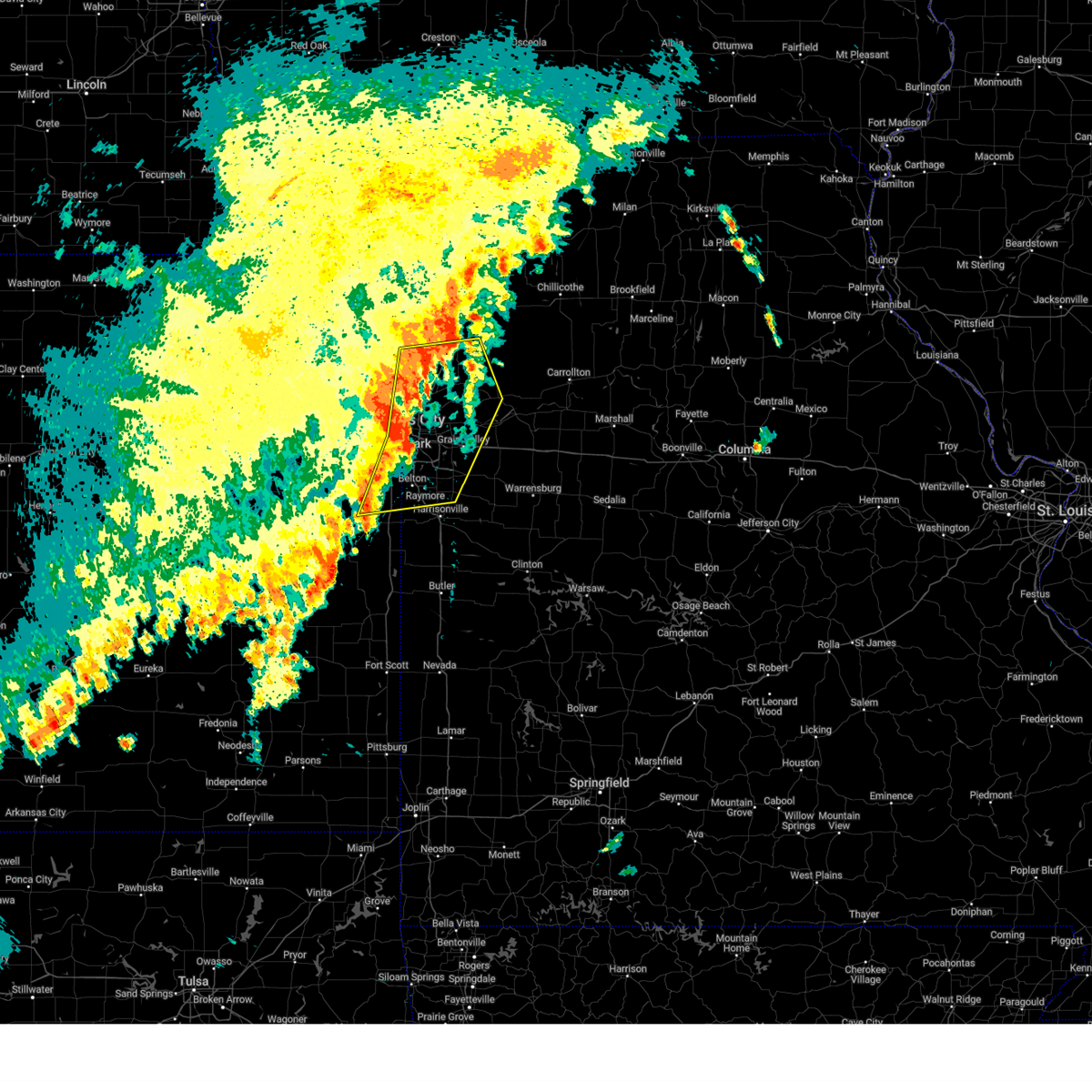 the severe thunderstorm warning has been cancelled and is no longer in effect the severe thunderstorm warning has been cancelled and is no longer in effect
|
| 6/3/2025 2:32 PM CDT |
 At 232 pm cdt, severe thunderstorms were located along a line extending from near ferrelview to near raytown to 6 miles east of spring hill, moving northeast at 50 mph (public. several reports of wind damage have been received from the kc metro area). Hazards include 70 mph wind gusts and nickel size hail. Expect considerable tree damage. damage is likely to mobile homes, roofs, and outbuildings. locations impacted include, kansas city, overland park, olathe, independence, lee's summit, shawnee, blue springs, lenexa, leawood, raytown, liberty, gladstone, grandview, belton, prairie village, raymore, grain valley, excelsior springs, merriam, and mission. this includes the following highways, interstate 70 in missouri between mile markers 0 and 30. interstate 70 in kansas between mile markers 418 and 423. interstate 35 in missouri between mile markers 0 and 39. interstate 35 in kansas between mile markers 220 and 235. interstate 29 between mile markers 0 and 9. interstate 635 between mile markers 0 and 12. interstate 470 between mile markers 0 and 16. interstate 435 near mile marker 0, and between mile markers 37 and 83. Interstate 49 between mile markers 167 and 183. At 232 pm cdt, severe thunderstorms were located along a line extending from near ferrelview to near raytown to 6 miles east of spring hill, moving northeast at 50 mph (public. several reports of wind damage have been received from the kc metro area). Hazards include 70 mph wind gusts and nickel size hail. Expect considerable tree damage. damage is likely to mobile homes, roofs, and outbuildings. locations impacted include, kansas city, overland park, olathe, independence, lee's summit, shawnee, blue springs, lenexa, leawood, raytown, liberty, gladstone, grandview, belton, prairie village, raymore, grain valley, excelsior springs, merriam, and mission. this includes the following highways, interstate 70 in missouri between mile markers 0 and 30. interstate 70 in kansas between mile markers 418 and 423. interstate 35 in missouri between mile markers 0 and 39. interstate 35 in kansas between mile markers 220 and 235. interstate 29 between mile markers 0 and 9. interstate 635 between mile markers 0 and 12. interstate 470 between mile markers 0 and 16. interstate 435 near mile marker 0, and between mile markers 37 and 83. Interstate 49 between mile markers 167 and 183.
|
| 6/3/2025 2:30 PM CDT |
 At 230 pm cdt, a confirmed large and extremely dangerous tornado was located near raytown, moving east at 45 mph. this is a particularly dangerous situation. take cover now! (radar confirmed tornado). Hazards include damaging tornado. You are in a life-threatening situation. flying debris may be deadly to those caught without shelter. mobile homes will be destroyed. considerable damage to homes, businesses, and vehicles is likely and complete destruction is possible. locations impacted include, kansas city, independence, lee's summit, blue springs, raytown, grain valley, sugar creek, buckner, courtney, lake tapawingo, sibley, and levasy. this includes the following highways, interstate 70 in missouri between mile markers 5 and 24. interstate 470 between mile markers 14 and 16. Interstate 435 between mile markers 58 and 69. At 230 pm cdt, a confirmed large and extremely dangerous tornado was located near raytown, moving east at 45 mph. this is a particularly dangerous situation. take cover now! (radar confirmed tornado). Hazards include damaging tornado. You are in a life-threatening situation. flying debris may be deadly to those caught without shelter. mobile homes will be destroyed. considerable damage to homes, businesses, and vehicles is likely and complete destruction is possible. locations impacted include, kansas city, independence, lee's summit, blue springs, raytown, grain valley, sugar creek, buckner, courtney, lake tapawingo, sibley, and levasy. this includes the following highways, interstate 70 in missouri between mile markers 5 and 24. interstate 470 between mile markers 14 and 16. Interstate 435 between mile markers 58 and 69.
|
| 6/3/2025 2:24 PM CDT |
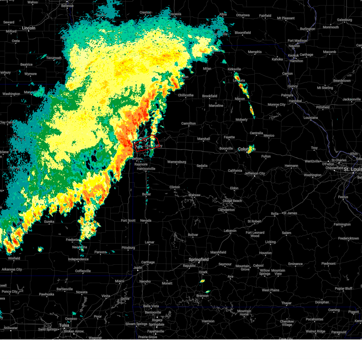 Toreax the national weather service in pleasant hill has issued a * tornado warning for, southeastern clay county in west central missouri, southwestern ray county in west central missouri, west central lafayette county in west central missouri, central jackson county in west central missouri, * until 300 pm cdt. * at 224 pm cdt, a severe thunderstorm capable of producing a tornado was located near raytown, moving east at 45 mph (radar indicated rotation). Hazards include tornado. Flying debris will be dangerous to those caught without shelter. mobile homes will be damaged or destroyed. damage to roofs, windows, and vehicles will occur. Tree damage is likely. Toreax the national weather service in pleasant hill has issued a * tornado warning for, southeastern clay county in west central missouri, southwestern ray county in west central missouri, west central lafayette county in west central missouri, central jackson county in west central missouri, * until 300 pm cdt. * at 224 pm cdt, a severe thunderstorm capable of producing a tornado was located near raytown, moving east at 45 mph (radar indicated rotation). Hazards include tornado. Flying debris will be dangerous to those caught without shelter. mobile homes will be damaged or destroyed. damage to roofs, windows, and vehicles will occur. Tree damage is likely.
|
| 6/3/2025 2:07 PM CDT |
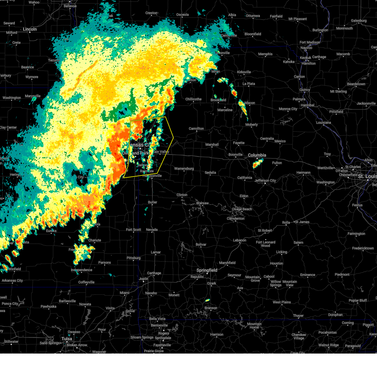 Svreax the national weather service in pleasant hill has issued a * severe thunderstorm warning for, eastern wyandotte county in northeastern kansas, northeastern miami county in east central kansas, eastern leavenworth county in northeastern kansas, eastern johnson county in east central kansas, northwestern cass county in west central missouri, southern clinton county in northwestern missouri, clay county in west central missouri, western ray county in west central missouri, southwestern caldwell county in north central missouri, west central lafayette county in west central missouri, eastern platte county in west central missouri, jackson county in west central missouri, * until 300 pm cdt. * at 207 pm cdt, severe thunderstorms were located along a line extending from near lansing to near overland park to near osawatomie, moving northeast at 50 mph (radar indicated). Hazards include 70 mph wind gusts and nickel size hail. Expect considerable tree damage. Damage is likely to mobile homes, roofs, and outbuildings. Svreax the national weather service in pleasant hill has issued a * severe thunderstorm warning for, eastern wyandotte county in northeastern kansas, northeastern miami county in east central kansas, eastern leavenworth county in northeastern kansas, eastern johnson county in east central kansas, northwestern cass county in west central missouri, southern clinton county in northwestern missouri, clay county in west central missouri, western ray county in west central missouri, southwestern caldwell county in north central missouri, west central lafayette county in west central missouri, eastern platte county in west central missouri, jackson county in west central missouri, * until 300 pm cdt. * at 207 pm cdt, severe thunderstorms were located along a line extending from near lansing to near overland park to near osawatomie, moving northeast at 50 mph (radar indicated). Hazards include 70 mph wind gusts and nickel size hail. Expect considerable tree damage. Damage is likely to mobile homes, roofs, and outbuildings.
|
| 5/19/2025 4:44 PM CDT |
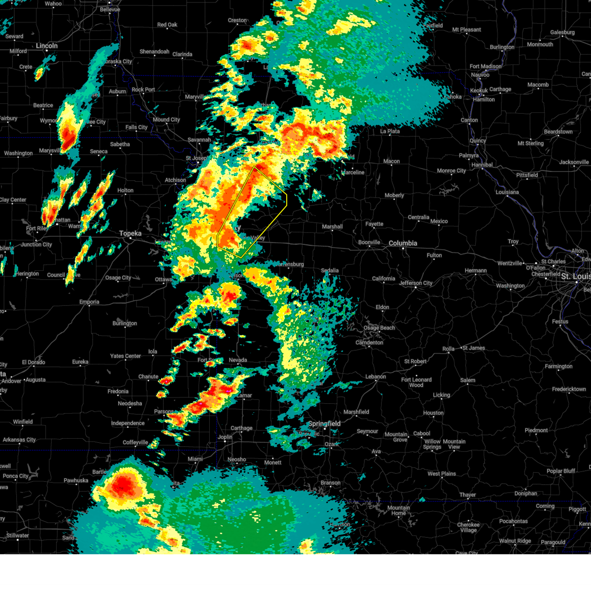 Svreax the national weather service in pleasant hill has issued a * severe thunderstorm warning for, southeastern clinton county in northwestern missouri, central clay county in west central missouri, ray county in west central missouri, southwestern caldwell county in north central missouri, west central lafayette county in west central missouri, jackson county in west central missouri, * until 530 pm cdt. * at 443 pm cdt, a severe thunderstorm was located over sugar creek, moving northeast at 50 mph (radar indicated). Hazards include 70 mph wind gusts and penny size hail. Expect considerable tree damage. Damage is likely to mobile homes, roofs, and outbuildings. Svreax the national weather service in pleasant hill has issued a * severe thunderstorm warning for, southeastern clinton county in northwestern missouri, central clay county in west central missouri, ray county in west central missouri, southwestern caldwell county in north central missouri, west central lafayette county in west central missouri, jackson county in west central missouri, * until 530 pm cdt. * at 443 pm cdt, a severe thunderstorm was located over sugar creek, moving northeast at 50 mph (radar indicated). Hazards include 70 mph wind gusts and penny size hail. Expect considerable tree damage. Damage is likely to mobile homes, roofs, and outbuildings.
|
| 5/19/2025 4:39 PM CDT |
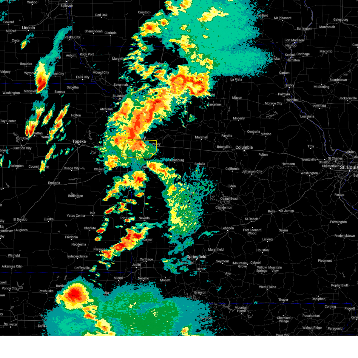 the severe thunderstorm warning has been cancelled and is no longer in effect the severe thunderstorm warning has been cancelled and is no longer in effect
|
| 5/19/2025 4:39 PM CDT |
 At 439 pm cdt, a severe thunderstorm was located near lake tapawingo, or near independence, moving northeast at 50 mph (radar indicated). Hazards include 70 mph wind gusts and penny size hail. Expect considerable tree damage. damage is likely to mobile homes, roofs, and outbuildings. locations impacted include, kansas city, overland park, olathe, independence, lee's summit, shawnee, blue springs, lenexa, leawood, raytown, grandview, prairie village, grain valley, merriam, mission, greenwood, fairway, mission hills, sugar creek, and lake lotawana. this includes the following highways, interstate 70 in missouri between mile markers 0 and 29. interstate 70 in kansas between mile markers 416 and 423. interstate 35 in missouri between mile markers 0 and 4. interstate 35 in kansas between mile markers 216 and 235. interstate 635 between mile markers 0 and 5. interstate 470 between mile markers 0 and 16. interstate 435 between mile markers 0 and 4, and between mile markers 58 and 83. Interstate 49 between mile markers 178 and 183. At 439 pm cdt, a severe thunderstorm was located near lake tapawingo, or near independence, moving northeast at 50 mph (radar indicated). Hazards include 70 mph wind gusts and penny size hail. Expect considerable tree damage. damage is likely to mobile homes, roofs, and outbuildings. locations impacted include, kansas city, overland park, olathe, independence, lee's summit, shawnee, blue springs, lenexa, leawood, raytown, grandview, prairie village, grain valley, merriam, mission, greenwood, fairway, mission hills, sugar creek, and lake lotawana. this includes the following highways, interstate 70 in missouri between mile markers 0 and 29. interstate 70 in kansas between mile markers 416 and 423. interstate 35 in missouri between mile markers 0 and 4. interstate 35 in kansas between mile markers 216 and 235. interstate 635 between mile markers 0 and 5. interstate 470 between mile markers 0 and 16. interstate 435 between mile markers 0 and 4, and between mile markers 58 and 83. Interstate 49 between mile markers 178 and 183.
|
| 5/19/2025 4:26 PM CDT |
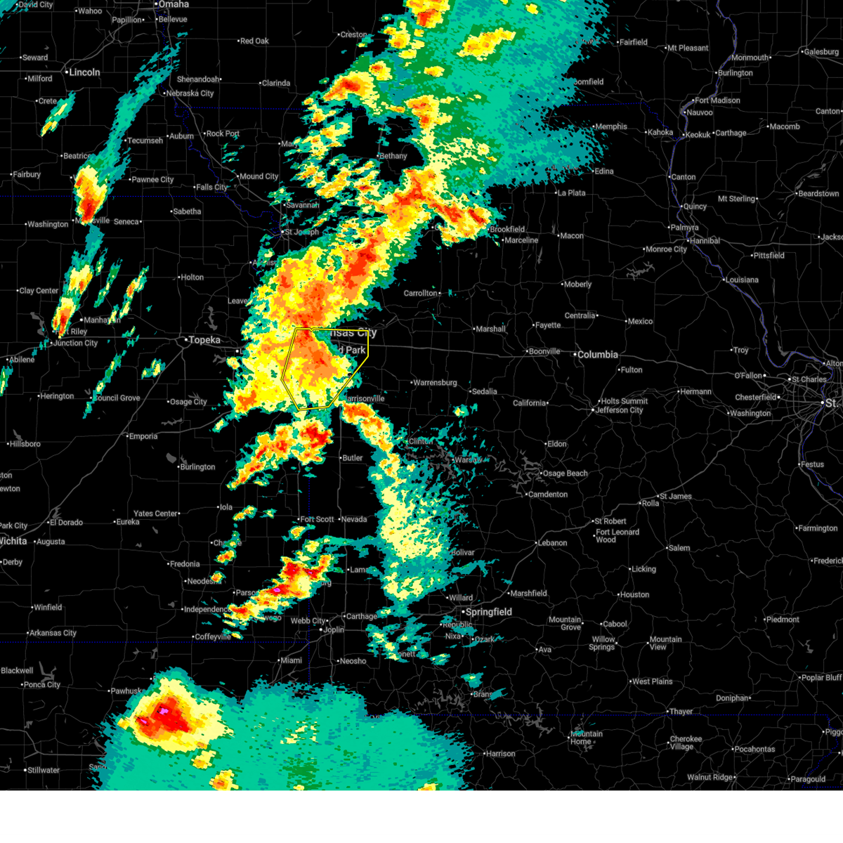 At 425 pm cdt, a severe thunderstorm was located near raymore, moving northeast at 55 mph. this is a destructive storm for the southern kc metro including johnson county, ks and jackson county, mo (automated weather station). Hazards include 80 mph wind gusts and penny size hail. Flying debris will be dangerous to those caught without shelter. mobile homes will be heavily damaged. expect considerable damage to roofs, windows, and vehicles. extensive tree damage and power outages are likely. locations impacted include, kansas city, overland park, olathe, independence, lee's summit, shawnee, blue springs, lenexa, leawood, raytown, grandview, belton, prairie village, raymore, grain valley, merriam, mission, pleasant hill, spring hill, and greenwood. this includes the following highways, interstate 70 in missouri between mile markers 0 and 29. interstate 70 in kansas between mile markers 416 and 423. interstate 35 in missouri between mile markers 0 and 4. interstate 35 in kansas between mile markers 215 and 235. interstate 635 between mile markers 0 and 5. interstate 470 between mile markers 0 and 16. interstate 435 between mile markers 0 and 4, and between mile markers 58 and 83. Interstate 49 between mile markers 162 and 183. At 425 pm cdt, a severe thunderstorm was located near raymore, moving northeast at 55 mph. this is a destructive storm for the southern kc metro including johnson county, ks and jackson county, mo (automated weather station). Hazards include 80 mph wind gusts and penny size hail. Flying debris will be dangerous to those caught without shelter. mobile homes will be heavily damaged. expect considerable damage to roofs, windows, and vehicles. extensive tree damage and power outages are likely. locations impacted include, kansas city, overland park, olathe, independence, lee's summit, shawnee, blue springs, lenexa, leawood, raytown, grandview, belton, prairie village, raymore, grain valley, merriam, mission, pleasant hill, spring hill, and greenwood. this includes the following highways, interstate 70 in missouri between mile markers 0 and 29. interstate 70 in kansas between mile markers 416 and 423. interstate 35 in missouri between mile markers 0 and 4. interstate 35 in kansas between mile markers 215 and 235. interstate 635 between mile markers 0 and 5. interstate 470 between mile markers 0 and 16. interstate 435 between mile markers 0 and 4, and between mile markers 58 and 83. Interstate 49 between mile markers 162 and 183.
|
| 5/19/2025 4:16 PM CDT |
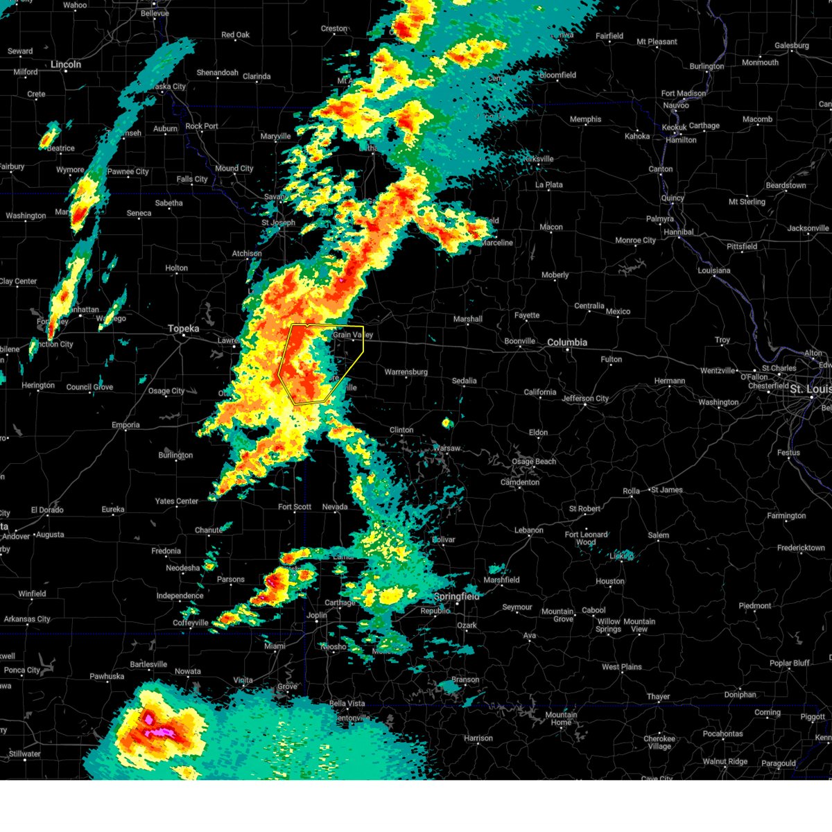 Svreax the national weather service in pleasant hill has issued a * severe thunderstorm warning for, east central wyandotte county in northeastern kansas, northeastern miami county in east central kansas, eastern johnson county in east central kansas, northwestern cass county in west central missouri, jackson county in west central missouri, * until 445 pm cdt. * at 415 pm cdt, a severe thunderstorm was located near peculiar, moving northeast at 50 mph (radar indicated). Hazards include 70 mph wind gusts and penny size hail. Expect considerable tree damage. Damage is likely to mobile homes, roofs, and outbuildings. Svreax the national weather service in pleasant hill has issued a * severe thunderstorm warning for, east central wyandotte county in northeastern kansas, northeastern miami county in east central kansas, eastern johnson county in east central kansas, northwestern cass county in west central missouri, jackson county in west central missouri, * until 445 pm cdt. * at 415 pm cdt, a severe thunderstorm was located near peculiar, moving northeast at 50 mph (radar indicated). Hazards include 70 mph wind gusts and penny size hail. Expect considerable tree damage. Damage is likely to mobile homes, roofs, and outbuildings.
|
| 4/2/2025 6:02 AM CDT |
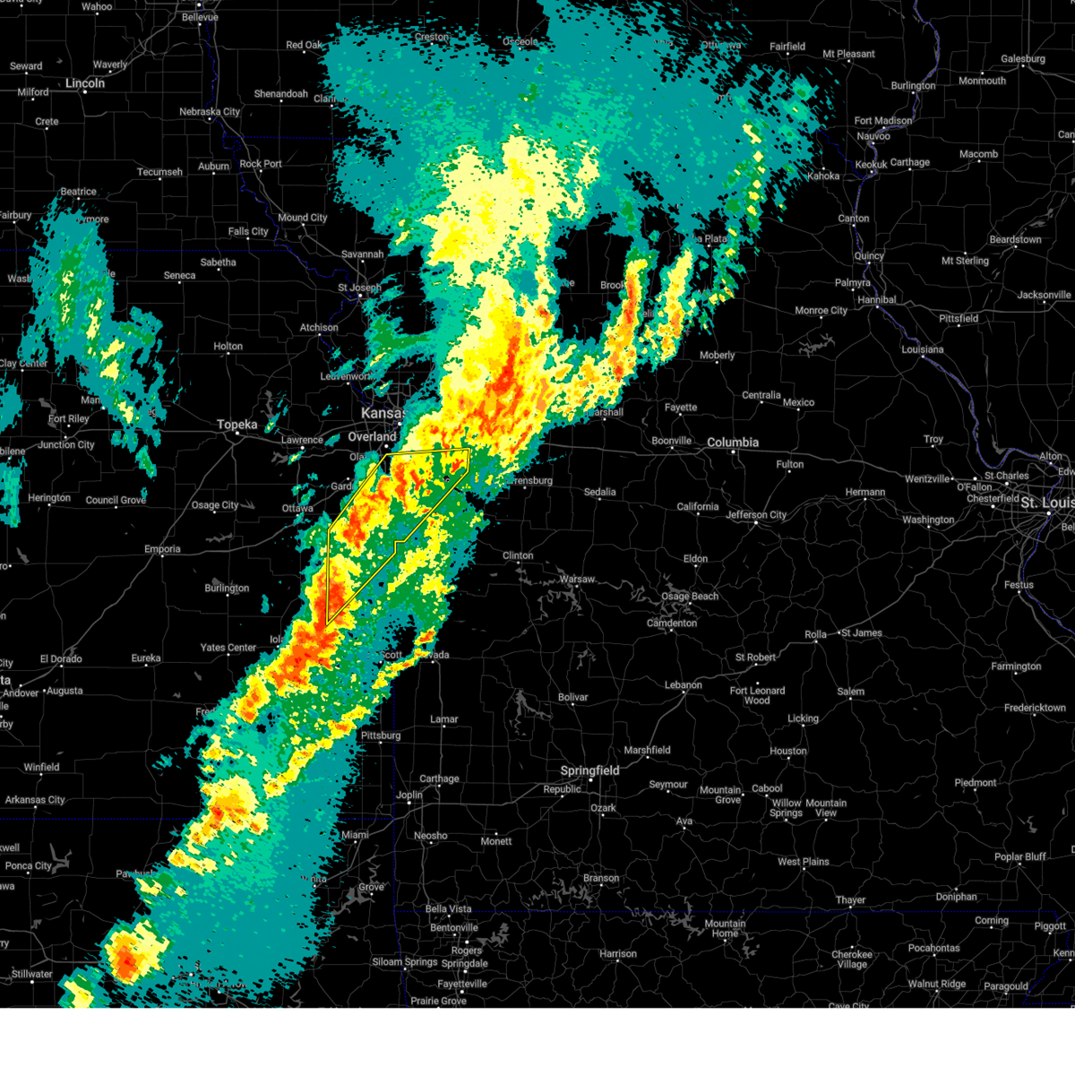 At 602 am cdt, severe thunderstorms were located along a line extending from near east lynne to near freeman to 6 miles west of drexel, moving east at 35 mph (radar indicated). Hazards include 60 mph wind gusts. Expect damage to roofs, siding, and trees. locations impacted include, overland park, baldwin park, spring hill, lee's summit, new lancaster, lake winnebago, stillwell, cleveland, stanley, unity village, wagstaff, lake annette, leawood, harrisonville, west line, linn valley, beagle, lake lotawana, hillsdale, and la cygne. this includes the following highways, interstate 470 between mile markers 0 and 10. Interstate 435 between mile markers 71 and 78. At 602 am cdt, severe thunderstorms were located along a line extending from near east lynne to near freeman to 6 miles west of drexel, moving east at 35 mph (radar indicated). Hazards include 60 mph wind gusts. Expect damage to roofs, siding, and trees. locations impacted include, overland park, baldwin park, spring hill, lee's summit, new lancaster, lake winnebago, stillwell, cleveland, stanley, unity village, wagstaff, lake annette, leawood, harrisonville, west line, linn valley, beagle, lake lotawana, hillsdale, and la cygne. this includes the following highways, interstate 470 between mile markers 0 and 10. Interstate 435 between mile markers 71 and 78.
|
| 4/2/2025 5:25 AM CDT |
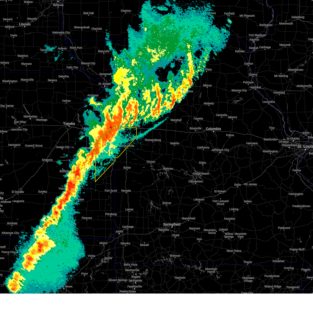 Svreax the national weather service in pleasant hill has issued a * severe thunderstorm warning for, miami county in east central kansas, northwestern linn county in east central kansas, southern johnson county in east central kansas, western cass county in west central missouri, southern jackson county in west central missouri, * until 615 am cdt. * at 524 am cdt, severe thunderstorms were located along a line extending from near grandview to near paola to greeley, moving east at 35 mph (radar indicated). Hazards include 60 mph wind gusts. expect damage to roofs, siding, and trees Svreax the national weather service in pleasant hill has issued a * severe thunderstorm warning for, miami county in east central kansas, northwestern linn county in east central kansas, southern johnson county in east central kansas, western cass county in west central missouri, southern jackson county in west central missouri, * until 615 am cdt. * at 524 am cdt, severe thunderstorms were located along a line extending from near grandview to near paola to greeley, moving east at 35 mph (radar indicated). Hazards include 60 mph wind gusts. expect damage to roofs, siding, and trees
|
| 4/2/2025 4:30 AM CDT |
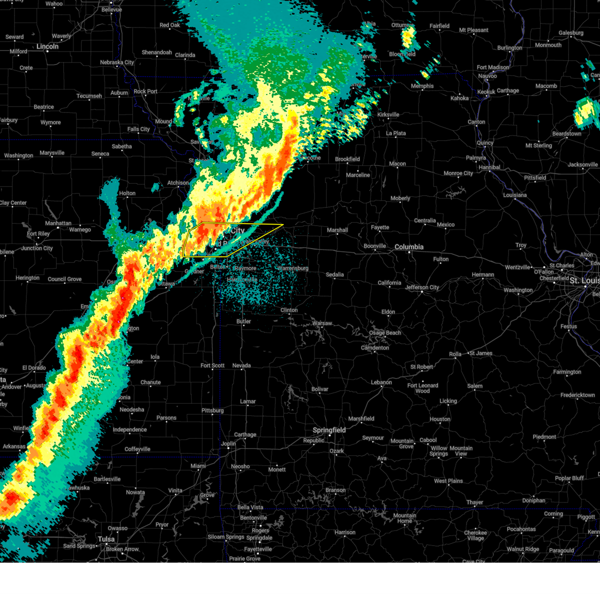 At 430 am cdt, severe thunderstorms were located along a line extending from near excelsior springs to north kansas city to lenexa, moving east at 55 mph (radar indicated). Hazards include 60 mph wind gusts. Expect damage to roofs, siding, and trees. locations impacted include, buckner, north kansas city, houston lake, pomeroy, parkville, lenexa, lackmans, northmoor, fleming, gladstone, mission hills, mission, levasy, kansas city downtown, randolph, camden, kansas city, mission woods, wolcott, and orrick. this includes the following highways, interstate 70 in missouri between mile markers 0 and 20. interstate 70 in kansas between mile markers 410 and 423. interstate 35 in missouri between mile markers 0 and 14. interstate 35 in kansas between mile markers 220 and 235. interstate 29 between mile markers 0 and 6. interstate 635 between mile markers 0 and 12. interstate 470 between mile markers 0 and 3, and between mile markers 13 and 16. interstate 435 between mile markers 0 and 22, and between mile markers 51 and 83. Kansas turnpike between mile markers 216 and 226. At 430 am cdt, severe thunderstorms were located along a line extending from near excelsior springs to north kansas city to lenexa, moving east at 55 mph (radar indicated). Hazards include 60 mph wind gusts. Expect damage to roofs, siding, and trees. locations impacted include, buckner, north kansas city, houston lake, pomeroy, parkville, lenexa, lackmans, northmoor, fleming, gladstone, mission hills, mission, levasy, kansas city downtown, randolph, camden, kansas city, mission woods, wolcott, and orrick. this includes the following highways, interstate 70 in missouri between mile markers 0 and 20. interstate 70 in kansas between mile markers 410 and 423. interstate 35 in missouri between mile markers 0 and 14. interstate 35 in kansas between mile markers 220 and 235. interstate 29 between mile markers 0 and 6. interstate 635 between mile markers 0 and 12. interstate 470 between mile markers 0 and 3, and between mile markers 13 and 16. interstate 435 between mile markers 0 and 22, and between mile markers 51 and 83. Kansas turnpike between mile markers 216 and 226.
|
| 4/2/2025 4:11 AM CDT |
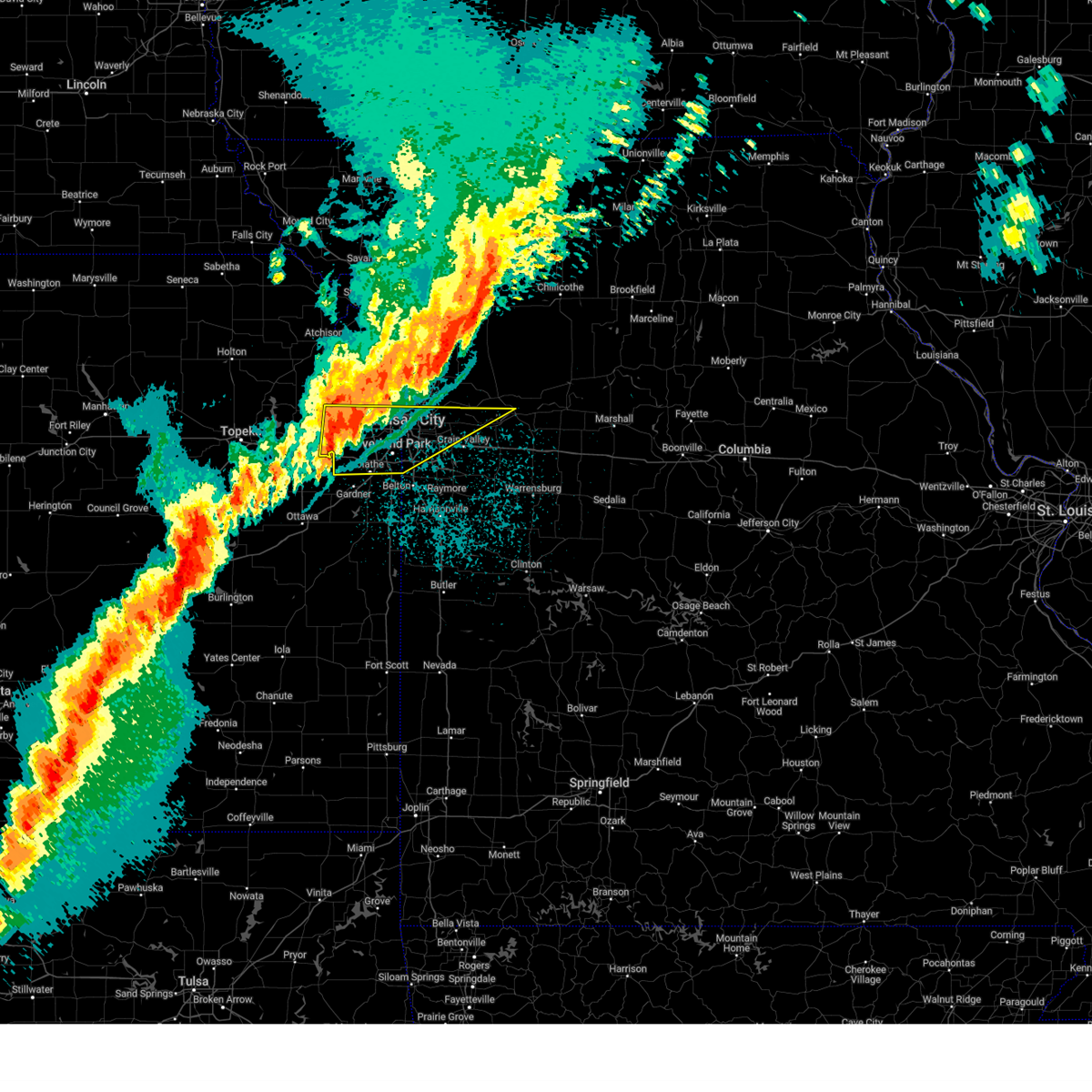 Svreax the national weather service in pleasant hill has issued a * severe thunderstorm warning for, wyandotte county in northeastern kansas, southern leavenworth county in northeastern kansas, northern johnson county in east central kansas, southern clay county in west central missouri, southwestern ray county in west central missouri, northwestern lafayette county in west central missouri, southeastern platte county in west central missouri, central jackson county in west central missouri, * until 445 am cdt. * at 410 am cdt, severe thunderstorms were located along a line extending from near kearney to kansas city to near de soto, moving east at 60 mph (radar indicated). Hazards include 60 mph wind gusts. expect damage to roofs, siding, and trees Svreax the national weather service in pleasant hill has issued a * severe thunderstorm warning for, wyandotte county in northeastern kansas, southern leavenworth county in northeastern kansas, northern johnson county in east central kansas, southern clay county in west central missouri, southwestern ray county in west central missouri, northwestern lafayette county in west central missouri, southeastern platte county in west central missouri, central jackson county in west central missouri, * until 445 am cdt. * at 410 am cdt, severe thunderstorms were located along a line extending from near kearney to kansas city to near de soto, moving east at 60 mph (radar indicated). Hazards include 60 mph wind gusts. expect damage to roofs, siding, and trees
|
| 3/14/2025 3:46 PM CDT |
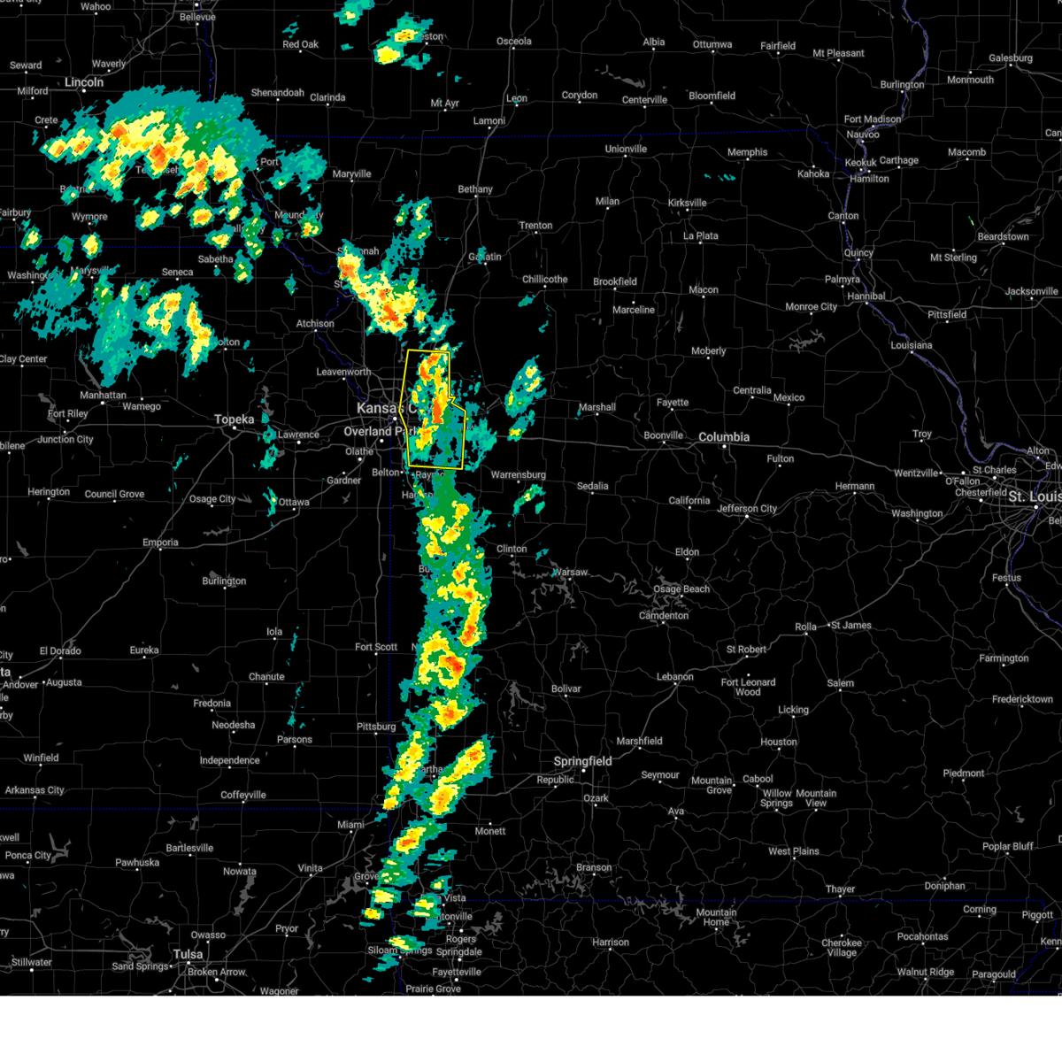 the severe thunderstorm warning has been cancelled and is no longer in effect the severe thunderstorm warning has been cancelled and is no longer in effect
|
| 3/14/2025 3:46 PM CDT |
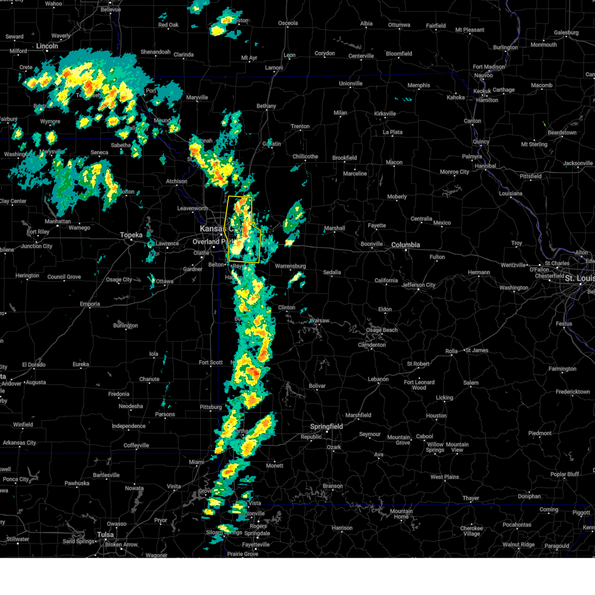 At 345 pm cdt, severe thunderstorms were located along a line extending from gower to holt to lone jack, moving northeast at 45 mph (public reported trees blown down in independence and blue springs around 340pm). Hazards include 70 mph wind gusts and quarter size hail. Hail damage to vehicles is expected. expect considerable tree damage. wind damage is also likely to mobile homes, roofs, and outbuildings. locations impacted include, excelsior springs, buckner, lee's summit, sugar creek, prathersville, liberty, kearney, unity village, avondale, levasy, randolph, lake lotawana, glenaire, claycomo, lone jack, greenwood, pleasant valley, independence, sibley, and birmingham. this includes the following highways, interstate 70 in missouri between mile markers 7 and 29. interstate 35 in missouri between mile markers 9 and 32. interstate 470 between mile markers 4 and 16. Interstate 435 between mile markers 44 and 63. At 345 pm cdt, severe thunderstorms were located along a line extending from gower to holt to lone jack, moving northeast at 45 mph (public reported trees blown down in independence and blue springs around 340pm). Hazards include 70 mph wind gusts and quarter size hail. Hail damage to vehicles is expected. expect considerable tree damage. wind damage is also likely to mobile homes, roofs, and outbuildings. locations impacted include, excelsior springs, buckner, lee's summit, sugar creek, prathersville, liberty, kearney, unity village, avondale, levasy, randolph, lake lotawana, glenaire, claycomo, lone jack, greenwood, pleasant valley, independence, sibley, and birmingham. this includes the following highways, interstate 70 in missouri between mile markers 7 and 29. interstate 35 in missouri between mile markers 9 and 32. interstate 470 between mile markers 4 and 16. Interstate 435 between mile markers 44 and 63.
|
| 3/14/2025 3:35 PM CDT | Local law enforcement reporting trees down in blue springs... including at least 1 reported on vehicl in jackson county MO, 0.5 miles SSE of Blue Springs, MO |
| 3/14/2025 3:17 PM CDT |
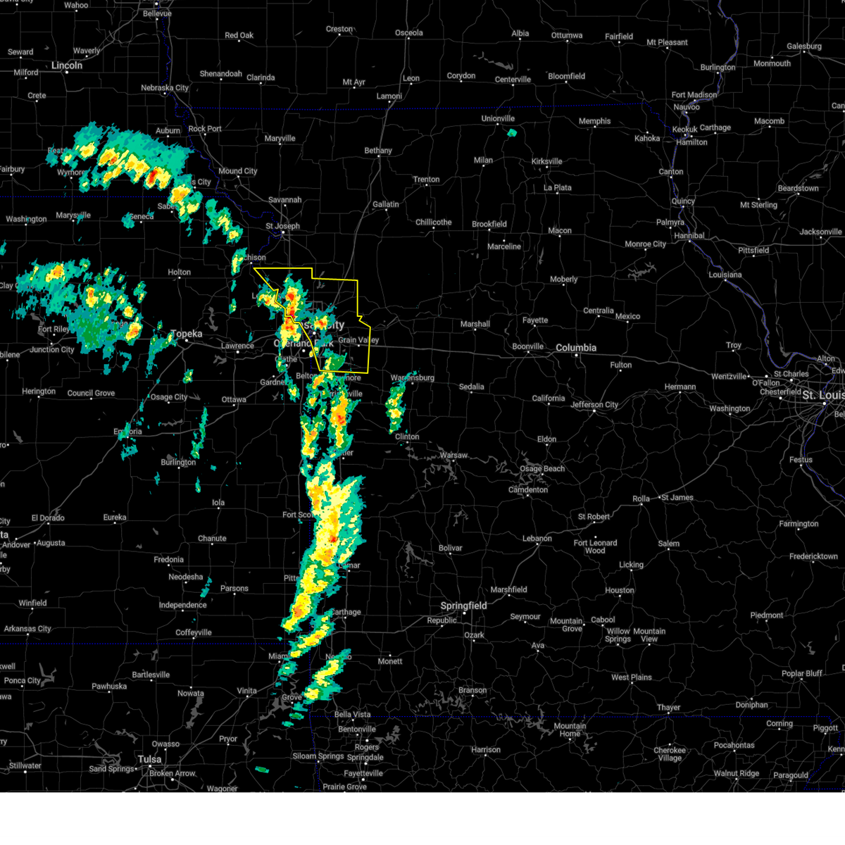 At 316 pm cdt, severe thunderstorms were located along a line extending from platte city to near claycomo to near harrisonville, moving north at 65 mph (radar indicated). Hazards include 70 mph wind gusts and quarter size hail. Hail damage to vehicles is expected. expect considerable tree damage. wind damage is also likely to mobile homes, roofs, and outbuildings. locations impacted include, excelsior springs, smithville, buckner, north kansas city, houston lake, ferrelview, parkville, northmoor, lake waukomis, beverly, gladstone, levasy, kansas city downtown, randolph, lake lotawana, kansas city, greenwood, weatherby lake, bean lake, and river bend. this includes the following highways, interstate 70 in missouri between mile markers 0 and 29. interstate 70 in kansas between mile markers 421 and 423. interstate 35 in missouri between mile markers 0 and 32. interstate 35 in kansas between mile markers 234 and 235. interstate 29 between mile markers 0 and 30. interstate 635 between mile markers 7 and 12. interstate 470 between mile markers 0 and 16. Interstate 435 between mile markers 21 and 72. At 316 pm cdt, severe thunderstorms were located along a line extending from platte city to near claycomo to near harrisonville, moving north at 65 mph (radar indicated). Hazards include 70 mph wind gusts and quarter size hail. Hail damage to vehicles is expected. expect considerable tree damage. wind damage is also likely to mobile homes, roofs, and outbuildings. locations impacted include, excelsior springs, smithville, buckner, north kansas city, houston lake, ferrelview, parkville, northmoor, lake waukomis, beverly, gladstone, levasy, kansas city downtown, randolph, lake lotawana, kansas city, greenwood, weatherby lake, bean lake, and river bend. this includes the following highways, interstate 70 in missouri between mile markers 0 and 29. interstate 70 in kansas between mile markers 421 and 423. interstate 35 in missouri between mile markers 0 and 32. interstate 35 in kansas between mile markers 234 and 235. interstate 29 between mile markers 0 and 30. interstate 635 between mile markers 7 and 12. interstate 470 between mile markers 0 and 16. Interstate 435 between mile markers 21 and 72.
|
| 3/14/2025 3:08 PM CDT |
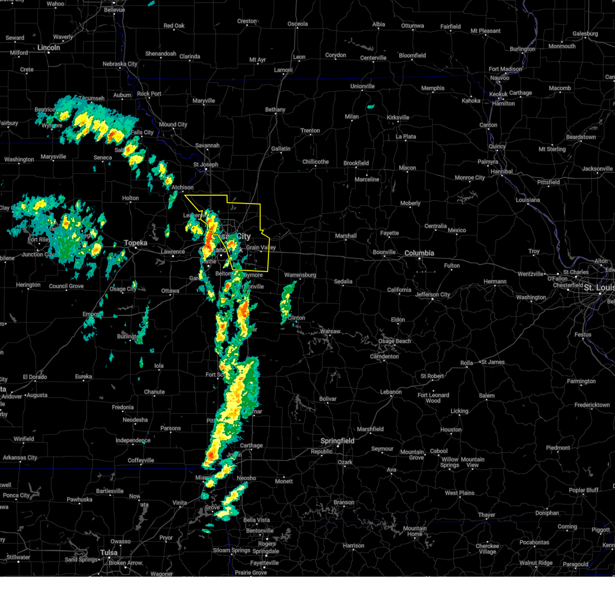 Svreax the national weather service in pleasant hill has issued a * severe thunderstorm warning for, northeastern wyandotte county in northeastern kansas, clay county in west central missouri, platte county in west central missouri, jackson county in west central missouri, * until 400 pm cdt. * at 308 pm cdt, severe thunderstorms were located along a line extending from near platte city to near westwood hills to near archie, moving northeast at 45 mph (radar indicated). Hazards include 70 mph wind gusts and nickel size hail. Expect considerable tree damage. Damage is likely to mobile homes, roofs, and outbuildings. Svreax the national weather service in pleasant hill has issued a * severe thunderstorm warning for, northeastern wyandotte county in northeastern kansas, clay county in west central missouri, platte county in west central missouri, jackson county in west central missouri, * until 400 pm cdt. * at 308 pm cdt, severe thunderstorms were located along a line extending from near platte city to near westwood hills to near archie, moving northeast at 45 mph (radar indicated). Hazards include 70 mph wind gusts and nickel size hail. Expect considerable tree damage. Damage is likely to mobile homes, roofs, and outbuildings.
|
| 10/30/2024 8:19 PM CDT |
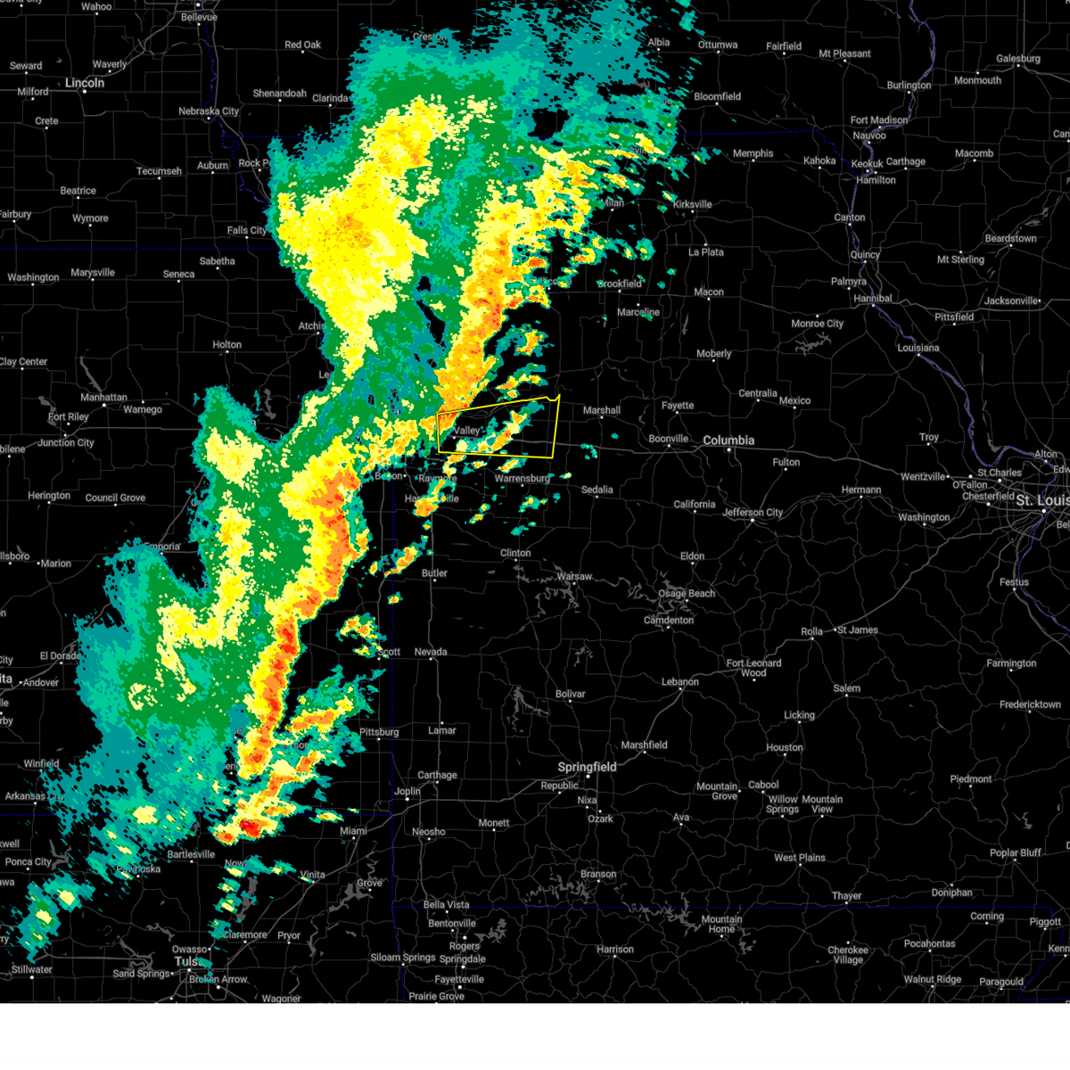 At 819 pm cdt, a severe thunderstorm was located over levasy, or near buckner, moving east at 40 mph (radar indicated). Hazards include 60 mph wind gusts and penny size hail. Expect damage to roofs, siding, and trees. locations impacted include, independence, blue springs, grain valley, oak grove, odessa, higginsville, lexington, buckner, concordia, lake lotawana, waverly, wellington, lake tapawingo, corder, alma, mayview, levasy, lake lafayette, napoleon, and bates city. This includes interstate 70 in missouri between mile markers 19 and 61. At 819 pm cdt, a severe thunderstorm was located over levasy, or near buckner, moving east at 40 mph (radar indicated). Hazards include 60 mph wind gusts and penny size hail. Expect damage to roofs, siding, and trees. locations impacted include, independence, blue springs, grain valley, oak grove, odessa, higginsville, lexington, buckner, concordia, lake lotawana, waverly, wellington, lake tapawingo, corder, alma, mayview, levasy, lake lafayette, napoleon, and bates city. This includes interstate 70 in missouri between mile markers 19 and 61.
|
| 10/30/2024 8:05 PM CDT |
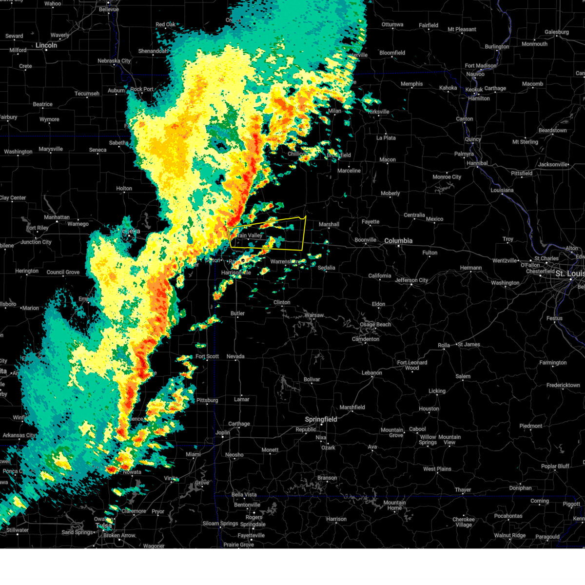 Svreax the national weather service in pleasant hill has issued a * severe thunderstorm warning for, southeastern ray county in west central missouri, lafayette county in west central missouri, northeastern jackson county in west central missouri, northeastern johnson county in west central missouri, * until 845 pm cdt. * at 804 pm cdt, a severe thunderstorm was located over lake tapawingo, or over blue springs, moving east at 40 mph (radar indicated). Hazards include 60 mph wind gusts and quarter size hail. Hail damage to vehicles is expected. Expect wind damage to roofs, siding, and trees. Svreax the national weather service in pleasant hill has issued a * severe thunderstorm warning for, southeastern ray county in west central missouri, lafayette county in west central missouri, northeastern jackson county in west central missouri, northeastern johnson county in west central missouri, * until 845 pm cdt. * at 804 pm cdt, a severe thunderstorm was located over lake tapawingo, or over blue springs, moving east at 40 mph (radar indicated). Hazards include 60 mph wind gusts and quarter size hail. Hail damage to vehicles is expected. Expect wind damage to roofs, siding, and trees.
|
| 10/30/2024 7:51 PM CDT |
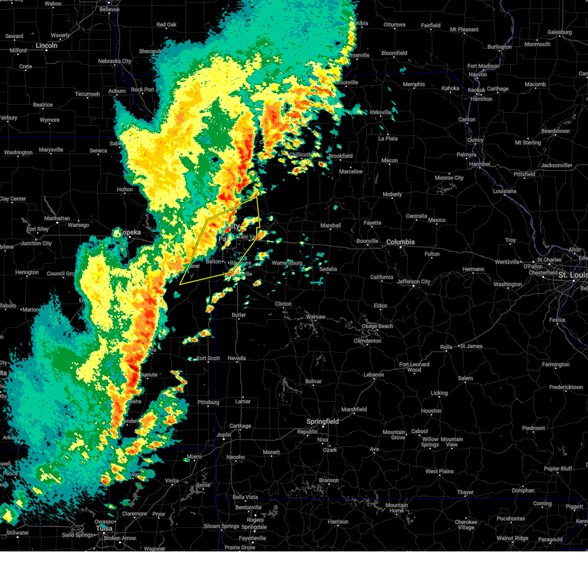 At 751 pm cdt, severe thunderstorms were located along a line extending from near missouri city to near independence to near spring hill, moving northeast at 65 mph (radar indicated). Hazards include 60 mph wind gusts. Expect damage to roofs, siding, and trees. locations impacted include, kansas city, overland park, olathe, independence, lee's summit, shawnee, blue springs, lenexa, leawood, raytown, liberty, gladstone, grandview, belton, prairie village, raymore, gardner, grain valley, excelsior springs, and merriam. this includes the following highways, interstate 70 in missouri between mile markers 0 and 28. interstate 70 in kansas between mile markers 414 and 423. interstate 35 in missouri between mile markers 0 and 22. interstate 35 in kansas between mile markers 206 and 235. interstate 29 between mile markers 0 and 7. interstate 635 between mile markers 0 and 12. interstate 470 between mile markers 0 and 16. Interstate 435 between mile markers 0 and 10, and between mile markers 46 and 83. At 751 pm cdt, severe thunderstorms were located along a line extending from near missouri city to near independence to near spring hill, moving northeast at 65 mph (radar indicated). Hazards include 60 mph wind gusts. Expect damage to roofs, siding, and trees. locations impacted include, kansas city, overland park, olathe, independence, lee's summit, shawnee, blue springs, lenexa, leawood, raytown, liberty, gladstone, grandview, belton, prairie village, raymore, gardner, grain valley, excelsior springs, and merriam. this includes the following highways, interstate 70 in missouri between mile markers 0 and 28. interstate 70 in kansas between mile markers 414 and 423. interstate 35 in missouri between mile markers 0 and 22. interstate 35 in kansas between mile markers 206 and 235. interstate 29 between mile markers 0 and 7. interstate 635 between mile markers 0 and 12. interstate 470 between mile markers 0 and 16. Interstate 435 between mile markers 0 and 10, and between mile markers 46 and 83.
|
| 10/30/2024 7:37 PM CDT |
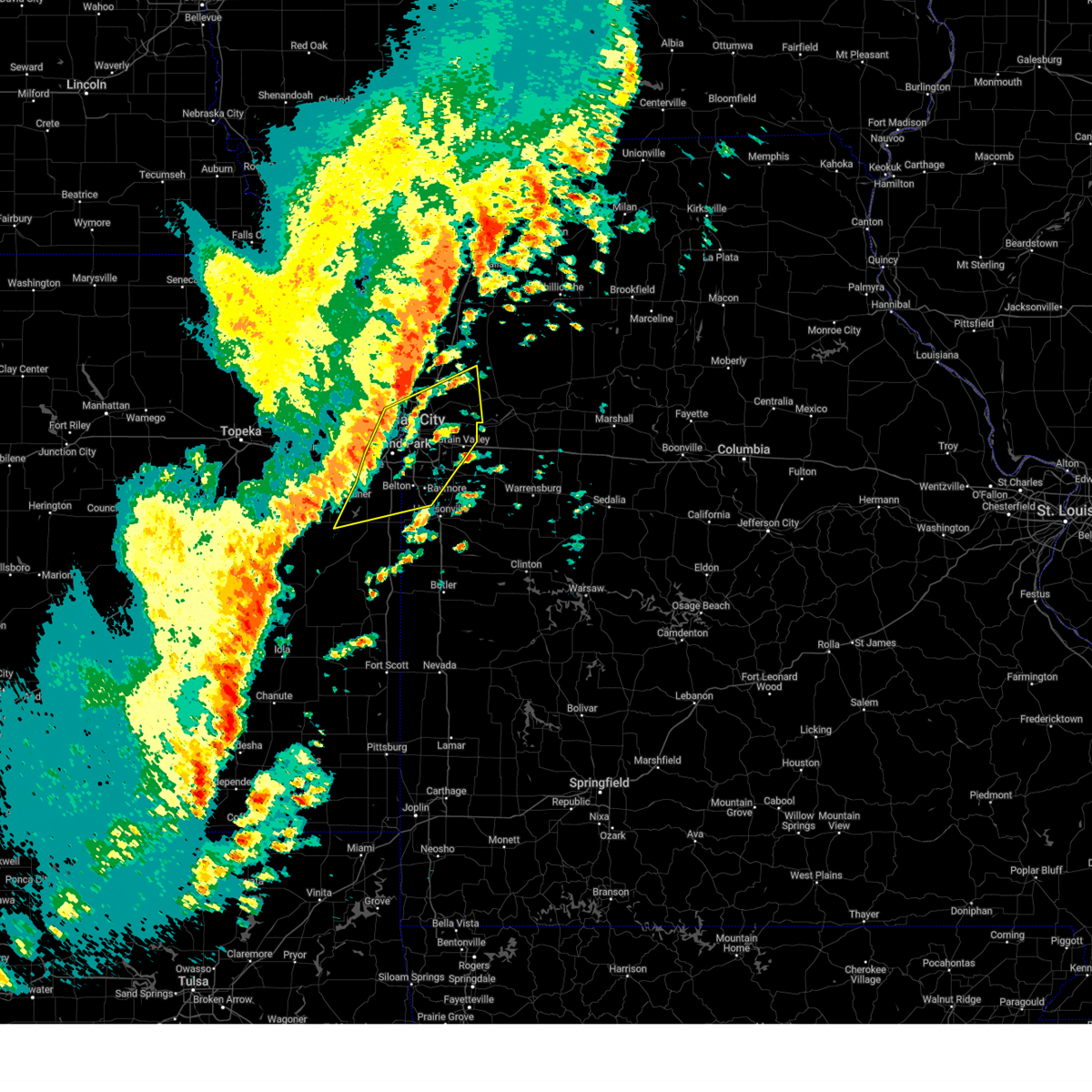 Svreax the national weather service in pleasant hill has issued a * severe thunderstorm warning for, eastern wyandotte county in northeastern kansas, northern miami county in east central kansas, johnson county in east central kansas, northwestern cass county in west central missouri, central clay county in west central missouri, southwestern ray county in west central missouri, southeastern platte county in west central missouri, jackson county in west central missouri, * until 800 pm cdt. * at 736 pm cdt, severe thunderstorms were located along a line extending from near parkville to near overland park to near wellsville, moving northeast at 60 mph (radar indicated). Hazards include 60 mph wind gusts and penny size hail. expect damage to roofs, siding, and trees Svreax the national weather service in pleasant hill has issued a * severe thunderstorm warning for, eastern wyandotte county in northeastern kansas, northern miami county in east central kansas, johnson county in east central kansas, northwestern cass county in west central missouri, central clay county in west central missouri, southwestern ray county in west central missouri, southeastern platte county in west central missouri, jackson county in west central missouri, * until 800 pm cdt. * at 736 pm cdt, severe thunderstorms were located along a line extending from near parkville to near overland park to near wellsville, moving northeast at 60 mph (radar indicated). Hazards include 60 mph wind gusts and penny size hail. expect damage to roofs, siding, and trees
|
| 10/24/2024 9:13 PM CDT |
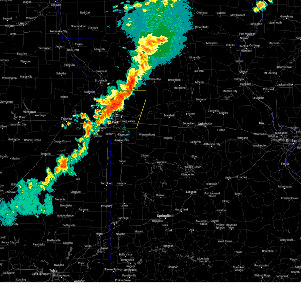 Svreax the national weather service in pleasant hill has issued a * severe thunderstorm warning for, wyandotte county in northeastern kansas, southeastern leavenworth county in northeastern kansas, northern johnson county in east central kansas, southeastern clinton county in northwestern missouri, clay county in west central missouri, ray county in west central missouri, southern caldwell county in north central missouri, southwestern lafayette county in west central missouri, southeastern platte county in west central missouri, jackson county in west central missouri, * until 1000 pm cdt. * at 912 pm cdt, severe thunderstorms were located along a line extending from near polo to glenaire to lenexa, moving east at 50 mph (radar indicated). Hazards include 70 mph wind gusts and quarter size hail. Hail damage to vehicles is expected. expect considerable tree damage. Wind damage is also likely to mobile homes, roofs, and outbuildings. Svreax the national weather service in pleasant hill has issued a * severe thunderstorm warning for, wyandotte county in northeastern kansas, southeastern leavenworth county in northeastern kansas, northern johnson county in east central kansas, southeastern clinton county in northwestern missouri, clay county in west central missouri, ray county in west central missouri, southern caldwell county in north central missouri, southwestern lafayette county in west central missouri, southeastern platte county in west central missouri, jackson county in west central missouri, * until 1000 pm cdt. * at 912 pm cdt, severe thunderstorms were located along a line extending from near polo to glenaire to lenexa, moving east at 50 mph (radar indicated). Hazards include 70 mph wind gusts and quarter size hail. Hail damage to vehicles is expected. expect considerable tree damage. Wind damage is also likely to mobile homes, roofs, and outbuildings.
|
| 9/24/2024 8:31 PM CDT |
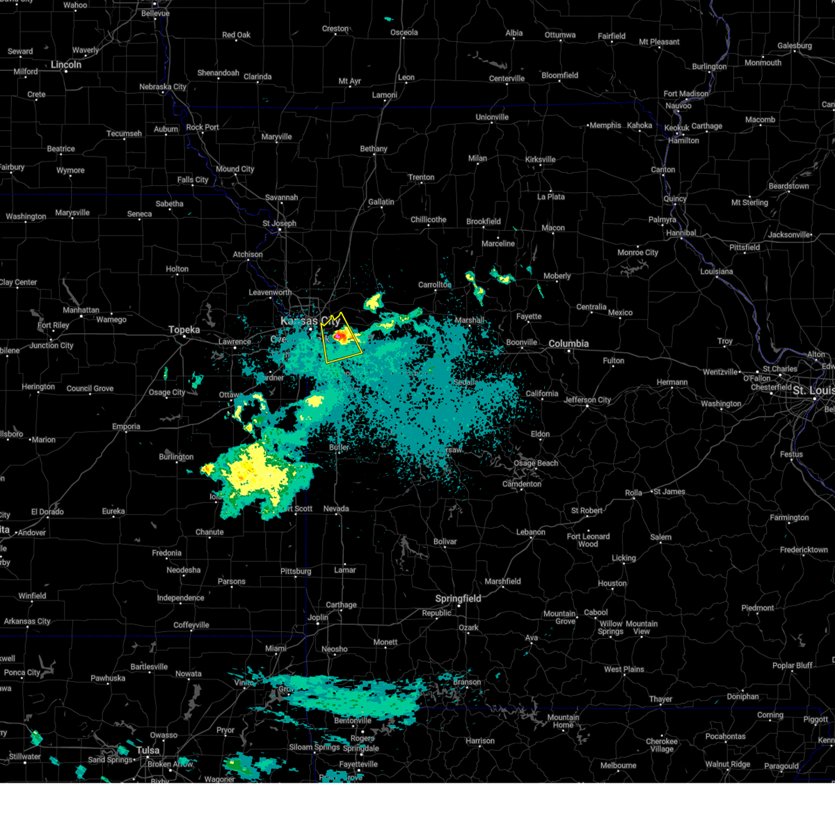 the severe thunderstorm warning has been cancelled and is no longer in effect the severe thunderstorm warning has been cancelled and is no longer in effect
|
| 9/24/2024 8:11 PM CDT |
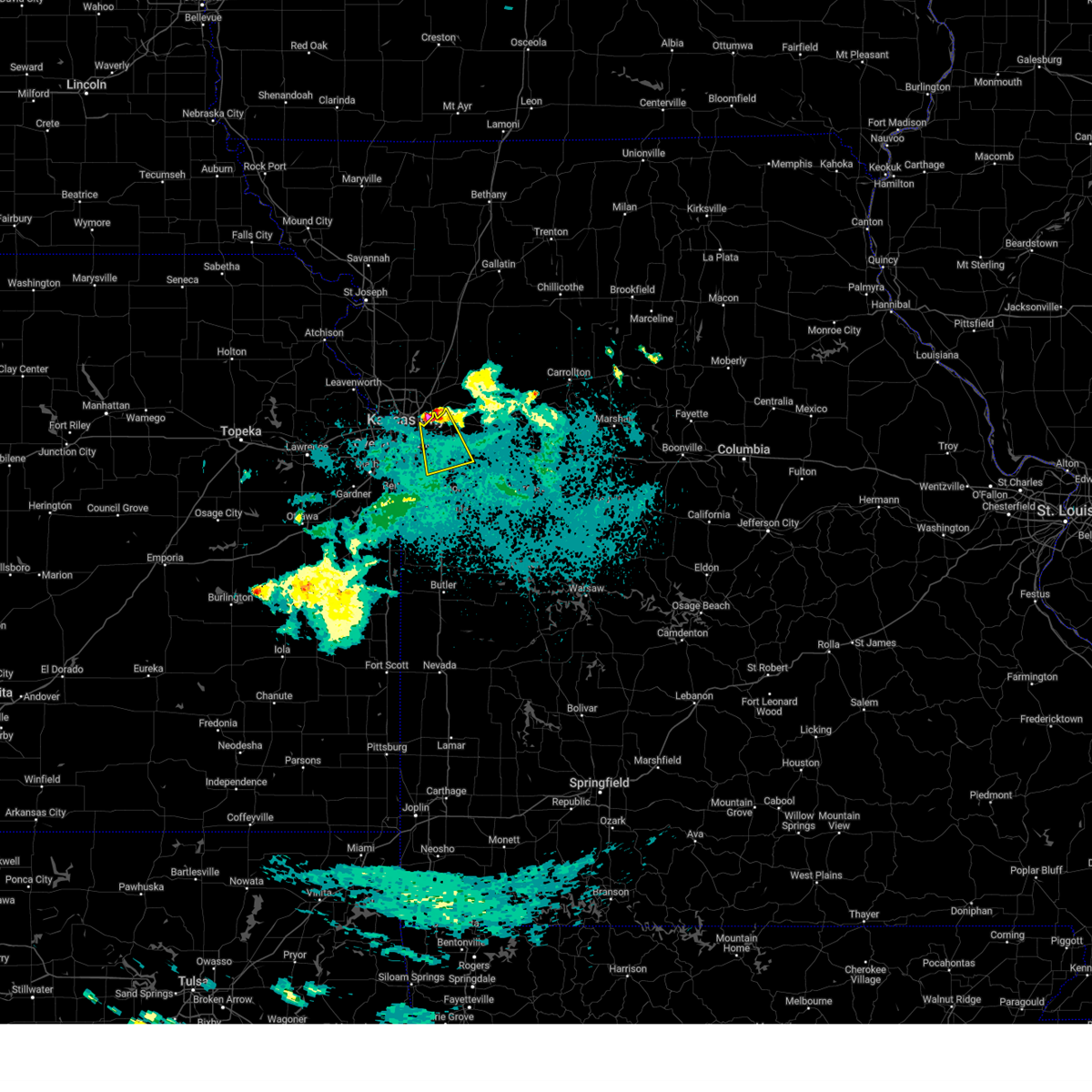 Svreax the national weather service in pleasant hill has issued a * severe thunderstorm warning for, central jackson county in west central missouri, * until 845 pm cdt. * at 811 pm cdt, a severe thunderstorm was located over sugar creek, moving southeast at 25 mph (radar indicated). Hazards include quarter size hail. damage to vehicles is expected Svreax the national weather service in pleasant hill has issued a * severe thunderstorm warning for, central jackson county in west central missouri, * until 845 pm cdt. * at 811 pm cdt, a severe thunderstorm was located over sugar creek, moving southeast at 25 mph (radar indicated). Hazards include quarter size hail. damage to vehicles is expected
|
| 7/31/2024 11:39 PM CDT |
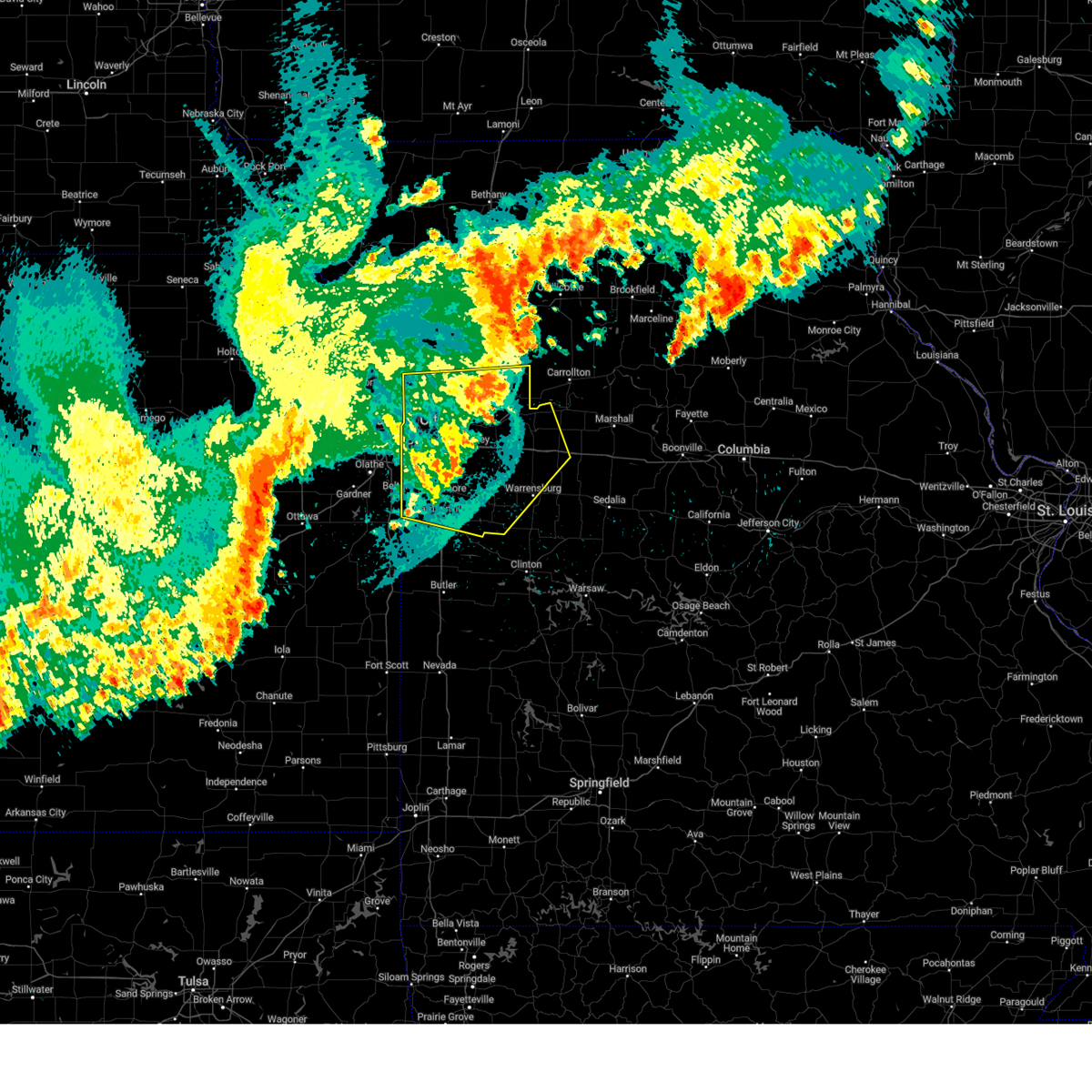 The storms which prompted the warning have weakened below severe limits, and no longer pose an immediate threat to life or property. therefore, the warning will be allowed to expire. however, gusty winds are still possible with these thunderstorms. a severe thunderstorm watch remains in effect until 300 am cdt for northeastern and east central kansas, and central, north central and west central missouri. The storms which prompted the warning have weakened below severe limits, and no longer pose an immediate threat to life or property. therefore, the warning will be allowed to expire. however, gusty winds are still possible with these thunderstorms. a severe thunderstorm watch remains in effect until 300 am cdt for northeastern and east central kansas, and central, north central and west central missouri.
|
| 7/31/2024 11:22 PM CDT |
 At 1121 pm cdt, severe thunderstorms were located along a line extending from near kingston to near wellington to lone jack, moving east at 50 mph (radar indicated). Hazards include 60 mph wind gusts. Expect damage to roofs, siding, and trees. locations impacted include, kansas city, independence, lee's summit, blue springs, leawood, raytown, liberty, gladstone, grandview, belton, prairie village, raymore, warrensburg, grain valley, excelsior springs, harrisonville, smithville, kearney, pleasant hill, and oak grove. this includes the following highways, interstate 70 in missouri between mile markers 1 and 62. interstate 35 in missouri between mile markers 0 and 28. interstate 35 in kansas near mile marker 235. interstate 29 between mile markers 0 and 2. interstate 470 between mile markers 0 and 16. Interstate 435 between mile markers 40 and 75. At 1121 pm cdt, severe thunderstorms were located along a line extending from near kingston to near wellington to lone jack, moving east at 50 mph (radar indicated). Hazards include 60 mph wind gusts. Expect damage to roofs, siding, and trees. locations impacted include, kansas city, independence, lee's summit, blue springs, leawood, raytown, liberty, gladstone, grandview, belton, prairie village, raymore, warrensburg, grain valley, excelsior springs, harrisonville, smithville, kearney, pleasant hill, and oak grove. this includes the following highways, interstate 70 in missouri between mile markers 1 and 62. interstate 35 in missouri between mile markers 0 and 28. interstate 35 in kansas near mile marker 235. interstate 29 between mile markers 0 and 2. interstate 470 between mile markers 0 and 16. Interstate 435 between mile markers 40 and 75.
|
| 7/31/2024 11:22 PM CDT |
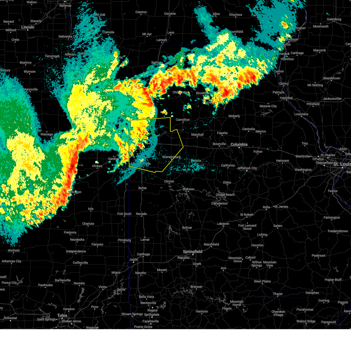 the severe thunderstorm warning has been cancelled and is no longer in effect the severe thunderstorm warning has been cancelled and is no longer in effect
|
| 7/31/2024 11:04 PM CDT |
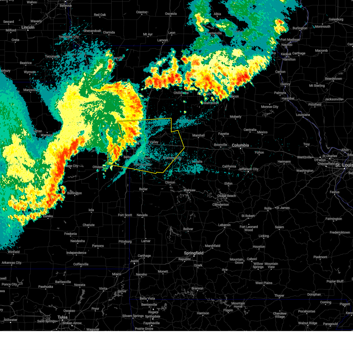 Svreax the national weather service in pleasant hill has issued a * severe thunderstorm warning for, eastern wyandotte county in northeastern kansas, northern miami county in east central kansas, johnson county in east central kansas, cass county in west central missouri, clay county in west central missouri, ray county in west central missouri, lafayette county in west central missouri, southeastern platte county in west central missouri, jackson county in west central missouri, johnson county in west central missouri, * until 1145 pm cdt. * at 1103 pm cdt, severe thunderstorms were located along a line extending from near plattsburg to near independence to near grandview, moving east at 50 mph (radar indicated). Hazards include 60 mph wind gusts. expect damage to roofs, siding, and trees Svreax the national weather service in pleasant hill has issued a * severe thunderstorm warning for, eastern wyandotte county in northeastern kansas, northern miami county in east central kansas, johnson county in east central kansas, cass county in west central missouri, clay county in west central missouri, ray county in west central missouri, lafayette county in west central missouri, southeastern platte county in west central missouri, jackson county in west central missouri, johnson county in west central missouri, * until 1145 pm cdt. * at 1103 pm cdt, severe thunderstorms were located along a line extending from near plattsburg to near independence to near grandview, moving east at 50 mph (radar indicated). Hazards include 60 mph wind gusts. expect damage to roofs, siding, and trees
|
| 7/31/2024 10:22 PM CDT |
 Svreax the national weather service in pleasant hill has issued a * severe thunderstorm warning for, leavenworth county in northeastern kansas, central atchison county in northeastern kansas, wyandotte county in northeastern kansas, northeastern miami county in east central kansas, doniphan county in northeastern kansas, johnson county in east central kansas, buchanan county in northwestern missouri, southeastern holt county in northwestern missouri, southern andrew county in northwestern missouri, western jackson county in west central missouri, northwestern cass county in west central missouri, clinton county in northwestern missouri, clay county in west central missouri, west central ray county in west central missouri, platte county in west central missouri, western dekalb county in northwestern missouri, * until 1115 pm cdt. * at 1022 pm cdt, severe thunderstorms were located along a line extending from 7 miles northwest of rushville to near lansing to near lawrence, moving east at 55 mph (radar indicated). Hazards include 70 mph wind gusts. Expect considerable tree damage. Damage is likely to mobile homes, roofs, and outbuildings. Svreax the national weather service in pleasant hill has issued a * severe thunderstorm warning for, leavenworth county in northeastern kansas, central atchison county in northeastern kansas, wyandotte county in northeastern kansas, northeastern miami county in east central kansas, doniphan county in northeastern kansas, johnson county in east central kansas, buchanan county in northwestern missouri, southeastern holt county in northwestern missouri, southern andrew county in northwestern missouri, western jackson county in west central missouri, northwestern cass county in west central missouri, clinton county in northwestern missouri, clay county in west central missouri, west central ray county in west central missouri, platte county in west central missouri, western dekalb county in northwestern missouri, * until 1115 pm cdt. * at 1022 pm cdt, severe thunderstorms were located along a line extending from 7 miles northwest of rushville to near lansing to near lawrence, moving east at 55 mph (radar indicated). Hazards include 70 mph wind gusts. Expect considerable tree damage. Damage is likely to mobile homes, roofs, and outbuildings.
|
| 7/16/2024 8:56 AM CDT |
 The storms which prompted the warning have weakened below severe limits, and no longer pose an immediate threat to life or property. therefore, the warning will be allowed to expire. however, gusty winds are still possible with these thunderstorms. a severe thunderstorm watch remains in effect until 100 pm cdt for northeastern and east central kansas, and west central missouri. The storms which prompted the warning have weakened below severe limits, and no longer pose an immediate threat to life or property. therefore, the warning will be allowed to expire. however, gusty winds are still possible with these thunderstorms. a severe thunderstorm watch remains in effect until 100 pm cdt for northeastern and east central kansas, and west central missouri.
|
| 7/16/2024 8:48 AM CDT |
 At 848 am cdt, severe thunderstorms were located along a line extending from near liberty to courtney to near raytown to near lee's summit, moving east at 40 mph (radar indicated). Hazards include 60 mph wind gusts. Expect damage to roofs, siding, and trees. locations impacted include, kansas city, overland park, independence, lee's summit, shawnee, blue springs, lenexa, leawood, raytown, liberty, gladstone, grandview, prairie village, excelsior springs, merriam, mission, parkville, greenwood, north kansas city, and fairway. this includes the following highways, interstate 70 in missouri between mile markers 0 and 22. interstate 70 in kansas between mile markers 416 and 423. interstate 35 in missouri between mile markers 0 and 21. interstate 35 in kansas between mile markers 223 and 235. interstate 29 between mile markers 0 and 10. interstate 635 between mile markers 0 and 12. interstate 470 between mile markers 0 and 16. Interstate 435 between mile markers 0 and 6, and between mile markers 46 and 83. At 848 am cdt, severe thunderstorms were located along a line extending from near liberty to courtney to near raytown to near lee's summit, moving east at 40 mph (radar indicated). Hazards include 60 mph wind gusts. Expect damage to roofs, siding, and trees. locations impacted include, kansas city, overland park, independence, lee's summit, shawnee, blue springs, lenexa, leawood, raytown, liberty, gladstone, grandview, prairie village, excelsior springs, merriam, mission, parkville, greenwood, north kansas city, and fairway. this includes the following highways, interstate 70 in missouri between mile markers 0 and 22. interstate 70 in kansas between mile markers 416 and 423. interstate 35 in missouri between mile markers 0 and 21. interstate 35 in kansas between mile markers 223 and 235. interstate 29 between mile markers 0 and 10. interstate 635 between mile markers 0 and 12. interstate 470 between mile markers 0 and 16. Interstate 435 between mile markers 0 and 6, and between mile markers 46 and 83.
|
| 7/16/2024 8:48 AM CDT |
 the severe thunderstorm warning has been cancelled and is no longer in effect the severe thunderstorm warning has been cancelled and is no longer in effect
|
| 7/16/2024 8:40 AM CDT |
 At 840 am cdt, severe thunderstorms were located along a line extending from claycomo to near kansas city to mission hills to overland park, moving southeast at 30 mph (radar indicated). Hazards include 70 mph wind gusts. Expect considerable tree damage. damage is likely to mobile homes, roofs, and outbuildings. locations impacted include, kansas city, overland park, olathe, independence, lee's summit, shawnee, blue springs, lenexa, leawood, raytown, liberty, gladstone, grandview, belton, prairie village, raymore, lansing, excelsior springs, merriam, and mission. this includes the following highways, interstate 70 in missouri between mile markers 0 and 22. interstate 70 in kansas between mile markers 410 and 423. interstate 35 in missouri between mile markers 0 and 21. interstate 35 in kansas between mile markers 216 and 235. interstate 29 between mile markers 0 and 10. interstate 635 between mile markers 0 and 12. interstate 470 between mile markers 0 and 16. interstate 435 between mile markers 0 and 25, and between mile markers 46 and 83. Kansas turnpike between mile markers 224 and 226. At 840 am cdt, severe thunderstorms were located along a line extending from claycomo to near kansas city to mission hills to overland park, moving southeast at 30 mph (radar indicated). Hazards include 70 mph wind gusts. Expect considerable tree damage. damage is likely to mobile homes, roofs, and outbuildings. locations impacted include, kansas city, overland park, olathe, independence, lee's summit, shawnee, blue springs, lenexa, leawood, raytown, liberty, gladstone, grandview, belton, prairie village, raymore, lansing, excelsior springs, merriam, and mission. this includes the following highways, interstate 70 in missouri between mile markers 0 and 22. interstate 70 in kansas between mile markers 410 and 423. interstate 35 in missouri between mile markers 0 and 21. interstate 35 in kansas between mile markers 216 and 235. interstate 29 between mile markers 0 and 10. interstate 635 between mile markers 0 and 12. interstate 470 between mile markers 0 and 16. interstate 435 between mile markers 0 and 25, and between mile markers 46 and 83. Kansas turnpike between mile markers 224 and 226.
|
| 7/16/2024 8:20 AM CDT |
 Svreax the national weather service in pleasant hill has issued a * severe thunderstorm warning for, wyandotte county in northeastern kansas, southern leavenworth county in northeastern kansas, johnson county in east central kansas, northwestern cass county in west central missouri, southern clay county in west central missouri, southeastern platte county in west central missouri, jackson county in west central missouri, * until 900 am cdt. * at 820 am cdt, severe thunderstorms were located along a line extending from lake waukomis to riverside to near lake quivira to near lenexa, moving southeast at 30 mph (radar indicated). Hazards include 70 mph wind gusts. Expect considerable tree damage. Damage is likely to mobile homes, roofs, and outbuildings. Svreax the national weather service in pleasant hill has issued a * severe thunderstorm warning for, wyandotte county in northeastern kansas, southern leavenworth county in northeastern kansas, johnson county in east central kansas, northwestern cass county in west central missouri, southern clay county in west central missouri, southeastern platte county in west central missouri, jackson county in west central missouri, * until 900 am cdt. * at 820 am cdt, severe thunderstorms were located along a line extending from lake waukomis to riverside to near lake quivira to near lenexa, moving southeast at 30 mph (radar indicated). Hazards include 70 mph wind gusts. Expect considerable tree damage. Damage is likely to mobile homes, roofs, and outbuildings.
|
| 7/2/2024 9:15 PM CDT |
 Svreax the national weather service in pleasant hill has issued a * severe thunderstorm warning for, northern cass county in west central missouri, southeastern ray county in west central missouri, southwestern carroll county in north central missouri, lafayette county in west central missouri, southeastern jackson county in west central missouri, northwestern johnson county in west central missouri, * until 945 pm cdt. * at 914 pm cdt, severe thunderstorms were located along a line extending from near richmond to near odessa to near peculiar, moving east at 45 mph (radar indicated). Hazards include 70 mph wind gusts. Expect considerable tree damage. Damage is likely to mobile homes, roofs, and outbuildings. Svreax the national weather service in pleasant hill has issued a * severe thunderstorm warning for, northern cass county in west central missouri, southeastern ray county in west central missouri, southwestern carroll county in north central missouri, lafayette county in west central missouri, southeastern jackson county in west central missouri, northwestern johnson county in west central missouri, * until 945 pm cdt. * at 914 pm cdt, severe thunderstorms were located along a line extending from near richmond to near odessa to near peculiar, moving east at 45 mph (radar indicated). Hazards include 70 mph wind gusts. Expect considerable tree damage. Damage is likely to mobile homes, roofs, and outbuildings.
|
| 7/2/2024 8:53 PM CDT |
 Svreax the national weather service in pleasant hill has issued a * severe thunderstorm warning for, northern cass county in west central missouri, southern ray county in west central missouri, western lafayette county in west central missouri, jackson county in west central missouri, northwestern johnson county in west central missouri, * until 915 pm cdt. * at 851 pm cdt, severe thunderstorms were located along a line extending from sibley to near lee's summit to near cleveland, moving east at 45 mph. these are destructive storms for lee's summit, blue springs, lake oak grove, and points east. 89 mph winds have been observed at the lee's summit airport weather station (radar indicated). Hazards include 80 mph wind gusts. Flying debris will be dangerous to those caught without shelter. mobile homes will be heavily damaged. expect considerable damage to roofs, windows, and vehicles. Extensive tree damage and power outages are likely. Svreax the national weather service in pleasant hill has issued a * severe thunderstorm warning for, northern cass county in west central missouri, southern ray county in west central missouri, western lafayette county in west central missouri, jackson county in west central missouri, northwestern johnson county in west central missouri, * until 915 pm cdt. * at 851 pm cdt, severe thunderstorms were located along a line extending from sibley to near lee's summit to near cleveland, moving east at 45 mph. these are destructive storms for lee's summit, blue springs, lake oak grove, and points east. 89 mph winds have been observed at the lee's summit airport weather station (radar indicated). Hazards include 80 mph wind gusts. Flying debris will be dangerous to those caught without shelter. mobile homes will be heavily damaged. expect considerable damage to roofs, windows, and vehicles. Extensive tree damage and power outages are likely.
|
| 7/2/2024 8:32 PM CDT |
 Svreax the national weather service in pleasant hill has issued a * severe thunderstorm warning for, northeastern miami county in east central kansas, southeastern johnson county in east central kansas, northern cass county in west central missouri, jackson county in west central missouri, * until 900 pm cdt. * at 832 pm cdt, severe thunderstorms were located along a line extending from near kansas city to near raytown to near cleveland, moving east at 45 mph (radar indicated). Hazards include 70 mph wind gusts. Expect considerable tree damage. Damage is likely to mobile homes, roofs, and outbuildings. Svreax the national weather service in pleasant hill has issued a * severe thunderstorm warning for, northeastern miami county in east central kansas, southeastern johnson county in east central kansas, northern cass county in west central missouri, jackson county in west central missouri, * until 900 pm cdt. * at 832 pm cdt, severe thunderstorms were located along a line extending from near kansas city to near raytown to near cleveland, moving east at 45 mph (radar indicated). Hazards include 70 mph wind gusts. Expect considerable tree damage. Damage is likely to mobile homes, roofs, and outbuildings.
|
| 6/26/2024 2:57 AM CDT |
 The storms which prompted the warning have weakened below severe limits, and no longer pose an immediate threat to life or property. therefore, the warning will be allowed to expire. however, gusty winds and heavy rain are still possible with these thunderstorms. a severe thunderstorm watch remains in effect until 700 am cdt for northeastern and east central kansas, and north central and west central missouri. The storms which prompted the warning have weakened below severe limits, and no longer pose an immediate threat to life or property. therefore, the warning will be allowed to expire. however, gusty winds and heavy rain are still possible with these thunderstorms. a severe thunderstorm watch remains in effect until 700 am cdt for northeastern and east central kansas, and north central and west central missouri.
|
| 6/26/2024 2:48 AM CDT |
 At 247 am cdt, severe thunderstorms were located along a line extending from near warrensburg to near lake winnebago to near gardner, moving south at 30 mph. there is a gust front ahead of the main area of thunderstorms and wind gusts of 50 mph have been occurring along and behind that gust front (radar indicated). Hazards include 60 mph wind gusts. Expect damage to roofs, siding, and trees. locations impacted include, kansas city, overland park, olathe, independence, lee's summit, shawnee, blue springs, lenexa, leavenworth, leawood, raytown, liberty, gladstone, grandview, belton, prairie village, raymore, gardner, warrensburg, and grain valley. this includes the following highways, interstate 70 in missouri between mile markers 0 and 49. interstate 70 in kansas between mile markers 410 and 423. interstate 35 in missouri between mile markers 0 and 16. interstate 35 in kansas between mile markers 200 and 235. interstate 29 between mile markers 0 and 10. interstate 635 between mile markers 0 and 12. interstate 470 between mile markers 0 and 16. interstate 435 between mile markers 0 and 26, and between mile markers 48 and 83. Kansas turnpike between mile markers 215 and 226. At 247 am cdt, severe thunderstorms were located along a line extending from near warrensburg to near lake winnebago to near gardner, moving south at 30 mph. there is a gust front ahead of the main area of thunderstorms and wind gusts of 50 mph have been occurring along and behind that gust front (radar indicated). Hazards include 60 mph wind gusts. Expect damage to roofs, siding, and trees. locations impacted include, kansas city, overland park, olathe, independence, lee's summit, shawnee, blue springs, lenexa, leavenworth, leawood, raytown, liberty, gladstone, grandview, belton, prairie village, raymore, gardner, warrensburg, and grain valley. this includes the following highways, interstate 70 in missouri between mile markers 0 and 49. interstate 70 in kansas between mile markers 410 and 423. interstate 35 in missouri between mile markers 0 and 16. interstate 35 in kansas between mile markers 200 and 235. interstate 29 between mile markers 0 and 10. interstate 635 between mile markers 0 and 12. interstate 470 between mile markers 0 and 16. interstate 435 between mile markers 0 and 26, and between mile markers 48 and 83. Kansas turnpike between mile markers 215 and 226.
|
| 6/26/2024 2:22 AM CDT |
 Svreax the national weather service in pleasant hill has issued a * severe thunderstorm warning for, wyandotte county in northeastern kansas, northern miami county in east central kansas, central leavenworth county in northeastern kansas, johnson county in east central kansas, cass county in west central missouri, southern clay county in west central missouri, southern ray county in west central missouri, western lafayette county in west central missouri, southeastern platte county in west central missouri, jackson county in west central missouri, johnson county in west central missouri, * until 300 am cdt. * at 221 am cdt, severe thunderstorms were located along a line extending from near mayview to near independence to near lansing, moving south at 50 mph (radar indicated). Hazards include 60 mph wind gusts. expect damage to roofs, siding, and trees Svreax the national weather service in pleasant hill has issued a * severe thunderstorm warning for, wyandotte county in northeastern kansas, northern miami county in east central kansas, central leavenworth county in northeastern kansas, johnson county in east central kansas, cass county in west central missouri, southern clay county in west central missouri, southern ray county in west central missouri, western lafayette county in west central missouri, southeastern platte county in west central missouri, jackson county in west central missouri, johnson county in west central missouri, * until 300 am cdt. * at 221 am cdt, severe thunderstorms were located along a line extending from near mayview to near independence to near lansing, moving south at 50 mph (radar indicated). Hazards include 60 mph wind gusts. expect damage to roofs, siding, and trees
|
| 6/22/2024 11:29 PM CDT |
 the severe thunderstorm warning has been cancelled and is no longer in effect the severe thunderstorm warning has been cancelled and is no longer in effect
|
| 6/22/2024 11:11 PM CDT |
 At 1111 pm cdt, a severe thunderstorm was located over lake lotawana, moving east at 40 mph (radar indicated). Hazards include 60 mph wind gusts. Expect damage to roofs, siding, and trees. locations impacted include, kansas city, independence, lee's summit, blue springs, raytown, grain valley, lake lotawana, lone jack, lake tapawingo, unity village, and tarsney lakes. this includes the following highways, interstate 70 in missouri between mile markers 14 and 29. Interstate 470 between mile markers 5 and 16. At 1111 pm cdt, a severe thunderstorm was located over lake lotawana, moving east at 40 mph (radar indicated). Hazards include 60 mph wind gusts. Expect damage to roofs, siding, and trees. locations impacted include, kansas city, independence, lee's summit, blue springs, raytown, grain valley, lake lotawana, lone jack, lake tapawingo, unity village, and tarsney lakes. this includes the following highways, interstate 70 in missouri between mile markers 14 and 29. Interstate 470 between mile markers 5 and 16.
|
| 6/22/2024 11:09 PM CDT |
 Svreax the national weather service in pleasant hill has issued a * severe thunderstorm warning for, southern jackson county in west central missouri, * until 1145 pm cdt. * at 1109 pm cdt, a severe thunderstorm was located near lake tapawingo, or near blue springs, moving east at 40 mph (radar indicated). Hazards include 60 mph wind gusts. expect damage to roofs, siding, and trees Svreax the national weather service in pleasant hill has issued a * severe thunderstorm warning for, southern jackson county in west central missouri, * until 1145 pm cdt. * at 1109 pm cdt, a severe thunderstorm was located near lake tapawingo, or near blue springs, moving east at 40 mph (radar indicated). Hazards include 60 mph wind gusts. expect damage to roofs, siding, and trees
|
| 6/13/2024 11:26 PM CDT |
 The storm which prompted the warning has weakened below severe limits, and no longer poses an immediate threat to life or property. therefore, the warning will be allowed to expire. a severe thunderstorm watch remains in effect until 100 am cdt for west central missouri. a severe thunderstorm watch also remains in effect until 100 am cdt for west central missouri. The storm which prompted the warning has weakened below severe limits, and no longer poses an immediate threat to life or property. therefore, the warning will be allowed to expire. a severe thunderstorm watch remains in effect until 100 am cdt for west central missouri. a severe thunderstorm watch also remains in effect until 100 am cdt for west central missouri.
|
| 6/13/2024 11:05 PM CDT |
 the severe thunderstorm warning has been cancelled and is no longer in effect the severe thunderstorm warning has been cancelled and is no longer in effect
|
| 6/13/2024 11:05 PM CDT |
 At 1105 pm cdt, a severe thunderstorm was located near lone jack, or near lake lotawana, moving south at 35 mph (radar indicated). Hazards include 60 mph wind gusts and quarter size hail. Hail damage to vehicles is expected. expect wind damage to roofs, siding, and trees. locations impacted include, independence, lee's summit, blue springs, grain valley, greenwood, buckner, lake lotawana, lone jack, lake tapawingo, sibley, missouri city, levasy, napoleon, bates city, and tarsney lakes. this includes the following highways, interstate 70 in missouri between mile markers 15 and 31. Interstate 470 between mile markers 9 and 16. At 1105 pm cdt, a severe thunderstorm was located near lone jack, or near lake lotawana, moving south at 35 mph (radar indicated). Hazards include 60 mph wind gusts and quarter size hail. Hail damage to vehicles is expected. expect wind damage to roofs, siding, and trees. locations impacted include, independence, lee's summit, blue springs, grain valley, greenwood, buckner, lake lotawana, lone jack, lake tapawingo, sibley, missouri city, levasy, napoleon, bates city, and tarsney lakes. this includes the following highways, interstate 70 in missouri between mile markers 15 and 31. Interstate 470 between mile markers 9 and 16.
|
| 6/13/2024 10:44 PM CDT |
 Svreax the national weather service in pleasant hill has issued a * severe thunderstorm warning for, southeastern clay county in west central missouri, southwestern ray county in west central missouri, southwestern lafayette county in west central missouri, jackson county in west central missouri, * until 1130 pm cdt. * at 1043 pm cdt, a severe thunderstorm was located over buckner, moving southeast at 40 mph (radar indicated). Hazards include 60 mph wind gusts and quarter size hail. Hail damage to vehicles is expected. Expect wind damage to roofs, siding, and trees. Svreax the national weather service in pleasant hill has issued a * severe thunderstorm warning for, southeastern clay county in west central missouri, southwestern ray county in west central missouri, southwestern lafayette county in west central missouri, jackson county in west central missouri, * until 1130 pm cdt. * at 1043 pm cdt, a severe thunderstorm was located over buckner, moving southeast at 40 mph (radar indicated). Hazards include 60 mph wind gusts and quarter size hail. Hail damage to vehicles is expected. Expect wind damage to roofs, siding, and trees.
|
| 5/25/2024 11:14 PM CDT |
 Svreax the national weather service in pleasant hill has issued a * severe thunderstorm warning for, northeastern cass county in west central missouri, southeastern clay county in west central missouri, southern ray county in west central missouri, lafayette county in west central missouri, jackson county in west central missouri, northwestern johnson county in west central missouri, * until midnight cdt. * at 1113 pm cdt, a severe thunderstorm was located over lone jack, or near pleasant hill, moving northeast at 45 mph (radar indicated). Hazards include 70 mph wind gusts. Expect considerable tree damage. Damage is likely to mobile homes, roofs, and outbuildings. Svreax the national weather service in pleasant hill has issued a * severe thunderstorm warning for, northeastern cass county in west central missouri, southeastern clay county in west central missouri, southern ray county in west central missouri, lafayette county in west central missouri, jackson county in west central missouri, northwestern johnson county in west central missouri, * until midnight cdt. * at 1113 pm cdt, a severe thunderstorm was located over lone jack, or near pleasant hill, moving northeast at 45 mph (radar indicated). Hazards include 70 mph wind gusts. Expect considerable tree damage. Damage is likely to mobile homes, roofs, and outbuildings.
|
| 5/25/2024 11:11 PM CDT | Power lines downed in blue springs. power is ou in jackson county MO, 0.3 miles NE of Blue Springs, MO |
| 5/25/2024 10:57 PM CDT |
 At 1057 pm cdt, a severe thunderstorm was located over lake winnebago, or near greenwood, moving northeast at 45 mph (radar indicated). Hazards include 70 mph wind gusts. Expect considerable tree damage. damage is likely to mobile homes, roofs, and outbuildings. locations impacted include, kansas city, overland park, olathe, independence, lee's summit, blue springs, leawood, raytown, grandview, grain valley, greenwood, buckner, lake lotawana, lone jack, lake tapawingo, levasy, unity village, stanley, and tarsney lakes. this includes the following highways, interstate 70 in missouri between mile markers 11 and 29. interstate 470 between mile markers 0 and 16. Interstate 435 between mile markers 66 and 75. At 1057 pm cdt, a severe thunderstorm was located over lake winnebago, or near greenwood, moving northeast at 45 mph (radar indicated). Hazards include 70 mph wind gusts. Expect considerable tree damage. damage is likely to mobile homes, roofs, and outbuildings. locations impacted include, kansas city, overland park, olathe, independence, lee's summit, blue springs, leawood, raytown, grandview, grain valley, greenwood, buckner, lake lotawana, lone jack, lake tapawingo, levasy, unity village, stanley, and tarsney lakes. this includes the following highways, interstate 70 in missouri between mile markers 11 and 29. interstate 470 between mile markers 0 and 16. Interstate 435 between mile markers 66 and 75.
|
| 5/25/2024 10:50 PM CDT |
 Svreax the national weather service in pleasant hill has issued a * severe thunderstorm warning for, east central johnson county in east central kansas, jackson county in west central missouri, * until 1130 pm cdt. * at 1050 pm cdt, a severe thunderstorm was located over raymore, moving northeast at 45 mph (radar indicated). Hazards include 60 mph wind gusts. expect damage to roofs, siding, and trees Svreax the national weather service in pleasant hill has issued a * severe thunderstorm warning for, east central johnson county in east central kansas, jackson county in west central missouri, * until 1130 pm cdt. * at 1050 pm cdt, a severe thunderstorm was located over raymore, moving northeast at 45 mph (radar indicated). Hazards include 60 mph wind gusts. expect damage to roofs, siding, and trees
|
| 5/21/2024 3:29 PM CDT |
 Svreax the national weather service in pleasant hill has issued a * severe thunderstorm warning for, eastern wyandotte county in northeastern kansas, eastern johnson county in east central kansas, southeastern buchanan county in northwestern missouri, western mercer county in north central missouri, harrison county in north central missouri, jackson county in west central missouri, northwestern johnson county in west central missouri, northern cass county in west central missouri, daviess county in north central missouri, clinton county in northwestern missouri, clay county in west central missouri, gentry county in northwestern missouri, western ray county in west central missouri, caldwell county in north central missouri, southwestern lafayette county in west central missouri, eastern platte county in west central missouri, dekalb county in northwestern missouri, * until 400 pm cdt. * at 329 pm cdt, severe thunderstorms were located along a line extending from near albany to near spring hill, moving east at 65 mph (radar indicated). Hazards include 60 mph wind gusts and quarter size hail. Hail damage to vehicles is expected. Expect wind damage to roofs, siding, and trees. Svreax the national weather service in pleasant hill has issued a * severe thunderstorm warning for, eastern wyandotte county in northeastern kansas, eastern johnson county in east central kansas, southeastern buchanan county in northwestern missouri, western mercer county in north central missouri, harrison county in north central missouri, jackson county in west central missouri, northwestern johnson county in west central missouri, northern cass county in west central missouri, daviess county in north central missouri, clinton county in northwestern missouri, clay county in west central missouri, gentry county in northwestern missouri, western ray county in west central missouri, caldwell county in north central missouri, southwestern lafayette county in west central missouri, eastern platte county in west central missouri, dekalb county in northwestern missouri, * until 400 pm cdt. * at 329 pm cdt, severe thunderstorms were located along a line extending from near albany to near spring hill, moving east at 65 mph (radar indicated). Hazards include 60 mph wind gusts and quarter size hail. Hail damage to vehicles is expected. Expect wind damage to roofs, siding, and trees.
|
| 5/19/2024 11:00 PM CDT |
 At 1100 pm cdt, severe thunderstorms were located along a line extending from oakview to near lee's summit to harrisonville, moving northeast at 60 mph (trained weather spotters). Hazards include 60 mph wind gusts and penny size hail. Expect damage to roofs, siding, and trees. locations impacted include, kansas city, independence, lee's summit, blue springs, raytown, grandview, belton, raymore, grain valley, harrisonville, pleasant hill, greenwood, peculiar, north kansas city, sugar creek, buckner, lake lotawana, courtney, lake winnebago, and lone jack. this includes the following highways, interstate 70 in missouri between mile markers 1 and 28. interstate 35 in missouri between mile markers 1 and 4. interstate 470 between mile markers 0 and 16. Interstate 435 between mile markers 57 and 74. At 1100 pm cdt, severe thunderstorms were located along a line extending from oakview to near lee's summit to harrisonville, moving northeast at 60 mph (trained weather spotters). Hazards include 60 mph wind gusts and penny size hail. Expect damage to roofs, siding, and trees. locations impacted include, kansas city, independence, lee's summit, blue springs, raytown, grandview, belton, raymore, grain valley, harrisonville, pleasant hill, greenwood, peculiar, north kansas city, sugar creek, buckner, lake lotawana, courtney, lake winnebago, and lone jack. this includes the following highways, interstate 70 in missouri between mile markers 1 and 28. interstate 35 in missouri between mile markers 1 and 4. interstate 470 between mile markers 0 and 16. Interstate 435 between mile markers 57 and 74.
|
| 5/19/2024 10:34 PM CDT |
 Svreax the national weather service in pleasant hill has issued a * severe thunderstorm warning for, cass county in west central missouri, jackson county in west central missouri, * until 1115 pm cdt. * at 1033 pm cdt, severe thunderstorms were located along a line extending from near linwood to near spring hill to 6 miles west of drexel, moving northeast at 60 mph (radar indicated). Hazards include 60 mph wind gusts and penny size hail. expect damage to roofs, siding, and trees Svreax the national weather service in pleasant hill has issued a * severe thunderstorm warning for, cass county in west central missouri, jackson county in west central missouri, * until 1115 pm cdt. * at 1033 pm cdt, severe thunderstorms were located along a line extending from near linwood to near spring hill to 6 miles west of drexel, moving northeast at 60 mph (radar indicated). Hazards include 60 mph wind gusts and penny size hail. expect damage to roofs, siding, and trees
|
| 5/6/2024 11:31 PM CDT |
 Toreax the national weather service in pleasant hill has issued a * tornado warning for, south central ray county in west central missouri, west central lafayette county in west central missouri, east central jackson county in west central missouri, * until midnight cdt. * at 1130 pm cdt, a severe thunderstorm capable of producing a tornado was located over grain valley, moving northeast at 50 mph (radar indicated rotation). Hazards include tornado. Flying debris will be dangerous to those caught without shelter. mobile homes will be damaged or destroyed. damage to roofs, windows, and vehicles will occur. Tree damage is likely. Toreax the national weather service in pleasant hill has issued a * tornado warning for, south central ray county in west central missouri, west central lafayette county in west central missouri, east central jackson county in west central missouri, * until midnight cdt. * at 1130 pm cdt, a severe thunderstorm capable of producing a tornado was located over grain valley, moving northeast at 50 mph (radar indicated rotation). Hazards include tornado. Flying debris will be dangerous to those caught without shelter. mobile homes will be damaged or destroyed. damage to roofs, windows, and vehicles will occur. Tree damage is likely.
|
| 5/6/2024 11:23 PM CDT |
 At 1122 pm cdt, severe thunderstorms were located along a line extending from near maysville to near greenwood, moving northeast at 45 mph (public. several reports of wind damage have been received as these storms have passed). Hazards include 70 mph wind gusts and penny size hail. Expect considerable tree damage. damage is likely to mobile homes, roofs, and outbuildings. locations impacted include, kansas city, independence, lee's summit, blue springs, leawood, raytown, liberty, gladstone, grandview, prairie village, grain valley, excelsior springs, cameron, smithville, kearney, greenwood, north kansas city, mission hills, sugar creek, and buckner. this includes the following highways, interstate 70 in missouri between mile markers 1 and 29. interstate 35 in missouri between mile markers 0 and 65. interstate 35 in kansas near mile marker 235. interstate 29 between mile markers 0 and 2. interstate 470 between mile markers 0 and 16. Interstate 435 between mile markers 40 and 75. At 1122 pm cdt, severe thunderstorms were located along a line extending from near maysville to near greenwood, moving northeast at 45 mph (public. several reports of wind damage have been received as these storms have passed). Hazards include 70 mph wind gusts and penny size hail. Expect considerable tree damage. damage is likely to mobile homes, roofs, and outbuildings. locations impacted include, kansas city, independence, lee's summit, blue springs, leawood, raytown, liberty, gladstone, grandview, prairie village, grain valley, excelsior springs, cameron, smithville, kearney, greenwood, north kansas city, mission hills, sugar creek, and buckner. this includes the following highways, interstate 70 in missouri between mile markers 1 and 29. interstate 35 in missouri between mile markers 0 and 65. interstate 35 in kansas near mile marker 235. interstate 29 between mile markers 0 and 2. interstate 470 between mile markers 0 and 16. Interstate 435 between mile markers 40 and 75.
|
| 5/6/2024 10:52 PM CDT |
 Svreax the national weather service in pleasant hill has issued a * severe thunderstorm warning for, southwestern daviess county in north central missouri, clinton county in northwestern missouri, clay county in west central missouri, western ray county in west central missouri, western caldwell county in north central missouri, southeastern dekalb county in northwestern missouri, jackson county in west central missouri, * until 1145 pm cdt. * at 1051 pm cdt, severe thunderstorms were located along a line extending from near stewartsville to near spring hill, moving northeast at 50 mph (public. several reports of power outages have been received from kansas city, kansas). Hazards include 60 mph wind gusts and penny size hail. expect damage to roofs, siding, and trees Svreax the national weather service in pleasant hill has issued a * severe thunderstorm warning for, southwestern daviess county in north central missouri, clinton county in northwestern missouri, clay county in west central missouri, western ray county in west central missouri, western caldwell county in north central missouri, southeastern dekalb county in northwestern missouri, jackson county in west central missouri, * until 1145 pm cdt. * at 1051 pm cdt, severe thunderstorms were located along a line extending from near stewartsville to near spring hill, moving northeast at 50 mph (public. several reports of power outages have been received from kansas city, kansas). Hazards include 60 mph wind gusts and penny size hail. expect damage to roofs, siding, and trees
|
| 4/27/2024 7:36 PM CDT |
 the severe thunderstorm warning has been cancelled and is no longer in effect the severe thunderstorm warning has been cancelled and is no longer in effect
|
| 4/27/2024 7:36 PM CDT |
 At 735 pm cdt, severe thunderstorms were located along a line extending from near independence to lake lotawana to near pleasant hill, moving northeast at 40 mph (radar indicated). Hazards include 60 mph wind gusts and penny size hail. Expect damage to roofs, siding, and trees. locations impacted include, independence, lee's summit, blue springs, belton, raymore, grain valley, harrisonville, pleasant hill, odessa, greenwood, peculiar, lake lotawana, lake winnebago, lone jack, lake tapawingo, freeman, east lynne, lake annette, baldwin park, and bates city. This includes interstate 70 in missouri between mile markers 17 and 36. At 735 pm cdt, severe thunderstorms were located along a line extending from near independence to lake lotawana to near pleasant hill, moving northeast at 40 mph (radar indicated). Hazards include 60 mph wind gusts and penny size hail. Expect damage to roofs, siding, and trees. locations impacted include, independence, lee's summit, blue springs, belton, raymore, grain valley, harrisonville, pleasant hill, odessa, greenwood, peculiar, lake lotawana, lake winnebago, lone jack, lake tapawingo, freeman, east lynne, lake annette, baldwin park, and bates city. This includes interstate 70 in missouri between mile markers 17 and 36.
|
| 4/27/2024 7:22 PM CDT |
 the severe thunderstorm warning has been cancelled and is no longer in effect the severe thunderstorm warning has been cancelled and is no longer in effect
|
| 4/27/2024 7:22 PM CDT |
 At 722 pm cdt, severe thunderstorms were located along a line extending from near raytown to greenwood to near peculiar, moving northeast at 40 mph (radar indicated). Hazards include 60 mph wind gusts and penny size hail. Expect damage to roofs, siding, and trees. locations impacted include, independence, lee's summit, blue springs, raytown, grandview, belton, raymore, grain valley, harrisonville, pleasant hill, odessa, greenwood, peculiar, louisburg, lake lotawana, lake winnebago, lone jack, drexel, lake tapawingo, and cleveland. this includes the following highways, interstate 70 in missouri between mile markers 17 and 36. Interstate 470 between mile markers 3 and 15. At 722 pm cdt, severe thunderstorms were located along a line extending from near raytown to greenwood to near peculiar, moving northeast at 40 mph (radar indicated). Hazards include 60 mph wind gusts and penny size hail. Expect damage to roofs, siding, and trees. locations impacted include, independence, lee's summit, blue springs, raytown, grandview, belton, raymore, grain valley, harrisonville, pleasant hill, odessa, greenwood, peculiar, louisburg, lake lotawana, lake winnebago, lone jack, drexel, lake tapawingo, and cleveland. this includes the following highways, interstate 70 in missouri between mile markers 17 and 36. Interstate 470 between mile markers 3 and 15.
|
| 4/27/2024 7:06 PM CDT |
 Svreax the national weather service in pleasant hill has issued a * severe thunderstorm warning for, eastern miami county in east central kansas, southeastern johnson county in east central kansas, cass county in west central missouri, southwestern lafayette county in west central missouri, southern jackson county in west central missouri, * until 745 pm cdt. * at 705 pm cdt, severe thunderstorms were located along a line extending from near grandview to peculiar to near freeman, moving northeast at 40 mph (radar indicated). Hazards include 60 mph wind gusts and penny size hail. expect damage to roofs, siding, and trees Svreax the national weather service in pleasant hill has issued a * severe thunderstorm warning for, eastern miami county in east central kansas, southeastern johnson county in east central kansas, cass county in west central missouri, southwestern lafayette county in west central missouri, southern jackson county in west central missouri, * until 745 pm cdt. * at 705 pm cdt, severe thunderstorms were located along a line extending from near grandview to peculiar to near freeman, moving northeast at 40 mph (radar indicated). Hazards include 60 mph wind gusts and penny size hail. expect damage to roofs, siding, and trees
|
| 4/27/2024 7:02 PM CDT |
 the severe thunderstorm warning has been cancelled and is no longer in effect the severe thunderstorm warning has been cancelled and is no longer in effect
|
| 4/27/2024 7:02 PM CDT |
 At 702 pm cdt, severe thunderstorms were located along a line extending from near sibley to near belton, moving northeast at 30 mph (radar indicated). Hazards include 60 mph wind gusts and penny size hail. Expect damage to roofs, siding, and trees. locations impacted include, kansas city, overland park, independence, lee's summit, blue springs, leawood, raytown, grandview, belton, prairie village, raymore, grain valley, greenwood, peculiar, fairway, mission hills, sugar creek, buckner, lake lotawana, and westwood. this includes the following highways, interstate 70 in missouri between mile markers 3 and 24. interstate 35 in missouri between mile markers 0 and 1. interstate 35 in kansas near mile marker 235. interstate 470 between mile markers 0 and 16. Interstate 435 between mile markers 58 and 79. At 702 pm cdt, severe thunderstorms were located along a line extending from near sibley to near belton, moving northeast at 30 mph (radar indicated). Hazards include 60 mph wind gusts and penny size hail. Expect damage to roofs, siding, and trees. locations impacted include, kansas city, overland park, independence, lee's summit, blue springs, leawood, raytown, grandview, belton, prairie village, raymore, grain valley, greenwood, peculiar, fairway, mission hills, sugar creek, buckner, lake lotawana, and westwood. this includes the following highways, interstate 70 in missouri between mile markers 3 and 24. interstate 35 in missouri between mile markers 0 and 1. interstate 35 in kansas near mile marker 235. interstate 470 between mile markers 0 and 16. Interstate 435 between mile markers 58 and 79.
|
| 4/27/2024 6:44 PM CDT |
 Svreax the national weather service in pleasant hill has issued a * severe thunderstorm warning for, east central wyandotte county in northeastern kansas, eastern johnson county in east central kansas, northwestern cass county in west central missouri, jackson county in west central missouri, * until 715 pm cdt. * at 643 pm cdt, severe thunderstorms were located along a line extending from near sugar creek to near cleveland, moving east at 30 mph (radar indicated). Hazards include 60 mph wind gusts and penny size hail. expect damage to roofs, siding, and trees Svreax the national weather service in pleasant hill has issued a * severe thunderstorm warning for, east central wyandotte county in northeastern kansas, eastern johnson county in east central kansas, northwestern cass county in west central missouri, jackson county in west central missouri, * until 715 pm cdt. * at 643 pm cdt, severe thunderstorms were located along a line extending from near sugar creek to near cleveland, moving east at 30 mph (radar indicated). Hazards include 60 mph wind gusts and penny size hail. expect damage to roofs, siding, and trees
|
| 4/18/2024 4:20 AM CDT |
 The storms which prompted the warning have weakened below severe limits, and no longer pose an immediate threat to life or property. therefore, the warning will be allowed to expire. however, gusty winds are still possible with these thunderstorms. a severe thunderstorm watch remains in effect until 600 am cdt for north central, northwestern and west central missouri. The storms which prompted the warning have weakened below severe limits, and no longer pose an immediate threat to life or property. therefore, the warning will be allowed to expire. however, gusty winds are still possible with these thunderstorms. a severe thunderstorm watch remains in effect until 600 am cdt for north central, northwestern and west central missouri.
|
| 4/18/2024 4:15 AM CDT |
 At 415 am cdt, severe thunderstorms were located along a line extending from near lawson to near woods heights to near lake tapawingo, moving east at 50 mph (radar indicated). Hazards include 60 mph wind gusts and nickel size hail. Expect damage to roofs, siding, and trees. Locations impacted include, independence, blue springs, excelsior springs, richmond, sugar creek, buckner, lawson, orrick, crystal lakes, sibley, missouri city, excelsior estates, levasy, woods heights, rayville, camden, mosby, homestead, fleming, and prathersville. At 415 am cdt, severe thunderstorms were located along a line extending from near lawson to near woods heights to near lake tapawingo, moving east at 50 mph (radar indicated). Hazards include 60 mph wind gusts and nickel size hail. Expect damage to roofs, siding, and trees. Locations impacted include, independence, blue springs, excelsior springs, richmond, sugar creek, buckner, lawson, orrick, crystal lakes, sibley, missouri city, excelsior estates, levasy, woods heights, rayville, camden, mosby, homestead, fleming, and prathersville.
|
| 4/18/2024 4:15 AM CDT |
 the severe thunderstorm warning has been cancelled and is no longer in effect the severe thunderstorm warning has been cancelled and is no longer in effect
|
| 4/18/2024 3:56 AM CDT |
 Svreax the national weather service in pleasant hill has issued a * severe thunderstorm warning for, southeastern clinton county in northwestern missouri, clay county in west central missouri, ray county in west central missouri, northern jackson county in west central missouri, * until 430 am cdt. * at 355 am cdt, severe thunderstorms were located along a line extending from near kearney to near liberty to near raytown, moving east at 55 mph (radar indicated). Hazards include 60 mph wind gusts and quarter size hail. Hail damage to vehicles is expected. Expect wind damage to roofs, siding, and trees. Svreax the national weather service in pleasant hill has issued a * severe thunderstorm warning for, southeastern clinton county in northwestern missouri, clay county in west central missouri, ray county in west central missouri, northern jackson county in west central missouri, * until 430 am cdt. * at 355 am cdt, severe thunderstorms were located along a line extending from near kearney to near liberty to near raytown, moving east at 55 mph (radar indicated). Hazards include 60 mph wind gusts and quarter size hail. Hail damage to vehicles is expected. Expect wind damage to roofs, siding, and trees.
|
| 4/16/2024 12:43 PM CDT |
 Svreax the national weather service in pleasant hill has issued a * severe thunderstorm warning for, southern ray county in west central missouri, western lafayette county in west central missouri, eastern jackson county in west central missouri, * until 115 pm cdt. * at 1243 pm cdt, a severe thunderstorm was located near grain valley, moving northeast at 60 mph (radar indicated). Hazards include 60 mph wind gusts and penny size hail. expect damage to roofs, siding, and trees Svreax the national weather service in pleasant hill has issued a * severe thunderstorm warning for, southern ray county in west central missouri, western lafayette county in west central missouri, eastern jackson county in west central missouri, * until 115 pm cdt. * at 1243 pm cdt, a severe thunderstorm was located near grain valley, moving northeast at 60 mph (radar indicated). Hazards include 60 mph wind gusts and penny size hail. expect damage to roofs, siding, and trees
|
| 4/16/2024 10:47 AM CDT |
 At 1046 am cdt, severe thunderstorms were located along a line extending from near cameron to near lawson to missouri city, moving northeast at 55 mph (radar indicated). Hazards include 60 mph wind gusts. Expect damage to roofs, siding, and trees. locations impacted include, independence, excelsior springs, cameron, kearney, sugar creek, buckner, lawson, lathrop, orrick, polo, holt, osborn, crystal lakes, sibley, kingston, missouri city, excelsior estates, levasy, woods heights, and kidder. This includes interstate 35 in missouri between mile markers 30 and 69. At 1046 am cdt, severe thunderstorms were located along a line extending from near cameron to near lawson to missouri city, moving northeast at 55 mph (radar indicated). Hazards include 60 mph wind gusts. Expect damage to roofs, siding, and trees. locations impacted include, independence, excelsior springs, cameron, kearney, sugar creek, buckner, lawson, lathrop, orrick, polo, holt, osborn, crystal lakes, sibley, kingston, missouri city, excelsior estates, levasy, woods heights, and kidder. This includes interstate 35 in missouri between mile markers 30 and 69.
|
| 4/16/2024 10:42 AM CDT |
 The storms which prompted the warning have weakened below severe limits, and have exited the warned area. therefore, the warning will be allowed to expire. however, gusty winds and heavy rain are still possible with these thunderstorms. a tornado watch remains in effect until 600 pm cdt for northwestern and west central missouri. The storms which prompted the warning have weakened below severe limits, and have exited the warned area. therefore, the warning will be allowed to expire. however, gusty winds and heavy rain are still possible with these thunderstorms. a tornado watch remains in effect until 600 pm cdt for northwestern and west central missouri.
|
| 4/16/2024 10:31 AM CDT |
 Svreax the national weather service in pleasant hill has issued a * severe thunderstorm warning for, southwestern daviess county in north central missouri, clinton county in northwestern missouri, eastern clay county in west central missouri, western ray county in west central missouri, western caldwell county in north central missouri, southeastern dekalb county in northwestern missouri, northeastern jackson county in west central missouri, * until 1100 am cdt. * at 1030 am cdt, severe thunderstorms were located along a line extending from osborn to near kearney to sugar creek, moving northeast at 55 mph (public. numerous power outages have occurred with this line of storms in portions of the kansas city metro area). Hazards include 60 mph wind gusts. expect damage to roofs, siding, and trees Svreax the national weather service in pleasant hill has issued a * severe thunderstorm warning for, southwestern daviess county in north central missouri, clinton county in northwestern missouri, eastern clay county in west central missouri, western ray county in west central missouri, western caldwell county in north central missouri, southeastern dekalb county in northwestern missouri, northeastern jackson county in west central missouri, * until 1100 am cdt. * at 1030 am cdt, severe thunderstorms were located along a line extending from osborn to near kearney to sugar creek, moving northeast at 55 mph (public. numerous power outages have occurred with this line of storms in portions of the kansas city metro area). Hazards include 60 mph wind gusts. expect damage to roofs, siding, and trees
|
| 4/16/2024 10:16 AM CDT |
 At 1015 am cdt, severe thunderstorms were located along a line extending from near smithville to near raytown to louisburg, moving northeast at 55 mph (public. numerous power outages have been reported near overland park as this line of storms passed). Hazards include 60 mph wind gusts. Expect damage to roofs, siding, and trees. locations impacted include, kansas city, overland park, independence, lee's summit, blue springs, leawood, raytown, liberty, gladstone, grandview, belton, prairie village, raymore, excelsior springs, smithville, kearney, greenwood, peculiar, louisburg, and north kansas city. this includes the following highways, interstate 70 in missouri between mile markers 1 and 19. interstate 35 in missouri between mile markers 0 and 38. interstate 35 in kansas near mile marker 235. interstate 29 between mile markers 0 and 3. interstate 470 between mile markers 0 and 16. Interstate 435 between mile markers 40 and 78. At 1015 am cdt, severe thunderstorms were located along a line extending from near smithville to near raytown to louisburg, moving northeast at 55 mph (public. numerous power outages have been reported near overland park as this line of storms passed). Hazards include 60 mph wind gusts. Expect damage to roofs, siding, and trees. locations impacted include, kansas city, overland park, independence, lee's summit, blue springs, leawood, raytown, liberty, gladstone, grandview, belton, prairie village, raymore, excelsior springs, smithville, kearney, greenwood, peculiar, louisburg, and north kansas city. this includes the following highways, interstate 70 in missouri between mile markers 1 and 19. interstate 35 in missouri between mile markers 0 and 38. interstate 35 in kansas near mile marker 235. interstate 29 between mile markers 0 and 3. interstate 470 between mile markers 0 and 16. Interstate 435 between mile markers 40 and 78.
|
| 4/16/2024 10:16 AM CDT |
 the severe thunderstorm warning has been cancelled and is no longer in effect the severe thunderstorm warning has been cancelled and is no longer in effect
|
| 4/16/2024 9:54 AM CDT |
 Svreax the national weather service in pleasant hill has issued a * severe thunderstorm warning for, wyandotte county in northeastern kansas, northeastern miami county in east central kansas, johnson county in east central kansas, northwestern cass county in west central missouri, southeastern clinton county in northwestern missouri, clay county in west central missouri, southeastern platte county in west central missouri, western jackson county in west central missouri, * until 1045 am cdt. * at 954 am cdt, severe thunderstorms were located along a line extending from houston lake to near paola, moving northeast at 55 mph (radar indicated). Hazards include 60 mph wind gusts. expect damage to roofs, siding, and trees Svreax the national weather service in pleasant hill has issued a * severe thunderstorm warning for, wyandotte county in northeastern kansas, northeastern miami county in east central kansas, johnson county in east central kansas, northwestern cass county in west central missouri, southeastern clinton county in northwestern missouri, clay county in west central missouri, southeastern platte county in west central missouri, western jackson county in west central missouri, * until 1045 am cdt. * at 954 am cdt, severe thunderstorms were located along a line extending from houston lake to near paola, moving northeast at 55 mph (radar indicated). Hazards include 60 mph wind gusts. expect damage to roofs, siding, and trees
|
| 3/14/2024 3:29 AM CDT |
 Svreax the national weather service in pleasant hill has issued a * severe thunderstorm warning for, northern cass county in west central missouri, southern jackson county in west central missouri, west central johnson county in west central missouri, * until 400 am cdt. * at 329 am cdt, a severe thunderstorm was located near peculiar, moving northeast at 45 mph (radar indicated). Hazards include 60 mph wind gusts and nickel size hail. expect damage to roofs, siding, and trees Svreax the national weather service in pleasant hill has issued a * severe thunderstorm warning for, northern cass county in west central missouri, southern jackson county in west central missouri, west central johnson county in west central missouri, * until 400 am cdt. * at 329 am cdt, a severe thunderstorm was located near peculiar, moving northeast at 45 mph (radar indicated). Hazards include 60 mph wind gusts and nickel size hail. expect damage to roofs, siding, and trees
|
| 3/14/2024 3:17 AM CDT |
 Svreax the national weather service in pleasant hill has issued a * severe thunderstorm warning for, central jackson county in west central missouri, * until 345 am cdt. * at 317 am cdt, a severe thunderstorm was located near raytown, moving east at 35 mph (radar indicated). Hazards include 60 mph wind gusts and quarter size hail. Hail damage to vehicles is expected. Expect wind damage to roofs, siding, and trees. Svreax the national weather service in pleasant hill has issued a * severe thunderstorm warning for, central jackson county in west central missouri, * until 345 am cdt. * at 317 am cdt, a severe thunderstorm was located near raytown, moving east at 35 mph (radar indicated). Hazards include 60 mph wind gusts and quarter size hail. Hail damage to vehicles is expected. Expect wind damage to roofs, siding, and trees.
|
| 3/13/2024 8:33 PM CDT | Quarter sized hail reported 0.5 miles SSE of Blue Springs, MO, report from mping: quarter (1.00 in.). time estimated from radar. |
| 3/12/2024 8:42 PM CDT |
 Svreax the national weather service in pleasant hill has issued a * severe thunderstorm warning for, east central clay county in west central missouri, southern ray county in west central missouri, southwestern carroll county in north central missouri, central lafayette county in west central missouri, northeastern jackson county in west central missouri, * until 945 pm cdt. * at 842 pm cdt, severe thunderstorms were located along a line extending from buckner to near mayview, moving northeast at 15 mph (radar indicated). Hazards include golf ball size hail and 60 mph wind gusts. People and animals outdoors will be injured. expect hail damage to roofs, siding, windows, and vehicles. Expect wind damage to roofs, siding, and trees. Svreax the national weather service in pleasant hill has issued a * severe thunderstorm warning for, east central clay county in west central missouri, southern ray county in west central missouri, southwestern carroll county in north central missouri, central lafayette county in west central missouri, northeastern jackson county in west central missouri, * until 945 pm cdt. * at 842 pm cdt, severe thunderstorms were located along a line extending from buckner to near mayview, moving northeast at 15 mph (radar indicated). Hazards include golf ball size hail and 60 mph wind gusts. People and animals outdoors will be injured. expect hail damage to roofs, siding, windows, and vehicles. Expect wind damage to roofs, siding, and trees.
|
| 3/12/2024 8:18 PM CDT |
 Svreax the national weather service in pleasant hill has issued a * severe thunderstorm warning for, southern ray county in west central missouri, western lafayette county in west central missouri, northeastern jackson county in west central missouri, * until 845 pm cdt. * at 817 pm cdt, a severe thunderstorm was located near blue springs, moving east at 20 mph (trained weather spotters). Hazards include 60 mph wind gusts and quarter size hail. Hail damage to vehicles is expected. Expect wind damage to roofs, siding, and trees. Svreax the national weather service in pleasant hill has issued a * severe thunderstorm warning for, southern ray county in west central missouri, western lafayette county in west central missouri, northeastern jackson county in west central missouri, * until 845 pm cdt. * at 817 pm cdt, a severe thunderstorm was located near blue springs, moving east at 20 mph (trained weather spotters). Hazards include 60 mph wind gusts and quarter size hail. Hail damage to vehicles is expected. Expect wind damage to roofs, siding, and trees.
|
| 3/12/2024 6:28 PM CDT |
 Svreax the national weather service in pleasant hill has issued a * severe thunderstorm warning for, southwestern lafayette county in west central missouri, southeastern jackson county in west central missouri, northwestern johnson county in west central missouri, * until 700 pm cdt. * at 628 pm cdt, a severe thunderstorm was located over lake lotawana, moving northeast at 25 mph (radar indicated). Hazards include ping pong ball size hail and 60 mph wind gusts. People and animals outdoors will be injured. expect hail damage to roofs, siding, windows, and vehicles. Expect wind damage to roofs, siding, and trees. Svreax the national weather service in pleasant hill has issued a * severe thunderstorm warning for, southwestern lafayette county in west central missouri, southeastern jackson county in west central missouri, northwestern johnson county in west central missouri, * until 700 pm cdt. * at 628 pm cdt, a severe thunderstorm was located over lake lotawana, moving northeast at 25 mph (radar indicated). Hazards include ping pong ball size hail and 60 mph wind gusts. People and animals outdoors will be injured. expect hail damage to roofs, siding, windows, and vehicles. Expect wind damage to roofs, siding, and trees.
|
| 3/12/2024 6:11 PM CDT |
 the severe thunderstorm warning has been cancelled and is no longer in effect the severe thunderstorm warning has been cancelled and is no longer in effect
|
| 3/12/2024 6:11 PM CDT |
 At 610 pm cdt, a severe thunderstorm was located over lake lotawana, moving northeast at 30 mph (radar indicated). Hazards include quarter size hail. Damage to vehicles is expected. locations impacted include, lee's summit, blue springs, grain valley, greenwood, lake lotawana, lone jack, bates city, and tarsney lakes. this includes the following highways, interstate 70 in missouri between mile markers 21 and 30. Interstate 470 near mile marker 10. At 610 pm cdt, a severe thunderstorm was located over lake lotawana, moving northeast at 30 mph (radar indicated). Hazards include quarter size hail. Damage to vehicles is expected. locations impacted include, lee's summit, blue springs, grain valley, greenwood, lake lotawana, lone jack, bates city, and tarsney lakes. this includes the following highways, interstate 70 in missouri between mile markers 21 and 30. Interstate 470 near mile marker 10.
|
| 3/12/2024 5:54 PM CDT |
 Svreax the national weather service in pleasant hill has issued a * severe thunderstorm warning for, north central cass county in west central missouri, southwestern lafayette county in west central missouri, southeastern jackson county in west central missouri, northwestern johnson county in west central missouri, * until 630 pm cdt. * at 554 pm cdt, a severe thunderstorm was located over pleasant hill, moving northeast at 35 mph (radar indicated). Hazards include quarter size hail. damage to vehicles is expected Svreax the national weather service in pleasant hill has issued a * severe thunderstorm warning for, north central cass county in west central missouri, southwestern lafayette county in west central missouri, southeastern jackson county in west central missouri, northwestern johnson county in west central missouri, * until 630 pm cdt. * at 554 pm cdt, a severe thunderstorm was located over pleasant hill, moving northeast at 35 mph (radar indicated). Hazards include quarter size hail. damage to vehicles is expected
|
| 10/11/2023 1:11 AM CDT |
 At 111 am cdt, a severe thunderstorm was located over grain valley, moving east at 25 mph (trained weather spotters). Hazards include quarter size hail. damage to vehicles is expected At 111 am cdt, a severe thunderstorm was located over grain valley, moving east at 25 mph (trained weather spotters). Hazards include quarter size hail. damage to vehicles is expected
|
| 9/23/2023 4:40 PM CDT |
 At 440 pm cdt, a severe thunderstorm was located near lake winnebago, or near raymore, moving northeast at 40 mph (radar indicated). Hazards include ping pong ball size hail and 60 mph wind gusts. People and animals outdoors will be injured. expect hail damage to roofs, siding, windows, and vehicles. expect wind damage to roofs, siding, and trees. locations impacted include, lee`s summit, grandview, belton, raymore, harrisonville, pleasant hill, greenwood, peculiar, lake lotawana, lake winnebago, lone jack, kingsville, baldwin park, strasburg and unity village. this includes interstate 470 between mile markers 5 and 13. hail threat, radar indicated max hail size, 1. 50 in wind threat, radar indicated max wind gust, 60 mph. At 440 pm cdt, a severe thunderstorm was located near lake winnebago, or near raymore, moving northeast at 40 mph (radar indicated). Hazards include ping pong ball size hail and 60 mph wind gusts. People and animals outdoors will be injured. expect hail damage to roofs, siding, windows, and vehicles. expect wind damage to roofs, siding, and trees. locations impacted include, lee`s summit, grandview, belton, raymore, harrisonville, pleasant hill, greenwood, peculiar, lake lotawana, lake winnebago, lone jack, kingsville, baldwin park, strasburg and unity village. this includes interstate 470 between mile markers 5 and 13. hail threat, radar indicated max hail size, 1. 50 in wind threat, radar indicated max wind gust, 60 mph.
|
| 9/23/2023 4:27 PM CDT |
 At 427 pm cdt, a severe thunderstorm was located near pleasant hill, moving northeast at 30 mph (radar indicated). Hazards include golf ball size hail and 60 mph wind gusts. People and animals outdoors will be injured. expect hail damage to roofs, siding, windows, and vehicles. Expect wind damage to roofs, siding, and trees. At 427 pm cdt, a severe thunderstorm was located near pleasant hill, moving northeast at 30 mph (radar indicated). Hazards include golf ball size hail and 60 mph wind gusts. People and animals outdoors will be injured. expect hail damage to roofs, siding, windows, and vehicles. Expect wind damage to roofs, siding, and trees.
|
| 9/23/2023 12:34 PM CDT |
 At 1234 pm cdt, a severe thunderstorm was located over river bend, or near liberty, moving east at 30 mph (radar indicated). Hazards include 60 mph wind gusts and quarter size hail. Hail damage to vehicles is expected. Expect wind damage to roofs, siding, and trees. At 1234 pm cdt, a severe thunderstorm was located over river bend, or near liberty, moving east at 30 mph (radar indicated). Hazards include 60 mph wind gusts and quarter size hail. Hail damage to vehicles is expected. Expect wind damage to roofs, siding, and trees.
|
| 9/23/2023 11:30 AM CDT |
 At 1128 am cdt, a severe thunderstorm was located near raytown, moving east at 20 mph (radar indicated). Hazards include 60 mph wind gusts and quarter size hail. Hail damage to vehicles is expected. Expect wind damage to roofs, siding, and trees. At 1128 am cdt, a severe thunderstorm was located near raytown, moving east at 20 mph (radar indicated). Hazards include 60 mph wind gusts and quarter size hail. Hail damage to vehicles is expected. Expect wind damage to roofs, siding, and trees.
|
| 9/23/2023 11:14 AM CDT |
 At 1113 am cdt, a severe thunderstorm was located near raytown, moving east at 25 mph (radar indicated). Hazards include 60 mph wind gusts and half dollar size hail. Hail damage to vehicles is expected. expect wind damage to roofs, siding, and trees. locations impacted include, kansas city, overland park, independence, lee`s summit, shawnee, blue springs, lenexa, leawood, raytown, grandview, prairie village, merriam, mission, north kansas city, fairway, mission hills, sugar creek, westwood, lake quivira and courtney. this includes the following highways, interstate 70 in missouri between mile markers 1 and 17. interstate 70 in kansas between mile markers 420 and 422. interstate 35 in missouri between mile markers 0 and 4. interstate 35 in kansas between mile markers 223 and 235. interstate 635 between mile markers 0 and 3. interstate 470 between mile markers 0 and 16. interstate 435 between mile markers 56 and 82. hail threat, radar indicated max hail size, 1. 25 in wind threat, radar indicated max wind gust, 60 mph. At 1113 am cdt, a severe thunderstorm was located near raytown, moving east at 25 mph (radar indicated). Hazards include 60 mph wind gusts and half dollar size hail. Hail damage to vehicles is expected. expect wind damage to roofs, siding, and trees. locations impacted include, kansas city, overland park, independence, lee`s summit, shawnee, blue springs, lenexa, leawood, raytown, grandview, prairie village, merriam, mission, north kansas city, fairway, mission hills, sugar creek, westwood, lake quivira and courtney. this includes the following highways, interstate 70 in missouri between mile markers 1 and 17. interstate 70 in kansas between mile markers 420 and 422. interstate 35 in missouri between mile markers 0 and 4. interstate 35 in kansas between mile markers 223 and 235. interstate 635 between mile markers 0 and 3. interstate 470 between mile markers 0 and 16. interstate 435 between mile markers 56 and 82. hail threat, radar indicated max hail size, 1. 25 in wind threat, radar indicated max wind gust, 60 mph.
|
| 9/23/2023 10:54 AM CDT |
 At 1054 am cdt, a severe thunderstorm was located near prairie village, moving east at 25 mph (radar indicated). Hazards include 60 mph wind gusts and half dollar size hail. Hail damage to vehicles is expected. Expect wind damage to roofs, siding, and trees. At 1054 am cdt, a severe thunderstorm was located near prairie village, moving east at 25 mph (radar indicated). Hazards include 60 mph wind gusts and half dollar size hail. Hail damage to vehicles is expected. Expect wind damage to roofs, siding, and trees.
|
| 8/13/2023 7:39 PM CDT |
 The severe thunderstorm warning for southeastern clay and northwestern jackson counties will expire at 745 pm cdt, the storm which prompted the warning has weakened below severe limits. therefore, the warning will be allowed to expire. The severe thunderstorm warning for southeastern clay and northwestern jackson counties will expire at 745 pm cdt, the storm which prompted the warning has weakened below severe limits. therefore, the warning will be allowed to expire.
|
| 8/13/2023 7:29 PM CDT |
 At 728 pm cdt, a severe thunderstorm was located over courtney, moving east at 30 mph (radar indicated). Hazards include 60 mph wind gusts. Expect damage to roofs, siding, and trees. locations impacted include, kansas city, independence, lee`s summit, blue springs, liberty, sugar creek, claycomo, courtney, pleasant valley, lake tapawingo, glenaire, sibley, missouri city, river bend, birmingham and randolph. this includes the following highways, interstate 70 in missouri between mile markers 6 and 19. interstate 35 in missouri between mile markers 13 and 16. interstate 470 between mile markers 14 and 16. interstate 435 between mile markers 53 and 62. hail threat, radar indicated max hail size, <. 75 in wind threat, radar indicated max wind gust, 60 mph. At 728 pm cdt, a severe thunderstorm was located over courtney, moving east at 30 mph (radar indicated). Hazards include 60 mph wind gusts. Expect damage to roofs, siding, and trees. locations impacted include, kansas city, independence, lee`s summit, blue springs, liberty, sugar creek, claycomo, courtney, pleasant valley, lake tapawingo, glenaire, sibley, missouri city, river bend, birmingham and randolph. this includes the following highways, interstate 70 in missouri between mile markers 6 and 19. interstate 35 in missouri between mile markers 13 and 16. interstate 470 between mile markers 14 and 16. interstate 435 between mile markers 53 and 62. hail threat, radar indicated max hail size, <. 75 in wind threat, radar indicated max wind gust, 60 mph.
|
| 8/13/2023 7:20 PM CDT |
 At 720 pm cdt, a severe thunderstorm was located over sugar creek, moving east at 30 mph (radar indicated). Hazards include 60 mph wind gusts and penny size hail. Expect damage to roofs, siding, and trees. locations impacted include, kansas city, independence, lee`s summit, blue springs, liberty, gladstone, north kansas city, sugar creek, claycomo, courtney, pleasant valley, lake tapawingo, glenaire, avondale, oakview, sibley, missouri city, river bend, oakwood park and oakwood. this includes the following highways, interstate 70 in missouri between mile markers 2 and 19. interstate 35 in missouri between mile markers 3 and 16. interstate 29 between mile markers 0 and 1. interstate 470 between mile markers 14 and 16. interstate 435 between mile markers 47 and 63. hail threat, radar indicated max hail size, 0. 75 in wind threat, radar indicated max wind gust, 60 mph. At 720 pm cdt, a severe thunderstorm was located over sugar creek, moving east at 30 mph (radar indicated). Hazards include 60 mph wind gusts and penny size hail. Expect damage to roofs, siding, and trees. locations impacted include, kansas city, independence, lee`s summit, blue springs, liberty, gladstone, north kansas city, sugar creek, claycomo, courtney, pleasant valley, lake tapawingo, glenaire, avondale, oakview, sibley, missouri city, river bend, oakwood park and oakwood. this includes the following highways, interstate 70 in missouri between mile markers 2 and 19. interstate 35 in missouri between mile markers 3 and 16. interstate 29 between mile markers 0 and 1. interstate 470 between mile markers 14 and 16. interstate 435 between mile markers 47 and 63. hail threat, radar indicated max hail size, 0. 75 in wind threat, radar indicated max wind gust, 60 mph.
|
| 8/13/2023 7:12 PM CDT |
 At 712 pm cdt, a severe thunderstorm was located over avondale, or over claycomo, moving east at 35 mph (radar indicated). Hazards include 60 mph wind gusts and penny size hail. Expect damage to roofs, siding, and trees. locations impacted include, kansas city, independence, lee`s summit, blue springs, raytown, liberty, gladstone, north kansas city, sugar creek, riverside, claycomo, kansas city kansas, courtney, pleasant valley, lake waukomis, lake tapawingo, glenaire, avondale, oakview and sibley. this includes the following highways, interstate 70 in missouri between mile markers 0 and 19. interstate 70 in kansas between mile markers 422 and 423. interstate 35 in missouri between mile markers 1 and 17. interstate 29 between mile markers 0 and 5. interstate 635 between mile markers 6 and 12. interstate 470 between mile markers 13 and 16. interstate 435 between mile markers 47 and 63. hail threat, radar indicated max hail size, 0. 75 in wind threat, observed max wind gust, 60 mph. At 712 pm cdt, a severe thunderstorm was located over avondale, or over claycomo, moving east at 35 mph (radar indicated). Hazards include 60 mph wind gusts and penny size hail. Expect damage to roofs, siding, and trees. locations impacted include, kansas city, independence, lee`s summit, blue springs, raytown, liberty, gladstone, north kansas city, sugar creek, riverside, claycomo, kansas city kansas, courtney, pleasant valley, lake waukomis, lake tapawingo, glenaire, avondale, oakview and sibley. this includes the following highways, interstate 70 in missouri between mile markers 0 and 19. interstate 70 in kansas between mile markers 422 and 423. interstate 35 in missouri between mile markers 1 and 17. interstate 29 between mile markers 0 and 5. interstate 635 between mile markers 6 and 12. interstate 470 between mile markers 13 and 16. interstate 435 between mile markers 47 and 63. hail threat, radar indicated max hail size, 0. 75 in wind threat, observed max wind gust, 60 mph.
|
| 8/13/2023 7:05 PM CDT |
 At 705 pm cdt, a severe thunderstorm was located over platte woods, or over parkville, moving east at 30 mph (radar indicated). Hazards include 60 mph wind gusts and penny size hail. expect damage to roofs, siding, and trees At 705 pm cdt, a severe thunderstorm was located over platte woods, or over parkville, moving east at 30 mph (radar indicated). Hazards include 60 mph wind gusts and penny size hail. expect damage to roofs, siding, and trees
|
| 7/30/2023 8:58 PM CDT |
 The severe thunderstorm warning for northeastern cass, southwestern lafayette, eastern jackson and northwestern johnson counties will expire at 900 pm cdt, the storm which prompted the warning has moved out of the area. therefore, the warning will be allowed to expire. however gusty winds are still possible with this thunderstorm. a severe thunderstorm watch remains in effect until 100 am cdt for west central missouri. remember, a severe thunderstorm warning still remains in effect for portions of jackson, cass, johnson, and lafayette counties in missouri. The severe thunderstorm warning for northeastern cass, southwestern lafayette, eastern jackson and northwestern johnson counties will expire at 900 pm cdt, the storm which prompted the warning has moved out of the area. therefore, the warning will be allowed to expire. however gusty winds are still possible with this thunderstorm. a severe thunderstorm watch remains in effect until 100 am cdt for west central missouri. remember, a severe thunderstorm warning still remains in effect for portions of jackson, cass, johnson, and lafayette counties in missouri.
|
| 7/30/2023 8:54 PM CDT |
 At 853 pm cdt, severe thunderstorms were located along a line extending from near grain valley to raymore to 6 miles west of cleveland, moving southeast at 45 mph (radar indicated). Hazards include 70 mph wind gusts. Expect considerable tree damage. damage is likely to mobile homes, roofs, and outbuildings. locations impacted include, kansas city, overland park, olathe, independence, lee`s summit, shawnee, blue springs, lenexa, leawood, raytown, grandview, belton, prairie village, raymore, gardner, warrensburg, grain valley, merriam, harrisonville and mission. this includes the following highways, interstate 70 in missouri between mile markers 6 and 58. interstate 35 in kansas between mile markers 204 and 228. interstate 470 between mile markers 0 and 16. interstate 435 between mile markers 0 and 4, and between mile markers 60 and 83. thunderstorm damage threat, considerable hail threat, radar indicated max hail size, <. 75 in wind threat, radar indicated max wind gust, 70 mph. At 853 pm cdt, severe thunderstorms were located along a line extending from near grain valley to raymore to 6 miles west of cleveland, moving southeast at 45 mph (radar indicated). Hazards include 70 mph wind gusts. Expect considerable tree damage. damage is likely to mobile homes, roofs, and outbuildings. locations impacted include, kansas city, overland park, olathe, independence, lee`s summit, shawnee, blue springs, lenexa, leawood, raytown, grandview, belton, prairie village, raymore, gardner, warrensburg, grain valley, merriam, harrisonville and mission. this includes the following highways, interstate 70 in missouri between mile markers 6 and 58. interstate 35 in kansas between mile markers 204 and 228. interstate 470 between mile markers 0 and 16. interstate 435 between mile markers 0 and 4, and between mile markers 60 and 83. thunderstorm damage threat, considerable hail threat, radar indicated max hail size, <. 75 in wind threat, radar indicated max wind gust, 70 mph.
|
| 7/30/2023 8:39 PM CDT |
 At 838 pm cdt, severe thunderstorms were located along a line extending from near raytown to near gardner, moving south at 45 mph (radar indicated). Hazards include 70 mph wind gusts. Expect considerable tree damage. damage is likely to mobile homes, roofs, and outbuildings. locations impacted include, kansas city, overland park, olathe, independence, lee`s summit, shawnee, blue springs, lenexa, leawood, raytown, liberty, gladstone, prairie village, merriam, mission, bonner springs, de soto, parkville, tonganoxie and basehor. this includes the following highways, interstate 70 in missouri between mile markers 0 and 18. interstate 70 in kansas between mile markers 410 and 423. interstate 35 in missouri between mile markers 0 and 16. interstate 35 in kansas between mile markers 220 and 235. interstate 29 between mile markers 0 and 5. interstate 635 between mile markers 0 and 12. interstate 470 between mile markers 15 and 16. interstate 435 between mile markers 0 and 18, and between mile markers 49 and 83. kansas turnpike between mile markers 210 and 226. thunderstorm damage threat, considerable hail threat, radar indicated max hail size, <. 75 in wind threat, radar indicated max wind gust, 70 mph. At 838 pm cdt, severe thunderstorms were located along a line extending from near raytown to near gardner, moving south at 45 mph (radar indicated). Hazards include 70 mph wind gusts. Expect considerable tree damage. damage is likely to mobile homes, roofs, and outbuildings. locations impacted include, kansas city, overland park, olathe, independence, lee`s summit, shawnee, blue springs, lenexa, leawood, raytown, liberty, gladstone, prairie village, merriam, mission, bonner springs, de soto, parkville, tonganoxie and basehor. this includes the following highways, interstate 70 in missouri between mile markers 0 and 18. interstate 70 in kansas between mile markers 410 and 423. interstate 35 in missouri between mile markers 0 and 16. interstate 35 in kansas between mile markers 220 and 235. interstate 29 between mile markers 0 and 5. interstate 635 between mile markers 0 and 12. interstate 470 between mile markers 15 and 16. interstate 435 between mile markers 0 and 18, and between mile markers 49 and 83. kansas turnpike between mile markers 210 and 226. thunderstorm damage threat, considerable hail threat, radar indicated max hail size, <. 75 in wind threat, radar indicated max wind gust, 70 mph.
|
| 7/30/2023 8:35 PM CDT |
 At 834 pm cdt, a severe thunderstorm was located near independence, moving southeast at 45 mph. this is a destructive storm for eastern jackson county missouri (trained weather spotters wind gust of 75 to 80 mph). Hazards include 80 mph wind gusts. Flying debris will be dangerous to those caught without shelter. mobile homes will be heavily damaged. expect considerable damage to roofs, windows, and vehicles. Extensive tree damage and power outages are likely. At 834 pm cdt, a severe thunderstorm was located near independence, moving southeast at 45 mph. this is a destructive storm for eastern jackson county missouri (trained weather spotters wind gust of 75 to 80 mph). Hazards include 80 mph wind gusts. Flying debris will be dangerous to those caught without shelter. mobile homes will be heavily damaged. expect considerable damage to roofs, windows, and vehicles. Extensive tree damage and power outages are likely.
|
| 7/30/2023 8:23 PM CDT |
 At 823 pm cdt, severe thunderstorms were located along a line extending from near missouri city to near lake quivira to de soto, moving southeast at 45 mph (radar indicated). Hazards include 70 mph wind gusts. Expect considerable tree damage. Damage is likely to mobile homes, roofs, and outbuildings. At 823 pm cdt, severe thunderstorms were located along a line extending from near missouri city to near lake quivira to de soto, moving southeast at 45 mph (radar indicated). Hazards include 70 mph wind gusts. Expect considerable tree damage. Damage is likely to mobile homes, roofs, and outbuildings.
|
| 7/30/2023 7:56 PM CDT |
 At 756 pm cdt, severe thunderstorms were located along a line extending from near smithville to near easton, moving south at 45 mph (radar indicated). Hazards include 70 mph wind gusts. Expect considerable tree damage. Damage is likely to mobile homes, roofs, and outbuildings. At 756 pm cdt, severe thunderstorms were located along a line extending from near smithville to near easton, moving south at 45 mph (radar indicated). Hazards include 70 mph wind gusts. Expect considerable tree damage. Damage is likely to mobile homes, roofs, and outbuildings.
|
| 7/24/2023 8:57 AM CDT |
 The severe thunderstorm warning for northeastern cass, southwestern lafayette, southeastern jackson and northwestern johnson counties will expire at 900 am cdt, the storm which prompted the warning has weakened below severe limits, and no longer poses an immediate threat to life or property. therefore, the warning will be allowed to expire. however gusty winds and heavy rain are still possible with this thunderstorm. a severe thunderstorm watch remains in effect until noon cdt for west central missouri. The severe thunderstorm warning for northeastern cass, southwestern lafayette, southeastern jackson and northwestern johnson counties will expire at 900 am cdt, the storm which prompted the warning has weakened below severe limits, and no longer poses an immediate threat to life or property. therefore, the warning will be allowed to expire. however gusty winds and heavy rain are still possible with this thunderstorm. a severe thunderstorm watch remains in effect until noon cdt for west central missouri.
|
| 7/24/2023 8:34 AM CDT |
 At 834 am cdt, a severe thunderstorm was located near lone jack, or 8 miles southeast of lake lotawana, moving east at 30 mph (radar indicated). Hazards include 60 mph wind gusts and quarter size hail. Hail damage to vehicles is expected. expect wind damage to roofs, siding, and trees. locations impacted include, pleasant hill, holden, lake lotawana, lone jack, kingsville, baldwin park, lake lafayette, strasburg, tarsney lakes and pittsville. hail threat, radar indicated max hail size, 1. 00 in wind threat, radar indicated max wind gust, 60 mph. At 834 am cdt, a severe thunderstorm was located near lone jack, or 8 miles southeast of lake lotawana, moving east at 30 mph (radar indicated). Hazards include 60 mph wind gusts and quarter size hail. Hail damage to vehicles is expected. expect wind damage to roofs, siding, and trees. locations impacted include, pleasant hill, holden, lake lotawana, lone jack, kingsville, baldwin park, lake lafayette, strasburg, tarsney lakes and pittsville. hail threat, radar indicated max hail size, 1. 00 in wind threat, radar indicated max wind gust, 60 mph.
|
| 7/24/2023 8:10 AM CDT |
 At 809 am cdt, a severe thunderstorm was located over lee`s summit, moving east at 30 mph (radar indicated). Hazards include 60 mph wind gusts and half dollar size hail. Hail damage to vehicles is expected. Expect wind damage to roofs, siding, and trees. At 809 am cdt, a severe thunderstorm was located over lee`s summit, moving east at 30 mph (radar indicated). Hazards include 60 mph wind gusts and half dollar size hail. Hail damage to vehicles is expected. Expect wind damage to roofs, siding, and trees.
|
| 7/24/2023 8:06 AM CDT |
 At 806 am cdt, a severe thunderstorm was located over lake tapawingo, or over independence, moving east at 30 mph (public). Hazards include 70 mph wind gusts and quarter size hail. Hail damage to vehicles is expected. expect considerable tree damage. wind damage is also likely to mobile homes, roofs, and outbuildings. locations impacted include, kansas city, independence, lee`s summit, blue springs, raytown, grandview, grain valley, greenwood, sugar creek, lake lotawana, lake tapawingo and unity village. this includes the following highways, interstate 70 in missouri between mile markers 8 and 23. interstate 470 between mile markers 0 and 16. interstate 435 between mile markers 61 and 74. thunderstorm damage threat, considerable hail threat, radar indicated max hail size, 1. 00 in wind threat, observed max wind gust, 70 mph. At 806 am cdt, a severe thunderstorm was located over lake tapawingo, or over independence, moving east at 30 mph (public). Hazards include 70 mph wind gusts and quarter size hail. Hail damage to vehicles is expected. expect considerable tree damage. wind damage is also likely to mobile homes, roofs, and outbuildings. locations impacted include, kansas city, independence, lee`s summit, blue springs, raytown, grandview, grain valley, greenwood, sugar creek, lake lotawana, lake tapawingo and unity village. this includes the following highways, interstate 70 in missouri between mile markers 8 and 23. interstate 470 between mile markers 0 and 16. interstate 435 between mile markers 61 and 74. thunderstorm damage threat, considerable hail threat, radar indicated max hail size, 1. 00 in wind threat, observed max wind gust, 70 mph.
|
| 7/24/2023 7:57 AM CDT |
 At 757 am cdt, a severe thunderstorm was located near independence, moving east at 30 mph (public). Hazards include 70 mph wind gusts and quarter size hail. Hail damage to vehicles is expected. expect considerable tree damage. wind damage is also likely to mobile homes, roofs, and outbuildings. locations impacted include, kansas city, independence, lee`s summit, blue springs, leawood, raytown, grandview, prairie village, grain valley, greenwood, north kansas city, mission hills, sugar creek, lake lotawana, westwood, courtney, lake tapawingo, westwood hills, mission woods and river bend. this includes the following highways, interstate 70 in missouri between mile markers 1 and 23. interstate 35 in missouri between mile markers 0 and 4. interstate 35 in kansas near mile marker 235. interstate 470 between mile markers 0 and 16. interstate 435 between mile markers 56 and 75. thunderstorm damage threat, considerable hail threat, radar indicated max hail size, 1. 00 in wind threat, observed max wind gust, 70 mph. At 757 am cdt, a severe thunderstorm was located near independence, moving east at 30 mph (public). Hazards include 70 mph wind gusts and quarter size hail. Hail damage to vehicles is expected. expect considerable tree damage. wind damage is also likely to mobile homes, roofs, and outbuildings. locations impacted include, kansas city, independence, lee`s summit, blue springs, leawood, raytown, grandview, prairie village, grain valley, greenwood, north kansas city, mission hills, sugar creek, lake lotawana, westwood, courtney, lake tapawingo, westwood hills, mission woods and river bend. this includes the following highways, interstate 70 in missouri between mile markers 1 and 23. interstate 35 in missouri between mile markers 0 and 4. interstate 35 in kansas near mile marker 235. interstate 470 between mile markers 0 and 16. interstate 435 between mile markers 56 and 75. thunderstorm damage threat, considerable hail threat, radar indicated max hail size, 1. 00 in wind threat, observed max wind gust, 70 mph.
|
| 7/24/2023 7:40 AM CDT |
 At 740 am cdt, a severe thunderstorm was located over kansas city downtown, or over kansas city kansas, moving east at 30 mph (public). Hazards include 70 mph wind gusts and quarter size hail. Hail damage to vehicles is expected. expect considerable tree damage. wind damage is also likely to mobile homes, roofs, and outbuildings. locations impacted include, kansas city, overland park, independence, lee`s summit, shawnee, blue springs, lenexa, leawood, raytown, liberty, gladstone, grandview, prairie village, grain valley, merriam, mission, parkville, greenwood, north kansas city and fairway. this includes the following highways, interstate 70 in missouri between mile markers 0 and 23. interstate 70 in kansas between mile markers 417 and 423. interstate 35 in missouri between mile markers 0 and 14. interstate 35 in kansas between mile markers 225 and 235. interstate 29 between mile markers 0 and 6. interstate 635 between mile markers 0 and 12. interstate 470 between mile markers 0 and 16. interstate 435 between mile markers 50 and 75. thunderstorm damage threat, considerable hail threat, radar indicated max hail size, 1. 00 in wind threat, observed max wind gust, 70 mph. At 740 am cdt, a severe thunderstorm was located over kansas city downtown, or over kansas city kansas, moving east at 30 mph (public). Hazards include 70 mph wind gusts and quarter size hail. Hail damage to vehicles is expected. expect considerable tree damage. wind damage is also likely to mobile homes, roofs, and outbuildings. locations impacted include, kansas city, overland park, independence, lee`s summit, shawnee, blue springs, lenexa, leawood, raytown, liberty, gladstone, grandview, prairie village, grain valley, merriam, mission, parkville, greenwood, north kansas city and fairway. this includes the following highways, interstate 70 in missouri between mile markers 0 and 23. interstate 70 in kansas between mile markers 417 and 423. interstate 35 in missouri between mile markers 0 and 14. interstate 35 in kansas between mile markers 225 and 235. interstate 29 between mile markers 0 and 6. interstate 635 between mile markers 0 and 12. interstate 470 between mile markers 0 and 16. interstate 435 between mile markers 50 and 75. thunderstorm damage threat, considerable hail threat, radar indicated max hail size, 1. 00 in wind threat, observed max wind gust, 70 mph.
|
| 7/24/2023 7:35 AM CDT |
 At 735 am cdt, a severe thunderstorm was located over kansas city kansas, moving east at 30 mph (radar indicated). Hazards include 60 mph wind gusts and quarter size hail. Hail damage to vehicles is expected. Expect wind damage to roofs, siding, and trees. At 735 am cdt, a severe thunderstorm was located over kansas city kansas, moving east at 30 mph (radar indicated). Hazards include 60 mph wind gusts and quarter size hail. Hail damage to vehicles is expected. Expect wind damage to roofs, siding, and trees.
|
| 7/14/2023 4:43 PM CDT | Multiple trees damaged ranging from 4-12 inches in diameter. reported via social medi in jackson county MO, 0.6 miles SW of Blue Springs, MO |
| 7/14/2023 4:31 PM CDT |
 At 431 pm cdt, severe thunderstorms were located along a line extending from sibley to near lone jack to near harrisonville, moving east at 45 mph (trained weather spotters). Hazards include 60 mph wind gusts. Expect damage to roofs, siding, and trees. locations impacted include, kansas city, independence, lee`s summit, blue springs, liberty, raymore, warrensburg, grain valley, harrisonville, pleasant hill, oak grove, odessa, greenwood, higginsville, lexington, peculiar, sugar creek, buckner, holden and lake lotawana. this includes the following highways, interstate 70 in missouri between mile markers 12 and 55. interstate 470 between mile markers 8 and 16. hail threat, radar indicated max hail size, <. 75 in wind threat, observed max wind gust, 60 mph. At 431 pm cdt, severe thunderstorms were located along a line extending from sibley to near lone jack to near harrisonville, moving east at 45 mph (trained weather spotters). Hazards include 60 mph wind gusts. Expect damage to roofs, siding, and trees. locations impacted include, kansas city, independence, lee`s summit, blue springs, liberty, raymore, warrensburg, grain valley, harrisonville, pleasant hill, oak grove, odessa, greenwood, higginsville, lexington, peculiar, sugar creek, buckner, holden and lake lotawana. this includes the following highways, interstate 70 in missouri between mile markers 12 and 55. interstate 470 between mile markers 8 and 16. hail threat, radar indicated max hail size, <. 75 in wind threat, observed max wind gust, 60 mph.
|
| 7/14/2023 4:21 PM CDT |
 At 421 pm cdt, severe thunderstorms were located along a line extending from near missouri city to near lake lotawana to near freeman, moving east at 45 mph (radar indicated). Hazards include 70 mph wind gusts. Expect considerable tree damage. Damage is likely to mobile homes, roofs, and outbuildings. At 421 pm cdt, severe thunderstorms were located along a line extending from near missouri city to near lake lotawana to near freeman, moving east at 45 mph (radar indicated). Hazards include 70 mph wind gusts. Expect considerable tree damage. Damage is likely to mobile homes, roofs, and outbuildings.
|
| 7/14/2023 4:19 PM CDT | Delayed report... trees down along 15th street near a in blue spring in jackson county MO, 0.5 miles SSE of Blue Springs, MO |
| 7/14/2023 4:09 PM CDT |
 At 408 pm cdt, severe thunderstorms were located along a line extending from near avondale to lee`s summit to cleveland, moving east at 45 mph (radar indicated). Hazards include 70 mph wind gusts and quarter size hail. Hail damage to vehicles is expected. expect considerable tree damage. wind damage is also likely to mobile homes, roofs, and outbuildings. locations impacted include, kansas city, overland park, olathe, independence, lee`s summit, shawnee, blue springs, lenexa, leawood, raytown, liberty, gladstone, grandview, belton, prairie village, raymore, grain valley, merriam, harrisonville and mission. this includes the following highways, interstate 70 in missouri between mile markers 0 and 26. interstate 70 in kansas between mile markers 411 and 423. interstate 35 in missouri between mile markers 0 and 18. interstate 35 in kansas between mile markers 212 and 235. interstate 29 between mile markers 0 and 10. interstate 635 between mile markers 0 and 12. interstate 470 between mile markers 0 and 16. interstate 435 between mile markers 0 and 26, and between mile markers 47 and 83. thunderstorm damage threat, considerable hail threat, radar indicated max hail size, 1. 00 in wind threat, radar indicated max wind gust, 70 mph. At 408 pm cdt, severe thunderstorms were located along a line extending from near avondale to lee`s summit to cleveland, moving east at 45 mph (radar indicated). Hazards include 70 mph wind gusts and quarter size hail. Hail damage to vehicles is expected. expect considerable tree damage. wind damage is also likely to mobile homes, roofs, and outbuildings. locations impacted include, kansas city, overland park, olathe, independence, lee`s summit, shawnee, blue springs, lenexa, leawood, raytown, liberty, gladstone, grandview, belton, prairie village, raymore, grain valley, merriam, harrisonville and mission. this includes the following highways, interstate 70 in missouri between mile markers 0 and 26. interstate 70 in kansas between mile markers 411 and 423. interstate 35 in missouri between mile markers 0 and 18. interstate 35 in kansas between mile markers 212 and 235. interstate 29 between mile markers 0 and 10. interstate 635 between mile markers 0 and 12. interstate 470 between mile markers 0 and 16. interstate 435 between mile markers 0 and 26, and between mile markers 47 and 83. thunderstorm damage threat, considerable hail threat, radar indicated max hail size, 1. 00 in wind threat, radar indicated max wind gust, 70 mph.
|
| 7/14/2023 3:40 PM CDT |
 At 340 pm cdt, severe thunderstorms were located along a line extending from near lansing to near overland park to 6 miles southeast of edgerton, moving east at 45 mph (radar indicated). Hazards include 70 mph wind gusts and quarter size hail. Hail damage to vehicles is expected. expect considerable tree damage. Wind damage is also likely to mobile homes, roofs, and outbuildings. At 340 pm cdt, severe thunderstorms were located along a line extending from near lansing to near overland park to 6 miles southeast of edgerton, moving east at 45 mph (radar indicated). Hazards include 70 mph wind gusts and quarter size hail. Hail damage to vehicles is expected. expect considerable tree damage. Wind damage is also likely to mobile homes, roofs, and outbuildings.
|
| 7/5/2023 1:27 AM CDT |
 At 127 am cdt, severe thunderstorms were located along a line extending from 7 miles south of polo to near garden city, moving east at 40 mph (radar indicated). Hazards include 60 mph wind gusts. expect damage to roofs, siding, and trees At 127 am cdt, severe thunderstorms were located along a line extending from 7 miles south of polo to near garden city, moving east at 40 mph (radar indicated). Hazards include 60 mph wind gusts. expect damage to roofs, siding, and trees
|
| 7/5/2023 12:52 AM CDT |
 At 1252 am cdt, severe thunderstorms were located along a line extending from kansas city to near louisburg, moving east at 30 mph (radar indicated). Hazards include 60 mph wind gusts. expect damage to roofs, siding, and trees At 1252 am cdt, severe thunderstorms were located along a line extending from kansas city to near louisburg, moving east at 30 mph (radar indicated). Hazards include 60 mph wind gusts. expect damage to roofs, siding, and trees
|
| 4/20/2023 4:19 AM CDT |
 At 419 am cdt, a severe thunderstorm was located near cleveland, or near belton, moving east at 45 mph (radar indicated). Hazards include 60 mph wind gusts and quarter size hail. Hail damage to vehicles is expected. Expect wind damage to roofs, siding, and trees. At 419 am cdt, a severe thunderstorm was located near cleveland, or near belton, moving east at 45 mph (radar indicated). Hazards include 60 mph wind gusts and quarter size hail. Hail damage to vehicles is expected. Expect wind damage to roofs, siding, and trees.
|
| 6/21/2022 11:20 PM CDT |
 The severe thunderstorm warning for east central johnson, northwestern cass and southern jackson counties will expire at 1130 pm cdt, the storm which prompted the warning has weakened below severe limits, and no longer poses an immediate threat to life or property. therefore, the warning will be allowed to expire. a severe thunderstorm watch remains in effect until midnight cdt for east central kansas, and west central missouri. The severe thunderstorm warning for east central johnson, northwestern cass and southern jackson counties will expire at 1130 pm cdt, the storm which prompted the warning has weakened below severe limits, and no longer poses an immediate threat to life or property. therefore, the warning will be allowed to expire. a severe thunderstorm watch remains in effect until midnight cdt for east central kansas, and west central missouri.
|
| 6/21/2022 11:13 PM CDT | At 1113 pm cdt, a severe thunderstorm was located over lone jack, or near lake lotawana, moving east at 40 mph (radar indicated). Hazards include 60 mph wind gusts. Expect damage to roofs, siding, and trees. locations impacted include, kansas city, overland park, lee`s summit, blue springs, leawood, raytown, grandview, belton, prairie village, raymore, grain valley, greenwood, peculiar, lake lotawana, lake winnebago, lake tapawingo, unity village, stanley and tarsney lakes. this includes the following highways, interstate 70 in missouri between mile markers 21 and 25. interstate 470 between mile markers 0 and 15. interstate 435 between mile markers 67 and 79. hail threat, radar indicated max hail size, <. 75 in wind threat, radar indicated max wind gust, 60 mph. |
| 6/21/2022 11:13 PM CDT | At 1113 pm cdt, a severe thunderstorm was located over lone jack, or near lake lotawana, moving east at 40 mph (radar indicated). Hazards include 60 mph wind gusts. Expect damage to roofs, siding, and trees. locations impacted include, kansas city, overland park, lee`s summit, blue springs, leawood, raytown, grandview, belton, prairie village, raymore, grain valley, greenwood, peculiar, lake lotawana, lake winnebago, lake tapawingo, unity village, stanley and tarsney lakes. this includes the following highways, interstate 70 in missouri between mile markers 21 and 25. interstate 470 between mile markers 0 and 15. interstate 435 between mile markers 67 and 79. hail threat, radar indicated max hail size, <. 75 in wind threat, radar indicated max wind gust, 60 mph. |
| 6/21/2022 11:06 PM CDT |
 The severe thunderstorm warning for wyandotte, northeastern johnson, southwestern clinton, clay, southeastern platte and central jackson counties will expire at 1115 pm cdt, the storm which prompted the warning has weakened below severe limits, and no longer poses an immediate threat to life or property. therefore, the warning will be allowed to expire. a severe thunderstorm watch remains in effect until midnight cdt for northeastern and east central kansas, and northwestern and west central missouri. The severe thunderstorm warning for wyandotte, northeastern johnson, southwestern clinton, clay, southeastern platte and central jackson counties will expire at 1115 pm cdt, the storm which prompted the warning has weakened below severe limits, and no longer poses an immediate threat to life or property. therefore, the warning will be allowed to expire. a severe thunderstorm watch remains in effect until midnight cdt for northeastern and east central kansas, and northwestern and west central missouri.
|
| 6/21/2022 11:00 PM CDT |
 At 1059 pm cdt, a severe thunderstorm was located near lee`s summit, moving east at 40 mph (radar indicated). Hazards include 60 mph wind gusts. expect damage to roofs, siding, and trees At 1059 pm cdt, a severe thunderstorm was located near lee`s summit, moving east at 40 mph (radar indicated). Hazards include 60 mph wind gusts. expect damage to roofs, siding, and trees
|
| 6/21/2022 10:54 PM CDT |
 At 1052 pm cdt, a severe thunderstorm was located near kearney, moving northeast at 45 mph (radar indicated). Hazards include 60 mph wind gusts and penny size hail. Expect damage to roofs, siding, and trees. locations impacted include, kansas city, overland park, independence, lee`s summit, shawnee, blue springs, lenexa, leawood, raytown, liberty, gladstone, prairie village, grain valley, excelsior springs, merriam, mission, smithville, kearney, parkville and platte city. this includes the following highways, interstate 70 in missouri between mile markers 0 and 22. interstate 70 in kansas between mile markers 412 and 423. interstate 35 in missouri between mile markers 0 and 34. interstate 35 in kansas between mile markers 225 and 235. interstate 29 between mile markers 0 and 20. interstate 635 between mile markers 0 and 12. interstate 470 between mile markers 15 and 16. interstate 435 between mile markers 3 and 13, and between mile markers 20 and 67. hail threat, radar indicated max hail size, 0. 75 in wind threat, radar indicated max wind gust, 60 mph. At 1052 pm cdt, a severe thunderstorm was located near kearney, moving northeast at 45 mph (radar indicated). Hazards include 60 mph wind gusts and penny size hail. Expect damage to roofs, siding, and trees. locations impacted include, kansas city, overland park, independence, lee`s summit, shawnee, blue springs, lenexa, leawood, raytown, liberty, gladstone, prairie village, grain valley, excelsior springs, merriam, mission, smithville, kearney, parkville and platte city. this includes the following highways, interstate 70 in missouri between mile markers 0 and 22. interstate 70 in kansas between mile markers 412 and 423. interstate 35 in missouri between mile markers 0 and 34. interstate 35 in kansas between mile markers 225 and 235. interstate 29 between mile markers 0 and 20. interstate 635 between mile markers 0 and 12. interstate 470 between mile markers 15 and 16. interstate 435 between mile markers 3 and 13, and between mile markers 20 and 67. hail threat, radar indicated max hail size, 0. 75 in wind threat, radar indicated max wind gust, 60 mph.
|
| 6/21/2022 10:47 PM CDT |
 At 1046 pm cdt, a severe thunderstorm was located near smithville, moving northeast at 45 mph (radar indicated). Hazards include 70 mph wind gusts and penny size hail. Expect considerable tree damage. damage is likely to mobile homes, roofs, and outbuildings. locations impacted include, kansas city, overland park, olathe, independence, lee`s summit, shawnee, blue springs, lenexa, leavenworth, leawood, raytown, liberty, gladstone, prairie village, grain valley, excelsior springs, merriam, mission, smithville and kearney. this includes the following highways, interstate 70 in missouri between mile markers 0 and 23. interstate 70 in kansas between mile markers 410 and 423. interstate 35 in missouri between mile markers 0 and 34. interstate 35 in kansas between mile markers 225 and 235. interstate 29 between mile markers 0 and 31. interstate 635 between mile markers 0 and 12. interstate 470 between mile markers 15 and 16. interstate 435 between mile markers 3 and 67. kansas turnpike between mile markers 223 and 226. thunderstorm damage threat, considerable hail threat, radar indicated max hail size, 0. 75 in wind threat, radar indicated max wind gust, 70 mph. At 1046 pm cdt, a severe thunderstorm was located near smithville, moving northeast at 45 mph (radar indicated). Hazards include 70 mph wind gusts and penny size hail. Expect considerable tree damage. damage is likely to mobile homes, roofs, and outbuildings. locations impacted include, kansas city, overland park, olathe, independence, lee`s summit, shawnee, blue springs, lenexa, leavenworth, leawood, raytown, liberty, gladstone, prairie village, grain valley, excelsior springs, merriam, mission, smithville and kearney. this includes the following highways, interstate 70 in missouri between mile markers 0 and 23. interstate 70 in kansas between mile markers 410 and 423. interstate 35 in missouri between mile markers 0 and 34. interstate 35 in kansas between mile markers 225 and 235. interstate 29 between mile markers 0 and 31. interstate 635 between mile markers 0 and 12. interstate 470 between mile markers 15 and 16. interstate 435 between mile markers 3 and 67. kansas turnpike between mile markers 223 and 226. thunderstorm damage threat, considerable hail threat, radar indicated max hail size, 0. 75 in wind threat, radar indicated max wind gust, 70 mph.
|
| 6/21/2022 10:42 PM CDT |
 At 1041 pm cdt, a severe thunderstorm was located near grandview, moving east at 40 mph (radar indicated). Hazards include 60 mph wind gusts. expect damage to roofs, siding, and trees At 1041 pm cdt, a severe thunderstorm was located near grandview, moving east at 40 mph (radar indicated). Hazards include 60 mph wind gusts. expect damage to roofs, siding, and trees
|
| 6/21/2022 10:13 PM CDT |
 At 1012 pm cdt, a severe thunderstorm was located near lansing, moving northeast at 45 mph (radar indicated). Hazards include 70 mph wind gusts and penny size hail. Expect considerable tree damage. Damage is likely to mobile homes, roofs, and outbuildings. At 1012 pm cdt, a severe thunderstorm was located near lansing, moving northeast at 45 mph (radar indicated). Hazards include 70 mph wind gusts and penny size hail. Expect considerable tree damage. Damage is likely to mobile homes, roofs, and outbuildings.
|
| 6/11/2022 11:42 PM CDT |
 At 1142 pm cdt, a severe thunderstorm was located over courtney, moving southeast at 30 mph (radar indicated). Hazards include 60 mph wind gusts and quarter size hail. Hail damage to vehicles is expected. Expect wind damage to roofs, siding, and trees. At 1142 pm cdt, a severe thunderstorm was located over courtney, moving southeast at 30 mph (radar indicated). Hazards include 60 mph wind gusts and quarter size hail. Hail damage to vehicles is expected. Expect wind damage to roofs, siding, and trees.
|
| 6/8/2022 1:46 AM CDT |
 At 146 am cdt, severe thunderstorms were located along a line extending from crystal lakes to near greenwood to near drexel, moving southeast at 45 mph (radar indicated). Hazards include 60 mph wind gusts. expect damage to roofs, siding, and trees At 146 am cdt, severe thunderstorms were located along a line extending from crystal lakes to near greenwood to near drexel, moving southeast at 45 mph (radar indicated). Hazards include 60 mph wind gusts. expect damage to roofs, siding, and trees
|
| 6/8/2022 1:08 AM CDT |
 At 107 am cdt, severe thunderstorms were located along a line extending from tracy to near kansas city to near de soto, moving east at 50 mph (radar indicated). Hazards include 60 mph wind gusts. expect damage to roofs, siding, and trees At 107 am cdt, severe thunderstorms were located along a line extending from tracy to near kansas city to near de soto, moving east at 50 mph (radar indicated). Hazards include 60 mph wind gusts. expect damage to roofs, siding, and trees
|
| 5/15/2022 8:45 AM CDT |
 At 845 am cdt, severe thunderstorms were located along a line extending from lake tapawingo to near east lynne to near archie, moving southeast at 50 mph (trained weather spotters). Hazards include 60 mph wind gusts and nickel size hail. Expect damage to roofs, siding, and trees. locations impacted include, kansas city, independence, lee`s summit, blue springs, raytown, grandview, belton, raymore, grain valley, harrisonville, pleasant hill, greenwood, peculiar, north kansas city, sugar creek, lake lotawana, archie, lake winnebago, lone jack and drexel. this includes the following highways, interstate 70 in missouri between mile markers 2 and 29. interstate 35 in missouri between mile markers 2 and 4. interstate 470 between mile markers 0 and 16. interstate 435 between mile markers 56 and 72. hail threat, radar indicated max hail size, 0. 88 in wind threat, radar indicated max wind gust, 60 mph. At 845 am cdt, severe thunderstorms were located along a line extending from lake tapawingo to near east lynne to near archie, moving southeast at 50 mph (trained weather spotters). Hazards include 60 mph wind gusts and nickel size hail. Expect damage to roofs, siding, and trees. locations impacted include, kansas city, independence, lee`s summit, blue springs, raytown, grandview, belton, raymore, grain valley, harrisonville, pleasant hill, greenwood, peculiar, north kansas city, sugar creek, lake lotawana, archie, lake winnebago, lone jack and drexel. this includes the following highways, interstate 70 in missouri between mile markers 2 and 29. interstate 35 in missouri between mile markers 2 and 4. interstate 470 between mile markers 0 and 16. interstate 435 between mile markers 56 and 72. hail threat, radar indicated max hail size, 0. 88 in wind threat, radar indicated max wind gust, 60 mph.
|
| 5/15/2022 8:38 AM CDT |
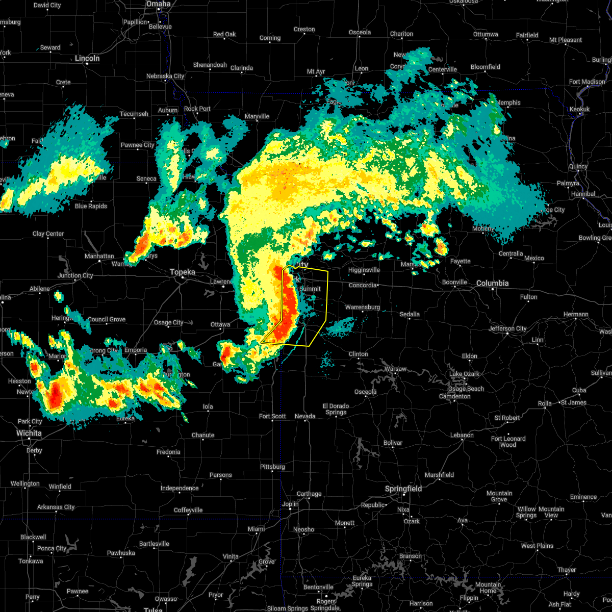 At 837 am cdt, severe thunderstorms were located along a line extending from near independence to near harrisonville to 6 miles east of drexel, moving east at 50 mph (trained weather spotters). Hazards include 60 mph wind gusts and nickel size hail. Expect damage to roofs, siding, and trees. locations impacted include, kansas city, independence, lee`s summit, blue springs, raytown, grandview, belton, raymore, grain valley, harrisonville, pleasant hill, greenwood, peculiar, louisburg, north kansas city, sugar creek, lake lotawana, archie, lake winnebago and lone jack. this includes the following highways, interstate 70 in missouri between mile markers 1 and 29. interstate 35 in missouri between mile markers 1 and 4. interstate 470 between mile markers 0 and 16. interstate 435 between mile markers 56 and 74. hail threat, radar indicated max hail size, 0. 88 in wind threat, radar indicated max wind gust, 60 mph. At 837 am cdt, severe thunderstorms were located along a line extending from near independence to near harrisonville to 6 miles east of drexel, moving east at 50 mph (trained weather spotters). Hazards include 60 mph wind gusts and nickel size hail. Expect damage to roofs, siding, and trees. locations impacted include, kansas city, independence, lee`s summit, blue springs, raytown, grandview, belton, raymore, grain valley, harrisonville, pleasant hill, greenwood, peculiar, louisburg, north kansas city, sugar creek, lake lotawana, archie, lake winnebago and lone jack. this includes the following highways, interstate 70 in missouri between mile markers 1 and 29. interstate 35 in missouri between mile markers 1 and 4. interstate 470 between mile markers 0 and 16. interstate 435 between mile markers 56 and 74. hail threat, radar indicated max hail size, 0. 88 in wind threat, radar indicated max wind gust, 60 mph.
|
| 5/15/2022 8:11 AM CDT |
 At 810 am cdt, severe thunderstorms were located along a line extending from near kansas city to near overland park to paola, moving southeast at 50 mph (trained weather spotters). Hazards include 60 mph wind gusts and nickel size hail. expect damage to roofs, siding, and trees At 810 am cdt, severe thunderstorms were located along a line extending from near kansas city to near overland park to paola, moving southeast at 50 mph (trained weather spotters). Hazards include 60 mph wind gusts and nickel size hail. expect damage to roofs, siding, and trees
|
| 4/29/2022 11:07 PM CDT |
 At 1107 pm cdt, a severe thunderstorm was located over baldwin park, or over pleasant hill, moving east at 40 mph (radar indicated). Hazards include 60 mph wind gusts and nickel size hail. expect damage to roofs, siding, and trees At 1107 pm cdt, a severe thunderstorm was located over baldwin park, or over pleasant hill, moving east at 40 mph (radar indicated). Hazards include 60 mph wind gusts and nickel size hail. expect damage to roofs, siding, and trees
|
| 3/29/2022 9:00 PM CDT |
 At 859 pm cdt, severe thunderstorms were located along a line extending from 10 miles northwest of union star to near country club villa to near gower to near ferrelview to near shawnee, moving east at 55 mph (radar indicated). Hazards include 60 mph wind gusts and quarter size hail. Hail damage to vehicles is expected. expect wind damage to roofs, siding, and trees. locations impacted include, kansas city, overland park, olathe, independence, lee`s summit, st. joseph, shawnee, blue springs, lenexa, leawood, raytown, liberty, gladstone, prairie village, grain valley, lansing, excelsior springs, merriam, cameron and mission. this includes the following highways, interstate 70 in missouri between mile markers 0 and 29. interstate 70 in kansas between mile markers 410 and 423. interstate 35 in missouri between mile markers 0 and 54. interstate 35 in kansas between mile markers 220 and 235. interstate 29 between mile markers 0 and 54. interstate 635 between mile markers 0 and 12. interstate 470 between mile markers 0 and 5, and between mile markers 9 and 16. interstate 435 between mile markers 0 and 83. interstate 229 between mile markers 0 and 2. kansas turnpike between mile markers 219 and 226. hail threat, radar indicated max hail size, 1. 00 in wind threat, radar indicated max wind gust, 60 mph. At 859 pm cdt, severe thunderstorms were located along a line extending from 10 miles northwest of union star to near country club villa to near gower to near ferrelview to near shawnee, moving east at 55 mph (radar indicated). Hazards include 60 mph wind gusts and quarter size hail. Hail damage to vehicles is expected. expect wind damage to roofs, siding, and trees. locations impacted include, kansas city, overland park, olathe, independence, lee`s summit, st. joseph, shawnee, blue springs, lenexa, leawood, raytown, liberty, gladstone, prairie village, grain valley, lansing, excelsior springs, merriam, cameron and mission. this includes the following highways, interstate 70 in missouri between mile markers 0 and 29. interstate 70 in kansas between mile markers 410 and 423. interstate 35 in missouri between mile markers 0 and 54. interstate 35 in kansas between mile markers 220 and 235. interstate 29 between mile markers 0 and 54. interstate 635 between mile markers 0 and 12. interstate 470 between mile markers 0 and 5, and between mile markers 9 and 16. interstate 435 between mile markers 0 and 83. interstate 229 between mile markers 0 and 2. kansas turnpike between mile markers 219 and 226. hail threat, radar indicated max hail size, 1. 00 in wind threat, radar indicated max wind gust, 60 mph.
|
| 3/29/2022 8:47 PM CDT |
 At 847 pm cdt, severe thunderstorms were located along a line extending from 7 miles northeast of savannah to lenexa, moving east at 80 mph (radar indicated). Hazards include 60 mph wind gusts and quarter size hail. Hail damage to vehicles is expected. Expect wind damage to roofs, siding, and trees. At 847 pm cdt, severe thunderstorms were located along a line extending from 7 miles northeast of savannah to lenexa, moving east at 80 mph (radar indicated). Hazards include 60 mph wind gusts and quarter size hail. Hail damage to vehicles is expected. Expect wind damage to roofs, siding, and trees.
|
| 3/5/2022 6:08 PM CST |
 At 608 pm cst, a severe thunderstorm was located over lake lotawana, moving east at 50 mph (radar indicated). Hazards include 60 mph wind gusts and quarter size hail. Hail damage to vehicles is expected. Expect wind damage to roofs, siding, and trees. At 608 pm cst, a severe thunderstorm was located over lake lotawana, moving east at 50 mph (radar indicated). Hazards include 60 mph wind gusts and quarter size hail. Hail damage to vehicles is expected. Expect wind damage to roofs, siding, and trees.
|
| 9/20/2021 6:40 PM CDT |
 The severe thunderstorm warning for southeastern clay and northeastern jackson counties will expire at 645 pm cdt, the storm which prompted the warning in northern jackson county has weakened below severe limits, and has exited the warned area. therefore, the warning will be allowed to expire. however gusty winds and heavy rain are still possible with this thunderstorm. a severe thunderstorm watch remains in effect until 1000 pm cdt for west central missouri. remember, a severe thunderstorm warning still remains in effect for eastern clay and ray counties. The severe thunderstorm warning for southeastern clay and northeastern jackson counties will expire at 645 pm cdt, the storm which prompted the warning in northern jackson county has weakened below severe limits, and has exited the warned area. therefore, the warning will be allowed to expire. however gusty winds and heavy rain are still possible with this thunderstorm. a severe thunderstorm watch remains in effect until 1000 pm cdt for west central missouri. remember, a severe thunderstorm warning still remains in effect for eastern clay and ray counties.
|
| 9/20/2021 6:17 PM CDT |
 At 616 pm cdt, a severe thunderstorm was located over independence, moving northeast at 25 mph (radar indicated). Hazards include 60 mph wind gusts and quarter size hail. Hail damage to vehicles is expected. expect wind damage to roofs, siding, and trees. locations impacted include, independence, blue springs, sugar creek, buckner, courtney, lake tapawingo, sibley and river bend. this includes the following highways, interstate 70 in missouri between mile markers 15 and 21. interstate 470 near mile marker 16. hail threat, radar indicated max hail size, 1. 00 in wind threat, radar indicated max wind gust, 60 mph. At 616 pm cdt, a severe thunderstorm was located over independence, moving northeast at 25 mph (radar indicated). Hazards include 60 mph wind gusts and quarter size hail. Hail damage to vehicles is expected. expect wind damage to roofs, siding, and trees. locations impacted include, independence, blue springs, sugar creek, buckner, courtney, lake tapawingo, sibley and river bend. this includes the following highways, interstate 70 in missouri between mile markers 15 and 21. interstate 470 near mile marker 16. hail threat, radar indicated max hail size, 1. 00 in wind threat, radar indicated max wind gust, 60 mph.
|
| 9/20/2021 6:00 PM CDT |
 At 559 pm cdt, a severe thunderstorm was located near raytown, moving northeast at 25 mph (radar indicated). Hazards include 60 mph wind gusts and quarter size hail. Hail damage to vehicles is expected. Expect wind damage to roofs, siding, and trees. At 559 pm cdt, a severe thunderstorm was located near raytown, moving northeast at 25 mph (radar indicated). Hazards include 60 mph wind gusts and quarter size hail. Hail damage to vehicles is expected. Expect wind damage to roofs, siding, and trees.
|
| 8/20/2021 11:28 PM CDT |
 The severe thunderstorm warning for wyandotte, johnson, northwestern cass, southwestern clay, southeastern platte and western jackson counties will expire at 1130 pm cdt, the storm which prompted the warning has weakened below severe limits, and has exited the warned area. therefore, the warning will be allowed to expire. however small hail, gusty winds and heavy rain are still possible with this thunderstorm. a severe thunderstorm watch remains in effect until 200 am cdt for northeastern and east central kansas, and west central missouri. The severe thunderstorm warning for wyandotte, johnson, northwestern cass, southwestern clay, southeastern platte and western jackson counties will expire at 1130 pm cdt, the storm which prompted the warning has weakened below severe limits, and has exited the warned area. therefore, the warning will be allowed to expire. however small hail, gusty winds and heavy rain are still possible with this thunderstorm. a severe thunderstorm watch remains in effect until 200 am cdt for northeastern and east central kansas, and west central missouri.
|
| 8/20/2021 11:10 PM CDT |
 At 1109 pm cdt, a severe thunderstorm was located near raytown, moving east at 50 mph (radar indicated). Hazards include 60 mph wind gusts and penny size hail. Expect damage to roofs, siding, and trees. locations impacted include, kansas city, overland park, olathe, independence, lee`s summit, shawnee, lenexa, leawood, raytown, liberty, gladstone, grandview, belton, prairie village, raymore, gardner, merriam, mission, bonner springs and de soto. this includes the following highways, interstate 70 in missouri between mile markers 0 and 17. interstate 70 in kansas between mile markers 410 and 423. interstate 35 in missouri between mile markers 0 and 12. interstate 35 in kansas between mile markers 209 and 235. interstate 29 between mile markers 0 and 6. interstate 635 between mile markers 0 and 12. interstate 470 between mile markers 0 and 9, and between mile markers 13 and 16. interstate 435 between mile markers 0 and 15, and between mile markers 52 and 83. kansas turnpike near mile marker 226. hail threat, radar indicated max hail size, 0. 75 in wind threat, radar indicated max wind gust, 60 mph. At 1109 pm cdt, a severe thunderstorm was located near raytown, moving east at 50 mph (radar indicated). Hazards include 60 mph wind gusts and penny size hail. Expect damage to roofs, siding, and trees. locations impacted include, kansas city, overland park, olathe, independence, lee`s summit, shawnee, lenexa, leawood, raytown, liberty, gladstone, grandview, belton, prairie village, raymore, gardner, merriam, mission, bonner springs and de soto. this includes the following highways, interstate 70 in missouri between mile markers 0 and 17. interstate 70 in kansas between mile markers 410 and 423. interstate 35 in missouri between mile markers 0 and 12. interstate 35 in kansas between mile markers 209 and 235. interstate 29 between mile markers 0 and 6. interstate 635 between mile markers 0 and 12. interstate 470 between mile markers 0 and 9, and between mile markers 13 and 16. interstate 435 between mile markers 0 and 15, and between mile markers 52 and 83. kansas turnpike near mile marker 226. hail threat, radar indicated max hail size, 0. 75 in wind threat, radar indicated max wind gust, 60 mph.
|
| 8/20/2021 10:58 PM CDT |
 At 1058 pm cdt, a severe thunderstorm was located near kansas city kansas, moving east at 50 mph (radar indicated). Hazards include 70 mph wind gusts and penny size hail. Expect considerable tree damage. damage is likely to mobile homes, roofs, and outbuildings. locations impacted include, kansas city, overland park, olathe, independence, lee`s summit, shawnee, lenexa, leawood, raytown, liberty, gladstone, grandview, belton, prairie village, raymore, gardner, merriam, mission, bonner springs and de soto. this includes the following highways, interstate 70 in missouri between mile markers 0 and 17. interstate 70 in kansas between mile markers 410 and 423. interstate 35 in missouri between mile markers 0 and 16. interstate 35 in kansas between mile markers 209 and 235. interstate 29 between mile markers 0 and 10. interstate 635 between mile markers 0 and 12. interstate 470 between mile markers 0 and 9, and between mile markers 13 and 16. interstate 435 between mile markers 0 and 24, between mile markers 39 and 42, and between mile markers 46 and 83. kansas turnpike between mile markers 219 and 226. thunderstorm damage threat, considerable hail threat, radar indicated max hail size, 0. 75 in wind threat, radar indicated max wind gust, 70 mph. At 1058 pm cdt, a severe thunderstorm was located near kansas city kansas, moving east at 50 mph (radar indicated). Hazards include 70 mph wind gusts and penny size hail. Expect considerable tree damage. damage is likely to mobile homes, roofs, and outbuildings. locations impacted include, kansas city, overland park, olathe, independence, lee`s summit, shawnee, lenexa, leawood, raytown, liberty, gladstone, grandview, belton, prairie village, raymore, gardner, merriam, mission, bonner springs and de soto. this includes the following highways, interstate 70 in missouri between mile markers 0 and 17. interstate 70 in kansas between mile markers 410 and 423. interstate 35 in missouri between mile markers 0 and 16. interstate 35 in kansas between mile markers 209 and 235. interstate 29 between mile markers 0 and 10. interstate 635 between mile markers 0 and 12. interstate 470 between mile markers 0 and 9, and between mile markers 13 and 16. interstate 435 between mile markers 0 and 24, between mile markers 39 and 42, and between mile markers 46 and 83. kansas turnpike between mile markers 219 and 226. thunderstorm damage threat, considerable hail threat, radar indicated max hail size, 0. 75 in wind threat, radar indicated max wind gust, 70 mph.
|
| 8/20/2021 10:44 PM CDT |
 At 1044 pm cdt, a severe thunderstorm was located near linwood, or near tonganoxie, moving east at 50 mph (radar indicated). Hazards include 60 mph wind gusts and penny size hail. expect damage to roofs, siding, and trees At 1044 pm cdt, a severe thunderstorm was located near linwood, or near tonganoxie, moving east at 50 mph (radar indicated). Hazards include 60 mph wind gusts and penny size hail. expect damage to roofs, siding, and trees
|
| 8/12/2021 4:45 PM CDT | Fence destroyed... tree limbs downded... and bbq grill thrown several yards over due to strong wind in jackson county MO, 2.5 miles NNW of Blue Springs, MO |
| 8/12/2021 4:45 PM CDT | Tree limbs downed in jackson county MO, 1.8 miles NNW of Blue Springs, MO |
| 8/12/2021 4:40 PM CDT | Quarter sized hail reported 1.5 miles WSW of Blue Springs, MO |
| 8/12/2021 4:09 PM CDT |
 At 409 pm cdt, a severe thunderstorm was located over levasy, or near buckner, moving east at 25 mph (radar indicated). Hazards include 60 mph wind gusts and quarter size hail. Hail damage to vehicles is expected. Expect wind damage to roofs, siding, and trees. At 409 pm cdt, a severe thunderstorm was located over levasy, or near buckner, moving east at 25 mph (radar indicated). Hazards include 60 mph wind gusts and quarter size hail. Hail damage to vehicles is expected. Expect wind damage to roofs, siding, and trees.
|
| 6/11/2021 4:58 PM CDT |
 The severe thunderstorm warning for northern cass, southeastern ray, lafayette, southeastern jackson and western johnson counties will expire at 500 pm cdt, the storm which prompted the warning has weakened below severe limits, and has exited the warned area. therefore, the warning will be allowed to expire. however gusty winds and heavy rain are still possible with this thunderstorm. a severe thunderstorm watch remains in effect until 700 pm cdt for north central and west central missouri. The severe thunderstorm warning for northern cass, southeastern ray, lafayette, southeastern jackson and western johnson counties will expire at 500 pm cdt, the storm which prompted the warning has weakened below severe limits, and has exited the warned area. therefore, the warning will be allowed to expire. however gusty winds and heavy rain are still possible with this thunderstorm. a severe thunderstorm watch remains in effect until 700 pm cdt for north central and west central missouri.
|
| 6/11/2021 4:38 PM CDT |
 At 438 pm cdt, a severe thunderstorm was located 7 miles southwest of oak grove, moving southeast at 30 mph (radar indicated). Hazards include 70 mph wind gusts and nickel size hail. Expect considerable tree damage. damage is likely to mobile homes, roofs, and outbuildings. This severe thunderstorm will remain over mainly rural areas of northern cass, southeastern ray, lafayette, southeastern jackson and western johnson counties, including the following locations, fayetteville, unity village, bates city, tarsney lakes, gunn city, pittsville, aullville, la tour, lake lafayette and strasburg. At 438 pm cdt, a severe thunderstorm was located 7 miles southwest of oak grove, moving southeast at 30 mph (radar indicated). Hazards include 70 mph wind gusts and nickel size hail. Expect considerable tree damage. damage is likely to mobile homes, roofs, and outbuildings. This severe thunderstorm will remain over mainly rural areas of northern cass, southeastern ray, lafayette, southeastern jackson and western johnson counties, including the following locations, fayetteville, unity village, bates city, tarsney lakes, gunn city, pittsville, aullville, la tour, lake lafayette and strasburg.
|
| 6/11/2021 4:14 PM CDT |
 At 413 pm cdt, a severe thunderstorm was located near odessa, moving southeast at 25 mph. this is a very dangerous storm (radar indicated). Hazards include 80 mph wind gusts and half dollar size hail. Flying debris will be dangerous to those caught without shelter. mobile homes will be heavily damaged. expect considerable damage to roofs, windows, and vehicles. extensive tree damage and power outages are likely. this severe thunderstorm will be near, odessa around 420 pm cdt. this includes the following highways, interstate 70 in missouri between mile markers 11 and 58. Interstate 470 between mile markers 4 and 16. At 413 pm cdt, a severe thunderstorm was located near odessa, moving southeast at 25 mph. this is a very dangerous storm (radar indicated). Hazards include 80 mph wind gusts and half dollar size hail. Flying debris will be dangerous to those caught without shelter. mobile homes will be heavily damaged. expect considerable damage to roofs, windows, and vehicles. extensive tree damage and power outages are likely. this severe thunderstorm will be near, odessa around 420 pm cdt. this includes the following highways, interstate 70 in missouri between mile markers 11 and 58. Interstate 470 between mile markers 4 and 16.
|
| 6/11/2021 3:37 PM CDT |
 At 337 pm cdt, severe thunderstorms were located along a line extending from near crystal lakes to near sibley to near sugar creek, moving south at 50 mph (radar indicated). Hazards include 70 mph wind gusts and quarter size hail. Hail damage to vehicles is expected. expect considerable tree damage. wind damage is also likely to mobile homes, roofs, and outbuildings. severe thunderstorms will be near, independence, lee`s summit, raytown, buckner, lake tapawingo and levasy around 345 pm cdt. blue springs around 350 pm cdt. grain valley, lake lotawana and henrietta around 355 pm cdt. other locations in the path of these severe thunderstorms include raymore, greenwood, lake winnebago, wellington, pleasant hill, lone jack and odessa. this includes the following highways, interstate 70 in missouri between mile markers 8 and 36. interstate 470 between mile markers 0 and 16. Interstate 435 near mile marker 62, and between mile markers 64 and 73. At 337 pm cdt, severe thunderstorms were located along a line extending from near crystal lakes to near sibley to near sugar creek, moving south at 50 mph (radar indicated). Hazards include 70 mph wind gusts and quarter size hail. Hail damage to vehicles is expected. expect considerable tree damage. wind damage is also likely to mobile homes, roofs, and outbuildings. severe thunderstorms will be near, independence, lee`s summit, raytown, buckner, lake tapawingo and levasy around 345 pm cdt. blue springs around 350 pm cdt. grain valley, lake lotawana and henrietta around 355 pm cdt. other locations in the path of these severe thunderstorms include raymore, greenwood, lake winnebago, wellington, pleasant hill, lone jack and odessa. this includes the following highways, interstate 70 in missouri between mile markers 8 and 36. interstate 470 between mile markers 0 and 16. Interstate 435 near mile marker 62, and between mile markers 64 and 73.
|
| 5/9/2021 12:23 AM CDT |
 The severe thunderstorm warning for central clay, southeastern clinton, western ray, southwestern caldwell and northern jackson counties will expire at 1230 am cdt, the storm which prompted the warning has weakened below severe limits, and no longer poses an immediate threat to life or property. therefore, the warning will be allowed to expire. however gusty winds up tp 50 mph are still possible with this thunderstorm. a severe thunderstorm watch remains in effect until 500 am cdt for northeastern kansas, and north central, northwestern and west central missouri. The severe thunderstorm warning for central clay, southeastern clinton, western ray, southwestern caldwell and northern jackson counties will expire at 1230 am cdt, the storm which prompted the warning has weakened below severe limits, and no longer poses an immediate threat to life or property. therefore, the warning will be allowed to expire. however gusty winds up tp 50 mph are still possible with this thunderstorm. a severe thunderstorm watch remains in effect until 500 am cdt for northeastern kansas, and north central, northwestern and west central missouri.
|
| 5/9/2021 12:19 AM CDT |
 At 1219 am cdt, a severe thunderstorm was located over crystal lakes, or near excelsior springs, moving east at 55 mph (radar indicated). Hazards include 60 mph wind gusts and penny size hail. Expect damage to roofs, siding, and trees. Locations impacted include, kansas city, independence, blue springs, liberty, gladstone, excelsior springs, kearney, north kansas city, sugar creek, buckner, lawson, lathrop, claycomo, courtney, pleasant valley, orrick, polo, glenaire, holt and avondale. At 1219 am cdt, a severe thunderstorm was located over crystal lakes, or near excelsior springs, moving east at 55 mph (radar indicated). Hazards include 60 mph wind gusts and penny size hail. Expect damage to roofs, siding, and trees. Locations impacted include, kansas city, independence, blue springs, liberty, gladstone, excelsior springs, kearney, north kansas city, sugar creek, buckner, lawson, lathrop, claycomo, courtney, pleasant valley, orrick, polo, glenaire, holt and avondale.
|
| 5/9/2021 12:12 AM CDT |
 At 1211 am cdt, a severe thunderstorm was located near excelsior springs, moving east at 55 mph (radar indicated). Hazards include 60 mph wind gusts and penny size hail. Expect damage to roofs, siding, and trees. Locations impacted include, kansas city, independence, blue springs, liberty, gladstone, excelsior springs, kearney, north kansas city, sugar creek, buckner, lawson, plattsburg, lathrop, claycomo, courtney, pleasant valley, orrick, polo, glenaire and holt. At 1211 am cdt, a severe thunderstorm was located near excelsior springs, moving east at 55 mph (radar indicated). Hazards include 60 mph wind gusts and penny size hail. Expect damage to roofs, siding, and trees. Locations impacted include, kansas city, independence, blue springs, liberty, gladstone, excelsior springs, kearney, north kansas city, sugar creek, buckner, lawson, plattsburg, lathrop, claycomo, courtney, pleasant valley, orrick, polo, glenaire and holt.
|
| 5/8/2021 11:55 PM CDT |
 At 1154 pm cdt, a severe thunderstorm was located over smithville, moving east at 55 mph (radar indicated). Hazards include 60 mph wind gusts and penny size hail. expect damage to roofs, siding, and trees At 1154 pm cdt, a severe thunderstorm was located over smithville, moving east at 55 mph (radar indicated). Hazards include 60 mph wind gusts and penny size hail. expect damage to roofs, siding, and trees
|
| 9/27/2020 12:09 PM CDT |
 At 1209 pm cdt, a severe thunderstorm was located over belton, moving east at 20 mph (radar indicated). Hazards include 60 mph wind gusts and penny size hail. expect damage to roofs, siding, and trees At 1209 pm cdt, a severe thunderstorm was located over belton, moving east at 20 mph (radar indicated). Hazards include 60 mph wind gusts and penny size hail. expect damage to roofs, siding, and trees
|
| 9/27/2020 11:51 AM CDT |
 At 1151 am cdt, a severe thunderstorm was located over leawood, moving east at 30 mph (radar indicated). Hazards include 60 mph wind gusts and penny size hail. expect damage to roofs, siding, and trees At 1151 am cdt, a severe thunderstorm was located over leawood, moving east at 30 mph (radar indicated). Hazards include 60 mph wind gusts and penny size hail. expect damage to roofs, siding, and trees
|
| 8/31/2020 8:50 AM CDT |
 At 850 am cdt, a severe thunderstorm was located over peculiar, moving southeast at 50 mph (radar indicated). Hazards include 60 mph wind gusts and penny size hail. Expect damage to roofs, siding, and trees. Locations impacted include, overland park, olathe, lee`s summit, leawood, grandview, belton, raymore, gardner, harrisonville, pleasant hill, spring hill, greenwood, peculiar, louisburg, lake lotawana, lake winnebago, drexel, cleveland, freeman and east lynne. At 850 am cdt, a severe thunderstorm was located over peculiar, moving southeast at 50 mph (radar indicated). Hazards include 60 mph wind gusts and penny size hail. Expect damage to roofs, siding, and trees. Locations impacted include, overland park, olathe, lee`s summit, leawood, grandview, belton, raymore, gardner, harrisonville, pleasant hill, spring hill, greenwood, peculiar, louisburg, lake lotawana, lake winnebago, drexel, cleveland, freeman and east lynne.
|
| 8/31/2020 8:23 AM CDT |
 At 823 am cdt, a severe thunderstorm was located over overland park, moving southeast at 50 mph (radar indicated). Hazards include 60 mph wind gusts and penny size hail. expect damage to roofs, siding, and trees At 823 am cdt, a severe thunderstorm was located over overland park, moving southeast at 50 mph (radar indicated). Hazards include 60 mph wind gusts and penny size hail. expect damage to roofs, siding, and trees
|
| 8/31/2020 8:23 AM CDT |
 The national weather service in pleasant hill has issued a * severe thunderstorm warning for. eastern miami county in east central kansas. johnson county in east central kansas. cass county in west central missouri. Southwestern jackson county in west central missouri. The national weather service in pleasant hill has issued a * severe thunderstorm warning for. eastern miami county in east central kansas. johnson county in east central kansas. cass county in west central missouri. Southwestern jackson county in west central missouri.
|
| 8/15/2020 7:48 AM CDT |
 At 748 am cdt, severe thunderstorms were located along a line extending from lake lotawana to near lone jack to near odessa, moving south at 35 mph (radar indicated). Hazards include 60 mph wind gusts and half dollar size hail. Hail damage to vehicles is expected. Expect wind damage to roofs, siding, and trees. At 748 am cdt, severe thunderstorms were located along a line extending from lake lotawana to near lone jack to near odessa, moving south at 35 mph (radar indicated). Hazards include 60 mph wind gusts and half dollar size hail. Hail damage to vehicles is expected. Expect wind damage to roofs, siding, and trees.
|
| 7/1/2020 6:14 AM CDT |
 At 613 am cdt, severe thunderstorms were located along a line extending from near mayview to near odessa to 8 miles north of kingsville to near lone jack to baldwin park, moving southeast at 25 mph (radar indicated). Hazards include 60 mph wind gusts and quarter size hail. Hail damage to vehicles is expected. Expect wind damage to roofs, siding, and trees. At 613 am cdt, severe thunderstorms were located along a line extending from near mayview to near odessa to 8 miles north of kingsville to near lone jack to baldwin park, moving southeast at 25 mph (radar indicated). Hazards include 60 mph wind gusts and quarter size hail. Hail damage to vehicles is expected. Expect wind damage to roofs, siding, and trees.
|
| 7/1/2020 5:58 AM CDT |
 At 557 am cdt, severe thunderstorms were located along a line extending from near hardin to near wellington to near odessa to near lone jack to lee`s summit, moving southeast at 35 mph (radar indicated). Hazards include 60 mph wind gusts and quarter size hail. Hail damage to vehicles is expected. expect wind damage to roofs, siding, and trees. Locations impacted include, kansas city, independence, lee`s summit, blue springs, raytown, grandview, raymore, warrensburg, grain valley, harrisonville, pleasant hill, oak grove, richmond, odessa, greenwood, higginsville, lexington, peculiar, buckner and concordia. At 557 am cdt, severe thunderstorms were located along a line extending from near hardin to near wellington to near odessa to near lone jack to lee`s summit, moving southeast at 35 mph (radar indicated). Hazards include 60 mph wind gusts and quarter size hail. Hail damage to vehicles is expected. expect wind damage to roofs, siding, and trees. Locations impacted include, kansas city, independence, lee`s summit, blue springs, raytown, grandview, raymore, warrensburg, grain valley, harrisonville, pleasant hill, oak grove, richmond, odessa, greenwood, higginsville, lexington, peculiar, buckner and concordia.
|
| 7/1/2020 5:38 AM CDT |
 At 538 am cdt, severe thunderstorms were located along a line extending from 10 miles south of cowgill to near richmond to near buckner to blue springs to near raytown, moving southeast at 30 mph (radar indicated). Hazards include 60 mph wind gusts and quarter size hail. Hail damage to vehicles is expected. expect wind damage to roofs, siding, and trees. Locations impacted include, kansas city, independence, lee`s summit, blue springs, leawood, raytown, liberty, grandview, belton, prairie village, raymore, warrensburg, grain valley, excelsior springs, harrisonville, pleasant hill, oak grove, richmond, odessa and greenwood. At 538 am cdt, severe thunderstorms were located along a line extending from 10 miles south of cowgill to near richmond to near buckner to blue springs to near raytown, moving southeast at 30 mph (radar indicated). Hazards include 60 mph wind gusts and quarter size hail. Hail damage to vehicles is expected. expect wind damage to roofs, siding, and trees. Locations impacted include, kansas city, independence, lee`s summit, blue springs, leawood, raytown, liberty, grandview, belton, prairie village, raymore, warrensburg, grain valley, excelsior springs, harrisonville, pleasant hill, oak grove, richmond, odessa and greenwood.
|
| 7/1/2020 5:29 AM CDT |
 At 528 am cdt, a severe thunderstorm capable of producing a tornado was located over buckner, moving southeast at 30 mph (radar indicated rotation). Hazards include tornado. Flying debris will be dangerous to those caught without shelter. mobile homes will be damaged or destroyed. damage to roofs, windows, and vehicles will occur. Tree damage is likely. At 528 am cdt, a severe thunderstorm capable of producing a tornado was located over buckner, moving southeast at 30 mph (radar indicated rotation). Hazards include tornado. Flying debris will be dangerous to those caught without shelter. mobile homes will be damaged or destroyed. damage to roofs, windows, and vehicles will occur. Tree damage is likely.
|
| 7/1/2020 5:22 AM CDT |
 At 521 am cdt, severe thunderstorms were located along a line extending from near polo to near woods heights to near missouri city to near independence to near westwood, moving southeast at 30 mph (radar indicated). Hazards include 70 mph wind gusts and quarter size hail. Hail damage to vehicles is expected. expect considerable tree damage. Wind damage is also likely to mobile homes, roofs, and outbuildings. At 521 am cdt, severe thunderstorms were located along a line extending from near polo to near woods heights to near missouri city to near independence to near westwood, moving southeast at 30 mph (radar indicated). Hazards include 70 mph wind gusts and quarter size hail. Hail damage to vehicles is expected. expect considerable tree damage. Wind damage is also likely to mobile homes, roofs, and outbuildings.
|
| 7/1/2020 5:01 AM CDT |
 At 501 am cdt, severe thunderstorms were located along a line extending from near osborn to 7 miles southwest of cameron to lathrop to kearney to near pleasant valley to near ferrelview, moving east at 35 mph (radar indicated). Hazards include 70 mph wind gusts and quarter size hail. Hail damage to vehicles is expected. expect considerable tree damage. Wind damage is also likely to mobile homes, roofs, and outbuildings. At 501 am cdt, severe thunderstorms were located along a line extending from near osborn to 7 miles southwest of cameron to lathrop to kearney to near pleasant valley to near ferrelview, moving east at 35 mph (radar indicated). Hazards include 70 mph wind gusts and quarter size hail. Hail damage to vehicles is expected. expect considerable tree damage. Wind damage is also likely to mobile homes, roofs, and outbuildings.
|
| 6/27/2020 3:31 AM CDT |
 At 330 am cdt, a severe thunderstorm was located near lee`s summit, moving southeast at 50 mph (radar indicated). Hazards include 60 mph wind gusts. expect damage to roofs, siding, and trees At 330 am cdt, a severe thunderstorm was located near lee`s summit, moving southeast at 50 mph (radar indicated). Hazards include 60 mph wind gusts. expect damage to roofs, siding, and trees
|
| 6/5/2020 4:11 AM CDT |
 At 410 am cdt, severe thunderstorms were located along a line extending from near sibley to lee`s summit to near lake annette, moving southeast at 60 mph (radar indicated). Hazards include 70 mph wind gusts and nickel size hail. Expect considerable tree damage. Damage is likely to mobile homes, roofs, and outbuildings. At 410 am cdt, severe thunderstorms were located along a line extending from near sibley to lee`s summit to near lake annette, moving southeast at 60 mph (radar indicated). Hazards include 70 mph wind gusts and nickel size hail. Expect considerable tree damage. Damage is likely to mobile homes, roofs, and outbuildings.
|
| 6/5/2020 4:05 AM CDT | Coop observer/spotter reported via twitter of a large tree limb... greater than 10 inch diamete in jackson county MO, 1 miles NNW of Blue Springs, MO |
| 6/5/2020 3:36 AM CDT |
 At 336 am cdt, severe thunderstorms were located along a line extending from near trimble to lake waukomis to near lenexa, moving southeast at 50 mph (radar indicated). Hazards include 70 mph wind gusts and nickel size hail. Expect considerable tree damage. Damage is likely to mobile homes, roofs, and outbuildings. At 336 am cdt, severe thunderstorms were located along a line extending from near trimble to lake waukomis to near lenexa, moving southeast at 50 mph (radar indicated). Hazards include 70 mph wind gusts and nickel size hail. Expect considerable tree damage. Damage is likely to mobile homes, roofs, and outbuildings.
|
| 6/4/2020 2:40 AM CDT |
 The tornado warning for southeastern jackson county will expire at 245 am cdt, the tornado threat has diminished and the tornado warning has been cancelled. however, large hail and damaging winds remain likely and a severe thunderstorm warning remains in effect for the area. a severe thunderstorm watch remains in effect until 300 am cdt for west central missouri. a severe thunderstorm watch also remains in effect until 800 am cdt for west central missouri. remember, a severe thunderstorm warning still remains in effect for jackson county. The tornado warning for southeastern jackson county will expire at 245 am cdt, the tornado threat has diminished and the tornado warning has been cancelled. however, large hail and damaging winds remain likely and a severe thunderstorm warning remains in effect for the area. a severe thunderstorm watch remains in effect until 300 am cdt for west central missouri. a severe thunderstorm watch also remains in effect until 800 am cdt for west central missouri. remember, a severe thunderstorm warning still remains in effect for jackson county.
|
| 6/4/2020 2:33 AM CDT |
 At 233 am cdt, a confirmed tornado was located over lake lotawana, moving southeast at 45 mph (radar confirmed tornado). Hazards include damaging tornado. Flying debris will be dangerous to those caught without shelter. mobile homes will be damaged or destroyed. damage to roofs, windows, and vehicles will occur. tree damage is likely. Locations impacted include, lake lotawana and lone jack. At 233 am cdt, a confirmed tornado was located over lake lotawana, moving southeast at 45 mph (radar confirmed tornado). Hazards include damaging tornado. Flying debris will be dangerous to those caught without shelter. mobile homes will be damaged or destroyed. damage to roofs, windows, and vehicles will occur. tree damage is likely. Locations impacted include, lake lotawana and lone jack.
|
| 6/4/2020 2:31 AM CDT |
 At 231 am cdt, a severe thunderstorm capable of producing a tornado was located over lake lotawana, moving southeast at 45 mph (radar indicated rotation). Hazards include tornado. Flying debris will be dangerous to those caught without shelter. mobile homes will be damaged or destroyed. damage to roofs, windows, and vehicles will occur. Tree damage is likely. At 231 am cdt, a severe thunderstorm capable of producing a tornado was located over lake lotawana, moving southeast at 45 mph (radar indicated rotation). Hazards include tornado. Flying debris will be dangerous to those caught without shelter. mobile homes will be damaged or destroyed. damage to roofs, windows, and vehicles will occur. Tree damage is likely.
|
| 6/4/2020 2:26 AM CDT |
 At 226 am cdt, severe thunderstorms were located along a line extending from near braymer to levasy to peculiar, moving southeast at 45 mph (radar indicated). Hazards include 60 mph wind gusts and quarter size hail. Hail damage to vehicles is expected. Expect wind damage to roofs, siding, and trees. At 226 am cdt, severe thunderstorms were located along a line extending from near braymer to levasy to peculiar, moving southeast at 45 mph (radar indicated). Hazards include 60 mph wind gusts and quarter size hail. Hail damage to vehicles is expected. Expect wind damage to roofs, siding, and trees.
|
| 6/4/2020 2:24 AM CDT | Ham reports maple tree down and several other tree limbs down across northern blue spring in jackson county MO, 1.9 miles S of Blue Springs, MO |
| 6/4/2020 1:52 AM CDT |
 At 152 am cdt, severe thunderstorms were located along a line extending from 9 miles southwest of gallatin to near liberty to near de soto, moving east at 45 mph (radar indicated). Hazards include 60 mph wind gusts and quarter size hail. Hail damage to vehicles is expected. Expect wind damage to roofs, siding, and trees. At 152 am cdt, severe thunderstorms were located along a line extending from 9 miles southwest of gallatin to near liberty to near de soto, moving east at 45 mph (radar indicated). Hazards include 60 mph wind gusts and quarter size hail. Hail damage to vehicles is expected. Expect wind damage to roofs, siding, and trees.
|
| 5/4/2020 12:16 PM CDT |
 At 1215 pm cdt, severe thunderstorms were located along a line extending from near lone jack to near kingsville to near adrian, moving east at 55 mph (trained weather spotters). Hazards include 70 mph wind gusts and quarter size hail. Hail damage to vehicles is expected. expect considerable tree damage. wind damage is also likely to mobile homes, roofs, and outbuildings. Locations impacted include, kansas city, lee`s summit, blue springs, raytown, grandview, belton, raymore, grain valley, harrisonville, pleasant hill, greenwood, peculiar, lake lotawana, adrian, garden city, archie, lake winnebago, lone jack, lake tapawingo and east lynne. At 1215 pm cdt, severe thunderstorms were located along a line extending from near lone jack to near kingsville to near adrian, moving east at 55 mph (trained weather spotters). Hazards include 70 mph wind gusts and quarter size hail. Hail damage to vehicles is expected. expect considerable tree damage. wind damage is also likely to mobile homes, roofs, and outbuildings. Locations impacted include, kansas city, lee`s summit, blue springs, raytown, grandview, belton, raymore, grain valley, harrisonville, pleasant hill, greenwood, peculiar, lake lotawana, adrian, garden city, archie, lake winnebago, lone jack, lake tapawingo and east lynne.
|
| 5/4/2020 12:08 PM CDT |
 At 1207 pm cdt, severe thunderstorms were located along a line extending from near raytown to near east lynne to near adrian, moving east at 65 mph (trained weather spotters). Hazards include 70 mph wind gusts and quarter size hail. Hail damage to vehicles is expected. expect considerable tree damage. Wind damage is also likely to mobile homes, roofs, and outbuildings. At 1207 pm cdt, severe thunderstorms were located along a line extending from near raytown to near east lynne to near adrian, moving east at 65 mph (trained weather spotters). Hazards include 70 mph wind gusts and quarter size hail. Hail damage to vehicles is expected. expect considerable tree damage. Wind damage is also likely to mobile homes, roofs, and outbuildings.
|
| 5/4/2020 11:59 AM CDT |
 At 1137 am cdt, severe thunderstorms were located along a line extending from gardner to near paola to parker, moving east at 50 mph (trained weather spotters). Hazards include 70 mph wind gusts. Expect considerable tree damage. Damage is likely to mobile homes, roofs, and outbuildings. At 1137 am cdt, severe thunderstorms were located along a line extending from gardner to near paola to parker, moving east at 50 mph (trained weather spotters). Hazards include 70 mph wind gusts. Expect considerable tree damage. Damage is likely to mobile homes, roofs, and outbuildings.
|
| 5/4/2020 11:59 AM CDT |
 At 1158 am cdt, severe thunderstorms were located along a line extending from near lee`s summit to near harrisonville to 6 miles southeast of drexel, moving east at 60 mph. 80 mph winds have been reported from kojc airport in olathe. these are very dangerous storms (trained weather spotters). Hazards include 80 mph wind gusts. Flying debris will be dangerous to those caught without shelter. mobile homes will be heavily damaged. expect considerable damage to roofs, windows, and vehicles. extensive tree damage and power outages are likely. Locations impacted include, kansas city, overland park, lee`s summit, blue springs, leawood, raytown, grandview, belton, prairie village, raymore, grain valley, harrisonville, pleasant hill, greenwood, peculiar, louisburg, lake lotawana, adrian, garden city and la cygne. At 1158 am cdt, severe thunderstorms were located along a line extending from near lee`s summit to near harrisonville to 6 miles southeast of drexel, moving east at 60 mph. 80 mph winds have been reported from kojc airport in olathe. these are very dangerous storms (trained weather spotters). Hazards include 80 mph wind gusts. Flying debris will be dangerous to those caught without shelter. mobile homes will be heavily damaged. expect considerable damage to roofs, windows, and vehicles. extensive tree damage and power outages are likely. Locations impacted include, kansas city, overland park, lee`s summit, blue springs, leawood, raytown, grandview, belton, prairie village, raymore, grain valley, harrisonville, pleasant hill, greenwood, peculiar, louisburg, lake lotawana, adrian, garden city and la cygne.
|
| 5/4/2020 11:37 AM CDT |
 At 1137 am cdt, severe thunderstorms were located along a line extending from gardner to near paola to parker, moving east at 50 mph (trained weather spotters). Hazards include 70 mph wind gusts. Expect considerable tree damage. Damage is likely to mobile homes, roofs, and outbuildings. At 1137 am cdt, severe thunderstorms were located along a line extending from gardner to near paola to parker, moving east at 50 mph (trained weather spotters). Hazards include 70 mph wind gusts. Expect considerable tree damage. Damage is likely to mobile homes, roofs, and outbuildings.
|
| 5/4/2020 10:51 AM CDT |
 At 1050 am cdt, a severe thunderstorm was located over independence, moving east at 45 mph (radar indicated). Hazards include 60 mph wind gusts and quarter size hail. Hail damage to vehicles is expected. expect wind damage to roofs, siding, and trees. Locations impacted include, kansas city, independence, lee`s summit, blue springs, raytown, liberty, gladstone, north kansas city, sugar creek, claycomo, courtney, pleasant valley, lake tapawingo, glenaire, avondale, oakview, river bend, oakwood park, oakwood and birmingham. At 1050 am cdt, a severe thunderstorm was located over independence, moving east at 45 mph (radar indicated). Hazards include 60 mph wind gusts and quarter size hail. Hail damage to vehicles is expected. expect wind damage to roofs, siding, and trees. Locations impacted include, kansas city, independence, lee`s summit, blue springs, raytown, liberty, gladstone, north kansas city, sugar creek, claycomo, courtney, pleasant valley, lake tapawingo, glenaire, avondale, oakview, river bend, oakwood park, oakwood and birmingham.
|
| 5/4/2020 10:32 AM CDT |
 At 1031 am cdt, a severe thunderstorm was located near mission, moving east at 45 mph (radar indicated). Hazards include 60 mph wind gusts and quarter size hail. Hail damage to vehicles is expected. expect wind damage to roofs, siding, and trees. Locations impacted include, kansas city, overland park, independence, lee`s summit, shawnee, blue springs, lenexa, leawood, raytown, liberty, gladstone, prairie village, merriam, mission, parkville, north kansas city, fairway, mission hills, sugar creek and riverside. At 1031 am cdt, a severe thunderstorm was located near mission, moving east at 45 mph (radar indicated). Hazards include 60 mph wind gusts and quarter size hail. Hail damage to vehicles is expected. expect wind damage to roofs, siding, and trees. Locations impacted include, kansas city, overland park, independence, lee`s summit, shawnee, blue springs, lenexa, leawood, raytown, liberty, gladstone, prairie village, merriam, mission, parkville, north kansas city, fairway, mission hills, sugar creek and riverside.
|
| 5/4/2020 10:15 AM CDT |
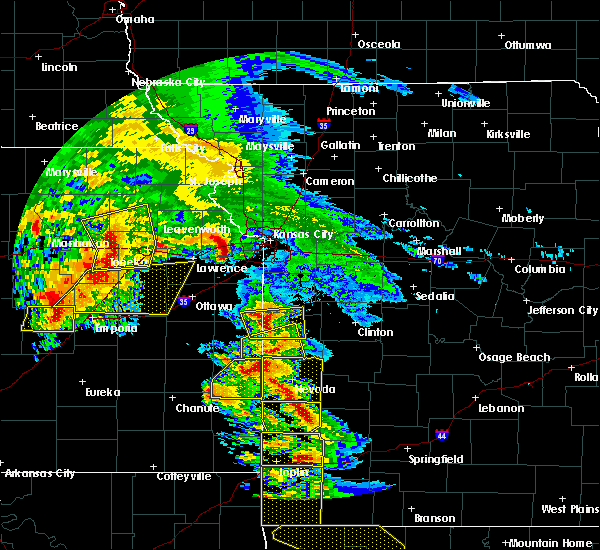 At 1015 am cdt, a severe thunderstorm was located over bonner springs, moving east at 45 mph (radar indicated). Hazards include 60 mph wind gusts and quarter size hail. Hail damage to vehicles is expected. Expect wind damage to roofs, siding, and trees. At 1015 am cdt, a severe thunderstorm was located over bonner springs, moving east at 45 mph (radar indicated). Hazards include 60 mph wind gusts and quarter size hail. Hail damage to vehicles is expected. Expect wind damage to roofs, siding, and trees.
|
| 3/27/2020 3:10 AM CDT |
 At 310 am cdt, a severe thunderstorm was located over levasy, or near buckner, moving east at 50 mph (radar indicated). Hazards include quarter size hail. Damage to vehicles is expected. Locations impacted include, independence, blue springs, grain valley, oak grove, higginsville, lexington, buckner, orrick, wellington, hardin, henrietta, sibley, mayview, levasy, napoleon, bates city, camden and fleming. At 310 am cdt, a severe thunderstorm was located over levasy, or near buckner, moving east at 50 mph (radar indicated). Hazards include quarter size hail. Damage to vehicles is expected. Locations impacted include, independence, blue springs, grain valley, oak grove, higginsville, lexington, buckner, orrick, wellington, hardin, henrietta, sibley, mayview, levasy, napoleon, bates city, camden and fleming.
|
| 3/27/2020 2:54 AM CDT |
 At 254 am cdt, a severe thunderstorm was located near lake tapawingo, or near independence, moving east at 50 mph (radar indicated). Hazards include quarter size hail. damage to vehicles is expected At 254 am cdt, a severe thunderstorm was located near lake tapawingo, or near independence, moving east at 50 mph (radar indicated). Hazards include quarter size hail. damage to vehicles is expected
|
| 3/27/2020 1:46 AM CDT |
 At 145 am cdt, severe thunderstorms were located along a line extending from near lake tapawingo to near lee`s summit to near cleveland, moving east at 45 mph (radar indicated). Hazards include 60 mph wind gusts and quarter size hail. Hail damage to vehicles is expected. expect wind damage to roofs, siding, and trees. Locations impacted include, kansas city, lee`s summit, blue springs, raytown, grandview, belton, raymore, grain valley, harrisonville, pleasant hill, oak grove, odessa, greenwood, peculiar, lake lotawana, lake winnebago, lone jack, lake tapawingo, cleveland and lake annette. At 145 am cdt, severe thunderstorms were located along a line extending from near lake tapawingo to near lee`s summit to near cleveland, moving east at 45 mph (radar indicated). Hazards include 60 mph wind gusts and quarter size hail. Hail damage to vehicles is expected. expect wind damage to roofs, siding, and trees. Locations impacted include, kansas city, lee`s summit, blue springs, raytown, grandview, belton, raymore, grain valley, harrisonville, pleasant hill, oak grove, odessa, greenwood, peculiar, lake lotawana, lake winnebago, lone jack, lake tapawingo, cleveland and lake annette.
|
| 3/27/2020 1:41 AM CDT |
 At 141 am cdt, severe thunderstorms were located along a line extending from near raytown to near grandview to near cleveland, moving east at 45 mph (radar indicated). Hazards include 60 mph wind gusts and quarter size hail. Hail damage to vehicles is expected. Expect wind damage to roofs, siding, and trees. At 141 am cdt, severe thunderstorms were located along a line extending from near raytown to near grandview to near cleveland, moving east at 45 mph (radar indicated). Hazards include 60 mph wind gusts and quarter size hail. Hail damage to vehicles is expected. Expect wind damage to roofs, siding, and trees.
|
| 3/27/2020 1:21 AM CDT |
 The severe thunderstorm warning for northeastern cass, southwestern lafayette, southeastern jackson and northwestern johnson counties will expire at 130 am cdt, the storm which prompted the warning has weakened below severe limits, and no longer poses an immediate threat to life or property. therefore, the warning will be allowed to expire. however heavy rain is still possible with this thunderstorm. a severe thunderstorm watch remains in effect until 500 am cdt for west central missouri. The severe thunderstorm warning for northeastern cass, southwestern lafayette, southeastern jackson and northwestern johnson counties will expire at 130 am cdt, the storm which prompted the warning has weakened below severe limits, and no longer poses an immediate threat to life or property. therefore, the warning will be allowed to expire. however heavy rain is still possible with this thunderstorm. a severe thunderstorm watch remains in effect until 500 am cdt for west central missouri.
|
| 3/27/2020 1:13 AM CDT |
 At 113 am cdt, a severe thunderstorm was located near lone jack, or 9 miles southeast of lake lotawana, moving east at 60 mph (radar indicated). Hazards include quarter size hail. Damage to vehicles is expected. Locations impacted include, pleasant hill, odessa, lake lotawana, lone jack, baldwin park, lake lafayette, strasburg, tarsney lakes and pittsville. At 113 am cdt, a severe thunderstorm was located near lone jack, or 9 miles southeast of lake lotawana, moving east at 60 mph (radar indicated). Hazards include quarter size hail. Damage to vehicles is expected. Locations impacted include, pleasant hill, odessa, lake lotawana, lone jack, baldwin park, lake lafayette, strasburg, tarsney lakes and pittsville.
|
| 3/27/2020 1:06 AM CDT |
 At 106 am cdt, a severe thunderstorm was located near lone jack, or near pleasant hill, moving east at 65 mph (radar indicated). Hazards include quarter size hail. Damage to vehicles is expected. Locations impacted include, lee`s summit, raymore, pleasant hill, odessa, greenwood, peculiar, lake lotawana, lake winnebago, lone jack, baldwin park, lake lafayette, strasburg, unity village, tarsney lakes and pittsville. At 106 am cdt, a severe thunderstorm was located near lone jack, or near pleasant hill, moving east at 65 mph (radar indicated). Hazards include quarter size hail. Damage to vehicles is expected. Locations impacted include, lee`s summit, raymore, pleasant hill, odessa, greenwood, peculiar, lake lotawana, lake winnebago, lone jack, baldwin park, lake lafayette, strasburg, unity village, tarsney lakes and pittsville.
|
| 3/27/2020 12:53 AM CDT |
 At 1252 am cdt, a severe thunderstorm was located over belton, moving east at 65 mph (radar indicated). Hazards include quarter size hail. damage to vehicles is expected At 1252 am cdt, a severe thunderstorm was located over belton, moving east at 65 mph (radar indicated). Hazards include quarter size hail. damage to vehicles is expected
|
| 12/28/2019 5:34 PM CST |
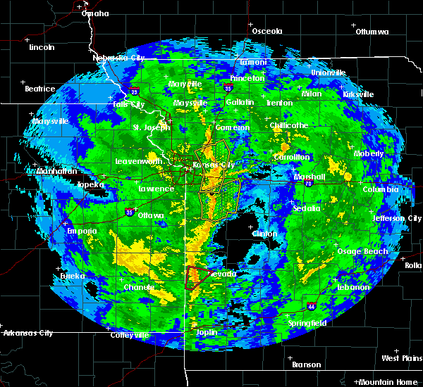 At 534 pm cst, severe thunderstorms were located along a line extending from excelsior springs to orrick to near lone jack, moving northeast at 45 mph (radar indicated). Hazards include 60 mph wind gusts. Expect damage to roofs, siding, and trees. Locations impacted include, independence, blue springs, grain valley, excelsior springs, oak grove, greenwood, buckner, lawson, lake lotawana, lone jack, orrick, crystal lakes, sibley, excelsior estates, levasy, woods heights, rayville, napoleon, mosby and homestead. At 534 pm cst, severe thunderstorms were located along a line extending from excelsior springs to orrick to near lone jack, moving northeast at 45 mph (radar indicated). Hazards include 60 mph wind gusts. Expect damage to roofs, siding, and trees. Locations impacted include, independence, blue springs, grain valley, excelsior springs, oak grove, greenwood, buckner, lawson, lake lotawana, lone jack, orrick, crystal lakes, sibley, excelsior estates, levasy, woods heights, rayville, napoleon, mosby and homestead.
|
| 12/28/2019 5:24 PM CST |
 At 523 pm cst, severe thunderstorms were located along a line extending from near holt to near missouri city to near lee`s summit, moving northeast at 45 mph (radar indicated). Hazards include 60 mph wind gusts. Expect damage to roofs, siding, and trees. Locations impacted include, independence, lee`s summit, blue springs, liberty, grain valley, excelsior springs, kearney, oak grove, greenwood, sugar creek, buckner, lawson, lake lotawana, lone jack, orrick, lake tapawingo, crystal lakes, sibley, missouri city and excelsior estates. At 523 pm cst, severe thunderstorms were located along a line extending from near holt to near missouri city to near lee`s summit, moving northeast at 45 mph (radar indicated). Hazards include 60 mph wind gusts. Expect damage to roofs, siding, and trees. Locations impacted include, independence, lee`s summit, blue springs, liberty, grain valley, excelsior springs, kearney, oak grove, greenwood, sugar creek, buckner, lawson, lake lotawana, lone jack, orrick, lake tapawingo, crystal lakes, sibley, missouri city and excelsior estates.
|
| 12/28/2019 5:05 PM CST |
 At 505 pm cst, severe thunderstorms were located along a line extending from 6 miles northwest of pleasant valley to near sugar creek to belton, moving northeast at 45 mph. isolated stronger gusts will be possible within areas of rotation along the line of storms (radar indicated). Hazards include 60 mph wind gusts. expect damage to roofs, siding, and trees At 505 pm cst, severe thunderstorms were located along a line extending from 6 miles northwest of pleasant valley to near sugar creek to belton, moving northeast at 45 mph. isolated stronger gusts will be possible within areas of rotation along the line of storms (radar indicated). Hazards include 60 mph wind gusts. expect damage to roofs, siding, and trees
|
| 9/27/2019 10:11 PM CDT |
 At 1011 pm cdt, a severe thunderstorm was located near grain valley, moving east at 35 mph (radar indicated). Hazards include 60 mph wind gusts and quarter size hail. Hail damage to vehicles is expected. Expect wind damage to roofs, siding, and trees. At 1011 pm cdt, a severe thunderstorm was located near grain valley, moving east at 35 mph (radar indicated). Hazards include 60 mph wind gusts and quarter size hail. Hail damage to vehicles is expected. Expect wind damage to roofs, siding, and trees.
|
| 8/16/2019 12:58 AM CDT |
 The severe thunderstorm warning for southern clay, southwestern ray, southwestern lafayette and jackson counties will expire at 100 am cdt, the storm which prompted the warning has weakened below severe limits, and no longer poses an immediate threat to life or property. therefore, the warning will be allowed to expire. however small hail, gusty winds and heavy rain are still possible with this thunderstorm. this storm may also reintensify. a severe thunderstorm watch remains in effect until 700 am cdt for northeastern and east central kansas, and west central missouri. remember, a severe thunderstorm warning still remains in effect for 7 am. The severe thunderstorm warning for southern clay, southwestern ray, southwestern lafayette and jackson counties will expire at 100 am cdt, the storm which prompted the warning has weakened below severe limits, and no longer poses an immediate threat to life or property. therefore, the warning will be allowed to expire. however small hail, gusty winds and heavy rain are still possible with this thunderstorm. this storm may also reintensify. a severe thunderstorm watch remains in effect until 700 am cdt for northeastern and east central kansas, and west central missouri. remember, a severe thunderstorm warning still remains in effect for 7 am.
|
| 8/16/2019 12:23 AM CDT |
 The national weather service in pleasant hill has issued a * severe thunderstorm warning for. southern clay county in west central missouri. southwestern ray county in west central missouri. southwestern lafayette county in west central missouri. Jackson county in west central missouri. The national weather service in pleasant hill has issued a * severe thunderstorm warning for. southern clay county in west central missouri. southwestern ray county in west central missouri. southwestern lafayette county in west central missouri. Jackson county in west central missouri.
|
| 8/15/2019 10:08 PM CDT |
 At 1008 pm cdt, a severe thunderstorm was located near river bend, or near liberty, moving southeast at 30 mph (radar indicated). Hazards include quarter size hail. Damage to vehicles is expected. Locations impacted include, kansas city, independence, blue springs, liberty, grain valley, oak grove, sugar creek, buckner, claycomo, courtney, orrick, sibley, missouri city, levasy, river bend and napoleon. At 1008 pm cdt, a severe thunderstorm was located near river bend, or near liberty, moving southeast at 30 mph (radar indicated). Hazards include quarter size hail. Damage to vehicles is expected. Locations impacted include, kansas city, independence, blue springs, liberty, grain valley, oak grove, sugar creek, buckner, claycomo, courtney, orrick, sibley, missouri city, levasy, river bend and napoleon.
|
| 8/15/2019 9:58 PM CDT |
 At 957 pm cdt, a severe thunderstorm was located over glenaire, or over liberty, moving southeast at 35 mph (radar indicated). Hazards include quarter size hail. damage to vehicles is expected At 957 pm cdt, a severe thunderstorm was located over glenaire, or over liberty, moving southeast at 35 mph (radar indicated). Hazards include quarter size hail. damage to vehicles is expected
|
| 7/10/2019 10:11 AM CDT |
 At 1011 am cdt, severe thunderstorms were located along a line extending from henrietta to 6 miles north of warrensburg to near urich, moving east at 45 mph (radar indicated). Hazards include 60 mph wind gusts and penny size hail. Expect damage to roofs, siding, and trees. Locations impacted include, independence, lee`s summit, blue springs, raymore, warrensburg, grain valley, harrisonville, clinton, pleasant hill, oak grove, odessa, greenwood, higginsville, lexington, peculiar, buckner, knob noster, concordia, holden and lake lotawana. At 1011 am cdt, severe thunderstorms were located along a line extending from henrietta to 6 miles north of warrensburg to near urich, moving east at 45 mph (radar indicated). Hazards include 60 mph wind gusts and penny size hail. Expect damage to roofs, siding, and trees. Locations impacted include, independence, lee`s summit, blue springs, raymore, warrensburg, grain valley, harrisonville, clinton, pleasant hill, oak grove, odessa, greenwood, higginsville, lexington, peculiar, buckner, knob noster, concordia, holden and lake lotawana.
|
| 7/10/2019 9:43 AM CDT |
 At 942 am cdt, severe thunderstorms were located along a line extending from excelsior springs to near odessa to near east lynne, moving east at 45 mph (radar indicated). Hazards include 60 mph wind gusts. expect damage to roofs, siding, and trees At 942 am cdt, severe thunderstorms were located along a line extending from excelsior springs to near odessa to near east lynne, moving east at 45 mph (radar indicated). Hazards include 60 mph wind gusts. expect damage to roofs, siding, and trees
|
| 7/10/2019 9:16 AM CDT |
 At 916 am cdt, severe thunderstorms were located along a line extending from trimble to near raytown to near cleveland, moving east at 45 mph (radar indicated). Hazards include 60 mph wind gusts and quarter size hail. Hail damage to vehicles is expected. expect wind damage to roofs, siding, and trees. Locations impacted include, kansas city, overland park, olathe, independence, lee`s summit, shawnee, blue springs, lenexa, leawood, raytown, liberty, gladstone, grandview, belton, prairie village, raymore, gardner, grain valley, lansing and excelsior springs. At 916 am cdt, severe thunderstorms were located along a line extending from trimble to near raytown to near cleveland, moving east at 45 mph (radar indicated). Hazards include 60 mph wind gusts and quarter size hail. Hail damage to vehicles is expected. expect wind damage to roofs, siding, and trees. Locations impacted include, kansas city, overland park, olathe, independence, lee`s summit, shawnee, blue springs, lenexa, leawood, raytown, liberty, gladstone, grandview, belton, prairie village, raymore, gardner, grain valley, lansing and excelsior springs.
|
| 7/10/2019 9:02 AM CDT |
 At 901 am cdt, severe thunderstorms were located along a line extending from edgerton to near kansas city to near spring hill, moving east at 50 mph (radar indicated). Hazards include 60 mph wind gusts and penny size hail. expect damage to roofs, siding, and trees At 901 am cdt, severe thunderstorms were located along a line extending from edgerton to near kansas city to near spring hill, moving east at 50 mph (radar indicated). Hazards include 60 mph wind gusts and penny size hail. expect damage to roofs, siding, and trees
|
| 6/21/2019 10:37 AM CDT |
 At 1037 am cdt, a severe thunderstorm was located over oak grove, moving southeast at 40 mph (radar indicated). Hazards include 70 mph wind gusts. Expect considerable tree damage. damage is likely to mobile homes, roofs, and outbuildings. Locations impacted include, independence, lee`s summit, blue springs, grandview, belton, raymore, warrensburg, grain valley, harrisonville, pleasant hill, oak grove, richmond, odessa, greenwood, higginsville, lexington, peculiar, louisburg, carrollton and buckner. At 1037 am cdt, a severe thunderstorm was located over oak grove, moving southeast at 40 mph (radar indicated). Hazards include 70 mph wind gusts. Expect considerable tree damage. damage is likely to mobile homes, roofs, and outbuildings. Locations impacted include, independence, lee`s summit, blue springs, grandview, belton, raymore, warrensburg, grain valley, harrisonville, pleasant hill, oak grove, richmond, odessa, greenwood, higginsville, lexington, peculiar, louisburg, carrollton and buckner.
|
| 6/21/2019 10:28 AM CDT |
 The national weather service in pleasant hill has issued a * severe thunderstorm warning for. eastern miami county in east central kansas. northern linn county in east central kansas. cass county in west central missouri. Northwestern bates county in west central missouri. The national weather service in pleasant hill has issued a * severe thunderstorm warning for. eastern miami county in east central kansas. northern linn county in east central kansas. cass county in west central missouri. Northwestern bates county in west central missouri.
|
| 6/21/2019 10:28 AM CDT |
 At 1026 am cdt, a severe thunderstorm was located over blue springs, moving southeast at 40 mph (radar indicated). Hazards include 60 mph wind gusts. expect damage to roofs, siding, and trees At 1026 am cdt, a severe thunderstorm was located over blue springs, moving southeast at 40 mph (radar indicated). Hazards include 60 mph wind gusts. expect damage to roofs, siding, and trees
|
| 6/21/2019 9:57 AM CDT |
 At 957 am cdt, a severe thunderstorm was located over lake quivira, moving east at 60 mph (radar indicated). Hazards include 60 mph wind gusts. expect damage to roofs, siding, and trees At 957 am cdt, a severe thunderstorm was located over lake quivira, moving east at 60 mph (radar indicated). Hazards include 60 mph wind gusts. expect damage to roofs, siding, and trees
|
| 6/21/2019 9:05 AM CDT | Golf Ball sized hail reported 1.6 miles NNW of Blue Springs, MO |
| 6/21/2019 8:28 AM CDT |
 The severe thunderstorm warning for northeastern cass, southeastern clay, southwestern ray, southwestern lafayette, jackson and northwestern johnson counties will expire at 830 am cdt, the storms which prompted the warning have moved out of the area. therefore, the warning will be allowed to expire. however small hail and gusty winds are still possible with these thunderstorms. a severe thunderstorm watch remains in effect until 1000 am cdt for west central missouri. a severe thunderstorm watch also remains in effect until 400 pm cdt for west central missouri. remember, a severe thunderstorm warning still remains in effect for southeastern jackson county and western johnson and lafayette counties. The severe thunderstorm warning for northeastern cass, southeastern clay, southwestern ray, southwestern lafayette, jackson and northwestern johnson counties will expire at 830 am cdt, the storms which prompted the warning have moved out of the area. therefore, the warning will be allowed to expire. however small hail and gusty winds are still possible with these thunderstorms. a severe thunderstorm watch remains in effect until 1000 am cdt for west central missouri. a severe thunderstorm watch also remains in effect until 400 pm cdt for west central missouri. remember, a severe thunderstorm warning still remains in effect for southeastern jackson county and western johnson and lafayette counties.
|
| 6/21/2019 8:26 AM CDT |
 At 826 am cdt, a severe thunderstorm was located over lake lotawana, moving east at 25 mph (radar indicated). Hazards include 60 mph wind gusts and quarter size hail. Hail damage to vehicles is expected. Expect wind damage to roofs, siding, and trees. At 826 am cdt, a severe thunderstorm was located over lake lotawana, moving east at 25 mph (radar indicated). Hazards include 60 mph wind gusts and quarter size hail. Hail damage to vehicles is expected. Expect wind damage to roofs, siding, and trees.
|
| 6/21/2019 8:06 AM CDT |
 At 806 am cdt, severe thunderstorms were located along a line extending from river bend to near lake winnebago, moving east at 35 mph (radar indicated). Hazards include 60 mph wind gusts and quarter size hail. Hail damage to vehicles is expected. expect wind damage to roofs, siding, and trees. Locations impacted include, kansas city, independence, lee`s summit, blue springs, raytown, liberty, raymore, grain valley, pleasant hill, oak grove, greenwood, peculiar, sugar creek, buckner, holden, lake lotawana, claycomo, courtney, pleasant valley and lake winnebago. At 806 am cdt, severe thunderstorms were located along a line extending from river bend to near lake winnebago, moving east at 35 mph (radar indicated). Hazards include 60 mph wind gusts and quarter size hail. Hail damage to vehicles is expected. expect wind damage to roofs, siding, and trees. Locations impacted include, kansas city, independence, lee`s summit, blue springs, raytown, liberty, raymore, grain valley, pleasant hill, oak grove, greenwood, peculiar, sugar creek, buckner, holden, lake lotawana, claycomo, courtney, pleasant valley and lake winnebago.
|
| 6/21/2019 7:50 AM CDT |
 At 750 am cdt, severe thunderstorms were located along a line extending from near avondale to near peculiar, moving east at 35 mph (radar indicated). Hazards include 60 mph wind gusts and quarter size hail. Hail damage to vehicles is expected. Expect wind damage to roofs, siding, and trees. At 750 am cdt, severe thunderstorms were located along a line extending from near avondale to near peculiar, moving east at 35 mph (radar indicated). Hazards include 60 mph wind gusts and quarter size hail. Hail damage to vehicles is expected. Expect wind damage to roofs, siding, and trees.
|
| 6/21/2019 7:45 AM CDT | Delayed report: 8 inch tree limb dow in jackson county MO, 1.6 miles NNW of Blue Springs, MO |
| 6/21/2019 7:35 AM CDT |
 The severe thunderstorm warning for central clay, southwestern ray, west central lafayette and central jackson counties will expire at 745 am cdt, the storms which prompted the warning have weakened below severe limits, and no longer pose an immediate threat to life or property. therefore, the warning will be allowed to expire. however gusty winds are still possible with these thunderstorms. a severe thunderstorm watch remains in effect until 1000 am cdt for west central missouri. The severe thunderstorm warning for central clay, southwestern ray, west central lafayette and central jackson counties will expire at 745 am cdt, the storms which prompted the warning have weakened below severe limits, and no longer pose an immediate threat to life or property. therefore, the warning will be allowed to expire. however gusty winds are still possible with these thunderstorms. a severe thunderstorm watch remains in effect until 1000 am cdt for west central missouri.
|
| 6/21/2019 7:28 AM CDT |
 At 728 am cdt, severe thunderstorms were located along a line extending from near missouri city to leawood, moving southeast at 35 mph (radar indicated). Hazards include 60 mph wind gusts and quarter size hail. Hail damage to vehicles is expected. expect wind damage to roofs, siding, and trees. Locations impacted include, kansas city, independence, lee`s summit, blue springs, raytown, liberty, gladstone, grain valley, excelsior springs, kearney, oak grove, sugar creek, buckner, lake lotawana, claycomo, courtney, pleasant valley, orrick, wellington and lake tapawingo. At 728 am cdt, severe thunderstorms were located along a line extending from near missouri city to leawood, moving southeast at 35 mph (radar indicated). Hazards include 60 mph wind gusts and quarter size hail. Hail damage to vehicles is expected. expect wind damage to roofs, siding, and trees. Locations impacted include, kansas city, independence, lee`s summit, blue springs, raytown, liberty, gladstone, grain valley, excelsior springs, kearney, oak grove, sugar creek, buckner, lake lotawana, claycomo, courtney, pleasant valley, orrick, wellington and lake tapawingo.
|
| 6/21/2019 7:24 AM CDT |
 At 723 am cdt, severe thunderstorms were located along a line extending from near missouri city to leawood, moving southeast at 35 mph (radar indicated). Hazards include 60 mph wind gusts and quarter size hail. Hail damage to vehicles is expected. expect wind damage to roofs, siding, and trees. Locations impacted include, kansas city, independence, lee`s summit, blue springs, raytown, liberty, gladstone, grain valley, excelsior springs, kearney, oak grove, north kansas city, sugar creek, buckner, lake lotawana, claycomo, courtney, pleasant valley, orrick and wellington. At 723 am cdt, severe thunderstorms were located along a line extending from near missouri city to leawood, moving southeast at 35 mph (radar indicated). Hazards include 60 mph wind gusts and quarter size hail. Hail damage to vehicles is expected. expect wind damage to roofs, siding, and trees. Locations impacted include, kansas city, independence, lee`s summit, blue springs, raytown, liberty, gladstone, grain valley, excelsior springs, kearney, oak grove, north kansas city, sugar creek, buckner, lake lotawana, claycomo, courtney, pleasant valley, orrick and wellington.
|
| 6/21/2019 7:18 AM CDT |
 At 718 am cdt, a severe thunderstorm was located over buckner, moving southeast at 50 mph (radar indicated). Hazards include 60 mph wind gusts and quarter size hail. Hail damage to vehicles is expected. expect wind damage to roofs, siding, and trees. Locations impacted include, kansas city, independence, lee`s summit, blue springs, liberty, gladstone, grain valley, smithville, kearney, parkville, north kansas city, sugar creek, buckner, riverside, weatherby lake, claycomo, courtney, pleasant valley, lake waukomis and orrick. At 718 am cdt, a severe thunderstorm was located over buckner, moving southeast at 50 mph (radar indicated). Hazards include 60 mph wind gusts and quarter size hail. Hail damage to vehicles is expected. expect wind damage to roofs, siding, and trees. Locations impacted include, kansas city, independence, lee`s summit, blue springs, liberty, gladstone, grain valley, smithville, kearney, parkville, north kansas city, sugar creek, buckner, riverside, weatherby lake, claycomo, courtney, pleasant valley, lake waukomis and orrick.
|
| 6/21/2019 7:10 AM CDT |
 The national weather service in pleasant hill has issued a * severe thunderstorm warning for. east central wyandotte county in northeastern kansas. northeastern johnson county in east central kansas. southern clay county in west central missouri. Southwestern ray county in west central missouri. The national weather service in pleasant hill has issued a * severe thunderstorm warning for. east central wyandotte county in northeastern kansas. northeastern johnson county in east central kansas. southern clay county in west central missouri. Southwestern ray county in west central missouri.
|
| 6/21/2019 7:10 AM CDT |
 At 710 am cdt, severe thunderstorms were located along a line extending from near kearney to merriam, moving southeast at 35 mph (radar indicated). Hazards include 60 mph wind gusts and quarter size hail. Hail damage to vehicles is expected. Expect wind damage to roofs, siding, and trees. At 710 am cdt, severe thunderstorms were located along a line extending from near kearney to merriam, moving southeast at 35 mph (radar indicated). Hazards include 60 mph wind gusts and quarter size hail. Hail damage to vehicles is expected. Expect wind damage to roofs, siding, and trees.
|
| 6/21/2019 6:41 AM CDT |
 At 641 am cdt, a severe thunderstorm was located near ferrelview, or near smithville, moving southeast at 50 mph (radar indicated). Hazards include 60 mph wind gusts and nickel size hail. expect damage to roofs, siding, and trees At 641 am cdt, a severe thunderstorm was located near ferrelview, or near smithville, moving southeast at 50 mph (radar indicated). Hazards include 60 mph wind gusts and nickel size hail. expect damage to roofs, siding, and trees
|
| 6/15/2019 8:21 PM CDT |
 At 820 pm cdt, a severe thunderstorm was located near levasy, or near buckner, moving east at 20 mph (radar indicated). Hazards include 60 mph wind gusts and quarter size hail. Hail damage to vehicles is expected. expect wind damage to roofs, siding, and trees. Locations impacted include, independence, blue springs, grain valley, oak grove, odessa, buckner, wellington, levasy, napoleon and bates city. At 820 pm cdt, a severe thunderstorm was located near levasy, or near buckner, moving east at 20 mph (radar indicated). Hazards include 60 mph wind gusts and quarter size hail. Hail damage to vehicles is expected. expect wind damage to roofs, siding, and trees. Locations impacted include, independence, blue springs, grain valley, oak grove, odessa, buckner, wellington, levasy, napoleon and bates city.
|
| 6/15/2019 8:09 PM CDT |
 At 809 pm cdt, a severe thunderstorm was located over buckner, moving east at 20 mph (radar indicated). Hazards include 60 mph wind gusts and quarter size hail. Hail damage to vehicles is expected. Expect wind damage to roofs, siding, and trees. At 809 pm cdt, a severe thunderstorm was located over buckner, moving east at 20 mph (radar indicated). Hazards include 60 mph wind gusts and quarter size hail. Hail damage to vehicles is expected. Expect wind damage to roofs, siding, and trees.
|
| 6/12/2019 4:27 PM CDT |
 The severe thunderstorm warning for northeastern cass, southwestern lafayette, southern jackson and northwestern johnson counties will expire at 430 pm cdt, the storms which prompted the warning have moved out of the area. therefore, the warning will be allowed to expire. however gusty winds are still possible with these thunderstorms. The severe thunderstorm warning for northeastern cass, southwestern lafayette, southern jackson and northwestern johnson counties will expire at 430 pm cdt, the storms which prompted the warning have moved out of the area. therefore, the warning will be allowed to expire. however gusty winds are still possible with these thunderstorms.
|
| 6/12/2019 4:15 PM CDT |
 At 414 pm cdt, severe thunderstorms were located along a line extending from near higginsville to near lone jack to leawood, moving south at 40 mph (radar indicated). Hazards include 60 mph wind gusts and nickel size hail. Expect damage to roofs, siding, and trees. Locations impacted include, kansas city, independence, lee`s summit, blue springs, raytown, grandview, belton, raymore, grain valley, pleasant hill, oak grove, odessa, greenwood, holden, lake lotawana, lake winnebago, lone jack, lake tapawingo, kingsville and mayview. At 414 pm cdt, severe thunderstorms were located along a line extending from near higginsville to near lone jack to leawood, moving south at 40 mph (radar indicated). Hazards include 60 mph wind gusts and nickel size hail. Expect damage to roofs, siding, and trees. Locations impacted include, kansas city, independence, lee`s summit, blue springs, raytown, grandview, belton, raymore, grain valley, pleasant hill, oak grove, odessa, greenwood, holden, lake lotawana, lake winnebago, lone jack, lake tapawingo, kingsville and mayview.
|
| 6/12/2019 3:46 PM CDT |
 At 346 pm cdt, severe thunderstorms were located along a line extending from near hardin to near buckner to houston lake, moving south at 40 mph (radar indicated). Hazards include 60 mph wind gusts and quarter size hail. Hail damage to vehicles is expected. Expect wind damage to roofs, siding, and trees. At 346 pm cdt, severe thunderstorms were located along a line extending from near hardin to near buckner to houston lake, moving south at 40 mph (radar indicated). Hazards include 60 mph wind gusts and quarter size hail. Hail damage to vehicles is expected. Expect wind damage to roofs, siding, and trees.
|
| 6/1/2019 4:47 PM CDT |
 At 447 pm cdt, a severe thunderstorm was located over grain valley, moving east at 35 mph (radar indicated). Hazards include 60 mph wind gusts and quarter size hail. Hail damage to vehicles is expected. expect wind damage to roofs, siding, and trees. Locations impacted include, independence, blue springs, grain valley, oak grove, buckner and levasy. At 447 pm cdt, a severe thunderstorm was located over grain valley, moving east at 35 mph (radar indicated). Hazards include 60 mph wind gusts and quarter size hail. Hail damage to vehicles is expected. expect wind damage to roofs, siding, and trees. Locations impacted include, independence, blue springs, grain valley, oak grove, buckner and levasy.
|
| 6/1/2019 4:38 PM CDT |
 At 438 pm cdt, a severe thunderstorm was located over lake tapawingo, or near blue springs, moving east at 35 mph (radar indicated). Hazards include 60 mph wind gusts and quarter size hail. Hail damage to vehicles is expected. expect wind damage to roofs, siding, and trees. Locations impacted include, independence, blue springs, grain valley, oak grove, buckner, lake tapawingo and levasy. At 438 pm cdt, a severe thunderstorm was located over lake tapawingo, or near blue springs, moving east at 35 mph (radar indicated). Hazards include 60 mph wind gusts and quarter size hail. Hail damage to vehicles is expected. expect wind damage to roofs, siding, and trees. Locations impacted include, independence, blue springs, grain valley, oak grove, buckner, lake tapawingo and levasy.
|
| 6/1/2019 4:31 PM CDT |
 At 431 pm cdt, a severe thunderstorm was located over independence, moving east at 35 mph (radar indicated). Hazards include 60 mph wind gusts and quarter size hail. Hail damage to vehicles is expected. expect wind damage to roofs, siding, and trees. Locations impacted include, kansas city, independence, lee`s summit, blue springs, grain valley, oak grove, buckner, lake lotawana, lone jack, lake tapawingo, levasy, unity village and tarsney lakes. At 431 pm cdt, a severe thunderstorm was located over independence, moving east at 35 mph (radar indicated). Hazards include 60 mph wind gusts and quarter size hail. Hail damage to vehicles is expected. expect wind damage to roofs, siding, and trees. Locations impacted include, kansas city, independence, lee`s summit, blue springs, grain valley, oak grove, buckner, lake lotawana, lone jack, lake tapawingo, levasy, unity village and tarsney lakes.
|
| 6/1/2019 4:24 PM CDT |
 At 423 pm cdt, a severe thunderstorm was located near raytown, moving east at 35 mph (radar indicated). Hazards include 60 mph wind gusts and quarter size hail. Hail damage to vehicles is expected. Expect wind damage to roofs, siding, and trees. At 423 pm cdt, a severe thunderstorm was located near raytown, moving east at 35 mph (radar indicated). Hazards include 60 mph wind gusts and quarter size hail. Hail damage to vehicles is expected. Expect wind damage to roofs, siding, and trees.
|
| 5/24/2019 8:39 PM CDT |
 The tornado warning for northeastern cass, southwestern lafayette, southeastern jackson and northwestern johnson counties will expire at 845 pm cdt, the storm which prompted the warning has moved out of the area. therefore, the warning will be allowed to expire. a tornado watch remains in effect until midnight cdt for west central missouri. The tornado warning for northeastern cass, southwestern lafayette, southeastern jackson and northwestern johnson counties will expire at 845 pm cdt, the storm which prompted the warning has moved out of the area. therefore, the warning will be allowed to expire. a tornado watch remains in effect until midnight cdt for west central missouri.
|
| 5/24/2019 8:29 PM CDT |
 At 824 pm cdt, a severe thunderstorm capable of producing a tornado was located south of bates city and moving east at 60 mph (radar indicated rotation). Hazards include tornado. Flying debris will be dangerous to those caught without shelter. mobile homes will be damaged or destroyed. damage to roofs, windows, and vehicles will occur. tree damage is likely. Locations impacted include, oak grove, odessa, lake lotawana, lone jack, lake lafayette, bates city, strasburg, tarsney lakes and pittsville. At 824 pm cdt, a severe thunderstorm capable of producing a tornado was located south of bates city and moving east at 60 mph (radar indicated rotation). Hazards include tornado. Flying debris will be dangerous to those caught without shelter. mobile homes will be damaged or destroyed. damage to roofs, windows, and vehicles will occur. tree damage is likely. Locations impacted include, oak grove, odessa, lake lotawana, lone jack, lake lafayette, bates city, strasburg, tarsney lakes and pittsville.
|
| 5/24/2019 8:25 PM CDT |
 At 824 pm cdt, a severe thunderstorm capable of producing a tornado was located south of bates city and moving east at 60 mph (radar indicated rotation). Hazards include tornado. Flying debris will be dangerous to those caught without shelter. mobile homes will be damaged or destroyed. damage to roofs, windows, and vehicles will occur. tree damage is likely. Locations impacted include, oak grove, odessa, lake lotawana, lone jack, lake lafayette, bates city, strasburg, tarsney lakes and pittsville. At 824 pm cdt, a severe thunderstorm capable of producing a tornado was located south of bates city and moving east at 60 mph (radar indicated rotation). Hazards include tornado. Flying debris will be dangerous to those caught without shelter. mobile homes will be damaged or destroyed. damage to roofs, windows, and vehicles will occur. tree damage is likely. Locations impacted include, oak grove, odessa, lake lotawana, lone jack, lake lafayette, bates city, strasburg, tarsney lakes and pittsville.
|
| 5/24/2019 8:12 PM CDT |
 At 812 pm cdt, a severe thunderstorm capable of producing a tornado was located over lake lotawana, moving northeast at 40 mph (radar indicated rotation). Hazards include tornado. Flying debris will be dangerous to those caught without shelter. mobile homes will be damaged or destroyed. damage to roofs, windows, and vehicles will occur. Tree damage is likely. At 812 pm cdt, a severe thunderstorm capable of producing a tornado was located over lake lotawana, moving northeast at 40 mph (radar indicated rotation). Hazards include tornado. Flying debris will be dangerous to those caught without shelter. mobile homes will be damaged or destroyed. damage to roofs, windows, and vehicles will occur. Tree damage is likely.
|
| 5/24/2019 7:56 PM CDT |
 At 756 pm cdt, a severe squall line capable of producing both tornadoes and extensive straight line wind damage was located near lee`s summit, moving northeast at 25 mph (radar indicated rotation). Hazards include tornado. Flying debris will be dangerous to those caught without shelter. mobile homes will be damaged or destroyed. damage to roofs, windows, and vehicles will occur. tree damage is likely. Locations impacted include, lee`s summit, blue springs, grandview, belton, raymore, grain valley, pleasant hill, greenwood, lake lotawana, lake winnebago, lone jack, lake tapawingo, unity village and tarsney lakes. At 756 pm cdt, a severe squall line capable of producing both tornadoes and extensive straight line wind damage was located near lee`s summit, moving northeast at 25 mph (radar indicated rotation). Hazards include tornado. Flying debris will be dangerous to those caught without shelter. mobile homes will be damaged or destroyed. damage to roofs, windows, and vehicles will occur. tree damage is likely. Locations impacted include, lee`s summit, blue springs, grandview, belton, raymore, grain valley, pleasant hill, greenwood, lake lotawana, lake winnebago, lone jack, lake tapawingo, unity village and tarsney lakes.
|
| 5/24/2019 7:45 PM CDT |
 At 744 pm cdt, severe thunderstorms capable of producing both tornadoes and extensive straight line wind damage were located over grandview, moving east at 35 mph (radar indicated rotation). Hazards include tornado. Flying debris will be dangerous to those caught without shelter. mobile homes will be damaged or destroyed. damage to roofs, windows, and vehicles will occur. Tree damage is likely. At 744 pm cdt, severe thunderstorms capable of producing both tornadoes and extensive straight line wind damage were located over grandview, moving east at 35 mph (radar indicated rotation). Hazards include tornado. Flying debris will be dangerous to those caught without shelter. mobile homes will be damaged or destroyed. damage to roofs, windows, and vehicles will occur. Tree damage is likely.
|
| 4/17/2019 6:25 PM CDT |
 At 625 pm cdt, a severe thunderstorm was located over independence, moving east at 30 mph (trained weather spotters). Hazards include golf ball size hail and 60 mph wind gusts. People and animals outdoors will be injured. expect hail damage to roofs, siding, windows, and vehicles. expect wind damage to roofs, siding, and trees. Locations impacted include, kansas city, independence, blue springs, raytown, liberty, sugar creek, courtney, missouri city, river bend and birmingham. At 625 pm cdt, a severe thunderstorm was located over independence, moving east at 30 mph (trained weather spotters). Hazards include golf ball size hail and 60 mph wind gusts. People and animals outdoors will be injured. expect hail damage to roofs, siding, windows, and vehicles. expect wind damage to roofs, siding, and trees. Locations impacted include, kansas city, independence, blue springs, raytown, liberty, sugar creek, courtney, missouri city, river bend and birmingham.
|
| 4/17/2019 6:22 PM CDT |
 At 625 pm cdt, a severe thunderstorm was located over independence, moving east at 30 mph (trained weather spotters). Hazards include golf ball size hail and 60 mph wind gusts. People and animals outdoors will be injured. expect hail damage to roofs, siding, windows, and vehicles. expect wind damage to roofs, siding, and trees. Locations impacted include, kansas city, independence, blue springs, raytown, liberty, sugar creek, courtney, missouri city, river bend and birmingham. At 625 pm cdt, a severe thunderstorm was located over independence, moving east at 30 mph (trained weather spotters). Hazards include golf ball size hail and 60 mph wind gusts. People and animals outdoors will be injured. expect hail damage to roofs, siding, windows, and vehicles. expect wind damage to roofs, siding, and trees. Locations impacted include, kansas city, independence, blue springs, raytown, liberty, sugar creek, courtney, missouri city, river bend and birmingham.
|
| 4/17/2019 6:15 PM CDT |
 At 614 pm cdt, a severe thunderstorm was located near raytown, moving east at 30 mph (trained weather spotters). Hazards include 60 mph wind gusts and half dollar size hail. Hail damage to vehicles is expected. expect wind damage to roofs, siding, and trees. Locations impacted include, kansas city, independence, blue springs, raytown, liberty, sugar creek, claycomo, courtney, missouri city, river bend, birmingham and randolph. At 614 pm cdt, a severe thunderstorm was located near raytown, moving east at 30 mph (trained weather spotters). Hazards include 60 mph wind gusts and half dollar size hail. Hail damage to vehicles is expected. expect wind damage to roofs, siding, and trees. Locations impacted include, kansas city, independence, blue springs, raytown, liberty, sugar creek, claycomo, courtney, missouri city, river bend, birmingham and randolph.
|
| 4/17/2019 6:09 PM CDT |
 At 608 pm cdt, a severe thunderstorm was located near kansas city, moving northeast at 30 mph (trained weather spotters). Hazards include 60 mph wind gusts and quarter size hail. Hail damage to vehicles is expected. expect wind damage to roofs, siding, and trees. Locations impacted include, kansas city, independence, blue springs, leawood, raytown, liberty, prairie village, north kansas city, fairway, mission hills, sugar creek, westwood, claycomo, courtney, glenaire, westwood hills, missouri city, mission woods, river bend and birmingham. At 608 pm cdt, a severe thunderstorm was located near kansas city, moving northeast at 30 mph (trained weather spotters). Hazards include 60 mph wind gusts and quarter size hail. Hail damage to vehicles is expected. expect wind damage to roofs, siding, and trees. Locations impacted include, kansas city, independence, blue springs, leawood, raytown, liberty, prairie village, north kansas city, fairway, mission hills, sugar creek, westwood, claycomo, courtney, glenaire, westwood hills, missouri city, mission woods, river bend and birmingham.
|
| 4/17/2019 6:01 PM CDT |
 At 601 pm cdt, a severe thunderstorm was located over westwood hills, or over westwood, moving east at 25 mph (radar indicated). Hazards include 60 mph wind gusts and quarter size hail. Hail damage to vehicles is expected. expect wind damage to roofs, siding, and trees. Locations impacted include, kansas city, overland park, independence, shawnee, blue springs, lenexa, leawood, raytown, liberty, prairie village, merriam, mission, north kansas city, fairway, mission hills, sugar creek, westwood, claycomo, kansas city kansas and courtney. At 601 pm cdt, a severe thunderstorm was located over westwood hills, or over westwood, moving east at 25 mph (radar indicated). Hazards include 60 mph wind gusts and quarter size hail. Hail damage to vehicles is expected. expect wind damage to roofs, siding, and trees. Locations impacted include, kansas city, overland park, independence, shawnee, blue springs, lenexa, leawood, raytown, liberty, prairie village, merriam, mission, north kansas city, fairway, mission hills, sugar creek, westwood, claycomo, kansas city kansas and courtney.
|
| 4/17/2019 6:01 PM CDT |
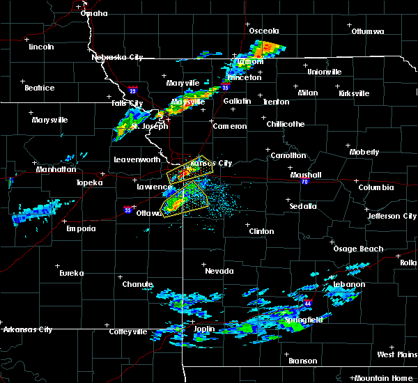 At 601 pm cdt, a severe thunderstorm was located over westwood hills, or over westwood, moving east at 25 mph (radar indicated). Hazards include 60 mph wind gusts and quarter size hail. Hail damage to vehicles is expected. expect wind damage to roofs, siding, and trees. Locations impacted include, kansas city, overland park, independence, shawnee, blue springs, lenexa, leawood, raytown, liberty, prairie village, merriam, mission, north kansas city, fairway, mission hills, sugar creek, westwood, claycomo, kansas city kansas and courtney. At 601 pm cdt, a severe thunderstorm was located over westwood hills, or over westwood, moving east at 25 mph (radar indicated). Hazards include 60 mph wind gusts and quarter size hail. Hail damage to vehicles is expected. expect wind damage to roofs, siding, and trees. Locations impacted include, kansas city, overland park, independence, shawnee, blue springs, lenexa, leawood, raytown, liberty, prairie village, merriam, mission, north kansas city, fairway, mission hills, sugar creek, westwood, claycomo, kansas city kansas and courtney.
|
| 4/17/2019 5:47 PM CDT |
 At 547 pm cdt, a severe thunderstorm was located over merriam, moving northeast at 30 mph (radar indicated). Hazards include 60 mph wind gusts and quarter size hail. Hail damage to vehicles is expected. Expect wind damage to roofs, siding, and trees. At 547 pm cdt, a severe thunderstorm was located over merriam, moving northeast at 30 mph (radar indicated). Hazards include 60 mph wind gusts and quarter size hail. Hail damage to vehicles is expected. Expect wind damage to roofs, siding, and trees.
|
| 8/28/2018 6:23 PM CDT |
 The severe thunderstorm warning for ray, western carroll, southeastern caldwell, lafayette, eastern jackson and southwestern livingston counties will expire at 630 pm cdt, the storms which prompted the warning have weakened below severe limits, and no longer pose an immediate threat to life or property. therefore, the warning will be allowed to expire. a severe thunderstorm watch remains in effect until 1100 pm cdt for north central and west central missouri. The severe thunderstorm warning for ray, western carroll, southeastern caldwell, lafayette, eastern jackson and southwestern livingston counties will expire at 630 pm cdt, the storms which prompted the warning have weakened below severe limits, and no longer pose an immediate threat to life or property. therefore, the warning will be allowed to expire. a severe thunderstorm watch remains in effect until 1100 pm cdt for north central and west central missouri.
|
| 8/28/2018 6:06 PM CDT |
 At 606 pm cdt, severe thunderstorms were located along a line extending from near cowgill to henrietta to near lake winnebago, moving east at 45 mph (radar indicated). Hazards include 60 mph wind gusts and quarter size hail. Hail damage to vehicles is expected. expect wind damage to roofs, siding, and trees. locations impacted include, blue springs, grain valley, excelsior springs, oak grove, richmond, odessa, higginsville, lexington, buckner, lawson, lake lotawana, braymer, orrick, wellington, norborne, hardin, henrietta, crystal lakes, sibley and mayview. This includes interstate 70 in missouri between mile markers 22 and 47. At 606 pm cdt, severe thunderstorms were located along a line extending from near cowgill to henrietta to near lake winnebago, moving east at 45 mph (radar indicated). Hazards include 60 mph wind gusts and quarter size hail. Hail damage to vehicles is expected. expect wind damage to roofs, siding, and trees. locations impacted include, blue springs, grain valley, excelsior springs, oak grove, richmond, odessa, higginsville, lexington, buckner, lawson, lake lotawana, braymer, orrick, wellington, norborne, hardin, henrietta, crystal lakes, sibley and mayview. This includes interstate 70 in missouri between mile markers 22 and 47.
|
| 8/28/2018 5:46 PM CDT |
 At 545 pm cdt, severe thunderstorms were located along a line extending from near kearney to near lake tapawingo to near peculiar, moving east at 30 mph (trained weather spotters). Hazards include 70 mph wind gusts and half dollar size hail. Hail damage to vehicles is expected. expect considerable tree damage. wind damage is also likely to mobile homes, roofs, and outbuildings. locations impacted include, kansas city, independence, lee`s summit, blue springs, raytown, liberty, grandview, belton, raymore, grain valley, excelsior springs, kearney, pleasant hill, greenwood, peculiar, sugar creek, buckner, lawson, lake lotawana and claycomo. this includes the following highways, interstate 70 in missouri between mile markers 9 and 24. interstate 35 in missouri between mile markers 15 and 27. interstate 470 between mile markers 1 and 16. Interstate 435 between mile markers 67 and 68. At 545 pm cdt, severe thunderstorms were located along a line extending from near kearney to near lake tapawingo to near peculiar, moving east at 30 mph (trained weather spotters). Hazards include 70 mph wind gusts and half dollar size hail. Hail damage to vehicles is expected. expect considerable tree damage. wind damage is also likely to mobile homes, roofs, and outbuildings. locations impacted include, kansas city, independence, lee`s summit, blue springs, raytown, liberty, grandview, belton, raymore, grain valley, excelsior springs, kearney, pleasant hill, greenwood, peculiar, sugar creek, buckner, lawson, lake lotawana and claycomo. this includes the following highways, interstate 70 in missouri between mile markers 9 and 24. interstate 35 in missouri between mile markers 15 and 27. interstate 470 between mile markers 1 and 16. Interstate 435 between mile markers 67 and 68.
|
| 8/28/2018 5:41 PM CDT |
 At 541 pm cdt, severe thunderstorms were located along a line extending from lawson to buckner to near cleveland, moving east at 40 mph (trained weather spotters). Hazards include 70 mph wind gusts and half dollar size hail. Hail damage to vehicles is expected. expect considerable tree damage. Wind damage is also likely to mobile homes, roofs, and outbuildings. At 541 pm cdt, severe thunderstorms were located along a line extending from lawson to buckner to near cleveland, moving east at 40 mph (trained weather spotters). Hazards include 70 mph wind gusts and half dollar size hail. Hail damage to vehicles is expected. expect considerable tree damage. Wind damage is also likely to mobile homes, roofs, and outbuildings.
|
| 8/28/2018 5:35 PM CDT |
 At 535 pm cdt, severe thunderstorms were located along a line extending from near liberty to raytown to near cleveland, moving east at 30 mph (trained weather spotters). Hazards include 70 mph wind gusts and half dollar size hail. Hail damage to vehicles is expected. expect considerable tree damage. wind damage is also likely to mobile homes, roofs, and outbuildings. locations impacted include, kansas city, overland park, independence, lee`s summit, blue springs, leawood, raytown, liberty, gladstone, grandview, belton, raymore, grain valley, excelsior springs, kearney, pleasant hill, greenwood, peculiar, north kansas city and sugar creek. this includes the following highways, interstate 70 in missouri between mile markers 3 and 24. interstate 35 in missouri near mile marker 4, and between mile markers 8 and 27. interstate 470 between mile markers 0 and 16. Interstate 435 between mile markers 44 and 76. At 535 pm cdt, severe thunderstorms were located along a line extending from near liberty to raytown to near cleveland, moving east at 30 mph (trained weather spotters). Hazards include 70 mph wind gusts and half dollar size hail. Hail damage to vehicles is expected. expect considerable tree damage. wind damage is also likely to mobile homes, roofs, and outbuildings. locations impacted include, kansas city, overland park, independence, lee`s summit, blue springs, leawood, raytown, liberty, gladstone, grandview, belton, raymore, grain valley, excelsior springs, kearney, pleasant hill, greenwood, peculiar, north kansas city and sugar creek. this includes the following highways, interstate 70 in missouri between mile markers 3 and 24. interstate 35 in missouri near mile marker 4, and between mile markers 8 and 27. interstate 470 between mile markers 0 and 16. Interstate 435 between mile markers 44 and 76.
|
| 8/28/2018 5:23 PM CDT |
 At 523 pm cdt, severe thunderstorms were located along a line extending from near pleasant valley to near mission hills to 6 miles east of spring hill, moving east at 30 mph (radar indicated). Hazards include 70 mph wind gusts and quarter size hail. Hail damage to vehicles is expected. expect considerable tree damage. wind damage is also likely to mobile homes, roofs, and outbuildings. locations impacted include, kansas city, overland park, olathe, independence, lee`s summit, blue springs, lenexa, leawood, raytown, liberty, gladstone, grandview, belton, prairie village, raymore, grain valley, excelsior springs, merriam, mission and kearney. this includes the following highways, interstate 70 in missouri between mile markers 0 and 24. interstate 70 in kansas between mile markers 419 and 423. interstate 35 in missouri between mile markers 0 and 27. interstate 35 in kansas between mile markers 225 and 235. interstate 29 between mile markers 0 and 8. interstate 635 between mile markers 0 and 12. interstate 470 between mile markers 0 and 16. Interstate 435 between mile markers 40 and 82. At 523 pm cdt, severe thunderstorms were located along a line extending from near pleasant valley to near mission hills to 6 miles east of spring hill, moving east at 30 mph (radar indicated). Hazards include 70 mph wind gusts and quarter size hail. Hail damage to vehicles is expected. expect considerable tree damage. wind damage is also likely to mobile homes, roofs, and outbuildings. locations impacted include, kansas city, overland park, olathe, independence, lee`s summit, blue springs, lenexa, leawood, raytown, liberty, gladstone, grandview, belton, prairie village, raymore, grain valley, excelsior springs, merriam, mission and kearney. this includes the following highways, interstate 70 in missouri between mile markers 0 and 24. interstate 70 in kansas between mile markers 419 and 423. interstate 35 in missouri between mile markers 0 and 27. interstate 35 in kansas between mile markers 225 and 235. interstate 29 between mile markers 0 and 8. interstate 635 between mile markers 0 and 12. interstate 470 between mile markers 0 and 16. Interstate 435 between mile markers 40 and 82.
|
| 8/28/2018 5:13 PM CDT |
 At 513 pm cdt, severe thunderstorms were located along a line extending from near lake waukomis to prairie village to near spring hill, moving east at 30 mph (radar indicated). Hazards include 60 mph wind gusts and quarter size hail. Hail damage to vehicles is expected. Expect wind damage to roofs, siding, and trees. At 513 pm cdt, severe thunderstorms were located along a line extending from near lake waukomis to prairie village to near spring hill, moving east at 30 mph (radar indicated). Hazards include 60 mph wind gusts and quarter size hail. Hail damage to vehicles is expected. Expect wind damage to roofs, siding, and trees.
|
| 7/19/2018 4:15 PM CDT |
 At 414 pm cdt, severe thunderstorms were located along a line extending from near bonner springs to spring hill to near lone elm, moving east at 45 mph (radar indicated). Hazards include 70 mph wind gusts and quarter size hail. Hail damage to vehicles is expected. expect considerable tree damage. Wind damage is also likely to mobile homes, roofs, and outbuildings. At 414 pm cdt, severe thunderstorms were located along a line extending from near bonner springs to spring hill to near lone elm, moving east at 45 mph (radar indicated). Hazards include 70 mph wind gusts and quarter size hail. Hail damage to vehicles is expected. expect considerable tree damage. Wind damage is also likely to mobile homes, roofs, and outbuildings.
|
| 7/19/2018 2:09 PM CDT |
 At 149 pm cdt, a severe thunderstorm was located over raytown, moving southeast at 15 mph (radar indicated). Hazards include golf ball size hail and 60 mph wind gusts. People and animals outdoors will be injured. expect hail damage to roofs, siding, windows, and vehicles. Expect wind damage to roofs, siding, and trees. At 149 pm cdt, a severe thunderstorm was located over raytown, moving southeast at 15 mph (radar indicated). Hazards include golf ball size hail and 60 mph wind gusts. People and animals outdoors will be injured. expect hail damage to roofs, siding, windows, and vehicles. Expect wind damage to roofs, siding, and trees.
|
| 7/19/2018 1:49 PM CDT |
 At 149 pm cdt, a severe thunderstorm was located over raytown, moving southeast at 15 mph (radar indicated). Hazards include golf ball size hail and 60 mph wind gusts. People and animals outdoors will be injured. expect hail damage to roofs, siding, windows, and vehicles. Expect wind damage to roofs, siding, and trees. At 149 pm cdt, a severe thunderstorm was located over raytown, moving southeast at 15 mph (radar indicated). Hazards include golf ball size hail and 60 mph wind gusts. People and animals outdoors will be injured. expect hail damage to roofs, siding, windows, and vehicles. Expect wind damage to roofs, siding, and trees.
|
| 6/26/2018 1:11 PM CDT |
 At 111 pm cdt, a severe thunderstorm capable of producing a tornado was located near lake lotawana, moving east at 45 mph (radar indicated rotation). Hazards include tornado. Flying debris will be dangerous to those caught without shelter. mobile homes will be damaged or destroyed. damage to roofs, windows, and vehicles will occur. Tree damage is likely. At 111 pm cdt, a severe thunderstorm capable of producing a tornado was located near lake lotawana, moving east at 45 mph (radar indicated rotation). Hazards include tornado. Flying debris will be dangerous to those caught without shelter. mobile homes will be damaged or destroyed. damage to roofs, windows, and vehicles will occur. Tree damage is likely.
|
| 6/26/2018 1:01 PM CDT |
 At 101 pm cdt, a severe thunderstorm was located near leawood, moving east at 40 mph (radar indicated). Hazards include 60 mph wind gusts and half dollar size hail. Hail damage to vehicles is expected. Expect wind damage to roofs, siding, and trees. At 101 pm cdt, a severe thunderstorm was located near leawood, moving east at 40 mph (radar indicated). Hazards include 60 mph wind gusts and half dollar size hail. Hail damage to vehicles is expected. Expect wind damage to roofs, siding, and trees.
|
| 6/11/2018 11:58 PM CDT | 4 to 5 inch branch down near the intersection of wyatt and adams dairy parkway. time estimated by rada in jackson county MO, 3.1 miles NNW of Blue Springs, MO |
| 6/11/2018 11:51 PM CDT |
 The severe thunderstorm warning for eastern wyandotte, northeastern johnson, southern clay, southern ray, southwestern carroll, lafayette, jackson and northwestern johnson counties will expire at midnight cdt, the storms which prompted the warning have weakened below severe limits, and no longer pose an immediate threat to life or property. therefore, the warning will be allowed to expire. wind gusts up to 40 mph remain possible. a severe thunderstorm watch remains in effect until 100 am cdt for northeastern and east central kansas, and north central and west central missouri. The severe thunderstorm warning for eastern wyandotte, northeastern johnson, southern clay, southern ray, southwestern carroll, lafayette, jackson and northwestern johnson counties will expire at midnight cdt, the storms which prompted the warning have weakened below severe limits, and no longer pose an immediate threat to life or property. therefore, the warning will be allowed to expire. wind gusts up to 40 mph remain possible. a severe thunderstorm watch remains in effect until 100 am cdt for northeastern and east central kansas, and north central and west central missouri.
|
| 6/11/2018 11:30 PM CDT |
 At 1129 pm cdt, severe thunderstorms were located along a line extending from near kansas city to near norborne, moving southeast at 35 mph (radar indicated). Hazards include 60 mph wind gusts and quarter size hail. Hail damage to vehicles is expected. Expect wind damage to roofs, siding, and trees. At 1129 pm cdt, severe thunderstorms were located along a line extending from near kansas city to near norborne, moving southeast at 35 mph (radar indicated). Hazards include 60 mph wind gusts and quarter size hail. Hail damage to vehicles is expected. Expect wind damage to roofs, siding, and trees.
|
| 6/11/2018 11:03 PM CDT |
 At 1102 pm cdt, severe thunderstorms were located along a line extending from near braymer to near platte city, moving south at 30 mph (radar indicated). Hazards include 60 mph wind gusts and quarter size hail. Hail damage to vehicles is expected. Expect wind damage to roofs, siding, and trees. At 1102 pm cdt, severe thunderstorms were located along a line extending from near braymer to near platte city, moving south at 30 mph (radar indicated). Hazards include 60 mph wind gusts and quarter size hail. Hail damage to vehicles is expected. Expect wind damage to roofs, siding, and trees.
|
| 6/11/2018 11:03 PM CDT |
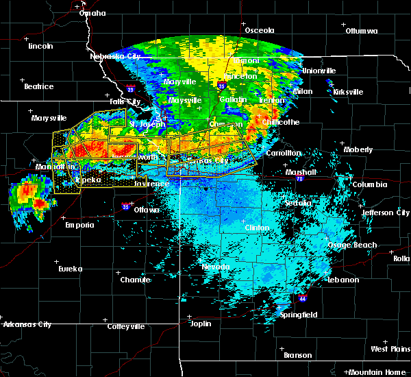 At 1102 pm cdt, severe thunderstorms were located along a line extending from near braymer to near platte city, moving south at 30 mph (radar indicated). Hazards include 60 mph wind gusts and quarter size hail. Hail damage to vehicles is expected. Expect wind damage to roofs, siding, and trees. At 1102 pm cdt, severe thunderstorms were located along a line extending from near braymer to near platte city, moving south at 30 mph (radar indicated). Hazards include 60 mph wind gusts and quarter size hail. Hail damage to vehicles is expected. Expect wind damage to roofs, siding, and trees.
|
| 6/2/2018 5:41 AM CDT |
 At 541 am cdt, a severe thunderstorm was located near woods heights, or 7 miles east of lawson, moving northeast at 45 mph (law enforcement). Hazards include 70 mph wind gusts. Expect considerable tree damage. Damage is likely to mobile homes, roofs, and outbuildings. At 541 am cdt, a severe thunderstorm was located near woods heights, or 7 miles east of lawson, moving northeast at 45 mph (law enforcement). Hazards include 70 mph wind gusts. Expect considerable tree damage. Damage is likely to mobile homes, roofs, and outbuildings.
|
| 6/2/2018 5:10 AM CDT |
 At 510 am cdt, a severe thunderstorm was located over raytown, moving east at 60 mph (radar indicated). Hazards include 70 mph wind gusts. Expect considerable tree damage. Damage is likely to mobile homes, roofs, and outbuildings. At 510 am cdt, a severe thunderstorm was located over raytown, moving east at 60 mph (radar indicated). Hazards include 70 mph wind gusts. Expect considerable tree damage. Damage is likely to mobile homes, roofs, and outbuildings.
|
| 5/14/2018 1:13 PM CDT |
 At 113 pm cdt, a severe thunderstorm was located over sibley, or near buckner, moving northeast at 15 mph (radar indicated). Hazards include 60 mph wind gusts and quarter size hail. Hail damage to vehicles is expected. Expect wind damage to roofs, siding, and trees. At 113 pm cdt, a severe thunderstorm was located over sibley, or near buckner, moving northeast at 15 mph (radar indicated). Hazards include 60 mph wind gusts and quarter size hail. Hail damage to vehicles is expected. Expect wind damage to roofs, siding, and trees.
|
| 5/2/2018 9:44 PM CDT |
 At 943 pm cdt, severe thunderstorms capable of producing both tornadoes and extensive straight line wind damage were located along a line extending from near buckner to near blue springs to near grain valley to baldwin park, moving northeast at 55 mph (radar indicated rotation). Hazards include tornado and quarter size hail. Flying debris will be dangerous to those caught without shelter. mobile homes will be damaged or destroyed. damage to roofs, windows, and vehicles will occur. Tree damage is likely. At 943 pm cdt, severe thunderstorms capable of producing both tornadoes and extensive straight line wind damage were located along a line extending from near buckner to near blue springs to near grain valley to baldwin park, moving northeast at 55 mph (radar indicated rotation). Hazards include tornado and quarter size hail. Flying debris will be dangerous to those caught without shelter. mobile homes will be damaged or destroyed. damage to roofs, windows, and vehicles will occur. Tree damage is likely.
|
| 5/2/2018 9:28 PM CDT |
 At 928 pm cdt, a severe thunderstorm capable of producing a tornado was located over raytown, moving east at 55 mph (radar indicated rotation). Hazards include tornado and quarter size hail. Flying debris will be dangerous to those caught without shelter. mobile homes will be damaged or destroyed. damage to roofs, windows, and vehicles will occur. Tree damage is likely. At 928 pm cdt, a severe thunderstorm capable of producing a tornado was located over raytown, moving east at 55 mph (radar indicated rotation). Hazards include tornado and quarter size hail. Flying debris will be dangerous to those caught without shelter. mobile homes will be damaged or destroyed. damage to roofs, windows, and vehicles will occur. Tree damage is likely.
|
| 5/2/2018 9:25 PM CDT |
 At 920 pm cdt, tornado producing storms were located along a line extending from near grandview to near belton to near cleveland, moving east at 55 mph (weather spotters confirmed tornado). Hazards include damaging tornado and quarter size hail. Flying debris will be dangerous to those caught without shelter. mobile homes will be damaged or destroyed. damage to roofs, windows, and vehicles will occur. tree damage is likely. locations impacted include, kansas city, overland park, lee`s summit, blue springs, leawood, raytown, grandview, belton, raymore, grain valley, harrisonville, pleasant hill, oak grove, greenwood, peculiar, lake lotawana, lake winnebago, lone jack, cleveland and baldwin park. this includes the following highways, interstate 70 in missouri near mile marker 29. interstate 470 between mile markers 0 and 12. Interstate 435 between mile markers 70 and 79. At 920 pm cdt, tornado producing storms were located along a line extending from near grandview to near belton to near cleveland, moving east at 55 mph (weather spotters confirmed tornado). Hazards include damaging tornado and quarter size hail. Flying debris will be dangerous to those caught without shelter. mobile homes will be damaged or destroyed. damage to roofs, windows, and vehicles will occur. tree damage is likely. locations impacted include, kansas city, overland park, lee`s summit, blue springs, leawood, raytown, grandview, belton, raymore, grain valley, harrisonville, pleasant hill, oak grove, greenwood, peculiar, lake lotawana, lake winnebago, lone jack, cleveland and baldwin park. this includes the following highways, interstate 70 in missouri near mile marker 29. interstate 470 between mile markers 0 and 12. Interstate 435 between mile markers 70 and 79.
|
| 5/2/2018 9:22 PM CDT |
 At 921 pm cdt, severe thunderstorms were located along a line extending from near raytown to 8 miles southeast of drexel to near prescott, moving east at 55 mph. this is a dangerous line of storms with potential for embedded tornadoes and 70 mph winds (radar indicated). Hazards include 70 mph wind gusts. Expect considerable tree damage. Damage is likely to mobile homes, roofs, and outbuildings. At 921 pm cdt, severe thunderstorms were located along a line extending from near raytown to 8 miles southeast of drexel to near prescott, moving east at 55 mph. this is a dangerous line of storms with potential for embedded tornadoes and 70 mph winds (radar indicated). Hazards include 70 mph wind gusts. Expect considerable tree damage. Damage is likely to mobile homes, roofs, and outbuildings.
|
| 5/2/2018 9:21 PM CDT |
 At 920 pm cdt, tornado producing storms were located along a line extending from near grandview to near belton to near cleveland, moving east at 55 mph (weather spotters confirmed tornado). Hazards include damaging tornado and quarter size hail. Flying debris will be dangerous to those caught without shelter. mobile homes will be damaged or destroyed. damage to roofs, windows, and vehicles will occur. tree damage is likely. locations impacted include, kansas city, overland park, lee`s summit, blue springs, leawood, raytown, grandview, belton, raymore, grain valley, harrisonville, pleasant hill, oak grove, greenwood, peculiar, lake lotawana, lake winnebago, lone jack, cleveland and baldwin park. this includes the following highways, interstate 70 in missouri near mile marker 29. interstate 470 between mile markers 0 and 12. Interstate 435 between mile markers 70 and 79. At 920 pm cdt, tornado producing storms were located along a line extending from near grandview to near belton to near cleveland, moving east at 55 mph (weather spotters confirmed tornado). Hazards include damaging tornado and quarter size hail. Flying debris will be dangerous to those caught without shelter. mobile homes will be damaged or destroyed. damage to roofs, windows, and vehicles will occur. tree damage is likely. locations impacted include, kansas city, overland park, lee`s summit, blue springs, leawood, raytown, grandview, belton, raymore, grain valley, harrisonville, pleasant hill, oak grove, greenwood, peculiar, lake lotawana, lake winnebago, lone jack, cleveland and baldwin park. this includes the following highways, interstate 70 in missouri near mile marker 29. interstate 470 between mile markers 0 and 12. Interstate 435 between mile markers 70 and 79.
|
| 5/2/2018 9:09 PM CDT |
 At 909 pm cdt, severe thunderstorms capable of producing both tornadoes and extensive straight line wind damage were located along a line extending from near olathe to near spring hill, moving east at 50 mph (radar indicated rotation). Hazards include tornado and quarter size hail. Flying debris will be dangerous to those caught without shelter. mobile homes will be damaged or destroyed. damage to roofs, windows, and vehicles will occur. Tree damage is likely. At 909 pm cdt, severe thunderstorms capable of producing both tornadoes and extensive straight line wind damage were located along a line extending from near olathe to near spring hill, moving east at 50 mph (radar indicated rotation). Hazards include tornado and quarter size hail. Flying debris will be dangerous to those caught without shelter. mobile homes will be damaged or destroyed. damage to roofs, windows, and vehicles will occur. Tree damage is likely.
|
| 4/13/2018 6:03 PM CDT |
 At 603 pm cdt, severe thunderstorms were located along a line extending from kansas city to near lenexa, moving northeast at 45 mph (trained weather spotters). Hazards include golf ball size hail and 60 mph wind gusts. People and animals outdoors will be injured. expect hail damage to roofs, siding, windows, and vehicles. expect wind damage to roofs, siding, and trees. locations impacted include, kansas city, overland park, olathe, independence, lee`s summit, shawnee, blue springs, lenexa, leavenworth, leawood, raytown, liberty, gladstone, grandview, prairie village, lansing, merriam, mission, smithville and kearney. this includes the following highways, interstate 70 in missouri between mile markers 0 and 21. interstate 70 in kansas between mile markers 410 and 423. interstate 35 in missouri between mile markers 0 and 28. interstate 35 in kansas between mile markers 216 and 235. interstate 29 between mile markers 0 and 21. interstate 635 between mile markers 0 and 12. interstate 470 between mile markers 0 and 6, and between mile markers 12 and 16. interstate 435 between mile markers 0 and 83. kansas turnpike between mile markers 222 and 226. A tornado watch remains in effect until 900 pm cdt for northeastern and east central kansas, and northwestern and west central missouri. At 603 pm cdt, severe thunderstorms were located along a line extending from kansas city to near lenexa, moving northeast at 45 mph (trained weather spotters). Hazards include golf ball size hail and 60 mph wind gusts. People and animals outdoors will be injured. expect hail damage to roofs, siding, windows, and vehicles. expect wind damage to roofs, siding, and trees. locations impacted include, kansas city, overland park, olathe, independence, lee`s summit, shawnee, blue springs, lenexa, leavenworth, leawood, raytown, liberty, gladstone, grandview, prairie village, lansing, merriam, mission, smithville and kearney. this includes the following highways, interstate 70 in missouri between mile markers 0 and 21. interstate 70 in kansas between mile markers 410 and 423. interstate 35 in missouri between mile markers 0 and 28. interstate 35 in kansas between mile markers 216 and 235. interstate 29 between mile markers 0 and 21. interstate 635 between mile markers 0 and 12. interstate 470 between mile markers 0 and 6, and between mile markers 12 and 16. interstate 435 between mile markers 0 and 83. kansas turnpike between mile markers 222 and 226. A tornado watch remains in effect until 900 pm cdt for northeastern and east central kansas, and northwestern and west central missouri.
|
| 4/13/2018 5:55 PM CDT |
 At 555 pm cdt, severe thunderstorms were located along a line extending from edwardsville to near olathe, moving northeast at 45 mph (trained weather spotters). Hazards include ping pong ball size hail and 60 mph wind gusts. People and animals outdoors will be injured. expect hail damage to roofs, siding, windows, and vehicles. Expect wind damage to roofs, siding, and trees. At 555 pm cdt, severe thunderstorms were located along a line extending from edwardsville to near olathe, moving northeast at 45 mph (trained weather spotters). Hazards include ping pong ball size hail and 60 mph wind gusts. People and animals outdoors will be injured. expect hail damage to roofs, siding, windows, and vehicles. Expect wind damage to roofs, siding, and trees.
|
| 10/14/2017 6:38 PM CDT |
 At 637 pm cdt, severe thunderstorms were located along a line extending from near lone jack to kingsville to garden city, moving east at 50 mph (radar indicated). Hazards include 60 mph wind gusts and nickel size hail. Expect damage to roofs, siding, and trees. locations impacted include, grain valley, oak grove, lone jack, kingsville, bates city and pittsville. this includes interstate 70 in missouri between mile markers 24 and 30. A tornado watch remains in effect until 100 am cdt for west central missouri. At 637 pm cdt, severe thunderstorms were located along a line extending from near lone jack to kingsville to garden city, moving east at 50 mph (radar indicated). Hazards include 60 mph wind gusts and nickel size hail. Expect damage to roofs, siding, and trees. locations impacted include, grain valley, oak grove, lone jack, kingsville, bates city and pittsville. this includes interstate 70 in missouri between mile markers 24 and 30. A tornado watch remains in effect until 100 am cdt for west central missouri.
|
| 10/14/2017 6:24 PM CDT |
 At 624 pm cdt, severe thunderstorms were located along a line extending from near lee`s summit to near pleasant hill to near archie, moving east at 50 mph (radar indicated). Hazards include 60 mph wind gusts and nickel size hail. Expect damage to roofs, siding, and trees. locations impacted include, lee`s summit, blue springs, grain valley, harrisonville, pleasant hill, oak grove, greenwood, peculiar, holden, lake lotawana, lake winnebago, lone jack, lake tapawingo, freeman, east lynne, kingsville, baldwin park, bates city, strasburg and gunn city. this includes the following highways, interstate 70 in missouri between mile markers 19 and 30. interstate 470 between mile markers 8 and 15. A tornado watch remains in effect until 100 am cdt for west central missouri. At 624 pm cdt, severe thunderstorms were located along a line extending from near lee`s summit to near pleasant hill to near archie, moving east at 50 mph (radar indicated). Hazards include 60 mph wind gusts and nickel size hail. Expect damage to roofs, siding, and trees. locations impacted include, lee`s summit, blue springs, grain valley, harrisonville, pleasant hill, oak grove, greenwood, peculiar, holden, lake lotawana, lake winnebago, lone jack, lake tapawingo, freeman, east lynne, kingsville, baldwin park, bates city, strasburg and gunn city. this includes the following highways, interstate 70 in missouri between mile markers 19 and 30. interstate 470 between mile markers 8 and 15. A tornado watch remains in effect until 100 am cdt for west central missouri.
|
| 10/14/2017 6:03 PM CDT |
 At 603 pm cdt, severe thunderstorms were located along a line extending from near leawood to near belton to near louisburg, moving east at 50 mph (radar indicated). Hazards include 60 mph wind gusts and nickel size hail. expect damage to roofs, siding, and trees At 603 pm cdt, severe thunderstorms were located along a line extending from near leawood to near belton to near louisburg, moving east at 50 mph (radar indicated). Hazards include 60 mph wind gusts and nickel size hail. expect damage to roofs, siding, and trees
|
| 8/21/2017 9:56 PM CDT |
 The severe thunderstorm warning for east central wyandotte, southern clay and central jackson counties will expire at 1000 pm cdt, the storm which prompted the warning has weakened below severe limits, and no longer poses an immediate threat to life or property. therefore the warning will be allowed to expire. however gusty winds of 50 mph are expected with this thunderstorm. The severe thunderstorm warning for east central wyandotte, southern clay and central jackson counties will expire at 1000 pm cdt, the storm which prompted the warning has weakened below severe limits, and no longer poses an immediate threat to life or property. therefore the warning will be allowed to expire. however gusty winds of 50 mph are expected with this thunderstorm.
|
| 8/21/2017 9:40 PM CDT |
 At 939 pm cdt, a severe thunderstorm was located over sugar creek, moving southeast at 45 mph (radar indicated). Hazards include 60 mph wind gusts. Expect damage to roofs, siding, and trees. locations impacted include, kansas city, independence, lee`s summit, blue springs, raytown, liberty, gladstone, mission, north kansas city, mission hills, sugar creek, riverside, westwood, claycomo, kansas city kansas, courtney, pleasant valley, lake tapawingo, glenaire and avondale. this includes the following highways, interstate 70 in missouri between mile markers 0 and 18. interstate 70 in kansas between mile markers 420 and 423. interstate 35 in missouri between mile markers 0 and 17. interstate 35 in kansas between mile markers 232 and 235. interstate 29 between mile markers 0 and 2. interstate 470 between mile markers 2 and 16. Interstate 435 between mile markers 48 and 70. At 939 pm cdt, a severe thunderstorm was located over sugar creek, moving southeast at 45 mph (radar indicated). Hazards include 60 mph wind gusts. Expect damage to roofs, siding, and trees. locations impacted include, kansas city, independence, lee`s summit, blue springs, raytown, liberty, gladstone, mission, north kansas city, mission hills, sugar creek, riverside, westwood, claycomo, kansas city kansas, courtney, pleasant valley, lake tapawingo, glenaire and avondale. this includes the following highways, interstate 70 in missouri between mile markers 0 and 18. interstate 70 in kansas between mile markers 420 and 423. interstate 35 in missouri between mile markers 0 and 17. interstate 35 in kansas between mile markers 232 and 235. interstate 29 between mile markers 0 and 2. interstate 470 between mile markers 2 and 16. Interstate 435 between mile markers 48 and 70.
|
| 8/21/2017 9:26 PM CDT |
 At 926 pm cdt, a severe thunderstorm was located over houston lake, or over riverside, moving east at 40 mph (radar indicated). Hazards include 60 mph wind gusts. expect damage to roofs, siding, and trees At 926 pm cdt, a severe thunderstorm was located over houston lake, or over riverside, moving east at 40 mph (radar indicated). Hazards include 60 mph wind gusts. expect damage to roofs, siding, and trees
|
| 8/18/2017 7:02 PM CDT |
 At 701 pm cdt, a severe thunderstorm was located over buckner, moving southeast at 35 mph (radar indicated). Hazards include 60 mph wind gusts and quarter size hail. Hail damage to vehicles is expected. expect wind damage to roofs, siding, and trees. locations impacted include, independence, blue springs, grain valley, oak grove, buckner, sibley, levasy, napoleon and bates city. This includes interstate 70 in missouri between mile markers 22 and 31. At 701 pm cdt, a severe thunderstorm was located over buckner, moving southeast at 35 mph (radar indicated). Hazards include 60 mph wind gusts and quarter size hail. Hail damage to vehicles is expected. expect wind damage to roofs, siding, and trees. locations impacted include, independence, blue springs, grain valley, oak grove, buckner, sibley, levasy, napoleon and bates city. This includes interstate 70 in missouri between mile markers 22 and 31.
|
| 8/18/2017 6:53 PM CDT |
 At 653 pm cdt, a severe thunderstorm was located near buckner, moving southeast at 40 mph (radar indicated). Hazards include 60 mph wind gusts and quarter size hail. Hail damage to vehicles is expected. expect wind damage to roofs, siding, and trees. locations impacted include, kansas city, independence, blue springs, liberty, grain valley, oak grove, sugar creek, buckner, courtney, orrick, sibley, missouri city, levasy, river bend, napoleon, bates city, camden, birmingham, fleming and tarsney lakes. This includes interstate 70 in missouri between mile markers 19 and 31. At 653 pm cdt, a severe thunderstorm was located near buckner, moving southeast at 40 mph (radar indicated). Hazards include 60 mph wind gusts and quarter size hail. Hail damage to vehicles is expected. expect wind damage to roofs, siding, and trees. locations impacted include, kansas city, independence, blue springs, liberty, grain valley, oak grove, sugar creek, buckner, courtney, orrick, sibley, missouri city, levasy, river bend, napoleon, bates city, camden, birmingham, fleming and tarsney lakes. This includes interstate 70 in missouri between mile markers 19 and 31.
|
| 8/18/2017 6:40 PM CDT |
 At 639 pm cdt, a severe thunderstorm was located over claycomo, moving southeast at 35 mph (radar indicated). Hazards include 60 mph wind gusts and quarter size hail. Hail damage to vehicles is expected. Expect wind damage to roofs, siding, and trees. At 639 pm cdt, a severe thunderstorm was located over claycomo, moving southeast at 35 mph (radar indicated). Hazards include 60 mph wind gusts and quarter size hail. Hail damage to vehicles is expected. Expect wind damage to roofs, siding, and trees.
|
| 7/22/2017 10:42 PM CDT | Large limbs down in jackson county MO, 0.5 miles SSE of Blue Springs, MO |
| 7/22/2017 10:41 PM CDT | Large limbs down in jackson county MO, 0.5 miles SSE of Blue Springs, MO |
| 7/22/2017 10:23 PM CDT |
 At 1022 pm cdt, a severe thunderstorm was located over raytown, moving east at 40 mph (radar indicated). Hazards include 70 mph wind gusts and nickel size hail. Expect considerable tree damage. Damage is likely to mobile homes, roofs, and outbuildings. At 1022 pm cdt, a severe thunderstorm was located over raytown, moving east at 40 mph (radar indicated). Hazards include 70 mph wind gusts and nickel size hail. Expect considerable tree damage. Damage is likely to mobile homes, roofs, and outbuildings.
|
| 7/22/2017 9:45 PM CDT |
 At 945 pm cdt, a severe thunderstorm was located over grandview, moving east at 20 mph (radar indicated). Hazards include 60 mph wind gusts and penny size hail. expect damage to roofs, siding, and trees At 945 pm cdt, a severe thunderstorm was located over grandview, moving east at 20 mph (radar indicated). Hazards include 60 mph wind gusts and penny size hail. expect damage to roofs, siding, and trees
|
| 7/22/2017 9:27 PM CDT |
 At 927 pm cdt, a severe thunderstorm was located over greenwood, moving east at 20 mph (radar indicated). Hazards include 60 mph wind gusts and quarter size hail. Hail damage to vehicles is expected. expect wind damage to roofs, siding, and trees. locations impacted include, kansas city, lee`s summit, raytown, grandview, belton, raymore, pleasant hill, greenwood, lake lotawana, lake winnebago, lone jack, baldwin park, unity village and tarsney lakes. this includes the following highways, interstate 470 between mile markers 0 and 11. Interstate 435 between mile markers 70 and 73. At 927 pm cdt, a severe thunderstorm was located over greenwood, moving east at 20 mph (radar indicated). Hazards include 60 mph wind gusts and quarter size hail. Hail damage to vehicles is expected. expect wind damage to roofs, siding, and trees. locations impacted include, kansas city, lee`s summit, raytown, grandview, belton, raymore, pleasant hill, greenwood, lake lotawana, lake winnebago, lone jack, baldwin park, unity village and tarsney lakes. this includes the following highways, interstate 470 between mile markers 0 and 11. Interstate 435 between mile markers 70 and 73.
|
| 7/22/2017 9:10 PM CDT |
 At 910 pm cdt, a severe thunderstorm was located over lee`s summit, moving east at 20 mph (radar indicated). Hazards include 60 mph wind gusts and quarter size hail. Hail damage to vehicles is expected. Expect wind damage to roofs, siding, and trees. At 910 pm cdt, a severe thunderstorm was located over lee`s summit, moving east at 20 mph (radar indicated). Hazards include 60 mph wind gusts and quarter size hail. Hail damage to vehicles is expected. Expect wind damage to roofs, siding, and trees.
|
| 6/17/2017 9:52 PM CDT | 6 in diameter tree limbs snappe in jackson county MO, 2.1 miles ESE of Blue Springs, MO |
| 6/17/2017 9:51 PM CDT |
 The severe thunderstorm warning for jackson county will expire at 1000 pm cdt, the storms which prompted the warning have moved out of the area. therefore the warning will be allowed to expire. a severe thunderstorm watch remains in effect until 200 am cdt for west central missouri. The severe thunderstorm warning for jackson county will expire at 1000 pm cdt, the storms which prompted the warning have moved out of the area. therefore the warning will be allowed to expire. a severe thunderstorm watch remains in effect until 200 am cdt for west central missouri.
|
| 6/17/2017 9:47 PM CDT |
 At 947 pm cdt, severe thunderstorms were located along a line extending from levasy to grain valley to near lone jack, moving east at 50 mph (radar indicated). Hazards include 70 mph wind gusts. Expect considerable tree damage. Damage is likely to mobile homes, roofs, and outbuildings. At 947 pm cdt, severe thunderstorms were located along a line extending from levasy to grain valley to near lone jack, moving east at 50 mph (radar indicated). Hazards include 70 mph wind gusts. Expect considerable tree damage. Damage is likely to mobile homes, roofs, and outbuildings.
|
| 6/17/2017 9:43 PM CDT | Vehicle shaking. transformers blowing south of spotter's locatio in jackson county MO, 1.5 miles W of Blue Springs, MO |
| 6/17/2017 9:40 PM CDT | Storm damage reported in jackson county MO, 2 miles SSW of Blue Springs, MO |
| 6/17/2017 9:38 PM CDT |
 At 938 pm cdt, severe thunderstorms were located along a line extending from levasy to near lake lotawana to lake winnebago, moving southeast at 40 mph. these are very dangerous storms (trained weather spotters). Hazards include 80 mph wind gusts. Flying debris will be dangerous to those caught without shelter. mobile homes will be heavily damaged. expect considerable damage to roofs, windows, and vehicles. Extensive tree damage and power outages are likely. At 938 pm cdt, severe thunderstorms were located along a line extending from levasy to near lake lotawana to lake winnebago, moving southeast at 40 mph. these are very dangerous storms (trained weather spotters). Hazards include 80 mph wind gusts. Flying debris will be dangerous to those caught without shelter. mobile homes will be heavily damaged. expect considerable damage to roofs, windows, and vehicles. Extensive tree damage and power outages are likely.
|
| 6/17/2017 9:31 PM CDT |
 At 930 pm cdt, severe thunderstorms were located along a line extending from courtney to near raytown to near lee`s summit, moving east at 45 mph. these are very dangerous storms (radar indicated). Hazards include 80 mph wind gusts. Flying debris will be dangerous to those caught without shelter. mobile homes will be heavily damaged. expect considerable damage to roofs, windows, and vehicles. extensive tree damage and power outages are likely. Locations impacted include, kansas city, independence, lee`s summit, blue springs, raytown, grandview, grain valley, oak grove, greenwood, north kansas city, sugar creek, buckner, lake lotawana, lone jack, lake tapawingo, unity village and tarsney lakes. At 930 pm cdt, severe thunderstorms were located along a line extending from courtney to near raytown to near lee`s summit, moving east at 45 mph. these are very dangerous storms (radar indicated). Hazards include 80 mph wind gusts. Flying debris will be dangerous to those caught without shelter. mobile homes will be heavily damaged. expect considerable damage to roofs, windows, and vehicles. extensive tree damage and power outages are likely. Locations impacted include, kansas city, independence, lee`s summit, blue springs, raytown, grandview, grain valley, oak grove, greenwood, north kansas city, sugar creek, buckner, lake lotawana, lone jack, lake tapawingo, unity village and tarsney lakes.
|
| 6/17/2017 9:28 PM CDT |
 At 926 pm cdt, a severe thunderstorm was located near birmingham, moving southeast at 50 mph. numerous reports of wind gusts up to 75 mph have been received across southern clay county with this storm. this is a very dangerous storm (radar indicated). Hazards include 80 mph wind gusts. Flying debris will be dangerous to those caught without shelter. mobile homes will be heavily damaged. expect considerable damage to roofs, windows, and vehicles. extensive tree damage and power outages are likely. Locations impacted include, kansas city, independence, liberty, gladstone, north kansas city, sugar creek, buckner, claycomo, courtney, pleasant valley, glenaire, avondale, oakview, sibley, missouri city, river bend, oakwood park, oakwood, birmingham and oaks. At 926 pm cdt, a severe thunderstorm was located near birmingham, moving southeast at 50 mph. numerous reports of wind gusts up to 75 mph have been received across southern clay county with this storm. this is a very dangerous storm (radar indicated). Hazards include 80 mph wind gusts. Flying debris will be dangerous to those caught without shelter. mobile homes will be heavily damaged. expect considerable damage to roofs, windows, and vehicles. extensive tree damage and power outages are likely. Locations impacted include, kansas city, independence, liberty, gladstone, north kansas city, sugar creek, buckner, claycomo, courtney, pleasant valley, glenaire, avondale, oakview, sibley, missouri city, river bend, oakwood park, oakwood, birmingham and oaks.
|
| 6/17/2017 9:20 PM CDT |
 At 919 pm cdt, severe thunderstorms were located along a line extending from near claycomo to near raytown to grandview, moving southeast at 40 mph (radar and spotter indicated). Hazards include 75 mph wind gusts. Expect considerable tree damage. damage is likely to mobile homes, roofs, and outbuildings. Locations impacted include, kansas city, independence, lee`s summit, blue springs, raytown, grandview, belton, raymore, grain valley, pleasant hill, oak grove, greenwood, north kansas city, sugar creek, buckner, lake lotawana, lake winnebago, lone jack, lake tapawingo and baldwin park. At 919 pm cdt, severe thunderstorms were located along a line extending from near claycomo to near raytown to grandview, moving southeast at 40 mph (radar and spotter indicated). Hazards include 75 mph wind gusts. Expect considerable tree damage. damage is likely to mobile homes, roofs, and outbuildings. Locations impacted include, kansas city, independence, lee`s summit, blue springs, raytown, grandview, belton, raymore, grain valley, pleasant hill, oak grove, greenwood, north kansas city, sugar creek, buckner, lake lotawana, lake winnebago, lone jack, lake tapawingo and baldwin park.
|
| 6/17/2017 9:15 PM CDT |
 At 915 pm cdt, a severe thunderstorm was located over avondale, or over gladstone, moving southeast at 50 mph. at 910 pm a 75 mph wind gust was reported in riverside with this storm (radar indicated). Hazards include 75 mph wind gusts. Expect considerable tree damage. damage is likely to mobile homes, roofs, and outbuildings. Locations impacted include, kansas city, independence, liberty, gladstone, excelsior springs, smithville, kearney, parkville, north kansas city, sugar creek, buckner, riverside, claycomo, courtney, pleasant valley, lake waukomis, glenaire, avondale, platte woods and oakview. At 915 pm cdt, a severe thunderstorm was located over avondale, or over gladstone, moving southeast at 50 mph. at 910 pm a 75 mph wind gust was reported in riverside with this storm (radar indicated). Hazards include 75 mph wind gusts. Expect considerable tree damage. damage is likely to mobile homes, roofs, and outbuildings. Locations impacted include, kansas city, independence, liberty, gladstone, excelsior springs, smithville, kearney, parkville, north kansas city, sugar creek, buckner, riverside, claycomo, courtney, pleasant valley, lake waukomis, glenaire, avondale, platte woods and oakview.
|
| 6/17/2017 9:08 PM CDT |
 At 908 pm cdt, severe thunderstorms were located along a line extending from merriam to near lenexa to near olathe, moving east at 50 mph (radar indicated). Hazards include 70 mph wind gusts. Expect considerable tree damage. Damage is likely to mobile homes, roofs, and outbuildings. At 908 pm cdt, severe thunderstorms were located along a line extending from merriam to near lenexa to near olathe, moving east at 50 mph (radar indicated). Hazards include 70 mph wind gusts. Expect considerable tree damage. Damage is likely to mobile homes, roofs, and outbuildings.
|
| 6/17/2017 9:00 PM CDT |
 At 900 pm cdt, a severe thunderstorm was located near smithville, moving east at 50 mph (radar indicated). Hazards include 60 mph wind gusts. expect damage to roofs, siding, and trees At 900 pm cdt, a severe thunderstorm was located near smithville, moving east at 50 mph (radar indicated). Hazards include 60 mph wind gusts. expect damage to roofs, siding, and trees
|
| 6/17/2017 1:10 AM CDT |
 At 110 am cdt, severe thunderstorms were located along a line extending from grain valley to near pleasant hill to near spring hill, moving southeast at 45 mph (radar indicated). Hazards include 60 mph wind gusts. expect damage to roofs, siding, and trees At 110 am cdt, severe thunderstorms were located along a line extending from grain valley to near pleasant hill to near spring hill, moving southeast at 45 mph (radar indicated). Hazards include 60 mph wind gusts. expect damage to roofs, siding, and trees
|
| 6/17/2017 1:00 AM CDT |
 At 100 am cdt, severe thunderstorms were located along a line extending from near lee`s summit to lake winnebago to near spring hill, moving southeast at 60 mph (radar indicated). Hazards include 60 mph wind gusts. Expect damage to roofs, siding, and trees. Locations impacted include, kansas city, overland park, olathe, independence, lee`s summit, shawnee, lenexa, leawood, raytown, grandview, belton, prairie village, raymore, gardner, merriam, harrisonville, mission, pleasant hill, bonner springs and de soto. At 100 am cdt, severe thunderstorms were located along a line extending from near lee`s summit to lake winnebago to near spring hill, moving southeast at 60 mph (radar indicated). Hazards include 60 mph wind gusts. Expect damage to roofs, siding, and trees. Locations impacted include, kansas city, overland park, olathe, independence, lee`s summit, shawnee, lenexa, leawood, raytown, grandview, belton, prairie village, raymore, gardner, merriam, harrisonville, mission, pleasant hill, bonner springs and de soto.
|
| 6/17/2017 12:49 AM CDT |
 At 1248 am cdt, severe thunderstorms were located along a line extending from near raytown to grandview to near gardner, moving southeast at 60 mph (radar indicated). Hazards include 70 mph wind gusts. Expect considerable tree damage. damage is likely to mobile homes, roofs, and outbuildings. Locations impacted include, kansas city, overland park, olathe, independence, lee`s summit, shawnee, lenexa, leawood, raytown, grandview, belton, prairie village, raymore, gardner, merriam, harrisonville, mission, pleasant hill, bonner springs and de soto. At 1248 am cdt, severe thunderstorms were located along a line extending from near raytown to grandview to near gardner, moving southeast at 60 mph (radar indicated). Hazards include 70 mph wind gusts. Expect considerable tree damage. damage is likely to mobile homes, roofs, and outbuildings. Locations impacted include, kansas city, overland park, olathe, independence, lee`s summit, shawnee, lenexa, leawood, raytown, grandview, belton, prairie village, raymore, gardner, merriam, harrisonville, mission, pleasant hill, bonner springs and de soto.
|
| 6/17/2017 12:28 AM CDT |
 At 1227 am cdt, a severe thunderstorm was located near kansas city kansas, or near lake quivira, moving southeast at 60 mph. this is a very dangerous storm (radar indicated). Hazards include 85 mph wind gusts. Flying debris will be dangerous to those caught without shelter. mobile homes will be heavily damaged. expect considerable damage to roofs, windows, and vehicles. Extensive tree damage and power outages are likely. At 1227 am cdt, a severe thunderstorm was located near kansas city kansas, or near lake quivira, moving southeast at 60 mph. this is a very dangerous storm (radar indicated). Hazards include 85 mph wind gusts. Flying debris will be dangerous to those caught without shelter. mobile homes will be heavily damaged. expect considerable damage to roofs, windows, and vehicles. Extensive tree damage and power outages are likely.
|
| 6/17/2017 12:27 AM CDT |
 At 1224 am cdt, a severe thunderstorm was located over kansas city, or near lake quivira, moving southeast at 60 mph. this is a very dangerous storm (radar indicated). Hazards include 80 mph wind gusts. Flying debris will be dangerous to those caught without shelter. mobile homes will be heavily damaged. expect considerable damage to roofs, windows, and vehicles. extensive tree damage and power outages are likely. Locations impacted include, kansas city, overland park, olathe, independence, lee`s summit, shawnee, blue springs, lenexa, leavenworth, leawood, raytown, gladstone, prairie village, gardner, grain valley, lansing, merriam, mission, bonner springs and de soto. At 1224 am cdt, a severe thunderstorm was located over kansas city, or near lake quivira, moving southeast at 60 mph. this is a very dangerous storm (radar indicated). Hazards include 80 mph wind gusts. Flying debris will be dangerous to those caught without shelter. mobile homes will be heavily damaged. expect considerable damage to roofs, windows, and vehicles. extensive tree damage and power outages are likely. Locations impacted include, kansas city, overland park, olathe, independence, lee`s summit, shawnee, blue springs, lenexa, leavenworth, leawood, raytown, gladstone, prairie village, gardner, grain valley, lansing, merriam, mission, bonner springs and de soto.
|
| 6/17/2017 12:07 AM CDT |
 At 1207 am cdt, severe thunderstorms were located along a line extending from near tonganoxie to near leavenworth, moving southeast at 40 mph (radar indicated). Hazards include 70 mph wind gusts. Expect considerable tree damage. damage is likely to mobile homes, roofs, and outbuildings. Locations impacted include, kansas city, overland park, olathe, independence, lee`s summit, shawnee, blue springs, lenexa, leavenworth, leawood, raytown, gladstone, prairie village, gardner, grain valley, lansing, merriam, mission, bonner springs and de soto. At 1207 am cdt, severe thunderstorms were located along a line extending from near tonganoxie to near leavenworth, moving southeast at 40 mph (radar indicated). Hazards include 70 mph wind gusts. Expect considerable tree damage. damage is likely to mobile homes, roofs, and outbuildings. Locations impacted include, kansas city, overland park, olathe, independence, lee`s summit, shawnee, blue springs, lenexa, leavenworth, leawood, raytown, gladstone, prairie village, gardner, grain valley, lansing, merriam, mission, bonner springs and de soto.
|
| 6/16/2017 11:45 PM CDT |
 At 1144 pm cdt, severe thunderstorms were located along a line extending from near nortonville to near weston, moving southeast at 40 mph (radar indicated). Hazards include 70 mph wind gusts. Expect considerable tree damage. Damage is likely to mobile homes, roofs, and outbuildings. At 1144 pm cdt, severe thunderstorms were located along a line extending from near nortonville to near weston, moving southeast at 40 mph (radar indicated). Hazards include 70 mph wind gusts. Expect considerable tree damage. Damage is likely to mobile homes, roofs, and outbuildings.
|
| 5/27/2017 5:40 PM CDT |
 At 540 pm cdt, a severe thunderstorm was located over lone jack, or near lake lotawana, moving east at 35 mph (radar indicated). Hazards include quarter size hail. Damage to vehicles is expected. Locations impacted include, lee`s summit, pleasant hill, greenwood, lake lotawana, lake winnebago, lone jack, baldwin park and tarsney lakes. At 540 pm cdt, a severe thunderstorm was located over lone jack, or near lake lotawana, moving east at 35 mph (radar indicated). Hazards include quarter size hail. Damage to vehicles is expected. Locations impacted include, lee`s summit, pleasant hill, greenwood, lake lotawana, lake winnebago, lone jack, baldwin park and tarsney lakes.
|
| 5/27/2017 5:30 PM CDT |
 At 530 pm cdt, a severe thunderstorm was located over greenwood, moving east at 40 mph (radar indicated). Hazards include quarter size hail. Damage to vehicles is expected. locations impacted include, lee`s summit, grandview, raymore, pleasant hill, greenwood, lake lotawana, lake winnebago, lone jack, baldwin park, unity village and tarsney lakes. This includes interstate 470 between mile markers 6 and 10. At 530 pm cdt, a severe thunderstorm was located over greenwood, moving east at 40 mph (radar indicated). Hazards include quarter size hail. Damage to vehicles is expected. locations impacted include, lee`s summit, grandview, raymore, pleasant hill, greenwood, lake lotawana, lake winnebago, lone jack, baldwin park, unity village and tarsney lakes. This includes interstate 470 between mile markers 6 and 10.
|
| 5/27/2017 5:22 PM CDT |
 At 522 pm cdt, a severe thunderstorm was located near raymore, moving east at 35 mph (radar indicated). Hazards include quarter size hail. damage to vehicles is expected At 522 pm cdt, a severe thunderstorm was located near raymore, moving east at 35 mph (radar indicated). Hazards include quarter size hail. damage to vehicles is expected
|
| 5/27/2017 12:43 PM CDT |
 At 1243 pm cdt, severe thunderstorms were located along a line extending from lake tapawingo to baldwin park to near garden city, moving east at 40 mph (trained weather spotters). Hazards include 60 mph wind gusts and quarter size hail. Hail damage to vehicles is expected. expect wind damage to roofs, siding, and trees. locations impacted include, kansas city, independence, lee`s summit, blue springs, raymore, grain valley, harrisonville, pleasant hill, oak grove, greenwood, lake lotawana, garden city, archie, lake winnebago, lone jack, lake tapawingo, east lynne, baldwin park, strasburg and gunn city. this includes the following highways, interstate 70 in missouri between mile markers 13 and 29. interstate 470 between mile markers 7 and 16. A tornado watch remains in effect until 700 pm cdt for west central missouri. At 1243 pm cdt, severe thunderstorms were located along a line extending from lake tapawingo to baldwin park to near garden city, moving east at 40 mph (trained weather spotters). Hazards include 60 mph wind gusts and quarter size hail. Hail damage to vehicles is expected. expect wind damage to roofs, siding, and trees. locations impacted include, kansas city, independence, lee`s summit, blue springs, raymore, grain valley, harrisonville, pleasant hill, oak grove, greenwood, lake lotawana, garden city, archie, lake winnebago, lone jack, lake tapawingo, east lynne, baldwin park, strasburg and gunn city. this includes the following highways, interstate 70 in missouri between mile markers 13 and 29. interstate 470 between mile markers 7 and 16. A tornado watch remains in effect until 700 pm cdt for west central missouri.
|
| 5/27/2017 12:22 PM CDT |
 At 1222 pm cdt, severe thunderstorms were located along a line extending from westwood hills to belton to near freeman, moving east at 35 mph (radar indicated). Hazards include 60 mph wind gusts and quarter size hail. Hail damage to vehicles is expected. expect wind damage to roofs, siding, and trees. locations impacted include, kansas city, independence, lee`s summit, blue springs, raytown, grandview, belton, raymore, grain valley, harrisonville, pleasant hill, oak grove, greenwood, peculiar, lake lotawana, garden city, archie, lake winnebago, lone jack and drexel. this includes the following highways, interstate 70 in missouri between mile markers 10 and 29. interstate 470 between mile markers 0 and 16. interstate 435 between mile markers 64 and 74. A tornado watch remains in effect until 700 pm cdt for west central missouri. At 1222 pm cdt, severe thunderstorms were located along a line extending from westwood hills to belton to near freeman, moving east at 35 mph (radar indicated). Hazards include 60 mph wind gusts and quarter size hail. Hail damage to vehicles is expected. expect wind damage to roofs, siding, and trees. locations impacted include, kansas city, independence, lee`s summit, blue springs, raytown, grandview, belton, raymore, grain valley, harrisonville, pleasant hill, oak grove, greenwood, peculiar, lake lotawana, garden city, archie, lake winnebago, lone jack and drexel. this includes the following highways, interstate 70 in missouri between mile markers 10 and 29. interstate 470 between mile markers 0 and 16. interstate 435 between mile markers 64 and 74. A tornado watch remains in effect until 700 pm cdt for west central missouri.
|
| 5/27/2017 12:10 PM CDT |
 At 1209 pm cdt, severe thunderstorms were located along a line extending from lake quivira to 6 miles west of belton to near drexel, moving east at 35 mph (radar indicated). Hazards include 60 mph wind gusts and quarter size hail. Hail damage to vehicles is expected. Expect wind damage to roofs, siding, and trees. At 1209 pm cdt, severe thunderstorms were located along a line extending from lake quivira to 6 miles west of belton to near drexel, moving east at 35 mph (radar indicated). Hazards include 60 mph wind gusts and quarter size hail. Hail damage to vehicles is expected. Expect wind damage to roofs, siding, and trees.
|
| 5/18/2017 10:58 PM CDT |
 The severe thunderstorm warning for east central wyandotte. northeastern johnson. northwestern cass. clay. west central ray. southeastern platte and jackson counties will expire at 1100 pm cdt. the storms which prompted the warning have moved east of the area. therefore the warning will be allowed to expire. However gusty. The severe thunderstorm warning for east central wyandotte. northeastern johnson. northwestern cass. clay. west central ray. southeastern platte and jackson counties will expire at 1100 pm cdt. the storms which prompted the warning have moved east of the area. therefore the warning will be allowed to expire. However gusty.
|
| 5/18/2017 10:47 PM CDT | 4-6 inch diameter branches snapped off of healthy oak trees in jackson county MO, 2.1 miles ESE of Blue Springs, MO |
| 5/18/2017 10:38 PM CDT |
 At 1037 pm cdt, severe thunderstorms were located along a line extending from near smithville to liberty to near lee`s summit, moving northeast at 55 mph (radar indicated). Hazards include 70 mph wind gusts. Expect considerable tree damage. damage is likely to mobile homes, roofs, and outbuildings. Locations impacted include, kansas city, overland park, independence, lee`s summit, blue springs, leawood, raytown, liberty, gladstone, grandview, belton, prairie village, raymore, grain valley, excelsior springs, mission, smithville, kearney, oak grove and greenwood. At 1037 pm cdt, severe thunderstorms were located along a line extending from near smithville to liberty to near lee`s summit, moving northeast at 55 mph (radar indicated). Hazards include 70 mph wind gusts. Expect considerable tree damage. damage is likely to mobile homes, roofs, and outbuildings. Locations impacted include, kansas city, overland park, independence, lee`s summit, blue springs, leawood, raytown, liberty, gladstone, grandview, belton, prairie village, raymore, grain valley, excelsior springs, mission, smithville, kearney, oak grove and greenwood.
|
| 5/18/2017 10:15 PM CDT |
 At 1014 pm cdt, severe thunderstorms were located along a line extending from near lansing to near shawnee to near olathe, moving east at 45 mph (radar indicated). Hazards include 75 mph wind gusts. Expect considerable tree damage. Damage is likely to mobile homes, roofs, and outbuildings. At 1014 pm cdt, severe thunderstorms were located along a line extending from near lansing to near shawnee to near olathe, moving east at 45 mph (radar indicated). Hazards include 75 mph wind gusts. Expect considerable tree damage. Damage is likely to mobile homes, roofs, and outbuildings.
|
| 5/18/2017 10:15 PM CDT |
 The national weather service in pleasant hill has issued a * severe thunderstorm warning for. northeastern wyandotte county in northeastern kansas. eastern johnson county in east central kansas. northwestern cass county in west central missouri. Clay county in west central missouri. The national weather service in pleasant hill has issued a * severe thunderstorm warning for. northeastern wyandotte county in northeastern kansas. eastern johnson county in east central kansas. northwestern cass county in west central missouri. Clay county in west central missouri.
|
| 5/10/2017 2:29 PM CDT |
 At 229 pm cdt, a severe thunderstorm was located over river bend, or over courtney, moving northeast at 45 mph (radar indicated). Hazards include 60 mph wind gusts. expect damage to roofs, siding, and trees At 229 pm cdt, a severe thunderstorm was located over river bend, or over courtney, moving northeast at 45 mph (radar indicated). Hazards include 60 mph wind gusts. expect damage to roofs, siding, and trees
|
| 3/6/2017 8:19 PM CST |
 At 818 pm cst, a severe thunderstorm capable of producing a tornado was located over oak grove, moving east at 60 mph (radar indicated rotation). Hazards include tornado. Flying debris will be dangerous to those caught without shelter. mobile homes will be damaged or destroyed. damage to roofs, windows, and vehicles will occur. Tree damage is likely. At 818 pm cst, a severe thunderstorm capable of producing a tornado was located over oak grove, moving east at 60 mph (radar indicated rotation). Hazards include tornado. Flying debris will be dangerous to those caught without shelter. mobile homes will be damaged or destroyed. damage to roofs, windows, and vehicles will occur. Tree damage is likely.
|
| 3/6/2017 8:15 PM CST |
 At 815 pm cst, a severe thunderstorm was located over grain valley, moving east at 50 mph (radar indicated). Hazards include 60 mph wind gusts and quarter size hail. Hail damage to vehicles is expected. Expect wind damage to roofs, siding, and trees. At 815 pm cst, a severe thunderstorm was located over grain valley, moving east at 50 mph (radar indicated). Hazards include 60 mph wind gusts and quarter size hail. Hail damage to vehicles is expected. Expect wind damage to roofs, siding, and trees.
|
| 3/6/2017 7:59 PM CST |
 At 759 pm cst, a severe thunderstorm capable of producing a tornado was located over grandview, moving east at 65 mph (radar indicated rotation). Hazards include tornado and quarter size hail. Flying debris will be dangerous to those caught without shelter. mobile homes will be damaged or destroyed. damage to roofs, windows, and vehicles will occur. Tree damage is likely. At 759 pm cst, a severe thunderstorm capable of producing a tornado was located over grandview, moving east at 65 mph (radar indicated rotation). Hazards include tornado and quarter size hail. Flying debris will be dangerous to those caught without shelter. mobile homes will be damaged or destroyed. damage to roofs, windows, and vehicles will occur. Tree damage is likely.
|
| 3/6/2017 7:36 PM CST |
 At 736 pm cst, a severe thunderstorm was located over eudora, or 8 miles southwest of de soto, moving east at 35 mph (radar indicated). Hazards include 60 mph wind gusts and quarter size hail. Hail damage to vehicles is expected. Expect wind damage to roofs, siding, and trees. At 736 pm cst, a severe thunderstorm was located over eudora, or 8 miles southwest of de soto, moving east at 35 mph (radar indicated). Hazards include 60 mph wind gusts and quarter size hail. Hail damage to vehicles is expected. Expect wind damage to roofs, siding, and trees.
|
| 3/6/2017 7:27 PM CST |
 At 727 pm cst, a severe thunderstorm was located over basehor, moving east at 55 mph (radar indicated). Hazards include 60 mph wind gusts and quarter size hail. Hail damage to vehicles is expected. Expect wind damage to roofs, siding, and trees. At 727 pm cst, a severe thunderstorm was located over basehor, moving east at 55 mph (radar indicated). Hazards include 60 mph wind gusts and quarter size hail. Hail damage to vehicles is expected. Expect wind damage to roofs, siding, and trees.
|
| 2/28/2017 6:28 PM CST |
 The severe thunderstorm warning for south central ray, southwestern lafayette and southeastern jackson counties will expire at 630 pm cst, the storm which prompted the warning has weakened below severe limits, and no longer pose an immediate threat to life or property. therefore, the warning will be allowed to expire. however small hail and gusty winds are still possible with this thunderstorm. a tornado watch remains in effect until 100 am cst for west central missouri. The severe thunderstorm warning for south central ray, southwestern lafayette and southeastern jackson counties will expire at 630 pm cst, the storm which prompted the warning has weakened below severe limits, and no longer pose an immediate threat to life or property. therefore, the warning will be allowed to expire. however small hail and gusty winds are still possible with this thunderstorm. a tornado watch remains in effect until 100 am cst for west central missouri.
|
| 2/28/2017 6:03 PM CST |
 At 603 pm cst, a severe thunderstorm was located over oak grove, moving northeast at 40 mph (trained weather spotters). Hazards include ping pong ball size hail and 60 mph wind gusts. People and animals outdoors will be injured. expect hail damage to roofs, siding, windows, and vehicles. expect wind damage to roofs, siding, and trees. locations impacted include, independence, lee`s summit, blue springs, grain valley, oak grove, odessa, lexington, buckner, lake lotawana, wellington, lake tapawingo, mayview, levasy, lake lafayette, napoleon, bates city, camden, fleming and tarsney lakes. This includes interstate 70 in missouri between mile markers 18 and 44. At 603 pm cst, a severe thunderstorm was located over oak grove, moving northeast at 40 mph (trained weather spotters). Hazards include ping pong ball size hail and 60 mph wind gusts. People and animals outdoors will be injured. expect hail damage to roofs, siding, windows, and vehicles. expect wind damage to roofs, siding, and trees. locations impacted include, independence, lee`s summit, blue springs, grain valley, oak grove, odessa, lexington, buckner, lake lotawana, wellington, lake tapawingo, mayview, levasy, lake lafayette, napoleon, bates city, camden, fleming and tarsney lakes. This includes interstate 70 in missouri between mile markers 18 and 44.
|
| 2/28/2017 5:55 PM CST |
 At 555 pm cst, a severe thunderstorm was located over blue springs, moving northeast at 35 mph (trained weather spotters). Hazards include 60 mph wind gusts and quarter size hail. Hail damage to vehicles is expected. Expect wind damage to roofs, siding, and trees. At 555 pm cst, a severe thunderstorm was located over blue springs, moving northeast at 35 mph (trained weather spotters). Hazards include 60 mph wind gusts and quarter size hail. Hail damage to vehicles is expected. Expect wind damage to roofs, siding, and trees.
|
| 2/28/2017 5:54 PM CST | Quarter sized hail reported 0.5 miles SSE of Blue Springs, MO, reported at i-70 and woods chapel |
| 2/28/2017 5:53 PM CST | Quarter sized hail reported 0.5 miles SSE of Blue Springs, MO |
| 8/24/2016 9:41 PM CDT |
 At 938 pm cdt, severe thunderstorms were located along a line extending from near lee`s summit to near lake lotawana to near pleasant hill to near harrisonville, moving northeast at 45 mph (trained weather spotters measured 60 mph winds in grandview around 9:30 pm). Hazards include 60 mph wind gusts and nickel size hail. Expect damage to roofs. siding. and trees. locations impacted include, independence, lee`s summit, blue springs, grain valley, harrisonville, pleasant hill, oak grove, odessa, greenwood, buckner, holden, lake lotawana, garden city, lake winnebago, lone jack, wellington, lake tapawingo, east lynne, kingsville and baldwin park. this includes the following highways, interstate 70 in missouri between mile markers 17 and 42. Interstate 470 between mile markers 5 and 15. At 938 pm cdt, severe thunderstorms were located along a line extending from near lee`s summit to near lake lotawana to near pleasant hill to near harrisonville, moving northeast at 45 mph (trained weather spotters measured 60 mph winds in grandview around 9:30 pm). Hazards include 60 mph wind gusts and nickel size hail. Expect damage to roofs. siding. and trees. locations impacted include, independence, lee`s summit, blue springs, grain valley, harrisonville, pleasant hill, oak grove, odessa, greenwood, buckner, holden, lake lotawana, garden city, lake winnebago, lone jack, wellington, lake tapawingo, east lynne, kingsville and baldwin park. this includes the following highways, interstate 70 in missouri between mile markers 17 and 42. Interstate 470 between mile markers 5 and 15.
|
| 8/24/2016 9:28 PM CDT |
 At 926 pm cdt, severe thunderstorms were located along a line extending from near grandview to near raymore to near peculiar to 6 miles south of freeman, moving northeast at 45 mph (trained weather spotters reported 73 mph wind in stanley kansas). Hazards include 70 mph wind gusts and quarter size hail. Hail damage to vehicles is expected. expect considerable tree damage. Wind damage is also likely to mobile homes, roofs, and outbuildings. At 926 pm cdt, severe thunderstorms were located along a line extending from near grandview to near raymore to near peculiar to 6 miles south of freeman, moving northeast at 45 mph (trained weather spotters reported 73 mph wind in stanley kansas). Hazards include 70 mph wind gusts and quarter size hail. Hail damage to vehicles is expected. expect considerable tree damage. Wind damage is also likely to mobile homes, roofs, and outbuildings.
|
| 8/24/2016 8:42 PM CDT |
 The tornado warning for southwestern lafayette, northwestern johnson, northeastern cass and southeastern jackson counties will expire at 845 pm cdt, the tornado warning has been cancelled. however, large hail and damaging winds remain likely and a severe thunderstorm warning remains in effect for the area. however small hail, .gusty winds and heavy rain are still possible with this thunderstorm. a severe thunderstorm watch remains in effect until 1100 pm cdt for west central missouri. The tornado warning for southwestern lafayette, northwestern johnson, northeastern cass and southeastern jackson counties will expire at 845 pm cdt, the tornado warning has been cancelled. however, large hail and damaging winds remain likely and a severe thunderstorm warning remains in effect for the area. however small hail, .gusty winds and heavy rain are still possible with this thunderstorm. a severe thunderstorm watch remains in effect until 1100 pm cdt for west central missouri.
|
| 8/24/2016 8:40 PM CDT |
 At 840 pm cdt, a severe thunderstorm was located near odessa, moving east at 35 mph (radar indicated). Hazards include 60 mph wind gusts and quarter size hail. Hail damage to vehicles is expected. Expect wind damage to roofs, siding, and trees. At 840 pm cdt, a severe thunderstorm was located near odessa, moving east at 35 mph (radar indicated). Hazards include 60 mph wind gusts and quarter size hail. Hail damage to vehicles is expected. Expect wind damage to roofs, siding, and trees.
|
| 8/24/2016 8:14 PM CDT |
 At 814 pm cdt, a severe thunderstorm capable of producing a tornado was located near lone jack, or near lake lotawana, moving east at 30 mph (radar indicated rotation). Hazards include tornado and ping pong ball size hail. Flying debris will be dangerous to those caught without shelter. mobile homes will be damaged or destroyed. damage to roofs, windows, and vehicles will occur. Tree damage is likely. At 814 pm cdt, a severe thunderstorm capable of producing a tornado was located near lone jack, or near lake lotawana, moving east at 30 mph (radar indicated rotation). Hazards include tornado and ping pong ball size hail. Flying debris will be dangerous to those caught without shelter. mobile homes will be damaged or destroyed. damage to roofs, windows, and vehicles will occur. Tree damage is likely.
|
| 8/24/2016 7:34 PM CDT |
 At 734 pm cdt, a severe thunderstorm was located near belton, moving northeast at 35 mph (radar indicated). Hazards include golf ball size hail and 60 mph wind gusts. People and animals outdoors will be injured. expect hail damage to roofs, siding, windows, and vehicles. Expect wind damage to roofs, siding, and trees. At 734 pm cdt, a severe thunderstorm was located near belton, moving northeast at 35 mph (radar indicated). Hazards include golf ball size hail and 60 mph wind gusts. People and animals outdoors will be injured. expect hail damage to roofs, siding, windows, and vehicles. Expect wind damage to roofs, siding, and trees.
|
| 7/13/2016 11:27 AM CDT |
 At 1126 am cdt, severe thunderstorms were located along a line extending from near woods heights to near odessa to near harrisonville, moving east at 45 mph (radar indicated). Hazards include 60 mph wind gusts and penny size hail. Expect damage to roofs. siding. And trees. At 1126 am cdt, severe thunderstorms were located along a line extending from near woods heights to near odessa to near harrisonville, moving east at 45 mph (radar indicated). Hazards include 60 mph wind gusts and penny size hail. Expect damage to roofs. siding. And trees.
|
| 7/13/2016 11:05 AM CDT |
 At 1104 am cdt, severe thunderstorms were located along a line extending from near excelsior springs to near lake tapawingo to near belton, moving east at 40 mph (radar indicated). Hazards include 70 mph wind gusts and nickel size hail. Expect considerable tree damage. Damage is likely to mobile homes, roofs, and outbuildings. At 1104 am cdt, severe thunderstorms were located along a line extending from near excelsior springs to near lake tapawingo to near belton, moving east at 40 mph (radar indicated). Hazards include 70 mph wind gusts and nickel size hail. Expect considerable tree damage. Damage is likely to mobile homes, roofs, and outbuildings.
|
| 7/12/2016 3:59 AM CDT |
 At 358 am cdt, severe thunderstorms were located along a line extending from near waverly to levasy to kansas city kansas, moving southeast at 45 mph (radar indicated). Hazards include 60 mph wind gusts. Expect damage to roofs. siding. And trees. At 358 am cdt, severe thunderstorms were located along a line extending from near waverly to levasy to kansas city kansas, moving southeast at 45 mph (radar indicated). Hazards include 60 mph wind gusts. Expect damage to roofs. siding. And trees.
|
| 7/12/2016 3:46 AM CDT |
 At 345 am cdt, severe thunderstorms were located along a line extending from near bosworth to near orrick to near lansing, moving southeast at 20 mph (radar indicated). Hazards include 60 mph wind gusts. Expect damage to roofs. siding. and trees. locations impacted include, kansas city, overland park, independence, lee`s summit, shawnee, blue springs, leavenworth, raytown, liberty, gladstone, prairie village, grain valley, lansing, excelsior springs, merriam, mission, smithville, kearney, oak grove and bonner springs. this includes the following highways, interstate 70 in missouri between mile markers 0 and 48. interstate 70 in kansas between mile markers 410 and 423. interstate 35 in missouri between mile markers 0 and 27. interstate 35 in kansas between mile markers 228 and 235. interstate 29 between mile markers 0 and 21. interstate 635 between mile markers 0 and 12. interstate 470 between mile markers 14 and 16. interstate 435 between mile markers 6 and 66. Kansas turnpike between mile markers 225 and 226. At 345 am cdt, severe thunderstorms were located along a line extending from near bosworth to near orrick to near lansing, moving southeast at 20 mph (radar indicated). Hazards include 60 mph wind gusts. Expect damage to roofs. siding. and trees. locations impacted include, kansas city, overland park, independence, lee`s summit, shawnee, blue springs, leavenworth, raytown, liberty, gladstone, prairie village, grain valley, lansing, excelsior springs, merriam, mission, smithville, kearney, oak grove and bonner springs. this includes the following highways, interstate 70 in missouri between mile markers 0 and 48. interstate 70 in kansas between mile markers 410 and 423. interstate 35 in missouri between mile markers 0 and 27. interstate 35 in kansas between mile markers 228 and 235. interstate 29 between mile markers 0 and 21. interstate 635 between mile markers 0 and 12. interstate 470 between mile markers 14 and 16. interstate 435 between mile markers 6 and 66. Kansas turnpike between mile markers 225 and 226.
|
| 7/12/2016 3:04 AM CDT |
 At 304 am cdt, severe thunderstorms were located along a line extending from near utica to near lathrop to lewis and clark village, moving southeast at 45 mph (radar indicated). Hazards include 60 mph wind gusts. Expect damage to roofs. siding. And trees. At 304 am cdt, severe thunderstorms were located along a line extending from near utica to near lathrop to lewis and clark village, moving southeast at 45 mph (radar indicated). Hazards include 60 mph wind gusts. Expect damage to roofs. siding. And trees.
|
| 7/7/2016 5:15 AM CDT |
 At 515 am cdt, severe thunderstorms were located along a line extending from grain valley to raymore to near wellsville, moving south at 45 mph (radar indicated). Hazards include 60 mph wind gusts. Expect damage to roofs. siding. and trees. locations impacted include, kansas city, overland park, olathe, independence, lee`s summit, blue springs, lenexa, leawood, raytown, grandview, belton, prairie village, raymore, gardner, grain valley, harrisonville, pleasant hill, oak grove, de soto and paola. this includes the following highways, interstate 70 in missouri between mile markers 11 and 41. interstate 35 in kansas between mile markers 200 and 224. interstate 470 between mile markers 0 and 16. Interstate 435 between mile markers 0 and 3, and between mile markers 66 and 83. At 515 am cdt, severe thunderstorms were located along a line extending from grain valley to raymore to near wellsville, moving south at 45 mph (radar indicated). Hazards include 60 mph wind gusts. Expect damage to roofs. siding. and trees. locations impacted include, kansas city, overland park, olathe, independence, lee`s summit, blue springs, lenexa, leawood, raytown, grandview, belton, prairie village, raymore, gardner, grain valley, harrisonville, pleasant hill, oak grove, de soto and paola. this includes the following highways, interstate 70 in missouri between mile markers 11 and 41. interstate 35 in kansas between mile markers 200 and 224. interstate 470 between mile markers 0 and 16. Interstate 435 between mile markers 0 and 3, and between mile markers 66 and 83.
|
| 7/7/2016 5:00 AM CDT |
 At 500 am cdt, severe thunderstorms were located along a line extending from near independence to near leawood to 6 miles south of eudora, moving south at 55 mph (radar indicated). Hazards include 60 mph wind gusts. Expect damage to roofs. siding. And trees. At 500 am cdt, severe thunderstorms were located along a line extending from near independence to near leawood to 6 miles south of eudora, moving south at 55 mph (radar indicated). Hazards include 60 mph wind gusts. Expect damage to roofs. siding. And trees.
|
| 7/7/2016 4:48 AM CDT |
 At 448 am cdt, severe thunderstorms were located along a line extending from near kearney to gladstone to bonner springs, moving southeast at 65 mph (radar indicated). Hazards include 60 mph wind gusts. Expect damage to roofs. siding. and trees. locations impacted include, kansas city, overland park, olathe, independence, lee`s summit, shawnee, blue springs, lenexa, leawood, raytown, liberty, gladstone, grandview, prairie village, grain valley, lansing, merriam, mission, smithville and oak grove. this includes the following highways, interstate 70 in missouri between mile markers 0 and 29. interstate 70 in kansas between mile markers 410 and 423. interstate 35 in missouri between mile markers 0 and 24. interstate 35 in kansas between mile markers 212 and 235. interstate 29 between mile markers 0 and 17. interstate 635 between mile markers 0 and 12. interstate 470 between mile markers 0 and 16. interstate 435 between mile markers 0 and 83. Kansas turnpike between mile markers 222 and 226. At 448 am cdt, severe thunderstorms were located along a line extending from near kearney to gladstone to bonner springs, moving southeast at 65 mph (radar indicated). Hazards include 60 mph wind gusts. Expect damage to roofs. siding. and trees. locations impacted include, kansas city, overland park, olathe, independence, lee`s summit, shawnee, blue springs, lenexa, leawood, raytown, liberty, gladstone, grandview, prairie village, grain valley, lansing, merriam, mission, smithville and oak grove. this includes the following highways, interstate 70 in missouri between mile markers 0 and 29. interstate 70 in kansas between mile markers 410 and 423. interstate 35 in missouri between mile markers 0 and 24. interstate 35 in kansas between mile markers 212 and 235. interstate 29 between mile markers 0 and 17. interstate 635 between mile markers 0 and 12. interstate 470 between mile markers 0 and 16. interstate 435 between mile markers 0 and 83. Kansas turnpike between mile markers 222 and 226.
|
| 7/7/2016 4:33 AM CDT |
 At 433 am cdt, severe thunderstorms were located along a line extending from trimble to ferrelview to near lansing, moving southeast at 65 mph (radar indicated). Hazards include 60 mph wind gusts. Expect damage to roofs. siding. And trees. At 433 am cdt, severe thunderstorms were located along a line extending from trimble to ferrelview to near lansing, moving southeast at 65 mph (radar indicated). Hazards include 60 mph wind gusts. Expect damage to roofs. siding. And trees.
|
| 6/21/2016 12:34 AM CDT |
 At 1233 am cdt, a severe thunderstorm was located near buckner, moving southeast at 20 mph (radar indicated). Hazards include 60 mph wind gusts and half dollar size hail. Hail damage to vehicles is expected. Expect wind damage to roofs, siding, and trees. At 1233 am cdt, a severe thunderstorm was located near buckner, moving southeast at 20 mph (radar indicated). Hazards include 60 mph wind gusts and half dollar size hail. Hail damage to vehicles is expected. Expect wind damage to roofs, siding, and trees.
|
| 5/26/2016 6:23 PM CDT |
 The severe thunderstorm warning for southwestern lafayette, southwestern ray, northeastern jackson and east central clay counties will expire at 630 pm cdt, the storm which prompted the warning has weakened below severe limits and exited the warned area. therefore the warning will be allowed to expire. however gusty winds and heavy rain are still possible with this thunderstorm. a tornado watch remains in effect until 1000 pm cdt for west central missouri. The severe thunderstorm warning for southwestern lafayette, southwestern ray, northeastern jackson and east central clay counties will expire at 630 pm cdt, the storm which prompted the warning has weakened below severe limits and exited the warned area. therefore the warning will be allowed to expire. however gusty winds and heavy rain are still possible with this thunderstorm. a tornado watch remains in effect until 1000 pm cdt for west central missouri.
|
| 5/26/2016 5:58 PM CDT |
 At 558 pm cdt, a severe thunderstorm was located over lone jack, or near lake lotawana, moving east at 35 mph (radar indicated). Hazards include 60 mph wind gusts and penny size hail. Expect damage to roofs. siding. And trees. At 558 pm cdt, a severe thunderstorm was located over lone jack, or near lake lotawana, moving east at 35 mph (radar indicated). Hazards include 60 mph wind gusts and penny size hail. Expect damage to roofs. siding. And trees.
|
| 5/26/2016 5:56 PM CDT |
 At 556 pm cdt, a severe thunderstorm was located near levasy, or near buckner, moving southeast at 30 mph (radar indicated). Hazards include 60 mph wind gusts and penny size hail. Expect damage to roofs. siding. And trees. At 556 pm cdt, a severe thunderstorm was located near levasy, or near buckner, moving southeast at 30 mph (radar indicated). Hazards include 60 mph wind gusts and penny size hail. Expect damage to roofs. siding. And trees.
|
| 5/26/2016 5:43 PM CDT |
 At 543 pm cdt, a severe thunderstorm was located near lee`s summit, moving southeast at 35 mph (radar indicated). Hazards include 60 mph wind gusts and penny size hail. Expect damage to roofs. siding. And trees. At 543 pm cdt, a severe thunderstorm was located near lee`s summit, moving southeast at 35 mph (radar indicated). Hazards include 60 mph wind gusts and penny size hail. Expect damage to roofs. siding. And trees.
|
| 5/26/2016 5:28 PM CDT |
 At 527 pm cdt, a severe thunderstorm was located over kansas city downtown, or over north kansas city, moving east at 40 mph (radar indicated). Hazards include 60 mph wind gusts and penny size hail. Expect damage to roofs. siding. And trees. At 527 pm cdt, a severe thunderstorm was located over kansas city downtown, or over north kansas city, moving east at 40 mph (radar indicated). Hazards include 60 mph wind gusts and penny size hail. Expect damage to roofs. siding. And trees.
|
| 5/26/2016 4:35 PM CDT |
 At 435 pm cdt, a severe thunderstorm was located near orrick, or near excelsior springs, moving northeast at 30 mph (radar indicated). Hazards include golf ball size hail and 60 mph wind gusts. People and animals outdoors will be injured. expect hail damage to roofs, siding, windows, and vehicles. expect wind damage to roofs, siding, and trees. locations impacted include, kansas city, independence, lee`s summit, blue springs, raytown, liberty, grain valley, excelsior springs, sugar creek, buckner, courtney, orrick, lake tapawingo, sibley, missouri city, levasy, river bend, napoleon, mosby and birmingham. this includes the following highways, interstate 70 in missouri between mile markers 6 and 23. interstate 470 between mile markers 10 and 16. interstate 435 between mile markers 58 and 63. A tornado watch remains in effect until 1000 pm cdt for west central missouri. At 435 pm cdt, a severe thunderstorm was located near orrick, or near excelsior springs, moving northeast at 30 mph (radar indicated). Hazards include golf ball size hail and 60 mph wind gusts. People and animals outdoors will be injured. expect hail damage to roofs, siding, windows, and vehicles. expect wind damage to roofs, siding, and trees. locations impacted include, kansas city, independence, lee`s summit, blue springs, raytown, liberty, grain valley, excelsior springs, sugar creek, buckner, courtney, orrick, lake tapawingo, sibley, missouri city, levasy, river bend, napoleon, mosby and birmingham. this includes the following highways, interstate 70 in missouri between mile markers 6 and 23. interstate 470 between mile markers 10 and 16. interstate 435 between mile markers 58 and 63. A tornado watch remains in effect until 1000 pm cdt for west central missouri.
|
| 5/26/2016 4:02 PM CDT |
 At 401 pm cdt, a severe thunderstorm was located over independence, moving northeast at 30 mph (radar indicated). Hazards include golf ball size hail and 60 mph wind gusts. People and animals outdoors will be injured. expect hail damage to roofs, siding, windows, and vehicles. Expect wind damage to roofs, siding, and trees. At 401 pm cdt, a severe thunderstorm was located over independence, moving northeast at 30 mph (radar indicated). Hazards include golf ball size hail and 60 mph wind gusts. People and animals outdoors will be injured. expect hail damage to roofs, siding, windows, and vehicles. Expect wind damage to roofs, siding, and trees.
|
| 5/26/2016 3:34 PM CDT |
 At 334 pm cdt, a severe thunderstorm was located near raytown, moving northeast at 40 mph (radar indicated). Hazards include golf ball size hail and 60 mph wind gusts. People and animals outdoors will be injured. expect hail damage to roofs, siding, windows, and vehicles. Expect wind damage to roofs, siding, and trees. At 334 pm cdt, a severe thunderstorm was located near raytown, moving northeast at 40 mph (radar indicated). Hazards include golf ball size hail and 60 mph wind gusts. People and animals outdoors will be injured. expect hail damage to roofs, siding, windows, and vehicles. Expect wind damage to roofs, siding, and trees.
|
| 5/26/2016 10:58 AM CDT |
 At 1058 am cdt, a severe thunderstorm was located near buckner, moving northeast at 25 mph (radar indicated). Hazards include golf ball size hail and 60 mph wind gusts. People and animals outdoors will be injured. expect hail damage to roofs, siding, windows, and vehicles. expect wind damage to roofs, siding, and trees. locations impacted include, independence, blue springs, grain valley, oak grove, buckner, orrick, sibley, levasy and napoleon. This includes interstate 70 in missouri between mile markers 20 and 29. At 1058 am cdt, a severe thunderstorm was located near buckner, moving northeast at 25 mph (radar indicated). Hazards include golf ball size hail and 60 mph wind gusts. People and animals outdoors will be injured. expect hail damage to roofs, siding, windows, and vehicles. expect wind damage to roofs, siding, and trees. locations impacted include, independence, blue springs, grain valley, oak grove, buckner, orrick, sibley, levasy and napoleon. This includes interstate 70 in missouri between mile markers 20 and 29.
|
| 5/26/2016 10:51 AM CDT |
 At 1051 am cdt, a severe thunderstorm was located near blue springs, moving northeast at 25 mph (radar indicated). Hazards include golf ball size hail and 60 mph wind gusts. People and animals outdoors will be injured. expect hail damage to roofs, siding, windows, and vehicles. expect wind damage to roofs, siding, and trees. locations impacted include, independence, lee`s summit, blue springs, grain valley, oak grove, sugar creek, buckner, courtney, orrick, lake tapawingo, sibley, levasy and napoleon. this includes the following highways, interstate 70 in missouri between mile markers 14 and 29. Interstate 470 between mile markers 12 and 16. At 1051 am cdt, a severe thunderstorm was located near blue springs, moving northeast at 25 mph (radar indicated). Hazards include golf ball size hail and 60 mph wind gusts. People and animals outdoors will be injured. expect hail damage to roofs, siding, windows, and vehicles. expect wind damage to roofs, siding, and trees. locations impacted include, independence, lee`s summit, blue springs, grain valley, oak grove, sugar creek, buckner, courtney, orrick, lake tapawingo, sibley, levasy and napoleon. this includes the following highways, interstate 70 in missouri between mile markers 14 and 29. Interstate 470 between mile markers 12 and 16.
|
| 5/26/2016 10:48 AM CDT | Golf Ball sized hail reported 2.4 miles ESE of Blue Springs, MO |
| 5/26/2016 10:41 AM CDT |
 At 1041 am cdt, a severe thunderstorm was located over lake tapawingo, or over blue springs, moving northeast at 25 mph (radar indicated). Hazards include 60 mph wind gusts and half dollar size hail. Hail damage to vehicles is expected. Expect wind damage to roofs, siding, and trees. At 1041 am cdt, a severe thunderstorm was located over lake tapawingo, or over blue springs, moving northeast at 25 mph (radar indicated). Hazards include 60 mph wind gusts and half dollar size hail. Hail damage to vehicles is expected. Expect wind damage to roofs, siding, and trees.
|
| 5/26/2016 10:40 AM CDT | Quarter sized hail reported 0.5 miles SSE of Blue Springs, MO, quarter size hail reported in blue springs |
| 5/26/2016 10:33 AM CDT |
 At 1032 am cdt, a severe thunderstorm was located over kansas city, moving northeast at 20 mph (radar indicated). Hazards include ping pong ball size hail and 60 mph wind gusts. People and animals outdoors will be injured. expect hail damage to roofs, siding, windows, and vehicles. expect wind damage to roofs, siding, and trees. locations impacted include, kansas city, overland park, independence, lee`s summit, shawnee, blue springs, raytown, gladstone, prairie village, merriam, mission, north kansas city, fairway, mission hills, sugar creek, westwood, claycomo, kansas city kansas, lake tapawingo and avondale. this includes the following highways, interstate 70 in missouri between mile markers 0 and 20. interstate 70 in kansas between mile markers 413 and 423. interstate 35 in missouri between mile markers 0 and 12. interstate 35 in kansas between mile markers 228 and 235. interstate 29 between mile markers 0 and 2. interstate 635 between mile markers 0 and 8. interstate 470 between mile markers 14 and 16. Interstate 435 between mile markers 52 and 68. At 1032 am cdt, a severe thunderstorm was located over kansas city, moving northeast at 20 mph (radar indicated). Hazards include ping pong ball size hail and 60 mph wind gusts. People and animals outdoors will be injured. expect hail damage to roofs, siding, windows, and vehicles. expect wind damage to roofs, siding, and trees. locations impacted include, kansas city, overland park, independence, lee`s summit, shawnee, blue springs, raytown, gladstone, prairie village, merriam, mission, north kansas city, fairway, mission hills, sugar creek, westwood, claycomo, kansas city kansas, lake tapawingo and avondale. this includes the following highways, interstate 70 in missouri between mile markers 0 and 20. interstate 70 in kansas between mile markers 413 and 423. interstate 35 in missouri between mile markers 0 and 12. interstate 35 in kansas between mile markers 228 and 235. interstate 29 between mile markers 0 and 2. interstate 635 between mile markers 0 and 8. interstate 470 between mile markers 14 and 16. Interstate 435 between mile markers 52 and 68.
|
| 5/26/2016 10:26 AM CDT |
 At 1025 am cdt, a severe thunderstorm was located over westwood, moving northeast at 20 mph (radar indicated). Hazards include ping pong ball size hail and 60 mph wind gusts. People and animals outdoors will be injured. expect hail damage to roofs, siding, windows, and vehicles. Expect wind damage to roofs, siding, and trees. At 1025 am cdt, a severe thunderstorm was located over westwood, moving northeast at 20 mph (radar indicated). Hazards include ping pong ball size hail and 60 mph wind gusts. People and animals outdoors will be injured. expect hail damage to roofs, siding, windows, and vehicles. Expect wind damage to roofs, siding, and trees.
|
| 4/26/2016 11:23 PM CDT |
 At 1122 pm cdt, severe thunderstorms were located along a line extending from excelsior springs to near urich, moving east at 45 mph (radar indicated). Hazards include 60 mph wind gusts and quarter size hail. Hail damage to vehicles is expected. expect wind damage to roofs, siding, and trees. locations impacted include, kansas city, independence, lee`s summit, blue springs, liberty, grain valley, excelsior springs, pleasant hill, oak grove, richmond, odessa, greenwood, sugar creek, buckner, holden, lake lotawana, garden city, claycomo, courtney and pleasant valley. this includes the following highways, interstate 70 in missouri between mile markers 11 and 39. interstate 35 in missouri between mile markers 13 and 23. interstate 470 between mile markers 8 and 16. Interstate 435 between mile markers 44 and 48, and between mile markers 50 and 51. At 1122 pm cdt, severe thunderstorms were located along a line extending from excelsior springs to near urich, moving east at 45 mph (radar indicated). Hazards include 60 mph wind gusts and quarter size hail. Hail damage to vehicles is expected. expect wind damage to roofs, siding, and trees. locations impacted include, kansas city, independence, lee`s summit, blue springs, liberty, grain valley, excelsior springs, pleasant hill, oak grove, richmond, odessa, greenwood, sugar creek, buckner, holden, lake lotawana, garden city, claycomo, courtney and pleasant valley. this includes the following highways, interstate 70 in missouri between mile markers 11 and 39. interstate 35 in missouri between mile markers 13 and 23. interstate 470 between mile markers 8 and 16. Interstate 435 between mile markers 44 and 48, and between mile markers 50 and 51.
|
| 4/26/2016 11:03 PM CDT |
 At 1102 pm cdt, severe thunderstorms were located along a line extending from near liberty to near adrian, moving east at 45 mph. this replaces the existing warnings (radar indicated). Hazards include 60 mph wind gusts and quarter size hail. Hail damage to vehicles is expected. Expect wind damage to roofs, siding, and trees. At 1102 pm cdt, severe thunderstorms were located along a line extending from near liberty to near adrian, moving east at 45 mph. this replaces the existing warnings (radar indicated). Hazards include 60 mph wind gusts and quarter size hail. Hail damage to vehicles is expected. Expect wind damage to roofs, siding, and trees.
|
| 4/26/2016 10:49 PM CDT |
 At 1048 pm cdt, severe thunderstorms were located along a line extending from missouri city to near garden city, moving east at 55 mph (radar indicated). Hazards include 60 mph wind gusts and quarter size hail. Hail damage to vehicles is expected. expect wind damage to roofs, siding, and trees. locations impacted include, kansas city, independence, lee`s summit, blue springs, raytown, liberty, gladstone, grandview, belton, raymore, grain valley, excelsior springs, harrisonville, pleasant hill, oak grove, greenwood, peculiar, north kansas city, sugar creek and buckner. this includes the following highways, interstate 70 in missouri between mile markers 1 and 29. interstate 35 in missouri between mile markers 1 and 21. interstate 29 between mile markers 0 and 4. interstate 635 near mile marker 12. interstate 470 between mile markers 0 and 16. Interstate 435 between mile markers 45 and 74. At 1048 pm cdt, severe thunderstorms were located along a line extending from missouri city to near garden city, moving east at 55 mph (radar indicated). Hazards include 60 mph wind gusts and quarter size hail. Hail damage to vehicles is expected. expect wind damage to roofs, siding, and trees. locations impacted include, kansas city, independence, lee`s summit, blue springs, raytown, liberty, gladstone, grandview, belton, raymore, grain valley, excelsior springs, harrisonville, pleasant hill, oak grove, greenwood, peculiar, north kansas city, sugar creek and buckner. this includes the following highways, interstate 70 in missouri between mile markers 1 and 29. interstate 35 in missouri between mile markers 1 and 21. interstate 29 between mile markers 0 and 4. interstate 635 near mile marker 12. interstate 470 between mile markers 0 and 16. Interstate 435 between mile markers 45 and 74.
|
| 4/26/2016 10:29 PM CDT |
 At 1028 pm cdt, severe thunderstorms were located along a line extending from oakview to 6 miles south of freeman, moving east at 55 mph. this replaces the previous warnings (radar indicated). Hazards include 60 mph wind gusts and quarter size hail. Hail damage to vehicles is expected. Expect wind damage to roofs, siding, and trees. At 1028 pm cdt, severe thunderstorms were located along a line extending from oakview to 6 miles south of freeman, moving east at 55 mph. this replaces the previous warnings (radar indicated). Hazards include 60 mph wind gusts and quarter size hail. Hail damage to vehicles is expected. Expect wind damage to roofs, siding, and trees.
|
| 4/26/2016 9:24 AM CDT |
 At 924 am cdt, severe thunderstorms were located along a line extending from 7 miles south of cowgill to near lone jack, moving east at 60 mph (radar indicated). Hazards include 60 mph wind gusts and half dollar size hail. Hail damage to vehicles is expected. Expect wind damage to roofs, siding, and trees. At 924 am cdt, severe thunderstorms were located along a line extending from 7 miles south of cowgill to near lone jack, moving east at 60 mph (radar indicated). Hazards include 60 mph wind gusts and half dollar size hail. Hail damage to vehicles is expected. Expect wind damage to roofs, siding, and trees.
|
| 4/26/2016 9:09 AM CDT |
 At 909 am cdt, severe thunderstorms were located along a line extending from 6 miles northwest of braymer to near wellington, moving east at 60 mph (trained weather spotters). Hazards include 70 mph wind gusts and ping pong ball size hail. People and animals outdoors will be injured. expect hail damage to roofs, siding, windows, and vehicles. expect considerable tree damage. wind damage is also likely to mobile homes, roofs, and outbuildings. locations impacted include, kansas city, independence, lee`s summit, blue springs, raytown, liberty, grain valley, excelsior springs, oak grove, richmond, odessa, lexington, sugar creek, buckner, lawson, courtney, braymer, orrick, wellington and lake tapawingo. this includes the following highways, interstate 70 in missouri between mile markers 9 and 41. Interstate 470 between mile markers 13 and 16. At 909 am cdt, severe thunderstorms were located along a line extending from 6 miles northwest of braymer to near wellington, moving east at 60 mph (trained weather spotters). Hazards include 70 mph wind gusts and ping pong ball size hail. People and animals outdoors will be injured. expect hail damage to roofs, siding, windows, and vehicles. expect considerable tree damage. wind damage is also likely to mobile homes, roofs, and outbuildings. locations impacted include, kansas city, independence, lee`s summit, blue springs, raytown, liberty, grain valley, excelsior springs, oak grove, richmond, odessa, lexington, sugar creek, buckner, lawson, courtney, braymer, orrick, wellington and lake tapawingo. this includes the following highways, interstate 70 in missouri between mile markers 9 and 41. Interstate 470 between mile markers 13 and 16.
|
| 4/26/2016 9:00 AM CDT | Half Dollar sized hail reported 3.7 miles SSE of Blue Springs, MO |
| 4/26/2016 8:53 AM CDT |
 At 852 am cdt, severe thunderstorms were located along a line extending from 6 miles west of kingston to near independence, moving east at 60 mph (trained weather spotters). Hazards include 70 mph wind gusts and ping pong ball size hail. People and animals outdoors will be injured. expect hail damage to roofs, siding, windows, and vehicles. expect considerable tree damage. wind damage is also likely to mobile homes, roofs, and outbuildings. locations impacted include, kansas city, independence, lee`s summit, blue springs, raytown, liberty, gladstone, grain valley, excelsior springs, kearney, oak grove, richmond, parkville, odessa, lexington, north kansas city, sugar creek, buckner, riverside and lawson. this includes the following highways, interstate 70 in missouri between mile markers 0 and 41. interstate 70 in kansas between mile markers 417 and 423. interstate 35 in missouri between mile markers 0 and 45. interstate 35 in kansas between mile markers 234 and 235. interstate 29 between mile markers 0 and 5. interstate 635 between mile markers 3 and 12. interstate 470 between mile markers 13 and 16. Interstate 435 between mile markers 41 and 64. At 852 am cdt, severe thunderstorms were located along a line extending from 6 miles west of kingston to near independence, moving east at 60 mph (trained weather spotters). Hazards include 70 mph wind gusts and ping pong ball size hail. People and animals outdoors will be injured. expect hail damage to roofs, siding, windows, and vehicles. expect considerable tree damage. wind damage is also likely to mobile homes, roofs, and outbuildings. locations impacted include, kansas city, independence, lee`s summit, blue springs, raytown, liberty, gladstone, grain valley, excelsior springs, kearney, oak grove, richmond, parkville, odessa, lexington, north kansas city, sugar creek, buckner, riverside and lawson. this includes the following highways, interstate 70 in missouri between mile markers 0 and 41. interstate 70 in kansas between mile markers 417 and 423. interstate 35 in missouri between mile markers 0 and 45. interstate 35 in kansas between mile markers 234 and 235. interstate 29 between mile markers 0 and 5. interstate 635 between mile markers 3 and 12. interstate 470 between mile markers 13 and 16. Interstate 435 between mile markers 41 and 64.
|
| 4/26/2016 8:44 AM CDT |
 At 843 am cdt, severe thunderstorms were located along a line extending from 6 miles north of lathrop to near sugar creek, moving east at 60 mph (trained weather spotters). Hazards include 70 mph wind gusts and ping pong ball size hail. People and animals outdoors will be injured. expect hail damage to roofs, siding, windows, and vehicles. expect considerable tree damage. Wind damage is also likely to mobile homes, roofs, and outbuildings. At 843 am cdt, severe thunderstorms were located along a line extending from 6 miles north of lathrop to near sugar creek, moving east at 60 mph (trained weather spotters). Hazards include 70 mph wind gusts and ping pong ball size hail. People and animals outdoors will be injured. expect hail damage to roofs, siding, windows, and vehicles. expect considerable tree damage. Wind damage is also likely to mobile homes, roofs, and outbuildings.
|
| 4/26/2016 8:22 AM CDT | Quarter sized hail reported 0.5 miles SSE of Blue Springs, MO, penny to quarter size. |
| 4/26/2016 8:17 AM CDT |
 At 817 am cdt, a severe thunderstorm was located near courtney, moving northeast at 40 mph (trained weather spotters). Hazards include 60 mph wind gusts and half dollar size hail. Hail damage to vehicles is expected. expect wind damage to roofs, siding, and trees. locations impacted include, independence, lee`s summit, blue springs, grain valley, lexington, sugar creek, buckner, courtney, orrick, wellington, lake tapawingo, sibley, missouri city, levasy, river bend, napoleon, camden and fleming. this includes the following highways, interstate 70 in missouri between mile markers 12 and 25. Interstate 470 near mile marker 16. At 817 am cdt, a severe thunderstorm was located near courtney, moving northeast at 40 mph (trained weather spotters). Hazards include 60 mph wind gusts and half dollar size hail. Hail damage to vehicles is expected. expect wind damage to roofs, siding, and trees. locations impacted include, independence, lee`s summit, blue springs, grain valley, lexington, sugar creek, buckner, courtney, orrick, wellington, lake tapawingo, sibley, missouri city, levasy, river bend, napoleon, camden and fleming. this includes the following highways, interstate 70 in missouri between mile markers 12 and 25. Interstate 470 near mile marker 16.
|
| 4/26/2016 8:11 AM CDT |
 At 810 am cdt, a severe thunderstorm was located over independence, moving northeast at 40 mph (trained weather spotters). Hazards include 60 mph wind gusts and half dollar size hail. Hail damage to vehicles is expected. Expect wind damage to roofs, siding, and trees. At 810 am cdt, a severe thunderstorm was located over independence, moving northeast at 40 mph (trained weather spotters). Hazards include 60 mph wind gusts and half dollar size hail. Hail damage to vehicles is expected. Expect wind damage to roofs, siding, and trees.
|
| 9/10/2015 9:42 PM CDT | The severe thunderstorm warning for western jackson county will expire at 945 pm cdt, the storm which prompted the warning has weakened below severe limits, and no longer poses an immediate threat to life or property. therefore the warning will be allowed to expire. however gusty winds and heavy rain are still possible with this thunderstorm. a severe thunderstorm watch remains in effect until 200 am cdt for northeastern kansas and west central missouri. |
| 9/10/2015 9:25 PM CDT |
 At 923 pm cdt, a severe thunderstorm was located over lake tapawingo, or near blue springs, moving east at 25 mph (law enforcement and trained spotters reported damaging winds). Hazards include 70 mph wind gusts. Expect considerable tree damage. damage is likely to mobile homes, roofs and outbuildings. locations impacted include, kansas city, independence, lee`s summit, blue springs, leawood, raytown, prairie village, north kansas city, mission hills, sugar creek, lake lotawana, westwood, lake tapawingo, westwood hills, mission woods and unity village. this includes the following highways, interstate 70 in missouri between mile markers 1 and 20. interstate 35 in missouri between mile markers 0 and 4. interstate 35 in kansas near mile marker 235. interstate 470 between mile markers 0 and 16. Interstate 435 between mile markers 56 and 75. At 923 pm cdt, a severe thunderstorm was located over lake tapawingo, or near blue springs, moving east at 25 mph (law enforcement and trained spotters reported damaging winds). Hazards include 70 mph wind gusts. Expect considerable tree damage. damage is likely to mobile homes, roofs and outbuildings. locations impacted include, kansas city, independence, lee`s summit, blue springs, leawood, raytown, prairie village, north kansas city, mission hills, sugar creek, lake lotawana, westwood, lake tapawingo, westwood hills, mission woods and unity village. this includes the following highways, interstate 70 in missouri between mile markers 1 and 20. interstate 35 in missouri between mile markers 0 and 4. interstate 35 in kansas near mile marker 235. interstate 470 between mile markers 0 and 16. Interstate 435 between mile markers 56 and 75.
|
| 9/10/2015 9:15 PM CDT |
 At 914 pm cdt, a severe thunderstorm was located near raytown, moving east at 25 mph (radar indicated). Hazards include 60 mph wind gusts. Expect damage to roofs. Siding and trees. At 914 pm cdt, a severe thunderstorm was located near raytown, moving east at 25 mph (radar indicated). Hazards include 60 mph wind gusts. Expect damage to roofs. Siding and trees.
|
| 9/10/2015 5:57 AM CDT | The severe thunderstorm warning for northern cass and southern jackson counties will expire at 600 am cdt, the storm which prompted the warning has weakened below severe limits, and no longer pose an immediate threat to life or property. therefore the warning will be allowed to expire. however gusty winds are still possible with this thunderstorm. to report severe weather, contact your nearest law enforcement agency. they will relay your report to the national weather service pleasant hill. |
| 9/10/2015 5:53 AM CDT |
 At 552 am cdt, a severe thunderstorm was located over lake winnebago, or over greenwood, moving east at 45 mph (radar indicated). Hazards include 60 mph wind gusts and penny size hail. Expect damage to roofs. siding and trees. locations impacted include, kansas city, independence, lee`s summit, blue springs, leawood, raytown, grandview, belton, raymore, grain valley, harrisonville, pleasant hill, oak grove, greenwood, peculiar, lake lotawana, lake winnebago, lone jack, lake tapawingo and baldwin park. this includes the following highways, interstate 70 in missouri between mile markers 6 and 15. interstate 35 in missouri near mile marker 1. interstate 470 between mile markers 0 and 16. Interstate 435 between mile markers 62 and 75. At 552 am cdt, a severe thunderstorm was located over lake winnebago, or over greenwood, moving east at 45 mph (radar indicated). Hazards include 60 mph wind gusts and penny size hail. Expect damage to roofs. siding and trees. locations impacted include, kansas city, independence, lee`s summit, blue springs, leawood, raytown, grandview, belton, raymore, grain valley, harrisonville, pleasant hill, oak grove, greenwood, peculiar, lake lotawana, lake winnebago, lone jack, lake tapawingo and baldwin park. this includes the following highways, interstate 70 in missouri between mile markers 6 and 15. interstate 35 in missouri near mile marker 1. interstate 470 between mile markers 0 and 16. Interstate 435 between mile markers 62 and 75.
|
| 9/10/2015 5:42 AM CDT |
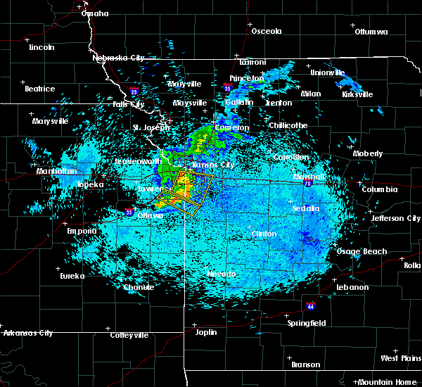 At 541 am cdt, a severe thunderstorm was located over grandview, moving east at 45 mph (radar indicated). Hazards include 60 mph wind gusts and penny size hail. Expect damage to roofs. Siding and trees. At 541 am cdt, a severe thunderstorm was located over grandview, moving east at 45 mph (radar indicated). Hazards include 60 mph wind gusts and penny size hail. Expect damage to roofs. Siding and trees.
|
| 9/10/2015 5:15 AM CDT |
 At 515 am cdt, a severe thunderstorm was located over lenexa, moving east at 45 mph (radar indicated). Hazards include 60 mph wind gusts and penny size hail. Expect damage to roofs. Siding and trees. At 515 am cdt, a severe thunderstorm was located over lenexa, moving east at 45 mph (radar indicated). Hazards include 60 mph wind gusts and penny size hail. Expect damage to roofs. Siding and trees.
|
| 8/18/2015 7:08 PM CDT |
 At 708 pm cdt, a severe thunderstorm was located over lake tapawingo, or near blue springs, moving east at 25 mph (radar indicated). Hazards include 60 mph wind gusts and quarter size hail. Hail damage to vehicles is expected. Expect wind damage to roofs, siding and trees. At 708 pm cdt, a severe thunderstorm was located over lake tapawingo, or near blue springs, moving east at 25 mph (radar indicated). Hazards include 60 mph wind gusts and quarter size hail. Hail damage to vehicles is expected. Expect wind damage to roofs, siding and trees.
|
| 7/6/2015 6:34 PM CDT |
 At 633 pm cdt, severe thunderstorms were located along a line extending from lake tapawingo to near pleasant hill to near drexel, moving east at 35 mph (radar indicated). Hazards include 60 mph wind gusts. Expect damage to roofs. siding and trees. Locations impacted include, kansas city, independence, lee`s summit, blue springs, raytown, grandview, belton, raymore, grain valley, harrisonville, pleasant hill, oak grove, greenwood, peculiar, louisburg, sugar creek, buckner, lake lotawana, garden city and archie. At 633 pm cdt, severe thunderstorms were located along a line extending from lake tapawingo to near pleasant hill to near drexel, moving east at 35 mph (radar indicated). Hazards include 60 mph wind gusts. Expect damage to roofs. siding and trees. Locations impacted include, kansas city, independence, lee`s summit, blue springs, raytown, grandview, belton, raymore, grain valley, harrisonville, pleasant hill, oak grove, greenwood, peculiar, louisburg, sugar creek, buckner, lake lotawana, garden city and archie.
|
| 7/6/2015 6:18 PM CDT |
 At 618 pm cdt, severe thunderstorms were located along a line extending from near independence to 5 miles east of drexel, moving east at 35 mph (radar indicated). Hazards include 60 mph wind gusts and penny size hail. Expect damage to roofs. siding and trees. Locations impacted include, kansas city, overland park, independence, lee`s summit, blue springs, leawood, raytown, grandview, belton, prairie village, raymore, grain valley, merriam, harrisonville, mission, pleasant hill, oak grove, roeland park, greenwood and peculiar. At 618 pm cdt, severe thunderstorms were located along a line extending from near independence to 5 miles east of drexel, moving east at 35 mph (radar indicated). Hazards include 60 mph wind gusts and penny size hail. Expect damage to roofs. siding and trees. Locations impacted include, kansas city, overland park, independence, lee`s summit, blue springs, leawood, raytown, grandview, belton, prairie village, raymore, grain valley, merriam, harrisonville, mission, pleasant hill, oak grove, roeland park, greenwood and peculiar.
|
| 7/6/2015 5:59 PM CDT |
 At 559 pm cdt, severe thunderstorms were located along a line extending from north kansas city to 5 miles west of drexel, moving east at 35 mph (radar indicated). Hazards include 70 mph wind gusts and penny size hail. Expect considerable tree damage. Damage is likely to mobile homes, roofs and outbuildings. At 559 pm cdt, severe thunderstorms were located along a line extending from north kansas city to 5 miles west of drexel, moving east at 35 mph (radar indicated). Hazards include 70 mph wind gusts and penny size hail. Expect considerable tree damage. Damage is likely to mobile homes, roofs and outbuildings.
|
| 7/6/2015 5:45 PM CDT |
 At 545 pm cdt, a severe thunderstorm was located over orrick, moving east at 40 mph (radar indicated). Hazards include 60 mph wind gusts and penny size hail. Expect damage to roofs. Siding and trees. At 545 pm cdt, a severe thunderstorm was located over orrick, moving east at 40 mph (radar indicated). Hazards include 60 mph wind gusts and penny size hail. Expect damage to roofs. Siding and trees.
|
| 7/6/2015 4:51 PM CDT |
 At 451 pm cdt, a severe thunderstorm was located over kansas city kansas, moving southeast at 30 mph (radar indicated). Hazards include 60 mph wind gusts and penny size hail. Expect damage to roofs. Siding and trees. At 451 pm cdt, a severe thunderstorm was located over kansas city kansas, moving southeast at 30 mph (radar indicated). Hazards include 60 mph wind gusts and penny size hail. Expect damage to roofs. Siding and trees.
|
| 7/1/2015 7:28 PM CDT |
 At 727 pm cdt, a severe thunderstorm was located near raytown, and moving southeast at 20 mph (radar indicated). Hazards include 60 mph wind gusts and quarter size hail. Hail damage to vehicles is expected. Expect wind damage to roofs, siding and trees. At 727 pm cdt, a severe thunderstorm was located near raytown, and moving southeast at 20 mph (radar indicated). Hazards include 60 mph wind gusts and quarter size hail. Hail damage to vehicles is expected. Expect wind damage to roofs, siding and trees.
|
| 7/1/2015 7:03 PM CDT |
 At 700 pm cdt, a confirmed tornado was located near lee`s summit, and moving southeast at 20 mph (weather spotters confirmed tornado). Hazards include damaging tornado and ping pong ball size hail. Flying debris will be dangerous to those caught without shelter. mobile homes will be damaged or destroyed. damage to roofs, windows and vehicles will occur. tree damage is likely. Locations impacted include, greenwood, lake lotawana and lone jack. At 700 pm cdt, a confirmed tornado was located near lee`s summit, and moving southeast at 20 mph (weather spotters confirmed tornado). Hazards include damaging tornado and ping pong ball size hail. Flying debris will be dangerous to those caught without shelter. mobile homes will be damaged or destroyed. damage to roofs, windows and vehicles will occur. tree damage is likely. Locations impacted include, greenwood, lake lotawana and lone jack.
|
| 7/1/2015 6:54 PM CDT |
 At 652 pm cdt, a confirmed tornado was located near lee`s summit, and moving southeast at 20 mph (weather spotters confirmed tornado). Hazards include damaging tornado and ping pong ball size hail. Flying debris will be dangerous to those caught without shelter. mobile homes will be damaged or destroyed. damage to roofs, windows and vehicles will occur. Tree damage is likely. At 652 pm cdt, a confirmed tornado was located near lee`s summit, and moving southeast at 20 mph (weather spotters confirmed tornado). Hazards include damaging tornado and ping pong ball size hail. Flying debris will be dangerous to those caught without shelter. mobile homes will be damaged or destroyed. damage to roofs, windows and vehicles will occur. Tree damage is likely.
|
| 7/1/2015 6:48 PM CDT |
 At 646 pm cdt, a severe thunderstorm capable of producing a tornado was located near lee`s summit, and moving southeast at 15 mph (radar indicated rotation). Hazards include tornado and ping pong ball size hail. Flying debris will be dangerous to those caught without shelter. mobile homes will be damaged or destroyed. damage to roofs, windows and vehicles will occur. tree damage is likely. locations impacted include, mainly rural areas of central jackson county. This will impact i-470 between mile markers 7 and 12. At 646 pm cdt, a severe thunderstorm capable of producing a tornado was located near lee`s summit, and moving southeast at 15 mph (radar indicated rotation). Hazards include tornado and ping pong ball size hail. Flying debris will be dangerous to those caught without shelter. mobile homes will be damaged or destroyed. damage to roofs, windows and vehicles will occur. tree damage is likely. locations impacted include, mainly rural areas of central jackson county. This will impact i-470 between mile markers 7 and 12.
|
| 7/1/2015 6:38 PM CDT |
 At 636 pm cdt, a severe thunderstorm capable of producing a tornado was located near raytown, and moving southeast at 15 mph (radar indicated rotation). Hazards include tornado and golf ball size hail. Flying debris will be dangerous to those caught without shelter. mobile homes will be damaged or destroyed. damage to roofs, windows and vehicles will occur. tree damage is likely. locations impacted include, blue springs, lake tapawingo and unity village. this will impact the following interstates, i-70 between mile markers 11 and 21. I-470 between mile markers 7 and 16. At 636 pm cdt, a severe thunderstorm capable of producing a tornado was located near raytown, and moving southeast at 15 mph (radar indicated rotation). Hazards include tornado and golf ball size hail. Flying debris will be dangerous to those caught without shelter. mobile homes will be damaged or destroyed. damage to roofs, windows and vehicles will occur. tree damage is likely. locations impacted include, blue springs, lake tapawingo and unity village. this will impact the following interstates, i-70 between mile markers 11 and 21. I-470 between mile markers 7 and 16.
|
| 7/1/2015 6:32 PM CDT |
 At 631 pm cdt, a severe thunderstorm capable of producing a tornado was located near raytown, and moving east at 15 mph (radar indicated rotation). Hazards include tornado and golf ball size hail. Flying debris will be dangerous to those caught without shelter. mobile homes will be damaged or destroyed. damage to roofs, windows and vehicles will occur. Tree damage is likely. At 631 pm cdt, a severe thunderstorm capable of producing a tornado was located near raytown, and moving east at 15 mph (radar indicated rotation). Hazards include tornado and golf ball size hail. Flying debris will be dangerous to those caught without shelter. mobile homes will be damaged or destroyed. damage to roofs, windows and vehicles will occur. Tree damage is likely.
|
| 7/1/2015 6:24 PM CDT |
 At 620 pm cdt, a severe thunderstorm was located near raytown, and moving east at 15 mph (radar indicated). Hazards include 60 mph wind gusts and half dollar size hail. Hail damage to vehicles is expected. Expect wind damage to roofs, siding and trees. At 620 pm cdt, a severe thunderstorm was located near raytown, and moving east at 15 mph (radar indicated). Hazards include 60 mph wind gusts and half dollar size hail. Hail damage to vehicles is expected. Expect wind damage to roofs, siding and trees.
|
| 7/1/2015 1:47 AM CDT |
 At 146 am cdt, severe thunderstorms were located along a line extending from 10 miles northeast of holden to pleasant hill to lake winnebago, and moving southeast at 35 mph (radar indicated). Hazards include 60 mph wind gusts and nickel size hail. Expect damage to roofs. siding and trees. locations impacted include, pleasant hill, holden, lake winnebago, kingsville, fayetteville and strasburg. this will impact the following interstates, i-70 between mile markers 16 and 42. I-470 between mile markers 2 and 15. At 146 am cdt, severe thunderstorms were located along a line extending from 10 miles northeast of holden to pleasant hill to lake winnebago, and moving southeast at 35 mph (radar indicated). Hazards include 60 mph wind gusts and nickel size hail. Expect damage to roofs. siding and trees. locations impacted include, pleasant hill, holden, lake winnebago, kingsville, fayetteville and strasburg. this will impact the following interstates, i-70 between mile markers 16 and 42. I-470 between mile markers 2 and 15.
|
| 7/1/2015 1:24 AM CDT |
 At 122 am cdt, severe thunderstorms were located along a line extending from oak grove to raytown, and moving southeast at 35 mph (radar indicated). Hazards include 60 mph wind gusts and nickel size hail. Expect damage to roofs. Siding and trees. At 122 am cdt, severe thunderstorms were located along a line extending from oak grove to raytown, and moving southeast at 35 mph (radar indicated). Hazards include 60 mph wind gusts and nickel size hail. Expect damage to roofs. Siding and trees.
|
| 6/26/2015 2:08 AM CDT |
 At 205 am cdt, severe thunderstorms were located along a line extending from levasy to lone jack to cleveland, and moving southeast at 55 mph. * these storms have a history of producing widespread wind damage and wind gusts up to 80 mph. these are very dangerous storms! (radar indicated). Hazards include 80 mph wind gusts. Flying debris will be dangerous to those caught without shelter. mobile homes will be heavily damaged. expect considerable damage to roofs, windows and vehicles. Extensive tree damage and power outages are likely. At 205 am cdt, severe thunderstorms were located along a line extending from levasy to lone jack to cleveland, and moving southeast at 55 mph. * these storms have a history of producing widespread wind damage and wind gusts up to 80 mph. these are very dangerous storms! (radar indicated). Hazards include 80 mph wind gusts. Flying debris will be dangerous to those caught without shelter. mobile homes will be heavily damaged. expect considerable damage to roofs, windows and vehicles. Extensive tree damage and power outages are likely.
|
| 6/26/2015 1:56 AM CDT |
 A severe thunderstorm warning remains in effect for southeastern johnson county in east central kansas, and southern ray, western lafayette, jackson, clay and northwestern cass counties in west central missouri until 230 am cdt, wind gusts to 80 mph and widespread tree damage have been reported across the kansas city metro. at 152 am cdt, severe thunderstorms were located along a line extending from sibley to raytown to 6 miles northeast of spring hill, and moving southeast at 45 mph. these are very dangerous storms! (radar indicated). Hazards include 80 mph wind gusts. Flying debris will be dangerous to those caught without shelter. mobile homes will be heavily damaged. expect considerable damage to roofs, windows and vehicles. extensive tree damage and power outages are likely. Locations impacted include, lee`s summit, belton, grain valley, lake lotawana, greenwood, richmond, raymore, oak grove, peculiar, pleasant hill, orrick, levasy, lake winnebago, henrietta, lone jack, wellington, stillwell, fleming, tarsney lakes and napoleon. A severe thunderstorm warning remains in effect for southeastern johnson county in east central kansas, and southern ray, western lafayette, jackson, clay and northwestern cass counties in west central missouri until 230 am cdt, wind gusts to 80 mph and widespread tree damage have been reported across the kansas city metro. at 152 am cdt, severe thunderstorms were located along a line extending from sibley to raytown to 6 miles northeast of spring hill, and moving southeast at 45 mph. these are very dangerous storms! (radar indicated). Hazards include 80 mph wind gusts. Flying debris will be dangerous to those caught without shelter. mobile homes will be heavily damaged. expect considerable damage to roofs, windows and vehicles. extensive tree damage and power outages are likely. Locations impacted include, lee`s summit, belton, grain valley, lake lotawana, greenwood, richmond, raymore, oak grove, peculiar, pleasant hill, orrick, levasy, lake winnebago, henrietta, lone jack, wellington, stillwell, fleming, tarsney lakes and napoleon.
|
| 6/26/2015 1:43 AM CDT |
 At 141 am cdt, severe thunderstorms were located along a line extending from excelsior springs to sugar creek to olathe, and moving southeast at 25 mph. these are very dangerous storms (radar indicated). Hazards include 80 mph wind gusts and quarter size hail. Flying debris will be dangerous to those caught without shelter. mobile homes will be heavily damaged. expect considerable damage to roofs, windows and vehicles. Extensive tree damage and power outages are likely. At 141 am cdt, severe thunderstorms were located along a line extending from excelsior springs to sugar creek to olathe, and moving southeast at 25 mph. these are very dangerous storms (radar indicated). Hazards include 80 mph wind gusts and quarter size hail. Flying debris will be dangerous to those caught without shelter. mobile homes will be heavily damaged. expect considerable damage to roofs, windows and vehicles. Extensive tree damage and power outages are likely.
|
| 6/26/2015 1:36 AM CDT |
 At 132 am cdt, severe thunderstorms were located along a line extending from kearney to avondale to lenexa, and moving southeast at 50 mph. these are very dangerous storms (radar indicated). Hazards include 80 mph wind gusts and quarter size hail. Flying debris will be dangerous to those caught without shelter. mobile homes will be heavily damaged. expect considerable damage to roofs, windows and vehicles. extensive tree damage and power outages are likely. Locations impacted include, kansas city, excelsior springs, overland park, mission hills, prairie village, leawood, sugar creek, courtney, independence, raytown, grandview, buckner, blue springs, lee`s summit, westwood hills, mission woods, crystal lakes, woods heights, missouri city and sibley. At 132 am cdt, severe thunderstorms were located along a line extending from kearney to avondale to lenexa, and moving southeast at 50 mph. these are very dangerous storms (radar indicated). Hazards include 80 mph wind gusts and quarter size hail. Flying debris will be dangerous to those caught without shelter. mobile homes will be heavily damaged. expect considerable damage to roofs, windows and vehicles. extensive tree damage and power outages are likely. Locations impacted include, kansas city, excelsior springs, overland park, mission hills, prairie village, leawood, sugar creek, courtney, independence, raytown, grandview, buckner, blue springs, lee`s summit, westwood hills, mission woods, crystal lakes, woods heights, missouri city and sibley.
|
| 6/26/2015 1:26 AM CDT |
 At 123 am, local emergency management reported wind damage in leavenworth. at 122 am cdt, severe thunderstorms were located along a line extending from kearney to platte woods to edwardsville, and moving southeast at 50 mph (radar indicated). Hazards include 70 mph wind gusts and quarter size hail. Hail damage to vehicles is expected. expect considerable tree damage. wind damage is also likely to mobile homes, roofs and outbuildings. Locations impacted include, shawnee, lake quivira, riverside, gladstone, kansas city kansas, liberty, excelsior springs, merriam, lenexa, north kansas city, claycomo, overland park, mission, kansas city, westwood, prairie village, fairway, mission hills, leawood and courtney. At 123 am, local emergency management reported wind damage in leavenworth. at 122 am cdt, severe thunderstorms were located along a line extending from kearney to platte woods to edwardsville, and moving southeast at 50 mph (radar indicated). Hazards include 70 mph wind gusts and quarter size hail. Hail damage to vehicles is expected. expect considerable tree damage. wind damage is also likely to mobile homes, roofs and outbuildings. Locations impacted include, shawnee, lake quivira, riverside, gladstone, kansas city kansas, liberty, excelsior springs, merriam, lenexa, north kansas city, claycomo, overland park, mission, kansas city, westwood, prairie village, fairway, mission hills, leawood and courtney.
|
| 6/26/2015 1:12 AM CDT |
 At 110 am cdt, severe thunderstorms were located along a line extending from kearney to kci airport to basehor, and moving southeast at 50 mph (radar indicated). Hazards include 60 mph wind gusts and penny size hail. Expect damage to roofs. Siding and trees. At 110 am cdt, severe thunderstorms were located along a line extending from kearney to kci airport to basehor, and moving southeast at 50 mph (radar indicated). Hazards include 60 mph wind gusts and penny size hail. Expect damage to roofs. Siding and trees.
|
| 6/21/2015 1:42 PM CDT | At 120 pm, the public reported straight line wind damage in kansas city intl arpt. at 137 pm cdt, a severe thunderstorm was located near blue springs, and moving southeast at 55 mph (radar indicated). Hazards include 60 mph wind gusts and quarter size hail. Hail damage to vehicles is expected. expect wind damage to roofs, siding and trees. locations impacted include, this will impact the following interstates, i-70 between mile markers 11 and 24. i-35 between mile markers 5 and 23. I-435 loop from mile markers 40 to 60. |
| 6/21/2015 1:15 PM CDT |
 At 1245 pm, fire and rescue crews reported softball size hail in de kalb. at 1245 pm, fire and rescue crews reported a e60.00 mph wind gust in de kalb. at 1248 pm, trained weather spotters reported quarter size hail 3 miles west of faucett. at 102 pm, trained weather spotters reported baseball size hail in de kalb. at 110 pm cdt, a severe thunderstorm was located near lake waukomis, and moving southeast at 55 mph (radar indicated). Hazards include tennis ball size hail and 70 mph wind gusts. People and animals outdoors will be injured. expect hail damage to roofs, siding, windows and vehicles. expect considerable tree damage. wind damage is also likely to mobile homes, roofs and outbuildings. locations impacted include, gladstone, north kansas city, claycomo, liberty, sugar creek, courtney, independence, buckner, blue springs, oakview, avondale, pleasant valley, glenaire, missouri city, sibley, lake tapawingo, orrick, oakwood, oaks and randolph. this will impact the following interstates, i-70 between mile markers 11 and 24. i-35 between mile markers 5 and 22. i-435 loop from mile markers 23 to 60. I-29 between mile markers 0 and 26. At 1245 pm, fire and rescue crews reported softball size hail in de kalb. at 1245 pm, fire and rescue crews reported a e60.00 mph wind gust in de kalb. at 1248 pm, trained weather spotters reported quarter size hail 3 miles west of faucett. at 102 pm, trained weather spotters reported baseball size hail in de kalb. at 110 pm cdt, a severe thunderstorm was located near lake waukomis, and moving southeast at 55 mph (radar indicated). Hazards include tennis ball size hail and 70 mph wind gusts. People and animals outdoors will be injured. expect hail damage to roofs, siding, windows and vehicles. expect considerable tree damage. wind damage is also likely to mobile homes, roofs and outbuildings. locations impacted include, gladstone, north kansas city, claycomo, liberty, sugar creek, courtney, independence, buckner, blue springs, oakview, avondale, pleasant valley, glenaire, missouri city, sibley, lake tapawingo, orrick, oakwood, oaks and randolph. this will impact the following interstates, i-70 between mile markers 11 and 24. i-35 between mile markers 5 and 22. i-435 loop from mile markers 23 to 60. I-29 between mile markers 0 and 26.
|
| 6/21/2015 1:01 PM CDT |
 At 1256 pm cdt, a severe thunderstorm was located near tracy, and moving southeast at 55 mph. at 1245 pm, fire and rescue crews reported softball size hail in de kalb. at 1245 pm, fire and rescue crews reported an e60.00 mph wind gust in de kalb. at 1248 pm, trained weather spotters reported quarter size hail 3 miles west of faucett (radar indicated). Hazards include tennis ball size hail and 60 mph wind gusts. People and animals outdoors will be injured. expect hail damage to roofs, siding, windows and vehicles. Expect wind damage to roofs, siding and trees. At 1256 pm cdt, a severe thunderstorm was located near tracy, and moving southeast at 55 mph. at 1245 pm, fire and rescue crews reported softball size hail in de kalb. at 1245 pm, fire and rescue crews reported an e60.00 mph wind gust in de kalb. at 1248 pm, trained weather spotters reported quarter size hail 3 miles west of faucett (radar indicated). Hazards include tennis ball size hail and 60 mph wind gusts. People and animals outdoors will be injured. expect hail damage to roofs, siding, windows and vehicles. Expect wind damage to roofs, siding and trees.
|
| 5/17/2015 12:31 AM CDT | At 1207 am, local law enforcement reported straight line wind damage in adrian. at 1228 am cdt, severe thunderstorms were located along a line extending from 7 miles east of lone jack to 6 miles north of schell city, and moving east at 40 mph (radar indicated). Hazards include 60 mph wind gusts. Expect damage to roofs. siding and trees. locations impacted include, holden, odessa, urich, montrose, chilhowee, rockville, quick city, pittsville, lake lafayette, blairstown, hartwell, centerview and la due. winds up to 80 mph are possible near lake lafayette and odessa. this will impact i-70 between mile markers 32 and 49. 75in. |
| 5/17/2015 12:21 AM CDT | At 1218 am cdt, severe thunderstorms were located along a line extending from lone jack to 6 miles east of rich hill, and moving east at 40 mph (radar indicated). Hazards include 60 mph wind gusts. Expect damage to roofs. siding and trees. locations impacted include, holden, odessa, kingsville, creighton, urich, montrose, chilhowee, la tour, ballard, bates city, pittsville, rockville, lake lafayette, quick city, blairstown, hartwell, centerview and la due. winds up to 80 mph are possible near creighton, garden city, la tour, and east lynn this will impact i-70 between mile markers 32 and 49. 75in. |
| 5/17/2015 12:07 AM CDT | At 1205 am cdt, severe thunderstorms were located along a line extending from greenwood to rich hill, and moving east at 35 mph (radar indicated). Hazards include 60 mph wind gusts. Expect damage to roofs. siding and trees. locations impacted include, adrian, rich hill, butler, pleasant hill, lake lotawana, garden city, holden, odessa, archie, east lynne, lone jack, kingsville, creighton, urich, montrose, chilhowee, passaic, tarsney lakes, strasburg and gunn city. winds around 70 to 80 mph are possible near adrian. this will impact the following interstates, i-70 between mile markers 32 and 49. i-470 between mile markers 2 and 11. 75in. |
| 5/17/2015 12:03 AM CDT | At midnight cdt, severe thunderstorms were located along a line extending from lake winnebago to 5 miles southeast of hume, and moving east at 35 mph (radar indicated). Hazards include 60 mph wind gusts. Expect damage to roofs. Siding and trees. |
| 5/16/2015 11:34 PM CDT | At 1130 pm cdt, severe thunderstorms were located along a line extending from smithville to pleasant valley to grandview, and moving northeast at 50 mph (radar indicated). Hazards include 60 mph wind gusts. Expect damage to roofs. siding and trees. locations impacted include, liberty, independence, courtney, lee`s summit, greenwood, kearney, lake lotawana, blue springs, excelsior springs, buckner, grain valley, lathrop, lawson, oak grove, lake winnebago, lake tapawingo, holt, missouri city, sibley and excelsior estates. this will impact the following interstates, i-70 in missouri between mile markers 0 and 28. i-70 in kansas between mile markers 413 and 423. i-35 in missouri between mile markers 0 and 41. i-35 in kansas between mile markers 217 and 235. i-635 between mile markers 0 and 12. i-435 loop from mile markers 0 to 83. i-29 between mile markers 0 and 18. i-470 between mile markers 0 and 16. 75in. |
| 5/16/2015 11:34 PM CDT | At 1130 pm cdt, severe thunderstorms were located along a line extending from smithville to pleasant valley to grandview, and moving northeast at 50 mph (radar indicated). Hazards include 60 mph wind gusts. Expect damage to roofs. siding and trees. locations impacted include, liberty, independence, courtney, lee`s summit, greenwood, kearney, lake lotawana, blue springs, excelsior springs, buckner, grain valley, lathrop, lawson, oak grove, lake winnebago, lake tapawingo, holt, missouri city, sibley and excelsior estates. this will impact the following interstates, i-70 in missouri between mile markers 0 and 28. i-70 in kansas between mile markers 413 and 423. i-35 in missouri between mile markers 0 and 41. i-35 in kansas between mile markers 217 and 235. i-635 between mile markers 0 and 12. i-435 loop from mile markers 0 to 83. i-29 between mile markers 0 and 18. i-470 between mile markers 0 and 16. 75in. |
| 5/16/2015 11:06 PM CDT | At 1104 pm cdt, severe thunderstorms were located along a line extending from lansing to lake quivira to spring hill, and moving northeast at 50 mph (radar indicated). Hazards include 60 mph wind gusts. Expect damage to roofs. Siding and trees. |
| 5/16/2015 11:06 PM CDT | At 1104 pm cdt, severe thunderstorms were located along a line extending from lansing to lake quivira to spring hill, and moving northeast at 50 mph (radar indicated). Hazards include 60 mph wind gusts. Expect damage to roofs. Siding and trees. |
| 7/7/2014 11:21 PM CDT | Storm damage reported in jackson county MO, 0.5 miles SSE of Blue Springs, MO |
| 3/27/2014 3:03 PM CDT | Ping Pong Ball sized hail reported 1.8 miles ESE of Blue Springs, MO, source is spotter network |
| 3/27/2014 2:53 PM CDT | Half Dollar sized hail reported 0.5 miles SSE of Blue Springs, MO |
| 3/27/2014 2:44 PM CDT | Golf Ball sized hail reported 0.5 miles SSE of Blue Springs, MO |
| 8/8/2012 7:50 PM CDT | Woods chapel rd and i-70...power outage...45 mph wnds in jackson county MO, 0.5 miles SSE of Blue Springs, MO |
| 1/1/0001 12:00 AM | Power lines and trees reported in jackson county MO, 0.5 miles SSE of Blue Springs, MO |
| 6/18/2011 11:01 PM CDT | Golf Ball sized hail reported 1.3 miles ESE of Blue Springs, MO |
| 1/1/0001 12:00 AM | Storm damage reported in jackson county MO, 2 miles ENE of Blue Springs, MO |
| 1/1/0001 12:00 AM | Wide spread tree damage in jackson county MO, 0.5 miles SSE of Blue Springs, MO |
Hail Maps for Blue Springs, MO
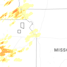


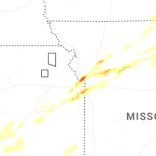


Connect with Interactive Hail Maps