

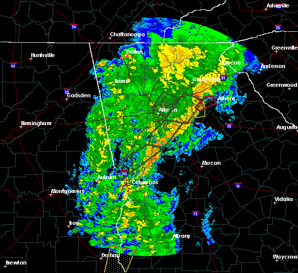
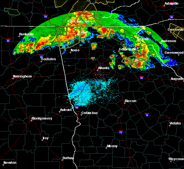
Hail Map for Bogart, GA
The Bogart, GA area has had 3 reports of on-the-ground hail by trained spotters, and has been under severe weather warnings 15 times during the past 12 months. Doppler radar has detected hail at or near Bogart, GA on 22 occasions, including 2 occasions during the past year.
| Name: | Bogart, GA |
| Where Located: | 51.2 miles ENE of Atlanta, GA |
| Map: | Google Map for Bogart, GA |
| Population: | 1034 |
| Housing Units: | 443 |
| More Info: | Search Google for Bogart, GA |
1
The Top Recent Hail Date for Bogart, GA is Monday, August 7, 2023 (4th out of 22)

Hail and Wind Damage Spotted near Bogart, GA
| Date / Time | Report Details |
|---|---|
| 4/3/2024 12:52 AM EDT |
 The storm which prompted the warning has moved out of the area. therefore, the warning will be allowed to expire. however, heavy rain is still possible with this thunderstorm. a tornado watch remains in effect until 300 am edt for north central, northeastern and east central georgia. The storm which prompted the warning has moved out of the area. therefore, the warning will be allowed to expire. however, heavy rain is still possible with this thunderstorm. a tornado watch remains in effect until 300 am edt for north central, northeastern and east central georgia.
|
| 4/3/2024 12:43 AM EDT |
 the severe thunderstorm warning has been cancelled and is no longer in effect the severe thunderstorm warning has been cancelled and is no longer in effect
|
| 4/3/2024 12:43 AM EDT |
 At 1242 am edt, a severe thunderstorm was located near smithonia, or near lexington, moving east at 60 mph (radar indicated). Hazards include 60 mph wind gusts and penny size hail. Expect damage to roofs, siding, and trees. Locations impacted include, watkinsville, athens, nicholson, winterville, bogart, north high shoals, bishop, athens-clarke county, whitehall, westgate park, james holland youth sports cmpx, bear creek reservoir, beechwood hills, sandy creek recreation area, oconee heights, eastville, barnett shoals, barretts mill, state botanical garden of ga, and farmington. At 1242 am edt, a severe thunderstorm was located near smithonia, or near lexington, moving east at 60 mph (radar indicated). Hazards include 60 mph wind gusts and penny size hail. Expect damage to roofs, siding, and trees. Locations impacted include, watkinsville, athens, nicholson, winterville, bogart, north high shoals, bishop, athens-clarke county, whitehall, westgate park, james holland youth sports cmpx, bear creek reservoir, beechwood hills, sandy creek recreation area, oconee heights, eastville, barnett shoals, barretts mill, state botanical garden of ga, and farmington.
|
| 4/3/2024 12:21 AM EDT |
 Svrffc the national weather service in peachtree city has issued a * severe thunderstorm warning for, oconee county in northeastern georgia, southeastern barrow county in north central georgia, northwestern morgan county in north central georgia, clarke county in northeastern georgia, eastern walton county in north central georgia, southeastern jackson county in northeastern georgia, west central oglethorpe county in northeastern georgia, * until 100 am edt. * at 1221 am edt, a severe thunderstorm was located over north high shoals, or near watkinsville, moving east at 60 mph (radar indicated). Hazards include 60 mph wind gusts and penny size hail. expect damage to roofs, siding, and trees Svrffc the national weather service in peachtree city has issued a * severe thunderstorm warning for, oconee county in northeastern georgia, southeastern barrow county in north central georgia, northwestern morgan county in north central georgia, clarke county in northeastern georgia, eastern walton county in north central georgia, southeastern jackson county in northeastern georgia, west central oglethorpe county in northeastern georgia, * until 100 am edt. * at 1221 am edt, a severe thunderstorm was located over north high shoals, or near watkinsville, moving east at 60 mph (radar indicated). Hazards include 60 mph wind gusts and penny size hail. expect damage to roofs, siding, and trees
|
| 2/28/2024 3:56 PM EST |
 At 356 pm est, severe thunderstorms were located along a line extending from near statham to near campton to walnut grove, moving east at 40 mph (radar indicated). Hazards include 60 mph wind gusts. Expect damage to roofs, siding, and trees. Locations impacted include, monroe, watkinsville, athens, social circle, statham, walnut grove, winterville, bogart, rutledge, north high shoals, bethlehem, bostwick, arnoldsville, between, good hope, bishop, jersey, whitehall, athens-clarke county, and westgate park. At 356 pm est, severe thunderstorms were located along a line extending from near statham to near campton to walnut grove, moving east at 40 mph (radar indicated). Hazards include 60 mph wind gusts. Expect damage to roofs, siding, and trees. Locations impacted include, monroe, watkinsville, athens, social circle, statham, walnut grove, winterville, bogart, rutledge, north high shoals, bethlehem, bostwick, arnoldsville, between, good hope, bishop, jersey, whitehall, athens-clarke county, and westgate park.
|
| 2/28/2024 3:41 PM EST |
 Svrffc the national weather service in peachtree city has issued a * severe thunderstorm warning for, northeastern rockdale county in north central georgia, oconee county in northeastern georgia, barrow county in north central georgia, northwestern morgan county in north central georgia, southeastern gwinnett county in north central georgia, clarke county in northeastern georgia, walton county in north central georgia, southern jackson county in northeastern georgia, northwestern oglethorpe county in northeastern georgia, northeastern newton county in north central georgia, * until 430 pm est. * at 340 pm est, severe thunderstorms were located along a line extending from county line to near loganville to near rosebud, moving east at 45 mph (radar indicated). Hazards include 70 mph wind gusts. Expect considerable tree damage. Damage is likely to mobile homes, roofs, and outbuildings. Svrffc the national weather service in peachtree city has issued a * severe thunderstorm warning for, northeastern rockdale county in north central georgia, oconee county in northeastern georgia, barrow county in north central georgia, northwestern morgan county in north central georgia, southeastern gwinnett county in north central georgia, clarke county in northeastern georgia, walton county in north central georgia, southern jackson county in northeastern georgia, northwestern oglethorpe county in northeastern georgia, northeastern newton county in north central georgia, * until 430 pm est. * at 340 pm est, severe thunderstorms were located along a line extending from county line to near loganville to near rosebud, moving east at 45 mph (radar indicated). Hazards include 70 mph wind gusts. Expect considerable tree damage. Damage is likely to mobile homes, roofs, and outbuildings.
|
| 8/15/2023 1:37 PM EDT |
 At 137 pm edt, a severe thunderstorm was located over eastville, or near watkinsville, moving east at 20 mph (radar indicated). Hazards include 60 mph wind gusts and quarter size hail. Hail damage to vehicles is expected. Expect wind damage to roofs, siding, and trees. At 137 pm edt, a severe thunderstorm was located over eastville, or near watkinsville, moving east at 20 mph (radar indicated). Hazards include 60 mph wind gusts and quarter size hail. Hail damage to vehicles is expected. Expect wind damage to roofs, siding, and trees.
|
| 8/7/2023 6:35 PM EDT |
 The severe thunderstorm warning for northeastern rockdale, northwestern oconee, barrow, eastern gwinnett, walton and northeastern newton counties will expire at 645 pm edt, the storms which prompted the warning have moved out of the area. therefore, the warning will be allowed to expire. a severe thunderstorm watch remains in effect until 800 pm edt for north central and northeastern georgia. The severe thunderstorm warning for northeastern rockdale, northwestern oconee, barrow, eastern gwinnett, walton and northeastern newton counties will expire at 645 pm edt, the storms which prompted the warning have moved out of the area. therefore, the warning will be allowed to expire. a severe thunderstorm watch remains in effect until 800 pm edt for north central and northeastern georgia.
|
| 8/7/2023 6:29 PM EDT |
 At 629 pm edt, severe thunderstorms were located along a line extending from bear creek reservoir to near bostwick to near farrar, moving east at 45 mph (radar indicated). Hazards include 60 mph wind gusts and quarter size hail. Hail damage to vehicles is expected. Expect wind damage to roofs, siding, and trees. At 629 pm edt, severe thunderstorms were located along a line extending from bear creek reservoir to near bostwick to near farrar, moving east at 45 mph (radar indicated). Hazards include 60 mph wind gusts and quarter size hail. Hail damage to vehicles is expected. Expect wind damage to roofs, siding, and trees.
|
| 8/7/2023 6:07 PM EDT |
 At 607 pm edt, severe thunderstorms were located along a line extending from dacula to near loganville to lakeview estates, moving east at 45 mph (radar indicated). Hazards include 60 mph wind gusts and quarter size hail. Hail damage to vehicles is expected. Expect wind damage to roofs, siding, and trees. At 607 pm edt, severe thunderstorms were located along a line extending from dacula to near loganville to lakeview estates, moving east at 45 mph (radar indicated). Hazards include 60 mph wind gusts and quarter size hail. Hail damage to vehicles is expected. Expect wind damage to roofs, siding, and trees.
|
| 8/7/2023 5:04 PM EDT |
 At 504 pm edt, severe thunderstorms were located along a line extending from near county line to windsor, moving east at 35 mph (radar indicated). Hazards include 60 mph wind gusts and quarter size hail. Hail damage to vehicles is expected. Expect wind damage to roofs, siding, and trees. At 504 pm edt, severe thunderstorms were located along a line extending from near county line to windsor, moving east at 35 mph (radar indicated). Hazards include 60 mph wind gusts and quarter size hail. Hail damage to vehicles is expected. Expect wind damage to roofs, siding, and trees.
|
| 7/20/2023 6:13 PM EDT |
 At 612 pm edt, severe thunderstorms were located along a line extending from near clermont to suwanee, moving southeast at 50 mph (radar indicated). Hazards include 70 mph wind gusts and penny size hail. Expect considerable tree damage. Damage is likely to mobile homes, roofs, and outbuildings. At 612 pm edt, severe thunderstorms were located along a line extending from near clermont to suwanee, moving southeast at 50 mph (radar indicated). Hazards include 70 mph wind gusts and penny size hail. Expect considerable tree damage. Damage is likely to mobile homes, roofs, and outbuildings.
|
| 7/1/2023 7:42 PM EDT |
 At 742 pm edt, severe thunderstorms were located along a line extending from banks crossing to near nicholson to bear creek reservoir, moving east at 5 mph (radar indicated). Hazards include 60 mph wind gusts and penny size hail. expect damage to roofs, siding, and trees At 742 pm edt, severe thunderstorms were located along a line extending from banks crossing to near nicholson to bear creek reservoir, moving east at 5 mph (radar indicated). Hazards include 60 mph wind gusts and penny size hail. expect damage to roofs, siding, and trees
|
| 6/25/2023 6:07 PM EDT |
 At 607 pm edt, severe thunderstorms were located along a line extending from near danielsville to auburn, moving southeast at 25 mph (radar indicated). Hazards include 60 mph wind gusts. expect damage to roofs, siding, and trees At 607 pm edt, severe thunderstorms were located along a line extending from near danielsville to auburn, moving southeast at 25 mph (radar indicated). Hazards include 60 mph wind gusts. expect damage to roofs, siding, and trees
|
| 6/25/2023 5:43 PM EDT |
 At 543 pm edt, severe thunderstorms were located along a line extending from banks crossing to milton, moving southeast at 45 mph (radar indicated). Hazards include 60 mph wind gusts and penny size hail. expect damage to roofs, siding, and trees At 543 pm edt, severe thunderstorms were located along a line extending from banks crossing to milton, moving southeast at 45 mph (radar indicated). Hazards include 60 mph wind gusts and penny size hail. expect damage to roofs, siding, and trees
|
| 1/12/2023 4:46 PM EST |
 At 446 pm est, severe thunderstorms were located along a line extending from near gratis to monroe to near oxford, moving east at 40 mph (radar indicated). Hazards include 60 mph wind gusts. expect damage to roofs, siding, and trees At 446 pm est, severe thunderstorms were located along a line extending from near gratis to monroe to near oxford, moving east at 40 mph (radar indicated). Hazards include 60 mph wind gusts. expect damage to roofs, siding, and trees
|
| 1/12/2023 4:07 PM EST |
 At 406 pm est, severe thunderstorms were located along a line extending from near duluth to stone mountain to near panthersville, moving east at 50 mph (radar indicated). Hazards include 60 mph wind gusts. expect damage to roofs, siding, and trees At 406 pm est, severe thunderstorms were located along a line extending from near duluth to stone mountain to near panthersville, moving east at 50 mph (radar indicated). Hazards include 60 mph wind gusts. expect damage to roofs, siding, and trees
|
| 7/3/2022 6:35 PM EDT | Tree down on hwy 78 at pete dickens rd in oconee county GA, 2 miles NNE of Bogart, GA |
| 7/3/2022 6:32 PM EDT |
 At 632 pm edt, a severe thunderstorm was located near bostwick, or 9 miles southwest of watkinsville, and is nearly stationary (radar indicated). Hazards include 60 mph wind gusts and quarter size hail. Hail damage to vehicles is expected. Expect wind damage to roofs, siding, and trees. At 632 pm edt, a severe thunderstorm was located near bostwick, or 9 miles southwest of watkinsville, and is nearly stationary (radar indicated). Hazards include 60 mph wind gusts and quarter size hail. Hail damage to vehicles is expected. Expect wind damage to roofs, siding, and trees.
|
| 7/3/2022 6:12 PM EDT | 1 large oak tree down on anna dr north of annas wal in clarke county GA, 4.3 miles WNW of Bogart, GA |
| 7/3/2022 6:07 PM EDT | Ping Pong Ball sized hail reported 4.8 miles WNW of Bogart, GA, ping pong sized hail reported by caller in athens... ga. |
| 7/3/2022 5:45 PM EDT |
 At 544 pm edt, a severe thunderstorm was located over bogart, or 7 miles northwest of watkinsville, and is nearly stationary (radar indicated). Hazards include 60 mph wind gusts and quarter size hail. Hail damage to vehicles is expected. Expect wind damage to roofs, siding, and trees. At 544 pm edt, a severe thunderstorm was located over bogart, or 7 miles northwest of watkinsville, and is nearly stationary (radar indicated). Hazards include 60 mph wind gusts and quarter size hail. Hail damage to vehicles is expected. Expect wind damage to roofs, siding, and trees.
|
| 6/6/2021 9:52 PM EDT |
 The severe thunderstorm warning for northwestern oconee, west central clarke and northeastern walton counties will expire at 1000 pm edt, the storm which prompted the warning has weakened below severe limits, and has exited the warned area. therefore, the warning will be allowed to expire. however small hail, gusty winds and heavy rain are still possible with this thunderstorm. The severe thunderstorm warning for northwestern oconee, west central clarke and northeastern walton counties will expire at 1000 pm edt, the storm which prompted the warning has weakened below severe limits, and has exited the warned area. therefore, the warning will be allowed to expire. however small hail, gusty winds and heavy rain are still possible with this thunderstorm.
|
| 6/6/2021 9:44 PM EDT | Ping Pong Ball sized hail reported 3 miles W of Bogart, GA, hail the size of pingpong balls were reported between jimmy daniel and huntington rd. |
| 6/6/2021 9:40 PM EDT | Gdot weather sensor at us 78 and monroe highway measured a wind gust of 61 mp in oconee county GA, 1.7 miles NW of Bogart, GA |
| 6/6/2021 9:30 PM EDT |
 At 929 pm edt, a severe thunderstorm was located over north high shoals, or near watkinsville, moving north at 25 mph (radar indicated). Hazards include 60 mph wind gusts and quarter size hail. Hail damage to vehicles is expected. Expect wind damage to roofs, siding, and trees. At 929 pm edt, a severe thunderstorm was located over north high shoals, or near watkinsville, moving north at 25 mph (radar indicated). Hazards include 60 mph wind gusts and quarter size hail. Hail damage to vehicles is expected. Expect wind damage to roofs, siding, and trees.
|
| 8/7/2020 7:47 PM EDT |
 At 746 pm edt, a severe thunderstorm was located over bear creek reservoir, or 8 miles south of jefferson, moving east at 15 mph (radar indicated). Hazards include 60 mph wind gusts and quarter size hail. Hail damage to vehicles is expected. Expect wind damage to roofs, siding, and trees. At 746 pm edt, a severe thunderstorm was located over bear creek reservoir, or 8 miles south of jefferson, moving east at 15 mph (radar indicated). Hazards include 60 mph wind gusts and quarter size hail. Hail damage to vehicles is expected. Expect wind damage to roofs, siding, and trees.
|
| 6/27/2020 5:25 PM EDT |
 At 525 pm edt, severe thunderstorms were located along a line extending from near carnesville to oconee heights to near herndonville, moving east at 45 mph (radar indicated). Hazards include 60 mph wind gusts. expect damage to roofs, siding, and trees At 525 pm edt, severe thunderstorms were located along a line extending from near carnesville to oconee heights to near herndonville, moving east at 45 mph (radar indicated). Hazards include 60 mph wind gusts. expect damage to roofs, siding, and trees
|
| 6/27/2020 5:00 PM EDT |
 At 459 pm edt, severe thunderstorms were located along a line extending from near lula to near hoschton to near rosebud, moving east at 40 mph (radar indicated). Hazards include 60 mph wind gusts and penny size hail. expect damage to roofs, siding, and trees At 459 pm edt, severe thunderstorms were located along a line extending from near lula to near hoschton to near rosebud, moving east at 40 mph (radar indicated). Hazards include 60 mph wind gusts and penny size hail. expect damage to roofs, siding, and trees
|
| 6/14/2020 7:04 PM EDT |
 At 704 pm edt, a severe thunderstorm was located over bogart, or 9 miles northwest of watkinsville, moving southeast at 10 mph (radar indicated). Hazards include 60 mph wind gusts and quarter size hail. Hail damage to vehicles is expected. Expect wind damage to roofs, siding, and trees. At 704 pm edt, a severe thunderstorm was located over bogart, or 9 miles northwest of watkinsville, moving southeast at 10 mph (radar indicated). Hazards include 60 mph wind gusts and quarter size hail. Hail damage to vehicles is expected. Expect wind damage to roofs, siding, and trees.
|
| 2/6/2020 10:25 AM EST |
 The tornado warning for southeastern barrow and southeastern jackson counties will expire at 1030 am est, the storm which prompted the warning has weakened below severe limits, and no longer appears capable of producing a tornado. therefore, the warning will be allowed to expire. however heavy rain is still possible. a tornado watch remains in effect until 500 pm est for north central and northeastern georgia. The tornado warning for southeastern barrow and southeastern jackson counties will expire at 1030 am est, the storm which prompted the warning has weakened below severe limits, and no longer appears capable of producing a tornado. therefore, the warning will be allowed to expire. however heavy rain is still possible. a tornado watch remains in effect until 500 pm est for north central and northeastern georgia.
|
| 2/6/2020 10:18 AM EST |
 At 1017 am est, a severe thunderstorm capable of producing a tornado was located over statham, or 7 miles east of winder, moving northeast at 70 mph (radar indicated rotation). Hazards include tornado. Flying debris will be dangerous to those caught without shelter. mobile homes will be damaged or destroyed. damage to roofs, windows, and vehicles will occur. tree damage is likely. Locations impacted include, statham, arcade, nicholson, athens-clarke county, bear creek reservoir and westgate park. At 1017 am est, a severe thunderstorm capable of producing a tornado was located over statham, or 7 miles east of winder, moving northeast at 70 mph (radar indicated rotation). Hazards include tornado. Flying debris will be dangerous to those caught without shelter. mobile homes will be damaged or destroyed. damage to roofs, windows, and vehicles will occur. tree damage is likely. Locations impacted include, statham, arcade, nicholson, athens-clarke county, bear creek reservoir and westgate park.
|
| 9/13/2019 9:41 PM EDT |
 At 914 pm edt, severe thunderstorms were located along a line extending from arnoldsville to gratis, moving southwest at 15 mph (radar indicated). Hazards include 60 mph wind gusts. expect damage to roofs, siding, and trees At 914 pm edt, severe thunderstorms were located along a line extending from arnoldsville to gratis, moving southwest at 15 mph (radar indicated). Hazards include 60 mph wind gusts. expect damage to roofs, siding, and trees
|
| 9/13/2019 9:15 PM EDT |
 At 914 pm edt, severe thunderstorms were located along a line extending from arnoldsville to gratis, moving southwest at 15 mph (radar indicated). Hazards include 60 mph wind gusts. expect damage to roofs, siding, and trees At 914 pm edt, severe thunderstorms were located along a line extending from arnoldsville to gratis, moving southwest at 15 mph (radar indicated). Hazards include 60 mph wind gusts. expect damage to roofs, siding, and trees
|
| 8/19/2019 6:42 PM EDT | Trees down along atlanta hwy at the ga-10 loop in clarke county GA, 4.2 miles W of Bogart, GA |
| 8/19/2019 6:35 PM EDT |
 At 635 pm edt, a severe thunderstorm was located over athens-clarke county, or over athens, and is nearly stationary (radar indicated). Hazards include 60 mph wind gusts and half dollar size hail. Hail damage to vehicles is expected. Expect wind damage to roofs, siding, and trees. At 635 pm edt, a severe thunderstorm was located over athens-clarke county, or over athens, and is nearly stationary (radar indicated). Hazards include 60 mph wind gusts and half dollar size hail. Hail damage to vehicles is expected. Expect wind damage to roofs, siding, and trees.
|
| 8/5/2019 6:22 PM EDT |
 At 622 pm edt, a severe thunderstorm was located over whitehall, or near athens, and is nearly stationary (radar indicated). Hazards include 60 mph wind gusts and nickel size hail. expect damage to roofs, siding, and trees At 622 pm edt, a severe thunderstorm was located over whitehall, or near athens, and is nearly stationary (radar indicated). Hazards include 60 mph wind gusts and nickel size hail. expect damage to roofs, siding, and trees
|
| 7/17/2019 4:59 PM EDT |
 At 458 pm edt, severe thunderstorms were located along a line extending from near arcade to near bogart to north high shoals, moving east at 40 mph (radar indicated). Hazards include 60 mph wind gusts. Expect damage to roofs, siding, and trees. Locations impacted include, watkinsville, danielsville, athens, statham, arcade, nicholson, comer, winterville, bogart, crawford, north high shoals, colbert, arnoldsville, ila, carlton, hull, whitehall, athens-clarke county, westgate park and diamond hill. At 458 pm edt, severe thunderstorms were located along a line extending from near arcade to near bogart to north high shoals, moving east at 40 mph (radar indicated). Hazards include 60 mph wind gusts. Expect damage to roofs, siding, and trees. Locations impacted include, watkinsville, danielsville, athens, statham, arcade, nicholson, comer, winterville, bogart, crawford, north high shoals, colbert, arnoldsville, ila, carlton, hull, whitehall, athens-clarke county, westgate park and diamond hill.
|
| 7/17/2019 4:44 PM EDT |
 At 443 pm edt, severe thunderstorms were located along a line extending from near winder to near bogart to good hope, moving east at 45 mph (radar indicated). Hazards include 60 mph wind gusts. expect damage to roofs, siding, and trees At 443 pm edt, severe thunderstorms were located along a line extending from near winder to near bogart to good hope, moving east at 45 mph (radar indicated). Hazards include 60 mph wind gusts. expect damage to roofs, siding, and trees
|
| 6/23/2019 4:52 PM EDT |
 At 452 pm edt, severe thunderstorms were located along a line extending from bethlehem to good hope to near rutledge, moving east at 25 mph (radar indicated). Hazards include 60 mph wind gusts and quarter size hail. Hail damage to vehicles is expected. expect wind damage to roofs, siding, and trees. Locations impacted include, winder, monroe, madison, auburn, dacula, social circle, statham, bogart, rutledge, north high shoals, bethlehem, bostwick, between, good hope, carl, bishop, fort yargo state park, windsor, harbin and eastville. At 452 pm edt, severe thunderstorms were located along a line extending from bethlehem to good hope to near rutledge, moving east at 25 mph (radar indicated). Hazards include 60 mph wind gusts and quarter size hail. Hail damage to vehicles is expected. expect wind damage to roofs, siding, and trees. Locations impacted include, winder, monroe, madison, auburn, dacula, social circle, statham, bogart, rutledge, north high shoals, bethlehem, bostwick, between, good hope, carl, bishop, fort yargo state park, windsor, harbin and eastville.
|
| 6/23/2019 4:21 PM EDT |
 At 420 pm edt, severe thunderstorms were located along a line extending from near dacula to between to near covington, moving east at 25 mph (radar indicated). Hazards include 60 mph wind gusts and quarter size hail. Hail damage to vehicles is expected. Expect wind damage to roofs, siding, and trees. At 420 pm edt, severe thunderstorms were located along a line extending from near dacula to between to near covington, moving east at 25 mph (radar indicated). Hazards include 60 mph wind gusts and quarter size hail. Hail damage to vehicles is expected. Expect wind damage to roofs, siding, and trees.
|
| 4/19/2019 9:08 AM EDT |
 At 908 am edt, a severe thunderstorm was located near gratis, or near monroe, moving northeast at 35 mph (radar indicated). Hazards include 60 mph wind gusts and quarter size hail. Hail damage to vehicles is expected. Expect wind damage to roofs, siding, and trees. At 908 am edt, a severe thunderstorm was located near gratis, or near monroe, moving northeast at 35 mph (radar indicated). Hazards include 60 mph wind gusts and quarter size hail. Hail damage to vehicles is expected. Expect wind damage to roofs, siding, and trees.
|
| 4/19/2019 7:28 AM EDT |
 At 727 am edt, a severe thunderstorm capable of producing a tornado was located over statham, or near winder, moving northeast at 45 mph (radar indicated rotation). Hazards include tornado. Flying debris will be dangerous to those caught without shelter. mobile homes will be damaged or destroyed. damage to roofs, windows, and vehicles will occur. tree damage is likely. Locations impacted include, statham, arcade, bogart, athens-clarke county, westgate park, bear creek reservoir and oconee heights. At 727 am edt, a severe thunderstorm capable of producing a tornado was located over statham, or near winder, moving northeast at 45 mph (radar indicated rotation). Hazards include tornado. Flying debris will be dangerous to those caught without shelter. mobile homes will be damaged or destroyed. damage to roofs, windows, and vehicles will occur. tree damage is likely. Locations impacted include, statham, arcade, bogart, athens-clarke county, westgate park, bear creek reservoir and oconee heights.
|
| 4/19/2019 7:20 AM EDT |
 At 720 am edt, a severe thunderstorm capable of producing a tornado was located over campton, or near monroe, moving northeast at 40 mph (radar indicated rotation). Hazards include tornado. Flying debris will be dangerous to those caught without shelter. mobile homes will be damaged or destroyed. damage to roofs, windows, and vehicles will occur. Tree damage is likely. At 720 am edt, a severe thunderstorm capable of producing a tornado was located over campton, or near monroe, moving northeast at 40 mph (radar indicated rotation). Hazards include tornado. Flying debris will be dangerous to those caught without shelter. mobile homes will be damaged or destroyed. damage to roofs, windows, and vehicles will occur. Tree damage is likely.
|
| 9/27/2018 5:37 PM EDT |
 At 536 pm edt, severe thunderstorms were located along a line extending from near arcade to whitehall to penfield, moving northeast at 55 mph (trained weather spotters have reported numerous trees down in multiple locations). Hazards include 70 mph wind gusts. Expect considerable tree damage. damage is likely to mobile homes, roofs, and outbuildings. Locations impacted include, winder, jefferson, greensboro, watkinsville, lexington, athens, statham, arcade, nicholson, union point, winterville, bogart, crawford, north high shoals, bethlehem, colbert, arnoldsville, woodville, maxeys and bishop. At 536 pm edt, severe thunderstorms were located along a line extending from near arcade to whitehall to penfield, moving northeast at 55 mph (trained weather spotters have reported numerous trees down in multiple locations). Hazards include 70 mph wind gusts. Expect considerable tree damage. damage is likely to mobile homes, roofs, and outbuildings. Locations impacted include, winder, jefferson, greensboro, watkinsville, lexington, athens, statham, arcade, nicholson, union point, winterville, bogart, crawford, north high shoals, bethlehem, colbert, arnoldsville, woodville, maxeys and bishop.
|
| 9/27/2018 5:26 PM EDT |
 A severe thunderstorm warning remains in effect until 545 pm edt for oconee. southeastern barrow. morgan. clarke. northeastern walton. northern greene. southeastern jackson. oglethorpe and southwestern madison counties. At 524 pm edt, severe thunderstorms were located along a line extending from gratis to apalachee to near godfrey, moving northeast. A severe thunderstorm warning remains in effect until 545 pm edt for oconee. southeastern barrow. morgan. clarke. northeastern walton. northern greene. southeastern jackson. oglethorpe and southwestern madison counties. At 524 pm edt, severe thunderstorms were located along a line extending from gratis to apalachee to near godfrey, moving northeast.
|
| 9/27/2018 5:08 PM EDT |
 At 506 pm edt, severe thunderstorms were located along a line extending from near between to hard labor creek state park to shady dale, moving northeast at 35 mph (radar indicated. multiple trees have been reported down with this storm). Hazards include 60 mph wind gusts and quarter size hail. Hail damage to vehicles is expected. Expect wind damage to roofs, siding, and trees. At 506 pm edt, severe thunderstorms were located along a line extending from near between to hard labor creek state park to shady dale, moving northeast at 35 mph (radar indicated. multiple trees have been reported down with this storm). Hazards include 60 mph wind gusts and quarter size hail. Hail damage to vehicles is expected. Expect wind damage to roofs, siding, and trees.
|
| 8/8/2018 7:06 PM EDT |
 At 706 pm edt, severe thunderstorms were located along a line extending from near pocataligo to near jefferson, moving east at 10 mph (radar indicated). Hazards include 60 mph wind gusts and penny size hail. expect damage to roofs, siding, and trees At 706 pm edt, severe thunderstorms were located along a line extending from near pocataligo to near jefferson, moving east at 10 mph (radar indicated). Hazards include 60 mph wind gusts and penny size hail. expect damage to roofs, siding, and trees
|
| 8/1/2018 8:29 PM EDT |
 At 829 pm edt, a severe thunderstorm capable of producing a tornado was located over bogart, or near watkinsville, moving northeast at 20 mph (radar indicated rotation). Hazards include tornado. Flying debris will be dangerous to those caught without shelter. mobile homes will be damaged or destroyed. damage to roofs, windows, and vehicles will occur. Tree damage is likely. At 829 pm edt, a severe thunderstorm capable of producing a tornado was located over bogart, or near watkinsville, moving northeast at 20 mph (radar indicated rotation). Hazards include tornado. Flying debris will be dangerous to those caught without shelter. mobile homes will be damaged or destroyed. damage to roofs, windows, and vehicles will occur. Tree damage is likely.
|
| 8/1/2018 8:20 PM EDT |
 At 819 pm edt, a severe thunderstorm was located over eastville, or 7 miles west of watkinsville, moving northeast at 20 mph (radar indicated). Hazards include 60 mph wind gusts. expect damage to roofs, siding, and trees At 819 pm edt, a severe thunderstorm was located over eastville, or 7 miles west of watkinsville, moving northeast at 20 mph (radar indicated). Hazards include 60 mph wind gusts. expect damage to roofs, siding, and trees
|
| 7/22/2018 7:49 PM EDT |
 At 749 pm edt, a severe thunderstorm was located over athens-clarke county, or over athens, moving southeast at 20 mph (radar indicated). Hazards include 60 mph wind gusts and quarter size hail. Hail damage to vehicles is expected. Expect wind damage to roofs, siding, and trees. At 749 pm edt, a severe thunderstorm was located over athens-clarke county, or over athens, moving southeast at 20 mph (radar indicated). Hazards include 60 mph wind gusts and quarter size hail. Hail damage to vehicles is expected. Expect wind damage to roofs, siding, and trees.
|
| 7/21/2018 8:55 PM EDT |
 At 854 pm edt, a severe thunderstorm was located over beechwood hills, or near athens, moving east at 30 mph (radar indicated). Hazards include ping pong ball size hail and 60 mph wind gusts. People and animals outdoors will be injured. expect hail damage to roofs, siding, windows, and vehicles. expect wind damage to roofs, siding, and trees. Locations impacted include, athens, winterville, bogart, colbert, arnoldsville, hull, athens-clarke county, whitehall, westgate park, james holland youth sports cmpx, bear creek reservoir, diamond hill, beechwood hills, sandy creek recreation area, oconee heights, barretts mill, dunlap and state botanical garden of ga. At 854 pm edt, a severe thunderstorm was located over beechwood hills, or near athens, moving east at 30 mph (radar indicated). Hazards include ping pong ball size hail and 60 mph wind gusts. People and animals outdoors will be injured. expect hail damage to roofs, siding, windows, and vehicles. expect wind damage to roofs, siding, and trees. Locations impacted include, athens, winterville, bogart, colbert, arnoldsville, hull, athens-clarke county, whitehall, westgate park, james holland youth sports cmpx, bear creek reservoir, diamond hill, beechwood hills, sandy creek recreation area, oconee heights, barretts mill, dunlap and state botanical garden of ga.
|
| 7/21/2018 8:42 PM EDT | Quarter sized hail reported 2.1 miles WSW of Bogart, GA, 7 miles west of athens |
| 7/21/2018 8:42 PM EDT |
 At 842 pm edt, a severe thunderstorm was located over bogart, or 9 miles west of athens, moving east at 45 mph (radar indicated). Hazards include ping pong ball size hail and 60 mph wind gusts. People and animals outdoors will be injured. expect hail damage to roofs, siding, windows, and vehicles. Expect wind damage to roofs, siding, and trees. At 842 pm edt, a severe thunderstorm was located over bogart, or 9 miles west of athens, moving east at 45 mph (radar indicated). Hazards include ping pong ball size hail and 60 mph wind gusts. People and animals outdoors will be injured. expect hail damage to roofs, siding, windows, and vehicles. Expect wind damage to roofs, siding, and trees.
|
| 7/21/2018 8:22 PM EDT |
 At 822 pm edt, a severe thunderstorm was located near bold springs, or near winder, moving east at 40 mph (radar indicated). Hazards include golf ball size hail and 60 mph wind gusts. People and animals outdoors will be injured. expect hail damage to roofs, siding, windows, and vehicles. Expect wind damage to roofs, siding, and trees. At 822 pm edt, a severe thunderstorm was located near bold springs, or near winder, moving east at 40 mph (radar indicated). Hazards include golf ball size hail and 60 mph wind gusts. People and animals outdoors will be injured. expect hail damage to roofs, siding, windows, and vehicles. Expect wind damage to roofs, siding, and trees.
|
| 7/21/2018 6:25 AM EDT |
 At 625 am edt, severe thunderstorms were located along a line extending from lake lanier islands to suwanee to near berkeley lake, moving southeast at 45 mph (radar indicated). Hazards include 60 mph wind gusts and quarter size hail. Hail damage to vehicles is expected. Expect wind damage to roofs, siding, and trees. At 625 am edt, severe thunderstorms were located along a line extending from lake lanier islands to suwanee to near berkeley lake, moving southeast at 45 mph (radar indicated). Hazards include 60 mph wind gusts and quarter size hail. Hail damage to vehicles is expected. Expect wind damage to roofs, siding, and trees.
|
| 7/7/2017 4:27 PM EDT |
 At 427 pm edt, a severe thunderstorm was located near winder, moving east at 20 mph (radar indicated). Hazards include 60 mph wind gusts and quarter size hail. Hail damage to vehicles is expected. expect wind damage to roofs, siding, and trees. Locations impacted include, winder, jefferson, statham, arcade, nicholson, bogart, athens-clarke county, westgate park, russell, bear creek reservoir and oconee heights. At 427 pm edt, a severe thunderstorm was located near winder, moving east at 20 mph (radar indicated). Hazards include 60 mph wind gusts and quarter size hail. Hail damage to vehicles is expected. expect wind damage to roofs, siding, and trees. Locations impacted include, winder, jefferson, statham, arcade, nicholson, bogart, athens-clarke county, westgate park, russell, bear creek reservoir and oconee heights.
|
| 7/7/2017 4:15 PM EDT |
 The national weather service in peachtree city has issued a * severe thunderstorm warning for. north central oconee county in northeastern georgia. barrow county in north central georgia. northwestern clarke county in northeastern georgia. Southern jackson county in northeastern georgia. The national weather service in peachtree city has issued a * severe thunderstorm warning for. north central oconee county in northeastern georgia. barrow county in north central georgia. northwestern clarke county in northeastern georgia. Southern jackson county in northeastern georgia.
|
| 6/22/2017 8:47 PM EDT |
 At 846 pm edt, severe thunderstorms were located along a line extending from near pannell to near farmington to buckhead, moving northeast at 30 mph (radar indicated). Hazards include 60 mph wind gusts. expect damage to roofs, siding, and trees At 846 pm edt, severe thunderstorms were located along a line extending from near pannell to near farmington to buckhead, moving northeast at 30 mph (radar indicated). Hazards include 60 mph wind gusts. expect damage to roofs, siding, and trees
|
| 6/15/2017 6:43 PM EDT |
 At 643 pm edt, a severe thunderstorm was located over gratis, or near monroe, moving east at 10 mph (radar indicated). Hazards include 60 mph wind gusts. Expect damage to roofs, siding, and trees. Locations impacted include, monroe, statham, bogart, north high shoals, bethlehem, good hope, bishop, bold springs, eastville, nicholasville, pannell, campton and gratis. At 643 pm edt, a severe thunderstorm was located over gratis, or near monroe, moving east at 10 mph (radar indicated). Hazards include 60 mph wind gusts. Expect damage to roofs, siding, and trees. Locations impacted include, monroe, statham, bogart, north high shoals, bethlehem, good hope, bishop, bold springs, eastville, nicholasville, pannell, campton and gratis.
|
| 6/15/2017 6:19 PM EDT |
 At 618 pm edt, a severe thunderstorm was located over nicholasville, or near monroe, moving northeast at 5 mph. a second severe thunderstorm was located about 2 miles southwest of eastville. this storm was also drifting northeast (radar indicated). Hazards include 60 mph wind gusts. expect damage to roofs, siding, and trees At 618 pm edt, a severe thunderstorm was located over nicholasville, or near monroe, moving northeast at 5 mph. a second severe thunderstorm was located about 2 miles southwest of eastville. this storm was also drifting northeast (radar indicated). Hazards include 60 mph wind gusts. expect damage to roofs, siding, and trees
|
| 4/5/2017 12:07 PM EDT |
 At 1207 pm edt, severe thunderstorms were located along a line extending from near dacula to gum creek, moving northeast at 65 mph (radar indicated). Hazards include 60 mph wind gusts and half dollar size hail. Hail damage to vehicles is expected. Expect wind damage to roofs, siding, and trees. At 1207 pm edt, severe thunderstorms were located along a line extending from near dacula to gum creek, moving northeast at 65 mph (radar indicated). Hazards include 60 mph wind gusts and half dollar size hail. Hail damage to vehicles is expected. Expect wind damage to roofs, siding, and trees.
|
| 3/21/2017 9:22 PM EDT |
 At 921 pm edt, severe thunderstorms were located extending from near bowman to arnoldsville to good hope, moving southeast at 60 mph (radar indicated, plus numerous reports of downed trees and powerlines across north georgia). Hazards include 60 mph wind gusts and penny size hail. expect damage to roofs, siding, and trees At 921 pm edt, severe thunderstorms were located extending from near bowman to arnoldsville to good hope, moving southeast at 60 mph (radar indicated, plus numerous reports of downed trees and powerlines across north georgia). Hazards include 60 mph wind gusts and penny size hail. expect damage to roofs, siding, and trees
|
| 3/21/2017 7:51 PM EDT |
 At 751 pm edt, a severe thunderstorm was located over james holland youth sports cmpx, or near athens, moving east at 30 mph (radar indicated). Hazards include golf ball size hail and 60 mph wind gusts. People and animals outdoors will be injured. expect hail damage to roofs, siding, windows, and vehicles. expect wind damage to roofs, siding, and trees. Locations impacted include, watkinsville, lexington, athens, comer, winterville, bogart, crawford, colbert, arnoldsville, carlton, maxeys, hull, whitehall, athens-clarke county, stephens, westgate park, diamond hill, smithonia, beechwood hills and oconee heights. At 751 pm edt, a severe thunderstorm was located over james holland youth sports cmpx, or near athens, moving east at 30 mph (radar indicated). Hazards include golf ball size hail and 60 mph wind gusts. People and animals outdoors will be injured. expect hail damage to roofs, siding, windows, and vehicles. expect wind damage to roofs, siding, and trees. Locations impacted include, watkinsville, lexington, athens, comer, winterville, bogart, crawford, colbert, arnoldsville, carlton, maxeys, hull, whitehall, athens-clarke county, stephens, westgate park, diamond hill, smithonia, beechwood hills and oconee heights.
|
| 3/21/2017 7:47 PM EDT |
 At 747 pm edt, a severe thunderstorm was located over oconee heights, or over athens, moving east at 30 mph (radar indicated). Hazards include 60 mph wind gusts and half dollar size hail. Hail damage to vehicles is expected. expect wind damage to roofs, siding, and trees. Locations impacted include, statham, arcade, bogart and bear creek reservoir. At 747 pm edt, a severe thunderstorm was located over oconee heights, or over athens, moving east at 30 mph (radar indicated). Hazards include 60 mph wind gusts and half dollar size hail. Hail damage to vehicles is expected. expect wind damage to roofs, siding, and trees. Locations impacted include, statham, arcade, bogart and bear creek reservoir.
|
| 3/21/2017 7:45 PM EDT |
 At 745 pm edt, a severe thunderstorm was located over westgate park, or near athens, moving east at 30 mph (radar indicated). Hazards include 60 mph wind gusts and quarter size hail. Hail damage to vehicles is expected. Expect wind damage to roofs, siding, and trees. At 745 pm edt, a severe thunderstorm was located over westgate park, or near athens, moving east at 30 mph (radar indicated). Hazards include 60 mph wind gusts and quarter size hail. Hail damage to vehicles is expected. Expect wind damage to roofs, siding, and trees.
|
| 3/21/2017 7:24 PM EDT |
 At 723 pm edt, a severe thunderstorm was located near statham, or near jefferson, moving east at 30 mph (radar indicated). Hazards include 60 mph wind gusts and half dollar size hail. Hail damage to vehicles is expected. Expect wind damage to roofs, siding, and trees. At 723 pm edt, a severe thunderstorm was located near statham, or near jefferson, moving east at 30 mph (radar indicated). Hazards include 60 mph wind gusts and half dollar size hail. Hail damage to vehicles is expected. Expect wind damage to roofs, siding, and trees.
|
| 11/30/2016 3:12 PM EST |
 The tornado warning for central jackson, northwestern clarke and east central barrow counties will expire at 315 pm est, the tornado threat has diminished and the tornado warning has been cancelled. however, damaging winds remain likely and a severe thunderstorm warning remains in effect for the area. a tornado watch also remains in effect until 600 pm est for north central and northeastern georgia. The tornado warning for central jackson, northwestern clarke and east central barrow counties will expire at 315 pm est, the tornado threat has diminished and the tornado warning has been cancelled. however, damaging winds remain likely and a severe thunderstorm warning remains in effect for the area. a tornado watch also remains in effect until 600 pm est for north central and northeastern georgia.
|
| 11/30/2016 2:56 PM EST |
 At 255 pm est, severe thunderstorms capable of producing tornadoes was located near russell in barrow county. another strong area of rotation was located 5 miles west of peach state speedway in jackson county. both storms were moving northeast at 40 mph (radar indicated rotation). Hazards include tornado. Flying debris will be dangerous to those caught without shelter. mobile homes will be damaged or destroyed. damage to roofs, windows, and vehicles will occur. tree damage is likely. Locations impacted include, winder, jefferson, statham, maysville, arcade, nicholson, bogart, athens-clarke county, apple valley, bear creek reservoir, westgate park, peach state speedway, russell and oconee heights. At 255 pm est, severe thunderstorms capable of producing tornadoes was located near russell in barrow county. another strong area of rotation was located 5 miles west of peach state speedway in jackson county. both storms were moving northeast at 40 mph (radar indicated rotation). Hazards include tornado. Flying debris will be dangerous to those caught without shelter. mobile homes will be damaged or destroyed. damage to roofs, windows, and vehicles will occur. tree damage is likely. Locations impacted include, winder, jefferson, statham, maysville, arcade, nicholson, bogart, athens-clarke county, apple valley, bear creek reservoir, westgate park, peach state speedway, russell and oconee heights.
|
| 11/30/2016 2:43 PM EST |
 At 242 pm est, a severe thunderstorm capable of producing a tornado was located over harbin, or near winder, moving east at 35 mph (radar indicated rotation). Hazards include tornado. Flying debris will be dangerous to those caught without shelter. mobile homes will be damaged or destroyed. damage to roofs, windows, and vehicles will occur. Tree damage is likely. At 242 pm est, a severe thunderstorm capable of producing a tornado was located over harbin, or near winder, moving east at 35 mph (radar indicated rotation). Hazards include tornado. Flying debris will be dangerous to those caught without shelter. mobile homes will be damaged or destroyed. damage to roofs, windows, and vehicles will occur. Tree damage is likely.
|
| 7/21/2016 6:32 PM EDT |
 At 632 pm edt, a severe thunderstorm was located over bethlehem, or near winder, moving south at 10 mph (radar indicated). Hazards include 60 mph wind gusts and quarter size hail. Hail damage to vehicles is expected. expect wind damage to roofs, siding, and trees. Other locations in the warning include but are not limited to winder, jefferson, statham, arcade, bogart, north high shoals, bethlehem, nicholasville, gratis, campton, russell, bold springs, fort yargo state park and eastville. At 632 pm edt, a severe thunderstorm was located over bethlehem, or near winder, moving south at 10 mph (radar indicated). Hazards include 60 mph wind gusts and quarter size hail. Hail damage to vehicles is expected. expect wind damage to roofs, siding, and trees. Other locations in the warning include but are not limited to winder, jefferson, statham, arcade, bogart, north high shoals, bethlehem, nicholasville, gratis, campton, russell, bold springs, fort yargo state park and eastville.
|
| 7/21/2016 5:58 PM EDT |
 At 557 pm edt, a severe thunderstorm was located over winder, moving south at 10 mph (radar indicated). Hazards include 60 mph wind gusts and quarter size hail. Hail damage to vehicles is expected. expect wind damage to roofs, siding, and trees. Other locations in the warning include but are not limited to winder, jefferson, auburn, statham, arcade, hoschton, bogart, north high shoals, bethlehem, carl, nicholasville, gratis, campton, county line, russell, bold springs, fort yargo state park and eastville. At 557 pm edt, a severe thunderstorm was located over winder, moving south at 10 mph (radar indicated). Hazards include 60 mph wind gusts and quarter size hail. Hail damage to vehicles is expected. expect wind damage to roofs, siding, and trees. Other locations in the warning include but are not limited to winder, jefferson, auburn, statham, arcade, hoschton, bogart, north high shoals, bethlehem, carl, nicholasville, gratis, campton, county line, russell, bold springs, fort yargo state park and eastville.
|
| 6/29/2016 10:09 PM EDT |
 At 1009 pm edt, a severe thunderstorm was located near good hope, or near monroe, moving east at 10 mph (radar indicated). Hazards include 60 mph wind gusts and quarter size hail. Hail damage to vehicles is expected. expect wind damage to roofs, siding, and trees. Other locations in the warning include but are not limited to winder, monroe, statham, bogart, north high shoals, bethlehem, good hope, russell, nicholasville, gratis, fort yargo state park, pannell and campton. At 1009 pm edt, a severe thunderstorm was located near good hope, or near monroe, moving east at 10 mph (radar indicated). Hazards include 60 mph wind gusts and quarter size hail. Hail damage to vehicles is expected. expect wind damage to roofs, siding, and trees. Other locations in the warning include but are not limited to winder, monroe, statham, bogart, north high shoals, bethlehem, good hope, russell, nicholasville, gratis, fort yargo state park, pannell and campton.
|
| 4/7/2016 12:27 AM EDT |
 At 1226 am edt, severe thunderstorms were located along a line extending from buford to near lithonia to near sunny side, moving east at 50 mph (radar indicated. damaging winds have already been reported with this line). Hazards include 60 mph wind gusts and nickel size hail. Expect damage to roofs. siding. and trees. Other locations in the warning include but are not limited to lawrenceville, mcdonough, conyers, winder, monroe, covington, jefferson, watkinsville, snellville, buford, loganville, braselton, auburn, locust grove, dacula, social circle, grayson, statham, oxford and arcade. At 1226 am edt, severe thunderstorms were located along a line extending from buford to near lithonia to near sunny side, moving east at 50 mph (radar indicated. damaging winds have already been reported with this line). Hazards include 60 mph wind gusts and nickel size hail. Expect damage to roofs. siding. and trees. Other locations in the warning include but are not limited to lawrenceville, mcdonough, conyers, winder, monroe, covington, jefferson, watkinsville, snellville, buford, loganville, braselton, auburn, locust grove, dacula, social circle, grayson, statham, oxford and arcade.
|
| 8/17/2015 8:15 PM EDT |
 At 814 pm edt, severe thunderstorms were located extending from pendergrass to arcade, moving northeast at 35 mph. these storms have a history of producing wind damage (radar indicated). Hazards include 60 mph wind gusts. Expect damage to roofs. siding and trees. Other locations in the warning include but are not limited to jefferson, commerce, homer, braselton, statham, maysville, arcade, nicholson, hoschton, bogart, pendergrass, ila, gillsville, talmo, pinefield crossroads, hollingsworth, apple valley, bear creek reservoir, peach state speedway and banks crossing. At 814 pm edt, severe thunderstorms were located extending from pendergrass to arcade, moving northeast at 35 mph. these storms have a history of producing wind damage (radar indicated). Hazards include 60 mph wind gusts. Expect damage to roofs. siding and trees. Other locations in the warning include but are not limited to jefferson, commerce, homer, braselton, statham, maysville, arcade, nicholson, hoschton, bogart, pendergrass, ila, gillsville, talmo, pinefield crossroads, hollingsworth, apple valley, bear creek reservoir, peach state speedway and banks crossing.
|
| 8/6/2015 3:38 PM EDT |
 At 338 pm edt, severe thunderstorms were located extending from commerce to near nicholson to near north high shoals, moving east at 50 mph (radar indicated). Hazards include 60 mph wind gusts. Expect damage to roofs. siding and trees. Other locations in the warning include but are not limited to commerce, watkinsville, danielsville, athens, arcade, nicholson, comer, winterville, bogart, crawford, north high shoals, colbert, arnoldsville, ila, carlton, hull, athens-clarke county (balance), whitehall, smithonia and beechwood hills. At 338 pm edt, severe thunderstorms were located extending from commerce to near nicholson to near north high shoals, moving east at 50 mph (radar indicated). Hazards include 60 mph wind gusts. Expect damage to roofs. siding and trees. Other locations in the warning include but are not limited to commerce, watkinsville, danielsville, athens, arcade, nicholson, comer, winterville, bogart, crawford, north high shoals, colbert, arnoldsville, ila, carlton, hull, athens-clarke county (balance), whitehall, smithonia and beechwood hills.
|
| 7/14/2015 8:30 PM EDT | A powerline was downed at a shopping center on atlanta highwa in clarke county GA, 4.2 miles W of Bogart, GA |
| 7/14/2015 8:23 PM EDT |
 At 823 pm edt, severe thunderstorms were located extending from near winterville to arcade, moving south at 35 mph (radar indicated). Hazards include 60 mph wind gusts. Expect damage to roofs. siding and trees. Other locations in the warning include but are not limited to watkinsville, athens, arcade, winterville, bogart, north high shoals, arnoldsville, bishop, hull, athens-clarke county (balance), whitehall, stephens, barnett shoals, beechwood hills, bear creek reservoir, westgate park, sandy creek recreation area, state botanical garden of ga, james holland youth sports cmpx and barretts mill. At 823 pm edt, severe thunderstorms were located extending from near winterville to arcade, moving south at 35 mph (radar indicated). Hazards include 60 mph wind gusts. Expect damage to roofs. siding and trees. Other locations in the warning include but are not limited to watkinsville, athens, arcade, winterville, bogart, north high shoals, arnoldsville, bishop, hull, athens-clarke county (balance), whitehall, stephens, barnett shoals, beechwood hills, bear creek reservoir, westgate park, sandy creek recreation area, state botanical garden of ga, james holland youth sports cmpx and barretts mill.
|
| 5/26/2015 6:00 PM EDT | At 600 pm edt, severe thunderstorms were located along a line extending from near arcade to athens-clarke county (balance) to 8 miles north of buckhead, moving northeast at 50 mph (law enforcement). Hazards include 60 mph wind gusts. Expect damage to roofs. siding and trees. Other locations in the warning include but are not limited to jefferson, commerce, madison, watkinsville, danielsville, lexington, athens, statham, arcade, nicholson, comer, winterville, bogart, crawford, north high shoals, colbert, arnoldsville, ila, woodville and carlton. |
| 5/26/2015 5:51 PM EDT | At 551 pm edt, severe thunderstorms were located along a line extending from near statham to near north high shoals to near bostwick, moving east at 40 mph (law enforcement). Hazards include 70 mph wind gusts. Expect considerable tree damage. damage is likely to mobile homes, roofs and outbuildings. Other locations in the warning include but are not limited to winder, monroe, madison, watkinsville, athens, statham, winterville, bogart, crawford, rutledge, north high shoals, bethlehem, bostwick, arnoldsville, good hope, bishop, maxeys, buckhead, athens-clarke county (balance) and whitehall. |
| 5/26/2015 5:38 PM EDT | At 536 pm edt, severe thunderstorms were located along a line extending from near winder to near north high shoals to near bostwick, moving northeast at 60 mph (law enforcement). Hazards include 70 mph wind gusts. Expect considerable tree damage. damage is likely to mobile homes, roofs and outbuildings. Other locations in the warning include but are not limited to winder, monroe, madison, watkinsville, athens, loganville, social circle, statham, walnut grove, winterville, bogart, crawford, rutledge, newborn, north high shoals, bethlehem, bostwick, arnoldsville, between and good hope. |
| 5/26/2015 5:15 PM EDT | At 515 pm edt, severe thunderstorms were located along a line extending from near loganville to near jersey to near mansfield, moving northeast at 60 mph (radar indicated). Hazards include 60 mph wind gusts. Expect damage to roofs. siding and trees. Other locations in the warning include but are not limited to conyers, winder, monroe, madison, watkinsville, athens, loganville, social circle, statham, walnut grove, winterville, bogart, crawford, rutledge, newborn, north high shoals, bethlehem, bostwick, arnoldsville and between. |
| 4/20/2015 5:58 PM EDT | At 558 pm edt, a severe thunderstorm was located near bogart, or 8 miles west of watkinsville, moving east at 35 mph (radar indicated). Hazards include 60 mph wind gusts and quarter size hail. Hail damage to vehicles is expected. expect wind damage to roofs, siding and trees. other locations in the warning include but are not limited to watkinsville, lexington, athens, winterville, bogart, crawford, colbert, arnoldsville, hull, athens-clarke county (balance), whitehall, smithonia, beechwood hills, westgate park, sandy creek recreation area, state botanical garden of ga, james holland youth sports cmpx, barretts mill, dunlap and eastville. a tornado watch remains in effect until 800 pm edt for northeastern georgia. 1. 00in. |
| 4/20/2015 4:13 PM EDT | At 412 pm edt, a severe thunderstorm was located over carl, or near winder, moving east at 35 mph (radar indicated). Hazards include 60 mph wind gusts and quarter size hail. Hail damage to vehicles is expected. expect wind damage to roofs, siding and trees. other locations in the warning include but are not limited to winder, jefferson, commerce, athens, braselton, auburn, statham, arcade, nicholson, hoschton, bogart, bethlehem, carl, hull, athens-clarke county (balance), beechwood hills, bear creek reservoir, sandy creek recreation area, fort yargo state park and barretts mill. a tornado watch remains in effect until 800 pm edt for northeastern georgia. 1. 00in. |
| 5/25/2014 6:25 PM EDT | Two story metal scaffolding blew ove in clarke county GA, 1.9 miles W of Bogart, GA |
| 6/13/2013 8:00 PM EDT | Tree down on atlanta highway in clarke county GA, 4.3 miles WNW of Bogart, GA |
Hail Maps for Bogart, GA


Connect with Interactive Hail Maps