

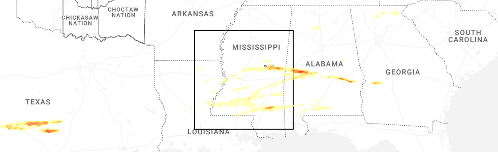
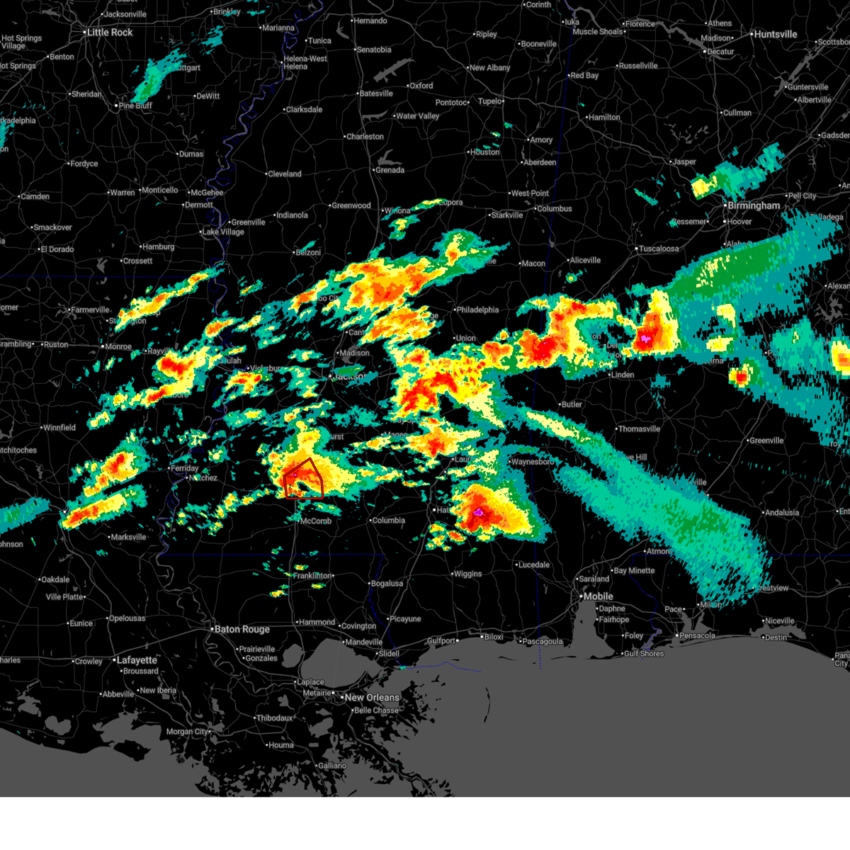
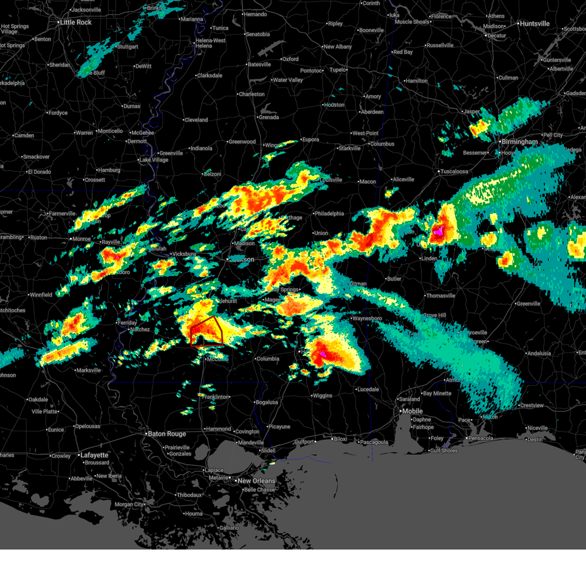
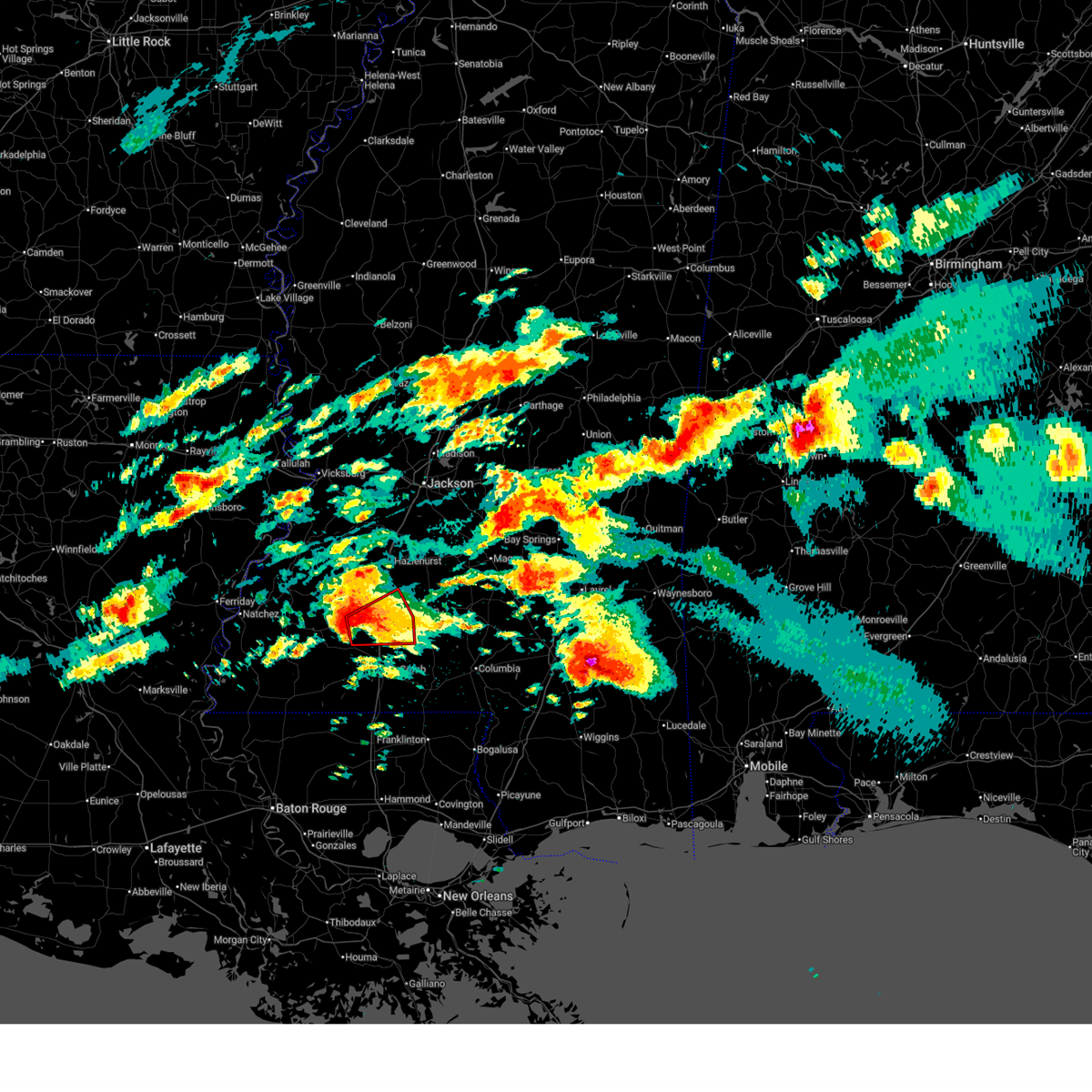
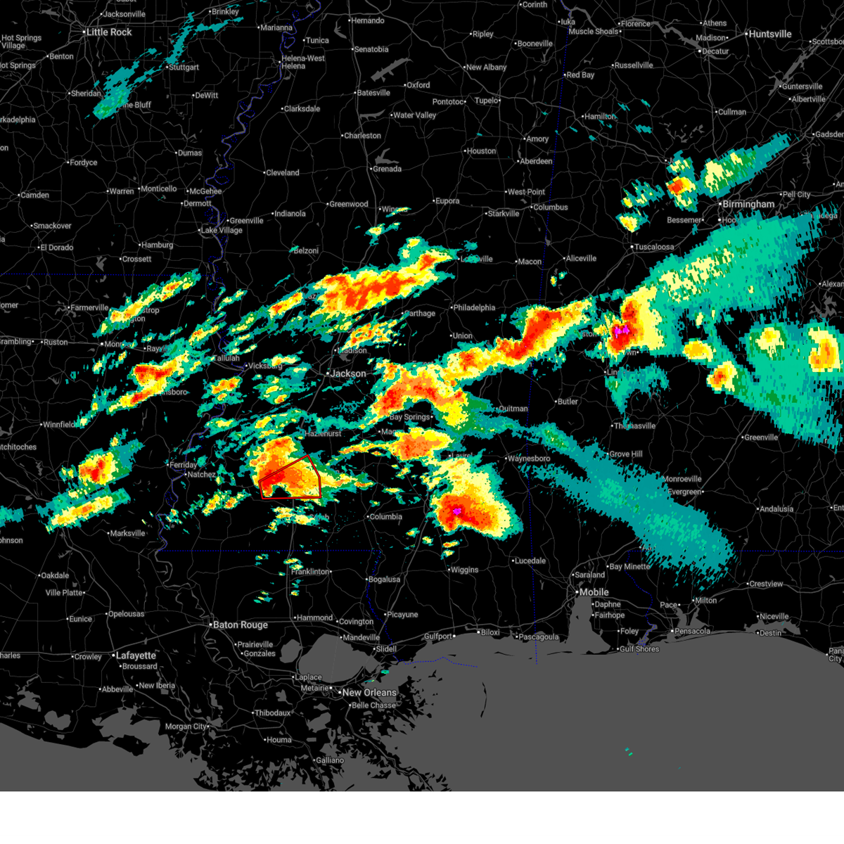
Hail Map for Bogue Chitto, MS
The Bogue Chitto, MS area has had 20 reports of on-the-ground hail by trained spotters, and has been under severe weather warnings 70 times during the past 12 months. Doppler radar has detected hail at or near Bogue Chitto, MS on 118 occasions, including 10 occasions during the past year.
| Name: | Bogue Chitto, MS |
| Where Located: | 43.8 miles S of Starkville, MS |
| Map: | Google Map for Bogue Chitto, MS |
| Population: | 887 |
| Housing Units: | 232 |
| More Info: | Search Google for Bogue Chitto, MS |
2
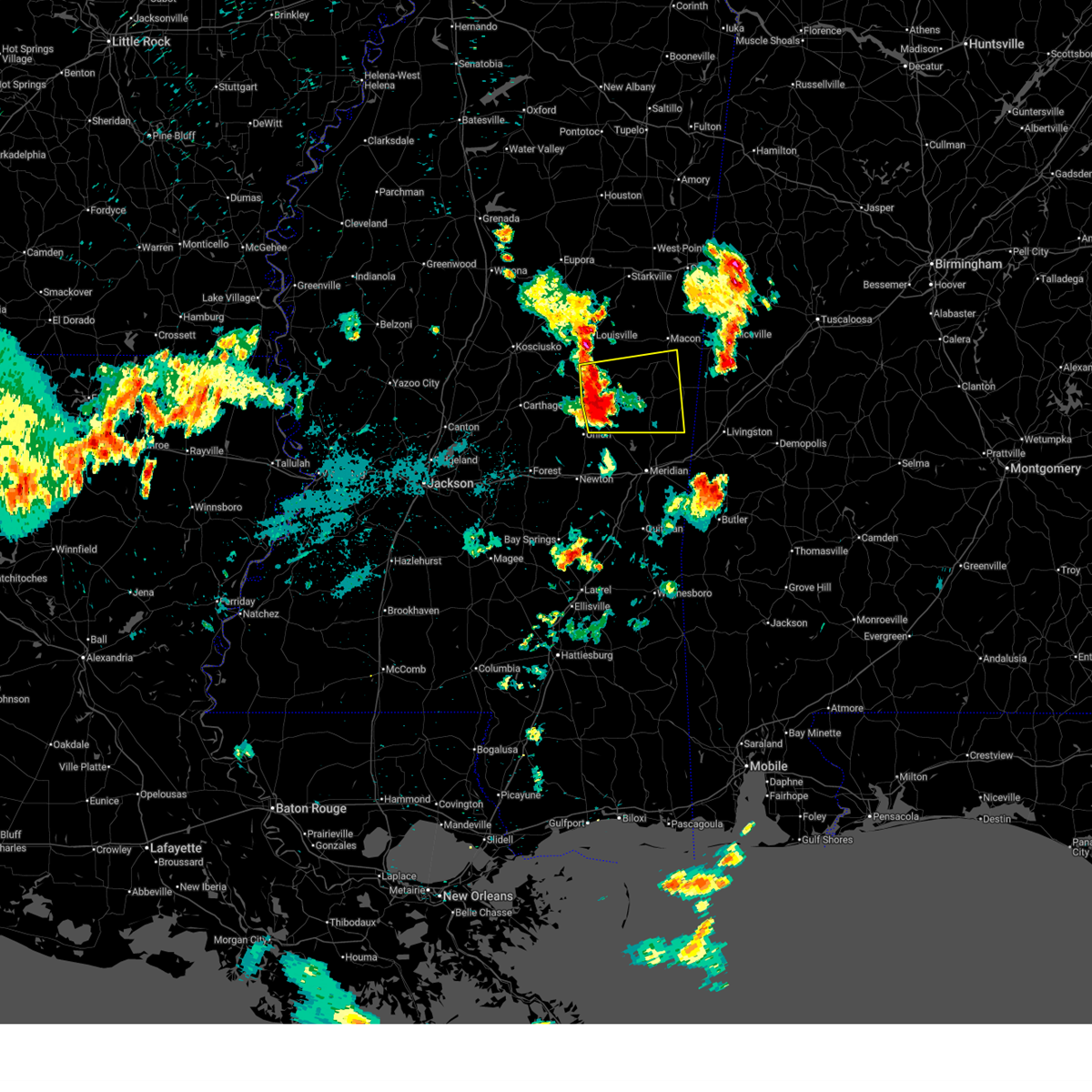
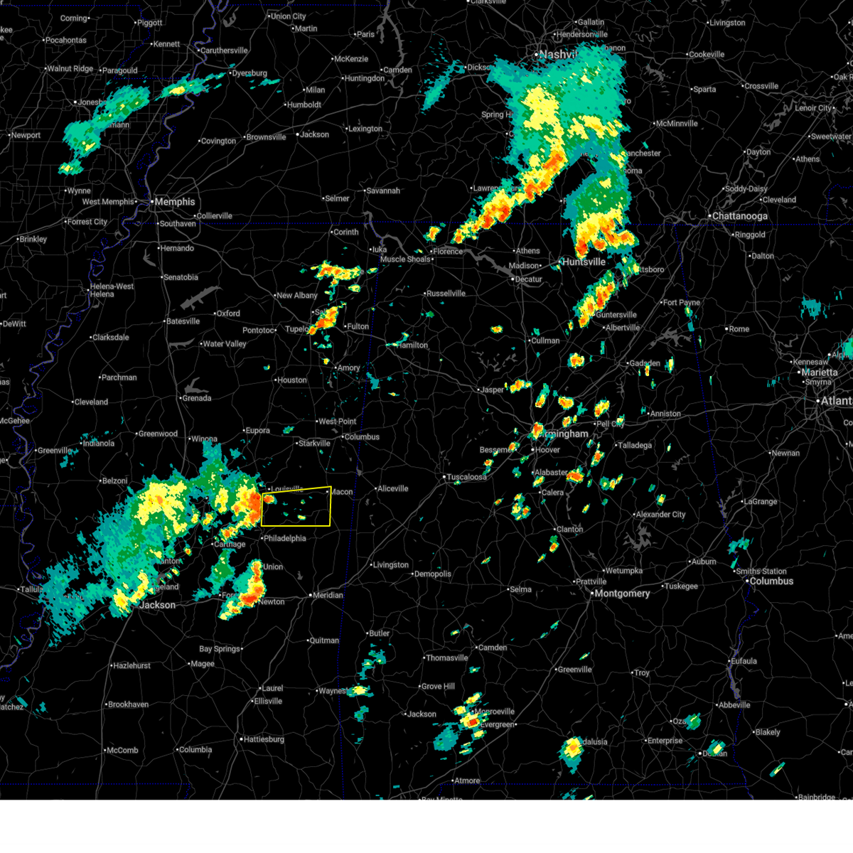
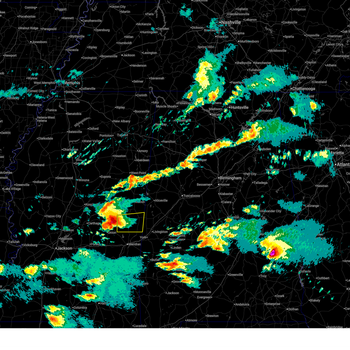
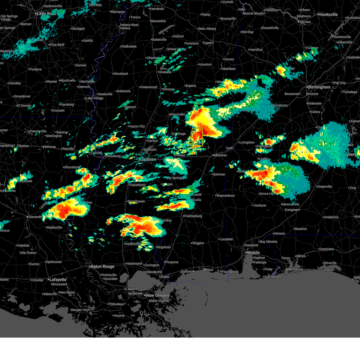
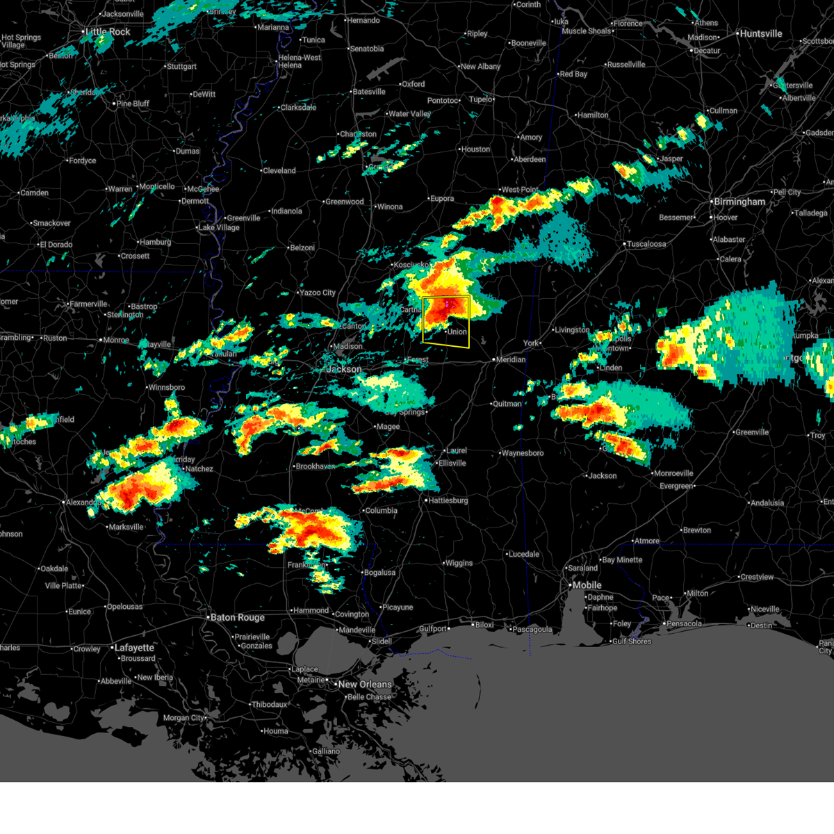
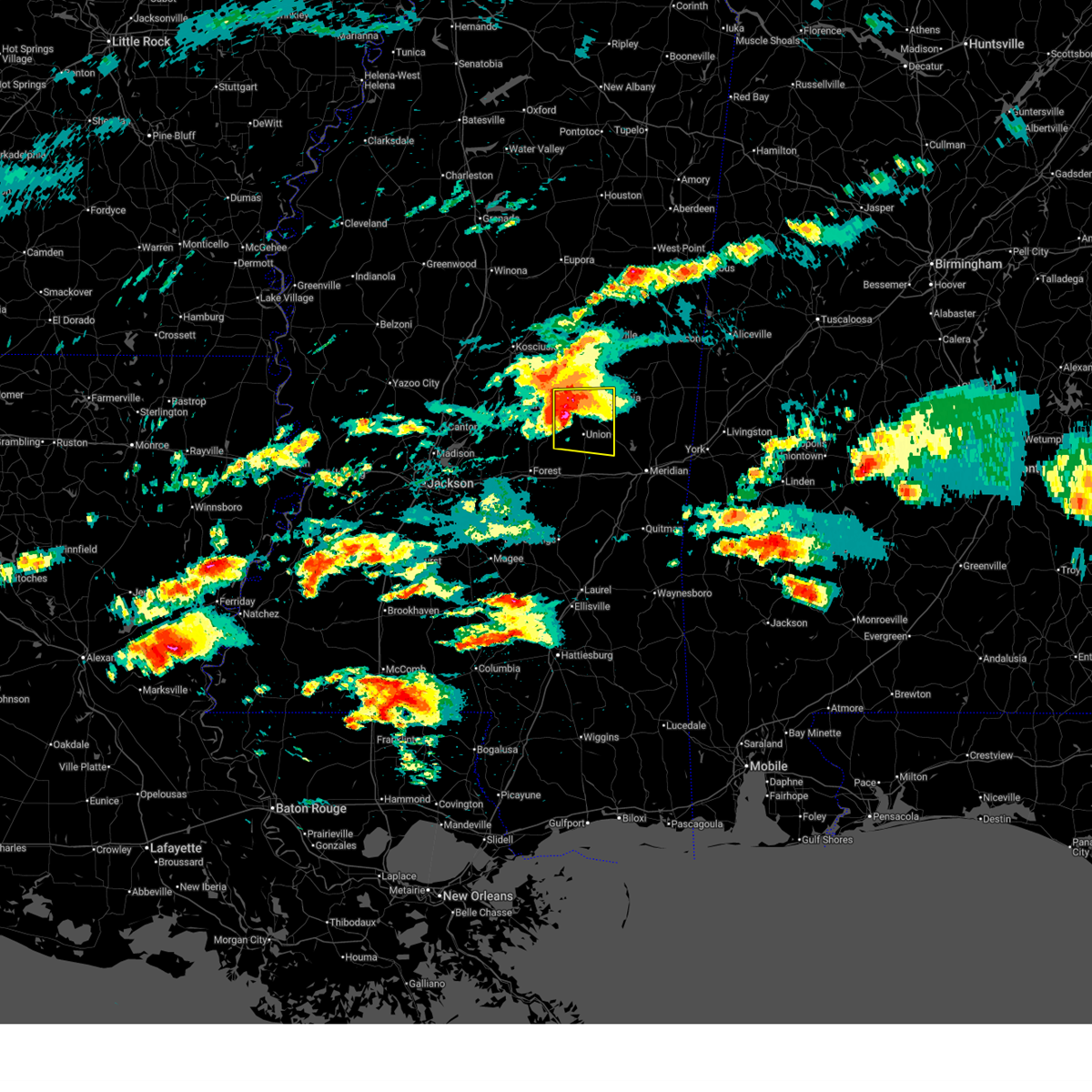
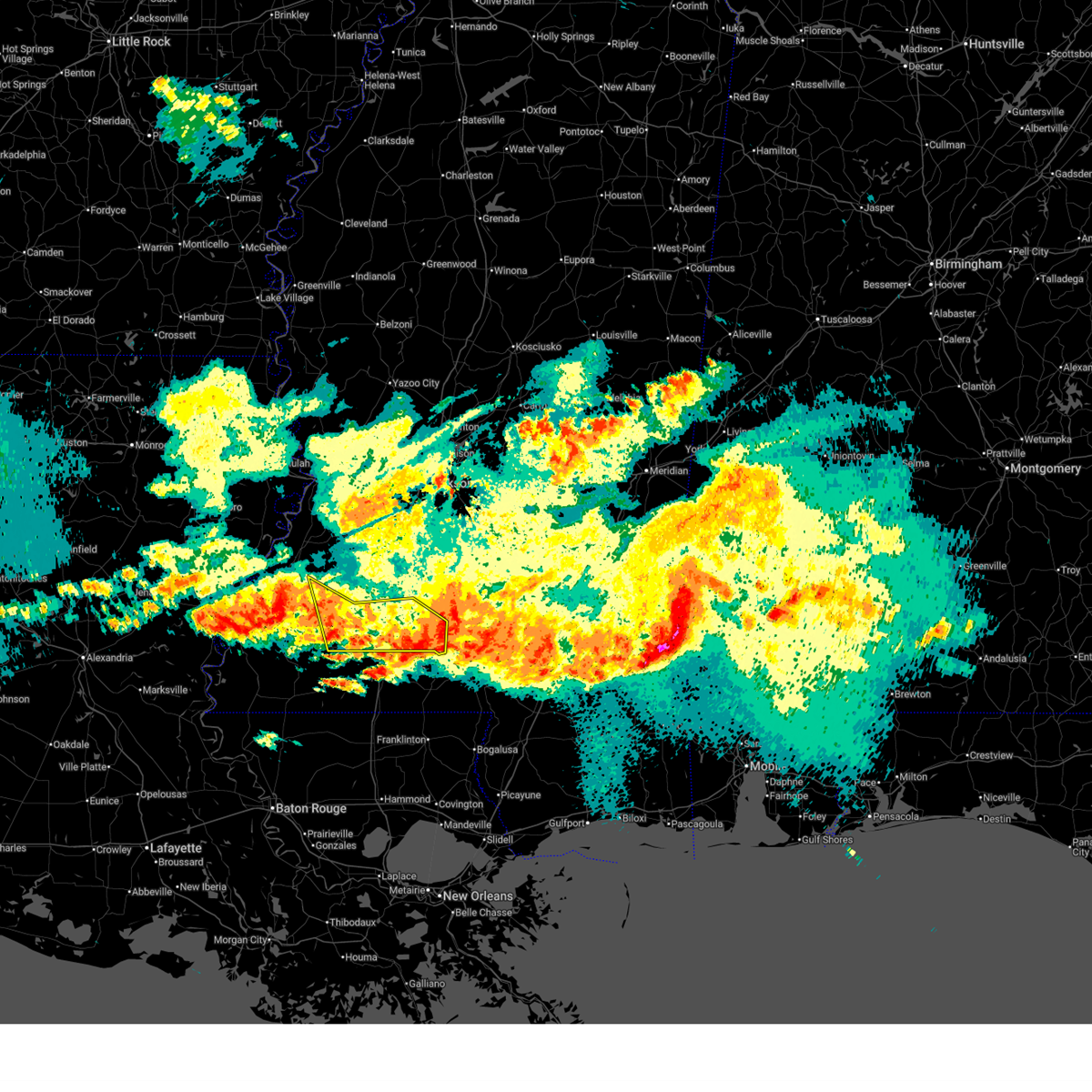
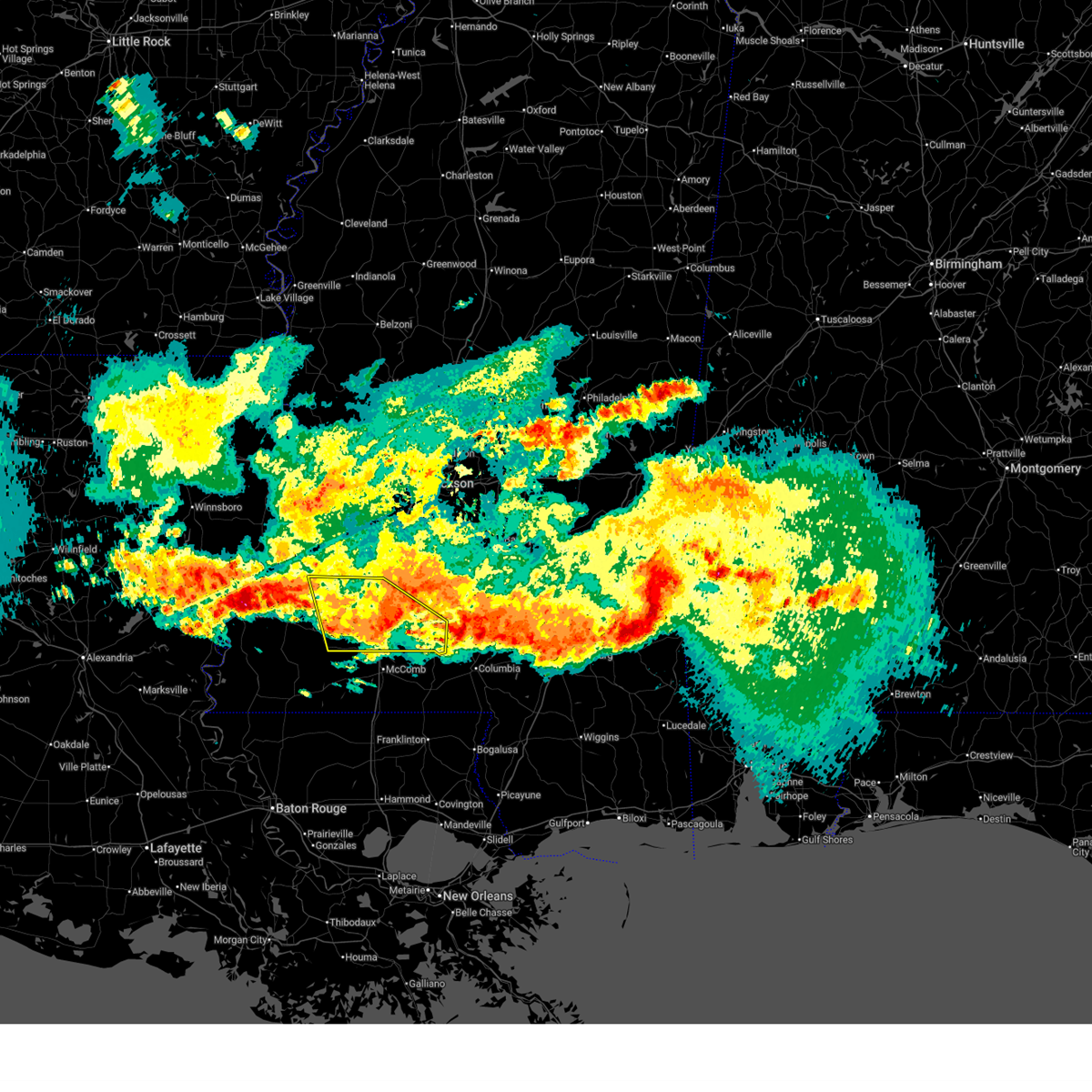
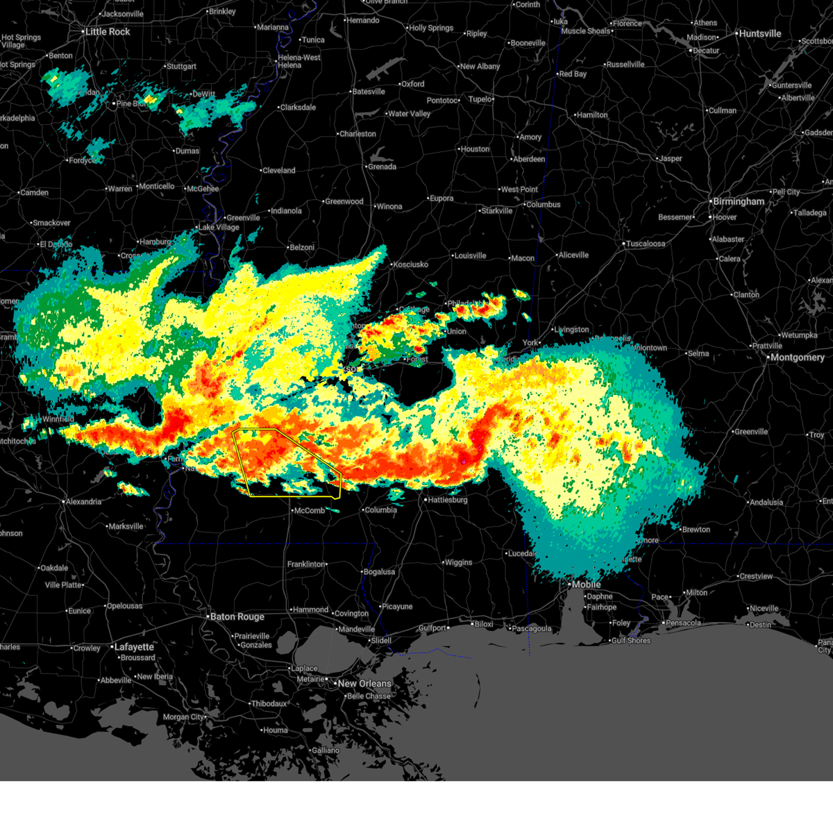
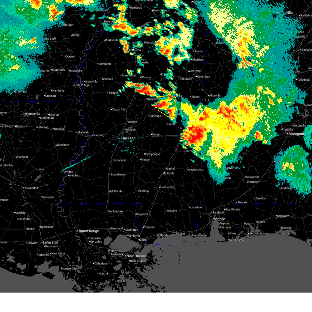
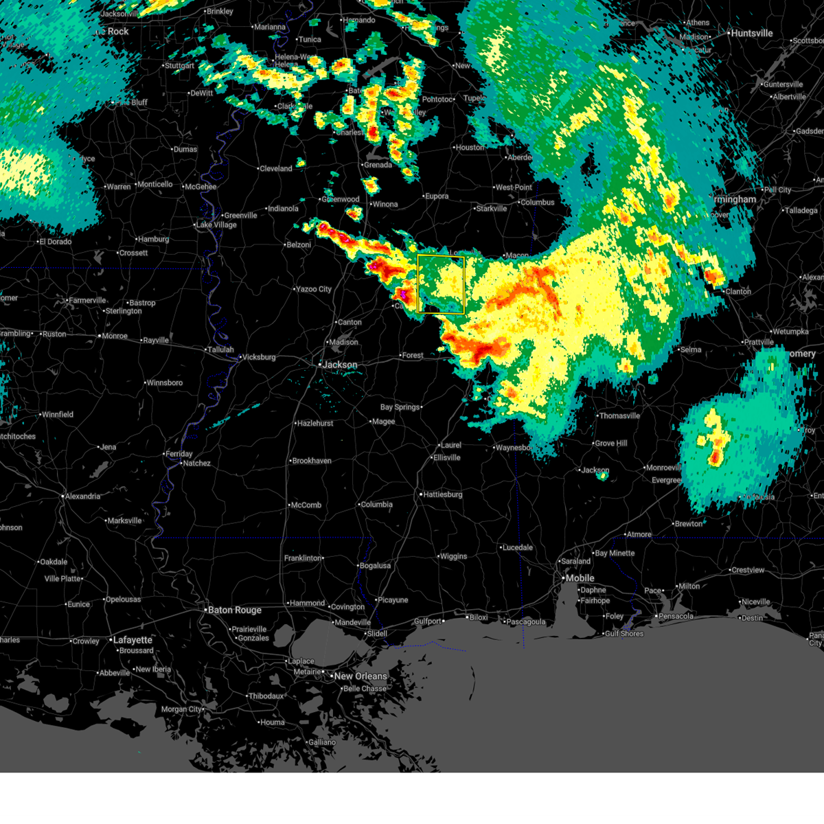
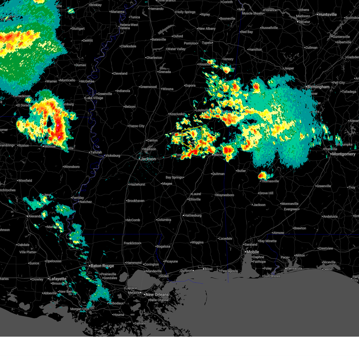
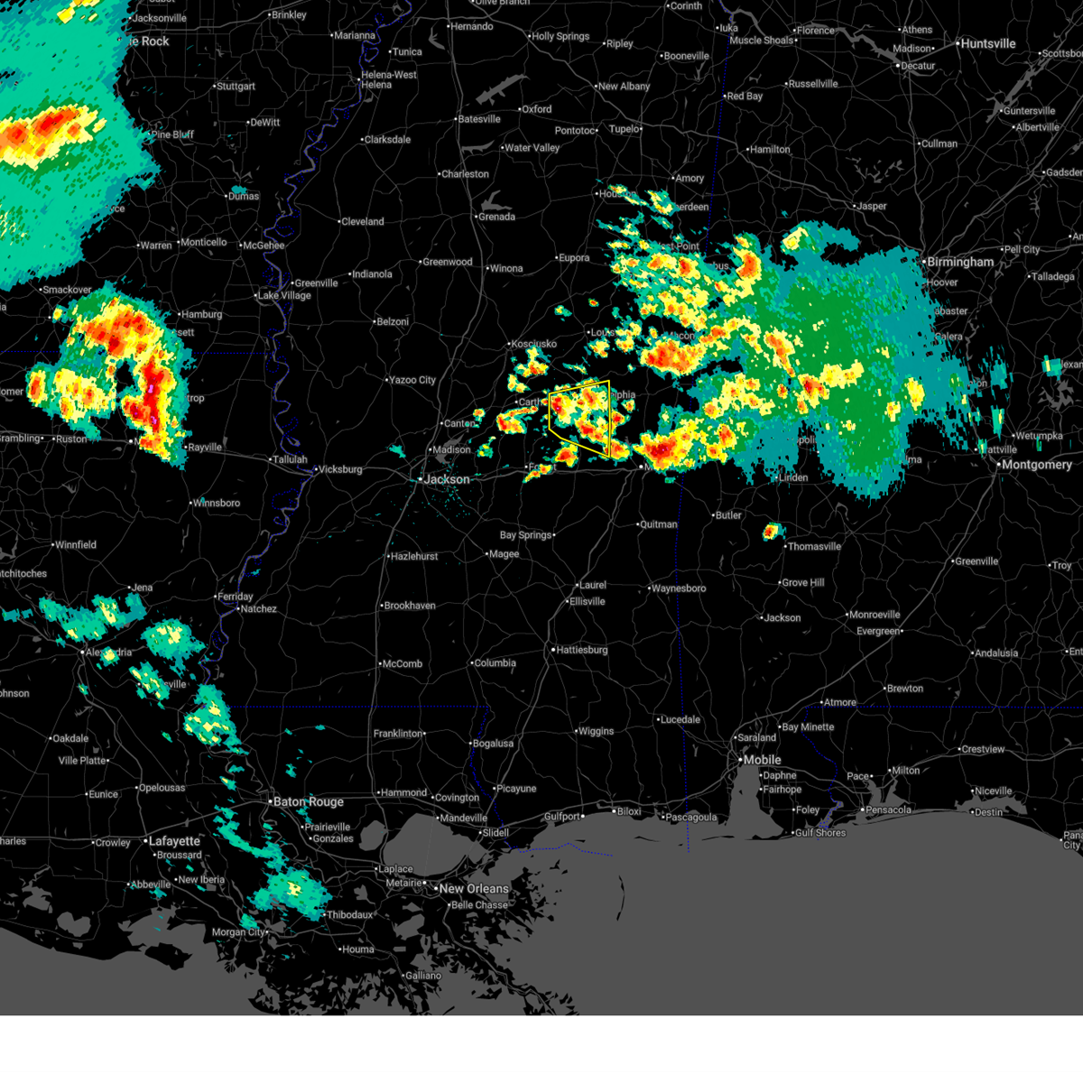
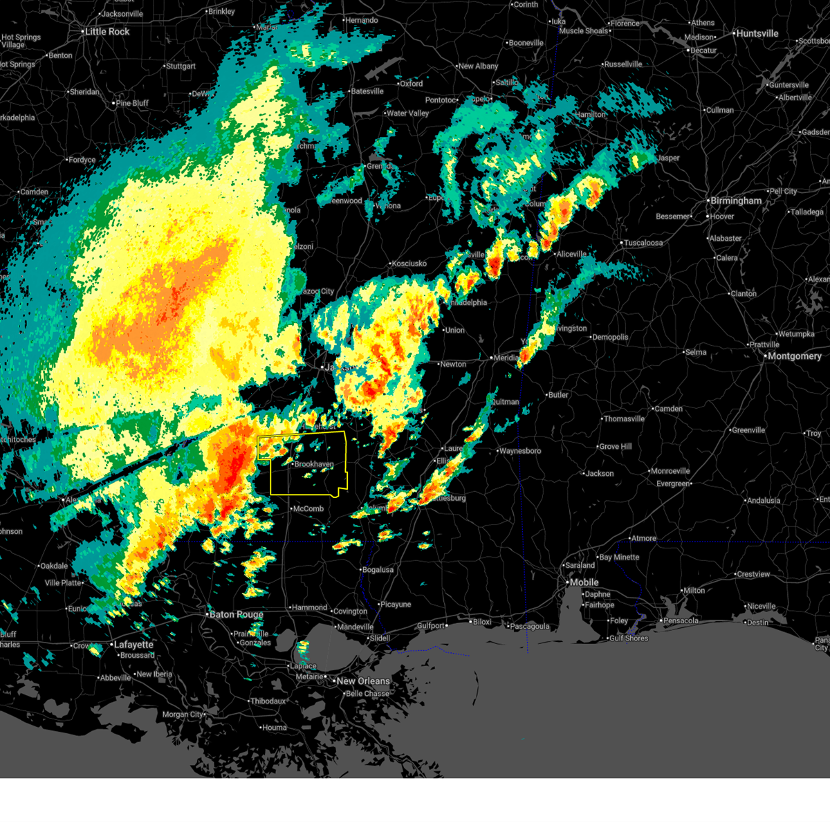
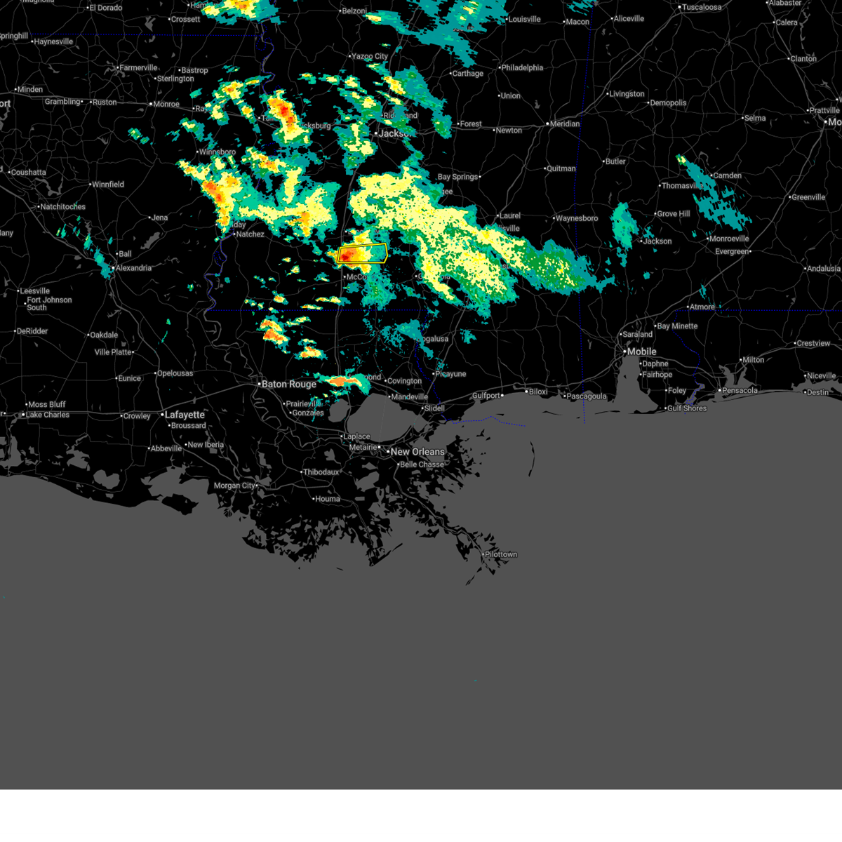
The Top Recent Hail Date for Bogue Chitto, MS is Wednesday, May 6, 2026 (15th out of 118)
Hail and Wind Damage Spotted near Bogue Chitto, MS
| Date / Time | Report Details |
|---|---|
| 7/5/2026 5:14 AM CDT |
 Svrjan the national weather service in jackson has issued a * severe thunderstorm warning for, southwestern noxubee county in east central mississippi, kemper county in east central mississippi, southeastern winston county in east central mississippi, eastern neshoba county in east central mississippi, * until 615 am cdt. * at 514 am cdt, severe thunderstorms were located along a line extending from near nanih waiya to near house, moving east at 30 mph (radar indicated). Hazards include 60 mph wind gusts and quarter size hail. Hail damage to vehicles is expected. expect wind damage to roofs, siding, and trees. severe thunderstorms will be near, damascus, bluff springs, and preston around 520 am cdt. liberty around 525 am cdt. gholson around 535 am cdt. de kalb and blackwater around 540 am cdt. Scooba and porterville around 600 am cdt. Svrjan the national weather service in jackson has issued a * severe thunderstorm warning for, southwestern noxubee county in east central mississippi, kemper county in east central mississippi, southeastern winston county in east central mississippi, eastern neshoba county in east central mississippi, * until 615 am cdt. * at 514 am cdt, severe thunderstorms were located along a line extending from near nanih waiya to near house, moving east at 30 mph (radar indicated). Hazards include 60 mph wind gusts and quarter size hail. Hail damage to vehicles is expected. expect wind damage to roofs, siding, and trees. severe thunderstorms will be near, damascus, bluff springs, and preston around 520 am cdt. liberty around 525 am cdt. gholson around 535 am cdt. de kalb and blackwater around 540 am cdt. Scooba and porterville around 600 am cdt.
|
| 6/22/2026 1:40 PM CDT |
 Svrjan the national weather service in jackson has issued a * severe thunderstorm warning for, southwestern noxubee county in east central mississippi, northwestern kemper county in east central mississippi, southeastern winston county in east central mississippi, northeastern neshoba county in east central mississippi, * until 230 pm cdt. * at 139 pm cdt, a severe thunderstorm was located over noxapater, or 10 miles south of louisville, moving east at 45 mph (radar indicated). Hazards include 60 mph wind gusts. Expect damage to roofs, siding, and trees. this severe thunderstorm will be near, noxapater and nanih waiya around 145 pm cdt. gholson, preston, and mashulaville around 200 pm cdt. shuqualak around 210 pm cdt. Macon around 215 pm cdt. Svrjan the national weather service in jackson has issued a * severe thunderstorm warning for, southwestern noxubee county in east central mississippi, northwestern kemper county in east central mississippi, southeastern winston county in east central mississippi, northeastern neshoba county in east central mississippi, * until 230 pm cdt. * at 139 pm cdt, a severe thunderstorm was located over noxapater, or 10 miles south of louisville, moving east at 45 mph (radar indicated). Hazards include 60 mph wind gusts. Expect damage to roofs, siding, and trees. this severe thunderstorm will be near, noxapater and nanih waiya around 145 pm cdt. gholson, preston, and mashulaville around 200 pm cdt. shuqualak around 210 pm cdt. Macon around 215 pm cdt.
|
| 5/9/2026 2:35 AM CDT |
 The storms which prompted the warning have weakened below severe limits, and no longer pose an immediate threat to life or property. therefore, the warning will be allowed to expire. however, heavy rain is still possible with these thunderstorms. The storms which prompted the warning have weakened below severe limits, and no longer pose an immediate threat to life or property. therefore, the warning will be allowed to expire. however, heavy rain is still possible with these thunderstorms.
|
| 5/9/2026 2:04 AM CDT |
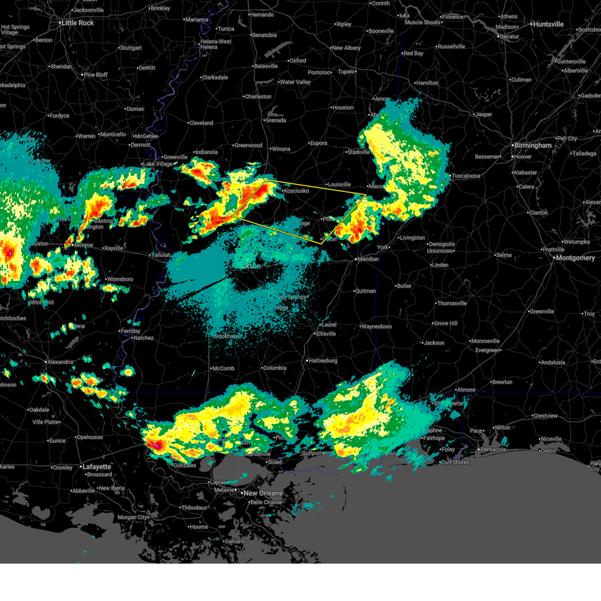 Svrjan the national weather service in jackson has issued a * severe thunderstorm warning for, leake county in central mississippi, southeastern holmes county in central mississippi, southwestern noxubee county in east central mississippi, northwestern newton county in east central mississippi, northwestern kemper county in east central mississippi, attala county in central mississippi, southern winston county in east central mississippi, east central yazoo county in central mississippi, neshoba county in east central mississippi, northeastern madison county in central mississippi, * until 245 am cdt. * at 204 am cdt, severe thunderstorms were located along a line extending from near mcadams to near vaughan, moving east at 65 mph (radar indicated). Hazards include 60 mph wind gusts and quarter size hail. Hail damage to vehicles is expected. expect wind damage to roofs, siding, and trees. severe thunderstorms will be near, kosciusko, newport, cameron, mcadams, thomastown, and camden around 210 am cdt. smyrna and singleton around 215 am cdt. carthage, redwater, zama, and renfroe around 220 am cdt. standing pine and edinburg around 230 am cdt. Philadelphia, pearl river, noxapater, madden, dowdville, and stallo around 235 am cdt. Svrjan the national weather service in jackson has issued a * severe thunderstorm warning for, leake county in central mississippi, southeastern holmes county in central mississippi, southwestern noxubee county in east central mississippi, northwestern newton county in east central mississippi, northwestern kemper county in east central mississippi, attala county in central mississippi, southern winston county in east central mississippi, east central yazoo county in central mississippi, neshoba county in east central mississippi, northeastern madison county in central mississippi, * until 245 am cdt. * at 204 am cdt, severe thunderstorms were located along a line extending from near mcadams to near vaughan, moving east at 65 mph (radar indicated). Hazards include 60 mph wind gusts and quarter size hail. Hail damage to vehicles is expected. expect wind damage to roofs, siding, and trees. severe thunderstorms will be near, kosciusko, newport, cameron, mcadams, thomastown, and camden around 210 am cdt. smyrna and singleton around 215 am cdt. carthage, redwater, zama, and renfroe around 220 am cdt. standing pine and edinburg around 230 am cdt. Philadelphia, pearl river, noxapater, madden, dowdville, and stallo around 235 am cdt.
|
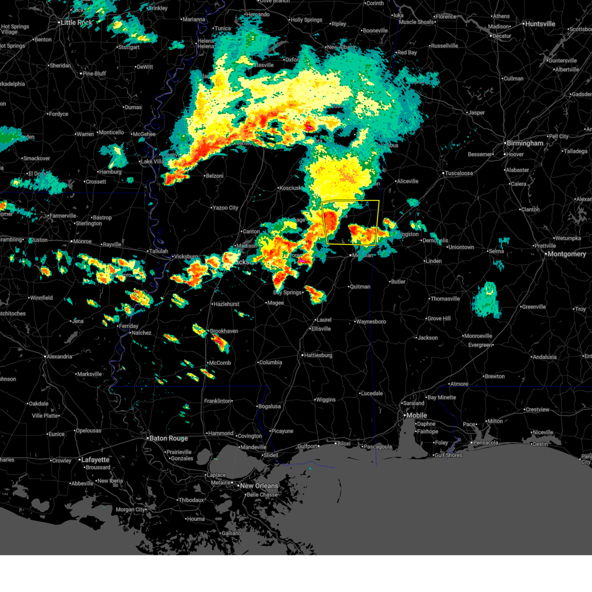
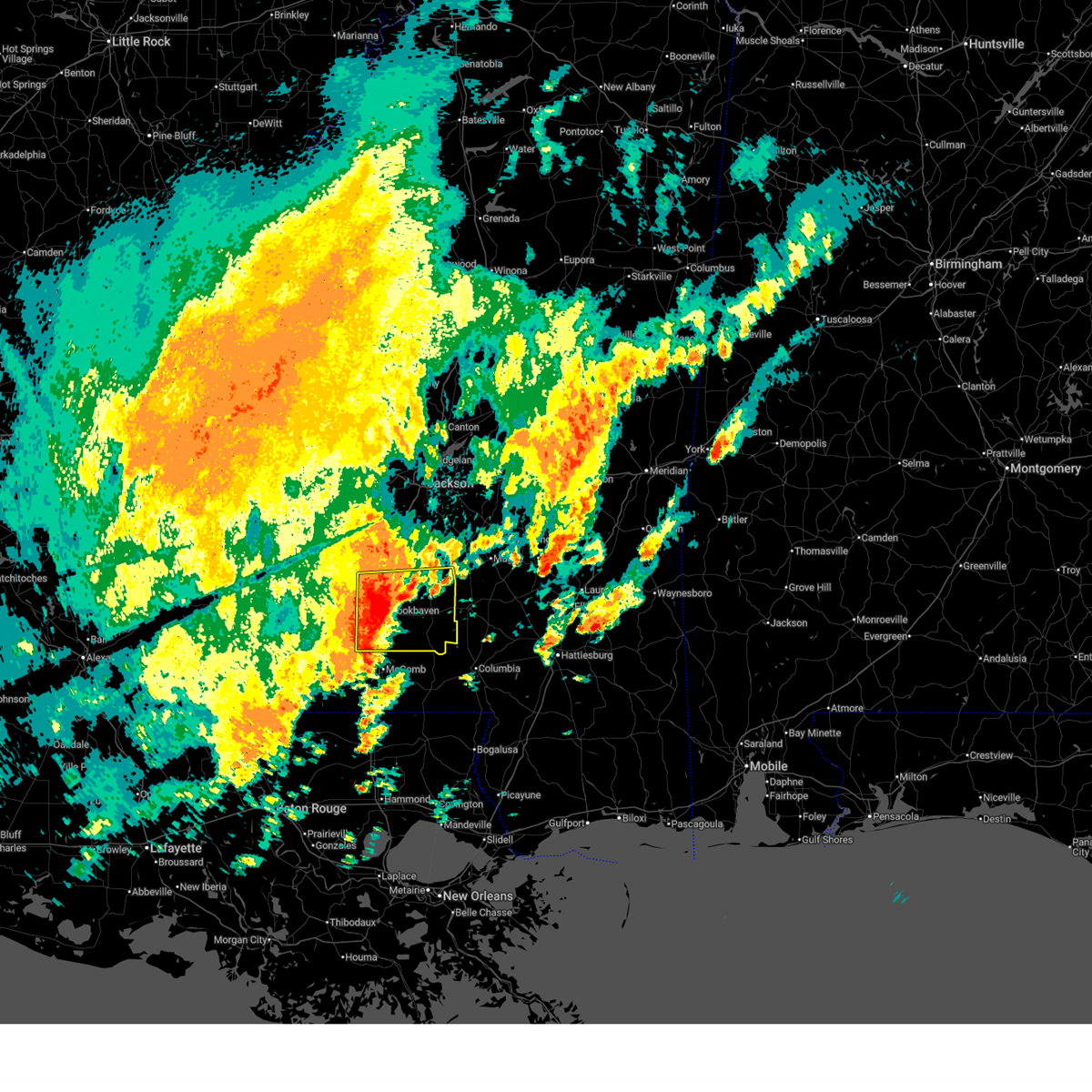
| 5/6/2026 10:34 PM CDT |
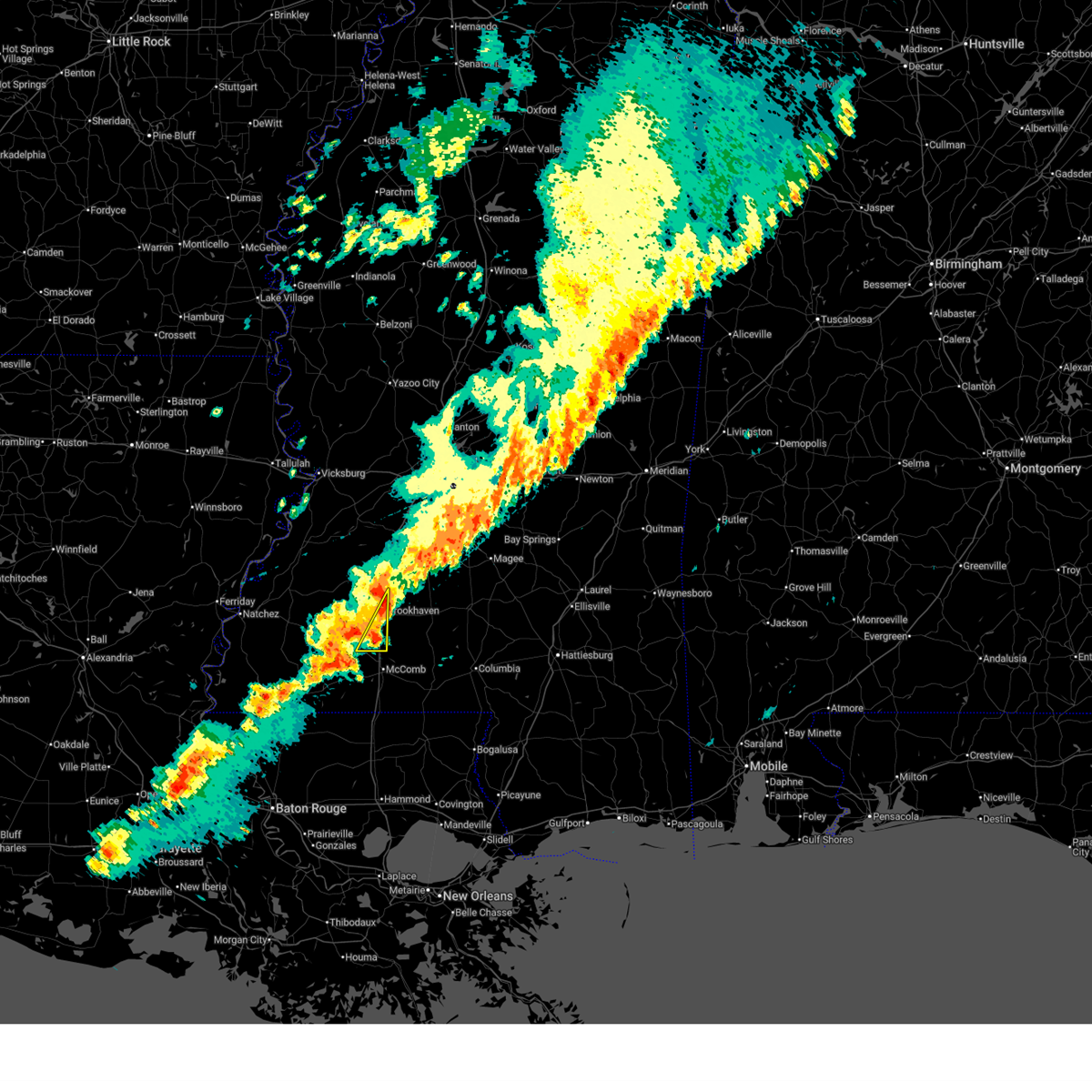
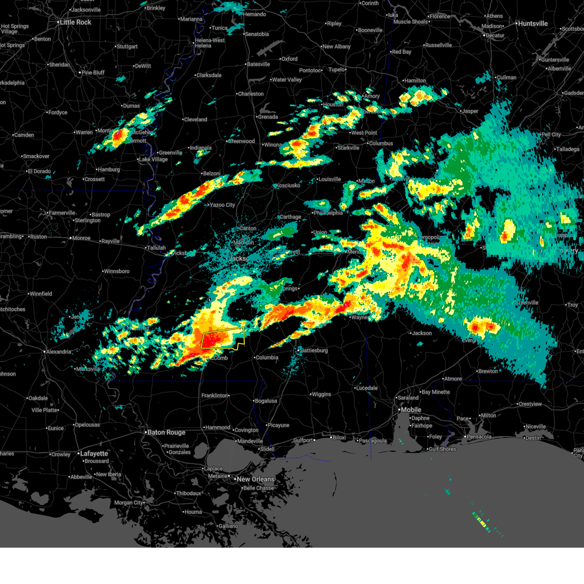 At 1034 pm cdt, a severe thunderstorm was located near ruth, or 12 miles southeast of brookhaven, moving east at 40 mph (radar indicated). Hazards include 60 mph wind gusts and half dollar size hail. Hail damage to vehicles is expected. expect wind damage to roofs, siding, and trees. this severe storm will be near, jayess, east lincoln, and topeka around 1040 pm cdt. robinwood around 1045 pm cdt. tilton around 1050 pm cdt. Monticello, oak vale, and arm around 1055 pm cdt. At 1034 pm cdt, a severe thunderstorm was located near ruth, or 12 miles southeast of brookhaven, moving east at 40 mph (radar indicated). Hazards include 60 mph wind gusts and half dollar size hail. Hail damage to vehicles is expected. expect wind damage to roofs, siding, and trees. this severe storm will be near, jayess, east lincoln, and topeka around 1040 pm cdt. robinwood around 1045 pm cdt. tilton around 1050 pm cdt. Monticello, oak vale, and arm around 1055 pm cdt.
|
| 5/6/2026 10:30 PM CDT |
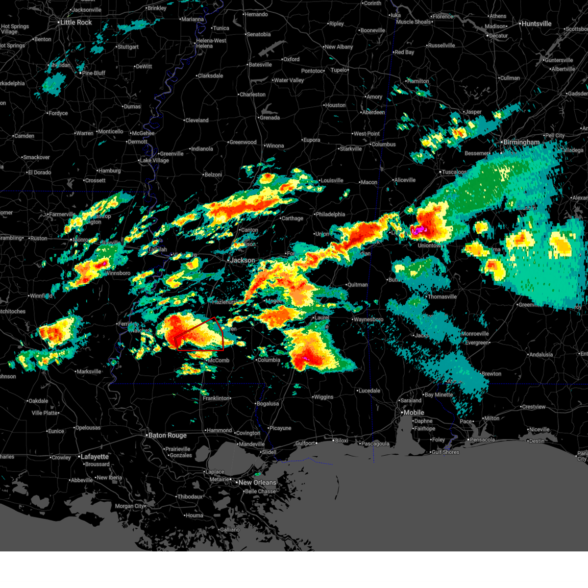
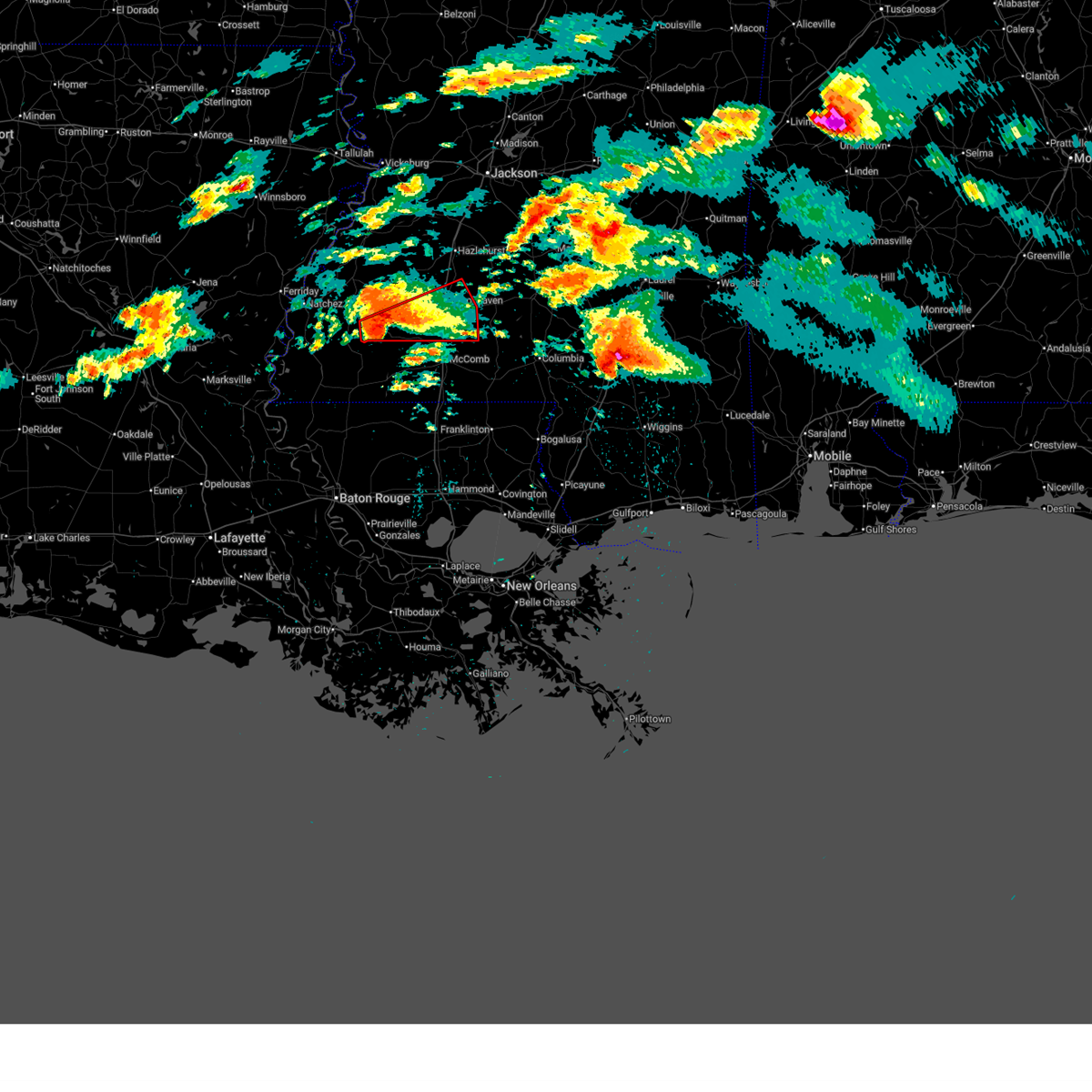
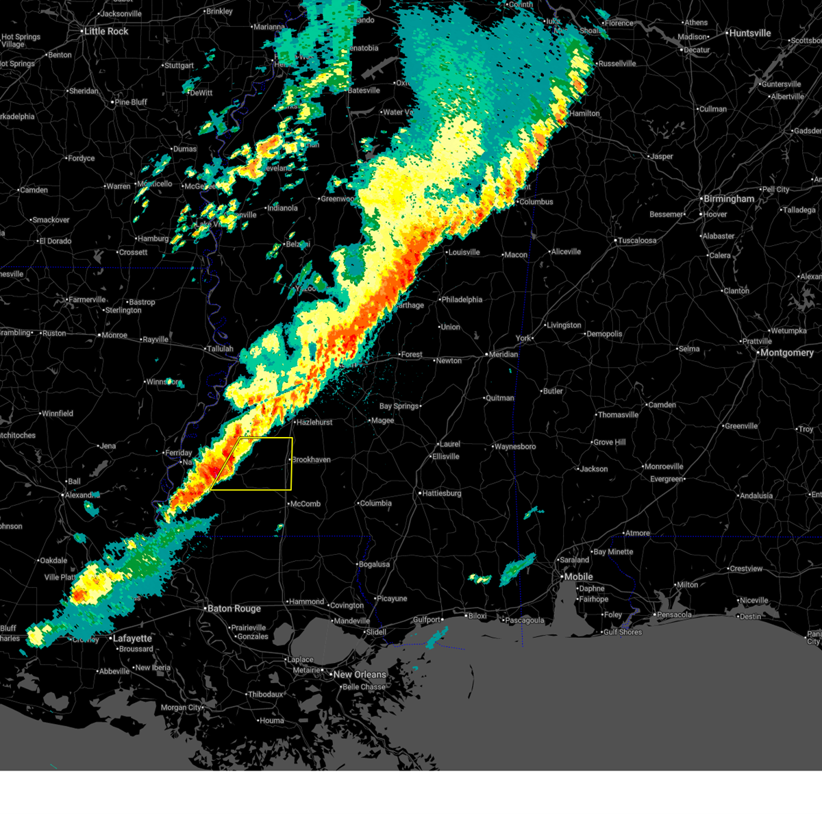
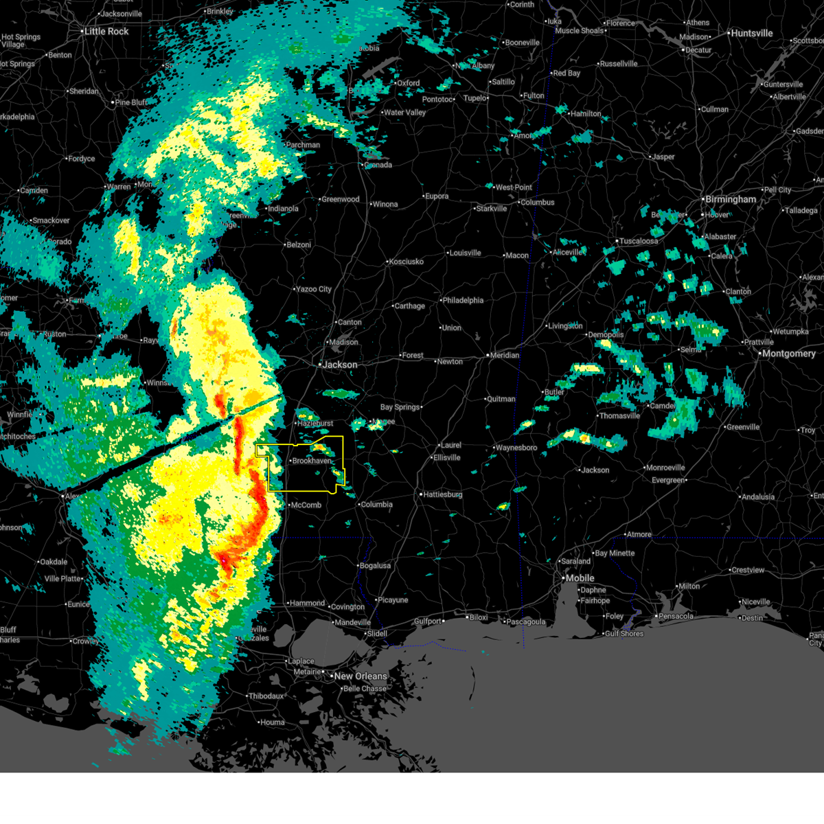
 At 1030 pm cdt, a severe thunderstorm was located near bogue chitto, or 12 miles south of brookhaven, moving east at 40 mph (radar indicated). Hazards include 60 mph wind gusts and half dollar size hail. Hail damage to vehicles is expected. expect wind damage to roofs, siding, and trees. this severe storm will be near, ruth, jayess, east lincoln, and topeka around 1035 pm cdt. robinwood around 1045 pm cdt. tilton around 1050 pm cdt. Monticello, oak vale, and arm around 1055 pm cdt. At 1030 pm cdt, a severe thunderstorm was located near bogue chitto, or 12 miles south of brookhaven, moving east at 40 mph (radar indicated). Hazards include 60 mph wind gusts and half dollar size hail. Hail damage to vehicles is expected. expect wind damage to roofs, siding, and trees. this severe storm will be near, ruth, jayess, east lincoln, and topeka around 1035 pm cdt. robinwood around 1045 pm cdt. tilton around 1050 pm cdt. Monticello, oak vale, and arm around 1055 pm cdt.
|
| 5/6/2026 10:19 PM CDT |
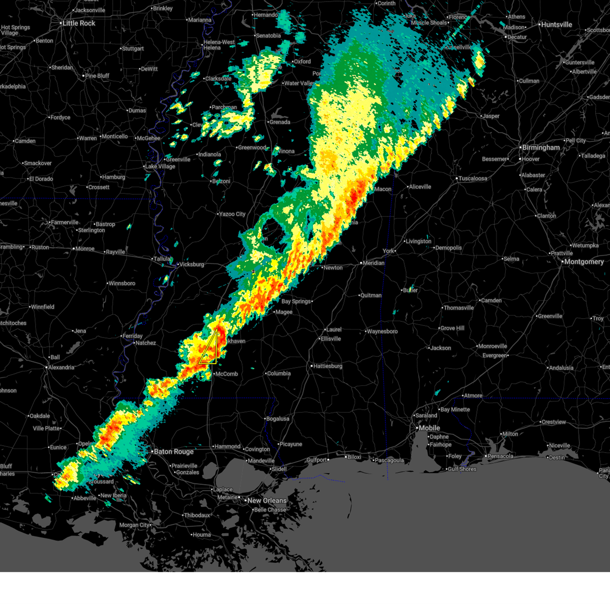
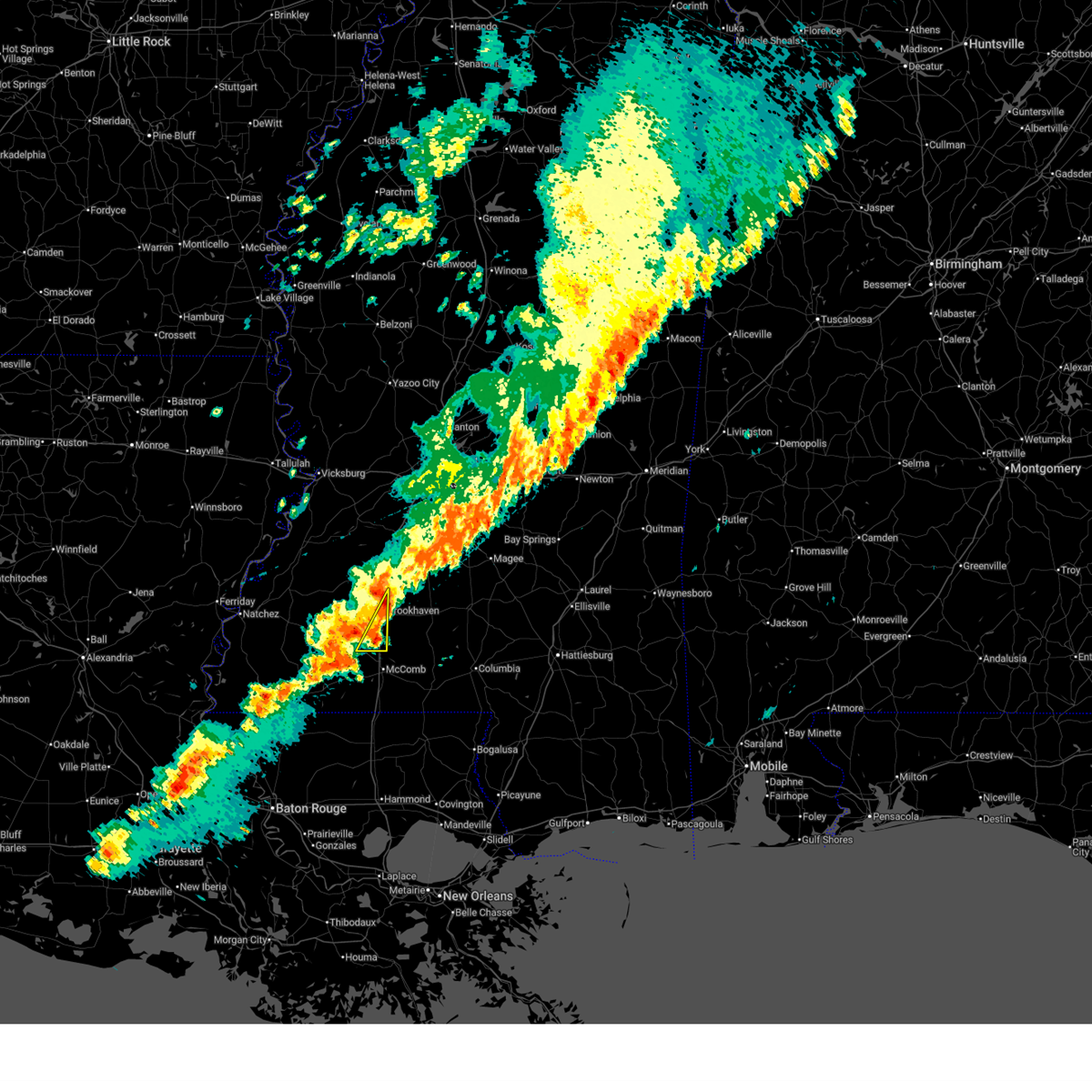
 Svrjan the national weather service in jackson has issued a * severe thunderstorm warning for, southeastern lincoln county in south central mississippi, lawrence county in south central mississippi, * until 1115 pm cdt. * at 1019 pm cdt, a severe thunderstorm was located near bogue chitto, or 11 miles north of mccomb, moving east at 40 mph (radar indicated). Hazards include 60 mph wind gusts and half dollar size hail. Hail damage to vehicles is expected. expect wind damage to roofs, siding, and trees. this severe thunderstorm will be near, bogue chitto, ruth, and enterprise around 1025 pm cdt. east lincoln around 1030 pm cdt. jayess and topeka around 1035 pm cdt. robinwood around 1045 pm cdt. tilton around 1050 pm cdt. Monticello, oak vale, and arm around 1055 pm cdt. Svrjan the national weather service in jackson has issued a * severe thunderstorm warning for, southeastern lincoln county in south central mississippi, lawrence county in south central mississippi, * until 1115 pm cdt. * at 1019 pm cdt, a severe thunderstorm was located near bogue chitto, or 11 miles north of mccomb, moving east at 40 mph (radar indicated). Hazards include 60 mph wind gusts and half dollar size hail. Hail damage to vehicles is expected. expect wind damage to roofs, siding, and trees. this severe thunderstorm will be near, bogue chitto, ruth, and enterprise around 1025 pm cdt. east lincoln around 1030 pm cdt. jayess and topeka around 1035 pm cdt. robinwood around 1045 pm cdt. tilton around 1050 pm cdt. Monticello, oak vale, and arm around 1055 pm cdt.
|
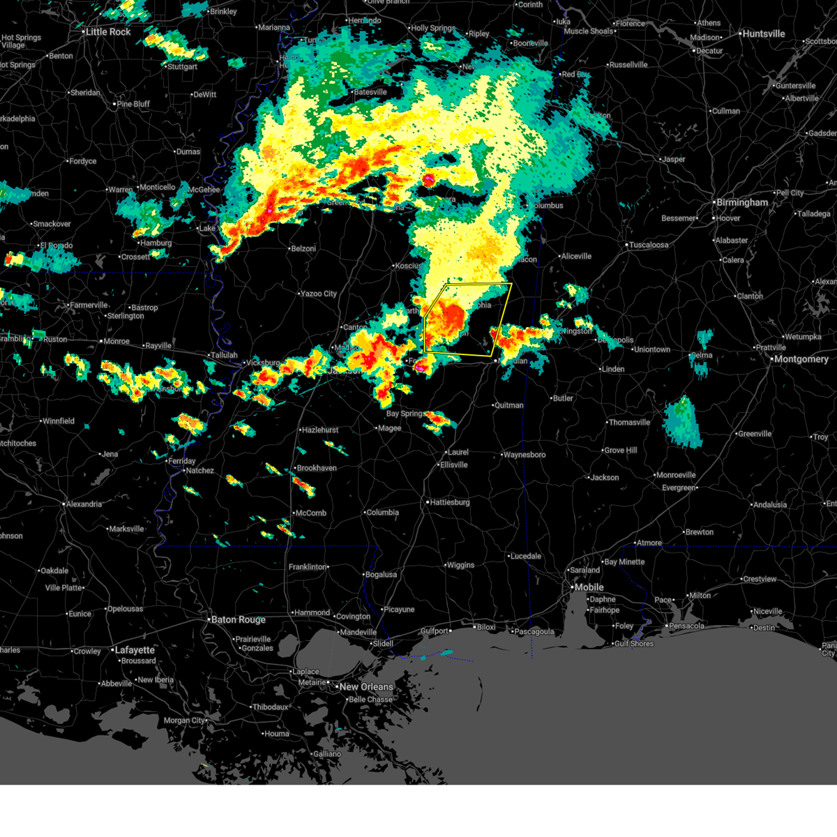
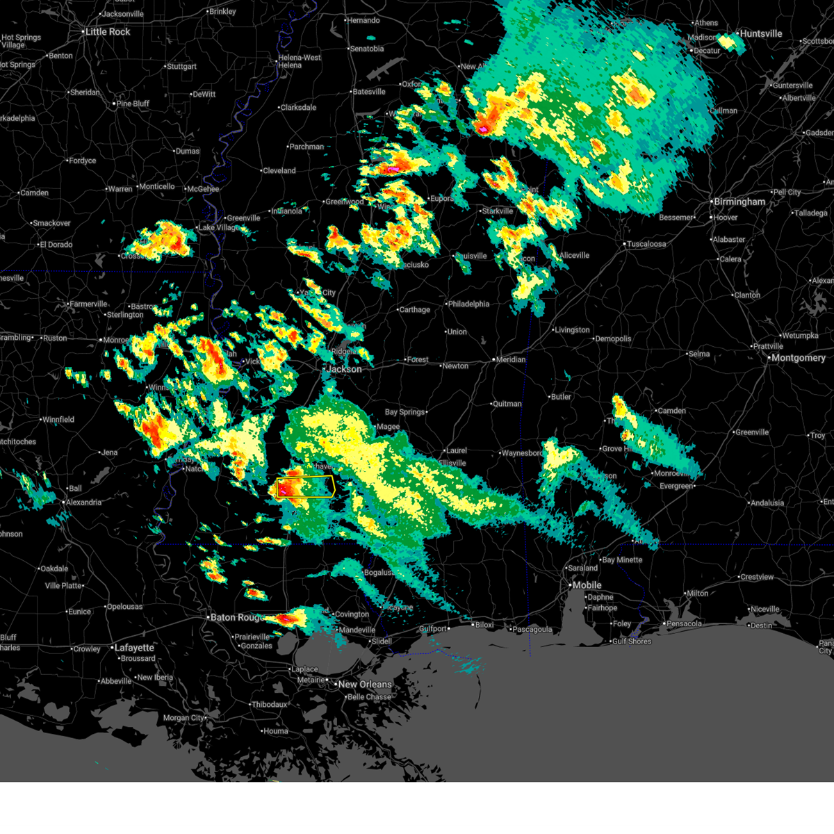
| 5/6/2026 8:01 PM CDT |
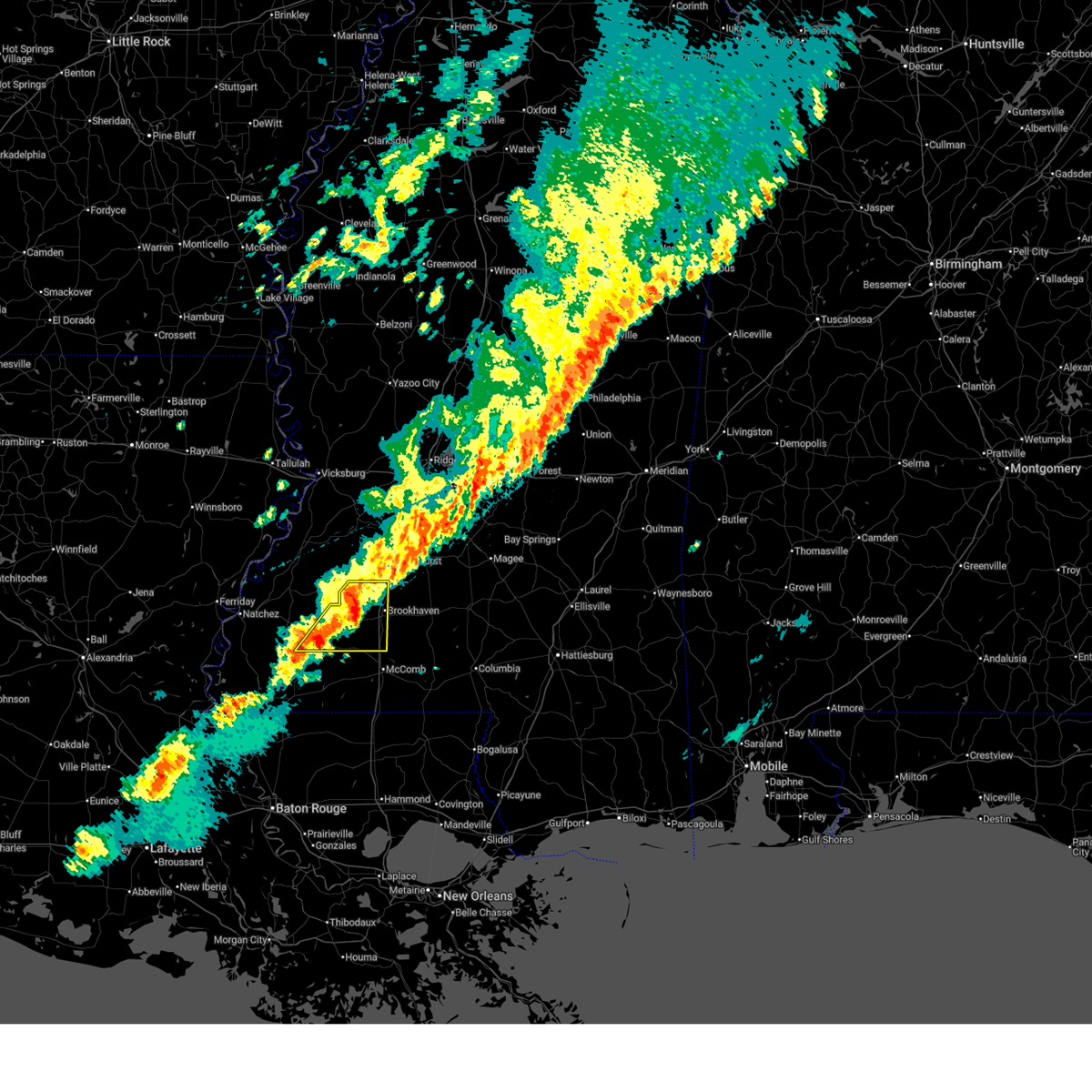
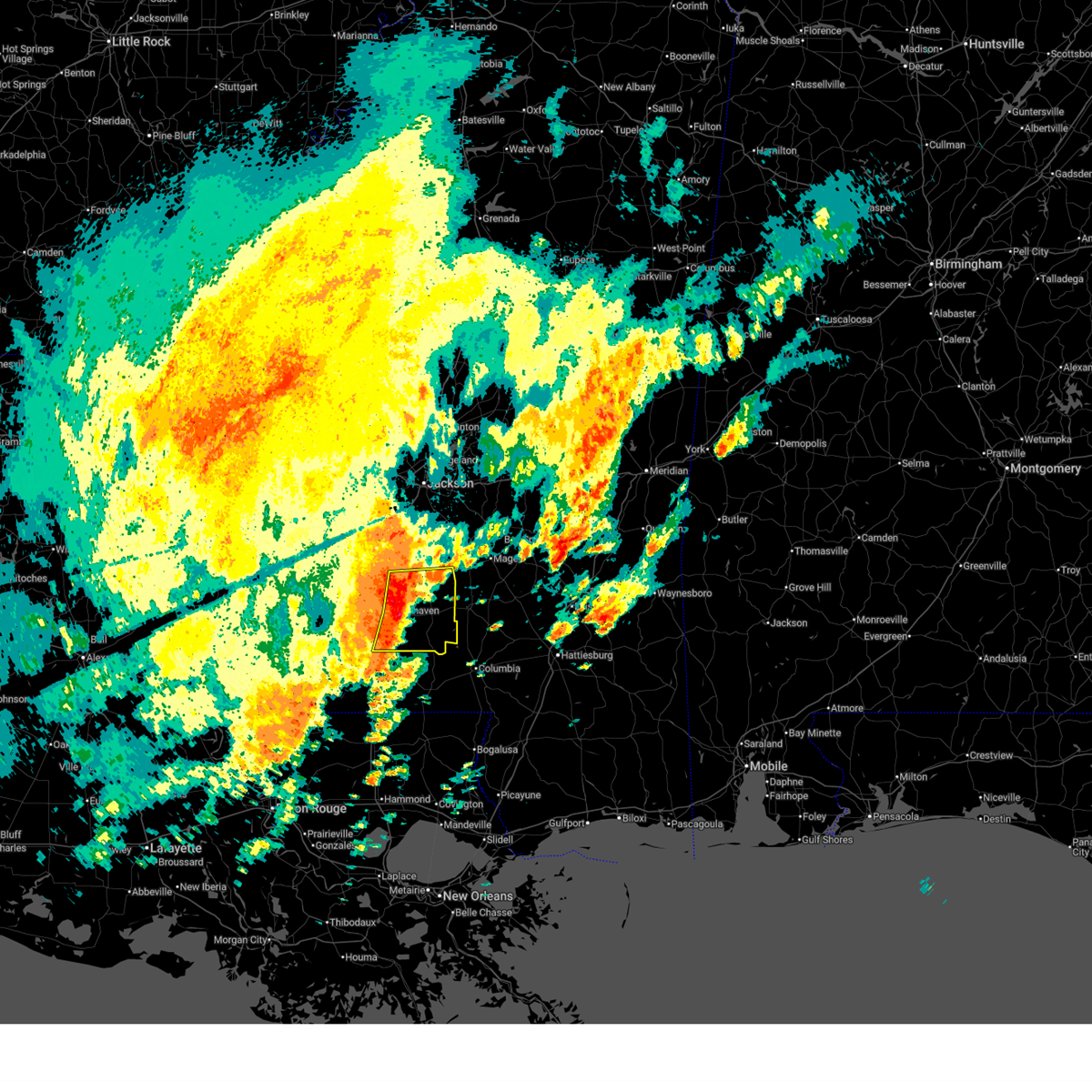
 At 801 pm cdt, a confirmed large and destructive tornado was located over east lincoln, or 10 miles southeast of brookhaven, moving east at 50 mph. tornado emergency for brookhaven, bogue chitto. this is a particularly dangerous situation. take cover now! (radar confirmed tornado). Hazards include deadly tornado. You are in a life-threatening situation. flying debris may be deadly to those caught without shelter. mobile homes will be destroyed. considerable damage to homes, businesses, and vehicles is likely and complete destruction is possible. This tornadic thunderstorm will remain over mainly rural areas of eastern lincoln county. At 801 pm cdt, a confirmed large and destructive tornado was located over east lincoln, or 10 miles southeast of brookhaven, moving east at 50 mph. tornado emergency for brookhaven, bogue chitto. this is a particularly dangerous situation. take cover now! (radar confirmed tornado). Hazards include deadly tornado. You are in a life-threatening situation. flying debris may be deadly to those caught without shelter. mobile homes will be destroyed. considerable damage to homes, businesses, and vehicles is likely and complete destruction is possible. This tornadic thunderstorm will remain over mainly rural areas of eastern lincoln county.
|
| 5/6/2026 7:56 PM CDT |
 At 755 pm cdt, a confirmed large and destructive tornado was located over enterprise, or 7 miles southeast of brookhaven, moving east at 50 mph. tornado emergency for brookhaven, bogue chitto. this is a particularly dangerous situation. take cover now! (radar confirmed tornado). Hazards include deadly tornado. You are in a life-threatening situation. flying debris may be deadly to those caught without shelter. mobile homes will be destroyed. considerable damage to homes, businesses, and vehicles is likely and complete destruction is possible. The tornado will be near, east lincoln around 800 pm cdt. At 755 pm cdt, a confirmed large and destructive tornado was located over enterprise, or 7 miles southeast of brookhaven, moving east at 50 mph. tornado emergency for brookhaven, bogue chitto. this is a particularly dangerous situation. take cover now! (radar confirmed tornado). Hazards include deadly tornado. You are in a life-threatening situation. flying debris may be deadly to those caught without shelter. mobile homes will be destroyed. considerable damage to homes, businesses, and vehicles is likely and complete destruction is possible. The tornado will be near, east lincoln around 800 pm cdt.
|
| 5/6/2026 7:51 PM CDT |
 At 751 pm cdt, a confirmed large and extremely dangerous tornado was located near bogue chitto, or 7 miles south of brookhaven, moving east at 50 mph. this is a particularly dangerous situation. take cover now! (radar confirmed tornado). Hazards include damaging tornado. You are in a life-threatening situation. flying debris may be deadly to those caught without shelter. mobile homes will be destroyed. considerable damage to homes, businesses, and vehicles is likely and complete destruction is possible. The tornado will be near, brookhaven, enterprise, and east lincoln around 755 pm cdt. At 751 pm cdt, a confirmed large and extremely dangerous tornado was located near bogue chitto, or 7 miles south of brookhaven, moving east at 50 mph. this is a particularly dangerous situation. take cover now! (radar confirmed tornado). Hazards include damaging tornado. You are in a life-threatening situation. flying debris may be deadly to those caught without shelter. mobile homes will be destroyed. considerable damage to homes, businesses, and vehicles is likely and complete destruction is possible. The tornado will be near, brookhaven, enterprise, and east lincoln around 755 pm cdt.
|
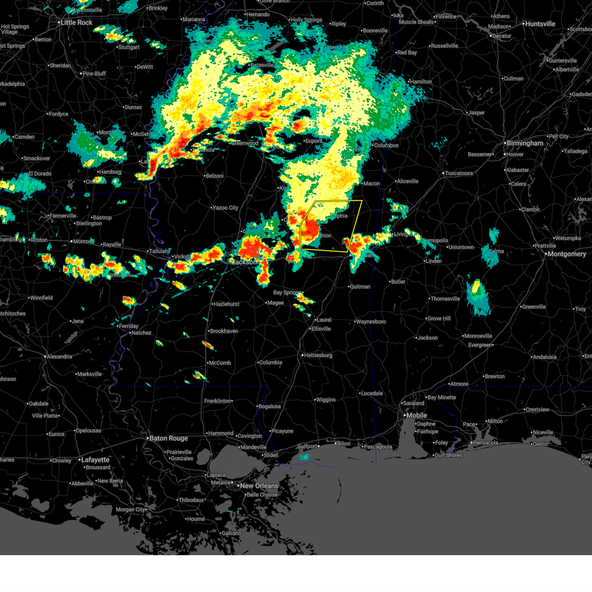
| 5/6/2026 7:46 PM CDT |
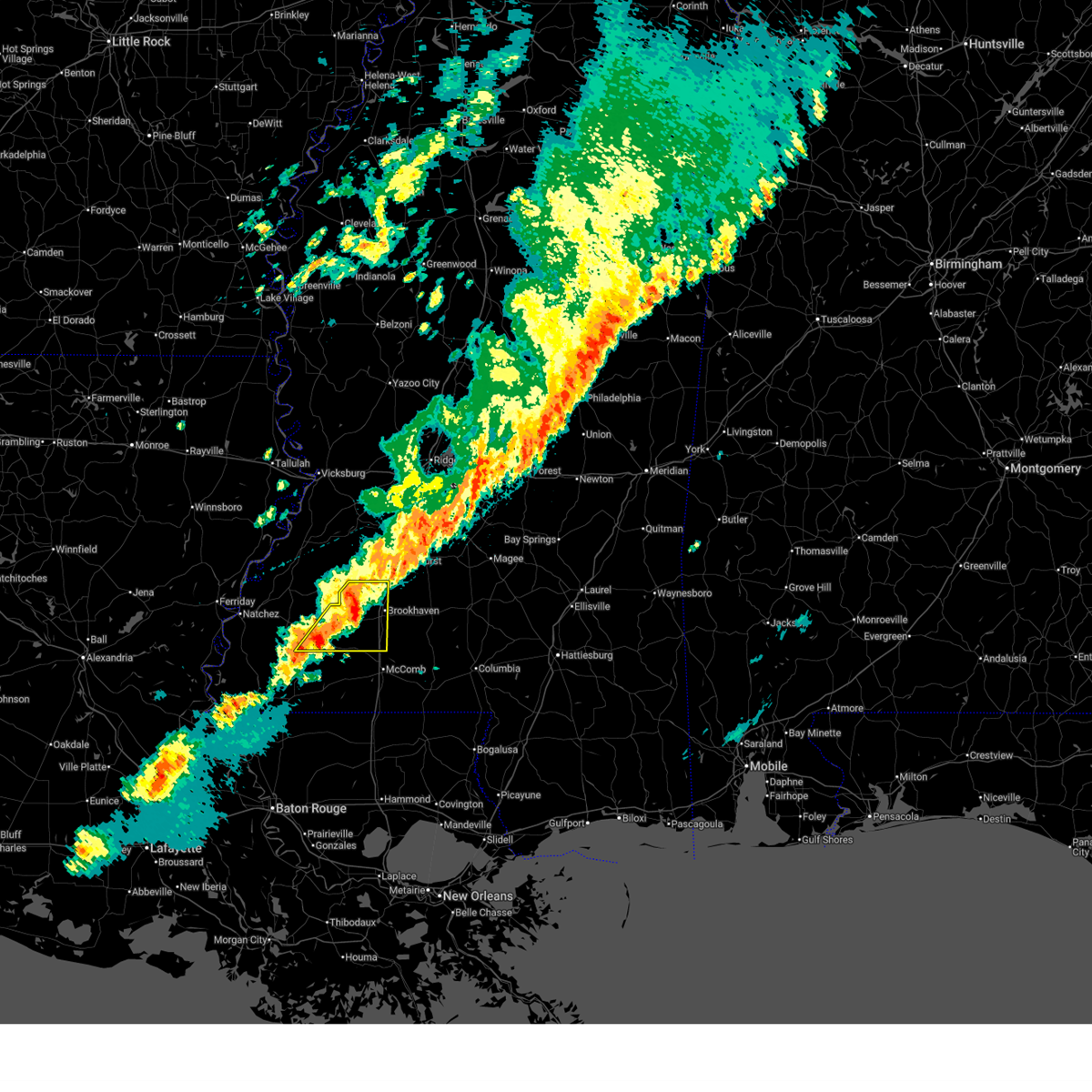
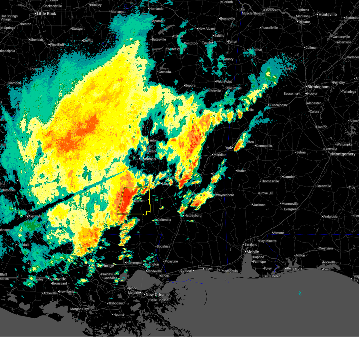
 At 746 pm cdt, a confirmed large and extremely dangerous tornado was located near west lincoln, or 9 miles southwest of brookhaven, moving east at 50 mph. this is a particularly dangerous situation. take cover now! (radar confirmed tornado). Hazards include damaging tornado. You are in a life-threatening situation. flying debris may be deadly to those caught without shelter. mobile homes will be destroyed. considerable damage to homes, businesses, and vehicles is likely and complete destruction is possible. the tornado will be near, brookhaven, bogue chitto, and enterprise around 750 pm cdt. East lincoln around 755 pm cdt. At 746 pm cdt, a confirmed large and extremely dangerous tornado was located near west lincoln, or 9 miles southwest of brookhaven, moving east at 50 mph. this is a particularly dangerous situation. take cover now! (radar confirmed tornado). Hazards include damaging tornado. You are in a life-threatening situation. flying debris may be deadly to those caught without shelter. mobile homes will be destroyed. considerable damage to homes, businesses, and vehicles is likely and complete destruction is possible. the tornado will be near, brookhaven, bogue chitto, and enterprise around 750 pm cdt. East lincoln around 755 pm cdt.
|
| 5/6/2026 7:45 PM CDT |
 At 745 pm cdt, a confirmed large and extremely dangerous tornado was located over west lincoln, or 10 miles southwest of brookhaven, moving east at 50 mph. this is a particularly dangerous situation. take cover now! (radar confirmed tornado). Hazards include damaging tornado. You are in a life-threatening situation. flying debris may be deadly to those caught without shelter. mobile homes will be destroyed. considerable damage to homes, businesses, and vehicles is likely and complete destruction is possible. the tornado will be near, brookhaven, bogue chitto, and enterprise around 750 pm cdt. East lincoln around 755 pm cdt. At 745 pm cdt, a confirmed large and extremely dangerous tornado was located over west lincoln, or 10 miles southwest of brookhaven, moving east at 50 mph. this is a particularly dangerous situation. take cover now! (radar confirmed tornado). Hazards include damaging tornado. You are in a life-threatening situation. flying debris may be deadly to those caught without shelter. mobile homes will be destroyed. considerable damage to homes, businesses, and vehicles is likely and complete destruction is possible. the tornado will be near, brookhaven, bogue chitto, and enterprise around 750 pm cdt. East lincoln around 755 pm cdt.
|
| 5/6/2026 7:45 PM CDT |
 the tornado warning has been cancelled and is no longer in effect the tornado warning has been cancelled and is no longer in effect
|
| 5/6/2026 7:41 PM CDT |
 At 741 pm cdt, a confirmed large and extremely dangerous tornado was located over west lincoln, or 12 miles southwest of brookhaven, moving east at 45 mph. this is a particularly dangerous situation. take cover now! (radar confirmed tornado). Hazards include damaging tornado. You are in a life-threatening situation. flying debris may be deadly to those caught without shelter. mobile homes will be destroyed. considerable damage to homes, businesses, and vehicles is likely and complete destruction is possible. the tornado will be near, brookhaven, bogue chitto, west lincoln, vaughn, and enterprise around 745 pm cdt. East lincoln around 755 pm cdt. At 741 pm cdt, a confirmed large and extremely dangerous tornado was located over west lincoln, or 12 miles southwest of brookhaven, moving east at 45 mph. this is a particularly dangerous situation. take cover now! (radar confirmed tornado). Hazards include damaging tornado. You are in a life-threatening situation. flying debris may be deadly to those caught without shelter. mobile homes will be destroyed. considerable damage to homes, businesses, and vehicles is likely and complete destruction is possible. the tornado will be near, brookhaven, bogue chitto, west lincoln, vaughn, and enterprise around 745 pm cdt. East lincoln around 755 pm cdt.
|
| 5/6/2026 7:39 PM CDT |
 At 739 pm cdt, a confirmed tornado was located over west lincoln, or 11 miles southwest of brookhaven, moving east at 50 mph (radar confirmed tornado). Hazards include damaging tornado and quarter size hail. Flying debris will be dangerous to those caught without shelter. mobile homes will be damaged or destroyed. damage to roofs, windows, and vehicles will occur. tree damage is likely. this tornado will be near, brookhaven, bogue chitto, and enterprise around 745 pm cdt. East lincoln around 750 pm cdt. At 739 pm cdt, a confirmed tornado was located over west lincoln, or 11 miles southwest of brookhaven, moving east at 50 mph (radar confirmed tornado). Hazards include damaging tornado and quarter size hail. Flying debris will be dangerous to those caught without shelter. mobile homes will be damaged or destroyed. damage to roofs, windows, and vehicles will occur. tree damage is likely. this tornado will be near, brookhaven, bogue chitto, and enterprise around 745 pm cdt. East lincoln around 750 pm cdt.
|
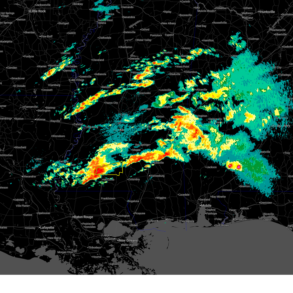
| 5/6/2026 7:34 PM CDT |
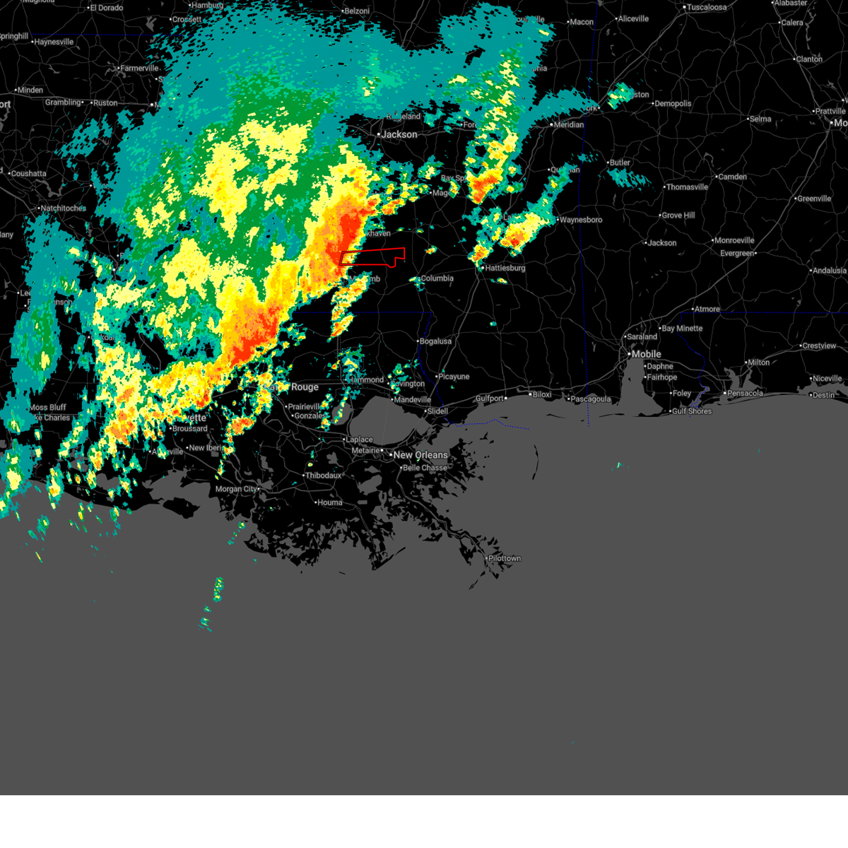
 At 734 pm cdt, a severe thunderstorm capable of producing a tornado was located near mccall creek, or 13 miles east of meadville, moving east at 50 mph (radar indicated rotation). Hazards include tornado and quarter size hail. Flying debris will be dangerous to those caught without shelter. mobile homes will be damaged or destroyed. damage to roofs, windows, and vehicles will occur. tree damage is likely. this dangerous storm will be near, bogue chitto, west lincoln, and vaughn around 740 pm cdt. brookhaven and enterprise around 745 pm cdt. East lincoln around 750 pm cdt. At 734 pm cdt, a severe thunderstorm capable of producing a tornado was located near mccall creek, or 13 miles east of meadville, moving east at 50 mph (radar indicated rotation). Hazards include tornado and quarter size hail. Flying debris will be dangerous to those caught without shelter. mobile homes will be damaged or destroyed. damage to roofs, windows, and vehicles will occur. tree damage is likely. this dangerous storm will be near, bogue chitto, west lincoln, and vaughn around 740 pm cdt. brookhaven and enterprise around 745 pm cdt. East lincoln around 750 pm cdt.
|
| 5/6/2026 7:26 PM CDT |
 At 726 pm cdt, a confirmed large and extremely dangerous tornado was located near little springs, or 7 miles east of meadville, moving east at 45 mph. this is a particularly dangerous situation. take cover now! (radar confirmed tornado). Hazards include damaging tornado. You are in a life-threatening situation. flying debris may be deadly to those caught without shelter. mobile homes will be destroyed. considerable damage to homes, businesses, and vehicles is likely and complete destruction is possible. the tornado will be near, mccall creek, center point, and little springs around 730 pm cdt. west lincoln around 735 pm cdt. vaughn around 740 pm cdt. brookhaven and bogue chitto around 745 pm cdt. enterprise around 750 pm cdt. East lincoln around 755 pm cdt. At 726 pm cdt, a confirmed large and extremely dangerous tornado was located near little springs, or 7 miles east of meadville, moving east at 45 mph. this is a particularly dangerous situation. take cover now! (radar confirmed tornado). Hazards include damaging tornado. You are in a life-threatening situation. flying debris may be deadly to those caught without shelter. mobile homes will be destroyed. considerable damage to homes, businesses, and vehicles is likely and complete destruction is possible. the tornado will be near, mccall creek, center point, and little springs around 730 pm cdt. west lincoln around 735 pm cdt. vaughn around 740 pm cdt. brookhaven and bogue chitto around 745 pm cdt. enterprise around 750 pm cdt. East lincoln around 755 pm cdt.
|
| 5/6/2026 7:10 PM CDT |
 Torjan the national weather service in jackson has issued a * tornado warning for, lincoln county in south central mississippi, eastern franklin county in southwestern mississippi, * until 815 pm cdt. * at 709 pm cdt, a confirmed large and destructive tornado was observed near meadville, moving east at 50 mph. tornado emergency for bude, meadeville, mccall creek, brookhaven, bogue chitto . this is a particularly dangerous situation. take cover now! (radar confirmed tornado). Hazards include deadly tornado. You are in a life-threatening situation. flying debris may be deadly to those caught without shelter. mobile homes will be destroyed. considerable damage to homes, businesses, and vehicles is likely and complete destruction is possible. the tornado will be near, meadville, bude, and little springs around 715 pm cdt. mccall creek around 720 pm cdt. center point around 725 pm cdt. west lincoln around 730 pm cdt. bogue chitto around 735 pm cdt. brookhaven and enterprise around 740 pm cdt. east lincoln around 745 pm cdt. Ruth around 750 pm cdt. Torjan the national weather service in jackson has issued a * tornado warning for, lincoln county in south central mississippi, eastern franklin county in southwestern mississippi, * until 815 pm cdt. * at 709 pm cdt, a confirmed large and destructive tornado was observed near meadville, moving east at 50 mph. tornado emergency for bude, meadeville, mccall creek, brookhaven, bogue chitto . this is a particularly dangerous situation. take cover now! (radar confirmed tornado). Hazards include deadly tornado. You are in a life-threatening situation. flying debris may be deadly to those caught without shelter. mobile homes will be destroyed. considerable damage to homes, businesses, and vehicles is likely and complete destruction is possible. the tornado will be near, meadville, bude, and little springs around 715 pm cdt. mccall creek around 720 pm cdt. center point around 725 pm cdt. west lincoln around 730 pm cdt. bogue chitto around 735 pm cdt. brookhaven and enterprise around 740 pm cdt. east lincoln around 745 pm cdt. Ruth around 750 pm cdt.
|
| 5/6/2026 6:07 PM CDT |
 The storm which prompted the warning has moved out of the area. therefore, the warning will be allowed to expire. a tornado watch remains in effect until 1100 pm cdt for east central mississippi. to report severe weather, contact your nearest law enforcement agency. they will relay your report to the national weather service jackson. The storm which prompted the warning has moved out of the area. therefore, the warning will be allowed to expire. a tornado watch remains in effect until 1100 pm cdt for east central mississippi. to report severe weather, contact your nearest law enforcement agency. they will relay your report to the national weather service jackson.
|
| 5/6/2026 5:59 PM CDT |
 the severe thunderstorm warning has been cancelled and is no longer in effect the severe thunderstorm warning has been cancelled and is no longer in effect
|
| 5/6/2026 5:59 PM CDT |
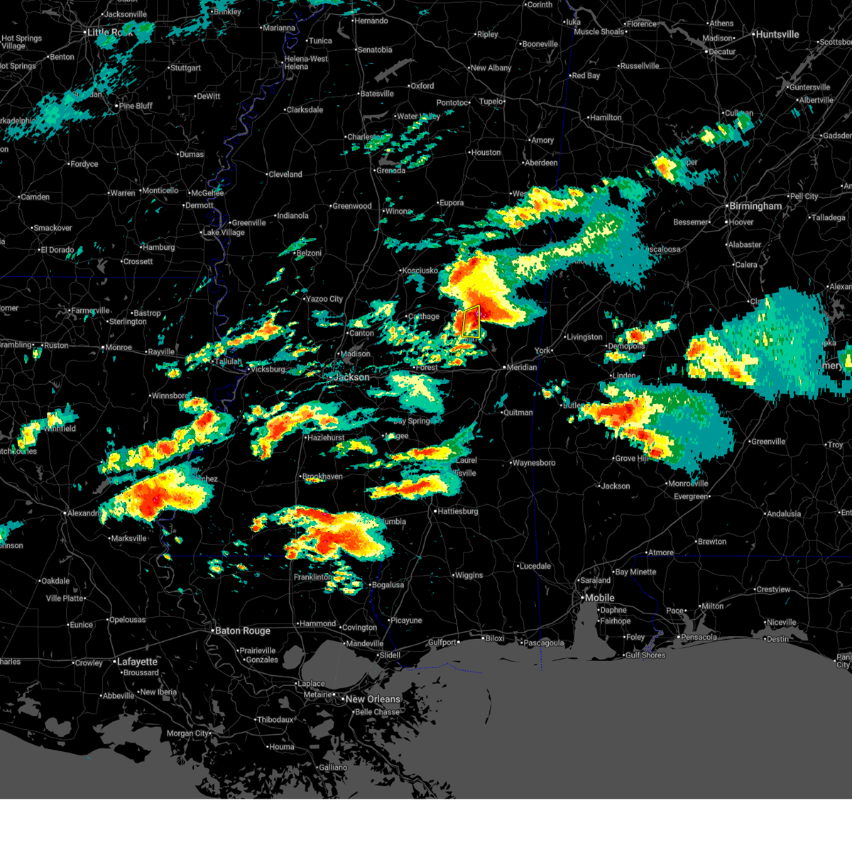 At 559 pm cdt, a severe thunderstorm was located near house, or 12 miles northeast of union, moving east at 40 mph (emergency management). Hazards include two inch hail and 60 mph wind gusts. People and animals outdoors will be injured. expect hail damage to roofs, siding, windows, and vehicles. expect wind damage to roofs, siding, and trees. Locations impacted include, forestdale, bethsaida, house, and herbert springs. At 559 pm cdt, a severe thunderstorm was located near house, or 12 miles northeast of union, moving east at 40 mph (emergency management). Hazards include two inch hail and 60 mph wind gusts. People and animals outdoors will be injured. expect hail damage to roofs, siding, windows, and vehicles. expect wind damage to roofs, siding, and trees. Locations impacted include, forestdale, bethsaida, house, and herbert springs.
|
| 5/6/2026 5:53 PM CDT |
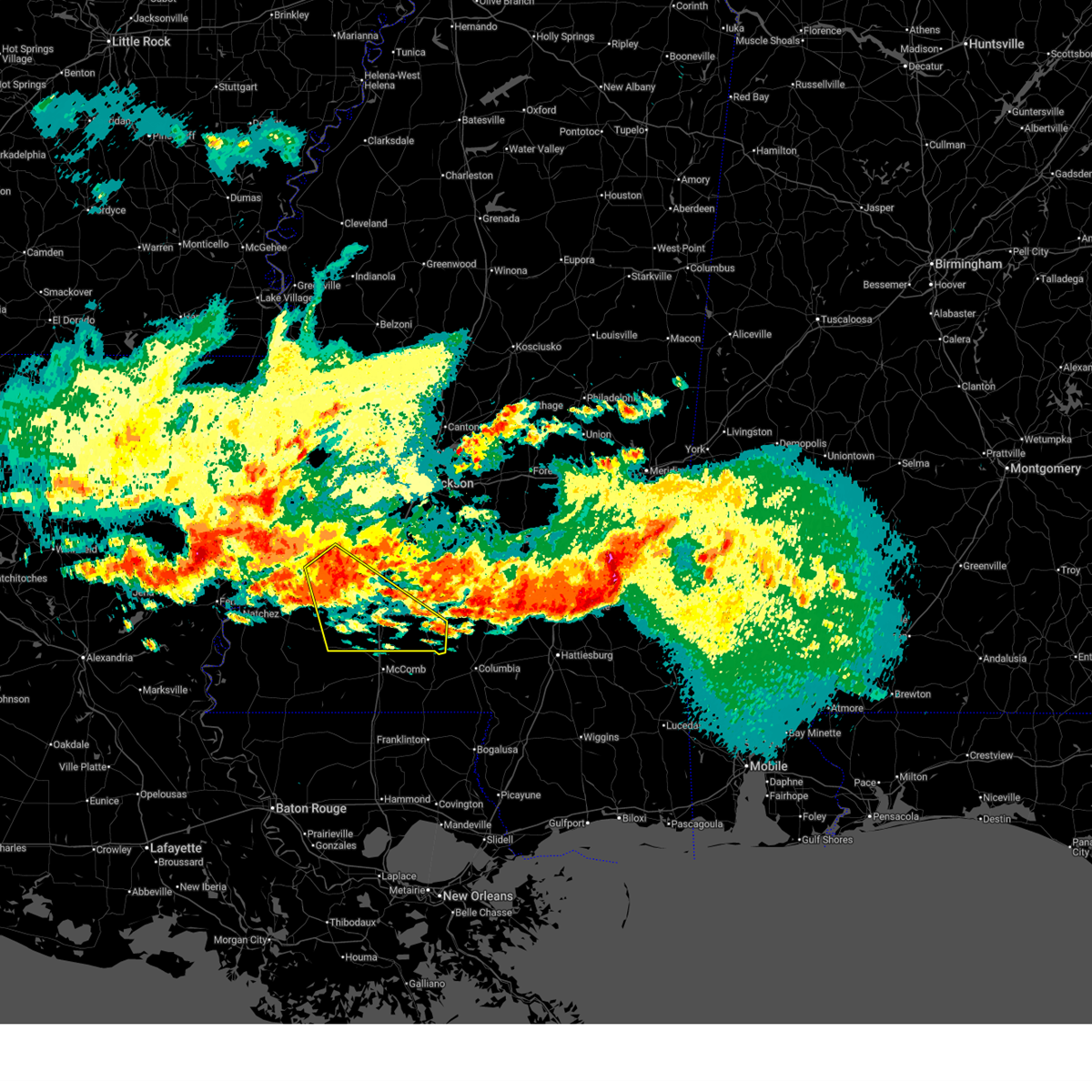
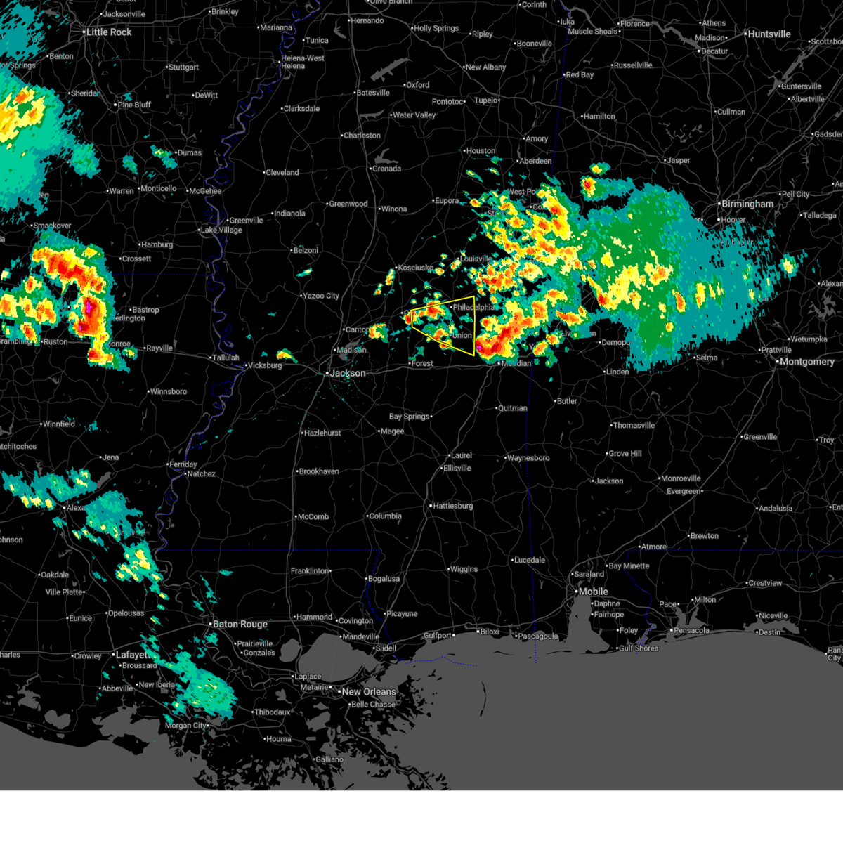
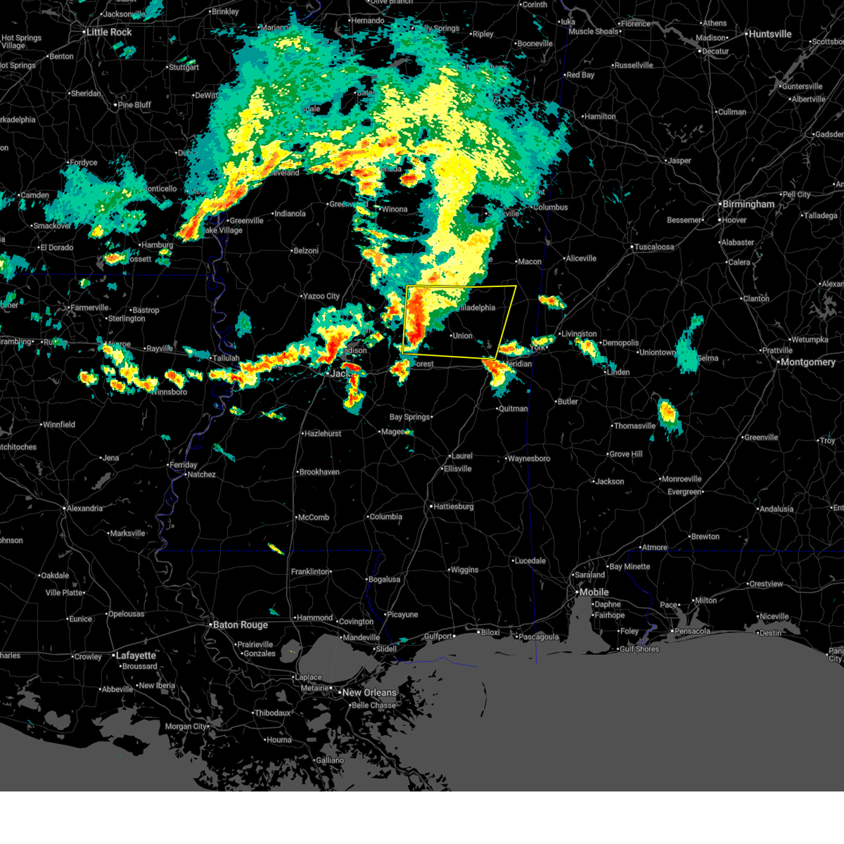
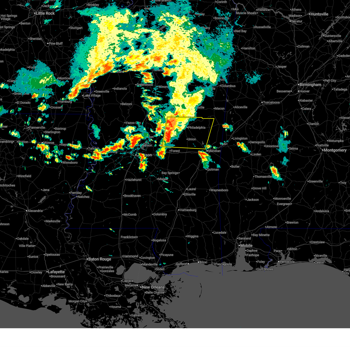
 At 552 pm cdt, a severe thunderstorm was located near forestdale, or 12 miles east of philadelphia, moving east at 45 mph. this is a destructive storm for kemper county (radar indicated. at 545 pm, golfball to baseball size hail was reported by emergency management near tucker). Hazards include baseball size hail and 60 mph wind gusts. People and animals outdoors will be severely injured. expect shattered windows, extensive damage to roofs, siding, and vehicles. Locations impacted include, de kalb, scooba, porterville, blackwater, tamola, damascus, bluff springs, electric mills, liberty, and prismatic. At 552 pm cdt, a severe thunderstorm was located near forestdale, or 12 miles east of philadelphia, moving east at 45 mph. this is a destructive storm for kemper county (radar indicated. at 545 pm, golfball to baseball size hail was reported by emergency management near tucker). Hazards include baseball size hail and 60 mph wind gusts. People and animals outdoors will be severely injured. expect shattered windows, extensive damage to roofs, siding, and vehicles. Locations impacted include, de kalb, scooba, porterville, blackwater, tamola, damascus, bluff springs, electric mills, liberty, and prismatic.
|
| 5/6/2026 5:51 PM CDT |
 Svrjan the national weather service in jackson has issued a * severe thunderstorm warning for, kemper county in east central mississippi, * until 645 pm cdt. * at 551 pm cdt, a severe thunderstorm was located near forestdale, or 11 miles east of philadelphia, moving east at 45 mph (radar indicated. at 532 pm, emergency management reported golfball size hail just west of philadelphia). Hazards include two inch hail and 60 mph wind gusts. People and animals outdoors will be injured. expect hail damage to roofs, siding, windows, and vehicles. Expect wind damage to roofs, siding, and trees. Svrjan the national weather service in jackson has issued a * severe thunderstorm warning for, kemper county in east central mississippi, * until 645 pm cdt. * at 551 pm cdt, a severe thunderstorm was located near forestdale, or 11 miles east of philadelphia, moving east at 45 mph (radar indicated. at 532 pm, emergency management reported golfball size hail just west of philadelphia). Hazards include two inch hail and 60 mph wind gusts. People and animals outdoors will be injured. expect hail damage to roofs, siding, windows, and vehicles. Expect wind damage to roofs, siding, and trees.
|
| 5/6/2026 5:49 PM CDT |
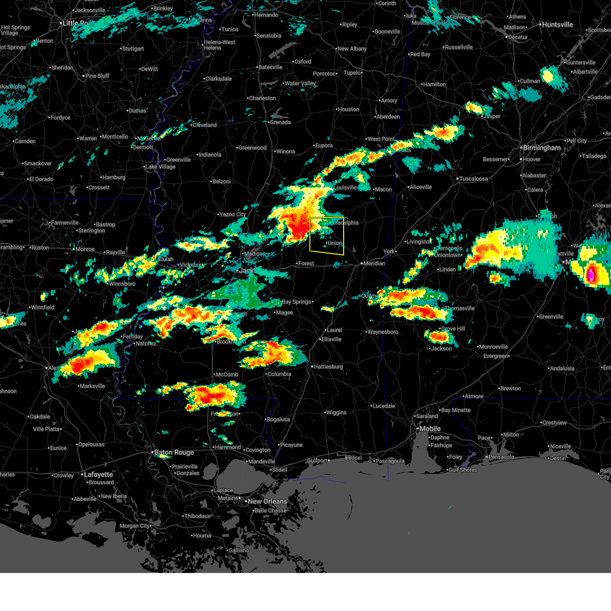
 At 548 pm cdt, a severe thunderstorm was located near forestdale, or 8 miles east of philadelphia, moving east at 45 mph (radar indicated. at 532 pm, golfball size hail was reported just west of philadelphia). Hazards include two inch hail and 60 mph wind gusts. People and animals outdoors will be injured. expect hail damage to roofs, siding, windows, and vehicles. expect wind damage to roofs, siding, and trees. Locations impacted include, philadelphia, union, tucker, herbert springs, neshoba, forestdale, bethsaida, and house. At 548 pm cdt, a severe thunderstorm was located near forestdale, or 8 miles east of philadelphia, moving east at 45 mph (radar indicated. at 532 pm, golfball size hail was reported just west of philadelphia). Hazards include two inch hail and 60 mph wind gusts. People and animals outdoors will be injured. expect hail damage to roofs, siding, windows, and vehicles. expect wind damage to roofs, siding, and trees. Locations impacted include, philadelphia, union, tucker, herbert springs, neshoba, forestdale, bethsaida, and house.
|
| 5/6/2026 5:38 PM CDT |
 At 538 pm cdt, a severe thunderstorm was located over philadelphia, moving east at 50 mph (radar indicated). Hazards include two inch hail and 60 mph wind gusts. People and animals outdoors will be injured. expect hail damage to roofs, siding, windows, and vehicles. expect wind damage to roofs, siding, and trees. Locations impacted include, philadelphia, pearl river, union, tucker, herbert springs, stratton, neshoba, bethsaida, house, dowdville, forestdale, duffee, prospect, little rock, and dixon. At 538 pm cdt, a severe thunderstorm was located over philadelphia, moving east at 50 mph (radar indicated). Hazards include two inch hail and 60 mph wind gusts. People and animals outdoors will be injured. expect hail damage to roofs, siding, windows, and vehicles. expect wind damage to roofs, siding, and trees. Locations impacted include, philadelphia, pearl river, union, tucker, herbert springs, stratton, neshoba, bethsaida, house, dowdville, forestdale, duffee, prospect, little rock, and dixon.
|
| 5/6/2026 5:33 PM CDT |
 At 533 pm cdt, a severe thunderstorm was located over dowdville, or 10 miles south of pearl river, moving east at 35 mph (radar indicated). Hazards include golf ball size hail and 70 mph wind gusts. People and animals outdoors will be injured. expect hail damage to roofs, siding, windows, and vehicles. expect considerable tree damage. wind damage is also likely to mobile homes, roofs, and outbuildings. Locations impacted include, philadelphia, pearl river, union, tucker, herbert springs, stratton, neshoba, bethsaida, house, dowdville, forestdale, duffee, prospect, little rock, and dixon. At 533 pm cdt, a severe thunderstorm was located over dowdville, or 10 miles south of pearl river, moving east at 35 mph (radar indicated). Hazards include golf ball size hail and 70 mph wind gusts. People and animals outdoors will be injured. expect hail damage to roofs, siding, windows, and vehicles. expect considerable tree damage. wind damage is also likely to mobile homes, roofs, and outbuildings. Locations impacted include, philadelphia, pearl river, union, tucker, herbert springs, stratton, neshoba, bethsaida, house, dowdville, forestdale, duffee, prospect, little rock, and dixon.
|
| 5/6/2026 5:22 PM CDT |
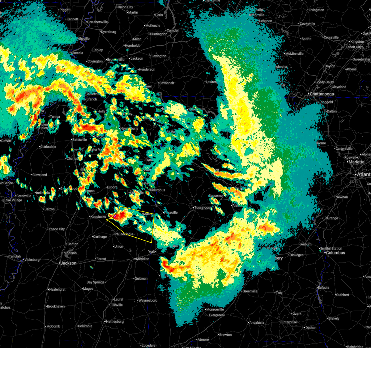
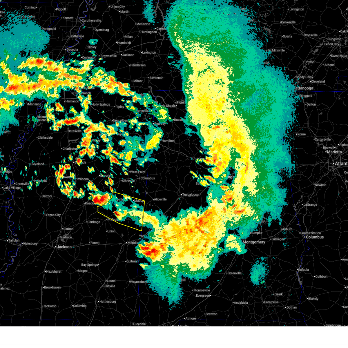
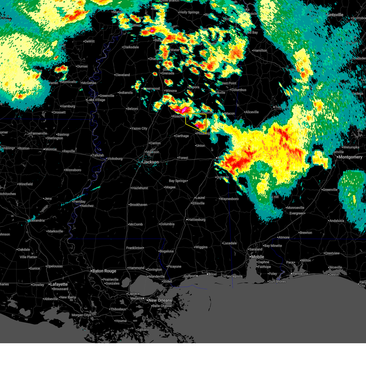
 Svrjan the national weather service in jackson has issued a * severe thunderstorm warning for, northern newton county in east central mississippi, neshoba county in east central mississippi, * until 615 pm cdt. * at 522 pm cdt, a severe thunderstorm was located over standing pine, or 9 miles southeast of carthage, moving east at 35 mph (radar indicated). Hazards include 70 mph wind gusts and half dollar size hail. Hail damage to vehicles is expected. expect considerable tree damage. Wind damage is also likely to mobile homes, roofs, and outbuildings. Svrjan the national weather service in jackson has issued a * severe thunderstorm warning for, northern newton county in east central mississippi, neshoba county in east central mississippi, * until 615 pm cdt. * at 522 pm cdt, a severe thunderstorm was located over standing pine, or 9 miles southeast of carthage, moving east at 35 mph (radar indicated). Hazards include 70 mph wind gusts and half dollar size hail. Hail damage to vehicles is expected. expect considerable tree damage. Wind damage is also likely to mobile homes, roofs, and outbuildings.
|
| 4/29/2026 4:53 PM CDT |
 The storm which prompted the warning has moved out of the area. therefore, the warning will be allowed to expire. a severe thunderstorm watch remains in effect until 900 pm cdt for south central and southwestern mississippi. The storm which prompted the warning has moved out of the area. therefore, the warning will be allowed to expire. a severe thunderstorm watch remains in effect until 900 pm cdt for south central and southwestern mississippi.
|
| 4/29/2026 4:25 PM CDT |
 At 425 pm cdt, a severe thunderstorm was located over enterprise, or 10 miles southeast of brookhaven, moving southeast at 40 mph (radar indicated). Hazards include 60 mph wind gusts and penny size hail. Expect damage to roofs, siding, and trees. This severe storm will be near, ruth, jayess, east lincoln, and topeka around 430 pm cdt. At 425 pm cdt, a severe thunderstorm was located over enterprise, or 10 miles southeast of brookhaven, moving southeast at 40 mph (radar indicated). Hazards include 60 mph wind gusts and penny size hail. Expect damage to roofs, siding, and trees. This severe storm will be near, ruth, jayess, east lincoln, and topeka around 430 pm cdt.
|
| 4/29/2026 4:11 PM CDT |
 At 410 pm cdt, a severe thunderstorm was located near vaughn, or near brookhaven, moving southeast at 40 mph (radar indicated). Hazards include 60 mph wind gusts and penny size hail. Expect damage to roofs, siding, and trees. this severe storm will be near, brookhaven, bogue chitto, and enterprise around 415 pm cdt. east lincoln around 420 pm cdt. ruth around 425 pm cdt. Jayess and topeka around 430 pm cdt. At 410 pm cdt, a severe thunderstorm was located near vaughn, or near brookhaven, moving southeast at 40 mph (radar indicated). Hazards include 60 mph wind gusts and penny size hail. Expect damage to roofs, siding, and trees. this severe storm will be near, brookhaven, bogue chitto, and enterprise around 415 pm cdt. east lincoln around 420 pm cdt. ruth around 425 pm cdt. Jayess and topeka around 430 pm cdt.
|
| 4/29/2026 3:40 PM CDT |
 Svrjan the national weather service in jackson has issued a * severe thunderstorm warning for, southeastern claiborne county in southwestern mississippi, lincoln county in south central mississippi, southwestern lawrence county in south central mississippi, eastern franklin county in southwestern mississippi, eastern jefferson county in southwestern mississippi, southwestern copiah county in central mississippi, * until 500 pm cdt. * at 340 pm cdt, a severe thunderstorm was located over union church, or 16 miles northeast of meadville, moving southeast at 65 mph (radar indicated). Hazards include 60 mph wind gusts and penny size hail. Expect damage to roofs, siding, and trees. this severe thunderstorm will be near, mccall creek, caseyville, vaughn, and loyd star around 345 pm cdt. brookhaven and west lincoln around 350 pm cdt. bogue chitto and enterprise around 355 pm cdt. ruth and east lincoln around 405 pm cdt. Jayess and topeka around 410 pm cdt. Svrjan the national weather service in jackson has issued a * severe thunderstorm warning for, southeastern claiborne county in southwestern mississippi, lincoln county in south central mississippi, southwestern lawrence county in south central mississippi, eastern franklin county in southwestern mississippi, eastern jefferson county in southwestern mississippi, southwestern copiah county in central mississippi, * until 500 pm cdt. * at 340 pm cdt, a severe thunderstorm was located over union church, or 16 miles northeast of meadville, moving southeast at 65 mph (radar indicated). Hazards include 60 mph wind gusts and penny size hail. Expect damage to roofs, siding, and trees. this severe thunderstorm will be near, mccall creek, caseyville, vaughn, and loyd star around 345 pm cdt. brookhaven and west lincoln around 350 pm cdt. bogue chitto and enterprise around 355 pm cdt. ruth and east lincoln around 405 pm cdt. Jayess and topeka around 410 pm cdt.
|
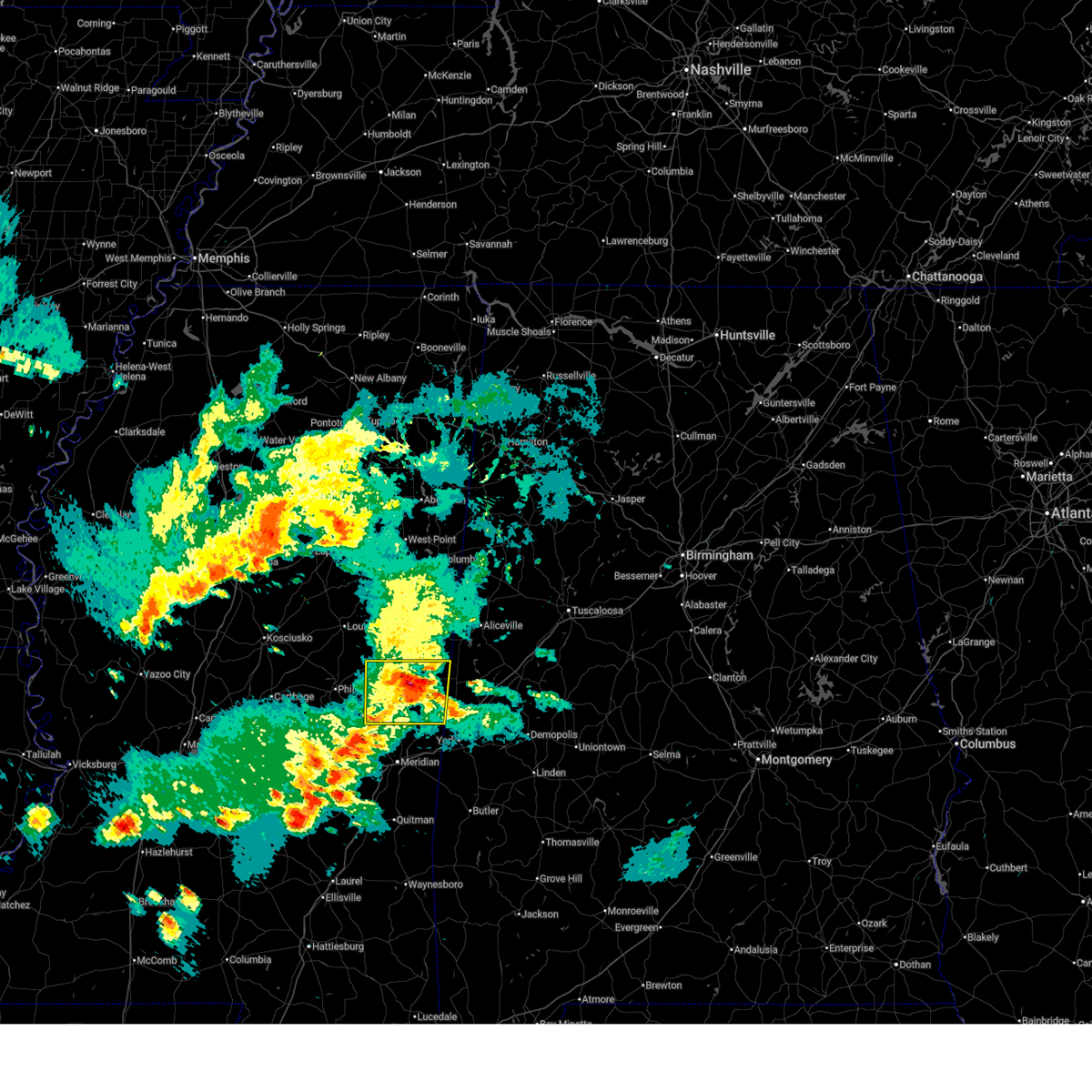
| 4/28/2026 7:54 PM CDT |
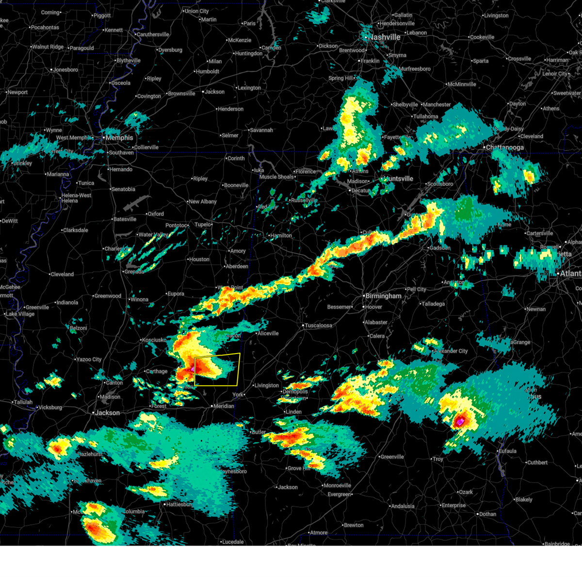
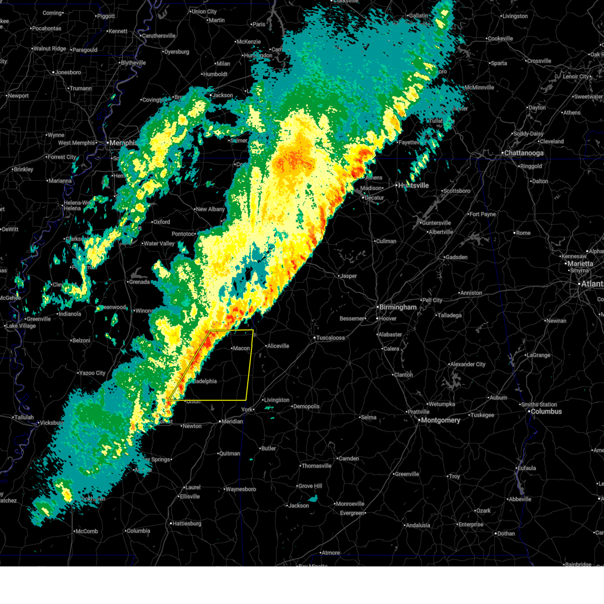
 At 754 pm cdt, a severe thunderstorm was located near louisville, moving east at 40 mph (radar indicated). Hazards include 60 mph wind gusts and half dollar size hail. Hail damage to vehicles is expected. expect wind damage to roofs, siding, and trees. this severe storm will be near, louisville and noxapater around 800 pm cdt. millcreek and nanih waiya around 810 pm cdt. mashulaville around 820 pm cdt. gholson around 825 pm cdt. shuqualak around 835 pm cdt. paulette around 850 pm cdt. Scooba and cooksville around 900 pm cdt. At 754 pm cdt, a severe thunderstorm was located near louisville, moving east at 40 mph (radar indicated). Hazards include 60 mph wind gusts and half dollar size hail. Hail damage to vehicles is expected. expect wind damage to roofs, siding, and trees. this severe storm will be near, louisville and noxapater around 800 pm cdt. millcreek and nanih waiya around 810 pm cdt. mashulaville around 820 pm cdt. gholson around 825 pm cdt. shuqualak around 835 pm cdt. paulette around 850 pm cdt. Scooba and cooksville around 900 pm cdt.
|
| 4/28/2026 7:28 PM CDT |
 Svrjan the national weather service in jackson has issued a * severe thunderstorm warning for, noxubee county in east central mississippi, kemper county in east central mississippi, winston county in east central mississippi, northern neshoba county in east central mississippi, * until 845 pm cdt. * at 728 pm cdt, a severe thunderstorm was located 7 miles west of mcmillan, or 9 miles west of louisville, moving east at 35 mph (radar indicated). Hazards include ping pong ball size hail and 60 mph wind gusts. People and animals outdoors will be injured. expect hail damage to roofs, siding, windows, and vehicles. expect wind damage to roofs, siding, and trees. this severe thunderstorm will be near, louisville around 735 pm cdt. millcreek around 745 pm cdt. mashulaville around 805 pm cdt. macon around 820 pm cdt. Shuqualak around 825 pm cdt. Svrjan the national weather service in jackson has issued a * severe thunderstorm warning for, noxubee county in east central mississippi, kemper county in east central mississippi, winston county in east central mississippi, northern neshoba county in east central mississippi, * until 845 pm cdt. * at 728 pm cdt, a severe thunderstorm was located 7 miles west of mcmillan, or 9 miles west of louisville, moving east at 35 mph (radar indicated). Hazards include ping pong ball size hail and 60 mph wind gusts. People and animals outdoors will be injured. expect hail damage to roofs, siding, windows, and vehicles. expect wind damage to roofs, siding, and trees. this severe thunderstorm will be near, louisville around 735 pm cdt. millcreek around 745 pm cdt. mashulaville around 805 pm cdt. macon around 820 pm cdt. Shuqualak around 825 pm cdt.
|
| 4/28/2026 7:21 PM CDT |
 At 721 pm cdt, a severe thunderstorm was located near nanih waiya, or 9 miles northeast of philadelphia, moving east at 50 mph (radar indicated). Hazards include golf ball size hail and 60 mph wind gusts. People and animals outdoors will be injured. expect hail damage to roofs, siding, windows, and vehicles. expect wind damage to roofs, siding, and trees. This severe storm will be near, nanih waiya around 725 pm cdt. At 721 pm cdt, a severe thunderstorm was located near nanih waiya, or 9 miles northeast of philadelphia, moving east at 50 mph (radar indicated). Hazards include golf ball size hail and 60 mph wind gusts. People and animals outdoors will be injured. expect hail damage to roofs, siding, windows, and vehicles. expect wind damage to roofs, siding, and trees. This severe storm will be near, nanih waiya around 725 pm cdt.
|
| 4/28/2026 7:05 PM CDT |
 At 703 pm cdt, a severe thunderstorm was located near stallo, or 8 miles northeast of pearl river, moving east at 45 mph (radar indicated). Hazards include golf ball size hail and 60 mph wind gusts. People and animals outdoors will be injured. expect hail damage to roofs, siding, windows, and vehicles. expect wind damage to roofs, siding, and trees. this severe storm will be near, philadelphia, burnside, and stallo around 710 pm cdt. Nanih waiya and forestdale around 715 pm cdt. At 703 pm cdt, a severe thunderstorm was located near stallo, or 8 miles northeast of pearl river, moving east at 45 mph (radar indicated). Hazards include golf ball size hail and 60 mph wind gusts. People and animals outdoors will be injured. expect hail damage to roofs, siding, windows, and vehicles. expect wind damage to roofs, siding, and trees. this severe storm will be near, philadelphia, burnside, and stallo around 710 pm cdt. Nanih waiya and forestdale around 715 pm cdt.
|
| 4/28/2026 6:46 PM CDT |
 At 645 pm cdt, severe thunderstorms were located along a line extending from near zama to near pearl river, moving east at 40 mph (radar indicated). Hazards include golf ball size hail and 60 mph wind gusts. People and animals outdoors will be injured. expect hail damage to roofs, siding, windows, and vehicles. expect wind damage to roofs, siding, and trees. these severe storms will be near, philadelphia and burnside around 650 pm cdt. stallo and forestdale around 700 pm cdt. Noxapater and nanih waiya around 715 pm cdt. At 645 pm cdt, severe thunderstorms were located along a line extending from near zama to near pearl river, moving east at 40 mph (radar indicated). Hazards include golf ball size hail and 60 mph wind gusts. People and animals outdoors will be injured. expect hail damage to roofs, siding, windows, and vehicles. expect wind damage to roofs, siding, and trees. these severe storms will be near, philadelphia and burnside around 650 pm cdt. stallo and forestdale around 700 pm cdt. Noxapater and nanih waiya around 715 pm cdt.
|
| 4/28/2026 6:25 PM CDT |
 Svrjan the national weather service in jackson has issued a * severe thunderstorm warning for, southern winston county in east central mississippi, neshoba county in east central mississippi, * until 730 pm cdt. * at 625 pm cdt, severe thunderstorms were located along a line extending from near mcadams to near edinburg, moving east at 40 mph (radar indicated). Hazards include ping pong ball size hail and 60 mph wind gusts. People and animals outdoors will be injured. expect hail damage to roofs, siding, windows, and vehicles. expect wind damage to roofs, siding, and trees. severe thunderstorms will be near, philadelphia and pearl river around 635 pm cdt. burnside around 650 pm cdt. stallo around 655 pm cdt. forestdale around 700 pm cdt. noxapater around 705 pm cdt. Nanih waiya around 710 pm cdt. Svrjan the national weather service in jackson has issued a * severe thunderstorm warning for, southern winston county in east central mississippi, neshoba county in east central mississippi, * until 730 pm cdt. * at 625 pm cdt, severe thunderstorms were located along a line extending from near mcadams to near edinburg, moving east at 40 mph (radar indicated). Hazards include ping pong ball size hail and 60 mph wind gusts. People and animals outdoors will be injured. expect hail damage to roofs, siding, windows, and vehicles. expect wind damage to roofs, siding, and trees. severe thunderstorms will be near, philadelphia and pearl river around 635 pm cdt. burnside around 650 pm cdt. stallo around 655 pm cdt. forestdale around 700 pm cdt. noxapater around 705 pm cdt. Nanih waiya around 710 pm cdt.
|
| 4/28/2026 1:34 PM CDT |
 the severe thunderstorm warning has been cancelled and is no longer in effect the severe thunderstorm warning has been cancelled and is no longer in effect
|
| 4/28/2026 1:21 PM CDT |
 the severe thunderstorm warning has been cancelled and is no longer in effect the severe thunderstorm warning has been cancelled and is no longer in effect
|
| 4/28/2026 1:21 PM CDT |
 At 121 pm cdt, severe thunderstorms were located along a line extending from near dixon to near little rock, moving east at 40 mph (radar indicated). Hazards include 60 mph wind gusts and nickel size hail. Expect damage to roofs, siding, and trees. these severe storms will be near, philadelphia, tucker, bethsaida, house, and herbert springs around 125 pm cdt. Forestdale around 140 pm cdt. At 121 pm cdt, severe thunderstorms were located along a line extending from near dixon to near little rock, moving east at 40 mph (radar indicated). Hazards include 60 mph wind gusts and nickel size hail. Expect damage to roofs, siding, and trees. these severe storms will be near, philadelphia, tucker, bethsaida, house, and herbert springs around 125 pm cdt. Forestdale around 140 pm cdt.
|
| 4/28/2026 1:01 PM CDT |
 Svrjan the national weather service in jackson has issued a * severe thunderstorm warning for, southeastern leake county in central mississippi, northern newton county in east central mississippi, neshoba county in east central mississippi, * until 200 pm cdt. * at 101 pm cdt, a severe thunderstorm was located over madden, or 10 miles southeast of carthage, moving east at 35 mph (radar indicated). Hazards include 60 mph wind gusts and quarter size hail. Hail damage to vehicles is expected. expect wind damage to roofs, siding, and trees. this severe thunderstorm will be near, dixon, madden, and dowdville around 105 pm cdt. philadelphia and pearl river around 110 pm cdt. neshoba around 115 pm cdt. union and tucker around 120 pm cdt. bethsaida around 125 pm cdt. house around 130 pm cdt. forestdale around 135 pm cdt. Herbert springs around 140 pm cdt. Svrjan the national weather service in jackson has issued a * severe thunderstorm warning for, southeastern leake county in central mississippi, northern newton county in east central mississippi, neshoba county in east central mississippi, * until 200 pm cdt. * at 101 pm cdt, a severe thunderstorm was located over madden, or 10 miles southeast of carthage, moving east at 35 mph (radar indicated). Hazards include 60 mph wind gusts and quarter size hail. Hail damage to vehicles is expected. expect wind damage to roofs, siding, and trees. this severe thunderstorm will be near, dixon, madden, and dowdville around 105 pm cdt. philadelphia and pearl river around 110 pm cdt. neshoba around 115 pm cdt. union and tucker around 120 pm cdt. bethsaida around 125 pm cdt. house around 130 pm cdt. forestdale around 135 pm cdt. Herbert springs around 140 pm cdt.
|
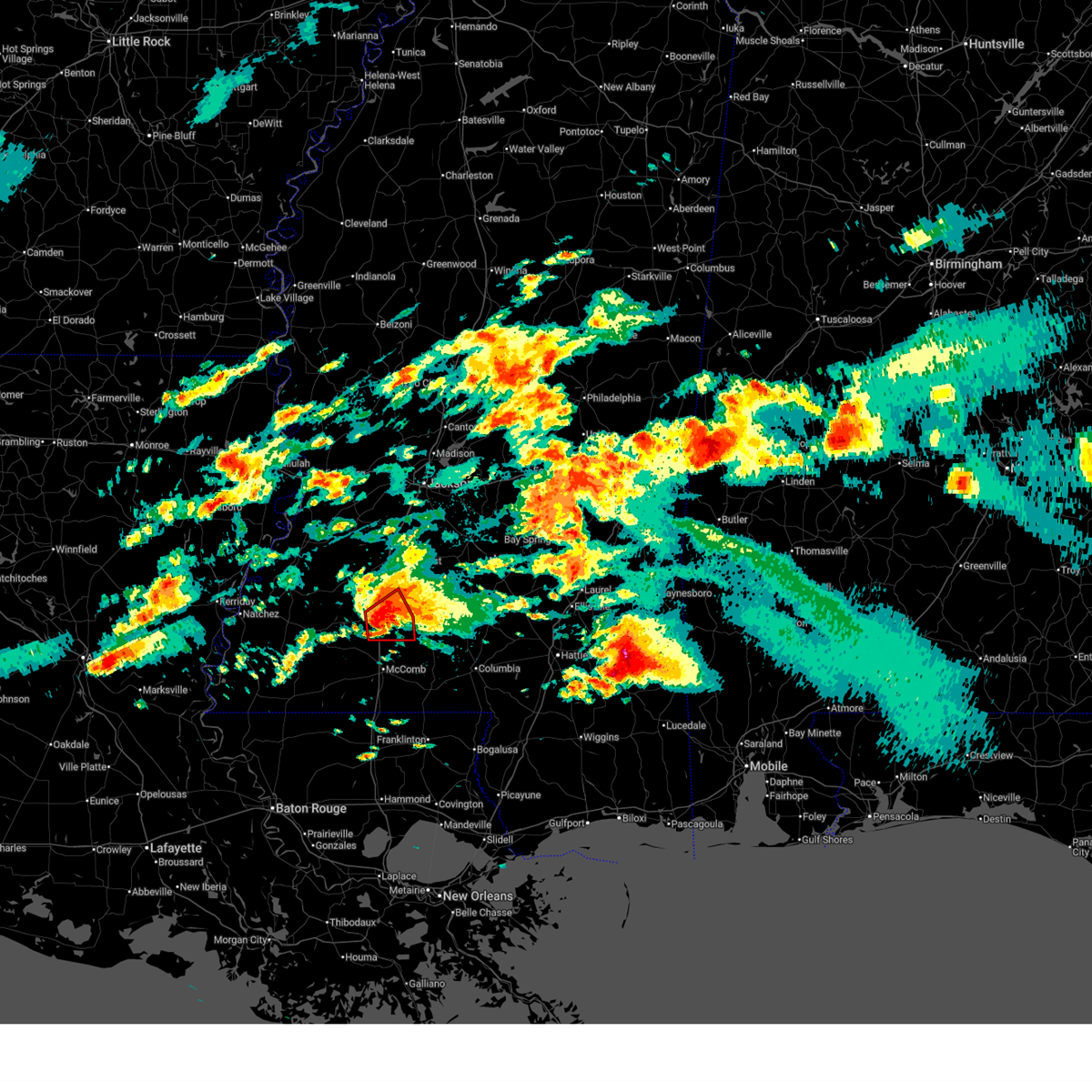
| 4/26/2026 7:12 AM CDT | Scattered trees were reported down by the lincoln county e in lincoln county MS, 10.4 miles WNW of Bogue Chitto, MS |
| 4/26/2026 7:00 AM CDT | Scattered trees were reported down by the lincoln county e in lincoln county MS, 2.1 miles SSW of Bogue Chitto, MS |
| 4/25/2026 3:32 AM CDT |
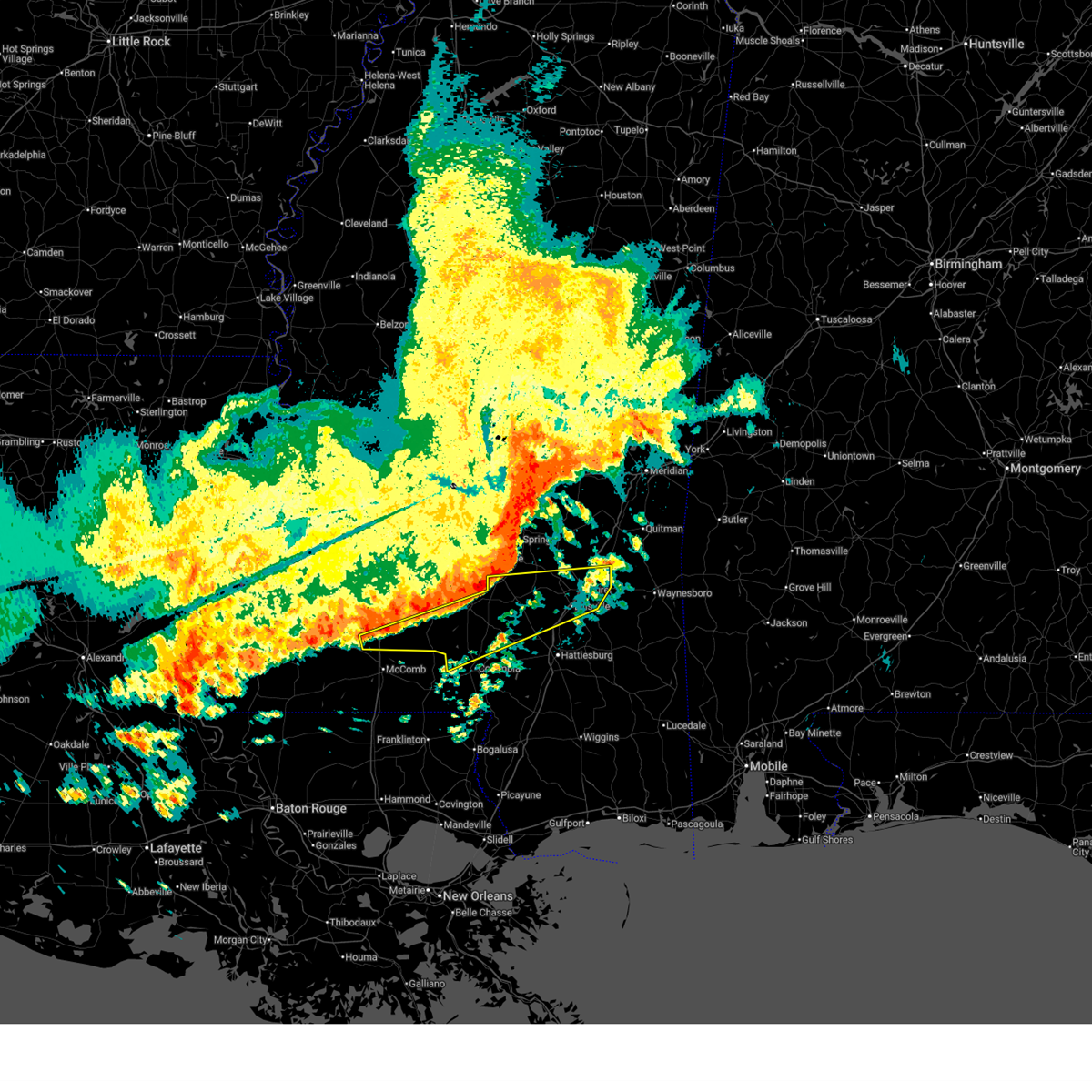 Svrjan the national weather service in jackson has issued a * severe thunderstorm warning for, northern marion county in south central mississippi, southeastern lincoln county in south central mississippi, covington county in southeastern mississippi, southern lawrence county in south central mississippi, northwestern lamar county in southeastern mississippi, jones county in southeastern mississippi, jefferson davis county in south central mississippi, * until 430 am cdt. * at 331 am cdt, severe thunderstorms were located along a line extending from near mize to lone star to near center point, moving east at 55 mph (radar indicated). Hazards include 60 mph wind gusts. Expect damage to roofs, siding, and trees. severe thunderstorms will be near, collins, monticello, prentiss, bogue chitto, ruth, enterprise, lone star, carson, east lincoln, and topeka around 335 am cdt. oak vale, jayess, and tilton around 340 am cdt. soso, seminary, bassfield, and hebron around 345 am cdt. laurel and society hill around 350 am cdt. sandersville and melba around 355 am cdt. ellisville, goss, holly springs, bunker hill, and sanford around 400 am cdt. sumrall, moselle, morgantown, and tuckers crossing around 405 am cdt. Mill creek around 410 am cdt. Svrjan the national weather service in jackson has issued a * severe thunderstorm warning for, northern marion county in south central mississippi, southeastern lincoln county in south central mississippi, covington county in southeastern mississippi, southern lawrence county in south central mississippi, northwestern lamar county in southeastern mississippi, jones county in southeastern mississippi, jefferson davis county in south central mississippi, * until 430 am cdt. * at 331 am cdt, severe thunderstorms were located along a line extending from near mize to lone star to near center point, moving east at 55 mph (radar indicated). Hazards include 60 mph wind gusts. Expect damage to roofs, siding, and trees. severe thunderstorms will be near, collins, monticello, prentiss, bogue chitto, ruth, enterprise, lone star, carson, east lincoln, and topeka around 335 am cdt. oak vale, jayess, and tilton around 340 am cdt. soso, seminary, bassfield, and hebron around 345 am cdt. laurel and society hill around 350 am cdt. sandersville and melba around 355 am cdt. ellisville, goss, holly springs, bunker hill, and sanford around 400 am cdt. sumrall, moselle, morgantown, and tuckers crossing around 405 am cdt. Mill creek around 410 am cdt.
|
| 4/25/2026 2:58 AM CDT |
 Svrjan the national weather service in jackson has issued a * severe thunderstorm warning for, lincoln county in south central mississippi, lawrence county in south central mississippi, northeastern franklin county in southwestern mississippi, southeastern copiah county in central mississippi, northwestern jefferson davis county in south central mississippi, * until 345 am cdt. * at 258 am cdt, severe thunderstorms were located along a line extending from near beauregard to mccall creek, moving southeast at 35 mph (radar indicated). Hazards include 60 mph wind gusts and quarter size hail. Hail damage to vehicles is expected. expect wind damage to roofs, siding, and trees. severe thunderstorms will be near, brookhaven, west lincoln, and sontag around 305 am cdt. wanilla around 310 am cdt. monticello, bogue chitto, enterprise, and east lincoln around 315 am cdt. silver creek around 320 am cdt. Ruth, topeka, robinwood, progress, and arm around 330 am cdt. Svrjan the national weather service in jackson has issued a * severe thunderstorm warning for, lincoln county in south central mississippi, lawrence county in south central mississippi, northeastern franklin county in southwestern mississippi, southeastern copiah county in central mississippi, northwestern jefferson davis county in south central mississippi, * until 345 am cdt. * at 258 am cdt, severe thunderstorms were located along a line extending from near beauregard to mccall creek, moving southeast at 35 mph (radar indicated). Hazards include 60 mph wind gusts and quarter size hail. Hail damage to vehicles is expected. expect wind damage to roofs, siding, and trees. severe thunderstorms will be near, brookhaven, west lincoln, and sontag around 305 am cdt. wanilla around 310 am cdt. monticello, bogue chitto, enterprise, and east lincoln around 315 am cdt. silver creek around 320 am cdt. Ruth, topeka, robinwood, progress, and arm around 330 am cdt.
|
| 4/24/2026 7:47 PM CDT |
 At 746 pm cdt, severe thunderstorms were located along a line extending from near shuqualak to 6 miles east of blackwater, moving east at 30 mph (radar indicated). Hazards include 60 mph wind gusts and quarter size hail. Hail damage to vehicles is expected. expect wind damage to roofs, siding, and trees. These severe storms will be near, scooba, porterville, tamola, and electric mills around 750 pm cdt. At 746 pm cdt, severe thunderstorms were located along a line extending from near shuqualak to 6 miles east of blackwater, moving east at 30 mph (radar indicated). Hazards include 60 mph wind gusts and quarter size hail. Hail damage to vehicles is expected. expect wind damage to roofs, siding, and trees. These severe storms will be near, scooba, porterville, tamola, and electric mills around 750 pm cdt.
|
| 4/24/2026 7:40 PM CDT |
 At 739 pm cdt, severe thunderstorms were located along a line extending from near shuqualak to near blackwater, moving east at 35 mph (radar indicated). Hazards include 70 mph wind gusts and quarter size hail. Hail damage to vehicles is expected. expect considerable tree damage. wind damage is also likely to mobile homes, roofs, and outbuildings. These severe storms will be near, scooba, porterville, tamola, and electric mills around 745 pm cdt. At 739 pm cdt, severe thunderstorms were located along a line extending from near shuqualak to near blackwater, moving east at 35 mph (radar indicated). Hazards include 70 mph wind gusts and quarter size hail. Hail damage to vehicles is expected. expect considerable tree damage. wind damage is also likely to mobile homes, roofs, and outbuildings. These severe storms will be near, scooba, porterville, tamola, and electric mills around 745 pm cdt.
|
| 4/24/2026 7:14 PM CDT |
 Svrjan the national weather service in jackson has issued a * severe thunderstorm warning for, northeastern newton county in east central mississippi, kemper county in east central mississippi, eastern neshoba county in east central mississippi, northern lauderdale county in east central mississippi, * until 815 pm cdt. * at 714 pm cdt, severe thunderstorms were located along a line extending from near preston to near martin, moving east at 30 mph (radar indicated). Hazards include 70 mph wind gusts and quarter size hail. Hail damage to vehicles is expected. expect considerable tree damage. wind damage is also likely to mobile homes, roofs, and outbuildings. severe thunderstorms will be near, damascus, liberty, bluff springs, prismatic, and preston around 720 pm cdt. blackwater around 725 pm cdt. de kalb and daleville around 730 pm cdt. scooba around 750 pm cdt. porterville and electric mills around 755 pm cdt. Tamola around 800 pm cdt. Svrjan the national weather service in jackson has issued a * severe thunderstorm warning for, northeastern newton county in east central mississippi, kemper county in east central mississippi, eastern neshoba county in east central mississippi, northern lauderdale county in east central mississippi, * until 815 pm cdt. * at 714 pm cdt, severe thunderstorms were located along a line extending from near preston to near martin, moving east at 30 mph (radar indicated). Hazards include 70 mph wind gusts and quarter size hail. Hail damage to vehicles is expected. expect considerable tree damage. wind damage is also likely to mobile homes, roofs, and outbuildings. severe thunderstorms will be near, damascus, liberty, bluff springs, prismatic, and preston around 720 pm cdt. blackwater around 725 pm cdt. de kalb and daleville around 730 pm cdt. scooba around 750 pm cdt. porterville and electric mills around 755 pm cdt. Tamola around 800 pm cdt.
|
| 4/24/2026 6:57 PM CDT |
 At 657 pm cdt, severe thunderstorms were located along a line extending from preston to near herbert springs, moving east at 50 mph (radar indicated). Hazards include 70 mph wind gusts and quarter size hail. Hail damage to vehicles is expected. expect considerable tree damage. wind damage is also likely to mobile homes, roofs, and outbuildings. these severe storms will be near, de kalb, collinsville, martin, damascus, liberty, and prismatic around 705 pm cdt. Blackwater around 710 pm cdt. At 657 pm cdt, severe thunderstorms were located along a line extending from preston to near herbert springs, moving east at 50 mph (radar indicated). Hazards include 70 mph wind gusts and quarter size hail. Hail damage to vehicles is expected. expect considerable tree damage. wind damage is also likely to mobile homes, roofs, and outbuildings. these severe storms will be near, de kalb, collinsville, martin, damascus, liberty, and prismatic around 705 pm cdt. Blackwater around 710 pm cdt.
|
| 4/24/2026 6:45 PM CDT |
 At 644 pm cdt, severe thunderstorms were located along a line extending from near nanih waiya to union, moving east at 45 mph (radar indicated). Hazards include 60 mph wind gusts and quarter size hail. Hail damage to vehicles is expected. expect wind damage to roofs, siding, and trees. these severe storms will be near, nanih waiya, preston, house, forestdale, herbert springs, bethsaida, and little rock around 650 pm cdt. collinsville, duffee, damascus, and bluff springs around 655 pm cdt. martin around 700 pm cdt. liberty and prismatic around 705 pm cdt. De kalb and blackwater around 710 pm cdt. At 644 pm cdt, severe thunderstorms were located along a line extending from near nanih waiya to union, moving east at 45 mph (radar indicated). Hazards include 60 mph wind gusts and quarter size hail. Hail damage to vehicles is expected. expect wind damage to roofs, siding, and trees. these severe storms will be near, nanih waiya, preston, house, forestdale, herbert springs, bethsaida, and little rock around 650 pm cdt. collinsville, duffee, damascus, and bluff springs around 655 pm cdt. martin around 700 pm cdt. liberty and prismatic around 705 pm cdt. De kalb and blackwater around 710 pm cdt.
|
| 4/24/2026 6:21 PM CDT |
 At 620 pm cdt, severe thunderstorms were located along a line extending from 7 miles west of stallo to sebastopol, moving east at 40 mph (radar indicated). Hazards include 60 mph wind gusts and quarter size hail. Hail damage to vehicles is expected. expect wind damage to roofs, siding, and trees. these severe storms will be near, philadelphia, burnside, stallo, dixon, prospect, and neshoba around 625 pm cdt. union, tucker, and stratton around 630 pm cdt. house, forestdale, bethsaida, and little rock around 635 pm cdt. preston and herbert springs around 640 pm cdt. damascus and bluff springs around 645 pm cdt. collinsville, duffee, martin, and liberty around 650 pm cdt. de kalb and prismatic around 655 pm cdt. Blackwater around 700 pm cdt. At 620 pm cdt, severe thunderstorms were located along a line extending from 7 miles west of stallo to sebastopol, moving east at 40 mph (radar indicated). Hazards include 60 mph wind gusts and quarter size hail. Hail damage to vehicles is expected. expect wind damage to roofs, siding, and trees. these severe storms will be near, philadelphia, burnside, stallo, dixon, prospect, and neshoba around 625 pm cdt. union, tucker, and stratton around 630 pm cdt. house, forestdale, bethsaida, and little rock around 635 pm cdt. preston and herbert springs around 640 pm cdt. damascus and bluff springs around 645 pm cdt. collinsville, duffee, martin, and liberty around 650 pm cdt. de kalb and prismatic around 655 pm cdt. Blackwater around 700 pm cdt.
|
| 4/24/2026 6:10 PM CDT |
 Svrjan the national weather service in jackson has issued a * severe thunderstorm warning for, leake county in central mississippi, northern newton county in east central mississippi, western kemper county in east central mississippi, southeastern attala county in central mississippi, southern winston county in east central mississippi, northeastern scott county in central mississippi, neshoba county in east central mississippi, northwestern lauderdale county in east central mississippi, * until 715 pm cdt. * at 610 pm cdt, severe thunderstorms were located along a line extending from near zama to near walnut grove, moving east at 50 mph (radar indicated). Hazards include 60 mph wind gusts and quarter size hail. Hail damage to vehicles is expected. expect wind damage to roofs, siding, and trees. severe thunderstorms will be near, philadelphia, pearl river, sebastopol, edinburg, madden, and dowdville around 615 pm cdt. stallo, dixon, and prospect around 620 pm cdt. union, burnside, and neshoba around 625 pm cdt. tucker, stratton, and bethsaida around 630 pm cdt. nanih waiya, house, forestdale, and little rock around 635 pm cdt. preston and herbert springs around 640 pm cdt. collinsville, damascus, and bluff springs around 645 pm cdt. Martin and liberty around 650 pm cdt. Svrjan the national weather service in jackson has issued a * severe thunderstorm warning for, leake county in central mississippi, northern newton county in east central mississippi, western kemper county in east central mississippi, southeastern attala county in central mississippi, southern winston county in east central mississippi, northeastern scott county in central mississippi, neshoba county in east central mississippi, northwestern lauderdale county in east central mississippi, * until 715 pm cdt. * at 610 pm cdt, severe thunderstorms were located along a line extending from near zama to near walnut grove, moving east at 50 mph (radar indicated). Hazards include 60 mph wind gusts and quarter size hail. Hail damage to vehicles is expected. expect wind damage to roofs, siding, and trees. severe thunderstorms will be near, philadelphia, pearl river, sebastopol, edinburg, madden, and dowdville around 615 pm cdt. stallo, dixon, and prospect around 620 pm cdt. union, burnside, and neshoba around 625 pm cdt. tucker, stratton, and bethsaida around 630 pm cdt. nanih waiya, house, forestdale, and little rock around 635 pm cdt. preston and herbert springs around 640 pm cdt. collinsville, damascus, and bluff springs around 645 pm cdt. Martin and liberty around 650 pm cdt.
|
| 3/16/2026 12:05 AM CDT |
 The storm which prompted the warning has moved out of the area. therefore, the warning will be allowed to expire. a tornado watch remains in effect until 400 am cdt for south central mississippi. The storm which prompted the warning has moved out of the area. therefore, the warning will be allowed to expire. a tornado watch remains in effect until 400 am cdt for south central mississippi.
|
| 3/15/2026 11:55 PM CDT |
 At 1154 pm cdt, a severe thunderstorm was located near west lincoln, or 8 miles southwest of brookhaven, moving east at 40 mph (radar indicated). Hazards include 60 mph wind gusts and nickel size hail. Expect damage to roofs, siding, and trees. This severe storm will be near, brookhaven and bogue chitto around 1200 am cdt. At 1154 pm cdt, a severe thunderstorm was located near west lincoln, or 8 miles southwest of brookhaven, moving east at 40 mph (radar indicated). Hazards include 60 mph wind gusts and nickel size hail. Expect damage to roofs, siding, and trees. This severe storm will be near, brookhaven and bogue chitto around 1200 am cdt.
|
| 3/15/2026 11:55 PM CDT |
 the severe thunderstorm warning has been cancelled and is no longer in effect the severe thunderstorm warning has been cancelled and is no longer in effect
|
| 3/15/2026 11:44 PM CDT |
 Svrjan the national weather service in jackson has issued a * severe thunderstorm warning for, noxubee county in east central mississippi, kemper county in east central mississippi, southeastern winston county in east central mississippi, neshoba county in east central mississippi, * until 100 am cdt. * at 1144 pm cdt, severe thunderstorms were located along a line extending from 8 miles south of oktoc to near prospect, moving east at 55 mph (radar indicated). Hazards include 60 mph wind gusts. expect damage to roofs, siding, and trees Svrjan the national weather service in jackson has issued a * severe thunderstorm warning for, noxubee county in east central mississippi, kemper county in east central mississippi, southeastern winston county in east central mississippi, neshoba county in east central mississippi, * until 100 am cdt. * at 1144 pm cdt, severe thunderstorms were located along a line extending from 8 miles south of oktoc to near prospect, moving east at 55 mph (radar indicated). Hazards include 60 mph wind gusts. expect damage to roofs, siding, and trees
|
| 3/15/2026 11:39 PM CDT |
 At 1138 pm cdt, a severe thunderstorm was located over mccall creek, or 11 miles east of meadville, moving east at 40 mph (radar indicated). Hazards include 60 mph wind gusts and nickel size hail. Expect damage to roofs, siding, and trees. this severe storm will be near, west lincoln, center point, and vaughn around 1145 pm cdt. Brookhaven and bogue chitto around 1150 pm cdt. At 1138 pm cdt, a severe thunderstorm was located over mccall creek, or 11 miles east of meadville, moving east at 40 mph (radar indicated). Hazards include 60 mph wind gusts and nickel size hail. Expect damage to roofs, siding, and trees. this severe storm will be near, west lincoln, center point, and vaughn around 1145 pm cdt. Brookhaven and bogue chitto around 1150 pm cdt.
|
| 3/15/2026 11:39 PM CDT |
 the severe thunderstorm warning has been cancelled and is no longer in effect the severe thunderstorm warning has been cancelled and is no longer in effect
|
| 3/15/2026 11:13 PM CDT |
 Svrjan the national weather service in jackson has issued a * severe thunderstorm warning for, central lincoln county in south central mississippi, southeastern jefferson county in southwestern mississippi, franklin county in southwestern mississippi, southwestern copiah county in central mississippi, * until 1215 am cdt. * at 1113 pm cdt, a severe thunderstorm was located near kirby, or near meadville, moving east at 40 mph (radar indicated). Hazards include 60 mph wind gusts and nickel size hail. Expect damage to roofs, siding, and trees. this severe thunderstorm will be near, meadville, bude, and new hope around 1120 pm cdt. little springs around 1125 pm cdt. mccall creek around 1130 pm cdt. center point around 1135 pm cdt. west lincoln around 1140 pm cdt. vaughn around 1145 pm cdt. Brookhaven and bogue chitto around 1150 pm cdt. Svrjan the national weather service in jackson has issued a * severe thunderstorm warning for, central lincoln county in south central mississippi, southeastern jefferson county in southwestern mississippi, franklin county in southwestern mississippi, southwestern copiah county in central mississippi, * until 1215 am cdt. * at 1113 pm cdt, a severe thunderstorm was located near kirby, or near meadville, moving east at 40 mph (radar indicated). Hazards include 60 mph wind gusts and nickel size hail. Expect damage to roofs, siding, and trees. this severe thunderstorm will be near, meadville, bude, and new hope around 1120 pm cdt. little springs around 1125 pm cdt. mccall creek around 1130 pm cdt. center point around 1135 pm cdt. west lincoln around 1140 pm cdt. vaughn around 1145 pm cdt. Brookhaven and bogue chitto around 1150 pm cdt.
|
| 3/11/2026 8:06 PM CDT | Trees downed onto a house and onto a vehicle along crestwood l in lincoln county MS, 13.7 miles WNW of Bogue Chitto, MS |
| 3/11/2026 8:05 PM CDT | Trees downed on mallalieu d in lincoln county MS, 11.3 miles W of Bogue Chitto, MS |
| 3/11/2026 8:02 PM CDT |
 At 801 pm cdt, severe thunderstorms were located along a line extending from rockport to near east lincoln to ruth, moving east at 45 mph (radar indicated). Hazards include 60 mph wind gusts. Expect damage to roofs, siding, and trees. these severe storms will be near, monticello, jayess, topeka, sontag, rockport, oma, and wanilla around 805 pm cdt. new hebron, shivers, and robinwood around 810 pm cdt. silver creek, tilton, and arm around 815 pm cdt. Oak vale around 820 pm cdt. At 801 pm cdt, severe thunderstorms were located along a line extending from rockport to near east lincoln to ruth, moving east at 45 mph (radar indicated). Hazards include 60 mph wind gusts. Expect damage to roofs, siding, and trees. these severe storms will be near, monticello, jayess, topeka, sontag, rockport, oma, and wanilla around 805 pm cdt. new hebron, shivers, and robinwood around 810 pm cdt. silver creek, tilton, and arm around 815 pm cdt. Oak vale around 820 pm cdt.
|
| 3/11/2026 8:00 PM CDT | Numerous trees and power lines down in lincoln county... including the ruth are in lincoln county MS, 9 miles WNW of Bogue Chitto, MS |
| 3/11/2026 7:55 PM CDT |
 At 755 pm cdt, severe thunderstorms were located along a line extending from near rockport to near east lincoln to near ruth, moving east at 45 mph (radar indicated). Hazards include 60 mph wind gusts. Expect damage to roofs, siding, and trees. these severe storms will be near, jayess, east lincoln, topeka, sontag, rockport, oma, ruth, and wanilla around 800 pm cdt. monticello around 805 pm cdt. new hebron, silver creek, shivers, and robinwood around 810 pm cdt. tilton and arm around 815 pm cdt. Oak vale around 820 pm cdt. At 755 pm cdt, severe thunderstorms were located along a line extending from near rockport to near east lincoln to near ruth, moving east at 45 mph (radar indicated). Hazards include 60 mph wind gusts. Expect damage to roofs, siding, and trees. these severe storms will be near, jayess, east lincoln, topeka, sontag, rockport, oma, ruth, and wanilla around 800 pm cdt. monticello around 805 pm cdt. new hebron, silver creek, shivers, and robinwood around 810 pm cdt. tilton and arm around 815 pm cdt. Oak vale around 820 pm cdt.
|
| 3/11/2026 7:53 PM CDT |
 Torjan the national weather service in jackson has issued a * tornado warning for, southeastern lincoln county in south central mississippi, southern lawrence county in south central mississippi, * until 900 pm cdt. * at 753 pm cdt, a severe thunderstorm capable of producing a tornado was located near summit, or near mccomb, moving east at 45 mph (radar indicated rotation). Hazards include tornado. Flying debris will be dangerous to those caught without shelter. mobile homes will be damaged or destroyed. damage to roofs, windows, and vehicles will occur. tree damage is likely. this dangerous storm will be near, jayess and ruth around 800 pm cdt. topeka around 805 pm cdt. tilton around 815 pm cdt. Oak vale around 825 pm cdt. Torjan the national weather service in jackson has issued a * tornado warning for, southeastern lincoln county in south central mississippi, southern lawrence county in south central mississippi, * until 900 pm cdt. * at 753 pm cdt, a severe thunderstorm capable of producing a tornado was located near summit, or near mccomb, moving east at 45 mph (radar indicated rotation). Hazards include tornado. Flying debris will be dangerous to those caught without shelter. mobile homes will be damaged or destroyed. damage to roofs, windows, and vehicles will occur. tree damage is likely. this dangerous storm will be near, jayess and ruth around 800 pm cdt. topeka around 805 pm cdt. tilton around 815 pm cdt. Oak vale around 825 pm cdt.
|
| 3/11/2026 7:46 PM CDT |
 At 745 pm cdt, severe thunderstorms were located along a line extending from beauregard to near brookhaven to near bogue chitto, moving east at 45 mph (radar indicated). Hazards include 60 mph wind gusts. Expect damage to roofs, siding, and trees. these severe storms will be near, bogue chitto, beauregard, east lincoln, ruth, and enterprise around 750 pm cdt. sontag around 755 pm cdt. monticello, jayess, topeka, oma, and wanilla around 800 pm cdt. rockport and robinwood around 805 pm cdt. new hebron, silver creek, tilton, and arm around 810 pm cdt. Shivers and oak vale around 815 pm cdt. At 745 pm cdt, severe thunderstorms were located along a line extending from beauregard to near brookhaven to near bogue chitto, moving east at 45 mph (radar indicated). Hazards include 60 mph wind gusts. Expect damage to roofs, siding, and trees. these severe storms will be near, bogue chitto, beauregard, east lincoln, ruth, and enterprise around 750 pm cdt. sontag around 755 pm cdt. monticello, jayess, topeka, oma, and wanilla around 800 pm cdt. rockport and robinwood around 805 pm cdt. new hebron, silver creek, tilton, and arm around 810 pm cdt. Shivers and oak vale around 815 pm cdt.
|
| 3/11/2026 7:17 PM CDT |
 Svrjan the national weather service in jackson has issued a * severe thunderstorm warning for, southwestern simpson county in central mississippi, lincoln county in south central mississippi, lawrence county in south central mississippi, southern copiah county in central mississippi, * until 815 pm cdt. * at 717 pm cdt, severe thunderstorms were located along a line extending from near pleasant hill to near mccall creek to near little springs, moving east at 50 mph (radar indicated). Hazards include 60 mph wind gusts. Expect damage to roofs, siding, and trees. severe thunderstorms will be near, pleasant hill, allen, and caseyville around 720 pm cdt. west lincoln, center point, vaughn, and loyd star around 725 pm cdt. brookhaven around 730 pm cdt. bogue chitto around 735 pm cdt. wesson, beauregard, martinsville, and enterprise around 740 pm cdt. east lincoln and ruth around 745 pm cdt. sontag around 750 pm cdt. Monticello, jayess, topeka, and wanilla around 755 pm cdt. Svrjan the national weather service in jackson has issued a * severe thunderstorm warning for, southwestern simpson county in central mississippi, lincoln county in south central mississippi, lawrence county in south central mississippi, southern copiah county in central mississippi, * until 815 pm cdt. * at 717 pm cdt, severe thunderstorms were located along a line extending from near pleasant hill to near mccall creek to near little springs, moving east at 50 mph (radar indicated). Hazards include 60 mph wind gusts. Expect damage to roofs, siding, and trees. severe thunderstorms will be near, pleasant hill, allen, and caseyville around 720 pm cdt. west lincoln, center point, vaughn, and loyd star around 725 pm cdt. brookhaven around 730 pm cdt. bogue chitto around 735 pm cdt. wesson, beauregard, martinsville, and enterprise around 740 pm cdt. east lincoln and ruth around 745 pm cdt. sontag around 750 pm cdt. Monticello, jayess, topeka, and wanilla around 755 pm cdt.
|
| 3/9/2026 5:53 PM CDT |
 At 553 pm cdt, a severe thunderstorm was located over ruth, or 13 miles northeast of mccomb, moving east at 30 mph (radar indicated). Hazards include 60 mph wind gusts and half dollar size hail. Hail damage to vehicles is expected. expect wind damage to roofs, siding, and trees. This severe storm will be near, jayess and topeka around 600 pm cdt. At 553 pm cdt, a severe thunderstorm was located over ruth, or 13 miles northeast of mccomb, moving east at 30 mph (radar indicated). Hazards include 60 mph wind gusts and half dollar size hail. Hail damage to vehicles is expected. expect wind damage to roofs, siding, and trees. This severe storm will be near, jayess and topeka around 600 pm cdt.
|
| 3/9/2026 5:37 PM CDT |
 Svrjan the national weather service in jackson has issued a * severe thunderstorm warning for, southeastern lincoln county in south central mississippi, southwestern lawrence county in south central mississippi, * until 615 pm cdt. * at 536 pm cdt, a severe thunderstorm was located near bogue chitto, or 10 miles north of mccomb, moving east at 35 mph (radar indicated). Hazards include 60 mph wind gusts and half dollar size hail. Hail damage to vehicles is expected. expect wind damage to roofs, siding, and trees. this severe thunderstorm will be near, bogue chitto, ruth, and enterprise around 540 pm cdt. east lincoln around 550 pm cdt. Jayess and topeka around 555 pm cdt. Svrjan the national weather service in jackson has issued a * severe thunderstorm warning for, southeastern lincoln county in south central mississippi, southwestern lawrence county in south central mississippi, * until 615 pm cdt. * at 536 pm cdt, a severe thunderstorm was located near bogue chitto, or 10 miles north of mccomb, moving east at 35 mph (radar indicated). Hazards include 60 mph wind gusts and half dollar size hail. Hail damage to vehicles is expected. expect wind damage to roofs, siding, and trees. this severe thunderstorm will be near, bogue chitto, ruth, and enterprise around 540 pm cdt. east lincoln around 550 pm cdt. Jayess and topeka around 555 pm cdt.
|
| 2/15/2026 12:05 AM CST | Report of tree downed on corner of house on mt. pleasant and a tree on vehicle and detached carport on albritton lane both in bogue chitto. and trees downed in north an in lincoln county MS, 3.2 miles NNE of Bogue Chitto, MS |
| 2/15/2026 12:00 AM CST | Report of multiple trees downed and skirting blown off of traile in lincoln county MS, 3.8 miles NE of Bogue Chitto, MS |
| 2/14/2026 11:35 PM CST |
 Svrjan the national weather service in jackson has issued a * severe thunderstorm warning for, lincoln county in south central mississippi, lawrence county in south central mississippi, * until 1245 am cst. * at 1135 pm cst, a severe thunderstorm was located near mccall creek, or 13 miles east of meadville, moving east at 45 mph (radar indicated). Hazards include 60 mph wind gusts. Expect damage to roofs, siding, and trees. this severe thunderstorm will be near, west lincoln, center point, and vaughn around 1140 pm cst. brookhaven and bogue chitto around 1145 pm cst. enterprise around 1150 pm cst. east lincoln around 1155 pm cst. monticello and sontag around 1210 am cst. robinwood and wanilla around 1215 am cst. Silver creek and arm around 1220 am cst. Svrjan the national weather service in jackson has issued a * severe thunderstorm warning for, lincoln county in south central mississippi, lawrence county in south central mississippi, * until 1245 am cst. * at 1135 pm cst, a severe thunderstorm was located near mccall creek, or 13 miles east of meadville, moving east at 45 mph (radar indicated). Hazards include 60 mph wind gusts. Expect damage to roofs, siding, and trees. this severe thunderstorm will be near, west lincoln, center point, and vaughn around 1140 pm cst. brookhaven and bogue chitto around 1145 pm cst. enterprise around 1150 pm cst. east lincoln around 1155 pm cst. monticello and sontag around 1210 am cst. robinwood and wanilla around 1215 am cst. Silver creek and arm around 1220 am cst.
|
| 12/18/2025 6:15 PM CST |
 the severe thunderstorm warning has been cancelled and is no longer in effect the severe thunderstorm warning has been cancelled and is no longer in effect
|
| 12/18/2025 5:55 PM CST |
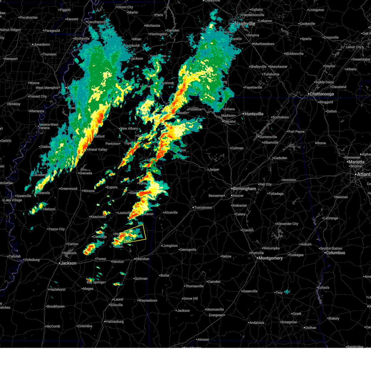 Svrjan the national weather service in jackson has issued a * severe thunderstorm warning for, western kemper county in east central mississippi, * until 645 pm cst. * at 555 pm cst, a severe thunderstorm was located near forestdale, or 12 miles east of philadelphia, moving east at 35 mph (radar indicated). Hazards include 60 mph wind gusts. expect damage to roofs, siding, and trees Svrjan the national weather service in jackson has issued a * severe thunderstorm warning for, western kemper county in east central mississippi, * until 645 pm cst. * at 555 pm cst, a severe thunderstorm was located near forestdale, or 12 miles east of philadelphia, moving east at 35 mph (radar indicated). Hazards include 60 mph wind gusts. expect damage to roofs, siding, and trees
|
| 12/18/2025 5:45 PM CST |
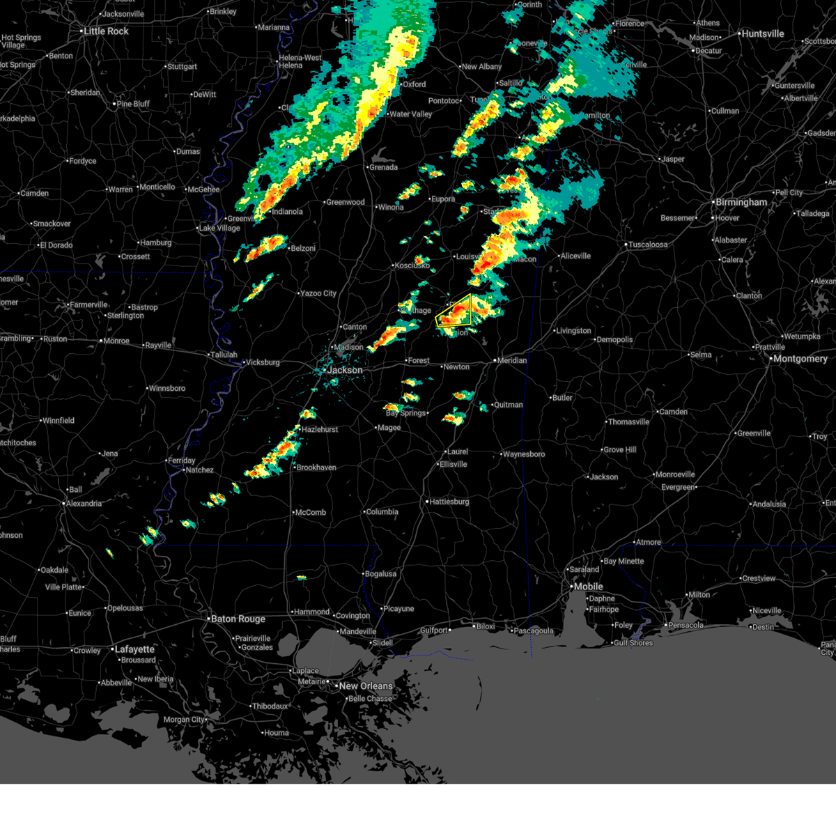 At 545 pm cst, a severe thunderstorm was located over tucker, or near philadelphia, moving east at 35 mph (radar indicated). Hazards include 60 mph wind gusts. Expect damage to roofs, siding, and trees. This severe storm will be near, forestdale around 550 pm cst. At 545 pm cst, a severe thunderstorm was located over tucker, or near philadelphia, moving east at 35 mph (radar indicated). Hazards include 60 mph wind gusts. Expect damage to roofs, siding, and trees. This severe storm will be near, forestdale around 550 pm cst.
|
| 12/18/2025 5:19 PM CST |
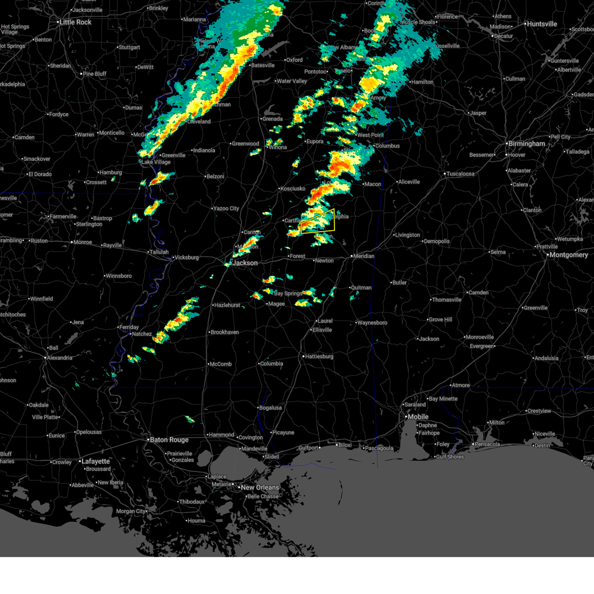 Svrjan the national weather service in jackson has issued a * severe thunderstorm warning for, neshoba county in east central mississippi, * until 600 pm cst. * at 519 pm cst, a severe thunderstorm was located over dowdville, or 8 miles south of pearl river, moving east at 35 mph (radar indicated). Hazards include 60 mph wind gusts. Expect damage to roofs, siding, and trees. this severe thunderstorm will be near, philadelphia, neshoba, and dixon around 525 pm cst. tucker and bethsaida around 530 pm cst. House and forestdale around 540 pm cst. Svrjan the national weather service in jackson has issued a * severe thunderstorm warning for, neshoba county in east central mississippi, * until 600 pm cst. * at 519 pm cst, a severe thunderstorm was located over dowdville, or 8 miles south of pearl river, moving east at 35 mph (radar indicated). Hazards include 60 mph wind gusts. Expect damage to roofs, siding, and trees. this severe thunderstorm will be near, philadelphia, neshoba, and dixon around 525 pm cst. tucker and bethsaida around 530 pm cst. House and forestdale around 540 pm cst.
|
| 7/13/2025 2:40 PM CDT |
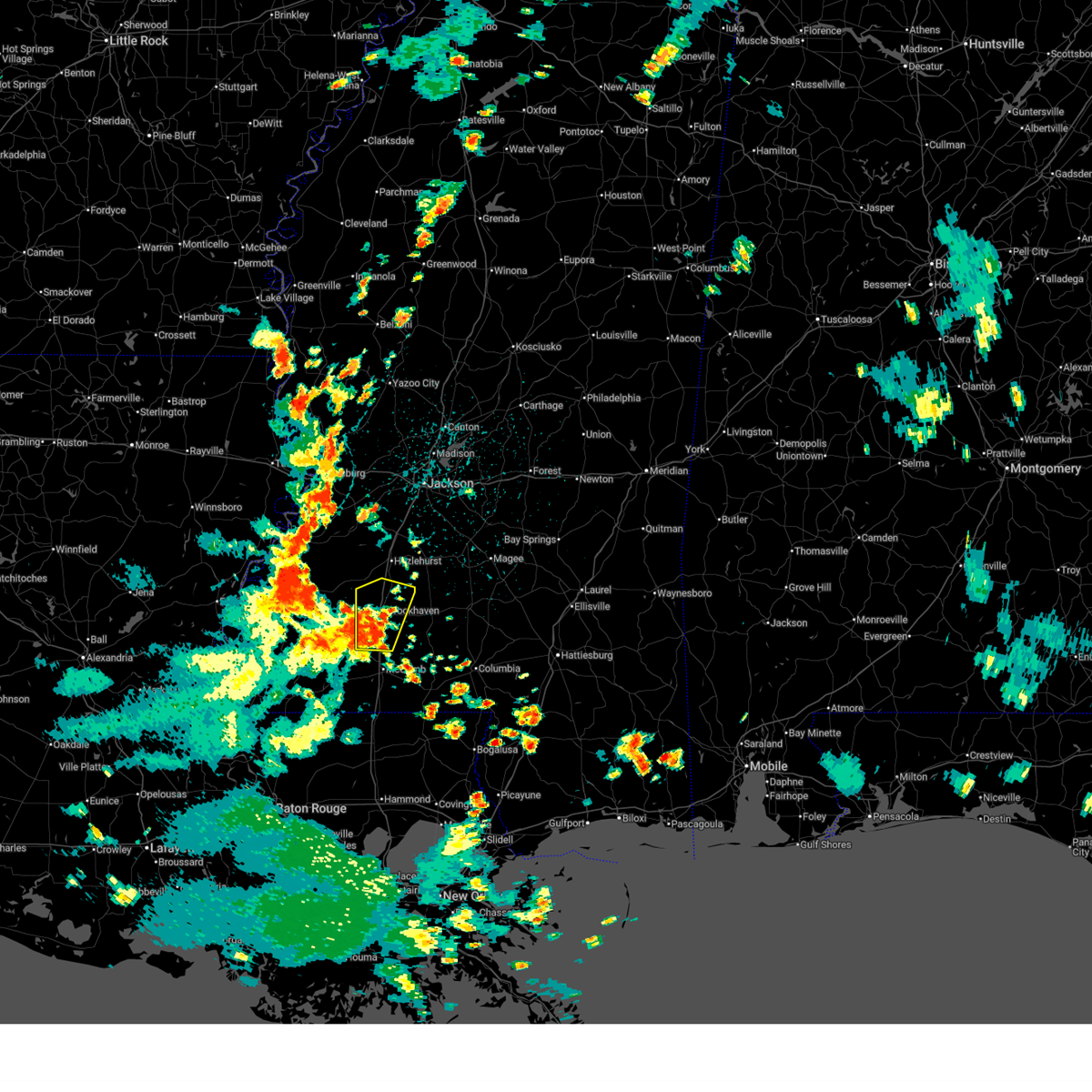 Svrjan the national weather service in jackson has issued a * severe thunderstorm warning for, lincoln county in south central mississippi, south central copiah county in central mississippi, * until 345 pm cdt. * at 240 pm cdt, a severe thunderstorm was located over bogue chitto, or 9 miles south of brookhaven, moving northeast at 25 mph (radar indicated). Hazards include 60 mph wind gusts. Expect damage to roofs, siding, and trees. this severe thunderstorm will be near, brookhaven and enterprise around 245 pm cdt. wesson around 305 pm cdt. Beauregard around 310 pm cdt. Svrjan the national weather service in jackson has issued a * severe thunderstorm warning for, lincoln county in south central mississippi, south central copiah county in central mississippi, * until 345 pm cdt. * at 240 pm cdt, a severe thunderstorm was located over bogue chitto, or 9 miles south of brookhaven, moving northeast at 25 mph (radar indicated). Hazards include 60 mph wind gusts. Expect damage to roofs, siding, and trees. this severe thunderstorm will be near, brookhaven and enterprise around 245 pm cdt. wesson around 305 pm cdt. Beauregard around 310 pm cdt.
|
| 6/17/2025 5:57 PM CDT |
 the severe thunderstorm warning has been cancelled and is no longer in effect the severe thunderstorm warning has been cancelled and is no longer in effect
|
| 6/17/2025 5:57 PM CDT |
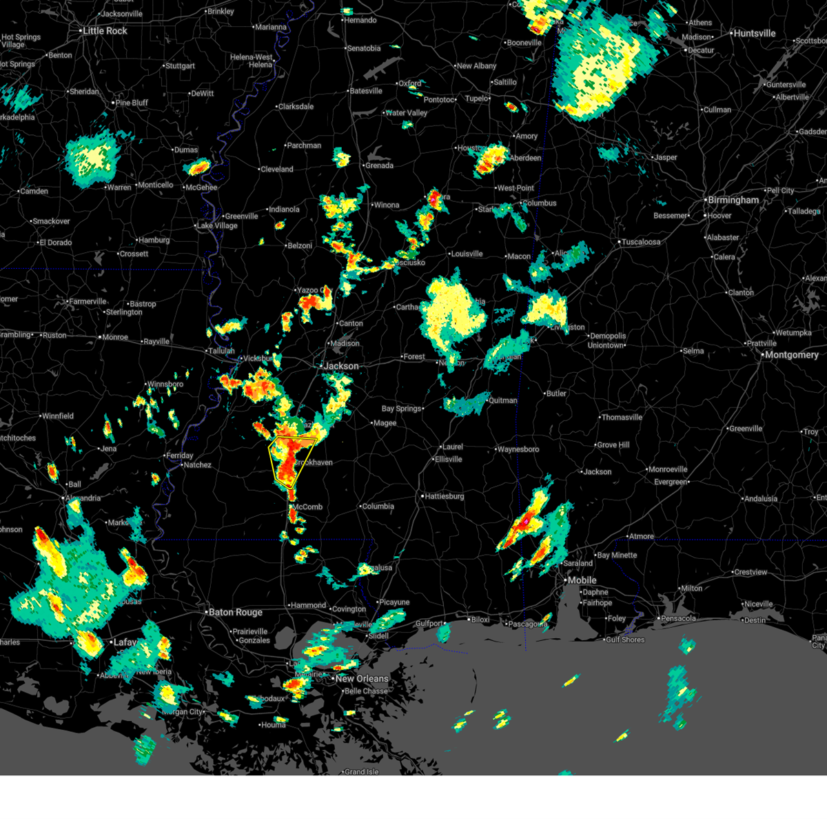 At 557 pm cdt, severe thunderstorms were located along a line extending from near wesson to near bogue chitto, moving northeast at 15 mph (radar indicated). Hazards include 60 mph wind gusts and penny size hail. Expect damage to roofs, siding, and trees. Locations impacted include, brookhaven, wesson, bogue chitto, beauregard, loyd star, enterprise, west lincoln, and vaughn. At 557 pm cdt, severe thunderstorms were located along a line extending from near wesson to near bogue chitto, moving northeast at 15 mph (radar indicated). Hazards include 60 mph wind gusts and penny size hail. Expect damage to roofs, siding, and trees. Locations impacted include, brookhaven, wesson, bogue chitto, beauregard, loyd star, enterprise, west lincoln, and vaughn.
|
| 6/17/2025 5:42 PM CDT |
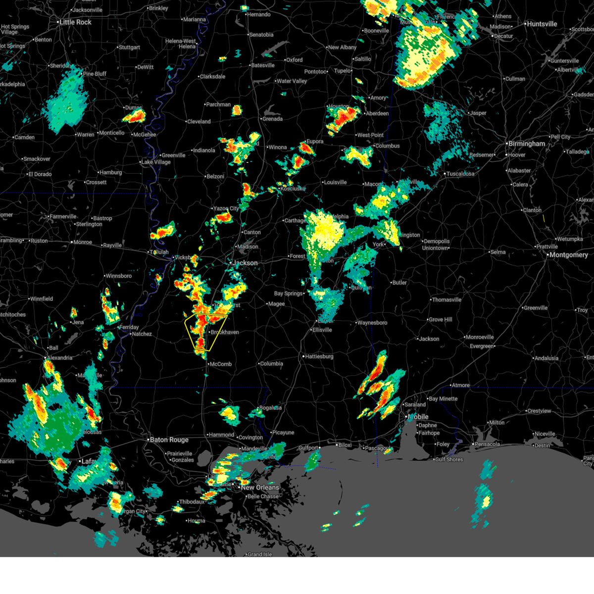 Svrjan the national weather service in jackson has issued a * severe thunderstorm warning for, lincoln county in south central mississippi, northeastern franklin county in southwestern mississippi, southwestern copiah county in central mississippi, * until 630 pm cdt. * at 542 pm cdt, severe thunderstorms were located along a line extending from beauregard to near west lincoln, moving northeast at 15 mph (radar indicated). Hazards include 60 mph wind gusts and nickel size hail. expect damage to roofs, siding, and trees Svrjan the national weather service in jackson has issued a * severe thunderstorm warning for, lincoln county in south central mississippi, northeastern franklin county in southwestern mississippi, southwestern copiah county in central mississippi, * until 630 pm cdt. * at 542 pm cdt, severe thunderstorms were located along a line extending from beauregard to near west lincoln, moving northeast at 15 mph (radar indicated). Hazards include 60 mph wind gusts and nickel size hail. expect damage to roofs, siding, and trees
|
| 6/16/2025 4:24 PM CDT |
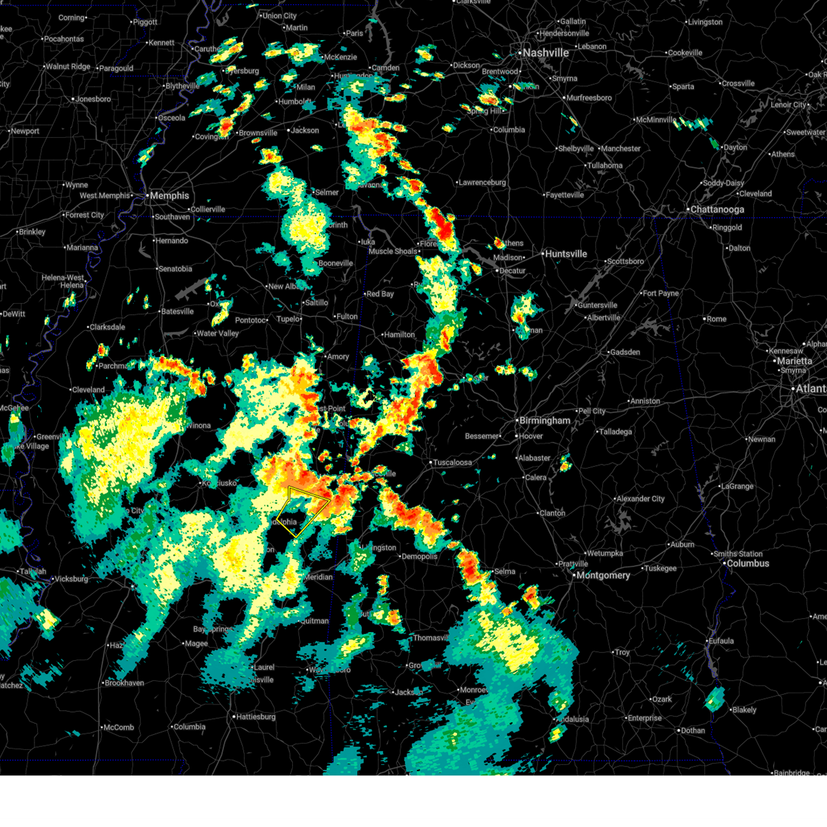 the severe thunderstorm warning has been cancelled and is no longer in effect the severe thunderstorm warning has been cancelled and is no longer in effect
|
| 6/16/2025 4:04 PM CDT |
 At 404 pm cdt, a severe thunderstorm was located near louisville, moving northeast at 35 mph (radar indicated). Hazards include 60 mph wind gusts. Expect damage to roofs, siding, and trees. This severe storm will be near, louisville, millcreek, and mcmillan around 410 pm cdt. At 404 pm cdt, a severe thunderstorm was located near louisville, moving northeast at 35 mph (radar indicated). Hazards include 60 mph wind gusts. Expect damage to roofs, siding, and trees. This severe storm will be near, louisville, millcreek, and mcmillan around 410 pm cdt.
|
| 6/16/2025 4:00 PM CDT |
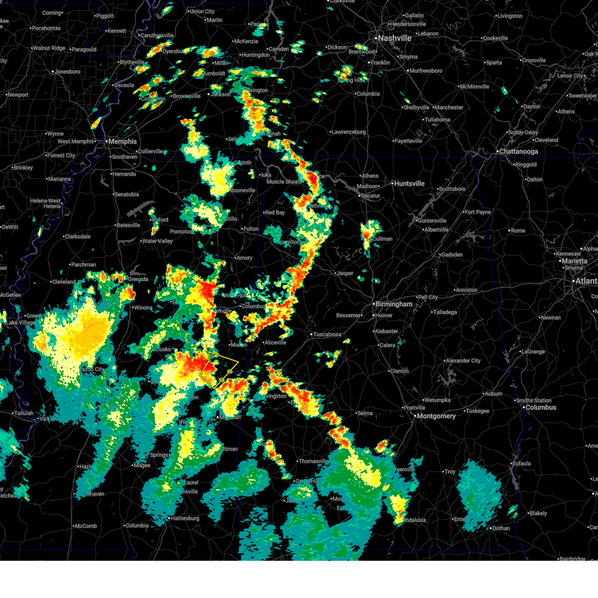 At 400 pm cdt, a severe thunderstorm was located over bluff springs, or 7 miles west of de kalb, moving northeast at 30 mph (radar indicated). Hazards include 60 mph wind gusts. Expect damage to roofs, siding, and trees. This severe storm will be near, de kalb, gholson, and preston around 405 pm cdt. At 400 pm cdt, a severe thunderstorm was located over bluff springs, or 7 miles west of de kalb, moving northeast at 30 mph (radar indicated). Hazards include 60 mph wind gusts. Expect damage to roofs, siding, and trees. This severe storm will be near, de kalb, gholson, and preston around 405 pm cdt.
|
| 6/16/2025 3:50 PM CDT |
 At 350 pm cdt, a severe thunderstorm was located near stallo, or 12 miles southwest of louisville, moving northeast at 35 mph (radar indicated). Hazards include 60 mph wind gusts. Expect damage to roofs, siding, and trees. this severe storm will be near, louisville and noxapater around 355 pm cdt. mcmillan around 400 pm cdt. Millcreek around 410 pm cdt. At 350 pm cdt, a severe thunderstorm was located near stallo, or 12 miles southwest of louisville, moving northeast at 35 mph (radar indicated). Hazards include 60 mph wind gusts. Expect damage to roofs, siding, and trees. this severe storm will be near, louisville and noxapater around 355 pm cdt. mcmillan around 400 pm cdt. Millcreek around 410 pm cdt.
|
| 6/16/2025 3:50 PM CDT |
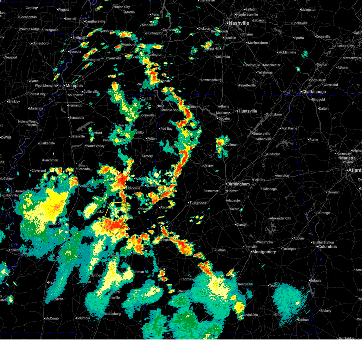 the severe thunderstorm warning has been cancelled and is no longer in effect the severe thunderstorm warning has been cancelled and is no longer in effect
|
| 6/16/2025 3:44 PM CDT |
 Svrjan the national weather service in jackson has issued a * severe thunderstorm warning for, southwestern noxubee county in east central mississippi, western kemper county in east central mississippi, * until 445 pm cdt. * at 343 pm cdt, a severe thunderstorm was located over damascus, or 13 miles southwest of de kalb, moving northeast at 30 mph (radar indicated). Hazards include 60 mph wind gusts. Expect damage to roofs, siding, and trees. this severe thunderstorm will be near, liberty and bluff springs around 350 pm cdt. de kalb and preston around 400 pm cdt. Gholson around 410 pm cdt. Svrjan the national weather service in jackson has issued a * severe thunderstorm warning for, southwestern noxubee county in east central mississippi, western kemper county in east central mississippi, * until 445 pm cdt. * at 343 pm cdt, a severe thunderstorm was located over damascus, or 13 miles southwest of de kalb, moving northeast at 30 mph (radar indicated). Hazards include 60 mph wind gusts. Expect damage to roofs, siding, and trees. this severe thunderstorm will be near, liberty and bluff springs around 350 pm cdt. de kalb and preston around 400 pm cdt. Gholson around 410 pm cdt.
|
| 6/16/2025 3:29 PM CDT |
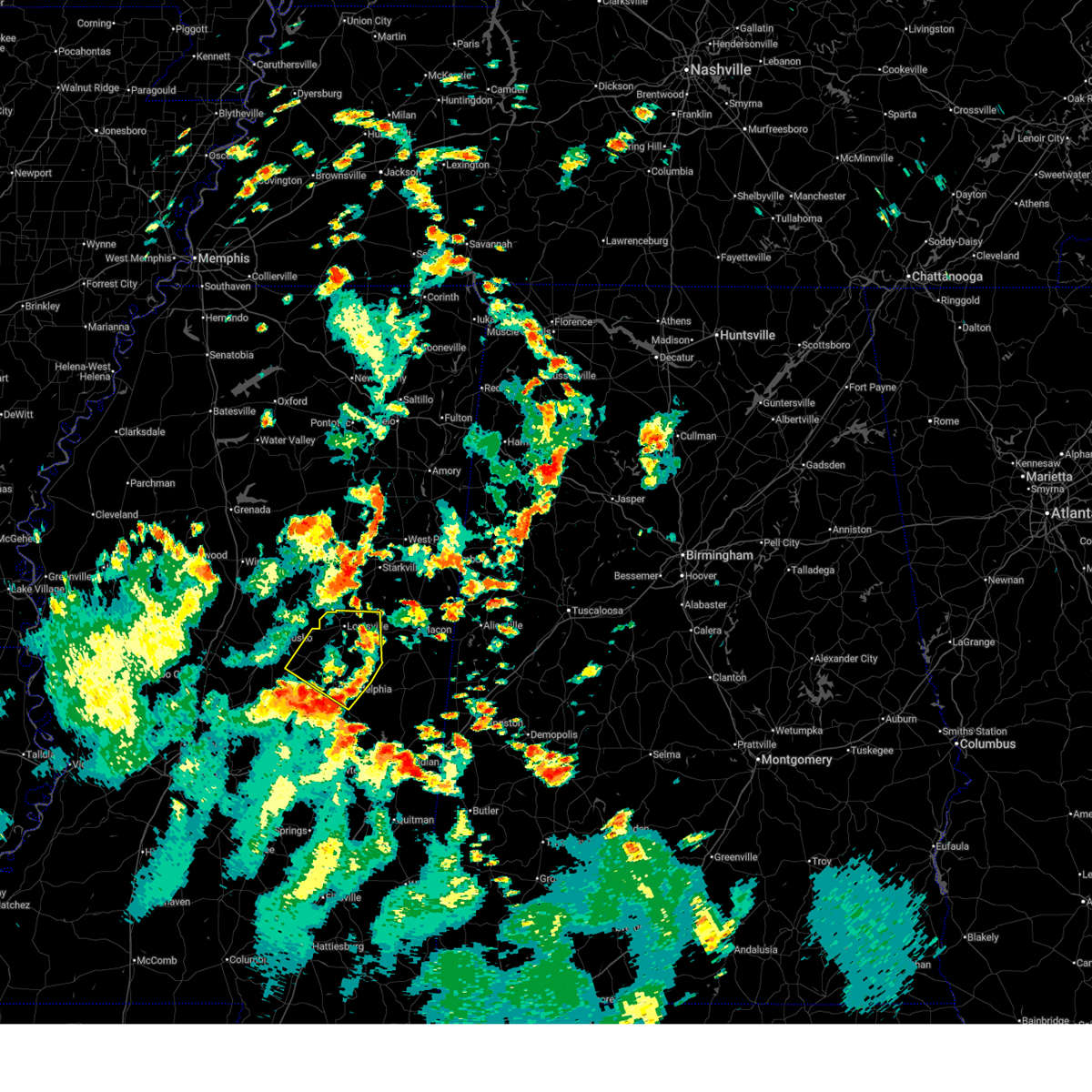 Svrjan the national weather service in jackson has issued a * severe thunderstorm warning for, northeastern leake county in central mississippi, northwestern kemper county in east central mississippi, southeastern attala county in central mississippi, winston county in east central mississippi, northern neshoba county in east central mississippi, * until 430 pm cdt. * at 329 pm cdt, a severe thunderstorm was located over edinburg, or near pearl river, moving northeast at 35 mph (radar indicated). Hazards include 60 mph wind gusts. Expect damage to roofs, siding, and trees. this severe thunderstorm will be near, stallo around 340 pm cdt. noxapater around 350 pm cdt. louisville around 355 pm cdt. mcmillan around 400 pm cdt. Millcreek around 410 pm cdt. Svrjan the national weather service in jackson has issued a * severe thunderstorm warning for, northeastern leake county in central mississippi, northwestern kemper county in east central mississippi, southeastern attala county in central mississippi, winston county in east central mississippi, northern neshoba county in east central mississippi, * until 430 pm cdt. * at 329 pm cdt, a severe thunderstorm was located over edinburg, or near pearl river, moving northeast at 35 mph (radar indicated). Hazards include 60 mph wind gusts. Expect damage to roofs, siding, and trees. this severe thunderstorm will be near, stallo around 340 pm cdt. noxapater around 350 pm cdt. louisville around 355 pm cdt. mcmillan around 400 pm cdt. Millcreek around 410 pm cdt.
|
| 5/27/2025 7:23 AM CDT |
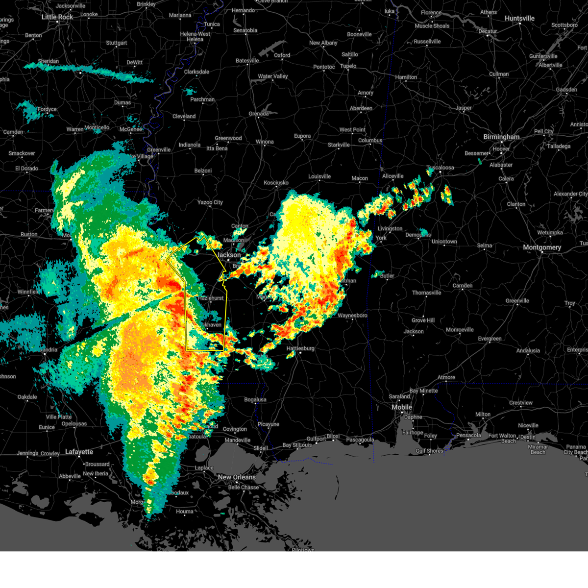 Svrjan the national weather service in jackson has issued a * severe thunderstorm warning for, southeastern warren county in west central mississippi, northeastern claiborne county in southwestern mississippi, lincoln county in south central mississippi, west central lawrence county in south central mississippi, eastern franklin county in southwestern mississippi, hinds county in central mississippi, copiah county in central mississippi, * until 830 am cdt. * at 723 am cdt, severe thunderstorms were located along a line extending from le tourneau to 6 miles east of hermanville to near mccall creek, moving northeast at 40 mph (radar indicated). Hazards include 60 mph wind gusts. Expect damage to roofs, siding, and trees. severe thunderstorms will be near, vicksburg, carpenter, reganton, allen, barlow, caseyville, dentville, and vaughn around 730 am cdt. utica, newman, and loyd star around 735 am cdt. brookhaven, bovina, and glancy around 740 am cdt. hazlehurst, edwards, learned, flowers, and martinsville around 745 am cdt. crystal springs, wesson, beauregard, dry grove, and gallman around 750 am cdt. raymond, terry, and bolton around 755 am cdt. jackson around 800 am cdt. Clinton, byram, hopewell, and brownsville around 805 am cdt. Svrjan the national weather service in jackson has issued a * severe thunderstorm warning for, southeastern warren county in west central mississippi, northeastern claiborne county in southwestern mississippi, lincoln county in south central mississippi, west central lawrence county in south central mississippi, eastern franklin county in southwestern mississippi, hinds county in central mississippi, copiah county in central mississippi, * until 830 am cdt. * at 723 am cdt, severe thunderstorms were located along a line extending from le tourneau to 6 miles east of hermanville to near mccall creek, moving northeast at 40 mph (radar indicated). Hazards include 60 mph wind gusts. Expect damage to roofs, siding, and trees. severe thunderstorms will be near, vicksburg, carpenter, reganton, allen, barlow, caseyville, dentville, and vaughn around 730 am cdt. utica, newman, and loyd star around 735 am cdt. brookhaven, bovina, and glancy around 740 am cdt. hazlehurst, edwards, learned, flowers, and martinsville around 745 am cdt. crystal springs, wesson, beauregard, dry grove, and gallman around 750 am cdt. raymond, terry, and bolton around 755 am cdt. jackson around 800 am cdt. Clinton, byram, hopewell, and brownsville around 805 am cdt.
|
| 5/26/2025 2:15 PM CDT | Numerous trees and powerlines downed across the southern portions of the count in lincoln county MS, 2.1 miles WSW of Bogue Chitto, MS |
| 5/26/2025 2:08 PM CDT |
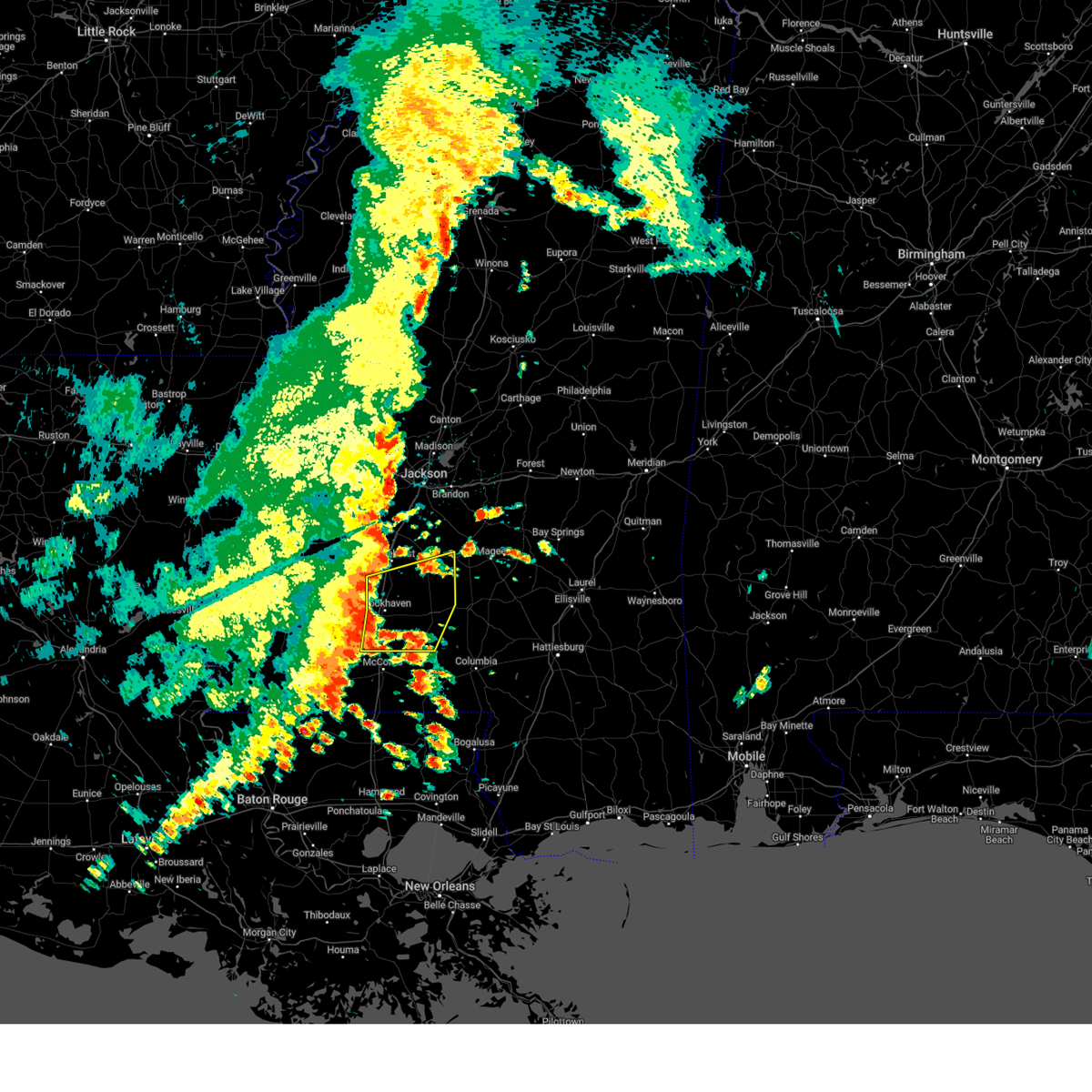 Svrjan the national weather service in jackson has issued a * severe thunderstorm warning for, southwestern simpson county in central mississippi, lincoln county in south central mississippi, lawrence county in south central mississippi, southeastern copiah county in central mississippi, * until 315 pm cdt. * at 208 pm cdt, severe thunderstorms were located along a line extending from near loyd star to near brookhaven to near center point, moving east at 40 mph (radar indicated). Hazards include 60 mph wind gusts and nickel size hail. expect damage to roofs, siding, and trees Svrjan the national weather service in jackson has issued a * severe thunderstorm warning for, southwestern simpson county in central mississippi, lincoln county in south central mississippi, lawrence county in south central mississippi, southeastern copiah county in central mississippi, * until 315 pm cdt. * at 208 pm cdt, severe thunderstorms were located along a line extending from near loyd star to near brookhaven to near center point, moving east at 40 mph (radar indicated). Hazards include 60 mph wind gusts and nickel size hail. expect damage to roofs, siding, and trees
|
| 5/25/2025 9:25 PM CDT |
 At 925 pm cdt, severe thunderstorms were located along a line extending from near clinton to near hillsboro to near herbert springs, moving south at 35 mph (radar indicated). Hazards include 60 mph wind gusts. Expect damage to roofs, siding, and trees. Locations impacted include, jackson, madison, ridgeland, canton, philadelphia, gluckstadt, union, decatur, walnut grove, flora, conehatta, hillsboro, tucker, bentonia, sebastopol, harperville, lena, leesburg, farmhaven, and neshoba. At 925 pm cdt, severe thunderstorms were located along a line extending from near clinton to near hillsboro to near herbert springs, moving south at 35 mph (radar indicated). Hazards include 60 mph wind gusts. Expect damage to roofs, siding, and trees. Locations impacted include, jackson, madison, ridgeland, canton, philadelphia, gluckstadt, union, decatur, walnut grove, flora, conehatta, hillsboro, tucker, bentonia, sebastopol, harperville, lena, leesburg, farmhaven, and neshoba.
|
| 5/25/2025 9:15 PM CDT |
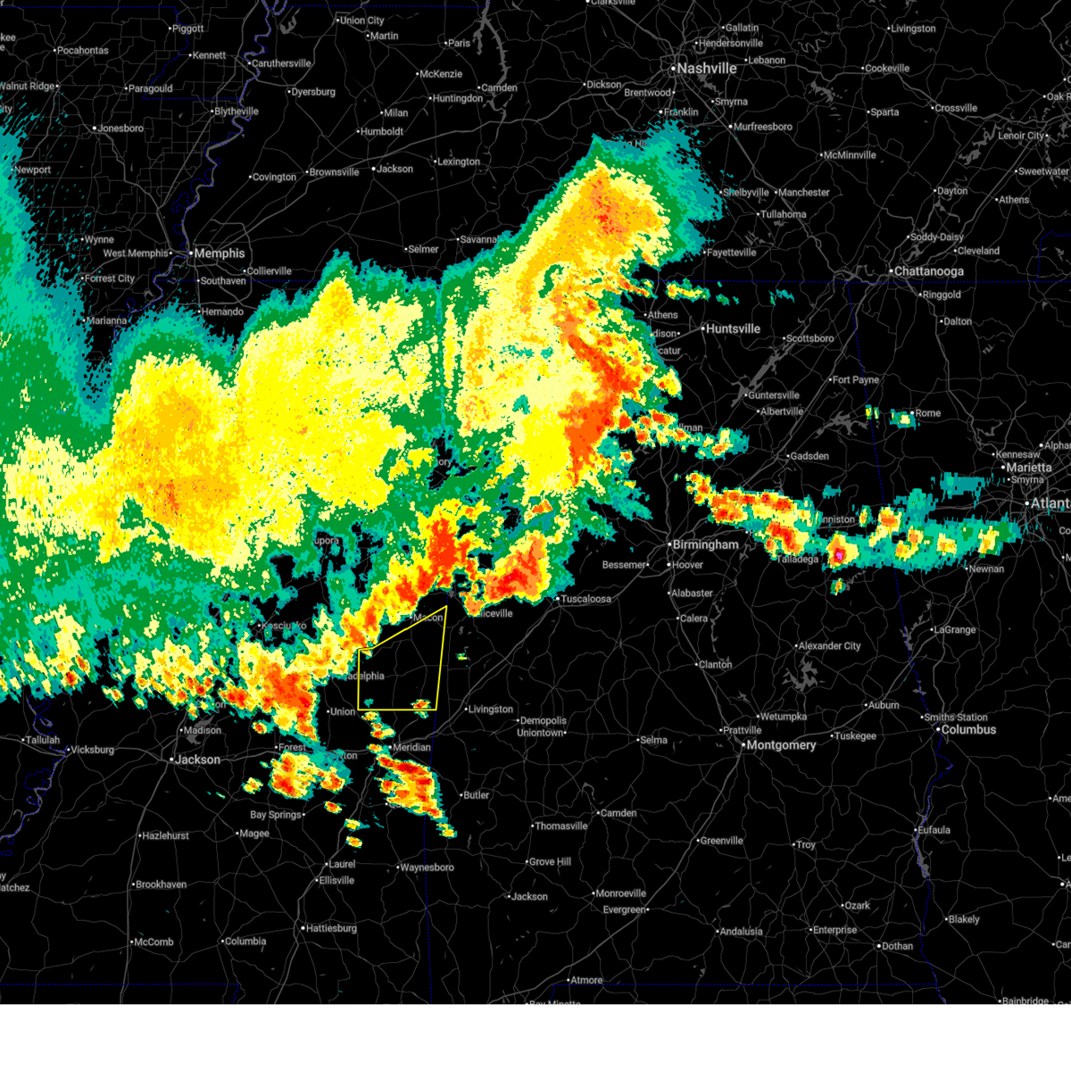 At 915 pm cdt, severe thunderstorms were located along a line extending from near preston to near prairie point, moving southeast at 35 mph (radar indicated). Hazards include 60 mph wind gusts. Expect damage to roofs, siding, and trees. these severe storms will be near, shuqualak, gholson, and preston around 920 pm cdt. paulette around 925 pm cdt. cooksville around 930 pm cdt. de kalb around 935 pm cdt. scooba around 940 pm cdt. electric mills around 945 pm cdt. porterville around 955 pm cdt. Tamola around 1005 pm cdt. At 915 pm cdt, severe thunderstorms were located along a line extending from near preston to near prairie point, moving southeast at 35 mph (radar indicated). Hazards include 60 mph wind gusts. Expect damage to roofs, siding, and trees. these severe storms will be near, shuqualak, gholson, and preston around 920 pm cdt. paulette around 925 pm cdt. cooksville around 930 pm cdt. de kalb around 935 pm cdt. scooba around 940 pm cdt. electric mills around 945 pm cdt. porterville around 955 pm cdt. Tamola around 1005 pm cdt.
|
| 5/25/2025 9:14 PM CDT |
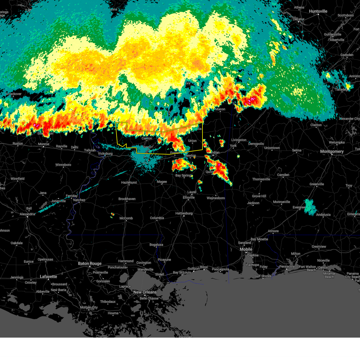 At 914 pm cdt, severe thunderstorms were located along a line extending from pocahontas to near hillsboro to near herbert springs, moving south at 40 mph (radar indicated). Hazards include 60 mph wind gusts. Expect damage to roofs, siding, and trees. these severe storms will be near, jackson, madison, ridgeland, union, conehatta, hillsboro, stratton, herbert springs, little rock, and fannin around 920 pm cdt. Decatur and duffee around 925 pm cdt. At 914 pm cdt, severe thunderstorms were located along a line extending from pocahontas to near hillsboro to near herbert springs, moving south at 40 mph (radar indicated). Hazards include 60 mph wind gusts. Expect damage to roofs, siding, and trees. these severe storms will be near, jackson, madison, ridgeland, union, conehatta, hillsboro, stratton, herbert springs, little rock, and fannin around 920 pm cdt. Decatur and duffee around 925 pm cdt.
|
| 5/25/2025 8:58 PM CDT |
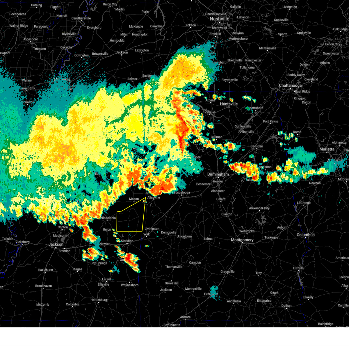 Svrjan the national weather service in jackson has issued a * severe thunderstorm warning for, southern noxubee county in east central mississippi, kemper county in east central mississippi, * until 1015 pm cdt. * at 857 pm cdt, severe thunderstorms were located along a line extending from 6 miles southeast of millcreek to near deerbrook, moving southeast at 40 mph (radar indicated). Hazards include 60 mph wind gusts. Expect damage to roofs, siding, and trees. severe thunderstorms will be near, gholson around 910 pm cdt. shuqualak around 915 pm cdt. paulette around 920 pm cdt. cooksville around 925 pm cdt. scooba around 935 pm cdt. electric mills around 940 pm cdt. Porterville around 945 pm cdt. Svrjan the national weather service in jackson has issued a * severe thunderstorm warning for, southern noxubee county in east central mississippi, kemper county in east central mississippi, * until 1015 pm cdt. * at 857 pm cdt, severe thunderstorms were located along a line extending from 6 miles southeast of millcreek to near deerbrook, moving southeast at 40 mph (radar indicated). Hazards include 60 mph wind gusts. Expect damage to roofs, siding, and trees. severe thunderstorms will be near, gholson around 910 pm cdt. shuqualak around 915 pm cdt. paulette around 920 pm cdt. cooksville around 925 pm cdt. scooba around 935 pm cdt. electric mills around 940 pm cdt. Porterville around 945 pm cdt.
|
| 5/25/2025 8:52 PM CDT |
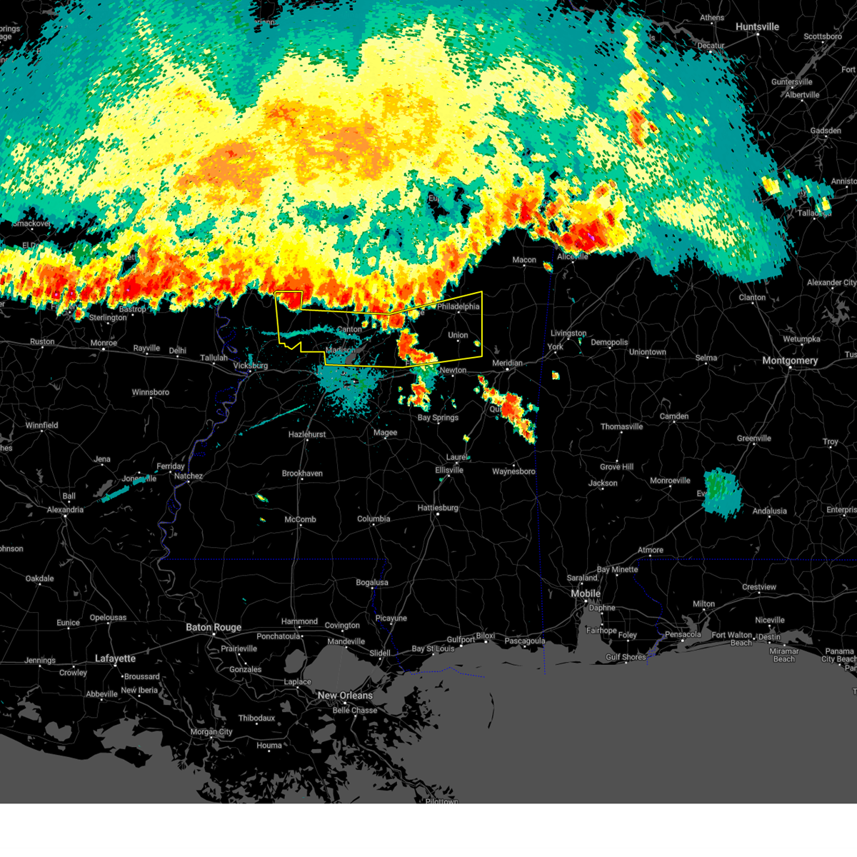 At 852 pm cdt, severe thunderstorms were located along a line extending from near little yazoo to 8 miles northeast of farmhaven to near burnside, moving south at 40 mph (radar indicated). Hazards include 60 mph wind gusts. Expect damage to roofs, siding, and trees. these severe storms will be near, jackson, canton, philadelphia, walnut grove, flora, tucker, standing pine, bentonia, lena, and tuscola around 900 pm cdt. gluckstadt, sebastopol, bethsaida, neshoba, and annandale around 905 pm cdt. madison, union, harperville, house, prospect, leesburg, steele, forkville, pisgah, and goshen springs around 910 pm cdt. ridgeland, hillsboro, herbert springs, fannin, and branch around 915 pm cdt. conehatta, stratton, and little rock around 920 pm cdt. Decatur and duffee around 925 pm cdt. At 852 pm cdt, severe thunderstorms were located along a line extending from near little yazoo to 8 miles northeast of farmhaven to near burnside, moving south at 40 mph (radar indicated). Hazards include 60 mph wind gusts. Expect damage to roofs, siding, and trees. these severe storms will be near, jackson, canton, philadelphia, walnut grove, flora, tucker, standing pine, bentonia, lena, and tuscola around 900 pm cdt. gluckstadt, sebastopol, bethsaida, neshoba, and annandale around 905 pm cdt. madison, union, harperville, house, prospect, leesburg, steele, forkville, pisgah, and goshen springs around 910 pm cdt. ridgeland, hillsboro, herbert springs, fannin, and branch around 915 pm cdt. conehatta, stratton, and little rock around 920 pm cdt. Decatur and duffee around 925 pm cdt.
|
| 5/25/2025 8:45 PM CDT |
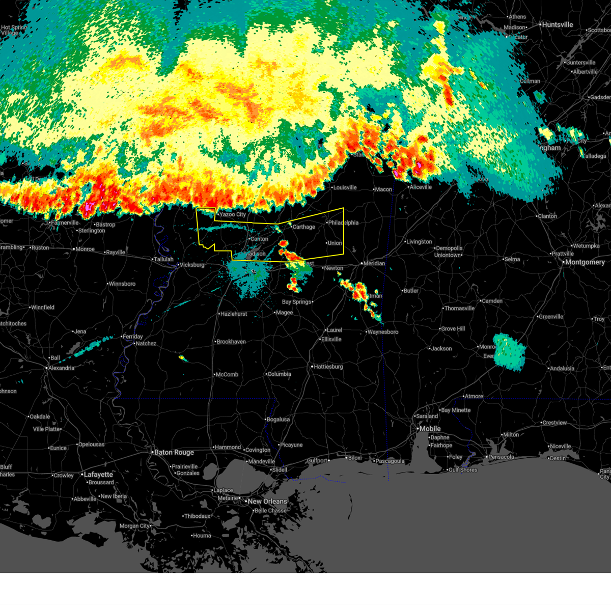 Svrjan the national weather service in jackson has issued a * severe thunderstorm warning for, leake county in central mississippi, northern newton county in east central mississippi, northeastern rankin county in central mississippi, central scott county in central mississippi, central yazoo county in central mississippi, neshoba county in east central mississippi, madison county in central mississippi, * until 945 pm cdt. * at 845 pm cdt, severe thunderstorms were located along a line extending from near yazoo city to near camden to near noxapater, moving south at 35 mph (radar indicated). Hazards include 60 mph wind gusts. Expect damage to roofs, siding, and trees. severe thunderstorms will be near, carthage, redwater, burnside, edinburg, myrleville, way, little yazoo, and tinsley around 850 pm cdt. canton, philadelphia, pearl river, bentonia, farmhaven, and sharon around 855 pm cdt. standing pine around 900 pm cdt. jackson, lena, tuscola, madden, ludlow, and dowdville around 905 pm cdt. gluckstadt, walnut grove, flora, tucker, bethsaida, dixon, and annandale around 910 pm cdt. sebastopol, neshoba, pisgah, and goshen springs around 915 pm cdt. madison, ridgeland, union, hillsboro, harperville, house, branch, prospect, leesburg, and steele around 920 pm cdt. Herbert springs and fannin around 925 pm cdt. Svrjan the national weather service in jackson has issued a * severe thunderstorm warning for, leake county in central mississippi, northern newton county in east central mississippi, northeastern rankin county in central mississippi, central scott county in central mississippi, central yazoo county in central mississippi, neshoba county in east central mississippi, madison county in central mississippi, * until 945 pm cdt. * at 845 pm cdt, severe thunderstorms were located along a line extending from near yazoo city to near camden to near noxapater, moving south at 35 mph (radar indicated). Hazards include 60 mph wind gusts. Expect damage to roofs, siding, and trees. severe thunderstorms will be near, carthage, redwater, burnside, edinburg, myrleville, way, little yazoo, and tinsley around 850 pm cdt. canton, philadelphia, pearl river, bentonia, farmhaven, and sharon around 855 pm cdt. standing pine around 900 pm cdt. jackson, lena, tuscola, madden, ludlow, and dowdville around 905 pm cdt. gluckstadt, walnut grove, flora, tucker, bethsaida, dixon, and annandale around 910 pm cdt. sebastopol, neshoba, pisgah, and goshen springs around 915 pm cdt. madison, ridgeland, union, hillsboro, harperville, house, branch, prospect, leesburg, and steele around 920 pm cdt. Herbert springs and fannin around 925 pm cdt.
|
| 5/24/2025 6:42 PM CDT | Quarter sized hail reported 4.8 miles WSW of Bogue Chitto, MS, reported on ms hwy 583. |
| 5/24/2025 6:42 PM CDT |
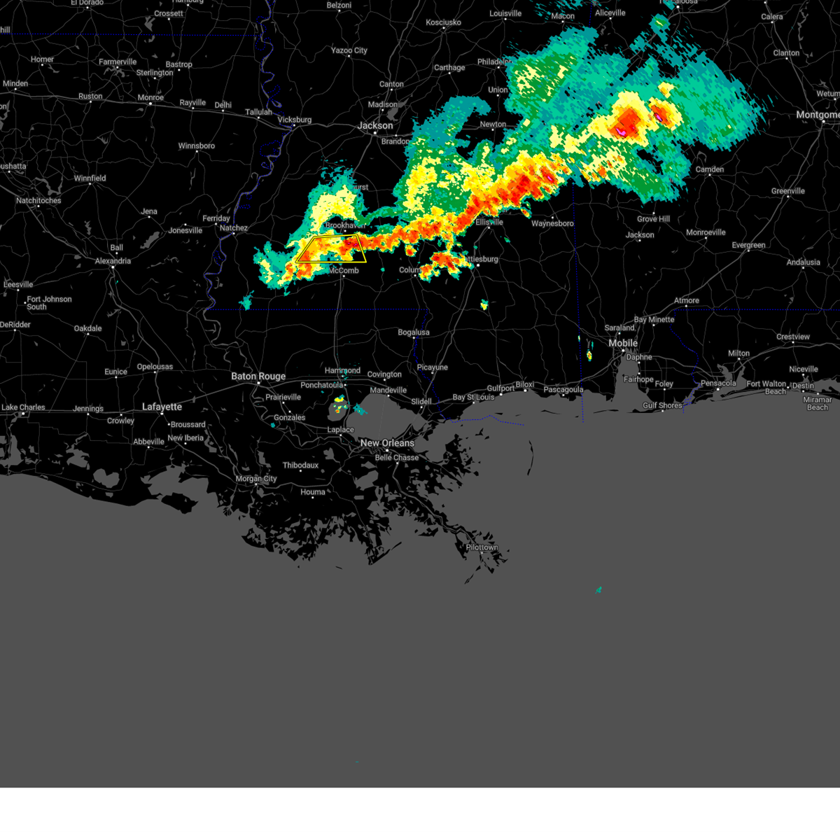 At 642 pm cdt, severe thunderstorms were located along a line extending from enterprise to near little springs, moving east at 35 mph (radar indicated). Hazards include 60 mph wind gusts and quarter size hail. Hail damage to vehicles is expected. expect wind damage to roofs, siding, and trees. Locations impacted include, bogue chitto, ruth, mccall creek, center point, enterprise, west lincoln, and little springs. At 642 pm cdt, severe thunderstorms were located along a line extending from enterprise to near little springs, moving east at 35 mph (radar indicated). Hazards include 60 mph wind gusts and quarter size hail. Hail damage to vehicles is expected. expect wind damage to roofs, siding, and trees. Locations impacted include, bogue chitto, ruth, mccall creek, center point, enterprise, west lincoln, and little springs.
|
| 5/24/2025 6:37 PM CDT | Several trees downed along ms hwy 583 south of brookhave in lincoln county MS, 5.3 miles WSW of Bogue Chitto, MS |
| 5/24/2025 6:15 PM CDT |
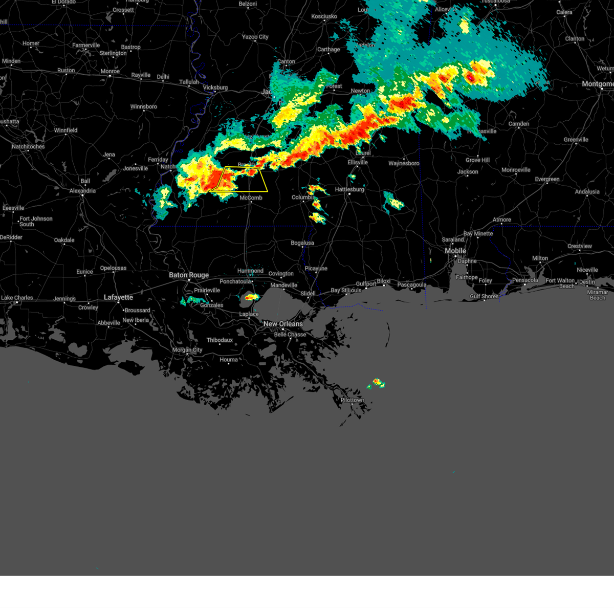 Svrjan the national weather service in jackson has issued a * severe thunderstorm warning for, southern lincoln county in south central mississippi, eastern franklin county in southwestern mississippi, * until 700 pm cdt. * at 615 pm cdt, severe thunderstorms were located along a line extending from near mccall creek to 8 miles south of meadville, moving southeast at 35 mph (radar indicated). Hazards include 60 mph wind gusts and half dollar size hail. Hail damage to vehicles is expected. Expect wind damage to roofs, siding, and trees. Svrjan the national weather service in jackson has issued a * severe thunderstorm warning for, southern lincoln county in south central mississippi, eastern franklin county in southwestern mississippi, * until 700 pm cdt. * at 615 pm cdt, severe thunderstorms were located along a line extending from near mccall creek to 8 miles south of meadville, moving southeast at 35 mph (radar indicated). Hazards include 60 mph wind gusts and half dollar size hail. Hail damage to vehicles is expected. Expect wind damage to roofs, siding, and trees.
|
| 5/24/2025 4:28 PM CDT |
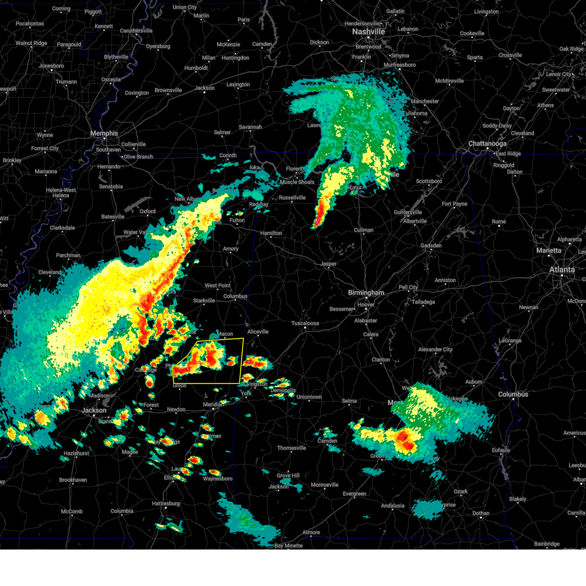 At 428 pm cdt, severe thunderstorms were located along a line extending from shuqualak to de kalb, moving east at 40 mph (radar indicated). Hazards include 60 mph wind gusts and half dollar size hail. Hail damage to vehicles is expected. expect wind damage to roofs, siding, and trees. these severe storms will be near, scooba, electric mills, and paulette around 435 pm cdt. Porterville and cooksville around 440 pm cdt. At 428 pm cdt, severe thunderstorms were located along a line extending from shuqualak to de kalb, moving east at 40 mph (radar indicated). Hazards include 60 mph wind gusts and half dollar size hail. Hail damage to vehicles is expected. expect wind damage to roofs, siding, and trees. these severe storms will be near, scooba, electric mills, and paulette around 435 pm cdt. Porterville and cooksville around 440 pm cdt.
|
| 5/24/2025 4:06 PM CDT |
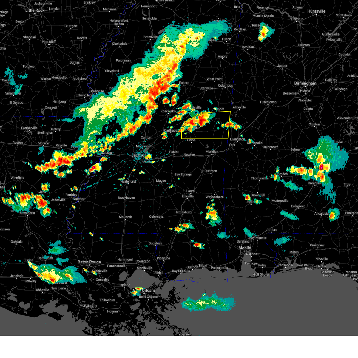 Svrjan the national weather service in jackson has issued a * severe thunderstorm warning for, southern noxubee county in east central mississippi, kemper county in east central mississippi, southeastern winston county in east central mississippi, neshoba county in east central mississippi, * until 500 pm cdt. * at 405 pm cdt, severe thunderstorms were located along a line extending from near mashulaville to near bluff springs, moving east at 40 mph (radar indicated). Hazards include 60 mph wind gusts and half dollar size hail. Hail damage to vehicles is expected. expect wind damage to roofs, siding, and trees. severe thunderstorms will be near, gholson, preston, and bluff springs around 410 pm cdt. de kalb and shuqualak around 420 pm cdt. scooba around 430 pm cdt. porterville, electric mills, and paulette around 435 pm cdt. Cooksville around 440 pm cdt. Svrjan the national weather service in jackson has issued a * severe thunderstorm warning for, southern noxubee county in east central mississippi, kemper county in east central mississippi, southeastern winston county in east central mississippi, neshoba county in east central mississippi, * until 500 pm cdt. * at 405 pm cdt, severe thunderstorms were located along a line extending from near mashulaville to near bluff springs, moving east at 40 mph (radar indicated). Hazards include 60 mph wind gusts and half dollar size hail. Hail damage to vehicles is expected. expect wind damage to roofs, siding, and trees. severe thunderstorms will be near, gholson, preston, and bluff springs around 410 pm cdt. de kalb and shuqualak around 420 pm cdt. scooba around 430 pm cdt. porterville, electric mills, and paulette around 435 pm cdt. Cooksville around 440 pm cdt.
|
| 4/10/2025 10:50 PM CDT |
 The storm which prompted the warning has weakened below severe limits, and no longer poses an immediate threat to life or property. therefore, the warning will be allowed to expire. a severe thunderstorm watch remains in effect until 1100 pm cdt for east central mississippi. The storm which prompted the warning has weakened below severe limits, and no longer poses an immediate threat to life or property. therefore, the warning will be allowed to expire. a severe thunderstorm watch remains in effect until 1100 pm cdt for east central mississippi.
|
| 4/10/2025 10:40 PM CDT |
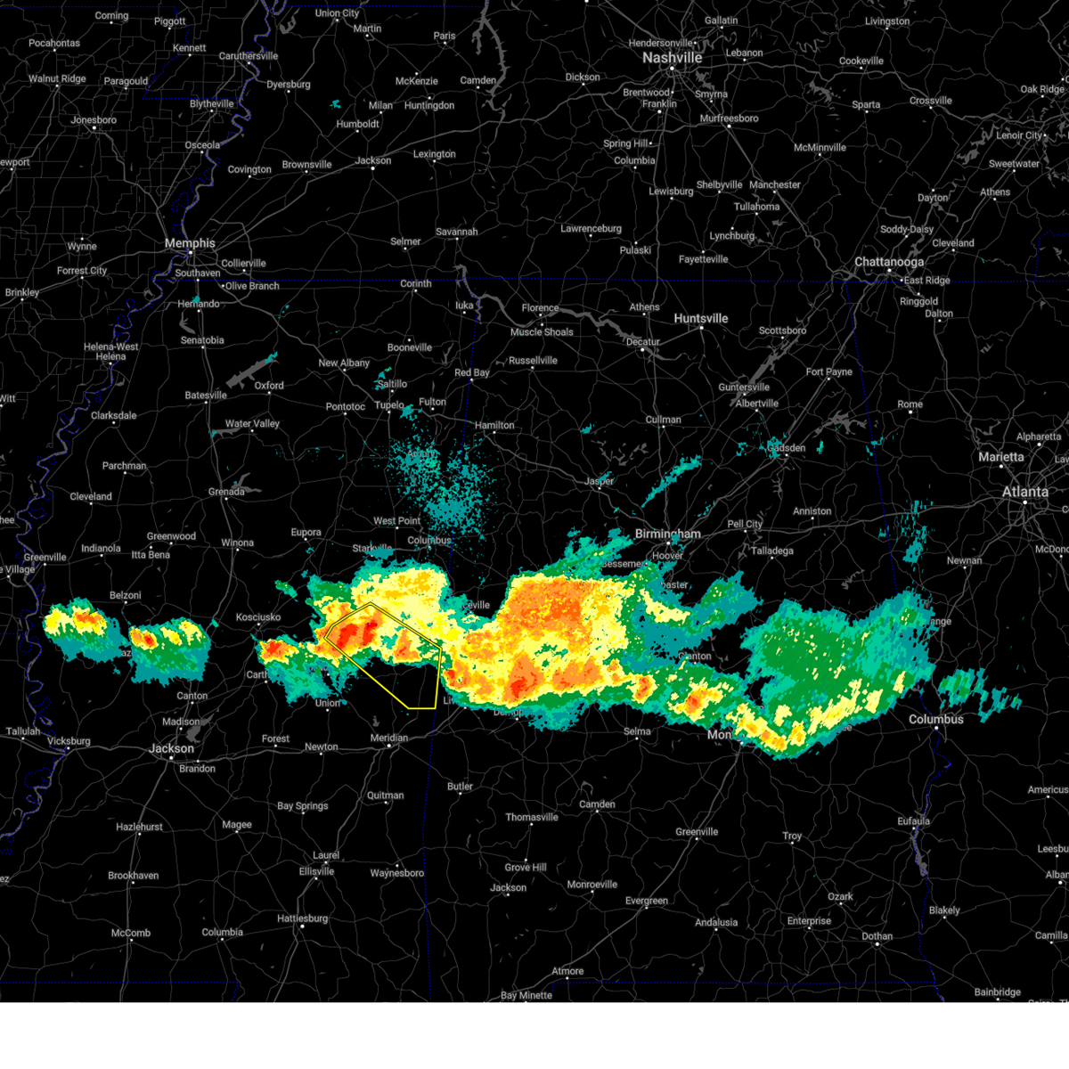 At 1040 pm cdt, a severe thunderstorm was located near nanih waiya, or 11 miles southeast of louisville, moving southeast at 45 mph (radar indicated). Hazards include 60 mph wind gusts and quarter size hail. Hail damage to vehicles is expected. expect wind damage to roofs, siding, and trees. this severe storm will be near, nanih waiya and preston around 1045 pm cdt. gholson around 1050 pm cdt. bluff springs around 1055 pm cdt. de kalb around 1100 pm cdt. electric mills around 1115 pm cdt. scooba and porterville around 1120 pm cdt. Tamola around 1130 pm cdt. At 1040 pm cdt, a severe thunderstorm was located near nanih waiya, or 11 miles southeast of louisville, moving southeast at 45 mph (radar indicated). Hazards include 60 mph wind gusts and quarter size hail. Hail damage to vehicles is expected. expect wind damage to roofs, siding, and trees. this severe storm will be near, nanih waiya and preston around 1045 pm cdt. gholson around 1050 pm cdt. bluff springs around 1055 pm cdt. de kalb around 1100 pm cdt. electric mills around 1115 pm cdt. scooba and porterville around 1120 pm cdt. Tamola around 1130 pm cdt.
|
| 4/10/2025 10:29 PM CDT |
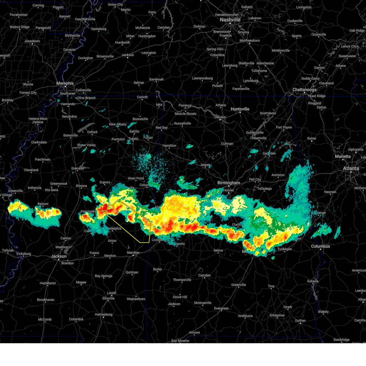 At 1028 pm cdt, a severe thunderstorm was located near noxapater, or near louisville, moving southeast at 55 mph (radar indicated). Hazards include 60 mph wind gusts and quarter size hail. Hail damage to vehicles is expected. expect wind damage to roofs, siding, and trees. this severe storm will be near, noxapater and nanih waiya around 1035 pm cdt. preston around 1040 pm cdt. gholson around 1045 pm cdt. bluff springs around 1050 pm cdt. de kalb around 1055 pm cdt. electric mills around 1105 pm cdt. scooba and porterville around 1110 pm cdt. Tamola around 1115 pm cdt. At 1028 pm cdt, a severe thunderstorm was located near noxapater, or near louisville, moving southeast at 55 mph (radar indicated). Hazards include 60 mph wind gusts and quarter size hail. Hail damage to vehicles is expected. expect wind damage to roofs, siding, and trees. this severe storm will be near, noxapater and nanih waiya around 1035 pm cdt. preston around 1040 pm cdt. gholson around 1045 pm cdt. bluff springs around 1050 pm cdt. de kalb around 1055 pm cdt. electric mills around 1105 pm cdt. scooba and porterville around 1110 pm cdt. Tamola around 1115 pm cdt.
|
| 4/10/2025 10:14 PM CDT |
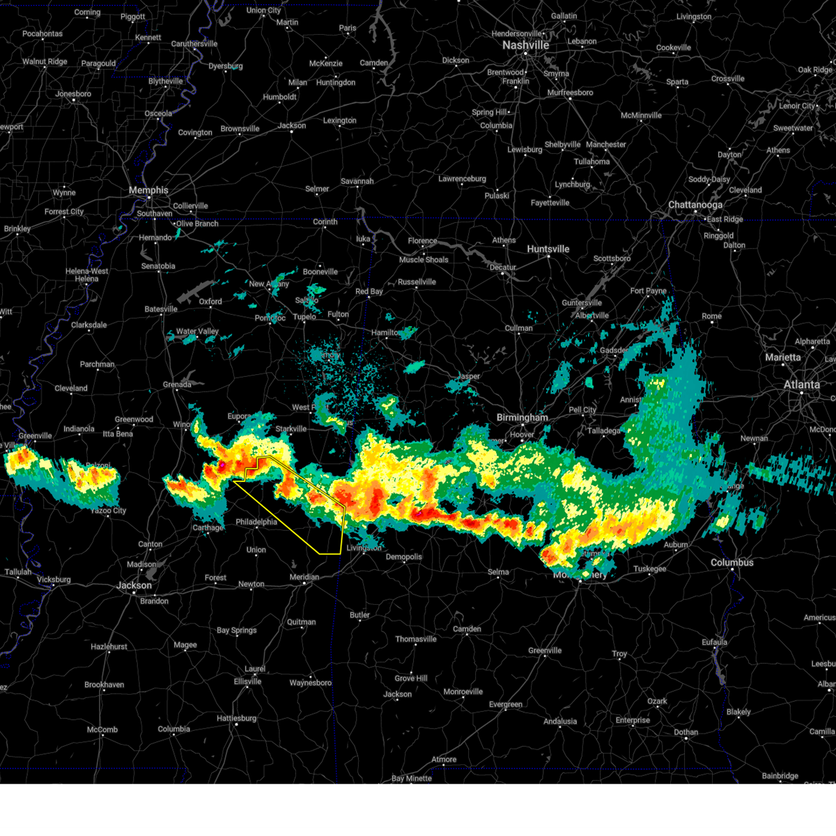 At 1014 pm cdt, a severe thunderstorm was located over mcmillan, or near louisville, moving southeast at 50 mph (radar indicated). Hazards include 60 mph wind gusts and quarter size hail. Hail damage to vehicles is expected. expect wind damage to roofs, siding, and trees. this severe storm will be near, betheden, millcreek, and louisville around 1020 pm cdt. gholson, preston, and mashulaville around 1035 pm cdt. de kalb around 1050 pm cdt. scooba around 1055 pm cdt. electric mills around 1100 pm cdt. Porterville around 1105 pm cdt. At 1014 pm cdt, a severe thunderstorm was located over mcmillan, or near louisville, moving southeast at 50 mph (radar indicated). Hazards include 60 mph wind gusts and quarter size hail. Hail damage to vehicles is expected. expect wind damage to roofs, siding, and trees. this severe storm will be near, betheden, millcreek, and louisville around 1020 pm cdt. gholson, preston, and mashulaville around 1035 pm cdt. de kalb around 1050 pm cdt. scooba around 1055 pm cdt. electric mills around 1100 pm cdt. Porterville around 1105 pm cdt.
|
| 4/10/2025 10:01 PM CDT |
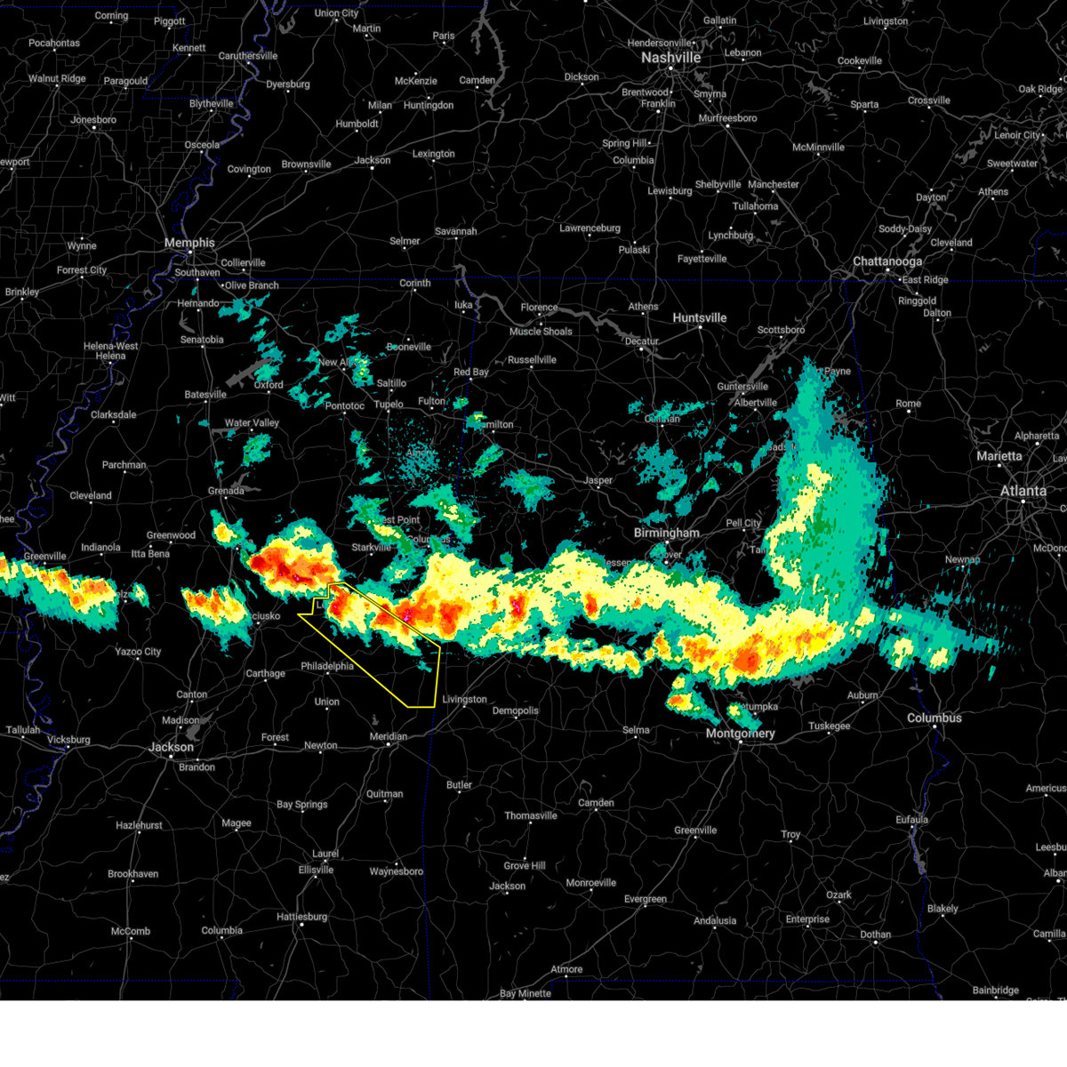 Svrjan the national weather service in jackson has issued a * severe thunderstorm warning for, southwestern noxubee county in east central mississippi, kemper county in east central mississippi, winston county in east central mississippi, northeastern neshoba county in east central mississippi, * until 1100 pm cdt. * at 1001 pm cdt, a severe thunderstorm was located near millcreek, or near louisville, moving southeast at 45 mph (radar indicated). Hazards include 60 mph wind gusts and quarter size hail. Hail damage to vehicles is expected. expect wind damage to roofs, siding, and trees. this severe thunderstorm will be near, mashulaville around 1010 pm cdt. gholson around 1015 pm cdt. preston around 1025 pm cdt. shuqualak around 1030 pm cdt. scooba around 1040 pm cdt. electric mills around 1045 pm cdt. Porterville around 1055 pm cdt. Svrjan the national weather service in jackson has issued a * severe thunderstorm warning for, southwestern noxubee county in east central mississippi, kemper county in east central mississippi, winston county in east central mississippi, northeastern neshoba county in east central mississippi, * until 1100 pm cdt. * at 1001 pm cdt, a severe thunderstorm was located near millcreek, or near louisville, moving southeast at 45 mph (radar indicated). Hazards include 60 mph wind gusts and quarter size hail. Hail damage to vehicles is expected. expect wind damage to roofs, siding, and trees. this severe thunderstorm will be near, mashulaville around 1010 pm cdt. gholson around 1015 pm cdt. preston around 1025 pm cdt. shuqualak around 1030 pm cdt. scooba around 1040 pm cdt. electric mills around 1045 pm cdt. Porterville around 1055 pm cdt.
|
| 4/6/2025 3:37 AM CDT | Observed at the joe williams nol in kemper county MS, 4.7 miles WNW of Bogue Chitto, MS |
| 4/6/2025 3:30 AM CDT |
 the tornado warning has been cancelled and is no longer in effect the tornado warning has been cancelled and is no longer in effect
|
| 4/6/2025 3:30 AM CDT |
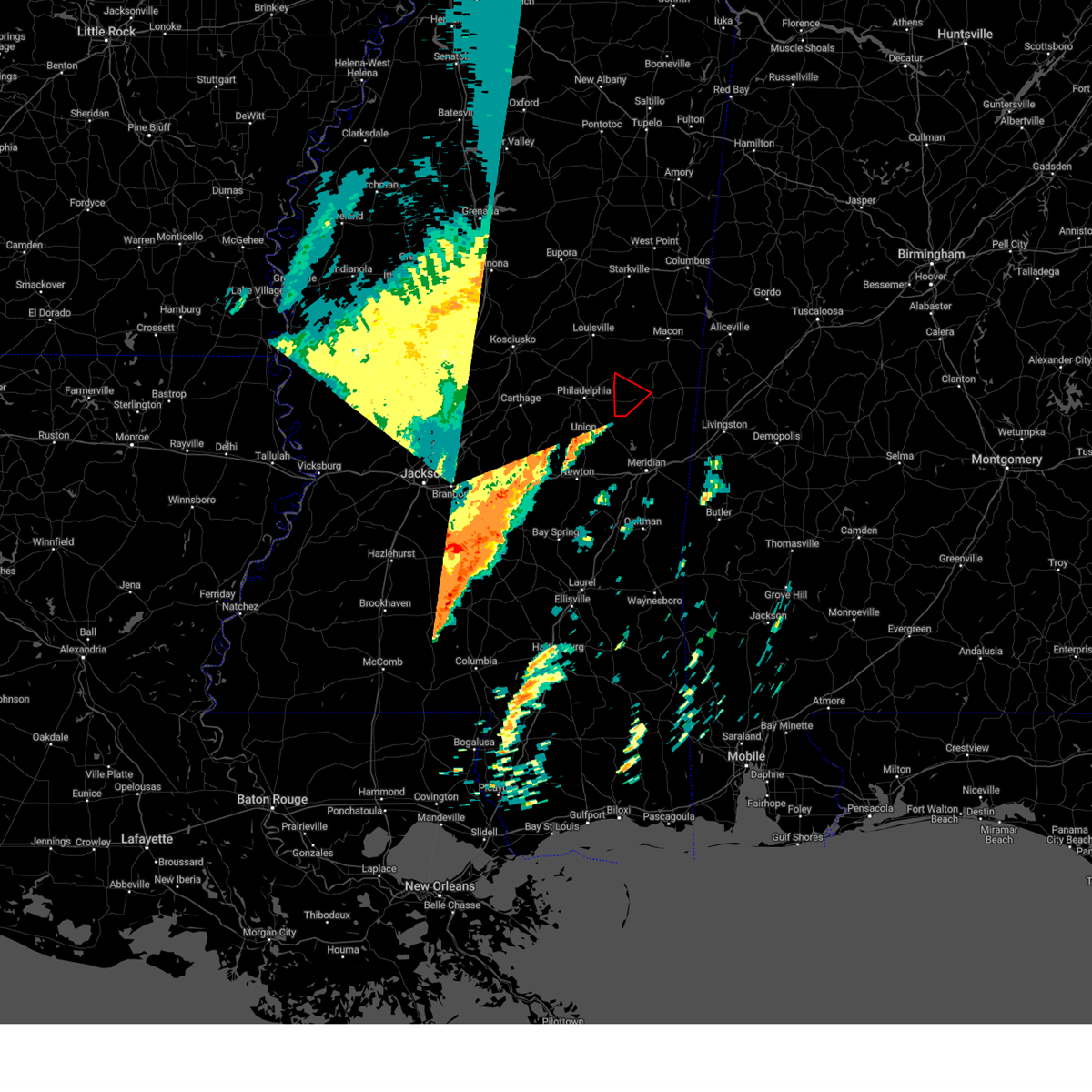 At 330 am cdt, a severe thunderstorm capable of producing a tornado was located near bluff springs, or 12 miles west of de kalb, moving northeast at 40 mph (radar indicated rotation). Hazards include tornado. Flying debris will be dangerous to those caught without shelter. mobile homes will be damaged or destroyed. damage to roofs, windows, and vehicles will occur. tree damage is likely. This dangerous storm will be near, bluff springs around 335 am cdt. At 330 am cdt, a severe thunderstorm capable of producing a tornado was located near bluff springs, or 12 miles west of de kalb, moving northeast at 40 mph (radar indicated rotation). Hazards include tornado. Flying debris will be dangerous to those caught without shelter. mobile homes will be damaged or destroyed. damage to roofs, windows, and vehicles will occur. tree damage is likely. This dangerous storm will be near, bluff springs around 335 am cdt.
|
| 4/6/2025 3:14 AM CDT |
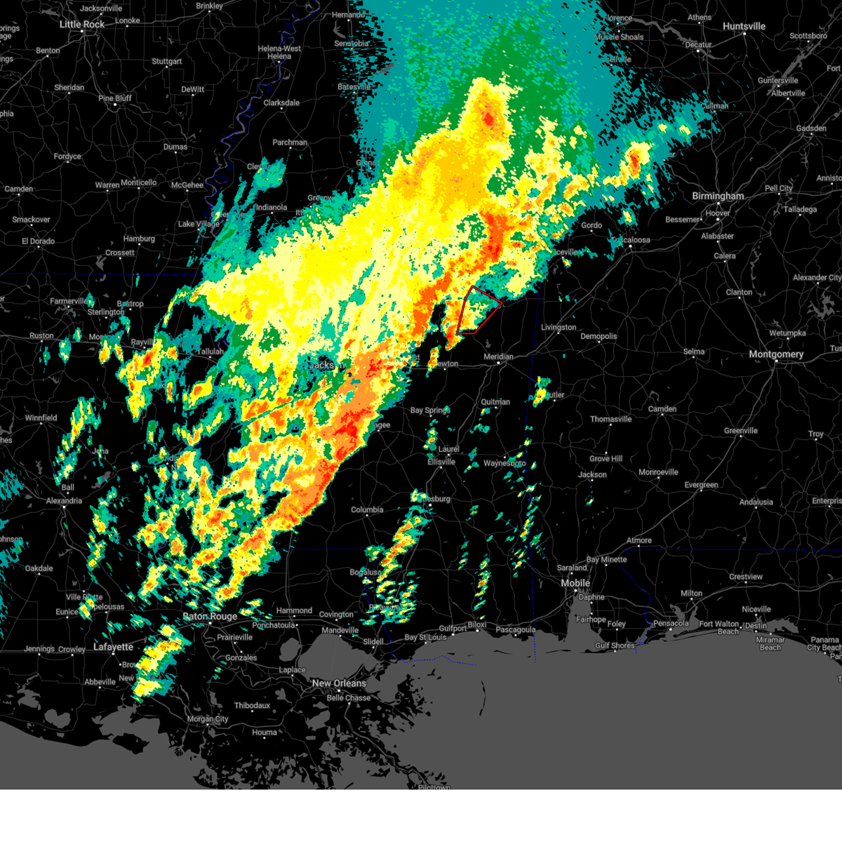 At 314 am cdt, a severe thunderstorm capable of producing a tornado was located over house, or near union, moving northeast at 35 mph (radar indicated rotation). Hazards include tornado. Flying debris will be dangerous to those caught without shelter. mobile homes will be damaged or destroyed. damage to roofs, windows, and vehicles will occur. tree damage is likely. this dangerous storm will be near, house, damascus, and herbert springs around 320 am cdt. forestdale around 325 am cdt. Bluff springs around 330 am cdt. At 314 am cdt, a severe thunderstorm capable of producing a tornado was located over house, or near union, moving northeast at 35 mph (radar indicated rotation). Hazards include tornado. Flying debris will be dangerous to those caught without shelter. mobile homes will be damaged or destroyed. damage to roofs, windows, and vehicles will occur. tree damage is likely. this dangerous storm will be near, house, damascus, and herbert springs around 320 am cdt. forestdale around 325 am cdt. Bluff springs around 330 am cdt.
|
| 4/6/2025 2:59 AM CDT | Torjan the national weather service in jackson has issued a * tornado warning for, southwestern kemper county in east central mississippi, southeastern neshoba county in east central mississippi, * until 400 am cdt. * at 259 am cdt, a severe thunderstorm capable of producing a tornado was located over stratton, or near decatur, moving northeast at 35 mph (radar indicated rotation). Hazards include tornado. Flying debris will be dangerous to those caught without shelter. mobile homes will be damaged or destroyed. damage to roofs, windows, and vehicles will occur. tree damage is likely. this dangerous storm will be near, house, neshoba, and union around 305 am cdt. bethsaida and herbert springs around 310 am cdt. tucker around 315 am cdt. forestdale and damascus around 325 am cdt. Bluff springs around 330 am cdt. |
| 4/6/2025 2:01 AM CDT |
 the severe thunderstorm warning has been cancelled and is no longer in effect the severe thunderstorm warning has been cancelled and is no longer in effect
|
| 4/6/2025 2:01 AM CDT |
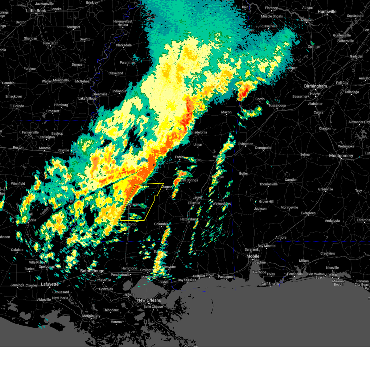 At 201 am cdt, severe thunderstorms were located along a line extending from hopewell to near center point, moving east at 25 mph (radar indicated). Hazards include 60 mph wind gusts and quarter size hail. Hail damage to vehicles is expected. expect wind damage to roofs, siding, and trees. these severe storms will be near, bogue chitto, hopewell, brookhaven, georgetown, and enterprise around 205 am cdt. rockport and union around 210 am cdt. sontag and oma around 215 am cdt. east lincoln around 220 am cdt. ruth and wanilla around 225 am cdt. pinola around 230 am cdt. mendenhall and shivers around 235 am cdt. Monticello, new hebron, and topeka around 240 am cdt. At 201 am cdt, severe thunderstorms were located along a line extending from hopewell to near center point, moving east at 25 mph (radar indicated). Hazards include 60 mph wind gusts and quarter size hail. Hail damage to vehicles is expected. expect wind damage to roofs, siding, and trees. these severe storms will be near, bogue chitto, hopewell, brookhaven, georgetown, and enterprise around 205 am cdt. rockport and union around 210 am cdt. sontag and oma around 215 am cdt. east lincoln around 220 am cdt. ruth and wanilla around 225 am cdt. pinola around 230 am cdt. mendenhall and shivers around 235 am cdt. Monticello, new hebron, and topeka around 240 am cdt.
|
| 4/6/2025 1:40 AM CDT |
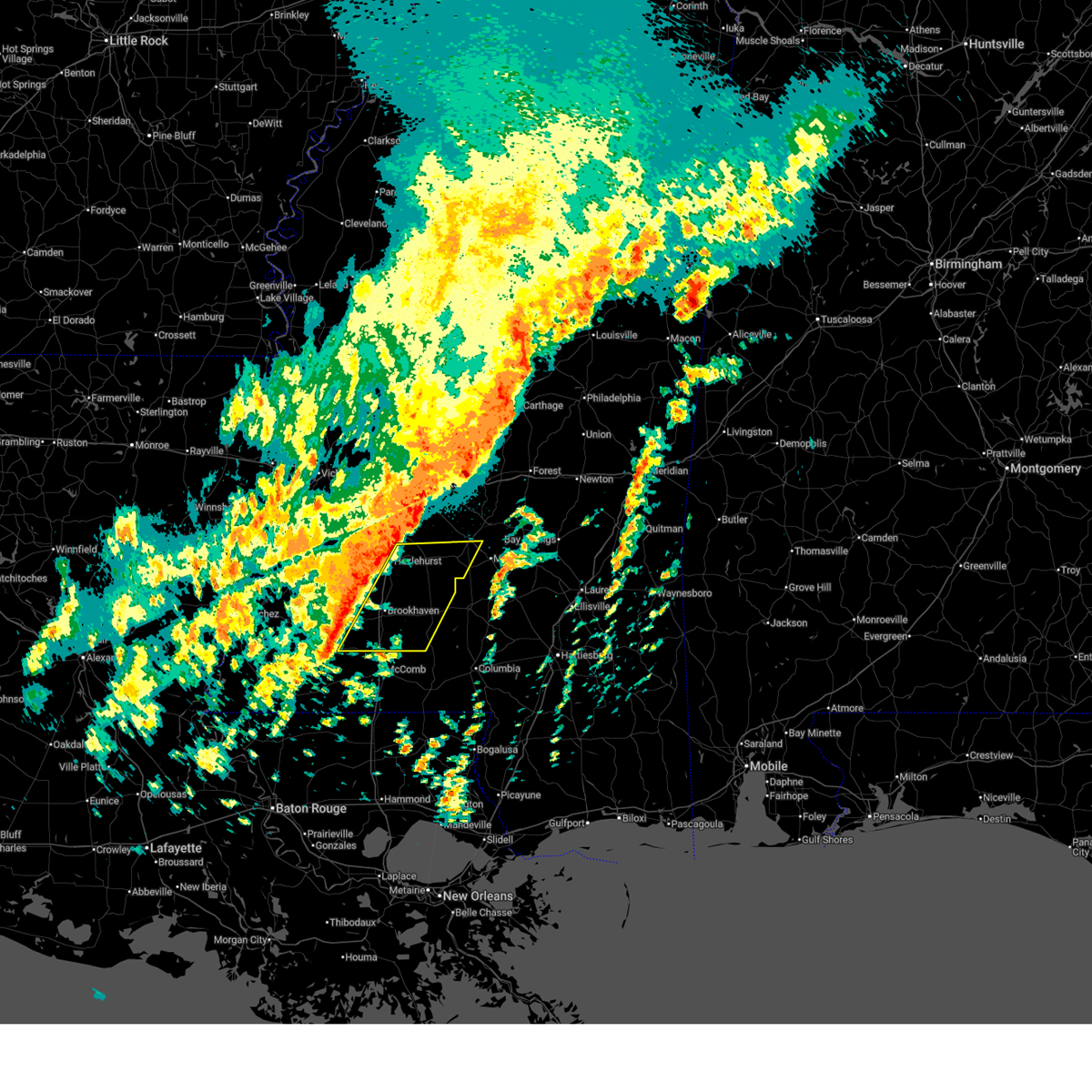 Svrjan the national weather service in jackson has issued a * severe thunderstorm warning for, central simpson county in central mississippi, lincoln county in south central mississippi, lawrence county in south central mississippi, southeastern franklin county in southwestern mississippi, southeastern copiah county in central mississippi, * until 245 am cdt. * at 139 am cdt, severe thunderstorms were located along a line extending from near gallman to smithdale, moving east at 25 mph (radar indicated). Hazards include 60 mph wind gusts. Expect damage to roofs, siding, and trees. severe thunderstorms will be near, hopewell, center point, west lincoln, brookhaven, martinsville, beauregard, hazlehurst, and wesson around 145 am cdt. bogue chitto around 155 am cdt. georgetown around 200 am cdt. rockport and enterprise around 205 am cdt. union around 210 am cdt. east lincoln, sontag, and oma around 215 am cdt. ruth and wanilla around 225 am cdt. Pinola around 230 am cdt. Svrjan the national weather service in jackson has issued a * severe thunderstorm warning for, central simpson county in central mississippi, lincoln county in south central mississippi, lawrence county in south central mississippi, southeastern franklin county in southwestern mississippi, southeastern copiah county in central mississippi, * until 245 am cdt. * at 139 am cdt, severe thunderstorms were located along a line extending from near gallman to smithdale, moving east at 25 mph (radar indicated). Hazards include 60 mph wind gusts. Expect damage to roofs, siding, and trees. severe thunderstorms will be near, hopewell, center point, west lincoln, brookhaven, martinsville, beauregard, hazlehurst, and wesson around 145 am cdt. bogue chitto around 155 am cdt. georgetown around 200 am cdt. rockport and enterprise around 205 am cdt. union around 210 am cdt. east lincoln, sontag, and oma around 215 am cdt. ruth and wanilla around 225 am cdt. Pinola around 230 am cdt.
|
| 3/31/2025 7:55 AM CDT |
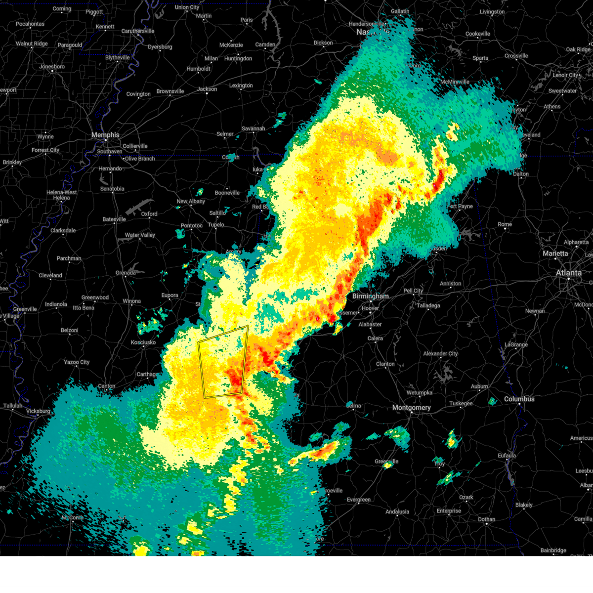 The storm which prompted the warning has moved out of the area. therefore, the warning will be allowed to expire. a severe thunderstorm watch remains in effect until 800 am cdt for east central mississippi. The storm which prompted the warning has moved out of the area. therefore, the warning will be allowed to expire. a severe thunderstorm watch remains in effect until 800 am cdt for east central mississippi.
|
| 3/31/2025 7:25 AM CDT |
 At 724 am cdt, a severe thunderstorm was located over shuqualak, or 10 miles south of macon, moving east at 60 mph (radar indicated). Hazards include 60 mph wind gusts and quarter size hail. Hail damage to vehicles is expected. expect wind damage to roofs, siding, and trees. This severe storm will be near, cooksville and paulette around 730 am cdt. At 724 am cdt, a severe thunderstorm was located over shuqualak, or 10 miles south of macon, moving east at 60 mph (radar indicated). Hazards include 60 mph wind gusts and quarter size hail. Hail damage to vehicles is expected. expect wind damage to roofs, siding, and trees. This severe storm will be near, cooksville and paulette around 730 am cdt.
|
| 3/31/2025 7:25 AM CDT |
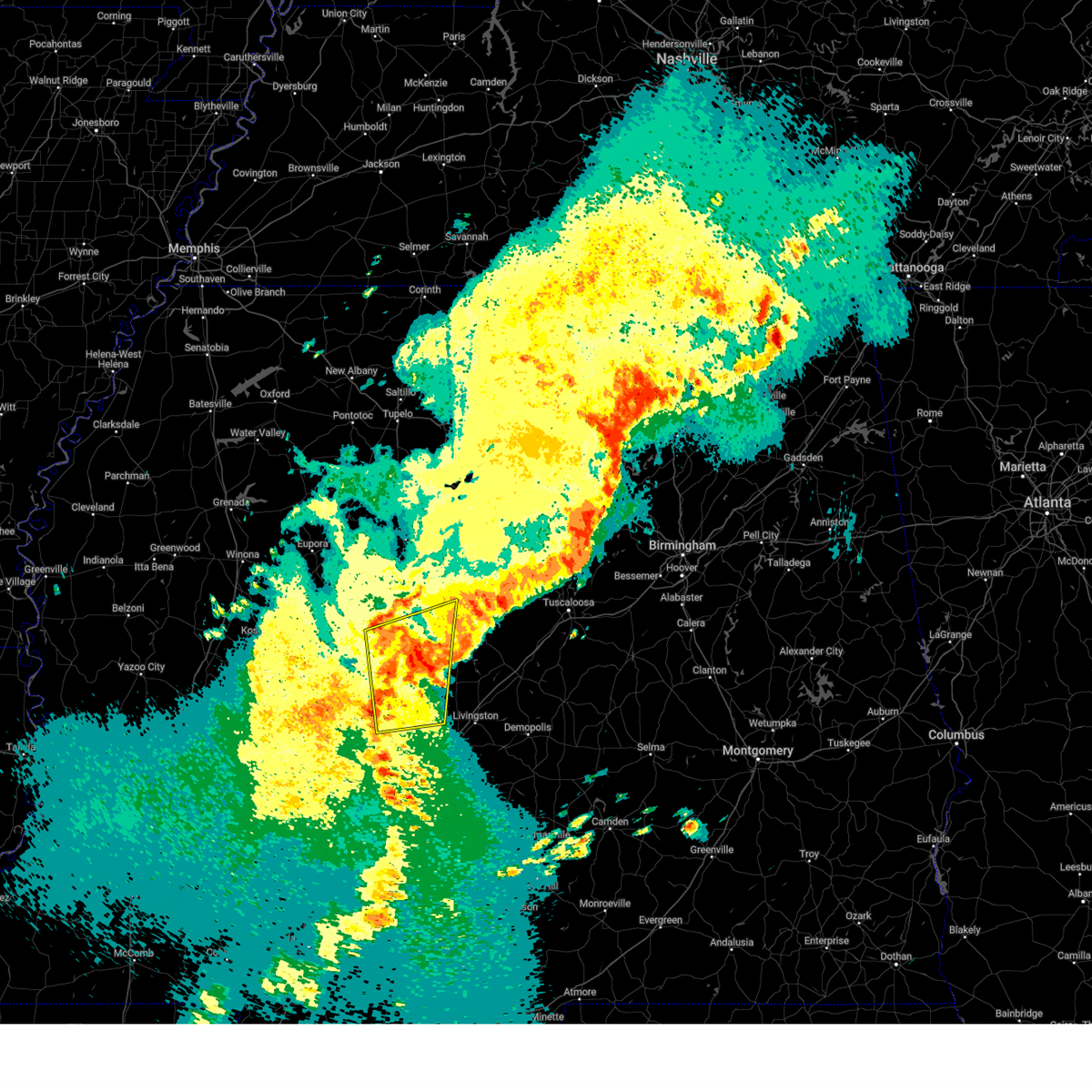 the severe thunderstorm warning has been cancelled and is no longer in effect the severe thunderstorm warning has been cancelled and is no longer in effect
|
| 3/31/2025 6:59 AM CDT |
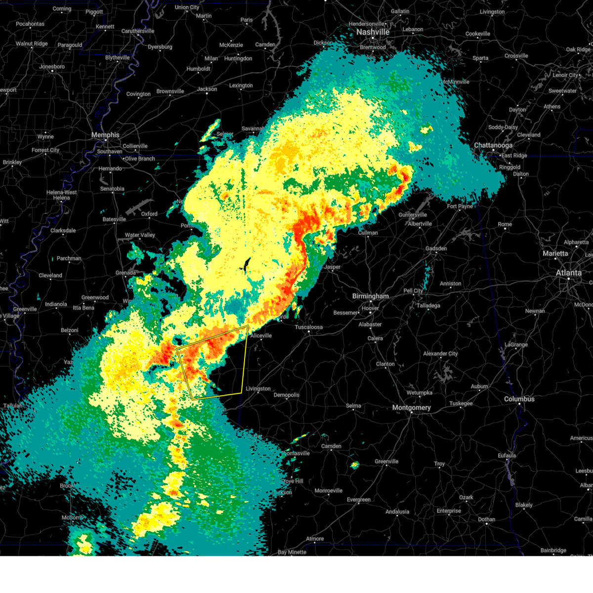 At 659 am cdt, a severe thunderstorm was located over nanih waiya, or 12 miles northeast of philadelphia, moving east at 40 mph (radar indicated). Hazards include 60 mph wind gusts. Expect damage to roofs, siding, and trees. this severe storm will be near, preston around 705 am cdt. gholson around 710 am cdt. shuqualak around 725 am cdt. paulette around 735 am cdt. Cooksville around 745 am cdt. At 659 am cdt, a severe thunderstorm was located over nanih waiya, or 12 miles northeast of philadelphia, moving east at 40 mph (radar indicated). Hazards include 60 mph wind gusts. Expect damage to roofs, siding, and trees. this severe storm will be near, preston around 705 am cdt. gholson around 710 am cdt. shuqualak around 725 am cdt. paulette around 735 am cdt. Cooksville around 745 am cdt.
|
| 3/31/2025 6:53 AM CDT |
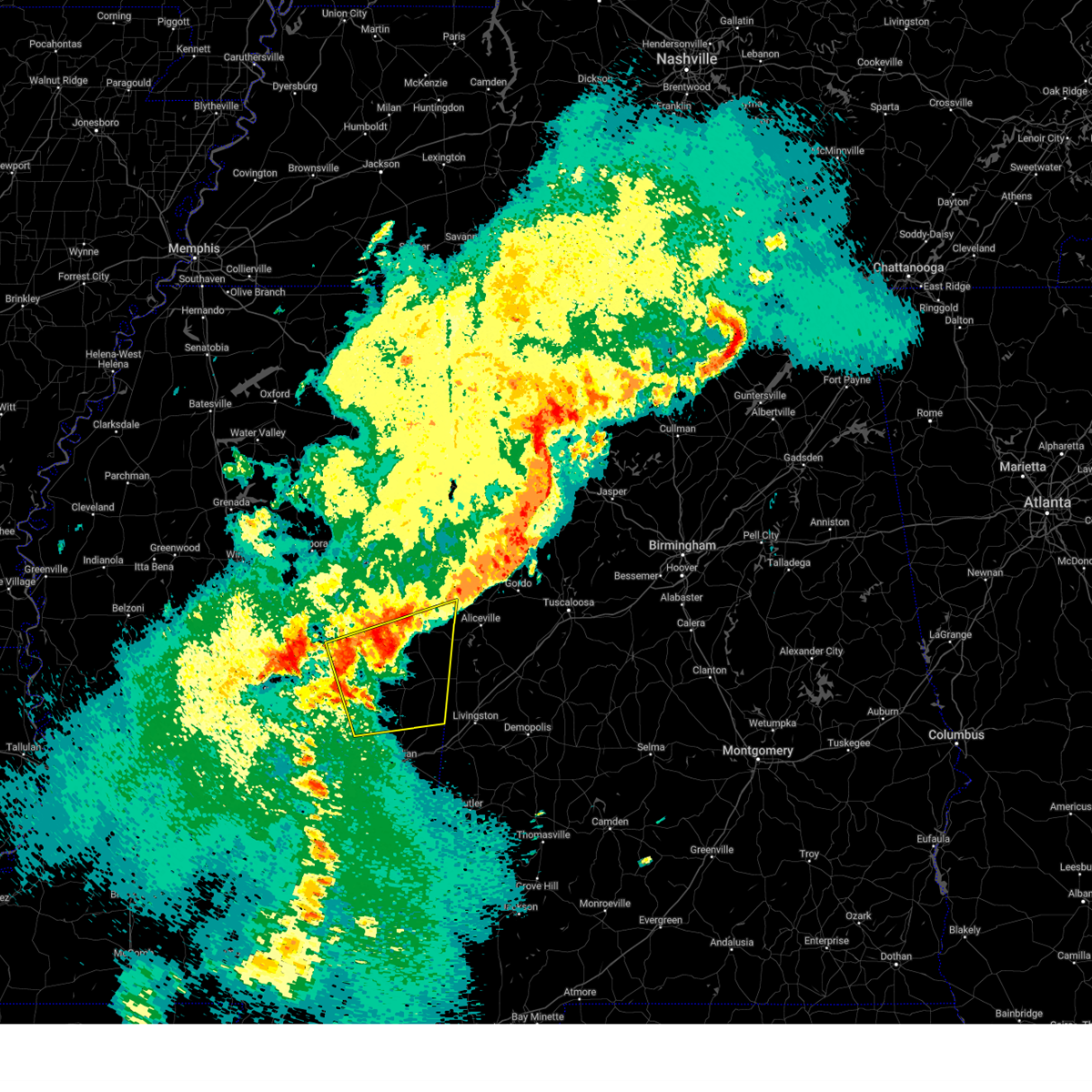 Svrjan the national weather service in jackson has issued a * severe thunderstorm warning for, noxubee county in east central mississippi, northeastern newton county in east central mississippi, kemper county in east central mississippi, southeastern winston county in east central mississippi, eastern neshoba county in east central mississippi, northwestern lauderdale county in east central mississippi, * until 800 am cdt. * at 653 am cdt, a severe thunderstorm was located near stallo, or 9 miles northeast of philadelphia, moving east at 40 mph (radar indicated). Hazards include 60 mph wind gusts. Expect damage to roofs, siding, and trees. this severe thunderstorm will be near, nanih waiya and preston around 700 am cdt. gholson around 710 am cdt. shuqualak around 725 am cdt. paulette around 735 am cdt. Cooksville around 740 am cdt. Svrjan the national weather service in jackson has issued a * severe thunderstorm warning for, noxubee county in east central mississippi, northeastern newton county in east central mississippi, kemper county in east central mississippi, southeastern winston county in east central mississippi, eastern neshoba county in east central mississippi, northwestern lauderdale county in east central mississippi, * until 800 am cdt. * at 653 am cdt, a severe thunderstorm was located near stallo, or 9 miles northeast of philadelphia, moving east at 40 mph (radar indicated). Hazards include 60 mph wind gusts. Expect damage to roofs, siding, and trees. this severe thunderstorm will be near, nanih waiya and preston around 700 am cdt. gholson around 710 am cdt. shuqualak around 725 am cdt. paulette around 735 am cdt. Cooksville around 740 am cdt.
|
| 3/31/2025 5:14 AM CDT |
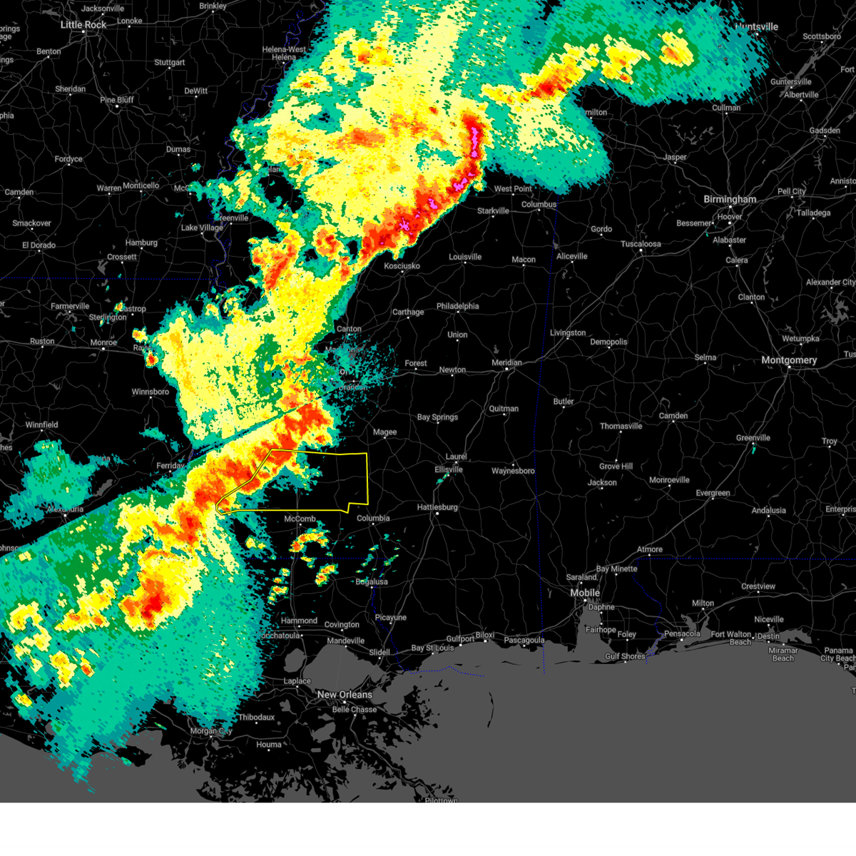 Svrjan the national weather service in jackson has issued a * severe thunderstorm warning for, lincoln county in south central mississippi, lawrence county in south central mississippi, southeastern jefferson county in southwestern mississippi, franklin county in southwestern mississippi, southern copiah county in central mississippi, western jefferson davis county in south central mississippi, * until 615 am cdt. * at 514 am cdt, a severe thunderstorm was located near loyd star, or 10 miles west of brookhaven, moving east at 50 mph (radar indicated). Hazards include 60 mph wind gusts and penny size hail. Expect damage to roofs, siding, and trees. this severe thunderstorm will be near, brookhaven and loyd star around 520 am cdt. wesson around 525 am cdt. east lincoln and sontag around 535 am cdt. monticello and wanilla around 540 am cdt. silver creek and robinwood around 545 am cdt. Arm and progress around 550 am cdt. Svrjan the national weather service in jackson has issued a * severe thunderstorm warning for, lincoln county in south central mississippi, lawrence county in south central mississippi, southeastern jefferson county in southwestern mississippi, franklin county in southwestern mississippi, southern copiah county in central mississippi, western jefferson davis county in south central mississippi, * until 615 am cdt. * at 514 am cdt, a severe thunderstorm was located near loyd star, or 10 miles west of brookhaven, moving east at 50 mph (radar indicated). Hazards include 60 mph wind gusts and penny size hail. Expect damage to roofs, siding, and trees. this severe thunderstorm will be near, brookhaven and loyd star around 520 am cdt. wesson around 525 am cdt. east lincoln and sontag around 535 am cdt. monticello and wanilla around 540 am cdt. silver creek and robinwood around 545 am cdt. Arm and progress around 550 am cdt.
|
| 3/15/2025 2:35 PM CDT |
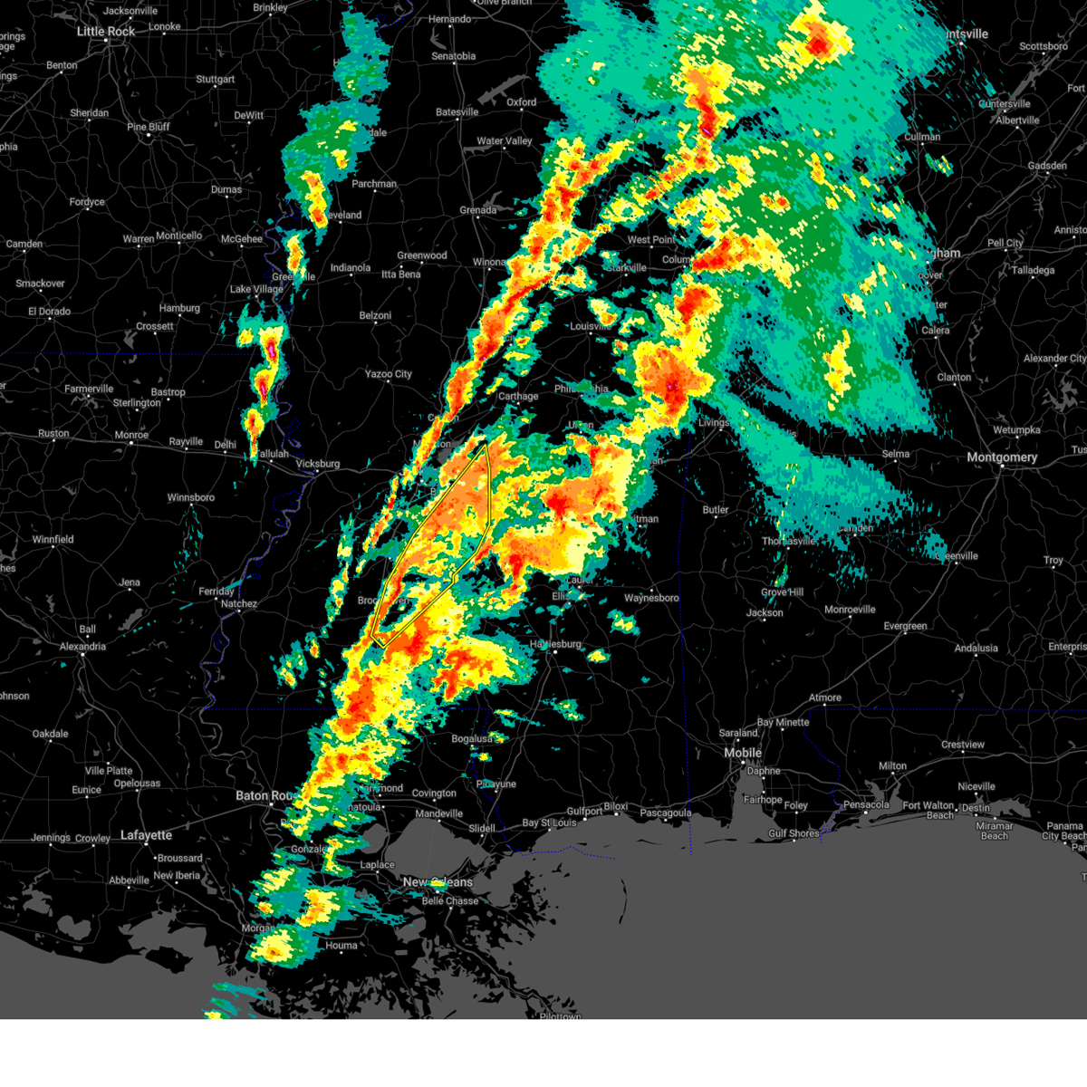 Svrjan the national weather service in jackson has issued a * severe thunderstorm warning for, southeastern rankin county in central mississippi, simpson county in central mississippi, eastern lincoln county in south central mississippi, northern lawrence county in south central mississippi, eastern copiah county in central mississippi, * until 315 pm cdt. * at 235 pm cdt, severe thunderstorms were located along a line extending from near harrisville to near brookhaven, moving northeast at 45 mph (radar indicated). Hazards include 60 mph wind gusts. Expect damage to roofs, siding, and trees. severe thunderstorms will be near, hopewell, rockport, star, harrisville, and georgetown around 240 pm cdt. jackson, sontag, union, and piney woods around 245 pm cdt. Braxton and oma around 255 pm cdt. Svrjan the national weather service in jackson has issued a * severe thunderstorm warning for, southeastern rankin county in central mississippi, simpson county in central mississippi, eastern lincoln county in south central mississippi, northern lawrence county in south central mississippi, eastern copiah county in central mississippi, * until 315 pm cdt. * at 235 pm cdt, severe thunderstorms were located along a line extending from near harrisville to near brookhaven, moving northeast at 45 mph (radar indicated). Hazards include 60 mph wind gusts. Expect damage to roofs, siding, and trees. severe thunderstorms will be near, hopewell, rockport, star, harrisville, and georgetown around 240 pm cdt. jackson, sontag, union, and piney woods around 245 pm cdt. Braxton and oma around 255 pm cdt.
|
| 3/15/2025 3:50 AM CDT |
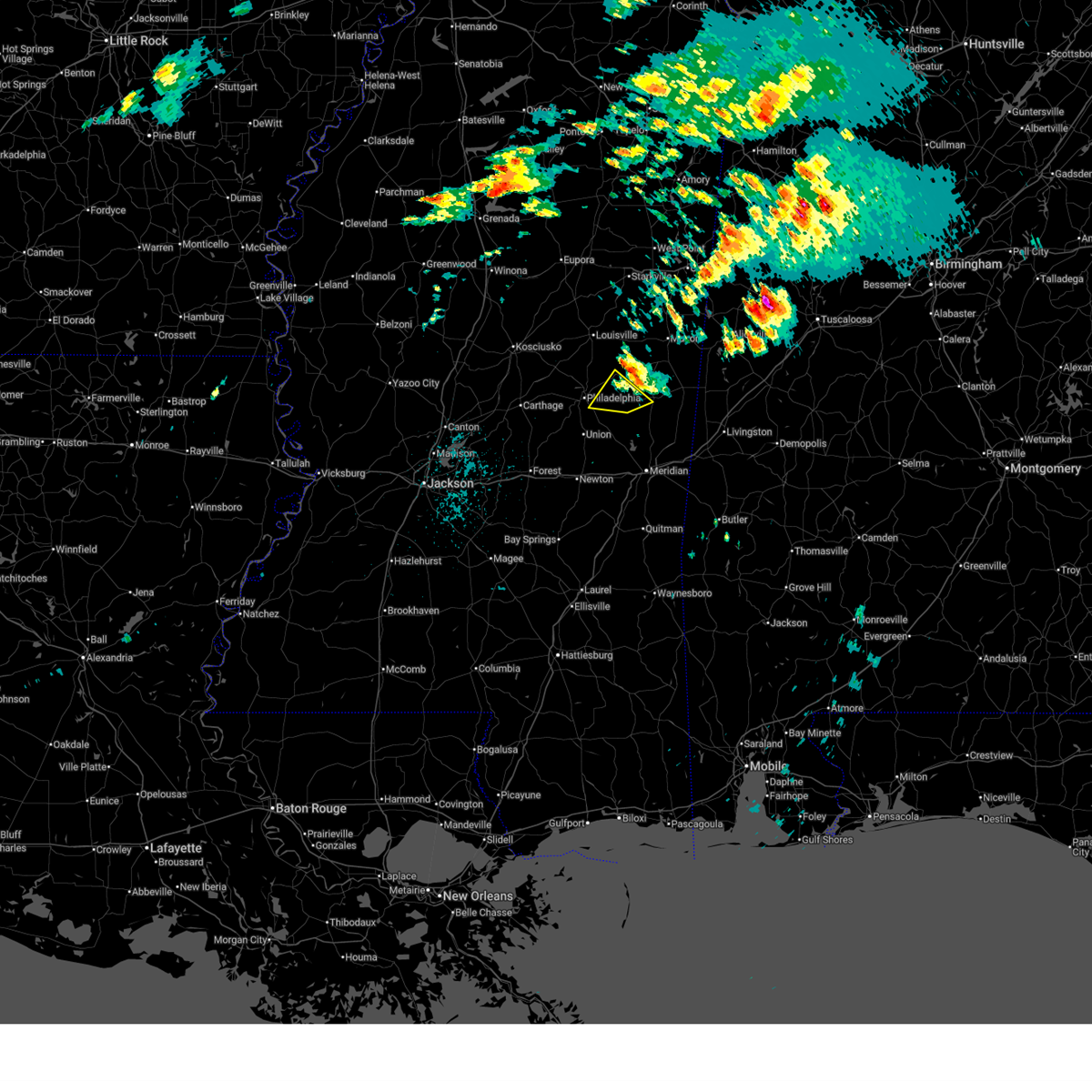 The storm which prompted the warning has weakened below severe limits, and has exited the warned area. therefore, the warning will be allowed to expire. a tornado watch remains in effect until 500 am cdt for east central mississippi. The storm which prompted the warning has weakened below severe limits, and has exited the warned area. therefore, the warning will be allowed to expire. a tornado watch remains in effect until 500 am cdt for east central mississippi.
|
| 3/15/2025 3:37 AM CDT |
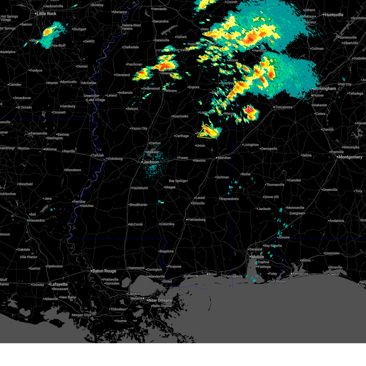 At 337 am cdt, a severe thunderstorm was located over forestdale, or 11 miles east of philadelphia, moving northeast at 45 mph (radar indicated). Hazards include 60 mph wind gusts and quarter size hail. Hail damage to vehicles is expected. expect wind damage to roofs, siding, and trees. This severe storm will be near, forestdale and bluff springs around 340 am cdt. At 337 am cdt, a severe thunderstorm was located over forestdale, or 11 miles east of philadelphia, moving northeast at 45 mph (radar indicated). Hazards include 60 mph wind gusts and quarter size hail. Hail damage to vehicles is expected. expect wind damage to roofs, siding, and trees. This severe storm will be near, forestdale and bluff springs around 340 am cdt.
|
| 3/15/2025 3:17 AM CDT |
 At 317 am cdt, a severe thunderstorm was located over union, moving northeast at 45 mph (radar indicated). Hazards include 60 mph wind gusts and quarter size hail. Hail damage to vehicles is expected. expect wind damage to roofs, siding, and trees. this severe storm will be near, house, bethsaida, herbert springs, and tucker around 320 am cdt. forestdale around 325 am cdt. Damascus and bluff springs around 335 am cdt. At 317 am cdt, a severe thunderstorm was located over union, moving northeast at 45 mph (radar indicated). Hazards include 60 mph wind gusts and quarter size hail. Hail damage to vehicles is expected. expect wind damage to roofs, siding, and trees. this severe storm will be near, house, bethsaida, herbert springs, and tucker around 320 am cdt. forestdale around 325 am cdt. Damascus and bluff springs around 335 am cdt.
|
| 3/15/2025 3:17 AM CDT |
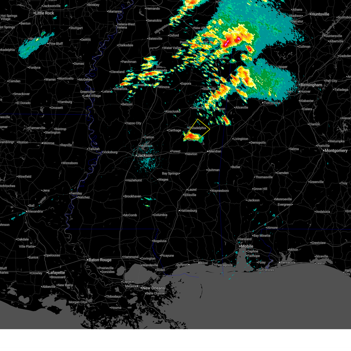 the severe thunderstorm warning has been cancelled and is no longer in effect the severe thunderstorm warning has been cancelled and is no longer in effect
|
| 3/15/2025 3:08 AM CDT |
 At 308 am cdt, a severe thunderstorm was located over stratton, or near union, moving northeast at 45 mph (radar indicated). Hazards include 60 mph wind gusts and quarter size hail. Hail damage to vehicles is expected. expect wind damage to roofs, siding, and trees. this severe storm will be near, house, bethsaida, little rock, tucker, neshoba, and union around 315 am cdt. herbert springs around 320 am cdt. forestdale around 325 am cdt. Damascus and bluff springs around 335 am cdt. At 308 am cdt, a severe thunderstorm was located over stratton, or near union, moving northeast at 45 mph (radar indicated). Hazards include 60 mph wind gusts and quarter size hail. Hail damage to vehicles is expected. expect wind damage to roofs, siding, and trees. this severe storm will be near, house, bethsaida, little rock, tucker, neshoba, and union around 315 am cdt. herbert springs around 320 am cdt. forestdale around 325 am cdt. Damascus and bluff springs around 335 am cdt.
|
| 3/15/2025 2:57 AM CDT |
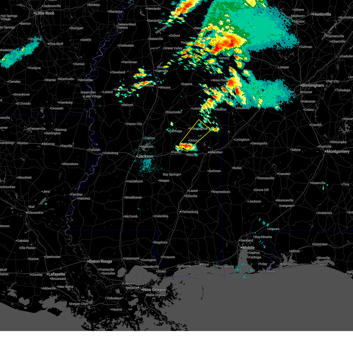 Svrjan the national weather service in jackson has issued a * severe thunderstorm warning for, northern newton county in east central mississippi, southwestern kemper county in east central mississippi, southeastern neshoba county in east central mississippi, * until 400 am cdt. * at 257 am cdt, a severe thunderstorm was located over conehatta, or 8 miles west of decatur, moving northeast at 40 mph (radar indicated). Hazards include 60 mph wind gusts and quarter size hail. Hail damage to vehicles is expected. expect wind damage to roofs, siding, and trees. this severe thunderstorm will be near, stratton, decatur, prospect, and union around 300 am cdt. neshoba around 305 am cdt. little rock around 310 am cdt. house, bethsaida, and tucker around 315 am cdt. herbert springs around 320 am cdt. forestdale and damascus around 330 am cdt. Bluff springs around 335 am cdt. Svrjan the national weather service in jackson has issued a * severe thunderstorm warning for, northern newton county in east central mississippi, southwestern kemper county in east central mississippi, southeastern neshoba county in east central mississippi, * until 400 am cdt. * at 257 am cdt, a severe thunderstorm was located over conehatta, or 8 miles west of decatur, moving northeast at 40 mph (radar indicated). Hazards include 60 mph wind gusts and quarter size hail. Hail damage to vehicles is expected. expect wind damage to roofs, siding, and trees. this severe thunderstorm will be near, stratton, decatur, prospect, and union around 300 am cdt. neshoba around 305 am cdt. little rock around 310 am cdt. house, bethsaida, and tucker around 315 am cdt. herbert springs around 320 am cdt. forestdale and damascus around 330 am cdt. Bluff springs around 335 am cdt.
|
| 3/15/2025 2:05 AM CDT |
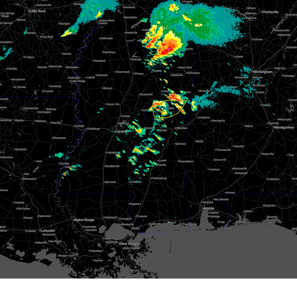 The storm which prompted the warning has weakened below severe limits, and has exited the warned area. therefore, the warning will be allowed to expire. a tornado watch remains in effect until 500 am cdt for east central mississippi. The storm which prompted the warning has weakened below severe limits, and has exited the warned area. therefore, the warning will be allowed to expire. a tornado watch remains in effect until 500 am cdt for east central mississippi.
|
| 3/15/2025 1:22 AM CDT |
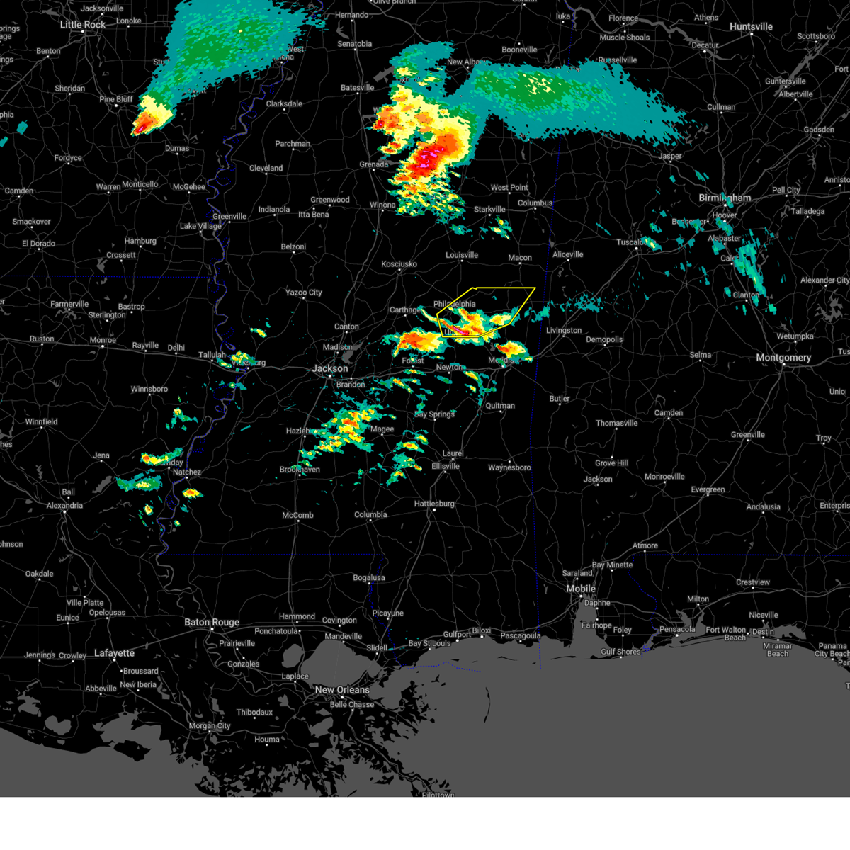 Svrjan the national weather service in jackson has issued a * severe thunderstorm warning for, western kemper county in east central mississippi, neshoba county in east central mississippi, * until 215 am cdt. * at 121 am cdt, a severe thunderstorm was located over bethsaida, or 7 miles northeast of union, moving northeast at 50 mph (radar indicated). Hazards include 60 mph wind gusts and half dollar size hail. Hail damage to vehicles is expected. expect wind damage to roofs, siding, and trees. this severe thunderstorm will be near, forestdale, damascus, herbert springs, and tucker around 125 am cdt. bluff springs around 130 am cdt. preston around 135 am cdt. De kalb around 145 am cdt. Svrjan the national weather service in jackson has issued a * severe thunderstorm warning for, western kemper county in east central mississippi, neshoba county in east central mississippi, * until 215 am cdt. * at 121 am cdt, a severe thunderstorm was located over bethsaida, or 7 miles northeast of union, moving northeast at 50 mph (radar indicated). Hazards include 60 mph wind gusts and half dollar size hail. Hail damage to vehicles is expected. expect wind damage to roofs, siding, and trees. this severe thunderstorm will be near, forestdale, damascus, herbert springs, and tucker around 125 am cdt. bluff springs around 130 am cdt. preston around 135 am cdt. De kalb around 145 am cdt.
|
| 3/9/2025 9:40 AM CDT |
 the severe thunderstorm warning has been cancelled and is no longer in effect the severe thunderstorm warning has been cancelled and is no longer in effect
|
| 3/9/2025 9:40 AM CDT |
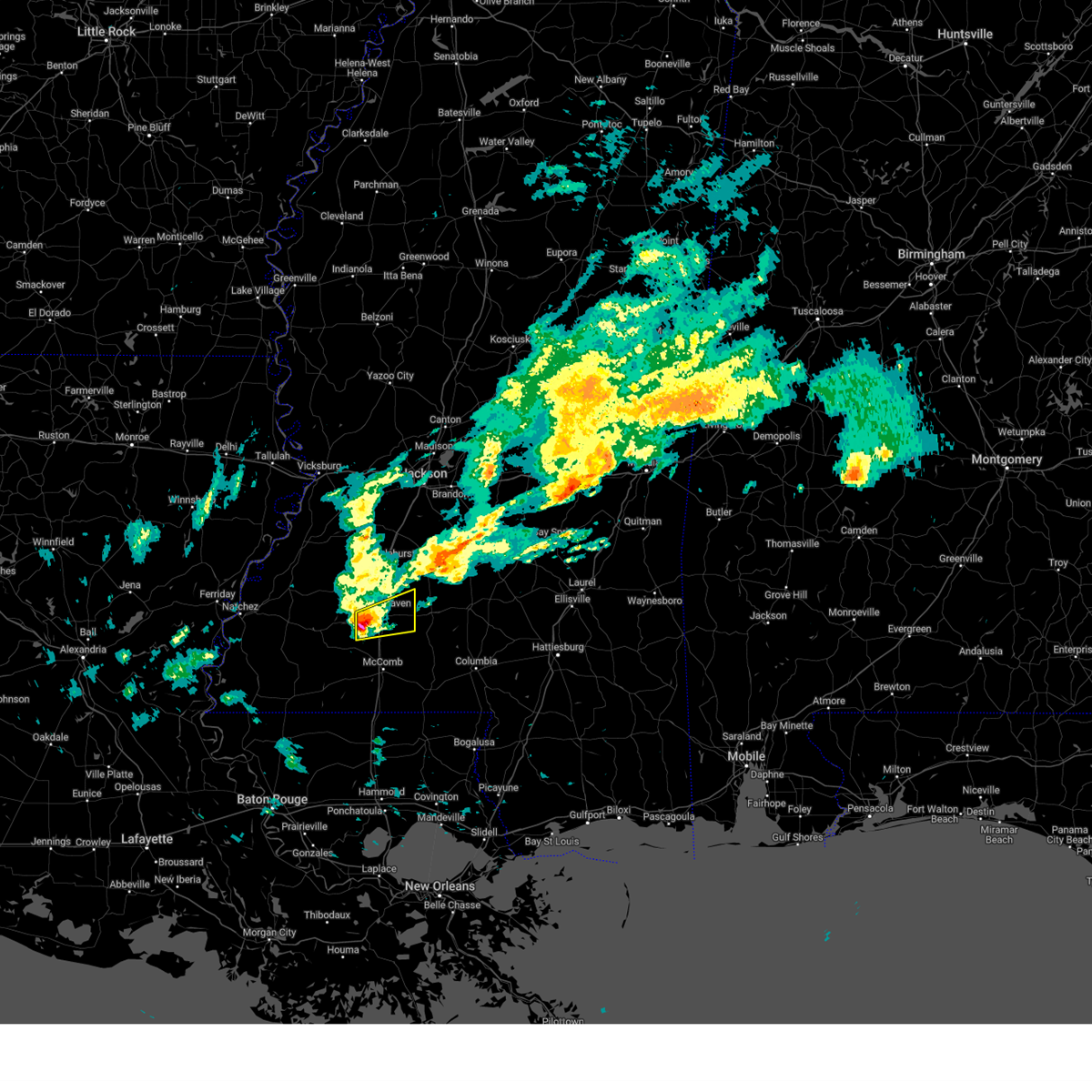 At 940 am cdt, a severe thunderstorm was located near west lincoln, or near brookhaven, moving east at 50 mph (radar indicated). Hazards include 60 mph wind gusts and half dollar size hail. Hail damage to vehicles is expected. expect wind damage to roofs, siding, and trees. This severe storm will be near, east lincoln, brookhaven, and enterprise around 945 am cdt. At 940 am cdt, a severe thunderstorm was located near west lincoln, or near brookhaven, moving east at 50 mph (radar indicated). Hazards include 60 mph wind gusts and half dollar size hail. Hail damage to vehicles is expected. expect wind damage to roofs, siding, and trees. This severe storm will be near, east lincoln, brookhaven, and enterprise around 945 am cdt.
|
| 3/9/2025 9:28 AM CDT |
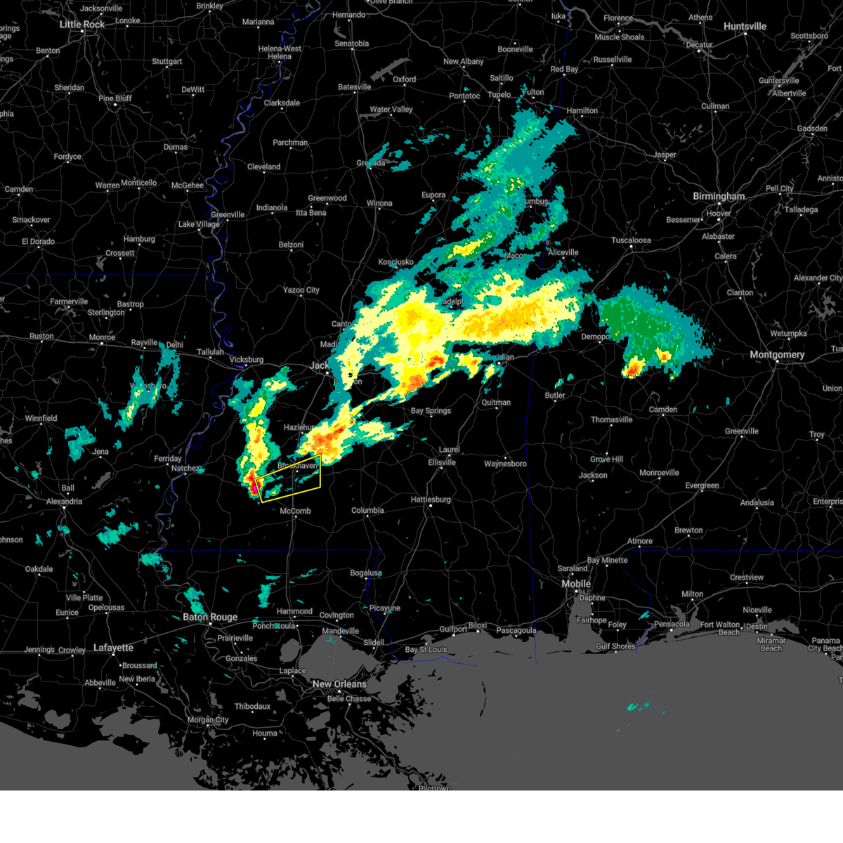 Svrjan the national weather service in jackson has issued a * severe thunderstorm warning for, central lincoln county in south central mississippi, southeastern franklin county in southwestern mississippi, * until 1015 am cdt. * at 928 am cdt, a severe thunderstorm was located near mccall creek, or 12 miles east of meadville, moving east at 50 mph (radar indicated). Hazards include 60 mph wind gusts and half dollar size hail. Hail damage to vehicles is expected. expect wind damage to roofs, siding, and trees. this severe thunderstorm will be near, bogue chitto, west lincoln, brookhaven, and vaughn around 935 am cdt. enterprise around 940 am cdt. East lincoln around 950 am cdt. Svrjan the national weather service in jackson has issued a * severe thunderstorm warning for, central lincoln county in south central mississippi, southeastern franklin county in southwestern mississippi, * until 1015 am cdt. * at 928 am cdt, a severe thunderstorm was located near mccall creek, or 12 miles east of meadville, moving east at 50 mph (radar indicated). Hazards include 60 mph wind gusts and half dollar size hail. Hail damage to vehicles is expected. expect wind damage to roofs, siding, and trees. this severe thunderstorm will be near, bogue chitto, west lincoln, brookhaven, and vaughn around 935 am cdt. enterprise around 940 am cdt. East lincoln around 950 am cdt.
|
| 3/8/2025 9:57 PM CDT |
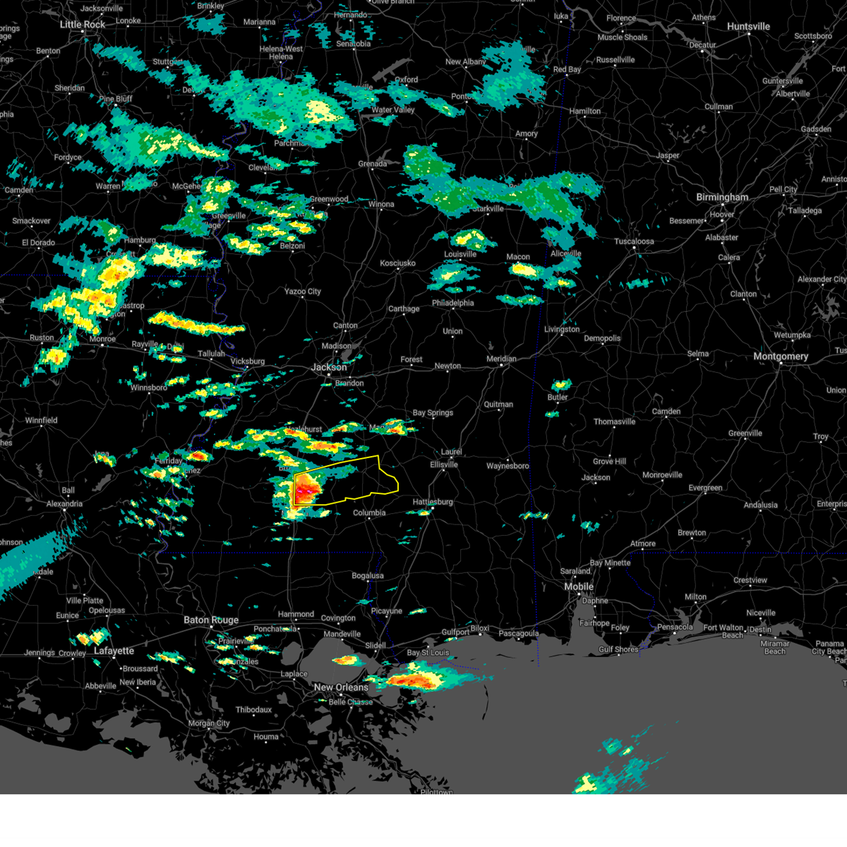 Svrjan the national weather service in jackson has issued a * severe thunderstorm warning for, southeastern lincoln county in south central mississippi, lawrence county in south central mississippi, jefferson davis county in south central mississippi, * until 945 pm cst. * at 857 pm cst, a severe thunderstorm was located over east lincoln, or 12 miles southwest of monticello, moving east at 45 mph (radar indicated). Hazards include 60 mph wind gusts and quarter size hail. Hail damage to vehicles is expected. expect wind damage to roofs, siding, and trees. this severe thunderstorm will be near, jayess, east lincoln, and topeka around 900 pm cst. monticello and robinwood around 905 pm cst. tilton and arm around 910 pm cst. silver creek, progress, and oak vale around 915 pm cst. prentiss around 920 pm cst. carson around 925 pm cst. Bassfield around 930 pm cst. Svrjan the national weather service in jackson has issued a * severe thunderstorm warning for, southeastern lincoln county in south central mississippi, lawrence county in south central mississippi, jefferson davis county in south central mississippi, * until 945 pm cst. * at 857 pm cst, a severe thunderstorm was located over east lincoln, or 12 miles southwest of monticello, moving east at 45 mph (radar indicated). Hazards include 60 mph wind gusts and quarter size hail. Hail damage to vehicles is expected. expect wind damage to roofs, siding, and trees. this severe thunderstorm will be near, jayess, east lincoln, and topeka around 900 pm cst. monticello and robinwood around 905 pm cst. tilton and arm around 910 pm cst. silver creek, progress, and oak vale around 915 pm cst. prentiss around 920 pm cst. carson around 925 pm cst. Bassfield around 930 pm cst.
|
| 3/4/2025 5:58 PM CST |
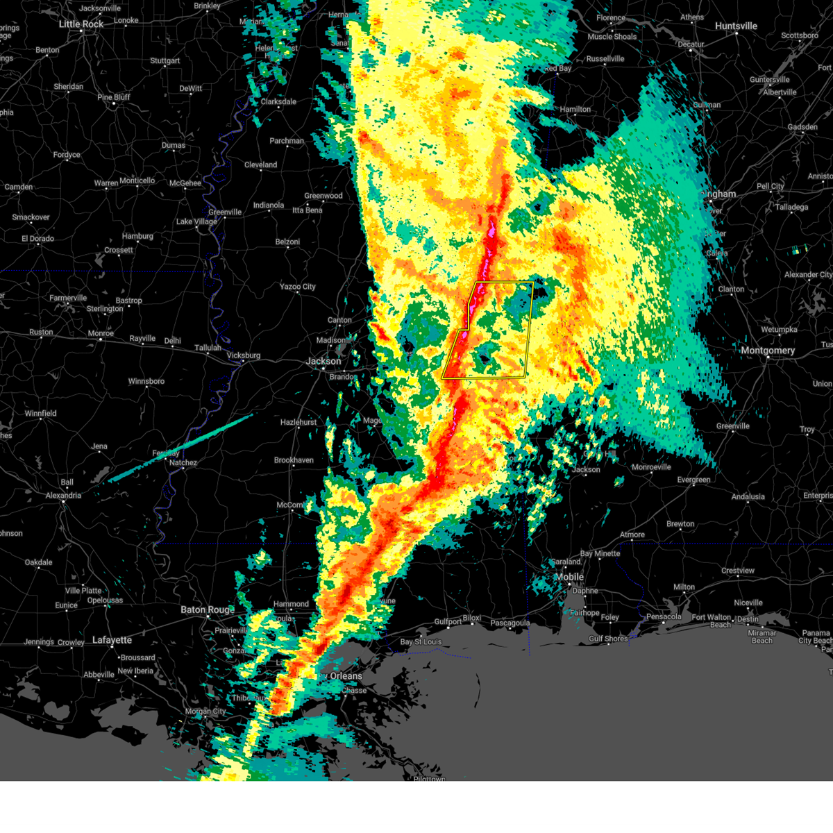 Svrjan the national weather service in jackson has issued a * severe thunderstorm warning for, eastern newton county in east central mississippi, kemper county in east central mississippi, lauderdale county in east central mississippi, * until 715 pm cst. * at 558 pm cst, severe thunderstorms were located along a line extending from near gholson to near chunky, moving east at 40 mph (radar indicated). Hazards include 60 mph wind gusts. Expect damage to roofs, siding, and trees. severe thunderstorms will be near, collinsville, daleville, meehan, meridian, savoy, suqualena, blackwater, nellieburg, de kalb, and liberty around 605 pm cst. marion and meridian station around 610 pm cst. zero, scooba, and electric mills around 615 pm cst. tamola, porterville, and lauderdale around 620 pm cst. toomsuba around 625 pm cst. Alamucha and kewanee around 630 pm cst. Svrjan the national weather service in jackson has issued a * severe thunderstorm warning for, eastern newton county in east central mississippi, kemper county in east central mississippi, lauderdale county in east central mississippi, * until 715 pm cst. * at 558 pm cst, severe thunderstorms were located along a line extending from near gholson to near chunky, moving east at 40 mph (radar indicated). Hazards include 60 mph wind gusts. Expect damage to roofs, siding, and trees. severe thunderstorms will be near, collinsville, daleville, meehan, meridian, savoy, suqualena, blackwater, nellieburg, de kalb, and liberty around 605 pm cst. marion and meridian station around 610 pm cst. zero, scooba, and electric mills around 615 pm cst. tamola, porterville, and lauderdale around 620 pm cst. toomsuba around 625 pm cst. Alamucha and kewanee around 630 pm cst.
|
| 3/4/2025 3:53 PM CST |
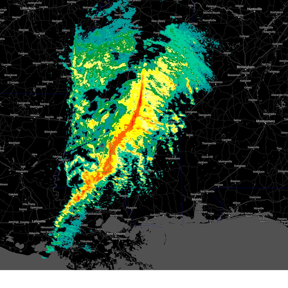 The storms which prompted the warning is exiting the warned area. therefore, the warning will be allowed to expire. a tornado watch remains in effect until 700 pm cst for central and south central mississippi. The storms which prompted the warning is exiting the warned area. therefore, the warning will be allowed to expire. a tornado watch remains in effect until 700 pm cst for central and south central mississippi.
|
| 3/4/2025 3:52 PM CST | Couple trees down on roads in the s part of the count in lincoln county MS, 7.8 miles NW of Bogue Chitto, MS |
| 3/4/2025 3:38 PM CST |
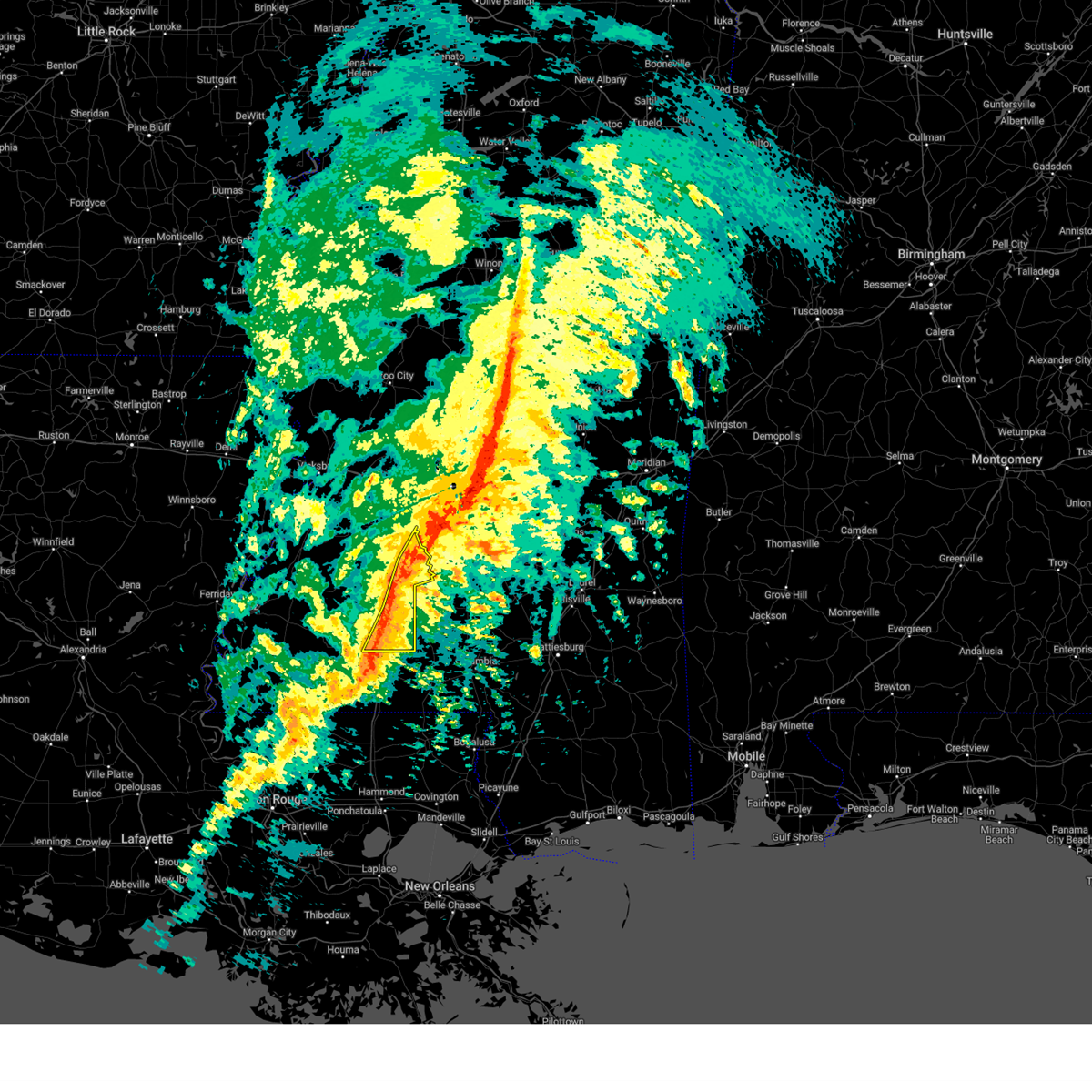 At 338 pm cst, severe thunderstorms were located along a line extending from near georgetown to near sontag to near bogue chitto, moving east at 20 mph (radar indicated). Hazards include 60 mph wind gusts. Expect damage to roofs, siding, and trees. These severe storms will be near, east lincoln, rockport, ruth, georgetown, and enterprise around 345 pm cst. At 338 pm cst, severe thunderstorms were located along a line extending from near georgetown to near sontag to near bogue chitto, moving east at 20 mph (radar indicated). Hazards include 60 mph wind gusts. Expect damage to roofs, siding, and trees. These severe storms will be near, east lincoln, rockport, ruth, georgetown, and enterprise around 345 pm cst.
|
| 3/4/2025 3:31 PM CST |
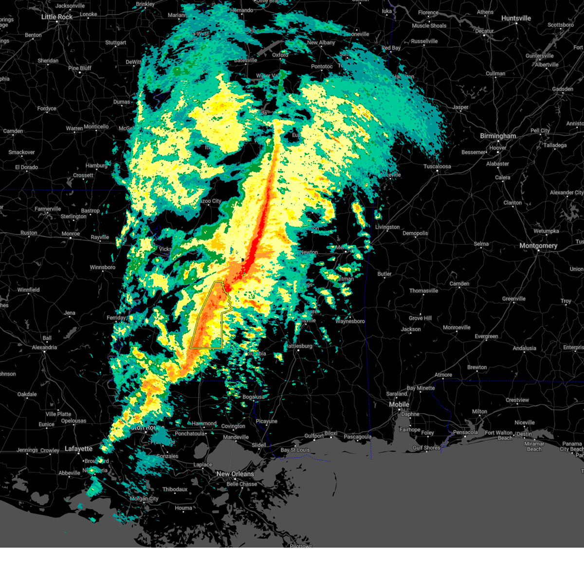 the severe thunderstorm warning has been cancelled and is no longer in effect the severe thunderstorm warning has been cancelled and is no longer in effect
|
| 3/4/2025 3:31 PM CST |
 At 330 pm cst, severe thunderstorms were located along a line extending from piney woods to near beauregard to near bogue chitto, moving east at 30 mph (radar indicated). Hazards include 60 mph wind gusts. Expect damage to roofs, siding, and trees. these severe storms will be near, bogue chitto, east lincoln, rockport, georgetown, and enterprise around 335 pm cst. Ruth around 340 pm cst. At 330 pm cst, severe thunderstorms were located along a line extending from piney woods to near beauregard to near bogue chitto, moving east at 30 mph (radar indicated). Hazards include 60 mph wind gusts. Expect damage to roofs, siding, and trees. these severe storms will be near, bogue chitto, east lincoln, rockport, georgetown, and enterprise around 335 pm cst. Ruth around 340 pm cst.
|
| 3/4/2025 3:16 PM CST | A couple trees dow in franklin county MS, 12.1 miles E of Bogue Chitto, MS |
| 3/4/2025 3:16 PM CST |
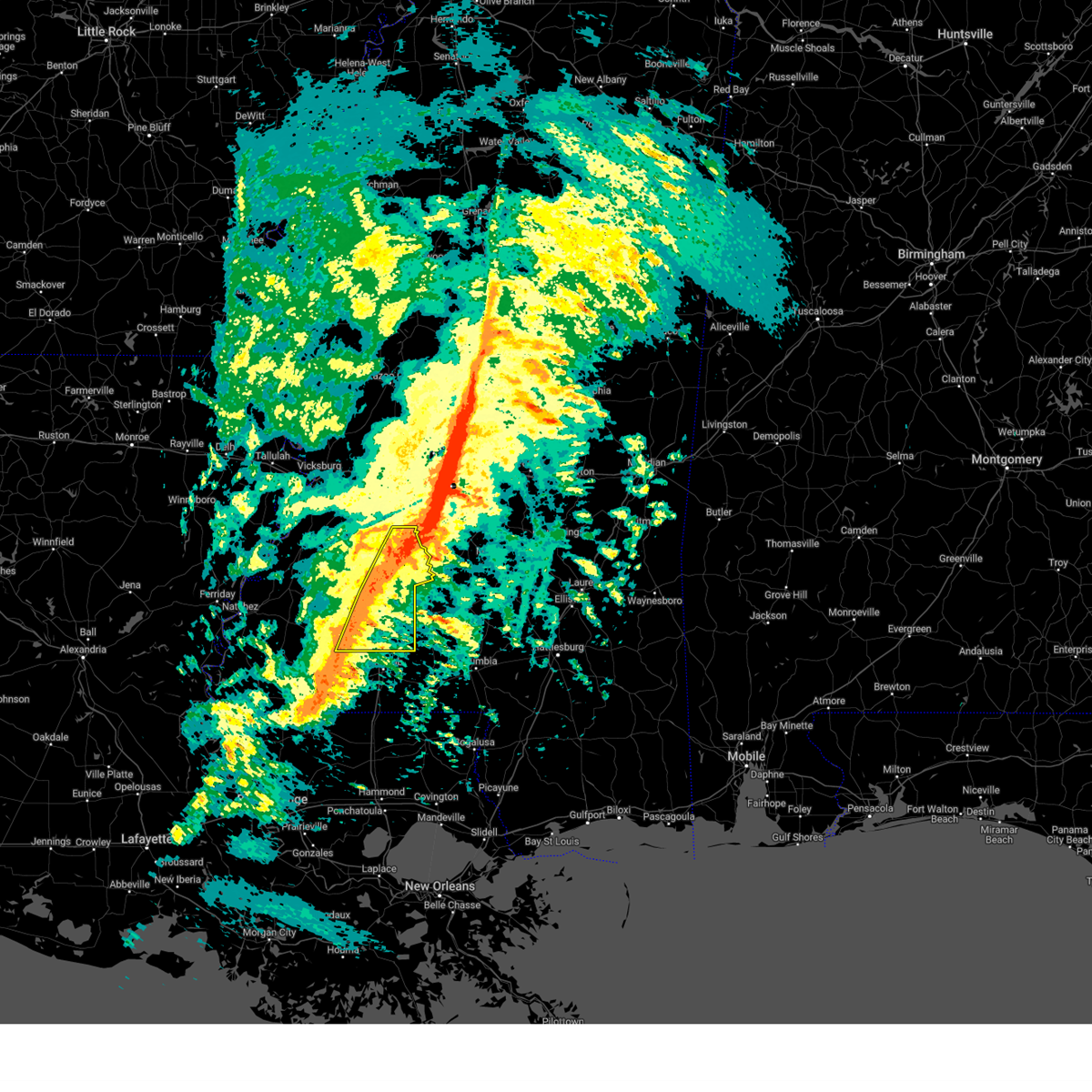 Svrjan the national weather service in jackson has issued a * severe thunderstorm warning for, lincoln county in south central mississippi, eastern franklin county in southwestern mississippi, central copiah county in central mississippi, * until 400 pm cst. * at 315 pm cst, severe thunderstorms were located along a line extending from near star to wesson to near center point, moving east at 30 mph (radar indicated). Hazards include 60 mph wind gusts. Expect damage to roofs, siding, and trees. severe thunderstorms will be near, bogue chitto, brookhaven, beauregard, georgetown, enterprise, and wesson around 320 pm cst. rockport around 325 pm cst. East lincoln and ruth around 335 pm cst. Svrjan the national weather service in jackson has issued a * severe thunderstorm warning for, lincoln county in south central mississippi, eastern franklin county in southwestern mississippi, central copiah county in central mississippi, * until 400 pm cst. * at 315 pm cst, severe thunderstorms were located along a line extending from near star to wesson to near center point, moving east at 30 mph (radar indicated). Hazards include 60 mph wind gusts. Expect damage to roofs, siding, and trees. severe thunderstorms will be near, bogue chitto, brookhaven, beauregard, georgetown, enterprise, and wesson around 320 pm cst. rockport around 325 pm cst. East lincoln and ruth around 335 pm cst.
|
| 3/4/2025 2:51 PM CST |
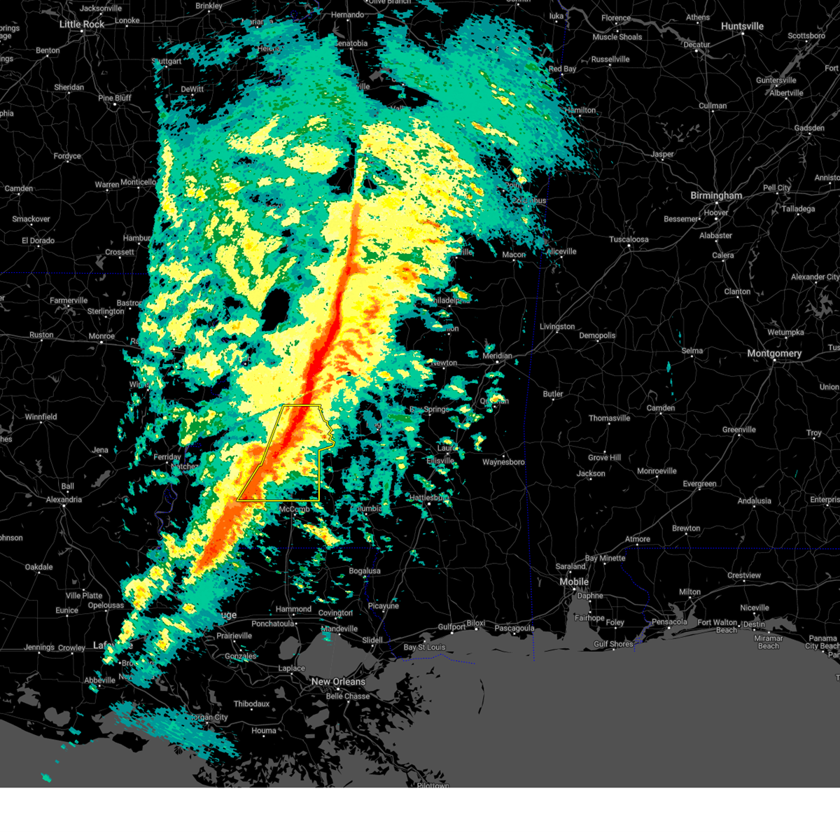 At 251 pm cst, severe thunderstorms were located along a line extending from near crystal springs to near loyd star to near smithdale, moving east at 35 mph (radar indicated). Hazards include 60 mph wind gusts. Expect damage to roofs, siding, and trees. these severe storms will be near, hopewell, center point, west lincoln, brookhaven, martinsville, beauregard, vaughn, crystal springs, hazlehurst, and wesson around 255 pm cst. bogue chitto and georgetown around 305 pm cst. rockport and enterprise around 310 pm cst. east lincoln around 320 pm cst. Ruth around 325 pm cst. At 251 pm cst, severe thunderstorms were located along a line extending from near crystal springs to near loyd star to near smithdale, moving east at 35 mph (radar indicated). Hazards include 60 mph wind gusts. Expect damage to roofs, siding, and trees. these severe storms will be near, hopewell, center point, west lincoln, brookhaven, martinsville, beauregard, vaughn, crystal springs, hazlehurst, and wesson around 255 pm cst. bogue chitto and georgetown around 305 pm cst. rockport and enterprise around 310 pm cst. east lincoln around 320 pm cst. Ruth around 325 pm cst.
|
| 3/4/2025 2:38 PM CST |
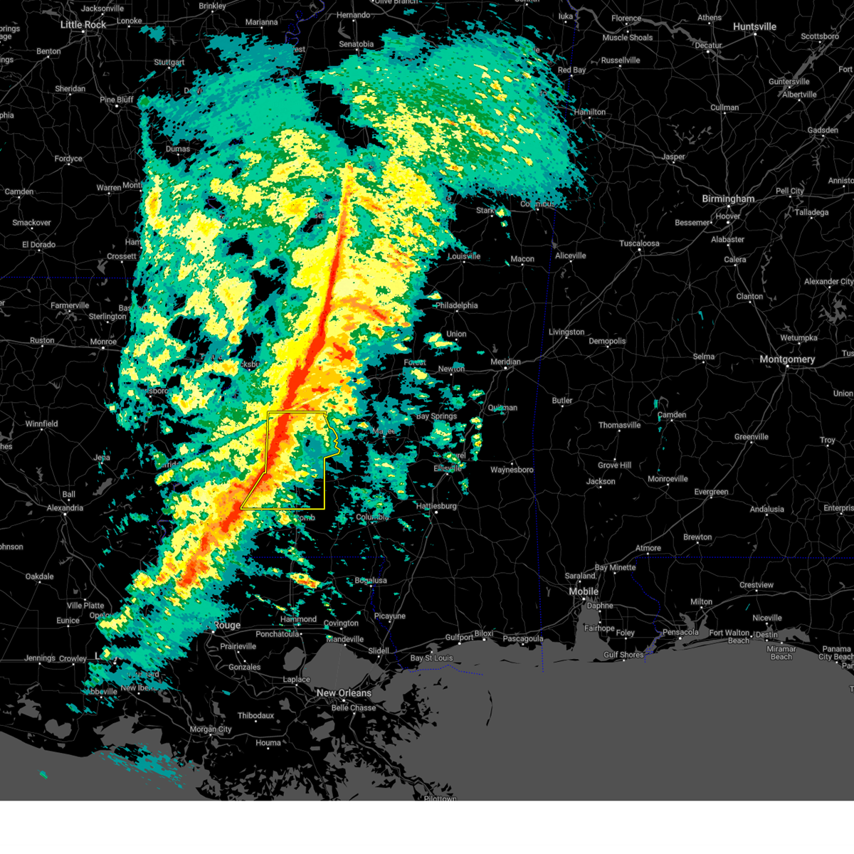 At 237 pm cst, severe thunderstorms were located along a line extending from 6 miles northeast of dentville to caseyville to 7 miles southwest of bude, moving east at 40 mph (radar indicated). Hazards include 60 mph wind gusts. Expect damage to roofs, siding, and trees. these severe storms will be near, mccall creek, glancy, caseyville, vaughn, crystal springs, gallman, hazlehurst, little springs, and loyd star around 245 pm cst. martinsville around 250 pm cst. center point, west lincoln, brookhaven, beauregard, and wesson around 255 pm cst. hopewell around 300 pm cst. bogue chitto and georgetown around 310 pm cst. rockport and enterprise around 315 pm cst. east lincoln around 320 pm cst. Ruth around 330 pm cst. At 237 pm cst, severe thunderstorms were located along a line extending from 6 miles northeast of dentville to caseyville to 7 miles southwest of bude, moving east at 40 mph (radar indicated). Hazards include 60 mph wind gusts. Expect damage to roofs, siding, and trees. these severe storms will be near, mccall creek, glancy, caseyville, vaughn, crystal springs, gallman, hazlehurst, little springs, and loyd star around 245 pm cst. martinsville around 250 pm cst. center point, west lincoln, brookhaven, beauregard, and wesson around 255 pm cst. hopewell around 300 pm cst. bogue chitto and georgetown around 310 pm cst. rockport and enterprise around 315 pm cst. east lincoln around 320 pm cst. Ruth around 330 pm cst.
|
| 3/4/2025 2:17 PM CST |
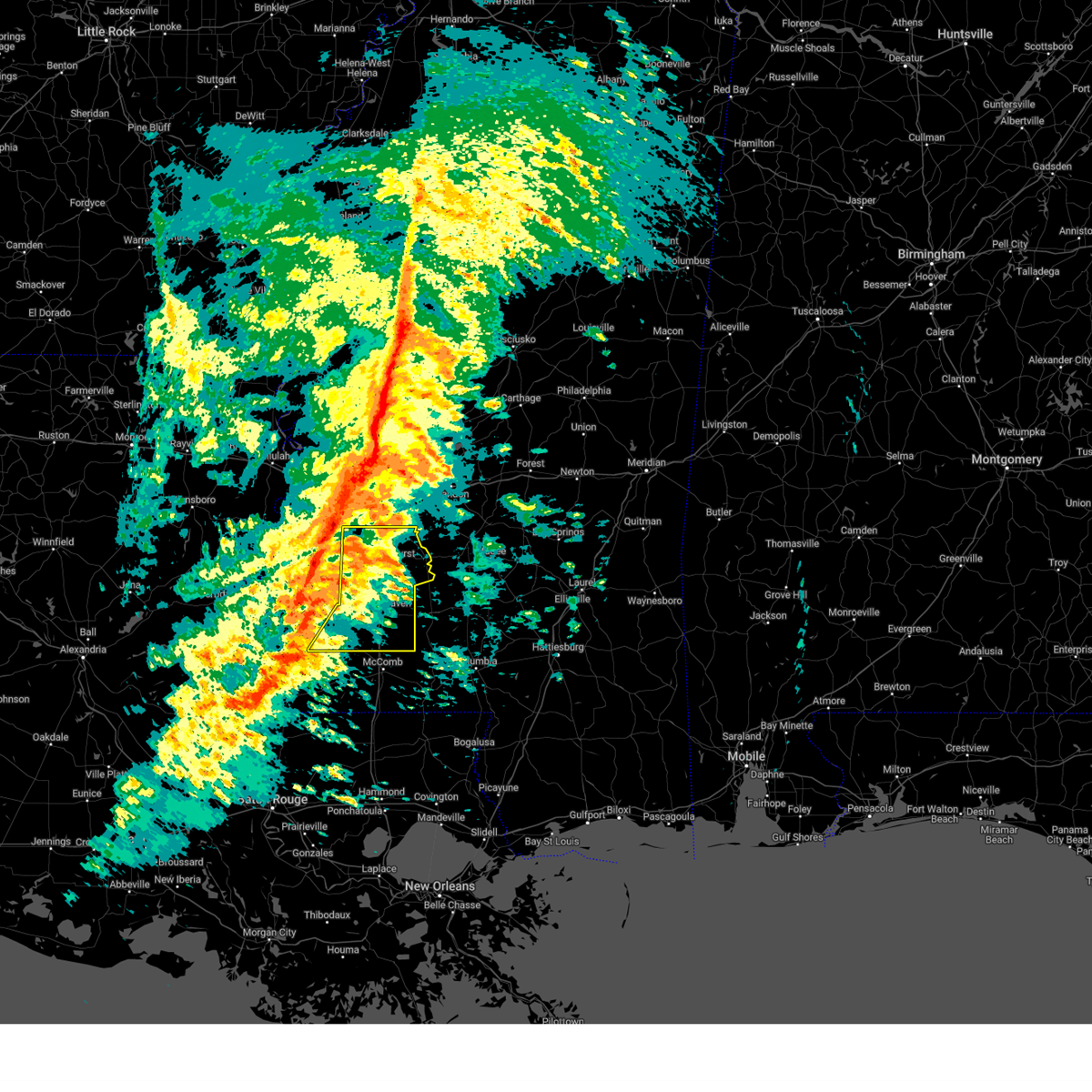 Svrjan the national weather service in jackson has issued a * severe thunderstorm warning for, lincoln county in south central mississippi, eastern franklin county in southwestern mississippi, copiah county in central mississippi, * until 330 pm cst. * at 217 pm cst, severe thunderstorms were located along a line extending from near carpenter to 6 miles east of mcnair to near garden city, moving east at 40 mph (radar indicated). Hazards include 60 mph wind gusts. Expect damage to roofs, siding, and trees. severe thunderstorms will be near, carpenter around 220 pm cst. bude around 225 pm cst. allen, dentville, and barlow around 230 pm cst. caseyville around 235 pm cst. mccall creek and little springs around 240 pm cst. glancy, vaughn, crystal springs, and loyd star around 245 pm cst. center point, west lincoln, gallman, and hazlehurst around 250 pm cst. Brookhaven and martinsville around 255 pm cst. Svrjan the national weather service in jackson has issued a * severe thunderstorm warning for, lincoln county in south central mississippi, eastern franklin county in southwestern mississippi, copiah county in central mississippi, * until 330 pm cst. * at 217 pm cst, severe thunderstorms were located along a line extending from near carpenter to 6 miles east of mcnair to near garden city, moving east at 40 mph (radar indicated). Hazards include 60 mph wind gusts. Expect damage to roofs, siding, and trees. severe thunderstorms will be near, carpenter around 220 pm cst. bude around 225 pm cst. allen, dentville, and barlow around 230 pm cst. caseyville around 235 pm cst. mccall creek and little springs around 240 pm cst. glancy, vaughn, crystal springs, and loyd star around 245 pm cst. center point, west lincoln, gallman, and hazlehurst around 250 pm cst. Brookhaven and martinsville around 255 pm cst.
|
| 2/15/2025 11:52 PM CST |
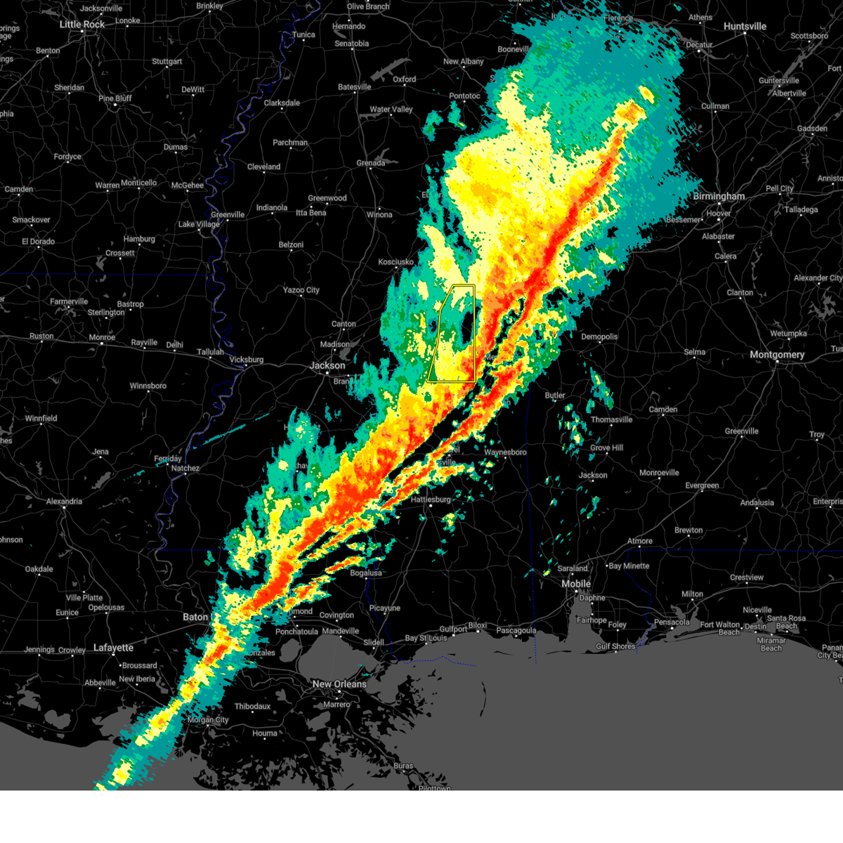 The storms which prompted the warning have moved out of the area. therefore, the warning will be allowed to expire. however, gusty winds are still possible after these storms have passed. a tornado watch remains in effect until 400 am cst for east central mississippi. The storms which prompted the warning have moved out of the area. therefore, the warning will be allowed to expire. however, gusty winds are still possible after these storms have passed. a tornado watch remains in effect until 400 am cst for east central mississippi.
|
| 2/15/2025 11:33 PM CST |
 the severe thunderstorm warning has been cancelled and is no longer in effect the severe thunderstorm warning has been cancelled and is no longer in effect
|
| 2/15/2025 11:33 PM CST |
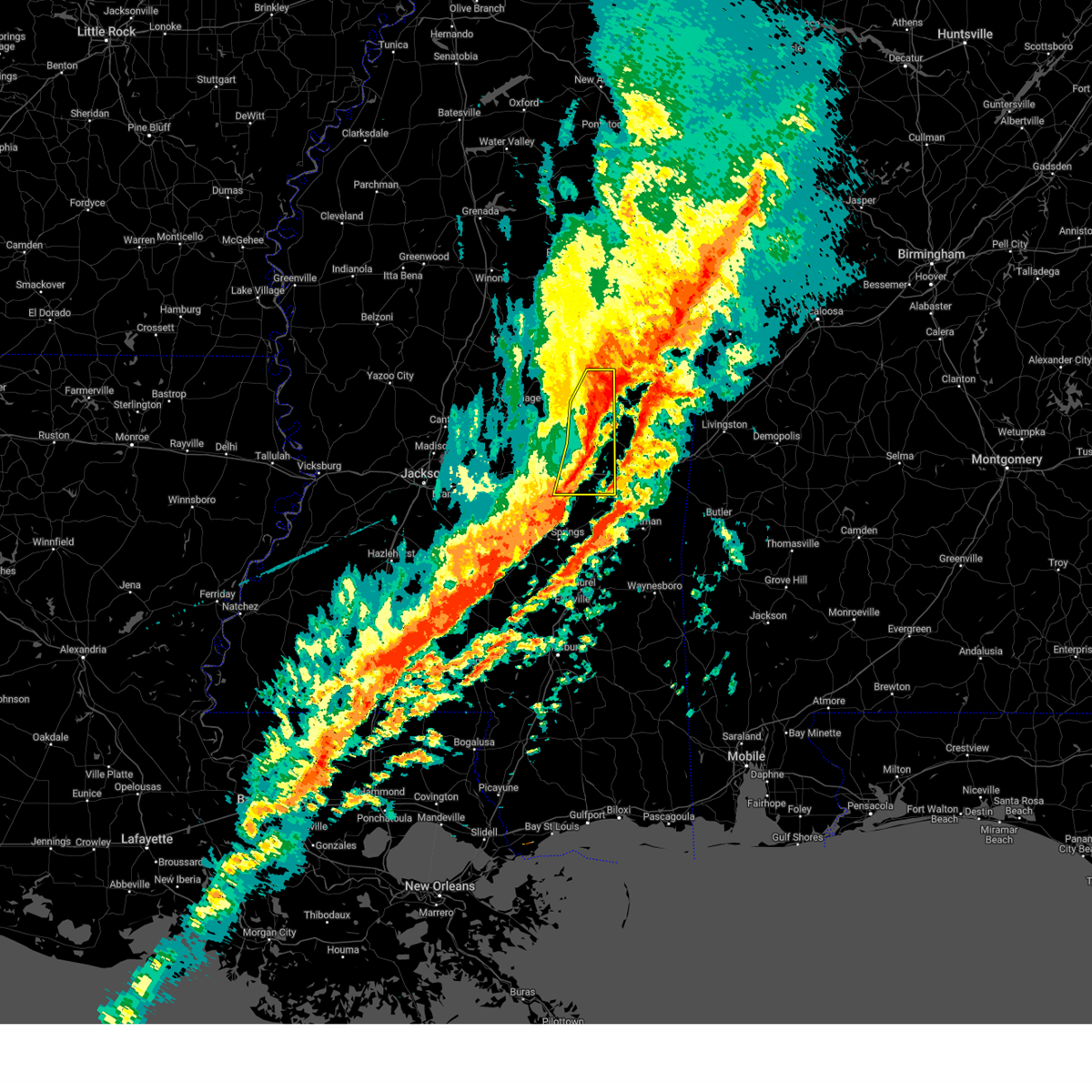 At 1132 pm cst, severe thunderstorms were located along a line extending from nanih waiya to montrose, moving east at 50 mph (radar indicated). Hazards include 60 mph wind gusts and penny size hail. Expect damage to roofs, siding, and trees. these severe storms will be near, house, decatur, forestdale, bethsaida, newton, nanih waiya, herbert springs, and little rock around 1135 pm cst. duffee and hickory around 1140 pm cst. Chunky around 1145 pm cst. At 1132 pm cst, severe thunderstorms were located along a line extending from nanih waiya to montrose, moving east at 50 mph (radar indicated). Hazards include 60 mph wind gusts and penny size hail. Expect damage to roofs, siding, and trees. these severe storms will be near, house, decatur, forestdale, bethsaida, newton, nanih waiya, herbert springs, and little rock around 1135 pm cst. duffee and hickory around 1140 pm cst. Chunky around 1145 pm cst.
|
| 2/15/2025 11:28 PM CST |
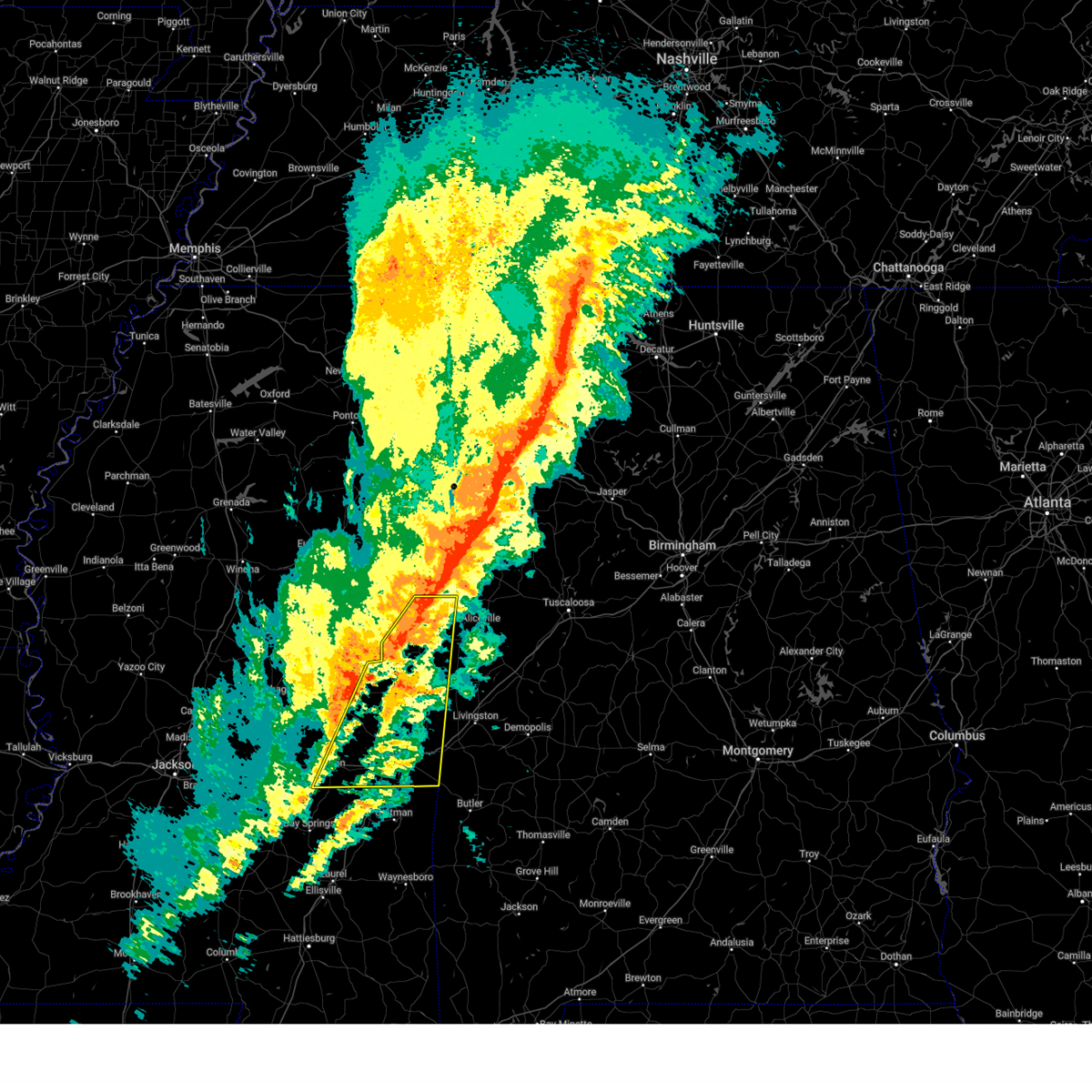 Svrjan the national weather service in jackson has issued a * severe thunderstorm warning for, noxubee county in east central mississippi, newton county in east central mississippi, kemper county in east central mississippi, southeastern neshoba county in east central mississippi, lauderdale county in east central mississippi, * until 1230 am cst. * at 1128 pm cst, severe thunderstorms were located along a line extending from near deerbrook to near bluff springs to near newton, moving east at 65 mph (radar indicated). Hazards include 60 mph wind gusts and nickel size hail. Expect damage to roofs, siding, and trees. severe thunderstorms will be near, collinsville, bigbee valley, prairie point, duffee, shuqualak, martin, damascus, herbert springs, de kalb, and chunky around 1135 pm cst. daleville, meehan, meridian, suqualena, blackwater, scooba, and cooksville around 1140 pm cst. meridian station, nellieburg, and electric mills around 1145 pm cst. marion and porterville around 1150 pm cst. tamola and lauderdale around 1155 pm cst. toomsuba around 1200 am cst. Kewanee around 1205 am cst. Svrjan the national weather service in jackson has issued a * severe thunderstorm warning for, noxubee county in east central mississippi, newton county in east central mississippi, kemper county in east central mississippi, southeastern neshoba county in east central mississippi, lauderdale county in east central mississippi, * until 1230 am cst. * at 1128 pm cst, severe thunderstorms were located along a line extending from near deerbrook to near bluff springs to near newton, moving east at 65 mph (radar indicated). Hazards include 60 mph wind gusts and nickel size hail. Expect damage to roofs, siding, and trees. severe thunderstorms will be near, collinsville, bigbee valley, prairie point, duffee, shuqualak, martin, damascus, herbert springs, de kalb, and chunky around 1135 pm cst. daleville, meehan, meridian, suqualena, blackwater, scooba, and cooksville around 1140 pm cst. meridian station, nellieburg, and electric mills around 1145 pm cst. marion and porterville around 1150 pm cst. tamola and lauderdale around 1155 pm cst. toomsuba around 1200 am cst. Kewanee around 1205 am cst.
|
| 2/15/2025 10:59 PM CST |
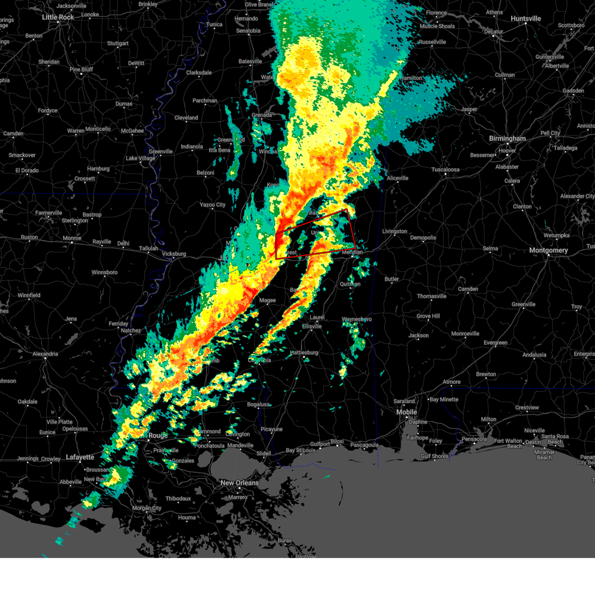 Torjan the national weather service in jackson has issued a * tornado warning for, southeastern leake county in central mississippi, northern newton county in east central mississippi, southwestern kemper county in east central mississippi, northeastern scott county in central mississippi, southern neshoba county in east central mississippi, northwestern lauderdale county in east central mississippi, * until midnight cst. * at 1059 pm cst, a severe thunderstorm capable of producing a tornado was located over hillsboro, or 7 miles northwest of forest, moving east at 60 mph (radar indicated rotation). Hazards include tornado. Flying debris will be dangerous to those caught without shelter. mobile homes will be damaged or destroyed. damage to roofs, windows, and vehicles will occur. tree damage is likely. this dangerous storm will be near, harperville, steele, and forest around 1105 pm cst. conehatta, prospect, and sebastopol around 1110 pm cst. stratton around 1115 pm cst. decatur, neshoba, and union around 1120 pm cst. little rock around 1125 pm cst. collinsville, house, duffee, and herbert springs around 1130 pm cst. martin around 1135 pm cst. Damascus and prismatic around 1140 pm cst. Torjan the national weather service in jackson has issued a * tornado warning for, southeastern leake county in central mississippi, northern newton county in east central mississippi, southwestern kemper county in east central mississippi, northeastern scott county in central mississippi, southern neshoba county in east central mississippi, northwestern lauderdale county in east central mississippi, * until midnight cst. * at 1059 pm cst, a severe thunderstorm capable of producing a tornado was located over hillsboro, or 7 miles northwest of forest, moving east at 60 mph (radar indicated rotation). Hazards include tornado. Flying debris will be dangerous to those caught without shelter. mobile homes will be damaged or destroyed. damage to roofs, windows, and vehicles will occur. tree damage is likely. this dangerous storm will be near, harperville, steele, and forest around 1105 pm cst. conehatta, prospect, and sebastopol around 1110 pm cst. stratton around 1115 pm cst. decatur, neshoba, and union around 1120 pm cst. little rock around 1125 pm cst. collinsville, house, duffee, and herbert springs around 1130 pm cst. martin around 1135 pm cst. Damascus and prismatic around 1140 pm cst.
|
| 2/15/2025 10:33 PM CST |
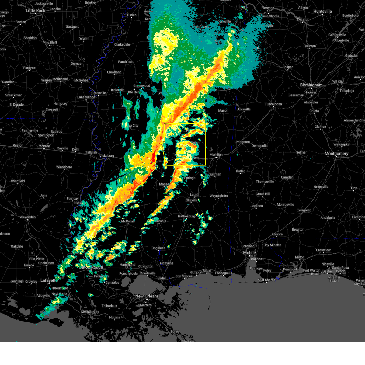 Svrjan the national weather service in jackson has issued a * severe thunderstorm warning for, leake county in central mississippi, newton county in east central mississippi, scott county in central mississippi, neshoba county in east central mississippi, * until midnight cst. * at 1033 pm cst, severe thunderstorms were located along a line extending from near thomastown to near star, moving east at 50 mph (radar indicated). Hazards include 60 mph wind gusts and penny size hail. Expect damage to roofs, siding, and trees. severe thunderstorms will be near, ludlow and thomastown around 1040 pm cst. branch, lena, forkville, singleton, carthage, and redwater around 1045 pm cst. tuscola, morton, and renfroe around 1050 pm cst. walnut grove, pulaski, harperville, hillsboro, and standing pine around 1055 pm cst. edinburg, madden, steele, and forest around 1100 pm cst. homewood, pearl river, philadelphia, dowdville, and sebastopol around 1105 pm cst. dixon and prospect around 1110 pm cst. Conehatta, burnside, lake, and stallo around 1115 pm cst. Svrjan the national weather service in jackson has issued a * severe thunderstorm warning for, leake county in central mississippi, newton county in east central mississippi, scott county in central mississippi, neshoba county in east central mississippi, * until midnight cst. * at 1033 pm cst, severe thunderstorms were located along a line extending from near thomastown to near star, moving east at 50 mph (radar indicated). Hazards include 60 mph wind gusts and penny size hail. Expect damage to roofs, siding, and trees. severe thunderstorms will be near, ludlow and thomastown around 1040 pm cst. branch, lena, forkville, singleton, carthage, and redwater around 1045 pm cst. tuscola, morton, and renfroe around 1050 pm cst. walnut grove, pulaski, harperville, hillsboro, and standing pine around 1055 pm cst. edinburg, madden, steele, and forest around 1100 pm cst. homewood, pearl river, philadelphia, dowdville, and sebastopol around 1105 pm cst. dixon and prospect around 1110 pm cst. Conehatta, burnside, lake, and stallo around 1115 pm cst.
|
| 2/12/2025 3:41 PM CST |
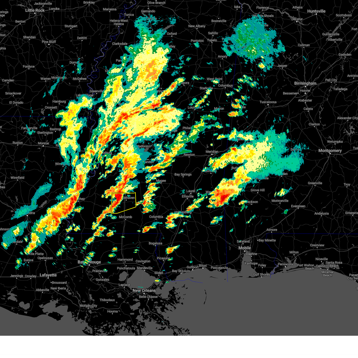 At 341 pm cst, a severe thunderstorm was located over vaughn, or 8 miles west of brookhaven, moving northeast at 55 mph (radar indicated). Hazards include 60 mph wind gusts and quarter size hail. Hail damage to vehicles is expected. expect wind damage to roofs, siding, and trees. This severe storm will be near, brookhaven and loyd star around 345 pm cst. At 341 pm cst, a severe thunderstorm was located over vaughn, or 8 miles west of brookhaven, moving northeast at 55 mph (radar indicated). Hazards include 60 mph wind gusts and quarter size hail. Hail damage to vehicles is expected. expect wind damage to roofs, siding, and trees. This severe storm will be near, brookhaven and loyd star around 345 pm cst.
|
| 2/12/2025 3:28 PM CST |
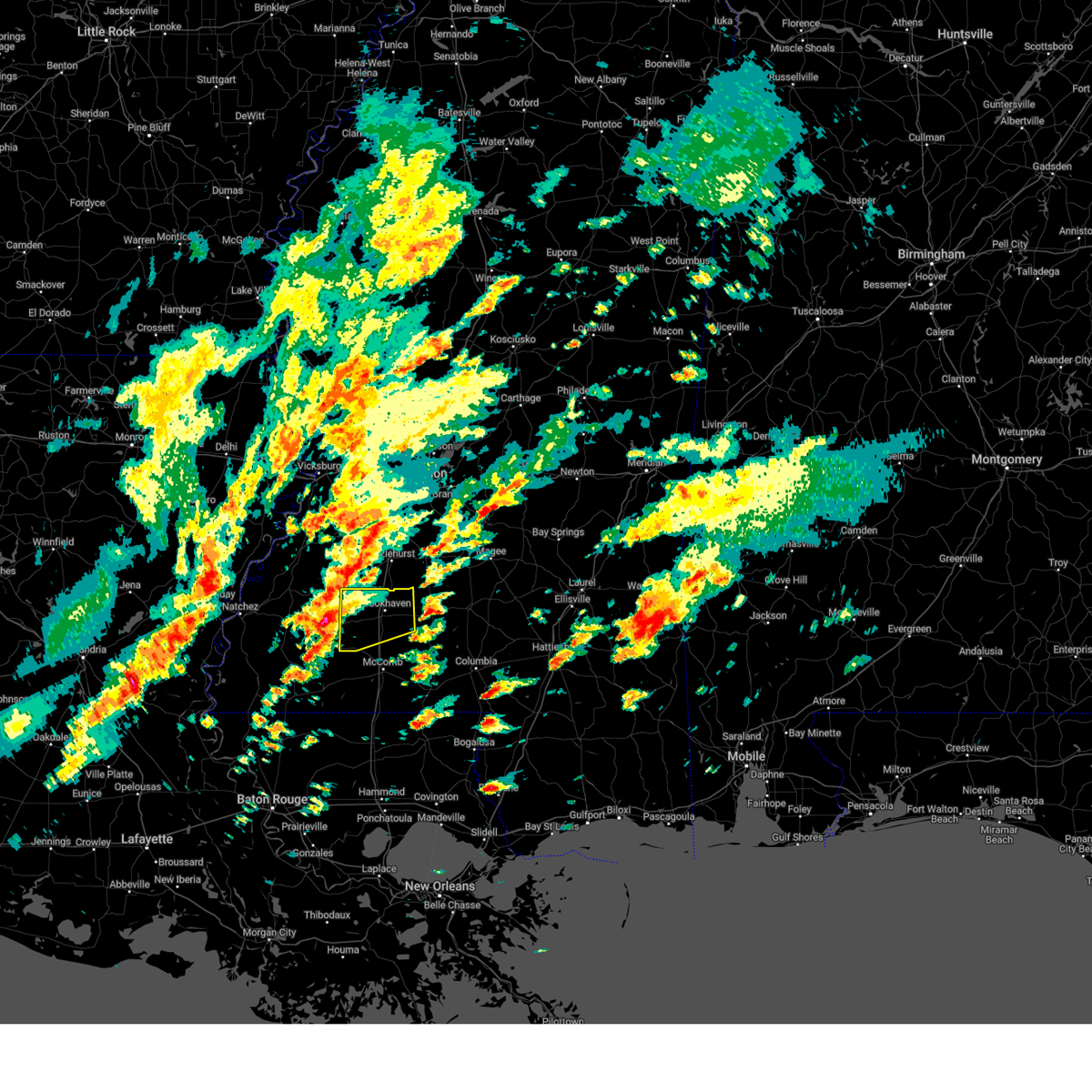 Svrjan the national weather service in jackson has issued a * severe thunderstorm warning for, lincoln county in south central mississippi, eastern franklin county in southwestern mississippi, * until 415 pm cst. * at 328 pm cst, a severe thunderstorm was located near mccall creek, or 8 miles east of meadville, moving northeast at 50 mph (radar indicated). Hazards include 60 mph wind gusts and quarter size hail. Hail damage to vehicles is expected. expect wind damage to roofs, siding, and trees. this severe thunderstorm will be near, caseyville, west lincoln, vaughn, and loyd star around 335 pm cst. Brookhaven around 340 pm cst. Svrjan the national weather service in jackson has issued a * severe thunderstorm warning for, lincoln county in south central mississippi, eastern franklin county in southwestern mississippi, * until 415 pm cst. * at 328 pm cst, a severe thunderstorm was located near mccall creek, or 8 miles east of meadville, moving northeast at 50 mph (radar indicated). Hazards include 60 mph wind gusts and quarter size hail. Hail damage to vehicles is expected. expect wind damage to roofs, siding, and trees. this severe thunderstorm will be near, caseyville, west lincoln, vaughn, and loyd star around 335 pm cst. Brookhaven around 340 pm cst.
|
| 2/12/2025 2:30 PM CST |
 At 229 pm cst, a severe thunderstorm capable of producing a tornado was located over west lincoln, or 7 miles southwest of brookhaven, moving northeast at 45 mph (radar indicated rotation). Hazards include tornado and quarter size hail. Flying debris will be dangerous to those caught without shelter. mobile homes will be damaged or destroyed. damage to roofs, windows, and vehicles will occur. tree damage is likely. this dangerous storm will be near, brookhaven and loyd star around 235 pm cst. beauregard and wesson around 240 pm cst. martinsville around 245 pm cst. hazlehurst around 255 pm cst. Rockport around 300 pm cst. At 229 pm cst, a severe thunderstorm capable of producing a tornado was located over west lincoln, or 7 miles southwest of brookhaven, moving northeast at 45 mph (radar indicated rotation). Hazards include tornado and quarter size hail. Flying debris will be dangerous to those caught without shelter. mobile homes will be damaged or destroyed. damage to roofs, windows, and vehicles will occur. tree damage is likely. this dangerous storm will be near, brookhaven and loyd star around 235 pm cst. beauregard and wesson around 240 pm cst. martinsville around 245 pm cst. hazlehurst around 255 pm cst. Rockport around 300 pm cst.
|
| 2/12/2025 2:30 PM CST |
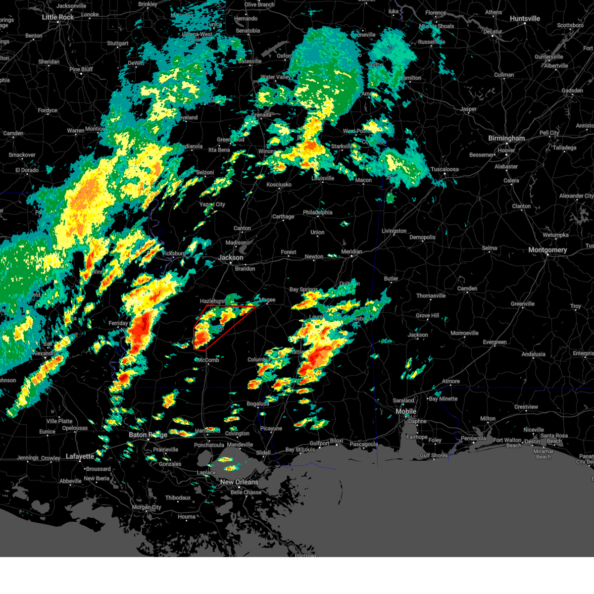 the tornado warning has been cancelled and is no longer in effect the tornado warning has been cancelled and is no longer in effect
|
| 2/12/2025 2:14 PM CST |
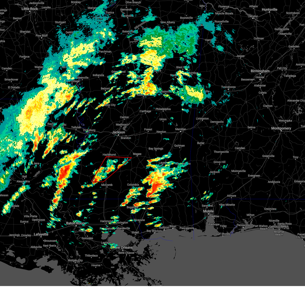 Torjan the national weather service in jackson has issued a * tornado warning for, southwestern simpson county in central mississippi, lincoln county in south central mississippi, northwestern lawrence county in south central mississippi, eastern franklin county in southwestern mississippi, southeastern copiah county in central mississippi, * until 315 pm cst. * at 213 pm cst, a severe thunderstorm capable of producing a tornado was located over little springs, or 12 miles east of meadville, moving northeast at 45 mph (radar indicated rotation). Hazards include tornado and quarter size hail. Flying debris will be dangerous to those caught without shelter. mobile homes will be damaged or destroyed. damage to roofs, windows, and vehicles will occur. tree damage is likely. this dangerous storm will be near, mccall creek, center point, west lincoln, and vaughn around 220 pm cst. brookhaven around 225 pm cst. loyd star around 230 pm cst. beauregard and wesson around 240 pm cst. martinsville around 250 pm cst. hazlehurst around 255 pm cst. Rockport around 300 pm cst. Torjan the national weather service in jackson has issued a * tornado warning for, southwestern simpson county in central mississippi, lincoln county in south central mississippi, northwestern lawrence county in south central mississippi, eastern franklin county in southwestern mississippi, southeastern copiah county in central mississippi, * until 315 pm cst. * at 213 pm cst, a severe thunderstorm capable of producing a tornado was located over little springs, or 12 miles east of meadville, moving northeast at 45 mph (radar indicated rotation). Hazards include tornado and quarter size hail. Flying debris will be dangerous to those caught without shelter. mobile homes will be damaged or destroyed. damage to roofs, windows, and vehicles will occur. tree damage is likely. this dangerous storm will be near, mccall creek, center point, west lincoln, and vaughn around 220 pm cst. brookhaven around 225 pm cst. loyd star around 230 pm cst. beauregard and wesson around 240 pm cst. martinsville around 250 pm cst. hazlehurst around 255 pm cst. Rockport around 300 pm cst.
|
| 1/5/2025 6:48 PM CST |
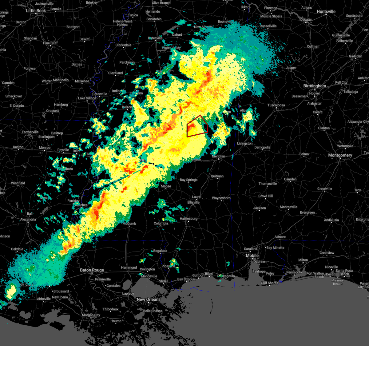 At 648 pm cst, a severe thunderstorm capable of producing a tornado was located near edinburg, or near pearl river, moving northeast at 50 mph (radar indicated rotation). Hazards include tornado. Flying debris will be dangerous to those caught without shelter. mobile homes will be damaged or destroyed. damage to roofs, windows, and vehicles will occur. tree damage is likely. this dangerous storm will be near, burnside, philadelphia, and stallo around 655 pm cst. noxapater around 700 pm cst. Nanih waiya around 705 pm cst. At 648 pm cst, a severe thunderstorm capable of producing a tornado was located near edinburg, or near pearl river, moving northeast at 50 mph (radar indicated rotation). Hazards include tornado. Flying debris will be dangerous to those caught without shelter. mobile homes will be damaged or destroyed. damage to roofs, windows, and vehicles will occur. tree damage is likely. this dangerous storm will be near, burnside, philadelphia, and stallo around 655 pm cst. noxapater around 700 pm cst. Nanih waiya around 705 pm cst.
|
| 1/5/2025 6:48 PM CST |
 the tornado warning has been cancelled and is no longer in effect the tornado warning has been cancelled and is no longer in effect
|
| 1/5/2025 6:40 PM CST |
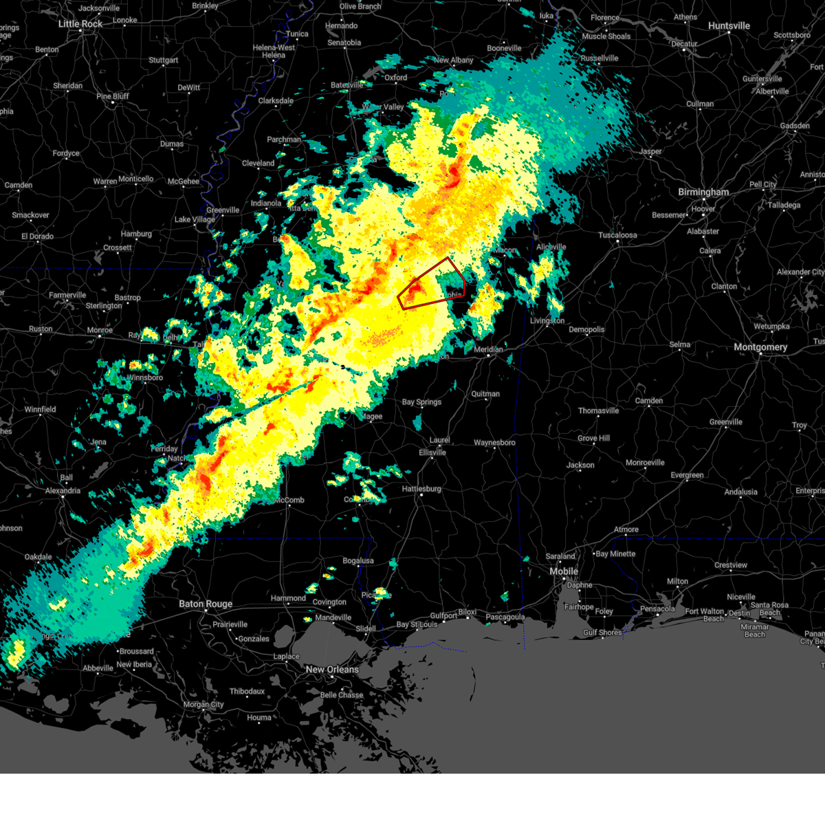 At 640 pm cst, a severe thunderstorm capable of producing a tornado was located near edinburg, or 8 miles east of carthage, moving northeast at 50 mph (radar indicated rotation). Hazards include tornado. Flying debris will be dangerous to those caught without shelter. mobile homes will be damaged or destroyed. damage to roofs, windows, and vehicles will occur. tree damage is likely. this dangerous storm will be near, edinburg, pearl river, and philadelphia around 645 pm cst. burnside and stallo around 655 pm cst. noxapater around 700 pm cst. Nanih waiya around 705 pm cst. At 640 pm cst, a severe thunderstorm capable of producing a tornado was located near edinburg, or 8 miles east of carthage, moving northeast at 50 mph (radar indicated rotation). Hazards include tornado. Flying debris will be dangerous to those caught without shelter. mobile homes will be damaged or destroyed. damage to roofs, windows, and vehicles will occur. tree damage is likely. this dangerous storm will be near, edinburg, pearl river, and philadelphia around 645 pm cst. burnside and stallo around 655 pm cst. noxapater around 700 pm cst. Nanih waiya around 705 pm cst.
|
| 1/5/2025 6:22 PM CST |
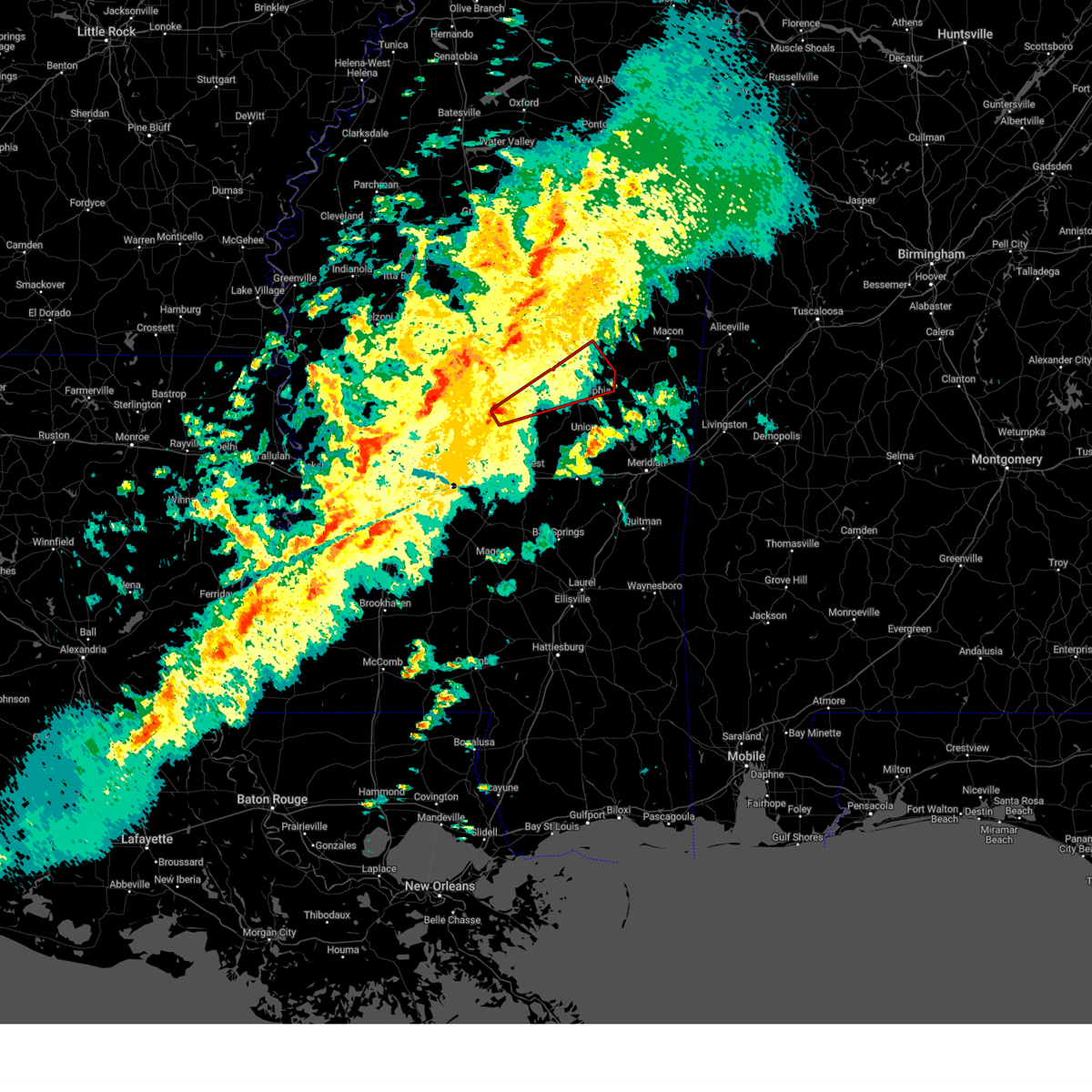 Torjan the national weather service in jackson has issued a * tornado warning for, central leake county in central mississippi, southwestern winston county in east central mississippi, northern neshoba county in east central mississippi, * until 730 pm cst. * at 622 pm cst, a severe thunderstorm capable of producing a tornado was located near lena, or 8 miles southwest of carthage, moving northeast at 50 mph (radar indicated rotation). Hazards include tornado. Flying debris will be dangerous to those caught without shelter. mobile homes will be damaged or destroyed. damage to roofs, windows, and vehicles will occur. tree damage is likely. this dangerous storm will be near, carthage and redwater around 630 pm cst. edinburg and renfroe around 635 pm cst. pearl river and philadelphia around 645 pm cst. burnside and stallo around 655 pm cst. noxapater around 700 pm cst. Nanih waiya around 705 pm cst. Torjan the national weather service in jackson has issued a * tornado warning for, central leake county in central mississippi, southwestern winston county in east central mississippi, northern neshoba county in east central mississippi, * until 730 pm cst. * at 622 pm cst, a severe thunderstorm capable of producing a tornado was located near lena, or 8 miles southwest of carthage, moving northeast at 50 mph (radar indicated rotation). Hazards include tornado. Flying debris will be dangerous to those caught without shelter. mobile homes will be damaged or destroyed. damage to roofs, windows, and vehicles will occur. tree damage is likely. this dangerous storm will be near, carthage and redwater around 630 pm cst. edinburg and renfroe around 635 pm cst. pearl river and philadelphia around 645 pm cst. burnside and stallo around 655 pm cst. noxapater around 700 pm cst. Nanih waiya around 705 pm cst.
|
| 12/28/2024 8:45 PM CST |
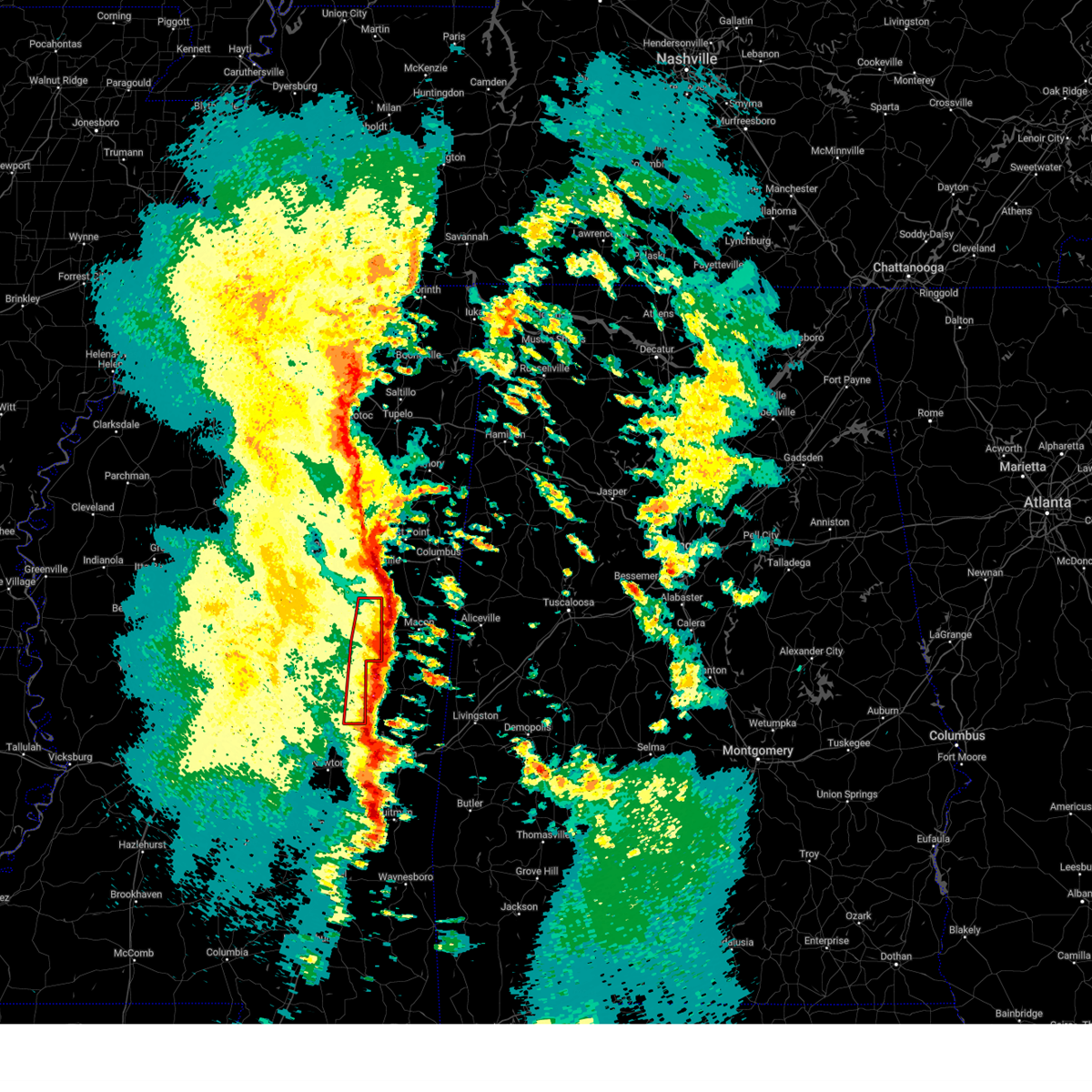 the tornado warning has been cancelled and is no longer in effect the tornado warning has been cancelled and is no longer in effect
|
| 12/28/2024 8:34 PM CST |
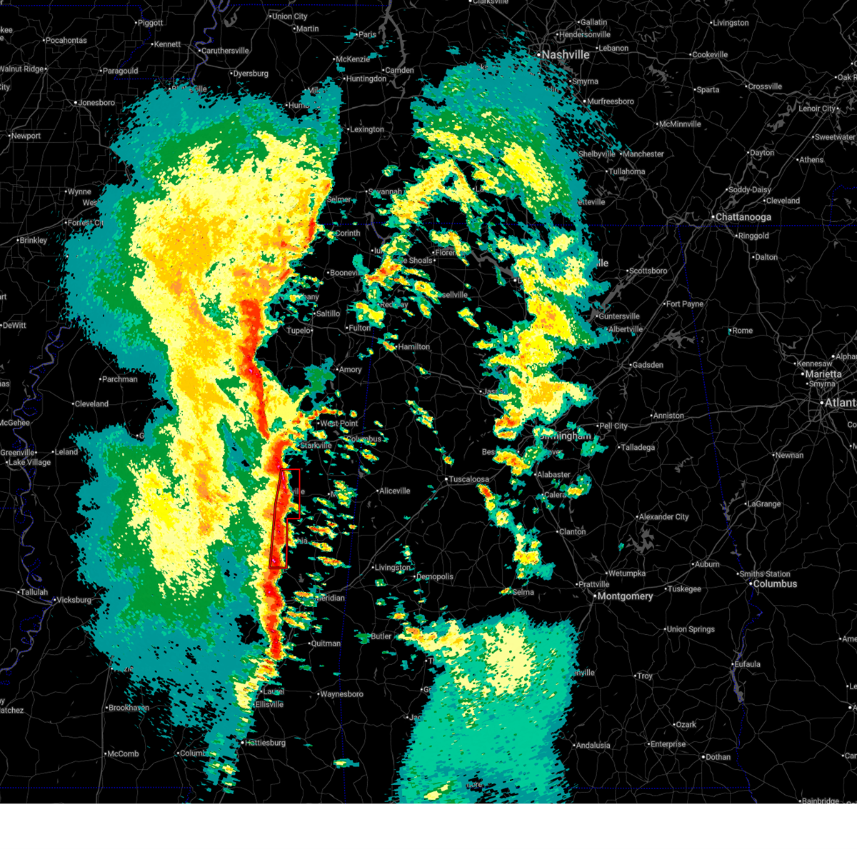 At 834 pm cst, a severe thunderstorm capable of producing a tornado was located near louisville, moving northeast at 35 mph (radar indicated rotation). Hazards include tornado. Flying debris will be dangerous to those caught without shelter. mobile homes will be damaged or destroyed. damage to roofs, windows, and vehicles will occur. tree damage is likely. this dangerous storm will be near, millcreek around 840 pm cst. Betheden around 845 pm cst. At 834 pm cst, a severe thunderstorm capable of producing a tornado was located near louisville, moving northeast at 35 mph (radar indicated rotation). Hazards include tornado. Flying debris will be dangerous to those caught without shelter. mobile homes will be damaged or destroyed. damage to roofs, windows, and vehicles will occur. tree damage is likely. this dangerous storm will be near, millcreek around 840 pm cst. Betheden around 845 pm cst.
|
| 12/28/2024 8:34 PM CST |
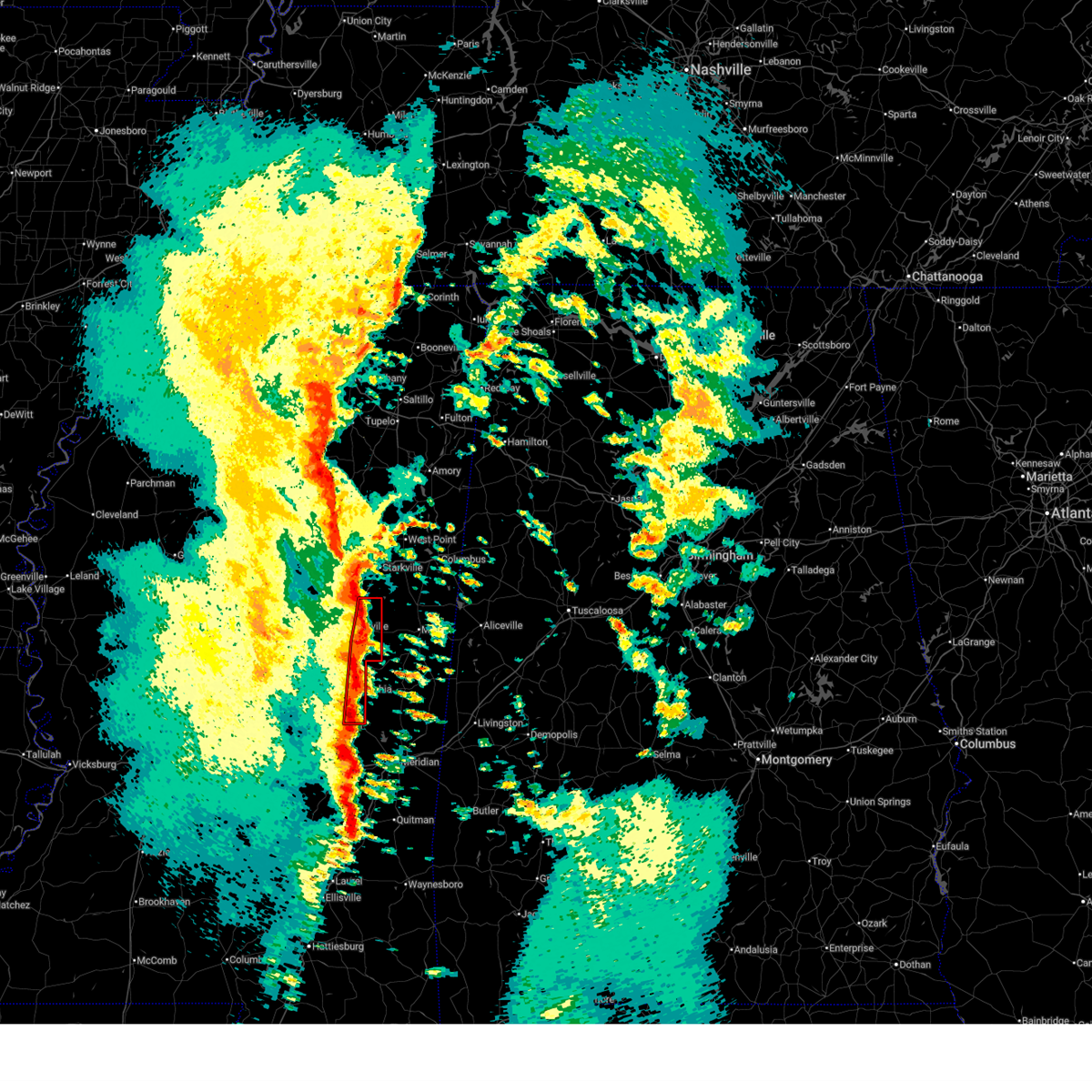 the tornado warning has been cancelled and is no longer in effect the tornado warning has been cancelled and is no longer in effect
|
| 12/28/2024 8:31 PM CST |
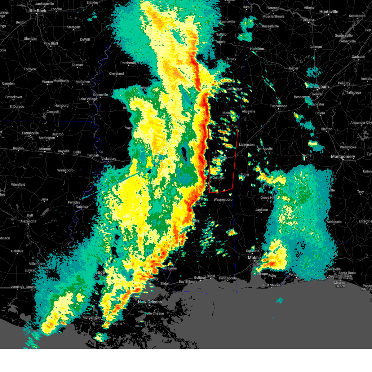 Torjan the national weather service in jackson has issued a * tornado warning for, kemper county in east central mississippi, clarke county in east central mississippi, northeastern neshoba county in east central mississippi, lauderdale county in east central mississippi, * until 930 pm cst. * at 831 pm cst, severe thunderstorms capable of producing a tornado were located along a line extending from betheden to near heidelberg, moving northeast at 45 mph (radar indicated rotation). Hazards include tornado. Flying debris will be dangerous to those caught without shelter. mobile homes will be damaged or destroyed. damage to roofs, windows, and vehicles will occur. tree damage is likely. these dangerous storms will be near, collinsville, meehan, barnett, pachuta, martin, damascus, preston, and bluff springs around 835 pm cst. meridian, stonewall, suqualena, nellieburg, and enterprise around 840 pm cst. savoy, liberty, and prismatic around 845 pm cst. daleville, sable, quitman, blackwater, and de kalb around 850 pm cst. marion, meridian station, and zero around 855 pm cst. causeyville, middleton, and sykes around 900 pm cst. tamola, toomsuba, snell, scooba, porterville, and lauderdale around 905 pm cst. Electric mills, alamucha, and kewanee around 910 pm cst. Torjan the national weather service in jackson has issued a * tornado warning for, kemper county in east central mississippi, clarke county in east central mississippi, northeastern neshoba county in east central mississippi, lauderdale county in east central mississippi, * until 930 pm cst. * at 831 pm cst, severe thunderstorms capable of producing a tornado were located along a line extending from betheden to near heidelberg, moving northeast at 45 mph (radar indicated rotation). Hazards include tornado. Flying debris will be dangerous to those caught without shelter. mobile homes will be damaged or destroyed. damage to roofs, windows, and vehicles will occur. tree damage is likely. these dangerous storms will be near, collinsville, meehan, barnett, pachuta, martin, damascus, preston, and bluff springs around 835 pm cst. meridian, stonewall, suqualena, nellieburg, and enterprise around 840 pm cst. savoy, liberty, and prismatic around 845 pm cst. daleville, sable, quitman, blackwater, and de kalb around 850 pm cst. marion, meridian station, and zero around 855 pm cst. causeyville, middleton, and sykes around 900 pm cst. tamola, toomsuba, snell, scooba, porterville, and lauderdale around 905 pm cst. Electric mills, alamucha, and kewanee around 910 pm cst.
|
| 12/28/2024 7:56 PM CST |
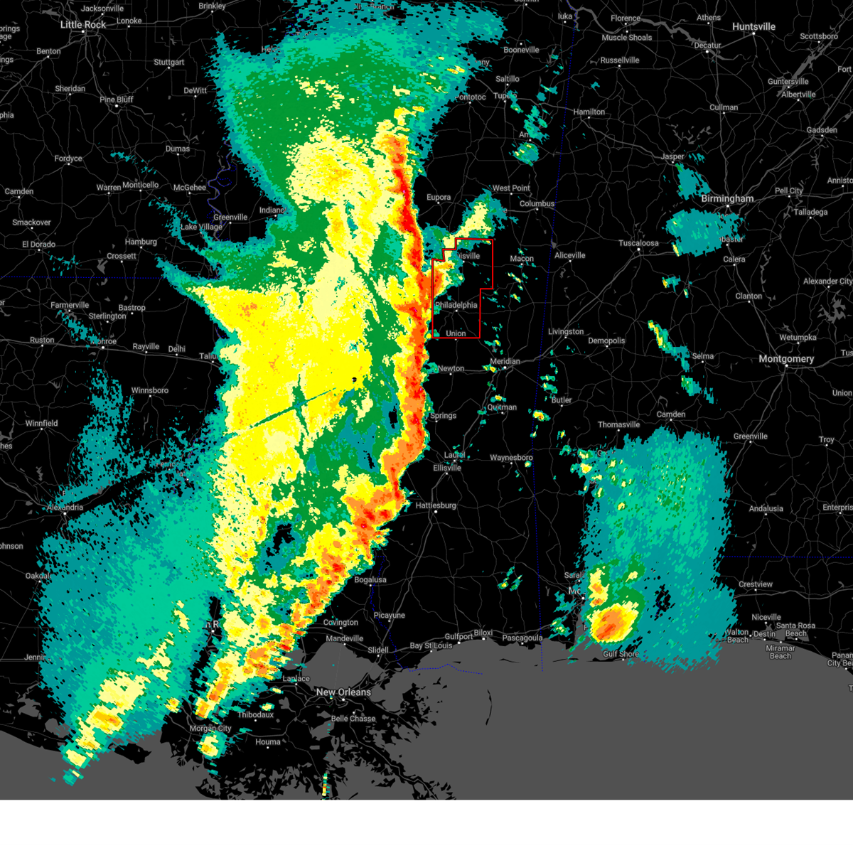 Torjan the national weather service in jackson has issued a * tornado warning for, southeastern choctaw county in central mississippi, winston county in east central mississippi, neshoba county in east central mississippi, * until 900 pm cst. * at 756 pm cst, a severe thunderstorm capable of producing a tornado was located near renfroe, or 13 miles northwest of pearl river, moving northeast at 35 mph (radar indicated rotation). Hazards include tornado. Flying debris will be dangerous to those caught without shelter. mobile homes will be damaged or destroyed. damage to roofs, windows, and vehicles will occur. tree damage is likely. this dangerous storm will be near, noxapater around 820 pm cst. louisville around 825 pm cst. mcmillan around 830 pm cst. millcreek around 835 pm cst. Betheden around 845 pm cst. Torjan the national weather service in jackson has issued a * tornado warning for, southeastern choctaw county in central mississippi, winston county in east central mississippi, neshoba county in east central mississippi, * until 900 pm cst. * at 756 pm cst, a severe thunderstorm capable of producing a tornado was located near renfroe, or 13 miles northwest of pearl river, moving northeast at 35 mph (radar indicated rotation). Hazards include tornado. Flying debris will be dangerous to those caught without shelter. mobile homes will be damaged or destroyed. damage to roofs, windows, and vehicles will occur. tree damage is likely. this dangerous storm will be near, noxapater around 820 pm cst. louisville around 825 pm cst. mcmillan around 830 pm cst. millcreek around 835 pm cst. Betheden around 845 pm cst.
|
| 12/28/2024 6:45 PM CST |
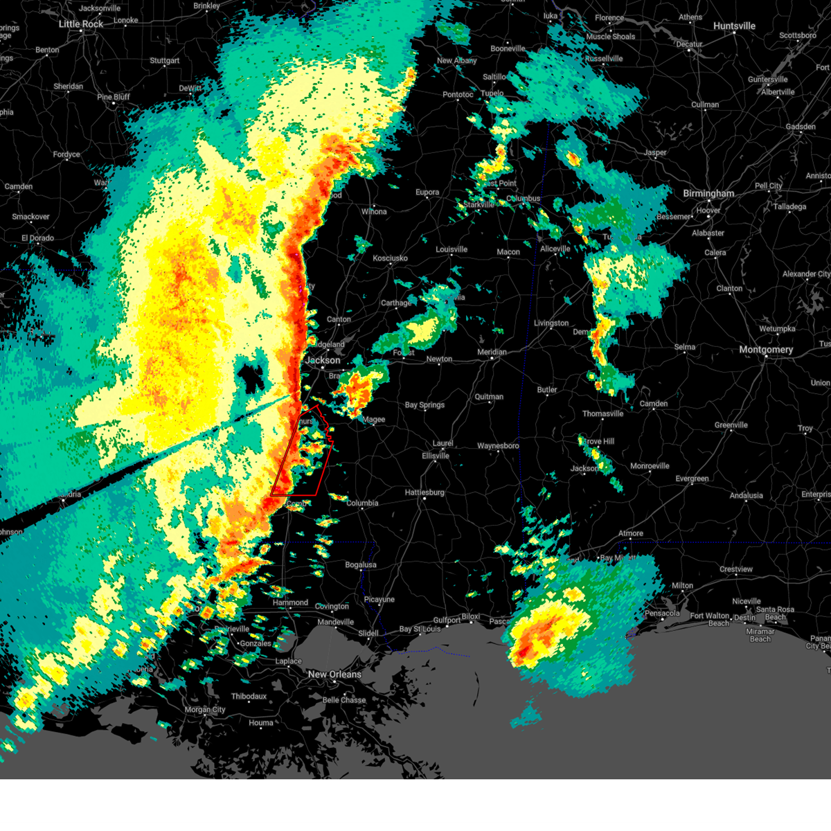 At 645 pm cst, a confirmed tornado was located over hazlehurst, moving northeast at 60 mph (radar confirmed tornado). Hazards include damaging tornado. Flying debris will be dangerous to those caught without shelter. mobile homes will be damaged or destroyed. damage to roofs, windows, and vehicles will occur. tree damage is likely. This tornado will be near, hopewell and georgetown around 650 pm cst. At 645 pm cst, a confirmed tornado was located over hazlehurst, moving northeast at 60 mph (radar confirmed tornado). Hazards include damaging tornado. Flying debris will be dangerous to those caught without shelter. mobile homes will be damaged or destroyed. damage to roofs, windows, and vehicles will occur. tree damage is likely. This tornado will be near, hopewell and georgetown around 650 pm cst.
|
| 12/28/2024 6:36 PM CST |
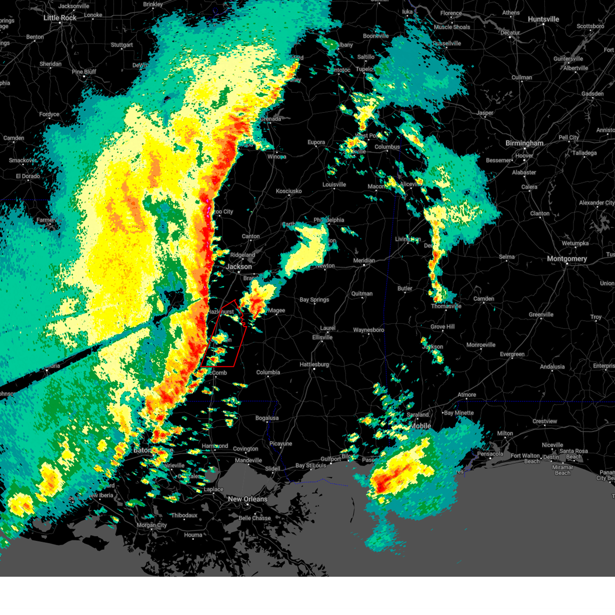 Torjan the national weather service in jackson has issued a * tornado warning for, lincoln county in south central mississippi, northwestern lawrence county in south central mississippi, eastern copiah county in central mississippi, * until 715 pm cst. * at 636 pm cst, a severe thunderstorm capable of producing a tornado was located near brookhaven, moving northeast at 65 mph (radar indicated rotation). Hazards include tornado. Flying debris will be dangerous to those caught without shelter. mobile homes will be damaged or destroyed. damage to roofs, windows, and vehicles will occur. tree damage is likely. this dangerous storm will be near, martinsville, beauregard, and wesson around 640 pm cst. Rockport, oma, and georgetown around 650 pm cst. Torjan the national weather service in jackson has issued a * tornado warning for, lincoln county in south central mississippi, northwestern lawrence county in south central mississippi, eastern copiah county in central mississippi, * until 715 pm cst. * at 636 pm cst, a severe thunderstorm capable of producing a tornado was located near brookhaven, moving northeast at 65 mph (radar indicated rotation). Hazards include tornado. Flying debris will be dangerous to those caught without shelter. mobile homes will be damaged or destroyed. damage to roofs, windows, and vehicles will occur. tree damage is likely. this dangerous storm will be near, martinsville, beauregard, and wesson around 640 pm cst. Rockport, oma, and georgetown around 650 pm cst.
|
| 12/28/2024 6:11 PM CST |
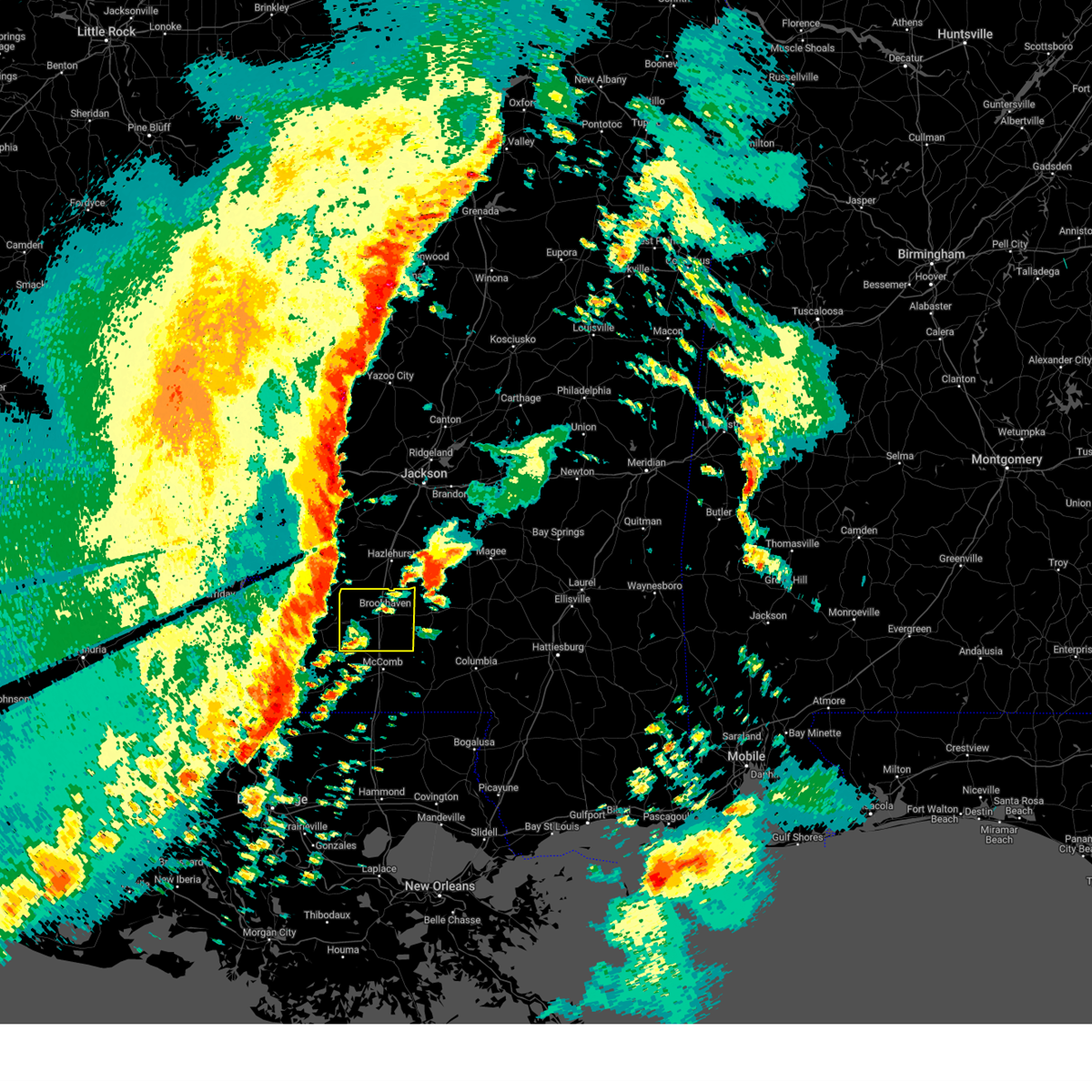 Svrjan the national weather service in jackson has issued a * severe thunderstorm warning for, lincoln county in south central mississippi, eastern franklin county in southwestern mississippi, * until 715 pm cst. * at 611 pm cst, severe thunderstorms were located along a line extending from near peyton to 6 miles north of gloster, moving east at 45 mph (radar indicated). Hazards include 60 mph wind gusts and quarter size hail. Hail damage to vehicles is expected. expect wind damage to roofs, siding, and trees. severe thunderstorms will be near, caseyville around 620 pm cst. mccall creek and little springs around 625 pm cst. center point, vaughn, and loyd star around 630 pm cst. west lincoln around 635 pm cst. brookhaven around 640 pm cst. bogue chitto around 645 pm cst. enterprise around 650 pm cst. East lincoln and ruth around 655 pm cst. Svrjan the national weather service in jackson has issued a * severe thunderstorm warning for, lincoln county in south central mississippi, eastern franklin county in southwestern mississippi, * until 715 pm cst. * at 611 pm cst, severe thunderstorms were located along a line extending from near peyton to 6 miles north of gloster, moving east at 45 mph (radar indicated). Hazards include 60 mph wind gusts and quarter size hail. Hail damage to vehicles is expected. expect wind damage to roofs, siding, and trees. severe thunderstorms will be near, caseyville around 620 pm cst. mccall creek and little springs around 625 pm cst. center point, vaughn, and loyd star around 630 pm cst. west lincoln around 635 pm cst. brookhaven around 640 pm cst. bogue chitto around 645 pm cst. enterprise around 650 pm cst. East lincoln and ruth around 655 pm cst.
|
| 12/28/2024 5:33 PM CST |
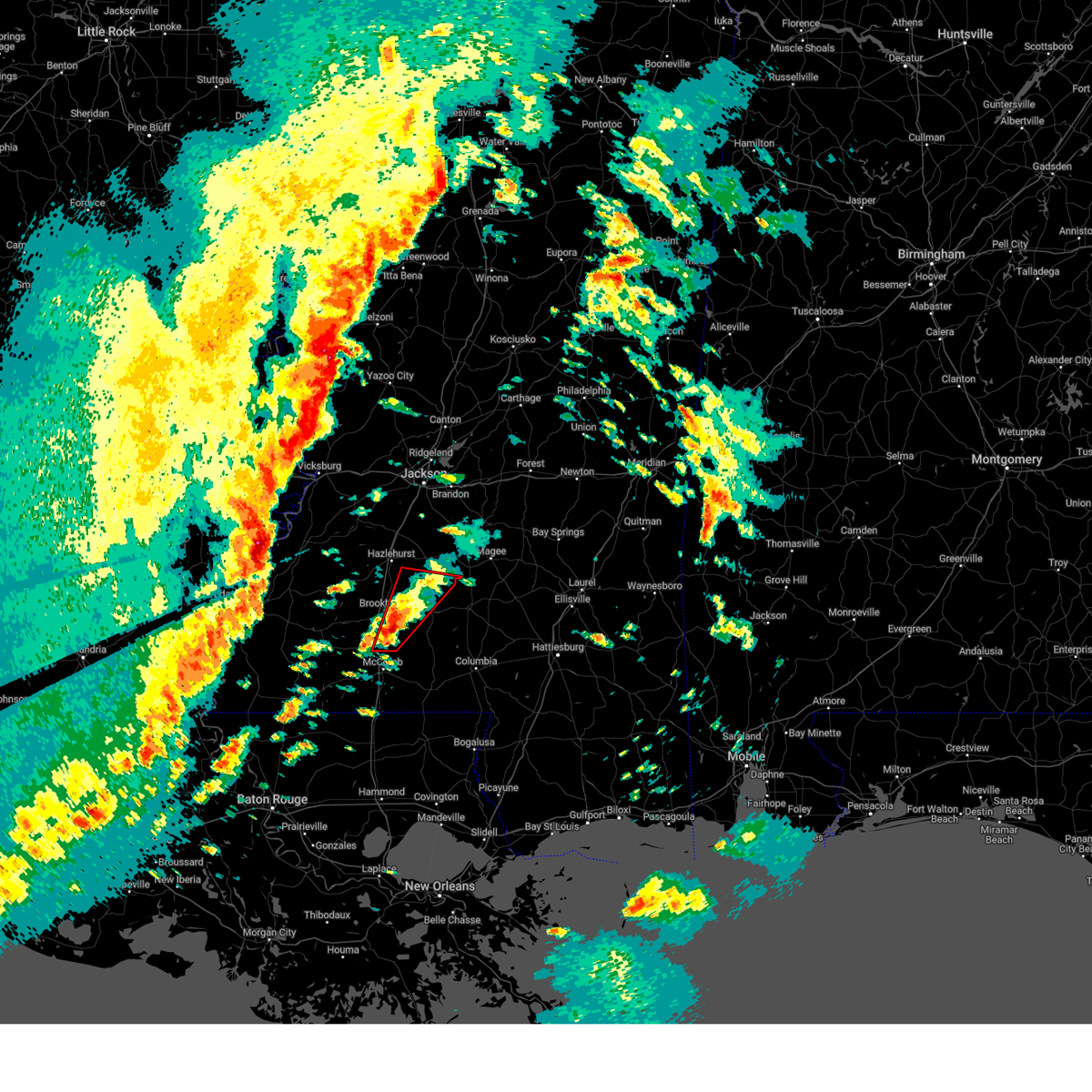 At 533 pm cst, a severe thunderstorm capable of producing a tornado was located over bogue chitto, or 11 miles north of mccomb, moving northeast at 45 mph (radar indicated rotation). Hazards include tornado. Flying debris will be dangerous to those caught without shelter. mobile homes will be damaged or destroyed. damage to roofs, windows, and vehicles will occur. tree damage is likely. this dangerous storm will be near, east lincoln, brookhaven, and enterprise around 540 pm cst. sontag around 550 pm cst. wanilla around 555 pm cst. oma around 600 pm cst. rockport around 605 pm cst. New hebron around 610 pm cst. At 533 pm cst, a severe thunderstorm capable of producing a tornado was located over bogue chitto, or 11 miles north of mccomb, moving northeast at 45 mph (radar indicated rotation). Hazards include tornado. Flying debris will be dangerous to those caught without shelter. mobile homes will be damaged or destroyed. damage to roofs, windows, and vehicles will occur. tree damage is likely. this dangerous storm will be near, east lincoln, brookhaven, and enterprise around 540 pm cst. sontag around 550 pm cst. wanilla around 555 pm cst. oma around 600 pm cst. rockport around 605 pm cst. New hebron around 610 pm cst.
|
| 12/28/2024 5:16 PM CST |
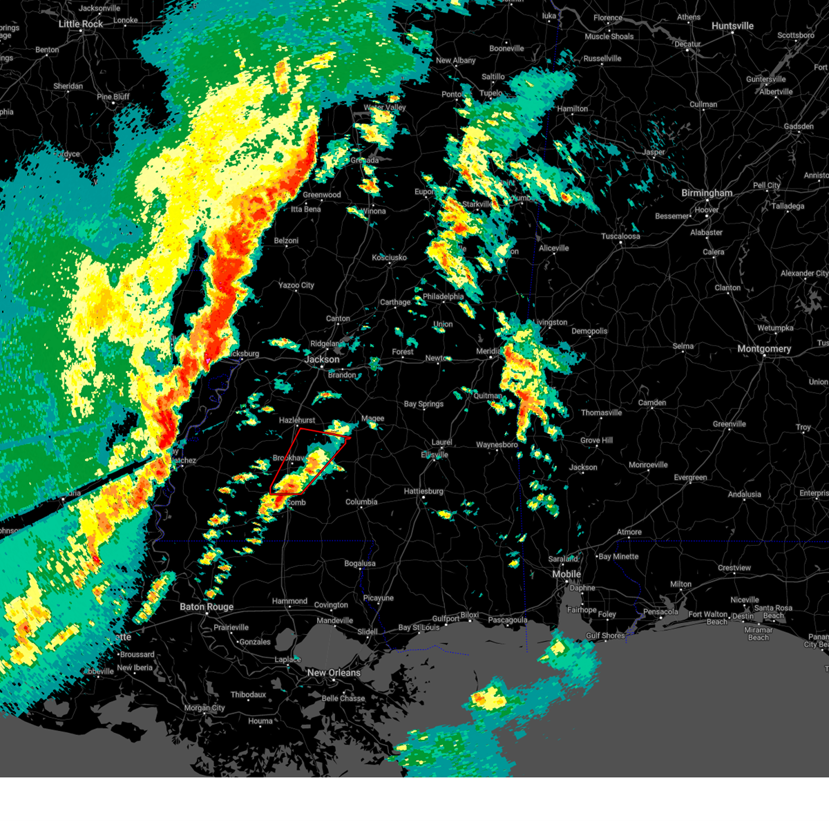 Torjan the national weather service in jackson has issued a * tornado warning for, south central simpson county in central mississippi, lincoln county in south central mississippi, northern lawrence county in south central mississippi, southeastern copiah county in central mississippi, * until 615 pm cst. * at 516 pm cst, a severe thunderstorm capable of producing a tornado was located near summit, or near mccomb, moving northeast at 50 mph (radar indicated rotation). Hazards include tornado. Flying debris will be dangerous to those caught without shelter. mobile homes will be damaged or destroyed. damage to roofs, windows, and vehicles will occur. tree damage is likely. this dangerous storm will be near, bogue chitto and center point around 520 pm cst. west lincoln and enterprise around 525 pm cst. brookhaven around 530 pm cst. east lincoln around 535 pm cst. sontag and wesson around 545 pm cst. beauregard around 550 pm cst. Rockport, oma, and wanilla around 555 pm cst. Torjan the national weather service in jackson has issued a * tornado warning for, south central simpson county in central mississippi, lincoln county in south central mississippi, northern lawrence county in south central mississippi, southeastern copiah county in central mississippi, * until 615 pm cst. * at 516 pm cst, a severe thunderstorm capable of producing a tornado was located near summit, or near mccomb, moving northeast at 50 mph (radar indicated rotation). Hazards include tornado. Flying debris will be dangerous to those caught without shelter. mobile homes will be damaged or destroyed. damage to roofs, windows, and vehicles will occur. tree damage is likely. this dangerous storm will be near, bogue chitto and center point around 520 pm cst. west lincoln and enterprise around 525 pm cst. brookhaven around 530 pm cst. east lincoln around 535 pm cst. sontag and wesson around 545 pm cst. beauregard around 550 pm cst. Rockport, oma, and wanilla around 555 pm cst.
|
| 8/29/2024 4:51 PM CDT |
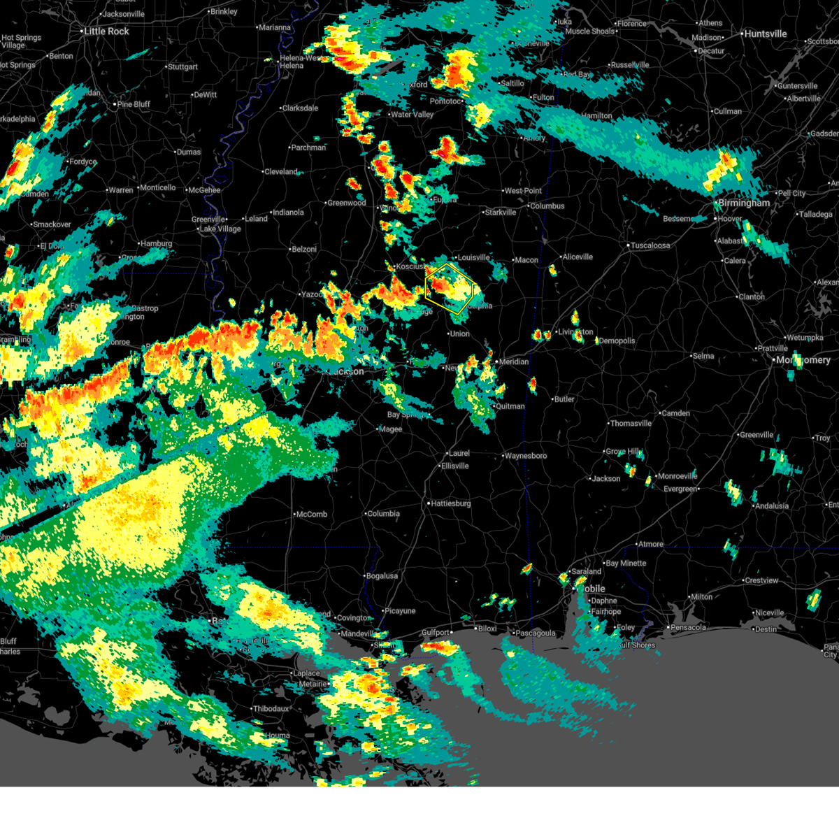 the severe thunderstorm warning has been cancelled and is no longer in effect the severe thunderstorm warning has been cancelled and is no longer in effect
|
| 8/29/2024 4:25 PM CDT |
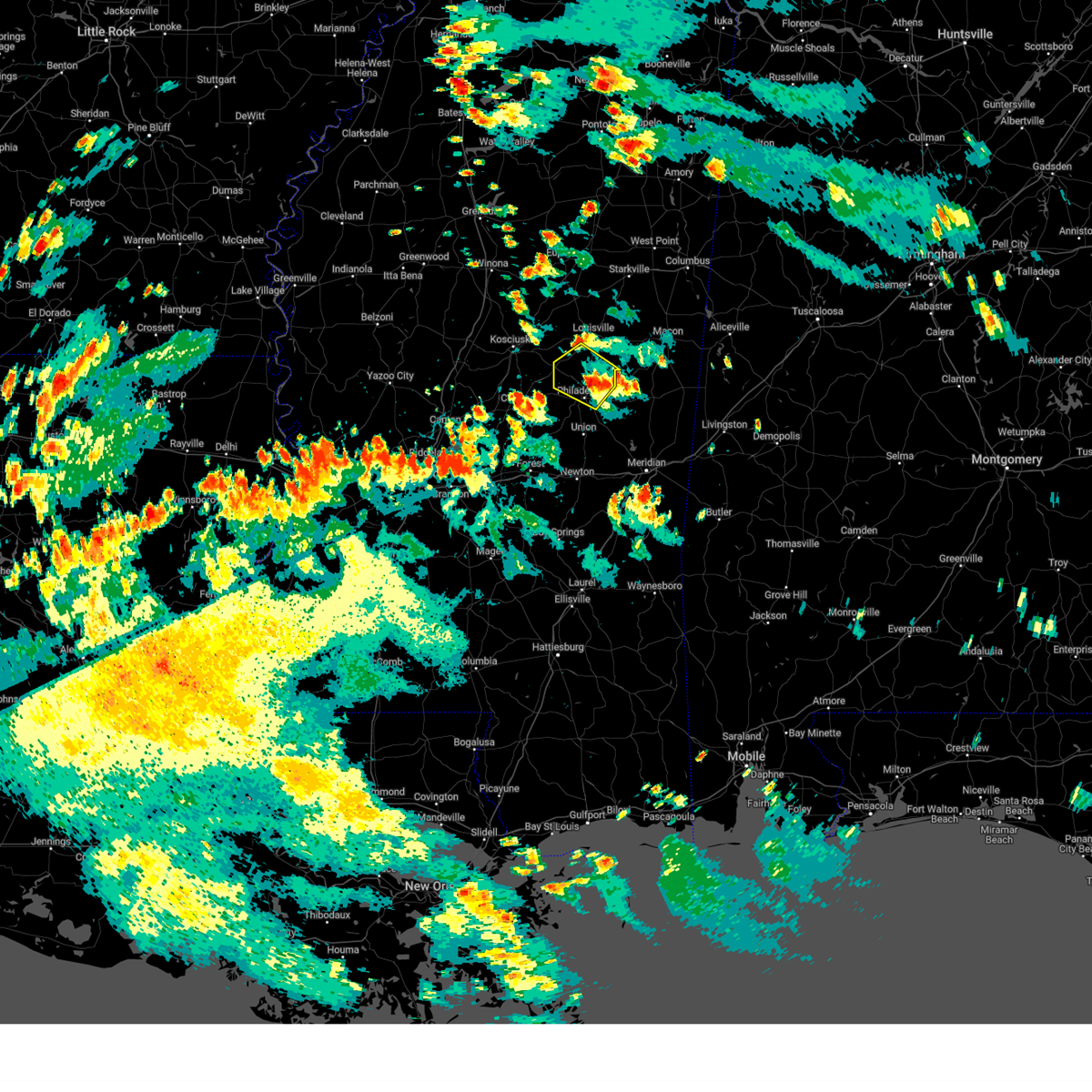 Svrjan the national weather service in jackson has issued a * severe thunderstorm warning for, southwestern winston county in east central mississippi, northern neshoba county in east central mississippi, * until 515 pm cdt. * at 425 pm cdt, a severe thunderstorm was located over burnside, or near philadelphia, moving northwest at 25 mph (radar indicated). Hazards include 60 mph wind gusts and penny size hail. Expect damage to roofs, siding, and trees. This severe thunderstorm will be near, noxapater and stallo around 430 pm cdt. Svrjan the national weather service in jackson has issued a * severe thunderstorm warning for, southwestern winston county in east central mississippi, northern neshoba county in east central mississippi, * until 515 pm cdt. * at 425 pm cdt, a severe thunderstorm was located over burnside, or near philadelphia, moving northwest at 25 mph (radar indicated). Hazards include 60 mph wind gusts and penny size hail. Expect damage to roofs, siding, and trees. This severe thunderstorm will be near, noxapater and stallo around 430 pm cdt.
|
| 6/26/2024 3:08 PM CDT |
 Svrjan the national weather service in jackson has issued a * severe thunderstorm warning for, noxubee county in east central mississippi, kemper county in east central mississippi, southeastern winston county in east central mississippi, northern lauderdale county in east central mississippi, * until 400 pm cdt. * at 308 pm cdt, severe thunderstorms were located along a line extending from near preston to near de kalb to martin, moving northeast at 35 mph (radar indicated). Hazards include 60 mph wind gusts. Expect damage to roofs, siding, and trees. severe thunderstorms will be near, de kalb, daleville, gholson, blackwater, liberty, and prismatic around 315 pm cdt. scooba, meridian station, shuqualak, and electric mills around 325 pm cdt. porterville around 330 pm cdt. macon and paulette around 335 pm cdt. Cooksville around 340 pm cdt. Svrjan the national weather service in jackson has issued a * severe thunderstorm warning for, noxubee county in east central mississippi, kemper county in east central mississippi, southeastern winston county in east central mississippi, northern lauderdale county in east central mississippi, * until 400 pm cdt. * at 308 pm cdt, severe thunderstorms were located along a line extending from near preston to near de kalb to martin, moving northeast at 35 mph (radar indicated). Hazards include 60 mph wind gusts. Expect damage to roofs, siding, and trees. severe thunderstorms will be near, de kalb, daleville, gholson, blackwater, liberty, and prismatic around 315 pm cdt. scooba, meridian station, shuqualak, and electric mills around 325 pm cdt. porterville around 330 pm cdt. macon and paulette around 335 pm cdt. Cooksville around 340 pm cdt.
|
| 6/5/2024 5:45 PM CDT |
 Svrjan the national weather service in jackson has issued a * severe thunderstorm warning for, noxubee county in east central mississippi, kemper county in east central mississippi, southeastern oktibbeha county in northeastern mississippi, eastern clarke county in east central mississippi, lauderdale county in east central mississippi, southern lowndes county in northeastern mississippi, * until 630 pm cdt. * at 544 pm cdt, a severe thunderstorm was located near marion, or near meridian, moving northeast at 45 mph (radar indicated). Hazards include 60 mph wind gusts. Expect damage to roofs, siding, and trees. this severe thunderstorm will be near, meridian, meridian station, lauderdale, and daleville around 550 pm cdt. Tamola around 555 pm cdt. Svrjan the national weather service in jackson has issued a * severe thunderstorm warning for, noxubee county in east central mississippi, kemper county in east central mississippi, southeastern oktibbeha county in northeastern mississippi, eastern clarke county in east central mississippi, lauderdale county in east central mississippi, southern lowndes county in northeastern mississippi, * until 630 pm cdt. * at 544 pm cdt, a severe thunderstorm was located near marion, or near meridian, moving northeast at 45 mph (radar indicated). Hazards include 60 mph wind gusts. Expect damage to roofs, siding, and trees. this severe thunderstorm will be near, meridian, meridian station, lauderdale, and daleville around 550 pm cdt. Tamola around 555 pm cdt.
|
| 6/5/2024 4:54 PM CDT |
 Svrjan the national weather service in jackson has issued a * severe thunderstorm warning for, western noxubee county in east central mississippi, western kemper county in east central mississippi, winston county in east central mississippi, neshoba county in east central mississippi, * until 545 pm cdt. * at 454 pm cdt, a severe thunderstorm was located over burnside, or near philadelphia, moving east at 40 mph (radar indicated). Hazards include 60 mph wind gusts. Expect damage to roofs, siding, and trees. this severe thunderstorm will be near, forestdale and nanih waiya around 500 pm cdt. preston around 505 pm cdt. Gholson around 510 pm cdt. Svrjan the national weather service in jackson has issued a * severe thunderstorm warning for, western noxubee county in east central mississippi, western kemper county in east central mississippi, winston county in east central mississippi, neshoba county in east central mississippi, * until 545 pm cdt. * at 454 pm cdt, a severe thunderstorm was located over burnside, or near philadelphia, moving east at 40 mph (radar indicated). Hazards include 60 mph wind gusts. Expect damage to roofs, siding, and trees. this severe thunderstorm will be near, forestdale and nanih waiya around 500 pm cdt. preston around 505 pm cdt. Gholson around 510 pm cdt.
|
| 6/4/2024 5:22 PM CDT |
 the severe thunderstorm warning has been cancelled and is no longer in effect the severe thunderstorm warning has been cancelled and is no longer in effect
|
| 6/4/2024 5:22 PM CDT |
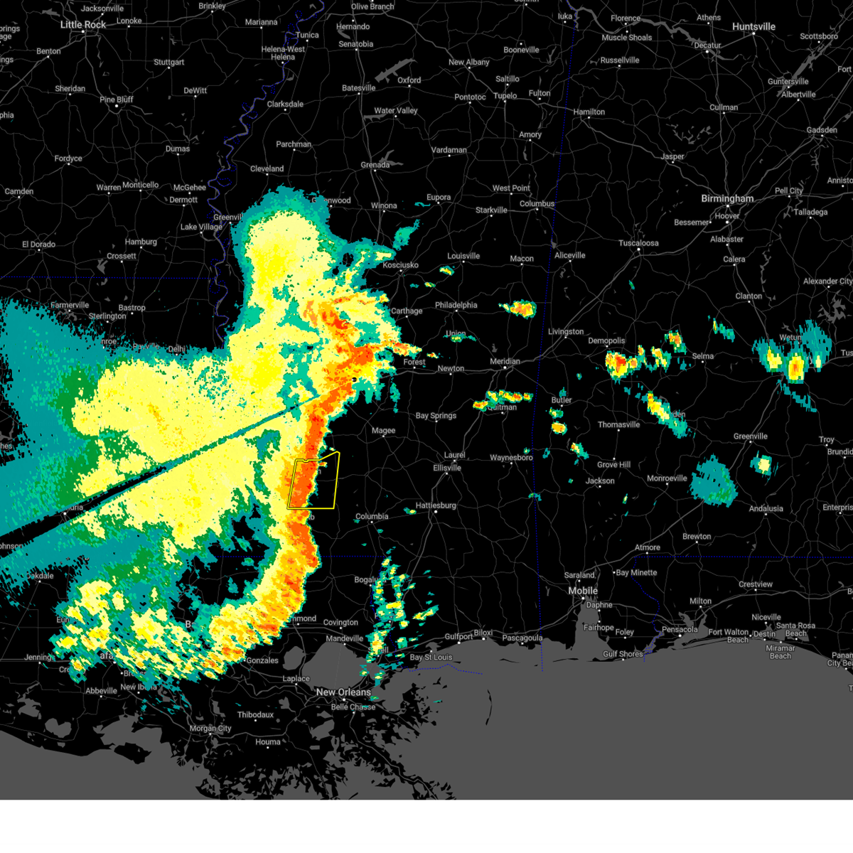 At 522 pm cdt, a severe thunderstorm was located near east lincoln, or 8 miles east of brookhaven, moving east at 35 mph (radar indicated). Hazards include 60 mph wind gusts and quarter size hail. Hail damage to vehicles is expected. expect wind damage to roofs, siding, and trees. this severe storm will be near, sontag around 525 pm cdt. Wanilla around 530 pm cdt. At 522 pm cdt, a severe thunderstorm was located near east lincoln, or 8 miles east of brookhaven, moving east at 35 mph (radar indicated). Hazards include 60 mph wind gusts and quarter size hail. Hail damage to vehicles is expected. expect wind damage to roofs, siding, and trees. this severe storm will be near, sontag around 525 pm cdt. Wanilla around 530 pm cdt.
|
| 6/4/2024 4:46 PM CDT |
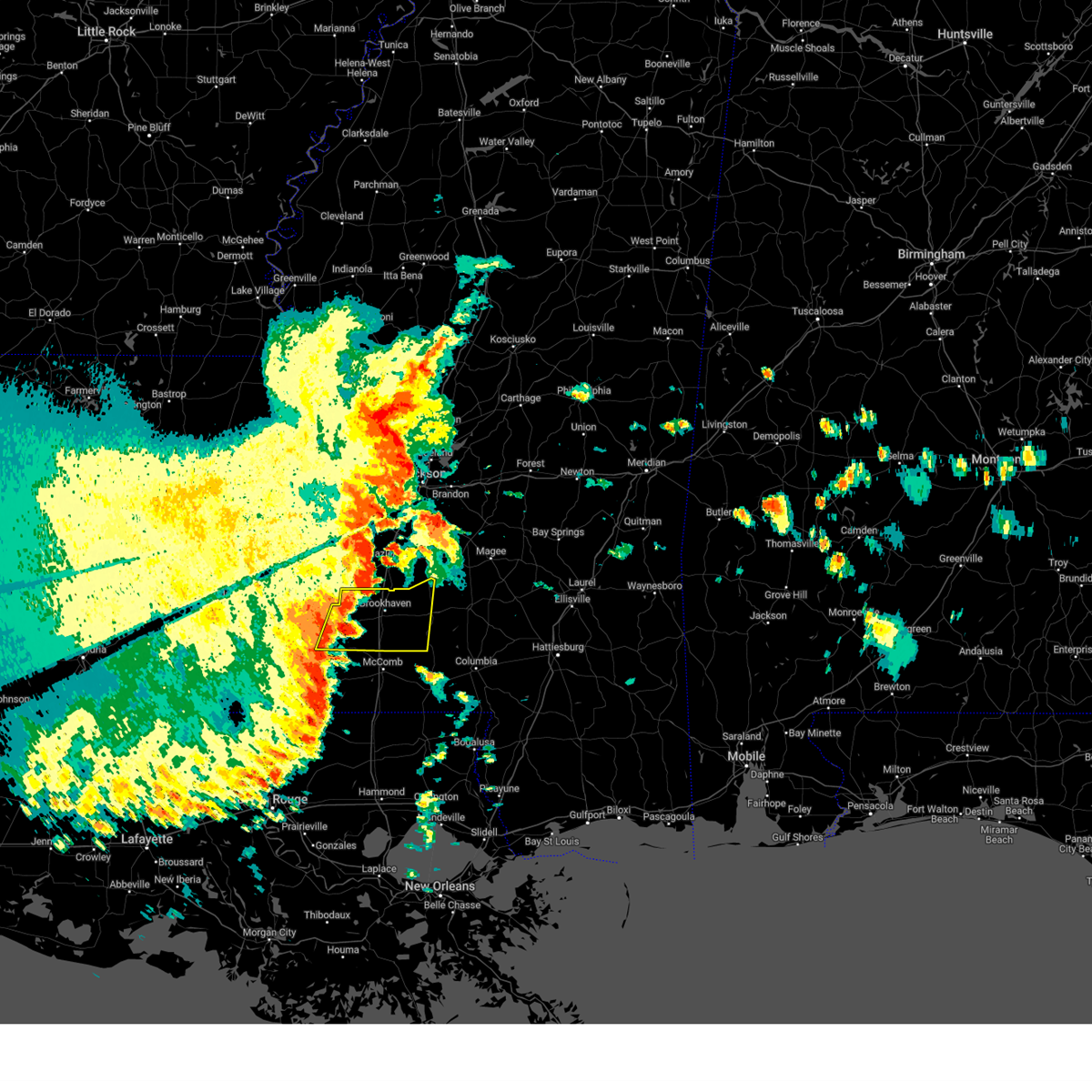 Svrjan the national weather service in jackson has issued a * severe thunderstorm warning for, lincoln county in south central mississippi, western lawrence county in south central mississippi, eastern franklin county in southwestern mississippi, * until 545 pm cdt. * at 446 pm cdt, a severe thunderstorm was located over mccall creek, or 13 miles east of meadville, moving east at 35 mph (radar indicated). Hazards include 60 mph wind gusts and quarter size hail. Hail damage to vehicles is expected. expect wind damage to roofs, siding, and trees. this severe thunderstorm will be near, west lincoln, vaughn, and loyd star around 450 pm cdt. brookhaven around 455 pm cdt. bogue chitto and enterprise around 505 pm cdt. east lincoln around 510 pm cdt. sontag around 525 pm cdt. Wanilla around 530 pm cdt. Svrjan the national weather service in jackson has issued a * severe thunderstorm warning for, lincoln county in south central mississippi, western lawrence county in south central mississippi, eastern franklin county in southwestern mississippi, * until 545 pm cdt. * at 446 pm cdt, a severe thunderstorm was located over mccall creek, or 13 miles east of meadville, moving east at 35 mph (radar indicated). Hazards include 60 mph wind gusts and quarter size hail. Hail damage to vehicles is expected. expect wind damage to roofs, siding, and trees. this severe thunderstorm will be near, west lincoln, vaughn, and loyd star around 450 pm cdt. brookhaven around 455 pm cdt. bogue chitto and enterprise around 505 pm cdt. east lincoln around 510 pm cdt. sontag around 525 pm cdt. Wanilla around 530 pm cdt.
|
| 6/4/2024 12:05 AM CDT |
 the severe thunderstorm warning has been cancelled and is no longer in effect the severe thunderstorm warning has been cancelled and is no longer in effect
|
| 6/3/2024 11:34 PM CDT |
 Svrjan the national weather service in jackson has issued a * severe thunderstorm warning for, newton county in east central mississippi, neshoba county in east central mississippi, * until 1245 am cdt. * at 1134 pm cdt, severe thunderstorms were located along a line extending from near renfroe to near walnut grove to homewood, moving east at 35 mph (radar indicated). Hazards include 60 mph wind gusts. Expect damage to roofs, siding, and trees. severe thunderstorms will be near, prospect and dowdville around 1140 pm cdt. philadelphia, pearl river, conehatta, and dixon around 1145 pm cdt. lawrence around 1150 pm cdt. newton, union, stratton, roberts, and neshoba around 1155 pm cdt. decatur, burnside around 1200 am cdt. tucker, and little rock around 1205 am cdt. hickory and house around 1210 am cdt. Duffee, forestdale, and herbert springs around 1215 am cdt. Svrjan the national weather service in jackson has issued a * severe thunderstorm warning for, newton county in east central mississippi, neshoba county in east central mississippi, * until 1245 am cdt. * at 1134 pm cdt, severe thunderstorms were located along a line extending from near renfroe to near walnut grove to homewood, moving east at 35 mph (radar indicated). Hazards include 60 mph wind gusts. Expect damage to roofs, siding, and trees. severe thunderstorms will be near, prospect and dowdville around 1140 pm cdt. philadelphia, pearl river, conehatta, and dixon around 1145 pm cdt. lawrence around 1150 pm cdt. newton, union, stratton, roberts, and neshoba around 1155 pm cdt. decatur, burnside around 1200 am cdt. tucker, and little rock around 1205 am cdt. hickory and house around 1210 am cdt. Duffee, forestdale, and herbert springs around 1215 am cdt.
|
| 5/27/2024 3:45 AM CDT |
 Svrjan the national weather service in jackson has issued a * severe thunderstorm warning for, southwestern noxubee county in east central mississippi, eastern newton county in east central mississippi, kemper county in east central mississippi, eastern neshoba county in east central mississippi, lauderdale county in east central mississippi, * until 445 am cdt. * at 344 am cdt, severe thunderstorms were located along a line extending from near burnside to chunky, moving east at 55 mph (radar indicated). Hazards include 60 mph wind gusts and half dollar size hail. Hail damage to vehicles is expected. expect wind damage to roofs, siding, and trees. severe thunderstorms will be near, meridian, philadelphia, collinsville, nellieburg, tucker, house, meehan, burnside, duffee, and suqualena around 350 am cdt. savoy and damascus around 355 am cdt. marion, daleville, nanih waiya, zero, preston, liberty, prismatic, and bluff springs around 400 am cdt. meridian station and blackwater around 405 am cdt. de kalb, toomsuba, lauderdale, and alamucha around 410 am cdt. tamola and kewanee around 415 am cdt. porterville and electric mills around 420 am cdt. Scooba around 425 am cdt. Svrjan the national weather service in jackson has issued a * severe thunderstorm warning for, southwestern noxubee county in east central mississippi, eastern newton county in east central mississippi, kemper county in east central mississippi, eastern neshoba county in east central mississippi, lauderdale county in east central mississippi, * until 445 am cdt. * at 344 am cdt, severe thunderstorms were located along a line extending from near burnside to chunky, moving east at 55 mph (radar indicated). Hazards include 60 mph wind gusts and half dollar size hail. Hail damage to vehicles is expected. expect wind damage to roofs, siding, and trees. severe thunderstorms will be near, meridian, philadelphia, collinsville, nellieburg, tucker, house, meehan, burnside, duffee, and suqualena around 350 am cdt. savoy and damascus around 355 am cdt. marion, daleville, nanih waiya, zero, preston, liberty, prismatic, and bluff springs around 400 am cdt. meridian station and blackwater around 405 am cdt. de kalb, toomsuba, lauderdale, and alamucha around 410 am cdt. tamola and kewanee around 415 am cdt. porterville and electric mills around 420 am cdt. Scooba around 425 am cdt.
|
| 5/25/2024 3:23 PM CDT |
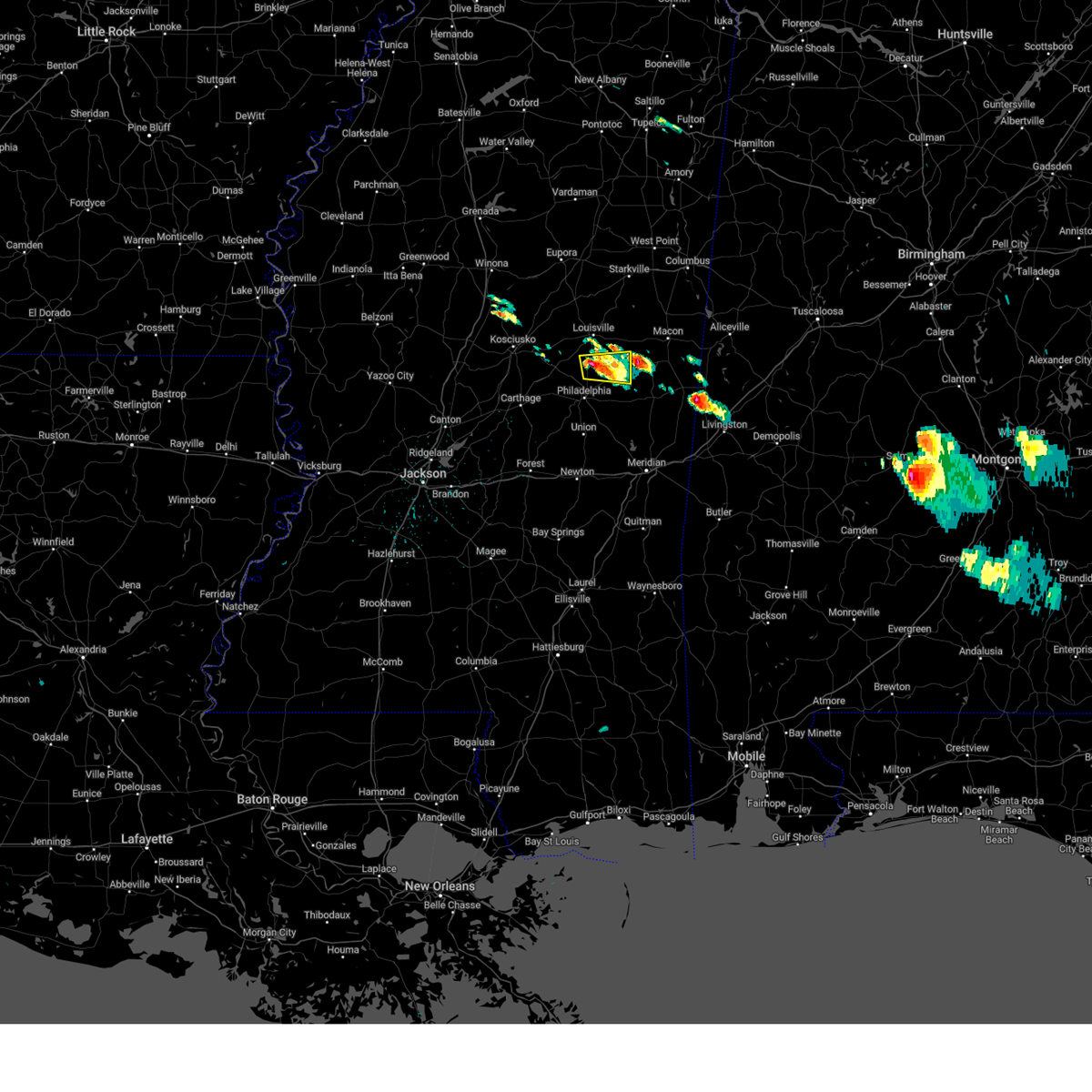 Svrjan the national weather service in jackson has issued a * severe thunderstorm warning for, northwestern kemper county in east central mississippi, southeastern winston county in east central mississippi, northeastern neshoba county in east central mississippi, * until 415 pm cdt. * at 323 pm cdt, a severe thunderstorm was located over noxapater, or 11 miles south of louisville, moving east at 10 mph (radar indicated). Hazards include 60 mph wind gusts and half dollar size hail. Hail damage to vehicles is expected. expect wind damage to roofs, siding, and trees. This severe thunderstorm will be near, nanih waiya around 330 pm cdt. Svrjan the national weather service in jackson has issued a * severe thunderstorm warning for, northwestern kemper county in east central mississippi, southeastern winston county in east central mississippi, northeastern neshoba county in east central mississippi, * until 415 pm cdt. * at 323 pm cdt, a severe thunderstorm was located over noxapater, or 11 miles south of louisville, moving east at 10 mph (radar indicated). Hazards include 60 mph wind gusts and half dollar size hail. Hail damage to vehicles is expected. expect wind damage to roofs, siding, and trees. This severe thunderstorm will be near, nanih waiya around 330 pm cdt.
|
| 5/10/2024 12:58 AM CDT |
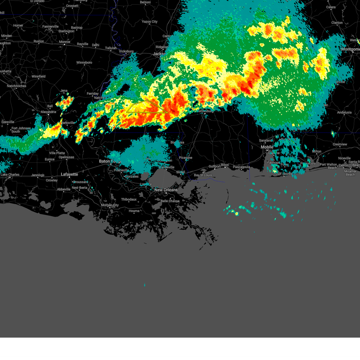 The storm which prompted the warning has moved out of the area. therefore, the warning will be allowed to expire. a severe thunderstorm watch remains in effect until 300 am cdt for south central and southwestern mississippi. a severe thunderstorm watch also remains in effect until 500 am cdt for south central mississippi. to report severe weather, contact your nearest law enforcement agency. they will relay your report to the national weather service jackson. The storm which prompted the warning has moved out of the area. therefore, the warning will be allowed to expire. a severe thunderstorm watch remains in effect until 300 am cdt for south central and southwestern mississippi. a severe thunderstorm watch also remains in effect until 500 am cdt for south central mississippi. to report severe weather, contact your nearest law enforcement agency. they will relay your report to the national weather service jackson.
|
| 5/10/2024 12:47 AM CDT |
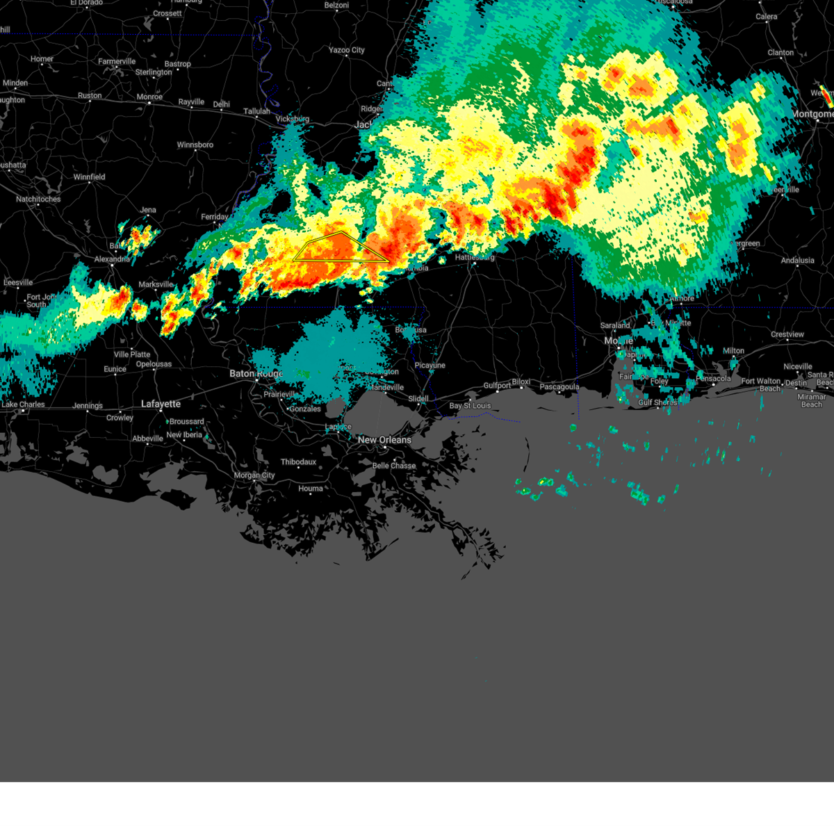 At 1247 am cdt, a severe thunderstorm was located near center point, or 9 miles northwest of mccomb, moving southeast at 50 mph (radar indicated). Hazards include 60 mph wind gusts. Expect damage to roofs, siding, and trees. Locations impacted include, bogue chitto, ruth, topeka, jayess, center point, enterprise, west lincoln, and little springs. At 1247 am cdt, a severe thunderstorm was located near center point, or 9 miles northwest of mccomb, moving southeast at 50 mph (radar indicated). Hazards include 60 mph wind gusts. Expect damage to roofs, siding, and trees. Locations impacted include, bogue chitto, ruth, topeka, jayess, center point, enterprise, west lincoln, and little springs.
|
| 5/10/2024 12:30 AM CDT |
 the severe thunderstorm warning has been cancelled and is no longer in effect the severe thunderstorm warning has been cancelled and is no longer in effect
|
| 5/10/2024 12:30 AM CDT |
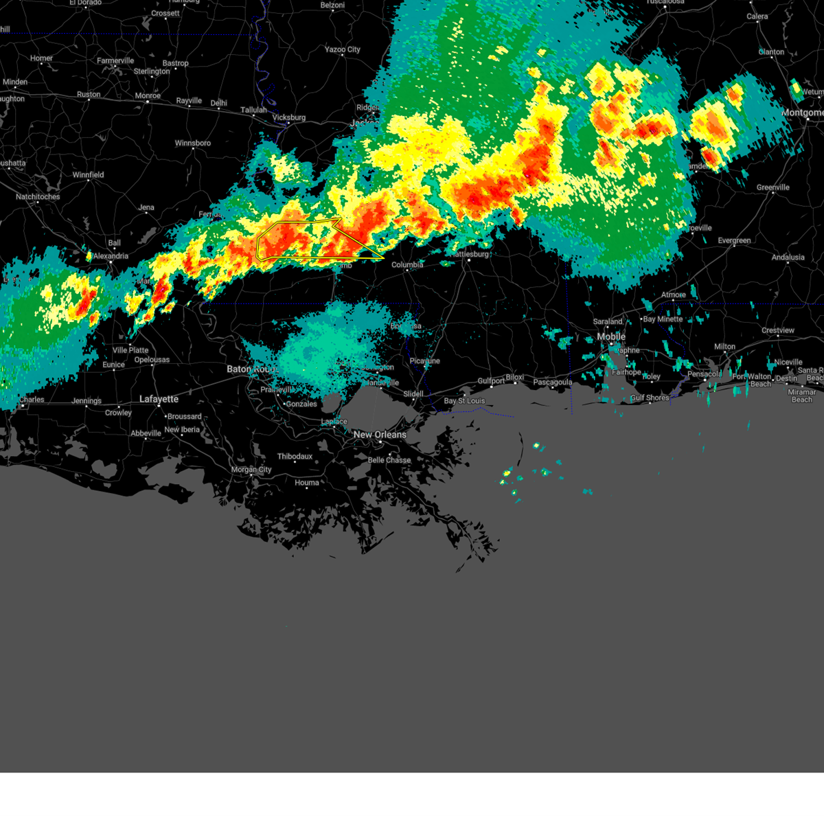 At 1229 am cdt, severe thunderstorms were located meadville, moving southeast at 50 mph (radar indicated). Hazards include 60 mph wind gusts and quarter size hail. Hail damage to vehicles is expected. expect wind damage to roofs, siding, and trees. Locations impacted include, brookhaven, meadville, bude, roxie, bogue chitto, topeka, mccall creek, garden city, west lincoln, vaughn, little springs, ruth, jayess, center point, enterprise, kirby, and new hope. At 1229 am cdt, severe thunderstorms were located meadville, moving southeast at 50 mph (radar indicated). Hazards include 60 mph wind gusts and quarter size hail. Hail damage to vehicles is expected. expect wind damage to roofs, siding, and trees. Locations impacted include, brookhaven, meadville, bude, roxie, bogue chitto, topeka, mccall creek, garden city, west lincoln, vaughn, little springs, ruth, jayess, center point, enterprise, kirby, and new hope.
|
| 5/10/2024 12:23 AM CDT |
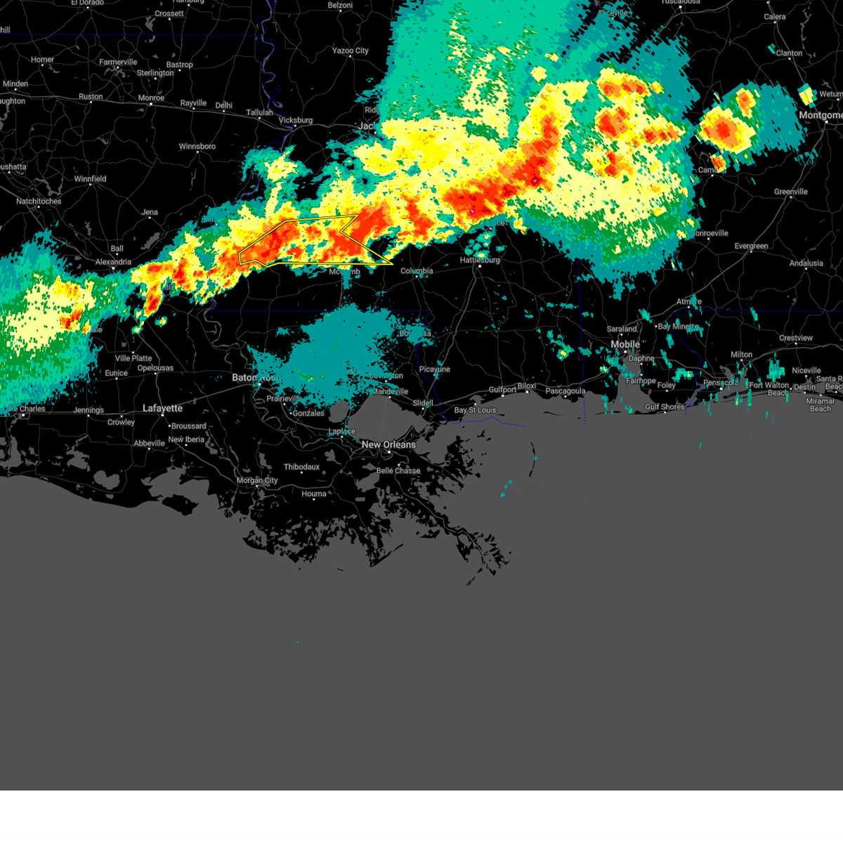 the severe thunderstorm warning has been cancelled and is no longer in effect the severe thunderstorm warning has been cancelled and is no longer in effect
|
| 5/10/2024 12:23 AM CDT |
 At 1222 am cdt, severe thunderstorms were located along a line extending from silver creek to near bogue chitto to near roxie, moving southeast at 25 mph (radar indicated). Hazards include 60 mph wind gusts and quarter size hail. Hail damage to vehicles is expected. expect wind damage to roofs, siding, and trees. Locations impacted include, brookhaven, meadville, bude, roxie, bogue chitto, topeka, caseyville, mccall creek, hamburg, kingston, garden city, west lincoln, vaughn, little springs, ruth, loyd star, jayess, center point, enterprise, and kirby. At 1222 am cdt, severe thunderstorms were located along a line extending from silver creek to near bogue chitto to near roxie, moving southeast at 25 mph (radar indicated). Hazards include 60 mph wind gusts and quarter size hail. Hail damage to vehicles is expected. expect wind damage to roofs, siding, and trees. Locations impacted include, brookhaven, meadville, bude, roxie, bogue chitto, topeka, caseyville, mccall creek, hamburg, kingston, garden city, west lincoln, vaughn, little springs, ruth, loyd star, jayess, center point, enterprise, and kirby.
|
| 5/10/2024 12:00 AM CDT |
 At 1159 pm cdt, severe thunderstorms were located along a line extending from near oma to near west lincoln to cranfield, moving east at 30 mph (radar indicated). Hazards include 60 mph wind gusts and quarter size hail. Hail damage to vehicles is expected. expect wind damage to roofs, siding, and trees. Locations impacted include, natchez, brookhaven, meadville, wesson, bude, roxie, bogue chitto, beauregard, topeka, union church, caseyville, mccall creek, stanton, hamburg, kingston, west lincoln, little springs, cranfield, stampley, and jayess. At 1159 pm cdt, severe thunderstorms were located along a line extending from near oma to near west lincoln to cranfield, moving east at 30 mph (radar indicated). Hazards include 60 mph wind gusts and quarter size hail. Hail damage to vehicles is expected. expect wind damage to roofs, siding, and trees. Locations impacted include, natchez, brookhaven, meadville, wesson, bude, roxie, bogue chitto, beauregard, topeka, union church, caseyville, mccall creek, stanton, hamburg, kingston, west lincoln, little springs, cranfield, stampley, and jayess.
|
| 5/9/2024 11:39 PM CDT |
 Svrjan the national weather service in jackson has issued a * severe thunderstorm warning for, lincoln county in south central mississippi, southwestern lawrence county in south central mississippi, jefferson county in southwestern mississippi, franklin county in southwestern mississippi, northeastern adams county in southwestern mississippi, southern copiah county in central mississippi, * until 100 am cdt. * at 1138 pm cdt, severe thunderstorms were located along a line extending from near beauregard to near new hope to near natchez, moving east at 30 mph (radar indicated). Hazards include 60 mph wind gusts and quarter size hail. Hail damage to vehicles is expected. expect wind damage to roofs, siding, and trees. severe thunderstorms will be near, brookhaven, meadville, wesson, roxie, mccall creek, cranfield, kirby, west lincoln, new hope, and vaughn around 1145 pm cdt. Enterprise around 1210 am cdt. Svrjan the national weather service in jackson has issued a * severe thunderstorm warning for, lincoln county in south central mississippi, southwestern lawrence county in south central mississippi, jefferson county in southwestern mississippi, franklin county in southwestern mississippi, northeastern adams county in southwestern mississippi, southern copiah county in central mississippi, * until 100 am cdt. * at 1138 pm cdt, severe thunderstorms were located along a line extending from near beauregard to near new hope to near natchez, moving east at 30 mph (radar indicated). Hazards include 60 mph wind gusts and quarter size hail. Hail damage to vehicles is expected. expect wind damage to roofs, siding, and trees. severe thunderstorms will be near, brookhaven, meadville, wesson, roxie, mccall creek, cranfield, kirby, west lincoln, new hope, and vaughn around 1145 pm cdt. Enterprise around 1210 am cdt.
|
| 5/9/2024 6:34 PM CDT | Quarter sized hail reported 5.6 miles SW of Bogue Chitto, MS, hail up to the size of quarters fell near preston. |
| 5/9/2024 6:34 PM CDT |
 Svrjan the national weather service in jackson has issued a * severe thunderstorm warning for, southern noxubee county in east central mississippi, northern kemper county in east central mississippi, * until 730 pm cdt. * at 634 pm cdt, a severe thunderstorm was located near preston, or 9 miles northwest of de kalb, moving east at 30 mph (radar indicated). Hazards include 60 mph wind gusts and quarter size hail. Hail damage to vehicles is expected. expect wind damage to roofs, siding, and trees. this severe thunderstorm will be near, gholson around 640 pm cdt. shuqualak around 650 pm cdt. scooba around 655 pm cdt. paulette around 710 pm cdt. Cooksville around 715 pm cdt. Svrjan the national weather service in jackson has issued a * severe thunderstorm warning for, southern noxubee county in east central mississippi, northern kemper county in east central mississippi, * until 730 pm cdt. * at 634 pm cdt, a severe thunderstorm was located near preston, or 9 miles northwest of de kalb, moving east at 30 mph (radar indicated). Hazards include 60 mph wind gusts and quarter size hail. Hail damage to vehicles is expected. expect wind damage to roofs, siding, and trees. this severe thunderstorm will be near, gholson around 640 pm cdt. shuqualak around 650 pm cdt. scooba around 655 pm cdt. paulette around 710 pm cdt. Cooksville around 715 pm cdt.
|
| 4/10/2024 9:20 AM CDT | Power lines down near bogue chitto and a couple trees down in se part of the count in lincoln county MS, 0.7 miles SW of Bogue Chitto, MS |
| 4/10/2024 9:00 AM CDT |
 Svrjan the national weather service in jackson has issued a * severe thunderstorm warning for, lincoln county in south central mississippi, lawrence county in south central mississippi, southeastern franklin county in southwestern mississippi, * until 1000 am cdt. * at 900 am cdt, severe thunderstorms were located along a line extending from near little springs to near magnolia, moving northeast at 60 mph (radar indicated). Hazards include 60 mph wind gusts. Expect damage to roofs, siding, and trees. severe thunderstorms will be near, center point and little springs around 905 am cdt. bogue chitto and west lincoln around 915 am cdt. brookhaven, jayess, ruth, and enterprise around 920 am cdt. east lincoln and topeka around 925 am cdt. monticello, sontag, tilton, robinwood, arm, and oak vale around 935 am cdt. silver creek and wanilla around 940 am cdt. New hebron around 950 am cdt. Svrjan the national weather service in jackson has issued a * severe thunderstorm warning for, lincoln county in south central mississippi, lawrence county in south central mississippi, southeastern franklin county in southwestern mississippi, * until 1000 am cdt. * at 900 am cdt, severe thunderstorms were located along a line extending from near little springs to near magnolia, moving northeast at 60 mph (radar indicated). Hazards include 60 mph wind gusts. Expect damage to roofs, siding, and trees. severe thunderstorms will be near, center point and little springs around 905 am cdt. bogue chitto and west lincoln around 915 am cdt. brookhaven, jayess, ruth, and enterprise around 920 am cdt. east lincoln and topeka around 925 am cdt. monticello, sontag, tilton, robinwood, arm, and oak vale around 935 am cdt. silver creek and wanilla around 940 am cdt. New hebron around 950 am cdt.
|
| 4/9/2024 11:04 PM CDT |
 the severe thunderstorm warning has been cancelled and is no longer in effect the severe thunderstorm warning has been cancelled and is no longer in effect
|
| 4/9/2024 10:35 PM CDT |
 At 1035 pm cdt, severe thunderstorms were located along a line extending from near philadelphia to neshoba, moving northeast at 40 mph (radar indicated). Hazards include 60 mph wind gusts and quarter size hail. Hail damage to vehicles is expected. expect wind damage to roofs, siding, and trees. these severe storms will be near, philadelphia, tucker, house, burnside, and bethsaida around 1040 pm cdt. Forestdale around 1045 pm cdt. At 1035 pm cdt, severe thunderstorms were located along a line extending from near philadelphia to neshoba, moving northeast at 40 mph (radar indicated). Hazards include 60 mph wind gusts and quarter size hail. Hail damage to vehicles is expected. expect wind damage to roofs, siding, and trees. these severe storms will be near, philadelphia, tucker, house, burnside, and bethsaida around 1040 pm cdt. Forestdale around 1045 pm cdt.
|
| 4/9/2024 10:35 PM CDT |
 the severe thunderstorm warning has been cancelled and is no longer in effect the severe thunderstorm warning has been cancelled and is no longer in effect
|
| 4/9/2024 10:21 PM CDT |
 At 1020 pm cdt, severe thunderstorms were located along a line extending from 7 miles southeast of zama to prospect, moving northeast at 45 mph (radar indicated). Hazards include ping pong ball size hail and 60 mph wind gusts. People and animals outdoors will be injured. expect hail damage to roofs, siding, windows, and vehicles. expect wind damage to roofs, siding, and trees. these severe storms will be near, philadelphia, pearl river, union, dixon, and neshoba around 1025 pm cdt. burnside and stallo around 1030 pm cdt. tucker and bethsaida around 1035 pm cdt. house, forestdale, and nanih waiya around 1040 pm cdt. Herbert springs around 1045 pm cdt. At 1020 pm cdt, severe thunderstorms were located along a line extending from 7 miles southeast of zama to prospect, moving northeast at 45 mph (radar indicated). Hazards include ping pong ball size hail and 60 mph wind gusts. People and animals outdoors will be injured. expect hail damage to roofs, siding, windows, and vehicles. expect wind damage to roofs, siding, and trees. these severe storms will be near, philadelphia, pearl river, union, dixon, and neshoba around 1025 pm cdt. burnside and stallo around 1030 pm cdt. tucker and bethsaida around 1035 pm cdt. house, forestdale, and nanih waiya around 1040 pm cdt. Herbert springs around 1045 pm cdt.
|
| 4/9/2024 10:12 PM CDT |
 Svrjan the national weather service in jackson has issued a * severe thunderstorm warning for, northern newton county in east central mississippi, neshoba county in east central mississippi, * until 1115 pm cdt. * at 1012 pm cdt, severe thunderstorms were located along a line extending from near zama to near steele, moving east at 40 mph (radar indicated). Hazards include 60 mph wind gusts and quarter size hail. Hail damage to vehicles is expected. expect wind damage to roofs, siding, and trees. severe thunderstorms will be near, philadelphia, pearl river, dixon, prospect, and dowdville around 1015 pm cdt. union, burnside, neshoba, and stallo around 1025 pm cdt. stratton around 1030 pm cdt. tucker and bethsaida around 1035 pm cdt. house, forestdale, and nanih waiya around 1040 pm cdt. Herbert springs around 1045 pm cdt. Svrjan the national weather service in jackson has issued a * severe thunderstorm warning for, northern newton county in east central mississippi, neshoba county in east central mississippi, * until 1115 pm cdt. * at 1012 pm cdt, severe thunderstorms were located along a line extending from near zama to near steele, moving east at 40 mph (radar indicated). Hazards include 60 mph wind gusts and quarter size hail. Hail damage to vehicles is expected. expect wind damage to roofs, siding, and trees. severe thunderstorms will be near, philadelphia, pearl river, dixon, prospect, and dowdville around 1015 pm cdt. union, burnside, neshoba, and stallo around 1025 pm cdt. stratton around 1030 pm cdt. tucker and bethsaida around 1035 pm cdt. house, forestdale, and nanih waiya around 1040 pm cdt. Herbert springs around 1045 pm cdt.
|
| 3/15/2024 7:46 AM CDT |
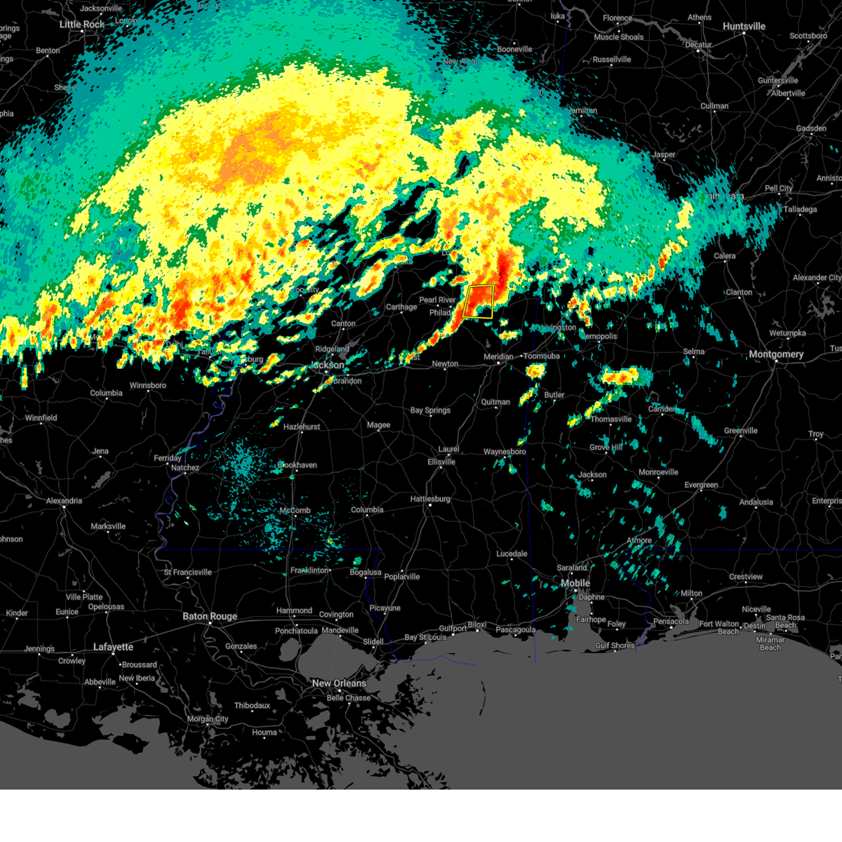 At 745 am cdt, a severe thunderstorm was located near forestdale, or 13 miles east of philadelphia, moving east at 35 mph (law enforcement. at 720 cdt, a tree was blown down in spring creek). Hazards include 60 mph wind gusts and quarter size hail. Hail damage to vehicles is expected. expect wind damage to roofs, siding, and trees. This severe storm will be near, preston and bluff springs around 750 am cdt. At 745 am cdt, a severe thunderstorm was located near forestdale, or 13 miles east of philadelphia, moving east at 35 mph (law enforcement. at 720 cdt, a tree was blown down in spring creek). Hazards include 60 mph wind gusts and quarter size hail. Hail damage to vehicles is expected. expect wind damage to roofs, siding, and trees. This severe storm will be near, preston and bluff springs around 750 am cdt.
|
| 3/15/2024 7:19 AM CDT |
 Svrjan the national weather service in jackson has issued a * severe thunderstorm warning for, northwestern kemper county in east central mississippi, northeastern neshoba county in east central mississippi, * until 800 am cdt. * at 719 am cdt, a severe thunderstorm was located over philadelphia, moving east at 35 mph (radar indicated). Hazards include 60 mph wind gusts and quarter size hail. Hail damage to vehicles is expected. expect wind damage to roofs, siding, and trees. this severe thunderstorm will be near, philadelphia, tucker, burnside, forestdale, and stallo around 725 am cdt. Preston and bluff springs around 740 am cdt. Svrjan the national weather service in jackson has issued a * severe thunderstorm warning for, northwestern kemper county in east central mississippi, northeastern neshoba county in east central mississippi, * until 800 am cdt. * at 719 am cdt, a severe thunderstorm was located over philadelphia, moving east at 35 mph (radar indicated). Hazards include 60 mph wind gusts and quarter size hail. Hail damage to vehicles is expected. expect wind damage to roofs, siding, and trees. this severe thunderstorm will be near, philadelphia, tucker, burnside, forestdale, and stallo around 725 am cdt. Preston and bluff springs around 740 am cdt.
|
| 3/15/2024 5:33 AM CDT |
 At 533 am cdt, severe thunderstorms were located along a line extending from near zama to near renfroe, moving east at 30 mph (radar indicated). Hazards include 60 mph wind gusts and quarter size hail. Hail damage to vehicles is expected. expect wind damage to roofs, siding, and trees. these severe storms will be near, stallo around 555 am cdt. philadelphia, noxapater, and burnside around 600 am cdt. louisville around 605 am cdt. Nanih waiya around 615 am cdt. At 533 am cdt, severe thunderstorms were located along a line extending from near zama to near renfroe, moving east at 30 mph (radar indicated). Hazards include 60 mph wind gusts and quarter size hail. Hail damage to vehicles is expected. expect wind damage to roofs, siding, and trees. these severe storms will be near, stallo around 555 am cdt. philadelphia, noxapater, and burnside around 600 am cdt. louisville around 605 am cdt. Nanih waiya around 615 am cdt.
|
| 3/15/2024 5:29 AM CDT |
 Svrjan the national weather service in jackson has issued a * severe thunderstorm warning for, south central choctaw county in central mississippi, northeastern leake county in central mississippi, southwestern noxubee county in east central mississippi, northwestern kemper county in east central mississippi, southeastern attala county in central mississippi, winston county in east central mississippi, neshoba county in east central mississippi, * until 630 am cdt. * at 524 am cdt, severe thunderstorms were located along a line extending from near smyrna to renfroe, moving east at 30 mph (radar indicated). Hazards include 60 mph wind gusts and quarter size hail. Hail damage to vehicles is expected. expect wind damage to roofs, siding, and trees. severe thunderstorms will be near, zama around 530 am cdt. edinburg around 535 am cdt. burnside and stallo around 555 am cdt. philadelphia and noxapater around 600 am cdt. louisville around 605 am cdt. Nanih waiya around 615 am cdt. Svrjan the national weather service in jackson has issued a * severe thunderstorm warning for, south central choctaw county in central mississippi, northeastern leake county in central mississippi, southwestern noxubee county in east central mississippi, northwestern kemper county in east central mississippi, southeastern attala county in central mississippi, winston county in east central mississippi, neshoba county in east central mississippi, * until 630 am cdt. * at 524 am cdt, severe thunderstorms were located along a line extending from near smyrna to renfroe, moving east at 30 mph (radar indicated). Hazards include 60 mph wind gusts and quarter size hail. Hail damage to vehicles is expected. expect wind damage to roofs, siding, and trees. severe thunderstorms will be near, zama around 530 am cdt. edinburg around 535 am cdt. burnside and stallo around 555 am cdt. philadelphia and noxapater around 600 am cdt. louisville around 605 am cdt. Nanih waiya around 615 am cdt.
|
| 2/12/2024 12:22 AM CST |
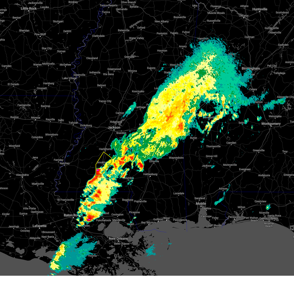 At 1221 am cst, a severe thunderstorm was located over west lincoln, or 11 miles southwest of brookhaven, moving northeast at 70 mph (radar indicated). Hazards include golf ball size hail and 60 mph wind gusts. People and animals outdoors will be injured. expect hail damage to roofs, siding, windows, and vehicles. expect wind damage to roofs, siding, and trees. this severe storm will be near, brookhaven, bogue chitto, west lincoln, vaughn, and loyd star around 1225 am cst. wesson around 1230 am cst. beauregard around 1235 am cst. martinsville around 1240 am cst. thunderstorm damage threat, considerable hail threat, radar indicated max hail size, 1. 75 in wind threat, radar indicated max wind gust, 60 mph. At 1221 am cst, a severe thunderstorm was located over west lincoln, or 11 miles southwest of brookhaven, moving northeast at 70 mph (radar indicated). Hazards include golf ball size hail and 60 mph wind gusts. People and animals outdoors will be injured. expect hail damage to roofs, siding, windows, and vehicles. expect wind damage to roofs, siding, and trees. this severe storm will be near, brookhaven, bogue chitto, west lincoln, vaughn, and loyd star around 1225 am cst. wesson around 1230 am cst. beauregard around 1235 am cst. martinsville around 1240 am cst. thunderstorm damage threat, considerable hail threat, radar indicated max hail size, 1. 75 in wind threat, radar indicated max wind gust, 60 mph.
|
| 2/12/2024 12:11 AM CST |
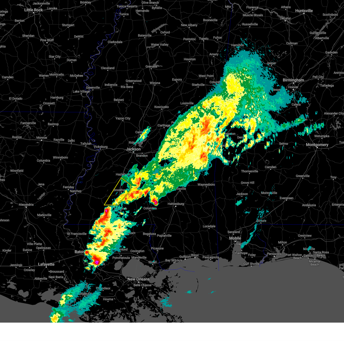 At 1211 am cst, a severe thunderstorm was located over smithdale, or 12 miles northeast of liberty, moving northeast at 70 mph (radar indicated). Hazards include 60 mph wind gusts and half dollar size hail. Hail damage to vehicles is expected. expect wind damage to roofs, siding, and trees. this severe thunderstorm will be near, center point, west lincoln, and little springs around 1215 am cst. bogue chitto and vaughn around 1220 am cst. brookhaven and loyd star around 1225 am cst. wesson around 1230 am cst. beauregard around 1235 am cst. martinsville around 1240 am cst. hail threat, radar indicated max hail size, 1. 25 in wind threat, radar indicated max wind gust, 60 mph. At 1211 am cst, a severe thunderstorm was located over smithdale, or 12 miles northeast of liberty, moving northeast at 70 mph (radar indicated). Hazards include 60 mph wind gusts and half dollar size hail. Hail damage to vehicles is expected. expect wind damage to roofs, siding, and trees. this severe thunderstorm will be near, center point, west lincoln, and little springs around 1215 am cst. bogue chitto and vaughn around 1220 am cst. brookhaven and loyd star around 1225 am cst. wesson around 1230 am cst. beauregard around 1235 am cst. martinsville around 1240 am cst. hail threat, radar indicated max hail size, 1. 25 in wind threat, radar indicated max wind gust, 60 mph.
|
| 2/11/2024 7:01 PM CST |
 At 701 pm cst, a severe thunderstorm was located over noxapater, or 8 miles south of louisville, moving northeast at 55 mph (radar indicated). Hazards include 60 mph wind gusts and quarter size hail. Hail damage to vehicles is expected. expect wind damage to roofs, siding, and trees. this severe storm will be near, louisville and noxapater around 705 pm cst. millcreek around 710 pm cst. betheden around 715 pm cst. hail threat, radar indicated max hail size, 1. 00 in wind threat, radar indicated max wind gust, 60 mph. At 701 pm cst, a severe thunderstorm was located over noxapater, or 8 miles south of louisville, moving northeast at 55 mph (radar indicated). Hazards include 60 mph wind gusts and quarter size hail. Hail damage to vehicles is expected. expect wind damage to roofs, siding, and trees. this severe storm will be near, louisville and noxapater around 705 pm cst. millcreek around 710 pm cst. betheden around 715 pm cst. hail threat, radar indicated max hail size, 1. 00 in wind threat, radar indicated max wind gust, 60 mph.
|
| 2/11/2024 6:45 PM CST |
 At 645 pm cst, a severe thunderstorm was located near edinburg, or 8 miles northwest of pearl river, moving northeast at 55 mph (radar indicated). Hazards include 60 mph wind gusts and quarter size hail. Hail damage to vehicles is expected. expect wind damage to roofs, siding, and trees. this severe thunderstorm will be near, stallo around 650 pm cst. noxapater around 655 pm cst. louisville around 700 pm cst. millcreek around 710 pm cst. betheden around 715 pm cst. hail threat, radar indicated max hail size, 1. 00 in wind threat, radar indicated max wind gust, 60 mph. At 645 pm cst, a severe thunderstorm was located near edinburg, or 8 miles northwest of pearl river, moving northeast at 55 mph (radar indicated). Hazards include 60 mph wind gusts and quarter size hail. Hail damage to vehicles is expected. expect wind damage to roofs, siding, and trees. this severe thunderstorm will be near, stallo around 650 pm cst. noxapater around 655 pm cst. louisville around 700 pm cst. millcreek around 710 pm cst. betheden around 715 pm cst. hail threat, radar indicated max hail size, 1. 00 in wind threat, radar indicated max wind gust, 60 mph.
|
| 1/25/2024 8:54 AM CST |
 At 853 am cst, severe thunderstorms were located along a line extending from near carpenter to glancy to near brookhaven, moving east at 50 mph (radar indicated). Hazards include 60 mph wind gusts. Expect damage to roofs, siding, and trees. these severe storms will be near, brookhaven, crystal springs, hazlehurst, wesson, beauregard, martinsville, and gallman around 900 am cst. sontag around 905 am cst. georgetown, hopewell, rockport, oma, and wanilla around 910 am cst. monticello around 920 am cst. hail threat, radar indicated max hail size, <. 75 in wind threat, radar indicated max wind gust, 60 mph. At 853 am cst, severe thunderstorms were located along a line extending from near carpenter to glancy to near brookhaven, moving east at 50 mph (radar indicated). Hazards include 60 mph wind gusts. Expect damage to roofs, siding, and trees. these severe storms will be near, brookhaven, crystal springs, hazlehurst, wesson, beauregard, martinsville, and gallman around 900 am cst. sontag around 905 am cst. georgetown, hopewell, rockport, oma, and wanilla around 910 am cst. monticello around 920 am cst. hail threat, radar indicated max hail size, <. 75 in wind threat, radar indicated max wind gust, 60 mph.
|
| 1/25/2024 8:33 AM CST |
 At 833 am cst, severe thunderstorms were located along a line extending from near hermanville to near pleasant hill to near mccall creek, moving northeast at 50 mph (radar indicated). Hazards include 60 mph wind gusts. Expect damage to roofs, siding, and trees. severe thunderstorms will be near, caseyville, allen, vaughn, barlow, and loyd star around 840 am cst. brookhaven, glancy, and carpenter around 845 am cst. dentville around 850 am cst. hazlehurst, wesson, beauregard, and martinsville around 855 am cst. crystal springs and gallman around 900 am cst. hopewell around 910 am cst. georgetown and rockport around 915 am cst. hail threat, radar indicated max hail size, <. 75 in wind threat, radar indicated max wind gust, 60 mph. At 833 am cst, severe thunderstorms were located along a line extending from near hermanville to near pleasant hill to near mccall creek, moving northeast at 50 mph (radar indicated). Hazards include 60 mph wind gusts. Expect damage to roofs, siding, and trees. severe thunderstorms will be near, caseyville, allen, vaughn, barlow, and loyd star around 840 am cst. brookhaven, glancy, and carpenter around 845 am cst. dentville around 850 am cst. hazlehurst, wesson, beauregard, and martinsville around 855 am cst. crystal springs and gallman around 900 am cst. hopewell around 910 am cst. georgetown and rockport around 915 am cst. hail threat, radar indicated max hail size, <. 75 in wind threat, radar indicated max wind gust, 60 mph.
|
| 1/12/2024 9:36 AM CST |
 At 936 am cst, a severe thunderstorm was located near shuqualak, or 10 miles southwest of macon, moving northeast at 65 mph (radar indicated). Hazards include 60 mph wind gusts. Expect damage to roofs, siding, and trees. this severe thunderstorm will remain over mainly rural areas of western noxubee, northern newton, western kemper and southeastern neshoba counties. hail threat, radar indicated max hail size, <. 75 in wind threat, radar indicated max wind gust, 60 mph. At 936 am cst, a severe thunderstorm was located near shuqualak, or 10 miles southwest of macon, moving northeast at 65 mph (radar indicated). Hazards include 60 mph wind gusts. Expect damage to roofs, siding, and trees. this severe thunderstorm will remain over mainly rural areas of western noxubee, northern newton, western kemper and southeastern neshoba counties. hail threat, radar indicated max hail size, <. 75 in wind threat, radar indicated max wind gust, 60 mph.
|
| 1/12/2024 8:59 AM CST |
 At 858 am cst, a severe thunderstorm was located over dixon, or 7 miles northwest of union, moving northeast at 65 mph (radar indicated). Hazards include 60 mph wind gusts. Expect damage to roofs, siding, and trees. this severe thunderstorm will be near, philadelphia, tucker, house, and bethsaida around 905 am cst. forestdale around 910 am cst. bluff springs around 915 am cst. nanih waiya and preston around 920 am cst. gholson around 925 am cst. hail threat, radar indicated max hail size, <. 75 in wind threat, radar indicated max wind gust, 60 mph. At 858 am cst, a severe thunderstorm was located over dixon, or 7 miles northwest of union, moving northeast at 65 mph (radar indicated). Hazards include 60 mph wind gusts. Expect damage to roofs, siding, and trees. this severe thunderstorm will be near, philadelphia, tucker, house, and bethsaida around 905 am cst. forestdale around 910 am cst. bluff springs around 915 am cst. nanih waiya and preston around 920 am cst. gholson around 925 am cst. hail threat, radar indicated max hail size, <. 75 in wind threat, radar indicated max wind gust, 60 mph.
|
| 11/20/2023 8:02 PM CST |
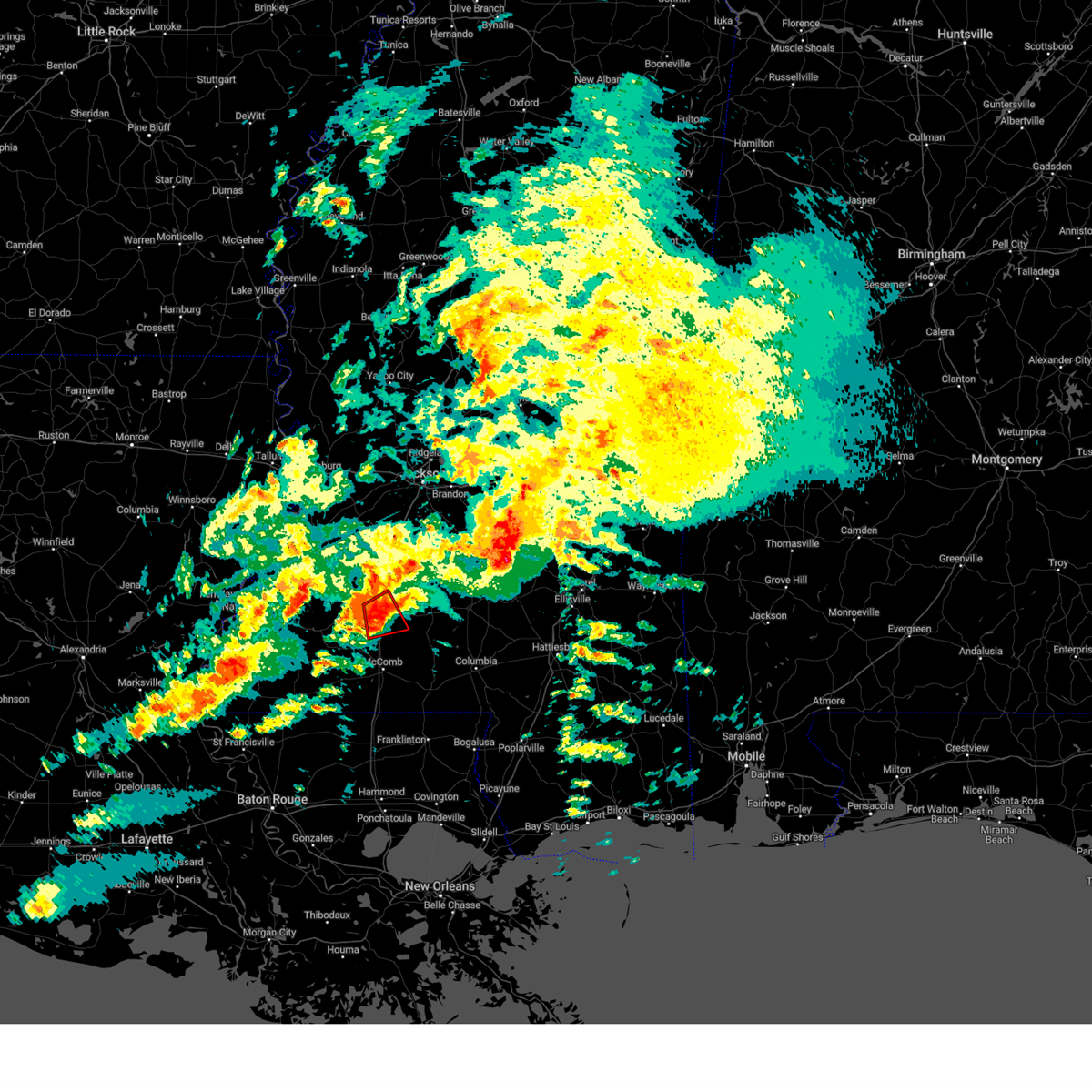 At 802 pm cst, a severe thunderstorm capable of producing a tornado was located near sontag, or 8 miles east of brookhaven, moving northeast at 40 mph (radar indicated rotation). Hazards include tornado. Flying debris will be dangerous to those caught without shelter. mobile homes will be damaged or destroyed. damage to roofs, windows, and vehicles will occur. tree damage is likely. This tornadic thunderstorm will remain over mainly rural areas of central lincoln county. At 802 pm cst, a severe thunderstorm capable of producing a tornado was located near sontag, or 8 miles east of brookhaven, moving northeast at 40 mph (radar indicated rotation). Hazards include tornado. Flying debris will be dangerous to those caught without shelter. mobile homes will be damaged or destroyed. damage to roofs, windows, and vehicles will occur. tree damage is likely. This tornadic thunderstorm will remain over mainly rural areas of central lincoln county.
|
| 11/20/2023 7:53 PM CST | Some trees and power lines dow in lincoln county MS, 3.9 miles S of Bogue Chitto, MS |
| 11/20/2023 7:36 PM CST |
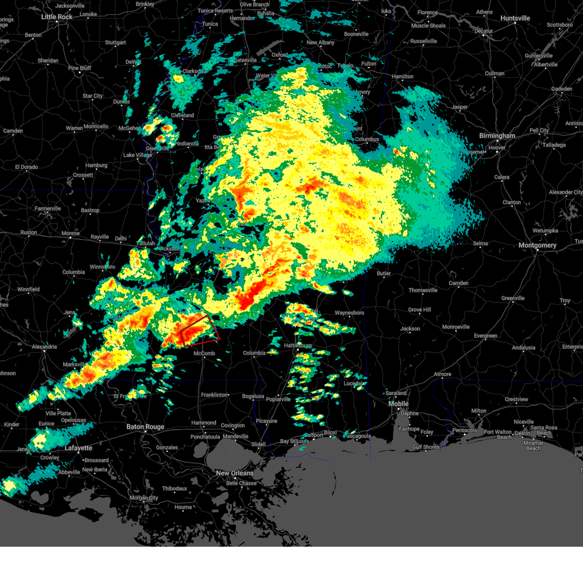 At 736 pm cst, a severe thunderstorm capable of producing a tornado was located over west lincoln, or 8 miles southwest of brookhaven, moving northeast at 40 mph (radar indicated rotation). Hazards include tornado. Flying debris will be dangerous to those caught without shelter. mobile homes will be damaged or destroyed. damage to roofs, windows, and vehicles will occur. tree damage is likely. this dangerous storm will be near, brookhaven, bogue chitto, and vaughn around 740 pm cst. Enterprise around 745 pm cst. At 736 pm cst, a severe thunderstorm capable of producing a tornado was located over west lincoln, or 8 miles southwest of brookhaven, moving northeast at 40 mph (radar indicated rotation). Hazards include tornado. Flying debris will be dangerous to those caught without shelter. mobile homes will be damaged or destroyed. damage to roofs, windows, and vehicles will occur. tree damage is likely. this dangerous storm will be near, brookhaven, bogue chitto, and vaughn around 740 pm cst. Enterprise around 745 pm cst.
|
| 11/20/2023 7:12 PM CST |
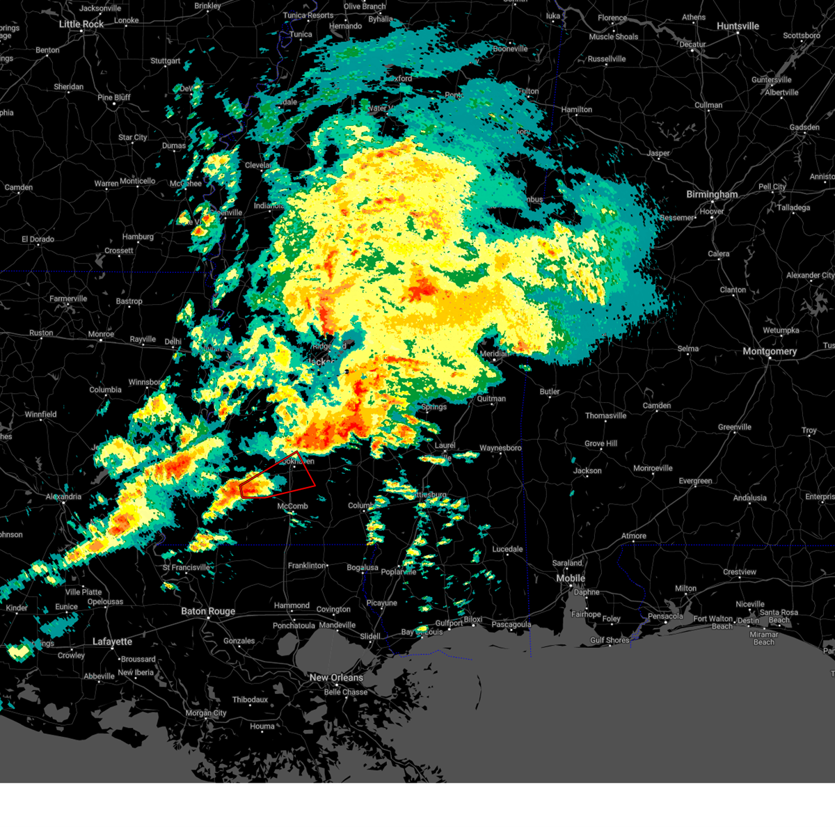 At 711 pm cst, a severe thunderstorm capable of producing a tornado was located near little springs, or 7 miles southeast of meadville, moving northeast at 40 mph (radar indicated rotation). Hazards include tornado. Flying debris will be dangerous to those caught without shelter. mobile homes will be damaged or destroyed. damage to roofs, windows, and vehicles will occur. tree damage is likely. this dangerous storm will be near, mccall creek and little springs around 715 pm cst. center point around 720 pm cst. west lincoln around 725 pm cst. vaughn around 730 pm cst. brookhaven around 735 pm cst. bogue chitto around 740 pm cst. Enterprise around 745 pm cst. At 711 pm cst, a severe thunderstorm capable of producing a tornado was located near little springs, or 7 miles southeast of meadville, moving northeast at 40 mph (radar indicated rotation). Hazards include tornado. Flying debris will be dangerous to those caught without shelter. mobile homes will be damaged or destroyed. damage to roofs, windows, and vehicles will occur. tree damage is likely. this dangerous storm will be near, mccall creek and little springs around 715 pm cst. center point around 720 pm cst. west lincoln around 725 pm cst. vaughn around 730 pm cst. brookhaven around 735 pm cst. bogue chitto around 740 pm cst. Enterprise around 745 pm cst.
|
| 9/6/2023 10:27 PM CDT |
 At 1026 pm cdt, a severe thunderstorm was located near burnside, or 8 miles northeast of philadelphia, moving southeast at 35 mph (radar indicated). Hazards include 60 mph wind gusts and nickel size hail. Expect damage to roofs, siding, and trees. this severe thunderstorm will be near, philadelphia, forestdale, and nanih waiya around 1030 pm cdt. bluff springs around 1040 pm cdt. damascus around 1050 pm cdt. liberty around 1055 pm cdt. herbert springs around 1100 pm cdt. hail threat, radar indicated max hail size, 0. 88 in wind threat, radar indicated max wind gust, 60 mph. At 1026 pm cdt, a severe thunderstorm was located near burnside, or 8 miles northeast of philadelphia, moving southeast at 35 mph (radar indicated). Hazards include 60 mph wind gusts and nickel size hail. Expect damage to roofs, siding, and trees. this severe thunderstorm will be near, philadelphia, forestdale, and nanih waiya around 1030 pm cdt. bluff springs around 1040 pm cdt. damascus around 1050 pm cdt. liberty around 1055 pm cdt. herbert springs around 1100 pm cdt. hail threat, radar indicated max hail size, 0. 88 in wind threat, radar indicated max wind gust, 60 mph.
|
| 7/16/2023 7:35 PM CDT |
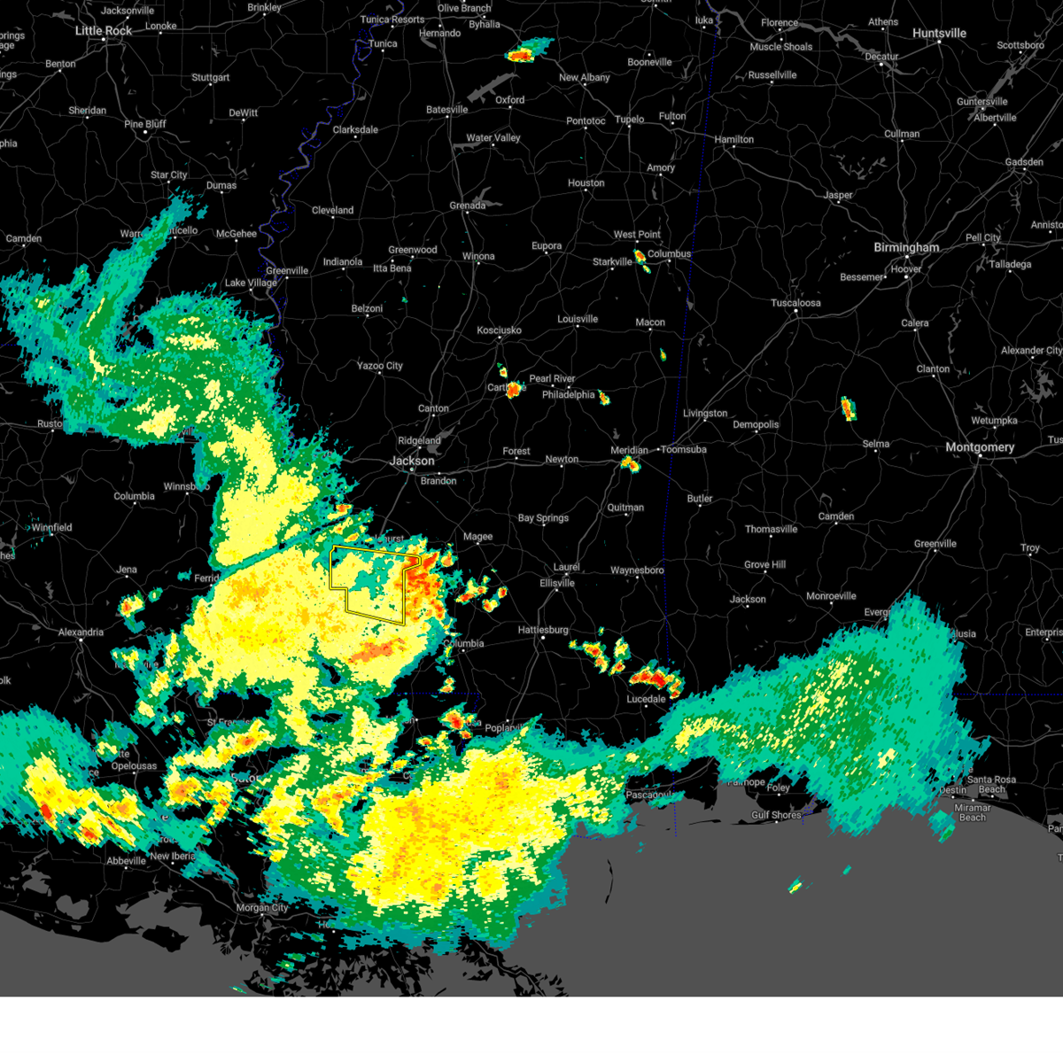 The severe thunderstorm warning for lincoln and southern copiah counties will expire at 745 pm cdt, the storm which prompted the warning has weakened below severe limits, and has exited the warned area. therefore, the warning will be allowed to expire. a severe thunderstorm watch remains in effect until 1000 pm cdt for central, south central and southwestern mississippi. The severe thunderstorm warning for lincoln and southern copiah counties will expire at 745 pm cdt, the storm which prompted the warning has weakened below severe limits, and has exited the warned area. therefore, the warning will be allowed to expire. a severe thunderstorm watch remains in effect until 1000 pm cdt for central, south central and southwestern mississippi.
|
| 7/16/2023 6:25 PM CDT |
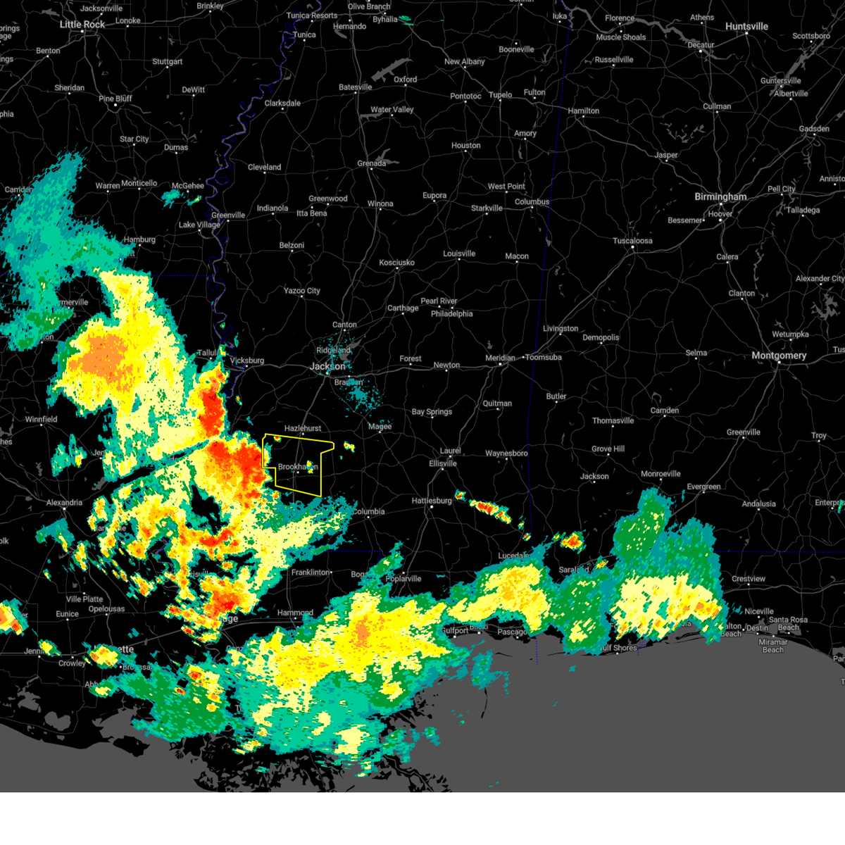 At 625 pm cdt, a severe thunderstorm was located near blue hill, or 12 miles east of fayette, moving east at 30 mph (radar indicated). Hazards include 60 mph wind gusts and quarter size hail. Hail damage to vehicles is expected. expect wind damage to roofs, siding, and trees. this severe thunderstorm will be near, pleasant hill around 640 pm cdt. allen around 645 pm cdt. caseyville around 650 pm cdt. vaughn around 700 pm cdt. loyd star around 705 pm cdt. brookhaven around 715 pm cdt. wesson and beauregard around 720 pm cdt. hail threat, radar indicated max hail size, 1. 00 in wind threat, radar indicated max wind gust, 60 mph. At 625 pm cdt, a severe thunderstorm was located near blue hill, or 12 miles east of fayette, moving east at 30 mph (radar indicated). Hazards include 60 mph wind gusts and quarter size hail. Hail damage to vehicles is expected. expect wind damage to roofs, siding, and trees. this severe thunderstorm will be near, pleasant hill around 640 pm cdt. allen around 645 pm cdt. caseyville around 650 pm cdt. vaughn around 700 pm cdt. loyd star around 705 pm cdt. brookhaven around 715 pm cdt. wesson and beauregard around 720 pm cdt. hail threat, radar indicated max hail size, 1. 00 in wind threat, radar indicated max wind gust, 60 mph.
|
| 7/14/2023 3:00 PM CDT |
 At 300 pm cdt, a severe thunderstorm was located over mashulaville, or 12 miles west of macon, moving southeast at 20 mph (radar indicated). Hazards include 60 mph wind gusts and penny size hail. Expect damage to roofs, siding, and trees. this severe thunderstorm will be near, mashulaville around 310 pm cdt. macon around 335 pm cdt. shuqualak around 345 pm cdt. hail threat, radar indicated max hail size, 0. 75 in wind threat, radar indicated max wind gust, 60 mph. At 300 pm cdt, a severe thunderstorm was located over mashulaville, or 12 miles west of macon, moving southeast at 20 mph (radar indicated). Hazards include 60 mph wind gusts and penny size hail. Expect damage to roofs, siding, and trees. this severe thunderstorm will be near, mashulaville around 310 pm cdt. macon around 335 pm cdt. shuqualak around 345 pm cdt. hail threat, radar indicated max hail size, 0. 75 in wind threat, radar indicated max wind gust, 60 mph.
|
| 6/19/2023 12:36 AM CDT |
 At 1236 am cdt, a severe thunderstorm was located near zama, or 15 miles southwest of louisville, moving east at 30 mph (radar indicated). Hazards include 60 mph wind gusts and quarter size hail. Hail damage to vehicles is expected. expect wind damage to roofs, siding, and trees. this severe thunderstorm will be near, noxapater and stallo around 100 am cdt. burnside around 105 am cdt. nanih waiya around 120 am cdt. preston around 135 am cdt. bluff springs around 140 am cdt. hail threat, radar indicated max hail size, 1. 00 in wind threat, radar indicated max wind gust, 60 mph. At 1236 am cdt, a severe thunderstorm was located near zama, or 15 miles southwest of louisville, moving east at 30 mph (radar indicated). Hazards include 60 mph wind gusts and quarter size hail. Hail damage to vehicles is expected. expect wind damage to roofs, siding, and trees. this severe thunderstorm will be near, noxapater and stallo around 100 am cdt. burnside around 105 am cdt. nanih waiya around 120 am cdt. preston around 135 am cdt. bluff springs around 140 am cdt. hail threat, radar indicated max hail size, 1. 00 in wind threat, radar indicated max wind gust, 60 mph.
|
| 6/15/2023 12:53 PM CDT |
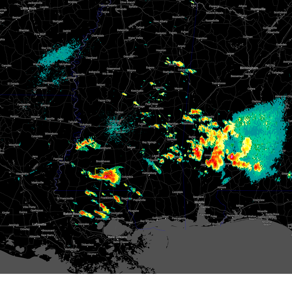 The severe thunderstorm warning for southern lincoln county will expire at 100 pm cdt, the storm which prompted the warning has moved out of the area. therefore, the warning will be allowed to expire. a severe thunderstorm watch remains in effect until 500 pm cdt for south central mississippi. The severe thunderstorm warning for southern lincoln county will expire at 100 pm cdt, the storm which prompted the warning has moved out of the area. therefore, the warning will be allowed to expire. a severe thunderstorm watch remains in effect until 500 pm cdt for south central mississippi.
|
| 6/15/2023 12:33 PM CDT |
 At 1232 pm cdt, a severe thunderstorm was located near bogue chitto, or 10 miles north of mccomb, moving southeast at 40 mph (radar indicated). Hazards include golf ball size hail and 60 mph wind gusts. People and animals outdoors will be injured. expect hail damage to roofs, siding, windows, and vehicles. expect wind damage to roofs, siding, and trees. this severe storm will be near, ruth around 1240 pm cdt. thunderstorm damage threat, considerable hail threat, radar indicated max hail size, 1. 75 in wind threat, radar indicated max wind gust, 60 mph. At 1232 pm cdt, a severe thunderstorm was located near bogue chitto, or 10 miles north of mccomb, moving southeast at 40 mph (radar indicated). Hazards include golf ball size hail and 60 mph wind gusts. People and animals outdoors will be injured. expect hail damage to roofs, siding, windows, and vehicles. expect wind damage to roofs, siding, and trees. this severe storm will be near, ruth around 1240 pm cdt. thunderstorm damage threat, considerable hail threat, radar indicated max hail size, 1. 75 in wind threat, radar indicated max wind gust, 60 mph.
|
| 6/15/2023 12:15 PM CDT | Golf Ball sized hail reported 4.8 miles E of Bogue Chitto, MS, corrects previous hail report from 4 wnw norfield. multiple reports of hail ranging between nickel and golf ball size in the southwestern and southern part of the count |
| 6/15/2023 12:12 PM CDT |
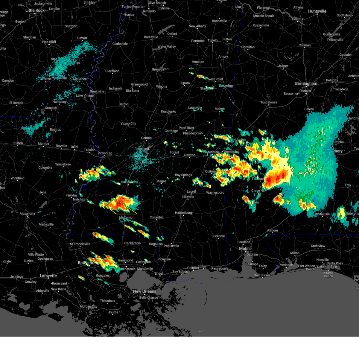 At 1211 pm cdt, a severe thunderstorm was located over west lincoln, or 10 miles southwest of brookhaven, moving southeast at 40 mph (radar indicated). Hazards include tennis ball size hail and 60 mph wind gusts. People and animals outdoors will be injured. expect hail damage to roofs, siding, windows, and vehicles. expect wind damage to roofs, siding, and trees. this severe storm will be near, center point around 1220 pm cdt. bogue chitto around 1225 pm cdt. ruth around 1240 pm cdt. thunderstorm damage threat, considerable hail threat, radar indicated max hail size, 2. 50 in wind threat, radar indicated max wind gust, 60 mph. At 1211 pm cdt, a severe thunderstorm was located over west lincoln, or 10 miles southwest of brookhaven, moving southeast at 40 mph (radar indicated). Hazards include tennis ball size hail and 60 mph wind gusts. People and animals outdoors will be injured. expect hail damage to roofs, siding, windows, and vehicles. expect wind damage to roofs, siding, and trees. this severe storm will be near, center point around 1220 pm cdt. bogue chitto around 1225 pm cdt. ruth around 1240 pm cdt. thunderstorm damage threat, considerable hail threat, radar indicated max hail size, 2. 50 in wind threat, radar indicated max wind gust, 60 mph.
|
| 6/15/2023 12:03 PM CDT |
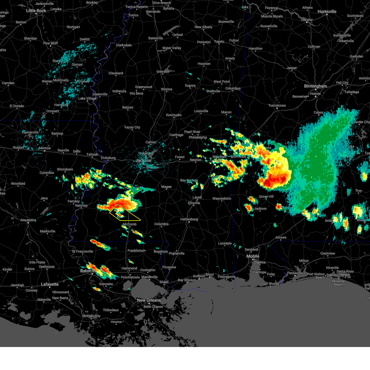 At 1203 pm cdt, a severe thunderstorm was located over mccall creek, or 12 miles northeast of meadville, moving southeast at 35 mph (radar indicated). Hazards include ping pong ball size hail and 60 mph wind gusts. People and animals outdoors will be injured. expect hail damage to roofs, siding, windows, and vehicles. expect wind damage to roofs, siding, and trees. this severe thunderstorm will be near, west lincoln and center point around 1220 pm cdt. bogue chitto around 1230 pm cdt. ruth around 1245 pm cdt. hail threat, radar indicated max hail size, 1. 50 in wind threat, radar indicated max wind gust, 60 mph. At 1203 pm cdt, a severe thunderstorm was located over mccall creek, or 12 miles northeast of meadville, moving southeast at 35 mph (radar indicated). Hazards include ping pong ball size hail and 60 mph wind gusts. People and animals outdoors will be injured. expect hail damage to roofs, siding, windows, and vehicles. expect wind damage to roofs, siding, and trees. this severe thunderstorm will be near, west lincoln and center point around 1220 pm cdt. bogue chitto around 1230 pm cdt. ruth around 1245 pm cdt. hail threat, radar indicated max hail size, 1. 50 in wind threat, radar indicated max wind gust, 60 mph.
|
| 6/15/2023 5:38 AM CDT |
 The severe thunderstorm warning for kemper, neshoba and northern lauderdale counties will expire at 545 am cdt, the storm which prompted the warning has weakened below severe limits, and no longer poses an immediate threat to life or property. therefore, the warning will be allowed to expire. however small hail and gusty winds are still possible with this thunderstorm. The severe thunderstorm warning for kemper, neshoba and northern lauderdale counties will expire at 545 am cdt, the storm which prompted the warning has weakened below severe limits, and no longer poses an immediate threat to life or property. therefore, the warning will be allowed to expire. however small hail and gusty winds are still possible with this thunderstorm.
|
| 6/15/2023 4:47 AM CDT |
 At 447 am cdt, a severe thunderstorm was located over forestdale, or 11 miles east of philadelphia, moving east at 55 mph (radar indicated). Hazards include 60 mph wind gusts and penny size hail. Expect damage to roofs, siding, and trees. this severe storm will be near, bluff springs and damascus around 455 am cdt. liberty around 500 am cdt. de kalb and blackwater around 505 am cdt. porterville and electric mills around 515 am cdt. tamola around 520 am cdt. hail threat, radar indicated max hail size, 0. 75 in wind threat, radar indicated max wind gust, 60 mph. At 447 am cdt, a severe thunderstorm was located over forestdale, or 11 miles east of philadelphia, moving east at 55 mph (radar indicated). Hazards include 60 mph wind gusts and penny size hail. Expect damage to roofs, siding, and trees. this severe storm will be near, bluff springs and damascus around 455 am cdt. liberty around 500 am cdt. de kalb and blackwater around 505 am cdt. porterville and electric mills around 515 am cdt. tamola around 520 am cdt. hail threat, radar indicated max hail size, 0. 75 in wind threat, radar indicated max wind gust, 60 mph.
|
| 6/15/2023 4:39 AM CDT |
 At 439 am cdt, a severe thunderstorm was located near philadelphia, moving east at 40 mph (radar indicated). Hazards include 60 mph wind gusts and penny size hail. Expect damage to roofs, siding, and trees. this severe storm will be near, forestdale around 450 am cdt. damascus and bluff springs around 500 am cdt. liberty around 505 am cdt. de kalb and prismatic around 510 am cdt. blackwater and daleville around 515 am cdt. meridian station around 525 am cdt. lauderdale and porterville around 530 am cdt. tamola around 535 am cdt. hail threat, radar indicated max hail size, 0. 75 in wind threat, radar indicated max wind gust, 60 mph. At 439 am cdt, a severe thunderstorm was located near philadelphia, moving east at 40 mph (radar indicated). Hazards include 60 mph wind gusts and penny size hail. Expect damage to roofs, siding, and trees. this severe storm will be near, forestdale around 450 am cdt. damascus and bluff springs around 500 am cdt. liberty around 505 am cdt. de kalb and prismatic around 510 am cdt. blackwater and daleville around 515 am cdt. meridian station around 525 am cdt. lauderdale and porterville around 530 am cdt. tamola around 535 am cdt. hail threat, radar indicated max hail size, 0. 75 in wind threat, radar indicated max wind gust, 60 mph.
|
| 6/15/2023 4:20 AM CDT |
 At 420 am cdt, a severe thunderstorm was located near pearl river, moving east at 45 mph (radar indicated). Hazards include 70 mph wind gusts and quarter size hail. Hail damage to vehicles is expected. expect considerable tree damage. wind damage is also likely to mobile homes, roofs, and outbuildings. this severe storm will be near, philadelphia around 425 am cdt. burnside and stallo around 430 am cdt. nanih waiya around 440 am cdt. forestdale around 445 am cdt. preston around 450 am cdt. bluff springs around 455 am cdt. liberty around 500 am cdt. de kalb around 505 am cdt. thunderstorm damage threat, considerable hail threat, radar indicated max hail size, 1. 00 in wind threat, radar indicated max wind gust, 70 mph. At 420 am cdt, a severe thunderstorm was located near pearl river, moving east at 45 mph (radar indicated). Hazards include 70 mph wind gusts and quarter size hail. Hail damage to vehicles is expected. expect considerable tree damage. wind damage is also likely to mobile homes, roofs, and outbuildings. this severe storm will be near, philadelphia around 425 am cdt. burnside and stallo around 430 am cdt. nanih waiya around 440 am cdt. forestdale around 445 am cdt. preston around 450 am cdt. bluff springs around 455 am cdt. liberty around 500 am cdt. de kalb around 505 am cdt. thunderstorm damage threat, considerable hail threat, radar indicated max hail size, 1. 00 in wind threat, radar indicated max wind gust, 70 mph.
|
| 6/15/2023 4:09 AM CDT |
 At 408 am cdt, a severe thunderstorm was located near edinburg, or 9 miles northwest of pearl river, moving east at 55 mph (radar indicated). Hazards include 70 mph wind gusts and quarter size hail. Hail damage to vehicles is expected. expect considerable tree damage. wind damage is also likely to mobile homes, roofs, and outbuildings. this severe thunderstorm will be near, pearl river around 415 am cdt. philadelphia around 420 am cdt. burnside and stallo around 425 am cdt. tucker around 430 am cdt. forestdale around 435 am cdt. preston around 440 am cdt. bluff springs around 445 am cdt. liberty around 450 am cdt. thunderstorm damage threat, considerable hail threat, radar indicated max hail size, 1. 00 in wind threat, radar indicated max wind gust, 70 mph. At 408 am cdt, a severe thunderstorm was located near edinburg, or 9 miles northwest of pearl river, moving east at 55 mph (radar indicated). Hazards include 70 mph wind gusts and quarter size hail. Hail damage to vehicles is expected. expect considerable tree damage. wind damage is also likely to mobile homes, roofs, and outbuildings. this severe thunderstorm will be near, pearl river around 415 am cdt. philadelphia around 420 am cdt. burnside and stallo around 425 am cdt. tucker around 430 am cdt. forestdale around 435 am cdt. preston around 440 am cdt. bluff springs around 445 am cdt. liberty around 450 am cdt. thunderstorm damage threat, considerable hail threat, radar indicated max hail size, 1. 00 in wind threat, radar indicated max wind gust, 70 mph.
|
| 6/14/2023 6:09 PM CDT |
 At 609 pm cdt, a severe thunderstorm was located over east lincoln, or 9 miles west of monticello, moving east at 55 mph (radar indicated). Hazards include golf ball size hail and 60 mph wind gusts. People and animals outdoors will be injured. expect hail damage to roofs, siding, windows, and vehicles. expect wind damage to roofs, siding, and trees. this severe storm will be near, topeka around 615 pm cdt. monticello and robinwood around 620 pm cdt. tilton and arm around 625 pm cdt. oak vale around 630 pm cdt. thunderstorm damage threat, considerable hail threat, radar indicated max hail size, 1. 75 in wind threat, radar indicated max wind gust, 60 mph. At 609 pm cdt, a severe thunderstorm was located over east lincoln, or 9 miles west of monticello, moving east at 55 mph (radar indicated). Hazards include golf ball size hail and 60 mph wind gusts. People and animals outdoors will be injured. expect hail damage to roofs, siding, windows, and vehicles. expect wind damage to roofs, siding, and trees. this severe storm will be near, topeka around 615 pm cdt. monticello and robinwood around 620 pm cdt. tilton and arm around 625 pm cdt. oak vale around 630 pm cdt. thunderstorm damage threat, considerable hail threat, radar indicated max hail size, 1. 75 in wind threat, radar indicated max wind gust, 60 mph.
|
| 6/14/2023 5:58 PM CDT |
 At 558 pm cdt, a severe thunderstorm was located over brookhaven, moving east at 55 mph (radar indicated). Hazards include 60 mph wind gusts and half dollar size hail. Hail damage to vehicles is expected. expect wind damage to roofs, siding, and trees. this severe storm will be near, east lincoln around 605 pm cdt. monticello and topeka around 615 pm cdt. robinwood around 620 pm cdt. tilton and arm around 625 pm cdt. oak vale around 630 pm cdt. hail threat, radar indicated max hail size, 1. 25 in wind threat, radar indicated max wind gust, 60 mph. At 558 pm cdt, a severe thunderstorm was located over brookhaven, moving east at 55 mph (radar indicated). Hazards include 60 mph wind gusts and half dollar size hail. Hail damage to vehicles is expected. expect wind damage to roofs, siding, and trees. this severe storm will be near, east lincoln around 605 pm cdt. monticello and topeka around 615 pm cdt. robinwood around 620 pm cdt. tilton and arm around 625 pm cdt. oak vale around 630 pm cdt. hail threat, radar indicated max hail size, 1. 25 in wind threat, radar indicated max wind gust, 60 mph.
|
| 6/14/2023 5:40 PM CDT |
 At 539 pm cdt, a severe thunderstorm was located over allen, or 16 miles southwest of hazlehurst, moving east at 40 mph (radar indicated). Hazards include 60 mph wind gusts and half dollar size hail. Hail damage to vehicles is expected. expect wind damage to roofs, siding, and trees. this severe thunderstorm will be near, glancy around 550 pm cdt. martinsville around 600 pm cdt. wesson and beauregard around 605 pm cdt. sontag and rockport around 620 pm cdt. wanilla and oma around 625 pm cdt. new hebron and silver creek around 640 pm cdt. hail threat, radar indicated max hail size, 1. 25 in wind threat, radar indicated max wind gust, 60 mph. At 539 pm cdt, a severe thunderstorm was located over allen, or 16 miles southwest of hazlehurst, moving east at 40 mph (radar indicated). Hazards include 60 mph wind gusts and half dollar size hail. Hail damage to vehicles is expected. expect wind damage to roofs, siding, and trees. this severe thunderstorm will be near, glancy around 550 pm cdt. martinsville around 600 pm cdt. wesson and beauregard around 605 pm cdt. sontag and rockport around 620 pm cdt. wanilla and oma around 625 pm cdt. new hebron and silver creek around 640 pm cdt. hail threat, radar indicated max hail size, 1. 25 in wind threat, radar indicated max wind gust, 60 mph.
|
| 6/14/2023 4:06 PM CDT |
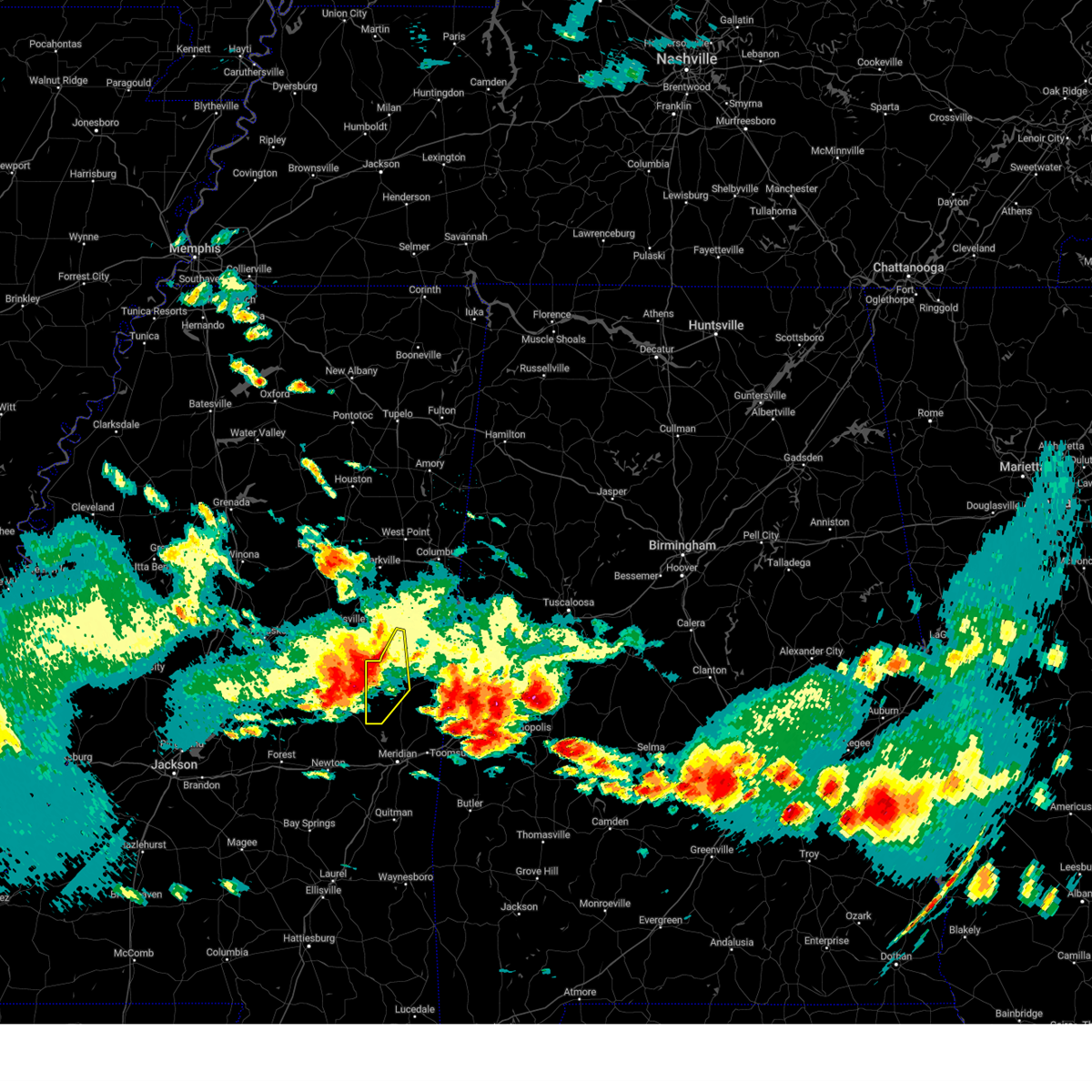 At 406 pm cdt, a severe thunderstorm was located near de kalb, moving east at 70 mph (radar indicated). Hazards include 70 mph wind gusts and quarter size hail. Hail damage to vehicles is expected. expect considerable tree damage. wind damage is also likely to mobile homes, roofs, and outbuildings. this severe thunderstorm will remain over mainly rural areas of southwestern noxubee and western kemper counties. thunderstorm damage threat, considerable hail threat, radar indicated max hail size, 1. 00 in wind threat, radar indicated max wind gust, 70 mph. At 406 pm cdt, a severe thunderstorm was located near de kalb, moving east at 70 mph (radar indicated). Hazards include 70 mph wind gusts and quarter size hail. Hail damage to vehicles is expected. expect considerable tree damage. wind damage is also likely to mobile homes, roofs, and outbuildings. this severe thunderstorm will remain over mainly rural areas of southwestern noxubee and western kemper counties. thunderstorm damage threat, considerable hail threat, radar indicated max hail size, 1. 00 in wind threat, radar indicated max wind gust, 70 mph.
|
| 6/14/2023 4:04 PM CDT | Measured 82 mph gust at knj in kemper county MS, 4.2 miles NW of Bogue Chitto, MS |
| 6/14/2023 3:55 PM CDT | Roof blown off an outbuilding in the coy community and large trees downed in the are in kemper county MS, 4.6 miles S of Bogue Chitto, MS |
| 6/14/2023 3:55 PM CDT | Trees and powerlines down across neshoba and kemper county. 25 reports of trees and 12 powerlines down... combined between neshoba and kemper count in lincoln county MS, 0.7 miles SW of Bogue Chitto, MS |
| 6/14/2023 3:53 PM CDT |
 At 352 pm cdt, a severe thunderstorm was located near nanih waiya, or 9 miles northeast of philadelphia, moving east at 70 mph. this is a destructive storm for philadelphia, dekalb, and surrounding areas (radar indicated). Hazards include 80 mph wind gusts and ping pong ball size hail. Flying debris will be dangerous to those caught without shelter. mobile homes will be heavily damaged. expect considerable damage to roofs, windows, and vehicles. extensive tree damage and power outages are likely. this severe storm will be near, preston around 400 pm cdt. bluff springs around 405 pm cdt. De kalb around 410 pm cdt. At 352 pm cdt, a severe thunderstorm was located near nanih waiya, or 9 miles northeast of philadelphia, moving east at 70 mph. this is a destructive storm for philadelphia, dekalb, and surrounding areas (radar indicated). Hazards include 80 mph wind gusts and ping pong ball size hail. Flying debris will be dangerous to those caught without shelter. mobile homes will be heavily damaged. expect considerable damage to roofs, windows, and vehicles. extensive tree damage and power outages are likely. this severe storm will be near, preston around 400 pm cdt. bluff springs around 405 pm cdt. De kalb around 410 pm cdt.
|
| 6/14/2023 3:22 PM CDT |
 At 321 pm cdt, a severe thunderstorm was located near kosciusko, moving east at 70 mph. this is a destructive storm for kosciusko, philadelphia, noxapater, and surrounding areas (radar indicated). Hazards include 80 mph wind gusts and ping pong ball size hail. Flying debris will be dangerous to those caught without shelter. mobile homes will be heavily damaged. expect considerable damage to roofs, windows, and vehicles. extensive tree damage and power outages are likely. this severe thunderstorm will be near, smyrna and singleton around 325 pm cdt. zama and renfroe around 330 pm cdt. stallo around 345 pm cdt. burnside around 350 pm cdt. forestdale and nanih waiya around 355 pm cdt. preston around 400 pm cdt. bluff springs around 405 pm cdt. De kalb around 410 pm cdt. At 321 pm cdt, a severe thunderstorm was located near kosciusko, moving east at 70 mph. this is a destructive storm for kosciusko, philadelphia, noxapater, and surrounding areas (radar indicated). Hazards include 80 mph wind gusts and ping pong ball size hail. Flying debris will be dangerous to those caught without shelter. mobile homes will be heavily damaged. expect considerable damage to roofs, windows, and vehicles. extensive tree damage and power outages are likely. this severe thunderstorm will be near, smyrna and singleton around 325 pm cdt. zama and renfroe around 330 pm cdt. stallo around 345 pm cdt. burnside around 350 pm cdt. forestdale and nanih waiya around 355 pm cdt. preston around 400 pm cdt. bluff springs around 405 pm cdt. De kalb around 410 pm cdt.
|
| 6/14/2023 3:02 PM CDT |
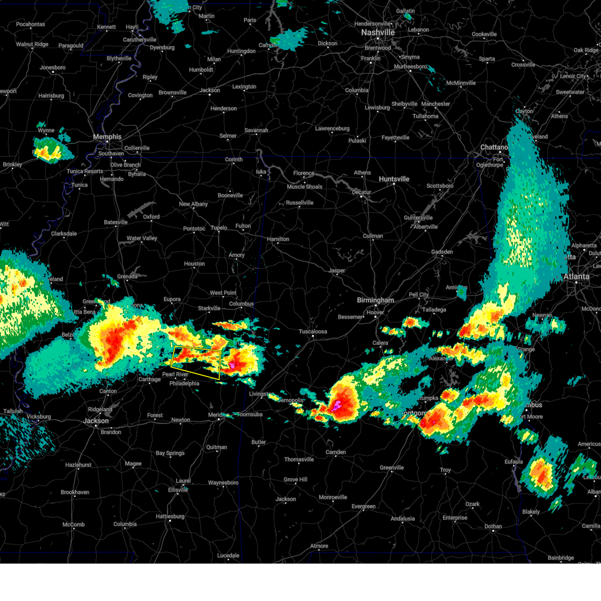 At 302 pm cdt, a severe thunderstorm was located near stallo, or 11 miles southwest of louisville, moving east at 40 mph (radar indicated). Hazards include ping pong ball size hail and 60 mph wind gusts. People and animals outdoors will be injured. expect hail damage to roofs, siding, windows, and vehicles. expect wind damage to roofs, siding, and trees. this severe thunderstorm will be near, noxapater and stallo around 310 pm cdt. nanih waiya around 325 pm cdt. preston around 335 pm cdt. gholson around 340 pm cdt. hail threat, radar indicated max hail size, 1. 50 in wind threat, radar indicated max wind gust, 60 mph. At 302 pm cdt, a severe thunderstorm was located near stallo, or 11 miles southwest of louisville, moving east at 40 mph (radar indicated). Hazards include ping pong ball size hail and 60 mph wind gusts. People and animals outdoors will be injured. expect hail damage to roofs, siding, windows, and vehicles. expect wind damage to roofs, siding, and trees. this severe thunderstorm will be near, noxapater and stallo around 310 pm cdt. nanih waiya around 325 pm cdt. preston around 335 pm cdt. gholson around 340 pm cdt. hail threat, radar indicated max hail size, 1. 50 in wind threat, radar indicated max wind gust, 60 mph.
|
| 6/14/2023 2:28 PM CDT |
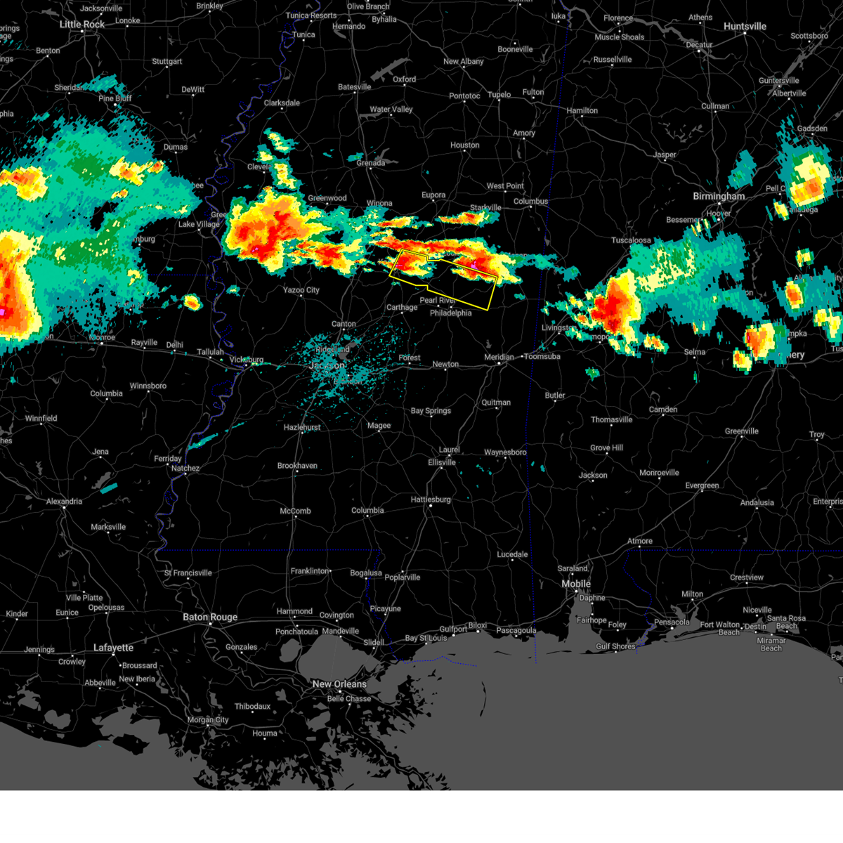 At 228 pm cdt, a severe thunderstorm was located near stallo, or 11 miles north of pearl river, moving east at 55 mph (radar indicated). Hazards include golf ball size hail and 60 mph wind gusts. People and animals outdoors will be injured. expect hail damage to roofs, siding, windows, and vehicles. expect wind damage to roofs, siding, and trees. this severe storm will be near, nanih waiya around 240 pm cdt. preston around 250 pm cdt. bluff springs around 255 pm cdt. thunderstorm damage threat, considerable hail threat, radar indicated max hail size, 1. 75 in wind threat, radar indicated max wind gust, 60 mph. At 228 pm cdt, a severe thunderstorm was located near stallo, or 11 miles north of pearl river, moving east at 55 mph (radar indicated). Hazards include golf ball size hail and 60 mph wind gusts. People and animals outdoors will be injured. expect hail damage to roofs, siding, windows, and vehicles. expect wind damage to roofs, siding, and trees. this severe storm will be near, nanih waiya around 240 pm cdt. preston around 250 pm cdt. bluff springs around 255 pm cdt. thunderstorm damage threat, considerable hail threat, radar indicated max hail size, 1. 75 in wind threat, radar indicated max wind gust, 60 mph.
|
| 6/14/2023 2:00 PM CDT |
 At 200 pm cdt, a severe thunderstorm was located over kosciusko, moving east at 55 mph (radar indicated). Hazards include golf ball size hail and 60 mph wind gusts. People and animals outdoors will be injured. expect hail damage to roofs, siding, windows, and vehicles. expect wind damage to roofs, siding, and trees. this severe storm will be near, ethel and smyrna around 210 pm cdt. zama around 215 pm cdt. noxapater, stallo and burnside around 235 pm cdt. nanih waiya and forestdale around 245 pm cdt. preston around 250 pm cdt. bluff springs around 255 pm cdt. thunderstorm damage threat, considerable hail threat, radar indicated max hail size, 1. 75 in wind threat, radar indicated max wind gust, 60 mph. At 200 pm cdt, a severe thunderstorm was located over kosciusko, moving east at 55 mph (radar indicated). Hazards include golf ball size hail and 60 mph wind gusts. People and animals outdoors will be injured. expect hail damage to roofs, siding, windows, and vehicles. expect wind damage to roofs, siding, and trees. this severe storm will be near, ethel and smyrna around 210 pm cdt. zama around 215 pm cdt. noxapater, stallo and burnside around 235 pm cdt. nanih waiya and forestdale around 245 pm cdt. preston around 250 pm cdt. bluff springs around 255 pm cdt. thunderstorm damage threat, considerable hail threat, radar indicated max hail size, 1. 75 in wind threat, radar indicated max wind gust, 60 mph.
|
| 6/14/2023 1:58 PM CDT |
 At 157 pm cdt, a severe thunderstorm was located over mcadams, or near kosciusko, moving east at 55 mph (radar indicated). Hazards include 60 mph wind gusts and half dollar size hail. Hail damage to vehicles is expected. expect wind damage to roofs, siding, and trees. this severe thunderstorm will be near, ethel and smyrna around 210 pm cdt. zama around 215 pm cdt. noxapater, stallo and burnside around 235 pm cdt. nanih waiya and forestdale around 245 pm cdt. preston around 250 pm cdt. bluff springs around 255 pm cdt. hail threat, radar indicated max hail size, 1. 25 in wind threat, radar indicated max wind gust, 60 mph. At 157 pm cdt, a severe thunderstorm was located over mcadams, or near kosciusko, moving east at 55 mph (radar indicated). Hazards include 60 mph wind gusts and half dollar size hail. Hail damage to vehicles is expected. expect wind damage to roofs, siding, and trees. this severe thunderstorm will be near, ethel and smyrna around 210 pm cdt. zama around 215 pm cdt. noxapater, stallo and burnside around 235 pm cdt. nanih waiya and forestdale around 245 pm cdt. preston around 250 pm cdt. bluff springs around 255 pm cdt. hail threat, radar indicated max hail size, 1. 25 in wind threat, radar indicated max wind gust, 60 mph.
|
| 5/12/2023 4:59 PM CDT |
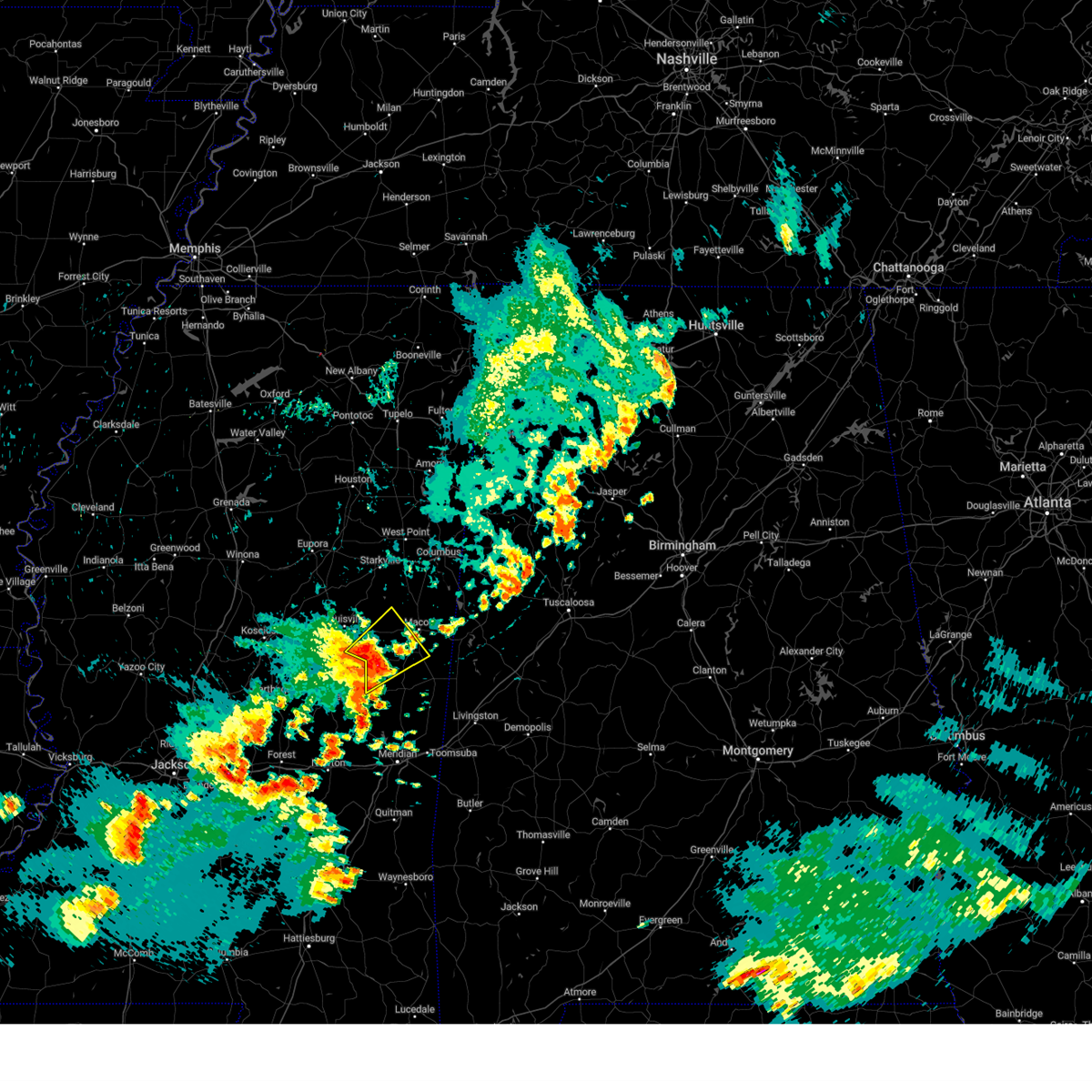 At 459 pm cdt, a severe thunderstorm was located near gholson, or 16 miles northwest of de kalb, moving northeast at 25 mph (radar indicated). Hazards include 60 mph wind gusts and quarter size hail. Hail damage to vehicles is expected. expect wind damage to roofs, siding, and trees. this severe storm will be near, gholson around 505 pm cdt. mashulaville around 520 pm cdt. hail threat, radar indicated max hail size, 1. 00 in wind threat, radar indicated max wind gust, 60 mph. At 459 pm cdt, a severe thunderstorm was located near gholson, or 16 miles northwest of de kalb, moving northeast at 25 mph (radar indicated). Hazards include 60 mph wind gusts and quarter size hail. Hail damage to vehicles is expected. expect wind damage to roofs, siding, and trees. this severe storm will be near, gholson around 505 pm cdt. mashulaville around 520 pm cdt. hail threat, radar indicated max hail size, 1. 00 in wind threat, radar indicated max wind gust, 60 mph.
|
| 5/12/2023 4:45 PM CDT | Tree down on suttle roa in kemper county MS, 4.8 miles SW of Bogue Chitto, MS |
| 5/12/2023 4:38 PM CDT |
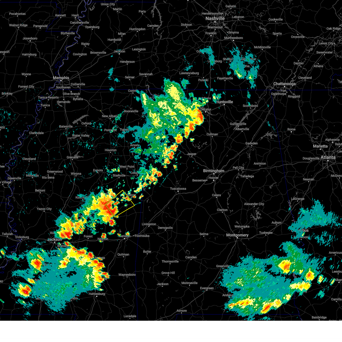 At 438 pm cdt, a severe thunderstorm was located over nanih waiya, or 14 miles northeast of philadelphia, moving northeast at 25 mph (radar indicated). Hazards include 60 mph wind gusts and quarter size hail. Hail damage to vehicles is expected. expect wind damage to roofs, siding, and trees. this severe thunderstorm will be near, preston around 450 pm cdt. gholson around 505 pm cdt. mashulaville around 520 pm cdt. hail threat, radar indicated max hail size, 1. 00 in wind threat, radar indicated max wind gust, 60 mph. At 438 pm cdt, a severe thunderstorm was located over nanih waiya, or 14 miles northeast of philadelphia, moving northeast at 25 mph (radar indicated). Hazards include 60 mph wind gusts and quarter size hail. Hail damage to vehicles is expected. expect wind damage to roofs, siding, and trees. this severe thunderstorm will be near, preston around 450 pm cdt. gholson around 505 pm cdt. mashulaville around 520 pm cdt. hail threat, radar indicated max hail size, 1. 00 in wind threat, radar indicated max wind gust, 60 mph.
|
| 5/11/2023 4:38 PM CDT |
 The severe thunderstorm warning for northern jasper, newton and eastern neshoba counties will expire at 445 pm cdt, the storms which prompted the warning have moved out of the area. therefore, the warning will be allowed to expire. however, gusty winds are still possible with these thunderstorms. a tornado watch remains in effect until 800 pm cdt for east central mississippi. The severe thunderstorm warning for northern jasper, newton and eastern neshoba counties will expire at 445 pm cdt, the storms which prompted the warning have moved out of the area. therefore, the warning will be allowed to expire. however, gusty winds are still possible with these thunderstorms. a tornado watch remains in effect until 800 pm cdt for east central mississippi.
|
| 5/11/2023 4:29 PM CDT |
 At 429 pm cdt, severe thunderstorms were located along a line extending from near gholson to near daleville to near meehan, moving east at 40 mph (radar indicated). Hazards include 60 mph wind gusts. Expect damage to roofs, siding, and trees. these severe storms will be near, marion and meridian station around 435 pm cdt. lauderdale around 445 pm cdt. zero and tamola around 450 pm cdt. causeyville around 500 pm cdt. alamucha around 510 pm cdt. hail threat, radar indicated max hail size, <. 75 in wind threat, radar indicated max wind gust, 60 mph. At 429 pm cdt, severe thunderstorms were located along a line extending from near gholson to near daleville to near meehan, moving east at 40 mph (radar indicated). Hazards include 60 mph wind gusts. Expect damage to roofs, siding, and trees. these severe storms will be near, marion and meridian station around 435 pm cdt. lauderdale around 445 pm cdt. zero and tamola around 450 pm cdt. causeyville around 500 pm cdt. alamucha around 510 pm cdt. hail threat, radar indicated max hail size, <. 75 in wind threat, radar indicated max wind gust, 60 mph.
|
| 5/11/2023 4:21 PM CDT |
 At 421 pm cdt, severe thunderstorms were located along a line extending from near gholson to near damascus to near chunky, moving east at 40 mph (radar indicated). Hazards include 60 mph wind gusts. Expect damage to roofs, siding, and trees. these severe thunderstorms will remain over mainly rural areas of northern jasper, newton and eastern neshoba counties. hail threat, radar indicated max hail size, <. 75 in wind threat, radar indicated max wind gust, 60 mph. At 421 pm cdt, severe thunderstorms were located along a line extending from near gholson to near damascus to near chunky, moving east at 40 mph (radar indicated). Hazards include 60 mph wind gusts. Expect damage to roofs, siding, and trees. these severe thunderstorms will remain over mainly rural areas of northern jasper, newton and eastern neshoba counties. hail threat, radar indicated max hail size, <. 75 in wind threat, radar indicated max wind gust, 60 mph.
|
| 5/11/2023 4:17 PM CDT | Quarter sized hail reported 5.3 miles W of Bogue Chitto, MS, quarter size hail fell near bogue chitto. |
| 5/11/2023 4:13 PM CDT |
 At 413 pm cdt, severe thunderstorms were located along a line extending from near preston to near collinsville to near hickory, moving east at 40 mph (radar indicated). Hazards include 60 mph wind gusts. Expect damage to roofs, siding, and trees. these severe storms will be near, preston around 420 pm cdt. prismatic around 425 pm cdt. daleville and blackwater around 430 pm cdt. nellieburg, meridian station and savoy around 435 pm cdt. meridian around 440 pm cdt. lauderdale around 445 pm cdt. marion, tamola and zero around 450 pm cdt. causeyville around 455 pm cdt. hail threat, radar indicated max hail size, <. 75 in wind threat, radar indicated max wind gust, 60 mph. At 413 pm cdt, severe thunderstorms were located along a line extending from near preston to near collinsville to near hickory, moving east at 40 mph (radar indicated). Hazards include 60 mph wind gusts. Expect damage to roofs, siding, and trees. these severe storms will be near, preston around 420 pm cdt. prismatic around 425 pm cdt. daleville and blackwater around 430 pm cdt. nellieburg, meridian station and savoy around 435 pm cdt. meridian around 440 pm cdt. lauderdale around 445 pm cdt. marion, tamola and zero around 450 pm cdt. causeyville around 455 pm cdt. hail threat, radar indicated max hail size, <. 75 in wind threat, radar indicated max wind gust, 60 mph.
|
| 5/11/2023 4:01 PM CDT |
 At 401 pm cdt, severe thunderstorms were located along a line extending from near nanih waiya to near little rock to near newton, moving east at 45 mph (radar indicated). Hazards include 60 mph wind gusts. Expect damage to roofs, siding, and trees. these severe storms will be near, nanih waiya, house, and duffee around 405 pm cdt. herbert springs around 410 pm cdt. chunky around 420 pm cdt. hail threat, radar indicated max hail size, <. 75 in wind threat, radar indicated max wind gust, 60 mph. At 401 pm cdt, severe thunderstorms were located along a line extending from near nanih waiya to near little rock to near newton, moving east at 45 mph (radar indicated). Hazards include 60 mph wind gusts. Expect damage to roofs, siding, and trees. these severe storms will be near, nanih waiya, house, and duffee around 405 pm cdt. herbert springs around 410 pm cdt. chunky around 420 pm cdt. hail threat, radar indicated max hail size, <. 75 in wind threat, radar indicated max wind gust, 60 mph.
|
| 5/11/2023 3:56 PM CDT |
 At 355 pm cdt, severe thunderstorms were located along a line extending from near nanih waiya to near little rock to near roberts, moving east at 40 mph (radar indicated). Hazards include 60 mph wind gusts. Expect damage to roofs, siding, and trees. severe thunderstorms will be near, collinsville and preston around 410 pm cdt. meehan and prismatic around 425 pm cdt. meridian, meridian station and savoy around 435 pm cdt. lauderdale around 440 pm cdt. tamola and zero around 445 pm cdt. marion around 450 pm cdt. hail threat, radar indicated max hail size, <. 75 in wind threat, radar indicated max wind gust, 60 mph. At 355 pm cdt, severe thunderstorms were located along a line extending from near nanih waiya to near little rock to near roberts, moving east at 40 mph (radar indicated). Hazards include 60 mph wind gusts. Expect damage to roofs, siding, and trees. severe thunderstorms will be near, collinsville and preston around 410 pm cdt. meehan and prismatic around 425 pm cdt. meridian, meridian station and savoy around 435 pm cdt. lauderdale around 440 pm cdt. tamola and zero around 445 pm cdt. marion around 450 pm cdt. hail threat, radar indicated max hail size, <. 75 in wind threat, radar indicated max wind gust, 60 mph.
|
| 5/11/2023 3:47 PM CDT |
 At 347 pm cdt, severe thunderstorms were located along a line extending from near stallo to near stratton to 6 miles west of roberts, moving east at 40 mph (radar indicated). Hazards include 60 mph wind gusts. Expect damage to roofs, siding, and trees. these severe storms will be near, union, decatur, stallo, stratton and burnside around 350 pm cdt. neshoba around 355 pm cdt. little rock around 400 pm cdt. newton and herbert springs around 410 pm cdt. hickory around 415 pm cdt. chunky around 425 pm cdt. hail threat, radar indicated max hail size, <. 75 in wind threat, radar indicated max wind gust, 60 mph. At 347 pm cdt, severe thunderstorms were located along a line extending from near stallo to near stratton to 6 miles west of roberts, moving east at 40 mph (radar indicated). Hazards include 60 mph wind gusts. Expect damage to roofs, siding, and trees. these severe storms will be near, union, decatur, stallo, stratton and burnside around 350 pm cdt. neshoba around 355 pm cdt. little rock around 400 pm cdt. newton and herbert springs around 410 pm cdt. hickory around 415 pm cdt. chunky around 425 pm cdt. hail threat, radar indicated max hail size, <. 75 in wind threat, radar indicated max wind gust, 60 mph.
|
| 5/11/2023 3:26 PM CDT |
 At 325 pm cdt, severe thunderstorms were located along a line extending from near edinburg to near steele to near burns, moving east at 40 mph (radar indicated). Hazards include 60 mph wind gusts. Expect damage to roofs, siding, and trees. severe thunderstorms will be near, pearl river and conehatta around 335 pm cdt. philadelphia and prospect around 340 pm cdt. decatur and stratton around 345 pm cdt. union, stallo, burnside and neshoba around 350 pm cdt. roberts, little rock and lawrence around 355 pm cdt. newton and herbert springs around 405 pm cdt. hickory around 415 pm cdt. hail threat, radar indicated max hail size, <. 75 in wind threat, radar indicated max wind gust, 60 mph. At 325 pm cdt, severe thunderstorms were located along a line extending from near edinburg to near steele to near burns, moving east at 40 mph (radar indicated). Hazards include 60 mph wind gusts. Expect damage to roofs, siding, and trees. severe thunderstorms will be near, pearl river and conehatta around 335 pm cdt. philadelphia and prospect around 340 pm cdt. decatur and stratton around 345 pm cdt. union, stallo, burnside and neshoba around 350 pm cdt. roberts, little rock and lawrence around 355 pm cdt. newton and herbert springs around 405 pm cdt. hickory around 415 pm cdt. hail threat, radar indicated max hail size, <. 75 in wind threat, radar indicated max wind gust, 60 mph.
|
| 5/5/2023 2:07 PM CDT |
 At 207 pm cdt, severe thunderstorms were located along a line extending from near sanatorium to near vaughn, moving southeast at 30 mph (radar indicated). Hazards include 70 mph wind gusts and quarter size hail. Hail damage to vehicles is expected. expect considerable tree damage. wind damage is also likely to mobile homes, roofs, and outbuildings. these severe storms will be near, magee and sanatorium around 210 pm cdt. clem around 220 pm cdt. mount olive and enterprise around 225 pm cdt. east lincoln and lone star around 230 pm cdt. ruth around 240 pm cdt. Topeka around 245 pm cdt. At 207 pm cdt, severe thunderstorms were located along a line extending from near sanatorium to near vaughn, moving southeast at 30 mph (radar indicated). Hazards include 70 mph wind gusts and quarter size hail. Hail damage to vehicles is expected. expect considerable tree damage. wind damage is also likely to mobile homes, roofs, and outbuildings. these severe storms will be near, magee and sanatorium around 210 pm cdt. clem around 220 pm cdt. mount olive and enterprise around 225 pm cdt. east lincoln and lone star around 230 pm cdt. ruth around 240 pm cdt. Topeka around 245 pm cdt.
|
| 5/5/2023 1:50 PM CDT |
 At 149 pm cdt, severe thunderstorms were located along a line extending from near mendenhall to near caseyville, moving southeast at 30 mph (radar indicated). Hazards include 60 mph wind gusts. Expect damage to roofs, siding, and trees. severe thunderstorms will be near, pinola around 155 pm cdt. sanatorium around 200 pm cdt. brookhaven around 205 pm cdt. magee around 210 pm cdt. clem around 215 pm cdt. bogue chitto around 220 pm cdt. mount olive, enterprise and lone star around 225 pm cdt. east lincoln around 230 pm cdt. hail threat, radar indicated max hail size, <. 75 in wind threat, radar indicated max wind gust, 60 mph. At 149 pm cdt, severe thunderstorms were located along a line extending from near mendenhall to near caseyville, moving southeast at 30 mph (radar indicated). Hazards include 60 mph wind gusts. Expect damage to roofs, siding, and trees. severe thunderstorms will be near, pinola around 155 pm cdt. sanatorium around 200 pm cdt. brookhaven around 205 pm cdt. magee around 210 pm cdt. clem around 215 pm cdt. bogue chitto around 220 pm cdt. mount olive, enterprise and lone star around 225 pm cdt. east lincoln around 230 pm cdt. hail threat, radar indicated max hail size, <. 75 in wind threat, radar indicated max wind gust, 60 mph.
|
| 3/28/2023 7:51 AM CDT |
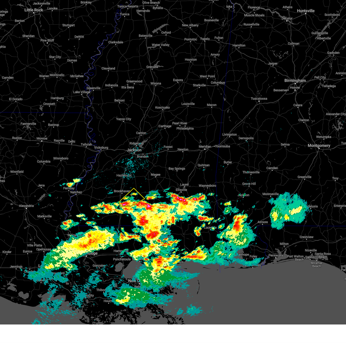 At 751 am cdt, a severe thunderstorm was located near ruth, or 13 miles southeast of brookhaven, moving northeast at 30 mph (radar indicated). Hazards include 60 mph wind gusts and quarter size hail. Hail damage to vehicles is expected. expect wind damage to roofs, siding, and trees. this severe storm will be near, east lincoln around 800 am cdt. topeka around 810 am cdt. monticello and robinwood around 825 am cdt. arm around 835 am cdt. hail threat, radar indicated max hail size, 1. 00 in wind threat, radar indicated max wind gust, 60 mph. At 751 am cdt, a severe thunderstorm was located near ruth, or 13 miles southeast of brookhaven, moving northeast at 30 mph (radar indicated). Hazards include 60 mph wind gusts and quarter size hail. Hail damage to vehicles is expected. expect wind damage to roofs, siding, and trees. this severe storm will be near, east lincoln around 800 am cdt. topeka around 810 am cdt. monticello and robinwood around 825 am cdt. arm around 835 am cdt. hail threat, radar indicated max hail size, 1. 00 in wind threat, radar indicated max wind gust, 60 mph.
|
| 3/28/2023 7:34 AM CDT |
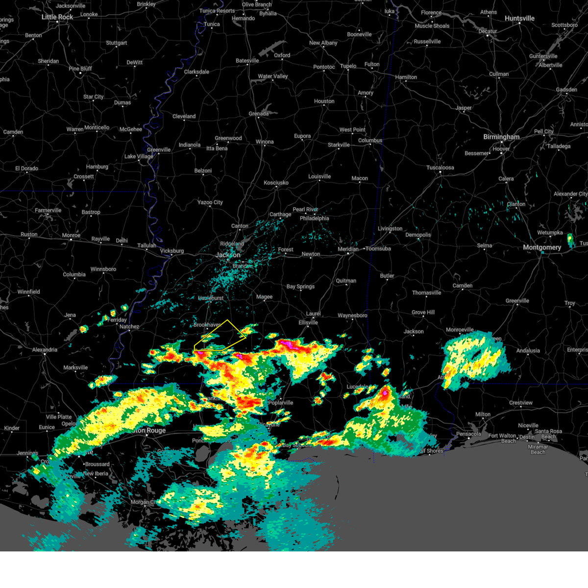 At 733 am cdt, a severe thunderstorm was located near bogue chitto, or 8 miles north of mccomb, moving northeast at 30 mph (radar indicated). Hazards include 60 mph wind gusts and half dollar size hail. Hail damage to vehicles is expected. expect wind damage to roofs, siding, and trees. this severe thunderstorm will be near, bogue chitto around 740 am cdt. enterprise and ruth around 750 am cdt. east lincoln around 800 am cdt. topeka around 810 am cdt. monticello and robinwood around 825 am cdt. arm around 830 am cdt. hail threat, radar indicated max hail size, 1. 25 in wind threat, radar indicated max wind gust, 60 mph. At 733 am cdt, a severe thunderstorm was located near bogue chitto, or 8 miles north of mccomb, moving northeast at 30 mph (radar indicated). Hazards include 60 mph wind gusts and half dollar size hail. Hail damage to vehicles is expected. expect wind damage to roofs, siding, and trees. this severe thunderstorm will be near, bogue chitto around 740 am cdt. enterprise and ruth around 750 am cdt. east lincoln around 800 am cdt. topeka around 810 am cdt. monticello and robinwood around 825 am cdt. arm around 830 am cdt. hail threat, radar indicated max hail size, 1. 25 in wind threat, radar indicated max wind gust, 60 mph.
|
| 3/26/2023 4:28 AM CDT |
 The severe thunderstorm warning for neshoba county will expire at 430 am cdt, the storm which prompted the warning has weakened below severe limits, and no longer poses an immediate threat to life or property. therefore, the warning will be allowed to expire. a severe thunderstorm watch remains in effect until 800 am cdt for central and east central mississippi. The severe thunderstorm warning for neshoba county will expire at 430 am cdt, the storm which prompted the warning has weakened below severe limits, and no longer poses an immediate threat to life or property. therefore, the warning will be allowed to expire. a severe thunderstorm watch remains in effect until 800 am cdt for central and east central mississippi.
|
| 3/26/2023 4:12 AM CDT |
 At 412 am cdt, a severe thunderstorm was located near forestdale, or 12 miles southeast of philadelphia, moving east at 45 mph (radar indicated). Hazards include quarter size hail. Damage to vehicles is expected. this severe thunderstorm will remain over mainly rural areas of neshoba county, including the following locations, tucker. hail threat, radar indicated max hail size, 1. 00 in wind threat, radar indicated max wind gust, <50 mph. At 412 am cdt, a severe thunderstorm was located near forestdale, or 12 miles southeast of philadelphia, moving east at 45 mph (radar indicated). Hazards include quarter size hail. Damage to vehicles is expected. this severe thunderstorm will remain over mainly rural areas of neshoba county, including the following locations, tucker. hail threat, radar indicated max hail size, 1. 00 in wind threat, radar indicated max wind gust, <50 mph.
|
| 3/26/2023 3:46 AM CDT |
 At 346 am cdt, a severe thunderstorm was located near dowdville, or near prospect, moving northeast at 45 mph (radar indicated). Hazards include ping pong ball size hail. People and animals outdoors will be injured. expect damage to roofs, siding, windows, and vehicles. this severe thunderstorm will be near, dixon around 350 am cdt. neshoba around 355 am cdt. philadelphia around 400 am cdt. bethsaida and house around 405 am cdt. forestdale around 415 am cdt. other locations impacted by this severe thunderstorm include tucker. hail threat, radar indicated max hail size, 1. 50 in wind threat, radar indicated max wind gust, <50 mph. At 346 am cdt, a severe thunderstorm was located near dowdville, or near prospect, moving northeast at 45 mph (radar indicated). Hazards include ping pong ball size hail. People and animals outdoors will be injured. expect damage to roofs, siding, windows, and vehicles. this severe thunderstorm will be near, dixon around 350 am cdt. neshoba around 355 am cdt. philadelphia around 400 am cdt. bethsaida and house around 405 am cdt. forestdale around 415 am cdt. other locations impacted by this severe thunderstorm include tucker. hail threat, radar indicated max hail size, 1. 50 in wind threat, radar indicated max wind gust, <50 mph.
|
| 3/24/2023 8:11 PM CDT |
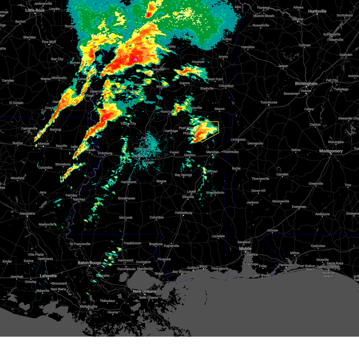 At 810 pm cdt, a severe thunderstorm was located near herbert springs, or 13 miles southeast of philadelphia, moving northeast at 50 mph (radar indicated). Hazards include 60 mph wind gusts. Expect damage to roofs, siding, and trees. this severe storm will be near, damascus and forestdale around 815 pm cdt. liberty around 820 pm cdt. bluff springs around 825 pm cdt. de kalb around 830 pm cdt. Other locations impacted by this severe thunderstorm include tucker. At 810 pm cdt, a severe thunderstorm was located near herbert springs, or 13 miles southeast of philadelphia, moving northeast at 50 mph (radar indicated). Hazards include 60 mph wind gusts. Expect damage to roofs, siding, and trees. this severe storm will be near, damascus and forestdale around 815 pm cdt. liberty around 820 pm cdt. bluff springs around 825 pm cdt. de kalb around 830 pm cdt. Other locations impacted by this severe thunderstorm include tucker.
|
| 3/24/2023 7:56 PM CDT |
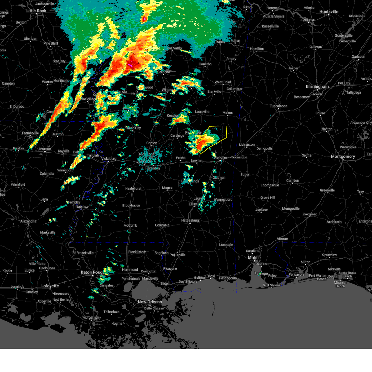 At 756 pm cdt, a severe thunderstorm was located near little rock, or 10 miles east of prospect, moving northeast at 50 mph (radar indicated). Hazards include 60 mph wind gusts. Expect damage to roofs, siding, and trees. this severe thunderstorm will be near, house and bethsaida around 805 pm cdt. herbert springs around 810 pm cdt. damascus around 815 pm cdt. liberty around 820 pm cdt. bluff springs around 825 pm cdt. de kalb around 830 pm cdt. Other locations impacted by this severe thunderstorm include tucker. At 756 pm cdt, a severe thunderstorm was located near little rock, or 10 miles east of prospect, moving northeast at 50 mph (radar indicated). Hazards include 60 mph wind gusts. Expect damage to roofs, siding, and trees. this severe thunderstorm will be near, house and bethsaida around 805 pm cdt. herbert springs around 810 pm cdt. damascus around 815 pm cdt. liberty around 820 pm cdt. bluff springs around 825 pm cdt. de kalb around 830 pm cdt. Other locations impacted by this severe thunderstorm include tucker.
|
| 3/12/2023 8:19 AM CDT |
 At 818 am cdt, severe thunderstorms were located along a line extending from near oma to near enterprise to little springs, moving east at 45 mph (radar indicated). Hazards include 60 mph wind gusts and quarter size hail. Hail damage to vehicles is expected. expect wind damage to roofs, siding, and trees. severe thunderstorms will be near, east lincoln and wanilla around 830 am cdt. topeka and jayess around 840 am cdt. robinwood and progress around 845 am cdt. prentiss, tilton, ruth and arm around 850 am cdt. carson and oak vale around 855 am cdt. society hill around 900 am cdt. other locations impacted by these severe thunderstorms include bassfield, new hebron and silver creek. hail threat, radar indicated max hail size, 1. 00 in wind threat, radar indicated max wind gust, 60 mph. At 818 am cdt, severe thunderstorms were located along a line extending from near oma to near enterprise to little springs, moving east at 45 mph (radar indicated). Hazards include 60 mph wind gusts and quarter size hail. Hail damage to vehicles is expected. expect wind damage to roofs, siding, and trees. severe thunderstorms will be near, east lincoln and wanilla around 830 am cdt. topeka and jayess around 840 am cdt. robinwood and progress around 845 am cdt. prentiss, tilton, ruth and arm around 850 am cdt. carson and oak vale around 855 am cdt. society hill around 900 am cdt. other locations impacted by these severe thunderstorms include bassfield, new hebron and silver creek. hail threat, radar indicated max hail size, 1. 00 in wind threat, radar indicated max wind gust, 60 mph.
|
| 3/12/2023 4:18 AM CDT |
 At 417 am cdt, severe thunderstorms were located along a line extending from preston to bethsaida to near conehatta, moving east at 60 mph (radar indicated). Hazards include 60 mph wind gusts and nickel size hail. Expect damage to roofs, siding, and trees. these severe storms will be near, preston and herbert springs around 425 am cdt. damascus around 430 am cdt. liberty, little rock, prismatic and bluff springs around 435 am cdt. de kalb, duffee and blackwater around 440 am cdt. martin and suqualena around 445 am cdt. meridian and nellieburg around 450 am cdt. marion, porterville, daleville, tamola and electric mills around 455 am cdt. meridian station around 500 am cdt. other locations impacted by these severe thunderstorms include tucker, walnut grove, sebastopol and scooba. hail threat, radar indicated max hail size, 0. 88 in wind threat, radar indicated max wind gust, 60 mph. At 417 am cdt, severe thunderstorms were located along a line extending from preston to bethsaida to near conehatta, moving east at 60 mph (radar indicated). Hazards include 60 mph wind gusts and nickel size hail. Expect damage to roofs, siding, and trees. these severe storms will be near, preston and herbert springs around 425 am cdt. damascus around 430 am cdt. liberty, little rock, prismatic and bluff springs around 435 am cdt. de kalb, duffee and blackwater around 440 am cdt. martin and suqualena around 445 am cdt. meridian and nellieburg around 450 am cdt. marion, porterville, daleville, tamola and electric mills around 455 am cdt. meridian station around 500 am cdt. other locations impacted by these severe thunderstorms include tucker, walnut grove, sebastopol and scooba. hail threat, radar indicated max hail size, 0. 88 in wind threat, radar indicated max wind gust, 60 mph.
|
| 3/12/2023 4:04 AM CDT |
 At 404 am cdt, severe thunderstorms were located along a line extending from nanih waiya to near dixon to near steele, moving east at 60 mph (radar indicated). Hazards include 60 mph wind gusts and nickel size hail. Expect damage to roofs, siding, and trees. these severe storms will be near, preston, nanih waiya and bethsaida around 410 am cdt. gholson and house around 415 am cdt. decatur, stratton and forestdale around 420 am cdt. damascus and bluff springs around 425 am cdt. liberty and little rock around 430 am cdt. de kalb, duffee, herbert springs and blackwater around 435 am cdt. martin and suqualena around 440 am cdt. porterville, prismatic and electric mills around 445 am cdt. other locations impacted by these severe thunderstorms include noxapater, tucker, walnut grove, sebastopol, standing pine, scooba, lena and shuqualak. hail threat, radar indicated max hail size, 0. 88 in wind threat, radar indicated max wind gust, 60 mph. At 404 am cdt, severe thunderstorms were located along a line extending from nanih waiya to near dixon to near steele, moving east at 60 mph (radar indicated). Hazards include 60 mph wind gusts and nickel size hail. Expect damage to roofs, siding, and trees. these severe storms will be near, preston, nanih waiya and bethsaida around 410 am cdt. gholson and house around 415 am cdt. decatur, stratton and forestdale around 420 am cdt. damascus and bluff springs around 425 am cdt. liberty and little rock around 430 am cdt. de kalb, duffee, herbert springs and blackwater around 435 am cdt. martin and suqualena around 440 am cdt. porterville, prismatic and electric mills around 445 am cdt. other locations impacted by these severe thunderstorms include noxapater, tucker, walnut grove, sebastopol, standing pine, scooba, lena and shuqualak. hail threat, radar indicated max hail size, 0. 88 in wind threat, radar indicated max wind gust, 60 mph.
|
| 3/12/2023 3:43 AM CDT |
 At 343 am cdt, severe thunderstorms were located along a line extending from 8 miles northwest of stallo to near edinburg to near ludlow, moving east at 55 mph (radar indicated). Hazards include 60 mph wind gusts and quarter size hail. Hail damage to vehicles is expected. expect wind damage to roofs, siding, and trees. severe thunderstorms will be near, dowdville, stallo and madden around 350 am cdt. philadelphia, pearl river and dixon around 355 am cdt. nanih waiya and steele around 400 am cdt. prospect and neshoba around 405 am cdt. preston, house, bethsaida, conehatta, gholson and bluff springs around 410 am cdt. herbert springs and stratton around 415 am cdt. decatur, de kalb, damascus, martin and little rock around 420 am cdt. liberty and prismatic around 425 am cdt. other locations impacted by these severe thunderstorms include noxapater, tucker, walnut grove, sebastopol, standing pine, scooba, lena, shuqualak and chunky. hail threat, radar indicated max hail size, 1. 00 in wind threat, radar indicated max wind gust, 60 mph. At 343 am cdt, severe thunderstorms were located along a line extending from 8 miles northwest of stallo to near edinburg to near ludlow, moving east at 55 mph (radar indicated). Hazards include 60 mph wind gusts and quarter size hail. Hail damage to vehicles is expected. expect wind damage to roofs, siding, and trees. severe thunderstorms will be near, dowdville, stallo and madden around 350 am cdt. philadelphia, pearl river and dixon around 355 am cdt. nanih waiya and steele around 400 am cdt. prospect and neshoba around 405 am cdt. preston, house, bethsaida, conehatta, gholson and bluff springs around 410 am cdt. herbert springs and stratton around 415 am cdt. decatur, de kalb, damascus, martin and little rock around 420 am cdt. liberty and prismatic around 425 am cdt. other locations impacted by these severe thunderstorms include noxapater, tucker, walnut grove, sebastopol, standing pine, scooba, lena, shuqualak and chunky. hail threat, radar indicated max hail size, 1. 00 in wind threat, radar indicated max wind gust, 60 mph.
|
| 2/8/2023 5:16 PM CST |
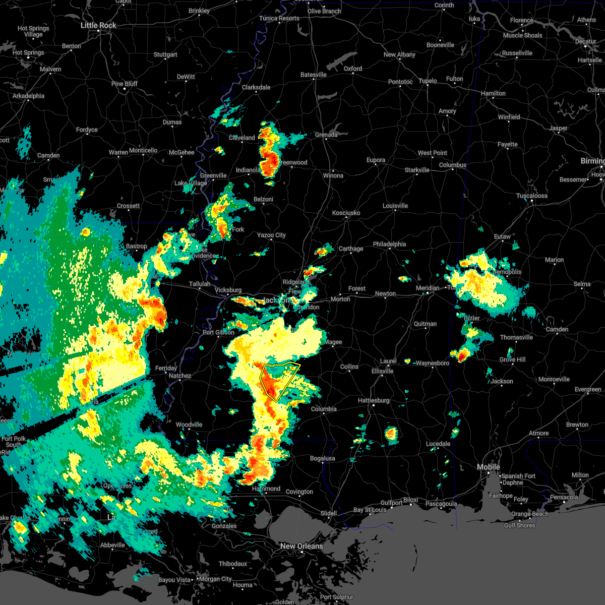 At 516 pm cst, a severe thunderstorm was located near enterprise, or near brookhaven, moving northeast at 40 mph (radar indicated). Hazards include 60 mph wind gusts. Expect damage to roofs, siding, and trees. locations impacted include, brookhaven, enterprise, sontag, bogue chitto and east lincoln. hail threat, radar indicated max hail size, <. 75 in wind threat, radar indicated max wind gust, 60 mph. At 516 pm cst, a severe thunderstorm was located near enterprise, or near brookhaven, moving northeast at 40 mph (radar indicated). Hazards include 60 mph wind gusts. Expect damage to roofs, siding, and trees. locations impacted include, brookhaven, enterprise, sontag, bogue chitto and east lincoln. hail threat, radar indicated max hail size, <. 75 in wind threat, radar indicated max wind gust, 60 mph.
|
| 2/8/2023 5:08 PM CST | Tree down across bogue chitto rd near pillars r in lincoln county MS, 2.4 miles W of Bogue Chitto, MS |
| 2/8/2023 5:01 PM CST |
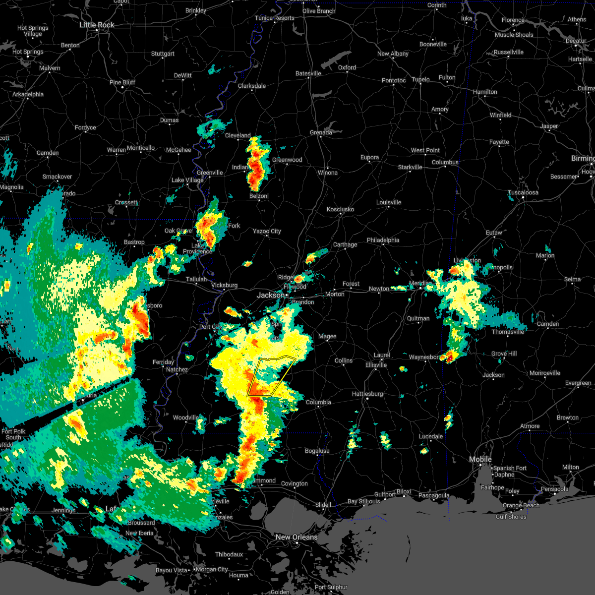 At 500 pm cst, a severe thunderstorm was located near summit, or 7 miles north of mccomb, moving northeast at 35 mph (radar indicated). Hazards include 60 mph wind gusts. expect damage to roofs, siding, and trees At 500 pm cst, a severe thunderstorm was located near summit, or 7 miles north of mccomb, moving northeast at 35 mph (radar indicated). Hazards include 60 mph wind gusts. expect damage to roofs, siding, and trees
|
| 1/12/2023 11:05 AM CST | Tree down on a house on lynville road (493 in kemper county MS, 4.6 miles W of Bogue Chitto, MS |
| 1/12/2023 10:18 AM CST | Trees down along highway 39 in kemper county MS, 5.8 miles W of Bogue Chitto, MS |
| 1/12/2023 10:15 AM CST | Corrects previous tstm wnd dmg report from 3 s preston. tree down on a house on lynville road (493 in kemper county MS, 4.6 miles W of Bogue Chitto, MS |
| 1/12/2023 8:18 AM CST | Corrects previous tstm wnd dmg report from 3 sse preston. trees down along highway 39 in kemper county MS, 5.8 miles W of Bogue Chitto, MS |
| 1/12/2023 8:15 AM CST | Corrects previous tstm wnd dmg report from 3 s preston. corrects previous tstm wnd dmg report from 3 s preston. tree down on a house on lynville road (493 in kemper county MS, 4.6 miles W of Bogue Chitto, MS |
| 1/12/2023 8:15 AM CST |
 At 815 am cst, a severe thunderstorm was located over dixon, or near philadelphia, moving east at 50 mph (radar indicated). Hazards include 60 mph wind gusts and penny size hail. Expect damage to roofs, siding, and trees. this severe thunderstorm will be near, philadelphia around 820 am cst. bethsaida around 825 am cst. forestdale around 835 am cst. bluff springs around 840 am cst. preston around 845 am cst. de kalb and gholson around 850 am cst. other locations impacted by this severe thunderstorm include shuqualak, tucker and scooba. hail threat, radar indicated max hail size, 0. 75 in wind threat, radar indicated max wind gust, 60 mph. At 815 am cst, a severe thunderstorm was located over dixon, or near philadelphia, moving east at 50 mph (radar indicated). Hazards include 60 mph wind gusts and penny size hail. Expect damage to roofs, siding, and trees. this severe thunderstorm will be near, philadelphia around 820 am cst. bethsaida around 825 am cst. forestdale around 835 am cst. bluff springs around 840 am cst. preston around 845 am cst. de kalb and gholson around 850 am cst. other locations impacted by this severe thunderstorm include shuqualak, tucker and scooba. hail threat, radar indicated max hail size, 0. 75 in wind threat, radar indicated max wind gust, 60 mph.
|
| 1/12/2023 7:19 AM CST |
 At 719 am cst, a severe thunderstorm was located near carthage, moving east at 55 mph (radar indicated). Hazards include 60 mph wind gusts and penny size hail. Expect damage to roofs, siding, and trees. this severe thunderstorm will be near, renfroe around 730 am cst. edinburg around 740 am cst. philadelphia and pearl river around 745 am cst. burnside and stallo around 755 am cst. nanih waiya around 805 am cst. preston around 810 am cst. other locations impacted by this severe thunderstorm include noxapater, standing pine and redwater. hail threat, radar indicated max hail size, 0. 75 in wind threat, radar indicated max wind gust, 60 mph. At 719 am cst, a severe thunderstorm was located near carthage, moving east at 55 mph (radar indicated). Hazards include 60 mph wind gusts and penny size hail. Expect damage to roofs, siding, and trees. this severe thunderstorm will be near, renfroe around 730 am cst. edinburg around 740 am cst. philadelphia and pearl river around 745 am cst. burnside and stallo around 755 am cst. nanih waiya around 805 am cst. preston around 810 am cst. other locations impacted by this severe thunderstorm include noxapater, standing pine and redwater. hail threat, radar indicated max hail size, 0. 75 in wind threat, radar indicated max wind gust, 60 mph.
|
| 1/3/2023 10:39 PM CST |
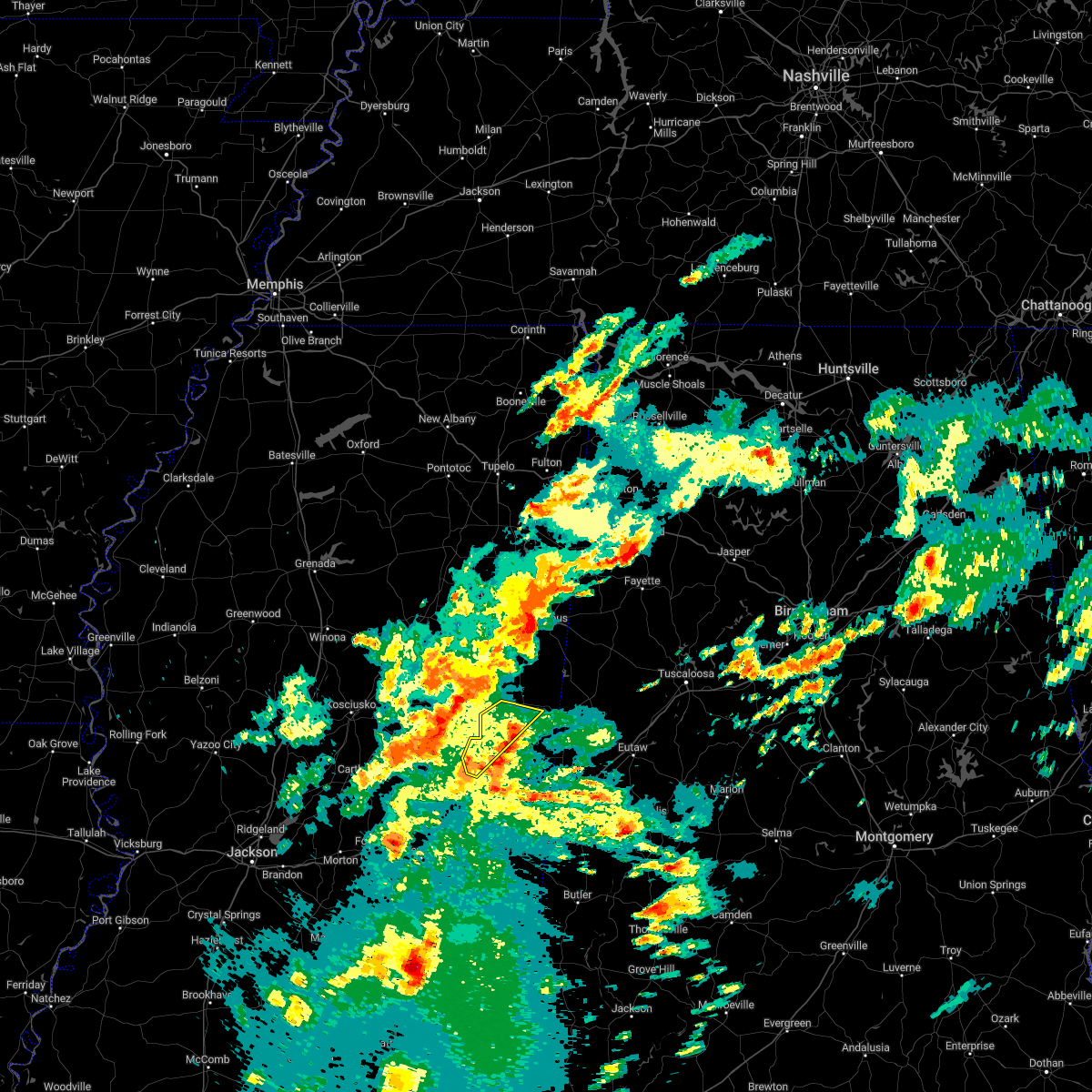 At 1039 pm cst, a severe thunderstorm was located near preston, moving northeast at 60 mph (radar indicated). Hazards include 60 mph wind gusts. Expect damage to roofs, siding, and trees. this severe storm will be near, mashulaville around 1050 pm cst. other locations impacted by this severe thunderstorm include shuqualak. hail threat, radar indicated max hail size, <. 75 in wind threat, radar indicated max wind gust, 60 mph. At 1039 pm cst, a severe thunderstorm was located near preston, moving northeast at 60 mph (radar indicated). Hazards include 60 mph wind gusts. Expect damage to roofs, siding, and trees. this severe storm will be near, mashulaville around 1050 pm cst. other locations impacted by this severe thunderstorm include shuqualak. hail threat, radar indicated max hail size, <. 75 in wind threat, radar indicated max wind gust, 60 mph.
|
| 1/3/2023 10:23 PM CST |
 At 1022 pm cst, a severe thunderstorm was located near bethsaida, or 7 miles east of philadelphia, moving northeast at 60 mph (radar indicated). Hazards include 60 mph wind gusts. Expect damage to roofs, siding, and trees. this severe thunderstorm will be near, nanih waiya and bluff springs around 1035 pm cst. preston around 1040 pm cst. gholson around 1045 pm cst. mashulaville around 1050 pm cst. other locations impacted by this severe thunderstorm include shuqualak and tucker. hail threat, radar indicated max hail size, <. 75 in wind threat, radar indicated max wind gust, 60 mph. At 1022 pm cst, a severe thunderstorm was located near bethsaida, or 7 miles east of philadelphia, moving northeast at 60 mph (radar indicated). Hazards include 60 mph wind gusts. Expect damage to roofs, siding, and trees. this severe thunderstorm will be near, nanih waiya and bluff springs around 1035 pm cst. preston around 1040 pm cst. gholson around 1045 pm cst. mashulaville around 1050 pm cst. other locations impacted by this severe thunderstorm include shuqualak and tucker. hail threat, radar indicated max hail size, <. 75 in wind threat, radar indicated max wind gust, 60 mph.
|
| 1/3/2023 8:43 PM CST |
 At 843 pm cst, a severe thunderstorm was located over garden city, or 21 miles northwest of liberty, moving northeast at 50 mph (radar indicated). Hazards include 60 mph wind gusts and half dollar size hail. Hail damage to vehicles is expected. expect wind damage to roofs, siding, and trees. this severe thunderstorm will be near, bude around 900 pm cst. new hope around 905 pm cst. little springs around 910 pm cst. mccall creek around 915 pm cst. west lincoln around 920 pm cst. vaughn and loyd star around 925 pm cst. other locations impacted by this severe thunderstorm include meadville. hail threat, radar indicated max hail size, 1. 25 in wind threat, radar indicated max wind gust, 60 mph. At 843 pm cst, a severe thunderstorm was located over garden city, or 21 miles northwest of liberty, moving northeast at 50 mph (radar indicated). Hazards include 60 mph wind gusts and half dollar size hail. Hail damage to vehicles is expected. expect wind damage to roofs, siding, and trees. this severe thunderstorm will be near, bude around 900 pm cst. new hope around 905 pm cst. little springs around 910 pm cst. mccall creek around 915 pm cst. west lincoln around 920 pm cst. vaughn and loyd star around 925 pm cst. other locations impacted by this severe thunderstorm include meadville. hail threat, radar indicated max hail size, 1. 25 in wind threat, radar indicated max wind gust, 60 mph.
|
| 12/30/2022 6:50 AM CST | Multiple trees downed near hom in lincoln county MS, 4.2 miles NW of Bogue Chitto, MS |
| 11/29/2022 9:29 PM CST |
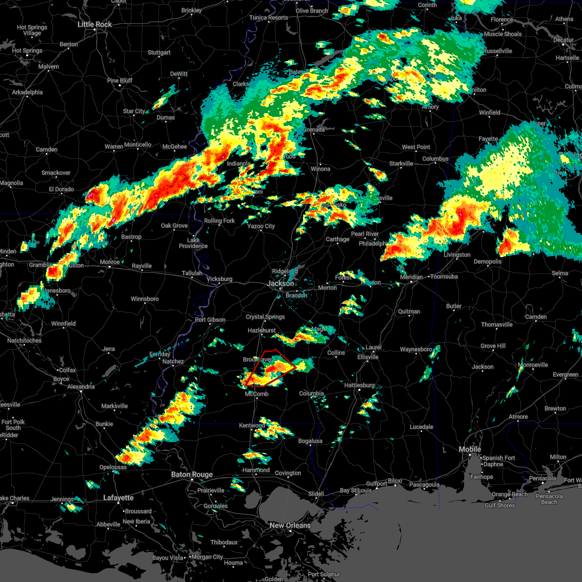 At 929 pm cst, a severe thunderstorm capable of producing a tornado was located near east lincoln, or 11 miles east of brookhaven, moving northeast at 40 mph (radar indicated rotation). Hazards include tornado. Flying debris will be dangerous to those caught without shelter. mobile homes will be damaged or destroyed. damage to roofs, windows, and vehicles will occur. tree damage is likely. This dangerous storm will be near, monticello and sontag around 940 pm cst. At 929 pm cst, a severe thunderstorm capable of producing a tornado was located near east lincoln, or 11 miles east of brookhaven, moving northeast at 40 mph (radar indicated rotation). Hazards include tornado. Flying debris will be dangerous to those caught without shelter. mobile homes will be damaged or destroyed. damage to roofs, windows, and vehicles will occur. tree damage is likely. This dangerous storm will be near, monticello and sontag around 940 pm cst.
|
| 11/29/2022 9:27 PM CST |
 At 927 pm cst, a severe thunderstorm was located near damascus, or 14 miles southeast of philadelphia, moving northeast at 45 mph (radar indicated). Hazards include 60 mph wind gusts and quarter size hail. Hail damage to vehicles is expected. expect wind damage to roofs, siding, and trees. this severe storm will be near, damascus around 930 pm cst. liberty around 935 pm cst. bluff springs around 940 pm cst. de kalb around 950 pm cst. hail threat, radar indicated max hail size, 1. 00 in wind threat, radar indicated max wind gust, 60 mph. At 927 pm cst, a severe thunderstorm was located near damascus, or 14 miles southeast of philadelphia, moving northeast at 45 mph (radar indicated). Hazards include 60 mph wind gusts and quarter size hail. Hail damage to vehicles is expected. expect wind damage to roofs, siding, and trees. this severe storm will be near, damascus around 930 pm cst. liberty around 935 pm cst. bluff springs around 940 pm cst. de kalb around 950 pm cst. hail threat, radar indicated max hail size, 1. 00 in wind threat, radar indicated max wind gust, 60 mph.
|
| 11/29/2022 9:06 PM CST |
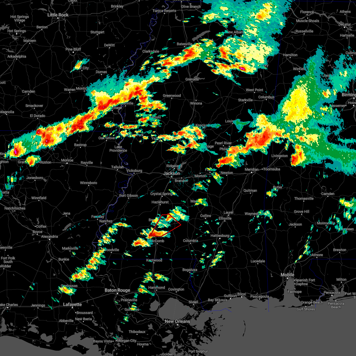 At 905 pm cst, a severe thunderstorm capable of producing a tornado was located over bogue chitto, or 11 miles south of brookhaven, moving northeast at 35 mph (radar indicated rotation). Hazards include tornado. Flying debris will be dangerous to those caught without shelter. mobile homes will be damaged or destroyed. damage to roofs, windows, and vehicles will occur. tree damage is likely. this dangerous storm will be near, enterprise around 915 pm cst. east lincoln around 925 pm cst. Monticello and sontag around 945 pm cst. At 905 pm cst, a severe thunderstorm capable of producing a tornado was located over bogue chitto, or 11 miles south of brookhaven, moving northeast at 35 mph (radar indicated rotation). Hazards include tornado. Flying debris will be dangerous to those caught without shelter. mobile homes will be damaged or destroyed. damage to roofs, windows, and vehicles will occur. tree damage is likely. this dangerous storm will be near, enterprise around 915 pm cst. east lincoln around 925 pm cst. Monticello and sontag around 945 pm cst.
|
| 11/29/2022 9:00 PM CST |
 At 900 pm cst, a severe thunderstorm was located near prospect, moving northeast at 45 mph (radar indicated). Hazards include 60 mph wind gusts and quarter size hail. Hail damage to vehicles is expected. expect wind damage to roofs, siding, and trees. this severe thunderstorm will be near, neshoba around 910 pm cst. little rock around 915 pm cst. house, herbert springs and bethsaida around 920 pm cst. damascus and forestdale around 930 pm cst. liberty around 935 pm cst. bluff springs around 940 pm cst. de kalb around 945 pm cst. other locations impacted by this severe thunderstorm include tucker. hail threat, radar indicated max hail size, 1. 00 in wind threat, radar indicated max wind gust, 60 mph. At 900 pm cst, a severe thunderstorm was located near prospect, moving northeast at 45 mph (radar indicated). Hazards include 60 mph wind gusts and quarter size hail. Hail damage to vehicles is expected. expect wind damage to roofs, siding, and trees. this severe thunderstorm will be near, neshoba around 910 pm cst. little rock around 915 pm cst. house, herbert springs and bethsaida around 920 pm cst. damascus and forestdale around 930 pm cst. liberty around 935 pm cst. bluff springs around 940 pm cst. de kalb around 945 pm cst. other locations impacted by this severe thunderstorm include tucker. hail threat, radar indicated max hail size, 1. 00 in wind threat, radar indicated max wind gust, 60 mph.
|
| 11/29/2022 8:46 PM CST |
 At 846 pm cst, a severe thunderstorm capable of producing a tornado was located near smithdale, or 11 miles northwest of mccomb, moving northeast at 40 mph (radar indicated rotation). Hazards include tornado. Flying debris will be dangerous to those caught without shelter. mobile homes will be damaged or destroyed. damage to roofs, windows, and vehicles will occur. tree damage is likely. this dangerous storm will be near, center point around 850 pm cst. west lincoln around 900 pm cst. bogue chitto around 905 pm cst. enterprise around 910 pm cst. east lincoln around 920 pm cst. Monticello and sontag around 935 pm cst. At 846 pm cst, a severe thunderstorm capable of producing a tornado was located near smithdale, or 11 miles northwest of mccomb, moving northeast at 40 mph (radar indicated rotation). Hazards include tornado. Flying debris will be dangerous to those caught without shelter. mobile homes will be damaged or destroyed. damage to roofs, windows, and vehicles will occur. tree damage is likely. this dangerous storm will be near, center point around 850 pm cst. west lincoln around 900 pm cst. bogue chitto around 905 pm cst. enterprise around 910 pm cst. east lincoln around 920 pm cst. Monticello and sontag around 935 pm cst.
|
| 11/29/2022 3:27 PM CST |
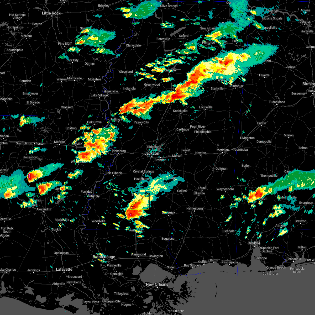 At 327 pm cst, a severe thunderstorm was located near bogue chitto, or 8 miles north of mccomb, moving east at 25 mph (radar indicated). Hazards include 60 mph wind gusts and quarter size hail. Hail damage to vehicles is expected. expect wind damage to roofs, siding, and trees. this severe storm will be near, bogue chitto around 335 pm cst. enterprise around 345 pm cst. ruth around 355 pm cst. east lincoln around 400 pm cst. hail threat, radar indicated max hail size, 1. 00 in wind threat, radar indicated max wind gust, 60 mph. At 327 pm cst, a severe thunderstorm was located near bogue chitto, or 8 miles north of mccomb, moving east at 25 mph (radar indicated). Hazards include 60 mph wind gusts and quarter size hail. Hail damage to vehicles is expected. expect wind damage to roofs, siding, and trees. this severe storm will be near, bogue chitto around 335 pm cst. enterprise around 345 pm cst. ruth around 355 pm cst. east lincoln around 400 pm cst. hail threat, radar indicated max hail size, 1. 00 in wind threat, radar indicated max wind gust, 60 mph.
|
| 11/29/2022 3:16 PM CST |
 At 316 pm cst, a severe thunderstorm was located near center point, or 10 miles northwest of mccomb, moving east at 35 mph (radar indicated). Hazards include 60 mph wind gusts and quarter size hail. Hail damage to vehicles is expected. expect wind damage to roofs, siding, and trees. this severe storm will be near, bogue chitto around 330 pm cst. enterprise around 335 pm cst. ruth around 340 pm cst. east lincoln around 345 pm cst. hail threat, radar indicated max hail size, 1. 00 in wind threat, radar indicated max wind gust, 60 mph. At 316 pm cst, a severe thunderstorm was located near center point, or 10 miles northwest of mccomb, moving east at 35 mph (radar indicated). Hazards include 60 mph wind gusts and quarter size hail. Hail damage to vehicles is expected. expect wind damage to roofs, siding, and trees. this severe storm will be near, bogue chitto around 330 pm cst. enterprise around 335 pm cst. ruth around 340 pm cst. east lincoln around 345 pm cst. hail threat, radar indicated max hail size, 1. 00 in wind threat, radar indicated max wind gust, 60 mph.
|
| 11/29/2022 2:58 PM CST |
 At 258 pm cst, a severe thunderstorm was located near smithdale, or 14 miles northwest of mccomb, moving northeast at 35 mph (radar indicated). Hazards include 60 mph wind gusts and quarter size hail. Hail damage to vehicles is expected. expect wind damage to roofs, siding, and trees. this severe thunderstorm will be near, west lincoln around 315 pm cst. bogue chitto around 320 pm cst. enterprise around 325 pm cst. brookhaven around 330 pm cst. east lincoln around 335 pm cst. hail threat, radar indicated max hail size, 1. 00 in wind threat, radar indicated max wind gust, 60 mph. At 258 pm cst, a severe thunderstorm was located near smithdale, or 14 miles northwest of mccomb, moving northeast at 35 mph (radar indicated). Hazards include 60 mph wind gusts and quarter size hail. Hail damage to vehicles is expected. expect wind damage to roofs, siding, and trees. this severe thunderstorm will be near, west lincoln around 315 pm cst. bogue chitto around 320 pm cst. enterprise around 325 pm cst. brookhaven around 330 pm cst. east lincoln around 335 pm cst. hail threat, radar indicated max hail size, 1. 00 in wind threat, radar indicated max wind gust, 60 mph.
|
| 10/12/2022 5:18 PM CDT |
 At 518 pm cdt, a severe thunderstorm was located near pearl river, or near edinburg, moving northeast at 30 mph (radar indicated). Hazards include 60 mph wind gusts and half dollar size hail. Hail damage to vehicles is expected. expect wind damage to roofs, siding, and trees. this severe storm will be near, pearl river around 525 pm cdt. philadelphia around 530 pm cdt. burnside around 545 pm cdt. hail threat, radar indicated max hail size, 1. 25 in wind threat, radar indicated max wind gust, 60 mph. At 518 pm cdt, a severe thunderstorm was located near pearl river, or near edinburg, moving northeast at 30 mph (radar indicated). Hazards include 60 mph wind gusts and half dollar size hail. Hail damage to vehicles is expected. expect wind damage to roofs, siding, and trees. this severe storm will be near, pearl river around 525 pm cdt. philadelphia around 530 pm cdt. burnside around 545 pm cdt. hail threat, radar indicated max hail size, 1. 25 in wind threat, radar indicated max wind gust, 60 mph.
|
| 10/12/2022 5:05 PM CDT |
 At 505 pm cdt, a severe thunderstorm was located over madden, or 8 miles south of edinburg, moving northeast at 30 mph (radar indicated). Hazards include ping pong ball size hail and 60 mph wind gusts. People and animals outdoors will be injured. expect hail damage to roofs, siding, windows, and vehicles. expect wind damage to roofs, siding, and trees. this severe thunderstorm will be near, dowdville around 510 pm cdt. dixon around 515 pm cdt. edinburg around 520 pm cdt. pearl river around 525 pm cdt. philadelphia around 530 pm cdt. burnside around 545 pm cdt. stallo around 550 pm cdt. hail threat, radar indicated max hail size, 1. 50 in wind threat, radar indicated max wind gust, 60 mph. At 505 pm cdt, a severe thunderstorm was located over madden, or 8 miles south of edinburg, moving northeast at 30 mph (radar indicated). Hazards include ping pong ball size hail and 60 mph wind gusts. People and animals outdoors will be injured. expect hail damage to roofs, siding, windows, and vehicles. expect wind damage to roofs, siding, and trees. this severe thunderstorm will be near, dowdville around 510 pm cdt. dixon around 515 pm cdt. edinburg around 520 pm cdt. pearl river around 525 pm cdt. philadelphia around 530 pm cdt. burnside around 545 pm cdt. stallo around 550 pm cdt. hail threat, radar indicated max hail size, 1. 50 in wind threat, radar indicated max wind gust, 60 mph.
|
| 7/21/2022 8:16 PM CDT |
 At 816 pm cdt, a severe thunderstorm was located 7 miles east of gholson, or 14 miles northeast of preston, moving southeast at 20 mph (radar indicated). Hazards include 60 mph wind gusts and penny size hail. Expect damage to roofs, siding, and trees. this severe thunderstorm will be near, paulette around 835 pm cdt. electric mills around 855 pm cdt. other locations impacted by this severe thunderstorm include shuqualak and scooba. hail threat, radar indicated max hail size, 0. 75 in wind threat, radar indicated max wind gust, 60 mph. At 816 pm cdt, a severe thunderstorm was located 7 miles east of gholson, or 14 miles northeast of preston, moving southeast at 20 mph (radar indicated). Hazards include 60 mph wind gusts and penny size hail. Expect damage to roofs, siding, and trees. this severe thunderstorm will be near, paulette around 835 pm cdt. electric mills around 855 pm cdt. other locations impacted by this severe thunderstorm include shuqualak and scooba. hail threat, radar indicated max hail size, 0. 75 in wind threat, radar indicated max wind gust, 60 mph.
|
| 7/21/2022 7:44 PM CDT |
 At 744 pm cdt, a severe thunderstorm was located 8 miles east of zama, or 13 miles northeast of edinburg, moving east at 15 mph (radar indicated). Hazards include 60 mph wind gusts and nickel size hail. Expect damage to roofs, siding, and trees. locations impacted include, nanih waiya, forestdale, zama, burnside, stallo and noxapater. hail threat, radar indicated max hail size, 0. 88 in wind threat, radar indicated max wind gust, 60 mph. At 744 pm cdt, a severe thunderstorm was located 8 miles east of zama, or 13 miles northeast of edinburg, moving east at 15 mph (radar indicated). Hazards include 60 mph wind gusts and nickel size hail. Expect damage to roofs, siding, and trees. locations impacted include, nanih waiya, forestdale, zama, burnside, stallo and noxapater. hail threat, radar indicated max hail size, 0. 88 in wind threat, radar indicated max wind gust, 60 mph.
|
| 7/21/2022 7:22 PM CDT |
 At 722 pm cdt, a severe thunderstorm was located near zama, or 15 miles north of edinburg, moving east at 15 mph (radar indicated). Hazards include 60 mph wind gusts and nickel size hail. Expect damage to roofs, siding, and trees. this severe thunderstorm will be near, stallo around 815 pm cdt. other locations impacted by this severe thunderstorm include noxapater. hail threat, radar indicated max hail size, 0. 88 in wind threat, radar indicated max wind gust, 60 mph. At 722 pm cdt, a severe thunderstorm was located near zama, or 15 miles north of edinburg, moving east at 15 mph (radar indicated). Hazards include 60 mph wind gusts and nickel size hail. Expect damage to roofs, siding, and trees. this severe thunderstorm will be near, stallo around 815 pm cdt. other locations impacted by this severe thunderstorm include noxapater. hail threat, radar indicated max hail size, 0. 88 in wind threat, radar indicated max wind gust, 60 mph.
|
| 5/25/2022 1:51 PM CDT |
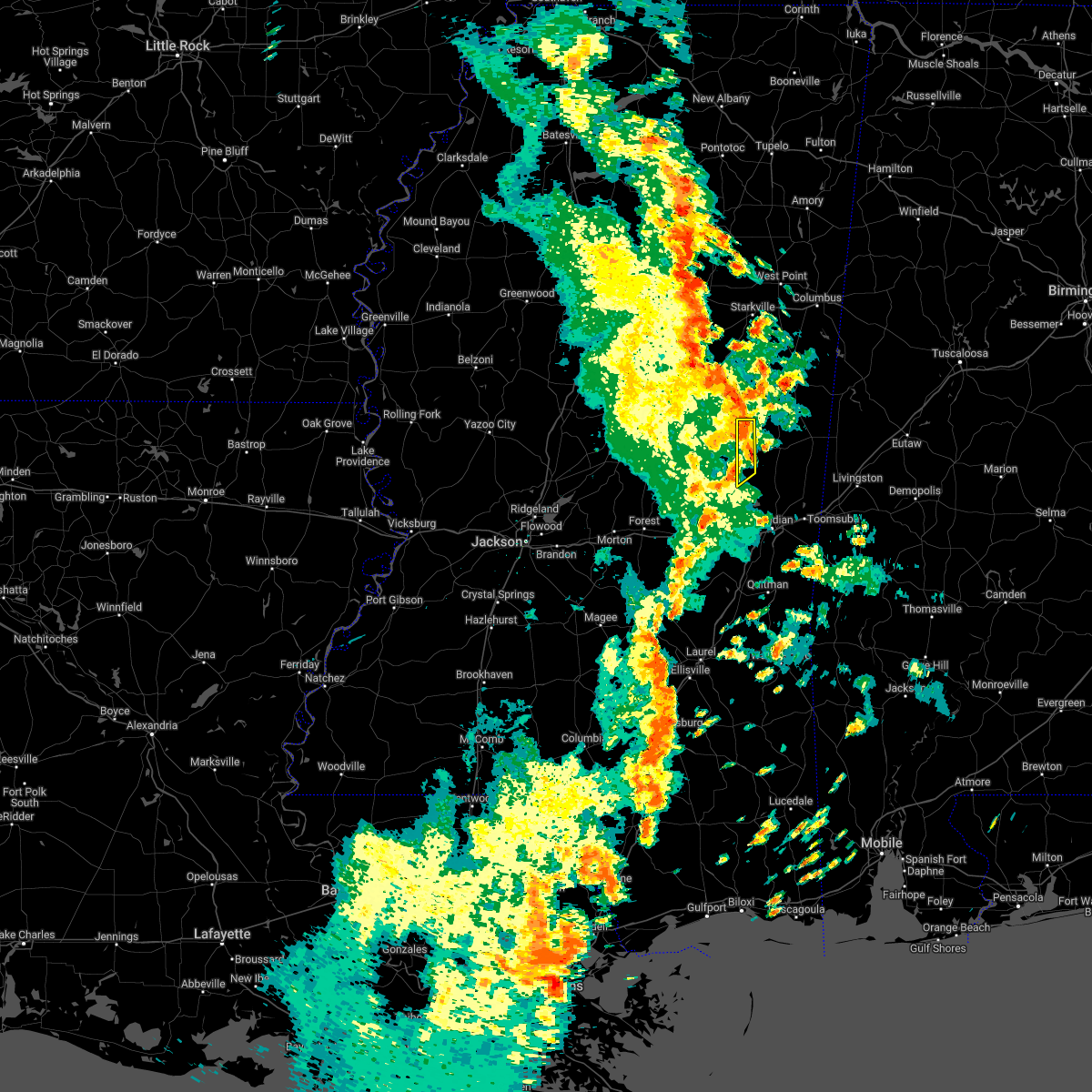 At 151 pm cdt, a severe thunderstorm was located over gholson, or near preston, moving northeast at 45 mph (radar indicated). Hazards include 60 mph wind gusts. Expect damage to roofs, siding, and trees. this severe thunderstorm will remain over mainly rural areas of western kemper county. hail threat, radar indicated max hail size, <. 75 in wind threat, radar indicated max wind gust, 60 mph. At 151 pm cdt, a severe thunderstorm was located over gholson, or near preston, moving northeast at 45 mph (radar indicated). Hazards include 60 mph wind gusts. Expect damage to roofs, siding, and trees. this severe thunderstorm will remain over mainly rural areas of western kemper county. hail threat, radar indicated max hail size, <. 75 in wind threat, radar indicated max wind gust, 60 mph.
|
| 5/25/2022 1:40 PM CDT |
 At 139 pm cdt, a severe thunderstorm was located over nanih waiya, moving northeast at 40 mph (radar indicated). Hazards include 60 mph wind gusts. Expect damage to roofs, siding, and trees. this severe storm will be near, preston around 145 pm cdt. other locations impacted by this severe thunderstorm include tucker. hail threat, radar indicated max hail size, <. 75 in wind threat, radar indicated max wind gust, 60 mph. At 139 pm cdt, a severe thunderstorm was located over nanih waiya, moving northeast at 40 mph (radar indicated). Hazards include 60 mph wind gusts. Expect damage to roofs, siding, and trees. this severe storm will be near, preston around 145 pm cdt. other locations impacted by this severe thunderstorm include tucker. hail threat, radar indicated max hail size, <. 75 in wind threat, radar indicated max wind gust, 60 mph.
|
| 5/25/2022 1:29 PM CDT |
 At 129 pm cdt, a severe thunderstorm was located near forestdale, or 7 miles northeast of philadelphia, moving northeast at 40 mph (radar indicated). Hazards include 60 mph wind gusts. Expect damage to roofs, siding, and trees. this severe storm will be near, nanih waiya around 140 pm cdt. preston around 145 pm cdt. other locations impacted by this severe thunderstorm include tucker. hail threat, radar indicated max hail size, <. 75 in wind threat, radar indicated max wind gust, 60 mph. At 129 pm cdt, a severe thunderstorm was located near forestdale, or 7 miles northeast of philadelphia, moving northeast at 40 mph (radar indicated). Hazards include 60 mph wind gusts. Expect damage to roofs, siding, and trees. this severe storm will be near, nanih waiya around 140 pm cdt. preston around 145 pm cdt. other locations impacted by this severe thunderstorm include tucker. hail threat, radar indicated max hail size, <. 75 in wind threat, radar indicated max wind gust, 60 mph.
|
| 5/25/2022 1:11 PM CDT |
 At 111 pm cdt, a severe thunderstorm was located over dixon, or near philadelphia, moving northeast at 40 mph (radar indicated). Hazards include 60 mph wind gusts. Expect damage to roofs, siding, and trees. this severe thunderstorm will be near, philadelphia around 115 pm cdt. bethsaida around 120 pm cdt. burnside around 125 pm cdt. forestdale around 130 pm cdt. nanih waiya around 140 pm cdt. preston around 145 pm cdt. other locations impacted by this severe thunderstorm include tucker. hail threat, radar indicated max hail size, <. 75 in wind threat, radar indicated max wind gust, 60 mph. At 111 pm cdt, a severe thunderstorm was located over dixon, or near philadelphia, moving northeast at 40 mph (radar indicated). Hazards include 60 mph wind gusts. Expect damage to roofs, siding, and trees. this severe thunderstorm will be near, philadelphia around 115 pm cdt. bethsaida around 120 pm cdt. burnside around 125 pm cdt. forestdale around 130 pm cdt. nanih waiya around 140 pm cdt. preston around 145 pm cdt. other locations impacted by this severe thunderstorm include tucker. hail threat, radar indicated max hail size, <. 75 in wind threat, radar indicated max wind gust, 60 mph.
|
| 5/15/2022 9:27 PM CDT |
 At 926 pm cdt, severe thunderstorms were located along a line extending from brookhaven to bude to near cranfield, moving south at 45 mph (radar indicated). Hazards include 60 mph wind gusts and quarter size hail. Hail damage to vehicles is expected. expect wind damage to roofs, siding, and trees. severe thunderstorms will be near, enterprise around 935 pm cdt. bogue chitto and garden city around 940 pm cdt. ruth around 945 pm cdt. other locations impacted by these severe thunderstorms include roxie and meadville. hail threat, radar indicated max hail size, 1. 00 in wind threat, radar indicated max wind gust, 60 mph. At 926 pm cdt, severe thunderstorms were located along a line extending from brookhaven to bude to near cranfield, moving south at 45 mph (radar indicated). Hazards include 60 mph wind gusts and quarter size hail. Hail damage to vehicles is expected. expect wind damage to roofs, siding, and trees. severe thunderstorms will be near, enterprise around 935 pm cdt. bogue chitto and garden city around 940 pm cdt. ruth around 945 pm cdt. other locations impacted by these severe thunderstorms include roxie and meadville. hail threat, radar indicated max hail size, 1. 00 in wind threat, radar indicated max wind gust, 60 mph.
|
| 4/17/2022 7:59 PM CDT |
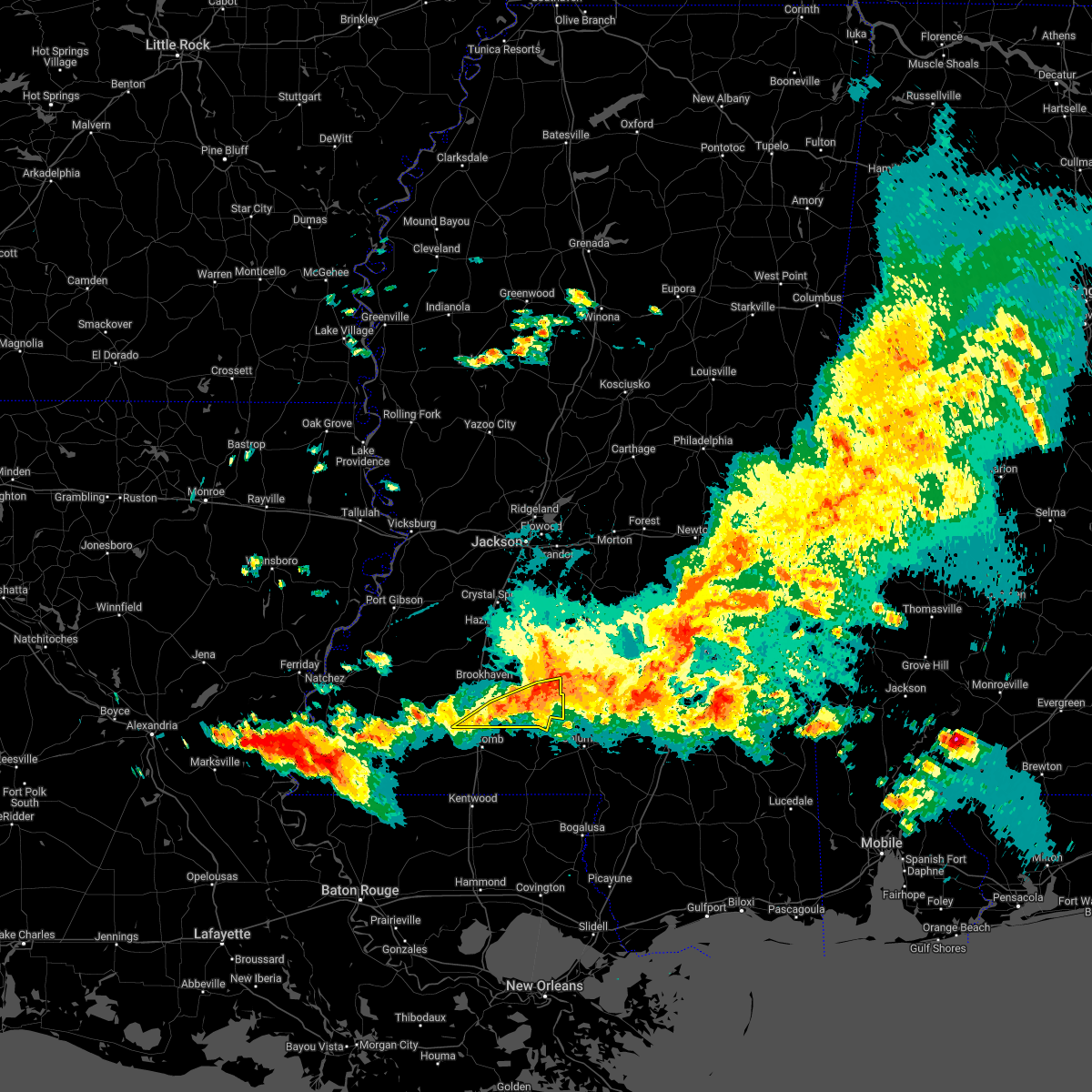 At 759 pm cdt, severe thunderstorms were located along a line extending from 7 miles southeast of shivers to near oak vale to near summit, moving east at 55 mph (radar indicated). Hazards include 60 mph wind gusts and nickel size hail. Expect damage to roofs, siding, and trees. these severe storms will be near, oak vale around 805 pm cdt. hail threat, radar indicated max hail size, 0. 88 in wind threat, radar indicated max wind gust, 60 mph. At 759 pm cdt, severe thunderstorms were located along a line extending from 7 miles southeast of shivers to near oak vale to near summit, moving east at 55 mph (radar indicated). Hazards include 60 mph wind gusts and nickel size hail. Expect damage to roofs, siding, and trees. these severe storms will be near, oak vale around 805 pm cdt. hail threat, radar indicated max hail size, 0. 88 in wind threat, radar indicated max wind gust, 60 mph.
|
| 4/17/2022 7:42 PM CDT |
 At 742 pm cdt, severe thunderstorms were located along a line extending from near wesson to enterprise to 8 miles southwest of smithdale, moving east at 50 mph (radar indicated). Hazards include 60 mph wind gusts and nickel size hail. Expect damage to roofs, siding, and trees. these severe storms will be near, enterprise, east lincoln and ruth around 750 pm cdt. topeka, sontag and oma around 755 pm cdt. monticello, wanilla, jayess and robinwood around 800 pm cdt. tilton, oak vale and arm around 810 pm cdt. other locations impacted by these severe thunderstorms include new hebron, silver creek, beauregard and meadville. hail threat, radar indicated max hail size, 0. 88 in wind threat, radar indicated max wind gust, 60 mph. At 742 pm cdt, severe thunderstorms were located along a line extending from near wesson to enterprise to 8 miles southwest of smithdale, moving east at 50 mph (radar indicated). Hazards include 60 mph wind gusts and nickel size hail. Expect damage to roofs, siding, and trees. these severe storms will be near, enterprise, east lincoln and ruth around 750 pm cdt. topeka, sontag and oma around 755 pm cdt. monticello, wanilla, jayess and robinwood around 800 pm cdt. tilton, oak vale and arm around 810 pm cdt. other locations impacted by these severe thunderstorms include new hebron, silver creek, beauregard and meadville. hail threat, radar indicated max hail size, 0. 88 in wind threat, radar indicated max wind gust, 60 mph.
|
| 4/17/2022 7:19 PM CDT |
 At 718 pm cdt, severe thunderstorms were located along a line extending from barlow to near mccall creek to near garden city, moving east at 50 mph (radar indicated). Hazards include 60 mph wind gusts and nickel size hail. Expect damage to roofs, siding, and trees. severe thunderstorms will be near, vaughn, loyd star and mccall creek around 725 pm cdt. glancy and west lincoln around 730 pm cdt. brookhaven and martinsville around 735 pm cdt. wesson, enterprise and bogue chitto around 740 pm cdt. east lincoln around 745 pm cdt. sontag and ruth around 750 pm cdt. topeka, wanilla, jayess and oma around 755 pm cdt. monticello and robinwood around 800 pm cdt. other locations impacted by these severe thunderstorms include new hebron, meadville, silver creek and beauregard. hail threat, radar indicated max hail size, 0. 88 in wind threat, radar indicated max wind gust, 60 mph. At 718 pm cdt, severe thunderstorms were located along a line extending from barlow to near mccall creek to near garden city, moving east at 50 mph (radar indicated). Hazards include 60 mph wind gusts and nickel size hail. Expect damage to roofs, siding, and trees. severe thunderstorms will be near, vaughn, loyd star and mccall creek around 725 pm cdt. glancy and west lincoln around 730 pm cdt. brookhaven and martinsville around 735 pm cdt. wesson, enterprise and bogue chitto around 740 pm cdt. east lincoln around 745 pm cdt. sontag and ruth around 750 pm cdt. topeka, wanilla, jayess and oma around 755 pm cdt. monticello and robinwood around 800 pm cdt. other locations impacted by these severe thunderstorms include new hebron, meadville, silver creek and beauregard. hail threat, radar indicated max hail size, 0. 88 in wind threat, radar indicated max wind gust, 60 mph.
|
| 4/15/2022 6:20 PM CDT |
 The severe thunderstorm warning for southwestern noxubee, northwestern kemper, southeastern winston and northern neshoba counties will expire at 630 pm cdt, the storm which prompted the warning has weakened below severe limits, and has exited some of the warned area. therefore, the warning will be allowed to expire. however small hail and gusty winds are still possible with this thunderstorm. The severe thunderstorm warning for southwestern noxubee, northwestern kemper, southeastern winston and northern neshoba counties will expire at 630 pm cdt, the storm which prompted the warning has weakened below severe limits, and has exited some of the warned area. therefore, the warning will be allowed to expire. however small hail and gusty winds are still possible with this thunderstorm.
|
| 4/15/2022 5:49 PM CDT |
 At 549 pm cdt, a severe thunderstorm was located over burnside, or 7 miles north of philadelphia, moving northeast at 40 mph (radar indicated). Hazards include 60 mph wind gusts and quarter size hail. Hail damage to vehicles is expected. expect wind damage to roofs, siding, and trees. this severe thunderstorm will be near, nanih waiya around 605 pm cdt. other locations impacted by this severe thunderstorm include noxapater. hail threat, radar indicated max hail size, 1. 00 in wind threat, radar indicated max wind gust, 60 mph. At 549 pm cdt, a severe thunderstorm was located over burnside, or 7 miles north of philadelphia, moving northeast at 40 mph (radar indicated). Hazards include 60 mph wind gusts and quarter size hail. Hail damage to vehicles is expected. expect wind damage to roofs, siding, and trees. this severe thunderstorm will be near, nanih waiya around 605 pm cdt. other locations impacted by this severe thunderstorm include noxapater. hail threat, radar indicated max hail size, 1. 00 in wind threat, radar indicated max wind gust, 60 mph.
|
| 1/1/0001 12:00 AM | A peak wind gust of 55 kts was measured from a direction of 220 degrees at the joe williams naval outlying field asos site knj in kemper county MS, 4.7 miles WNW of Bogue Chitto, MS |
| 4/13/2022 8:30 PM CDT |
 At 830 pm cdt, severe thunderstorms were located along a line extending from near craig springs to near preston to near forestdale, moving east at 65 mph (radar indicated). Hazards include 60 mph wind gusts. Expect damage to roofs, siding, and trees. severe thunderstorms will be near, gholson around 835 pm cdt. mashulaville around 840 pm cdt. de kalb around 845 pm cdt. macon and brooksville around 850 pm cdt. paulette around 855 pm cdt. cooksville around 900 pm cdt. other locations impacted by these severe thunderstorms include shuqualak and scooba. hail threat, radar indicated max hail size, <. 75 in wind threat, radar indicated max wind gust, 60 mph. At 830 pm cdt, severe thunderstorms were located along a line extending from near craig springs to near preston to near forestdale, moving east at 65 mph (radar indicated). Hazards include 60 mph wind gusts. Expect damage to roofs, siding, and trees. severe thunderstorms will be near, gholson around 835 pm cdt. mashulaville around 840 pm cdt. de kalb around 845 pm cdt. macon and brooksville around 850 pm cdt. paulette around 855 pm cdt. cooksville around 900 pm cdt. other locations impacted by these severe thunderstorms include shuqualak and scooba. hail threat, radar indicated max hail size, <. 75 in wind threat, radar indicated max wind gust, 60 mph.
|
| 4/13/2022 8:10 PM CDT |
 At 810 pm cdt, a severe thunderstorm capable of producing a tornado was located over pearl river, or near philadelphia, moving east at 60 mph (radar indicated rotation). Hazards include tornado. Flying debris will be dangerous to those caught without shelter. mobile homes will be damaged or destroyed. damage to roofs, windows, and vehicles will occur. tree damage is likely. this dangerous storm will be near, burnside around 815 pm cdt. stallo around 820 pm cdt. Nanih waiya and forestdale around 825 pm cdt. At 810 pm cdt, a severe thunderstorm capable of producing a tornado was located over pearl river, or near philadelphia, moving east at 60 mph (radar indicated rotation). Hazards include tornado. Flying debris will be dangerous to those caught without shelter. mobile homes will be damaged or destroyed. damage to roofs, windows, and vehicles will occur. tree damage is likely. this dangerous storm will be near, burnside around 815 pm cdt. stallo around 820 pm cdt. Nanih waiya and forestdale around 825 pm cdt.
|
| 4/13/2022 8:04 PM CDT |
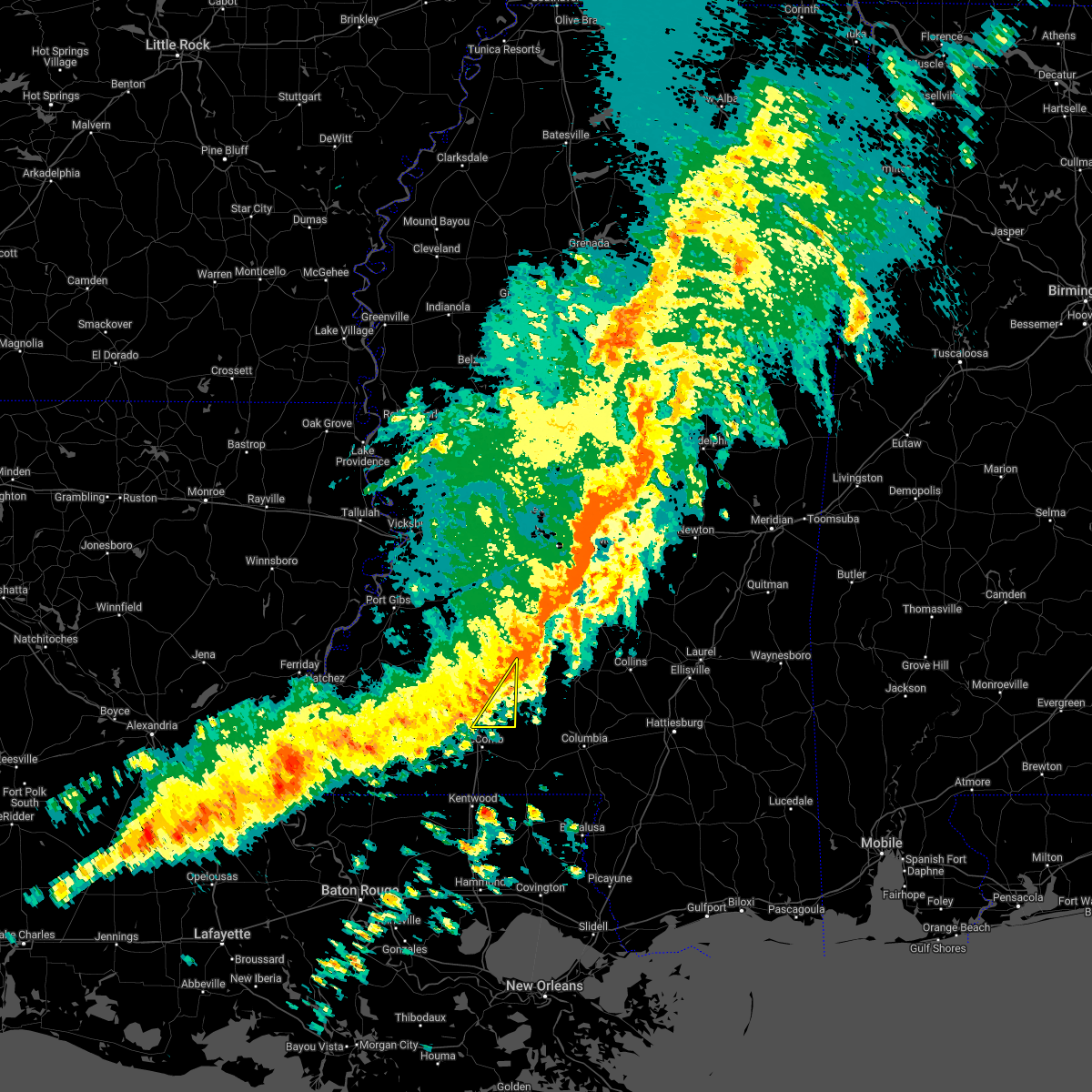 At 804 pm cdt, a severe thunderstorm was located over east lincoln, or 12 miles southeast of brookhaven, moving east at 55 mph (radar indicated). Hazards include 60 mph wind gusts. Expect damage to roofs, siding, and trees. this severe thunderstorm will remain over mainly rural areas of southeastern lincoln county. hail threat, radar indicated max hail size, <. 75 in wind threat, radar indicated max wind gust, 60 mph. At 804 pm cdt, a severe thunderstorm was located over east lincoln, or 12 miles southeast of brookhaven, moving east at 55 mph (radar indicated). Hazards include 60 mph wind gusts. Expect damage to roofs, siding, and trees. this severe thunderstorm will remain over mainly rural areas of southeastern lincoln county. hail threat, radar indicated max hail size, <. 75 in wind threat, radar indicated max wind gust, 60 mph.
|
| 4/13/2022 7:55 PM CDT |
 At 755 pm cdt, a severe thunderstorm capable of producing a tornado was located near carthage, moving east at 65 mph (radar indicated rotation). Hazards include tornado. Flying debris will be dangerous to those caught without shelter. mobile homes will be damaged or destroyed. damage to roofs, windows, and vehicles will occur. tree damage is likely. this dangerous storm will be near, edinburg and dowdville around 800 pm cdt. pearl river around 805 pm cdt. philadelphia around 810 pm cdt. burnside and stallo around 815 pm cdt. forestdale around 820 pm cdt. Other locations impacted by this tornadic thunderstorm include standing pine. At 755 pm cdt, a severe thunderstorm capable of producing a tornado was located near carthage, moving east at 65 mph (radar indicated rotation). Hazards include tornado. Flying debris will be dangerous to those caught without shelter. mobile homes will be damaged or destroyed. damage to roofs, windows, and vehicles will occur. tree damage is likely. this dangerous storm will be near, edinburg and dowdville around 800 pm cdt. pearl river around 805 pm cdt. philadelphia around 810 pm cdt. burnside and stallo around 815 pm cdt. forestdale around 820 pm cdt. Other locations impacted by this tornadic thunderstorm include standing pine.
|
| 4/13/2022 7:46 PM CDT |
 At 746 pm cdt, a severe thunderstorm was located over west lincoln, or 8 miles southwest of brookhaven, moving east at 55 mph (radar indicated). Hazards include 60 mph wind gusts. Expect damage to roofs, siding, and trees. this severe storm will be near, bogue chitto around 750 pm cdt. brookhaven and enterprise around 755 pm cdt. east lincoln around 800 pm cdt. hail threat, radar indicated max hail size, <. 75 in wind threat, radar indicated max wind gust, 60 mph. At 746 pm cdt, a severe thunderstorm was located over west lincoln, or 8 miles southwest of brookhaven, moving east at 55 mph (radar indicated). Hazards include 60 mph wind gusts. Expect damage to roofs, siding, and trees. this severe storm will be near, bogue chitto around 750 pm cdt. brookhaven and enterprise around 755 pm cdt. east lincoln around 800 pm cdt. hail threat, radar indicated max hail size, <. 75 in wind threat, radar indicated max wind gust, 60 mph.
|
| 4/13/2022 7:25 PM CDT |
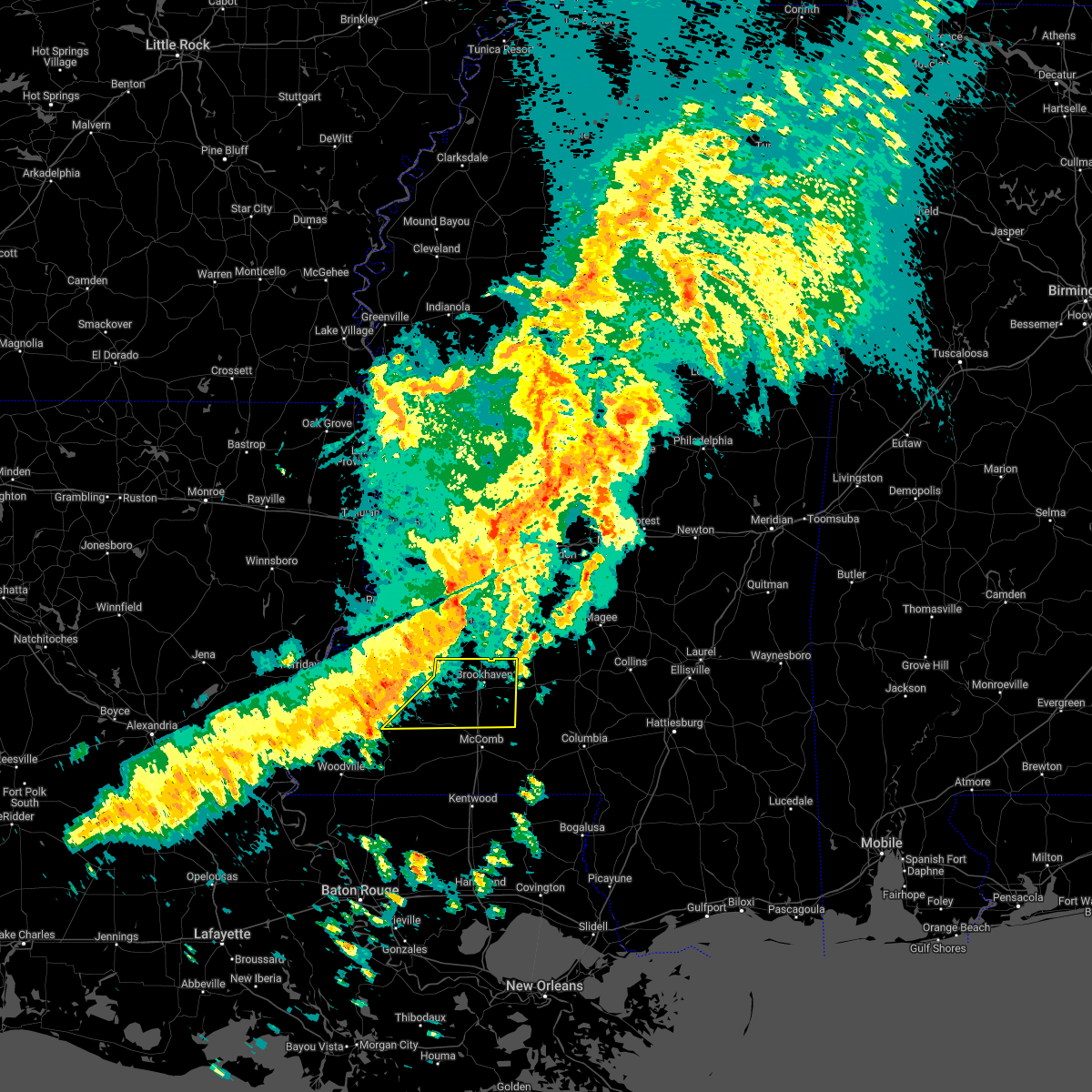 At 724 pm cdt, a severe thunderstorm was located near kirby, or 25 miles north of liberty, moving east at 55 mph (radar indicated). Hazards include 60 mph wind gusts. Expect damage to roofs, siding, and trees. this severe thunderstorm will be near, mccall creek around 740 pm cdt. center point around 745 pm cdt. west lincoln, vaughn and loyd star around 750 pm cdt. brookhaven and bogue chitto around 755 pm cdt. enterprise around 800 pm cdt. east lincoln around 805 pm cdt. other locations impacted by this severe thunderstorm include meadville. hail threat, radar indicated max hail size, <. 75 in wind threat, radar indicated max wind gust, 60 mph. At 724 pm cdt, a severe thunderstorm was located near kirby, or 25 miles north of liberty, moving east at 55 mph (radar indicated). Hazards include 60 mph wind gusts. Expect damage to roofs, siding, and trees. this severe thunderstorm will be near, mccall creek around 740 pm cdt. center point around 745 pm cdt. west lincoln, vaughn and loyd star around 750 pm cdt. brookhaven and bogue chitto around 755 pm cdt. enterprise around 800 pm cdt. east lincoln around 805 pm cdt. other locations impacted by this severe thunderstorm include meadville. hail threat, radar indicated max hail size, <. 75 in wind threat, radar indicated max wind gust, 60 mph.
|
| 4/5/2022 6:43 AM CDT |
 At 643 am cdt, severe thunderstorms were located along a line extending from near pinola to brookhaven, moving east at 65 mph (radar indicated). Hazards include 60 mph wind gusts. Expect damage to roofs, siding, and trees. locations impacted include, brookhaven, mendenhall, pinola, union, wesson, enterprise, oma, bogue chitto, west lincoln, vaughn, east lincoln, harrisville, little springs, center point, shivers, sontag, rockport, wanilla, d`lo and beauregard. hail threat, radar indicated max hail size, <. 75 in wind threat, radar indicated max wind gust, 60 mph. At 643 am cdt, severe thunderstorms were located along a line extending from near pinola to brookhaven, moving east at 65 mph (radar indicated). Hazards include 60 mph wind gusts. Expect damage to roofs, siding, and trees. locations impacted include, brookhaven, mendenhall, pinola, union, wesson, enterprise, oma, bogue chitto, west lincoln, vaughn, east lincoln, harrisville, little springs, center point, shivers, sontag, rockport, wanilla, d`lo and beauregard. hail threat, radar indicated max hail size, <. 75 in wind threat, radar indicated max wind gust, 60 mph.
|
| 4/5/2022 6:26 AM CDT |
 At 626 am cdt, severe thunderstorms were located along a line extending from near hopewell to near vaughn, moving east at 50 mph (radar indicated). Hazards include 60 mph wind gusts. Expect damage to roofs, siding, and trees. locations impacted include, brookhaven, crystal springs, hazlehurst, mendenhall, pinola, union, wesson, bude, enterprise, mccall creek, bogue chitto, west lincoln, little springs, center point, shivers, kirby, martinsville, sontag, new hope and wanilla. hail threat, radar indicated max hail size, <. 75 in wind threat, radar indicated max wind gust, 60 mph. At 626 am cdt, severe thunderstorms were located along a line extending from near hopewell to near vaughn, moving east at 50 mph (radar indicated). Hazards include 60 mph wind gusts. Expect damage to roofs, siding, and trees. locations impacted include, brookhaven, crystal springs, hazlehurst, mendenhall, pinola, union, wesson, bude, enterprise, mccall creek, bogue chitto, west lincoln, little springs, center point, shivers, kirby, martinsville, sontag, new hope and wanilla. hail threat, radar indicated max hail size, <. 75 in wind threat, radar indicated max wind gust, 60 mph.
|
| 4/5/2022 6:00 AM CDT |
 At 600 am cdt, severe thunderstorms were located along a line extending from near peyton to near hamburg, moving east at 60 mph (radar indicated). Hazards include 60 mph wind gusts. expect damage to roofs, siding, and trees At 600 am cdt, severe thunderstorms were located along a line extending from near peyton to near hamburg, moving east at 60 mph (radar indicated). Hazards include 60 mph wind gusts. expect damage to roofs, siding, and trees
|
| 3/30/2022 7:43 PM CDT |
 At 743 pm cdt, a severe thunderstorm was located near gholson, or near preston, moving northeast at 70 mph (radar indicated). Hazards include 70 mph wind gusts. Expect considerable tree damage. damage is likely to mobile homes, roofs, and outbuildings. this severe storm will be near, macon and paulette around 800 pm cdt. prairie point around 805 pm cdt. other locations impacted by this severe thunderstorm include shuqualak and scooba. thunderstorm damage threat, considerable hail threat, radar indicated max hail size, <. 75 in wind threat, radar indicated max wind gust, 70 mph. At 743 pm cdt, a severe thunderstorm was located near gholson, or near preston, moving northeast at 70 mph (radar indicated). Hazards include 70 mph wind gusts. Expect considerable tree damage. damage is likely to mobile homes, roofs, and outbuildings. this severe storm will be near, macon and paulette around 800 pm cdt. prairie point around 805 pm cdt. other locations impacted by this severe thunderstorm include shuqualak and scooba. thunderstorm damage threat, considerable hail threat, radar indicated max hail size, <. 75 in wind threat, radar indicated max wind gust, 70 mph.
|
| 3/30/2022 7:30 PM CDT |
 At 730 pm cdt, a severe thunderstorm was located near forestdale, or 11 miles east of philadelphia, moving northeast at 70 mph (radar indicated). Hazards include 60 mph wind gusts. Expect damage to roofs, siding, and trees. this severe thunderstorm will be near, bluff springs around 735 pm cdt. preston around 740 pm cdt. gholson around 745 pm cdt. macon and paulette around 800 pm cdt. prairie point around 810 pm cdt. other locations impacted by this severe thunderstorm include shuqualak and scooba. hail threat, radar indicated max hail size, <. 75 in wind threat, radar indicated max wind gust, 60 mph. At 730 pm cdt, a severe thunderstorm was located near forestdale, or 11 miles east of philadelphia, moving northeast at 70 mph (radar indicated). Hazards include 60 mph wind gusts. Expect damage to roofs, siding, and trees. this severe thunderstorm will be near, bluff springs around 735 pm cdt. preston around 740 pm cdt. gholson around 745 pm cdt. macon and paulette around 800 pm cdt. prairie point around 810 pm cdt. other locations impacted by this severe thunderstorm include shuqualak and scooba. hail threat, radar indicated max hail size, <. 75 in wind threat, radar indicated max wind gust, 60 mph.
|
| 3/30/2022 6:54 PM CDT |
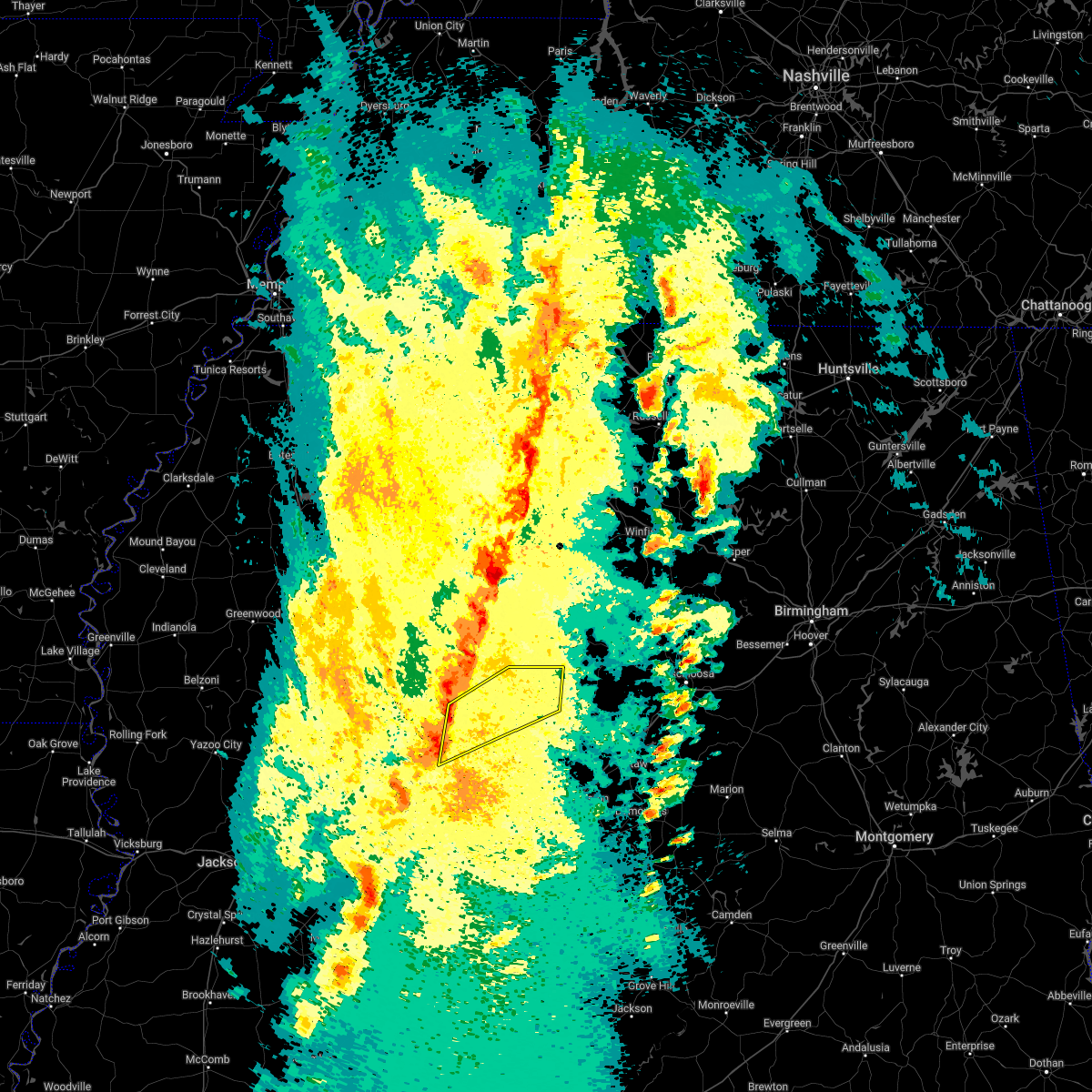 At 654 pm cdt, severe thunderstorms were located along a line extending from near betheden to near forestdale, moving northeast at 45 mph (radar indicated). Hazards include 60 mph wind gusts. Expect damage to roofs, siding, and trees. these severe storms will be near, preston around 710 pm cdt. gholson around 720 pm cdt. mashulaville around 725 pm cdt. macon around 740 pm cdt. prairie point and deerbrook around 750 pm cdt. bigbee valley around 800 pm cdt. Other locations impacted by these severe thunderstorms include shuqualak. At 654 pm cdt, severe thunderstorms were located along a line extending from near betheden to near forestdale, moving northeast at 45 mph (radar indicated). Hazards include 60 mph wind gusts. Expect damage to roofs, siding, and trees. these severe storms will be near, preston around 710 pm cdt. gholson around 720 pm cdt. mashulaville around 725 pm cdt. macon around 740 pm cdt. prairie point and deerbrook around 750 pm cdt. bigbee valley around 800 pm cdt. Other locations impacted by these severe thunderstorms include shuqualak.
|
| 3/30/2022 6:40 PM CDT |
 At 640 pm cdt, a severe thunderstorm was located near stallo, or 7 miles northwest of nanih waiya, moving northeast at 50 mph (radar indicated). Hazards include 60 mph wind gusts. Expect damage to roofs, siding, and trees. this severe thunderstorm will be near, mashulaville around 705 pm cdt. brooksville around 720 pm cdt. deerbrook around 725 pm cdt. Other locations impacted by this severe thunderstorm include shuqualak and noxapater. At 640 pm cdt, a severe thunderstorm was located near stallo, or 7 miles northwest of nanih waiya, moving northeast at 50 mph (radar indicated). Hazards include 60 mph wind gusts. Expect damage to roofs, siding, and trees. this severe thunderstorm will be near, mashulaville around 705 pm cdt. brooksville around 720 pm cdt. deerbrook around 725 pm cdt. Other locations impacted by this severe thunderstorm include shuqualak and noxapater.
|
| 3/30/2022 5:48 PM CDT |
 At 548 pm cdt, severe thunderstorms were located along a line extending from near pinola to near enterprise, moving east at 35 mph (radar indicated). Hazards include 60 mph wind gusts. Expect damage to roofs, siding, and trees. these severe storms will be near, pinola around 555 pm cdt. monticello around 615 pm cdt. Other locations impacted by these severe thunderstorms include new hebron and georgetown. At 548 pm cdt, severe thunderstorms were located along a line extending from near pinola to near enterprise, moving east at 35 mph (radar indicated). Hazards include 60 mph wind gusts. Expect damage to roofs, siding, and trees. these severe storms will be near, pinola around 555 pm cdt. monticello around 615 pm cdt. Other locations impacted by these severe thunderstorms include new hebron and georgetown.
|
| 3/30/2022 5:25 PM CDT |
 At 525 pm cdt, severe thunderstorms were located along a line extending from near hopewell to near west lincoln, moving east at 35 mph (radar indicated). Hazards include 60 mph wind gusts. Expect damage to roofs, siding, and trees. severe thunderstorms will be near, union around 540 pm cdt. east lincoln around 545 pm cdt. pinola around 555 pm cdt. sontag around 600 pm cdt. monticello and wanilla around 605 pm cdt. other locations impacted by these severe thunderstorms include beauregard, new hebron and georgetown. hail threat, radar indicated max hail size, <. 75 in wind threat, radar indicated max wind gust, 60 mph. At 525 pm cdt, severe thunderstorms were located along a line extending from near hopewell to near west lincoln, moving east at 35 mph (radar indicated). Hazards include 60 mph wind gusts. Expect damage to roofs, siding, and trees. severe thunderstorms will be near, union around 540 pm cdt. east lincoln around 545 pm cdt. pinola around 555 pm cdt. sontag around 600 pm cdt. monticello and wanilla around 605 pm cdt. other locations impacted by these severe thunderstorms include beauregard, new hebron and georgetown. hail threat, radar indicated max hail size, <. 75 in wind threat, radar indicated max wind gust, 60 mph.
|
| 3/30/2022 5:01 PM CDT |
 At 501 pm cdt, severe thunderstorms were located along a line extending from allen to mccall creek, moving northeast at 45 mph (radar indicated). Hazards include 60 mph wind gusts. Expect damage to roofs, siding, and trees. locations impacted include, brookhaven, hazlehurst, wesson, enterprise, caseyville, mccall creek, bogue chitto, west lincoln, allen, vaughn, barlow, east lincoln, little springs, glancy, loyd star, pleasant hill, center point, martinsville and beauregard. hail threat, radar indicated max hail size, <. 75 in wind threat, radar indicated max wind gust, 60 mph. At 501 pm cdt, severe thunderstorms were located along a line extending from allen to mccall creek, moving northeast at 45 mph (radar indicated). Hazards include 60 mph wind gusts. Expect damage to roofs, siding, and trees. locations impacted include, brookhaven, hazlehurst, wesson, enterprise, caseyville, mccall creek, bogue chitto, west lincoln, allen, vaughn, barlow, east lincoln, little springs, glancy, loyd star, pleasant hill, center point, martinsville and beauregard. hail threat, radar indicated max hail size, <. 75 in wind threat, radar indicated max wind gust, 60 mph.
|
| 3/30/2022 4:30 PM CDT |
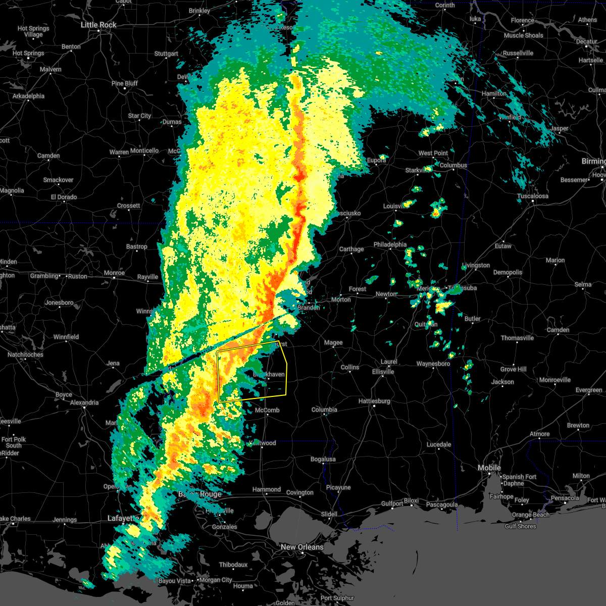 At 430 pm cdt, severe thunderstorms were located along a line extending from near fayette to near bude, moving east at 45 mph (radar indicated). Hazards include 60 mph wind gusts. expect damage to roofs, siding, and trees At 430 pm cdt, severe thunderstorms were located along a line extending from near fayette to near bude, moving east at 45 mph (radar indicated). Hazards include 60 mph wind gusts. expect damage to roofs, siding, and trees
|
| 3/22/2022 3:08 PM CDT |
 The severe thunderstorm warning for southeastern winston and eastern neshoba counties will expire at 315 pm cdt, the storms which prompted the warning have moved out of the area. therefore, the warning will be allowed to expire. a tornado watch remains in effect until 700 pm cdt for east central mississippi. The severe thunderstorm warning for southeastern winston and eastern neshoba counties will expire at 315 pm cdt, the storms which prompted the warning have moved out of the area. therefore, the warning will be allowed to expire. a tornado watch remains in effect until 700 pm cdt for east central mississippi.
|
| 3/22/2022 2:56 PM CDT |
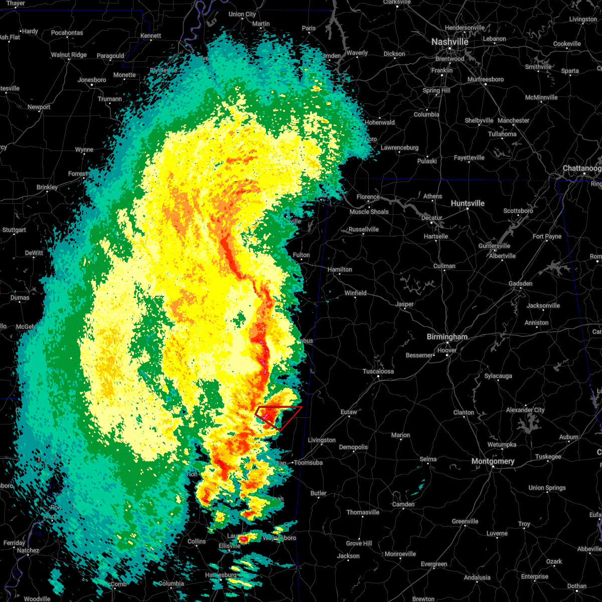 At 256 pm cdt, a severe thunderstorm capable of producing a tornado was located near de kalb, or 8 miles southeast of preston, moving northeast at 45 mph (radar indicated rotation). Hazards include tornado and quarter size hail. Flying debris will be dangerous to those caught without shelter. mobile homes will be damaged or destroyed. damage to roofs, windows, and vehicles will occur. tree damage is likely. This tornadic thunderstorm will remain over mainly rural areas of northwestern kemper county. At 256 pm cdt, a severe thunderstorm capable of producing a tornado was located near de kalb, or 8 miles southeast of preston, moving northeast at 45 mph (radar indicated rotation). Hazards include tornado and quarter size hail. Flying debris will be dangerous to those caught without shelter. mobile homes will be damaged or destroyed. damage to roofs, windows, and vehicles will occur. tree damage is likely. This tornadic thunderstorm will remain over mainly rural areas of northwestern kemper county.
|
| 3/22/2022 2:43 PM CDT |
 At 243 pm cdt, a confirmed tornado was located over damascus, or 13 miles south of preston, moving northeast at 45 mph (radar confirmed tornado). Hazards include damaging tornado and quarter size hail. Flying debris will be dangerous to those caught without shelter. mobile homes will be damaged or destroyed. damage to roofs, windows, and vehicles will occur. tree damage is likely. this tornado will be near, bluff springs around 250 pm cdt. De kalb around 255 pm cdt. At 243 pm cdt, a confirmed tornado was located over damascus, or 13 miles south of preston, moving northeast at 45 mph (radar confirmed tornado). Hazards include damaging tornado and quarter size hail. Flying debris will be dangerous to those caught without shelter. mobile homes will be damaged or destroyed. damage to roofs, windows, and vehicles will occur. tree damage is likely. this tornado will be near, bluff springs around 250 pm cdt. De kalb around 255 pm cdt.
|
| 3/22/2022 2:43 PM CDT |
 At 243 pm cdt, severe thunderstorms were located along a line extending from vernon to near neshoba, moving east at 30 mph (radar indicated). Hazards include 60 mph wind gusts. Expect damage to roofs, siding, and trees. These severe thunderstorms will remain over mainly rural areas of southeastern winston and eastern neshoba counties, including the following locations, tucker. At 243 pm cdt, severe thunderstorms were located along a line extending from vernon to near neshoba, moving east at 30 mph (radar indicated). Hazards include 60 mph wind gusts. Expect damage to roofs, siding, and trees. These severe thunderstorms will remain over mainly rural areas of southeastern winston and eastern neshoba counties, including the following locations, tucker.
|
| 3/22/2022 2:41 PM CDT |
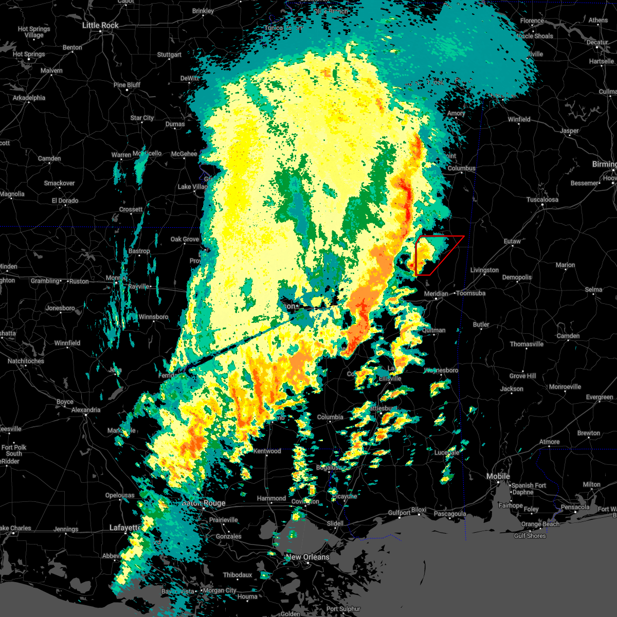 At 240 pm cdt, a severe thunderstorm capable of producing a tornado was located over damascus, or 15 miles northwest of meridian station, moving northeast at 45 mph (radar indicated rotation). Hazards include tornado. Flying debris will be dangerous to those caught without shelter. mobile homes will be damaged or destroyed. damage to roofs, windows, and vehicles will occur. tree damage is likely. this dangerous storm will be near, liberty around 245 pm cdt. bluff springs around 250 pm cdt. De kalb around 300 pm cdt. At 240 pm cdt, a severe thunderstorm capable of producing a tornado was located over damascus, or 15 miles northwest of meridian station, moving northeast at 45 mph (radar indicated rotation). Hazards include tornado. Flying debris will be dangerous to those caught without shelter. mobile homes will be damaged or destroyed. damage to roofs, windows, and vehicles will occur. tree damage is likely. this dangerous storm will be near, liberty around 245 pm cdt. bluff springs around 250 pm cdt. De kalb around 300 pm cdt.
|
| 3/22/2022 2:32 PM CDT |
 At 232 pm cdt, severe thunderstorms were located along a line extending from near center ridge to near neshoba, moving east at 30 mph (radar indicated). Hazards include 60 mph wind gusts. Expect damage to roofs, siding, and trees. these severe storms will be near, herbert springs around 255 pm cdt. forestdale around 300 pm cdt. Other locations impacted by these severe thunderstorms include noxapater and tucker. At 232 pm cdt, severe thunderstorms were located along a line extending from near center ridge to near neshoba, moving east at 30 mph (radar indicated). Hazards include 60 mph wind gusts. Expect damage to roofs, siding, and trees. these severe storms will be near, herbert springs around 255 pm cdt. forestdale around 300 pm cdt. Other locations impacted by these severe thunderstorms include noxapater and tucker.
|
| 3/22/2022 2:22 PM CDT |
 At 221 pm cdt, a severe thunderstorm capable of producing a tornado was located near little rock, or 13 miles northeast of newton, moving northeast at 45 mph (radar indicated rotation). Hazards include tornado. Flying debris will be dangerous to those caught without shelter. mobile homes will be damaged or destroyed. damage to roofs, windows, and vehicles will occur. tree damage is likely. this dangerous storm will be near, herbert springs and house around 235 pm cdt. liberty and damascus around 245 pm cdt. bluff springs around 250 pm cdt. De kalb around 300 pm cdt. At 221 pm cdt, a severe thunderstorm capable of producing a tornado was located near little rock, or 13 miles northeast of newton, moving northeast at 45 mph (radar indicated rotation). Hazards include tornado. Flying debris will be dangerous to those caught without shelter. mobile homes will be damaged or destroyed. damage to roofs, windows, and vehicles will occur. tree damage is likely. this dangerous storm will be near, herbert springs and house around 235 pm cdt. liberty and damascus around 245 pm cdt. bluff springs around 250 pm cdt. De kalb around 300 pm cdt.
|
| 3/22/2022 2:21 PM CDT |
 At 221 pm cdt, severe thunderstorms were located along a line extending from 6 miles southwest of center ridge to near dixon, moving east at 30 mph (radar indicated). Hazards include 60 mph wind gusts. Expect damage to roofs, siding, and trees. these severe storms will be near, stallo around 225 pm cdt. bethsaida and house around 250 pm cdt. herbert springs and forestdale around 300 pm cdt. Other locations impacted by these severe thunderstorms include noxapater and tucker. At 221 pm cdt, severe thunderstorms were located along a line extending from 6 miles southwest of center ridge to near dixon, moving east at 30 mph (radar indicated). Hazards include 60 mph wind gusts. Expect damage to roofs, siding, and trees. these severe storms will be near, stallo around 225 pm cdt. bethsaida and house around 250 pm cdt. herbert springs and forestdale around 300 pm cdt. Other locations impacted by these severe thunderstorms include noxapater and tucker.
|
| 3/22/2022 2:05 PM CDT |
 At 205 pm cdt, severe thunderstorms were located along a line extending from 6 miles east of zama to 6 miles southwest of madden, moving east at 35 mph (radar indicated). Hazards include 60 mph wind gusts. Expect damage to roofs, siding, and trees. these severe storms will be near, stallo around 220 pm cdt. dixon around 225 pm cdt. neshoba around 235 pm cdt. bethsaida around 245 pm cdt. house around 250 pm cdt. herbert springs around 255 pm cdt. forestdale around 300 pm cdt. Other locations impacted by these severe thunderstorms include noxapater, tucker and walnut grove. At 205 pm cdt, severe thunderstorms were located along a line extending from 6 miles east of zama to 6 miles southwest of madden, moving east at 35 mph (radar indicated). Hazards include 60 mph wind gusts. Expect damage to roofs, siding, and trees. these severe storms will be near, stallo around 220 pm cdt. dixon around 225 pm cdt. neshoba around 235 pm cdt. bethsaida around 245 pm cdt. house around 250 pm cdt. herbert springs around 255 pm cdt. forestdale around 300 pm cdt. Other locations impacted by these severe thunderstorms include noxapater, tucker and walnut grove.
|
| 3/22/2022 1:39 PM CDT |
 At 139 pm cdt, severe thunderstorms were located along a line extending from near singleton to near ludlow, moving east at 30 mph (radar indicated). Hazards include 60 mph wind gusts. Expect damage to roofs, siding, and trees. severe thunderstorms will be near, singleton and renfroe around 145 pm cdt. madden around 215 pm cdt. dowdville around 220 pm cdt. stallo around 225 pm cdt. dixon around 230 pm cdt. neshoba around 240 pm cdt. bethsaida around 250 pm cdt. house around 255 pm cdt. Other locations impacted by these severe thunderstorms include noxapater, lena, tucker, walnut grove, redwater and standing pine. At 139 pm cdt, severe thunderstorms were located along a line extending from near singleton to near ludlow, moving east at 30 mph (radar indicated). Hazards include 60 mph wind gusts. Expect damage to roofs, siding, and trees. severe thunderstorms will be near, singleton and renfroe around 145 pm cdt. madden around 215 pm cdt. dowdville around 220 pm cdt. stallo around 225 pm cdt. dixon around 230 pm cdt. neshoba around 240 pm cdt. bethsaida around 250 pm cdt. house around 255 pm cdt. Other locations impacted by these severe thunderstorms include noxapater, lena, tucker, walnut grove, redwater and standing pine.
|
| 2/17/2022 3:48 PM CST |
 At 347 pm cst, a severe thunderstorm was located near bluff springs, or 10 miles south of preston, moving northeast at 65 mph (radar indicated). Hazards include 60 mph wind gusts. Expect damage to roofs, siding, and trees. this severe storm will be near, de kalb around 400 pm cst. paulette around 415 pm cst. cooksville around 420 pm cst. Other locations impacted by this severe thunderstorm include shuqualak and scooba. At 347 pm cst, a severe thunderstorm was located near bluff springs, or 10 miles south of preston, moving northeast at 65 mph (radar indicated). Hazards include 60 mph wind gusts. Expect damage to roofs, siding, and trees. this severe storm will be near, de kalb around 400 pm cst. paulette around 415 pm cst. cooksville around 420 pm cst. Other locations impacted by this severe thunderstorm include shuqualak and scooba.
|
| 2/17/2022 3:28 PM CST |
 At 327 pm cst, a severe thunderstorm was located over bethsaida, or near philadelphia, moving northeast at 65 mph (radar indicated). Hazards include 60 mph wind gusts. Expect damage to roofs, siding, and trees. this severe thunderstorm will be near, bluff springs around 340 pm cst. preston around 345 pm cst. de kalb and gholson around 350 pm cst. paulette around 405 pm cst. cooksville around 410 pm cst. Other locations impacted by this severe thunderstorm include shuqualak, tucker and scooba. At 327 pm cst, a severe thunderstorm was located over bethsaida, or near philadelphia, moving northeast at 65 mph (radar indicated). Hazards include 60 mph wind gusts. Expect damage to roofs, siding, and trees. this severe thunderstorm will be near, bluff springs around 340 pm cst. preston around 345 pm cst. de kalb and gholson around 350 pm cst. paulette around 405 pm cst. cooksville around 410 pm cst. Other locations impacted by this severe thunderstorm include shuqualak, tucker and scooba.
|
| 2/17/2022 2:59 PM CST |
 At 259 pm cst, a severe thunderstorm capable of producing a tornado was located near preston, moving northeast at 65 mph (radar indicated rotation). Hazards include tornado. Flying debris will be dangerous to those caught without shelter. mobile homes will be damaged or destroyed. damage to roofs, windows, and vehicles will occur. tree damage is likely. this dangerous storm will be near, gholson around 310 pm cst. macon and paulette around 325 pm cst. prairie point around 330 pm cst. bigbee valley around 340 pm cst. Other locations impacted by this tornadic thunderstorm include shuqualak. At 259 pm cst, a severe thunderstorm capable of producing a tornado was located near preston, moving northeast at 65 mph (radar indicated rotation). Hazards include tornado. Flying debris will be dangerous to those caught without shelter. mobile homes will be damaged or destroyed. damage to roofs, windows, and vehicles will occur. tree damage is likely. this dangerous storm will be near, gholson around 310 pm cst. macon and paulette around 325 pm cst. prairie point around 330 pm cst. bigbee valley around 340 pm cst. Other locations impacted by this tornadic thunderstorm include shuqualak.
|
| 10/27/2021 5:01 PM CDT |
 At 445 pm cdt, a severe thunderstorm was located near center point, or 11 miles north of mccomb, moving northeast at 30 mph (radar indicated). Hazards include 60 mph wind gusts. expect damage to roofs, siding, and trees At 445 pm cdt, a severe thunderstorm was located near center point, or 11 miles north of mccomb, moving northeast at 30 mph (radar indicated). Hazards include 60 mph wind gusts. expect damage to roofs, siding, and trees
|
| 10/27/2021 4:45 PM CDT |
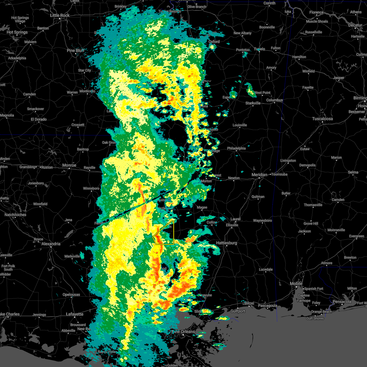 At 445 pm cdt, a severe thunderstorm was located near center point, or 11 miles north of mccomb, moving northeast at 30 mph (radar indicated). Hazards include 60 mph wind gusts. expect damage to roofs, siding, and trees At 445 pm cdt, a severe thunderstorm was located near center point, or 11 miles north of mccomb, moving northeast at 30 mph (radar indicated). Hazards include 60 mph wind gusts. expect damage to roofs, siding, and trees
|
| 10/5/2021 6:59 PM CDT |
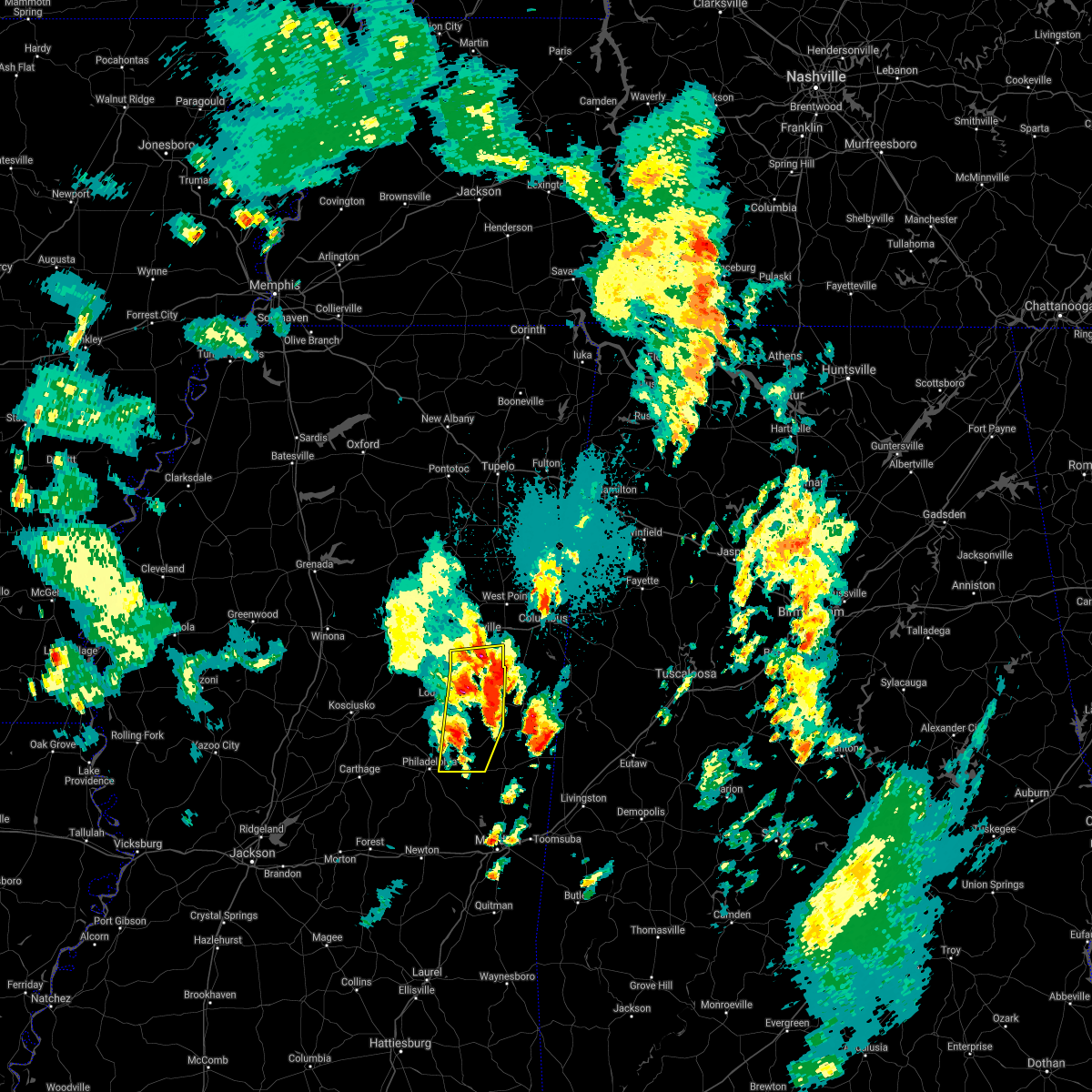 At 628 pm cdt, severe thunderstorms were located along a line extending from near betheden to near vernon to forestdale, moving east at 15 mph (radar indicated). Hazards include 60 mph wind gusts and half dollar size hail. Hail damage to vehicles is expected. expect wind damage to roofs, siding, and trees. severe thunderstorms will be near, gholson and oktoc around 655 pm cdt. mashulaville around 700 pm cdt. other locations impacted by these severe thunderstorms include noxapater and sturgis. hail threat, radar indicated max hail size, 1. 25 in wind threat, radar indicated max wind gust, 60 mph. At 628 pm cdt, severe thunderstorms were located along a line extending from near betheden to near vernon to forestdale, moving east at 15 mph (radar indicated). Hazards include 60 mph wind gusts and half dollar size hail. Hail damage to vehicles is expected. expect wind damage to roofs, siding, and trees. severe thunderstorms will be near, gholson and oktoc around 655 pm cdt. mashulaville around 700 pm cdt. other locations impacted by these severe thunderstorms include noxapater and sturgis. hail threat, radar indicated max hail size, 1. 25 in wind threat, radar indicated max wind gust, 60 mph.
|
| 10/5/2021 6:29 PM CDT |
 At 628 pm cdt, severe thunderstorms were located along a line extending from near betheden to near vernon to forestdale, moving east at 15 mph (radar indicated). Hazards include 60 mph wind gusts and half dollar size hail. Hail damage to vehicles is expected. expect wind damage to roofs, siding, and trees. severe thunderstorms will be near, gholson and oktoc around 655 pm cdt. mashulaville around 700 pm cdt. other locations impacted by these severe thunderstorms include noxapater and sturgis. hail threat, radar indicated max hail size, 1. 25 in wind threat, radar indicated max wind gust, 60 mph. At 628 pm cdt, severe thunderstorms were located along a line extending from near betheden to near vernon to forestdale, moving east at 15 mph (radar indicated). Hazards include 60 mph wind gusts and half dollar size hail. Hail damage to vehicles is expected. expect wind damage to roofs, siding, and trees. severe thunderstorms will be near, gholson and oktoc around 655 pm cdt. mashulaville around 700 pm cdt. other locations impacted by these severe thunderstorms include noxapater and sturgis. hail threat, radar indicated max hail size, 1. 25 in wind threat, radar indicated max wind gust, 60 mph.
|
| 9/1/2021 5:24 PM CDT |
 At 524 pm cdt, severe thunderstorms were located along a line extending from near tamola to renfroe, moving southeast at 35 mph (radar indicated). Hazards include 60 mph wind gusts and nickel size hail. Expect damage to roofs, siding, and trees. these severe storms will be near, meridian station and tamola around 530 pm cdt. lauderdale around 535 pm cdt. madden, kewanee and dowdville around 550 pm cdt. dixon around 600 pm cdt. other locations impacted by these severe thunderstorms include tucker, standing pine and redwater. hail threat, radar indicated max hail size, 0. 88 in wind threat, radar indicated max wind gust, 60 mph. At 524 pm cdt, severe thunderstorms were located along a line extending from near tamola to renfroe, moving southeast at 35 mph (radar indicated). Hazards include 60 mph wind gusts and nickel size hail. Expect damage to roofs, siding, and trees. these severe storms will be near, meridian station and tamola around 530 pm cdt. lauderdale around 535 pm cdt. madden, kewanee and dowdville around 550 pm cdt. dixon around 600 pm cdt. other locations impacted by these severe thunderstorms include tucker, standing pine and redwater. hail threat, radar indicated max hail size, 0. 88 in wind threat, radar indicated max wind gust, 60 mph.
|
| 9/1/2021 4:42 PM CDT |
 At 442 pm cdt, severe thunderstorms were located along a line extending from near gholson to near hesterville, moving southeast at 35 mph (radar indicated). Hazards include 60 mph wind gusts and nickel size hail. Expect damage to roofs, siding, and trees. severe thunderstorms will be near, de kalb around 455 pm cdt. smyrna around 505 pm cdt. singleton and blackwater around 510 pm cdt. meridian station and renfroe around 520 pm cdt. carthage and tamola around 525 pm cdt. lauderdale, edinburg, madden and kewanee around 530 pm cdt. other locations impacted by these severe thunderstorms include tucker, standing pine and redwater. hail threat, radar indicated max hail size, 0. 88 in wind threat, radar indicated max wind gust, 60 mph. At 442 pm cdt, severe thunderstorms were located along a line extending from near gholson to near hesterville, moving southeast at 35 mph (radar indicated). Hazards include 60 mph wind gusts and nickel size hail. Expect damage to roofs, siding, and trees. severe thunderstorms will be near, de kalb around 455 pm cdt. smyrna around 505 pm cdt. singleton and blackwater around 510 pm cdt. meridian station and renfroe around 520 pm cdt. carthage and tamola around 525 pm cdt. lauderdale, edinburg, madden and kewanee around 530 pm cdt. other locations impacted by these severe thunderstorms include tucker, standing pine and redwater. hail threat, radar indicated max hail size, 0. 88 in wind threat, radar indicated max wind gust, 60 mph.
|
| 6/13/2021 3:23 PM CDT |
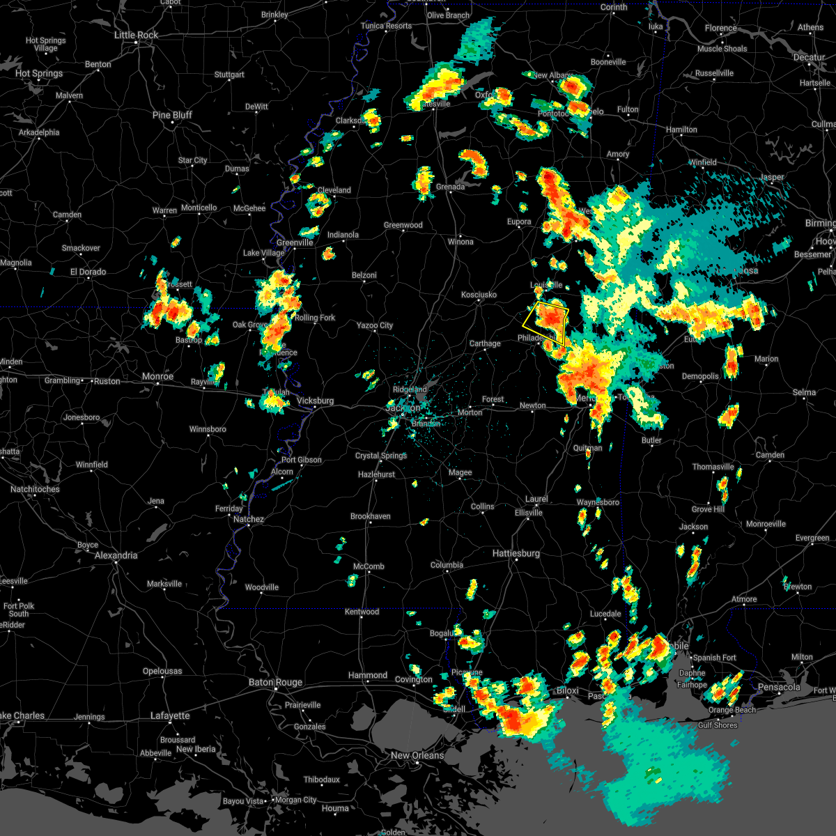 At 323 pm cdt, a severe thunderstorm was located near stallo, or near nanih waiya, moving south at 20 mph (radar indicated). Hazards include 60 mph wind gusts and quarter size hail. Hail damage to vehicles is expected. expect wind damage to roofs, siding, and trees. this severe storm will be near, burnside around 335 pm cdt. forestdale around 345 pm cdt. Other locations impacted by this severe thunderstorm include noxapater. At 323 pm cdt, a severe thunderstorm was located near stallo, or near nanih waiya, moving south at 20 mph (radar indicated). Hazards include 60 mph wind gusts and quarter size hail. Hail damage to vehicles is expected. expect wind damage to roofs, siding, and trees. this severe storm will be near, burnside around 335 pm cdt. forestdale around 345 pm cdt. Other locations impacted by this severe thunderstorm include noxapater.
|
| 6/13/2021 3:01 PM CDT |
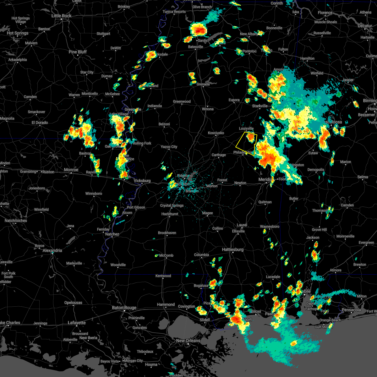 At 300 pm cdt, a severe thunderstorm was located near vernon, or 7 miles northwest of nanih waiya, moving south at 15 mph (radar indicated). Hazards include 60 mph wind gusts and quarter size hail. Hail damage to vehicles is expected. expect wind damage to roofs, siding, and trees. this severe thunderstorm will be near, nanih waiya around 320 pm cdt. stallo around 330 pm cdt. burnside and forestdale around 345 pm cdt. Other locations impacted by this severe thunderstorm include noxapater. At 300 pm cdt, a severe thunderstorm was located near vernon, or 7 miles northwest of nanih waiya, moving south at 15 mph (radar indicated). Hazards include 60 mph wind gusts and quarter size hail. Hail damage to vehicles is expected. expect wind damage to roofs, siding, and trees. this severe thunderstorm will be near, nanih waiya around 320 pm cdt. stallo around 330 pm cdt. burnside and forestdale around 345 pm cdt. Other locations impacted by this severe thunderstorm include noxapater.
|
| 6/9/2021 3:29 PM CDT |
 At 328 pm cdt, severe thunderstorms were located along a line extending from near zama to near singleton to newport, moving southeast at 25 mph (radar indicated). Hazards include 60 mph wind gusts. Expect damage to roofs, siding, and trees. these severe storms will be near, zama and smyrna around 335 pm cdt. singleton around 340 pm cdt. renfroe around 350 pm cdt. carthage around 410 pm cdt. philadelphia, edinburg, pearl river, burnside, stallo, dowdville and madden around 415 pm cdt. Other locations impacted by these severe thunderstorms include noxapater, ethel, sallis, redwater and standing pine. At 328 pm cdt, severe thunderstorms were located along a line extending from near zama to near singleton to newport, moving southeast at 25 mph (radar indicated). Hazards include 60 mph wind gusts. Expect damage to roofs, siding, and trees. these severe storms will be near, zama and smyrna around 335 pm cdt. singleton around 340 pm cdt. renfroe around 350 pm cdt. carthage around 410 pm cdt. philadelphia, edinburg, pearl river, burnside, stallo, dowdville and madden around 415 pm cdt. Other locations impacted by these severe thunderstorms include noxapater, ethel, sallis, redwater and standing pine.
|
| 6/9/2021 3:05 PM CDT |
 At 304 pm cdt, severe thunderstorms were located along a line extending from 6 miles north of smyrna to mcadams to near durant, moving southeast at 40 mph (radar indicated). Hazards include 60 mph wind gusts and penny size hail. Expect damage to roofs, siding, and trees. severe thunderstorms will be near, zama and smyrna around 320 pm cdt. thomastown and renfroe around 330 pm cdt. singleton around 335 pm cdt. carthage around 340 pm cdt. philadelphia, edinburg, pearl river, burnside and stallo around 345 pm cdt. Other locations impacted by these severe thunderstorms include noxapater, ethel, sallis, redwater and standing pine. At 304 pm cdt, severe thunderstorms were located along a line extending from 6 miles north of smyrna to mcadams to near durant, moving southeast at 40 mph (radar indicated). Hazards include 60 mph wind gusts and penny size hail. Expect damage to roofs, siding, and trees. severe thunderstorms will be near, zama and smyrna around 320 pm cdt. thomastown and renfroe around 330 pm cdt. singleton around 335 pm cdt. carthage around 340 pm cdt. philadelphia, edinburg, pearl river, burnside and stallo around 345 pm cdt. Other locations impacted by these severe thunderstorms include noxapater, ethel, sallis, redwater and standing pine.
|
| 5/4/2021 3:41 PM CDT |
 At 340 pm cdt, a severe thunderstorm was located over bethsaida, or 8 miles southeast of philadelphia, moving east at 50 mph (radar indicated). Hazards include 70 mph wind gusts. Expect considerable tree damage. damage is likely to mobile homes, roofs, and outbuildings. this severe storm will be near, forestdale around 345 pm cdt. herbert springs around 350 pm cdt. other locations impacted by this severe thunderstorm include tucker. A tornado watch remains in effect until 1000 pm cdt for east central mississippi. At 340 pm cdt, a severe thunderstorm was located over bethsaida, or 8 miles southeast of philadelphia, moving east at 50 mph (radar indicated). Hazards include 70 mph wind gusts. Expect considerable tree damage. damage is likely to mobile homes, roofs, and outbuildings. this severe storm will be near, forestdale around 345 pm cdt. herbert springs around 350 pm cdt. other locations impacted by this severe thunderstorm include tucker. A tornado watch remains in effect until 1000 pm cdt for east central mississippi.
|
| 5/4/2021 3:41 PM CDT |
 At 341 pm cdt, severe thunderstorms were located along a line extending from near white oak to summit, moving southeast at 35 mph (radar indicated). Hazards include 70 mph wind gusts and nickel size hail. Expect considerable tree damage. damage is likely to mobile homes, roofs, and outbuildings. locations impacted include, brookhaven, magee, monticello, prentiss, enterprise, topeka, bogue chitto, west lincoln, clem, sanatorium, robinwood, jayess, center point, shivers, sontag, wanilla, progress, tilton, east lincoln and ruth. A tornado watch remains in effect until 1000 pm cdt for south central and southeastern mississippi. At 341 pm cdt, severe thunderstorms were located along a line extending from near white oak to summit, moving southeast at 35 mph (radar indicated). Hazards include 70 mph wind gusts and nickel size hail. Expect considerable tree damage. damage is likely to mobile homes, roofs, and outbuildings. locations impacted include, brookhaven, magee, monticello, prentiss, enterprise, topeka, bogue chitto, west lincoln, clem, sanatorium, robinwood, jayess, center point, shivers, sontag, wanilla, progress, tilton, east lincoln and ruth. A tornado watch remains in effect until 1000 pm cdt for south central and southeastern mississippi.
|
| 5/4/2021 3:35 PM CDT |
 At 335 pm cdt, severe thunderstorms were located along a line extending from near martinville to near summit, moving east at 50 mph (radar indicated). Hazards include 70 mph wind gusts and nickel size hail. Expect considerable tree damage. damage is likely to mobile homes, roofs, and outbuildings. these severe thunderstorms will remain over mainly rural areas of southern simpson, lincoln, lawrence, southeastern copiah and western jefferson davis counties, including the following locations, new hebron and silver creek. A tornado watch remains in effect until 1000 pm cdt for south central and southeastern mississippi. At 335 pm cdt, severe thunderstorms were located along a line extending from near martinville to near summit, moving east at 50 mph (radar indicated). Hazards include 70 mph wind gusts and nickel size hail. Expect considerable tree damage. damage is likely to mobile homes, roofs, and outbuildings. these severe thunderstorms will remain over mainly rural areas of southern simpson, lincoln, lawrence, southeastern copiah and western jefferson davis counties, including the following locations, new hebron and silver creek. A tornado watch remains in effect until 1000 pm cdt for south central and southeastern mississippi.
|
| 5/4/2021 3:20 PM CDT |
 At 320 pm cdt, severe thunderstorms were located along a line extending from near piney woods to 7 miles southwest of smithdale, moving east at 60 mph (radar indicated). Hazards include 70 mph wind gusts and nickel size hail. Expect considerable tree damage. damage is likely to mobile homes, roofs, and outbuildings. these severe storms will be near, center point around 330 pm cdt. ruth around 350 pm cdt. jayess and topeka around 355 pm cdt. tilton around 405 pm cdt. oak vale around 410 pm cdt. society hill around 415 pm cdt. other locations impacted by these severe thunderstorms include new hebron, silver creek, beauregard and georgetown. a tornado watch remains in effect until 400 pm cdt for central, south central and southeastern mississippi. A tornado watch also remains in effect until 600 pm cdt for southwestern mississippi. At 320 pm cdt, severe thunderstorms were located along a line extending from near piney woods to 7 miles southwest of smithdale, moving east at 60 mph (radar indicated). Hazards include 70 mph wind gusts and nickel size hail. Expect considerable tree damage. damage is likely to mobile homes, roofs, and outbuildings. these severe storms will be near, center point around 330 pm cdt. ruth around 350 pm cdt. jayess and topeka around 355 pm cdt. tilton around 405 pm cdt. oak vale around 410 pm cdt. society hill around 415 pm cdt. other locations impacted by these severe thunderstorms include new hebron, silver creek, beauregard and georgetown. a tornado watch remains in effect until 400 pm cdt for central, south central and southeastern mississippi. A tornado watch also remains in effect until 600 pm cdt for southwestern mississippi.
|
| 5/4/2021 3:18 PM CDT |
 At 317 pm cdt, severe thunderstorms were located along a line extending from 8 miles east of gholson to near damascus, moving east at 35 mph (radar indicated). Hazards include 60 mph wind gusts and quarter size hail. Hail damage to vehicles is expected. expect wind damage to roofs, siding, and trees. severe thunderstorms will be near, paulette and blackwater around 335 pm cdt. de kalb and cooksville around 340 pm cdt. porterville and tamola around 355 pm cdt. electric mills around 400 pm cdt. other locations impacted by these severe thunderstorms include scooba. A tornado watch remains in effect until 400 pm cdt for east central mississippi. At 317 pm cdt, severe thunderstorms were located along a line extending from 8 miles east of gholson to near damascus, moving east at 35 mph (radar indicated). Hazards include 60 mph wind gusts and quarter size hail. Hail damage to vehicles is expected. expect wind damage to roofs, siding, and trees. severe thunderstorms will be near, paulette and blackwater around 335 pm cdt. de kalb and cooksville around 340 pm cdt. porterville and tamola around 355 pm cdt. electric mills around 400 pm cdt. other locations impacted by these severe thunderstorms include scooba. A tornado watch remains in effect until 400 pm cdt for east central mississippi.
|
| 5/4/2021 3:08 PM CDT |
 At 307 pm cdt, a severe thunderstorm was located near carthage, moving east at 70 mph (radar indicated). Hazards include 70 mph wind gusts and nickel size hail. Expect considerable tree damage. damage is likely to mobile homes, roofs, and outbuildings. this severe thunderstorm will be near, edinburg, madden and dowdville around 320 pm cdt. pearl river and dixon around 325 pm cdt. philadelphia and neshoba around 330 pm cdt. bethsaida around 335 pm cdt. forestdale around 340 pm cdt. other locations impacted by this severe thunderstorm include tucker, standing pine and walnut grove. A tornado watch remains in effect until 400 pm cdt for central and east central mississippi. At 307 pm cdt, a severe thunderstorm was located near carthage, moving east at 70 mph (radar indicated). Hazards include 70 mph wind gusts and nickel size hail. Expect considerable tree damage. damage is likely to mobile homes, roofs, and outbuildings. this severe thunderstorm will be near, edinburg, madden and dowdville around 320 pm cdt. pearl river and dixon around 325 pm cdt. philadelphia and neshoba around 330 pm cdt. bethsaida around 335 pm cdt. forestdale around 340 pm cdt. other locations impacted by this severe thunderstorm include tucker, standing pine and walnut grove. A tornado watch remains in effect until 400 pm cdt for central and east central mississippi.
|
| 5/4/2021 2:40 PM CDT |
 At 240 pm cdt, severe thunderstorms were located along a line extending from near carpenter to 8 miles northeast of woodville, moving east at 60 mph (radar indicated). Hazards include 70 mph wind gusts and nickel size hail. Expect considerable tree damage. damage is likely to mobile homes, roofs, and outbuildings. severe thunderstorms will be near, dentville around 250 pm cdt. hazlehurst around 255 pm cdt. crystal springs and gallman around 300 pm cdt. hopewell around 310 pm cdt. union around 315 pm cdt. sanatorium around 335 pm cdt. other locations impacted by these severe thunderstorms include new hebron, silver creek, beauregard and georgetown. a tornado watch remains in effect until 400 pm cdt for central, south central and southeastern mississippi. A tornado watch also remains in effect until 600 pm cdt for southwestern mississippi. At 240 pm cdt, severe thunderstorms were located along a line extending from near carpenter to 8 miles northeast of woodville, moving east at 60 mph (radar indicated). Hazards include 70 mph wind gusts and nickel size hail. Expect considerable tree damage. damage is likely to mobile homes, roofs, and outbuildings. severe thunderstorms will be near, dentville around 250 pm cdt. hazlehurst around 255 pm cdt. crystal springs and gallman around 300 pm cdt. hopewell around 310 pm cdt. union around 315 pm cdt. sanatorium around 335 pm cdt. other locations impacted by these severe thunderstorms include new hebron, silver creek, beauregard and georgetown. a tornado watch remains in effect until 400 pm cdt for central, south central and southeastern mississippi. A tornado watch also remains in effect until 600 pm cdt for southwestern mississippi.
|
| 5/4/2021 2:25 PM CDT |
 At 225 pm cdt, a severe thunderstorm was located over pearl river, or near philadelphia, moving northeast at 50 mph (radar indicated). Hazards include 60 mph wind gusts and quarter size hail. Hail damage to vehicles is expected. expect wind damage to roofs, siding, and trees. this severe storm will be near, philadelphia around 230 pm cdt. burnside and stallo around 235 pm cdt. A tornado watch remains in effect until 400 pm cdt for central and east central mississippi. At 225 pm cdt, a severe thunderstorm was located over pearl river, or near philadelphia, moving northeast at 50 mph (radar indicated). Hazards include 60 mph wind gusts and quarter size hail. Hail damage to vehicles is expected. expect wind damage to roofs, siding, and trees. this severe storm will be near, philadelphia around 230 pm cdt. burnside and stallo around 235 pm cdt. A tornado watch remains in effect until 400 pm cdt for central and east central mississippi.
|
| 5/4/2021 2:00 PM CDT |
 At 159 pm cdt, a severe thunderstorm was located near edinburg, moving east at 30 mph (radar indicated). Hazards include 60 mph wind gusts and quarter size hail. Hail damage to vehicles is expected. expect wind damage to roofs, siding, and trees. this severe thunderstorm will be near, pearl river around 210 pm cdt. stallo and burnside around 230 pm cdt. other locations impacted by this severe thunderstorm include standing pine. A tornado watch remains in effect until 400 pm cdt for central and east central mississippi. At 159 pm cdt, a severe thunderstorm was located near edinburg, moving east at 30 mph (radar indicated). Hazards include 60 mph wind gusts and quarter size hail. Hail damage to vehicles is expected. expect wind damage to roofs, siding, and trees. this severe thunderstorm will be near, pearl river around 210 pm cdt. stallo and burnside around 230 pm cdt. other locations impacted by this severe thunderstorm include standing pine. A tornado watch remains in effect until 400 pm cdt for central and east central mississippi.
|
| 4/24/2021 1:51 AM CDT |
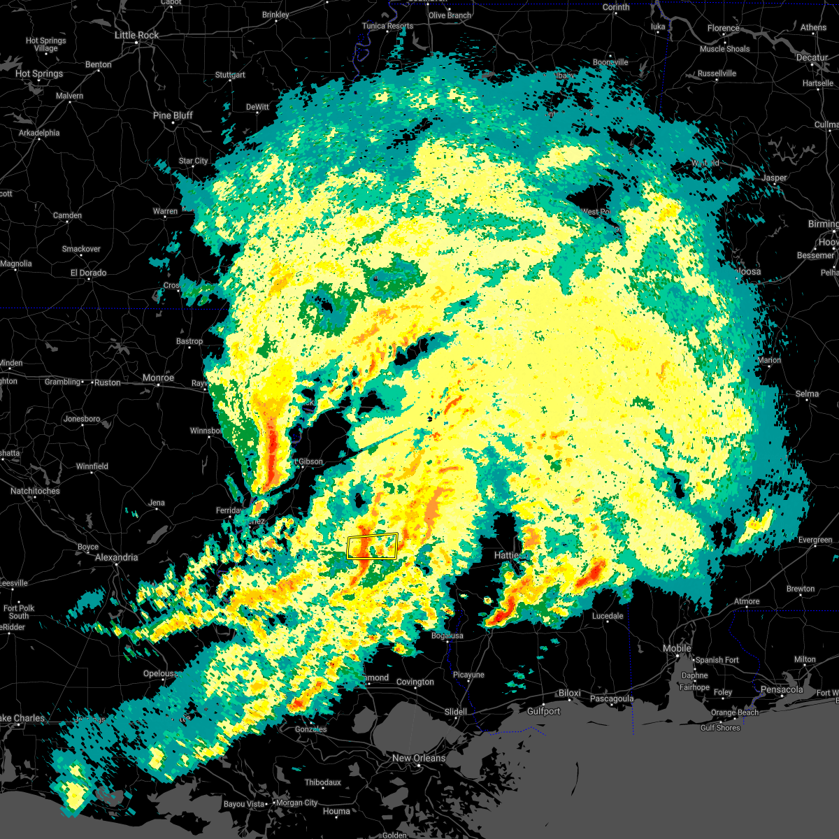 At 151 am cdt, severe thunderstorms were located along a line extending from west lincoln to 10 miles west of magnolia, moving east at 55 mph (radar indicated). Hazards include 60 mph wind gusts. Expect damage to roofs, siding, and trees. these severe storms will be near, enterprise and bogue chitto around 200 am cdt. ruth around 205 am cdt. east lincoln around 210 am cdt. A tornado watch remains in effect until 400 am cdt for south central mississippi. At 151 am cdt, severe thunderstorms were located along a line extending from west lincoln to 10 miles west of magnolia, moving east at 55 mph (radar indicated). Hazards include 60 mph wind gusts. Expect damage to roofs, siding, and trees. these severe storms will be near, enterprise and bogue chitto around 200 am cdt. ruth around 205 am cdt. east lincoln around 210 am cdt. A tornado watch remains in effect until 400 am cdt for south central mississippi.
|
| 4/24/2021 1:30 AM CDT |
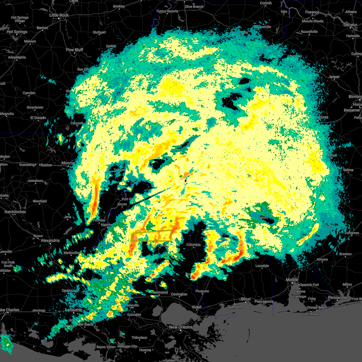 At 130 am cdt, severe thunderstorms were located along a line extending from near bude to near centreville, moving east at 50 mph (radar indicated). Hazards include 60 mph wind gusts. Expect damage to roofs, siding, and trees. severe thunderstorms will be near, bude around 135 am cdt. little springs around 140 am cdt. center point and west lincoln around 150 am cdt. bogue chitto around 200 am cdt. enterprise around 205 am cdt. ruth and east lincoln around 210 am cdt. other locations impacted by these severe thunderstorms include meadville. A tornado watch remains in effect until 400 am cdt for south central and southwestern mississippi. At 130 am cdt, severe thunderstorms were located along a line extending from near bude to near centreville, moving east at 50 mph (radar indicated). Hazards include 60 mph wind gusts. Expect damage to roofs, siding, and trees. severe thunderstorms will be near, bude around 135 am cdt. little springs around 140 am cdt. center point and west lincoln around 150 am cdt. bogue chitto around 200 am cdt. enterprise around 205 am cdt. ruth and east lincoln around 210 am cdt. other locations impacted by these severe thunderstorms include meadville. A tornado watch remains in effect until 400 am cdt for south central and southwestern mississippi.
|
| 4/10/2021 12:03 AM CDT | Several trees down blocking roads countywide - two homes with trees on the in lincoln county MS, 9 miles WNW of Bogue Chitto, MS |
| 4/9/2021 11:52 PM CDT |
 At 1151 pm cdt, severe thunderstorms were located along a line extending from near wesson to near brookhaven to near center point, moving east at 45 mph (radar indicated). Hazards include 60 mph wind gusts and quarter size hail. Hail damage to vehicles is expected. expect wind damage to roofs, siding, and trees. severe thunderstorms will be near, enterprise around 1155 pm cdt. oma, east lincoln and sontag around 1205 am cdt. ruth and wanilla around 1210 am cdt. monticello around 1215 am cdt. robinwood, jayess and topeka around 1220 am cdt. arm and tilton around 1225 am cdt. progress and oak vale around 1230 am cdt. Other locations impacted by these severe thunderstorms include new hebron and silver creek. At 1151 pm cdt, severe thunderstorms were located along a line extending from near wesson to near brookhaven to near center point, moving east at 45 mph (radar indicated). Hazards include 60 mph wind gusts and quarter size hail. Hail damage to vehicles is expected. expect wind damage to roofs, siding, and trees. severe thunderstorms will be near, enterprise around 1155 pm cdt. oma, east lincoln and sontag around 1205 am cdt. ruth and wanilla around 1210 am cdt. monticello around 1215 am cdt. robinwood, jayess and topeka around 1220 am cdt. arm and tilton around 1225 am cdt. progress and oak vale around 1230 am cdt. Other locations impacted by these severe thunderstorms include new hebron and silver creek.
|
| 4/9/2021 8:46 PM CDT |
 At 845 pm cdt, a severe thunderstorm was located near zama, or 13 miles north of edinburg, moving east at 45 mph (radar indicated). Hazards include ping pong ball size hail and 60 mph wind gusts. People and animals outdoors will be injured. expect hail damage to roofs, siding, windows, and vehicles. expect wind damage to roofs, siding, and trees. this severe thunderstorm will be near, stallo around 905 pm cdt. nanih waiya around 915 pm cdt. Other locations impacted by this severe thunderstorm include noxapater. At 845 pm cdt, a severe thunderstorm was located near zama, or 13 miles north of edinburg, moving east at 45 mph (radar indicated). Hazards include ping pong ball size hail and 60 mph wind gusts. People and animals outdoors will be injured. expect hail damage to roofs, siding, windows, and vehicles. expect wind damage to roofs, siding, and trees. this severe thunderstorm will be near, stallo around 905 pm cdt. nanih waiya around 915 pm cdt. Other locations impacted by this severe thunderstorm include noxapater.
|
| 4/9/2021 6:21 PM CDT |
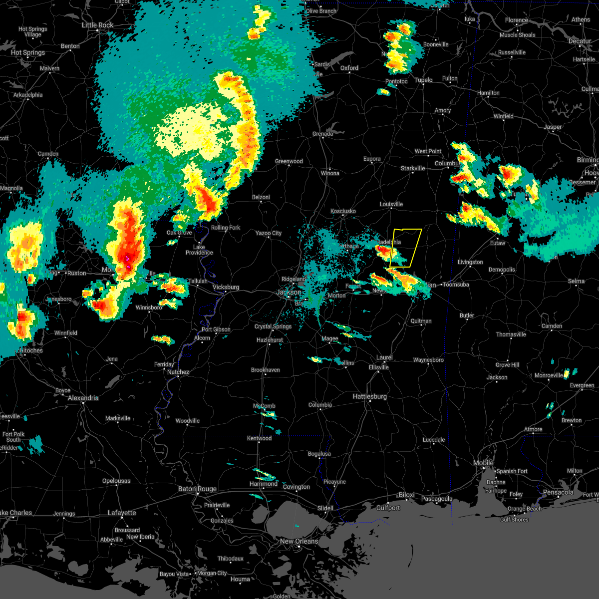 At 620 pm cdt, a severe thunderstorm was located over little rock, or 15 miles east of prospect, moving north at 35 mph (radar indicated). Hazards include 60 mph wind gusts and penny size hail. Expect damage to roofs, siding, and trees. this severe storm will be near, herbert springs around 625 pm cdt. house around 630 pm cdt. bethsaida and damascus around 635 pm cdt. forestdale around 645 pm cdt. bluff springs around 650 pm cdt. preston around 700 pm cdt. nanih waiya around 705 pm cdt. Other locations impacted by this severe thunderstorm include tucker. At 620 pm cdt, a severe thunderstorm was located over little rock, or 15 miles east of prospect, moving north at 35 mph (radar indicated). Hazards include 60 mph wind gusts and penny size hail. Expect damage to roofs, siding, and trees. this severe storm will be near, herbert springs around 625 pm cdt. house around 630 pm cdt. bethsaida and damascus around 635 pm cdt. forestdale around 645 pm cdt. bluff springs around 650 pm cdt. preston around 700 pm cdt. nanih waiya around 705 pm cdt. Other locations impacted by this severe thunderstorm include tucker.
|
| 4/9/2021 5:58 PM CDT |
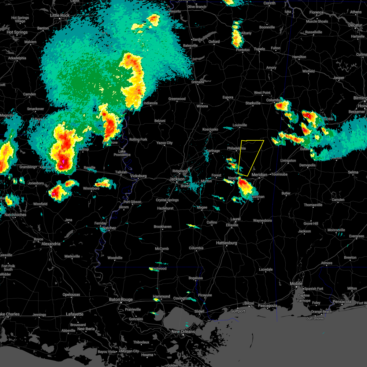 At 557 pm cdt, a severe thunderstorm was located near decatur, or 9 miles northeast of newton, moving north at 40 mph (radar indicated). Hazards include two inch hail. People and animals outdoors will be injured. expect damage to roofs, siding, windows, and vehicles. this severe thunderstorm will be near, duffee and little rock around 610 pm cdt. martin around 620 pm cdt. herbert springs and house around 625 pm cdt. damascus and bethsaida around 630 pm cdt. forestdale around 640 pm cdt. bluff springs around 645 pm cdt. preston and nanih waiya around 655 pm cdt. Other locations impacted by this severe thunderstorm include tucker. At 557 pm cdt, a severe thunderstorm was located near decatur, or 9 miles northeast of newton, moving north at 40 mph (radar indicated). Hazards include two inch hail. People and animals outdoors will be injured. expect damage to roofs, siding, windows, and vehicles. this severe thunderstorm will be near, duffee and little rock around 610 pm cdt. martin around 620 pm cdt. herbert springs and house around 625 pm cdt. damascus and bethsaida around 630 pm cdt. forestdale around 640 pm cdt. bluff springs around 645 pm cdt. preston and nanih waiya around 655 pm cdt. Other locations impacted by this severe thunderstorm include tucker.
|
| 3/17/2021 6:42 PM CDT |
 At 642 pm cdt, severe thunderstorms were located along a line extending from 7 miles southeast of lodi to 6 miles south of ackerman to near burnside, moving northeast at 55 mph (radar indicated). Hazards include 60 mph wind gusts. Expect damage to roofs, siding, and trees. severe thunderstorms will be near, eupora around 650 pm cdt. nanih waiya and betheden around 655 pm cdt. mathiston, craig springs, clarkson and sherwood around 700 pm cdt. preston, maben, cumberland and longview around 705 pm cdt. starkville, oktoc, gholson and pheba around 710 pm cdt. montpelier, sessums and mashulaville around 715 pm cdt. griffith around 720 pm cdt. macon, bent oak, pala alto and tibbee around 725 pm cdt. other locations impacted by these severe thunderstorms include shuqualak, sturgis and artesia. a tornado watch remains in effect until 700 pm cdt for central, northeastern and east central mississippi. A tornado watch also remains in effect until 700 pm cdt for north central mississippi. At 642 pm cdt, severe thunderstorms were located along a line extending from 7 miles southeast of lodi to 6 miles south of ackerman to near burnside, moving northeast at 55 mph (radar indicated). Hazards include 60 mph wind gusts. Expect damage to roofs, siding, and trees. severe thunderstorms will be near, eupora around 650 pm cdt. nanih waiya and betheden around 655 pm cdt. mathiston, craig springs, clarkson and sherwood around 700 pm cdt. preston, maben, cumberland and longview around 705 pm cdt. starkville, oktoc, gholson and pheba around 710 pm cdt. montpelier, sessums and mashulaville around 715 pm cdt. griffith around 720 pm cdt. macon, bent oak, pala alto and tibbee around 725 pm cdt. other locations impacted by these severe thunderstorms include shuqualak, sturgis and artesia. a tornado watch remains in effect until 700 pm cdt for central, northeastern and east central mississippi. A tornado watch also remains in effect until 700 pm cdt for north central mississippi.
|
| 3/17/2021 12:50 PM CDT |
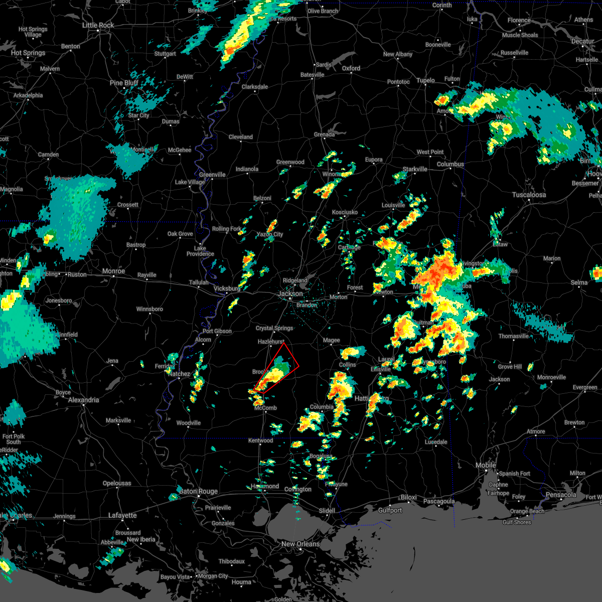 At 1249 pm cdt, a severe thunderstorm capable of producing a tornado was located over bogue chitto, or 8 miles south of brookhaven, moving northeast at 30 mph (radar indicated rotation). Hazards include tornado and quarter size hail. Flying debris will be dangerous to those caught without shelter. mobile homes will be damaged or destroyed. damage to roofs, windows, and vehicles will occur. tree damage is likely. this dangerous storm will be near, brookhaven around 110 pm cdt. wesson around 120 pm cdt. sontag and wanilla around 135 pm cdt. Oma around 145 pm cdt. At 1249 pm cdt, a severe thunderstorm capable of producing a tornado was located over bogue chitto, or 8 miles south of brookhaven, moving northeast at 30 mph (radar indicated rotation). Hazards include tornado and quarter size hail. Flying debris will be dangerous to those caught without shelter. mobile homes will be damaged or destroyed. damage to roofs, windows, and vehicles will occur. tree damage is likely. this dangerous storm will be near, brookhaven around 110 pm cdt. wesson around 120 pm cdt. sontag and wanilla around 135 pm cdt. Oma around 145 pm cdt.
|
| 12/13/2020 8:43 PM CST |
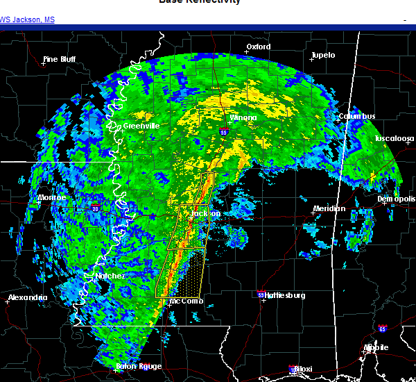 At 843 pm cst, severe thunderstorms were located along a line extending from hopewell to near wesson to near bogue chitto, moving northeast at 45 mph (radar indicated). Hazards include 60 mph wind gusts. Expect damage to roofs, siding, and trees. these severe storms will be near, hopewell and sontag around 850 pm cst. oma around 855 pm cst. rockport and jayess around 900 pm cst. topeka around 905 pm cst. union around 910 pm cst. monticello and robinwood around 915 pm cst. wanilla around 920 pm cst. Other locations impacted by these severe thunderstorms include georgetown. At 843 pm cst, severe thunderstorms were located along a line extending from hopewell to near wesson to near bogue chitto, moving northeast at 45 mph (radar indicated). Hazards include 60 mph wind gusts. Expect damage to roofs, siding, and trees. these severe storms will be near, hopewell and sontag around 850 pm cst. oma around 855 pm cst. rockport and jayess around 900 pm cst. topeka around 905 pm cst. union around 910 pm cst. monticello and robinwood around 915 pm cst. wanilla around 920 pm cst. Other locations impacted by these severe thunderstorms include georgetown.
|
| 12/13/2020 8:28 PM CST |
 At 828 pm cst, severe thunderstorms were located along a line extending from gallman to near brookhaven to near center point, moving northeast at 45 mph (radar indicated). Hazards include 60 mph wind gusts. Expect damage to roofs, siding, and trees. severe thunderstorms will be near, wesson and gallman around 835 pm cst. hopewell and martinsville around 840 pm cst. enterprise, ruth and sontag around 850 pm cst. oma around 855 pm cst. rockport, east lincoln and topeka around 900 pm cst. union around 905 pm cst. monticello, robinwood and wanilla around 915 pm cst. Other locations impacted by these severe thunderstorms include beauregard and georgetown. At 828 pm cst, severe thunderstorms were located along a line extending from gallman to near brookhaven to near center point, moving northeast at 45 mph (radar indicated). Hazards include 60 mph wind gusts. Expect damage to roofs, siding, and trees. severe thunderstorms will be near, wesson and gallman around 835 pm cst. hopewell and martinsville around 840 pm cst. enterprise, ruth and sontag around 850 pm cst. oma around 855 pm cst. rockport, east lincoln and topeka around 900 pm cst. union around 905 pm cst. monticello, robinwood and wanilla around 915 pm cst. Other locations impacted by these severe thunderstorms include beauregard and georgetown.
|
| 8/16/2020 3:21 PM CDT |
 At 321 pm cdt, severe thunderstorms were located along a line extending from 7 miles northeast of de kalb to near bluff springs to near burnside, moving south at 25 mph (radar indicated). Hazards include 60 mph wind gusts and penny size hail. Expect damage to roofs, siding, and trees. these severe storms will be near, forestdale around 325 pm cdt. bluff springs around 330 pm cdt. de kalb around 335 pm cdt. electric mills around 340 pm cdt. damascus around 350 pm cdt. liberty, porterville and dixon around 355 pm cdt. bethsaida around 400 pm cdt. Other locations impacted by these severe thunderstorms include tucker and scooba. At 321 pm cdt, severe thunderstorms were located along a line extending from 7 miles northeast of de kalb to near bluff springs to near burnside, moving south at 25 mph (radar indicated). Hazards include 60 mph wind gusts and penny size hail. Expect damage to roofs, siding, and trees. these severe storms will be near, forestdale around 325 pm cdt. bluff springs around 330 pm cdt. de kalb around 335 pm cdt. electric mills around 340 pm cdt. damascus around 350 pm cdt. liberty, porterville and dixon around 355 pm cdt. bethsaida around 400 pm cdt. Other locations impacted by these severe thunderstorms include tucker and scooba.
|
| 8/16/2020 2:41 PM CDT |
 At 239 pm cdt, severe thunderstorms were located along a line extending from near mashulaville to near vernon to 9 miles west of center ridge, moving south at 25 mph (law enforcement. at 120 pm cdt, a tree was reported blown down just east of maben). Hazards include 60 mph wind gusts and nickel size hail. Expect damage to roofs, siding, and trees. severe thunderstorms will be near, nanih waiya around 300 pm cdt. gholson around 305 pm cdt. preston and stallo around 310 pm cdt. burnside and forestdale around 325 pm cdt. pearl river and bluff springs around 330 pm cdt. philadelphia and de kalb around 335 pm cdt. electric mills around 340 pm cdt. liberty, damascus, dixon, porterville and bethsaida around 345 pm cdt. Other locations impacted by these severe thunderstorms include noxapater, tucker, shuqualak and scooba. At 239 pm cdt, severe thunderstorms were located along a line extending from near mashulaville to near vernon to 9 miles west of center ridge, moving south at 25 mph (law enforcement. at 120 pm cdt, a tree was reported blown down just east of maben). Hazards include 60 mph wind gusts and nickel size hail. Expect damage to roofs, siding, and trees. severe thunderstorms will be near, nanih waiya around 300 pm cdt. gholson around 305 pm cdt. preston and stallo around 310 pm cdt. burnside and forestdale around 325 pm cdt. pearl river and bluff springs around 330 pm cdt. philadelphia and de kalb around 335 pm cdt. electric mills around 340 pm cdt. liberty, damascus, dixon, porterville and bethsaida around 345 pm cdt. Other locations impacted by these severe thunderstorms include noxapater, tucker, shuqualak and scooba.
|
| 7/1/2020 7:33 PM CDT |
 At 732 pm cdt, severe thunderstorms were located along a line extending from near brooksville to near vernon to 8 miles southwest of center ridge, moving south at 35 mph (radar indicated). Hazards include 60 mph wind gusts and nickel size hail. Expect damage to roofs, siding, and trees. severe thunderstorms will be near, nanih waiya and macon around 745 pm cdt. stallo and gholson around 750 pm cdt. preston and burnside around 755 pm cdt. philadelphia, bluff springs and paulette around 805 pm cdt. forestdale around 810 pm cdt. de kalb and bethsaida around 815 pm cdt. Other locations impacted by these severe thunderstorms include noxapater, tucker, shuqualak and scooba. At 732 pm cdt, severe thunderstorms were located along a line extending from near brooksville to near vernon to 8 miles southwest of center ridge, moving south at 35 mph (radar indicated). Hazards include 60 mph wind gusts and nickel size hail. Expect damage to roofs, siding, and trees. severe thunderstorms will be near, nanih waiya and macon around 745 pm cdt. stallo and gholson around 750 pm cdt. preston and burnside around 755 pm cdt. philadelphia, bluff springs and paulette around 805 pm cdt. forestdale around 810 pm cdt. de kalb and bethsaida around 815 pm cdt. Other locations impacted by these severe thunderstorms include noxapater, tucker, shuqualak and scooba.
|
| 7/1/2020 6:07 PM CDT |
 The severe thunderstorm warning for northern neshoba county will expire at 615 pm cdt, the storm which prompted the warning has weakened below severe limits, and has exited the warned area. therefore, the warning will be allowed to expire. however gusty winds are still possible with this thunderstorm. to report severe weather, contact your nearest law enforcement agency. they will relay your report to the national weather service jackson. The severe thunderstorm warning for northern neshoba county will expire at 615 pm cdt, the storm which prompted the warning has weakened below severe limits, and has exited the warned area. therefore, the warning will be allowed to expire. however gusty winds are still possible with this thunderstorm. to report severe weather, contact your nearest law enforcement agency. they will relay your report to the national weather service jackson.
|
| 7/1/2020 5:42 PM CDT |
 At 542 pm cdt, a severe thunderstorm was located near philadelphia, moving east at 15 mph (radar indicated). Hazards include 60 mph wind gusts and nickel size hail. Expect damage to roofs, siding, and trees. Locations impacted include, philadelphia, pearl river, forestdale, burnside, stallo and tucker. At 542 pm cdt, a severe thunderstorm was located near philadelphia, moving east at 15 mph (radar indicated). Hazards include 60 mph wind gusts and nickel size hail. Expect damage to roofs, siding, and trees. Locations impacted include, philadelphia, pearl river, forestdale, burnside, stallo and tucker.
|
| 7/1/2020 5:32 PM CDT |
 At 532 pm cdt, a severe thunderstorm was located over burnside, or near philadelphia, moving east at 20 mph (radar indicated). Hazards include 60 mph wind gusts and nickel size hail. Expect damage to roofs, siding, and trees. this severe thunderstorm will be near, burnside around 535 pm cdt. stallo around 540 pm cdt. forestdale around 600 pm cdt. nanih waiya around 605 pm cdt. Other locations impacted by this severe thunderstorm include noxapater and tucker. At 532 pm cdt, a severe thunderstorm was located over burnside, or near philadelphia, moving east at 20 mph (radar indicated). Hazards include 60 mph wind gusts and nickel size hail. Expect damage to roofs, siding, and trees. this severe thunderstorm will be near, burnside around 535 pm cdt. stallo around 540 pm cdt. forestdale around 600 pm cdt. nanih waiya around 605 pm cdt. Other locations impacted by this severe thunderstorm include noxapater and tucker.
|
| 6/25/2020 7:28 PM CDT |
 At 728 pm cdt, severe thunderstorms were located along a line extending from near gholson to near electric mills to near york, moving northeast at 40 mph (radar indicated). Hazards include 60 mph wind gusts. Expect damage to roofs, siding, and trees. These severe thunderstorms will remain over mainly rural areas of kemper and eastern lauderdale counties, including the following locations, scooba. At 728 pm cdt, severe thunderstorms were located along a line extending from near gholson to near electric mills to near york, moving northeast at 40 mph (radar indicated). Hazards include 60 mph wind gusts. Expect damage to roofs, siding, and trees. These severe thunderstorms will remain over mainly rural areas of kemper and eastern lauderdale counties, including the following locations, scooba.
|
| 6/25/2020 7:22 PM CDT |
 At 722 pm cdt, severe thunderstorms were located along a line extending from near preston to near gholson to near porterville to cuba, moving north at 45 mph (radar indicated). Hazards include 60 mph wind gusts. Expect damage to roofs, siding, and trees. these severe storms will be near, preston around 725 pm cdt. electric mills around 730 pm cdt. Other locations impacted by these severe thunderstorms include scooba. At 722 pm cdt, severe thunderstorms were located along a line extending from near preston to near gholson to near porterville to cuba, moving north at 45 mph (radar indicated). Hazards include 60 mph wind gusts. Expect damage to roofs, siding, and trees. these severe storms will be near, preston around 725 pm cdt. electric mills around 730 pm cdt. Other locations impacted by these severe thunderstorms include scooba.
|
| 6/25/2020 7:17 PM CDT |
 At 717 pm cdt, severe thunderstorms were located along a line extending from near nanih waiya to near de kalb to near tamola to near cuba, moving northeast at 35 mph (radar indicated). Hazards include 60 mph wind gusts. Expect damage to roofs, siding, and trees. these severe storms will be near, porterville around 725 pm cdt. electric mills around 735 pm cdt. Other locations impacted by these severe thunderstorms include tucker and scooba. At 717 pm cdt, severe thunderstorms were located along a line extending from near nanih waiya to near de kalb to near tamola to near cuba, moving northeast at 35 mph (radar indicated). Hazards include 60 mph wind gusts. Expect damage to roofs, siding, and trees. these severe storms will be near, porterville around 725 pm cdt. electric mills around 735 pm cdt. Other locations impacted by these severe thunderstorms include tucker and scooba.
|
| 6/25/2020 6:58 PM CDT |
 At 637 pm cdt, severe thunderstorms were located along a line extending from near dowdville to near neshoba to near meehan to near sable to near quitman, moving northeast at 40 mph (radar indicated). Hazards include 60 mph wind gusts. Expect damage to roofs, siding, and trees. these severe storms will be near, sable and savoy around 640 pm cdt. meridian, philadelphia, bethsaida, suqualena, sykes, nellieburg, house, middleton and crandall around 645 pm cdt. zero around 650 pm cdt. marion, burnside, increase and forestdale around 655 pm cdt. daleville, snell, stallo and prismatic around 700 pm cdt. meridian station, bluff springs and blackwater around 705 pm cdt. lauderdale, preston, alamucha and toomsuba around 710 pm cdt. nanih waiya, de kalb and kewanee around 715 pm cdt. Other locations impacted by these severe thunderstorms include pachuta, tucker, shubuta and scooba. At 637 pm cdt, severe thunderstorms were located along a line extending from near dowdville to near neshoba to near meehan to near sable to near quitman, moving northeast at 40 mph (radar indicated). Hazards include 60 mph wind gusts. Expect damage to roofs, siding, and trees. these severe storms will be near, sable and savoy around 640 pm cdt. meridian, philadelphia, bethsaida, suqualena, sykes, nellieburg, house, middleton and crandall around 645 pm cdt. zero around 650 pm cdt. marion, burnside, increase and forestdale around 655 pm cdt. daleville, snell, stallo and prismatic around 700 pm cdt. meridian station, bluff springs and blackwater around 705 pm cdt. lauderdale, preston, alamucha and toomsuba around 710 pm cdt. nanih waiya, de kalb and kewanee around 715 pm cdt. Other locations impacted by these severe thunderstorms include pachuta, tucker, shubuta and scooba.
|
| 6/25/2020 6:37 PM CDT |
 At 637 pm cdt, severe thunderstorms were located along a line extending from near dowdville to near neshoba to near meehan to near sable to near quitman, moving northeast at 40 mph (radar indicated). Hazards include 60 mph wind gusts. Expect damage to roofs, siding, and trees. these severe storms will be near, sable and savoy around 640 pm cdt. meridian, philadelphia, bethsaida, suqualena, sykes, nellieburg, house, middleton and crandall around 645 pm cdt. zero around 650 pm cdt. marion, burnside, increase and forestdale around 655 pm cdt. daleville, snell, stallo and prismatic around 700 pm cdt. meridian station, bluff springs and blackwater around 705 pm cdt. lauderdale, preston, alamucha and toomsuba around 710 pm cdt. nanih waiya, de kalb and kewanee around 715 pm cdt. Other locations impacted by these severe thunderstorms include pachuta, tucker, shubuta and scooba. At 637 pm cdt, severe thunderstorms were located along a line extending from near dowdville to near neshoba to near meehan to near sable to near quitman, moving northeast at 40 mph (radar indicated). Hazards include 60 mph wind gusts. Expect damage to roofs, siding, and trees. these severe storms will be near, sable and savoy around 640 pm cdt. meridian, philadelphia, bethsaida, suqualena, sykes, nellieburg, house, middleton and crandall around 645 pm cdt. zero around 650 pm cdt. marion, burnside, increase and forestdale around 655 pm cdt. daleville, snell, stallo and prismatic around 700 pm cdt. meridian station, bluff springs and blackwater around 705 pm cdt. lauderdale, preston, alamucha and toomsuba around 710 pm cdt. nanih waiya, de kalb and kewanee around 715 pm cdt. Other locations impacted by these severe thunderstorms include pachuta, tucker, shubuta and scooba.
|
| 6/25/2020 6:09 PM CDT |
 At 609 pm cdt, severe thunderstorms were located along a line extending from conehatta to stafford springs, moving northeast at 60 mph (radar indicated). Hazards include 60 mph wind gusts. Expect damage to roofs, siding, and trees. severe thunderstorms will be near, quitman and dixon around 620 pm cdt. neshoba, stonewall and house around 625 pm cdt. philadelphia, sable, bethsaida and middleton around 630 pm cdt. forestdale, savoy and burnside around 635 pm cdt. zero and increase around 640 pm cdt. nanih waiya, preston and marion around 645 pm cdt. toomsuba and alamucha around 650 pm cdt. lauderdale and kewanee around 655 pm cdt. Other locations impacted by these severe thunderstorms include pachuta, tucker, shubuta and scooba. At 609 pm cdt, severe thunderstorms were located along a line extending from conehatta to stafford springs, moving northeast at 60 mph (radar indicated). Hazards include 60 mph wind gusts. Expect damage to roofs, siding, and trees. severe thunderstorms will be near, quitman and dixon around 620 pm cdt. neshoba, stonewall and house around 625 pm cdt. philadelphia, sable, bethsaida and middleton around 630 pm cdt. forestdale, savoy and burnside around 635 pm cdt. zero and increase around 640 pm cdt. nanih waiya, preston and marion around 645 pm cdt. toomsuba and alamucha around 650 pm cdt. lauderdale and kewanee around 655 pm cdt. Other locations impacted by these severe thunderstorms include pachuta, tucker, shubuta and scooba.
|
| 6/25/2020 4:15 PM CDT | County em reports several trees down south of us 8 in lincoln county MS, 7.4 miles S of Bogue Chitto, MS |
| 6/25/2020 4:15 PM CDT |
 At 415 pm cdt, a severe thunderstorm was located over bogue chitto, or 8 miles south of brookhaven, moving northeast at 40 mph (radar indicated). Hazards include 70 mph wind gusts. Expect considerable tree damage. damage is likely to mobile homes, roofs, and outbuildings. This severe storm will be near, brookhaven around 430 pm cdt. At 415 pm cdt, a severe thunderstorm was located over bogue chitto, or 8 miles south of brookhaven, moving northeast at 40 mph (radar indicated). Hazards include 70 mph wind gusts. Expect considerable tree damage. damage is likely to mobile homes, roofs, and outbuildings. This severe storm will be near, brookhaven around 430 pm cdt.
|
| 6/25/2020 3:46 PM CDT |
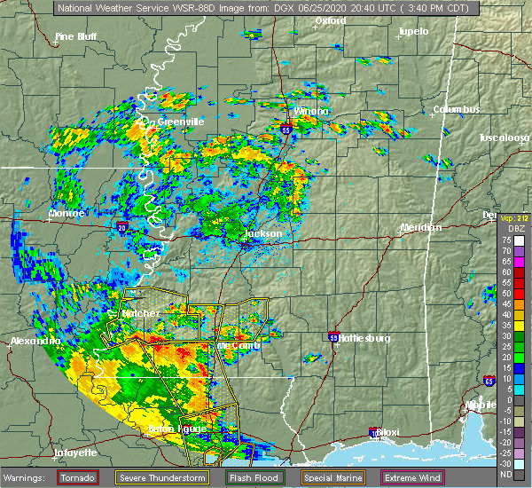 At 345 pm cdt, a severe thunderstorm was located over center point, or 14 miles northwest of mccomb, moving north at 20 mph (radar indicated). Hazards include 60 mph wind gusts. Expect damage to roofs, siding, and trees. this severe thunderstorm will be near, west lincoln around 405 pm cdt. vaughn around 420 pm cdt. loyd star around 430 pm cdt. Brookhaven and caseyville around 435 pm cdt. At 345 pm cdt, a severe thunderstorm was located over center point, or 14 miles northwest of mccomb, moving north at 20 mph (radar indicated). Hazards include 60 mph wind gusts. Expect damage to roofs, siding, and trees. this severe thunderstorm will be near, west lincoln around 405 pm cdt. vaughn around 420 pm cdt. loyd star around 430 pm cdt. Brookhaven and caseyville around 435 pm cdt.
|
| 6/5/2020 8:22 PM CDT |
 At 822 pm cdt, severe thunderstorms were located along a line extending from near center point to near jayess to society hill, moving southwest at 45 mph (radar indicated). Hazards include 60 mph wind gusts. Expect damage to roofs, siding, and trees. these severe storms will be near, center point, ruth, west lincoln and bogue chitto around 825 pm cdt. Other locations impacted by these severe thunderstorms include bassfield. At 822 pm cdt, severe thunderstorms were located along a line extending from near center point to near jayess to society hill, moving southwest at 45 mph (radar indicated). Hazards include 60 mph wind gusts. Expect damage to roofs, siding, and trees. these severe storms will be near, center point, ruth, west lincoln and bogue chitto around 825 pm cdt. Other locations impacted by these severe thunderstorms include bassfield.
|
| 6/5/2020 8:10 PM CDT |
 At 810 pm cdt, severe thunderstorms were located along a line extending from near west lincoln to near topeka to near carson, moving south at 35 mph (radar indicated). Hazards include 60 mph wind gusts. Expect damage to roofs, siding, and trees. these severe storms will be near, west lincoln around 815 pm cdt. topeka and bogue chitto around 820 pm cdt. jayess and ruth around 825 pm cdt. center point around 830 pm cdt. Other locations impacted by these severe thunderstorms include bassfield and silver creek. At 810 pm cdt, severe thunderstorms were located along a line extending from near west lincoln to near topeka to near carson, moving south at 35 mph (radar indicated). Hazards include 60 mph wind gusts. Expect damage to roofs, siding, and trees. these severe storms will be near, west lincoln around 815 pm cdt. topeka and bogue chitto around 820 pm cdt. jayess and ruth around 825 pm cdt. center point around 830 pm cdt. Other locations impacted by these severe thunderstorms include bassfield and silver creek.
|
| 6/5/2020 7:51 PM CDT |
 At 750 pm cdt, severe thunderstorms were located along a line extending from near brookhaven to near sontag to 6 miles northwest of prentiss, moving south at 40 mph (radar indicated). Hazards include 60 mph wind gusts. Expect damage to roofs, siding, and trees. these severe storms will be near, brookhaven and loyd star around 755 pm cdt. vaughn around 800 pm cdt. monticello, arm and east lincoln around 805 pm cdt. enterprise, west lincoln, robinwood, oak vale and topeka around 810 pm cdt. tilton, bogue chitto and jayess around 815 pm cdt. ruth and center point around 820 pm cdt. Other locations impacted by these severe thunderstorms include bassfield, new hebron and silver creek. At 750 pm cdt, severe thunderstorms were located along a line extending from near brookhaven to near sontag to 6 miles northwest of prentiss, moving south at 40 mph (radar indicated). Hazards include 60 mph wind gusts. Expect damage to roofs, siding, and trees. these severe storms will be near, brookhaven and loyd star around 755 pm cdt. vaughn around 800 pm cdt. monticello, arm and east lincoln around 805 pm cdt. enterprise, west lincoln, robinwood, oak vale and topeka around 810 pm cdt. tilton, bogue chitto and jayess around 815 pm cdt. ruth and center point around 820 pm cdt. Other locations impacted by these severe thunderstorms include bassfield, new hebron and silver creek.
|
| 6/5/2020 7:28 PM CDT |
 At 728 pm cdt, severe thunderstorms were located along a line extending from near hazlehurst to near shivers to near sanatorium, moving southwest at 45 mph (radar indicated). Hazards include 60 mph wind gusts. Expect damage to roofs, siding, and trees. severe thunderstorms will be near, oma around 735 pm cdt. wanilla and sontag around 745 pm cdt. brookhaven, monticello and prentiss around 750 pm cdt. progress and loyd star around 755 pm cdt. arm, east lincoln and vaughn around 800 pm cdt. enterprise, west lincoln, oak vale, robinwood, bogue chitto and topeka around 805 pm cdt. ruth, tilton and jayess around 810 pm cdt. center point around 815 pm cdt. Other locations impacted by these severe thunderstorms include bassfield, new hebron and silver creek. At 728 pm cdt, severe thunderstorms were located along a line extending from near hazlehurst to near shivers to near sanatorium, moving southwest at 45 mph (radar indicated). Hazards include 60 mph wind gusts. Expect damage to roofs, siding, and trees. severe thunderstorms will be near, oma around 735 pm cdt. wanilla and sontag around 745 pm cdt. brookhaven, monticello and prentiss around 750 pm cdt. progress and loyd star around 755 pm cdt. arm, east lincoln and vaughn around 800 pm cdt. enterprise, west lincoln, oak vale, robinwood, bogue chitto and topeka around 805 pm cdt. ruth, tilton and jayess around 810 pm cdt. center point around 815 pm cdt. Other locations impacted by these severe thunderstorms include bassfield, new hebron and silver creek.
|
| 6/5/2020 5:17 PM CDT |
 At 517 pm cdt, severe thunderstorms were located along a line extending from near pickensville to near mashulaville to near zama, moving south at 40 mph (radar indicated). Hazards include 60 mph wind gusts and quarter size hail. Hail damage to vehicles is expected. expect wind damage to roofs, siding, and trees. severe thunderstorms will be near, pearl river around 535 pm cdt. philadelphia and preston around 540 pm cdt. dowdville around 545 pm cdt. bluff springs and dixon around 550 pm cdt. liberty and damascus around 605 pm cdt. prismatic and blackwater around 610 pm cdt. Other locations impacted by these severe thunderstorms include tucker and scooba. At 517 pm cdt, severe thunderstorms were located along a line extending from near pickensville to near mashulaville to near zama, moving south at 40 mph (radar indicated). Hazards include 60 mph wind gusts and quarter size hail. Hail damage to vehicles is expected. expect wind damage to roofs, siding, and trees. severe thunderstorms will be near, pearl river around 535 pm cdt. philadelphia and preston around 540 pm cdt. dowdville around 545 pm cdt. bluff springs and dixon around 550 pm cdt. liberty and damascus around 605 pm cdt. prismatic and blackwater around 610 pm cdt. Other locations impacted by these severe thunderstorms include tucker and scooba.
|
| 5/27/2020 6:21 PM CDT |
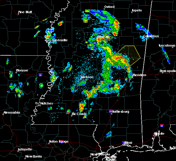 At 621 pm cdt, severe thunderstorms were located along a line extending from center ridge to near vernon to near liberty, moving northeast at 30 mph (radar indicated). Hazards include 60 mph wind gusts and penny size hail. Expect damage to roofs, siding, and trees. These severe thunderstorms will remain over mainly rural areas of west central kemper, southwestern winston and northeastern neshoba counties, including the following locations, noxapater. At 621 pm cdt, severe thunderstorms were located along a line extending from center ridge to near vernon to near liberty, moving northeast at 30 mph (radar indicated). Hazards include 60 mph wind gusts and penny size hail. Expect damage to roofs, siding, and trees. These severe thunderstorms will remain over mainly rural areas of west central kemper, southwestern winston and northeastern neshoba counties, including the following locations, noxapater.
|
| 5/27/2020 6:05 PM CDT |
 At 605 pm cdt, severe thunderstorms were located along a line extending from 7 miles northwest of stallo to near nanih waiya to near damascus, moving northeast at 30 mph (radar indicated). Hazards include 60 mph wind gusts and quarter size hail. Hail damage to vehicles is expected. expect wind damage to roofs, siding, and trees. these severe storms will be near, nanih waiya around 610 pm cdt. Other locations impacted by these severe thunderstorms include noxapater and tucker. At 605 pm cdt, severe thunderstorms were located along a line extending from 7 miles northwest of stallo to near nanih waiya to near damascus, moving northeast at 30 mph (radar indicated). Hazards include 60 mph wind gusts and quarter size hail. Hail damage to vehicles is expected. expect wind damage to roofs, siding, and trees. these severe storms will be near, nanih waiya around 610 pm cdt. Other locations impacted by these severe thunderstorms include noxapater and tucker.
|
| 5/27/2020 6:03 PM CDT |
 At 603 pm cdt, severe thunderstorms were located along a line extending from 8 miles northwest of stallo to near nanih waiya to near damascus, moving northeast at 25 mph (radar indicated). Hazards include 60 mph wind gusts and quarter size hail. Hail damage to vehicles is expected. expect wind damage to roofs, siding, and trees. severe thunderstorms will be near, bluff springs around 620 pm cdt. louisville around 630 pm cdt. preston around 635 pm cdt. millcreek around 640 pm cdt. gholson, mashulaville and betheden around 650 pm cdt. macon around 720 pm cdt. Other locations impacted by these severe thunderstorms include shuqualak. At 603 pm cdt, severe thunderstorms were located along a line extending from 8 miles northwest of stallo to near nanih waiya to near damascus, moving northeast at 25 mph (radar indicated). Hazards include 60 mph wind gusts and quarter size hail. Hail damage to vehicles is expected. expect wind damage to roofs, siding, and trees. severe thunderstorms will be near, bluff springs around 620 pm cdt. louisville around 630 pm cdt. preston around 635 pm cdt. millcreek around 640 pm cdt. gholson, mashulaville and betheden around 650 pm cdt. macon around 720 pm cdt. Other locations impacted by these severe thunderstorms include shuqualak.
|
| 5/27/2020 5:56 PM CDT |
 At 555 pm cdt, severe thunderstorms were located along a line extending from 8 miles southeast of zama to near philadelphia to near herbert springs, moving northeast at 25 mph (radar indicated). Hazards include 60 mph wind gusts and half dollar size hail. Hail damage to vehicles is expected. expect wind damage to roofs, siding, and trees. these severe storms will be near, herbert springs and burnside around 600 pm cdt. forestdale around 610 pm cdt. stallo around 615 pm cdt. damascus around 620 pm cdt. nanih waiya around 625 pm cdt. Other locations impacted by these severe thunderstorms include noxapater and tucker. At 555 pm cdt, severe thunderstorms were located along a line extending from 8 miles southeast of zama to near philadelphia to near herbert springs, moving northeast at 25 mph (radar indicated). Hazards include 60 mph wind gusts and half dollar size hail. Hail damage to vehicles is expected. expect wind damage to roofs, siding, and trees. these severe storms will be near, herbert springs and burnside around 600 pm cdt. forestdale around 610 pm cdt. stallo around 615 pm cdt. damascus around 620 pm cdt. nanih waiya around 625 pm cdt. Other locations impacted by these severe thunderstorms include noxapater and tucker.
|
| 5/27/2020 5:12 PM CDT |
 At 512 pm cdt, severe thunderstorms were located along a line extending from near renfroe to near dowdville to near conehatta, moving northeast at 20 mph (radar indicated). Hazards include 60 mph wind gusts and half dollar size hail. Hail damage to vehicles is expected. expect wind damage to roofs, siding, and trees. severe thunderstorms will be near, philadelphia around 540 pm cdt. bethsaida around 555 pm cdt. burnside around 600 pm cdt. house around 605 pm cdt. stallo around 610 pm cdt. forestdale and herbert springs around 615 pm cdt. nanih waiya and damascus around 630 pm cdt. Other locations impacted by these severe thunderstorms include noxapater and tucker. At 512 pm cdt, severe thunderstorms were located along a line extending from near renfroe to near dowdville to near conehatta, moving northeast at 20 mph (radar indicated). Hazards include 60 mph wind gusts and half dollar size hail. Hail damage to vehicles is expected. expect wind damage to roofs, siding, and trees. severe thunderstorms will be near, philadelphia around 540 pm cdt. bethsaida around 555 pm cdt. burnside around 600 pm cdt. house around 605 pm cdt. stallo around 610 pm cdt. forestdale and herbert springs around 615 pm cdt. nanih waiya and damascus around 630 pm cdt. Other locations impacted by these severe thunderstorms include noxapater and tucker.
|
| 5/23/2020 5:06 PM CDT |
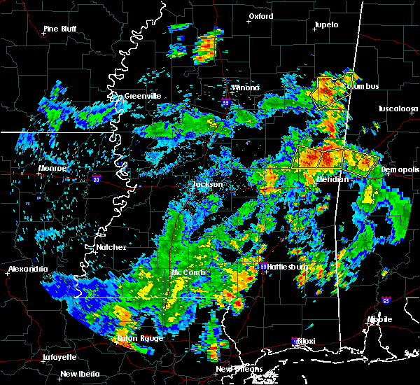 At 506 pm cdt, a severe thunderstorm was located near bluff springs, or 10 miles south of preston, moving north at 30 mph (radar indicated). Hazards include 60 mph wind gusts and penny size hail. Expect damage to roofs, siding, and trees. this severe storm will be near, bluff springs around 510 pm cdt. De kalb around 515 pm cdt. At 506 pm cdt, a severe thunderstorm was located near bluff springs, or 10 miles south of preston, moving north at 30 mph (radar indicated). Hazards include 60 mph wind gusts and penny size hail. Expect damage to roofs, siding, and trees. this severe storm will be near, bluff springs around 510 pm cdt. De kalb around 515 pm cdt.
|
| 5/23/2020 4:43 PM CDT |
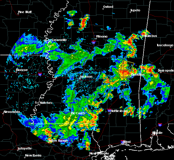 At 443 pm cdt, a severe thunderstorm was located over martin, or 15 miles west of meridian station, moving north at 30 mph (radar indicated). Hazards include 60 mph wind gusts and penny size hail. Expect damage to roofs, siding, and trees. this severe thunderstorm will be near, prismatic around 450 pm cdt. damascus around 455 pm cdt. liberty around 500 pm cdt. bluff springs around 510 pm cdt. De kalb around 515 pm cdt. At 443 pm cdt, a severe thunderstorm was located over martin, or 15 miles west of meridian station, moving north at 30 mph (radar indicated). Hazards include 60 mph wind gusts and penny size hail. Expect damage to roofs, siding, and trees. this severe thunderstorm will be near, prismatic around 450 pm cdt. damascus around 455 pm cdt. liberty around 500 pm cdt. bluff springs around 510 pm cdt. De kalb around 515 pm cdt.
|
| 5/8/2020 9:42 AM CDT |
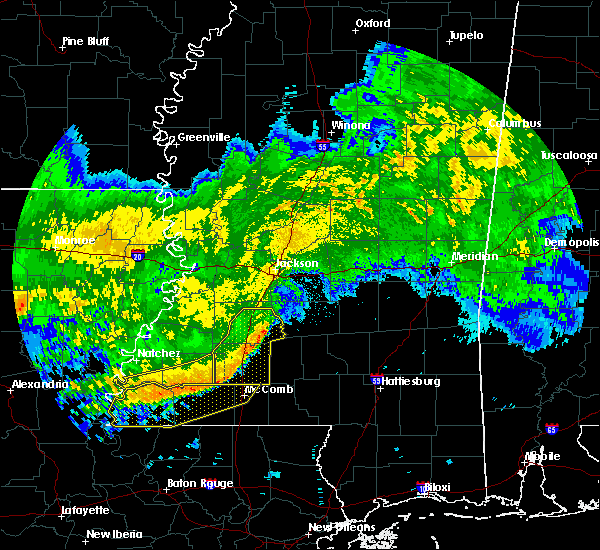 At 941 am cdt, severe thunderstorms were located along a line extending from near rockport to near enterprise to near center point, moving east at 55 mph (radar indicated). Hazards include 60 mph wind gusts. Expect damage to roofs, siding, and trees. these severe storms will be near, rockport around 945 am cdt. east lincoln around 950 am cdt. ruth around 955 am cdt. Other locations impacted by these severe thunderstorms include beauregard and georgetown. At 941 am cdt, severe thunderstorms were located along a line extending from near rockport to near enterprise to near center point, moving east at 55 mph (radar indicated). Hazards include 60 mph wind gusts. Expect damage to roofs, siding, and trees. these severe storms will be near, rockport around 945 am cdt. east lincoln around 950 am cdt. ruth around 955 am cdt. Other locations impacted by these severe thunderstorms include beauregard and georgetown.
|
| 5/8/2020 9:27 AM CDT |
 At 927 am cdt, severe thunderstorms were located along a line extending from near hazlehurst to 6 miles south of glancy to near mccall creek to near bude to garden city, moving southeast at 45 mph (radar indicated). Hazards include 60 mph wind gusts. Expect damage to roofs, siding, and trees. these severe storms will be near, crystal springs, hazlehurst, gallman, mccall creek, martinsville and glancy around 930 am cdt. brookhaven, vaughn, west lincoln and loyd star around 935 am cdt. wesson and center point around 940 am cdt. enterprise, rockport and bogue chitto around 950 am cdt. east lincoln around 955 am cdt. ruth around 1000 am cdt. Other locations impacted by these severe thunderstorms include beauregard and georgetown. At 927 am cdt, severe thunderstorms were located along a line extending from near hazlehurst to 6 miles south of glancy to near mccall creek to near bude to garden city, moving southeast at 45 mph (radar indicated). Hazards include 60 mph wind gusts. Expect damage to roofs, siding, and trees. these severe storms will be near, crystal springs, hazlehurst, gallman, mccall creek, martinsville and glancy around 930 am cdt. brookhaven, vaughn, west lincoln and loyd star around 935 am cdt. wesson and center point around 940 am cdt. enterprise, rockport and bogue chitto around 950 am cdt. east lincoln around 955 am cdt. ruth around 1000 am cdt. Other locations impacted by these severe thunderstorms include beauregard and georgetown.
|
| 5/8/2020 9:22 AM CDT |
 At 922 am cdt, severe thunderstorms were located along a line extending from near glancy to near allen to near mccall creek to bude to garden city, moving southeast at 50 mph (radar indicated). Hazards include 60 mph wind gusts. Expect damage to roofs, siding, and trees. these severe storms will be near, hazlehurst, martinsville, vaughn, mccall creek, glancy, loyd star and gallman around 930 am cdt. brookhaven, wesson and west lincoln around 935 am cdt. center point around 940 am cdt. bogue chitto and rockport around 945 am cdt. enterprise around 950 am cdt. east lincoln and ruth around 955 am cdt. Other locations impacted by these severe thunderstorms include beauregard and georgetown. At 922 am cdt, severe thunderstorms were located along a line extending from near glancy to near allen to near mccall creek to bude to garden city, moving southeast at 50 mph (radar indicated). Hazards include 60 mph wind gusts. Expect damage to roofs, siding, and trees. these severe storms will be near, hazlehurst, martinsville, vaughn, mccall creek, glancy, loyd star and gallman around 930 am cdt. brookhaven, wesson and west lincoln around 935 am cdt. center point around 940 am cdt. bogue chitto and rockport around 945 am cdt. enterprise around 950 am cdt. east lincoln and ruth around 955 am cdt. Other locations impacted by these severe thunderstorms include beauregard and georgetown.
|
| 5/8/2020 9:04 AM CDT |
 At 904 am cdt, severe thunderstorms were located along a line extending from 6 miles east of hermanville to mcbride to 6 miles east of mcnair to near sibley, moving southeast at 45 mph (radar indicated). Hazards include 60 mph wind gusts. Expect damage to roofs, siding, and trees. severe thunderstorms will be near, pleasant hill around 910 am cdt. allen, dentville and barlow around 915 am cdt. caseyville around 920 am cdt. glancy and mccall creek around 925 am cdt. hazlehurst, martinsville, loyd star and gallman around 930 am cdt. brookhaven, wesson, west lincoln and vaughn around 935 am cdt. bogue chitto around 945 am cdt. enterprise and rockport around 950 am cdt. Other locations impacted by these severe thunderstorms include beauregard and georgetown. At 904 am cdt, severe thunderstorms were located along a line extending from 6 miles east of hermanville to mcbride to 6 miles east of mcnair to near sibley, moving southeast at 45 mph (radar indicated). Hazards include 60 mph wind gusts. Expect damage to roofs, siding, and trees. severe thunderstorms will be near, pleasant hill around 910 am cdt. allen, dentville and barlow around 915 am cdt. caseyville around 920 am cdt. glancy and mccall creek around 925 am cdt. hazlehurst, martinsville, loyd star and gallman around 930 am cdt. brookhaven, wesson, west lincoln and vaughn around 935 am cdt. bogue chitto around 945 am cdt. enterprise and rockport around 950 am cdt. Other locations impacted by these severe thunderstorms include beauregard and georgetown.
|
| 4/19/2020 6:46 PM CDT |
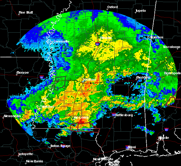 At 646 pm cdt, a severe thunderstorm was located near center point, or 11 miles northwest of mccomb, moving northeast at 50 mph (radar indicated). Hazards include 60 mph wind gusts and quarter size hail. Hail damage to vehicles is expected. expect wind damage to roofs, siding, and trees. this severe storm will be near, bogue chitto around 655 pm cdt. enterprise around 700 pm cdt. ruth around 705 pm cdt. east lincoln around 710 pm cdt. A tornado watch remains in effect until 900 pm cdt for south central and southwestern mississippi. At 646 pm cdt, a severe thunderstorm was located near center point, or 11 miles northwest of mccomb, moving northeast at 50 mph (radar indicated). Hazards include 60 mph wind gusts and quarter size hail. Hail damage to vehicles is expected. expect wind damage to roofs, siding, and trees. this severe storm will be near, bogue chitto around 655 pm cdt. enterprise around 700 pm cdt. ruth around 705 pm cdt. east lincoln around 710 pm cdt. A tornado watch remains in effect until 900 pm cdt for south central and southwestern mississippi.
|
| 4/19/2020 6:30 PM CDT | Quarter sized hail reported 8.4 miles E of Bogue Chitto, MS, dime to quarter hail. |
| 4/19/2020 6:30 PM CDT |
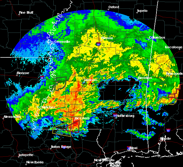 At 630 pm cdt, a severe thunderstorm was located over center point, or 12 miles northwest of mccomb, moving east at 45 mph (radar indicated). Hazards include 60 mph wind gusts and quarter size hail. Hail damage to vehicles is expected. expect wind damage to roofs, siding, and trees. this severe storm will be near, bogue chitto around 640 pm cdt. enterprise around 645 pm cdt. ruth around 650 pm cdt. east lincoln around 655 pm cdt. A tornado watch remains in effect until 700 pm cdt for south central and southwestern mississippi. At 630 pm cdt, a severe thunderstorm was located over center point, or 12 miles northwest of mccomb, moving east at 45 mph (radar indicated). Hazards include 60 mph wind gusts and quarter size hail. Hail damage to vehicles is expected. expect wind damage to roofs, siding, and trees. this severe storm will be near, bogue chitto around 640 pm cdt. enterprise around 645 pm cdt. ruth around 650 pm cdt. east lincoln around 655 pm cdt. A tornado watch remains in effect until 700 pm cdt for south central and southwestern mississippi.
|
| 4/19/2020 6:19 PM CDT |
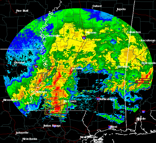 At 618 pm cdt, a severe thunderstorm was located over center point, or 13 miles northwest of mccomb, moving east at 35 mph (radar indicated). Hazards include 60 mph wind gusts and quarter size hail. Hail damage to vehicles is expected. expect wind damage to roofs, siding, and trees. this severe thunderstorm will be near, bogue chitto around 640 pm cdt. enterprise around 645 pm cdt. ruth around 650 pm cdt. east lincoln around 655 pm cdt. A tornado watch remains in effect until 700 pm cdt for south central and southwestern mississippi. At 618 pm cdt, a severe thunderstorm was located over center point, or 13 miles northwest of mccomb, moving east at 35 mph (radar indicated). Hazards include 60 mph wind gusts and quarter size hail. Hail damage to vehicles is expected. expect wind damage to roofs, siding, and trees. this severe thunderstorm will be near, bogue chitto around 640 pm cdt. enterprise around 645 pm cdt. ruth around 650 pm cdt. east lincoln around 655 pm cdt. A tornado watch remains in effect until 700 pm cdt for south central and southwestern mississippi.
|
| 4/19/2020 3:32 AM CDT |
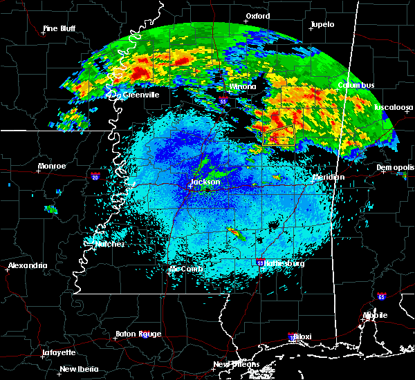 At 331 am cdt, a severe thunderstorm was located near stallo, or 9 miles north of philadelphia, moving east at 55 mph (radar indicated). Hazards include 60 mph wind gusts and quarter size hail. Hail damage to vehicles is expected. expect wind damage to roofs, siding, and trees. this severe storm will be near, stallo and burnside around 335 am cdt. nanih waiya around 345 am cdt. Other locations impacted by this severe thunderstorm include noxapater. At 331 am cdt, a severe thunderstorm was located near stallo, or 9 miles north of philadelphia, moving east at 55 mph (radar indicated). Hazards include 60 mph wind gusts and quarter size hail. Hail damage to vehicles is expected. expect wind damage to roofs, siding, and trees. this severe storm will be near, stallo and burnside around 335 am cdt. nanih waiya around 345 am cdt. Other locations impacted by this severe thunderstorm include noxapater.
|
| 4/19/2020 3:18 AM CDT |
 At 318 am cdt, a severe thunderstorm was located near edinburg, moving east at 60 mph (radar indicated). Hazards include 60 mph wind gusts and quarter size hail. Hail damage to vehicles is expected. expect wind damage to roofs, siding, and trees. this severe storm will be near, burnside around 330 am cdt. stallo around 335 am cdt. nanih waiya around 340 am cdt. Other locations impacted by this severe thunderstorm include noxapater. At 318 am cdt, a severe thunderstorm was located near edinburg, moving east at 60 mph (radar indicated). Hazards include 60 mph wind gusts and quarter size hail. Hail damage to vehicles is expected. expect wind damage to roofs, siding, and trees. this severe storm will be near, burnside around 330 am cdt. stallo around 335 am cdt. nanih waiya around 340 am cdt. Other locations impacted by this severe thunderstorm include noxapater.
|
| 4/19/2020 3:02 AM CDT |
 At 302 am cdt, a severe thunderstorm was located near singleton, or 8 miles northwest of carthage, moving east at 55 mph (radar indicated). Hazards include ping pong ball size hail and 60 mph wind gusts. People and animals outdoors will be injured. expect hail damage to roofs, siding, windows, and vehicles. expect wind damage to roofs, siding, and trees. this severe thunderstorm will be near, carthage and singleton around 305 am cdt. renfroe around 310 am cdt. edinburg and zama around 315 am cdt. pearl river around 325 am cdt. burnside around 330 am cdt. stallo around 335 am cdt. nanih waiya around 340 am cdt. Other locations impacted by this severe thunderstorm include noxapater and redwater. At 302 am cdt, a severe thunderstorm was located near singleton, or 8 miles northwest of carthage, moving east at 55 mph (radar indicated). Hazards include ping pong ball size hail and 60 mph wind gusts. People and animals outdoors will be injured. expect hail damage to roofs, siding, windows, and vehicles. expect wind damage to roofs, siding, and trees. this severe thunderstorm will be near, carthage and singleton around 305 am cdt. renfroe around 310 am cdt. edinburg and zama around 315 am cdt. pearl river around 325 am cdt. burnside around 330 am cdt. stallo around 335 am cdt. nanih waiya around 340 am cdt. Other locations impacted by this severe thunderstorm include noxapater and redwater.
|
| 4/12/2020 11:36 PM CDT |
 At 1136 pm cdt, severe thunderstorms were located along a line extending from near gholson to near house, moving east at 75 mph (radar indicated). Hazards include 60 mph wind gusts. Expect damage to roofs, siding, and trees. these severe storms will be near, liberty around 1145 pm cdt. cooksville, prismatic, paulette and blackwater around 1150 pm cdt. tamola around 1200 am cdt. Other locations impacted by these severe thunderstorms include shuqualak and scooba. At 1136 pm cdt, severe thunderstorms were located along a line extending from near gholson to near house, moving east at 75 mph (radar indicated). Hazards include 60 mph wind gusts. Expect damage to roofs, siding, and trees. these severe storms will be near, liberty around 1145 pm cdt. cooksville, prismatic, paulette and blackwater around 1150 pm cdt. tamola around 1200 am cdt. Other locations impacted by these severe thunderstorms include shuqualak and scooba.
|
| 4/12/2020 11:24 PM CDT |
 At 1124 pm cdt, severe thunderstorms were located along a line extending from vernon to near burnside to prospect, moving east at 80 mph (radar indicated). Hazards include 60 mph wind gusts. Expect damage to roofs, siding, and trees. these severe storms will be near, nanih waiya and forestdale around 1130 pm cdt. preston, bluff springs, gholson and house around 1135 pm cdt. de kalb and herbert springs around 1140 pm cdt. paulette around 1145 pm cdt. electric mills, cooksville, prismatic, porterville and blackwater around 1150 pm cdt. tamola around 1200 am cdt. Other locations impacted by these severe thunderstorms include noxapater, tucker, shuqualak and scooba. At 1124 pm cdt, severe thunderstorms were located along a line extending from vernon to near burnside to prospect, moving east at 80 mph (radar indicated). Hazards include 60 mph wind gusts. Expect damage to roofs, siding, and trees. these severe storms will be near, nanih waiya and forestdale around 1130 pm cdt. preston, bluff springs, gholson and house around 1135 pm cdt. de kalb and herbert springs around 1140 pm cdt. paulette around 1145 pm cdt. electric mills, cooksville, prismatic, porterville and blackwater around 1150 pm cdt. tamola around 1200 am cdt. Other locations impacted by these severe thunderstorms include noxapater, tucker, shuqualak and scooba.
|
| 4/12/2020 11:01 PM CDT |
 At 1101 pm cdt, severe thunderstorms were located along a line extending from 9 miles south of ackerman to renfroe to near ludlow, moving east at 60 mph (radar indicated). Hazards include 60 mph wind gusts. Expect damage to roofs, siding, and trees. severe thunderstorms will be near, philadelphia and pearl river around 1115 pm cdt. burnside and stallo around 1120 pm cdt. dixon around 1125 pm cdt. nanih waiya, neshoba and forestdale around 1130 pm cdt. preston around 1135 pm cdt. bluff springs and house around 1140 pm cdt. herbert springs around 1145 pm cdt. de kalb, paulette and cooksville around 1150 pm cdt. Other locations impacted by these severe thunderstorms include noxapater, tucker, shuqualak and scooba. At 1101 pm cdt, severe thunderstorms were located along a line extending from 9 miles south of ackerman to renfroe to near ludlow, moving east at 60 mph (radar indicated). Hazards include 60 mph wind gusts. Expect damage to roofs, siding, and trees. severe thunderstorms will be near, philadelphia and pearl river around 1115 pm cdt. burnside and stallo around 1120 pm cdt. dixon around 1125 pm cdt. nanih waiya, neshoba and forestdale around 1130 pm cdt. preston around 1135 pm cdt. bluff springs and house around 1140 pm cdt. herbert springs around 1145 pm cdt. de kalb, paulette and cooksville around 1150 pm cdt. Other locations impacted by these severe thunderstorms include noxapater, tucker, shuqualak and scooba.
|
| 4/12/2020 5:15 PM CDT |
 At 515 pm cdt, a severe thunderstorm was located near stallo, or near nanih waiya, moving northeast at 95 mph (radar indicated). Hazards include 60 mph wind gusts and quarter size hail. Hail damage to vehicles is expected. expect wind damage to roofs, siding, and trees. this severe thunderstorm will remain over mainly rural areas of southern winston and neshoba counties, including the following locations, noxapater and tucker. A tornado watch remains in effect until 800 pm cdt for central and east central mississippi. At 515 pm cdt, a severe thunderstorm was located near stallo, or near nanih waiya, moving northeast at 95 mph (radar indicated). Hazards include 60 mph wind gusts and quarter size hail. Hail damage to vehicles is expected. expect wind damage to roofs, siding, and trees. this severe thunderstorm will remain over mainly rural areas of southern winston and neshoba counties, including the following locations, noxapater and tucker. A tornado watch remains in effect until 800 pm cdt for central and east central mississippi.
|
| 4/12/2020 5:04 PM CDT |
 At 504 pm cdt, a severe thunderstorm was located near edinburg, moving northeast at 70 mph (radar indicated). Hazards include 60 mph wind gusts and quarter size hail. Hail damage to vehicles is expected. expect wind damage to roofs, siding, and trees. this severe thunderstorm will be near, burnside and stallo around 510 pm cdt. nanih waiya around 515 pm cdt. other locations impacted by this severe thunderstorm include noxapater, lena, tucker, walnut grove and standing pine. A tornado watch remains in effect until 800 pm cdt for central and east central mississippi. At 504 pm cdt, a severe thunderstorm was located near edinburg, moving northeast at 70 mph (radar indicated). Hazards include 60 mph wind gusts and quarter size hail. Hail damage to vehicles is expected. expect wind damage to roofs, siding, and trees. this severe thunderstorm will be near, burnside and stallo around 510 pm cdt. nanih waiya around 515 pm cdt. other locations impacted by this severe thunderstorm include noxapater, lena, tucker, walnut grove and standing pine. A tornado watch remains in effect until 800 pm cdt for central and east central mississippi.
|
| 3/29/2020 2:06 AM CDT |
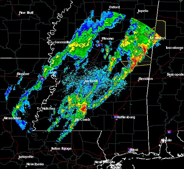 The severe thunderstorm warning for northeastern neshoba county will expire at 215 am cdt, the storm which prompted the warning has moved out of the area. therefore, the warning will be allowed to expire. a tornado watch remains in effect until 400 am cdt for east central mississippi. to report severe weather, contact your nearest law enforcement agency. they will relay your report to the national weather service jackson. The severe thunderstorm warning for northeastern neshoba county will expire at 215 am cdt, the storm which prompted the warning has moved out of the area. therefore, the warning will be allowed to expire. a tornado watch remains in effect until 400 am cdt for east central mississippi. to report severe weather, contact your nearest law enforcement agency. they will relay your report to the national weather service jackson.
|
| 3/29/2020 2:04 AM CDT |
 At 204 am cdt, a severe thunderstorm was located over preston, moving northeast at 65 mph (radar indicated). Hazards include 60 mph wind gusts and half dollar size hail. Hail damage to vehicles is expected. expect wind damage to roofs, siding, and trees. this severe thunderstorm will be near, gholson around 210 am cdt. macon around 225 am cdt. paulette and cooksville around 230 am cdt. other locations impacted by this severe thunderstorm include shuqualak and scooba. A tornado watch remains in effect until 400 am cdt for east central mississippi. At 204 am cdt, a severe thunderstorm was located over preston, moving northeast at 65 mph (radar indicated). Hazards include 60 mph wind gusts and half dollar size hail. Hail damage to vehicles is expected. expect wind damage to roofs, siding, and trees. this severe thunderstorm will be near, gholson around 210 am cdt. macon around 225 am cdt. paulette and cooksville around 230 am cdt. other locations impacted by this severe thunderstorm include shuqualak and scooba. A tornado watch remains in effect until 400 am cdt for east central mississippi.
|
| 3/29/2020 1:58 AM CDT |
 At 158 am cdt, a severe thunderstorm was located near nanih waiya, moving northeast at 60 mph (radar indicated). Hazards include 60 mph wind gusts and half dollar size hail. Hail damage to vehicles is expected. expect wind damage to roofs, siding, and trees. this severe thunderstorm will remain over mainly rural areas of northeastern neshoba county. A tornado watch remains in effect until 400 am cdt for east central mississippi. At 158 am cdt, a severe thunderstorm was located near nanih waiya, moving northeast at 60 mph (radar indicated). Hazards include 60 mph wind gusts and half dollar size hail. Hail damage to vehicles is expected. expect wind damage to roofs, siding, and trees. this severe thunderstorm will remain over mainly rural areas of northeastern neshoba county. A tornado watch remains in effect until 400 am cdt for east central mississippi.
|
| 3/29/2020 1:42 AM CDT |
 At 142 am cdt, a severe thunderstorm was located over dixon, or 7 miles southwest of philadelphia, moving northeast at 65 mph. this is a very dangerous storm (radar indicated). Hazards include baseball size hail and 60 mph wind gusts. People and animals outdoors will be severely injured. expect shattered windows, extensive damage to roofs, siding, and vehicles. this severe storm will be near, philadelphia around 145 am cdt. bethsaida and burnside around 150 am cdt. forestdale around 155 am cdt. other locations impacted by this severe thunderstorm include tucker. A tornado watch remains in effect until 400 am cdt for central and east central mississippi. At 142 am cdt, a severe thunderstorm was located over dixon, or 7 miles southwest of philadelphia, moving northeast at 65 mph. this is a very dangerous storm (radar indicated). Hazards include baseball size hail and 60 mph wind gusts. People and animals outdoors will be severely injured. expect shattered windows, extensive damage to roofs, siding, and vehicles. this severe storm will be near, philadelphia around 145 am cdt. bethsaida and burnside around 150 am cdt. forestdale around 155 am cdt. other locations impacted by this severe thunderstorm include tucker. A tornado watch remains in effect until 400 am cdt for central and east central mississippi.
|
| 3/29/2020 1:36 AM CDT |
 At 135 am cdt, a severe thunderstorm was located over dowdville, or 8 miles south of edinburg, moving northeast at 75 mph. this is a very dangerous storm (radar indicated). Hazards include baseball size hail and 60 mph wind gusts. People and animals outdoors will be severely injured. expect shattered windows, extensive damage to roofs, siding, and vehicles. this severe thunderstorm will be near, pearl river around 140 am cdt. philadelphia around 145 am cdt. burnside around 150 am cdt. nanih waiya and forestdale around 155 am cdt. other locations impacted by this severe thunderstorm include tucker. A tornado watch remains in effect until 400 am cdt for central and east central mississippi. At 135 am cdt, a severe thunderstorm was located over dowdville, or 8 miles south of edinburg, moving northeast at 75 mph. this is a very dangerous storm (radar indicated). Hazards include baseball size hail and 60 mph wind gusts. People and animals outdoors will be severely injured. expect shattered windows, extensive damage to roofs, siding, and vehicles. this severe thunderstorm will be near, pearl river around 140 am cdt. philadelphia around 145 am cdt. burnside around 150 am cdt. nanih waiya and forestdale around 155 am cdt. other locations impacted by this severe thunderstorm include tucker. A tornado watch remains in effect until 400 am cdt for central and east central mississippi.
|
| 3/4/2020 1:47 AM CST |
 At 147 am cst, a severe thunderstorm was located over dixon, or 9 miles north of prospect, moving east at 50 mph (radar indicated). Hazards include 60 mph wind gusts and half dollar size hail. Hail damage to vehicles is expected. expect wind damage to roofs, siding, and trees. this severe thunderstorm will be near, philadelphia and neshoba around 155 am cst. bethsaida and house around 205 am cst. herbert springs and forestdale around 210 am cst. damascus and bluff springs around 220 am cst. liberty and prismatic around 225 am cst. Other locations impacted by this severe thunderstorm include tucker. At 147 am cst, a severe thunderstorm was located over dixon, or 9 miles north of prospect, moving east at 50 mph (radar indicated). Hazards include 60 mph wind gusts and half dollar size hail. Hail damage to vehicles is expected. expect wind damage to roofs, siding, and trees. this severe thunderstorm will be near, philadelphia and neshoba around 155 am cst. bethsaida and house around 205 am cst. herbert springs and forestdale around 210 am cst. damascus and bluff springs around 220 am cst. liberty and prismatic around 225 am cst. Other locations impacted by this severe thunderstorm include tucker.
|
| 2/10/2020 4:59 PM CST |
 At 459 pm cst, a severe thunderstorm was located near enterprise, or near brookhaven, moving northeast at 40 mph (radar indicated). Hazards include 60 mph wind gusts. Expect damage to roofs, siding, and trees. this severe thunderstorm will be near, east lincoln around 505 pm cst. sontag around 520 pm cst. monticello and wanilla around 525 pm cst. oma around 530 pm cst. Other locations impacted by this severe thunderstorm include new hebron and silver creek. At 459 pm cst, a severe thunderstorm was located near enterprise, or near brookhaven, moving northeast at 40 mph (radar indicated). Hazards include 60 mph wind gusts. Expect damage to roofs, siding, and trees. this severe thunderstorm will be near, east lincoln around 505 pm cst. sontag around 520 pm cst. monticello and wanilla around 525 pm cst. oma around 530 pm cst. Other locations impacted by this severe thunderstorm include new hebron and silver creek.
|
| 2/5/2020 6:22 PM CST |
 The tornado warning for northeastern neshoba county will expire at 630 pm cst, the storm which prompted the warning has weakened below severe limits, and no longer appears capable of producing a tornado. therefore, the warning will be allowed to expire. however heavy rain is still possible with this thunderstorm. a tornado watch remains in effect until midnight cst for east central mississippi. to report severe weather, contact your nearest law enforcement agency. they will relay your report to the national weather service jackson. The tornado warning for northeastern neshoba county will expire at 630 pm cst, the storm which prompted the warning has weakened below severe limits, and no longer appears capable of producing a tornado. therefore, the warning will be allowed to expire. however heavy rain is still possible with this thunderstorm. a tornado watch remains in effect until midnight cst for east central mississippi. to report severe weather, contact your nearest law enforcement agency. they will relay your report to the national weather service jackson.
|
| 2/5/2020 6:18 PM CST |
 At 617 pm cst, a severe thunderstorm capable of producing a tornado was located near burnside, or near philadelphia, moving northeast at 40 mph (radar indicated rotation). Hazards include tornado. Flying debris will be dangerous to those caught without shelter. mobile homes will be damaged or destroyed. damage to roofs, windows, and vehicles will occur. tree damage is likely. this dangerous storm will be near, stallo around 625 pm cst. Nanih waiya around 640 pm cst. At 617 pm cst, a severe thunderstorm capable of producing a tornado was located near burnside, or near philadelphia, moving northeast at 40 mph (radar indicated rotation). Hazards include tornado. Flying debris will be dangerous to those caught without shelter. mobile homes will be damaged or destroyed. damage to roofs, windows, and vehicles will occur. tree damage is likely. this dangerous storm will be near, stallo around 625 pm cst. Nanih waiya around 640 pm cst.
|
| 2/5/2020 6:05 PM CST |
 At 605 pm cst, a severe thunderstorm capable of producing a tornado was located over pearl river, or near edinburg, moving northeast at 45 mph (radar indicated rotation). Hazards include tornado. Flying debris will be dangerous to those caught without shelter. mobile homes will be damaged or destroyed. damage to roofs, windows, and vehicles will occur. tree damage is likely. this dangerous storm will be near, philadelphia around 610 pm cst. burnside around 620 pm cst. stallo around 625 pm cst. Nanih waiya around 630 pm cst. At 605 pm cst, a severe thunderstorm capable of producing a tornado was located over pearl river, or near edinburg, moving northeast at 45 mph (radar indicated rotation). Hazards include tornado. Flying debris will be dangerous to those caught without shelter. mobile homes will be damaged or destroyed. damage to roofs, windows, and vehicles will occur. tree damage is likely. this dangerous storm will be near, philadelphia around 610 pm cst. burnside around 620 pm cst. stallo around 625 pm cst. Nanih waiya around 630 pm cst.
|
| 2/5/2020 5:55 PM CST |
 At 555 pm cst, a confirmed tornado was located near madden, or near edinburg, moving east at 45 mph (radar confirmed tornado). Hazards include damaging tornado. Flying debris will be dangerous to those caught without shelter. mobile homes will be damaged or destroyed. damage to roofs, windows, and vehicles will occur. tree damage is likely. this tornado will be near, edinburg around 605 pm cst. philadelphia and pearl river around 610 pm cst. burnside around 620 pm cst. stallo around 625 pm cst. forestdale around 630 pm cst. Other locations impacted by this tornadic thunderstorm include tucker. At 555 pm cst, a confirmed tornado was located near madden, or near edinburg, moving east at 45 mph (radar confirmed tornado). Hazards include damaging tornado. Flying debris will be dangerous to those caught without shelter. mobile homes will be damaged or destroyed. damage to roofs, windows, and vehicles will occur. tree damage is likely. this tornado will be near, edinburg around 605 pm cst. philadelphia and pearl river around 610 pm cst. burnside around 620 pm cst. stallo around 625 pm cst. forestdale around 630 pm cst. Other locations impacted by this tornadic thunderstorm include tucker.
|
| 2/5/2020 5:51 PM CST |
 At 551 pm cst, a severe thunderstorm capable of producing a tornado was located near carthage, moving east at 40 mph (radar indicated rotation). Hazards include tornado. Flying debris will be dangerous to those caught without shelter. mobile homes will be damaged or destroyed. damage to roofs, windows, and vehicles will occur. tree damage is likely. this dangerous storm will be near, edinburg around 605 pm cst. pearl river around 610 pm cst. philadelphia and burnside around 615 pm cst. Other locations impacted by this tornadic thunderstorm include tucker. At 551 pm cst, a severe thunderstorm capable of producing a tornado was located near carthage, moving east at 40 mph (radar indicated rotation). Hazards include tornado. Flying debris will be dangerous to those caught without shelter. mobile homes will be damaged or destroyed. damage to roofs, windows, and vehicles will occur. tree damage is likely. this dangerous storm will be near, edinburg around 605 pm cst. pearl river around 610 pm cst. philadelphia and burnside around 615 pm cst. Other locations impacted by this tornadic thunderstorm include tucker.
|
| 2/5/2020 5:45 PM CST |
 At 545 pm cst, a confirmed tornado was located near carthage, moving east at 40 mph (radar confirmed tornado). Hazards include damaging tornado. Flying debris will be dangerous to those caught without shelter. mobile homes will be damaged or destroyed. damage to roofs, windows, and vehicles will occur. tree damage is likely. this tornado will be near, madden around 600 pm cst. edinburg and dowdville around 605 pm cst. philadelphia and pearl river around 615 pm cst. Other locations impacted by this tornadic thunderstorm include tucker, standing pine and redwater. At 545 pm cst, a confirmed tornado was located near carthage, moving east at 40 mph (radar confirmed tornado). Hazards include damaging tornado. Flying debris will be dangerous to those caught without shelter. mobile homes will be damaged or destroyed. damage to roofs, windows, and vehicles will occur. tree damage is likely. this tornado will be near, madden around 600 pm cst. edinburg and dowdville around 605 pm cst. philadelphia and pearl river around 615 pm cst. Other locations impacted by this tornadic thunderstorm include tucker, standing pine and redwater.
|
| 2/5/2020 5:36 PM CST |
 At 536 pm cst, a confirmed tornado was located near tuscola, or near carthage, moving east at 45 mph (radar confirmed tornado). Hazards include damaging tornado. Flying debris will be dangerous to those caught without shelter. mobile homes will be damaged or destroyed. damage to roofs, windows, and vehicles will occur. tree damage is likely. this tornado will be near, tuscola around 540 pm cst. carthage around 545 pm cst. madden around 555 pm cst. edinburg, pearl river and dowdville around 600 pm cst. Other locations impacted by this tornadic thunderstorm include tucker, standing pine and redwater. At 536 pm cst, a confirmed tornado was located near tuscola, or near carthage, moving east at 45 mph (radar confirmed tornado). Hazards include damaging tornado. Flying debris will be dangerous to those caught without shelter. mobile homes will be damaged or destroyed. damage to roofs, windows, and vehicles will occur. tree damage is likely. this tornado will be near, tuscola around 540 pm cst. carthage around 545 pm cst. madden around 555 pm cst. edinburg, pearl river and dowdville around 600 pm cst. Other locations impacted by this tornadic thunderstorm include tucker, standing pine and redwater.
|
| 2/5/2020 5:34 PM CST |
 At 534 pm cst, a severe thunderstorm capable of producing a tornado was located 7 miles northwest of tuscola, or 7 miles southwest of carthage, moving east at 50 mph (radar indicated rotation). Hazards include tornado. Flying debris will be dangerous to those caught without shelter. mobile homes will be damaged or destroyed. damage to roofs, windows, and vehicles will occur. tree damage is likely. this dangerous storm will be near, tuscola around 540 pm cst. carthage around 545 pm cst. madden around 555 pm cst. edinburg and dowdville around 600 pm cst. pearl river around 605 pm cst. philadelphia around 610 pm cst. burnside around 615 pm cst. stallo around 620 pm cst. Other locations impacted by this tornadic thunderstorm include tucker, standing pine and redwater. At 534 pm cst, a severe thunderstorm capable of producing a tornado was located 7 miles northwest of tuscola, or 7 miles southwest of carthage, moving east at 50 mph (radar indicated rotation). Hazards include tornado. Flying debris will be dangerous to those caught without shelter. mobile homes will be damaged or destroyed. damage to roofs, windows, and vehicles will occur. tree damage is likely. this dangerous storm will be near, tuscola around 540 pm cst. carthage around 545 pm cst. madden around 555 pm cst. edinburg and dowdville around 600 pm cst. pearl river around 605 pm cst. philadelphia around 610 pm cst. burnside around 615 pm cst. stallo around 620 pm cst. Other locations impacted by this tornadic thunderstorm include tucker, standing pine and redwater.
|
| 2/5/2020 3:10 PM CST |
 At 309 pm cst, a severe thunderstorm capable of producing a tornado was located over west lincoln, or 8 miles southwest of brookhaven, moving northeast at 50 mph (radar indicated rotation). Hazards include tornado and quarter size hail. Flying debris will be dangerous to those caught without shelter. mobile homes will be damaged or destroyed. damage to roofs, windows, and vehicles will occur. tree damage is likely. this dangerous storm will be near, brookhaven and enterprise around 320 pm cst. sontag around 335 pm cst. wanilla around 340 pm cst. oma and rockport around 345 pm cst. shivers around 355 pm cst. pinola around 400 pm cst. Other locations impacted by this tornadic thunderstorm include beauregard, new hebron and georgetown. At 309 pm cst, a severe thunderstorm capable of producing a tornado was located over west lincoln, or 8 miles southwest of brookhaven, moving northeast at 50 mph (radar indicated rotation). Hazards include tornado and quarter size hail. Flying debris will be dangerous to those caught without shelter. mobile homes will be damaged or destroyed. damage to roofs, windows, and vehicles will occur. tree damage is likely. this dangerous storm will be near, brookhaven and enterprise around 320 pm cst. sontag around 335 pm cst. wanilla around 340 pm cst. oma and rockport around 345 pm cst. shivers around 355 pm cst. pinola around 400 pm cst. Other locations impacted by this tornadic thunderstorm include beauregard, new hebron and georgetown.
|
| 2/5/2020 3:05 PM CST |
 At 305 pm cst, a severe thunderstorm was located over west lincoln, or 10 miles southwest of brookhaven, moving northeast at 55 mph (radar indicated). Hazards include 60 mph wind gusts and quarter size hail. Hail damage to vehicles is expected. expect wind damage to roofs, siding, and trees. this severe thunderstorm will be near, brookhaven and enterprise around 315 pm cst. sontag around 330 pm cst. wanilla around 335 pm cst. oma and rockport around 340 pm cst. other locations impacted by this severe thunderstorm include beauregard and new hebron. A tornado watch remains in effect until 600 pm cst for central and south central mississippi. At 305 pm cst, a severe thunderstorm was located over west lincoln, or 10 miles southwest of brookhaven, moving northeast at 55 mph (radar indicated). Hazards include 60 mph wind gusts and quarter size hail. Hail damage to vehicles is expected. expect wind damage to roofs, siding, and trees. this severe thunderstorm will be near, brookhaven and enterprise around 315 pm cst. sontag around 330 pm cst. wanilla around 335 pm cst. oma and rockport around 340 pm cst. other locations impacted by this severe thunderstorm include beauregard and new hebron. A tornado watch remains in effect until 600 pm cst for central and south central mississippi.
|
| 1/11/2020 10:21 AM CST |
 The severe thunderstorm warning for newton and neshoba counties will expire at 1030 am cst, the storm which prompted the warning has moved out of the area. therefore, the warning will be allowed to expire. however gusty winds are still possible. a tornado watch remains in effect until 400 pm cst for east central mississippi. The severe thunderstorm warning for newton and neshoba counties will expire at 1030 am cst, the storm which prompted the warning has moved out of the area. therefore, the warning will be allowed to expire. however gusty winds are still possible. a tornado watch remains in effect until 400 pm cst for east central mississippi.
|
| 1/11/2020 10:19 AM CST | Trees dow in winston county MS, 8.8 miles S of Bogue Chitto, MS |
| 1/11/2020 10:14 AM CST |
 At 1014 am cst, severe thunderstorms were located along a line extending from near forestdale to herbert springs, moving northeast at 60 mph (radar indicated). Hazards include 60 mph wind gusts. Expect damage to roofs, siding, and trees. severe thunderstorms will be near, preston, liberty and bluff springs around 1025 am cst. gholson around 1030 am cst. de kalb around 1035 am cst. macon around 1045 am cst. paulette, cooksville, prairie point and deerbrook around 1055 am cst. bigbee valley around 1100 am cst. other locations impacted by these severe thunderstorms include shuqualak and scooba. A tornado watch remains in effect until 400 pm cst for northeastern and east central mississippi. At 1014 am cst, severe thunderstorms were located along a line extending from near forestdale to herbert springs, moving northeast at 60 mph (radar indicated). Hazards include 60 mph wind gusts. Expect damage to roofs, siding, and trees. severe thunderstorms will be near, preston, liberty and bluff springs around 1025 am cst. gholson around 1030 am cst. de kalb around 1035 am cst. macon around 1045 am cst. paulette, cooksville, prairie point and deerbrook around 1055 am cst. bigbee valley around 1100 am cst. other locations impacted by these severe thunderstorms include shuqualak and scooba. A tornado watch remains in effect until 400 pm cst for northeastern and east central mississippi.
|
| 1/11/2020 10:08 AM CST |
 At 1008 am cst, a severe thunderstorm capable of producing a tornado was located over bethsaida, or 8 miles southeast of philadelphia, moving northeast at 50 mph (radar indicated rotation). Hazards include tornado. Flying debris will be dangerous to those caught without shelter. mobile homes will be damaged or destroyed. damage to roofs, windows, and vehicles will occur. tree damage is likely. this dangerous storm will be near, forestdale around 1015 am cst. Other locations impacted by this tornadic thunderstorm include tucker. At 1008 am cst, a severe thunderstorm capable of producing a tornado was located over bethsaida, or 8 miles southeast of philadelphia, moving northeast at 50 mph (radar indicated rotation). Hazards include tornado. Flying debris will be dangerous to those caught without shelter. mobile homes will be damaged or destroyed. damage to roofs, windows, and vehicles will occur. tree damage is likely. this dangerous storm will be near, forestdale around 1015 am cst. Other locations impacted by this tornadic thunderstorm include tucker.
|
| 1/11/2020 9:59 AM CST |
 At 958 am cst, a severe thunderstorm was located over neshoba, or 8 miles northeast of prospect, moving northeast at 40 mph (radar indicated). Hazards include 60 mph wind gusts and penny size hail. Expect damage to roofs, siding, and trees. this severe storm will be near, bethsaida and house around 1010 am cst. forestdale around 1020 am cst. other locations impacted by this severe thunderstorm include tucker. A tornado watch remains in effect until 400 pm cst for east central mississippi. At 958 am cst, a severe thunderstorm was located over neshoba, or 8 miles northeast of prospect, moving northeast at 40 mph (radar indicated). Hazards include 60 mph wind gusts and penny size hail. Expect damage to roofs, siding, and trees. this severe storm will be near, bethsaida and house around 1010 am cst. forestdale around 1020 am cst. other locations impacted by this severe thunderstorm include tucker. A tornado watch remains in effect until 400 pm cst for east central mississippi.
|
| 1/11/2020 9:54 AM CST |
 At 953 am cst, a severe thunderstorm capable of producing a tornado was located near neshoba, or near prospect, moving northeast at 60 mph (radar indicated rotation). Hazards include tornado. Flying debris will be dangerous to those caught without shelter. mobile homes will be damaged or destroyed. damage to roofs, windows, and vehicles will occur. tree damage is likely. this dangerous storm will be near, bethsaida, house and herbert springs around 1005 am cst. forestdale around 1010 am cst. Other locations impacted by this tornadic thunderstorm include tucker. At 953 am cst, a severe thunderstorm capable of producing a tornado was located near neshoba, or near prospect, moving northeast at 60 mph (radar indicated rotation). Hazards include tornado. Flying debris will be dangerous to those caught without shelter. mobile homes will be damaged or destroyed. damage to roofs, windows, and vehicles will occur. tree damage is likely. this dangerous storm will be near, bethsaida, house and herbert springs around 1005 am cst. forestdale around 1010 am cst. Other locations impacted by this tornadic thunderstorm include tucker.
|
| 1/11/2020 9:46 AM CST |
 At 945 am cst, a severe thunderstorm capable of producing a tornado was located over conehatta, or near prospect, moving northeast at 60 mph (radar indicated rotation). Hazards include tornado. Flying debris will be dangerous to those caught without shelter. mobile homes will be damaged or destroyed. damage to roofs, windows, and vehicles will occur. tree damage is likely. this dangerous storm will be near, stratton and dixon around 955 am cst. neshoba and little rock around 1000 am cst. bethsaida, house and herbert springs around 1005 am cst. forestdale around 1015 am cst. Other locations impacted by this tornadic thunderstorm include tucker, lake and sebastopol. At 945 am cst, a severe thunderstorm capable of producing a tornado was located over conehatta, or near prospect, moving northeast at 60 mph (radar indicated rotation). Hazards include tornado. Flying debris will be dangerous to those caught without shelter. mobile homes will be damaged or destroyed. damage to roofs, windows, and vehicles will occur. tree damage is likely. this dangerous storm will be near, stratton and dixon around 955 am cst. neshoba and little rock around 1000 am cst. bethsaida, house and herbert springs around 1005 am cst. forestdale around 1015 am cst. Other locations impacted by this tornadic thunderstorm include tucker, lake and sebastopol.
|
| 1/11/2020 9:35 AM CST |
 At 935 am cst, a severe thunderstorm capable of producing a tornado was located near forest, moving northeast at 60 mph (radar indicated rotation). Hazards include tornado. Flying debris will be dangerous to those caught without shelter. mobile homes will be damaged or destroyed. damage to roofs, windows, and vehicles will occur. tree damage is likely. this dangerous storm will be near, conehatta around 945 am cst. prospect around 950 am cst. stratton and dixon around 955 am cst. neshoba and little rock around 1000 am cst. bethsaida, house and herbert springs around 1005 am cst. forestdale around 1015 am cst. Other locations impacted by this tornadic thunderstorm include tucker, lake and sebastopol. At 935 am cst, a severe thunderstorm capable of producing a tornado was located near forest, moving northeast at 60 mph (radar indicated rotation). Hazards include tornado. Flying debris will be dangerous to those caught without shelter. mobile homes will be damaged or destroyed. damage to roofs, windows, and vehicles will occur. tree damage is likely. this dangerous storm will be near, conehatta around 945 am cst. prospect around 950 am cst. stratton and dixon around 955 am cst. neshoba and little rock around 1000 am cst. bethsaida, house and herbert springs around 1005 am cst. forestdale around 1015 am cst. Other locations impacted by this tornadic thunderstorm include tucker, lake and sebastopol.
|
| 1/11/2020 9:29 AM CST |
 At 928 am cst, a severe thunderstorm was located over harperville, moving east at 40 mph (radar indicated). Hazards include 60 mph wind gusts and penny size hail. Expect damage to roofs, siding, and trees. this severe thunderstorm will be near, conehatta around 945 am cst. prospect and dowdville around 950 am cst. dixon and stratton around 955 am cst. neshoba around 1000 am cst. bethsaida around 1010 am cst. house around 1015 am cst. herbert springs around 1020 am cst. forestdale around 1025 am cst. other locations impacted by this severe thunderstorm include lena, tucker, walnut grove, lake, sebastopol and standing pine. a tornado watch remains in effect until 1100 am cst for central mississippi. A tornado watch also remains in effect until 400 pm cst for central and east central mississippi. At 928 am cst, a severe thunderstorm was located over harperville, moving east at 40 mph (radar indicated). Hazards include 60 mph wind gusts and penny size hail. Expect damage to roofs, siding, and trees. this severe thunderstorm will be near, conehatta around 945 am cst. prospect and dowdville around 950 am cst. dixon and stratton around 955 am cst. neshoba around 1000 am cst. bethsaida around 1010 am cst. house around 1015 am cst. herbert springs around 1020 am cst. forestdale around 1025 am cst. other locations impacted by this severe thunderstorm include lena, tucker, walnut grove, lake, sebastopol and standing pine. a tornado watch remains in effect until 1100 am cst for central mississippi. A tornado watch also remains in effect until 400 pm cst for central and east central mississippi.
|
| 1/11/2020 8:13 AM CST |
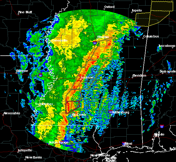 At 813 am cst, a severe thunderstorm capable of producing a tornado was located over enterprise, or near brookhaven, moving northeast at 60 mph (radar indicated rotation). Hazards include tornado. Flying debris will be dangerous to those caught without shelter. mobile homes will be damaged or destroyed. damage to roofs, windows, and vehicles will occur. tree damage is likely. This tornadic thunderstorm will remain over mainly rural areas of eastern lincoln county. At 813 am cst, a severe thunderstorm capable of producing a tornado was located over enterprise, or near brookhaven, moving northeast at 60 mph (radar indicated rotation). Hazards include tornado. Flying debris will be dangerous to those caught without shelter. mobile homes will be damaged or destroyed. damage to roofs, windows, and vehicles will occur. tree damage is likely. This tornadic thunderstorm will remain over mainly rural areas of eastern lincoln county.
|
| 1/11/2020 8:09 AM CST | Trees and power lines down in the bogue chitto are in lincoln county MS, 0.7 miles SW of Bogue Chitto, MS |
| 1/11/2020 7:59 AM CST |
 At 759 am cst, severe thunderstorms were located along a line extending from near glancy to near center point, moving northeast at 45 mph (radar indicated). Hazards include 60 mph wind gusts. Expect damage to roofs, siding, and trees. these severe storms will be near, glancy around 805 am cst. hazlehurst and martinsville around 810 am cst. gallman, bogue chitto and loyd star around 815 am cst. crystal springs and enterprise around 820 am cst. brookhaven around 825 am cst. wesson and hopewell around 830 am cst. other locations impacted by these severe thunderstorms include beauregard. A tornado watch remains in effect until 900 am cst for central, south central and southwestern mississippi. At 759 am cst, severe thunderstorms were located along a line extending from near glancy to near center point, moving northeast at 45 mph (radar indicated). Hazards include 60 mph wind gusts. Expect damage to roofs, siding, and trees. these severe storms will be near, glancy around 805 am cst. hazlehurst and martinsville around 810 am cst. gallman, bogue chitto and loyd star around 815 am cst. crystal springs and enterprise around 820 am cst. brookhaven around 825 am cst. wesson and hopewell around 830 am cst. other locations impacted by these severe thunderstorms include beauregard. A tornado watch remains in effect until 900 am cst for central, south central and southwestern mississippi.
|
| 1/11/2020 7:58 AM CST |
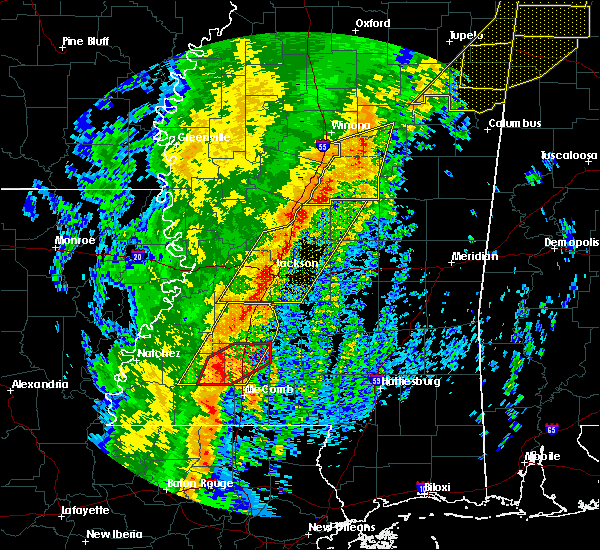 At 757 am cst, a severe thunderstorm capable of producing a tornado was located over west lincoln, or 10 miles southwest of brookhaven, moving northeast at 65 mph (radar indicated rotation). Hazards include tornado. Flying debris will be dangerous to those caught without shelter. mobile homes will be damaged or destroyed. damage to roofs, windows, and vehicles will occur. tree damage is likely. this dangerous storm will be near, enterprise around 805 am cst. Brookhaven around 810 am cst. At 757 am cst, a severe thunderstorm capable of producing a tornado was located over west lincoln, or 10 miles southwest of brookhaven, moving northeast at 65 mph (radar indicated rotation). Hazards include tornado. Flying debris will be dangerous to those caught without shelter. mobile homes will be damaged or destroyed. damage to roofs, windows, and vehicles will occur. tree damage is likely. this dangerous storm will be near, enterprise around 805 am cst. Brookhaven around 810 am cst.
|
| 1/11/2020 7:47 AM CST |
 At 746 am cst, a severe thunderstorm capable of producing a tornado was located over smithdale, or 14 miles north of liberty, moving northeast at 65 mph (radar indicated rotation). Hazards include tornado. Flying debris will be dangerous to those caught without shelter. mobile homes will be damaged or destroyed. damage to roofs, windows, and vehicles will occur. tree damage is likely. this dangerous storm will be near, center point around 755 am cst. west lincoln, bogue chitto and vaughn around 800 am cst. enterprise around 805 am cst. Brookhaven around 810 am cst. At 746 am cst, a severe thunderstorm capable of producing a tornado was located over smithdale, or 14 miles north of liberty, moving northeast at 65 mph (radar indicated rotation). Hazards include tornado. Flying debris will be dangerous to those caught without shelter. mobile homes will be damaged or destroyed. damage to roofs, windows, and vehicles will occur. tree damage is likely. this dangerous storm will be near, center point around 755 am cst. west lincoln, bogue chitto and vaughn around 800 am cst. enterprise around 805 am cst. Brookhaven around 810 am cst.
|
| 1/11/2020 7:30 AM CST |
 At 730 am cst, severe thunderstorms were located along a line extending from near union church to 8 miles northeast of gloster, moving northeast at 45 mph (radar indicated). Hazards include 60 mph wind gusts. Expect damage to roofs, siding, and trees. severe thunderstorms will be near, union church around 735 am cst. pleasant hill around 740 am cst. bude, allen and caseyville around 745 am cst. little springs and barlow around 750 am cst. glancy, center point and mccall creek around 800 am cst. west lincoln and martinsville around 805 am cst. hazlehurst, vaughn and bogue chitto around 810 am cst. gallman around 815 am cst. other locations impacted by these severe thunderstorms include beauregard and meadville. A tornado watch remains in effect until 900 am cst for central, south central and southwestern mississippi. At 730 am cst, severe thunderstorms were located along a line extending from near union church to 8 miles northeast of gloster, moving northeast at 45 mph (radar indicated). Hazards include 60 mph wind gusts. Expect damage to roofs, siding, and trees. severe thunderstorms will be near, union church around 735 am cst. pleasant hill around 740 am cst. bude, allen and caseyville around 745 am cst. little springs and barlow around 750 am cst. glancy, center point and mccall creek around 800 am cst. west lincoln and martinsville around 805 am cst. hazlehurst, vaughn and bogue chitto around 810 am cst. gallman around 815 am cst. other locations impacted by these severe thunderstorms include beauregard and meadville. A tornado watch remains in effect until 900 am cst for central, south central and southwestern mississippi.
|
| 12/29/2019 5:37 PM CST |
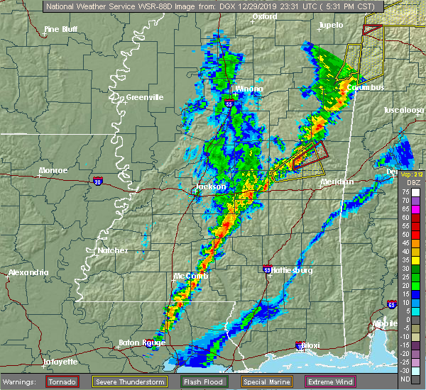 At 537 pm cst, a severe thunderstorm was located near forestdale, or 10 miles southwest of preston, moving northeast at 55 mph (radar indicated). Hazards include 60 mph wind gusts. Expect damage to roofs, siding, and trees. this severe storm will be near, preston around 550 pm cst. A tornado watch remains in effect until 900 pm cst for east central mississippi. At 537 pm cst, a severe thunderstorm was located near forestdale, or 10 miles southwest of preston, moving northeast at 55 mph (radar indicated). Hazards include 60 mph wind gusts. Expect damage to roofs, siding, and trees. this severe storm will be near, preston around 550 pm cst. A tornado watch remains in effect until 900 pm cst for east central mississippi.
|
| 12/29/2019 5:12 PM CST |
 At 512 pm cst, a severe thunderstorm was located near stratton, or near prospect, moving northeast at 45 mph (radar indicated). Hazards include 60 mph wind gusts and quarter size hail. Hail damage to vehicles is expected. expect wind damage to roofs, siding, and trees. this severe thunderstorm will be near, neshoba around 520 pm cst. little rock around 525 pm cst. house and bethsaida around 530 pm cst. herbert springs around 535 pm cst. damascus and forestdale around 540 pm cst. liberty around 545 pm cst. bluff springs around 550 pm cst. other locations impacted by this severe thunderstorm include tucker. A tornado watch remains in effect until 900 pm cst for east central mississippi. At 512 pm cst, a severe thunderstorm was located near stratton, or near prospect, moving northeast at 45 mph (radar indicated). Hazards include 60 mph wind gusts and quarter size hail. Hail damage to vehicles is expected. expect wind damage to roofs, siding, and trees. this severe thunderstorm will be near, neshoba around 520 pm cst. little rock around 525 pm cst. house and bethsaida around 530 pm cst. herbert springs around 535 pm cst. damascus and forestdale around 540 pm cst. liberty around 545 pm cst. bluff springs around 550 pm cst. other locations impacted by this severe thunderstorm include tucker. A tornado watch remains in effect until 900 pm cst for east central mississippi.
|
| 12/16/2019 5:24 PM CST |
 At 523 pm cst, a severe thunderstorm capable of producing a tornado was located over summit, or near mccomb, moving northeast at 40 mph (radar indicated rotation). Hazards include tornado and quarter size hail. Flying debris will be dangerous to those caught without shelter. mobile homes will be damaged or destroyed. damage to roofs, windows, and vehicles will occur. tree damage is likely. this dangerous storm will be near, enterprise and ruth around 535 pm cst. east lincoln and jayess around 545 pm cst. topeka around 550 pm cst. monticello and robinwood around 600 pm cst. arm and wanilla around 605 pm cst. Other locations impacted by this tornadic thunderstorm include new hebron and silver creek. At 523 pm cst, a severe thunderstorm capable of producing a tornado was located over summit, or near mccomb, moving northeast at 40 mph (radar indicated rotation). Hazards include tornado and quarter size hail. Flying debris will be dangerous to those caught without shelter. mobile homes will be damaged or destroyed. damage to roofs, windows, and vehicles will occur. tree damage is likely. this dangerous storm will be near, enterprise and ruth around 535 pm cst. east lincoln and jayess around 545 pm cst. topeka around 550 pm cst. monticello and robinwood around 600 pm cst. arm and wanilla around 605 pm cst. Other locations impacted by this tornadic thunderstorm include new hebron and silver creek.
|
| 12/16/2019 3:57 PM CST |
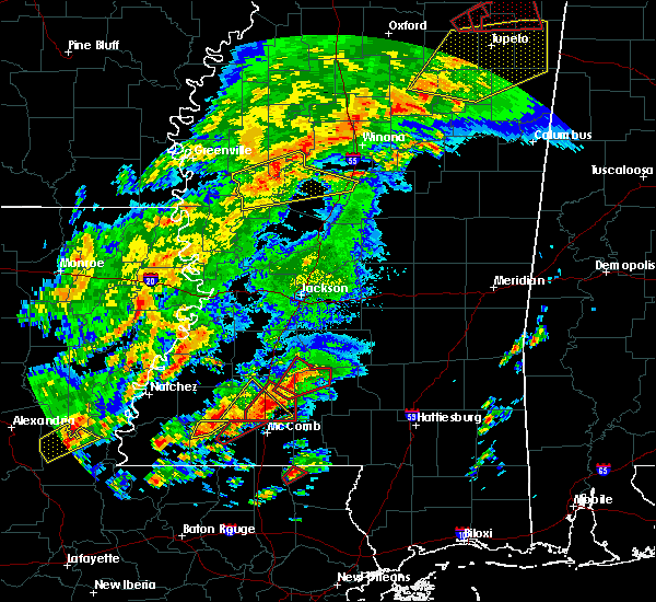 At 356 pm cst, a severe thunderstorm capable of producing a tornado was located over bogue chitto, or 10 miles south of brookhaven, moving northeast at 35 mph (radar indicated rotation). Hazards include tornado. Flying debris will be dangerous to those caught without shelter. mobile homes will be damaged or destroyed. damage to roofs, windows, and vehicles will occur. tree damage is likely. this dangerous storm will be near, enterprise around 405 pm cst. East lincoln around 415 pm cst. At 356 pm cst, a severe thunderstorm capable of producing a tornado was located over bogue chitto, or 10 miles south of brookhaven, moving northeast at 35 mph (radar indicated rotation). Hazards include tornado. Flying debris will be dangerous to those caught without shelter. mobile homes will be damaged or destroyed. damage to roofs, windows, and vehicles will occur. tree damage is likely. this dangerous storm will be near, enterprise around 405 pm cst. East lincoln around 415 pm cst.
|
| 12/16/2019 3:42 PM CST |
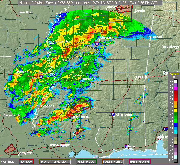 At 342 pm cst, a confirmed tornado was located near center point, or 9 miles northwest of mccomb, moving northeast at 45 mph (radar confirmed tornado). Hazards include damaging tornado and quarter size hail. Flying debris will be dangerous to those caught without shelter. mobile homes will be damaged or destroyed. damage to roofs, windows, and vehicles will occur. tree damage is likely. this tornado will be near, bogue chitto around 350 pm cst. enterprise and ruth around 400 pm cst. East lincoln around 405 pm cst. At 342 pm cst, a confirmed tornado was located near center point, or 9 miles northwest of mccomb, moving northeast at 45 mph (radar confirmed tornado). Hazards include damaging tornado and quarter size hail. Flying debris will be dangerous to those caught without shelter. mobile homes will be damaged or destroyed. damage to roofs, windows, and vehicles will occur. tree damage is likely. this tornado will be near, bogue chitto around 350 pm cst. enterprise and ruth around 400 pm cst. East lincoln around 405 pm cst.
|
| 12/16/2019 3:38 PM CST |
 At 338 pm cst, a severe thunderstorm capable of producing a tornado was located near center point, or 10 miles northwest of mccomb, moving northeast at 40 mph (radar indicated rotation). Hazards include tornado and quarter size hail. Flying debris will be dangerous to those caught without shelter. mobile homes will be damaged or destroyed. damage to roofs, windows, and vehicles will occur. tree damage is likely. this dangerous storm will be near, west lincoln around 345 pm cst. bogue chitto around 350 pm cst. enterprise and ruth around 400 pm cst. East lincoln around 405 pm cst. At 338 pm cst, a severe thunderstorm capable of producing a tornado was located near center point, or 10 miles northwest of mccomb, moving northeast at 40 mph (radar indicated rotation). Hazards include tornado and quarter size hail. Flying debris will be dangerous to those caught without shelter. mobile homes will be damaged or destroyed. damage to roofs, windows, and vehicles will occur. tree damage is likely. this dangerous storm will be near, west lincoln around 345 pm cst. bogue chitto around 350 pm cst. enterprise and ruth around 400 pm cst. East lincoln around 405 pm cst.
|
| 12/16/2019 3:24 PM CST |
 At 324 pm cst, a severe thunderstorm was located over smithdale, or 12 miles northeast of liberty, moving northeast at 45 mph (radar indicated). Hazards include two inch hail and 60 mph wind gusts. People and animals outdoors will be injured. expect hail damage to roofs, siding, windows, and vehicles. expect wind damage to roofs, siding, and trees. this severe thunderstorm will be near, center point around 335 pm cst. west lincoln around 340 pm cst. bogue chitto around 345 pm cst. enterprise around 355 pm cst. A tornado watch remains in effect until 600 pm cst for south central and southwestern mississippi. At 324 pm cst, a severe thunderstorm was located over smithdale, or 12 miles northeast of liberty, moving northeast at 45 mph (radar indicated). Hazards include two inch hail and 60 mph wind gusts. People and animals outdoors will be injured. expect hail damage to roofs, siding, windows, and vehicles. expect wind damage to roofs, siding, and trees. this severe thunderstorm will be near, center point around 335 pm cst. west lincoln around 340 pm cst. bogue chitto around 345 pm cst. enterprise around 355 pm cst. A tornado watch remains in effect until 600 pm cst for south central and southwestern mississippi.
|
| 12/16/2019 3:22 PM CST |
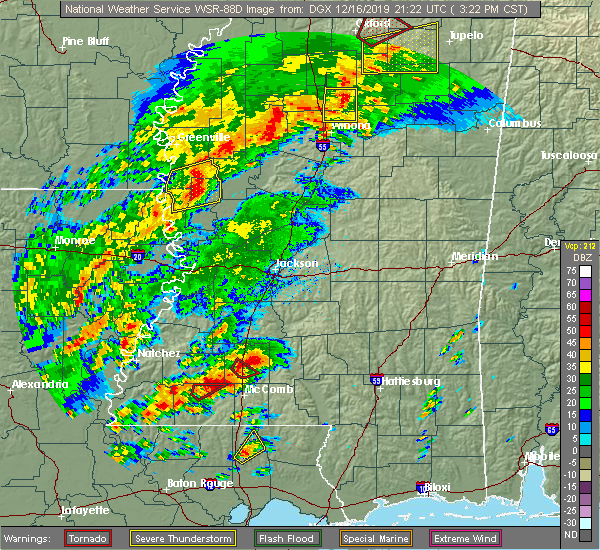 At 322 pm cst, a confirmed tornado was located over bogue chitto, or 8 miles south of brookhaven, moving northeast at 40 mph (weather spotters confirmed tornado). Hazards include damaging tornado and quarter size hail. Flying debris will be dangerous to those caught without shelter. mobile homes will be damaged or destroyed. damage to roofs, windows, and vehicles will occur. tree damage is likely. This tornado will be near, enterprise around 330 pm cst. At 322 pm cst, a confirmed tornado was located over bogue chitto, or 8 miles south of brookhaven, moving northeast at 40 mph (weather spotters confirmed tornado). Hazards include damaging tornado and quarter size hail. Flying debris will be dangerous to those caught without shelter. mobile homes will be damaged or destroyed. damage to roofs, windows, and vehicles will occur. tree damage is likely. This tornado will be near, enterprise around 330 pm cst.
|
| 12/16/2019 3:13 PM CST |
 At 312 pm cst, a confirmed large and extremely dangerous tornado was located near center point, or 12 miles northwest of mccomb, moving northeast at 35 mph. this is a particularly dangerous situation. take cover now! (radar confirmed tornado). Hazards include damaging tornado. You are in a life-threatening situation. flying debris may be deadly to those caught without shelter. mobile homes will be destroyed. considerable damage to homes, businesses, and vehicles is likely and complete destruction is possible. the tornado will be near, bogue chitto around 325 pm cst. Enterprise around 330 pm cst. At 312 pm cst, a confirmed large and extremely dangerous tornado was located near center point, or 12 miles northwest of mccomb, moving northeast at 35 mph. this is a particularly dangerous situation. take cover now! (radar confirmed tornado). Hazards include damaging tornado. You are in a life-threatening situation. flying debris may be deadly to those caught without shelter. mobile homes will be destroyed. considerable damage to homes, businesses, and vehicles is likely and complete destruction is possible. the tornado will be near, bogue chitto around 325 pm cst. Enterprise around 330 pm cst.
|
| 12/16/2019 3:08 PM CST |
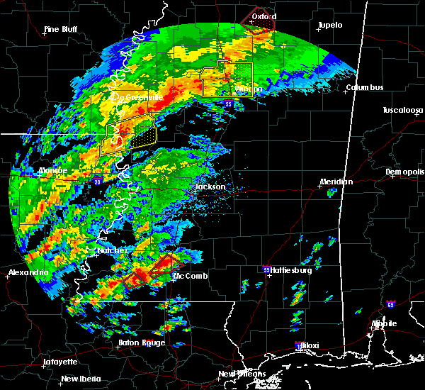 At 307 pm cst, a confirmed large and extremely dangerous tornado was located over center point, or 11 miles northwest of mccomb, moving northeast at 35 mph. this is a particularly dangerous situation. take cover now! (radar confirmed tornado). Hazards include damaging tornado. You are in a life-threatening situation. flying debris may be deadly to those caught without shelter. mobile homes will be destroyed. considerable damage to homes, businesses, and vehicles is likely and complete destruction is possible. the tornado will be near, west lincoln around 320 pm cst. bogue chitto around 325 pm cst. Enterprise around 335 pm cst. At 307 pm cst, a confirmed large and extremely dangerous tornado was located over center point, or 11 miles northwest of mccomb, moving northeast at 35 mph. this is a particularly dangerous situation. take cover now! (radar confirmed tornado). Hazards include damaging tornado. You are in a life-threatening situation. flying debris may be deadly to those caught without shelter. mobile homes will be destroyed. considerable damage to homes, businesses, and vehicles is likely and complete destruction is possible. the tornado will be near, west lincoln around 320 pm cst. bogue chitto around 325 pm cst. Enterprise around 335 pm cst.
|
| 12/16/2019 3:02 PM CST |
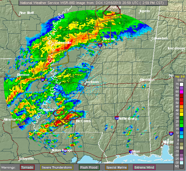 At 302 pm cst, a confirmed tornado was located over smithdale, or 12 miles northwest of mccomb, moving northeast at 40 mph (radar confirmed tornado). Hazards include damaging tornado and quarter size hail. Flying debris will be dangerous to those caught without shelter. mobile homes will be damaged or destroyed. damage to roofs, windows, and vehicles will occur. tree damage is likely. this tornado will be near, center point around 305 pm cst. west lincoln around 315 pm cst. bogue chitto around 320 pm cst. Enterprise around 325 pm cst. At 302 pm cst, a confirmed tornado was located over smithdale, or 12 miles northwest of mccomb, moving northeast at 40 mph (radar confirmed tornado). Hazards include damaging tornado and quarter size hail. Flying debris will be dangerous to those caught without shelter. mobile homes will be damaged or destroyed. damage to roofs, windows, and vehicles will occur. tree damage is likely. this tornado will be near, center point around 305 pm cst. west lincoln around 315 pm cst. bogue chitto around 320 pm cst. Enterprise around 325 pm cst.
|
| 12/16/2019 2:50 PM CST |
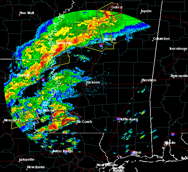 At 250 pm cst, a confirmed tornado was located near smithdale, or 8 miles north of liberty, moving northeast at 35 mph (radar confirmed tornado). Hazards include damaging tornado and half dollar size hail. Flying debris will be dangerous to those caught without shelter. mobile homes will be damaged or destroyed. damage to roofs, windows, and vehicles will occur. tree damage is likely. this tornadic storm will be near, little springs around 305 pm cst. center point around 310 pm cst. west lincoln around 325 pm cst. bogue chitto around 330 pm cst. Enterprise around 335 pm cst. At 250 pm cst, a confirmed tornado was located near smithdale, or 8 miles north of liberty, moving northeast at 35 mph (radar confirmed tornado). Hazards include damaging tornado and half dollar size hail. Flying debris will be dangerous to those caught without shelter. mobile homes will be damaged or destroyed. damage to roofs, windows, and vehicles will occur. tree damage is likely. this tornadic storm will be near, little springs around 305 pm cst. center point around 310 pm cst. west lincoln around 325 pm cst. bogue chitto around 330 pm cst. Enterprise around 335 pm cst.
|
| 10/30/2019 8:38 PM CDT |
 At 838 pm cdt, a severe thunderstorm was located near west lincoln, or 12 miles southwest of brookhaven, moving northeast at 25 mph (radar indicated). Hazards include 60 mph wind gusts. Expect damage to roofs, siding, and trees. this severe thunderstorm will be near, bogue chitto around 850 pm cdt. enterprise around 905 pm cdt. Brookhaven around 910 pm cdt. At 838 pm cdt, a severe thunderstorm was located near west lincoln, or 12 miles southwest of brookhaven, moving northeast at 25 mph (radar indicated). Hazards include 60 mph wind gusts. Expect damage to roofs, siding, and trees. this severe thunderstorm will be near, bogue chitto around 850 pm cdt. enterprise around 905 pm cdt. Brookhaven around 910 pm cdt.
|
| 10/4/2019 3:37 PM CDT |
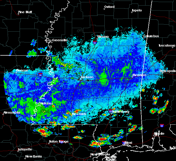 At 337 pm cdt, a severe thunderstorm was located over ruth, or 12 miles northeast of mccomb, moving southwest at 10 mph (radar indicated). Hazards include 60 mph wind gusts and quarter size hail. Hail damage to vehicles is expected. expect wind damage to roofs, siding, and trees. This severe thunderstorm will remain over mainly rural areas of southeastern lincoln and southwestern lawrence counties. At 337 pm cdt, a severe thunderstorm was located over ruth, or 12 miles northeast of mccomb, moving southwest at 10 mph (radar indicated). Hazards include 60 mph wind gusts and quarter size hail. Hail damage to vehicles is expected. expect wind damage to roofs, siding, and trees. This severe thunderstorm will remain over mainly rural areas of southeastern lincoln and southwestern lawrence counties.
|
| 7/14/2019 1:10 PM CDT |
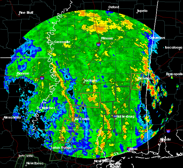 At 109 pm cdt, a severe thunderstorm was located over brookhaven, moving north at 40 mph (radar indicated). Hazards include 60 mph wind gusts. Expect damage to roofs, siding, and trees. this severe storm will be near, loyd star around 115 pm cdt. A tornado watch remains in effect until 700 pm cdt for central and south central mississippi. At 109 pm cdt, a severe thunderstorm was located over brookhaven, moving north at 40 mph (radar indicated). Hazards include 60 mph wind gusts. Expect damage to roofs, siding, and trees. this severe storm will be near, loyd star around 115 pm cdt. A tornado watch remains in effect until 700 pm cdt for central and south central mississippi.
|
| 7/14/2019 12:55 PM CDT |
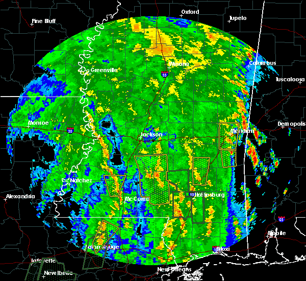 At 1255 pm cdt, a severe thunderstorm was located near bogue chitto, or 12 miles south of brookhaven, moving north at 40 mph (radar indicated). Hazards include 60 mph wind gusts. Expect damage to roofs, siding, and trees. this severe thunderstorm will be near, west lincoln around 100 pm cdt. enterprise around 105 pm cdt. vaughn around 110 pm cdt. brookhaven and loyd star around 115 pm cdt. A tornado watch remains in effect until 700 pm cdt for central and south central mississippi. At 1255 pm cdt, a severe thunderstorm was located near bogue chitto, or 12 miles south of brookhaven, moving north at 40 mph (radar indicated). Hazards include 60 mph wind gusts. Expect damage to roofs, siding, and trees. this severe thunderstorm will be near, west lincoln around 100 pm cdt. enterprise around 105 pm cdt. vaughn around 110 pm cdt. brookhaven and loyd star around 115 pm cdt. A tornado watch remains in effect until 700 pm cdt for central and south central mississippi.
|
| 7/7/2019 1:07 PM CDT |
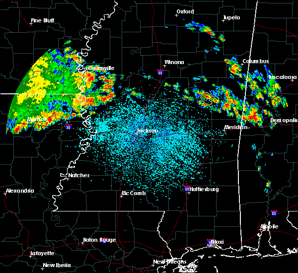 At 107 pm cdt, a severe thunderstorm was located near nanih waiya, moving southeast at 15 mph (radar indicated). Hazards include 60 mph wind gusts and quarter size hail. Hail damage to vehicles is expected. expect wind damage to roofs, siding, and trees. This severe storm will be near, nanih waiya around 125 pm cdt. At 107 pm cdt, a severe thunderstorm was located near nanih waiya, moving southeast at 15 mph (radar indicated). Hazards include 60 mph wind gusts and quarter size hail. Hail damage to vehicles is expected. expect wind damage to roofs, siding, and trees. This severe storm will be near, nanih waiya around 125 pm cdt.
|
| 7/7/2019 12:58 PM CDT |
 At 1258 pm cdt, a severe thunderstorm was located near stallo, or near nanih waiya, moving southeast at 15 mph (radar indicated). Hazards include 60 mph wind gusts and quarter size hail. Hail damage to vehicles is expected. expect wind damage to roofs, siding, and trees. this severe thunderstorm will be near, nanih waiya around 120 pm cdt. Other locations impacted by this severe thunderstorm include noxapater. At 1258 pm cdt, a severe thunderstorm was located near stallo, or near nanih waiya, moving southeast at 15 mph (radar indicated). Hazards include 60 mph wind gusts and quarter size hail. Hail damage to vehicles is expected. expect wind damage to roofs, siding, and trees. this severe thunderstorm will be near, nanih waiya around 120 pm cdt. Other locations impacted by this severe thunderstorm include noxapater.
|
| 6/20/2019 1:13 AM CDT |
 At 113 am cdt, severe thunderstorms were located along a line extending from near gholson to near forestdale to near philadelphia, moving east at 65 mph (radar indicated). Hazards include 60 mph wind gusts and quarter size hail. Hail damage to vehicles is expected. expect wind damage to roofs, siding, and trees. severe thunderstorms will be near, de kalb around 125 am cdt. damascus around 130 am cdt. liberty around 135 am cdt. electric mills around 140 am cdt. porterville around 150 am cdt. Other locations impacted by these severe thunderstorms include tucker and scooba. At 113 am cdt, severe thunderstorms were located along a line extending from near gholson to near forestdale to near philadelphia, moving east at 65 mph (radar indicated). Hazards include 60 mph wind gusts and quarter size hail. Hail damage to vehicles is expected. expect wind damage to roofs, siding, and trees. severe thunderstorms will be near, de kalb around 125 am cdt. damascus around 130 am cdt. liberty around 135 am cdt. electric mills around 140 am cdt. porterville around 150 am cdt. Other locations impacted by these severe thunderstorms include tucker and scooba.
|
| 6/20/2019 12:30 AM CDT |
 At 1230 am cdt, a severe thunderstorm was located over smyrna, or 9 miles southeast of kosciusko, moving east at 50 mph (radar indicated). Hazards include 60 mph wind gusts and quarter size hail. Hail damage to vehicles is expected. expect wind damage to roofs, siding, and trees. this severe thunderstorm will be near, zama around 1235 am cdt. stallo and burnside around 1255 am cdt. Nanih waiya around 105 am cdt. At 1230 am cdt, a severe thunderstorm was located over smyrna, or 9 miles southeast of kosciusko, moving east at 50 mph (radar indicated). Hazards include 60 mph wind gusts and quarter size hail. Hail damage to vehicles is expected. expect wind damage to roofs, siding, and trees. this severe thunderstorm will be near, zama around 1235 am cdt. stallo and burnside around 1255 am cdt. Nanih waiya around 105 am cdt.
|
| 6/7/2019 4:05 PM CDT |
 At 405 pm cdt, a severe thunderstorm was located over liberty, or 13 miles south of preston, moving east at 30 mph (radar indicated). Hazards include 60 mph wind gusts and quarter size hail. Hail damage to vehicles is expected. expect wind damage to roofs, siding, and trees. this severe storm will be near, prismatic around 415 pm cdt. De kalb and blackwater around 420 pm cdt. At 405 pm cdt, a severe thunderstorm was located over liberty, or 13 miles south of preston, moving east at 30 mph (radar indicated). Hazards include 60 mph wind gusts and quarter size hail. Hail damage to vehicles is expected. expect wind damage to roofs, siding, and trees. this severe storm will be near, prismatic around 415 pm cdt. De kalb and blackwater around 420 pm cdt.
|
| 6/7/2019 3:40 PM CDT |
 At 340 pm cdt, a severe thunderstorm was located over bethsaida, or 7 miles southeast of philadelphia, moving east at 30 mph (radar indicated). Hazards include 60 mph wind gusts and quarter size hail. Hail damage to vehicles is expected. expect wind damage to roofs, siding, and trees. this severe thunderstorm will be near, forestdale around 345 pm cdt. herbert springs around 350 pm cdt. damascus and bluff springs around 400 pm cdt. liberty and prismatic around 410 pm cdt. de kalb and blackwater around 420 pm cdt. Other locations impacted by this severe thunderstorm include tucker. At 340 pm cdt, a severe thunderstorm was located over bethsaida, or 7 miles southeast of philadelphia, moving east at 30 mph (radar indicated). Hazards include 60 mph wind gusts and quarter size hail. Hail damage to vehicles is expected. expect wind damage to roofs, siding, and trees. this severe thunderstorm will be near, forestdale around 345 pm cdt. herbert springs around 350 pm cdt. damascus and bluff springs around 400 pm cdt. liberty and prismatic around 410 pm cdt. de kalb and blackwater around 420 pm cdt. Other locations impacted by this severe thunderstorm include tucker.
|
| 5/9/2019 8:05 AM CDT |
 At 805 am cdt, severe thunderstorms were located along a line extending from near newport to near farmhaven to near annandale, moving east at 50 mph (radar indicated). Hazards include 60 mph wind gusts. Expect damage to roofs, siding, and trees. severe thunderstorms will be near, farmhaven and thomastown around 810 am cdt. goshen springs and singleton around 820 am cdt. carthage, pisgah and renfroe around 825 am cdt. edinburg, leesburg and tuscola around 830 am cdt. branch and ludlow around 835 am cdt. madden and forkville around 840 am cdt. pearl river, dowdville and burnside around 845 am cdt. philadelphia, harperville, dixon, stallo and hillsboro around 850 am cdt. Other locations impacted by these severe thunderstorms include lena, tucker, walnut grove, redwater, sebastopol and standing pine. At 805 am cdt, severe thunderstorms were located along a line extending from near newport to near farmhaven to near annandale, moving east at 50 mph (radar indicated). Hazards include 60 mph wind gusts. Expect damage to roofs, siding, and trees. severe thunderstorms will be near, farmhaven and thomastown around 810 am cdt. goshen springs and singleton around 820 am cdt. carthage, pisgah and renfroe around 825 am cdt. edinburg, leesburg and tuscola around 830 am cdt. branch and ludlow around 835 am cdt. madden and forkville around 840 am cdt. pearl river, dowdville and burnside around 845 am cdt. philadelphia, harperville, dixon, stallo and hillsboro around 850 am cdt. Other locations impacted by these severe thunderstorms include lena, tucker, walnut grove, redwater, sebastopol and standing pine.
|
| 4/18/2019 4:47 PM CDT |
 At 447 pm cdt, a severe thunderstorm capable of producing a tornado was located near de kalb, or 14 miles southeast of preston, moving northeast at 45 mph (radar indicated rotation). Hazards include tornado. Flying debris will be dangerous to those caught without shelter. mobile homes will be damaged or destroyed. damage to roofs, windows, and vehicles will occur. tree damage is likely. this dangerous storm will be near, electric mills around 455 pm cdt. Other locations impacted by this tornadic thunderstorm include scooba. At 447 pm cdt, a severe thunderstorm capable of producing a tornado was located near de kalb, or 14 miles southeast of preston, moving northeast at 45 mph (radar indicated rotation). Hazards include tornado. Flying debris will be dangerous to those caught without shelter. mobile homes will be damaged or destroyed. damage to roofs, windows, and vehicles will occur. tree damage is likely. this dangerous storm will be near, electric mills around 455 pm cdt. Other locations impacted by this tornadic thunderstorm include scooba.
|
| 4/18/2019 4:44 PM CDT |
 At 444 pm cdt, a severe thunderstorm capable of producing a tornado was located over burnside, or near philadelphia, moving northeast at 40 mph (radar indicated rotation). Hazards include tornado. Flying debris will be dangerous to those caught without shelter. mobile homes will be damaged or destroyed. damage to roofs, windows, and vehicles will occur. tree damage is likely. this dangerous storm will be near, nanih waiya around 500 pm cdt. millcreek around 520 pm cdt. mashulaville around 525 pm cdt. brooksville around 545 pm cdt. Other locations impacted by this tornadic thunderstorm include noxapater. At 444 pm cdt, a severe thunderstorm capable of producing a tornado was located over burnside, or near philadelphia, moving northeast at 40 mph (radar indicated rotation). Hazards include tornado. Flying debris will be dangerous to those caught without shelter. mobile homes will be damaged or destroyed. damage to roofs, windows, and vehicles will occur. tree damage is likely. this dangerous storm will be near, nanih waiya around 500 pm cdt. millcreek around 520 pm cdt. mashulaville around 525 pm cdt. brooksville around 545 pm cdt. Other locations impacted by this tornadic thunderstorm include noxapater.
|
| 4/18/2019 4:41 PM CDT | Tree on a house with several roads blocked by trees south of tow in kemper county MS, 5.1 miles SW of Bogue Chitto, MS |
| 4/18/2019 4:35 PM CDT |
 At 435 pm cdt, a severe thunderstorm capable of producing a tornado was located near liberty, or 10 miles northwest of meridian station, moving northeast at 55 mph (radar indicated rotation). Hazards include tornado. Flying debris will be dangerous to those caught without shelter. mobile homes will be damaged or destroyed. damage to roofs, windows, and vehicles will occur. tree damage is likely. this dangerous storm will be near, de kalb around 440 pm cdt. electric mills around 450 pm cdt. Other locations impacted by this tornadic thunderstorm include scooba. At 435 pm cdt, a severe thunderstorm capable of producing a tornado was located near liberty, or 10 miles northwest of meridian station, moving northeast at 55 mph (radar indicated rotation). Hazards include tornado. Flying debris will be dangerous to those caught without shelter. mobile homes will be damaged or destroyed. damage to roofs, windows, and vehicles will occur. tree damage is likely. this dangerous storm will be near, de kalb around 440 pm cdt. electric mills around 450 pm cdt. Other locations impacted by this tornadic thunderstorm include scooba.
|
| 4/18/2019 4:32 PM CDT |
 At 431 pm cdt, a severe thunderstorm capable of producing a tornado was located over pearl river, or near edinburg, moving northeast at 35 mph (radar indicated rotation). Hazards include tornado. Flying debris will be dangerous to those caught without shelter. mobile homes will be damaged or destroyed. damage to roofs, windows, and vehicles will occur. tree damage is likely. this dangerous storm will be near, philadelphia around 435 pm cdt. Burnside and stallo around 445 pm cdt. At 431 pm cdt, a severe thunderstorm capable of producing a tornado was located over pearl river, or near edinburg, moving northeast at 35 mph (radar indicated rotation). Hazards include tornado. Flying debris will be dangerous to those caught without shelter. mobile homes will be damaged or destroyed. damage to roofs, windows, and vehicles will occur. tree damage is likely. this dangerous storm will be near, philadelphia around 435 pm cdt. Burnside and stallo around 445 pm cdt.
|
| 4/18/2019 4:21 PM CDT |
 At 420 pm cdt, severe thunderstorms were located along a line extending from near singleton to madden, moving northeast at 35 mph. in addition, a tornado warning remains in effect for leake and neshoba counties (radar indicated). Hazards include 60 mph wind gusts. Expect damage to roofs, siding, and trees. locations impacted include, philadelphia, carthage, nanih waiya, edinburg, pearl river, neshoba, herbert springs, bethsaida, house, renfroe, dowdville, burnside, madden, singleton, forestdale, dixon, stallo and tucker. A tornado watch remains in effect until 900 pm cdt for central and east central mississippi. At 420 pm cdt, severe thunderstorms were located along a line extending from near singleton to madden, moving northeast at 35 mph. in addition, a tornado warning remains in effect for leake and neshoba counties (radar indicated). Hazards include 60 mph wind gusts. Expect damage to roofs, siding, and trees. locations impacted include, philadelphia, carthage, nanih waiya, edinburg, pearl river, neshoba, herbert springs, bethsaida, house, renfroe, dowdville, burnside, madden, singleton, forestdale, dixon, stallo and tucker. A tornado watch remains in effect until 900 pm cdt for central and east central mississippi.
|
| 4/18/2019 4:20 PM CDT |
 At 420 pm cdt, a severe thunderstorm capable of producing a tornado was located over madden, or 8 miles south of edinburg, moving east at 30 mph (radar indicated rotation). Hazards include tornado. Flying debris will be dangerous to those caught without shelter. mobile homes will be damaged or destroyed. damage to roofs, windows, and vehicles will occur. tree damage is likely. this dangerous storm will be near, dixon around 430 pm cdt. pearl river around 435 pm cdt. philadelphia and neshoba around 440 pm cdt. bethsaida around 445 pm cdt. Other locations impacted by this tornadic thunderstorm include tucker. At 420 pm cdt, a severe thunderstorm capable of producing a tornado was located over madden, or 8 miles south of edinburg, moving east at 30 mph (radar indicated rotation). Hazards include tornado. Flying debris will be dangerous to those caught without shelter. mobile homes will be damaged or destroyed. damage to roofs, windows, and vehicles will occur. tree damage is likely. this dangerous storm will be near, dixon around 430 pm cdt. pearl river around 435 pm cdt. philadelphia and neshoba around 440 pm cdt. bethsaida around 445 pm cdt. Other locations impacted by this tornadic thunderstorm include tucker.
|
| 4/18/2019 4:15 PM CDT |
 At 415 pm cdt, a confirmed tornado was located near madden, or 7 miles southeast of carthage, moving east at 35 mph (radar confirmed tornado). Hazards include damaging tornado. Flying debris will be dangerous to those caught without shelter. mobile homes will be damaged or destroyed. damage to roofs, windows, and vehicles will occur. tree damage is likely. this tornado will be near, madden around 420 pm cdt. edinburg and dowdville around 425 pm cdt. pearl river and dixon around 435 pm cdt. philadelphia around 440 pm cdt. burnside around 445 pm cdt. Other locations impacted by this tornadic thunderstorm include tucker, standing pine and walnut grove. At 415 pm cdt, a confirmed tornado was located near madden, or 7 miles southeast of carthage, moving east at 35 mph (radar confirmed tornado). Hazards include damaging tornado. Flying debris will be dangerous to those caught without shelter. mobile homes will be damaged or destroyed. damage to roofs, windows, and vehicles will occur. tree damage is likely. this tornado will be near, madden around 420 pm cdt. edinburg and dowdville around 425 pm cdt. pearl river and dixon around 435 pm cdt. philadelphia around 440 pm cdt. burnside around 445 pm cdt. Other locations impacted by this tornadic thunderstorm include tucker, standing pine and walnut grove.
|
| 4/18/2019 4:12 PM CDT |
 At 411 pm cdt, a severe thunderstorm capable of producing a tornado was located near little rock, or 17 miles east of prospect, moving northeast at 60 mph (radar indicated rotation). Hazards include tornado. Flying debris will be dangerous to those caught without shelter. mobile homes will be damaged or destroyed. damage to roofs, windows, and vehicles will occur. tree damage is likely. this dangerous storm will be near, martin around 415 pm cdt. liberty, damascus and prismatic around 425 pm cdt. bluff springs and blackwater around 430 pm cdt. de kalb around 435 pm cdt. electric mills around 445 pm cdt. Other locations impacted by this tornadic thunderstorm include scooba. At 411 pm cdt, a severe thunderstorm capable of producing a tornado was located near little rock, or 17 miles east of prospect, moving northeast at 60 mph (radar indicated rotation). Hazards include tornado. Flying debris will be dangerous to those caught without shelter. mobile homes will be damaged or destroyed. damage to roofs, windows, and vehicles will occur. tree damage is likely. this dangerous storm will be near, martin around 415 pm cdt. liberty, damascus and prismatic around 425 pm cdt. bluff springs and blackwater around 430 pm cdt. de kalb around 435 pm cdt. electric mills around 445 pm cdt. Other locations impacted by this tornadic thunderstorm include scooba.
|
| 4/18/2019 4:09 PM CDT |
 At 409 pm cdt, severe thunderstorms were located along a line extending from near neshoba to duffee to near meehan, moving east at 55 mph (radar indicated). Hazards include 60 mph wind gusts. Expect damage to roofs, siding, and trees. severe thunderstorms will be near, damascus around 420 pm cdt. liberty and prismatic around 425 pm cdt. blackwater around 430 pm cdt. preston and bluff springs around 435 pm cdt. de kalb and tamola around 440 pm cdt. porterville and electric mills around 445 pm cdt. other locations impacted by these severe thunderstorms include scooba. A tornado watch remains in effect until 900 pm cdt for east central mississippi. At 409 pm cdt, severe thunderstorms were located along a line extending from near neshoba to duffee to near meehan, moving east at 55 mph (radar indicated). Hazards include 60 mph wind gusts. Expect damage to roofs, siding, and trees. severe thunderstorms will be near, damascus around 420 pm cdt. liberty and prismatic around 425 pm cdt. blackwater around 430 pm cdt. preston and bluff springs around 435 pm cdt. de kalb and tamola around 440 pm cdt. porterville and electric mills around 445 pm cdt. other locations impacted by these severe thunderstorms include scooba. A tornado watch remains in effect until 900 pm cdt for east central mississippi.
|
| 4/18/2019 4:08 PM CDT |
 At 408 pm cdt, a severe thunderstorm capable of producing a tornado was located near madden, or 8 miles southeast of carthage, moving northeast at 30 mph (radar indicated rotation). Hazards include tornado. Flying debris will be dangerous to those caught without shelter. mobile homes will be damaged or destroyed. damage to roofs, windows, and vehicles will occur. tree damage is likely. this dangerous storm will be near, madden around 415 pm cdt. dowdville around 420 pm cdt. edinburg and dixon around 425 pm cdt. pearl river around 435 pm cdt. philadelphia around 440 pm cdt. burnside and stallo around 445 pm cdt. Other locations impacted by this tornadic thunderstorm include tucker, standing pine and walnut grove. At 408 pm cdt, a severe thunderstorm capable of producing a tornado was located near madden, or 8 miles southeast of carthage, moving northeast at 30 mph (radar indicated rotation). Hazards include tornado. Flying debris will be dangerous to those caught without shelter. mobile homes will be damaged or destroyed. damage to roofs, windows, and vehicles will occur. tree damage is likely. this dangerous storm will be near, madden around 415 pm cdt. dowdville around 420 pm cdt. edinburg and dixon around 425 pm cdt. pearl river around 435 pm cdt. philadelphia around 440 pm cdt. burnside and stallo around 445 pm cdt. Other locations impacted by this tornadic thunderstorm include tucker, standing pine and walnut grove.
|
| 4/18/2019 4:00 PM CDT |
 At 400 pm cdt, severe thunderstorms were located along a line extending from near thomastown to near prospect, moving northeast at 40 mph. a tornado warning remains in effect for much of the severe thunderstorm warning area (radar indicated). Hazards include 60 mph wind gusts. Expect damage to roofs, siding, and trees. these severe storms will be near, neshoba and dixon around 415 pm cdt. singleton and renfroe around 420 pm cdt. bethsaida and house around 425 pm cdt. forestdale around 440 pm cdt. other locations impacted by these severe thunderstorms include lena, tucker, walnut grove, redwater and standing pine. a tornado watch remains in effect until 700 pm cdt for central mississippi. A tornado watch also remains in effect until 900 pm cdt for central and east central mississippi. At 400 pm cdt, severe thunderstorms were located along a line extending from near thomastown to near prospect, moving northeast at 40 mph. a tornado warning remains in effect for much of the severe thunderstorm warning area (radar indicated). Hazards include 60 mph wind gusts. Expect damage to roofs, siding, and trees. these severe storms will be near, neshoba and dixon around 415 pm cdt. singleton and renfroe around 420 pm cdt. bethsaida and house around 425 pm cdt. forestdale around 440 pm cdt. other locations impacted by these severe thunderstorms include lena, tucker, walnut grove, redwater and standing pine. a tornado watch remains in effect until 700 pm cdt for central mississippi. A tornado watch also remains in effect until 900 pm cdt for central and east central mississippi.
|
| 4/18/2019 3:50 PM CDT |
 At 349 pm cdt, a severe thunderstorm capable of producing a tornado was located over harperville, moving northeast at 40 mph (radar indicated rotation). Hazards include tornado. Flying debris will be dangerous to those caught without shelter. mobile homes will be damaged or destroyed. damage to roofs, windows, and vehicles will occur. tree damage is likely. this dangerous storm will be near, madden and dowdville around 415 pm cdt. dixon around 420 pm cdt. edinburg around 425 pm cdt. philadelphia and pearl river around 430 pm cdt. burnside around 440 pm cdt. stallo around 445 pm cdt. Other locations impacted by this tornadic thunderstorm include tucker, standing pine and walnut grove. At 349 pm cdt, a severe thunderstorm capable of producing a tornado was located over harperville, moving northeast at 40 mph (radar indicated rotation). Hazards include tornado. Flying debris will be dangerous to those caught without shelter. mobile homes will be damaged or destroyed. damage to roofs, windows, and vehicles will occur. tree damage is likely. this dangerous storm will be near, madden and dowdville around 415 pm cdt. dixon around 420 pm cdt. edinburg around 425 pm cdt. philadelphia and pearl river around 430 pm cdt. burnside around 440 pm cdt. stallo around 445 pm cdt. Other locations impacted by this tornadic thunderstorm include tucker, standing pine and walnut grove.
|
| 4/18/2019 3:28 PM CDT |
 At 327 pm cdt, severe thunderstorms were located along a line extending from near canton to near pulaski, moving northeast at 40 mph. a tornado warning remains in effect for much of northeastern rankin, northeastern madison, and leake counties (radar indicated). Hazards include 60 mph wind gusts. Expect damage to roofs, siding, and trees. severe thunderstorms will be near, farmhaven around 345 pm cdt. camden around 350 pm cdt. carthage and thomastown around 410 pm cdt. neshoba and dixon around 415 pm cdt. singleton and renfroe around 420 pm cdt. bethsaida and house around 425 pm cdt. forestdale around 435 pm cdt. other locations impacted by these severe thunderstorms include lena, tucker, walnut grove, redwater and standing pine. a tornado watch remains in effect until 700 pm cdt for central mississippi. A tornado watch also remains in effect until 900 pm cdt for central and east central mississippi. At 327 pm cdt, severe thunderstorms were located along a line extending from near canton to near pulaski, moving northeast at 40 mph. a tornado warning remains in effect for much of northeastern rankin, northeastern madison, and leake counties (radar indicated). Hazards include 60 mph wind gusts. Expect damage to roofs, siding, and trees. severe thunderstorms will be near, farmhaven around 345 pm cdt. camden around 350 pm cdt. carthage and thomastown around 410 pm cdt. neshoba and dixon around 415 pm cdt. singleton and renfroe around 420 pm cdt. bethsaida and house around 425 pm cdt. forestdale around 435 pm cdt. other locations impacted by these severe thunderstorms include lena, tucker, walnut grove, redwater and standing pine. a tornado watch remains in effect until 700 pm cdt for central mississippi. A tornado watch also remains in effect until 900 pm cdt for central and east central mississippi.
|
| 4/18/2019 2:39 PM CDT | Swath of tree damage along pleasant hill rd north of ruth. several trees fell on a building. possible tornad in lincoln county MS, 8.9 miles W of Bogue Chitto, MS |
| 4/18/2019 2:36 PM CDT |
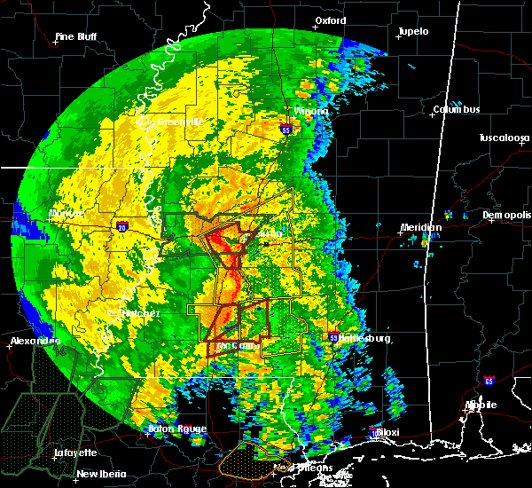 At 235 pm cdt, a severe thunderstorm capable of producing a tornado was located near ruth, or 12 miles southeast of brookhaven, moving northeast at 45 mph (radar indicated rotation). Hazards include tornado. Flying debris will be dangerous to those caught without shelter. mobile homes will be damaged or destroyed. damage to roofs, windows, and vehicles will occur. tree damage is likely. This tornadic thunderstorm will impact the ruth area over the next several minutes. At 235 pm cdt, a severe thunderstorm capable of producing a tornado was located near ruth, or 12 miles southeast of brookhaven, moving northeast at 45 mph (radar indicated rotation). Hazards include tornado. Flying debris will be dangerous to those caught without shelter. mobile homes will be damaged or destroyed. damage to roofs, windows, and vehicles will occur. tree damage is likely. This tornadic thunderstorm will impact the ruth area over the next several minutes.
|
| 4/18/2019 2:26 PM CDT |
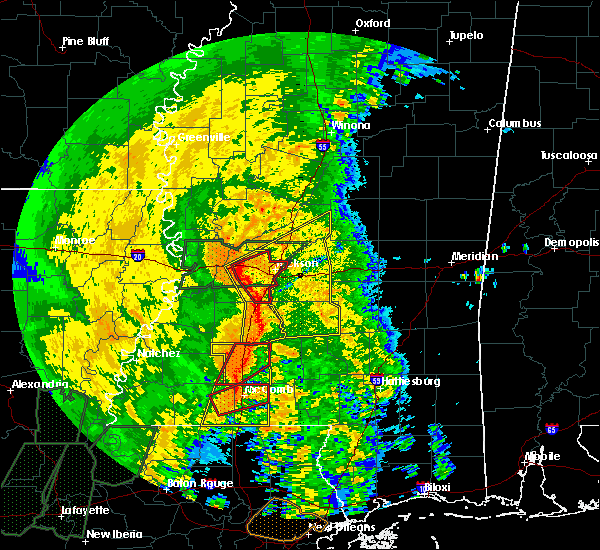 At 225 pm cdt, a severe thunderstorm capable of producing a tornado was located near bogue chitto, or 9 miles north of mccomb, moving northeast at 45 mph (radar indicated rotation). Hazards include tornado. Flying debris will be dangerous to those caught without shelter. mobile homes will be damaged or destroyed. damage to roofs, windows, and vehicles will occur. tree damage is likely. Locations impacted include, brookhaven, enterprise and bogue chitto. At 225 pm cdt, a severe thunderstorm capable of producing a tornado was located near bogue chitto, or 9 miles north of mccomb, moving northeast at 45 mph (radar indicated rotation). Hazards include tornado. Flying debris will be dangerous to those caught without shelter. mobile homes will be damaged or destroyed. damage to roofs, windows, and vehicles will occur. tree damage is likely. Locations impacted include, brookhaven, enterprise and bogue chitto.
|
| 4/18/2019 2:25 PM CDT | Tree down near the intersection of hwy 51 and argyle trai in lincoln county MS, 4.6 miles S of Bogue Chitto, MS |
| 4/18/2019 2:18 PM CDT |
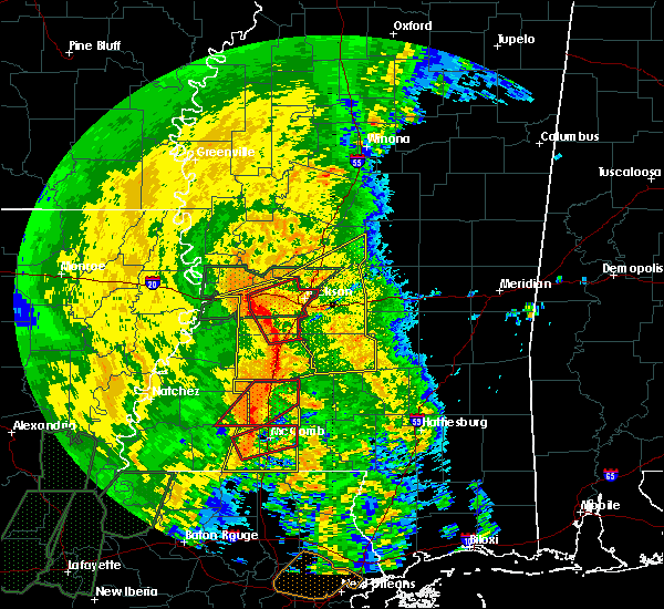 At 217 pm cdt, a severe thunderstorm capable of producing a tornado was located over center point, or 11 miles northwest of mccomb, moving northeast at 45 mph (radar indicated rotation). Hazards include tornado. Flying debris will be dangerous to those caught without shelter. mobile homes will be damaged or destroyed. damage to roofs, windows, and vehicles will occur. tree damage is likely. this dangerous storm will be near, west lincoln around 225 pm cdt. bogue chitto around 230 pm cdt. Enterprise around 240 pm cdt. At 217 pm cdt, a severe thunderstorm capable of producing a tornado was located over center point, or 11 miles northwest of mccomb, moving northeast at 45 mph (radar indicated rotation). Hazards include tornado. Flying debris will be dangerous to those caught without shelter. mobile homes will be damaged or destroyed. damage to roofs, windows, and vehicles will occur. tree damage is likely. this dangerous storm will be near, west lincoln around 225 pm cdt. bogue chitto around 230 pm cdt. Enterprise around 240 pm cdt.
|
| 4/18/2019 1:57 PM CDT |
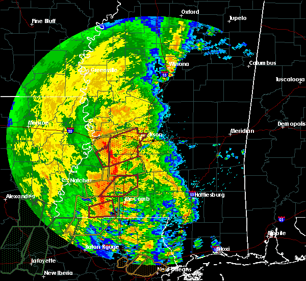 At 157 pm cdt, a severe thunderstorm capable of producing a tornado was located 8 miles southwest of smithdale, or 9 miles north of liberty, moving northeast at 45 mph (radar indicated rotation). Hazards include tornado. Flying debris will be dangerous to those caught without shelter. mobile homes will be damaged or destroyed. damage to roofs, windows, and vehicles will occur. tree damage is likely. this dangerous storm will be near, little springs around 210 pm cdt. center point and mccall creek around 215 pm cdt. west lincoln and bogue chitto around 225 pm cdt. vaughn and loyd star around 230 pm cdt. Brookhaven around 235 pm cdt. At 157 pm cdt, a severe thunderstorm capable of producing a tornado was located 8 miles southwest of smithdale, or 9 miles north of liberty, moving northeast at 45 mph (radar indicated rotation). Hazards include tornado. Flying debris will be dangerous to those caught without shelter. mobile homes will be damaged or destroyed. damage to roofs, windows, and vehicles will occur. tree damage is likely. this dangerous storm will be near, little springs around 210 pm cdt. center point and mccall creek around 215 pm cdt. west lincoln and bogue chitto around 225 pm cdt. vaughn and loyd star around 230 pm cdt. Brookhaven around 235 pm cdt.
|
| 4/18/2019 1:43 PM CDT |
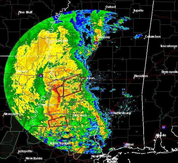 At 143 pm cdt, severe thunderstorms were located along a line extending from new hope to near gloster, moving east at 40 mph (radar indicated). Hazards include 60 mph wind gusts. expect damage to roofs, siding, and trees At 143 pm cdt, severe thunderstorms were located along a line extending from new hope to near gloster, moving east at 40 mph (radar indicated). Hazards include 60 mph wind gusts. expect damage to roofs, siding, and trees
|
| 4/13/2019 10:41 PM CDT |
 The severe thunderstorm warning for central newton and southeastern neshoba counties will expire at 1045 pm cdt, the storms which prompted the warning have weakened below severe limits, and have exited the warned area. therefore, the warning will be allowed to expire. however gusty winds and heavy rain are still possible with these thunderstorms. a tornado watch remains in effect until 300 am cdt for east central mississippi. The severe thunderstorm warning for central newton and southeastern neshoba counties will expire at 1045 pm cdt, the storms which prompted the warning have weakened below severe limits, and have exited the warned area. therefore, the warning will be allowed to expire. however gusty winds and heavy rain are still possible with these thunderstorms. a tornado watch remains in effect until 300 am cdt for east central mississippi.
|
| 4/13/2019 10:04 PM CDT |
 At 1004 pm cdt, severe thunderstorms were located along a line extending from near stratton to lawrence, moving northeast at 45 mph (radar indicated). Hazards include 60 mph wind gusts. Expect damage to roofs, siding, and trees. severe thunderstorms will be near, neshoba around 1015 pm cdt. stratton around 1020 pm cdt. bethsaida around 1025 pm cdt. little rock and duffee around 1030 pm cdt. forestdale and house around 1035 pm cdt. herbert springs around 1040 pm cdt. other locations impacted by these severe thunderstorms include tucker. A tornado watch remains in effect until 300 am cdt for east central mississippi. At 1004 pm cdt, severe thunderstorms were located along a line extending from near stratton to lawrence, moving northeast at 45 mph (radar indicated). Hazards include 60 mph wind gusts. Expect damage to roofs, siding, and trees. severe thunderstorms will be near, neshoba around 1015 pm cdt. stratton around 1020 pm cdt. bethsaida around 1025 pm cdt. little rock and duffee around 1030 pm cdt. forestdale and house around 1035 pm cdt. herbert springs around 1040 pm cdt. other locations impacted by these severe thunderstorms include tucker. A tornado watch remains in effect until 300 am cdt for east central mississippi.
|
| 4/6/2019 6:22 PM CDT |
 At 622 pm cdt, a severe thunderstorm was located near bluff springs, or 8 miles south of preston, moving east at 30 mph (radar indicated). Hazards include 60 mph wind gusts and penny size hail. Expect damage to roofs, siding, and trees. this severe storm will be near, preston and bluff springs around 630 pm cdt. de kalb around 645 pm cdt. Other locations impacted by this severe thunderstorm include tucker. At 622 pm cdt, a severe thunderstorm was located near bluff springs, or 8 miles south of preston, moving east at 30 mph (radar indicated). Hazards include 60 mph wind gusts and penny size hail. Expect damage to roofs, siding, and trees. this severe storm will be near, preston and bluff springs around 630 pm cdt. de kalb around 645 pm cdt. Other locations impacted by this severe thunderstorm include tucker.
|
| 4/6/2019 6:02 PM CDT |
 At 602 pm cdt, a severe thunderstorm was located near neshoba, or 7 miles south of philadelphia, moving northeast at 45 mph (radar indicated). Hazards include 60 mph wind gusts and quarter size hail. Hail damage to vehicles is expected. expect wind damage to roofs, siding, and trees. this severe thunderstorm will be near, bethsaida and house around 610 pm cdt. forestdale around 620 pm cdt. bluff springs around 625 pm cdt. preston around 630 pm cdt. de kalb around 635 pm cdt. Other locations impacted by this severe thunderstorm include tucker. At 602 pm cdt, a severe thunderstorm was located near neshoba, or 7 miles south of philadelphia, moving northeast at 45 mph (radar indicated). Hazards include 60 mph wind gusts and quarter size hail. Hail damage to vehicles is expected. expect wind damage to roofs, siding, and trees. this severe thunderstorm will be near, bethsaida and house around 610 pm cdt. forestdale around 620 pm cdt. bluff springs around 625 pm cdt. preston around 630 pm cdt. de kalb around 635 pm cdt. Other locations impacted by this severe thunderstorm include tucker.
|
| 3/14/2019 2:49 PM CDT | Half Dollar sized hail reported 4.2 miles NW of Bogue Chitto, MS, corrects time of previous hail report from 3 n cleveland. hail slightly larger than quarter size fell near joe williams field. |
| 3/14/2019 2:48 PM CDT |
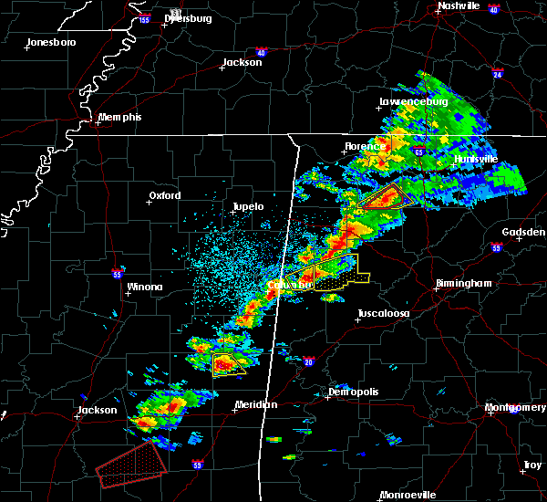 At 248 pm cdt, a severe thunderstorm was located over bluff springs, or near preston, moving northeast at 45 mph (radar indicated). Hazards include tennis ball size hail and 60 mph wind gusts. People and animals outdoors will be injured. expect hail damage to roofs, siding, windows, and vehicles. expect wind damage to roofs, siding, and trees. this severe storm will be near, de kalb around 255 pm cdt. A tornado watch remains in effect until 700 pm cdt for east central mississippi. At 248 pm cdt, a severe thunderstorm was located over bluff springs, or near preston, moving northeast at 45 mph (radar indicated). Hazards include tennis ball size hail and 60 mph wind gusts. People and animals outdoors will be injured. expect hail damage to roofs, siding, windows, and vehicles. expect wind damage to roofs, siding, and trees. this severe storm will be near, de kalb around 255 pm cdt. A tornado watch remains in effect until 700 pm cdt for east central mississippi.
|
| 3/14/2019 2:41 PM CDT |
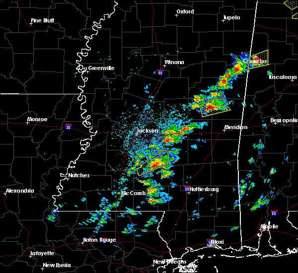 At 241 pm cdt, a severe thunderstorm was located over forestdale, or 8 miles southwest of preston, moving northeast at 45 mph (radar indicated). Hazards include tennis ball size hail and 60 mph wind gusts. People and animals outdoors will be injured. expect hail damage to roofs, siding, windows, and vehicles. expect wind damage to roofs, siding, and trees. this severe storm will be near, bluff springs around 245 pm cdt. preston around 250 pm cdt. de kalb around 300 pm cdt. A tornado watch remains in effect until 700 pm cdt for east central mississippi. At 241 pm cdt, a severe thunderstorm was located over forestdale, or 8 miles southwest of preston, moving northeast at 45 mph (radar indicated). Hazards include tennis ball size hail and 60 mph wind gusts. People and animals outdoors will be injured. expect hail damage to roofs, siding, windows, and vehicles. expect wind damage to roofs, siding, and trees. this severe storm will be near, bluff springs around 245 pm cdt. preston around 250 pm cdt. de kalb around 300 pm cdt. A tornado watch remains in effect until 700 pm cdt for east central mississippi.
|
| 3/14/2019 2:33 PM CDT |
 At 233 pm cdt, a severe thunderstorm was located near forestdale, or near philadelphia, moving northeast at 45 mph (radar indicated). Hazards include two inch hail and 60 mph wind gusts. People and animals outdoors will be injured. expect hail damage to roofs, siding, windows, and vehicles. expect wind damage to roofs, siding, and trees. this severe storm will be near, preston and bluff springs around 250 pm cdt. de kalb around 300 pm cdt. other locations impacted by this severe thunderstorm include tucker. A tornado watch remains in effect until 700 pm cdt for east central mississippi. At 233 pm cdt, a severe thunderstorm was located near forestdale, or near philadelphia, moving northeast at 45 mph (radar indicated). Hazards include two inch hail and 60 mph wind gusts. People and animals outdoors will be injured. expect hail damage to roofs, siding, windows, and vehicles. expect wind damage to roofs, siding, and trees. this severe storm will be near, preston and bluff springs around 250 pm cdt. de kalb around 300 pm cdt. other locations impacted by this severe thunderstorm include tucker. A tornado watch remains in effect until 700 pm cdt for east central mississippi.
|
| 3/14/2019 2:27 PM CDT |
 At 227 pm cdt, a severe thunderstorm was located near bethsaida, or near philadelphia, moving northeast at 45 mph (radar indicated). Hazards include golf ball size hail and 60 mph wind gusts. People and animals outdoors will be injured. expect hail damage to roofs, siding, windows, and vehicles. expect wind damage to roofs, siding, and trees. this severe storm will be near, forestdale around 240 pm cdt. preston and bluff springs around 250 pm cdt. de kalb around 300 pm cdt. other locations impacted by this severe thunderstorm include tucker. A tornado watch remains in effect until 700 pm cdt for east central mississippi. At 227 pm cdt, a severe thunderstorm was located near bethsaida, or near philadelphia, moving northeast at 45 mph (radar indicated). Hazards include golf ball size hail and 60 mph wind gusts. People and animals outdoors will be injured. expect hail damage to roofs, siding, windows, and vehicles. expect wind damage to roofs, siding, and trees. this severe storm will be near, forestdale around 240 pm cdt. preston and bluff springs around 250 pm cdt. de kalb around 300 pm cdt. other locations impacted by this severe thunderstorm include tucker. A tornado watch remains in effect until 700 pm cdt for east central mississippi.
|
| 3/14/2019 2:21 PM CDT |
 At 220 pm cdt, a severe thunderstorm was located near dixon, or 7 miles southwest of philadelphia, moving northeast at 45 mph (radar indicated). Hazards include 60 mph wind gusts and quarter size hail. Hail damage to vehicles is expected. expect wind damage to roofs, siding, and trees. this severe thunderstorm will be near, philadelphia around 225 pm cdt. bethsaida around 230 pm cdt. forestdale around 240 pm cdt. bluff springs around 250 pm cdt. preston around 255 pm cdt. de kalb around 300 pm cdt. other locations impacted by this severe thunderstorm include tucker. A tornado watch remains in effect until 700 pm cdt for east central mississippi. At 220 pm cdt, a severe thunderstorm was located near dixon, or 7 miles southwest of philadelphia, moving northeast at 45 mph (radar indicated). Hazards include 60 mph wind gusts and quarter size hail. Hail damage to vehicles is expected. expect wind damage to roofs, siding, and trees. this severe thunderstorm will be near, philadelphia around 225 pm cdt. bethsaida around 230 pm cdt. forestdale around 240 pm cdt. bluff springs around 250 pm cdt. preston around 255 pm cdt. de kalb around 300 pm cdt. other locations impacted by this severe thunderstorm include tucker. A tornado watch remains in effect until 700 pm cdt for east central mississippi.
|
| 3/14/2019 1:49 PM CDT | Half Dollar sized hail reported 4.2 miles NW of Bogue Chitto, MS, hail slightly larger than quarter size fell near joe williams field. |
| 2/23/2019 4:49 PM CST |
 At 448 pm cst, a severe thunderstorm capable of producing a tornado was located over bluff springs, or 7 miles south of preston, moving northeast at 40 mph (radar indicated rotation). Hazards include tornado. Flying debris will be dangerous to those caught without shelter. mobile homes will be damaged or destroyed. damage to roofs, windows, and vehicles will occur. tree damage is likely. This tornadic thunderstorm will remain over mainly rural areas of northern kemper county, including the following locations, scooba. At 448 pm cst, a severe thunderstorm capable of producing a tornado was located over bluff springs, or 7 miles south of preston, moving northeast at 40 mph (radar indicated rotation). Hazards include tornado. Flying debris will be dangerous to those caught without shelter. mobile homes will be damaged or destroyed. damage to roofs, windows, and vehicles will occur. tree damage is likely. This tornadic thunderstorm will remain over mainly rural areas of northern kemper county, including the following locations, scooba.
|
| 2/23/2019 4:24 PM CST |
 At 424 pm cst, a severe thunderstorm capable of producing a tornado was located near bethsaida, or 8 miles south of philadelphia, moving northeast at 40 mph (radar indicated rotation). Hazards include tornado. Flying debris will be dangerous to those caught without shelter. mobile homes will be damaged or destroyed. damage to roofs, windows, and vehicles will occur. tree damage is likely. this dangerous storm will be near, house around 430 pm cst. herbert springs around 435 pm cst. forestdale around 440 pm cst. damascus around 445 pm cst. liberty and bluff springs around 450 pm cst. de kalb around 505 pm cst. Other locations impacted by this tornadic thunderstorm include tucker and scooba. At 424 pm cst, a severe thunderstorm capable of producing a tornado was located near bethsaida, or 8 miles south of philadelphia, moving northeast at 40 mph (radar indicated rotation). Hazards include tornado. Flying debris will be dangerous to those caught without shelter. mobile homes will be damaged or destroyed. damage to roofs, windows, and vehicles will occur. tree damage is likely. this dangerous storm will be near, house around 430 pm cst. herbert springs around 435 pm cst. forestdale around 440 pm cst. damascus around 445 pm cst. liberty and bluff springs around 450 pm cst. de kalb around 505 pm cst. Other locations impacted by this tornadic thunderstorm include tucker and scooba.
|
| 2/23/2019 4:18 PM CST |
 At 418 pm cst, a severe thunderstorm was located over pearl river, or near philadelphia, moving northeast at 40 mph (radar indicated). Hazards include 60 mph wind gusts and half dollar size hail. Hail damage to vehicles is expected. expect wind damage to roofs, siding, and trees. this severe storm will be near, philadelphia around 425 pm cst. burnside around 430 pm cst. stallo around 435 pm cst. forestdale around 440 pm cst. nanih waiya around 445 pm cst. other locations impacted by this severe thunderstorm include lena, standing pine and walnut grove. A tornado watch remains in effect until 800 pm cst for central and east central mississippi. At 418 pm cst, a severe thunderstorm was located over pearl river, or near philadelphia, moving northeast at 40 mph (radar indicated). Hazards include 60 mph wind gusts and half dollar size hail. Hail damage to vehicles is expected. expect wind damage to roofs, siding, and trees. this severe storm will be near, philadelphia around 425 pm cst. burnside around 430 pm cst. stallo around 435 pm cst. forestdale around 440 pm cst. nanih waiya around 445 pm cst. other locations impacted by this severe thunderstorm include lena, standing pine and walnut grove. A tornado watch remains in effect until 800 pm cst for central and east central mississippi.
|
| 2/23/2019 3:50 PM CST |
 At 349 pm cst, a severe thunderstorm was located over tuscola, or 8 miles north of harperville, moving northeast at 50 mph (radar indicated). Hazards include 60 mph wind gusts and quarter size hail. Hail damage to vehicles is expected. expect wind damage to roofs, siding, and trees. this severe thunderstorm will be near, madden around 400 pm cst. edinburg, dowdville and dixon around 405 pm cst. pearl river around 410 pm cst. philadelphia around 415 pm cst. burnside around 420 pm cst. stallo around 425 pm cst. nanih waiya around 435 pm cst. other locations impacted by this severe thunderstorm include lena, walnut grove, redwater and standing pine. A tornado watch remains in effect until 800 pm cst for central and east central mississippi. At 349 pm cst, a severe thunderstorm was located over tuscola, or 8 miles north of harperville, moving northeast at 50 mph (radar indicated). Hazards include 60 mph wind gusts and quarter size hail. Hail damage to vehicles is expected. expect wind damage to roofs, siding, and trees. this severe thunderstorm will be near, madden around 400 pm cst. edinburg, dowdville and dixon around 405 pm cst. pearl river around 410 pm cst. philadelphia around 415 pm cst. burnside around 420 pm cst. stallo around 425 pm cst. nanih waiya around 435 pm cst. other locations impacted by this severe thunderstorm include lena, walnut grove, redwater and standing pine. A tornado watch remains in effect until 800 pm cst for central and east central mississippi.
|
| 1/19/2019 9:14 AM CST |
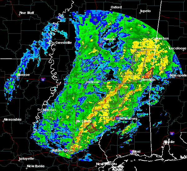 At 914 am cst, a severe thunderstorm was located over little rock, or 14 miles east of prospect, moving northeast at 60 mph (radar indicated). Hazards include 60 mph wind gusts. Expect damage to roofs, siding, and trees. locations impacted include, preston, macon, decatur, brooksville, de kalb, liberty, blackwater, herbert springs, damascus, house, martin, prismatic, gholson, daleville, bluff springs, duffee and little rock. A tornado watch remains in effect until 100 pm cst for east central mississippi. At 914 am cst, a severe thunderstorm was located over little rock, or 14 miles east of prospect, moving northeast at 60 mph (radar indicated). Hazards include 60 mph wind gusts. Expect damage to roofs, siding, and trees. locations impacted include, preston, macon, decatur, brooksville, de kalb, liberty, blackwater, herbert springs, damascus, house, martin, prismatic, gholson, daleville, bluff springs, duffee and little rock. A tornado watch remains in effect until 100 pm cst for east central mississippi.
|
| 1/19/2019 9:03 AM CST |
 At 903 am cst, severe thunderstorms were located along a line extending from near vernon to herbert springs, moving northeast at 60 mph (radar indicated). Hazards include 60 mph wind gusts. Expect damage to roofs, siding, and trees. locations impacted include, preston, neshoba, macon, decatur, brooksville, de kalb, liberty, blackwater, herbert springs, stratton, damascus, bethsaida, house, martin, prismatic, suqualena, mashulaville, gholson, daleville and bluff springs. A tornado watch remains in effect until 100 pm cst for east central mississippi. At 903 am cst, severe thunderstorms were located along a line extending from near vernon to herbert springs, moving northeast at 60 mph (radar indicated). Hazards include 60 mph wind gusts. Expect damage to roofs, siding, and trees. locations impacted include, preston, neshoba, macon, decatur, brooksville, de kalb, liberty, blackwater, herbert springs, stratton, damascus, bethsaida, house, martin, prismatic, suqualena, mashulaville, gholson, daleville and bluff springs. A tornado watch remains in effect until 100 pm cst for east central mississippi.
|
| 1/19/2019 8:53 AM CST |
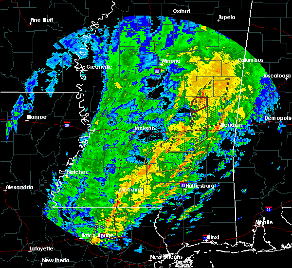 At 853 am cst, a severe thunderstorm capable of producing a tornado was located near nanih waiya, moving northeast at 60 mph (radar indicated rotation). Hazards include tornado. Flying debris will be dangerous to those caught without shelter. mobile homes will be damaged or destroyed. damage to roofs, windows, and vehicles will occur. tree damage is likely. This tornadic thunderstorm will remain over mainly rural areas of northeastern neshoba county. At 853 am cst, a severe thunderstorm capable of producing a tornado was located near nanih waiya, moving northeast at 60 mph (radar indicated rotation). Hazards include tornado. Flying debris will be dangerous to those caught without shelter. mobile homes will be damaged or destroyed. damage to roofs, windows, and vehicles will occur. tree damage is likely. This tornadic thunderstorm will remain over mainly rural areas of northeastern neshoba county.
|
| 1/19/2019 8:43 AM CST |
 At 843 am cst, a severe thunderstorm capable of producing a tornado was located near philadelphia, moving northeast at 50 mph (radar indicated rotation). Hazards include tornado. Flying debris will be dangerous to those caught without shelter. mobile homes will be damaged or destroyed. damage to roofs, windows, and vehicles will occur. tree damage is likely. this dangerous storm will be near, burnside around 855 am cst. Forestdale around 900 am cst. At 843 am cst, a severe thunderstorm capable of producing a tornado was located near philadelphia, moving northeast at 50 mph (radar indicated rotation). Hazards include tornado. Flying debris will be dangerous to those caught without shelter. mobile homes will be damaged or destroyed. damage to roofs, windows, and vehicles will occur. tree damage is likely. this dangerous storm will be near, burnside around 855 am cst. Forestdale around 900 am cst.
|
| 1/19/2019 8:41 AM CST |
 At 841 am cst, severe thunderstorms were located along a line extending from near burnside to near decatur, moving northeast at 60 mph (radar indicated). Hazards include 60 mph wind gusts. Expect damage to roofs, siding, and trees. severe thunderstorms will be near, burnside and stallo around 845 am cst. nanih waiya and duffee around 855 am cst. herbert springs, house and martin around 900 am cst. damascus around 905 am cst. liberty, mashulaville, prismatic and blackwater around 910 am cst. bluff springs around 915 am cst. macon and de kalb around 920 am cst. brooksville around 925 am cst. other locations impacted by these severe thunderstorms include noxapater and tucker. A tornado watch remains in effect until 100 pm cst for east central mississippi. At 841 am cst, severe thunderstorms were located along a line extending from near burnside to near decatur, moving northeast at 60 mph (radar indicated). Hazards include 60 mph wind gusts. Expect damage to roofs, siding, and trees. severe thunderstorms will be near, burnside and stallo around 845 am cst. nanih waiya and duffee around 855 am cst. herbert springs, house and martin around 900 am cst. damascus around 905 am cst. liberty, mashulaville, prismatic and blackwater around 910 am cst. bluff springs around 915 am cst. macon and de kalb around 920 am cst. brooksville around 925 am cst. other locations impacted by these severe thunderstorms include noxapater and tucker. A tornado watch remains in effect until 100 pm cst for east central mississippi.
|
| 1/19/2019 8:34 AM CST |
 At 834 am cst, a severe thunderstorm capable of producing a tornado was located over dowdville, or 7 miles north of prospect, moving northeast at 55 mph (radar indicated rotation). Hazards include tornado. Flying debris will be dangerous to those caught without shelter. mobile homes will be damaged or destroyed. damage to roofs, windows, and vehicles will occur. tree damage is likely. this dangerous storm will be near, pearl river around 840 am cst. philadelphia around 845 am cst. burnside around 855 am cst. forestdale around 900 am cst. Other locations impacted by this tornadic thunderstorm include tucker. At 834 am cst, a severe thunderstorm capable of producing a tornado was located over dowdville, or 7 miles north of prospect, moving northeast at 55 mph (radar indicated rotation). Hazards include tornado. Flying debris will be dangerous to those caught without shelter. mobile homes will be damaged or destroyed. damage to roofs, windows, and vehicles will occur. tree damage is likely. this dangerous storm will be near, pearl river around 840 am cst. philadelphia around 845 am cst. burnside around 855 am cst. forestdale around 900 am cst. Other locations impacted by this tornadic thunderstorm include tucker.
|
| 1/19/2019 8:26 AM CST |
 At 826 am cst, a severe thunderstorm capable of producing a tornado was located near madden, or 8 miles northwest of prospect, moving northeast at 50 mph (radar indicated rotation). Hazards include tornado. Flying debris will be dangerous to those caught without shelter. mobile homes will be damaged or destroyed. damage to roofs, windows, and vehicles will occur. tree damage is likely. this dangerous storm will be near, dowdville and madden around 835 am cst. dixon around 840 am cst. philadelphia and pearl river around 845 am cst. burnside around 855 am cst. forestdale around 900 am cst. Other locations impacted by this tornadic thunderstorm include tucker. At 826 am cst, a severe thunderstorm capable of producing a tornado was located near madden, or 8 miles northwest of prospect, moving northeast at 50 mph (radar indicated rotation). Hazards include tornado. Flying debris will be dangerous to those caught without shelter. mobile homes will be damaged or destroyed. damage to roofs, windows, and vehicles will occur. tree damage is likely. this dangerous storm will be near, dowdville and madden around 835 am cst. dixon around 840 am cst. philadelphia and pearl river around 845 am cst. burnside around 855 am cst. forestdale around 900 am cst. Other locations impacted by this tornadic thunderstorm include tucker.
|
| 1/19/2019 8:21 AM CST |
 At 820 am cst, a severe thunderstorm capable of producing a tornado was located near tuscola, or near harperville, moving northeast at 50 mph (radar indicated rotation). Hazards include tornado. Flying debris will be dangerous to those caught without shelter. mobile homes will be damaged or destroyed. damage to roofs, windows, and vehicles will occur. tree damage is likely. this dangerous storm will be near, madden around 830 am cst. dowdville around 835 am cst. dixon around 840 am cst. philadelphia and pearl river around 845 am cst. burnside around 855 am cst. forestdale and stallo around 900 am cst. Other locations impacted by this tornadic thunderstorm include tucker, walnut grove, sebastopol and standing pine. At 820 am cst, a severe thunderstorm capable of producing a tornado was located near tuscola, or near harperville, moving northeast at 50 mph (radar indicated rotation). Hazards include tornado. Flying debris will be dangerous to those caught without shelter. mobile homes will be damaged or destroyed. damage to roofs, windows, and vehicles will occur. tree damage is likely. this dangerous storm will be near, madden around 830 am cst. dowdville around 835 am cst. dixon around 840 am cst. philadelphia and pearl river around 845 am cst. burnside around 855 am cst. forestdale and stallo around 900 am cst. Other locations impacted by this tornadic thunderstorm include tucker, walnut grove, sebastopol and standing pine.
|
| 1/19/2019 8:01 AM CST |
 At 801 am cst, severe thunderstorms were located along a line extending from forest to near martinville to near oma, moving northeast at 65 mph (radar indicated). Hazards include 60 mph wind gusts. Expect damage to roofs, siding, and trees. these severe storms will be near, pinola around 810 am cst. other locations impacted by these severe thunderstorms include d`lo, braxton, puckett and georgetown. A tornado watch remains in effect until 100 pm cst for central and south central mississippi. At 801 am cst, severe thunderstorms were located along a line extending from forest to near martinville to near oma, moving northeast at 65 mph (radar indicated). Hazards include 60 mph wind gusts. Expect damage to roofs, siding, and trees. these severe storms will be near, pinola around 810 am cst. other locations impacted by these severe thunderstorms include d`lo, braxton, puckett and georgetown. A tornado watch remains in effect until 100 pm cst for central and south central mississippi.
|
| 1/19/2019 7:45 AM CST |
 At 745 am cst, severe thunderstorms were located along a line extending from near pelahatchie to near harrisville to 6 miles west of sontag, moving northeast at 65 mph (radar indicated). Hazards include 60 mph wind gusts. Expect damage to roofs, siding, and trees. these severe storms will be near, mendenhall and cato around 755 am cst. shivers around 805 am cst. other locations impacted by these severe thunderstorms include d`lo, beauregard, braxton, puckett and georgetown. A tornado watch remains in effect until 100 pm cst for central and south central mississippi. At 745 am cst, severe thunderstorms were located along a line extending from near pelahatchie to near harrisville to 6 miles west of sontag, moving northeast at 65 mph (radar indicated). Hazards include 60 mph wind gusts. Expect damage to roofs, siding, and trees. these severe storms will be near, mendenhall and cato around 755 am cst. shivers around 805 am cst. other locations impacted by these severe thunderstorms include d`lo, beauregard, braxton, puckett and georgetown. A tornado watch remains in effect until 100 pm cst for central and south central mississippi.
|
| 1/19/2019 7:11 AM CST |
 At 711 am cst, severe thunderstorms were located along a line extending from near terry to near caseyville to near bude, moving northeast at 65 mph (radar indicated). Hazards include 60 mph wind gusts. Expect damage to roofs, siding, and trees. severe thunderstorms will be near, wesson and glancy around 720 am cst. hazlehurst, star, martinsville, mccall creek and center point around 725 am cst. west lincoln and vaughn around 730 am cst. rockport, hopewell, bogue chitto and johns around 735 am cst. brookhaven, union and enterprise around 740 am cst. pinola and harrisville around 745 am cst. sontag around 750 am cst. mendenhall, wanilla, oma and cato around 755 am cst. other locations impacted by these severe thunderstorms include d`lo, beauregard, braxton, puckett and georgetown. A tornado watch remains in effect until 100 pm cst for central, south central and southwestern mississippi. At 711 am cst, severe thunderstorms were located along a line extending from near terry to near caseyville to near bude, moving northeast at 65 mph (radar indicated). Hazards include 60 mph wind gusts. Expect damage to roofs, siding, and trees. severe thunderstorms will be near, wesson and glancy around 720 am cst. hazlehurst, star, martinsville, mccall creek and center point around 725 am cst. west lincoln and vaughn around 730 am cst. rockport, hopewell, bogue chitto and johns around 735 am cst. brookhaven, union and enterprise around 740 am cst. pinola and harrisville around 745 am cst. sontag around 750 am cst. mendenhall, wanilla, oma and cato around 755 am cst. other locations impacted by these severe thunderstorms include d`lo, beauregard, braxton, puckett and georgetown. A tornado watch remains in effect until 100 pm cst for central, south central and southwestern mississippi.
|
| 11/1/2018 5:52 AM CDT |
 At 552 am cdt, severe thunderstorms were located along a line extending from near gholson to savoy, moving east at 25 mph (radar indicated). Hazards include 60 mph wind gusts. Expect damage to roofs, siding, and trees. severe thunderstorms will be near, zero around 610 am cdt. increase around 620 am cdt. alamucha and toomsuba around 635 am cdt. kewanee around 640 am cdt. other locations impacted by these severe thunderstorms include scooba. A tornado watch remains in effect until 900 am cdt for east central mississippi. At 552 am cdt, severe thunderstorms were located along a line extending from near gholson to savoy, moving east at 25 mph (radar indicated). Hazards include 60 mph wind gusts. Expect damage to roofs, siding, and trees. severe thunderstorms will be near, zero around 610 am cdt. increase around 620 am cdt. alamucha and toomsuba around 635 am cdt. kewanee around 640 am cdt. other locations impacted by these severe thunderstorms include scooba. A tornado watch remains in effect until 900 am cdt for east central mississippi.
|
| 11/1/2018 5:50 AM CDT |
 At 549 am cdt, severe thunderstorms were located along a line extending from 6 miles north of electric mills to lauderdale, moving east at 50 mph (radar indicated). Hazards include 60 mph wind gusts. Expect damage to roofs, siding, and trees. these severe thunderstorms will remain over mainly rural areas of northeastern newton, western kemper, eastern neshoba and western lauderdale counties, including the following locations, chunky. A tornado watch remains in effect until 900 am cdt for east central mississippi. At 549 am cdt, severe thunderstorms were located along a line extending from 6 miles north of electric mills to lauderdale, moving east at 50 mph (radar indicated). Hazards include 60 mph wind gusts. Expect damage to roofs, siding, and trees. these severe thunderstorms will remain over mainly rural areas of northeastern newton, western kemper, eastern neshoba and western lauderdale counties, including the following locations, chunky. A tornado watch remains in effect until 900 am cdt for east central mississippi.
|
| 11/1/2018 4:54 AM CDT |
 At 454 am cdt, severe thunderstorms were located along a line extending from 7 miles southeast of zama to near prospect, moving east at 50 mph (radar indicated). Hazards include 60 mph wind gusts. Expect damage to roofs, siding, and trees. severe thunderstorms will be near, neshoba, stallo, burnside and stratton around 505 am cdt. bethsaida around 510 am cdt. little rock, house and forestdale around 515 am cdt. herbert springs and duffee around 520 am cdt. preston, martin, damascus, bluff springs and suqualena around 525 am cdt. liberty and prismatic around 530 am cdt. blackwater around 535 am cdt. other locations impacted by these severe thunderstorms include tucker, chunky and hickory. A tornado watch remains in effect until 700 am cdt for central and east central mississippi. At 454 am cdt, severe thunderstorms were located along a line extending from 7 miles southeast of zama to near prospect, moving east at 50 mph (radar indicated). Hazards include 60 mph wind gusts. Expect damage to roofs, siding, and trees. severe thunderstorms will be near, neshoba, stallo, burnside and stratton around 505 am cdt. bethsaida around 510 am cdt. little rock, house and forestdale around 515 am cdt. herbert springs and duffee around 520 am cdt. preston, martin, damascus, bluff springs and suqualena around 525 am cdt. liberty and prismatic around 530 am cdt. blackwater around 535 am cdt. other locations impacted by these severe thunderstorms include tucker, chunky and hickory. A tornado watch remains in effect until 700 am cdt for central and east central mississippi.
|
| 11/1/2018 2:34 AM CDT |
 At 233 am cdt, severe thunderstorms were located along a line extending from redwood to near garden city, moving east at 40 mph (radar indicated). Hazards include 60 mph wind gusts. expect damage to roofs, siding, and trees At 233 am cdt, severe thunderstorms were located along a line extending from redwood to near garden city, moving east at 40 mph (radar indicated). Hazards include 60 mph wind gusts. expect damage to roofs, siding, and trees
|
| 5/26/2018 6:36 PM CDT |
 The severe thunderstorm warning for central lincoln county will expire at 645 pm cdt, the storm which prompted the warning has weakened below severe limits, and no longer poses an immediate threat to life or property. therefore, the warning will be allowed to expire. however gusty winds and heavy rain are still possible with this thunderstorm. The severe thunderstorm warning for central lincoln county will expire at 645 pm cdt, the storm which prompted the warning has weakened below severe limits, and no longer poses an immediate threat to life or property. therefore, the warning will be allowed to expire. however gusty winds and heavy rain are still possible with this thunderstorm.
|
| 5/26/2018 5:58 PM CDT |
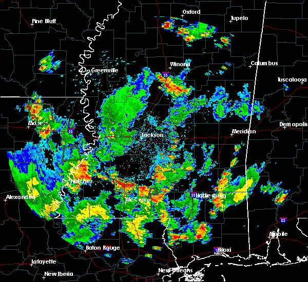 The national weather service in jackson has issued a * severe thunderstorm warning for. central lincoln county in south central mississippi. until 645 pm cdt. At 558 pm cdt, a severe thunderstorm was located near vaughn, or near brookhaven, and is nearly stationary. The national weather service in jackson has issued a * severe thunderstorm warning for. central lincoln county in south central mississippi. until 645 pm cdt. At 558 pm cdt, a severe thunderstorm was located near vaughn, or near brookhaven, and is nearly stationary.
|
| 5/22/2018 2:21 PM CDT |
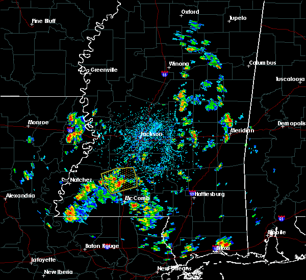 At 221 pm cdt, a severe thunderstorm was located near brookhaven, moving east at 20 mph (radar indicated). Hazards include 60 mph wind gusts and quarter size hail. Hail damage to vehicles is expected. Expect wind damage to roofs, siding, and trees. At 221 pm cdt, a severe thunderstorm was located near brookhaven, moving east at 20 mph (radar indicated). Hazards include 60 mph wind gusts and quarter size hail. Hail damage to vehicles is expected. Expect wind damage to roofs, siding, and trees.
|
| 4/22/2018 10:26 AM CDT |
 At 1026 am cdt, a severe thunderstorm was located over bogue chitto, or 10 miles north of mccomb, moving northeast at 20 mph (radar indicated). Hazards include 60 mph wind gusts. Expect damage to roofs, siding, and trees. Locations impacted include, enterprise, bogue chitto and east lincoln. At 1026 am cdt, a severe thunderstorm was located over bogue chitto, or 10 miles north of mccomb, moving northeast at 20 mph (radar indicated). Hazards include 60 mph wind gusts. Expect damage to roofs, siding, and trees. Locations impacted include, enterprise, bogue chitto and east lincoln.
|
| 4/22/2018 10:25 AM CDT |
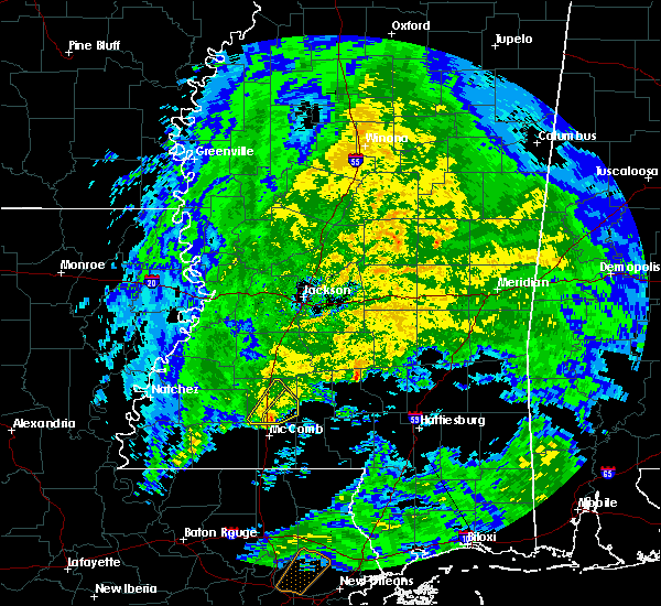 At 1024 am cdt, a severe thunderstorm was located over bogue chitto, or 10 miles north of mccomb, moving northeast at 20 mph (radar indicated). Hazards include 60 mph wind gusts. expect damage to roofs, siding, and trees At 1024 am cdt, a severe thunderstorm was located over bogue chitto, or 10 miles north of mccomb, moving northeast at 20 mph (radar indicated). Hazards include 60 mph wind gusts. expect damage to roofs, siding, and trees
|
| 4/22/2018 10:11 AM CDT |
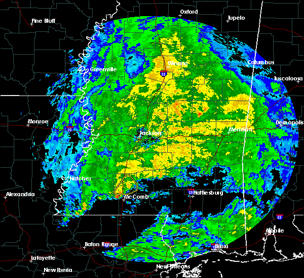 At 1011 am cdt, a severe thunderstorm was located near center point, or 11 miles northwest of mccomb, moving northeast at 25 mph (radar indicated). Hazards include 60 mph wind gusts. expect damage to roofs, siding, and trees At 1011 am cdt, a severe thunderstorm was located near center point, or 11 miles northwest of mccomb, moving northeast at 25 mph (radar indicated). Hazards include 60 mph wind gusts. expect damage to roofs, siding, and trees
|
| 4/14/2018 10:30 AM CDT |
 At 1029 am cdt, a severe thunderstorm was located over bluff springs, or 8 miles south of preston, moving northeast at 25 mph (radar indicated). Hazards include 60 mph wind gusts. Expect damage to roofs, siding, and trees. this severe storm will be near, de kalb around 1045 am cdt. other locations impacted by this severe thunderstorm include shuqualak. A tornado watch remains in effect until 200 pm cdt for east central mississippi. At 1029 am cdt, a severe thunderstorm was located over bluff springs, or 8 miles south of preston, moving northeast at 25 mph (radar indicated). Hazards include 60 mph wind gusts. Expect damage to roofs, siding, and trees. this severe storm will be near, de kalb around 1045 am cdt. other locations impacted by this severe thunderstorm include shuqualak. A tornado watch remains in effect until 200 pm cdt for east central mississippi.
|
| 4/14/2018 10:03 AM CDT |
 At 1002 am cdt, a severe thunderstorm was located over bethsaida, or 9 miles southeast of philadelphia, moving northeast at 40 mph (radar indicated). Hazards include 60 mph wind gusts. Expect damage to roofs, siding, and trees. this severe thunderstorm will be near, forestdale around 1010 am cdt. damascus around 1015 am cdt. liberty and bluff springs around 1020 am cdt. de kalb around 1030 am cdt. other locations impacted by this severe thunderstorm include shuqualak and tucker. A tornado watch remains in effect until 200 pm cdt for east central mississippi. At 1002 am cdt, a severe thunderstorm was located over bethsaida, or 9 miles southeast of philadelphia, moving northeast at 40 mph (radar indicated). Hazards include 60 mph wind gusts. Expect damage to roofs, siding, and trees. this severe thunderstorm will be near, forestdale around 1010 am cdt. damascus around 1015 am cdt. liberty and bluff springs around 1020 am cdt. de kalb around 1030 am cdt. other locations impacted by this severe thunderstorm include shuqualak and tucker. A tornado watch remains in effect until 200 pm cdt for east central mississippi.
|
| 4/7/2018 12:24 AM CDT |
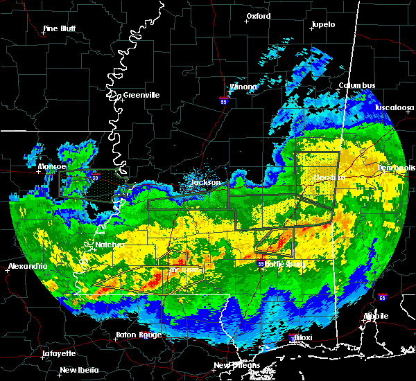 The severe thunderstorm warning for southeastern lincoln county will expire at 1230 am cdt, the storm which prompted the warning has moved out of the area. therefore the warning will be allowed to expire. a severe thunderstorm watch remains in effect until 500 am cdt for south central mississippi. The severe thunderstorm warning for southeastern lincoln county will expire at 1230 am cdt, the storm which prompted the warning has moved out of the area. therefore the warning will be allowed to expire. a severe thunderstorm watch remains in effect until 500 am cdt for south central mississippi.
|
| 4/7/2018 12:17 AM CDT |
 At 1217 am cdt, a severe thunderstorm was located over ruth, or 14 miles northeast of mccomb, moving east at 30 mph (radar indicated). Hazards include 60 mph wind gusts. Expect damage to roofs, siding, and trees. This severe thunderstorm will remain over mainly rural areas of southeastern lincoln county. At 1217 am cdt, a severe thunderstorm was located over ruth, or 14 miles northeast of mccomb, moving east at 30 mph (radar indicated). Hazards include 60 mph wind gusts. Expect damage to roofs, siding, and trees. This severe thunderstorm will remain over mainly rural areas of southeastern lincoln county.
|
| 4/6/2018 11:36 PM CDT |
 At 1136 pm cdt, a severe thunderstorm was located near west lincoln, or 12 miles southwest of brookhaven, moving east at 30 mph (radar indicated). Hazards include 60 mph wind gusts. Expect damage to roofs, siding, and trees. this severe thunderstorm will be near, center point around 1140 pm cdt. west lincoln around 1145 pm cdt. bogue chitto around 1200 am cdt. enterprise around 1205 am cdt. Ruth and east lincoln around 1215 am cdt. At 1136 pm cdt, a severe thunderstorm was located near west lincoln, or 12 miles southwest of brookhaven, moving east at 30 mph (radar indicated). Hazards include 60 mph wind gusts. Expect damage to roofs, siding, and trees. this severe thunderstorm will be near, center point around 1140 pm cdt. west lincoln around 1145 pm cdt. bogue chitto around 1200 am cdt. enterprise around 1205 am cdt. Ruth and east lincoln around 1215 am cdt.
|
| 4/6/2018 5:28 PM CDT |
 At 527 pm cdt, a severe thunderstorm was located near forestdale, or 7 miles southwest of preston, moving east at 45 mph (radar indicated). Hazards include 60 mph wind gusts and quarter size hail. Hail damage to vehicles is expected. expect wind damage to roofs, siding, and trees. this severe thunderstorm will be near, de kalb around 545 pm cdt. electric mills and porterville around 600 pm cdt. other locations impacted by this severe thunderstorm include tucker and scooba. A tornado watch remains in effect until 1100 pm cdt for east central mississippi. At 527 pm cdt, a severe thunderstorm was located near forestdale, or 7 miles southwest of preston, moving east at 45 mph (radar indicated). Hazards include 60 mph wind gusts and quarter size hail. Hail damage to vehicles is expected. expect wind damage to roofs, siding, and trees. this severe thunderstorm will be near, de kalb around 545 pm cdt. electric mills and porterville around 600 pm cdt. other locations impacted by this severe thunderstorm include tucker and scooba. A tornado watch remains in effect until 1100 pm cdt for east central mississippi.
|
| 4/6/2018 5:19 PM CDT |
 At 450 pm cdt, a severe thunderstorm was located near carthage, moving east at 40 mph (radar indicated). Hazards include 60 mph wind gusts. Expect damage to roofs, siding, and trees. this severe thunderstorm will be near, edinburg and madden around 510 pm cdt. dowdville around 515 pm cdt. pearl river around 520 pm cdt. philadelphia around 525 pm cdt. burnside around 530 pm cdt. other locations impacted by this severe thunderstorm include tucker. A tornado watch remains in effect until 1100 pm cdt for central and east central mississippi. At 450 pm cdt, a severe thunderstorm was located near carthage, moving east at 40 mph (radar indicated). Hazards include 60 mph wind gusts. Expect damage to roofs, siding, and trees. this severe thunderstorm will be near, edinburg and madden around 510 pm cdt. dowdville around 515 pm cdt. pearl river around 520 pm cdt. philadelphia around 525 pm cdt. burnside around 530 pm cdt. other locations impacted by this severe thunderstorm include tucker. A tornado watch remains in effect until 1100 pm cdt for central and east central mississippi.
|
| 4/6/2018 4:51 PM CDT |
 At 450 pm cdt, a severe thunderstorm was located near carthage, moving east at 40 mph (radar indicated). Hazards include 60 mph wind gusts. Expect damage to roofs, siding, and trees. this severe thunderstorm will be near, edinburg and madden around 510 pm cdt. dowdville around 515 pm cdt. pearl river around 520 pm cdt. philadelphia around 525 pm cdt. burnside around 530 pm cdt. other locations impacted by this severe thunderstorm include tucker. A tornado watch remains in effect until 1100 pm cdt for central and east central mississippi. At 450 pm cdt, a severe thunderstorm was located near carthage, moving east at 40 mph (radar indicated). Hazards include 60 mph wind gusts. Expect damage to roofs, siding, and trees. this severe thunderstorm will be near, edinburg and madden around 510 pm cdt. dowdville around 515 pm cdt. pearl river around 520 pm cdt. philadelphia around 525 pm cdt. burnside around 530 pm cdt. other locations impacted by this severe thunderstorm include tucker. A tornado watch remains in effect until 1100 pm cdt for central and east central mississippi.
|
| 4/3/2018 9:42 PM CDT |
 At 941 pm cdt, severe thunderstorms were located along a line extending from near burnside to near neshoba to near lawrence, moving east at 35 mph (radar indicated). Hazards include 60 mph wind gusts. Expect damage to roofs, siding, and trees. severe thunderstorms will be near, neshoba and stratton around 945 pm cdt. nanih waiya, house, little rock, bethsaida and forestdale around 955 pm cdt. newton, preston, herbert springs, bluff springs and duffee around 1005 pm cdt. martin around 1010 pm cdt. damascus around 1015 pm cdt. de kalb, liberty and prismatic around 1020 pm cdt. daleville, blackwater and meehan around 1030 pm cdt. meridian station, savoy and nellieburg around 1035 pm cdt. Other locations impacted by these severe thunderstorms include tucker, chunky, lake, scooba and hickory. At 941 pm cdt, severe thunderstorms were located along a line extending from near burnside to near neshoba to near lawrence, moving east at 35 mph (radar indicated). Hazards include 60 mph wind gusts. Expect damage to roofs, siding, and trees. severe thunderstorms will be near, neshoba and stratton around 945 pm cdt. nanih waiya, house, little rock, bethsaida and forestdale around 955 pm cdt. newton, preston, herbert springs, bluff springs and duffee around 1005 pm cdt. martin around 1010 pm cdt. damascus around 1015 pm cdt. de kalb, liberty and prismatic around 1020 pm cdt. daleville, blackwater and meehan around 1030 pm cdt. meridian station, savoy and nellieburg around 1035 pm cdt. Other locations impacted by these severe thunderstorms include tucker, chunky, lake, scooba and hickory.
|
| 3/11/2018 12:54 AM CDT |
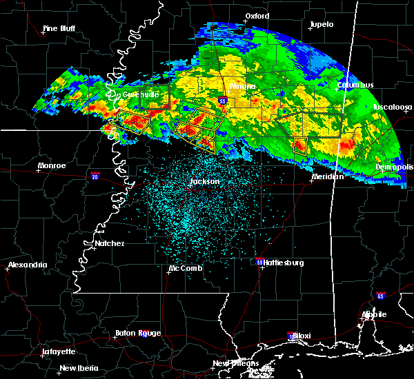 At 1154 pm cst, a severe thunderstorm was located near preston, moving east at 20 mph (radar indicated). Hazards include 60 mph wind gusts and quarter size hail. Hail damage to vehicles is expected. expect wind damage to roofs, siding, and trees. this severe storm will be near, preston around 1205 am cst. Bluff springs around 1210 am cst. At 1154 pm cst, a severe thunderstorm was located near preston, moving east at 20 mph (radar indicated). Hazards include 60 mph wind gusts and quarter size hail. Hail damage to vehicles is expected. expect wind damage to roofs, siding, and trees. this severe storm will be near, preston around 1205 am cst. Bluff springs around 1210 am cst.
|
| 3/11/2018 12:37 AM CDT |
 At 1137 pm cst, a severe thunderstorm was located near nanih waiya, moving east at 20 mph (radar indicated). Hazards include 60 mph wind gusts and quarter size hail. Hail damage to vehicles is expected. expect wind damage to roofs, siding, and trees. this severe thunderstorm will be near, forestdale around 1145 pm cst. preston around 1205 am cst. Bluff springs around 1210 am cst. At 1137 pm cst, a severe thunderstorm was located near nanih waiya, moving east at 20 mph (radar indicated). Hazards include 60 mph wind gusts and quarter size hail. Hail damage to vehicles is expected. expect wind damage to roofs, siding, and trees. this severe thunderstorm will be near, forestdale around 1145 pm cst. preston around 1205 am cst. Bluff springs around 1210 am cst.
|
| 3/11/2018 12:16 AM CDT |
 At 1116 pm cst, a severe thunderstorm was located over burnside, or near philadelphia, moving east at 15 mph (radar indicated). Hazards include 60 mph wind gusts and quarter size hail. Hail damage to vehicles is expected. expect wind damage to roofs, siding, and trees. This severe storm will be near, forestdale around 1145 pm cst. At 1116 pm cst, a severe thunderstorm was located over burnside, or near philadelphia, moving east at 15 mph (radar indicated). Hazards include 60 mph wind gusts and quarter size hail. Hail damage to vehicles is expected. expect wind damage to roofs, siding, and trees. This severe storm will be near, forestdale around 1145 pm cst.
|
| 3/11/2018 12:01 AM CDT |
 A severe thunderstorm warning remains in effect until 1145 pm cst for central neshoba county. at 1101 pm cst, a severe thunderstorm was located near burnside, or near philadelphia, moving southeast at 25 mph. hazard. ping pong ball size hail and 60 mph wind gusts. source. Radar indicated. A severe thunderstorm warning remains in effect until 1145 pm cst for central neshoba county. at 1101 pm cst, a severe thunderstorm was located near burnside, or near philadelphia, moving southeast at 25 mph. hazard. ping pong ball size hail and 60 mph wind gusts. source. Radar indicated.
|
| 3/10/2018 11:38 PM CDT |
 The national weather service in jackson has issued a * severe thunderstorm warning for. southwestern winston county in east central mississippi. northeastern neshoba county in east central mississippi. Until 1145 pm cst * at 1038 pm cst, a severe thunderstorm was located near zama, or 8. The national weather service in jackson has issued a * severe thunderstorm warning for. southwestern winston county in east central mississippi. northeastern neshoba county in east central mississippi. Until 1145 pm cst * at 1038 pm cst, a severe thunderstorm was located near zama, or 8.
|
| 3/10/2018 11:38 PM CDT |
 At 1038 pm cst, a severe thunderstorm was located near zama, or 8 miles north of edinburg, moving southeast at 25 mph (radar indicated). Hazards include tennis ball size hail and 60 mph wind gusts. People and animals outdoors will be injured. expect hail damage to roofs, siding, windows, and vehicles. expect wind damage to roofs, siding, and trees. this severe thunderstorm will be near, pearl river around 1055 pm cst. stallo around 1100 pm cst. philadelphia and burnside around 1105 pm cst. forestdale and bethsaida around 1130 pm cst. Other locations impacted by this severe thunderstorm include tucker. At 1038 pm cst, a severe thunderstorm was located near zama, or 8 miles north of edinburg, moving southeast at 25 mph (radar indicated). Hazards include tennis ball size hail and 60 mph wind gusts. People and animals outdoors will be injured. expect hail damage to roofs, siding, windows, and vehicles. expect wind damage to roofs, siding, and trees. this severe thunderstorm will be near, pearl river around 1055 pm cst. stallo around 1100 pm cst. philadelphia and burnside around 1105 pm cst. forestdale and bethsaida around 1130 pm cst. Other locations impacted by this severe thunderstorm include tucker.
|
| 2/7/2018 1:34 AM CST |
 At 134 am cst, severe thunderstorms were located along a line extending from 10 miles northeast of smyrna to near zama to near carthage, moving east at 60 mph (radar indicated). Hazards include 60 mph wind gusts. Expect damage to roofs, siding, and trees. severe thunderstorms will be near, philadelphia, louisville, pearl river, stallo and mcmillan around 150 am cst. millcreek and burnside around 155 am cst. betheden around 200 am cst. nanih waiya around 205 am cst. Other locations impacted by these severe thunderstorms include noxapater. At 134 am cst, severe thunderstorms were located along a line extending from 10 miles northeast of smyrna to near zama to near carthage, moving east at 60 mph (radar indicated). Hazards include 60 mph wind gusts. Expect damage to roofs, siding, and trees. severe thunderstorms will be near, philadelphia, louisville, pearl river, stallo and mcmillan around 150 am cst. millcreek and burnside around 155 am cst. betheden around 200 am cst. nanih waiya around 205 am cst. Other locations impacted by these severe thunderstorms include noxapater.
|
| 8/31/2017 10:27 AM CDT |
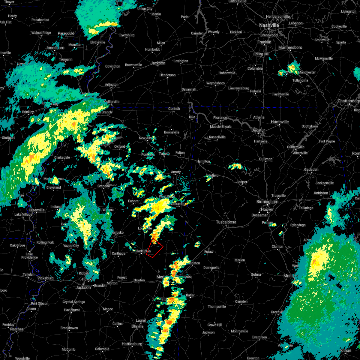 The tornado warning for northwestern kemper, southeastern winston and northeastern neshoba counties will expire at 1030 am cdt, the tornadic thunderstorm which prompted the warning has weakened. moved out of the warned area. therefore, the warning will be allowed to expire. The tornado warning for northwestern kemper, southeastern winston and northeastern neshoba counties will expire at 1030 am cdt, the tornadic thunderstorm which prompted the warning has weakened. moved out of the warned area. therefore, the warning will be allowed to expire.
|
| 8/31/2017 10:05 AM CDT |
 At 1005 am cdt, a severe thunderstorm capable of producing a tornado was located over forestdale, or 9 miles east of philadelphia, moving north at 35 mph (radar indicated rotation). Hazards include tornado. Flying debris will be dangerous to those caught without shelter. mobile homes will be damaged or destroyed. damage to roofs, windows, and vehicles will occur. tree damage is likely. This dangerous storm will be near, preston and nanih waiya around 1020 am cdt. At 1005 am cdt, a severe thunderstorm capable of producing a tornado was located over forestdale, or 9 miles east of philadelphia, moving north at 35 mph (radar indicated rotation). Hazards include tornado. Flying debris will be dangerous to those caught without shelter. mobile homes will be damaged or destroyed. damage to roofs, windows, and vehicles will occur. tree damage is likely. This dangerous storm will be near, preston and nanih waiya around 1020 am cdt.
|
| 7/17/2017 6:44 PM CDT |
 At 644 pm cdt, severe thunderstorms were located along a line extending from near new hope to near center point, moving southwest at 20 mph (radar indicated). Hazards include 60 mph wind gusts. Expect damage to roofs, siding, and trees. These severe storms will be near, bude and little springs around 700 pm cdt. At 644 pm cdt, severe thunderstorms were located along a line extending from near new hope to near center point, moving southwest at 20 mph (radar indicated). Hazards include 60 mph wind gusts. Expect damage to roofs, siding, and trees. These severe storms will be near, bude and little springs around 700 pm cdt.
|
| 7/17/2017 6:15 PM CDT |
 At 615 pm cdt, severe thunderstorms were located along a line extending from near vaughn to near enterprise, moving southwest at 20 mph (radar indicated). Hazards include 60 mph wind gusts and penny size hail. Expect damage to roofs, siding, and trees. severe thunderstorms will be near, west lincoln around 620 pm cdt. mccall creek around 630 pm cdt. little springs around 650 pm cdt. Bude around 655 pm cdt. At 615 pm cdt, severe thunderstorms were located along a line extending from near vaughn to near enterprise, moving southwest at 20 mph (radar indicated). Hazards include 60 mph wind gusts and penny size hail. Expect damage to roofs, siding, and trees. severe thunderstorms will be near, west lincoln around 620 pm cdt. mccall creek around 630 pm cdt. little springs around 650 pm cdt. Bude around 655 pm cdt.
|
| 7/17/2017 6:04 PM CDT |
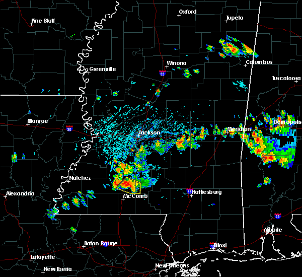 At 604 pm cdt, severe thunderstorms were located along a line extending from near brookhaven to east lincoln, moving southwest at 10 mph (radar indicated). Hazards include 60 mph wind gusts and penny size hail. Expect damage to roofs, siding, and trees. These severe storms will be near, enterprise, ruth and bogue chitto around 615 pm cdt. At 604 pm cdt, severe thunderstorms were located along a line extending from near brookhaven to east lincoln, moving southwest at 10 mph (radar indicated). Hazards include 60 mph wind gusts and penny size hail. Expect damage to roofs, siding, and trees. These severe storms will be near, enterprise, ruth and bogue chitto around 615 pm cdt.
|
| 7/17/2017 5:32 PM CDT |
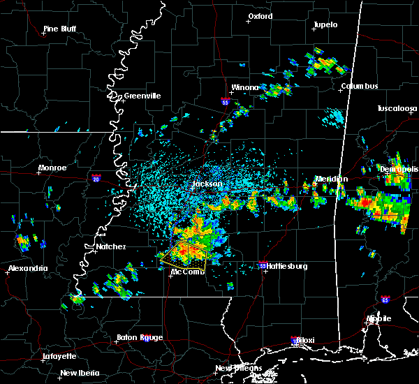 At 532 pm cdt, severe thunderstorms were located along a line extending from near brookhaven to monticello, moving southwest at 10 mph (radar indicated). Hazards include 60 mph wind gusts and penny size hail. Expect damage to roofs, siding, and trees. severe thunderstorms will be near, brookhaven around 600 pm cdt. Enterprise, topeka, east lincoln and jayess around 615 pm cdt. At 532 pm cdt, severe thunderstorms were located along a line extending from near brookhaven to monticello, moving southwest at 10 mph (radar indicated). Hazards include 60 mph wind gusts and penny size hail. Expect damage to roofs, siding, and trees. severe thunderstorms will be near, brookhaven around 600 pm cdt. Enterprise, topeka, east lincoln and jayess around 615 pm cdt.
|
| 7/8/2017 11:59 AM CDT |
 At 1158 am cdt, a severe thunderstorm was located near burnside, or near philadelphia, moving east at 25 mph (radar indicated). Hazards include 60 mph wind gusts and quarter size hail. Hail damage to vehicles is expected. expect wind damage to roofs, siding, and trees. this severe thunderstorm will be near, philadelphia and burnside around 1205 pm cdt. bethsaida around 1225 pm cdt. forestdale around 1230 pm cdt. Other locations impacted by this severe thunderstorm include tucker. At 1158 am cdt, a severe thunderstorm was located near burnside, or near philadelphia, moving east at 25 mph (radar indicated). Hazards include 60 mph wind gusts and quarter size hail. Hail damage to vehicles is expected. expect wind damage to roofs, siding, and trees. this severe thunderstorm will be near, philadelphia and burnside around 1205 pm cdt. bethsaida around 1225 pm cdt. forestdale around 1230 pm cdt. Other locations impacted by this severe thunderstorm include tucker.
|
| 6/16/2017 9:26 PM CDT |
 At 925 pm cdt, severe thunderstorms were located along a line extending from near collins to oak vale to near east lincoln, moving south at 45 mph (radar indicated). Hazards include 70 mph wind gusts. Expect considerable tree damage. damage is likely to mobile homes, roofs, and outbuildings. these severe storms will be near, society hill around 930 pm cdt. melba around 935 pm cdt. Other locations impacted by these severe thunderstorms include bassfield, new hebron and silver creek. At 925 pm cdt, severe thunderstorms were located along a line extending from near collins to oak vale to near east lincoln, moving south at 45 mph (radar indicated). Hazards include 70 mph wind gusts. Expect considerable tree damage. damage is likely to mobile homes, roofs, and outbuildings. these severe storms will be near, society hill around 930 pm cdt. melba around 935 pm cdt. Other locations impacted by these severe thunderstorms include bassfield, new hebron and silver creek.
|
| 6/16/2017 8:53 PM CDT |
 At 853 pm cdt, severe thunderstorms were located along a line extending from sanatorium to near rockport to near glancy, moving southeast at 55 mph (radar indicated). Hazards include 70 mph wind gusts. Expect considerable tree damage. damage is likely to mobile homes, roofs, and outbuildings. severe thunderstorms will be near, sontag around 900 pm cdt. wanilla and clem around 905 pm cdt. brookhaven and monticello around 910 pm cdt. arm, progress and robinwood around 915 pm cdt. enterprise, oak vale, east lincoln and tilton around 920 pm cdt. society hill around 925 pm cdt. topeka, ruth and melba around 930 pm cdt. jayess around 935 pm cdt. Other locations impacted by these severe thunderstorms include bassfield, new hebron and silver creek. At 853 pm cdt, severe thunderstorms were located along a line extending from sanatorium to near rockport to near glancy, moving southeast at 55 mph (radar indicated). Hazards include 70 mph wind gusts. Expect considerable tree damage. damage is likely to mobile homes, roofs, and outbuildings. severe thunderstorms will be near, sontag around 900 pm cdt. wanilla and clem around 905 pm cdt. brookhaven and monticello around 910 pm cdt. arm, progress and robinwood around 915 pm cdt. enterprise, oak vale, east lincoln and tilton around 920 pm cdt. society hill around 925 pm cdt. topeka, ruth and melba around 930 pm cdt. jayess around 935 pm cdt. Other locations impacted by these severe thunderstorms include bassfield, new hebron and silver creek.
|
| 6/15/2017 7:06 PM CDT |
 At 706 pm cdt, severe thunderstorms were located along a line extending from 10 miles north of zama to near smyrna, moving southeast at 20 mph (radar indicated). Hazards include 60 mph wind gusts and quarter size hail. Hail damage to vehicles is expected. expect wind damage to roofs, siding, and trees. severe thunderstorms will be near, zama around 715 pm cdt. renfroe around 720 pm cdt. edinburg around 740 pm cdt. pearl river around 755 pm cdt. philadelphia, stallo and burnside around 800 pm cdt. Other locations impacted by these severe thunderstorms include noxapater, tucker, mccool and ethel. At 706 pm cdt, severe thunderstorms were located along a line extending from 10 miles north of zama to near smyrna, moving southeast at 20 mph (radar indicated). Hazards include 60 mph wind gusts and quarter size hail. Hail damage to vehicles is expected. expect wind damage to roofs, siding, and trees. severe thunderstorms will be near, zama around 715 pm cdt. renfroe around 720 pm cdt. edinburg around 740 pm cdt. pearl river around 755 pm cdt. philadelphia, stallo and burnside around 800 pm cdt. Other locations impacted by these severe thunderstorms include noxapater, tucker, mccool and ethel.
|
| 4/30/2017 10:45 AM CDT |
 At 1045 am cdt, severe thunderstorms were located along a line extending from near oktoc to near gholson to near meehan, moving northeast at 40 mph (radar indicated). Hazards include 60 mph wind gusts. expect damage to roofs, siding, and trees At 1045 am cdt, severe thunderstorms were located along a line extending from near oktoc to near gholson to near meehan, moving northeast at 40 mph (radar indicated). Hazards include 60 mph wind gusts. expect damage to roofs, siding, and trees
|
| 4/30/2017 10:39 AM CDT |
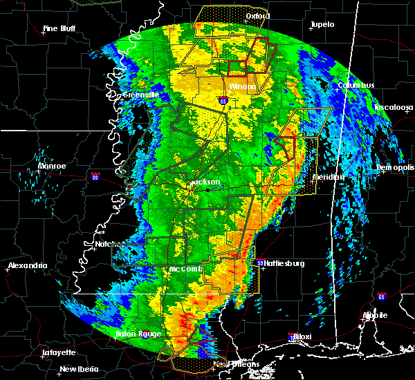 The tornado warning for northeastern neshoba county will expire at 1045 am cdt, the storm which prompted the warning has moved out of the area. therefore the warning will be allowed to expire. a tornado watch remains in effect until 300 pm cdt for east central mississippi. The tornado warning for northeastern neshoba county will expire at 1045 am cdt, the storm which prompted the warning has moved out of the area. therefore the warning will be allowed to expire. a tornado watch remains in effect until 300 pm cdt for east central mississippi.
|
| 4/30/2017 10:32 AM CDT |
 At 1032 am cdt, a severe thunderstorm capable of producing a tornado was located near forestdale, or near nanih waiya, moving northeast at 40 mph (radar indicated rotation). Hazards include tornado. Flying debris will be dangerous to those caught without shelter. mobile homes will be damaged or destroyed. damage to roofs, windows, and vehicles will occur. tree damage is likely. This tornadic thunderstorm will remain over mainly rural areas of northeastern neshoba county. At 1032 am cdt, a severe thunderstorm capable of producing a tornado was located near forestdale, or near nanih waiya, moving northeast at 40 mph (radar indicated rotation). Hazards include tornado. Flying debris will be dangerous to those caught without shelter. mobile homes will be damaged or destroyed. damage to roofs, windows, and vehicles will occur. tree damage is likely. This tornadic thunderstorm will remain over mainly rural areas of northeastern neshoba county.
|
| 4/30/2017 10:19 AM CDT |
 At 1019 am cdt, a severe thunderstorm capable of producing a tornado was located near philadelphia, moving northeast at 40 mph (radar indicated rotation). Hazards include tornado. Flying debris will be dangerous to those caught without shelter. mobile homes will be damaged or destroyed. damage to roofs, windows, and vehicles will occur. tree damage is likely. this dangerous storm will be near, forestdale and burnside around 1030 am cdt. Other locations impacted by this tornadic thunderstorm include tucker. At 1019 am cdt, a severe thunderstorm capable of producing a tornado was located near philadelphia, moving northeast at 40 mph (radar indicated rotation). Hazards include tornado. Flying debris will be dangerous to those caught without shelter. mobile homes will be damaged or destroyed. damage to roofs, windows, and vehicles will occur. tree damage is likely. this dangerous storm will be near, forestdale and burnside around 1030 am cdt. Other locations impacted by this tornadic thunderstorm include tucker.
|
| 4/30/2017 10:10 AM CDT |
 At 1010 am cdt, a severe thunderstorm capable of producing a tornado was located near neshoba, or 8 miles southwest of philadelphia, moving northeast at 45 mph (radar indicated rotation). Hazards include tornado. Flying debris will be dangerous to those caught without shelter. mobile homes will be damaged or destroyed. damage to roofs, windows, and vehicles will occur. tree damage is likely. this dangerous storm will be near, philadelphia around 1015 am cdt. bethsaida around 1020 am cdt. burnside around 1025 am cdt. forestdale around 1030 am cdt. Other locations impacted by this tornadic thunderstorm include tucker. At 1010 am cdt, a severe thunderstorm capable of producing a tornado was located near neshoba, or 8 miles southwest of philadelphia, moving northeast at 45 mph (radar indicated rotation). Hazards include tornado. Flying debris will be dangerous to those caught without shelter. mobile homes will be damaged or destroyed. damage to roofs, windows, and vehicles will occur. tree damage is likely. this dangerous storm will be near, philadelphia around 1015 am cdt. bethsaida around 1020 am cdt. burnside around 1025 am cdt. forestdale around 1030 am cdt. Other locations impacted by this tornadic thunderstorm include tucker.
|
| 4/30/2017 10:07 AM CDT |
 At 1006 am cdt, severe thunderstorms were located along a line extending from union to garlandville, moving northeast at 45 mph (radar indicated). Hazards include 60 mph wind gusts. expect damage to roofs, siding, and trees At 1006 am cdt, severe thunderstorms were located along a line extending from union to garlandville, moving northeast at 45 mph (radar indicated). Hazards include 60 mph wind gusts. expect damage to roofs, siding, and trees
|
| 4/30/2017 10:02 AM CDT |
 At 1002 am cdt, a severe thunderstorm capable of producing a tornado was located over prospect, moving northeast at 45 mph (radar indicated rotation). Hazards include tornado. Flying debris will be dangerous to those caught without shelter. mobile homes will be damaged or destroyed. damage to roofs, windows, and vehicles will occur. tree damage is likely. this dangerous storm will be near, dowdville around 1005 am cdt. neshoba and dixon around 1010 am cdt. philadelphia and bethsaida around 1020 am cdt. burnside around 1030 am cdt. forestdale around 1035 am cdt. Other locations impacted by this tornadic thunderstorm include tucker. At 1002 am cdt, a severe thunderstorm capable of producing a tornado was located over prospect, moving northeast at 45 mph (radar indicated rotation). Hazards include tornado. Flying debris will be dangerous to those caught without shelter. mobile homes will be damaged or destroyed. damage to roofs, windows, and vehicles will occur. tree damage is likely. this dangerous storm will be near, dowdville around 1005 am cdt. neshoba and dixon around 1010 am cdt. philadelphia and bethsaida around 1020 am cdt. burnside around 1030 am cdt. forestdale around 1035 am cdt. Other locations impacted by this tornadic thunderstorm include tucker.
|
| 4/30/2017 9:48 AM CDT |
 At 948 am cdt, a confirmed tornado was located near steele, or 7 miles southwest of prospect, moving northeast at 40 mph (radar confirmed tornado). Hazards include damaging tornado. Flying debris will be dangerous to those caught without shelter. mobile homes will be damaged or destroyed. damage to roofs, windows, and vehicles will occur. tree damage is likely. this tornadic storm will be near, prospect around 1000 am cdt. neshoba, dixon and dowdville around 1010 am cdt. philadelphia and bethsaida around 1020 am cdt. burnside around 1030 am cdt. forestdale around 1035 am cdt. Other locations impacted by this tornadic thunderstorm include tucker and sebastopol. At 948 am cdt, a confirmed tornado was located near steele, or 7 miles southwest of prospect, moving northeast at 40 mph (radar confirmed tornado). Hazards include damaging tornado. Flying debris will be dangerous to those caught without shelter. mobile homes will be damaged or destroyed. damage to roofs, windows, and vehicles will occur. tree damage is likely. this tornadic storm will be near, prospect around 1000 am cdt. neshoba, dixon and dowdville around 1010 am cdt. philadelphia and bethsaida around 1020 am cdt. burnside around 1030 am cdt. forestdale around 1035 am cdt. Other locations impacted by this tornadic thunderstorm include tucker and sebastopol.
|
| 4/30/2017 7:35 AM CDT |
 At 734 am cdt, severe thunderstorms were located along a line extending from pleasant hill to near little springs, moving northeast at 60 mph. a tornado warning remains in effect for western portions of copiah county (radar indicated). Hazards include 60 mph wind gusts. Expect damage to roofs, siding, and trees. severe thunderstorms will be near, allen and caseyville around 740 am cdt. west lincoln around 745 am cdt. glancy, vaughn and loyd star around 750 am cdt. brookhaven, hazlehurst and martinsville around 755 am cdt. wesson around 800 am cdt. hopewell around 810 am cdt. rockport around 815 am cdt. other locations impacted by these severe thunderstorms include beauregard and georgetown. a tornado watch remains in effect until 900 am cdt for southwestern mississippi. A tornado watch also remains in effect until 300 pm cdt for central and south central mississippi. At 734 am cdt, severe thunderstorms were located along a line extending from pleasant hill to near little springs, moving northeast at 60 mph. a tornado warning remains in effect for western portions of copiah county (radar indicated). Hazards include 60 mph wind gusts. Expect damage to roofs, siding, and trees. severe thunderstorms will be near, allen and caseyville around 740 am cdt. west lincoln around 745 am cdt. glancy, vaughn and loyd star around 750 am cdt. brookhaven, hazlehurst and martinsville around 755 am cdt. wesson around 800 am cdt. hopewell around 810 am cdt. rockport around 815 am cdt. other locations impacted by these severe thunderstorms include beauregard and georgetown. a tornado watch remains in effect until 900 am cdt for southwestern mississippi. A tornado watch also remains in effect until 300 pm cdt for central and south central mississippi.
|
| 4/26/2017 11:14 PM CDT |
 At 1113 pm cdt, a severe thunderstorm was located near forestdale, or near nanih waiya, moving northeast at 45 mph (radar indicated). Hazards include 60 mph wind gusts and quarter size hail. Hail damage to vehicles is expected. expect wind damage to roofs, siding, and trees. this severe storm will be near, preston around 1120 pm cdt. gholson around 1130 pm cdt. macon and paulette around 1150 pm cdt. prairie point around 1200 am cdt. bigbee valley around 1210 am cdt. Other locations impacted by this severe thunderstorm include shuqualak and scooba. At 1113 pm cdt, a severe thunderstorm was located near forestdale, or near nanih waiya, moving northeast at 45 mph (radar indicated). Hazards include 60 mph wind gusts and quarter size hail. Hail damage to vehicles is expected. expect wind damage to roofs, siding, and trees. this severe storm will be near, preston around 1120 pm cdt. gholson around 1130 pm cdt. macon and paulette around 1150 pm cdt. prairie point around 1200 am cdt. bigbee valley around 1210 am cdt. Other locations impacted by this severe thunderstorm include shuqualak and scooba.
|
| 4/26/2017 11:12 PM CDT |
 At 1112 pm cdt, a severe thunderstorm was located over neshoba, or 9 miles northeast of prospect, moving northeast at 60 mph (radar indicated). Hazards include 60 mph wind gusts and quarter size hail. Hail damage to vehicles is expected. expect wind damage to roofs, siding, and trees. this severe thunderstorm will be near, bethsaida and house around 1120 pm cdt. forestdale around 1130 pm cdt. Other locations impacted by this severe thunderstorm include tucker. At 1112 pm cdt, a severe thunderstorm was located over neshoba, or 9 miles northeast of prospect, moving northeast at 60 mph (radar indicated). Hazards include 60 mph wind gusts and quarter size hail. Hail damage to vehicles is expected. expect wind damage to roofs, siding, and trees. this severe thunderstorm will be near, bethsaida and house around 1120 pm cdt. forestdale around 1130 pm cdt. Other locations impacted by this severe thunderstorm include tucker.
|
| 4/26/2017 11:08 PM CDT |
 At 1108 pm cdt, severe thunderstorms were located along a line extending from 6 miles east of betheden to nanih waiya to bethsaida, moving northeast at 50 mph (radar indicated). Hazards include 60 mph wind gusts and quarter size hail. Hail damage to vehicles is expected. expect wind damage to roofs, siding, and trees. severe thunderstorms will be near, bluff springs around 1125 pm cdt. mashulaville around 1130 pm cdt. de kalb around 1135 pm cdt. macon and gholson around 1140 pm cdt. brooksville around 1145 pm cdt. deerbrook and prairie point around 1150 pm cdt. bigbee valley, paulette and cooksville around 1200 am cdt. Other locations impacted by these severe thunderstorms include shuqualak and scooba. At 1108 pm cdt, severe thunderstorms were located along a line extending from 6 miles east of betheden to nanih waiya to bethsaida, moving northeast at 50 mph (radar indicated). Hazards include 60 mph wind gusts and quarter size hail. Hail damage to vehicles is expected. expect wind damage to roofs, siding, and trees. severe thunderstorms will be near, bluff springs around 1125 pm cdt. mashulaville around 1130 pm cdt. de kalb around 1135 pm cdt. macon and gholson around 1140 pm cdt. brooksville around 1145 pm cdt. deerbrook and prairie point around 1150 pm cdt. bigbee valley, paulette and cooksville around 1200 am cdt. Other locations impacted by these severe thunderstorms include shuqualak and scooba.
|
| 4/26/2017 10:56 PM CDT |
 At 1056 pm cdt, severe thunderstorms were located along a line extending from millcreek to stallo to philadelphia, moving northeast at 60 mph (radar indicated). Hazards include 60 mph wind gusts and quarter size hail. Hail damage to vehicles is expected. expect wind damage to roofs, siding, and trees. these severe storms will be near, millcreek and betheden around 1100 pm cdt. Other locations impacted by these severe thunderstorms include noxapater. At 1056 pm cdt, severe thunderstorms were located along a line extending from millcreek to stallo to philadelphia, moving northeast at 60 mph (radar indicated). Hazards include 60 mph wind gusts and quarter size hail. Hail damage to vehicles is expected. expect wind damage to roofs, siding, and trees. these severe storms will be near, millcreek and betheden around 1100 pm cdt. Other locations impacted by these severe thunderstorms include noxapater.
|
| 4/26/2017 10:23 PM CDT |
 At 1023 pm cdt, a severe thunderstorm was located near carthage, moving east at 35 mph (radar indicated). Hazards include 60 mph wind gusts and quarter size hail. Hail damage to vehicles is expected. expect wind damage to roofs, siding, and trees. this severe thunderstorm will be near, edinburg around 1040 pm cdt. philadelphia and pearl river around 1050 pm cdt. burnside around 1100 pm cdt. stallo around 1105 pm cdt. nanih waiya around 1120 pm cdt. Other locations impacted by this severe thunderstorm include noxapater and weir. At 1023 pm cdt, a severe thunderstorm was located near carthage, moving east at 35 mph (radar indicated). Hazards include 60 mph wind gusts and quarter size hail. Hail damage to vehicles is expected. expect wind damage to roofs, siding, and trees. this severe thunderstorm will be near, edinburg around 1040 pm cdt. philadelphia and pearl river around 1050 pm cdt. burnside around 1100 pm cdt. stallo around 1105 pm cdt. nanih waiya around 1120 pm cdt. Other locations impacted by this severe thunderstorm include noxapater and weir.
|
| 4/3/2017 1:28 AM CDT |
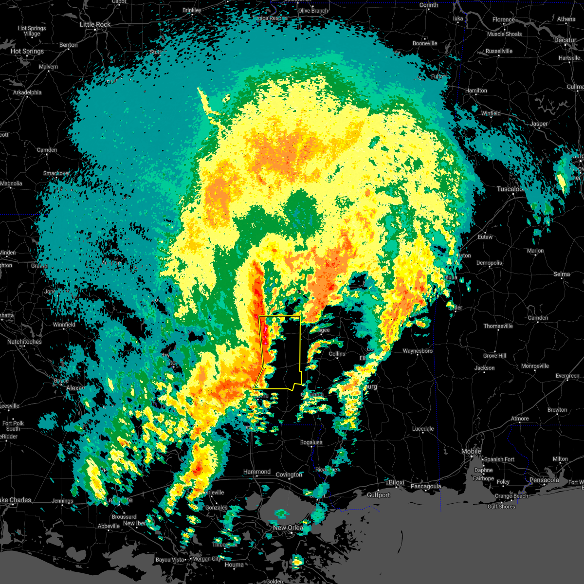 At 128 am cdt, severe thunderstorms were located along a line extending from near crystal springs to near hazlehurst to near east lincoln to near bogue chitto, moving east at 40 mph (radar indicated). Hazards include 60 mph wind gusts and quarter size hail. Hail damage to vehicles is expected. expect wind damage to roofs, siding, and trees. severe thunderstorms will be near, hopewell around 135 am cdt. rockport, sontag and oma around 140 am cdt. monticello and wanilla around 145 am cdt. union, jayess, topeka and harrisville around 150 am cdt. shivers and arm around 155 am cdt. robinwood around 200 am cdt. tilton around 205 am cdt. oak vale around 210 am cdt. other locations impacted by these severe thunderstorms include new hebron, silver creek, beauregard, braxton and georgetown. A tornado watch remains in effect until 200 am cdt for central and south central mississippi. At 128 am cdt, severe thunderstorms were located along a line extending from near crystal springs to near hazlehurst to near east lincoln to near bogue chitto, moving east at 40 mph (radar indicated). Hazards include 60 mph wind gusts and quarter size hail. Hail damage to vehicles is expected. expect wind damage to roofs, siding, and trees. severe thunderstorms will be near, hopewell around 135 am cdt. rockport, sontag and oma around 140 am cdt. monticello and wanilla around 145 am cdt. union, jayess, topeka and harrisville around 150 am cdt. shivers and arm around 155 am cdt. robinwood around 200 am cdt. tilton around 205 am cdt. oak vale around 210 am cdt. other locations impacted by these severe thunderstorms include new hebron, silver creek, beauregard, braxton and georgetown. A tornado watch remains in effect until 200 am cdt for central and south central mississippi.
|
| 4/3/2017 1:09 AM CDT |
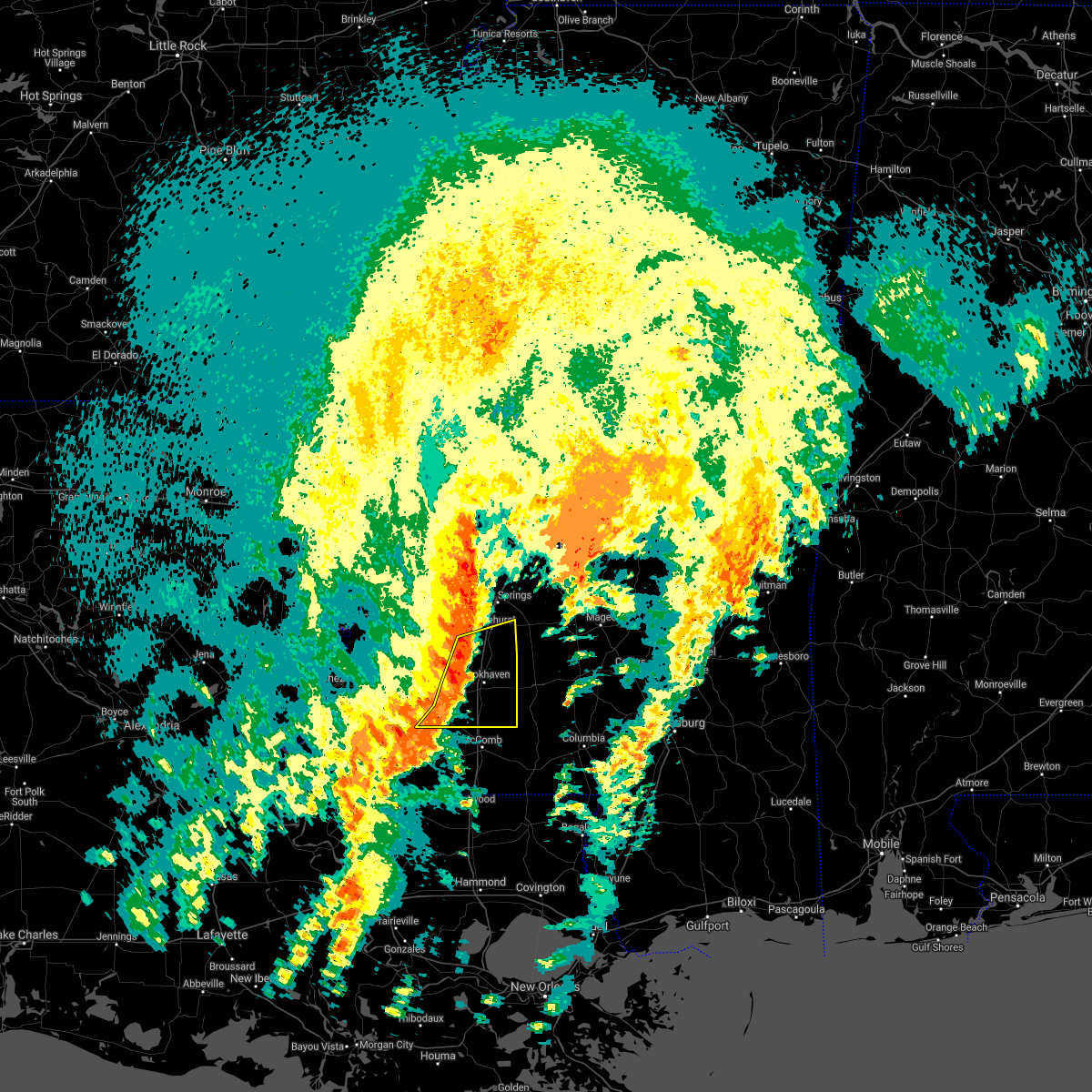 At 109 am cdt, severe thunderstorms were located along a line extending from glancy to near loyd star to near vaughn to near center point, moving northeast at 45 mph (radar indicated). Hazards include 60 mph wind gusts and penny size hail. Expect damage to roofs, siding, and trees. these severe storms will be near, hazlehurst, martinsville and glancy around 115 am cdt. brookhaven and wesson around 120 am cdt. bogue chitto around 125 am cdt. enterprise and east lincoln around 130 am cdt. other locations impacted by these severe thunderstorms include beauregard. A tornado watch remains in effect until 200 am cdt for central, south central and southwestern mississippi. At 109 am cdt, severe thunderstorms were located along a line extending from glancy to near loyd star to near vaughn to near center point, moving northeast at 45 mph (radar indicated). Hazards include 60 mph wind gusts and penny size hail. Expect damage to roofs, siding, and trees. these severe storms will be near, hazlehurst, martinsville and glancy around 115 am cdt. brookhaven and wesson around 120 am cdt. bogue chitto around 125 am cdt. enterprise and east lincoln around 130 am cdt. other locations impacted by these severe thunderstorms include beauregard. A tornado watch remains in effect until 200 am cdt for central, south central and southwestern mississippi.
|
| 4/3/2017 12:42 AM CDT |
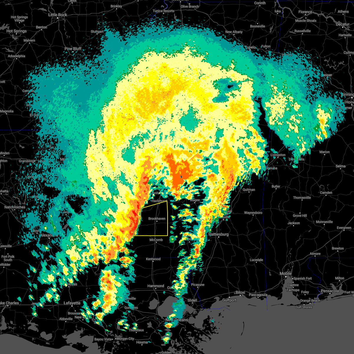 At 1241 am cdt, severe thunderstorms were located along a line extending from pleasant hill to near new hope to near bude to 7 miles southwest of little springs, moving east at 50 mph (radar indicated). Hazards include 60 mph wind gusts and penny size hail. Expect damage to roofs, siding, and trees. severe thunderstorms will be near, pleasant hill around 1245 am cdt. allen, mccall creek, little springs and caseyville around 1250 am cdt. west lincoln around 1255 am cdt. center point, vaughn, loyd star and glancy around 100 am cdt. brookhaven, hazlehurst, wesson and martinsville around 105 am cdt. enterprise and bogue chitto around 110 am cdt. east lincoln around 115 am cdt. ruth around 120 am cdt. other locations impacted by these severe thunderstorms include beauregard. A tornado watch remains in effect until 200 am cdt for central, south central and southwestern mississippi. At 1241 am cdt, severe thunderstorms were located along a line extending from pleasant hill to near new hope to near bude to 7 miles southwest of little springs, moving east at 50 mph (radar indicated). Hazards include 60 mph wind gusts and penny size hail. Expect damage to roofs, siding, and trees. severe thunderstorms will be near, pleasant hill around 1245 am cdt. allen, mccall creek, little springs and caseyville around 1250 am cdt. west lincoln around 1255 am cdt. center point, vaughn, loyd star and glancy around 100 am cdt. brookhaven, hazlehurst, wesson and martinsville around 105 am cdt. enterprise and bogue chitto around 110 am cdt. east lincoln around 115 am cdt. ruth around 120 am cdt. other locations impacted by these severe thunderstorms include beauregard. A tornado watch remains in effect until 200 am cdt for central, south central and southwestern mississippi.
|
| 4/2/2017 1:15 PM CDT | Quarter sized hail reported 3.9 miles S of Bogue Chitto, MS, quarter size hail at the intersection of stonybrook trail and hwy 51. |
| 4/2/2017 1:00 PM CDT | Golf Ball sized hail reported 3.3 miles S of Bogue Chitto, MS, golf ball size hail just north of bogue chitto. |
| 4/2/2017 12:59 PM CDT | Quarter sized hail reported 2.8 miles SSE of Bogue Chitto, MS, quarter size hail on i-55. |
| 4/2/2017 12:56 PM CDT |
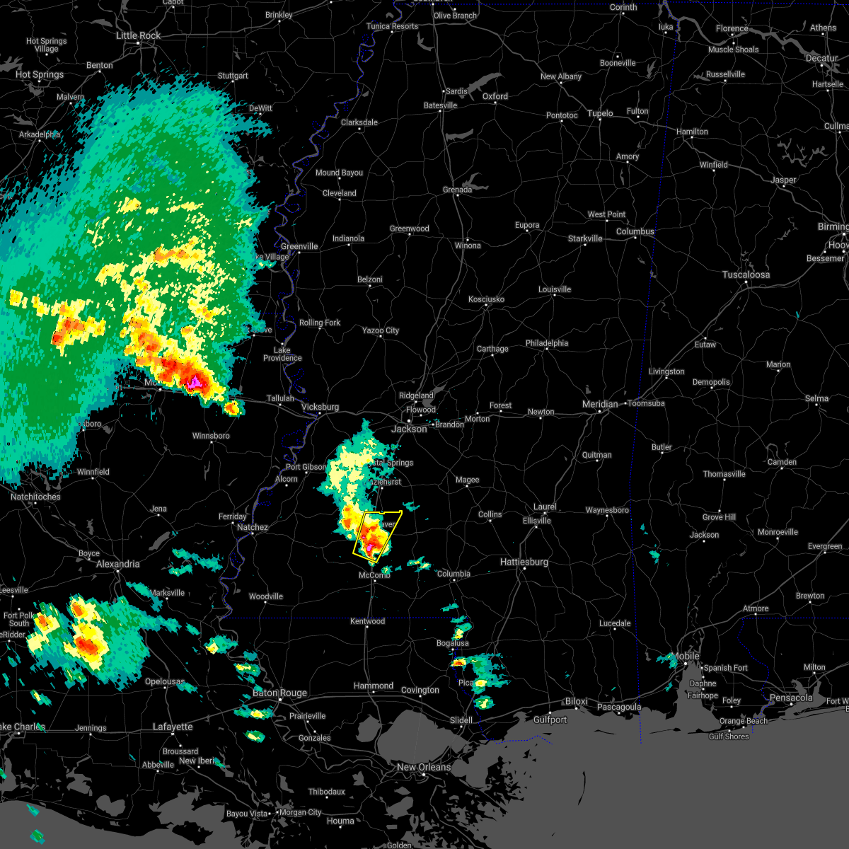 At 1256 pm cdt, a severe thunderstorm was located near bogue chitto, or 8 miles southwest of brookhaven, moving north at 35 mph (radar indicated). Hazards include 60 mph wind gusts and half dollar size hail. Hail damage to vehicles is expected. expect wind damage to roofs, siding, and trees. this severe thunderstorm will be near, enterprise around 100 pm cdt. Brookhaven and loyd star around 115 pm cdt. At 1256 pm cdt, a severe thunderstorm was located near bogue chitto, or 8 miles southwest of brookhaven, moving north at 35 mph (radar indicated). Hazards include 60 mph wind gusts and half dollar size hail. Hail damage to vehicles is expected. expect wind damage to roofs, siding, and trees. this severe thunderstorm will be near, enterprise around 100 pm cdt. Brookhaven and loyd star around 115 pm cdt.
|
| 3/27/2017 4:53 PM CDT |
 The national weather service in jackson has issued a * severe thunderstorm warning for. southeastern noxubee county in east central mississippi. kemper county in east central mississippi. Until 600 pm cdt * at 453 pm cdt, a severe thunderstorm was located near bluff. The national weather service in jackson has issued a * severe thunderstorm warning for. southeastern noxubee county in east central mississippi. kemper county in east central mississippi. Until 600 pm cdt * at 453 pm cdt, a severe thunderstorm was located near bluff.
|
| 3/27/2017 4:35 PM CDT |
 At 435 pm cdt, a severe thunderstorm was located near philadelphia, moving east at 40 mph (radar indicated). Hazards include 60 mph wind gusts and half dollar size hail. Hail damage to vehicles is expected. expect wind damage to roofs, siding, and trees. this severe storm will be near, forestdale around 440 pm cdt. Other locations impacted by this severe thunderstorm include tucker. At 435 pm cdt, a severe thunderstorm was located near philadelphia, moving east at 40 mph (radar indicated). Hazards include 60 mph wind gusts and half dollar size hail. Hail damage to vehicles is expected. expect wind damage to roofs, siding, and trees. this severe storm will be near, forestdale around 440 pm cdt. Other locations impacted by this severe thunderstorm include tucker.
|
| 3/27/2017 4:06 PM CDT |
 At 406 pm cdt, a severe thunderstorm was located over dowdville, or near edinburg, moving northeast at 30 mph (radar indicated). Hazards include 60 mph wind gusts and half dollar size hail. Hail damage to vehicles is expected. expect wind damage to roofs, siding, and trees. this severe storm will be near, dixon around 415 pm cdt. pearl river around 420 pm cdt. philadelphia around 425 pm cdt. burnside around 435 pm cdt. forestdale around 445 pm cdt. Other locations impacted by this severe thunderstorm include tucker. At 406 pm cdt, a severe thunderstorm was located over dowdville, or near edinburg, moving northeast at 30 mph (radar indicated). Hazards include 60 mph wind gusts and half dollar size hail. Hail damage to vehicles is expected. expect wind damage to roofs, siding, and trees. this severe storm will be near, dixon around 415 pm cdt. pearl river around 420 pm cdt. philadelphia around 425 pm cdt. burnside around 435 pm cdt. forestdale around 445 pm cdt. Other locations impacted by this severe thunderstorm include tucker.
|
| 3/27/2017 3:51 PM CDT |
 At 351 pm cdt, a severe thunderstorm was located near tuscola, or near carthage, moving northeast at 30 mph (radar indicated). Hazards include 60 mph wind gusts and half dollar size hail. Hail damage to vehicles is expected. expect wind damage to roofs, siding, and trees. this severe thunderstorm will be near, madden around 405 pm cdt. edinburg and dowdville around 410 pm cdt. dixon around 415 pm cdt. pearl river around 420 pm cdt. philadelphia around 425 pm cdt. burnside around 435 pm cdt. forestdale around 450 pm cdt. Other locations impacted by this severe thunderstorm include tucker, standing pine and walnut grove. At 351 pm cdt, a severe thunderstorm was located near tuscola, or near carthage, moving northeast at 30 mph (radar indicated). Hazards include 60 mph wind gusts and half dollar size hail. Hail damage to vehicles is expected. expect wind damage to roofs, siding, and trees. this severe thunderstorm will be near, madden around 405 pm cdt. edinburg and dowdville around 410 pm cdt. dixon around 415 pm cdt. pearl river around 420 pm cdt. philadelphia around 425 pm cdt. burnside around 435 pm cdt. forestdale around 450 pm cdt. Other locations impacted by this severe thunderstorm include tucker, standing pine and walnut grove.
|
| 3/27/2017 3:50 PM CDT | Quarter sized hail reported 5.1 miles SW of Bogue Chitto, MS, hail up to quarter sized covering the ground at the preston general store. |
| 3/27/2017 3:48 PM CDT |
 At 348 pm cdt, a severe thunderstorm was located over gholson, or near preston, moving east at 35 mph (radar indicated). Hazards include 60 mph wind gusts and half dollar size hail. Hail damage to vehicles is expected. expect wind damage to roofs, siding, and trees. This severe thunderstorm will remain over mainly rural areas of southwestern noxubee and northern kemper counties, including the following locations: shuqualak and scooba. At 348 pm cdt, a severe thunderstorm was located over gholson, or near preston, moving east at 35 mph (radar indicated). Hazards include 60 mph wind gusts and half dollar size hail. Hail damage to vehicles is expected. expect wind damage to roofs, siding, and trees. This severe thunderstorm will remain over mainly rural areas of southwestern noxubee and northern kemper counties, including the following locations: shuqualak and scooba.
|
| 3/27/2017 3:30 PM CDT |
 At 329 pm cdt, a severe thunderstorm was located near nanih waiya, moving east at 35 mph (radar indicated). Hazards include golf ball size hail and 60 mph wind gusts. People and animals outdoors will be injured. expect hail damage to roofs, siding, windows, and vehicles. expect wind damage to roofs, siding, and trees. this severe thunderstorm will be near, preston around 340 pm cdt. gholson around 355 pm cdt. Other locations impacted by this severe thunderstorm include shuqualak and scooba. At 329 pm cdt, a severe thunderstorm was located near nanih waiya, moving east at 35 mph (radar indicated). Hazards include golf ball size hail and 60 mph wind gusts. People and animals outdoors will be injured. expect hail damage to roofs, siding, windows, and vehicles. expect wind damage to roofs, siding, and trees. this severe thunderstorm will be near, preston around 340 pm cdt. gholson around 355 pm cdt. Other locations impacted by this severe thunderstorm include shuqualak and scooba.
|
| 3/7/2017 1:46 PM CST | Ping Pong Ball sized hail reported 5.1 miles SW of Bogue Chitto, MS |
| 3/7/2017 1:43 PM CST |
 At 143 pm cst, a severe thunderstorm was located over preston, moving east at 35 mph (radar indicated). Hazards include 60 mph wind gusts and half dollar size hail. Hail damage to vehicles is expected. expect wind damage to roofs, siding, and trees. this severe storm will be near, gholson around 155 pm cst. Other locations impacted by this severe thunderstorm include shuqualak. At 143 pm cst, a severe thunderstorm was located over preston, moving east at 35 mph (radar indicated). Hazards include 60 mph wind gusts and half dollar size hail. Hail damage to vehicles is expected. expect wind damage to roofs, siding, and trees. this severe storm will be near, gholson around 155 pm cst. Other locations impacted by this severe thunderstorm include shuqualak.
|
| 3/7/2017 1:33 PM CST |
 At 133 pm cst, a severe thunderstorm was located near nanih waiya, moving east at 35 mph (radar indicated). Hazards include 60 mph wind gusts and quarter size hail. Hail damage to vehicles is expected. expect wind damage to roofs, siding, and trees. this severe thunderstorm will be near, preston around 145 pm cst. gholson around 155 pm cst. Other locations impacted by this severe thunderstorm include shuqualak. At 133 pm cst, a severe thunderstorm was located near nanih waiya, moving east at 35 mph (radar indicated). Hazards include 60 mph wind gusts and quarter size hail. Hail damage to vehicles is expected. expect wind damage to roofs, siding, and trees. this severe thunderstorm will be near, preston around 145 pm cst. gholson around 155 pm cst. Other locations impacted by this severe thunderstorm include shuqualak.
|
| 1/21/2017 9:44 PM CST |
 At 943 pm cst, a severe thunderstorm was located over conehatta, or near prospect, moving northeast at 40 mph (radar indicated). Hazards include 60 mph wind gusts and half dollar size hail. Hail damage to vehicles is expected. expect wind damage to roofs, siding, and trees. this severe thunderstorm will be near, prospect around 950 pm cst. decatur and stratton around 1000 pm cst. neshoba around 1005 pm cst. little rock around 1010 pm cst. house and bethsaida around 1015 pm cst. herbert springs around 1020 pm cst. other locations impacted by this severe thunderstorm include tucker. A tornado watch remains in effect until 300 am cst for east central and central mississippi. At 943 pm cst, a severe thunderstorm was located over conehatta, or near prospect, moving northeast at 40 mph (radar indicated). Hazards include 60 mph wind gusts and half dollar size hail. Hail damage to vehicles is expected. expect wind damage to roofs, siding, and trees. this severe thunderstorm will be near, prospect around 950 pm cst. decatur and stratton around 1000 pm cst. neshoba around 1005 pm cst. little rock around 1010 pm cst. house and bethsaida around 1015 pm cst. herbert springs around 1020 pm cst. other locations impacted by this severe thunderstorm include tucker. A tornado watch remains in effect until 300 am cst for east central and central mississippi.
|
| 1/21/2017 2:44 AM CST |
 At 244 am cst, severe thunderstorms were located along a line extending from near brookhaven to bogue chitto, moving east at 40 mph (radar indicated). Hazards include 60 mph wind gusts and quarter size hail. Hail damage to vehicles is expected. expect wind damage to roofs, siding, and trees. these severe storms will be near, east lincoln and sontag around 300 am cst. topeka around 305 am cst. oma and wanilla around 310 am cst. monticello, robinwood and arm around 315 am cst. other locations impacted by these severe thunderstorms include silver creek and new hebron. A tornado watch remains in effect until 700 am cst for south central and central mississippi. At 244 am cst, severe thunderstorms were located along a line extending from near brookhaven to bogue chitto, moving east at 40 mph (radar indicated). Hazards include 60 mph wind gusts and quarter size hail. Hail damage to vehicles is expected. expect wind damage to roofs, siding, and trees. these severe storms will be near, east lincoln and sontag around 300 am cst. topeka around 305 am cst. oma and wanilla around 310 am cst. monticello, robinwood and arm around 315 am cst. other locations impacted by these severe thunderstorms include silver creek and new hebron. A tornado watch remains in effect until 700 am cst for south central and central mississippi.
|
| 1/21/2017 2:22 AM CST |
 At 221 am cst, severe thunderstorms were located along a line extending from near mccall creek to near smithdale, moving east at 50 mph (radar indicated). Hazards include 60 mph wind gusts and quarter size hail. Hail damage to vehicles is expected. expect wind damage to roofs, siding, and trees. severe thunderstorms will be near, vaughn and west lincoln around 230 am cst. bogue chitto around 235 am cst. brookhaven and enterprise around 240 am cst. ruth around 245 am cst. jayess and east lincoln around 250 am cst. topeka and sontag around 255 am cst. monticello, wanilla, robinwood and oma around 300 am cst. tilton and arm around 305 am cst. other locations impacted by these severe thunderstorms include silver creek and new hebron. A tornado watch remains in effect until 700 am cst for south central and central mississippi. At 221 am cst, severe thunderstorms were located along a line extending from near mccall creek to near smithdale, moving east at 50 mph (radar indicated). Hazards include 60 mph wind gusts and quarter size hail. Hail damage to vehicles is expected. expect wind damage to roofs, siding, and trees. severe thunderstorms will be near, vaughn and west lincoln around 230 am cst. bogue chitto around 235 am cst. brookhaven and enterprise around 240 am cst. ruth around 245 am cst. jayess and east lincoln around 250 am cst. topeka and sontag around 255 am cst. monticello, wanilla, robinwood and oma around 300 am cst. tilton and arm around 305 am cst. other locations impacted by these severe thunderstorms include silver creek and new hebron. A tornado watch remains in effect until 700 am cst for south central and central mississippi.
|
| 1/2/2017 3:40 PM CST |
 At 339 pm cst, severe thunderstorms were located along a line extending from stallo to near neshoba, moving east at 50 mph (radar indicated). Hazards include 60 mph wind gusts. Expect damage to roofs, siding, and trees. these severe storms will be near, house around 345 pm cst. nanih waiya and herbert springs around 350 pm cst. other locations impacted by these severe thunderstorms include tucker. A tornado watch remains in effect until 800 pm cst for east central mississippi. At 339 pm cst, severe thunderstorms were located along a line extending from stallo to near neshoba, moving east at 50 mph (radar indicated). Hazards include 60 mph wind gusts. Expect damage to roofs, siding, and trees. these severe storms will be near, house around 345 pm cst. nanih waiya and herbert springs around 350 pm cst. other locations impacted by these severe thunderstorms include tucker. A tornado watch remains in effect until 800 pm cst for east central mississippi.
|
| 1/2/2017 3:16 PM CST |
 At 316 pm cst, severe thunderstorms were located along a line extending from renfroe to 6 miles southwest of madden, moving east at 45 mph (radar indicated). Hazards include 60 mph wind gusts. Expect damage to roofs, siding, and trees. severe thunderstorms will be near, dowdville around 325 pm cst. pearl river and dixon around 330 pm cst. philadelphia and neshoba around 335 pm cst. burnside and stallo around 340 pm cst. house and bethsaida around 345 pm cst. herbert springs around 350 pm cst. nanih waiya around 355 pm cst. A tornado watch remains in effect until 800 pm cst for east central and central mississippi. At 316 pm cst, severe thunderstorms were located along a line extending from renfroe to 6 miles southwest of madden, moving east at 45 mph (radar indicated). Hazards include 60 mph wind gusts. Expect damage to roofs, siding, and trees. severe thunderstorms will be near, dowdville around 325 pm cst. pearl river and dixon around 330 pm cst. philadelphia and neshoba around 335 pm cst. burnside and stallo around 340 pm cst. house and bethsaida around 345 pm cst. herbert springs around 350 pm cst. nanih waiya around 355 pm cst. A tornado watch remains in effect until 800 pm cst for east central and central mississippi.
|
| 1/2/2017 1:32 PM CST | A tree was snapped in lincoln county MS, 0.6 miles WNW of Bogue Chitto, MS |
| 1/2/2017 1:29 PM CST |
 At 128 pm cst, severe thunderstorms were located along a line extending from near barlow to brookhaven, moving northeast at 70 mph (radar indicated). Hazards include 70 mph wind gusts. Expect considerable tree damage. damage is likely to mobile homes, roofs, and outbuildings. these severe storms will be near, hazlehurst and dentville around 135 pm cst. crystal springs, gallman and martinsville around 140 pm cst. rockport around 145 pm cst. hopewell around 150 pm cst. other locations impacted by these severe thunderstorms include georgetown and beauregard. A tornado watch remains in effect until 800 pm cst for south central and central mississippi. At 128 pm cst, severe thunderstorms were located along a line extending from near barlow to brookhaven, moving northeast at 70 mph (radar indicated). Hazards include 70 mph wind gusts. Expect considerable tree damage. damage is likely to mobile homes, roofs, and outbuildings. these severe storms will be near, hazlehurst and dentville around 135 pm cst. crystal springs, gallman and martinsville around 140 pm cst. rockport around 145 pm cst. hopewell around 150 pm cst. other locations impacted by these severe thunderstorms include georgetown and beauregard. A tornado watch remains in effect until 800 pm cst for south central and central mississippi.
|
| 1/2/2017 1:13 PM CST |
 At 113 pm cst, severe thunderstorms were located along a line extending from near peyton to near mccall creek, moving east at 50 mph (radar indicated). Hazards include 60 mph wind gusts. Expect damage to roofs, siding, and trees. severe thunderstorms will be near, allen around 120 pm cst. west lincoln and vaughn around 125 pm cst. loyd star and bogue chitto around 130 pm cst. brookhaven, enterprise, glancy and dentville around 135 pm cst. hazlehurst around 140 pm cst. crystal springs, gallman and east lincoln around 145 pm cst. hopewell around 155 pm cst. other locations impacted by these severe thunderstorms include georgetown and beauregard. A tornado watch remains in effect until 800 pm cst for south central, southwestern and central mississippi. At 113 pm cst, severe thunderstorms were located along a line extending from near peyton to near mccall creek, moving east at 50 mph (radar indicated). Hazards include 60 mph wind gusts. Expect damage to roofs, siding, and trees. severe thunderstorms will be near, allen around 120 pm cst. west lincoln and vaughn around 125 pm cst. loyd star and bogue chitto around 130 pm cst. brookhaven, enterprise, glancy and dentville around 135 pm cst. hazlehurst around 140 pm cst. crystal springs, gallman and east lincoln around 145 pm cst. hopewell around 155 pm cst. other locations impacted by these severe thunderstorms include georgetown and beauregard. A tornado watch remains in effect until 800 pm cst for south central, southwestern and central mississippi.
|
| 11/29/2016 5:42 PM CST |
 At 542 pm cst, a severe thunderstorm capable of producing a tornado was located near nanih waiya, moving northeast at 35 mph (radar indicated rotation). Hazards include tornado and quarter size hail. Flying debris will be dangerous to those caught without shelter. mobile homes will be damaged or destroyed. damage to roofs, windows, and vehicles will occur. Tree damage is likely. At 542 pm cst, a severe thunderstorm capable of producing a tornado was located near nanih waiya, moving northeast at 35 mph (radar indicated rotation). Hazards include tornado and quarter size hail. Flying debris will be dangerous to those caught without shelter. mobile homes will be damaged or destroyed. damage to roofs, windows, and vehicles will occur. Tree damage is likely.
|
| 11/29/2016 5:40 PM CST | Two mobile homes damaged on county line r in kemper county MS, 6.5 miles SSW of Bogue Chitto, MS |
| 11/29/2016 5:16 PM CST |
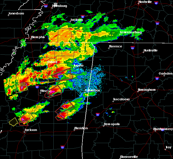 At 514 pm cst, a severe thunderstorm was located over philadelphia, moving northeast at 40 mph (radar indicated). Hazards include 60 mph wind gusts. Expect damage to roofs. siding. And trees. At 514 pm cst, a severe thunderstorm was located over philadelphia, moving northeast at 40 mph (radar indicated). Hazards include 60 mph wind gusts. Expect damage to roofs. siding. And trees.
|
| 11/28/2016 6:12 PM CST |
 At 612 pm cst, severe thunderstorms were located along a line extending from 7 miles northeast of electric mills to daleville, moving east at 65 mph (radar indicated). Hazards include 60 mph wind gusts. Expect damage to roofs. siding. and trees. these severe thunderstorms will remain over mainly rural areas of neshoba, lauderdale, newton and kemper counties, including the following locations: tucker, chunky, hickory and scooba. A tornado watch remains in effect until 900 pm cst for central and east central mississippi. At 612 pm cst, severe thunderstorms were located along a line extending from 7 miles northeast of electric mills to daleville, moving east at 65 mph (radar indicated). Hazards include 60 mph wind gusts. Expect damage to roofs. siding. and trees. these severe thunderstorms will remain over mainly rural areas of neshoba, lauderdale, newton and kemper counties, including the following locations: tucker, chunky, hickory and scooba. A tornado watch remains in effect until 900 pm cst for central and east central mississippi.
|
| 11/28/2016 5:54 PM CST |
 At 553 pm cst, severe thunderstorms were located along a line extending from near de kalb to near duffee, moving east at 65 mph (radar indicated). Hazards include 60 mph wind gusts. Expect damage to roofs. siding. and trees. severe thunderstorms will be near, de kalb around 600 pm cst. meridian, collinsville, electric mills and nellieburg around 605 pm cst. prismatic around 610 pm cst. meridian station, daleville and blackwater around 615 pm cst. lauderdale around 620 pm cst. tamola and porterville around 625 pm cst. other locations impacted by these severe thunderstorms include tucker, chunky, hickory, scooba, lake and sebastopol. A tornado watch remains in effect until 900 pm cst for central and east central mississippi. At 553 pm cst, severe thunderstorms were located along a line extending from near de kalb to near duffee, moving east at 65 mph (radar indicated). Hazards include 60 mph wind gusts. Expect damage to roofs. siding. and trees. severe thunderstorms will be near, de kalb around 600 pm cst. meridian, collinsville, electric mills and nellieburg around 605 pm cst. prismatic around 610 pm cst. meridian station, daleville and blackwater around 615 pm cst. lauderdale around 620 pm cst. tamola and porterville around 625 pm cst. other locations impacted by these severe thunderstorms include tucker, chunky, hickory, scooba, lake and sebastopol. A tornado watch remains in effect until 900 pm cst for central and east central mississippi.
|
| 11/28/2016 5:47 PM CST |
 At 546 pm cst, severe thunderstorms were located along a line extending from near bluff springs to little rock, moving northeast at 60 mph (radar indicated). Hazards include 60 mph wind gusts. Expect damage to roofs. siding. and trees. these severe storms will be near, preston and bluff springs around 550 pm cst. de kalb around 555 pm cst. liberty and damascus around 600 pm cst. other locations impacted by these severe thunderstorms include tucker, shuqualak, scooba and sebastopol. A tornado watch remains in effect until 900 pm cst for northeastern, central and east central mississippi. At 546 pm cst, severe thunderstorms were located along a line extending from near bluff springs to little rock, moving northeast at 60 mph (radar indicated). Hazards include 60 mph wind gusts. Expect damage to roofs. siding. and trees. these severe storms will be near, preston and bluff springs around 550 pm cst. de kalb around 555 pm cst. liberty and damascus around 600 pm cst. other locations impacted by these severe thunderstorms include tucker, shuqualak, scooba and sebastopol. A tornado watch remains in effect until 900 pm cst for northeastern, central and east central mississippi.
|
| 11/28/2016 5:11 PM CST |
 At 511 pm cst, severe thunderstorms were located along a line extending from 7 miles north of deerbrook to hillsboro, moving east at 50 mph (radar indicated). Hazards include 60 mph wind gusts. Expect damage to roofs. siding. and trees. these severe storms will be near, bigbee valley around 515 pm cst. prospect and conehatta around 525 pm cst. stratton and dixon around 530 pm cst. neshoba and little rock around 535 pm cst. house and bethsaida around 540 pm cst. herbert springs around 545 pm cst. damascus around 550 pm cst. liberty and bluff springs around 555 pm cst. other locations impacted by these severe thunderstorms include tucker, shuqualak, scooba and sebastopol. A tornado watch remains in effect until 900 pm cst for northeastern, central and east central mississippi. At 511 pm cst, severe thunderstorms were located along a line extending from 7 miles north of deerbrook to hillsboro, moving east at 50 mph (radar indicated). Hazards include 60 mph wind gusts. Expect damage to roofs. siding. and trees. these severe storms will be near, bigbee valley around 515 pm cst. prospect and conehatta around 525 pm cst. stratton and dixon around 530 pm cst. neshoba and little rock around 535 pm cst. house and bethsaida around 540 pm cst. herbert springs around 545 pm cst. damascus around 550 pm cst. liberty and bluff springs around 555 pm cst. other locations impacted by these severe thunderstorms include tucker, shuqualak, scooba and sebastopol. A tornado watch remains in effect until 900 pm cst for northeastern, central and east central mississippi.
|
| 11/28/2016 5:03 PM CST |
 At 502 pm cst, severe thunderstorms were located along a line extending from near crawford to near morton, moving northeast at 100 mph (radar indicated). Hazards include 60 mph wind gusts. Expect damage to roofs. siding. and trees. severe thunderstorms will be near, deerbrook around 510 pm cst. prospect and conehatta around 520 pm cst. neshoba and dixon around 525 pm cst. bethsaida, house and herbert springs around 530 pm cst. forestdale and damascus around 535 pm cst. preston and bluff springs around 540 pm cst. de kalb around 545 pm cst. paulette and cooksville around 555 pm cst. other locations impacted by these severe thunderstorms include tucker, shuqualak, scooba and sebastopol. A tornado watch remains in effect until 900 pm cst for northeastern, central and east central mississippi. At 502 pm cst, severe thunderstorms were located along a line extending from near crawford to near morton, moving northeast at 100 mph (radar indicated). Hazards include 60 mph wind gusts. Expect damage to roofs. siding. and trees. severe thunderstorms will be near, deerbrook around 510 pm cst. prospect and conehatta around 520 pm cst. neshoba and dixon around 525 pm cst. bethsaida, house and herbert springs around 530 pm cst. forestdale and damascus around 535 pm cst. preston and bluff springs around 540 pm cst. de kalb around 545 pm cst. paulette and cooksville around 555 pm cst. other locations impacted by these severe thunderstorms include tucker, shuqualak, scooba and sebastopol. A tornado watch remains in effect until 900 pm cst for northeastern, central and east central mississippi.
|
| 7/13/2016 6:39 PM CDT |
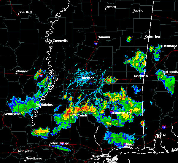 At 638 pm cdt, a severe thunderstorm was located near west lincoln, or 11 miles southwest of brookhaven, moving east at 10 mph (radar indicated). Hazards include 60 mph wind gusts and quarter size hail. Hail damage to vehicles is expected. expect wind damage to roofs, siding, and trees. This severe thunderstorm will be near, bogue chitto around 715 pm cdt. At 638 pm cdt, a severe thunderstorm was located near west lincoln, or 11 miles southwest of brookhaven, moving east at 10 mph (radar indicated). Hazards include 60 mph wind gusts and quarter size hail. Hail damage to vehicles is expected. expect wind damage to roofs, siding, and trees. This severe thunderstorm will be near, bogue chitto around 715 pm cdt.
|
| 7/6/2016 5:52 PM CDT |
 At 552 pm cdt, severe thunderstorms were located along a line extending from bluff springs to near prismatic to near suqualena, moving east at 15 mph (radar indicated). Hazards include 60 mph wind gusts and nickel size hail. Expect damage to roofs. siding. and trees. severe thunderstorms will be near, meridian and prismatic around 600 pm cdt. blackwater and daleville around 615 pm cdt. meridian station around 625 pm cdt. de kalb around 630 pm cdt. lauderdale around 650 pm cdt. tamola around 700 pm cdt. porterville around 705 pm cdt. electric mills around 715 pm cdt. Other locations impacted by these severe thunderstorms include scooba and i 20 welcome center at cuba. At 552 pm cdt, severe thunderstorms were located along a line extending from bluff springs to near prismatic to near suqualena, moving east at 15 mph (radar indicated). Hazards include 60 mph wind gusts and nickel size hail. Expect damage to roofs. siding. and trees. severe thunderstorms will be near, meridian and prismatic around 600 pm cdt. blackwater and daleville around 615 pm cdt. meridian station around 625 pm cdt. de kalb around 630 pm cdt. lauderdale around 650 pm cdt. tamola around 700 pm cdt. porterville around 705 pm cdt. electric mills around 715 pm cdt. Other locations impacted by these severe thunderstorms include scooba and i 20 welcome center at cuba.
|
| 6/27/2016 5:24 PM CDT |
 At 524 pm cdt, a severe thunderstorm was located over arlington, or 12 miles northwest of mccomb, moving south at 5 mph (radar indicated). Hazards include 60 mph wind gusts and penny size hail. Expect damage to roofs. siding. and trees. Locations impacted include, bogue chitto and center point. At 524 pm cdt, a severe thunderstorm was located over arlington, or 12 miles northwest of mccomb, moving south at 5 mph (radar indicated). Hazards include 60 mph wind gusts and penny size hail. Expect damage to roofs. siding. and trees. Locations impacted include, bogue chitto and center point.
|
| 6/27/2016 5:15 PM CDT |
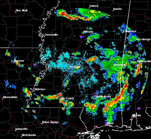 At 515 pm cdt, a severe thunderstorm was located near auburn, or 10 miles southwest of brookhaven, moving south at 10 mph (radar indicated). Hazards include 60 mph wind gusts and penny size hail. Expect damage to roofs. siding. And trees. At 515 pm cdt, a severe thunderstorm was located near auburn, or 10 miles southwest of brookhaven, moving south at 10 mph (radar indicated). Hazards include 60 mph wind gusts and penny size hail. Expect damage to roofs. siding. And trees.
|
| 6/17/2016 3:28 PM CDT |
 At 328 pm cdt, a severe thunderstorm was located over paulette, or 19 miles southwest of aliceville, moving south at 60 mph (radar indicated). Hazards include 60 mph wind gusts and quarter size hail. Hail damage to vehicles is expected. expect wind damage to roofs, siding, and trees. this severe thunderstorm will be near, electric mills around 340 pm cdt. porterville around 345 pm cdt. Other locations impacted by this severe thunderstorm include scooba. At 328 pm cdt, a severe thunderstorm was located over paulette, or 19 miles southwest of aliceville, moving south at 60 mph (radar indicated). Hazards include 60 mph wind gusts and quarter size hail. Hail damage to vehicles is expected. expect wind damage to roofs, siding, and trees. this severe thunderstorm will be near, electric mills around 340 pm cdt. porterville around 345 pm cdt. Other locations impacted by this severe thunderstorm include scooba.
|
| 5/1/2016 11:57 AM CDT |
 At 1155 am cdt, severe thunderstorms were located along a line extending from 7 miles west of betheden to near nanih waiya, moving east at 30 mph (radar indicated). Hazards include 60 mph wind gusts. Expect damage to roofs. siding. and trees. these severe storms will be near, millcreek around 1205 pm cdt. betheden around 1210 pm cdt. Other locations impacted by these severe thunderstorms include noxapater. At 1155 am cdt, severe thunderstorms were located along a line extending from 7 miles west of betheden to near nanih waiya, moving east at 30 mph (radar indicated). Hazards include 60 mph wind gusts. Expect damage to roofs. siding. and trees. these severe storms will be near, millcreek around 1205 pm cdt. betheden around 1210 pm cdt. Other locations impacted by these severe thunderstorms include noxapater.
|
| 5/1/2016 11:48 AM CDT |
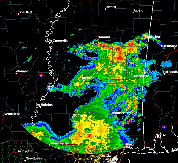 At 1147 am cdt, severe thunderstorms were located along a line extending from 6 miles south of ackerman to near burnside, moving east at 30 mph (radar indicated). Hazards include 60 mph wind gusts. Expect damage to roofs. siding. and trees. these severe storms will be near, louisville around 1155 am cdt. nanih waiya and millcreek around 1205 pm cdt. betheden around 1210 pm cdt. Other locations impacted by these severe thunderstorms include noxapater. At 1147 am cdt, severe thunderstorms were located along a line extending from 6 miles south of ackerman to near burnside, moving east at 30 mph (radar indicated). Hazards include 60 mph wind gusts. Expect damage to roofs. siding. and trees. these severe storms will be near, louisville around 1155 am cdt. nanih waiya and millcreek around 1205 pm cdt. betheden around 1210 pm cdt. Other locations impacted by these severe thunderstorms include noxapater.
|
| 5/1/2016 11:27 AM CDT |
 At 1127 am cdt, severe thunderstorms were located along a line extending from 9 miles north of zama to near edinburg, moving east at 30 mph (radar indicated). Hazards include 60 mph wind gusts. Expect damage to roofs. siding. and trees. severe thunderstorms will be near, pearl river around 1135 am cdt. philadelphia around 1140 am cdt. stallo and burnside around 1155 am cdt. louisville and mcmillan around 1200 pm cdt. nanih waiya and millcreek around 1215 pm cdt. betheden around 1220 pm cdt. Other locations impacted by these severe thunderstorms include noxapater. At 1127 am cdt, severe thunderstorms were located along a line extending from 9 miles north of zama to near edinburg, moving east at 30 mph (radar indicated). Hazards include 60 mph wind gusts. Expect damage to roofs. siding. and trees. severe thunderstorms will be near, pearl river around 1135 am cdt. philadelphia around 1140 am cdt. stallo and burnside around 1155 am cdt. louisville and mcmillan around 1200 pm cdt. nanih waiya and millcreek around 1215 pm cdt. betheden around 1220 pm cdt. Other locations impacted by these severe thunderstorms include noxapater.
|
| 4/30/2016 2:04 PM CDT |
 At 204 pm cdt, a severe thunderstorm was located over brookhaven, moving northeast at 30 mph (radar indicated). Hazards include 60 mph wind gusts. Expect damage to roofs. siding. and trees. This severe thunderstorm will remain over mainly rural areas of central lincoln county. At 204 pm cdt, a severe thunderstorm was located over brookhaven, moving northeast at 30 mph (radar indicated). Hazards include 60 mph wind gusts. Expect damage to roofs. siding. and trees. This severe thunderstorm will remain over mainly rural areas of central lincoln county.
|
| 4/30/2016 1:50 PM CDT |
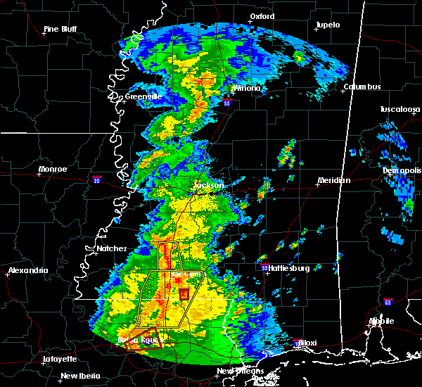 At 150 pm cdt, a severe thunderstorm was located over vaughn, or near brookhaven, moving northeast at 30 mph (radar indicated). Hazards include 60 mph wind gusts. Expect damage to roofs. siding. and trees. This severe storm will be near, brookhaven around 205 pm cdt. At 150 pm cdt, a severe thunderstorm was located over vaughn, or near brookhaven, moving northeast at 30 mph (radar indicated). Hazards include 60 mph wind gusts. Expect damage to roofs. siding. and trees. This severe storm will be near, brookhaven around 205 pm cdt.
|
| 4/30/2016 1:36 PM CDT |
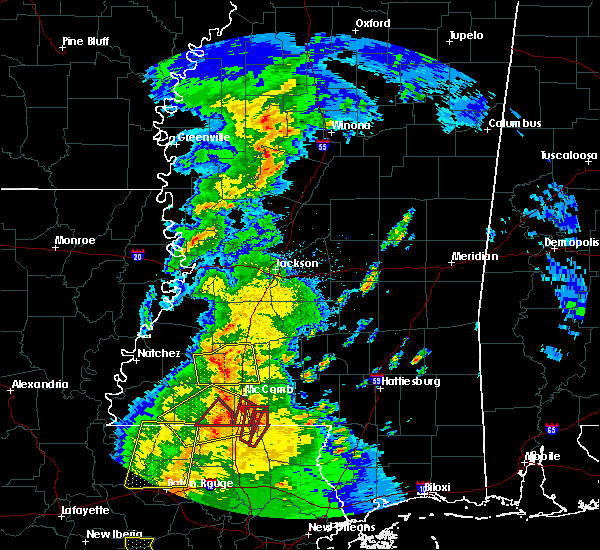 At 136 pm cdt, a severe thunderstorm was located over mccall creek, or 14 miles west of brookhaven, moving northeast at 30 mph (radar indicated). Hazards include 60 mph wind gusts. Expect damage to roofs. siding. and trees. this severe storm will be near, west lincoln around 145 pm cdt. vaughn around 150 pm cdt. loyd star around 200 pm cdt. Brookhaven around 205 pm cdt. At 136 pm cdt, a severe thunderstorm was located over mccall creek, or 14 miles west of brookhaven, moving northeast at 30 mph (radar indicated). Hazards include 60 mph wind gusts. Expect damage to roofs. siding. and trees. this severe storm will be near, west lincoln around 145 pm cdt. vaughn around 150 pm cdt. loyd star around 200 pm cdt. Brookhaven around 205 pm cdt.
|
| 4/30/2016 1:29 PM CDT |
 At 129 pm cdt, a severe thunderstorm was located over mccall creek, or 17 miles southwest of brookhaven, moving northeast at 30 mph (radar indicated). Hazards include 60 mph wind gusts. Expect damage to roofs. siding. and trees. this severe storm will be near, west lincoln around 145 pm cdt. vaughn around 150 pm cdt. loyd star around 200 pm cdt. Brookhaven around 205 pm cdt. At 129 pm cdt, a severe thunderstorm was located over mccall creek, or 17 miles southwest of brookhaven, moving northeast at 30 mph (radar indicated). Hazards include 60 mph wind gusts. Expect damage to roofs. siding. and trees. this severe storm will be near, west lincoln around 145 pm cdt. vaughn around 150 pm cdt. loyd star around 200 pm cdt. Brookhaven around 205 pm cdt.
|
| 4/30/2016 1:13 PM CDT |
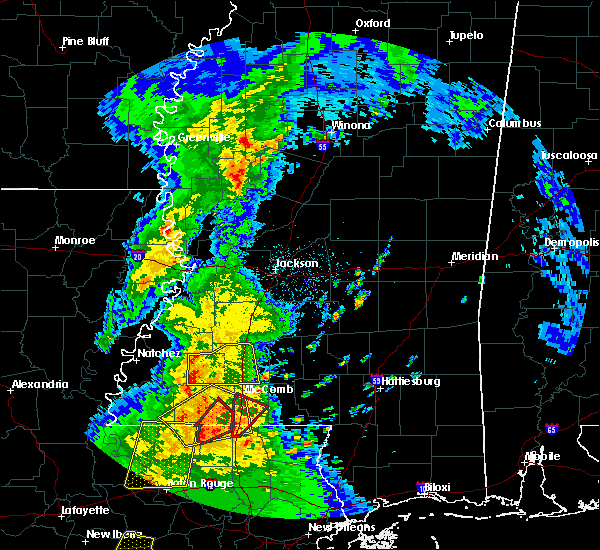 At 113 pm cdt, a severe thunderstorm was located near bude, or 17 miles north of liberty, moving northeast at 30 mph (radar indicated). Hazards include 60 mph wind gusts. Expect damage to roofs. siding. and trees. this severe thunderstorm will be near, little springs around 120 pm cdt. mccall creek around 135 pm cdt. west lincoln around 145 pm cdt. vaughn around 150 pm cdt. loyd star around 200 pm cdt. brookhaven around 210 pm cdt. Other locations impacted by this severe thunderstorm include meadville. At 113 pm cdt, a severe thunderstorm was located near bude, or 17 miles north of liberty, moving northeast at 30 mph (radar indicated). Hazards include 60 mph wind gusts. Expect damage to roofs. siding. and trees. this severe thunderstorm will be near, little springs around 120 pm cdt. mccall creek around 135 pm cdt. west lincoln around 145 pm cdt. vaughn around 150 pm cdt. loyd star around 200 pm cdt. brookhaven around 210 pm cdt. Other locations impacted by this severe thunderstorm include meadville.
|
| 3/31/2016 6:41 PM CDT | The severe thunderstorm warning for neshoba, northern newton, southeastern leake and northern scott counties will expire at 645 pm cdt, the storm which prompted the warning has weakened below severe limits and exited the warned area. therefore the warning will be allowed to expire. a tornado watch remains in effect until 1000 pm cdt for east central mississippi. |
| 3/31/2016 5:49 PM CDT |
 At 549 pm cdt, a severe thunderstorm was located over harperville, moving northeast at 50 mph. this is a very dangerous storm (radar indicated). Hazards include 80 mph wind gusts and quarter size hail. Flying debris will be dangerous to those caught without shelter. mobile homes will be heavily damaged. expect considerable damage to roofs, windows and vehicles. extensive tree damage and power outages are likely. this severe thunderstorm will be near, prospect and madden around 605 pm cdt. dixon and dowdville around 610 pm cdt. neshoba around 615 pm cdt. philadelphia around 620 pm cdt. bethsaida around 625 pm cdt. forestdale around 635 pm cdt. other locations impacted by this severe thunderstorm include standing pine, tucker, walnut grove, lake, lena and sebastopol. A tornado watch remains in effect until 1000 pm cdt for east central mississippi. At 549 pm cdt, a severe thunderstorm was located over harperville, moving northeast at 50 mph. this is a very dangerous storm (radar indicated). Hazards include 80 mph wind gusts and quarter size hail. Flying debris will be dangerous to those caught without shelter. mobile homes will be heavily damaged. expect considerable damage to roofs, windows and vehicles. extensive tree damage and power outages are likely. this severe thunderstorm will be near, prospect and madden around 605 pm cdt. dixon and dowdville around 610 pm cdt. neshoba around 615 pm cdt. philadelphia around 620 pm cdt. bethsaida around 625 pm cdt. forestdale around 635 pm cdt. other locations impacted by this severe thunderstorm include standing pine, tucker, walnut grove, lake, lena and sebastopol. A tornado watch remains in effect until 1000 pm cdt for east central mississippi.
|
| 3/31/2016 5:06 PM CDT |
 At 504 pm cdt, a severe thunderstorm was located over bethsaida, or 7 miles southeast of philadelphia, moving northeast at 45 mph (trained weather spotters. golf ball size was reported just outside of union). Hazards include 60 mph wind gusts and quarter size hail. Hail damage to vehicles is expected. expect wind damage to roofs, siding and trees. this severe storm will be near, forestdale around 510 pm cdt. other locations impacted by this severe thunderstorm include tucker. A tornado watch remains in effect until 1000 pm cdt for east central mississippi. At 504 pm cdt, a severe thunderstorm was located over bethsaida, or 7 miles southeast of philadelphia, moving northeast at 45 mph (trained weather spotters. golf ball size was reported just outside of union). Hazards include 60 mph wind gusts and quarter size hail. Hail damage to vehicles is expected. expect wind damage to roofs, siding and trees. this severe storm will be near, forestdale around 510 pm cdt. other locations impacted by this severe thunderstorm include tucker. A tornado watch remains in effect until 1000 pm cdt for east central mississippi.
|
| 3/31/2016 4:42 PM CDT |
 At 442 pm cdt, a severe thunderstorm was located near stratton, or near prospect, moving northeast at 50 mph (radar indicated). Hazards include 60 mph wind gusts and quarter size hail. Hail damage to vehicles is expected. expect wind damage to roofs, siding and trees. this severe thunderstorm will be near, neshoba and dixon around 450 pm cdt. house around 455 pm cdt. bethsaida around 500 pm cdt. forestdale and burnside around 510 pm cdt. nanih waiya around 520 pm cdt. other locations impacted by this severe thunderstorm include tucker. A tornado watch remains in effect until 1000 pm cdt for east central mississippi. At 442 pm cdt, a severe thunderstorm was located near stratton, or near prospect, moving northeast at 50 mph (radar indicated). Hazards include 60 mph wind gusts and quarter size hail. Hail damage to vehicles is expected. expect wind damage to roofs, siding and trees. this severe thunderstorm will be near, neshoba and dixon around 450 pm cdt. house around 455 pm cdt. bethsaida around 500 pm cdt. forestdale and burnside around 510 pm cdt. nanih waiya around 520 pm cdt. other locations impacted by this severe thunderstorm include tucker. A tornado watch remains in effect until 1000 pm cdt for east central mississippi.
|
| 3/17/2016 5:04 PM CDT |
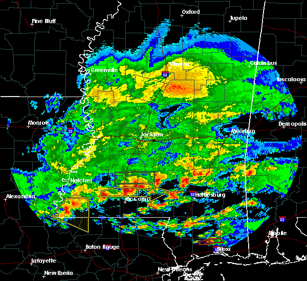 At 503 pm cdt, a severe thunderstorm was located over bogue chitto, or 10 miles south of brookhaven, moving east at 35 mph (radar indicated). Hazards include 60 mph wind gusts and half dollar size hail. Hail damage to vehicles is expected. expect wind damage to roofs, siding and trees. This severe storm will be near, ruth and east lincoln around 515 pm cdt. At 503 pm cdt, a severe thunderstorm was located over bogue chitto, or 10 miles south of brookhaven, moving east at 35 mph (radar indicated). Hazards include 60 mph wind gusts and half dollar size hail. Hail damage to vehicles is expected. expect wind damage to roofs, siding and trees. This severe storm will be near, ruth and east lincoln around 515 pm cdt.
|
| 3/17/2016 5:00 PM CDT | Quarter sized hail reported 1.5 miles NE of Bogue Chitto, MS, quarter size hail along i-55 at exit 30 at bogue chitto. |
| 3/17/2016 4:55 PM CDT |
 At 455 pm cdt, a severe thunderstorm was located near bogue chitto, or 9 miles south of brookhaven, moving east at 35 mph (radar indicated). Hazards include golf ball size hail and 60 mph wind gusts. People and animals outdoors will be injured. expect hail damage to roofs, siding, windows and vehicles. expect wind damage to roofs, siding and trees. this severe storm will be near, bogue chitto around 500 pm cdt. enterprise around 505 pm cdt. ruth and east lincoln around 515 pm cdt. Other locations impacted by this severe thunderstorm include meadville. At 455 pm cdt, a severe thunderstorm was located near bogue chitto, or 9 miles south of brookhaven, moving east at 35 mph (radar indicated). Hazards include golf ball size hail and 60 mph wind gusts. People and animals outdoors will be injured. expect hail damage to roofs, siding, windows and vehicles. expect wind damage to roofs, siding and trees. this severe storm will be near, bogue chitto around 500 pm cdt. enterprise around 505 pm cdt. ruth and east lincoln around 515 pm cdt. Other locations impacted by this severe thunderstorm include meadville.
|
| 3/17/2016 4:36 PM CDT |
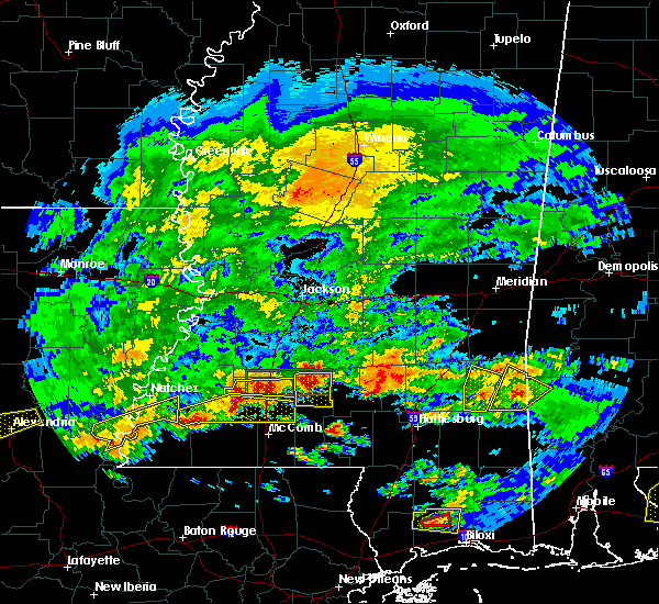 At 436 pm cdt, a severe thunderstorm was located over mccall creek, or 15 miles west of brookhaven, moving east at 35 mph (radar indicated). Hazards include tennis ball size hail and 60 mph wind gusts. People and animals outdoors will be injured. expect hail damage to roofs, siding, windows and vehicles. expect wind damage to roofs, siding and trees. this severe storm will be near, center point around 445 pm cdt. west lincoln around 450 pm cdt. bogue chitto around 500 pm cdt. enterprise around 505 pm cdt. ruth and east lincoln around 515 pm cdt. Other locations impacted by this severe thunderstorm include meadville. At 436 pm cdt, a severe thunderstorm was located over mccall creek, or 15 miles west of brookhaven, moving east at 35 mph (radar indicated). Hazards include tennis ball size hail and 60 mph wind gusts. People and animals outdoors will be injured. expect hail damage to roofs, siding, windows and vehicles. expect wind damage to roofs, siding and trees. this severe storm will be near, center point around 445 pm cdt. west lincoln around 450 pm cdt. bogue chitto around 500 pm cdt. enterprise around 505 pm cdt. ruth and east lincoln around 515 pm cdt. Other locations impacted by this severe thunderstorm include meadville.
|
| 3/17/2016 4:09 PM CDT |
 At 409 pm cdt, a severe thunderstorm was located near kirby, or 25 miles north of liberty, moving east at 50 mph (radar indicated). Hazards include golf ball size hail and 60 mph wind gusts. People and animals outdoors will be injured. expect hail damage to roofs, siding, windows and vehicles. expect wind damage to roofs, siding and trees. this severe thunderstorm will be near, new hope around 415 pm cdt. mccall creek around 425 pm cdt. west lincoln around 435 pm cdt. bogue chitto around 440 pm cdt. enterprise around 445 pm cdt. east lincoln around 455 pm cdt. Other locations impacted by this severe thunderstorm include roxie and meadville. At 409 pm cdt, a severe thunderstorm was located near kirby, or 25 miles north of liberty, moving east at 50 mph (radar indicated). Hazards include golf ball size hail and 60 mph wind gusts. People and animals outdoors will be injured. expect hail damage to roofs, siding, windows and vehicles. expect wind damage to roofs, siding and trees. this severe thunderstorm will be near, new hope around 415 pm cdt. mccall creek around 425 pm cdt. west lincoln around 435 pm cdt. bogue chitto around 440 pm cdt. enterprise around 445 pm cdt. east lincoln around 455 pm cdt. Other locations impacted by this severe thunderstorm include roxie and meadville.
|
| 3/17/2016 9:27 AM CDT | Tennis Ball sized hail reported 9 miles WNW of Bogue Chitto, MS, tennis ball size hail reported near ruth... ms. report and picture relayed via social media. |
| 3/17/2016 9:18 AM CDT |
 At 918 am cdt, a severe thunderstorm was located near bogue chitto, or 10 miles north of mccomb, moving east at 35 mph. this is a very dangerous storm (radar indicated). Hazards include baseball size hail. People and animals outdoors will be severely injured. expect shattered windows, extensive damage to roofs, siding and vehicles. This severe storm will be near, ruth around 930 am cdt. At 918 am cdt, a severe thunderstorm was located near bogue chitto, or 10 miles north of mccomb, moving east at 35 mph. this is a very dangerous storm (radar indicated). Hazards include baseball size hail. People and animals outdoors will be severely injured. expect shattered windows, extensive damage to roofs, siding and vehicles. This severe storm will be near, ruth around 930 am cdt.
|
| 3/17/2016 9:10 AM CDT | Hen Egg sized hail reported 0.6 miles WNW of Bogue Chitto, MS, report relayed via social media. picture showing hail at least 2 inches wide. |
| 3/17/2016 9:06 AM CDT |
 At 904 am cdt, a severe thunderstorm was located over center point, or 12 miles northwest of mccomb, moving east at 30 mph. this is a very dangerous storm (radar indicated). Hazards include baseball size hail. People and animals outdoors will be severely injured. expect shattered windows, extensive damage to roofs, siding and vehicles. this severe storm will be near, bogue chitto around 920 am cdt. enterprise around 925 am cdt. Ruth around 930 am cdt. At 904 am cdt, a severe thunderstorm was located over center point, or 12 miles northwest of mccomb, moving east at 30 mph. this is a very dangerous storm (radar indicated). Hazards include baseball size hail. People and animals outdoors will be severely injured. expect shattered windows, extensive damage to roofs, siding and vehicles. this severe storm will be near, bogue chitto around 920 am cdt. enterprise around 925 am cdt. Ruth around 930 am cdt.
|
| 3/17/2016 9:02 AM CDT | Golf Ball sized hail reported 8.8 miles ENE of Bogue Chitto, MS, relayed via social media. picture showing hail at least golf ball size. |
| 3/17/2016 8:55 AM CDT |
 At 855 am cdt, a severe thunderstorm was located near center point, or 15 miles southwest of brookhaven, moving east at 25 mph (radar indicated). Hazards include two inch hail. People and animals outdoors will be injured. expect damage to roofs, siding, windows and vehicles. this severe storm will be near, center point around 900 am cdt. west lincoln around 910 am cdt. bogue chitto around 925 am cdt. Enterprise and ruth around 930 am cdt. At 855 am cdt, a severe thunderstorm was located near center point, or 15 miles southwest of brookhaven, moving east at 25 mph (radar indicated). Hazards include two inch hail. People and animals outdoors will be injured. expect damage to roofs, siding, windows and vehicles. this severe storm will be near, center point around 900 am cdt. west lincoln around 910 am cdt. bogue chitto around 925 am cdt. Enterprise and ruth around 930 am cdt.
|
| 3/17/2016 8:40 AM CDT |
 At 839 am cdt, a severe thunderstorm was located near bude, or 20 miles north of liberty, moving east at 25 mph (radar indicated). Hazards include golf ball size hail and 60 mph wind gusts. People and animals outdoors will be injured. expect hail damage to roofs, siding, windows and vehicles. expect wind damage to roofs, siding and trees. this severe storm will be near, little springs around 845 am cdt. mccall creek around 850 am cdt. center point around 900 am cdt. west lincoln and vaughn around 910 am cdt. bogue chitto around 920 am cdt. Brookhaven and enterprise around 930 am cdt. At 839 am cdt, a severe thunderstorm was located near bude, or 20 miles north of liberty, moving east at 25 mph (radar indicated). Hazards include golf ball size hail and 60 mph wind gusts. People and animals outdoors will be injured. expect hail damage to roofs, siding, windows and vehicles. expect wind damage to roofs, siding and trees. this severe storm will be near, little springs around 845 am cdt. mccall creek around 850 am cdt. center point around 900 am cdt. west lincoln and vaughn around 910 am cdt. bogue chitto around 920 am cdt. Brookhaven and enterprise around 930 am cdt.
|
| 3/17/2016 8:30 AM CDT |
 At 830 am cdt, a severe thunderstorm was located over bude, or 19 miles north of liberty, moving east at 30 mph (radar indicated). Hazards include ping pong ball size hail and 60 mph wind gusts. People and animals outdoors will be injured. expect hail damage to roofs, siding, windows and vehicles. expect wind damage to roofs, siding and trees. this severe thunderstorm will be near, little springs around 840 am cdt. mccall creek around 845 am cdt. center point around 850 am cdt. west lincoln and vaughn around 900 am cdt. bogue chitto around 910 am cdt. enterprise around 920 am cdt. Ruth around 925 am cdt. At 830 am cdt, a severe thunderstorm was located over bude, or 19 miles north of liberty, moving east at 30 mph (radar indicated). Hazards include ping pong ball size hail and 60 mph wind gusts. People and animals outdoors will be injured. expect hail damage to roofs, siding, windows and vehicles. expect wind damage to roofs, siding and trees. this severe thunderstorm will be near, little springs around 840 am cdt. mccall creek around 845 am cdt. center point around 850 am cdt. west lincoln and vaughn around 900 am cdt. bogue chitto around 910 am cdt. enterprise around 920 am cdt. Ruth around 925 am cdt.
|
| 3/3/2016 5:06 PM CST |
 The severe thunderstorm warning for northwestern kemper, southwestern noxubee and southeastern winston counties will expire at 515 pm cst, the storm which prompted the warning has weakened below severe limits, and no longer pose an immediate threat to life or property. therefore the warning will be allowed to expire. however small hail is still possible with this thunderstorm. The severe thunderstorm warning for northwestern kemper, southwestern noxubee and southeastern winston counties will expire at 515 pm cst, the storm which prompted the warning has weakened below severe limits, and no longer pose an immediate threat to life or property. therefore the warning will be allowed to expire. however small hail is still possible with this thunderstorm.
|
| 3/3/2016 4:59 PM CST |
 At 459 pm cst, a severe thunderstorm was located over vernon, or near nanih waiya, moving east at 60 mph (radar indicated). Hazards include 60 mph wind gusts and quarter size hail. Hail damage to vehicles is expected. expect wind damage to roofs, siding and trees. This severe storm will be near, gholson around 510 pm cst. At 459 pm cst, a severe thunderstorm was located over vernon, or near nanih waiya, moving east at 60 mph (radar indicated). Hazards include 60 mph wind gusts and quarter size hail. Hail damage to vehicles is expected. expect wind damage to roofs, siding and trees. This severe storm will be near, gholson around 510 pm cst.
|
| 3/3/2016 4:52 PM CST |
 At 452 pm cst, a severe thunderstorm was located near vernon, or near nanih waiya, moving east at 60 mph (radar indicated). Hazards include 60 mph wind gusts and quarter size hail. Hail damage to vehicles is expected. expect wind damage to roofs, siding and trees. this severe storm will be near, preston around 505 pm cst. gholson around 510 pm cst. Other locations impacted by this severe thunderstorm include noxapater. At 452 pm cst, a severe thunderstorm was located near vernon, or near nanih waiya, moving east at 60 mph (radar indicated). Hazards include 60 mph wind gusts and quarter size hail. Hail damage to vehicles is expected. expect wind damage to roofs, siding and trees. this severe storm will be near, preston around 505 pm cst. gholson around 510 pm cst. Other locations impacted by this severe thunderstorm include noxapater.
|
| 3/3/2016 4:43 PM CST |
 At 443 pm cst, a severe thunderstorm was located near center ridge, or 9 miles southwest of louisville, moving east at 60 mph (radar indicated). Hazards include 60 mph wind gusts and quarter size hail. Hail damage to vehicles is expected. expect wind damage to roofs, siding and trees. this severe storm will be near, nanih waiya around 455 pm cst. preston around 505 pm cst. gholson around 510 pm cst. Other locations impacted by this severe thunderstorm include noxapater. At 443 pm cst, a severe thunderstorm was located near center ridge, or 9 miles southwest of louisville, moving east at 60 mph (radar indicated). Hazards include 60 mph wind gusts and quarter size hail. Hail damage to vehicles is expected. expect wind damage to roofs, siding and trees. this severe storm will be near, nanih waiya around 455 pm cst. preston around 505 pm cst. gholson around 510 pm cst. Other locations impacted by this severe thunderstorm include noxapater.
|
| 3/3/2016 4:31 PM CST |
 At 431 pm cst, a severe thunderstorm was located 7 miles north of zama, or 12 miles east of kosciusko, moving east at 60 mph (radar indicated). Hazards include 60 mph wind gusts and quarter size hail. Hail damage to vehicles is expected. expect wind damage to roofs, siding and trees. this severe thunderstorm will be near, stallo around 450 pm cst. nanih waiya around 500 pm cst. preston around 505 pm cst. gholson around 510 pm cst. Other locations impacted by this severe thunderstorm include noxapater. At 431 pm cst, a severe thunderstorm was located 7 miles north of zama, or 12 miles east of kosciusko, moving east at 60 mph (radar indicated). Hazards include 60 mph wind gusts and quarter size hail. Hail damage to vehicles is expected. expect wind damage to roofs, siding and trees. this severe thunderstorm will be near, stallo around 450 pm cst. nanih waiya around 500 pm cst. preston around 505 pm cst. gholson around 510 pm cst. Other locations impacted by this severe thunderstorm include noxapater.
|
| 2/15/2016 1:46 PM CST |
 At 146 pm cst, severe thunderstorms were located along a line extending from near piney woods to near rockport to sontag to near ruth, moving east at 40 mph (radar indicated). Hazards include 60 mph wind gusts. Expect damage to roofs. siding and trees. severe thunderstorms will be near, wanilla and harrisville around 150 pm cst. union around 155 pm cst. shivers around 200 pm cst. pinola, jayess and topeka around 205 pm cst. mendenhall, prentiss and robinwood around 215 pm cst. sanatorium and tilton around 220 pm cst. magee, clem, lone star, martinville and arm around 225 pm cst. oak vale around 230 pm cst. other locations impacted by these severe thunderstorms include silver creek, new hebron, braxton, bassfield and d`lo. A tornado watch remains in effect until 600 pm cst for southeastern mississippi. At 146 pm cst, severe thunderstorms were located along a line extending from near piney woods to near rockport to sontag to near ruth, moving east at 40 mph (radar indicated). Hazards include 60 mph wind gusts. Expect damage to roofs. siding and trees. severe thunderstorms will be near, wanilla and harrisville around 150 pm cst. union around 155 pm cst. shivers around 200 pm cst. pinola, jayess and topeka around 205 pm cst. mendenhall, prentiss and robinwood around 215 pm cst. sanatorium and tilton around 220 pm cst. magee, clem, lone star, martinville and arm around 225 pm cst. oak vale around 230 pm cst. other locations impacted by these severe thunderstorms include silver creek, new hebron, braxton, bassfield and d`lo. A tornado watch remains in effect until 600 pm cst for southeastern mississippi.
|
| 2/15/2016 1:00 PM CST |
 At 1259 pm cst, a severe thunderstorm was located near pearl river, or 7 miles southeast of edinburg, moving east at 40 mph (radar indicated). Hazards include 60 mph wind gusts. Expect damage to roofs. siding and trees. this severe thunderstorm will be near, philadelphia around 105 pm cst. burnside around 115 pm cst. forestdale around 125 pm cst. other locations impacted by this severe thunderstorm include tucker. A tornado watch remains in effect until 600 pm cst for east central mississippi. At 1259 pm cst, a severe thunderstorm was located near pearl river, or 7 miles southeast of edinburg, moving east at 40 mph (radar indicated). Hazards include 60 mph wind gusts. Expect damage to roofs. siding and trees. this severe thunderstorm will be near, philadelphia around 105 pm cst. burnside around 115 pm cst. forestdale around 125 pm cst. other locations impacted by this severe thunderstorm include tucker. A tornado watch remains in effect until 600 pm cst for east central mississippi.
|
| 2/2/2016 10:03 PM CST |
 At 1003 pm cst, a severe thunderstorm was located over preston, moving northeast at 55 mph (radar indicated). Hazards include 60 mph wind gusts. Expect damage to roofs. siding and trees. locations impacted include, preston, gholson, bluff springs and shuqualak. A tornado watch remains in effect until 300 am cst for east central mississippi. At 1003 pm cst, a severe thunderstorm was located over preston, moving northeast at 55 mph (radar indicated). Hazards include 60 mph wind gusts. Expect damage to roofs. siding and trees. locations impacted include, preston, gholson, bluff springs and shuqualak. A tornado watch remains in effect until 300 am cst for east central mississippi.
|
| 2/2/2016 9:53 PM CST |
 At 953 pm cst, a severe thunderstorm was located over vernon, or near nanih waiya, moving northeast at 55 mph (radar indicated). Hazards include 60 mph wind gusts. Expect damage to roofs. siding and trees. locations impacted include, nanih waiya, macon, betheden, mashulaville and millcreek. A tornado watch remains in effect until 300 am cst for northeastern mississippi. At 953 pm cst, a severe thunderstorm was located over vernon, or near nanih waiya, moving northeast at 55 mph (radar indicated). Hazards include 60 mph wind gusts. Expect damage to roofs. siding and trees. locations impacted include, nanih waiya, macon, betheden, mashulaville and millcreek. A tornado watch remains in effect until 300 am cst for northeastern mississippi.
|
| 2/2/2016 9:47 PM CST |
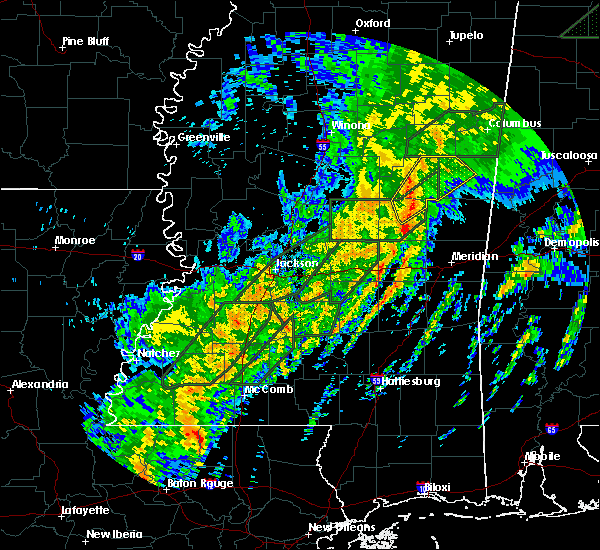 At 947 pm cst, a severe thunderstorm was located over bethsaida, or 8 miles south of philadelphia, moving northeast at 50 mph (radar indicated). Hazards include 60 mph wind gusts. Expect damage to roofs. Siding and trees. At 947 pm cst, a severe thunderstorm was located over bethsaida, or 8 miles south of philadelphia, moving northeast at 50 mph (radar indicated). Hazards include 60 mph wind gusts. Expect damage to roofs. Siding and trees.
|
| 2/2/2016 9:43 PM CST |
 At 942 pm cst, a severe thunderstorm was located over stallo, or near nanih waiya, moving northeast at 50 mph (radar indicated). Hazards include 60 mph wind gusts. Expect damage to roofs. siding and trees. locations impacted include, philadelphia, louisville, nanih waiya, macon, stallo, mashulaville, burnside, betheden, millcreek and noxapater. A tornado watch remains in effect until 300 am cst for northeastern mississippi. At 942 pm cst, a severe thunderstorm was located over stallo, or near nanih waiya, moving northeast at 50 mph (radar indicated). Hazards include 60 mph wind gusts. Expect damage to roofs. siding and trees. locations impacted include, philadelphia, louisville, nanih waiya, macon, stallo, mashulaville, burnside, betheden, millcreek and noxapater. A tornado watch remains in effect until 300 am cst for northeastern mississippi.
|
| 2/2/2016 9:37 PM CST |
 At 937 pm cst, a severe thunderstorm was located over stallo, or 8 miles north of philadelphia, moving northeast at 60 mph (radar indicated). Hazards include 60 mph wind gusts. Expect damage to roofs. Siding and trees. At 937 pm cst, a severe thunderstorm was located over stallo, or 8 miles north of philadelphia, moving northeast at 60 mph (radar indicated). Hazards include 60 mph wind gusts. Expect damage to roofs. Siding and trees.
|
| 2/2/2016 6:40 PM CST |
 At 639 pm cst, a severe thunderstorm was located over neshoba, or 7 miles northeast of prospect, moving northeast at 40 mph (radar indicated). Hazards include 60 mph wind gusts. Expect damage to roofs. siding and trees. this severe storm will be near, bethsaida and house around 650 pm cst. forestdale around 705 pm cst. other locations impacted by this severe thunderstorm include tucker. a tornado watch remains in effect until 700 pm cst for east central mississippi. A tornado watch also remains in effect until 700 pm cst for east central mississippi. At 639 pm cst, a severe thunderstorm was located over neshoba, or 7 miles northeast of prospect, moving northeast at 40 mph (radar indicated). Hazards include 60 mph wind gusts. Expect damage to roofs. siding and trees. this severe storm will be near, bethsaida and house around 650 pm cst. forestdale around 705 pm cst. other locations impacted by this severe thunderstorm include tucker. a tornado watch remains in effect until 700 pm cst for east central mississippi. A tornado watch also remains in effect until 700 pm cst for east central mississippi.
|
| 2/2/2016 6:29 PM CST |
 At 628 pm cst, a severe thunderstorm was located over prospect, moving northeast at 40 mph (radar indicated). Hazards include 60 mph wind gusts. Expect damage to roofs. siding and trees. this severe storm will be near, neshoba and dixon around 640 pm cst. bethsaida and house around 650 pm cst. forestdale around 700 pm cst. other locations impacted by this severe thunderstorm include tucker. a tornado watch remains in effect until 700 pm cst for east central mississippi. A tornado watch also remains in effect until 700 pm cst for east central mississippi. At 628 pm cst, a severe thunderstorm was located over prospect, moving northeast at 40 mph (radar indicated). Hazards include 60 mph wind gusts. Expect damage to roofs. siding and trees. this severe storm will be near, neshoba and dixon around 640 pm cst. bethsaida and house around 650 pm cst. forestdale around 700 pm cst. other locations impacted by this severe thunderstorm include tucker. a tornado watch remains in effect until 700 pm cst for east central mississippi. A tornado watch also remains in effect until 700 pm cst for east central mississippi.
|
| 2/2/2016 6:12 PM CST |
 At 612 pm cst, a severe thunderstorm was located near conehatta, or 7 miles northeast of forest, moving northeast at 40 mph (radar indicated). Hazards include 60 mph wind gusts. Expect damage to roofs. siding and trees. this severe thunderstorm will be near, conehatta around 620 pm cst. prospect and stratton around 630 pm cst. neshoba and dixon around 640 pm cst. bethsaida and house around 650 pm cst. forestdale around 705 pm cst. other locations impacted by this severe thunderstorm include tucker. a tornado watch remains in effect until 700 pm cst for east central mississippi. A tornado watch also remains in effect until 700 pm cst for east central mississippi. At 612 pm cst, a severe thunderstorm was located near conehatta, or 7 miles northeast of forest, moving northeast at 40 mph (radar indicated). Hazards include 60 mph wind gusts. Expect damage to roofs. siding and trees. this severe thunderstorm will be near, conehatta around 620 pm cst. prospect and stratton around 630 pm cst. neshoba and dixon around 640 pm cst. bethsaida and house around 650 pm cst. forestdale around 705 pm cst. other locations impacted by this severe thunderstorm include tucker. a tornado watch remains in effect until 700 pm cst for east central mississippi. A tornado watch also remains in effect until 700 pm cst for east central mississippi.
|
| 2/2/2016 5:00 PM CST |
 At 459 pm cst, a severe thunderstorm capable of producing a tornado was located over bluff springs, or near preston, moving northeast at 45 mph (radar indicated rotation). Hazards include tornado. Flying debris will be dangerous to those caught without shelter. mobile homes will be damaged or destroyed. damage to roofs, windows and vehicles will occur. tree damage is likely. This dangerous storm will be near, preston around 505 pm cst. At 459 pm cst, a severe thunderstorm capable of producing a tornado was located over bluff springs, or near preston, moving northeast at 45 mph (radar indicated rotation). Hazards include tornado. Flying debris will be dangerous to those caught without shelter. mobile homes will be damaged or destroyed. damage to roofs, windows and vehicles will occur. tree damage is likely. This dangerous storm will be near, preston around 505 pm cst.
|
| 2/2/2016 4:49 PM CST |
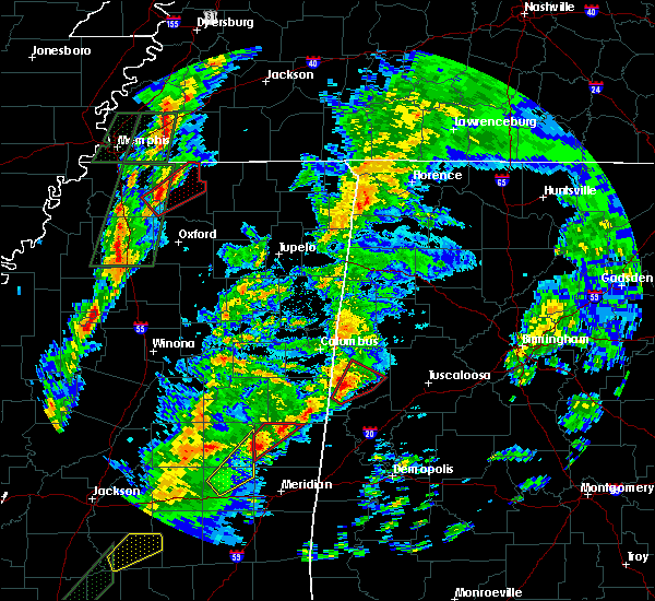 At 449 pm cst, a severe thunderstorm capable of producing a tornado was located near damascus, or 12 miles southeast of philadelphia, moving northeast at 45 mph (radar indicated rotation). Hazards include tornado. Flying debris will be dangerous to those caught without shelter. mobile homes will be damaged or destroyed. damage to roofs, windows and vehicles will occur. tree damage is likely. this dangerous storm will be near, bluff springs around 500 pm cst. Preston around 505 pm cst. At 449 pm cst, a severe thunderstorm capable of producing a tornado was located near damascus, or 12 miles southeast of philadelphia, moving northeast at 45 mph (radar indicated rotation). Hazards include tornado. Flying debris will be dangerous to those caught without shelter. mobile homes will be damaged or destroyed. damage to roofs, windows and vehicles will occur. tree damage is likely. this dangerous storm will be near, bluff springs around 500 pm cst. Preston around 505 pm cst.
|
| 2/2/2016 4:37 PM CST |
 At 437 pm cst, a severe thunderstorm capable of producing a tornado was located over house, or 13 miles southeast of philadelphia, moving northeast at 40 mph (radar indicated rotation). Hazards include tornado. Flying debris will be dangerous to those caught without shelter. mobile homes will be damaged or destroyed. damage to roofs, windows and vehicles will occur. tree damage is likely. this dangerous storm will be near, damascus around 450 pm cst. forestdale around 455 pm cst. bluff springs around 500 pm cst. Preston around 510 pm cst. At 437 pm cst, a severe thunderstorm capable of producing a tornado was located over house, or 13 miles southeast of philadelphia, moving northeast at 40 mph (radar indicated rotation). Hazards include tornado. Flying debris will be dangerous to those caught without shelter. mobile homes will be damaged or destroyed. damage to roofs, windows and vehicles will occur. tree damage is likely. this dangerous storm will be near, damascus around 450 pm cst. forestdale around 455 pm cst. bluff springs around 500 pm cst. Preston around 510 pm cst.
|
| 2/2/2016 4:31 PM CST |
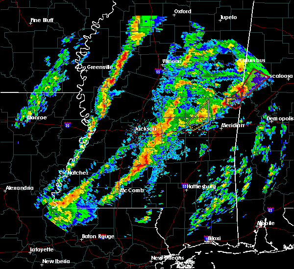 The national weather service in jackson has issued a * tornado warning for. southeastern neshoba county in east central mississippi. northeastern newton county in east central mississippi. western kemper county in east central mississippi. Until 530 pm cst. The national weather service in jackson has issued a * tornado warning for. southeastern neshoba county in east central mississippi. northeastern newton county in east central mississippi. western kemper county in east central mississippi. Until 530 pm cst.
|
| 2/2/2016 4:17 PM CST |
 At 417 pm cst, a severe thunderstorm was located over decatur, or 8 miles north of newton, moving northeast at 45 mph (radar indicated). Hazards include 60 mph wind gusts. Expect damage to roofs. siding and trees. this severe thunderstorm will be near, stratton around 425 pm cst. neshoba and little rock around 430 pm cst. house, herbert springs and bethsaida around 440 pm cst. forestdale around 455 pm cst. other locations impacted by this severe thunderstorm include tucker. A tornado watch remains in effect until 700 pm cst for east central mississippi. At 417 pm cst, a severe thunderstorm was located over decatur, or 8 miles north of newton, moving northeast at 45 mph (radar indicated). Hazards include 60 mph wind gusts. Expect damage to roofs. siding and trees. this severe thunderstorm will be near, stratton around 425 pm cst. neshoba and little rock around 430 pm cst. house, herbert springs and bethsaida around 440 pm cst. forestdale around 455 pm cst. other locations impacted by this severe thunderstorm include tucker. A tornado watch remains in effect until 700 pm cst for east central mississippi.
|
| 2/2/2016 3:13 PM CST |
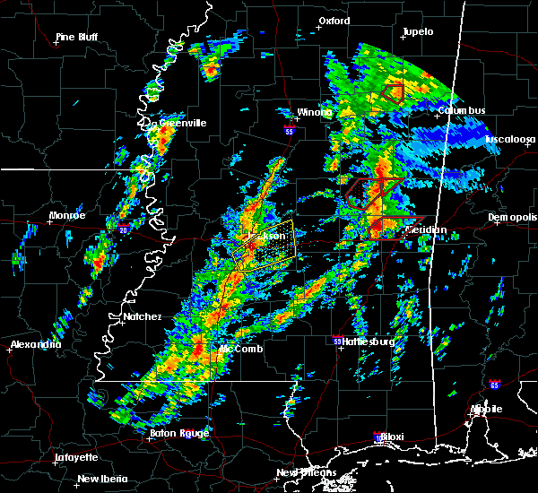 A tornado warning remains in effect until 330 pm cst for northwestern kemper county. at 313 pm cst. a severe thunderstorm capable of producing a tornado was located over preston. moving northeast at 45 mph. hazard. tornado. source. Radar indicated rotation. A tornado warning remains in effect until 330 pm cst for northwestern kemper county. at 313 pm cst. a severe thunderstorm capable of producing a tornado was located over preston. moving northeast at 45 mph. hazard. tornado. source. Radar indicated rotation.
|
| 2/2/2016 3:00 PM CST |
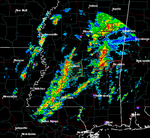 At 300 pm cst, a severe thunderstorm capable of producing a tornado was located over forestdale, or 7 miles east of philadelphia, moving northeast at 40 mph (radar indicated rotation). Hazards include tornado. Flying debris will be dangerous to those caught without shelter. mobile homes will be damaged or destroyed. damage to roofs, windows and vehicles will occur. tree damage is likely. This dangerous storm will be near, preston around 315 pm cst. At 300 pm cst, a severe thunderstorm capable of producing a tornado was located over forestdale, or 7 miles east of philadelphia, moving northeast at 40 mph (radar indicated rotation). Hazards include tornado. Flying debris will be dangerous to those caught without shelter. mobile homes will be damaged or destroyed. damage to roofs, windows and vehicles will occur. tree damage is likely. This dangerous storm will be near, preston around 315 pm cst.
|
| 2/2/2016 2:33 PM CST |
 A tornado warning remains in effect until 315 pm cst for central neshoba county. at 233 pm cst. a severe thunderstorm capable of producing a tornado was located near dixon. or near philadelphia. moving northeast at 40 mph. hazard. Tornado. A tornado warning remains in effect until 315 pm cst for central neshoba county. at 233 pm cst. a severe thunderstorm capable of producing a tornado was located near dixon. or near philadelphia. moving northeast at 40 mph. hazard. Tornado.
|
| 2/2/2016 2:21 PM CST |
 At 220 pm cst, a severe thunderstorm capable of producing a tornado was located near dixon, or near prospect, moving northeast at 40 mph (radar indicated rotation). Hazards include tornado. Flying debris will be dangerous to those caught without shelter. mobile homes will be damaged or destroyed. damage to roofs, windows and vehicles will occur. tree damage is likely. this dangerous storm will be near, dixon around 225 pm cst. neshoba around 230 pm cst. pearl river around 235 pm cst. philadelphia around 240 pm cst. burnside around 250 pm cst. stallo and forestdale around 255 pm cst. Other locations impacted by this tornadic thunderstorm include tucker. At 220 pm cst, a severe thunderstorm capable of producing a tornado was located near dixon, or near prospect, moving northeast at 40 mph (radar indicated rotation). Hazards include tornado. Flying debris will be dangerous to those caught without shelter. mobile homes will be damaged or destroyed. damage to roofs, windows and vehicles will occur. tree damage is likely. this dangerous storm will be near, dixon around 225 pm cst. neshoba around 230 pm cst. pearl river around 235 pm cst. philadelphia around 240 pm cst. burnside around 250 pm cst. stallo and forestdale around 255 pm cst. Other locations impacted by this tornadic thunderstorm include tucker.
|
| 1/21/2016 4:45 PM CST | At 445 pm cst, a severe thunderstorm was located over philadelphia, moving northeast at 35 mph (radar indicated). Hazards include 60 mph wind gusts and quarter size hail. Hail damage to vehicles is expected. expect wind damage to roofs, siding and trees. this severe storm will be near, burnside around 450 pm cst. nanih waiya and forestdale around 500 pm cst. other locations impacted by this severe thunderstorm include tucker. A tornado watch remains in effect until 1000 pm cst for east central mississippi. |
| 1/21/2016 4:27 PM CST | At 427 pm cst, a severe thunderstorm was located over dixon, or 7 miles north of prospect, moving northeast at 35 mph (radar indicated). Hazards include 60 mph wind gusts and half dollar size hail. Hail damage to vehicles is expected. expect wind damage to roofs, siding and trees. this severe storm will be near, pearl river and neshoba around 435 pm cst. philadelphia around 440 pm cst. bethsaida around 445 pm cst. burnside around 455 pm cst. nanih waiya and forestdale around 500 pm cst. other locations impacted by this severe thunderstorm include tucker. A tornado watch remains in effect until 1000 pm cst for east central mississippi. |
| 1/21/2016 4:22 PM CST | A severe thunderstorm warning remains in effect until 500 pm cst for neshoba county. at 422 pm cst. a severe thunderstorm was located near dowdville. or near prospect. moving northeast at 35 mph. hazard. golf ball size hail and 60 mph wind gusts. source. Radar indicated. |
| 1/21/2016 4:15 PM CST | At 415 pm cst, a severe thunderstorm was located near prospect, moving northeast at 35 mph. this is a very dangerous storm (radar indicated). Hazards include baseball size hail and 60 mph wind gusts. People and animals outdoors will be severely injured. expect shattered windows, extensive damage to roofs, siding and vehicles. this severe thunderstorm will be near, dowdville around 425 pm cst. dixon around 430 pm cst. neshoba around 435 pm cst. philadelphia and pearl river around 440 pm cst. bethsaida around 445 pm cst. burnside around 455 pm cst. nanih waiya and forestdale around 500 pm cst. other locations impacted by this severe thunderstorm include tucker. A tornado watch remains in effect until 1000 pm cst for east central mississippi. |
| 12/28/2015 4:00 AM CST |
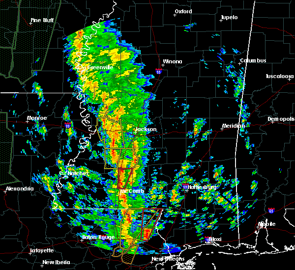 At 400 am cst, a severe thunderstorm capable of producing a tornado was located over wesson, or 8 miles south of hazlehurst, moving north at 55 mph (radar indicated rotation). Hazards include tornado. Flying debris will be dangerous to those caught without shelter. mobile homes will be damaged or destroyed. damage to roofs, windows and vehicles will occur. tree damage is likely. This tornadic thunderstorm will remain over mainly rural areas of eastern lincoln county. At 400 am cst, a severe thunderstorm capable of producing a tornado was located over wesson, or 8 miles south of hazlehurst, moving north at 55 mph (radar indicated rotation). Hazards include tornado. Flying debris will be dangerous to those caught without shelter. mobile homes will be damaged or destroyed. damage to roofs, windows and vehicles will occur. tree damage is likely. This tornadic thunderstorm will remain over mainly rural areas of eastern lincoln county.
|
| 12/28/2015 3:42 AM CST |
 At 342 am cst, a severe thunderstorm capable of producing a tornado was located near brookhaven, moving north at 45 mph (radar indicated rotation). Hazards include tornado. Flying debris will be dangerous to those caught without shelter. mobile homes will be damaged or destroyed. damage to roofs, windows and vehicles will occur. tree damage is likely. This dangerous storm will be near, brookhaven and loyd star around 350 am cst. At 342 am cst, a severe thunderstorm capable of producing a tornado was located near brookhaven, moving north at 45 mph (radar indicated rotation). Hazards include tornado. Flying debris will be dangerous to those caught without shelter. mobile homes will be damaged or destroyed. damage to roofs, windows and vehicles will occur. tree damage is likely. This dangerous storm will be near, brookhaven and loyd star around 350 am cst.
|
| 12/28/2015 3:35 AM CST |
 At 334 am cst, a severe thunderstorm capable of producing a tornado was located near bogue chitto, or 9 miles southwest of brookhaven, moving north at 55 mph (radar indicated rotation). Hazards include tornado. Flying debris will be dangerous to those caught without shelter. mobile homes will be damaged or destroyed. damage to roofs, windows and vehicles will occur. tree damage is likely. this dangerous storm will be near, vaughn around 340 am cst. loyd star around 345 am cst. Brookhaven around 350 am cst. At 334 am cst, a severe thunderstorm capable of producing a tornado was located near bogue chitto, or 9 miles southwest of brookhaven, moving north at 55 mph (radar indicated rotation). Hazards include tornado. Flying debris will be dangerous to those caught without shelter. mobile homes will be damaged or destroyed. damage to roofs, windows and vehicles will occur. tree damage is likely. this dangerous storm will be near, vaughn around 340 am cst. loyd star around 345 am cst. Brookhaven around 350 am cst.
|
| 12/28/2015 3:18 AM CST |
 At 318 am cst, a severe thunderstorm capable of producing a tornado was located 7 miles southeast of smithdale, or 7 miles west of mccomb, moving north at 55 mph (radar indicated rotation). Hazards include tornado. Flying debris will be dangerous to those caught without shelter. mobile homes will be damaged or destroyed. damage to roofs, windows and vehicles will occur. tree damage is likely. this dangerous storm will be near, center point around 330 am cst. bogue chitto and west lincoln around 335 am cst. enterprise around 340 am cst. loyd star and vaughn around 345 am cst. Brookhaven around 350 am cst. At 318 am cst, a severe thunderstorm capable of producing a tornado was located 7 miles southeast of smithdale, or 7 miles west of mccomb, moving north at 55 mph (radar indicated rotation). Hazards include tornado. Flying debris will be dangerous to those caught without shelter. mobile homes will be damaged or destroyed. damage to roofs, windows and vehicles will occur. tree damage is likely. this dangerous storm will be near, center point around 330 am cst. bogue chitto and west lincoln around 335 am cst. enterprise around 340 am cst. loyd star and vaughn around 345 am cst. Brookhaven around 350 am cst.
|
| 10/31/2015 2:22 PM CDT |
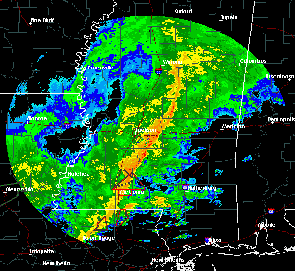 At 221 pm cdt, a severe thunderstorm capable of producing a tornado was located near summit, or near mccomb, moving northeast at 35 mph. a second thunderstorm capable of producing a tornado was located near east lincoln (radar indicated rotation). Hazards include tornado. Flying debris will be dangerous to those caught without shelter. mobile homes will be damaged or destroyed. damage to roofs, windows and vehicles will occur. tree damage is likely. Locations impacted include, enterprise, bogue chitto, jayess, topeka, east lincoln and ruth. At 221 pm cdt, a severe thunderstorm capable of producing a tornado was located near summit, or near mccomb, moving northeast at 35 mph. a second thunderstorm capable of producing a tornado was located near east lincoln (radar indicated rotation). Hazards include tornado. Flying debris will be dangerous to those caught without shelter. mobile homes will be damaged or destroyed. damage to roofs, windows and vehicles will occur. tree damage is likely. Locations impacted include, enterprise, bogue chitto, jayess, topeka, east lincoln and ruth.
|
| 10/31/2015 2:12 PM CDT |
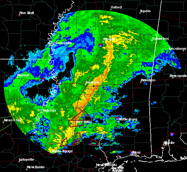 At 212 pm cdt, a severe thunderstorm capable of producing a tornado was located over summit, or near mccomb, moving northeast at 40 mph (radar indicated rotation). Hazards include tornado. Flying debris will be dangerous to those caught without shelter. mobile homes will be damaged or destroyed. damage to roofs, windows and vehicles will occur. Tree damage is likely. At 212 pm cdt, a severe thunderstorm capable of producing a tornado was located over summit, or near mccomb, moving northeast at 40 mph (radar indicated rotation). Hazards include tornado. Flying debris will be dangerous to those caught without shelter. mobile homes will be damaged or destroyed. damage to roofs, windows and vehicles will occur. Tree damage is likely.
|
| 10/31/2015 2:05 PM CDT |
 At 205 pm cdt, a severe thunderstorm was located over brookhaven, moving northeast at 45 mph (radar indicated). Hazards include 60 mph wind gusts. Expect damage to roofs. siding and trees. locations impacted include, brookhaven, enterprise, bogue chitto and east lincoln. A tornado watch remains in effect until 700 pm cdt for south central mississippi. At 205 pm cdt, a severe thunderstorm was located over brookhaven, moving northeast at 45 mph (radar indicated). Hazards include 60 mph wind gusts. Expect damage to roofs. siding and trees. locations impacted include, brookhaven, enterprise, bogue chitto and east lincoln. A tornado watch remains in effect until 700 pm cdt for south central mississippi.
|
| 10/31/2015 1:54 PM CDT |
 At 153 pm cdt, a severe thunderstorm was located over west lincoln, or 8 miles southwest of brookhaven, moving east at 35 mph (radar indicated). Hazards include 60 mph wind gusts. Expect damage to roofs. siding and trees. locations impacted include, brookhaven, enterprise, bogue chitto, loyd star, vaughn, west lincoln, center point and east lincoln. A tornado watch remains in effect until 700 pm cdt for south central mississippi. At 153 pm cdt, a severe thunderstorm was located over west lincoln, or 8 miles southwest of brookhaven, moving east at 35 mph (radar indicated). Hazards include 60 mph wind gusts. Expect damage to roofs. siding and trees. locations impacted include, brookhaven, enterprise, bogue chitto, loyd star, vaughn, west lincoln, center point and east lincoln. A tornado watch remains in effect until 700 pm cdt for south central mississippi.
|
| 10/31/2015 1:48 PM CDT |
 At 148 pm cdt, a severe thunderstorm was located near west lincoln, or 10 miles southwest of brookhaven, moving northeast at 45 mph (radar indicated). Hazards include 60 mph wind gusts. Expect damage to roofs. siding and trees. locations impacted include, brookhaven, enterprise, bogue chitto, loyd star, vaughn, mccall creek, west lincoln, center point and east lincoln. A tornado watch remains in effect until 700 pm cdt for southwestern mississippi. At 148 pm cdt, a severe thunderstorm was located near west lincoln, or 10 miles southwest of brookhaven, moving northeast at 45 mph (radar indicated). Hazards include 60 mph wind gusts. Expect damage to roofs. siding and trees. locations impacted include, brookhaven, enterprise, bogue chitto, loyd star, vaughn, mccall creek, west lincoln, center point and east lincoln. A tornado watch remains in effect until 700 pm cdt for southwestern mississippi.
|
| 10/31/2015 1:38 PM CDT |
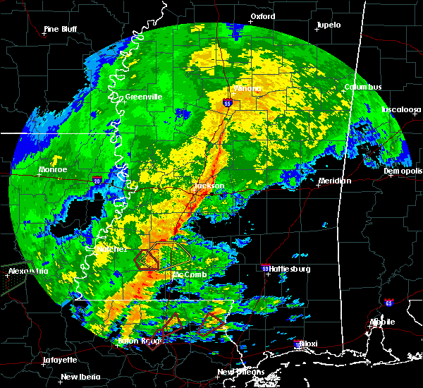 At 137 pm cdt, a severe thunderstorm was located near little springs, or 17 miles southwest of brookhaven, moving northeast at 40 mph (radar indicated). Hazards include 60 mph wind gusts. Expect damage to roofs. Siding and trees. At 137 pm cdt, a severe thunderstorm was located near little springs, or 17 miles southwest of brookhaven, moving northeast at 40 mph (radar indicated). Hazards include 60 mph wind gusts. Expect damage to roofs. Siding and trees.
|
| 8/19/2015 3:31 PM CDT |
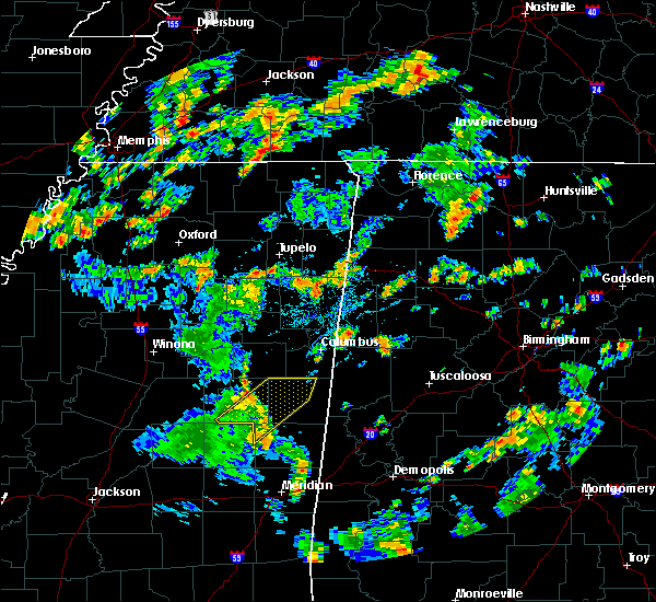 At 331 pm cdt, a severe thunderstorm was located over mashulaville, or 15 miles east of louisville, moving northeast at 45 mph (radar indicated). Hazards include 60 mph wind gusts. Expect damage to roofs. siding and trees. this severe storm will be near, brooksville around 350 pm cdt. Deerbrook around 355 pm cdt. At 331 pm cdt, a severe thunderstorm was located over mashulaville, or 15 miles east of louisville, moving northeast at 45 mph (radar indicated). Hazards include 60 mph wind gusts. Expect damage to roofs. siding and trees. this severe storm will be near, brooksville around 350 pm cdt. Deerbrook around 355 pm cdt.
|
| 8/19/2015 3:26 PM CDT | The severe thunderstorm warning for northeastern neshoba county will expire at 330 pm cdt, the storm which prompted the warning has moved out of the area. therefore the warning will be allowed to expire. however gusty winds are still possible with this thunderstorm. |
| 8/19/2015 3:15 PM CDT |
 At 314 pm cdt, a severe thunderstorm was located over nanih waiya, moving northeast at 45 mph (radar indicated). Hazards include 60 mph wind gusts. Expect damage to roofs. siding and trees. This severe thunderstorm will remain over mainly rural areas of northeastern neshoba county. At 314 pm cdt, a severe thunderstorm was located over nanih waiya, moving northeast at 45 mph (radar indicated). Hazards include 60 mph wind gusts. Expect damage to roofs. siding and trees. This severe thunderstorm will remain over mainly rural areas of northeastern neshoba county.
|
| 8/19/2015 3:04 PM CDT |
 At 304 pm cdt, a severe thunderstorm was located near stallo, or near nanih waiya, moving northeast at 40 mph (radar indicated). Hazards include 60 mph wind gusts. Expect damage to roofs. siding and trees. this severe thunderstorm will be near, mashulaville around 335 pm cdt. brooksville around 355 pm cdt. deerbrook around 400 pm cdt. Other locations impacted by this severe thunderstorm include noxapater. At 304 pm cdt, a severe thunderstorm was located near stallo, or near nanih waiya, moving northeast at 40 mph (radar indicated). Hazards include 60 mph wind gusts. Expect damage to roofs. siding and trees. this severe thunderstorm will be near, mashulaville around 335 pm cdt. brooksville around 355 pm cdt. deerbrook around 400 pm cdt. Other locations impacted by this severe thunderstorm include noxapater.
|
| 8/19/2015 2:55 PM CDT |
 At 255 pm cdt, a severe thunderstorm was located over philadelphia, moving northeast at 40 mph (radar indicated). Hazards include 60 mph wind gusts. Expect damage to roofs. siding and trees. this severe storm will be near, stallo and forestdale around 305 pm cdt. Other locations impacted by this severe thunderstorm include tucker. At 255 pm cdt, a severe thunderstorm was located over philadelphia, moving northeast at 40 mph (radar indicated). Hazards include 60 mph wind gusts. Expect damage to roofs. siding and trees. this severe storm will be near, stallo and forestdale around 305 pm cdt. Other locations impacted by this severe thunderstorm include tucker.
|
| 8/19/2015 2:40 PM CDT |
 At 240 pm cdt, a severe thunderstorm was located near dixon, or 8 miles southeast of edinburg, moving northeast at 45 mph (radar indicated). Hazards include 60 mph wind gusts. Expect damage to roofs. siding and trees. this severe thunderstorm will be near, philadelphia around 245 pm cdt. burnside around 255 pm cdt. stallo around 300 pm cdt. forestdale around 305 pm cdt. Other locations impacted by this severe thunderstorm include tucker. At 240 pm cdt, a severe thunderstorm was located near dixon, or 8 miles southeast of edinburg, moving northeast at 45 mph (radar indicated). Hazards include 60 mph wind gusts. Expect damage to roofs. siding and trees. this severe thunderstorm will be near, philadelphia around 245 pm cdt. burnside around 255 pm cdt. stallo around 300 pm cdt. forestdale around 305 pm cdt. Other locations impacted by this severe thunderstorm include tucker.
|
| 7/30/2015 5:17 PM CDT |
 At 517 pm cdt, a severe thunderstorm was located near brookhaven, moving south at 30 mph (radar indicated). Hazards include 60 mph wind gusts. Expect damage to roofs. siding and trees. this severe thunderstorm will be near, brookhaven around 520 pm cdt. enterprise around 535 pm cdt. West lincoln around 540 pm cdt. At 517 pm cdt, a severe thunderstorm was located near brookhaven, moving south at 30 mph (radar indicated). Hazards include 60 mph wind gusts. Expect damage to roofs. siding and trees. this severe thunderstorm will be near, brookhaven around 520 pm cdt. enterprise around 535 pm cdt. West lincoln around 540 pm cdt.
|
| 7/4/2015 2:50 PM CDT |
 The severe thunderstorm warning for southeastern lincoln and southern lawrence counties will expire at 300 pm cdt, the storms which prompted the warning have weakened below severe limits, and no longer pose an immediate threat to life or property. therefore the warning will be allowed to expire. however heavy rain is still possible with these thunderstorms. The severe thunderstorm warning for southeastern lincoln and southern lawrence counties will expire at 300 pm cdt, the storms which prompted the warning have weakened below severe limits, and no longer pose an immediate threat to life or property. therefore the warning will be allowed to expire. however heavy rain is still possible with these thunderstorms.
|
| 7/4/2015 2:33 PM CDT |
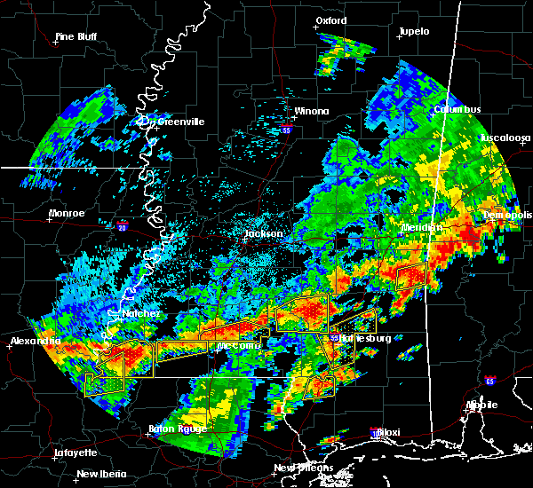 At 232 pm cdt, severe thunderstorms were located along a line extending from near auburn to near monticello, moving east at 20 mph (radar indicated). Hazards include 60 mph wind gusts. Expect damage to roofs. siding and trees. Locations impacted include, enterprise, oak vale, bogue chitto, robinwood, jayess, tilton, center point, ruth, topeka and east lincoln. At 232 pm cdt, severe thunderstorms were located along a line extending from near auburn to near monticello, moving east at 20 mph (radar indicated). Hazards include 60 mph wind gusts. Expect damage to roofs. siding and trees. Locations impacted include, enterprise, oak vale, bogue chitto, robinwood, jayess, tilton, center point, ruth, topeka and east lincoln.
|
| 7/4/2015 1:54 PM CDT |
 At 153 pm cdt, severe thunderstorms were located along a line extending from near auburn to holmesville, moving northeast at 25 mph (radar indicated). Hazards include 60 mph wind gusts. Expect damage to roofs. Siding and trees. At 153 pm cdt, severe thunderstorms were located along a line extending from near auburn to holmesville, moving northeast at 25 mph (radar indicated). Hazards include 60 mph wind gusts. Expect damage to roofs. Siding and trees.
|
| 6/24/2015 6:33 PM CDT |
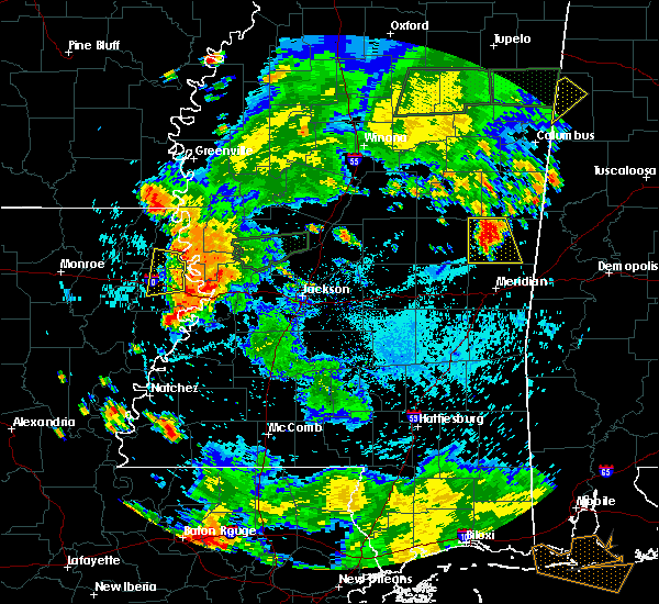 At 632 pm cdt, a severe thunderstorm was located near bluff springs, or 9 miles southeast of preston, moving south at 5 mph (radar indicated). Hazards include 60 mph wind gusts and quarter size hail. Hail damage to vehicles is expected. Expect wind damage to roofs, siding and trees. At 632 pm cdt, a severe thunderstorm was located near bluff springs, or 9 miles southeast of preston, moving south at 5 mph (radar indicated). Hazards include 60 mph wind gusts and quarter size hail. Hail damage to vehicles is expected. Expect wind damage to roofs, siding and trees.
|
| 6/24/2015 6:21 PM CDT |
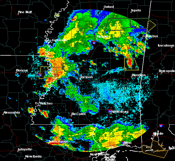 At 621 pm cdt, a severe thunderstorm was located near bluff springs, or 8 miles southeast of preston, and is nearly stationary (radar indicated). Hazards include 60 mph wind gusts and quarter size hail. Hail damage to vehicles is expected. expect wind damage to roofs, siding and trees. This severe thunderstorm will be near, liberty, bluff springs and damascus around 715 pm cdt. At 621 pm cdt, a severe thunderstorm was located near bluff springs, or 8 miles southeast of preston, and is nearly stationary (radar indicated). Hazards include 60 mph wind gusts and quarter size hail. Hail damage to vehicles is expected. expect wind damage to roofs, siding and trees. This severe thunderstorm will be near, liberty, bluff springs and damascus around 715 pm cdt.
|
| 5/24/2015 6:50 PM CDT | At 650 pm cdt, a severe thunderstorm was located near bogue chitto, or 7 miles south of brookhaven, moving north at 15 mph (radar indicated). Hazards include 60 mph wind gusts. Expect damage to roofs. siding and trees. this severe storm will be near, enterprise around 655 pm cdt. vaughn around 710 pm cdt. brookhaven and loyd star around 715 pm cdt. A tornado watch remains in effect until 800 pm cdt for south central mississippi. |
| 5/24/2015 6:36 PM CDT | At 636 pm cdt, a severe thunderstorm was located near bogue chitto, or 11 miles north of mccomb, moving north at 15 mph (radar indicated). Hazards include 60 mph wind gusts. Expect damage to roofs. siding and trees. this severe thunderstorm will be near, bogue chitto around 645 pm cdt. west lincoln around 655 pm cdt. enterprise around 700 pm cdt. brookhaven, vaughn and loyd star around 715 pm cdt. A tornado watch remains in effect until 800 pm cdt for south central mississippi. |
| 5/11/2015 1:21 PM CDT | The severe thunderstorm warning for southwestern lincoln county will expire at 130 pm cdt, the storm which prompted the warning has weakened below severe limits, and no longer pose an immediate threat to life or property. therefore the warning will be allowed to expire. |
| 5/11/2015 1:05 PM CDT | At 104 pm cdt, a severe thunderstorm was located near center point, or 12 miles southwest of brookhaven, moving northeast at 15 mph (radar indicated). Hazards include ping pong ball size hail and 60 mph wind gusts. People and animals outdoors will be injured. expect hail damage to roofs, siding, windows and vehicles. expect wind damage to roofs, siding and trees. this severe storm will be near, west lincoln around 115 pm cdt. Possible. |
| 5/11/2015 1:01 PM CDT | At 100 pm cdt, a severe thunderstorm was located over center point, or 13 miles southwest of brookhaven, moving northeast at 15 mph (radar indicated). Hazards include ping pong ball size hail and 60 mph wind gusts. People and animals outdoors will be injured. expect hail damage to roofs, siding, windows and vehicles. expect wind damage to roofs, siding and trees. this severe storm will be near, west lincoln around 115 pm cdt. Possible. |
| 5/11/2015 12:51 PM CDT | At 1251 pm cdt, a severe thunderstorm was located over center point, or 14 miles northwest of mccomb, moving northeast at 15 mph (radar indicated). Hazards include 60 mph wind gusts and quarter size hail. Hail damage to vehicles is expected. expect wind damage to roofs, siding and trees. this severe thunderstorm will be near, west lincoln around 115 pm cdt. 1. 00in. |
| 4/25/2015 3:11 AM CDT | At 311 am cdt, a severe thunderstorm capable of producing a tornado was located near bluff springs, or 10 miles south of preston, moving east at 50 mph (radar indicated rotation). Hazards include tornado. Flying debris will be dangerous to those caught without shelter. mobile homes will be damaged or destroyed. damage to roofs, windows and vehicles will occur. tree damage is likely. this dangerous storm will be near, liberty around 315 am cdt. de kalb around 325 am cdt. electric mills around 340 am cdt. other locations impacted by this tornadic thunderstorm include scooba and i 20 welcome center at cuba. Radar indicated. |
| 4/25/2015 3:01 AM CDT | At 300 am cdt, a severe thunderstorm capable of producing a tornado was located near bethsaida, or 9 miles southeast of philadelphia, moving northeast at 55 mph (radar indicated rotation). Hazards include tornado. Flying debris will be dangerous to those caught without shelter. mobile homes will be damaged or destroyed. damage to roofs, windows and vehicles will occur. tree damage is likely. this tornadic thunderstorm will remain over mainly rural areas of southeastern neshoba and northeastern newton counties, including the following locations, tucker. Radar indicated. |
| 4/25/2015 2:54 AM CDT | At 253 am cdt, a severe thunderstorm capable of producing a tornado was located over bethsaida, or 8 miles south of philadelphia, moving east at 55 mph (radar indicated rotation). Hazards include tornado. Flying debris will be dangerous to those caught without shelter. mobile homes will be damaged or destroyed. damage to roofs, windows and vehicles will occur. tree damage is likely. this dangerous storm will be near, damascus around 305 am cdt. liberty and bluff springs around 310 am cdt. de kalb around 320 am cdt. electric mills around 330 am cdt. other locations impacted by this tornadic thunderstorm include scooba and i 20 welcome center at cuba. this storm has a history of brief tornadoes. Radar indicated. |
| 4/25/2015 2:48 AM CDT | At 248 am cdt, a severe thunderstorm capable of producing a tornado was located over neshoba, or 9 miles northeast of prospect, moving east at 60 mph (radar indicated rotation). Hazards include tornado. Flying debris will be dangerous to those caught without shelter. mobile homes will be damaged or destroyed. damage to roofs, windows and vehicles will occur. tree damage is likely. this dangerous storm will be near, bethsaida and house around 255 am cdt. herbert springs around 300 am cdt. forestdale around 305 am cdt. other locations impacted by this tornadic thunderstorm include tucker. Radar indicated. |
| 4/25/2015 2:44 AM CDT | At 244 am cdt, a severe thunderstorm capable of producing a tornado was located near dowdville, or 7 miles southeast of edinburg, moving east at 50 mph (radar indicated rotation). Hazards include tornado. Flying debris will be dangerous to those caught without shelter. mobile homes will be damaged or destroyed. damage to roofs, windows and vehicles will occur. tree damage is likely. this dangerous storm will be near, philadelphia and neshoba around 250 am cdt. bethsaida around 300 am cdt. forestdale around 305 am cdt. other locations impacted by this tornadic thunderstorm include tucker. Radar indicated. |
| 4/25/2015 2:35 AM CDT | At 234 am cdt, a severe thunderstorm capable of producing a tornado was located near madden, or 7 miles southeast of carthage, moving east at 55 mph (radar indicated rotation). Hazards include tornado. Flying debris will be dangerous to those caught without shelter. mobile homes will be damaged or destroyed. damage to roofs, windows and vehicles will occur. tree damage is likely. this dangerous storm will be near, dowdville around 240 am cdt. pearl river and dixon around 245 am cdt. philadelphia and neshoba around 250 am cdt. bethsaida and house around 300 am cdt. forestdale and herbert springs around 305 am cdt. other locations impacted by this tornadic thunderstorm include redwater, standing pine, tucker, walnut grove and sebastopol. Radar indicated. |
| 4/25/2015 2:23 AM CDT | At 222 am cdt, a severe thunderstorm capable of producing a tornado was located over tuscola, or 8 miles northwest of harperville, moving east at 50 mph (radar indicated rotation). Hazards include tornado. Flying debris will be dangerous to those caught without shelter. mobile homes will be damaged or destroyed. damage to roofs, windows and vehicles will occur. tree damage is likely. this dangerous storm will be near, madden and dowdville around 240 am cdt. prospect and dixon around 245 am cdt. neshoba around 255 am cdt. bethsaida around 300 am cdt. house around 305 am cdt. herbert springs and forestdale around 310 am cdt. other locations impacted by this tornadic thunderstorm include redwater, standing pine, tucker, walnut grove and sebastopol. Radar indicated. |
| 12/23/2014 11:35 AM CST | A few trees were downed in southern lincoln count in lincoln county MS, 7.3 miles ESE of Bogue Chitto, MS |
| 4/6/2014 8:06 PM CDT | Trees down in the preston area near highways 21 and 39 in kemper county MS, 5.1 miles SW of Bogue Chitto, MS |
| 3/23/2013 8:42 PM CDT | Golf Ball sized hail reported 6.6 miles SW of Bogue Chitto, MS, near the kemper/winston county line |
| 3/23/2013 8:36 PM CDT | Golf Ball sized hail reported 3.4 miles SSE of Bogue Chitto, MS |
| 1/30/2013 4:30 AM CST | 3 trees down along with some power lines in lincoln county MS, 0.6 miles WNW of Bogue Chitto, MS |
| 12/25/2012 3:55 PM CST | Tree downed on a power line on county road 747 in neshoba county MS, 6.1 miles ENE of Bogue Chitto, MS |
| 12/20/2012 5:58 AM CST | Reports of trees down on cold springs lan in lincoln county MS, 1.8 miles S of Bogue Chitto, MS |
| 12/20/2012 5:40 AM CST | Tree blocking one lane of hwy 21 north near cr 76 in neshoba county MS, 6.1 miles ESE of Bogue Chitto, MS |
| 6/11/2012 8:05 PM CDT | Tree downed on ms highway 16 just west of the kemper/neshoba county lin in neshoba county MS, 5.4 miles NNE of Bogue Chitto, MS |
| 5/30/2012 4:11 PM CDT | Roofs blown off of a few sheds in winston county MS, 6.6 miles SSE of Bogue Chitto, MS |
| 1/1/0001 12:00 AM | Tree downed along ms highway 493 just south of ms highway 16 in kemper county MS, 8 miles NW of Bogue Chitto, MS |
| 1/1/0001 12:00 AM | Fallen tree blocking cr 2642 east of philadelphia in neshoba county MS, 7 miles ENE of Bogue Chitto, MS |
| 1/1/0001 12:00 AM | Power line downed along road 2826 northeast of philadelphia in neshoba county MS, 6.5 miles E of Bogue Chitto, MS |
| 1/1/0001 12:00 AM | Power line downed along road 2826 northeast of philadelphia in neshoba county MS, 6.5 miles E of Bogue Chitto, MS |
| 1/1/0001 12:00 AM | A few trees were down in lincoln county MS, 10.4 miles WNW of Bogue Chitto, MS |
| 1/1/0001 12:00 AM | Powerlines down across hwy 39...likely rear flank winds associated with large tornadic storm passing to the n in kemper county MS, 5.1 miles SW of Bogue Chitto, MS |
| 1/1/0001 12:00 AM | Extensive damage...mobile homes damaged or destroyed...large numbers of trees down preventing emergency workers from getting into area. unknown number of injurie in kemper county MS, 5.9 miles S of Bogue Chitto, MS |
| 1/1/0001 12:00 AM | Roof off a chicken hous in neshoba county MS, 6.7 miles ESE of Bogue Chitto, MS |
| 1/1/0001 12:00 AM | Golf Ball sized hail reported 9.3 miles WNW of Bogue Chitto, MS |
| 1/1/0001 12:00 AM | Mobile home damaged on county road 729. possible tornado based on rada in neshoba county MS, 6.5 miles NNE of Bogue Chitto, MS |
| 1/1/0001 12:00 AM | Half Dollar sized hail reported 8.8 miles WSW of Bogue Chitto, MS |
| 1/1/0001 12:00 AM | A couple trees were blown dow in winston county MS, 6.6 miles SSE of Bogue Chitto, MS |
| 1/1/0001 12:00 AM | Trees and power lines down along highway 583 in lawrence county MS, 13.9 miles WNW of Bogue Chitto, MS |
| 1/1/0001 12:00 AM | Tree down in norfield which is blocking highway 51 in lincoln county MS, 1.6 miles N of Bogue Chitto, MS |
Hail Maps for Bogue Chitto, MS
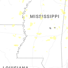
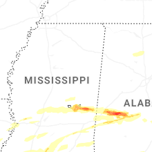
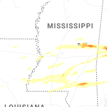
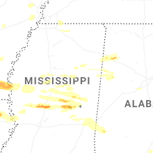
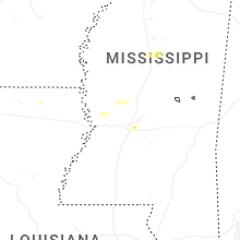
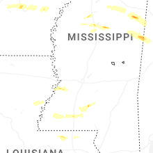
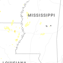
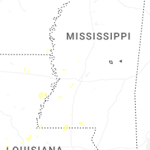
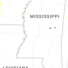
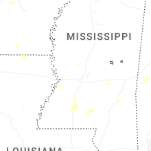
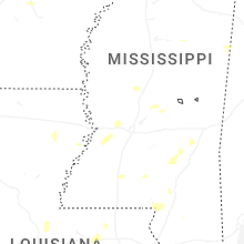
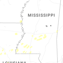

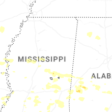
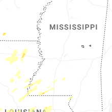


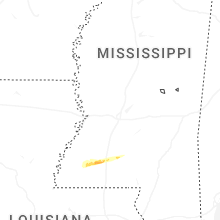


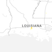


Connect with Interactive Hail Maps