

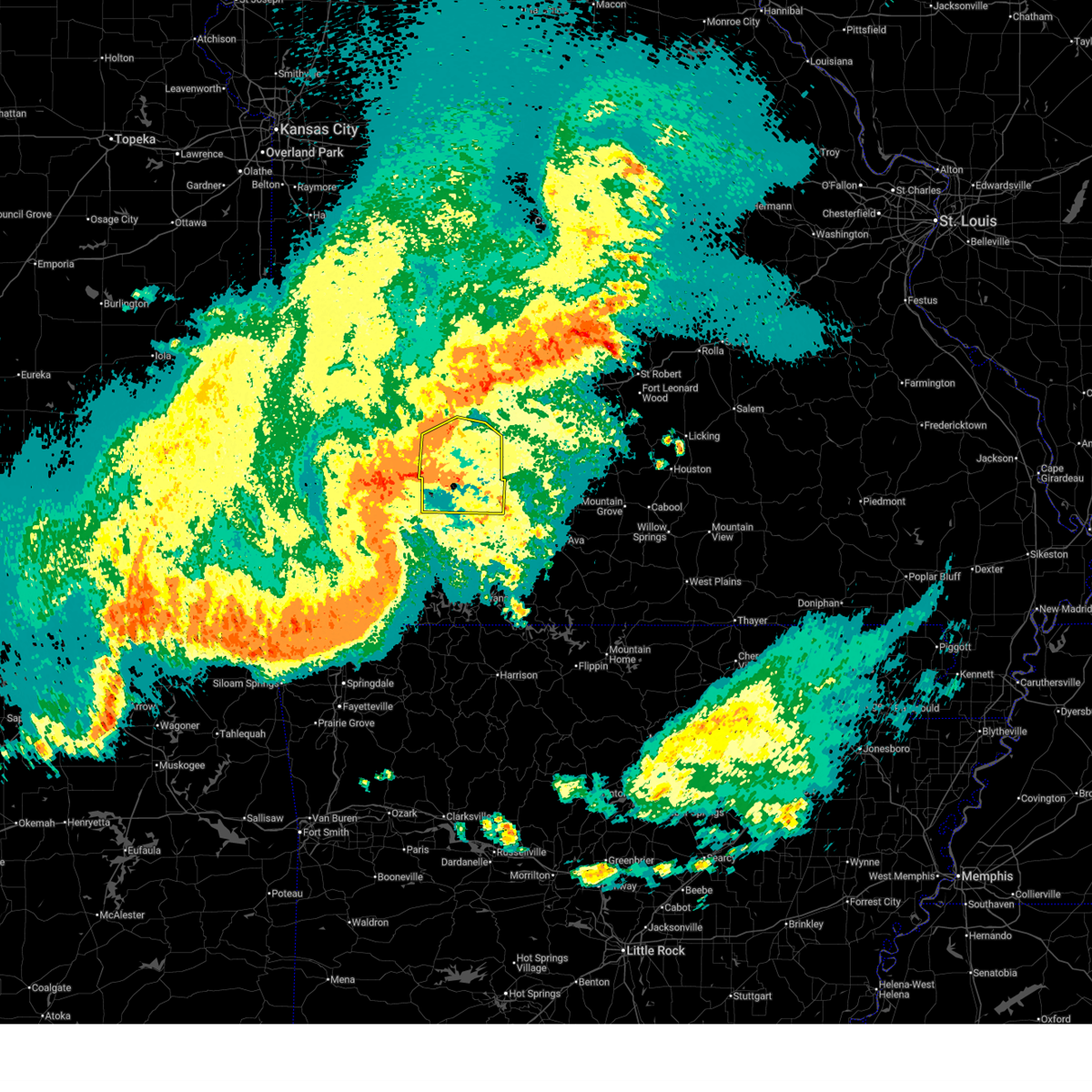
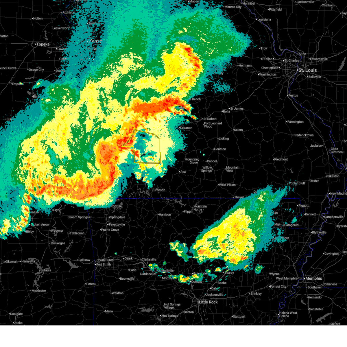
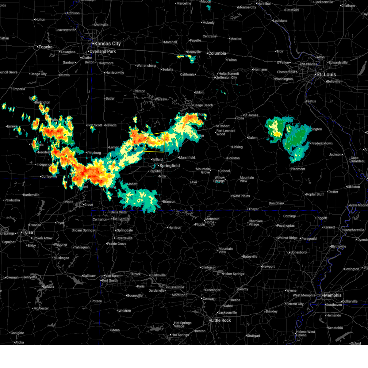
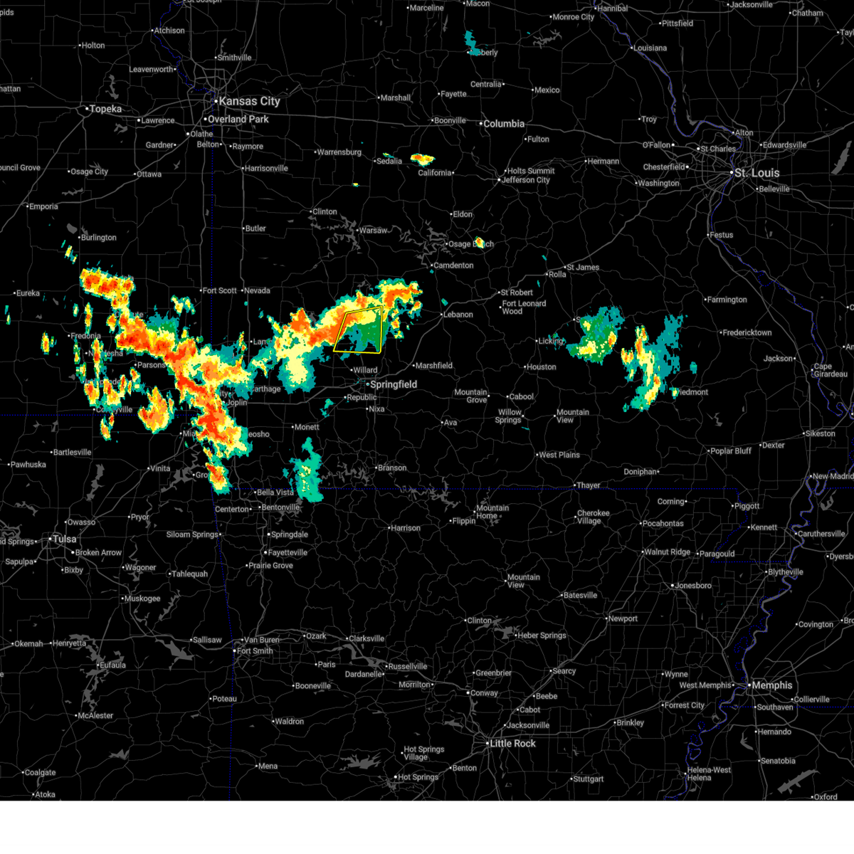
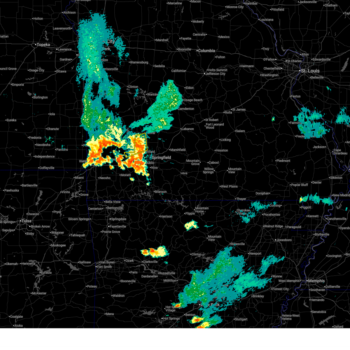
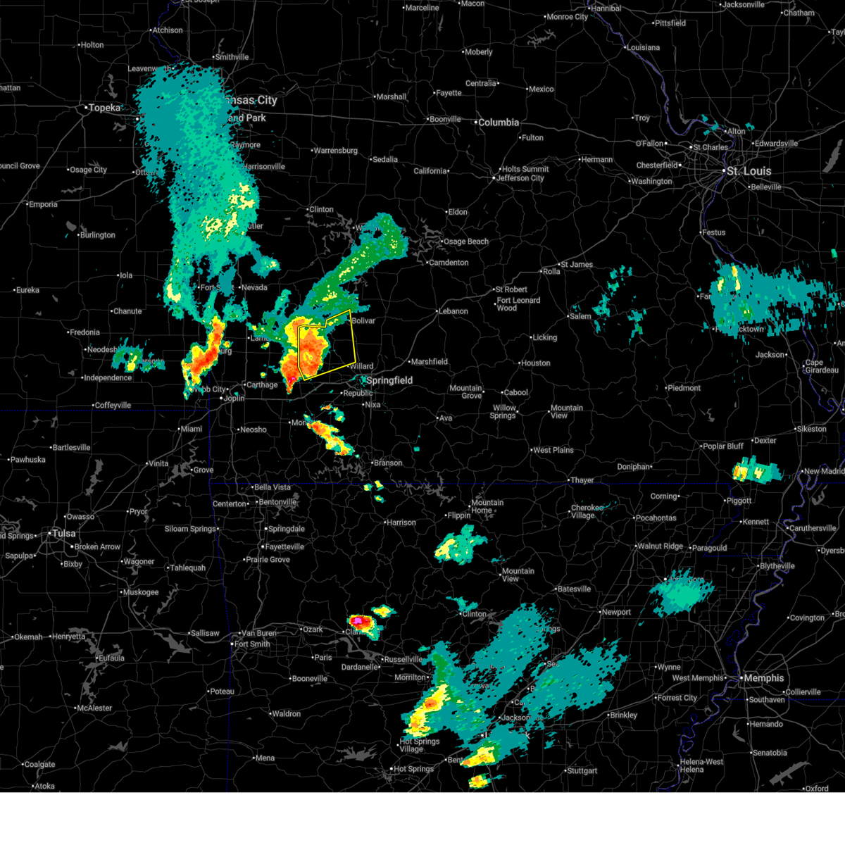
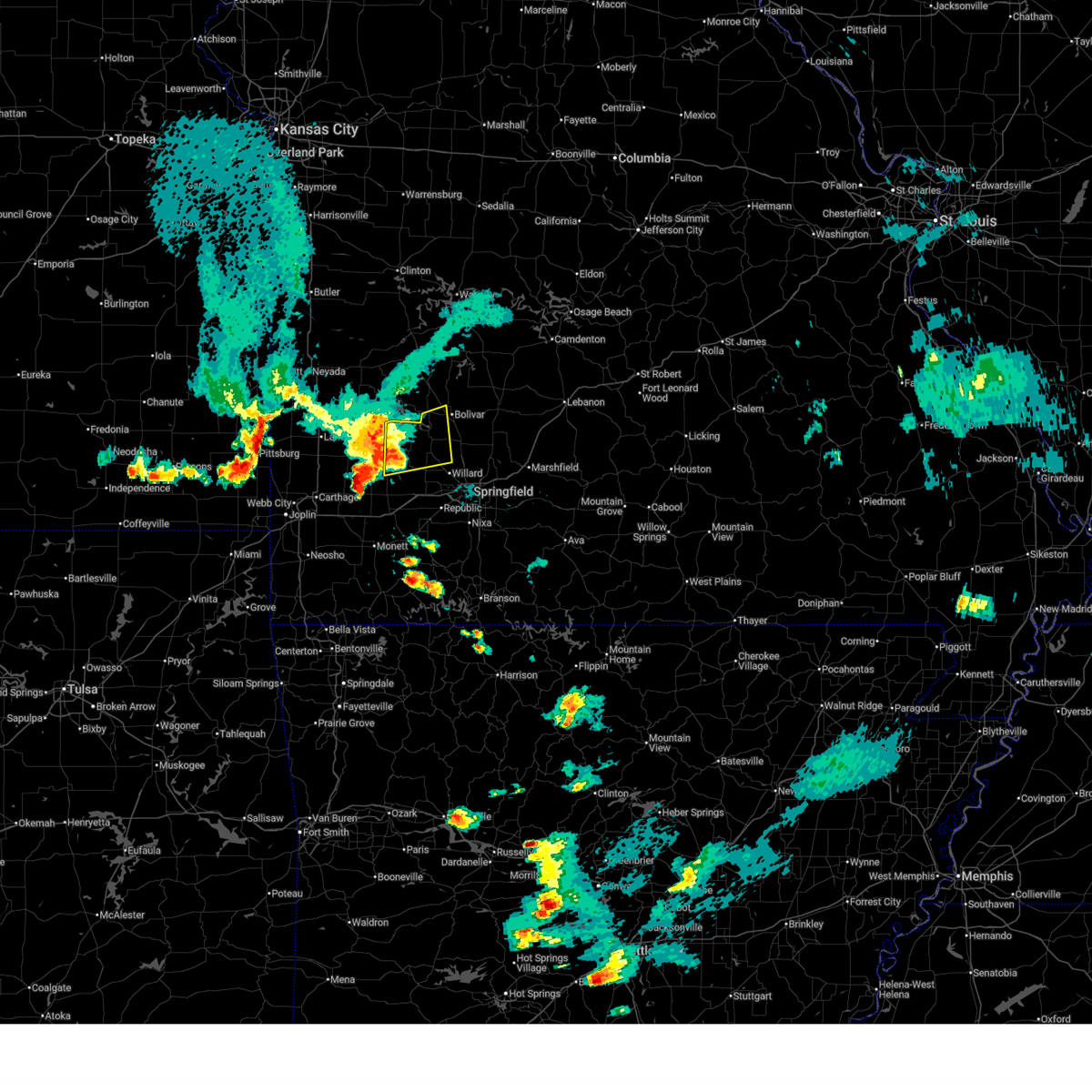
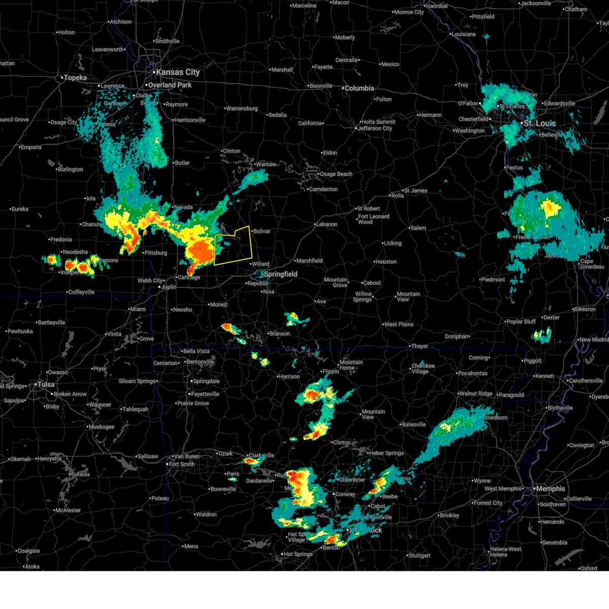
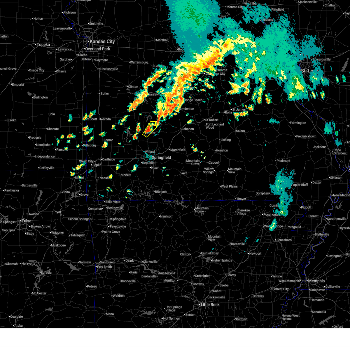
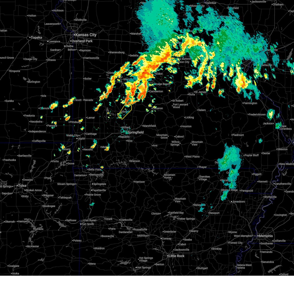
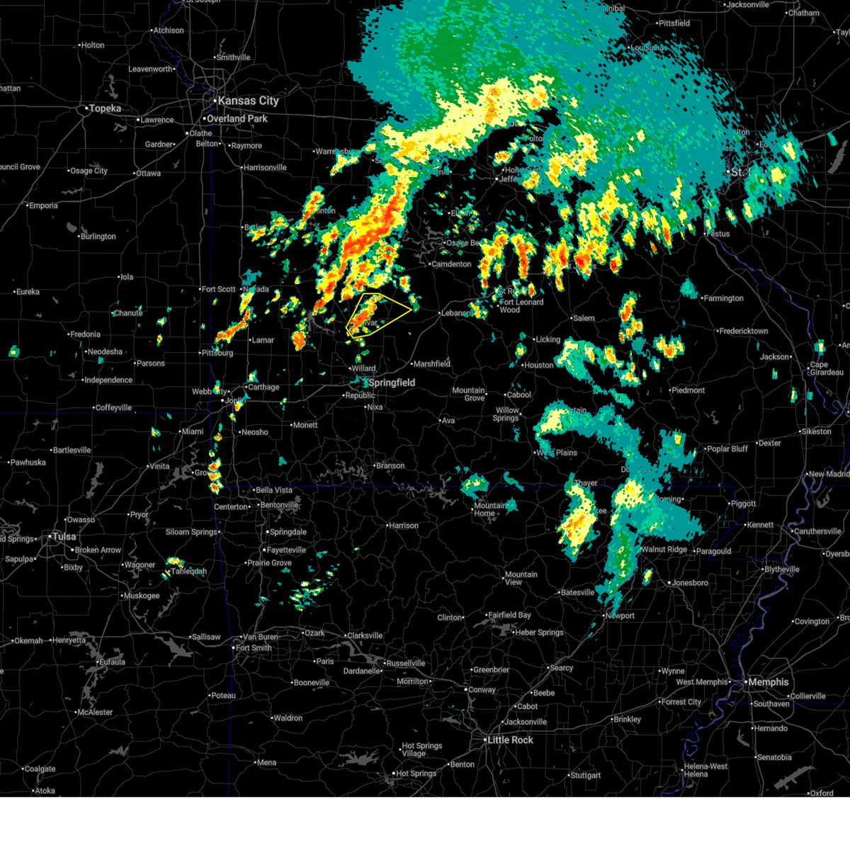
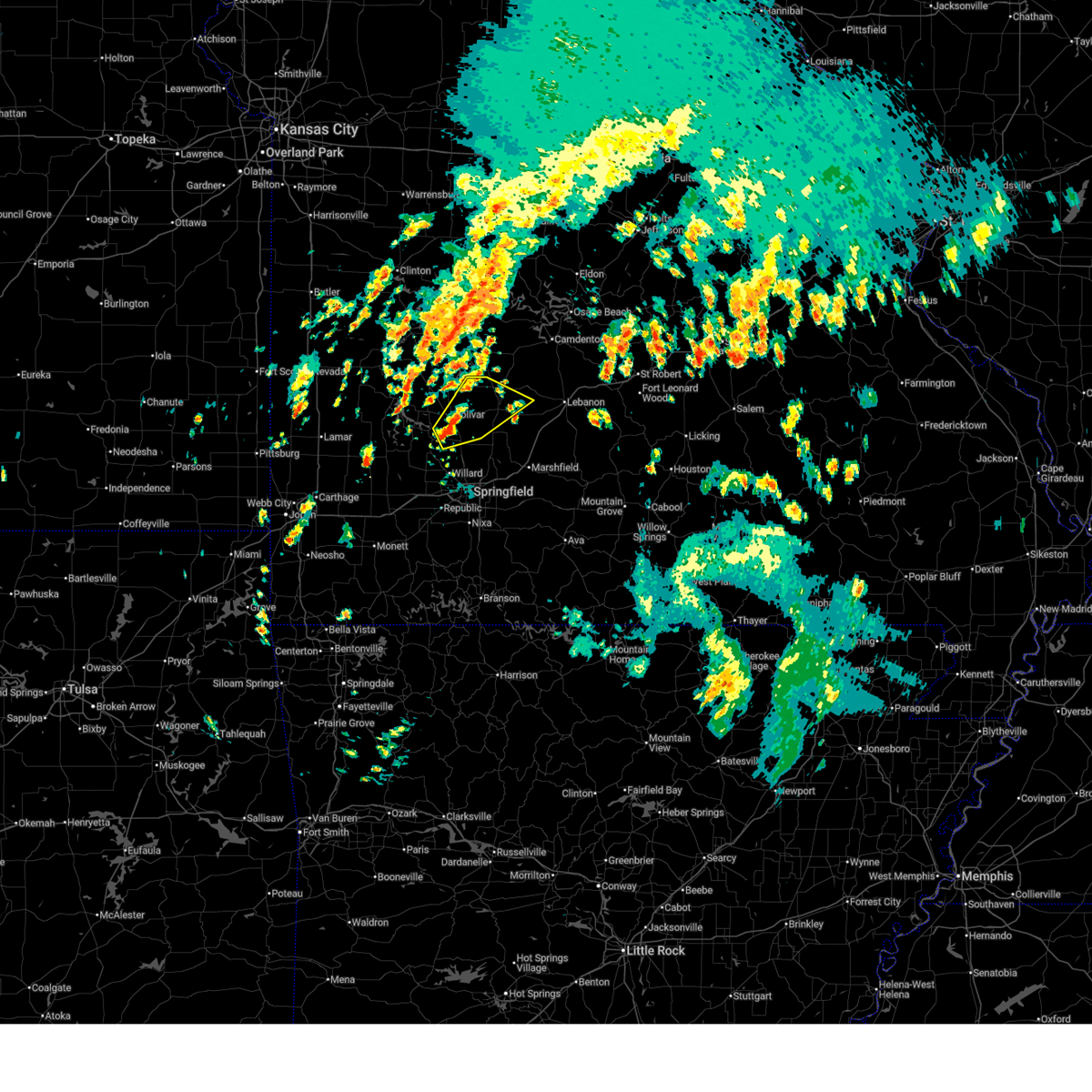
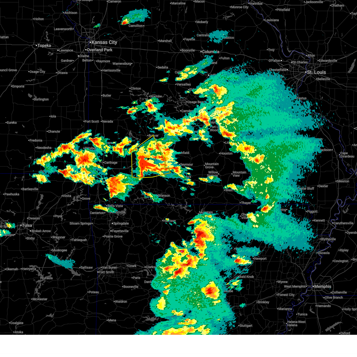
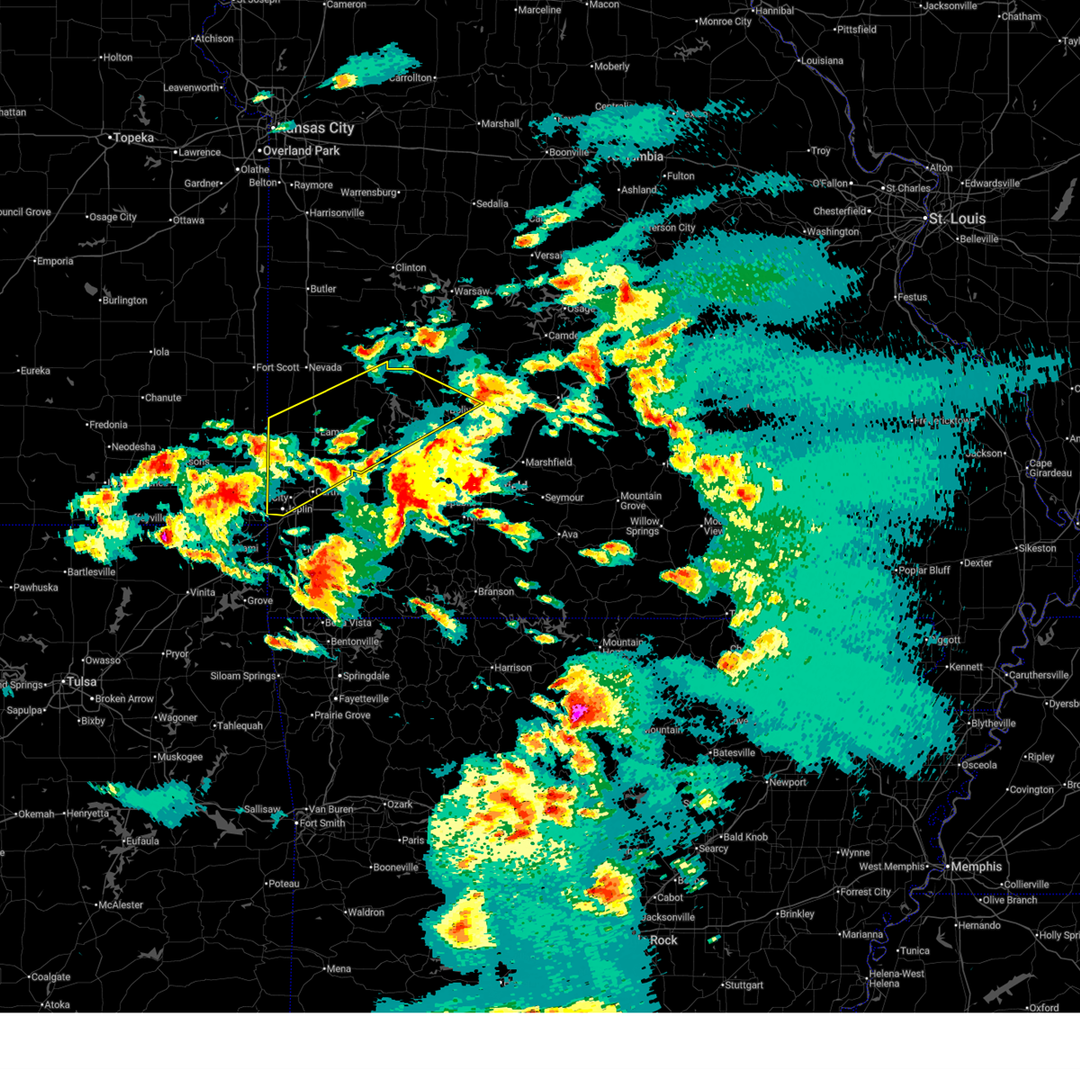
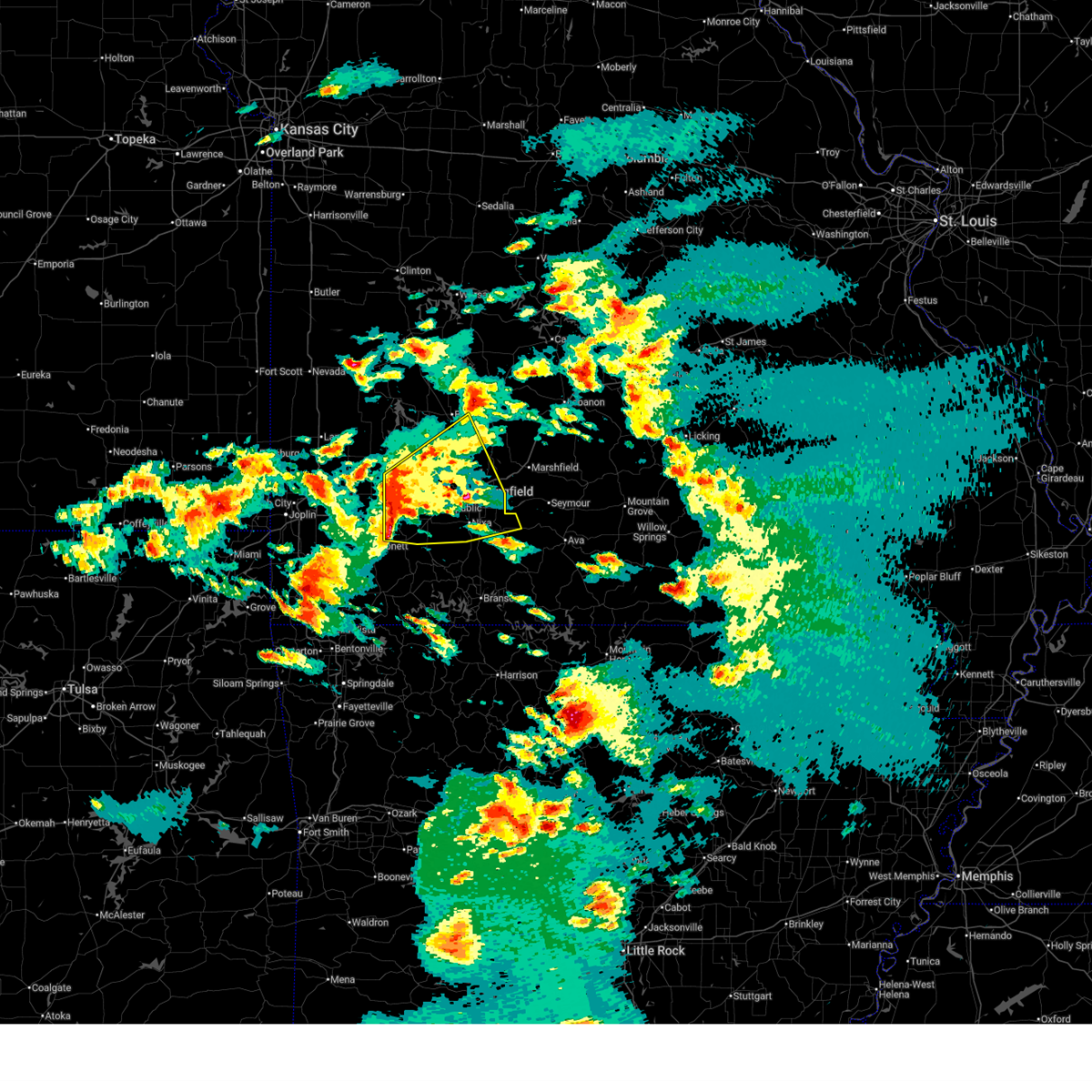
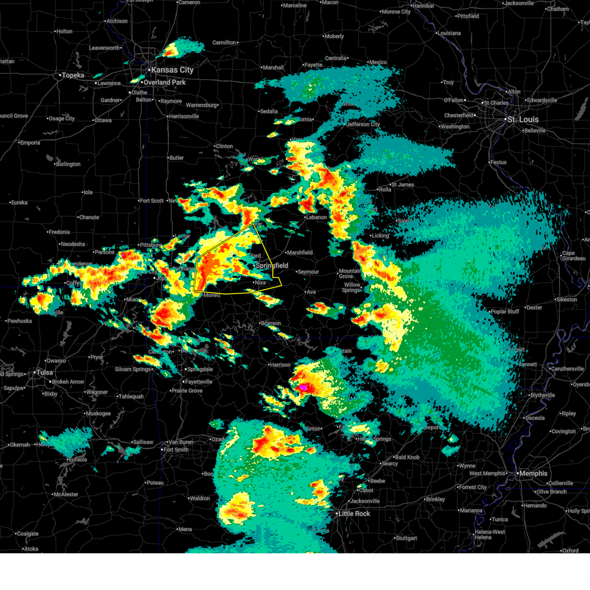
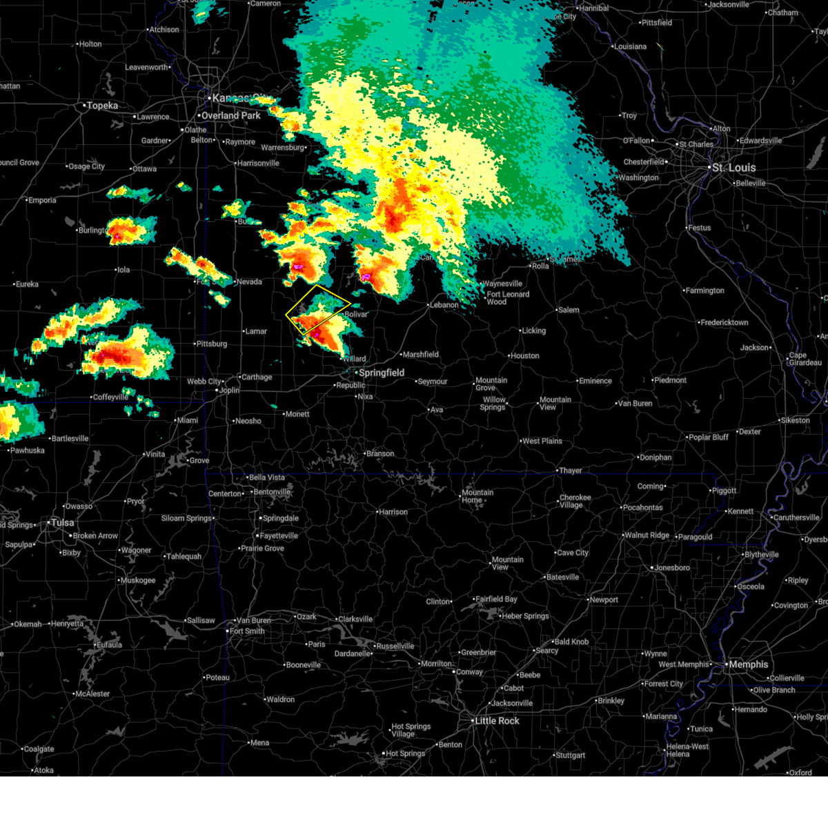
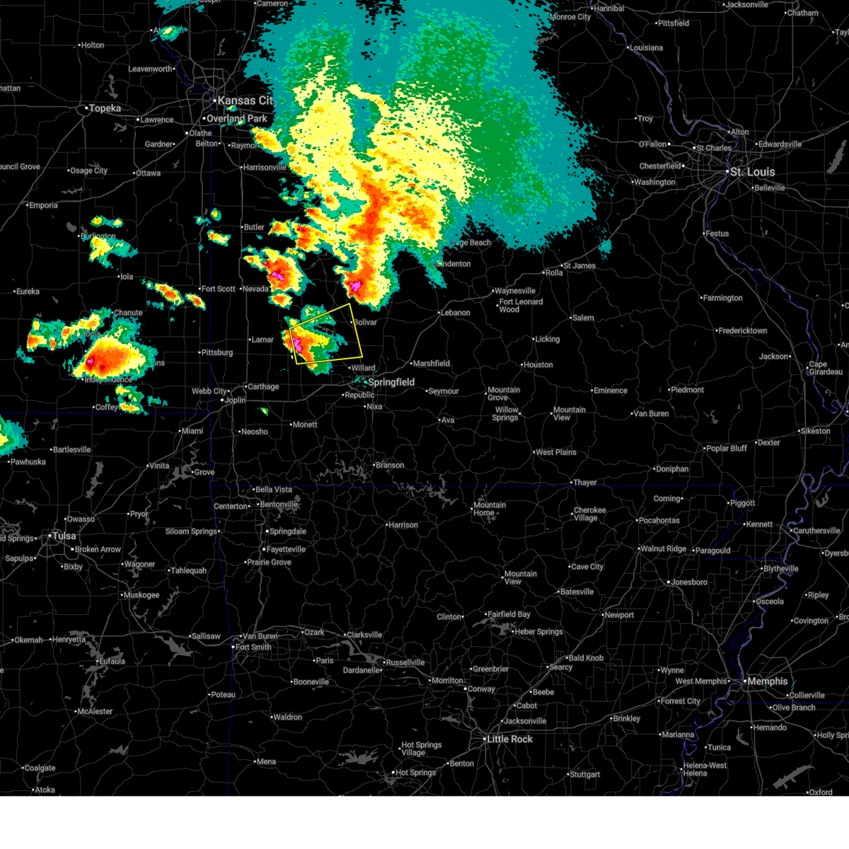
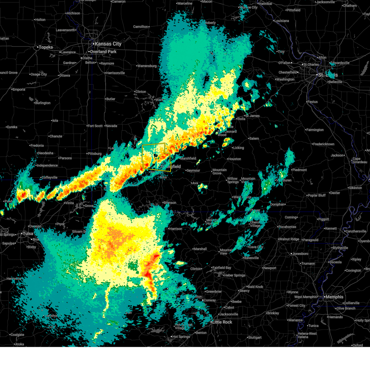
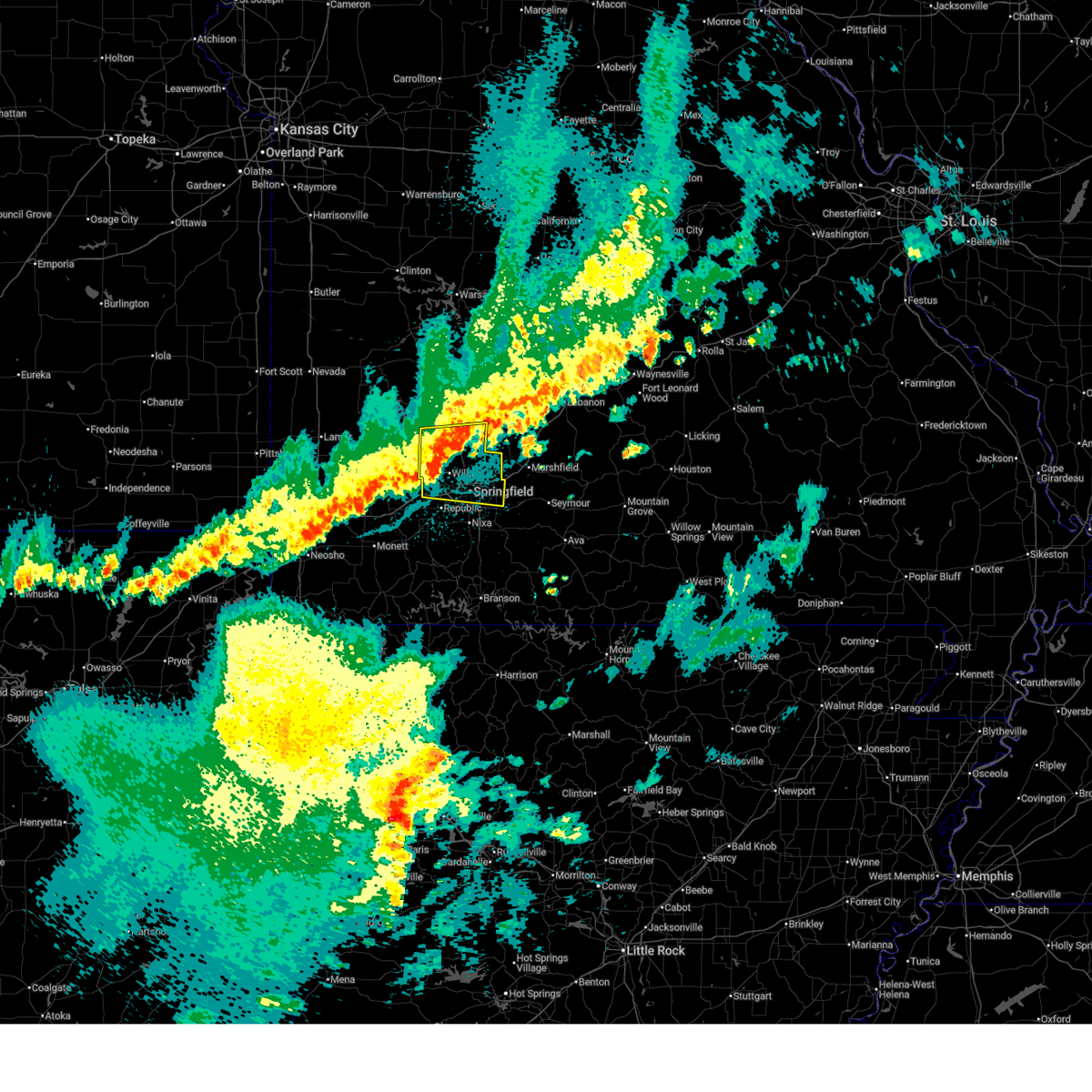
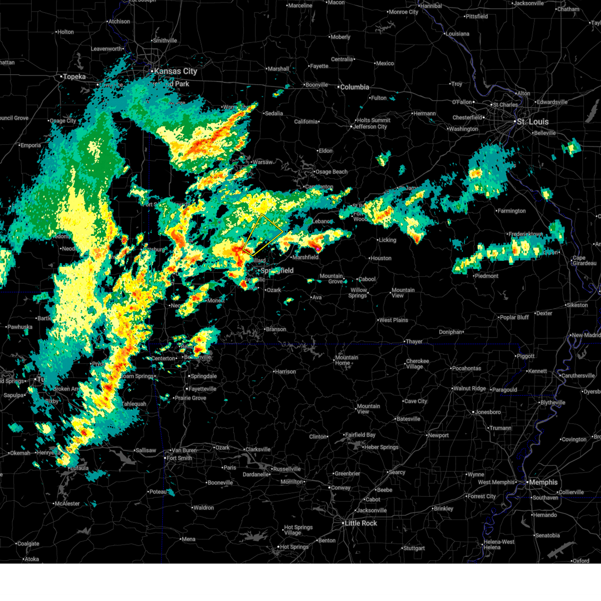
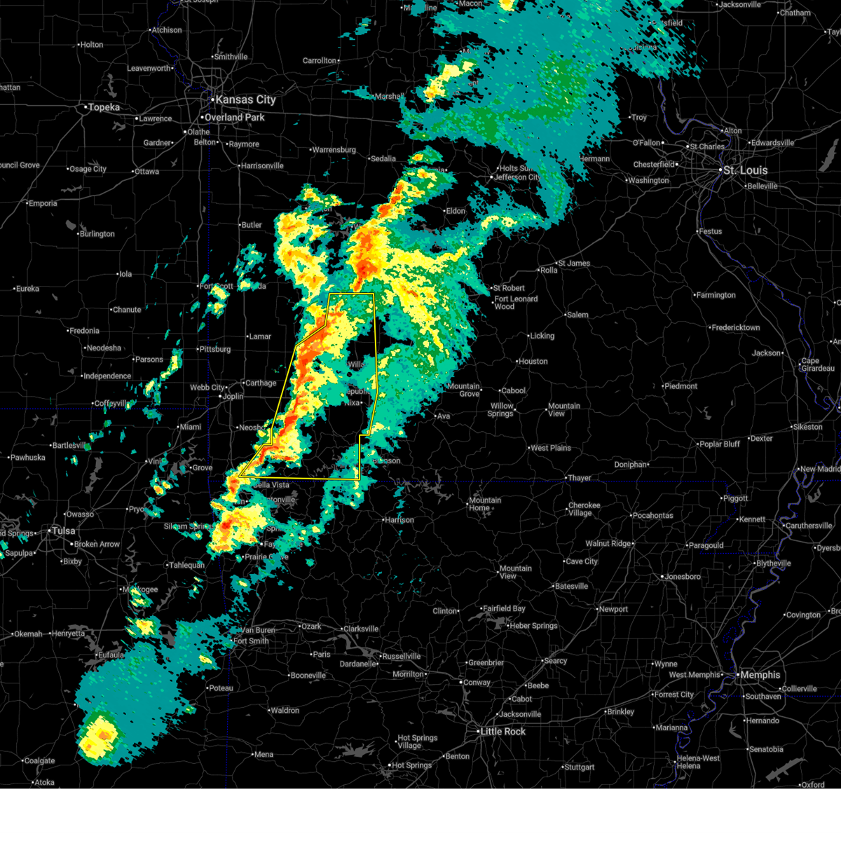
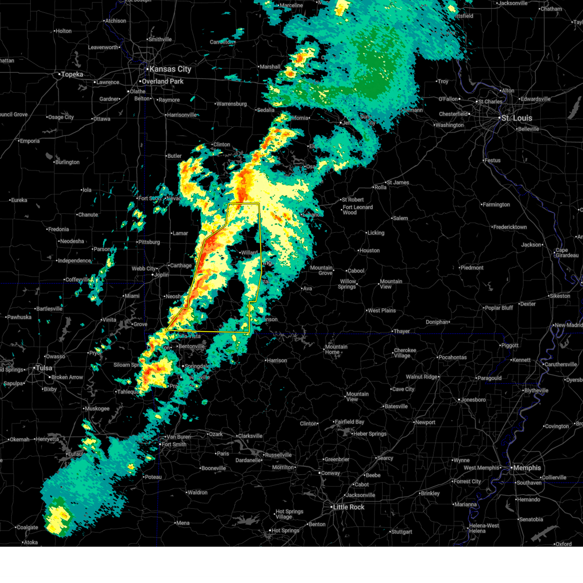
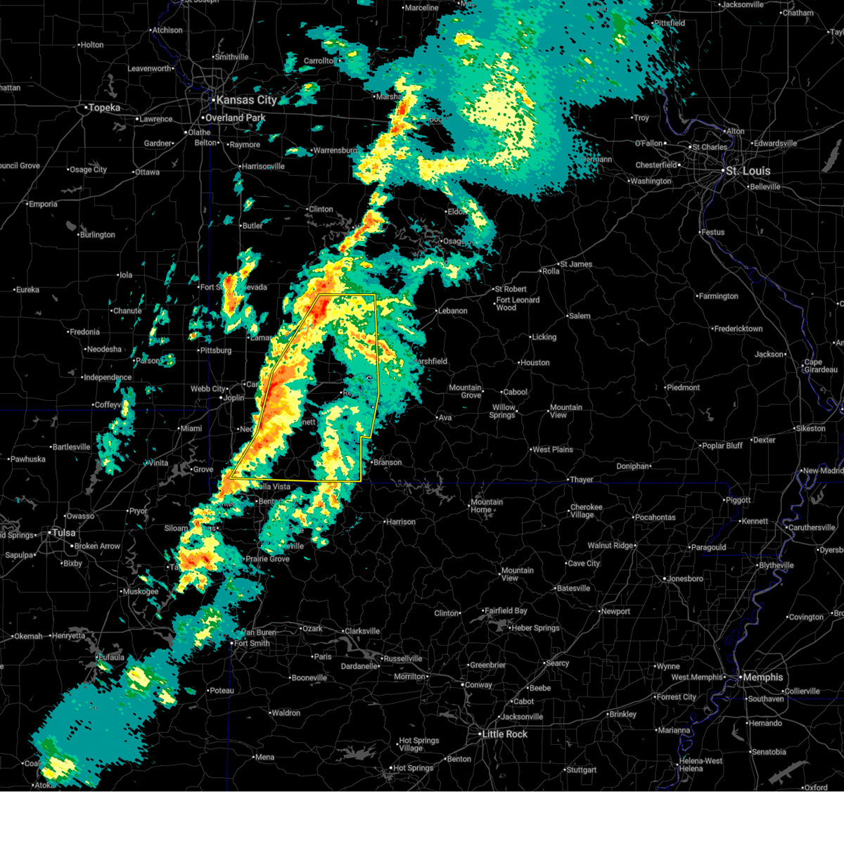
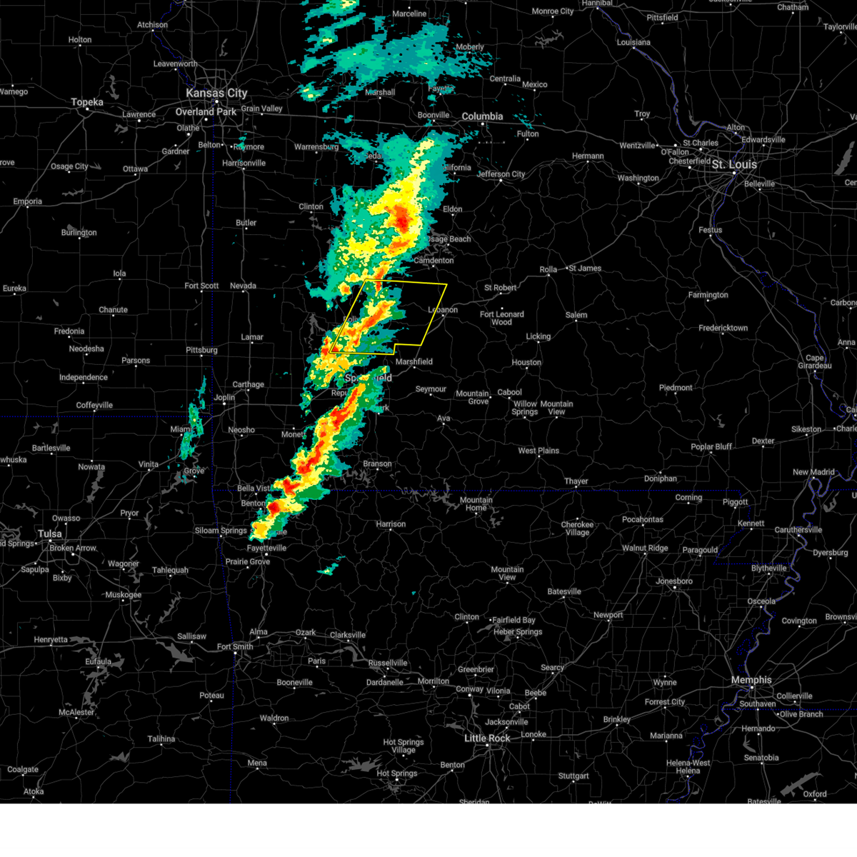
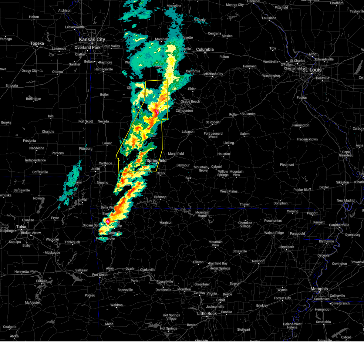
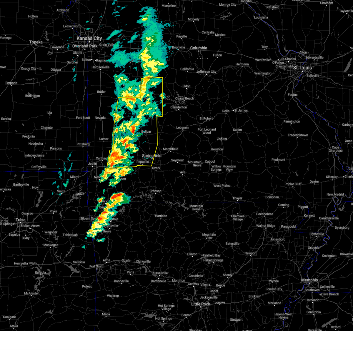
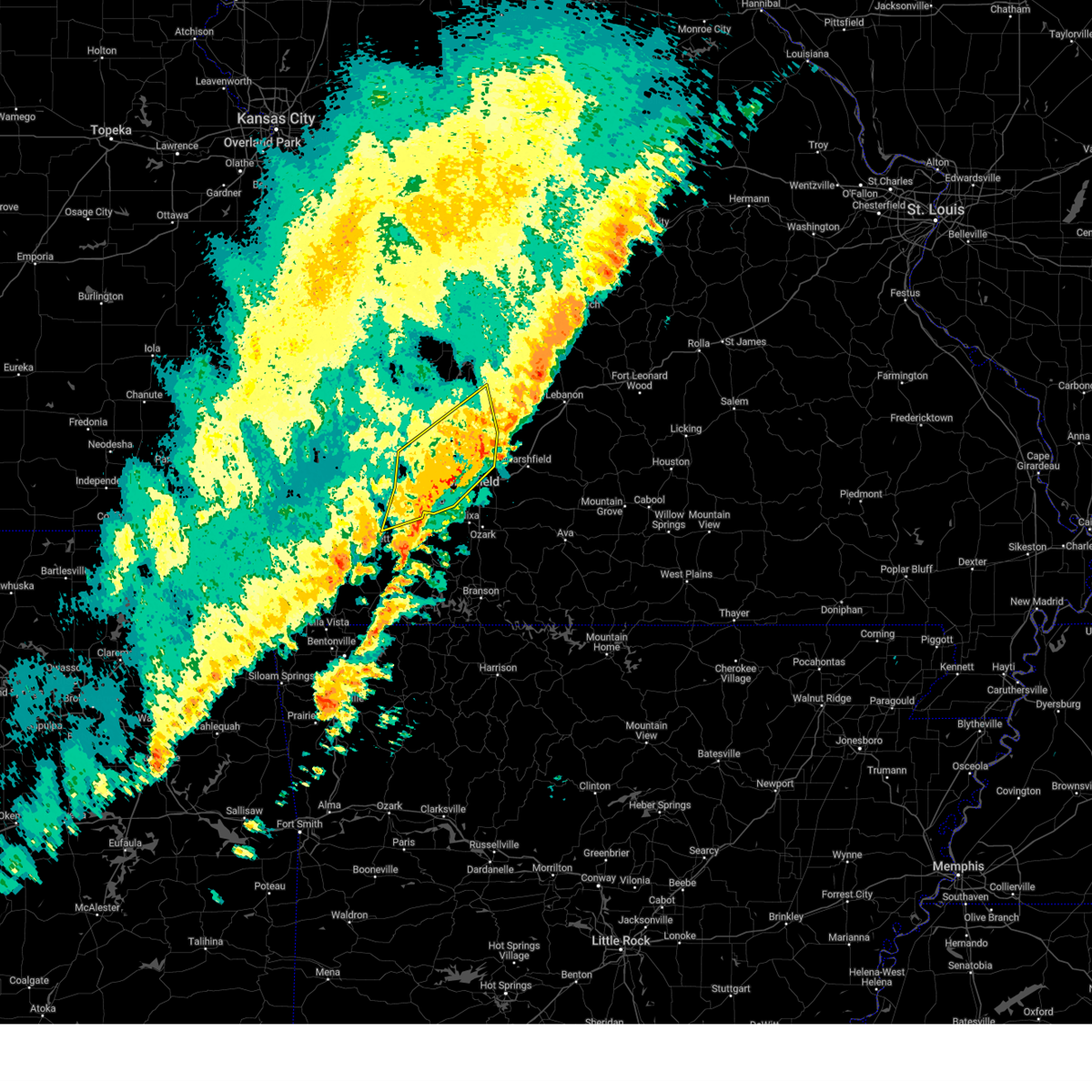
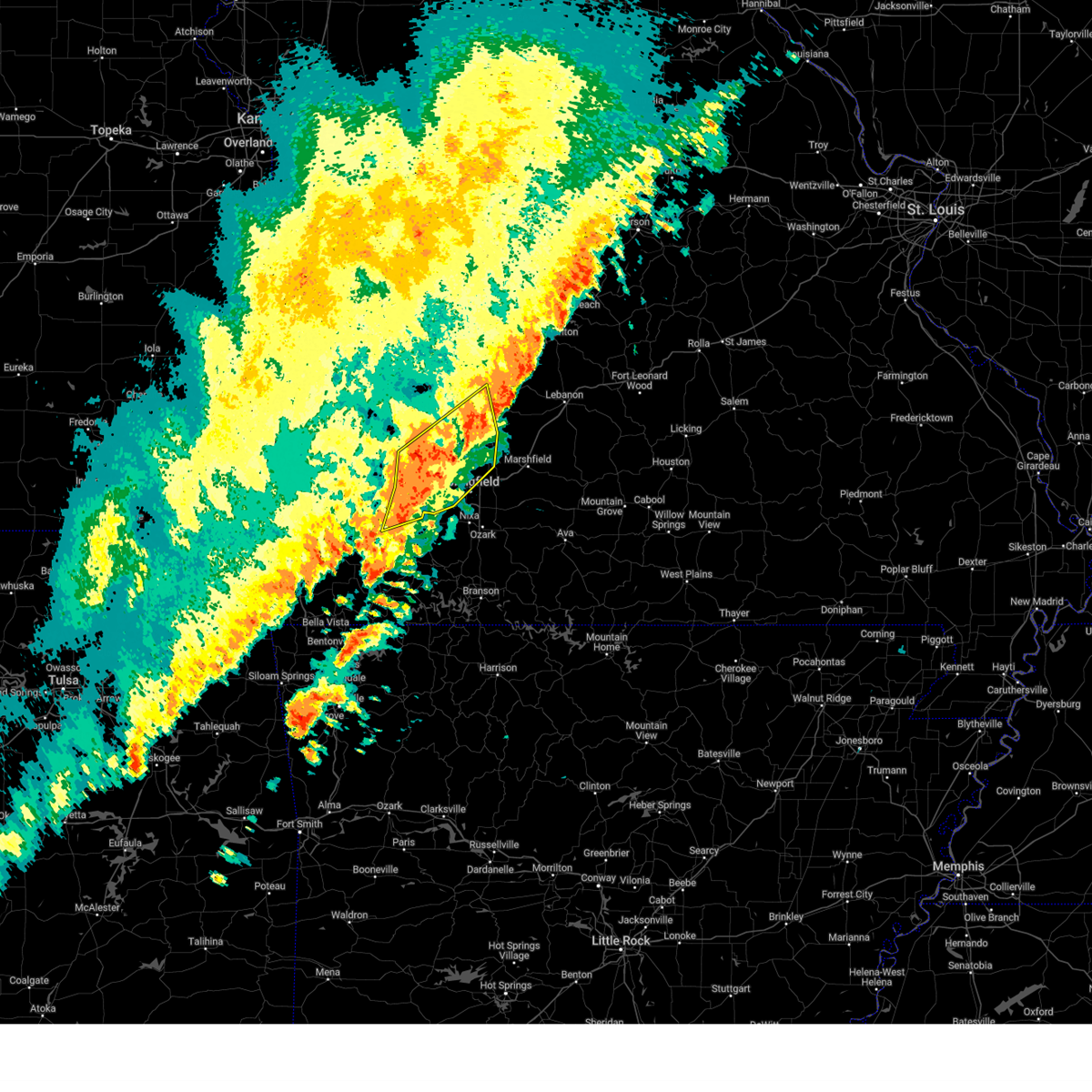
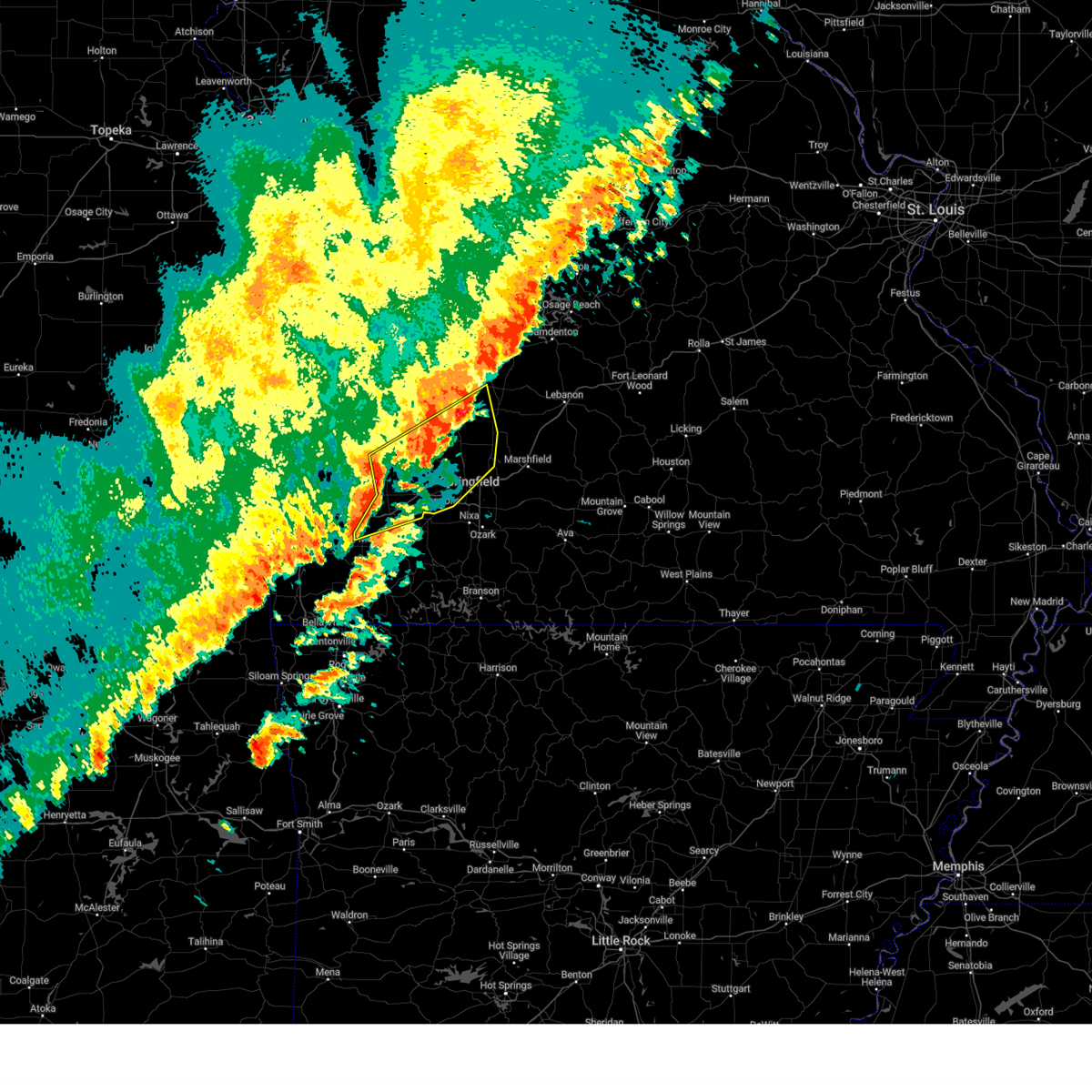
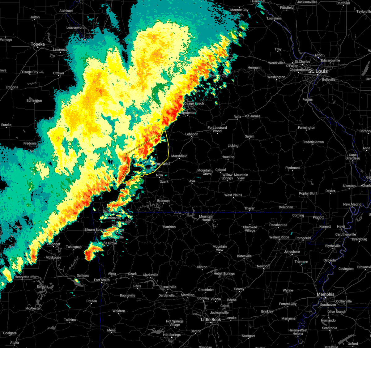
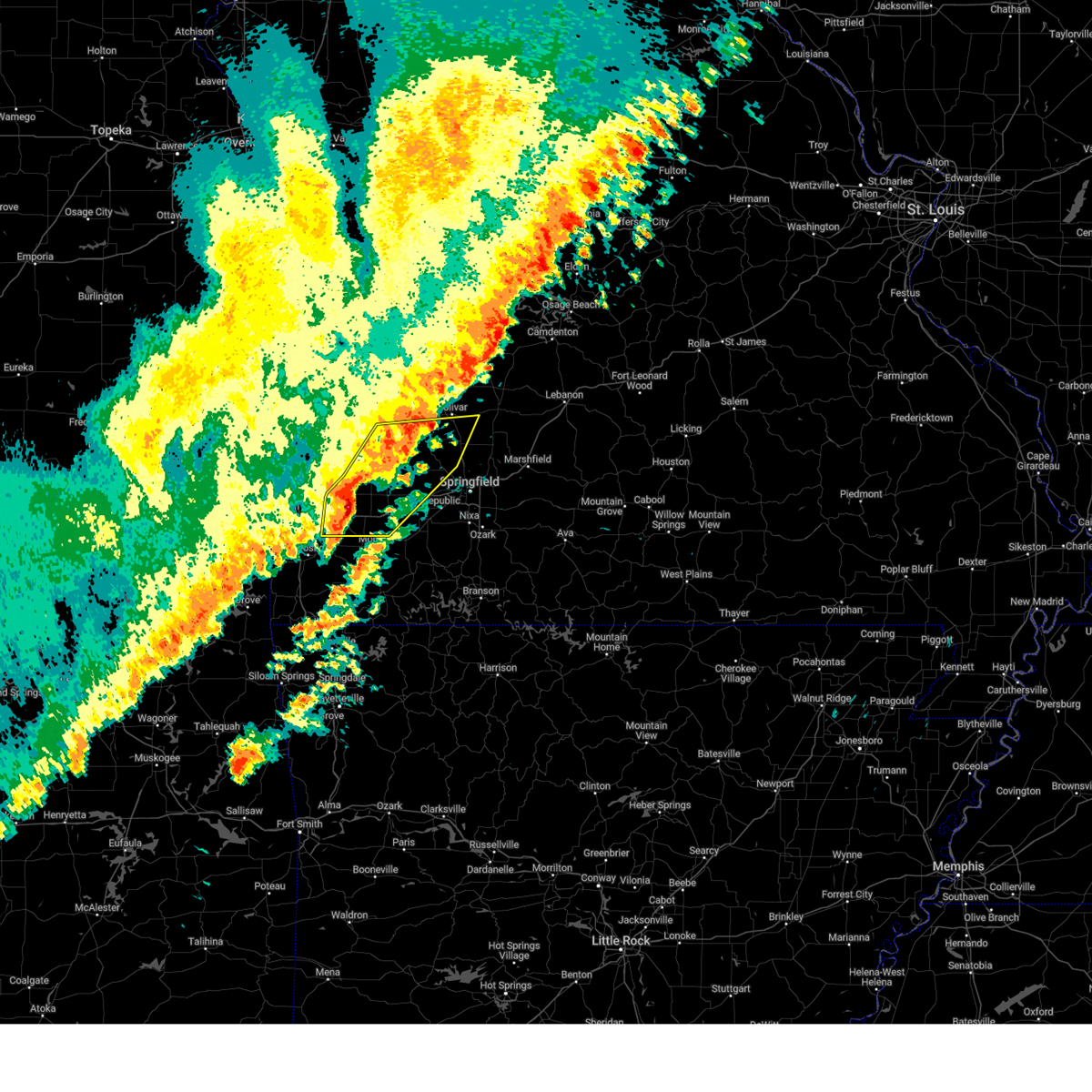
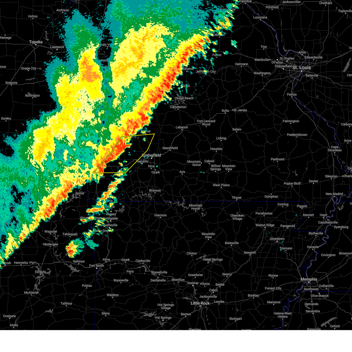
Hail Map for Bolivar, MO
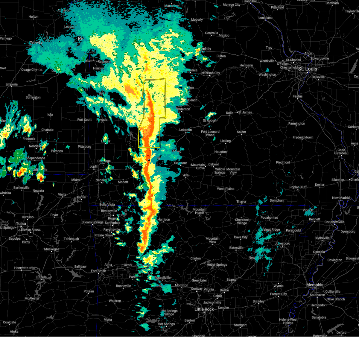
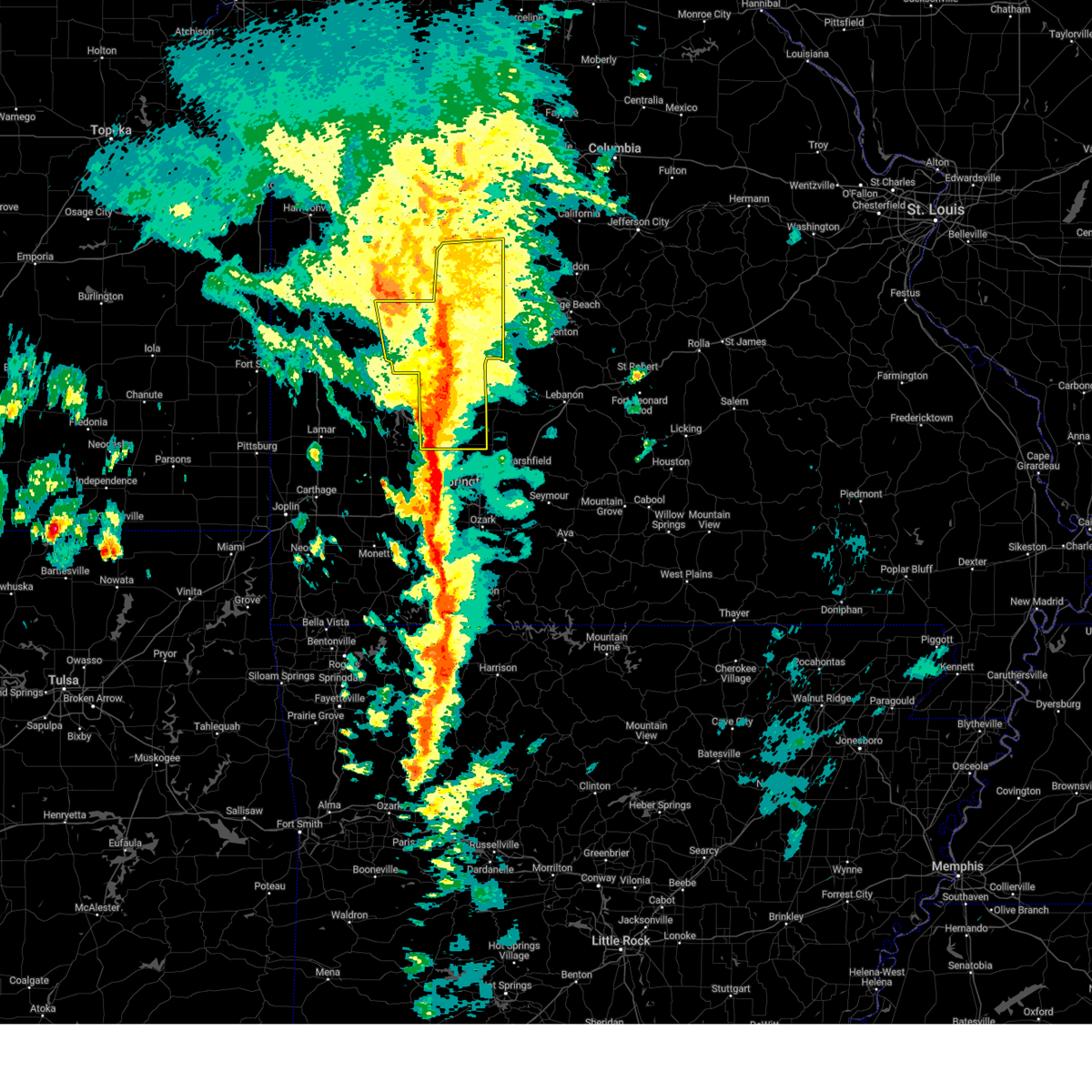
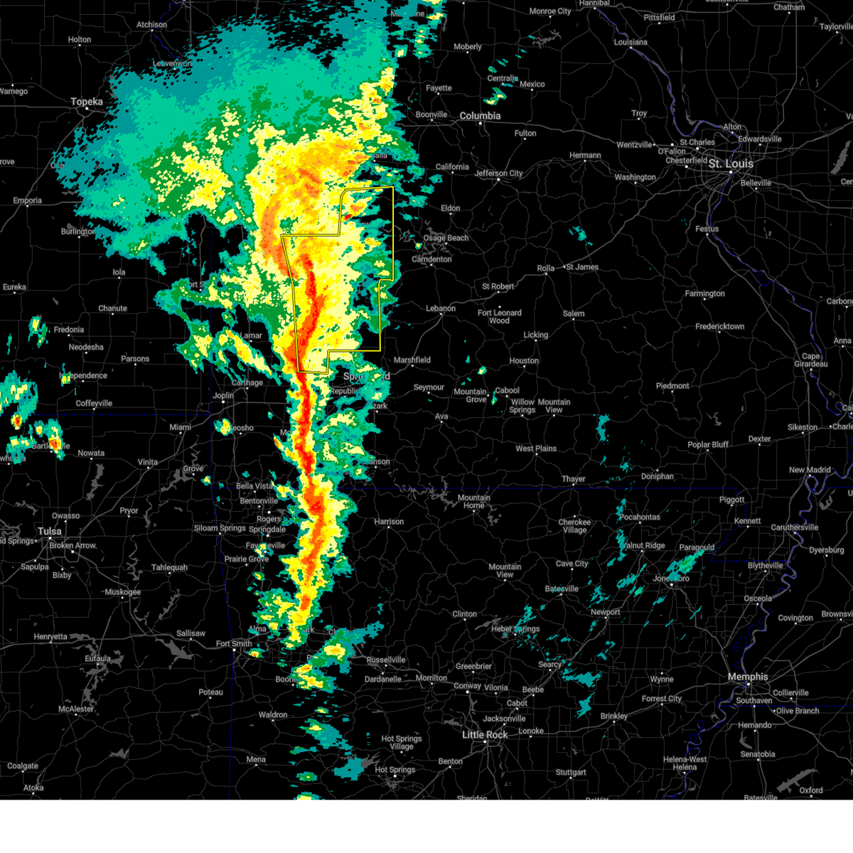
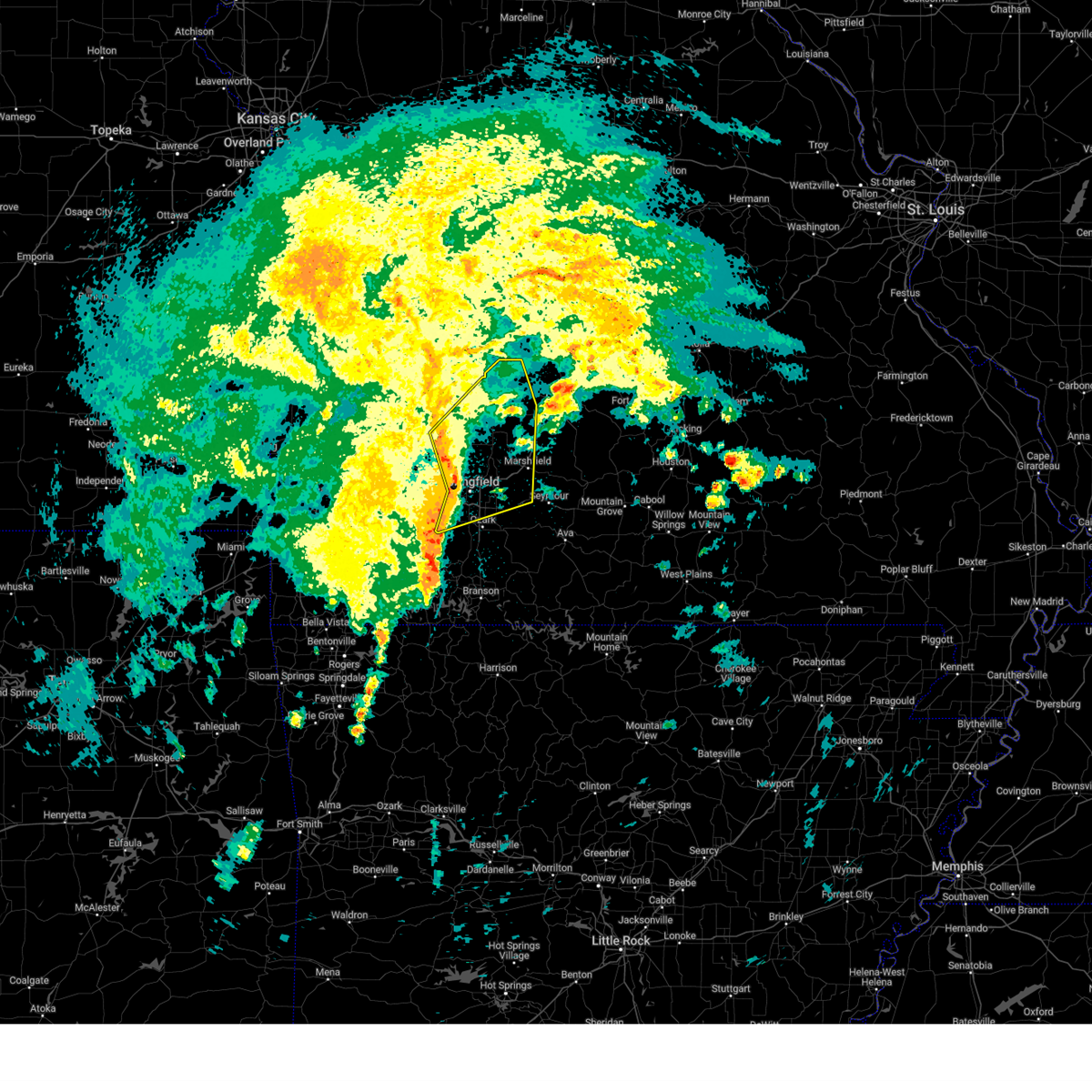
The Bolivar, MO area has had 31 reports of on-the-ground hail by trained spotters, and has been under severe weather warnings 45 times during the past 12 months. Doppler radar has detected hail at or near Bolivar, MO on 91 occasions, including 6 occasions during the past year.
| Name: | Bolivar, MO |
| Where Located: | 27.4 miles NNW of Springfield, MO |
| Map: | Google Map for Bolivar, MO |
| Population: | 10325 |
| Housing Units: | 4432 |
| More Info: | Search Google for Bolivar, MO |
1
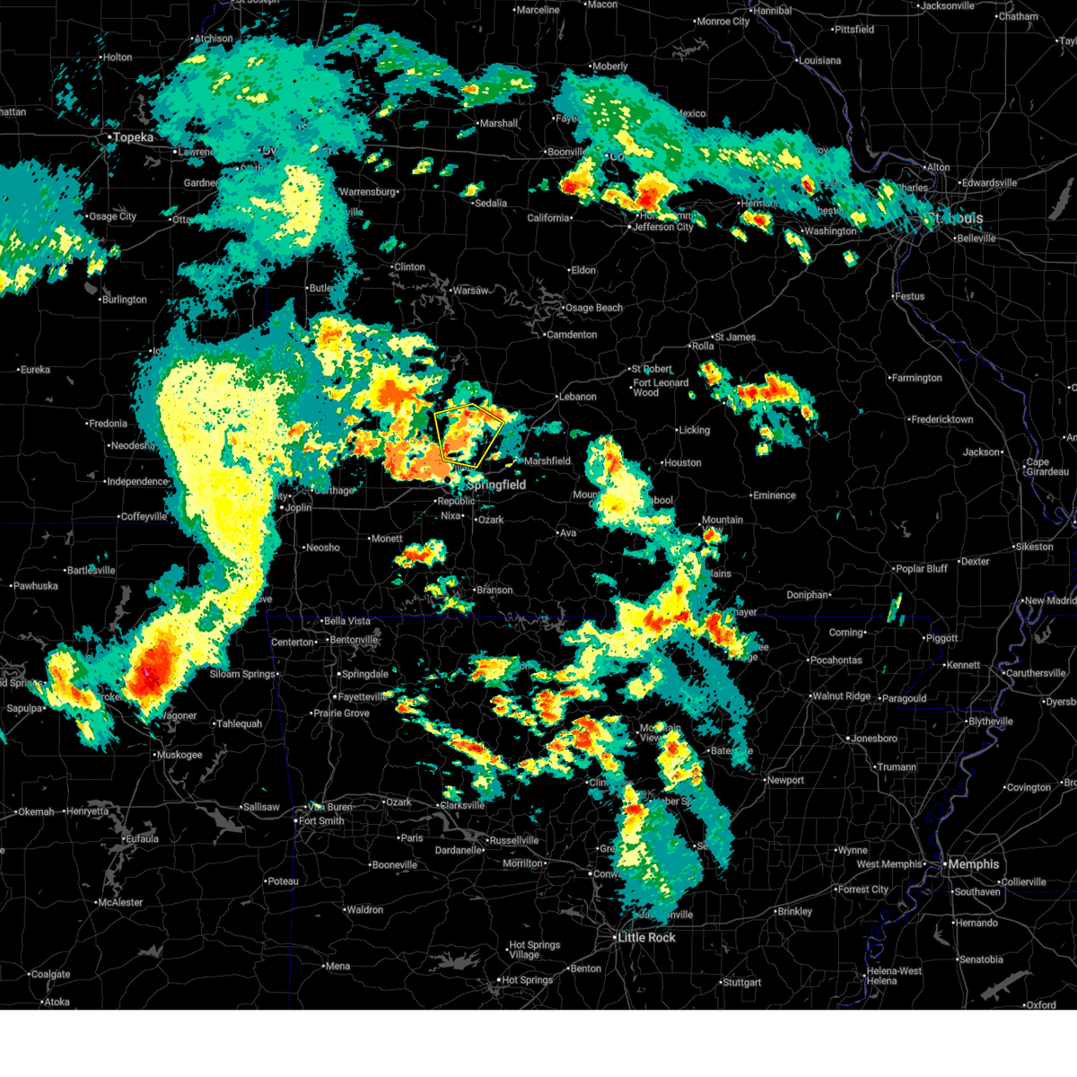
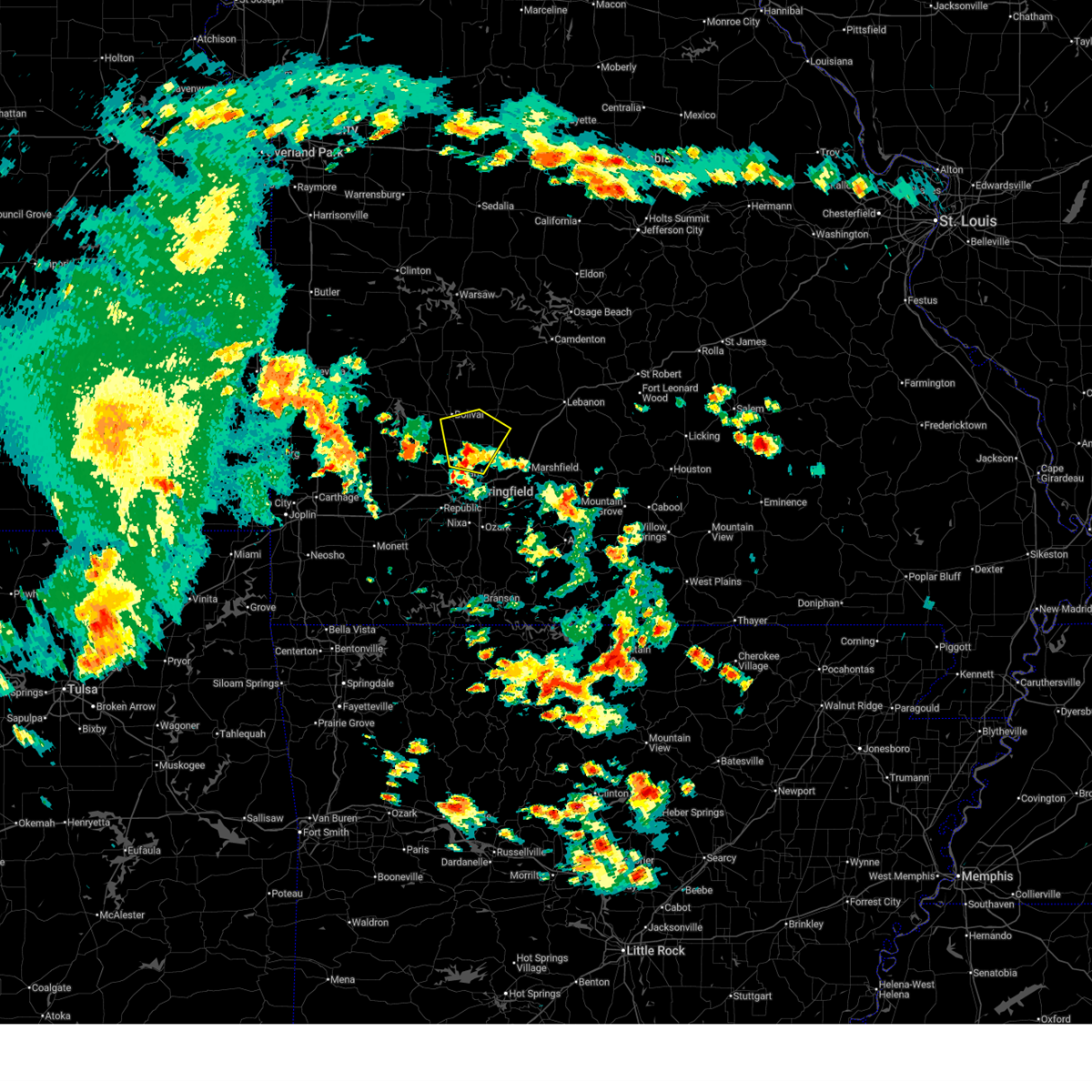
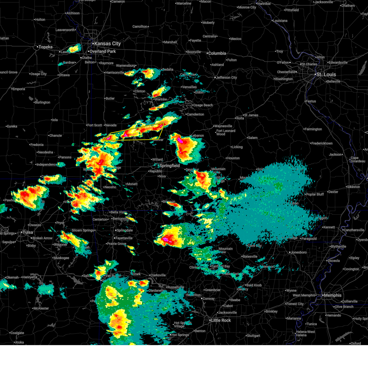
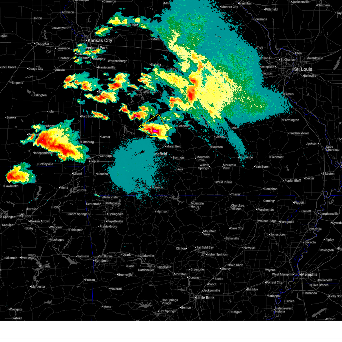
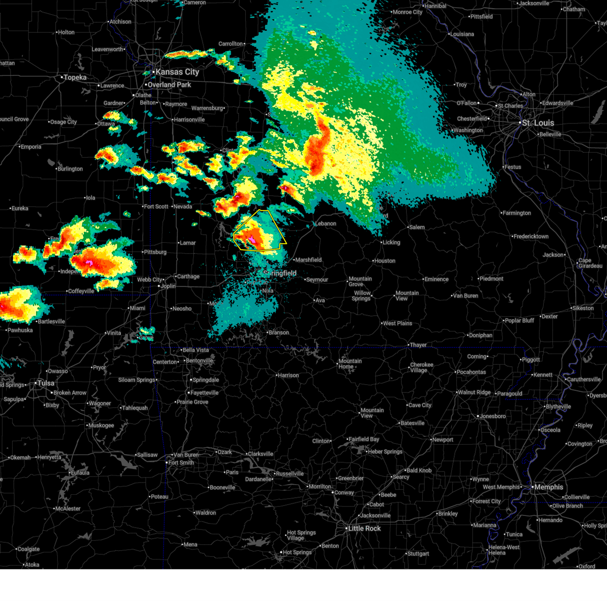
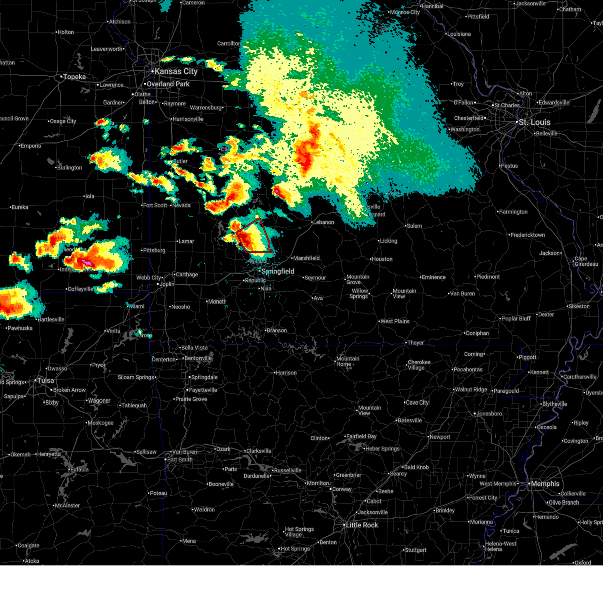
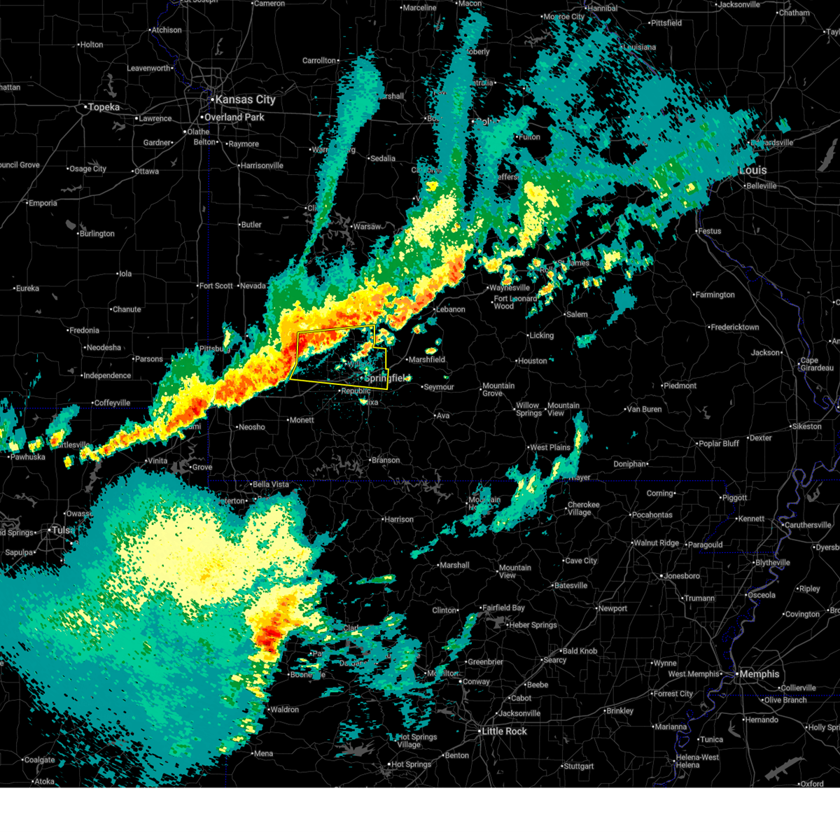
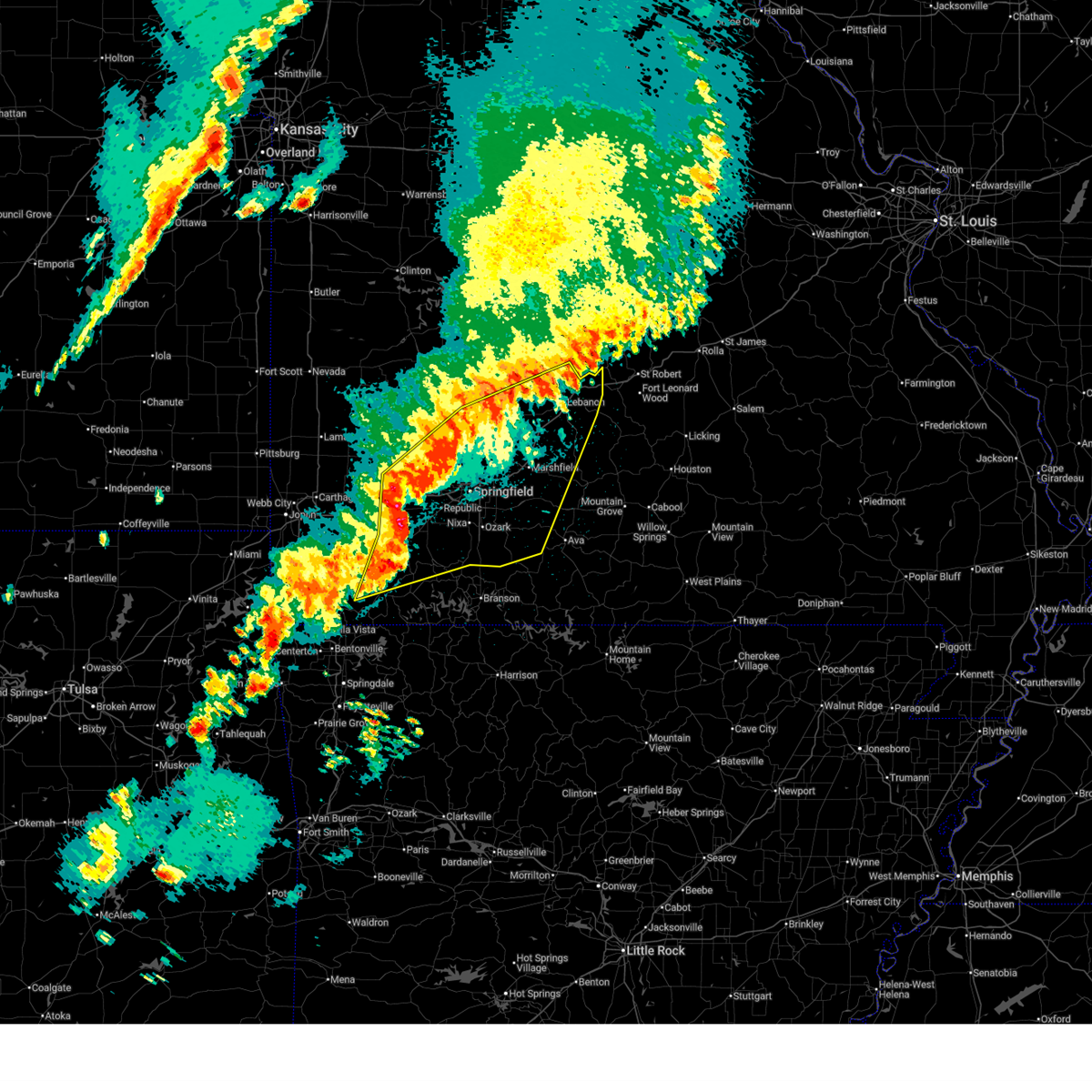
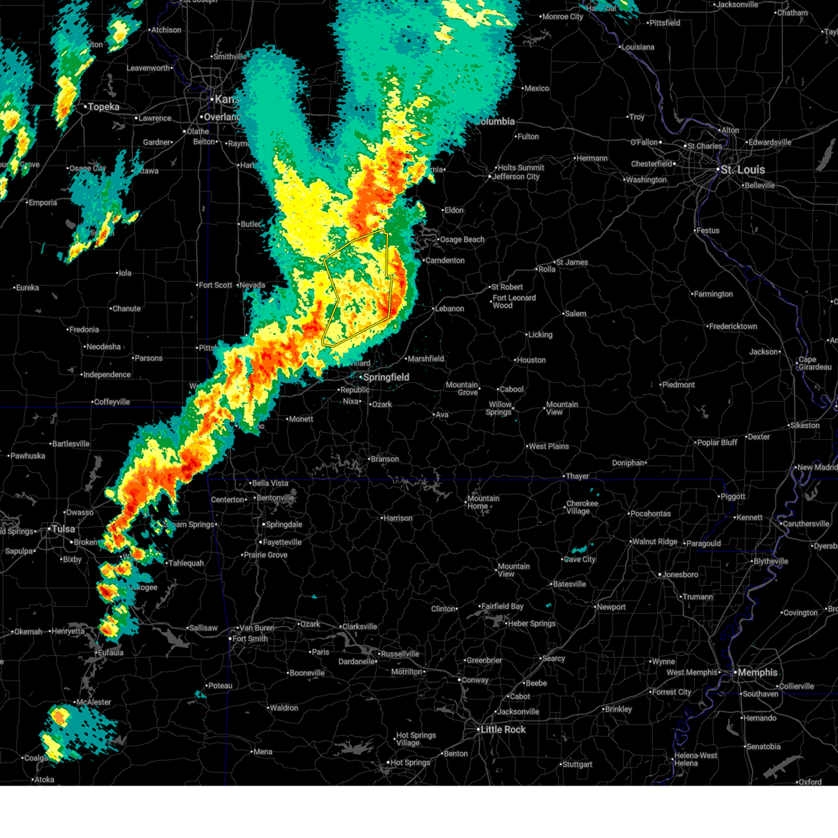
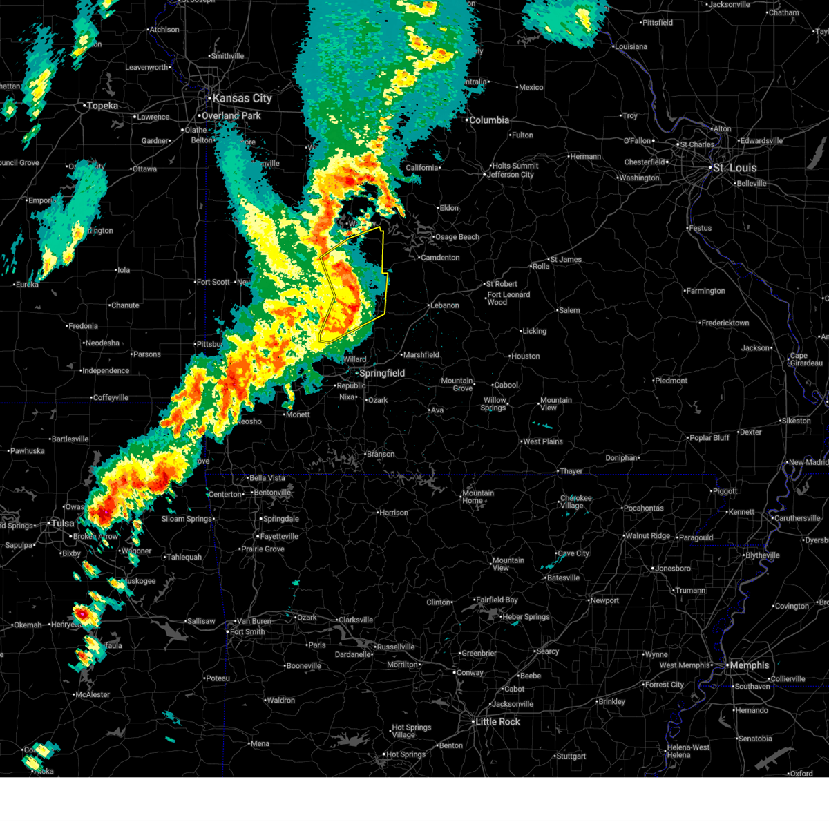
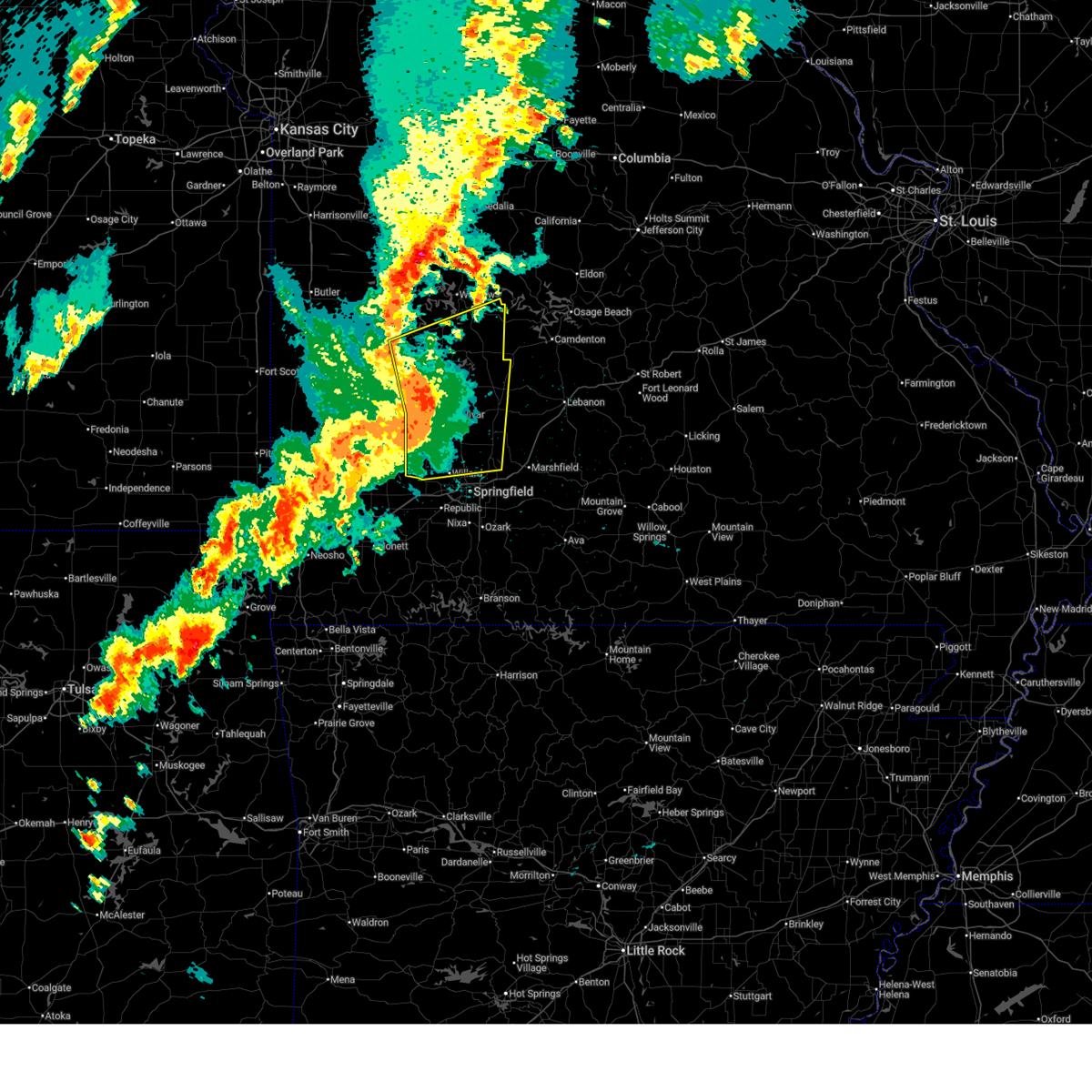
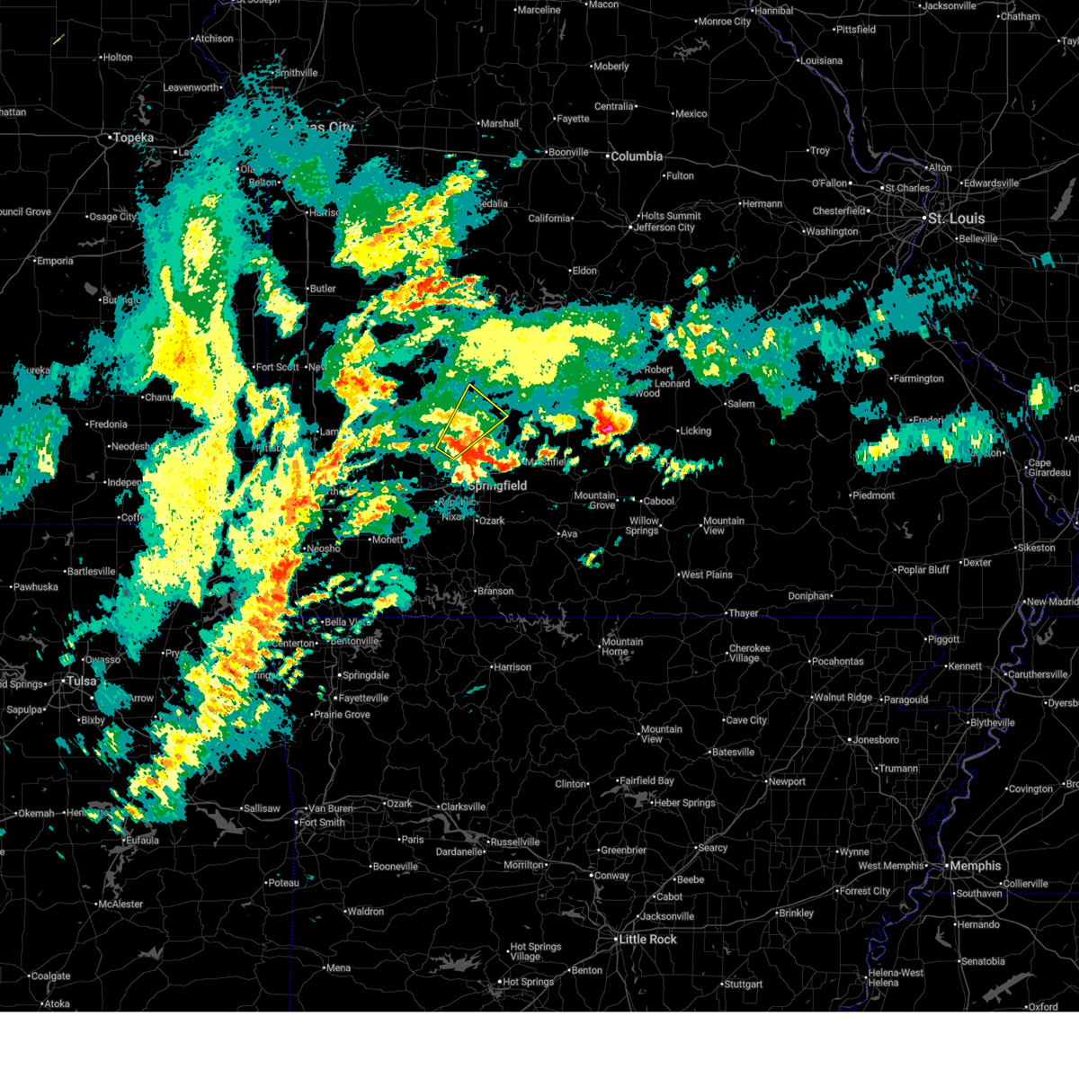
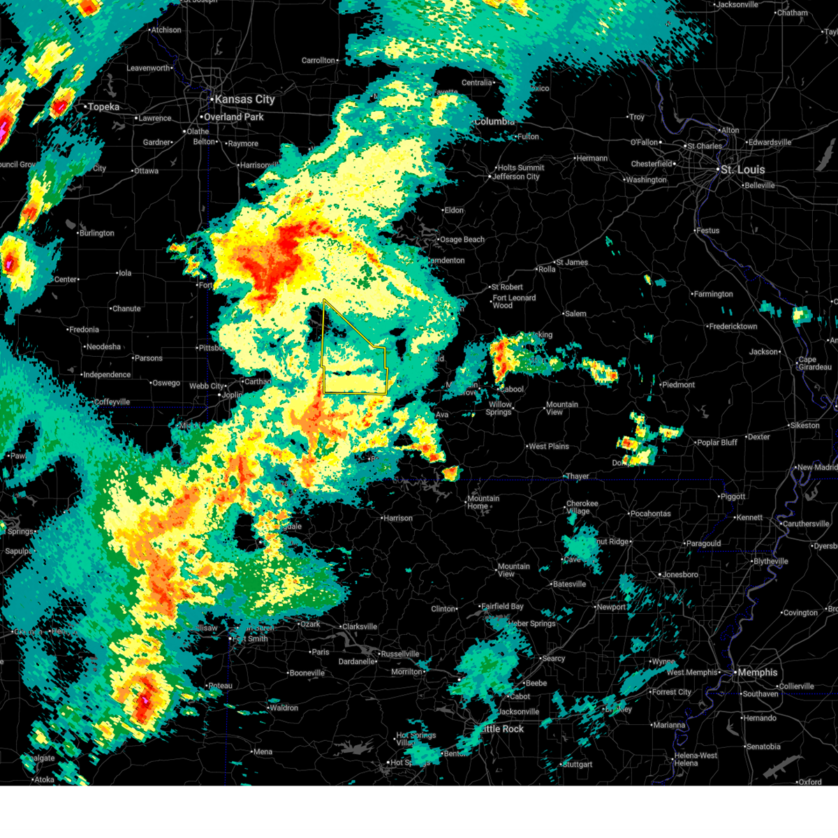
The Top Recent Hail Date for Bolivar, MO is Sunday, April 26, 2026 (24th out of 91)
Hail and Wind Damage Spotted near Bolivar, MO
| Date / Time | Report Details |
|---|---|
| 6/25/2026 4:50 PM CDT |
 The storm which prompted the warning has weakened below severe limits, and no longer poses an immediate threat to life or property. therefore, the warning will be allowed to expire. however, small hail and gusty winds are still possible with this thunderstorm. The storm which prompted the warning has weakened below severe limits, and no longer poses an immediate threat to life or property. therefore, the warning will be allowed to expire. however, small hail and gusty winds are still possible with this thunderstorm.
|
| 6/25/2026 4:08 PM CDT | Trees down on h highway just north of pleasant hop in polk county MO, 11.1 miles NW of Bolivar, MO |
| 6/25/2026 4:08 PM CDT |
 Svrsgf the national weather service in springfield has issued a * severe thunderstorm warning for, southwestern dallas county in southwestern missouri, southeastern polk county in southwestern missouri, northeastern greene county in southwestern missouri, * until 500 pm cdt. * at 408 pm cdt, a severe thunderstorm was located over pleasant hope, or 12 miles southeast of bolivar, moving north at 15 mph (radar indicated). Hazards include 60 mph wind gusts and quarter size hail. Hail damage to vehicles is expected. Expect wind damage to roofs, siding, and trees. Svrsgf the national weather service in springfield has issued a * severe thunderstorm warning for, southwestern dallas county in southwestern missouri, southeastern polk county in southwestern missouri, northeastern greene county in southwestern missouri, * until 500 pm cdt. * at 408 pm cdt, a severe thunderstorm was located over pleasant hope, or 12 miles southeast of bolivar, moving north at 15 mph (radar indicated). Hazards include 60 mph wind gusts and quarter size hail. Hail damage to vehicles is expected. Expect wind damage to roofs, siding, and trees.
|
| 6/21/2026 9:45 AM CDT |
 Torsgf the national weather service in springfield has issued a * tornado warning for, southwestern polk county in southwestern missouri, northwestern greene county in southwestern missouri, * until 1000 am cdt. * at 945 am cdt, a severe thunderstorm capable of producing a tornado was located over walnut grove, or 14 miles southwest of bolivar, moving east at 35 mph (radar indicated rotation). Hazards include tornado. Flying debris will be dangerous to those caught without shelter. mobile homes will be damaged or destroyed. damage to roofs, windows, and vehicles will occur. Tree damage is likely. Torsgf the national weather service in springfield has issued a * tornado warning for, southwestern polk county in southwestern missouri, northwestern greene county in southwestern missouri, * until 1000 am cdt. * at 945 am cdt, a severe thunderstorm capable of producing a tornado was located over walnut grove, or 14 miles southwest of bolivar, moving east at 35 mph (radar indicated rotation). Hazards include tornado. Flying debris will be dangerous to those caught without shelter. mobile homes will be damaged or destroyed. damage to roofs, windows, and vehicles will occur. Tree damage is likely.
|
| 6/14/2026 12:14 AM CDT |
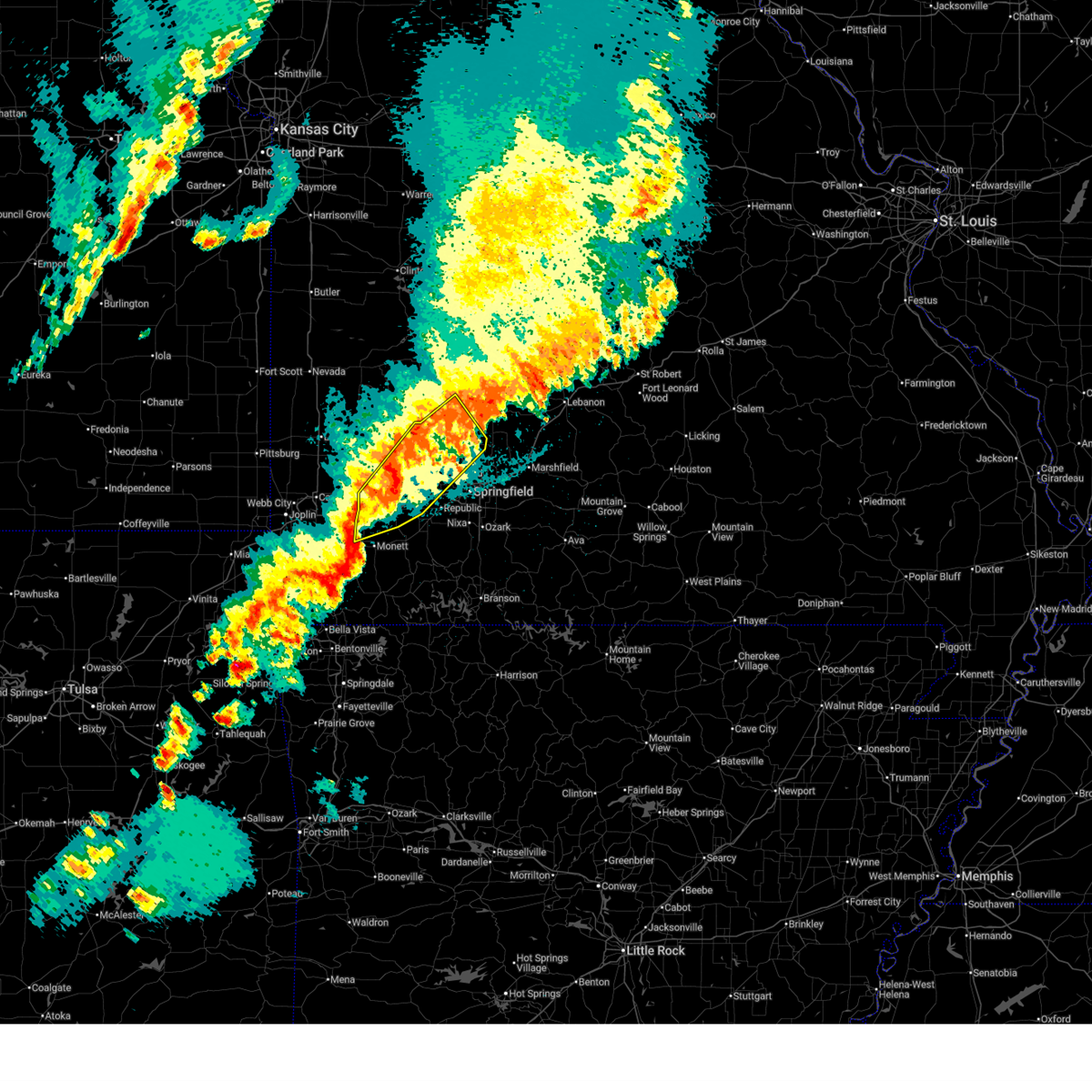
 At 1214 am cdt, severe thunderstorms were located along a line extending from 7 miles east of bolivar to 7 miles southwest of pleasant hope to willard to near miller, moving east at 40 mph (radar indicated). Hazards include 60 mph wind gusts and penny size hail. Expect damage to roofs, siding, and trees. locations impacted include, springfield, republic, bolivar, battlefield, willard, strafford, ash grove, fair grove, walnut grove, pleasant hope, morrisville, brookline, glidewell, sacville, ebenezer, bassville, brighton, turners, bois d'arc, and olive. This includes interstate 44 between mile markers 59 and 90. At 1214 am cdt, severe thunderstorms were located along a line extending from 7 miles east of bolivar to 7 miles southwest of pleasant hope to willard to near miller, moving east at 40 mph (radar indicated). Hazards include 60 mph wind gusts and penny size hail. Expect damage to roofs, siding, and trees. locations impacted include, springfield, republic, bolivar, battlefield, willard, strafford, ash grove, fair grove, walnut grove, pleasant hope, morrisville, brookline, glidewell, sacville, ebenezer, bassville, brighton, turners, bois d'arc, and olive. This includes interstate 44 between mile markers 59 and 90.
|
| 6/13/2026 11:47 PM CDT |
 Svrsgf the national weather service in springfield has issued a * severe thunderstorm warning for, southwestern dallas county in southwestern missouri, southern polk county in southwestern missouri, greene county in southwestern missouri, northeastern dade county in southwestern missouri, * until 1245 am cdt. * at 1147 pm cdt, severe thunderstorms were located along a line extending from near bolivar to near walnut grove to near everton to 6 miles south of lockwood, moving east at 50 mph (radar indicated). Hazards include 60 mph wind gusts and penny size hail. expect damage to roofs, siding, and trees Svrsgf the national weather service in springfield has issued a * severe thunderstorm warning for, southwestern dallas county in southwestern missouri, southern polk county in southwestern missouri, greene county in southwestern missouri, northeastern dade county in southwestern missouri, * until 1245 am cdt. * at 1147 pm cdt, severe thunderstorms were located along a line extending from near bolivar to near walnut grove to near everton to 6 miles south of lockwood, moving east at 50 mph (radar indicated). Hazards include 60 mph wind gusts and penny size hail. expect damage to roofs, siding, and trees
|
| 6/8/2026 4:05 AM CDT |
 The storms which prompted the warning have weakened below severe limits, and no longer pose an immediate threat to life or property. therefore, the warning will be allowed to expire. The storms which prompted the warning have weakened below severe limits, and no longer pose an immediate threat to life or property. therefore, the warning will be allowed to expire.
|
| 6/8/2026 3:31 AM CDT |
 Svrsgf the national weather service in springfield has issued a * severe thunderstorm warning for, southern polk county in southwestern missouri, * until 415 am cdt. * at 331 am cdt, severe thunderstorms were located along a line extending from bolivar to near morrisville to near walnut grove, moving east at 25 mph (radar indicated). Hazards include 60 mph wind gusts and nickel size hail. expect damage to roofs, siding, and trees Svrsgf the national weather service in springfield has issued a * severe thunderstorm warning for, southern polk county in southwestern missouri, * until 415 am cdt. * at 331 am cdt, severe thunderstorms were located along a line extending from bolivar to near morrisville to near walnut grove, moving east at 25 mph (radar indicated). Hazards include 60 mph wind gusts and nickel size hail. expect damage to roofs, siding, and trees
|
| 5/30/2026 6:01 PM CDT |
 the severe thunderstorm warning has been cancelled and is no longer in effect the severe thunderstorm warning has been cancelled and is no longer in effect
|
| 5/30/2026 6:01 PM CDT |
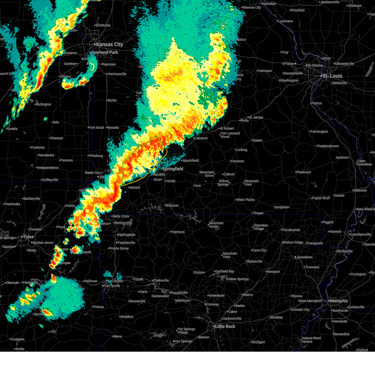
 At 600 pm cdt, severe thunderstorms were located along a line extending from 7 miles south of fair play to 6 miles south of morrisville to near willard, moving east at 20 mph (radar indicated). Hazards include 60 mph wind gusts and quarter size hail. Hail damage to vehicles is expected. expect wind damage to roofs, siding, and trees. Locations impacted include, bolivar, stockton lake, willard, ash grove, walnut grove, morrisville, aldrich, sacville, cave springs, and eudora. At 600 pm cdt, severe thunderstorms were located along a line extending from 7 miles south of fair play to 6 miles south of morrisville to near willard, moving east at 20 mph (radar indicated). Hazards include 60 mph wind gusts and quarter size hail. Hail damage to vehicles is expected. expect wind damage to roofs, siding, and trees. Locations impacted include, bolivar, stockton lake, willard, ash grove, walnut grove, morrisville, aldrich, sacville, cave springs, and eudora.
|
| 5/30/2026 5:23 PM CDT |
 Svrsgf the national weather service in springfield has issued a * severe thunderstorm warning for, southwestern polk county in southwestern missouri, northeastern lawrence county in southwestern missouri, northwestern greene county in southwestern missouri, eastern dade county in southwestern missouri, * until 615 pm cdt. * at 523 pm cdt, severe thunderstorms were located along a line extending from 9 miles south of stockton to near walnut grove to near everton, moving northeast at 25 mph (radar indicated). Hazards include 60 mph wind gusts and quarter size hail. Hail damage to vehicles is expected. Expect wind damage to roofs, siding, and trees. Svrsgf the national weather service in springfield has issued a * severe thunderstorm warning for, southwestern polk county in southwestern missouri, northeastern lawrence county in southwestern missouri, northwestern greene county in southwestern missouri, eastern dade county in southwestern missouri, * until 615 pm cdt. * at 523 pm cdt, severe thunderstorms were located along a line extending from 9 miles south of stockton to near walnut grove to near everton, moving northeast at 25 mph (radar indicated). Hazards include 60 mph wind gusts and quarter size hail. Hail damage to vehicles is expected. Expect wind damage to roofs, siding, and trees.
|
| 5/30/2026 5:14 PM CDT |
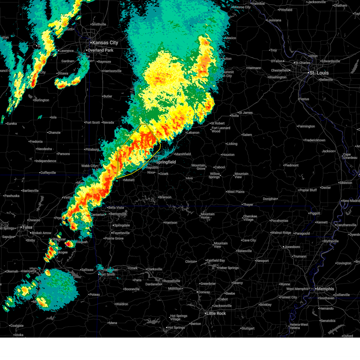
 At 513 pm cdt, severe thunderstorms were located along a line extending from 6 miles north of greenfield to near walnut grove to everton, moving east at 25 mph (radar indicated). Hazards include 60 mph wind gusts and penny size hail. Expect damage to roofs, siding, and trees. Locations impacted include, bolivar, stockton lake, greenfield, walnut grove, morrisville, everton, dadeville, south greenfield, aldrich, sacville, eudora, pennsboro, bona, and cave springs. At 513 pm cdt, severe thunderstorms were located along a line extending from 6 miles north of greenfield to near walnut grove to everton, moving east at 25 mph (radar indicated). Hazards include 60 mph wind gusts and penny size hail. Expect damage to roofs, siding, and trees. Locations impacted include, bolivar, stockton lake, greenfield, walnut grove, morrisville, everton, dadeville, south greenfield, aldrich, sacville, eudora, pennsboro, bona, and cave springs.
|
| 5/30/2026 4:48 PM CDT |
 Svrsgf the national weather service in springfield has issued a * severe thunderstorm warning for, southwestern polk county in southwestern missouri, northwestern greene county in southwestern missouri, eastern dade county in southwestern missouri, * until 530 pm cdt. * at 447 pm cdt, severe thunderstorms were located along a line extending from 7 miles northeast of golden city to near greenfield to near lockwood, moving east at 40 mph (radar indicated). Hazards include 70 mph wind gusts and penny size hail. Expect considerable tree damage. Damage is likely to mobile homes, roofs, and outbuildings. Svrsgf the national weather service in springfield has issued a * severe thunderstorm warning for, southwestern polk county in southwestern missouri, northwestern greene county in southwestern missouri, eastern dade county in southwestern missouri, * until 530 pm cdt. * at 447 pm cdt, severe thunderstorms were located along a line extending from 7 miles northeast of golden city to near greenfield to near lockwood, moving east at 40 mph (radar indicated). Hazards include 70 mph wind gusts and penny size hail. Expect considerable tree damage. Damage is likely to mobile homes, roofs, and outbuildings.
|
| 5/18/2026 1:38 PM CDT |
 At 138 pm cdt, a severe thunderstorm was located near bolivar, moving northeast at 35 mph (radar indicated). Hazards include 60 mph wind gusts and quarter size hail. Hail damage to vehicles is expected. expect wind damage to roofs, siding, and trees. Locations impacted include, bolivar, polk, and goodson. At 138 pm cdt, a severe thunderstorm was located near bolivar, moving northeast at 35 mph (radar indicated). Hazards include 60 mph wind gusts and quarter size hail. Hail damage to vehicles is expected. expect wind damage to roofs, siding, and trees. Locations impacted include, bolivar, polk, and goodson.
|
| 5/18/2026 1:28 PM CDT |
 Svrsgf the national weather service in springfield has issued a * severe thunderstorm warning for, eastern polk county in southwestern missouri, * until 215 pm cdt. * at 127 pm cdt, a severe thunderstorm was located near bolivar, moving northeast at 30 mph (radar indicated). Hazards include 60 mph wind gusts and quarter size hail. Hail damage to vehicles is expected. Expect wind damage to roofs, siding, and trees. Svrsgf the national weather service in springfield has issued a * severe thunderstorm warning for, eastern polk county in southwestern missouri, * until 215 pm cdt. * at 127 pm cdt, a severe thunderstorm was located near bolivar, moving northeast at 30 mph (radar indicated). Hazards include 60 mph wind gusts and quarter size hail. Hail damage to vehicles is expected. Expect wind damage to roofs, siding, and trees.
|
| 5/18/2026 12:11 PM CDT |
 At 1211 pm cdt, a severe thunderstorm was located near bolivar, moving northeast at 25 mph (radar indicated). Hazards include 60 mph wind gusts and penny size hail. Expect damage to roofs, siding, and trees. Locations impacted include, bolivar, buffalo, polk, halfway, louisburg, windyville, goodson, and pumpkin center. At 1211 pm cdt, a severe thunderstorm was located near bolivar, moving northeast at 25 mph (radar indicated). Hazards include 60 mph wind gusts and penny size hail. Expect damage to roofs, siding, and trees. Locations impacted include, bolivar, buffalo, polk, halfway, louisburg, windyville, goodson, and pumpkin center.
|
| 5/18/2026 11:56 AM CDT |
 Svrsgf the national weather service in springfield has issued a * severe thunderstorm warning for, central dallas county in southwestern missouri, southeastern polk county in southwestern missouri, * until 1245 pm cdt. * at 1155 am cdt, a severe thunderstorm was located near bolivar, moving northeast at 35 mph (radar indicated). Hazards include 60 mph wind gusts and quarter size hail. Hail damage to vehicles is expected. Expect wind damage to roofs, siding, and trees. Svrsgf the national weather service in springfield has issued a * severe thunderstorm warning for, central dallas county in southwestern missouri, southeastern polk county in southwestern missouri, * until 1245 pm cdt. * at 1155 am cdt, a severe thunderstorm was located near bolivar, moving northeast at 35 mph (radar indicated). Hazards include 60 mph wind gusts and quarter size hail. Hail damage to vehicles is expected. Expect wind damage to roofs, siding, and trees.
|
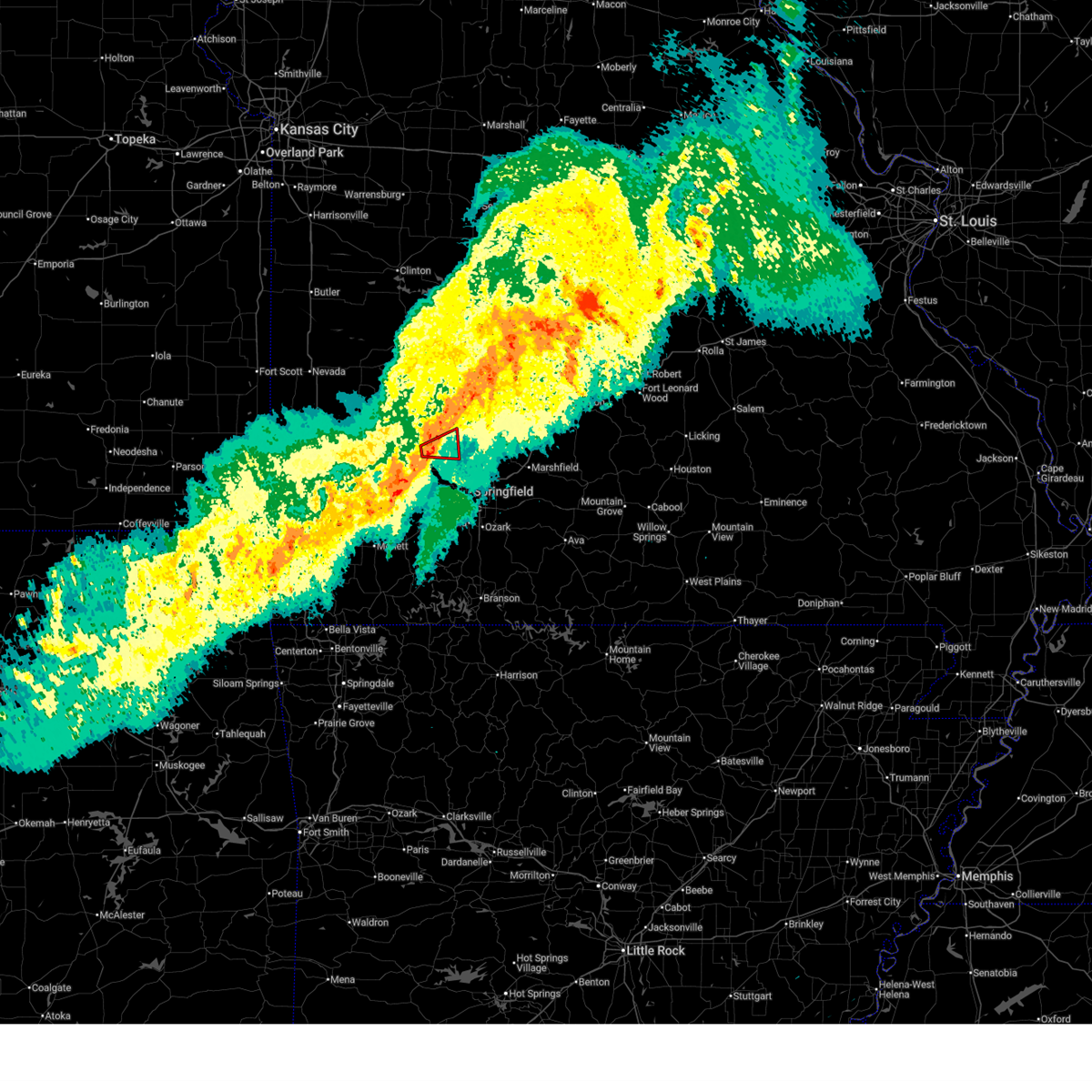
| 4/28/2026 1:32 PM CDT |
 At 131 pm cdt, a severe thunderstorm was located near republic, moving east at 45 mph. damaging winds in marionville have downed power lines (law enforcement). Hazards include tennis ball size hail and 70 mph wind gusts. People and animals outdoors will be injured. expect hail damage to roofs, siding, windows, and vehicles. expect considerable tree damage. wind damage is also likely to mobile homes, roofs, and outbuildings. locations impacted include, springfield, nixa, ozark, republic, aurora, battlefield, willard, rogersville, strafford, marionville, clever, sparta, ash grove, fair grove, billings, highlandville, fremont hills, walnut grove, pleasant hope, and morrisville. This includes interstate 44 between mile markers 51 and 87. At 131 pm cdt, a severe thunderstorm was located near republic, moving east at 45 mph. damaging winds in marionville have downed power lines (law enforcement). Hazards include tennis ball size hail and 70 mph wind gusts. People and animals outdoors will be injured. expect hail damage to roofs, siding, windows, and vehicles. expect considerable tree damage. wind damage is also likely to mobile homes, roofs, and outbuildings. locations impacted include, springfield, nixa, ozark, republic, aurora, battlefield, willard, rogersville, strafford, marionville, clever, sparta, ash grove, fair grove, billings, highlandville, fremont hills, walnut grove, pleasant hope, and morrisville. This includes interstate 44 between mile markers 51 and 87.
|
| 4/28/2026 1:30 PM CDT |
 Svrsgf the national weather service in springfield has issued a * severe thunderstorm warning for, barton county in southwestern missouri, cedar county in southwestern missouri, polk county in southwestern missouri, southeastern vernon county in west central missouri, jasper county in southwestern missouri, dade county in southwestern missouri, * until 215 pm cdt. * at 129 pm cdt, a pair of severe thunderstorms were located near golden city mo and also columbus ks moving northeast at 65 mph (radar indicated). Hazards include golf ball size hail. People and animals outdoors will be injured. Expect damage to roofs, siding, windows, and vehicles. Svrsgf the national weather service in springfield has issued a * severe thunderstorm warning for, barton county in southwestern missouri, cedar county in southwestern missouri, polk county in southwestern missouri, southeastern vernon county in west central missouri, jasper county in southwestern missouri, dade county in southwestern missouri, * until 215 pm cdt. * at 129 pm cdt, a pair of severe thunderstorms were located near golden city mo and also columbus ks moving northeast at 65 mph (radar indicated). Hazards include golf ball size hail. People and animals outdoors will be injured. Expect damage to roofs, siding, windows, and vehicles.
|
| 4/28/2026 1:18 PM CDT |
 At 117 pm cdt, a severe thunderstorm was located near mount vernon, moving east at 45 mph (radar indicated). Hazards include golf ball size hail and 70 mph wind gusts. People and animals outdoors will be injured. expect hail damage to roofs, siding, windows, and vehicles. expect considerable tree damage. wind damage is also likely to mobile homes, roofs, and outbuildings. locations impacted include, springfield, nixa, ozark, republic, aurora, battlefield, willard, mount vernon, rogersville, strafford, marionville, clever, sparta, ash grove, fair grove, billings, highlandville, fremont hills, miller, and walnut grove. This includes interstate 44 between mile markers 43 and 87. At 117 pm cdt, a severe thunderstorm was located near mount vernon, moving east at 45 mph (radar indicated). Hazards include golf ball size hail and 70 mph wind gusts. People and animals outdoors will be injured. expect hail damage to roofs, siding, windows, and vehicles. expect considerable tree damage. wind damage is also likely to mobile homes, roofs, and outbuildings. locations impacted include, springfield, nixa, ozark, republic, aurora, battlefield, willard, mount vernon, rogersville, strafford, marionville, clever, sparta, ash grove, fair grove, billings, highlandville, fremont hills, miller, and walnut grove. This includes interstate 44 between mile markers 43 and 87.
|
| 4/28/2026 1:05 PM CDT |
 Svrsgf the national weather service in springfield has issued a * severe thunderstorm warning for, northern christian county in southwestern missouri, southern polk county in southwestern missouri, northern stone county in southwestern missouri, lawrence county in southwestern missouri, greene county in southwestern missouri, southeastern dade county in southwestern missouri, * until 200 pm cdt. * at 105 pm cdt, a severe thunderstorm was located near mount vernon, and another severe storm near republic moving east at 50 mph (radar indicated). Hazards include 60 mph wind gusts and quarter size hail. Hail damage to vehicles is expected. Expect wind damage to roofs, siding, and trees. Svrsgf the national weather service in springfield has issued a * severe thunderstorm warning for, northern christian county in southwestern missouri, southern polk county in southwestern missouri, northern stone county in southwestern missouri, lawrence county in southwestern missouri, greene county in southwestern missouri, southeastern dade county in southwestern missouri, * until 200 pm cdt. * at 105 pm cdt, a severe thunderstorm was located near mount vernon, and another severe storm near republic moving east at 50 mph (radar indicated). Hazards include 60 mph wind gusts and quarter size hail. Hail damage to vehicles is expected. Expect wind damage to roofs, siding, and trees.
|
| 4/28/2026 12:31 PM CDT |
 Svrsgf the national weather service in springfield has issued a * severe thunderstorm warning for, southwestern hickory county in central missouri, northeastern barton county in southwestern missouri, southern cedar county in southwestern missouri, northern polk county in southwestern missouri, southeastern vernon county in west central missouri, * until 115 pm cdt. * at 1229 pm cdt, a pair of severe thunderstorms were located near sheldon and near stockton, moving east at 45 mph (radar indicated). Hazards include tennis ball size hail. People and animals outdoors will be injured. Expect damage to roofs, siding, windows, and vehicles. Svrsgf the national weather service in springfield has issued a * severe thunderstorm warning for, southwestern hickory county in central missouri, northeastern barton county in southwestern missouri, southern cedar county in southwestern missouri, northern polk county in southwestern missouri, southeastern vernon county in west central missouri, * until 115 pm cdt. * at 1229 pm cdt, a pair of severe thunderstorms were located near sheldon and near stockton, moving east at 45 mph (radar indicated). Hazards include tennis ball size hail. People and animals outdoors will be injured. Expect damage to roofs, siding, windows, and vehicles.
|
| 4/26/2026 9:06 PM CDT |
 Svrsgf the national weather service in springfield has issued a * severe thunderstorm warning for, dallas county in southwestern missouri, northeastern polk county in southwestern missouri, * until 945 pm cdt. * at 906 pm cdt, a severe thunderstorm was located near buffalo, moving east at 20 mph (radar indicated). Hazards include tennis ball size hail and 60 mph wind gusts. People and animals outdoors will be injured. expect hail damage to roofs, siding, windows, and vehicles. Expect wind damage to roofs, siding, and trees. Svrsgf the national weather service in springfield has issued a * severe thunderstorm warning for, dallas county in southwestern missouri, northeastern polk county in southwestern missouri, * until 945 pm cdt. * at 906 pm cdt, a severe thunderstorm was located near buffalo, moving east at 20 mph (radar indicated). Hazards include tennis ball size hail and 60 mph wind gusts. People and animals outdoors will be injured. expect hail damage to roofs, siding, windows, and vehicles. Expect wind damage to roofs, siding, and trees.
|
| 4/26/2026 8:28 PM CDT |
 Svrsgf the national weather service in springfield has issued a * severe thunderstorm warning for, southwestern dallas county in southwestern missouri, polk county in southwestern missouri, * until 915 pm cdt. * at 828 pm cdt, a severe thunderstorm was located near morrisville, or near bolivar, moving east at 25 mph (radar indicated). Hazards include golf ball size hail and 60 mph wind gusts. People and animals outdoors will be injured. expect hail damage to roofs, siding, windows, and vehicles. Expect wind damage to roofs, siding, and trees. Svrsgf the national weather service in springfield has issued a * severe thunderstorm warning for, southwestern dallas county in southwestern missouri, polk county in southwestern missouri, * until 915 pm cdt. * at 828 pm cdt, a severe thunderstorm was located near morrisville, or near bolivar, moving east at 25 mph (radar indicated). Hazards include golf ball size hail and 60 mph wind gusts. People and animals outdoors will be injured. expect hail damage to roofs, siding, windows, and vehicles. Expect wind damage to roofs, siding, and trees.
|
| 4/26/2026 8:19 PM CDT |
 Torsgf the national weather service in springfield has issued a * tornado warning for, southern polk county in southwestern missouri, north central greene county in southwestern missouri, * until 900 pm cdt. * at 819 pm cdt, a severe thunderstorm capable of producing a tornado was located near walnut grove, or 12 miles south of bolivar, moving east at 25 mph (weather spotters reported funnel cloud). Hazards include tornado and golf ball size hail. Flying debris will be dangerous to those caught without shelter. mobile homes will be damaged or destroyed. damage to roofs, windows, and vehicles will occur. Tree damage is likely. Torsgf the national weather service in springfield has issued a * tornado warning for, southern polk county in southwestern missouri, north central greene county in southwestern missouri, * until 900 pm cdt. * at 819 pm cdt, a severe thunderstorm capable of producing a tornado was located near walnut grove, or 12 miles south of bolivar, moving east at 25 mph (weather spotters reported funnel cloud). Hazards include tornado and golf ball size hail. Flying debris will be dangerous to those caught without shelter. mobile homes will be damaged or destroyed. damage to roofs, windows, and vehicles will occur. Tree damage is likely.
|
| 4/26/2026 8:01 PM CDT |
 Svrsgf the national weather service in springfield has issued a * severe thunderstorm warning for, southeastern cedar county in southwestern missouri, northwestern polk county in southwestern missouri, northeastern dade county in southwestern missouri, * until 830 pm cdt. * at 800 pm cdt, a severe thunderstorm was located 7 miles south of stockton, moving northeast at 25 mph (radar indicated). Hazards include ping pong ball size hail and 60 mph wind gusts. People and animals outdoors will be injured. expect hail damage to roofs, siding, windows, and vehicles. Expect wind damage to roofs, siding, and trees. Svrsgf the national weather service in springfield has issued a * severe thunderstorm warning for, southeastern cedar county in southwestern missouri, northwestern polk county in southwestern missouri, northeastern dade county in southwestern missouri, * until 830 pm cdt. * at 800 pm cdt, a severe thunderstorm was located 7 miles south of stockton, moving northeast at 25 mph (radar indicated). Hazards include ping pong ball size hail and 60 mph wind gusts. People and animals outdoors will be injured. expect hail damage to roofs, siding, windows, and vehicles. Expect wind damage to roofs, siding, and trees.
|
| 4/26/2026 7:30 PM CDT |
 Svrsgf the national weather service in springfield has issued a * severe thunderstorm warning for, southeastern cedar county in southwestern missouri, southwestern polk county in southwestern missouri, northwestern greene county in southwestern missouri, eastern dade county in southwestern missouri, * until 830 pm cdt. * at 730 pm cdt, a severe thunderstorm was located near greenfield, moving northeast at 30 mph (trained weather spotters). Hazards include two inch hail and 60 mph wind gusts. People and animals outdoors will be injured. expect hail damage to roofs, siding, windows, and vehicles. Expect wind damage to roofs, siding, and trees. Svrsgf the national weather service in springfield has issued a * severe thunderstorm warning for, southeastern cedar county in southwestern missouri, southwestern polk county in southwestern missouri, northwestern greene county in southwestern missouri, eastern dade county in southwestern missouri, * until 830 pm cdt. * at 730 pm cdt, a severe thunderstorm was located near greenfield, moving northeast at 30 mph (trained weather spotters). Hazards include two inch hail and 60 mph wind gusts. People and animals outdoors will be injured. expect hail damage to roofs, siding, windows, and vehicles. Expect wind damage to roofs, siding, and trees.
|
| 4/15/2026 10:50 PM CDT |
 The storms which prompted the warning have weakened below severe limits, and have exited the warned area. therefore, the warning will be allowed to expire. a tornado watch remains in effect until midnight cdt for southwestern missouri. a tornado watch also remains in effect until midnight cdt for southwestern missouri. The storms which prompted the warning have weakened below severe limits, and have exited the warned area. therefore, the warning will be allowed to expire. a tornado watch remains in effect until midnight cdt for southwestern missouri. a tornado watch also remains in effect until midnight cdt for southwestern missouri.
|
| 4/15/2026 10:25 PM CDT |
 At 1025 pm cdt, severe thunderstorms were located along a line extending from near pleasant hope to near willard to near ash grove, moving east at 50 mph (radar indicated). Hazards include 60 mph wind gusts. Expect damage to roofs, siding, and trees. locations impacted include, springfield, stockton lake, willard, strafford, ash grove, fair grove, walnut grove, pleasant hope, morrisville, brookline, glidewell, sacville, ebenezer, bassville, brighton, turners, bois d'arc, cave springs, and eudora. This includes interstate 44 between mile markers 59 and 68, and between mile markers 70 and 90. At 1025 pm cdt, severe thunderstorms were located along a line extending from near pleasant hope to near willard to near ash grove, moving east at 50 mph (radar indicated). Hazards include 60 mph wind gusts. Expect damage to roofs, siding, and trees. locations impacted include, springfield, stockton lake, willard, strafford, ash grove, fair grove, walnut grove, pleasant hope, morrisville, brookline, glidewell, sacville, ebenezer, bassville, brighton, turners, bois d'arc, cave springs, and eudora. This includes interstate 44 between mile markers 59 and 68, and between mile markers 70 and 90.
|
| 4/15/2026 10:01 PM CDT |
 Svrsgf the national weather service in springfield has issued a * severe thunderstorm warning for, southern polk county in southwestern missouri, northeastern lawrence county in southwestern missouri, greene county in southwestern missouri, eastern dade county in southwestern missouri, * until 1100 pm cdt. * at 1001 pm cdt, severe thunderstorms were located along a line extending from greenfield to near everton to miller, moving east at 40 mph (radar indicated). Hazards include 60 mph wind gusts. expect damage to roofs, siding, and trees Svrsgf the national weather service in springfield has issued a * severe thunderstorm warning for, southern polk county in southwestern missouri, northeastern lawrence county in southwestern missouri, greene county in southwestern missouri, eastern dade county in southwestern missouri, * until 1100 pm cdt. * at 1001 pm cdt, severe thunderstorms were located along a line extending from greenfield to near everton to miller, moving east at 40 mph (radar indicated). Hazards include 60 mph wind gusts. expect damage to roofs, siding, and trees
|
| 4/15/2026 6:28 PM CDT |
 Svrsgf the national weather service in springfield has issued a * severe thunderstorm warning for, southeastern hickory county in central missouri, northwestern dallas county in southwestern missouri, polk county in southwestern missouri, * until 715 pm cdt. * at 628 pm cdt, a severe thunderstorm was located near fair play, or near bolivar, moving northeast at 55 mph (radar indicated). Hazards include 60 mph wind gusts and half dollar size hail. Hail damage to vehicles is expected. Expect wind damage to roofs, siding, and trees. Svrsgf the national weather service in springfield has issued a * severe thunderstorm warning for, southeastern hickory county in central missouri, northwestern dallas county in southwestern missouri, polk county in southwestern missouri, * until 715 pm cdt. * at 628 pm cdt, a severe thunderstorm was located near fair play, or near bolivar, moving northeast at 55 mph (radar indicated). Hazards include 60 mph wind gusts and half dollar size hail. Hail damage to vehicles is expected. Expect wind damage to roofs, siding, and trees.
|
| 3/6/2026 11:48 PM CST |
 At 1148 pm cst, severe thunderstorms were located along a line extending from 8 miles east of buffalo to 7 miles east of fair grove to near highlandville to near galena, moving northeast at 60 mph (radar indicated). Hazards include 60 mph wind gusts and penny size hail. Expect damage to roofs, siding, and trees. locations impacted include, springfield, nixa, ozark, republic, lebanon, bennett spring state park, marshfield, battlefield, willard, buffalo, rogersville, strafford, clever, seymour, sparta, morgan, crane, fair grove, billings, and highlandville. This includes interstate 44 between mile markers 61 and 143. At 1148 pm cst, severe thunderstorms were located along a line extending from 8 miles east of buffalo to 7 miles east of fair grove to near highlandville to near galena, moving northeast at 60 mph (radar indicated). Hazards include 60 mph wind gusts and penny size hail. Expect damage to roofs, siding, and trees. locations impacted include, springfield, nixa, ozark, republic, lebanon, bennett spring state park, marshfield, battlefield, willard, buffalo, rogersville, strafford, clever, seymour, sparta, morgan, crane, fair grove, billings, and highlandville. This includes interstate 44 between mile markers 61 and 143.
|
| 3/6/2026 11:48 PM CST |
 the severe thunderstorm warning has been cancelled and is no longer in effect the severe thunderstorm warning has been cancelled and is no longer in effect
|
| 3/6/2026 11:25 PM CST |
 Svrsgf the national weather service in springfield has issued a * severe thunderstorm warning for, webster county in southwestern missouri, dallas county in southwestern missouri, northwestern wright county in southwestern missouri, northwestern douglas county in southwestern missouri, christian county in southwestern missouri, laclede county in southwestern missouri, southern polk county in southwestern missouri, northern stone county in southwestern missouri, northern barry county in southwestern missouri, lawrence county in southwestern missouri, greene county in southwestern missouri, southeastern dade county in southwestern missouri, * until 1230 am cst. * at 1125 pm cst, severe thunderstorms were located along a line extending from 7 miles north of pleasant hope to near willard to near crane to near cassville, moving northeast at 60 mph (radar indicated). Hazards include 70 mph wind gusts. Expect considerable tree damage. Damage is likely to mobile homes, roofs, and outbuildings. Svrsgf the national weather service in springfield has issued a * severe thunderstorm warning for, webster county in southwestern missouri, dallas county in southwestern missouri, northwestern wright county in southwestern missouri, northwestern douglas county in southwestern missouri, christian county in southwestern missouri, laclede county in southwestern missouri, southern polk county in southwestern missouri, northern stone county in southwestern missouri, northern barry county in southwestern missouri, lawrence county in southwestern missouri, greene county in southwestern missouri, southeastern dade county in southwestern missouri, * until 1230 am cst. * at 1125 pm cst, severe thunderstorms were located along a line extending from 7 miles north of pleasant hope to near willard to near crane to near cassville, moving northeast at 60 mph (radar indicated). Hazards include 70 mph wind gusts. Expect considerable tree damage. Damage is likely to mobile homes, roofs, and outbuildings.
|
| 3/6/2026 11:11 PM CST |
 At 1110 pm cst, severe thunderstorms were located along a line extending from walnut grove to near ash grove to 7 miles northeast of mount vernon, moving northeast at 60 mph (radar indicated). Hazards include 70 mph wind gusts. Expect considerable tree damage. damage is likely to mobile homes, roofs, and outbuildings. locations impacted include, bolivar, stockton lake, willard, mount vernon, ash grove, pierce city, miller, walnut grove, pleasant hope, morrisville, everton, dadeville, stotts city, halltown, freistatt, south greenfield, aldrich, hoberg, chesapeake, and bois d'arc. This includes interstate 44 between mile markers 34 and 65. At 1110 pm cst, severe thunderstorms were located along a line extending from walnut grove to near ash grove to 7 miles northeast of mount vernon, moving northeast at 60 mph (radar indicated). Hazards include 70 mph wind gusts. Expect considerable tree damage. damage is likely to mobile homes, roofs, and outbuildings. locations impacted include, bolivar, stockton lake, willard, mount vernon, ash grove, pierce city, miller, walnut grove, pleasant hope, morrisville, everton, dadeville, stotts city, halltown, freistatt, south greenfield, aldrich, hoberg, chesapeake, and bois d'arc. This includes interstate 44 between mile markers 34 and 65.
|
| 3/6/2026 10:59 PM CST |
 At 1059 pm cst, severe thunderstorms were located along a line extending from near greenfield to near everton to monett, moving northeast at 70 mph (radar indicated). Hazards include 70 mph wind gusts. Expect considerable tree damage. damage is likely to mobile homes, roofs, and outbuildings. locations impacted include, bolivar, stockton lake, willard, mount vernon, ash grove, greenfield, pierce city, miller, walnut grove, pleasant hope, morrisville, everton, dadeville, stotts city, halltown, freistatt, south greenfield, aldrich, hoberg, and chesapeake. This includes interstate 44 between mile markers 34 and 65. At 1059 pm cst, severe thunderstorms were located along a line extending from near greenfield to near everton to monett, moving northeast at 70 mph (radar indicated). Hazards include 70 mph wind gusts. Expect considerable tree damage. damage is likely to mobile homes, roofs, and outbuildings. locations impacted include, bolivar, stockton lake, willard, mount vernon, ash grove, greenfield, pierce city, miller, walnut grove, pleasant hope, morrisville, everton, dadeville, stotts city, halltown, freistatt, south greenfield, aldrich, hoberg, and chesapeake. This includes interstate 44 between mile markers 34 and 65.
|
| 3/6/2026 10:59 PM CST |
 the severe thunderstorm warning has been cancelled and is no longer in effect the severe thunderstorm warning has been cancelled and is no longer in effect
|
| 3/6/2026 10:44 PM CST |
 Svrsgf the national weather service in springfield has issued a * severe thunderstorm warning for, southeastern cedar county in southwestern missouri, polk county in southwestern missouri, lawrence county in southwestern missouri, western greene county in southwestern missouri, dade county in southwestern missouri, * until 1130 pm cst. * at 1044 pm cst, severe thunderstorms were located along a line extending from near lockwood to near miller to near fairview, moving northeast at 60 mph (radar indicated). Hazards include 60 mph wind gusts. expect damage to roofs, siding, and trees Svrsgf the national weather service in springfield has issued a * severe thunderstorm warning for, southeastern cedar county in southwestern missouri, polk county in southwestern missouri, lawrence county in southwestern missouri, western greene county in southwestern missouri, dade county in southwestern missouri, * until 1130 pm cst. * at 1044 pm cst, severe thunderstorms were located along a line extending from near lockwood to near miller to near fairview, moving northeast at 60 mph (radar indicated). Hazards include 60 mph wind gusts. expect damage to roofs, siding, and trees
|
| 3/6/2026 9:54 PM CST |
 The storms which prompted the warning have moved out of the area. therefore, the warning will be allowed to expire. a tornado watch remains in effect until 100 am cst for central, southwestern and west central missouri. The storms which prompted the warning have moved out of the area. therefore, the warning will be allowed to expire. a tornado watch remains in effect until 100 am cst for central, southwestern and west central missouri.
|
| 3/6/2026 9:28 PM CST |
 At 928 pm cst, severe thunderstorms were located along a line extending from 8 miles east of osceola to 6 miles southwest of urbana to near walnut grove, moving northeast at 60 mph (radar indicated). Hazards include 60 mph wind gusts and penny size hail. Expect damage to roofs, siding, and trees. Locations impacted include, bolivar, pomme de terre lake, stockton lake, truman lake, pomme de terre state park, buffalo, pittsburg, polk, hermitage, weaubleau, urbana, morrisville, wheatland, preston, cross timbers, halfway, flemington, louisburg, aldrich, and gerster. At 928 pm cst, severe thunderstorms were located along a line extending from 8 miles east of osceola to 6 miles southwest of urbana to near walnut grove, moving northeast at 60 mph (radar indicated). Hazards include 60 mph wind gusts and penny size hail. Expect damage to roofs, siding, and trees. Locations impacted include, bolivar, pomme de terre lake, stockton lake, truman lake, pomme de terre state park, buffalo, pittsburg, polk, hermitage, weaubleau, urbana, morrisville, wheatland, preston, cross timbers, halfway, flemington, louisburg, aldrich, and gerster.
|
| 3/6/2026 9:28 PM CST |
 the severe thunderstorm warning has been cancelled and is no longer in effect the severe thunderstorm warning has been cancelled and is no longer in effect
|
| 3/6/2026 9:09 PM CST |
 Svrsgf the national weather service in springfield has issued a * severe thunderstorm warning for, hickory county in central missouri, western dallas county in southwestern missouri, eastern cedar county in southwestern missouri, southern benton county in central missouri, polk county in southwestern missouri, northern greene county in southwestern missouri, southeastern st. clair county in west central missouri, eastern dade county in southwestern missouri, * until 1000 pm cst. * at 908 pm cst, severe thunderstorms were located along a line extending from 10 miles southwest of osceola to near fair play to 6 miles south of greenfield, moving northeast at 55 mph (radar indicated). Hazards include 60 mph wind gusts and penny size hail. expect damage to roofs, siding, and trees Svrsgf the national weather service in springfield has issued a * severe thunderstorm warning for, hickory county in central missouri, western dallas county in southwestern missouri, eastern cedar county in southwestern missouri, southern benton county in central missouri, polk county in southwestern missouri, northern greene county in southwestern missouri, southeastern st. clair county in west central missouri, eastern dade county in southwestern missouri, * until 1000 pm cst. * at 908 pm cst, severe thunderstorms were located along a line extending from 10 miles southwest of osceola to near fair play to 6 miles south of greenfield, moving northeast at 55 mph (radar indicated). Hazards include 60 mph wind gusts and penny size hail. expect damage to roofs, siding, and trees
|
| 3/4/2026 8:42 AM CST |
 The storm which prompted the warning has weakened below severe limits, and no longer poses an immediate threat to life or property. therefore, the warning will be allowed to expire. however, small hail is still possible with this thunderstorm. The storm which prompted the warning has weakened below severe limits, and no longer poses an immediate threat to life or property. therefore, the warning will be allowed to expire. however, small hail is still possible with this thunderstorm.
|
| 3/4/2026 8:22 AM CST |
 Svrsgf the national weather service in springfield has issued a * severe thunderstorm warning for, southwestern dallas county in southwestern missouri, southeastern polk county in southwestern missouri, north central greene county in southwestern missouri, * until 845 am cst. * at 822 am cst, a severe thunderstorm was located near morrisville, or 12 miles south of bolivar, moving northeast at 35 mph (radar indicated). Hazards include half dollar size hail. damage to vehicles is expected Svrsgf the national weather service in springfield has issued a * severe thunderstorm warning for, southwestern dallas county in southwestern missouri, southeastern polk county in southwestern missouri, north central greene county in southwestern missouri, * until 845 am cst. * at 822 am cst, a severe thunderstorm was located near morrisville, or 12 miles south of bolivar, moving northeast at 35 mph (radar indicated). Hazards include half dollar size hail. damage to vehicles is expected
|
| 8/10/2025 6:31 PM CDT |
 The storm which prompted the warning has weakened below severe limits, and no longer poses an immediate threat to life or property. therefore, the warning has been allowed to expire. The storm which prompted the warning has weakened below severe limits, and no longer poses an immediate threat to life or property. therefore, the warning has been allowed to expire.
|
| 8/10/2025 6:00 PM CDT |
 Svrsgf the national weather service in springfield has issued a * severe thunderstorm warning for, southeastern cedar county in southwestern missouri, northwestern polk county in southwestern missouri, * until 630 pm cdt. * at 600 pm cdt, a severe thunderstorm was located over stockton, moving northeast at 5 mph (radar indicated). Hazards include 60 mph wind gusts and quarter size hail. Hail damage to vehicles is expected. Expect wind damage to roofs, siding, and trees. Svrsgf the national weather service in springfield has issued a * severe thunderstorm warning for, southeastern cedar county in southwestern missouri, northwestern polk county in southwestern missouri, * until 630 pm cdt. * at 600 pm cdt, a severe thunderstorm was located over stockton, moving northeast at 5 mph (radar indicated). Hazards include 60 mph wind gusts and quarter size hail. Hail damage to vehicles is expected. Expect wind damage to roofs, siding, and trees.
|
| 5/19/2025 6:51 PM CDT |
 At 650 pm cdt, severe thunderstorms were located along a line extending from near walnut grove to republic, moving east at 40 mph (radar indicated). Hazards include 70 mph wind gusts. Expect considerable tree damage. damage is likely to mobile homes, roofs, and outbuildings. locations impacted include, springfield, republic, bolivar, stockton lake, battlefield, willard, strafford, ash grove, fair grove, walnut grove, pleasant hope, fair play, morrisville, brookline, aldrich, glidewell, turners, bois d'arc, cave springs, and eudora. This includes interstate 44 between mile markers 59 and 90. At 650 pm cdt, severe thunderstorms were located along a line extending from near walnut grove to republic, moving east at 40 mph (radar indicated). Hazards include 70 mph wind gusts. Expect considerable tree damage. damage is likely to mobile homes, roofs, and outbuildings. locations impacted include, springfield, republic, bolivar, stockton lake, battlefield, willard, strafford, ash grove, fair grove, walnut grove, pleasant hope, fair play, morrisville, brookline, aldrich, glidewell, turners, bois d'arc, cave springs, and eudora. This includes interstate 44 between mile markers 59 and 90.
|
| 5/19/2025 6:40 PM CDT |
 Svrsgf the national weather service in springfield has issued a * severe thunderstorm warning for, southwestern polk county in southwestern missouri, greene county in southwestern missouri, * until 730 pm cdt. * at 640 pm cdt, severe thunderstorms were located along a line extending from near walnut grove to near billings, moving northeast at 65 mph (radar indicated). Hazards include 60 mph wind gusts. expect damage to roofs, siding, and trees Svrsgf the national weather service in springfield has issued a * severe thunderstorm warning for, southwestern polk county in southwestern missouri, greene county in southwestern missouri, * until 730 pm cdt. * at 640 pm cdt, severe thunderstorms were located along a line extending from near walnut grove to near billings, moving northeast at 65 mph (radar indicated). Hazards include 60 mph wind gusts. expect damage to roofs, siding, and trees
|
| 4/29/2025 10:05 AM CDT |
 The storms which prompted the warning have moved out of the area. therefore, the warning will be allowed to expire. a severe thunderstorm watch remains in effect until 300 pm cdt for southwestern missouri. The storms which prompted the warning have moved out of the area. therefore, the warning will be allowed to expire. a severe thunderstorm watch remains in effect until 300 pm cdt for southwestern missouri.
|
| 4/29/2025 9:42 AM CDT | Tree blocking road division and bento in polk county MO, 1.7 miles S of Bolivar, MO |
| 4/29/2025 9:40 AM CDT |
 Svrsgf the national weather service in springfield has issued a * severe thunderstorm warning for, webster county in southwestern missouri, southern dallas county in southwestern missouri, wright county in southwestern missouri, western douglas county in southwestern missouri, eastern christian county in southwestern missouri, southeastern polk county in southwestern missouri, laclede county in southwestern missouri, eastern greene county in southwestern missouri, * until 1045 am cdt. * at 940 am cdt, severe thunderstorms were located along a line extending from near morrisville to near strafford to near rogersville to near hollister, moving east at 55 mph. these are destructive storms for strafford and marshfield (emergency management). Hazards include 80 mph wind gusts and quarter size hail. Flying debris will be dangerous to those caught without shelter. mobile homes will be heavily damaged. expect considerable damage to roofs, windows, and vehicles. Extensive tree damage and power outages are likely. Svrsgf the national weather service in springfield has issued a * severe thunderstorm warning for, webster county in southwestern missouri, southern dallas county in southwestern missouri, wright county in southwestern missouri, western douglas county in southwestern missouri, eastern christian county in southwestern missouri, southeastern polk county in southwestern missouri, laclede county in southwestern missouri, eastern greene county in southwestern missouri, * until 1045 am cdt. * at 940 am cdt, severe thunderstorms were located along a line extending from near morrisville to near strafford to near rogersville to near hollister, moving east at 55 mph. these are destructive storms for strafford and marshfield (emergency management). Hazards include 80 mph wind gusts and quarter size hail. Flying debris will be dangerous to those caught without shelter. mobile homes will be heavily damaged. expect considerable damage to roofs, windows, and vehicles. Extensive tree damage and power outages are likely.
|
| 4/29/2025 9:09 AM CDT |
 Svrsgf the national weather service in springfield has issued a * severe thunderstorm warning for, taney county in southwestern missouri, christian county in southwestern missouri, southern polk county in southwestern missouri, stone county in southwestern missouri, greene county in southwestern missouri, * until 1015 am cdt. * at 909 am cdt, severe thunderstorms were located along a line extending from near lockwood to near mount vernon to marionville to near beaver, moving east at 55 mph (radar indicated). Hazards include 70 mph wind gusts and half dollar size hail. Hail damage to vehicles is expected. expect considerable tree damage. Wind damage is also likely to mobile homes, roofs, and outbuildings. Svrsgf the national weather service in springfield has issued a * severe thunderstorm warning for, taney county in southwestern missouri, christian county in southwestern missouri, southern polk county in southwestern missouri, stone county in southwestern missouri, greene county in southwestern missouri, * until 1015 am cdt. * at 909 am cdt, severe thunderstorms were located along a line extending from near lockwood to near mount vernon to marionville to near beaver, moving east at 55 mph (radar indicated). Hazards include 70 mph wind gusts and half dollar size hail. Hail damage to vehicles is expected. expect considerable tree damage. Wind damage is also likely to mobile homes, roofs, and outbuildings.
|
| 4/20/2025 4:06 PM CDT |
 At 406 pm cdt, severe thunderstorms were located along a line extending from near cole camp to 10 miles northwest of macks creek to near springfield, moving northeast at 60 mph (radar indicated). Hazards include 70 mph wind gusts and quarter size hail. Hail damage to vehicles is expected. expect considerable tree damage. wind damage is also likely to mobile homes, roofs, and outbuildings. Locations impacted include, flemington, palo pinto, preston, quincy, hermitage, lakeview heights, pittsburg, truman state park, crockerville, fristoe, knobby, eudora, racket, halfway, bolivar, fair play, goodson, morrisville, lincoln, and nemo. At 406 pm cdt, severe thunderstorms were located along a line extending from near cole camp to 10 miles northwest of macks creek to near springfield, moving northeast at 60 mph (radar indicated). Hazards include 70 mph wind gusts and quarter size hail. Hail damage to vehicles is expected. expect considerable tree damage. wind damage is also likely to mobile homes, roofs, and outbuildings. Locations impacted include, flemington, palo pinto, preston, quincy, hermitage, lakeview heights, pittsburg, truman state park, crockerville, fristoe, knobby, eudora, racket, halfway, bolivar, fair play, goodson, morrisville, lincoln, and nemo.
|
| 4/20/2025 4:06 PM CDT |
 the severe thunderstorm warning has been cancelled and is no longer in effect the severe thunderstorm warning has been cancelled and is no longer in effect
|
| 4/20/2025 3:48 PM CDT |
 At 348 pm cdt, severe thunderstorms were located along a line extending from 8 miles northwest of warsaw to 10 miles northeast of hermitage to 6 miles north of galena, moving northeast at 55 mph (radar indicated). Hazards include 70 mph wind gusts and quarter size hail. Hail damage to vehicles is expected. expect considerable tree damage. wind damage is also likely to mobile homes, roofs, and outbuildings. Locations impacted include, vista, flemington, palo pinto, pittsburg, truman state park, fristoe, osceola, eudora, racket, lowry city, goodson, morrisville, lincoln, nemo, hastain, wheatland, monegaw springs, whitakerville, aldrich, and warsaw. At 348 pm cdt, severe thunderstorms were located along a line extending from 8 miles northwest of warsaw to 10 miles northeast of hermitage to 6 miles north of galena, moving northeast at 55 mph (radar indicated). Hazards include 70 mph wind gusts and quarter size hail. Hail damage to vehicles is expected. expect considerable tree damage. wind damage is also likely to mobile homes, roofs, and outbuildings. Locations impacted include, vista, flemington, palo pinto, pittsburg, truman state park, fristoe, osceola, eudora, racket, lowry city, goodson, morrisville, lincoln, nemo, hastain, wheatland, monegaw springs, whitakerville, aldrich, and warsaw.
|
| 4/20/2025 3:48 PM CDT |
 the severe thunderstorm warning has been cancelled and is no longer in effect the severe thunderstorm warning has been cancelled and is no longer in effect
|
| 4/20/2025 3:25 PM CDT |
 Svrsgf the national weather service in springfield has issued a * severe thunderstorm warning for, hickory county in central missouri, cedar county in southwestern missouri, benton county in central missouri, polk county in southwestern missouri, st. clair county in west central missouri, eastern dade county in southwestern missouri, * until 430 pm cdt. * at 324 pm cdt, severe thunderstorms were located along a line extending from near lowry city to near weaubleau to 7 miles east of cassville, moving northeast at 55 mph (radar indicated). Hazards include 70 mph wind gusts and quarter size hail. Hail damage to vehicles is expected. expect considerable tree damage. Wind damage is also likely to mobile homes, roofs, and outbuildings. Svrsgf the national weather service in springfield has issued a * severe thunderstorm warning for, hickory county in central missouri, cedar county in southwestern missouri, benton county in central missouri, polk county in southwestern missouri, st. clair county in west central missouri, eastern dade county in southwestern missouri, * until 430 pm cdt. * at 324 pm cdt, severe thunderstorms were located along a line extending from near lowry city to near weaubleau to 7 miles east of cassville, moving northeast at 55 mph (radar indicated). Hazards include 70 mph wind gusts and quarter size hail. Hail damage to vehicles is expected. expect considerable tree damage. Wind damage is also likely to mobile homes, roofs, and outbuildings.
|
| 4/20/2025 4:32 AM CDT |
 Svrsgf the national weather service in springfield has issued a * severe thunderstorm warning for, western webster county in southwestern missouri, dallas county in southwestern missouri, northwestern christian county in southwestern missouri, southeastern polk county in southwestern missouri, greene county in southwestern missouri, * until 530 am cdt. * at 432 am cdt, severe thunderstorms were located along a line extending from near morrisville to near willard to near crane, moving northeast at 40 mph (radar indicated). Hazards include 60 mph wind gusts. expect damage to roofs, siding, and trees Svrsgf the national weather service in springfield has issued a * severe thunderstorm warning for, western webster county in southwestern missouri, dallas county in southwestern missouri, northwestern christian county in southwestern missouri, southeastern polk county in southwestern missouri, greene county in southwestern missouri, * until 530 am cdt. * at 432 am cdt, severe thunderstorms were located along a line extending from near morrisville to near willard to near crane, moving northeast at 40 mph (radar indicated). Hazards include 60 mph wind gusts. expect damage to roofs, siding, and trees
|
| 4/2/2025 9:39 AM CDT |
 The storms which prompted the warning have weakened below severe limits, and no longer pose an immediate threat to life or property. therefore, the warning will be allowed to expire. however, gusty winds are still possible with these thunderstorms. a tornado watch remains in effect until noon cdt for southwestern missouri. The storms which prompted the warning have weakened below severe limits, and no longer pose an immediate threat to life or property. therefore, the warning will be allowed to expire. however, gusty winds are still possible with these thunderstorms. a tornado watch remains in effect until noon cdt for southwestern missouri.
|
| 4/2/2025 9:29 AM CDT |
 At 928 am cdt, severe thunderstorms were located along a line extending from macks creek to crane, moving northeast at 80 mph (radar indicated). Hazards include 60 mph wind gusts and quarter size hail. Hail damage to vehicles is expected. expect wind damage to roofs, siding, and trees. locations impacted include, glidewell, roaring river state park, chestnutridge, emerald beach, silver dollar city, crane, monett, spokane, aurora, cave springs, billings, mount vernon, eudora, pleasant ridge, wheaton, pennsboro, chain-o-lakes, seligman, hurley, and freistatt. This includes interstate 44 between mile markers 37 and 84. At 928 am cdt, severe thunderstorms were located along a line extending from macks creek to crane, moving northeast at 80 mph (radar indicated). Hazards include 60 mph wind gusts and quarter size hail. Hail damage to vehicles is expected. expect wind damage to roofs, siding, and trees. locations impacted include, glidewell, roaring river state park, chestnutridge, emerald beach, silver dollar city, crane, monett, spokane, aurora, cave springs, billings, mount vernon, eudora, pleasant ridge, wheaton, pennsboro, chain-o-lakes, seligman, hurley, and freistatt. This includes interstate 44 between mile markers 37 and 84.
|
| 4/2/2025 9:29 AM CDT |
 the severe thunderstorm warning has been cancelled and is no longer in effect the severe thunderstorm warning has been cancelled and is no longer in effect
|
| 4/2/2025 9:17 AM CDT |
 At 917 am cdt, severe thunderstorms were located along a line extending from near urbana to 6 miles east of purdy, moving northeast at 80 mph (radar indicated). Hazards include 60 mph wind gusts and quarter size hail. Hail damage to vehicles is expected. expect wind damage to roofs, siding, and trees. locations impacted include, glidewell, sarcoxie, chestnutridge, emerald beach, silver dollar city, crane, spokane, aurora, cave springs, pleasant ridge, chain-o-lakes, goodson, morrisville, madry, nixa, cassville, ebenezer, red oak, marionville, and stark city. this includes the following highways, interstate 44 between mile markers 29 and 84. Interstate 49 near mile marker 2. At 917 am cdt, severe thunderstorms were located along a line extending from near urbana to 6 miles east of purdy, moving northeast at 80 mph (radar indicated). Hazards include 60 mph wind gusts and quarter size hail. Hail damage to vehicles is expected. expect wind damage to roofs, siding, and trees. locations impacted include, glidewell, sarcoxie, chestnutridge, emerald beach, silver dollar city, crane, spokane, aurora, cave springs, pleasant ridge, chain-o-lakes, goodson, morrisville, madry, nixa, cassville, ebenezer, red oak, marionville, and stark city. this includes the following highways, interstate 44 between mile markers 29 and 84. Interstate 49 near mile marker 2.
|
| 4/2/2025 9:17 AM CDT |
 the severe thunderstorm warning has been cancelled and is no longer in effect the severe thunderstorm warning has been cancelled and is no longer in effect
|
| 4/2/2025 8:45 AM CDT |
 Svrsgf the national weather service in springfield has issued a * severe thunderstorm warning for, southeastern barton county in southwestern missouri, newton county in southwestern missouri, cedar county in southwestern missouri, western christian county in southwestern missouri, polk county in southwestern missouri, stone county in southwestern missouri, mcdonald county in southwestern missouri, barry county in southwestern missouri, lawrence county in southwestern missouri, greene county in southwestern missouri, eastern jasper county in southwestern missouri, dade county in southwestern missouri, * until 945 am cdt. * at 844 am cdt, severe thunderstorms were located along a line extending from 8 miles southwest of stockton to near lanagan, moving northeast at 80 mph (radar indicated). Hazards include 60 mph wind gusts and quarter size hail. Hail damage to vehicles is expected. Expect wind damage to roofs, siding, and trees. Svrsgf the national weather service in springfield has issued a * severe thunderstorm warning for, southeastern barton county in southwestern missouri, newton county in southwestern missouri, cedar county in southwestern missouri, western christian county in southwestern missouri, polk county in southwestern missouri, stone county in southwestern missouri, mcdonald county in southwestern missouri, barry county in southwestern missouri, lawrence county in southwestern missouri, greene county in southwestern missouri, eastern jasper county in southwestern missouri, dade county in southwestern missouri, * until 945 am cdt. * at 844 am cdt, severe thunderstorms were located along a line extending from 8 miles southwest of stockton to near lanagan, moving northeast at 80 mph (radar indicated). Hazards include 60 mph wind gusts and quarter size hail. Hail damage to vehicles is expected. Expect wind damage to roofs, siding, and trees.
|
| 3/14/2025 5:41 PM CDT |
 Svrsgf the national weather service in springfield has issued a * severe thunderstorm warning for, southeastern hickory county in central missouri, dallas county in southwestern missouri, polk county in southwestern missouri, northwestern laclede county in southwestern missouri, * until 645 pm cdt. * at 540 pm cdt, a severe thunderstorm was located 7 miles northwest of buffalo, moving northeast at 75 mph (radar indicated). Hazards include 70 mph wind gusts and quarter size hail. Hail damage to vehicles is expected. expect considerable tree damage. Wind damage is also likely to mobile homes, roofs, and outbuildings. Svrsgf the national weather service in springfield has issued a * severe thunderstorm warning for, southeastern hickory county in central missouri, dallas county in southwestern missouri, polk county in southwestern missouri, northwestern laclede county in southwestern missouri, * until 645 pm cdt. * at 540 pm cdt, a severe thunderstorm was located 7 miles northwest of buffalo, moving northeast at 75 mph (radar indicated). Hazards include 70 mph wind gusts and quarter size hail. Hail damage to vehicles is expected. expect considerable tree damage. Wind damage is also likely to mobile homes, roofs, and outbuildings.
|
| 3/14/2025 5:14 PM CDT |
 At 513 pm cdt, a severe thunderstorm was located over wheatland, or near hermitage, moving northeast at 70 mph (radar indicated). Hazards include 70 mph wind gusts and quarter size hail. Hail damage to vehicles is expected. expect considerable tree damage. wind damage is also likely to mobile homes, roofs, and outbuildings. locations impacted include, vista, glidewell, flemington, palo pinto, pittsburg, truman state park, cane hill, fristoe, umber view heights, cave springs, mount vernon, eudora, racket, pennsboro, neola, goodson, morrisville, lincoln, nemo, and hastain. This includes interstate 44 between mile markers 33 and 79. At 513 pm cdt, a severe thunderstorm was located over wheatland, or near hermitage, moving northeast at 70 mph (radar indicated). Hazards include 70 mph wind gusts and quarter size hail. Hail damage to vehicles is expected. expect considerable tree damage. wind damage is also likely to mobile homes, roofs, and outbuildings. locations impacted include, vista, glidewell, flemington, palo pinto, pittsburg, truman state park, cane hill, fristoe, umber view heights, cave springs, mount vernon, eudora, racket, pennsboro, neola, goodson, morrisville, lincoln, nemo, and hastain. This includes interstate 44 between mile markers 33 and 79.
|
| 3/14/2025 5:14 PM CDT |
 the severe thunderstorm warning has been cancelled and is no longer in effect the severe thunderstorm warning has been cancelled and is no longer in effect
|
| 3/14/2025 4:43 PM CDT |
 Svrsgf the national weather service in springfield has issued a * severe thunderstorm warning for, hickory county in central missouri, cedar county in southwestern missouri, benton county in central missouri, polk county in southwestern missouri, lawrence county in southwestern missouri, greene county in southwestern missouri, st. clair county in west central missouri, eastern jasper county in southwestern missouri, dade county in southwestern missouri, * until 545 pm cdt. * at 442 pm cdt, a severe thunderstorm was located 9 miles north of greenfield, moving northeast at 70 mph (radar indicated). Hazards include 70 mph wind gusts and quarter size hail. Hail damage to vehicles is expected. expect considerable tree damage. Wind damage is also likely to mobile homes, roofs, and outbuildings. Svrsgf the national weather service in springfield has issued a * severe thunderstorm warning for, hickory county in central missouri, cedar county in southwestern missouri, benton county in central missouri, polk county in southwestern missouri, lawrence county in southwestern missouri, greene county in southwestern missouri, st. clair county in west central missouri, eastern jasper county in southwestern missouri, dade county in southwestern missouri, * until 545 pm cdt. * at 442 pm cdt, a severe thunderstorm was located 9 miles north of greenfield, moving northeast at 70 mph (radar indicated). Hazards include 70 mph wind gusts and quarter size hail. Hail damage to vehicles is expected. expect considerable tree damage. Wind damage is also likely to mobile homes, roofs, and outbuildings.
|
| 10/31/2024 12:37 AM CDT |
 The storms which prompted the warning have weakened below severe limits, and no longer pose an immediate threat to life or property. therefore, the warning will be allowed to expire. however, gusty winds are still possible with these thunderstorms. a severe thunderstorm watch remains in effect until 400 am cdt for southwestern missouri. The storms which prompted the warning have weakened below severe limits, and no longer pose an immediate threat to life or property. therefore, the warning will be allowed to expire. however, gusty winds are still possible with these thunderstorms. a severe thunderstorm watch remains in effect until 400 am cdt for southwestern missouri.
|
| 10/31/2024 12:17 AM CDT |
 At 1217 am cdt, severe thunderstorms were located along a line extending from 8 miles northwest of walnut grove to near ash grove to near mount vernon, moving east at 50 mph (radar indicated). Hazards include 60 mph wind gusts and quarter size hail. Hail damage to vehicles is expected. expect wind damage to roofs, siding, and trees. locations impacted include, northwestern springfield, republic, bolivar, stockton lake, willard, mount vernon, ash grove, fair grove, walnut grove, pleasant hope, morrisville, everton, brookline, dadeville, halfway, halltown, aldrich, hoberg, chesapeake, and glidewell. This includes interstate 44 between mile markers 44 and 79. At 1217 am cdt, severe thunderstorms were located along a line extending from 8 miles northwest of walnut grove to near ash grove to near mount vernon, moving east at 50 mph (radar indicated). Hazards include 60 mph wind gusts and quarter size hail. Hail damage to vehicles is expected. expect wind damage to roofs, siding, and trees. locations impacted include, northwestern springfield, republic, bolivar, stockton lake, willard, mount vernon, ash grove, fair grove, walnut grove, pleasant hope, morrisville, everton, brookline, dadeville, halfway, halltown, aldrich, hoberg, chesapeake, and glidewell. This includes interstate 44 between mile markers 44 and 79.
|
| 10/30/2024 11:59 PM CDT |
 At 1159 pm cdt, severe thunderstorms were located along a line extending from near greenfield to near miller to near pierce city, moving east at 50 mph (radar indicated). Hazards include 70 mph wind gusts and half dollar size hail. Hail damage to vehicles is expected. expect considerable tree damage. wind damage is also likely to mobile homes, roofs, and outbuildings. locations impacted include, northwestern springfield, republic, bolivar, stockton lake, willard, mount vernon, ash grove, fair grove, greenfield, lockwood, miller, walnut grove, pleasant hope, morrisville, everton, brookline, dadeville, stotts city, halfway, and halltown. This includes interstate 44 between mile markers 37 and 79. At 1159 pm cdt, severe thunderstorms were located along a line extending from near greenfield to near miller to near pierce city, moving east at 50 mph (radar indicated). Hazards include 70 mph wind gusts and half dollar size hail. Hail damage to vehicles is expected. expect considerable tree damage. wind damage is also likely to mobile homes, roofs, and outbuildings. locations impacted include, northwestern springfield, republic, bolivar, stockton lake, willard, mount vernon, ash grove, fair grove, greenfield, lockwood, miller, walnut grove, pleasant hope, morrisville, everton, brookline, dadeville, stotts city, halfway, and halltown. This includes interstate 44 between mile markers 37 and 79.
|
| 10/30/2024 11:57 PM CDT |
 Svrsgf the national weather service in springfield has issued a * severe thunderstorm warning for, southwestern dallas county in southwestern missouri, polk county in southwestern missouri, central lawrence county in southwestern missouri, greene county in southwestern missouri, southeastern dade county in southwestern missouri, * until 1245 am cdt. * at 1156 pm cdt, severe thunderstorms were located along a line extending from near greenfield to near miller to near pierce city, moving northeast at 50 mph (radar indicated). Hazards include 60 mph wind gusts and half dollar size hail. Hail damage to vehicles is expected. Expect wind damage to roofs, siding, and trees. Svrsgf the national weather service in springfield has issued a * severe thunderstorm warning for, southwestern dallas county in southwestern missouri, polk county in southwestern missouri, central lawrence county in southwestern missouri, greene county in southwestern missouri, southeastern dade county in southwestern missouri, * until 1245 am cdt. * at 1156 pm cdt, severe thunderstorms were located along a line extending from near greenfield to near miller to near pierce city, moving northeast at 50 mph (radar indicated). Hazards include 60 mph wind gusts and half dollar size hail. Hail damage to vehicles is expected. Expect wind damage to roofs, siding, and trees.
|
| 10/30/2024 11:55 PM CDT | Delayed report. emergency management reported power outages on northeast side of bolivar... approximately at the intersection of market ave and e parkvie in polk county MO, 1.7 miles S of Bolivar, MO |
| 10/30/2024 11:40 PM CDT |
 At 1139 pm cdt, severe thunderstorms were located along a line extending from near bolivar to everton to 7 miles northeast of granby, moving east at 45 mph (radar indicated). Hazards include ping pong ball size hail and 60 mph wind gusts. People and animals outdoors will be injured. expect hail damage to roofs, siding, windows, and vehicles. expect wind damage to roofs, siding, and trees. locations impacted include, bolivar, stockton lake, willard, mount vernon, ash grove, greenfield, sarcoxie, lockwood, miller, walnut grove, morrisville, everton, dadeville, stotts city, halltown, freistatt, wentworth, avilla, la russell, and reeds. This includes interstate 44 between mile markers 22 and 61. At 1139 pm cdt, severe thunderstorms were located along a line extending from near bolivar to everton to 7 miles northeast of granby, moving east at 45 mph (radar indicated). Hazards include ping pong ball size hail and 60 mph wind gusts. People and animals outdoors will be injured. expect hail damage to roofs, siding, windows, and vehicles. expect wind damage to roofs, siding, and trees. locations impacted include, bolivar, stockton lake, willard, mount vernon, ash grove, greenfield, sarcoxie, lockwood, miller, walnut grove, morrisville, everton, dadeville, stotts city, halltown, freistatt, wentworth, avilla, la russell, and reeds. This includes interstate 44 between mile markers 22 and 61.
|
| 10/30/2024 11:29 PM CDT |
 Svrsgf the national weather service in springfield has issued a * severe thunderstorm warning for, northeastern newton county in southwestern missouri, southern polk county in southwestern missouri, lawrence county in southwestern missouri, northwestern greene county in southwestern missouri, southeastern jasper county in southwestern missouri, dade county in southwestern missouri, * until midnight cdt. * at 1129 pm cdt, severe thunderstorms were located along a line extending from near fair play to 6 miles southwest of everton to near granby, moving east at 45 mph (radar indicated). Hazards include 60 mph wind gusts and half dollar size hail. Hail damage to vehicles is expected. Expect wind damage to roofs, siding, and trees. Svrsgf the national weather service in springfield has issued a * severe thunderstorm warning for, northeastern newton county in southwestern missouri, southern polk county in southwestern missouri, lawrence county in southwestern missouri, northwestern greene county in southwestern missouri, southeastern jasper county in southwestern missouri, dade county in southwestern missouri, * until midnight cdt. * at 1129 pm cdt, severe thunderstorms were located along a line extending from near fair play to 6 miles southwest of everton to near granby, moving east at 45 mph (radar indicated). Hazards include 60 mph wind gusts and half dollar size hail. Hail damage to vehicles is expected. Expect wind damage to roofs, siding, and trees.
|
| 6/29/2024 6:57 PM CDT |
 Svrsgf the national weather service in springfield has issued a * severe thunderstorm warning for, southeastern cedar county in southwestern missouri, west central polk county in southwestern missouri, * until 715 pm cdt. * at 656 pm cdt, a severe thunderstorm was located near stockton, moving east at 10 mph (radar indicated). Hazards include 60 mph wind gusts and penny size hail. expect damage to roofs, siding, and trees Svrsgf the national weather service in springfield has issued a * severe thunderstorm warning for, southeastern cedar county in southwestern missouri, west central polk county in southwestern missouri, * until 715 pm cdt. * at 656 pm cdt, a severe thunderstorm was located near stockton, moving east at 10 mph (radar indicated). Hazards include 60 mph wind gusts and penny size hail. expect damage to roofs, siding, and trees
|
| 6/26/2024 5:56 AM CDT |
 The storms which prompted the warning have weakened below severe limits, and no longer pose an immediate threat to life or property. therefore, the warning will be allowed to expire. however, gusty winds are still possible with these thunderstorms. a severe thunderstorm watch remains in effect until 900 am cdt for southwestern missouri. a severe thunderstorm watch also remains in effect until 1100 am cdt for southwestern missouri. The storms which prompted the warning have weakened below severe limits, and no longer pose an immediate threat to life or property. therefore, the warning will be allowed to expire. however, gusty winds are still possible with these thunderstorms. a severe thunderstorm watch remains in effect until 900 am cdt for southwestern missouri. a severe thunderstorm watch also remains in effect until 1100 am cdt for southwestern missouri.
|
| 6/26/2024 5:36 AM CDT |
 At 535 am cdt, severe thunderstorms were located along a line extending from 7 miles west of conway to willard to 6 miles northeast of mount vernon, moving southeast at 50 mph (law enforcement. multiple trees were report downed in the walnut grove area). Hazards include 70 mph wind gusts. Expect considerable tree damage. damage is likely to mobile homes, roofs, and outbuildings. locations impacted include, springfield, nixa, ozark, republic, stockton lake, marshfield, battlefield, willard, buffalo, rogersville, strafford, seymour, ash grove, fair grove, greenfield, mansfield, billings, fremont hills, fordland, and walnut grove. This includes interstate 44 between mile markers 53 and 105. At 535 am cdt, severe thunderstorms were located along a line extending from 7 miles west of conway to willard to 6 miles northeast of mount vernon, moving southeast at 50 mph (law enforcement. multiple trees were report downed in the walnut grove area). Hazards include 70 mph wind gusts. Expect considerable tree damage. damage is likely to mobile homes, roofs, and outbuildings. locations impacted include, springfield, nixa, ozark, republic, stockton lake, marshfield, battlefield, willard, buffalo, rogersville, strafford, seymour, ash grove, fair grove, greenfield, mansfield, billings, fremont hills, fordland, and walnut grove. This includes interstate 44 between mile markers 53 and 105.
|
| 6/26/2024 5:11 AM CDT |
 Svrsgf the national weather service in springfield has issued a * severe thunderstorm warning for, webster county in southwestern missouri, southwestern dallas county in southwestern missouri, southwestern wright county in southwestern missouri, northern christian county in southwestern missouri, southern polk county in southwestern missouri, northeastern lawrence county in southwestern missouri, greene county in southwestern missouri, southeastern dade county in southwestern missouri, * until 600 am cdt. * at 511 am cdt, severe thunderstorms were located along a line extending from near buffalo to near walnut grove to near lockwood, moving southeast at 60 mph (radar indicated). Hazards include 60 mph wind gusts. expect damage to roofs, siding, and trees Svrsgf the national weather service in springfield has issued a * severe thunderstorm warning for, webster county in southwestern missouri, southwestern dallas county in southwestern missouri, southwestern wright county in southwestern missouri, northern christian county in southwestern missouri, southern polk county in southwestern missouri, northeastern lawrence county in southwestern missouri, greene county in southwestern missouri, southeastern dade county in southwestern missouri, * until 600 am cdt. * at 511 am cdt, severe thunderstorms were located along a line extending from near buffalo to near walnut grove to near lockwood, moving southeast at 60 mph (radar indicated). Hazards include 60 mph wind gusts. expect damage to roofs, siding, and trees
|
| 6/26/2024 4:31 AM CDT |
 Svrsgf the national weather service in springfield has issued a * severe thunderstorm warning for, bourbon county in southeastern kansas, crawford county in southeastern kansas, southwestern hickory county in central missouri, barton county in southwestern missouri, southwestern dallas county in southwestern missouri, cedar county in southwestern missouri, polk county in southwestern missouri, southern st. clair county in west central missouri, vernon county in west central missouri, northern dade county in southwestern missouri, * until 515 am cdt. * at 431 am cdt, severe thunderstorms were located along a line extending from near weaubleau to near el dorado springs to near bronson, moving southeast at 40 mph (radar indicated). Hazards include 60 mph wind gusts and penny size hail. expect damage to roofs, siding, and trees Svrsgf the national weather service in springfield has issued a * severe thunderstorm warning for, bourbon county in southeastern kansas, crawford county in southeastern kansas, southwestern hickory county in central missouri, barton county in southwestern missouri, southwestern dallas county in southwestern missouri, cedar county in southwestern missouri, polk county in southwestern missouri, southern st. clair county in west central missouri, vernon county in west central missouri, northern dade county in southwestern missouri, * until 515 am cdt. * at 431 am cdt, severe thunderstorms were located along a line extending from near weaubleau to near el dorado springs to near bronson, moving southeast at 40 mph (radar indicated). Hazards include 60 mph wind gusts and penny size hail. expect damage to roofs, siding, and trees
|
| 6/8/2024 7:42 PM CDT |
 At 742 pm cdt, a severe thunderstorm was located 9 miles west of buffalo, moving southeast at 20 mph (radar indicated). Hazards include 60 mph wind gusts and quarter size hail. Hail damage to vehicles is expected. expect wind damage to roofs, siding, and trees. Locations impacted include, bolivar, buffalo, polk, halfway, goodson, and foose. At 742 pm cdt, a severe thunderstorm was located 9 miles west of buffalo, moving southeast at 20 mph (radar indicated). Hazards include 60 mph wind gusts and quarter size hail. Hail damage to vehicles is expected. expect wind damage to roofs, siding, and trees. Locations impacted include, bolivar, buffalo, polk, halfway, goodson, and foose.
|
| 6/8/2024 7:27 PM CDT |
 Svrsgf the national weather service in springfield has issued a * severe thunderstorm warning for, southwestern dallas county in southwestern missouri, northeastern polk county in southwestern missouri, * until 800 pm cdt. * at 727 pm cdt, a severe thunderstorm was located 7 miles northeast of bolivar, moving southeast at 20 mph (radar indicated). Hazards include ping pong ball size hail and 60 mph wind gusts. People and animals outdoors will be injured. expect hail damage to roofs, siding, windows, and vehicles. Expect wind damage to roofs, siding, and trees. Svrsgf the national weather service in springfield has issued a * severe thunderstorm warning for, southwestern dallas county in southwestern missouri, northeastern polk county in southwestern missouri, * until 800 pm cdt. * at 727 pm cdt, a severe thunderstorm was located 7 miles northeast of bolivar, moving southeast at 20 mph (radar indicated). Hazards include ping pong ball size hail and 60 mph wind gusts. People and animals outdoors will be injured. expect hail damage to roofs, siding, windows, and vehicles. Expect wind damage to roofs, siding, and trees.
|
| 6/8/2024 6:44 PM CDT |
 Svrsgf the national weather service in springfield has issued a * severe thunderstorm warning for, central dallas county in southwestern missouri, northeastern polk county in southwestern missouri, * until 730 pm cdt. * at 644 pm cdt, a severe thunderstorm was located 7 miles northeast of bolivar, moving east at 25 mph (radar indicated). Hazards include two inch hail and 60 mph wind gusts. People and animals outdoors will be injured. expect hail damage to roofs, siding, windows, and vehicles. Expect wind damage to roofs, siding, and trees. Svrsgf the national weather service in springfield has issued a * severe thunderstorm warning for, central dallas county in southwestern missouri, northeastern polk county in southwestern missouri, * until 730 pm cdt. * at 644 pm cdt, a severe thunderstorm was located 7 miles northeast of bolivar, moving east at 25 mph (radar indicated). Hazards include two inch hail and 60 mph wind gusts. People and animals outdoors will be injured. expect hail damage to roofs, siding, windows, and vehicles. Expect wind damage to roofs, siding, and trees.
|
| 5/26/2024 5:01 PM CDT |
 the severe thunderstorm warning has been cancelled and is no longer in effect the severe thunderstorm warning has been cancelled and is no longer in effect
|
| 5/26/2024 5:01 PM CDT |
 At 459 pm cdt, a severe thunderstorm was located near bolivar, moving east at 35 mph (radar indicated). Hazards include golf ball size hail and 60 mph wind gusts. People and animals outdoors will be injured. expect hail damage to roofs, siding, windows, and vehicles. expect wind damage to roofs, siding, and trees. Locations impacted include, bolivar, pomme de terre lake, buffalo, pittsburg, polk, urbana, halfway, louisburg, goodson, and pumpkin center. At 459 pm cdt, a severe thunderstorm was located near bolivar, moving east at 35 mph (radar indicated). Hazards include golf ball size hail and 60 mph wind gusts. People and animals outdoors will be injured. expect hail damage to roofs, siding, windows, and vehicles. expect wind damage to roofs, siding, and trees. Locations impacted include, bolivar, pomme de terre lake, buffalo, pittsburg, polk, urbana, halfway, louisburg, goodson, and pumpkin center.
|
| 5/26/2024 4:41 PM CDT |
 Svrsgf the national weather service in springfield has issued a * severe thunderstorm warning for, south central hickory county in central missouri, northwestern dallas county in southwestern missouri, southeastern cedar county in southwestern missouri, northern polk county in southwestern missouri, * until 545 pm cdt. * at 441 pm cdt, a severe thunderstorm was located over fair play, or 10 miles east of stockton, moving east at 35 mph (radar indicated). Hazards include golf ball size hail and 60 mph wind gusts. People and animals outdoors will be injured. expect hail damage to roofs, siding, windows, and vehicles. Expect wind damage to roofs, siding, and trees. Svrsgf the national weather service in springfield has issued a * severe thunderstorm warning for, south central hickory county in central missouri, northwestern dallas county in southwestern missouri, southeastern cedar county in southwestern missouri, northern polk county in southwestern missouri, * until 545 pm cdt. * at 441 pm cdt, a severe thunderstorm was located over fair play, or 10 miles east of stockton, moving east at 35 mph (radar indicated). Hazards include golf ball size hail and 60 mph wind gusts. People and animals outdoors will be injured. expect hail damage to roofs, siding, windows, and vehicles. Expect wind damage to roofs, siding, and trees.
|
| 5/26/2024 4:38 AM CDT |
 The storms which prompted the warning have weakened below severe limits, and no longer pose an immediate threat to life or property. therefore, the warning will be allowed to expire. however, small hail and gusty winds are still possible with these thunderstorms. a tornado watch remains in effect until 1000 am cdt for central and southwestern missouri. The storms which prompted the warning have weakened below severe limits, and no longer pose an immediate threat to life or property. therefore, the warning will be allowed to expire. however, small hail and gusty winds are still possible with these thunderstorms. a tornado watch remains in effect until 1000 am cdt for central and southwestern missouri.
|
| 5/26/2024 4:28 AM CDT |
 At 428 am cdt, severe thunderstorms were located along a line extending from 11 miles southeast of macks creek to near buffalo to near ash grove, moving east at 50 mph (radar indicated). Hazards include 60 mph wind gusts and quarter size hail. Hail damage to vehicles is expected. expect wind damage to roofs, siding, and trees. locations impacted include, lebanon, bolivar, bennett spring state park, marshfield, willard, buffalo, morgan, fair grove, conway, polk, pleasant hope, urbana, niangua, morrisville, phillipsburg, stoutland, halfway, bennett springs, louisburg, and twin bridges. This includes interstate 44 between mile markers 97 and 144. At 428 am cdt, severe thunderstorms were located along a line extending from 11 miles southeast of macks creek to near buffalo to near ash grove, moving east at 50 mph (radar indicated). Hazards include 60 mph wind gusts and quarter size hail. Hail damage to vehicles is expected. expect wind damage to roofs, siding, and trees. locations impacted include, lebanon, bolivar, bennett spring state park, marshfield, willard, buffalo, morgan, fair grove, conway, polk, pleasant hope, urbana, niangua, morrisville, phillipsburg, stoutland, halfway, bennett springs, louisburg, and twin bridges. This includes interstate 44 between mile markers 97 and 144.
|
| 5/26/2024 4:28 AM CDT |
 the severe thunderstorm warning has been cancelled and is no longer in effect the severe thunderstorm warning has been cancelled and is no longer in effect
|
| 5/26/2024 4:04 AM CDT |
 Svrsgf the national weather service in springfield has issued a * severe thunderstorm warning for, southeastern hickory county in central missouri, northern webster county in southwestern missouri, dallas county in southwestern missouri, southeastern cedar county in southwestern missouri, polk county in southwestern missouri, laclede county in southwestern missouri, northern greene county in southwestern missouri, eastern dade county in southwestern missouri, * until 445 am cdt. * at 403 am cdt, severe thunderstorms were located along a line extending from 6 miles southeast of urbana to near pleasant hope to near everton, moving east at 50 mph (radar indicated). Hazards include 60 mph wind gusts and quarter size hail. Hail damage to vehicles is expected. Expect wind damage to roofs, siding, and trees. Svrsgf the national weather service in springfield has issued a * severe thunderstorm warning for, southeastern hickory county in central missouri, northern webster county in southwestern missouri, dallas county in southwestern missouri, southeastern cedar county in southwestern missouri, polk county in southwestern missouri, laclede county in southwestern missouri, northern greene county in southwestern missouri, eastern dade county in southwestern missouri, * until 445 am cdt. * at 403 am cdt, severe thunderstorms were located along a line extending from 6 miles southeast of urbana to near pleasant hope to near everton, moving east at 50 mph (radar indicated). Hazards include 60 mph wind gusts and quarter size hail. Hail damage to vehicles is expected. Expect wind damage to roofs, siding, and trees.
|
| 5/26/2024 12:42 AM CDT |
 At 1242 am cdt, a severe thunderstorm capable of producing a tornado was located near bolivar, moving east at 25 mph (radar indicated rotation). Hazards include tornado and golf ball size hail. Flying debris will be dangerous to those caught without shelter. mobile homes will be damaged or destroyed. damage to roofs, windows, and vehicles will occur. tree damage is likely. Locations impacted include, bolivar, halfway, and goodson. At 1242 am cdt, a severe thunderstorm capable of producing a tornado was located near bolivar, moving east at 25 mph (radar indicated rotation). Hazards include tornado and golf ball size hail. Flying debris will be dangerous to those caught without shelter. mobile homes will be damaged or destroyed. damage to roofs, windows, and vehicles will occur. tree damage is likely. Locations impacted include, bolivar, halfway, and goodson.
|
| 5/26/2024 12:31 AM CDT |
 Torsgf the national weather service in springfield has issued a * tornado warning for, east central polk county in southwestern missouri, * until 115 am cdt. * at 1231 am cdt, a severe thunderstorm capable of producing a tornado was located over bolivar, moving east at 25 mph (radar indicated rotation). Hazards include tornado and ping pong ball size hail. Flying debris will be dangerous to those caught without shelter. mobile homes will be damaged or destroyed. damage to roofs, windows, and vehicles will occur. Tree damage is likely. Torsgf the national weather service in springfield has issued a * tornado warning for, east central polk county in southwestern missouri, * until 115 am cdt. * at 1231 am cdt, a severe thunderstorm capable of producing a tornado was located over bolivar, moving east at 25 mph (radar indicated rotation). Hazards include tornado and ping pong ball size hail. Flying debris will be dangerous to those caught without shelter. mobile homes will be damaged or destroyed. damage to roofs, windows, and vehicles will occur. Tree damage is likely.
|
| 5/26/2024 12:22 AM CDT |
 At 1221 am cdt, a severe thunderstorm was located near bolivar, moving east at 30 mph (radar indicated). Hazards include ping pong ball size hail and 60 mph wind gusts. People and animals outdoors will be injured. expect hail damage to roofs, siding, windows, and vehicles. expect wind damage to roofs, siding, and trees. Locations impacted include, bolivar, polk, halfway, and goodson. At 1221 am cdt, a severe thunderstorm was located near bolivar, moving east at 30 mph (radar indicated). Hazards include ping pong ball size hail and 60 mph wind gusts. People and animals outdoors will be injured. expect hail damage to roofs, siding, windows, and vehicles. expect wind damage to roofs, siding, and trees. Locations impacted include, bolivar, polk, halfway, and goodson.
|
| 5/26/2024 12:11 AM CDT |
 the severe thunderstorm warning has been cancelled and is no longer in effect the severe thunderstorm warning has been cancelled and is no longer in effect
|
| 5/26/2024 12:11 AM CDT |
 At 1211 am cdt, a severe thunderstorm was located over fair play, or 9 miles west of bolivar, moving east at 35 mph (radar indicated). Hazards include ping pong ball size hail and 60 mph wind gusts. People and animals outdoors will be injured. expect hail damage to roofs, siding, windows, and vehicles. expect wind damage to roofs, siding, and trees. Locations impacted include, bolivar, stockton lake, polk, fair play, halfway, goodson, and dunnegan. At 1211 am cdt, a severe thunderstorm was located over fair play, or 9 miles west of bolivar, moving east at 35 mph (radar indicated). Hazards include ping pong ball size hail and 60 mph wind gusts. People and animals outdoors will be injured. expect hail damage to roofs, siding, windows, and vehicles. expect wind damage to roofs, siding, and trees. Locations impacted include, bolivar, stockton lake, polk, fair play, halfway, goodson, and dunnegan.
|
| 5/25/2024 11:55 PM CDT |
 Svrsgf the national weather service in springfield has issued a * severe thunderstorm warning for, southeastern cedar county in southwestern missouri, polk county in southwestern missouri, northeastern dade county in southwestern missouri, * until 100 am cdt. * at 1155 pm cdt, severe thunderstorms were located along a line extending from near stockton to 9 miles southwest of fair play to 7 miles northeast of greenfield, moving east at 40 mph (radar indicated). Hazards include 60 mph wind gusts and quarter size hail. Hail damage to vehicles is expected. Expect wind damage to roofs, siding, and trees. Svrsgf the national weather service in springfield has issued a * severe thunderstorm warning for, southeastern cedar county in southwestern missouri, polk county in southwestern missouri, northeastern dade county in southwestern missouri, * until 100 am cdt. * at 1155 pm cdt, severe thunderstorms were located along a line extending from near stockton to 9 miles southwest of fair play to 7 miles northeast of greenfield, moving east at 40 mph (radar indicated). Hazards include 60 mph wind gusts and quarter size hail. Hail damage to vehicles is expected. Expect wind damage to roofs, siding, and trees.
|
| 5/24/2024 6:58 PM CDT |
 At 657 pm cdt, a severe thunderstorm was located near morrisville, or 11 miles south of bolivar, moving east at 25 mph (radar indicated). Hazards include 60 mph wind gusts and quarter size hail. Hail damage to vehicles is expected. expect wind damage to roofs, siding, and trees. locations impacted include, springfield, stockton lake, willard, strafford, ash grove, fair grove, walnut grove, pleasant hope, morrisville, everton, brookline, dadeville, south greenfield, aldrich, glidewell, turners, march, bois d'arc, cave springs, and eudora. This includes interstate 44 between mile markers 62 and 68, and between mile markers 70 and 87. At 657 pm cdt, a severe thunderstorm was located near morrisville, or 11 miles south of bolivar, moving east at 25 mph (radar indicated). Hazards include 60 mph wind gusts and quarter size hail. Hail damage to vehicles is expected. expect wind damage to roofs, siding, and trees. locations impacted include, springfield, stockton lake, willard, strafford, ash grove, fair grove, walnut grove, pleasant hope, morrisville, everton, brookline, dadeville, south greenfield, aldrich, glidewell, turners, march, bois d'arc, cave springs, and eudora. This includes interstate 44 between mile markers 62 and 68, and between mile markers 70 and 87.
|
| 5/24/2024 6:43 PM CDT |
 the severe thunderstorm warning has been cancelled and is no longer in effect the severe thunderstorm warning has been cancelled and is no longer in effect
|
| 5/24/2024 6:35 PM CDT |
 Svrsgf the national weather service in springfield has issued a * severe thunderstorm warning for, southwestern dallas county in southwestern missouri, southern polk county in southwestern missouri, northeastern lawrence county in southwestern missouri, greene county in southwestern missouri, southeastern dade county in southwestern missouri, * until 715 pm cdt. * at 635 pm cdt, a severe thunderstorm was located near walnut grove, or 12 miles southwest of bolivar, moving east at 25 mph (radar indicated). Hazards include 60 mph wind gusts and quarter size hail. Hail damage to vehicles is expected. Expect wind damage to roofs, siding, and trees. Svrsgf the national weather service in springfield has issued a * severe thunderstorm warning for, southwestern dallas county in southwestern missouri, southern polk county in southwestern missouri, northeastern lawrence county in southwestern missouri, greene county in southwestern missouri, southeastern dade county in southwestern missouri, * until 715 pm cdt. * at 635 pm cdt, a severe thunderstorm was located near walnut grove, or 12 miles southwest of bolivar, moving east at 25 mph (radar indicated). Hazards include 60 mph wind gusts and quarter size hail. Hail damage to vehicles is expected. Expect wind damage to roofs, siding, and trees.
|
| 5/24/2024 6:28 PM CDT |
 Svrsgf the national weather service in springfield has issued a * severe thunderstorm warning for, southern hickory county in central missouri, dallas county in southwestern missouri, northeastern polk county in southwestern missouri, * until 715 pm cdt. * at 627 pm cdt, a severe thunderstorm was located 7 miles northeast of bolivar, moving east at 20 mph (radar indicated). Hazards include 60 mph wind gusts and quarter size hail. Hail damage to vehicles is expected. Expect wind damage to roofs, siding, and trees. Svrsgf the national weather service in springfield has issued a * severe thunderstorm warning for, southern hickory county in central missouri, dallas county in southwestern missouri, northeastern polk county in southwestern missouri, * until 715 pm cdt. * at 627 pm cdt, a severe thunderstorm was located 7 miles northeast of bolivar, moving east at 20 mph (radar indicated). Hazards include 60 mph wind gusts and quarter size hail. Hail damage to vehicles is expected. Expect wind damage to roofs, siding, and trees.
|
| 5/24/2024 6:20 PM CDT |
 the severe thunderstorm warning has been cancelled and is no longer in effect the severe thunderstorm warning has been cancelled and is no longer in effect
|
| 5/24/2024 6:20 PM CDT |
 At 620 pm cdt, a severe thunderstorm was located near urbana, or 11 miles north of buffalo, moving east at 40 mph (radar indicated). Hazards include 60 mph wind gusts and half dollar size hail. Hail damage to vehicles is expected. expect wind damage to roofs, siding, and trees. Locations impacted include, bolivar, pomme de terre lake, buffalo, pittsburg, humansville, polk, fair play, urbana, halfway, flemington, louisburg, tunas, pumpkin center, goodson, plad, and dunnegan. At 620 pm cdt, a severe thunderstorm was located near urbana, or 11 miles north of buffalo, moving east at 40 mph (radar indicated). Hazards include 60 mph wind gusts and half dollar size hail. Hail damage to vehicles is expected. expect wind damage to roofs, siding, and trees. Locations impacted include, bolivar, pomme de terre lake, buffalo, pittsburg, humansville, polk, fair play, urbana, halfway, flemington, louisburg, tunas, pumpkin center, goodson, plad, and dunnegan.
|
| 5/24/2024 6:15 PM CDT | Golf Ball sized hail reported 6.6 miles S of Bolivar, MO, photo of golf ball size hail at 3851 s117. time estimated from radar. |
| 5/24/2024 5:45 PM CDT |
 Svrsgf the national weather service in springfield has issued a * severe thunderstorm warning for, southern hickory county in central missouri, northwestern dallas county in southwestern missouri, southeastern cedar county in southwestern missouri, northern polk county in southwestern missouri, * until 630 pm cdt. * at 544 pm cdt, a severe thunderstorm was located near humansville, or 11 miles northwest of bolivar, moving east at 40 mph (radar indicated). Hazards include 60 mph wind gusts and half dollar size hail. Hail damage to vehicles is expected. Expect wind damage to roofs, siding, and trees. Svrsgf the national weather service in springfield has issued a * severe thunderstorm warning for, southern hickory county in central missouri, northwestern dallas county in southwestern missouri, southeastern cedar county in southwestern missouri, northern polk county in southwestern missouri, * until 630 pm cdt. * at 544 pm cdt, a severe thunderstorm was located near humansville, or 11 miles northwest of bolivar, moving east at 40 mph (radar indicated). Hazards include 60 mph wind gusts and half dollar size hail. Hail damage to vehicles is expected. Expect wind damage to roofs, siding, and trees.
|
| 5/8/2024 4:05 PM CDT |
 At 405 pm cdt, a severe thunderstorm capable of producing a tornado was located over bolivar, moving east at 35 mph (radar indicated rotation). Hazards include tornado and golf ball size hail. Flying debris will be dangerous to those caught without shelter. mobile homes will be damaged or destroyed. damage to roofs, windows, and vehicles will occur. tree damage is likely. Locations impacted include, bolivar, polk, halfway, and goodson. At 405 pm cdt, a severe thunderstorm capable of producing a tornado was located over bolivar, moving east at 35 mph (radar indicated rotation). Hazards include tornado and golf ball size hail. Flying debris will be dangerous to those caught without shelter. mobile homes will be damaged or destroyed. damage to roofs, windows, and vehicles will occur. tree damage is likely. Locations impacted include, bolivar, polk, halfway, and goodson.
|
| 5/8/2024 4:05 PM CDT |
 the tornado warning has been cancelled and is no longer in effect the tornado warning has been cancelled and is no longer in effect
|
| 5/8/2024 3:41 PM CDT |
 Torsgf the national weather service in springfield has issued a * tornado warning for, central polk county in southwestern missouri, northeastern dade county in southwestern missouri, * until 430 pm cdt. * at 341 pm cdt, a severe thunderstorm capable of producing a tornado was located 8 miles southwest of fair play, or 12 miles northeast of greenfield, moving east at 35 mph (radar indicated rotation). Hazards include tornado and golf ball size hail. Flying debris will be dangerous to those caught without shelter. mobile homes will be damaged or destroyed. damage to roofs, windows, and vehicles will occur. Tree damage is likely. Torsgf the national weather service in springfield has issued a * tornado warning for, central polk county in southwestern missouri, northeastern dade county in southwestern missouri, * until 430 pm cdt. * at 341 pm cdt, a severe thunderstorm capable of producing a tornado was located 8 miles southwest of fair play, or 12 miles northeast of greenfield, moving east at 35 mph (radar indicated rotation). Hazards include tornado and golf ball size hail. Flying debris will be dangerous to those caught without shelter. mobile homes will be damaged or destroyed. damage to roofs, windows, and vehicles will occur. Tree damage is likely.
|
| 5/7/2024 1:00 AM CDT |
 The storms which prompted the warning have moved out of the area. therefore, the warning has been allowed to expire. however, gusty winds and heavy rain are still possible with these thunderstorms. a tornado watch remains in effect until 400 am cdt for central, southwestern and west central missouri. The storms which prompted the warning have moved out of the area. therefore, the warning has been allowed to expire. however, gusty winds and heavy rain are still possible with these thunderstorms. a tornado watch remains in effect until 400 am cdt for central, southwestern and west central missouri.
|
| 5/7/2024 12:59 AM CDT |
 The storm which prompted the warning has weakened below severe limits, and no longer appears capable of producing a tornado. therefore, the warning will be allowed to expire. however, gusty winds are still possible with this thunderstorm. a tornado watch remains in effect until 400 am cdt for central, southwestern and west central missouri. The storm which prompted the warning has weakened below severe limits, and no longer appears capable of producing a tornado. therefore, the warning will be allowed to expire. however, gusty winds are still possible with this thunderstorm. a tornado watch remains in effect until 400 am cdt for central, southwestern and west central missouri.
|
| 5/7/2024 12:49 AM CDT |
 At 1249 am cdt, a severe thunderstorm capable of producing a tornado was located near urbana, or near hermitage, moving northeast at 65 mph (radar indicated rotation). Hazards include tornado. Flying debris will be dangerous to those caught without shelter. mobile homes will be damaged or destroyed. damage to roofs, windows, and vehicles will occur. tree damage is likely. Locations impacted include, bolivar, pomme de terre lake, pomme de terre state park, pittsburg, humansville, polk, weaubleau, flemington, goodson, and elkton. At 1249 am cdt, a severe thunderstorm capable of producing a tornado was located near urbana, or near hermitage, moving northeast at 65 mph (radar indicated rotation). Hazards include tornado. Flying debris will be dangerous to those caught without shelter. mobile homes will be damaged or destroyed. damage to roofs, windows, and vehicles will occur. tree damage is likely. Locations impacted include, bolivar, pomme de terre lake, pomme de terre state park, pittsburg, humansville, polk, weaubleau, flemington, goodson, and elkton.
|
| 5/7/2024 12:49 AM CDT |
 the tornado warning has been cancelled and is no longer in effect the tornado warning has been cancelled and is no longer in effect
|
| 5/7/2024 12:38 AM CDT |
 At 1237 am cdt, a confirmed tornado was located near bolivar, moving northeast at 65 mph (radar confirmed tornado). Hazards include damaging tornado. Flying debris will be dangerous to those caught without shelter. mobile homes will be damaged or destroyed. damage to roofs, windows, and vehicles will occur. tree damage is likely. Locations impacted include, bolivar, pomme de terre lake, pomme de terre state park, pittsburg, humansville, polk, fair play, weaubleau, flemington, aldrich, bearcreek, elkton, goodson, and dunnegan. At 1237 am cdt, a confirmed tornado was located near bolivar, moving northeast at 65 mph (radar confirmed tornado). Hazards include damaging tornado. Flying debris will be dangerous to those caught without shelter. mobile homes will be damaged or destroyed. damage to roofs, windows, and vehicles will occur. tree damage is likely. Locations impacted include, bolivar, pomme de terre lake, pomme de terre state park, pittsburg, humansville, polk, fair play, weaubleau, flemington, aldrich, bearcreek, elkton, goodson, and dunnegan.
|
| 5/7/2024 12:38 AM CDT |
 the tornado warning has been cancelled and is no longer in effect the tornado warning has been cancelled and is no longer in effect
|
| 5/7/2024 12:23 AM CDT |
 Torsgf the national weather service in springfield has issued a * tornado warning for, southwestern hickory county in central missouri, southeastern cedar county in southwestern missouri, polk county in southwestern missouri, northeastern dade county in southwestern missouri, * until 100 am cdt. * at 1223 am cdt, a tornado producing storm was located 7 miles southwest of fair play, or 13 miles southwest of bolivar, moving northeast at 65 mph (radar confirmed tornado). Hazards include damaging tornado. Flying debris will be dangerous to those caught without shelter. mobile homes will be damaged or destroyed. damage to roofs, windows, and vehicles will occur. Tree damage is likely. Torsgf the national weather service in springfield has issued a * tornado warning for, southwestern hickory county in central missouri, southeastern cedar county in southwestern missouri, polk county in southwestern missouri, northeastern dade county in southwestern missouri, * until 100 am cdt. * at 1223 am cdt, a tornado producing storm was located 7 miles southwest of fair play, or 13 miles southwest of bolivar, moving northeast at 65 mph (radar confirmed tornado). Hazards include damaging tornado. Flying debris will be dangerous to those caught without shelter. mobile homes will be damaged or destroyed. damage to roofs, windows, and vehicles will occur. Tree damage is likely.
|
| 5/7/2024 12:07 AM CDT |
 Svrsgf the national weather service in springfield has issued a * severe thunderstorm warning for, hickory county in central missouri, northwestern taney county in southwestern missouri, christian county in southwestern missouri, southwestern benton county in central missouri, polk county in southwestern missouri, stone county in southwestern missouri, greene county in southwestern missouri, eastern st. clair county in west central missouri, * until 100 am cdt. * at 1207 am cdt, severe thunderstorms were located along a line extending from near schell city to near lockwood to near wheaton, moving northeast at 60 mph (radar indicated). Hazards include 70 mph wind gusts and quarter size hail. Hail damage to vehicles is expected. expect considerable tree damage. Wind damage is also likely to mobile homes, roofs, and outbuildings. Svrsgf the national weather service in springfield has issued a * severe thunderstorm warning for, hickory county in central missouri, northwestern taney county in southwestern missouri, christian county in southwestern missouri, southwestern benton county in central missouri, polk county in southwestern missouri, stone county in southwestern missouri, greene county in southwestern missouri, eastern st. clair county in west central missouri, * until 100 am cdt. * at 1207 am cdt, severe thunderstorms were located along a line extending from near schell city to near lockwood to near wheaton, moving northeast at 60 mph (radar indicated). Hazards include 70 mph wind gusts and quarter size hail. Hail damage to vehicles is expected. expect considerable tree damage. Wind damage is also likely to mobile homes, roofs, and outbuildings.
|
| 4/28/2024 4:09 AM CDT |
 The storms which prompted the warning have weakened below severe limits, and no longer pose an immediate threat to life or property. therefore, the warning will be allowed to expire. a tornado watch remains in effect until 700 am cdt for central, southwestern and west central missouri. The storms which prompted the warning have weakened below severe limits, and no longer pose an immediate threat to life or property. therefore, the warning will be allowed to expire. a tornado watch remains in effect until 700 am cdt for central, southwestern and west central missouri.
|
| 4/28/2024 3:57 AM CDT |
 the severe thunderstorm warning has been cancelled and is no longer in effect the severe thunderstorm warning has been cancelled and is no longer in effect
|
| 4/28/2024 3:57 AM CDT |
 At 356 am cdt, severe thunderstorms were located along a line extending from near osceola to near weaubleau to near bolivar, moving northeast at 45 mph (radar indicated). Hazards include 60 mph wind gusts. Expect damage to roofs, siding, and trees. Locations impacted include, bolivar, pomme de terre lake, truman lake, pomme de terre state park, pittsburg, humansville, osceola, polk, hermitage, weaubleau, morrisville, wheatland, preston, cross timbers, halfway, collins, flemington, vista, gerster, and quincy. At 356 am cdt, severe thunderstorms were located along a line extending from near osceola to near weaubleau to near bolivar, moving northeast at 45 mph (radar indicated). Hazards include 60 mph wind gusts. Expect damage to roofs, siding, and trees. Locations impacted include, bolivar, pomme de terre lake, truman lake, pomme de terre state park, pittsburg, humansville, osceola, polk, hermitage, weaubleau, morrisville, wheatland, preston, cross timbers, halfway, collins, flemington, vista, gerster, and quincy.
|
| 4/28/2024 3:38 AM CDT |
 Svrsgf the national weather service in springfield has issued a * severe thunderstorm warning for, hickory county in central missouri, eastern cedar county in southwestern missouri, polk county in southwestern missouri, eastern st. clair county in west central missouri, * until 415 am cdt. * at 337 am cdt, severe thunderstorms were located along a line extending from 10 miles southwest of osceola to 6 miles east of stockton to 7 miles north of walnut grove, moving northeast at 45 mph (radar indicated). Hazards include 60 mph wind gusts. expect damage to roofs, siding, and trees Svrsgf the national weather service in springfield has issued a * severe thunderstorm warning for, hickory county in central missouri, eastern cedar county in southwestern missouri, polk county in southwestern missouri, eastern st. clair county in west central missouri, * until 415 am cdt. * at 337 am cdt, severe thunderstorms were located along a line extending from 10 miles southwest of osceola to 6 miles east of stockton to 7 miles north of walnut grove, moving northeast at 45 mph (radar indicated). Hazards include 60 mph wind gusts. expect damage to roofs, siding, and trees
|
| 4/1/2024 11:01 PM CDT |
 The storms which prompted the warning have moved out of the area. therefore, the warning has been allowed to expire. however, gusty winds are still possible with these thunderstorms. a tornado watch remains in effect until 300 am cdt for southwestern missouri. remember, a severe thunderstorm warning still remains in effect for greene and dallas county. remember, a tornado warning still remains in effect for greene and dallas county. The storms which prompted the warning have moved out of the area. therefore, the warning has been allowed to expire. however, gusty winds are still possible with these thunderstorms. a tornado watch remains in effect until 300 am cdt for southwestern missouri. remember, a severe thunderstorm warning still remains in effect for greene and dallas county. remember, a tornado warning still remains in effect for greene and dallas county.
|
| 4/1/2024 10:37 PM CDT |
 At 1036 pm cdt, severe thunderstorms were located along a line extending from near morrisville to 6 miles east of walnut grove to near republic, moving east at 55 mph. these are destructive storms for morrisville, pleasant hope, northern springfield and ebenezer (radar indicated). Hazards include 80 mph wind gusts and tennis ball size hail. Flying debris will be dangerous to those caught without shelter. mobile homes will be heavily damaged. expect considerable damage to roofs, windows, and vehicles. extensive tree damage and power outages are likely. Locations impacted include, springfield, republic, battlefield, strafford, willard, rogersville, ash grove, fair grove, walnut grove, pleasant hope, morrisville, brookline, halltown, aldrich, glidewell, turners, march, bois d'arc, cave springs, and eudora. At 1036 pm cdt, severe thunderstorms were located along a line extending from near morrisville to 6 miles east of walnut grove to near republic, moving east at 55 mph. these are destructive storms for morrisville, pleasant hope, northern springfield and ebenezer (radar indicated). Hazards include 80 mph wind gusts and tennis ball size hail. Flying debris will be dangerous to those caught without shelter. mobile homes will be heavily damaged. expect considerable damage to roofs, windows, and vehicles. extensive tree damage and power outages are likely. Locations impacted include, springfield, republic, battlefield, strafford, willard, rogersville, ash grove, fair grove, walnut grove, pleasant hope, morrisville, brookline, halltown, aldrich, glidewell, turners, march, bois d'arc, cave springs, and eudora.
|
| 4/1/2024 10:37 PM CDT |
 the severe thunderstorm warning has been cancelled and is no longer in effect the severe thunderstorm warning has been cancelled and is no longer in effect
|
| 4/1/2024 10:18 PM CDT |
 Svrsgf the national weather service in springfield has issued a * severe thunderstorm warning for, southwestern dallas county in southwestern missouri, southern polk county in southwestern missouri, northeastern lawrence county in southwestern missouri, greene county in southwestern missouri, eastern dade county in southwestern missouri, * until 1100 pm cdt. * at 1017 pm cdt, severe thunderstorms were located along a line extending from 10 miles southwest of fair play to near everton to near miller, moving east at 55 mph. these are destructive storms for ash grove, northern springfield and pleasant hope (radar indicated). Hazards include 80 mph wind gusts and golf ball size hail. Flying debris will be dangerous to those caught without shelter. mobile homes will be heavily damaged. expect considerable damage to roofs, windows, and vehicles. Extensive tree damage and power outages are likely. Svrsgf the national weather service in springfield has issued a * severe thunderstorm warning for, southwestern dallas county in southwestern missouri, southern polk county in southwestern missouri, northeastern lawrence county in southwestern missouri, greene county in southwestern missouri, eastern dade county in southwestern missouri, * until 1100 pm cdt. * at 1017 pm cdt, severe thunderstorms were located along a line extending from 10 miles southwest of fair play to near everton to near miller, moving east at 55 mph. these are destructive storms for ash grove, northern springfield and pleasant hope (radar indicated). Hazards include 80 mph wind gusts and golf ball size hail. Flying debris will be dangerous to those caught without shelter. mobile homes will be heavily damaged. expect considerable damage to roofs, windows, and vehicles. Extensive tree damage and power outages are likely.
|
| 4/1/2024 7:55 PM CDT |
 The storms which prompted the warning have moved out of the area. therefore, the warning will be allowed to expire. a tornado watch remains in effect until 1100 pm cdt for central, southwestern and west central missouri. The storms which prompted the warning have moved out of the area. therefore, the warning will be allowed to expire. a tornado watch remains in effect until 1100 pm cdt for central, southwestern and west central missouri.
|
| 4/1/2024 7:35 PM CDT |
 Svrsgf the national weather service in springfield has issued a * severe thunderstorm warning for, dallas county in southwestern missouri, northeastern polk county in southwestern missouri, laclede county in southwestern missouri, * until 830 pm cdt. * at 733 pm cdt, a severe thunderstorm was located 9 miles northeast of bolivar, moving east at 60 mph. this is a destructive storm for half way buffalo and lebenon missouri areas (emergency management. large hail and damaging winds have been reported with this storm). Hazards include baseball size hail and 70 mph wind gusts. People and animals outdoors will be severely injured. Expect shattered windows, extensive damage to roofs, siding, and vehicles. Svrsgf the national weather service in springfield has issued a * severe thunderstorm warning for, dallas county in southwestern missouri, northeastern polk county in southwestern missouri, laclede county in southwestern missouri, * until 830 pm cdt. * at 733 pm cdt, a severe thunderstorm was located 9 miles northeast of bolivar, moving east at 60 mph. this is a destructive storm for half way buffalo and lebenon missouri areas (emergency management. large hail and damaging winds have been reported with this storm). Hazards include baseball size hail and 70 mph wind gusts. People and animals outdoors will be severely injured. Expect shattered windows, extensive damage to roofs, siding, and vehicles.
|
| 4/1/2024 7:30 PM CDT | Ping Pong Ball sized hail reported 3 miles SW of Bolivar, MO, report from mping ping pong ball 1.50 in. |
| 4/1/2024 7:27 PM CDT | Hen Egg sized hail reported 3.2 miles S of Bolivar, MO, estimated egg size hail. |
| 4/1/2024 7:27 PM CDT | Golf Ball sized hail reported 2.9 miles SSE of Bolivar, MO, gold ball sized hail reported by polk emd via ham skywarn on nwschat2.0. |
| 4/1/2024 7:25 PM CDT |
 At 724 pm cdt, severe thunderstorms were located along a line extending from near wheatland to 12 miles northeast of fair play to near bolivar, moving east at 60 mph (emergency management. quarter size and 60 mph winds have been reported with these storms). Hazards include golf ball size hail and 70 mph wind gusts. People and animals outdoors will be injured. expect hail damage to roofs, siding, windows, and vehicles. expect considerable tree damage. wind damage is also likely to mobile homes, roofs, and outbuildings. Locations impacted include, bolivar, pomme de terre lake, truman lake, stockton lake, pomme de terre state park, warsaw, pittsburg, polk, fair play, hermitage, weaubleau, wheatland, preston, cross timbers, halfway, flemington, aldrich, quincy, lakeview heights, and fristoe. At 724 pm cdt, severe thunderstorms were located along a line extending from near wheatland to 12 miles northeast of fair play to near bolivar, moving east at 60 mph (emergency management. quarter size and 60 mph winds have been reported with these storms). Hazards include golf ball size hail and 70 mph wind gusts. People and animals outdoors will be injured. expect hail damage to roofs, siding, windows, and vehicles. expect considerable tree damage. wind damage is also likely to mobile homes, roofs, and outbuildings. Locations impacted include, bolivar, pomme de terre lake, truman lake, stockton lake, pomme de terre state park, warsaw, pittsburg, polk, fair play, hermitage, weaubleau, wheatland, preston, cross timbers, halfway, flemington, aldrich, quincy, lakeview heights, and fristoe.
|
| 4/1/2024 7:24 PM CDT | Half Dollar sized hail reported 1 miles S of Bolivar, MO |
| 4/1/2024 7:24 PM CDT | Quarter sized hail reported 2.4 miles ESE of Bolivar, MO, quarter size hail at 13 and 32 bolivar. |
| 4/1/2024 7:20 PM CDT | Quarter sized hail reported 5.2 miles ESE of Bolivar, MO, quarter size hail and 60 mile wind between fair play and bolivar per polk emd. |
| 4/1/2024 7:18 PM CDT | Had a report of some sections of vinyl siding on a shop damaged near south 90 and east 438 in boliva in polk county MO, 3.7 miles ESE of Bolivar, MO |
| 4/1/2024 7:07 PM CDT |
 At 706 pm cdt, severe thunderstorms were located along a line extending from near osceola to 6 miles northwest of humansville to near fair play to near greenfield, moving east at 60 mph (public. qaurter size hail and tree was reported down near jerico springs). Hazards include 70 mph wind gusts and quarter size hail. Hail damage to vehicles is expected. expect considerable tree damage. wind damage is also likely to mobile homes, roofs, and outbuildings. Locations impacted include, bolivar, pomme de terre lake, truman lake, stockton lake, pomme de terre state park, warsaw, pittsburg, humansville, polk, fair play, hermitage, weaubleau, morrisville, wheatland, preston, cross timbers, halfway, flemington, aldrich, and quincy. At 706 pm cdt, severe thunderstorms were located along a line extending from near osceola to 6 miles northwest of humansville to near fair play to near greenfield, moving east at 60 mph (public. qaurter size hail and tree was reported down near jerico springs). Hazards include 70 mph wind gusts and quarter size hail. Hail damage to vehicles is expected. expect considerable tree damage. wind damage is also likely to mobile homes, roofs, and outbuildings. Locations impacted include, bolivar, pomme de terre lake, truman lake, stockton lake, pomme de terre state park, warsaw, pittsburg, humansville, polk, fair play, hermitage, weaubleau, morrisville, wheatland, preston, cross timbers, halfway, flemington, aldrich, and quincy.
|
| 4/1/2024 6:58 PM CDT |
 Svrsgf the national weather service in springfield has issued a * severe thunderstorm warning for, hickory county in central missouri, southern benton county in central missouri, polk county in southwestern missouri, * until 800 pm cdt. * at 658 pm cdt, severe thunderstorms were located along a line extending from near osceola to 11 miles west of humansville to near stockton to near lockwood, moving east at 60 mph (radar indicated). Hazards include 60 mph wind gusts and quarter size hail. Hail damage to vehicles is expected. Expect wind damage to roofs, siding, and trees. Svrsgf the national weather service in springfield has issued a * severe thunderstorm warning for, hickory county in central missouri, southern benton county in central missouri, polk county in southwestern missouri, * until 800 pm cdt. * at 658 pm cdt, severe thunderstorms were located along a line extending from near osceola to 11 miles west of humansville to near stockton to near lockwood, moving east at 60 mph (radar indicated). Hazards include 60 mph wind gusts and quarter size hail. Hail damage to vehicles is expected. Expect wind damage to roofs, siding, and trees.
|
| 3/14/2024 3:44 PM CDT |
 the severe thunderstorm warning has been cancelled and is no longer in effect the severe thunderstorm warning has been cancelled and is no longer in effect
|
| 3/14/2024 3:44 PM CDT |
 At 343 pm cdt, a severe thunderstorm was located over everton, or 8 miles southeast of greenfield, moving northeast at 45 mph (radar indicated). Hazards include half dollar size hail. Damage to vehicles is expected. Locations impacted include, stockton lake, ash grove, greenfield, walnut grove, pleasant hope, morrisville, everton, dadeville, south greenfield, aldrich, sacville, brighton, cave springs, eudora, and pennsboro. At 343 pm cdt, a severe thunderstorm was located over everton, or 8 miles southeast of greenfield, moving northeast at 45 mph (radar indicated). Hazards include half dollar size hail. Damage to vehicles is expected. Locations impacted include, stockton lake, ash grove, greenfield, walnut grove, pleasant hope, morrisville, everton, dadeville, south greenfield, aldrich, sacville, brighton, cave springs, eudora, and pennsboro.
|
| 3/14/2024 3:27 PM CDT |
 Svrsgf the national weather service in springfield has issued a * severe thunderstorm warning for, southwestern polk county in southwestern missouri, northern lawrence county in southwestern missouri, northwestern greene county in southwestern missouri, southeastern dade county in southwestern missouri, * until 415 pm cdt. * at 327 pm cdt, a severe thunderstorm was located near miller, or 10 miles northwest of mount vernon, moving northeast at 50 mph (radar indicated). Hazards include quarter size hail. damage to vehicles is expected Svrsgf the national weather service in springfield has issued a * severe thunderstorm warning for, southwestern polk county in southwestern missouri, northern lawrence county in southwestern missouri, northwestern greene county in southwestern missouri, southeastern dade county in southwestern missouri, * until 415 pm cdt. * at 327 pm cdt, a severe thunderstorm was located near miller, or 10 miles northwest of mount vernon, moving northeast at 50 mph (radar indicated). Hazards include quarter size hail. damage to vehicles is expected
|
| 9/23/2023 9:30 PM CDT | Trees down from 380 to 29 in polk county MO, 7.4 miles SSE of Bolivar, MO |
| 9/23/2023 8:26 PM CDT |
 At 826 pm cdt, severe thunderstorms were located along a line extending from near urbana to near bolivar to 6 miles north of everton, moving southeast at 30 mph (emergency management). Hazards include 60 mph wind gusts and quarter size hail. Hail damage to vehicles is expected. expect wind damage to roofs, siding, and trees. locations impacted include, bolivar, stockton lake, pomme de terre lake, humansville, polk, pleasant hope, fair play, morrisville, dadeville, halfway, flemington, aldrich, arcola, brighton, cane hill, eudora, goodson, dunnegan and bona. hail threat, radar indicated max hail size, 1. 00 in wind threat, radar indicated max wind gust, 60 mph. At 826 pm cdt, severe thunderstorms were located along a line extending from near urbana to near bolivar to 6 miles north of everton, moving southeast at 30 mph (emergency management). Hazards include 60 mph wind gusts and quarter size hail. Hail damage to vehicles is expected. expect wind damage to roofs, siding, and trees. locations impacted include, bolivar, stockton lake, pomme de terre lake, humansville, polk, pleasant hope, fair play, morrisville, dadeville, halfway, flemington, aldrich, arcola, brighton, cane hill, eudora, goodson, dunnegan and bona. hail threat, radar indicated max hail size, 1. 00 in wind threat, radar indicated max wind gust, 60 mph.
|
| 9/23/2023 8:11 PM CDT |
 At 811 pm cdt, severe thunderstorms were located along a line extending from hermitage to near bolivar to near greenfield, moving southeast at 25 mph (emergency management. 65 mph winds were reported in humansville). Hazards include 60 mph wind gusts and half dollar size hail. Hail damage to vehicles is expected. expect wind damage to roofs, siding, and trees. locations impacted include, bolivar, stockton lake, pomme de terre lake, stockton state park, stockton, pittsburg, humansville, polk, pleasant hope, fair play, morrisville, dadeville, halfway, flemington, aldrich, arcola, umber view heights, bearcreek, cane hill and eudora. hail threat, radar indicated max hail size, 1. 25 in wind threat, radar indicated max wind gust, 60 mph. At 811 pm cdt, severe thunderstorms were located along a line extending from hermitage to near bolivar to near greenfield, moving southeast at 25 mph (emergency management. 65 mph winds were reported in humansville). Hazards include 60 mph wind gusts and half dollar size hail. Hail damage to vehicles is expected. expect wind damage to roofs, siding, and trees. locations impacted include, bolivar, stockton lake, pomme de terre lake, stockton state park, stockton, pittsburg, humansville, polk, pleasant hope, fair play, morrisville, dadeville, halfway, flemington, aldrich, arcola, umber view heights, bearcreek, cane hill and eudora. hail threat, radar indicated max hail size, 1. 25 in wind threat, radar indicated max wind gust, 60 mph.
|
| 9/23/2023 7:46 PM CDT |
 At 745 pm cdt, severe thunderstorms were located along a line extending from 10 miles southwest of warsaw to near humansville to 8 miles southwest of stockton, moving southeast at 30 mph (radar indicated). Hazards include 60 mph wind gusts and quarter size hail. Hail damage to vehicles is expected. Expect wind damage to roofs, siding, and trees. At 745 pm cdt, severe thunderstorms were located along a line extending from 10 miles southwest of warsaw to near humansville to 8 miles southwest of stockton, moving southeast at 30 mph (radar indicated). Hazards include 60 mph wind gusts and quarter size hail. Hail damage to vehicles is expected. Expect wind damage to roofs, siding, and trees.
|
| 9/4/2023 3:30 PM CDT | Branch blown down on powerlin in polk county MO, 2.4 miles ESE of Bolivar, MO |
| 7/30/2023 10:57 PM CDT | Storm damage reported in polk county MO, 1 miles S of Bolivar, MO |
| 7/30/2023 10:36 PM CDT |
 At 1034 pm cdt, severe thunderstorms were located along a line extending from near urbana to near bolivar to 8 miles southwest of fair play, moving southeast at 45 mph (law enforcement). Hazards include 70 mph wind gusts. Expect considerable tree damage. damage is likely to mobile homes, roofs, and outbuildings. severe thunderstorms will be near, buffalo, pleasant hope and morrisville around 1050 pm cdt. willard and fair grove around 1100 pm cdt. springfield and conway around 1110 pm cdt. marshfield around 1115 pm cdt. strafford and niangua around 1120 pm cdt. rogersville, seymour, fordland and diggins around 1130 pm cdt. other locations impacted by these severe thunderstorms include stockton lake, polk, brookline, dadeville, halfway, louisburg, aldrich, windyville, elkland and glidewell. this includes interstate 44 between mile markers 59 and 111. thunderstorm damage threat, considerable hail threat, radar indicated max hail size, <. 75 in wind threat, observed max wind gust, 70 mph. At 1034 pm cdt, severe thunderstorms were located along a line extending from near urbana to near bolivar to 8 miles southwest of fair play, moving southeast at 45 mph (law enforcement). Hazards include 70 mph wind gusts. Expect considerable tree damage. damage is likely to mobile homes, roofs, and outbuildings. severe thunderstorms will be near, buffalo, pleasant hope and morrisville around 1050 pm cdt. willard and fair grove around 1100 pm cdt. springfield and conway around 1110 pm cdt. marshfield around 1115 pm cdt. strafford and niangua around 1120 pm cdt. rogersville, seymour, fordland and diggins around 1130 pm cdt. other locations impacted by these severe thunderstorms include stockton lake, polk, brookline, dadeville, halfway, louisburg, aldrich, windyville, elkland and glidewell. this includes interstate 44 between mile markers 59 and 111. thunderstorm damage threat, considerable hail threat, radar indicated max hail size, <. 75 in wind threat, observed max wind gust, 70 mph.
|
| 7/30/2023 10:15 PM CDT |
 At 1015 pm cdt, a severe thunderstorm was located near macks creek, or 15 miles west of camdenton, moving southeast at 50 mph (public). Hazards include 60 mph wind gusts. Expect damage to roofs, siding, and trees. locations impacted include, bolivar, pomme de terre lake, stockton lake, pomme de terre state park, bennett spring state park, buffalo, pittsburg, humansville, conway, polk, pleasant hope, fair play, hermitage, weaubleau, urbana, morrisville, wheatland, preston, cross timbers and halfway. hail threat, radar indicated max hail size, <. 75 in wind threat, observed max wind gust, 60 mph. At 1015 pm cdt, a severe thunderstorm was located near macks creek, or 15 miles west of camdenton, moving southeast at 50 mph (public). Hazards include 60 mph wind gusts. Expect damage to roofs, siding, and trees. locations impacted include, bolivar, pomme de terre lake, stockton lake, pomme de terre state park, bennett spring state park, buffalo, pittsburg, humansville, conway, polk, pleasant hope, fair play, hermitage, weaubleau, urbana, morrisville, wheatland, preston, cross timbers and halfway. hail threat, radar indicated max hail size, <. 75 in wind threat, observed max wind gust, 60 mph.
|
| 7/30/2023 9:39 PM CDT |
 At 939 pm cdt, a severe thunderstorm was located 8 miles west of warsaw, moving southeast at 50 mph (public). Hazards include 60 mph wind gusts. expect damage to roofs, siding, and trees At 939 pm cdt, a severe thunderstorm was located 8 miles west of warsaw, moving southeast at 50 mph (public). Hazards include 60 mph wind gusts. expect damage to roofs, siding, and trees
|
| 7/17/2023 3:48 PM CDT |
 At 347 pm cdt, a severe thunderstorm was located over pleasant hope, or 12 miles southeast of bolivar, moving south at 30 mph (radar indicated). Hazards include tennis ball size hail and 70 mph wind gusts. People and animals outdoors will be injured. expect hail damage to roofs, siding, windows, and vehicles. expect considerable tree damage. wind damage is also likely to mobile homes, roofs, and outbuildings. locations impacted include, pleasant hope, olive and brighton. thunderstorm damage threat, considerable hail threat, radar indicated max hail size, 2. 50 in wind threat, radar indicated max wind gust, 70 mph. At 347 pm cdt, a severe thunderstorm was located over pleasant hope, or 12 miles southeast of bolivar, moving south at 30 mph (radar indicated). Hazards include tennis ball size hail and 70 mph wind gusts. People and animals outdoors will be injured. expect hail damage to roofs, siding, windows, and vehicles. expect considerable tree damage. wind damage is also likely to mobile homes, roofs, and outbuildings. locations impacted include, pleasant hope, olive and brighton. thunderstorm damage threat, considerable hail threat, radar indicated max hail size, 2. 50 in wind threat, radar indicated max wind gust, 70 mph.
|
| 7/17/2023 3:30 PM CDT | Quarter sized hail reported 2.1 miles SSW of Bolivar, MO, quarter size hail. |
| 7/17/2023 3:26 PM CDT |
 At 326 pm cdt, a severe thunderstorm was located near bolivar, moving southeast at 25 mph (radar indicated). Hazards include tennis ball size hail and 70 mph wind gusts. People and animals outdoors will be injured. expect hail damage to roofs, siding, windows, and vehicles. expect considerable tree damage. wind damage is also likely to mobile homes, roofs, and outbuildings. locations impacted include, bolivar, buffalo, polk, louisburg and goodson. thunderstorm damage threat, considerable hail threat, radar indicated max hail size, 2. 50 in wind threat, radar indicated max wind gust, 70 mph. At 326 pm cdt, a severe thunderstorm was located near bolivar, moving southeast at 25 mph (radar indicated). Hazards include tennis ball size hail and 70 mph wind gusts. People and animals outdoors will be injured. expect hail damage to roofs, siding, windows, and vehicles. expect considerable tree damage. wind damage is also likely to mobile homes, roofs, and outbuildings. locations impacted include, bolivar, buffalo, polk, louisburg and goodson. thunderstorm damage threat, considerable hail threat, radar indicated max hail size, 2. 50 in wind threat, radar indicated max wind gust, 70 mph.
|
| 7/17/2023 3:25 PM CDT |
 At 325 pm cdt, a severe thunderstorm was located near bolivar, moving south at 30 mph (radar indicated). Hazards include tennis ball size hail and 70 mph wind gusts. People and animals outdoors will be injured. expect hail damage to roofs, siding, windows, and vehicles. expect considerable tree damage. wind damage is also likely to mobile homes, roofs, and outbuildings. locations impacted include, bolivar, buffalo, pleasant hope, morrisville, halfway, olive, brighton, foose, march and charity. thunderstorm damage threat, considerable hail threat, radar indicated max hail size, 2. 50 in wind threat, radar indicated max wind gust, 70 mph. At 325 pm cdt, a severe thunderstorm was located near bolivar, moving south at 30 mph (radar indicated). Hazards include tennis ball size hail and 70 mph wind gusts. People and animals outdoors will be injured. expect hail damage to roofs, siding, windows, and vehicles. expect considerable tree damage. wind damage is also likely to mobile homes, roofs, and outbuildings. locations impacted include, bolivar, buffalo, pleasant hope, morrisville, halfway, olive, brighton, foose, march and charity. thunderstorm damage threat, considerable hail threat, radar indicated max hail size, 2. 50 in wind threat, radar indicated max wind gust, 70 mph.
|
| 7/17/2023 3:19 PM CDT |
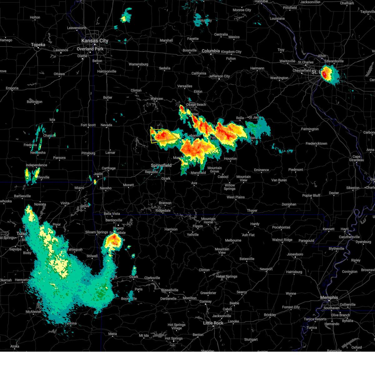 At 319 pm cdt, a severe thunderstorm was located near bolivar, moving south at 30 mph (radar indicated). Hazards include golf ball size hail and 70 mph wind gusts. People and animals outdoors will be injured. expect hail damage to roofs, siding, windows, and vehicles. expect considerable tree damage. wind damage is also likely to mobile homes, roofs, and outbuildings. locations impacted include, bolivar, pomme de terre lake, buffalo, polk, flemington, louisburg and goodson. thunderstorm damage threat, considerable hail threat, radar indicated max hail size, 1. 75 in wind threat, radar indicated max wind gust, 70 mph. At 319 pm cdt, a severe thunderstorm was located near bolivar, moving south at 30 mph (radar indicated). Hazards include golf ball size hail and 70 mph wind gusts. People and animals outdoors will be injured. expect hail damage to roofs, siding, windows, and vehicles. expect considerable tree damage. wind damage is also likely to mobile homes, roofs, and outbuildings. locations impacted include, bolivar, pomme de terre lake, buffalo, polk, flemington, louisburg and goodson. thunderstorm damage threat, considerable hail threat, radar indicated max hail size, 1. 75 in wind threat, radar indicated max wind gust, 70 mph.
|
| 7/17/2023 3:18 PM CDT |
 At 318 pm cdt, a severe thunderstorm was located near bolivar, moving south at 30 mph (radar indicated). Hazards include golf ball size hail and 70 mph wind gusts. People and animals outdoors will be injured. expect hail damage to roofs, siding, windows, and vehicles. expect considerable tree damage. wind damage is also likely to mobile homes, roofs, and outbuildings. locations impacted include, bolivar, buffalo, pleasant hope, morrisville, halfway, olive, brighton, foose, march and charity. thunderstorm damage threat, considerable hail threat, radar indicated max hail size, 1. 75 in wind threat, radar indicated max wind gust, 70 mph. At 318 pm cdt, a severe thunderstorm was located near bolivar, moving south at 30 mph (radar indicated). Hazards include golf ball size hail and 70 mph wind gusts. People and animals outdoors will be injured. expect hail damage to roofs, siding, windows, and vehicles. expect considerable tree damage. wind damage is also likely to mobile homes, roofs, and outbuildings. locations impacted include, bolivar, buffalo, pleasant hope, morrisville, halfway, olive, brighton, foose, march and charity. thunderstorm damage threat, considerable hail threat, radar indicated max hail size, 1. 75 in wind threat, radar indicated max wind gust, 70 mph.
|
| 7/17/2023 3:15 PM CDT |
 At 314 pm cdt, a severe thunderstorm was located 8 miles northeast of bolivar, moving south at 30 mph (radar indicated). Hazards include ping pong ball size hail and 60 mph wind gusts. People and animals outdoors will be injured. expect hail damage to roofs, siding, windows, and vehicles. Expect wind damage to roofs, siding, and trees. At 314 pm cdt, a severe thunderstorm was located 8 miles northeast of bolivar, moving south at 30 mph (radar indicated). Hazards include ping pong ball size hail and 60 mph wind gusts. People and animals outdoors will be injured. expect hail damage to roofs, siding, windows, and vehicles. Expect wind damage to roofs, siding, and trees.
|
| 7/17/2023 3:03 PM CDT |
 At 303 pm cdt, a severe thunderstorm was located 8 miles south of hermitage, moving southeast at 25 mph (radar indicated). Hazards include golf ball size hail and 60 mph wind gusts. People and animals outdoors will be injured. expect hail damage to roofs, siding, windows, and vehicles. Expect wind damage to roofs, siding, and trees. At 303 pm cdt, a severe thunderstorm was located 8 miles south of hermitage, moving southeast at 25 mph (radar indicated). Hazards include golf ball size hail and 60 mph wind gusts. People and animals outdoors will be injured. expect hail damage to roofs, siding, windows, and vehicles. Expect wind damage to roofs, siding, and trees.
|
| 7/14/2023 8:11 PM CDT |
 At 811 pm cdt, severe thunderstorms were located along a line extending from near fair play to near willard to near billings to galena to near kimberling city to near beaver, moving southeast at 40 mph (trained weather spotters). Hazards include 60 mph wind gusts and penny size hail. Expect damage to roofs, siding, and trees. locations impacted include, springfield, nixa, ozark, republic, branson, table rock lake, lake taneycomo, stockton lake, roaring river state park, table rock state park, shepherd of the hills state park, battlefield, willard, hollister, silver dollar city, kimberling city, strafford, clever, merriam woods and sparta. this includes interstate 44 between mile markers 59 and 90. hail threat, radar indicated max hail size, 0. 75 in wind threat, observed max wind gust, 60 mph. At 811 pm cdt, severe thunderstorms were located along a line extending from near fair play to near willard to near billings to galena to near kimberling city to near beaver, moving southeast at 40 mph (trained weather spotters). Hazards include 60 mph wind gusts and penny size hail. Expect damage to roofs, siding, and trees. locations impacted include, springfield, nixa, ozark, republic, branson, table rock lake, lake taneycomo, stockton lake, roaring river state park, table rock state park, shepherd of the hills state park, battlefield, willard, hollister, silver dollar city, kimberling city, strafford, clever, merriam woods and sparta. this includes interstate 44 between mile markers 59 and 90. hail threat, radar indicated max hail size, 0. 75 in wind threat, observed max wind gust, 60 mph.
|
| 7/14/2023 8:03 PM CDT |
 At 803 pm cdt, severe thunderstorms were located along a line extending from near stockton to near walnut grove to near billings to near galena to near kimberling city to near beaver, moving east at 45 mph (trained weather spotters). Hazards include 60 mph wind gusts and nickel size hail. Expect damage to roofs, siding, and trees. locations impacted include, springfield, nixa, ozark, republic, branson, table rock lake, lake taneycomo, stockton lake, roaring river state park, table rock state park, shepherd of the hills state park, aurora, battlefield, willard, hollister, cassville, silver dollar city, kimberling city, strafford and marionville. this includes interstate 44 between mile markers 53 and 90. hail threat, radar indicated max hail size, 0. 88 in wind threat, observed max wind gust, 60 mph. At 803 pm cdt, severe thunderstorms were located along a line extending from near stockton to near walnut grove to near billings to near galena to near kimberling city to near beaver, moving east at 45 mph (trained weather spotters). Hazards include 60 mph wind gusts and nickel size hail. Expect damage to roofs, siding, and trees. locations impacted include, springfield, nixa, ozark, republic, branson, table rock lake, lake taneycomo, stockton lake, roaring river state park, table rock state park, shepherd of the hills state park, aurora, battlefield, willard, hollister, cassville, silver dollar city, kimberling city, strafford and marionville. this includes interstate 44 between mile markers 53 and 90. hail threat, radar indicated max hail size, 0. 88 in wind threat, observed max wind gust, 60 mph.
|
| 7/14/2023 7:55 PM CDT |
 At 755 pm cdt, severe thunderstorms were located along a line extending from near stockton to near walnut grove to near marionville to 10 miles southwest of crane to near seligman, moving east at 40 mph (trained weather spotters). Hazards include 60 mph wind gusts and nickel size hail. Expect damage to roofs, siding, and trees. locations impacted include, springfield, nixa, ozark, republic, branson, bolivar, stockton lake, table rock lake, lake taneycomo, table rock state park, shepherd of the hills state park, roaring river state park, stockton state park, aurora, battlefield, willard, hollister, cassville, silver dollar city and kimberling city. this includes interstate 44 between mile markers 48 and 90. hail threat, radar indicated max hail size, 0. 88 in wind threat, observed max wind gust, 60 mph. At 755 pm cdt, severe thunderstorms were located along a line extending from near stockton to near walnut grove to near marionville to 10 miles southwest of crane to near seligman, moving east at 40 mph (trained weather spotters). Hazards include 60 mph wind gusts and nickel size hail. Expect damage to roofs, siding, and trees. locations impacted include, springfield, nixa, ozark, republic, branson, bolivar, stockton lake, table rock lake, lake taneycomo, table rock state park, shepherd of the hills state park, roaring river state park, stockton state park, aurora, battlefield, willard, hollister, cassville, silver dollar city and kimberling city. this includes interstate 44 between mile markers 48 and 90. hail threat, radar indicated max hail size, 0. 88 in wind threat, observed max wind gust, 60 mph.
|
| 7/14/2023 7:35 PM CDT |
 At 735 pm cdt, severe thunderstorms were located along a line extending from 7 miles south of el dorado springs to near greenfield to near mount vernon to near purdy to 7 miles northwest of washburn, moving southeast at 40 mph (trained weather spotters). Hazards include 70 mph wind gusts. Expect considerable tree damage. Damage is likely to mobile homes, roofs, and outbuildings. At 735 pm cdt, severe thunderstorms were located along a line extending from 7 miles south of el dorado springs to near greenfield to near mount vernon to near purdy to 7 miles northwest of washburn, moving southeast at 40 mph (trained weather spotters). Hazards include 70 mph wind gusts. Expect considerable tree damage. Damage is likely to mobile homes, roofs, and outbuildings.
|
| 7/13/2023 12:33 AM CDT |
 At 1233 am cdt, severe thunderstorms were located along a line extending from near buffalo to 6 miles northeast of pleasant hope to morrisville, moving southeast at 40 mph (radar indicated). Hazards include 60 mph wind gusts and quarter size hail. Hail damage to vehicles is expected. expect wind damage to roofs, siding, and trees. locations impacted include, marshfield, strafford, fair grove, pleasant hope, niangua, morrisville, elkland, ebenezer, bassville, brighton, march, northview, olive, foose and charity. this includes interstate 44 between mile markers 86 and 87, and between mile markers 92 and 107. hail threat, radar indicated max hail size, 1. 00 in wind threat, radar indicated max wind gust, 60 mph. At 1233 am cdt, severe thunderstorms were located along a line extending from near buffalo to 6 miles northeast of pleasant hope to morrisville, moving southeast at 40 mph (radar indicated). Hazards include 60 mph wind gusts and quarter size hail. Hail damage to vehicles is expected. expect wind damage to roofs, siding, and trees. locations impacted include, marshfield, strafford, fair grove, pleasant hope, niangua, morrisville, elkland, ebenezer, bassville, brighton, march, northview, olive, foose and charity. this includes interstate 44 between mile markers 86 and 87, and between mile markers 92 and 107. hail threat, radar indicated max hail size, 1. 00 in wind threat, radar indicated max wind gust, 60 mph.
|
| 7/13/2023 12:18 AM CDT |
 At 1218 am cdt, severe thunderstorms were located along a line extending from 6 miles southeast of urbana to 7 miles east of bolivar to near fair play, moving southeast at 40 mph (radar indicated). Hazards include 60 mph wind gusts and penny size hail. expect damage to roofs, siding, and trees At 1218 am cdt, severe thunderstorms were located along a line extending from 6 miles southeast of urbana to 7 miles east of bolivar to near fair play, moving southeast at 40 mph (radar indicated). Hazards include 60 mph wind gusts and penny size hail. expect damage to roofs, siding, and trees
|
| 6/18/2023 4:25 AM CDT |
 The severe thunderstorm warning for dallas, cedar, polk and eastern greene counties will expire at 430 am cdt, the storms which prompted the warning have weakened below severe limits, and no longer pose an immediate threat to life or property. therefore, the warning will be allowed to expire. however gusty winds are still possible with these thunderstorms. a severe thunderstorm watch remains in effect until 600 am cdt for southwestern missouri. to report severe weather, contact your nearest law enforcement agency. they will relay your report to the national weather service springfield. The severe thunderstorm warning for dallas, cedar, polk and eastern greene counties will expire at 430 am cdt, the storms which prompted the warning have weakened below severe limits, and no longer pose an immediate threat to life or property. therefore, the warning will be allowed to expire. however gusty winds are still possible with these thunderstorms. a severe thunderstorm watch remains in effect until 600 am cdt for southwestern missouri. to report severe weather, contact your nearest law enforcement agency. they will relay your report to the national weather service springfield.
|
| 6/18/2023 4:07 AM CDT |
 At 402 am cdt, severe thunderstorms were located along a line extending from near el dorado springs to near bolivar to near fair grove, moving northeast at 45 mph (radar indicated). Hazards include 60 mph wind gusts. Expect damage to roofs, siding, and trees. these severe storms will be near, strafford around 405 am cdt. bolivar and fair grove around 410 am cdt. conway around 435 am cdt. other locations impacted by these severe thunderstorms include stockton lake, pomme de terre lake, stockton state park, bennett spring state park, polk, halfway, flemington, louisburg, aldrich and umber view heights. this includes interstate 44 between mile markers 75 and 90. hail threat, radar indicated max hail size, <. 75 in wind threat, radar indicated max wind gust, 60 mph. At 402 am cdt, severe thunderstorms were located along a line extending from near el dorado springs to near bolivar to near fair grove, moving northeast at 45 mph (radar indicated). Hazards include 60 mph wind gusts. Expect damage to roofs, siding, and trees. these severe storms will be near, strafford around 405 am cdt. bolivar and fair grove around 410 am cdt. conway around 435 am cdt. other locations impacted by these severe thunderstorms include stockton lake, pomme de terre lake, stockton state park, bennett spring state park, polk, halfway, flemington, louisburg, aldrich and umber view heights. this includes interstate 44 between mile markers 75 and 90. hail threat, radar indicated max hail size, <. 75 in wind threat, radar indicated max wind gust, 60 mph.
|
| 6/18/2023 3:41 AM CDT |
 At 340 am cdt, severe thunderstorms were located along a line extending from 9 miles east of sheldon to near walnut grove to near battlefield, moving northeast at 45 mph (radar indicated). Hazards include 60 mph wind gusts. Expect damage to roofs, siding, and trees. severe thunderstorms will be near, walnut grove around 345 am cdt. springfield and morrisville around 355 am cdt. el dorado springs and fair play around 400 am cdt. bolivar and strafford around 405 am cdt. fair grove around 410 am cdt. conway around 430 am cdt. other locations impacted by these severe thunderstorms include stockton lake, pomme de terre lake, stockton state park, bennett spring state park, polk, brookline, dadeville, jerico springs, halfway and flemington. this includes interstate 44 between mile markers 63 and 90. hail threat, radar indicated max hail size, <. 75 in wind threat, radar indicated max wind gust, 60 mph. At 340 am cdt, severe thunderstorms were located along a line extending from 9 miles east of sheldon to near walnut grove to near battlefield, moving northeast at 45 mph (radar indicated). Hazards include 60 mph wind gusts. Expect damage to roofs, siding, and trees. severe thunderstorms will be near, walnut grove around 345 am cdt. springfield and morrisville around 355 am cdt. el dorado springs and fair play around 400 am cdt. bolivar and strafford around 405 am cdt. fair grove around 410 am cdt. conway around 430 am cdt. other locations impacted by these severe thunderstorms include stockton lake, pomme de terre lake, stockton state park, bennett spring state park, polk, brookline, dadeville, jerico springs, halfway and flemington. this includes interstate 44 between mile markers 63 and 90. hail threat, radar indicated max hail size, <. 75 in wind threat, radar indicated max wind gust, 60 mph.
|
| 6/18/2023 3:30 AM CDT |
 At 330 am cdt, severe thunderstorms were located along a line extending from near lamar to near everton to near republic, moving east at 40 mph (radar indicated). Hazards include 60 mph wind gusts. Expect damage to roofs, siding, and trees. these severe storms will be near, republic and everton around 335 am cdt. battlefield around 340 am cdt. ash grove and walnut grove around 345 am cdt. willard around 355 am cdt. greenfield around 405 am cdt. springfield and pleasant hope around 410 am cdt. fair grove around 420 am cdt. strafford around 425 am cdt. other locations impacted by these severe thunderstorms include stockton lake, brookline, dadeville, lamar heights, halltown, south greenfield, aldrich, irwin, arcola and chesapeake. this includes the following highways, interstate 44 between mile markers 50 and 90. interstate 49 between mile markers 60 and 76. hail threat, radar indicated max hail size, <. 75 in wind threat, radar indicated max wind gust, 60 mph. At 330 am cdt, severe thunderstorms were located along a line extending from near lamar to near everton to near republic, moving east at 40 mph (radar indicated). Hazards include 60 mph wind gusts. Expect damage to roofs, siding, and trees. these severe storms will be near, republic and everton around 335 am cdt. battlefield around 340 am cdt. ash grove and walnut grove around 345 am cdt. willard around 355 am cdt. greenfield around 405 am cdt. springfield and pleasant hope around 410 am cdt. fair grove around 420 am cdt. strafford around 425 am cdt. other locations impacted by these severe thunderstorms include stockton lake, brookline, dadeville, lamar heights, halltown, south greenfield, aldrich, irwin, arcola and chesapeake. this includes the following highways, interstate 44 between mile markers 50 and 90. interstate 49 between mile markers 60 and 76. hail threat, radar indicated max hail size, <. 75 in wind threat, radar indicated max wind gust, 60 mph.
|
| 6/18/2023 2:46 AM CDT |
 At 245 am cdt, severe thunderstorms were located along a line extending from near oronogo to 6 miles north of pierce city to 9 miles east of purdy, moving northeast at 45 mph (trained weather spotters. these storms have a long history of producing wind damage). Hazards include 70 mph wind gusts. Expect considerable tree damage. damage is likely to mobile homes, roofs, and outbuildings. severe thunderstorms will be near, carthage and mount vernon around 255 am cdt. aurora around 300 am cdt. marionville, jasper and miller around 305 am cdt. republic, lamar and everton around 320 am cdt. ash grove around 325 am cdt. battlefield around 330 am cdt. walnut grove around 335 am cdt. willard around 340 am cdt. other locations impacted by these severe thunderstorms include stockton lake, table rock lake, prairie state park, shell knob, airport drive, nashville, brookline, carytown, fidelity and dadeville. this includes the following highways, interstate 44 between mile markers 7 and 90. interstate 49 between mile markers 32 and 76. thunderstorm damage threat, considerable hail threat, radar indicated max hail size, <. 75 in wind threat, observed max wind gust, 70 mph. At 245 am cdt, severe thunderstorms were located along a line extending from near oronogo to 6 miles north of pierce city to 9 miles east of purdy, moving northeast at 45 mph (trained weather spotters. these storms have a long history of producing wind damage). Hazards include 70 mph wind gusts. Expect considerable tree damage. damage is likely to mobile homes, roofs, and outbuildings. severe thunderstorms will be near, carthage and mount vernon around 255 am cdt. aurora around 300 am cdt. marionville, jasper and miller around 305 am cdt. republic, lamar and everton around 320 am cdt. ash grove around 325 am cdt. battlefield around 330 am cdt. walnut grove around 335 am cdt. willard around 340 am cdt. other locations impacted by these severe thunderstorms include stockton lake, table rock lake, prairie state park, shell knob, airport drive, nashville, brookline, carytown, fidelity and dadeville. this includes the following highways, interstate 44 between mile markers 7 and 90. interstate 49 between mile markers 32 and 76. thunderstorm damage threat, considerable hail threat, radar indicated max hail size, <. 75 in wind threat, observed max wind gust, 70 mph.
|
| 5/9/2023 8:09 PM CDT |
 At 809 pm cdt, severe thunderstorms were located along a line extending from 9 miles south of wheatland to morrisville to aurora to near wheaton, moving southeast at 35 mph (radar indicated). Hazards include 60 mph wind gusts and quarter size hail. Hail damage to vehicles is expected. expect wind damage to roofs, siding, and trees. locations impacted include, stockton lake, pomme de terre lake, stockton state park, monett, mount vernon, granby, stockton, greenfield, pierce city, humansville, miller, verona, fair play, weaubleau, everton, dadeville, stotts city, newtonia, halltown and freistatt. this includes interstate 44 between mile markers 33 and 58. hail threat, radar indicated max hail size, 1. 00 in wind threat, radar indicated max wind gust, 60 mph. At 809 pm cdt, severe thunderstorms were located along a line extending from 9 miles south of wheatland to morrisville to aurora to near wheaton, moving southeast at 35 mph (radar indicated). Hazards include 60 mph wind gusts and quarter size hail. Hail damage to vehicles is expected. expect wind damage to roofs, siding, and trees. locations impacted include, stockton lake, pomme de terre lake, stockton state park, monett, mount vernon, granby, stockton, greenfield, pierce city, humansville, miller, verona, fair play, weaubleau, everton, dadeville, stotts city, newtonia, halltown and freistatt. this includes interstate 44 between mile markers 33 and 58. hail threat, radar indicated max hail size, 1. 00 in wind threat, radar indicated max wind gust, 60 mph.
|
| 5/9/2023 8:06 PM CDT |
 At 806 pm cdt, severe thunderstorms were located along a line extending from 8 miles north of bolivar to 7 miles south of ash grove to near monett, moving southeast at 35 mph (radar indicated). Hazards include 60 mph wind gusts and quarter size hail. Hail damage to vehicles is expected. Expect wind damage to roofs, siding, and trees. At 806 pm cdt, severe thunderstorms were located along a line extending from 8 miles north of bolivar to 7 miles south of ash grove to near monett, moving southeast at 35 mph (radar indicated). Hazards include 60 mph wind gusts and quarter size hail. Hail damage to vehicles is expected. Expect wind damage to roofs, siding, and trees.
|
| 5/9/2023 7:29 PM CDT |
 At 729 pm cdt, severe thunderstorms were located along a line extending from near lowry city to 6 miles south of stockton to near sarcoxie to near seneca, moving southeast at 35 mph (radar indicated). Hazards include 60 mph wind gusts and quarter size hail. Hail damage to vehicles is expected. Expect wind damage to roofs, siding, and trees. At 729 pm cdt, severe thunderstorms were located along a line extending from near lowry city to 6 miles south of stockton to near sarcoxie to near seneca, moving southeast at 35 mph (radar indicated). Hazards include 60 mph wind gusts and quarter size hail. Hail damage to vehicles is expected. Expect wind damage to roofs, siding, and trees.
|
| 5/9/2023 3:53 PM CDT |
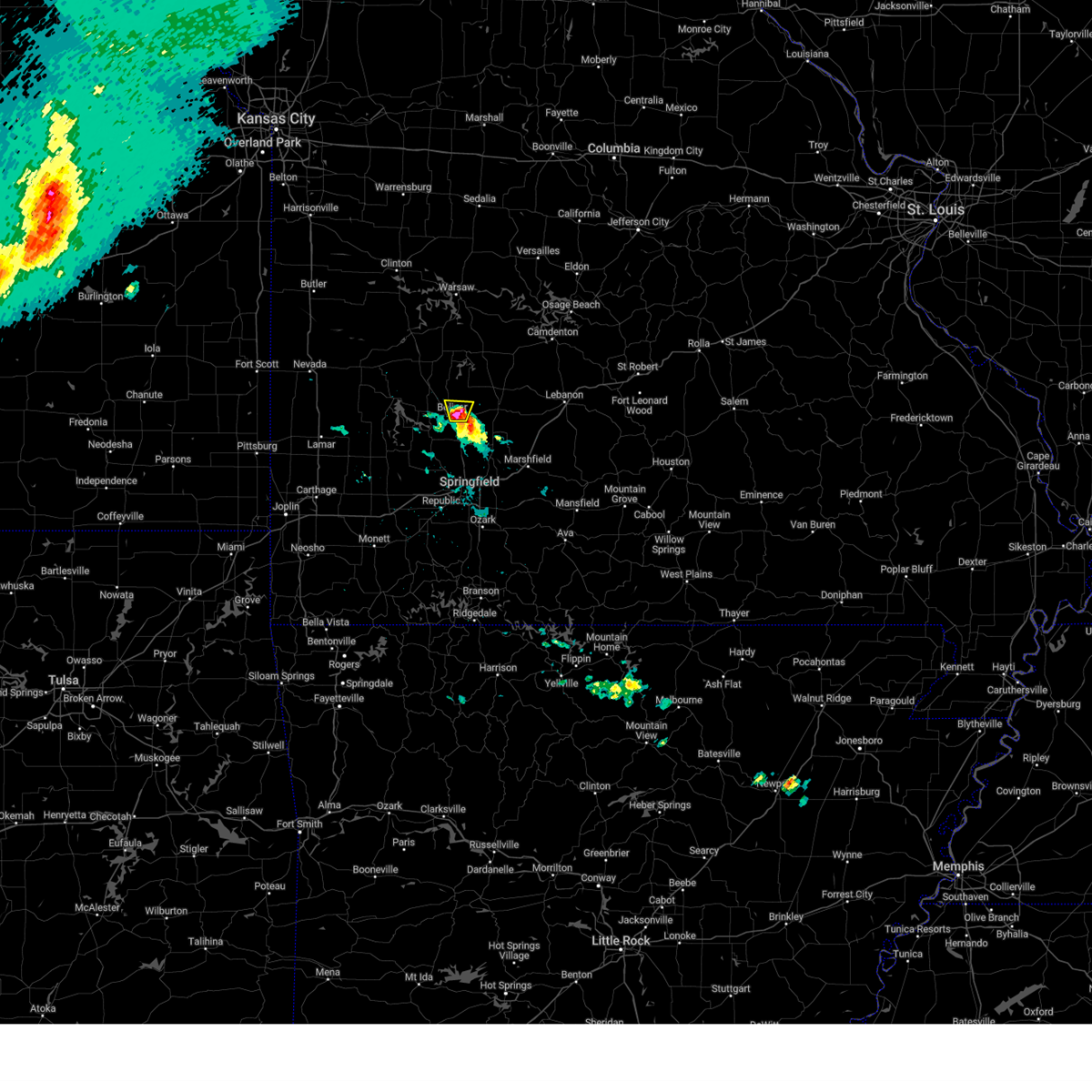 At 353 pm cdt, a severe thunderstorm was located over bolivar, moving north at 20 mph. report of golf ball sized hail at 342 pm cdt in bolivar (trained weather spotters). Hazards include golf ball size hail and 60 mph wind gusts. People and animals outdoors will be injured. expect hail damage to roofs, siding, windows, and vehicles. expect wind damage to roofs, siding, and trees. locations impacted include, bolivar. thunderstorm damage threat, considerable hail threat, radar indicated max hail size, 1. 75 in wind threat, radar indicated max wind gust, 60 mph. At 353 pm cdt, a severe thunderstorm was located over bolivar, moving north at 20 mph. report of golf ball sized hail at 342 pm cdt in bolivar (trained weather spotters). Hazards include golf ball size hail and 60 mph wind gusts. People and animals outdoors will be injured. expect hail damage to roofs, siding, windows, and vehicles. expect wind damage to roofs, siding, and trees. locations impacted include, bolivar. thunderstorm damage threat, considerable hail threat, radar indicated max hail size, 1. 75 in wind threat, radar indicated max wind gust, 60 mph.
|
| 5/9/2023 3:48 PM CDT |
 At 347 pm cdt, a severe thunderstorm was located over bolivar, moving north at 25 mph. emergency management reported up to quarter size hail in bolivar at 343 pm cdt (emergency management). Hazards include golf ball size hail and 60 mph wind gusts. People and animals outdoors will be injured. expect hail damage to roofs, siding, windows, and vehicles. expect wind damage to roofs, siding, and trees. locations impacted include, bolivar and halfway. thunderstorm damage threat, considerable hail threat, radar indicated max hail size, 1. 75 in wind threat, radar indicated max wind gust, 60 mph. At 347 pm cdt, a severe thunderstorm was located over bolivar, moving north at 25 mph. emergency management reported up to quarter size hail in bolivar at 343 pm cdt (emergency management). Hazards include golf ball size hail and 60 mph wind gusts. People and animals outdoors will be injured. expect hail damage to roofs, siding, windows, and vehicles. expect wind damage to roofs, siding, and trees. locations impacted include, bolivar and halfway. thunderstorm damage threat, considerable hail threat, radar indicated max hail size, 1. 75 in wind threat, radar indicated max wind gust, 60 mph.
|
| 5/9/2023 3:43 PM CDT | Quarter sized hail reported 1 miles S of Bolivar, MO, downtown bolivar. |
| 5/9/2023 3:43 PM CDT |
 The severe thunderstorm warning for south central polk county will expire at 345 pm cdt, the storm which prompted the warning has moved out of the area. therefore, the warning will be allowed to expire. The severe thunderstorm warning for south central polk county will expire at 345 pm cdt, the storm which prompted the warning has moved out of the area. therefore, the warning will be allowed to expire.
|
| 5/9/2023 3:42 PM CDT | Golf Ball sized hail reported 0.4 miles S of Bolivar, MO, golf ball size hail in bolivar. time estimated from radar. |
| 5/9/2023 3:42 PM CDT |
 At 342 pm cdt, severe thunderstorms were located along a line extending from near bolivar to near pleasant hope, moving north at 25 mph (radar indicated). Hazards include 60 mph wind gusts and half dollar size hail. Hail damage to vehicles is expected. expect wind damage to roofs, siding, and trees. locations impacted include, bolivar and halfway. hail threat, radar indicated max hail size, 1. 25 in wind threat, radar indicated max wind gust, 60 mph. At 342 pm cdt, severe thunderstorms were located along a line extending from near bolivar to near pleasant hope, moving north at 25 mph (radar indicated). Hazards include 60 mph wind gusts and half dollar size hail. Hail damage to vehicles is expected. expect wind damage to roofs, siding, and trees. locations impacted include, bolivar and halfway. hail threat, radar indicated max hail size, 1. 25 in wind threat, radar indicated max wind gust, 60 mph.
|
| 5/9/2023 3:34 PM CDT |
 At 334 pm cdt, a severe thunderstorm was located near morrisville, or near bolivar, moving northeast at 20 mph (trained weather spotters). Hazards include 60 mph wind gusts and quarter size hail. Hail damage to vehicles is expected. expect wind damage to roofs, siding, and trees. locations impacted include, pleasant hope, morrisville and brighton. hail threat, radar indicated max hail size, 1. 00 in wind threat, radar indicated max wind gust, 60 mph. At 334 pm cdt, a severe thunderstorm was located near morrisville, or near bolivar, moving northeast at 20 mph (trained weather spotters). Hazards include 60 mph wind gusts and quarter size hail. Hail damage to vehicles is expected. expect wind damage to roofs, siding, and trees. locations impacted include, pleasant hope, morrisville and brighton. hail threat, radar indicated max hail size, 1. 00 in wind threat, radar indicated max wind gust, 60 mph.
|
| 5/9/2023 3:33 PM CDT |
 At 333 pm cdt, severe thunderstorms were located along a line extending from near morrisville to pleasant hope, moving north at 20 mph (radar indicated). Hazards include 60 mph wind gusts and quarter size hail. Hail damage to vehicles is expected. Expect wind damage to roofs, siding, and trees. At 333 pm cdt, severe thunderstorms were located along a line extending from near morrisville to pleasant hope, moving north at 20 mph (radar indicated). Hazards include 60 mph wind gusts and quarter size hail. Hail damage to vehicles is expected. Expect wind damage to roofs, siding, and trees.
|
| 5/9/2023 3:29 PM CDT |
 At 328 pm cdt, a severe thunderstorm was located over morrisville, or 7 miles south of bolivar, moving northeast at 20 mph (trained weather spotters). Hazards include 60 mph wind gusts and quarter size hail. Hail damage to vehicles is expected. expect wind damage to roofs, siding, and trees. locations impacted include, stockton lake, pleasant hope, fair play, morrisville, aldrich, eudora and brighton. hail threat, radar indicated max hail size, 1. 00 in wind threat, radar indicated max wind gust, 60 mph. At 328 pm cdt, a severe thunderstorm was located over morrisville, or 7 miles south of bolivar, moving northeast at 20 mph (trained weather spotters). Hazards include 60 mph wind gusts and quarter size hail. Hail damage to vehicles is expected. expect wind damage to roofs, siding, and trees. locations impacted include, stockton lake, pleasant hope, fair play, morrisville, aldrich, eudora and brighton. hail threat, radar indicated max hail size, 1. 00 in wind threat, radar indicated max wind gust, 60 mph.
|
| 5/9/2023 3:22 PM CDT |
 At 322 pm cdt, a severe thunderstorm was located over morrisville, or 8 miles south of bolivar, moving northeast at 30 mph (trained weather spotters). Hazards include 60 mph wind gusts and quarter size hail. Hail damage to vehicles is expected. expect wind damage to roofs, siding, and trees. locations impacted include, stockton lake, fair grove, walnut grove, pleasant hope, fair play, morrisville, aldrich, sacville, ebenezer, eudora and brighton. hail threat, radar indicated max hail size, 1. 00 in wind threat, radar indicated max wind gust, 60 mph. At 322 pm cdt, a severe thunderstorm was located over morrisville, or 8 miles south of bolivar, moving northeast at 30 mph (trained weather spotters). Hazards include 60 mph wind gusts and quarter size hail. Hail damage to vehicles is expected. expect wind damage to roofs, siding, and trees. locations impacted include, stockton lake, fair grove, walnut grove, pleasant hope, fair play, morrisville, aldrich, sacville, ebenezer, eudora and brighton. hail threat, radar indicated max hail size, 1. 00 in wind threat, radar indicated max wind gust, 60 mph.
|
| 5/9/2023 3:12 PM CDT |
 At 311 pm cdt, a severe thunderstorm was located near walnut grove, or 15 miles south of bolivar, moving northeast at 20 mph (trained weather spotters). Hazards include 60 mph wind gusts and half dollar size hail. Hail damage to vehicles is expected. expect wind damage to roofs, siding, and trees. locations impacted include, northwestern springfield, stockton lake, willard, ash grove, fair grove, walnut grove, pleasant hope, fair play, morrisville, aldrich, sacville, glidewell, ebenezer, brighton, bois d`arc, cave springs and eudora. hail threat, radar indicated max hail size, 1. 25 in wind threat, radar indicated max wind gust, 60 mph. At 311 pm cdt, a severe thunderstorm was located near walnut grove, or 15 miles south of bolivar, moving northeast at 20 mph (trained weather spotters). Hazards include 60 mph wind gusts and half dollar size hail. Hail damage to vehicles is expected. expect wind damage to roofs, siding, and trees. locations impacted include, northwestern springfield, stockton lake, willard, ash grove, fair grove, walnut grove, pleasant hope, fair play, morrisville, aldrich, sacville, glidewell, ebenezer, brighton, bois d`arc, cave springs and eudora. hail threat, radar indicated max hail size, 1. 25 in wind threat, radar indicated max wind gust, 60 mph.
|
| 5/9/2023 3:05 PM CDT |
 At 305 pm cdt, a severe thunderstorm was located near walnut grove, or 15 miles northwest of springfield, moving northeast at 20 mph (radar indicated). Hazards include 60 mph wind gusts and quarter size hail. Hail damage to vehicles is expected. Expect wind damage to roofs, siding, and trees. At 305 pm cdt, a severe thunderstorm was located near walnut grove, or 15 miles northwest of springfield, moving northeast at 20 mph (radar indicated). Hazards include 60 mph wind gusts and quarter size hail. Hail damage to vehicles is expected. Expect wind damage to roofs, siding, and trees.
|
| 4/15/2023 3:13 PM CDT |
 At 312 pm cdt, severe thunderstorms were located along a line extending from 6 miles north of camdenton to near macks creek to 7 miles west of buffalo, moving east at 30 mph (radar indicated). Hazards include golf ball size hail and 60 mph wind gusts. People and animals outdoors will be injured. expect hail damage to roofs, siding, windows, and vehicles. Expect wind damage to roofs, siding, and trees. At 312 pm cdt, severe thunderstorms were located along a line extending from 6 miles north of camdenton to near macks creek to 7 miles west of buffalo, moving east at 30 mph (radar indicated). Hazards include golf ball size hail and 60 mph wind gusts. People and animals outdoors will be injured. expect hail damage to roofs, siding, windows, and vehicles. Expect wind damage to roofs, siding, and trees.
|
| 4/15/2023 2:55 PM CDT |
 At 254 pm cdt, a severe thunderstorm was located 10 miles northwest of buffalo, moving northeast at 40 mph (public. this storm has a history of producing very large hail of tennis ball to three inches in size). Hazards include tennis ball size hail and 60 mph wind gusts. People and animals outdoors will be injured. expect hail damage to roofs, siding, windows, and vehicles. expect wind damage to roofs, siding, and trees. locations impacted include, bolivar, stockton lake, buffalo, polk, fair play, halfway, louisburg, aldrich, bearcreek, masters, march, foose and goodson. thunderstorm damage threat, considerable hail threat, radar indicated max hail size, 2. 50 in wind threat, radar indicated max wind gust, 60 mph. At 254 pm cdt, a severe thunderstorm was located 10 miles northwest of buffalo, moving northeast at 40 mph (public. this storm has a history of producing very large hail of tennis ball to three inches in size). Hazards include tennis ball size hail and 60 mph wind gusts. People and animals outdoors will be injured. expect hail damage to roofs, siding, windows, and vehicles. expect wind damage to roofs, siding, and trees. locations impacted include, bolivar, stockton lake, buffalo, polk, fair play, halfway, louisburg, aldrich, bearcreek, masters, march, foose and goodson. thunderstorm damage threat, considerable hail threat, radar indicated max hail size, 2. 50 in wind threat, radar indicated max wind gust, 60 mph.
|
| 4/15/2023 2:53 PM CDT | Golf Ball sized hail reported 5.4 miles SSW of Bolivar, MO, twitter with pictures. |
| 4/15/2023 2:50 PM CDT | Ping Pong Ball sized hail reported 3 miles SW of Bolivar, MO, report from mping... ping pong ball... 1.50 in. |
| 4/15/2023 2:45 PM CDT | Hen Egg sized hail reported 3.2 miles S of Bolivar, MO, damage to plastic deck storage... siding... window screens. |
| 4/15/2023 2:45 PM CDT | Baseball sized hail reported 1 miles S of Bolivar, MO |
| 4/15/2023 2:22 PM CDT | Baseball sized hail reported 9.5 miles S of Bolivar, MO |
| 4/15/2023 2:17 PM CDT |
 At 215 pm cdt, a severe thunderstorm was located 8 miles south of stockton, moving east at 45 mph. this is a destructive storm for cane hill, fair play, and bolivar missouri (public. several reports of tennis ball to three inch size hail has occurred with this storm). Hazards include baseball size hail and 60 mph wind gusts. People and animals outdoors will be severely injured. Expect shattered windows, extensive damage to roofs, siding, and vehicles. At 215 pm cdt, a severe thunderstorm was located 8 miles south of stockton, moving east at 45 mph. this is a destructive storm for cane hill, fair play, and bolivar missouri (public. several reports of tennis ball to three inch size hail has occurred with this storm). Hazards include baseball size hail and 60 mph wind gusts. People and animals outdoors will be severely injured. Expect shattered windows, extensive damage to roofs, siding, and vehicles.
|
| 4/15/2023 1:33 PM CDT |
 At 133 pm cdt, a severe thunderstorm was located near stockton, moving northeast at 30 mph (radar indicated). Hazards include ping pong ball size hail and 60 mph wind gusts. People and animals outdoors will be injured. expect hail damage to roofs, siding, windows, and vehicles. Expect wind damage to roofs, siding, and trees. At 133 pm cdt, a severe thunderstorm was located near stockton, moving northeast at 30 mph (radar indicated). Hazards include ping pong ball size hail and 60 mph wind gusts. People and animals outdoors will be injured. expect hail damage to roofs, siding, windows, and vehicles. Expect wind damage to roofs, siding, and trees.
|
| 4/5/2023 5:06 AM CDT | Half Dollar sized hail reported 3.4 miles ESE of Bolivar, MO, report from mping: half dollar (1.25 in.). |
| 4/5/2023 4:51 AM CDT |
 At 450 am cdt, severe thunderstorms were located along a line extending from near stockton to 8 miles north of everton to near greenfield, moving northeast at 60 mph (radar indicated). Hazards include 60 mph wind gusts and quarter size hail. Hail damage to vehicles is expected. Expect wind damage to roofs, siding, and trees. At 450 am cdt, severe thunderstorms were located along a line extending from near stockton to 8 miles north of everton to near greenfield, moving northeast at 60 mph (radar indicated). Hazards include 60 mph wind gusts and quarter size hail. Hail damage to vehicles is expected. Expect wind damage to roofs, siding, and trees.
|
| 2/27/2023 2:13 AM CST |
 At 213 am cst, severe thunderstorms were located along a line extending from 6 miles southeast of weaubleau to 9 miles southwest of urbana to 6 miles east of bolivar, moving northeast at 60 mph (radar indicated). Hazards include 60 mph wind gusts. Expect damage to roofs, siding, and trees. Locations impacted include, pomme de terre lake, pomme de terre state park, pittsburg, polk, pleasant hope, hermitage, weaubleau, wheatland, preston, halfway, elkton, goodson and nemo. At 213 am cst, severe thunderstorms were located along a line extending from 6 miles southeast of weaubleau to 9 miles southwest of urbana to 6 miles east of bolivar, moving northeast at 60 mph (radar indicated). Hazards include 60 mph wind gusts. Expect damage to roofs, siding, and trees. Locations impacted include, pomme de terre lake, pomme de terre state park, pittsburg, polk, pleasant hope, hermitage, weaubleau, wheatland, preston, halfway, elkton, goodson and nemo.
|
| 2/27/2023 2:00 AM CST |
 At 200 am cst, severe thunderstorms were located along a line extending from near humansville to near fair play to near morrisville, moving northeast at 65 mph (radar indicated). Hazards include 60 mph wind gusts. Expect damage to roofs, siding, and trees. Locations impacted include, bolivar, pomme de terre lake, pomme de terre state park, pittsburg, humansville, polk, pleasant hope, fair play, hermitage, weaubleau, morrisville, wheatland, preston, halfway, collins, flemington, elkton, goodson, dunnegan and nemo. At 200 am cst, severe thunderstorms were located along a line extending from near humansville to near fair play to near morrisville, moving northeast at 65 mph (radar indicated). Hazards include 60 mph wind gusts. Expect damage to roofs, siding, and trees. Locations impacted include, bolivar, pomme de terre lake, pomme de terre state park, pittsburg, humansville, polk, pleasant hope, fair play, hermitage, weaubleau, morrisville, wheatland, preston, halfway, collins, flemington, elkton, goodson, dunnegan and nemo.
|
| 2/27/2023 1:49 AM CST |
 At 149 am cst, severe thunderstorms were located along a line extending from stockton to 6 miles southwest of fair play to 6 miles northwest of walnut grove, moving northeast at 65 mph (radar indicated). Hazards include 60 mph wind gusts. expect damage to roofs, siding, and trees At 149 am cst, severe thunderstorms were located along a line extending from stockton to 6 miles southwest of fair play to 6 miles northwest of walnut grove, moving northeast at 65 mph (radar indicated). Hazards include 60 mph wind gusts. expect damage to roofs, siding, and trees
|
| 8/8/2022 8:32 PM CDT |
 At 831 pm cdt, a severe thunderstorm was located near bolivar, moving southeast at 10 mph (radar indicated). Hazards include 60 mph wind gusts and nickel size hail. expect damage to roofs, siding, and trees At 831 pm cdt, a severe thunderstorm was located near bolivar, moving southeast at 10 mph (radar indicated). Hazards include 60 mph wind gusts and nickel size hail. expect damage to roofs, siding, and trees
|
| 8/8/2022 8:06 PM CDT |
 The severe thunderstorm warning for southeastern cedar, southwestern polk and northeastern dade counties will expire at 815 pm cdt, the storm which prompted the warning has weakened below severe limits, and no longer poses an immediate threat to life or property. therefore, the warning will be allowed to expire. however gusty winds and heavy rain are still possible with this thunderstorm. The severe thunderstorm warning for southeastern cedar, southwestern polk and northeastern dade counties will expire at 815 pm cdt, the storm which prompted the warning has weakened below severe limits, and no longer poses an immediate threat to life or property. therefore, the warning will be allowed to expire. however gusty winds and heavy rain are still possible with this thunderstorm.
|
| 8/8/2022 7:50 PM CDT |
 The severe thunderstorm warning for southwestern dallas and southeastern polk counties will expire at 800 pm cdt, the storm which prompted the warning has weakened below severe limits, and no longer poses an immediate threat to life or property. therefore, the warning will be allowed to expire. however gusty winds and heavy rain are still possible with this thunderstorm. The severe thunderstorm warning for southwestern dallas and southeastern polk counties will expire at 800 pm cdt, the storm which prompted the warning has weakened below severe limits, and no longer poses an immediate threat to life or property. therefore, the warning will be allowed to expire. however gusty winds and heavy rain are still possible with this thunderstorm.
|
| 8/8/2022 7:34 PM CDT |
 At 734 pm cdt, a severe thunderstorm was located near pleasant hope, or 10 miles southeast of bolivar, moving southeast at 5 mph (radar indicated). Hazards include 60 mph wind gusts and nickel size hail. Expect damage to roofs, siding, and trees. locations impacted include, pleasant hope, morrisville, halfway, olive, brighton, foose, march, hail threat, radar indicated max hail size, 0. 88 in wind threat, radar indicated max wind gust, 60 mph. At 734 pm cdt, a severe thunderstorm was located near pleasant hope, or 10 miles southeast of bolivar, moving southeast at 5 mph (radar indicated). Hazards include 60 mph wind gusts and nickel size hail. Expect damage to roofs, siding, and trees. locations impacted include, pleasant hope, morrisville, halfway, olive, brighton, foose, march, hail threat, radar indicated max hail size, 0. 88 in wind threat, radar indicated max wind gust, 60 mph.
|
| 8/8/2022 7:31 PM CDT |
 At 730 pm cdt, a severe thunderstorm was located near fair play, or 10 miles southeast of stockton, moving southeast at 10 mph (radar indicated). Hazards include 60 mph wind gusts and quarter size hail. Hail damage to vehicles is expected. Expect wind damage to roofs, siding, and trees. At 730 pm cdt, a severe thunderstorm was located near fair play, or 10 miles southeast of stockton, moving southeast at 10 mph (radar indicated). Hazards include 60 mph wind gusts and quarter size hail. Hail damage to vehicles is expected. Expect wind damage to roofs, siding, and trees.
|
| 8/8/2022 7:09 PM CDT |
 At 709 pm cdt, a severe thunderstorm was located near pleasant hope, or 8 miles southeast of bolivar, moving southeast at 10 mph (radar indicated). Hazards include 60 mph wind gusts and quarter size hail. Hail damage to vehicles is expected. Expect wind damage to roofs, siding, and trees. At 709 pm cdt, a severe thunderstorm was located near pleasant hope, or 8 miles southeast of bolivar, moving southeast at 10 mph (radar indicated). Hazards include 60 mph wind gusts and quarter size hail. Hail damage to vehicles is expected. Expect wind damage to roofs, siding, and trees.
|
| 5/15/2022 10:12 AM CDT |
 At 1012 am cdt, severe thunderstorms were located along a line extending from 6 miles northwest of lincoln to near hermitage to stockton, moving southeast at 50 mph (radar indicated). Hazards include 60 mph wind gusts and quarter size hail. Hail damage to vehicles is expected. Expect wind damage to roofs, siding, and trees. At 1012 am cdt, severe thunderstorms were located along a line extending from 6 miles northwest of lincoln to near hermitage to stockton, moving southeast at 50 mph (radar indicated). Hazards include 60 mph wind gusts and quarter size hail. Hail damage to vehicles is expected. Expect wind damage to roofs, siding, and trees.
|
| 4/21/2022 5:25 PM CDT |
 At 524 pm cdt, a severe thunderstorm was located near pleasant hope, or 9 miles southeast of bolivar, moving east at 30 mph (public). Hazards include golf ball size hail and 70 mph wind gusts. People and animals outdoors will be injured. expect hail damage to roofs, siding, windows, and vehicles. expect considerable tree damage. Wind damage is also likely to mobile homes, roofs, and outbuildings. At 524 pm cdt, a severe thunderstorm was located near pleasant hope, or 9 miles southeast of bolivar, moving east at 30 mph (public). Hazards include golf ball size hail and 70 mph wind gusts. People and animals outdoors will be injured. expect hail damage to roofs, siding, windows, and vehicles. expect considerable tree damage. Wind damage is also likely to mobile homes, roofs, and outbuildings.
|
| 4/21/2022 5:13 PM CDT | Quarter sized hail reported 3 miles SW of Bolivar, MO, report from mping. |
| 4/21/2022 5:12 PM CDT |
 At 512 pm cdt, a severe thunderstorm capable of producing a tornado was located near morrisville, or 9 miles south of bolivar, moving east at 30 mph (radar indicated rotation). Hazards include tornado and two inch hail. Flying debris will be dangerous to those caught without shelter. mobile homes will be damaged or destroyed. damage to roofs, windows, and vehicles will occur. tree damage is likely. Locations impacted include, bolivar, stockton lake, pleasant hope, fair play, morrisville, halfway, aldrich, eudora, brighton, foose,. At 512 pm cdt, a severe thunderstorm capable of producing a tornado was located near morrisville, or 9 miles south of bolivar, moving east at 30 mph (radar indicated rotation). Hazards include tornado and two inch hail. Flying debris will be dangerous to those caught without shelter. mobile homes will be damaged or destroyed. damage to roofs, windows, and vehicles will occur. tree damage is likely. Locations impacted include, bolivar, stockton lake, pleasant hope, fair play, morrisville, halfway, aldrich, eudora, brighton, foose,.
|
| 4/21/2022 5:03 PM CDT | Golf Ball sized hail reported 1 miles S of Bolivar, MO |
| 4/21/2022 5:03 PM CDT |
 At 502 pm cdt, a severe thunderstorm capable of producing a tornado was located over morrisville, or 7 miles south of bolivar, moving southeast at 35 mph (radar indicated rotation). Hazards include tornado and two inch hail. Flying debris will be dangerous to those caught without shelter. mobile homes will be damaged or destroyed. damage to roofs, windows, and vehicles will occur. tree damage is likely. Locations impacted include, bolivar, stockton lake, pleasant hope, fair play, morrisville, halfway, aldrich, eudora, brighton, foose,. At 502 pm cdt, a severe thunderstorm capable of producing a tornado was located over morrisville, or 7 miles south of bolivar, moving southeast at 35 mph (radar indicated rotation). Hazards include tornado and two inch hail. Flying debris will be dangerous to those caught without shelter. mobile homes will be damaged or destroyed. damage to roofs, windows, and vehicles will occur. tree damage is likely. Locations impacted include, bolivar, stockton lake, pleasant hope, fair play, morrisville, halfway, aldrich, eudora, brighton, foose,.
|
| 4/21/2022 4:53 PM CDT |
 At 453 pm cdt, a severe thunderstorm capable of producing a tornado was located near fair play, or 8 miles west of bolivar, moving east at 15 mph (radar indicated rotation). Hazards include tornado and hail up to two inches in diameter. Flying debris will be dangerous to those caught without shelter. mobile homes will be damaged or destroyed. damage to roofs, windows, and vehicles will occur. Tree damage is likely. At 453 pm cdt, a severe thunderstorm capable of producing a tornado was located near fair play, or 8 miles west of bolivar, moving east at 15 mph (radar indicated rotation). Hazards include tornado and hail up to two inches in diameter. Flying debris will be dangerous to those caught without shelter. mobile homes will be damaged or destroyed. damage to roofs, windows, and vehicles will occur. Tree damage is likely.
|
| 4/21/2022 4:45 PM CDT |
 At 444 pm cdt, a severe thunderstorm was located near fair play, or 9 miles west of bolivar, moving east at 25 mph (radar indicated). Hazards include two inch hail and 60 mph wind gusts. People and animals outdoors will be injured. expect hail damage to roofs, siding, windows, and vehicles. expect wind damage to roofs, siding, and trees. Locations impacted include, bolivar, stockton lake, pleasant hope, fair play, morrisville, halfway, aldrich, eudora, brighton, foose,. At 444 pm cdt, a severe thunderstorm was located near fair play, or 9 miles west of bolivar, moving east at 25 mph (radar indicated). Hazards include two inch hail and 60 mph wind gusts. People and animals outdoors will be injured. expect hail damage to roofs, siding, windows, and vehicles. expect wind damage to roofs, siding, and trees. Locations impacted include, bolivar, stockton lake, pleasant hope, fair play, morrisville, halfway, aldrich, eudora, brighton, foose,.
|
| 4/21/2022 4:30 PM CDT |
 At 429 pm cdt, a severe thunderstorm was located near fair play, or near bolivar, moving east at 25 mph (radar indicated). Hazards include 60 mph wind gusts and half dollar size hail. Hail damage to vehicles is expected. expect wind damage to roofs, siding, and trees. locations impacted include, bolivar, pomme de terre lake, stockton lake, buffalo, humansville, polk, pleasant hope, fair play, morrisville, halfway, flemington, louisburg, aldrich, brighton, pumpkin center, eudora, foose, goodson, dunnegan, hail threat, radar indicated max hail size, 1. 25 in wind threat, radar indicated max wind gust, 60 mph. At 429 pm cdt, a severe thunderstorm was located near fair play, or near bolivar, moving east at 25 mph (radar indicated). Hazards include 60 mph wind gusts and half dollar size hail. Hail damage to vehicles is expected. expect wind damage to roofs, siding, and trees. locations impacted include, bolivar, pomme de terre lake, stockton lake, buffalo, humansville, polk, pleasant hope, fair play, morrisville, halfway, flemington, louisburg, aldrich, brighton, pumpkin center, eudora, foose, goodson, dunnegan, hail threat, radar indicated max hail size, 1. 25 in wind threat, radar indicated max wind gust, 60 mph.
|
| 4/21/2022 4:21 PM CDT |
 At 420 pm cdt, a severe thunderstorm was located over fair play, or 9 miles west of bolivar, moving east at 25 mph (radar indicated). Hazards include ping pong ball size hail and 60 mph wind gusts. People and animals outdoors will be injured. expect hail damage to roofs, siding, windows, and vehicles. Expect wind damage to roofs, siding, and trees. At 420 pm cdt, a severe thunderstorm was located over fair play, or 9 miles west of bolivar, moving east at 25 mph (radar indicated). Hazards include ping pong ball size hail and 60 mph wind gusts. People and animals outdoors will be injured. expect hail damage to roofs, siding, windows, and vehicles. Expect wind damage to roofs, siding, and trees.
|
| 11/10/2021 10:51 PM CST |
 The severe thunderstorm warning for polk and northern greene counties will expire at 1100 pm cst, the storms which prompted the warning have weakened below severe limits, and have exited the warned area. therefore, the warning will be allowed to expire. however gusty winds are still possible with these thunderstorms. The severe thunderstorm warning for polk and northern greene counties will expire at 1100 pm cst, the storms which prompted the warning have weakened below severe limits, and have exited the warned area. therefore, the warning will be allowed to expire. however gusty winds are still possible with these thunderstorms.
|
| 11/10/2021 10:23 PM CST |
 At 1023 pm cst, severe thunderstorms were located along a line extending from 6 miles east of humansville to near fair play to near walnut grove to near ash grove, moving northeast at 40 mph (radar indicated). Hazards include 60 mph wind gusts. Expect damage to roofs, siding, and trees. Locations impacted include, bolivar, pomme de terre lake, stockton lake, willard, ash grove, fair grove, walnut grove, polk, pleasant hope, fair play, morrisville, halfway, flemington, aldrich, sacville, glidewell, ebenezer, brighton, bois d`arc, cave springs,. At 1023 pm cst, severe thunderstorms were located along a line extending from 6 miles east of humansville to near fair play to near walnut grove to near ash grove, moving northeast at 40 mph (radar indicated). Hazards include 60 mph wind gusts. Expect damage to roofs, siding, and trees. Locations impacted include, bolivar, pomme de terre lake, stockton lake, willard, ash grove, fair grove, walnut grove, polk, pleasant hope, fair play, morrisville, halfway, flemington, aldrich, sacville, glidewell, ebenezer, brighton, bois d`arc, cave springs,.
|
| 11/10/2021 10:21 PM CST |
 At 1021 pm cst, severe thunderstorms were located along a line extending from 6 miles east of humansville to near fair play to near walnut grove to ash grove, moving northeast at 40 mph (radar indicated). Hazards include 60 mph wind gusts. expect damage to roofs, siding, and trees At 1021 pm cst, severe thunderstorms were located along a line extending from 6 miles east of humansville to near fair play to near walnut grove to ash grove, moving northeast at 40 mph (radar indicated). Hazards include 60 mph wind gusts. expect damage to roofs, siding, and trees
|
| 6/21/2021 1:53 AM CDT |
 At 153 am cdt, severe thunderstorms were located along a line extending from 12 miles east of fair play to near bolivar to near morrisville to 6 miles north of walnut grove, moving southeast at 55 mph (radar indicated). Hazards include 60 mph wind gusts. Expect damage to roofs, siding, and trees. Locations impacted include, bolivar, halfway, goodson,. At 153 am cdt, severe thunderstorms were located along a line extending from 12 miles east of fair play to near bolivar to near morrisville to 6 miles north of walnut grove, moving southeast at 55 mph (radar indicated). Hazards include 60 mph wind gusts. Expect damage to roofs, siding, and trees. Locations impacted include, bolivar, halfway, goodson,.
|
| 6/21/2021 1:42 AM CDT |
 At 142 am cdt, severe thunderstorms were located along a line extending from near humansville to near bolivar to near fair play to 7 miles southeast of stockton, moving southeast at 60 mph (radar indicated). Hazards include 60 mph wind gusts. Expect damage to roofs, siding, and trees. Locations impacted include, bolivar, stockton lake, stockton state park, stockton, humansville, polk, fair play, halfway, flemington, umber view heights, bearcreek, masters, cane hill, goodson, dunnegan,. At 142 am cdt, severe thunderstorms were located along a line extending from near humansville to near bolivar to near fair play to 7 miles southeast of stockton, moving southeast at 60 mph (radar indicated). Hazards include 60 mph wind gusts. Expect damage to roofs, siding, and trees. Locations impacted include, bolivar, stockton lake, stockton state park, stockton, humansville, polk, fair play, halfway, flemington, umber view heights, bearcreek, masters, cane hill, goodson, dunnegan,.
|
| 6/21/2021 1:29 AM CDT |
 At 128 am cdt, severe thunderstorms were located along a line extending from 6 miles west of weaubleau to near humansville to 6 miles northeast of stockton to 8 miles southeast of el dorado springs, moving southeast at 55 mph (radar indicated). Hazards include 60 mph wind gusts and penny size hail. expect damage to roofs, siding, and trees At 128 am cdt, severe thunderstorms were located along a line extending from 6 miles west of weaubleau to near humansville to 6 miles northeast of stockton to 8 miles southeast of el dorado springs, moving southeast at 55 mph (radar indicated). Hazards include 60 mph wind gusts and penny size hail. expect damage to roofs, siding, and trees
|
| 6/11/2021 7:16 PM CDT |
 At 715 pm cdt, a severe thunderstorm was located over morrisville, or 8 miles south of bolivar, moving south at 30 mph (radar indicated). Hazards include 70 mph wind gusts and half dollar size hail. Hail damage to vehicles is expected. expect considerable tree damage. wind damage is also likely to mobile homes, roofs, and outbuildings. Locations impacted include, bolivar, pleasant hope, morrisville, halfway, eudora, brighton,. At 715 pm cdt, a severe thunderstorm was located over morrisville, or 8 miles south of bolivar, moving south at 30 mph (radar indicated). Hazards include 70 mph wind gusts and half dollar size hail. Hail damage to vehicles is expected. expect considerable tree damage. wind damage is also likely to mobile homes, roofs, and outbuildings. Locations impacted include, bolivar, pleasant hope, morrisville, halfway, eudora, brighton,.
|
| 6/11/2021 6:41 PM CDT |
 At 639 pm cdt, a severe thunderstorm was located near humansville, or 15 miles northeast of stockton, moving south at 20 mph (radar indicated). Hazards include 60 mph wind gusts and half dollar size hail. Hail damage to vehicles is expected. Expect wind damage to roofs, siding, and trees. At 639 pm cdt, a severe thunderstorm was located near humansville, or 15 miles northeast of stockton, moving south at 20 mph (radar indicated). Hazards include 60 mph wind gusts and half dollar size hail. Hail damage to vehicles is expected. Expect wind damage to roofs, siding, and trees.
|
| 5/27/2021 5:04 PM CDT | An mping report indicated that tree limbs up to three inches in diameter and power poles were broke in polk county MO, 5.1 miles WSW of Bolivar, MO |
| 5/27/2021 12:42 PM CDT |
 The severe thunderstorm warning for dallas and southern polk counties will expire at 1245 pm cdt, the storms which prompted the warning have moved out of the area. therefore, the warning will be allowed to expire. however heavy rain is still possible with these thunderstorms. a severe thunderstorm watch remains in effect until 700 pm cdt for southwestern missouri. to report severe weather, contact your nearest law enforcement agency. they will relay your report to the national weather service springfield. The severe thunderstorm warning for dallas and southern polk counties will expire at 1245 pm cdt, the storms which prompted the warning have moved out of the area. therefore, the warning will be allowed to expire. however heavy rain is still possible with these thunderstorms. a severe thunderstorm watch remains in effect until 700 pm cdt for southwestern missouri. to report severe weather, contact your nearest law enforcement agency. they will relay your report to the national weather service springfield.
|
| 5/27/2021 12:15 PM CDT | Delayed report. awos station km17 bolivar awo in polk county MO, 3.4 miles W of Bolivar, MO |
| 5/27/2021 12:14 PM CDT |
 At 1210 pm cdt, severe thunderstorms were located along a line extending from 8 miles northeast of buffalo to 8 miles east of bolivar to morrisville, moving southeast at 50 mph (radar indicated). Hazards include 70 mph wind gusts and quarter size hail. Hail damage to vehicles is expected. expect considerable tree damage. wind damage is also likely to mobile homes, roofs, and outbuildings. Locations impacted include, bolivar, stockton lake, bennett spring state park, buffalo, conway, pleasant hope, morrisville, halfway, louisburg, aldrich, windyville, brighton, march, pumpkin center, olive, eudora, foose, plad, long lane, charity, this includes interstate 44 between mile markers 110 and 111. At 1210 pm cdt, severe thunderstorms were located along a line extending from 8 miles northeast of buffalo to 8 miles east of bolivar to morrisville, moving southeast at 50 mph (radar indicated). Hazards include 70 mph wind gusts and quarter size hail. Hail damage to vehicles is expected. expect considerable tree damage. wind damage is also likely to mobile homes, roofs, and outbuildings. Locations impacted include, bolivar, stockton lake, bennett spring state park, buffalo, conway, pleasant hope, morrisville, halfway, louisburg, aldrich, windyville, brighton, march, pumpkin center, olive, eudora, foose, plad, long lane, charity, this includes interstate 44 between mile markers 110 and 111.
|
| 5/27/2021 12:00 PM CDT | A parked semi trailer overturned due to high wind in polk county MO, 2.7 miles NNW of Bolivar, MO |
| 5/27/2021 11:58 AM CDT |
 At 1158 am cdt, severe thunderstorms were located along a line extending from near urbana to near bolivar to 7 miles southwest of fair play, moving east at 40 mph. these are very dangerous storms (radar indicated). Hazards include 80 mph wind gusts and quarter size hail. Flying debris will be dangerous to those caught without shelter. mobile homes will be heavily damaged. expect considerable damage to roofs, windows, and vehicles. extensive tree damage and power outages are likely. Locations impacted include, bolivar, stockton lake, bennett spring state park, buffalo, conway, polk, pleasant hope, urbana, morrisville, dadeville, halfway, louisburg, aldrich, windyville, march, tunas, pumpkin center, eudora, goodson, plad, this includes interstate 44 between mile markers 110 and 111. At 1158 am cdt, severe thunderstorms were located along a line extending from near urbana to near bolivar to 7 miles southwest of fair play, moving east at 40 mph. these are very dangerous storms (radar indicated). Hazards include 80 mph wind gusts and quarter size hail. Flying debris will be dangerous to those caught without shelter. mobile homes will be heavily damaged. expect considerable damage to roofs, windows, and vehicles. extensive tree damage and power outages are likely. Locations impacted include, bolivar, stockton lake, bennett spring state park, buffalo, conway, polk, pleasant hope, urbana, morrisville, dadeville, halfway, louisburg, aldrich, windyville, march, tunas, pumpkin center, eudora, goodson, plad, this includes interstate 44 between mile markers 110 and 111.
|
| 5/27/2021 11:55 AM CDT | Corrects previous tstm wnd dmg report from 1 sw bolivar. multiple power lines down... trees down in sw portion of city. one building collapse... no injuries all account in polk county MO, 1.1 miles ESE of Bolivar, MO |
| 5/27/2021 11:51 AM CDT | Severe weather snapped power poles and lines along mo hwy 32... west of mo hwy 13. time approximate... estimated by rada in polk county MO, 2.4 miles ESE of Bolivar, MO |
| 5/27/2021 11:45 AM CDT |
 At 1145 am cdt, severe thunderstorms were located along a line extending from 7 miles south of hermitage to near fair play to 8 miles south of stockton, moving east at 40 mph (radar indicated). Hazards include 70 mph wind gusts and quarter size hail. Hail damage to vehicles is expected. expect considerable tree damage. Wind damage is also likely to mobile homes, roofs, and outbuildings. At 1145 am cdt, severe thunderstorms were located along a line extending from 7 miles south of hermitage to near fair play to 8 miles south of stockton, moving east at 40 mph (radar indicated). Hazards include 70 mph wind gusts and quarter size hail. Hail damage to vehicles is expected. expect considerable tree damage. Wind damage is also likely to mobile homes, roofs, and outbuildings.
|
| 5/27/2021 11:42 AM CDT |
 At 1142 am cdt, severe thunderstorms were located along a line extending from 7 miles south of wheatland to near fair play, moving east at 40 mph (radar indicated). Hazards include 70 mph wind gusts and quarter size hail. Hail damage to vehicles is expected. expect considerable tree damage. wind damage is also likely to mobile homes, roofs, and outbuildings. Locations impacted include, pomme de terre lake, stockton lake, pomme de terre state park, stockton, pittsburg, humansville, polk, fair play, hermitage, wheatland, flemington, bearcreek, elkton, arnica, dunnegan, nemo,. At 1142 am cdt, severe thunderstorms were located along a line extending from 7 miles south of wheatland to near fair play, moving east at 40 mph (radar indicated). Hazards include 70 mph wind gusts and quarter size hail. Hail damage to vehicles is expected. expect considerable tree damage. wind damage is also likely to mobile homes, roofs, and outbuildings. Locations impacted include, pomme de terre lake, stockton lake, pomme de terre state park, stockton, pittsburg, humansville, polk, fair play, hermitage, wheatland, flemington, bearcreek, elkton, arnica, dunnegan, nemo,.
|
| 5/27/2021 11:30 AM CDT |
 At 1130 am cdt, severe thunderstorms were located along a line extending from near weaubleau to stockton, moving southeast at 50 mph (radar indicated). Hazards include 60 mph wind gusts and quarter size hail. Hail damage to vehicles is expected. expect wind damage to roofs, siding, and trees. Locations impacted include, pomme de terre lake, stockton lake, pomme de terre state park, stockton, pittsburg, humansville, polk, fair play, hermitage, weaubleau, wheatland, collins, flemington, gerster, bearcreek, caplinger mills, elkton, arnica, dunnegan, nemo,. At 1130 am cdt, severe thunderstorms were located along a line extending from near weaubleau to stockton, moving southeast at 50 mph (radar indicated). Hazards include 60 mph wind gusts and quarter size hail. Hail damage to vehicles is expected. expect wind damage to roofs, siding, and trees. Locations impacted include, pomme de terre lake, stockton lake, pomme de terre state park, stockton, pittsburg, humansville, polk, fair play, hermitage, weaubleau, wheatland, collins, flemington, gerster, bearcreek, caplinger mills, elkton, arnica, dunnegan, nemo,.
|
| 5/27/2021 11:15 AM CDT |
 At 1114 am cdt, severe thunderstorms were located along a line extending from 7 miles south of osceola to 6 miles southeast of el dorado springs, moving east at 45 mph (law enforcement. at 1110 am trees were reported down near el dorado springs with these storms). Hazards include 60 mph wind gusts and quarter size hail. Hail damage to vehicles is expected. Expect wind damage to roofs, siding, and trees. At 1114 am cdt, severe thunderstorms were located along a line extending from 7 miles south of osceola to 6 miles southeast of el dorado springs, moving east at 45 mph (law enforcement. at 1110 am trees were reported down near el dorado springs with these storms). Hazards include 60 mph wind gusts and quarter size hail. Hail damage to vehicles is expected. Expect wind damage to roofs, siding, and trees.
|
| 5/9/2021 4:02 AM CDT |
 At 402 am cdt, a severe thunderstorm was located over walnut grove, or 14 miles southwest of bolivar, moving east at 40 mph (radar indicated). Hazards include 60 mph wind gusts and quarter size hail. Hail damage to vehicles is expected. expect wind damage to roofs, siding, and trees. Locations impacted include, bolivar, stockton lake, ash grove, greenfield, walnut grove, pleasant hope, morrisville, everton, dadeville, halfway, aldrich, sacville, brighton, eudora, neola, goodson, bona,. At 402 am cdt, a severe thunderstorm was located over walnut grove, or 14 miles southwest of bolivar, moving east at 40 mph (radar indicated). Hazards include 60 mph wind gusts and quarter size hail. Hail damage to vehicles is expected. expect wind damage to roofs, siding, and trees. Locations impacted include, bolivar, stockton lake, ash grove, greenfield, walnut grove, pleasant hope, morrisville, everton, dadeville, halfway, aldrich, sacville, brighton, eudora, neola, goodson, bona,.
|
| 5/9/2021 3:37 AM CDT |
 At 337 am cdt, a severe thunderstorm was located near greenfield, moving east at 50 mph (radar indicated). Hazards include 60 mph wind gusts and quarter size hail. Hail damage to vehicles is expected. Expect wind damage to roofs, siding, and trees. At 337 am cdt, a severe thunderstorm was located near greenfield, moving east at 50 mph (radar indicated). Hazards include 60 mph wind gusts and quarter size hail. Hail damage to vehicles is expected. Expect wind damage to roofs, siding, and trees.
|
| 11/14/2020 6:52 PM CST |
 At 652 pm cst, severe thunderstorms were located along a line extending from near camdenton to near pleasant hope, moving east at 40 mph (radar indicated). Hazards include golf ball size hail and 60 mph wind gusts. People and animals outdoors will be injured. expect hail damage to roofs, siding, windows, and vehicles. expect wind damage to roofs, siding, and trees. Locations impacted include, lebanon, lake of the ozarks, lake of the ozarks state park, ha ha tonka state park, bennett spring state park, osage beach, camdenton, buffalo, village of four seasons, richland, lake ozark, conway, iberia, pleasant hope, sunrise beach, morrisville, macks creek, linn creek, phillipsburg, stoutland, this includes interstate 44 between mile markers 109 and 143. At 652 pm cst, severe thunderstorms were located along a line extending from near camdenton to near pleasant hope, moving east at 40 mph (radar indicated). Hazards include golf ball size hail and 60 mph wind gusts. People and animals outdoors will be injured. expect hail damage to roofs, siding, windows, and vehicles. expect wind damage to roofs, siding, and trees. Locations impacted include, lebanon, lake of the ozarks, lake of the ozarks state park, ha ha tonka state park, bennett spring state park, osage beach, camdenton, buffalo, village of four seasons, richland, lake ozark, conway, iberia, pleasant hope, sunrise beach, morrisville, macks creek, linn creek, phillipsburg, stoutland, this includes interstate 44 between mile markers 109 and 143.
|
| 11/14/2020 6:49 PM CST |
 At 649 pm cst, a severe thunderstorm capable of producing a tornado was located near buffalo, moving northeast at 55 mph (radar indicated rotation). Hazards include tornado and golf ball size hail. Flying debris will be dangerous to those caught without shelter. mobile homes will be damaged or destroyed. damage to roofs, windows, and vehicles will occur. tree damage is likely. Locations impacted include, bennett spring state park, buffalo, morrisville, halfway, bennett springs, windyville, foose, plad, long lane, pumpkin center, march,. At 649 pm cst, a severe thunderstorm capable of producing a tornado was located near buffalo, moving northeast at 55 mph (radar indicated rotation). Hazards include tornado and golf ball size hail. Flying debris will be dangerous to those caught without shelter. mobile homes will be damaged or destroyed. damage to roofs, windows, and vehicles will occur. tree damage is likely. Locations impacted include, bennett spring state park, buffalo, morrisville, halfway, bennett springs, windyville, foose, plad, long lane, pumpkin center, march,.
|
| 11/14/2020 6:45 PM CST |
 At 645 pm cst, severe thunderstorms were located along a line extending from near camdenton to near pleasant hope, moving east at 40 mph (radar indicated). Hazards include 60 mph wind gusts and quarter size hail. Hail damage to vehicles is expected. Expect wind damage to roofs, siding, and trees. At 645 pm cst, severe thunderstorms were located along a line extending from near camdenton to near pleasant hope, moving east at 40 mph (radar indicated). Hazards include 60 mph wind gusts and quarter size hail. Hail damage to vehicles is expected. Expect wind damage to roofs, siding, and trees.
|
| 11/14/2020 6:36 PM CST |
 The severe thunderstorm warning for southeastern hickory, southeastern cedar and northern polk counties will expire at 645 pm cst, the storm which prompted the warning has moved out of the area. therefore, the warning will be allowed to expire. a tornado watch remains in effect until midnight cst for central and southwestern missouri. The severe thunderstorm warning for southeastern hickory, southeastern cedar and northern polk counties will expire at 645 pm cst, the storm which prompted the warning has moved out of the area. therefore, the warning will be allowed to expire. a tornado watch remains in effect until midnight cst for central and southwestern missouri.
|
| 11/14/2020 6:34 PM CST |
 At 634 pm cst, a severe thunderstorm capable of producing a tornado was located over morrisville, or 8 miles south of bolivar, moving northeast at 55 mph (radar indicated rotation). Hazards include tornado. Flying debris will be dangerous to those caught without shelter. mobile homes will be damaged or destroyed. damage to roofs, windows, and vehicles will occur. Tree damage is likely. At 634 pm cst, a severe thunderstorm capable of producing a tornado was located over morrisville, or 8 miles south of bolivar, moving northeast at 55 mph (radar indicated rotation). Hazards include tornado. Flying debris will be dangerous to those caught without shelter. mobile homes will be damaged or destroyed. damage to roofs, windows, and vehicles will occur. Tree damage is likely.
|
| 11/14/2020 6:30 PM CST |
 At 630 pm cst, a severe thunderstorm was located near hermitage, moving northeast at 45 mph (radar indicated). Hazards include 60 mph wind gusts and quarter size hail. Hail damage to vehicles is expected. Expect wind damage to roofs, siding, and trees. At 630 pm cst, a severe thunderstorm was located near hermitage, moving northeast at 45 mph (radar indicated). Hazards include 60 mph wind gusts and quarter size hail. Hail damage to vehicles is expected. Expect wind damage to roofs, siding, and trees.
|
| 11/14/2020 6:24 PM CST |
 At 624 pm cst, a severe thunderstorm was located 9 miles southeast of weaubleau, or 10 miles southwest of hermitage, moving northeast at 45 mph (radar indicated). Hazards include 60 mph wind gusts and quarter size hail. Hail damage to vehicles is expected. expect wind damage to roofs, siding, and trees. Locations impacted include, stockton lake, pomme de terre lake, pomme de terre state park, stockton state park, pittsburg, polk, fair play, preston, bearcreek, masters, cane hill, dunnegan, nemo,. At 624 pm cst, a severe thunderstorm was located 9 miles southeast of weaubleau, or 10 miles southwest of hermitage, moving northeast at 45 mph (radar indicated). Hazards include 60 mph wind gusts and quarter size hail. Hail damage to vehicles is expected. expect wind damage to roofs, siding, and trees. Locations impacted include, stockton lake, pomme de terre lake, pomme de terre state park, stockton state park, pittsburg, polk, fair play, preston, bearcreek, masters, cane hill, dunnegan, nemo,.
|
| 11/14/2020 6:14 PM CST |
 At 614 pm cst, severe thunderstorms were located along a line extending from 10 miles southwest of urbana to near greenfield, moving northeast at 50 mph (radar indicated). Hazards include ping pong ball size hail and 60 mph wind gusts. People and animals outdoors will be injured. expect hail damage to roofs, siding, windows, and vehicles. expect wind damage to roofs, siding, and trees. locations impacted include, southeastern joplin, carthage, neosho, bolivar, stockton lake, seneca, granby, duquesne, greenfield, sarcoxie, duenweg, lockwood, diamond, loma linda, miller, leawood, silver creek, shoal creek drive, everton, saginaw, this includes the following highways, interstate 44 between mile markers 4 and 5, and between mile markers 7 and 36. Interstate 49 between mile markers 16 and 41. At 614 pm cst, severe thunderstorms were located along a line extending from 10 miles southwest of urbana to near greenfield, moving northeast at 50 mph (radar indicated). Hazards include ping pong ball size hail and 60 mph wind gusts. People and animals outdoors will be injured. expect hail damage to roofs, siding, windows, and vehicles. expect wind damage to roofs, siding, and trees. locations impacted include, southeastern joplin, carthage, neosho, bolivar, stockton lake, seneca, granby, duquesne, greenfield, sarcoxie, duenweg, lockwood, diamond, loma linda, miller, leawood, silver creek, shoal creek drive, everton, saginaw, this includes the following highways, interstate 44 between mile markers 4 and 5, and between mile markers 7 and 36. Interstate 49 between mile markers 16 and 41.
|
| 11/14/2020 6:04 PM CST |
 At 604 pm cst, severe thunderstorms were located along a line extending from 7 miles north of bolivar to near lockwood, moving northeast at 50 mph (radar indicated). Hazards include 60 mph wind gusts and quarter size hail. Hail damage to vehicles is expected. Expect wind damage to roofs, siding, and trees. At 604 pm cst, severe thunderstorms were located along a line extending from 7 miles north of bolivar to near lockwood, moving northeast at 50 mph (radar indicated). Hazards include 60 mph wind gusts and quarter size hail. Hail damage to vehicles is expected. Expect wind damage to roofs, siding, and trees.
|
| 11/14/2020 5:54 PM CST |
 At 554 pm cst, a severe thunderstorm was located near stockton, moving northeast at 45 mph (radar indicated). Hazards include 60 mph wind gusts and quarter size hail. Hail damage to vehicles is expected. Expect wind damage to roofs, siding, and trees. At 554 pm cst, a severe thunderstorm was located near stockton, moving northeast at 45 mph (radar indicated). Hazards include 60 mph wind gusts and quarter size hail. Hail damage to vehicles is expected. Expect wind damage to roofs, siding, and trees.
|
| 8/29/2020 10:48 AM CDT |
 At 1048 am cdt, severe thunderstorms were located along a line extending from near morrisville to near pleasant hope to strafford to near sparta to 6 miles north of taneyville, moving east at 40 mph (law enforcement. this line of storms has a history of downing trees and power lines). Hazards include 60 mph wind gusts. expect damage to roofs, siding, and trees At 1048 am cdt, severe thunderstorms were located along a line extending from near morrisville to near pleasant hope to strafford to near sparta to 6 miles north of taneyville, moving east at 40 mph (law enforcement. this line of storms has a history of downing trees and power lines). Hazards include 60 mph wind gusts. expect damage to roofs, siding, and trees
|
| 7/19/2020 8:36 PM CDT |
 At 836 pm cdt, a severe thunderstorm was located over ash grove, or 14 miles east of greenfield, moving east at 10 mph (radar indicated). Hazards include 60 mph wind gusts and quarter size hail. Hail damage to vehicles is expected. expect wind damage to roofs, siding, and trees. Locations impacted include, willard, ash grove, walnut grove, morrisville, everton, sacville, cave springs, eudora,. At 836 pm cdt, a severe thunderstorm was located over ash grove, or 14 miles east of greenfield, moving east at 10 mph (radar indicated). Hazards include 60 mph wind gusts and quarter size hail. Hail damage to vehicles is expected. expect wind damage to roofs, siding, and trees. Locations impacted include, willard, ash grove, walnut grove, morrisville, everton, sacville, cave springs, eudora,.
|
| 7/19/2020 8:25 PM CDT |
 At 825 pm cdt, a severe thunderstorm was located near ash grove, or 12 miles east of greenfield, moving east at 15 mph (radar indicated). Hazards include 60 mph wind gusts and half dollar size hail. Hail damage to vehicles is expected. expect wind damage to roofs, siding, and trees. Locations impacted include, willard, ash grove, walnut grove, morrisville, everton, sacville, cave springs, eudora,. At 825 pm cdt, a severe thunderstorm was located near ash grove, or 12 miles east of greenfield, moving east at 15 mph (radar indicated). Hazards include 60 mph wind gusts and half dollar size hail. Hail damage to vehicles is expected. expect wind damage to roofs, siding, and trees. Locations impacted include, willard, ash grove, walnut grove, morrisville, everton, sacville, cave springs, eudora,.
|
| 7/19/2020 8:13 PM CDT |
 At 813 pm cdt, a severe thunderstorm was located near everton, or 10 miles east of greenfield, moving northeast at 20 mph (radar indicated). Hazards include 60 mph wind gusts and quarter size hail. Hail damage to vehicles is expected. Expect wind damage to roofs, siding, and trees. At 813 pm cdt, a severe thunderstorm was located near everton, or 10 miles east of greenfield, moving northeast at 20 mph (radar indicated). Hazards include 60 mph wind gusts and quarter size hail. Hail damage to vehicles is expected. Expect wind damage to roofs, siding, and trees.
|
| 6/4/2020 4:50 AM CDT |
 The severe thunderstorm warning for polk and northern dade counties will expire at 500 am cdt, the storms which prompted the warning have moved out of the area. therefore, the warning will be allowed to expire. a severe thunderstorm watch remains in effect until 800 am cdt for southwestern missouri. The severe thunderstorm warning for polk and northern dade counties will expire at 500 am cdt, the storms which prompted the warning have moved out of the area. therefore, the warning will be allowed to expire. a severe thunderstorm watch remains in effect until 800 am cdt for southwestern missouri.
|
| 6/4/2020 4:45 AM CDT |
 At 444 am cdt, severe thunderstorms were located along a line extending from 8 miles west of buffalo to morrisville to near everton, moving southeast at 60 mph (radar indicated). Hazards include 60 mph wind gusts. expect damage to roofs, siding, and trees At 444 am cdt, severe thunderstorms were located along a line extending from 8 miles west of buffalo to morrisville to near everton, moving southeast at 60 mph (radar indicated). Hazards include 60 mph wind gusts. expect damage to roofs, siding, and trees
|
| 6/4/2020 4:41 AM CDT |
 At 440 am cdt, severe thunderstorms were located along a line extending from 6 miles west of macks creek to 8 miles southwest of fair play, moving east at 45 mph (radar indicated). Hazards include 60 mph wind gusts and nickel size hail. Expect damage to roofs, siding, and trees. Locations impacted include, bolivar, stockton lake, polk, fair play, morrisville, dadeville, halfway, aldrich, eudora, neola, goodson, bona,. At 440 am cdt, severe thunderstorms were located along a line extending from 6 miles west of macks creek to 8 miles southwest of fair play, moving east at 45 mph (radar indicated). Hazards include 60 mph wind gusts and nickel size hail. Expect damage to roofs, siding, and trees. Locations impacted include, bolivar, stockton lake, polk, fair play, morrisville, dadeville, halfway, aldrich, eudora, neola, goodson, bona,.
|
| 6/4/2020 4:34 AM CDT |
 A severe thunderstorm warning remains in effect until 500 am cdt for southern hickory. southeastern cedar. polk and northern dade counties. At 434 am cdt, severe thunderstorms were located along a line extending from 9 miles east of hermitage to 6 miles south of stockton, moving east at 45 mph. A severe thunderstorm warning remains in effect until 500 am cdt for southern hickory. southeastern cedar. polk and northern dade counties. At 434 am cdt, severe thunderstorms were located along a line extending from 9 miles east of hermitage to 6 miles south of stockton, moving east at 45 mph.
|
| 6/4/2020 4:13 AM CDT |
 At 413 am cdt, severe thunderstorms were located along a line extending from 6 miles north of wheatland to 13 miles east of sheldon, moving east at 45 mph (radar indicated). Hazards include 60 mph wind gusts and nickel size hail. expect damage to roofs, siding, and trees At 413 am cdt, severe thunderstorms were located along a line extending from 6 miles north of wheatland to 13 miles east of sheldon, moving east at 45 mph (radar indicated). Hazards include 60 mph wind gusts and nickel size hail. expect damage to roofs, siding, and trees
|
| 5/15/2020 2:20 AM CDT |
 At 219 am cdt, severe thunderstorms were located along a line extending from near urbana to 9 miles northwest of buffalo to near bolivar to 6 miles northwest of morrisville, moving southeast at 45 mph (radar indicated). Hazards include 60 mph wind gusts and nickel size hail. Expect damage to roofs, siding, and trees. Locations impacted include, bolivar, stockton lake, pomme de terre lake, pomme de terre state park, stockton state park, stockton, pittsburg, humansville, polk, fair play, hermitage, urbana, wheatland, jerico springs, preston, cross timbers, halfway, flemington, louisburg, umber view heights,. At 219 am cdt, severe thunderstorms were located along a line extending from near urbana to 9 miles northwest of buffalo to near bolivar to 6 miles northwest of morrisville, moving southeast at 45 mph (radar indicated). Hazards include 60 mph wind gusts and nickel size hail. Expect damage to roofs, siding, and trees. Locations impacted include, bolivar, stockton lake, pomme de terre lake, pomme de terre state park, stockton state park, stockton, pittsburg, humansville, polk, fair play, hermitage, urbana, wheatland, jerico springs, preston, cross timbers, halfway, flemington, louisburg, umber view heights,.
|
| 5/15/2020 1:42 AM CDT |
 At 142 am cdt, severe thunderstorms were located along a line extending from 9 miles east of osceola to near weaubleau to stockton to 13 miles south of el dorado springs, moving southeast at 45 mph (radar indicated). Hazards include 60 mph wind gusts. expect damage to roofs, siding, and trees At 142 am cdt, severe thunderstorms were located along a line extending from 9 miles east of osceola to near weaubleau to stockton to 13 miles south of el dorado springs, moving southeast at 45 mph (radar indicated). Hazards include 60 mph wind gusts. expect damage to roofs, siding, and trees
|
| 5/4/2020 1:22 PM CDT |
 At 121 pm cdt, severe thunderstorms were located along a line extending from near weaubleau to 8 miles south of stockton, moving south at 95 mph (radar indicated). Hazards include 70 mph wind gusts and quarter size hail. Hail damage to vehicles is expected. expect considerable tree damage. Wind damage is also likely to mobile homes, roofs, and outbuildings. At 121 pm cdt, severe thunderstorms were located along a line extending from near weaubleau to 8 miles south of stockton, moving south at 95 mph (radar indicated). Hazards include 70 mph wind gusts and quarter size hail. Hail damage to vehicles is expected. expect considerable tree damage. Wind damage is also likely to mobile homes, roofs, and outbuildings.
|
| 5/4/2020 12:50 PM CDT |
 At 1249 pm cdt, a severe thunderstorm was located near pleasant hope, or 9 miles southeast of bolivar, moving east at 50 mph (radar indicated). Hazards include half dollar size hail. Damage to vehicles is expected. Locations impacted include, pleasant hope, morrisville, halfway, aldrich, brighton,. At 1249 pm cdt, a severe thunderstorm was located near pleasant hope, or 9 miles southeast of bolivar, moving east at 50 mph (radar indicated). Hazards include half dollar size hail. Damage to vehicles is expected. Locations impacted include, pleasant hope, morrisville, halfway, aldrich, brighton,.
|
| 5/4/2020 12:11 PM CDT |
 At 1210 pm cdt, a severe thunderstorm was located near walnut grove, or 11 miles east of greenfield, moving east at 45 mph (law enforcement). Hazards include golf ball size hail has been reported with this storm. People and animals outdoors will be injured. Expect damage to roofs, siding, windows, and vehicles. At 1210 pm cdt, a severe thunderstorm was located near walnut grove, or 11 miles east of greenfield, moving east at 45 mph (law enforcement). Hazards include golf ball size hail has been reported with this storm. People and animals outdoors will be injured. Expect damage to roofs, siding, windows, and vehicles.
|
| 5/4/2020 11:30 AM CDT |
 At 1130 am cdt, a severe thunderstorm was located near greenfield, moving east at 45 mph (radar indicated). Hazards include half dollar size hail. damage to vehicles is expected At 1130 am cdt, a severe thunderstorm was located near greenfield, moving east at 45 mph (radar indicated). Hazards include half dollar size hail. damage to vehicles is expected
|
| 5/3/2020 10:25 AM CDT |
 At 1024 am cdt, severe thunderstorms were located along a line extending from 10 miles northwest of buffalo to pleasant hope to near willard, moving east at 45 mph (radar indicated). Hazards include 60 mph wind gusts and half dollar size hail. Hail damage to vehicles is expected. expect wind damage to roofs, siding, and trees. Locations impacted include, bolivar, pomme de terre lake, stockton lake, willard, strafford, ash grove, fair grove, humansville, walnut grove, polk, pleasant hope, fair play, morrisville, halfway, flemington, aldrich, glidewell, cave springs, eudora, goodson,. At 1024 am cdt, severe thunderstorms were located along a line extending from 10 miles northwest of buffalo to pleasant hope to near willard, moving east at 45 mph (radar indicated). Hazards include 60 mph wind gusts and half dollar size hail. Hail damage to vehicles is expected. expect wind damage to roofs, siding, and trees. Locations impacted include, bolivar, pomme de terre lake, stockton lake, willard, strafford, ash grove, fair grove, humansville, walnut grove, polk, pleasant hope, fair play, morrisville, halfway, flemington, aldrich, glidewell, cave springs, eudora, goodson,.
|
| 5/3/2020 10:05 AM CDT |
 At 1004 am cdt, severe thunderstorms were located along a line extending from near humansville to 8 miles northwest of walnut grove to near miller, moving east at 50 mph (radar indicated). Hazards include 60 to 70 mph wind gusts and half dollar size hail. Hail damage to vehicles is expected. Expect wind damage to roofs, siding, and trees. At 1004 am cdt, severe thunderstorms were located along a line extending from near humansville to 8 miles northwest of walnut grove to near miller, moving east at 50 mph (radar indicated). Hazards include 60 to 70 mph wind gusts and half dollar size hail. Hail damage to vehicles is expected. Expect wind damage to roofs, siding, and trees.
|
| 4/24/2020 9:10 PM CDT |
 The severe thunderstorm warning for southwestern hickory and polk counties will expire at 915 pm cdt, the storms which prompted the warning have weakened below severe limits, and no longer pose an immediate threat to life or property. therefore, the warning will be allowed to expire. however heavy rain is still possible with these thunderstorms. The severe thunderstorm warning for southwestern hickory and polk counties will expire at 915 pm cdt, the storms which prompted the warning have weakened below severe limits, and no longer pose an immediate threat to life or property. therefore, the warning will be allowed to expire. however heavy rain is still possible with these thunderstorms.
|
| 4/24/2020 8:59 PM CDT |
 A severe thunderstorm warning remains in effect until 915 pm cdt for southwestern hickory and polk counties. at 859 pm cdt, severe thunderstorms were located along a line extending from near weaubleau to near bolivar to near morrisville, moving east at 30 mph. hazard. 60 mph wind gusts. A severe thunderstorm warning remains in effect until 915 pm cdt for southwestern hickory and polk counties. at 859 pm cdt, severe thunderstorms were located along a line extending from near weaubleau to near bolivar to near morrisville, moving east at 30 mph. hazard. 60 mph wind gusts.
|
| 4/24/2020 8:42 PM CDT |
 At 842 pm cdt, severe thunderstorms were located along a line extending from 6 miles northwest of humansville to near fair play to near morrisville, moving east at 35 mph (radar indicated). Hazards include 60 mph wind gusts. Expect damage to roofs, siding, and trees. these severe storms will be near, morrisville around 850 pm cdt. bolivar around 855 pm cdt. pleasant hope around 900 pm cdt. Other locations impacted by these severe thunderstorms include pomme de terre lake, stockton lake, pittsburg, polk, halfway, collins, flemington, aldrich, bearcreek and brighton. At 842 pm cdt, severe thunderstorms were located along a line extending from 6 miles northwest of humansville to near fair play to near morrisville, moving east at 35 mph (radar indicated). Hazards include 60 mph wind gusts. Expect damage to roofs, siding, and trees. these severe storms will be near, morrisville around 850 pm cdt. bolivar around 855 pm cdt. pleasant hope around 900 pm cdt. Other locations impacted by these severe thunderstorms include pomme de terre lake, stockton lake, pittsburg, polk, halfway, collins, flemington, aldrich, bearcreek and brighton.
|
| 4/24/2020 8:14 PM CDT |
 At 813 pm cdt, severe thunderstorms were located along a line extending from 7 miles southeast of el dorado springs to near stockton to near greenfield, moving east at 30 mph (radar indicated). Hazards include 60 mph wind gusts. Expect damage to roofs, siding, and trees. severe thunderstorms will be near, stockton around 820 pm cdt. fair play around 840 pm cdt. humansville around 855 pm cdt. bolivar, weaubleau and morrisville around 900 pm cdt. pleasant hope around 915 pm cdt. Other locations impacted by these severe thunderstorms include stockton lake, pomme de terre lake, stockton state park, pittsburg, polk, dadeville, halfway, collins, flemington and aldrich. At 813 pm cdt, severe thunderstorms were located along a line extending from 7 miles southeast of el dorado springs to near stockton to near greenfield, moving east at 30 mph (radar indicated). Hazards include 60 mph wind gusts. Expect damage to roofs, siding, and trees. severe thunderstorms will be near, stockton around 820 pm cdt. fair play around 840 pm cdt. humansville around 855 pm cdt. bolivar, weaubleau and morrisville around 900 pm cdt. pleasant hope around 915 pm cdt. Other locations impacted by these severe thunderstorms include stockton lake, pomme de terre lake, stockton state park, pittsburg, polk, dadeville, halfway, collins, flemington and aldrich.
|
| 12/28/2019 7:10 PM CST |
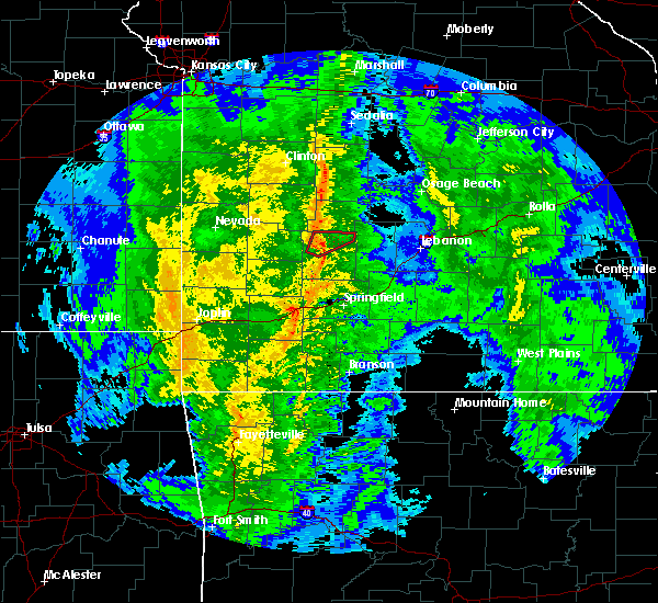 At 710 pm cst, a severe thunderstorm capable of producing a tornado was located near fair play, or near bolivar, moving northeast at 40 mph (radar indicated rotation). Hazards include tornado. Flying debris will be dangerous to those caught without shelter. mobile homes will be damaged or destroyed. damage to roofs, windows, and vehicles will occur. tree damage is likely. Locations impacted include, pomme de terre lake, polk, flemington,. At 710 pm cst, a severe thunderstorm capable of producing a tornado was located near fair play, or near bolivar, moving northeast at 40 mph (radar indicated rotation). Hazards include tornado. Flying debris will be dangerous to those caught without shelter. mobile homes will be damaged or destroyed. damage to roofs, windows, and vehicles will occur. tree damage is likely. Locations impacted include, pomme de terre lake, polk, flemington,.
|
| 12/28/2019 6:59 PM CST |
 At 659 pm cst, a severe thunderstorm capable of producing a tornado was located near fair play, or 10 miles west of bolivar, moving northeast at 40 mph (radar indicated rotation). Hazards include tornado. Flying debris will be dangerous to those caught without shelter. mobile homes will be damaged or destroyed. damage to roofs, windows, and vehicles will occur. Tree damage is likely. At 659 pm cst, a severe thunderstorm capable of producing a tornado was located near fair play, or 10 miles west of bolivar, moving northeast at 40 mph (radar indicated rotation). Hazards include tornado. Flying debris will be dangerous to those caught without shelter. mobile homes will be damaged or destroyed. damage to roofs, windows, and vehicles will occur. Tree damage is likely.
|
| 8/26/2019 2:03 PM CDT |
 At 201 pm cdt, a severe thunderstorm was located 8 miles northeast of greenfield, moving southeast at 35 mph. a funnel cloud was reported with this storm near umber view heights (radar indicated). Hazards include 60 mph wind gusts and quarter size hail. Hail damage to vehicles is expected. expect wind damage to roofs, siding, and trees. Locations impacted include, bolivar, stockton lake, stockton state park, stockton, greenfield, humansville, fair play, dadeville, jerico springs, aldrich, arcola, umber view heights, bearcreek, masters, wagoner, cane hill, arnica, neola, dunnegan, cedarville,. At 201 pm cdt, a severe thunderstorm was located 8 miles northeast of greenfield, moving southeast at 35 mph. a funnel cloud was reported with this storm near umber view heights (radar indicated). Hazards include 60 mph wind gusts and quarter size hail. Hail damage to vehicles is expected. expect wind damage to roofs, siding, and trees. Locations impacted include, bolivar, stockton lake, stockton state park, stockton, greenfield, humansville, fair play, dadeville, jerico springs, aldrich, arcola, umber view heights, bearcreek, masters, wagoner, cane hill, arnica, neola, dunnegan, cedarville,.
|
| 8/26/2019 1:27 PM CDT |
 At 127 pm cdt, a severe thunderstorm was located near el dorado springs, moving southeast at 35 mph (radar indicated). Hazards include 60 mph wind gusts and quarter size hail. Hail damage to vehicles is expected. Expect wind damage to roofs, siding, and trees. At 127 pm cdt, a severe thunderstorm was located near el dorado springs, moving southeast at 35 mph (radar indicated). Hazards include 60 mph wind gusts and quarter size hail. Hail damage to vehicles is expected. Expect wind damage to roofs, siding, and trees.
|
| 8/16/2019 3:05 AM CDT |
 The severe thunderstorm warning for eastern hickory, dallas, polk and southwestern camden counties will expire at 315 am cdt, the storms which prompted the warning have weakened below severe limits, and no longer pose an immediate threat to life or property. therefore, the warning will be allowed to expire. a severe thunderstorm watch remains in effect until 700 am cdt for central and southwestern missouri. The severe thunderstorm warning for eastern hickory, dallas, polk and southwestern camden counties will expire at 315 am cdt, the storms which prompted the warning have weakened below severe limits, and no longer pose an immediate threat to life or property. therefore, the warning will be allowed to expire. a severe thunderstorm watch remains in effect until 700 am cdt for central and southwestern missouri.
|
| 8/16/2019 2:37 AM CDT |
 At 237 am cdt, severe thunderstorms were located along a line extending from near hermitage to 7 miles south of urbana to 8 miles west of buffalo to near walnut grove, moving east at 45 mph (radar indicated). Hazards include 60 mph wind gusts and penny size hail. Expect damage to roofs, siding, and trees. Locations impacted include, bolivar, pomme de terre lake, stockton lake, pomme de terre state park, bennett spring state park, buffalo, pittsburg, conway, polk, pleasant hope, hermitage, urbana, morrisville, macks creek, preston, cross timbers, halfway, bennett springs, louisburg, aldrich,. At 237 am cdt, severe thunderstorms were located along a line extending from near hermitage to 7 miles south of urbana to 8 miles west of buffalo to near walnut grove, moving east at 45 mph (radar indicated). Hazards include 60 mph wind gusts and penny size hail. Expect damage to roofs, siding, and trees. Locations impacted include, bolivar, pomme de terre lake, stockton lake, pomme de terre state park, bennett spring state park, buffalo, pittsburg, conway, polk, pleasant hope, hermitage, urbana, morrisville, macks creek, preston, cross timbers, halfway, bennett springs, louisburg, aldrich,.
|
| 8/16/2019 2:08 AM CDT |
 At 208 am cdt, severe thunderstorms were located along a line extending from 8 miles northwest of wheatland to near weaubleau to near humansville to 9 miles southwest of stockton, moving east at 50 mph (radar indicated). Hazards include 60 mph wind gusts and quarter size hail. Hail damage to vehicles is expected. Expect wind damage to roofs, siding, and trees. At 208 am cdt, severe thunderstorms were located along a line extending from 8 miles northwest of wheatland to near weaubleau to near humansville to 9 miles southwest of stockton, moving east at 50 mph (radar indicated). Hazards include 60 mph wind gusts and quarter size hail. Hail damage to vehicles is expected. Expect wind damage to roofs, siding, and trees.
|
| 8/16/2019 2:01 AM CDT |
 A severe thunderstorm warning remains in effect until 215 am cdt for hickory. barton. southeastern cedar. polk. southeastern st. clair and northern dade counties. At 200 am cdt, severe thunderstorms were located along a line extending from 6 miles southeast of osceola to 6 miles southwest of humansville to 8 miles southwest of stockton to near sheldon, moving. A severe thunderstorm warning remains in effect until 215 am cdt for hickory. barton. southeastern cedar. polk. southeastern st. clair and northern dade counties. At 200 am cdt, severe thunderstorms were located along a line extending from 6 miles southeast of osceola to 6 miles southwest of humansville to 8 miles southwest of stockton to near sheldon, moving.
|
| 8/16/2019 1:32 AM CDT |
 At 132 am cdt, severe thunderstorms were located along a line extending from 7 miles southwest of lowry city to near el dorado springs to 7 miles northeast of sheldon to near arcadia, moving southeast at 55 mph (radar indicated). Hazards include 70 mph wind gusts and quarter size hail. Hail damage to vehicles is expected. expect considerable tree damage. Wind damage is also likely to mobile homes, roofs, and outbuildings. At 132 am cdt, severe thunderstorms were located along a line extending from 7 miles southwest of lowry city to near el dorado springs to 7 miles northeast of sheldon to near arcadia, moving southeast at 55 mph (radar indicated). Hazards include 70 mph wind gusts and quarter size hail. Hail damage to vehicles is expected. expect considerable tree damage. Wind damage is also likely to mobile homes, roofs, and outbuildings.
|
| 6/21/2019 2:17 PM CDT |
 At 217 pm cdt, a severe thunderstorm was located near pleasant hope, or 10 miles southeast of bolivar, moving east at 25 mph (radar indicated). Hazards include 60 mph wind gusts and quarter size hail. Hail damage to vehicles is expected. expect wind damage to roofs, siding, and trees. Locations impacted include, bolivar, buffalo, fair grove, walnut grove, pleasant hope, morrisville, halfway, sacville, ebenezer, bassville, brighton, march, olive, foose,. At 217 pm cdt, a severe thunderstorm was located near pleasant hope, or 10 miles southeast of bolivar, moving east at 25 mph (radar indicated). Hazards include 60 mph wind gusts and quarter size hail. Hail damage to vehicles is expected. expect wind damage to roofs, siding, and trees. Locations impacted include, bolivar, buffalo, fair grove, walnut grove, pleasant hope, morrisville, halfway, sacville, ebenezer, bassville, brighton, march, olive, foose,.
|
| 6/21/2019 1:56 PM CDT |
 The national weather service in springfield has issued a * severe thunderstorm warning for. southwestern dallas county in southwestern missouri. southern polk county in southwestern missouri. northern greene county in southwestern missouri. Until 245 pm cdt. The national weather service in springfield has issued a * severe thunderstorm warning for. southwestern dallas county in southwestern missouri. southern polk county in southwestern missouri. northern greene county in southwestern missouri. Until 245 pm cdt.
|
| 6/21/2019 1:50 PM CDT | Corrects previous non-tstm wnd dmg report from 1 ne bolivar to tstm wnd dmg. a tree landed on a house in bolivar on east division street. time estimated from rada in polk county MO, 1.8 miles SSW of Bolivar, MO |
| 5/23/2019 12:33 AM CDT |
 At 1232 am cdt, a severe thunderstorm was located 9 miles northeast of bolivar, moving east at 40 mph (radar indicated). Hazards include 60 mph wind gusts and half dollar size hail. Hail damage to vehicles is expected. Expect wind damage to roofs, siding, and trees. At 1232 am cdt, a severe thunderstorm was located 9 miles northeast of bolivar, moving east at 40 mph (radar indicated). Hazards include 60 mph wind gusts and half dollar size hail. Hail damage to vehicles is expected. Expect wind damage to roofs, siding, and trees.
|
| 5/22/2019 11:31 PM CDT |
 At 1130 pm cdt, severe thunderstorms were located along a line extending from 9 miles east of osceola to near weaubleau to 9 miles west of humansville to near stockton to 15 miles north of greenfield, moving east at 20 mph (radar indicated). Hazards include 60 mph wind gusts and nickel size hail. Expect damage to roofs, siding, and trees. Locations impacted include, bolivar, stockton lake, pomme de terre lake, truman lake, pomme de terre state park, stockton state park, stockton, pittsburg, humansville, polk, fair play, hermitage, weaubleau, wheatland, preston, cross timbers, halfway, collins, flemington, vista,. At 1130 pm cdt, severe thunderstorms were located along a line extending from 9 miles east of osceola to near weaubleau to 9 miles west of humansville to near stockton to 15 miles north of greenfield, moving east at 20 mph (radar indicated). Hazards include 60 mph wind gusts and nickel size hail. Expect damage to roofs, siding, and trees. Locations impacted include, bolivar, stockton lake, pomme de terre lake, truman lake, pomme de terre state park, stockton state park, stockton, pittsburg, humansville, polk, fair play, hermitage, weaubleau, wheatland, preston, cross timbers, halfway, collins, flemington, vista,.
|
| 5/22/2019 11:25 PM CDT |
 At 1125 pm cdt, severe thunderstorms were located along a line extending from 7 miles northeast of osceola to 6 miles northwest of weaubleau to 8 miles north of stockton to 15 miles north of greenfield, moving east at 35 mph (radar indicated). Hazards include 60 mph wind gusts and nickel size hail. expect damage to roofs, siding, and trees At 1125 pm cdt, severe thunderstorms were located along a line extending from 7 miles northeast of osceola to 6 miles northwest of weaubleau to 8 miles north of stockton to 15 miles north of greenfield, moving east at 35 mph (radar indicated). Hazards include 60 mph wind gusts and nickel size hail. expect damage to roofs, siding, and trees
|
| 5/22/2019 11:06 PM CDT |
 The tornado warning for south central hickory, northern dallas and northeastern polk counties will expire at 1115 pm cdt, the storm which prompted the warning has weakened below severe limits, and no longer appears capable of producing a tornado. therefore, the warning will be allowed to expire. however gusty winds are still possible with this thunderstorm. a tornado watch remains in effect until 400 am cdt for central and southwestern missouri. to report severe weather, contact your nearest law enforcement agency. they will relay your report to the national weather service springfield. The tornado warning for south central hickory, northern dallas and northeastern polk counties will expire at 1115 pm cdt, the storm which prompted the warning has weakened below severe limits, and no longer appears capable of producing a tornado. therefore, the warning will be allowed to expire. however gusty winds are still possible with this thunderstorm. a tornado watch remains in effect until 400 am cdt for central and southwestern missouri. to report severe weather, contact your nearest law enforcement agency. they will relay your report to the national weather service springfield.
|
| 5/22/2019 10:54 PM CDT |
 At 1052 pm cdt, a severe thunderstorm capable of producing a tornado was located near urbana with a second circulation located 5 miles northeast of bolivar. both cells are moving east at 35 mph (radar indicated rotation). Hazards include tornado and half dollar size hail. Flying debris will be dangerous to those caught without shelter. mobile homes will be damaged or destroyed. damage to roofs, windows, and vehicles will occur. tree damage is likely. Locations impacted include, bolivar, pomme de terre lake, buffalo, pittsburg, polk, urbana, halfway, louisburg, leadmine, tunas, pumpkin center, goodson, plad,. At 1052 pm cdt, a severe thunderstorm capable of producing a tornado was located near urbana with a second circulation located 5 miles northeast of bolivar. both cells are moving east at 35 mph (radar indicated rotation). Hazards include tornado and half dollar size hail. Flying debris will be dangerous to those caught without shelter. mobile homes will be damaged or destroyed. damage to roofs, windows, and vehicles will occur. tree damage is likely. Locations impacted include, bolivar, pomme de terre lake, buffalo, pittsburg, polk, urbana, halfway, louisburg, leadmine, tunas, pumpkin center, goodson, plad,.
|
| 5/22/2019 10:43 PM CDT |
 At 1041 pm cdt, a severe thunderstorm capable of producing a tornado was located 9 miles northeast of bolivar, moving east at 35 mph. circulations continue northeast of polk and north and west of bolivar (radar indicated rotation). Hazards include tornado and half dollar size hail. Flying debris will be dangerous to those caught without shelter. mobile homes will be damaged or destroyed. damage to roofs, windows, and vehicles will occur. tree damage is likely. Locations impacted include, bolivar, pomme de terre lake, buffalo, pittsburg, polk, fair play, urbana, halfway, louisburg, leadmine, tunas, pumpkin center, goodson, plad, dunnegan,. At 1041 pm cdt, a severe thunderstorm capable of producing a tornado was located 9 miles northeast of bolivar, moving east at 35 mph. circulations continue northeast of polk and north and west of bolivar (radar indicated rotation). Hazards include tornado and half dollar size hail. Flying debris will be dangerous to those caught without shelter. mobile homes will be damaged or destroyed. damage to roofs, windows, and vehicles will occur. tree damage is likely. Locations impacted include, bolivar, pomme de terre lake, buffalo, pittsburg, polk, fair play, urbana, halfway, louisburg, leadmine, tunas, pumpkin center, goodson, plad, dunnegan,.
|
| 5/22/2019 10:30 PM CDT |
 At 1026 pm cdt, a severe thunderstorm capable of producing a tornado was located over bolivar, moving east at 35 mph. this warning replaces the previous warning for the same areas (radar indicated rotation. two separate rotations were tracking to the east northeast. one near fair play and a second west of goodson). Hazards include tornado and half dollar size hail. Flying debris will be dangerous to those caught without shelter. mobile homes will be damaged or destroyed. damage to roofs, windows, and vehicles will occur. Tree damage is likely. At 1026 pm cdt, a severe thunderstorm capable of producing a tornado was located over bolivar, moving east at 35 mph. this warning replaces the previous warning for the same areas (radar indicated rotation. two separate rotations were tracking to the east northeast. one near fair play and a second west of goodson). Hazards include tornado and half dollar size hail. Flying debris will be dangerous to those caught without shelter. mobile homes will be damaged or destroyed. damage to roofs, windows, and vehicles will occur. Tree damage is likely.
|
| 5/22/2019 10:22 PM CDT |
 At 1022 pm cdt, a severe thunderstorm capable of producing a tornado was located near bolivar, moving northeast at 35 mph (radar indicated rotation). Hazards include tornado and half dollar size hail. Flying debris will be dangerous to those caught without shelter. mobile homes will be damaged or destroyed. damage to roofs, windows, and vehicles will occur. tree damage is likely. Locations impacted include, bolivar, pomme de terre lake, stockton lake, polk, fair play, halfway, aldrich, goodson,. At 1022 pm cdt, a severe thunderstorm capable of producing a tornado was located near bolivar, moving northeast at 35 mph (radar indicated rotation). Hazards include tornado and half dollar size hail. Flying debris will be dangerous to those caught without shelter. mobile homes will be damaged or destroyed. damage to roofs, windows, and vehicles will occur. tree damage is likely. Locations impacted include, bolivar, pomme de terre lake, stockton lake, polk, fair play, halfway, aldrich, goodson,.
|
| 5/22/2019 10:01 PM CDT |
 At 1001 pm cdt, a severe thunderstorm capable of producing a tornado was located near fair play, or 9 miles west of bolivar, moving east at 35 mph (radar indicated rotation). Hazards include tornado and ping pong ball size hail. Flying debris will be dangerous to those caught without shelter. mobile homes will be damaged or destroyed. damage to roofs, windows, and vehicles will occur. Tree damage is likely. At 1001 pm cdt, a severe thunderstorm capable of producing a tornado was located near fair play, or 9 miles west of bolivar, moving east at 35 mph (radar indicated rotation). Hazards include tornado and ping pong ball size hail. Flying debris will be dangerous to those caught without shelter. mobile homes will be damaged or destroyed. damage to roofs, windows, and vehicles will occur. Tree damage is likely.
|
| 5/20/2019 10:23 PM CDT |
 The severe thunderstorm warning for hickory, benton and polk counties will expire at 1030 pm cdt, the storms which prompted the warning have weakened below severe limits, and no longer pose an immediate threat to life or property. therefore, the warning will be allowed to expire. however gusty winds are still possible with these thunderstorms. a tornado watch remains in effect until 100 am cdt for southwestern missouri. a severe thunderstorm watch remains in effect until 400 am cdt for central and west central missouri. The severe thunderstorm warning for hickory, benton and polk counties will expire at 1030 pm cdt, the storms which prompted the warning have weakened below severe limits, and no longer pose an immediate threat to life or property. therefore, the warning will be allowed to expire. however gusty winds are still possible with these thunderstorms. a tornado watch remains in effect until 100 am cdt for southwestern missouri. a severe thunderstorm watch remains in effect until 400 am cdt for central and west central missouri.
|
| 5/20/2019 9:57 PM CDT |
 At 957 pm cdt, severe thunderstorms were located along a line extending from near warsaw to near hermitage to 11 miles southwest of urbana to near bolivar to near walnut grove, moving northeast at 45 mph (radar indicated). Hazards include 60 mph wind gusts. Expect damage to roofs, siding, and trees. Locations impacted include, bolivar, pomme de terre lake, truman lake, stockton lake, truman state park, pomme de terre state park, warsaw, pittsburg, humansville, polk, pleasant hope, fair play, hermitage, weaubleau, morrisville, wheatland, preston, cross timbers, halfway, flemington,. At 957 pm cdt, severe thunderstorms were located along a line extending from near warsaw to near hermitage to 11 miles southwest of urbana to near bolivar to near walnut grove, moving northeast at 45 mph (radar indicated). Hazards include 60 mph wind gusts. Expect damage to roofs, siding, and trees. Locations impacted include, bolivar, pomme de terre lake, truman lake, stockton lake, truman state park, pomme de terre state park, warsaw, pittsburg, humansville, polk, pleasant hope, fair play, hermitage, weaubleau, morrisville, wheatland, preston, cross timbers, halfway, flemington,.
|
| 5/20/2019 9:31 PM CDT |
 At 930 pm cdt, severe thunderstorms were located along a line extending from near osceola to near humansville to near fair play to near greenfield to near lockwood, moving northeast at 45 mph (radar indicated). Hazards include 60 mph wind gusts and nickel size hail. expect damage to roofs, siding, and trees At 930 pm cdt, severe thunderstorms were located along a line extending from near osceola to near humansville to near fair play to near greenfield to near lockwood, moving northeast at 45 mph (radar indicated). Hazards include 60 mph wind gusts and nickel size hail. expect damage to roofs, siding, and trees
|
| 5/20/2019 7:58 PM CDT | Tree broken at top. via social medi in polk county MO, 1.7 miles S of Bolivar, MO |
| 5/20/2019 7:52 PM CDT |
 At 752 pm cdt, a severe thunderstorm capable of producing a tornado was located over bolivar, moving northeast at 45 mph (radar indicated rotation). Hazards include tornado. Flying debris will be dangerous to those caught without shelter. mobile homes will be damaged or destroyed. damage to roofs, windows, and vehicles will occur. Tree damage is likely. At 752 pm cdt, a severe thunderstorm capable of producing a tornado was located over bolivar, moving northeast at 45 mph (radar indicated rotation). Hazards include tornado. Flying debris will be dangerous to those caught without shelter. mobile homes will be damaged or destroyed. damage to roofs, windows, and vehicles will occur. Tree damage is likely.
|
| 5/20/2019 7:18 PM CDT |
 At 654 pm cdt, a severe thunderstorm was located near golden city, or 10 miles west of greenfield, moving northeast at 50 mph (radar indicated). Hazards include 60 mph wind gusts and quarter size hail. Hail damage to vehicles is expected. Expect wind damage to roofs, siding, and trees. At 654 pm cdt, a severe thunderstorm was located near golden city, or 10 miles west of greenfield, moving northeast at 50 mph (radar indicated). Hazards include 60 mph wind gusts and quarter size hail. Hail damage to vehicles is expected. Expect wind damage to roofs, siding, and trees.
|
| 5/20/2019 6:54 PM CDT |
 At 654 pm cdt, a severe thunderstorm was located near golden city, or 10 miles west of greenfield, moving northeast at 50 mph (radar indicated). Hazards include 60 mph wind gusts and quarter size hail. Hail damage to vehicles is expected. Expect wind damage to roofs, siding, and trees. At 654 pm cdt, a severe thunderstorm was located near golden city, or 10 miles west of greenfield, moving northeast at 50 mph (radar indicated). Hazards include 60 mph wind gusts and quarter size hail. Hail damage to vehicles is expected. Expect wind damage to roofs, siding, and trees.
|
| 5/18/2019 3:51 PM CDT |
 A severe thunderstorm warning remains in effect until 430 pm cdt for hickory. northern webster. dallas. northwestern wright. southeastern benton. western laclede. polk. eastern greene. southeastern st. clair and southwestern camden counties. At 350 pm cdt, severe thunderstorms were located along a line extending from weaubleau to 11 miles east of humansville to 7 miles. A severe thunderstorm warning remains in effect until 430 pm cdt for hickory. northern webster. dallas. northwestern wright. southeastern benton. western laclede. polk. eastern greene. southeastern st. clair and southwestern camden counties. At 350 pm cdt, severe thunderstorms were located along a line extending from weaubleau to 11 miles east of humansville to 7 miles.
|
| 5/18/2019 3:38 PM CDT |
 At 337 pm cdt, severe thunderstorms were located along a line extending from near humansville to near fair play to near morrisville to near pleasant hope to springfield, moving northeast at 50 mph (radar indicated). Hazards include 60 mph wind gusts. expect damage to roofs, siding, and trees At 337 pm cdt, severe thunderstorms were located along a line extending from near humansville to near fair play to near morrisville to near pleasant hope to springfield, moving northeast at 50 mph (radar indicated). Hazards include 60 mph wind gusts. expect damage to roofs, siding, and trees
|
| 5/18/2019 3:18 PM CDT |
 At 318 pm cdt, severe thunderstorms were located along a line extending from near stockton to 8 miles southwest of fair play to near walnut grove to near ash grove to billings, moving northeast at 45 mph (radar indicated). Hazards include 60 mph wind gusts and quarter size hail. Hail damage to vehicles is expected. Expect wind damage to roofs, siding, and trees. At 318 pm cdt, severe thunderstorms were located along a line extending from near stockton to 8 miles southwest of fair play to near walnut grove to near ash grove to billings, moving northeast at 45 mph (radar indicated). Hazards include 60 mph wind gusts and quarter size hail. Hail damage to vehicles is expected. Expect wind damage to roofs, siding, and trees.
|
| 5/6/2019 11:15 PM CDT |
 The national weather service in springfield has issued a * severe thunderstorm warning for. southern hickory county in central missouri. southeastern cedar county in southwestern missouri. polk county in southwestern missouri. Northeastern dade county in southwestern missouri. The national weather service in springfield has issued a * severe thunderstorm warning for. southern hickory county in central missouri. southeastern cedar county in southwestern missouri. polk county in southwestern missouri. Northeastern dade county in southwestern missouri.
|
| 4/18/2019 1:02 AM CDT |
 At 102 am cdt, severe thunderstorms were located along a line extending from 10 miles south of el dorado springs to 6 miles north of greenfield to near miller, moving east at 65 mph (radar indicated). Hazards include 70 mph wind gusts. Expect considerable tree damage. Damage is likely to mobile homes, roofs, and outbuildings. At 102 am cdt, severe thunderstorms were located along a line extending from 10 miles south of el dorado springs to 6 miles north of greenfield to near miller, moving east at 65 mph (radar indicated). Hazards include 70 mph wind gusts. Expect considerable tree damage. Damage is likely to mobile homes, roofs, and outbuildings.
|
| 2/6/2019 10:51 PM CST |
 The severe thunderstorm warning for southwestern dallas, southeastern polk and northeastern greene counties will expire at 1100 pm cst, the storm which prompted the warning has moved out of the area. therefore, the warning will be allowed to expire. a severe thunderstorm warning has been issued further northeast into dallas county. to report severe weather, contact your nearest law enforcement agency. they will relay your report to the national weather service springfield. The severe thunderstorm warning for southwestern dallas, southeastern polk and northeastern greene counties will expire at 1100 pm cst, the storm which prompted the warning has moved out of the area. therefore, the warning will be allowed to expire. a severe thunderstorm warning has been issued further northeast into dallas county. to report severe weather, contact your nearest law enforcement agency. they will relay your report to the national weather service springfield.
|
| 2/6/2019 10:36 PM CST |
 At 1035 pm cst, a severe thunderstorm was located 7 miles north of springfield, moving northeast at 55 mph (public). Hazards include quarter size hail. Damage to vehicles is expected. Locations impacted include, willard, fair grove, pleasant hope, morrisville, olive, glidewell, ebenezer, bassville, brighton,. At 1035 pm cst, a severe thunderstorm was located 7 miles north of springfield, moving northeast at 55 mph (public). Hazards include quarter size hail. Damage to vehicles is expected. Locations impacted include, willard, fair grove, pleasant hope, morrisville, olive, glidewell, ebenezer, bassville, brighton,.
|
| 2/6/2019 10:26 PM CST |
 At 1025 pm cst, a severe thunderstorm was located near battlefield, moving northeast at 55 mph. quarter size hail has been reported in republic (public). Hazards include quarter size hail. Damage to vehicles is expected. Locations impacted include, springfield, republic, battlefield, willard, fair grove, pleasant hope, morrisville, brookline, sacville, glidewell, ebenezer, bassville, brighton, olive, cave springs, galloway, this includes interstate 44 between mile markers 65 and 68, and between mile markers 70 and 84. At 1025 pm cst, a severe thunderstorm was located near battlefield, moving northeast at 55 mph. quarter size hail has been reported in republic (public). Hazards include quarter size hail. Damage to vehicles is expected. Locations impacted include, springfield, republic, battlefield, willard, fair grove, pleasant hope, morrisville, brookline, sacville, glidewell, ebenezer, bassville, brighton, olive, cave springs, galloway, this includes interstate 44 between mile markers 65 and 68, and between mile markers 70 and 84.
|
| 2/6/2019 10:16 PM CST |
 At 1016 pm cst, a severe thunderstorm was located over republic, moving northeast at 55 mph (radar indicated). Hazards include quarter size hail. damage to vehicles is expected At 1016 pm cst, a severe thunderstorm was located over republic, moving northeast at 55 mph (radar indicated). Hazards include quarter size hail. damage to vehicles is expected
|
| 12/1/2018 12:59 AM CST |
 At 1259 am cst, severe thunderstorms were located along a line extending from 10 miles north of stockton to near ash grove, moving east at 50 mph (radar indicated). Hazards include 60 mph wind gusts. expect damage to roofs, siding, and trees At 1259 am cst, severe thunderstorms were located along a line extending from 10 miles north of stockton to near ash grove, moving east at 50 mph (radar indicated). Hazards include 60 mph wind gusts. expect damage to roofs, siding, and trees
|
| 8/19/2018 7:31 PM CDT |
 At 731 pm cdt, severe thunderstorms were located along a line extending from 7 miles north of bolivar to 7 miles southwest of fair grove to near marionville, moving east at 10 mph (radar indicated). Hazards include 60 mph wind gusts. expect damage to roofs, siding, and trees At 731 pm cdt, severe thunderstorms were located along a line extending from 7 miles north of bolivar to 7 miles southwest of fair grove to near marionville, moving east at 10 mph (radar indicated). Hazards include 60 mph wind gusts. expect damage to roofs, siding, and trees
|
| 8/19/2018 7:26 PM CDT | Large tree limb down on car. time estimated by rada in polk county MO, 0.4 miles S of Bolivar, MO |
| 8/19/2018 7:25 PM CDT |
 At 725 pm cdt, severe thunderstorms were located along a line extending from near wheatland to near bolivar to 7 miles north of springfield to near crane, moving east at 30 mph (radar indicated). Hazards include 60 mph wind gusts. Expect damage to roofs, siding, and trees. locations impacted include, springfield, nixa, ozark, republic, bolivar, pomme de terre lake, stockton lake, battlefield, willard, rogersville, strafford, clever, sparta, ash grove, crane, fair grove, humansville, billings, highlandville, fremont hills, this includes interstate 44 between mile markers 59 and 90. A tornado watch remains in effect until 900 pm cdt for central and southwestern missouri. At 725 pm cdt, severe thunderstorms were located along a line extending from near wheatland to near bolivar to 7 miles north of springfield to near crane, moving east at 30 mph (radar indicated). Hazards include 60 mph wind gusts. Expect damage to roofs, siding, and trees. locations impacted include, springfield, nixa, ozark, republic, bolivar, pomme de terre lake, stockton lake, battlefield, willard, rogersville, strafford, clever, sparta, ash grove, crane, fair grove, humansville, billings, highlandville, fremont hills, this includes interstate 44 between mile markers 59 and 90. A tornado watch remains in effect until 900 pm cdt for central and southwestern missouri.
|
| 8/19/2018 6:40 PM CDT |
 At 640 pm cdt, severe thunderstorms were located along a line extending from 6 miles west of fair play to 9 miles east of miller to near purdy, moving northeast at 45 mph (radar indicated). Hazards include 60 mph wind gusts. expect damage to roofs, siding, and trees At 640 pm cdt, severe thunderstorms were located along a line extending from 6 miles west of fair play to 9 miles east of miller to near purdy, moving northeast at 45 mph (radar indicated). Hazards include 60 mph wind gusts. expect damage to roofs, siding, and trees
|
| 8/16/2018 8:42 PM CDT |
 The severe thunderstorm warning for cedar, polk and northeastern dade counties will expire at 845 pm cdt, the storms which prompted the warning have weakened below severe limits, and no longer pose an immediate threat to life or property. therefore, the warning will be allowed to expire. however gusty winds of 40 to 50 mph are still possible with these thunderstorms. a severe thunderstorm watch remains in effect until 100 am cdt for central, southwestern and west central missouri. The severe thunderstorm warning for cedar, polk and northeastern dade counties will expire at 845 pm cdt, the storms which prompted the warning have weakened below severe limits, and no longer pose an immediate threat to life or property. therefore, the warning will be allowed to expire. however gusty winds of 40 to 50 mph are still possible with these thunderstorms. a severe thunderstorm watch remains in effect until 100 am cdt for central, southwestern and west central missouri.
|
| 8/16/2018 8:15 PM CDT |
 At 814 pm cdt, severe thunderstorms were located along a line extending from 11 miles south of osceola to walnut grove, moving east at 35 mph (radar indicated). Hazards include 60 mph wind gusts and quarter size hail. Hail damage to vehicles is expected. expect wind damage to roofs, siding, and trees. Locations impacted include, bolivar, stockton lake, pomme de terre lake, stockton state park, el dorado springs, stockton, greenfield, humansville, polk, pleasant hope, fair play, morrisville, dadeville, halfway, flemington, aldrich, arcola, umber view heights, bearcreek, cane hill,. At 814 pm cdt, severe thunderstorms were located along a line extending from 11 miles south of osceola to walnut grove, moving east at 35 mph (radar indicated). Hazards include 60 mph wind gusts and quarter size hail. Hail damage to vehicles is expected. expect wind damage to roofs, siding, and trees. Locations impacted include, bolivar, stockton lake, pomme de terre lake, stockton state park, el dorado springs, stockton, greenfield, humansville, polk, pleasant hope, fair play, morrisville, dadeville, halfway, flemington, aldrich, arcola, umber view heights, bearcreek, cane hill,.
|
| 8/16/2018 8:03 PM CDT |
 At 803 pm cdt, severe thunderstorms were located along a line extending from near el dorado springs to 6 miles north of everton, moving east at 30 mph (radar indicated). Hazards include 60 mph wind gusts and quarter size hail. Hail damage to vehicles is expected. Expect wind damage to roofs, siding, and trees. At 803 pm cdt, severe thunderstorms were located along a line extending from near el dorado springs to 6 miles north of everton, moving east at 30 mph (radar indicated). Hazards include 60 mph wind gusts and quarter size hail. Hail damage to vehicles is expected. Expect wind damage to roofs, siding, and trees.
|
| 7/19/2018 4:18 PM CDT |
 At 418 pm cdt, severe thunderstorms were located along a line extending from near bolivar to 6 miles northeast of greenfield, moving south at 35 mph (radar indicated). Hazards include 70 mph wind gusts and quarter size hail. Hail damage to vehicles is expected. expect considerable tree damage. wind damage is also likely to mobile homes, roofs, and outbuildings. Locations impacted include, northern springfield, republic, bolivar, stockton lake, willard, ash grove, fair grove, greenfield, walnut grove, pleasant hope, morrisville, everton, brookline, dadeville, halltown, south greenfield, aldrich, glidewell, bois d`arc, cave springs, this includes interstate 44 between mile markers 51 and 68, and between mile markers 70 and 83. At 418 pm cdt, severe thunderstorms were located along a line extending from near bolivar to 6 miles northeast of greenfield, moving south at 35 mph (radar indicated). Hazards include 70 mph wind gusts and quarter size hail. Hail damage to vehicles is expected. expect considerable tree damage. wind damage is also likely to mobile homes, roofs, and outbuildings. Locations impacted include, northern springfield, republic, bolivar, stockton lake, willard, ash grove, fair grove, greenfield, walnut grove, pleasant hope, morrisville, everton, brookline, dadeville, halltown, south greenfield, aldrich, glidewell, bois d`arc, cave springs, this includes interstate 44 between mile markers 51 and 68, and between mile markers 70 and 83.
|
| 7/19/2018 4:00 PM CDT |
 The national weather service in springfield has issued a * severe thunderstorm warning for. southern polk county in southwestern missouri. northeastern lawrence county in southwestern missouri. greene county in southwestern missouri. Eastern dade county in southwestern missouri. The national weather service in springfield has issued a * severe thunderstorm warning for. southern polk county in southwestern missouri. northeastern lawrence county in southwestern missouri. greene county in southwestern missouri. Eastern dade county in southwestern missouri.
|
| 7/3/2018 4:43 PM CDT |
 At 443 pm cdt, a severe thunderstorm was located over fair play, or 9 miles west of bolivar, and is nearly stationary (radar indicated). Hazards include 60 mph wind gusts and quarter size hail. Hail damage to vehicles is expected. expect wind damage to roofs, siding, and trees. Locations impacted include, bolivar, stockton lake, pomme de terre lake, stockton state park, stockton, humansville, fair play, morrisville, dadeville, flemington, aldrich, umber view heights, bearcreek, masters, cane hill, arnica, eudora, dunnegan, bona,. At 443 pm cdt, a severe thunderstorm was located over fair play, or 9 miles west of bolivar, and is nearly stationary (radar indicated). Hazards include 60 mph wind gusts and quarter size hail. Hail damage to vehicles is expected. expect wind damage to roofs, siding, and trees. Locations impacted include, bolivar, stockton lake, pomme de terre lake, stockton state park, stockton, humansville, fair play, morrisville, dadeville, flemington, aldrich, umber view heights, bearcreek, masters, cane hill, arnica, eudora, dunnegan, bona,.
|
| 7/3/2018 4:35 PM CDT |
 At 435 pm cdt, a severe thunderstorm was located over fair play, or 9 miles west of bolivar, and is nearly stationary (radar indicated). Hazards include 60 mph wind gusts and nickel size hail. expect damage to roofs, siding, and trees At 435 pm cdt, a severe thunderstorm was located over fair play, or 9 miles west of bolivar, and is nearly stationary (radar indicated). Hazards include 60 mph wind gusts and nickel size hail. expect damage to roofs, siding, and trees
|
| 6/26/2018 5:10 PM CDT |
 The severe thunderstorm warning for southeastern polk county will expire at 515 pm cdt, the storm which prompted the warning has weakened below severe limits, and no longer poses an immediate threat to life or property. therefore the warning will be allowed to expire. however gusty winds and heavy rain are still possible with this thunderstorm. a severe thunderstorm watch remains in effect until 900 pm cdt for southwestern missouri. The severe thunderstorm warning for southeastern polk county will expire at 515 pm cdt, the storm which prompted the warning has weakened below severe limits, and no longer poses an immediate threat to life or property. therefore the warning will be allowed to expire. however gusty winds and heavy rain are still possible with this thunderstorm. a severe thunderstorm watch remains in effect until 900 pm cdt for southwestern missouri.
|
| 6/26/2018 4:56 PM CDT | Dog pens and carport half destroyed in the 5200 block of highway h. time estimated by rada in polk county MO, 11.1 miles NW of Bolivar, MO |
| 6/26/2018 4:51 PM CDT |
 At 451 pm cdt, a severe thunderstorm was located near pleasant hope, or 9 miles southeast of bolivar, moving east at 55 mph (radar indicated). Hazards include 60 mph wind gusts and penny size hail. expect damage to roofs, siding, and trees At 451 pm cdt, a severe thunderstorm was located near pleasant hope, or 9 miles southeast of bolivar, moving east at 55 mph (radar indicated). Hazards include 60 mph wind gusts and penny size hail. expect damage to roofs, siding, and trees
|
| 6/2/2018 8:47 AM CDT |
 At 847 am cdt, severe thunderstorms were located along a line extending from 7 miles south of osceola to near stockton, moving east at 35 mph (radar indicated). Hazards include 60 mph wind gusts and quarter size hail. Hail damage to vehicles is expected. expect wind damage to roofs, siding, and trees. Locations impacted include, bolivar, stockton lake, pomme de terre lake, pomme de terre state park, stockton state park, stockton, pittsburg, humansville, polk, pleasant hope, fair play, hermitage, weaubleau, morrisville, wheatland, preston, cross timbers, halfway, collins, flemington,. At 847 am cdt, severe thunderstorms were located along a line extending from 7 miles south of osceola to near stockton, moving east at 35 mph (radar indicated). Hazards include 60 mph wind gusts and quarter size hail. Hail damage to vehicles is expected. expect wind damage to roofs, siding, and trees. Locations impacted include, bolivar, stockton lake, pomme de terre lake, pomme de terre state park, stockton state park, stockton, pittsburg, humansville, polk, pleasant hope, fair play, hermitage, weaubleau, morrisville, wheatland, preston, cross timbers, halfway, collins, flemington,.
|
| 6/2/2018 8:27 AM CDT |
 At 826 am cdt, severe thunderstorms were located along a line extending from 6 miles east of el dorado springs to 8 miles west of stockton, moving east at 35 mph (radar indicated). Hazards include 60 mph wind gusts and half dollar size hail. Hail damage to vehicles is expected. Expect wind damage to roofs, siding, and trees. At 826 am cdt, severe thunderstorms were located along a line extending from 6 miles east of el dorado springs to 8 miles west of stockton, moving east at 35 mph (radar indicated). Hazards include 60 mph wind gusts and half dollar size hail. Hail damage to vehicles is expected. Expect wind damage to roofs, siding, and trees.
|
| 5/23/2018 4:31 PM CDT |
 At 431 pm cdt, a severe thunderstorm was located 2 miles north of bolivar, moving north at 20 mph (radar indicated). Hazards include 60 mph wind gusts and quarter size hail. Hail damage to vehicles is expected. Expect wind damage to roofs, siding, and trees. At 431 pm cdt, a severe thunderstorm was located 2 miles north of bolivar, moving north at 20 mph (radar indicated). Hazards include 60 mph wind gusts and quarter size hail. Hail damage to vehicles is expected. Expect wind damage to roofs, siding, and trees.
|
| 5/19/2018 6:25 PM CDT | Quarter sized hail reported 4.1 miles NNW of Bolivar, MO |
| 5/19/2018 6:23 PM CDT |
 At 623 pm cdt, a severe thunderstorm was located near bolivar, moving east at 25 mph (radar indicated). Hazards include 60 mph wind gusts and quarter size hail. Hail damage to vehicles is expected. Expect wind damage to roofs, siding, and trees. At 623 pm cdt, a severe thunderstorm was located near bolivar, moving east at 25 mph (radar indicated). Hazards include 60 mph wind gusts and quarter size hail. Hail damage to vehicles is expected. Expect wind damage to roofs, siding, and trees.
|
| 5/19/2018 12:09 PM CDT |
 At 1209 pm cdt, a severe thunderstorm was located near pleasant hope, or 9 miles southeast of bolivar, moving east at 35 mph (radar indicated). Hazards include 60 mph wind gusts and quarter size hail. Hail damage to vehicles is expected. expect wind damage to roofs, siding, and trees. Locations impacted include, bolivar, pleasant hope, morrisville, halfway, brighton,. At 1209 pm cdt, a severe thunderstorm was located near pleasant hope, or 9 miles southeast of bolivar, moving east at 35 mph (radar indicated). Hazards include 60 mph wind gusts and quarter size hail. Hail damage to vehicles is expected. expect wind damage to roofs, siding, and trees. Locations impacted include, bolivar, pleasant hope, morrisville, halfway, brighton,.
|
| 5/19/2018 11:50 AM CDT |
 At 1150 am cdt, a severe thunderstorm was located near morrisville, or 7 miles southwest of bolivar, moving east at 20 mph (radar indicated). Hazards include 60 mph wind gusts and quarter size hail. Hail damage to vehicles is expected. Expect wind damage to roofs, siding, and trees. At 1150 am cdt, a severe thunderstorm was located near morrisville, or 7 miles southwest of bolivar, moving east at 20 mph (radar indicated). Hazards include 60 mph wind gusts and quarter size hail. Hail damage to vehicles is expected. Expect wind damage to roofs, siding, and trees.
|
| 5/19/2018 8:02 AM CDT |
 At 802 am cdt, a severe thunderstorm was located near bolivar, moving east at 30 mph (radar indicated). Hazards include 60 mph wind gusts and quarter size hail. Hail damage to vehicles is expected. expect wind damage to roofs, siding, and trees. Locations impacted include, bolivar, polk, halfway, goodson,. At 802 am cdt, a severe thunderstorm was located near bolivar, moving east at 30 mph (radar indicated). Hazards include 60 mph wind gusts and quarter size hail. Hail damage to vehicles is expected. expect wind damage to roofs, siding, and trees. Locations impacted include, bolivar, polk, halfway, goodson,.
|
| 5/19/2018 7:46 AM CDT |
 At 745 am cdt, a severe thunderstorm was located over pleasant hope, or 10 miles southeast of bolivar, moving northeast at 20 mph (radar indicated). Hazards include 60 mph wind gusts and quarter size hail. Hail damage to vehicles is expected. Expect wind damage to roofs, siding, and trees. At 745 am cdt, a severe thunderstorm was located over pleasant hope, or 10 miles southeast of bolivar, moving northeast at 20 mph (radar indicated). Hazards include 60 mph wind gusts and quarter size hail. Hail damage to vehicles is expected. Expect wind damage to roofs, siding, and trees.
|
| 5/19/2018 7:40 AM CDT |
 At 739 am cdt, a severe thunderstorm was located over fair play, or 7 miles west of bolivar, moving east at 25 mph. quarter size hail was reported in the town of fair play at 740 am (public). Hazards include 60 mph wind gusts and quarter size hail. Hail damage to vehicles is expected. expect wind damage to roofs, siding, and trees. Locations impacted include, bolivar, pomme de terre lake, polk, fair play, halfway, flemington, goodson, dunnegan,. At 739 am cdt, a severe thunderstorm was located over fair play, or 7 miles west of bolivar, moving east at 25 mph. quarter size hail was reported in the town of fair play at 740 am (public). Hazards include 60 mph wind gusts and quarter size hail. Hail damage to vehicles is expected. expect wind damage to roofs, siding, and trees. Locations impacted include, bolivar, pomme de terre lake, polk, fair play, halfway, flemington, goodson, dunnegan,.
|
| 5/19/2018 7:26 AM CDT |
 The national weather service in springfield has issued a * severe thunderstorm warning for. southeastern cedar county in southwestern missouri. northern polk county in southwestern missouri. Until 815 am cdt * at 725 am cdt, a severe thunderstorm was located near fair play, or. The national weather service in springfield has issued a * severe thunderstorm warning for. southeastern cedar county in southwestern missouri. northern polk county in southwestern missouri. Until 815 am cdt * at 725 am cdt, a severe thunderstorm was located near fair play, or.
|
| 8/20/2017 7:06 PM CDT |
 At 706 pm cdt, a severe thunderstorm was located near walnut grove, or 11 miles southwest of bolivar, moving southeast at 10 mph (radar indicated). Hazards include 60 mph wind gusts and nickel size hail. Expect damage to roofs, siding, and trees. Locations impacted include, stockton lake, morrisville, aldrich, eudora,. At 706 pm cdt, a severe thunderstorm was located near walnut grove, or 11 miles southwest of bolivar, moving southeast at 10 mph (radar indicated). Hazards include 60 mph wind gusts and nickel size hail. Expect damage to roofs, siding, and trees. Locations impacted include, stockton lake, morrisville, aldrich, eudora,.
|
| 8/20/2017 6:43 PM CDT |
 At 641 pm cdt, a severe thunderstorm was located 7 miles south of fair play, or 12 miles southwest of bolivar, moving east at 10 mph (radar indicated). Hazards include 60 mph wind gusts and quarter size hail. Hail damage to vehicles is expected. Expect wind damage to roofs, siding, and trees. At 641 pm cdt, a severe thunderstorm was located 7 miles south of fair play, or 12 miles southwest of bolivar, moving east at 10 mph (radar indicated). Hazards include 60 mph wind gusts and quarter size hail. Hail damage to vehicles is expected. Expect wind damage to roofs, siding, and trees.
|
| 8/5/2017 12:11 PM CDT |
 At 1211 pm cdt, severe thunderstorms were located along a line extending from near morrisville to 6 miles southwest of pleasant hope to willard to 6 miles north of republic, moving east at 45 mph (radar indicated). Hazards include 60 mph wind gusts. Expect damage to roofs, siding, and trees. Locations impacted include, springfield, bolivar, willard, rogersville, strafford, ash grove, fair grove, pleasant hope, morrisville, brookline, halfway, sacville, glidewell, ebenezer, bassville, brighton, turners, bois d`arc, cave springs, this includes interstate 44 between mile markers 59 and 68, and between mile markers 70 and 90. At 1211 pm cdt, severe thunderstorms were located along a line extending from near morrisville to 6 miles southwest of pleasant hope to willard to 6 miles north of republic, moving east at 45 mph (radar indicated). Hazards include 60 mph wind gusts. Expect damage to roofs, siding, and trees. Locations impacted include, springfield, bolivar, willard, rogersville, strafford, ash grove, fair grove, pleasant hope, morrisville, brookline, halfway, sacville, glidewell, ebenezer, bassville, brighton, turners, bois d`arc, cave springs, this includes interstate 44 between mile markers 59 and 68, and between mile markers 70 and 90.
|
| 8/5/2017 11:52 AM CDT |
 At 1152 am cdt, severe thunderstorms were located along a line extending from near fair play to near walnut grove to near ash grove to near everton, moving east at 40 mph (radar indicated). Hazards include 60 mph wind gusts. expect damage to roofs, siding, and trees At 1152 am cdt, severe thunderstorms were located along a line extending from near fair play to near walnut grove to near ash grove to near everton, moving east at 40 mph (radar indicated). Hazards include 60 mph wind gusts. expect damage to roofs, siding, and trees
|
| 6/30/2017 12:26 AM CDT |
 At 526 am cdt, severe thunderstorms were located along a line extending from 6 miles southeast of urbana to 6 miles south of buffalo to near pleasant hope to springfield to battlefield, moving east at 50 mph (radar indicated). Hazards include 60 mph wind gusts. Expect damage to roofs, siding, and trees. Locations impacted include, springfield, nixa, ozark, republic, bolivar, pomme de terre lake, bennett spring state park, marshfield, battlefield, willard, buffalo, rogersville, strafford, clever, fair grove, billings, fremont hills, conway, polk, pleasant hope, this includes interstate 44 between mile markers 61 and 109. At 526 am cdt, severe thunderstorms were located along a line extending from 6 miles southeast of urbana to 6 miles south of buffalo to near pleasant hope to springfield to battlefield, moving east at 50 mph (radar indicated). Hazards include 60 mph wind gusts. Expect damage to roofs, siding, and trees. Locations impacted include, springfield, nixa, ozark, republic, bolivar, pomme de terre lake, bennett spring state park, marshfield, battlefield, willard, buffalo, rogersville, strafford, clever, fair grove, billings, fremont hills, conway, polk, pleasant hope, this includes interstate 44 between mile markers 61 and 109.
|
| 6/30/2017 12:10 AM CDT |
 At 510 am cdt, severe thunderstorms were located along a line extending from near bolivar to willard to near billings, moving east at 45 mph (radar indicated). Hazards include 60 mph wind gusts. Expect damage to roofs, siding, and trees. Locations impacted include, springfield, nixa, ozark, republic, bolivar, pomme de terre lake, stockton lake, bennett spring state park, aurora, marshfield, battlefield, willard, buffalo, rogersville, strafford, marionville, clever, ash grove, fair grove, humansville, this includes interstate 44 between mile markers 53 and 109. At 510 am cdt, severe thunderstorms were located along a line extending from near bolivar to willard to near billings, moving east at 45 mph (radar indicated). Hazards include 60 mph wind gusts. Expect damage to roofs, siding, and trees. Locations impacted include, springfield, nixa, ozark, republic, bolivar, pomme de terre lake, stockton lake, bennett spring state park, aurora, marshfield, battlefield, willard, buffalo, rogersville, strafford, marionville, clever, ash grove, fair grove, humansville, this includes interstate 44 between mile markers 53 and 109.
|
| 6/30/2017 12:07 AM CDT |
 At 507 am cdt, severe thunderstorms were located along a line extending from near bolivar to near willard to near billings, moving east at 45 mph (radar indicated). Hazards include 60 mph wind gusts. expect damage to roofs, siding, and trees At 507 am cdt, severe thunderstorms were located along a line extending from near bolivar to near willard to near billings, moving east at 45 mph (radar indicated). Hazards include 60 mph wind gusts. expect damage to roofs, siding, and trees
|
| 6/17/2017 3:02 AM CDT |
 At 302 am cdt, severe thunderstorms were located along a line extending from near laurie to near macks creek to near urbana to near fair play to 8 miles west of stockton to walker, moving southeast at 55 mph (radar indicated). Hazards include 60 mph wind gusts. Expect damage to roofs, siding, and trees. Locations impacted include, bolivar, lake of the ozarks, pomme de terre lake, stockton lake, truman lake, pomme de terre state park, stockton state park, ha ha tonka state park, bennett spring state park, osage beach, camdenton, el dorado springs, buffalo, versailles, village of four seasons, stockton, pittsburg, cole camp, stover, humansville,. At 302 am cdt, severe thunderstorms were located along a line extending from near laurie to near macks creek to near urbana to near fair play to 8 miles west of stockton to walker, moving southeast at 55 mph (radar indicated). Hazards include 60 mph wind gusts. Expect damage to roofs, siding, and trees. Locations impacted include, bolivar, lake of the ozarks, pomme de terre lake, stockton lake, truman lake, pomme de terre state park, stockton state park, ha ha tonka state park, bennett spring state park, osage beach, camdenton, el dorado springs, buffalo, versailles, village of four seasons, stockton, pittsburg, cole camp, stover, humansville,.
|
| 6/17/2017 2:35 AM CDT |
 At 235 am cdt, severe thunderstorms were located along a line extending from near cole camp to 11 miles east of warsaw to 6 miles northwest of wheatland to 9 miles east of el dorado springs to 6 miles north of walker to near hume, moving southeast at 55 mph (radar indicated). Hazards include 60 mph wind gusts. expect damage to roofs, siding, and trees At 235 am cdt, severe thunderstorms were located along a line extending from near cole camp to 11 miles east of warsaw to 6 miles northwest of wheatland to 9 miles east of el dorado springs to 6 miles north of walker to near hume, moving southeast at 55 mph (radar indicated). Hazards include 60 mph wind gusts. expect damage to roofs, siding, and trees
|
| 5/27/2017 2:30 PM CDT |
 At 229 pm cdt, severe thunderstorms were located along a line extending from near morrisville to near buffalo, moving east at 45 mph (law enforcement. this storm has a history of producing large hail in polk county). Hazards include ping pong ball size hail and 60 mph wind gusts. People and animals outdoors will be injured. expect hail damage to roofs, siding, windows, and vehicles. expect wind damage to roofs, siding, and trees. Locations impacted include, bolivar, stockton lake, buffalo, polk, pleasant hope, fair play, morrisville, dadeville, halfway, louisburg, aldrich, windyville, brighton, march, pumpkin center, olive, eudora, foose, plad, goodson, a tornado watch remains in effect until 700 pm cdt for southwestern missouri. At 229 pm cdt, severe thunderstorms were located along a line extending from near morrisville to near buffalo, moving east at 45 mph (law enforcement. this storm has a history of producing large hail in polk county). Hazards include ping pong ball size hail and 60 mph wind gusts. People and animals outdoors will be injured. expect hail damage to roofs, siding, windows, and vehicles. expect wind damage to roofs, siding, and trees. Locations impacted include, bolivar, stockton lake, buffalo, polk, pleasant hope, fair play, morrisville, dadeville, halfway, louisburg, aldrich, windyville, brighton, march, pumpkin center, olive, eudora, foose, plad, goodson, a tornado watch remains in effect until 700 pm cdt for southwestern missouri.
|
| 5/27/2017 2:18 PM CDT |
 At 217 pm cdt, severe thunderstorms were located along a line extending from 9 miles southwest of fair play to 6 miles west of buffalo, moving east at 25 mph (law enforcement. golf ball sized hail was just reported along highway 13 south of bolivar). Hazards include golf ball size hail and 60 mph wind gusts. People and animals outdoors will be injured. expect hail damage to roofs, siding, windows, and vehicles. expect wind damage to roofs, siding, and trees. Locations impacted include, bolivar, stockton lake, pomme de terre lake, stockton state park, buffalo, polk, pleasant hope, fair play, morrisville, dadeville, halfway, flemington, louisburg, aldrich, windyville, bearcreek, march, cane hill, pumpkin center, eudora, a tornado watch remains in effect until 700 pm cdt for southwestern missouri. At 217 pm cdt, severe thunderstorms were located along a line extending from 9 miles southwest of fair play to 6 miles west of buffalo, moving east at 25 mph (law enforcement. golf ball sized hail was just reported along highway 13 south of bolivar). Hazards include golf ball size hail and 60 mph wind gusts. People and animals outdoors will be injured. expect hail damage to roofs, siding, windows, and vehicles. expect wind damage to roofs, siding, and trees. Locations impacted include, bolivar, stockton lake, pomme de terre lake, stockton state park, buffalo, polk, pleasant hope, fair play, morrisville, dadeville, halfway, flemington, louisburg, aldrich, windyville, bearcreek, march, cane hill, pumpkin center, eudora, a tornado watch remains in effect until 700 pm cdt for southwestern missouri.
|
| 5/27/2017 2:15 PM CDT | Golf Ball sized hail reported 2.1 miles NNW of Bolivar, MO, golf ball size hail via le. |
| 5/27/2017 2:06 PM CDT |
 At 205 pm cdt, severe thunderstorms were located along a line extending from 7 miles south of stockton to 6 miles east of bolivar, moving northeast at 30 mph (emergency management. multiple instances of severe hail have been received with this area of thunderstorms). Hazards include ping pong ball size hail and 60 mph wind gusts. People and animals outdoors will be injured. expect hail damage to roofs, siding, windows, and vehicles. Expect wind damage to roofs, siding, and trees. At 205 pm cdt, severe thunderstorms were located along a line extending from 7 miles south of stockton to 6 miles east of bolivar, moving northeast at 30 mph (emergency management. multiple instances of severe hail have been received with this area of thunderstorms). Hazards include ping pong ball size hail and 60 mph wind gusts. People and animals outdoors will be injured. expect hail damage to roofs, siding, windows, and vehicles. Expect wind damage to roofs, siding, and trees.
|
| 5/27/2017 2:00 PM CDT |
 At 200 pm cdt, severe thunderstorms were located along a line extending from 8 miles north of golden city to bolivar, moving east at 20 mph (radar indicated). Hazards include ping pong ball size hail and 60 mph wind gusts. People and animals outdoors will be injured. expect hail damage to roofs, siding, windows, and vehicles. expect wind damage to roofs, siding, and trees. Locations impacted include, bolivar, stockton lake, pomme de terre lake, stockton state park, stockton, fair play, dadeville, jerico springs, aldrich, arcola, umber view heights, milford, bearcreek, masters, wagoner, cane hill, arnica, eudora, neola, dunnegan, a tornado watch remains in effect until 700 pm cdt for southwestern missouri. At 200 pm cdt, severe thunderstorms were located along a line extending from 8 miles north of golden city to bolivar, moving east at 20 mph (radar indicated). Hazards include ping pong ball size hail and 60 mph wind gusts. People and animals outdoors will be injured. expect hail damage to roofs, siding, windows, and vehicles. expect wind damage to roofs, siding, and trees. Locations impacted include, bolivar, stockton lake, pomme de terre lake, stockton state park, stockton, fair play, dadeville, jerico springs, aldrich, arcola, umber view heights, milford, bearcreek, masters, wagoner, cane hill, arnica, eudora, neola, dunnegan, a tornado watch remains in effect until 700 pm cdt for southwestern missouri.
|
| 5/27/2017 1:44 PM CDT |
 At 144 pm cdt, severe thunderstorms were located along a line extending from 9 miles north of golden city to near fair play, moving east at 35 mph (radar indicated). Hazards include ping pong ball size hail and 60 mph wind gusts. the largest hail is expected to occur near sylvania. People and animals outdoors will be injured. expect hail damage to roofs, siding, windows, and vehicles. expect wind damage to roofs, siding, and trees. Locations impacted include, bolivar, stockton lake, pomme de terre lake, stockton state park, stockton, sheldon, fair play, montevallo, dadeville, jerico springs, aldrich, irwin, arcola, umber view heights, milford, bearcreek, cane hill, arnica, eudora, neola, a tornado watch remains in effect until 700 pm cdt for southeastern kansas, and southwestern and west central missouri. At 144 pm cdt, severe thunderstorms were located along a line extending from 9 miles north of golden city to near fair play, moving east at 35 mph (radar indicated). Hazards include ping pong ball size hail and 60 mph wind gusts. the largest hail is expected to occur near sylvania. People and animals outdoors will be injured. expect hail damage to roofs, siding, windows, and vehicles. expect wind damage to roofs, siding, and trees. Locations impacted include, bolivar, stockton lake, pomme de terre lake, stockton state park, stockton, sheldon, fair play, montevallo, dadeville, jerico springs, aldrich, irwin, arcola, umber view heights, milford, bearcreek, cane hill, arnica, eudora, neola, a tornado watch remains in effect until 700 pm cdt for southeastern kansas, and southwestern and west central missouri.
|
| 5/27/2017 1:27 PM CDT |
 At 126 pm cdt, severe thunderstorms were located along a line extending from near liberal to near walnut grove, moving east at 30 mph (radar indicated). Hazards include 60 mph wind gusts and quarter size hail. Hail damage to vehicles is expected. Expect wind damage to roofs, siding, and trees. At 126 pm cdt, severe thunderstorms were located along a line extending from near liberal to near walnut grove, moving east at 30 mph (radar indicated). Hazards include 60 mph wind gusts and quarter size hail. Hail damage to vehicles is expected. Expect wind damage to roofs, siding, and trees.
|
| 5/19/2017 4:36 PM CDT |
 At 435 pm cdt, severe thunderstorms capable of producing both tornadoes and extensive straight line wind damage were located along a line extending from near fair play to near bolivar to pleasant hope to 6 miles west of fair grove, moving northeast at 50 mph (radar indicated rotation). Hazards include tornado. Flying debris will be dangerous to those caught without shelter. mobile homes will be damaged or destroyed. damage to roofs, windows, and vehicles will occur. Tree damage is likely. At 435 pm cdt, severe thunderstorms capable of producing both tornadoes and extensive straight line wind damage were located along a line extending from near fair play to near bolivar to pleasant hope to 6 miles west of fair grove, moving northeast at 50 mph (radar indicated rotation). Hazards include tornado. Flying debris will be dangerous to those caught without shelter. mobile homes will be damaged or destroyed. damage to roofs, windows, and vehicles will occur. Tree damage is likely.
|
| 5/19/2017 4:01 PM CDT |
 At 400 pm cdt, severe thunderstorms capable of producing both tornadoes and extensive straight line wind damage were located along a line extending from lockwood to 8 miles east of miller, moving northeast at 60 mph (radar indicated rotation). Hazards include tornado. Flying debris will be dangerous to those caught without shelter. mobile homes will be damaged or destroyed. damage to roofs, windows, and vehicles will occur. Tree damage is likely. At 400 pm cdt, severe thunderstorms capable of producing both tornadoes and extensive straight line wind damage were located along a line extending from lockwood to 8 miles east of miller, moving northeast at 60 mph (radar indicated rotation). Hazards include tornado. Flying debris will be dangerous to those caught without shelter. mobile homes will be damaged or destroyed. damage to roofs, windows, and vehicles will occur. Tree damage is likely.
|
| 3/21/2017 6:40 AM CDT |
 At 639 am cdt, a severe thunderstorm was located near fair play, or 7 miles southeast of stockton, moving east at 25 mph (radar indicated). Hazards include quarter size hail. Damage to vehicles is expected. Locations impacted include, stockton lake, stockton state park, fair play, bearcreek, masters,. At 639 am cdt, a severe thunderstorm was located near fair play, or 7 miles southeast of stockton, moving east at 25 mph (radar indicated). Hazards include quarter size hail. Damage to vehicles is expected. Locations impacted include, stockton lake, stockton state park, fair play, bearcreek, masters,.
|
| 3/21/2017 6:33 AM CDT |
 At 633 am cdt, a severe thunderstorm was located near stockton, moving east at 25 mph (radar indicated). Hazards include quarter size hail. damage to vehicles is expected At 633 am cdt, a severe thunderstorm was located near stockton, moving east at 25 mph (radar indicated). Hazards include quarter size hail. damage to vehicles is expected
|
| 3/6/2017 10:46 PM CST |
 At 1045 pm cst, severe thunderstorms were located along a line extending from buffalo to near willard, moving east at 65 mph (law enforcement. the springfield airport just measured a 65 mph wind gusts with these storms. numerous reports of wind damage to structures and trees down with these storms). Hazards include 70 mph wind gusts and quarter size hail. Hail damage to vehicles is expected. expect considerable tree damage. wind damage is also likely to mobile homes, roofs, and outbuildings. locations impacted include, springfield, nixa, ozark, republic, lebanon, bolivar, bennett spring state park, marshfield, battlefield, willard, buffalo, strafford, clever, ash grove, fair grove, billings, fremont hills, conway, polk, pleasant hope, this includes interstate 44 between mile markers 53 and 142. A tornado watch remains in effect until 300 am cst for central and southwestern missouri. At 1045 pm cst, severe thunderstorms were located along a line extending from buffalo to near willard, moving east at 65 mph (law enforcement. the springfield airport just measured a 65 mph wind gusts with these storms. numerous reports of wind damage to structures and trees down with these storms). Hazards include 70 mph wind gusts and quarter size hail. Hail damage to vehicles is expected. expect considerable tree damage. wind damage is also likely to mobile homes, roofs, and outbuildings. locations impacted include, springfield, nixa, ozark, republic, lebanon, bolivar, bennett spring state park, marshfield, battlefield, willard, buffalo, strafford, clever, ash grove, fair grove, billings, fremont hills, conway, polk, pleasant hope, this includes interstate 44 between mile markers 53 and 142. A tornado watch remains in effect until 300 am cst for central and southwestern missouri.
|
| 3/6/2017 10:38 PM CST |
 At 1037 pm cst, severe thunderstorms were located along a line extending from 10 miles west of richland to near fair grove, moving east at 130 mph (public). Hazards include 70 mph wind gusts and quarter size hail. Hail damage to vehicles is expected. expect considerable tree damage. wind damage is also likely to mobile homes, roofs, and outbuildings. locations impacted include, southern joplin, carthage, webb city, bolivar, stockton lake, pomme de terre lake, stockton state park, mount vernon, carterville, duquesne, ash grove, greenfield, sarcoxie, duenweg, humansville, lockwood, diamond, miller, leawood, walnut grove, this includes interstate 44 between mile markers 4 and 57. a tornado watch remains in effect until 300 am cst for southwestern missouri. Time, mot, loc 0437z 260deg 112kt 3784 9258 3735 9323. At 1037 pm cst, severe thunderstorms were located along a line extending from 10 miles west of richland to near fair grove, moving east at 130 mph (public). Hazards include 70 mph wind gusts and quarter size hail. Hail damage to vehicles is expected. expect considerable tree damage. wind damage is also likely to mobile homes, roofs, and outbuildings. locations impacted include, southern joplin, carthage, webb city, bolivar, stockton lake, pomme de terre lake, stockton state park, mount vernon, carterville, duquesne, ash grove, greenfield, sarcoxie, duenweg, humansville, lockwood, diamond, miller, leawood, walnut grove, this includes interstate 44 between mile markers 4 and 57. a tornado watch remains in effect until 300 am cst for southwestern missouri. Time, mot, loc 0437z 260deg 112kt 3784 9258 3735 9323.
|
| 3/6/2017 10:32 PM CST | Power poles broken south side of boliva in polk county MO, 0.6 miles NE of Bolivar, MO |
| 3/6/2017 10:30 PM CST | Numerous large tree branches blown down. there was a report of a wooden fence completely blown down. several trees were blown dow in polk county MO, 1 miles S of Bolivar, MO |
| 3/6/2017 10:24 PM CST |
 At 1024 pm cst, severe thunderstorms were located along a line extending from 7 miles southeast of urbana to near everton, moving east at 130 mph (public). Hazards include 70 mph wind gusts and quarter size hail. Hail damage to vehicles is expected. expect considerable tree damage. wind damage is also likely to mobile homes, roofs, and outbuildings. locations impacted include, joplin, carthage, webb city, bolivar, stockton lake, pomme de terre lake, stockton state park, carl junction, mount vernon, lamar, baxter springs, galena, oronogo, carterville, stockton, duquesne, ash grove, greenfield, sarcoxie, duenweg, this includes interstate 44 between mile markers 4 and 57. a tornado watch remains in effect until 300 am cst for southeastern kansas, and central, southwestern and west central missouri. Time, mot, loc 0424z 260deg 112kt 3778 9305 3728 9369. At 1024 pm cst, severe thunderstorms were located along a line extending from 7 miles southeast of urbana to near everton, moving east at 130 mph (public). Hazards include 70 mph wind gusts and quarter size hail. Hail damage to vehicles is expected. expect considerable tree damage. wind damage is also likely to mobile homes, roofs, and outbuildings. locations impacted include, joplin, carthage, webb city, bolivar, stockton lake, pomme de terre lake, stockton state park, carl junction, mount vernon, lamar, baxter springs, galena, oronogo, carterville, stockton, duquesne, ash grove, greenfield, sarcoxie, duenweg, this includes interstate 44 between mile markers 4 and 57. a tornado watch remains in effect until 300 am cst for southeastern kansas, and central, southwestern and west central missouri. Time, mot, loc 0424z 260deg 112kt 3778 9305 3728 9369.
|
| 3/6/2017 10:24 PM CST |
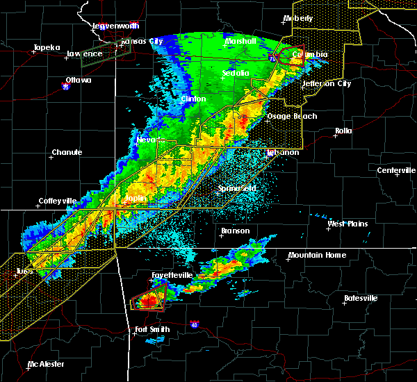 At 1024 pm cst, severe thunderstorms were located along a line extending from 7 miles southeast of urbana to near everton, moving east at 130 mph (public). Hazards include 70 mph wind gusts and quarter size hail. Hail damage to vehicles is expected. expect considerable tree damage. wind damage is also likely to mobile homes, roofs, and outbuildings. locations impacted include, joplin, carthage, webb city, bolivar, stockton lake, pomme de terre lake, stockton state park, carl junction, mount vernon, lamar, baxter springs, galena, oronogo, carterville, stockton, duquesne, ash grove, greenfield, sarcoxie, duenweg, this includes interstate 44 between mile markers 4 and 57. a tornado watch remains in effect until 300 am cst for southeastern kansas, and central, southwestern and west central missouri. Time, mot, loc 0424z 260deg 112kt 3778 9305 3728 9369. At 1024 pm cst, severe thunderstorms were located along a line extending from 7 miles southeast of urbana to near everton, moving east at 130 mph (public). Hazards include 70 mph wind gusts and quarter size hail. Hail damage to vehicles is expected. expect considerable tree damage. wind damage is also likely to mobile homes, roofs, and outbuildings. locations impacted include, joplin, carthage, webb city, bolivar, stockton lake, pomme de terre lake, stockton state park, carl junction, mount vernon, lamar, baxter springs, galena, oronogo, carterville, stockton, duquesne, ash grove, greenfield, sarcoxie, duenweg, this includes interstate 44 between mile markers 4 and 57. a tornado watch remains in effect until 300 am cst for southeastern kansas, and central, southwestern and west central missouri. Time, mot, loc 0424z 260deg 112kt 3778 9305 3728 9369.
|
| 3/6/2017 10:19 PM CST |
 At 1019 pm cst, severe thunderstorms were located along a line extending from humansville to 6 miles south of greenfield, moving east at 60 mph (radar indicated). Hazards include 70 mph wind gusts and quarter size hail. Hail damage to vehicles is expected. expect considerable tree damage. Wind damage is also likely to mobile homes, roofs, and outbuildings. At 1019 pm cst, severe thunderstorms were located along a line extending from humansville to 6 miles south of greenfield, moving east at 60 mph (radar indicated). Hazards include 70 mph wind gusts and quarter size hail. Hail damage to vehicles is expected. expect considerable tree damage. Wind damage is also likely to mobile homes, roofs, and outbuildings.
|
| 3/6/2017 10:00 PM CST |
 At 958 pm cst, severe thunderstorms were located along a line extending from 12 miles west of stockton to near carl junction, moving east at 60 mph (public. the joplin airport just reported a 61 mph wind gust in the past few minutes. numerous reports of wind damage have been reported with these storms). Hazards include 70 mph wind gusts and quarter size hail. Hail damage to vehicles is expected. expect considerable tree damage. Wind damage is also likely to mobile homes, roofs, and outbuildings. At 958 pm cst, severe thunderstorms were located along a line extending from 12 miles west of stockton to near carl junction, moving east at 60 mph (public. the joplin airport just reported a 61 mph wind gust in the past few minutes. numerous reports of wind damage have been reported with these storms). Hazards include 70 mph wind gusts and quarter size hail. Hail damage to vehicles is expected. expect considerable tree damage. Wind damage is also likely to mobile homes, roofs, and outbuildings.
|
| 3/1/2017 12:38 AM CST | Tree limbs down on ww highwa in polk county MO, 4.7 miles ENE of Bolivar, MO |
| 3/1/2017 12:33 AM CST |
 At 1233 am cst, a severe thunderstorm was located 9 miles northwest of walnut grove, or 9 miles northeast of greenfield, moving east at 75 mph (radar indicated). Hazards include 60 mph wind gusts and quarter size hail. Hail damage to vehicles is expected. Expect wind damage to roofs, siding, and trees. At 1233 am cst, a severe thunderstorm was located 9 miles northwest of walnut grove, or 9 miles northeast of greenfield, moving east at 75 mph (radar indicated). Hazards include 60 mph wind gusts and quarter size hail. Hail damage to vehicles is expected. Expect wind damage to roofs, siding, and trees.
|
| 10/19/2016 11:56 AM CDT |
 At 1156 am cdt, a severe thunderstorm was located 5 miles southwest of ash grove, or 13 miles northwest of republic, moving northeast at 35 mph (radar indicated). Hazards include 60 mph wind gusts and quarter size hail. Hail damage to vehicles is expected. Expect wind damage to roofs, siding, and trees. At 1156 am cdt, a severe thunderstorm was located 5 miles southwest of ash grove, or 13 miles northwest of republic, moving northeast at 35 mph (radar indicated). Hazards include 60 mph wind gusts and quarter size hail. Hail damage to vehicles is expected. Expect wind damage to roofs, siding, and trees.
|
| 8/25/2016 7:01 PM CDT |
 At 701 pm cdt, a severe thunderstorm was located 1 mile north of walnut grove, or 15 miles east of greenfield, moving east at 10 mph (radar indicated). Hazards include 60 mph wind gusts. Expect damage to roofs. siding. And trees. At 701 pm cdt, a severe thunderstorm was located 1 mile north of walnut grove, or 15 miles east of greenfield, moving east at 10 mph (radar indicated). Hazards include 60 mph wind gusts. Expect damage to roofs. siding. And trees.
|
| 8/25/2016 6:24 PM CDT |
 At 623 pm cdt, severe thunderstorms were located along a line extending from 3 miles west of morrisville to 8 miles east of bolivar, moving northeast at 20 mph (radar indicated). Hazards include 60 mph wind gusts. Expect damage to roofs. siding. and trees. Locations impacted include, bolivar, stockton lake, buffalo, polk, morrisville, halfway, louisburg, aldrich, eudora, goodson, plad, foose, pumpkin center,. At 623 pm cdt, severe thunderstorms were located along a line extending from 3 miles west of morrisville to 8 miles east of bolivar, moving northeast at 20 mph (radar indicated). Hazards include 60 mph wind gusts. Expect damage to roofs. siding. and trees. Locations impacted include, bolivar, stockton lake, buffalo, polk, morrisville, halfway, louisburg, aldrich, eudora, goodson, plad, foose, pumpkin center,.
|
| 8/25/2016 6:02 PM CDT |
 At 601 pm cdt, a severe thunderstorm was located 2 miles northwest of walnut grove, or 13 miles southwest of bolivar, moving northeast at 30 mph. another severe thunderstorm was located 2 miles southeast of bolivar, and moving northeast at 30 mph (radar indicated). Hazards include 60 mph wind gusts. Expect damage to roofs. siding. And trees. At 601 pm cdt, a severe thunderstorm was located 2 miles northwest of walnut grove, or 13 miles southwest of bolivar, moving northeast at 30 mph. another severe thunderstorm was located 2 miles southeast of bolivar, and moving northeast at 30 mph (radar indicated). Hazards include 60 mph wind gusts. Expect damage to roofs. siding. And trees.
|
| 7/13/2016 8:34 PM CDT |
 At 834 pm cdt, a severe thunderstorm was located over bolivar, moving east at 15 mph (radar indicated). Hazards include 60 mph wind gusts and quarter size hail. Hail damage to vehicles is expected. expect wind damage to roofs, siding, and trees. Locations impacted include, bolivar, polk, halfway, goodson,. At 834 pm cdt, a severe thunderstorm was located over bolivar, moving east at 15 mph (radar indicated). Hazards include 60 mph wind gusts and quarter size hail. Hail damage to vehicles is expected. expect wind damage to roofs, siding, and trees. Locations impacted include, bolivar, polk, halfway, goodson,.
|
| 7/13/2016 8:20 PM CDT |
 At 820 pm cdt, a severe thunderstorm was located near fair play, or near bolivar, moving east at 15 mph (radar indicated). Hazards include 60 mph wind gusts and quarter size hail. Hail damage to vehicles is expected. Expect wind damage to roofs, siding, and trees. At 820 pm cdt, a severe thunderstorm was located near fair play, or near bolivar, moving east at 15 mph (radar indicated). Hazards include 60 mph wind gusts and quarter size hail. Hail damage to vehicles is expected. Expect wind damage to roofs, siding, and trees.
|
| 7/8/2016 1:42 AM CDT | The severe thunderstorm warning for greene and polk counties will expire at 145 am cdt, the storms which prompted the warning have weakened below severe limits, and have exited the warned area. therefore the warning will be allowed to expire. however gusty winds and heavy rain are still possible with these thunderstorms. to report severe weather, contact your nearest law enforcement agency. they will relay your report to the national weather service springfield. |
| 7/8/2016 1:09 AM CDT |
 At 108 am cdt, severe thunderstorms were located along a line extending from 7 miles northwest of bolivar to walnut grove to near mount vernon, moving east at 40 mph (trained weather spotters. these storms have a long history of downing trees and powerlines across western missouri). Hazards include 60 mph wind gusts. Expect damage to roofs. siding. and trees. Locations impacted include, springfield, republic, bolivar, pomme de terre lake, stockton lake, battlefield, willard, strafford, ash grove, fair grove, humansville, walnut grove, polk, pleasant hope, fair play, morrisville, brookline, halfway, flemington, aldrich, this includes interstate 44 between mile markers 59 and 90. At 108 am cdt, severe thunderstorms were located along a line extending from 7 miles northwest of bolivar to walnut grove to near mount vernon, moving east at 40 mph (trained weather spotters. these storms have a long history of downing trees and powerlines across western missouri). Hazards include 60 mph wind gusts. Expect damage to roofs. siding. and trees. Locations impacted include, springfield, republic, bolivar, pomme de terre lake, stockton lake, battlefield, willard, strafford, ash grove, fair grove, humansville, walnut grove, polk, pleasant hope, fair play, morrisville, brookline, halfway, flemington, aldrich, this includes interstate 44 between mile markers 59 and 90.
|
| 7/8/2016 12:41 AM CDT |
 At 1240 am cdt, severe thunderstorms were located along a line extending from near stockton to 8 miles north of greenfield to near lockwood, moving east at 35 mph (emergency management. these storms have a long history of downing trees and powerlines across western missouri). Hazards include 60 mph wind gusts and nickel size hail. Expect damage to roofs. siding. And trees. At 1240 am cdt, severe thunderstorms were located along a line extending from near stockton to 8 miles north of greenfield to near lockwood, moving east at 35 mph (emergency management. these storms have a long history of downing trees and powerlines across western missouri). Hazards include 60 mph wind gusts and nickel size hail. Expect damage to roofs. siding. And trees.
|
| 7/7/2016 7:50 AM CDT |
 The severe thunderstorm warning for cedar, vernon, northern polk and western hickory counties will expire at 800 am cdt, the storms which prompted the warning have weakened below severe limits, and no longer pose an immediate threat to life or property. therefore the warning will be allowed to expire. however heavy rain is still possible with these thunderstorms. a severe thunderstorm watch remains in effect until 100 pm cdt for southwestern missouri. The severe thunderstorm warning for cedar, vernon, northern polk and western hickory counties will expire at 800 am cdt, the storms which prompted the warning have weakened below severe limits, and no longer pose an immediate threat to life or property. therefore the warning will be allowed to expire. however heavy rain is still possible with these thunderstorms. a severe thunderstorm watch remains in effect until 100 pm cdt for southwestern missouri.
|
| 7/7/2016 7:00 AM CDT |
 At 659 am cdt, severe thunderstorms were located along a line extending from 6 miles north of wheatland to 7 miles southwest of osceola to near hume, moving southeast at 25 mph (radar indicated). Hazards include 60 mph wind gusts. Expect damage to roofs. siding. And trees. At 659 am cdt, severe thunderstorms were located along a line extending from 6 miles north of wheatland to 7 miles southwest of osceola to near hume, moving southeast at 25 mph (radar indicated). Hazards include 60 mph wind gusts. Expect damage to roofs. siding. And trees.
|
| 6/30/2016 7:24 PM CDT |
 The severe thunderstorm warning for southwestern dallas and southeastern polk counties will expire at 730 pm cdt, the storms which prompted the warning have weakened below severe limits, and no longer pose an immediate threat to life or property. therefore the warning will be allowed to expire. to report severe weather, contact your nearest law enforcement agency. they will relay your report to the national weather service springfield. The severe thunderstorm warning for southwestern dallas and southeastern polk counties will expire at 730 pm cdt, the storms which prompted the warning have weakened below severe limits, and no longer pose an immediate threat to life or property. therefore the warning will be allowed to expire. to report severe weather, contact your nearest law enforcement agency. they will relay your report to the national weather service springfield.
|
| 6/30/2016 7:01 PM CDT |
 At 701 pm cdt, severe thunderstorms were located along a line extending from near buffalo to near bolivar, moving south at 25 mph (radar indicated). Hazards include 60 mph wind gusts. Expect damage to roofs. siding. and trees. Locations impacted include, bolivar, buffalo, pleasant hope, morrisville, halfway, brighton, march, foose,. At 701 pm cdt, severe thunderstorms were located along a line extending from near buffalo to near bolivar, moving south at 25 mph (radar indicated). Hazards include 60 mph wind gusts. Expect damage to roofs. siding. and trees. Locations impacted include, bolivar, buffalo, pleasant hope, morrisville, halfway, brighton, march, foose,.
|
| 6/30/2016 6:55 PM CDT | Approx. 10-12 foot tree down near oakland ave. in bolivar. 6-9 inch tree split and laid over near 1117 aldrich rd in polk county MO, 1 miles S of Bolivar, MO |
| 6/30/2016 6:55 PM CDT | Approx. 10-12 foot tree down near oakland ave. in boliva in polk county MO, 1.2 miles SSE of Bolivar, MO |
| 6/30/2016 6:55 PM CDT | Approx. 10-12 foot tree down near oakland ave. in boliva in polk county MO, 1.2 miles SSE of Bolivar, MO |
| 6/30/2016 6:37 PM CDT |
 At 637 pm cdt, severe thunderstorms were located along a line extending from near urbana to 7 miles northeast of fair play, moving southeast at 25 mph (radar indicated). Hazards include 60 mph wind gusts. Expect damage to roofs. siding. And trees. At 637 pm cdt, severe thunderstorms were located along a line extending from near urbana to 7 miles northeast of fair play, moving southeast at 25 mph (radar indicated). Hazards include 60 mph wind gusts. Expect damage to roofs. siding. And trees.
|
| 6/23/2016 8:45 PM CDT |
 At 845 pm cdt, a severe thunderstorm was located near bolivar, moving northeast at 20 mph (radar indicated). Hazards include 60 mph wind gusts. Expect damage to roofs. siding. And trees. At 845 pm cdt, a severe thunderstorm was located near bolivar, moving northeast at 20 mph (radar indicated). Hazards include 60 mph wind gusts. Expect damage to roofs. siding. And trees.
|
| 4/27/2016 1:30 AM CDT |
 At 129 am cdt, severe thunderstorms were located along a line extending from 9 miles west of humansville to 7 miles northeast of beaver, moving east at 40 mph (radar indicated). Hazards include 60 mph wind gusts and penny size hail. Expect damage to roofs. siding. And trees. At 129 am cdt, severe thunderstorms were located along a line extending from 9 miles west of humansville to 7 miles northeast of beaver, moving east at 40 mph (radar indicated). Hazards include 60 mph wind gusts and penny size hail. Expect damage to roofs. siding. And trees.
|
| 3/30/2016 10:50 PM CDT |
 At 1050 pm cdt, severe thunderstorms were located along a line extending from 7 miles south of humansville to near fair play to near walnut grove, moving northeast at 45 mph (radar indicated). Hazards include 60 mph wind gusts. Expect damage to roofs. siding. and trees. Locations impacted include, bolivar, stockton lake, polk, fair play, morrisville, halfway, aldrich, eudora, dunnegan, goodson,. At 1050 pm cdt, severe thunderstorms were located along a line extending from 7 miles south of humansville to near fair play to near walnut grove, moving northeast at 45 mph (radar indicated). Hazards include 60 mph wind gusts. Expect damage to roofs. siding. and trees. Locations impacted include, bolivar, stockton lake, polk, fair play, morrisville, halfway, aldrich, eudora, dunnegan, goodson,.
|
| 3/30/2016 10:40 PM CDT |
 At 1039 pm cdt, severe thunderstorms were located along a line extending from 7 miles south of stockton to 10 miles southwest of fair play to near everton, moving east at 55 mph (radar indicated). Hazards include 60 mph wind gusts. Expect damage to roofs. siding. And trees. At 1039 pm cdt, severe thunderstorms were located along a line extending from 7 miles south of stockton to 10 miles southwest of fair play to near everton, moving east at 55 mph (radar indicated). Hazards include 60 mph wind gusts. Expect damage to roofs. siding. And trees.
|
| 11/17/2015 6:45 AM CST |
 At 644 am cst, severe thunderstorms were located along a line extending from near weaubleau to 6 miles southeast of ash grove, moving east at 35 mph (radar indicated). Hazards include 60 mph wind gusts. Expect damage to roofs. siding and trees. Locations impacted include, bolivar, pomme de terre lake, pomme de terre state park, willard, ash grove, pittsburg, walnut grove, polk, pleasant hope, morrisville, halfway, flemington, bois d`arc, brighton, eudora, goodson, ebenezer, elkton, nemo, sacville,. At 644 am cst, severe thunderstorms were located along a line extending from near weaubleau to 6 miles southeast of ash grove, moving east at 35 mph (radar indicated). Hazards include 60 mph wind gusts. Expect damage to roofs. siding and trees. Locations impacted include, bolivar, pomme de terre lake, pomme de terre state park, willard, ash grove, pittsburg, walnut grove, polk, pleasant hope, morrisville, halfway, flemington, bois d`arc, brighton, eudora, goodson, ebenezer, elkton, nemo, sacville,.
|
| 11/17/2015 6:13 AM CST |
 At 612 am cst, severe thunderstorms were located along a line extending from near stockton to near mount vernon, moving east at 35 mph (radar indicated). Hazards include 60 mph wind gusts. Expect damage to roofs. Siding and trees. At 612 am cst, severe thunderstorms were located along a line extending from near stockton to near mount vernon, moving east at 35 mph (radar indicated). Hazards include 60 mph wind gusts. Expect damage to roofs. Siding and trees.
|
| 11/5/2015 3:39 PM CST |
 At 339 pm cst, a severe thunderstorm was located over stockton, moving east at 35 mph (radar indicated). Hazards include 60 mph wind gusts and quarter size hail. Hail damage to vehicles is expected. Expect wind damage to roofs, siding and trees. At 339 pm cst, a severe thunderstorm was located over stockton, moving east at 35 mph (radar indicated). Hazards include 60 mph wind gusts and quarter size hail. Hail damage to vehicles is expected. Expect wind damage to roofs, siding and trees.
|
| 8/23/2015 4:22 AM CDT |
 At 422 am cdt, severe thunderstorms were located along a line extending from 6 miles west of commerce to near diamond to near mount vernon to near morrisville to 6 miles northeast of bolivar, moving southeast at 45 mph (radar indicated). Hazards include 60 mph wind gusts. Expect damage to roofs. Siding and trees. At 422 am cdt, severe thunderstorms were located along a line extending from 6 miles west of commerce to near diamond to near mount vernon to near morrisville to 6 miles northeast of bolivar, moving southeast at 45 mph (radar indicated). Hazards include 60 mph wind gusts. Expect damage to roofs. Siding and trees.
|
| 8/23/2015 3:48 AM CDT |
 At 348 am cdt, severe thunderstorms were located along a line extending from humansville to near lockwood to 8 miles south of mindenmines to near altamont, moving southeast at 40 mph (radar indicated). Hazards include 60 mph wind gusts. Expect damage to roofs. Siding and trees. At 348 am cdt, severe thunderstorms were located along a line extending from humansville to near lockwood to 8 miles south of mindenmines to near altamont, moving southeast at 40 mph (radar indicated). Hazards include 60 mph wind gusts. Expect damage to roofs. Siding and trees.
|
| 8/10/2015 2:34 AM CDT |
 At 234 am cdt, severe thunderstorms were located along a line extending from near morrisville to near walnut grove to 6 miles northeast of greenfield, moving southeast at 30 mph (radar indicated). Hazards include 60 mph wind gusts and penny size hail. Expect damage to roofs. siding and trees. Locations impacted include, northwestern springfield, bolivar, stockton lake, willard, ash grove, fair grove, walnut grove, pleasant hope, morrisville, dadeville, aldrich, bassville, bois d`arc, brighton, eudora, olive, ebenezer, sacville, cave springs, glidewell, this includes interstate 44 between mile markers 74 and 76. At 234 am cdt, severe thunderstorms were located along a line extending from near morrisville to near walnut grove to 6 miles northeast of greenfield, moving southeast at 30 mph (radar indicated). Hazards include 60 mph wind gusts and penny size hail. Expect damage to roofs. siding and trees. Locations impacted include, northwestern springfield, bolivar, stockton lake, willard, ash grove, fair grove, walnut grove, pleasant hope, morrisville, dadeville, aldrich, bassville, bois d`arc, brighton, eudora, olive, ebenezer, sacville, cave springs, glidewell, this includes interstate 44 between mile markers 74 and 76.
|
| 8/10/2015 2:18 AM CDT |
 At 217 am cdt, severe thunderstorms were located along a line extending from fair play to 10 miles northeast of greenfield to 10 miles southwest of stockton, moving southeast at 30 mph (radar indicated). Hazards include 60 mph wind gusts and penny size hail. Expect damage to roofs. Siding and trees. At 217 am cdt, severe thunderstorms were located along a line extending from fair play to 10 miles northeast of greenfield to 10 miles southwest of stockton, moving southeast at 30 mph (radar indicated). Hazards include 60 mph wind gusts and penny size hail. Expect damage to roofs. Siding and trees.
|
| 8/8/2015 9:39 AM CDT |
 At 939 am cdt, severe thunderstorms were located along a line extending from near fair play to near willard to near ash grove, moving southeast at 40 mph (radar indicated). Hazards include 60 mph wind gusts. Expect damage to roofs. siding and trees. locations impacted include, northwestern springfield, bolivar, stockton lake, willard, ash grove, walnut grove, pleasant hope, fair play, morrisville, brookline, halfway, aldrich, bois d`arc, brighton, eudora, dunnegan, ebenezer, sacville, cave springs, glidewell, this includes interstate 44 between mile markers 61 and 63, between mile markers 65 and 68, and between mile markers 70 and 80. These storms have a history of producing 50 mph wind gusts near walnut grove. At 939 am cdt, severe thunderstorms were located along a line extending from near fair play to near willard to near ash grove, moving southeast at 40 mph (radar indicated). Hazards include 60 mph wind gusts. Expect damage to roofs. siding and trees. locations impacted include, northwestern springfield, bolivar, stockton lake, willard, ash grove, walnut grove, pleasant hope, fair play, morrisville, brookline, halfway, aldrich, bois d`arc, brighton, eudora, dunnegan, ebenezer, sacville, cave springs, glidewell, this includes interstate 44 between mile markers 61 and 63, between mile markers 65 and 68, and between mile markers 70 and 80. These storms have a history of producing 50 mph wind gusts near walnut grove.
|
| 8/8/2015 9:12 AM CDT |
 At 911 am cdt, severe thunderstorms were located along a line extending from near humansville to near fair play to 9 miles north of everton to greenfield, moving southeast at 45 mph (radar indicated). Hazards include 60 mph wind gusts. Expect damage to roofs. Siding and trees. At 911 am cdt, severe thunderstorms were located along a line extending from near humansville to near fair play to 9 miles north of everton to greenfield, moving southeast at 45 mph (radar indicated). Hazards include 60 mph wind gusts. Expect damage to roofs. Siding and trees.
|
| 7/24/2015 8:58 PM CDT | The severe thunderstorm warning for southern dallas, northern webster and southeastern polk counties will expire at 900 pm cdt, the line of storms which prompted the warning has moved out of the warned area. |
| 7/24/2015 8:49 PM CDT |
 At 845 pm cdt, severe thunderstorms were located along a line extending from morrisville to 8 miles southeast of pleasant hope to niangua, and moving south at 35 mph (emergency management). Hazards include 60 mph wind gusts and penny size hail. Expect damage to roofs. siding and trees. locations impacted include, morrisville, niangua and pleasant hope. Interstate 44 between mile markers 101 and 108 will also be impacted by severe thunderstorms. At 845 pm cdt, severe thunderstorms were located along a line extending from morrisville to 8 miles southeast of pleasant hope to niangua, and moving south at 35 mph (emergency management). Hazards include 60 mph wind gusts and penny size hail. Expect damage to roofs. siding and trees. locations impacted include, morrisville, niangua and pleasant hope. Interstate 44 between mile markers 101 and 108 will also be impacted by severe thunderstorms.
|
| 7/24/2015 8:29 PM CDT |
 At 826 pm cdt, severe thunderstorms were located along a line extending from 7 miles northeast of morrisville to 8 miles southeast of pleasant hope to niangua, and moving south at 35 mph (emergency management. these storms have a history of producing wind damage across dallas and eastern polk counties). Hazards include 70 mph wind gusts and penny size hail. Expect considerable tree damage. Damage is likely to mobile homes, roofs and outbuildings. At 826 pm cdt, severe thunderstorms were located along a line extending from 7 miles northeast of morrisville to 8 miles southeast of pleasant hope to niangua, and moving south at 35 mph (emergency management. these storms have a history of producing wind damage across dallas and eastern polk counties). Hazards include 70 mph wind gusts and penny size hail. Expect considerable tree damage. Damage is likely to mobile homes, roofs and outbuildings.
|
| 7/15/2015 1:50 PM CDT | Quarter sized hail reported 4.6 miles WNW of Bolivar, MO, quarter size hail reported by public |
| 7/15/2015 1:46 PM CDT |
 At 144 pm cdt, a severe thunderstorm was located near bolivar, and moving southeast at 20 mph (radar indicated). Hazards include 70 mph wind gusts and ping pong ball size hail. People and animals outdoors will be injured. expect hail damage to roofs, siding, windows and vehicles. expect considerable tree damage. wind damage is also likely to mobile homes, roofs and outbuildings. Locations impacted include, bolivar and half way. At 144 pm cdt, a severe thunderstorm was located near bolivar, and moving southeast at 20 mph (radar indicated). Hazards include 70 mph wind gusts and ping pong ball size hail. People and animals outdoors will be injured. expect hail damage to roofs, siding, windows and vehicles. expect considerable tree damage. wind damage is also likely to mobile homes, roofs and outbuildings. Locations impacted include, bolivar and half way.
|
| 7/15/2015 1:41 PM CDT | 6-8 inch diameter tree limb down in bolivar. picture passed on via faceboo in polk county MO, 1 miles S of Bolivar, MO |
| 7/15/2015 1:33 PM CDT |
 At 128 pm cdt, a severe thunderstorm was located 10 miles northwest of bolivar, and moving southeast at 15 mph (radar indicated). Hazards include 70 mph wind gusts and ping pong ball size hail. People and animals outdoors will be injured. expect hail damage to roofs, siding, windows and vehicles. expect considerable tree damage. Wind damage is also likely to mobile homes, roofs and outbuildings. At 128 pm cdt, a severe thunderstorm was located 10 miles northwest of bolivar, and moving southeast at 15 mph (radar indicated). Hazards include 70 mph wind gusts and ping pong ball size hail. People and animals outdoors will be injured. expect hail damage to roofs, siding, windows and vehicles. expect considerable tree damage. Wind damage is also likely to mobile homes, roofs and outbuildings.
|
| 7/14/2015 11:31 AM CDT | Quarter sized hail reported 6.5 miles NNW of Bolivar, MO |
| 7/14/2015 11:20 AM CDT |
 At 1117 am cdt, severe thunderstorms were located along a line extending from 7 miles east of pleasant hope to northwestern springfield, and moving southeast at 35 mph (radar indicated). Hazards include 60 mph wind gusts and nickel size hail. Expect damage to roofs. siding and trees. locations impacted include, bassville, bolivar, brighton, cave springs, charity, diggins, ebenezer, elkland, fair grove, foose, fordland, glidewell, march, marshfield, morrisville, niangua, northern springfield, northview, olive, pleasant hope, rader, sacville, strafford, turners and willard. Interstate 44 between mile markers 70 and 108 will also be impacted by severe thunderstorms. At 1117 am cdt, severe thunderstorms were located along a line extending from 7 miles east of pleasant hope to northwestern springfield, and moving southeast at 35 mph (radar indicated). Hazards include 60 mph wind gusts and nickel size hail. Expect damage to roofs. siding and trees. locations impacted include, bassville, bolivar, brighton, cave springs, charity, diggins, ebenezer, elkland, fair grove, foose, fordland, glidewell, march, marshfield, morrisville, niangua, northern springfield, northview, olive, pleasant hope, rader, sacville, strafford, turners and willard. Interstate 44 between mile markers 70 and 108 will also be impacted by severe thunderstorms.
|
| 7/14/2015 11:10 AM CDT | Nickle hail also reported with the wind gus in polk county MO, 2.9 miles NW of Bolivar, MO |
| 7/14/2015 11:08 AM CDT |
 At 1105 am cdt, severe thunderstorms were located along a line extending from 6 miles north of pleasant hope to willard, and moving southeast at 35 mph (radar indicated). Hazards include 60 mph wind gusts and nickel size hail. Expect damage to roofs. Siding and trees. At 1105 am cdt, severe thunderstorms were located along a line extending from 6 miles north of pleasant hope to willard, and moving southeast at 35 mph (radar indicated). Hazards include 60 mph wind gusts and nickel size hail. Expect damage to roofs. Siding and trees.
|
| 7/14/2015 11:05 AM CDT | Power lines and 5 inch diameter limb down along buffalo road in tow in polk county MO, 1 miles S of Bolivar, MO |
| 7/14/2015 11:04 AM CDT |
 At 1102 am cdt, a severe thunderstorm was located near walnut grove, and moving southeast at 50 mph (radar indicated). Hazards include 60 mph wind gusts and nickel size hail. Expect damage to roofs. siding and trees. locations impacted include, bolivar, fair play, morrisville, pleasant hope, stockton and walnut grove. This warning also includes stockton lake and stockton state park. At 1102 am cdt, a severe thunderstorm was located near walnut grove, and moving southeast at 50 mph (radar indicated). Hazards include 60 mph wind gusts and nickel size hail. Expect damage to roofs. siding and trees. locations impacted include, bolivar, fair play, morrisville, pleasant hope, stockton and walnut grove. This warning also includes stockton lake and stockton state park.
|
| 7/14/2015 10:50 AM CDT |
 At 1046 am cdt, a severe thunderstorm was located 10 miles southwest of fair play, and moving southeast at 50 mph (radar indicated). Hazards include 60 mph wind gusts and nickel size hail. Expect damage to roofs. Siding and trees. At 1046 am cdt, a severe thunderstorm was located 10 miles southwest of fair play, and moving southeast at 50 mph (radar indicated). Hazards include 60 mph wind gusts and nickel size hail. Expect damage to roofs. Siding and trees.
|
| 7/2/2015 12:39 AM CDT |
 The severe thunderstorm warning for dallas, extreme northeastern wright, southeastern st. clair, polk, laclede, hickory and eastern cedar counties will expire at 1245 am cdt, the line of storms which prompted the warning has weakened below severe limits, and no longer poses an immediate threat to life or property. however, gusty winds and heavy rain are still possible with these thunderstorms. a severe thunderstorm watch remains in effect until 400 am cdt thursday morning for southeast kansas and southwestern missouri. The severe thunderstorm warning for dallas, extreme northeastern wright, southeastern st. clair, polk, laclede, hickory and eastern cedar counties will expire at 1245 am cdt, the line of storms which prompted the warning has weakened below severe limits, and no longer poses an immediate threat to life or property. however, gusty winds and heavy rain are still possible with these thunderstorms. a severe thunderstorm watch remains in effect until 400 am cdt thursday morning for southeast kansas and southwestern missouri.
|
| 7/2/2015 12:20 AM CDT |
 At 1217 am cdt, severe thunderstorms were located along a line extending from humansville to 18 miles southeast of lebanon, and moving south southeast at 25 mph (radar indicated). Hazards include 60 mph wind gusts and nickel size hail. Expect damage to roofs. siding and trees. locations impacted include, bolivar, buffalo, conway, extreme southwestern fort leonard wood, fair play, hermitage, humansville, lebanon, stockton, urbana, weaubleau and wheatland. this warning also includes bennett spring state park, pomme de terre lake, pomme de terre state park, stockton lake and truman lake. interstate 44 between mile markers 109 and 143 will also be impacted by severe thunderstorms. A severe thunderstorm watch remains in effect until 400 am cdt thursday morning for southeast kansas and southwestern missouri. At 1217 am cdt, severe thunderstorms were located along a line extending from humansville to 18 miles southeast of lebanon, and moving south southeast at 25 mph (radar indicated). Hazards include 60 mph wind gusts and nickel size hail. Expect damage to roofs. siding and trees. locations impacted include, bolivar, buffalo, conway, extreme southwestern fort leonard wood, fair play, hermitage, humansville, lebanon, stockton, urbana, weaubleau and wheatland. this warning also includes bennett spring state park, pomme de terre lake, pomme de terre state park, stockton lake and truman lake. interstate 44 between mile markers 109 and 143 will also be impacted by severe thunderstorms. A severe thunderstorm watch remains in effect until 400 am cdt thursday morning for southeast kansas and southwestern missouri.
|
| 7/1/2015 11:50 PM CDT |
 At 1148 pm cdt, severe thunderstorms were located along a line extending from weaubleau to 19 miles southeast of fort leonard wood, and moving southeast at 25 mph (radar indicated). Hazards include 60 mph wind gusts and quarter size hail. Hail damage to vehicles is expected. Expect wind damage to roofs, siding and trees. At 1148 pm cdt, severe thunderstorms were located along a line extending from weaubleau to 19 miles southeast of fort leonard wood, and moving southeast at 25 mph (radar indicated). Hazards include 60 mph wind gusts and quarter size hail. Hail damage to vehicles is expected. Expect wind damage to roofs, siding and trees.
|
| 7/1/2015 10:48 PM CDT |
 At 1045 pm cdt, severe thunderstorms were located along a line extending from 7 miles northwest of wheatland to 7 miles west of macks creek to 13 miles southeast of camdenton, and moving south at 35 mph (radar indicated). Hazards include 60 mph wind gusts and quarter size hail. Hail damage to vehicles is expected. Expect wind damage to roofs, siding and trees. At 1045 pm cdt, severe thunderstorms were located along a line extending from 7 miles northwest of wheatland to 7 miles west of macks creek to 13 miles southeast of camdenton, and moving south at 35 mph (radar indicated). Hazards include 60 mph wind gusts and quarter size hail. Hail damage to vehicles is expected. Expect wind damage to roofs, siding and trees.
|
| 7/1/2015 4:19 AM CDT |
 At 415 am cdt, severe thunderstorms were located along a line extending from 11 miles northeast of lebanon to pleasant hope to 6 miles southwest of fair play, and moving southeast at 35 mph (radar indicated). Hazards include 60 mph wind gusts. Expect damage to roofs. siding and trees. locations impacted include, bolivar, buffalo, conway, fair grove, fair play, lebanon, morrisville and pleasant hope. this warning also includes bennett spring state park and stockton lake. Interstate 44 between mile markers 106 and 142 will also be impacted by severe thunderstorms. At 415 am cdt, severe thunderstorms were located along a line extending from 11 miles northeast of lebanon to pleasant hope to 6 miles southwest of fair play, and moving southeast at 35 mph (radar indicated). Hazards include 60 mph wind gusts. Expect damage to roofs. siding and trees. locations impacted include, bolivar, buffalo, conway, fair grove, fair play, lebanon, morrisville and pleasant hope. this warning also includes bennett spring state park and stockton lake. Interstate 44 between mile markers 106 and 142 will also be impacted by severe thunderstorms.
|
| 7/1/2015 3:54 AM CDT |
 At 352 am cdt, severe thunderstorms were located along a line extending from camdenton to bolivar to stockton, and moving southeast at 35 mph (radar indicated). Hazards include 60 mph wind gusts. Expect damage to roofs. Siding and trees. At 352 am cdt, severe thunderstorms were located along a line extending from camdenton to bolivar to stockton, and moving southeast at 35 mph (radar indicated). Hazards include 60 mph wind gusts. Expect damage to roofs. Siding and trees.
|
| 6/26/2015 5:13 AM CDT | The severe thunderstorm warning for southern dallas, dade, northern webster, southern polk, western miller, laclede, northern greene and eastern camden counties will expire at 515 am cdt, the line of storms which prompted the warning has weakened below severe limits, and no longer poses an immediate threat to life or property. however, gusty winds and heavy rain are still possible with these thunderstorms. a severe thunderstorm watch remains in effect until 900 am cdt friday morning for portions of southeast kansas and southern missouri. |
| 6/26/2015 4:51 AM CDT |
 At 449 am cdt, severe thunderstorms were located along a line extending from 10 miles east of lakeland to lebanon to 9 miles northeast of fair grove to greenfield, and moving southeast at 30 mph (radar indicated). Hazards include 60 mph wind gusts. Expect damage to roofs. siding and trees. locations impacted include, ash grove, bolivar, buffalo, camdenton, conway, eldon, everton, fair grove, fair play, greenfield, lake ozark, lakeland, lebanon, lockwood, marshfield, morrisville, niangua, osage beach, pleasant hope, village of four seasons, walnut grove and willard. this warning also includes bennett spring state park, ha ha tonka state park, lake of the ozarks state park, lake of the ozarks and stockton lake. Interstate 44 between mile markers 94 and 142 will also be impacted by severe thunderstorms. At 449 am cdt, severe thunderstorms were located along a line extending from 10 miles east of lakeland to lebanon to 9 miles northeast of fair grove to greenfield, and moving southeast at 30 mph (radar indicated). Hazards include 60 mph wind gusts. Expect damage to roofs. siding and trees. locations impacted include, ash grove, bolivar, buffalo, camdenton, conway, eldon, everton, fair grove, fair play, greenfield, lake ozark, lakeland, lebanon, lockwood, marshfield, morrisville, niangua, osage beach, pleasant hope, village of four seasons, walnut grove and willard. this warning also includes bennett spring state park, ha ha tonka state park, lake of the ozarks state park, lake of the ozarks and stockton lake. Interstate 44 between mile markers 94 and 142 will also be impacted by severe thunderstorms.
|
| 6/26/2015 4:10 AM CDT |
 At 407 am cdt, severe thunderstorms were located along a line extending from 10 miles northwest of eldon to 12 miles southwest of camdenton to 8 miles northeast of bolivar to 21 miles north of lockwood, and moving southeast at 30 mph (radar indicated). Hazards include 60 mph wind gusts and penny size hail. Expect damage to roofs. Siding and trees. At 407 am cdt, severe thunderstorms were located along a line extending from 10 miles northwest of eldon to 12 miles southwest of camdenton to 8 miles northeast of bolivar to 21 miles north of lockwood, and moving southeast at 30 mph (radar indicated). Hazards include 60 mph wind gusts and penny size hail. Expect damage to roofs. Siding and trees.
|
| 6/26/2015 4:03 AM CDT |
 At 400 am cdt, severe thunderstorms were located along a line extending from laurie to 6 miles southwest of macks creek to 8 miles northeast of fair play to 9 miles west of stockton, and moving southeast at 40 mph (radar indicated). Hazards include 60 mph wind gusts and penny size hail. Expect damage to roofs. siding and trees. locations impacted include, el dorado springs, fair play, hermitage, humansville, laurie, macks creek, stockton, stover, urbana, versailles, village of four seasons, weaubleau and wheatland. This warning also includes ha ha tonka state park, lake of the ozarks, pomme de terre lake, pomme de terre state park, stockton lake, stockton state park and truman lake. At 400 am cdt, severe thunderstorms were located along a line extending from laurie to 6 miles southwest of macks creek to 8 miles northeast of fair play to 9 miles west of stockton, and moving southeast at 40 mph (radar indicated). Hazards include 60 mph wind gusts and penny size hail. Expect damage to roofs. siding and trees. locations impacted include, el dorado springs, fair play, hermitage, humansville, laurie, macks creek, stockton, stover, urbana, versailles, village of four seasons, weaubleau and wheatland. This warning also includes ha ha tonka state park, lake of the ozarks, pomme de terre lake, pomme de terre state park, stockton lake, stockton state park and truman lake.
|
| 6/26/2015 3:42 AM CDT |
 At 339 am cdt, severe thunderstorms were located along a line extending from 5 miles southwest of stover to 8 miles northeast of hermitage to 6 miles northwest of humansville to 9 miles southwest of el dorado springs, and moving southeast at 40 mph (trained weather spotters). Hazards include 70 mph wind gusts and penny size hail. these storms have a history of producing wind damage across central missouri. Expect considerable tree damage. damage is likely to mobile homes, roofs and outbuildings. locations impacted include, el dorado springs, fair play, hermitage, humansville, laurie, macks creek, sheldon, stockton, stover, urbana, versailles, village of four seasons, weaubleau and wheatland. This warning also includes ha ha tonka state park, lake of the ozarks, pomme de terre lake, pomme de terre state park, stockton lake, stockton state park and truman lake. At 339 am cdt, severe thunderstorms were located along a line extending from 5 miles southwest of stover to 8 miles northeast of hermitage to 6 miles northwest of humansville to 9 miles southwest of el dorado springs, and moving southeast at 40 mph (trained weather spotters). Hazards include 70 mph wind gusts and penny size hail. these storms have a history of producing wind damage across central missouri. Expect considerable tree damage. damage is likely to mobile homes, roofs and outbuildings. locations impacted include, el dorado springs, fair play, hermitage, humansville, laurie, macks creek, sheldon, stockton, stover, urbana, versailles, village of four seasons, weaubleau and wheatland. This warning also includes ha ha tonka state park, lake of the ozarks, pomme de terre lake, pomme de terre state park, stockton lake, stockton state park and truman lake.
|
| 6/26/2015 3:26 AM CDT |
 At 323 am cdt, severe thunderstorms were located along a line extending from 11 miles west of stover to 13 miles north of wheatland to 13 miles northeast of el dorado springs to 17 miles west of el dorado springs, and moving southeast at 40 mph (law enforcement). Hazards include 70 mph wind gusts and penny size hail. these storms have a history of producing wind damage across central missouri. Expect considerable tree damage. Damage is likely to mobile homes, roofs and outbuildings. At 323 am cdt, severe thunderstorms were located along a line extending from 11 miles west of stover to 13 miles north of wheatland to 13 miles northeast of el dorado springs to 17 miles west of el dorado springs, and moving southeast at 40 mph (law enforcement). Hazards include 70 mph wind gusts and penny size hail. these storms have a history of producing wind damage across central missouri. Expect considerable tree damage. Damage is likely to mobile homes, roofs and outbuildings.
|
| 5/17/2015 2:31 AM CDT | At 228 am cdt, severe thunderstorms were located along a line extending from 16 miles north of pleasant hope to pleasant hope to strafford to highlandville, and moving northeast at 60 mph (radar indicated). Hazards include 60 mph wind gusts. Expect damage to roofs. siding and trees. locations impacted include, eastern springfield, fair grove, highlandville, marshfield, nixa, ozark, pleasant hope, rogersville, sparta and strafford. interstate 44 between mile markers 76 and 107 will also be impacted by severe thunderstorms. a severe thunderstorm watch remains in effect until 700 am cdt sunday morning for southern missouri. 75in. |
| 5/17/2015 2:29 AM CDT | At 225 am cdt, severe thunderstorms were located along a line extending from 9 miles north of wheatland to hermitage to 10 miles east of bolivar, and moving east at 50 mph (radar indicated). Hazards include 60 mph wind gusts and penny size hail. Expect damage to roofs. siding and trees. locations impacted include, bolivar, hermitage, warsaw and wheatland. this warning also includes lake of the ozarks, pomme de terre lake, pomme de terre state park, truman lake and truman state park. a tornado watch remains in effect until 500 am cdt sunday morning for southwestern missouri. 0. 75in. |
| 5/17/2015 2:22 AM CDT | At 220 am cdt, severe thunderstorms were located along a line extending from 11 miles north of pleasant hope to 7 miles northeast of willard to northeastern springfield to 8 miles southwest of highlandville, and moving northeast at 60 mph (radar indicated). Hazards include 60 mph wind gusts. Expect damage to roofs. siding and trees. locations impacted include, battlefield, clever, fair grove, highlandville, marshfield, morrisville, nixa, ozark, pleasant hope, republic, rogersville, sparta, springfield, strafford and willard. interstate 44 between mile markers 66 and 109 will also be impacted by severe thunderstorms. in addition, a tornado warning is in effect for central greene county through 245 am cdt. a tornado watch remains in effect until 500 am cdt sunday morning for southwestern missouri. a severe thunderstorm watch also remains in effect until 700 am cdt sunday morning for southern missouri. Possible. |
| 5/17/2015 2:15 AM CDT | At 212 am cdt, severe thunderstorms capable of producing a tornado were located along a line extending from weaubleau to 9 miles north of bolivar to bolivar, and moving east at 45 mph (radar indicated rotation). Hazards include tornado. Flying debris will be dangerous to those caught without shelter. mobile homes will be damaged or destroyed. damage to roofs, windows and vehicles will occur. Tree damage is likely. |
| 5/17/2015 2:10 AM CDT | Spotter estimated 70-80mph wind gust near boliva in polk county MO, 1.1 miles ENE of Bolivar, MO |
| 5/17/2015 2:08 AM CDT | At 203 am cdt, severe thunderstorms were located along a line extending from walnut grove to ash grove to republic to 10 miles southwest of galena, and moving northeast at 60 mph (emergency management. several reports of tree and power line damage with these storms). Hazards include 60 mph wind gusts. Expect damage to roofs. Siding and trees. |
| 5/17/2015 1:56 AM CDT | At 153 am cdt, severe thunderstorms were located along a line extending from 8 miles west of osceola to 11 miles northwest of humansville to 10 miles southwest of fair play, and moving east at 50 mph (radar indicated). Hazards include 60 mph wind gusts and penny size hail. Expect damage to roofs. Siding and trees. |
| 5/17/2015 1:53 AM CDT | At 150 am cdt, a severe thunderstorm capable of producing a tornado was located 11 miles west of fair play, and moving northeast at 45 mph (radar indicated rotation). Hazards include tornado. Flying debris will be dangerous to those caught without shelter. mobile homes will be damaged or destroyed. damage to roofs, windows and vehicles will occur. tree damage is likely. locations impacted include, bearcreek, bolivar, bona, cane hill, dunnegan, fair play, flemington and masters. this warning also includes stockton lake and stockton state park. Radar indicated. |
| 5/17/2015 1:46 AM CDT | At 145 am cdt, a severe thunderstorm capable of producing a tornado was located 16 miles west of fair play, and moving northeast at 45 mph (radar indicated rotation). Hazards include tornado. Flying debris will be dangerous to those caught without shelter. mobile homes will be damaged or destroyed. damage to roofs, windows and vehicles will occur. Tree damage is likely. |
| 5/15/2015 6:30 PM CDT | Tree limb down onto powerlin in polk county MO, 1 miles S of Bolivar, MO |
| 4/21/2015 4:05 PM CDT | Quarter sized hail reported 3 miles WSW of Bolivar, MO |
| 4/2/2015 8:41 PM CDT | A severe thunderstorm warning remains in effect for northwestern polk and eastern cedar counties until 900 pm cdt. at 839 pm cdt. a severe thunderstorm was located 5 miles southwest of fair play. and moving northeast at 25 mph. hazard. quarter size hail. source. Radar indicated. |
| 4/2/2015 8:15 PM CDT | The national weather service in springfield has issued a * severe thunderstorm warning for. cedar county in southwest missouri. northeastern dade county in southwest missouri. northwestern polk county in southwest missouri. Until 900 pm cdt. |
| 3/24/2015 6:23 PM CDT | The severe thunderstorm warning for eastern polk county will expire at 630 pm cdt. the storm which prompted the warning has moved out of the warned area. A severe thunderstorm watch remains in effect until 1000 pm cdt tuesday evening for southeast kansas and southern missouri. |
| 3/24/2015 6:02 PM CDT | A severe thunderstorm warning remains in effect for eastern polk county until 630 pm cdt. at 600 pm cdt. a severe thunderstorm was located near bolivar. and moving east at 55 mph. hazard. ping pong ball size hail. source. Radar indicated. |
| 3/24/2015 5:55 PM CDT | The national weather service in springfield has issued a * severe thunderstorm warning for. polk county in southwest missouri. until 630 pm cdt * at 554 pm cdt. a severe thunderstorm was located near bolivar. And moving east at 55 mph. |
| 3/24/2015 5:39 PM CDT | A severe thunderstorm warning remains in effect for southern polk county until 600 pm cdt. at 536 pm cdt. a severe thunderstorm was located 5 miles east of bolivar. and moving northeast at 50 mph. hazard. quarter size hail. source. emergency management. Reported quarter size hail in. |
| 3/24/2015 4:36 PM CST | Quarter sized hail reported 0.7 miles WSW of Bolivar, MO |
| 3/24/2015 5:30 PM CDT | The national weather service in springfield has issued a * severe thunderstorm warning for. southern polk county in southwest missouri. until 600 pm cdt * at 528 pm cdt. a severe thunderstorm was located 9 miles southwest of morrisville. And moving northeast at 55 mph. |
| 4/13/2014 6:56 PM CDT | Storm damage reported in polk county MO, 2.4 miles ESE of Bolivar, MO |
| 7/20/2013 4:40 PM CDT | A couple of large trees down across s 150th r in polk county MO, 4.2 miles SW of Bolivar, MO |
| 5/31/2013 8:06 PM CDT | A tree was reported down across highway aa just north of highway 32 blocking both lanes of traffic. report time estimated by rada in polk county MO, 3 miles WSW of Bolivar, MO |
| 5/20/2013 1:05 AM CDT | Two power lines snapped off and over the road at highway 83 and 425th roa in polk county MO, 2.5 miles SSE of Bolivar, MO |
| 4/7/2013 7:32 PM CDT | Golf Ball sized hail reported 1 miles S of Bolivar, MO |
| 4/7/2013 7:30 PM CDT | Golf Ball sized hail reported 1 miles S of Bolivar, MO |
| 4/7/2013 7:23 PM CDT | Quarter sized hail reported 4.4 miles SSE of Bolivar, MO |
| 9/7/2012 4:40 PM CDT | Trees reported in polk county MO, 1 miles S of Bolivar, MO |
| 9/7/2012 4:40 PM CDT | Communication tower blown dow in polk county MO, 1 miles S of Bolivar, MO |
| 7/8/2012 4:00 PM CDT | Three mobile homes heavily damaged. tree down on another mobile hom in polk county MO, 3.1 miles S of Bolivar, MO |
| 1/1/0001 12:00 AM | Golf Ball sized hail reported 1 miles S of Bolivar, MO |
| 1/1/0001 12:00 AM | Golf Ball sized hail reported 1 miles S of Bolivar, MO, golfball sized hail reported at fairgrounds. |
| 1/1/0001 12:00 AM | Severe thunderstorm wind gusts downed some large tree limbs at vickis feathered friends farm southeast of boliva in polk county MO, 4.1 miles NW of Bolivar, MO |
| 1/1/0001 12:00 AM | Storm damage reported in polk county MO, 1.6 miles ENE of Bolivar, MO |
| 1/1/0001 12:00 AM | Large sign damaged in polk county MO, 1 miles S of Bolivar, MO |
| 1/1/0001 12:00 AM | Ping Pong Ball sized hail reported 10 miles S of Bolivar, MO |
| 1/1/0001 12:00 AM | Quarter sized hail reported 1 miles S of Bolivar, MO, also measured 40 kt wind gust. |
Hail Maps for Bolivar, MO
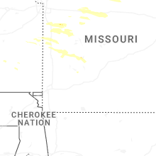
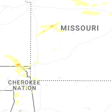
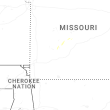


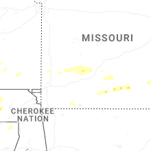
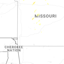


Connect with Interactive Hail Maps