

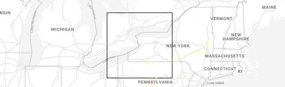
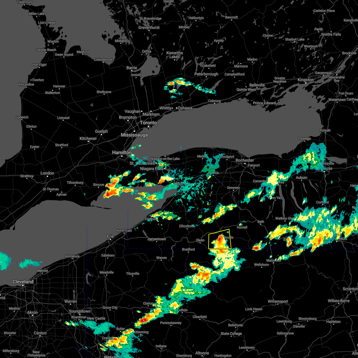
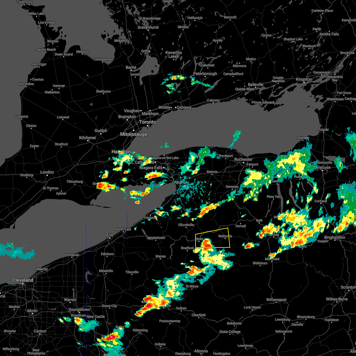
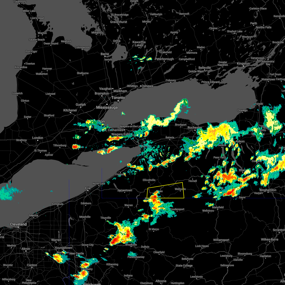
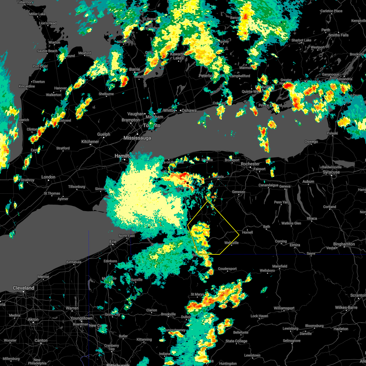
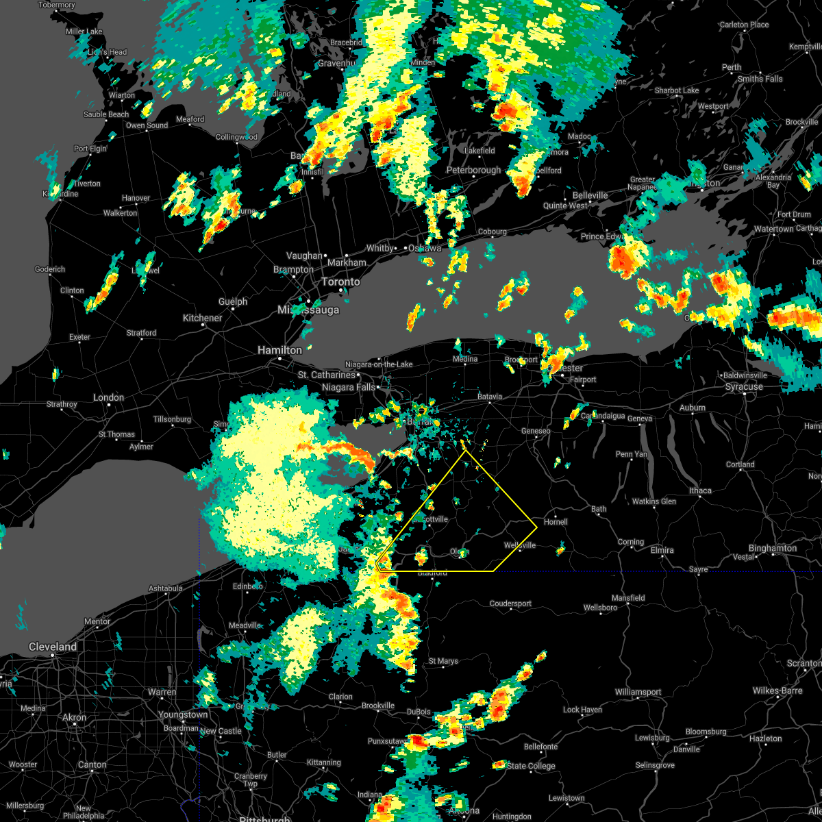
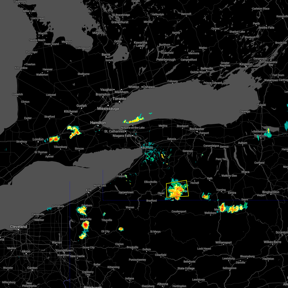
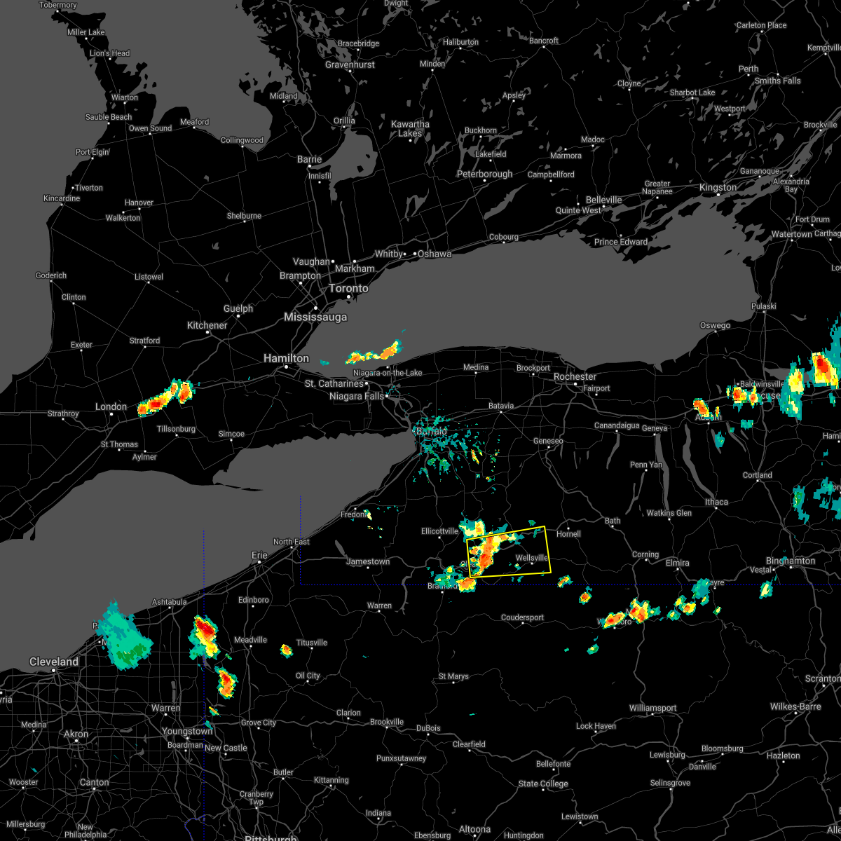
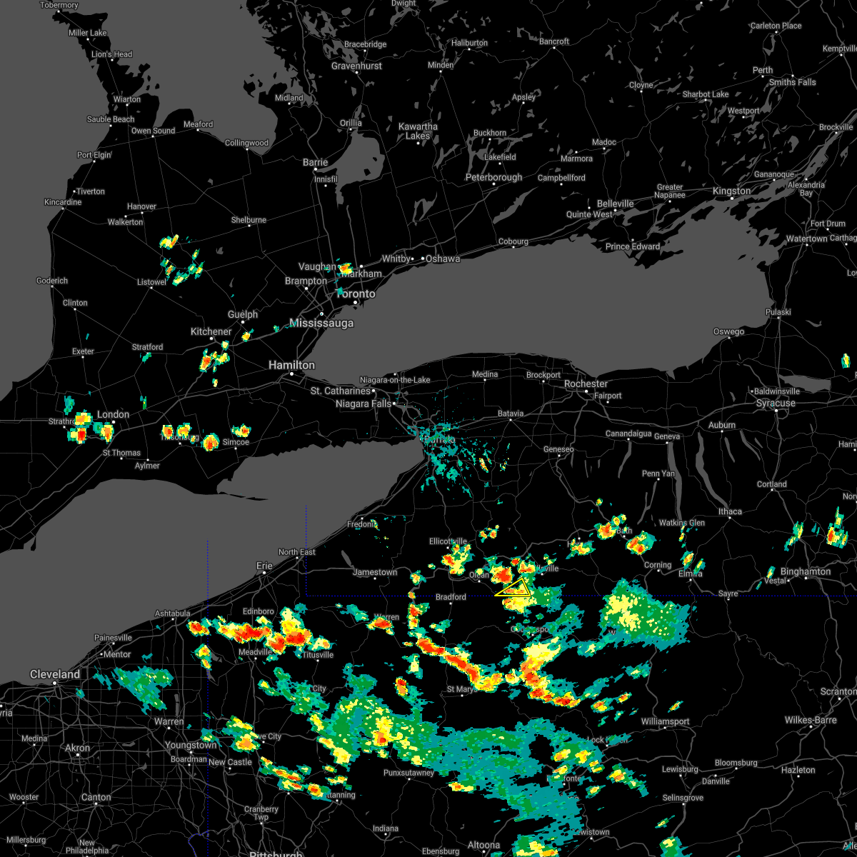
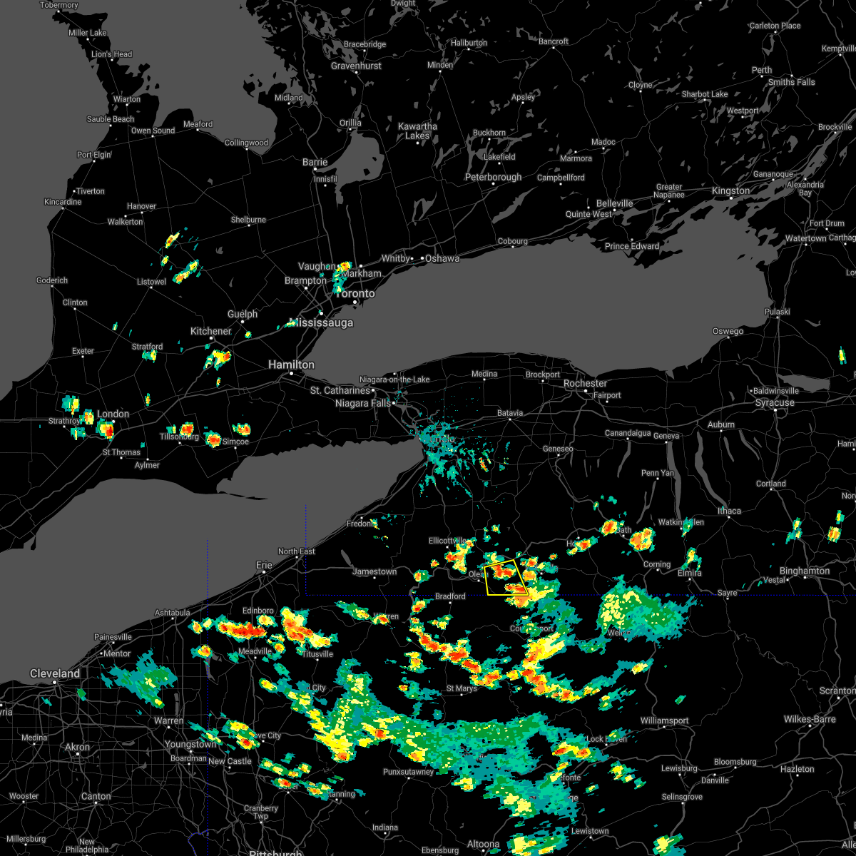
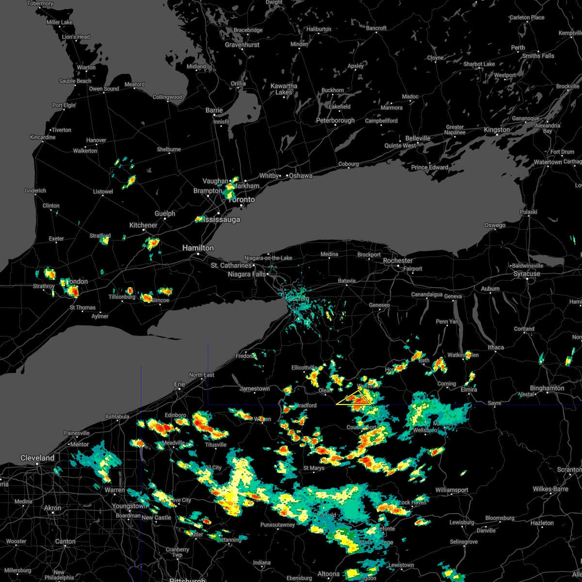
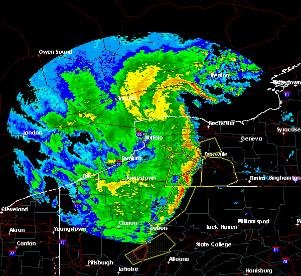
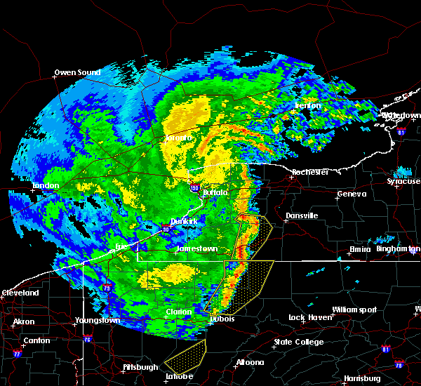
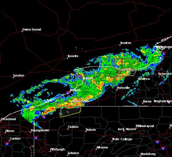
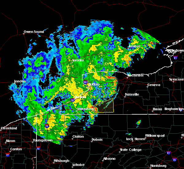
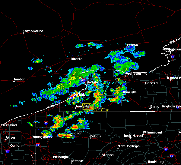
Hail Map for Bolivar, NY
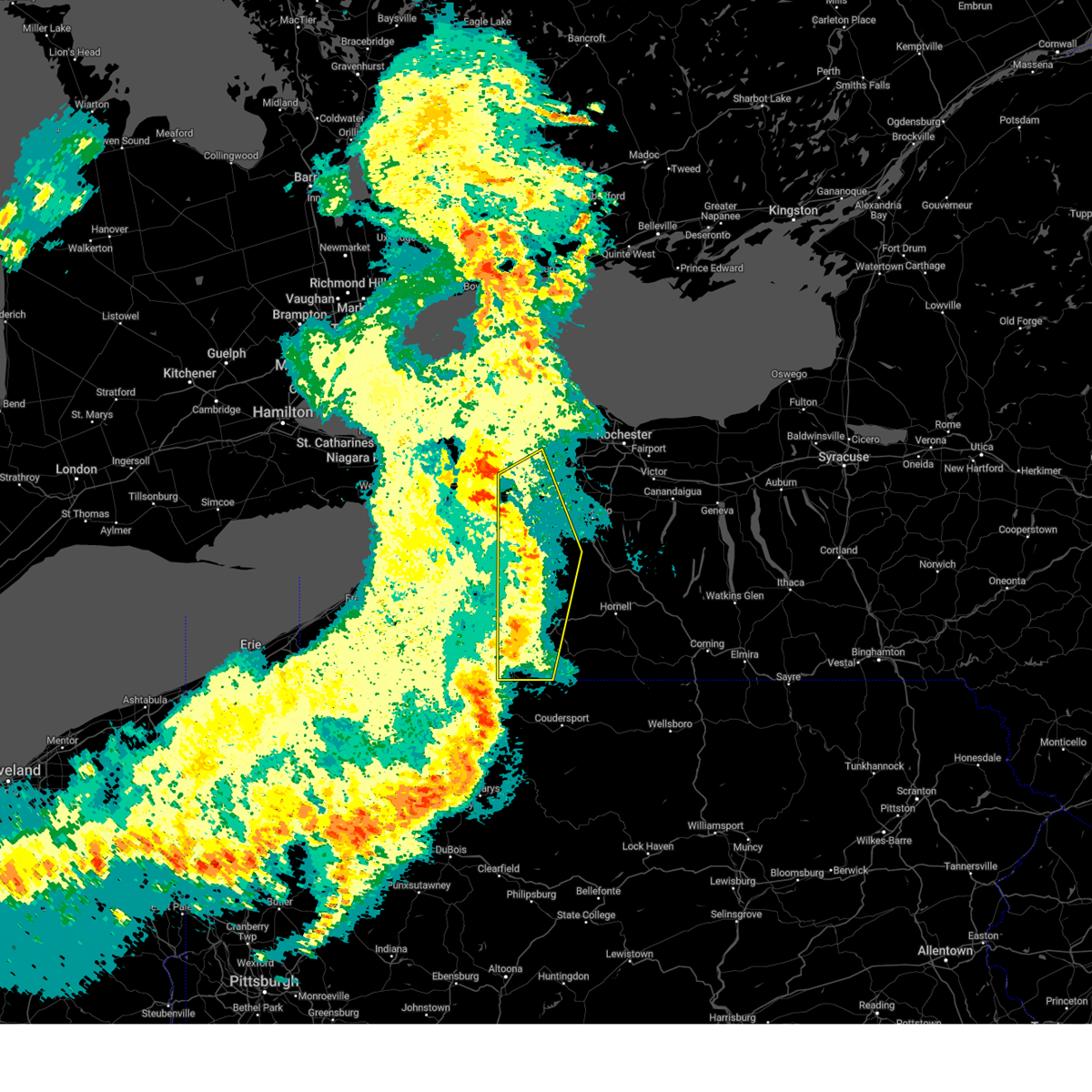
The Bolivar, NY area has had 1 report of on-the-ground hail by trained spotters, and has been under severe weather warnings 3 times during the past 12 months. Doppler radar has detected hail at or near Bolivar, NY on 24 occasions.
| Name: | Bolivar, NY |
| Where Located: | 67.1 miles SSE of Buffalo, NY |
| Map: | Google Map for Bolivar, NY |
| Population: | 1047 |
| Housing Units: | 483 |
| More Info: | Search Google for Bolivar, NY |
0
The Top Recent Hail Date for Bolivar, NY is Thursday, August 4, 2022 (23rd out of 24)
Hail and Wind Damage Spotted near Bolivar, NY
| Date / Time | Report Details |
|---|---|
| 7/20/2023 8:46 PM EDT |
 At 845 pm edt, severe thunderstorms were located along a line extending from near oakfield to 7 miles south of belfast, moving northeast at 60 mph (radar indicated). Hazards include 60 mph wind gusts. Expect damage to trees and power lines. This storm has a history of producing wind damage across western new york. At 845 pm edt, severe thunderstorms were located along a line extending from near oakfield to 7 miles south of belfast, moving northeast at 60 mph (radar indicated). Hazards include 60 mph wind gusts. Expect damage to trees and power lines. This storm has a history of producing wind damage across western new york.
|
| 7/20/2023 8:38 PM EDT |
 At 837 pm edt, severe thunderstorms were located along a line extending from just southeast of alden to 7 miles southwest of warsaw to near weston mills, moving northeast at 50 mph (radar indicated). Hazards include 60 mph wind gusts. Expect damage to trees and power lines. locations impacted include, batavia, olean, darien lakes state park, letchworth state park, pembroke, perry, warsaw, bennington, attica, and pavilion. this includes the following highways, interstate 90 between exits 48 and 48a. interstate 86 between exits 26 and 31. hail threat, radar indicated max hail size, <. 75 in wind threat, radar indicated max wind gust, 60 mph. At 837 pm edt, severe thunderstorms were located along a line extending from just southeast of alden to 7 miles southwest of warsaw to near weston mills, moving northeast at 50 mph (radar indicated). Hazards include 60 mph wind gusts. Expect damage to trees and power lines. locations impacted include, batavia, olean, darien lakes state park, letchworth state park, pembroke, perry, warsaw, bennington, attica, and pavilion. this includes the following highways, interstate 90 between exits 48 and 48a. interstate 86 between exits 26 and 31. hail threat, radar indicated max hail size, <. 75 in wind threat, radar indicated max wind gust, 60 mph.
|
| 7/20/2023 8:07 PM EDT |
 At 806 pm edt, severe thunderstorms were located along a line extending from near hamburg to near allegany state park, moving east at 45 mph (radar indicated). Hazards include 60 mph wind gusts. expect damage to trees and power lines At 806 pm edt, severe thunderstorms were located along a line extending from near hamburg to near allegany state park, moving east at 45 mph (radar indicated). Hazards include 60 mph wind gusts. expect damage to trees and power lines
|
| 4/1/2023 2:52 PM EDT |
 At 250 pm edt, severe thunderstorms were located along a line extending from near medina to near houghton to marshburg, moving east at 70 mph (radar indicated). Hazards include 60 mph wind gusts and penny size hail. expect damage to trees and power lines At 250 pm edt, severe thunderstorms were located along a line extending from near medina to near houghton to marshburg, moving east at 70 mph (radar indicated). Hazards include 60 mph wind gusts and penny size hail. expect damage to trees and power lines
|
| 8/29/2022 4:23 PM EDT | Trees and wires down. time estimated by rada in allegany county NY, 0.2 miles ESE of Bolivar, NY |
| 8/29/2022 4:08 PM EDT |
 At 408 pm edt, a severe thunderstorm was located over weston mills, or near olean, moving east at 35 mph (radar indicated). Hazards include 60 mph wind gusts. expect damage to trees and power lines At 408 pm edt, a severe thunderstorm was located over weston mills, or near olean, moving east at 35 mph (radar indicated). Hazards include 60 mph wind gusts. expect damage to trees and power lines
|
| 8/20/2022 6:40 PM EDT | Multiple trees dow in allegany county NY, 0.6 miles NNE of Bolivar, NY |
| 8/20/2022 6:37 PM EDT |
 At 637 pm edt, a severe thunderstorm was located near shinglehouse, or 11 miles west of wellsville, moving northeast at 25 mph (radar indicated). Hazards include 60 mph wind gusts and quarter size hail. Minor damage to vehicles is possible. Expect wind damage to trees and power lines. At 637 pm edt, a severe thunderstorm was located near shinglehouse, or 11 miles west of wellsville, moving northeast at 25 mph (radar indicated). Hazards include 60 mph wind gusts and quarter size hail. Minor damage to vehicles is possible. Expect wind damage to trees and power lines.
|
| 7/25/2022 2:06 AM EDT |
 At 206 am edt, a severe thunderstorm was located over allegany, or near olean, moving east at 25 mph (radar indicated). Hazards include 60 mph wind gusts. Expect damage to trees and power lines. locations impacted include, olean, wellsville, allegany state park, alfred, allegany, cuba, st. bonaventure, whitesville, weston mills and hinsdale. This includes interstate 86 between exits 23 and 30. At 206 am edt, a severe thunderstorm was located over allegany, or near olean, moving east at 25 mph (radar indicated). Hazards include 60 mph wind gusts. Expect damage to trees and power lines. locations impacted include, olean, wellsville, allegany state park, alfred, allegany, cuba, st. bonaventure, whitesville, weston mills and hinsdale. This includes interstate 86 between exits 23 and 30.
|
| 7/25/2022 1:26 AM EDT |
 At 125 am edt, a severe thunderstorm was located over allegany state park, moving east at 30 mph (radar indicated). Hazards include 60 mph wind gusts. expect damage to trees and power lines At 125 am edt, a severe thunderstorm was located over allegany state park, moving east at 30 mph (radar indicated). Hazards include 60 mph wind gusts. expect damage to trees and power lines
|
| 7/25/2022 1:04 AM EDT |
 At 104 am edt, severe thunderstorms were located along a line extending from near gowanda to near clymer, moving east at 30 mph. another strong thunderstorm was located near bollivar (radar indicated). Hazards include 60 mph wind gusts. Expect damage to trees and power lines. locations impacted include, jamestown, olean, salamanca, wellsville, allegany state park, alfred, lakewood, falconer, ashford and allegany. this includes interstate 86 between exits 11 and 33. hail threat, radar indicated max hail size, <. 75 in wind threat, radar indicated max wind gust, 60 mph. At 104 am edt, severe thunderstorms were located along a line extending from near gowanda to near clymer, moving east at 30 mph. another strong thunderstorm was located near bollivar (radar indicated). Hazards include 60 mph wind gusts. Expect damage to trees and power lines. locations impacted include, jamestown, olean, salamanca, wellsville, allegany state park, alfred, lakewood, falconer, ashford and allegany. this includes interstate 86 between exits 11 and 33. hail threat, radar indicated max hail size, <. 75 in wind threat, radar indicated max wind gust, 60 mph.
|
| 7/25/2022 12:31 AM EDT |
 At 1231 am edt, severe thunderstorms were located along a line extending from 6 miles west of ashford hollow to columbus, moving east at 55 mph (radar indicated). Hazards include 60 mph wind gusts. expect damage to trees and power lines At 1231 am edt, severe thunderstorms were located along a line extending from 6 miles west of ashford hollow to columbus, moving east at 55 mph (radar indicated). Hazards include 60 mph wind gusts. expect damage to trees and power lines
|
| 6/16/2022 3:36 PM EDT |
 At 335 pm edt, severe thunderstorms were located along a line extending from arcade to near falconer, moving east at 45 mph (radar indicated). Hazards include 60 mph wind gusts and quarter size hail. Minor damage to vehicles is possible. Expect wind damage to trees and power lines. At 335 pm edt, severe thunderstorms were located along a line extending from arcade to near falconer, moving east at 45 mph (radar indicated). Hazards include 60 mph wind gusts and quarter size hail. Minor damage to vehicles is possible. Expect wind damage to trees and power lines.
|
| 3/31/2022 1:12 PM EDT |
 At 112 pm edt, a severe thunderstorm was located near shinglehouse, or 11 miles southwest of wellsville, moving northeast at 55 mph (radar indicated). Hazards include 60 mph wind gusts. expect damage to trees and power lines At 112 pm edt, a severe thunderstorm was located near shinglehouse, or 11 miles southwest of wellsville, moving northeast at 55 mph (radar indicated). Hazards include 60 mph wind gusts. expect damage to trees and power lines
|
| 9/13/2021 11:01 PM EDT |
 At 1100 pm edt, regional radars and lightning detection systems were tracking a severe thunderstorm located near belfast, or 13 miles northwest of wellsville, moving east at 65 mph (radar indicated). Hazards include 60 mph wind gusts and quarter size hail. Minor damage to vehicles is possible. Expect wind damage to trees and power lines. At 1100 pm edt, regional radars and lightning detection systems were tracking a severe thunderstorm located near belfast, or 13 miles northwest of wellsville, moving east at 65 mph (radar indicated). Hazards include 60 mph wind gusts and quarter size hail. Minor damage to vehicles is possible. Expect wind damage to trees and power lines.
|
| 9/13/2021 1:12 AM EDT |
 The severe thunderstorm warning for wyoming, eastern cattaraugus, livingston and allegany counties will expire at 115 am edt, the storms which prompted the warning have weakened below severe limits, and have exited the warned area. therefore, the warning will be allowed to expire. a severe thunderstorm watch remains in effect until 200 am edt for western new york. to report severe weather, contact your nearest law enforcement agency. they will relay your report to the national weather service buffalo. The severe thunderstorm warning for wyoming, eastern cattaraugus, livingston and allegany counties will expire at 115 am edt, the storms which prompted the warning have weakened below severe limits, and have exited the warned area. therefore, the warning will be allowed to expire. a severe thunderstorm watch remains in effect until 200 am edt for western new york. to report severe weather, contact your nearest law enforcement agency. they will relay your report to the national weather service buffalo.
|
| 9/13/2021 12:43 AM EDT |
 At 1242 am edt, severe thunderstorms were located along a line extending from near letchworth state park to belfast to weston mills, moving east at 75 mph (radar indicated). Hazards include 60 mph wind gusts. Expect damage to trees and power lines. locations impacted include, olean, geneseo, dansville, wellsville, letchworth state park, allegany state park, alfred, perry, warsaw and mount morris. this includes the following highways, interstate 390 between exits 4 and 8. interstate 86 between exits 23 and 33. hail threat, radar indicated max hail size, <. 75 in wind threat, radar indicated max wind gust, 60 mph. At 1242 am edt, severe thunderstorms were located along a line extending from near letchworth state park to belfast to weston mills, moving east at 75 mph (radar indicated). Hazards include 60 mph wind gusts. Expect damage to trees and power lines. locations impacted include, olean, geneseo, dansville, wellsville, letchworth state park, allegany state park, alfred, perry, warsaw and mount morris. this includes the following highways, interstate 390 between exits 4 and 8. interstate 86 between exits 23 and 33. hail threat, radar indicated max hail size, <. 75 in wind threat, radar indicated max wind gust, 60 mph.
|
| 9/13/2021 12:18 AM EDT |
 At 1217 am edt, severe thunderstorms were located along a line extending from near wales center to near ashford hollow to 10 miles west of salamanca, moving east at 70 mph (radar indicated). Hazards include 70 mph wind gusts. Expect considerable tree damage. damage is likely to mobile homes, roofs, and outbuildings. locations impacted include, west seneca, olean, geneseo, east aurora, salamanca, dansville, wellsville, allegany state park, letchworth state park and elma. this includes the following highways, interstate 390 between exits 4 and 8. interstate 86 between exits 14 and 33. thunderstorm damage threat, considerable hail threat, radar indicated max hail size, <. 75 in wind threat, radar indicated max wind gust, 70 mph. At 1217 am edt, severe thunderstorms were located along a line extending from near wales center to near ashford hollow to 10 miles west of salamanca, moving east at 70 mph (radar indicated). Hazards include 70 mph wind gusts. Expect considerable tree damage. damage is likely to mobile homes, roofs, and outbuildings. locations impacted include, west seneca, olean, geneseo, east aurora, salamanca, dansville, wellsville, allegany state park, letchworth state park and elma. this includes the following highways, interstate 390 between exits 4 and 8. interstate 86 between exits 14 and 33. thunderstorm damage threat, considerable hail threat, radar indicated max hail size, <. 75 in wind threat, radar indicated max wind gust, 70 mph.
|
| 9/12/2021 11:49 PM EDT |
 At 1148 pm edt, severe thunderstorms were located along a line extending from 14 miles northwest of angola on the lake to near silver creek to mayville, moving east at 70 mph (radar indicated). Hazards include 60 mph wind gusts. expect damage to trees and power lines At 1148 pm edt, severe thunderstorms were located along a line extending from 14 miles northwest of angola on the lake to near silver creek to mayville, moving east at 70 mph (radar indicated). Hazards include 60 mph wind gusts. expect damage to trees and power lines
|
| 8/1/2021 1:23 PM EDT |
 The severe thunderstorm warning for southern allegany county will expire at 130 pm edt, the storm which prompted the warning has moved out of the area. therefore, the warning will be allowed to expire. to report severe weather, contact your nearest law enforcement agency. they will relay your report to the national weather service buffalo. The severe thunderstorm warning for southern allegany county will expire at 130 pm edt, the storm which prompted the warning has moved out of the area. therefore, the warning will be allowed to expire. to report severe weather, contact your nearest law enforcement agency. they will relay your report to the national weather service buffalo.
|
| 8/1/2021 12:57 PM EDT |
 At 1256 pm edt, a severe thunderstorm was located near whitesville, or 7 miles southeast of wellsville, moving east at 35 mph (radar indicated). Hazards include 60 mph wind gusts and penny size hail. Expect damage to trees and power lines. Locations impacted include, wellsville, whitesville, bolivar, andover, alma, richburg, stannards, paynesville, and little genesee. At 1256 pm edt, a severe thunderstorm was located near whitesville, or 7 miles southeast of wellsville, moving east at 35 mph (radar indicated). Hazards include 60 mph wind gusts and penny size hail. Expect damage to trees and power lines. Locations impacted include, wellsville, whitesville, bolivar, andover, alma, richburg, stannards, paynesville, and little genesee.
|
| 8/1/2021 12:42 PM EDT |
 At 1242 pm edt, a severe thunderstorm was located 7 miles southwest of wellsville, moving east at 30 mph (radar indicated). Hazards include 60 mph wind gusts and penny size hail. expect damage to trees and power lines At 1242 pm edt, a severe thunderstorm was located 7 miles southwest of wellsville, moving east at 30 mph (radar indicated). Hazards include 60 mph wind gusts and penny size hail. expect damage to trees and power lines
|
| 7/20/2021 9:10 PM EDT |
 At 910 pm edt, a severe thunderstorm was located near wellsville, moving east at 40 mph (radar indicated). Hazards include 60 mph wind gusts. Expect damage to roofs, siding, and trees. locations impacted include, wellsville, friendship, scio, bolivar, belmont, alma, richburg, west clarksville, stannards and little genesee. This includes interstate 86 near exit 29. At 910 pm edt, a severe thunderstorm was located near wellsville, moving east at 40 mph (radar indicated). Hazards include 60 mph wind gusts. Expect damage to roofs, siding, and trees. locations impacted include, wellsville, friendship, scio, bolivar, belmont, alma, richburg, west clarksville, stannards and little genesee. This includes interstate 86 near exit 29.
|
| 7/20/2021 8:57 PM EDT | Trees down in boliva in allegany county NY, 0.2 miles ESE of Bolivar, NY |
| 7/20/2021 8:54 PM EDT |
 At 853 pm edt, a severe thunderstorm was located near shinglehouse, or 11 miles east of olean, moving east at 40 mph (radar indicated). Hazards include 60 mph wind gusts. Expect damage to roofs, siding, and trees. locations impacted include, olean, wellsville, allegany, cuba, st. bonaventure, weston mills, hinsdale, friendship, scio and bolivar. This includes interstate 86 between exits 25 and 27, and near exit 29. At 853 pm edt, a severe thunderstorm was located near shinglehouse, or 11 miles east of olean, moving east at 40 mph (radar indicated). Hazards include 60 mph wind gusts. Expect damage to roofs, siding, and trees. locations impacted include, olean, wellsville, allegany, cuba, st. bonaventure, weston mills, hinsdale, friendship, scio and bolivar. This includes interstate 86 between exits 25 and 27, and near exit 29.
|
| 7/20/2021 8:28 PM EDT |
 At 828 pm edt, a severe thunderstorm was located near bradford, moving east at 40 mph (radar indicated). Hazards include 60 mph wind gusts. expect damage to roofs, siding, and trees At 828 pm edt, a severe thunderstorm was located near bradford, moving east at 40 mph (radar indicated). Hazards include 60 mph wind gusts. expect damage to roofs, siding, and trees
|
| 7/13/2021 6:36 PM EDT |
 At 634 pm edt, severe thunderstorms were located along a line extending from near ashford to near olean, moving northeast at 55 mph (radar indicated). Hazards include 60 mph wind gusts. Expect damage to roofs, siding, and trees. locations impacted include, olean, ashford, arcade, allegany, franklinville, belfast, cuba, rushford, chaffee and weston mills. This includes interstate 86 between exits 24 and 32. At 634 pm edt, severe thunderstorms were located along a line extending from near ashford to near olean, moving northeast at 55 mph (radar indicated). Hazards include 60 mph wind gusts. Expect damage to roofs, siding, and trees. locations impacted include, olean, ashford, arcade, allegany, franklinville, belfast, cuba, rushford, chaffee and weston mills. This includes interstate 86 between exits 24 and 32.
|
| 7/13/2021 5:57 PM EDT |
 At 556 pm edt, severe thunderstorms were located along a line extending from 7 miles east of frewsburg to near kane, moving northeast at 55 mph (radar indicated). Hazards include 60 mph wind gusts. expect damage to roofs, siding, and trees At 556 pm edt, severe thunderstorms were located along a line extending from 7 miles east of frewsburg to near kane, moving northeast at 55 mph (radar indicated). Hazards include 60 mph wind gusts. expect damage to roofs, siding, and trees
|
| 7/6/2021 12:42 PM EDT |
 At 1242 pm edt, a severe thunderstorm was located 8 miles southeast of cuba, or 11 miles west of wellsville, moving east at 35 mph (radar indicated). Hazards include 60 mph wind gusts. expect damage to roofs, siding, and trees At 1242 pm edt, a severe thunderstorm was located 8 miles southeast of cuba, or 11 miles west of wellsville, moving east at 35 mph (radar indicated). Hazards include 60 mph wind gusts. expect damage to roofs, siding, and trees
|
| 6/28/2021 6:51 PM EDT |
 At 650 pm edt, a severe thunderstorm was located near wellsville, moving east at 20 mph (radar indicated). Hazards include 60 mph wind gusts and penny size hail. Expect damage to roofs, siding, and trees. locations impacted include, wellsville, cuba, friendship, scio, bolivar, belmont, angelica, richburg, west almond and stannards. This includes interstate 86 between exits 28 and 32. At 650 pm edt, a severe thunderstorm was located near wellsville, moving east at 20 mph (radar indicated). Hazards include 60 mph wind gusts and penny size hail. Expect damage to roofs, siding, and trees. locations impacted include, wellsville, cuba, friendship, scio, bolivar, belmont, angelica, richburg, west almond and stannards. This includes interstate 86 between exits 28 and 32.
|
| 6/28/2021 6:35 PM EDT | Trees dow in allegany county NY, 1.7 miles SSW of Bolivar, NY |
| 6/28/2021 6:34 PM EDT | Trees down on leather r in allegany county NY, 0.6 miles NNE of Bolivar, NY |
| 6/28/2021 6:09 PM EDT |
 The national weather service in buffalo has issued a * severe thunderstorm warning for. southeastern cattaraugus county in western new york. southern allegany county in western new york. until 715 pm edt. At 608 pm edt, a severe thunderstorm was located near cuba, or 8. The national weather service in buffalo has issued a * severe thunderstorm warning for. southeastern cattaraugus county in western new york. southern allegany county in western new york. until 715 pm edt. At 608 pm edt, a severe thunderstorm was located near cuba, or 8.
|
| 6/21/2021 3:22 PM EDT |
 At 322 pm edt, a severe thunderstorm was located 7 miles northeast of shinglehouse, or 9 miles southwest of wellsville, moving northeast at 40 mph (radar indicated). Hazards include 60 mph wind gusts and quarter size hail. Minor damage to vehicles is possible. expect wind damage to roofs, siding, and trees. Locations impacted include, wellsville, alfred, whitesville, scio, bolivar, andover, alma, richburg, stannards and knight creek. At 322 pm edt, a severe thunderstorm was located 7 miles northeast of shinglehouse, or 9 miles southwest of wellsville, moving northeast at 40 mph (radar indicated). Hazards include 60 mph wind gusts and quarter size hail. Minor damage to vehicles is possible. expect wind damage to roofs, siding, and trees. Locations impacted include, wellsville, alfred, whitesville, scio, bolivar, andover, alma, richburg, stannards and knight creek.
|
| 6/21/2021 3:07 PM EDT |
 At 307 pm edt, a severe thunderstorm was located near shinglehouse, or 11 miles southeast of olean, moving northeast at 40 mph (radar indicated). Hazards include 60 mph wind gusts and penny size hail. expect damage to roofs, siding, and trees At 307 pm edt, a severe thunderstorm was located near shinglehouse, or 11 miles southeast of olean, moving northeast at 40 mph (radar indicated). Hazards include 60 mph wind gusts and penny size hail. expect damage to roofs, siding, and trees
|
| 6/9/2021 3:09 PM EDT |
 At 307 pm edt, a severe thunderstorm was located over shinglehouse, or 13 miles southwest of wellsville, moving southwest at 15 mph (emergency management). Hazards include 60 mph wind gusts and penny size hail. Expect damage to roofs, siding, and trees. Locations impacted include, bolivar, alma, little genesee and ceres. At 307 pm edt, a severe thunderstorm was located over shinglehouse, or 13 miles southwest of wellsville, moving southwest at 15 mph (emergency management). Hazards include 60 mph wind gusts and penny size hail. Expect damage to roofs, siding, and trees. Locations impacted include, bolivar, alma, little genesee and ceres.
|
| 6/9/2021 3:02 PM EDT |
 At 301 pm edt, a severe thunderstorm was located near weston mills, or 9 miles east of olean, moving south at 20 mph (radar indicated). Hazards include 60 mph wind gusts and penny size hail. expect damage to roofs, siding, and trees At 301 pm edt, a severe thunderstorm was located near weston mills, or 9 miles east of olean, moving south at 20 mph (radar indicated). Hazards include 60 mph wind gusts and penny size hail. expect damage to roofs, siding, and trees
|
| 6/9/2021 2:50 PM EDT |
 At 250 pm edt, a severe thunderstorm was located 7 miles northeast of shinglehouse, or 9 miles southwest of wellsville, moving southwest at 15 mph (emergency management). Hazards include 60 mph wind gusts and penny size hail. expect damage to roofs, siding, and trees At 250 pm edt, a severe thunderstorm was located 7 miles northeast of shinglehouse, or 9 miles southwest of wellsville, moving southwest at 15 mph (emergency management). Hazards include 60 mph wind gusts and penny size hail. expect damage to roofs, siding, and trees
|
| 11/15/2020 4:32 PM EST |
 At 431 pm est, severe thunderstorms were located along a line extending from near rochester to 8 miles west of alfred, moving east at 55 mph (radar indicated). Hazards include 60 mph wind gusts. Expect damage to roofs, siding, and trees. locations impacted include, rochester, greece, irondequoit, chili, geneva, canandaigua, geneseo, east rochester, hilton, webster, mount morris, portageville, angelica, fillmore, and belmont. this includes the following highways, interstate 390 between exits 4 and 12. interstate 90 between exits 46 and 42. Interstate 86 between exits 29 and 33. At 431 pm est, severe thunderstorms were located along a line extending from near rochester to 8 miles west of alfred, moving east at 55 mph (radar indicated). Hazards include 60 mph wind gusts. Expect damage to roofs, siding, and trees. locations impacted include, rochester, greece, irondequoit, chili, geneva, canandaigua, geneseo, east rochester, hilton, webster, mount morris, portageville, angelica, fillmore, and belmont. this includes the following highways, interstate 390 between exits 4 and 12. interstate 90 between exits 46 and 42. Interstate 86 between exits 29 and 33.
|
| 11/15/2020 3:57 PM EST |
 At 355 pm est, severe thunderstorms were located along a line extending from near albion to 6 miles south of franklinville, moving east at 55 mph (radar indicated). Hazards include 60 mph wind gusts. expect damage to roofs, siding, and trees At 355 pm est, severe thunderstorms were located along a line extending from near albion to 6 miles south of franklinville, moving east at 55 mph (radar indicated). Hazards include 60 mph wind gusts. expect damage to roofs, siding, and trees
|
| 9/7/2020 11:45 AM EDT | Trees and powerlines down. time estimate in allegany county NY, 0.2 miles ESE of Bolivar, NY |
| 7/19/2020 3:39 PM EDT |
 At 339 pm edt, severe thunderstorms were located along a line extending from near avoca to near bradford, moving east at 50 mph (radar indicated). Hazards include 60 mph wind gusts. Expect damage to roofs, siding, and trees. locations impacted include, olean, wellsville, allegany state park, alfred, allegany, cuba, st. bonaventure, whitesville, weston mills and hinsdale. This includes interstate 86 between exits 23 and 33. At 339 pm edt, severe thunderstorms were located along a line extending from near avoca to near bradford, moving east at 50 mph (radar indicated). Hazards include 60 mph wind gusts. Expect damage to roofs, siding, and trees. locations impacted include, olean, wellsville, allegany state park, alfred, allegany, cuba, st. bonaventure, whitesville, weston mills and hinsdale. This includes interstate 86 between exits 23 and 33.
|
| 7/19/2020 3:21 PM EDT |
 At 321 pm edt, severe thunderstorms were located along a line extending from near arkport to 8 miles southwest of allegany state park, moving east at 65 mph (radar indicated). Hazards include 60 mph wind gusts. Expect damage to roofs, siding, and trees. locations impacted include, olean, salamanca, wellsville, allegany state park, alfred, ashford, allegany, franklinville, belfast and cuba. This includes interstate 86 between exits 17 and 33. At 321 pm edt, severe thunderstorms were located along a line extending from near arkport to 8 miles southwest of allegany state park, moving east at 65 mph (radar indicated). Hazards include 60 mph wind gusts. Expect damage to roofs, siding, and trees. locations impacted include, olean, salamanca, wellsville, allegany state park, alfred, ashford, allegany, franklinville, belfast and cuba. This includes interstate 86 between exits 17 and 33.
|
| 7/19/2020 2:48 PM EDT |
 At 247 pm edt, severe thunderstorms were located along a line extending from near houghton to near lottsville, moving east at 50 mph (radar indicated). Hazards include 60 mph wind gusts. expect damage to roofs, siding, and trees At 247 pm edt, severe thunderstorms were located along a line extending from near houghton to near lottsville, moving east at 50 mph (radar indicated). Hazards include 60 mph wind gusts. expect damage to roofs, siding, and trees
|
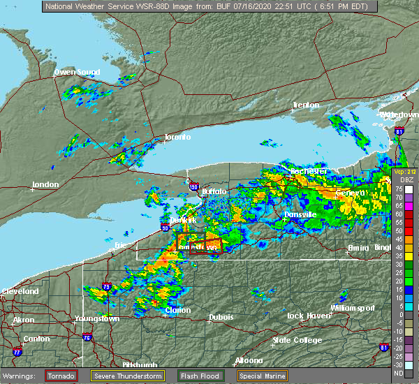
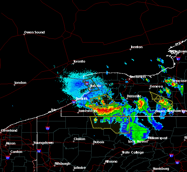
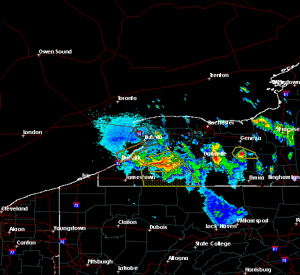
| 7/16/2020 8:08 PM EDT |
 At 808 pm edt, a severe thunderstorm was located near weston mills, or near olean, moving east at 20 mph (radar indicated). Hazards include 60 mph wind gusts. Expect damage to roofs, siding, and trees. locations impacted include, olean, allegany, st. bonaventure, weston mills, hinsdale, bolivar, portville, richburg, knapp creek and rock city park. This includes interstate 86 between exits 24 and 26. At 808 pm edt, a severe thunderstorm was located near weston mills, or near olean, moving east at 20 mph (radar indicated). Hazards include 60 mph wind gusts. Expect damage to roofs, siding, and trees. locations impacted include, olean, allegany, st. bonaventure, weston mills, hinsdale, bolivar, portville, richburg, knapp creek and rock city park. This includes interstate 86 between exits 24 and 26.
|
| 7/16/2020 7:42 PM EDT |
 At 740 pm edt, a severe thunderstorm was located over st. bonaventure, or near olean, moving east at 20 mph (radar indicated). Hazards include 60 mph wind gusts and penny size hail. expect damage to roofs, siding, and trees At 740 pm edt, a severe thunderstorm was located over st. bonaventure, or near olean, moving east at 20 mph (radar indicated). Hazards include 60 mph wind gusts and penny size hail. expect damage to roofs, siding, and trees
|
| 7/16/2020 6:50 PM EDT |
 At 649 pm edt, a severe thunderstorm was located over allegany state park, moving east at 45 mph (radar indicated). Hazards include 60 mph wind gusts and half inch size hail. expect damage to roofs, siding, and trees At 649 pm edt, a severe thunderstorm was located over allegany state park, moving east at 45 mph (radar indicated). Hazards include 60 mph wind gusts and half inch size hail. expect damage to roofs, siding, and trees
|
| 6/11/2020 12:17 AM EDT |
 At 1216 am edt, a severe thunderstorm was located near franklinville, or 11 miles north of olean, moving east at 50 mph (radar indicated). Hazards include 60 mph wind gusts. Expect damage to roofs, siding, and trees. locations impacted include, olean, salamanca, wellsville, allegany state park, alfred, ashford, allegany, franklinville, belfast and cuba. This includes interstate 86 between exits 21 and 33. At 1216 am edt, a severe thunderstorm was located near franklinville, or 11 miles north of olean, moving east at 50 mph (radar indicated). Hazards include 60 mph wind gusts. Expect damage to roofs, siding, and trees. locations impacted include, olean, salamanca, wellsville, allegany state park, alfred, ashford, allegany, franklinville, belfast and cuba. This includes interstate 86 between exits 21 and 33.
|
| 6/10/2020 11:44 PM EDT |
 At 1143 pm edt, a severe thunderstorm was located 11 miles west of salamanca, moving east at 50 mph (radar indicated). Hazards include 60 mph wind gusts. expect damage to roofs, siding, and trees At 1143 pm edt, a severe thunderstorm was located 11 miles west of salamanca, moving east at 50 mph (radar indicated). Hazards include 60 mph wind gusts. expect damage to roofs, siding, and trees
|
| 6/3/2020 1:11 AM EDT |
 At 110 am edt, severe thunderstorms were located along a line extending from near wellsville to near allegany, moving southeast at 40 mph (radar indicated). Hazards include 70 mph wind gusts and quarter size hail. Minor damage to vehicles is possible. expect considerable tree damage. wind damage is also likely to mobile homes, roofs, and outbuildings. locations impacted include, olean, salamanca, wellsville, allegany state park, allegany, st. bonaventure, weston mills, carrollton, bolivar and portville. This includes interstate 86 between exits 21 and 26. At 110 am edt, severe thunderstorms were located along a line extending from near wellsville to near allegany, moving southeast at 40 mph (radar indicated). Hazards include 70 mph wind gusts and quarter size hail. Minor damage to vehicles is possible. expect considerable tree damage. wind damage is also likely to mobile homes, roofs, and outbuildings. locations impacted include, olean, salamanca, wellsville, allegany state park, allegany, st. bonaventure, weston mills, carrollton, bolivar and portville. This includes interstate 86 between exits 21 and 26.
|
| 6/3/2020 12:52 AM EDT | Tree dow in allegany county NY, 0.2 miles ESE of Bolivar, NY |
| 6/3/2020 12:44 AM EDT |
 At 1243 am edt, a severe thunderstorm was located near cuba, or 7 miles north of olean, moving southeast at 45 mph (radar indicated). Hazards include 70 mph wind gusts and quarter size hail. Minor damage to vehicles is possible. expect considerable tree damage. wind damage is also likely to mobile homes, roofs, and outbuildings. locations impacted include, olean, salamanca, wellsville, allegany state park, ashford, allegany, franklinville, belfast, cuba and st. bonaventure. This includes interstate 86 between exits 21 and 31. At 1243 am edt, a severe thunderstorm was located near cuba, or 7 miles north of olean, moving southeast at 45 mph (radar indicated). Hazards include 70 mph wind gusts and quarter size hail. Minor damage to vehicles is possible. expect considerable tree damage. wind damage is also likely to mobile homes, roofs, and outbuildings. locations impacted include, olean, salamanca, wellsville, allegany state park, ashford, allegany, franklinville, belfast, cuba and st. bonaventure. This includes interstate 86 between exits 21 and 31.
|
| 6/3/2020 12:25 AM EDT |
 At 1224 am edt, a severe thunderstorm was located near franklinville, or 18 miles northeast of salamanca, moving southeast at 45 mph (radar indicated). Hazards include 70 mph wind gusts and quarter size hail. Minor damage to vehicles is possible. expect considerable tree damage. Wind damage is also likely to mobile homes, roofs, and outbuildings. At 1224 am edt, a severe thunderstorm was located near franklinville, or 18 miles northeast of salamanca, moving southeast at 45 mph (radar indicated). Hazards include 70 mph wind gusts and quarter size hail. Minor damage to vehicles is possible. expect considerable tree damage. Wind damage is also likely to mobile homes, roofs, and outbuildings.
|
| 8/17/2019 3:36 PM EDT |
 At 335 pm edt, a severe thunderstorm was located near wellsville, moving northeast at 20 mph (radar indicated). Hazards include 60 mph wind gusts and quarter size hail. Minor damage to vehicles is possible. Expect wind damage to roofs, siding, and trees. At 335 pm edt, a severe thunderstorm was located near wellsville, moving northeast at 20 mph (radar indicated). Hazards include 60 mph wind gusts and quarter size hail. Minor damage to vehicles is possible. Expect wind damage to roofs, siding, and trees.
|
| 8/15/2019 5:03 PM EDT |
 At 503 pm edt, a severe thunderstorm was located 7 miles north of shinglehouse, or 11 miles west of wellsville, moving east at 25 mph (radar indicated). Hazards include 60 mph wind gusts and quarter size hail. Minor damage to vehicles is possible. expect wind damage to roofs, siding, and trees. Locations impacted include, friendship, bolivar, alma, richburg, west clarksville, little genesee and ceres. At 503 pm edt, a severe thunderstorm was located 7 miles north of shinglehouse, or 11 miles west of wellsville, moving east at 25 mph (radar indicated). Hazards include 60 mph wind gusts and quarter size hail. Minor damage to vehicles is possible. expect wind damage to roofs, siding, and trees. Locations impacted include, friendship, bolivar, alma, richburg, west clarksville, little genesee and ceres.
|
| 8/15/2019 4:33 PM EDT |
 At 433 pm edt, a severe thunderstorm was located over olean, moving east at 15 mph (radar indicated). Hazards include 60 mph wind gusts and quarter size hail. Minor damage to vehicles is possible. Expect wind damage to roofs, siding, and trees. At 433 pm edt, a severe thunderstorm was located over olean, moving east at 15 mph (radar indicated). Hazards include 60 mph wind gusts and quarter size hail. Minor damage to vehicles is possible. Expect wind damage to roofs, siding, and trees.
|
| 8/15/2019 3:58 PM EDT |
 At 358 pm edt, a severe thunderstorm was located 8 miles southeast of cuba, or 11 miles west of wellsville, moving northeast at 20 mph (radar indicated). Hazards include 60 mph wind gusts and quarter size hail. Minor damage to vehicles is possible. expect wind damage to roofs, siding, and trees. Locations impacted include, bolivar and richburg. At 358 pm edt, a severe thunderstorm was located 8 miles southeast of cuba, or 11 miles west of wellsville, moving northeast at 20 mph (radar indicated). Hazards include 60 mph wind gusts and quarter size hail. Minor damage to vehicles is possible. expect wind damage to roofs, siding, and trees. Locations impacted include, bolivar and richburg.
|
| 8/15/2019 3:18 PM EDT |
 At 318 pm edt, a severe thunderstorm was located over weston mills, or near olean, moving northeast at 15 mph (radar indicated). Hazards include 60 mph wind gusts and quarter size hail. Minor damage to vehicles is possible. Expect wind damage to roofs, siding, and trees. At 318 pm edt, a severe thunderstorm was located over weston mills, or near olean, moving northeast at 15 mph (radar indicated). Hazards include 60 mph wind gusts and quarter size hail. Minor damage to vehicles is possible. Expect wind damage to roofs, siding, and trees.
|
| 8/8/2019 1:09 PM EDT |
 At 109 pm edt, a severe thunderstorm was located 7 miles north of shinglehouse, or 10 miles west of wellsville, moving east at 30 mph (radar indicated). Hazards include 60 mph wind gusts. Expect damage to roofs, siding, and trees. Locations impacted include, wellsville, whitesville, scio, bolivar, andover, alma, richburg, stannards, paynesville and little genesee. At 109 pm edt, a severe thunderstorm was located 7 miles north of shinglehouse, or 10 miles west of wellsville, moving east at 30 mph (radar indicated). Hazards include 60 mph wind gusts. Expect damage to roofs, siding, and trees. Locations impacted include, wellsville, whitesville, scio, bolivar, andover, alma, richburg, stannards, paynesville and little genesee.
|
| 8/8/2019 1:00 PM EDT | Trees and wires down in bolivar. time estimate in allegany county NY, 0.2 miles ESE of Bolivar, NY |
| 8/8/2019 12:53 PM EDT |
 At 1253 pm edt, a severe thunderstorm was located near weston mills, or near olean, moving east at 30 mph (radar indicated). Hazards include 60 mph wind gusts. expect damage to roofs, siding, and trees At 1253 pm edt, a severe thunderstorm was located near weston mills, or near olean, moving east at 30 mph (radar indicated). Hazards include 60 mph wind gusts. expect damage to roofs, siding, and trees
|
| 7/28/2019 4:31 PM EDT |
 At 430 pm edt, severe thunderstorms were located along a line extending from near hartsville to near wellsville to near shinglehouse, moving east at 45 mph (radar indicated). Hazards include 60 mph wind gusts and quarter size hail. Minor damage to vehicles is possible. expect wind damage to roofs, siding, and trees. Locations impacted include, wellsville, alfred, whitesville, bolivar, andover, alma, almond, richburg, stannards and knight creek. At 430 pm edt, severe thunderstorms were located along a line extending from near hartsville to near wellsville to near shinglehouse, moving east at 45 mph (radar indicated). Hazards include 60 mph wind gusts and quarter size hail. Minor damage to vehicles is possible. expect wind damage to roofs, siding, and trees. Locations impacted include, wellsville, alfred, whitesville, bolivar, andover, alma, almond, richburg, stannards and knight creek.
|
| 7/28/2019 4:11 PM EDT |
 At 411 pm edt, severe thunderstorms were located along a line extending from near arkport to near alfred to 8 miles west of wellsville, moving east at 50 mph (radar indicated). Hazards include 60 mph wind gusts and quarter size hail. Minor damage to vehicles is possible. Expect wind damage to roofs, siding, and trees. At 411 pm edt, severe thunderstorms were located along a line extending from near arkport to near alfred to 8 miles west of wellsville, moving east at 50 mph (radar indicated). Hazards include 60 mph wind gusts and quarter size hail. Minor damage to vehicles is possible. Expect wind damage to roofs, siding, and trees.
|
| 4/14/2019 10:07 PM EDT |
 The severe thunderstorm warning for southern wyoming, southeastern cattaraugus, southwestern livingston and western allegany counties will expire at 1015 pm edt, the storm which prompted the warning has moved out of the area. therefore, the warning will be allowed to expire. a tornado watch remains in effect until 300 am edt for western new york. The severe thunderstorm warning for southern wyoming, southeastern cattaraugus, southwestern livingston and western allegany counties will expire at 1015 pm edt, the storm which prompted the warning has moved out of the area. therefore, the warning will be allowed to expire. a tornado watch remains in effect until 300 am edt for western new york.
|
| 4/14/2019 9:54 PM EDT |
 At 953 pm edt, a severe thunderstorm was located near shinglehouse, or 11 miles southwest of wellsville, moving east at 50 mph (radar indicated). Hazards include 60 mph wind gusts. expect damage to roofs, siding, and trees At 953 pm edt, a severe thunderstorm was located near shinglehouse, or 11 miles southwest of wellsville, moving east at 50 mph (radar indicated). Hazards include 60 mph wind gusts. expect damage to roofs, siding, and trees
|
| 4/14/2019 9:45 PM EDT |
 At 945 pm edt, a severe thunderstorm was located near belfast, or 18 miles south of letchworth state park, moving northeast at 45 mph (law enforcement). Hazards include 60 mph wind gusts. Expect damage to roofs, siding, and trees. locations impacted include, olean, letchworth state park, belfast, cuba, rushford, houghton, portageville, weston mills, caneadea and hinsdale. A tornado watch remains in effect until 300 am edt for western new york. At 945 pm edt, a severe thunderstorm was located near belfast, or 18 miles south of letchworth state park, moving northeast at 45 mph (law enforcement). Hazards include 60 mph wind gusts. Expect damage to roofs, siding, and trees. locations impacted include, olean, letchworth state park, belfast, cuba, rushford, houghton, portageville, weston mills, caneadea and hinsdale. A tornado watch remains in effect until 300 am edt for western new york.
|
| 4/14/2019 9:28 PM EDT |
 At 927 pm edt, a severe thunderstorm was located near franklinville, or 16 miles north of olean, moving northeast at 50 mph (law enforcement). Hazards include 60 mph wind gusts. expect damage to roofs, siding, and trees At 927 pm edt, a severe thunderstorm was located near franklinville, or 16 miles north of olean, moving northeast at 50 mph (law enforcement). Hazards include 60 mph wind gusts. expect damage to roofs, siding, and trees
|
| 9/21/2018 7:14 PM EDT |
 At 714 pm edt, severe thunderstorms were located along a line extending from near dansville to 7 miles northeast of shinglehouse, moving east at 45 mph (radar indicated). Hazards include 60 mph wind gusts. Expect damage to roofs, siding, and trees. Locations impacted include, wellsville, alfred, belfast, whitesville, friendship, scio, bolivar, andover, belmont and angelica. At 714 pm edt, severe thunderstorms were located along a line extending from near dansville to 7 miles northeast of shinglehouse, moving east at 45 mph (radar indicated). Hazards include 60 mph wind gusts. Expect damage to roofs, siding, and trees. Locations impacted include, wellsville, alfred, belfast, whitesville, friendship, scio, bolivar, andover, belmont and angelica.
|
| 9/21/2018 7:12 PM EDT | Tree down in allegany county NY, 0.2 miles ESE of Bolivar, NY |
| 9/21/2018 6:51 PM EDT |
 At 650 pm edt, severe thunderstorms were located along a line extending from near houghton to near st. bonaventure, moving east at 40 mph (radar indicated). Hazards include 60 mph wind gusts. expect damage to roofs, siding, and trees At 650 pm edt, severe thunderstorms were located along a line extending from near houghton to near st. bonaventure, moving east at 40 mph (radar indicated). Hazards include 60 mph wind gusts. expect damage to roofs, siding, and trees
|
| 7/16/2018 10:35 PM EDT |
 At 1035 pm edt, a severe thunderstorm was located near weston mills, or 7 miles east of olean, moving northeast at 20 mph (radar indicated). Hazards include 60 mph wind gusts. expect damage to roofs, siding, and trees At 1035 pm edt, a severe thunderstorm was located near weston mills, or 7 miles east of olean, moving northeast at 20 mph (radar indicated). Hazards include 60 mph wind gusts. expect damage to roofs, siding, and trees
|
| 7/2/2018 4:37 PM EDT |
 At 437 pm edt, a severe thunderstorm was located near wellsville, moving northeast at 20 mph (radar indicated). Hazards include 60 mph wind gusts. Expect damage to roofs, siding, and trees. Locations impacted include, wellsville, alfred, scio, bolivar, andover, belmont, almond and west almond. At 437 pm edt, a severe thunderstorm was located near wellsville, moving northeast at 20 mph (radar indicated). Hazards include 60 mph wind gusts. Expect damage to roofs, siding, and trees. Locations impacted include, wellsville, alfred, scio, bolivar, andover, belmont, almond and west almond.
|
| 7/2/2018 4:13 PM EDT |
 At 412 pm edt, a severe thunderstorm was located 8 miles west of wellsville, moving northeast at 20 mph (radar indicated). Hazards include 60 mph wind gusts. expect damage to roofs, siding, and trees At 412 pm edt, a severe thunderstorm was located 8 miles west of wellsville, moving northeast at 20 mph (radar indicated). Hazards include 60 mph wind gusts. expect damage to roofs, siding, and trees
|
| 6/18/2018 8:30 PM EDT |
 At 829 pm edt, severe thunderstorms were located along a line extending from 7 miles southeast of belfast to near shinglehouse, moving east at 50 mph. this replaces the previous warning in effect for allegany county (radar indicated). Hazards include 60 mph wind gusts. expect damage to roofs, siding, and trees At 829 pm edt, severe thunderstorms were located along a line extending from 7 miles southeast of belfast to near shinglehouse, moving east at 50 mph. this replaces the previous warning in effect for allegany county (radar indicated). Hazards include 60 mph wind gusts. expect damage to roofs, siding, and trees
|
| 6/18/2018 8:17 PM EDT |
 At 816 pm edt, severe thunderstorms were located along a line extending from near cuba to near rew to 6 miles northeast of kinzua dam, moving east at 45 mph. the earlier brief tornado potential has diminished (radar indicated). Hazards include 60 mph wind gusts. Expect damage to roofs, siding, and trees. locations impacted include, olean, wellsville, alfred, allegany, cuba, st. Bonaventure, whitesville and weston mills. At 816 pm edt, severe thunderstorms were located along a line extending from near cuba to near rew to 6 miles northeast of kinzua dam, moving east at 45 mph. the earlier brief tornado potential has diminished (radar indicated). Hazards include 60 mph wind gusts. Expect damage to roofs, siding, and trees. locations impacted include, olean, wellsville, alfred, allegany, cuba, st. Bonaventure, whitesville and weston mills.
|
| 6/18/2018 8:00 PM EDT |
 A severe thunderstorm warning remains in effect until 830 pm edt for southern cattaraugus and allegany counties. at 759 pm edt, severe thunderstorms were located along a line extending from near cuba to bradford to near scandia, moving east at 60 mph. A brief tornado remains possible along the leading edge of the line of thunderstorms. A severe thunderstorm warning remains in effect until 830 pm edt for southern cattaraugus and allegany counties. at 759 pm edt, severe thunderstorms were located along a line extending from near cuba to bradford to near scandia, moving east at 60 mph. A brief tornado remains possible along the leading edge of the line of thunderstorms.
|
| 6/18/2018 7:44 PM EDT |
 At 743 pm edt, severe thunderstorms were located along a line extending from near ashford to 8 miles west of allegany state park to near lottsville, moving east at 60 mph. a brief tornado cannot be ruled out along the leading edge of the line of thunderstorms (radar indicated). Hazards include 60 mph wind gusts. Expect damage to roofs, siding, and trees. Locations impacted include, olean, salamanca, wellsville, allegany state park, alfred, ashford, allegany and franklinville. At 743 pm edt, severe thunderstorms were located along a line extending from near ashford to 8 miles west of allegany state park to near lottsville, moving east at 60 mph. a brief tornado cannot be ruled out along the leading edge of the line of thunderstorms (radar indicated). Hazards include 60 mph wind gusts. Expect damage to roofs, siding, and trees. Locations impacted include, olean, salamanca, wellsville, allegany state park, alfred, ashford, allegany and franklinville.
|
| 6/18/2018 7:27 PM EDT |
 At 727 pm edt, severe thunderstorms were located along a line extending from 7 miles south of gowanda to falconer to near clymer, moving east at 55 mph (radar indicated). Hazards include 60 mph wind gusts. expect damage to roofs, siding, and trees At 727 pm edt, severe thunderstorms were located along a line extending from 7 miles south of gowanda to falconer to near clymer, moving east at 55 mph (radar indicated). Hazards include 60 mph wind gusts. expect damage to roofs, siding, and trees
|
| 6/13/2018 6:51 PM EDT |
 The severe thunderstorm warning for allegany county will expire at 700 pm edt, the storms which prompted the warning have moved out of the area. therefore, the warning will be allowed to expire. a severe thunderstorm watch remains in effect until 1100 pm edt for western new york. The severe thunderstorm warning for allegany county will expire at 700 pm edt, the storms which prompted the warning have moved out of the area. therefore, the warning will be allowed to expire. a severe thunderstorm watch remains in effect until 1100 pm edt for western new york.
|
| 6/13/2018 6:28 PM EDT | Numerous trees and power lines down along california hallow road in town of boliva. time estiamted from rada in allegany county NY, 4.5 miles W of Bolivar, NY |
| 6/13/2018 6:20 PM EDT |
 At 619 pm edt, severe thunderstorms were located along a line extending from 7 miles south of portageville to belfast to 6 miles east of franklinville, moving east at 55 mph (radar indicated). Hazards include 60 mph wind gusts. Expect damage to roofs, siding, and trees. Locations impacted include, wellsville, alfred, belfast, cuba, rushford, houghton, whitesville and caneadea. At 619 pm edt, severe thunderstorms were located along a line extending from 7 miles south of portageville to belfast to 6 miles east of franklinville, moving east at 55 mph (radar indicated). Hazards include 60 mph wind gusts. Expect damage to roofs, siding, and trees. Locations impacted include, wellsville, alfred, belfast, cuba, rushford, houghton, whitesville and caneadea.
|
| 6/13/2018 6:00 PM EDT |
 At 600 pm edt, severe thunderstorms were located along a line extending from near arcade to 7 miles southeast of springville to near ashford hollow, moving east at 45 mph (radar indicated). Hazards include 60 mph wind gusts and half dollar size hail. Minor damage to vehicles is possible. expect wind damage to roofs, siding, and trees. Locations impacted include, olean, dansville, wellsville, letchworth state park, alfred, ashford, arcade and allegany. At 600 pm edt, severe thunderstorms were located along a line extending from near arcade to 7 miles southeast of springville to near ashford hollow, moving east at 45 mph (radar indicated). Hazards include 60 mph wind gusts and half dollar size hail. Minor damage to vehicles is possible. expect wind damage to roofs, siding, and trees. Locations impacted include, olean, dansville, wellsville, letchworth state park, alfred, ashford, arcade and allegany.
|
| 6/13/2018 5:50 PM EDT |
 At 550 pm edt, severe thunderstorms were located along a line extending from near chaffee to near springville to near gowanda, moving east at 45 mph (radar indicated). Hazards include 60 mph wind gusts and penny size hail. expect damage to roofs, siding, and trees At 550 pm edt, severe thunderstorms were located along a line extending from near chaffee to near springville to near gowanda, moving east at 45 mph (radar indicated). Hazards include 60 mph wind gusts and penny size hail. expect damage to roofs, siding, and trees
|
| 10/15/2017 5:40 PM EDT |
 At 539 pm edt, a line of severe thunderstorms extended from olean to dansville to phelps with this line moving east at 55 mph (radar indicated). Hazards include 60 mph wind gusts. Expect wind damage to trees and power lines. locations impacted include, olean, geneva, canandaigua, dansville, wellsville, alfred, clifton springs and phelps. this includes the following highways, interstate 390 between exits 4 and 5. interstate 90 near exit 42. Interstate 86 between exits 28 and 33. At 539 pm edt, a line of severe thunderstorms extended from olean to dansville to phelps with this line moving east at 55 mph (radar indicated). Hazards include 60 mph wind gusts. Expect wind damage to trees and power lines. locations impacted include, olean, geneva, canandaigua, dansville, wellsville, alfred, clifton springs and phelps. this includes the following highways, interstate 390 between exits 4 and 5. interstate 90 near exit 42. Interstate 86 between exits 28 and 33.
|
| 10/15/2017 5:15 PM EDT |
 At 514 pm edt, a line of severe thunderstorms was located 7 miles east of letchworth state park, extending to manchester moving east at 55 mph (radar indicated). Hazards include 60 mph wind gusts. expect wind damage to trees and power lines At 514 pm edt, a line of severe thunderstorms was located 7 miles east of letchworth state park, extending to manchester moving east at 55 mph (radar indicated). Hazards include 60 mph wind gusts. expect wind damage to trees and power lines
|
| 9/5/2017 12:35 AM EDT |
 At 1235 am edt, severe thunderstorms were located along a line extending from near arkport to near genesee, moving east at 65 mph (radar indicated). Hazards include 60 mph wind gusts. Expect wind damage to trees and power lines. locations impacted include, wellsville, alfred, whitesville, scio, bolivar, andover, belmont and angelica. This includes interstate 86 between exits 31 and 33. At 1235 am edt, severe thunderstorms were located along a line extending from near arkport to near genesee, moving east at 65 mph (radar indicated). Hazards include 60 mph wind gusts. Expect wind damage to trees and power lines. locations impacted include, wellsville, alfred, whitesville, scio, bolivar, andover, belmont and angelica. This includes interstate 86 between exits 31 and 33.
|
| 9/5/2017 12:18 AM EDT |
 At 1218 am edt, severe thunderstorms were located along a line extending from 8 miles east of belfast to near weston mills, moving east at 70 mph (radar indicated). Hazards include 60 mph wind gusts. expect wind damage to trees and power lines At 1218 am edt, severe thunderstorms were located along a line extending from 8 miles east of belfast to near weston mills, moving east at 70 mph (radar indicated). Hazards include 60 mph wind gusts. expect wind damage to trees and power lines
|
| 9/5/2017 12:02 AM EDT |
 At 1201 am edt, severe thunderstorms were located along a line extending from near rushford to near allegany state park, moving east at 55 mph (radar indicated). Hazards include 60 mph wind gusts. Expect wind damage to trees and power lines. locations impacted include, olean, salamanca, allegany state park, allegany, franklinville, belfast, cuba and rushford. This includes interstate 86 between exits 17 and 31. At 1201 am edt, severe thunderstorms were located along a line extending from near rushford to near allegany state park, moving east at 55 mph (radar indicated). Hazards include 60 mph wind gusts. Expect wind damage to trees and power lines. locations impacted include, olean, salamanca, allegany state park, allegany, franklinville, belfast, cuba and rushford. This includes interstate 86 between exits 17 and 31.
|
| 9/4/2017 11:33 PM EDT |
 At 1132 pm edt, a severe thunderstorm was located 11 miles northwest of allegany state park, moving east at 60 mph (radar indicated). Hazards include 60 mph wind gusts. expect wind damage to trees and power lines At 1132 pm edt, a severe thunderstorm was located 11 miles northwest of allegany state park, moving east at 60 mph (radar indicated). Hazards include 60 mph wind gusts. expect wind damage to trees and power lines
|
| 8/22/2017 3:51 PM EDT |
 At 350 pm edt, severe thunderstorms were located along a line extending from near mount morris to near houghton to near bradford, moving east at 55 mph (radar indicated). Hazards include 60 mph wind gusts. Expect wind damage to trees and power lines. locations impacted include, olean, dansville, wellsville, letchworth state park, allegany state park, alfred, allegany and belfast. this includes the following highways, interstate 390 between exits 4 and 6. interstate 86 between exits 23 and 33. A tornado watch remains in effect until 900 pm edt for western new york. At 350 pm edt, severe thunderstorms were located along a line extending from near mount morris to near houghton to near bradford, moving east at 55 mph (radar indicated). Hazards include 60 mph wind gusts. Expect wind damage to trees and power lines. locations impacted include, olean, dansville, wellsville, letchworth state park, allegany state park, alfred, allegany and belfast. this includes the following highways, interstate 390 between exits 4 and 6. interstate 86 between exits 23 and 33. A tornado watch remains in effect until 900 pm edt for western new york.
|
| 8/22/2017 3:20 PM EDT |
 At 320 pm edt, severe thunderstorms were located along a line extending from 7 miles south of varysburg to near ashford to 6 miles north of scandia, moving east at 55 mph (radar indicated). Hazards include 60 mph wind gusts. expect wind damage to trees and power lines At 320 pm edt, severe thunderstorms were located along a line extending from 7 miles south of varysburg to near ashford to 6 miles north of scandia, moving east at 55 mph (radar indicated). Hazards include 60 mph wind gusts. expect wind damage to trees and power lines
|
| 7/8/2017 8:20 AM EDT |
 At 820 am edt, a severe thunderstorm was located near wellsville, moving east at 40 mph (radar indicated). Hazards include 60 mph wind gusts. Expect wind damage to trees and power lines. Locations impacted include, wellsville, whitesville, bolivar, andover, alma, richburg, stannards and paynesville. At 820 am edt, a severe thunderstorm was located near wellsville, moving east at 40 mph (radar indicated). Hazards include 60 mph wind gusts. Expect wind damage to trees and power lines. Locations impacted include, wellsville, whitesville, bolivar, andover, alma, richburg, stannards and paynesville.
|
| 7/8/2017 8:12 AM EDT | Tree and wire dow in allegany county NY, 3.5 miles NE of Bolivar, NY |
| 6/18/2017 5:42 PM EDT |
 The severe thunderstorm warning for eastern cattaraugus and western allegany counties will expire at 545 pm edt, the storms which prompted the warning have moved out of the area. therefore the warning will be allowed to expire. a severe thunderstorm watch remains in effect until 900 pm edt for western new york. remember, a new severe thunderstorm warning still remains in effect for portions of allegany county. The severe thunderstorm warning for eastern cattaraugus and western allegany counties will expire at 545 pm edt, the storms which prompted the warning have moved out of the area. therefore the warning will be allowed to expire. a severe thunderstorm watch remains in effect until 900 pm edt for western new york. remember, a new severe thunderstorm warning still remains in effect for portions of allegany county.
|
| 6/18/2017 5:24 PM EDT | Trees dow in allegany county NY, 0.2 miles ESE of Bolivar, NY |
| 6/18/2017 5:11 PM EDT |
 At 511 pm edt, severe thunderstorms were located along a line extending from near franklinville to near weston mills, moving northeast at 60 mph (radar indicated). Hazards include 60 mph wind gusts. Expect wind damage to trees and power lines. locations impacted include, olean, allegany, franklinville, belfast, cuba, rushford, st. bonaventure and houghton. This includes interstate 86 between exits 25 and 31. At 511 pm edt, severe thunderstorms were located along a line extending from near franklinville to near weston mills, moving northeast at 60 mph (radar indicated). Hazards include 60 mph wind gusts. Expect wind damage to trees and power lines. locations impacted include, olean, allegany, franklinville, belfast, cuba, rushford, st. bonaventure and houghton. This includes interstate 86 between exits 25 and 31.
|
| 6/18/2017 4:40 PM EDT |
 At 439 pm edt, severe thunderstorms were located along a line extending from 7 miles west of salamanca to near westline, moving northeast at 50 mph (radar indicated). Hazards include 70 mph wind gusts. Expect considerable tree damage. Damage is likely to mobile homes, roofs, and outbuildings. At 439 pm edt, severe thunderstorms were located along a line extending from 7 miles west of salamanca to near westline, moving northeast at 50 mph (radar indicated). Hazards include 70 mph wind gusts. Expect considerable tree damage. Damage is likely to mobile homes, roofs, and outbuildings.
|
| 5/1/2017 4:28 PM EDT |
 At 428 pm edt, severe thunderstorms were located along a line extending from near weston mills to near betula, moving northeast at 65 mph (radar indicated). Hazards include 70 mph wind gusts. Expect considerable tree damage. Damage is likely to mobile homes, roofs, and outbuildings. At 428 pm edt, severe thunderstorms were located along a line extending from near weston mills to near betula, moving northeast at 65 mph (radar indicated). Hazards include 70 mph wind gusts. Expect considerable tree damage. Damage is likely to mobile homes, roofs, and outbuildings.
|
| 9/10/2016 9:36 PM EDT |
 At 935 pm edt, a severe thunderstorm was located 7 miles southeast of ashford, or 11 miles northeast of salamanca, moving northeast at 60 mph (radar indicated). Hazards include 70 mph wind gusts. Expect considerable tree damage. damage is likely to mobile homes, roofs, and outbuildings. locations impacted include, olean, allegany state park, allegany, franklinville, belfast, cuba, rushford and st. bonaventure. This includes interstate 86 between exits 23 and 30. At 935 pm edt, a severe thunderstorm was located 7 miles southeast of ashford, or 11 miles northeast of salamanca, moving northeast at 60 mph (radar indicated). Hazards include 70 mph wind gusts. Expect considerable tree damage. damage is likely to mobile homes, roofs, and outbuildings. locations impacted include, olean, allegany state park, allegany, franklinville, belfast, cuba, rushford and st. bonaventure. This includes interstate 86 between exits 23 and 30.
|
| 9/10/2016 9:19 PM EDT |
 At 918 pm edt, a severe thunderstorm was located near salamanca, moving northeast at 60 mph (radar indicated). Hazards include 70 mph wind gusts and nickel size hail. Expect considerable tree damage. damage is likely to mobile homes, roofs, and outbuildings. locations impacted include, olean, salamanca, allegany state park, allegany, franklinville, belfast, cuba and rushford. This includes interstate 86 between exits 16 and 30. At 918 pm edt, a severe thunderstorm was located near salamanca, moving northeast at 60 mph (radar indicated). Hazards include 70 mph wind gusts and nickel size hail. Expect considerable tree damage. damage is likely to mobile homes, roofs, and outbuildings. locations impacted include, olean, salamanca, allegany state park, allegany, franklinville, belfast, cuba and rushford. This includes interstate 86 between exits 16 and 30.
|
| 9/10/2016 9:04 PM EDT |
 At 904 pm edt, a severe thunderstorm was located near scandia, or 10 miles southwest of allegany state park, moving northeast at 60 mph (radar indicated). Hazards include 60 mph wind gusts and nickel size hail. Expect damage to roofs. siding. And trees. At 904 pm edt, a severe thunderstorm was located near scandia, or 10 miles southwest of allegany state park, moving northeast at 60 mph (radar indicated). Hazards include 60 mph wind gusts and nickel size hail. Expect damage to roofs. siding. And trees.
|
| 8/25/2016 8:09 PM EDT |
 At 808 pm edt, a severe thunderstorm was located over allegany state park, moving east at 30 mph (radar indicated). Hazards include 60 mph wind gusts and quarter size hail. Hail damage to vehicles is expected. Expect wind damage to roofs, siding, and trees. At 808 pm edt, a severe thunderstorm was located over allegany state park, moving east at 30 mph (radar indicated). Hazards include 60 mph wind gusts and quarter size hail. Hail damage to vehicles is expected. Expect wind damage to roofs, siding, and trees.
|
| 7/25/2016 1:58 PM EDT | The severe thunderstorm warning for southeastern allegany county will expire at 200 pm edt. the storm which prompted the warning has moved out of the area. therefore. the warning will be allowed to expire. however heavy rain is still possible with thunderstorms in the area. A severe thunderstorm watch remains in effect until 800 pm edt for. |
| 7/25/2016 1:39 PM EDT |
 At 138 pm edt, a cluster of severe thunderstorms was located 7 miles west of wellsville, moving east at 35 mph (radar indicated). Hazards include 60 mph wind gusts and quarter size hail. Hail damage to vehicles is expected. expect wind damage to roofs, siding, and trees. Locations impacted include, wellsville, alfred, whitesville, friendship, scio, bolivar, andover and belmont. At 138 pm edt, a cluster of severe thunderstorms was located 7 miles west of wellsville, moving east at 35 mph (radar indicated). Hazards include 60 mph wind gusts and quarter size hail. Hail damage to vehicles is expected. expect wind damage to roofs, siding, and trees. Locations impacted include, wellsville, alfred, whitesville, friendship, scio, bolivar, andover and belmont.
|
| 7/25/2016 1:22 PM EDT |
 At 119 pm edt, a cluster of severe thunderstorms was located near olean and extending east to near belmont, moving east at 35 mph (radar indicated). Hazards include 60 mph wind gusts and quarter size hail. Hail damage to vehicles is expected. expect wind damage to roofs, siding, and trees. locations impacted include, olean, wellsville, allegany state park, alfred, allegany, belfast, cuba and st. Bonaventure. At 119 pm edt, a cluster of severe thunderstorms was located near olean and extending east to near belmont, moving east at 35 mph (radar indicated). Hazards include 60 mph wind gusts and quarter size hail. Hail damage to vehicles is expected. expect wind damage to roofs, siding, and trees. locations impacted include, olean, wellsville, allegany state park, alfred, allegany, belfast, cuba and st. Bonaventure.
|
| 7/25/2016 1:01 PM EDT |
 At 1259 pm edt, a severe thunderstorm was located near allegany, or 7 miles east of salamanca, moving east at 35 mph (radar indicated). Hazards include 60 mph wind gusts. Expect damage to roofs. siding. And trees. At 1259 pm edt, a severe thunderstorm was located near allegany, or 7 miles east of salamanca, moving east at 35 mph (radar indicated). Hazards include 60 mph wind gusts. Expect damage to roofs. siding. And trees.
|
| 6/5/2016 6:19 PM EDT |
 At 618 pm edt, severe thunderstorms were located along a line extending from near rushford to near shinglehouse, moving east at 45 mph (radar indicated). Hazards include 60 mph wind gusts. Expect damage to roofs. siding. and trees. Locations impacted include, wellsville, alfred, belfast, whitesville, friendship, scio, bolivar and andover. At 618 pm edt, severe thunderstorms were located along a line extending from near rushford to near shinglehouse, moving east at 45 mph (radar indicated). Hazards include 60 mph wind gusts. Expect damage to roofs. siding. and trees. Locations impacted include, wellsville, alfred, belfast, whitesville, friendship, scio, bolivar and andover.
|
| 6/5/2016 5:45 PM EDT |
 At 544 pm edt, severe thunderstorms were located along a line extending from near ashford to near bradford, moving east at 40 mph (radar indicated). Hazards include 60 mph wind gusts and penny size hail. Expect damage to roofs. siding. And trees. At 544 pm edt, severe thunderstorms were located along a line extending from near ashford to near bradford, moving east at 40 mph (radar indicated). Hazards include 60 mph wind gusts and penny size hail. Expect damage to roofs. siding. And trees.
|
| 7/7/2015 5:49 PM EDT |
 At 548 pm edt, doppler radar indicated a line of severe thunderstorms capable of producing damaging winds in excess of 60 mph. these storms were located along a line extending from near cuba to near coryville, and moving northeast at 45 mph. At 548 pm edt, doppler radar indicated a line of severe thunderstorms capable of producing damaging winds in excess of 60 mph. these storms were located along a line extending from near cuba to near coryville, and moving northeast at 45 mph.
|
| 6/23/2015 6:30 AM EDT |
 At 629 am edt, doppler radar indicated a line of severe thunderstorms capable of producing damaging winds in excess of 60 mph. these storms were located along a line extending from near belfast to 7 miles west of genesee, moving east at 60 mph. locations impacted include, wellsville, alfred, belfast, whitesville, houghton, caneadea, friendship and scio. At 629 am edt, doppler radar indicated a line of severe thunderstorms capable of producing damaging winds in excess of 60 mph. these storms were located along a line extending from near belfast to 7 miles west of genesee, moving east at 60 mph. locations impacted include, wellsville, alfred, belfast, whitesville, houghton, caneadea, friendship and scio.
|
| 6/23/2015 6:02 AM EDT |
 At 602 am edt, doppler radar indicated a line of severe thunderstorms capable of producing damaging winds in excess of 60 mph. these storms were located along a line extending from near ashford to near bradford, and moving east at 55 mph. At 602 am edt, doppler radar indicated a line of severe thunderstorms capable of producing damaging winds in excess of 60 mph. these storms were located along a line extending from near ashford to near bradford, and moving east at 55 mph.
|
| 6/12/2015 5:13 PM EDT |
 At 512 pm edt, doppler radar indicated a line of severe thunderstorms capable of producing damaging winds in excess of 60 mph. these storms were located along a line extending from rushford to near weston mills, moving east at 55 mph. locations impacted include, olean, salamanca, wellsville, allegany state park, alfred, ashford, allegany and franklinville. a tornado watch remains in effect until 1100 pm edt for western new york. At 512 pm edt, doppler radar indicated a line of severe thunderstorms capable of producing damaging winds in excess of 60 mph. these storms were located along a line extending from rushford to near weston mills, moving east at 55 mph. locations impacted include, olean, salamanca, wellsville, allegany state park, alfred, ashford, allegany and franklinville. a tornado watch remains in effect until 1100 pm edt for western new york.
|
| 6/12/2015 4:42 PM EDT |
 At 441 pm edt, doppler radar indicated a line of severe thunderstorms capable of producing damaging winds in excess of 60 mph. these storms were located along a line extending from near ashford hollow to near allegany state park, and moving east at 55 mph. At 441 pm edt, doppler radar indicated a line of severe thunderstorms capable of producing damaging winds in excess of 60 mph. these storms were located along a line extending from near ashford hollow to near allegany state park, and moving east at 55 mph.
|
| 4/20/2015 6:58 PM EDT | At 657 pm edt, national weather service doppler radar indicated a severe thunderstorm capable of producing quarter size hail, and damaging winds in excess of 60 mph. this storm was located 14 miles west of wellsville, or 11 miles east of olean, and moving northeast at 30 mph. * some locations in the warning include, wellsville,. |
| 5/23/2013 4:52 PM EDT | Large tree down on a hous in allegany county NY, 2 miles N of Bolivar, NY |
| 5/23/2013 4:50 PM EDT | Ping Pong Ball sized hail reported 2.9 miles NNE of Bolivar, NY |
| 8/9/2012 7:35 PM EDT | Tree down in a parking lo in allegany county NY, 0.2 miles ESE of Bolivar, NY |
| 7/26/2012 2:55 PM EDT | Trees and wires down in allegany county NY, 0.2 miles ESE of Bolivar, NY |
| 1/1/0001 12:00 AM | Powerlines down across route 417. relayed by wivb-t in allegany county NY, 0.2 miles ESE of Bolivar, NY |
| 1/1/0001 12:00 AM | Multiple trees dow in allegany county NY, 0.2 miles ESE of Bolivar, NY |
Hail Maps for Bolivar, NY


Connect with Interactive Hail Maps