

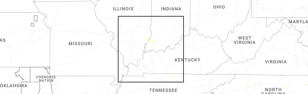
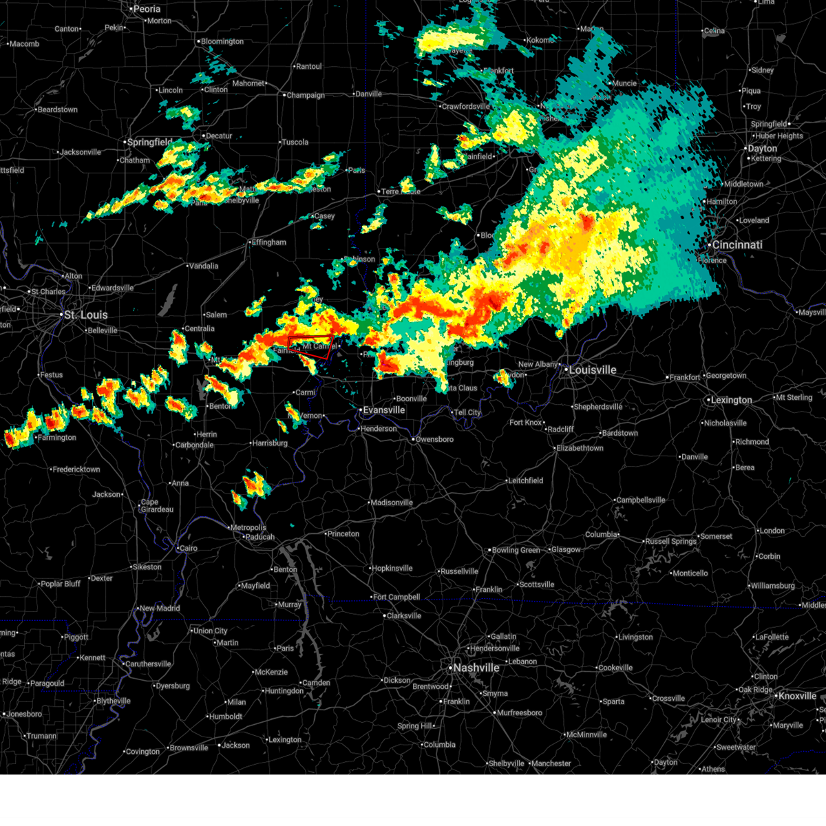
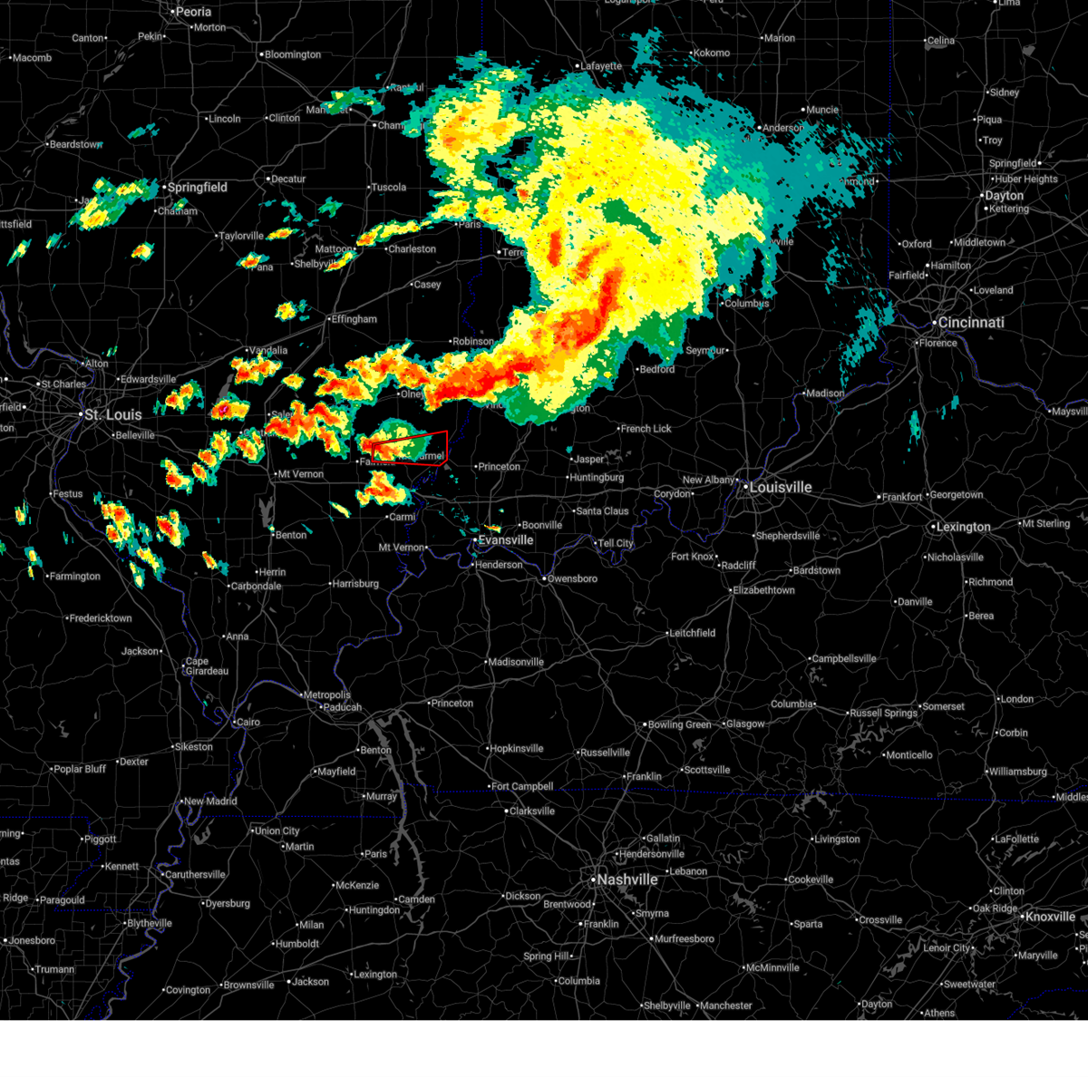
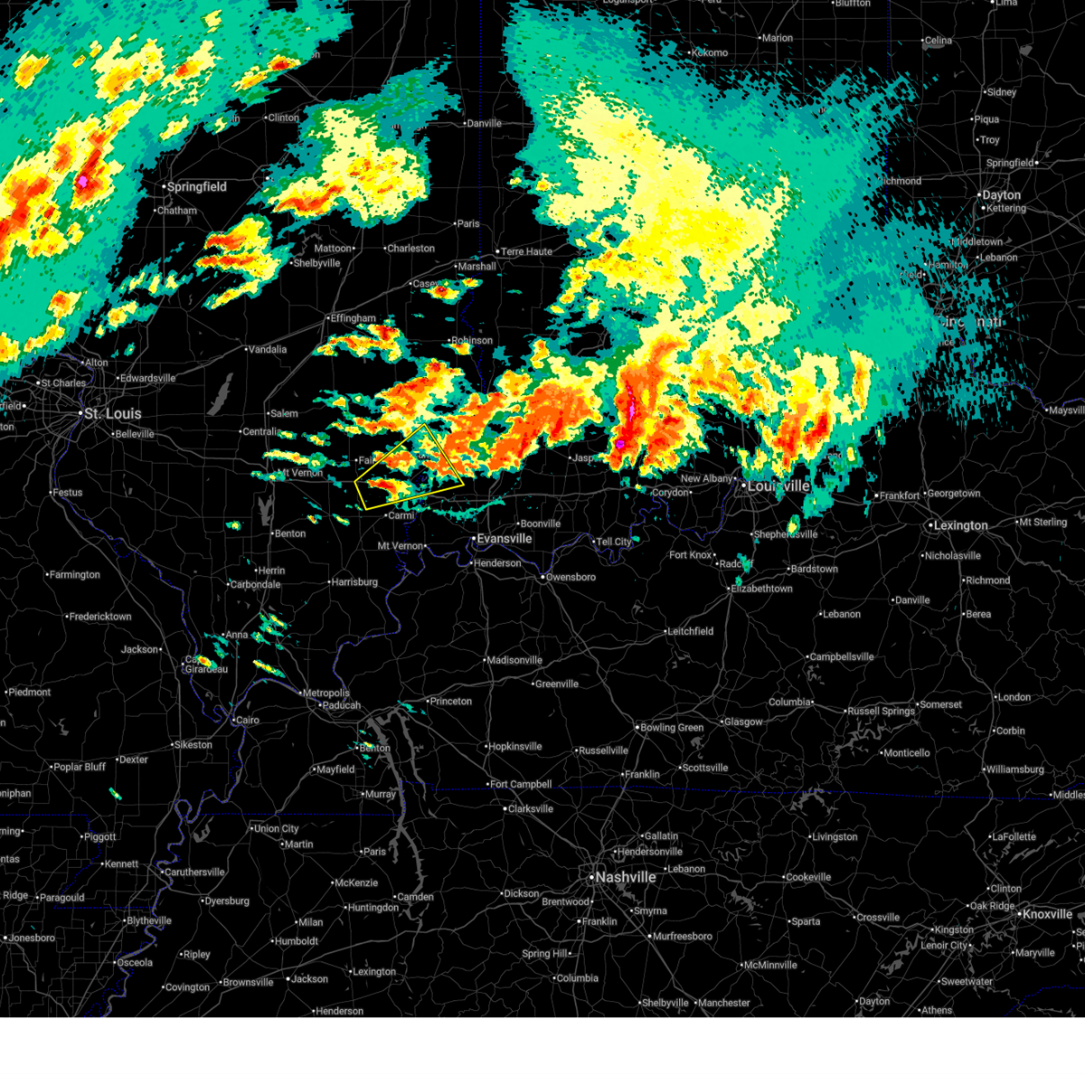
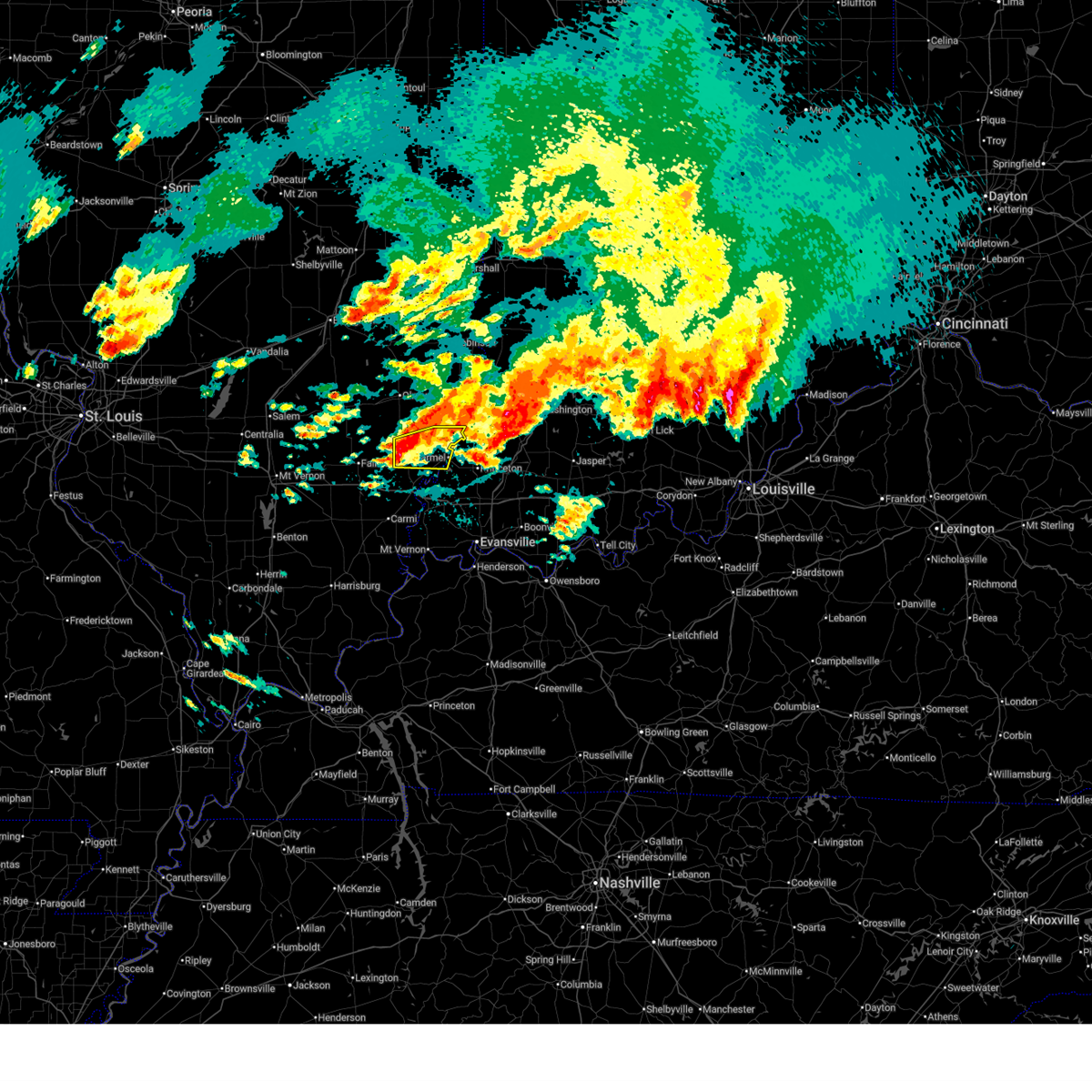
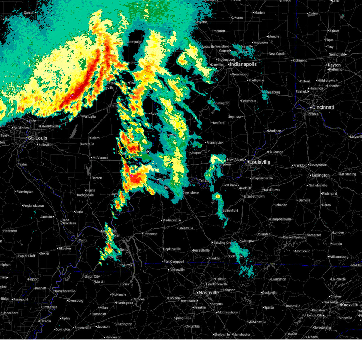
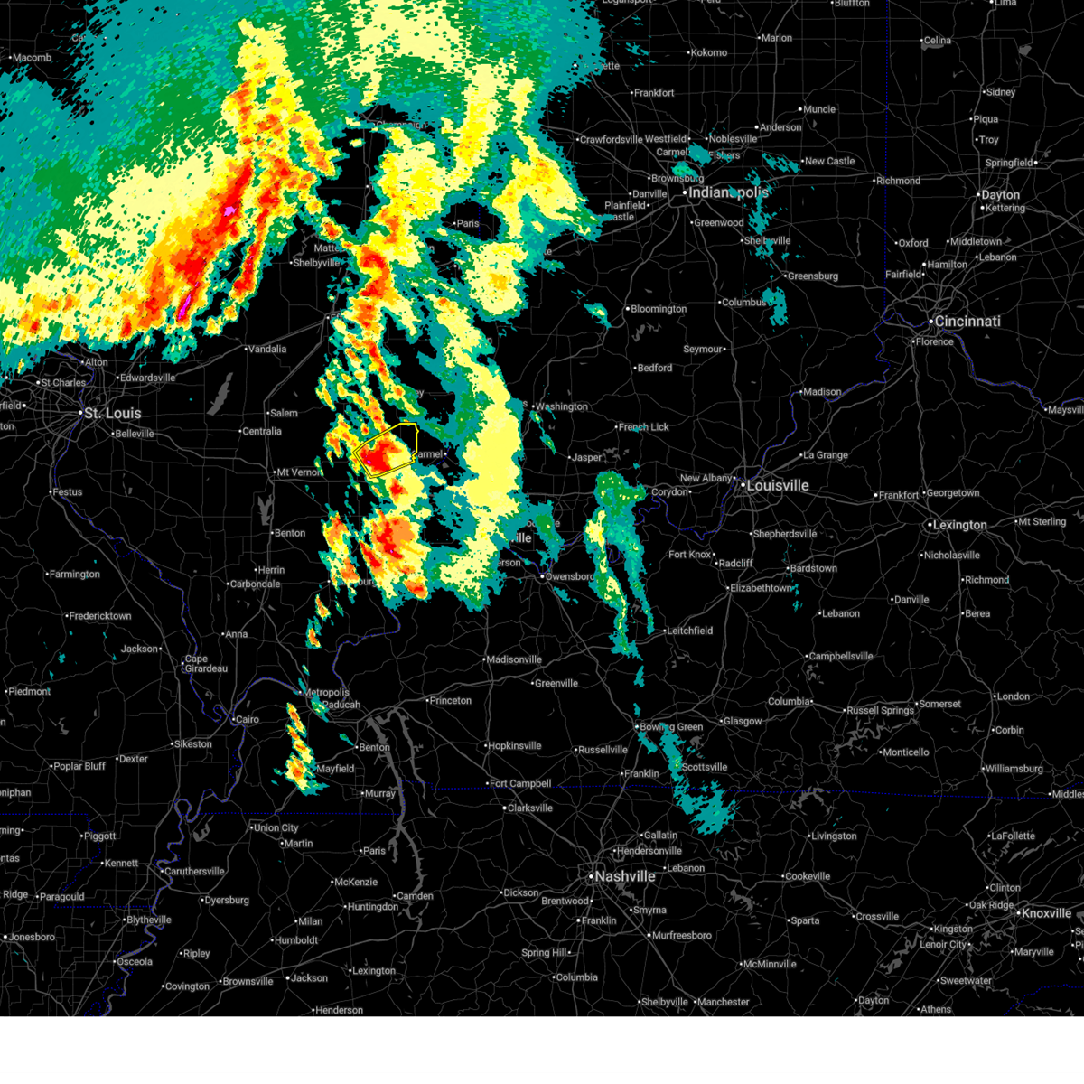
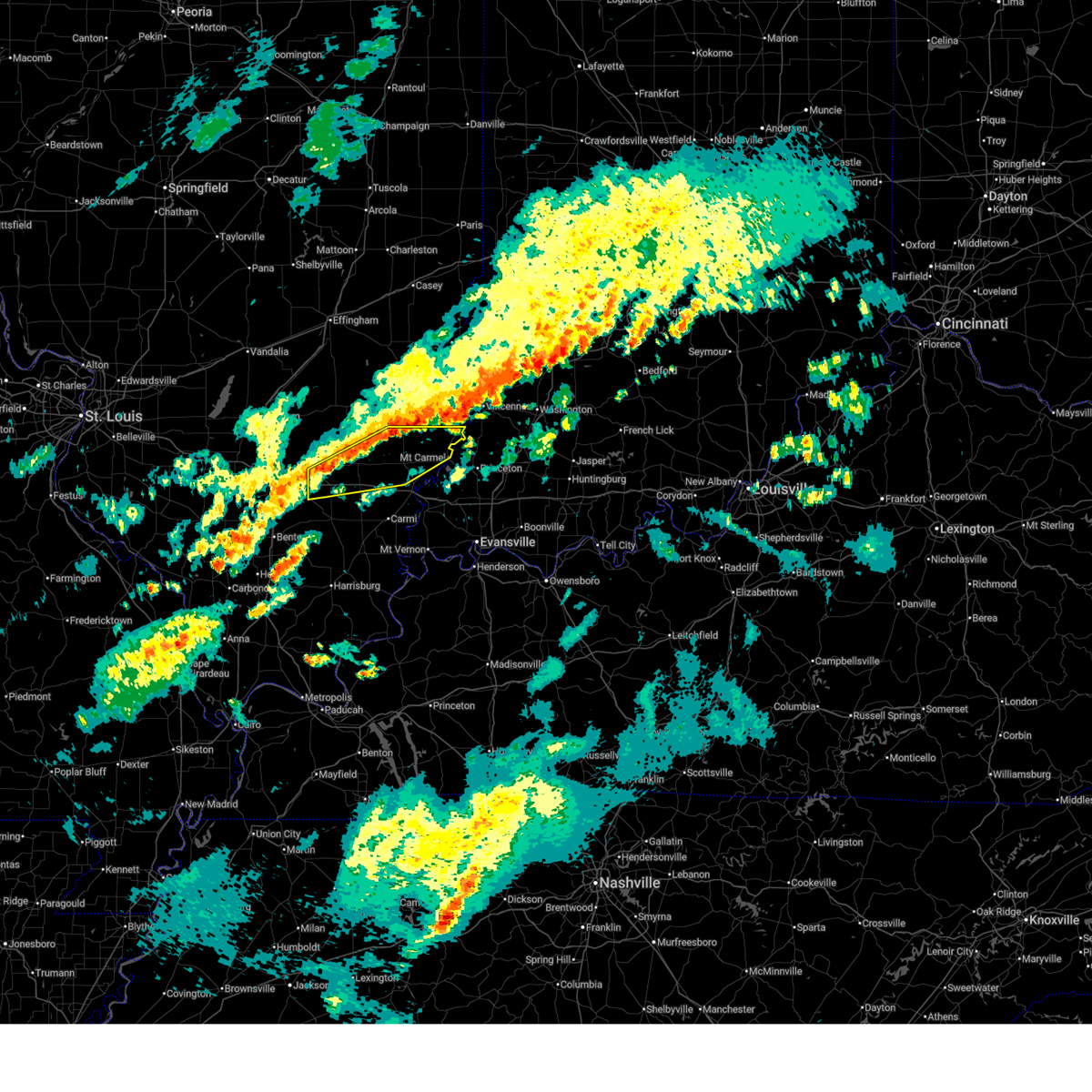
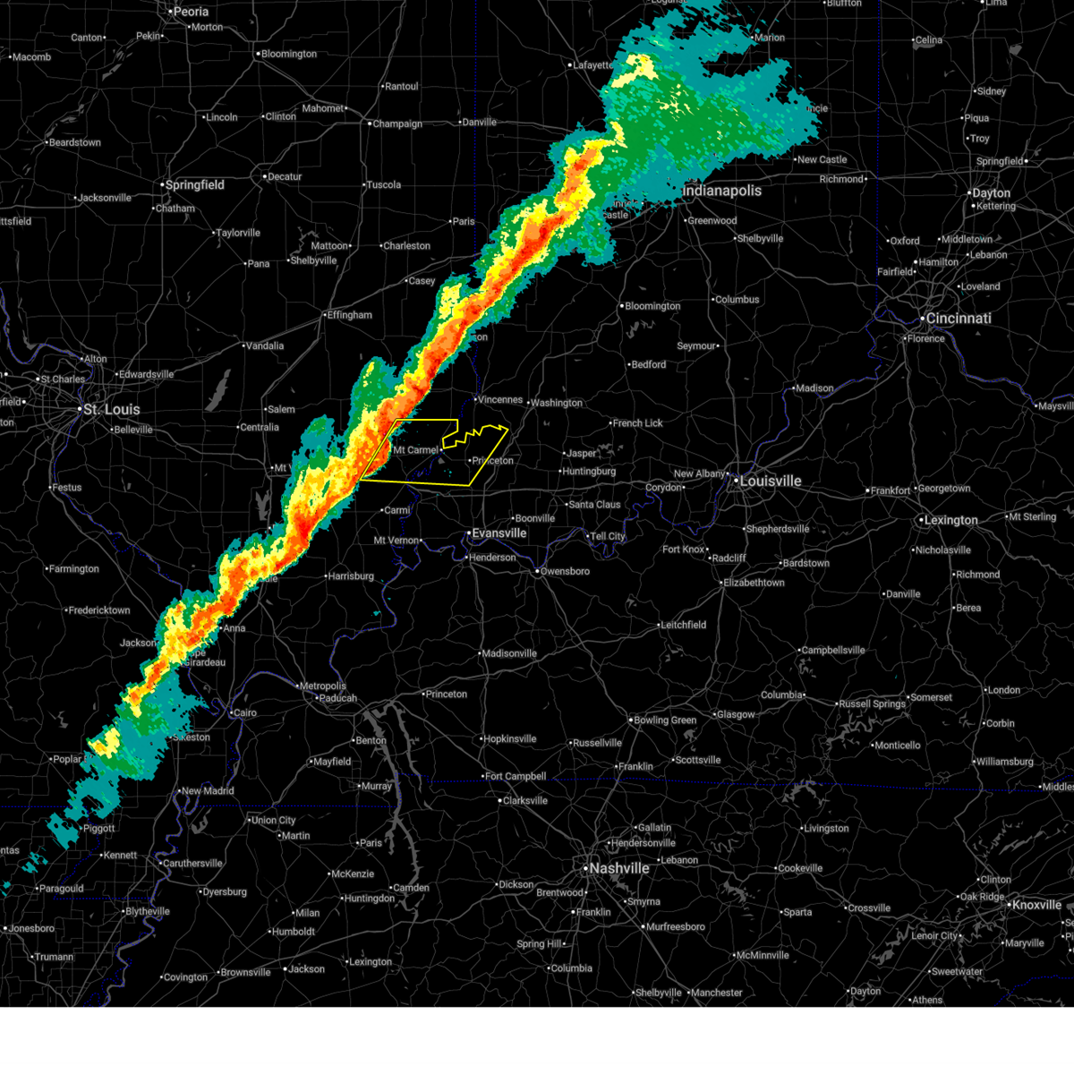
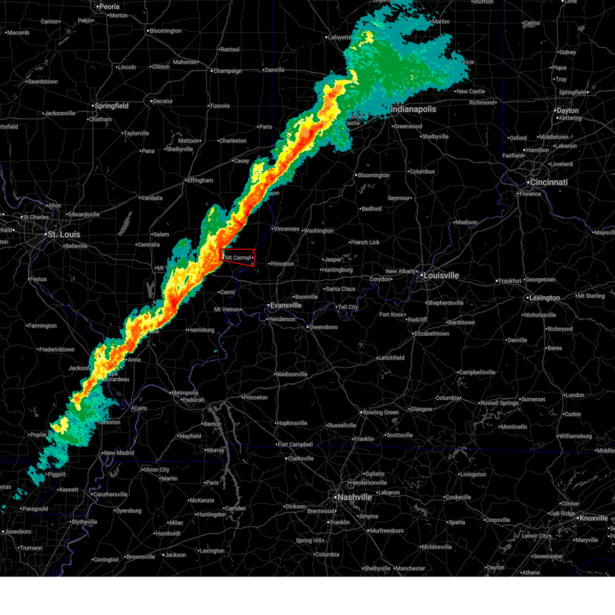
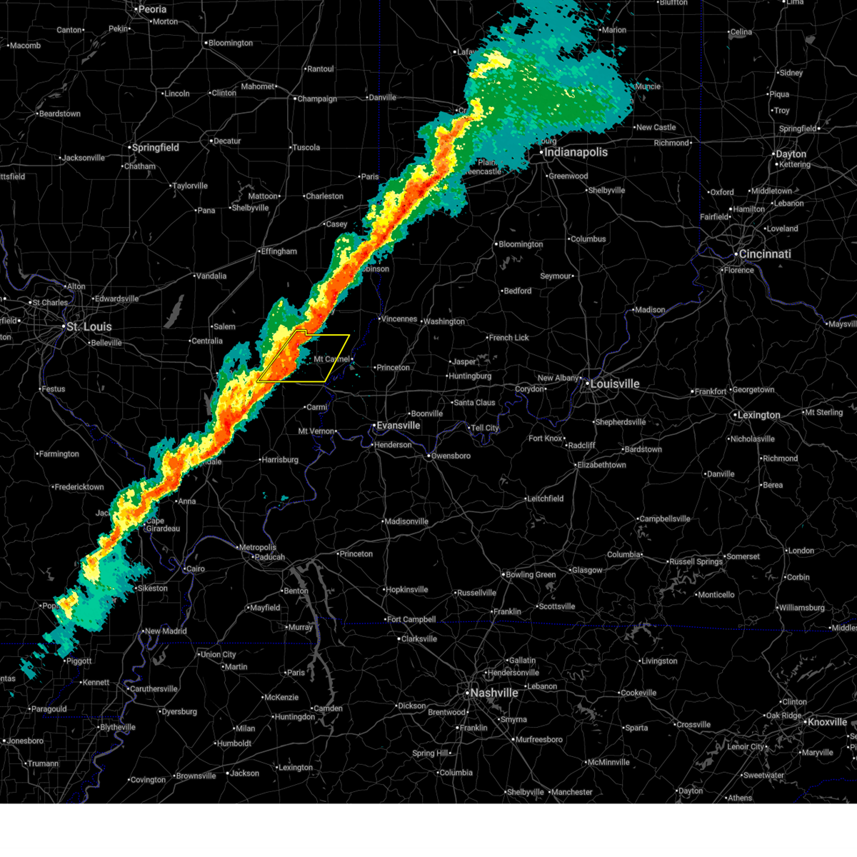
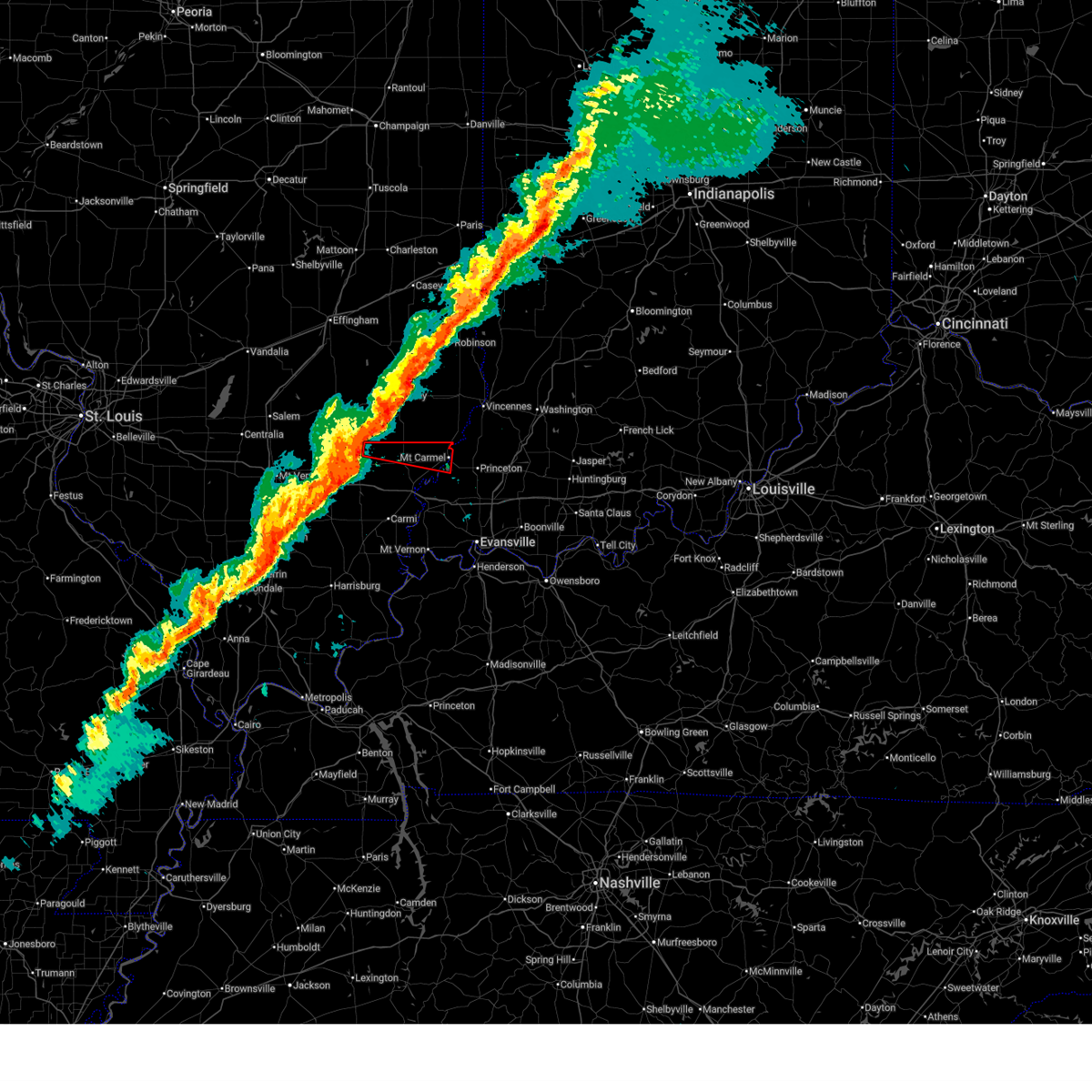
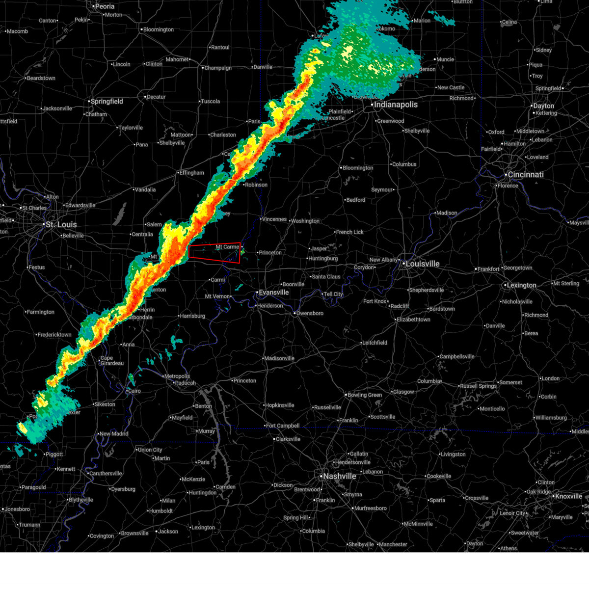
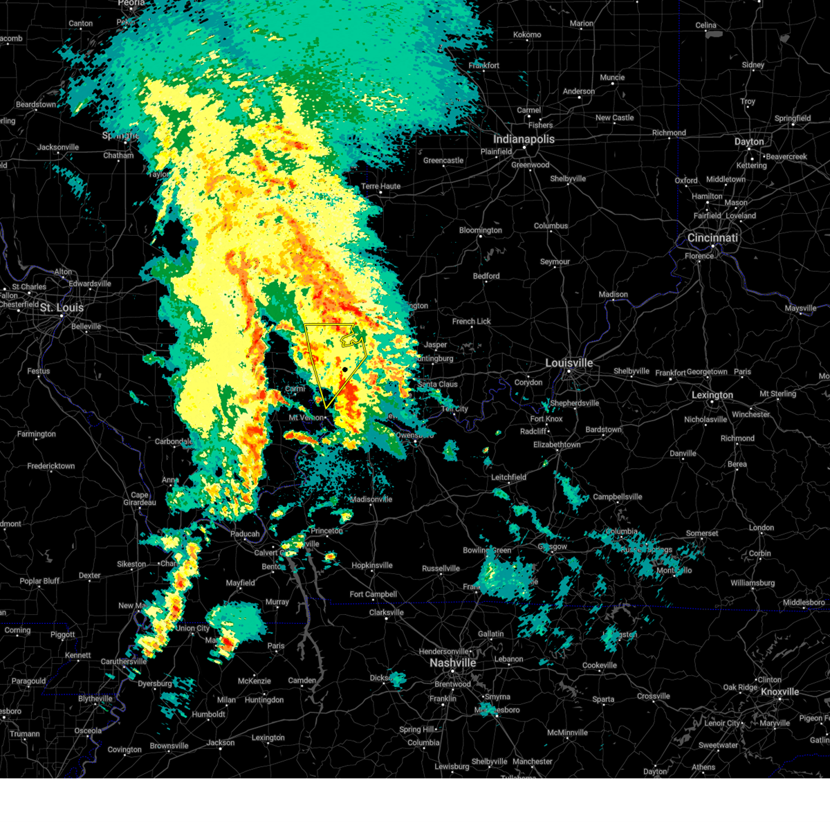
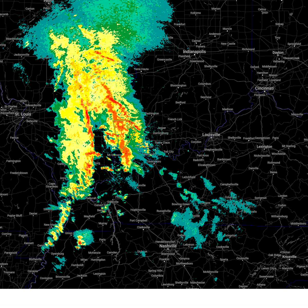
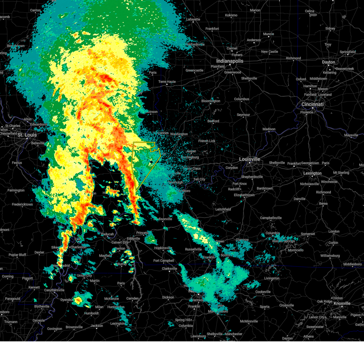
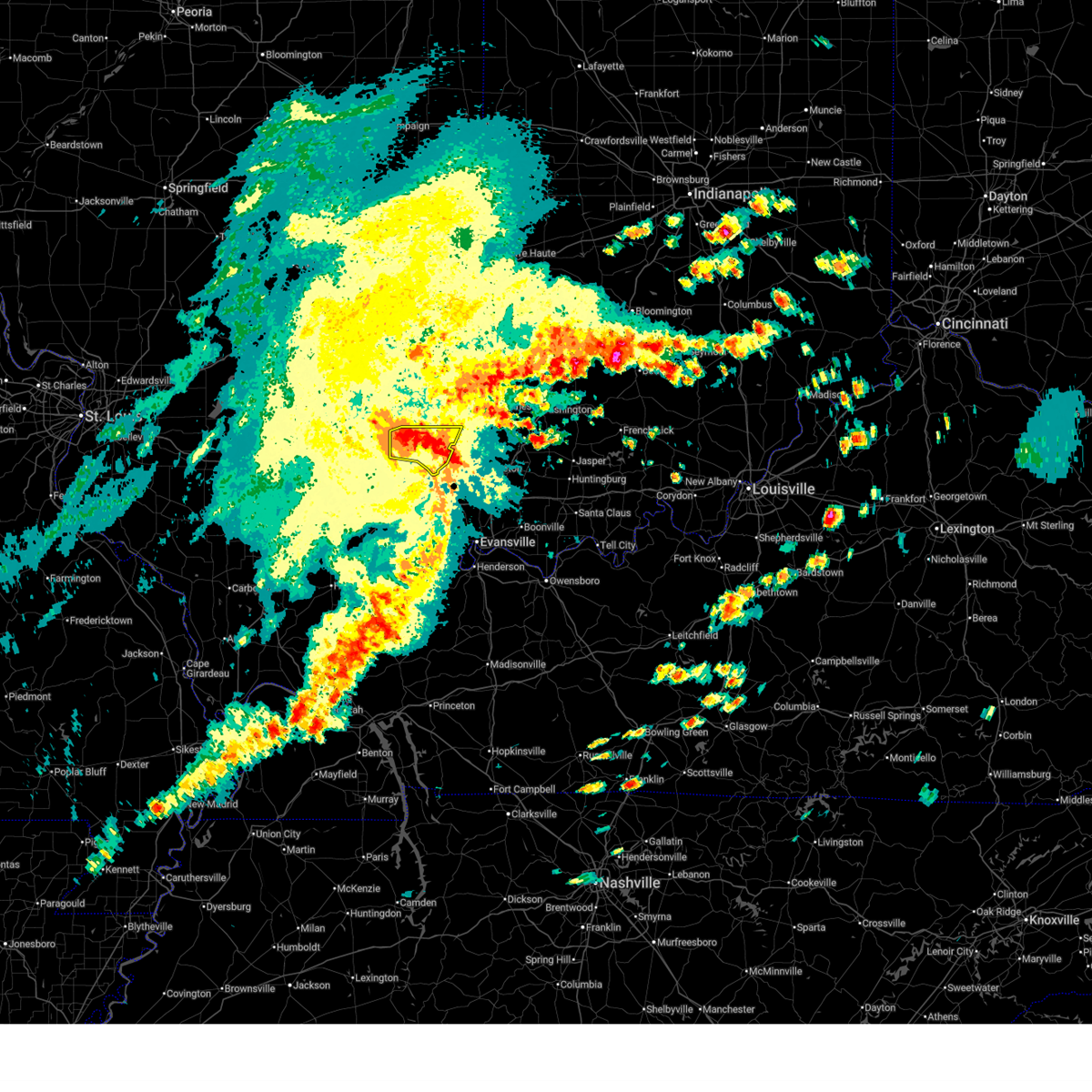
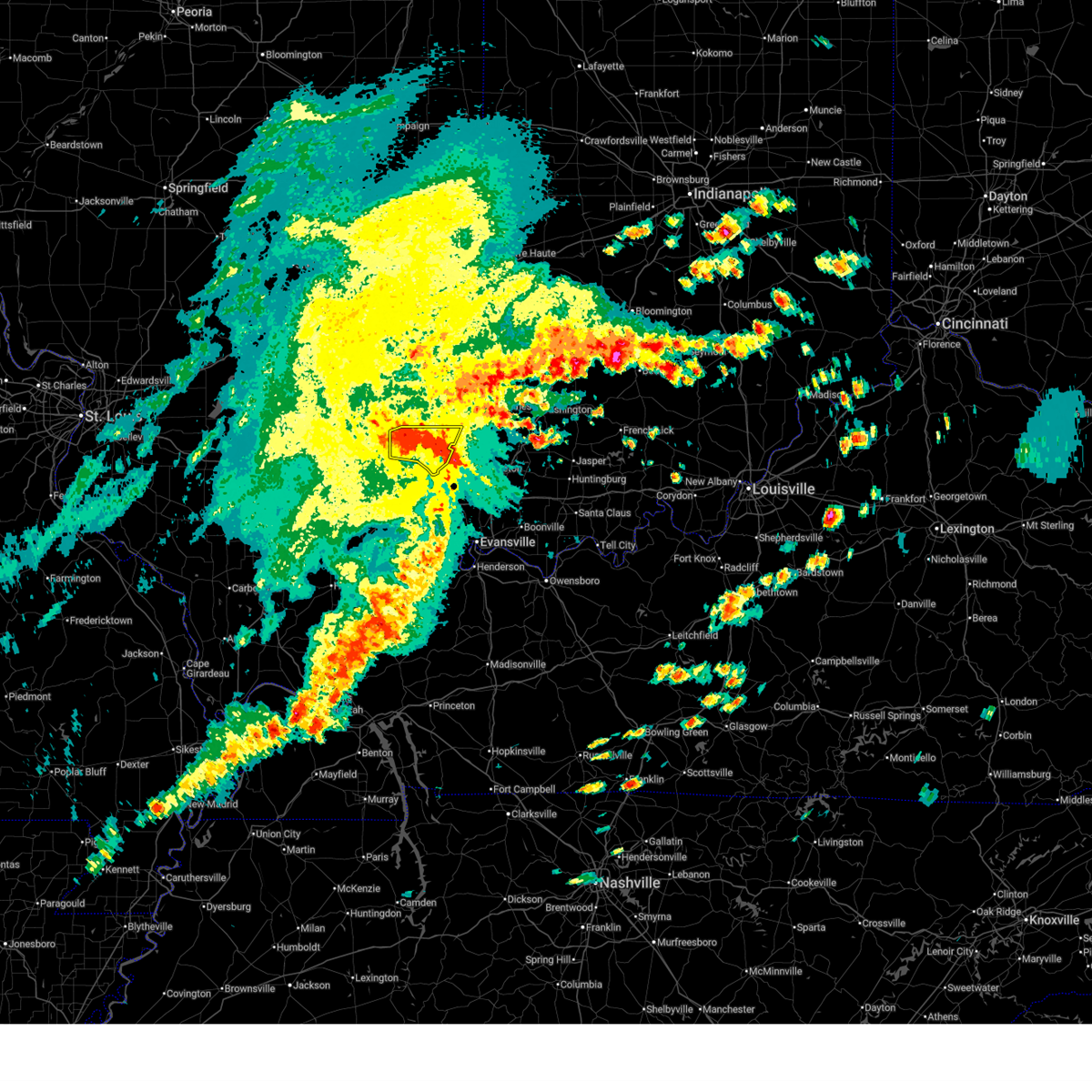
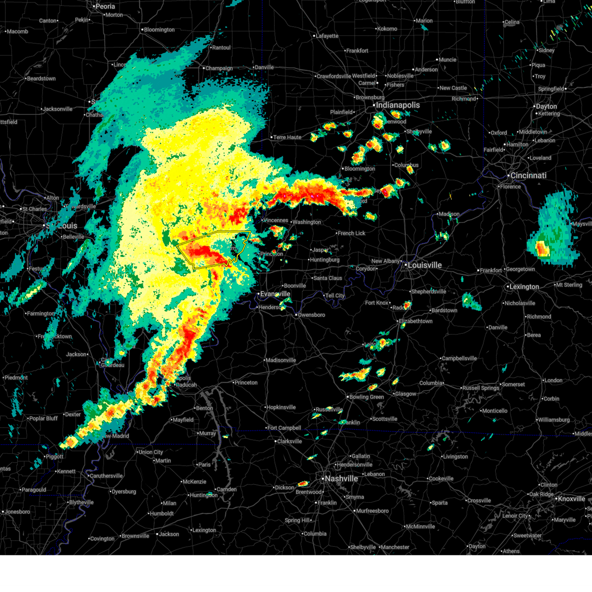
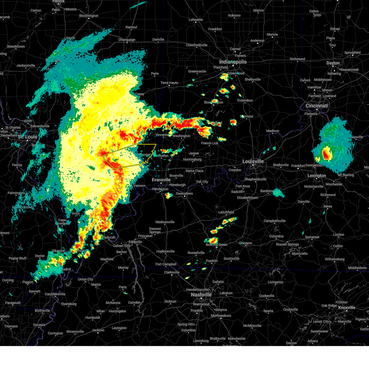
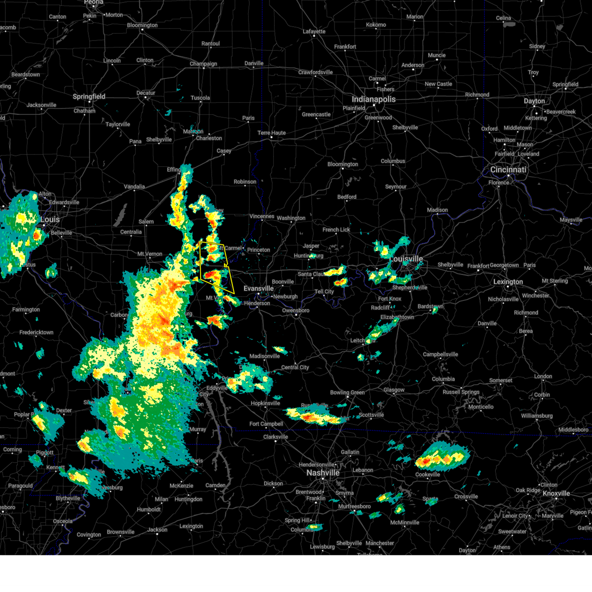
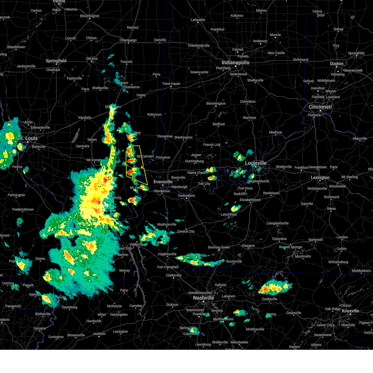
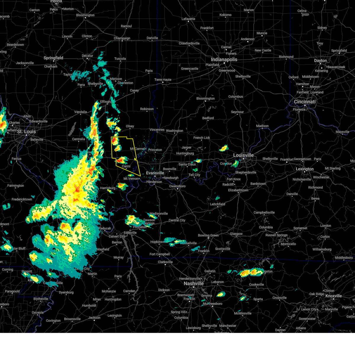
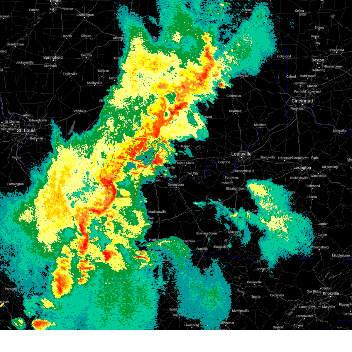
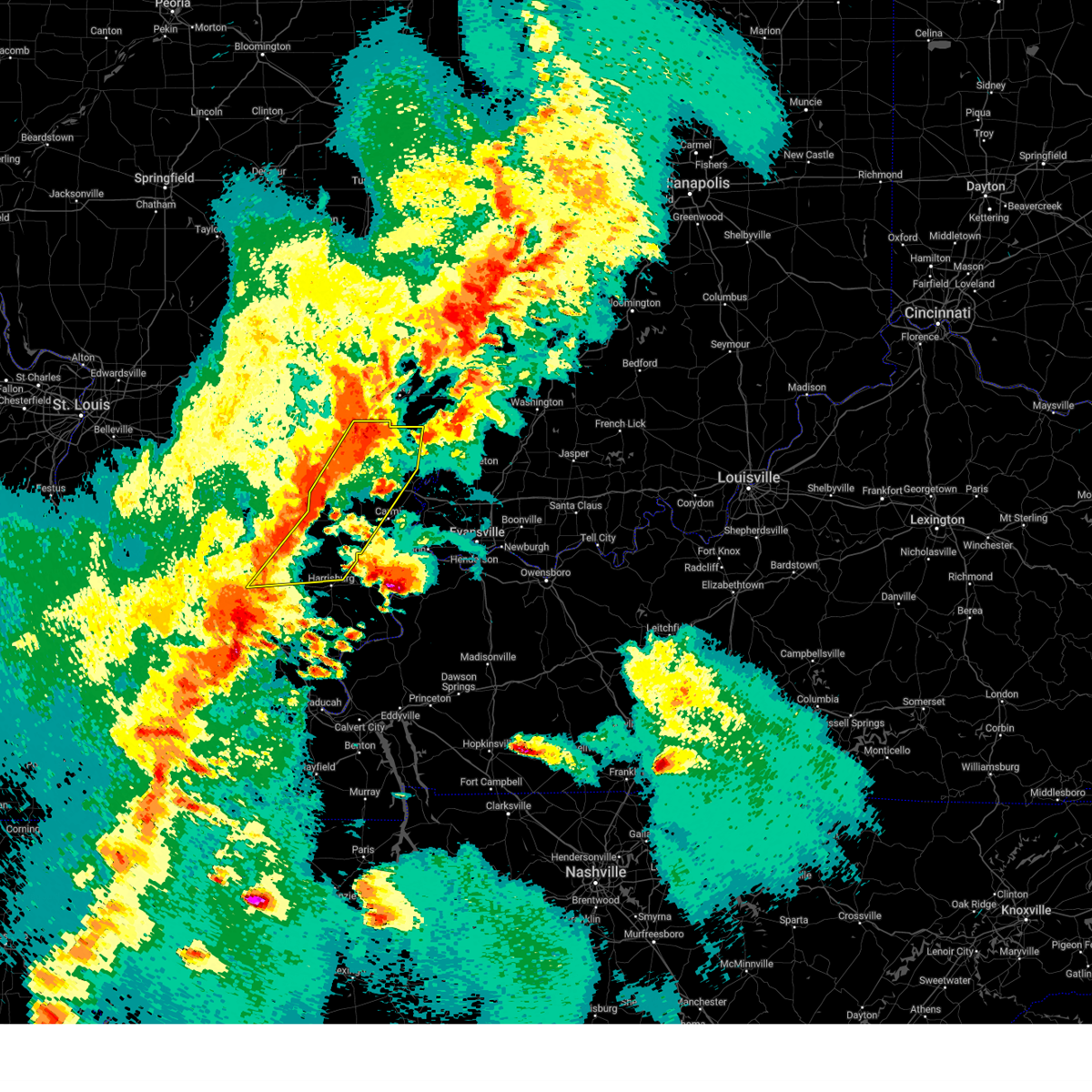
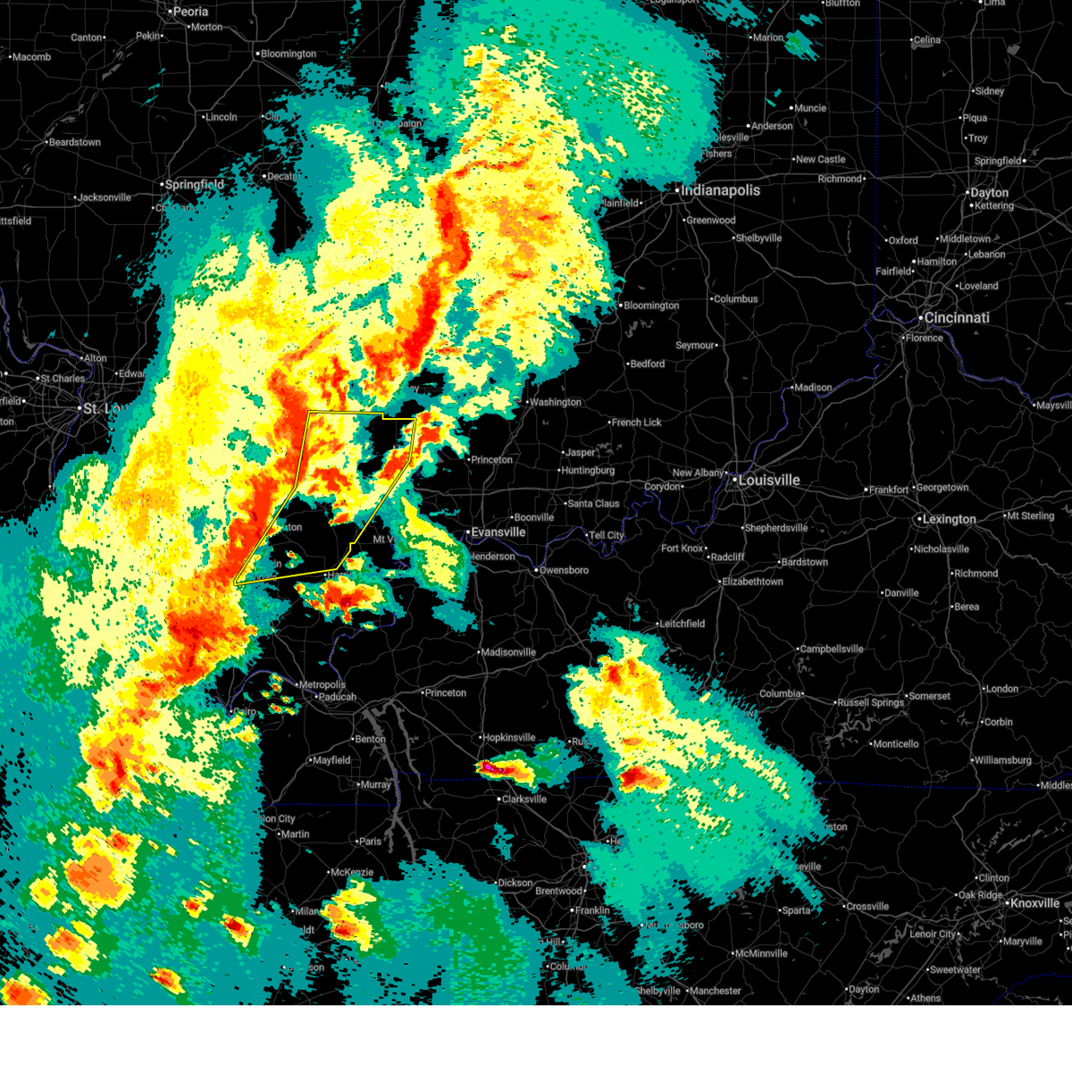
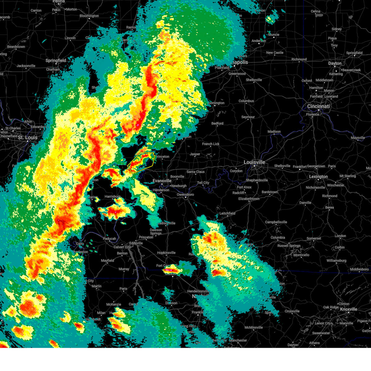
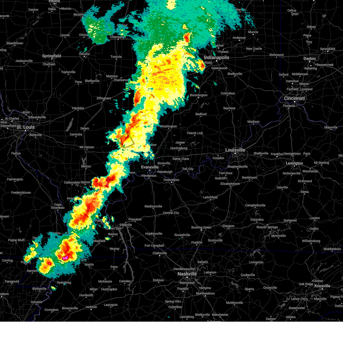
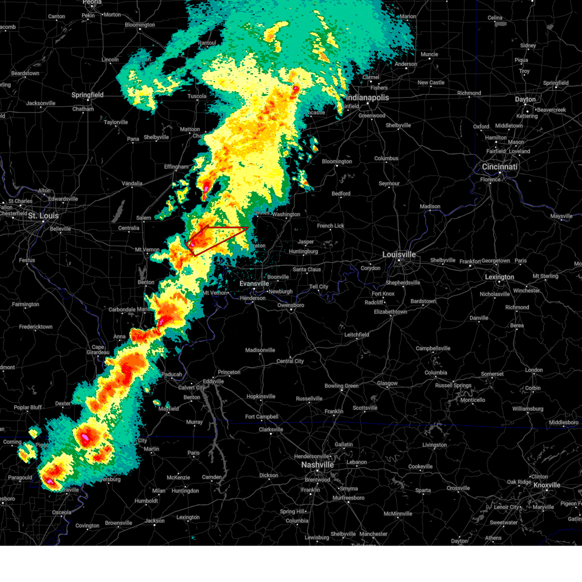
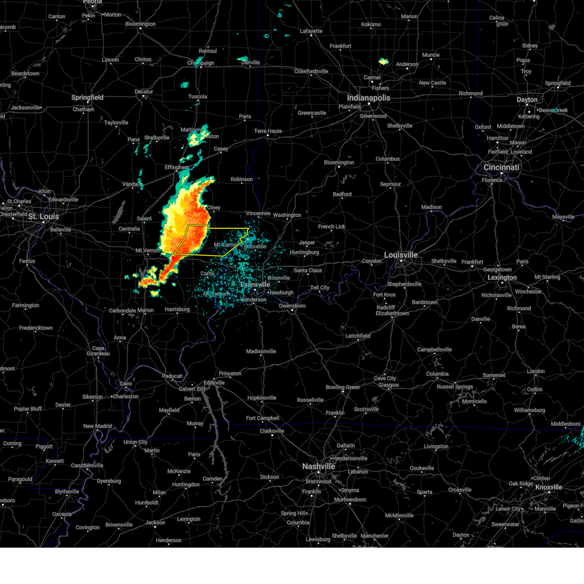
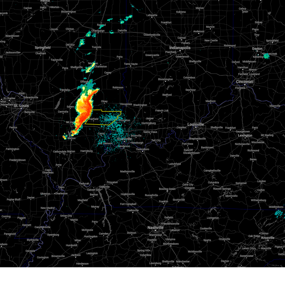
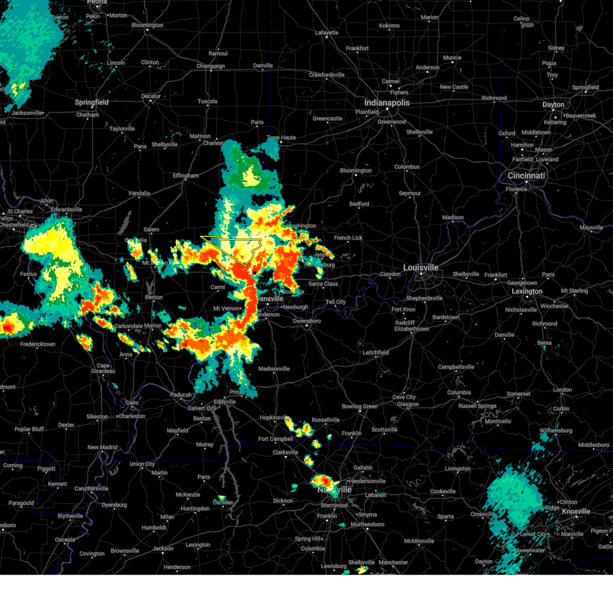
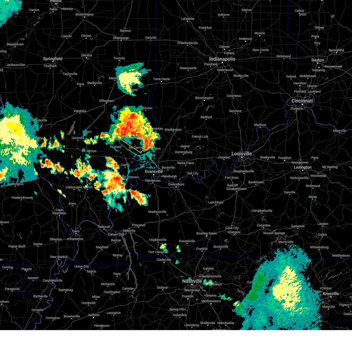
Hail Map for Bone Gap, IL
The Bone Gap, IL area has had 4 reports of on-the-ground hail by trained spotters, and has been under severe weather warnings 35 times during the past 12 months. Doppler radar has detected hail at or near Bone Gap, IL on 79 occasions, including 3 occasions during the past year.
| Name: | Bone Gap, IL |
| Where Located: | 39.9 miles NW of Evansville, IN |
| Map: | Google Map for Bone Gap, IL |
| Population: | 246 |
| Housing Units: | 105 |
| More Info: | Search Google for Bone Gap, IL |
0
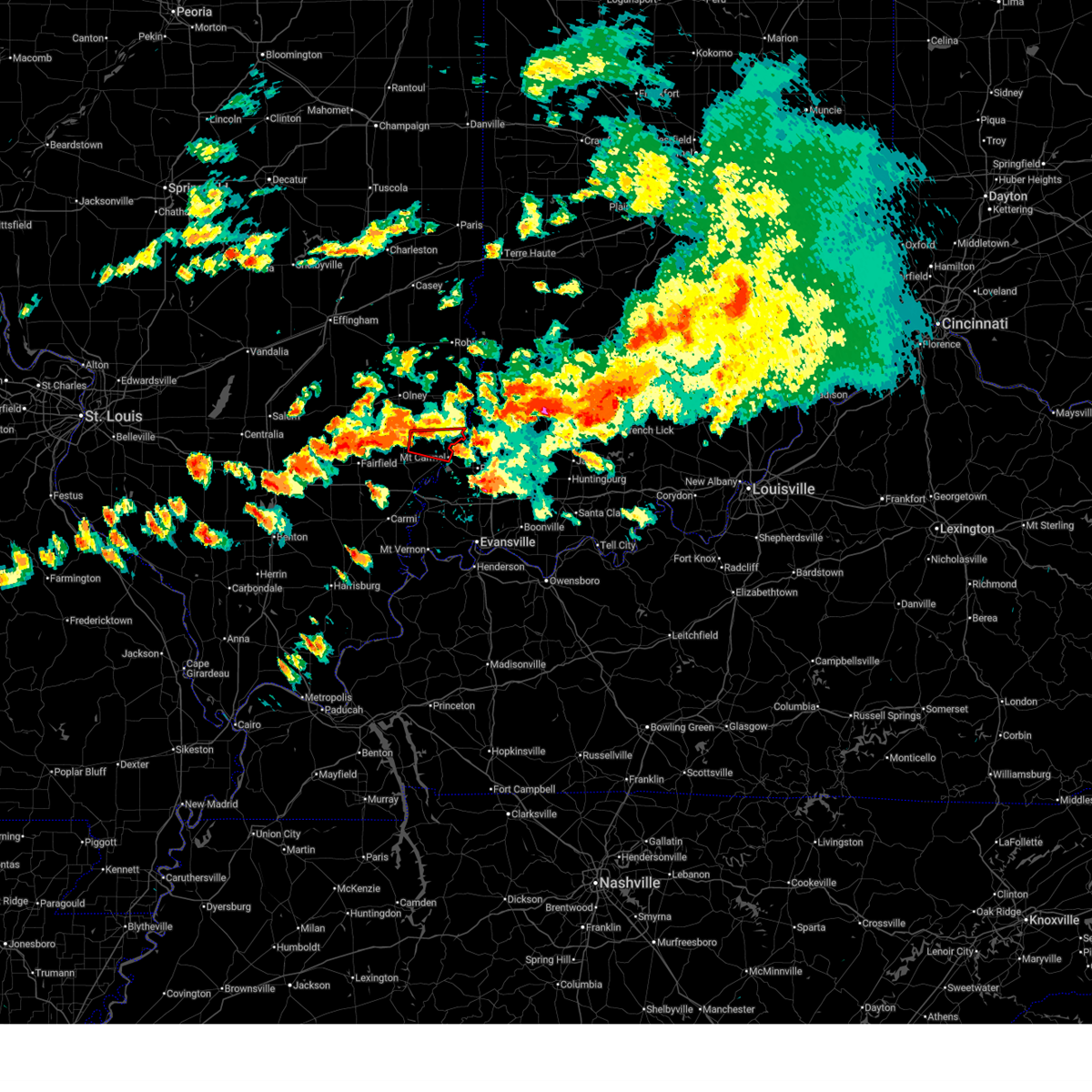
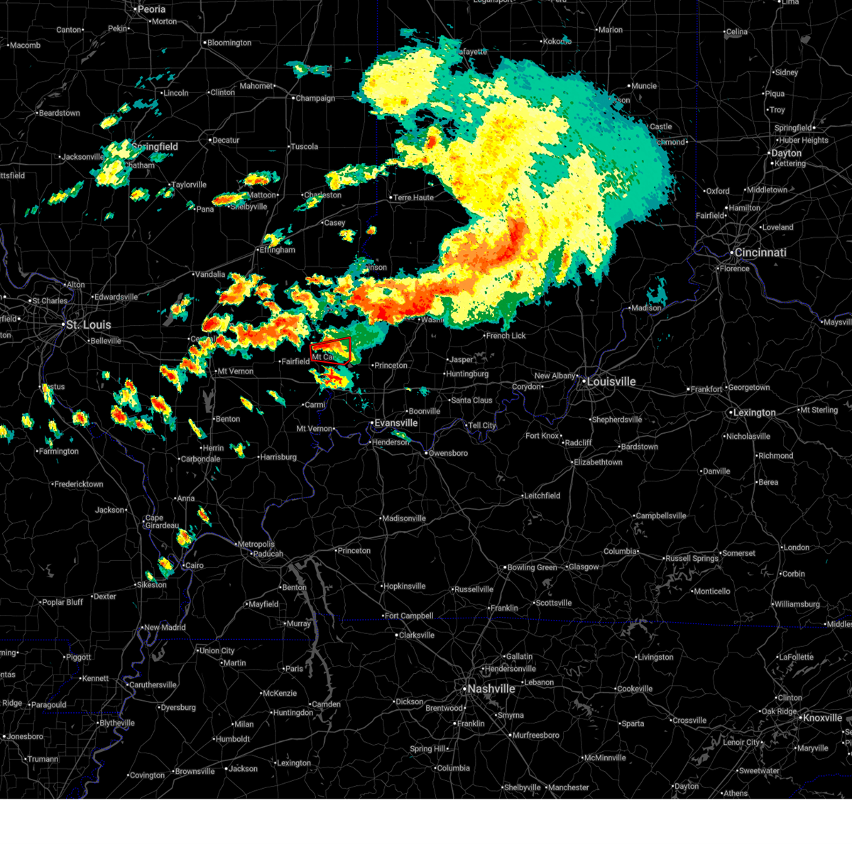
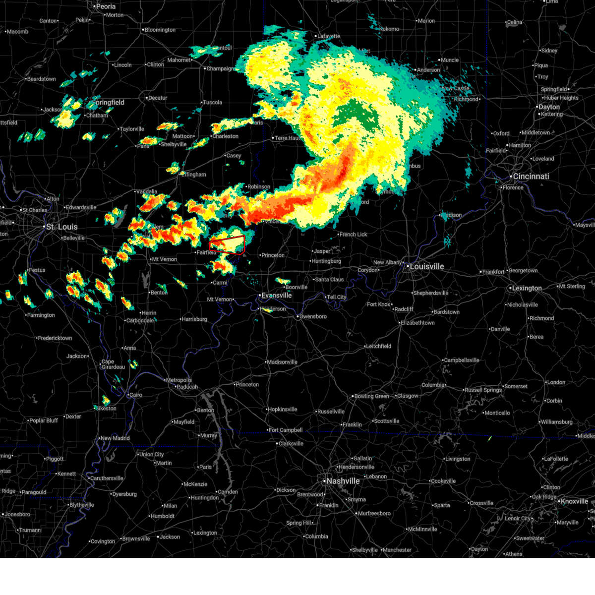
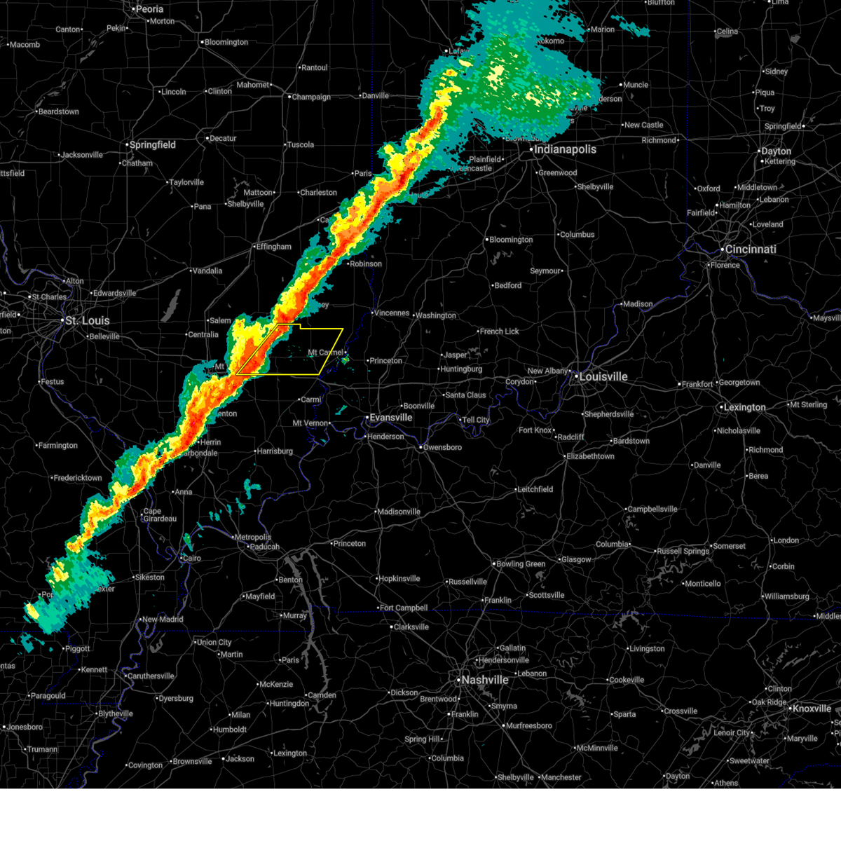
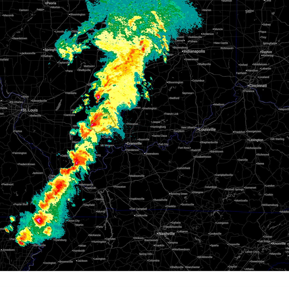
The Top Recent Hail Date for Bone Gap, IL is Saturday, June 27, 2026 (47th out of 79)
Hail and Wind Damage Spotted near Bone Gap, IL
| Date / Time | Report Details |
|---|---|
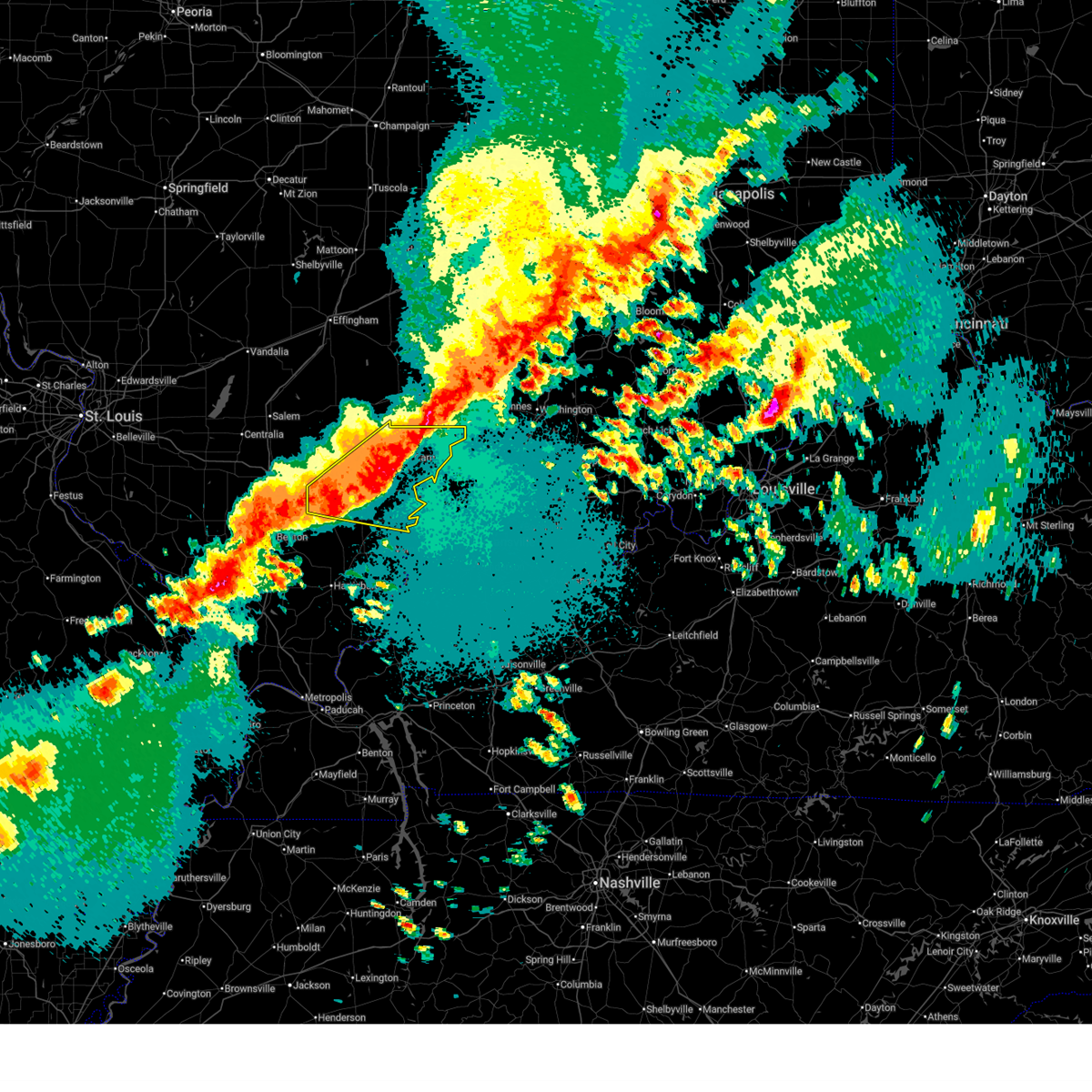
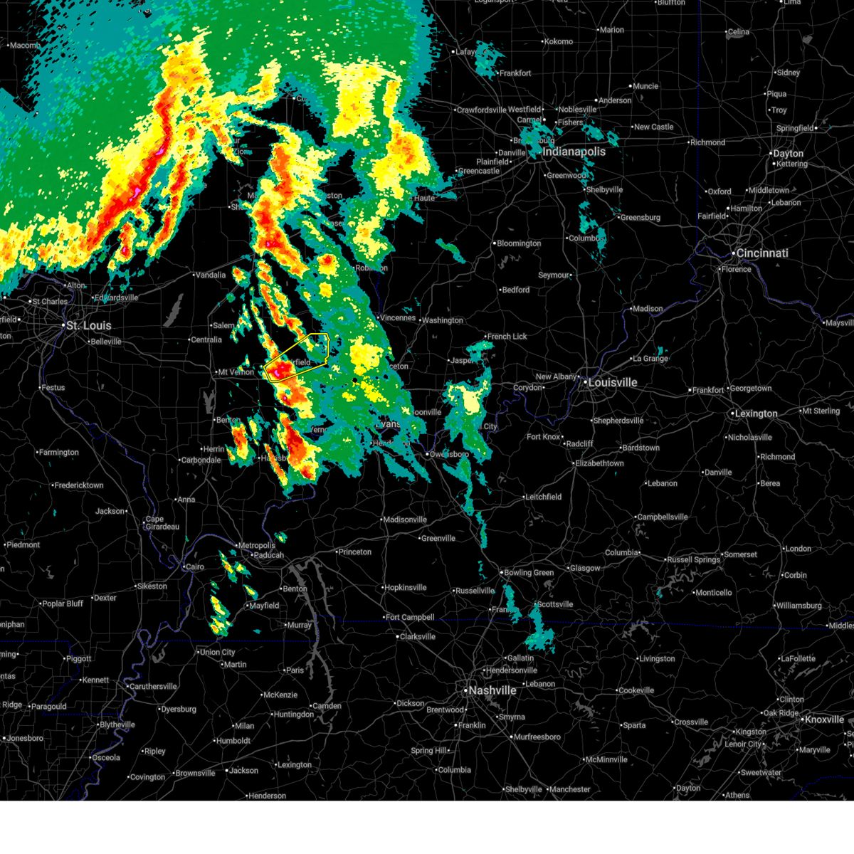
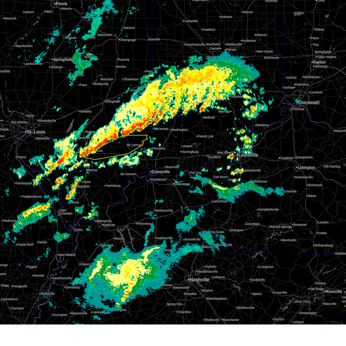
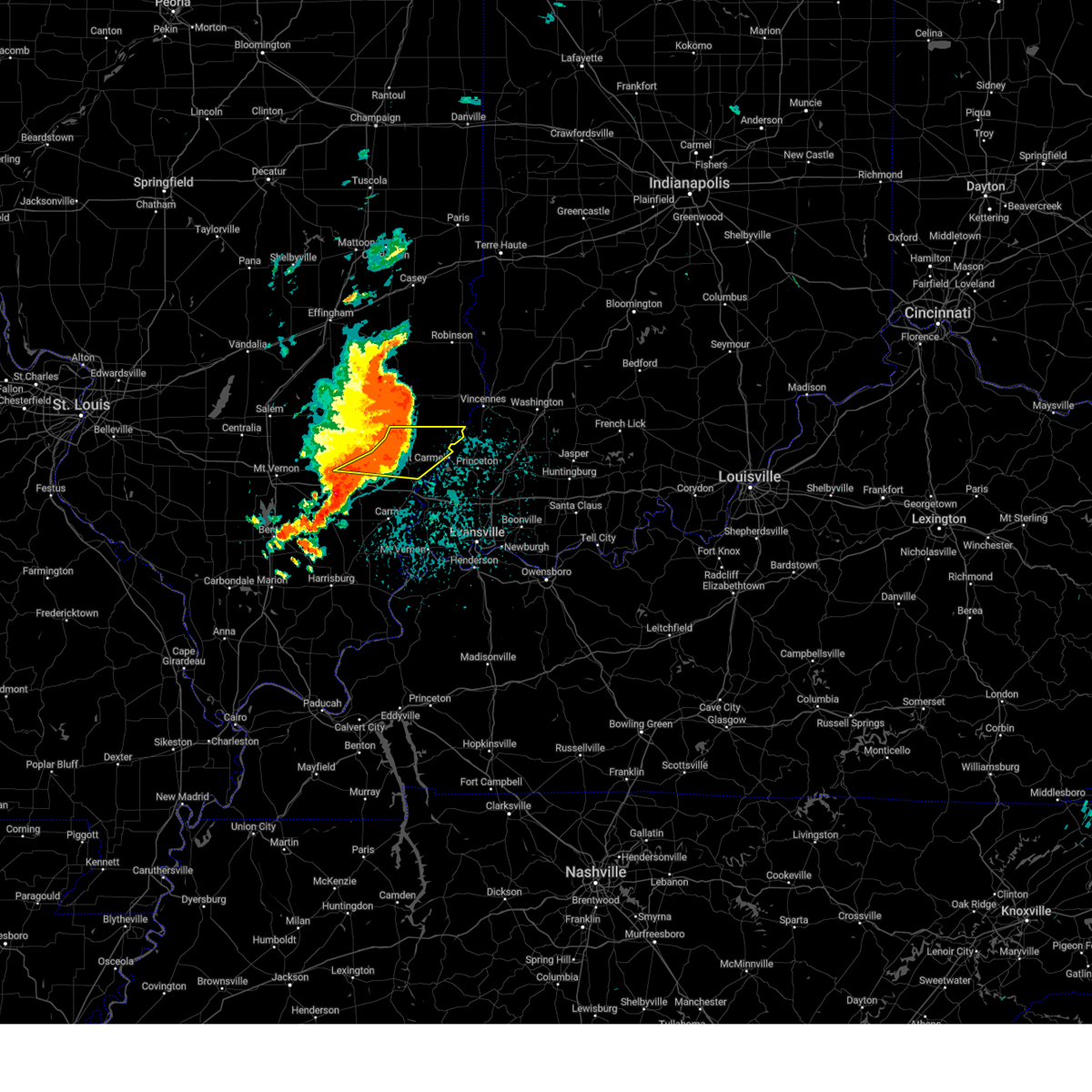
| 6/27/2026 2:21 PM CDT |
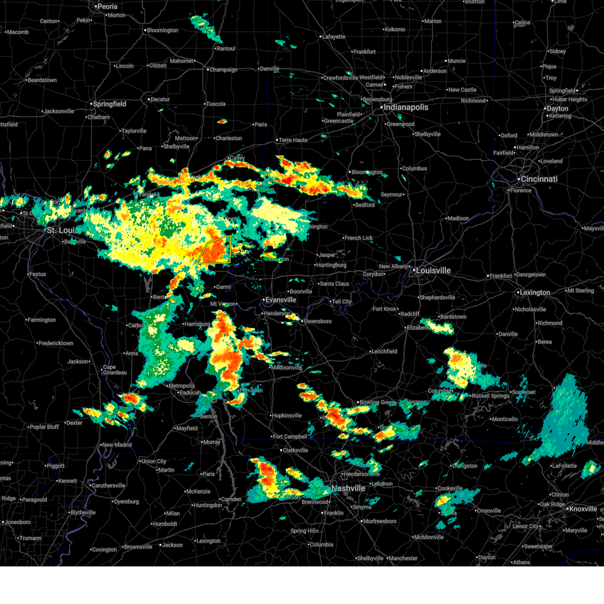 At 221 pm cdt, a severe thunderstorm was located 8 miles west of albion, moving east at 25 mph (radar indicated). Hazards include 60 mph wind gusts. Expect damage to roofs, siding, and trees. Locations impacted include, albion, west salem, bone gap, browns, and golden gate. At 221 pm cdt, a severe thunderstorm was located 8 miles west of albion, moving east at 25 mph (radar indicated). Hazards include 60 mph wind gusts. Expect damage to roofs, siding, and trees. Locations impacted include, albion, west salem, bone gap, browns, and golden gate.
|
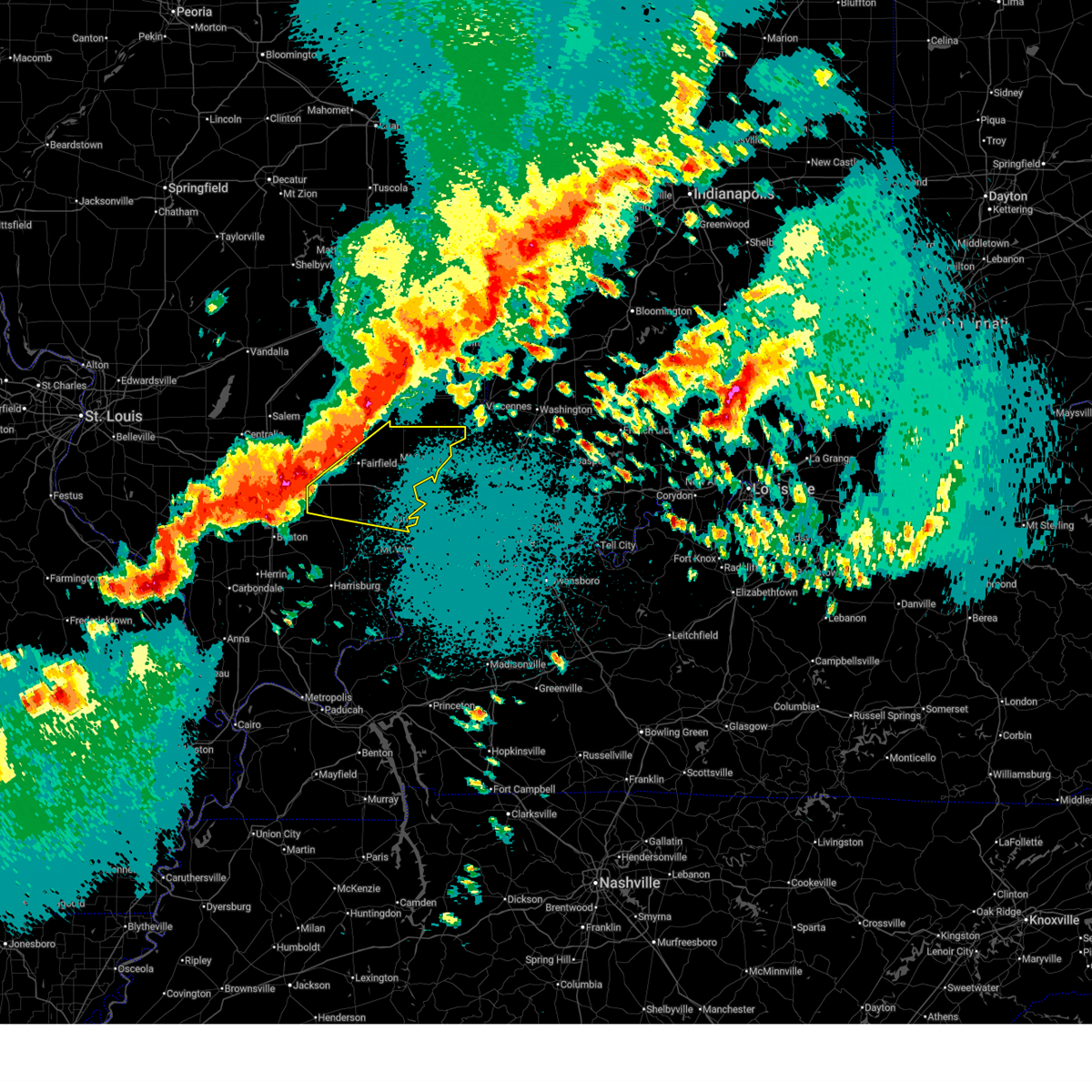
| 6/27/2026 1:54 PM CDT |
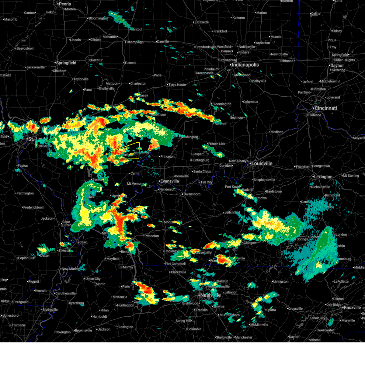 Svrpah the national weather service in paducah has issued a * severe thunderstorm warning for, southeastern wayne county in south central illinois, edwards county in southeastern illinois, * until 245 pm cdt. * at 154 pm cdt, a severe thunderstorm was located over fairfield, moving east at 25 mph (radar indicated). Hazards include 60 mph wind gusts. expect damage to roofs, siding, and trees Svrpah the national weather service in paducah has issued a * severe thunderstorm warning for, southeastern wayne county in south central illinois, edwards county in southeastern illinois, * until 245 pm cdt. * at 154 pm cdt, a severe thunderstorm was located over fairfield, moving east at 25 mph (radar indicated). Hazards include 60 mph wind gusts. expect damage to roofs, siding, and trees
|
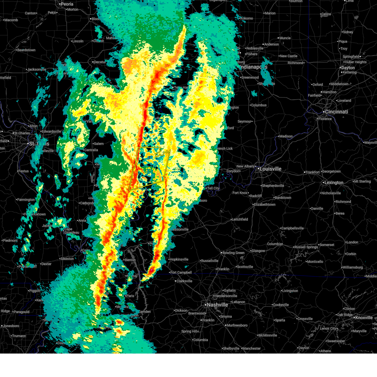
| 6/21/2026 7:43 PM CDT |
 At 743 pm cdt, a confirmed tornado was located near albion, moving east at 25 mph (weather spotters confirmed tornado). Hazards include damaging tornado. Flying debris will be dangerous to those caught without shelter. mobile homes will be damaged or destroyed. damage to roofs, windows, and vehicles will occur. tree damage is likely. this tornado will be near, albion around 750 pm cdt. Other locations impacted by this tornadic thunderstorm include bellmont, keensburg, browns, and bone gap. At 743 pm cdt, a confirmed tornado was located near albion, moving east at 25 mph (weather spotters confirmed tornado). Hazards include damaging tornado. Flying debris will be dangerous to those caught without shelter. mobile homes will be damaged or destroyed. damage to roofs, windows, and vehicles will occur. tree damage is likely. this tornado will be near, albion around 750 pm cdt. Other locations impacted by this tornadic thunderstorm include bellmont, keensburg, browns, and bone gap.
|
| 6/21/2026 7:39 PM CDT |
 Torpah the national weather service in paducah has issued a * tornado warning for, east central wayne county in south central illinois, west central wabash county in southeastern illinois, central edwards county in southeastern illinois, * until 830 pm cdt. * at 739 pm cdt, a severe thunderstorm capable of producing a tornado was located near albion, moving east at 25 mph (radar indicated rotation). Hazards include tornado. Flying debris will be dangerous to those caught without shelter. mobile homes will be damaged or destroyed. damage to roofs, windows, and vehicles will occur. tree damage is likely. this dangerous storm will be near, albion around 745 pm cdt. Other locations impacted by this tornadic thunderstorm include bellmont, keensburg, browns, and bone gap. Torpah the national weather service in paducah has issued a * tornado warning for, east central wayne county in south central illinois, west central wabash county in southeastern illinois, central edwards county in southeastern illinois, * until 830 pm cdt. * at 739 pm cdt, a severe thunderstorm capable of producing a tornado was located near albion, moving east at 25 mph (radar indicated rotation). Hazards include tornado. Flying debris will be dangerous to those caught without shelter. mobile homes will be damaged or destroyed. damage to roofs, windows, and vehicles will occur. tree damage is likely. this dangerous storm will be near, albion around 745 pm cdt. Other locations impacted by this tornadic thunderstorm include bellmont, keensburg, browns, and bone gap.
|
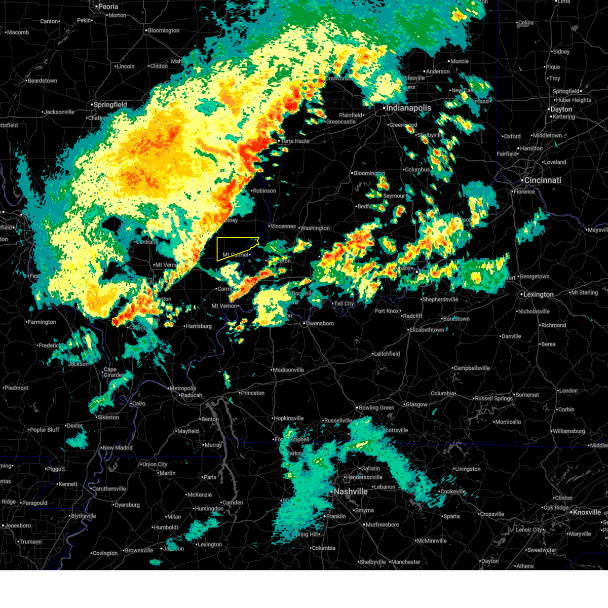
| 6/21/2026 7:20 PM CDT |
 Torpah the national weather service in paducah has issued a * tornado warning for, northern wabash county in southeastern illinois, northeastern edwards county in southeastern illinois, * until 800 pm cdt. * at 720 pm cdt, a severe thunderstorm capable of producing a tornado was located near west salem, or 8 miles northeast of albion, moving east at 30 mph (radar indicated rotation). Hazards include tornado and quarter size hail. Flying debris will be dangerous to those caught without shelter. mobile homes will be damaged or destroyed. damage to roofs, windows, and vehicles will occur. tree damage is likely. this dangerous storm will be near, mount carmel and lancaster around 725 pm cdt. Other locations impacted by this tornadic thunderstorm include allendale and bone gap. Torpah the national weather service in paducah has issued a * tornado warning for, northern wabash county in southeastern illinois, northeastern edwards county in southeastern illinois, * until 800 pm cdt. * at 720 pm cdt, a severe thunderstorm capable of producing a tornado was located near west salem, or 8 miles northeast of albion, moving east at 30 mph (radar indicated rotation). Hazards include tornado and quarter size hail. Flying debris will be dangerous to those caught without shelter. mobile homes will be damaged or destroyed. damage to roofs, windows, and vehicles will occur. tree damage is likely. this dangerous storm will be near, mount carmel and lancaster around 725 pm cdt. Other locations impacted by this tornadic thunderstorm include allendale and bone gap.
|
| 6/21/2026 6:32 PM CDT |
 At 632 pm cdt, a severe thunderstorm capable of producing a tornado was located near albion, moving east at 30 mph (radar indicated rotation). Hazards include tornado. Flying debris will be dangerous to those caught without shelter. mobile homes will be damaged or destroyed. damage to roofs, windows, and vehicles will occur. tree damage is likely. this dangerous storm will be near, mount carmel around 650 pm cdt. Other locations impacted by this tornadic thunderstorm include bellmont, bone gap, and browns. At 632 pm cdt, a severe thunderstorm capable of producing a tornado was located near albion, moving east at 30 mph (radar indicated rotation). Hazards include tornado. Flying debris will be dangerous to those caught without shelter. mobile homes will be damaged or destroyed. damage to roofs, windows, and vehicles will occur. tree damage is likely. this dangerous storm will be near, mount carmel around 650 pm cdt. Other locations impacted by this tornadic thunderstorm include bellmont, bone gap, and browns.
|
| 6/21/2026 6:23 PM CDT |
 At 623 pm cdt, a severe thunderstorm capable of producing a tornado was located near albion, moving east at 35 mph (radar indicated rotation). Hazards include tornado. Flying debris will be dangerous to those caught without shelter. mobile homes will be damaged or destroyed. damage to roofs, windows, and vehicles will occur. tree damage is likely. this dangerous storm will be near, albion around 630 pm cdt. mount carmel around 640 pm cdt. Other locations impacted by this tornadic thunderstorm include bellmont and bone gap. At 623 pm cdt, a severe thunderstorm capable of producing a tornado was located near albion, moving east at 35 mph (radar indicated rotation). Hazards include tornado. Flying debris will be dangerous to those caught without shelter. mobile homes will be damaged or destroyed. damage to roofs, windows, and vehicles will occur. tree damage is likely. this dangerous storm will be near, albion around 630 pm cdt. mount carmel around 640 pm cdt. Other locations impacted by this tornadic thunderstorm include bellmont and bone gap.
|
| 6/21/2026 6:15 PM CDT |
 Torpah the national weather service in paducah has issued a * tornado warning for, east central wayne county in south central illinois, central wabash county in southeastern illinois, central edwards county in southeastern illinois, * until 700 pm cdt. * at 615 pm cdt, a severe thunderstorm capable of producing a tornado was located 8 miles northwest of albion, moving east at 35 mph (radar indicated rotation). Hazards include tornado. Flying debris will be dangerous to those caught without shelter. mobile homes will be damaged or destroyed. damage to roofs, windows, and vehicles will occur. tree damage is likely. this dangerous storm will be near, albion around 620 pm cdt. mount carmel around 640 pm cdt. Other locations impacted by this tornadic thunderstorm include bellmont, browns, and bone gap. Torpah the national weather service in paducah has issued a * tornado warning for, east central wayne county in south central illinois, central wabash county in southeastern illinois, central edwards county in southeastern illinois, * until 700 pm cdt. * at 615 pm cdt, a severe thunderstorm capable of producing a tornado was located 8 miles northwest of albion, moving east at 35 mph (radar indicated rotation). Hazards include tornado. Flying debris will be dangerous to those caught without shelter. mobile homes will be damaged or destroyed. damage to roofs, windows, and vehicles will occur. tree damage is likely. this dangerous storm will be near, albion around 620 pm cdt. mount carmel around 640 pm cdt. Other locations impacted by this tornadic thunderstorm include bellmont, browns, and bone gap.
|
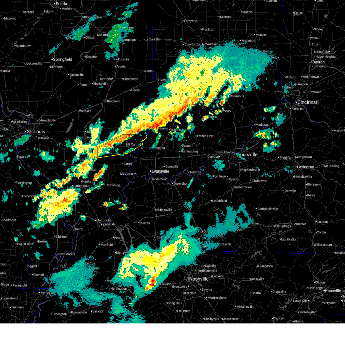
| 4/27/2026 9:54 PM CDT |
 At 953 pm cdt, severe thunderstorms were located along a line extending from near lancaster to near mcleansboro, moving east at 45 mph (radar indicated). Hazards include 60 mph wind gusts and quarter size hail. Hail damage to vehicles is expected. expect wind damage to roofs, siding, and trees. locations impacted include, mount carmel, carmi, fairfield, mcleansboro, albion, grayville, lancaster, west salem, crossville, enfield, dahlgren, allendale, jeffersonville, bellmont, sims, bone gap, mill shoals, keensburg, maunie, and browns. This includes interstate 64 in illinois between mile markers 92 and 130. At 953 pm cdt, severe thunderstorms were located along a line extending from near lancaster to near mcleansboro, moving east at 45 mph (radar indicated). Hazards include 60 mph wind gusts and quarter size hail. Hail damage to vehicles is expected. expect wind damage to roofs, siding, and trees. locations impacted include, mount carmel, carmi, fairfield, mcleansboro, albion, grayville, lancaster, west salem, crossville, enfield, dahlgren, allendale, jeffersonville, bellmont, sims, bone gap, mill shoals, keensburg, maunie, and browns. This includes interstate 64 in illinois between mile markers 92 and 130.
|
| 4/27/2026 9:23 PM CDT |
 Svrpah the national weather service in paducah has issued a * severe thunderstorm warning for, white county in southeastern illinois, southern wayne county in south central illinois, wabash county in southeastern illinois, edwards county in southeastern illinois, northern hamilton county in south central illinois, * until 1030 pm cdt. * at 923 pm cdt, severe thunderstorms were located along a line extending from 9 miles south of noble to near rend lake area, moving east at 45 mph (radar indicated). Hazards include 60 mph wind gusts and quarter size hail. Hail damage to vehicles is expected. Expect wind damage to roofs, siding, and trees. Svrpah the national weather service in paducah has issued a * severe thunderstorm warning for, white county in southeastern illinois, southern wayne county in south central illinois, wabash county in southeastern illinois, edwards county in southeastern illinois, northern hamilton county in south central illinois, * until 1030 pm cdt. * at 923 pm cdt, severe thunderstorms were located along a line extending from 9 miles south of noble to near rend lake area, moving east at 45 mph (radar indicated). Hazards include 60 mph wind gusts and quarter size hail. Hail damage to vehicles is expected. Expect wind damage to roofs, siding, and trees.
|
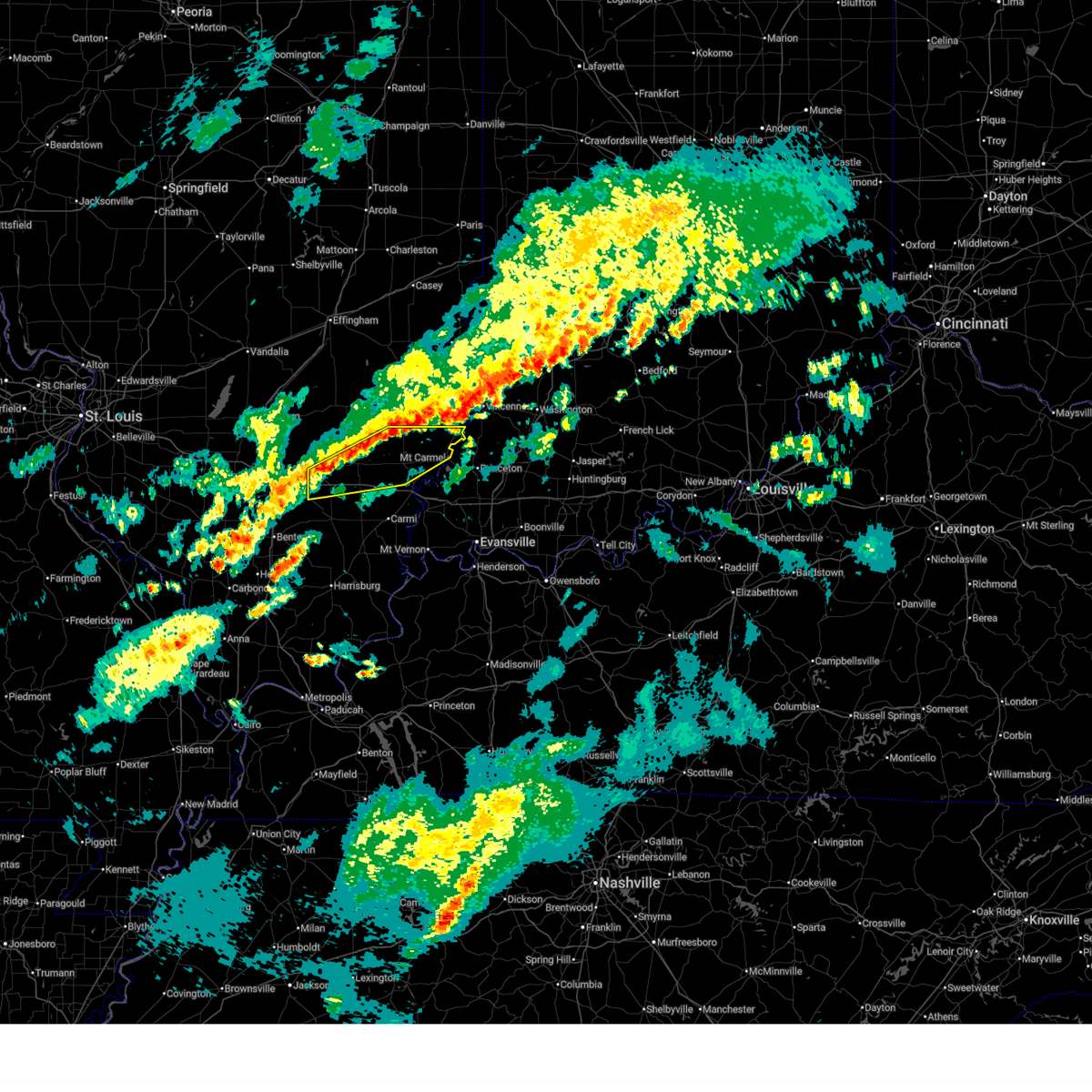
| 4/27/2026 5:37 PM CDT |
 At 537 pm cdt, a severe thunderstorm was located near grayville, or near albion, moving northeast at 50 mph (radar indicated). Hazards include 60 mph wind gusts and half dollar size hail. Hail damage to vehicles is expected. expect wind damage to roofs, siding, and trees. Locations impacted include, mount carmel, albion, grayville, bellmont, bone gap, keensburg, and browns. At 537 pm cdt, a severe thunderstorm was located near grayville, or near albion, moving northeast at 50 mph (radar indicated). Hazards include 60 mph wind gusts and half dollar size hail. Hail damage to vehicles is expected. expect wind damage to roofs, siding, and trees. Locations impacted include, mount carmel, albion, grayville, bellmont, bone gap, keensburg, and browns.
|
| 4/27/2026 5:19 PM CDT |
 Svrpah the national weather service in paducah has issued a * severe thunderstorm warning for, northern white county in southeastern illinois, southeastern wayne county in south central illinois, wabash county in southeastern illinois, edwards county in southeastern illinois, southwestern gibson county in southwestern indiana, north central posey county in southwestern indiana, * until 600 pm cdt. * at 519 pm cdt, a severe thunderstorm was located 8 miles west of crossville, or 8 miles north of carmi, moving northeast at 50 mph (radar indicated). Hazards include 60 mph wind gusts and half dollar size hail. Hail damage to vehicles is expected. Expect wind damage to roofs, siding, and trees. Svrpah the national weather service in paducah has issued a * severe thunderstorm warning for, northern white county in southeastern illinois, southeastern wayne county in south central illinois, wabash county in southeastern illinois, edwards county in southeastern illinois, southwestern gibson county in southwestern indiana, north central posey county in southwestern indiana, * until 600 pm cdt. * at 519 pm cdt, a severe thunderstorm was located 8 miles west of crossville, or 8 miles north of carmi, moving northeast at 50 mph (radar indicated). Hazards include 60 mph wind gusts and half dollar size hail. Hail damage to vehicles is expected. Expect wind damage to roofs, siding, and trees.
|
| 4/27/2026 4:14 PM CDT |
 Svrpah the national weather service in paducah has issued a * severe thunderstorm warning for, wabash county in southeastern illinois, central edwards county in southeastern illinois, northwestern gibson county in southwestern indiana, * until 500 pm cdt. * at 413 pm cdt, a severe thunderstorm was located near albion, moving east at 45 mph (radar indicated). Hazards include 60 mph wind gusts and quarter size hail. Hail damage to vehicles is expected. Expect wind damage to roofs, siding, and trees. Svrpah the national weather service in paducah has issued a * severe thunderstorm warning for, wabash county in southeastern illinois, central edwards county in southeastern illinois, northwestern gibson county in southwestern indiana, * until 500 pm cdt. * at 413 pm cdt, a severe thunderstorm was located near albion, moving east at 45 mph (radar indicated). Hazards include 60 mph wind gusts and quarter size hail. Hail damage to vehicles is expected. Expect wind damage to roofs, siding, and trees.
|
| 4/27/2026 11:16 AM CDT |
 the severe thunderstorm warning has been cancelled and is no longer in effect the severe thunderstorm warning has been cancelled and is no longer in effect
|
| 4/27/2026 10:57 AM CDT |
 At 1056 am cdt, a severe thunderstorm was located 7 miles east of fairfield, moving northeast at 30 mph (radar indicated). Hazards include quarter size hail. Damage to vehicles is expected. Locations impacted include, albion, west salem, bone gap, browns, and golden gate. At 1056 am cdt, a severe thunderstorm was located 7 miles east of fairfield, moving northeast at 30 mph (radar indicated). Hazards include quarter size hail. Damage to vehicles is expected. Locations impacted include, albion, west salem, bone gap, browns, and golden gate.
|
| 4/27/2026 10:37 AM CDT |
 Svrpah the national weather service in paducah has issued a * severe thunderstorm warning for, southeastern wayne county in south central illinois, edwards county in southeastern illinois, * until 1130 am cdt. * at 1037 am cdt, a severe thunderstorm was located near fairfield, moving northeast at 35 mph (radar indicated). Hazards include half dollar size hail. damage to vehicles is expected Svrpah the national weather service in paducah has issued a * severe thunderstorm warning for, southeastern wayne county in south central illinois, edwards county in southeastern illinois, * until 1130 am cdt. * at 1037 am cdt, a severe thunderstorm was located near fairfield, moving northeast at 35 mph (radar indicated). Hazards include half dollar size hail. damage to vehicles is expected
|
| 3/15/2026 9:14 PM EDT |
 Svrpah the national weather service in paducah has issued a * severe thunderstorm warning for, central white county in southeastern illinois, wabash county in southeastern illinois, edwards county in southeastern illinois, gibson county in southwestern indiana, northwestern vanderburgh county in southwestern indiana, northern posey county in southwestern indiana, * until 900 pm cdt. * at 813 pm cdt, severe thunderstorms were located along a line extending from near parkersburg to near norris city, moving northeast at 55 mph (radar indicated). Hazards include 60 mph wind gusts. expect damage to roofs, siding, and trees Svrpah the national weather service in paducah has issued a * severe thunderstorm warning for, central white county in southeastern illinois, wabash county in southeastern illinois, edwards county in southeastern illinois, gibson county in southwestern indiana, northwestern vanderburgh county in southwestern indiana, northern posey county in southwestern indiana, * until 900 pm cdt. * at 813 pm cdt, severe thunderstorms were located along a line extending from near parkersburg to near norris city, moving northeast at 55 mph (radar indicated). Hazards include 60 mph wind gusts. expect damage to roofs, siding, and trees
|
| 3/11/2026 1:08 PM CDT |
 The storms which prompted the warning have weakened below severe limits, and no longer pose an immediate threat to life or property. therefore, the warning will be allowed to expire. however, gusty winds are still possible with these thunderstorms. The storms which prompted the warning have weakened below severe limits, and no longer pose an immediate threat to life or property. therefore, the warning will be allowed to expire. however, gusty winds are still possible with these thunderstorms.
|
| 3/11/2026 1:00 PM CDT |
 the severe thunderstorm warning has been cancelled and is no longer in effect the severe thunderstorm warning has been cancelled and is no longer in effect
|
| 3/11/2026 1:00 PM CDT |
 At 100 pm cdt, severe thunderstorms were located along a line extending from near lancaster to near wayne city, moving east at 45 mph (radar indicated). Hazards include 60 mph wind gusts. Expect damage to roofs, siding, and trees. locations impacted include, mount carmel, fairfield, albion, lancaster, wayne city, west salem, dahlgren, allendale, jeffersonville, bellmont, sims, bone gap, mill shoals, browns, mount erie, keenes, golden gate, belle prairie city, and burnt prairie. This includes interstate 64 in illinois between mile markers 92 and 117. At 100 pm cdt, severe thunderstorms were located along a line extending from near lancaster to near wayne city, moving east at 45 mph (radar indicated). Hazards include 60 mph wind gusts. Expect damage to roofs, siding, and trees. locations impacted include, mount carmel, fairfield, albion, lancaster, wayne city, west salem, dahlgren, allendale, jeffersonville, bellmont, sims, bone gap, mill shoals, browns, mount erie, keenes, golden gate, belle prairie city, and burnt prairie. This includes interstate 64 in illinois between mile markers 92 and 117.
|
| 3/11/2026 12:37 PM CDT |
 Svrpah the national weather service in paducah has issued a * severe thunderstorm warning for, northwestern white county in southeastern illinois, wayne county in south central illinois, wabash county in southeastern illinois, southern jefferson county in south central illinois, edwards county in southeastern illinois, northern hamilton county in south central illinois, * until 115 pm cdt. * at 1237 pm cdt, severe thunderstorms were located along a line extending from 6 miles southwest of parkersburg to near mount vernon, moving east at 55 mph (radar indicated). Hazards include 60 mph wind gusts. expect damage to roofs, siding, and trees Svrpah the national weather service in paducah has issued a * severe thunderstorm warning for, northwestern white county in southeastern illinois, wayne county in south central illinois, wabash county in southeastern illinois, southern jefferson county in south central illinois, edwards county in southeastern illinois, northern hamilton county in south central illinois, * until 115 pm cdt. * at 1237 pm cdt, severe thunderstorms were located along a line extending from 6 miles southwest of parkersburg to near mount vernon, moving east at 55 mph (radar indicated). Hazards include 60 mph wind gusts. expect damage to roofs, siding, and trees
|
| 3/11/2026 6:33 AM CDT |
 Svrpah the national weather service in paducah has issued a * severe thunderstorm warning for, northern wabash county in southeastern illinois, edwards county in southeastern illinois, * until 715 am cdt. * at 633 am cdt, severe thunderstorms were located along a line extending from 9 miles west of parkersburg to 8 miles southwest of fairfield, moving northeast at 65 mph (radar indicated). Hazards include 60 mph wind gusts. expect damage to roofs, siding, and trees Svrpah the national weather service in paducah has issued a * severe thunderstorm warning for, northern wabash county in southeastern illinois, edwards county in southeastern illinois, * until 715 am cdt. * at 633 am cdt, severe thunderstorms were located along a line extending from 9 miles west of parkersburg to 8 miles southwest of fairfield, moving northeast at 65 mph (radar indicated). Hazards include 60 mph wind gusts. expect damage to roofs, siding, and trees
|
| 12/28/2025 7:03 PM EST |
 the severe thunderstorm warning has been cancelled and is no longer in effect the severe thunderstorm warning has been cancelled and is no longer in effect
|
| 12/28/2025 7:03 PM EST |
 At 602 pm cst/702 pm est/, severe thunderstorms were located along a line extending from near lancaster to 6 miles west of grayville, moving east at 60 mph (radar indicated). Hazards include 70 mph wind gusts. Expect considerable tree damage. damage is likely to mobile homes, roofs, and outbuildings. Locations impacted include, princeton, mount carmel, fort branch, albion, grayville, lancaster, owensville, patoka, allendale, bellmont, hazleton, bone gap, keensburg, and browns. At 602 pm cst/702 pm est/, severe thunderstorms were located along a line extending from near lancaster to 6 miles west of grayville, moving east at 60 mph (radar indicated). Hazards include 70 mph wind gusts. Expect considerable tree damage. damage is likely to mobile homes, roofs, and outbuildings. Locations impacted include, princeton, mount carmel, fort branch, albion, grayville, lancaster, owensville, patoka, allendale, bellmont, hazleton, bone gap, keensburg, and browns.
|
| 12/28/2025 6:55 PM EST |
 Svrpah the national weather service in paducah has issued a * severe thunderstorm warning for, north central white county in southeastern illinois, southeastern wayne county in south central illinois, wabash county in southeastern illinois, edwards county in southeastern illinois, gibson county in southwestern indiana, northwestern pike county in southwestern indiana, * until 645 pm cst/745 pm est/. * at 554 pm cst/654 pm est/, severe thunderstorms were located along a line extending from near parkersburg to 11 miles southeast of fairfield, moving east at 60 mph (radar indicated). Hazards include 70 mph wind gusts. Expect considerable tree damage. Damage is likely to mobile homes, roofs, and outbuildings. Svrpah the national weather service in paducah has issued a * severe thunderstorm warning for, north central white county in southeastern illinois, southeastern wayne county in south central illinois, wabash county in southeastern illinois, edwards county in southeastern illinois, gibson county in southwestern indiana, northwestern pike county in southwestern indiana, * until 645 pm cst/745 pm est/. * at 554 pm cst/654 pm est/, severe thunderstorms were located along a line extending from near parkersburg to 11 miles southeast of fairfield, moving east at 60 mph (radar indicated). Hazards include 70 mph wind gusts. Expect considerable tree damage. Damage is likely to mobile homes, roofs, and outbuildings.
|
| 12/28/2025 6:54 PM EST |
 Svrpah the national weather service in paducah has issued a * severe thunderstorm warning for, north central white county in southeastern illinois, southeastern wayne county in south central illinois, wabash county in southeastern illinois, edwards county in southeastern illinois, gibson county in southwestern indiana, northwestern pike county in southwestern indiana, * until 645 pm cst/745 pm est/. * at 554 pm cst/654 pm est/, severe thunderstorms were located along a line extending from near lancaster to 10 miles northwest of crossville, moving east at 60 mph (radar indicated). Hazards include 60 mph wind gusts. expect damage to roofs, siding, and trees Svrpah the national weather service in paducah has issued a * severe thunderstorm warning for, north central white county in southeastern illinois, southeastern wayne county in south central illinois, wabash county in southeastern illinois, edwards county in southeastern illinois, gibson county in southwestern indiana, northwestern pike county in southwestern indiana, * until 645 pm cst/745 pm est/. * at 554 pm cst/654 pm est/, severe thunderstorms were located along a line extending from near lancaster to 10 miles northwest of crossville, moving east at 60 mph (radar indicated). Hazards include 60 mph wind gusts. expect damage to roofs, siding, and trees
|
| 12/28/2025 5:50 PM CST |
 the tornado warning has been cancelled and is no longer in effect the tornado warning has been cancelled and is no longer in effect
|
| 12/28/2025 5:50 PM CST |
 At 550 pm cst, a severe thunderstorm capable of producing a tornado was located near albion, moving east at 45 mph (radar indicated rotation). Hazards include tornado. Flying debris will be dangerous to those caught without shelter. mobile homes will be damaged or destroyed. damage to roofs, windows, and vehicles will occur. tree damage is likely. this dangerous storm will be near, albion around 555 pm cst. mount carmel around 600 pm cst. Other locations impacted by this tornadic thunderstorm include bellmont, keensburg, browns, and bone gap. At 550 pm cst, a severe thunderstorm capable of producing a tornado was located near albion, moving east at 45 mph (radar indicated rotation). Hazards include tornado. Flying debris will be dangerous to those caught without shelter. mobile homes will be damaged or destroyed. damage to roofs, windows, and vehicles will occur. tree damage is likely. this dangerous storm will be near, albion around 555 pm cst. mount carmel around 600 pm cst. Other locations impacted by this tornadic thunderstorm include bellmont, keensburg, browns, and bone gap.
|
| 12/28/2025 5:44 PM CST |
 At 544 pm cst, a severe thunderstorm capable of producing a tornado was located 8 miles northwest of albion, moving east at 45 mph (radar indicated rotation). Hazards include tornado. Flying debris will be dangerous to those caught without shelter. mobile homes will be damaged or destroyed. damage to roofs, windows, and vehicles will occur. tree damage is likely. this dangerous storm will be near, albion around 550 pm cst. mount carmel around 600 pm cst. Other locations impacted by this tornadic thunderstorm include bellmont, keensburg, browns, and bone gap. At 544 pm cst, a severe thunderstorm capable of producing a tornado was located 8 miles northwest of albion, moving east at 45 mph (radar indicated rotation). Hazards include tornado. Flying debris will be dangerous to those caught without shelter. mobile homes will be damaged or destroyed. damage to roofs, windows, and vehicles will occur. tree damage is likely. this dangerous storm will be near, albion around 550 pm cst. mount carmel around 600 pm cst. Other locations impacted by this tornadic thunderstorm include bellmont, keensburg, browns, and bone gap.
|
| 12/28/2025 5:43 PM CST |
 At 543 pm cst, severe thunderstorms were located along a line extending from near sumner to near fairfield, moving east at 55 mph (radar indicated). Hazards include 60 mph wind gusts. Expect damage to roofs, siding, and trees. locations impacted include, fairfield, albion, grayville, lancaster, west salem, bellmont, bone gap, browns, mount erie, and golden gate. This includes interstate 64 in illinois between mile markers 99 and 115. At 543 pm cst, severe thunderstorms were located along a line extending from near sumner to near fairfield, moving east at 55 mph (radar indicated). Hazards include 60 mph wind gusts. Expect damage to roofs, siding, and trees. locations impacted include, fairfield, albion, grayville, lancaster, west salem, bellmont, bone gap, browns, mount erie, and golden gate. This includes interstate 64 in illinois between mile markers 99 and 115.
|
| 12/28/2025 5:38 PM CST |
 Torpah the national weather service in paducah has issued a * tornado warning for, east central wayne county in south central illinois, central wabash county in southeastern illinois, central edwards county in southeastern illinois, central gibson county in southwestern indiana, * until 630 pm cst. * at 538 pm cst, a severe thunderstorm capable of producing a tornado was located near fairfield, moving east at 45 mph (radar indicated rotation). Hazards include tornado. Flying debris will be dangerous to those caught without shelter. mobile homes will be damaged or destroyed. damage to roofs, windows, and vehicles will occur. tree damage is likely. this dangerous storm will be near, albion around 545 pm cst. mount carmel around 600 pm cst. Other locations impacted by this tornadic thunderstorm include bellmont, keensburg, browns, and bone gap. Torpah the national weather service in paducah has issued a * tornado warning for, east central wayne county in south central illinois, central wabash county in southeastern illinois, central edwards county in southeastern illinois, central gibson county in southwestern indiana, * until 630 pm cst. * at 538 pm cst, a severe thunderstorm capable of producing a tornado was located near fairfield, moving east at 45 mph (radar indicated rotation). Hazards include tornado. Flying debris will be dangerous to those caught without shelter. mobile homes will be damaged or destroyed. damage to roofs, windows, and vehicles will occur. tree damage is likely. this dangerous storm will be near, albion around 545 pm cst. mount carmel around 600 pm cst. Other locations impacted by this tornadic thunderstorm include bellmont, keensburg, browns, and bone gap.
|
| 12/28/2025 5:35 PM CST |
 Torpah the national weather service in paducah has issued a * tornado warning for, southeastern wayne county in south central illinois, southwestern wabash county in southeastern illinois, southern edwards county in southeastern illinois, southwestern gibson county in southwestern indiana, * until 615 pm cst. * at 535 pm cst, a severe thunderstorm capable of producing a tornado was located over fairfield, moving east at 50 mph (radar indicated rotation). Hazards include tornado. Flying debris will be dangerous to those caught without shelter. mobile homes will be damaged or destroyed. damage to roofs, windows, and vehicles will occur. tree damage is likely. this dangerous storm will be near, albion around 545 pm cst. grayville around 550 pm cst. mount carmel around 605 pm cst. Other locations impacted by this tornadic thunderstorm include bellmont, keensburg, golden gate, and browns. Torpah the national weather service in paducah has issued a * tornado warning for, southeastern wayne county in south central illinois, southwestern wabash county in southeastern illinois, southern edwards county in southeastern illinois, southwestern gibson county in southwestern indiana, * until 615 pm cst. * at 535 pm cst, a severe thunderstorm capable of producing a tornado was located over fairfield, moving east at 50 mph (radar indicated rotation). Hazards include tornado. Flying debris will be dangerous to those caught without shelter. mobile homes will be damaged or destroyed. damage to roofs, windows, and vehicles will occur. tree damage is likely. this dangerous storm will be near, albion around 545 pm cst. grayville around 550 pm cst. mount carmel around 605 pm cst. Other locations impacted by this tornadic thunderstorm include bellmont, keensburg, golden gate, and browns.
|
| 12/28/2025 5:31 PM CST |
 At 531 pm cst, severe thunderstorms were located along a line extending from olney to near wayne city, moving east at 55 mph (radar indicated). Hazards include 60 mph wind gusts. Expect damage to roofs, siding, and trees. locations impacted include, fairfield, albion, grayville, lancaster, wayne city, west salem, cisne, jeffersonville, bellmont, sims, bone gap, browns, mount erie, and golden gate. This includes interstate 64 in illinois between mile markers 92 and 115. At 531 pm cst, severe thunderstorms were located along a line extending from olney to near wayne city, moving east at 55 mph (radar indicated). Hazards include 60 mph wind gusts. Expect damage to roofs, siding, and trees. locations impacted include, fairfield, albion, grayville, lancaster, wayne city, west salem, cisne, jeffersonville, bellmont, sims, bone gap, browns, mount erie, and golden gate. This includes interstate 64 in illinois between mile markers 92 and 115.
|
| 12/28/2025 5:21 PM CST |
 Svrpah the national weather service in paducah has issued a * severe thunderstorm warning for, wayne county in south central illinois, northwestern wabash county in southeastern illinois, edwards county in southeastern illinois, * until 600 pm cst. * at 521 pm cst, severe thunderstorms were located along a line extending from noble to near bluford, moving east at 55 mph (radar indicated). Hazards include 60 mph wind gusts. expect damage to roofs, siding, and trees Svrpah the national weather service in paducah has issued a * severe thunderstorm warning for, wayne county in south central illinois, northwestern wabash county in southeastern illinois, edwards county in southeastern illinois, * until 600 pm cst. * at 521 pm cst, severe thunderstorms were located along a line extending from noble to near bluford, moving east at 55 mph (radar indicated). Hazards include 60 mph wind gusts. expect damage to roofs, siding, and trees
|
| 7/16/2025 7:53 PM CDT |
 Svrpah the national weather service in paducah has issued a * severe thunderstorm warning for, southwestern wabash county in southeastern illinois, central edwards county in southeastern illinois, southwestern gibson county in southwestern indiana, * until 830 pm cdt. * at 753 pm cdt, a severe thunderstorm was located over albion, moving southeast at 35 mph (radar indicated). Hazards include 60 mph wind gusts. expect damage to roofs, siding, and trees Svrpah the national weather service in paducah has issued a * severe thunderstorm warning for, southwestern wabash county in southeastern illinois, central edwards county in southeastern illinois, southwestern gibson county in southwestern indiana, * until 830 pm cdt. * at 753 pm cdt, a severe thunderstorm was located over albion, moving southeast at 35 mph (radar indicated). Hazards include 60 mph wind gusts. expect damage to roofs, siding, and trees
|
| 5/20/2025 3:39 AM EDT |
 The storms which prompted the warning have weakened below severe limits, and no longer pose an immediate threat to life or property. therefore, the warning will be allowed to expire. a tornado watch remains in effect until 800 am cdt for southeastern illinois, and southwestern indiana. The storms which prompted the warning have weakened below severe limits, and no longer pose an immediate threat to life or property. therefore, the warning will be allowed to expire. a tornado watch remains in effect until 800 am cdt for southeastern illinois, and southwestern indiana.
|
| 5/20/2025 3:27 AM EDT |
 At 227 am cdt, severe thunderstorms were located along a line extending from near lancaster to near blairsville, moving northeast at 50 mph (radar indicated). Hazards include 60 mph wind gusts. Expect damage to roofs, siding, and trees. locations impacted include, princeton, mount carmel, grayville, lancaster, owensville, poseyville, west salem, new harmony, patoka, cynthiana, allendale, bellmont, bone gap, keensburg, griffin, and browns. This includes interstate 64 in indiana between mile markers 1 and 15. At 227 am cdt, severe thunderstorms were located along a line extending from near lancaster to near blairsville, moving northeast at 50 mph (radar indicated). Hazards include 60 mph wind gusts. Expect damage to roofs, siding, and trees. locations impacted include, princeton, mount carmel, grayville, lancaster, owensville, poseyville, west salem, new harmony, patoka, cynthiana, allendale, bellmont, bone gap, keensburg, griffin, and browns. This includes interstate 64 in indiana between mile markers 1 and 15.
|
| 5/20/2025 3:04 AM EDT |
 Svrpah the national weather service in paducah has issued a * severe thunderstorm warning for, eastern white county in southeastern illinois, wabash county in southeastern illinois, edwards county in southeastern illinois, central gibson county in southwestern indiana, posey county in southwestern indiana, * until 245 am cdt. * at 204 am cdt, severe thunderstorms were located along a line extending from 10 miles northwest of crossville to 8 miles southeast of carmi, moving northeast at 60 mph (radar indicated). Hazards include 60 mph wind gusts. expect damage to roofs, siding, and trees Svrpah the national weather service in paducah has issued a * severe thunderstorm warning for, eastern white county in southeastern illinois, wabash county in southeastern illinois, edwards county in southeastern illinois, central gibson county in southwestern indiana, posey county in southwestern indiana, * until 245 am cdt. * at 204 am cdt, severe thunderstorms were located along a line extending from 10 miles northwest of crossville to 8 miles southeast of carmi, moving northeast at 60 mph (radar indicated). Hazards include 60 mph wind gusts. expect damage to roofs, siding, and trees
|
| 4/29/2025 3:47 PM CDT |
 the severe thunderstorm warning has been cancelled and is no longer in effect the severe thunderstorm warning has been cancelled and is no longer in effect
|
| 4/29/2025 3:47 PM CDT |
 At 346 pm cdt, severe thunderstorms were located along a line extending from near west salem to near lancaster to near mount carmel, moving northeast at 50 mph (radar indicated). Hazards include 60 mph wind gusts. Expect damage to roofs, siding, and trees. Locations impacted include, mount carmel, allendale, keensburg, bellmont, lancaster, west salem, and bone gap. At 346 pm cdt, severe thunderstorms were located along a line extending from near west salem to near lancaster to near mount carmel, moving northeast at 50 mph (radar indicated). Hazards include 60 mph wind gusts. Expect damage to roofs, siding, and trees. Locations impacted include, mount carmel, allendale, keensburg, bellmont, lancaster, west salem, and bone gap.
|
| 4/29/2025 3:27 PM CDT |
 At 327 pm cdt, severe thunderstorms were located along a line extending from near fairfield to 6 miles southwest of albion to near grayville, moving northeast at 50 mph (radar indicated). Hazards include 60 mph wind gusts. Expect damage to roofs, siding, and trees. locations impacted include, mount erie, jeffersonville, burnt prairie, mount carmel, browns, keensburg, grayville, lancaster, golden gate, mill shoals, bone gap, allendale, bellmont, albion, fairfield, and west salem. This includes interstate 64 in illinois between mile markers 107 and 121. At 327 pm cdt, severe thunderstorms were located along a line extending from near fairfield to 6 miles southwest of albion to near grayville, moving northeast at 50 mph (radar indicated). Hazards include 60 mph wind gusts. Expect damage to roofs, siding, and trees. locations impacted include, mount erie, jeffersonville, burnt prairie, mount carmel, browns, keensburg, grayville, lancaster, golden gate, mill shoals, bone gap, allendale, bellmont, albion, fairfield, and west salem. This includes interstate 64 in illinois between mile markers 107 and 121.
|
| 4/29/2025 3:27 PM CDT |
 the severe thunderstorm warning has been cancelled and is no longer in effect the severe thunderstorm warning has been cancelled and is no longer in effect
|
| 4/29/2025 3:11 PM CDT |
 Svrpah the national weather service in paducah has issued a * severe thunderstorm warning for, northwestern white county in southeastern illinois, southern wayne county in south central illinois, wabash county in southeastern illinois, edwards county in southeastern illinois, northeastern hamilton county in south central illinois, * until 400 pm cdt. * at 311 pm cdt, severe thunderstorms were located along a line extending from near wayne city to 9 miles south of fairfield to near enfield, moving northeast at 50 mph (radar indicated). Hazards include 60 mph wind gusts. expect damage to roofs, siding, and trees Svrpah the national weather service in paducah has issued a * severe thunderstorm warning for, northwestern white county in southeastern illinois, southern wayne county in south central illinois, wabash county in southeastern illinois, edwards county in southeastern illinois, northeastern hamilton county in south central illinois, * until 400 pm cdt. * at 311 pm cdt, severe thunderstorms were located along a line extending from near wayne city to 9 miles south of fairfield to near enfield, moving northeast at 50 mph (radar indicated). Hazards include 60 mph wind gusts. expect damage to roofs, siding, and trees
|
| 4/10/2025 2:44 PM CDT |
 At 244 pm cdt, severe thunderstorms were located along a line extending from 10 miles northwest of albion to 7 miles northwest of mount vernon, moving southeast at 15 mph (radar indicated). Hazards include 60 mph wind gusts and quarter size hail. Hail damage to vehicles is expected. expect wind damage to roofs, siding, and trees. locations impacted include, burnt prairie, browns, grayville, albion, maunie, golden gate, new harmony, phillipstown, crossville, and carmi. this includes the following highways, interstate 64 in indiana between mile markers 1 and 3. Interstate 64 in illinois between mile markers 114 and 130. At 244 pm cdt, severe thunderstorms were located along a line extending from 10 miles northwest of albion to 7 miles northwest of mount vernon, moving southeast at 15 mph (radar indicated). Hazards include 60 mph wind gusts and quarter size hail. Hail damage to vehicles is expected. expect wind damage to roofs, siding, and trees. locations impacted include, burnt prairie, browns, grayville, albion, maunie, golden gate, new harmony, phillipstown, crossville, and carmi. this includes the following highways, interstate 64 in indiana between mile markers 1 and 3. Interstate 64 in illinois between mile markers 114 and 130.
|
| 4/10/2025 2:30 PM CDT |
 At 229 pm cdt, severe thunderstorms were located along a line extending from near noble to near albion to near crossville, moving southeast at 30 mph (radar indicated). Hazards include 60 mph wind gusts and quarter size hail. Hail damage to vehicles is expected. expect wind damage to roofs, siding, and trees. locations impacted include, burnt prairie, browns, grayville, golden gate, phillipstown, carmi, albion, maunie, new harmony, crossville, bone gap, mount erie, and west salem. this includes the following highways, interstate 64 in indiana between mile markers 1 and 3. Interstate 64 in illinois between mile markers 114 and 130. At 229 pm cdt, severe thunderstorms were located along a line extending from near noble to near albion to near crossville, moving southeast at 30 mph (radar indicated). Hazards include 60 mph wind gusts and quarter size hail. Hail damage to vehicles is expected. expect wind damage to roofs, siding, and trees. locations impacted include, burnt prairie, browns, grayville, golden gate, phillipstown, carmi, albion, maunie, new harmony, crossville, bone gap, mount erie, and west salem. this includes the following highways, interstate 64 in indiana between mile markers 1 and 3. Interstate 64 in illinois between mile markers 114 and 130.
|
| 4/10/2025 2:12 PM CDT |
 Svrpah the national weather service in paducah has issued a * severe thunderstorm warning for, northern white county in southeastern illinois, eastern wayne county in south central illinois, southwestern wabash county in southeastern illinois, edwards county in southeastern illinois, northwestern posey county in southwestern indiana, * until 300 pm cdt. * at 212 pm cdt, severe thunderstorms were located along a line extending from near clay city to 6 miles northeast of fairfield to near carmi, moving southeast at 30 mph (radar indicated). Hazards include 60 mph wind gusts and quarter size hail. Hail damage to vehicles is expected. Expect wind damage to roofs, siding, and trees. Svrpah the national weather service in paducah has issued a * severe thunderstorm warning for, northern white county in southeastern illinois, eastern wayne county in south central illinois, southwestern wabash county in southeastern illinois, edwards county in southeastern illinois, northwestern posey county in southwestern indiana, * until 300 pm cdt. * at 212 pm cdt, severe thunderstorms were located along a line extending from near clay city to 6 miles northeast of fairfield to near carmi, moving southeast at 30 mph (radar indicated). Hazards include 60 mph wind gusts and quarter size hail. Hail damage to vehicles is expected. Expect wind damage to roofs, siding, and trees.
|
| 4/2/2025 8:18 PM CDT |
 Svrpah the national weather service in paducah has issued a * severe thunderstorm warning for, white county in southeastern illinois, wabash county in southeastern illinois, southeastern edwards county in southeastern illinois, southeastern saline county in southern illinois, gallatin county in southern illinois, central gibson county in southwestern indiana, posey county in southwestern indiana, northwestern pike county in southwestern indiana, west central henderson county in northwestern kentucky, northwestern union county in northwestern kentucky, * until 900 pm cdt/1000 pm edt/. * at 817 pm cdt/917 pm edt/, severe thunderstorms were located along a line extending from near lawrenceville vincennes airport to near ridgway to 10 miles south of equality, moving east at 35 mph (radar indicated). Hazards include 70 mph wind gusts and quarter size hail. Hail damage to vehicles is expected. expect considerable tree damage. Wind damage is also likely to mobile homes, roofs, and outbuildings. Svrpah the national weather service in paducah has issued a * severe thunderstorm warning for, white county in southeastern illinois, wabash county in southeastern illinois, southeastern edwards county in southeastern illinois, southeastern saline county in southern illinois, gallatin county in southern illinois, central gibson county in southwestern indiana, posey county in southwestern indiana, northwestern pike county in southwestern indiana, west central henderson county in northwestern kentucky, northwestern union county in northwestern kentucky, * until 900 pm cdt/1000 pm edt/. * at 817 pm cdt/917 pm edt/, severe thunderstorms were located along a line extending from near lawrenceville vincennes airport to near ridgway to 10 miles south of equality, moving east at 35 mph (radar indicated). Hazards include 70 mph wind gusts and quarter size hail. Hail damage to vehicles is expected. expect considerable tree damage. Wind damage is also likely to mobile homes, roofs, and outbuildings.
|
| 4/2/2025 7:39 PM CDT |
 Torpah the national weather service in paducah has issued a * tornado warning for, northern white county in southeastern illinois, eastern wayne county in south central illinois, wabash county in southeastern illinois, edwards county in southeastern illinois, central gibson county in southwestern indiana, north central posey county in southwestern indiana, * until 830 pm cdt. * at 739 pm cdt, severe thunderstorms capable of producing a tornado were located along a line extending from near parkersburg to 6 miles southwest of west salem to 9 miles southeast of fairfield, moving east at 40 mph (radar indicated rotation). Hazards include tornado. Flying debris will be dangerous to those caught without shelter. mobile homes will be damaged or destroyed. damage to roofs, windows, and vehicles will occur. tree damage is likely. these dangerous storms will be near, west salem and albion around 745 pm cdt. grayville and lancaster around 750 pm cdt. mount carmel around 800 pm cdt. patoka around 815 pm cdt. owensville around 820 pm cdt. other locations impacted by these tornadic storms include burnt prairie, allendale, browns, hazleton, keensburg, springerton, bellmont, griffin, golden gate, and phillipstown. this includes the following highways, interstate 64 in indiana between mile markers 1 and 13. Interstate 64 in illinois between mile markers 113 and 130. Torpah the national weather service in paducah has issued a * tornado warning for, northern white county in southeastern illinois, eastern wayne county in south central illinois, wabash county in southeastern illinois, edwards county in southeastern illinois, central gibson county in southwestern indiana, north central posey county in southwestern indiana, * until 830 pm cdt. * at 739 pm cdt, severe thunderstorms capable of producing a tornado were located along a line extending from near parkersburg to 6 miles southwest of west salem to 9 miles southeast of fairfield, moving east at 40 mph (radar indicated rotation). Hazards include tornado. Flying debris will be dangerous to those caught without shelter. mobile homes will be damaged or destroyed. damage to roofs, windows, and vehicles will occur. tree damage is likely. these dangerous storms will be near, west salem and albion around 745 pm cdt. grayville and lancaster around 750 pm cdt. mount carmel around 800 pm cdt. patoka around 815 pm cdt. owensville around 820 pm cdt. other locations impacted by these tornadic storms include burnt prairie, allendale, browns, hazleton, keensburg, springerton, bellmont, griffin, golden gate, and phillipstown. this includes the following highways, interstate 64 in indiana between mile markers 1 and 13. Interstate 64 in illinois between mile markers 113 and 130.
|
| 4/2/2025 7:31 PM CDT |
 At 731 pm cdt, severe thunderstorms were located along a line extending from 7 miles south of noble to 8 miles north of mcleansboro to near energy, moving east at 40 mph (radar indicated). Hazards include 60 mph wind gusts and quarter size hail. Hail damage to vehicles is expected. expect wind damage to roofs, siding, and trees. locations impacted include, enfield, whiteash, mount erie, jeffersonville, burnt prairie, spillertown, eldorado, cisne, browns, pittsburg, hanaford, golden gate, crainville, bone gap, energy, norris city, thompsonville, west salem, raleigh, and springerton. this includes the following highways, interstate 57 in illinois between mile markers 54 and 63. Interstate 64 in illinois between mile markers 94 and 126. At 731 pm cdt, severe thunderstorms were located along a line extending from 7 miles south of noble to 8 miles north of mcleansboro to near energy, moving east at 40 mph (radar indicated). Hazards include 60 mph wind gusts and quarter size hail. Hail damage to vehicles is expected. expect wind damage to roofs, siding, and trees. locations impacted include, enfield, whiteash, mount erie, jeffersonville, burnt prairie, spillertown, eldorado, cisne, browns, pittsburg, hanaford, golden gate, crainville, bone gap, energy, norris city, thompsonville, west salem, raleigh, and springerton. this includes the following highways, interstate 57 in illinois between mile markers 54 and 63. Interstate 64 in illinois between mile markers 94 and 126.
|
| 4/2/2025 7:31 PM CDT |
 the severe thunderstorm warning has been cancelled and is no longer in effect the severe thunderstorm warning has been cancelled and is no longer in effect
|
| 4/2/2025 7:14 PM CDT |
 Svrpah the national weather service in paducah has issued a * severe thunderstorm warning for, western white county in southeastern illinois, wayne county in south central illinois, northwestern wabash county in southeastern illinois, southeastern jefferson county in south central illinois, edwards county in southeastern illinois, northern williamson county in southern illinois, northern saline county in southern illinois, hamilton county in south central illinois, eastern franklin county in south central illinois, * until 800 pm cdt. * at 714 pm cdt, severe thunderstorms were located along a line extending from near xenia to 7 miles south of bluford to carterville, moving east at 50 mph (radar indicated). Hazards include 70 mph wind gusts and quarter size hail. Hail damage to vehicles is expected. expect considerable tree damage. Wind damage is also likely to mobile homes, roofs, and outbuildings. Svrpah the national weather service in paducah has issued a * severe thunderstorm warning for, western white county in southeastern illinois, wayne county in south central illinois, northwestern wabash county in southeastern illinois, southeastern jefferson county in south central illinois, edwards county in southeastern illinois, northern williamson county in southern illinois, northern saline county in southern illinois, hamilton county in south central illinois, eastern franklin county in south central illinois, * until 800 pm cdt. * at 714 pm cdt, severe thunderstorms were located along a line extending from near xenia to 7 miles south of bluford to carterville, moving east at 50 mph (radar indicated). Hazards include 70 mph wind gusts and quarter size hail. Hail damage to vehicles is expected. expect considerable tree damage. Wind damage is also likely to mobile homes, roofs, and outbuildings.
|
| 4/2/2025 7:04 PM CDT |
 Svrpah the national weather service in paducah has issued a * severe thunderstorm warning for, northeastern white county in southeastern illinois, southeastern wayne county in south central illinois, southwestern wabash county in southeastern illinois, southern edwards county in southeastern illinois, southwestern gibson county in southwestern indiana, north central posey county in southwestern indiana, * until 745 pm cdt. * at 703 pm cdt, a severe thunderstorm was located near crossville, or 8 miles north of carmi, moving northeast at 45 mph (radar indicated). Hazards include 60 mph wind gusts and quarter size hail. Hail damage to vehicles is expected. Expect wind damage to roofs, siding, and trees. Svrpah the national weather service in paducah has issued a * severe thunderstorm warning for, northeastern white county in southeastern illinois, southeastern wayne county in south central illinois, southwestern wabash county in southeastern illinois, southern edwards county in southeastern illinois, southwestern gibson county in southwestern indiana, north central posey county in southwestern indiana, * until 745 pm cdt. * at 703 pm cdt, a severe thunderstorm was located near crossville, or 8 miles north of carmi, moving northeast at 45 mph (radar indicated). Hazards include 60 mph wind gusts and quarter size hail. Hail damage to vehicles is expected. Expect wind damage to roofs, siding, and trees.
|
| 3/15/2025 2:01 AM CDT |
 the tornado warning has been cancelled and is no longer in effect the tornado warning has been cancelled and is no longer in effect
|
| 3/15/2025 2:01 AM CDT |
 At 200 am cdt, a severe thunderstorm capable of producing a tornado was located over west salem, or 7 miles north of albion, moving northeast at 65 mph (radar indicated rotation). Hazards include tornado and quarter size hail. Flying debris will be dangerous to those caught without shelter. mobile homes will be damaged or destroyed. damage to roofs, windows, and vehicles will occur. tree damage is likely. this dangerous storm will be near, west salem and lancaster around 205 am cdt. Other locations impacted by this tornadic thunderstorm include bone gap. At 200 am cdt, a severe thunderstorm capable of producing a tornado was located over west salem, or 7 miles north of albion, moving northeast at 65 mph (radar indicated rotation). Hazards include tornado and quarter size hail. Flying debris will be dangerous to those caught without shelter. mobile homes will be damaged or destroyed. damage to roofs, windows, and vehicles will occur. tree damage is likely. this dangerous storm will be near, west salem and lancaster around 205 am cdt. Other locations impacted by this tornadic thunderstorm include bone gap.
|
| 3/15/2025 1:59 AM CDT |
 At 159 am cdt, a severe thunderstorm was located near west salem, or near albion, moving northeast at 70 mph (radar indicated). Hazards include 60 mph wind gusts and quarter size hail. Hail damage to vehicles is expected. expect wind damage to roofs, siding, and trees. Locations impacted include, albion, west salem, browns, and bone gap. At 159 am cdt, a severe thunderstorm was located near west salem, or near albion, moving northeast at 70 mph (radar indicated). Hazards include 60 mph wind gusts and quarter size hail. Hail damage to vehicles is expected. expect wind damage to roofs, siding, and trees. Locations impacted include, albion, west salem, browns, and bone gap.
|
| 3/15/2025 1:59 AM CDT |
 the severe thunderstorm warning has been cancelled and is no longer in effect the severe thunderstorm warning has been cancelled and is no longer in effect
|
| 3/15/2025 1:35 AM CDT |
 Torpah the national weather service in paducah has issued a * tornado warning for, southeastern wayne county in south central illinois, northwestern wabash county in southeastern illinois, northern edwards county in southeastern illinois, * until 215 am cdt. * at 135 am cdt, a severe thunderstorm capable of producing a tornado was located near fairfield, moving northeast at 65 mph (radar indicated rotation). Hazards include tornado and quarter size hail. Flying debris will be dangerous to those caught without shelter. mobile homes will be damaged or destroyed. damage to roofs, windows, and vehicles will occur. tree damage is likely. this dangerous storm will be near, west salem around 145 am cdt. lancaster around 150 am cdt. Other locations impacted by this tornadic thunderstorm include mount erie, bone gap, and golden gate. Torpah the national weather service in paducah has issued a * tornado warning for, southeastern wayne county in south central illinois, northwestern wabash county in southeastern illinois, northern edwards county in southeastern illinois, * until 215 am cdt. * at 135 am cdt, a severe thunderstorm capable of producing a tornado was located near fairfield, moving northeast at 65 mph (radar indicated rotation). Hazards include tornado and quarter size hail. Flying debris will be dangerous to those caught without shelter. mobile homes will be damaged or destroyed. damage to roofs, windows, and vehicles will occur. tree damage is likely. this dangerous storm will be near, west salem around 145 am cdt. lancaster around 150 am cdt. Other locations impacted by this tornadic thunderstorm include mount erie, bone gap, and golden gate.
|
| 3/15/2025 1:31 AM CDT |
 the severe thunderstorm warning has been cancelled and is no longer in effect the severe thunderstorm warning has been cancelled and is no longer in effect
|
| 3/15/2025 1:31 AM CDT |
 At 131 am cdt, a severe thunderstorm was located near fairfield, moving northeast at 65 mph (radar indicated). Hazards include 60 mph wind gusts. Expect damage to roofs, siding, and trees. locations impacted include, burnt prairie, browns, keensburg, bellmont, grayville, albion, golden gate, fairfield, west salem, mill shoals, and bone gap. This includes interstate 64 in illinois between mile markers 105 and 125. At 131 am cdt, a severe thunderstorm was located near fairfield, moving northeast at 65 mph (radar indicated). Hazards include 60 mph wind gusts. Expect damage to roofs, siding, and trees. locations impacted include, burnt prairie, browns, keensburg, bellmont, grayville, albion, golden gate, fairfield, west salem, mill shoals, and bone gap. This includes interstate 64 in illinois between mile markers 105 and 125.
|
| 3/15/2025 1:18 AM CDT |
 Svrpah the national weather service in paducah has issued a * severe thunderstorm warning for, northwestern white county in southeastern illinois, southeastern wayne county in south central illinois, southwestern wabash county in southeastern illinois, edwards county in southeastern illinois, northeastern hamilton county in south central illinois, * until 215 am cdt. * at 117 am cdt, a severe thunderstorm was located 7 miles north of mcleansboro, moving northeast at 65 mph (radar indicated). Hazards include 60 mph wind gusts. expect damage to roofs, siding, and trees Svrpah the national weather service in paducah has issued a * severe thunderstorm warning for, northwestern white county in southeastern illinois, southeastern wayne county in south central illinois, southwestern wabash county in southeastern illinois, edwards county in southeastern illinois, northeastern hamilton county in south central illinois, * until 215 am cdt. * at 117 am cdt, a severe thunderstorm was located 7 miles north of mcleansboro, moving northeast at 65 mph (radar indicated). Hazards include 60 mph wind gusts. expect damage to roofs, siding, and trees
|
| 8/1/2024 1:04 PM CDT |
 At 104 pm cdt, severe thunderstorms were located along a line extending from lancaster to 6 miles southeast of west salem to near grayville, moving east at 40 mph (law enforcement). Hazards include 60 mph wind gusts. Expect damage to roofs, siding, and trees. Locations impacted include, mount carmel, fairfield, albion, lancaster, west salem, allendale, bellmont, bone gap, browns, and golden gate. At 104 pm cdt, severe thunderstorms were located along a line extending from lancaster to 6 miles southeast of west salem to near grayville, moving east at 40 mph (law enforcement). Hazards include 60 mph wind gusts. Expect damage to roofs, siding, and trees. Locations impacted include, mount carmel, fairfield, albion, lancaster, west salem, allendale, bellmont, bone gap, browns, and golden gate.
|
| 8/1/2024 12:42 PM CDT |
 At 1242 pm cdt, severe thunderstorms were located along a line extending from near parkersburg to 7 miles northwest of albion to 6 miles southeast of fairfield, moving east at 45 mph (law enforcement). Hazards include 60 mph wind gusts. Expect damage to roofs, siding, and trees. Locations impacted include, mount carmel, fairfield, albion, lancaster, west salem, cisne, allendale, jeffersonville, bellmont, sims, bone gap, browns, mount erie, and golden gate. At 1242 pm cdt, severe thunderstorms were located along a line extending from near parkersburg to 7 miles northwest of albion to 6 miles southeast of fairfield, moving east at 45 mph (law enforcement). Hazards include 60 mph wind gusts. Expect damage to roofs, siding, and trees. Locations impacted include, mount carmel, fairfield, albion, lancaster, west salem, cisne, allendale, jeffersonville, bellmont, sims, bone gap, browns, mount erie, and golden gate.
|
| 8/1/2024 12:26 PM CDT |
 Svrpah the national weather service in paducah has issued a * severe thunderstorm warning for, eastern wayne county in south central illinois, wabash county in southeastern illinois, edwards county in southeastern illinois, * until 115 pm cdt. * at 1225 pm cdt, severe thunderstorms were located along a line extending from 6 miles south of clay city to near cisne to near wayne city, moving east at 40 mph (radar indicated). Hazards include 60 mph wind gusts. expect damage to roofs, siding, and trees Svrpah the national weather service in paducah has issued a * severe thunderstorm warning for, eastern wayne county in south central illinois, wabash county in southeastern illinois, edwards county in southeastern illinois, * until 115 pm cdt. * at 1225 pm cdt, severe thunderstorms were located along a line extending from 6 miles south of clay city to near cisne to near wayne city, moving east at 40 mph (radar indicated). Hazards include 60 mph wind gusts. expect damage to roofs, siding, and trees
|
| 7/30/2024 6:20 PM CDT |
 The storms which prompted the warning have moved out of the area. therefore, the warning will be allowed to expire. a severe thunderstorm watch remains in effect until 1000 pm cdt for south central and southeastern illinois, and southwestern indiana. The storms which prompted the warning have moved out of the area. therefore, the warning will be allowed to expire. a severe thunderstorm watch remains in effect until 1000 pm cdt for south central and southeastern illinois, and southwestern indiana.
|
| 7/30/2024 5:47 PM CDT |
 Svrpah the national weather service in paducah has issued a * severe thunderstorm warning for, northeastern wayne county in south central illinois, wabash county in southeastern illinois, northern edwards county in southeastern illinois, * until 630 pm cdt. * at 547 pm cdt, severe thunderstorms were located along a line extending from chauncey to near noble, moving southeast at 45 mph (radar indicated). Hazards include 60 mph wind gusts and penny size hail. expect damage to roofs, siding, and trees Svrpah the national weather service in paducah has issued a * severe thunderstorm warning for, northeastern wayne county in south central illinois, wabash county in southeastern illinois, northern edwards county in southeastern illinois, * until 630 pm cdt. * at 547 pm cdt, severe thunderstorms were located along a line extending from chauncey to near noble, moving southeast at 45 mph (radar indicated). Hazards include 60 mph wind gusts and penny size hail. expect damage to roofs, siding, and trees
|
| 5/26/2024 9:20 PM EDT |
 Torpah the national weather service in paducah has issued a * tornado warning for, wabash county in southeastern illinois, edwards county in southeastern illinois, gibson county in southwestern indiana, western pike county in southwestern indiana, * until 900 pm cdt/1000 pm edt/. * at 820 pm cdt/920 pm edt/, severe thunderstorms capable of producing both tornadoes and extensive straight line wind damage were located along a line extending from parkersburg to 8 miles northwest of crossville, moving east at 65 mph (radar indicated rotation). Hazards include tornado. Flying debris will be dangerous to those caught without shelter. mobile homes will be damaged or destroyed. damage to roofs, windows, and vehicles will occur. tree damage is likely. these dangerous storms will be near, albion, grayville, lancaster, and west salem around 825 pm cdt. mount carmel around 830 pm cdt. princeton, owensville, and patoka around 840 pm cdt. fort branch around 845 pm cdt. other locations impacted by these tornadic storms include francisco, allendale, browns, hazleton, keensburg, bellmont, mackey, somerville, and bone gap. This includes interstate 69 in indiana between mile markers 25 and 43. Torpah the national weather service in paducah has issued a * tornado warning for, wabash county in southeastern illinois, edwards county in southeastern illinois, gibson county in southwestern indiana, western pike county in southwestern indiana, * until 900 pm cdt/1000 pm edt/. * at 820 pm cdt/920 pm edt/, severe thunderstorms capable of producing both tornadoes and extensive straight line wind damage were located along a line extending from parkersburg to 8 miles northwest of crossville, moving east at 65 mph (radar indicated rotation). Hazards include tornado. Flying debris will be dangerous to those caught without shelter. mobile homes will be damaged or destroyed. damage to roofs, windows, and vehicles will occur. tree damage is likely. these dangerous storms will be near, albion, grayville, lancaster, and west salem around 825 pm cdt. mount carmel around 830 pm cdt. princeton, owensville, and patoka around 840 pm cdt. fort branch around 845 pm cdt. other locations impacted by these tornadic storms include francisco, allendale, browns, hazleton, keensburg, bellmont, mackey, somerville, and bone gap. This includes interstate 69 in indiana between mile markers 25 and 43.
|
| 5/26/2024 8:03 PM CDT |
 Svrpah the national weather service in paducah has issued a * severe thunderstorm warning for, white county in southeastern illinois, eastern wayne county in south central illinois, wabash county in southeastern illinois, edwards county in southeastern illinois, * until 900 pm cdt. * at 803 pm cdt, severe thunderstorms were located along a line extending from near cisne to 8 miles northwest of mcleansboro to near thompsonville, moving east at 50 mph (radar indicated). Hazards include 70 mph wind gusts and quarter size hail. Hail damage to vehicles is expected. expect considerable tree damage. Wind damage is also likely to mobile homes, roofs, and outbuildings. Svrpah the national weather service in paducah has issued a * severe thunderstorm warning for, white county in southeastern illinois, eastern wayne county in south central illinois, wabash county in southeastern illinois, edwards county in southeastern illinois, * until 900 pm cdt. * at 803 pm cdt, severe thunderstorms were located along a line extending from near cisne to 8 miles northwest of mcleansboro to near thompsonville, moving east at 50 mph (radar indicated). Hazards include 70 mph wind gusts and quarter size hail. Hail damage to vehicles is expected. expect considerable tree damage. Wind damage is also likely to mobile homes, roofs, and outbuildings.
|
| 5/8/2024 8:33 PM CDT |
 the severe thunderstorm warning has been cancelled and is no longer in effect the severe thunderstorm warning has been cancelled and is no longer in effect
|
| 5/8/2024 8:32 PM CDT |
 At 832 pm cdt, severe thunderstorms were located along a line extending from 6 miles southeast of st. francisville to near haubstadt, moving east at 55 mph (trained weather spotters). Hazards include 70 mph wind gusts and half dollar size hail. Hail damage to vehicles is expected. expect considerable tree damage. wind damage is also likely to mobile homes, roofs, and outbuildings. Locations impacted include, princeton, mount carmel, fort branch, albion, lancaster, haubstadt, owensville, west salem, patoka, allendale, bellmont, hazleton, bone gap, keensburg, and browns. At 832 pm cdt, severe thunderstorms were located along a line extending from 6 miles southeast of st. francisville to near haubstadt, moving east at 55 mph (trained weather spotters). Hazards include 70 mph wind gusts and half dollar size hail. Hail damage to vehicles is expected. expect considerable tree damage. wind damage is also likely to mobile homes, roofs, and outbuildings. Locations impacted include, princeton, mount carmel, fort branch, albion, lancaster, haubstadt, owensville, west salem, patoka, allendale, bellmont, hazleton, bone gap, keensburg, and browns.
|
| 5/8/2024 8:32 PM CDT |
 the severe thunderstorm warning has been cancelled and is no longer in effect the severe thunderstorm warning has been cancelled and is no longer in effect
|
| 5/8/2024 8:12 PM CDT |
 Svrpah the national weather service in paducah has issued a * severe thunderstorm warning for, wabash county in southeastern illinois, northern edwards county in southeastern illinois, * until 845 pm cdt. * at 811 pm cdt, a severe thunderstorm was located over west salem, or 8 miles north of albion, moving east at 65 mph. this is a destructive storm for west salem and bone gap (radar indicated). Hazards include 90 mph wind gusts. You are in a life-threatening situation. flying debris may be deadly to those caught without shelter. mobile homes will be heavily damaged or destroyed. homes and businesses will have substantial roof and window damage. Expect extensive tree damage and power outages. Svrpah the national weather service in paducah has issued a * severe thunderstorm warning for, wabash county in southeastern illinois, northern edwards county in southeastern illinois, * until 845 pm cdt. * at 811 pm cdt, a severe thunderstorm was located over west salem, or 8 miles north of albion, moving east at 65 mph. this is a destructive storm for west salem and bone gap (radar indicated). Hazards include 90 mph wind gusts. You are in a life-threatening situation. flying debris may be deadly to those caught without shelter. mobile homes will be heavily damaged or destroyed. homes and businesses will have substantial roof and window damage. Expect extensive tree damage and power outages.
|
| 5/8/2024 8:09 PM CDT |
 At 808 pm cdt, severe thunderstorms were located along a line extending from near west salem to near grayville, moving east at 65 mph (trained weather spotters. numerous reports of damage and 60 to 70 mph wind). Hazards include 70 mph wind gusts and half dollar size hail. Hail damage to vehicles is expected. expect considerable tree damage. wind damage is also likely to mobile homes, roofs, and outbuildings. locations impacted include, princeton, mount carmel, fort branch, albion, grayville, lancaster, haubstadt, owensville, west salem, patoka, allendale, bellmont, hazleton, decker, bone gap, keensburg, and browns. this includes the following highways, interstate 64 in indiana near mile marker 1. Interstate 64 in illinois between mile markers 121 and 130. At 808 pm cdt, severe thunderstorms were located along a line extending from near west salem to near grayville, moving east at 65 mph (trained weather spotters. numerous reports of damage and 60 to 70 mph wind). Hazards include 70 mph wind gusts and half dollar size hail. Hail damage to vehicles is expected. expect considerable tree damage. wind damage is also likely to mobile homes, roofs, and outbuildings. locations impacted include, princeton, mount carmel, fort branch, albion, grayville, lancaster, haubstadt, owensville, west salem, patoka, allendale, bellmont, hazleton, decker, bone gap, keensburg, and browns. this includes the following highways, interstate 64 in indiana near mile marker 1. Interstate 64 in illinois between mile markers 121 and 130.
|
| 5/8/2024 7:47 PM CDT |
 At 747 pm cdt, severe thunderstorms were located along a line extending from 6 miles south of clay city to 8 miles south of fairfield, moving east at 60 mph. spotters report wind gusts to 60 to 70 mph in wayne county (trained weather spotters). Hazards include 70 mph wind gusts and half dollar size hail. Hail damage to vehicles is expected. expect considerable tree damage. wind damage is also likely to mobile homes, roofs, and outbuildings. locations impacted include, princeton, mount carmel, fort branch, albion, grayville, lancaster, haubstadt, owensville, west salem, patoka, allendale, bellmont, hazleton, decker, bone gap, keensburg, and browns. this includes the following highways, interstate 64 in indiana near mile marker 1. Interstate 64 in illinois between mile markers 121 and 130. At 747 pm cdt, severe thunderstorms were located along a line extending from 6 miles south of clay city to 8 miles south of fairfield, moving east at 60 mph. spotters report wind gusts to 60 to 70 mph in wayne county (trained weather spotters). Hazards include 70 mph wind gusts and half dollar size hail. Hail damage to vehicles is expected. expect considerable tree damage. wind damage is also likely to mobile homes, roofs, and outbuildings. locations impacted include, princeton, mount carmel, fort branch, albion, grayville, lancaster, haubstadt, owensville, west salem, patoka, allendale, bellmont, hazleton, decker, bone gap, keensburg, and browns. this includes the following highways, interstate 64 in indiana near mile marker 1. Interstate 64 in illinois between mile markers 121 and 130.
|
| 5/8/2024 7:41 PM CDT |
 Svrpah the national weather service in paducah has issued a * severe thunderstorm warning for, northeastern white county in southeastern illinois, southeastern wayne county in south central illinois, wabash county in southeastern illinois, edwards county in southeastern illinois, gibson county in southwestern indiana, * until 845 pm cdt. * at 741 pm cdt, severe thunderstorms were located along a line extending from near flora to 8 miles southeast of wayne city, moving east at 60 mph (radar indicated). Hazards include 70 mph wind gusts and half dollar size hail. Hail damage to vehicles is expected. expect considerable tree damage. Wind damage is also likely to mobile homes, roofs, and outbuildings. Svrpah the national weather service in paducah has issued a * severe thunderstorm warning for, northeastern white county in southeastern illinois, southeastern wayne county in south central illinois, wabash county in southeastern illinois, edwards county in southeastern illinois, gibson county in southwestern indiana, * until 845 pm cdt. * at 741 pm cdt, severe thunderstorms were located along a line extending from near flora to 8 miles southeast of wayne city, moving east at 60 mph (radar indicated). Hazards include 70 mph wind gusts and half dollar size hail. Hail damage to vehicles is expected. expect considerable tree damage. Wind damage is also likely to mobile homes, roofs, and outbuildings.
|
| 4/18/2024 8:35 PM CDT |
 At 834 pm cdt, severe thunderstorms were located along a line extending from west salem to near crossville, moving east at 60 mph (radar indicated). Hazards include 70 mph wind gusts. Expect considerable tree damage. damage is likely to mobile homes, roofs, and outbuildings. locations impacted include, princeton, mount carmel, fort branch, oakland city, albion, grayville, lancaster, haubstadt, owensville, poseyville, west salem, new harmony, crossville, patoka, cynthiana, allendale, francisco, somerville, bellmont, and hazleton. this includes the following highways, interstate 69 in indiana between mile markers 22 and 38. interstate 64 in indiana between mile markers 1 and 17. Interstate 64 in illinois between mile markers 117 and 130. At 834 pm cdt, severe thunderstorms were located along a line extending from west salem to near crossville, moving east at 60 mph (radar indicated). Hazards include 70 mph wind gusts. Expect considerable tree damage. damage is likely to mobile homes, roofs, and outbuildings. locations impacted include, princeton, mount carmel, fort branch, oakland city, albion, grayville, lancaster, haubstadt, owensville, poseyville, west salem, new harmony, crossville, patoka, cynthiana, allendale, francisco, somerville, bellmont, and hazleton. this includes the following highways, interstate 69 in indiana between mile markers 22 and 38. interstate 64 in indiana between mile markers 1 and 17. Interstate 64 in illinois between mile markers 117 and 130.
|
| 4/18/2024 8:07 PM CDT |
 Svrpah the national weather service in paducah has issued a * severe thunderstorm warning for, northern white county in southeastern illinois, wabash county in southeastern illinois, edwards county in southeastern illinois, gibson county in southwestern indiana, northeastern posey county in southwestern indiana, * until 900 pm cdt. * at 807 pm cdt, severe thunderstorms were located along a line extending from near cisne to 8 miles southeast of wayne city, moving east at 55 mph (radar indicated). Hazards include 70 mph wind gusts. Expect considerable tree damage. Damage is likely to mobile homes, roofs, and outbuildings. Svrpah the national weather service in paducah has issued a * severe thunderstorm warning for, northern white county in southeastern illinois, wabash county in southeastern illinois, edwards county in southeastern illinois, gibson county in southwestern indiana, northeastern posey county in southwestern indiana, * until 900 pm cdt. * at 807 pm cdt, severe thunderstorms were located along a line extending from near cisne to 8 miles southeast of wayne city, moving east at 55 mph (radar indicated). Hazards include 70 mph wind gusts. Expect considerable tree damage. Damage is likely to mobile homes, roofs, and outbuildings.
|
| 4/2/2024 5:14 AM CDT |
 At 513 am cdt, severe thunderstorms were located along a line from fairfield to broughton, moving east at 60 mph (radar indicated). Hazards include 60 mph wind gusts. Expect damage to roofs, siding, and trees. locations impacted include, mount vernon, carmi, fairfield, albion, grayville, norris city, new harmony, crossville, enfield, bellmont, bone gap, mill shoals, keensburg, broughton, griffin, maunie, browns, springerton, golden gate, and burnt prairie. this includes the following highways, interstate 64 in indiana between mile markers 1 and 10. Interstate 64 in illinois between mile markers 108 and 130. At 513 am cdt, severe thunderstorms were located along a line from fairfield to broughton, moving east at 60 mph (radar indicated). Hazards include 60 mph wind gusts. Expect damage to roofs, siding, and trees. locations impacted include, mount vernon, carmi, fairfield, albion, grayville, norris city, new harmony, crossville, enfield, bellmont, bone gap, mill shoals, keensburg, broughton, griffin, maunie, browns, springerton, golden gate, and burnt prairie. this includes the following highways, interstate 64 in indiana between mile markers 1 and 10. Interstate 64 in illinois between mile markers 108 and 130.
|
| 4/2/2024 4:57 AM CDT |
 Svrpah the national weather service in paducah has issued a * severe thunderstorm warning for, white county in southeastern illinois, southern wayne county in south central illinois, southwestern wabash county in southeastern illinois, edwards county in southeastern illinois, hamilton county in south central illinois, southwestern gibson county in southwestern indiana, northwestern posey county in southwestern indiana, * until 545 am cdt. * at 457 am cdt, severe thunderstorms were located along a line extending from near cisne to near galatia, moving east at 60 mph (radar indicated). Hazards include 60 mph wind gusts. expect damage to roofs, siding, and trees Svrpah the national weather service in paducah has issued a * severe thunderstorm warning for, white county in southeastern illinois, southern wayne county in south central illinois, southwestern wabash county in southeastern illinois, edwards county in southeastern illinois, hamilton county in south central illinois, southwestern gibson county in southwestern indiana, northwestern posey county in southwestern indiana, * until 545 am cdt. * at 457 am cdt, severe thunderstorms were located along a line extending from near cisne to near galatia, moving east at 60 mph (radar indicated). Hazards include 60 mph wind gusts. expect damage to roofs, siding, and trees
|
| 4/2/2024 4:48 AM CDT |
 the tornado warning has been cancelled and is no longer in effect the tornado warning has been cancelled and is no longer in effect
|
| 4/2/2024 4:37 AM CDT |
 the severe thunderstorm warning has been cancelled and is no longer in effect the severe thunderstorm warning has been cancelled and is no longer in effect
|
| 4/2/2024 4:37 AM CDT |
 At 437 am cdt, severe thunderstorms were located along a line extending from near lancaster to grayville, moving east at 35 mph (radar indicated). Hazards include 60 mph wind gusts and nickel size hail. Expect damage to roofs, siding, and trees. Locations impacted include, albion, grayville, lancaster, bellmont, bone gap, keensburg, and browns. At 437 am cdt, severe thunderstorms were located along a line extending from near lancaster to grayville, moving east at 35 mph (radar indicated). Hazards include 60 mph wind gusts and nickel size hail. Expect damage to roofs, siding, and trees. Locations impacted include, albion, grayville, lancaster, bellmont, bone gap, keensburg, and browns.
|
| 4/2/2024 4:35 AM CDT |
 At 435 am cdt, a severe thunderstorm capable of producing a tornado was located near albion, moving east at 35 mph (radar indicated rotation). Hazards include tornado and quarter size hail. Flying debris will be dangerous to those caught without shelter. mobile homes will be damaged or destroyed. damage to roofs, windows, and vehicles will occur. tree damage is likely. this dangerous storm will be near, mount carmel around 440 am cdt. Other locations impacted by this tornadic thunderstorm include keensburg, bellmont, browns, and bone gap. At 435 am cdt, a severe thunderstorm capable of producing a tornado was located near albion, moving east at 35 mph (radar indicated rotation). Hazards include tornado and quarter size hail. Flying debris will be dangerous to those caught without shelter. mobile homes will be damaged or destroyed. damage to roofs, windows, and vehicles will occur. tree damage is likely. this dangerous storm will be near, mount carmel around 440 am cdt. Other locations impacted by this tornadic thunderstorm include keensburg, bellmont, browns, and bone gap.
|
| 4/2/2024 4:29 AM CDT |
 At 428 am cdt, severe thunderstorms were located along a line extending from near lancaster to near grayville, moving east at 40 mph (radar indicated). Hazards include 60 mph wind gusts and nickel size hail. Expect damage to roofs, siding, and trees. Locations impacted include, albion, grayville, lancaster, west salem, bellmont, bone gap, keensburg, and browns. At 428 am cdt, severe thunderstorms were located along a line extending from near lancaster to near grayville, moving east at 40 mph (radar indicated). Hazards include 60 mph wind gusts and nickel size hail. Expect damage to roofs, siding, and trees. Locations impacted include, albion, grayville, lancaster, west salem, bellmont, bone gap, keensburg, and browns.
|
| 4/2/2024 4:25 AM CDT |
 the tornado warning has been cancelled and is no longer in effect the tornado warning has been cancelled and is no longer in effect
|
| 4/2/2024 4:25 AM CDT |
 At 425 am cdt, a severe thunderstorm capable of producing a tornado was located over albion, moving east at 50 mph (radar indicated rotation). Hazards include tornado and quarter size hail. Flying debris will be dangerous to those caught without shelter. mobile homes will be damaged or destroyed. damage to roofs, windows, and vehicles will occur. tree damage is likely. this dangerous storm will be near, albion and grayville around 430 am cdt. mount carmel around 435 am cdt. Other locations impacted by this tornadic thunderstorm include keensburg, bellmont, browns, and bone gap. At 425 am cdt, a severe thunderstorm capable of producing a tornado was located over albion, moving east at 50 mph (radar indicated rotation). Hazards include tornado and quarter size hail. Flying debris will be dangerous to those caught without shelter. mobile homes will be damaged or destroyed. damage to roofs, windows, and vehicles will occur. tree damage is likely. this dangerous storm will be near, albion and grayville around 430 am cdt. mount carmel around 435 am cdt. Other locations impacted by this tornadic thunderstorm include keensburg, bellmont, browns, and bone gap.
|
| 4/2/2024 4:20 AM CDT |
 At 419 am cdt, a severe thunderstorm was located near albion, moving east at 35 mph (radar indicated). Hazards include 60 mph wind gusts and nickel size hail. Expect damage to roofs, siding, and trees. locations impacted include, albion, grayville, lancaster, west salem, bellmont, bone gap, keensburg, browns, and golden gate. This includes interstate 64 in illinois between mile markers 108 and 115. At 419 am cdt, a severe thunderstorm was located near albion, moving east at 35 mph (radar indicated). Hazards include 60 mph wind gusts and nickel size hail. Expect damage to roofs, siding, and trees. locations impacted include, albion, grayville, lancaster, west salem, bellmont, bone gap, keensburg, browns, and golden gate. This includes interstate 64 in illinois between mile markers 108 and 115.
|
| 4/2/2024 4:18 AM CDT |
 Torpah the national weather service in paducah has issued a * tornado warning for, southeastern wayne county in south central illinois, southwestern wabash county in southeastern illinois, edwards county in southeastern illinois, southwestern gibson county in southwestern indiana, * until 500 am cdt. * at 418 am cdt, a severe thunderstorm capable of producing a tornado was located near albion, moving east at 55 mph (radar indicated rotation). Hazards include tornado and quarter size hail. Flying debris will be dangerous to those caught without shelter. mobile homes will be damaged or destroyed. damage to roofs, windows, and vehicles will occur. tree damage is likely. this dangerous storm will be near, albion and grayville around 425 am cdt. mount carmel around 430 am cdt. Other locations impacted by this tornadic thunderstorm include keensburg, bellmont, golden gate, browns, and bone gap. Torpah the national weather service in paducah has issued a * tornado warning for, southeastern wayne county in south central illinois, southwestern wabash county in southeastern illinois, edwards county in southeastern illinois, southwestern gibson county in southwestern indiana, * until 500 am cdt. * at 418 am cdt, a severe thunderstorm capable of producing a tornado was located near albion, moving east at 55 mph (radar indicated rotation). Hazards include tornado and quarter size hail. Flying debris will be dangerous to those caught without shelter. mobile homes will be damaged or destroyed. damage to roofs, windows, and vehicles will occur. tree damage is likely. this dangerous storm will be near, albion and grayville around 425 am cdt. mount carmel around 430 am cdt. Other locations impacted by this tornadic thunderstorm include keensburg, bellmont, golden gate, browns, and bone gap.
|
| 4/2/2024 4:07 AM CDT |
 Svrpah the national weather service in paducah has issued a * severe thunderstorm warning for, southeastern wayne county in south central illinois, western wabash county in southeastern illinois, edwards county in southeastern illinois, western gibson county in southwestern indiana, * until 445 am cdt. * at 407 am cdt, a severe thunderstorm was located near fairfield, moving east at 35 mph (radar indicated). Hazards include 60 mph wind gusts and nickel size hail. expect damage to roofs, siding, and trees Svrpah the national weather service in paducah has issued a * severe thunderstorm warning for, southeastern wayne county in south central illinois, western wabash county in southeastern illinois, edwards county in southeastern illinois, western gibson county in southwestern indiana, * until 445 am cdt. * at 407 am cdt, a severe thunderstorm was located near fairfield, moving east at 35 mph (radar indicated). Hazards include 60 mph wind gusts and nickel size hail. expect damage to roofs, siding, and trees
|
| 3/14/2024 8:25 PM CDT |
 Svrpah the national weather service in paducah has issued a * severe thunderstorm warning for, white county in southeastern illinois, southeastern wayne county in south central illinois, wabash county in southeastern illinois, edwards county in southeastern illinois, southeastern hamilton county in south central illinois, central gibson county in southwestern indiana, posey county in southwestern indiana, * until 900 pm cdt. * at 822 pm cdt, severe thunderstorms were located near mount erie to golden gate to near norris city illinois, moving east at 50 mph (radar indicated). Hazards include 60 mph wind gusts and quarter size hail. Hail damage to vehicles is expected. Expect wind damage to roofs, siding, and trees. Svrpah the national weather service in paducah has issued a * severe thunderstorm warning for, white county in southeastern illinois, southeastern wayne county in south central illinois, wabash county in southeastern illinois, edwards county in southeastern illinois, southeastern hamilton county in south central illinois, central gibson county in southwestern indiana, posey county in southwestern indiana, * until 900 pm cdt. * at 822 pm cdt, severe thunderstorms were located near mount erie to golden gate to near norris city illinois, moving east at 50 mph (radar indicated). Hazards include 60 mph wind gusts and quarter size hail. Hail damage to vehicles is expected. Expect wind damage to roofs, siding, and trees.
|
| 8/6/2023 11:24 PM CDT |
 At 1124 pm cdt, a severe thunderstorm was located near albion, moving east at 45 mph (trained weather spotters). Hazards include 60 mph wind gusts. Expect damage to roofs, siding, and trees. locations impacted include, mount carmel, albion, grayville, owensville, bellmont, bone gap, keensburg, browns and golden gate. hail threat, radar indicated max hail size, <. 75 in wind threat, observed max wind gust, 60 mph. At 1124 pm cdt, a severe thunderstorm was located near albion, moving east at 45 mph (trained weather spotters). Hazards include 60 mph wind gusts. Expect damage to roofs, siding, and trees. locations impacted include, mount carmel, albion, grayville, owensville, bellmont, bone gap, keensburg, browns and golden gate. hail threat, radar indicated max hail size, <. 75 in wind threat, observed max wind gust, 60 mph.
|
| 8/6/2023 11:12 PM CDT |
 At 1111 pm cdt, a severe thunderstorm was located 7 miles west of albion, moving east at 45 mph (trained weather spotters). Hazards include 60 mph wind gusts. expect damage to roofs, siding, and trees At 1111 pm cdt, a severe thunderstorm was located 7 miles west of albion, moving east at 45 mph (trained weather spotters). Hazards include 60 mph wind gusts. expect damage to roofs, siding, and trees
|
| 7/29/2023 7:26 PM CDT |
 The severe thunderstorm warning for eastern white, east central wayne, wabash, edwards, eastern gallatin, southwestern gibson, posey, west central henderson and union counties will expire at 730 pm cdt, the storms which prompted the warning have weakened below severe limits, and no longer pose an immediate threat to life or property. therefore, the warning will be allowed to expire. however gusty winds and heavy rain are still possible with these thunderstorms. a severe thunderstorm watch remains in effect until 900 pm cdt for southern and southeastern illinois, southwestern indiana, and western and northwestern kentucky. The severe thunderstorm warning for eastern white, east central wayne, wabash, edwards, eastern gallatin, southwestern gibson, posey, west central henderson and union counties will expire at 730 pm cdt, the storms which prompted the warning have weakened below severe limits, and no longer pose an immediate threat to life or property. therefore, the warning will be allowed to expire. however gusty winds and heavy rain are still possible with these thunderstorms. a severe thunderstorm watch remains in effect until 900 pm cdt for southern and southeastern illinois, southwestern indiana, and western and northwestern kentucky.
|
| 7/29/2023 7:08 PM CDT |
 At 708 pm cdt, severe thunderstorms were located along a line extending from near mount carmel to near mount vernon to near morganfield, moving east at 45 mph (radar indicated). Hazards include 60 mph wind gusts. Expect damage to roofs, siding, and trees. locations impacted include, mount carmel, mount vernon, carmi, morganfield, albion, sturgis, breckinridge center, grayville, lancaster, owensville, poseyville, uniontown, west salem, new harmony, crossville, cynthiana, blairsville, allendale, new haven and waverly. this includes the following highways, interstate 64 in indiana between mile markers 1 and 17. interstate 64 in illinois between mile markers 122 and 130. hail threat, radar indicated max hail size, <. 75 in wind threat, radar indicated max wind gust, 60 mph. At 708 pm cdt, severe thunderstorms were located along a line extending from near mount carmel to near mount vernon to near morganfield, moving east at 45 mph (radar indicated). Hazards include 60 mph wind gusts. Expect damage to roofs, siding, and trees. locations impacted include, mount carmel, mount vernon, carmi, morganfield, albion, sturgis, breckinridge center, grayville, lancaster, owensville, poseyville, uniontown, west salem, new harmony, crossville, cynthiana, blairsville, allendale, new haven and waverly. this includes the following highways, interstate 64 in indiana between mile markers 1 and 17. interstate 64 in illinois between mile markers 122 and 130. hail threat, radar indicated max hail size, <. 75 in wind threat, radar indicated max wind gust, 60 mph.
|
| 7/29/2023 6:40 PM CDT |
 At 640 pm cdt, severe thunderstorms were located along a line extending from 8 miles east of fairfield to 6 miles south of carmi to near equality, moving east at 45 mph (radar indicated). Hazards include 70 mph wind gusts. Expect considerable tree damage. damage is likely to mobile homes, roofs, and outbuildings. locations impacted include, mount carmel, mount vernon, carmi, morganfield, albion, sturgis, shawneetown, breckinridge center, grayville, lancaster, owensville, norris city, poseyville, uniontown, west salem, ridgway, new harmony, crossville, enfield and equality. this includes the following highways, interstate 64 in indiana between mile markers 1 and 17. interstate 64 in illinois between mile markers 110 and 130. thunderstorm damage threat, considerable hail threat, radar indicated max hail size, <. 75 in wind threat, radar indicated max wind gust, 70 mph. At 640 pm cdt, severe thunderstorms were located along a line extending from 8 miles east of fairfield to 6 miles south of carmi to near equality, moving east at 45 mph (radar indicated). Hazards include 70 mph wind gusts. Expect considerable tree damage. damage is likely to mobile homes, roofs, and outbuildings. locations impacted include, mount carmel, mount vernon, carmi, morganfield, albion, sturgis, shawneetown, breckinridge center, grayville, lancaster, owensville, norris city, poseyville, uniontown, west salem, ridgway, new harmony, crossville, enfield and equality. this includes the following highways, interstate 64 in indiana between mile markers 1 and 17. interstate 64 in illinois between mile markers 110 and 130. thunderstorm damage threat, considerable hail threat, radar indicated max hail size, <. 75 in wind threat, radar indicated max wind gust, 70 mph.
|
| 7/29/2023 6:22 PM CDT |
 At 622 pm cdt, severe thunderstorms were located along a line extending from near cisne to near norris city to harrisburg, moving east at 45 mph (radar indicated). Hazards include 60 mph wind gusts. expect damage to roofs, siding, and trees At 622 pm cdt, severe thunderstorms were located along a line extending from near cisne to near norris city to harrisburg, moving east at 45 mph (radar indicated). Hazards include 60 mph wind gusts. expect damage to roofs, siding, and trees
|
| 7/2/2023 4:42 PM CDT |
 At 442 pm cdt, a severe thunderstorm was located near albion, moving northeast at 30 mph (trained weather spotters. golfball sized hail has been reported in albion). Hazards include golf ball size hail and 70 mph wind gusts. People and animals outdoors will be injured. expect hail damage to roofs, siding, windows, and vehicles. expect considerable tree damage. wind damage is also likely to mobile homes, roofs, and outbuildings. locations impacted include, mount carmel, albion, grayville, lancaster, west salem, allendale, bellmont, bone gap, keensburg and browns. thunderstorm damage threat, considerable hail threat, radar indicated max hail size, 1. 75 in wind threat, radar indicated max wind gust, 70 mph. At 442 pm cdt, a severe thunderstorm was located near albion, moving northeast at 30 mph (trained weather spotters. golfball sized hail has been reported in albion). Hazards include golf ball size hail and 70 mph wind gusts. People and animals outdoors will be injured. expect hail damage to roofs, siding, windows, and vehicles. expect considerable tree damage. wind damage is also likely to mobile homes, roofs, and outbuildings. locations impacted include, mount carmel, albion, grayville, lancaster, west salem, allendale, bellmont, bone gap, keensburg and browns. thunderstorm damage threat, considerable hail threat, radar indicated max hail size, 1. 75 in wind threat, radar indicated max wind gust, 70 mph.
|
| 7/2/2023 4:38 PM CDT |
 At 438 pm cdt, a severe thunderstorm was located over albion, moving northeast at 30 mph (trained weather spotters. spotters reported at least quarter sized hail failling in albion). Hazards include golf ball size hail and 70 mph wind gusts. People and animals outdoors will be injured. expect hail damage to roofs, siding, windows, and vehicles. expect considerable tree damage. wind damage is also likely to mobile homes, roofs, and outbuildings. locations impacted include, mount carmel, albion, grayville, lancaster, west salem, allendale, bellmont, bone gap, keensburg and browns. thunderstorm damage threat, considerable hail threat, radar indicated max hail size, 1. 75 in wind threat, radar indicated max wind gust, 70 mph. At 438 pm cdt, a severe thunderstorm was located over albion, moving northeast at 30 mph (trained weather spotters. spotters reported at least quarter sized hail failling in albion). Hazards include golf ball size hail and 70 mph wind gusts. People and animals outdoors will be injured. expect hail damage to roofs, siding, windows, and vehicles. expect considerable tree damage. wind damage is also likely to mobile homes, roofs, and outbuildings. locations impacted include, mount carmel, albion, grayville, lancaster, west salem, allendale, bellmont, bone gap, keensburg and browns. thunderstorm damage threat, considerable hail threat, radar indicated max hail size, 1. 75 in wind threat, radar indicated max wind gust, 70 mph.
|
| 7/2/2023 4:32 PM CDT |
 At 431 pm cdt, a severe thunderstorm was located over albion, moving northeast at 30 mph (radar indicated). Hazards include golf ball size hail and 70 mph wind gusts. People and animals outdoors will be injured. expect hail damage to roofs, siding, windows, and vehicles. expect considerable tree damage. Wind damage is also likely to mobile homes, roofs, and outbuildings. At 431 pm cdt, a severe thunderstorm was located over albion, moving northeast at 30 mph (radar indicated). Hazards include golf ball size hail and 70 mph wind gusts. People and animals outdoors will be injured. expect hail damage to roofs, siding, windows, and vehicles. expect considerable tree damage. Wind damage is also likely to mobile homes, roofs, and outbuildings.
|
| 7/2/2023 4:32 PM CDT |
 At 432 pm cdt, a severe thunderstorm was located over albion, moving northeast at 35 mph (radar indicated). Hazards include golf ball size hail and 70 mph wind gusts. People and animals outdoors will be injured. expect hail damage to roofs, siding, windows, and vehicles. expect considerable tree damage. wind damage is also likely to mobile homes, roofs, and outbuildings. locations impacted include, albion, grayville, bone gap and browns. thunderstorm damage threat, considerable hail threat, radar indicated max hail size, 1. 75 in wind threat, radar indicated max wind gust, 70 mph. At 432 pm cdt, a severe thunderstorm was located over albion, moving northeast at 35 mph (radar indicated). Hazards include golf ball size hail and 70 mph wind gusts. People and animals outdoors will be injured. expect hail damage to roofs, siding, windows, and vehicles. expect considerable tree damage. wind damage is also likely to mobile homes, roofs, and outbuildings. locations impacted include, albion, grayville, bone gap and browns. thunderstorm damage threat, considerable hail threat, radar indicated max hail size, 1. 75 in wind threat, radar indicated max wind gust, 70 mph.
|
| 7/2/2023 4:18 PM CDT |
 At 418 pm cdt, a severe thunderstorm was located 10 miles southeast of fairfield, moving northeast at 30 mph (radar indicated). Hazards include 70 mph wind gusts and half dollar size hail. Hail damage to vehicles is expected. expect considerable tree damage. wind damage is also likely to mobile homes, roofs, and outbuildings. locations impacted include, albion, grayville, bone gap, browns, golden gate and burnt prairie. this includes interstate 64 in illinois between mile markers 113 and 130. thunderstorm damage threat, considerable hail threat, radar indicated max hail size, 1. 25 in wind threat, radar indicated max wind gust, 70 mph. At 418 pm cdt, a severe thunderstorm was located 10 miles southeast of fairfield, moving northeast at 30 mph (radar indicated). Hazards include 70 mph wind gusts and half dollar size hail. Hail damage to vehicles is expected. expect considerable tree damage. wind damage is also likely to mobile homes, roofs, and outbuildings. locations impacted include, albion, grayville, bone gap, browns, golden gate and burnt prairie. this includes interstate 64 in illinois between mile markers 113 and 130. thunderstorm damage threat, considerable hail threat, radar indicated max hail size, 1. 25 in wind threat, radar indicated max wind gust, 70 mph.
|
| 7/2/2023 4:02 PM CDT |
 At 401 pm cdt, a severe thunderstorm was located 9 miles north of enfield, or 10 miles south of fairfield, moving northeast at 30 mph (radar indicated). Hazards include 60 mph wind gusts and quarter size hail. Hail damage to vehicles is expected. Expect wind damage to roofs, siding, and trees. At 401 pm cdt, a severe thunderstorm was located 9 miles north of enfield, or 10 miles south of fairfield, moving northeast at 30 mph (radar indicated). Hazards include 60 mph wind gusts and quarter size hail. Hail damage to vehicles is expected. Expect wind damage to roofs, siding, and trees.
|
| 7/1/2023 6:40 PM CDT |
 At 640 pm cdt/740 pm edt/, severe thunderstorms were located along a line extending from near patoka to 7 miles north of poseyville to near mount vernon, moving east at 70 mph (trained weather spotters). Hazards include 70 mph wind gusts. Expect considerable tree damage. damage is likely to mobile homes, roofs, and outbuildings. locations impacted include, evansville, henderson, princeton, mount carmel, mount vernon, newburgh, chandler, fort branch, albion, melody hill, grayville, haubstadt, darmstadt, owensville, poseyville, new harmony, crossville, patoka, cynthiana and blairsville. this includes the following highways, interstate 69 in indiana between mile markers 1 and 35. interstate 64 in indiana between mile markers 1 and 34. interstate 64 in illinois between mile markers 125 and 130. thunderstorm damage threat, considerable hail threat, radar indicated max hail size, <. 75 in wind threat, observed max wind gust, 70 mph. At 640 pm cdt/740 pm edt/, severe thunderstorms were located along a line extending from near patoka to 7 miles north of poseyville to near mount vernon, moving east at 70 mph (trained weather spotters). Hazards include 70 mph wind gusts. Expect considerable tree damage. damage is likely to mobile homes, roofs, and outbuildings. locations impacted include, evansville, henderson, princeton, mount carmel, mount vernon, newburgh, chandler, fort branch, albion, melody hill, grayville, haubstadt, darmstadt, owensville, poseyville, new harmony, crossville, patoka, cynthiana and blairsville. this includes the following highways, interstate 69 in indiana between mile markers 1 and 35. interstate 64 in indiana between mile markers 1 and 34. interstate 64 in illinois between mile markers 125 and 130. thunderstorm damage threat, considerable hail threat, radar indicated max hail size, <. 75 in wind threat, observed max wind gust, 70 mph.
|
| 7/1/2023 6:22 PM CDT |
 At 622 pm cdt/722 pm edt/, severe thunderstorms were located along a line extending from near west salem to near carmi to near ridgway, moving east at 70 mph (trained weather spotters). Hazards include 70 mph wind gusts. Expect considerable tree damage. damage is likely to mobile homes, roofs, and outbuildings. locations impacted include, evansville, henderson, princeton, mount carmel, mount vernon, carmi, newburgh, chandler, fort branch, albion, melody hill, grayville, haubstadt, darmstadt, owensville, poseyville, new harmony, crossville, patoka and cynthiana. this includes the following highways, interstate 69 in indiana between mile markers 1 and 35. interstate 64 in indiana between mile markers 1 and 34. interstate 64 in illinois between mile markers 118 and 130. thunderstorm damage threat, considerable hail threat, radar indicated max hail size, <. 75 in wind threat, observed max wind gust, 70 mph. At 622 pm cdt/722 pm edt/, severe thunderstorms were located along a line extending from near west salem to near carmi to near ridgway, moving east at 70 mph (trained weather spotters). Hazards include 70 mph wind gusts. Expect considerable tree damage. damage is likely to mobile homes, roofs, and outbuildings. locations impacted include, evansville, henderson, princeton, mount carmel, mount vernon, carmi, newburgh, chandler, fort branch, albion, melody hill, grayville, haubstadt, darmstadt, owensville, poseyville, new harmony, crossville, patoka and cynthiana. this includes the following highways, interstate 69 in indiana between mile markers 1 and 35. interstate 64 in indiana between mile markers 1 and 34. interstate 64 in illinois between mile markers 118 and 130. thunderstorm damage threat, considerable hail threat, radar indicated max hail size, <. 75 in wind threat, observed max wind gust, 70 mph.
|
| 7/1/2023 6:16 PM CDT |
 At 616 pm cdt/716 pm edt/, severe thunderstorms were located along a line extending from 9 miles west of west salem to near carmi to near ridgway, moving east at 70 mph (radar indicated). Hazards include 60 mph wind gusts. expect damage to roofs, siding, and trees At 616 pm cdt/716 pm edt/, severe thunderstorms were located along a line extending from 9 miles west of west salem to near carmi to near ridgway, moving east at 70 mph (radar indicated). Hazards include 60 mph wind gusts. expect damage to roofs, siding, and trees
|
| 7/1/2023 4:37 PM CDT |
 At 437 pm cdt, a severe thunderstorm was located near albion, moving northeast at 20 mph (radar indicated). Hazards include 60 mph wind gusts and half dollar size hail. Hail damage to vehicles is expected. Expect wind damage to roofs, siding, and trees. At 437 pm cdt, a severe thunderstorm was located near albion, moving northeast at 20 mph (radar indicated). Hazards include 60 mph wind gusts and half dollar size hail. Hail damage to vehicles is expected. Expect wind damage to roofs, siding, and trees.
|
| 7/1/2023 12:53 AM CDT |
 At 1253 am cdt, a severe thunderstorm was located near albion, moving east at 30 mph (radar indicated). Hazards include 60 mph wind gusts and quarter size hail. Hail damage to vehicles is expected. expect wind damage to roofs, siding, and trees. this severe thunderstorm will be near, mount carmel around 110 am cdt. owensville around 125 am cdt. patoka around 130 am cdt. princeton and fort branch around 135 am cdt. haubstadt around 140 am cdt. other locations impacted by this severe thunderstorm include keensburg, bellmont, browns and bone gap. hail threat, radar indicated max hail size, 1. 00 in wind threat, radar indicated max wind gust, 60 mph. At 1253 am cdt, a severe thunderstorm was located near albion, moving east at 30 mph (radar indicated). Hazards include 60 mph wind gusts and quarter size hail. Hail damage to vehicles is expected. expect wind damage to roofs, siding, and trees. this severe thunderstorm will be near, mount carmel around 110 am cdt. owensville around 125 am cdt. patoka around 130 am cdt. princeton and fort branch around 135 am cdt. haubstadt around 140 am cdt. other locations impacted by this severe thunderstorm include keensburg, bellmont, browns and bone gap. hail threat, radar indicated max hail size, 1. 00 in wind threat, radar indicated max wind gust, 60 mph.
|
| 6/30/2023 9:49 PM CDT |
 At 949 pm cdt, severe thunderstorms were located along a line extending from near west salem to near albion, moving east at 45 mph (radar indicated). Hazards include 60 mph wind gusts and quarter size hail. Hail damage to vehicles is expected. expect wind damage to roofs, siding, and trees. locations impacted include, albion, grayville, west salem, bone gap and browns. hail threat, radar indicated max hail size, 1. 00 in wind threat, radar indicated max wind gust, 60 mph. At 949 pm cdt, severe thunderstorms were located along a line extending from near west salem to near albion, moving east at 45 mph (radar indicated). Hazards include 60 mph wind gusts and quarter size hail. Hail damage to vehicles is expected. expect wind damage to roofs, siding, and trees. locations impacted include, albion, grayville, west salem, bone gap and browns. hail threat, radar indicated max hail size, 1. 00 in wind threat, radar indicated max wind gust, 60 mph.
|
| 6/30/2023 9:28 PM CDT |
 At 928 pm cdt, severe thunderstorms were located along a line extending from near cisne to near fairfield, moving east at 35 mph (radar indicated). Hazards include 60 mph wind gusts and quarter size hail. Hail damage to vehicles is expected. expect wind damage to roofs, siding, and trees. locations impacted include, fairfield, albion, grayville, west salem, cisne, jeffersonville, bone gap, browns, mount erie and golden gate. this includes interstate 64 in illinois between mile markers 109 and 115. hail threat, radar indicated max hail size, 1. 00 in wind threat, radar indicated max wind gust, 60 mph. At 928 pm cdt, severe thunderstorms were located along a line extending from near cisne to near fairfield, moving east at 35 mph (radar indicated). Hazards include 60 mph wind gusts and quarter size hail. Hail damage to vehicles is expected. expect wind damage to roofs, siding, and trees. locations impacted include, fairfield, albion, grayville, west salem, cisne, jeffersonville, bone gap, browns, mount erie and golden gate. this includes interstate 64 in illinois between mile markers 109 and 115. hail threat, radar indicated max hail size, 1. 00 in wind threat, radar indicated max wind gust, 60 mph.
|
| 6/30/2023 9:15 PM CDT |
 At 914 pm cdt, severe thunderstorms were located along a line extending from 6 miles west of cisne to 6 miles southwest of fairfield, moving east at 30 mph (radar indicated). Hazards include 60 mph wind gusts and quarter size hail. Hail damage to vehicles is expected. Expect wind damage to roofs, siding, and trees. At 914 pm cdt, severe thunderstorms were located along a line extending from 6 miles west of cisne to 6 miles southwest of fairfield, moving east at 30 mph (radar indicated). Hazards include 60 mph wind gusts and quarter size hail. Hail damage to vehicles is expected. Expect wind damage to roofs, siding, and trees.
|
| 6/29/2023 7:21 PM CDT |
 At 721 pm cdt, a severe thunderstorm was located 7 miles west of mount carmel, moving southeast at 35 mph (radar indicated). Hazards include golf ball size hail and 60 mph wind gusts. People and animals outdoors will be injured. expect hail damage to roofs, siding, windows, and vehicles. Expect wind damage to roofs, siding, and trees. At 721 pm cdt, a severe thunderstorm was located 7 miles west of mount carmel, moving southeast at 35 mph (radar indicated). Hazards include golf ball size hail and 60 mph wind gusts. People and animals outdoors will be injured. expect hail damage to roofs, siding, windows, and vehicles. Expect wind damage to roofs, siding, and trees.
|
| 6/29/2023 7:13 PM CDT |
 At 713 pm cdt, a severe thunderstorm was located near west salem, or 7 miles northeast of albion, moving southeast at 30 mph (radar indicated). Hazards include golf ball size hail and 60 mph wind gusts. People and animals outdoors will be injured. expect hail damage to roofs, siding, windows, and vehicles. expect wind damage to roofs, siding, and trees. locations impacted include, west salem and bone gap. thunderstorm damage threat, considerable hail threat, radar indicated max hail size, 1. 75 in wind threat, radar indicated max wind gust, 60 mph. At 713 pm cdt, a severe thunderstorm was located near west salem, or 7 miles northeast of albion, moving southeast at 30 mph (radar indicated). Hazards include golf ball size hail and 60 mph wind gusts. People and animals outdoors will be injured. expect hail damage to roofs, siding, windows, and vehicles. expect wind damage to roofs, siding, and trees. locations impacted include, west salem and bone gap. thunderstorm damage threat, considerable hail threat, radar indicated max hail size, 1. 75 in wind threat, radar indicated max wind gust, 60 mph.
|
| 6/29/2023 7:03 PM CDT |
 At 703 pm cdt, a severe thunderstorm was located over west salem, or 10 miles north of albion, moving southeast at 30 mph (radar indicated). Hazards include golf ball size hail and 60 mph wind gusts. People and animals outdoors will be injured. expect hail damage to roofs, siding, windows, and vehicles. expect wind damage to roofs, siding, and trees. locations impacted include, lancaster, west salem, allendale and bone gap. thunderstorm damage threat, considerable hail threat, radar indicated max hail size, 1. 75 in wind threat, radar indicated max wind gust, 60 mph. At 703 pm cdt, a severe thunderstorm was located over west salem, or 10 miles north of albion, moving southeast at 30 mph (radar indicated). Hazards include golf ball size hail and 60 mph wind gusts. People and animals outdoors will be injured. expect hail damage to roofs, siding, windows, and vehicles. expect wind damage to roofs, siding, and trees. locations impacted include, lancaster, west salem, allendale and bone gap. thunderstorm damage threat, considerable hail threat, radar indicated max hail size, 1. 75 in wind threat, radar indicated max wind gust, 60 mph.
|
| 6/29/2023 6:48 PM CDT |
 At 648 pm cdt, a severe thunderstorm was located near schnell, or 8 miles southwest of olney, moving southeast at 30 mph (radar indicated). Hazards include 60 mph wind gusts and half dollar size hail. Hail damage to vehicles is expected. Expect wind damage to roofs, siding, and trees. At 648 pm cdt, a severe thunderstorm was located near schnell, or 8 miles southwest of olney, moving southeast at 30 mph (radar indicated). Hazards include 60 mph wind gusts and half dollar size hail. Hail damage to vehicles is expected. Expect wind damage to roofs, siding, and trees.
|
| 6/29/2023 7:20 PM EDT |
 At 620 pm cdt/720 pm edt/, a severe thunderstorm was located near mount carmel, moving southeast at 40 mph (radar indicated). Hazards include 60 mph wind gusts and quarter size hail. Hail damage to vehicles is expected. expect wind damage to roofs, siding, and trees. locations impacted include, princeton, mount carmel, lancaster, west salem, patoka, allendale, bellmont, hazleton, bone gap and keensburg. hail threat, radar indicated max hail size, 1. 00 in wind threat, radar indicated max wind gust, 60 mph. At 620 pm cdt/720 pm edt/, a severe thunderstorm was located near mount carmel, moving southeast at 40 mph (radar indicated). Hazards include 60 mph wind gusts and quarter size hail. Hail damage to vehicles is expected. expect wind damage to roofs, siding, and trees. locations impacted include, princeton, mount carmel, lancaster, west salem, patoka, allendale, bellmont, hazleton, bone gap and keensburg. hail threat, radar indicated max hail size, 1. 00 in wind threat, radar indicated max wind gust, 60 mph.
|
| 6/29/2023 7:06 PM EDT |
 At 606 pm cdt/706 pm edt/, a severe thunderstorm was located over west salem, or 11 miles north of albion, moving southeast at 40 mph (radar indicated). Hazards include 60 mph wind gusts and quarter size hail. Hail damage to vehicles is expected. Expect wind damage to roofs, siding, and trees. At 606 pm cdt/706 pm edt/, a severe thunderstorm was located over west salem, or 11 miles north of albion, moving southeast at 40 mph (radar indicated). Hazards include 60 mph wind gusts and quarter size hail. Hail damage to vehicles is expected. Expect wind damage to roofs, siding, and trees.
|
| 6/29/2023 2:35 PM CDT |
 At 234 pm cdt, severe thunderstorms were located along a line extending from near west salem to 6 miles north of mount vernon, moving southeast at 45 mph (radar indicated). Hazards include 70 mph wind gusts and quarter size hail. Hail damage to vehicles is expected. expect considerable tree damage. wind damage is also likely to mobile homes, roofs, and outbuildings. locations impacted include, mount vernon, fairfield, albion, grayville, wayne city, west salem, bluford, cisne, dix, jeffersonville, sims, bone gap, browns, mount erie, keenes, johnsonville and golden gate. This includes interstate 57 in illinois between mile markers 99 and 105. At 234 pm cdt, severe thunderstorms were located along a line extending from near west salem to 6 miles north of mount vernon, moving southeast at 45 mph (radar indicated). Hazards include 70 mph wind gusts and quarter size hail. Hail damage to vehicles is expected. expect considerable tree damage. wind damage is also likely to mobile homes, roofs, and outbuildings. locations impacted include, mount vernon, fairfield, albion, grayville, wayne city, west salem, bluford, cisne, dix, jeffersonville, sims, bone gap, browns, mount erie, keenes, johnsonville and golden gate. This includes interstate 57 in illinois between mile markers 99 and 105.
|
| 6/29/2023 2:14 PM CDT |
 At 214 pm cdt, severe thunderstorms were located along a line extending from near cisne to 6 miles southeast of centralia, moving southeast at 45 mph (radar indicated). Hazards include 70 mph wind gusts and half dollar size hail. Hail damage to vehicles is expected. expect considerable tree damage. wind damage is also likely to mobile homes, roofs, and outbuildings. locations impacted include, mount vernon, fairfield, albion, grayville, wayne city, west salem, woodlawn, bluford, cisne, dix, jeffersonville, sims, bone gap, browns, mount erie, keenes, johnsonville and golden gate. this includes the following highways, interstate 57 in illinois between mile markers 93 and 105. Interstate 64 in illinois between mile markers 63 and 76. At 214 pm cdt, severe thunderstorms were located along a line extending from near cisne to 6 miles southeast of centralia, moving southeast at 45 mph (radar indicated). Hazards include 70 mph wind gusts and half dollar size hail. Hail damage to vehicles is expected. expect considerable tree damage. wind damage is also likely to mobile homes, roofs, and outbuildings. locations impacted include, mount vernon, fairfield, albion, grayville, wayne city, west salem, woodlawn, bluford, cisne, dix, jeffersonville, sims, bone gap, browns, mount erie, keenes, johnsonville and golden gate. this includes the following highways, interstate 57 in illinois between mile markers 93 and 105. Interstate 64 in illinois between mile markers 63 and 76.
|
| 6/29/2023 1:57 PM CDT |
 At 156 pm cdt, severe thunderstorms were located along a line extending from near ingraham to near shattuc, moving east at 35 mph (radar indicated). Hazards include 70 mph wind gusts and half dollar size hail. Hail damage to vehicles is expected. expect considerable tree damage. Wind damage is also likely to mobile homes, roofs, and outbuildings. At 156 pm cdt, severe thunderstorms were located along a line extending from near ingraham to near shattuc, moving east at 35 mph (radar indicated). Hazards include 70 mph wind gusts and half dollar size hail. Hail damage to vehicles is expected. expect considerable tree damage. Wind damage is also likely to mobile homes, roofs, and outbuildings.
|
| 8/1/2022 9:29 PM CDT |
 At 929 pm cdt, a severe thunderstorm was located near albion, moving southeast at 25 mph (radar indicated). Hazards include golf ball size hail and 60 mph wind gusts. People and animals outdoors will be injured. expect hail damage to roofs, siding, windows, and vehicles. expect wind damage to roofs, siding, and trees. this severe storm will be near, grayville around 950 pm cdt. Other locations impacted by this severe thunderstorm include bellmont, keensburg, golden gate, browns and bone gap. At 929 pm cdt, a severe thunderstorm was located near albion, moving southeast at 25 mph (radar indicated). Hazards include golf ball size hail and 60 mph wind gusts. People and animals outdoors will be injured. expect hail damage to roofs, siding, windows, and vehicles. expect wind damage to roofs, siding, and trees. this severe storm will be near, grayville around 950 pm cdt. Other locations impacted by this severe thunderstorm include bellmont, keensburg, golden gate, browns and bone gap.
|
| 8/1/2022 9:05 PM CDT |
 At 905 pm cdt, a severe thunderstorm was located 10 miles south of schnell, or 10 miles northeast of fairfield, moving southeast at 25 mph (radar indicated). Hazards include 60 mph wind gusts and half dollar size hail. Hail damage to vehicles is expected. Expect wind damage to roofs, siding, and trees. At 905 pm cdt, a severe thunderstorm was located 10 miles south of schnell, or 10 miles northeast of fairfield, moving southeast at 25 mph (radar indicated). Hazards include 60 mph wind gusts and half dollar size hail. Hail damage to vehicles is expected. Expect wind damage to roofs, siding, and trees.
|
| 8/1/2022 7:57 PM CDT |
 At 757 pm cdt, a severe thunderstorm was located near west salem, or 12 miles northwest of mount carmel, moving southeast at 35 mph (radar indicated). Hazards include 60 mph wind gusts and half dollar size hail. Hail damage to vehicles is expected. Expect wind damage to roofs, siding, and trees. At 757 pm cdt, a severe thunderstorm was located near west salem, or 12 miles northwest of mount carmel, moving southeast at 35 mph (radar indicated). Hazards include 60 mph wind gusts and half dollar size hail. Hail damage to vehicles is expected. Expect wind damage to roofs, siding, and trees.
|
| 8/1/2022 6:41 PM EDT |
 At 541 pm cdt, severe thunderstorms were located along a line extending from near patoka to albion, moving southeast at 30 mph (radar indicated). Hazards include ping pong ball size hail and 60 mph wind gusts. People and animals outdoors will be injured. expect hail damage to roofs, siding, windows, and vehicles. expect wind damage to roofs, siding, and trees. locations impacted include, patoka, princeton and grayville. hail threat, radar indicated max hail size, 1. 50 in wind threat, radar indicated max wind gust, 60 mph. At 541 pm cdt, severe thunderstorms were located along a line extending from near patoka to albion, moving southeast at 30 mph (radar indicated). Hazards include ping pong ball size hail and 60 mph wind gusts. People and animals outdoors will be injured. expect hail damage to roofs, siding, windows, and vehicles. expect wind damage to roofs, siding, and trees. locations impacted include, patoka, princeton and grayville. hail threat, radar indicated max hail size, 1. 50 in wind threat, radar indicated max wind gust, 60 mph.
|
| 8/1/2022 6:15 PM EDT |
 At 514 pm cdt, severe thunderstorms were located along a line extending from near lancaster to near parkersburg, moving south at 25 mph (radar indicated). Hazards include ping pong ball size hail and 60 mph wind gusts. People and animals outdoors will be injured. expect hail damage to roofs, siding, windows, and vehicles. expect wind damage to roofs, siding, and trees. severe thunderstorms will be near, lancaster and west salem around 525 pm cdt. other locations in the path of these severe thunderstorms include mount carmel, albion and grayville. hail threat, radar indicated max hail size, 1. 50 in wind threat, radar indicated max wind gust, 60 mph. At 514 pm cdt, severe thunderstorms were located along a line extending from near lancaster to near parkersburg, moving south at 25 mph (radar indicated). Hazards include ping pong ball size hail and 60 mph wind gusts. People and animals outdoors will be injured. expect hail damage to roofs, siding, windows, and vehicles. expect wind damage to roofs, siding, and trees. severe thunderstorms will be near, lancaster and west salem around 525 pm cdt. other locations in the path of these severe thunderstorms include mount carmel, albion and grayville. hail threat, radar indicated max hail size, 1. 50 in wind threat, radar indicated max wind gust, 60 mph.
|
| 7/24/2022 8:40 PM CDT |
 At 839 pm cdt, severe thunderstorms were located along a line extending from 9 miles south of schnell to near cisne, moving east southeast at 25 mph (radar indicated). Hazards include 60 mph wind gusts and half dollar size hail. Hail damage to vehicles is expected. Expect wind damage to roofs, siding, and trees. At 839 pm cdt, severe thunderstorms were located along a line extending from 9 miles south of schnell to near cisne, moving east southeast at 25 mph (radar indicated). Hazards include 60 mph wind gusts and half dollar size hail. Hail damage to vehicles is expected. Expect wind damage to roofs, siding, and trees.
|
| 6/17/2022 6:47 AM CDT |
 At 647 am cdt, severe thunderstorms were located along a line extending from near olney to near mcleansboro, moving southeast at 55 mph (radar indicated). Hazards include 70 mph wind gusts and quarter size hail. Hail damage to vehicles is expected. expect considerable tree damage. wind damage is also likely to mobile homes, roofs, and outbuildings. severe thunderstorms will be near, lancaster, norris city and west salem around 705 am cdt. other locations in the path of these severe thunderstorms include mount carmel. this includes the following highways, interstate 64 in indiana between mile markers 1 and 2. interstate 64 in illinois between mile markers 116 and 130. thunderstorm damage threat, considerable hail threat, radar indicated max hail size, 1. 00 in wind threat, radar indicated max wind gust, 70 mph. At 647 am cdt, severe thunderstorms were located along a line extending from near olney to near mcleansboro, moving southeast at 55 mph (radar indicated). Hazards include 70 mph wind gusts and quarter size hail. Hail damage to vehicles is expected. expect considerable tree damage. wind damage is also likely to mobile homes, roofs, and outbuildings. severe thunderstorms will be near, lancaster, norris city and west salem around 705 am cdt. other locations in the path of these severe thunderstorms include mount carmel. this includes the following highways, interstate 64 in indiana between mile markers 1 and 2. interstate 64 in illinois between mile markers 116 and 130. thunderstorm damage threat, considerable hail threat, radar indicated max hail size, 1. 00 in wind threat, radar indicated max wind gust, 70 mph.
|
| 5/21/2022 12:55 PM CDT |
 At 1254 pm cdt, a severe thunderstorm was located near west salem, or near albion, moving northeast at 50 mph (radar indicated). Hazards include 60 mph wind gusts and penny size hail. Expect damage to roofs, siding, and trees. locations impacted include, mount carmel, albion, lancaster, west salem, bellmont, bone gap and browns. hail threat, radar indicated max hail size, 0. 75 in wind threat, radar indicated max wind gust, 60 mph. At 1254 pm cdt, a severe thunderstorm was located near west salem, or near albion, moving northeast at 50 mph (radar indicated). Hazards include 60 mph wind gusts and penny size hail. Expect damage to roofs, siding, and trees. locations impacted include, mount carmel, albion, lancaster, west salem, bellmont, bone gap and browns. hail threat, radar indicated max hail size, 0. 75 in wind threat, radar indicated max wind gust, 60 mph.
|
| 5/21/2022 12:40 PM CDT |
 At 1239 pm cdt, severe thunderstorms were located along a line extending from 7 miles northeast of fairfield to 9 miles southwest of albion, moving east at 40 mph (radar indicated). Hazards include 70 mph wind gusts and quarter size hail. Hail damage to vehicles is expected. expect considerable tree damage. wind damage is also likely to mobile homes, roofs, and outbuildings. locations impacted include, albion, west salem, mount carmel and lancaster. thunderstorm damage threat, considerable hail threat, radar indicated max hail size, 1. 00 in wind threat, radar indicated max wind gust, 70 mph. At 1239 pm cdt, severe thunderstorms were located along a line extending from 7 miles northeast of fairfield to 9 miles southwest of albion, moving east at 40 mph (radar indicated). Hazards include 70 mph wind gusts and quarter size hail. Hail damage to vehicles is expected. expect considerable tree damage. wind damage is also likely to mobile homes, roofs, and outbuildings. locations impacted include, albion, west salem, mount carmel and lancaster. thunderstorm damage threat, considerable hail threat, radar indicated max hail size, 1. 00 in wind threat, radar indicated max wind gust, 70 mph.
|
| 5/21/2022 12:26 PM CDT |
 At 1226 pm cdt, a severe thunderstorm was located over fairfield, moving northeast at 50 mph (radar indicated). Hazards include 70 mph wind gusts and quarter size hail. Hail damage to vehicles is expected. expect considerable tree damage. wind damage is also likely to mobile homes, roofs, and outbuildings. this severe thunderstorm will be near, albion around 1245 pm cdt. other locations in the path of this severe thunderstorm include west salem and lancaster. this includes interstate 64 in illinois between mile markers 108 and 112. thunderstorm damage threat, considerable hail threat, radar indicated max hail size, 1. 00 in wind threat, radar indicated max wind gust, 70 mph. At 1226 pm cdt, a severe thunderstorm was located over fairfield, moving northeast at 50 mph (radar indicated). Hazards include 70 mph wind gusts and quarter size hail. Hail damage to vehicles is expected. expect considerable tree damage. wind damage is also likely to mobile homes, roofs, and outbuildings. this severe thunderstorm will be near, albion around 1245 pm cdt. other locations in the path of this severe thunderstorm include west salem and lancaster. this includes interstate 64 in illinois between mile markers 108 and 112. thunderstorm damage threat, considerable hail threat, radar indicated max hail size, 1. 00 in wind threat, radar indicated max wind gust, 70 mph.
|
| 3/30/2022 6:58 PM CDT |
 The severe thunderstorm warning for white, wabash, edwards, southwestern gibson and posey counties will expire at 700 pm cdt, the storms which prompted the warning have moved out of the area. therefore, the warning will be allowed to expire. however gusty winds are still possible with these thunderstorms. a tornado watch remains in effect until 1000 pm cdt for southern, south central and southeastern illinois, southwestern indiana, and northwestern kentucky. The severe thunderstorm warning for white, wabash, edwards, southwestern gibson and posey counties will expire at 700 pm cdt, the storms which prompted the warning have moved out of the area. therefore, the warning will be allowed to expire. however gusty winds are still possible with these thunderstorms. a tornado watch remains in effect until 1000 pm cdt for southern, south central and southeastern illinois, southwestern indiana, and northwestern kentucky.
|
| 3/30/2022 6:13 PM CDT |
 At 612 pm cdt, severe thunderstorms were located along a line extending from near schnell to 6 miles southeast of norris city, moving east at 35 mph (radar indicated). Hazards include 60 mph wind gusts. expect damage to roofs, siding, and trees At 612 pm cdt, severe thunderstorms were located along a line extending from near schnell to 6 miles southeast of norris city, moving east at 35 mph (radar indicated). Hazards include 60 mph wind gusts. expect damage to roofs, siding, and trees
|
| 10/23/2020 2:39 PM CDT |
 At 239 pm cdt, a severe thunderstorm was located near albion, moving east at 45 mph (public). Hazards include 60 mph wind gusts and nickel size hail. expect damage to roofs, siding, and trees At 239 pm cdt, a severe thunderstorm was located near albion, moving east at 45 mph (public). Hazards include 60 mph wind gusts and nickel size hail. expect damage to roofs, siding, and trees
|
| 5/17/2020 4:45 PM CDT |
 At 444 pm cdt, a severe thunderstorm was located 7 miles southwest of albion, moving northeast at 35 mph (radar indicated). Hazards include 60 mph wind gusts and quarter size hail. Hail damage to vehicles is expected. expect wind damage to roofs, siding, and trees. Locations impacted include, albion, west salem, bone gap, browns and golden gate. At 444 pm cdt, a severe thunderstorm was located 7 miles southwest of albion, moving northeast at 35 mph (radar indicated). Hazards include 60 mph wind gusts and quarter size hail. Hail damage to vehicles is expected. expect wind damage to roofs, siding, and trees. Locations impacted include, albion, west salem, bone gap, browns and golden gate.
|
| 5/17/2020 4:30 PM CDT |
 At 430 pm cdt, a severe thunderstorm was located 9 miles northeast of enfield, or 10 miles northwest of carmi, moving northeast at 35 mph (radar indicated). Hazards include 60 mph wind gusts and quarter size hail. Hail damage to vehicles is expected. Expect wind damage to roofs, siding, and trees. At 430 pm cdt, a severe thunderstorm was located 9 miles northeast of enfield, or 10 miles northwest of carmi, moving northeast at 35 mph (radar indicated). Hazards include 60 mph wind gusts and quarter size hail. Hail damage to vehicles is expected. Expect wind damage to roofs, siding, and trees.
|
| 4/8/2020 8:01 PM CDT |
 At 759 pm cdt, a severe thunderstorm was located near lancaster, or 8 miles north of mount carmel, moving southeast at 35 mph (radar indicated. at 755 pm...a 71 mph measured wind gust was reported at the mount carmel lawrenceville airport which just north of allendale). Hazards include 70 mph wind gusts and quarter size hail. Hail damage to vehicles is expected. expect considerable tree damage. wind damage is also likely to mobile homes, roofs, and outbuildings. Locations impacted include, princeton, mount carmel, fort branch, oakland city, petersburg, albion, grayville, lancaster, haubstadt, owensville, west salem, winslow, patoka, allendale, francisco, somerville, bellmont, bone gap, keensburg and spurgeon. At 759 pm cdt, a severe thunderstorm was located near lancaster, or 8 miles north of mount carmel, moving southeast at 35 mph (radar indicated. at 755 pm...a 71 mph measured wind gust was reported at the mount carmel lawrenceville airport which just north of allendale). Hazards include 70 mph wind gusts and quarter size hail. Hail damage to vehicles is expected. expect considerable tree damage. wind damage is also likely to mobile homes, roofs, and outbuildings. Locations impacted include, princeton, mount carmel, fort branch, oakland city, petersburg, albion, grayville, lancaster, haubstadt, owensville, west salem, winslow, patoka, allendale, francisco, somerville, bellmont, bone gap, keensburg and spurgeon.
|
| 4/8/2020 7:30 PM CDT |
 At 730 pm cdt, a severe thunderstorm was located over claremont, or near olney, moving southeast at 55 mph (radar indicated). Hazards include 70 mph wind gusts and quarter size hail. Hail damage to vehicles is expected. expect considerable tree damage. Wind damage is also likely to mobile homes, roofs, and outbuildings. At 730 pm cdt, a severe thunderstorm was located over claremont, or near olney, moving southeast at 55 mph (radar indicated). Hazards include 70 mph wind gusts and quarter size hail. Hail damage to vehicles is expected. expect considerable tree damage. Wind damage is also likely to mobile homes, roofs, and outbuildings.
|
| 11/27/2019 2:12 AM CST |
 At 211 am cst, severe thunderstorms were located along a line extending from near west salem to 6 miles west of grayville, moving east at 40 mph (radar indicated). Hazards include 60 mph wind gusts. expect damage to roofs, siding, and trees At 211 am cst, severe thunderstorms were located along a line extending from near west salem to 6 miles west of grayville, moving east at 40 mph (radar indicated). Hazards include 60 mph wind gusts. expect damage to roofs, siding, and trees
|
| 8/20/2019 2:50 PM EDT |
 The severe thunderstorm warning for wabash, southern edwards and central gibson counties will expire at 200 pm cdt, the storm which prompted the warning has weakened below severe limits, and no longer poses an immediate threat to life or property. therefore, the warning will be allowed to expire. however gusty winds are still possible with this thunderstorm. a severe thunderstorm watch remains in effect until 800 pm cdt for southeastern illinois, and southwestern indiana. The severe thunderstorm warning for wabash, southern edwards and central gibson counties will expire at 200 pm cdt, the storm which prompted the warning has weakened below severe limits, and no longer poses an immediate threat to life or property. therefore, the warning will be allowed to expire. however gusty winds are still possible with this thunderstorm. a severe thunderstorm watch remains in effect until 800 pm cdt for southeastern illinois, and southwestern indiana.
|
| 8/20/2019 2:39 PM EDT |
 At 139 pm cdt, a severe thunderstorm was located over owensville, or 9 miles northwest of fort branch, moving southeast at 40 mph (radar indicated). Hazards include 60 mph wind gusts. Expect damage to roofs, siding, and trees. Locations impacted include, princeton, mount carmel, albion, grayville, owensville, patoka, allendale, bellmont, hazleton, bone gap, keensburg and browns. At 139 pm cdt, a severe thunderstorm was located over owensville, or 9 miles northwest of fort branch, moving southeast at 40 mph (radar indicated). Hazards include 60 mph wind gusts. Expect damage to roofs, siding, and trees. Locations impacted include, princeton, mount carmel, albion, grayville, owensville, patoka, allendale, bellmont, hazleton, bone gap, keensburg and browns.
|
| 8/20/2019 2:20 PM EDT |
 The national weather service in paducah has issued a * severe thunderstorm warning for. wabash county in southeastern illinois. edwards county in southeastern illinois. central gibson county in southwestern indiana. Until 200 pm cdt. The national weather service in paducah has issued a * severe thunderstorm warning for. wabash county in southeastern illinois. edwards county in southeastern illinois. central gibson county in southwestern indiana. Until 200 pm cdt.
|
| 8/18/2019 3:44 PM CDT |
 At 344 pm cdt, a severe thunderstorm was located over grayville, or 8 miles southeast of albion, moving east at 15 mph (radar indicated). Hazards include 60 mph wind gusts and quarter size hail. Hail damage to vehicles is expected. Expect wind damage to roofs, siding, and trees. At 344 pm cdt, a severe thunderstorm was located over grayville, or 8 miles southeast of albion, moving east at 15 mph (radar indicated). Hazards include 60 mph wind gusts and quarter size hail. Hail damage to vehicles is expected. Expect wind damage to roofs, siding, and trees.
|
| 8/18/2019 3:28 PM CDT |
 At 327 pm cdt, a severe thunderstorm was located near albion, moving east at 25 mph (radar indicated). Hazards include 60 mph wind gusts and quarter size hail. Hail damage to vehicles is expected. expect wind damage to roofs, siding, and trees. Locations impacted include, mount carmel, albion, grayville, lancaster, west salem, allendale, bellmont, bone gap, keensburg, browns and burnt prairie. At 327 pm cdt, a severe thunderstorm was located near albion, moving east at 25 mph (radar indicated). Hazards include 60 mph wind gusts and quarter size hail. Hail damage to vehicles is expected. expect wind damage to roofs, siding, and trees. Locations impacted include, mount carmel, albion, grayville, lancaster, west salem, allendale, bellmont, bone gap, keensburg, browns and burnt prairie.
|
| 8/18/2019 3:13 PM CDT |
 At 313 pm cdt, a severe thunderstorm was located near albion, moving east at 25 mph (radar indicated). Hazards include 60 mph wind gusts and quarter size hail. Hail damage to vehicles is expected. Expect wind damage to roofs, siding, and trees. At 313 pm cdt, a severe thunderstorm was located near albion, moving east at 25 mph (radar indicated). Hazards include 60 mph wind gusts and quarter size hail. Hail damage to vehicles is expected. Expect wind damage to roofs, siding, and trees.
|
| 6/21/2019 3:17 PM CDT |
 At 317 pm cdt, severe thunderstorms were located along a line extending from near lancaster to near crossville to johnston city, moving southeast at 30 mph (radar indicated). Hazards include 60 mph wind gusts and penny size hail. Expect damage to roofs, siding, and trees. Locations impacted include, marion, herrin, harrisburg, princeton, west frankfort, mount carmel, mount vernon, carterville, carmi, eldorado, johnston city, albion, grayville, lancaster, owensville, norris city, crainville, cambria, energy and poseyville. At 317 pm cdt, severe thunderstorms were located along a line extending from near lancaster to near crossville to johnston city, moving southeast at 30 mph (radar indicated). Hazards include 60 mph wind gusts and penny size hail. Expect damage to roofs, siding, and trees. Locations impacted include, marion, herrin, harrisburg, princeton, west frankfort, mount carmel, mount vernon, carterville, carmi, eldorado, johnston city, albion, grayville, lancaster, owensville, norris city, crainville, cambria, energy and poseyville.
|
| 6/21/2019 2:59 PM CDT |
 At 257 pm cdt, severe thunderstorms were located along a line extending from near parkersburg to 10 miles northwest of crossville to near hurst, moving southeast at 35 mph (radar indicated). Hazards include 60 mph wind gusts and penny size hail. isolated power outages have been reported from these storms. expect damage to roofs, siding, and trees At 257 pm cdt, severe thunderstorms were located along a line extending from near parkersburg to 10 miles northwest of crossville to near hurst, moving southeast at 35 mph (radar indicated). Hazards include 60 mph wind gusts and penny size hail. isolated power outages have been reported from these storms. expect damage to roofs, siding, and trees
|
| 6/21/2019 2:40 PM CDT |
 At 239 pm cdt, severe thunderstorms were located along a line extending from near cisne to near wayne city to sesser, moving east at 40 mph (radar indicated). Hazards include 60 mph wind gusts and nickel size hail. the strongest winds estimated by radar are over northern wayne county. Expect damage to roofs, siding, and trees. Locations impacted include, benton, carmi, fairfield, mcleansboro, christopher, albion, rend lake area, sesser, norris city, wayne city, west salem, cisne, valier, west city, enfield, thompsonville, ina, dahlgren, buckner and bonnie. At 239 pm cdt, severe thunderstorms were located along a line extending from near cisne to near wayne city to sesser, moving east at 40 mph (radar indicated). Hazards include 60 mph wind gusts and nickel size hail. the strongest winds estimated by radar are over northern wayne county. Expect damage to roofs, siding, and trees. Locations impacted include, benton, carmi, fairfield, mcleansboro, christopher, albion, rend lake area, sesser, norris city, wayne city, west salem, cisne, valier, west city, enfield, thompsonville, ina, dahlgren, buckner and bonnie.
|
| 6/21/2019 2:21 PM CDT |
 At 221 pm cdt, severe thunderstorms were located along a line extending from near xenia to bluford to near tamaroa, moving east at 40 mph (trained weather spotters). Hazards include 60 mph wind gusts and nickel size hail. reported on the south side of mount vernon. expect damage to roofs, siding, and trees At 221 pm cdt, severe thunderstorms were located along a line extending from near xenia to bluford to near tamaroa, moving east at 40 mph (trained weather spotters). Hazards include 60 mph wind gusts and nickel size hail. reported on the south side of mount vernon. expect damage to roofs, siding, and trees
|
| 6/16/2019 5:35 PM CDT |
 The severe thunderstorm warning for wabash and central edwards counties will expire at 545 pm cdt, the storm which prompted the warning has weakened below severe limits, and no longer poses an immediate threat to life or property. therefore, the warning will be allowed to expire. a severe thunderstorm watch remains in effect until 1000 pm cdt for southeastern illinois, and southwestern indiana. The severe thunderstorm warning for wabash and central edwards counties will expire at 545 pm cdt, the storm which prompted the warning has weakened below severe limits, and no longer poses an immediate threat to life or property. therefore, the warning will be allowed to expire. a severe thunderstorm watch remains in effect until 1000 pm cdt for southeastern illinois, and southwestern indiana.
|
| 6/16/2019 5:02 PM CDT |
 At 501 pm cdt, a severe thunderstorm was located near albion, moving east at 30 mph (radar indicated). Hazards include 60 mph wind gusts and quarter size hail. Hail damage to vehicles is expected. Expect wind damage to roofs, siding, and trees. At 501 pm cdt, a severe thunderstorm was located near albion, moving east at 30 mph (radar indicated). Hazards include 60 mph wind gusts and quarter size hail. Hail damage to vehicles is expected. Expect wind damage to roofs, siding, and trees.
|
| 6/5/2019 5:57 PM CDT |
 At 557 pm cdt, a severe thunderstorm was located near west salem, or 9 miles northeast of albion, moving east at 20 mph (radar indicated). Hazards include 60 mph wind gusts and quarter size hail. Hail damage to vehicles is expected. Expect wind damage to roofs, siding, and trees. At 557 pm cdt, a severe thunderstorm was located near west salem, or 9 miles northeast of albion, moving east at 20 mph (radar indicated). Hazards include 60 mph wind gusts and quarter size hail. Hail damage to vehicles is expected. Expect wind damage to roofs, siding, and trees.
|
| 6/28/2018 7:09 PM CDT |
 At 708 pm cdt, severe thunderstorms were located along a line extending from 6 miles south of schnell to 8 miles northeast of mcleansboro to near johnston city to near ava, moving southeast at 55 mph (trained weather spotters. numerous reports of 60 to 70 mph winds with this line of storms. more damage is likely). Hazards include 70 mph wind gusts and quarter size hail. Hail damage to vehicles is expected. expect considerable tree damage. wind damage is also likely to mobile homes, roofs, and outbuildings. Locations impacted include, west frankfort, murphysboro, mount carmel, benton, du quoin, pinckneyville, carmi, fairfield, mcleansboro, christopher, albion, mount vernon, rend lake area, sesser, zeigler, grayville, de soto, lancaster, norris city and royalton. At 708 pm cdt, severe thunderstorms were located along a line extending from 6 miles south of schnell to 8 miles northeast of mcleansboro to near johnston city to near ava, moving southeast at 55 mph (trained weather spotters. numerous reports of 60 to 70 mph winds with this line of storms. more damage is likely). Hazards include 70 mph wind gusts and quarter size hail. Hail damage to vehicles is expected. expect considerable tree damage. wind damage is also likely to mobile homes, roofs, and outbuildings. Locations impacted include, west frankfort, murphysboro, mount carmel, benton, du quoin, pinckneyville, carmi, fairfield, mcleansboro, christopher, albion, mount vernon, rend lake area, sesser, zeigler, grayville, de soto, lancaster, norris city and royalton.
|
| 6/28/2018 6:25 PM CDT |
 At 624 pm cdt, severe thunderstorms were located along a line extending from near bible grove to near omega to near lively grove to near smithton, moving southeast at 65 mph (radar indicated). Hazards include 60 mph wind gusts and nickel size hail. expect damage to roofs, siding, and trees At 624 pm cdt, severe thunderstorms were located along a line extending from near bible grove to near omega to near lively grove to near smithton, moving southeast at 65 mph (radar indicated). Hazards include 60 mph wind gusts and nickel size hail. expect damage to roofs, siding, and trees
|
| 6/26/2018 10:50 AM EDT |
 At 949 am cdt, severe thunderstorms were located along a line extending from near schnell to near poseyville, moving east at 40 mph (radar indicated). Hazards include 60 mph wind gusts and nickel size hail. expect damage to roofs, siding, and trees At 949 am cdt, severe thunderstorms were located along a line extending from near schnell to near poseyville, moving east at 40 mph (radar indicated). Hazards include 60 mph wind gusts and nickel size hail. expect damage to roofs, siding, and trees
|
| 6/10/2018 5:25 PM CDT |
 At 525 pm cdt, severe thunderstorms were located along a line extending from lancaster to 7 miles southwest of west salem, moving east at 25 mph (radar indicated). Hazards include 60 mph wind gusts and quarter size hail. Hail damage to vehicles is expected. Expect wind damage to roofs, siding, and trees. At 525 pm cdt, severe thunderstorms were located along a line extending from lancaster to 7 miles southwest of west salem, moving east at 25 mph (radar indicated). Hazards include 60 mph wind gusts and quarter size hail. Hail damage to vehicles is expected. Expect wind damage to roofs, siding, and trees.
|
| 6/2/2018 11:28 PM CDT |
 At 1128 pm cdt, a severe thunderstorm was located near albion, moving east at 45 mph (radar indicated). Hazards include 60 mph wind gusts. expect damage to roofs, siding, and trees At 1128 pm cdt, a severe thunderstorm was located near albion, moving east at 45 mph (radar indicated). Hazards include 60 mph wind gusts. expect damage to roofs, siding, and trees
|
| 6/1/2018 4:52 PM CDT |
 At 452 pm cdt, a severe thunderstorm was located just north and east of albion, moving south at 15 mph (radar indicated). Hazards include 60 mph wind gusts and quarter size hail. Hail damage to vehicles is expected. Expect wind damage to roofs, siding, and trees. At 452 pm cdt, a severe thunderstorm was located just north and east of albion, moving south at 15 mph (radar indicated). Hazards include 60 mph wind gusts and quarter size hail. Hail damage to vehicles is expected. Expect wind damage to roofs, siding, and trees.
|
| 5/31/2018 10:38 AM CDT |
 At 1037 am cdt, severe thunderstorms were located along a line extending from 7 miles north of mount vernon to wayne city to near mcleansboro, moving east at 45 mph. what these storms are doing is producing winds gusting in the 40 to 60 mph range. but with the wet ground conditions, these gusts were resulting in widespread reports of trees and power lines down (radar indicated). Hazards include 60 mph wind gusts. expect damage to roofs, siding, and trees At 1037 am cdt, severe thunderstorms were located along a line extending from 7 miles north of mount vernon to wayne city to near mcleansboro, moving east at 45 mph. what these storms are doing is producing winds gusting in the 40 to 60 mph range. but with the wet ground conditions, these gusts were resulting in widespread reports of trees and power lines down (radar indicated). Hazards include 60 mph wind gusts. expect damage to roofs, siding, and trees
|
| 7/23/2017 5:00 AM CDT |
 At 459 am cdt, severe thunderstorms were located along a line extending from near flora to near wayne city, moving east at 45 mph (radar indicated). Hazards include 60 mph wind gusts. expect damage to roofs, siding, and trees At 459 am cdt, severe thunderstorms were located along a line extending from near flora to near wayne city, moving east at 45 mph (radar indicated). Hazards include 60 mph wind gusts. expect damage to roofs, siding, and trees
|
| 4/5/2017 4:04 PM CDT |
 At 403 pm cdt, a severe thunderstorm was located over albion, moving northeast at 45 mph (radar indicated). Hazards include 60 mph wind gusts and quarter size hail. Hail damage to vehicles is expected. expect wind damage to roofs, siding, and trees. Locations impacted include, albion, west salem, bone gap, browns and golden gate. At 403 pm cdt, a severe thunderstorm was located over albion, moving northeast at 45 mph (radar indicated). Hazards include 60 mph wind gusts and quarter size hail. Hail damage to vehicles is expected. expect wind damage to roofs, siding, and trees. Locations impacted include, albion, west salem, bone gap, browns and golden gate.
|
| 4/5/2017 3:46 PM CDT |
 At 345 pm cdt, a severe thunderstorm was located 10 miles north of enfield, or 10 miles south of fairfield, moving northeast at 45 mph (radar indicated. this storm produced half dollar size hail as it moved through mcleansboro). Hazards include 60 mph wind gusts and quarter size hail. Hail damage to vehicles is expected. Expect wind damage to roofs, siding, and trees. At 345 pm cdt, a severe thunderstorm was located 10 miles north of enfield, or 10 miles south of fairfield, moving northeast at 45 mph (radar indicated. this storm produced half dollar size hail as it moved through mcleansboro). Hazards include 60 mph wind gusts and quarter size hail. Hail damage to vehicles is expected. Expect wind damage to roofs, siding, and trees.
|
| 3/30/2017 4:08 PM EDT |
 At 308 pm cdt, a severe thunderstorm was located over grayville, or 8 miles southeast of albion, moving northeast at 50 mph (radar indicated). Hazards include 60 mph wind gusts and quarter size hail. Hail damage to vehicles is expected. expect wind damage to roofs, siding, and trees. Locations impacted include, mount carmel, grayville, lancaster, allendale, bellmont, hazleton, bone gap, keensburg and browns. At 308 pm cdt, a severe thunderstorm was located over grayville, or 8 miles southeast of albion, moving northeast at 50 mph (radar indicated). Hazards include 60 mph wind gusts and quarter size hail. Hail damage to vehicles is expected. expect wind damage to roofs, siding, and trees. Locations impacted include, mount carmel, grayville, lancaster, allendale, bellmont, hazleton, bone gap, keensburg and browns.
|
| 3/30/2017 3:48 PM EDT |
 At 247 pm cdt, a severe thunderstorm was located near carmi, moving northeast at 45 mph (radar indicated). Hazards include 60 mph wind gusts and quarter size hail. Hail damage to vehicles is expected. Expect wind damage to roofs, siding, and trees. At 247 pm cdt, a severe thunderstorm was located near carmi, moving northeast at 45 mph (radar indicated). Hazards include 60 mph wind gusts and quarter size hail. Hail damage to vehicles is expected. Expect wind damage to roofs, siding, and trees.
|
| 7/13/2016 6:09 PM CDT |
 The severe thunderstorm warning for eastern white, wabash and edwards counties will expire at 615 pm cdt, the storms which prompted the warning have or are moving out of the area. therefore, the warning will be allowed to expire. a severe thunderstorm watch remains in effect until 900 pm cdt for south central, southern and southeastern illinois, and southwestern indiana. The severe thunderstorm warning for eastern white, wabash and edwards counties will expire at 615 pm cdt, the storms which prompted the warning have or are moving out of the area. therefore, the warning will be allowed to expire. a severe thunderstorm watch remains in effect until 900 pm cdt for south central, southern and southeastern illinois, and southwestern indiana.
|
| 7/13/2016 5:53 PM CDT |
 At 552 pm cdt, severe thunderstorms were located along a line extending from near sumner to near albion to near new harmony to 6 miles west of mount vernon, moving east at 55 mph. these storms continue to produce widespread damaging winds, most recently as they moved over crossville. take cover now! (radar indicated). Hazards include 60 mph wind gusts and penny size hail. Expect damage to roofs. siding. and trees. Locations impacted include, mount carmel, carmi, albion, grayville, lancaster, west salem, crossville, allendale, new haven, bellmont, bone gap, keensburg, maunie, browns and phillipstown. At 552 pm cdt, severe thunderstorms were located along a line extending from near sumner to near albion to near new harmony to 6 miles west of mount vernon, moving east at 55 mph. these storms continue to produce widespread damaging winds, most recently as they moved over crossville. take cover now! (radar indicated). Hazards include 60 mph wind gusts and penny size hail. Expect damage to roofs. siding. and trees. Locations impacted include, mount carmel, carmi, albion, grayville, lancaster, west salem, crossville, allendale, new haven, bellmont, bone gap, keensburg, maunie, browns and phillipstown.
|
| 7/13/2016 5:43 PM CDT |
 At 543 pm cdt, severe thunderstorms were located along a line extending from near calhoun to 6 miles southwest of albion to near new harmony to 10 miles northeast of ridgway, moving east at 60 mph. these storms continue to produce widespread wind damage, so take cover now! (radar indicated). Hazards include 60 mph wind gusts and penny size hail. Expect damage to roofs. siding. and trees. Locations impacted include, mount carmel, carmi, albion, grayville, lancaster, west salem, crossville, allendale, new haven, bellmont, bone gap, keensburg, maunie, browns and phillipstown. At 543 pm cdt, severe thunderstorms were located along a line extending from near calhoun to 6 miles southwest of albion to near new harmony to 10 miles northeast of ridgway, moving east at 60 mph. these storms continue to produce widespread wind damage, so take cover now! (radar indicated). Hazards include 60 mph wind gusts and penny size hail. Expect damage to roofs. siding. and trees. Locations impacted include, mount carmel, carmi, albion, grayville, lancaster, west salem, crossville, allendale, new haven, bellmont, bone gap, keensburg, maunie, browns and phillipstown.
|
| 7/13/2016 5:16 PM CDT |
 At 516 pm cdt, severe thunderstorms were located along a line extending from clay city to near fairfield to near enfield to 7 miles southwest of norris city, moving east at 60 mph. this line of storms has a history of producing widespread wind damage, so take cover now! (radar indicated). Hazards include 60 mph wind gusts and penny size hail. Expect damage to roofs. siding. And trees. At 516 pm cdt, severe thunderstorms were located along a line extending from clay city to near fairfield to near enfield to 7 miles southwest of norris city, moving east at 60 mph. this line of storms has a history of producing widespread wind damage, so take cover now! (radar indicated). Hazards include 60 mph wind gusts and penny size hail. Expect damage to roofs. siding. And trees.
|
| 5/11/2016 4:59 PM CDT |
 At 459 pm cdt/559 pm edt/, a severe thunderstorm was located 7 miles southwest of mount carmel, moving east at 25 mph. these storms were producing 70 mph winds near mount carmel! take cover now! (radar indicated). Hazards include 70 mph wind gusts and quarter size hail. Hail damage to vehicles is expected. expect considerable tree damage. Wind damage is also likely to mobile homes, roofs, and outbuildings. At 459 pm cdt/559 pm edt/, a severe thunderstorm was located 7 miles southwest of mount carmel, moving east at 25 mph. these storms were producing 70 mph winds near mount carmel! take cover now! (radar indicated). Hazards include 70 mph wind gusts and quarter size hail. Hail damage to vehicles is expected. expect considerable tree damage. Wind damage is also likely to mobile homes, roofs, and outbuildings.
|
| 5/11/2016 4:44 PM CDT |
 At 444 pm cdt, a severe thunderstorm was located over west salem, or 8 miles north of albion, moving east at 25 mph (radar indicated). Hazards include 60 mph wind gusts and quarter size hail. Hail damage to vehicles is expected. Expect wind damage to roofs, siding, and trees. At 444 pm cdt, a severe thunderstorm was located over west salem, or 8 miles north of albion, moving east at 25 mph (radar indicated). Hazards include 60 mph wind gusts and quarter size hail. Hail damage to vehicles is expected. Expect wind damage to roofs, siding, and trees.
|
| 5/11/2016 4:02 PM CDT |
 At 401 pm cdt, a severe thunderstorm was located 7 miles southwest of mount carmel, moving east at 35 mph (radar indicated). Hazards include 60 mph wind gusts and quarter size hail. Hail damage to vehicles is expected. Expect wind damage to roofs, siding, and trees. At 401 pm cdt, a severe thunderstorm was located 7 miles southwest of mount carmel, moving east at 35 mph (radar indicated). Hazards include 60 mph wind gusts and quarter size hail. Hail damage to vehicles is expected. Expect wind damage to roofs, siding, and trees.
|
| 5/7/2016 6:51 PM CDT |
 The severe thunderstorm warning for white, wabash and edwards counties will expire at 700 pm cdt, the storm which prompted the warning is moving out of the area. therefore the warning will be allowed to expire at 700 pm cdt. a severe thunderstorm watch remains in effect until 900 pm cdt for southeastern illinois. a severe thunderstorm watch also remains in effect until 100 am cdt for southern illinois, and southwestern indiana. The severe thunderstorm warning for white, wabash and edwards counties will expire at 700 pm cdt, the storm which prompted the warning is moving out of the area. therefore the warning will be allowed to expire at 700 pm cdt. a severe thunderstorm watch remains in effect until 900 pm cdt for southeastern illinois. a severe thunderstorm watch also remains in effect until 100 am cdt for southern illinois, and southwestern indiana.
|
| 5/7/2016 6:20 PM CDT |
 At 618 pm cdt, a severe thunderstorm was located near fairfield, moving southeast at 65 mph. this storm just produced winds in excess of 60 mph in belle prairie city in northern hamilton county, and has a history of producing wind damage (radar indicated). Hazards include 60 mph wind gusts. Expect damage to roofs. siding. and trees. Locations impacted include, mount carmel, carmi, albion, grayville, lancaster, norris city, west salem, crossville, enfield, allendale, new haven, bellmont, bone gap, mill shoals, keensburg, maunie, browns, springerton, burnt prairie and phillipstown. At 618 pm cdt, a severe thunderstorm was located near fairfield, moving southeast at 65 mph. this storm just produced winds in excess of 60 mph in belle prairie city in northern hamilton county, and has a history of producing wind damage (radar indicated). Hazards include 60 mph wind gusts. Expect damage to roofs. siding. and trees. Locations impacted include, mount carmel, carmi, albion, grayville, lancaster, norris city, west salem, crossville, enfield, allendale, new haven, bellmont, bone gap, mill shoals, keensburg, maunie, browns, springerton, burnt prairie and phillipstown.
|
| 5/7/2016 6:13 PM CDT |
 At 612 pm cdt, a severe thunderstorm was located over fairfield, moving southeast at 65 mph. this storm has a history of producing wind damage with winds in excess of 60 mph (radar indicated). Hazards include 60 mph wind gusts. Expect damage to roofs. siding. And trees. At 612 pm cdt, a severe thunderstorm was located over fairfield, moving southeast at 65 mph. this storm has a history of producing wind damage with winds in excess of 60 mph (radar indicated). Hazards include 60 mph wind gusts. Expect damage to roofs. siding. And trees.
|
| 4/21/2016 7:20 PM CDT |
 At 719 pm cdt, a severe thunderstorm was located near fairfield, moving east at 40 mph (radar indicated). Hazards include 60 mph wind gusts and quarter size hail. Hail damage to vehicles is expected. Expect wind damage to roofs, siding, and trees. At 719 pm cdt, a severe thunderstorm was located near fairfield, moving east at 40 mph (radar indicated). Hazards include 60 mph wind gusts and quarter size hail. Hail damage to vehicles is expected. Expect wind damage to roofs, siding, and trees.
|
| 4/6/2016 3:53 PM CDT |
 At 352 pm cdt, a severe thunderstorm was located near grayville, or 9 miles south of albion, moving northeast at 45 mph (radar indicated). Hazards include 60 mph wind gusts. no additional reports have been received in the warned area. however, doppler radar continues to show the potential for damaging winds in that area. Expect damage to roofs. siding. and trees. Locations impacted include, mount vernon, carmi, fairfield, albion, grayville, norris city, poseyville, west salem, new harmony, crossville, enfield, blairsville, new haven, omaha, bone gap, mill shoals, griffin, maunie, browns and springerton. At 352 pm cdt, a severe thunderstorm was located near grayville, or 9 miles south of albion, moving northeast at 45 mph (radar indicated). Hazards include 60 mph wind gusts. no additional reports have been received in the warned area. however, doppler radar continues to show the potential for damaging winds in that area. Expect damage to roofs. siding. and trees. Locations impacted include, mount vernon, carmi, fairfield, albion, grayville, norris city, poseyville, west salem, new harmony, crossville, enfield, blairsville, new haven, omaha, bone gap, mill shoals, griffin, maunie, browns and springerton.
|
| 4/6/2016 3:38 PM CDT |
 At 337 pm cdt, a severe thunderstorm was located near carmi, moving northeast at 55 mph (law enforcement). Hazards include 70 mph wind gusts. 911 in harrisburg reported numerous power lines and power poles down. power lines were reported down in ridgeway illinois. little if any lightning is associated with this band of showers. Expect considerable tree damage. Damage is likely to mobile homes, roofs, and outbuildings. At 337 pm cdt, a severe thunderstorm was located near carmi, moving northeast at 55 mph (law enforcement). Hazards include 70 mph wind gusts. 911 in harrisburg reported numerous power lines and power poles down. power lines were reported down in ridgeway illinois. little if any lightning is associated with this band of showers. Expect considerable tree damage. Damage is likely to mobile homes, roofs, and outbuildings.
|
| 12/23/2015 12:55 PM CST | The severe thunderstorm warning for southeastern wayne, central white, edwards and gallatin counties will expire at 100 pm cst, the storms which prompted the warning have moved out of the area. therefore the warning will be allowed to expire. a tornado watch remains in effect until 500 pm cst for southeastern illinois, southwestern indiana and northwestern kentucky. |
| 12/23/2015 12:45 PM CST | At 1244 pm cst, severe thunderstorms were located along a line extending from near albion to near mount vernon to near morganfield, moving east at 55 mph (trained weather spotters). Hazards include 70 mph wind gusts. Expect considerable tree damage. damage is likely to mobile homes, roofs and outbuildings. locations impacted include, carmi, albion, shawneetown, grayville, west salem, ridgway, crossville, new haven, bone gap, old shawneetown, maunie, browns, junction and phillipstown. A tornado watch remains in effect until 500 pm cst for southeastern illinois, southwestern indiana and northwestern kentucky. |
| 12/23/2015 12:39 PM CST | A tornado warning remains in effect until 100 pm cst for edwards county. at 1239 pm cst. a severe thunderstorm capable of producing a tornado was located over albion. moving northeast at 45 mph. hazard. tornado. source. Radar indicated rotation. |
| 12/23/2015 12:25 PM CST | At 1224 pm cst, a severe thunderstorm capable of producing a tornado was located 8 miles southeast of fairfield, moving east at 45 mph (radar indicated rotation). Hazards include tornado. Flying debris will be dangerous to those caught without shelter. mobile homes will be damaged or destroyed. damage to roofs, windows and vehicles will occur. tree damage is likely. this dangerous storm will be near, albion and grayville around 1240 pm cst. Other locations impacted by this tornadic thunderstorm include browns, golden gate and bone gap. |
| 12/23/2015 12:14 PM CST | At 1214 pm cst, severe thunderstorms were located along a line extending from near cisne to near mcleansboro to near harrisburg, moving east at 55 mph (trained weather spotters). Hazards include 70 mph wind gusts. Expect considerable tree damage. Damage is likely to mobile homes, roofs and outbuildings. |
| 6/25/2015 10:06 PM CDT |
 At 1006 pm cdt, severe thunderstorms were located along a line extending from 9 miles south of schnell to 9 miles southwest of albion to near enfield, moving east at 50 mph (radar indicated). Hazards include 60 mph wind gusts. Expect damage to roofs. Siding and trees. At 1006 pm cdt, severe thunderstorms were located along a line extending from 9 miles south of schnell to 9 miles southwest of albion to near enfield, moving east at 50 mph (radar indicated). Hazards include 60 mph wind gusts. Expect damage to roofs. Siding and trees.
|
| 4/9/2015 11:04 PM CDT | A severe thunderstorm warning remains in effect until 1145 pm cdt for wabash and northern edwards counties. at 1103 pm cdt. severe thunderstorms were located along a line extending from parkersburg to near west salem to near albion. moving east at 50 mph. hazard. 60 mph wind gusts and penny size hail. |
| 4/9/2015 10:47 PM CDT | The national weather service in paducah has issued a * severe thunderstorm warning for. wabash county in southeastern illinois. edwards county in southeastern illinois. southeastern wayne county in south central illinois. Until 1145 pm cdt. |
| 4/9/2015 10:40 PM CDT | A severe thunderstorm warning remains in effect until 1045 pm cdt for edwards and southeastern wayne counties. at 1039 pm cdt. severe thunderstorms were located along a line extending from 7 miles east of cisne to near fairfield. moving east at 40 mph. This storm still has the potential for damaging winds over southeast wayne county. |
| 4/9/2015 9:58 PM CDT | The national weather service in paducah has issued a * severe thunderstorm warning for. edwards county in southeastern illinois. wayne county in south central illinois. until 1045 pm cdt * at 958 pm cdt. Severe thunderstorms were located along a line. |
| 4/16/2013 9:00 PM CDT | Golf Ball sized hail reported 3.1 miles S of Bone Gap, IL, late report. golf ball size hail reported north of town. |
| 9/25/2012 7:02 PM CDT | Golf Ball sized hail reported 4.9 miles WSW of Bone Gap, IL |
| 9/25/2012 6:58 PM CDT | Quarter sized hail reported 4.9 miles WSW of Bone Gap, IL |
| 1/1/0001 12:00 AM | Golf Ball sized hail reported 0.4 miles NE of Bone Gap, IL, between west salem and bone gap |
Hail Maps for Bone Gap, IL
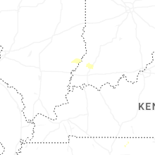

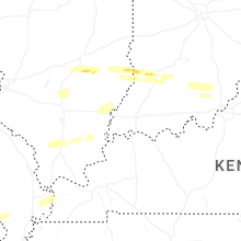


Connect with Interactive Hail Maps