

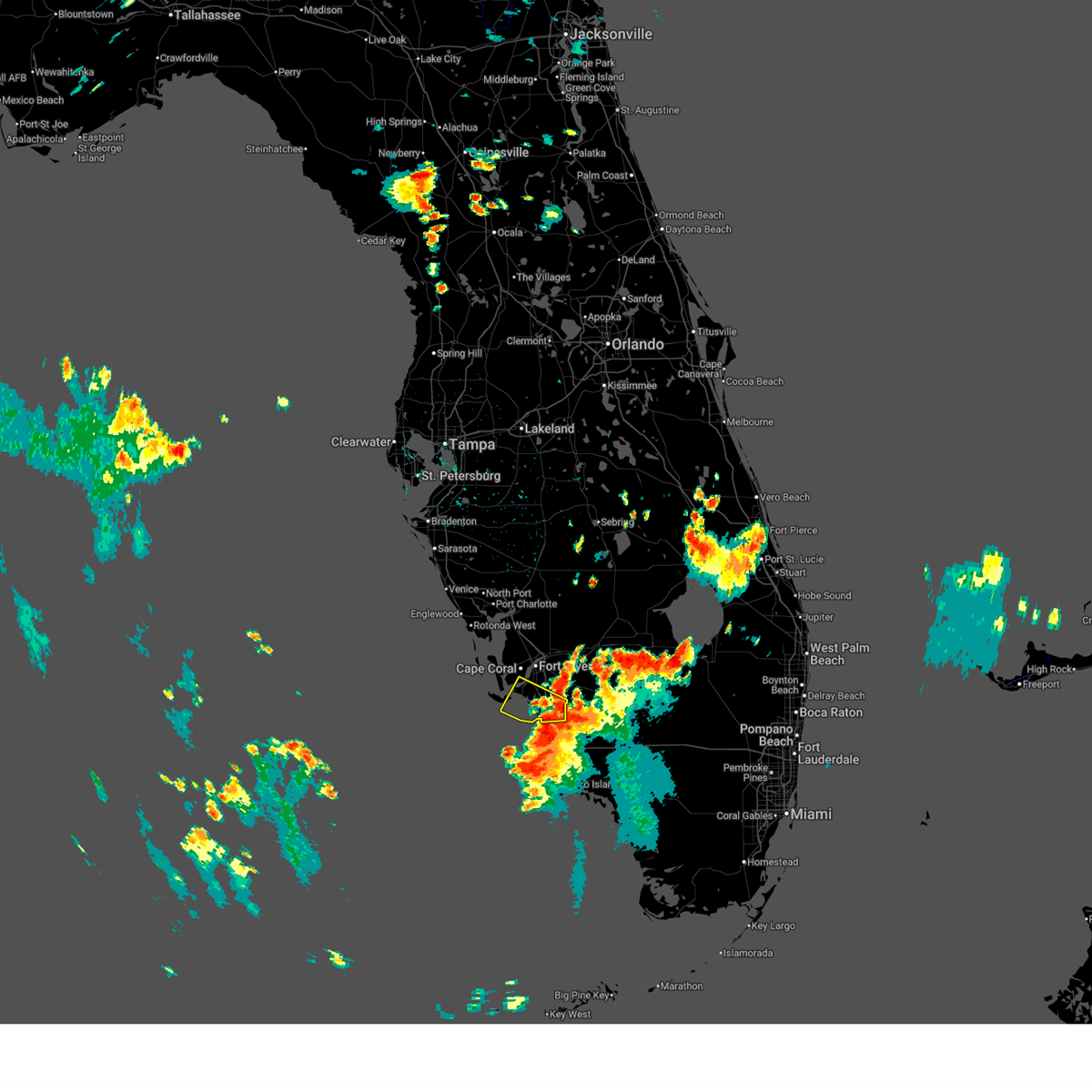
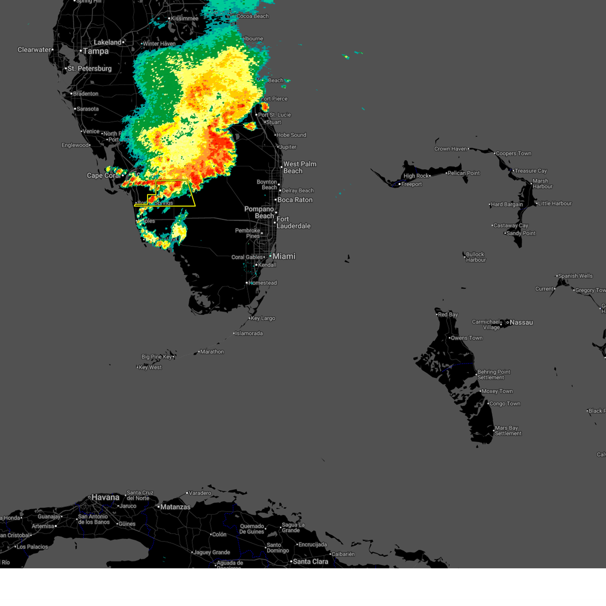
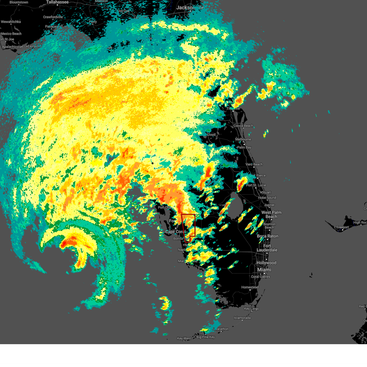
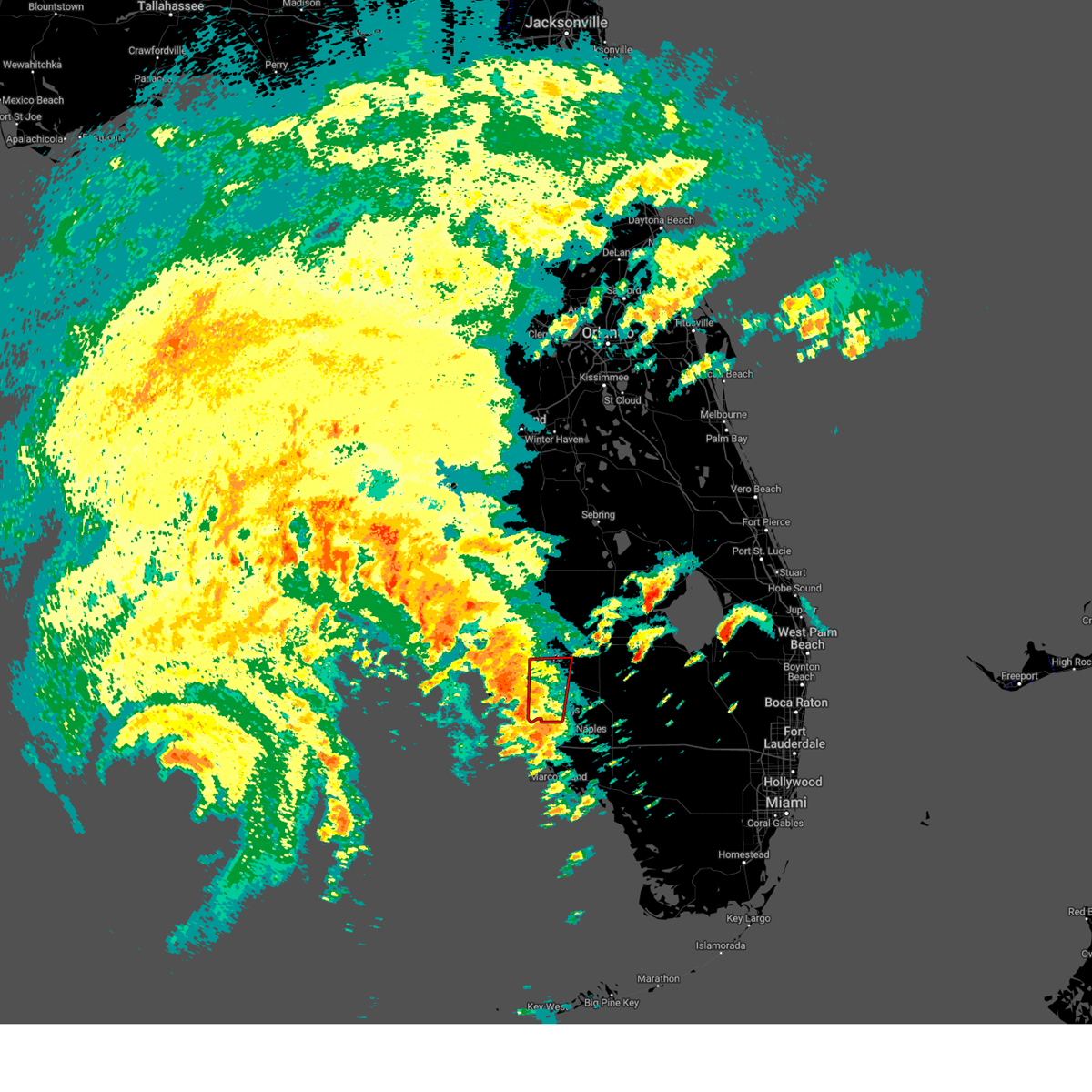
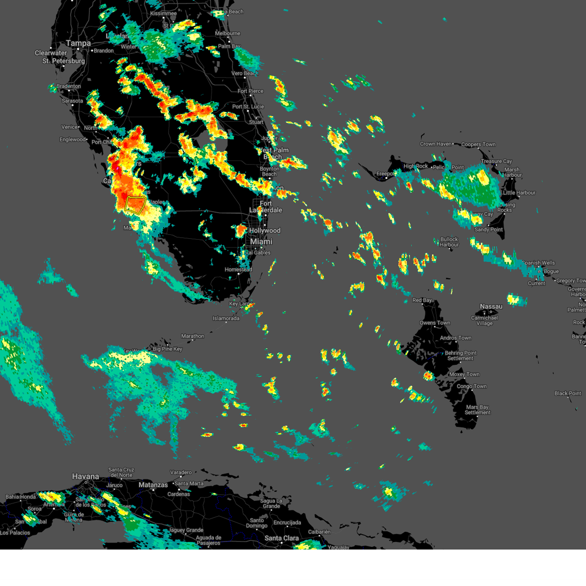
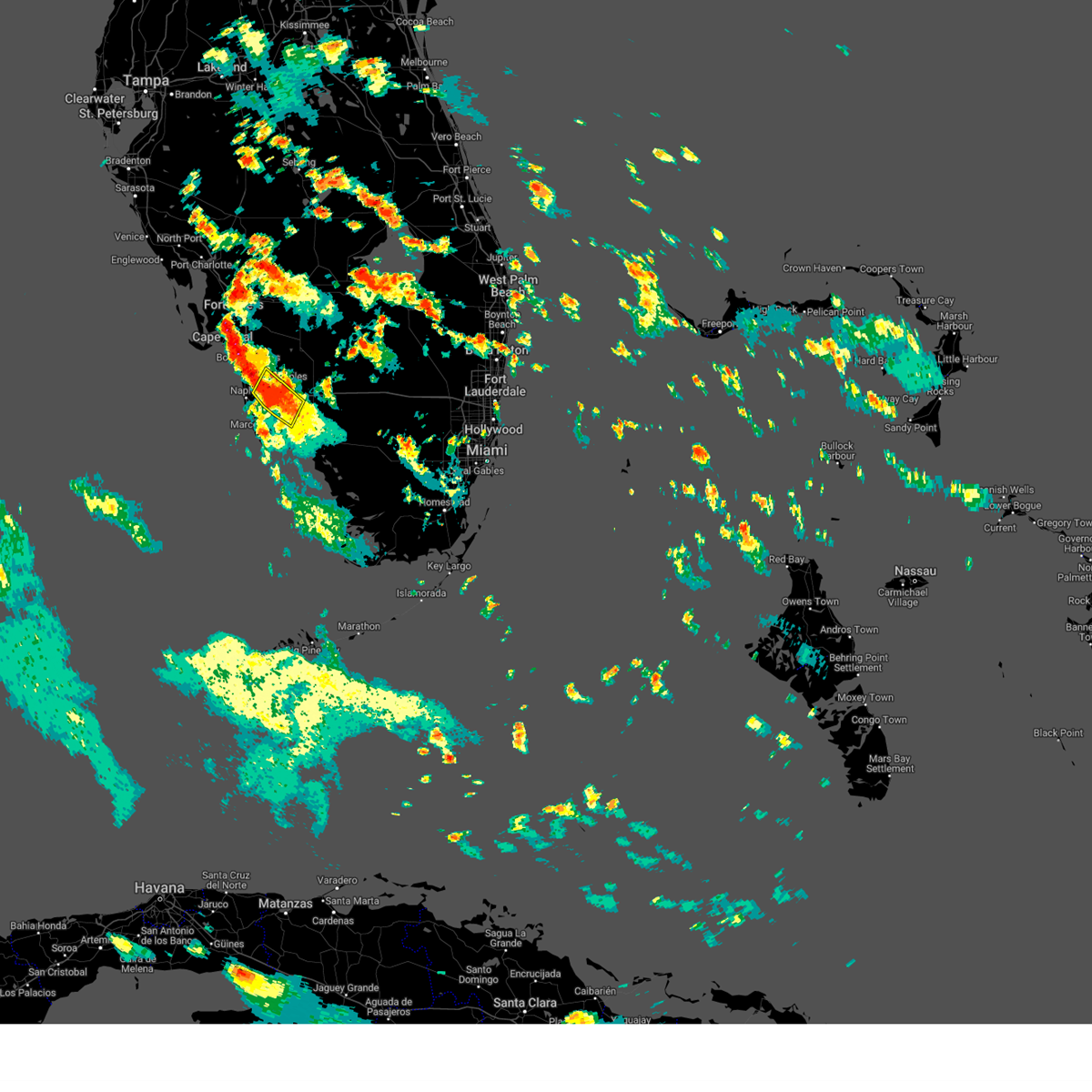
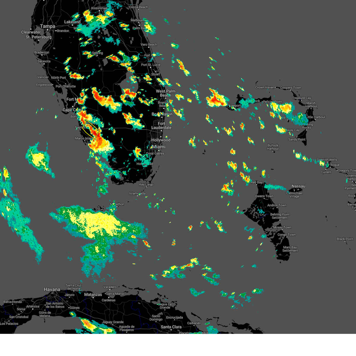
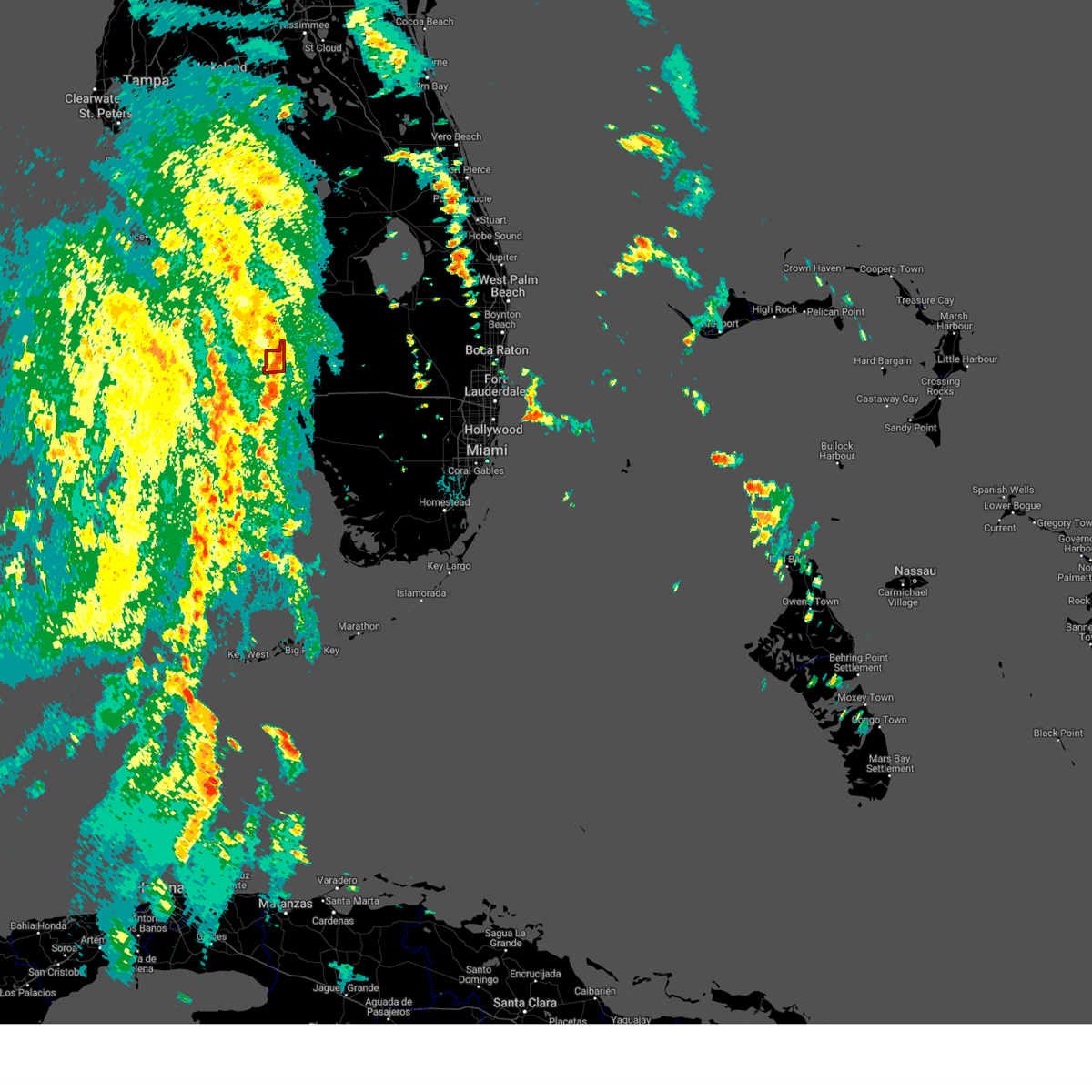
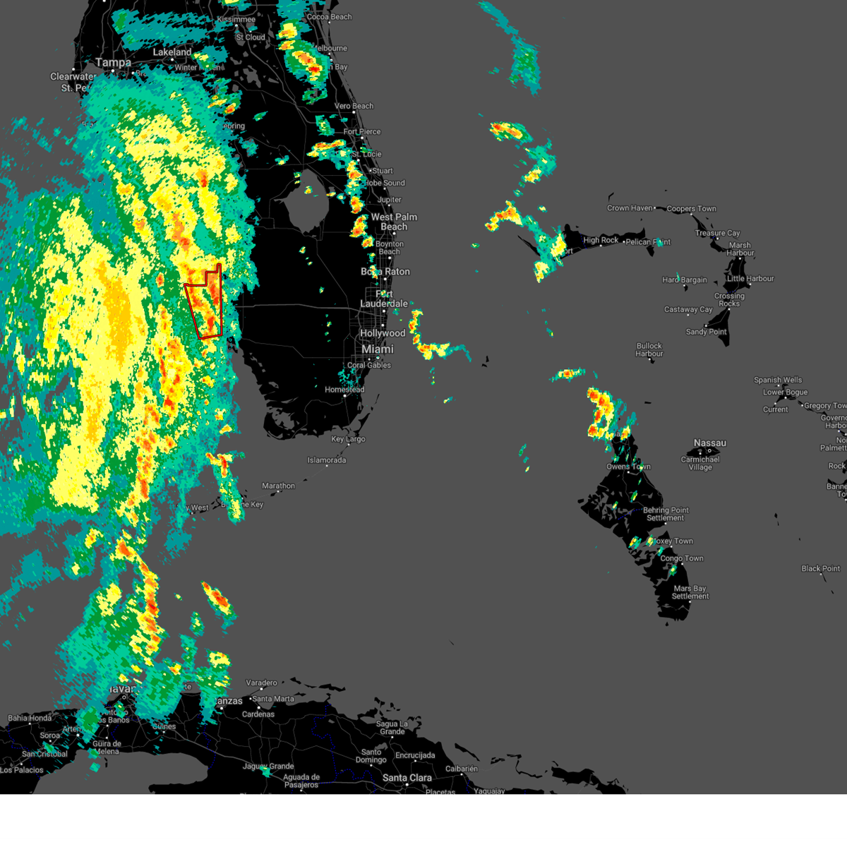
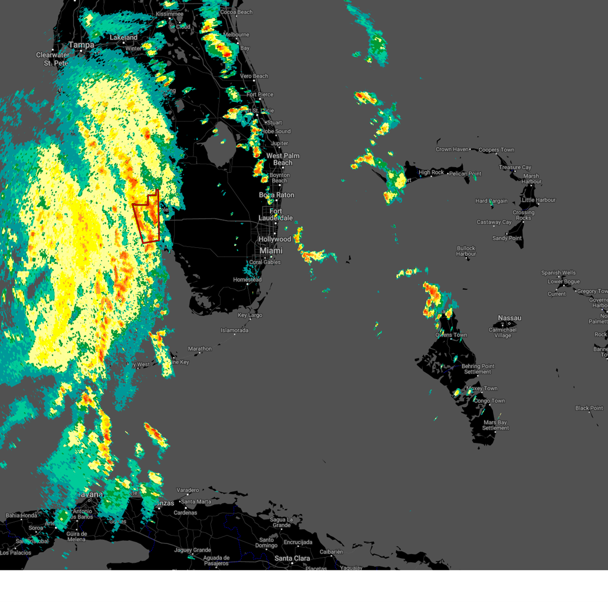
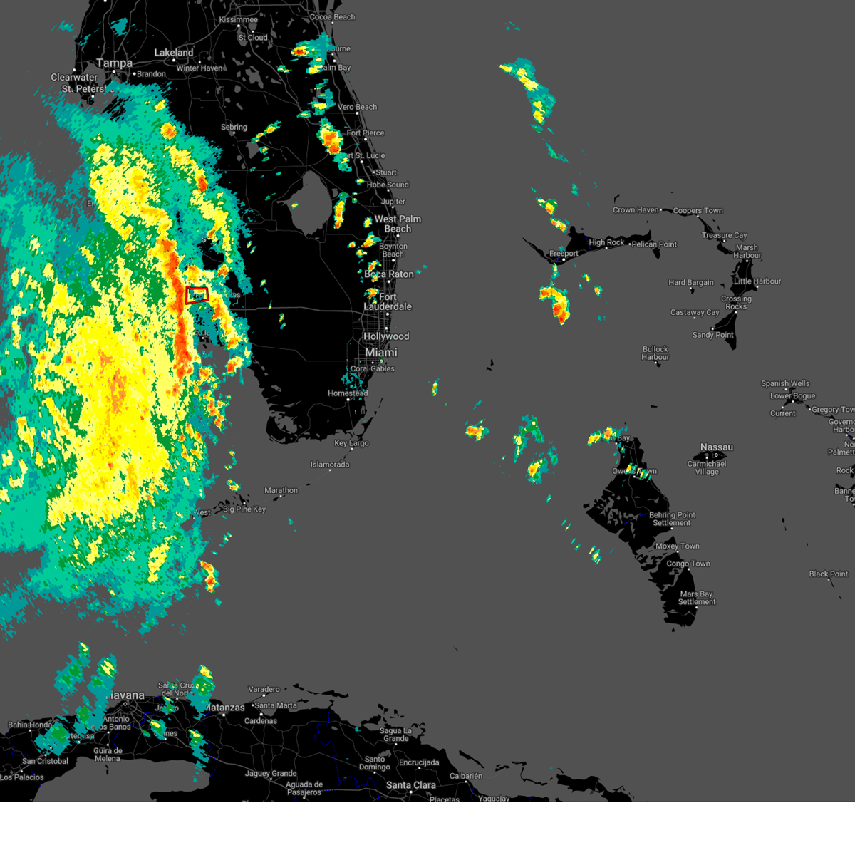
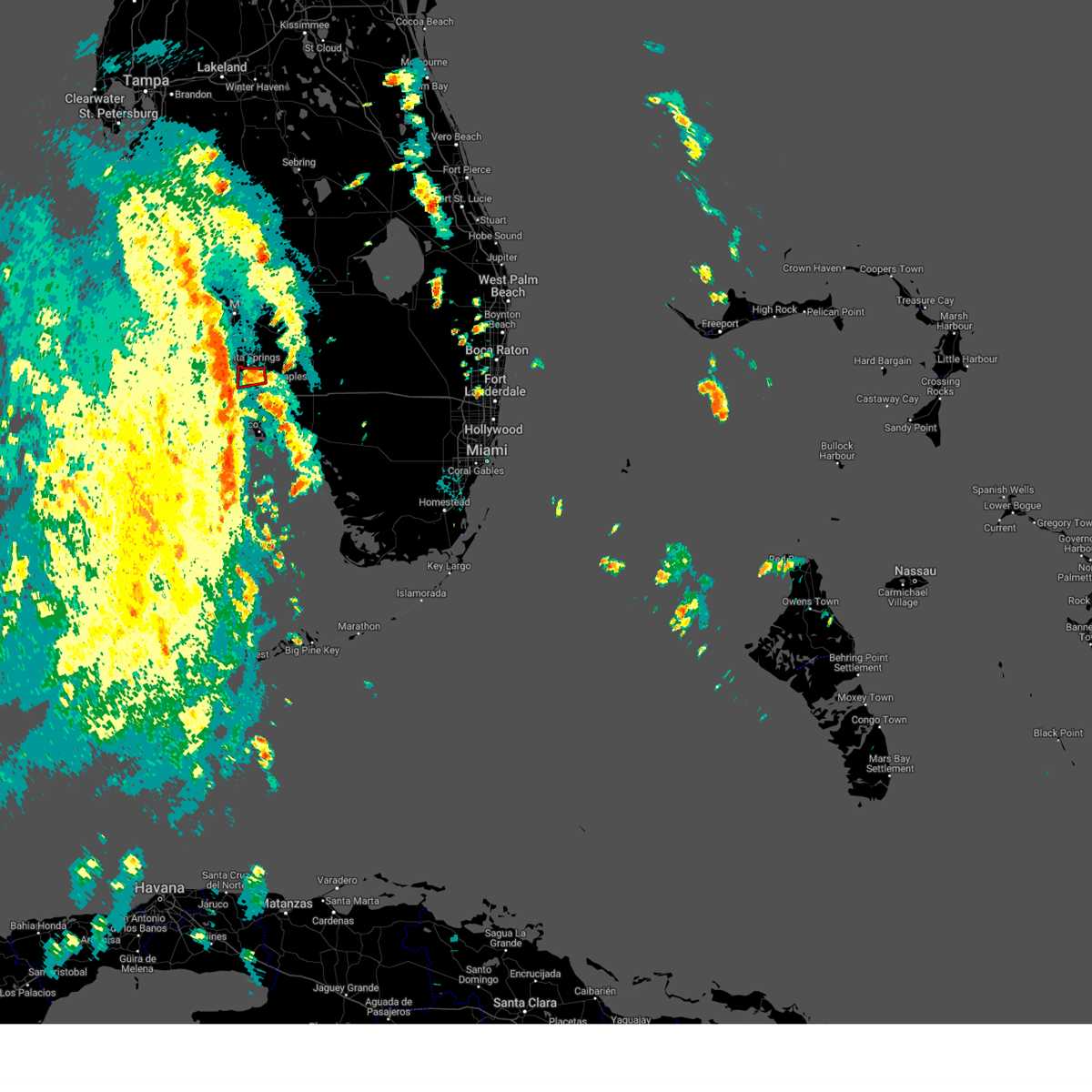
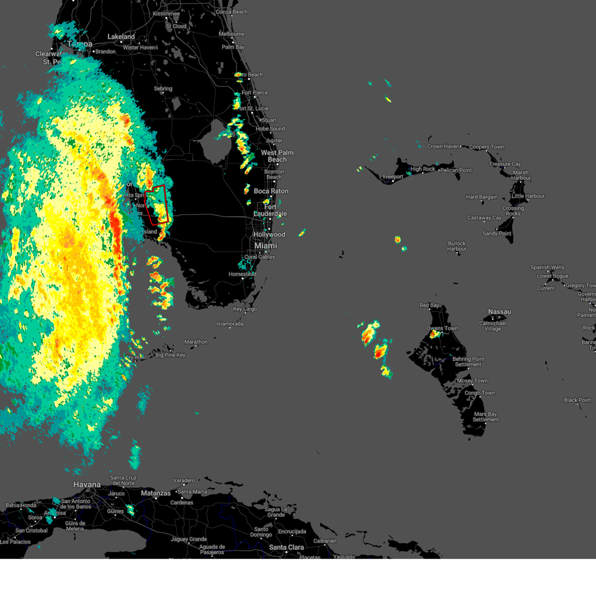
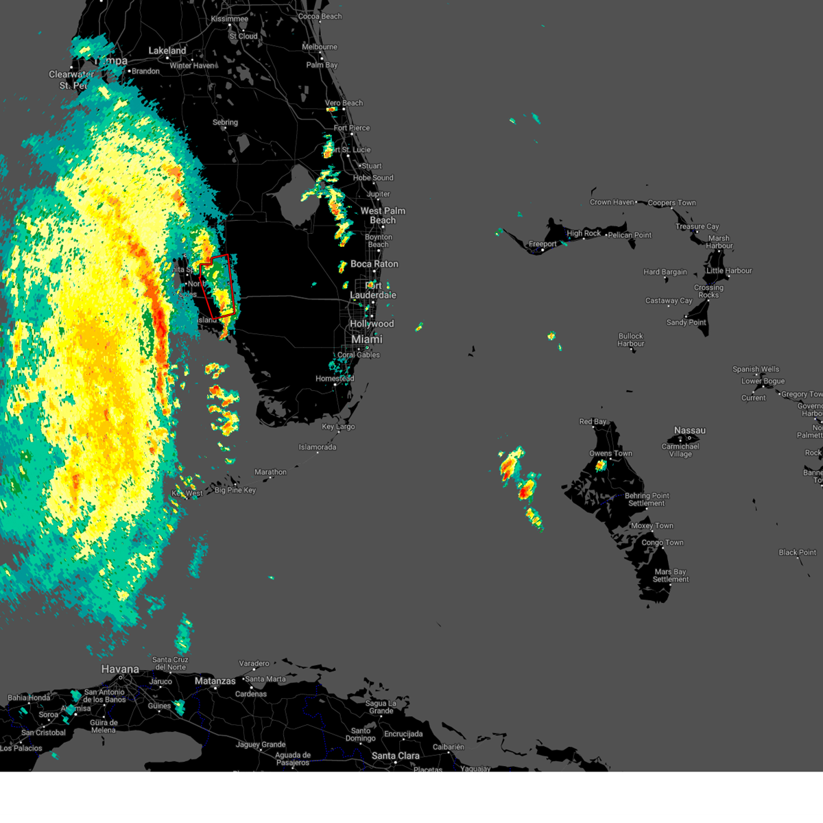
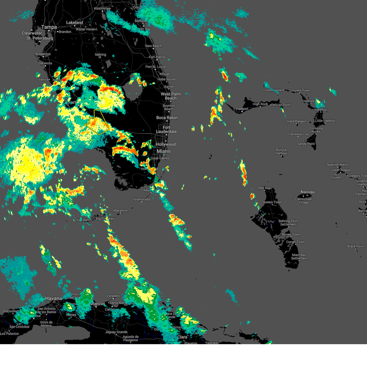
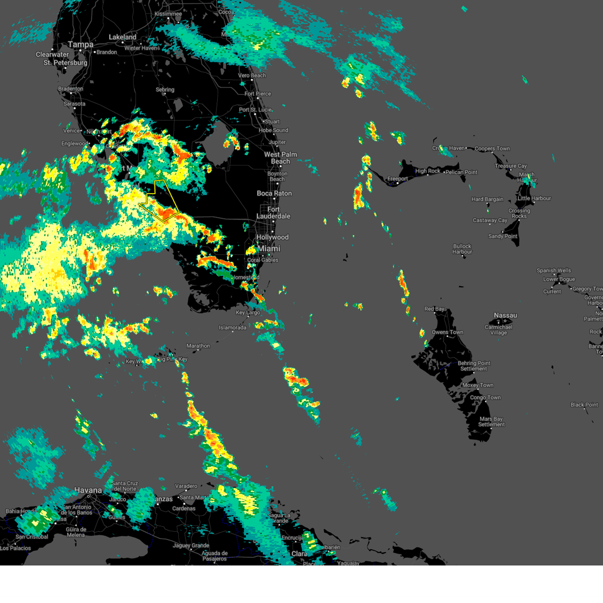
Hail Map for Bonita Springs, FL
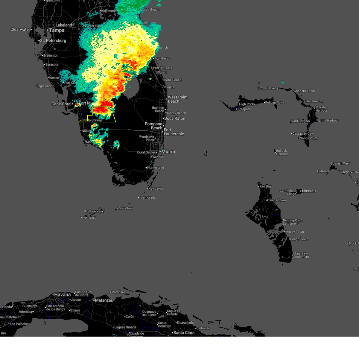
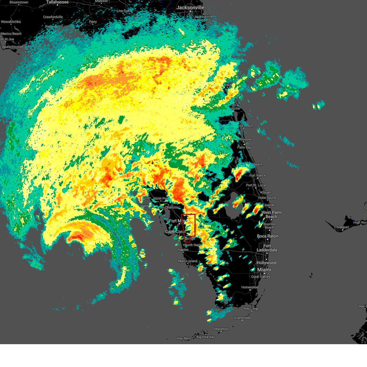
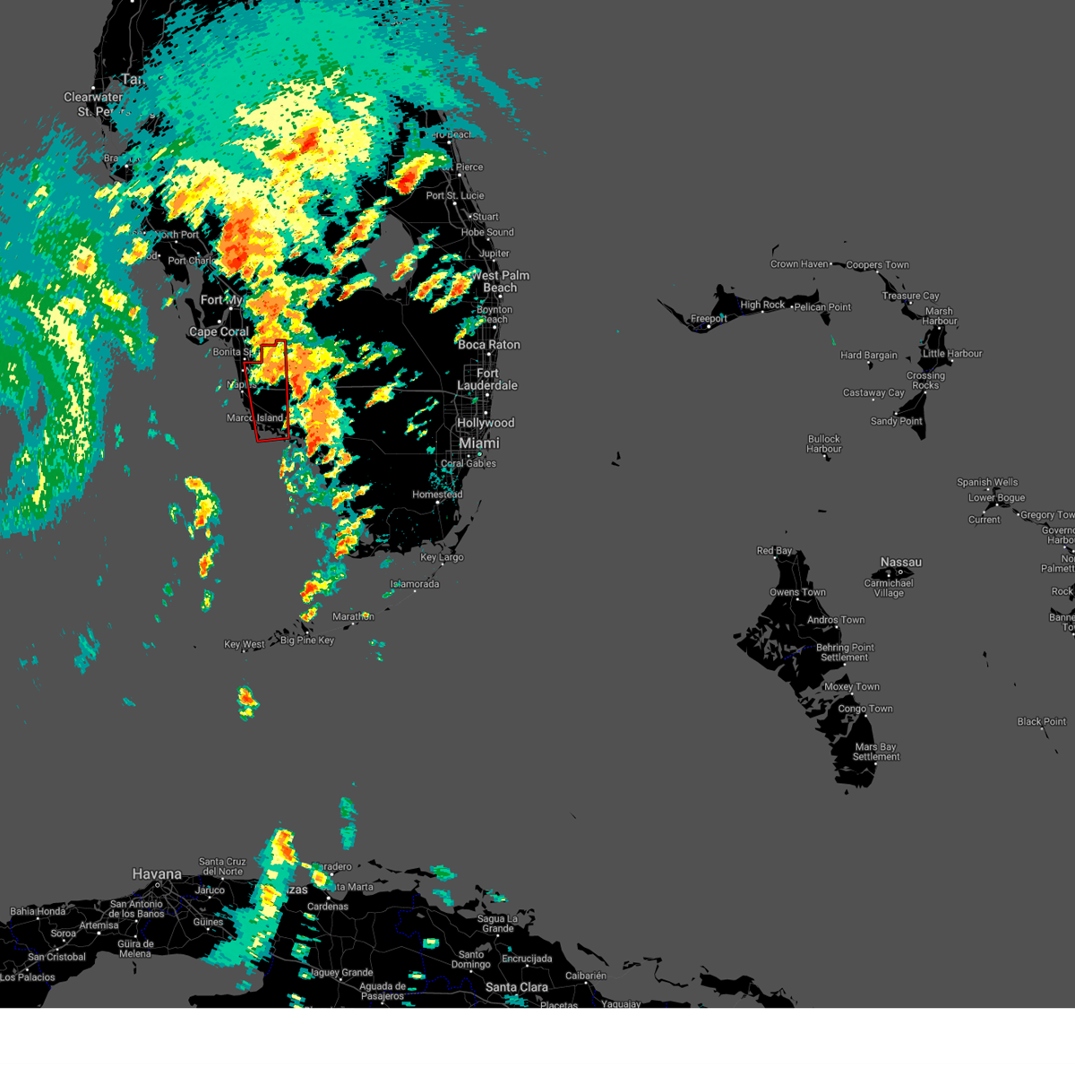
The Bonita Springs, FL area has had 1 report of on-the-ground hail by trained spotters, and has been under severe weather warnings 9 times during the past 12 months. Doppler radar has detected hail at or near Bonita Springs, FL on 70 occasions, including 5 occasions during the past year.
| Name: | Bonita Springs, FL |
| Where Located: | 14 miles N of Naples, FL |
| Map: | Google Map for Bonita Springs, FL |
| Population: | 43914 |
| Housing Units: | 31716 |
| More Info: | Search Google for Bonita Springs, FL |
5
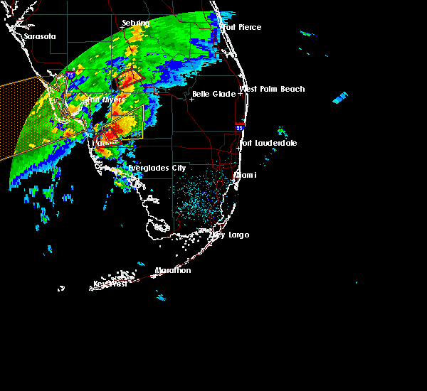
The Top Recent Hail Date for Bonita Springs, FL is Friday, July 10, 2026 (1st out of 70)

Hail and Wind Damage Spotted near Bonita Springs, FL
| Date / Time | Report Details |
|---|---|
| 7/10/2026 3:41 PM EDT |
 Svrtbw the national weather service in ruskin has issued a * severe thunderstorm warning for, southeastern lee county in southwestern florida, * until 415 pm edt. * at 340 pm edt, a severe thunderstorm was located over bonita springs, moving northwest at 20 mph (radar indicated). Hazards include 60 mph wind gusts and penny size hail. expect damage to roofs, siding, and trees Svrtbw the national weather service in ruskin has issued a * severe thunderstorm warning for, southeastern lee county in southwestern florida, * until 415 pm edt. * at 340 pm edt, a severe thunderstorm was located over bonita springs, moving northwest at 20 mph (radar indicated). Hazards include 60 mph wind gusts and penny size hail. expect damage to roofs, siding, and trees
|
| 7/10/2026 3:33 PM EDT |
 Svrmfl the national weather service in miami has issued a * severe thunderstorm warning for, west central collier county in southwestern florida, * until 400 pm edt. * at 333 pm edt, a severe thunderstorm was located over north naples, or near bonita springs, moving northwest at 10 mph (radar indicated). Hazards include 60 mph wind gusts and quarter size hail. Hail damage to vehicles is expected. Expect wind damage to roofs, siding, and trees. Svrmfl the national weather service in miami has issued a * severe thunderstorm warning for, west central collier county in southwestern florida, * until 400 pm edt. * at 333 pm edt, a severe thunderstorm was located over north naples, or near bonita springs, moving northwest at 10 mph (radar indicated). Hazards include 60 mph wind gusts and quarter size hail. Hail damage to vehicles is expected. Expect wind damage to roofs, siding, and trees.
|
| 7/9/2026 6:53 PM EDT |
 Svrtbw the national weather service in ruskin has issued a * severe thunderstorm warning for, southeastern lee county in southwestern florida, * until 730 pm edt. * at 652 pm edt, severe thunderstorms were located along a line extending from near three oaks to near bonita springs, moving northwest at 15 mph (radar indicated). Hazards include 60 mph wind gusts. expect damage to roofs, siding, and trees Svrtbw the national weather service in ruskin has issued a * severe thunderstorm warning for, southeastern lee county in southwestern florida, * until 730 pm edt. * at 652 pm edt, severe thunderstorms were located along a line extending from near three oaks to near bonita springs, moving northwest at 15 mph (radar indicated). Hazards include 60 mph wind gusts. expect damage to roofs, siding, and trees
|
| 6/27/2026 5:33 PM EDT |
 Svrmfl the national weather service in miami has issued a * severe thunderstorm warning for, northwestern collier county in southwestern florida, * until 600 pm edt. * at 532 pm edt, a severe thunderstorm was located over big corkscrew island, or near ave maria, moving northwest at 10 mph (radar indicated). Hazards include 60 mph wind gusts. expect damage to roofs, siding, and trees Svrmfl the national weather service in miami has issued a * severe thunderstorm warning for, northwestern collier county in southwestern florida, * until 600 pm edt. * at 532 pm edt, a severe thunderstorm was located over big corkscrew island, or near ave maria, moving northwest at 10 mph (radar indicated). Hazards include 60 mph wind gusts. expect damage to roofs, siding, and trees
|
| 5/17/2026 3:23 PM EDT |
 The storm which prompted the warning has weakened below severe limits, and no longer poses an immediate threat to life or property. therefore, the warning will be allowed to expire. however, heavy rain is still possible with this thunderstorm. The storm which prompted the warning has weakened below severe limits, and no longer poses an immediate threat to life or property. therefore, the warning will be allowed to expire. however, heavy rain is still possible with this thunderstorm.
|
| 5/17/2026 3:09 PM EDT |
 At 309 pm edt, a severe thunderstorm was located over north naples, or near bonita springs, moving south at 5 mph (radar indicated). Hazards include 60 mph wind gusts and quarter size hail. Hail damage to vehicles is expected. expect wind damage to roofs, siding, and trees. Locations impacted include, naples, golden gate estates, naples park, west toll gate on alligator alley, vineyards, golden gate, north naples, east naples, pelican bay, and quail creek estate. At 309 pm edt, a severe thunderstorm was located over north naples, or near bonita springs, moving south at 5 mph (radar indicated). Hazards include 60 mph wind gusts and quarter size hail. Hail damage to vehicles is expected. expect wind damage to roofs, siding, and trees. Locations impacted include, naples, golden gate estates, naples park, west toll gate on alligator alley, vineyards, golden gate, north naples, east naples, pelican bay, and quail creek estate.
|
| 5/17/2026 2:42 PM EDT |
 Svrmfl the national weather service in miami has issued a * severe thunderstorm warning for, west central collier county in southwestern florida, * until 330 pm edt. * at 242 pm edt, a severe thunderstorm was located over naples park, or near bonita springs, moving south at 5 mph (radar indicated). Hazards include 60 mph wind gusts and quarter size hail. Hail damage to vehicles is expected. Expect wind damage to roofs, siding, and trees. Svrmfl the national weather service in miami has issued a * severe thunderstorm warning for, west central collier county in southwestern florida, * until 330 pm edt. * at 242 pm edt, a severe thunderstorm was located over naples park, or near bonita springs, moving south at 5 mph (radar indicated). Hazards include 60 mph wind gusts and quarter size hail. Hail damage to vehicles is expected. Expect wind damage to roofs, siding, and trees.
|
| 8/19/2025 5:10 PM EDT |
 The storm which prompted the warning has weakened below severe limits, and no longer poses an immediate threat to life or property. therefore, the warning will be allowed to expire. however, gusty winds are still possible with this thunderstorm. The storm which prompted the warning has weakened below severe limits, and no longer poses an immediate threat to life or property. therefore, the warning will be allowed to expire. however, gusty winds are still possible with this thunderstorm.
|
| 8/19/2025 4:50 PM EDT |
 Svrtbw the national weather service in ruskin has issued a * severe thunderstorm warning for, south central lee county in southwestern florida, * until 515 pm edt. * at 450 pm edt, a severe thunderstorm was located over san carlos park, or 8 miles northwest of bonita springs, moving south at 15 mph (radar indicated). Hazards include 60 mph wind gusts and penny size hail. expect damage to roofs, siding, and trees Svrtbw the national weather service in ruskin has issued a * severe thunderstorm warning for, south central lee county in southwestern florida, * until 515 pm edt. * at 450 pm edt, a severe thunderstorm was located over san carlos park, or 8 miles northwest of bonita springs, moving south at 15 mph (radar indicated). Hazards include 60 mph wind gusts and penny size hail. expect damage to roofs, siding, and trees
|
| 6/28/2025 7:30 PM EDT |
 the severe thunderstorm warning has been cancelled and is no longer in effect the severe thunderstorm warning has been cancelled and is no longer in effect
|
| 6/28/2025 6:54 PM EDT |
 Svrmfl the national weather service in miami has issued a * severe thunderstorm warning for, northwestern collier county in southwestern florida, central hendry county in southern florida, * until 745 pm edt. * at 653 pm edt, severe thunderstorms were located along a line extending from 9 miles east of felda to 6 miles south of lehigh acres, and are nearly stationary (radar indicated). Hazards include 60 mph wind gusts and penny size hail. damage to roofs, siding, and trees possible Svrmfl the national weather service in miami has issued a * severe thunderstorm warning for, northwestern collier county in southwestern florida, central hendry county in southern florida, * until 745 pm edt. * at 653 pm edt, severe thunderstorms were located along a line extending from 9 miles east of felda to 6 miles south of lehigh acres, and are nearly stationary (radar indicated). Hazards include 60 mph wind gusts and penny size hail. damage to roofs, siding, and trees possible
|
| 6/26/2025 4:35 PM EDT |
 Svrmfl the national weather service in miami has issued a * severe thunderstorm warning for, northwestern collier county in southwestern florida, * until 515 pm edt. * at 434 pm edt, a severe thunderstorm was located over orangetree, or near golden gate estates, moving northwest at 15 mph (radar indicated). Hazards include 60 mph wind gusts. expect damage to roofs, siding, and trees Svrmfl the national weather service in miami has issued a * severe thunderstorm warning for, northwestern collier county in southwestern florida, * until 515 pm edt. * at 434 pm edt, a severe thunderstorm was located over orangetree, or near golden gate estates, moving northwest at 15 mph (radar indicated). Hazards include 60 mph wind gusts. expect damage to roofs, siding, and trees
|
| 10/9/2024 1:28 PM EDT |
 the tornado warning has been cancelled and is no longer in effect the tornado warning has been cancelled and is no longer in effect
|
| 10/9/2024 1:14 PM EDT |
 The storm which prompted the warning has weakened below severe limits, and is about to exit the warned area. therefore, the warning will be allowed to expire. a tornado watch remains in effect until 900 pm edt for southwestern florida. The storm which prompted the warning has weakened below severe limits, and is about to exit the warned area. therefore, the warning will be allowed to expire. a tornado watch remains in effect until 900 pm edt for southwestern florida.
|
| 10/9/2024 1:07 PM EDT |
 Tortbw the national weather service in ruskin has issued a * tornado warning for, southeastern charlotte county in southwestern florida, eastern lee county in southwestern florida, * until 145 pm edt. * at 107 pm edt, a severe thunderstorm capable of producing a tornado was located 9 miles southeast of southwest florida airport, or 10 miles south of lehigh acres, moving north at 25 mph (radar indicated rotation). Hazards include tornado. Flying debris will be dangerous to those caught without shelter. mobile homes will be damaged or destroyed. damage to roofs, windows, and vehicles will occur. tree damage is likely. this dangerous storm will be near, southwest florida airport around 110 pm edt. lehigh acres around 115 pm edt. buckingham around 120 pm edt. fort myers around 125 pm edt. Other locations impacted by this tornadic thunderstorm include alva, fort myers shores, gateway, tice, estero, and north fort myers. Tortbw the national weather service in ruskin has issued a * tornado warning for, southeastern charlotte county in southwestern florida, eastern lee county in southwestern florida, * until 145 pm edt. * at 107 pm edt, a severe thunderstorm capable of producing a tornado was located 9 miles southeast of southwest florida airport, or 10 miles south of lehigh acres, moving north at 25 mph (radar indicated rotation). Hazards include tornado. Flying debris will be dangerous to those caught without shelter. mobile homes will be damaged or destroyed. damage to roofs, windows, and vehicles will occur. tree damage is likely. this dangerous storm will be near, southwest florida airport around 110 pm edt. lehigh acres around 115 pm edt. buckingham around 120 pm edt. fort myers around 125 pm edt. Other locations impacted by this tornadic thunderstorm include alva, fort myers shores, gateway, tice, estero, and north fort myers.
|
| 10/9/2024 12:49 PM EDT |
 Tormfl the national weather service in miami has issued a * tornado warning for, western collier county in southwestern florida, * until 115 pm edt. * at 1249 pm edt, a severe thunderstorm capable of producing a tornado was located near royal palm hammock, or near marco island, moving north at 60 mph (radar indicated rotation). Hazards include tornado. Flying debris will be dangerous to those caught without shelter. mobile homes will be damaged or destroyed. damage to roofs, windows, and vehicles will occur. Tree damage is likely. Tormfl the national weather service in miami has issued a * tornado warning for, western collier county in southwestern florida, * until 115 pm edt. * at 1249 pm edt, a severe thunderstorm capable of producing a tornado was located near royal palm hammock, or near marco island, moving north at 60 mph (radar indicated rotation). Hazards include tornado. Flying debris will be dangerous to those caught without shelter. mobile homes will be damaged or destroyed. damage to roofs, windows, and vehicles will occur. Tree damage is likely.
|
| 10/9/2024 12:05 PM EDT |
 At 1205 pm edt, a severe thunderstorm capable of producing a tornado was located over lovers key state park, or 7 miles northwest of bonita springs, moving north at 45 mph (radar indicated rotation). Hazards include tornado. Flying debris will be dangerous to those caught without shelter. mobile homes will be damaged or destroyed. damage to roofs, windows, and vehicles will occur. tree damage is likely. this dangerous storm will be near, fort myers, pine manor, villas, southwest florida airport, east dunbar, cypress lake, three oaks, mcgregor, and san carlos park around 1210 pm edt. buckingham and lochmoor waterway estates around 1215 pm edt. Other locations impacted by this tornadic thunderstorm include tice, whiskey creek, page park, estero, page field airport, gateway, fort myers villas, and north fort myers. At 1205 pm edt, a severe thunderstorm capable of producing a tornado was located over lovers key state park, or 7 miles northwest of bonita springs, moving north at 45 mph (radar indicated rotation). Hazards include tornado. Flying debris will be dangerous to those caught without shelter. mobile homes will be damaged or destroyed. damage to roofs, windows, and vehicles will occur. tree damage is likely. this dangerous storm will be near, fort myers, pine manor, villas, southwest florida airport, east dunbar, cypress lake, three oaks, mcgregor, and san carlos park around 1210 pm edt. buckingham and lochmoor waterway estates around 1215 pm edt. Other locations impacted by this tornadic thunderstorm include tice, whiskey creek, page park, estero, page field airport, gateway, fort myers villas, and north fort myers.
|
| 10/9/2024 11:59 AM EDT |
 the tornado warning has been cancelled and is no longer in effect the tornado warning has been cancelled and is no longer in effect
|
| 10/9/2024 11:49 AM EDT |
 Tortbw the national weather service in ruskin has issued a * tornado warning for, eastern lee county in southwestern florida, * until 1215 pm edt. * at 1149 am edt, a severe thunderstorm capable of producing a tornado was located over naples park, or near bonita springs, moving north at 45 mph (radar indicated rotation). Hazards include tornado. Flying debris will be dangerous to those caught without shelter. mobile homes will be damaged or destroyed. damage to roofs, windows, and vehicles will occur. tree damage is likely. this dangerous storm will be near, bonita springs, north naples, lovers key state park, and san carlos park around 1155 am edt. three oaks around 1200 pm edt. villas and cypress lake around 1205 pm edt. southwest florida airport around 1210 pm edt. Other locations impacted by this tornadic thunderstorm include tice, whiskey creek, page park, estero, page field airport, gateway, fort myers villas, and north fort myers. Tortbw the national weather service in ruskin has issued a * tornado warning for, eastern lee county in southwestern florida, * until 1215 pm edt. * at 1149 am edt, a severe thunderstorm capable of producing a tornado was located over naples park, or near bonita springs, moving north at 45 mph (radar indicated rotation). Hazards include tornado. Flying debris will be dangerous to those caught without shelter. mobile homes will be damaged or destroyed. damage to roofs, windows, and vehicles will occur. tree damage is likely. this dangerous storm will be near, bonita springs, north naples, lovers key state park, and san carlos park around 1155 am edt. three oaks around 1200 pm edt. villas and cypress lake around 1205 pm edt. southwest florida airport around 1210 pm edt. Other locations impacted by this tornadic thunderstorm include tice, whiskey creek, page park, estero, page field airport, gateway, fort myers villas, and north fort myers.
|
| 10/9/2024 11:40 AM EDT |
 Tormfl the national weather service in miami has issued a * tornado warning for, west central collier county in southwestern florida, * until 1215 pm edt. * at 1139 am edt, a severe thunderstorm capable of producing a tornado was located near east naples, or near naples, moving north at 55 mph (radar indicated rotation). Hazards include tornado. Flying debris will be dangerous to those caught without shelter. mobile homes will be damaged or destroyed. damage to roofs, windows, and vehicles will occur. Tree damage is likely. Tormfl the national weather service in miami has issued a * tornado warning for, west central collier county in southwestern florida, * until 1215 pm edt. * at 1139 am edt, a severe thunderstorm capable of producing a tornado was located near east naples, or near naples, moving north at 55 mph (radar indicated rotation). Hazards include tornado. Flying debris will be dangerous to those caught without shelter. mobile homes will be damaged or destroyed. damage to roofs, windows, and vehicles will occur. Tree damage is likely.
|
| 9/26/2024 2:14 AM EDT |
 the tornado warning has been cancelled and is no longer in effect the tornado warning has been cancelled and is no longer in effect
|
| 9/26/2024 1:56 AM EDT |
 Tormfl the national weather service in miami has issued a * tornado warning for, northwestern collier county in southwestern florida, * until 230 am edt. * at 155 am edt, a severe thunderstorm capable of producing a tornado was located over golden gate estates, moving north at 35 mph (radar indicated rotation). Hazards include tornado. Flying debris will be dangerous to those caught without shelter. mobile homes will be damaged or destroyed. damage to roofs, windows, and vehicles will occur. Tree damage is likely. Tormfl the national weather service in miami has issued a * tornado warning for, northwestern collier county in southwestern florida, * until 230 am edt. * at 155 am edt, a severe thunderstorm capable of producing a tornado was located over golden gate estates, moving north at 35 mph (radar indicated rotation). Hazards include tornado. Flying debris will be dangerous to those caught without shelter. mobile homes will be damaged or destroyed. damage to roofs, windows, and vehicles will occur. Tree damage is likely.
|
| 8/28/2024 2:50 PM EDT |
 The storm which prompted the warning has moved out of the area. therefore, the warning will be allowed to expire. however, heavy rain is still possible with this thunderstorm. to report severe weather, contact your nearest law enforcement agency. they will relay your report to the national weather service miami. you can also share your report with nws miami on facebook and twitter. The storm which prompted the warning has moved out of the area. therefore, the warning will be allowed to expire. however, heavy rain is still possible with this thunderstorm. to report severe weather, contact your nearest law enforcement agency. they will relay your report to the national weather service miami. you can also share your report with nws miami on facebook and twitter.
|
| 8/28/2024 2:29 PM EDT |
 The storm which prompted the warning has moved out of the area. therefore, the warning will be allowed to expire. however, gusty winds are still possible with this thunderstorm. remember, a severe thunderstorm warning still remains in effect for northern collier county. The storm which prompted the warning has moved out of the area. therefore, the warning will be allowed to expire. however, gusty winds are still possible with this thunderstorm. remember, a severe thunderstorm warning still remains in effect for northern collier county.
|
| 8/28/2024 2:28 PM EDT |
 Svrmfl the national weather service in miami has issued a * severe thunderstorm warning for, west central collier county in southwestern florida, * until 300 pm edt. * at 227 pm edt, a severe thunderstorm was located over vineyards, or 7 miles northeast of naples, moving northwest at 25 mph (radar indicated). Hazards include 60 mph wind gusts. expect damage to roofs, siding, and trees Svrmfl the national weather service in miami has issued a * severe thunderstorm warning for, west central collier county in southwestern florida, * until 300 pm edt. * at 227 pm edt, a severe thunderstorm was located over vineyards, or 7 miles northeast of naples, moving northwest at 25 mph (radar indicated). Hazards include 60 mph wind gusts. expect damage to roofs, siding, and trees
|
| 8/28/2024 2:00 PM EDT |
 Svrmfl the national weather service in miami has issued a * severe thunderstorm warning for, west central collier county in southwestern florida, * until 230 pm edt. * at 200 pm edt, a severe thunderstorm was located 7 miles southeast of west toll gate on alligator alley, or 8 miles southeast of golden gate estates, moving northwest at 20 mph (radar indicated). Hazards include 60 mph wind gusts. expect damage to roofs, siding, and trees Svrmfl the national weather service in miami has issued a * severe thunderstorm warning for, west central collier county in southwestern florida, * until 230 pm edt. * at 200 pm edt, a severe thunderstorm was located 7 miles southeast of west toll gate on alligator alley, or 8 miles southeast of golden gate estates, moving northwest at 20 mph (radar indicated). Hazards include 60 mph wind gusts. expect damage to roofs, siding, and trees
|
| 8/4/2024 1:00 PM EDT |
 The storm which prompted the warning has moved out of the area. therefore, the warning has been allowed to expire. however, gusty winds and heavy rain are still possible with this thunderstorm. a tornado watch remains in effect until 800 pm edt for southwestern florida. to report severe weather, contact your nearest law enforcement agency. they will relay your report to the national weather service miami. you can also share your report with nws miami on facebook and twitter. The storm which prompted the warning has moved out of the area. therefore, the warning has been allowed to expire. however, gusty winds and heavy rain are still possible with this thunderstorm. a tornado watch remains in effect until 800 pm edt for southwestern florida. to report severe weather, contact your nearest law enforcement agency. they will relay your report to the national weather service miami. you can also share your report with nws miami on facebook and twitter.
|
| 8/4/2024 12:54 PM EDT |
 At 1254 pm edt, a severe thunderstorm capable of producing a tornado was located over big corkscrew island, or 9 miles west of ave maria, moving north at 35 mph (radar indicated rotation). Hazards include tornado. Expect damage to mobile homes, roofs, and vehicles. tree damage is likely. Locations impacted include, big corkscrew island, orangetree, and corkscrew swamp sanctuary. At 1254 pm edt, a severe thunderstorm capable of producing a tornado was located over big corkscrew island, or 9 miles west of ave maria, moving north at 35 mph (radar indicated rotation). Hazards include tornado. Expect damage to mobile homes, roofs, and vehicles. tree damage is likely. Locations impacted include, big corkscrew island, orangetree, and corkscrew swamp sanctuary.
|
| 8/4/2024 12:45 PM EDT |
 At 1245 pm edt, severe thunderstorms capable of producing tornadoes were located along a line extending from near west toll gate on alligator alley to orangetree, moving north at 20 mph (radar indicated rotation). Hazards include tornado. Expect damage to mobile homes, roofs, and vehicles. tree damage is likely. Locations impacted include, naples, marco island, golden gate estates, belle meade, orangetree, golden gate, east naples, lely resort, big corkscrew island, vineyards, royal palm hammock, naples park, marco island airport, naples manor, west toll gate on alligator alley, north naples, pelican bay, corkscrew swamp sanctuary, lely, and rookery bay aquatic preserve. At 1245 pm edt, severe thunderstorms capable of producing tornadoes were located along a line extending from near west toll gate on alligator alley to orangetree, moving north at 20 mph (radar indicated rotation). Hazards include tornado. Expect damage to mobile homes, roofs, and vehicles. tree damage is likely. Locations impacted include, naples, marco island, golden gate estates, belle meade, orangetree, golden gate, east naples, lely resort, big corkscrew island, vineyards, royal palm hammock, naples park, marco island airport, naples manor, west toll gate on alligator alley, north naples, pelican bay, corkscrew swamp sanctuary, lely, and rookery bay aquatic preserve.
|
| 8/4/2024 12:37 PM EDT |
 At 1237 pm edt, severe thunderstorms capable of producing tornadoes were located along a line extending from near marco island airport to near golden gate estates, moving north at 40 mph (radar indicated rotation). Hazards include tornado. Expect damage to mobile homes, roofs, and vehicles. tree damage is likely. Locations impacted include, naples, marco island, golden gate estates, belle meade, orangetree, golden gate, east naples, lely resort, big corkscrew island, vineyards, royal palm hammock, naples park, marco island airport, naples manor, west toll gate on alligator alley, north naples, pelican bay, corkscrew swamp sanctuary, lely, and rookery bay aquatic preserve. At 1237 pm edt, severe thunderstorms capable of producing tornadoes were located along a line extending from near marco island airport to near golden gate estates, moving north at 40 mph (radar indicated rotation). Hazards include tornado. Expect damage to mobile homes, roofs, and vehicles. tree damage is likely. Locations impacted include, naples, marco island, golden gate estates, belle meade, orangetree, golden gate, east naples, lely resort, big corkscrew island, vineyards, royal palm hammock, naples park, marco island airport, naples manor, west toll gate on alligator alley, north naples, pelican bay, corkscrew swamp sanctuary, lely, and rookery bay aquatic preserve.
|
| 8/4/2024 12:34 PM EDT |
 Tormfl the national weather service in miami has issued a * tornado warning for, western collier county in southwestern florida, * until 100 pm edt. * at 1234 pm edt, a severe thunderstorm capable of producing a tornado was located over marco island airport, or near marco island, moving north at 50 mph (radar indicated rotation). Hazards include tornado. Expect damage to mobile homes, roofs, and vehicles. Tree damage is likely. Tormfl the national weather service in miami has issued a * tornado warning for, western collier county in southwestern florida, * until 100 pm edt. * at 1234 pm edt, a severe thunderstorm capable of producing a tornado was located over marco island airport, or near marco island, moving north at 50 mph (radar indicated rotation). Hazards include tornado. Expect damage to mobile homes, roofs, and vehicles. Tree damage is likely.
|
| 8/4/2024 11:27 AM EDT |
 the tornado warning has been cancelled and is no longer in effect the tornado warning has been cancelled and is no longer in effect
|
| 8/4/2024 11:14 AM EDT |
 Tormfl the national weather service in miami has issued a * tornado warning for, west central collier county in southwestern florida, * until 1145 am edt. * at 1113 am edt, a severe thunderstorm capable of producing a tornado was located over north naples, or near bonita springs, moving north at 30 mph (radar indicated rotation). Hazards include tornado. Expect damage to mobile homes, roofs, and vehicles. Tree damage is likely. Tormfl the national weather service in miami has issued a * tornado warning for, west central collier county in southwestern florida, * until 1145 am edt. * at 1113 am edt, a severe thunderstorm capable of producing a tornado was located over north naples, or near bonita springs, moving north at 30 mph (radar indicated rotation). Hazards include tornado. Expect damage to mobile homes, roofs, and vehicles. Tree damage is likely.
|
| 8/4/2024 10:26 AM EDT |
 At 1025 am edt, a severe thunderstorm capable of producing a tornado was located 8 miles southeast of golden gate estates, moving north at 45 mph (radar indicated rotation). Hazards include tornado. Expect damage to mobile homes, roofs, and vehicles. tree damage is likely. Locations impacted include, ave maria, golden gate estates, immokalee, orangetree, big corkscrew island, corkscrew swamp sanctuary, south blocks golde, picayune strand state forest, intersection i-75 and everglades blvd, and lake trafford. At 1025 am edt, a severe thunderstorm capable of producing a tornado was located 8 miles southeast of golden gate estates, moving north at 45 mph (radar indicated rotation). Hazards include tornado. Expect damage to mobile homes, roofs, and vehicles. tree damage is likely. Locations impacted include, ave maria, golden gate estates, immokalee, orangetree, big corkscrew island, corkscrew swamp sanctuary, south blocks golde, picayune strand state forest, intersection i-75 and everglades blvd, and lake trafford.
|
| 8/4/2024 10:19 AM EDT |
 Tormfl the national weather service in miami has issued a * tornado warning for, northwestern collier county in southwestern florida, * until 1045 am edt. * at 1019 am edt, a severe thunderstorm capable of producing a tornado was located 9 miles northeast of royal palm hammock, or 12 miles southeast of golden gate estates, moving north at 40 mph (radar indicated rotation). Hazards include tornado. Expect damage to mobile homes, roofs, and vehicles. Tree damage is likely. Tormfl the national weather service in miami has issued a * tornado warning for, northwestern collier county in southwestern florida, * until 1045 am edt. * at 1019 am edt, a severe thunderstorm capable of producing a tornado was located 9 miles northeast of royal palm hammock, or 12 miles southeast of golden gate estates, moving north at 40 mph (radar indicated rotation). Hazards include tornado. Expect damage to mobile homes, roofs, and vehicles. Tree damage is likely.
|
| 8/4/2024 7:35 AM EDT | The storm which prompted the warning has moved out of the area. therefore, the warning will be allowed to expire. however, gusty winds and heavy rain are still possible with this thunderstorm. to report severe weather, contact your nearest law enforcement agency. they will relay your report to the national weather service miami. you can also share your report with nws miami on facebook and twitter. |
| 8/4/2024 7:32 AM EDT | At 732 am edt, a severe thunderstorm was located near bonita springs, moving north at 40 mph (radar indicated). Hazards include 60 mph wind gusts. Expect damage to roofs, siding, and trees. Locations impacted include, orangetree, north naples, corkscrew swamp sanctuary, and quail creek estate. |
| 8/4/2024 7:31 AM EDT | the tornado warning has been cancelled and is no longer in effect |
| 8/4/2024 7:19 AM EDT | Tormfl the national weather service in miami has issued a * tornado warning for, northwestern collier county in southwestern florida, * until 745 am edt. * at 719 am edt, a severe thunderstorm capable of producing a tornado was located near golden gate estates, moving north at 40 mph (radar indicated rotation). Hazards include tornado. Expect damage to mobile homes, roofs, and vehicles. Tree damage is likely. |
| 8/4/2024 7:15 AM EDT | Svrmfl the national weather service in miami has issued a * severe thunderstorm warning for, northwestern collier county in southwestern florida, * until 745 am edt. * at 714 am edt, a severe thunderstorm was located over golden gate estates, moving north at 40 mph (radar indicated). Hazards include 60 mph wind gusts. expect damage to roofs, siding, and trees |
| 8/3/2024 4:17 PM EDT |
 the severe thunderstorm warning has been cancelled and is no longer in effect the severe thunderstorm warning has been cancelled and is no longer in effect
|
| 8/3/2024 3:53 PM EDT |
 Svrmfl the national weather service in miami has issued a * severe thunderstorm warning for, northwestern collier county in southwestern florida, southwestern hendry county in southern florida, * until 430 pm edt. * at 353 pm edt, a severe thunderstorm was located near ave maria, moving northwest at 50 mph (radar indicated). Hazards include 60 mph wind gusts. expect damage to roofs, siding, and trees Svrmfl the national weather service in miami has issued a * severe thunderstorm warning for, northwestern collier county in southwestern florida, southwestern hendry county in southern florida, * until 430 pm edt. * at 353 pm edt, a severe thunderstorm was located near ave maria, moving northwest at 50 mph (radar indicated). Hazards include 60 mph wind gusts. expect damage to roofs, siding, and trees
|
| 8/29/2023 2:24 PM EDT |
 At 224 pm edt, severe thunderstorms capable of producing tornadoes were located along a line extending from near three oaks to near north naples to golden gate estates, moving north at 35 mph (radar indicated rotation). Hazards include tornado. Expect damage to mobile homes, roofs, and vehicles. tree damage is likely. Locations impacted include, golden gate estates, vineyards, north naples and quail creek estate. At 224 pm edt, severe thunderstorms capable of producing tornadoes were located along a line extending from near three oaks to near north naples to golden gate estates, moving north at 35 mph (radar indicated rotation). Hazards include tornado. Expect damage to mobile homes, roofs, and vehicles. tree damage is likely. Locations impacted include, golden gate estates, vineyards, north naples and quail creek estate.
|
| 8/29/2023 2:17 PM EDT |
 At 216 pm edt, severe thunderstorms capable of producing tornadoes were located along a line extending from near bonita springs to vineyards to near west toll gate on alligator alley, moving north northeast 35 mph (radar indicated rotation). Hazards include tornado. Expect damage to mobile homes, roofs, and vehicles. tree damage is likely. Locations impacted include, golden gate estates, naples park, west toll gate on alligator alley and vineyards. At 216 pm edt, severe thunderstorms capable of producing tornadoes were located along a line extending from near bonita springs to vineyards to near west toll gate on alligator alley, moving north northeast 35 mph (radar indicated rotation). Hazards include tornado. Expect damage to mobile homes, roofs, and vehicles. tree damage is likely. Locations impacted include, golden gate estates, naples park, west toll gate on alligator alley and vineyards.
|
| 8/29/2023 2:09 PM EDT |
 At 208 pm edt, severe thunderstorms capable of producing tornadoes along a line extending from bonita springs to near east naples to near belle meade, moving north at 35 mph (radar indicated rotation). Hazards include tornado. Expect damage to mobile homes, roofs, and vehicles. Tree damage is likely. At 208 pm edt, severe thunderstorms capable of producing tornadoes along a line extending from bonita springs to near east naples to near belle meade, moving north at 35 mph (radar indicated rotation). Hazards include tornado. Expect damage to mobile homes, roofs, and vehicles. Tree damage is likely.
|
| 8/29/2023 1:56 PM EDT |
 At 156 pm edt, severe thunderstorms capable of producing tornadoes were located along a line extending from near naples park to golden gate, moving north at 40 mph (radar indicated rotation). Hazards include tornado. Expect damage to mobile homes, roofs, and vehicles. tree damage is likely. Locations impacted include, naples, golden gate estates, naples park, belle meade and naples manor. At 156 pm edt, severe thunderstorms capable of producing tornadoes were located along a line extending from near naples park to golden gate, moving north at 40 mph (radar indicated rotation). Hazards include tornado. Expect damage to mobile homes, roofs, and vehicles. tree damage is likely. Locations impacted include, naples, golden gate estates, naples park, belle meade and naples manor.
|
| 8/29/2023 1:44 PM EDT |
 At 143 pm edt, couple of severe thunderstorm capable of producing tornados were located over naples manor, or near naples, moving north at 40 mph (radar indicated rotation). Hazards include tornado. Expect damage to mobile homes, roofs, and vehicles. Tree damage is likely. At 143 pm edt, couple of severe thunderstorm capable of producing tornados were located over naples manor, or near naples, moving north at 40 mph (radar indicated rotation). Hazards include tornado. Expect damage to mobile homes, roofs, and vehicles. Tree damage is likely.
|
| 4/30/2023 7:41 AM EDT |
 At 740 am edt, severe thunderstorms were located along a line extending from port la belle to near big corkscrew island, moving northeast at 40 mph (radar indicated). Hazards include 60 mph wind gusts. expect damage to roofs, siding, and trees At 740 am edt, severe thunderstorms were located along a line extending from port la belle to near big corkscrew island, moving northeast at 40 mph (radar indicated). Hazards include 60 mph wind gusts. expect damage to roofs, siding, and trees
|
| 4/30/2023 7:20 AM EDT |
 At 719 am edt, a severe thunderstorm was located near lehigh acres, moving east at 50 mph (radar indicated). Hazards include 60 mph wind gusts. Expect damage to roofs, siding, and trees. locations impacted include, bonita springs, southwest florida airport, lehigh acres, estero, gateway, alva, charleston park, three oaks, san carlos park, and buckingham. hail threat, radar indicated max hail size, <. 75 in wind threat, radar indicated max wind gust, 60 mph. At 719 am edt, a severe thunderstorm was located near lehigh acres, moving east at 50 mph (radar indicated). Hazards include 60 mph wind gusts. Expect damage to roofs, siding, and trees. locations impacted include, bonita springs, southwest florida airport, lehigh acres, estero, gateway, alva, charleston park, three oaks, san carlos park, and buckingham. hail threat, radar indicated max hail size, <. 75 in wind threat, radar indicated max wind gust, 60 mph.
|
| 4/30/2023 7:03 AM EDT |
 At 703 am edt, a severe thunderstorm was located over three oaks, or 8 miles south of fort myers, moving east at 50 mph (radar indicated). Hazards include 60 mph wind gusts. expect damage to roofs, siding, and trees At 703 am edt, a severe thunderstorm was located over three oaks, or 8 miles south of fort myers, moving east at 50 mph (radar indicated). Hazards include 60 mph wind gusts. expect damage to roofs, siding, and trees
|
| 9/27/2022 8:15 PM EDT |
 At 815 pm edt, a severe thunderstorm capable of producing a tornado was located over north naples, or near naples, moving northwest at 25 mph (radar indicated rotation). Hazards include tornado. Flying debris will be dangerous to those caught without shelter. mobile homes will be damaged or destroyed. damage to roofs, windows, and vehicles will occur. tree damage is likely. Locations impacted include, naples, golden gate estates, naples park, vineyards and golden gate. At 815 pm edt, a severe thunderstorm capable of producing a tornado was located over north naples, or near naples, moving northwest at 25 mph (radar indicated rotation). Hazards include tornado. Flying debris will be dangerous to those caught without shelter. mobile homes will be damaged or destroyed. damage to roofs, windows, and vehicles will occur. tree damage is likely. Locations impacted include, naples, golden gate estates, naples park, vineyards and golden gate.
|
| 9/27/2022 7:58 PM EDT |
 At 758 pm edt, a severe thunderstorm capable of producing a tornado was located over golden gate, or near golden gate estates, moving northwest at 25 mph (radar indicated rotation). Hazards include tornado. Flying debris will be dangerous to those caught without shelter. mobile homes will be damaged or destroyed. damage to roofs, windows, and vehicles will occur. Tree damage is likely. At 758 pm edt, a severe thunderstorm capable of producing a tornado was located over golden gate, or near golden gate estates, moving northwest at 25 mph (radar indicated rotation). Hazards include tornado. Flying debris will be dangerous to those caught without shelter. mobile homes will be damaged or destroyed. damage to roofs, windows, and vehicles will occur. Tree damage is likely.
|
| 9/8/2022 4:39 PM EDT |
 The severe thunderstorm warning for central lee county will expire at 445 pm edt, the storm which prompted the warning has moved out of the area. therefore, the warning will be allowed to expire. however gusty winds are still possible with this thunderstorm. The severe thunderstorm warning for central lee county will expire at 445 pm edt, the storm which prompted the warning has moved out of the area. therefore, the warning will be allowed to expire. however gusty winds are still possible with this thunderstorm.
|
| 9/8/2022 4:20 PM EDT |
 At 420 pm edt, a severe thunderstorm was located near iona, or 12 miles northwest of bonita springs, moving northeast at 25 mph (radar indicated). Hazards include 60 mph wind gusts. expect damage to roofs, siding, and trees At 420 pm edt, a severe thunderstorm was located near iona, or 12 miles northwest of bonita springs, moving northeast at 25 mph (radar indicated). Hazards include 60 mph wind gusts. expect damage to roofs, siding, and trees
|
| 8/3/2022 5:51 PM EDT |
 At 550 pm edt, a severe thunderstorm was located over naples park, or near bonita springs, moving northwest at 15 mph (radar indicated). Hazards include 60 mph wind gusts and quarter size hail. Hail damage to vehicles is expected. expect wind damage to roofs, siding, and trees. locations impacted include, naples, golden gate estates, naples park, vineyards and north naples. hail threat, radar indicated max hail size, 1. 00 in wind threat, radar indicated max wind gust, 60 mph. At 550 pm edt, a severe thunderstorm was located over naples park, or near bonita springs, moving northwest at 15 mph (radar indicated). Hazards include 60 mph wind gusts and quarter size hail. Hail damage to vehicles is expected. expect wind damage to roofs, siding, and trees. locations impacted include, naples, golden gate estates, naples park, vineyards and north naples. hail threat, radar indicated max hail size, 1. 00 in wind threat, radar indicated max wind gust, 60 mph.
|
| 8/3/2022 5:30 PM EDT |
 At 530 pm edt, a severe thunderstorm was located over vineyards, or near naples, moving northwest at 15 mph (radar indicated). Hazards include 60 mph wind gusts and quarter size hail. Hail damage to vehicles is expected. Expect wind damage to roofs, siding, and trees. At 530 pm edt, a severe thunderstorm was located over vineyards, or near naples, moving northwest at 15 mph (radar indicated). Hazards include 60 mph wind gusts and quarter size hail. Hail damage to vehicles is expected. Expect wind damage to roofs, siding, and trees.
|
| 6/27/2022 6:44 PM EDT |
 At 643 pm edt, severe thunderstorms were located along a line extending from near big corkscrew island to 9 miles southeast of golden gate estates, moving west at 20 mph (radar indicated). Hazards include 60 mph wind gusts and quarter size hail. Hail damage to vehicles is expected. Expect wind damage to roofs, siding, and trees. At 643 pm edt, severe thunderstorms were located along a line extending from near big corkscrew island to 9 miles southeast of golden gate estates, moving west at 20 mph (radar indicated). Hazards include 60 mph wind gusts and quarter size hail. Hail damage to vehicles is expected. Expect wind damage to roofs, siding, and trees.
|
| 6/1/2022 6:25 PM EDT |
 The severe thunderstorm warning for northwestern collier county will expire at 630 pm edt, the storm which prompted the warning has weakened below severe limits, and no longer poses an immediate threat to life or property. therefore, the warning will be allowed to expire. however small hail, gusty winds and heavy rain are still possible with this thunderstorm. to report severe weather, contact your nearest law enforcement agency. they will relay your report to the national weather service miami. you can also share your report with nws miami on facebook and twitter. The severe thunderstorm warning for northwestern collier county will expire at 630 pm edt, the storm which prompted the warning has weakened below severe limits, and no longer poses an immediate threat to life or property. therefore, the warning will be allowed to expire. however small hail, gusty winds and heavy rain are still possible with this thunderstorm. to report severe weather, contact your nearest law enforcement agency. they will relay your report to the national weather service miami. you can also share your report with nws miami on facebook and twitter.
|
| 6/1/2022 6:05 PM EDT |
 The severe thunderstorm warning for southeastern lee county will expire at 615 pm edt, the storm which prompted the warning has weakened below severe limits, and no longer poses an immediate threat to life or property. therefore, the warning will be allowed to expire. however gusty winds are still possible with this thunderstorm. The severe thunderstorm warning for southeastern lee county will expire at 615 pm edt, the storm which prompted the warning has weakened below severe limits, and no longer poses an immediate threat to life or property. therefore, the warning will be allowed to expire. however gusty winds are still possible with this thunderstorm.
|
| 6/1/2022 5:42 PM EDT |
 At 542 pm edt, a severe thunderstorm was located near bonita springs, and is nearly stationary (radar indicated). Hazards include 60 mph wind gusts and quarter size hail. Hail damage to vehicles is expected. Expect wind damage to roofs, siding, and trees. At 542 pm edt, a severe thunderstorm was located near bonita springs, and is nearly stationary (radar indicated). Hazards include 60 mph wind gusts and quarter size hail. Hail damage to vehicles is expected. Expect wind damage to roofs, siding, and trees.
|
| 6/1/2022 5:38 PM EDT |
 At 538 pm edt, a severe thunderstorm was located near bonita springs, moving southwest at 5 mph (radar indicated). Hazards include 60 mph wind gusts and quarter size hail. Hail damage to vehicles is expected. Expect wind damage to roofs, siding, and trees. At 538 pm edt, a severe thunderstorm was located near bonita springs, moving southwest at 5 mph (radar indicated). Hazards include 60 mph wind gusts and quarter size hail. Hail damage to vehicles is expected. Expect wind damage to roofs, siding, and trees.
|
| 1/16/2022 10:13 AM EST |
 At 1012 am est, severe thunderstorms were located along a line extending from near ave maria to 13 miles south of cape romano, moving northeast at 35 mph (radar indicated). Hazards include 60 mph wind gusts. expect damage to roofs, siding, and trees At 1012 am est, severe thunderstorms were located along a line extending from near ave maria to 13 miles south of cape romano, moving northeast at 35 mph (radar indicated). Hazards include 60 mph wind gusts. expect damage to roofs, siding, and trees
|
| 1/16/2022 9:44 AM EST |
 At 944 am est, a severe thunderstorm capable of producing a tornado was located over naples, moving northeast at 35 mph (radar indicated rotation). Hazards include tornado. Flying debris will be dangerous to those caught without shelter. mobile homes will be damaged or destroyed. damage to roofs, windows, and vehicles will occur. tree damage is likely. this dangerous storm will be near, golden gate, north naples, naples park and west toll gate on alligator alley around 955 am est. vineyards around 1000 am est. golden gate estates, orangetree and big corkscrew island around 1015 am est. Other locations impacted by this tornadic thunderstorm include pelican bay, corkscrew swamp sanctuary, lely, rookery bay aquatic preserve and quail creek estate. At 944 am est, a severe thunderstorm capable of producing a tornado was located over naples, moving northeast at 35 mph (radar indicated rotation). Hazards include tornado. Flying debris will be dangerous to those caught without shelter. mobile homes will be damaged or destroyed. damage to roofs, windows, and vehicles will occur. tree damage is likely. this dangerous storm will be near, golden gate, north naples, naples park and west toll gate on alligator alley around 955 am est. vineyards around 1000 am est. golden gate estates, orangetree and big corkscrew island around 1015 am est. Other locations impacted by this tornadic thunderstorm include pelican bay, corkscrew swamp sanctuary, lely, rookery bay aquatic preserve and quail creek estate.
|
| 1/16/2022 9:29 AM EST |
 At 928 am est, severe thunderstorms were located along a line extending from west toll gate on alligator alley to royal palm hammock, moving northeast at 35 mph (radar indicated). Hazards include 60 mph wind gusts. expect damage to roofs, siding, and trees At 928 am est, severe thunderstorms were located along a line extending from west toll gate on alligator alley to royal palm hammock, moving northeast at 35 mph (radar indicated). Hazards include 60 mph wind gusts. expect damage to roofs, siding, and trees
|
| 1/16/2022 8:54 AM EST |
 At 853 am est, severe thunderstorms were located along a line extending from near naples to near marco island, moving northeast at 40 mph (radar indicated). Hazards include 60 mph wind gusts. expect damage to roofs, siding, and trees At 853 am est, severe thunderstorms were located along a line extending from near naples to near marco island, moving northeast at 40 mph (radar indicated). Hazards include 60 mph wind gusts. expect damage to roofs, siding, and trees
|
| 10/28/2021 9:06 PM EDT |
 The severe thunderstorm warning for northwestern collier county will expire at 915 pm edt, the storm which prompted the warning has weakened below severe limits, and has exited the warned area. therefore, the warning will be allowed to expire. The severe thunderstorm warning for northwestern collier county will expire at 915 pm edt, the storm which prompted the warning has weakened below severe limits, and has exited the warned area. therefore, the warning will be allowed to expire.
|
| 10/28/2021 8:36 PM EDT |
 At 835 pm edt, a severe thunderstorm was located near naples, moving northeast at 35 mph (radar indicated). Hazards include 60 mph wind gusts. expect damage to roofs, siding, and trees At 835 pm edt, a severe thunderstorm was located near naples, moving northeast at 35 mph (radar indicated). Hazards include 60 mph wind gusts. expect damage to roofs, siding, and trees
|
| 4/11/2021 4:08 PM EDT |
 At 408 pm edt, a severe thunderstorm was located over cape coral, moving east at 25 mph (radar indicated). Hazards include 60 mph wind gusts and quarter size hail. Hail damage to vehicles is expected. Expect wind damage to roofs, siding, and trees. At 408 pm edt, a severe thunderstorm was located over cape coral, moving east at 25 mph (radar indicated). Hazards include 60 mph wind gusts and quarter size hail. Hail damage to vehicles is expected. Expect wind damage to roofs, siding, and trees.
|
| 4/26/2020 12:53 PM EDT |
 At 1252 pm edt, a severe thunderstorm was located over naples, moving east at 25 mph. trained weather spotters reported large tree limbs down in the naples from this storm (trained weather spotters). Hazards include 60 mph wind gusts and quarter size hail. Hail damage to vehicles is expected. expect wind damage to roofs, siding, and trees. Locations impacted include, naples, marco island, golden gate estates, cape romano and belle meade. At 1252 pm edt, a severe thunderstorm was located over naples, moving east at 25 mph. trained weather spotters reported large tree limbs down in the naples from this storm (trained weather spotters). Hazards include 60 mph wind gusts and quarter size hail. Hail damage to vehicles is expected. expect wind damage to roofs, siding, and trees. Locations impacted include, naples, marco island, golden gate estates, cape romano and belle meade.
|
| 4/26/2020 12:40 PM EDT |
 At 1239 pm edt, a severe thunderstorm was located near naples, moving east at 25 mph (radar indicated). Hazards include 60 mph wind gusts and quarter size hail. Hail damage to vehicles is expected. Expect wind damage to roofs, siding, and trees. At 1239 pm edt, a severe thunderstorm was located near naples, moving east at 25 mph (radar indicated). Hazards include 60 mph wind gusts and quarter size hail. Hail damage to vehicles is expected. Expect wind damage to roofs, siding, and trees.
|
| 12/20/2018 1:46 PM EST |
 At 146 pm est, a severe thunderstorm was located over golden gate, or near golden gate estates, moving northeast at 65 mph (radar indicated). Hazards include 60 mph wind gusts. Expect damage to roofs, siding, and trees. locations impacted include, naples, marco island, ave maria, golden gate estates and belle meade. A tornado watch remains in effect until 400 pm est for southwestern florida. At 146 pm est, a severe thunderstorm was located over golden gate, or near golden gate estates, moving northeast at 65 mph (radar indicated). Hazards include 60 mph wind gusts. Expect damage to roofs, siding, and trees. locations impacted include, naples, marco island, ave maria, golden gate estates and belle meade. A tornado watch remains in effect until 400 pm est for southwestern florida.
|
| 12/20/2018 1:45 PM EST |
 At 146 pm est, a severe thunderstorm was located over golden gate, or near golden gate estates, moving northeast at 65 mph (radar indicated). Hazards include 60 mph wind gusts. Expect damage to roofs, siding, and trees. locations impacted include, naples, marco island, ave maria, golden gate estates and belle meade. A tornado watch remains in effect until 400 pm est for southwestern florida. At 146 pm est, a severe thunderstorm was located over golden gate, or near golden gate estates, moving northeast at 65 mph (radar indicated). Hazards include 60 mph wind gusts. Expect damage to roofs, siding, and trees. locations impacted include, naples, marco island, ave maria, golden gate estates and belle meade. A tornado watch remains in effect until 400 pm est for southwestern florida.
|
| 12/9/2017 5:39 AM EST |
 At 539 am est, severe thunderstorms were located along a line extending from near charleston park to naples, moving northeast at 40 mph (radar indicated). Hazards include 60 mph wind gusts. expect damage to roofs, siding, and trees At 539 am est, severe thunderstorms were located along a line extending from near charleston park to naples, moving northeast at 40 mph (radar indicated). Hazards include 60 mph wind gusts. expect damage to roofs, siding, and trees
|
| 8/18/2017 7:40 PM EDT |
 At 740 pm edt, a severe thunderstorm was located near ave maria, moving northwest at 15 mph (radar indicated). Hazards include 60 mph wind gusts and quarter size hail. Hail damage to vehicles is expected. Expect wind damage to roofs, siding, and trees. At 740 pm edt, a severe thunderstorm was located near ave maria, moving northwest at 15 mph (radar indicated). Hazards include 60 mph wind gusts and quarter size hail. Hail damage to vehicles is expected. Expect wind damage to roofs, siding, and trees.
|
| 8/18/2017 7:36 PM EDT |
 At 735 pm edt, a severe thunderstorm was located near royal palm hammock, or 11 miles southeast of golden gate estates, moving northwest at 15 mph (radar indicated). Hazards include 60 mph wind gusts and quarter size hail. Hail damage to vehicles is expected. Expect wind damage to roofs, siding, and trees. At 735 pm edt, a severe thunderstorm was located near royal palm hammock, or 11 miles southeast of golden gate estates, moving northwest at 15 mph (radar indicated). Hazards include 60 mph wind gusts and quarter size hail. Hail damage to vehicles is expected. Expect wind damage to roofs, siding, and trees.
|
| 6/7/2017 3:02 PM EDT |
 At 302 pm edt, a line of severe thunderstorms was located over west toll gate on alligator alley, or 7 miles south of golden gate estates, moving northeast at 50 mph (radar indicated). Hazards include 60 mph wind gusts and penny size hail. Expect damage to roofs, siding, and trees. Locations impacted include, naples, marco island, chokoloskee, ave maria and golden gate estates. At 302 pm edt, a line of severe thunderstorms was located over west toll gate on alligator alley, or 7 miles south of golden gate estates, moving northeast at 50 mph (radar indicated). Hazards include 60 mph wind gusts and penny size hail. Expect damage to roofs, siding, and trees. Locations impacted include, naples, marco island, chokoloskee, ave maria and golden gate estates.
|
| 6/7/2017 2:58 PM EDT |
 The severe thunderstorm warning for central lee county will expire at 300 pm edt, the storm which prompted the warning has weakened below severe limits, and no longer poses an immediate threat to life or property. therefore the warning will be allowed to expire. however gusty winds are still possible with this thunderstorm. The severe thunderstorm warning for central lee county will expire at 300 pm edt, the storm which prompted the warning has weakened below severe limits, and no longer poses an immediate threat to life or property. therefore the warning will be allowed to expire. however gusty winds are still possible with this thunderstorm.
|
| 6/7/2017 2:50 PM EDT |
 At 249 pm edt, a line of severe thunderstorms was located near naples manor, or near naples, moving northeast at 50 mph (radar indicated). Hazards include 60 mph wind gusts and penny size hail. Expect damage to roofs, siding, and trees. Locations impacted include, naples, marco island, chokoloskee, ave maria and golden gate estates. At 249 pm edt, a line of severe thunderstorms was located near naples manor, or near naples, moving northeast at 50 mph (radar indicated). Hazards include 60 mph wind gusts and penny size hail. Expect damage to roofs, siding, and trees. Locations impacted include, naples, marco island, chokoloskee, ave maria and golden gate estates.
|
| 6/7/2017 2:33 PM EDT |
 At 233 pm edt, a line of severe thunderstorms was located 16 miles southwest of naples, moving northeast at 50 mph (radar indicated). Hazards include 60 mph wind gusts and penny size hail. expect damage to roofs, siding, and trees At 233 pm edt, a line of severe thunderstorms was located 16 miles southwest of naples, moving northeast at 50 mph (radar indicated). Hazards include 60 mph wind gusts and penny size hail. expect damage to roofs, siding, and trees
|
| 6/7/2017 2:16 PM EDT |
 At 215 pm edt, a severe thunderstorm was located 14 miles southwest of lovers key state park, or 18 miles west of bonita springs, moving northeast at 30 mph (radar indicated). Hazards include 60 mph wind gusts. expect damage to roofs, siding, and trees At 215 pm edt, a severe thunderstorm was located 14 miles southwest of lovers key state park, or 18 miles west of bonita springs, moving northeast at 30 mph (radar indicated). Hazards include 60 mph wind gusts. expect damage to roofs, siding, and trees
|
| 6/7/2017 1:50 PM EDT |
 The severe thunderstorm warning for central lee county will expire at 200 pm edt, the storm which prompted the warning has moved out of the area. therefore the warning will be allowed to expire. however, gusty winds are still possible with this thunderstorm. The severe thunderstorm warning for central lee county will expire at 200 pm edt, the storm which prompted the warning has moved out of the area. therefore the warning will be allowed to expire. however, gusty winds are still possible with this thunderstorm.
|
| 6/7/2017 1:34 PM EDT |
 At 134 pm edt, a severe thunderstorm was located over san carlos park, or 8 miles south of fort myers, moving east at 45 mph (radar indicated). Hazards include 60 mph wind gusts. Expect damage to roofs, siding, and trees. Locations impacted include, cape coral, fort myers, bonita springs, east dunbar, southwest florida airport, harlem heights, lochmoor waterway estates, iona, cypress lake, san carlos park, mcgregor, pine manor, lovers key state park, buckingham, villas, three oaks, page park, punta rassa, fort myers villas and tice. At 134 pm edt, a severe thunderstorm was located over san carlos park, or 8 miles south of fort myers, moving east at 45 mph (radar indicated). Hazards include 60 mph wind gusts. Expect damage to roofs, siding, and trees. Locations impacted include, cape coral, fort myers, bonita springs, east dunbar, southwest florida airport, harlem heights, lochmoor waterway estates, iona, cypress lake, san carlos park, mcgregor, pine manor, lovers key state park, buckingham, villas, three oaks, page park, punta rassa, fort myers villas and tice.
|
| 6/7/2017 1:07 PM EDT |
 At 106 pm edt, a severe thunderstorm was located 11 miles south of st. james city, or 16 miles southwest of cape coral, moving northeast at 40 mph (radar indicated). Hazards include 60 mph wind gusts. expect damage to roofs, siding, and trees At 106 pm edt, a severe thunderstorm was located 11 miles south of st. james city, or 16 miles southwest of cape coral, moving northeast at 40 mph (radar indicated). Hazards include 60 mph wind gusts. expect damage to roofs, siding, and trees
|
| 6/6/2016 4:06 PM EDT |
 At 405 pm edt, a confirmed tornado was located over lovers key state park, or 8 miles northwest of bonita springs, moving northeast at 25 mph (weather spotters confirmed tornado). Hazards include damaging tornado. Flying debris will be dangerous to those caught without shelter. mobile homes will be damaged or destroyed. damage to roofs, windows, and vehicles will occur. tree damage is likely. the tornado will be near, san carlos park and three oaks around 420 pm edt. villas around 425 pm edt. Other locations impacted by this tornadic thunderstorm include estero. At 405 pm edt, a confirmed tornado was located over lovers key state park, or 8 miles northwest of bonita springs, moving northeast at 25 mph (weather spotters confirmed tornado). Hazards include damaging tornado. Flying debris will be dangerous to those caught without shelter. mobile homes will be damaged or destroyed. damage to roofs, windows, and vehicles will occur. tree damage is likely. the tornado will be near, san carlos park and three oaks around 420 pm edt. villas around 425 pm edt. Other locations impacted by this tornadic thunderstorm include estero.
|
| 6/6/2016 3:10 PM EDT |
 The tornado warning for northwestern collier county will expire at 315 pm edt, the storms which prompted the warning have moved out of the area. therefore, the warning will be allowed to expire. The tornado warning for northwestern collier county will expire at 315 pm edt, the storms which prompted the warning have moved out of the area. therefore, the warning will be allowed to expire.
|
| 6/6/2016 3:05 PM EDT |
 At 304 pm edt, severe thunderstorms capable of producing tornadoes were located along a line extending from near lovers key state park to near north naples, moving north at 50 mph (radar indicated rotation). Hazards include tornado. Flying debris will be dangerous to those caught without shelter. mobile homes will be damaged or destroyed. damage to roofs, windows, and vehicles will occur. tree damage is likely. Locations impacted include, naples, naples park, north naples and pelican bay. At 304 pm edt, severe thunderstorms capable of producing tornadoes were located along a line extending from near lovers key state park to near north naples, moving north at 50 mph (radar indicated rotation). Hazards include tornado. Flying debris will be dangerous to those caught without shelter. mobile homes will be damaged or destroyed. damage to roofs, windows, and vehicles will occur. tree damage is likely. Locations impacted include, naples, naples park, north naples and pelican bay.
|
| 6/6/2016 2:56 PM EDT |
 At 255 pm edt, severe thunderstorms capable of producing a tornado were located along a line extending from 6 miles southwest of lovers key state park to near east naples, moving north at 60 mph (radar indicated rotation). Hazards include tornado. Flying debris will be dangerous to those caught without shelter. mobile homes will be damaged or destroyed. damage to roofs, windows, and vehicles will occur. Tree damage is likely. At 255 pm edt, severe thunderstorms capable of producing a tornado were located along a line extending from 6 miles southwest of lovers key state park to near east naples, moving north at 60 mph (radar indicated rotation). Hazards include tornado. Flying debris will be dangerous to those caught without shelter. mobile homes will be damaged or destroyed. damage to roofs, windows, and vehicles will occur. Tree damage is likely.
|
| 2/16/2016 4:17 AM EST |
 At 416 am est, a severe thunderstorm was located over big corkscrew island, or 7 miles northeast of golden gate estates, moving northeast at 35 mph (radar indicated). Hazards include 60 mph wind gusts and quarter size hail. Hail damage to vehicles is possible. Expect wind damage to roofs, siding, and trees. At 416 am est, a severe thunderstorm was located over big corkscrew island, or 7 miles northeast of golden gate estates, moving northeast at 35 mph (radar indicated). Hazards include 60 mph wind gusts and quarter size hail. Hail damage to vehicles is possible. Expect wind damage to roofs, siding, and trees.
|
| 2/16/2016 4:08 AM EST |
 At 407 am est, a severe thunderstorm capable of producing a tornado was located over golden gate estates, moving east at 45 mph. hail is also a concern across areas north of golden gate estates (radar indicated rotation). Hazards include tornado. Flying debris will be dangerous to those caught without shelter. mobile homes will be damaged or destroyed. damage to roofs, windows, and vehicles will occur. tree damage is likely. Locations impacted include, golden gate estates, vineyards, golden gate, orangetree and north naples. At 407 am est, a severe thunderstorm capable of producing a tornado was located over golden gate estates, moving east at 45 mph. hail is also a concern across areas north of golden gate estates (radar indicated rotation). Hazards include tornado. Flying debris will be dangerous to those caught without shelter. mobile homes will be damaged or destroyed. damage to roofs, windows, and vehicles will occur. tree damage is likely. Locations impacted include, golden gate estates, vineyards, golden gate, orangetree and north naples.
|
| 2/16/2016 4:00 AM EST |
 At 400 am est, a severe thunderstorm capable of producing a tornado was located over vineyards, or near golden gate estates, moving east at 45 mph (radar indicated rotation). Hazards include tornado. Flying debris will be dangerous to those caught without shelter. mobile homes will be damaged or destroyed. damage to roofs, windows, and vehicles will occur. Tree damage is likely. At 400 am est, a severe thunderstorm capable of producing a tornado was located over vineyards, or near golden gate estates, moving east at 45 mph (radar indicated rotation). Hazards include tornado. Flying debris will be dangerous to those caught without shelter. mobile homes will be damaged or destroyed. damage to roofs, windows, and vehicles will occur. Tree damage is likely.
|
| 1/17/2016 5:39 AM EST |
 The tornado warning for northwestern collier county will expire at 545 am est, the storm which prompted the warning has weakened below severe limits, and no longer appears capable of producing a tornado. therefore the warning will be allowed to expire. a tornado watch remains in effect until 800 am est for southwestern florida. to report severe weather, contact your nearest law enforcement agency. they will relay your report to the national weather service miami. The tornado warning for northwestern collier county will expire at 545 am est, the storm which prompted the warning has weakened below severe limits, and no longer appears capable of producing a tornado. therefore the warning will be allowed to expire. a tornado watch remains in effect until 800 am est for southwestern florida. to report severe weather, contact your nearest law enforcement agency. they will relay your report to the national weather service miami.
|
| 1/17/2016 5:17 AM EST |
 At 517 am est, a severe thunderstorm capable of producing a tornado was located near naples, moving northeast at 60 mph (radar indicated rotation). Hazards include tornado. Flying debris will be dangerous to those caught without shelter. mobile homes will be damaged or destroyed. damage to roofs, windows and vehicles will occur. Tree damage is likely. At 517 am est, a severe thunderstorm capable of producing a tornado was located near naples, moving northeast at 60 mph (radar indicated rotation). Hazards include tornado. Flying debris will be dangerous to those caught without shelter. mobile homes will be damaged or destroyed. damage to roofs, windows and vehicles will occur. Tree damage is likely.
|
| 1/17/2016 4:58 AM EST |
 At 456 am est, severe thunderstorms were located along a line extending from near babcock ranch to 20 miles southwest of lovers key state park, moving east at 50 mph. these storms have a history of producing damaging winds of 60 mph (public). Hazards include 60 mph wind gusts. Expect damage to roofs. Siding and trees. At 456 am est, severe thunderstorms were located along a line extending from near babcock ranch to 20 miles southwest of lovers key state park, moving east at 50 mph. these storms have a history of producing damaging winds of 60 mph (public). Hazards include 60 mph wind gusts. Expect damage to roofs. Siding and trees.
|
| 1/17/2016 4:32 AM EST |
 At 431 am est, severe thunderstorms were located along a line extending from near port charlotte to 30 miles southwest of st. james city, moving east at 60 mph. these storms have a history of producing damaging winds around 60 mph (public). Hazards include 60 mph wind gusts. Expect damage to roofs. siding and trees. locations impacted include, cape coral, fort myers, north port, punta gorda, port charlotte, babcock ranch, st. james city, buckingham, matlacha, east dunbar, southwest florida airport, iona, charlotte county airport, lochmoor waterway estates, babcock webb wma, olga, cypress lake, pine manor, matlacha isles-matlacha shores and three oaks. A tornado watch remains in effect until 800 am est for southwestern florida. At 431 am est, severe thunderstorms were located along a line extending from near port charlotte to 30 miles southwest of st. james city, moving east at 60 mph. these storms have a history of producing damaging winds around 60 mph (public). Hazards include 60 mph wind gusts. Expect damage to roofs. siding and trees. locations impacted include, cape coral, fort myers, north port, punta gorda, port charlotte, babcock ranch, st. james city, buckingham, matlacha, east dunbar, southwest florida airport, iona, charlotte county airport, lochmoor waterway estates, babcock webb wma, olga, cypress lake, pine manor, matlacha isles-matlacha shores and three oaks. A tornado watch remains in effect until 800 am est for southwestern florida.
|
| 1/17/2016 4:15 AM EST |
 At 414 am est, severe thunderstorms were located along a line extending from 10 miles southwest of north port to 45 miles southwest of st. james city, moving east at 60 mph (radar indicated). Hazards include 60 mph wind gusts. Expect damage to roofs. Siding and trees. At 414 am est, severe thunderstorms were located along a line extending from 10 miles southwest of north port to 45 miles southwest of st. james city, moving east at 60 mph (radar indicated). Hazards include 60 mph wind gusts. Expect damage to roofs. Siding and trees.
|
| 1/15/2016 12:19 PM EST |
 At 1218 pm est, a severe thunderstorm was located over marco island, or over golden gate estates, moving east at 25 mph (radar indicated). Hazards include 60 mph wind gusts. Expect damage to roofs. Siding and trees. At 1218 pm est, a severe thunderstorm was located over marco island, or over golden gate estates, moving east at 25 mph (radar indicated). Hazards include 60 mph wind gusts. Expect damage to roofs. Siding and trees.
|
| 1/15/2016 11:47 AM EST |
 At 1146 am est, a severe thunderstorm was located over lovers key state park, or near bonita springs, moving east at 25 mph (radar indicated). Hazards include 60 mph wind gusts. Expect damage to roofs. Siding and trees. At 1146 am est, a severe thunderstorm was located over lovers key state park, or near bonita springs, moving east at 25 mph (radar indicated). Hazards include 60 mph wind gusts. Expect damage to roofs. Siding and trees.
|
| 1/15/2016 10:52 AM EST |
 At 1051 am est, a severe thunderstorm capable of producing a tornado was located near iona, or 8 miles southwest of cape coral, moving east at 40 mph (radar indicated rotation). Hazards include tornado. Flying debris will be dangerous to those caught without shelter. mobile homes will be damaged or destroyed. damage to roofs, windows and vehicles will occur. tree damage is likely. this dangerous storm will be near, harlem heights and iona around 1105 am est. cypress lake, villas, pine manor and mcgregor around 1110 am est. southwest florida airport, san carlos park, three oaks and east dunbar around 1115 am est. Other locations impacted by this tornadic thunderstorm include saint james city, fort myers villas, estero, page park, gateway, punta rassa, whiskey creek, page field airport, tice and fort myers shores. At 1051 am est, a severe thunderstorm capable of producing a tornado was located near iona, or 8 miles southwest of cape coral, moving east at 40 mph (radar indicated rotation). Hazards include tornado. Flying debris will be dangerous to those caught without shelter. mobile homes will be damaged or destroyed. damage to roofs, windows and vehicles will occur. tree damage is likely. this dangerous storm will be near, harlem heights and iona around 1105 am est. cypress lake, villas, pine manor and mcgregor around 1110 am est. southwest florida airport, san carlos park, three oaks and east dunbar around 1115 am est. Other locations impacted by this tornadic thunderstorm include saint james city, fort myers villas, estero, page park, gateway, punta rassa, whiskey creek, page field airport, tice and fort myers shores.
|
| 7/8/2015 4:49 PM EDT |
 At 447 pm edt, doppler radar continued to indicated a severe thunderstorm capable of producing quarter size hail and damaging winds in excess of 60 mph. this storm was located near fort myers beach, or 10 miles northwest of bonita springs, moving northwest at 20 mph. locations impacted include, three oaks, san carlos park, iona, harlem heights, cypress lake, villas, estero and punta rassa. At 447 pm edt, doppler radar continued to indicated a severe thunderstorm capable of producing quarter size hail and damaging winds in excess of 60 mph. this storm was located near fort myers beach, or 10 miles northwest of bonita springs, moving northwest at 20 mph. locations impacted include, three oaks, san carlos park, iona, harlem heights, cypress lake, villas, estero and punta rassa.
|
| 7/8/2015 4:33 PM EDT |
 At 432 pm edt, doppler radar indicated a severe thunderstorm capable of producing quarter size hail and damaging winds in excess of 60 mph. this storm was located over lovers key state park, or near bonita springs, and moving northwest at 25 mph. At 432 pm edt, doppler radar indicated a severe thunderstorm capable of producing quarter size hail and damaging winds in excess of 60 mph. this storm was located over lovers key state park, or near bonita springs, and moving northwest at 25 mph.
|
| 7/2/2015 5:24 PM EDT |
 At 520 pm edt, local law enforcement reported a severe thunderstorm producing quarter size hail and damaging winds in excess of 60 mph. this storm was located over three oaks, or 7 miles north of bonita springs, moving northwest at 15 mph. locations impacted include, bonita springs, three oaks, southwest florida airport, lovers key state park, san carlos park and estero. At 520 pm edt, local law enforcement reported a severe thunderstorm producing quarter size hail and damaging winds in excess of 60 mph. this storm was located over three oaks, or 7 miles north of bonita springs, moving northwest at 15 mph. locations impacted include, bonita springs, three oaks, southwest florida airport, lovers key state park, san carlos park and estero.
|
| 7/2/2015 5:15 PM EDT | Quarter sized hail reported 2.4 miles ENE of Bonita Springs, FL, nws miami-south florida relayed a quarter sized hail report from a collier county deputy near bonita beach blvd and us41/tamiami trail. |
| 7/2/2015 5:14 PM EDT |
 At 512 pm edt, doppler radar indicated a severe thunderstorm capable of producing quarter size hail and damaging winds in excess of 60 mph. this storm was located near three oaks, or near bonita springs, moving northwest at 15 mph. locations impacted include, bonita springs, three oaks, southwest florida airport, lovers key state park, san carlos park and estero. At 512 pm edt, doppler radar indicated a severe thunderstorm capable of producing quarter size hail and damaging winds in excess of 60 mph. this storm was located near three oaks, or near bonita springs, moving northwest at 15 mph. locations impacted include, bonita springs, three oaks, southwest florida airport, lovers key state park, san carlos park and estero.
|
| 7/2/2015 4:53 PM EDT |
 At 453 pm edt, doppler radar indicated a severe thunderstorm capable of producing quarter size hail and damaging winds in excess of 60 mph. this storm was located near quail creek estates, and moving northwest at 10 mph. At 453 pm edt, doppler radar indicated a severe thunderstorm capable of producing quarter size hail and damaging winds in excess of 60 mph. this storm was located near quail creek estates, and moving northwest at 10 mph.
|
| 7/2/2015 4:53 PM EDT |
 At 452 pm edt, doppler radar indicated a severe thunderstorm capable of producing quarter size hail and damaging winds in excess of 60 mph. this storm was located near bonita springs, and moving northwest at 15 mph. At 452 pm edt, doppler radar indicated a severe thunderstorm capable of producing quarter size hail and damaging winds in excess of 60 mph. this storm was located near bonita springs, and moving northwest at 15 mph.
|
| 6/11/2015 6:20 PM EDT |
 At 620 pm edt, doppler radar indicated a severe thunderstorm capable of producing quarter size hail and damaging winds in excess of 60 mph. this storm was located over bonita springs, moving north at 25 mph. locations impacted include, naples, golden gate estates, vineyards, naples park and north naples. At 620 pm edt, doppler radar indicated a severe thunderstorm capable of producing quarter size hail and damaging winds in excess of 60 mph. this storm was located over bonita springs, moving north at 25 mph. locations impacted include, naples, golden gate estates, vineyards, naples park and north naples.
|
| 6/11/2015 6:11 PM EDT |
 At 610 pm edt, doppler radar indicated a severe thunderstorm capable of producing quarter size hail and damaging winds in excess of 60 mph. this storm was located near bonita springs, moving north at 25 mph. locations impacted include, naples, immokalee, golden gate estates, ave maria and vineyards. At 610 pm edt, doppler radar indicated a severe thunderstorm capable of producing quarter size hail and damaging winds in excess of 60 mph. this storm was located near bonita springs, moving north at 25 mph. locations impacted include, naples, immokalee, golden gate estates, ave maria and vineyards.
|
| 6/11/2015 5:58 PM EDT |
 At 558 pm edt, doppler radar indicated a severe thunderstorm capable of producing large hail up to ping pong ball size and damaging winds in excess of 60 mph. this storm was located over north naples, or near naples, moving north at 25 mph. locations impacted include, naples, immokalee, golden gate estates, ave maria and vineyards. At 558 pm edt, doppler radar indicated a severe thunderstorm capable of producing large hail up to ping pong ball size and damaging winds in excess of 60 mph. this storm was located over north naples, or near naples, moving north at 25 mph. locations impacted include, naples, immokalee, golden gate estates, ave maria and vineyards.
|
| 6/11/2015 5:51 PM EDT |
 At 550 pm edt, doppler radar indicated a severe thunderstorm capable of producing quarter size hail and damaging winds in excess of 60 mph. this storm was located over orangetree, or near golden gate estates, moving northwest at 25 mph. locations impacted include, naples, immokalee, golden gate estates, ave maria and vineyards. At 550 pm edt, doppler radar indicated a severe thunderstorm capable of producing quarter size hail and damaging winds in excess of 60 mph. this storm was located over orangetree, or near golden gate estates, moving northwest at 25 mph. locations impacted include, naples, immokalee, golden gate estates, ave maria and vineyards.
|
| 6/11/2015 5:39 PM EDT |
 At 539 pm edt, doppler radar indicated a severe thunderstorm capable of producing quarter size hail and damaging winds in excess of 60 mph. this storm was located over orangetree, or over golden gate estates, moving north at 25 mph. locations impacted include, naples, immokalee, golden gate estates, ave maria and vineyards. At 539 pm edt, doppler radar indicated a severe thunderstorm capable of producing quarter size hail and damaging winds in excess of 60 mph. this storm was located over orangetree, or over golden gate estates, moving north at 25 mph. locations impacted include, naples, immokalee, golden gate estates, ave maria and vineyards.
|
| 6/11/2015 5:28 PM EDT |
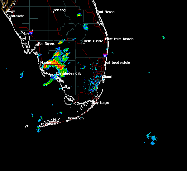 The national weather service in miami has issued a * severe thunderstorm warning for. northwestern collier county in southwestern florida. until 630 pm edt * at 528 pm edt. Doppler radar indicated a severe thunderstorm capable of producing quarter size hail and damaging winds in excess. The national weather service in miami has issued a * severe thunderstorm warning for. northwestern collier county in southwestern florida. until 630 pm edt * at 528 pm edt. Doppler radar indicated a severe thunderstorm capable of producing quarter size hail and damaging winds in excess.
|
| 5/11/2015 5:41 PM EDT | The severe thunderstorm warning for lee county will expire at 545 pm edt, the storms which prompted the warning have weakened below severe limits and exited the warned area. therefore the warning will be allowed to expire. however gusty winds are still possible with thunderstorms entering the area from collier county. |
| 5/11/2015 5:30 PM EDT | At 529 pm edt, doppler radar indicated a line of severe thunderstorms capable of producing quarter size hail and damaging winds in excess of 60 mph. these storms were located along a line extending from near palmona park to near lovers key state park, moving west at 15 mph. locations impacted include, cape coral, fort myers, bonita springs, cypress lake, st. james city, pine manor, matlacha isles-matlacha shores, matlacha, three oaks, pineland, east dunbar, southwest florida airport, san carlos park, pine island center, iona, palmona park, lochmoor waterway estates, villas, mcgregor and harlem heights. |
| 5/11/2015 5:05 PM EDT | Numerous large tree limbs down in lovers key state par in lee county FL, 6.8 miles ESE of Bonita Springs, FL |
| 5/11/2015 5:04 PM EDT | At 504 pm edt, doppler radar indicated a line of severe thunderstorms capable of producing quarter size hail and damaging winds in excess of 60 mph. these storms were located along a line extending from near pineland to near cape coral to lovers key state park, and moving west at 20 mph. |
| 5/10/2015 4:12 PM EDT | At 412 pm edt, doppler radar indicated a severe thunderstorm capable of producing quarter size hail and damaging winds in excess of 60 mph. this storm was located over golden gate estates. this storm was nearly stationary. locations impacted include, golden gate estates, golden gate, west toll gate on alligator alley, lely resort and naples manor. |
| 5/10/2015 4:02 PM EDT | At 401 pm edt, doppler radar indicated a severe thunderstorm capable of producing quarter size hail and damaging winds in excess of 60 mph. this storm was located near golden gate estates. this storm was nearly stationary. |
Hail Maps for Bonita Springs, FL
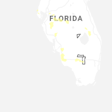
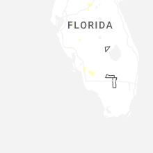
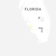

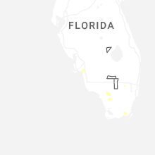
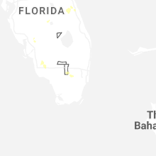
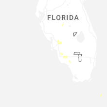
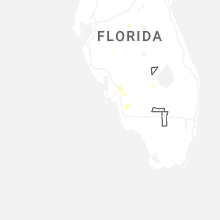


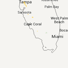
Connect with Interactive Hail Maps