

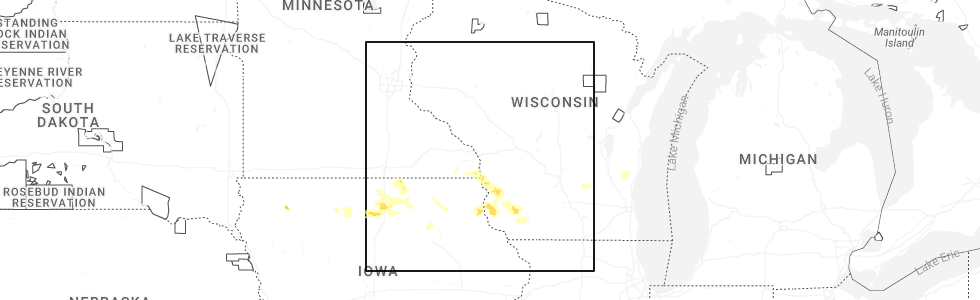
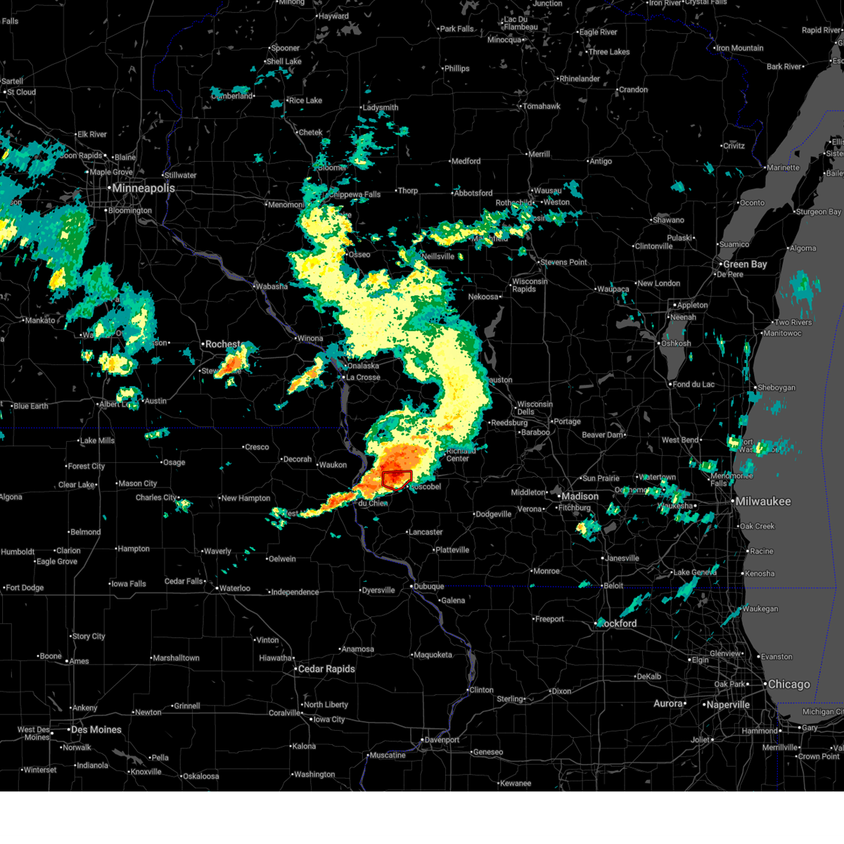
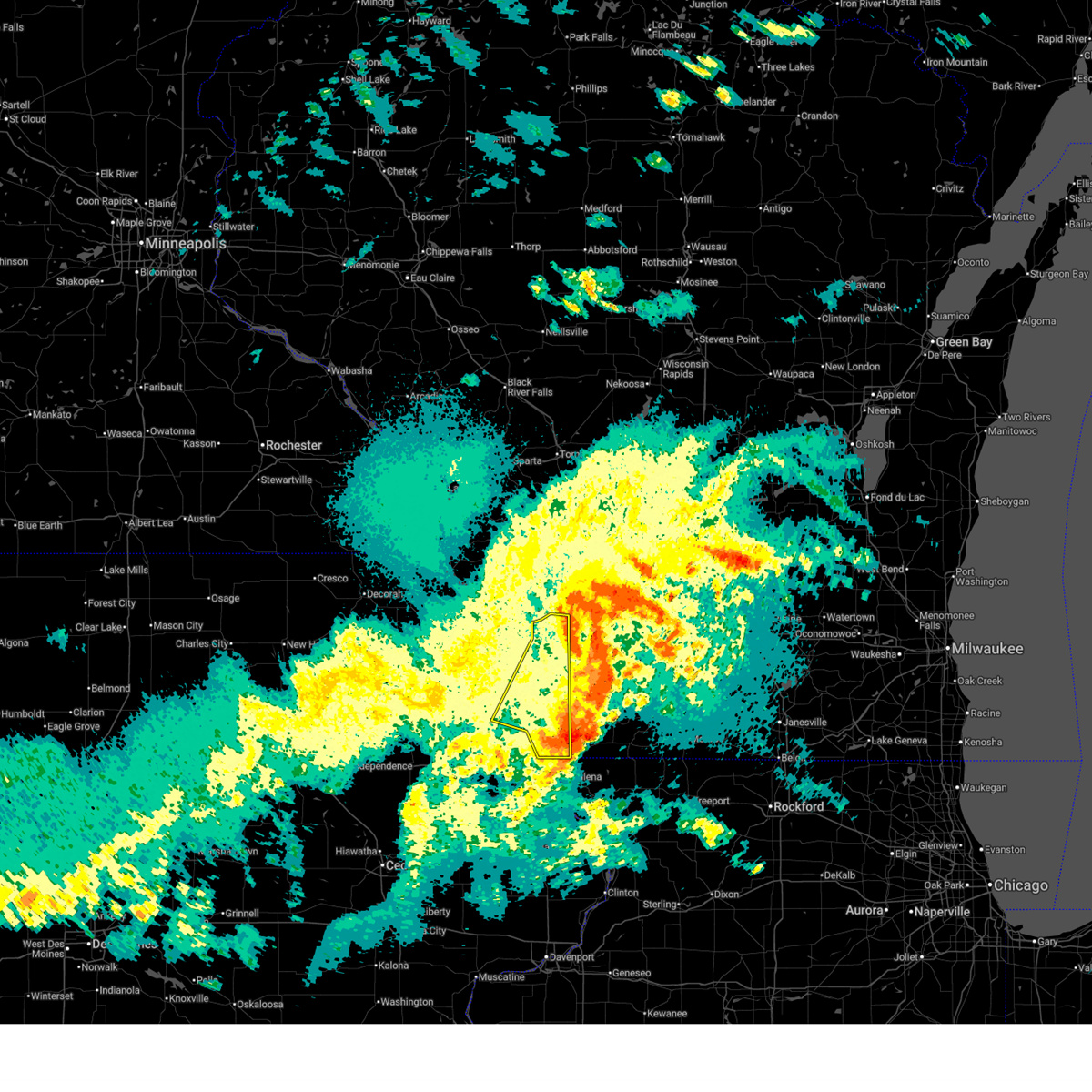
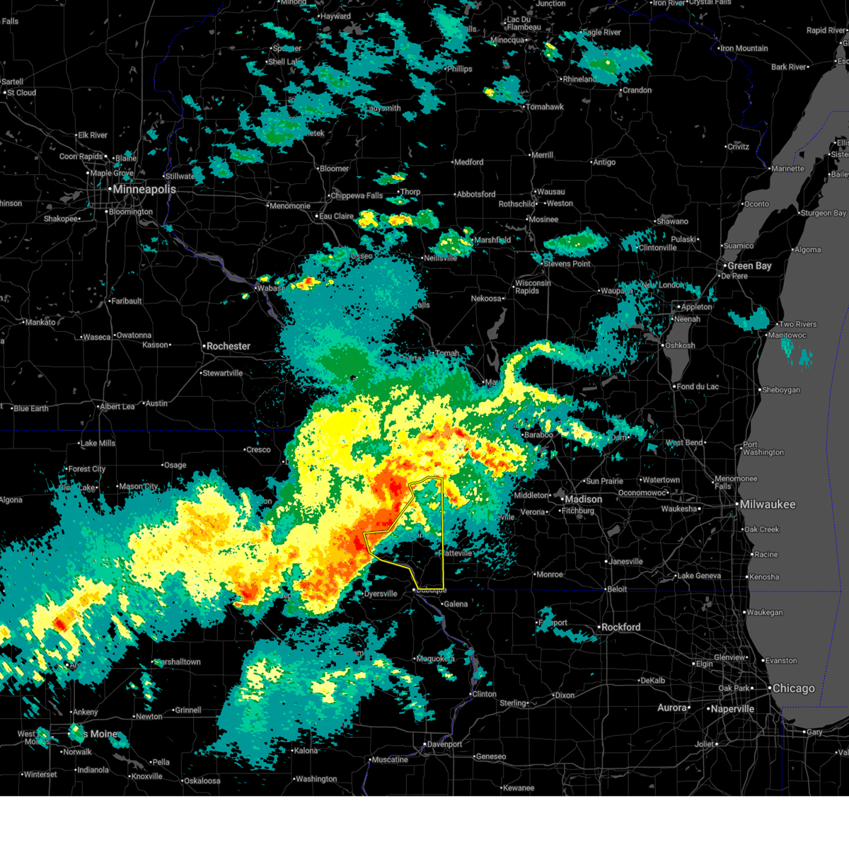
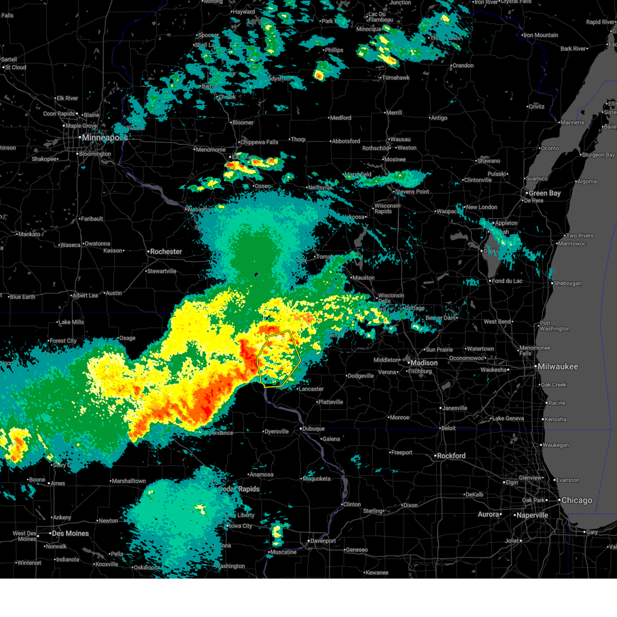
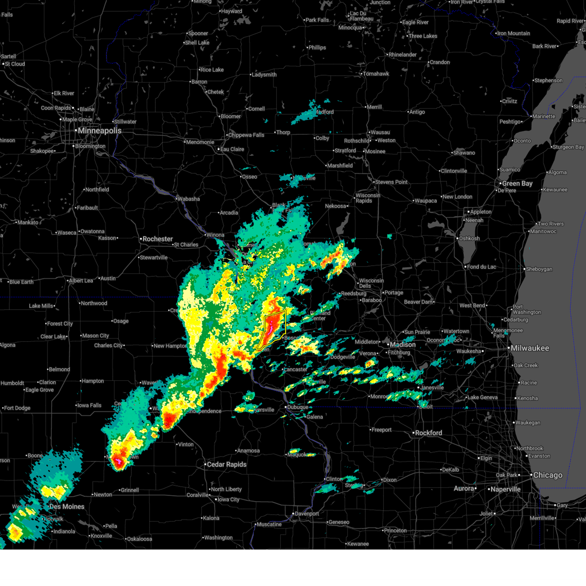
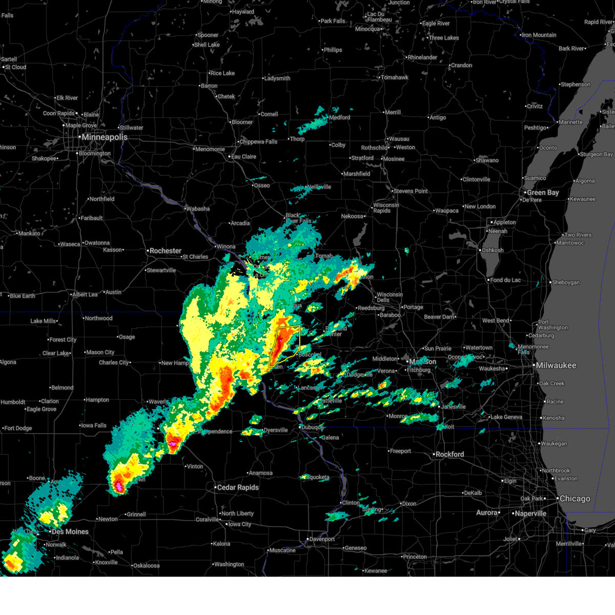
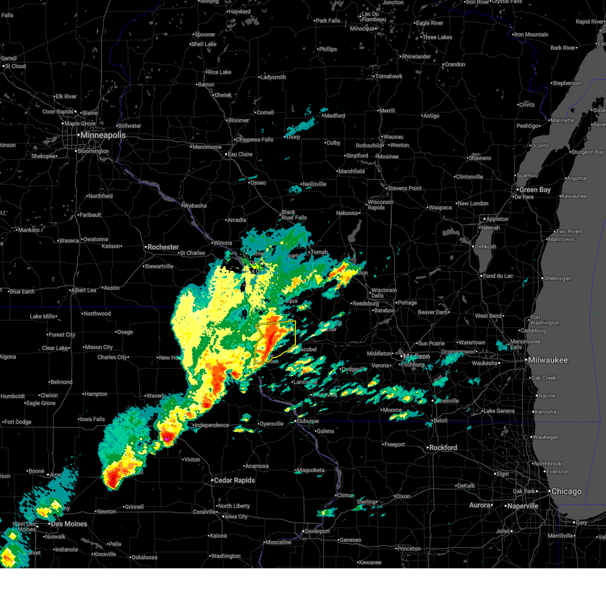
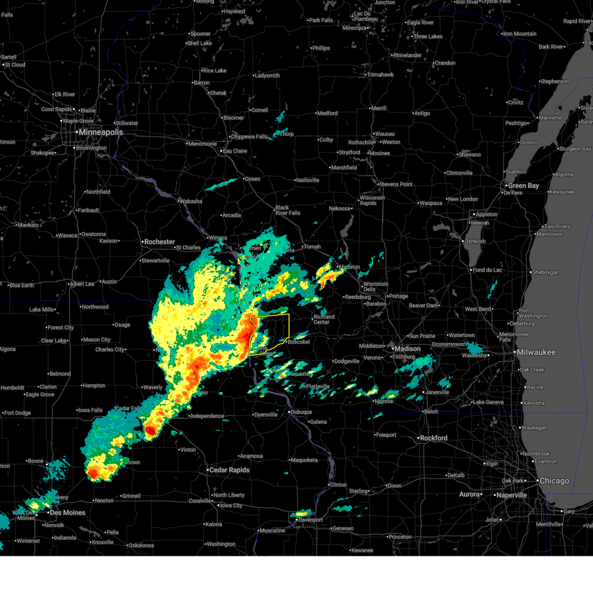
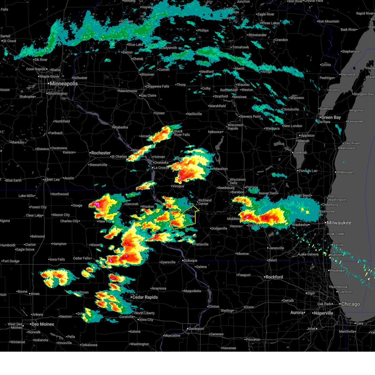
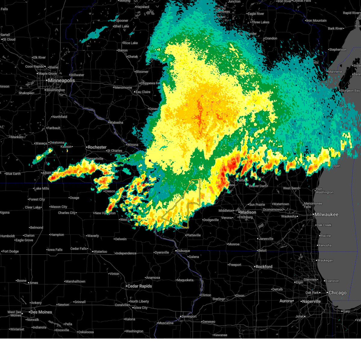
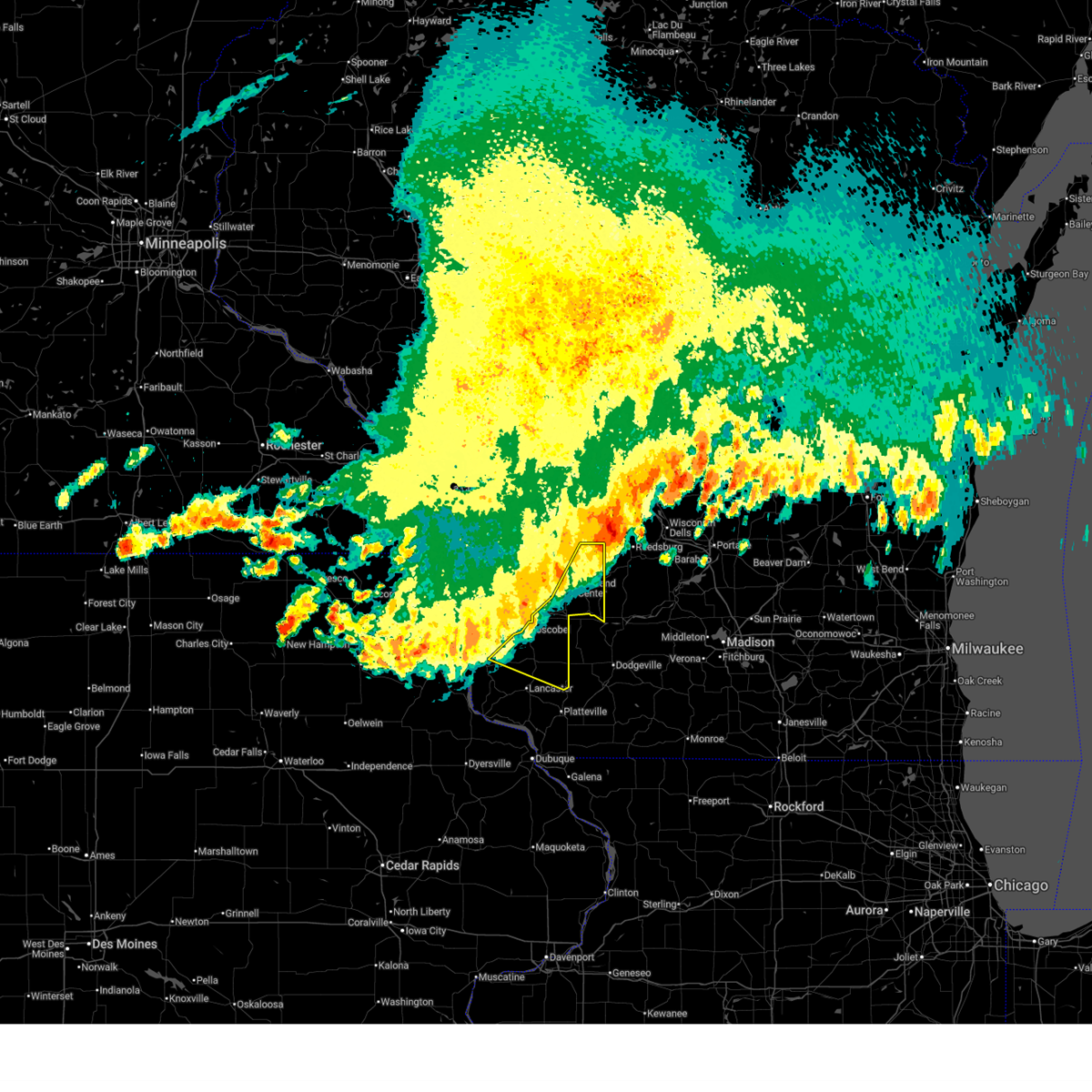
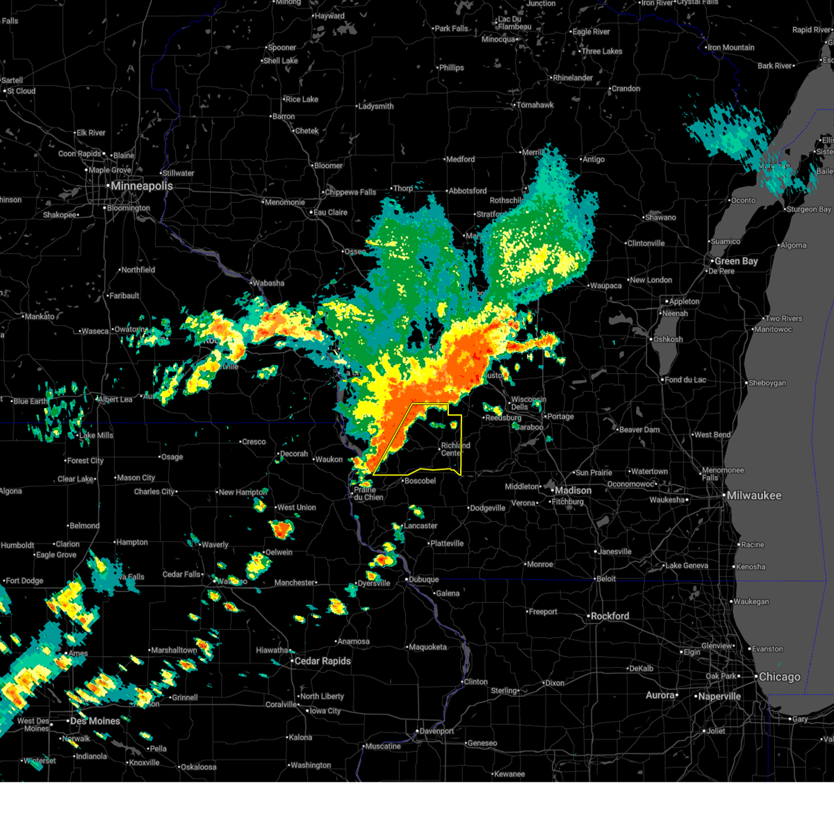
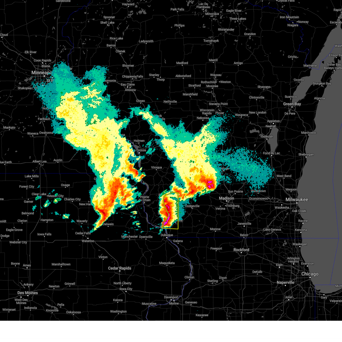
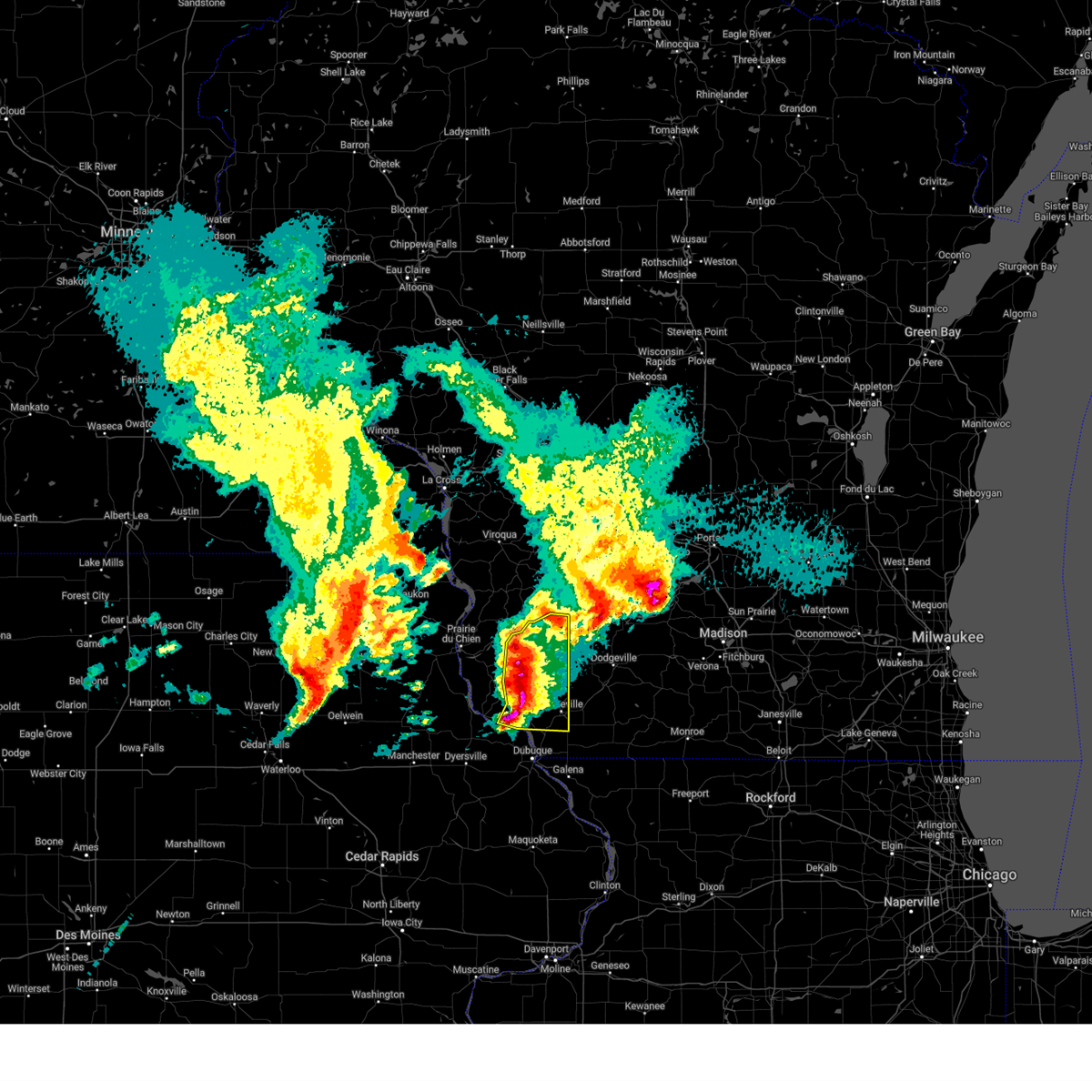
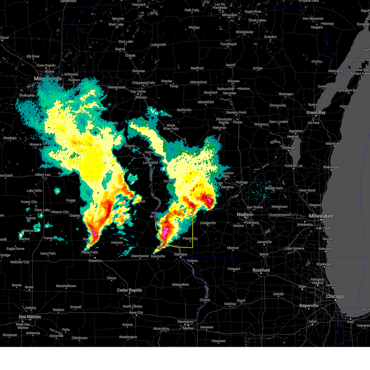
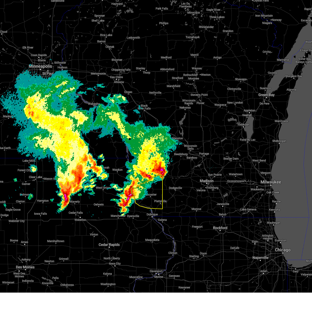
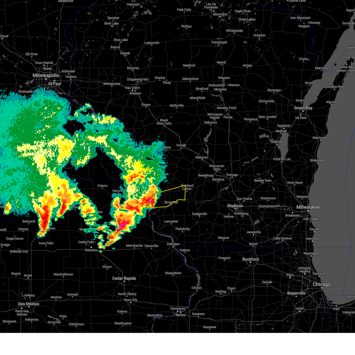
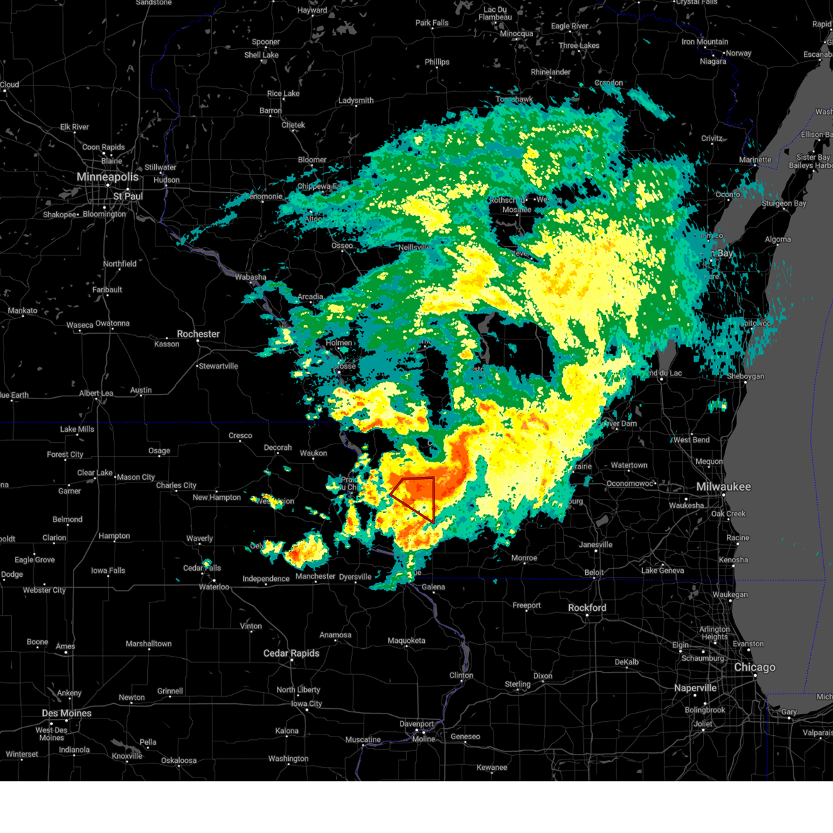
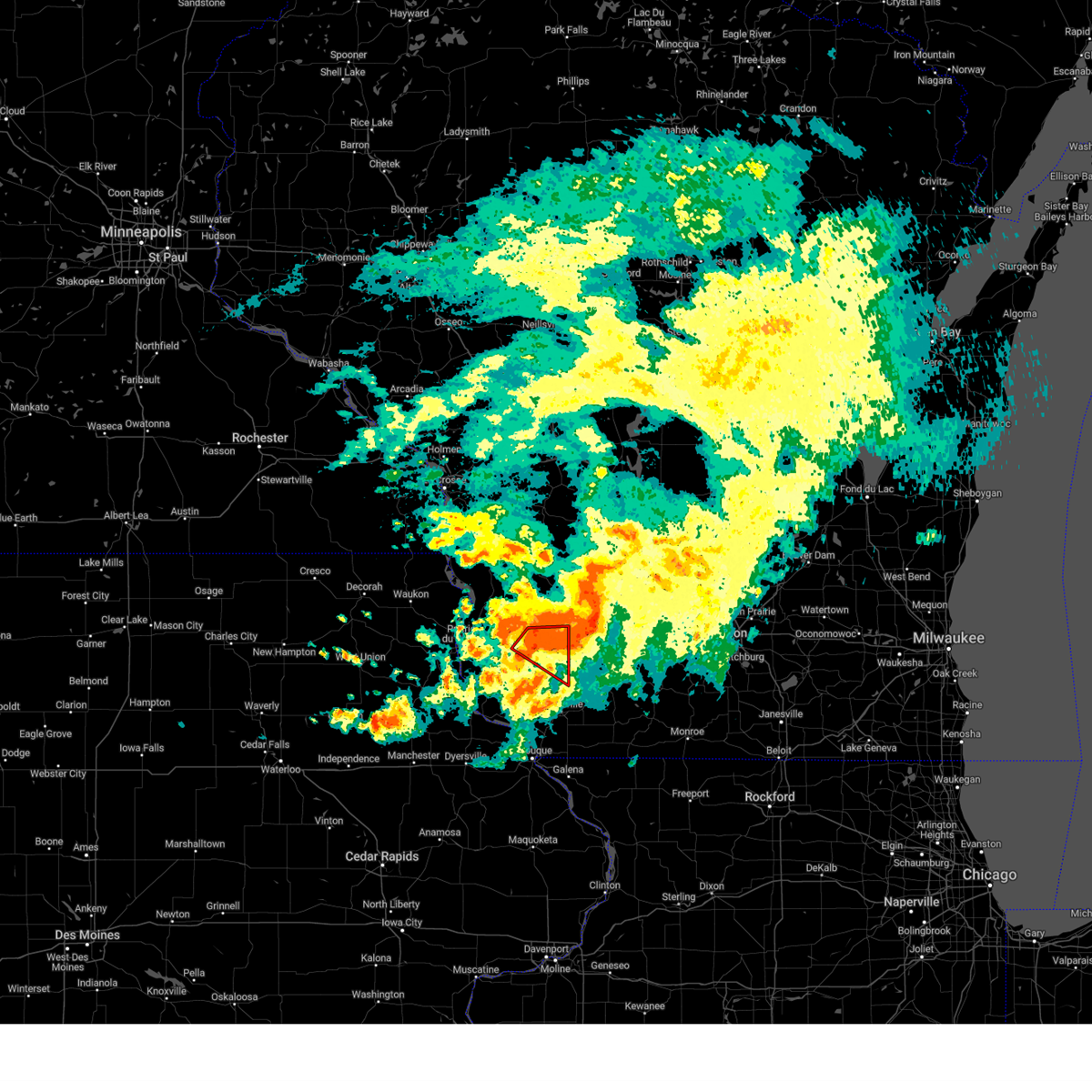
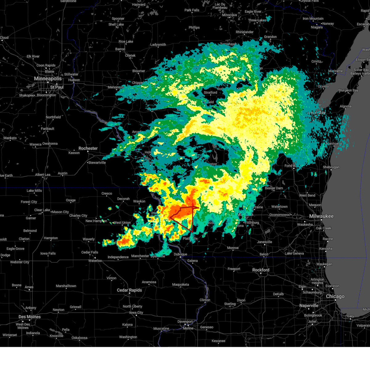
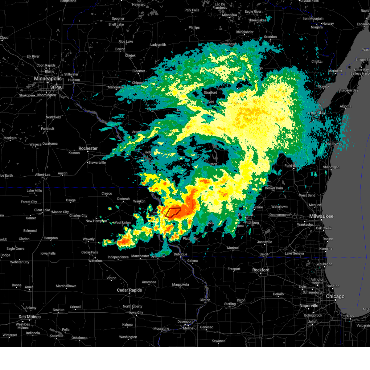
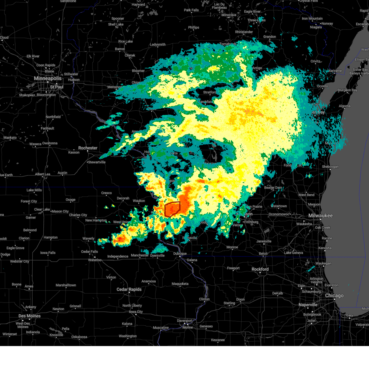
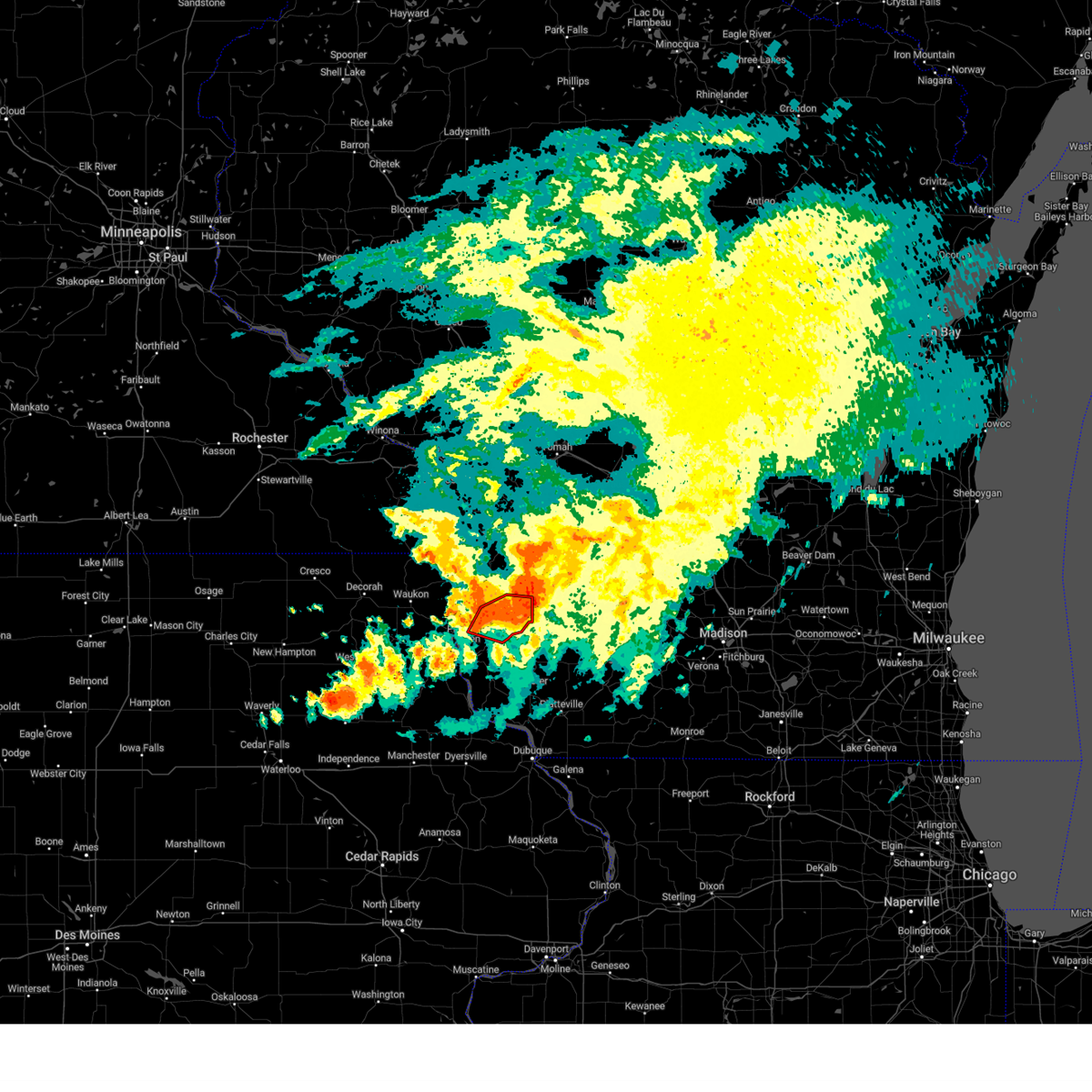
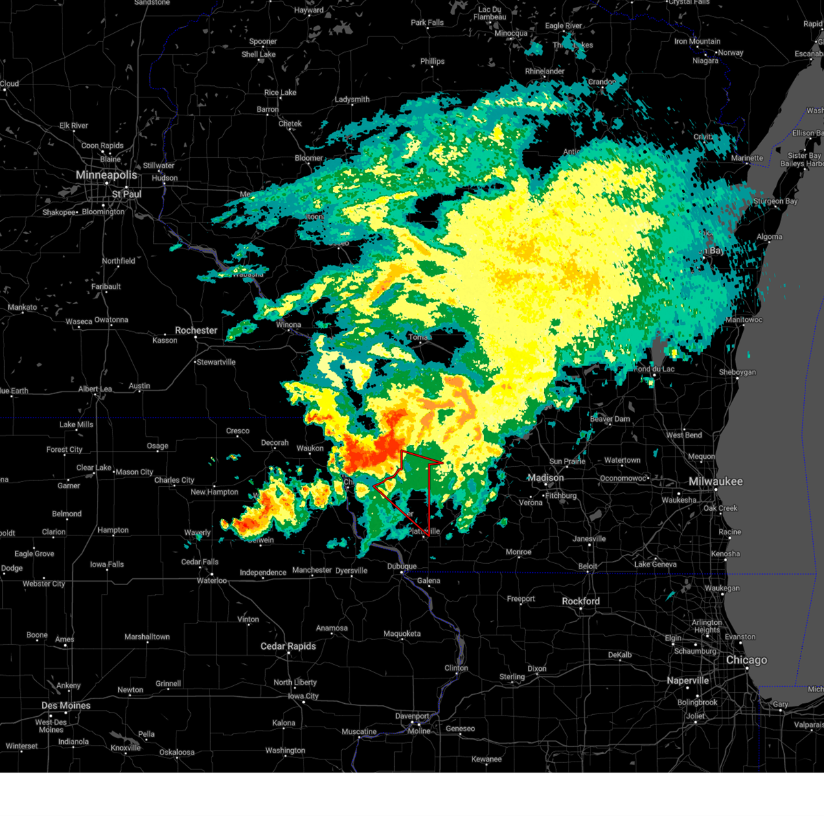
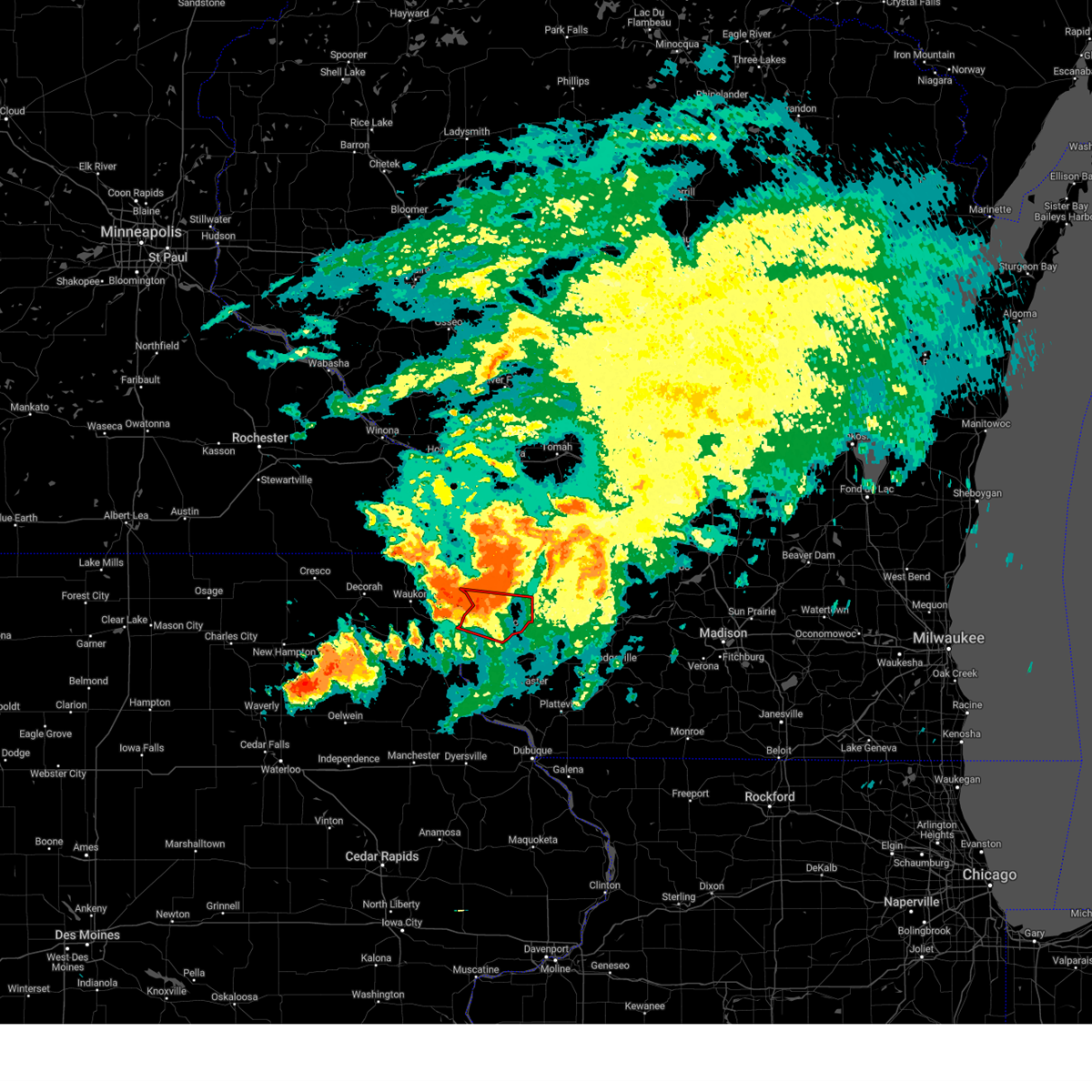
Hail Map for Boscobel, WI
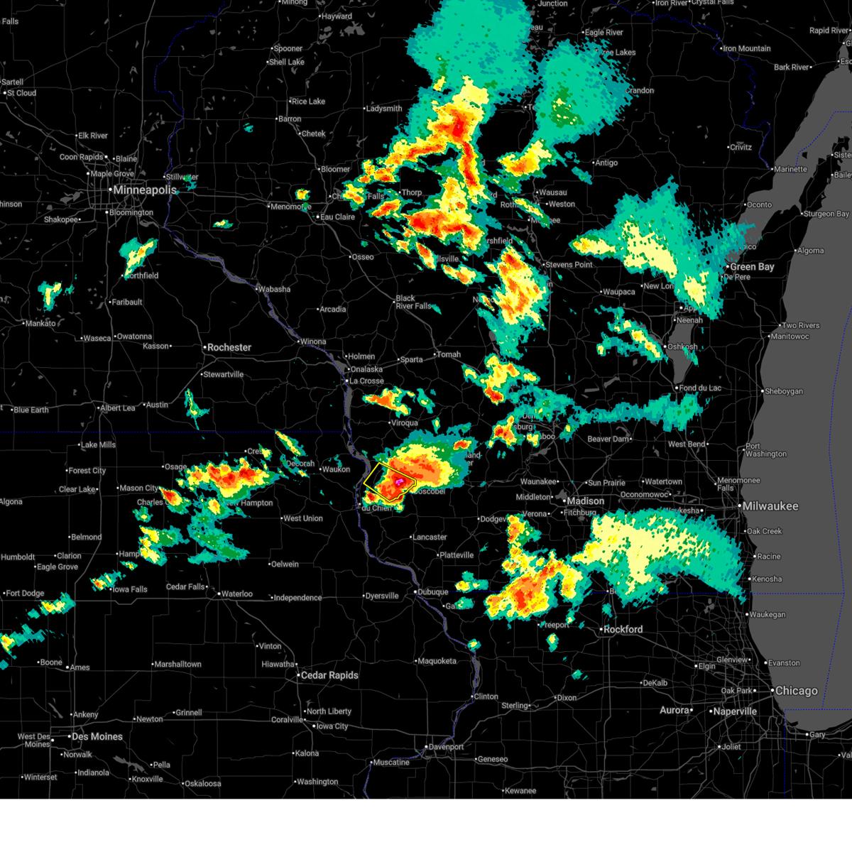
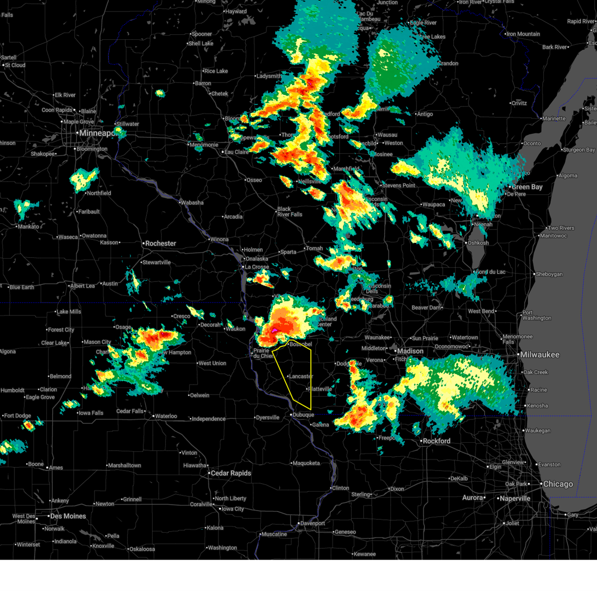
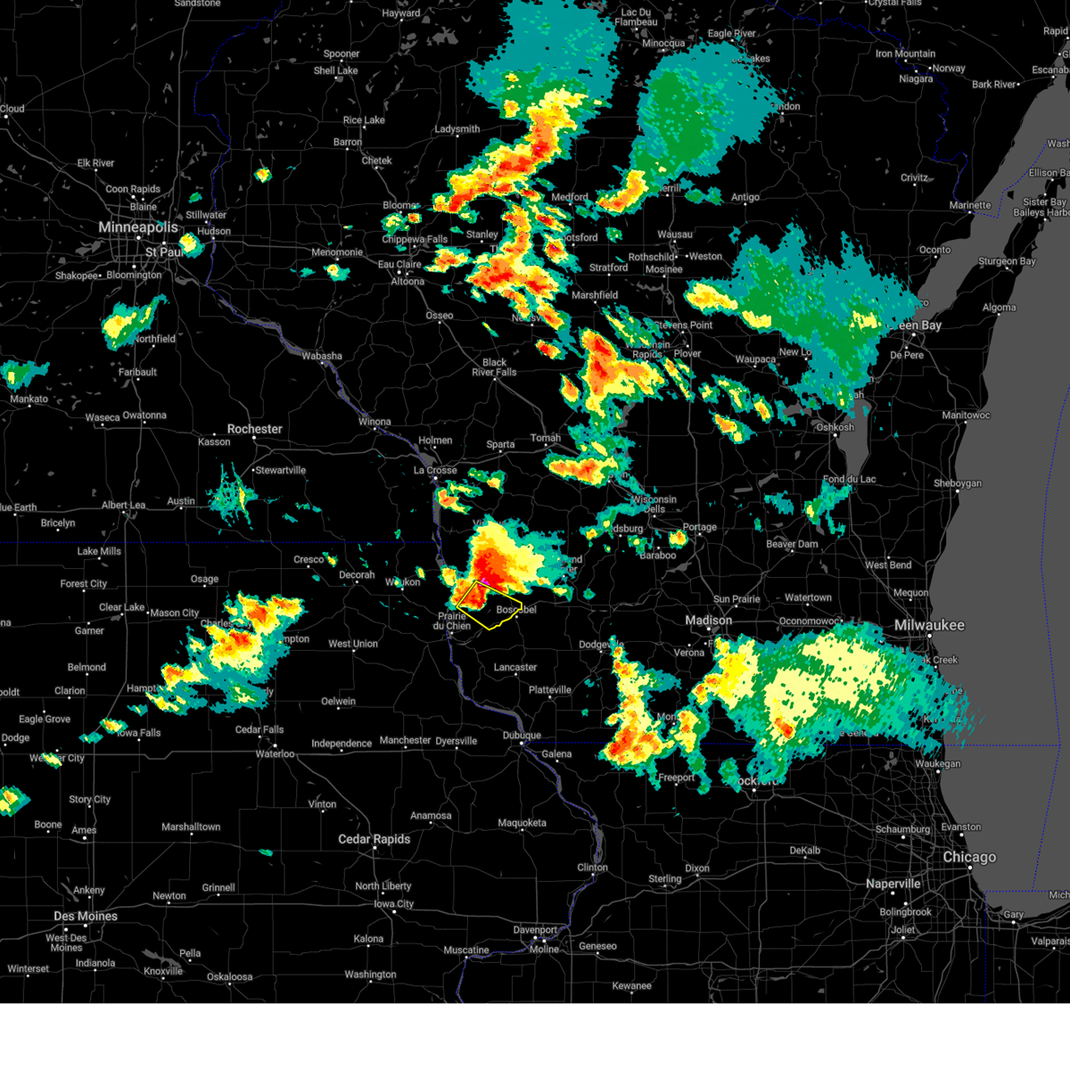
The Boscobel, WI area has had 2 reports of on-the-ground hail by trained spotters, and has been under severe weather warnings 32 times during the past 12 months. Doppler radar has detected hail at or near Boscobel, WI on 47 occasions, including 4 occasions during the past year.
| Name: | Boscobel, WI |
| Where Located: | 54.2 miles SSE of La Crosse, WI |
| Map: | Google Map for Boscobel, WI |
| Population: | 3231 |
| Housing Units: | 1307 |
| More Info: | Search Google for Boscobel, WI |
1
The Top Recent Hail Date for Boscobel, WI is Monday, September 22, 2025 (16th out of 47)
Hail and Wind Damage Spotted near Boscobel, WI
| Date / Time | Report Details |
|---|---|
| 6/17/2026 5:43 PM CDT |
 At 543 pm cdt, a severe thunderstorm capable of producing a tornado was located over boscobel, or 19 miles north of lancaster, moving east at 45 mph (radar indicated rotation). Hazards include tornado. Flying debris will be dangerous to those caught without shelter. mobile homes will be damaged or destroyed. damage to roofs, windows, and vehicles will occur. tree damage is likely. This tornadic thunderstorm will remain over mainly rural areas of northeastern grant county, including the following locations, red oak ridge, blue river, orion, and centerville. At 543 pm cdt, a severe thunderstorm capable of producing a tornado was located over boscobel, or 19 miles north of lancaster, moving east at 45 mph (radar indicated rotation). Hazards include tornado. Flying debris will be dangerous to those caught without shelter. mobile homes will be damaged or destroyed. damage to roofs, windows, and vehicles will occur. tree damage is likely. This tornadic thunderstorm will remain over mainly rural areas of northeastern grant county, including the following locations, red oak ridge, blue river, orion, and centerville.
|
| 6/17/2026 5:42 PM CDT |
 The storm which prompted the warning has moved out of the area. therefore, the warning will be allowed to expire. a tornado watch remains in effect until 900 pm cdt for southwestern wisconsin. The storm which prompted the warning has moved out of the area. therefore, the warning will be allowed to expire. a tornado watch remains in effect until 900 pm cdt for southwestern wisconsin.
|
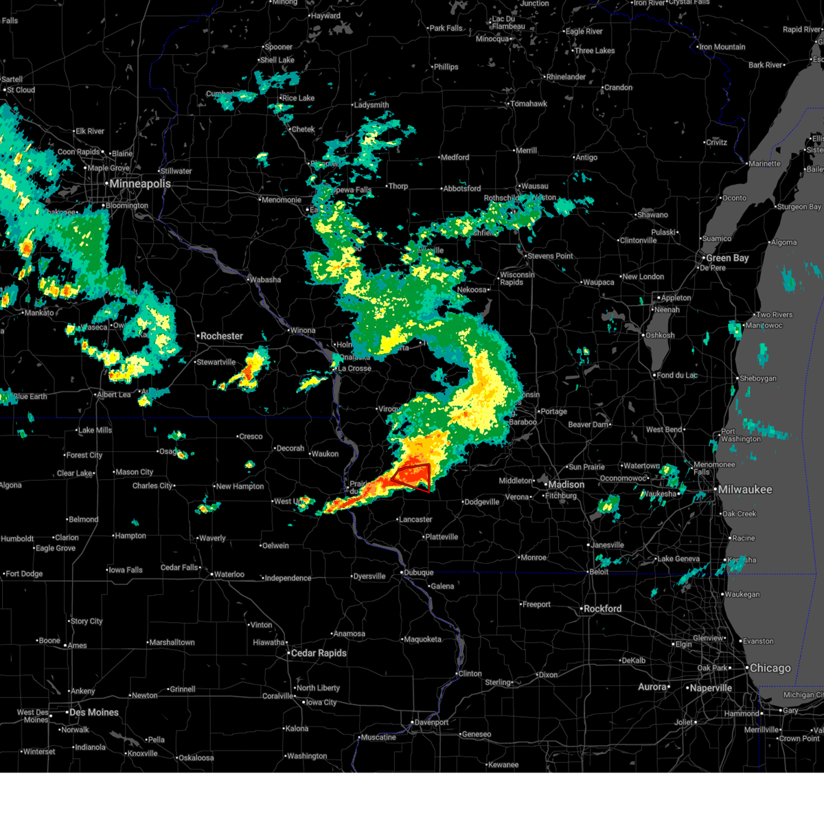
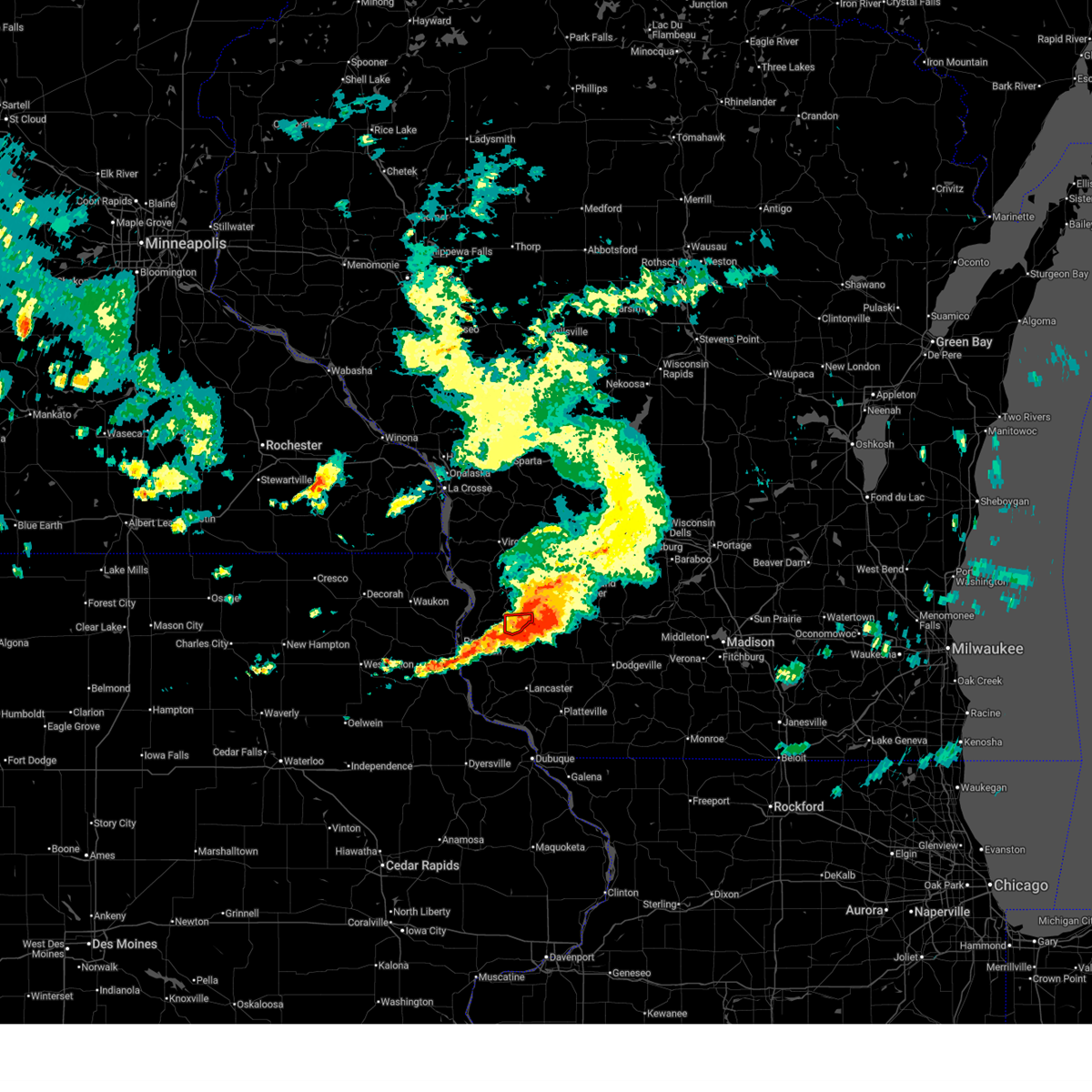
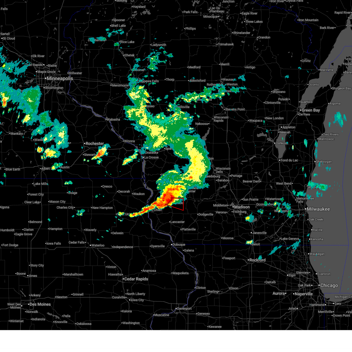
| 6/17/2026 5:39 PM CDT | Small sheds and trees down in boscobel. potential tornado damage. time estimated from rada in grant county WI, 1.1 miles NE of Boscobel, WI |
| 6/17/2026 5:34 PM CDT |
 At 534 pm cdt, a severe thunderstorm capable of producing a tornado was located near boscobel, or 20 miles northeast of prairie du chien, moving east at 45 mph (radar indicated rotation. this storm has a history of producing at least one long tracked tornado). Hazards include tornado. Flying debris will be dangerous to those caught without shelter. mobile homes will be damaged or destroyed. damage to roofs, windows, and vehicles will occur. tree damage is likely. this dangerous storm will be near, boscobel around 540 pm cdt. Other locations impacted by this tornadic thunderstorm include boydtown, maple ridge, highways 60 and 61, easter rock, and steuben. At 534 pm cdt, a severe thunderstorm capable of producing a tornado was located near boscobel, or 20 miles northeast of prairie du chien, moving east at 45 mph (radar indicated rotation. this storm has a history of producing at least one long tracked tornado). Hazards include tornado. Flying debris will be dangerous to those caught without shelter. mobile homes will be damaged or destroyed. damage to roofs, windows, and vehicles will occur. tree damage is likely. this dangerous storm will be near, boscobel around 540 pm cdt. Other locations impacted by this tornadic thunderstorm include boydtown, maple ridge, highways 60 and 61, easter rock, and steuben.
|
| 6/17/2026 5:33 PM CDT |
 Torarx the national weather service in la crosse has issued a * tornado warning for, northeastern grant county in southwestern wisconsin, southwestern richland county in southwestern wisconsin, * until 615 pm cdt. * at 532 pm cdt, a severe thunderstorm capable of producing a tornado was located near boscobel, or 19 miles northeast of prairie du chien, moving east at 45 mph (radar indicated rotation. this storm has a history of producing at least one long tracked tornado). Hazards include tornado. Flying debris will be dangerous to those caught without shelter. mobile homes will be damaged or destroyed. damage to roofs, windows, and vehicles will occur. tree damage is likely. this dangerous storm will be near, boscobel around 540 pm cdt. Other locations impacted by this tornadic thunderstorm include westport, red oak ridge, blue river, orion, port andrew, and centerville. Torarx the national weather service in la crosse has issued a * tornado warning for, northeastern grant county in southwestern wisconsin, southwestern richland county in southwestern wisconsin, * until 615 pm cdt. * at 532 pm cdt, a severe thunderstorm capable of producing a tornado was located near boscobel, or 19 miles northeast of prairie du chien, moving east at 45 mph (radar indicated rotation. this storm has a history of producing at least one long tracked tornado). Hazards include tornado. Flying debris will be dangerous to those caught without shelter. mobile homes will be damaged or destroyed. damage to roofs, windows, and vehicles will occur. tree damage is likely. this dangerous storm will be near, boscobel around 540 pm cdt. Other locations impacted by this tornadic thunderstorm include westport, red oak ridge, blue river, orion, port andrew, and centerville.
|
| 6/17/2026 5:28 PM CDT |
 At 527 pm cdt, a confirmed tornado was located 8 miles west of boscobel, or 16 miles northeast of prairie du chien, moving east at 40 mph (radar confirmed tornado). Hazards include damaging tornado. Flying debris will be dangerous to those caught without shelter. mobile homes will be damaged or destroyed. damage to roofs, windows, and vehicles will occur. tree damage is likely. this tornado will be near, boscobel around 535 pm cdt. Other locations impacted by this tornadic thunderstorm include maple ridge, plugtown, steuben, boydtown, harris ridge, highways 60 and 61, and easter rock. At 527 pm cdt, a confirmed tornado was located 8 miles west of boscobel, or 16 miles northeast of prairie du chien, moving east at 40 mph (radar confirmed tornado). Hazards include damaging tornado. Flying debris will be dangerous to those caught without shelter. mobile homes will be damaged or destroyed. damage to roofs, windows, and vehicles will occur. tree damage is likely. this tornado will be near, boscobel around 535 pm cdt. Other locations impacted by this tornadic thunderstorm include maple ridge, plugtown, steuben, boydtown, harris ridge, highways 60 and 61, and easter rock.
|
| 6/17/2026 5:16 PM CDT |
 At 516 pm cdt, a confirmed large and extremely dangerous tornado was located near harpers ferry, or 13 miles northeast of prairie du chien, moving east at 45 mph. this is a particularly dangerous situation. take cover now! (radar confirmed tornado). Hazards include damaging tornado. You are in a life-threatening situation. flying debris may be deadly to those caught without shelter. mobile homes will be destroyed. considerable damage to homes, businesses, and vehicles is likely and complete destruction is possible. the tornado will be near, boscobel around 530 pm cdt. Other locations impacted by this tornadic thunderstorm include highway 27 and county f, plugtown, steuben, harris ridge, highways 60 and 61, maple ridge, and lynxville. At 516 pm cdt, a confirmed large and extremely dangerous tornado was located near harpers ferry, or 13 miles northeast of prairie du chien, moving east at 45 mph. this is a particularly dangerous situation. take cover now! (radar confirmed tornado). Hazards include damaging tornado. You are in a life-threatening situation. flying debris may be deadly to those caught without shelter. mobile homes will be destroyed. considerable damage to homes, businesses, and vehicles is likely and complete destruction is possible. the tornado will be near, boscobel around 530 pm cdt. Other locations impacted by this tornadic thunderstorm include highway 27 and county f, plugtown, steuben, harris ridge, highways 60 and 61, maple ridge, and lynxville.
|
| 6/17/2026 5:16 PM CDT |
 the tornado warning has been cancelled and is no longer in effect the tornado warning has been cancelled and is no longer in effect
|
| 6/17/2026 5:11 PM CDT |
 At 510 pm cdt, a confirmed large and extremely dangerous tornado was located near harpers ferry, or 11 miles southeast of lansing, moving east at 50 mph. this is a particularly dangerous situation. take cover now! (radar confirmed tornado). Hazards include damaging tornado. You are in a life-threatening situation. flying debris may be deadly to those caught without shelter. mobile homes will be destroyed. considerable damage to homes, businesses, and vehicles is likely and complete destruction is possible. the tornado will be near, boscobel around 535 pm cdt. Other locations impacted by this tornadic thunderstorm include highway 27 and county f, plugtown, steuben, harris ridge, highways 60 and 61, maple ridge, and lynxville. At 510 pm cdt, a confirmed large and extremely dangerous tornado was located near harpers ferry, or 11 miles southeast of lansing, moving east at 50 mph. this is a particularly dangerous situation. take cover now! (radar confirmed tornado). Hazards include damaging tornado. You are in a life-threatening situation. flying debris may be deadly to those caught without shelter. mobile homes will be destroyed. considerable damage to homes, businesses, and vehicles is likely and complete destruction is possible. the tornado will be near, boscobel around 535 pm cdt. Other locations impacted by this tornadic thunderstorm include highway 27 and county f, plugtown, steuben, harris ridge, highways 60 and 61, maple ridge, and lynxville.
|
| 6/17/2026 5:04 PM CDT |
 Torarx the national weather service in la crosse has issued a * tornado warning for, east central allamakee county in northeastern iowa, central crawford county in southwestern wisconsin, * until 545 pm cdt. * at 504 pm cdt, a tornado producing storm was located near harpers ferry, or 8 miles south of lansing, moving east at 45 mph (radar confirmed tornado). Hazards include damaging tornado. Flying debris will be dangerous to those caught without shelter. mobile homes will be damaged or destroyed. damage to roofs, windows, and vehicles will occur. tree damage is likely. this tornadic storm will be near, harpers ferry around 510 pm cdt. Other locations impacted by this tornadic thunderstorm include wauzeka, eastman, highway 27 and county f, plugtown, steuben, harris ridge, and highways 60 and 61. Torarx the national weather service in la crosse has issued a * tornado warning for, east central allamakee county in northeastern iowa, central crawford county in southwestern wisconsin, * until 545 pm cdt. * at 504 pm cdt, a tornado producing storm was located near harpers ferry, or 8 miles south of lansing, moving east at 45 mph (radar confirmed tornado). Hazards include damaging tornado. Flying debris will be dangerous to those caught without shelter. mobile homes will be damaged or destroyed. damage to roofs, windows, and vehicles will occur. tree damage is likely. this tornadic storm will be near, harpers ferry around 510 pm cdt. Other locations impacted by this tornadic thunderstorm include wauzeka, eastman, highway 27 and county f, plugtown, steuben, harris ridge, and highways 60 and 61.
|
| 6/10/2026 12:57 PM CDT |
 Svrarx the national weather service in la crosse has issued a * severe thunderstorm warning for, northeastern grant county in southwestern wisconsin, southeastern richland county in southwestern wisconsin, * until 215 pm cdt. * at 1256 pm cdt, severe thunderstorms were located along a line extending from near garnavillo to 6 miles northeast of balltown to council hill, moving northeast at 50 mph (trained weather spotters. wind gusts of 70 mph have been reported with this line). Hazards include 70 mph wind gusts. Expect considerable tree damage. damage is likely to mobile homes, roofs, and outbuildings. severe thunderstorms will be near, boscobel around 130 pm cdt. muscoda around 140 pm cdt. richland center around 150 pm cdt. Other locations impacted by these severe thunderstorms include preston, county roads o and o o, highway 61 and county t, montfort, ithaca, livingston, and eagle corners. Svrarx the national weather service in la crosse has issued a * severe thunderstorm warning for, northeastern grant county in southwestern wisconsin, southeastern richland county in southwestern wisconsin, * until 215 pm cdt. * at 1256 pm cdt, severe thunderstorms were located along a line extending from near garnavillo to 6 miles northeast of balltown to council hill, moving northeast at 50 mph (trained weather spotters. wind gusts of 70 mph have been reported with this line). Hazards include 70 mph wind gusts. Expect considerable tree damage. damage is likely to mobile homes, roofs, and outbuildings. severe thunderstorms will be near, boscobel around 130 pm cdt. muscoda around 140 pm cdt. richland center around 150 pm cdt. Other locations impacted by these severe thunderstorms include preston, county roads o and o o, highway 61 and county t, montfort, ithaca, livingston, and eagle corners.
|
| 5/16/2026 12:10 AM CDT |
 The storms which prompted the warning have moved out of the area. therefore, the warning will be allowed to expire. a severe thunderstorm watch remains in effect until 500 am cdt for southwestern wisconsin. The storms which prompted the warning have moved out of the area. therefore, the warning will be allowed to expire. a severe thunderstorm watch remains in effect until 500 am cdt for southwestern wisconsin.
|
| 5/15/2026 11:55 PM CDT |
 At 1154 pm cdt, severe thunderstorms were located along a line extending from near muscoda to 10 miles northwest of mineral point to rickardsville, moving east at 45 mph (public. at 1155 pm, a personal weather station reported a 61 mph gust near platteville). Hazards include 60 mph wind gusts. Expect damage to roofs, siding, and trees. these severe storms will be near, platteville and dickeyville around 1200 am cdt. cuba city around 1210 am cdt. hazel green around 1215 am cdt. Other locations impacted by these severe thunderstorms include big h campground, preston, arthur, highway 61 and county t, montfort, union, and cornelia. At 1154 pm cdt, severe thunderstorms were located along a line extending from near muscoda to 10 miles northwest of mineral point to rickardsville, moving east at 45 mph (public. at 1155 pm, a personal weather station reported a 61 mph gust near platteville). Hazards include 60 mph wind gusts. Expect damage to roofs, siding, and trees. these severe storms will be near, platteville and dickeyville around 1200 am cdt. cuba city around 1210 am cdt. hazel green around 1215 am cdt. Other locations impacted by these severe thunderstorms include big h campground, preston, arthur, highway 61 and county t, montfort, union, and cornelia.
|
| 5/15/2026 11:34 PM CDT |
 Torarx the national weather service in la crosse has issued a * tornado warning for, northeastern grant county in southwestern wisconsin, * until midnight cdt. * at 1134 pm cdt, a severe thunderstorm capable of producing a tornado was located over fennimore, or 9 miles north of lancaster, moving east at 30 mph (radar indicated rotation). Hazards include tornado. Flying debris will be dangerous to those caught without shelter. mobile homes will be damaged or destroyed. damage to roofs, windows, and vehicles will occur. tree damage is likely. this dangerous storm will be near, fennimore around 1140 pm cdt. Other locations impacted by this tornadic thunderstorm include preston, annaton, highway 61 and county t, montfort, werley, mount ida, and livingston. Torarx the national weather service in la crosse has issued a * tornado warning for, northeastern grant county in southwestern wisconsin, * until midnight cdt. * at 1134 pm cdt, a severe thunderstorm capable of producing a tornado was located over fennimore, or 9 miles north of lancaster, moving east at 30 mph (radar indicated rotation). Hazards include tornado. Flying debris will be dangerous to those caught without shelter. mobile homes will be damaged or destroyed. damage to roofs, windows, and vehicles will occur. tree damage is likely. this dangerous storm will be near, fennimore around 1140 pm cdt. Other locations impacted by this tornadic thunderstorm include preston, annaton, highway 61 and county t, montfort, werley, mount ida, and livingston.
|
| 5/15/2026 11:25 PM CDT |
 At 1124 pm cdt, severe thunderstorms were located along a line extending from 16 miles east of harpers ferry to near boscobel to near bloomington, moving east at 40 mph (broadcast media). Hazards include 60 mph wind gusts. Expect damage to roofs, siding, and trees. these severe storms will be near, boscobel around 1130 pm cdt. Other locations impacted by these severe thunderstorms include highway 35 and county d, eastman, plugtown, harris ridge, county roads k and t, limery ridge, and bridgeport. At 1124 pm cdt, severe thunderstorms were located along a line extending from 16 miles east of harpers ferry to near boscobel to near bloomington, moving east at 40 mph (broadcast media). Hazards include 60 mph wind gusts. Expect damage to roofs, siding, and trees. these severe storms will be near, boscobel around 1130 pm cdt. Other locations impacted by these severe thunderstorms include highway 35 and county d, eastman, plugtown, harris ridge, county roads k and t, limery ridge, and bridgeport.
|
| 5/15/2026 11:23 PM CDT |
 At 1123 pm cdt, severe thunderstorms were located along a line extending from 9 miles west of boscobel to 6 miles northeast of bloomington to greeley, moving east at 30 mph (public). Hazards include 60 mph wind gusts. Expect damage to roofs, siding, and trees. these severe storms will be near, boscobel, fennimore, and cassville around 1130 pm cdt. lancaster around 1135 pm cdt. muscoda around 1200 am cdt. platteville around 1210 am cdt. dickeyville around 1215 am cdt. Other locations impacted by these severe thunderstorms include big h campground, preston, arthur, highway 61 and county t, montfort, mount ida, and beetown. At 1123 pm cdt, severe thunderstorms were located along a line extending from 9 miles west of boscobel to 6 miles northeast of bloomington to greeley, moving east at 30 mph (public). Hazards include 60 mph wind gusts. Expect damage to roofs, siding, and trees. these severe storms will be near, boscobel, fennimore, and cassville around 1130 pm cdt. lancaster around 1135 pm cdt. muscoda around 1200 am cdt. platteville around 1210 am cdt. dickeyville around 1215 am cdt. Other locations impacted by these severe thunderstorms include big h campground, preston, arthur, highway 61 and county t, montfort, mount ida, and beetown.
|
| 5/15/2026 11:14 PM CDT |
 Svrarx the national weather service in la crosse has issued a * severe thunderstorm warning for, grant county in southwestern wisconsin, * until 1215 am cdt. * at 1114 pm cdt, severe thunderstorms were located along a line extending from 9 miles east of harpers ferry to near bloomington to near edgewood, moving east at 35 mph (public. at 1104 pm, a public weather station reported a 57 mph wind gust near prairie du chien, wi). Hazards include 60 mph wind gusts. Expect damage to roofs, siding, and trees. severe thunderstorms will be near, cassville around 1125 pm cdt. boscobel and fennimore around 1130 pm cdt. lancaster around 1135 pm cdt. muscoda around 1155 pm cdt. Other locations impacted by these severe thunderstorms include big h campground, preston, arthur, highway 61 and county t, montfort, mount ida, and beetown. Svrarx the national weather service in la crosse has issued a * severe thunderstorm warning for, grant county in southwestern wisconsin, * until 1215 am cdt. * at 1114 pm cdt, severe thunderstorms were located along a line extending from 9 miles east of harpers ferry to near bloomington to near edgewood, moving east at 35 mph (public. at 1104 pm, a public weather station reported a 57 mph wind gust near prairie du chien, wi). Hazards include 60 mph wind gusts. Expect damage to roofs, siding, and trees. severe thunderstorms will be near, cassville around 1125 pm cdt. boscobel and fennimore around 1130 pm cdt. lancaster around 1135 pm cdt. muscoda around 1155 pm cdt. Other locations impacted by these severe thunderstorms include big h campground, preston, arthur, highway 61 and county t, montfort, mount ida, and beetown.
|
| 5/15/2026 10:54 PM CDT |
 Svrarx the national weather service in la crosse has issued a * severe thunderstorm warning for, northwestern grant county in southwestern wisconsin, crawford county in southwestern wisconsin, * until 1145 pm cdt. * at 1053 pm cdt, severe thunderstorms were located along a line extending from near harpers ferry to prairie du chien to near garnavillo, moving east at 40 mph (broadcast media. at 1051 pm, broadcast media reported a 64 mph wind gust in monona, ia). Hazards include 60 mph wind gusts. Expect damage to roofs, siding, and trees. severe thunderstorms will be near, prairie du chien around 1100 pm cdt. bloomington around 1115 pm cdt. boscobel around 1125 pm cdt. Other locations impacted by these severe thunderstorms include highway 35 and county d, eastman, plugtown, harris ridge, county roads k and t, limery ridge, and bridgeport. Svrarx the national weather service in la crosse has issued a * severe thunderstorm warning for, northwestern grant county in southwestern wisconsin, crawford county in southwestern wisconsin, * until 1145 pm cdt. * at 1053 pm cdt, severe thunderstorms were located along a line extending from near harpers ferry to prairie du chien to near garnavillo, moving east at 40 mph (broadcast media. at 1051 pm, broadcast media reported a 64 mph wind gust in monona, ia). Hazards include 60 mph wind gusts. Expect damage to roofs, siding, and trees. severe thunderstorms will be near, prairie du chien around 1100 pm cdt. bloomington around 1115 pm cdt. boscobel around 1125 pm cdt. Other locations impacted by these severe thunderstorms include highway 35 and county d, eastman, plugtown, harris ridge, county roads k and t, limery ridge, and bridgeport.
|
| 4/15/2026 4:30 PM CDT |
 At 430 pm cdt, a severe thunderstorm was located near boscobel, or 19 miles northeast of prairie du chien, moving east at 40 mph (radar indicated). Hazards include 60 mph wind gusts and quarter size hail. Hail damage to vehicles is expected. expect wind damage to roofs, siding, and trees. this severe storm will be near, boscobel around 435 pm cdt. Other locations impacted by this severe thunderstorm include wauzeka, horrigan ridge, plugtown, steuben, mount zion, harris ridge, and highways 60 and 61. At 430 pm cdt, a severe thunderstorm was located near boscobel, or 19 miles northeast of prairie du chien, moving east at 40 mph (radar indicated). Hazards include 60 mph wind gusts and quarter size hail. Hail damage to vehicles is expected. expect wind damage to roofs, siding, and trees. this severe storm will be near, boscobel around 435 pm cdt. Other locations impacted by this severe thunderstorm include wauzeka, horrigan ridge, plugtown, steuben, mount zion, harris ridge, and highways 60 and 61.
|
| 4/15/2026 4:30 PM CDT |
 At 425 pm cdt, a severe thunderstorm was located 8 miles west of boscobel, or 17 miles northeast of prairie du chien, moving east at 40 mph (radar indicated). Hazards include 60 mph wind gusts and quarter size hail. Hail damage to vehicles is expected. expect wind damage to roofs, siding, and trees. this severe storm will be near, boscobel around 430 pm cdt. Other locations impacted by this severe thunderstorm include wauzeka, horrigan ridge, plugtown, steuben, highway 131 and county b, mount zion, and harris ridge. At 425 pm cdt, a severe thunderstorm was located 8 miles west of boscobel, or 17 miles northeast of prairie du chien, moving east at 40 mph (radar indicated). Hazards include 60 mph wind gusts and quarter size hail. Hail damage to vehicles is expected. expect wind damage to roofs, siding, and trees. this severe storm will be near, boscobel around 430 pm cdt. Other locations impacted by this severe thunderstorm include wauzeka, horrigan ridge, plugtown, steuben, highway 131 and county b, mount zion, and harris ridge.
|
| 4/15/2026 4:17 PM CDT |
 At 417 pm cdt, a severe thunderstorm was located 9 miles east of harpers ferry, or 12 miles northeast of prairie du chien, moving east at 40 mph (radar indicated). Hazards include 60 mph wind gusts and quarter size hail. Hail damage to vehicles is expected. expect wind damage to roofs, siding, and trees. this severe storm will be near, boscobel around 435 pm cdt. Other locations impacted by this severe thunderstorm include highway 35 and county d, eastman, horrigan ridge, plugtown, mount zion, harris ridge, and highways 60 and 61. At 417 pm cdt, a severe thunderstorm was located 9 miles east of harpers ferry, or 12 miles northeast of prairie du chien, moving east at 40 mph (radar indicated). Hazards include 60 mph wind gusts and quarter size hail. Hail damage to vehicles is expected. expect wind damage to roofs, siding, and trees. this severe storm will be near, boscobel around 435 pm cdt. Other locations impacted by this severe thunderstorm include highway 35 and county d, eastman, horrigan ridge, plugtown, mount zion, harris ridge, and highways 60 and 61.
|
| 4/15/2026 4:10 PM CDT |
 Svrarx the national weather service in la crosse has issued a * severe thunderstorm warning for, crawford county in southwestern wisconsin, * until 500 pm cdt. * at 410 pm cdt, a severe thunderstorm was located near harpers ferry, or 9 miles northeast of prairie du chien, moving east at 40 mph (radar indicated). Hazards include 60 mph wind gusts and quarter size hail. Hail damage to vehicles is expected. expect wind damage to roofs, siding, and trees. this severe thunderstorm will be near, boscobel around 430 pm cdt. Other locations impacted by this severe thunderstorm include highway 35 and county d, eastman, horrigan ridge, plugtown, mount zion, harris ridge, and highways 60 and 61. Svrarx the national weather service in la crosse has issued a * severe thunderstorm warning for, crawford county in southwestern wisconsin, * until 500 pm cdt. * at 410 pm cdt, a severe thunderstorm was located near harpers ferry, or 9 miles northeast of prairie du chien, moving east at 40 mph (radar indicated). Hazards include 60 mph wind gusts and quarter size hail. Hail damage to vehicles is expected. expect wind damage to roofs, siding, and trees. this severe thunderstorm will be near, boscobel around 430 pm cdt. Other locations impacted by this severe thunderstorm include highway 35 and county d, eastman, horrigan ridge, plugtown, mount zion, harris ridge, and highways 60 and 61.
|
| 4/14/2026 5:12 PM CDT |
 Svrarx the national weather service in la crosse has issued a * severe thunderstorm warning for, northeastern grant county in southwestern wisconsin, southwestern richland county in southwestern wisconsin, * until 600 pm cdt. * at 511 pm cdt, a severe thunderstorm was located 7 miles northwest of fennimore, or 13 miles north of lancaster, moving northeast at 30 mph (at 510 pm, trained weather spotters reported quarter size hail 3 miles northeast of mt hope ). Hazards include quarter size hail. Damage to vehicles is expected. this severe thunderstorm will be near, boscobel around 520 pm cdt. muscoda around 545 pm cdt. Other locations impacted by this severe thunderstorm include westport, highway 61 and county t, eagle cave, werley, mount ida, eagle corners, and orion. Svrarx the national weather service in la crosse has issued a * severe thunderstorm warning for, northeastern grant county in southwestern wisconsin, southwestern richland county in southwestern wisconsin, * until 600 pm cdt. * at 511 pm cdt, a severe thunderstorm was located 7 miles northwest of fennimore, or 13 miles north of lancaster, moving northeast at 30 mph (at 510 pm, trained weather spotters reported quarter size hail 3 miles northeast of mt hope ). Hazards include quarter size hail. Damage to vehicles is expected. this severe thunderstorm will be near, boscobel around 520 pm cdt. muscoda around 545 pm cdt. Other locations impacted by this severe thunderstorm include westport, highway 61 and county t, eagle cave, werley, mount ida, eagle corners, and orion.
|
| 4/14/2026 12:08 AM CDT |
 The storms which prompted the warning have moved out of the area. therefore, the warning will be allowed to expire. a severe thunderstorm watch remains in effect until 400 am cdt for southwestern wisconsin. The storms which prompted the warning have moved out of the area. therefore, the warning will be allowed to expire. a severe thunderstorm watch remains in effect until 400 am cdt for southwestern wisconsin.
|
| 4/13/2026 11:40 PM CDT |
 Svrarx the national weather service in la crosse has issued a * severe thunderstorm warning for, northeastern grant county in southwestern wisconsin, richland county in southwestern wisconsin, * until 1215 am cdt. * at 1139 pm cdt, severe thunderstorms were located along a line extending from 6 miles south of wonewoc to near richland center to 8 miles northeast of bloomington, moving east at 40 mph (trained weather spotters. an outbuilding was damaged by these winds). Hazards include 60 mph wind gusts. Expect damage to roofs, siding, and trees. Severe thunderstorms will be near, richland center, fennimore, and muscoda around 1145 pm cdt. Svrarx the national weather service in la crosse has issued a * severe thunderstorm warning for, northeastern grant county in southwestern wisconsin, richland county in southwestern wisconsin, * until 1215 am cdt. * at 1139 pm cdt, severe thunderstorms were located along a line extending from 6 miles south of wonewoc to near richland center to 8 miles northeast of bloomington, moving east at 40 mph (trained weather spotters. an outbuilding was damaged by these winds). Hazards include 60 mph wind gusts. Expect damage to roofs, siding, and trees. Severe thunderstorms will be near, richland center, fennimore, and muscoda around 1145 pm cdt.
|
| 9/22/2025 4:51 PM CDT | The storm which prompted the warning has weakened below severe limits, and no longer poses an immediate threat to life or property. therefore, the warning will be allowed to expire. |
| 9/22/2025 4:45 PM CDT | At 445 pm cdt, a severe thunderstorm was located near boscobel, or 21 miles southwest of richland center, moving southeast at 20 mph (radar indicated). Hazards include quarter size hail. Damage to vehicles is expected. Locations impacted include, boscobel, seneca, gays mills, steuben, bell center, highway 27 and county f, horrigan ridge, plugtown, mount zion, harris ridge, highways 60 and 61, maple ridge, petersburg, rolling ground, boydtown, crowley ridge, easter rock, and barnum. |
| 9/22/2025 4:41 PM CDT | At 440 pm cdt, a severe thunderstorm was located near boscobel, or 21 miles northeast of prairie du chien, moving southeast at 20 mph (radar indicated). Hazards include quarter size hail. Damage to vehicles is expected. Locations impacted include, boscobel, seneca, gays mills, steuben, bell center, highway 27 and county f, horrigan ridge, plugtown, mount zion, harris ridge, highways 60 and 61, maple ridge, petersburg, rolling ground, boydtown, crowley ridge, easter rock, and barnum. |
| 9/22/2025 4:33 PM CDT | At 432 pm cdt, a severe thunderstorm was located 7 miles northwest of boscobel, or 20 miles northeast of prairie du chien, moving southeast at 20 mph (radar indicated). Hazards include quarter size hail. Damage to vehicles is expected. Locations impacted include, boscobel, seneca, gays mills, steuben, bell center, highway 27 and county f, horrigan ridge, plugtown, mount zion, harris ridge, highways 60 and 61, maple ridge, petersburg, rolling ground, boydtown, crowley ridge, easter rock, and barnum. |
| 9/22/2025 4:28 PM CDT | At 428 pm cdt, a severe thunderstorm was located 8 miles northwest of boscobel, or 20 miles northeast of prairie du chien, moving southeast at 20 mph (radar indicated). Hazards include quarter size hail. Damage to vehicles is expected. Locations impacted include, boscobel, seneca, gays mills, steuben, bell center, highway 27 and county f, horrigan ridge, plugtown, mount zion, harris ridge, highways 60 and 61, maple ridge, petersburg, rolling ground, boydtown, crowley ridge, easter rock, and barnum. |
| 9/22/2025 4:22 PM CDT | At 422 pm cdt, a severe thunderstorm was located 12 miles northwest of boscobel, or 18 miles east of lansing, moving southeast at 15 mph (radar indicated). Hazards include quarter size hail. Damage to vehicles is expected. Locations impacted include, boscobel, seneca, gays mills, mount sterling, steuben, bell center, highway 27 and county f, horrigan ridge, plugtown, highway 131 and county b, mount zion, harris ridge, highways 60 and 61, fairview, maple ridge, petersburg, rolling ground, boydtown, crowley ridge, and easter rock. |
| 9/22/2025 4:14 PM CDT | Svrarx the national weather service in la crosse has issued a * severe thunderstorm warning for, eastern crawford county in southwestern wisconsin, * until 500 pm cdt. * at 414 pm cdt, a severe thunderstorm was located 13 miles northeast of harpers ferry, or 17 miles east of lansing, moving southeast at 15 mph (radar indicated). Hazards include quarter size hail. Damage to vehicles is expected. This severe thunderstorm will remain over mainly rural areas of eastern crawford county, including the following locations, seneca, highway 27 and county f, horrigan ridge, plugtown, steuben, highway 131 and county b, and mount zion. |
| 7/3/2025 6:31 PM CDT |
 Svrarx the national weather service in la crosse has issued a * severe thunderstorm warning for, northwestern grant county in southwestern wisconsin, southern crawford county in southwestern wisconsin, * until 715 pm cdt. * at 630 pm cdt, a severe thunderstorm was located near prairie du chien, moving east at 25 mph (radar indicated). Hazards include 60 mph wind gusts and quarter size hail. Hail damage to vehicles is expected. expect wind damage to roofs, siding, and trees. This severe thunderstorm will remain over mainly rural areas of northwestern grant and southern crawford counties, including the following locations, wauzeka, werley, mount ida, harris ridge, highways 60 and 61, county roads k and t, and limery ridge. Svrarx the national weather service in la crosse has issued a * severe thunderstorm warning for, northwestern grant county in southwestern wisconsin, southern crawford county in southwestern wisconsin, * until 715 pm cdt. * at 630 pm cdt, a severe thunderstorm was located near prairie du chien, moving east at 25 mph (radar indicated). Hazards include 60 mph wind gusts and quarter size hail. Hail damage to vehicles is expected. expect wind damage to roofs, siding, and trees. This severe thunderstorm will remain over mainly rural areas of northwestern grant and southern crawford counties, including the following locations, wauzeka, werley, mount ida, harris ridge, highways 60 and 61, county roads k and t, and limery ridge.
|
| 6/23/2025 5:14 PM CDT |
 At 514 pm cdt, severe thunderstorms were located along a line extending from 10 miles south of wonewoc to near boscobel, moving southeast at 15 mph (law enforcement. a tree was downed on a car in hillsboro around 507 pm). Hazards include 60 mph wind gusts. Expect damage to roofs, siding, and trees. these severe storms will be near, richland center and boscobel around 520 pm cdt. Other locations impacted by these severe thunderstorms include horrigan ridge, eagle corners, highway 80 and county c c, woodstock, bloom city, gillingham, and neptune. At 514 pm cdt, severe thunderstorms were located along a line extending from 10 miles south of wonewoc to near boscobel, moving southeast at 15 mph (law enforcement. a tree was downed on a car in hillsboro around 507 pm). Hazards include 60 mph wind gusts. Expect damage to roofs, siding, and trees. these severe storms will be near, richland center and boscobel around 520 pm cdt. Other locations impacted by these severe thunderstorms include horrigan ridge, eagle corners, highway 80 and county c c, woodstock, bloom city, gillingham, and neptune.
|
| 6/23/2025 5:14 PM CDT |
 the severe thunderstorm warning has been cancelled and is no longer in effect the severe thunderstorm warning has been cancelled and is no longer in effect
|
| 6/23/2025 4:48 PM CDT |
 Svrarx the national weather service in la crosse has issued a * severe thunderstorm warning for, southeastern vernon county in southwestern wisconsin, richland county in southwestern wisconsin, northeastern crawford county in southwestern wisconsin, * until 545 pm cdt. * at 448 pm cdt, severe thunderstorms were located along a line extending from 6 miles east of la farge to 11 miles northwest of boscobel, moving east at 35 mph (radar indicated). Hazards include 60 mph wind gusts. Expect damage to roofs, siding, and trees. severe thunderstorms will be near, richland center around 510 pm cdt. Other locations impacted by these severe thunderstorms include horrigan ridge, eagle corners, highway 80 and county c c, woodstock, bloom city, gillingham, and neptune. Svrarx the national weather service in la crosse has issued a * severe thunderstorm warning for, southeastern vernon county in southwestern wisconsin, richland county in southwestern wisconsin, northeastern crawford county in southwestern wisconsin, * until 545 pm cdt. * at 448 pm cdt, severe thunderstorms were located along a line extending from 6 miles east of la farge to 11 miles northwest of boscobel, moving east at 35 mph (radar indicated). Hazards include 60 mph wind gusts. Expect damage to roofs, siding, and trees. severe thunderstorms will be near, richland center around 510 pm cdt. Other locations impacted by these severe thunderstorms include horrigan ridge, eagle corners, highway 80 and county c c, woodstock, bloom city, gillingham, and neptune.
|
| 4/18/2025 6:41 AM CDT |
 At 641 am cdt, a severe thunderstorm was located near fennimore, or 14 miles northeast of lancaster, moving east at 60 mph (radar indicated). Hazards include 60 mph wind gusts and quarter size hail. Hail damage to vehicles is expected. expect wind damage to roofs, siding, and trees. This severe thunderstorm will remain over mainly rural areas of grant and southeastern crawford counties, including the following locations, preston, arthur, mount ida, plugtown, highways 60 and 61, and beetown. At 641 am cdt, a severe thunderstorm was located near fennimore, or 14 miles northeast of lancaster, moving east at 60 mph (radar indicated). Hazards include 60 mph wind gusts and quarter size hail. Hail damage to vehicles is expected. expect wind damage to roofs, siding, and trees. This severe thunderstorm will remain over mainly rural areas of grant and southeastern crawford counties, including the following locations, preston, arthur, mount ida, plugtown, highways 60 and 61, and beetown.
|
| 4/18/2025 6:16 AM CDT |
 Svrarx the national weather service in la crosse has issued a * severe thunderstorm warning for, grant county in southwestern wisconsin, southern crawford county in southwestern wisconsin, * until 700 am cdt. * at 616 am cdt, a severe thunderstorm was located near prairie du chien, moving east at 60 mph (radar indicated). Hazards include 60 mph wind gusts and quarter size hail. Hail damage to vehicles is expected. expect wind damage to roofs, siding, and trees. this severe thunderstorm will be near, fennimore around 630 am cdt. Other locations impacted by this severe thunderstorm include preston, arthur, highway 61 and county t, mount ida, plugtown, harris ridge, and highways 60 and 61. Svrarx the national weather service in la crosse has issued a * severe thunderstorm warning for, grant county in southwestern wisconsin, southern crawford county in southwestern wisconsin, * until 700 am cdt. * at 616 am cdt, a severe thunderstorm was located near prairie du chien, moving east at 60 mph (radar indicated). Hazards include 60 mph wind gusts and quarter size hail. Hail damage to vehicles is expected. expect wind damage to roofs, siding, and trees. this severe thunderstorm will be near, fennimore around 630 am cdt. Other locations impacted by this severe thunderstorm include preston, arthur, highway 61 and county t, mount ida, plugtown, harris ridge, and highways 60 and 61.
|
| 4/18/2025 6:00 AM CDT |
 the severe thunderstorm warning has been cancelled and is no longer in effect the severe thunderstorm warning has been cancelled and is no longer in effect
|
| 4/18/2025 5:43 AM CDT |
 At 543 am cdt, severe thunderstorms were located along a line extending from near boscobel to 10 miles north of platteville to near dickeyville, moving east at 60 mph (radar indicated). Hazards include golf ball size hail and 60 mph wind gusts. People and animals outdoors will be injured. expect hail damage to roofs, siding, windows, and vehicles. expect wind damage to roofs, siding, and trees. these severe storms will be near, muscoda and platteville around 550 am cdt. Other locations impacted by these severe thunderstorms include preston, arthur, highway 61 and county t, montfort, potosi, livingston, and orion. At 543 am cdt, severe thunderstorms were located along a line extending from near boscobel to 10 miles north of platteville to near dickeyville, moving east at 60 mph (radar indicated). Hazards include golf ball size hail and 60 mph wind gusts. People and animals outdoors will be injured. expect hail damage to roofs, siding, windows, and vehicles. expect wind damage to roofs, siding, and trees. these severe storms will be near, muscoda and platteville around 550 am cdt. Other locations impacted by these severe thunderstorms include preston, arthur, highway 61 and county t, montfort, potosi, livingston, and orion.
|
| 4/18/2025 5:37 AM CDT |
 At 537 am cdt, severe thunderstorms were located along a line extending from near boscobel to near fennimore to 7 miles south of lancaster, moving east at 55 mph (radar indicated). Hazards include golf ball size hail. People and animals outdoors will be injured. expect damage to roofs, siding, windows, and vehicles. these severe storms will be near, lancaster and fennimore around 540 am cdt. muscoda and platteville around 550 am cdt. Other locations impacted by these severe thunderstorms include big h campground, preston, arthur, highway 61 and county t, montfort, mount ida, and union. At 537 am cdt, severe thunderstorms were located along a line extending from near boscobel to near fennimore to 7 miles south of lancaster, moving east at 55 mph (radar indicated). Hazards include golf ball size hail. People and animals outdoors will be injured. expect damage to roofs, siding, windows, and vehicles. these severe storms will be near, lancaster and fennimore around 540 am cdt. muscoda and platteville around 550 am cdt. Other locations impacted by these severe thunderstorms include big h campground, preston, arthur, highway 61 and county t, montfort, mount ida, and union.
|
| 4/18/2025 5:26 AM CDT |
 At 525 am cdt, severe thunderstorms were located along a line extending from 12 miles east of prairie du chien to near bloomington to near cassville, moving east at 55 mph (radar indicated). Hazards include half dollar size hail. Damage to vehicles is expected. these severe storms will be near, lancaster and fennimore around 530 am cdt. boscobel around 535 am cdt. muscoda and platteville around 550 am cdt. Other locations impacted by these severe thunderstorms include big h campground, preston, arthur, highway 61 and county t, montfort, mount ida, and beetown. At 525 am cdt, severe thunderstorms were located along a line extending from 12 miles east of prairie du chien to near bloomington to near cassville, moving east at 55 mph (radar indicated). Hazards include half dollar size hail. Damage to vehicles is expected. these severe storms will be near, lancaster and fennimore around 530 am cdt. boscobel around 535 am cdt. muscoda and platteville around 550 am cdt. Other locations impacted by these severe thunderstorms include big h campground, preston, arthur, highway 61 and county t, montfort, mount ida, and beetown.
|
| 4/18/2025 5:09 AM CDT |
 Svrarx the national weather service in la crosse has issued a * severe thunderstorm warning for, grant county in southwestern wisconsin, * until 615 am cdt. * at 509 am cdt, severe thunderstorms were located along a line extending from near prairie du chien to near colesburg, moving east at 55 mph (radar indicated). Hazards include half dollar size hail. Damage to vehicles is expected. severe thunderstorms will be near, bloomington and cassville around 515 am cdt. boscobel around 525 am cdt. lancaster and fennimore around 530 am cdt. muscoda around 540 am cdt. platteville around 550 am cdt. Other locations impacted by these severe thunderstorms include big h campground, preston, arthur, highway 61 and county t, montfort, mount ida, and beetown. Svrarx the national weather service in la crosse has issued a * severe thunderstorm warning for, grant county in southwestern wisconsin, * until 615 am cdt. * at 509 am cdt, severe thunderstorms were located along a line extending from near prairie du chien to near colesburg, moving east at 55 mph (radar indicated). Hazards include half dollar size hail. Damage to vehicles is expected. severe thunderstorms will be near, bloomington and cassville around 515 am cdt. boscobel around 525 am cdt. lancaster and fennimore around 530 am cdt. muscoda around 540 am cdt. platteville around 550 am cdt. Other locations impacted by these severe thunderstorms include big h campground, preston, arthur, highway 61 and county t, montfort, mount ida, and beetown.
|
| 4/18/2025 4:37 AM CDT |
 Svrarx the national weather service in la crosse has issued a * severe thunderstorm warning for, southwestern richland county in southwestern wisconsin, central crawford county in southwestern wisconsin, * until 515 am cdt. * at 437 am cdt, a severe thunderstorm was located near harpers ferry, or 12 miles northeast of prairie du chien, moving east at 50 mph (radar indicated). Hazards include quarter size hail. Damage to vehicles is expected. This severe thunderstorm will remain over mainly rural areas of southwestern richland and central crawford counties, including the following locations, eastman, eagle cave, horrigan ridge, plugtown, eagle corners, and mount zion. Svrarx the national weather service in la crosse has issued a * severe thunderstorm warning for, southwestern richland county in southwestern wisconsin, central crawford county in southwestern wisconsin, * until 515 am cdt. * at 437 am cdt, a severe thunderstorm was located near harpers ferry, or 12 miles northeast of prairie du chien, moving east at 50 mph (radar indicated). Hazards include quarter size hail. Damage to vehicles is expected. This severe thunderstorm will remain over mainly rural areas of southwestern richland and central crawford counties, including the following locations, eastman, eagle cave, horrigan ridge, plugtown, eagle corners, and mount zion.
|
| 9/21/2024 5:56 PM CDT |
 The storm which prompted the warning continues to move southeast and will be shifted into grant county wisconsin shortly. therefore, the warning will be allowed to expire. however, hail and torrential rain is still expected along the wisconsin river before the storm exits. The storm which prompted the warning continues to move southeast and will be shifted into grant county wisconsin shortly. therefore, the warning will be allowed to expire. however, hail and torrential rain is still expected along the wisconsin river before the storm exits.
|
| 9/21/2024 5:48 PM CDT |
 Svrarx the national weather service in la crosse has issued a * severe thunderstorm warning for, eastern grant county in southwestern wisconsin, * until 645 pm cdt. * at 548 pm cdt, a severe thunderstorm was located near boscobel, or 18 miles northeast of prairie du chien, moving southeast at 40 mph (radar indicated). Hazards include 60 mph wind gusts and quarter size hail. Hail damage to vehicles is expected. expect wind damage to roofs, siding, and trees. this severe thunderstorm will be near, boscobel around 555 pm cdt. fennimore around 605 pm cdt. Other locations impacted by this severe thunderstorm include preston, arthur, highway 61 and county t, montfort, werley, mount ida, and livingston. Svrarx the national weather service in la crosse has issued a * severe thunderstorm warning for, eastern grant county in southwestern wisconsin, * until 645 pm cdt. * at 548 pm cdt, a severe thunderstorm was located near boscobel, or 18 miles northeast of prairie du chien, moving southeast at 40 mph (radar indicated). Hazards include 60 mph wind gusts and quarter size hail. Hail damage to vehicles is expected. expect wind damage to roofs, siding, and trees. this severe thunderstorm will be near, boscobel around 555 pm cdt. fennimore around 605 pm cdt. Other locations impacted by this severe thunderstorm include preston, arthur, highway 61 and county t, montfort, werley, mount ida, and livingston.
|
| 9/21/2024 5:32 PM CDT |
 Svrarx the national weather service in la crosse has issued a * severe thunderstorm warning for, central crawford county in southwestern wisconsin, * until 600 pm cdt. * at 532 pm cdt, a severe thunderstorm was located 12 miles northwest of boscobel, or 17 miles southeast of lansing, moving southeast at 30 mph (radar indicated). Hazards include 60 mph wind gusts and quarter size hail. Hail damage to vehicles is expected. expect wind damage to roofs, siding, and trees. This severe thunderstorm will remain over mainly rural areas of central crawford county, including the following locations, wauzeka, seneca, eastman, highway 27 and county f, plugtown, steuben, and harris ridge. Svrarx the national weather service in la crosse has issued a * severe thunderstorm warning for, central crawford county in southwestern wisconsin, * until 600 pm cdt. * at 532 pm cdt, a severe thunderstorm was located 12 miles northwest of boscobel, or 17 miles southeast of lansing, moving southeast at 30 mph (radar indicated). Hazards include 60 mph wind gusts and quarter size hail. Hail damage to vehicles is expected. expect wind damage to roofs, siding, and trees. This severe thunderstorm will remain over mainly rural areas of central crawford county, including the following locations, wauzeka, seneca, eastman, highway 27 and county f, plugtown, steuben, and harris ridge.
|
| 8/5/2024 11:53 PM CDT |
 The storm which prompted the warning has weakened below severe limits, and no longer appears capable of producing a tornado. therefore, the warning will be allowed to expire. a tornado watch remains in effect until midnight cdt for southwestern wisconsin. The storm which prompted the warning has weakened below severe limits, and no longer appears capable of producing a tornado. therefore, the warning will be allowed to expire. a tornado watch remains in effect until midnight cdt for southwestern wisconsin.
|
| 8/5/2024 11:46 PM CDT |
 At 1146 pm cdt, a severe thunderstorm capable of producing a tornado was located over fennimore, or 11 miles north of lancaster, moving east at 40 mph (radar indicated rotation). Hazards include tornado. Flying debris will be dangerous to those caught without shelter. mobile homes will be damaged or destroyed. damage to roofs, windows, and vehicles will occur. tree damage is likely. this dangerous storm will be near, fennimore around 1150 pm cdt. Other locations impacted by this tornadic thunderstorm include preston, highway 61 and county t, montfort, livingston, red oak ridge, county roads k and t, and centerville. At 1146 pm cdt, a severe thunderstorm capable of producing a tornado was located over fennimore, or 11 miles north of lancaster, moving east at 40 mph (radar indicated rotation). Hazards include tornado. Flying debris will be dangerous to those caught without shelter. mobile homes will be damaged or destroyed. damage to roofs, windows, and vehicles will occur. tree damage is likely. this dangerous storm will be near, fennimore around 1150 pm cdt. Other locations impacted by this tornadic thunderstorm include preston, highway 61 and county t, montfort, livingston, red oak ridge, county roads k and t, and centerville.
|
| 8/5/2024 11:46 PM CDT |
 the tornado warning has been cancelled and is no longer in effect the tornado warning has been cancelled and is no longer in effect
|
| 8/5/2024 11:37 PM CDT |
 The storms which prompted the warning have moved out of the area. therefore, the warning will be allowed to expire. a tornado watch remains in effect until midnight cdt for southwestern wisconsin. The storms which prompted the warning have moved out of the area. therefore, the warning will be allowed to expire. a tornado watch remains in effect until midnight cdt for southwestern wisconsin.
|
| 8/5/2024 11:36 PM CDT |
 At 1136 pm cdt, a severe squall line capable of producing both tornadoes and extensive straight line wind damage was located along a line extending from near muscoda to 8 miles northwest of fennimore, moving southeast at 40 mph (radar indicated rotation). Hazards include tornado. Flying debris will be dangerous to those caught without shelter. mobile homes will be damaged or destroyed. damage to roofs, windows, and vehicles will occur. tree damage is likely. these dangerous storms will be near, fennimore around 1140 pm cdt. Other locations impacted by these tornadic storms include westport, preston, highway 61 and county t, montfort, livingston, eagle corners, and orion. At 1136 pm cdt, a severe squall line capable of producing both tornadoes and extensive straight line wind damage was located along a line extending from near muscoda to 8 miles northwest of fennimore, moving southeast at 40 mph (radar indicated rotation). Hazards include tornado. Flying debris will be dangerous to those caught without shelter. mobile homes will be damaged or destroyed. damage to roofs, windows, and vehicles will occur. tree damage is likely. these dangerous storms will be near, fennimore around 1140 pm cdt. Other locations impacted by these tornadic storms include westport, preston, highway 61 and county t, montfort, livingston, eagle corners, and orion.
|
| 8/5/2024 11:35 PM CDT |
 At 1135 pm cdt, a severe squall line capable of producing both tornadoes and extensive straight line wind damage was located along a line extending from near boscobel to 9 miles northwest of fennimore, moving east at 40 mph (radar indicated rotation). Hazards include tornado. Flying debris will be dangerous to those caught without shelter. mobile homes will be damaged or destroyed. damage to roofs, windows, and vehicles will occur. tree damage is likely. These tornadic storms will remain over mainly rural areas of southeastern crawford county, including the following locations, wauzeka, maple ridge, steuben, boydtown, harris ridge, highways 60 and 61, and easter rock. At 1135 pm cdt, a severe squall line capable of producing both tornadoes and extensive straight line wind damage was located along a line extending from near boscobel to 9 miles northwest of fennimore, moving east at 40 mph (radar indicated rotation). Hazards include tornado. Flying debris will be dangerous to those caught without shelter. mobile homes will be damaged or destroyed. damage to roofs, windows, and vehicles will occur. tree damage is likely. These tornadic storms will remain over mainly rural areas of southeastern crawford county, including the following locations, wauzeka, maple ridge, steuben, boydtown, harris ridge, highways 60 and 61, and easter rock.
|
| 8/5/2024 11:29 PM CDT |
 At 1129 pm cdt, a severe squall line capable of producing both tornadoes and extensive straight line wind damage was located along a line extending from near muscoda to 10 miles east of prairie du chien, moving southeast at 30 mph (radar indicated rotation). Hazards include tornado. Flying debris will be dangerous to those caught without shelter. mobile homes will be damaged or destroyed. damage to roofs, windows, and vehicles will occur. tree damage is likely. these dangerous storms will be near, boscobel and muscoda around 1135 pm cdt. fennimore around 1145 pm cdt. Other locations impacted by these tornadic storms include westport, preston, highway 61 and county t, montfort, eagle cave, werley, and livingston. At 1129 pm cdt, a severe squall line capable of producing both tornadoes and extensive straight line wind damage was located along a line extending from near muscoda to 10 miles east of prairie du chien, moving southeast at 30 mph (radar indicated rotation). Hazards include tornado. Flying debris will be dangerous to those caught without shelter. mobile homes will be damaged or destroyed. damage to roofs, windows, and vehicles will occur. tree damage is likely. these dangerous storms will be near, boscobel and muscoda around 1135 pm cdt. fennimore around 1145 pm cdt. Other locations impacted by these tornadic storms include westport, preston, highway 61 and county t, montfort, eagle cave, werley, and livingston.
|
| 8/5/2024 11:26 PM CDT |
 At 1126 pm cdt, a severe squall line capable of producing both tornadoes and extensive straight line wind damage was located along a line extending from 6 miles northwest of boscobel to 13 miles northwest of fennimore, moving east at 40 mph (radar indicated rotation). Hazards include tornado. Flying debris will be dangerous to those caught without shelter. mobile homes will be damaged or destroyed. damage to roofs, windows, and vehicles will occur. tree damage is likely. these dangerous storms will be near, boscobel around 1130 pm cdt. Other locations impacted by these tornadic storms include wauzeka, plugtown, steuben, mount zion, harris ridge, highways 60 and 61, and maple ridge. At 1126 pm cdt, a severe squall line capable of producing both tornadoes and extensive straight line wind damage was located along a line extending from 6 miles northwest of boscobel to 13 miles northwest of fennimore, moving east at 40 mph (radar indicated rotation). Hazards include tornado. Flying debris will be dangerous to those caught without shelter. mobile homes will be damaged or destroyed. damage to roofs, windows, and vehicles will occur. tree damage is likely. these dangerous storms will be near, boscobel around 1130 pm cdt. Other locations impacted by these tornadic storms include wauzeka, plugtown, steuben, mount zion, harris ridge, highways 60 and 61, and maple ridge.
|
| 8/5/2024 11:17 PM CDT |
 At 1117 pm cdt, a severe squall line capable of producing both tornadoes and extensive straight line wind damage was located along a line extending from 8 miles northeast of boscobel to 10 miles northeast of prairie du chien, moving east at 45 mph (radar indicated rotation). Hazards include tornado. Flying debris will be dangerous to those caught without shelter. mobile homes will be damaged or destroyed. damage to roofs, windows, and vehicles will occur. tree damage is likely. these dangerous storms will be near, boscobel around 1125 pm cdt. Other locations impacted by these tornadic storms include wauzeka, eastman, highway 27 and county f, plugtown, steuben, mount zion, and harris ridge. At 1117 pm cdt, a severe squall line capable of producing both tornadoes and extensive straight line wind damage was located along a line extending from 8 miles northeast of boscobel to 10 miles northeast of prairie du chien, moving east at 45 mph (radar indicated rotation). Hazards include tornado. Flying debris will be dangerous to those caught without shelter. mobile homes will be damaged or destroyed. damage to roofs, windows, and vehicles will occur. tree damage is likely. these dangerous storms will be near, boscobel around 1125 pm cdt. Other locations impacted by these tornadic storms include wauzeka, eastman, highway 27 and county f, plugtown, steuben, mount zion, and harris ridge.
|
| 8/5/2024 11:15 PM CDT |
 Torarx the national weather service in la crosse has issued a * tornado warning for, northeastern grant county in southwestern wisconsin, southwestern richland county in southwestern wisconsin, * until midnight cdt. * at 1115 pm cdt, severe thunderstorms capable of producing both tornadoes and extensive straight line wind damage were located along a line extending from 8 miles north of boscobel to 6 miles northeast of prairie du chien, moving southeast at 35 mph (radar indicated rotation). Hazards include tornado. Flying debris will be dangerous to those caught without shelter. mobile homes will be damaged or destroyed. damage to roofs, windows, and vehicles will occur. tree damage is likely. these dangerous storms will be near, boscobel around 1120 pm cdt. muscoda around 1130 pm cdt. fennimore around 1140 pm cdt. Other locations impacted by these tornadic storms include westport, preston, arthur, highway 61 and county t, montfort, eagle cave, and werley. Torarx the national weather service in la crosse has issued a * tornado warning for, northeastern grant county in southwestern wisconsin, southwestern richland county in southwestern wisconsin, * until midnight cdt. * at 1115 pm cdt, severe thunderstorms capable of producing both tornadoes and extensive straight line wind damage were located along a line extending from 8 miles north of boscobel to 6 miles northeast of prairie du chien, moving southeast at 35 mph (radar indicated rotation). Hazards include tornado. Flying debris will be dangerous to those caught without shelter. mobile homes will be damaged or destroyed. damage to roofs, windows, and vehicles will occur. tree damage is likely. these dangerous storms will be near, boscobel around 1120 pm cdt. muscoda around 1130 pm cdt. fennimore around 1140 pm cdt. Other locations impacted by these tornadic storms include westport, preston, arthur, highway 61 and county t, montfort, eagle cave, and werley.
|
| 8/5/2024 11:02 PM CDT |
 Torarx the national weather service in la crosse has issued a * tornado warning for, central crawford county in southwestern wisconsin, * until 1145 pm cdt. * at 1101 pm cdt, a severe thunderstorm capable of producing a tornado was located over harpers ferry, or 11 miles north of prairie du chien, moving east at 40 mph (radar indicated rotation. this storm has a history of producing tornadoes). Hazards include tornado. Flying debris will be dangerous to those caught without shelter. mobile homes will be damaged or destroyed. damage to roofs, windows, and vehicles will occur. tree damage is likely. this dangerous storm will be near, boscobel around 1125 pm cdt. Other locations impacted by this tornadic thunderstorm include highway 35 and county d, wauzeka, seneca, eastman, highway 27 and county f, plugtown, and steuben. Torarx the national weather service in la crosse has issued a * tornado warning for, central crawford county in southwestern wisconsin, * until 1145 pm cdt. * at 1101 pm cdt, a severe thunderstorm capable of producing a tornado was located over harpers ferry, or 11 miles north of prairie du chien, moving east at 40 mph (radar indicated rotation. this storm has a history of producing tornadoes). Hazards include tornado. Flying debris will be dangerous to those caught without shelter. mobile homes will be damaged or destroyed. damage to roofs, windows, and vehicles will occur. tree damage is likely. this dangerous storm will be near, boscobel around 1125 pm cdt. Other locations impacted by this tornadic thunderstorm include highway 35 and county d, wauzeka, seneca, eastman, highway 27 and county f, plugtown, and steuben.
|
| 6/22/2024 6:09 PM CDT |
 At 608 pm cdt, severe thunderstorms were located along a line extending from near muscoda to near boscobel to 10 miles north of bloomington, moving east at 45 mph (radar indicated). Hazards include 60 mph wind gusts. Expect damage to roofs, siding, and trees. Locations impacted include, richland center, boscobel, westport, wauzeka, blue river, boaz, woodman, highway 61 and county t, eagle cave, werley, eagle corners, port andrew, county roads k and t, county roads z z and q, highway 80 and county y, boydtown, county roads e and q, highways 80 and 56, easter rock, and basswood. At 608 pm cdt, severe thunderstorms were located along a line extending from near muscoda to near boscobel to 10 miles north of bloomington, moving east at 45 mph (radar indicated). Hazards include 60 mph wind gusts. Expect damage to roofs, siding, and trees. Locations impacted include, richland center, boscobel, westport, wauzeka, blue river, boaz, woodman, highway 61 and county t, eagle cave, werley, eagle corners, port andrew, county roads k and t, county roads z z and q, highway 80 and county y, boydtown, county roads e and q, highways 80 and 56, easter rock, and basswood.
|
| 6/22/2024 6:09 PM CDT |
 the severe thunderstorm warning has been cancelled and is no longer in effect the severe thunderstorm warning has been cancelled and is no longer in effect
|
| 6/22/2024 6:01 PM CDT |
 At 600 pm cdt, a severe thunderstorm capable of producing a tornado was located near boscobel, or 16 miles southwest of richland center, moving east at 50 mph (radar indicated rotation). Hazards include tornado. Flying debris will be dangerous to those caught without shelter. mobile homes will be damaged or destroyed. damage to roofs, windows, and vehicles will occur. tree damage is likely. Locations impacted include, boscobel, muscoda, westport, excelsior, orion, blue river, eagle cave, eagle corners, port andrew, twin bluffs, sextonville, gotham, basswood, and tavera. At 600 pm cdt, a severe thunderstorm capable of producing a tornado was located near boscobel, or 16 miles southwest of richland center, moving east at 50 mph (radar indicated rotation). Hazards include tornado. Flying debris will be dangerous to those caught without shelter. mobile homes will be damaged or destroyed. damage to roofs, windows, and vehicles will occur. tree damage is likely. Locations impacted include, boscobel, muscoda, westport, excelsior, orion, blue river, eagle cave, eagle corners, port andrew, twin bluffs, sextonville, gotham, basswood, and tavera.
|
| 6/22/2024 5:48 PM CDT |
 Torarx the national weather service in la crosse has issued a * tornado warning for, northeastern grant county in southwestern wisconsin, southern richland county in southwestern wisconsin, east central crawford county in southwestern wisconsin, * until 630 pm cdt. * at 547 pm cdt, a severe thunderstorm capable of producing a tornado was located 11 miles northwest of boscobel, or 18 miles northeast of prairie du chien, moving east at 35 mph (radar indicated rotation). Hazards include tornado. Flying debris will be dangerous to those caught without shelter. mobile homes will be damaged or destroyed. damage to roofs, windows, and vehicles will occur. Tree damage is likely. Torarx the national weather service in la crosse has issued a * tornado warning for, northeastern grant county in southwestern wisconsin, southern richland county in southwestern wisconsin, east central crawford county in southwestern wisconsin, * until 630 pm cdt. * at 547 pm cdt, a severe thunderstorm capable of producing a tornado was located 11 miles northwest of boscobel, or 18 miles northeast of prairie du chien, moving east at 35 mph (radar indicated rotation). Hazards include tornado. Flying debris will be dangerous to those caught without shelter. mobile homes will be damaged or destroyed. damage to roofs, windows, and vehicles will occur. Tree damage is likely.
|
| 6/22/2024 5:19 PM CDT |
 Svrarx the national weather service in la crosse has issued a * severe thunderstorm warning for, southeastern allamakee county in northeastern iowa, northeastern grant county in southwestern wisconsin, southern richland county in southwestern wisconsin, crawford county in southwestern wisconsin, * until 615 pm cdt. * at 519 pm cdt, severe thunderstorms were located along a line extending from near lansing to 9 miles northwest of harpers ferry to near waukon, moving east at 40 mph (radar indicated). Hazards include 60 mph wind gusts and penny size hail. expect damage to roofs, siding, and trees Svrarx the national weather service in la crosse has issued a * severe thunderstorm warning for, southeastern allamakee county in northeastern iowa, northeastern grant county in southwestern wisconsin, southern richland county in southwestern wisconsin, crawford county in southwestern wisconsin, * until 615 pm cdt. * at 519 pm cdt, severe thunderstorms were located along a line extending from near lansing to 9 miles northwest of harpers ferry to near waukon, moving east at 40 mph (radar indicated). Hazards include 60 mph wind gusts and penny size hail. expect damage to roofs, siding, and trees
|
| 6/12/2024 4:23 PM CDT |
 the severe thunderstorm warning has been cancelled and is no longer in effect the severe thunderstorm warning has been cancelled and is no longer in effect
|
| 6/12/2024 4:23 PM CDT |
 At 421 pm cdt, severe thunderstorms were located along a line extending from near muscoda to near fennimore to near balltown, moving east at 45 mph (law enforcement. multiple reports of tres and power lines down have been reported. also, a measured wind gust to 64 mph was reported at boscobel at 307 pm). Hazards include 60 mph wind gusts. Expect damage to roofs, siding, and trees. Locations impacted include, boscobel, beetown, mount ida, mount hope, woodman, porters bridge, werley, boydtown, klondyke secluded acres, and county roads k and t. At 421 pm cdt, severe thunderstorms were located along a line extending from near muscoda to near fennimore to near balltown, moving east at 45 mph (law enforcement. multiple reports of tres and power lines down have been reported. also, a measured wind gust to 64 mph was reported at boscobel at 307 pm). Hazards include 60 mph wind gusts. Expect damage to roofs, siding, and trees. Locations impacted include, boscobel, beetown, mount ida, mount hope, woodman, porters bridge, werley, boydtown, klondyke secluded acres, and county roads k and t.
|
| 6/12/2024 4:07 PM CDT | Asos station kovs boscobel airpor in grant county WI, 0.9 miles SW of Boscobel, WI |
| 6/12/2024 4:06 PM CDT |
 At 404 pm cdt, severe thunderstorms were located along a line extending from near boscobel to 7 miles west of fennimore to near cassville, moving east at 45 mph (law enforcement reported wind damage in guttenburg iowa and bagley wisconsin with these storms around 345 pm). Hazards include 60 mph wind gusts. Expect damage to roofs, siding, and trees. These severe thunderstorms will remain over mainly rural areas of southeastern clayton, northwestern grant and southeastern crawford counties, including the following locations, mount ida, plugtown, mount zion, harris ridge, highways 60 and 61, beetown, and county roads k and t. At 404 pm cdt, severe thunderstorms were located along a line extending from near boscobel to 7 miles west of fennimore to near cassville, moving east at 45 mph (law enforcement reported wind damage in guttenburg iowa and bagley wisconsin with these storms around 345 pm). Hazards include 60 mph wind gusts. Expect damage to roofs, siding, and trees. These severe thunderstorms will remain over mainly rural areas of southeastern clayton, northwestern grant and southeastern crawford counties, including the following locations, mount ida, plugtown, mount zion, harris ridge, highways 60 and 61, beetown, and county roads k and t.
|
| 6/12/2024 4:03 PM CDT |
 Svrarx the national weather service in la crosse has issued a * severe thunderstorm warning for, eastern grant county in southwestern wisconsin, southern richland county in southwestern wisconsin, * until 445 pm cdt. * at 401 pm cdt, severe thunderstorms were located along a line extending from near boscobel to 8 miles northeast of bloomington to near guttenberg, moving east at 50 mph (law enforcement. multiple reports of tree limbs and power lines down have been reported near postville, guttenberg, and bagley since 345 pm). Hazards include 60 mph wind gusts. Expect damage to roofs, siding, and trees. severe thunderstorms will be near, boscobel and fennimore around 405 pm cdt. lancaster around 410 pm cdt. muscoda around 415 pm cdt. platteville around 430 pm cdt. Other locations impacted by these severe thunderstorms include big h campground, preston, arthur, highway 61 and county t, montfort, eagle cave, and eagle corners. Svrarx the national weather service in la crosse has issued a * severe thunderstorm warning for, eastern grant county in southwestern wisconsin, southern richland county in southwestern wisconsin, * until 445 pm cdt. * at 401 pm cdt, severe thunderstorms were located along a line extending from near boscobel to 8 miles northeast of bloomington to near guttenberg, moving east at 50 mph (law enforcement. multiple reports of tree limbs and power lines down have been reported near postville, guttenberg, and bagley since 345 pm). Hazards include 60 mph wind gusts. Expect damage to roofs, siding, and trees. severe thunderstorms will be near, boscobel and fennimore around 405 pm cdt. lancaster around 410 pm cdt. muscoda around 415 pm cdt. platteville around 430 pm cdt. Other locations impacted by these severe thunderstorms include big h campground, preston, arthur, highway 61 and county t, montfort, eagle cave, and eagle corners.
|
| 6/12/2024 3:53 PM CDT |
 the severe thunderstorm warning has been cancelled and is no longer in effect the severe thunderstorm warning has been cancelled and is no longer in effect
|
| 6/12/2024 3:53 PM CDT |
 At 351 pm cdt, severe thunderstorms were located along a line extending from 8 miles northwest of boscobel to 8 miles east of prairie du chien to near guttenberg, moving east at 50 mph (trained weather spotters reported numerous trees and power lines downed in southern allamakee county as the storms moved through). Hazards include 60 mph wind gusts. Expect damage to roofs, siding, and trees. these severe storms will be near, guttenberg, boscobel, and bloomington around 355 pm cdt. cassville around 400 pm cdt. Other locations impacted by these severe thunderstorms include mederville, eastman, beetown, highway 13 and county c 24, county roads k and t, bridgeport, and nelson dewey state park. At 351 pm cdt, severe thunderstorms were located along a line extending from 8 miles northwest of boscobel to 8 miles east of prairie du chien to near guttenberg, moving east at 50 mph (trained weather spotters reported numerous trees and power lines downed in southern allamakee county as the storms moved through). Hazards include 60 mph wind gusts. Expect damage to roofs, siding, and trees. these severe storms will be near, guttenberg, boscobel, and bloomington around 355 pm cdt. cassville around 400 pm cdt. Other locations impacted by these severe thunderstorms include mederville, eastman, beetown, highway 13 and county c 24, county roads k and t, bridgeport, and nelson dewey state park.
|
| 6/12/2024 3:32 PM CDT |
 Svrarx the national weather service in la crosse has issued a * severe thunderstorm warning for, central clayton county in northeastern iowa, southeastern allamakee county in northeastern iowa, northwestern grant county in southwestern wisconsin, southern crawford county in southwestern wisconsin, * until 430 pm cdt. * at 330 pm cdt, severe thunderstorms were located along a line extending from near harpers ferry to near monona to near volga, moving east at 45 mph (trained weather spotters. multiple reports of tree limbs down have been reported near postville, waucoma, and in the yellow river basin since 245 pm). Hazards include 60 mph wind gusts. Expect damage to roofs, siding, and trees. severe thunderstorms will be near, prairie du chien, elkader, mcgregor, marquette, harpers ferry, farmersburg, and volga around 335 pm cdt. garnavillo around 340 pm cdt. guttenberg around 350 pm cdt. bloomington around 355 pm cdt. boscobel and cassville around 400 pm cdt. Other locations impacted by these severe thunderstorms include mederville, eastman, giard, watson, beetown, highway 13 and county c 24, and county roads k and t. Svrarx the national weather service in la crosse has issued a * severe thunderstorm warning for, central clayton county in northeastern iowa, southeastern allamakee county in northeastern iowa, northwestern grant county in southwestern wisconsin, southern crawford county in southwestern wisconsin, * until 430 pm cdt. * at 330 pm cdt, severe thunderstorms were located along a line extending from near harpers ferry to near monona to near volga, moving east at 45 mph (trained weather spotters. multiple reports of tree limbs down have been reported near postville, waucoma, and in the yellow river basin since 245 pm). Hazards include 60 mph wind gusts. Expect damage to roofs, siding, and trees. severe thunderstorms will be near, prairie du chien, elkader, mcgregor, marquette, harpers ferry, farmersburg, and volga around 335 pm cdt. garnavillo around 340 pm cdt. guttenberg around 350 pm cdt. bloomington around 355 pm cdt. boscobel and cassville around 400 pm cdt. Other locations impacted by these severe thunderstorms include mederville, eastman, giard, watson, beetown, highway 13 and county c 24, and county roads k and t.
|
| 5/21/2024 8:47 PM CDT |
 the severe thunderstorm warning has been cancelled and is no longer in effect the severe thunderstorm warning has been cancelled and is no longer in effect
|
| 5/21/2024 8:27 PM CDT |
 the severe thunderstorm warning has been cancelled and is no longer in effect the severe thunderstorm warning has been cancelled and is no longer in effect
|
| 5/21/2024 8:13 PM CDT |
 Svrarx the national weather service in la crosse has issued a * severe thunderstorm warning for, northeastern grant county in southwestern wisconsin, richland county in southwestern wisconsin, * until 900 pm cdt. * at 813 pm cdt, a severe thunderstorm was located near boscobel, or 18 miles southwest of richland center, moving northeast at 95 mph (radar indicated). Hazards include 70 mph wind gusts and penny size hail. Expect considerable tree damage. damage is likely to mobile homes, roofs, and outbuildings. this severe thunderstorm will be near, richland center around 825 pm cdt. Other locations impacted by this severe thunderstorm include county roads d and n n, eagle cave, ithaca, eagle corners, loyd, bunker hill, and highway 58 and county b. Svrarx the national weather service in la crosse has issued a * severe thunderstorm warning for, northeastern grant county in southwestern wisconsin, richland county in southwestern wisconsin, * until 900 pm cdt. * at 813 pm cdt, a severe thunderstorm was located near boscobel, or 18 miles southwest of richland center, moving northeast at 95 mph (radar indicated). Hazards include 70 mph wind gusts and penny size hail. Expect considerable tree damage. damage is likely to mobile homes, roofs, and outbuildings. this severe thunderstorm will be near, richland center around 825 pm cdt. Other locations impacted by this severe thunderstorm include county roads d and n n, eagle cave, ithaca, eagle corners, loyd, bunker hill, and highway 58 and county b.
|
| 5/21/2024 7:45 PM CDT |
 Svrarx the national weather service in la crosse has issued a * severe thunderstorm warning for, southeastern clayton county in northeastern iowa, grant county in southwestern wisconsin, * until 845 pm cdt. * at 745 pm cdt, a severe thunderstorm was located over luxemburg, or 14 miles south of guttenberg, moving northeast at 60 mph (radar indicated). Hazards include 70 mph wind gusts and quarter size hail. Hail damage to vehicles is expected. expect considerable tree damage. wind damage is also likely to mobile homes, roofs, and outbuildings. this severe thunderstorm will be near, cassville around 750 pm cdt. lancaster around 805 pm cdt. fennimore around 810 pm cdt. Other locations impacted by this severe thunderstorm include big h campground, preston, arthur, highway 61 and county t, montfort, mount ida, and turkey river. Svrarx the national weather service in la crosse has issued a * severe thunderstorm warning for, southeastern clayton county in northeastern iowa, grant county in southwestern wisconsin, * until 845 pm cdt. * at 745 pm cdt, a severe thunderstorm was located over luxemburg, or 14 miles south of guttenberg, moving northeast at 60 mph (radar indicated). Hazards include 70 mph wind gusts and quarter size hail. Hail damage to vehicles is expected. expect considerable tree damage. wind damage is also likely to mobile homes, roofs, and outbuildings. this severe thunderstorm will be near, cassville around 750 pm cdt. lancaster around 805 pm cdt. fennimore around 810 pm cdt. Other locations impacted by this severe thunderstorm include big h campground, preston, arthur, highway 61 and county t, montfort, mount ida, and turkey river.
|
| 4/16/2024 5:45 PM CDT |
 the severe thunderstorm warning has been cancelled and is no longer in effect the severe thunderstorm warning has been cancelled and is no longer in effect
|
| 4/16/2024 5:26 PM CDT |
 the severe thunderstorm warning has been cancelled and is no longer in effect the severe thunderstorm warning has been cancelled and is no longer in effect
|
| 4/16/2024 5:26 PM CDT |
 At 525 pm cdt, severe thunderstorms were located along a line extending from near prairie du chien to near east dubuque, moving northeast at 55 mph. additional storms are moving northeast between boscobel and fennimore (radar indicated). Hazards include 60 mph wind gusts. Expect damage to roofs, siding, and trees. these severe storms will be near, lancaster, dickeyville, and bloomington around 530 pm cdt. cuba city and hazel green around 535 pm cdt. platteville and fennimore around 540 pm cdt. Other locations impacted by these severe thunderstorms include big h campground, preston, arthur, highway 61 and county t, montfort, mount ida, and beetown. At 525 pm cdt, severe thunderstorms were located along a line extending from near prairie du chien to near east dubuque, moving northeast at 55 mph. additional storms are moving northeast between boscobel and fennimore (radar indicated). Hazards include 60 mph wind gusts. Expect damage to roofs, siding, and trees. these severe storms will be near, lancaster, dickeyville, and bloomington around 530 pm cdt. cuba city and hazel green around 535 pm cdt. platteville and fennimore around 540 pm cdt. Other locations impacted by these severe thunderstorms include big h campground, preston, arthur, highway 61 and county t, montfort, mount ida, and beetown.
|
| 4/16/2024 5:13 PM CDT |
 Svrarx the national weather service in la crosse has issued a * severe thunderstorm warning for, eastern clayton county in northeastern iowa, grant county in southwestern wisconsin, * until 600 pm cdt. * at 511 pm cdt, severe thunderstorms were located along a line extending from near farmersburg to near peosta, moving northeast at 55 mph. another line of storms extends from near platteville to near boscobel (radar indicated). Hazards include 60 mph wind gusts. Expect damage to roofs, siding, and trees. severe thunderstorms will be near, guttenberg, cassville, and garnavillo around 515 pm cdt. bloomington around 525 pm cdt. lancaster and dickeyville around 530 pm cdt. platteville, cuba city, and hazel green around 535 pm cdt. fennimore around 540 pm cdt. Other locations impacted by these severe thunderstorms include arthur, highway 61 and county t, montfort, turkey river, beetown, county roads k and t, and fairview. Svrarx the national weather service in la crosse has issued a * severe thunderstorm warning for, eastern clayton county in northeastern iowa, grant county in southwestern wisconsin, * until 600 pm cdt. * at 511 pm cdt, severe thunderstorms were located along a line extending from near farmersburg to near peosta, moving northeast at 55 mph. another line of storms extends from near platteville to near boscobel (radar indicated). Hazards include 60 mph wind gusts. Expect damage to roofs, siding, and trees. severe thunderstorms will be near, guttenberg, cassville, and garnavillo around 515 pm cdt. bloomington around 525 pm cdt. lancaster and dickeyville around 530 pm cdt. platteville, cuba city, and hazel green around 535 pm cdt. fennimore around 540 pm cdt. Other locations impacted by these severe thunderstorms include arthur, highway 61 and county t, montfort, turkey river, beetown, county roads k and t, and fairview.
|
| 4/4/2023 11:50 PM CDT |
 The severe thunderstorm warning for eastern clayton, central grant and southern crawford counties will expire at midnight cdt, the storms which prompted the warning have weakened below severe limits, and have exited the warned area. therefore, the warning will be allowed to expire. however heavy rain is still possible with these thunderstorms. a severe thunderstorm watch remains in effect until 100 am cdt for northeastern iowa, and southwestern wisconsin. The severe thunderstorm warning for eastern clayton, central grant and southern crawford counties will expire at midnight cdt, the storms which prompted the warning have weakened below severe limits, and have exited the warned area. therefore, the warning will be allowed to expire. however heavy rain is still possible with these thunderstorms. a severe thunderstorm watch remains in effect until 100 am cdt for northeastern iowa, and southwestern wisconsin.
|
| 4/4/2023 11:32 PM CDT |
 At 1132 pm cdt, severe thunderstorms were located along a line extending from near prairie du chien to near bloomington to near holy cross, moving east at 45 mph (radar indicated). Hazards include 60 mph wind gusts. Expect damage to roofs, siding, and trees. these severe storms will be near, bloomington around 1135 pm cdt. boscobel and fennimore around 1155 pm cdt. lancaster around 1200 am cdt. other locations impacted by these severe thunderstorms include big h campground, highway 61 and county t, mount ida, harris ridge, turkey river, highways 60 and 61 and beetown. hail threat, radar indicated max hail size, <. 75 in wind threat, radar indicated max wind gust, 60 mph. At 1132 pm cdt, severe thunderstorms were located along a line extending from near prairie du chien to near bloomington to near holy cross, moving east at 45 mph (radar indicated). Hazards include 60 mph wind gusts. Expect damage to roofs, siding, and trees. these severe storms will be near, bloomington around 1135 pm cdt. boscobel and fennimore around 1155 pm cdt. lancaster around 1200 am cdt. other locations impacted by these severe thunderstorms include big h campground, highway 61 and county t, mount ida, harris ridge, turkey river, highways 60 and 61 and beetown. hail threat, radar indicated max hail size, <. 75 in wind threat, radar indicated max wind gust, 60 mph.
|
| 4/4/2023 11:09 PM CDT |
 At 1108 pm cdt, severe thunderstorms were located along a line extending from farmersburg to near garnavillo to near edgewood, moving east at 45 mph (radar indicated). Hazards include 60 mph wind gusts. Expect damage to roofs, siding, and trees. severe thunderstorms will be near, mcgregor and marquette around 1120 pm cdt. prairie du chien around 1125 pm cdt. guttenberg and bloomington around 1130 pm cdt. cassville around 1135 pm cdt. boscobel and fennimore around 1150 pm cdt. lancaster around 1155 pm cdt. other locations impacted by these severe thunderstorms include highway 61 and county t, giard, turkey river, beetown, county roads k and t, fairview and bridgeport. hail threat, radar indicated max hail size, <. 75 in wind threat, radar indicated max wind gust, 60 mph. At 1108 pm cdt, severe thunderstorms were located along a line extending from farmersburg to near garnavillo to near edgewood, moving east at 45 mph (radar indicated). Hazards include 60 mph wind gusts. Expect damage to roofs, siding, and trees. severe thunderstorms will be near, mcgregor and marquette around 1120 pm cdt. prairie du chien around 1125 pm cdt. guttenberg and bloomington around 1130 pm cdt. cassville around 1135 pm cdt. boscobel and fennimore around 1150 pm cdt. lancaster around 1155 pm cdt. other locations impacted by these severe thunderstorms include highway 61 and county t, giard, turkey river, beetown, county roads k and t, fairview and bridgeport. hail threat, radar indicated max hail size, <. 75 in wind threat, radar indicated max wind gust, 60 mph.
|
| 6/15/2022 3:59 PM CDT |
 At 359 pm cdt, a severe thunderstorm was located near boscobel, or 19 miles north of lancaster, moving northeast at 45 mph (radar indicated). Hazards include 60 mph wind gusts and quarter size hail. Hail damage to vehicles is expected. expect wind damage to roofs, siding, and trees. this severe thunderstorm will remain over mainly rural areas of north central grant and southeastern crawford counties, including the following locations, maple ridge, plugtown, boydtown, highways 60 and 61, woodman, easter rock and county roads k and t. hail threat, radar indicated max hail size, 1. 00 in wind threat, radar indicated max wind gust, 60 mph. At 359 pm cdt, a severe thunderstorm was located near boscobel, or 19 miles north of lancaster, moving northeast at 45 mph (radar indicated). Hazards include 60 mph wind gusts and quarter size hail. Hail damage to vehicles is expected. expect wind damage to roofs, siding, and trees. this severe thunderstorm will remain over mainly rural areas of north central grant and southeastern crawford counties, including the following locations, maple ridge, plugtown, boydtown, highways 60 and 61, woodman, easter rock and county roads k and t. hail threat, radar indicated max hail size, 1. 00 in wind threat, radar indicated max wind gust, 60 mph.
|
| 6/15/2022 3:51 PM CDT |
 At 350 pm cdt, a severe thunderstorm was located 10 miles southwest of boscobel, or 14 miles east of prairie du chien, moving northeast at 45 mph (radar indicated). Hazards include 60 mph wind gusts and quarter size hail. Hail damage to vehicles is expected. expect wind damage to roofs, siding, and trees. this severe storm will be near, boscobel around 405 pm cdt. other locations impacted by this severe thunderstorm include wauzeka, werley, plugtown, harris ridge, highways 60 and 61, county roads k and t and mount hope. hail threat, radar indicated max hail size, 1. 00 in wind threat, radar indicated max wind gust, 60 mph. At 350 pm cdt, a severe thunderstorm was located 10 miles southwest of boscobel, or 14 miles east of prairie du chien, moving northeast at 45 mph (radar indicated). Hazards include 60 mph wind gusts and quarter size hail. Hail damage to vehicles is expected. expect wind damage to roofs, siding, and trees. this severe storm will be near, boscobel around 405 pm cdt. other locations impacted by this severe thunderstorm include wauzeka, werley, plugtown, harris ridge, highways 60 and 61, county roads k and t and mount hope. hail threat, radar indicated max hail size, 1. 00 in wind threat, radar indicated max wind gust, 60 mph.
|
| 6/15/2022 3:44 PM CDT |
 At 344 pm cdt, a severe thunderstorm was located near bloomington, or 11 miles east of prairie du chien, moving northeast at 50 mph (radar indicated). Hazards include 60 mph wind gusts and quarter size hail. Hail damage to vehicles is expected. expect wind damage to roofs, siding, and trees. this severe thunderstorm will be near, boscobel around 405 pm cdt. other locations impacted by this severe thunderstorm include wauzeka, highway 61 and county t, werley, plugtown, harris ridge, highways 60 and 61 and county roads k and t. hail threat, radar indicated max hail size, 1. 00 in wind threat, radar indicated max wind gust, 60 mph. At 344 pm cdt, a severe thunderstorm was located near bloomington, or 11 miles east of prairie du chien, moving northeast at 50 mph (radar indicated). Hazards include 60 mph wind gusts and quarter size hail. Hail damage to vehicles is expected. expect wind damage to roofs, siding, and trees. this severe thunderstorm will be near, boscobel around 405 pm cdt. other locations impacted by this severe thunderstorm include wauzeka, highway 61 and county t, werley, plugtown, harris ridge, highways 60 and 61 and county roads k and t. hail threat, radar indicated max hail size, 1. 00 in wind threat, radar indicated max wind gust, 60 mph.
|
| 12/15/2021 9:19 PM CST |
 At 918 pm cst, severe thunderstorms were located along a line extending from 6 miles north of la farge to near lancaster, moving east at 50 mph (radar indicated). Hazards include 70 mph wind gusts. Expect considerable tree damage. damage is likely to mobile homes, roofs, and outbuildings. These severe thunderstorms will remain over mainly rural areas of eastern clayton, southwestern vernon, central grant and crawford counties, including the following locations, eastman, horrigan ridge, turkey river, beetown, bridgeport and fairview. At 918 pm cst, severe thunderstorms were located along a line extending from 6 miles north of la farge to near lancaster, moving east at 50 mph (radar indicated). Hazards include 70 mph wind gusts. Expect considerable tree damage. damage is likely to mobile homes, roofs, and outbuildings. These severe thunderstorms will remain over mainly rural areas of eastern clayton, southwestern vernon, central grant and crawford counties, including the following locations, eastman, horrigan ridge, turkey river, beetown, bridgeport and fairview.
|
| 9/20/2021 7:20 PM CDT |
 At 720 pm cdt, severe thunderstorms were located along a line extending from near boscobel to 7 miles north of fennimore to near lancaster, moving northeast at 45 mph (radar indicated). Hazards include 60 mph wind gusts. Expect damage to roofs, siding, and trees. severe thunderstorms will be near, muscoda around 735 pm cdt. richland center around 750 pm cdt. Other locations impacted by these severe thunderstorms include preston, highway 61 and county t, montfort, eagle cave, mount ida, plugtown and ithaca. At 720 pm cdt, severe thunderstorms were located along a line extending from near boscobel to 7 miles north of fennimore to near lancaster, moving northeast at 45 mph (radar indicated). Hazards include 60 mph wind gusts. Expect damage to roofs, siding, and trees. severe thunderstorms will be near, muscoda around 735 pm cdt. richland center around 750 pm cdt. Other locations impacted by these severe thunderstorms include preston, highway 61 and county t, montfort, eagle cave, mount ida, plugtown and ithaca.
|
| 9/20/2021 7:16 PM CDT | Tree down on a power line and started on fir in grant county WI, 0.3 miles E of Boscobel, WI |
| 8/10/2021 4:29 PM CDT |
 At 429 pm cdt, severe thunderstorms were located along a line extending from 9 miles south of la farge to 6 miles south of muscoda to near east dubuque, moving northeast at 45 mph (law enforcement). Hazards include 60 mph wind gusts. Expect damage to roofs, siding, and trees. locations impacted include, dubuque, platteville, richland center, lancaster, boscobel, fennimore, cuba city, muscoda, hazel green, dickeyville, westport, excelsior, preston, georgetown, lone rock, arthur, rockbridge, montfort, potosi and livingston. hail threat, radar indicated max hail size, <. 75 in wind threat, observed max wind gust, 60 mph. At 429 pm cdt, severe thunderstorms were located along a line extending from 9 miles south of la farge to 6 miles south of muscoda to near east dubuque, moving northeast at 45 mph (law enforcement). Hazards include 60 mph wind gusts. Expect damage to roofs, siding, and trees. locations impacted include, dubuque, platteville, richland center, lancaster, boscobel, fennimore, cuba city, muscoda, hazel green, dickeyville, westport, excelsior, preston, georgetown, lone rock, arthur, rockbridge, montfort, potosi and livingston. hail threat, radar indicated max hail size, <. 75 in wind threat, observed max wind gust, 60 mph.
|
| 8/10/2021 4:15 PM CDT |
 At 415 pm cdt, severe thunderstorms were located along a line extending from 11 miles southeast of viroqua to platteville, moving east at 40 mph (law enforcement). Hazards include 60 mph wind gusts. Expect damage to roofs, siding, and trees. locations impacted include, dubuque, platteville, richland center, lancaster, boscobel, fennimore, cuba city, muscoda, hazel green, dickeyville, westport, excelsior, preston, georgetown, lone rock, seneca, arthur, rockbridge, montfort and wauzeka. hail threat, radar indicated max hail size, <. 75 in wind threat, observed max wind gust, 60 mph. At 415 pm cdt, severe thunderstorms were located along a line extending from 11 miles southeast of viroqua to platteville, moving east at 40 mph (law enforcement). Hazards include 60 mph wind gusts. Expect damage to roofs, siding, and trees. locations impacted include, dubuque, platteville, richland center, lancaster, boscobel, fennimore, cuba city, muscoda, hazel green, dickeyville, westport, excelsior, preston, georgetown, lone rock, seneca, arthur, rockbridge, montfort and wauzeka. hail threat, radar indicated max hail size, <. 75 in wind threat, observed max wind gust, 60 mph.
|
| 8/10/2021 3:58 PM CDT |
 At 358 pm cdt, severe thunderstorms were located along a line extending from 10 miles south of viroqua to 7 miles south of lancaster, moving east at 50 mph (law enforcement). Hazards include 60 mph wind gusts. Expect damage to roofs, siding, and trees. locations impacted include, lancaster, lansing, boscobel, cassville, bloomington, harpers ferry, bridgeport, seneca, beetown, wauzeka, potosi, soldiers grove, mount ida, gays mills, eastman, tennyson, de soto, mount hope, mount sterling and patch grove. hail threat, radar indicated max hail size, <. 75 in wind threat, observed max wind gust, 60 mph. At 358 pm cdt, severe thunderstorms were located along a line extending from 10 miles south of viroqua to 7 miles south of lancaster, moving east at 50 mph (law enforcement). Hazards include 60 mph wind gusts. Expect damage to roofs, siding, and trees. locations impacted include, lancaster, lansing, boscobel, cassville, bloomington, harpers ferry, bridgeport, seneca, beetown, wauzeka, potosi, soldiers grove, mount ida, gays mills, eastman, tennyson, de soto, mount hope, mount sterling and patch grove. hail threat, radar indicated max hail size, <. 75 in wind threat, observed max wind gust, 60 mph.
|
| 8/10/2021 3:56 PM CDT |
 At 356 pm cdt, severe thunderstorms were located along a line extending from 11 miles east of lansing to 6 miles north of sherrill, moving east at 40 mph (law enforcement). Hazards include 60 mph wind gusts. expect damage to roofs, siding, and trees At 356 pm cdt, severe thunderstorms were located along a line extending from 11 miles east of lansing to 6 miles north of sherrill, moving east at 40 mph (law enforcement). Hazards include 60 mph wind gusts. expect damage to roofs, siding, and trees
|
| 8/10/2021 3:50 PM CDT |
 At 349 pm cdt, severe thunderstorms were located along a line extending from 9 miles east of lansing to 6 miles northeast of balltown, moving east at 45 mph (law enforcement). Hazards include 60 mph wind gusts and nickel size hail. Expect damage to roofs, siding, and trees. locations impacted include, prairie du chien, waukon, lancaster, guttenberg, lansing, boscobel, cassville, mcgregor, bloomington, marquette, harpers ferry, bridgeport, seneca, beetown, wauzeka, potosi, soldiers grove, mount ida, gays mills and eastman. hail threat, radar indicated max hail size, 0. 88 in wind threat, observed max wind gust, 60 mph. At 349 pm cdt, severe thunderstorms were located along a line extending from 9 miles east of lansing to 6 miles northeast of balltown, moving east at 45 mph (law enforcement). Hazards include 60 mph wind gusts and nickel size hail. Expect damage to roofs, siding, and trees. locations impacted include, prairie du chien, waukon, lancaster, guttenberg, lansing, boscobel, cassville, mcgregor, bloomington, marquette, harpers ferry, bridgeport, seneca, beetown, wauzeka, potosi, soldiers grove, mount ida, gays mills and eastman. hail threat, radar indicated max hail size, 0. 88 in wind threat, observed max wind gust, 60 mph.
|
| 8/10/2021 3:23 PM CDT |
 At 322 pm cdt, severe thunderstorms were located along a line extending from 8 miles east of waukon to near strawberry point, moving east at 50 mph (law enforcement). Hazards include 60 mph wind gusts and quarter size hail. Hail damage to vehicles is expected. Expect wind damage to roofs, siding, and trees. At 322 pm cdt, severe thunderstorms were located along a line extending from 8 miles east of waukon to near strawberry point, moving east at 50 mph (law enforcement). Hazards include 60 mph wind gusts and quarter size hail. Hail damage to vehicles is expected. Expect wind damage to roofs, siding, and trees.
|
| 8/7/2021 4:55 PM CDT | Half Dollar sized hail reported 6.8 miles W of Boscobel, WI, half dollar sized hail south of blue river. |
| 8/7/2021 4:49 PM CDT | Barns down and a house damaged south of blue river. possible tornado damag in grant county WI, 4.5 miles WNW of Boscobel, WI |
| 8/7/2021 4:41 PM CDT | Large trees down and mobile homes damaged southeast of boscobe in grant county WI, 3.8 miles WNW of Boscobel, WI |
| 8/7/2021 4:39 PM CDT | Large trees down east of boscobel. two public reports of a possible tornado in this are in grant county WI, 4.2 miles W of Boscobel, WI |
| 8/7/2021 4:39 PM CDT |
 At 439 pm cdt, a confirmed tornado was located near boscobel, or 18 miles southwest of richland center, moving east at 25 mph (radar confirmed tornado). Hazards include damaging tornado and quarter size hail. Flying debris will be dangerous to those caught without shelter. mobile homes will be damaged or destroyed. damage to roofs, windows, and vehicles will occur. tree damage is likely. this tornado will be near, muscoda around 500 pm cdt. Other locations impacted by this tornadic thunderstorm include red oak ridge, blue river, orion and port andrew. At 439 pm cdt, a confirmed tornado was located near boscobel, or 18 miles southwest of richland center, moving east at 25 mph (radar confirmed tornado). Hazards include damaging tornado and quarter size hail. Flying debris will be dangerous to those caught without shelter. mobile homes will be damaged or destroyed. damage to roofs, windows, and vehicles will occur. tree damage is likely. this tornado will be near, muscoda around 500 pm cdt. Other locations impacted by this tornadic thunderstorm include red oak ridge, blue river, orion and port andrew.
|
| 8/7/2021 4:36 PM CDT |
 At 435 pm cdt, a severe thunderstorm capable of producing a tornado was located over boscobel, or 19 miles north of lancaster, moving east at 25 mph (radar indicated rotation). Hazards include tornado and quarter size hail. Flying debris will be dangerous to those caught without shelter. mobile homes will be damaged or destroyed. damage to roofs, windows, and vehicles will occur. tree damage is likely. this dangerous storm will be near, muscoda around 500 pm cdt. Other locations impacted by this tornadic thunderstorm include red oak ridge, blue river, orion, easter rock and port andrew. At 435 pm cdt, a severe thunderstorm capable of producing a tornado was located over boscobel, or 19 miles north of lancaster, moving east at 25 mph (radar indicated rotation). Hazards include tornado and quarter size hail. Flying debris will be dangerous to those caught without shelter. mobile homes will be damaged or destroyed. damage to roofs, windows, and vehicles will occur. tree damage is likely. this dangerous storm will be near, muscoda around 500 pm cdt. Other locations impacted by this tornadic thunderstorm include red oak ridge, blue river, orion, easter rock and port andrew.
|
| 8/7/2021 4:29 PM CDT | Power poles damage in grant county WI, 0.3 miles E of Boscobel, WI |
| 8/7/2021 4:27 PM CDT |
 At 427 pm cdt, a severe thunderstorm capable of producing a tornado was located over boscobel, or 19 miles north of lancaster, moving east at 30 mph (radar indicated rotation). Hazards include tornado and quarter size hail. Flying debris will be dangerous to those caught without shelter. mobile homes will be damaged or destroyed. damage to roofs, windows, and vehicles will occur. tree damage is likely. this dangerous storm will be near, muscoda around 500 pm cdt. Other locations impacted by this tornadic thunderstorm include red oak ridge, blue river, orion, highways 60 and 61, easter rock, port andrew and woodman. At 427 pm cdt, a severe thunderstorm capable of producing a tornado was located over boscobel, or 19 miles north of lancaster, moving east at 30 mph (radar indicated rotation). Hazards include tornado and quarter size hail. Flying debris will be dangerous to those caught without shelter. mobile homes will be damaged or destroyed. damage to roofs, windows, and vehicles will occur. tree damage is likely. this dangerous storm will be near, muscoda around 500 pm cdt. Other locations impacted by this tornadic thunderstorm include red oak ridge, blue river, orion, highways 60 and 61, easter rock, port andrew and woodman.
|
| 8/7/2021 4:19 PM CDT |
 At 418 pm cdt, a severe thunderstorm capable of producing a tornado was located near boscobel, or 17 miles east of prairie du chien, moving east at 30 mph (radar indicated rotation). Hazards include tornado. Flying debris will be dangerous to those caught without shelter. mobile homes will be damaged or destroyed. damage to roofs, windows, and vehicles will occur. tree damage is likely. this dangerous storm will be near, boscobel around 430 pm cdt. muscoda around 500 pm cdt. Other locations impacted by this tornadic thunderstorm include red oak ridge, boydtown, blue river, orion, highways 60 and 61, woodman and easter rock. At 418 pm cdt, a severe thunderstorm capable of producing a tornado was located near boscobel, or 17 miles east of prairie du chien, moving east at 30 mph (radar indicated rotation). Hazards include tornado. Flying debris will be dangerous to those caught without shelter. mobile homes will be damaged or destroyed. damage to roofs, windows, and vehicles will occur. tree damage is likely. this dangerous storm will be near, boscobel around 430 pm cdt. muscoda around 500 pm cdt. Other locations impacted by this tornadic thunderstorm include red oak ridge, boydtown, blue river, orion, highways 60 and 61, woodman and easter rock.
|
| 8/10/2020 1:02 PM CDT |
 At 102 pm cdt, severe thunderstorms were located along a line extending from near fennimore to near platteville to menominee, moving east at 40 mph (radar indicated). Hazards include 60 mph wind gusts and quarter size hail. Hail damage to vehicles is expected. expect wind damage to roofs, siding, and trees. these severe storms will be near, cuba city and hazel green around 110 pm cdt. Other locations impacted by these severe thunderstorms include big h campground, preston, arthur, highway 61 and county t, montfort, mount ida and union. At 102 pm cdt, severe thunderstorms were located along a line extending from near fennimore to near platteville to menominee, moving east at 40 mph (radar indicated). Hazards include 60 mph wind gusts and quarter size hail. Hail damage to vehicles is expected. expect wind damage to roofs, siding, and trees. these severe storms will be near, cuba city and hazel green around 110 pm cdt. Other locations impacted by these severe thunderstorms include big h campground, preston, arthur, highway 61 and county t, montfort, mount ida and union.
|
| 8/10/2020 12:43 PM CDT |
 At 1242 pm cdt, severe thunderstorms were located along a line extending from 8 miles southwest of boscobel to near lancaster to durango, moving east at 35 mph (radar indicated). Hazards include 70 mph wind gusts and quarter size hail. Hail damage to vehicles is expected. expect considerable tree damage. wind damage is also likely to mobile homes, roofs, and outbuildings. these severe storms will be near, dickeyville around 100 pm cdt. platteville around 105 pm cdt. cuba city and hazel green around 115 pm cdt. Other locations impacted by these severe thunderstorms include arthur, highway 61 and county t, montfort, beetown, county roads k and t, nelson dewey state park and lancaster municipal airport. At 1242 pm cdt, severe thunderstorms were located along a line extending from 8 miles southwest of boscobel to near lancaster to durango, moving east at 35 mph (radar indicated). Hazards include 70 mph wind gusts and quarter size hail. Hail damage to vehicles is expected. expect considerable tree damage. wind damage is also likely to mobile homes, roofs, and outbuildings. these severe storms will be near, dickeyville around 100 pm cdt. platteville around 105 pm cdt. cuba city and hazel green around 115 pm cdt. Other locations impacted by these severe thunderstorms include arthur, highway 61 and county t, montfort, beetown, county roads k and t, nelson dewey state park and lancaster municipal airport.
|
| 8/10/2020 12:37 PM CDT |
 At 1236 pm cdt, severe thunderstorms were located along a line extending from 9 miles southwest of boscobel to near lancaster to rickardsville, moving east at 35 mph (radar indicated). Hazards include 70 mph wind gusts and quarter size hail. Hail damage to vehicles is expected. expect considerable tree damage. wind damage is also likely to mobile homes, roofs, and outbuildings. severe thunderstorms will be near, lancaster around 1240 pm cdt. fennimore and dickeyville around 100 pm cdt. platteville around 105 pm cdt. cuba city and hazel green around 115 pm cdt. Other locations impacted by these severe thunderstorms include arthur, highway 61 and county t, montfort, beetown, county roads k and t, nelson dewey state park and lancaster municipal airport. At 1236 pm cdt, severe thunderstorms were located along a line extending from 9 miles southwest of boscobel to near lancaster to rickardsville, moving east at 35 mph (radar indicated). Hazards include 70 mph wind gusts and quarter size hail. Hail damage to vehicles is expected. expect considerable tree damage. wind damage is also likely to mobile homes, roofs, and outbuildings. severe thunderstorms will be near, lancaster around 1240 pm cdt. fennimore and dickeyville around 100 pm cdt. platteville around 105 pm cdt. cuba city and hazel green around 115 pm cdt. Other locations impacted by these severe thunderstorms include arthur, highway 61 and county t, montfort, beetown, county roads k and t, nelson dewey state park and lancaster municipal airport.
|
| 8/10/2020 12:29 PM CDT |
 At 1228 pm cdt, severe thunderstorms were located along a line extending from 9 miles northeast of prairie du chien to bloomington to near cassville, moving southeast at 45 mph (law enforcement reported 63 mph wind gusts in patch grove). Hazards include 70 mph wind gusts and quarter size hail. Hail damage to vehicles is expected. expect considerable tree damage. wind damage is also likely to mobile homes, roofs, and outbuildings. these severe storms will be near, lancaster around 1240 pm cdt. fennimore around 1255 pm cdt. Other locations impacted by these severe thunderstorms include eastman, highway 61 and county t, turkey river, beetown, county roads k and t, bridgeport and nelson dewey state park. At 1228 pm cdt, severe thunderstorms were located along a line extending from 9 miles northeast of prairie du chien to bloomington to near cassville, moving southeast at 45 mph (law enforcement reported 63 mph wind gusts in patch grove). Hazards include 70 mph wind gusts and quarter size hail. Hail damage to vehicles is expected. expect considerable tree damage. wind damage is also likely to mobile homes, roofs, and outbuildings. these severe storms will be near, lancaster around 1240 pm cdt. fennimore around 1255 pm cdt. Other locations impacted by these severe thunderstorms include eastman, highway 61 and county t, turkey river, beetown, county roads k and t, bridgeport and nelson dewey state park.
|
| 8/10/2020 12:09 PM CDT |
 At 1208 pm cdt, severe thunderstorms were located along a line extending from 7 miles southeast of harpers ferry to 8 miles west of bloomington to near guttenberg, moving east at 35 mph (radar indicated). Hazards include 70 mph wind gusts and quarter size hail. Hail damage to vehicles is expected. expect considerable tree damage. wind damage is also likely to mobile homes, roofs, and outbuildings. these severe storms will be near, cassville and bloomington around 1225 pm cdt. boscobel around 1235 pm cdt. lancaster and fennimore around 1245 pm cdt. Other locations impacted by these severe thunderstorms include eastman, highway 61 and county t, giard, turkey river, beetown, county roads k and t and bridgeport. At 1208 pm cdt, severe thunderstorms were located along a line extending from 7 miles southeast of harpers ferry to 8 miles west of bloomington to near guttenberg, moving east at 35 mph (radar indicated). Hazards include 70 mph wind gusts and quarter size hail. Hail damage to vehicles is expected. expect considerable tree damage. wind damage is also likely to mobile homes, roofs, and outbuildings. these severe storms will be near, cassville and bloomington around 1225 pm cdt. boscobel around 1235 pm cdt. lancaster and fennimore around 1245 pm cdt. Other locations impacted by these severe thunderstorms include eastman, highway 61 and county t, giard, turkey river, beetown, county roads k and t and bridgeport.
|
| 8/10/2020 12:04 PM CDT |
 At 1204 pm cdt, severe thunderstorms were located along a line extending from near harpers ferry to near mcgregor to near garnavillo, moving east at 35 mph (radar indicated). Hazards include 60 mph wind gusts and quarter size hail. Hail damage to vehicles is expected. expect wind damage to roofs, siding, and trees. severe thunderstorms will be near, bloomington around 1220 pm cdt. cassville around 1225 pm cdt. boscobel around 1235 pm cdt. lancaster around 1240 pm cdt. fennimore around 1245 pm cdt. Other locations impacted by these severe thunderstorms include eastman, highway 61 and county t, giard, turkey river, beetown, county roads k and t and bridgeport. At 1204 pm cdt, severe thunderstorms were located along a line extending from near harpers ferry to near mcgregor to near garnavillo, moving east at 35 mph (radar indicated). Hazards include 60 mph wind gusts and quarter size hail. Hail damage to vehicles is expected. expect wind damage to roofs, siding, and trees. severe thunderstorms will be near, bloomington around 1220 pm cdt. cassville around 1225 pm cdt. boscobel around 1235 pm cdt. lancaster around 1240 pm cdt. fennimore around 1245 pm cdt. Other locations impacted by these severe thunderstorms include eastman, highway 61 and county t, giard, turkey river, beetown, county roads k and t and bridgeport.
|
| 7/9/2020 3:02 PM CDT |
 At 301 pm cdt, severe thunderstorms were located along a line extending from near brownsville to near lansing to 10 miles west of boscobel, moving northeast at 35 mph (radar indicated). Hazards include 60 mph wind gusts and penny size hail. Expect damage to roofs, siding, and trees. these severe storms will be near, boscobel around 320 pm cdt. Other locations impacted by these severe thunderstorms include volney, eastman, giard, county 5 and peyton road, highway 14 61 and county n, chaseburg and national. At 301 pm cdt, severe thunderstorms were located along a line extending from near brownsville to near lansing to 10 miles west of boscobel, moving northeast at 35 mph (radar indicated). Hazards include 60 mph wind gusts and penny size hail. Expect damage to roofs, siding, and trees. these severe storms will be near, boscobel around 320 pm cdt. Other locations impacted by these severe thunderstorms include volney, eastman, giard, county 5 and peyton road, highway 14 61 and county n, chaseburg and national.
|
| 7/9/2020 2:29 PM CDT |
 At 228 pm cdt, severe thunderstorms were located along a line extending from 7 miles southeast of spring grove to near marquette, moving northeast at 45 mph (radar indicated). Hazards include 60 mph wind gusts. Expect damage to roofs, siding, and trees. severe thunderstorms will be near, new albin and harpers ferry around 240 pm cdt. stoddard and brownsville around 255 pm cdt. Other locations impacted by these severe thunderstorms include volney, county roads a 52 and w 60, eastman, giard, quandahl, county 5 and peyton road and highway 14 61 and county n. At 228 pm cdt, severe thunderstorms were located along a line extending from 7 miles southeast of spring grove to near marquette, moving northeast at 45 mph (radar indicated). Hazards include 60 mph wind gusts. Expect damage to roofs, siding, and trees. severe thunderstorms will be near, new albin and harpers ferry around 240 pm cdt. stoddard and brownsville around 255 pm cdt. Other locations impacted by these severe thunderstorms include volney, county roads a 52 and w 60, eastman, giard, quandahl, county 5 and peyton road and highway 14 61 and county n.
|
| 6/2/2020 7:23 PM CDT |
 At 722 pm cdt, severe thunderstorms were located along a line extending from 9 miles northwest of richland center to 6 miles northeast of harpers ferry to near waukon, moving southeast at 45 mph. at 715 pm a 63 mph wind gust was reported at viroqua (radar indicated). Hazards include 60 mph wind gusts and quarter size hail. Hail damage to vehicles is expected. expect wind damage to roofs, siding, and trees. these severe storms will be near, postville around 740 pm cdt. Other locations impacted by these severe thunderstorms include volney, county roads a 52 and w 60, eastman, horrigan ridge, quandahl, watson and red barn campground. At 722 pm cdt, severe thunderstorms were located along a line extending from 9 miles northwest of richland center to 6 miles northeast of harpers ferry to near waukon, moving southeast at 45 mph. at 715 pm a 63 mph wind gust was reported at viroqua (radar indicated). Hazards include 60 mph wind gusts and quarter size hail. Hail damage to vehicles is expected. expect wind damage to roofs, siding, and trees. these severe storms will be near, postville around 740 pm cdt. Other locations impacted by these severe thunderstorms include volney, county roads a 52 and w 60, eastman, horrigan ridge, quandahl, watson and red barn campground.
|
| 6/2/2020 7:07 PM CDT |
 At 706 pm cdt, severe thunderstorms were located along a line extending from la farge to near lansing to 6 miles southeast of mabel, moving southeast at 45 mph (radar indicated). Hazards include 60 mph wind gusts and quarter size hail. Hail damage to vehicles is expected. expect wind damage to roofs, siding, and trees. severe thunderstorms will be near, lansing around 710 pm cdt. waukon and harpers ferry around 725 pm cdt. postville around 740 pm cdt. Other locations impacted by these severe thunderstorms include volney, county roads a 52 and w 60, eastman, horrigan ridge, quandahl, watson and red barn campground. At 706 pm cdt, severe thunderstorms were located along a line extending from la farge to near lansing to 6 miles southeast of mabel, moving southeast at 45 mph (radar indicated). Hazards include 60 mph wind gusts and quarter size hail. Hail damage to vehicles is expected. expect wind damage to roofs, siding, and trees. severe thunderstorms will be near, lansing around 710 pm cdt. waukon and harpers ferry around 725 pm cdt. postville around 740 pm cdt. Other locations impacted by these severe thunderstorms include volney, county roads a 52 and w 60, eastman, horrigan ridge, quandahl, watson and red barn campground.
|
| 3/28/2020 8:10 PM CDT |
 The severe thunderstorm warning for northwestern grant and southeastern crawford counties will expire at 815 pm cdt, the storm which prompted the warning has weakened below severe limits, and no longer poses an immediate threat to life or property. therefore, the warning will be allowed to expire. however small hail and gusty winds are still possible with this thunderstorm. to report severe weather, contact your nearest law enforcement agency. they will relay your report to the national weather service la crosse. The severe thunderstorm warning for northwestern grant and southeastern crawford counties will expire at 815 pm cdt, the storm which prompted the warning has weakened below severe limits, and no longer poses an immediate threat to life or property. therefore, the warning will be allowed to expire. however small hail and gusty winds are still possible with this thunderstorm. to report severe weather, contact your nearest law enforcement agency. they will relay your report to the national weather service la crosse.
|
| 3/28/2020 8:03 PM CDT |
 At 802 pm cdt, a severe thunderstorm was located near boscobel, or 16 miles east of prairie du chien, moving northeast at 45 mph (radar indicated). Hazards include 60 mph wind gusts and quarter size hail. Hail damage to vehicles is expected. expect wind damage to roofs, siding, and trees. this severe storm will be near, boscobel around 815 pm cdt. Other locations impacted by this severe thunderstorm include wauzeka, highway 61 and county t, werley, plugtown, steuben, harris ridge and highways 60 and 61. At 802 pm cdt, a severe thunderstorm was located near boscobel, or 16 miles east of prairie du chien, moving northeast at 45 mph (radar indicated). Hazards include 60 mph wind gusts and quarter size hail. Hail damage to vehicles is expected. expect wind damage to roofs, siding, and trees. this severe storm will be near, boscobel around 815 pm cdt. Other locations impacted by this severe thunderstorm include wauzeka, highway 61 and county t, werley, plugtown, steuben, harris ridge and highways 60 and 61.
|
| 3/28/2020 7:50 PM CDT |
 At 749 pm cdt, a severe thunderstorm was located 11 miles east of prairie du chien, moving northeast at 45 mph (radar indicated). Hazards include 60 mph wind gusts and quarter size hail. Hail damage to vehicles is expected. expect wind damage to roofs, siding, and trees. this severe storm will be near, boscobel around 805 pm cdt. Other locations impacted by this severe thunderstorm include wauzeka, wyalusing state park, highway 61 and county t, werley, plugtown, steuben and harris ridge. At 749 pm cdt, a severe thunderstorm was located 11 miles east of prairie du chien, moving northeast at 45 mph (radar indicated). Hazards include 60 mph wind gusts and quarter size hail. Hail damage to vehicles is expected. expect wind damage to roofs, siding, and trees. this severe storm will be near, boscobel around 805 pm cdt. Other locations impacted by this severe thunderstorm include wauzeka, wyalusing state park, highway 61 and county t, werley, plugtown, steuben and harris ridge.
|
| 3/28/2020 7:29 PM CDT |
 At 728 pm cdt, a severe thunderstorm was located near mcgregor, or near prairie du chien, moving northeast at 45 mph (radar indicated). Hazards include 60 mph wind gusts and quarter size hail. Hail damage to vehicles is expected. expect wind damage to roofs, siding, and trees. this severe thunderstorm will be near, boscobel around 805 pm cdt. Other locations impacted by this severe thunderstorm include highway 61 and county t, plugtown, harris ridge, highways 60 and 61, county roads k and t, limery ridge and bridgeport. At 728 pm cdt, a severe thunderstorm was located near mcgregor, or near prairie du chien, moving northeast at 45 mph (radar indicated). Hazards include 60 mph wind gusts and quarter size hail. Hail damage to vehicles is expected. expect wind damage to roofs, siding, and trees. this severe thunderstorm will be near, boscobel around 805 pm cdt. Other locations impacted by this severe thunderstorm include highway 61 and county t, plugtown, harris ridge, highways 60 and 61, county roads k and t, limery ridge and bridgeport.
|
| 8/5/2019 9:40 PM CDT |
 The severe thunderstorm warning for southeastern clayton, grant, southwestern richland and southeastern crawford counties will expire at 945 pm cdt, the storms which prompted the warning have weakened below severe limits, and no longer pose an immediate threat to life or property. therefore, the warning will be allowed to expire. however gusty winds up to 40 mph are still possible with these thunderstorms as they work across southern grant county through 1030 pm. The severe thunderstorm warning for southeastern clayton, grant, southwestern richland and southeastern crawford counties will expire at 945 pm cdt, the storms which prompted the warning have weakened below severe limits, and no longer pose an immediate threat to life or property. therefore, the warning will be allowed to expire. however gusty winds up to 40 mph are still possible with these thunderstorms as they work across southern grant county through 1030 pm.
|
| 8/5/2019 9:26 PM CDT |
 At 926 pm cdt, severe thunderstorms were located along a line extending from near boscobel to near lancaster to near colesburg, moving southeast at 45 mph (radar indicated). Hazards include 60 mph wind gusts. Expect damage to roofs, siding, and trees. Locations impacted include, lancaster, guttenberg, boscobel, fennimore, muscoda, cassville, garnavillo, bloomington, westport, excelsior, preston, bridgeport, beetown, arthur, montfort, wauzeka, livingston, orion, mount ida and ellenboro. At 926 pm cdt, severe thunderstorms were located along a line extending from near boscobel to near lancaster to near colesburg, moving southeast at 45 mph (radar indicated). Hazards include 60 mph wind gusts. Expect damage to roofs, siding, and trees. Locations impacted include, lancaster, guttenberg, boscobel, fennimore, muscoda, cassville, garnavillo, bloomington, westport, excelsior, preston, bridgeport, beetown, arthur, montfort, wauzeka, livingston, orion, mount ida and ellenboro.
|
| 8/5/2019 9:11 PM CDT |
 At 911 pm cdt, severe thunderstorms were located along a line extending from 8 miles northwest of boscobel to 7 miles north of bloomington to near volga, moving southeast at 45 mph (radar indicated). Hazards include 60 mph wind gusts. Expect damage to roofs, siding, and trees. these severe storms will be near, bloomington around 915 pm cdt. boscobel around 920 pm cdt. fennimore around 925 pm cdt. lancaster around 930 pm cdt. Other locations impacted by these severe thunderstorms include eastman, arthur, highway 61 and county t, montfort, giard, eagle corners and turkey river. At 911 pm cdt, severe thunderstorms were located along a line extending from 8 miles northwest of boscobel to 7 miles north of bloomington to near volga, moving southeast at 45 mph (radar indicated). Hazards include 60 mph wind gusts. Expect damage to roofs, siding, and trees. these severe storms will be near, bloomington around 915 pm cdt. boscobel around 920 pm cdt. fennimore around 925 pm cdt. lancaster around 930 pm cdt. Other locations impacted by these severe thunderstorms include eastman, arthur, highway 61 and county t, montfort, giard, eagle corners and turkey river.
|
| 8/5/2019 8:59 PM CDT |
 At 859 pm cdt, severe thunderstorms were located along a line extending from 10 miles east of harpers ferry to 7 miles east of prairie du chien to near volga, moving southeast at 45 mph (radar indicated). Hazards include 60 mph wind gusts. Expect damage to roofs, siding, and trees. severe thunderstorms will be near, bloomington around 910 pm cdt. boscobel around 920 pm cdt. lancaster and fennimore around 925 pm cdt. Other locations impacted by these severe thunderstorms include eastman, highway 61 and county t, montfort, giard, turkey river, national and effigy mounds. At 859 pm cdt, severe thunderstorms were located along a line extending from 10 miles east of harpers ferry to 7 miles east of prairie du chien to near volga, moving southeast at 45 mph (radar indicated). Hazards include 60 mph wind gusts. Expect damage to roofs, siding, and trees. severe thunderstorms will be near, bloomington around 910 pm cdt. boscobel around 920 pm cdt. lancaster and fennimore around 925 pm cdt. Other locations impacted by these severe thunderstorms include eastman, highway 61 and county t, montfort, giard, turkey river, national and effigy mounds.
|
| 7/20/2019 1:35 PM CDT |
 At 135 pm cdt, severe thunderstorms were located along a line extending from 8 miles south of wonewoc to 6 miles northwest of dickeyville, moving east at 45 mph (radar indicated). Hazards include 60 mph wind gusts. Expect damage to roofs, siding, and trees. these severe storms will be near, cuba city around 150 pm cdt. Other locations impacted by these severe thunderstorms include arthur, highway 61 and county t, montfort, eagle corners, beetown, highway 80 and county c c and woodstock. At 135 pm cdt, severe thunderstorms were located along a line extending from 8 miles south of wonewoc to 6 miles northwest of dickeyville, moving east at 45 mph (radar indicated). Hazards include 60 mph wind gusts. Expect damage to roofs, siding, and trees. these severe storms will be near, cuba city around 150 pm cdt. Other locations impacted by these severe thunderstorms include arthur, highway 61 and county t, montfort, eagle corners, beetown, highway 80 and county c c and woodstock.
|
| 7/20/2019 1:20 PM CDT |
 At 120 pm cdt, severe thunderstorms were located along a line extending from 9 miles north of richland center to balltown, moving east at 70 mph (radar indicated). Hazards include 60 mph wind gusts. Expect damage to roofs, siding, and trees. severe thunderstorms will be near, dickeyville around 135 pm cdt. platteville around 140 pm cdt. Other locations impacted by these severe thunderstorms include highway 61 and county t, montfort, highway 80 and county c c, gillingham, neptune, county roads a and z and blue river. At 120 pm cdt, severe thunderstorms were located along a line extending from 9 miles north of richland center to balltown, moving east at 70 mph (radar indicated). Hazards include 60 mph wind gusts. Expect damage to roofs, siding, and trees. severe thunderstorms will be near, dickeyville around 135 pm cdt. platteville around 140 pm cdt. Other locations impacted by these severe thunderstorms include highway 61 and county t, montfort, highway 80 and county c c, gillingham, neptune, county roads a and z and blue river.
|
| 7/18/2019 4:04 AM CDT |
 At 404 am cdt, severe thunderstorms were located along a line extending from 7 miles southeast of muscoda to 6 miles southeast of lancaster, moving southeast at 50 mph (law enforcement). Hazards include 60 mph wind gusts and quarter size hail. Hail damage to vehicles is expected. expect wind damage to roofs, siding, and trees. these severe storms will be near, platteville around 415 am cdt. Other locations impacted by these severe thunderstorms include preston, arthur, highway 61 and county t, montfort, mount ida, beetown and union. At 404 am cdt, severe thunderstorms were located along a line extending from 7 miles southeast of muscoda to 6 miles southeast of lancaster, moving southeast at 50 mph (law enforcement). Hazards include 60 mph wind gusts and quarter size hail. Hail damage to vehicles is expected. expect wind damage to roofs, siding, and trees. these severe storms will be near, platteville around 415 am cdt. Other locations impacted by these severe thunderstorms include preston, arthur, highway 61 and county t, montfort, mount ida, beetown and union.
|
| 7/18/2019 3:50 AM CDT |
 At 348 am cdt, severe thunderstorms were located along a line extending from near muscoda to near lancaster, moving southeast at 50 mph (law enforcement. quarter size hail was reported in woodman at 345 am). Hazards include 60 mph wind gusts and quarter size hail. Hail damage to vehicles is expected. expect wind damage to roofs, siding, and trees. severe thunderstorms will be near, muscoda around 355 am cdt. platteville around 410 am cdt. cuba city around 415 am cdt. Other locations impacted by these severe thunderstorms include preston, arthur, highway 61 and county t, montfort, mount ida, beetown and union. At 348 am cdt, severe thunderstorms were located along a line extending from near muscoda to near lancaster, moving southeast at 50 mph (law enforcement. quarter size hail was reported in woodman at 345 am). Hazards include 60 mph wind gusts and quarter size hail. Hail damage to vehicles is expected. expect wind damage to roofs, siding, and trees. severe thunderstorms will be near, muscoda around 355 am cdt. platteville around 410 am cdt. cuba city around 415 am cdt. Other locations impacted by these severe thunderstorms include preston, arthur, highway 61 and county t, montfort, mount ida, beetown and union.
|
| 7/18/2019 3:45 AM CDT | Quarter sized hail reported 6.4 miles ENE of Boscobel, WI, estimated report location between boscobel and woodman. |
| 6/30/2019 5:09 PM CDT |
 At 456 pm cdt, severe thunderstorms were located along a line extending from 11 miles southeast of muscoda to near bloomington, moving southeast at 40 mph (law enforcement. these storms have a history of producing damage to trees). Hazards include 60 mph wind gusts and penny size hail. Expect damage to roofs, siding, and trees. These severe thunderstorms will remain over mainly rural areas of northern grant and southern crawford counties, including the following locations, eastman, highway 61 and county t, harris ridge, highways 60 and 61, county roads k and t, limery ridge and bridgeport. At 456 pm cdt, severe thunderstorms were located along a line extending from 11 miles southeast of muscoda to near bloomington, moving southeast at 40 mph (law enforcement. these storms have a history of producing damage to trees). Hazards include 60 mph wind gusts and penny size hail. Expect damage to roofs, siding, and trees. These severe thunderstorms will remain over mainly rural areas of northern grant and southern crawford counties, including the following locations, eastman, highway 61 and county t, harris ridge, highways 60 and 61, county roads k and t, limery ridge and bridgeport.
|
| 6/30/2019 4:57 PM CDT |
 At 456 pm cdt, severe thunderstorms were located along a line extending from 11 miles southeast of muscoda to near bloomington, moving southeast at 40 mph (law enforcement. these storms have a history of producing damage to trees). Hazards include 60 mph wind gusts and penny size hail. Expect damage to roofs, siding, and trees. These severe thunderstorms will remain over mainly rural areas of northern grant and southern crawford counties, including the following locations, eastman, highway 61 and county t, harris ridge, highways 60 and 61, county roads k and t, limery ridge and bridgeport. At 456 pm cdt, severe thunderstorms were located along a line extending from 11 miles southeast of muscoda to near bloomington, moving southeast at 40 mph (law enforcement. these storms have a history of producing damage to trees). Hazards include 60 mph wind gusts and penny size hail. Expect damage to roofs, siding, and trees. These severe thunderstorms will remain over mainly rural areas of northern grant and southern crawford counties, including the following locations, eastman, highway 61 and county t, harris ridge, highways 60 and 61, county roads k and t, limery ridge and bridgeport.
|
| 6/30/2019 4:40 PM CDT |
 At 414 pm cdt, severe thunderstorms were located along a line extending from 13 miles west of richland center to 7 miles east of harpers ferry, moving southeast at 35 mph (radar indicated). Hazards include 60 mph wind gusts and penny size hail. Expect damage to roofs, siding, and trees. severe thunderstorms will be near, muscoda around 440 pm cdt. Other locations impacted by these severe thunderstorms include eastman, highway 61 and county t, horrigan ridge, eagle corners, county roads k and t, bridgeport and fairview. At 414 pm cdt, severe thunderstorms were located along a line extending from 13 miles west of richland center to 7 miles east of harpers ferry, moving southeast at 35 mph (radar indicated). Hazards include 60 mph wind gusts and penny size hail. Expect damage to roofs, siding, and trees. severe thunderstorms will be near, muscoda around 440 pm cdt. Other locations impacted by these severe thunderstorms include eastman, highway 61 and county t, horrigan ridge, eagle corners, county roads k and t, bridgeport and fairview.
|
| 6/30/2019 4:15 PM CDT |
 At 414 pm cdt, severe thunderstorms were located along a line extending from 13 miles west of richland center to 7 miles east of harpers ferry, moving southeast at 35 mph (radar indicated). Hazards include 60 mph wind gusts and penny size hail. Expect damage to roofs, siding, and trees. severe thunderstorms will be near, muscoda around 440 pm cdt. Other locations impacted by these severe thunderstorms include eastman, highway 61 and county t, horrigan ridge, eagle corners, county roads k and t, bridgeport and fairview. At 414 pm cdt, severe thunderstorms were located along a line extending from 13 miles west of richland center to 7 miles east of harpers ferry, moving southeast at 35 mph (radar indicated). Hazards include 60 mph wind gusts and penny size hail. Expect damage to roofs, siding, and trees. severe thunderstorms will be near, muscoda around 440 pm cdt. Other locations impacted by these severe thunderstorms include eastman, highway 61 and county t, horrigan ridge, eagle corners, county roads k and t, bridgeport and fairview.
|
| 5/24/2019 9:08 PM CDT |
 At 907 pm cdt, a severe thunderstorm capable of producing a tornado was located near boscobel, or 17 miles north of lancaster, moving northeast at 35 mph (radar indicated rotation). Hazards include tornado. Flying debris will be dangerous to those caught without shelter. mobile homes will be damaged or destroyed. damage to roofs, windows, and vehicles will occur. tree damage is likely. Locations impacted include, woodman, boydtown and county roads k and t. At 907 pm cdt, a severe thunderstorm capable of producing a tornado was located near boscobel, or 17 miles north of lancaster, moving northeast at 35 mph (radar indicated rotation). Hazards include tornado. Flying debris will be dangerous to those caught without shelter. mobile homes will be damaged or destroyed. damage to roofs, windows, and vehicles will occur. tree damage is likely. Locations impacted include, woodman, boydtown and county roads k and t.
|
| 5/24/2019 9:00 PM CDT |
 At 859 pm cdt, a severe thunderstorm capable of producing a tornado was located 7 miles southwest of boscobel, or 16 miles east of prairie du chien, moving northeast at 35 mph (radar indicated rotation). Hazards include tornado. Flying debris will be dangerous to those caught without shelter. mobile homes will be damaged or destroyed. damage to roofs, windows, and vehicles will occur. tree damage is likely. Locations impacted include, wauzeka, woodman, boydtown and county roads k and t. At 859 pm cdt, a severe thunderstorm capable of producing a tornado was located 7 miles southwest of boscobel, or 16 miles east of prairie du chien, moving northeast at 35 mph (radar indicated rotation). Hazards include tornado. Flying debris will be dangerous to those caught without shelter. mobile homes will be damaged or destroyed. damage to roofs, windows, and vehicles will occur. tree damage is likely. Locations impacted include, wauzeka, woodman, boydtown and county roads k and t.
|
| 5/24/2019 8:50 PM CDT |
 At 850 pm cdt, a severe thunderstorm capable of producing a tornado was located 8 miles north of bloomington, or 11 miles east of prairie du chien, moving northeast at 20 mph (radar indicated rotation). Hazards include tornado. Flying debris will be dangerous to those caught without shelter. mobile homes will be damaged or destroyed. damage to roofs, windows, and vehicles will occur. tree damage is likely. This tornadic thunderstorm will remain over mainly rural areas of north central grant and southeastern crawford counties, including the following locations, wauzeka, mount hope, werley, boydtown, millville, harris ridge and woodman. At 850 pm cdt, a severe thunderstorm capable of producing a tornado was located 8 miles north of bloomington, or 11 miles east of prairie du chien, moving northeast at 20 mph (radar indicated rotation). Hazards include tornado. Flying debris will be dangerous to those caught without shelter. mobile homes will be damaged or destroyed. damage to roofs, windows, and vehicles will occur. tree damage is likely. This tornadic thunderstorm will remain over mainly rural areas of north central grant and southeastern crawford counties, including the following locations, wauzeka, mount hope, werley, boydtown, millville, harris ridge and woodman.
|
| 9/2/2018 4:36 PM CDT |
 The severe thunderstorm warning for northeastern grant county will expire at 445 pm cdt, the storms which prompted the warning have moved out of the area. therefore the warning will be allowed to expire. however gusty winds are still possible with these thunderstorms. in addition, a severe thunderstorm warning still remains in effect for southeastern grant county until 445 pm cdt. The severe thunderstorm warning for northeastern grant county will expire at 445 pm cdt, the storms which prompted the warning have moved out of the area. therefore the warning will be allowed to expire. however gusty winds are still possible with these thunderstorms. in addition, a severe thunderstorm warning still remains in effect for southeastern grant county until 445 pm cdt.
|
| 9/2/2018 4:16 PM CDT |
 At 416 pm cdt, severe thunderstorms were located along a line extending from near muscoda to 7 miles north of platteville, moving northeast at 35 mph (law enforcement. these storms have a history of producing damage to trees). Hazards include 60 mph wind gusts. Expect damage to roofs, siding, and trees. these severe storms will be near, muscoda around 425 pm cdt. Other locations impacted by these severe thunderstorms include preston, arthur, montfort, livingston and orion. At 416 pm cdt, severe thunderstorms were located along a line extending from near muscoda to 7 miles north of platteville, moving northeast at 35 mph (law enforcement. these storms have a history of producing damage to trees). Hazards include 60 mph wind gusts. Expect damage to roofs, siding, and trees. these severe storms will be near, muscoda around 425 pm cdt. Other locations impacted by these severe thunderstorms include preston, arthur, montfort, livingston and orion.
|
| 9/2/2018 4:09 PM CDT |
 At 408 pm cdt, severe thunderstorms were located along a line extending from near boscobel to 6 miles east of lancaster, moving northeast at 35 mph (law enforcement. at 409 pm cdt, downed trees were reported near lancaster). Hazards include 60 mph wind gusts. Expect damage to roofs, siding, and trees. severe thunderstorms will be near, muscoda around 425 pm cdt. Other locations impacted by these severe thunderstorms include preston, arthur, montfort, livingston and orion. At 408 pm cdt, severe thunderstorms were located along a line extending from near boscobel to 6 miles east of lancaster, moving northeast at 35 mph (law enforcement. at 409 pm cdt, downed trees were reported near lancaster). Hazards include 60 mph wind gusts. Expect damage to roofs, siding, and trees. severe thunderstorms will be near, muscoda around 425 pm cdt. Other locations impacted by these severe thunderstorms include preston, arthur, montfort, livingston and orion.
|
| 7/13/2018 6:13 PM CDT |
 At 611 pm cdt, severe thunderstorms were located along a line extending from muscoda to 6 miles northwest of dickeyville, moving east at 25 mph (law enforcement. around 550 pm, small tree limbs were downed in lancaster in grant co. some sporadic tree damage was also reported in richland county). Hazards include 60 mph wind gusts. Expect damage to roofs, siding, and trees. these severe storms will be near, muscoda around 615 pm cdt. platteville around 630 pm cdt. Other locations impacted by these severe thunderstorms include westport, excelsior, preston, beetown and arthur. At 611 pm cdt, severe thunderstorms were located along a line extending from muscoda to 6 miles northwest of dickeyville, moving east at 25 mph (law enforcement. around 550 pm, small tree limbs were downed in lancaster in grant co. some sporadic tree damage was also reported in richland county). Hazards include 60 mph wind gusts. Expect damage to roofs, siding, and trees. these severe storms will be near, muscoda around 615 pm cdt. platteville around 630 pm cdt. Other locations impacted by these severe thunderstorms include westport, excelsior, preston, beetown and arthur.
|
| 7/13/2018 5:51 PM CDT |
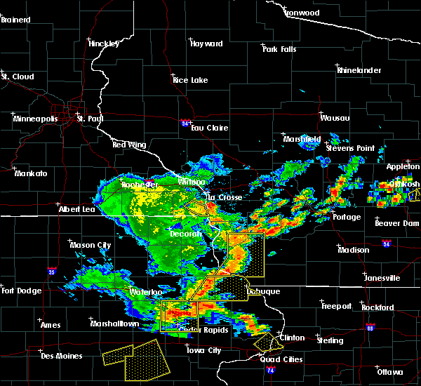 At 550 pm cdt, severe thunderstorms were located along a line extending from near boscobel to 6 miles northeast of sherrill, moving east at 30 mph (radar indicated). Hazards include 60 mph wind gusts. Expect damage to roofs, siding, and trees. these severe storms will be near, muscoda around 610 pm cdt. platteville around 615 pm cdt. other locations impacted by these severe thunderstorms include westport, excelsior, preston, beetown and arthur. Torrential rains of 2 inches and brief, minor urban flooding should be expected with this line of storms as it passes. At 550 pm cdt, severe thunderstorms were located along a line extending from near boscobel to 6 miles northeast of sherrill, moving east at 30 mph (radar indicated). Hazards include 60 mph wind gusts. Expect damage to roofs, siding, and trees. these severe storms will be near, muscoda around 610 pm cdt. platteville around 615 pm cdt. other locations impacted by these severe thunderstorms include westport, excelsior, preston, beetown and arthur. Torrential rains of 2 inches and brief, minor urban flooding should be expected with this line of storms as it passes.
|
| 7/13/2018 5:43 PM CDT |
 At 542 pm cdt, severe thunderstorms were located along a line extending from near boscobel to near balltown, moving east at 30 mph (trained weather spotters and airport wind measurements of over 50 mph have occurred with these storms). Hazards include 60 mph wind gusts. Expect damage to roofs, siding, and trees. these severe storms will be near, boscobel around 545 pm cdt. lancaster around 600 pm cdt. muscoda around 615 pm cdt. platteville around 625 pm cdt. Other locations impacted by these severe thunderstorms include westport, excelsior, preston, beetown and arthur. At 542 pm cdt, severe thunderstorms were located along a line extending from near boscobel to near balltown, moving east at 30 mph (trained weather spotters and airport wind measurements of over 50 mph have occurred with these storms). Hazards include 60 mph wind gusts. Expect damage to roofs, siding, and trees. these severe storms will be near, boscobel around 545 pm cdt. lancaster around 600 pm cdt. muscoda around 615 pm cdt. platteville around 625 pm cdt. Other locations impacted by these severe thunderstorms include westport, excelsior, preston, beetown and arthur.
|
| 7/13/2018 5:29 PM CDT |
 At 528 pm cdt, severe thunderstorms were located along a line extending from 9 miles west of boscobel to near cassville, moving east at 25 mph (radar indicated). Hazards include 60 mph wind gusts. Expect damage to roofs, siding, and trees. severe thunderstorms will be near, boscobel around 550 pm cdt. platteville and muscoda around 630 pm cdt. Other locations impacted by these severe thunderstorms include westport, excelsior, preston, bridgeport and beetown. At 528 pm cdt, severe thunderstorms were located along a line extending from 9 miles west of boscobel to near cassville, moving east at 25 mph (radar indicated). Hazards include 60 mph wind gusts. Expect damage to roofs, siding, and trees. severe thunderstorms will be near, boscobel around 550 pm cdt. platteville and muscoda around 630 pm cdt. Other locations impacted by these severe thunderstorms include westport, excelsior, preston, bridgeport and beetown.
|
| 5/25/2018 8:32 PM CDT |
 At 831 pm cdt, severe thunderstorms were located along a line extending from 7 miles southwest of muscoda to near east dubuque, moving southeast at 25 mph (trained weather spotters). Hazards include 60 mph wind gusts and quarter size hail. Hail damage to vehicles is expected. expect wind damage to roofs, siding, and trees. these severe storms will be near, dickeyville around 835 pm cdt. hazel green and cuba city around 845 pm cdt. Other locations impacted by these severe thunderstorms include preston, georgetown, arthur, montfort and potosi. At 831 pm cdt, severe thunderstorms were located along a line extending from 7 miles southwest of muscoda to near east dubuque, moving southeast at 25 mph (trained weather spotters). Hazards include 60 mph wind gusts and quarter size hail. Hail damage to vehicles is expected. expect wind damage to roofs, siding, and trees. these severe storms will be near, dickeyville around 835 pm cdt. hazel green and cuba city around 845 pm cdt. Other locations impacted by these severe thunderstorms include preston, georgetown, arthur, montfort and potosi.
|
| 5/25/2018 8:19 PM CDT |
 A severe thunderstorm warning remains in effect until 845 pm cdt for southeastern clayton and grant counties. at 818 pm cdt, severe thunderstorms were located along a line extending from 7 miles southwest of muscoda to near platteville to near new vienna to near independence, moving southeast at 35 mph. hazard. 60 mph wind gusts and quarter size hail. A severe thunderstorm warning remains in effect until 845 pm cdt for southeastern clayton and grant counties. at 818 pm cdt, severe thunderstorms were located along a line extending from 7 miles southwest of muscoda to near platteville to near new vienna to near independence, moving southeast at 35 mph. hazard. 60 mph wind gusts and quarter size hail.
|
| 5/25/2018 8:19 PM CDT |
 At 818 pm cdt, severe thunderstorms were located along a line extending from 7 miles southwest of muscoda to near platteville to near new vienna to near independence, moving southeast at 35 mph (trained weather spotters). Hazards include 60 mph wind gusts and quarter size hail. Hail damage to vehicles is expected. expect wind damage to roofs, siding, and trees. these severe storms will be near, platteville and dickeyville around 825 pm cdt. cuba city around 835 pm cdt. hazel green around 845 pm cdt. Other locations impacted by these severe thunderstorms include preston, georgetown, beetown, arthur and montfort. At 818 pm cdt, severe thunderstorms were located along a line extending from 7 miles southwest of muscoda to near platteville to near new vienna to near independence, moving southeast at 35 mph (trained weather spotters). Hazards include 60 mph wind gusts and quarter size hail. Hail damage to vehicles is expected. expect wind damage to roofs, siding, and trees. these severe storms will be near, platteville and dickeyville around 825 pm cdt. cuba city around 835 pm cdt. hazel green around 845 pm cdt. Other locations impacted by these severe thunderstorms include preston, georgetown, beetown, arthur and montfort.
|
| 5/25/2018 8:08 PM CDT |
 At 806 pm cdt, severe thunderstorms were located along a line extending from 6 miles west of muscoda to 6 miles southeast of lancaster to luxemburg to near hazleton, moving southeast at 40 mph (trained weather spotters. a 60 mph wind gust was reported near wauzeka in southern crawford county, and quarter size hail was reported in oelwein). Hazards include 60 mph wind gusts and quarter size hail. Hail damage to vehicles is expected. expect wind damage to roofs, siding, and trees. these severe storms will be near, lancaster and cassville around 810 pm cdt. muscoda around 815 pm cdt. platteville and dickeyville around 820 pm cdt. dubuque and cuba city around 830 pm cdt. hazel green around 835 pm cdt. Other locations impacted by these severe thunderstorms include preston, georgetown, beetown, arthur and montfort. At 806 pm cdt, severe thunderstorms were located along a line extending from 6 miles west of muscoda to 6 miles southeast of lancaster to luxemburg to near hazleton, moving southeast at 40 mph (trained weather spotters. a 60 mph wind gust was reported near wauzeka in southern crawford county, and quarter size hail was reported in oelwein). Hazards include 60 mph wind gusts and quarter size hail. Hail damage to vehicles is expected. expect wind damage to roofs, siding, and trees. these severe storms will be near, lancaster and cassville around 810 pm cdt. muscoda around 815 pm cdt. platteville and dickeyville around 820 pm cdt. dubuque and cuba city around 830 pm cdt. hazel green around 835 pm cdt. Other locations impacted by these severe thunderstorms include preston, georgetown, beetown, arthur and montfort.
|
| 5/25/2018 7:57 PM CDT |
 At 755 pm cdt, severe thunderstorms were located along a line extending from near boscobel to near lancaster to near colesburg to fairbank, moving east at 40 mph (radar indicated). Hazards include 60 mph wind gusts and nickel size hail. Expect damage to roofs, siding, and trees. these severe storms will be near, lancaster, guttenberg, fennimore and boscobel around 800 pm cdt. muscoda and cassville around 810 pm cdt. platteville around 815 pm cdt. dubuque and strawberry point around 830 pm cdt. dickeyville and edgewood around 840 pm cdt. hazel green and cuba city around 845 pm cdt. Other locations impacted by these severe thunderstorms include preston, bridgeport, georgetown, beetown and arthur. At 755 pm cdt, severe thunderstorms were located along a line extending from near boscobel to near lancaster to near colesburg to fairbank, moving east at 40 mph (radar indicated). Hazards include 60 mph wind gusts and nickel size hail. Expect damage to roofs, siding, and trees. these severe storms will be near, lancaster, guttenberg, fennimore and boscobel around 800 pm cdt. muscoda and cassville around 810 pm cdt. platteville around 815 pm cdt. dubuque and strawberry point around 830 pm cdt. dickeyville and edgewood around 840 pm cdt. hazel green and cuba city around 845 pm cdt. Other locations impacted by these severe thunderstorms include preston, bridgeport, georgetown, beetown and arthur.
|
| 5/25/2018 7:57 PM CDT |
 At 739 pm cdt, severe thunderstorms were located along a line extending from boscobel to near guttenberg to near strawberry point, moving southeast at 40 mph (trained weather spotters. at 730 pm cdt, tree damage was reported near eastman in western crawford county). Hazards include 70 mph wind gusts and quarter size hail. Hail damage to vehicles is expected. expect considerable tree damage. wind damage is also likely to mobile homes, roofs, and outbuildings. severe thunderstorms will be near, boscobel around 745 pm cdt. cassville, muscoda and fennimore around 755 pm cdt. dickeyville around 825 pm cdt. dubuque around 835 pm cdt. cuba city around 840 pm cdt. hazel green around 845 pm cdt. Other locations impacted by these severe thunderstorms include preston, bridgeport, georgetown, beetown and arthur. At 739 pm cdt, severe thunderstorms were located along a line extending from boscobel to near guttenberg to near strawberry point, moving southeast at 40 mph (trained weather spotters. at 730 pm cdt, tree damage was reported near eastman in western crawford county). Hazards include 70 mph wind gusts and quarter size hail. Hail damage to vehicles is expected. expect considerable tree damage. wind damage is also likely to mobile homes, roofs, and outbuildings. severe thunderstorms will be near, boscobel around 745 pm cdt. cassville, muscoda and fennimore around 755 pm cdt. dickeyville around 825 pm cdt. dubuque around 835 pm cdt. cuba city around 840 pm cdt. hazel green around 845 pm cdt. Other locations impacted by these severe thunderstorms include preston, bridgeport, georgetown, beetown and arthur.
|
| 5/25/2018 7:40 PM CDT |
 At 739 pm cdt, severe thunderstorms were located along a line extending from boscobel to near guttenberg to near strawberry point, moving southeast at 40 mph (trained weather spotters. at 730 pm cdt, tree damage was reported near eastman in western crawford county). Hazards include 70 mph wind gusts and quarter size hail. Hail damage to vehicles is expected. expect considerable tree damage. wind damage is also likely to mobile homes, roofs, and outbuildings. severe thunderstorms will be near, boscobel around 745 pm cdt. cassville, muscoda and fennimore around 755 pm cdt. dickeyville around 825 pm cdt. dubuque around 835 pm cdt. cuba city around 840 pm cdt. hazel green around 845 pm cdt. Other locations impacted by these severe thunderstorms include preston, bridgeport, georgetown, beetown and arthur. At 739 pm cdt, severe thunderstorms were located along a line extending from boscobel to near guttenberg to near strawberry point, moving southeast at 40 mph (trained weather spotters. at 730 pm cdt, tree damage was reported near eastman in western crawford county). Hazards include 70 mph wind gusts and quarter size hail. Hail damage to vehicles is expected. expect considerable tree damage. wind damage is also likely to mobile homes, roofs, and outbuildings. severe thunderstorms will be near, boscobel around 745 pm cdt. cassville, muscoda and fennimore around 755 pm cdt. dickeyville around 825 pm cdt. dubuque around 835 pm cdt. cuba city around 840 pm cdt. hazel green around 845 pm cdt. Other locations impacted by these severe thunderstorms include preston, bridgeport, georgetown, beetown and arthur.
|
| 5/25/2018 7:19 PM CDT |
 At 717 pm cdt, severe thunderstorms were located along a line extending from 10 miles west of boscobel to 6 miles east of prairie du chien to near monona, moving southeast at 35 mph (law enforcement). Hazards include 70 mph wind gusts and quarter size hail. Hail damage to vehicles is expected. expect considerable tree damage. wind damage is also likely to mobile homes, roofs, and outbuildings. these severe storms will be near, boscobel around 730 pm cdt. Other locations impacted by these severe thunderstorms include bridgeport, wauzeka, eastman, bagley and luana. At 717 pm cdt, severe thunderstorms were located along a line extending from 10 miles west of boscobel to 6 miles east of prairie du chien to near monona, moving southeast at 35 mph (law enforcement). Hazards include 70 mph wind gusts and quarter size hail. Hail damage to vehicles is expected. expect considerable tree damage. wind damage is also likely to mobile homes, roofs, and outbuildings. these severe storms will be near, boscobel around 730 pm cdt. Other locations impacted by these severe thunderstorms include bridgeport, wauzeka, eastman, bagley and luana.
|
| 5/25/2018 7:05 PM CDT |
 At 704 pm cdt, severe thunderstorms were located along a line extending from 14 miles southeast of lansing to near harpers ferry to near postville, moving southeast at 35 mph (law enforcement. widespread tree damage has been reported across allamakee county). Hazards include 70 mph wind gusts. Expect considerable tree damage. damage is likely to mobile homes, roofs, and outbuildings. severe thunderstorms will be near, prairie du chien, marquette and mcgregor around 710 pm cdt. boscobel around 730 pm cdt. Other locations impacted by these severe thunderstorms include bridgeport, wauzeka, eastman, bagley and luana. At 704 pm cdt, severe thunderstorms were located along a line extending from 14 miles southeast of lansing to near harpers ferry to near postville, moving southeast at 35 mph (law enforcement. widespread tree damage has been reported across allamakee county). Hazards include 70 mph wind gusts. Expect considerable tree damage. damage is likely to mobile homes, roofs, and outbuildings. severe thunderstorms will be near, prairie du chien, marquette and mcgregor around 710 pm cdt. boscobel around 730 pm cdt. Other locations impacted by these severe thunderstorms include bridgeport, wauzeka, eastman, bagley and luana.
|
| 7/19/2017 7:59 PM CDT |
 At 759 pm cdt, severe thunderstorms were located along a line extending from 9 miles northwest of dodgeville to near fennimore, moving southeast at 50 mph (radar indicated). Hazards include 60 mph wind gusts. Expect damage to roofs, siding, and trees. Locations impacted include, boscobel, westport, excelsior, hickory grove, blue river, boaz, eagle cave, eagle corners, port andrew, county roads z z and q, red oak ridge, highway 80 and county y, county roads e and q, basswood and easter rock. At 759 pm cdt, severe thunderstorms were located along a line extending from 9 miles northwest of dodgeville to near fennimore, moving southeast at 50 mph (radar indicated). Hazards include 60 mph wind gusts. Expect damage to roofs, siding, and trees. Locations impacted include, boscobel, westport, excelsior, hickory grove, blue river, boaz, eagle cave, eagle corners, port andrew, county roads z z and q, red oak ridge, highway 80 and county y, county roads e and q, basswood and easter rock.
|
| 7/19/2017 7:20 PM CDT |
 At 719 pm cdt, severe thunderstorms were located along a line extending from clayton to 14 miles northeast of harpers ferry, moving southeast at 50 mph (law enforcement. widespread wind damage is reported in vernon county and this area is shifting southeast toward richalnd center). Hazards include 70 mph wind gusts. Expect considerable tree damage. damage is likely to mobile homes, roofs, and outbuildings. severe thunderstorms will be near, boscobel around 740 pm cdt. Other locations impacted by these severe thunderstorms include westport, excelsior, soldiers grove, gays mills and hickory grove. At 719 pm cdt, severe thunderstorms were located along a line extending from clayton to 14 miles northeast of harpers ferry, moving southeast at 50 mph (law enforcement. widespread wind damage is reported in vernon county and this area is shifting southeast toward richalnd center). Hazards include 70 mph wind gusts. Expect considerable tree damage. damage is likely to mobile homes, roofs, and outbuildings. severe thunderstorms will be near, boscobel around 740 pm cdt. Other locations impacted by these severe thunderstorms include westport, excelsior, soldiers grove, gays mills and hickory grove.
|
| 7/19/2017 7:05 PM CDT |
 At 705 pm cdt, severe thunderstorms were located along a line extending from near richland center to 6 miles northwest of darlington to galena, moving east at 60 mph (law enforcement). Hazards include 70 mph wind gusts. Expect considerable tree damage. damage is likely to mobile homes, roofs, and outbuildings. These severe thunderstorms will remain over mainly rural areas of grant, southwestern richland and northeastern crawford counties, including the following locations: westport, excelsior, preston, georgetown and arthur. At 705 pm cdt, severe thunderstorms were located along a line extending from near richland center to 6 miles northwest of darlington to galena, moving east at 60 mph (law enforcement). Hazards include 70 mph wind gusts. Expect considerable tree damage. damage is likely to mobile homes, roofs, and outbuildings. These severe thunderstorms will remain over mainly rural areas of grant, southwestern richland and northeastern crawford counties, including the following locations: westport, excelsior, preston, georgetown and arthur.
|
| 7/19/2017 7:00 PM CDT | Trees and power lines dow in grant county WI, 5.9 miles WSW of Boscobel, WI |
| 7/19/2017 6:59 PM CDT |
 At 659 pm cdt, severe thunderstorms capable of producing both tornadoes and extensive straight line wind damage were located 7 miles west of muscoda, or 13 miles southwest of richland center, moving east at 50 mph (radar indicated rotation). Hazards include tornado. Flying debris will be dangerous to those caught without shelter. mobile homes will be damaged or destroyed. damage to roofs, windows, and vehicles will occur. tree damage is likely. these dangerous storms will be near, muscoda around 710 pm cdt. Other locations impacted by this tornadic thunderstorm include westport, excelsior, lone rock, orion and blue river. At 659 pm cdt, severe thunderstorms capable of producing both tornadoes and extensive straight line wind damage were located 7 miles west of muscoda, or 13 miles southwest of richland center, moving east at 50 mph (radar indicated rotation). Hazards include tornado. Flying debris will be dangerous to those caught without shelter. mobile homes will be damaged or destroyed. damage to roofs, windows, and vehicles will occur. tree damage is likely. these dangerous storms will be near, muscoda around 710 pm cdt. Other locations impacted by this tornadic thunderstorm include westport, excelsior, lone rock, orion and blue river.
|
| 7/19/2017 6:53 PM CDT |
 At 652 pm cdt, severe thunderstorms were located along a line extending from clayton to near platteville to east dubuque, moving east at 50 mph (law enforcement. reports continune of widespread wind damage. lancaster reports a great deal of damage. platteville reported a 61 mph wind gust). Hazards include 70 mph wind gusts. Expect considerable tree damage. damage is likely to mobile homes, roofs, and outbuildings. these severe storms will be near, platteville, hazel green and cuba city around 700 pm cdt. Other locations impacted by these severe thunderstorms include westport, excelsior, preston, bridgeport and georgetown. At 652 pm cdt, severe thunderstorms were located along a line extending from clayton to near platteville to east dubuque, moving east at 50 mph (law enforcement. reports continune of widespread wind damage. lancaster reports a great deal of damage. platteville reported a 61 mph wind gust). Hazards include 70 mph wind gusts. Expect considerable tree damage. damage is likely to mobile homes, roofs, and outbuildings. these severe storms will be near, platteville, hazel green and cuba city around 700 pm cdt. Other locations impacted by these severe thunderstorms include westport, excelsior, preston, bridgeport and georgetown.
|
| 7/19/2017 6:45 PM CDT |
 At 644 pm cdt, severe thunderstorms were located along a line extending from near clayton to 7 miles east of lancaster to near centralia, moving east at 60 mph (law enforcement reports high winds across much of western grant county). Hazards include 70 mph wind gusts. Expect considerable tree damage. damage is likely to mobile homes, roofs, and outbuildings. these severe storms will be near, platteville around 650 pm cdt. Hazel green around 705 pm cdt. At 644 pm cdt, severe thunderstorms were located along a line extending from near clayton to 7 miles east of lancaster to near centralia, moving east at 60 mph (law enforcement reports high winds across much of western grant county). Hazards include 70 mph wind gusts. Expect considerable tree damage. damage is likely to mobile homes, roofs, and outbuildings. these severe storms will be near, platteville around 650 pm cdt. Hazel green around 705 pm cdt.
|
| 7/19/2017 6:36 PM CDT |
 At 634 pm cdt, severe thunderstorms were located along a line extending from 8 miles southwest of clayton to near lancaster to near bankston, moving east at 65 mph (trained weather spotters. wind estimates of 60 to 70 mph were reported east of prairie du chien. damage continues to occur to trees and power lines). Hazards include 70 mph wind gusts. Expect considerable tree damage. damage is likely to mobile homes, roofs, and outbuildings. these severe storms will be near, lancaster and fennimore around 640 pm cdt. platteville and dickeyville around 650 pm cdt. cuba city around 655 pm cdt. Hazel green around 700 pm cdt. At 634 pm cdt, severe thunderstorms were located along a line extending from 8 miles southwest of clayton to near lancaster to near bankston, moving east at 65 mph (trained weather spotters. wind estimates of 60 to 70 mph were reported east of prairie du chien. damage continues to occur to trees and power lines). Hazards include 70 mph wind gusts. Expect considerable tree damage. damage is likely to mobile homes, roofs, and outbuildings. these severe storms will be near, lancaster and fennimore around 640 pm cdt. platteville and dickeyville around 650 pm cdt. cuba city around 655 pm cdt. Hazel green around 700 pm cdt.
|
| 7/19/2017 6:26 PM CDT |
 At 623 pm cdt, severe thunderstorms were located along a line extending from 10 miles east of lansing to near bloomington to near colesburg, moving east at 65 mph (trained weather spotters. these storms have a history of wind damage with northern fayette county reporting widespread damage. extreme winds were reported in waukon at 620 pm). Hazards include 70 mph wind gusts. Expect considerable tree damage. damage is likely to mobile homes, roofs, and outbuildings. these severe storms will be near, clayton around 635 pm cdt. lancaster, fennimore and boscobel around 640 pm cdt. platteville and dickeyville around 650 pm cdt. hazel green and cuba city around 655 pm cdt. abandon your canoe on shore if on the wisconsin river. These winds will flip a canoe on water. At 623 pm cdt, severe thunderstorms were located along a line extending from 10 miles east of lansing to near bloomington to near colesburg, moving east at 65 mph (trained weather spotters. these storms have a history of wind damage with northern fayette county reporting widespread damage. extreme winds were reported in waukon at 620 pm). Hazards include 70 mph wind gusts. Expect considerable tree damage. damage is likely to mobile homes, roofs, and outbuildings. these severe storms will be near, clayton around 635 pm cdt. lancaster, fennimore and boscobel around 640 pm cdt. platteville and dickeyville around 650 pm cdt. hazel green and cuba city around 655 pm cdt. abandon your canoe on shore if on the wisconsin river. These winds will flip a canoe on water.
|
| 7/19/2017 6:02 PM CDT |
 At 600 pm cdt, severe thunderstorms were located along a line extending from near houston to near farmersburg to near strawberry point, moving east at 60 mph (trained weather spotters. these storms have a history of producing wind damage to power lines and trees). Hazards include 70 mph wind gusts. Expect considerable tree damage. damage is likely to mobile homes, roofs, and outbuildings. severe thunderstorms will be near, prairie du chien around 615 pm cdt. bloomington and cassville around 625 pm cdt. lancaster and fennimore around 640 pm cdt. clayton around 645 pm cdt. platteville and dickeyville around 650 pm cdt. cuba city around 655 pm cdt. Hazel green around 700 pm cdt. At 600 pm cdt, severe thunderstorms were located along a line extending from near houston to near farmersburg to near strawberry point, moving east at 60 mph (trained weather spotters. these storms have a history of producing wind damage to power lines and trees). Hazards include 70 mph wind gusts. Expect considerable tree damage. damage is likely to mobile homes, roofs, and outbuildings. severe thunderstorms will be near, prairie du chien around 615 pm cdt. bloomington and cassville around 625 pm cdt. lancaster and fennimore around 640 pm cdt. clayton around 645 pm cdt. platteville and dickeyville around 650 pm cdt. cuba city around 655 pm cdt. Hazel green around 700 pm cdt.
|
| 6/28/2017 12:51 PM CDT |
 At 549 pm cdt, a severe thunderstorm was located over fennimore, or 7 miles northeast of lancaster, moving east at 50 mph. a tornado warning remains in effect (trained weather spotters reported wind gusts to 58 mph 1 mile north of lancaster). Hazards include 60 mph wind gusts and nickel size hail. Expect damage to roofs, siding, and trees. this severe thunderstorm will remain over mainly rural areas of grant and southern crawford counties, including the following locations: preston, bridgeport, arthur, montfort and wauzeka. A tornado watch remains in effect until 1000 pm cdt for northeastern iowa, and southwestern wisconsin. At 549 pm cdt, a severe thunderstorm was located over fennimore, or 7 miles northeast of lancaster, moving east at 50 mph. a tornado warning remains in effect (trained weather spotters reported wind gusts to 58 mph 1 mile north of lancaster). Hazards include 60 mph wind gusts and nickel size hail. Expect damage to roofs, siding, and trees. this severe thunderstorm will remain over mainly rural areas of grant and southern crawford counties, including the following locations: preston, bridgeport, arthur, montfort and wauzeka. A tornado watch remains in effect until 1000 pm cdt for northeastern iowa, and southwestern wisconsin.
|
| 6/28/2017 12:25 PM CDT |
 At 523 pm cdt, a severe thunderstorm was located 7 miles east of prairie du chien, moving east at 40 mph (emergency management reported numerous trees down near farmersburg at 453 pm). Hazards include 60 mph wind gusts and quarter size hail. Hail damage to vehicles is expected. expect wind damage to roofs, siding, and trees. this severe storm will be near, lancaster and boscobel around 545 pm cdt. fennimore around 550 pm cdt. other locations impacted by this severe thunderstorm include preston, bridgeport, arthur, montfort and wauzeka. A tornado watch remains in effect until 1000 pm cdt for northeastern iowa, and southwestern wisconsin. At 523 pm cdt, a severe thunderstorm was located 7 miles east of prairie du chien, moving east at 40 mph (emergency management reported numerous trees down near farmersburg at 453 pm). Hazards include 60 mph wind gusts and quarter size hail. Hail damage to vehicles is expected. expect wind damage to roofs, siding, and trees. this severe storm will be near, lancaster and boscobel around 545 pm cdt. fennimore around 550 pm cdt. other locations impacted by this severe thunderstorm include preston, bridgeport, arthur, montfort and wauzeka. A tornado watch remains in effect until 1000 pm cdt for northeastern iowa, and southwestern wisconsin.
|
| 6/28/2017 12:11 PM CDT |
 At 510 pm cdt, a severe thunderstorm was located over mcgregor, or near prairie du chien, moving east at 40 mph (emergency management reported 60 mph winds in farmersburg). Hazards include 60 mph wind gusts and quarter size hail. Hail damage to vehicles is expected. expect wind damage to roofs, siding, and trees. this severe thunderstorm will be near, bloomington around 530 pm cdt. lancaster and boscobel around 545 pm cdt. fennimore around 550 pm cdt. other locations impacted by this severe thunderstorm include preston, bridgeport, arthur, montfort and wauzeka. A tornado watch remains in effect until 1000 pm cdt for northeastern iowa, and southwestern wisconsin. At 510 pm cdt, a severe thunderstorm was located over mcgregor, or near prairie du chien, moving east at 40 mph (emergency management reported 60 mph winds in farmersburg). Hazards include 60 mph wind gusts and quarter size hail. Hail damage to vehicles is expected. expect wind damage to roofs, siding, and trees. this severe thunderstorm will be near, bloomington around 530 pm cdt. lancaster and boscobel around 545 pm cdt. fennimore around 550 pm cdt. other locations impacted by this severe thunderstorm include preston, bridgeport, arthur, montfort and wauzeka. A tornado watch remains in effect until 1000 pm cdt for northeastern iowa, and southwestern wisconsin.
|
| 6/16/2017 8:03 PM CDT |
 At 803 pm cdt, severe thunderstorms were located along a line extending from 6 miles southeast of la farge to 7 miles northwest of muscoda, moving east at 40 mph (radar indicated). Hazards include 60 mph wind gusts and penny size hail. Expect damage to roofs, siding, and trees. these severe storms will be near, muscoda around 810 pm cdt. richland center around 815 pm cdt. Other locations impacted by these severe thunderstorms include germantown, westport, excelsior, preston and lone rock. At 803 pm cdt, severe thunderstorms were located along a line extending from 6 miles southeast of la farge to 7 miles northwest of muscoda, moving east at 40 mph (radar indicated). Hazards include 60 mph wind gusts and penny size hail. Expect damage to roofs, siding, and trees. these severe storms will be near, muscoda around 810 pm cdt. richland center around 815 pm cdt. Other locations impacted by these severe thunderstorms include germantown, westport, excelsior, preston and lone rock.
|
| 6/16/2017 7:44 PM CDT |
 At 743 pm cdt, severe thunderstorms were located along a line extending from near clayton to 9 miles east of harpers ferry, moving southeast at 35 mph (radar indicated). Hazards include 60 mph wind gusts and penny size hail. Expect damage to roofs, siding, and trees. severe thunderstorms will be near, clayton around 750 pm cdt. boscobel around 805 pm cdt. richland center around 810 pm cdt. muscoda around 820 pm cdt. fennimore around 825 pm cdt. Other locations impacted by these severe thunderstorms include germantown, westport, excelsior, preston and lone rock. At 743 pm cdt, severe thunderstorms were located along a line extending from near clayton to 9 miles east of harpers ferry, moving southeast at 35 mph (radar indicated). Hazards include 60 mph wind gusts and penny size hail. Expect damage to roofs, siding, and trees. severe thunderstorms will be near, clayton around 750 pm cdt. boscobel around 805 pm cdt. richland center around 810 pm cdt. muscoda around 820 pm cdt. fennimore around 825 pm cdt. Other locations impacted by these severe thunderstorms include germantown, westport, excelsior, preston and lone rock.
|
| 5/17/2017 7:52 PM CDT |
 At 751 pm cdt, severe thunderstorms were located along a line extending from near brownsville to 8 miles west of richland center to near dodgeville, moving north at 65 mph (law enforcement. 45 mph winds were reported in desoto in vernon county and 65 mph winds were reported in eastman in crawford county at 745 pm). Hazards include 70 mph wind gusts. Expect considerable tree damage. damage is likely to mobile homes, roofs, and outbuildings. these severe storms will be near, richland center, stoddard and coon valley around 755 pm cdt. la crosse around 800 pm cdt. west salem, onalaska, bangor and la farge around 805 pm cdt. hillsboro around 815 pm cdt. other locations impacted by these severe thunderstorms include germantown, westport, newton, excelsior and medary. A tornado watch remains in effect until 1100 pm cdt for northeastern iowa, southeastern minnesota, and central, southwestern and west central wisconsin. At 751 pm cdt, severe thunderstorms were located along a line extending from near brownsville to 8 miles west of richland center to near dodgeville, moving north at 65 mph (law enforcement. 45 mph winds were reported in desoto in vernon county and 65 mph winds were reported in eastman in crawford county at 745 pm). Hazards include 70 mph wind gusts. Expect considerable tree damage. damage is likely to mobile homes, roofs, and outbuildings. these severe storms will be near, richland center, stoddard and coon valley around 755 pm cdt. la crosse around 800 pm cdt. west salem, onalaska, bangor and la farge around 805 pm cdt. hillsboro around 815 pm cdt. other locations impacted by these severe thunderstorms include germantown, westport, newton, excelsior and medary. A tornado watch remains in effect until 1100 pm cdt for northeastern iowa, southeastern minnesota, and central, southwestern and west central wisconsin.
|
| 5/17/2017 7:37 PM CDT |
 At 735 pm cdt, severe thunderstorms were located along a line extending from 6 miles north of houston, to near boscobel to cuba city, moving north at 60 mph (law enforcement. in southwest wisconsin...65-75 mph winds have caused extensive damage to trees and outbuildings. further north toward the minnesota-iowa border, 50-60 mph winds have been reported). Hazards include 70 mph wind gusts. Expect considerable tree damage. damage is likely to mobile homes, roofs, and outbuildings. these severe storms will be near, clayton around 750 pm cdt. la farge around 805 pm cdt. hillsboro around 815 pm cdt. other locations impacted by these severe thunderstorms include germantown, westport, newton, excelsior and medary. A tornado watch remains in effect until 1100 pm cdt for northeastern iowa, southeastern minnesota, and central, southwestern and west central wisconsin. At 735 pm cdt, severe thunderstorms were located along a line extending from 6 miles north of houston, to near boscobel to cuba city, moving north at 60 mph (law enforcement. in southwest wisconsin...65-75 mph winds have caused extensive damage to trees and outbuildings. further north toward the minnesota-iowa border, 50-60 mph winds have been reported). Hazards include 70 mph wind gusts. Expect considerable tree damage. damage is likely to mobile homes, roofs, and outbuildings. these severe storms will be near, clayton around 750 pm cdt. la farge around 805 pm cdt. hillsboro around 815 pm cdt. other locations impacted by these severe thunderstorms include germantown, westport, newton, excelsior and medary. A tornado watch remains in effect until 1100 pm cdt for northeastern iowa, southeastern minnesota, and central, southwestern and west central wisconsin.
|
| 5/17/2017 7:31 PM CDT |
 At 730 pm cdt, severe thunderstorms were located along a line extending from caledonia to platteville, moving north at 80 mph (law enforcement. 75 mph winds were reported at patch grove southwet wisconsin and 70 mph winds in glen haven sconsin between 710 and 720 pm). Hazards include 70 mph wind gusts. Expect considerable tree damage. damage is likely to mobile homes, roofs, and outbuildings. severe thunderstorms will be near, la crosse around 745 pm cdt. onalaska and west salem around 750 pm cdt. muscoda around 755 pm cdt. other locations impacted by these severe thunderstorms include germantown, westport, newton, excelsior and medary. A tornado watch remains in effect until 1100 pm cdt for northeastern iowa, southeastern minnesota, and central, southwestern and west central wisconsin. At 730 pm cdt, severe thunderstorms were located along a line extending from caledonia to platteville, moving north at 80 mph (law enforcement. 75 mph winds were reported at patch grove southwet wisconsin and 70 mph winds in glen haven sconsin between 710 and 720 pm). Hazards include 70 mph wind gusts. Expect considerable tree damage. damage is likely to mobile homes, roofs, and outbuildings. severe thunderstorms will be near, la crosse around 745 pm cdt. onalaska and west salem around 750 pm cdt. muscoda around 755 pm cdt. other locations impacted by these severe thunderstorms include germantown, westport, newton, excelsior and medary. A tornado watch remains in effect until 1100 pm cdt for northeastern iowa, southeastern minnesota, and central, southwestern and west central wisconsin.
|
| 5/17/2017 5:28 PM CDT |
 At 527 pm cdt, severe thunderstorms were located along a line extending from 9 miles west of clayton to richland center, moving north at 35 mph (law enforcement). Hazards include ping pong ball size hail and 60 mph wind gusts. People and animals outdoors will be injured. expect hail damage to roofs, siding, windows, and vehicles. expect wind damage to roofs, siding, and trees. these severe storms will be near, viroqua and westby around 545 pm cdt. other locations impacted by these severe thunderstorms include westport, excelsior, rockbridge, viola and soldiers grove. A tornado watch remains in effect until 1100 pm cdt for central, southwestern and west central wisconsin. At 527 pm cdt, severe thunderstorms were located along a line extending from 9 miles west of clayton to richland center, moving north at 35 mph (law enforcement). Hazards include ping pong ball size hail and 60 mph wind gusts. People and animals outdoors will be injured. expect hail damage to roofs, siding, windows, and vehicles. expect wind damage to roofs, siding, and trees. these severe storms will be near, viroqua and westby around 545 pm cdt. other locations impacted by these severe thunderstorms include westport, excelsior, rockbridge, viola and soldiers grove. A tornado watch remains in effect until 1100 pm cdt for central, southwestern and west central wisconsin.
|
| 5/17/2017 5:06 PM CDT |
 At 505 pm cdt, severe thunderstorms were located along a line extending from 10 miles west of boscobel to near muscoda, moving northeast at 70 mph (radar indicated). Hazards include 60 mph wind gusts and quarter size hail. Hail damage to vehicles is expected. expect wind damage to roofs, siding, and trees. severe thunderstorms will be near, muscoda around 510 pm cdt. richland center and clayton around 520 pm cdt. viroqua around 530 pm cdt. la farge around 535 pm cdt. hillsboro around 545 pm cdt. other locations impacted by these severe thunderstorms include westport, excelsior, rockbridge, wauzeka and viola. A tornado watch remains in effect until 1100 pm cdt for central, southwestern and west central wisconsin. At 505 pm cdt, severe thunderstorms were located along a line extending from 10 miles west of boscobel to near muscoda, moving northeast at 70 mph (radar indicated). Hazards include 60 mph wind gusts and quarter size hail. Hail damage to vehicles is expected. expect wind damage to roofs, siding, and trees. severe thunderstorms will be near, muscoda around 510 pm cdt. richland center and clayton around 520 pm cdt. viroqua around 530 pm cdt. la farge around 535 pm cdt. hillsboro around 545 pm cdt. other locations impacted by these severe thunderstorms include westport, excelsior, rockbridge, wauzeka and viola. A tornado watch remains in effect until 1100 pm cdt for central, southwestern and west central wisconsin.
|
| 5/15/2017 8:27 PM CDT |
 At 825 pm cdt, severe thunderstorms were located along a line extending from 7 miles southwest of muscoda to 9 miles northwest of mineral point to menominee, moving east at 55 mph (emergency manager. at 820 pm cdt, a 68 mph wind gust was reported in cuba city). Hazards include 70 mph wind gusts and quarter size hail. Hail damage to vehicles is expected. expect considerable tree damage. wind damage is also likely to mobile homes, roofs, and outbuildings. These severe thunderstorms will remain over mainly rural areas of eastern grant county, including the following locations: preston, georgetown, arthur, montfort and potosi. At 825 pm cdt, severe thunderstorms were located along a line extending from 7 miles southwest of muscoda to 9 miles northwest of mineral point to menominee, moving east at 55 mph (emergency manager. at 820 pm cdt, a 68 mph wind gust was reported in cuba city). Hazards include 70 mph wind gusts and quarter size hail. Hail damage to vehicles is expected. expect considerable tree damage. wind damage is also likely to mobile homes, roofs, and outbuildings. These severe thunderstorms will remain over mainly rural areas of eastern grant county, including the following locations: preston, georgetown, arthur, montfort and potosi.
|
| 5/15/2017 8:22 PM CDT |
 At 813 pm cdt, severe thunderstorms were located along a line extending from near boscobel to near fennimore to asbury, moving east at 55 mph (trained weather spotters). Hazards include 70 mph wind gusts and quarter size hail. Hail damage to vehicles is expected. expect considerable tree damage. wind damage is also likely to mobile homes, roofs, and outbuildings. severe thunderstorms will be near, hazel green and cuba city around 830 pm cdt. Other locations impacted by these severe thunderstorms include preston, georgetown, arthur, montfort and potosi. At 813 pm cdt, severe thunderstorms were located along a line extending from near boscobel to near fennimore to asbury, moving east at 55 mph (trained weather spotters). Hazards include 70 mph wind gusts and quarter size hail. Hail damage to vehicles is expected. expect considerable tree damage. wind damage is also likely to mobile homes, roofs, and outbuildings. severe thunderstorms will be near, hazel green and cuba city around 830 pm cdt. Other locations impacted by these severe thunderstorms include preston, georgetown, arthur, montfort and potosi.
|
| 5/15/2017 8:14 PM CDT |
 At 813 pm cdt, severe thunderstorms were located along a line extending from near boscobel to near fennimore to asbury, moving east at 55 mph (trained weather spotters). Hazards include 70 mph wind gusts and quarter size hail. Hail damage to vehicles is expected. expect considerable tree damage. wind damage is also likely to mobile homes, roofs, and outbuildings. severe thunderstorms will be near, hazel green and cuba city around 830 pm cdt. Other locations impacted by these severe thunderstorms include preston, georgetown, arthur, montfort and potosi. At 813 pm cdt, severe thunderstorms were located along a line extending from near boscobel to near fennimore to asbury, moving east at 55 mph (trained weather spotters). Hazards include 70 mph wind gusts and quarter size hail. Hail damage to vehicles is expected. expect considerable tree damage. wind damage is also likely to mobile homes, roofs, and outbuildings. severe thunderstorms will be near, hazel green and cuba city around 830 pm cdt. Other locations impacted by these severe thunderstorms include preston, georgetown, arthur, montfort and potosi.
|
| 5/15/2017 8:11 PM CDT |
 At 809 pm cdt, severe thunderstorms were located along a line extending from near boscobel to near fennimore to 7 miles northeast of sherrill, moving east at 55 mph (emergency manager. at 806 pm cdt, a 65 mph wind gust was reported in potosi). Hazards include 70 mph wind gusts and quarter size hail. Hail damage to vehicles is expected. expect considerable tree damage. wind damage is also likely to mobile homes, roofs, and outbuildings. these severe storms will be near, platteville, dickeyville and cuba city around 815 pm cdt. Other locations impacted by these severe thunderstorms include preston, georgetown, beetown, arthur and montfort. At 809 pm cdt, severe thunderstorms were located along a line extending from near boscobel to near fennimore to 7 miles northeast of sherrill, moving east at 55 mph (emergency manager. at 806 pm cdt, a 65 mph wind gust was reported in potosi). Hazards include 70 mph wind gusts and quarter size hail. Hail damage to vehicles is expected. expect considerable tree damage. wind damage is also likely to mobile homes, roofs, and outbuildings. these severe storms will be near, platteville, dickeyville and cuba city around 815 pm cdt. Other locations impacted by these severe thunderstorms include preston, georgetown, beetown, arthur and montfort.
|
| 5/15/2017 7:59 PM CDT |
 At 758 pm cdt, severe thunderstorms were located along a line extending from 9 miles northeast of prairie du chien to 7 miles northeast of bloomington to near cassville, moving east at 45 mph (trained weather spotters). Hazards include 60 mph wind gusts and quarter size hail. Hail damage to vehicles is expected. expect wind damage to roofs, siding, and trees. these severe storms will be near, lancaster around 805 pm cdt. fennimore around 810 pm cdt. boscobel around 815 pm cdt. dickeyville around 820 pm cdt. Other locations impacted by these severe thunderstorms include preston, bridgeport, georgetown, beetown and arthur. At 758 pm cdt, severe thunderstorms were located along a line extending from 9 miles northeast of prairie du chien to 7 miles northeast of bloomington to near cassville, moving east at 45 mph (trained weather spotters). Hazards include 60 mph wind gusts and quarter size hail. Hail damage to vehicles is expected. expect wind damage to roofs, siding, and trees. these severe storms will be near, lancaster around 805 pm cdt. fennimore around 810 pm cdt. boscobel around 815 pm cdt. dickeyville around 820 pm cdt. Other locations impacted by these severe thunderstorms include preston, bridgeport, georgetown, beetown and arthur.
|
| 5/15/2017 7:47 PM CDT |
 At 746 pm cdt, severe thunderstorms were located along a line extending from near prairie du chien to near bloomington to near colesburg, moving east at 60 mph (trained weather spotters). Hazards include 70 mph wind gusts and ping pong ball size hail. People and animals outdoors will be injured. expect hail damage to roofs, siding, windows, and vehicles. expect considerable tree damage. wind damage is also likely to mobile homes, roofs, and outbuildings. these severe storms will be near, bloomington around 750 pm cdt. lancaster and fennimore around 800 pm cdt. boscobel around 805 pm cdt. platteville, dickeyville, cuba city and hazel green around 815 pm cdt. Other locations impacted by these severe thunderstorms include preston, bridgeport, georgetown, beetown and arthur. At 746 pm cdt, severe thunderstorms were located along a line extending from near prairie du chien to near bloomington to near colesburg, moving east at 60 mph (trained weather spotters). Hazards include 70 mph wind gusts and ping pong ball size hail. People and animals outdoors will be injured. expect hail damage to roofs, siding, windows, and vehicles. expect considerable tree damage. wind damage is also likely to mobile homes, roofs, and outbuildings. these severe storms will be near, bloomington around 750 pm cdt. lancaster and fennimore around 800 pm cdt. boscobel around 805 pm cdt. platteville, dickeyville, cuba city and hazel green around 815 pm cdt. Other locations impacted by these severe thunderstorms include preston, bridgeport, georgetown, beetown and arthur.
|
| 5/15/2017 7:36 PM CDT |
 At 735 pm cdt, severe thunderstorms were located along a line extending from 6 miles northwest of marquette to near mcgregor to near edgewood, moving east at 50 mph (trained weather spotters). Hazards include 70 mph wind gusts and ping pong ball size hail. People and animals outdoors will be injured. expect hail damage to roofs, siding, windows, and vehicles. expect considerable tree damage. wind damage is also likely to mobile homes, roofs, and outbuildings. these severe storms will be near, guttenberg and bloomington around 750 pm cdt. cassville around 755 pm cdt. lancaster and fennimore around 805 pm cdt. boscobel around 810 pm cdt. Other locations impacted by these severe thunderstorms include preston, bridgeport, georgetown, beetown and arthur. At 735 pm cdt, severe thunderstorms were located along a line extending from 6 miles northwest of marquette to near mcgregor to near edgewood, moving east at 50 mph (trained weather spotters). Hazards include 70 mph wind gusts and ping pong ball size hail. People and animals outdoors will be injured. expect hail damage to roofs, siding, windows, and vehicles. expect considerable tree damage. wind damage is also likely to mobile homes, roofs, and outbuildings. these severe storms will be near, guttenberg and bloomington around 750 pm cdt. cassville around 755 pm cdt. lancaster and fennimore around 805 pm cdt. boscobel around 810 pm cdt. Other locations impacted by these severe thunderstorms include preston, bridgeport, georgetown, beetown and arthur.
|
| 5/15/2017 7:27 PM CDT |
 At 726 pm cdt, severe thunderstorms were located along a line extending from near monona to near mcgregor to near strawberry point, moving east at 60 mph (trained weather spotters). Hazards include 70 mph wind gusts and ping pong ball size hail. People and animals outdoors will be injured. expect hail damage to roofs, siding, windows, and vehicles. expect considerable tree damage. wind damage is also likely to mobile homes, roofs, and outbuildings. severe thunderstorms will be near, mcgregor and garnavillo around 730 pm cdt. marquette around 735 pm cdt. prairie du chien around 740 pm cdt. guttenberg and bloomington around 745 pm cdt. Other locations impacted by these severe thunderstorms include preston, bridgeport, georgetown, beetown and arthur. At 726 pm cdt, severe thunderstorms were located along a line extending from near monona to near mcgregor to near strawberry point, moving east at 60 mph (trained weather spotters). Hazards include 70 mph wind gusts and ping pong ball size hail. People and animals outdoors will be injured. expect hail damage to roofs, siding, windows, and vehicles. expect considerable tree damage. wind damage is also likely to mobile homes, roofs, and outbuildings. severe thunderstorms will be near, mcgregor and garnavillo around 730 pm cdt. marquette around 735 pm cdt. prairie du chien around 740 pm cdt. guttenberg and bloomington around 745 pm cdt. Other locations impacted by these severe thunderstorms include preston, bridgeport, georgetown, beetown and arthur.
|
| 3/6/2017 9:45 PM CST | Report via twitter showing wind damage to several structures. time estimated from rada in grant county WI, 6.3 miles W of Boscobel, WI |
| 3/6/2017 9:44 PM CST |
 At 942 pm cst, severe thunderstorms were located along a line extending from near boscobel to 6 miles east of cassville, moving northeast at 55 mph (law enforcement. wind damage occurred in clayton county iowa however, no reports have been received in the last 30 minutes). Hazards include 60 mph wind gusts. Expect damage to roofs, siding, and trees. these severe storms will be near, boscobel around 950 pm cst. muscoda around 1000 pm cst. platteville and fennimore around 1005 pm cst. Other locations impacted by these severe thunderstorms include preston, georgetown, beetown, arthur and montfort. At 942 pm cst, severe thunderstorms were located along a line extending from near boscobel to 6 miles east of cassville, moving northeast at 55 mph (law enforcement. wind damage occurred in clayton county iowa however, no reports have been received in the last 30 minutes). Hazards include 60 mph wind gusts. Expect damage to roofs, siding, and trees. these severe storms will be near, boscobel around 950 pm cst. muscoda around 1000 pm cst. platteville and fennimore around 1005 pm cst. Other locations impacted by these severe thunderstorms include preston, georgetown, beetown, arthur and montfort.
|
| 3/6/2017 9:33 PM CST |
 At 930 pm cst, severe thunderstorms were located along a line extending from 10 miles north of bloomington to near cassville, moving northeast at 60 mph (law enforcement reported shingles off a house in monona in clayton county iowa at 852 pm). Hazards include 70 mph wind gusts. Expect considerable tree damage. damage is likely to homes, roofs, and outbuildings. these severe storms will be near, boscobel and bloomington around 945 pm cst. lancaster around 950 pm cst. muscoda around 955 pm cst. Fennimore around 1000 pm cst. At 930 pm cst, severe thunderstorms were located along a line extending from 10 miles north of bloomington to near cassville, moving northeast at 60 mph (law enforcement reported shingles off a house in monona in clayton county iowa at 852 pm). Hazards include 70 mph wind gusts. Expect considerable tree damage. damage is likely to homes, roofs, and outbuildings. these severe storms will be near, boscobel and bloomington around 945 pm cst. lancaster around 950 pm cst. muscoda around 955 pm cst. Fennimore around 1000 pm cst.
|
| 3/6/2017 9:12 PM CST |
 At 910 pm cst, severe thunderstorms were located along a line extending from near garnavillo to greeley, moving northeast at 55 mph (law enforcement. winds of 70 to 75 mph were reported at elkader and edgewood in clayton county iowa). Hazards include 70 mph wind gusts. Expect considerable tree damage. damage is likely to mobile homes, roofs, and outbuildings. severe thunderstorms will be near, garnavillo around 915 pm cst. guttenberg around 920 pm cst. bloomington around 930 pm cst. cassville around 935 pm cst. fennimore and boscobel around 950 pm cst. lancaster around 955 pm cst. platteville and muscoda around 1005 pm cst. A tornado watch remains in effect until 1000 pm cst for northeastern iowa. At 910 pm cst, severe thunderstorms were located along a line extending from near garnavillo to greeley, moving northeast at 55 mph (law enforcement. winds of 70 to 75 mph were reported at elkader and edgewood in clayton county iowa). Hazards include 70 mph wind gusts. Expect considerable tree damage. damage is likely to mobile homes, roofs, and outbuildings. severe thunderstorms will be near, garnavillo around 915 pm cst. guttenberg around 920 pm cst. bloomington around 930 pm cst. cassville around 935 pm cst. fennimore and boscobel around 950 pm cst. lancaster around 955 pm cst. platteville and muscoda around 1005 pm cst. A tornado watch remains in effect until 1000 pm cst for northeastern iowa.
|
| 8/18/2016 7:30 PM CDT | Large tree down... blocking roa in grant county WI, 0.3 miles E of Boscobel, WI |
| 8/4/2016 5:39 PM CDT |
 The severe thunderstorm warning for eastern crawford county will expire at 545 pm cdt, the storms which prompted the warning have moved out of the area. therefore the warning will be allowed to expire. a severe thunderstorm watch remains in effect until midnight cdt for southwestern wisconsin. The severe thunderstorm warning for eastern crawford county will expire at 545 pm cdt, the storms which prompted the warning have moved out of the area. therefore the warning will be allowed to expire. a severe thunderstorm watch remains in effect until midnight cdt for southwestern wisconsin.
|
| 8/4/2016 5:24 PM CDT |
 At 523 pm cdt, severe thunderstorms were located along a line extending from near boscobel to 11 miles north of bloomington, moving southeast at 35 mph (radar indicated). Hazards include 60 mph wind gusts. Expect damage to roofs. siding. and trees. These severe thunderstorms will remain over mainly rural areas of eastern crawford county, including the following locations: wauzeka, soldiers grove, steuben, bell center and montgomeryville. At 523 pm cdt, severe thunderstorms were located along a line extending from near boscobel to 11 miles north of bloomington, moving southeast at 35 mph (radar indicated). Hazards include 60 mph wind gusts. Expect damage to roofs. siding. and trees. These severe thunderstorms will remain over mainly rural areas of eastern crawford county, including the following locations: wauzeka, soldiers grove, steuben, bell center and montgomeryville.
|
| 8/4/2016 5:14 PM CDT |
 At 513 pm cdt, severe thunderstorms were located along a line extending from clayton to steuben, or 12 miles northeast of prairie du chien, moving southeast at 35 mph (radar indicated). Hazards include 60 mph wind gusts. Expect damage to roofs. siding. and trees. these severe storms will be near, plugtown around 520 pm, boscobel around 525 pm. Other locations impacted by these severe thunderstorms include wauzeka, soldiers grove, gays mills, eastman and steuben. At 513 pm cdt, severe thunderstorms were located along a line extending from clayton to steuben, or 12 miles northeast of prairie du chien, moving southeast at 35 mph (radar indicated). Hazards include 60 mph wind gusts. Expect damage to roofs. siding. and trees. these severe storms will be near, plugtown around 520 pm, boscobel around 525 pm. Other locations impacted by these severe thunderstorms include wauzeka, soldiers grove, gays mills, eastman and steuben.
|
| 8/4/2016 5:01 PM CDT |
 At 500 pm cdt, severe thunderstorms were located along a line extending from west of soldiers grove to near eastman, moving southeast at 40 mph (radar indicated). Hazards include 60 mph wind gusts. Expect damage to roofs. siding. and trees. severe thunderstorms will be near, clayton around 510 pm cdt. boscobel around 515 pm cdt. Other locations impacted by these severe thunderstorms include seneca, wauzeka, soldiers grove, gays mills and eastman. At 500 pm cdt, severe thunderstorms were located along a line extending from west of soldiers grove to near eastman, moving southeast at 40 mph (radar indicated). Hazards include 60 mph wind gusts. Expect damage to roofs. siding. and trees. severe thunderstorms will be near, clayton around 510 pm cdt. boscobel around 515 pm cdt. Other locations impacted by these severe thunderstorms include seneca, wauzeka, soldiers grove, gays mills and eastman.
|
| 7/5/2016 11:01 PM CDT |
 At 1101 pm cdt, a severe thunderstorm was located near clayton, or 13 miles west of richland center, moving east at 40 mph (radar indicated). Hazards include 70 mph wind gusts. Expect considerable tree damage. damage is likely to mobile homes, roofs, and outbuildings. This severe thunderstorm will remain over mainly rural areas of northern crawford county, including the following locations: seneca, soldiers grove, gays mills, mount sterling and lynxville. At 1101 pm cdt, a severe thunderstorm was located near clayton, or 13 miles west of richland center, moving east at 40 mph (radar indicated). Hazards include 70 mph wind gusts. Expect considerable tree damage. damage is likely to mobile homes, roofs, and outbuildings. This severe thunderstorm will remain over mainly rural areas of northern crawford county, including the following locations: seneca, soldiers grove, gays mills, mount sterling and lynxville.
|
| 7/5/2016 10:34 PM CDT |
 At 1034 pm cdt, a severe thunderstorm was located 9 miles southwest of viroqua, moving east at 40 mph (radar indicated). Hazards include 70 mph wind gusts. Expect considerable tree damage. damage is likely to mobile homes, roofs, and outbuildings. this severe thunderstorm will be near, clayton around 1055 pm cdt. Other locations impacted by this severe thunderstorm include seneca, soldiers grove, gays mills, de soto and mount sterling. At 1034 pm cdt, a severe thunderstorm was located 9 miles southwest of viroqua, moving east at 40 mph (radar indicated). Hazards include 70 mph wind gusts. Expect considerable tree damage. damage is likely to mobile homes, roofs, and outbuildings. this severe thunderstorm will be near, clayton around 1055 pm cdt. Other locations impacted by this severe thunderstorm include seneca, soldiers grove, gays mills, de soto and mount sterling.
|
| 6/22/2015 9:16 AM CDT |
 At 916 am cdt, severe thunderstorms were located along a line extending from 6 miles northwest of muscoda to 9 miles southeast of fennimore to near dickeyville, moving southeast at 55 mph. these storms are heading into the platteville area with strong winds (law enforcement). Hazards include 60 mph wind gusts. Expect damage to roofs. siding and trees. these severe storms will be near, hazel green, cuba city and dickeyville around 920 am cdt. platteville around 920 am cdt. Other locations impacted by these severe thunderstorms include germantown, westport, excelsior, preston and georgetown. At 916 am cdt, severe thunderstorms were located along a line extending from 6 miles northwest of muscoda to 9 miles southeast of fennimore to near dickeyville, moving southeast at 55 mph. these storms are heading into the platteville area with strong winds (law enforcement). Hazards include 60 mph wind gusts. Expect damage to roofs. siding and trees. these severe storms will be near, hazel green, cuba city and dickeyville around 920 am cdt. platteville around 920 am cdt. Other locations impacted by these severe thunderstorms include germantown, westport, excelsior, preston and georgetown.
|
| 6/22/2015 9:13 AM CDT |
 At 911 am cdt, severe thunderstorms were located along a line extending from 8 miles east of soldiers grove to fennimore to near dickeyville, moving southeast at 50 mph. a barn was blown down east of cassville and there could be more damage across the southern end of grant county, including platteville (law enforcement). Hazards include 60 mph wind gusts. Expect damage to roofs. siding and trees. these severe storms will be near, dickeyville around 915 am cdt. cuba city and muscoda around 920 am cdt. platteville and hazel green around 920 am cdt. Other locations impacted by these severe thunderstorms include germantown, westport, excelsior, preston and georgetown. At 911 am cdt, severe thunderstorms were located along a line extending from 8 miles east of soldiers grove to fennimore to near dickeyville, moving southeast at 50 mph. a barn was blown down east of cassville and there could be more damage across the southern end of grant county, including platteville (law enforcement). Hazards include 60 mph wind gusts. Expect damage to roofs. siding and trees. these severe storms will be near, dickeyville around 915 am cdt. cuba city and muscoda around 920 am cdt. platteville and hazel green around 920 am cdt. Other locations impacted by these severe thunderstorms include germantown, westport, excelsior, preston and georgetown.
|
| 6/22/2015 9:07 AM CDT |
 At 906 am cdt, severe thunderstorms were located along a line extending from richland center to 6 miles east of fennimore to near sherrill, moving east at 40 mph. there have been reports of tree damage as this line moved out of northeast iowa (law enforcement). Hazards include 60 mph wind gusts. Expect damage to roofs. siding and trees. these severe storms will be near, dickeyville around 920 am cdt. platteville around 925 am cdt. cuba city and hazel green around 930 am cdt. Other locations impacted by these severe thunderstorms include germantown, westport, excelsior, preston and georgetown. At 906 am cdt, severe thunderstorms were located along a line extending from richland center to 6 miles east of fennimore to near sherrill, moving east at 40 mph. there have been reports of tree damage as this line moved out of northeast iowa (law enforcement). Hazards include 60 mph wind gusts. Expect damage to roofs. siding and trees. these severe storms will be near, dickeyville around 920 am cdt. platteville around 925 am cdt. cuba city and hazel green around 930 am cdt. Other locations impacted by these severe thunderstorms include germantown, westport, excelsior, preston and georgetown.
|
| 6/22/2015 8:55 AM CDT |
 At 853 am cdt, severe thunderstorms were located along a line extending from 6 miles southwest of muscoda to cassville, moving east at 75 mph. tree damage was reported in prairie du chien wisconsin and across parts of southern clayton county iowa (law enforcement). Hazards include 60 mph wind gusts. Expect damage to roofs. siding and trees. these severe storms will be near, muscoda around 900 am cdt. dickeyville around 910 am cdt. platteville around 915 am cdt. Other locations impacted by these severe thunderstorms include germantown, westport, excelsior, preston and georgetown. At 853 am cdt, severe thunderstorms were located along a line extending from 6 miles southwest of muscoda to cassville, moving east at 75 mph. tree damage was reported in prairie du chien wisconsin and across parts of southern clayton county iowa (law enforcement). Hazards include 60 mph wind gusts. Expect damage to roofs. siding and trees. these severe storms will be near, muscoda around 900 am cdt. dickeyville around 910 am cdt. platteville around 915 am cdt. Other locations impacted by these severe thunderstorms include germantown, westport, excelsior, preston and georgetown.
|
| 6/22/2015 8:42 AM CDT |
 At 842 am cdt, severe thunderstorms were located along a line extending from near soldiers grove to 6 miles north of boscobel to 12 miles northeast of prairie du chien, moving east at 40 mph. this was part of a cluster of storms that was hitting nearly the entire county (radar indicated). Hazards include 60 mph wind gusts. Expect damage to roofs. siding and trees. these severe storms will be near, soldiers grove around 845 am cdt. boscobel around 855 am cdt. Other locations impacted by these severe thunderstorms include bridgeport, seneca, wauzeka, clayton and gays mills. At 842 am cdt, severe thunderstorms were located along a line extending from near soldiers grove to 6 miles north of boscobel to 12 miles northeast of prairie du chien, moving east at 40 mph. this was part of a cluster of storms that was hitting nearly the entire county (radar indicated). Hazards include 60 mph wind gusts. Expect damage to roofs. siding and trees. these severe storms will be near, soldiers grove around 845 am cdt. boscobel around 855 am cdt. Other locations impacted by these severe thunderstorms include bridgeport, seneca, wauzeka, clayton and gays mills.
|
| 6/22/2015 8:40 AM CDT |
 At 839 am cdt, severe thunderstorms were located along a line extending from 9 miles north of boscobel to near colesburg, moving southeast at 35 mph. these storms have a history of producing wind damage (radar indicated). Hazards include 60 mph wind gusts. Expect damage to roofs. siding and trees. severe thunderstorms will be near, boscobel around 845 am cdt. cassville around 855 am cdt. muscoda around 900 am cdt. Other locations impacted by these severe thunderstorms include germantown, westport, excelsior, preston and georgetown. At 839 am cdt, severe thunderstorms were located along a line extending from 9 miles north of boscobel to near colesburg, moving southeast at 35 mph. these storms have a history of producing wind damage (radar indicated). Hazards include 60 mph wind gusts. Expect damage to roofs. siding and trees. severe thunderstorms will be near, boscobel around 845 am cdt. cassville around 855 am cdt. muscoda around 900 am cdt. Other locations impacted by these severe thunderstorms include germantown, westport, excelsior, preston and georgetown.
|
| 6/22/2015 8:40 AM CDT |
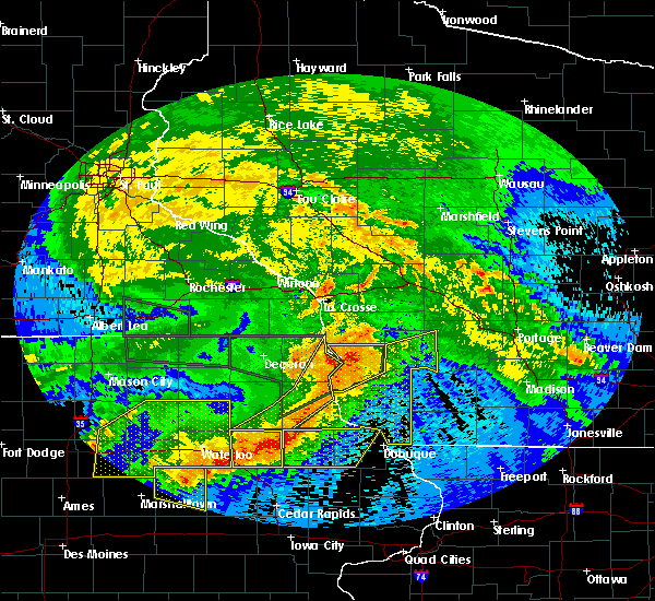 At 839 am cdt, severe thunderstorms were located along a line extending from 9 miles north of boscobel to near colesburg, moving southeast at 35 mph. these storms have a history of producing wind damage (radar indicated). Hazards include 60 mph wind gusts. Expect damage to roofs. siding and trees. severe thunderstorms will be near, boscobel around 845 am cdt. cassville around 855 am cdt. muscoda around 900 am cdt. Other locations impacted by these severe thunderstorms include germantown, westport, excelsior, preston and georgetown. At 839 am cdt, severe thunderstorms were located along a line extending from 9 miles north of boscobel to near colesburg, moving southeast at 35 mph. these storms have a history of producing wind damage (radar indicated). Hazards include 60 mph wind gusts. Expect damage to roofs. siding and trees. severe thunderstorms will be near, boscobel around 845 am cdt. cassville around 855 am cdt. muscoda around 900 am cdt. Other locations impacted by these severe thunderstorms include germantown, westport, excelsior, preston and georgetown.
|
| 6/22/2015 8:27 AM CDT |
 At 826 am cdt, severe thunderstorms were located along a line extending from 10 miles southwest of viroqua to 8 miles southwest of soldiers grove to near harpers ferry, moving east at 65 mph (radar indicated). Hazards include 60 mph wind gusts. Expect damage to roofs. siding and trees. severe thunderstorms will be near, soldiers grove around 835 am cdt. boscobel around 840 am cdt. Other locations impacted by these severe thunderstorms include bridgeport, seneca, wauzeka, clayton and gays mills. At 826 am cdt, severe thunderstorms were located along a line extending from 10 miles southwest of viroqua to 8 miles southwest of soldiers grove to near harpers ferry, moving east at 65 mph (radar indicated). Hazards include 60 mph wind gusts. Expect damage to roofs. siding and trees. severe thunderstorms will be near, soldiers grove around 835 am cdt. boscobel around 840 am cdt. Other locations impacted by these severe thunderstorms include bridgeport, seneca, wauzeka, clayton and gays mills.
|
| 6/22/2015 7:47 AM CDT |
 At 747 am cdt, a severe thunderstorm was located 7 miles west of boscobel, moving northeast at 35 mph. this storm has a history of producing large hail around the prairie du chien area (radar indicated). Hazards include quarter size hail. Damage to vehicles is expected. this severe storm will be near, boscobel around 755 am cdt. Other locations impacted by this severe thunderstorm include wauzeka, clayton, gays mills, steuben and bell center. At 747 am cdt, a severe thunderstorm was located 7 miles west of boscobel, moving northeast at 35 mph. this storm has a history of producing large hail around the prairie du chien area (radar indicated). Hazards include quarter size hail. Damage to vehicles is expected. this severe storm will be near, boscobel around 755 am cdt. Other locations impacted by this severe thunderstorm include wauzeka, clayton, gays mills, steuben and bell center.
|
| 6/22/2015 7:38 AM CDT |
 At 737 am cdt, a severe thunderstorm was located 9 miles west of boscobel, moving northeast at 45 mph (radar indicated). Hazards include quarter size hail. Damage to vehicles is expected. this severe storm will be near, boscobel around 745 am cdt. soldiers grove around 755 am cdt. Other locations impacted by this severe thunderstorm include bridgeport, wauzeka, clayton, gays mills and eastman. At 737 am cdt, a severe thunderstorm was located 9 miles west of boscobel, moving northeast at 45 mph (radar indicated). Hazards include quarter size hail. Damage to vehicles is expected. this severe storm will be near, boscobel around 745 am cdt. soldiers grove around 755 am cdt. Other locations impacted by this severe thunderstorm include bridgeport, wauzeka, clayton, gays mills and eastman.
|
| 6/22/2015 7:21 AM CDT |
 At 721 am cdt, a severe thunderstorm was located 7 miles southeast of harpers ferry, or 9 miles northeast of prairie du chien, moving northeast at 30 mph (radar indicated). Hazards include quarter size hail. Damage to vehicles is expected. this severe storm will be near, boscobel around 745 am cdt. soldiers grove around 800 am cdt. Other locations impacted by this severe thunderstorm include bridgeport, seneca, wauzeka, clayton and gays mills. At 721 am cdt, a severe thunderstorm was located 7 miles southeast of harpers ferry, or 9 miles northeast of prairie du chien, moving northeast at 30 mph (radar indicated). Hazards include quarter size hail. Damage to vehicles is expected. this severe storm will be near, boscobel around 745 am cdt. soldiers grove around 800 am cdt. Other locations impacted by this severe thunderstorm include bridgeport, seneca, wauzeka, clayton and gays mills.
|
| 6/22/2015 7:08 AM CDT |
 At 708 am cdt, a severe thunderstorm was located over prairie du chien, moving northeast at 25 mph (radar indicated). Hazards include quarter size hail. Damage to vehicles is expected. this severe storm will be near, soldiers grove around 800 am cdt. Other locations impacted by this severe thunderstorm include bridgeport, seneca, wauzeka, clayton and gays mills. At 708 am cdt, a severe thunderstorm was located over prairie du chien, moving northeast at 25 mph (radar indicated). Hazards include quarter size hail. Damage to vehicles is expected. this severe storm will be near, soldiers grove around 800 am cdt. Other locations impacted by this severe thunderstorm include bridgeport, seneca, wauzeka, clayton and gays mills.
|
| 6/22/2015 6:54 AM CDT |
 At 654 am cdt, a severe thunderstorm was located over mcgregor, or over prairie du chien, moving northeast at 30 mph (radar indicated). Hazards include golf ball size hail. People and animals outdoors will be injured. expect damage to roofs, siding, windows and vehicles. this severe thunderstorm will be near, prairie du chien around 700 am. boscobel around 745 am cdt. soldiers grove around 800 am cdt. Other locations impacted by this severe thunderstorm include bridgeport, seneca, wauzeka, clayton and gays mills. At 654 am cdt, a severe thunderstorm was located over mcgregor, or over prairie du chien, moving northeast at 30 mph (radar indicated). Hazards include golf ball size hail. People and animals outdoors will be injured. expect damage to roofs, siding, windows and vehicles. this severe thunderstorm will be near, prairie du chien around 700 am. boscobel around 745 am cdt. soldiers grove around 800 am cdt. Other locations impacted by this severe thunderstorm include bridgeport, seneca, wauzeka, clayton and gays mills.
|
| 6/16/2014 10:22 PM CDT | Trees blown down. time estimated from rada in grant county WI, 0.3 miles E of Boscobel, WI |
| 9/19/2013 3:47 PM CDT | Trees and power lines down across tow in grant county WI, 0.3 miles E of Boscobel, WI |
| 6/21/2013 7:31 AM CDT | Storm damage reported in grant county WI, 0.3 miles E of Boscobel, WI |
| 6/21/2013 7:31 AM CDT | Asos station boscobel airport /ovs/ in grant county WI, 1.8 miles SW of Boscobel, WI |
| 6/21/2013 7:31 AM CDT | Tree blown down in grant county WI, 0.3 miles E of Boscobel, WI |
| 1/1/0001 12:00 AM | Small tree limbs blown into the roa in grant county WI, 0.3 miles E of Boscobel, WI |
Hail Maps for Boscobel, WI


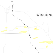


Connect with Interactive Hail Maps