

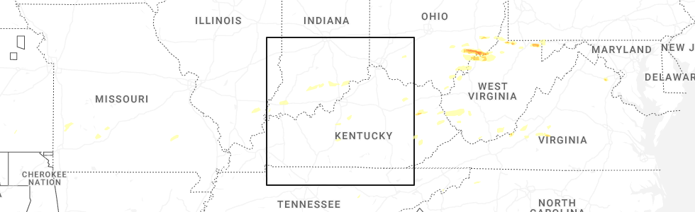
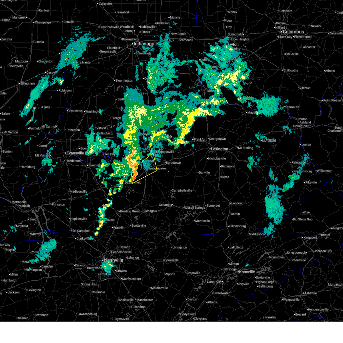
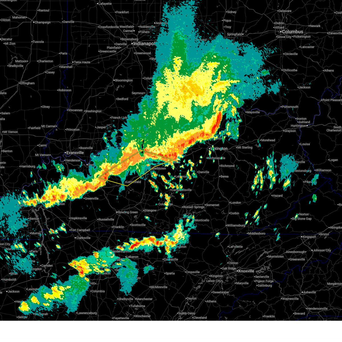
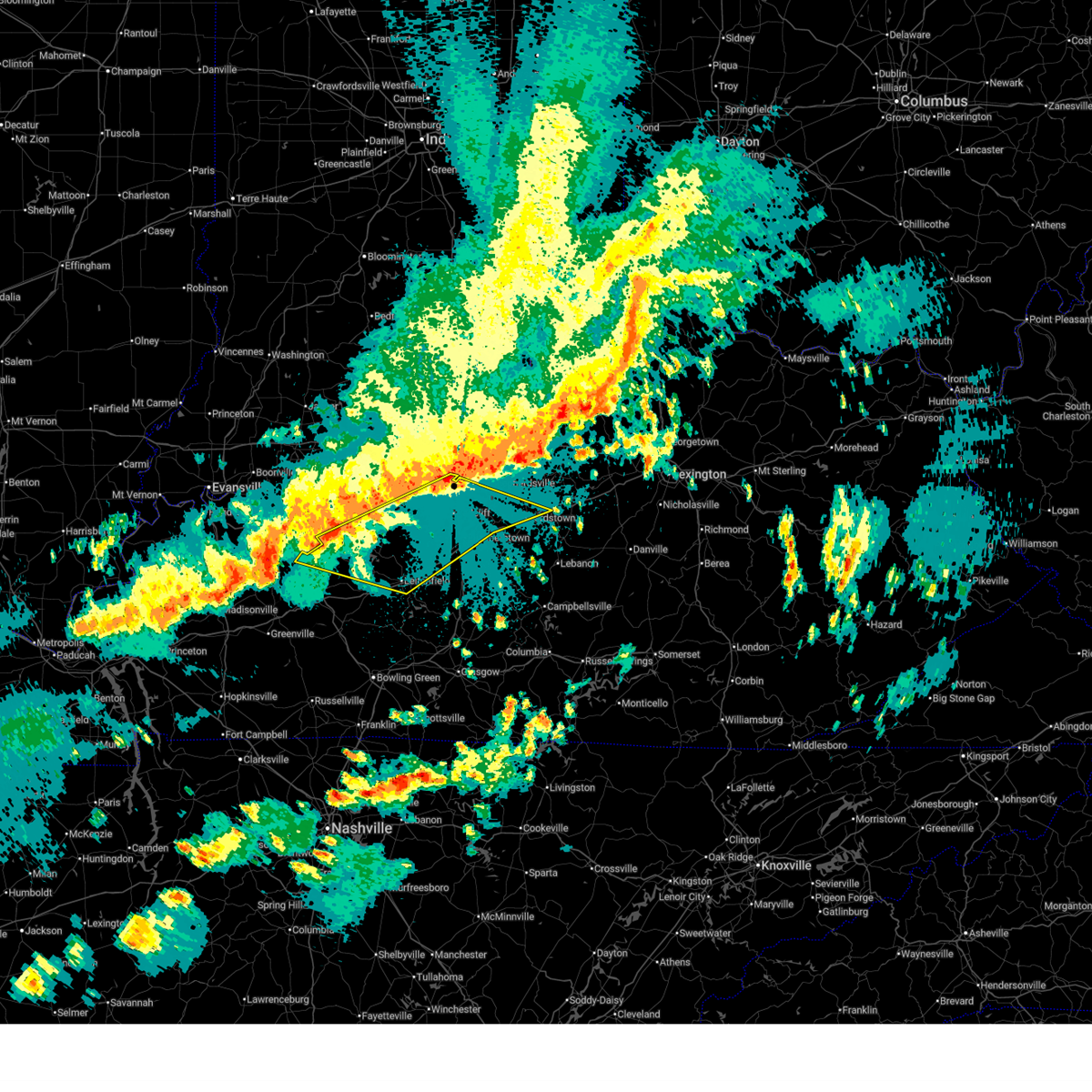
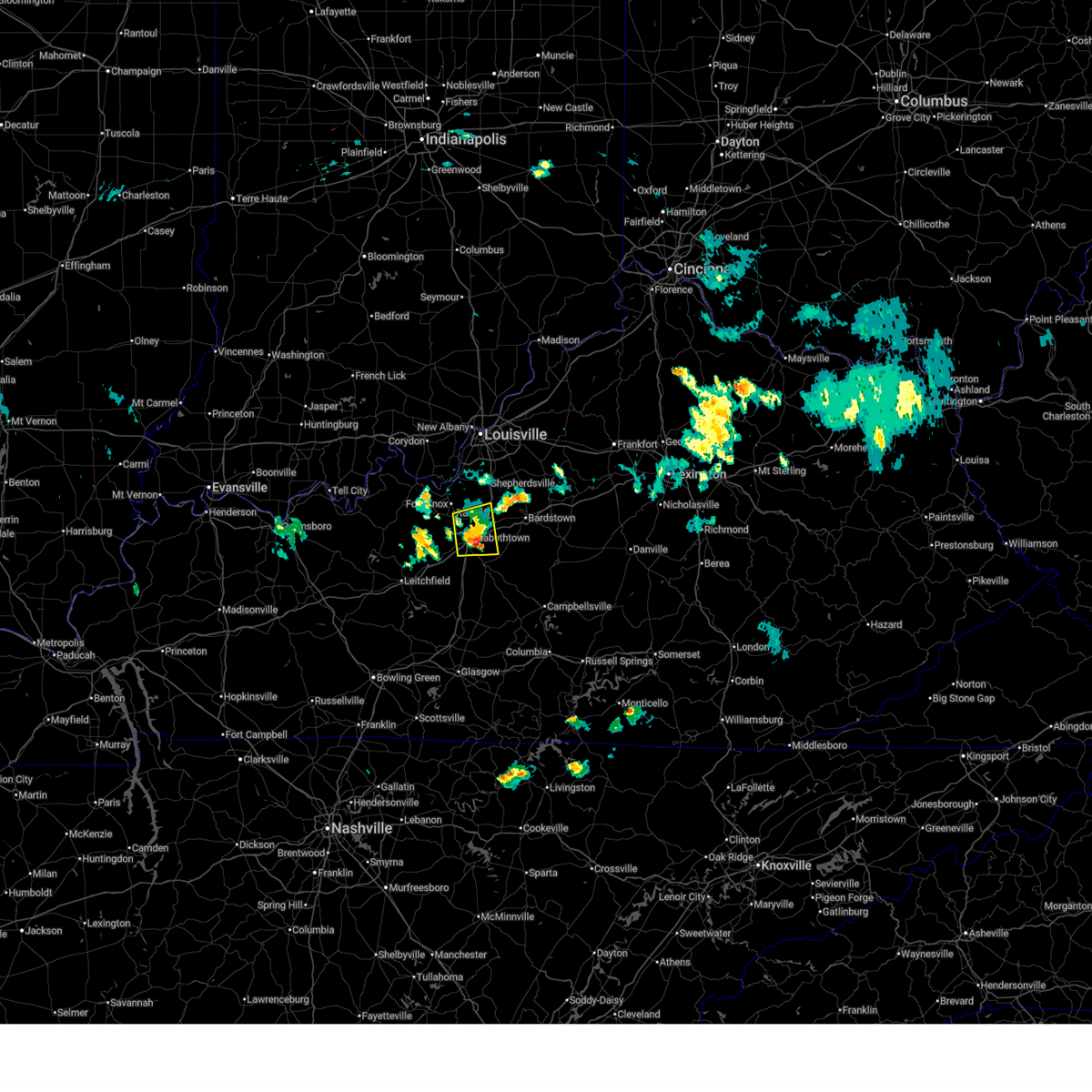
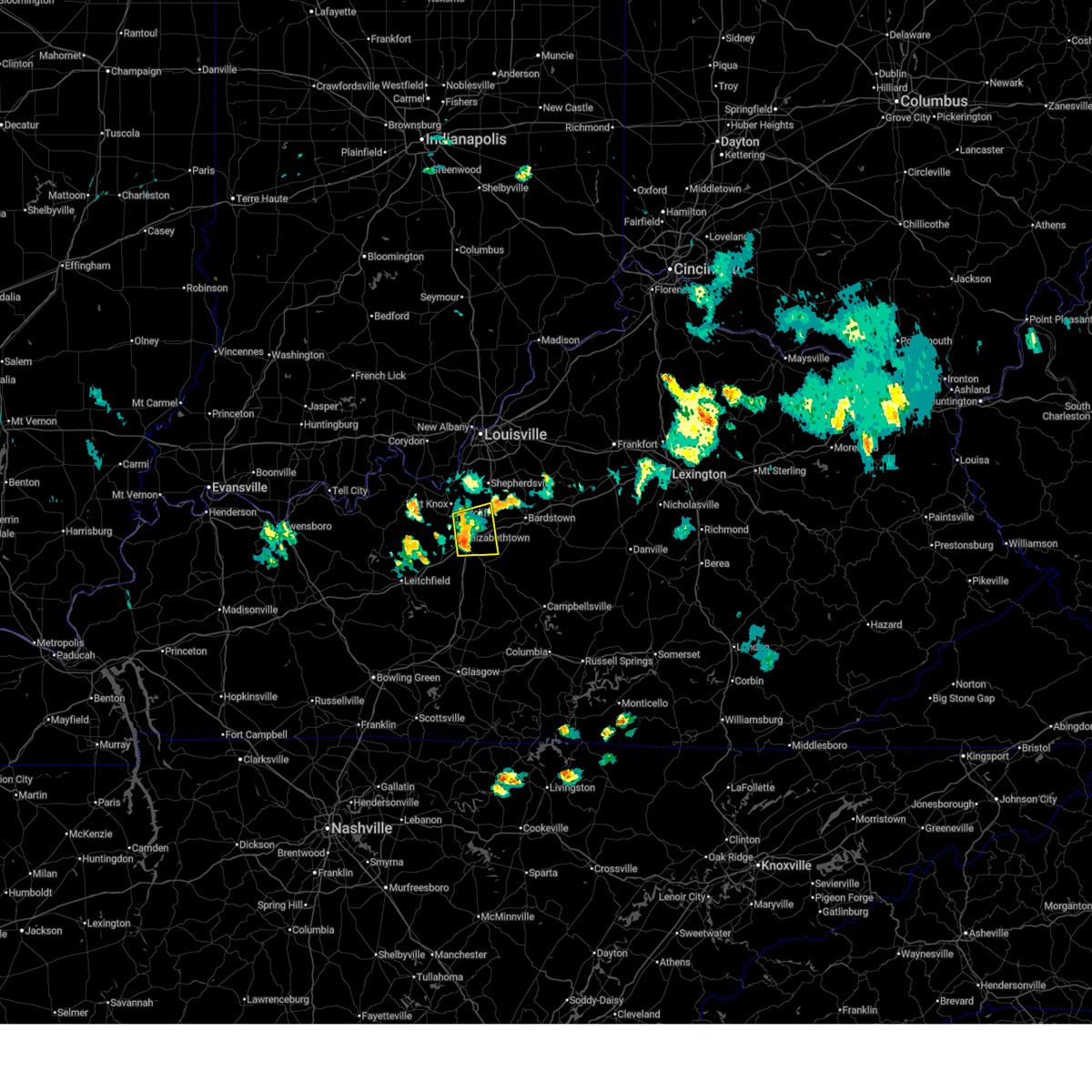
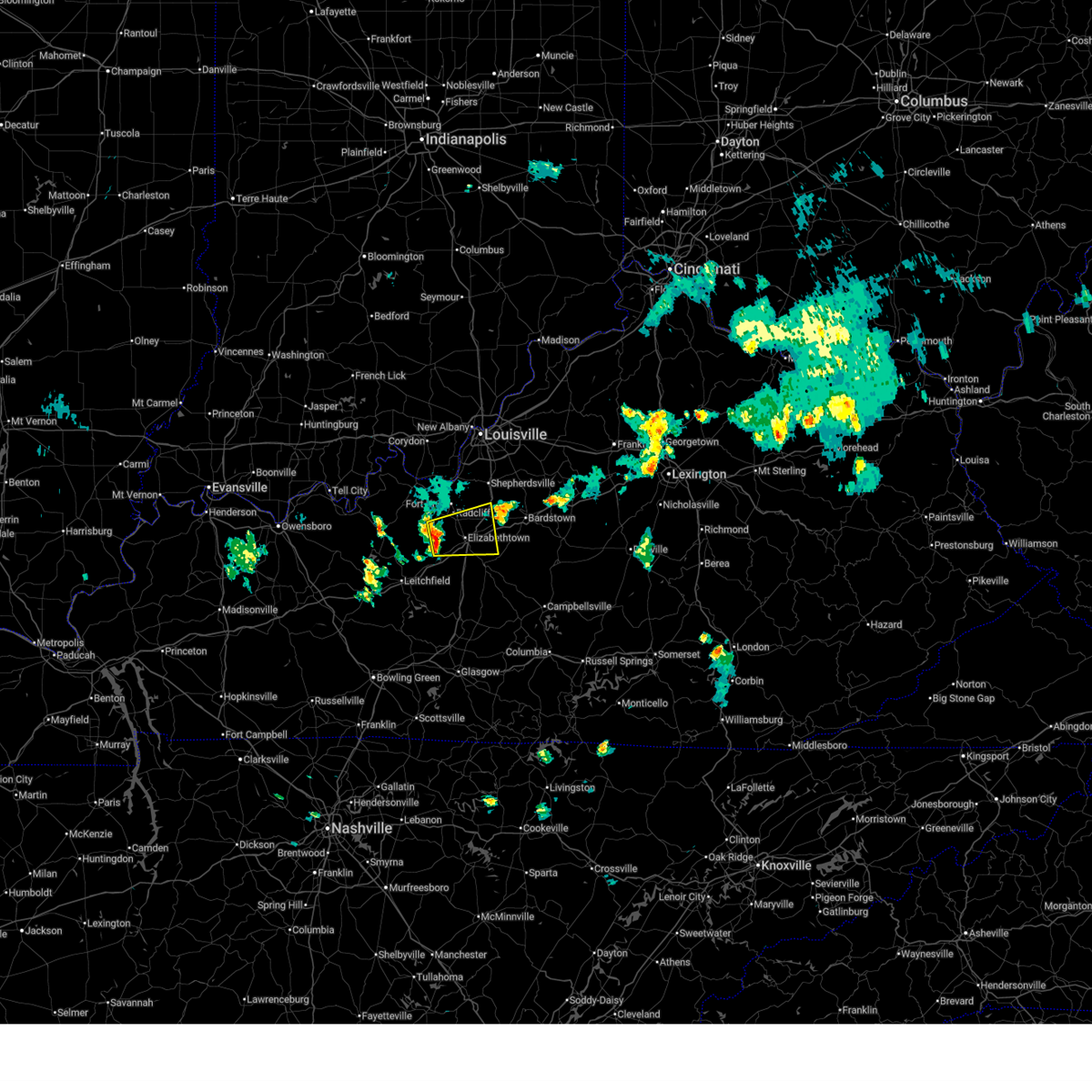
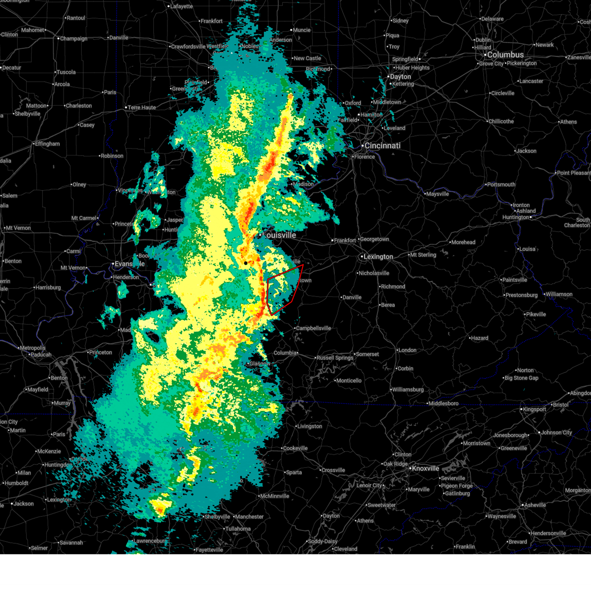
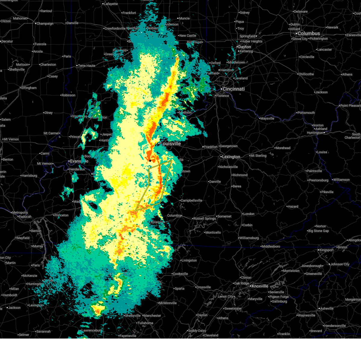
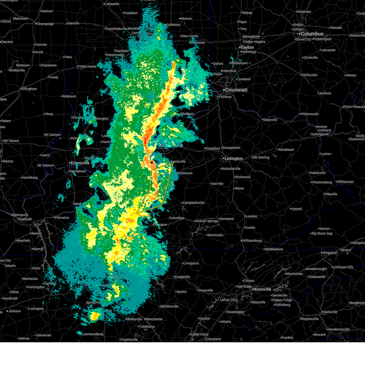
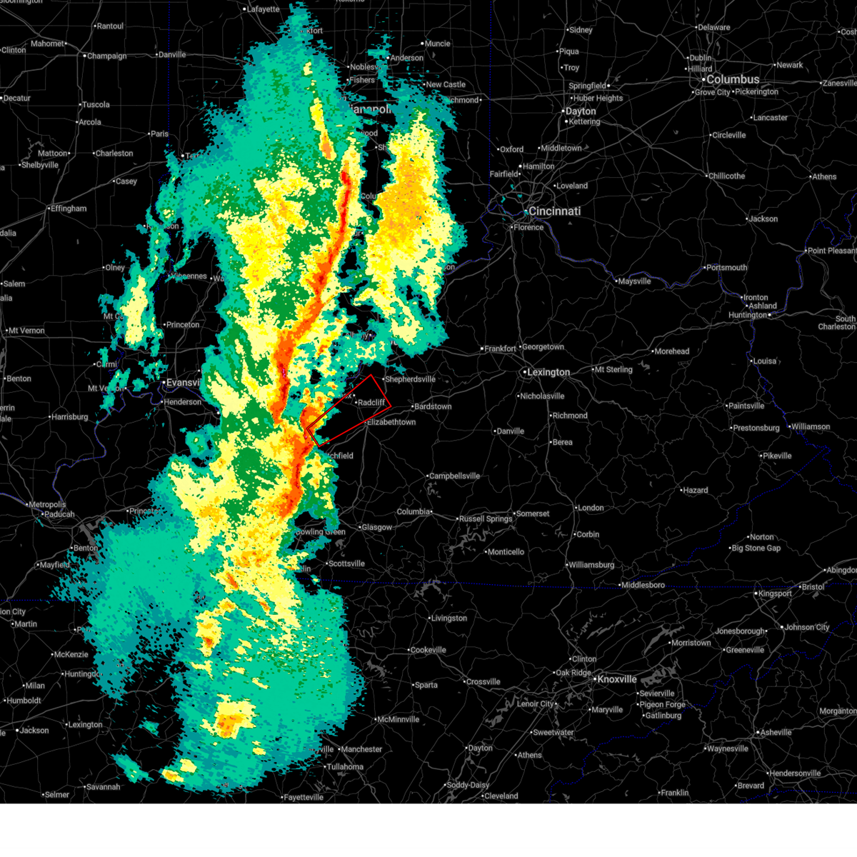
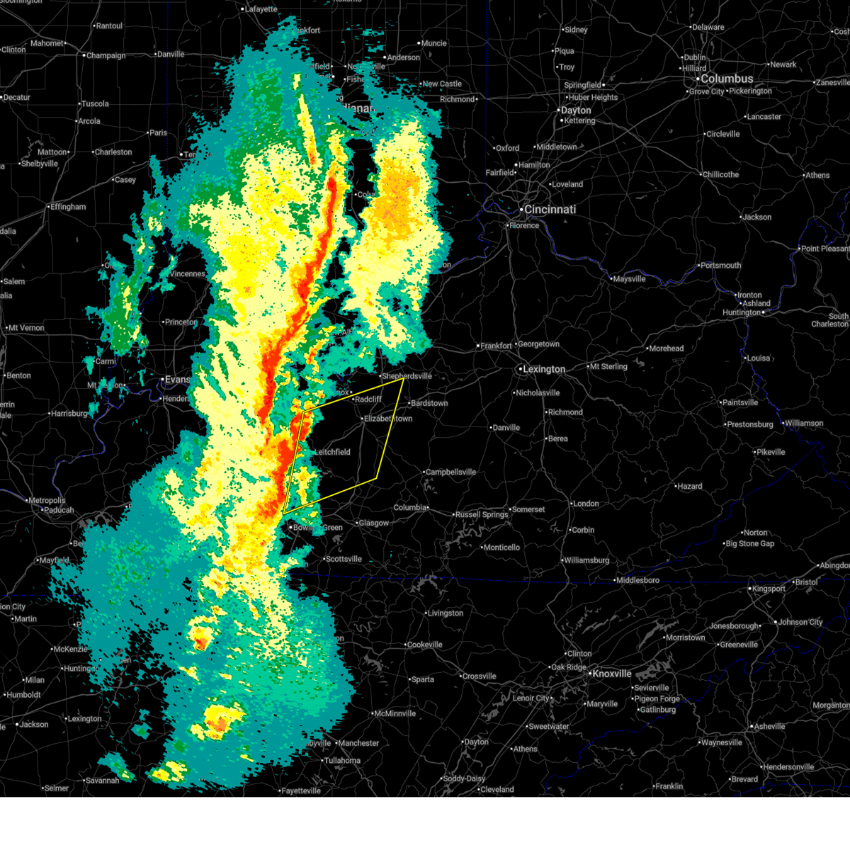
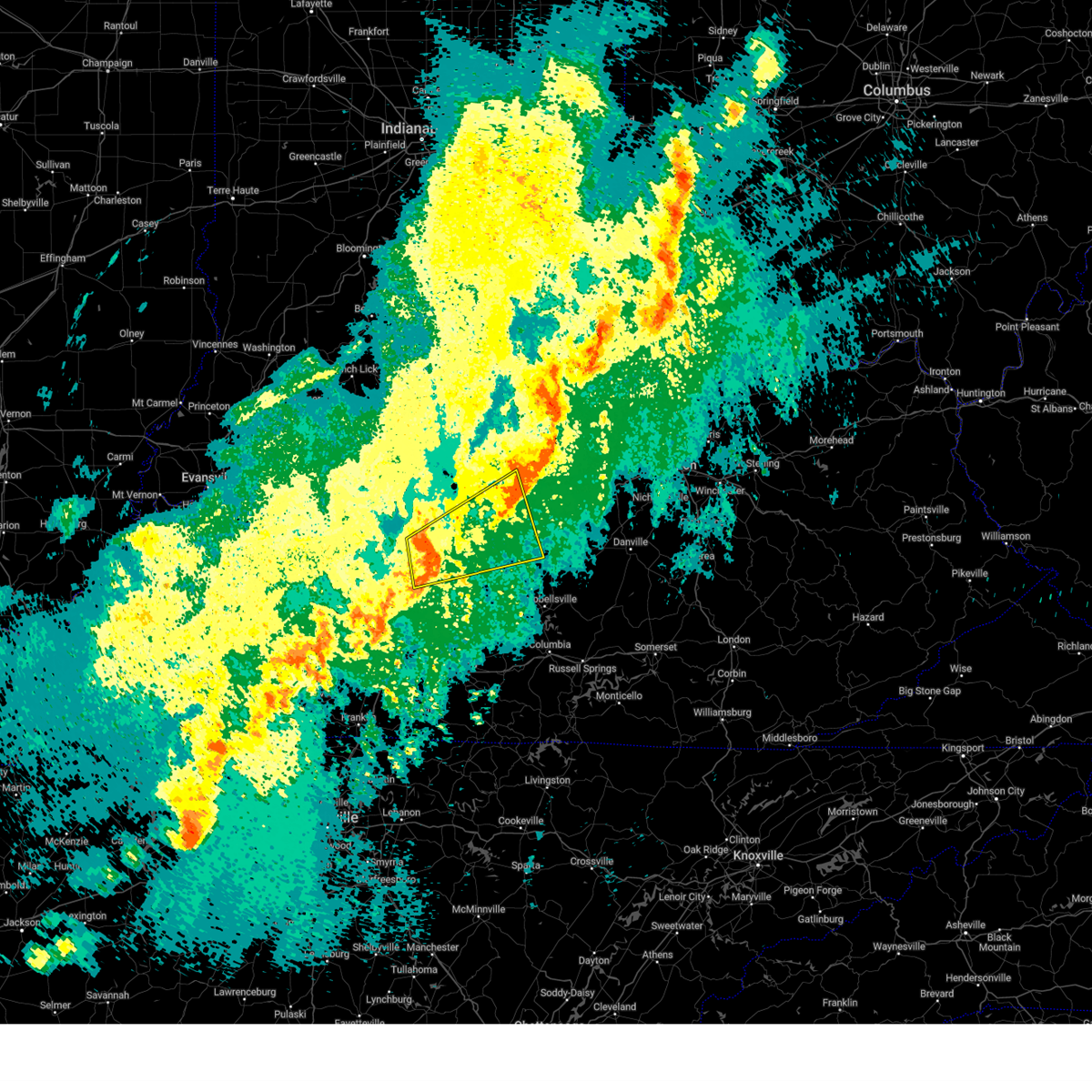
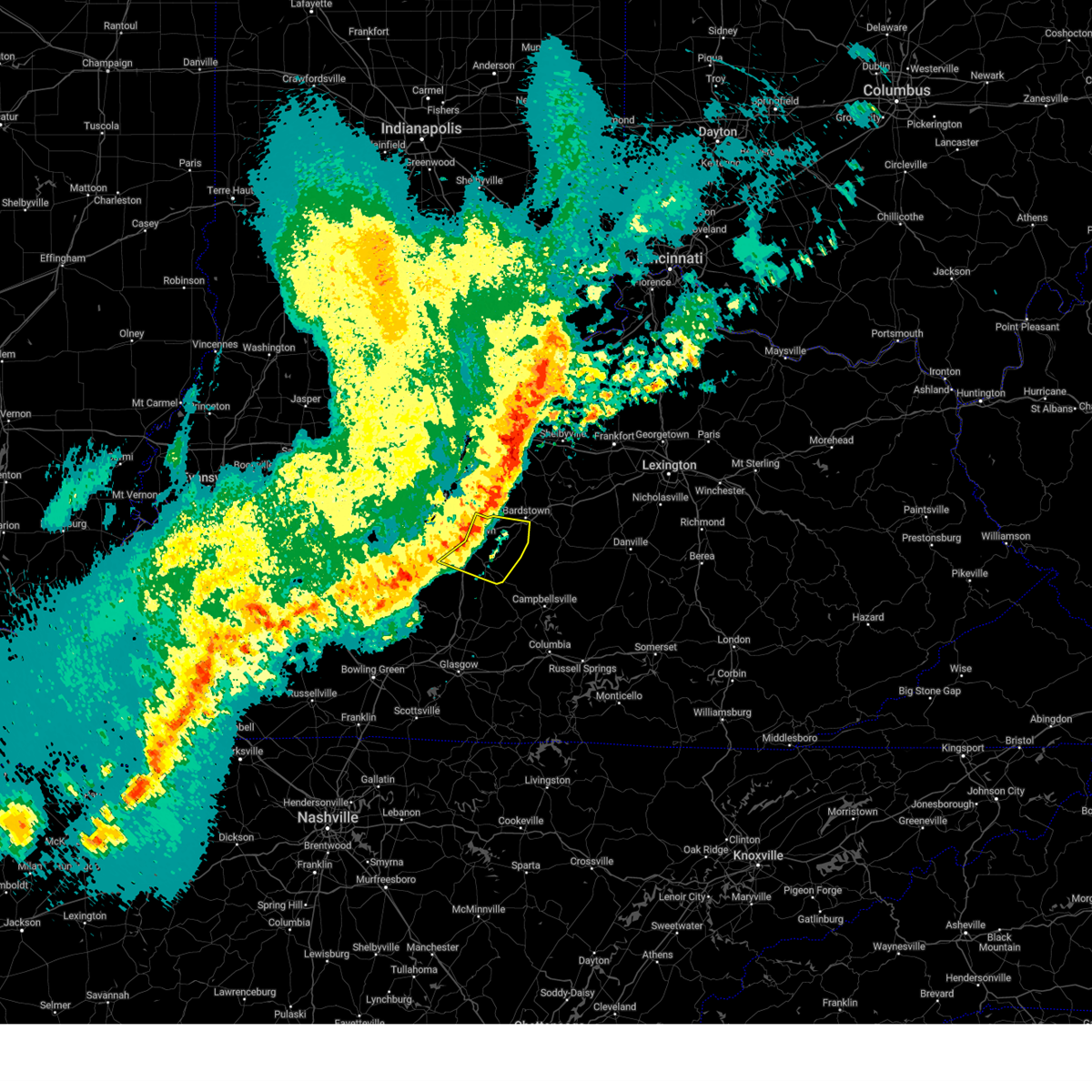
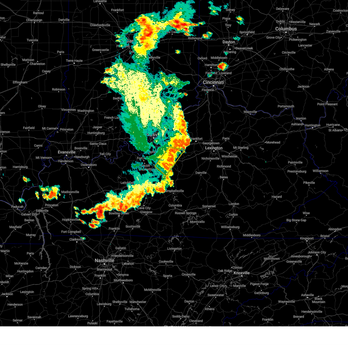
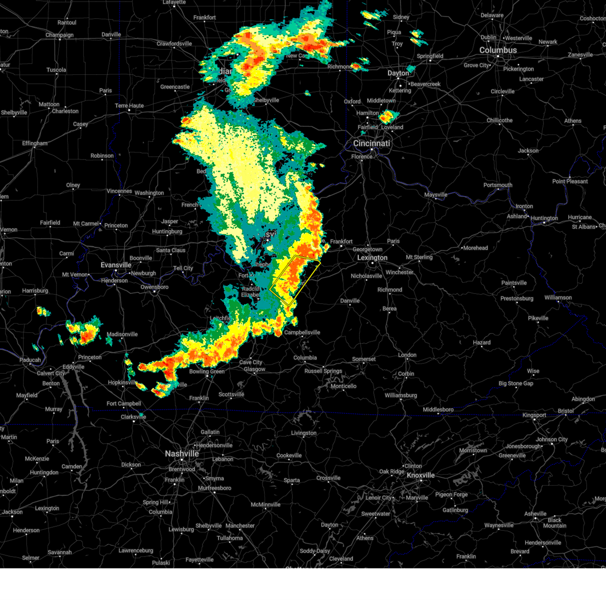
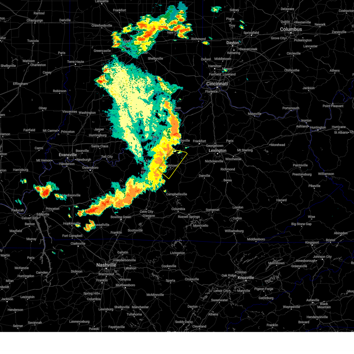
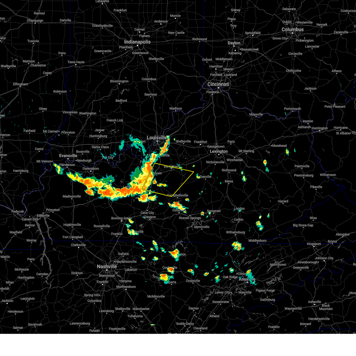
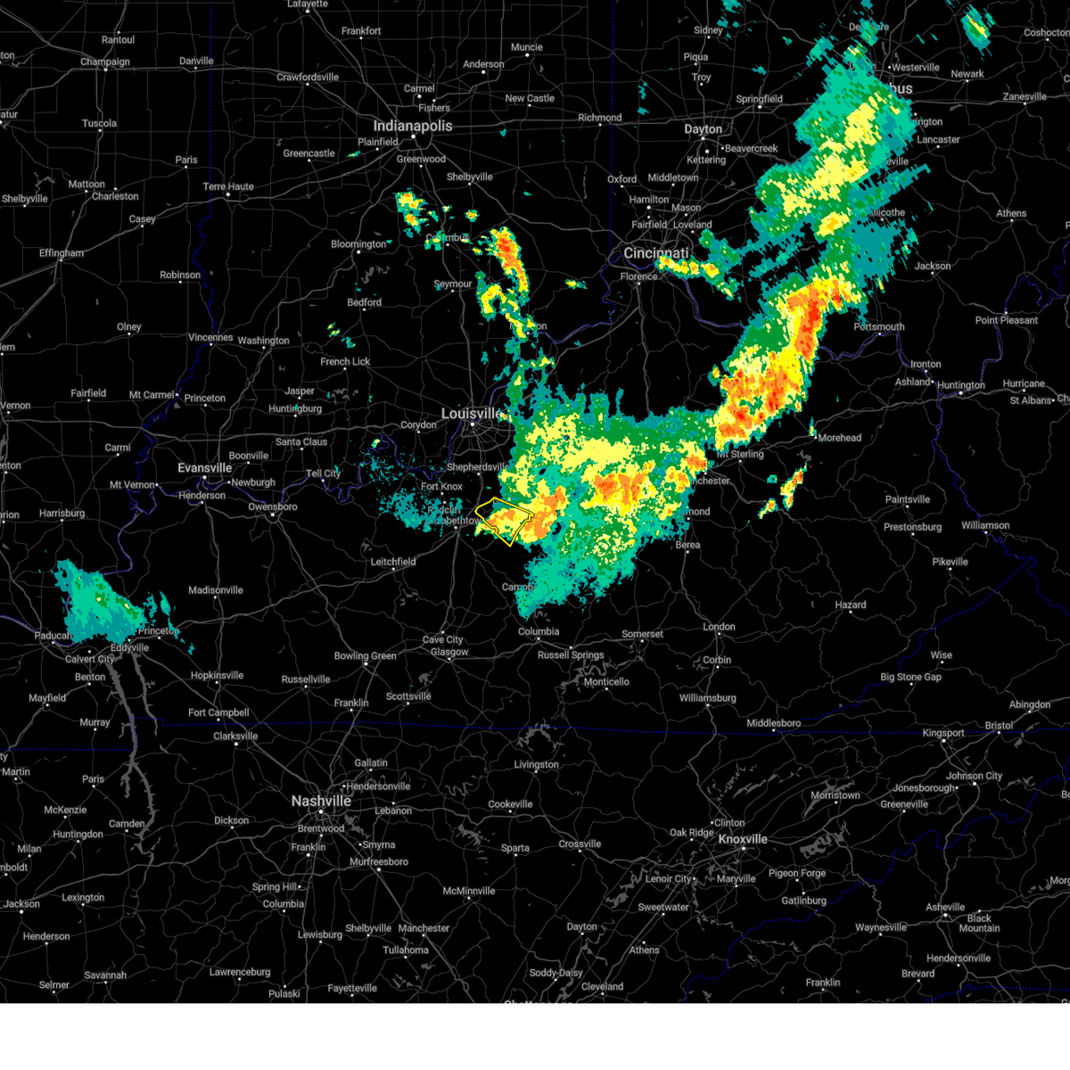
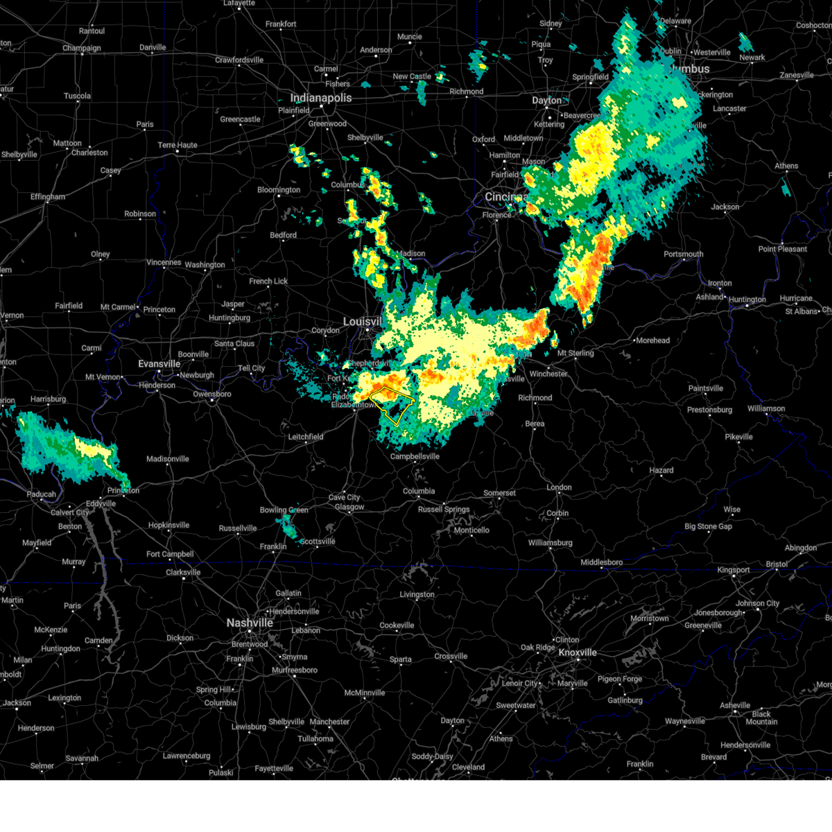
Hail Map for Boston, KY
The Boston, KY area has had 10 reports of on-the-ground hail by trained spotters, and has been under severe weather warnings 21 times during the past 12 months. Doppler radar has detected hail at or near Boston, KY on 54 occasions, including 1 occasion during the past year.
| Name: | Boston, KY |
| Where Located: | 14.3 miles S of Louisville, KY |
| Map: | Google Map for Boston, KY |
| Population: | 266 |
| Housing Units: | 125 |
| More Info: | Search Google for Boston, KY |
0
The Top Recent Hail Date for Boston, KY is Wednesday, April 1, 2026 (48th out of 54)
Hail and Wind Damage Spotted near Boston, KY
| Date / Time | Report Details |
|---|---|
| 6/22/2026 3:24 AM EDT |
 At 324 am edt, a severe thunderstorm was located 7 miles west of bardstown, moving southeast at 45 mph (radar indicated). Hazards include 60 mph wind gusts. Expect damage to roofs, siding, and trees. Locations impacted include, bardstown, shepherdsville, lebanon junction, samuels field airport, bardstown junction, hobbs, scuffletown, deatsville, botland, and bellwood. At 324 am edt, a severe thunderstorm was located 7 miles west of bardstown, moving southeast at 45 mph (radar indicated). Hazards include 60 mph wind gusts. Expect damage to roofs, siding, and trees. Locations impacted include, bardstown, shepherdsville, lebanon junction, samuels field airport, bardstown junction, hobbs, scuffletown, deatsville, botland, and bellwood.
|
| 5/22/2026 9:59 PM EDT |
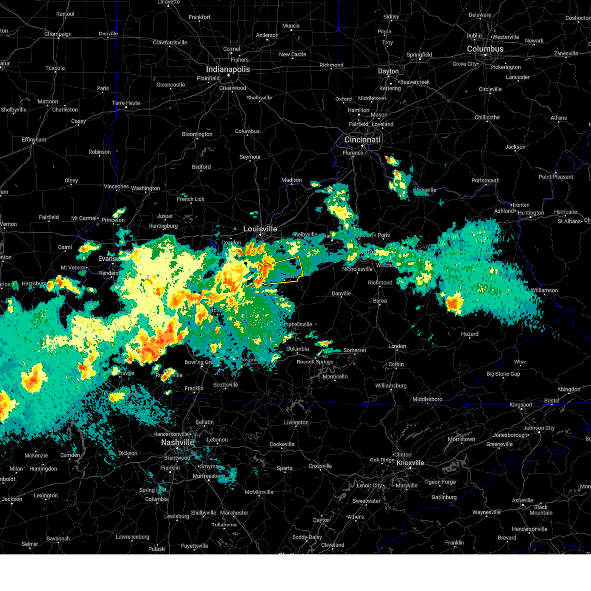
 At 958 pm edt, severe thunderstorms were located along a line extending from 13 miles southwest of shepherdsville to near elizabethtown, moving northeast at 40 mph (radar indicated). Hazards include 60 mph wind gusts and tornado possible. Expect damage to roofs, siding, and trees. Locations impacted include, elizabethtown, shepherdsville, radcliff, vine grove, lebanon junction, eastview, long view, belmont, roanoke, and hansbrough. At 958 pm edt, severe thunderstorms were located along a line extending from 13 miles southwest of shepherdsville to near elizabethtown, moving northeast at 40 mph (radar indicated). Hazards include 60 mph wind gusts and tornado possible. Expect damage to roofs, siding, and trees. Locations impacted include, elizabethtown, shepherdsville, radcliff, vine grove, lebanon junction, eastview, long view, belmont, roanoke, and hansbrough.
|
| 5/22/2026 9:59 PM EDT |
 the severe thunderstorm warning has been cancelled and is no longer in effect the severe thunderstorm warning has been cancelled and is no longer in effect
|
| 5/22/2026 9:38 PM EDT |
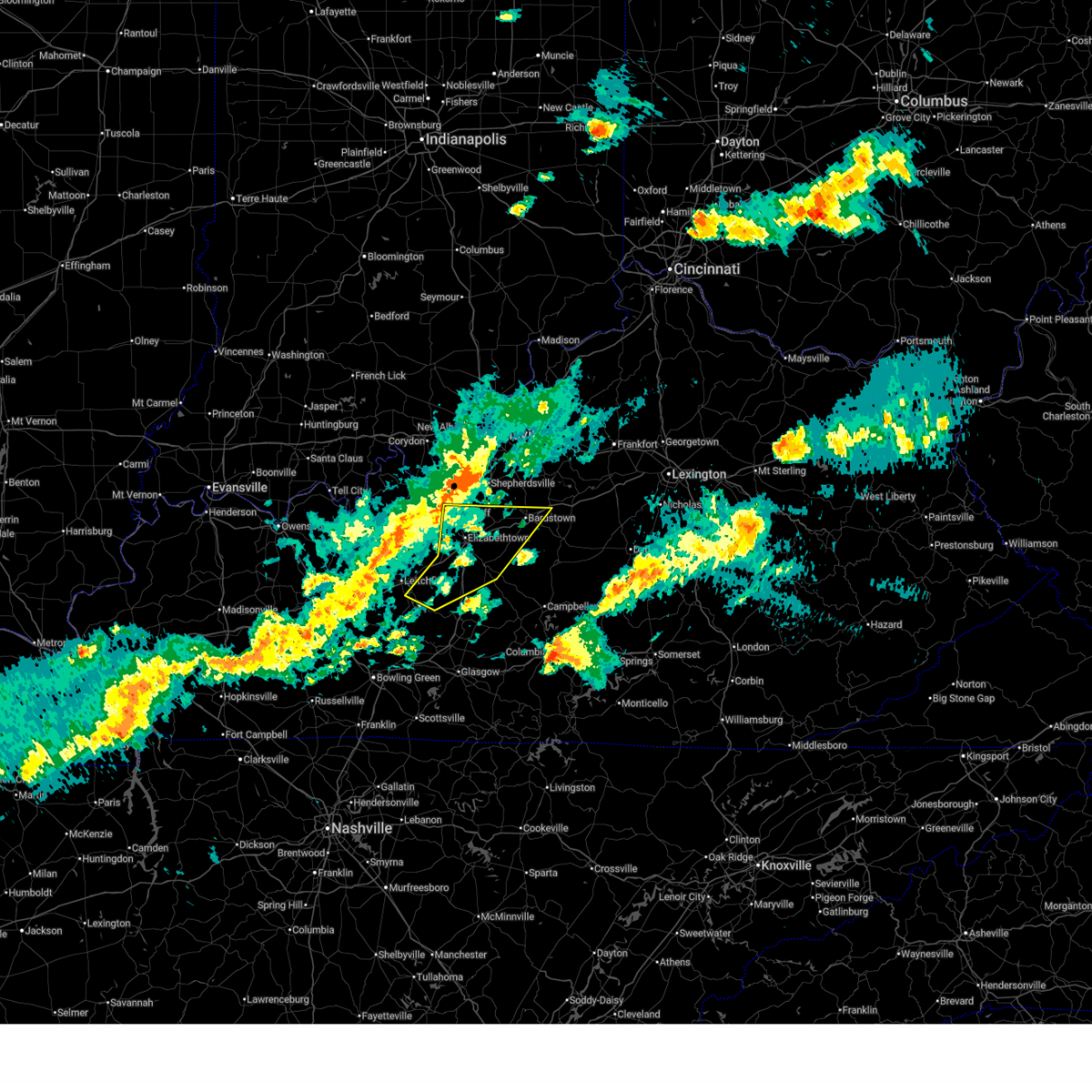
 Svrlmk the national weather service in louisville has issued a * severe thunderstorm warning for, west central nelson county in central kentucky, north central larue county in central kentucky, northeastern grayson county in central kentucky, southwestern bullitt county in central kentucky, hardin county in central kentucky, * until 1015 pm edt/915 pm cdt/. * at 938 pm edt/838 pm cdt/, severe thunderstorms were located along a line extending from 9 miles west of elizabethtown to 11 miles east of leitchfield, moving northeast at 40 mph (radar indicated). Hazards include 60 mph wind gusts and tornado possible. expect damage to roofs, siding, and trees Svrlmk the national weather service in louisville has issued a * severe thunderstorm warning for, west central nelson county in central kentucky, north central larue county in central kentucky, northeastern grayson county in central kentucky, southwestern bullitt county in central kentucky, hardin county in central kentucky, * until 1015 pm edt/915 pm cdt/. * at 938 pm edt/838 pm cdt/, severe thunderstorms were located along a line extending from 9 miles west of elizabethtown to 11 miles east of leitchfield, moving northeast at 40 mph (radar indicated). Hazards include 60 mph wind gusts and tornado possible. expect damage to roofs, siding, and trees
|
| 4/28/2026 12:47 AM CDT |
 At 147 am edt/1247 am cdt/, severe thunderstorms were located along a line extending from 6 miles west of bardstown to 12 miles north of morgantown, moving southeast at 45 mph (radar indicated). Hazards include 60 mph wind gusts and penny size hail. Expect damage to roofs, siding, and trees. Locations impacted include, elizabethtown, bardstown, leitchfield, hardinsburg, radcliff, vine grove, lebanon junction, muldraugh, clarkson, and west point. At 147 am edt/1247 am cdt/, severe thunderstorms were located along a line extending from 6 miles west of bardstown to 12 miles north of morgantown, moving southeast at 45 mph (radar indicated). Hazards include 60 mph wind gusts and penny size hail. Expect damage to roofs, siding, and trees. Locations impacted include, elizabethtown, bardstown, leitchfield, hardinsburg, radcliff, vine grove, lebanon junction, muldraugh, clarkson, and west point.
|
| 4/28/2026 12:12 AM CDT |
 Svrlmk the national weather service in louisville has issued a * severe thunderstorm warning for, southeastern harrison county in south central indiana, northwestern nelson county in central kentucky, southeastern meade county in central kentucky, southeastern hancock county in central kentucky, central grayson county in central kentucky, southwestern bullitt county in central kentucky, breckinridge county in central kentucky, hardin county in central kentucky, northeastern ohio county in central kentucky, * until 200 am edt/100 am cdt/. * at 112 am edt/1212 am cdt/, severe thunderstorms were located along a line extending from 7 miles southwest of valley station to 6 miles southeast of masonville, moving southeast at 45 mph (radar indicated). Hazards include 60 mph wind gusts and penny size hail. expect damage to roofs, siding, and trees Svrlmk the national weather service in louisville has issued a * severe thunderstorm warning for, southeastern harrison county in south central indiana, northwestern nelson county in central kentucky, southeastern meade county in central kentucky, southeastern hancock county in central kentucky, central grayson county in central kentucky, southwestern bullitt county in central kentucky, breckinridge county in central kentucky, hardin county in central kentucky, northeastern ohio county in central kentucky, * until 200 am edt/100 am cdt/. * at 112 am edt/1212 am cdt/, severe thunderstorms were located along a line extending from 7 miles southwest of valley station to 6 miles southeast of masonville, moving southeast at 45 mph (radar indicated). Hazards include 60 mph wind gusts and penny size hail. expect damage to roofs, siding, and trees
|
| 4/1/2026 7:43 PM EDT |
 The storm which prompted the warning has weakened below severe limits, and no longer poses an immediate threat to life or property. therefore, the warning will be allowed to expire. however, small hail, gusty winds and heavy rain are still possible with this thunderstorm. to report severe weather, contact your nearest law enforcement agency. they will relay your report to the national weather service louisville. The storm which prompted the warning has weakened below severe limits, and no longer poses an immediate threat to life or property. therefore, the warning will be allowed to expire. however, small hail, gusty winds and heavy rain are still possible with this thunderstorm. to report severe weather, contact your nearest law enforcement agency. they will relay your report to the national weather service louisville.
|
| 4/1/2026 7:30 PM EDT |
 At 730 pm edt, a severe thunderstorm was located over elizabethtown, moving east at 20 mph (radar indicated). Hazards include 60 mph wind gusts and nickel size hail. Expect damage to roofs, siding, and trees. Locations impacted include, elizabethtown, radcliff, lebanon junction, crest, gaithers, long view, rogersville, tunnel hills, roanoke, and addington field airport. At 730 pm edt, a severe thunderstorm was located over elizabethtown, moving east at 20 mph (radar indicated). Hazards include 60 mph wind gusts and nickel size hail. Expect damage to roofs, siding, and trees. Locations impacted include, elizabethtown, radcliff, lebanon junction, crest, gaithers, long view, rogersville, tunnel hills, roanoke, and addington field airport.
|
| 4/1/2026 7:07 PM EDT |
 Svrlmk the national weather service in louisville has issued a * severe thunderstorm warning for, west central nelson county in central kentucky, north central larue county in central kentucky, south central bullitt county in central kentucky, central hardin county in central kentucky, * until 745 pm edt. * at 706 pm edt, a severe thunderstorm was located 7 miles west of elizabethtown, moving east at 25 mph (radar indicated). Hazards include 60 mph wind gusts and quarter size hail. Hail damage to vehicles is expected. Expect wind damage to roofs, siding, and trees. Svrlmk the national weather service in louisville has issued a * severe thunderstorm warning for, west central nelson county in central kentucky, north central larue county in central kentucky, south central bullitt county in central kentucky, central hardin county in central kentucky, * until 745 pm edt. * at 706 pm edt, a severe thunderstorm was located 7 miles west of elizabethtown, moving east at 25 mph (radar indicated). Hazards include 60 mph wind gusts and quarter size hail. Hail damage to vehicles is expected. Expect wind damage to roofs, siding, and trees.
|
| 3/16/2026 12:03 AM EDT |
 the tornado warning has been cancelled and is no longer in effect the tornado warning has been cancelled and is no longer in effect
|
| 3/16/2026 12:03 AM EDT |
 At 1203 am edt, a severe squall line capable of producing both tornadoes and extensive straight line wind damage was located along a line extending from 9 miles west of bardstown to 9 miles northeast of hodgenville to 14 miles northwest of greensburg, moving northeast at 65 mph (radar indicated rotation). Hazards include tornado. Flying debris will be dangerous to those caught without shelter. mobile homes will be damaged or destroyed. damage to roofs, windows, and vehicles will occur. tree damage is likely. these dangerous storms will be near, bardstown around 1210 am edt. Other locations impacted by these tornadic storms include lyons, howardstown, dant, samuels field airport, booker, nerinx, bellwood, botland, withrow, and croakes. At 1203 am edt, a severe squall line capable of producing both tornadoes and extensive straight line wind damage was located along a line extending from 9 miles west of bardstown to 9 miles northeast of hodgenville to 14 miles northwest of greensburg, moving northeast at 65 mph (radar indicated rotation). Hazards include tornado. Flying debris will be dangerous to those caught without shelter. mobile homes will be damaged or destroyed. damage to roofs, windows, and vehicles will occur. tree damage is likely. these dangerous storms will be near, bardstown around 1210 am edt. Other locations impacted by these tornadic storms include lyons, howardstown, dant, samuels field airport, booker, nerinx, bellwood, botland, withrow, and croakes.
|
| 3/16/2026 12:00 AM EDT |
 The storms which prompted the warning have moved out of the area. therefore, the warning has been allowed to expire. a tornado watch remains in effect until 500 am edt/400 am cdt/ for central and south central kentucky. to report severe weather, contact your nearest law enforcement agency. they will relay your report to the national weather service louisville. The storms which prompted the warning have moved out of the area. therefore, the warning has been allowed to expire. a tornado watch remains in effect until 500 am edt/400 am cdt/ for central and south central kentucky. to report severe weather, contact your nearest law enforcement agency. they will relay your report to the national weather service louisville.
|
| 3/15/2026 11:54 PM EDT |
 At 1154 pm edt/1054 pm cdt/, a severe squall line capable of producing both tornadoes and extensive straight line wind damage was located along a line extending from near elizabethtown to near hodgenville to near munfordville, moving northeast at 65 mph (radar indicated rotation). Hazards include tornado. Flying debris will be dangerous to those caught without shelter. mobile homes will be damaged or destroyed. damage to roofs, windows, and vehicles will occur. tree damage is likely. these dangerous storms will be near, hodgenville around 1200 am edt. bardstown around 1210 am edt. Other locations impacted by these tornadic storms include boundary oak, dant, booker, bellwood, croakes, balltown, nelsonville, bourbon springs, tanner, and tunnel hills. At 1154 pm edt/1054 pm cdt/, a severe squall line capable of producing both tornadoes and extensive straight line wind damage was located along a line extending from near elizabethtown to near hodgenville to near munfordville, moving northeast at 65 mph (radar indicated rotation). Hazards include tornado. Flying debris will be dangerous to those caught without shelter. mobile homes will be damaged or destroyed. damage to roofs, windows, and vehicles will occur. tree damage is likely. these dangerous storms will be near, hodgenville around 1200 am edt. bardstown around 1210 am edt. Other locations impacted by these tornadic storms include boundary oak, dant, booker, bellwood, croakes, balltown, nelsonville, bourbon springs, tanner, and tunnel hills.
|
| 3/15/2026 11:51 PM EDT |
 The tornado threat has diminished and the tornado warning has been cancelled. however, damaging winds remain likely and a severe thunderstorm warning remains in effect for the area. a tornado watch remains in effect until 500 am edt for central kentucky. The tornado threat has diminished and the tornado warning has been cancelled. however, damaging winds remain likely and a severe thunderstorm warning remains in effect for the area. a tornado watch remains in effect until 500 am edt for central kentucky.
|
| 3/15/2026 11:50 PM EDT |
 the severe thunderstorm warning has been cancelled and is no longer in effect the severe thunderstorm warning has been cancelled and is no longer in effect
|
| 3/15/2026 11:50 PM EDT |
 At 1150 pm edt/1050 pm cdt/, severe thunderstorms were located along a line extending from west buechel to near hodgenville, moving northeast at 60 mph (radar indicated). Hazards include 60 mph wind gusts. Expect damage to roofs, siding, and trees. Locations impacted include, elizabethtown, hodgenville, munfordville, radcliff, vine grove, lebanon junction, upton, sonora, bonnieville, and boundary oak. At 1150 pm edt/1050 pm cdt/, severe thunderstorms were located along a line extending from west buechel to near hodgenville, moving northeast at 60 mph (radar indicated). Hazards include 60 mph wind gusts. Expect damage to roofs, siding, and trees. Locations impacted include, elizabethtown, hodgenville, munfordville, radcliff, vine grove, lebanon junction, upton, sonora, bonnieville, and boundary oak.
|
| 3/15/2026 11:42 PM EDT |
 Torlmk the national weather service in louisville has issued a * tornado warning for, nelson county in central kentucky, larue county in central kentucky, northwestern marion county in central kentucky, north central hart county in central kentucky, southwestern washington county in central kentucky, southeastern hardin county in central kentucky, * until 1230 am edt/1130 pm cdt/. * at 1142 pm edt/1042 pm cdt/, severe thunderstorms capable of producing a tornado were located along a line extending from 8 miles west of elizabethtown to 14 miles east of leitchfield to 7 miles west of munfordville, moving northeast at 65 mph (radar indicated rotation). Hazards include tornado. Flying debris will be dangerous to those caught without shelter. mobile homes will be damaged or destroyed. damage to roofs, windows, and vehicles will occur. tree damage is likely. these dangerous storms will be near, elizabethtown around 1145 pm edt. hodgenville around 1155 pm edt. bardstown around 1205 am edt. Other locations impacted by these tornadic storms include boundary oak, dant, booker, bellwood, croakes, balltown, glendale, nelsonville, priceville, and bourbon springs. Torlmk the national weather service in louisville has issued a * tornado warning for, nelson county in central kentucky, larue county in central kentucky, northwestern marion county in central kentucky, north central hart county in central kentucky, southwestern washington county in central kentucky, southeastern hardin county in central kentucky, * until 1230 am edt/1130 pm cdt/. * at 1142 pm edt/1042 pm cdt/, severe thunderstorms capable of producing a tornado were located along a line extending from 8 miles west of elizabethtown to 14 miles east of leitchfield to 7 miles west of munfordville, moving northeast at 65 mph (radar indicated rotation). Hazards include tornado. Flying debris will be dangerous to those caught without shelter. mobile homes will be damaged or destroyed. damage to roofs, windows, and vehicles will occur. tree damage is likely. these dangerous storms will be near, elizabethtown around 1145 pm edt. hodgenville around 1155 pm edt. bardstown around 1205 am edt. Other locations impacted by these tornadic storms include boundary oak, dant, booker, bellwood, croakes, balltown, glendale, nelsonville, priceville, and bourbon springs.
|
| 3/15/2026 11:33 PM EDT |
 At 1133 pm edt, a severe thunderstorm capable of producing a tornado was located 12 miles west of elizabethtown, moving northeast at 60 mph (radar indicated rotation). Hazards include tornado. Flying debris will be dangerous to those caught without shelter. mobile homes will be damaged or destroyed. damage to roofs, windows, and vehicles will occur. tree damage is likely. This tornadic thunderstorm will remain over mainly rural areas of western nelson, southeastern meade, southwestern bullitt and central hardin counties, including the following locations, long view, howe valley, vertrees, lebanon junction, radcliff, pitts point, vine grove, crest, four corners, and dietz acres. At 1133 pm edt, a severe thunderstorm capable of producing a tornado was located 12 miles west of elizabethtown, moving northeast at 60 mph (radar indicated rotation). Hazards include tornado. Flying debris will be dangerous to those caught without shelter. mobile homes will be damaged or destroyed. damage to roofs, windows, and vehicles will occur. tree damage is likely. This tornadic thunderstorm will remain over mainly rural areas of western nelson, southeastern meade, southwestern bullitt and central hardin counties, including the following locations, long view, howe valley, vertrees, lebanon junction, radcliff, pitts point, vine grove, crest, four corners, and dietz acres.
|
| 3/15/2026 11:33 PM EDT |
 the tornado warning has been cancelled and is no longer in effect the tornado warning has been cancelled and is no longer in effect
|
| 3/15/2026 11:22 PM EDT |
 Torlmk the national weather service in louisville has issued a * tornado warning for, western nelson county in central kentucky, southeastern meade county in central kentucky, north central grayson county in central kentucky, southwestern bullitt county in central kentucky, southeastern breckinridge county in central kentucky, central hardin county in central kentucky, * until midnight edt/1100 pm cdt/. * at 1122 pm edt/1022 pm cdt/, a severe thunderstorm capable of producing a tornado was located 8 miles north of leitchfield, moving northeast at 50 mph (radar indicated rotation). Hazards include tornado. Flying debris will be dangerous to those caught without shelter. mobile homes will be damaged or destroyed. damage to roofs, windows, and vehicles will occur. tree damage is likely. this dangerous storm will be near, elizabethtown around 1145 pm edt. Other locations impacted by this tornadic thunderstorm include dyer, constantine, long view, lebanon junction, pitts point, solway, big spring, tar hill, vine grove, and pierce mill. Torlmk the national weather service in louisville has issued a * tornado warning for, western nelson county in central kentucky, southeastern meade county in central kentucky, north central grayson county in central kentucky, southwestern bullitt county in central kentucky, southeastern breckinridge county in central kentucky, central hardin county in central kentucky, * until midnight edt/1100 pm cdt/. * at 1122 pm edt/1022 pm cdt/, a severe thunderstorm capable of producing a tornado was located 8 miles north of leitchfield, moving northeast at 50 mph (radar indicated rotation). Hazards include tornado. Flying debris will be dangerous to those caught without shelter. mobile homes will be damaged or destroyed. damage to roofs, windows, and vehicles will occur. tree damage is likely. this dangerous storm will be near, elizabethtown around 1145 pm edt. Other locations impacted by this tornadic thunderstorm include dyer, constantine, long view, lebanon junction, pitts point, solway, big spring, tar hill, vine grove, and pierce mill.
|
| 3/15/2026 11:16 PM EDT |
 Svrlmk the national weather service in louisville has issued a * severe thunderstorm warning for, northwestern nelson county in central kentucky, southeastern meade county in central kentucky, larue county in central kentucky, central hart county in central kentucky, east central butler county in south central kentucky, grayson county in central kentucky, north central warren county in south central kentucky, southern bullitt county in central kentucky, southeastern breckinridge county in central kentucky, hardin county in central kentucky, edmonson county in south central kentucky, * until midnight edt/1100 pm cdt/. * at 1116 pm edt/1016 pm cdt/, severe thunderstorms were located along a line extending from 7 miles east of hardinsburg to 11 miles northwest of plum springs, moving northeast at 85 mph (radar indicated). Hazards include 60 mph wind gusts. expect damage to roofs, siding, and trees Svrlmk the national weather service in louisville has issued a * severe thunderstorm warning for, northwestern nelson county in central kentucky, southeastern meade county in central kentucky, larue county in central kentucky, central hart county in central kentucky, east central butler county in south central kentucky, grayson county in central kentucky, north central warren county in south central kentucky, southern bullitt county in central kentucky, southeastern breckinridge county in central kentucky, hardin county in central kentucky, edmonson county in south central kentucky, * until midnight edt/1100 pm cdt/. * at 1116 pm edt/1016 pm cdt/, severe thunderstorms were located along a line extending from 7 miles east of hardinsburg to 11 miles northwest of plum springs, moving northeast at 85 mph (radar indicated). Hazards include 60 mph wind gusts. expect damage to roofs, siding, and trees
|
| 6/6/2025 1:58 PM EDT |
 The storms which prompted the warning have moved out of the area. therefore, the warning will be allowed to expire. however, gusty winds are still possible with these thunderstorms. to report severe weather, contact your nearest law enforcement agency. they will relay your report to the national weather service louisville. The storms which prompted the warning have moved out of the area. therefore, the warning will be allowed to expire. however, gusty winds are still possible with these thunderstorms. to report severe weather, contact your nearest law enforcement agency. they will relay your report to the national weather service louisville.
|
| 6/6/2025 1:27 PM EDT |
 Svrlmk the national weather service in louisville has issued a * severe thunderstorm warning for, spencer county in central kentucky, nelson county in central kentucky, north central larue county in central kentucky, northwestern marion county in central kentucky, central washington county in central kentucky, central bullitt county in central kentucky, * until 200 pm edt. * at 127 pm edt, severe thunderstorms were located along a line extending from near shepherdsville to 9 miles southwest of bardstown to 7 miles northeast of hodgenville, moving east at 45 mph (radar indicated). Hazards include 60 mph wind gusts and penny size hail. expect damage to roofs, siding, and trees Svrlmk the national weather service in louisville has issued a * severe thunderstorm warning for, spencer county in central kentucky, nelson county in central kentucky, north central larue county in central kentucky, northwestern marion county in central kentucky, central washington county in central kentucky, central bullitt county in central kentucky, * until 200 pm edt. * at 127 pm edt, severe thunderstorms were located along a line extending from near shepherdsville to 9 miles southwest of bardstown to 7 miles northeast of hodgenville, moving east at 45 mph (radar indicated). Hazards include 60 mph wind gusts and penny size hail. expect damage to roofs, siding, and trees
|
| 5/16/2025 10:09 PM EDT |
 Svrlmk the national weather service in louisville has issued a * severe thunderstorm warning for, southwestern nelson county in central kentucky, southeastern meade county in central kentucky, larue county in central kentucky, northwestern hart county in central kentucky, southeastern grayson county in central kentucky, southwestern bullitt county in central kentucky, hardin county in central kentucky, * until 1100 pm edt/1000 pm cdt/. * at 1009 pm edt/909 pm cdt/, severe thunderstorms were located along a line extending from 11 miles northwest of elizabethtown to 17 miles east of hardinsburg to 13 miles west of leitchfield, moving southeast at 40 mph (radar indicated). Hazards include 70 mph wind gusts. Expect considerable tree damage. Damage is likely to mobile homes, roofs, and outbuildings. Svrlmk the national weather service in louisville has issued a * severe thunderstorm warning for, southwestern nelson county in central kentucky, southeastern meade county in central kentucky, larue county in central kentucky, northwestern hart county in central kentucky, southeastern grayson county in central kentucky, southwestern bullitt county in central kentucky, hardin county in central kentucky, * until 1100 pm edt/1000 pm cdt/. * at 1009 pm edt/909 pm cdt/, severe thunderstorms were located along a line extending from 11 miles northwest of elizabethtown to 17 miles east of hardinsburg to 13 miles west of leitchfield, moving southeast at 40 mph (radar indicated). Hazards include 70 mph wind gusts. Expect considerable tree damage. Damage is likely to mobile homes, roofs, and outbuildings.
|
| 5/16/2025 8:59 AM EDT |
 Svrlmk the national weather service in louisville has issued a * severe thunderstorm warning for, southwestern spencer county in central kentucky, northern nelson county in central kentucky, southeastern bullitt county in central kentucky, * until 930 am edt. * at 859 am edt, a severe thunderstorm was located 8 miles south of shepherdsville, moving east at 45 mph (radar indicated). Hazards include 60 mph wind gusts and quarter size hail. Hail damage to vehicles is expected. Expect wind damage to roofs, siding, and trees. Svrlmk the national weather service in louisville has issued a * severe thunderstorm warning for, southwestern spencer county in central kentucky, northern nelson county in central kentucky, southeastern bullitt county in central kentucky, * until 930 am edt. * at 859 am edt, a severe thunderstorm was located 8 miles south of shepherdsville, moving east at 45 mph (radar indicated). Hazards include 60 mph wind gusts and quarter size hail. Hail damage to vehicles is expected. Expect wind damage to roofs, siding, and trees.
|
| 4/3/2025 1:27 AM EDT |
 The storm which prompted the warning has moved out of the area. therefore, the warning will be allowed to expire. however, heavy rain is still possible with this thunderstorm. a tornado watch remains in effect until 200 am edt/100 am cdt/ for central kentucky. a tornado watch also remains in effect until 700 am edt/600 am cdt/ for central kentucky. The storm which prompted the warning has moved out of the area. therefore, the warning will be allowed to expire. however, heavy rain is still possible with this thunderstorm. a tornado watch remains in effect until 200 am edt/100 am cdt/ for central kentucky. a tornado watch also remains in effect until 700 am edt/600 am cdt/ for central kentucky.
|
| 4/3/2025 1:03 AM EDT |
 Torlmk the national weather service in louisville has issued a * tornado warning for, nelson county in central kentucky, north central larue county in central kentucky, northwestern marion county in central kentucky, washington county in central kentucky, east central hardin county in central kentucky, * until 130 am edt. * at 103 am edt, a severe thunderstorm capable of producing a tornado was located 8 miles northeast of hodgenville, moving northeast at 70 mph (radar indicated rotation). Hazards include tornado. Flying debris will be dangerous to those caught without shelter. mobile homes will be damaged or destroyed. damage to roofs, windows, and vehicles will occur. tree damage is likely. this dangerous storm will be near, bardstown around 110 am edt. Other locations impacted by this tornadic thunderstorm include burkes spring, dant, booker, bellwood, polin, croakes, balltown, nelsonville, pleasant grove, and bourbon springs. Torlmk the national weather service in louisville has issued a * tornado warning for, nelson county in central kentucky, north central larue county in central kentucky, northwestern marion county in central kentucky, washington county in central kentucky, east central hardin county in central kentucky, * until 130 am edt. * at 103 am edt, a severe thunderstorm capable of producing a tornado was located 8 miles northeast of hodgenville, moving northeast at 70 mph (radar indicated rotation). Hazards include tornado. Flying debris will be dangerous to those caught without shelter. mobile homes will be damaged or destroyed. damage to roofs, windows, and vehicles will occur. tree damage is likely. this dangerous storm will be near, bardstown around 110 am edt. Other locations impacted by this tornadic thunderstorm include burkes spring, dant, booker, bellwood, polin, croakes, balltown, nelsonville, pleasant grove, and bourbon springs.
|
| 4/3/2025 12:47 AM EDT |
 Svrlmk the national weather service in louisville has issued a * severe thunderstorm warning for, nelson county in central kentucky, central larue county in central kentucky, northwestern marion county in central kentucky, northeastern grayson county in central kentucky, southeastern bullitt county in central kentucky, southeastern breckinridge county in central kentucky, hardin county in central kentucky, * until 130 am edt/1230 am cdt/. * at 1247 am edt/1147 pm cdt/, a severe thunderstorm was located over leitchfield, moving northeast at 75 mph (radar indicated). Hazards include 60 mph wind gusts and penny size hail. expect damage to roofs, siding, and trees Svrlmk the national weather service in louisville has issued a * severe thunderstorm warning for, nelson county in central kentucky, central larue county in central kentucky, northwestern marion county in central kentucky, northeastern grayson county in central kentucky, southeastern bullitt county in central kentucky, southeastern breckinridge county in central kentucky, hardin county in central kentucky, * until 130 am edt/1230 am cdt/. * at 1247 am edt/1147 pm cdt/, a severe thunderstorm was located over leitchfield, moving northeast at 75 mph (radar indicated). Hazards include 60 mph wind gusts and penny size hail. expect damage to roofs, siding, and trees
|
| 3/30/2025 10:06 PM EDT |
 Svrlmk the national weather service in louisville has issued a * severe thunderstorm warning for, southwestern nelson county in central kentucky, larue county in central kentucky, southeastern hardin county in central kentucky, * until 1030 pm edt. * at 1006 pm edt, severe thunderstorms were located along a line extending from 15 miles southwest of shepherdsville to near elizabethtown to 13 miles northeast of leitchfield, moving east at 45 mph (radar indicated). Hazards include 60 mph wind gusts and penny size hail. expect damage to roofs, siding, and trees Svrlmk the national weather service in louisville has issued a * severe thunderstorm warning for, southwestern nelson county in central kentucky, larue county in central kentucky, southeastern hardin county in central kentucky, * until 1030 pm edt. * at 1006 pm edt, severe thunderstorms were located along a line extending from 15 miles southwest of shepherdsville to near elizabethtown to 13 miles northeast of leitchfield, moving east at 45 mph (radar indicated). Hazards include 60 mph wind gusts and penny size hail. expect damage to roofs, siding, and trees
|
| 8/1/2024 6:00 PM EDT |
 The storms which prompted the warning have moved out of the area. therefore, the warning has been allowed to expire. however, gusty winds and heavy rain are still possible with these thunderstorms. a severe thunderstorm watch remains in effect until 800 pm edt for central kentucky. to report severe weather, contact your nearest law enforcement agency. they will relay your report to the national weather service louisville. The storms which prompted the warning have moved out of the area. therefore, the warning has been allowed to expire. however, gusty winds and heavy rain are still possible with these thunderstorms. a severe thunderstorm watch remains in effect until 800 pm edt for central kentucky. to report severe weather, contact your nearest law enforcement agency. they will relay your report to the national weather service louisville.
|
| 8/1/2024 5:50 PM EDT |
 At 550 pm edt, severe thunderstorms were located along a line extending from 6 miles south of shelbyville to 7 miles southwest of bardstown, moving east at 30 mph (radar indicated). Hazards include 60 mph wind gusts. Expect damage to roofs, siding, and trees. Locations impacted include, bardstown, taylorsville, bloomfield, fairfield, wakefield, yoder, highgrove, waterford, samuels field airport, and smithville. At 550 pm edt, severe thunderstorms were located along a line extending from 6 miles south of shelbyville to 7 miles southwest of bardstown, moving east at 30 mph (radar indicated). Hazards include 60 mph wind gusts. Expect damage to roofs, siding, and trees. Locations impacted include, bardstown, taylorsville, bloomfield, fairfield, wakefield, yoder, highgrove, waterford, samuels field airport, and smithville.
|
| 8/1/2024 5:37 PM EDT |
 Svrlmk the national weather service in louisville has issued a * severe thunderstorm warning for, spencer county in central kentucky, nelson county in central kentucky, southeastern bullitt county in central kentucky, * until 600 pm edt. * at 537 pm edt, severe thunderstorms were located along a line extending from near taylorsville to 11 miles east of elizabethtown, moving east at 30 mph (radar indicated). Hazards include 60 mph wind gusts. expect damage to roofs, siding, and trees Svrlmk the national weather service in louisville has issued a * severe thunderstorm warning for, spencer county in central kentucky, nelson county in central kentucky, southeastern bullitt county in central kentucky, * until 600 pm edt. * at 537 pm edt, severe thunderstorms were located along a line extending from near taylorsville to 11 miles east of elizabethtown, moving east at 30 mph (radar indicated). Hazards include 60 mph wind gusts. expect damage to roofs, siding, and trees
|
| 7/30/2024 2:09 PM EDT |
 Svrlmk the national weather service in louisville has issued a * severe thunderstorm warning for, southwestern nelson county in central kentucky, northwestern green county in central kentucky, larue county in central kentucky, western marion county in central kentucky, northeastern hart county in central kentucky, northwestern taylor county in central kentucky, southern washington county in central kentucky, southwestern bullitt county in central kentucky, eastern hardin county in central kentucky, * until 300 pm edt/200 pm cdt/. * at 209 pm edt/109 pm cdt/, a severe thunderstorm was located over elizabethtown, moving east at 25 mph (radar indicated). Hazards include 60 mph wind gusts. expect damage to roofs, siding, and trees Svrlmk the national weather service in louisville has issued a * severe thunderstorm warning for, southwestern nelson county in central kentucky, northwestern green county in central kentucky, larue county in central kentucky, western marion county in central kentucky, northeastern hart county in central kentucky, northwestern taylor county in central kentucky, southern washington county in central kentucky, southwestern bullitt county in central kentucky, eastern hardin county in central kentucky, * until 300 pm edt/200 pm cdt/. * at 209 pm edt/109 pm cdt/, a severe thunderstorm was located over elizabethtown, moving east at 25 mph (radar indicated). Hazards include 60 mph wind gusts. expect damage to roofs, siding, and trees
|
| 7/30/2024 3:43 AM EDT |
 The storm which prompted the warning has weakened below severe limits, and has exited the warned area. therefore, the warning will be allowed to expire. however, gusty winds are still possible with this thunderstorm. a severe thunderstorm watch remains in effect until 600 am edt for central kentucky. The storm which prompted the warning has weakened below severe limits, and has exited the warned area. therefore, the warning will be allowed to expire. however, gusty winds are still possible with this thunderstorm. a severe thunderstorm watch remains in effect until 600 am edt for central kentucky.
|
| 7/30/2024 3:21 AM EDT |
 Svrlmk the national weather service in louisville has issued a * severe thunderstorm warning for, southwestern nelson county in central kentucky, * until 345 am edt. * at 321 am edt, a severe thunderstorm was located 9 miles west of bardstown, moving southeast at 30 mph (radar indicated). Hazards include 60 mph wind gusts. expect damage to roofs, siding, and trees Svrlmk the national weather service in louisville has issued a * severe thunderstorm warning for, southwestern nelson county in central kentucky, * until 345 am edt. * at 321 am edt, a severe thunderstorm was located 9 miles west of bardstown, moving southeast at 30 mph (radar indicated). Hazards include 60 mph wind gusts. expect damage to roofs, siding, and trees
|
| 7/16/2024 11:30 PM EDT |
 The storm which prompted the warning has moved out of the area. therefore, the warning will be allowed to expire. however, a severe thunderstorm warning still remains in effect for central nelson county until 1215 am edt. The storm which prompted the warning has moved out of the area. therefore, the warning will be allowed to expire. however, a severe thunderstorm warning still remains in effect for central nelson county until 1215 am edt.
|
| 7/16/2024 11:19 PM EDT |
 At 1119 pm edt, a severe thunderstorm was located 9 miles west of bardstown, moving east at 35 mph (radar indicated). Hazards include 60 mph wind gusts. Expect damage to roofs, siding, and trees. Locations impacted include, bardstown, lebanon junction, blue gap, samuels field airport, scuffletown, bellwood, culvertown, withrow, balltown, and younger creek. At 1119 pm edt, a severe thunderstorm was located 9 miles west of bardstown, moving east at 35 mph (radar indicated). Hazards include 60 mph wind gusts. Expect damage to roofs, siding, and trees. Locations impacted include, bardstown, lebanon junction, blue gap, samuels field airport, scuffletown, bellwood, culvertown, withrow, balltown, and younger creek.
|
| 7/16/2024 11:19 PM EDT |
 the severe thunderstorm warning has been cancelled and is no longer in effect the severe thunderstorm warning has been cancelled and is no longer in effect
|
| 7/16/2024 11:14 PM EDT | Tree down on the bluegrass parkway near hardin count in nelson county KY, 2.8 miles NW of Boston, KY |
| 7/16/2024 11:06 PM EDT |
 Svrlmk the national weather service in louisville has issued a * severe thunderstorm warning for, northwestern nelson county in central kentucky, north central larue county in central kentucky, south central bullitt county in central kentucky, east central hardin county in central kentucky, * until 1130 pm edt. * at 1105 pm edt, a severe thunderstorm was located 10 miles northeast of elizabethtown, moving east at 20 mph (radar indicated). Hazards include 60 mph wind gusts. expect damage to roofs, siding, and trees Svrlmk the national weather service in louisville has issued a * severe thunderstorm warning for, northwestern nelson county in central kentucky, north central larue county in central kentucky, south central bullitt county in central kentucky, east central hardin county in central kentucky, * until 1130 pm edt. * at 1105 pm edt, a severe thunderstorm was located 10 miles northeast of elizabethtown, moving east at 20 mph (radar indicated). Hazards include 60 mph wind gusts. expect damage to roofs, siding, and trees
|
| 5/26/2024 12:06 PM EDT |
 At 1205 pm edt/1105 am cdt/, a severe thunderstorm was located near fern creek, moving northeast at 65 mph. this is a destructive storm for louisville metro area (radar indicated). Hazards include 80 mph wind gusts. Flying debris will be dangerous to those caught without shelter. mobile homes will be heavily damaged. expect considerable damage to roofs, windows, and vehicles. extensive tree damage and power outages are likely. locations impacted include, louisville, jeffersontown, st. Matthews, shively, shelbyville, bardstown, shepherdsville, lyndon, middletown, and lebanon. At 1205 pm edt/1105 am cdt/, a severe thunderstorm was located near fern creek, moving northeast at 65 mph. this is a destructive storm for louisville metro area (radar indicated). Hazards include 80 mph wind gusts. Flying debris will be dangerous to those caught without shelter. mobile homes will be heavily damaged. expect considerable damage to roofs, windows, and vehicles. extensive tree damage and power outages are likely. locations impacted include, louisville, jeffersontown, st. Matthews, shively, shelbyville, bardstown, shepherdsville, lyndon, middletown, and lebanon.
|
| 5/26/2024 11:58 AM EDT |
 Svrlmk the national weather service in louisville has issued a * severe thunderstorm warning for, southeastern floyd county in south central indiana, shelby county in central kentucky, nelson county in central kentucky, western anderson county in central kentucky, eastern larue county in central kentucky, marion county in central kentucky, northern taylor county in central kentucky, jefferson county in central kentucky, bullitt county in central kentucky, north central casey county in central kentucky, northwestern franklin county in central kentucky, spencer county in central kentucky, southwestern mercer county in central kentucky, northern green county in central kentucky, washington county in central kentucky, west central boyle county in central kentucky, * until 1230 pm edt/1130 am cdt/. * at 1157 am edt/1057 am cdt/, a severe thunderstorm was located over pioneer village, moving northeast at 65 mph (radar indicated). Hazards include 70 mph wind gusts. Expect considerable tree damage. Damage is likely to mobile homes, roofs, and outbuildings. Svrlmk the national weather service in louisville has issued a * severe thunderstorm warning for, southeastern floyd county in south central indiana, shelby county in central kentucky, nelson county in central kentucky, western anderson county in central kentucky, eastern larue county in central kentucky, marion county in central kentucky, northern taylor county in central kentucky, jefferson county in central kentucky, bullitt county in central kentucky, north central casey county in central kentucky, northwestern franklin county in central kentucky, spencer county in central kentucky, southwestern mercer county in central kentucky, northern green county in central kentucky, washington county in central kentucky, west central boyle county in central kentucky, * until 1230 pm edt/1130 am cdt/. * at 1157 am edt/1057 am cdt/, a severe thunderstorm was located over pioneer village, moving northeast at 65 mph (radar indicated). Hazards include 70 mph wind gusts. Expect considerable tree damage. Damage is likely to mobile homes, roofs, and outbuildings.
|
| 5/26/2024 11:51 AM EDT |
 At 1150 am edt/1050 am cdt/, a severe thunderstorm was located 10 miles north of hodgenville, moving east at 55 mph (radar indicated). Hazards include 70 mph wind gusts. Expect considerable tree damage. damage is likely to mobile homes, roofs, and outbuildings. Locations impacted include, elizabethtown, bardstown, hodgenville, radcliff, vine grove, lebanon junction, new haven, upton, sonora, and boundary oak. At 1150 am edt/1050 am cdt/, a severe thunderstorm was located 10 miles north of hodgenville, moving east at 55 mph (radar indicated). Hazards include 70 mph wind gusts. Expect considerable tree damage. damage is likely to mobile homes, roofs, and outbuildings. Locations impacted include, elizabethtown, bardstown, hodgenville, radcliff, vine grove, lebanon junction, new haven, upton, sonora, and boundary oak.
|
| 5/26/2024 11:51 AM EDT |
 the severe thunderstorm warning has been cancelled and is no longer in effect the severe thunderstorm warning has been cancelled and is no longer in effect
|
| 5/26/2024 11:34 AM EDT |
 At 1133 am edt/1033 am cdt/, a severe thunderstorm was located 12 miles west of elizabethtown, moving northeast at 50 mph (radar indicated). Hazards include 70 mph wind gusts. Expect considerable tree damage. damage is likely to mobile homes, roofs, and outbuildings. Locations impacted include, elizabethtown, bardstown, hodgenville, radcliff, vine grove, lebanon junction, irvington, new haven, upton, and sonora. At 1133 am edt/1033 am cdt/, a severe thunderstorm was located 12 miles west of elizabethtown, moving northeast at 50 mph (radar indicated). Hazards include 70 mph wind gusts. Expect considerable tree damage. damage is likely to mobile homes, roofs, and outbuildings. Locations impacted include, elizabethtown, bardstown, hodgenville, radcliff, vine grove, lebanon junction, irvington, new haven, upton, and sonora.
|
| 5/26/2024 11:24 AM EDT |
 Svrlmk the national weather service in louisville has issued a * severe thunderstorm warning for, nelson county in central kentucky, southeastern meade county in central kentucky, northwestern green county in central kentucky, larue county in central kentucky, northwestern marion county in central kentucky, northwestern hart county in central kentucky, eastern grayson county in central kentucky, west central washington county in central kentucky, southwestern bullitt county in central kentucky, southeastern breckinridge county in central kentucky, hardin county in central kentucky, * until noon edt/1100 am cdt/. * at 1124 am edt/1024 am cdt/, a severe thunderstorm was located 14 miles south of brandenburg, moving east at 50 mph (radar indicated). Hazards include 60 mph wind gusts. expect damage to roofs, siding, and trees Svrlmk the national weather service in louisville has issued a * severe thunderstorm warning for, nelson county in central kentucky, southeastern meade county in central kentucky, northwestern green county in central kentucky, larue county in central kentucky, northwestern marion county in central kentucky, northwestern hart county in central kentucky, eastern grayson county in central kentucky, west central washington county in central kentucky, southwestern bullitt county in central kentucky, southeastern breckinridge county in central kentucky, hardin county in central kentucky, * until noon edt/1100 am cdt/. * at 1124 am edt/1024 am cdt/, a severe thunderstorm was located 14 miles south of brandenburg, moving east at 50 mph (radar indicated). Hazards include 60 mph wind gusts. expect damage to roofs, siding, and trees
|
| 4/2/2024 8:59 AM EDT |
 At 859 am edt, a severe thunderstorm was located 9 miles west of bardstown, moving southeast at 60 mph (radar indicated). Hazards include 60 mph wind gusts. Expect damage to roofs, siding, and trees. Locations impacted include, elizabethtown, bardstown, lebanon junction, new haven, lyons, samuels field airport, scuffletown, bellwood, botland, and withrow. At 859 am edt, a severe thunderstorm was located 9 miles west of bardstown, moving southeast at 60 mph (radar indicated). Hazards include 60 mph wind gusts. Expect damage to roofs, siding, and trees. Locations impacted include, elizabethtown, bardstown, lebanon junction, new haven, lyons, samuels field airport, scuffletown, bellwood, botland, and withrow.
|
| 4/2/2024 8:59 AM EDT |
 the severe thunderstorm warning has been cancelled and is no longer in effect the severe thunderstorm warning has been cancelled and is no longer in effect
|
| 4/2/2024 8:29 AM EDT |
 Svrlmk the national weather service in louisville has issued a * severe thunderstorm warning for, central nelson county in central kentucky, eastern meade county in central kentucky, north central larue county in central kentucky, southwestern bullitt county in central kentucky, northeastern hardin county in central kentucky, * until 915 am edt. * at 829 am edt, a severe thunderstorm was located 11 miles northwest of elizabethtown, moving east at 55 mph (radar indicated). Hazards include 60 mph wind gusts. expect damage to roofs, siding, and trees Svrlmk the national weather service in louisville has issued a * severe thunderstorm warning for, central nelson county in central kentucky, eastern meade county in central kentucky, north central larue county in central kentucky, southwestern bullitt county in central kentucky, northeastern hardin county in central kentucky, * until 915 am edt. * at 829 am edt, a severe thunderstorm was located 11 miles northwest of elizabethtown, moving east at 55 mph (radar indicated). Hazards include 60 mph wind gusts. expect damage to roofs, siding, and trees
|
| 3/15/2024 12:34 AM EDT |
 the severe thunderstorm warning has been cancelled and is no longer in effect the severe thunderstorm warning has been cancelled and is no longer in effect
|
| 3/15/2024 12:15 AM EDT |
 At 1215 am edt/1115 pm cdt/, severe thunderstorms were located along a line extending from near shepherdsville to 10 miles west of hodgenville, moving east at 55 mph (radar indicated). Hazards include 60 mph wind gusts. Expect damage to roofs, siding, and trees. Locations impacted include, elizabethtown, radcliff, lebanon junction, sonora, bardstown junction, hobbs, eastview, scuffletown, belmont, and hansbrough. At 1215 am edt/1115 pm cdt/, severe thunderstorms were located along a line extending from near shepherdsville to 10 miles west of hodgenville, moving east at 55 mph (radar indicated). Hazards include 60 mph wind gusts. Expect damage to roofs, siding, and trees. Locations impacted include, elizabethtown, radcliff, lebanon junction, sonora, bardstown junction, hobbs, eastview, scuffletown, belmont, and hansbrough.
|
| 3/15/2024 12:14 AM EDT |
 Svrlmk the national weather service in louisville has issued a * severe thunderstorm warning for, spencer county in central kentucky, nelson county in central kentucky, larue county in central kentucky, central bullitt county in central kentucky, southeastern hardin county in central kentucky, * until 1245 am edt. * at 1214 am edt, severe thunderstorms were located along a line extending from 8 miles southeast of fern creek to 13 miles north of munfordville, moving east at 45 mph (radar indicated). Hazards include 60 mph wind gusts. expect damage to roofs, siding, and trees Svrlmk the national weather service in louisville has issued a * severe thunderstorm warning for, spencer county in central kentucky, nelson county in central kentucky, larue county in central kentucky, central bullitt county in central kentucky, southeastern hardin county in central kentucky, * until 1245 am edt. * at 1214 am edt, severe thunderstorms were located along a line extending from 8 miles southeast of fern creek to 13 miles north of munfordville, moving east at 45 mph (radar indicated). Hazards include 60 mph wind gusts. expect damage to roofs, siding, and trees
|
| 3/15/2024 12:05 AM EDT |
 Svrlmk the national weather service in louisville has issued a * severe thunderstorm warning for, western nelson county in central kentucky, northeastern grayson county in central kentucky, southwestern bullitt county in central kentucky, hardin county in central kentucky, * until 1230 am edt/1130 pm cdt/. * at 1205 am edt/1105 pm cdt/, severe thunderstorms were located along a line extending from near shepherdsville to 12 miles east of leitchfield, moving east at 55 mph (radar indicated). Hazards include 60 mph wind gusts. expect damage to roofs, siding, and trees Svrlmk the national weather service in louisville has issued a * severe thunderstorm warning for, western nelson county in central kentucky, northeastern grayson county in central kentucky, southwestern bullitt county in central kentucky, hardin county in central kentucky, * until 1230 am edt/1130 pm cdt/. * at 1205 am edt/1105 pm cdt/, severe thunderstorms were located along a line extending from near shepherdsville to 12 miles east of leitchfield, moving east at 55 mph (radar indicated). Hazards include 60 mph wind gusts. expect damage to roofs, siding, and trees
|
| 3/6/2024 10:06 AM EST |
 Torlmk the national weather service in louisville has issued a * this is a test message. tornado warning for, meade county in central kentucky, larue county in central kentucky, jessamine county in central kentucky, nicholas county in central kentucky, adair county in south central kentucky, bourbon county in central kentucky, warren county in south central kentucky, cumberland county in south central kentucky, henry county in central kentucky, russell county in south central kentucky, taylor county in central kentucky, jefferson county in central kentucky, hardin county in central kentucky, spencer county in central kentucky, scott county in central kentucky, hancock county in central kentucky, trimble county in central kentucky, monroe county in south central kentucky, metcalfe county in south central kentucky, shelby county in central kentucky, logan county in south central kentucky, nelson county in central kentucky, anderson county in central kentucky, clark county in central kentucky, marion county in central kentucky, simpson county in south central kentucky, grayson county in central kentucky, casey county in central kentucky, franklin county in central kentucky, edmonson county in south central kentucky, lincoln county in central kentucky, woodford county in central kentucky, butler county in south central kentucky, madison county in central kentucky, barren county in south central kentucky, ohio county in central kentucky, oldham county in central kentucky, garrard county in central kentucky, hart county in central kentucky, bullitt county in central kentucky, harrison county in central kentucky, mercer county in central kentucky, clinton county in south central kentucky, green county in central kentucky, allen county in south central kentucky, washington county in central kentucky, boyle county in central kentucky, breckinridge county in central kentucky, fayette county in central kentucky, * this is a test message. until 1030 am est/930 am cst/. * this is a test message. Torlmk the national weather service in louisville has issued a * this is a test message. tornado warning for, meade county in central kentucky, larue county in central kentucky, jessamine county in central kentucky, nicholas county in central kentucky, adair county in south central kentucky, bourbon county in central kentucky, warren county in south central kentucky, cumberland county in south central kentucky, henry county in central kentucky, russell county in south central kentucky, taylor county in central kentucky, jefferson county in central kentucky, hardin county in central kentucky, spencer county in central kentucky, scott county in central kentucky, hancock county in central kentucky, trimble county in central kentucky, monroe county in south central kentucky, metcalfe county in south central kentucky, shelby county in central kentucky, logan county in south central kentucky, nelson county in central kentucky, anderson county in central kentucky, clark county in central kentucky, marion county in central kentucky, simpson county in south central kentucky, grayson county in central kentucky, casey county in central kentucky, franklin county in central kentucky, edmonson county in south central kentucky, lincoln county in central kentucky, woodford county in central kentucky, butler county in south central kentucky, madison county in central kentucky, barren county in south central kentucky, ohio county in central kentucky, oldham county in central kentucky, garrard county in central kentucky, hart county in central kentucky, bullitt county in central kentucky, harrison county in central kentucky, mercer county in central kentucky, clinton county in south central kentucky, green county in central kentucky, allen county in south central kentucky, washington county in central kentucky, boyle county in central kentucky, breckinridge county in central kentucky, fayette county in central kentucky, * this is a test message. until 1030 am est/930 am cst/. * this is a test message.
|
| 2/28/2024 4:58 AM EST |
 The storm which prompted the warning has weakened below severe limits, and no longer poses an immediate threat to life or property. therefore, the warning will be allowed to expire. however, small hail and gusty winds are still possible with this thunderstorm. a tornado watch remains in effect until 600 am est for central kentucky. a tornado watch also remains in effect until 900 am est for central kentucky. The storm which prompted the warning has weakened below severe limits, and no longer poses an immediate threat to life or property. therefore, the warning will be allowed to expire. however, small hail and gusty winds are still possible with this thunderstorm. a tornado watch remains in effect until 600 am est for central kentucky. a tornado watch also remains in effect until 900 am est for central kentucky.
|
| 2/28/2024 4:44 AM EST |
 At 444 am est, a severe thunderstorm was located over bardstown, moving east at 75 mph (radar indicated). Hazards include 60 mph wind gusts and quarter size hail. Hail damage to vehicles is expected. expect wind damage to roofs, siding, and trees. Locations impacted include, bardstown, bloomfield, fairfield, wakefield, samuels field airport, booker, scuffletown, deatsville, bellwood, and botland. At 444 am est, a severe thunderstorm was located over bardstown, moving east at 75 mph (radar indicated). Hazards include 60 mph wind gusts and quarter size hail. Hail damage to vehicles is expected. expect wind damage to roofs, siding, and trees. Locations impacted include, bardstown, bloomfield, fairfield, wakefield, samuels field airport, booker, scuffletown, deatsville, bellwood, and botland.
|
| 2/28/2024 4:38 AM EST | Quarter sized hail reported 1.6 miles SE of Boston, KY, report from mping: quarter (1.00 in.). |
| 2/28/2024 4:29 AM EST |
 Svrlmk the national weather service in louisville has issued a * severe thunderstorm warning for, south central spencer county in central kentucky, nelson county in central kentucky, northwestern washington county in central kentucky, southern bullitt county in central kentucky, east central hardin county in central kentucky, * until 500 am est. * at 429 am est, a severe thunderstorm was located near elizabethtown, moving east at 75 mph (radar indicated). Hazards include 60 mph wind gusts and quarter size hail. Hail damage to vehicles is expected. Expect wind damage to roofs, siding, and trees. Svrlmk the national weather service in louisville has issued a * severe thunderstorm warning for, south central spencer county in central kentucky, nelson county in central kentucky, northwestern washington county in central kentucky, southern bullitt county in central kentucky, east central hardin county in central kentucky, * until 500 am est. * at 429 am est, a severe thunderstorm was located near elizabethtown, moving east at 75 mph (radar indicated). Hazards include 60 mph wind gusts and quarter size hail. Hail damage to vehicles is expected. Expect wind damage to roofs, siding, and trees.
|
| 7/18/2023 3:11 AM EDT |
 At 311 am edt, a severe thunderstorm was located over bardstown, moving southeast at 40 mph (radar indicated). Hazards include 60 mph wind gusts and half dollar size hail. Hail damage to vehicles is expected. expect wind damage to roofs, siding, and trees. locations impacted include, bardstown, east bardstown, samuels field airport, deatsville, bellwood, culvertown, botland, withrow, balltown and greenbrier. hail threat, radar indicated max hail size, 1. 25 in wind threat, radar indicated max wind gust, 60 mph. At 311 am edt, a severe thunderstorm was located over bardstown, moving southeast at 40 mph (radar indicated). Hazards include 60 mph wind gusts and half dollar size hail. Hail damage to vehicles is expected. expect wind damage to roofs, siding, and trees. locations impacted include, bardstown, east bardstown, samuels field airport, deatsville, bellwood, culvertown, botland, withrow, balltown and greenbrier. hail threat, radar indicated max hail size, 1. 25 in wind threat, radar indicated max wind gust, 60 mph.
|
| 7/18/2023 2:59 AM EDT |
 At 259 am edt, a severe thunderstorm was located 9 miles south of shepherdsville, moving southeast at 40 mph (radar indicated). Hazards include 60 mph wind gusts and half dollar size hail. Hail damage to vehicles is expected. Expect wind damage to roofs, siding, and trees. At 259 am edt, a severe thunderstorm was located 9 miles south of shepherdsville, moving southeast at 40 mph (radar indicated). Hazards include 60 mph wind gusts and half dollar size hail. Hail damage to vehicles is expected. Expect wind damage to roofs, siding, and trees.
|
| 6/25/2023 7:26 PM EDT |
 At 725 pm edt, a severe thunderstorm was located over bardstown, moving southeast at 35 mph (radar indicated). Hazards include 70 mph wind gusts and quarter size hail. Hail damage to vehicles is expected. expect considerable tree damage. wind damage is also likely to mobile homes, roofs, and outbuildings. locations impacted include, bardstown, springfield, taylorsville, lebanon junction, new haven, bloomfield, loretto, burkes spring, yoder and dant. thunderstorm damage threat, considerable hail threat, radar indicated max hail size, 1. 00 in wind threat, radar indicated max wind gust, 70 mph. At 725 pm edt, a severe thunderstorm was located over bardstown, moving southeast at 35 mph (radar indicated). Hazards include 70 mph wind gusts and quarter size hail. Hail damage to vehicles is expected. expect considerable tree damage. wind damage is also likely to mobile homes, roofs, and outbuildings. locations impacted include, bardstown, springfield, taylorsville, lebanon junction, new haven, bloomfield, loretto, burkes spring, yoder and dant. thunderstorm damage threat, considerable hail threat, radar indicated max hail size, 1. 00 in wind threat, radar indicated max wind gust, 70 mph.
|
| 6/25/2023 7:13 PM EDT |
 At 712 pm edt, a severe thunderstorm was located 9 miles southeast of shepherdsville, moving southeast at 35 mph (radar indicated). Hazards include 70 mph wind gusts and quarter size hail. Hail damage to vehicles is expected. expect considerable tree damage. Wind damage is also likely to mobile homes, roofs, and outbuildings. At 712 pm edt, a severe thunderstorm was located 9 miles southeast of shepherdsville, moving southeast at 35 mph (radar indicated). Hazards include 70 mph wind gusts and quarter size hail. Hail damage to vehicles is expected. expect considerable tree damage. Wind damage is also likely to mobile homes, roofs, and outbuildings.
|
| 5/16/2023 1:53 PM EDT |
 The severe thunderstorm warning for southwestern nelson and north central larue counties will expire at 200 pm edt, the storm which prompted the warning has moved out of the area. therefore, the warning will be allowed to expire. however gusty winds are still possible with this thunderstorm. a severe thunderstorm watch remains in effect until 800 pm edt for central kentucky. to report severe weather, contact your nearest law enforcement agency. they will relay your report to the national weather service louisville. remember, a severe thunderstorm warning still remains in effect for southeast nelson and southwest larue counties. The severe thunderstorm warning for southwestern nelson and north central larue counties will expire at 200 pm edt, the storm which prompted the warning has moved out of the area. therefore, the warning will be allowed to expire. however gusty winds are still possible with this thunderstorm. a severe thunderstorm watch remains in effect until 800 pm edt for central kentucky. to report severe weather, contact your nearest law enforcement agency. they will relay your report to the national weather service louisville. remember, a severe thunderstorm warning still remains in effect for southeast nelson and southwest larue counties.
|
| 5/16/2023 1:34 PM EDT |
 At 132 pm edt, a severe thunderstorm was located 9 miles northeast of hodgenville, moving east at 35 mph (radar indicated). Hazards include 60 mph wind gusts and penny size hail. Expect damage to roofs, siding, and trees. a tornado warning has been issued for north central larue and southern nelson county. refer to that warning for additional information. Locations impacted include, bardstown, new haven, lyons, gethsemane, athertonville, blue gap, samuels field airport, bellwood, culvertown and roanoke. At 132 pm edt, a severe thunderstorm was located 9 miles northeast of hodgenville, moving east at 35 mph (radar indicated). Hazards include 60 mph wind gusts and penny size hail. Expect damage to roofs, siding, and trees. a tornado warning has been issued for north central larue and southern nelson county. refer to that warning for additional information. Locations impacted include, bardstown, new haven, lyons, gethsemane, athertonville, blue gap, samuels field airport, bellwood, culvertown and roanoke.
|
| 5/16/2023 1:13 PM EDT |
 At 113 pm edt, a severe thunderstorm was located over elizabethtown, moving east at 35 mph (radar indicated). Hazards include 60 mph wind gusts and penny size hail. expect damage to roofs, siding, and trees At 113 pm edt, a severe thunderstorm was located over elizabethtown, moving east at 35 mph (radar indicated). Hazards include 60 mph wind gusts and penny size hail. expect damage to roofs, siding, and trees
|
| 4/5/2023 5:00 PM EDT |
 At 459 pm edt, severe thunderstorms were located along a line extending from near st. dennis to 12 miles southwest of shepherdsville to 8 miles northwest of elizabethtown, moving east at 60 mph (radar indicated). Hazards include 70 mph wind gusts. Expect considerable tree damage. damage is likely to mobile homes, roofs, and outbuildings. locations impacted include, louisville, elizabethtown, jeffersonville, new albany, jeffersontown, st. Matthews, shively, shepherdsville, lyndon and middletown. At 459 pm edt, severe thunderstorms were located along a line extending from near st. dennis to 12 miles southwest of shepherdsville to 8 miles northwest of elizabethtown, moving east at 60 mph (radar indicated). Hazards include 70 mph wind gusts. Expect considerable tree damage. damage is likely to mobile homes, roofs, and outbuildings. locations impacted include, louisville, elizabethtown, jeffersonville, new albany, jeffersontown, st. Matthews, shively, shepherdsville, lyndon and middletown.
|
| 4/5/2023 4:49 PM EDT |
 At 449 pm edt, severe thunderstorms were located along a line extending from near corydon to 10 miles southeast of brandenburg to 14 miles west of elizabethtown, moving east at 60 mph (radar indicated). Hazards include 60 mph wind gusts. Expect damage to roofs, siding, and trees. severe thunderstorms will be near, elizabethtown, st. dennis, pleasure ridge park and valley station around 500 pm edt. louisville, new albany, shively, audubon park, lynnview, parkway village, poplar hills, newburg and okolona around 505 pm edt. other locations in the path of these severe thunderstorms include jeffersonville, shepherdsville, st. regis park, west buechel, watterson park, woodlawn park, seneca gardens, strathmoor village, rolling fields, houston acres, jeffersontown, st. Matthews, lyndon, middletown, douglass hills, prospect, hurstbourne, graymoor-devondale, windy hills and anchorage. At 449 pm edt, severe thunderstorms were located along a line extending from near corydon to 10 miles southeast of brandenburg to 14 miles west of elizabethtown, moving east at 60 mph (radar indicated). Hazards include 60 mph wind gusts. Expect damage to roofs, siding, and trees. severe thunderstorms will be near, elizabethtown, st. dennis, pleasure ridge park and valley station around 500 pm edt. louisville, new albany, shively, audubon park, lynnview, parkway village, poplar hills, newburg and okolona around 505 pm edt. other locations in the path of these severe thunderstorms include jeffersonville, shepherdsville, st. regis park, west buechel, watterson park, woodlawn park, seneca gardens, strathmoor village, rolling fields, houston acres, jeffersontown, st. Matthews, lyndon, middletown, douglass hills, prospect, hurstbourne, graymoor-devondale, windy hills and anchorage.
|
| 1/12/2023 8:10 AM EST |
 The severe thunderstorm warning for west central nelson, northeastern hardin and southwestern bullitt counties will expire at 815 am est, the storm which prompted the warning has weakened below severe limits, and no longer poses an immediate threat to life or property. therefore, the warning will be allowed to expire. however gusty winds and heavy rain are still possible with this thunderstorm. a severe thunderstorm watch remains in effect until 100 pm est for central kentucky. The severe thunderstorm warning for west central nelson, northeastern hardin and southwestern bullitt counties will expire at 815 am est, the storm which prompted the warning has weakened below severe limits, and no longer poses an immediate threat to life or property. therefore, the warning will be allowed to expire. however gusty winds and heavy rain are still possible with this thunderstorm. a severe thunderstorm watch remains in effect until 100 pm est for central kentucky.
|
| 1/12/2023 7:59 AM EST |
 At 758 am est, a severe thunderstorm was located near elizabethtown, moving northeast at 55 mph (radar indicated). Hazards include 60 mph wind gusts and quarter size hail. Hail damage to vehicles is expected. expect wind damage to roofs, siding, and trees. This severe thunderstorm will remain over mainly rural areas of west central nelson, northeastern hardin and southwestern bullitt counties, including the following locations, bardstown junction, long view, scuffletown, belmont, lebanon junction, addington field airport, radcliff, pitts point, younger creek and vine grove. At 758 am est, a severe thunderstorm was located near elizabethtown, moving northeast at 55 mph (radar indicated). Hazards include 60 mph wind gusts and quarter size hail. Hail damage to vehicles is expected. expect wind damage to roofs, siding, and trees. This severe thunderstorm will remain over mainly rural areas of west central nelson, northeastern hardin and southwestern bullitt counties, including the following locations, bardstown junction, long view, scuffletown, belmont, lebanon junction, addington field airport, radcliff, pitts point, younger creek and vine grove.
|
| 1/12/2023 7:47 AM EST |
 At 747 am est, a severe thunderstorm was located 10 miles west of elizabethtown, moving northeast at 55 mph (radar indicated). Hazards include 60 mph wind gusts and quarter size hail. Hail damage to vehicles is expected. expect wind damage to roofs, siding, and trees. This severe thunderstorm will be near, elizabethtown around 800 am est. At 747 am est, a severe thunderstorm was located 10 miles west of elizabethtown, moving northeast at 55 mph (radar indicated). Hazards include 60 mph wind gusts and quarter size hail. Hail damage to vehicles is expected. expect wind damage to roofs, siding, and trees. This severe thunderstorm will be near, elizabethtown around 800 am est.
|
| 11/29/2022 8:22 PM EST | Half Dollar sized hail reported 4.2 miles NNW of Boston, KY, images of large hail shared by broadcast media on twitter. |
| 5/19/2022 7:30 PM EDT |
 At 730 pm edt, a severe thunderstorm was located 8 miles west of bardstown, moving east at 30 mph (trained weather spotters). Hazards include tennis ball size hail and 70 mph wind gusts. People and animals outdoors will be injured. expect hail damage to roofs, siding, windows, and vehicles. expect considerable tree damage. wind damage is also likely to mobile homes, roofs, and outbuildings. locations impacted include, bardstown, east bardstown, samuels field airport, bellwood, culvertown, botland, withrow, balltown, greenbrier and nelsonville. thunderstorm damage threat, considerable hail threat, radar indicated max hail size, 2. 50 in wind threat, radar indicated max wind gust, 70 mph. At 730 pm edt, a severe thunderstorm was located 8 miles west of bardstown, moving east at 30 mph (trained weather spotters). Hazards include tennis ball size hail and 70 mph wind gusts. People and animals outdoors will be injured. expect hail damage to roofs, siding, windows, and vehicles. expect considerable tree damage. wind damage is also likely to mobile homes, roofs, and outbuildings. locations impacted include, bardstown, east bardstown, samuels field airport, bellwood, culvertown, botland, withrow, balltown, greenbrier and nelsonville. thunderstorm damage threat, considerable hail threat, radar indicated max hail size, 2. 50 in wind threat, radar indicated max wind gust, 70 mph.
|
| 5/19/2022 7:24 PM EDT | Hen Egg sized hail reported 0.5 miles WNW of Boston, KY, picture received via social media of 2 inch hail in boston. time estimated from radar. |
| 5/19/2022 7:24 PM EDT | Tennis Ball sized hail reported 0.5 miles WNW of Boston, KY, picture received via social media of tennis ball sized hail near boston. time estimated from radar. |
| 5/19/2022 7:22 PM EDT | Hen Egg sized hail reported 0.2 miles NNE of Boston, KY, spotter reports 2 inch hail on the ground with damage to car windows. time estimated from radar. |
| 5/19/2022 7:22 PM EDT |
 At 722 pm edt, a severe thunderstorm was located 10 miles northeast of elizabethtown, moving east at 30 mph (radar indicated). Hazards include tennis ball size hail and 60 mph wind gusts. People and animals outdoors will be injured. expect hail damage to roofs, siding, windows, and vehicles. expect wind damage to roofs, siding, and trees. locations impacted include, bardstown, lebanon junction, east bardstown, samuels field airport, bellwood, culvertown, botland, withrow, balltown and younger creek. thunderstorm damage threat, considerable hail threat, radar indicated max hail size, 2. 50 in wind threat, radar indicated max wind gust, 60 mph. At 722 pm edt, a severe thunderstorm was located 10 miles northeast of elizabethtown, moving east at 30 mph (radar indicated). Hazards include tennis ball size hail and 60 mph wind gusts. People and animals outdoors will be injured. expect hail damage to roofs, siding, windows, and vehicles. expect wind damage to roofs, siding, and trees. locations impacted include, bardstown, lebanon junction, east bardstown, samuels field airport, bellwood, culvertown, botland, withrow, balltown and younger creek. thunderstorm damage threat, considerable hail threat, radar indicated max hail size, 2. 50 in wind threat, radar indicated max wind gust, 60 mph.
|
| 5/19/2022 7:19 PM EDT |
 At 718 pm edt, a severe thunderstorm was located 8 miles northeast of elizabethtown, moving east at 30 mph (radar indicated). Hazards include ping pong ball size hail and 60 mph wind gusts. People and animals outdoors will be injured. expect hail damage to roofs, siding, windows, and vehicles. Expect wind damage to roofs, siding, and trees. At 718 pm edt, a severe thunderstorm was located 8 miles northeast of elizabethtown, moving east at 30 mph (radar indicated). Hazards include ping pong ball size hail and 60 mph wind gusts. People and animals outdoors will be injured. expect hail damage to roofs, siding, windows, and vehicles. Expect wind damage to roofs, siding, and trees.
|
| 4/13/2022 7:01 PM CDT |
 At 801 pm edt/701 pm cdt/, severe thunderstorms were located along a line extending from 8 miles northwest of elizabethtown to 11 miles east of plum springs, moving northeast at 65 mph (radar indicated). Hazards include 70 mph wind gusts and quarter size hail. Hail damage to vehicles is expected. expect considerable tree damage. wind damage is also likely to mobile homes, roofs, and outbuildings. severe thunderstorms will be near, elizabethtown around 805 pm edt. Other locations in the path of these severe thunderstorms include three springs and greensburg. At 801 pm edt/701 pm cdt/, severe thunderstorms were located along a line extending from 8 miles northwest of elizabethtown to 11 miles east of plum springs, moving northeast at 65 mph (radar indicated). Hazards include 70 mph wind gusts and quarter size hail. Hail damage to vehicles is expected. expect considerable tree damage. wind damage is also likely to mobile homes, roofs, and outbuildings. severe thunderstorms will be near, elizabethtown around 805 pm edt. Other locations in the path of these severe thunderstorms include three springs and greensburg.
|
| 3/18/2022 11:08 PM EDT |
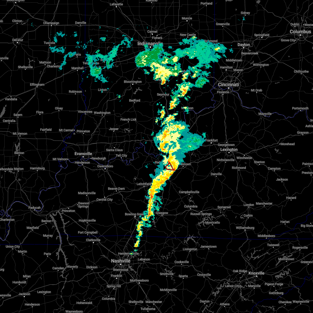 The tornado warning for west central nelson, east central hardin and south central bullitt counties will expire at 1115 pm edt, the storm which prompted the warning has moved out of the area. therefore, the warning will be allowed to expire. to report severe weather, contact your nearest law enforcement agency. they will relay your report to the national weather service louisville. The tornado warning for west central nelson, east central hardin and south central bullitt counties will expire at 1115 pm edt, the storm which prompted the warning has moved out of the area. therefore, the warning will be allowed to expire. to report severe weather, contact your nearest law enforcement agency. they will relay your report to the national weather service louisville.
|
| 3/18/2022 11:00 PM EDT |
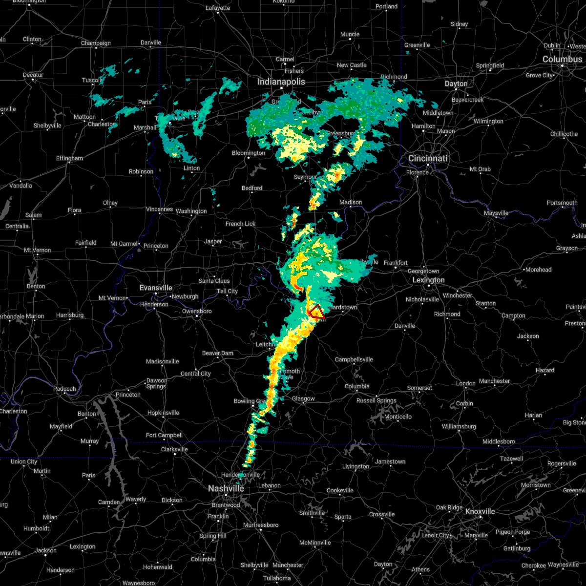 At 1100 pm edt, a severe thunderstorm capable of producing a tornado was located 8 miles northeast of elizabethtown, moving northeast at 40 mph (radar indicated rotation). Hazards include tornado. Flying debris will be dangerous to those caught without shelter. mobile homes will be damaged or destroyed. damage to roofs, windows, and vehicles will occur. tree damage is likely. This tornadic thunderstorm will remain over mainly rural areas of west central nelson, east central hardin and south central bullitt counties, including the following locations, lebanon junction, colesburg and younger creek. At 1100 pm edt, a severe thunderstorm capable of producing a tornado was located 8 miles northeast of elizabethtown, moving northeast at 40 mph (radar indicated rotation). Hazards include tornado. Flying debris will be dangerous to those caught without shelter. mobile homes will be damaged or destroyed. damage to roofs, windows, and vehicles will occur. tree damage is likely. This tornadic thunderstorm will remain over mainly rural areas of west central nelson, east central hardin and south central bullitt counties, including the following locations, lebanon junction, colesburg and younger creek.
|
| 3/18/2022 10:54 PM EDT |
 At 1054 pm edt, a severe thunderstorm capable of producing a tornado was located near elizabethtown, moving northeast at 35 mph (radar indicated rotation). Hazards include tornado. Flying debris will be dangerous to those caught without shelter. mobile homes will be damaged or destroyed. damage to roofs, windows, and vehicles will occur. tree damage is likely. This tornadic thunderstorm will remain over mainly rural areas of west central nelson, east central hardin and south central bullitt counties, including the following locations, lebanon junction, crest, colesburg and younger creek. At 1054 pm edt, a severe thunderstorm capable of producing a tornado was located near elizabethtown, moving northeast at 35 mph (radar indicated rotation). Hazards include tornado. Flying debris will be dangerous to those caught without shelter. mobile homes will be damaged or destroyed. damage to roofs, windows, and vehicles will occur. tree damage is likely. This tornadic thunderstorm will remain over mainly rural areas of west central nelson, east central hardin and south central bullitt counties, including the following locations, lebanon junction, crest, colesburg and younger creek.
|
| 3/18/2022 10:49 PM EDT |
 At 1048 pm edt, a severe thunderstorm capable of producing a tornado was located near elizabethtown, moving northeast at 35 mph (radar indicated rotation). Hazards include tornado. Flying debris will be dangerous to those caught without shelter. mobile homes will be damaged or destroyed. damage to roofs, windows, and vehicles will occur. tree damage is likely. This tornadic thunderstorm will remain over mainly rural areas of west central nelson, east central hardin and south central bullitt counties, including the following locations, lebanon junction, crest, tunnel hills, colesburg, younger creek and radcliff. At 1048 pm edt, a severe thunderstorm capable of producing a tornado was located near elizabethtown, moving northeast at 35 mph (radar indicated rotation). Hazards include tornado. Flying debris will be dangerous to those caught without shelter. mobile homes will be damaged or destroyed. damage to roofs, windows, and vehicles will occur. tree damage is likely. This tornadic thunderstorm will remain over mainly rural areas of west central nelson, east central hardin and south central bullitt counties, including the following locations, lebanon junction, crest, tunnel hills, colesburg, younger creek and radcliff.
|
| 3/18/2022 10:43 PM EDT |
 At 1043 pm edt, a severe thunderstorm capable of producing a tornado was located near elizabethtown, moving northeast at 35 mph (radar indicated rotation). Hazards include tornado. Flying debris will be dangerous to those caught without shelter. mobile homes will be damaged or destroyed. damage to roofs, windows, and vehicles will occur. tree damage is likely. This dangerous storm will be near, elizabethtown around 1050 pm edt. At 1043 pm edt, a severe thunderstorm capable of producing a tornado was located near elizabethtown, moving northeast at 35 mph (radar indicated rotation). Hazards include tornado. Flying debris will be dangerous to those caught without shelter. mobile homes will be damaged or destroyed. damage to roofs, windows, and vehicles will occur. tree damage is likely. This dangerous storm will be near, elizabethtown around 1050 pm edt.
|
| 3/25/2021 7:19 PM EDT |
 At 719 pm edt, a severe thunderstorm was located near bardstown, moving northeast at 75 mph (radar indicated). Hazards include 60 mph wind gusts and quarter size hail. Hail damage to vehicles is expected. expect wind damage to roofs, siding, and trees. Locations impacted include, bardstown, taylorsville, mount washington, wakefield, yoder, highgrove, waterford, samuels field airport, hobbs and smithville. At 719 pm edt, a severe thunderstorm was located near bardstown, moving northeast at 75 mph (radar indicated). Hazards include 60 mph wind gusts and quarter size hail. Hail damage to vehicles is expected. expect wind damage to roofs, siding, and trees. Locations impacted include, bardstown, taylorsville, mount washington, wakefield, yoder, highgrove, waterford, samuels field airport, hobbs and smithville.
|
| 3/25/2021 7:18 PM EDT | Quarter sized hail reported 4.2 miles SW of Boston, KY, quarter sized hail from nws employee family member on hurricane hills lake. |
| 3/25/2021 7:14 PM EDT |
 At 714 pm edt, a severe thunderstorm was located 9 miles southwest of bardstown, moving northeast at 75 mph (radar indicated). Hazards include 60 mph wind gusts and quarter size hail. Hail damage to vehicles is expected. Expect wind damage to roofs, siding, and trees. At 714 pm edt, a severe thunderstorm was located 9 miles southwest of bardstown, moving northeast at 75 mph (radar indicated). Hazards include 60 mph wind gusts and quarter size hail. Hail damage to vehicles is expected. Expect wind damage to roofs, siding, and trees.
|
| 3/25/2021 7:08 PM EDT |
 At 708 pm edt, a severe thunderstorm was located 7 miles northeast of hodgenville, moving northeast at 75 mph (radar indicated). Hazards include 60 mph wind gusts and quarter size hail. Hail damage to vehicles is expected. expect wind damage to roofs, siding, and trees. Locations impacted include, new haven, lyons, gethsemane, athertonville, nelsonville, blue gap, culvertown, roanoke, balltown and younger creek. At 708 pm edt, a severe thunderstorm was located 7 miles northeast of hodgenville, moving northeast at 75 mph (radar indicated). Hazards include 60 mph wind gusts and quarter size hail. Hail damage to vehicles is expected. expect wind damage to roofs, siding, and trees. Locations impacted include, new haven, lyons, gethsemane, athertonville, nelsonville, blue gap, culvertown, roanoke, balltown and younger creek.
|
| 3/25/2021 6:51 PM EDT |
 At 651 pm edt, a severe thunderstorm was located 8 miles north of munfordville, moving northeast at 75 mph (radar indicated). Hazards include 70 mph wind gusts and half dollar size hail. Hail damage to vehicles is expected. expect considerable tree damage. Wind damage is also likely to mobile homes, roofs, and outbuildings. At 651 pm edt, a severe thunderstorm was located 8 miles north of munfordville, moving northeast at 75 mph (radar indicated). Hazards include 70 mph wind gusts and half dollar size hail. Hail damage to vehicles is expected. expect considerable tree damage. Wind damage is also likely to mobile homes, roofs, and outbuildings.
|
| 4/8/2020 9:40 PM CDT |
 At 1040 pm edt/940 pm cdt/, severe thunderstorms were located along a line extending from near brandenburg to 6 miles east of whitesville, moving east at 55 mph (radar indicated). Hazards include 60 mph wind gusts. expect damage to roofs, siding, and trees At 1040 pm edt/940 pm cdt/, severe thunderstorms were located along a line extending from near brandenburg to 6 miles east of whitesville, moving east at 55 mph (radar indicated). Hazards include 60 mph wind gusts. expect damage to roofs, siding, and trees
|
| 8/20/2019 5:05 PM EDT |
 At 504 pm edt/404 pm cdt/, a severe thunderstorm was located 8 miles west of elizabethtown, moving east at 45 mph (radar indicated). Hazards include 60 mph wind gusts. expect damage to roofs, siding, and trees At 504 pm edt/404 pm cdt/, a severe thunderstorm was located 8 miles west of elizabethtown, moving east at 45 mph (radar indicated). Hazards include 60 mph wind gusts. expect damage to roofs, siding, and trees
|
| 6/23/2019 4:56 PM EDT |
 At 456 pm edt, a severe thunderstorm was located near elizabethtown, moving northeast at 40 mph (radar indicated). Hazards include 60 mph wind gusts and penny size hail. expect damage to roofs, siding, and trees At 456 pm edt, a severe thunderstorm was located near elizabethtown, moving northeast at 40 mph (radar indicated). Hazards include 60 mph wind gusts and penny size hail. expect damage to roofs, siding, and trees
|
| 4/14/2019 3:28 PM EDT |
 At 328 pm edt, a severe thunderstorm was located near elizabethtown, moving northeast at 55 mph (radar indicated). Hazards include 60 mph wind gusts and penny size hail. expect damage to roofs, siding, and trees At 328 pm edt, a severe thunderstorm was located near elizabethtown, moving northeast at 55 mph (radar indicated). Hazards include 60 mph wind gusts and penny size hail. expect damage to roofs, siding, and trees
|
| 10/31/2018 6:06 PM EDT |
 At 606 pm edt, a severe thunderstorm capable of producing a tornado was located 11 miles northeast of elizabethtown, moving east at 30 mph (radar indicated rotation). Hazards include tornado. Flying debris will be dangerous to those caught without shelter. mobile homes will be damaged or destroyed. damage to roofs, windows, and vehicles will occur. Tree damage is likely. At 606 pm edt, a severe thunderstorm capable of producing a tornado was located 11 miles northeast of elizabethtown, moving east at 30 mph (radar indicated rotation). Hazards include tornado. Flying debris will be dangerous to those caught without shelter. mobile homes will be damaged or destroyed. damage to roofs, windows, and vehicles will occur. Tree damage is likely.
|
| 10/31/2018 6:03 PM EDT | Tree down blocking boston rd near the hardin county line. time estimated from rada in nelson county KY, 1.5 miles NE of Boston, KY |
| 10/31/2018 5:54 PM EDT |
 At 553 pm edt, a severe thunderstorm was located near elizabethtown, moving east at 35 mph (radar indicated). Hazards include 60 mph wind gusts. Expect damage to roofs, siding, and trees. Locations impacted include, elizabethtown, nelsonville, crest, tunnel hills, colesburg and younger creek. At 553 pm edt, a severe thunderstorm was located near elizabethtown, moving east at 35 mph (radar indicated). Hazards include 60 mph wind gusts. Expect damage to roofs, siding, and trees. Locations impacted include, elizabethtown, nelsonville, crest, tunnel hills, colesburg and younger creek.
|
| 10/31/2018 5:41 PM EDT |
 At 541 pm edt, a severe thunderstorm was located near elizabethtown, moving east at 35 mph (radar indicated). Hazards include 60 mph wind gusts. expect damage to roofs, siding, and trees At 541 pm edt, a severe thunderstorm was located near elizabethtown, moving east at 35 mph (radar indicated). Hazards include 60 mph wind gusts. expect damage to roofs, siding, and trees
|
| 8/15/2018 8:31 PM EDT |
 At 830 pm edt, severe thunderstorms were located along a line extending from jeffersontown to near elizabethtown, moving east at 40 mph (a 53 mph wind gust was recroded at louisville international airport at 826 pm). Hazards include 60 mph wind gusts. expect damage to roofs, siding, and trees At 830 pm edt, severe thunderstorms were located along a line extending from jeffersontown to near elizabethtown, moving east at 40 mph (a 53 mph wind gust was recroded at louisville international airport at 826 pm). Hazards include 60 mph wind gusts. expect damage to roofs, siding, and trees
|
| 8/15/2018 8:07 PM EDT |
 At 807 pm edt, severe thunderstorms were located along a line extending from st. dennis to 11 miles north of leitchfield, moving east at 40 mph (radar indicated). Hazards include 60 mph wind gusts. expect damage to roofs, siding, and trees At 807 pm edt, severe thunderstorms were located along a line extending from st. dennis to 11 miles north of leitchfield, moving east at 40 mph (radar indicated). Hazards include 60 mph wind gusts. expect damage to roofs, siding, and trees
|
| 8/7/2018 4:09 PM EDT |
 At 350 pm edt, a severe thunderstorm was located near elizabethtown, moving east at 35 mph (radar indicated). Hazards include 60 mph wind gusts and quarter size hail. Hail damage to vehicles is expected. Expect wind damage to roofs, siding, and trees. At 350 pm edt, a severe thunderstorm was located near elizabethtown, moving east at 35 mph (radar indicated). Hazards include 60 mph wind gusts and quarter size hail. Hail damage to vehicles is expected. Expect wind damage to roofs, siding, and trees.
|
| 8/7/2018 3:50 PM EDT |
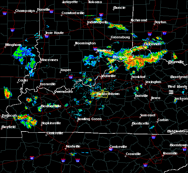 At 350 pm edt, a severe thunderstorm was located near elizabethtown, moving east at 35 mph (radar indicated). Hazards include 60 mph wind gusts and quarter size hail. Hail damage to vehicles is expected. Expect wind damage to roofs, siding, and trees. At 350 pm edt, a severe thunderstorm was located near elizabethtown, moving east at 35 mph (radar indicated). Hazards include 60 mph wind gusts and quarter size hail. Hail damage to vehicles is expected. Expect wind damage to roofs, siding, and trees.
|
| 7/20/2018 11:01 PM EDT |
 At 1100 pm edt, severe thunderstorms were located along a line extending from 6 miles southwest of shepherdsville to 6 miles north of elizabethtown to 18 miles northwest of hodgenville, moving southeast at 45 mph (radar indicated). Hazards include 70 mph wind gusts and quarter size hail. Hail damage to vehicles is expected. expect considerable tree damage. Wind damage is also likely to mobile homes, roofs, and outbuildings. At 1100 pm edt, severe thunderstorms were located along a line extending from 6 miles southwest of shepherdsville to 6 miles north of elizabethtown to 18 miles northwest of hodgenville, moving southeast at 45 mph (radar indicated). Hazards include 70 mph wind gusts and quarter size hail. Hail damage to vehicles is expected. expect considerable tree damage. Wind damage is also likely to mobile homes, roofs, and outbuildings.
|
| 7/20/2018 4:44 PM EDT |
 At 443 pm edt, a severe thunderstorm was located 7 miles southwest of bardstown, moving east at 35 mph (radar indicated). Hazards include 60 mph wind gusts and half dollar size hail. Hail damage to vehicles is expected. Expect wind damage to roofs, siding, and trees. At 443 pm edt, a severe thunderstorm was located 7 miles southwest of bardstown, moving east at 35 mph (radar indicated). Hazards include 60 mph wind gusts and half dollar size hail. Hail damage to vehicles is expected. Expect wind damage to roofs, siding, and trees.
|
| 6/26/2018 1:41 PM EDT |
 The severe thunderstorm warning for west central nelson, northwestern larue and southeastern hardin counties will expire at 145 pm edt, the storm which prompted the warning has moved out of the area. therefore the warning will be allowed to expire. a severe thunderstorm watch remains in effect until 400 pm edt for central kentucky. report severe weather to local law enforcement, post your report to the national weather service louisville facebook page, or tweet your report using hashtag l, m, k, spotter. The severe thunderstorm warning for west central nelson, northwestern larue and southeastern hardin counties will expire at 145 pm edt, the storm which prompted the warning has moved out of the area. therefore the warning will be allowed to expire. a severe thunderstorm watch remains in effect until 400 pm edt for central kentucky. report severe weather to local law enforcement, post your report to the national weather service louisville facebook page, or tweet your report using hashtag l, m, k, spotter.
|
| 6/26/2018 1:32 PM EDT |
 At 131 pm edt, severe thunderstorms were located along a line extending from 7 miles southeast of shepherdsville to 10 miles south of bardstown to 9 miles northwest of campbellsville, moving northeast at 45 mph (radar indicated). Hazards include 60 mph wind gusts. expect damage to roofs, siding, and trees At 131 pm edt, severe thunderstorms were located along a line extending from 7 miles southeast of shepherdsville to 10 miles south of bardstown to 9 miles northwest of campbellsville, moving northeast at 45 mph (radar indicated). Hazards include 60 mph wind gusts. expect damage to roofs, siding, and trees
|
| 6/26/2018 1:08 PM EDT |
 At 107 pm edt, a severe thunderstorm was located over elizabethtown, moving northeast at 30 mph (radar indicated). Hazards include 60 mph wind gusts. expect damage to roofs, siding, and trees At 107 pm edt, a severe thunderstorm was located over elizabethtown, moving northeast at 30 mph (radar indicated). Hazards include 60 mph wind gusts. expect damage to roofs, siding, and trees
|
| 6/12/2018 6:30 PM EDT |
 At 630 pm edt, a severe thunderstorm was located 10 miles northeast of elizabethtown, moving east at 15 mph (trained weather spotters). Hazards include 60 mph wind gusts and penny size hail. expect damage to roofs, siding, and trees At 630 pm edt, a severe thunderstorm was located 10 miles northeast of elizabethtown, moving east at 15 mph (trained weather spotters). Hazards include 60 mph wind gusts and penny size hail. expect damage to roofs, siding, and trees
|
| 6/12/2018 6:20 PM EDT | Broadcast media relayed a public report of a small shed destroyed near bosto in nelson county KY, 1.1 miles WSW of Boston, KY |
| 5/31/2018 3:07 PM EDT |
 At 305 pm edt, severe thunderstorms were located along a line extending from 6 miles northeast of taylorsville to 10 miles west of lebanon, moving southeast at 45 mph (radar indicated). Hazards include 70 mph wind gusts. Expect considerable tree damage. damage is likely to mobile homes, roofs, and outbuildings. locations impacted include, jeffersontown, shelbyville, bardstown, shepherdsville, lyndon, middletown, douglass hills, hurstbourne, springfield and anchorage. wind damage has been reported from these storms as they passed through jefferson and bullitt counties. The strongest winds at 305 pm were east of taylorsville lake in spencer county. At 305 pm edt, severe thunderstorms were located along a line extending from 6 miles northeast of taylorsville to 10 miles west of lebanon, moving southeast at 45 mph (radar indicated). Hazards include 70 mph wind gusts. Expect considerable tree damage. damage is likely to mobile homes, roofs, and outbuildings. locations impacted include, jeffersontown, shelbyville, bardstown, shepherdsville, lyndon, middletown, douglass hills, hurstbourne, springfield and anchorage. wind damage has been reported from these storms as they passed through jefferson and bullitt counties. The strongest winds at 305 pm were east of taylorsville lake in spencer county.
|
| 5/31/2018 2:44 PM EDT |
 At 243 pm edt, severe thunderstorms were located along a line extending from woodland hills to 10 miles east of elizabethtown, moving southeast at 45 mph (radar indicated). Hazards include 70 mph wind gusts. Expect considerable tree damage. Damage is likely to mobile homes, roofs, and outbuildings. At 243 pm edt, severe thunderstorms were located along a line extending from woodland hills to 10 miles east of elizabethtown, moving southeast at 45 mph (radar indicated). Hazards include 70 mph wind gusts. Expect considerable tree damage. Damage is likely to mobile homes, roofs, and outbuildings.
|
| 4/3/2018 8:19 PM EDT |
 At 818 pm edt, a severe thunderstorm was located 9 miles south of shepherdsville, moving east at 50 mph (radar indicated). Hazards include 60 mph wind gusts and nickel size hail. Expect damage to roofs, siding, and trees. locations impacted include, bardstown, ridgetop, east bardstown, highgrove, solitude, samuels field airport, hobbs, smithville, scuffletown and deatsville. A tornado watch remains in effect until 100 am edt for central kentucky. At 818 pm edt, a severe thunderstorm was located 9 miles south of shepherdsville, moving east at 50 mph (radar indicated). Hazards include 60 mph wind gusts and nickel size hail. Expect damage to roofs, siding, and trees. locations impacted include, bardstown, ridgetop, east bardstown, highgrove, solitude, samuels field airport, hobbs, smithville, scuffletown and deatsville. A tornado watch remains in effect until 100 am edt for central kentucky.
|
| 4/3/2018 8:12 PM EDT |
 At 811 pm edt, a severe thunderstorm was located 9 miles northeast of elizabethtown, moving east at 50 mph (radar indicated). Hazards include ping pong ball size hail and 60 mph wind gusts. People and animals outdoors will be injured. expect hail damage to roofs, siding, windows, and vehicles. Expect wind damage to roofs, siding, and trees. At 811 pm edt, a severe thunderstorm was located 9 miles northeast of elizabethtown, moving east at 50 mph (radar indicated). Hazards include ping pong ball size hail and 60 mph wind gusts. People and animals outdoors will be injured. expect hail damage to roofs, siding, windows, and vehicles. Expect wind damage to roofs, siding, and trees.
|
| 4/3/2018 8:04 PM EDT |
 At 803 pm edt, a severe thunderstorm was located 8 miles southwest of shepherdsville, moving east at 50 mph (radar indicated). Hazards include golf ball size hail and 70 mph wind gusts. People and animals outdoors will be injured. expect hail damage to roofs, siding, windows, and vehicles. expect considerable tree damage. wind damage is also likely to mobile homes, roofs, and outbuildings. locations impacted include, elizabethtown, radcliff, lebanon junction, crest, long view, belmont, rogersville, tunnel hills, clermont and colesburg. A tornado watch remains in effect until 100 am edt for central kentucky. At 803 pm edt, a severe thunderstorm was located 8 miles southwest of shepherdsville, moving east at 50 mph (radar indicated). Hazards include golf ball size hail and 70 mph wind gusts. People and animals outdoors will be injured. expect hail damage to roofs, siding, windows, and vehicles. expect considerable tree damage. wind damage is also likely to mobile homes, roofs, and outbuildings. locations impacted include, elizabethtown, radcliff, lebanon junction, crest, long view, belmont, rogersville, tunnel hills, clermont and colesburg. A tornado watch remains in effect until 100 am edt for central kentucky.
|
| 4/3/2018 7:58 PM EDT |
 At 758 pm edt, a severe thunderstorm was located 13 miles southwest of shepherdsville, moving east at 50 mph (radar indicated). Hazards include two inch hail and 70 mph wind gusts. People and animals outdoors will be injured. expect hail damage to roofs, siding, windows, and vehicles. expect considerable tree damage. wind damage is also likely to mobile homes, roofs, and outbuildings. locations impacted include, elizabethtown, radcliff, vine grove, lebanon junction, long view, belmont, younger creek, crest, rogersville and tunnel hills. A tornado watch remains in effect until 100 am edt for central kentucky. At 758 pm edt, a severe thunderstorm was located 13 miles southwest of shepherdsville, moving east at 50 mph (radar indicated). Hazards include two inch hail and 70 mph wind gusts. People and animals outdoors will be injured. expect hail damage to roofs, siding, windows, and vehicles. expect considerable tree damage. wind damage is also likely to mobile homes, roofs, and outbuildings. locations impacted include, elizabethtown, radcliff, vine grove, lebanon junction, long view, belmont, younger creek, crest, rogersville and tunnel hills. A tornado watch remains in effect until 100 am edt for central kentucky.
|
| 4/3/2018 7:51 PM EDT |
 At 749 pm edt, a severe thunderstorm was located 12 miles southeast of brandenburg, moving east at 50 mph (radar indicated. at 745 pm edt, a rotating wall cloud was reported at mile marker 107 on the western kentucky parkway). Hazards include golf ball size hail and 70 mph wind gusts. People and animals outdoors will be injured. expect hail damage to roofs, siding, windows, and vehicles. expect considerable tree damage. wind damage is also likely to mobile homes, roofs, and outbuildings. locations impacted include, elizabethtown, shepherdsville, radcliff, vine grove, lebanon junction, muldraugh, bardstown junction, long view, belmont and grahamton. A tornado watch remains in effect until 100 am edt for central kentucky. At 749 pm edt, a severe thunderstorm was located 12 miles southeast of brandenburg, moving east at 50 mph (radar indicated. at 745 pm edt, a rotating wall cloud was reported at mile marker 107 on the western kentucky parkway). Hazards include golf ball size hail and 70 mph wind gusts. People and animals outdoors will be injured. expect hail damage to roofs, siding, windows, and vehicles. expect considerable tree damage. wind damage is also likely to mobile homes, roofs, and outbuildings. locations impacted include, elizabethtown, shepherdsville, radcliff, vine grove, lebanon junction, muldraugh, bardstown junction, long view, belmont and grahamton. A tornado watch remains in effect until 100 am edt for central kentucky.
|
| 4/3/2018 7:36 PM EDT |
 At 736 pm edt/636 pm cdt/, a severe thunderstorm was located 11 miles east of hardinsburg, moving east at 50 mph (radar indicated). Hazards include golf ball size hail and 70 mph wind gusts. People and animals outdoors will be injured. expect hail damage to roofs, siding, windows, and vehicles. expect considerable tree damage. Wind damage is also likely to mobile homes, roofs, and outbuildings. At 736 pm edt/636 pm cdt/, a severe thunderstorm was located 11 miles east of hardinsburg, moving east at 50 mph (radar indicated). Hazards include golf ball size hail and 70 mph wind gusts. People and animals outdoors will be injured. expect hail damage to roofs, siding, windows, and vehicles. expect considerable tree damage. Wind damage is also likely to mobile homes, roofs, and outbuildings.
|
| 2/24/2018 11:13 PM EST |
 At 1112 pm est, severe thunderstorms were located along a line extending from 6 miles east of middletown to 10 miles south of shepherdsville, moving east at 55 mph (radar indicated). Hazards include 60 mph wind gusts. Expect damage to roofs, siding, and trees. Locations impacted include, jeffersontown, shelbyville, shepherdsville, middletown, douglass hills, pioneer village, hollow creek, woodland hills, spring mill and highview. At 1112 pm est, severe thunderstorms were located along a line extending from 6 miles east of middletown to 10 miles south of shepherdsville, moving east at 55 mph (radar indicated). Hazards include 60 mph wind gusts. Expect damage to roofs, siding, and trees. Locations impacted include, jeffersontown, shelbyville, shepherdsville, middletown, douglass hills, pioneer village, hollow creek, woodland hills, spring mill and highview.
|
| 2/24/2018 10:44 PM EST |
 At 1043 pm est, severe thunderstorms were located along a line extending from st. dennis to 14 miles east of hardinsburg, moving east at 55 mph (radar indicated). Hazards include 60 mph wind gusts. expect damage to roofs, siding, and trees At 1043 pm est, severe thunderstorms were located along a line extending from st. dennis to 14 miles east of hardinsburg, moving east at 55 mph (radar indicated). Hazards include 60 mph wind gusts. expect damage to roofs, siding, and trees
|
| 11/18/2017 5:42 PM EST |
 The severe thunderstorm warning for central nelson county will expire at 545 pm est, the storm which prompted the warning has moved out of the area. therefore the warning will be allowed to expire. however gusty winds are still possible. a severe thunderstorm watch remains in effect until 800 pm est for central kentucky. report severe weather to local law enforcement, post your report to the national weather service louisville facebook page, or tweet your report using hashtag l, m, k, spotter. The severe thunderstorm warning for central nelson county will expire at 545 pm est, the storm which prompted the warning has moved out of the area. therefore the warning will be allowed to expire. however gusty winds are still possible. a severe thunderstorm watch remains in effect until 800 pm est for central kentucky. report severe weather to local law enforcement, post your report to the national weather service louisville facebook page, or tweet your report using hashtag l, m, k, spotter.
|
| 11/18/2017 5:24 PM EST |
 At 524 pm est, a severe thunderstorm was located 8 miles southwest of bardstown, moving east at 50 mph (radar indicated). Hazards include 60 mph wind gusts and penny size hail. expect damage to roofs, siding, and trees At 524 pm est, a severe thunderstorm was located 8 miles southwest of bardstown, moving east at 50 mph (radar indicated). Hazards include 60 mph wind gusts and penny size hail. expect damage to roofs, siding, and trees
|
| 5/11/2017 3:11 PM EDT |
 At 311 pm edt, a severe thunderstorm was located near bardstown, moving east at 35 mph (radar indicated). Hazards include 60 mph wind gusts. expect damage to roofs, siding, and trees At 311 pm edt, a severe thunderstorm was located near bardstown, moving east at 35 mph (radar indicated). Hazards include 60 mph wind gusts. expect damage to roofs, siding, and trees
|
| 4/5/2017 5:48 PM EDT |
 At 548 pm edt, a severe thunderstorm capable of producing a tornado was located 7 miles south of shepherdsville, moving northeast at 50 mph (radar indicated rotation). Hazards include tornado and ping pong ball size hail. Flying debris will be dangerous to those caught without shelter. mobile homes will be damaged or destroyed. damage to roofs, windows, and vehicles will occur. tree damage is likely. Locations impacted include, shepherdsville, lebanon junction, ridgetop, bardstown junction, hobbs, scuffletown, deatsville, belmont, lotus and samuels. At 548 pm edt, a severe thunderstorm capable of producing a tornado was located 7 miles south of shepherdsville, moving northeast at 50 mph (radar indicated rotation). Hazards include tornado and ping pong ball size hail. Flying debris will be dangerous to those caught without shelter. mobile homes will be damaged or destroyed. damage to roofs, windows, and vehicles will occur. tree damage is likely. Locations impacted include, shepherdsville, lebanon junction, ridgetop, bardstown junction, hobbs, scuffletown, deatsville, belmont, lotus and samuels.
|
| 4/5/2017 5:47 PM EDT | Quarter sized hail reported 0.5 miles WNW of Boston, KY |
| 4/5/2017 5:45 PM EDT | Golf Ball sized hail reported 0.5 miles WNW of Boston, KY |
| 4/5/2017 5:38 PM EDT |
 At 537 pm edt, a severe thunderstorm capable of producing a tornado was located 7 miles northeast of elizabethtown, moving northeast at 50 mph. a mobile home was blown over in elizabethtown at 530 pm edt (radar indicated rotation). Hazards include tornado and ping pong ball size hail. Flying debris will be dangerous to those caught without shelter. mobile homes will be damaged or destroyed. damage to roofs, windows, and vehicles will occur. tree damage is likely. Locations impacted include, elizabethtown, shepherdsville, lebanon junction, ridgetop, bardstown junction, hobbs, scuffletown, deatsville, belmont and lotus. At 537 pm edt, a severe thunderstorm capable of producing a tornado was located 7 miles northeast of elizabethtown, moving northeast at 50 mph. a mobile home was blown over in elizabethtown at 530 pm edt (radar indicated rotation). Hazards include tornado and ping pong ball size hail. Flying debris will be dangerous to those caught without shelter. mobile homes will be damaged or destroyed. damage to roofs, windows, and vehicles will occur. tree damage is likely. Locations impacted include, elizabethtown, shepherdsville, lebanon junction, ridgetop, bardstown junction, hobbs, scuffletown, deatsville, belmont and lotus.
|
| 4/5/2017 5:28 PM EDT |
 At 528 pm edt, a severe thunderstorm capable of producing a tornado was located over elizabethtown, moving northeast at 50 mph (radar indicated rotation). Hazards include tornado and golf ball size hail. Flying debris will be dangerous to those caught without shelter. mobile homes will be damaged or destroyed. damage to roofs, windows, and vehicles will occur. Tree damage is likely. At 528 pm edt, a severe thunderstorm capable of producing a tornado was located over elizabethtown, moving northeast at 50 mph (radar indicated rotation). Hazards include tornado and golf ball size hail. Flying debris will be dangerous to those caught without shelter. mobile homes will be damaged or destroyed. damage to roofs, windows, and vehicles will occur. Tree damage is likely.
|
| 3/30/2017 8:52 PM EDT |
 At 851 pm edt, a severe thunderstorm was located near shepherdsville, moving northeast at 35 mph (public and spotter reports along interstate 65 in hardin county). Hazards include 60 mph wind gusts and quarter size hail. Hail damage to vehicles is expected. expect wind damage to roofs, siding, and trees. Locations impacted include, shepherdsville, mount washington, lebanon junction, hebron estates, ridgetop, solitude, bardstown junction, hobbs, scuffletown and deatsville. At 851 pm edt, a severe thunderstorm was located near shepherdsville, moving northeast at 35 mph (public and spotter reports along interstate 65 in hardin county). Hazards include 60 mph wind gusts and quarter size hail. Hail damage to vehicles is expected. expect wind damage to roofs, siding, and trees. Locations impacted include, shepherdsville, mount washington, lebanon junction, hebron estates, ridgetop, solitude, bardstown junction, hobbs, scuffletown and deatsville.
|
| 3/30/2017 8:35 PM EDT |
 At 835 pm edt, a severe thunderstorm was located 9 miles northeast of elizabethtown, moving northeast at 35 mph (radar indicated). Hazards include 60 mph wind gusts and quarter size hail. Hail damage to vehicles is expected. Expect wind damage to roofs, siding, and trees. At 835 pm edt, a severe thunderstorm was located 9 miles northeast of elizabethtown, moving northeast at 35 mph (radar indicated). Hazards include 60 mph wind gusts and quarter size hail. Hail damage to vehicles is expected. Expect wind damage to roofs, siding, and trees.
|
| 3/1/2017 7:14 AM EST |
 At 713 am est, severe thunderstorms were located along a line extending from near shelbyville to 7 miles east of elizabethtown, moving southeast at 45 mph (radar indicated). Hazards include 60 mph wind gusts. Expect damage to roofs, siding, and trees. locations impacted include, shelbyville, bardstown, shepherdsville, taylorsville, radcliff, mount washington, vine grove, simpsonville, lebanon junction and new haven. a tornado watch remains in effect until 900 am est for central kentucky. A tornado watch also remains in effect until 1100 am est for central kentucky. At 713 am est, severe thunderstorms were located along a line extending from near shelbyville to 7 miles east of elizabethtown, moving southeast at 45 mph (radar indicated). Hazards include 60 mph wind gusts. Expect damage to roofs, siding, and trees. locations impacted include, shelbyville, bardstown, shepherdsville, taylorsville, radcliff, mount washington, vine grove, simpsonville, lebanon junction and new haven. a tornado watch remains in effect until 900 am est for central kentucky. A tornado watch also remains in effect until 1100 am est for central kentucky.
|
| 3/1/2017 6:46 AM EST |
 At 646 am est, severe thunderstorms were located along a line extending from creekside to 10 miles south of brandenburg, moving southeast at 50 mph (radar indicated). Hazards include 60 mph wind gusts and quarter size hail. Hail damage to vehicles is expected. Expect wind damage to roofs, siding, and trees. At 646 am est, severe thunderstorms were located along a line extending from creekside to 10 miles south of brandenburg, moving southeast at 50 mph (radar indicated). Hazards include 60 mph wind gusts and quarter size hail. Hail damage to vehicles is expected. Expect wind damage to roofs, siding, and trees.
|
| 3/1/2017 2:17 AM EST |
 At 217 am est, a severe thunderstorm was located near elizabethtown, moving northeast at 55 mph (radar indicated). Hazards include 60 mph wind gusts and quarter size hail. Hail damage to vehicles is expected. Expect wind damage to roofs, siding, and trees. At 217 am est, a severe thunderstorm was located near elizabethtown, moving northeast at 55 mph (radar indicated). Hazards include 60 mph wind gusts and quarter size hail. Hail damage to vehicles is expected. Expect wind damage to roofs, siding, and trees.
|
| 7/7/2016 5:04 PM EDT |
 At 504 pm edt, severe thunderstorms were located along a line extending from 8 miles south of shepherdsville to 10 miles southeast of hodgenville, moving northeast at 45 mph (radar indicated). Hazards include 60 mph wind gusts and penny size hail. Expect damage to roofs. siding. and trees. Locations impacted include, lebanon junction, new haven, white rose, cravens, new hope, stiles, attilla, nelsonville, roanoke and hibernia. At 504 pm edt, severe thunderstorms were located along a line extending from 8 miles south of shepherdsville to 10 miles southeast of hodgenville, moving northeast at 45 mph (radar indicated). Hazards include 60 mph wind gusts and penny size hail. Expect damage to roofs. siding. and trees. Locations impacted include, lebanon junction, new haven, white rose, cravens, new hope, stiles, attilla, nelsonville, roanoke and hibernia.
|
| 7/7/2016 4:55 PM EDT |
 At 455 pm edt/355 pm cdt/, severe thunderstorms were located along a line extending from 9 miles northeast of elizabethtown to 9 miles southeast of hodgenville, moving east at 45 mph (radar indicated). Hazards include 60 mph wind gusts and penny size hail. Expect damage to roofs. siding. and trees. Locations impacted include, elizabethtown, hodgenville, radcliff, lebanon junction, new haven, sonora, white rose, wards, crest and cravens. At 455 pm edt/355 pm cdt/, severe thunderstorms were located along a line extending from 9 miles northeast of elizabethtown to 9 miles southeast of hodgenville, moving east at 45 mph (radar indicated). Hazards include 60 mph wind gusts and penny size hail. Expect damage to roofs. siding. and trees. Locations impacted include, elizabethtown, hodgenville, radcliff, lebanon junction, new haven, sonora, white rose, wards, crest and cravens.
|
| 7/7/2016 4:36 PM EDT |
 At 435 pm edt/335 pm cdt/, severe thunderstorms were located along a line extending from 12 miles northwest of elizabethtown to 12 miles north of munfordville, moving northeast at 45 mph (radar indicated). Hazards include 60 mph wind gusts and penny size hail. Expect damage to roofs. siding. And trees. At 435 pm edt/335 pm cdt/, severe thunderstorms were located along a line extending from 12 miles northwest of elizabethtown to 12 miles north of munfordville, moving northeast at 45 mph (radar indicated). Hazards include 60 mph wind gusts and penny size hail. Expect damage to roofs. siding. And trees.
|
| 7/6/2016 3:36 PM EDT |
 At 336 pm edt, a severe thunderstorm was located near elizabethtown, moving northeast at 35 mph (radar indicated). Hazards include 60 mph wind gusts and penny size hail. Expect damage to roofs. siding. And trees. At 336 pm edt, a severe thunderstorm was located near elizabethtown, moving northeast at 35 mph (radar indicated). Hazards include 60 mph wind gusts and penny size hail. Expect damage to roofs. siding. And trees.
|
| 6/23/2016 6:11 PM EDT |
 At 611 pm edt, severe thunderstorms were located along a line extending from 8 miles north of springfield to 7 miles southeast of bardstown to 10 miles northeast of elizabethtown, moving southeast at 40 mph (radar indicated). Hazards include 60 mph wind gusts. Expect damage to roofs. siding. And trees. At 611 pm edt, severe thunderstorms were located along a line extending from 8 miles north of springfield to 7 miles southeast of bardstown to 10 miles northeast of elizabethtown, moving southeast at 40 mph (radar indicated). Hazards include 60 mph wind gusts. Expect damage to roofs. siding. And trees.
|
| 6/23/2016 5:51 PM EDT |
 At 551 pm edt, severe thunderstorms were located along a line extending from 10 miles southwest of taylorsville to 6 miles northwest of bardstown to 8 miles southwest of shepherdsville, moving southeast at 30 mph (radar indicated). Hazards include 60 mph wind gusts and quarter size hail. Hail damage to vehicles is expected. Expect wind damage to roofs, siding, and trees. At 551 pm edt, severe thunderstorms were located along a line extending from 10 miles southwest of taylorsville to 6 miles northwest of bardstown to 8 miles southwest of shepherdsville, moving southeast at 30 mph (radar indicated). Hazards include 60 mph wind gusts and quarter size hail. Hail damage to vehicles is expected. Expect wind damage to roofs, siding, and trees.
|
| 6/15/2016 4:53 PM EDT |
 The severe thunderstorm warning for east central hardin, west central nelson and north central larue counties will expire at 500 pm edt, the storm which prompted the warning has weakened below severe limits and exited the warned area. therefore the warning will be allowed to expire. a severe thunderstorm watch remains in effect until 1000 pm edt for central kentucky. The severe thunderstorm warning for east central hardin, west central nelson and north central larue counties will expire at 500 pm edt, the storm which prompted the warning has weakened below severe limits and exited the warned area. therefore the warning will be allowed to expire. a severe thunderstorm watch remains in effect until 1000 pm edt for central kentucky.
|
| 6/15/2016 4:49 PM EDT |
 At 448 pm edt, a severe thunderstorm was located 9 miles northeast of hodgenville, moving southeast at 25 mph (radar indicated). Hazards include 60 mph wind gusts and penny size hail. Expect damage to roofs. siding. and trees. Locations impacted include, lebanon junction, colesburg, balltown, younger creek, nelsonville, roanoke and crest. At 448 pm edt, a severe thunderstorm was located 9 miles northeast of hodgenville, moving southeast at 25 mph (radar indicated). Hazards include 60 mph wind gusts and penny size hail. Expect damage to roofs. siding. and trees. Locations impacted include, lebanon junction, colesburg, balltown, younger creek, nelsonville, roanoke and crest.
|
| 6/15/2016 4:28 PM EDT |
 At 428 pm edt, a severe thunderstorm was located 9 miles northeast of elizabethtown, moving southeast at 25 mph (radar indicated). Hazards include 60 mph wind gusts and penny size hail. Expect damage to roofs. siding. And trees. At 428 pm edt, a severe thunderstorm was located 9 miles northeast of elizabethtown, moving southeast at 25 mph (radar indicated). Hazards include 60 mph wind gusts and penny size hail. Expect damage to roofs. siding. And trees.
|
| 5/11/2016 9:34 PM EDT |
 At 934 pm edt, a severe thunderstorm was located near bardstown, moving east at 20 mph (radar indicated). Hazards include 60 mph wind gusts and quarter size hail. Hail damage to vehicles is expected. expect wind damage to roofs, siding, and trees. Locations impacted include, bardstown, bloomfield, bourbon springs, botland, hunters, cravens, samuels field airport, withrow, balltown and east bardstown. At 934 pm edt, a severe thunderstorm was located near bardstown, moving east at 20 mph (radar indicated). Hazards include 60 mph wind gusts and quarter size hail. Hail damage to vehicles is expected. expect wind damage to roofs, siding, and trees. Locations impacted include, bardstown, bloomfield, bourbon springs, botland, hunters, cravens, samuels field airport, withrow, balltown and east bardstown.
|
| 5/11/2016 9:14 PM EDT |
 At 913 pm edt, a severe thunderstorm was located 10 miles south of shepherdsville, moving east at 20 mph (radar indicated). Hazards include 60 mph wind gusts and quarter size hail. Hail damage to vehicles is expected. Expect wind damage to roofs, siding, and trees. At 913 pm edt, a severe thunderstorm was located 10 miles south of shepherdsville, moving east at 20 mph (radar indicated). Hazards include 60 mph wind gusts and quarter size hail. Hail damage to vehicles is expected. Expect wind damage to roofs, siding, and trees.
|
| 5/10/2016 4:35 PM EDT | Quarter sized hail reported 0.5 miles WNW of Boston, KY |
| 5/10/2016 4:25 PM EDT |
 At 425 pm edt, a severe thunderstorm was located near elizabethtown, moving east at 35 mph (radar indicated). Hazards include 60 mph wind gusts and quarter size hail. Hail damage to vehicles is expected. Expect wind damage to roofs, siding, and trees. At 425 pm edt, a severe thunderstorm was located near elizabethtown, moving east at 35 mph (radar indicated). Hazards include 60 mph wind gusts and quarter size hail. Hail damage to vehicles is expected. Expect wind damage to roofs, siding, and trees.
|
| 5/10/2016 4:14 PM EDT |
 At 414 pm edt, a severe thunderstorm was located 10 miles south of shepherdsville, moving east at 35 mph (radar indicated). Hazards include 60 mph wind gusts and quarter size hail. Hail damage to vehicles is expected. Expect wind damage to roofs, siding, and trees. At 414 pm edt, a severe thunderstorm was located 10 miles south of shepherdsville, moving east at 35 mph (radar indicated). Hazards include 60 mph wind gusts and quarter size hail. Hail damage to vehicles is expected. Expect wind damage to roofs, siding, and trees.
|
| 5/10/2016 4:13 PM EDT | The severe thunderstorm warning for northeastern hardin, west central nelson, southwestern bullitt and north central larue counties will expire at 415 pm edt, the storm which prompted the warning has moved out of the area. therefore the warning will be allowed to expire. a severe thunderstorm watch remains in effect until 800 pm edt for central kentucky. |
| 5/10/2016 3:54 PM EDT |
 At 354 pm edt, a severe thunderstorm was located 9 miles northwest of elizabethtown, moving east at 30 mph (radar indicated). Hazards include golf ball size hail and 60 mph wind gusts. People and animals outdoors will be injured. expect hail damage to roofs, siding, windows, and vehicles. expect wind damage to roofs, siding, and trees. Locations impacted include, elizabethtown, radcliff, vine grove, lebanon junction, new haven, cecilia, crest, belmont, saint john and gaithers. At 354 pm edt, a severe thunderstorm was located 9 miles northwest of elizabethtown, moving east at 30 mph (radar indicated). Hazards include golf ball size hail and 60 mph wind gusts. People and animals outdoors will be injured. expect hail damage to roofs, siding, windows, and vehicles. expect wind damage to roofs, siding, and trees. Locations impacted include, elizabethtown, radcliff, vine grove, lebanon junction, new haven, cecilia, crest, belmont, saint john and gaithers.
|
| 5/10/2016 3:41 PM EDT |
 At 341 pm edt, a severe thunderstorm was located 7 miles northwest of elizabethtown, moving east at 35 mph (radar indicated). Hazards include 60 mph wind gusts and quarter size hail. Hail damage to vehicles is expected. Expect wind damage to roofs, siding, and trees. At 341 pm edt, a severe thunderstorm was located 7 miles northwest of elizabethtown, moving east at 35 mph (radar indicated). Hazards include 60 mph wind gusts and quarter size hail. Hail damage to vehicles is expected. Expect wind damage to roofs, siding, and trees.
|
| 3/31/2016 4:31 PM EDT |
 At 430 pm edt, a severe thunderstorm was located near bardstown, moving east at 55 mph (radar indicated). Hazards include 60 mph wind gusts. Expect damage to roofs. siding. and trees. locations impacted include, bardstown, springfield, lebanon junction, new haven, bloomfield, loretto, willisburg, mackville, polin and botland. Time, mot, loc 2030z 265deg 133kt 3786 8541. At 430 pm edt, a severe thunderstorm was located near bardstown, moving east at 55 mph (radar indicated). Hazards include 60 mph wind gusts. Expect damage to roofs. siding. and trees. locations impacted include, bardstown, springfield, lebanon junction, new haven, bloomfield, loretto, willisburg, mackville, polin and botland. Time, mot, loc 2030z 265deg 133kt 3786 8541.
|
| 3/31/2016 4:15 PM EDT |
 At 415 pm edt, a severe thunderstorm was located 9 miles north of elizabethtown, moving east at 55 mph (radar indicated). Hazards include 60 mph wind gusts. Expect damage to roofs. siding. and trees. locations impacted include, elizabethtown, bardstown, hodgenville, springfield, radcliff, vine grove, lebanon junction, new haven, bloomfield and loretto. Time, mot, loc 2015z 258deg 102kt 3782 8585. At 415 pm edt, a severe thunderstorm was located 9 miles north of elizabethtown, moving east at 55 mph (radar indicated). Hazards include 60 mph wind gusts. Expect damage to roofs. siding. and trees. locations impacted include, elizabethtown, bardstown, hodgenville, springfield, radcliff, vine grove, lebanon junction, new haven, bloomfield and loretto. Time, mot, loc 2015z 258deg 102kt 3782 8585.
|
| 3/31/2016 4:12 PM EDT |
 At 411 pm edt, a severe thunderstorm was located 10 miles northwest of elizabethtown, moving east at 100 mph (radar indicated). Hazards include 60 mph wind gusts. Expect damage to roofs. siding. And trees. At 411 pm edt, a severe thunderstorm was located 10 miles northwest of elizabethtown, moving east at 100 mph (radar indicated). Hazards include 60 mph wind gusts. Expect damage to roofs. siding. And trees.
|
| 7/14/2015 7:34 PM EDT | Trees and power lines dow in nelson county KY, 0.5 miles WNW of Boston, KY |
| 7/14/2015 7:11 PM EDT |
 At 710 pm edt, a severe thunderstorm was located 11 miles east of elizabethtown, and moving southeast at 40 mph (radar indicated). Hazards include 60 mph wind gusts. Expect damage to roofs. Siding and trees. At 710 pm edt, a severe thunderstorm was located 11 miles east of elizabethtown, and moving southeast at 40 mph (radar indicated). Hazards include 60 mph wind gusts. Expect damage to roofs. Siding and trees.
|
| 7/14/2015 5:11 AM EDT |
 At 510 am edt, severe thunderstorms were located along a line extending from 11 miles east of taylorsville to 8 miles southwest of taylorsville to 5 miles northwest of shepherdsville, and moving south at 45 mph (radar indicated). Hazards include 60 mph wind gusts. Expect damage to roofs. Siding and trees. At 510 am edt, severe thunderstorms were located along a line extending from 11 miles east of taylorsville to 8 miles southwest of taylorsville to 5 miles northwest of shepherdsville, and moving south at 45 mph (radar indicated). Hazards include 60 mph wind gusts. Expect damage to roofs. Siding and trees.
|
| 7/13/2015 3:26 PM EDT |
 At 323 pm edt, severe thunderstorms were located along a line extending from 6 miles southwest of camargo to 7 miles southwest of versailles to shepherdsville, and moving southeast at 25 mph (radar indicated). Hazards include 60 mph wind gusts. Expect damage to roofs. Siding and trees. At 323 pm edt, severe thunderstorms were located along a line extending from 6 miles southwest of camargo to 7 miles southwest of versailles to shepherdsville, and moving southeast at 25 mph (radar indicated). Hazards include 60 mph wind gusts. Expect damage to roofs. Siding and trees.
|
| 7/10/2015 11:03 AM EDT |
 At 1101 am edt, severe thunderstorms were located along a line extending from middletown to fern creek to 9 miles southeast of fern creek to 5 miles northwest of bardstown to 7 miles west of bardstown to 7 miles northeast of hodgenville to hodgenville, and moving east at 30 mph (radar indicated). Hazards include 70 mph wind gusts. Expect considerable tree damage. damage is likely to mobile homes, roofs and outbuildings. Locations impacted include, bardstown, taylorsville, highgrove, hunters, bourbon springs, lyons, coxs creek, samuels field airport, whitfield, withrow, routt, crenshaw, l s park, blue gap, culvertown, new haven, balltown, athertonville, waterford and east bardstown. At 1101 am edt, severe thunderstorms were located along a line extending from middletown to fern creek to 9 miles southeast of fern creek to 5 miles northwest of bardstown to 7 miles west of bardstown to 7 miles northeast of hodgenville to hodgenville, and moving east at 30 mph (radar indicated). Hazards include 70 mph wind gusts. Expect considerable tree damage. damage is likely to mobile homes, roofs and outbuildings. Locations impacted include, bardstown, taylorsville, highgrove, hunters, bourbon springs, lyons, coxs creek, samuels field airport, whitfield, withrow, routt, crenshaw, l s park, blue gap, culvertown, new haven, balltown, athertonville, waterford and east bardstown.
|
| 7/10/2015 10:52 AM EDT |
 At 1049 am edt, severe thunderstorms were located along a line extending from jeffersontown to shepherdsville to 9 miles northeast of elizabethtown to elizabethtown to 13 miles east of leitchfield, and moving east at 30 mph (radar indicated). Hazards include 60 mph wind gusts. Expect damage to roofs. siding and trees. Locations impacted include, taylorsville, bardstown, thixton, belmont, bardstown junction, younger creek, fisherville, clermont, roanoke, cedar grove, mount washington, routt, scuffletown, boston, ridgetop, l s park, hobbs, whitfield, brownington and nelsonville. At 1049 am edt, severe thunderstorms were located along a line extending from jeffersontown to shepherdsville to 9 miles northeast of elizabethtown to elizabethtown to 13 miles east of leitchfield, and moving east at 30 mph (radar indicated). Hazards include 60 mph wind gusts. Expect damage to roofs. siding and trees. Locations impacted include, taylorsville, bardstown, thixton, belmont, bardstown junction, younger creek, fisherville, clermont, roanoke, cedar grove, mount washington, routt, scuffletown, boston, ridgetop, l s park, hobbs, whitfield, brownington and nelsonville.
|
| 7/10/2015 10:50 AM EDT |
 At 1043 am edt, severe thunderstorms were located along a line extending from lyndon to shepherdsville to 11 miles southwest of shepherdsville to elizabethtown to 12 miles northeast of leitchfield, and moving east at 30 mph (radar indicated). Hazards include 60 mph wind gusts. Expect damage to roofs. Siding and trees. At 1043 am edt, severe thunderstorms were located along a line extending from lyndon to shepherdsville to 11 miles southwest of shepherdsville to elizabethtown to 12 miles northeast of leitchfield, and moving east at 30 mph (radar indicated). Hazards include 60 mph wind gusts. Expect damage to roofs. Siding and trees.
|
| 7/10/2015 10:49 AM EDT |
 At 1043 am edt, severe thunderstorms were located along a line extending from lyndon to shepherdsville to 11 miles southwest of shepherdsville to elizabethtown to 12 miles northeast of leitchfield, and moving east at 30 mph (radar indicated). Hazards include 60 mph wind gusts. Expect damage to roofs. Siding and trees. At 1043 am edt, severe thunderstorms were located along a line extending from lyndon to shepherdsville to 11 miles southwest of shepherdsville to elizabethtown to 12 miles northeast of leitchfield, and moving east at 30 mph (radar indicated). Hazards include 60 mph wind gusts. Expect damage to roofs. Siding and trees.
|
| 6/19/2015 5:26 PM EDT |
 At 524 pm edt, severe thunderstorms were located along a line extending from 10 miles north of elizabethtown to 10 miles south of shepherdsville to 10 miles west of bardstown, and moving northeast at 35 mph (law enforcement reported power poles down in elizabethtown). Hazards include 60 mph wind gusts. Expect damage to roofs. siding and trees. Locations impacted include, mainly rural areas of southern bullitt and western nelson counties. At 524 pm edt, severe thunderstorms were located along a line extending from 10 miles north of elizabethtown to 10 miles south of shepherdsville to 10 miles west of bardstown, and moving northeast at 35 mph (law enforcement reported power poles down in elizabethtown). Hazards include 60 mph wind gusts. Expect damage to roofs. siding and trees. Locations impacted include, mainly rural areas of southern bullitt and western nelson counties.
|
| 6/19/2015 5:17 PM EDT |
 At 515 pm edt, severe thunderstorms were located along a line extending from 6 miles north of elizabethtown to 7 miles northeast of elizabethtown to 9 miles east of elizabethtown, and moving northeast at 35 mph (radar indicated). Hazards include 60 mph wind gusts. Expect damage to roofs. siding and trees. Locations impacted include, colesburg, younger creek, nelsonville, booth, lebanon junction and boston. At 515 pm edt, severe thunderstorms were located along a line extending from 6 miles north of elizabethtown to 7 miles northeast of elizabethtown to 9 miles east of elizabethtown, and moving northeast at 35 mph (radar indicated). Hazards include 60 mph wind gusts. Expect damage to roofs. siding and trees. Locations impacted include, colesburg, younger creek, nelsonville, booth, lebanon junction and boston.
|
| 6/19/2015 5:06 PM EDT |
 At 503 pm edt, severe thunderstorms were located along a line extending from 6 miles southwest of elizabethtown to elizabethtown to hodgenville, and moving northeast at 35 mph (radar indicated). Hazards include 60 mph wind gusts. Expect damage to roofs. Siding and trees. At 503 pm edt, severe thunderstorms were located along a line extending from 6 miles southwest of elizabethtown to elizabethtown to hodgenville, and moving northeast at 35 mph (radar indicated). Hazards include 60 mph wind gusts. Expect damage to roofs. Siding and trees.
|
| 4/25/2015 8:14 PM EDT | The severe thunderstorm warning for central nelson county will expire at 820 pm edt/720 pm cdt/, the storm which prompted the warning has weakened below severe limits, and no longer poses an immediate threat to life or property. additional strong thunderstorms are still possible, and a severe thunderstorm watch remains in effect until 1100 pm edt. to report severe weather, contact your nearest law enforcement agency. they will relay your report to the national weather service in louisville. |
| 4/25/2015 7:49 PM EDT | At 746 pm edt, a severe thunderstorm was located 11 miles west of bardstown, and moving east at 30 mph (radar indicated). Hazards include 60 mph wind gusts and quarter size hail. Hail damage to vehicles is expected. Expect wind damage to roofs, siding and trees. |
| 4/25/2015 7:03 PM EDT | At 702 pm edt, severe thunderstorms were located along a line extending from shepherdsville to 9 miles west of bardstown to 11 miles northeast of elizabethtown, and moving east at 35 mph (radar indicated). Hazards include 60 mph wind gusts and quarter size hail. Hail damage to vehicles is expected. Expect wind damage to roofs, siding and trees. |
| 4/10/2015 3:36 AM EDT | A severe thunderstorm warning remains in effect for southeastern hardin. south central bullitt. western nelson and larue counties until 415 am edt. at 335 am edt. a severe thunderstorm was located 8 miles east of elizabethtown. and moving northeast at 55 mph. hazard. 60 mph wind gusts and penny size hail. |
| 4/7/2015 5:55 PM EDT | A severe thunderstorm warning remains in effect for nelson county until 610 pm edt. at 553 pm edt. severe thunderstorms were located along a line extending from taylorsville to 6 miles north of bardstown to bardstown. and moving east at 45 mph. hazard. 60 mph wind gusts. |
| 4/7/2015 5:40 PM EDT | The national weather service in louisville has issued a * severe thunderstorm warning for. eastern bullitt county in north central kentucky. east central hardin county in north central kentucky. southeastern jefferson county in north central kentucky. Nelson county in north central kentucky. |
| 4/2/2015 5:07 PM EDT | The severe thunderstorm warning for east central hardin. southeastern bullitt. spencer and northwestern nelson counties will expire at 510 pm edt/410 pm cdt/. the line of storms which prompted the warning has moved out of the warned area. however. Heavy rain is still possible with these thunderstorms. |
| 4/2/2015 4:58 PM EDT | A severe thunderstorm warning remains in effect for east central hardin. southeastern bullitt. spencer and northwestern nelson counties until 510 pm edt. at 455 pm edt. severe thunderstorms were located along a line extending from shelbyville to 10 miles south of shepherdsville. And moving east at 40 mph. |
| 4/2/2015 4:33 PM EDT | The national weather service in louisville has issued a * severe thunderstorm warning for. bullitt county in north central kentucky. northern hardin county in north central kentucky. southeastern jefferson county in north central kentucky. Northwestern nelson county in north central kentucky. |
| 7/18/2012 9:05 PM EDT | Severe damage to two mobile homes and a barn. trees also dow in nelson county KY, 2.8 miles SW of Boston, KY |
| 1/1/0001 12:00 AM | Quarter sized hail reported 3.3 miles SW of Boston, KY, pea to quarter sized hail reported |
Hail Maps for Boston, KY

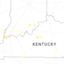


Connect with Interactive Hail Maps