

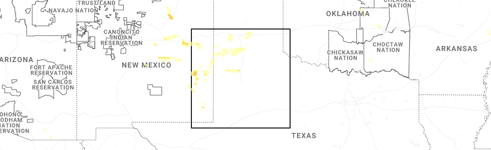
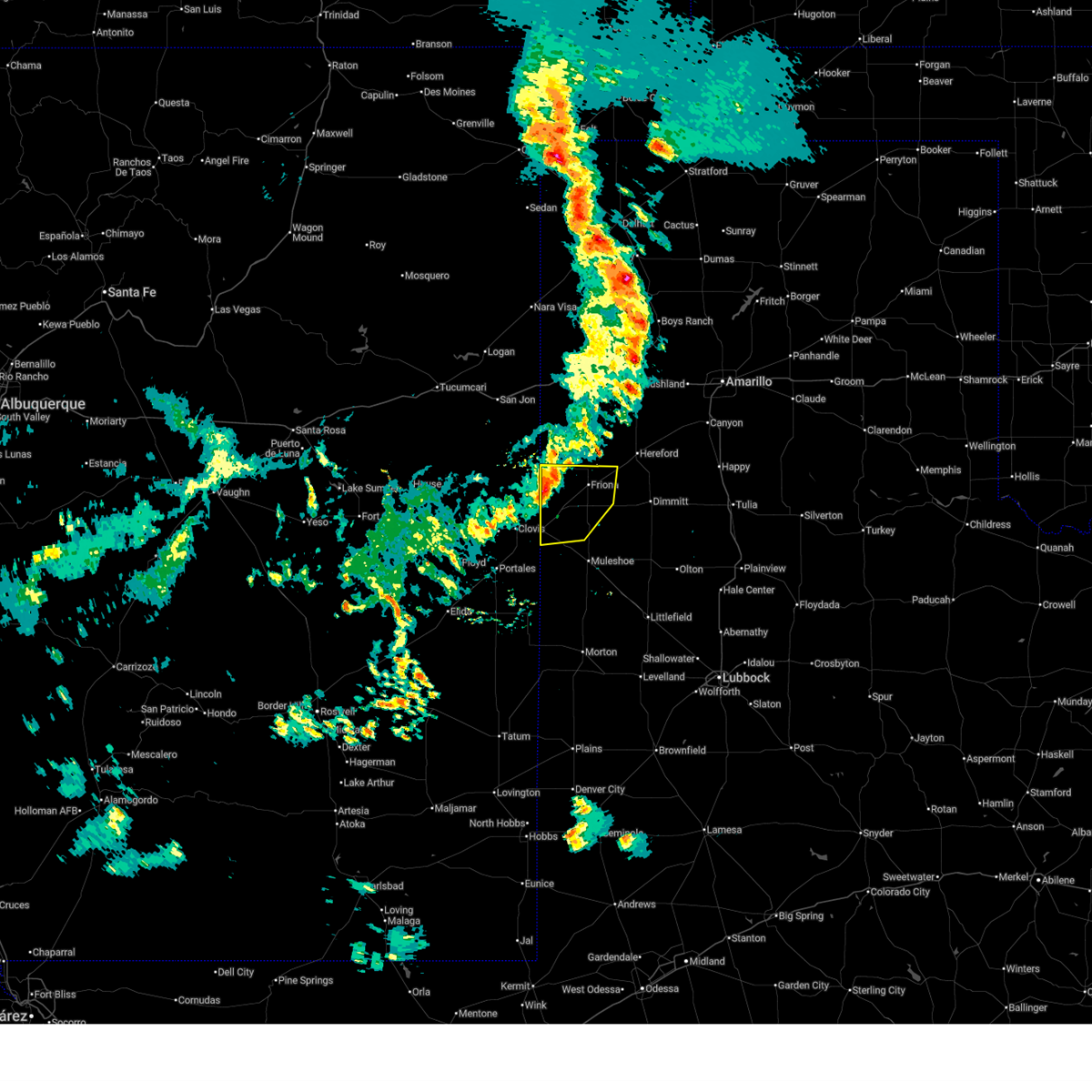
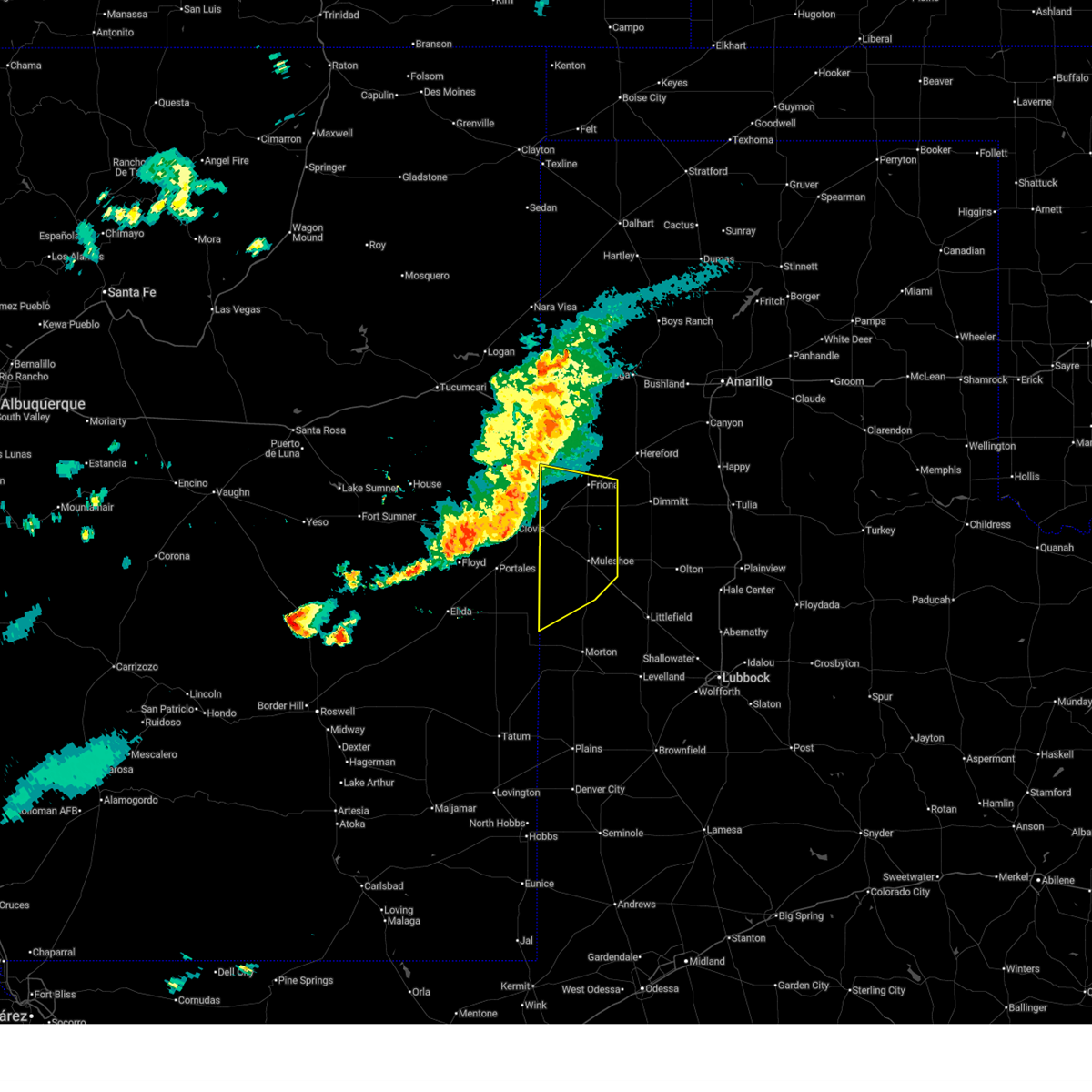
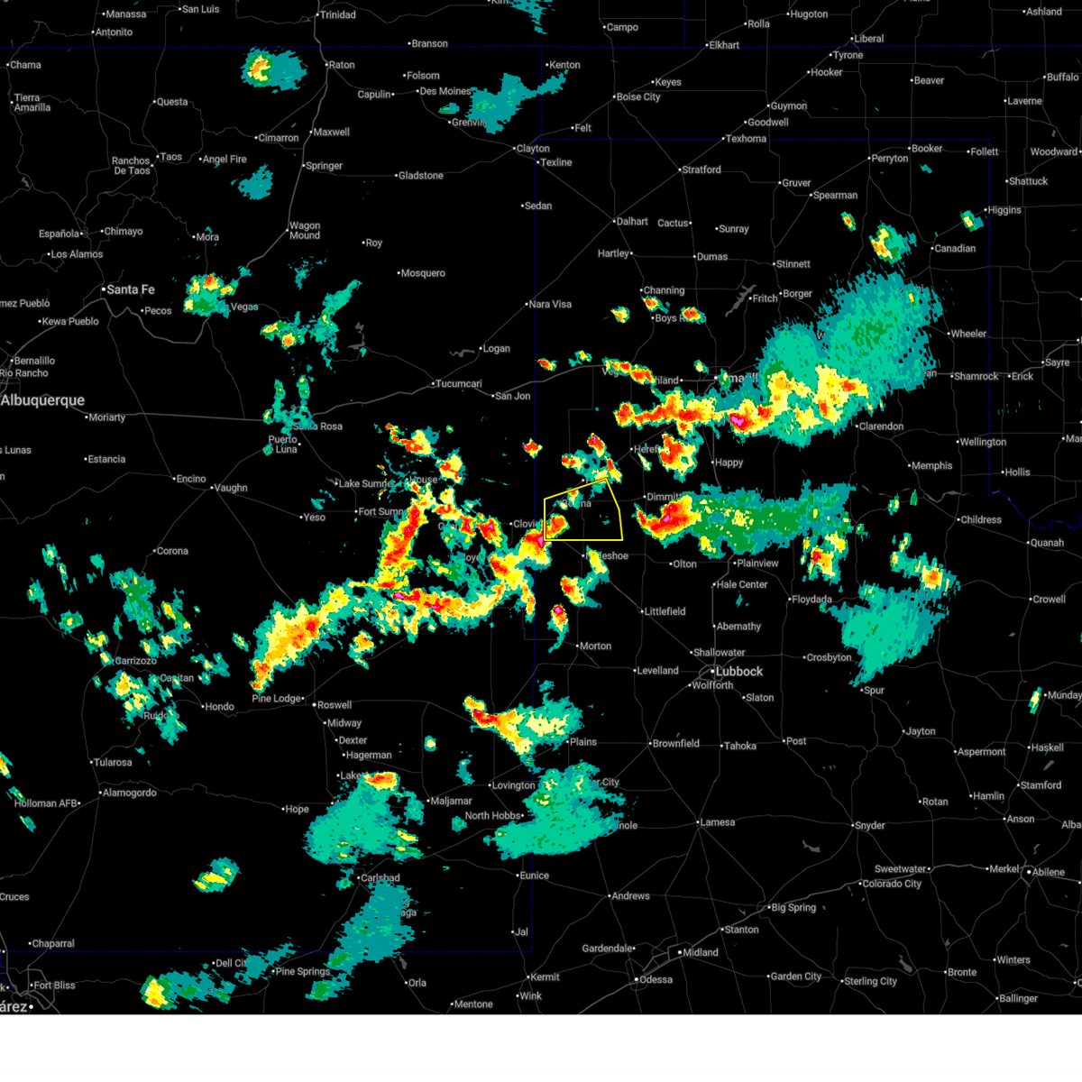
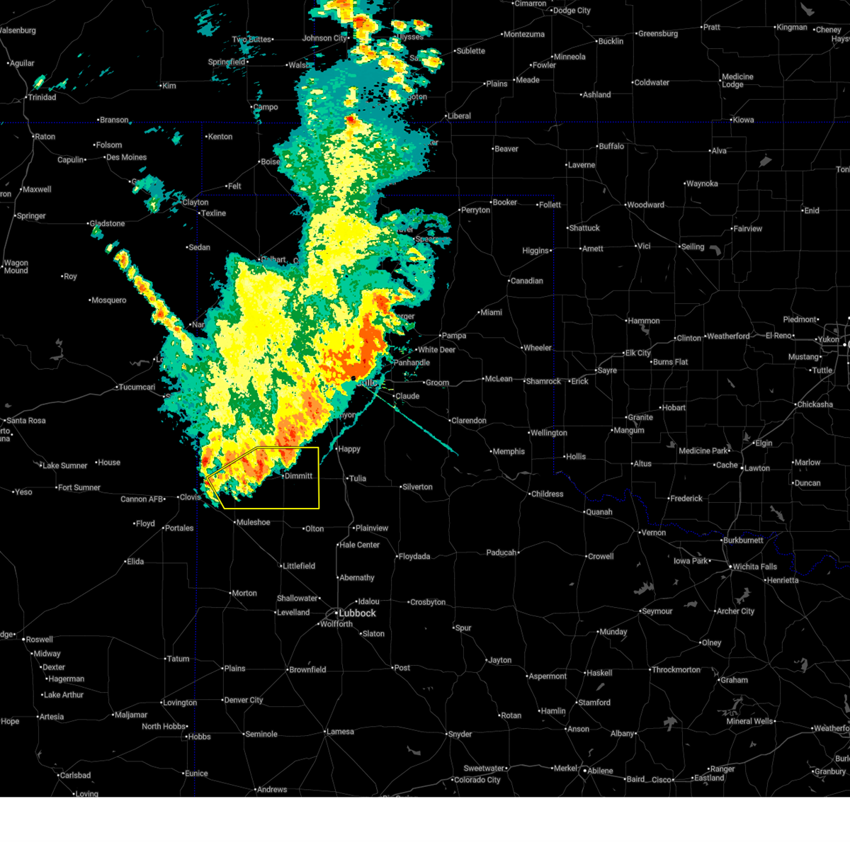
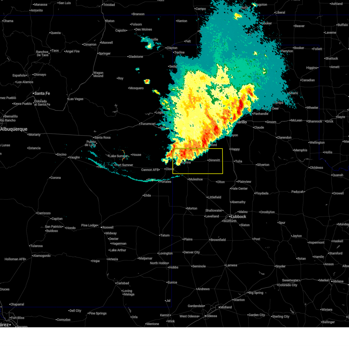
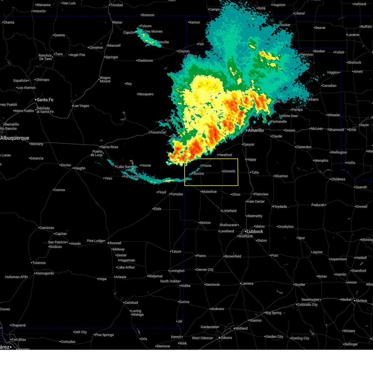
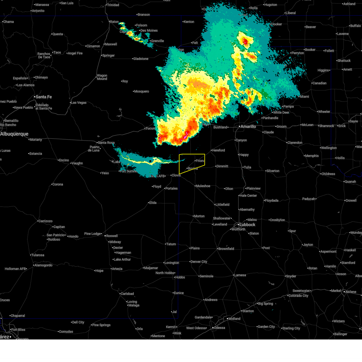
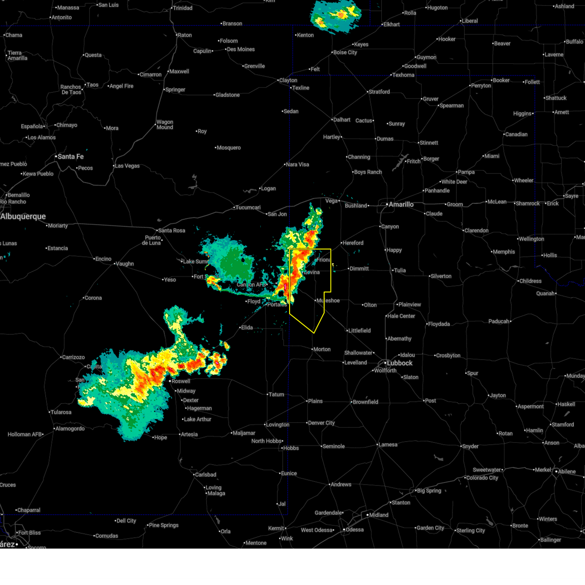
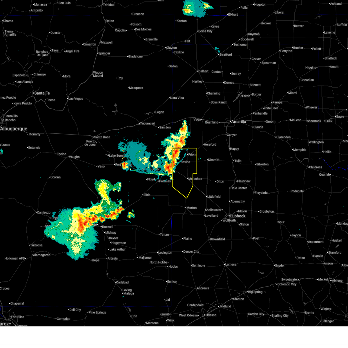
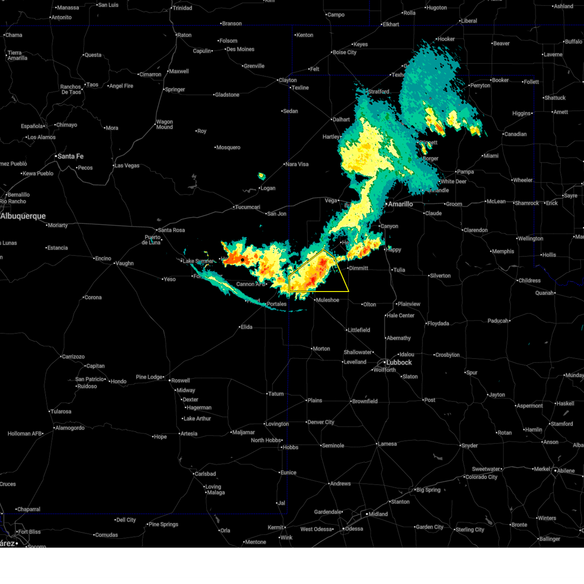
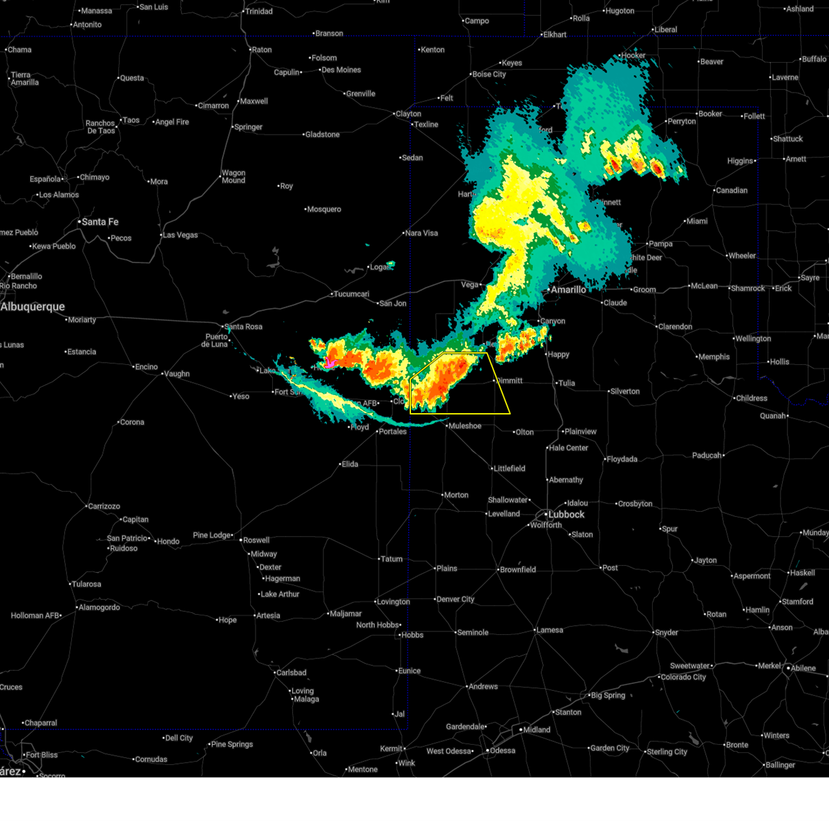
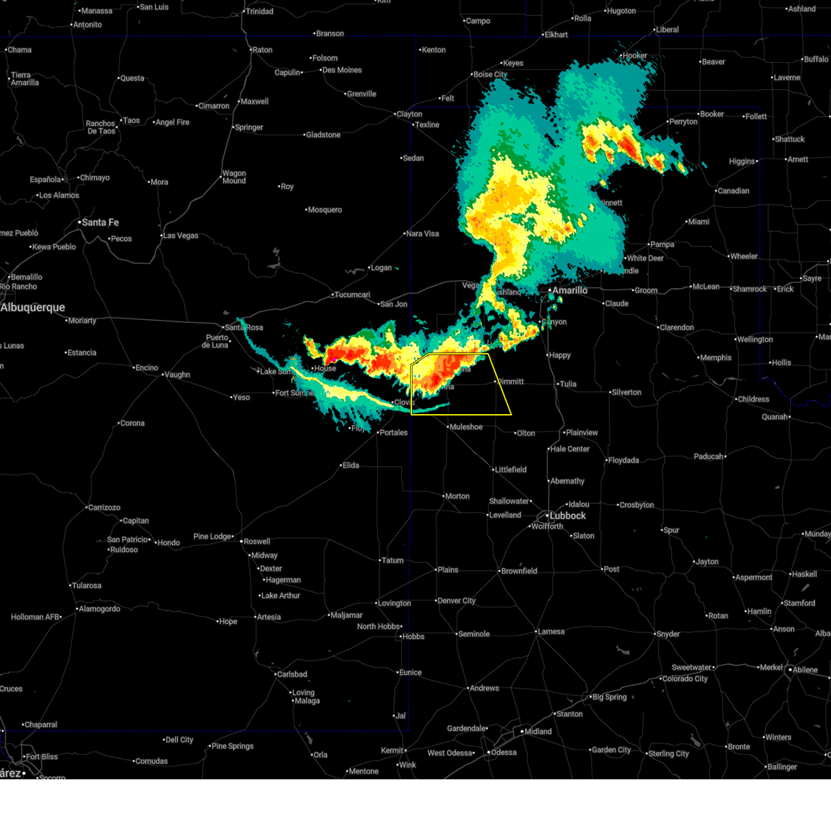
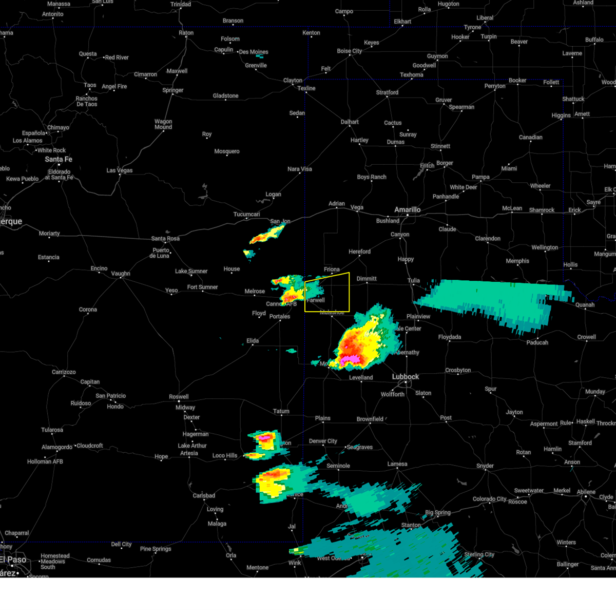
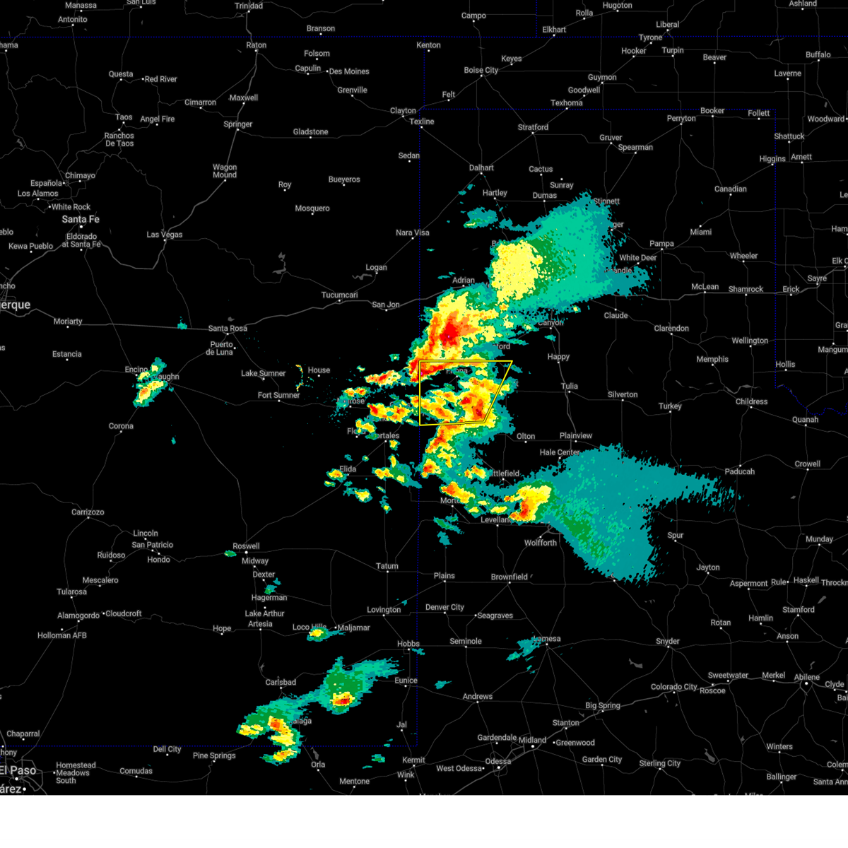
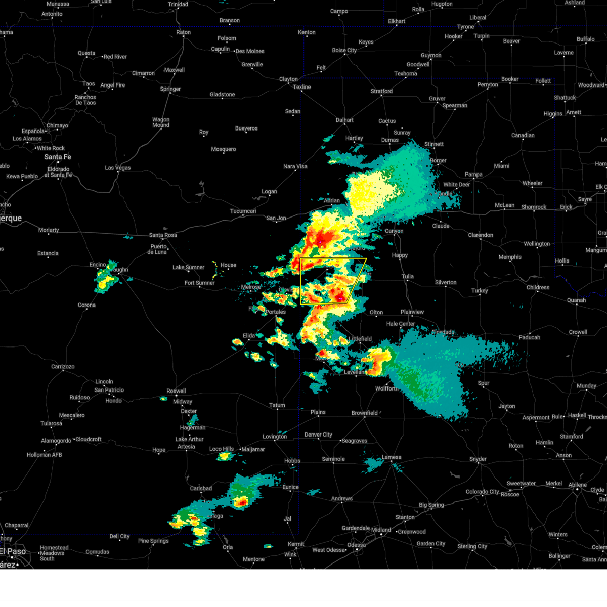
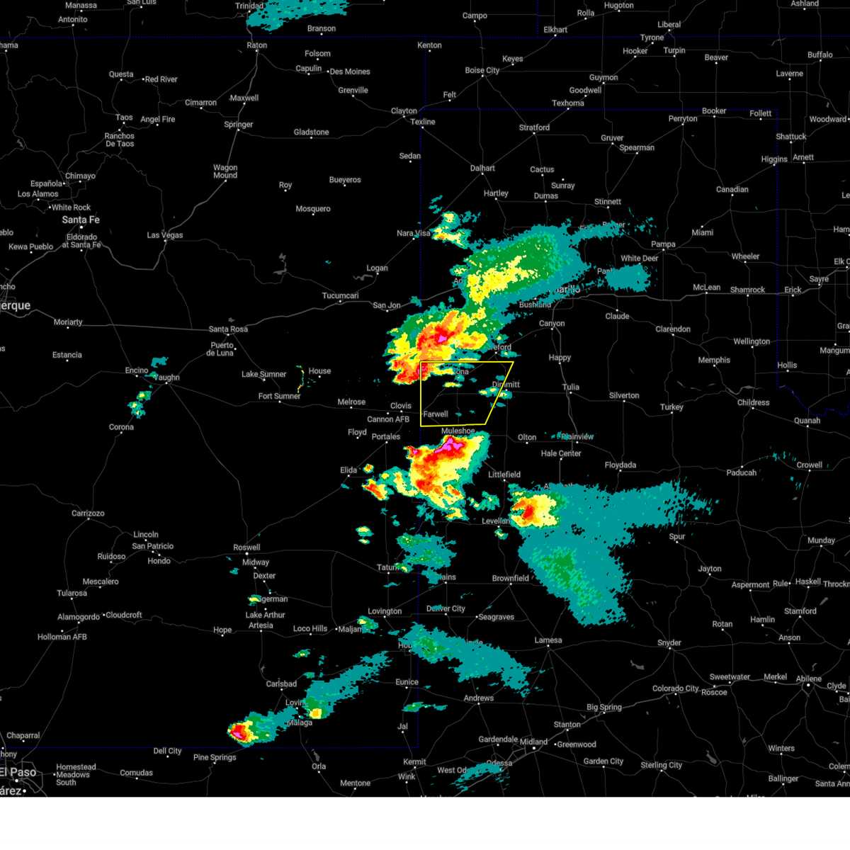
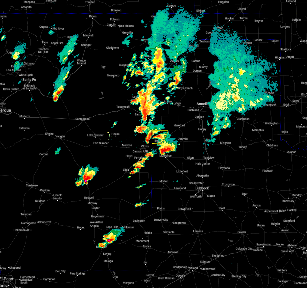
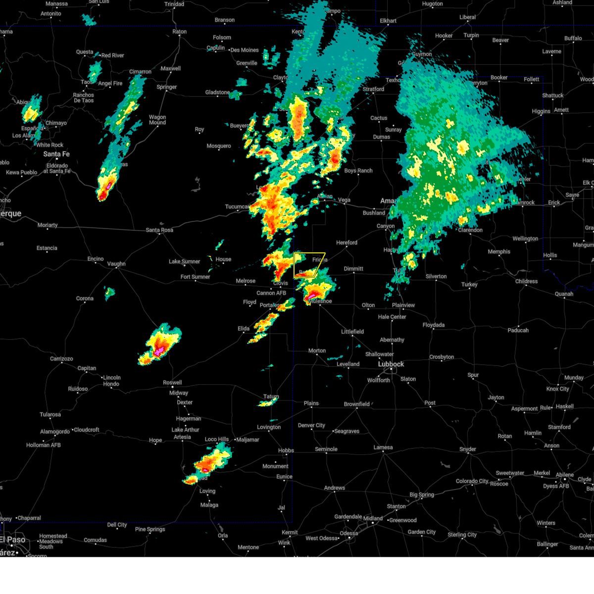
Hail Map for Bovina, TX
The Bovina, TX area has had 17 reports of on-the-ground hail by trained spotters, and has been under severe weather warnings 27 times during the past 12 months. Doppler radar has detected hail at or near Bovina, TX on 93 occasions, including 5 occasions during the past year.
| Name: | Bovina, TX |
| Where Located: | 66.1 miles SE of Tucumcari, NM |
| Map: | Google Map for Bovina, TX |
| Population: | 1868 |
| Housing Units: | 637 |
| More Info: | Search Google for Bovina, TX |
1
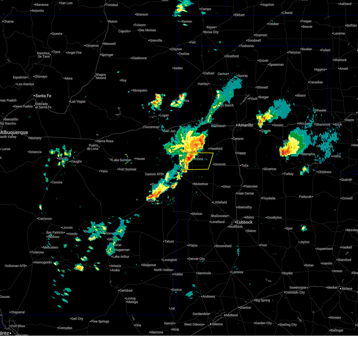
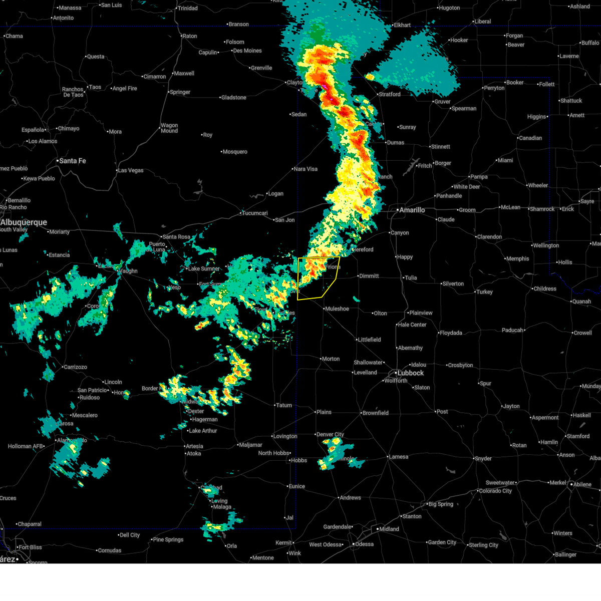
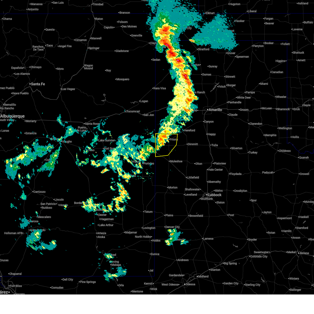
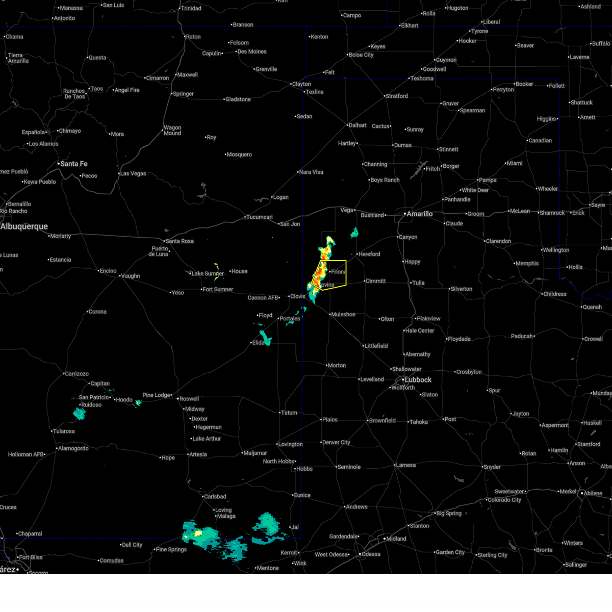
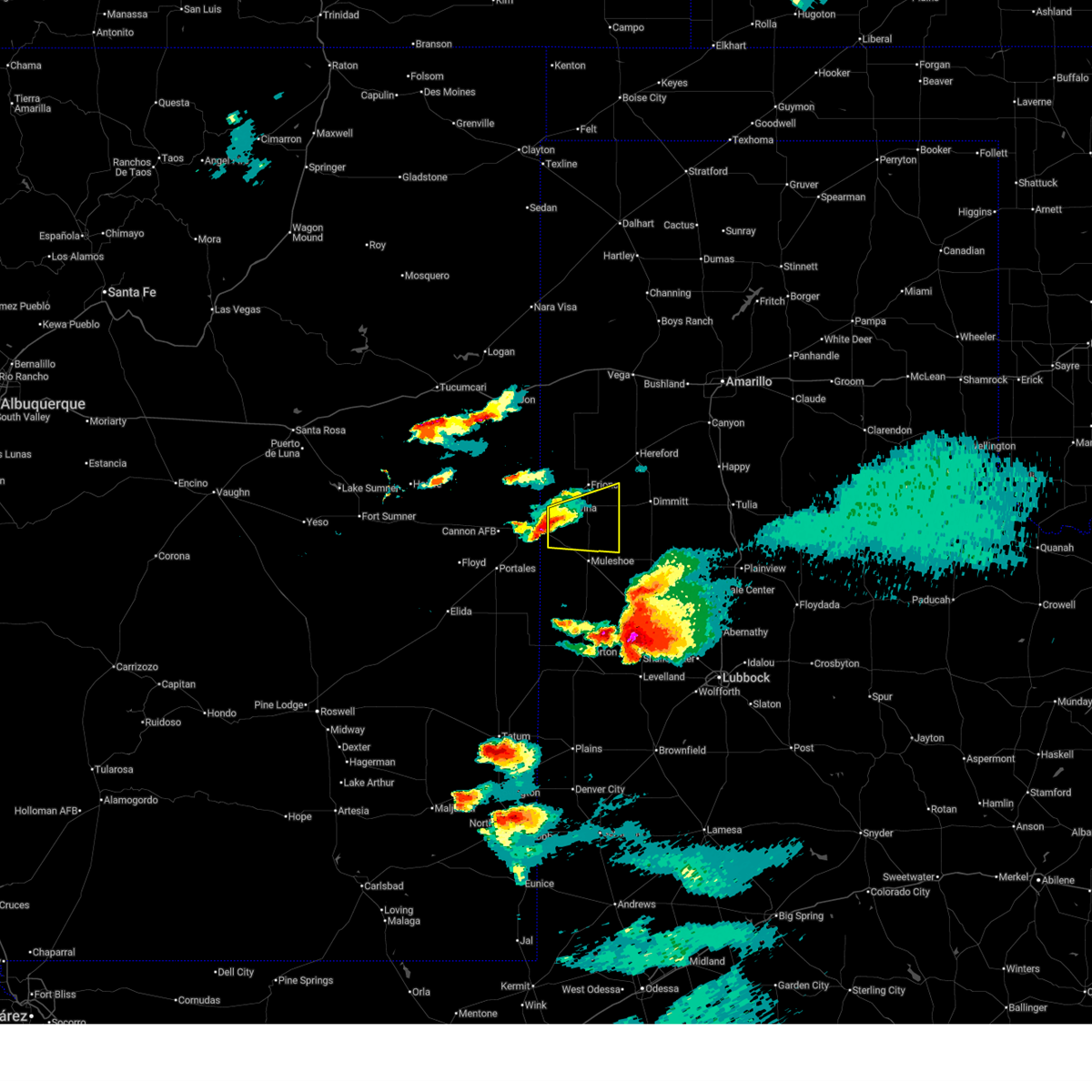
The Top Recent Hail Date for Bovina, TX is Wednesday, June 24, 2026 (29th out of 93)
Hail and Wind Damage Spotted near Bovina, TX
| Date / Time | Report Details |
|---|---|
| 7/1/2026 6:55 PM CDT |
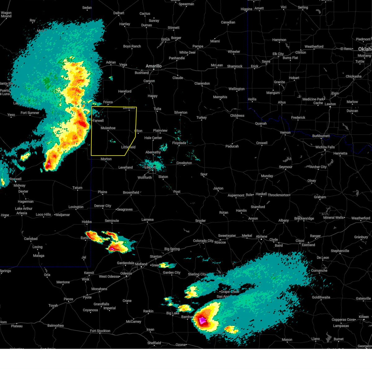
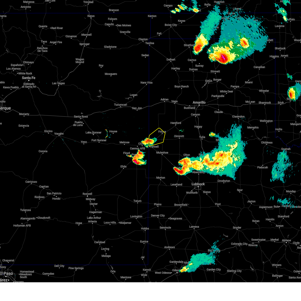
 Svrlub the national weather service in lubbock texas has issued a * severe thunderstorm warning for, northern parmer county in the panhandle of texas, northwestern castro county in the panhandle of texas, * until 745 pm cdt. * at 654 pm cdt, a severe thunderstorm was located over friona, moving east at 20 mph (west texas mesonet site in friona measured a wind gust to 62 mph). Hazards include 60 mph wind gusts. expect damage to roofs, siding, and trees Svrlub the national weather service in lubbock texas has issued a * severe thunderstorm warning for, northern parmer county in the panhandle of texas, northwestern castro county in the panhandle of texas, * until 745 pm cdt. * at 654 pm cdt, a severe thunderstorm was located over friona, moving east at 20 mph (west texas mesonet site in friona measured a wind gust to 62 mph). Hazards include 60 mph wind gusts. expect damage to roofs, siding, and trees
|
| 6/26/2026 9:49 PM CDT |
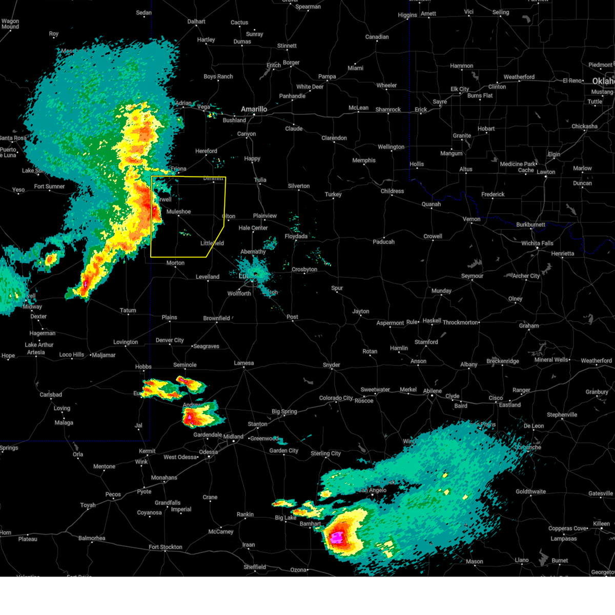
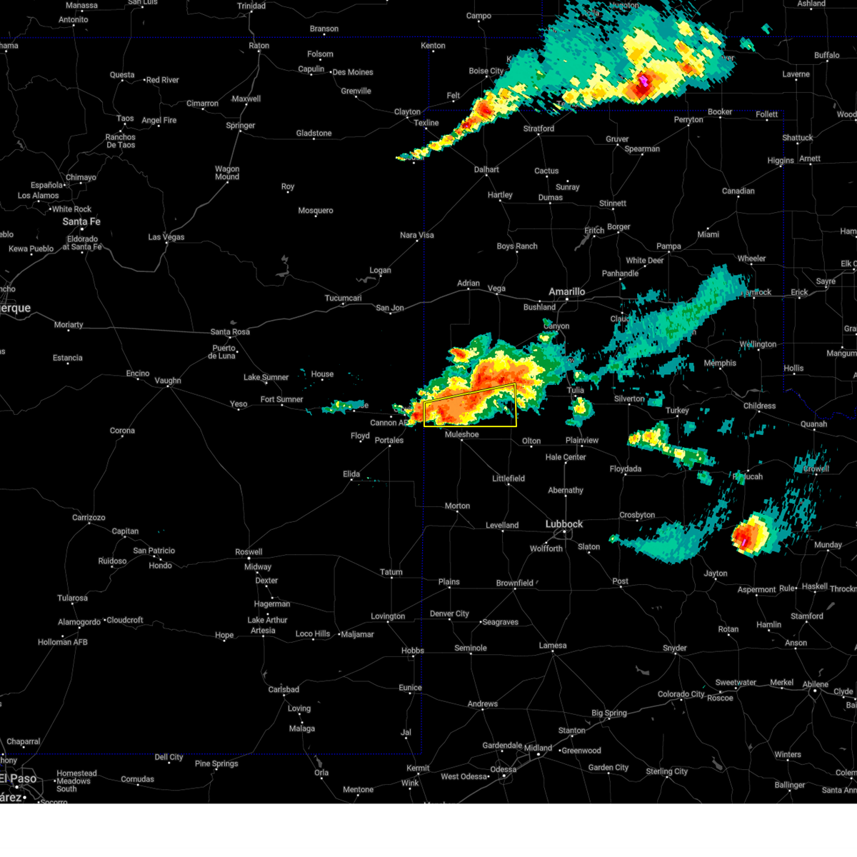
 At 948 pm cdt, a severe thunderstorm was located 5 miles southeast of friona, moving east at 45 mph (radar indicated). Hazards include 60 mph wind gusts and penny size hail. Expect damage to roofs, siding, and trees. Locations impacted include, friona, bovina, farwell, oklahoma lane, lariat, rhea, and black. At 948 pm cdt, a severe thunderstorm was located 5 miles southeast of friona, moving east at 45 mph (radar indicated). Hazards include 60 mph wind gusts and penny size hail. Expect damage to roofs, siding, and trees. Locations impacted include, friona, bovina, farwell, oklahoma lane, lariat, rhea, and black.
|
| 6/26/2026 9:42 PM CDT |
 At 942 pm cdt, a severe thunderstorm was located 4 miles southwest of friona, moving east at 45 mph (radar indicated). Hazards include 70 mph wind gusts and penny size hail. Expect considerable tree damage. damage is likely to mobile homes, roofs, and outbuildings. Locations impacted include, friona, bovina, farwell, oklahoma lane, lariat, rhea, and black. At 942 pm cdt, a severe thunderstorm was located 4 miles southwest of friona, moving east at 45 mph (radar indicated). Hazards include 70 mph wind gusts and penny size hail. Expect considerable tree damage. damage is likely to mobile homes, roofs, and outbuildings. Locations impacted include, friona, bovina, farwell, oklahoma lane, lariat, rhea, and black.
|
| 6/26/2026 9:32 PM CDT |
 Svrlub the national weather service in lubbock texas has issued a * severe thunderstorm warning for, northwestern bailey county in northwestern texas, parmer county in the panhandle of texas, * until 1015 pm cdt. * at 931 pm cdt, a severe thunderstorm was located 4 miles southeast of rhea, or 11 miles west of friona, moving east at 25 mph (radar indicated). Hazards include 70 mph wind gusts and nickel size hail. Expect considerable tree damage. Damage is likely to mobile homes, roofs, and outbuildings. Svrlub the national weather service in lubbock texas has issued a * severe thunderstorm warning for, northwestern bailey county in northwestern texas, parmer county in the panhandle of texas, * until 1015 pm cdt. * at 931 pm cdt, a severe thunderstorm was located 4 miles southeast of rhea, or 11 miles west of friona, moving east at 25 mph (radar indicated). Hazards include 70 mph wind gusts and nickel size hail. Expect considerable tree damage. Damage is likely to mobile homes, roofs, and outbuildings.
|
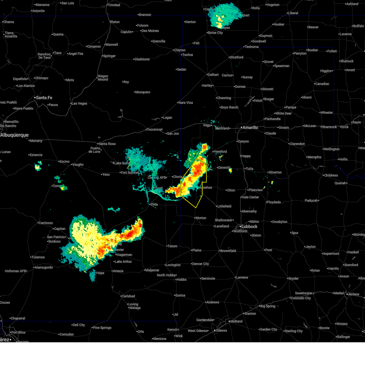
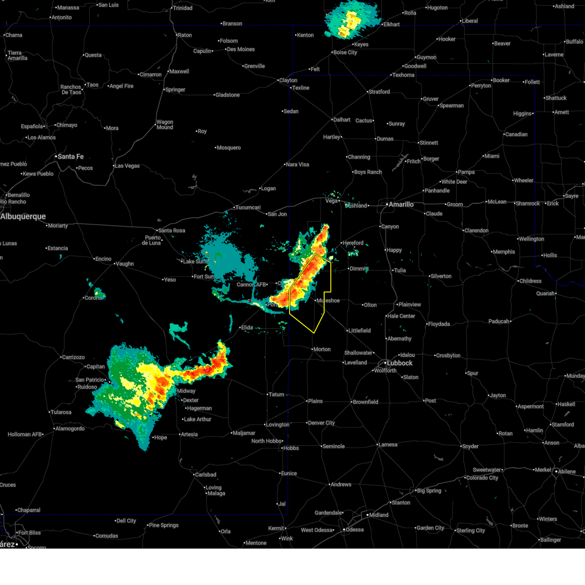
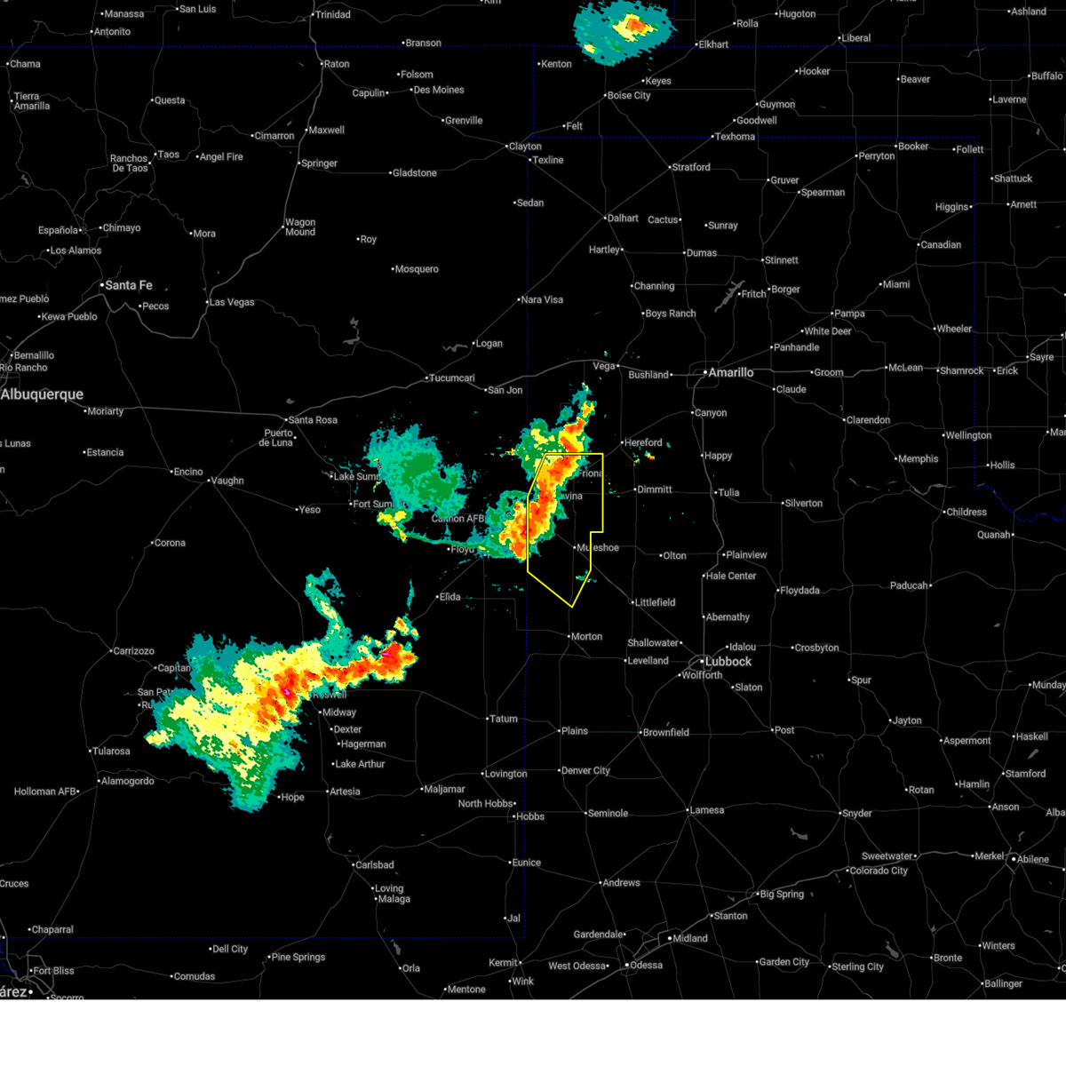
| 6/24/2026 11:28 PM CDT |
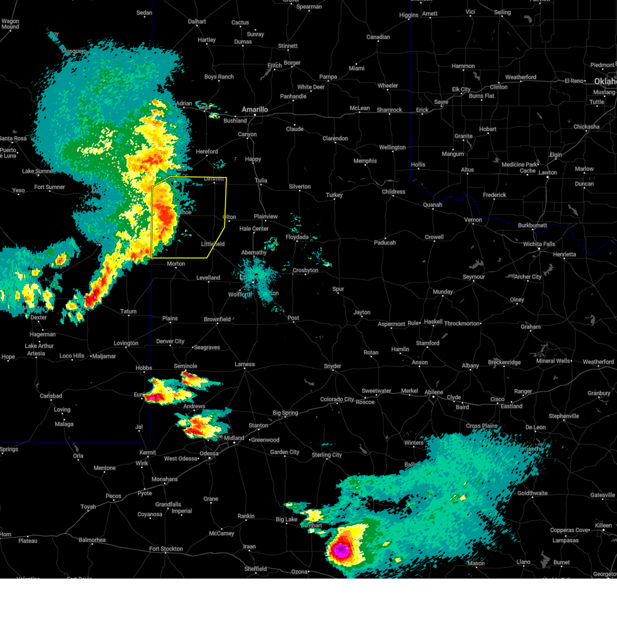
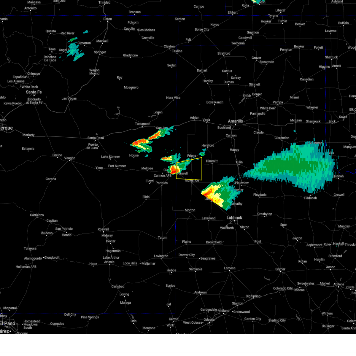
 Svrlub the national weather service in lubbock texas has issued a * severe thunderstorm warning for, parmer county in the panhandle of texas, castro county in the panhandle of texas, * until 1215 am cdt. * at 1128 pm cdt, a severe thunderstorm was located 6 miles south of friona, moving northeast at 25 mph (radar indicated). Hazards include 60 mph wind gusts and quarter size hail. Hail damage to vehicles is expected. Expect wind damage to roofs, siding, and trees. Svrlub the national weather service in lubbock texas has issued a * severe thunderstorm warning for, parmer county in the panhandle of texas, castro county in the panhandle of texas, * until 1215 am cdt. * at 1128 pm cdt, a severe thunderstorm was located 6 miles south of friona, moving northeast at 25 mph (radar indicated). Hazards include 60 mph wind gusts and quarter size hail. Hail damage to vehicles is expected. Expect wind damage to roofs, siding, and trees.
|
| 6/24/2026 11:06 PM CDT |
 Svrlub the national weather service in lubbock texas has issued a * severe thunderstorm warning for, parmer county in the panhandle of texas, western castro county in the panhandle of texas, * until 1130 pm cdt. * at 1104 pm cdt, a severe thunderstorm was located 4 miles southeast of bovina, or 13 miles southwest of friona, moving northeast at 35 mph (radar indicated). Hazards include 60 mph wind gusts and quarter size hail. Hail damage to vehicles is expected. Expect wind damage to roofs, siding, and trees. Svrlub the national weather service in lubbock texas has issued a * severe thunderstorm warning for, parmer county in the panhandle of texas, western castro county in the panhandle of texas, * until 1130 pm cdt. * at 1104 pm cdt, a severe thunderstorm was located 4 miles southeast of bovina, or 13 miles southwest of friona, moving northeast at 35 mph (radar indicated). Hazards include 60 mph wind gusts and quarter size hail. Hail damage to vehicles is expected. Expect wind damage to roofs, siding, and trees.
|
| 6/15/2026 7:50 PM CDT |
 At 750 pm cdt, severe thunderstorms were located along a line extending from 3 miles north of oklahoma lane to 3 miles south of west camp to 8 miles northwest of dora, moving southeast at 35 mph (radar indicated). Hazards include 60 mph wind gusts. Expect damage to roofs, siding, and trees. Locations impacted include, muleshoe, bovina, farwell, needmore, lazbuddie, progress, oklahoma lane, lariat, and west camp. At 750 pm cdt, severe thunderstorms were located along a line extending from 3 miles north of oklahoma lane to 3 miles south of west camp to 8 miles northwest of dora, moving southeast at 35 mph (radar indicated). Hazards include 60 mph wind gusts. Expect damage to roofs, siding, and trees. Locations impacted include, muleshoe, bovina, farwell, needmore, lazbuddie, progress, oklahoma lane, lariat, and west camp.
|
| 6/15/2026 7:48 PM CDT | Three power poles snapped along fm 1731. time estimate in parmer county TX, 2.4 miles S of Bovina, TX |
| 6/15/2026 7:23 PM CDT |
 Svrlub the national weather service in lubbock texas has issued a * severe thunderstorm warning for, bailey county in northwestern texas, parmer county in the panhandle of texas, northwestern lamb county in northwestern texas, * until 830 pm cdt. * at 723 pm cdt, severe thunderstorms were located along a line extending from 10 miles southwest of rhea to 4 miles south of clovis to 13 miles west of portales, moving southeast at 35 mph (radar indicated). Hazards include 70 mph wind gusts. Expect considerable tree damage. Damage is likely to mobile homes, roofs, and outbuildings. Svrlub the national weather service in lubbock texas has issued a * severe thunderstorm warning for, bailey county in northwestern texas, parmer county in the panhandle of texas, northwestern lamb county in northwestern texas, * until 830 pm cdt. * at 723 pm cdt, severe thunderstorms were located along a line extending from 10 miles southwest of rhea to 4 miles south of clovis to 13 miles west of portales, moving southeast at 35 mph (radar indicated). Hazards include 70 mph wind gusts. Expect considerable tree damage. Damage is likely to mobile homes, roofs, and outbuildings.
|
| 5/14/2026 4:57 PM CDT |
 At 457 pm cdt, a severe thunderstorm was located 5 miles north of lazbuddie, or 13 miles southeast of friona, moving east at 35 mph (radar indicated). Hazards include 60 mph wind gusts. Expect damage to roofs, siding, and trees. Locations impacted include, friona, bovina, lazbuddie, oklahoma lane, lariat, and black. At 457 pm cdt, a severe thunderstorm was located 5 miles north of lazbuddie, or 13 miles southeast of friona, moving east at 35 mph (radar indicated). Hazards include 60 mph wind gusts. Expect damage to roofs, siding, and trees. Locations impacted include, friona, bovina, lazbuddie, oklahoma lane, lariat, and black.
|
| 5/14/2026 4:30 PM CDT |
 Svrlub the national weather service in lubbock texas has issued a * severe thunderstorm warning for, parmer county in the panhandle of texas, * until 530 pm cdt. * at 429 pm cdt, a severe thunderstorm was located near rhea, or 9 miles west of friona, moving east at 35 mph (radar indicated). Hazards include 70 mph wind gusts. Expect considerable tree damage. damage is likely to mobile homes, roofs, and outbuildings. Near zero visibility is expected with storm due to blowing dust along the outflow boundary. Svrlub the national weather service in lubbock texas has issued a * severe thunderstorm warning for, parmer county in the panhandle of texas, * until 530 pm cdt. * at 429 pm cdt, a severe thunderstorm was located near rhea, or 9 miles west of friona, moving east at 35 mph (radar indicated). Hazards include 70 mph wind gusts. Expect considerable tree damage. damage is likely to mobile homes, roofs, and outbuildings. Near zero visibility is expected with storm due to blowing dust along the outflow boundary.
|
| 9/22/2025 9:34 PM CDT | At 934 pm cdt, severe thunderstorms were located along a line extending from 3 miles west of summerfield to 7 miles northwest of sudan to near morton, moving east at 45 mph (radar indicated). Hazards include 60 mph wind gusts. Expect damage to roofs, siding, and trees. Locations impacted include, muleshoe, dimmitt, friona, morton, earth, bovina, sudan, amherst, summerfield, needmore, easter, lazbuddie, progress, oklahoma lane, enochs, black, bula, muleshoe wildlife refuge, pep, and lehman. |
| 9/22/2025 9:02 PM CDT | Svrlub the national weather service in lubbock texas has issued a * severe thunderstorm warning for, bailey county in northwestern texas, northern cochran county in northwestern texas, parmer county in the panhandle of texas, northwestern hockley county in northwestern texas, castro county in the panhandle of texas, western lamb county in northwestern texas, * until 1000 pm cdt. * at 901 pm cdt, severe thunderstorms were located along a line extending from 3 miles northeast of rhea to 8 miles east of arch to 7 miles northeast of milnesand, moving east at 40 mph (radar indicated). Hazards include 60 mph wind gusts. expect damage to roofs, siding, and trees |
| 8/11/2025 8:37 PM CDT |
 At 837 pm cdt, a severe thunderstorm was located 5 miles southeast of bovina, or 12 miles south of friona, moving northeast at 30 mph (radar indicated). Hazards include 60 mph wind gusts and half dollar size hail. Hail damage to vehicles is expected. expect wind damage to roofs, siding, and trees. Locations impacted include, bovina, lazbuddie, oklahoma lane, and lariat. At 837 pm cdt, a severe thunderstorm was located 5 miles southeast of bovina, or 12 miles south of friona, moving northeast at 30 mph (radar indicated). Hazards include 60 mph wind gusts and half dollar size hail. Hail damage to vehicles is expected. expect wind damage to roofs, siding, and trees. Locations impacted include, bovina, lazbuddie, oklahoma lane, and lariat.
|
| 8/11/2025 8:28 PM CDT |
 Svrlub the national weather service in lubbock texas has issued a * severe thunderstorm warning for, southern parmer county in the panhandle of texas, southwestern castro county in the panhandle of texas, * until 915 pm cdt. * at 828 pm cdt, a severe thunderstorm was located over oklahoma lane, or 13 miles northwest of muleshoe, moving northeast at 25 mph (radar indicated). Hazards include 60 mph wind gusts and half dollar size hail. Hail damage to vehicles is expected. Expect wind damage to roofs, siding, and trees. Svrlub the national weather service in lubbock texas has issued a * severe thunderstorm warning for, southern parmer county in the panhandle of texas, southwestern castro county in the panhandle of texas, * until 915 pm cdt. * at 828 pm cdt, a severe thunderstorm was located over oklahoma lane, or 13 miles northwest of muleshoe, moving northeast at 25 mph (radar indicated). Hazards include 60 mph wind gusts and half dollar size hail. Hail damage to vehicles is expected. Expect wind damage to roofs, siding, and trees.
|
| 7/12/2025 12:36 AM CDT |
 At 1236 am cdt, severe thunderstorms were located along a line extending from 12 miles northeast of dimmitt to 5 miles west of lazbuddie, moving southeast at 35 mph (radar indicated). Hazards include 60 mph wind gusts. Expect damage to roofs, siding, and trees. Locations impacted include, dimmitt, friona, hart, bovina, summerfield, easter, lazbuddie, black, and nazareth. At 1236 am cdt, severe thunderstorms were located along a line extending from 12 miles northeast of dimmitt to 5 miles west of lazbuddie, moving southeast at 35 mph (radar indicated). Hazards include 60 mph wind gusts. Expect damage to roofs, siding, and trees. Locations impacted include, dimmitt, friona, hart, bovina, summerfield, easter, lazbuddie, black, and nazareth.
|
| 7/12/2025 12:21 AM CDT |
 At 1221 am cdt, severe thunderstorms were located along a line extending from 12 miles east of easter to 4 miles northeast of oklahoma lane, moving southeast at 40 mph (radar indicated). Hazards include 60 mph wind gusts. Expect damage to roofs, siding, and trees. Locations impacted include, dimmitt, friona, hart, bovina, farwell, summerfield, easter, lazbuddie, oklahoma lane, lariat, black, rhea, and nazareth. At 1221 am cdt, severe thunderstorms were located along a line extending from 12 miles east of easter to 4 miles northeast of oklahoma lane, moving southeast at 40 mph (radar indicated). Hazards include 60 mph wind gusts. Expect damage to roofs, siding, and trees. Locations impacted include, dimmitt, friona, hart, bovina, farwell, summerfield, easter, lazbuddie, oklahoma lane, lariat, black, rhea, and nazareth.
|
| 7/11/2025 11:59 PM CDT |
 Svrlub the national weather service in lubbock texas has issued a * severe thunderstorm warning for, parmer county in the panhandle of texas, castro county in the panhandle of texas, * until 100 am cdt. * at 1159 pm cdt, severe thunderstorms were located along a line extending from 5 miles southeast of hereford to 4 miles west of bovina, moving southeast at 50 mph (radar indicated). Hazards include 60 mph wind gusts. expect damage to roofs, siding, and trees Svrlub the national weather service in lubbock texas has issued a * severe thunderstorm warning for, parmer county in the panhandle of texas, castro county in the panhandle of texas, * until 100 am cdt. * at 1159 pm cdt, severe thunderstorms were located along a line extending from 5 miles southeast of hereford to 4 miles west of bovina, moving southeast at 50 mph (radar indicated). Hazards include 60 mph wind gusts. expect damage to roofs, siding, and trees
|
| 7/11/2025 11:30 PM CDT |
 At 1128 pm cdt, severe thunderstorms were located along a line extending from 5 miles northwest of black to 8 miles southwest of rhea, moving southeast at 35 mph. earlier, wind gusts of 60 to 67 mph were measured with these storms near bootleg. wind damage with these storms will occur well ahead of any rain or lightning (radar and mesonet indicated). Hazards include 60 mph wind gusts. Expect damage to roofs, siding, and trees. Locations impacted include, friona, bovina, black, and rhea. At 1128 pm cdt, severe thunderstorms were located along a line extending from 5 miles northwest of black to 8 miles southwest of rhea, moving southeast at 35 mph. earlier, wind gusts of 60 to 67 mph were measured with these storms near bootleg. wind damage with these storms will occur well ahead of any rain or lightning (radar and mesonet indicated). Hazards include 60 mph wind gusts. Expect damage to roofs, siding, and trees. Locations impacted include, friona, bovina, black, and rhea.
|
| 7/11/2025 11:19 PM CDT |
 Svrlub the national weather service in lubbock texas has issued a * severe thunderstorm warning for, northern parmer county in the panhandle of texas, * until midnight cdt. * at 1119 pm cdt, severe thunderstorms were located along a line extending from 7 miles north of bootleg to near broadview, moving southeast at 35 mph (radar indicated). Hazards include 60 mph wind gusts. expect damage to roofs, siding, and trees Svrlub the national weather service in lubbock texas has issued a * severe thunderstorm warning for, northern parmer county in the panhandle of texas, * until midnight cdt. * at 1119 pm cdt, severe thunderstorms were located along a line extending from 7 miles north of bootleg to near broadview, moving southeast at 35 mph (radar indicated). Hazards include 60 mph wind gusts. expect damage to roofs, siding, and trees
|
| 7/7/2025 11:09 PM CDT |
 The storms which prompted the warning have weakened below severe limits, and have exited the warned area. therefore, the warning will be allowed to expire. however, small hail, gusty winds and heavy rain are still possible with these thunderstorms. The storms which prompted the warning have weakened below severe limits, and have exited the warned area. therefore, the warning will be allowed to expire. however, small hail, gusty winds and heavy rain are still possible with these thunderstorms.
|
| 7/7/2025 10:58 PM CDT |
 At 1057 pm cdt, severe thunderstorms were located along a line extending from 4 miles south of black to 7 miles northeast of oklahoma lane to 8 miles south of west camp, moving southeast at 25 mph (radar indicated). Hazards include 60 mph wind gusts and quarter size hail. Hail damage to vehicles is expected. expect wind damage to roofs, siding, and trees. Locations impacted include, muleshoe, friona, bovina, needmore, lazbuddie, progress, oklahoma lane, lariat, muleshoe wildlife refuge, and west camp. At 1057 pm cdt, severe thunderstorms were located along a line extending from 4 miles south of black to 7 miles northeast of oklahoma lane to 8 miles south of west camp, moving southeast at 25 mph (radar indicated). Hazards include 60 mph wind gusts and quarter size hail. Hail damage to vehicles is expected. expect wind damage to roofs, siding, and trees. Locations impacted include, muleshoe, friona, bovina, needmore, lazbuddie, progress, oklahoma lane, lariat, muleshoe wildlife refuge, and west camp.
|
| 7/7/2025 10:43 PM CDT |
 At 1043 pm cdt, severe thunderstorms were located along a line extending from friona to 3 miles southeast of bovina to 7 miles southwest of west camp, moving southeast at 25 mph (radar indicated). Hazards include 60 mph wind gusts and quarter size hail. Hail damage to vehicles is expected. expect wind damage to roofs, siding, and trees. Locations impacted include, muleshoe, friona, bovina, farwell, needmore, lazbuddie, progress, oklahoma lane, lariat, west camp, black, rhea, and muleshoe wildlife refuge. At 1043 pm cdt, severe thunderstorms were located along a line extending from friona to 3 miles southeast of bovina to 7 miles southwest of west camp, moving southeast at 25 mph (radar indicated). Hazards include 60 mph wind gusts and quarter size hail. Hail damage to vehicles is expected. expect wind damage to roofs, siding, and trees. Locations impacted include, muleshoe, friona, bovina, farwell, needmore, lazbuddie, progress, oklahoma lane, lariat, west camp, black, rhea, and muleshoe wildlife refuge.
|
| 7/7/2025 10:33 PM CDT |
 At 1033 pm cdt, severe thunderstorms were located along a line extending from 3 miles north of friona to bovina to 3 miles west of west camp, moving southeast at 25 mph (radar indicated). Hazards include 60 mph wind gusts and quarter size hail. Hail damage to vehicles is expected. expect wind damage to roofs, siding, and trees. Locations impacted include, muleshoe, friona, bovina, farwell, needmore, lazbuddie, progress, oklahoma lane, lariat, west camp, black, rhea, and muleshoe wildlife refuge. At 1033 pm cdt, severe thunderstorms were located along a line extending from 3 miles north of friona to bovina to 3 miles west of west camp, moving southeast at 25 mph (radar indicated). Hazards include 60 mph wind gusts and quarter size hail. Hail damage to vehicles is expected. expect wind damage to roofs, siding, and trees. Locations impacted include, muleshoe, friona, bovina, farwell, needmore, lazbuddie, progress, oklahoma lane, lariat, west camp, black, rhea, and muleshoe wildlife refuge.
|
| 7/7/2025 10:22 PM CDT |
 Svrlub the national weather service in lubbock texas has issued a * severe thunderstorm warning for, bailey county in northwestern texas, parmer county in the panhandle of texas, * until 1115 pm cdt. * at 1021 pm cdt, a severe thunderstorm was located 6 miles west of bovina, or 11 miles east of clovis, moving southeast at 25 mph (radar indicated). Hazards include 60 mph wind gusts and quarter size hail. Hail damage to vehicles is expected. Expect wind damage to roofs, siding, and trees. Svrlub the national weather service in lubbock texas has issued a * severe thunderstorm warning for, bailey county in northwestern texas, parmer county in the panhandle of texas, * until 1115 pm cdt. * at 1021 pm cdt, a severe thunderstorm was located 6 miles west of bovina, or 11 miles east of clovis, moving southeast at 25 mph (radar indicated). Hazards include 60 mph wind gusts and quarter size hail. Hail damage to vehicles is expected. Expect wind damage to roofs, siding, and trees.
|
| 7/5/2025 11:26 PM CDT |
 At 1126 pm cdt, a severe thunderstorm was located 7 miles west of lazbuddie, or 11 miles north of muleshoe, moving southeast at 25 mph (radar indicated). Hazards include 60 mph wind gusts and quarter size hail. Hail damage to vehicles is expected. expect wind damage to roofs, siding, and trees. Locations impacted include, friona, bovina, farwell, lazbuddie, oklahoma lane, lariat, and black. At 1126 pm cdt, a severe thunderstorm was located 7 miles west of lazbuddie, or 11 miles north of muleshoe, moving southeast at 25 mph (radar indicated). Hazards include 60 mph wind gusts and quarter size hail. Hail damage to vehicles is expected. expect wind damage to roofs, siding, and trees. Locations impacted include, friona, bovina, farwell, lazbuddie, oklahoma lane, lariat, and black.
|
| 7/5/2025 11:08 PM CDT |
 At 1108 pm cdt, a severe thunderstorm was located 7 miles east of bovina, or 9 miles south of friona, moving southeast at 25 mph (radar indicated). Hazards include 60 mph wind gusts and quarter size hail. Hail damage to vehicles is expected. expect wind damage to roofs, siding, and trees. Locations impacted include, dimmitt, friona, bovina, farwell, summerfield, easter, lazbuddie, oklahoma lane, lariat, and black. At 1108 pm cdt, a severe thunderstorm was located 7 miles east of bovina, or 9 miles south of friona, moving southeast at 25 mph (radar indicated). Hazards include 60 mph wind gusts and quarter size hail. Hail damage to vehicles is expected. expect wind damage to roofs, siding, and trees. Locations impacted include, dimmitt, friona, bovina, farwell, summerfield, easter, lazbuddie, oklahoma lane, lariat, and black.
|
| 7/5/2025 10:57 PM CDT |
 Svrlub the national weather service in lubbock texas has issued a * severe thunderstorm warning for, parmer county in the panhandle of texas, western castro county in the panhandle of texas, * until midnight cdt. * at 1057 pm cdt, a severe thunderstorm was located 5 miles east of bovina, or 8 miles southwest of friona, moving south at 35 mph (radar indicated). Hazards include 60 mph wind gusts and quarter size hail. Hail damage to vehicles is expected. Expect wind damage to roofs, siding, and trees. Svrlub the national weather service in lubbock texas has issued a * severe thunderstorm warning for, parmer county in the panhandle of texas, western castro county in the panhandle of texas, * until midnight cdt. * at 1057 pm cdt, a severe thunderstorm was located 5 miles east of bovina, or 8 miles southwest of friona, moving south at 35 mph (radar indicated). Hazards include 60 mph wind gusts and quarter size hail. Hail damage to vehicles is expected. Expect wind damage to roofs, siding, and trees.
|
| 6/21/2025 8:46 PM CDT |
 At 846 pm cdt, a severe thunderstorm was located over friona, moving northeast at 25 mph (radar indicated). Hazards include 60 mph wind gusts. Expect damage to roofs, siding, and trees. Locations impacted include, friona, bovina, and black. At 846 pm cdt, a severe thunderstorm was located over friona, moving northeast at 25 mph (radar indicated). Hazards include 60 mph wind gusts. Expect damage to roofs, siding, and trees. Locations impacted include, friona, bovina, and black.
|
| 6/21/2025 8:37 PM CDT |
 Svrlub the national weather service in lubbock texas has issued a * severe thunderstorm warning for, northern parmer county in the panhandle of texas, * until 930 pm cdt. * at 836 pm cdt, a severe thunderstorm was located 6 miles west of friona, moving northeast at 25 mph (radar indicated). Hazards include 60 mph wind gusts. expect damage to roofs, siding, and trees Svrlub the national weather service in lubbock texas has issued a * severe thunderstorm warning for, northern parmer county in the panhandle of texas, * until 930 pm cdt. * at 836 pm cdt, a severe thunderstorm was located 6 miles west of friona, moving northeast at 25 mph (radar indicated). Hazards include 60 mph wind gusts. expect damage to roofs, siding, and trees
|
| 6/9/2025 10:27 PM CDT |
 At 1026 pm cdt, a severe thunderstorm was located 6 miles southeast of muleshoe, moving east at 35 mph (radar indicated). Hazards include 60 mph wind gusts. Expect damage to roofs, siding, and trees. Locations impacted include, littlefield, muleshoe, dimmitt, earth, bovina, sudan, amherst, needmore, lazbuddie, progress, oklahoma lane, lariat, enochs, bula, muleshoe wildlife refuge, maple, and springlake. At 1026 pm cdt, a severe thunderstorm was located 6 miles southeast of muleshoe, moving east at 35 mph (radar indicated). Hazards include 60 mph wind gusts. Expect damage to roofs, siding, and trees. Locations impacted include, littlefield, muleshoe, dimmitt, earth, bovina, sudan, amherst, needmore, lazbuddie, progress, oklahoma lane, lariat, enochs, bula, muleshoe wildlife refuge, maple, and springlake.
|
| 6/9/2025 10:18 PM CDT |
 At 1018 pm cdt, severe thunderstorms were located along a line extending from 4 miles southeast of bovina to near muleshoe to 4 miles northeast of maple, moving east at 40 mph (radar indicated). Hazards include 70 mph wind gusts. Expect considerable tree damage. damage is likely to mobile homes, roofs, and outbuildings. Locations impacted include, littlefield, muleshoe, dimmitt, earth, bovina, farwell, sudan, amherst, needmore, lazbuddie, progress, oklahoma lane, lariat, west camp, enochs, bula, muleshoe wildlife refuge, maple, and springlake. At 1018 pm cdt, severe thunderstorms were located along a line extending from 4 miles southeast of bovina to near muleshoe to 4 miles northeast of maple, moving east at 40 mph (radar indicated). Hazards include 70 mph wind gusts. Expect considerable tree damage. damage is likely to mobile homes, roofs, and outbuildings. Locations impacted include, littlefield, muleshoe, dimmitt, earth, bovina, farwell, sudan, amherst, needmore, lazbuddie, progress, oklahoma lane, lariat, west camp, enochs, bula, muleshoe wildlife refuge, maple, and springlake.
|
| 6/9/2025 9:58 PM CDT |
 At 958 pm cdt, severe thunderstorms were located along a line extending from 6 miles north of texico to 5 miles south of west camp to 5 miles east of dora, moving east at 35 mph (radar indicated). Hazards include 70 mph wind gusts and quarter size hail. Hail damage to vehicles is expected. expect considerable tree damage. wind damage is also likely to mobile homes, roofs, and outbuildings. Locations impacted include, littlefield, muleshoe, dimmitt, earth, bovina, farwell, sudan, amherst, needmore, lazbuddie, progress, oklahoma lane, lariat, west camp, enochs, bula, muleshoe wildlife refuge, maple, and springlake. At 958 pm cdt, severe thunderstorms were located along a line extending from 6 miles north of texico to 5 miles south of west camp to 5 miles east of dora, moving east at 35 mph (radar indicated). Hazards include 70 mph wind gusts and quarter size hail. Hail damage to vehicles is expected. expect considerable tree damage. wind damage is also likely to mobile homes, roofs, and outbuildings. Locations impacted include, littlefield, muleshoe, dimmitt, earth, bovina, farwell, sudan, amherst, needmore, lazbuddie, progress, oklahoma lane, lariat, west camp, enochs, bula, muleshoe wildlife refuge, maple, and springlake.
|
| 6/9/2025 9:41 PM CDT |
 Svrlub the national weather service in lubbock texas has issued a * severe thunderstorm warning for, bailey county in northwestern texas, parmer county in the panhandle of texas, southwestern castro county in the panhandle of texas, lamb county in northwestern texas, * until 1045 pm cdt. * at 940 pm cdt, severe thunderstorms were located along a line extending from 6 miles north of clovis to 7 miles north of arch to 8 miles east of elida, moving east at 40 mph (radar indicated). Hazards include 70 mph wind gusts and quarter size hail. Hail damage to vehicles is expected. expect considerable tree damage. Wind damage is also likely to mobile homes, roofs, and outbuildings. Svrlub the national weather service in lubbock texas has issued a * severe thunderstorm warning for, bailey county in northwestern texas, parmer county in the panhandle of texas, southwestern castro county in the panhandle of texas, lamb county in northwestern texas, * until 1045 pm cdt. * at 940 pm cdt, severe thunderstorms were located along a line extending from 6 miles north of clovis to 7 miles north of arch to 8 miles east of elida, moving east at 40 mph (radar indicated). Hazards include 70 mph wind gusts and quarter size hail. Hail damage to vehicles is expected. expect considerable tree damage. Wind damage is also likely to mobile homes, roofs, and outbuildings.
|
| 6/7/2025 12:32 AM CDT |
 At 1232 am cdt, a severe thunderstorm was located near friona, moving northeast at 40 mph (radar indicated). Hazards include 60 mph wind gusts and quarter size hail. Hail damage to vehicles is expected. expect wind damage to roofs, siding, and trees. Locations impacted include, friona, bovina, and farwell. At 1232 am cdt, a severe thunderstorm was located near friona, moving northeast at 40 mph (radar indicated). Hazards include 60 mph wind gusts and quarter size hail. Hail damage to vehicles is expected. expect wind damage to roofs, siding, and trees. Locations impacted include, friona, bovina, and farwell.
|
| 6/7/2025 12:07 AM CDT |
 Svrlub the national weather service in lubbock texas has issued a * severe thunderstorm warning for, northwestern parmer county in the panhandle of texas, * until 1245 am cdt. * at 1207 am cdt, a severe thunderstorm was located over clovis, moving northeast at 35 mph (radar indicated). Hazards include 60 mph wind gusts and quarter size hail. Hail damage to vehicles is expected. Expect wind damage to roofs, siding, and trees. Svrlub the national weather service in lubbock texas has issued a * severe thunderstorm warning for, northwestern parmer county in the panhandle of texas, * until 1245 am cdt. * at 1207 am cdt, a severe thunderstorm was located over clovis, moving northeast at 35 mph (radar indicated). Hazards include 60 mph wind gusts and quarter size hail. Hail damage to vehicles is expected. Expect wind damage to roofs, siding, and trees.
|
| 6/5/2025 11:54 PM CDT |
 Svrlub the national weather service in lubbock texas has issued a * severe thunderstorm warning for, southern parmer county in the panhandle of texas, southwestern castro county in the panhandle of texas, * until 100 am cdt. * at 1154 pm cdt, a severe thunderstorm was located near oklahoma lane, or 11 miles northwest of muleshoe, moving east at 25 mph (radar indicated). Hazards include ping pong ball size hail and 60 mph wind gusts. People and animals outdoors will be injured. expect hail damage to roofs, siding, windows, and vehicles. Expect wind damage to roofs, siding, and trees. Svrlub the national weather service in lubbock texas has issued a * severe thunderstorm warning for, southern parmer county in the panhandle of texas, southwestern castro county in the panhandle of texas, * until 100 am cdt. * at 1154 pm cdt, a severe thunderstorm was located near oklahoma lane, or 11 miles northwest of muleshoe, moving east at 25 mph (radar indicated). Hazards include ping pong ball size hail and 60 mph wind gusts. People and animals outdoors will be injured. expect hail damage to roofs, siding, windows, and vehicles. Expect wind damage to roofs, siding, and trees.
|
| 6/5/2025 6:42 PM CDT |
 At 642 pm cdt, a severe thunderstorm was located over oklahoma lane, or 13 miles northwest of muleshoe, moving east at 30 mph (radar indicated). Hazards include ping pong ball size hail and 60 mph wind gusts. People and animals outdoors will be injured. expect hail damage to roofs, siding, windows, and vehicles. expect wind damage to roofs, siding, and trees. Locations impacted include, bovina, lazbuddie, oklahoma lane, and lariat. At 642 pm cdt, a severe thunderstorm was located over oklahoma lane, or 13 miles northwest of muleshoe, moving east at 30 mph (radar indicated). Hazards include ping pong ball size hail and 60 mph wind gusts. People and animals outdoors will be injured. expect hail damage to roofs, siding, windows, and vehicles. expect wind damage to roofs, siding, and trees. Locations impacted include, bovina, lazbuddie, oklahoma lane, and lariat.
|
| 6/5/2025 6:34 PM CDT |
 At 634 pm cdt, a severe thunderstorm was located near oklahoma lane, or 15 miles east of clovis, moving east at 25 mph (radar indicated). Hazards include 60 mph wind gusts and half dollar size hail. Hail damage to vehicles is expected. expect wind damage to roofs, siding, and trees. Locations impacted include, bovina, farwell, lazbuddie, oklahoma lane, and lariat. At 634 pm cdt, a severe thunderstorm was located near oklahoma lane, or 15 miles east of clovis, moving east at 25 mph (radar indicated). Hazards include 60 mph wind gusts and half dollar size hail. Hail damage to vehicles is expected. expect wind damage to roofs, siding, and trees. Locations impacted include, bovina, farwell, lazbuddie, oklahoma lane, and lariat.
|
| 6/5/2025 6:23 PM CDT |
 Svrlub the national weather service in lubbock texas has issued a * severe thunderstorm warning for, northern bailey county in northwestern texas, parmer county in the panhandle of texas, northwestern lamb county in northwestern texas, * until 730 pm cdt. * at 622 pm cdt, a severe thunderstorm was located over farwell, or 10 miles east of clovis, moving east at 35 mph (radar indicated). Hazards include 60 mph wind gusts and quarter size hail. Hail damage to vehicles is expected. Expect wind damage to roofs, siding, and trees. Svrlub the national weather service in lubbock texas has issued a * severe thunderstorm warning for, northern bailey county in northwestern texas, parmer county in the panhandle of texas, northwestern lamb county in northwestern texas, * until 730 pm cdt. * at 622 pm cdt, a severe thunderstorm was located over farwell, or 10 miles east of clovis, moving east at 35 mph (radar indicated). Hazards include 60 mph wind gusts and quarter size hail. Hail damage to vehicles is expected. Expect wind damage to roofs, siding, and trees.
|
| 5/26/2025 8:37 PM CDT |
 Svrlub the national weather service in lubbock texas has issued a * severe thunderstorm warning for, eastern parmer county in the panhandle of texas, castro county in the panhandle of texas, * until 930 pm cdt. * at 836 pm cdt, severe thunderstorms were located along a line extending from 3 miles northwest of summerfield to 6 miles south of friona, moving east at 45 mph (radar indicated). Hazards include 60 mph wind gusts and nickel size hail. expect damage to roofs, siding, and trees Svrlub the national weather service in lubbock texas has issued a * severe thunderstorm warning for, eastern parmer county in the panhandle of texas, castro county in the panhandle of texas, * until 930 pm cdt. * at 836 pm cdt, severe thunderstorms were located along a line extending from 3 miles northwest of summerfield to 6 miles south of friona, moving east at 45 mph (radar indicated). Hazards include 60 mph wind gusts and nickel size hail. expect damage to roofs, siding, and trees
|
| 5/26/2025 8:20 PM CDT |
 At 820 pm cdt, a severe thunderstorm was located 5 miles east of rhea, or 7 miles west of friona, moving east at 45 mph (radar indicated). Hazards include 60 mph wind gusts and nickel size hail. Expect damage to roofs, siding, and trees. Locations impacted include, friona, bovina, black, and rhea. At 820 pm cdt, a severe thunderstorm was located 5 miles east of rhea, or 7 miles west of friona, moving east at 45 mph (radar indicated). Hazards include 60 mph wind gusts and nickel size hail. Expect damage to roofs, siding, and trees. Locations impacted include, friona, bovina, black, and rhea.
|
| 5/26/2025 8:06 PM CDT |
 Svrlub the national weather service in lubbock texas has issued a * severe thunderstorm warning for, parmer county in the panhandle of texas, * until 845 pm cdt. * at 805 pm cdt, a severe thunderstorm was located 14 miles north of clovis, or 18 miles west of friona, moving east at 45 mph (radar indicated). Hazards include 60 mph wind gusts and nickel size hail. expect damage to roofs, siding, and trees Svrlub the national weather service in lubbock texas has issued a * severe thunderstorm warning for, parmer county in the panhandle of texas, * until 845 pm cdt. * at 805 pm cdt, a severe thunderstorm was located 14 miles north of clovis, or 18 miles west of friona, moving east at 45 mph (radar indicated). Hazards include 60 mph wind gusts and nickel size hail. expect damage to roofs, siding, and trees
|
| 4/25/2025 10:13 PM CDT |
 The storm which prompted the warning has weakened below severe limits, and no longer poses an immediate threat to life or property. therefore, the warning will be allowed to expire. however, small hail, gusty winds and heavy rain are still possible with this thunderstorm especially near rhea. a severe thunderstorm watch remains in effect until 400 am cdt for the panhandle of and northwestern texas. The storm which prompted the warning has weakened below severe limits, and no longer poses an immediate threat to life or property. therefore, the warning will be allowed to expire. however, small hail, gusty winds and heavy rain are still possible with this thunderstorm especially near rhea. a severe thunderstorm watch remains in effect until 400 am cdt for the panhandle of and northwestern texas.
|
| 4/25/2025 9:44 PM CDT |
 the severe thunderstorm warning has been cancelled and is no longer in effect the severe thunderstorm warning has been cancelled and is no longer in effect
|
| 4/25/2025 9:44 PM CDT |
 At 943 pm cdt, a severe thunderstorm was located 4 miles west of rhea, or 16 miles west of friona, and is nearly stationary (radar indicated). Hazards include two inch hail and 60 mph wind gusts. People and animals outdoors will be injured. expect hail damage to roofs, siding, windows, and vehicles. expect wind damage to roofs, siding, and trees. Locations impacted include, bovina, easter, lazbuddie, oklahoma lane, lariat, rhea, black, summerfield, farwell, and friona. At 943 pm cdt, a severe thunderstorm was located 4 miles west of rhea, or 16 miles west of friona, and is nearly stationary (radar indicated). Hazards include two inch hail and 60 mph wind gusts. People and animals outdoors will be injured. expect hail damage to roofs, siding, windows, and vehicles. expect wind damage to roofs, siding, and trees. Locations impacted include, bovina, easter, lazbuddie, oklahoma lane, lariat, rhea, black, summerfield, farwell, and friona.
|
| 4/25/2025 9:35 PM CDT |
 At 934 pm cdt, a severe thunderstorm was located over lazbuddie, or 12 miles northeast of muleshoe, moving northeast at 40 mph (radar indicated). Hazards include 60 mph wind gusts and quarter size hail. Hail damage to vehicles is expected. expect wind damage to roofs, siding, and trees. Locations impacted include, bovina, easter, lazbuddie, oklahoma lane, lariat, rhea, black, summerfield, farwell, and friona. At 934 pm cdt, a severe thunderstorm was located over lazbuddie, or 12 miles northeast of muleshoe, moving northeast at 40 mph (radar indicated). Hazards include 60 mph wind gusts and quarter size hail. Hail damage to vehicles is expected. expect wind damage to roofs, siding, and trees. Locations impacted include, bovina, easter, lazbuddie, oklahoma lane, lariat, rhea, black, summerfield, farwell, and friona.
|
| 4/25/2025 9:12 PM CDT |
 Svrlub the national weather service in lubbock texas has issued a * severe thunderstorm warning for, northeastern bailey county in northwestern texas, parmer county in the panhandle of texas, western castro county in the panhandle of texas, northern lamb county in northwestern texas, * until 1015 pm cdt. * at 912 pm cdt, a severe thunderstorm was located over muleshoe, moving northeast at 45 mph (radar indicated). Hazards include golf ball size hail and 60 mph wind gusts. People and animals outdoors will be injured. expect hail damage to roofs, siding, windows, and vehicles. Expect wind damage to roofs, siding, and trees. Svrlub the national weather service in lubbock texas has issued a * severe thunderstorm warning for, northeastern bailey county in northwestern texas, parmer county in the panhandle of texas, western castro county in the panhandle of texas, northern lamb county in northwestern texas, * until 1015 pm cdt. * at 912 pm cdt, a severe thunderstorm was located over muleshoe, moving northeast at 45 mph (radar indicated). Hazards include golf ball size hail and 60 mph wind gusts. People and animals outdoors will be injured. expect hail damage to roofs, siding, windows, and vehicles. Expect wind damage to roofs, siding, and trees.
|
| 9/21/2024 4:40 PM CDT |
 At 440 pm cdt, a severe thunderstorm was located 5 miles southwest of rhea, or 15 miles northeast of clovis, moving northeast at 30 mph (radar indicated). Hazards include 60 mph wind gusts and quarter size hail. Hail damage to vehicles is expected. expect wind damage to roofs, siding, and trees. Locations impacted include, friona, bovina, and rhea. At 440 pm cdt, a severe thunderstorm was located 5 miles southwest of rhea, or 15 miles northeast of clovis, moving northeast at 30 mph (radar indicated). Hazards include 60 mph wind gusts and quarter size hail. Hail damage to vehicles is expected. expect wind damage to roofs, siding, and trees. Locations impacted include, friona, bovina, and rhea.
|
| 9/21/2024 4:29 PM CDT |
 At 429 pm cdt, a severe thunderstorm was located 5 miles northwest of bovina, or 13 miles west of friona, moving north at 35 mph (radar indicated). Hazards include 60 mph wind gusts and quarter size hail. Hail damage to vehicles is expected. expect wind damage to roofs, siding, and trees. Locations impacted include, friona, bovina, and rhea. At 429 pm cdt, a severe thunderstorm was located 5 miles northwest of bovina, or 13 miles west of friona, moving north at 35 mph (radar indicated). Hazards include 60 mph wind gusts and quarter size hail. Hail damage to vehicles is expected. expect wind damage to roofs, siding, and trees. Locations impacted include, friona, bovina, and rhea.
|
| 9/21/2024 4:19 PM CDT |
 At 419 pm cdt, a severe thunderstorm was located 5 miles southwest of bovina, or 13 miles east of clovis, moving north at 40 mph (radar indicated). Hazards include 60 mph wind gusts and quarter size hail. Hail damage to vehicles is expected. expect wind damage to roofs, siding, and trees. Locations impacted include, friona, bovina, farwell, and rhea. At 419 pm cdt, a severe thunderstorm was located 5 miles southwest of bovina, or 13 miles east of clovis, moving north at 40 mph (radar indicated). Hazards include 60 mph wind gusts and quarter size hail. Hail damage to vehicles is expected. expect wind damage to roofs, siding, and trees. Locations impacted include, friona, bovina, farwell, and rhea.
|
| 9/21/2024 4:12 PM CDT |
 Svrlub the national weather service in lubbock texas has issued a * severe thunderstorm warning for, western parmer county in the panhandle of texas, * until 500 pm cdt. * at 411 pm cdt, a severe thunderstorm was located over farwell, or 11 miles southeast of clovis, moving north at 35 mph (radar indicated). Hazards include 60 mph wind gusts and quarter size hail. Hail damage to vehicles is expected. Expect wind damage to roofs, siding, and trees. Svrlub the national weather service in lubbock texas has issued a * severe thunderstorm warning for, western parmer county in the panhandle of texas, * until 500 pm cdt. * at 411 pm cdt, a severe thunderstorm was located over farwell, or 11 miles southeast of clovis, moving north at 35 mph (radar indicated). Hazards include 60 mph wind gusts and quarter size hail. Hail damage to vehicles is expected. Expect wind damage to roofs, siding, and trees.
|
| 6/14/2024 8:13 PM CDT |
 The storm which prompted the warning has weakened below severe limits, and no longer poses an immediate threat to life or property. therefore, the warning will be allowed to expire. however, gusty winds and heavy rain are still possible with this thunderstorm. The storm which prompted the warning has weakened below severe limits, and no longer poses an immediate threat to life or property. therefore, the warning will be allowed to expire. however, gusty winds and heavy rain are still possible with this thunderstorm.
|
| 6/14/2024 8:03 PM CDT |
 At 803 pm cdt, a severe thunderstorm was located 6 miles southeast of friona, moving east at 15 mph (radar indicated). Hazards include 60 mph wind gusts. Expect damage to roofs, siding, and trees. Locations impacted include, friona, bovina, farwell, summerfield, easter, lazbuddie, oklahoma lane, lariat, and black. At 803 pm cdt, a severe thunderstorm was located 6 miles southeast of friona, moving east at 15 mph (radar indicated). Hazards include 60 mph wind gusts. Expect damage to roofs, siding, and trees. Locations impacted include, friona, bovina, farwell, summerfield, easter, lazbuddie, oklahoma lane, lariat, and black.
|
| 6/14/2024 7:47 PM CDT |
 At 747 pm cdt, a severe thunderstorm was located over friona, moving east at 25 mph (radar indicated). Hazards include 60 mph wind gusts and penny size hail. Expect damage to roofs, siding, and trees. Locations impacted include, friona, bovina, farwell, summerfield, easter, lazbuddie, oklahoma lane, lariat, rhea, and black. At 747 pm cdt, a severe thunderstorm was located over friona, moving east at 25 mph (radar indicated). Hazards include 60 mph wind gusts and penny size hail. Expect damage to roofs, siding, and trees. Locations impacted include, friona, bovina, farwell, summerfield, easter, lazbuddie, oklahoma lane, lariat, rhea, and black.
|
| 6/14/2024 7:29 PM CDT |
 At 729 pm cdt, a severe thunderstorm was located over bovina, or 13 miles southwest of friona, moving east at 20 mph (radar indicated). Hazards include 60 mph wind gusts and penny size hail. Expect damage to roofs, siding, and trees. Locations impacted include, friona, bovina, farwell, summerfield, easter, lazbuddie, oklahoma lane, lariat, rhea, and black. At 729 pm cdt, a severe thunderstorm was located over bovina, or 13 miles southwest of friona, moving east at 20 mph (radar indicated). Hazards include 60 mph wind gusts and penny size hail. Expect damage to roofs, siding, and trees. Locations impacted include, friona, bovina, farwell, summerfield, easter, lazbuddie, oklahoma lane, lariat, rhea, and black.
|
| 6/14/2024 7:15 PM CDT |
 Svrlub the national weather service in lubbock texas has issued a * severe thunderstorm warning for, parmer county in the panhandle of texas, western castro county in the panhandle of texas, * until 815 pm cdt. * at 715 pm cdt, a severe thunderstorm was located 7 miles west of bovina, or 11 miles northeast of clovis, moving east at 20 mph (radar indicated). Hazards include 60 mph wind gusts and penny size hail. expect damage to roofs, siding, and trees Svrlub the national weather service in lubbock texas has issued a * severe thunderstorm warning for, parmer county in the panhandle of texas, western castro county in the panhandle of texas, * until 815 pm cdt. * at 715 pm cdt, a severe thunderstorm was located 7 miles west of bovina, or 11 miles northeast of clovis, moving east at 20 mph (radar indicated). Hazards include 60 mph wind gusts and penny size hail. expect damage to roofs, siding, and trees
|
| 6/9/2024 4:43 PM CDT |
 Svrlub the national weather service in lubbock texas has issued a * severe thunderstorm warning for, northern bailey county in northwestern texas, southern parmer county in the panhandle of texas, southwestern castro county in the panhandle of texas, northern lamb county in northwestern texas, * until 515 pm cdt. * at 443 pm cdt, a cluster of severe thunderstorms were located over muleshoe, moving west at 15 mph (radar indicated). Hazards include 60 mph wind gusts and quarter size hail. Hail damage to vehicles is expected. Expect wind damage to roofs, siding, and trees. Svrlub the national weather service in lubbock texas has issued a * severe thunderstorm warning for, northern bailey county in northwestern texas, southern parmer county in the panhandle of texas, southwestern castro county in the panhandle of texas, northern lamb county in northwestern texas, * until 515 pm cdt. * at 443 pm cdt, a cluster of severe thunderstorms were located over muleshoe, moving west at 15 mph (radar indicated). Hazards include 60 mph wind gusts and quarter size hail. Hail damage to vehicles is expected. Expect wind damage to roofs, siding, and trees.
|
| 5/31/2024 8:50 PM CDT |
 At 850 pm cdt, severe thunderstorms were located along a line extending from 5 miles north of black to 3 miles northwest of lazbuddie to 6 miles south of west camp, moving east at 35 mph (radar indicated). Hazards include 60 mph wind gusts and penny size hail. Expect damage to roofs, siding, and trees. Locations impacted include, friona, bovina, summerfield, lazbuddie, progress, oklahoma lane, lariat, and black. At 850 pm cdt, severe thunderstorms were located along a line extending from 5 miles north of black to 3 miles northwest of lazbuddie to 6 miles south of west camp, moving east at 35 mph (radar indicated). Hazards include 60 mph wind gusts and penny size hail. Expect damage to roofs, siding, and trees. Locations impacted include, friona, bovina, summerfield, lazbuddie, progress, oklahoma lane, lariat, and black.
|
| 5/31/2024 8:36 PM CDT |
 At 835 pm cdt, severe thunderstorms were located along a line extending from 7 miles southeast of bootleg to 6 miles northeast of oklahoma lane to 4 miles northeast of oasis state park, moving east at 40 mph (radar indicated). Hazards include 70 mph wind gusts and penny size hail. Expect considerable tree damage. damage is likely to mobile homes, roofs, and outbuildings. Locations impacted include, friona, bovina, farwell, summerfield, lazbuddie, progress, oklahoma lane, lariat, rhea, west camp, and black. At 835 pm cdt, severe thunderstorms were located along a line extending from 7 miles southeast of bootleg to 6 miles northeast of oklahoma lane to 4 miles northeast of oasis state park, moving east at 40 mph (radar indicated). Hazards include 70 mph wind gusts and penny size hail. Expect considerable tree damage. damage is likely to mobile homes, roofs, and outbuildings. Locations impacted include, friona, bovina, farwell, summerfield, lazbuddie, progress, oklahoma lane, lariat, rhea, west camp, and black.
|
| 5/31/2024 8:21 PM CDT |
 At 820 pm cdt, severe thunderstorms were located along a line extending from 6 miles southeast of bellview to 3 miles northeast of clovis to 3 miles southeast of melrose, moving southeast at 35 mph (radar indicated). Hazards include 70 mph wind gusts and penny size hail. Expect considerable tree damage. damage is likely to mobile homes, roofs, and outbuildings. Locations impacted include, friona, bovina, farwell, summerfield, lazbuddie, progress, oklahoma lane, lariat, rhea, west camp, and black. At 820 pm cdt, severe thunderstorms were located along a line extending from 6 miles southeast of bellview to 3 miles northeast of clovis to 3 miles southeast of melrose, moving southeast at 35 mph (radar indicated). Hazards include 70 mph wind gusts and penny size hail. Expect considerable tree damage. damage is likely to mobile homes, roofs, and outbuildings. Locations impacted include, friona, bovina, farwell, summerfield, lazbuddie, progress, oklahoma lane, lariat, rhea, west camp, and black.
|
| 5/31/2024 8:11 PM CDT |
 Svrlub the national weather service in lubbock texas has issued a * severe thunderstorm warning for, northern bailey county in northwestern texas, parmer county in the panhandle of texas, northwestern castro county in the panhandle of texas, * until 915 pm cdt. * at 810 pm cdt, severe thunderstorms were located along a line extending from near bellview to 4 miles east of ranchvale to melrose, moving southeast at 35 mph (radar indicated). Hazards include 70 mph wind gusts and quarter size hail. Hail damage to vehicles is expected. expect considerable tree damage. Wind damage is also likely to mobile homes, roofs, and outbuildings. Svrlub the national weather service in lubbock texas has issued a * severe thunderstorm warning for, northern bailey county in northwestern texas, parmer county in the panhandle of texas, northwestern castro county in the panhandle of texas, * until 915 pm cdt. * at 810 pm cdt, severe thunderstorms were located along a line extending from near bellview to 4 miles east of ranchvale to melrose, moving southeast at 35 mph (radar indicated). Hazards include 70 mph wind gusts and quarter size hail. Hail damage to vehicles is expected. expect considerable tree damage. Wind damage is also likely to mobile homes, roofs, and outbuildings.
|
| 9/15/2023 11:18 PM CDT |
 At 1118 pm cdt, a severe thunderstorm was located 8 miles south of friona, moving southeast at 35 mph (radar indicated). Hazards include golf ball size hail and 60 mph wind gusts. People and animals outdoors will be injured. expect hail damage to roofs, siding, windows, and vehicles. expect wind damage to roofs, siding, and trees. locations impacted include, friona, bovina, black, and oklahoma lane. thunderstorm damage threat, considerable hail threat, radar indicated max hail size, 1. 75 in wind threat, radar indicated max wind gust, 60 mph. At 1118 pm cdt, a severe thunderstorm was located 8 miles south of friona, moving southeast at 35 mph (radar indicated). Hazards include golf ball size hail and 60 mph wind gusts. People and animals outdoors will be injured. expect hail damage to roofs, siding, windows, and vehicles. expect wind damage to roofs, siding, and trees. locations impacted include, friona, bovina, black, and oklahoma lane. thunderstorm damage threat, considerable hail threat, radar indicated max hail size, 1. 75 in wind threat, radar indicated max wind gust, 60 mph.
|
| 9/15/2023 10:57 PM CDT |
 At 1057 pm cdt, a severe thunderstorm was located 5 miles southeast of rhea, or 9 miles west of friona, moving southeast at 30 mph (radar indicated). Hazards include 60 mph wind gusts and half dollar size hail. Hail damage to vehicles is expected. expect wind damage to roofs, siding, and trees. locations impacted include, friona, bovina, farwell, oklahoma lane, lariat, rhea, and black. hail threat, radar indicated max hail size, 1. 25 in wind threat, radar indicated max wind gust, 60 mph. At 1057 pm cdt, a severe thunderstorm was located 5 miles southeast of rhea, or 9 miles west of friona, moving southeast at 30 mph (radar indicated). Hazards include 60 mph wind gusts and half dollar size hail. Hail damage to vehicles is expected. expect wind damage to roofs, siding, and trees. locations impacted include, friona, bovina, farwell, oklahoma lane, lariat, rhea, and black. hail threat, radar indicated max hail size, 1. 25 in wind threat, radar indicated max wind gust, 60 mph.
|
| 9/15/2023 10:33 PM CDT |
 At 1033 pm cdt, a severe thunderstorm was located 6 miles northwest of rhea, or 18 miles west of friona, moving southeast at 30 mph (radar indicated). Hazards include 60 mph wind gusts and quarter size hail. Hail damage to vehicles is expected. Expect wind damage to roofs, siding, and trees. At 1033 pm cdt, a severe thunderstorm was located 6 miles northwest of rhea, or 18 miles west of friona, moving southeast at 30 mph (radar indicated). Hazards include 60 mph wind gusts and quarter size hail. Hail damage to vehicles is expected. Expect wind damage to roofs, siding, and trees.
|
| 7/7/2023 5:21 PM CDT |
 At 521 pm cdt, severe thunderstorms were located along a line extending from 4 miles west of dimmitt to 4 miles southwest of earth to bula, moving east at 40 mph (radar indicated). Hazards include 70 mph wind gusts and quarter size hail. Hail damage to vehicles is expected. expect considerable tree damage. wind damage is also likely to mobile homes, roofs, and outbuildings. locations impacted include, littlefield, muleshoe, dimmitt, friona, earth, bovina, sudan, amherst, summerfield, needmore, easter, lazbuddie, progress, oklahoma lane, lariat, enochs, black, bula and muleshoe wildlife refuge. thunderstorm damage threat, considerable hail threat, radar indicated max hail size, 1. 00 in wind threat, radar indicated max wind gust, 70 mph. At 521 pm cdt, severe thunderstorms were located along a line extending from 4 miles west of dimmitt to 4 miles southwest of earth to bula, moving east at 40 mph (radar indicated). Hazards include 70 mph wind gusts and quarter size hail. Hail damage to vehicles is expected. expect considerable tree damage. wind damage is also likely to mobile homes, roofs, and outbuildings. locations impacted include, littlefield, muleshoe, dimmitt, friona, earth, bovina, sudan, amherst, summerfield, needmore, easter, lazbuddie, progress, oklahoma lane, lariat, enochs, black, bula and muleshoe wildlife refuge. thunderstorm damage threat, considerable hail threat, radar indicated max hail size, 1. 00 in wind threat, radar indicated max wind gust, 70 mph.
|
| 7/7/2023 5:01 PM CDT |
 At 501 pm cdt, severe thunderstorms were located along a line extending from 3 miles west of black to 4 miles east of progress to 5 miles north of maple, moving northeast at 45 mph (west texas mesonet. at 455 pm cdt, the friona mesonet gusted to 67 mph). Hazards include 70 mph wind gusts and quarter size hail. Hail damage to vehicles is expected. expect considerable tree damage. wind damage is also likely to mobile homes, roofs, and outbuildings. locations impacted include, littlefield, muleshoe, dimmitt, friona, earth, bovina, farwell, sudan, amherst, summerfield, needmore, easter, lazbuddie, progress, oklahoma lane, lariat, enochs, west camp, black and rhea. thunderstorm damage threat, considerable hail threat, radar indicated max hail size, 1. 00 in wind threat, observed max wind gust, 70 mph. At 501 pm cdt, severe thunderstorms were located along a line extending from 3 miles west of black to 4 miles east of progress to 5 miles north of maple, moving northeast at 45 mph (west texas mesonet. at 455 pm cdt, the friona mesonet gusted to 67 mph). Hazards include 70 mph wind gusts and quarter size hail. Hail damage to vehicles is expected. expect considerable tree damage. wind damage is also likely to mobile homes, roofs, and outbuildings. locations impacted include, littlefield, muleshoe, dimmitt, friona, earth, bovina, farwell, sudan, amherst, summerfield, needmore, easter, lazbuddie, progress, oklahoma lane, lariat, enochs, west camp, black and rhea. thunderstorm damage threat, considerable hail threat, radar indicated max hail size, 1. 00 in wind threat, observed max wind gust, 70 mph.
|
| 7/7/2023 4:40 PM CDT |
 At 439 pm cdt, severe thunderstorms were located along a line extending from near bovina to 4 miles southeast of west camp to 5 miles north of causey, moving northeast at 40 mph. at 428 pm cdt, the clovis municipal aiport reported a wind gust of 66 mph (asos). Hazards include 70 mph wind gusts and quarter size hail. Hail damage to vehicles is expected. expect considerable tree damage. wind damage is also likely to mobile homes, roofs, and outbuildings. locations impacted include, littlefield, muleshoe, dimmitt, friona, earth, bovina, farwell, sudan, amherst, summerfield, needmore, easter, lazbuddie, progress, oklahoma lane, lariat, enochs, west camp, black and rhea. thunderstorm damage threat, considerable hail threat, radar indicated max hail size, 1. 00 in wind threat, observed max wind gust, 70 mph. At 439 pm cdt, severe thunderstorms were located along a line extending from near bovina to 4 miles southeast of west camp to 5 miles north of causey, moving northeast at 40 mph. at 428 pm cdt, the clovis municipal aiport reported a wind gust of 66 mph (asos). Hazards include 70 mph wind gusts and quarter size hail. Hail damage to vehicles is expected. expect considerable tree damage. wind damage is also likely to mobile homes, roofs, and outbuildings. locations impacted include, littlefield, muleshoe, dimmitt, friona, earth, bovina, farwell, sudan, amherst, summerfield, needmore, easter, lazbuddie, progress, oklahoma lane, lariat, enochs, west camp, black and rhea. thunderstorm damage threat, considerable hail threat, radar indicated max hail size, 1. 00 in wind threat, observed max wind gust, 70 mph.
|
| 7/7/2023 4:30 PM CDT |
 At 430 pm cdt, severe thunderstorms were located along a line extending from 5 miles south of rhea to west camp to 5 miles northeast of dora, moving northeast at 45 mph (radar indicated). Hazards include 60 mph wind gusts and quarter size hail. Hail damage to vehicles is expected. Expect wind damage to roofs, siding, and trees. At 430 pm cdt, severe thunderstorms were located along a line extending from 5 miles south of rhea to west camp to 5 miles northeast of dora, moving northeast at 45 mph (radar indicated). Hazards include 60 mph wind gusts and quarter size hail. Hail damage to vehicles is expected. Expect wind damage to roofs, siding, and trees.
|
| 7/5/2023 11:29 PM CDT |
 At 1129 pm cdt, severe thunderstorms were located along a line extending from 6 miles east of bootleg to near texico, moving east at 30 mph. a west texas mesonet near bootleg measured a wind gust to 70 mph with this line of storms (west texas mesonet). Hazards include 70 mph wind gusts and penny size hail. Expect considerable tree damage. Damage is likely to mobile homes, roofs, and outbuildings. At 1129 pm cdt, severe thunderstorms were located along a line extending from 6 miles east of bootleg to near texico, moving east at 30 mph. a west texas mesonet near bootleg measured a wind gust to 70 mph with this line of storms (west texas mesonet). Hazards include 70 mph wind gusts and penny size hail. Expect considerable tree damage. Damage is likely to mobile homes, roofs, and outbuildings.
|
| 6/3/2023 8:21 PM CDT |
 At 820 pm cdt, a severe thunderstorm was located 5 miles east of rhea, or 7 miles west of friona, moving south at 15 mph (radar indicated). Hazards include 60 mph wind gusts and quarter size hail. Hail damage to vehicles is expected. expect wind damage to roofs, siding, and trees. locations impacted include, friona, bovina, farwell, summerfield, lazbuddie, oklahoma lane, lariat, rhea and black. hail threat, radar indicated max hail size, 1. 00 in wind threat, radar indicated max wind gust, 60 mph. At 820 pm cdt, a severe thunderstorm was located 5 miles east of rhea, or 7 miles west of friona, moving south at 15 mph (radar indicated). Hazards include 60 mph wind gusts and quarter size hail. Hail damage to vehicles is expected. expect wind damage to roofs, siding, and trees. locations impacted include, friona, bovina, farwell, summerfield, lazbuddie, oklahoma lane, lariat, rhea and black. hail threat, radar indicated max hail size, 1. 00 in wind threat, radar indicated max wind gust, 60 mph.
|
| 6/3/2023 8:06 PM CDT |
 At 806 pm cdt, a severe thunderstorm was located 5 miles east of rhea, or 8 miles northwest of friona, moving south at 10 mph (radar indicated). Hazards include 60 mph wind gusts and quarter size hail. Hail damage to vehicles is expected. expect wind damage to roofs, siding, and trees. locations impacted include, friona, bovina, farwell, summerfield, lazbuddie, oklahoma lane, lariat, rhea and black. hail threat, radar indicated max hail size, 1. 00 in wind threat, radar indicated max wind gust, 60 mph. At 806 pm cdt, a severe thunderstorm was located 5 miles east of rhea, or 8 miles northwest of friona, moving south at 10 mph (radar indicated). Hazards include 60 mph wind gusts and quarter size hail. Hail damage to vehicles is expected. expect wind damage to roofs, siding, and trees. locations impacted include, friona, bovina, farwell, summerfield, lazbuddie, oklahoma lane, lariat, rhea and black. hail threat, radar indicated max hail size, 1. 00 in wind threat, radar indicated max wind gust, 60 mph.
|
| 6/3/2023 7:55 PM CDT |
 At 755 pm cdt, a severe thunderstorm was located over friona, moving south at 15 mph (radar indicated). Hazards include 60 mph wind gusts and quarter size hail. Hail damage to vehicles is expected. expect wind damage to roofs, siding, and trees. locations impacted include, friona, bovina, farwell, summerfield, easter, lazbuddie, oklahoma lane, lariat, rhea and black. hail threat, radar indicated max hail size, 1. 00 in wind threat, radar indicated max wind gust, 60 mph. At 755 pm cdt, a severe thunderstorm was located over friona, moving south at 15 mph (radar indicated). Hazards include 60 mph wind gusts and quarter size hail. Hail damage to vehicles is expected. expect wind damage to roofs, siding, and trees. locations impacted include, friona, bovina, farwell, summerfield, easter, lazbuddie, oklahoma lane, lariat, rhea and black. hail threat, radar indicated max hail size, 1. 00 in wind threat, radar indicated max wind gust, 60 mph.
|
| 6/3/2023 7:44 PM CDT |
 At 744 pm cdt, a severe thunderstorm was located near black, or near friona, moving south at 20 mph (radar indicated). Hazards include 60 mph wind gusts and half dollar size hail. Hail damage to vehicles is expected. expect wind damage to roofs, siding, and trees. locations impacted include, dimmitt, friona, bovina, farwell, summerfield, easter, lazbuddie, oklahoma lane, lariat, rhea and black. hail threat, radar indicated max hail size, 1. 25 in wind threat, radar indicated max wind gust, 60 mph. At 744 pm cdt, a severe thunderstorm was located near black, or near friona, moving south at 20 mph (radar indicated). Hazards include 60 mph wind gusts and half dollar size hail. Hail damage to vehicles is expected. expect wind damage to roofs, siding, and trees. locations impacted include, dimmitt, friona, bovina, farwell, summerfield, easter, lazbuddie, oklahoma lane, lariat, rhea and black. hail threat, radar indicated max hail size, 1. 25 in wind threat, radar indicated max wind gust, 60 mph.
|
| 6/3/2023 7:32 PM CDT |
 At 732 pm cdt, a severe thunderstorm was located 4 miles south of friona, moving east at 20 mph (radar indicated). Hazards include ping pong ball size hail and 60 mph wind gusts. People and animals outdoors will be injured. expect hail damage to roofs, siding, windows, and vehicles. expect wind damage to roofs, siding, and trees. locations impacted include, friona, bovina, farwell and rhea. hail threat, observed max hail size, 1. 50 in wind threat, radar indicated max wind gust, 60 mph. At 732 pm cdt, a severe thunderstorm was located 4 miles south of friona, moving east at 20 mph (radar indicated). Hazards include ping pong ball size hail and 60 mph wind gusts. People and animals outdoors will be injured. expect hail damage to roofs, siding, windows, and vehicles. expect wind damage to roofs, siding, and trees. locations impacted include, friona, bovina, farwell and rhea. hail threat, observed max hail size, 1. 50 in wind threat, radar indicated max wind gust, 60 mph.
|
| 6/3/2023 7:30 PM CDT |
 At 730 pm cdt, a severe thunderstorm was located 4 miles east of black, or 11 miles east of friona, moving south at 15 mph (radar indicated). Hazards include ping pong ball size hail and 60 mph wind gusts. People and animals outdoors will be injured. expect hail damage to roofs, siding, windows, and vehicles. Expect wind damage to roofs, siding, and trees. At 730 pm cdt, a severe thunderstorm was located 4 miles east of black, or 11 miles east of friona, moving south at 15 mph (radar indicated). Hazards include ping pong ball size hail and 60 mph wind gusts. People and animals outdoors will be injured. expect hail damage to roofs, siding, windows, and vehicles. Expect wind damage to roofs, siding, and trees.
|
| 6/3/2023 7:21 PM CDT |
 At 720 pm cdt, a severe thunderstorm was located 6 miles northeast of bovina, or 6 miles southwest of friona, moving east at 15 mph (trained weather spotters reported quarter sized hail at bovina). Hazards include 60 mph wind gusts and quarter size hail. Hail damage to vehicles is expected. expect wind damage to roofs, siding, and trees. locations impacted include, friona, bovina, farwell, lazbuddie and rhea. hail threat, observed max hail size, 1. 00 in wind threat, radar indicated max wind gust, 60 mph. At 720 pm cdt, a severe thunderstorm was located 6 miles northeast of bovina, or 6 miles southwest of friona, moving east at 15 mph (trained weather spotters reported quarter sized hail at bovina). Hazards include 60 mph wind gusts and quarter size hail. Hail damage to vehicles is expected. expect wind damage to roofs, siding, and trees. locations impacted include, friona, bovina, farwell, lazbuddie and rhea. hail threat, observed max hail size, 1. 00 in wind threat, radar indicated max wind gust, 60 mph.
|
| 6/3/2023 7:03 PM CDT |
 At 702 pm cdt, a severe thunderstorm was located over bovina, or 12 miles southwest of friona, moving east at 20 mph (trained weather spotters reported quarter sized hail in bovina). Hazards include 60 mph wind gusts and quarter size hail. Hail damage to vehicles is expected. Expect wind damage to roofs, siding, and trees. At 702 pm cdt, a severe thunderstorm was located over bovina, or 12 miles southwest of friona, moving east at 20 mph (trained weather spotters reported quarter sized hail in bovina). Hazards include 60 mph wind gusts and quarter size hail. Hail damage to vehicles is expected. Expect wind damage to roofs, siding, and trees.
|
| 6/3/2023 6:59 PM CDT | Quarter sized hail reported 0.4 miles SE of Bovina, TX |
| 5/31/2023 7:33 PM CDT |
 At 732 pm cdt, severe thunderstorms were located along a line extending from 3 miles south of lariat to 4 miles southeast of needmore, moving northeast at 25 mph (radar indicated). Hazards include 60 mph wind gusts and penny size hail. Expect damage to roofs, siding, and trees. locations impacted include, muleshoe, earth, bovina, sudan, amherst, needmore, lazbuddie, progress, oklahoma lane, lariat, bula and muleshoe wildlife refuge. hail threat, radar indicated max hail size, 0. 75 in wind threat, radar indicated max wind gust, 60 mph. At 732 pm cdt, severe thunderstorms were located along a line extending from 3 miles south of lariat to 4 miles southeast of needmore, moving northeast at 25 mph (radar indicated). Hazards include 60 mph wind gusts and penny size hail. Expect damage to roofs, siding, and trees. locations impacted include, muleshoe, earth, bovina, sudan, amherst, needmore, lazbuddie, progress, oklahoma lane, lariat, bula and muleshoe wildlife refuge. hail threat, radar indicated max hail size, 0. 75 in wind threat, radar indicated max wind gust, 60 mph.
|
| 5/31/2023 7:21 PM CDT |
 At 721 pm cdt, a severe thunderstorm was located 8 miles northwest of needmore, or 9 miles southwest of muleshoe, moving northeast at 30 mph (radar indicated). Hazards include 60 mph wind gusts and nickel size hail. expect damage to roofs, siding, and trees At 721 pm cdt, a severe thunderstorm was located 8 miles northwest of needmore, or 9 miles southwest of muleshoe, moving northeast at 30 mph (radar indicated). Hazards include 60 mph wind gusts and nickel size hail. expect damage to roofs, siding, and trees
|
| 5/26/2023 8:47 PM CDT |
 At 847 pm cdt, a severe thunderstorm was located 5 miles north of bovina, or 11 miles west of friona, moving east at 5 mph (radar indicated). Hazards include 60 mph wind gusts and half dollar size hail. Hail damage to vehicles is expected. expect wind damage to roofs, siding, and trees. locations impacted include, friona, bovina, black and rhea. hail threat, radar indicated max hail size, 1. 25 in wind threat, radar indicated max wind gust, 60 mph. At 847 pm cdt, a severe thunderstorm was located 5 miles north of bovina, or 11 miles west of friona, moving east at 5 mph (radar indicated). Hazards include 60 mph wind gusts and half dollar size hail. Hail damage to vehicles is expected. expect wind damage to roofs, siding, and trees. locations impacted include, friona, bovina, black and rhea. hail threat, radar indicated max hail size, 1. 25 in wind threat, radar indicated max wind gust, 60 mph.
|
| 5/26/2023 8:37 PM CDT |
 At 836 pm cdt, a severe thunderstorm was located 5 miles southwest of friona, moving east at 20 mph (radar indicated). Hazards include 60 mph wind gusts and half dollar size hail. Hail damage to vehicles is expected. expect wind damage to roofs, siding, and trees. locations impacted include, friona, bovina, black and rhea. hail threat, radar indicated max hail size, 1. 25 in wind threat, radar indicated max wind gust, 60 mph. At 836 pm cdt, a severe thunderstorm was located 5 miles southwest of friona, moving east at 20 mph (radar indicated). Hazards include 60 mph wind gusts and half dollar size hail. Hail damage to vehicles is expected. expect wind damage to roofs, siding, and trees. locations impacted include, friona, bovina, black and rhea. hail threat, radar indicated max hail size, 1. 25 in wind threat, radar indicated max wind gust, 60 mph.
|
| 5/26/2023 8:14 PM CDT |
 At 814 pm cdt, a severe thunderstorm was located 4 miles southeast of rhea, or 10 miles west of friona, moving east at 10 mph (radar indicated). Hazards include 60 mph wind gusts and half dollar size hail. Hail damage to vehicles is expected. expect wind damage to roofs, siding, and trees. locations impacted include, friona, bovina, black and rhea. hail threat, radar indicated max hail size, 1. 25 in wind threat, radar indicated max wind gust, 60 mph. At 814 pm cdt, a severe thunderstorm was located 4 miles southeast of rhea, or 10 miles west of friona, moving east at 10 mph (radar indicated). Hazards include 60 mph wind gusts and half dollar size hail. Hail damage to vehicles is expected. expect wind damage to roofs, siding, and trees. locations impacted include, friona, bovina, black and rhea. hail threat, radar indicated max hail size, 1. 25 in wind threat, radar indicated max wind gust, 60 mph.
|
| 5/26/2023 7:57 PM CDT |
 At 756 pm cdt, a severe thunderstorm was located 5 miles southeast of rhea, or 10 miles west of friona, moving east at 15 mph (radar indicated). Hazards include 60 mph wind gusts and half dollar size hail. Hail damage to vehicles is expected. Expect wind damage to roofs, siding, and trees. At 756 pm cdt, a severe thunderstorm was located 5 miles southeast of rhea, or 10 miles west of friona, moving east at 15 mph (radar indicated). Hazards include 60 mph wind gusts and half dollar size hail. Hail damage to vehicles is expected. Expect wind damage to roofs, siding, and trees.
|
| 5/26/2023 5:06 AM CDT |
 The severe thunderstorm warning for southern parmer county will expire at 515 am cdt, the storm which prompted the warning has weakened below severe limits, and no longer poses an immediate threat to life or property. therefore, the warning will be allowed to expire. however gusty winds and heavy rain are still possible with this thunderstorm. a severe thunderstorm watch remains in effect until 700 am cdt for the panhandle of texas. The severe thunderstorm warning for southern parmer county will expire at 515 am cdt, the storm which prompted the warning has weakened below severe limits, and no longer poses an immediate threat to life or property. therefore, the warning will be allowed to expire. however gusty winds and heavy rain are still possible with this thunderstorm. a severe thunderstorm watch remains in effect until 700 am cdt for the panhandle of texas.
|
| 5/26/2023 4:48 AM CDT |
 At 448 am cdt, a severe thunderstorm was located over oklahoma lane, or 13 miles northwest of muleshoe, moving southeast at 15 mph (radar indicated). Hazards include 60 mph wind gusts and quarter size hail. Hail damage to vehicles is expected. expect wind damage to roofs, siding, and trees. locations impacted include, bovina, farwell, lazbuddie, oklahoma lane and lariat. hail threat, radar indicated max hail size, 1. 00 in wind threat, radar indicated max wind gust, 60 mph. At 448 am cdt, a severe thunderstorm was located over oklahoma lane, or 13 miles northwest of muleshoe, moving southeast at 15 mph (radar indicated). Hazards include 60 mph wind gusts and quarter size hail. Hail damage to vehicles is expected. expect wind damage to roofs, siding, and trees. locations impacted include, bovina, farwell, lazbuddie, oklahoma lane and lariat. hail threat, radar indicated max hail size, 1. 00 in wind threat, radar indicated max wind gust, 60 mph.
|
| 5/26/2023 4:14 AM CDT |
 At 413 am cdt, a severe thunderstorm was located over bovina, or 14 miles southwest of friona, moving southeast at 20 mph (radar indicated). Hazards include 60 mph wind gusts and quarter size hail. Hail damage to vehicles is expected. Expect wind damage to roofs, siding, and trees. At 413 am cdt, a severe thunderstorm was located over bovina, or 14 miles southwest of friona, moving southeast at 20 mph (radar indicated). Hazards include 60 mph wind gusts and quarter size hail. Hail damage to vehicles is expected. Expect wind damage to roofs, siding, and trees.
|
| 5/26/2023 3:10 AM CDT |
 At 309 am cdt, a severe thunderstorm was located 7 miles southwest of rhea, or 14 miles northeast of clovis, moving south at 20 mph (radar indicated). Hazards include 60 mph wind gusts and quarter size hail. Hail damage to vehicles is expected. Expect wind damage to roofs, siding, and trees. At 309 am cdt, a severe thunderstorm was located 7 miles southwest of rhea, or 14 miles northeast of clovis, moving south at 20 mph (radar indicated). Hazards include 60 mph wind gusts and quarter size hail. Hail damage to vehicles is expected. Expect wind damage to roofs, siding, and trees.
|
| 5/24/2023 10:35 PM CDT |
 At 1035 pm cdt, severe thunderstorms were located along a line extending from 6 miles southwest of easter to near oklahoma lane, moving southeast at 20 mph (west texas mesonet). Hazards include 70 mph wind gusts and quarter size hail. Hail damage to vehicles is expected. expect considerable tree damage. wind damage is also likely to mobile homes, roofs, and outbuildings. locations impacted include, dimmitt, friona, bovina, summerfield, easter, lazbuddie, progress, oklahoma lane, lariat, west camp and black. thunderstorm damage threat, considerable hail threat, radar indicated max hail size, 1. 00 in wind threat, observed max wind gust, 70 mph. At 1035 pm cdt, severe thunderstorms were located along a line extending from 6 miles southwest of easter to near oklahoma lane, moving southeast at 20 mph (west texas mesonet). Hazards include 70 mph wind gusts and quarter size hail. Hail damage to vehicles is expected. expect considerable tree damage. wind damage is also likely to mobile homes, roofs, and outbuildings. locations impacted include, dimmitt, friona, bovina, summerfield, easter, lazbuddie, progress, oklahoma lane, lariat, west camp and black. thunderstorm damage threat, considerable hail threat, radar indicated max hail size, 1. 00 in wind threat, observed max wind gust, 70 mph.
|
| 5/24/2023 10:17 PM CDT |
 At 1016 pm cdt, severe thunderstorms were located along a line extending from 3 miles east of black to 4 miles north of oklahoma lane, moving southeast at 25 mph. at 10:06 pm, a west texas mesonet near friona measured a wind gust to 67 mph (west texas mesonet). Hazards include 70 mph wind gusts and quarter size hail. Hail damage to vehicles is expected. expect considerable tree damage. wind damage is also likely to mobile homes, roofs, and outbuildings. locations impacted include, dimmitt, friona, bovina, farwell, summerfield, easter, lazbuddie, progress, oklahoma lane, lariat, west camp and black. thunderstorm damage threat, considerable hail threat, radar indicated max hail size, 1. 00 in wind threat, observed max wind gust, 70 mph. At 1016 pm cdt, severe thunderstorms were located along a line extending from 3 miles east of black to 4 miles north of oklahoma lane, moving southeast at 25 mph. at 10:06 pm, a west texas mesonet near friona measured a wind gust to 67 mph (west texas mesonet). Hazards include 70 mph wind gusts and quarter size hail. Hail damage to vehicles is expected. expect considerable tree damage. wind damage is also likely to mobile homes, roofs, and outbuildings. locations impacted include, dimmitt, friona, bovina, farwell, summerfield, easter, lazbuddie, progress, oklahoma lane, lariat, west camp and black. thunderstorm damage threat, considerable hail threat, radar indicated max hail size, 1. 00 in wind threat, observed max wind gust, 70 mph.
|
| 5/24/2023 10:10 PM CDT |
 At 1009 pm cdt, severe thunderstorms were located along a line extending from 3 miles northeast of black to 3 miles south of bovina, moving southeast at 25 mph. the west texas mesonet near friona measured wind gust to 64 mph at 10:05 pm (west texas mesonet). Hazards include 60 mph wind gusts and quarter size hail. Hail damage to vehicles is expected. Expect wind damage to roofs, siding, and trees. At 1009 pm cdt, severe thunderstorms were located along a line extending from 3 miles northeast of black to 3 miles south of bovina, moving southeast at 25 mph. the west texas mesonet near friona measured wind gust to 64 mph at 10:05 pm (west texas mesonet). Hazards include 60 mph wind gusts and quarter size hail. Hail damage to vehicles is expected. Expect wind damage to roofs, siding, and trees.
|
| 5/24/2023 9:58 PM CDT |
 At 958 pm cdt, a severe thunderstorm was located 4 miles south of west camp, or 13 miles west of muleshoe, moving southeast at 25 mph (radar indicated). Hazards include golf ball size hail and 70 mph wind gusts. People and animals outdoors will be injured. expect hail damage to roofs, siding, windows, and vehicles. expect considerable tree damage. wind damage is also likely to mobile homes, roofs, and outbuildings. locations impacted include, bovina, farwell, west camp, progress, oklahoma lane and lariat. thunderstorm damage threat, considerable hail threat, radar indicated max hail size, 1. 75 in wind threat, radar indicated max wind gust, 70 mph. At 958 pm cdt, a severe thunderstorm was located 4 miles south of west camp, or 13 miles west of muleshoe, moving southeast at 25 mph (radar indicated). Hazards include golf ball size hail and 70 mph wind gusts. People and animals outdoors will be injured. expect hail damage to roofs, siding, windows, and vehicles. expect considerable tree damage. wind damage is also likely to mobile homes, roofs, and outbuildings. locations impacted include, bovina, farwell, west camp, progress, oklahoma lane and lariat. thunderstorm damage threat, considerable hail threat, radar indicated max hail size, 1. 75 in wind threat, radar indicated max wind gust, 70 mph.
|
| 5/24/2023 9:16 PM CDT |
 At 914 pm cdt, a severe thunderstorm was located 4 miles north of texico, or 7 miles east of clovis, moving southeast at 25 mph. this is a destructive storm for farwell and lariat! (radar indicated). Hazards include 80 mph wind gusts and tennis ball size hail. Flying debris will be dangerous to those caught without shelter. mobile homes will be heavily damaged. expect considerable damage to roofs, windows, and vehicles. extensive tree damage and power outages are likely. Locations impacted include, bovina, farwell, progress, oklahoma lane, lariat, rhea and west camp. At 914 pm cdt, a severe thunderstorm was located 4 miles north of texico, or 7 miles east of clovis, moving southeast at 25 mph. this is a destructive storm for farwell and lariat! (radar indicated). Hazards include 80 mph wind gusts and tennis ball size hail. Flying debris will be dangerous to those caught without shelter. mobile homes will be heavily damaged. expect considerable damage to roofs, windows, and vehicles. extensive tree damage and power outages are likely. Locations impacted include, bovina, farwell, progress, oklahoma lane, lariat, rhea and west camp.
|
| 5/24/2023 8:46 PM CDT |
 At 845 pm cdt, a severe thunderstorm was located 9 miles northeast of ranchvale, or 10 miles north of clovis, moving southeast at 25 mph (radar indicated). Hazards include two inch hail and 70 mph wind gusts. People and animals outdoors will be injured. expect hail damage to roofs, siding, windows, and vehicles. expect considerable tree damage. Wind damage is also likely to mobile homes, roofs, and outbuildings. At 845 pm cdt, a severe thunderstorm was located 9 miles northeast of ranchvale, or 10 miles north of clovis, moving southeast at 25 mph (radar indicated). Hazards include two inch hail and 70 mph wind gusts. People and animals outdoors will be injured. expect hail damage to roofs, siding, windows, and vehicles. expect considerable tree damage. Wind damage is also likely to mobile homes, roofs, and outbuildings.
|
| 5/23/2023 6:29 PM CDT |
 At 629 pm cdt, a severe thunderstorm was located 6 miles east of oklahoma lane, or 12 miles north of muleshoe, moving east at 15 mph (trained weather spotters). Hazards include 60 mph wind gusts and half dollar size hail. Hail damage to vehicles is expected. expect wind damage to roofs, siding, and trees. Locations impacted include, bovina, progress, oklahoma lane and lariat. At 629 pm cdt, a severe thunderstorm was located 6 miles east of oklahoma lane, or 12 miles north of muleshoe, moving east at 15 mph (trained weather spotters). Hazards include 60 mph wind gusts and half dollar size hail. Hail damage to vehicles is expected. expect wind damage to roofs, siding, and trees. Locations impacted include, bovina, progress, oklahoma lane and lariat.
|
| 5/23/2023 6:04 PM CDT |
 At 603 pm cdt, a severe thunderstorm was located near bovina, or 15 miles southwest of friona, moving southeast at 15 mph (trained weather spotters). Hazards include 60 mph wind gusts and half dollar size hail. Hail damage to vehicles is expected. expect wind damage to roofs, siding, and trees. locations impacted include, bovina, farwell, progress, oklahoma lane, and lariat. hail threat, observed max hail size, 1. 25 in wind threat, radar indicated max wind gust, 60 mph. At 603 pm cdt, a severe thunderstorm was located near bovina, or 15 miles southwest of friona, moving southeast at 15 mph (trained weather spotters). Hazards include 60 mph wind gusts and half dollar size hail. Hail damage to vehicles is expected. expect wind damage to roofs, siding, and trees. locations impacted include, bovina, farwell, progress, oklahoma lane, and lariat. hail threat, observed max hail size, 1. 25 in wind threat, radar indicated max wind gust, 60 mph.
|
| 5/23/2023 6:01 PM CDT | Half Dollar sized hail reported 0.4 miles SE of Bovina, TX |
| 5/23/2023 5:51 PM CDT |
 At 551 pm cdt, a severe thunderstorm was located near bovina, or 14 miles east of clovis, moving southeast at 15 mph (radar indicated). Hazards include 60 mph wind gusts and quarter size hail. Hail damage to vehicles is expected. Expect wind damage to roofs, siding, and trees. At 551 pm cdt, a severe thunderstorm was located near bovina, or 14 miles east of clovis, moving southeast at 15 mph (radar indicated). Hazards include 60 mph wind gusts and quarter size hail. Hail damage to vehicles is expected. Expect wind damage to roofs, siding, and trees.
|
| 5/23/2023 5:36 PM CDT |
 At 535 pm cdt, a severe thunderstorm was located 4 miles west of bovina, or 13 miles northeast of clovis, moving east at 15 mph (radar indicated). Hazards include golf ball size hail and 60 mph wind gusts. People and animals outdoors will be injured. expect hail damage to roofs, siding, windows, and vehicles. Expect wind damage to roofs, siding, and trees. At 535 pm cdt, a severe thunderstorm was located 4 miles west of bovina, or 13 miles northeast of clovis, moving east at 15 mph (radar indicated). Hazards include golf ball size hail and 60 mph wind gusts. People and animals outdoors will be injured. expect hail damage to roofs, siding, windows, and vehicles. Expect wind damage to roofs, siding, and trees.
|
| 5/23/2023 5:32 PM CDT |
 At 532 pm cdt, a severe thunderstorm was located 4 miles southwest of bovina, or 14 miles east of clovis, moving southeast at 15 mph (radar indicated). Hazards include golf ball size hail and 60 mph wind gusts. People and animals outdoors will be injured. expect hail damage to roofs, siding, windows, and vehicles. expect wind damage to roofs, siding, and trees. locations impacted include, bovina, farwell, oklahoma lane, and lariat. thunderstorm damage threat, considerable hail threat, radar indicated max hail size, 1. 75 in wind threat, radar indicated max wind gust, 60 mph. At 532 pm cdt, a severe thunderstorm was located 4 miles southwest of bovina, or 14 miles east of clovis, moving southeast at 15 mph (radar indicated). Hazards include golf ball size hail and 60 mph wind gusts. People and animals outdoors will be injured. expect hail damage to roofs, siding, windows, and vehicles. expect wind damage to roofs, siding, and trees. locations impacted include, bovina, farwell, oklahoma lane, and lariat. thunderstorm damage threat, considerable hail threat, radar indicated max hail size, 1. 75 in wind threat, radar indicated max wind gust, 60 mph.
|
| 5/23/2023 5:17 PM CDT |
 At 516 pm cdt, a severe thunderstorm was located 5 miles west of bovina, or 12 miles east of clovis, moving southeast at 15 mph (radar indicated). Hazards include golf ball size hail and 60 mph wind gusts. People and animals outdoors will be injured. expect hail damage to roofs, siding, windows, and vehicles. expect wind damage to roofs, siding, and trees. locations impacted include, bovina, farwell, oklahoma lane, and lariat. thunderstorm damage threat, considerable hail threat, radar indicated max hail size, 1. 75 in wind threat, radar indicated max wind gust, 60 mph. At 516 pm cdt, a severe thunderstorm was located 5 miles west of bovina, or 12 miles east of clovis, moving southeast at 15 mph (radar indicated). Hazards include golf ball size hail and 60 mph wind gusts. People and animals outdoors will be injured. expect hail damage to roofs, siding, windows, and vehicles. expect wind damage to roofs, siding, and trees. locations impacted include, bovina, farwell, oklahoma lane, and lariat. thunderstorm damage threat, considerable hail threat, radar indicated max hail size, 1. 75 in wind threat, radar indicated max wind gust, 60 mph.
|
| 5/23/2023 5:06 PM CDT |
 At 506 pm cdt, a severe thunderstorm was located 7 miles west of bovina, or 11 miles northeast of clovis, moving southeast at 15 mph (radar indicated). Hazards include 60 mph wind gusts and quarter size hail. Hail damage to vehicles is expected. expect wind damage to roofs, siding, and trees. locations impacted include, bovina, farwell, oklahoma lane, and lariat. hail threat, radar indicated max hail size, 1. 00 in wind threat, radar indicated max wind gust, 60 mph. At 506 pm cdt, a severe thunderstorm was located 7 miles west of bovina, or 11 miles northeast of clovis, moving southeast at 15 mph (radar indicated). Hazards include 60 mph wind gusts and quarter size hail. Hail damage to vehicles is expected. expect wind damage to roofs, siding, and trees. locations impacted include, bovina, farwell, oklahoma lane, and lariat. hail threat, radar indicated max hail size, 1. 00 in wind threat, radar indicated max wind gust, 60 mph.
|
| 5/23/2023 4:52 PM CDT |
 At 452 pm cdt, a severe thunderstorm was located 10 miles southwest of rhea, or 11 miles northeast of clovis, moving southeast at 15 mph (radar indicated). Hazards include 60 mph wind gusts and quarter size hail. Hail damage to vehicles is expected. Expect wind damage to roofs, siding, and trees. At 452 pm cdt, a severe thunderstorm was located 10 miles southwest of rhea, or 11 miles northeast of clovis, moving southeast at 15 mph (radar indicated). Hazards include 60 mph wind gusts and quarter size hail. Hail damage to vehicles is expected. Expect wind damage to roofs, siding, and trees.
|
| 5/23/2022 9:38 PM CDT |
 At 937 pm cdt, severe thunderstorms were located along a line extending from 4 miles south of friona to progress to 8 miles east of arch, moving southeast at 30 mph (radar indicated). Hazards include 70 mph wind gusts and half dollar size hail. Hail damage to vehicles is expected. expect considerable tree damage. wind damage is also likely to mobile homes, roofs, and outbuildings. locations impacted include, muleshoe, friona, bovina, lazbuddie, oklahoma lane, progress, lariat, west camp and black. thunderstorm damage threat, considerable hail threat, radar indicated max hail size, 1. 25 in wind threat, radar indicated max wind gust, 70 mph. At 937 pm cdt, severe thunderstorms were located along a line extending from 4 miles south of friona to progress to 8 miles east of arch, moving southeast at 30 mph (radar indicated). Hazards include 70 mph wind gusts and half dollar size hail. Hail damage to vehicles is expected. expect considerable tree damage. wind damage is also likely to mobile homes, roofs, and outbuildings. locations impacted include, muleshoe, friona, bovina, lazbuddie, oklahoma lane, progress, lariat, west camp and black. thunderstorm damage threat, considerable hail threat, radar indicated max hail size, 1. 25 in wind threat, radar indicated max wind gust, 70 mph.
|
| 5/23/2022 9:29 PM CDT |
 At 928 pm cdt, severe thunderstorms were located along a line extending from near friona to near oklahoma lane to 7 miles east of arch, moving east at 30 mph (radar indicated). Hazards include 70 mph wind gusts and quarter size hail. Hail damage to vehicles is expected. expect considerable tree damage. wind damage is also likely to mobile homes, roofs, and outbuildings. locations impacted include, muleshoe, friona, bovina, lazbuddie, oklahoma lane, progress, lariat, west camp and black. thunderstorm damage threat, considerable hail threat, radar indicated max hail size, 1. 00 in wind threat, radar indicated max wind gust, 70 mph. At 928 pm cdt, severe thunderstorms were located along a line extending from near friona to near oklahoma lane to 7 miles east of arch, moving east at 30 mph (radar indicated). Hazards include 70 mph wind gusts and quarter size hail. Hail damage to vehicles is expected. expect considerable tree damage. wind damage is also likely to mobile homes, roofs, and outbuildings. locations impacted include, muleshoe, friona, bovina, lazbuddie, oklahoma lane, progress, lariat, west camp and black. thunderstorm damage threat, considerable hail threat, radar indicated max hail size, 1. 00 in wind threat, radar indicated max wind gust, 70 mph.
|
| 5/23/2022 9:13 PM CDT |
 At 913 pm cdt, severe thunderstorms were located along a line extending from 3 miles northeast of rhea to 3 miles west of oklahoma lane to 6 miles east of arch, moving east at 40 mph (radar indicated). Hazards include 70 mph wind gusts and nickel size hail. Expect considerable tree damage. Damage is likely to mobile homes, roofs, and outbuildings. At 913 pm cdt, severe thunderstorms were located along a line extending from 3 miles northeast of rhea to 3 miles west of oklahoma lane to 6 miles east of arch, moving east at 40 mph (radar indicated). Hazards include 70 mph wind gusts and nickel size hail. Expect considerable tree damage. Damage is likely to mobile homes, roofs, and outbuildings.
|
| 5/23/2022 6:51 PM CDT |
 At 651 pm cdt, a severe thunderstorm was located 6 miles east of bovina, or 9 miles south of friona, moving east at 15 mph (radar indicated). Hazards include 60 mph wind gusts and quarter size hail. Hail damage to vehicles is expected. expect wind damage to roofs, siding, and trees. Locations impacted include, friona, bovina, farwell, black and rhea. At 651 pm cdt, a severe thunderstorm was located 6 miles east of bovina, or 9 miles south of friona, moving east at 15 mph (radar indicated). Hazards include 60 mph wind gusts and quarter size hail. Hail damage to vehicles is expected. expect wind damage to roofs, siding, and trees. Locations impacted include, friona, bovina, farwell, black and rhea.
|
| 5/23/2022 6:50 PM CDT | Tennis Ball sized hail reported 3.2 miles N of Bovina, TX |
| 5/23/2022 6:40 PM CDT |
 At 639 pm cdt, a severe thunderstorm was located near bovina, or 11 miles southwest of friona, moving east at 15 mph (radar indicated). Hazards include golf ball size hail and 60 mph wind gusts. People and animals outdoors will be injured. expect hail damage to roofs, siding, windows, and vehicles. expect wind damage to roofs, siding, and trees. Locations impacted include, friona, bovina, farwell, black and rhea. At 639 pm cdt, a severe thunderstorm was located near bovina, or 11 miles southwest of friona, moving east at 15 mph (radar indicated). Hazards include golf ball size hail and 60 mph wind gusts. People and animals outdoors will be injured. expect hail damage to roofs, siding, windows, and vehicles. expect wind damage to roofs, siding, and trees. Locations impacted include, friona, bovina, farwell, black and rhea.
|
| 5/23/2022 6:33 PM CDT | Quarter sized hail reported 0.4 miles SE of Bovina, TX |
| 5/23/2022 6:25 PM CDT |
 At 625 pm cdt, a severe thunderstorm was located over bovina, or 13 miles southwest of friona, moving east at 15 mph (radar indicated). Hazards include ping pong ball size hail and 60 mph wind gusts. People and animals outdoors will be injured. expect hail damage to roofs, siding, windows, and vehicles. Expect wind damage to roofs, siding, and trees. At 625 pm cdt, a severe thunderstorm was located over bovina, or 13 miles southwest of friona, moving east at 15 mph (radar indicated). Hazards include ping pong ball size hail and 60 mph wind gusts. People and animals outdoors will be injured. expect hail damage to roofs, siding, windows, and vehicles. Expect wind damage to roofs, siding, and trees.
|
| 5/23/2022 6:18 PM CDT |
 At 618 pm cdt, a severe thunderstorm was located 4 miles south of rhea, or 11 miles west of friona, moving northeast at 25 mph (radar indicated). Hazards include 60 mph wind gusts and half dollar size hail. Hail damage to vehicles is expected. expect wind damage to roofs, siding, and trees. Locations impacted include, friona, bovina, farwell, black and rhea. At 618 pm cdt, a severe thunderstorm was located 4 miles south of rhea, or 11 miles west of friona, moving northeast at 25 mph (radar indicated). Hazards include 60 mph wind gusts and half dollar size hail. Hail damage to vehicles is expected. expect wind damage to roofs, siding, and trees. Locations impacted include, friona, bovina, farwell, black and rhea.
|
| 5/23/2022 6:02 PM CDT |
 At 602 pm cdt, a severe thunderstorm was located 6 miles west of bovina, or 13 miles northeast of clovis, moving northeast at 20 mph (radar indicated). Hazards include 60 mph wind gusts and quarter size hail. Hail damage to vehicles is expected. expect wind damage to roofs, siding, and trees. locations impacted include, friona, bovina, farwell, black and rhea. hail threat, radar indicated max hail size, 1. 00 in wind threat, radar indicated max wind gust, 60 mph. At 602 pm cdt, a severe thunderstorm was located 6 miles west of bovina, or 13 miles northeast of clovis, moving northeast at 20 mph (radar indicated). Hazards include 60 mph wind gusts and quarter size hail. Hail damage to vehicles is expected. expect wind damage to roofs, siding, and trees. locations impacted include, friona, bovina, farwell, black and rhea. hail threat, radar indicated max hail size, 1. 00 in wind threat, radar indicated max wind gust, 60 mph.
|
| 5/23/2022 5:47 PM CDT |
 At 547 pm cdt, a severe thunderstorm was located 9 miles north of texico, or 9 miles northeast of clovis, moving northeast at 25 mph (radar indicated). Hazards include 60 mph wind gusts and quarter size hail. Hail damage to vehicles is expected. expect wind damage to roofs, siding, and trees. locations impacted include, friona, bovina, farwell, black and rhea. hail threat, radar indicated max hail size, 1. 00 in wind threat, radar indicated max wind gust, 60 mph. At 547 pm cdt, a severe thunderstorm was located 9 miles north of texico, or 9 miles northeast of clovis, moving northeast at 25 mph (radar indicated). Hazards include 60 mph wind gusts and quarter size hail. Hail damage to vehicles is expected. expect wind damage to roofs, siding, and trees. locations impacted include, friona, bovina, farwell, black and rhea. hail threat, radar indicated max hail size, 1. 00 in wind threat, radar indicated max wind gust, 60 mph.
|
| 5/23/2022 5:28 PM CDT |
 At 528 pm cdt, a severe thunderstorm was located over clovis, moving northeast at 25 mph (radar indicated). Hazards include 60 mph wind gusts and quarter size hail. Hail damage to vehicles is expected. Expect wind damage to roofs, siding, and trees. At 528 pm cdt, a severe thunderstorm was located over clovis, moving northeast at 25 mph (radar indicated). Hazards include 60 mph wind gusts and quarter size hail. Hail damage to vehicles is expected. Expect wind damage to roofs, siding, and trees.
|
| 5/11/2022 5:45 PM CDT |
 At 545 pm cdt, a severe thunderstorm was located over oklahoma lane, or 10 miles northwest of muleshoe, moving northeast at 30 mph (radar indicated). Hazards include 60 mph wind gusts and quarter size hail. Hail damage to vehicles is expected. Expect wind damage to roofs, siding, and trees. At 545 pm cdt, a severe thunderstorm was located over oklahoma lane, or 10 miles northwest of muleshoe, moving northeast at 30 mph (radar indicated). Hazards include 60 mph wind gusts and quarter size hail. Hail damage to vehicles is expected. Expect wind damage to roofs, siding, and trees.
|
| 5/1/2022 5:59 PM CDT |
 At 559 pm cdt, a severe thunderstorm was located 5 miles northeast of progress, or 7 miles north of muleshoe, moving north at 45 mph (trained weather spotters). Hazards include two inch hail and 60 mph wind gusts. People and animals outdoors will be injured. expect hail damage to roofs, siding, windows, and vehicles. expect wind damage to roofs, siding, and trees. locations impacted include, muleshoe, bovina, lazbuddie, oklahoma lane, progress and lariat. thunderstorm damage threat, considerable hail threat, observed max hail size, 2. 00 in wind threat, radar indicated max wind gust, 60 mph. At 559 pm cdt, a severe thunderstorm was located 5 miles northeast of progress, or 7 miles north of muleshoe, moving north at 45 mph (trained weather spotters). Hazards include two inch hail and 60 mph wind gusts. People and animals outdoors will be injured. expect hail damage to roofs, siding, windows, and vehicles. expect wind damage to roofs, siding, and trees. locations impacted include, muleshoe, bovina, lazbuddie, oklahoma lane, progress and lariat. thunderstorm damage threat, considerable hail threat, observed max hail size, 2. 00 in wind threat, radar indicated max wind gust, 60 mph.
|
| 5/1/2022 5:37 PM CDT |
 At 537 pm cdt, a severe thunderstorm was located 8 miles northwest of needmore, or 11 miles southwest of muleshoe, moving north at 45 mph (radar indicated). Hazards include golf ball size hail and 60 mph wind gusts. People and animals outdoors will be injured. expect hail damage to roofs, siding, windows, and vehicles. Expect wind damage to roofs, siding, and trees. At 537 pm cdt, a severe thunderstorm was located 8 miles northwest of needmore, or 11 miles southwest of muleshoe, moving north at 45 mph (radar indicated). Hazards include golf ball size hail and 60 mph wind gusts. People and animals outdoors will be injured. expect hail damage to roofs, siding, windows, and vehicles. Expect wind damage to roofs, siding, and trees.
|
| 7/17/2021 9:50 PM CDT |
 At 950 pm cdt, severe thunderstorms were located along a line extending from 4 miles southeast of dimmitt to 5 miles south of lazbuddie to 5 miles west of west camp, moving south at 20 mph (radar indicated). Hazards include 60 mph wind gusts and nickel size hail. Expect damage to roofs, siding, and trees. Locations impacted include, muleshoe, dimmitt, earth, bovina, sudan, needmore, lazbuddie, oklahoma lane, progress, lariat, west camp and springlake. At 950 pm cdt, severe thunderstorms were located along a line extending from 4 miles southeast of dimmitt to 5 miles south of lazbuddie to 5 miles west of west camp, moving south at 20 mph (radar indicated). Hazards include 60 mph wind gusts and nickel size hail. Expect damage to roofs, siding, and trees. Locations impacted include, muleshoe, dimmitt, earth, bovina, sudan, needmore, lazbuddie, oklahoma lane, progress, lariat, west camp and springlake.
|
| 7/17/2021 9:39 PM CDT |
 At 939 pm cdt, severe thunderstorms were located along a line extending from dimmitt to near lazbuddie to 3 miles southwest of texico, moving southeast at 15 mph (radar indicated). Hazards include 60 mph wind gusts and nickel size hail. Expect damage to roofs, siding, and trees. Locations impacted include, muleshoe, dimmitt, friona, hart, earth, bovina, farwell, sudan, needmore, easter, lazbuddie, oklahoma lane, progress, lariat, west camp and springlake. At 939 pm cdt, severe thunderstorms were located along a line extending from dimmitt to near lazbuddie to 3 miles southwest of texico, moving southeast at 15 mph (radar indicated). Hazards include 60 mph wind gusts and nickel size hail. Expect damage to roofs, siding, and trees. Locations impacted include, muleshoe, dimmitt, friona, hart, earth, bovina, farwell, sudan, needmore, easter, lazbuddie, oklahoma lane, progress, lariat, west camp and springlake.
|
| 7/17/2021 9:27 PM CDT |
 At 926 pm cdt, severe thunderstorms were located along a line extending from near dimmitt to lazbuddie to near clovis, moving south at 20 mph (radar indicated). Hazards include 60 mph wind gusts and nickel size hail. Expect damage to roofs, siding, and trees. Locations impacted include, muleshoe, dimmitt, friona, hart, earth, bovina, farwell, sudan, summerfield, needmore, easter, lazbuddie, oklahoma lane, progress, lariat, west camp, black, rhea and springlake. At 926 pm cdt, severe thunderstorms were located along a line extending from near dimmitt to lazbuddie to near clovis, moving south at 20 mph (radar indicated). Hazards include 60 mph wind gusts and nickel size hail. Expect damage to roofs, siding, and trees. Locations impacted include, muleshoe, dimmitt, friona, hart, earth, bovina, farwell, sudan, summerfield, needmore, easter, lazbuddie, oklahoma lane, progress, lariat, west camp, black, rhea and springlake.
|
| 7/17/2021 9:13 PM CDT |
 At 913 pm cdt, severe thunderstorms were located along a line extending from 4 miles east of easter to 4 miles northwest of lazbuddie to 5 miles north of clovis, moving south at 20 mph (radar indicated). Hazards include 60 mph wind gusts and nickel size hail. expect damage to roofs, siding, and trees At 913 pm cdt, severe thunderstorms were located along a line extending from 4 miles east of easter to 4 miles northwest of lazbuddie to 5 miles north of clovis, moving south at 20 mph (radar indicated). Hazards include 60 mph wind gusts and nickel size hail. expect damage to roofs, siding, and trees
|
| 7/17/2021 9:02 PM CDT |
 At 901 pm cdt, severe thunderstorms were located along a line extending from 10 miles southwest of rhea to 4 miles south of easter to 8 miles southeast of hereford, moving south at 30 mph (64 mph wind gust measured at the hereford west texas mesonet). Hazards include 70 mph wind gusts and nickel size hail. Expect considerable tree damage. damage is likely to mobile homes, roofs, and outbuildings. Locations impacted include, dimmitt, friona, bovina, farwell, summerfield, easter, lazbuddie, oklahoma lane, lariat, rhea and black. At 901 pm cdt, severe thunderstorms were located along a line extending from 10 miles southwest of rhea to 4 miles south of easter to 8 miles southeast of hereford, moving south at 30 mph (64 mph wind gust measured at the hereford west texas mesonet). Hazards include 70 mph wind gusts and nickel size hail. Expect considerable tree damage. damage is likely to mobile homes, roofs, and outbuildings. Locations impacted include, dimmitt, friona, bovina, farwell, summerfield, easter, lazbuddie, oklahoma lane, lariat, rhea and black.
|
| 7/17/2021 8:49 PM CDT |
 At 848 pm cdt, severe thunderstorms were located along a line extending from 10 miles west of rhea to easter to 5 miles south of dawn, moving south at 20 mph (61 mph wind gust measured at the hereford west texas mesonet). Hazards include 70 mph wind gusts and nickel size hail. Expect considerable tree damage. damage is likely to mobile homes, roofs, and outbuildings. Locations impacted include, dimmitt, friona, hart, bovina, farwell, summerfield, easter, lazbuddie, oklahoma lane, lariat, black, rhea and nazareth. At 848 pm cdt, severe thunderstorms were located along a line extending from 10 miles west of rhea to easter to 5 miles south of dawn, moving south at 20 mph (61 mph wind gust measured at the hereford west texas mesonet). Hazards include 70 mph wind gusts and nickel size hail. Expect considerable tree damage. damage is likely to mobile homes, roofs, and outbuildings. Locations impacted include, dimmitt, friona, hart, bovina, farwell, summerfield, easter, lazbuddie, oklahoma lane, lariat, black, rhea and nazareth.
|
| 7/17/2021 8:41 PM CDT | Large tree was blown dow in parmer county TX, 0.4 miles SE of Bovina, TX |
| 7/17/2021 8:36 PM CDT |
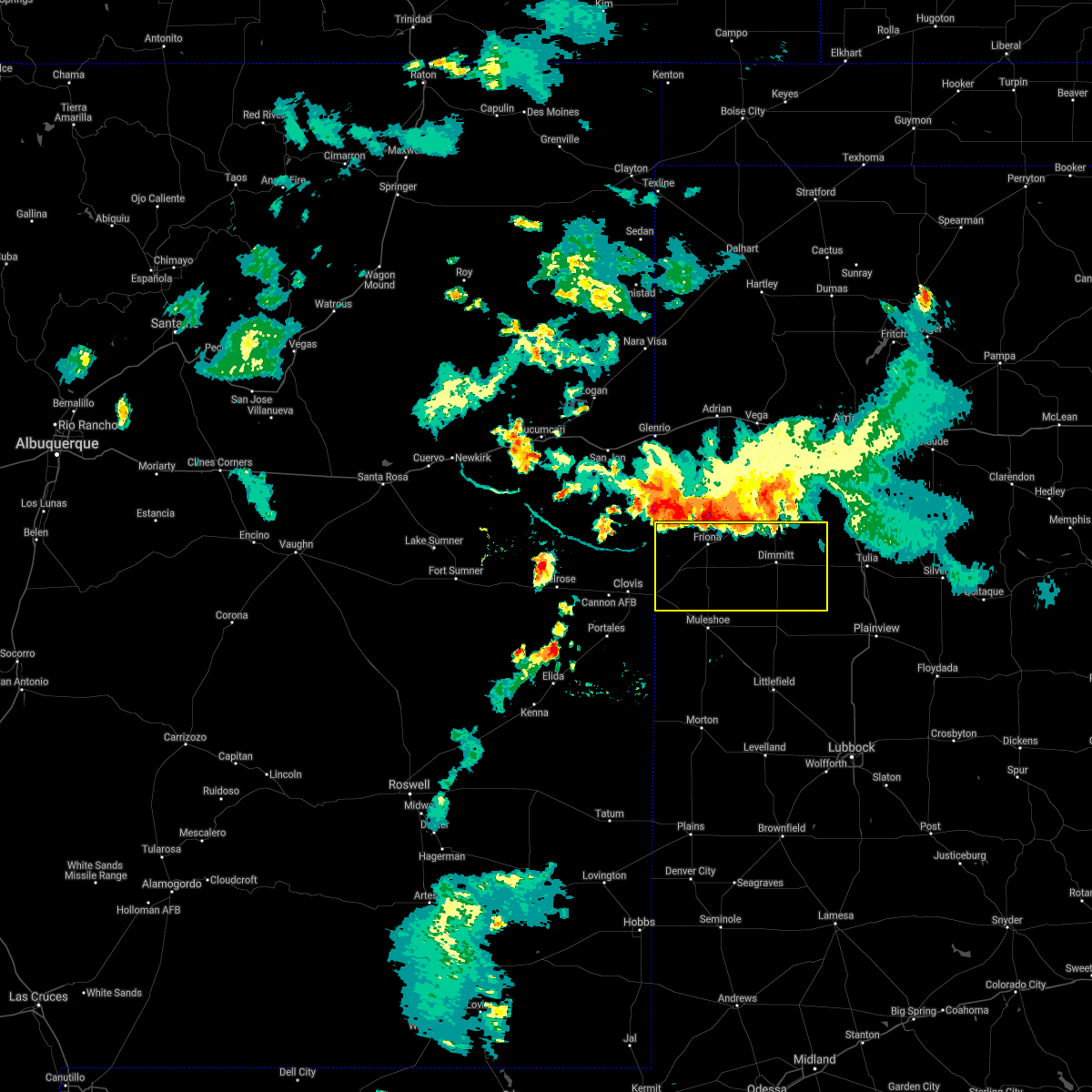 At 834 pm cdt, severe thunderstorms were located along a line extending from 4 miles northwest of rhea to 4 miles southwest of happy, moving southeast at 30 mph (66 mph wind gust measured at the hereford west texas mesonet). Hazards include 70 mph wind gusts and nickel size hail. Expect considerable tree damage. damage is likely to mobile homes, roofs, and outbuildings. Locations impacted include, dimmitt, friona, hart, bovina, farwell, summerfield, easter, lazbuddie, oklahoma lane, lariat, black, rhea and nazareth. At 834 pm cdt, severe thunderstorms were located along a line extending from 4 miles northwest of rhea to 4 miles southwest of happy, moving southeast at 30 mph (66 mph wind gust measured at the hereford west texas mesonet). Hazards include 70 mph wind gusts and nickel size hail. Expect considerable tree damage. damage is likely to mobile homes, roofs, and outbuildings. Locations impacted include, dimmitt, friona, hart, bovina, farwell, summerfield, easter, lazbuddie, oklahoma lane, lariat, black, rhea and nazareth.
|
| 7/17/2021 8:18 PM CDT |
 At 817 pm cdt, severe thunderstorms were located along a line extending from near bellview to 6 miles northwest of happy, moving southeast at 25 mph (66 mph wind measured at the hereford west texas mesonet). Hazards include 70 mph wind gusts and nickel size hail. Expect considerable tree damage. Damage is likely to mobile homes, roofs, and outbuildings. At 817 pm cdt, severe thunderstorms were located along a line extending from near bellview to 6 miles northwest of happy, moving southeast at 25 mph (66 mph wind measured at the hereford west texas mesonet). Hazards include 70 mph wind gusts and nickel size hail. Expect considerable tree damage. Damage is likely to mobile homes, roofs, and outbuildings.
|
| 7/5/2021 1:12 AM CDT |
 The severe thunderstorm warning for central parmer county will expire at 115 am cdt, the storm which prompted the warning has weakened below severe limits, and no longer poses an immediate threat to life or property. therefore, the warning will be allowed to expire. however gusty winds are still possible with this thunderstorm. The severe thunderstorm warning for central parmer county will expire at 115 am cdt, the storm which prompted the warning has weakened below severe limits, and no longer poses an immediate threat to life or property. therefore, the warning will be allowed to expire. however gusty winds are still possible with this thunderstorm.
|
| 7/5/2021 12:59 AM CDT |
 At 1236 am cdt, a severe thunderstorm was located 5 miles northeast of rhea, or 11 miles northwest of friona, moving south at 25 mph (west texas mesonet at bootleg reported a gust to 68 mph). Hazards include 70 mph wind gusts and penny size hail. Expect considerable tree damage. Damage is likely to mobile homes, roofs, and outbuildings. At 1236 am cdt, a severe thunderstorm was located 5 miles northeast of rhea, or 11 miles northwest of friona, moving south at 25 mph (west texas mesonet at bootleg reported a gust to 68 mph). Hazards include 70 mph wind gusts and penny size hail. Expect considerable tree damage. Damage is likely to mobile homes, roofs, and outbuildings.
|
| 7/5/2021 12:36 AM CDT |
 At 1236 am cdt, a severe thunderstorm was located 5 miles northeast of rhea, or 11 miles northwest of friona, moving south at 25 mph (west texas mesonet at bootleg reported a gust to 68 mph). Hazards include 70 mph wind gusts and penny size hail. Expect considerable tree damage. Damage is likely to mobile homes, roofs, and outbuildings. At 1236 am cdt, a severe thunderstorm was located 5 miles northeast of rhea, or 11 miles northwest of friona, moving south at 25 mph (west texas mesonet at bootleg reported a gust to 68 mph). Hazards include 70 mph wind gusts and penny size hail. Expect considerable tree damage. Damage is likely to mobile homes, roofs, and outbuildings.
|
| 5/28/2021 8:31 PM CDT |
 At 830 pm cdt, severe thunderstorms were located along a line extending from oklahoma lane to muleshoe wildlife refuge to 6 miles east of milnesand, moving southeast at 40 mph. the rotation has shown some weakening but we continue to carefully monitor the storm (radar indicated). Hazards include 70 mph wind gusts and penny size hail. Expect considerable tree damage. damage is likely to mobile homes, roofs, and outbuildings. Locations impacted include, littlefield, muleshoe, morton, earth, bovina, farwell, sudan, amherst, needmore, lazbuddie, oklahoma lane, progress, fieldton, lariat, bledsoe, enochs, west camp, muleshoe wildlife refuge, bula and pep. At 830 pm cdt, severe thunderstorms were located along a line extending from oklahoma lane to muleshoe wildlife refuge to 6 miles east of milnesand, moving southeast at 40 mph. the rotation has shown some weakening but we continue to carefully monitor the storm (radar indicated). Hazards include 70 mph wind gusts and penny size hail. Expect considerable tree damage. damage is likely to mobile homes, roofs, and outbuildings. Locations impacted include, littlefield, muleshoe, morton, earth, bovina, farwell, sudan, amherst, needmore, lazbuddie, oklahoma lane, progress, fieldton, lariat, bledsoe, enochs, west camp, muleshoe wildlife refuge, bula and pep.
|
| 5/28/2021 8:28 PM CDT |
 At 825 pm cdt, severe thunderstorms were located along a line extending from oklahoma lane to 4 miles northwest of muleshoe wildlife refuge to 4 miles east of milnesand, moving southeast at 40 mph. the strongest winds are expected to be along and south of us highway 84 (radar indicated). Hazards include 70 mph wind gusts and penny size hail. Expect considerable tree damage. damage is likely to mobile homes, roofs, and outbuildings. Locations impacted include, littlefield, muleshoe, morton, earth, bovina, farwell, sudan, amherst, needmore, lazbuddie, oklahoma lane, progress, fieldton, lariat, bledsoe, enochs, west camp, muleshoe wildlife refuge, bula and pep. At 825 pm cdt, severe thunderstorms were located along a line extending from oklahoma lane to 4 miles northwest of muleshoe wildlife refuge to 4 miles east of milnesand, moving southeast at 40 mph. the strongest winds are expected to be along and south of us highway 84 (radar indicated). Hazards include 70 mph wind gusts and penny size hail. Expect considerable tree damage. damage is likely to mobile homes, roofs, and outbuildings. Locations impacted include, littlefield, muleshoe, morton, earth, bovina, farwell, sudan, amherst, needmore, lazbuddie, oklahoma lane, progress, fieldton, lariat, bledsoe, enochs, west camp, muleshoe wildlife refuge, bula and pep.
|
| 5/28/2021 8:16 PM CDT |
 At 815 pm cdt, severe thunderstorms were located along a line extending from 6 miles northwest of bovina to 11 miles west of needmore to 6 miles north of milnesand, moving southeast at 40 mph (radar indicated). Hazards include 70 mph wind gusts and nickel size hail. Expect considerable tree damage. damage is likely to mobile homes, roofs, and outbuildings. Locations impacted include, littlefield, muleshoe, morton, earth, bovina, farwell, sudan, amherst, needmore, lazbuddie, oklahoma lane, progress, fieldton, lariat, bledsoe, enochs, west camp, muleshoe wildlife refuge, bula and pep. At 815 pm cdt, severe thunderstorms were located along a line extending from 6 miles northwest of bovina to 11 miles west of needmore to 6 miles north of milnesand, moving southeast at 40 mph (radar indicated). Hazards include 70 mph wind gusts and nickel size hail. Expect considerable tree damage. damage is likely to mobile homes, roofs, and outbuildings. Locations impacted include, littlefield, muleshoe, morton, earth, bovina, farwell, sudan, amherst, needmore, lazbuddie, oklahoma lane, progress, fieldton, lariat, bledsoe, enochs, west camp, muleshoe wildlife refuge, bula and pep.
|
| 5/28/2021 8:07 PM CDT |
 At 806 pm cdt, severe thunderstorms were located along a line extending from 6 miles northeast of progress to 4 miles northwest of milnesand, moving southeast at 35 mph (radar indicated). Hazards include 70 mph wind gusts and nickel size hail. Expect considerable tree damage. damage is likely to mobile homes, roofs, and outbuildings. at 806 pm, an increased threat for a tornado is located about 4 miles south of farwell. Locations impacted include, littlefield, muleshoe, morton, earth, bovina, farwell, sudan, amherst, needmore, lazbuddie, oklahoma lane, progress, fieldton, lariat, bledsoe, enochs, west camp, muleshoe wildlife refuge, bula and pep. At 806 pm cdt, severe thunderstorms were located along a line extending from 6 miles northeast of progress to 4 miles northwest of milnesand, moving southeast at 35 mph (radar indicated). Hazards include 70 mph wind gusts and nickel size hail. Expect considerable tree damage. damage is likely to mobile homes, roofs, and outbuildings. at 806 pm, an increased threat for a tornado is located about 4 miles south of farwell. Locations impacted include, littlefield, muleshoe, morton, earth, bovina, farwell, sudan, amherst, needmore, lazbuddie, oklahoma lane, progress, fieldton, lariat, bledsoe, enochs, west camp, muleshoe wildlife refuge, bula and pep.
|
| 5/28/2021 7:53 PM CDT |
 At 753 pm cdt, severe thunderstorms were located along a line extending from 4 miles northeast of oklahoma lane to 8 miles southwest of pep, moving southeast at 35 mph (radar indicated). Hazards include 70 mph wind gusts and nickel size hail. Expect considerable tree damage. Damage is likely to mobile homes, roofs, and outbuildings. At 753 pm cdt, severe thunderstorms were located along a line extending from 4 miles northeast of oklahoma lane to 8 miles southwest of pep, moving southeast at 35 mph (radar indicated). Hazards include 70 mph wind gusts and nickel size hail. Expect considerable tree damage. Damage is likely to mobile homes, roofs, and outbuildings.
|
| 5/14/2021 6:34 PM CDT |
 At 633 pm cdt, a severe thunderstorm was located 5 miles east of bovina, or 8 miles southwest of friona, moving northeast at 15 mph (radar indicated). Hazards include 60 mph wind gusts and quarter size hail. Hail damage to vehicles is expected. expect wind damage to roofs, siding, and trees. Locations impacted include, friona, bovina, summerfield, easter, black and rhea. At 633 pm cdt, a severe thunderstorm was located 5 miles east of bovina, or 8 miles southwest of friona, moving northeast at 15 mph (radar indicated). Hazards include 60 mph wind gusts and quarter size hail. Hail damage to vehicles is expected. expect wind damage to roofs, siding, and trees. Locations impacted include, friona, bovina, summerfield, easter, black and rhea.
|
| 5/14/2021 6:26 PM CDT |
 At 626 pm cdt, a severe thunderstorm was located near bovina, or 10 miles southwest of friona, moving northeast at 25 mph (radar indicated). Hazards include 60 mph wind gusts and half dollar size hail. Hail damage to vehicles is expected. expect wind damage to roofs, siding, and trees. Locations impacted include, friona, bovina, farwell, summerfield, easter, rhea and black. At 626 pm cdt, a severe thunderstorm was located near bovina, or 10 miles southwest of friona, moving northeast at 25 mph (radar indicated). Hazards include 60 mph wind gusts and half dollar size hail. Hail damage to vehicles is expected. expect wind damage to roofs, siding, and trees. Locations impacted include, friona, bovina, farwell, summerfield, easter, rhea and black.
|
| 5/14/2021 6:19 PM CDT | Quarter sized hail reported 0.4 miles SE of Bovina, TX, delayed report of nickel to quarter sized hail relayed via media |
| 5/14/2021 6:09 PM CDT |
 At 608 pm cdt, a cluster of severe thunderstorms were located in parmer and castro counties, moving northeast at 15 mph (radar indicated). Hazards include ping pong ball size hail and 60 mph wind gusts. People and animals outdoors will be injured. expect hail damage to roofs, siding, windows, and vehicles. Expect wind damage to roofs, siding, and trees. At 608 pm cdt, a cluster of severe thunderstorms were located in parmer and castro counties, moving northeast at 15 mph (radar indicated). Hazards include ping pong ball size hail and 60 mph wind gusts. People and animals outdoors will be injured. expect hail damage to roofs, siding, windows, and vehicles. Expect wind damage to roofs, siding, and trees.
|
| 5/14/2021 5:56 PM CDT |
 At 556 pm cdt, a severe thunderstorm was located 5 miles southeast of rhea, or 10 miles west of friona, moving northeast at 10 mph (radar indicated). Hazards include ping pong ball size hail and 60 mph wind gusts. People and animals outdoors will be injured. expect hail damage to roofs, siding, windows, and vehicles. expect wind damage to roofs, siding, and trees. Locations impacted include, friona, bovina, summerfield, black and rhea. At 556 pm cdt, a severe thunderstorm was located 5 miles southeast of rhea, or 10 miles west of friona, moving northeast at 10 mph (radar indicated). Hazards include ping pong ball size hail and 60 mph wind gusts. People and animals outdoors will be injured. expect hail damage to roofs, siding, windows, and vehicles. expect wind damage to roofs, siding, and trees. Locations impacted include, friona, bovina, summerfield, black and rhea.
|
| 5/14/2021 5:46 PM CDT |
 At 546 pm cdt, a severe thunderstorm was located near bovina, or 9 miles southwest of friona, moving northeast at 15 mph (radar indicated). Hazards include ping pong ball size hail and 60 mph wind gusts. People and animals outdoors will be injured. expect hail damage to roofs, siding, windows, and vehicles. expect wind damage to roofs, siding, and trees. Locations impacted include, friona, bovina, farwell, summerfield, easter, lazbuddie, oklahoma lane, lariat, rhea and black. At 546 pm cdt, a severe thunderstorm was located near bovina, or 9 miles southwest of friona, moving northeast at 15 mph (radar indicated). Hazards include ping pong ball size hail and 60 mph wind gusts. People and animals outdoors will be injured. expect hail damage to roofs, siding, windows, and vehicles. expect wind damage to roofs, siding, and trees. Locations impacted include, friona, bovina, farwell, summerfield, easter, lazbuddie, oklahoma lane, lariat, rhea and black.
|
| 5/14/2021 5:24 PM CDT |
 At 524 pm cdt, a severe thunderstorm was located 4 miles west of bovina, or 14 miles northeast of clovis, moving northeast at 20 mph (radar indicated). Hazards include ping pong ball size hail and 60 mph wind gusts. People and animals outdoors will be injured. expect hail damage to roofs, siding, windows, and vehicles. expect wind damage to roofs, siding, and trees. Locations impacted include, friona, bovina, farwell, summerfield, easter, lazbuddie, oklahoma lane, lariat, rhea and black. At 524 pm cdt, a severe thunderstorm was located 4 miles west of bovina, or 14 miles northeast of clovis, moving northeast at 20 mph (radar indicated). Hazards include ping pong ball size hail and 60 mph wind gusts. People and animals outdoors will be injured. expect hail damage to roofs, siding, windows, and vehicles. expect wind damage to roofs, siding, and trees. Locations impacted include, friona, bovina, farwell, summerfield, easter, lazbuddie, oklahoma lane, lariat, rhea and black.
|
| 5/14/2021 5:13 PM CDT |
 At 513 pm cdt, a severe thunderstorm was located 7 miles west of bovina, or 11 miles east of clovis, moving northeast at 20 mph (radar indicated). Hazards include ping pong ball size hail and 60 mph wind gusts. People and animals outdoors will be injured. expect hail damage to roofs, siding, windows, and vehicles. expect wind damage to roofs, siding, and trees. Locations impacted include, friona, bovina, farwell, summerfield, easter, lazbuddie, oklahoma lane, progress, lariat, rhea, west camp and black. At 513 pm cdt, a severe thunderstorm was located 7 miles west of bovina, or 11 miles east of clovis, moving northeast at 20 mph (radar indicated). Hazards include ping pong ball size hail and 60 mph wind gusts. People and animals outdoors will be injured. expect hail damage to roofs, siding, windows, and vehicles. expect wind damage to roofs, siding, and trees. Locations impacted include, friona, bovina, farwell, summerfield, easter, lazbuddie, oklahoma lane, progress, lariat, rhea, west camp and black.
|
| 5/14/2021 5:09 PM CDT |
 At 509 pm cdt, a severe thunderstorm was located 6 miles north of texico, or 9 miles east of clovis, moving northeast at 20 mph (radar indicated). Hazards include 60 mph wind gusts and quarter size hail. Hail damage to vehicles is expected. Expect wind damage to roofs, siding, and trees. At 509 pm cdt, a severe thunderstorm was located 6 miles north of texico, or 9 miles east of clovis, moving northeast at 20 mph (radar indicated). Hazards include 60 mph wind gusts and quarter size hail. Hail damage to vehicles is expected. Expect wind damage to roofs, siding, and trees.
|
| 6/27/2020 6:59 PM CDT |
 At 659 pm cdt, a severe thunderstorm was located 6 miles southeast of rhea, or 7 miles west of friona, moving northeast at 20 mph (radar indicated). Hazards include 60 mph wind gusts. Expect damage to roofs, siding, and trees. Locations impacted include, friona, bovina, black and rhea. At 659 pm cdt, a severe thunderstorm was located 6 miles southeast of rhea, or 7 miles west of friona, moving northeast at 20 mph (radar indicated). Hazards include 60 mph wind gusts. Expect damage to roofs, siding, and trees. Locations impacted include, friona, bovina, black and rhea.
|
| 6/27/2020 6:39 PM CDT |
 At 638 pm cdt, a severe thunderstorm was located 6 miles south of rhea, or 13 miles west of friona, moving northeast at 20 mph (radar indicated). Hazards include 60 mph wind gusts and quarter size hail. Hail damage to vehicles is expected. Expect wind damage to roofs, siding, and trees. At 638 pm cdt, a severe thunderstorm was located 6 miles south of rhea, or 13 miles west of friona, moving northeast at 20 mph (radar indicated). Hazards include 60 mph wind gusts and quarter size hail. Hail damage to vehicles is expected. Expect wind damage to roofs, siding, and trees.
|
| 8/9/2019 5:13 PM CDT |
 At 513 pm cdt, a severe thunderstorm was located near farwell, or 13 miles east of clovis, moving northeast at 15 mph (radar indicated). Hazards include 70 mph wind gusts. Expect considerable tree damage. damage is likely to mobile homes, roofs, and outbuildings. Locations impacted include, bovina, farwell and rhea. At 513 pm cdt, a severe thunderstorm was located near farwell, or 13 miles east of clovis, moving northeast at 15 mph (radar indicated). Hazards include 70 mph wind gusts. Expect considerable tree damage. damage is likely to mobile homes, roofs, and outbuildings. Locations impacted include, bovina, farwell and rhea.
|
| 8/9/2019 4:53 PM CDT |
 At 453 pm cdt, a severe thunderstorm was located near texico, or 7 miles east of clovis, moving northeast at 15 mph (radar indicated). Hazards include 70 mph wind gusts. Expect considerable tree damage. Damage is likely to mobile homes, roofs, and outbuildings. At 453 pm cdt, a severe thunderstorm was located near texico, or 7 miles east of clovis, moving northeast at 15 mph (radar indicated). Hazards include 70 mph wind gusts. Expect considerable tree damage. Damage is likely to mobile homes, roofs, and outbuildings.
|
| 7/10/2019 3:59 PM CDT | Quarter sized hail reported 11.2 miles SSE of Bovina, TX, mostly nickle size hail with occasional quarter-size hail mixed in. |
| 6/17/2019 4:32 PM CDT |
 At 431 pm cdt, a severe thunderstorm was located over west camp, or 14 miles southeast of clovis, moving east at 30 mph. small hail was reported a few miles north of the core of the storm in farwell at 425 pm (radar indicated). Hazards include 60 mph wind gusts and quarter size hail. Hail damage to vehicles is expected. expect wind damage to roofs, siding, and trees. Locations impacted include, muleshoe, friona, bovina, farwell, progress, oklahoma lane, lariat and west camp. At 431 pm cdt, a severe thunderstorm was located over west camp, or 14 miles southeast of clovis, moving east at 30 mph. small hail was reported a few miles north of the core of the storm in farwell at 425 pm (radar indicated). Hazards include 60 mph wind gusts and quarter size hail. Hail damage to vehicles is expected. expect wind damage to roofs, siding, and trees. Locations impacted include, muleshoe, friona, bovina, farwell, progress, oklahoma lane, lariat and west camp.
|
| 6/17/2019 4:22 PM CDT |
 At 422 pm cdt, a severe thunderstorm was located over west camp, or 12 miles west of muleshoe, moving northeast at 10 mph (radar indicated). Hazards include 60 mph wind gusts and penny size hail. Expect damage to roofs, siding, and trees. Locations impacted include, muleshoe, friona, bovina, farwell, progress, oklahoma lane, lariat and west camp. At 422 pm cdt, a severe thunderstorm was located over west camp, or 12 miles west of muleshoe, moving northeast at 10 mph (radar indicated). Hazards include 60 mph wind gusts and penny size hail. Expect damage to roofs, siding, and trees. Locations impacted include, muleshoe, friona, bovina, farwell, progress, oklahoma lane, lariat and west camp.
|
| 6/17/2019 4:12 PM CDT |
 At 412 pm cdt, a severe thunderstorm was located over west camp, or 13 miles west of muleshoe, moving northeast at 15 mph (radar indicated). Hazards include 60 mph wind gusts and quarter size hail. Hail damage to vehicles is expected. expect wind damage to roofs, siding, and trees. Locations impacted include, muleshoe, friona, bovina, farwell, progress, oklahoma lane, lariat and west camp. At 412 pm cdt, a severe thunderstorm was located over west camp, or 13 miles west of muleshoe, moving northeast at 15 mph (radar indicated). Hazards include 60 mph wind gusts and quarter size hail. Hail damage to vehicles is expected. expect wind damage to roofs, siding, and trees. Locations impacted include, muleshoe, friona, bovina, farwell, progress, oklahoma lane, lariat and west camp.
|
| 6/17/2019 3:56 PM CDT |
 At 356 pm cdt, a severe thunderstorm was located over west camp, or 15 miles west of muleshoe, moving northeast at 15 mph (radar indicated). Hazards include 60 mph wind gusts and half dollar size hail. Hail damage to vehicles is expected. Expect wind damage to roofs, siding, and trees. At 356 pm cdt, a severe thunderstorm was located over west camp, or 15 miles west of muleshoe, moving northeast at 15 mph (radar indicated). Hazards include 60 mph wind gusts and half dollar size hail. Hail damage to vehicles is expected. Expect wind damage to roofs, siding, and trees.
|
| 6/3/2019 11:39 PM CDT |
 At 1139 pm cdt, a severe thunderstorm was located near friona, moving northeast at 10 mph. this storm may produce a tornado (radar indicated). Hazards include two inch hail and 60 mph wind gusts. People and animals outdoors will be injured. expect hail damage to roofs, siding, windows, and vehicles. expect wind damage to roofs, siding, and trees. Locations impacted include, friona, bovina, farwell, black and rhea. At 1139 pm cdt, a severe thunderstorm was located near friona, moving northeast at 10 mph. this storm may produce a tornado (radar indicated). Hazards include two inch hail and 60 mph wind gusts. People and animals outdoors will be injured. expect hail damage to roofs, siding, windows, and vehicles. expect wind damage to roofs, siding, and trees. Locations impacted include, friona, bovina, farwell, black and rhea.
|
| 6/3/2019 11:17 PM CDT |
 At 1117 pm cdt, a severe thunderstorm was located 5 miles west of friona, moving east at 25 mph (radar indicated). Hazards include two inch hail and 60 mph wind gusts. People and animals outdoors will be injured. expect hail damage to roofs, siding, windows, and vehicles. expect wind damage to roofs, siding, and trees. Locations impacted include, friona, bovina, farwell, black and rhea. At 1117 pm cdt, a severe thunderstorm was located 5 miles west of friona, moving east at 25 mph (radar indicated). Hazards include two inch hail and 60 mph wind gusts. People and animals outdoors will be injured. expect hail damage to roofs, siding, windows, and vehicles. expect wind damage to roofs, siding, and trees. Locations impacted include, friona, bovina, farwell, black and rhea.
|
| 6/3/2019 11:10 PM CDT |
 At 1109 pm cdt, a severe thunderstorm was located 7 miles southwest of rhea, or 15 miles northeast of clovis, moving northeast at 10 mph (radar indicated). Hazards include 60 mph wind gusts and quarter size hail. Hail damage to vehicles is expected. Expect wind damage to roofs, siding, and trees. At 1109 pm cdt, a severe thunderstorm was located 7 miles southwest of rhea, or 15 miles northeast of clovis, moving northeast at 10 mph (radar indicated). Hazards include 60 mph wind gusts and quarter size hail. Hail damage to vehicles is expected. Expect wind damage to roofs, siding, and trees.
|
| 5/26/2019 9:27 PM CDT |
 At 926 pm cdt, radar indicated a 5 miles north of needmore, or 8 miles south of muleshoe, moving northeast at 40 mph. a brief tornado also was reported near lariat at 922 pm (weather spotters confirmed tornado). Hazards include damaging tornado and three inch hail. Flying debris will be dangerous to those caught without shelter. mobile homes will be damaged or destroyed. damage to roofs, windows, and vehicles will occur. tree damage is likely. Locations impacted include, muleshoe, bovina, sudan, lazbuddie, progress, oklahoma lane, lariat and west camp. At 926 pm cdt, radar indicated a 5 miles north of needmore, or 8 miles south of muleshoe, moving northeast at 40 mph. a brief tornado also was reported near lariat at 922 pm (weather spotters confirmed tornado). Hazards include damaging tornado and three inch hail. Flying debris will be dangerous to those caught without shelter. mobile homes will be damaged or destroyed. damage to roofs, windows, and vehicles will occur. tree damage is likely. Locations impacted include, muleshoe, bovina, sudan, lazbuddie, progress, oklahoma lane, lariat and west camp.
|
| 5/26/2019 9:11 PM CDT |
 At 910 pm cdt, a large and extremely dangerous tornado was located 11 miles west of needmore, or 18 miles southwest of muleshoe, moving northeast at 35 mph. this is a particularly dangerous situation. take cover now! (radar indicated rotation). Hazards include damaging tornado. You are in a life-threatening situation. flying debris may be deadly to those caught without shelter. mobile homes will be destroyed. Considerable damage to homes, businesses, and vehicles is likely and complete destruction is possible. At 910 pm cdt, a large and extremely dangerous tornado was located 11 miles west of needmore, or 18 miles southwest of muleshoe, moving northeast at 35 mph. this is a particularly dangerous situation. take cover now! (radar indicated rotation). Hazards include damaging tornado. You are in a life-threatening situation. flying debris may be deadly to those caught without shelter. mobile homes will be destroyed. Considerable damage to homes, businesses, and vehicles is likely and complete destruction is possible.
|
| 5/26/2019 8:18 PM CDT |
 At 817 pm cdt, severe thunderstorms were located along a line extending from 6 miles southeast of bootleg to 5 miles north of arch, moving east at 25 mph (radar indicated). Hazards include 60 mph wind gusts and quarter size hail. Hail damage to vehicles is expected. expect wind damage to roofs, siding, and trees. Locations impacted include, friona, bovina, farwell, summerfield, needmore, progress, oklahoma lane, lariat, west camp, black, rhea and maple. At 817 pm cdt, severe thunderstorms were located along a line extending from 6 miles southeast of bootleg to 5 miles north of arch, moving east at 25 mph (radar indicated). Hazards include 60 mph wind gusts and quarter size hail. Hail damage to vehicles is expected. expect wind damage to roofs, siding, and trees. Locations impacted include, friona, bovina, farwell, summerfield, needmore, progress, oklahoma lane, lariat, west camp, black, rhea and maple.
|
| 5/26/2019 8:00 PM CDT |
 At 759 pm cdt, severe thunderstorms were located along a line extending from 6 miles west of simms to pep, moving east at 30 mph (radar indicated). Hazards include 60 mph wind gusts and quarter size hail. Hail damage to vehicles is expected. expect wind damage to roofs, siding, and trees. Locations impacted include, muleshoe, friona, bovina, farwell, summerfield, needmore, lazbuddie, progress, oklahoma lane, lariat, west camp, black, rhea and maple. At 759 pm cdt, severe thunderstorms were located along a line extending from 6 miles west of simms to pep, moving east at 30 mph (radar indicated). Hazards include 60 mph wind gusts and quarter size hail. Hail damage to vehicles is expected. expect wind damage to roofs, siding, and trees. Locations impacted include, muleshoe, friona, bovina, farwell, summerfield, needmore, lazbuddie, progress, oklahoma lane, lariat, west camp, black, rhea and maple.
|
| 5/26/2019 7:37 PM CDT |
 At 736 pm cdt, severe thunderstorms were located along a line extending from 10 miles south of glenrio to 10 miles southeast of elida, moving east at 35 mph (radar indicated). Hazards include 60 mph wind gusts and quarter size hail. Hail damage to vehicles is expected. Expect wind damage to roofs, siding, and trees. At 736 pm cdt, severe thunderstorms were located along a line extending from 10 miles south of glenrio to 10 miles southeast of elida, moving east at 35 mph (radar indicated). Hazards include 60 mph wind gusts and quarter size hail. Hail damage to vehicles is expected. Expect wind damage to roofs, siding, and trees.
|
| 5/25/2019 2:20 PM CDT |
 At 219 pm cdt, a severe thunderstorm was located over rhea, or 10 miles west of friona, moving northeast at 25 mph (radar indicated). Hazards include golf ball size hail and 70 mph wind gusts. People and animals outdoors will be injured. expect hail damage to roofs, siding, windows, and vehicles. expect considerable tree damage. wind damage is also likely to mobile homes, roofs, and outbuildings. Locations impacted include, friona, bovina, farwell and rhea. At 219 pm cdt, a severe thunderstorm was located over rhea, or 10 miles west of friona, moving northeast at 25 mph (radar indicated). Hazards include golf ball size hail and 70 mph wind gusts. People and animals outdoors will be injured. expect hail damage to roofs, siding, windows, and vehicles. expect considerable tree damage. wind damage is also likely to mobile homes, roofs, and outbuildings. Locations impacted include, friona, bovina, farwell and rhea.
|
| 5/25/2019 1:50 PM CDT |
 The national weather service in lubbock texas has issued a * severe thunderstorm warning for. northwestern parmer county in the panhandle of texas. until 245 pm cdt. At 150 pm cdt, a severe thunderstorm was located 8 miles north of texico, or 10 miles northeast of clovis, moving northeast at 25. The national weather service in lubbock texas has issued a * severe thunderstorm warning for. northwestern parmer county in the panhandle of texas. until 245 pm cdt. At 150 pm cdt, a severe thunderstorm was located 8 miles north of texico, or 10 miles northeast of clovis, moving northeast at 25.
|
| 5/8/2019 8:46 PM CDT |
 At 845 pm cdt, a severe thunderstorm was located 8 miles east of bovina, or 10 miles south of friona, moving east at 25 mph. storm spotters have reported a transient elevated funnel cloud five miles east of bovina (radar indicated). Hazards include 60 mph wind gusts and half dollar size hail. Hail damage to vehicles is expected. expect wind damage to roofs, siding, and trees. Locations impacted include, friona, bovina and black. At 845 pm cdt, a severe thunderstorm was located 8 miles east of bovina, or 10 miles south of friona, moving east at 25 mph. storm spotters have reported a transient elevated funnel cloud five miles east of bovina (radar indicated). Hazards include 60 mph wind gusts and half dollar size hail. Hail damage to vehicles is expected. expect wind damage to roofs, siding, and trees. Locations impacted include, friona, bovina and black.
|
| 5/8/2019 8:44 PM CDT |
 At 843 pm cdt, a severe thunderstorm was located 7 miles east of bovina, or 10 miles south of friona, moving east at 15 mph. this storm continues to exhibit rotation and may produce a tornado (radar indicated). Hazards include 60 mph wind gusts and half dollar size hail. Hail damage to vehicles is expected. expect wind damage to roofs, siding, and trees. Locations impacted include, friona, bovina and black. At 843 pm cdt, a severe thunderstorm was located 7 miles east of bovina, or 10 miles south of friona, moving east at 15 mph. this storm continues to exhibit rotation and may produce a tornado (radar indicated). Hazards include 60 mph wind gusts and half dollar size hail. Hail damage to vehicles is expected. expect wind damage to roofs, siding, and trees. Locations impacted include, friona, bovina and black.
|
| 5/8/2019 8:27 PM CDT |
 At 825 pm cdt, a severe thunderstorm was located 4 miles east of bovina, or 9 miles southwest of friona, moving east at 25 mph. this storm is showing cyclical low level rotation and could produce a tornado (radar indicated). Hazards include 60 mph wind gusts and half dollar size hail. Hail damage to vehicles is expected. Expect wind damage to roofs, siding, and trees. At 825 pm cdt, a severe thunderstorm was located 4 miles east of bovina, or 9 miles southwest of friona, moving east at 25 mph. this storm is showing cyclical low level rotation and could produce a tornado (radar indicated). Hazards include 60 mph wind gusts and half dollar size hail. Hail damage to vehicles is expected. Expect wind damage to roofs, siding, and trees.
|
| 5/8/2019 8:20 PM CDT |
 At 819 pm cdt, a severe thunderstorm was located over bovina, or 10 miles southwest of friona, moving east at 25 mph. this storm is showing indications of a lowering rotation and could produce a tornado (radar indicated). Hazards include 60 mph wind gusts and half dollar size hail. Hail damage to vehicles is expected. expect wind damage to roofs, siding, and trees. Locations impacted include, friona and bovina. At 819 pm cdt, a severe thunderstorm was located over bovina, or 10 miles southwest of friona, moving east at 25 mph. this storm is showing indications of a lowering rotation and could produce a tornado (radar indicated). Hazards include 60 mph wind gusts and half dollar size hail. Hail damage to vehicles is expected. expect wind damage to roofs, siding, and trees. Locations impacted include, friona and bovina.
|
| 5/8/2019 8:12 PM CDT |
 At 812 pm cdt, a severe thunderstorm was located over bovina, or 12 miles southwest of friona, moving east at 35 mph (radar indicated). Hazards include 60 mph wind gusts and half dollar size hail. Hail damage to vehicles is expected. expect wind damage to roofs, siding, and trees. Locations impacted include, friona, bovina and rhea. At 812 pm cdt, a severe thunderstorm was located over bovina, or 12 miles southwest of friona, moving east at 35 mph (radar indicated). Hazards include 60 mph wind gusts and half dollar size hail. Hail damage to vehicles is expected. expect wind damage to roofs, siding, and trees. Locations impacted include, friona, bovina and rhea.
|
| 5/8/2019 7:56 PM CDT |
 At 756 pm cdt, a severe thunderstorm was located 8 miles west of bovina, or 13 miles northeast of clovis, moving northeast at 15 mph (radar indicated). Hazards include 60 mph wind gusts and half dollar size hail. Hail damage to vehicles is expected. Expect wind damage to roofs, siding, and trees. At 756 pm cdt, a severe thunderstorm was located 8 miles west of bovina, or 13 miles northeast of clovis, moving northeast at 15 mph (radar indicated). Hazards include 60 mph wind gusts and half dollar size hail. Hail damage to vehicles is expected. Expect wind damage to roofs, siding, and trees.
|
| 5/3/2019 5:37 PM CDT |
 At 537 pm cdt, a severe thunderstorm was located 4 miles northeast of bovina, or 8 miles southwest of friona, moving northeast at 25 mph (radar indicated). Hazards include quarter size hail. damage to vehicles is expected At 537 pm cdt, a severe thunderstorm was located 4 miles northeast of bovina, or 8 miles southwest of friona, moving northeast at 25 mph (radar indicated). Hazards include quarter size hail. damage to vehicles is expected
|
| 3/9/2019 1:11 AM CST |
 At 109 am cst, severe thunderstorms were located along a line extending from near lazbuddie to easter, moving east at 55 mph. at 1255 am, a wind gust to 60 mph was measured near friona (radar and mesonet indicated). Hazards include 70 mph wind gusts. Expect considerable tree damage. damage is likely to mobile homes, roofs and outbuildings. Locations impacted include, dimmitt, friona, bovina, summerfield, lazbuddie and easter. At 109 am cst, severe thunderstorms were located along a line extending from near lazbuddie to easter, moving east at 55 mph. at 1255 am, a wind gust to 60 mph was measured near friona (radar and mesonet indicated). Hazards include 70 mph wind gusts. Expect considerable tree damage. damage is likely to mobile homes, roofs and outbuildings. Locations impacted include, dimmitt, friona, bovina, summerfield, lazbuddie and easter.
|
| 3/9/2019 12:50 AM CST |
 At 1249 am cst, severe thunderstorms were located along a line extending from 4 miles northwest of black to 3 miles northwest of lariat, moving east at 50 mph (radar indicated). Hazards include 70 mph wind gusts. Expect considerable tree damage. Damage is likely to mobile homes, roofs and outbuildings. At 1249 am cst, severe thunderstorms were located along a line extending from 4 miles northwest of black to 3 miles northwest of lariat, moving east at 50 mph (radar indicated). Hazards include 70 mph wind gusts. Expect considerable tree damage. Damage is likely to mobile homes, roofs and outbuildings.
|
| 10/7/2018 3:35 PM CDT |
 At 333 pm cdt, a severe thunderstorm capable of producing a tornado was located 4 miles southwest of friona, moving northeast at 25 mph. as a tornado may form rapidly, residents in friona should prepare for the possibility of a tornado by 335 pm (weather spotters reported a funnel cloud). Hazards include tornado, quarter size hail, and 60 mph wind gusts. Flying debris will be dangerous to those caught without shelter. mobile homes will be damaged or destroyed. damage to roofs, windows, and vehicles will occur. tree damage is likely. Locations impacted include, friona, bovina, black and rhea. At 333 pm cdt, a severe thunderstorm capable of producing a tornado was located 4 miles southwest of friona, moving northeast at 25 mph. as a tornado may form rapidly, residents in friona should prepare for the possibility of a tornado by 335 pm (weather spotters reported a funnel cloud). Hazards include tornado, quarter size hail, and 60 mph wind gusts. Flying debris will be dangerous to those caught without shelter. mobile homes will be damaged or destroyed. damage to roofs, windows, and vehicles will occur. tree damage is likely. Locations impacted include, friona, bovina, black and rhea.
|
| 10/7/2018 3:26 PM CDT |
 At 324 pm cdt, a severe thunderstorm capable of producing a tornado was located 4 miles east of bovina, or 8 miles southwest of friona, moving northeast at 30 mph. residents of friona should take action now to prepare for a tornado. strong low level rotation has been reported by spotters (weather spotters reported a funnel cloud). Hazards include tornado, quarter size hail, and 60 mph wind gusts. Flying debris will be dangerous to those caught without shelter. mobile homes will be damaged or destroyed. damage to roofs, windows, and vehicles will occur. tree damage is likely. Locations impacted include, friona, bovina, black and rhea. At 324 pm cdt, a severe thunderstorm capable of producing a tornado was located 4 miles east of bovina, or 8 miles southwest of friona, moving northeast at 30 mph. residents of friona should take action now to prepare for a tornado. strong low level rotation has been reported by spotters (weather spotters reported a funnel cloud). Hazards include tornado, quarter size hail, and 60 mph wind gusts. Flying debris will be dangerous to those caught without shelter. mobile homes will be damaged or destroyed. damage to roofs, windows, and vehicles will occur. tree damage is likely. Locations impacted include, friona, bovina, black and rhea.
|
| 10/7/2018 3:19 PM CDT |
 At 318 pm cdt, a severe thunderstorm capable of producing a tornado was located over bovina, or 12 miles southwest of friona, moving northeast at 25 mph. rapid near-surface rotation has been reported with this storm just southwest of bovina. a second area for a potential tornado was located 5 nw of friona (radar indicated rotation). Hazards include tornado and quarter size hail. Flying debris will be dangerous to those caught without shelter. mobile homes will be damaged or destroyed. damage to roofs, windows, and vehicles will occur. tree damage is likely. Locations impacted include, friona, bovina, black and rhea. At 318 pm cdt, a severe thunderstorm capable of producing a tornado was located over bovina, or 12 miles southwest of friona, moving northeast at 25 mph. rapid near-surface rotation has been reported with this storm just southwest of bovina. a second area for a potential tornado was located 5 nw of friona (radar indicated rotation). Hazards include tornado and quarter size hail. Flying debris will be dangerous to those caught without shelter. mobile homes will be damaged or destroyed. damage to roofs, windows, and vehicles will occur. tree damage is likely. Locations impacted include, friona, bovina, black and rhea.
|
| 10/7/2018 3:15 PM CDT |
 At 314 pm cdt, a severe thunderstorm capable of producing a tornado was located near bovina, or 13 miles southwest of friona, moving northeast at 25 mph (radar indicated rotation). Hazards include tornado, quarter size hail, and 60 mph wind gusts. Flying debris will be dangerous to those caught without shelter. mobile homes will be damaged or destroyed. damage to roofs, windows, and vehicles will occur. tree damage is likely. Locations impacted include, friona, bovina, oklahoma lane, black and rhea. At 314 pm cdt, a severe thunderstorm capable of producing a tornado was located near bovina, or 13 miles southwest of friona, moving northeast at 25 mph (radar indicated rotation). Hazards include tornado, quarter size hail, and 60 mph wind gusts. Flying debris will be dangerous to those caught without shelter. mobile homes will be damaged or destroyed. damage to roofs, windows, and vehicles will occur. tree damage is likely. Locations impacted include, friona, bovina, oklahoma lane, black and rhea.
|
| 10/7/2018 3:08 PM CDT |
 At 307 pm cdt, a severe thunderstorm capable of producing a tornado was located near bovina, or 15 miles southwest of friona, moving northeast at 35 mph (radar indicated rotation). Hazards include tornado, quarter size hail, and 60 mph wind gusts. Flying debris will be dangerous to those caught without shelter. mobile homes will be damaged or destroyed. damage to roofs, windows, and vehicles will occur. Tree damage is likely. At 307 pm cdt, a severe thunderstorm capable of producing a tornado was located near bovina, or 15 miles southwest of friona, moving northeast at 35 mph (radar indicated rotation). Hazards include tornado, quarter size hail, and 60 mph wind gusts. Flying debris will be dangerous to those caught without shelter. mobile homes will be damaged or destroyed. damage to roofs, windows, and vehicles will occur. Tree damage is likely.
|
| 10/7/2018 3:00 PM CDT |
 At 259 pm cdt, a severe thunderstorm was located near oklahoma lane, or 16 miles northwest of muleshoe, moving north at 25 mph. this storm is showing signs of low level rotation and could produce a tornado (radar indicated). Hazards include 60 mph wind gusts and quarter size hail. Hail damage to vehicles is expected. expect wind damage to roofs, siding, and trees. Locations impacted include, friona, bovina, farwell, oklahoma lane, black and rhea. At 259 pm cdt, a severe thunderstorm was located near oklahoma lane, or 16 miles northwest of muleshoe, moving north at 25 mph. this storm is showing signs of low level rotation and could produce a tornado (radar indicated). Hazards include 60 mph wind gusts and quarter size hail. Hail damage to vehicles is expected. expect wind damage to roofs, siding, and trees. Locations impacted include, friona, bovina, farwell, oklahoma lane, black and rhea.
|
| 10/7/2018 2:43 PM CDT |
 At 242 pm cdt, a severe thunderstorm was located 5 miles southwest of rhea, or 15 miles west of friona, moving northeast at 40 mph. this storm continues to generate reports of a funnel cloud. a second storm continues to increase in strength about 5 miles east of farwell (radar indicated). Hazards include 60 mph wind gusts and half dollar size hail. Hail damage to vehicles is expected. expect wind damage to roofs, siding, and trees. Locations impacted include, friona, bovina, farwell, oklahoma lane, black and rhea. At 242 pm cdt, a severe thunderstorm was located 5 miles southwest of rhea, or 15 miles west of friona, moving northeast at 40 mph. this storm continues to generate reports of a funnel cloud. a second storm continues to increase in strength about 5 miles east of farwell (radar indicated). Hazards include 60 mph wind gusts and half dollar size hail. Hail damage to vehicles is expected. expect wind damage to roofs, siding, and trees. Locations impacted include, friona, bovina, farwell, oklahoma lane, black and rhea.
|
| 10/7/2018 2:34 PM CDT |
 At 233 pm cdt, a severe thunderstorm was located 5 miles southwest of rhea, or 15 miles west of friona, moving northeast at 40 mph (radar indicated). Hazards include 60 mph wind gusts and half dollar size hail. this storm continues to generate reports of periodic funnel clouds along and north of us highway 60. Hail damage to vehicles is expected. expect wind damage to roofs, siding, and trees. Locations impacted include, friona, bovina, farwell, oklahoma lane, black and rhea. At 233 pm cdt, a severe thunderstorm was located 5 miles southwest of rhea, or 15 miles west of friona, moving northeast at 40 mph (radar indicated). Hazards include 60 mph wind gusts and half dollar size hail. this storm continues to generate reports of periodic funnel clouds along and north of us highway 60. Hail damage to vehicles is expected. expect wind damage to roofs, siding, and trees. Locations impacted include, friona, bovina, farwell, oklahoma lane, black and rhea.
|
| 10/7/2018 2:11 PM CDT |
 At 210 pm cdt, a severe thunderstorm was located 6 miles north of farwell, or 11 miles northeast of clovis, moving northeast at 50 mph (radar indicated). Hazards include 60 mph wind gusts and half dollar size hail. a funnel cloud has been reported with this storm between farwell and clovis. Hail damage to vehicles is expected. Expect wind damage to roofs, siding, and trees. At 210 pm cdt, a severe thunderstorm was located 6 miles north of farwell, or 11 miles northeast of clovis, moving northeast at 50 mph (radar indicated). Hazards include 60 mph wind gusts and half dollar size hail. a funnel cloud has been reported with this storm between farwell and clovis. Hail damage to vehicles is expected. Expect wind damage to roofs, siding, and trees.
|
| 6/22/2018 7:58 PM CDT |
 At 756 pm cdt, a severe thunderstorm was located 7 miles west of lazbuddie, or 10 miles north of muleshoe, moving east at 30 mph (radar indicated). Hazards include 70 mph wind gusts and half dollar size hail. Hail damage to vehicles is expected. expect considerable tree damage. Wind damage is also likely to mobile homes, roofs, and outbuildings. At 756 pm cdt, a severe thunderstorm was located 7 miles west of lazbuddie, or 10 miles north of muleshoe, moving east at 30 mph (radar indicated). Hazards include 70 mph wind gusts and half dollar size hail. Hail damage to vehicles is expected. expect considerable tree damage. Wind damage is also likely to mobile homes, roofs, and outbuildings.
|
| 6/22/2018 7:52 PM CDT |
 At 751 pm cdt, a severe thunderstorm was located 6 miles northeast of oklahoma lane, or 14 miles south of friona, moving east at 25 mph (radar indicated). Hazards include 70 mph wind gusts and quarter size hail. Hail damage to vehicles is expected. expect considerable tree damage. wind damage is also likely to mobile homes, roofs, and outbuildings. Locations impacted include, bovina, lazbuddie, oklahoma lane and lariat. At 751 pm cdt, a severe thunderstorm was located 6 miles northeast of oklahoma lane, or 14 miles south of friona, moving east at 25 mph (radar indicated). Hazards include 70 mph wind gusts and quarter size hail. Hail damage to vehicles is expected. expect considerable tree damage. wind damage is also likely to mobile homes, roofs, and outbuildings. Locations impacted include, bovina, lazbuddie, oklahoma lane and lariat.
|
| 6/22/2018 7:35 PM CDT |
 At 732 pm cdt, a severe thunderstorm was located 4 miles south of bovina, or 16 miles southwest of friona, moving east at 30 mph. an additional thunderstorm located 15 miles west of dimmitt cold produce wind gusts in excess of 60 mph (radar indicated). Hazards include 70 mph wind gusts and half dollar size hail. Hail damage to vehicles is expected. expect considerable tree damage. wind damage is also likely to mobile homes, roofs, and outbuildings. Locations impacted include, dimmitt, friona, hart, bovina, farwell, easter, lazbuddie, oklahoma lane, lariat, rhea, black and nazareth. At 732 pm cdt, a severe thunderstorm was located 4 miles south of bovina, or 16 miles southwest of friona, moving east at 30 mph. an additional thunderstorm located 15 miles west of dimmitt cold produce wind gusts in excess of 60 mph (radar indicated). Hazards include 70 mph wind gusts and half dollar size hail. Hail damage to vehicles is expected. expect considerable tree damage. wind damage is also likely to mobile homes, roofs, and outbuildings. Locations impacted include, dimmitt, friona, hart, bovina, farwell, easter, lazbuddie, oklahoma lane, lariat, rhea, black and nazareth.
|
| 6/22/2018 7:21 PM CDT |
 At 720 pm cdt, a severe thunderstorm was located near farwell, or 11 miles east of clovis, moving east at 30 mph. an additional thunderstorm capable of producing severe wind gusts was located 5 miles southeast of friona, moving east at 30 mph (radar indicated). Hazards include ping pong ball size hail and 60 mph wind gusts. People and animals outdoors will be injured. expect hail damage to roofs, siding, windows, and vehicles. expect wind damage to roofs, siding, and trees. Locations impacted include, dimmitt, friona, hart, bovina, farwell, easter, lazbuddie, oklahoma lane, lariat, rhea, black and nazareth. At 720 pm cdt, a severe thunderstorm was located near farwell, or 11 miles east of clovis, moving east at 30 mph. an additional thunderstorm capable of producing severe wind gusts was located 5 miles southeast of friona, moving east at 30 mph (radar indicated). Hazards include ping pong ball size hail and 60 mph wind gusts. People and animals outdoors will be injured. expect hail damage to roofs, siding, windows, and vehicles. expect wind damage to roofs, siding, and trees. Locations impacted include, dimmitt, friona, hart, bovina, farwell, easter, lazbuddie, oklahoma lane, lariat, rhea, black and nazareth.
|
| 6/22/2018 7:03 PM CDT |
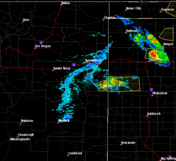 At 703 pm cdt, a severe thunderstorm was located 5 miles south of friona, moving east at 30 mph. an additional severe thunderstorm was located near clovis, also moving east at 30 mph (radar indicated). Hazards include 60 mph wind gusts and penny size hail. expect damage to roofs, siding, and trees At 703 pm cdt, a severe thunderstorm was located 5 miles south of friona, moving east at 30 mph. an additional severe thunderstorm was located near clovis, also moving east at 30 mph (radar indicated). Hazards include 60 mph wind gusts and penny size hail. expect damage to roofs, siding, and trees
|
| 5/15/2018 7:33 PM CDT |
 At 732 pm cdt, severe thunderstorms were located along a line extending from near easter to 7 miles northeast of oklahoma lane, moving southeast at 30 mph (radar indicated. at 720 pm a 58 mph wind gusts was reported at the west texas mesonet station located 2 miles northeast of friona). Hazards include ping pong ball size hail and 60 mph wind gusts. People and animals outdoors will be injured. expect hail damage to roofs, siding, windows, and vehicles. expect wind damage to roofs, siding, and trees. Locations impacted include, muleshoe, dimmitt, friona, hart, earth, bovina, sudan, summerfield, easter, lazbuddie, black, nazareth and springlake. At 732 pm cdt, severe thunderstorms were located along a line extending from near easter to 7 miles northeast of oklahoma lane, moving southeast at 30 mph (radar indicated. at 720 pm a 58 mph wind gusts was reported at the west texas mesonet station located 2 miles northeast of friona). Hazards include ping pong ball size hail and 60 mph wind gusts. People and animals outdoors will be injured. expect hail damage to roofs, siding, windows, and vehicles. expect wind damage to roofs, siding, and trees. Locations impacted include, muleshoe, dimmitt, friona, hart, earth, bovina, sudan, summerfield, easter, lazbuddie, black, nazareth and springlake.
|
| 5/15/2018 7:18 PM CDT |
 At 717 pm cdt, severe thunderstorms were located along a line extending from near summerfield to near bovina, moving southeast at 30 mph (radar indicated). Hazards include ping pong ball size hail and 60 mph wind gusts. People and animals outdoors will be injured. expect hail damage to roofs, siding, windows, and vehicles. Expect wind damage to roofs, siding, and trees. At 717 pm cdt, severe thunderstorms were located along a line extending from near summerfield to near bovina, moving southeast at 30 mph (radar indicated). Hazards include ping pong ball size hail and 60 mph wind gusts. People and animals outdoors will be injured. expect hail damage to roofs, siding, windows, and vehicles. Expect wind damage to roofs, siding, and trees.
|
| 4/29/2018 7:36 PM CDT |
 At 736 pm cdt, severe thunderstorms were located along a line extending from 7 miles southeast of friona to near muleshoe, moving northeast at 20 mph (radar indicated). Hazards include 60 mph wind gusts and half dollar size hail. Hail damage to vehicles is expected. expect wind damage to roofs, siding, and trees. Locations impacted include, muleshoe, friona, bovina, lazbuddie, progress, oklahoma lane, lariat and black. At 736 pm cdt, severe thunderstorms were located along a line extending from 7 miles southeast of friona to near muleshoe, moving northeast at 20 mph (radar indicated). Hazards include 60 mph wind gusts and half dollar size hail. Hail damage to vehicles is expected. expect wind damage to roofs, siding, and trees. Locations impacted include, muleshoe, friona, bovina, lazbuddie, progress, oklahoma lane, lariat and black.
|
| 4/29/2018 7:14 PM CDT |
 At 714 pm cdt, severe thunderstorms were located along a line extending from 8 miles east of bovina to near progress, moving east at 15 mph (radar indicated). Hazards include 60 mph wind gusts and half dollar size hail. Hail damage to vehicles is expected. expect wind damage to roofs, siding, and trees. Locations impacted include, muleshoe, friona, bovina, lazbuddie, progress, oklahoma lane, lariat and black. At 714 pm cdt, severe thunderstorms were located along a line extending from 8 miles east of bovina to near progress, moving east at 15 mph (radar indicated). Hazards include 60 mph wind gusts and half dollar size hail. Hail damage to vehicles is expected. expect wind damage to roofs, siding, and trees. Locations impacted include, muleshoe, friona, bovina, lazbuddie, progress, oklahoma lane, lariat and black.
|
| 4/29/2018 6:56 PM CDT |
 At 656 pm cdt, severe thunderstorms were located along a line extending from 6 miles southwest of friona to near progress, moving northeast at 20 mph (radar indicated). Hazards include 60 mph wind gusts and half dollar size hail. Hail damage to vehicles is expected. expect wind damage to roofs, siding, and trees. Locations impacted include, muleshoe, friona, bovina, farwell, lazbuddie, progress, oklahoma lane, lariat, west camp and black. At 656 pm cdt, severe thunderstorms were located along a line extending from 6 miles southwest of friona to near progress, moving northeast at 20 mph (radar indicated). Hazards include 60 mph wind gusts and half dollar size hail. Hail damage to vehicles is expected. expect wind damage to roofs, siding, and trees. Locations impacted include, muleshoe, friona, bovina, farwell, lazbuddie, progress, oklahoma lane, lariat, west camp and black.
|
| 4/29/2018 6:44 PM CDT |
 At 643 pm cdt, severe thunderstorms were located along a line extending from near bovina to near west camp, moving northeast at 20 mph (radar indicated). Hazards include 60 mph wind gusts and quarter size hail. Hail damage to vehicles is expected. Expect wind damage to roofs, siding, and trees. At 643 pm cdt, severe thunderstorms were located along a line extending from near bovina to near west camp, moving northeast at 20 mph (radar indicated). Hazards include 60 mph wind gusts and quarter size hail. Hail damage to vehicles is expected. Expect wind damage to roofs, siding, and trees.
|
| 4/29/2018 6:37 PM CDT |
 At 636 pm cdt, a severe thunderstorm was located 3 miles south of bovina, or 12 miles southwest of friona, moving east at 20 mph (radar indicated). Hazards include 60 mph wind gusts and quarter size hail. Hail damage to vehicles is expected. expect wind damage to roofs, siding, and trees. Locations impacted include, friona and bovina. At 636 pm cdt, a severe thunderstorm was located 3 miles south of bovina, or 12 miles southwest of friona, moving east at 20 mph (radar indicated). Hazards include 60 mph wind gusts and quarter size hail. Hail damage to vehicles is expected. expect wind damage to roofs, siding, and trees. Locations impacted include, friona and bovina.
|
| 4/29/2018 6:18 PM CDT |
 At 618 pm cdt, a severe thunderstorm was located 3 miles east of bovina, or 10 miles southwest of friona, moving northeast at 15 mph (radar indicated). Hazards include 60 mph wind gusts and quarter size hail. Hail damage to vehicles is expected. expect wind damage to roofs, siding, and trees. Locations impacted include, friona, bovina and rhea. At 618 pm cdt, a severe thunderstorm was located 3 miles east of bovina, or 10 miles southwest of friona, moving northeast at 15 mph (radar indicated). Hazards include 60 mph wind gusts and quarter size hail. Hail damage to vehicles is expected. expect wind damage to roofs, siding, and trees. Locations impacted include, friona, bovina and rhea.
|
| 4/29/2018 6:02 PM CDT |
 At 602 pm cdt, a severe thunderstorm was located over bovina, or 13 miles southwest of friona, moving east at 15 mph (radar indicated). Hazards include 60 mph wind gusts and quarter size hail. Hail damage to vehicles is expected. expect wind damage to roofs, siding, and trees. Locations impacted include, friona, bovina, farwell, oklahoma lane and rhea. At 602 pm cdt, a severe thunderstorm was located over bovina, or 13 miles southwest of friona, moving east at 15 mph (radar indicated). Hazards include 60 mph wind gusts and quarter size hail. Hail damage to vehicles is expected. expect wind damage to roofs, siding, and trees. Locations impacted include, friona, bovina, farwell, oklahoma lane and rhea.
|
| 4/29/2018 5:55 PM CDT | Quarter sized hail reported 5.1 miles ESE of Bovina, TX, grass fires started on cnty rd 8 ne of farwell & cnty rd b near rhea |
| 4/29/2018 5:45 PM CDT |
 At 544 pm cdt, a severe thunderstorm was located near bovina, or 15 miles northeast of clovis, moving northeast at 20 mph (radar indicated). Hazards include 60 mph wind gusts and half dollar size hail. Hail damage to vehicles is expected. Expect wind damage to roofs, siding, and trees. At 544 pm cdt, a severe thunderstorm was located near bovina, or 15 miles northeast of clovis, moving northeast at 20 mph (radar indicated). Hazards include 60 mph wind gusts and half dollar size hail. Hail damage to vehicles is expected. Expect wind damage to roofs, siding, and trees.
|
| 4/29/2018 5:31 PM CDT |
 At 531 pm cdt, a severe thunderstorm was located 5 miles southwest of bovina, or 14 miles east of clovis, moving northeast at 10 mph (radar indicated). Hazards include 60 mph wind gusts and half dollar size hail. Hail damage to vehicles is expected. expect wind damage to roofs, siding, and trees. Locations impacted include, friona, bovina, farwell, oklahoma lane and rhea. At 531 pm cdt, a severe thunderstorm was located 5 miles southwest of bovina, or 14 miles east of clovis, moving northeast at 10 mph (radar indicated). Hazards include 60 mph wind gusts and half dollar size hail. Hail damage to vehicles is expected. expect wind damage to roofs, siding, and trees. Locations impacted include, friona, bovina, farwell, oklahoma lane and rhea.
|
| 4/29/2018 5:12 PM CDT |
 At 512 pm cdt, a severe thunderstorm was located 7 miles southwest of bovina, or 13 miles northeast of clovis, moving east at 10 mph (radar indicated). Hazards include 60 mph wind gusts and half dollar size hail. Hail damage to vehicles is expected. expect wind damage to roofs, siding, and trees. Locations impacted include, friona, bovina, farwell, oklahoma lane and rhea. At 512 pm cdt, a severe thunderstorm was located 7 miles southwest of bovina, or 13 miles northeast of clovis, moving east at 10 mph (radar indicated). Hazards include 60 mph wind gusts and half dollar size hail. Hail damage to vehicles is expected. expect wind damage to roofs, siding, and trees. Locations impacted include, friona, bovina, farwell, oklahoma lane and rhea.
|
| 4/29/2018 4:49 PM CDT |
 At 448 pm cdt, a severe thunderstorm was located near farwell, or 11 miles northeast of clovis, moving northeast at 20 mph (radar indicated). Hazards include 60 mph wind gusts and quarter size hail. Hail damage to vehicles is expected. Expect wind damage to roofs, siding, and trees. At 448 pm cdt, a severe thunderstorm was located near farwell, or 11 miles northeast of clovis, moving northeast at 20 mph (radar indicated). Hazards include 60 mph wind gusts and quarter size hail. Hail damage to vehicles is expected. Expect wind damage to roofs, siding, and trees.
|
| 10/6/2017 8:38 PM CDT |
 At 838 pm cdt, a severe thunderstorm was located near black, or 7 miles east of friona, moving east at 60 mph (radar indicated). Hazards include 60 mph wind gusts and quarter size hail. Hail damage to vehicles is expected. Expect wind damage to roofs, siding, and trees. At 838 pm cdt, a severe thunderstorm was located near black, or 7 miles east of friona, moving east at 60 mph (radar indicated). Hazards include 60 mph wind gusts and quarter size hail. Hail damage to vehicles is expected. Expect wind damage to roofs, siding, and trees.
|
| 9/22/2017 5:39 PM CDT |
 At 538 pm cdt, a severe thunderstorm was located 3 miles northwest of bovina, or 11 miles southwest of friona, moving northeast at 25 mph (radar indicated). Hazards include ping pong ball size hail and 60 mph wind gusts. People and animals outdoors will be injured. expect damage to roofs, siding, windows and vehicles. Locations impacted include, friona, bovina and rhea. At 538 pm cdt, a severe thunderstorm was located 3 miles northwest of bovina, or 11 miles southwest of friona, moving northeast at 25 mph (radar indicated). Hazards include ping pong ball size hail and 60 mph wind gusts. People and animals outdoors will be injured. expect damage to roofs, siding, windows and vehicles. Locations impacted include, friona, bovina and rhea.
|
| 9/22/2017 5:17 PM CDT |
 At 516 pm cdt, a severe thunderstorm was located 7 miles west of bovina, moving northeast at 30 mph (radar indicated). Hazards include ping pong ball size hail and 60 mph wind gusts. People and animals outdoors will be injured. Expect hail damage to roofs, siding, windows and vehicles. At 516 pm cdt, a severe thunderstorm was located 7 miles west of bovina, moving northeast at 30 mph (radar indicated). Hazards include ping pong ball size hail and 60 mph wind gusts. People and animals outdoors will be injured. Expect hail damage to roofs, siding, windows and vehicles.
|
| 9/17/2017 4:27 PM CDT |
 The severe thunderstorm warning for northern parmer county will expire at 430 pm cdt, the storm which prompted the warning has weakened below severe limits, and no longer poses an immediate threat to life or property. therefore the warning will be allowed to expire. a severe thunderstorm watch remains in effect until 1100 pm cdt for the panhandle of texas. The severe thunderstorm warning for northern parmer county will expire at 430 pm cdt, the storm which prompted the warning has weakened below severe limits, and no longer poses an immediate threat to life or property. therefore the warning will be allowed to expire. a severe thunderstorm watch remains in effect until 1100 pm cdt for the panhandle of texas.
|
| 9/17/2017 4:07 PM CDT |
 At 407 pm cdt, a severe thunderstorm was located near bovina, moving northeast at 40 mph (radar indicated). Hazards include ping pong ball size hail and 60 mph wind gusts. People and animals outdoors will be injured. expect hail damage to roofs, siding, windows and vehicles. Expect wind damage to roofs, siding and trees. At 407 pm cdt, a severe thunderstorm was located near bovina, moving northeast at 40 mph (radar indicated). Hazards include ping pong ball size hail and 60 mph wind gusts. People and animals outdoors will be injured. expect hail damage to roofs, siding, windows and vehicles. Expect wind damage to roofs, siding and trees.
|
| 7/4/2017 7:09 PM CDT |
 At 708 pm cdt, severe thunderstorms were located along a line extending from near friona to near west camp, moving south at 35 mph. the west texas mesonet site near friona reported a gust to 62 mph at 7 pm (trained weather spotters). Hazards include 70 mph wind gusts and nickel size hail. Expect considerable tree damage. damage is likely to mobile homes, roofs, and outbuildings. Locations impacted include, friona, bovina, farwell, oklahoma lane, rhea and black. At 708 pm cdt, severe thunderstorms were located along a line extending from near friona to near west camp, moving south at 35 mph. the west texas mesonet site near friona reported a gust to 62 mph at 7 pm (trained weather spotters). Hazards include 70 mph wind gusts and nickel size hail. Expect considerable tree damage. damage is likely to mobile homes, roofs, and outbuildings. Locations impacted include, friona, bovina, farwell, oklahoma lane, rhea and black.
|
| 7/4/2017 6:49 PM CDT |
 At 649 pm cdt, severe thunderstorms were located along a line extending from 6 miles northwest of black to near farwell, moving southeast at 35 mph (radar indicated). Hazards include 60 mph wind gusts and nickel size hail. Expect damage to roofs, siding, and trees. Locations impacted include, friona, bovina, farwell, oklahoma lane, rhea and black. At 649 pm cdt, severe thunderstorms were located along a line extending from 6 miles northwest of black to near farwell, moving southeast at 35 mph (radar indicated). Hazards include 60 mph wind gusts and nickel size hail. Expect damage to roofs, siding, and trees. Locations impacted include, friona, bovina, farwell, oklahoma lane, rhea and black.
|
| 7/4/2017 6:26 PM CDT |
 At 625 pm cdt, severe thunderstorms were located along a line extending from near bootleg to 12 miles northeast of ranchvale, moving south at 35 mph (radar indicated). Hazards include 60 mph wind gusts and nickel size hail. expect damage to roofs, siding, and trees At 625 pm cdt, severe thunderstorms were located along a line extending from near bootleg to 12 miles northeast of ranchvale, moving south at 35 mph (radar indicated). Hazards include 60 mph wind gusts and nickel size hail. expect damage to roofs, siding, and trees
|
| 7/3/2017 5:32 PM CDT |
 At 532 pm cdt, severe thunderstorms were located along a line extending from near bovina to near progress to 10 miles south of west camp, moving east at 15 mph (radar indicated). Hazards include 60 mph wind gusts and half dollar size hail. Hail damage to vehicles is expected. expect wind damage to roofs, siding, and trees. Locations impacted include, muleshoe, friona, bovina, oklahoma lane, progress and lariat. At 532 pm cdt, severe thunderstorms were located along a line extending from near bovina to near progress to 10 miles south of west camp, moving east at 15 mph (radar indicated). Hazards include 60 mph wind gusts and half dollar size hail. Hail damage to vehicles is expected. expect wind damage to roofs, siding, and trees. Locations impacted include, muleshoe, friona, bovina, oklahoma lane, progress and lariat.
|
| 7/3/2017 5:15 PM CDT |
 At 514 pm cdt, severe thunderstorms were located along a line extending from near friona to bovina to near lariat to 7 miles south of west camp, moving east at 15 mph (radar indicated). Hazards include 60 mph wind gusts and half dollar size hail. Hail damage to vehicles is expected. Expect wind damage to roofs, siding, and trees. At 514 pm cdt, severe thunderstorms were located along a line extending from near friona to bovina to near lariat to 7 miles south of west camp, moving east at 15 mph (radar indicated). Hazards include 60 mph wind gusts and half dollar size hail. Hail damage to vehicles is expected. Expect wind damage to roofs, siding, and trees.
|
| 7/3/2017 5:00 PM CDT |
 At 500 pm cdt, a severe thunderstorm was located near bovina, or 11 miles southwest of friona, moving east at 20 mph (radar indicated). Hazards include 60 mph wind gusts and half dollar size hail. Hail damage to vehicles is expected. expect wind damage to roofs, siding, and trees. Locations impacted include, bovina and rhea. At 500 pm cdt, a severe thunderstorm was located near bovina, or 11 miles southwest of friona, moving east at 20 mph (radar indicated). Hazards include 60 mph wind gusts and half dollar size hail. Hail damage to vehicles is expected. expect wind damage to roofs, siding, and trees. Locations impacted include, bovina and rhea.
|
| 7/3/2017 4:45 PM CDT |
 At 444 pm cdt, a severe thunderstorm was located near rhea, or 14 miles west of friona, moving east at 20 mph (radar indicated). Hazards include 60 mph wind gusts and half dollar size hail. Hail damage to vehicles is expected. Expect wind damage to roofs, siding, and trees. At 444 pm cdt, a severe thunderstorm was located near rhea, or 14 miles west of friona, moving east at 20 mph (radar indicated). Hazards include 60 mph wind gusts and half dollar size hail. Hail damage to vehicles is expected. Expect wind damage to roofs, siding, and trees.
|
| 7/1/2017 11:10 PM CDT |
 At 1110 pm cdt, severe thunderstorms were located along a line extending from near hereford to progress to near causey, moving southeast at 30 mph (radar indicated). Hazards include 70 mph wind gusts. Expect considerable tree damage. damage is likely to mobile homes, roofs, and outbuildings. Locations impacted include, muleshoe, dimmitt, friona, bovina, farwell, sudan, summerfield, needmore, lazbuddie, easter, oklahoma lane, progress, lariat, enochs, west camp, black, rhea, muleshoe wildlife refuge, bula and maple. At 1110 pm cdt, severe thunderstorms were located along a line extending from near hereford to progress to near causey, moving southeast at 30 mph (radar indicated). Hazards include 70 mph wind gusts. Expect considerable tree damage. damage is likely to mobile homes, roofs, and outbuildings. Locations impacted include, muleshoe, dimmitt, friona, bovina, farwell, sudan, summerfield, needmore, lazbuddie, easter, oklahoma lane, progress, lariat, enochs, west camp, black, rhea, muleshoe wildlife refuge, bula and maple.
|
| 7/1/2017 10:48 PM CDT |
 At 1047 pm cdt, severe thunderstorms were located along a line extending from 7 miles northeast of bootleg to near farwell to arch, moving east at 30 mph (radar indicated). Hazards include 70 mph wind gusts. Expect considerable tree damage. Damage is likely to mobile homes, roofs, and outbuildings. At 1047 pm cdt, severe thunderstorms were located along a line extending from 7 miles northeast of bootleg to near farwell to arch, moving east at 30 mph (radar indicated). Hazards include 70 mph wind gusts. Expect considerable tree damage. Damage is likely to mobile homes, roofs, and outbuildings.
|
| 6/25/2017 10:57 PM CDT |
 At 1057 pm cdt, a severe thunderstorm was located near bovina, or 14 miles southwest of friona, and is nearly stationary (radar indicated). Hazards include 60 mph wind gusts and quarter size hail. Hail damage to vehicles is expected. expect wind damage to roofs, siding, and trees. Locations impacted include, bovina, lazbuddie and oklahoma lane. At 1057 pm cdt, a severe thunderstorm was located near bovina, or 14 miles southwest of friona, and is nearly stationary (radar indicated). Hazards include 60 mph wind gusts and quarter size hail. Hail damage to vehicles is expected. expect wind damage to roofs, siding, and trees. Locations impacted include, bovina, lazbuddie and oklahoma lane.
|
| 6/25/2017 10:38 PM CDT |
 At 1038 pm cdt, a severe thunderstorm was located near bovina, or 14 miles southwest of friona, moving east at 5 mph (radar indicated). Hazards include 60 mph wind gusts and quarter size hail. Hail damage to vehicles is expected. Expect wind damage to roofs, siding, and trees. At 1038 pm cdt, a severe thunderstorm was located near bovina, or 14 miles southwest of friona, moving east at 5 mph (radar indicated). Hazards include 60 mph wind gusts and quarter size hail. Hail damage to vehicles is expected. Expect wind damage to roofs, siding, and trees.
|
| 6/21/2017 8:31 PM CDT |
 At 829 pm cdt, severe thunderstorms were located along a line extending from near summerfield to near farwell, moving southeast at 25 mph. at 820 pm and 825 pm the west texas mesonet site located 2 miles northeast of friona recorded wind gusts to 65 mph (radar indicated). Hazards include 70 mph wind gusts and quarter size hail. Hail damage to vehicles is expected. expect considerable tree damage. wind damage is also likely to mobile homes, roofs, and outbuildings. Locations impacted include, friona, bovina, farwell, summerfield, lazbuddie, easter, oklahoma lane, lariat and black. At 829 pm cdt, severe thunderstorms were located along a line extending from near summerfield to near farwell, moving southeast at 25 mph. at 820 pm and 825 pm the west texas mesonet site located 2 miles northeast of friona recorded wind gusts to 65 mph (radar indicated). Hazards include 70 mph wind gusts and quarter size hail. Hail damage to vehicles is expected. expect considerable tree damage. wind damage is also likely to mobile homes, roofs, and outbuildings. Locations impacted include, friona, bovina, farwell, summerfield, lazbuddie, easter, oklahoma lane, lariat and black.
|
| 6/21/2017 8:12 PM CDT |
 At 811 pm cdt, severe thunderstorms were located along a line extending from 10 miles north of hereford to near bovina, moving southeast at 20 mph (radar indicated). Hazards include 60 mph wind gusts and quarter size hail. Hail damage to vehicles is expected. Expect wind damage to roofs, siding, and trees. At 811 pm cdt, severe thunderstorms were located along a line extending from 10 miles north of hereford to near bovina, moving southeast at 20 mph (radar indicated). Hazards include 60 mph wind gusts and quarter size hail. Hail damage to vehicles is expected. Expect wind damage to roofs, siding, and trees.
|
| 5/9/2017 11:07 PM CDT |
 At 1107 pm cdt, a severe thunderstorm was located near west camp, moving northeast at 25 mph (radar indicated). Hazards include ping pong ball size hail and 60 mph wind gusts. People and animals outdoors will be injured. Expect hail damage to roofs, siding, windows and vehicles. At 1107 pm cdt, a severe thunderstorm was located near west camp, moving northeast at 25 mph (radar indicated). Hazards include ping pong ball size hail and 60 mph wind gusts. People and animals outdoors will be injured. Expect hail damage to roofs, siding, windows and vehicles.
|
| 4/14/2017 5:16 PM CDT |
 At 515 pm cdt, a severe thunderstorm was located near friona, moving northeast at 15 mph. baseball size hail was reported with this storm south of friona. this is a very dangerous storm (radar indicated). Hazards include baseball size hail and 60 mph wind gusts. People and animals outdoors will be severely injured. expect shattered windows, extensive damage to roofs, siding, and vehicles. Locations impacted include, friona and black. At 515 pm cdt, a severe thunderstorm was located near friona, moving northeast at 15 mph. baseball size hail was reported with this storm south of friona. this is a very dangerous storm (radar indicated). Hazards include baseball size hail and 60 mph wind gusts. People and animals outdoors will be severely injured. expect shattered windows, extensive damage to roofs, siding, and vehicles. Locations impacted include, friona and black.
|
| 4/14/2017 5:07 PM CDT | Baseball sized hail reported 3.8 miles W of Bovina, TX, hail knock out the windshield of the police car. time of hail is estimated. |
| 4/14/2017 5:02 PM CDT | Hen Egg sized hail reported 2.8 miles WSW of Bovina, TX |
| 4/14/2017 4:59 PM CDT |
 At 458 pm cdt, a cluster of severe thunderstorms were located near friona, moving northeast at 15 mph (radar indicated. golf ball size hail was reported with these storms). Hazards include two inch hail and 60 mph wind gusts. People and animals outdoors will be injured. expect hail damage to roofs, siding, windows, and vehicles. expect wind damage to roofs, siding, and trees. Locations impacted include, friona, bovina and black. At 458 pm cdt, a cluster of severe thunderstorms were located near friona, moving northeast at 15 mph (radar indicated. golf ball size hail was reported with these storms). Hazards include two inch hail and 60 mph wind gusts. People and animals outdoors will be injured. expect hail damage to roofs, siding, windows, and vehicles. expect wind damage to roofs, siding, and trees. Locations impacted include, friona, bovina and black.
|
| 4/14/2017 4:57 PM CDT | Golf Ball sized hail reported 4.1 miles WSW of Bovina, TX |
| 4/14/2017 4:54 PM CDT | Quarter sized hail reported 4.1 miles WSW of Bovina, TX |
| 4/14/2017 4:39 PM CDT |
 At 438 pm cdt, a cluster of severe thunderstorms were located near bovina, or 8 miles southwest of friona, moving northeast at 15 mph (radar indicated). Hazards include golf ball size hail and 60 mph wind gusts. People and animals outdoors will be injured. expect hail damage to roofs, siding, windows, and vehicles. Expect wind damage to roofs, siding, and trees. At 438 pm cdt, a cluster of severe thunderstorms were located near bovina, or 8 miles southwest of friona, moving northeast at 15 mph (radar indicated). Hazards include golf ball size hail and 60 mph wind gusts. People and animals outdoors will be injured. expect hail damage to roofs, siding, windows, and vehicles. Expect wind damage to roofs, siding, and trees.
|
| 4/14/2017 4:32 PM CDT |
 At 431 pm cdt, a cluster of severe thunderstorms were located near bovina, moving northeast at 35 mph (trained weather spotters. golf ball size hail was reported with this storm). Hazards include golf ball size hail and 60 mph wind gusts. People and animals outdoors will be injured. expect hail damage to roofs, siding, windows, and vehicles. expect wind damage to roofs, siding, and trees. Locations impacted include, friona, bovina, farwell, oklahoma lane, lariat, rhea and black. At 431 pm cdt, a cluster of severe thunderstorms were located near bovina, moving northeast at 35 mph (trained weather spotters. golf ball size hail was reported with this storm). Hazards include golf ball size hail and 60 mph wind gusts. People and animals outdoors will be injured. expect hail damage to roofs, siding, windows, and vehicles. expect wind damage to roofs, siding, and trees. Locations impacted include, friona, bovina, farwell, oklahoma lane, lariat, rhea and black.
|
| 4/14/2017 4:26 PM CDT | Golf Ball sized hail reported 0.9 miles WSW of Bovina, TX |
| 4/14/2017 4:17 PM CDT |
 At 417 pm cdt, a severe thunderstorm was located over bovina, or 11 miles southwest of friona, moving northeast at 35 mph (trained weather spotters). Hazards include ping pong ball size hail and 60 mph wind gusts. People and animals outdoors will be injured. expect hail damage to roofs, siding, windows, and vehicles. expect wind damage to roofs, siding, and trees. Locations impacted include, friona, bovina, farwell, oklahoma lane, lariat, rhea and black. At 417 pm cdt, a severe thunderstorm was located over bovina, or 11 miles southwest of friona, moving northeast at 35 mph (trained weather spotters). Hazards include ping pong ball size hail and 60 mph wind gusts. People and animals outdoors will be injured. expect hail damage to roofs, siding, windows, and vehicles. expect wind damage to roofs, siding, and trees. Locations impacted include, friona, bovina, farwell, oklahoma lane, lariat, rhea and black.
|
| 4/14/2017 4:14 PM CDT | Ping Pong Ball sized hail reported 1.8 miles NE of Bovina, TX |
| 4/14/2017 4:02 PM CDT |
 At 401 pm cdt, a cluster of severe thunderstorms were located near farwell, or 12 miles east of clovis, moving northeast at 35 mph (radar indicated). Hazards include ping pong ball size hail and 60 mph wind gusts. People and animals outdoors will be injured. expect hail damage to roofs, siding, windows, and vehicles. Expect wind damage to roofs, siding, and trees. At 401 pm cdt, a cluster of severe thunderstorms were located near farwell, or 12 miles east of clovis, moving northeast at 35 mph (radar indicated). Hazards include ping pong ball size hail and 60 mph wind gusts. People and animals outdoors will be injured. expect hail damage to roofs, siding, windows, and vehicles. Expect wind damage to roofs, siding, and trees.
|
| 3/23/2017 5:45 PM CDT |
 At 543 pm cdt, severe thunderstorms were located along a line extending from near friona to near farwell, moving northeast at 60 mph. hazards, 70 mph wind gusts and near-zero visibility from blowing dust (radar indicated). Expect considerable tree damage. damage is likely to mobile homes, roofs and outbuildings. Locations impacted include, friona, bovina, farwell, oklahoma lane, black and rhea. At 543 pm cdt, severe thunderstorms were located along a line extending from near friona to near farwell, moving northeast at 60 mph. hazards, 70 mph wind gusts and near-zero visibility from blowing dust (radar indicated). Expect considerable tree damage. damage is likely to mobile homes, roofs and outbuildings. Locations impacted include, friona, bovina, farwell, oklahoma lane, black and rhea.
|
| 3/23/2017 5:24 PM CDT |
 At 524 pm cdt, severe thunderstorms were located along a line extending from near rhea to near west camp, moving northeast at 55 mph (radar indicated). Hazards include 70 mph wind gusts. Expect considerable tree damage. Damage is likely to mobile homes, roofs and outbuildings. At 524 pm cdt, severe thunderstorms were located along a line extending from near rhea to near west camp, moving northeast at 55 mph (radar indicated). Hazards include 70 mph wind gusts. Expect considerable tree damage. Damage is likely to mobile homes, roofs and outbuildings.
|
| 6/13/2016 6:12 PM CDT | Golf Ball sized hail reported 0.4 miles SE of Bovina, TX |
| 6/13/2016 6:10 PM CDT |
 At 610 pm cdt, a severe thunderstorm was located over bovina, or 13 miles southwest of friona, moving northeast at 10 mph (radar indicated). Hazards include 60 mph wind gusts and half dollar size hail. Hail damage to vehicles is expected. Expect wind damage to roofs, siding and trees. At 610 pm cdt, a severe thunderstorm was located over bovina, or 13 miles southwest of friona, moving northeast at 10 mph (radar indicated). Hazards include 60 mph wind gusts and half dollar size hail. Hail damage to vehicles is expected. Expect wind damage to roofs, siding and trees.
|
| 4/15/2016 9:57 PM CDT |
 At 956 pm cdt, a severe thunderstorm was located 3 miles southwest of muleshoe, moving northeast at 50 mph (radar indicated). Hazards include 60 mph wind gusts and quarter size hail. Hail damage to vehicles is expected. Expect wind damage to roofs, siding and trees. At 956 pm cdt, a severe thunderstorm was located 3 miles southwest of muleshoe, moving northeast at 50 mph (radar indicated). Hazards include 60 mph wind gusts and quarter size hail. Hail damage to vehicles is expected. Expect wind damage to roofs, siding and trees.
|
| 10/20/2015 9:37 PM CDT |
 At 936 pm cdt, a severe thunderstorm was located near bovina, or 7 miles southwest of friona, moving northeast at 20 mph (radar indicated). Hazards include quarter size hail and 60 mph wind gusts. Hail damage to vehicles is expected. expect wind damage to roofs, siding and trees. Locations impacted include, friona, bovina, black and highway 60. At 936 pm cdt, a severe thunderstorm was located near bovina, or 7 miles southwest of friona, moving northeast at 20 mph (radar indicated). Hazards include quarter size hail and 60 mph wind gusts. Hail damage to vehicles is expected. expect wind damage to roofs, siding and trees. Locations impacted include, friona, bovina, black and highway 60.
|
| 10/20/2015 9:14 PM CDT |
 At 913 pm cdt, a severe thunderstorm was located over bovina, or 13 miles southwest of friona, moving northeast at 20 mph (radar indicated). Hazards include 60 mph wind gusts and quarter size hail. Hail damage to vehicles is expected. Expect wind damage to roofs, siding and trees. At 913 pm cdt, a severe thunderstorm was located over bovina, or 13 miles southwest of friona, moving northeast at 20 mph (radar indicated). Hazards include 60 mph wind gusts and quarter size hail. Hail damage to vehicles is expected. Expect wind damage to roofs, siding and trees.
|
| 10/20/2015 8:57 PM CDT |
 At 854 pm cdt, a severe thunderstorm was located near oklahoma lane, or 15 miles east of clovis, moving northeast at 20 mph (radar indicated). Hazards include quarter size hail and 60 mph wind gusts. Hail damage to vehicles is expected. expect wind damage to roofs, siding and trees. Locations impacted include, bovina, farwell and highway 60 from farwell to bovina. At 854 pm cdt, a severe thunderstorm was located near oklahoma lane, or 15 miles east of clovis, moving northeast at 20 mph (radar indicated). Hazards include quarter size hail and 60 mph wind gusts. Hail damage to vehicles is expected. expect wind damage to roofs, siding and trees. Locations impacted include, bovina, farwell and highway 60 from farwell to bovina.
|
| 10/20/2015 8:36 PM CDT |
 At 835 pm cdt, a severe thunderstorm was located near west camp, or 12 miles southeast of clovis, moving northeast at 20 mph. this storm has already produced golf ball size hail 11 miles northeast of portales at 819 pm (radar indicated). Hazards include golf ball size hail and 60 mph wind gusts. People and animals outdoors will be injured. expect hail damage to roofs, siding, windows and vehicles. Expect wind damage to roofs, siding and trees. At 835 pm cdt, a severe thunderstorm was located near west camp, or 12 miles southeast of clovis, moving northeast at 20 mph. this storm has already produced golf ball size hail 11 miles northeast of portales at 819 pm (radar indicated). Hazards include golf ball size hail and 60 mph wind gusts. People and animals outdoors will be injured. expect hail damage to roofs, siding, windows and vehicles. Expect wind damage to roofs, siding and trees.
|
| 6/14/2015 5:02 PM CDT |
 At 502 pm cdt, a severe thunderstorm was located over friona, moving northeast at 25 mph (radar indicated). Hazards include half dollar size hail and 60 mph wind gusts. Hail damage to vehicles is expected. expect wind damage to roofs, siding and trees. Locations impacted include, friona and bovina. At 502 pm cdt, a severe thunderstorm was located over friona, moving northeast at 25 mph (radar indicated). Hazards include half dollar size hail and 60 mph wind gusts. Hail damage to vehicles is expected. expect wind damage to roofs, siding and trees. Locations impacted include, friona and bovina.
|
| 6/14/2015 4:51 PM CDT |
 At 450 pm cdt, a severe thunderstorm was located near bovina, or 8 miles southwest of friona, moving northeast at 20 mph (radar indicated). Hazards include half dollar size hail and 60 mph wind gusts. Hail damage to vehicles is expected. expect wind damage to roofs, siding and trees. Locations impacted include, friona, bovina, farwell, oklahoma lane and lariat. At 450 pm cdt, a severe thunderstorm was located near bovina, or 8 miles southwest of friona, moving northeast at 20 mph (radar indicated). Hazards include half dollar size hail and 60 mph wind gusts. Hail damage to vehicles is expected. expect wind damage to roofs, siding and trees. Locations impacted include, friona, bovina, farwell, oklahoma lane and lariat.
|
| 6/14/2015 4:37 PM CDT |
 At 437 pm cdt, a severe thunderstorm was located over bovina, or 12 miles southwest of friona, moving northeast at 15 mph (radar indicated). Hazards include 60 mph wind gusts and half dollar size hail. Hail damage to vehicles is expected. Expect wind damage to roofs, siding and trees. At 437 pm cdt, a severe thunderstorm was located over bovina, or 12 miles southwest of friona, moving northeast at 15 mph (radar indicated). Hazards include 60 mph wind gusts and half dollar size hail. Hail damage to vehicles is expected. Expect wind damage to roofs, siding and trees.
|
| 6/12/2015 3:14 PM CDT |
 At 314 pm cdt, a severe thunderstorm was located near west camp, or 14 miles west of muleshoe, moving northeast at 25 mph (radar indicated). Hazards include two inch hail and 70 mph wind gusts. People and animals outdoors will be injured. expect hail damage to roofs, siding, windows and vehicles. expect considerable tree damage. wind damage is also likely to mobile homes, roofs and outbuildings. locations impacted include, muleshoe, friona, bovina, farwell, west camp, lazbuddie, oklahoma lane, lariat and progress. A tornado watch remains in effect until 1000 pm cdt for northwestern texas. At 314 pm cdt, a severe thunderstorm was located near west camp, or 14 miles west of muleshoe, moving northeast at 25 mph (radar indicated). Hazards include two inch hail and 70 mph wind gusts. People and animals outdoors will be injured. expect hail damage to roofs, siding, windows and vehicles. expect considerable tree damage. wind damage is also likely to mobile homes, roofs and outbuildings. locations impacted include, muleshoe, friona, bovina, farwell, west camp, lazbuddie, oklahoma lane, lariat and progress. A tornado watch remains in effect until 1000 pm cdt for northwestern texas.
|
| 6/12/2015 3:10 PM CDT |
 At 310 pm cdt, a severe thunderstorm was located over oklahoma lane, or 12 miles northwest of muleshoe, moving northeast at 30 mph (radar indicated). Hazards include half dollar size hail and 70 mph wind gusts. Hail damage to vehicles is expected. expect considerable tree damage. wind damage is also likely to mobile homes, roofs and outbuildings. locations impacted include, muleshoe, friona, bovina, farwell, west camp, lazbuddie, oklahoma lane, lariat and progress. A tornado watch remains in effect until 1000 pm cdt for northwestern texas. At 310 pm cdt, a severe thunderstorm was located over oklahoma lane, or 12 miles northwest of muleshoe, moving northeast at 30 mph (radar indicated). Hazards include half dollar size hail and 70 mph wind gusts. Hail damage to vehicles is expected. expect considerable tree damage. wind damage is also likely to mobile homes, roofs and outbuildings. locations impacted include, muleshoe, friona, bovina, farwell, west camp, lazbuddie, oklahoma lane, lariat and progress. A tornado watch remains in effect until 1000 pm cdt for northwestern texas.
|
| 6/12/2015 2:52 PM CDT |
 At 251 pm cdt, a severe thunderstorm was located near west camp, or 13 miles southeast of clovis, moving northeast at 30 mph (radar indicated). Hazards include two inch hail and 70 mph wind gusts. People and animals outdoors will be injured. expect hail damage to roofs, siding, windows and vehicles. expect considerable tree damage. Wind damage is also likely to mobile homes, roofs and outbuildings. At 251 pm cdt, a severe thunderstorm was located near west camp, or 13 miles southeast of clovis, moving northeast at 30 mph (radar indicated). Hazards include two inch hail and 70 mph wind gusts. People and animals outdoors will be injured. expect hail damage to roofs, siding, windows and vehicles. expect considerable tree damage. Wind damage is also likely to mobile homes, roofs and outbuildings.
|
| 5/9/2015 4:39 AM CDT | At 438 am cdt, a severe thunderstorm was located over lariat, moving northeast at 30 mph (radar indicated). Hazards include golf ball size hail. People and animals outdoors will be injured. expect damage to roofs, siding, windows and vehicles. locations impacted include, muleshoe, friona, bovina, farwell, and motorists along highway 84 from farwell to muleshoe. 1. 75in. |
| 5/9/2015 4:13 AM CDT | At 412 am cdt, severe thunderstorms were located along a line extending from 7 miles east of arch, moving northeast at 40 mph (radar indicated). Hazards include ping pong ball size hail. People and animals outdoors will be injured. Expect damage to roofs, siding, windows and vehicles. |
| 6/19/2014 6:25 PM CDT | Quarter sized hail reported 0.4 miles SE of Bovina, TX |
| 6/17/2013 8:15 PM CDT | Estimated 60 mph winds in bovina in parmer county TX, 0.4 miles SE of Bovina, TX |
| 5/28/2013 4:25 PM CDT | Quarter sized hail reported 0.4 miles SE of Bovina, TX, pea to quarter size |
| 1/1/0001 12:00 AM | Wind estimated at 70 mph or greater in combination with hail caused damage to corn fields in parmer county TX, 11.2 miles SSE of Bovina, TX |
| 1/1/0001 12:00 AM | Quarter sized hail reported 0.4 miles SE of Bovina, TX, time estimated...generally pea to nickel with a few quarter hail stones towards the end of the event. |
Hail Maps for Bovina, TX
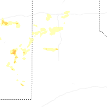
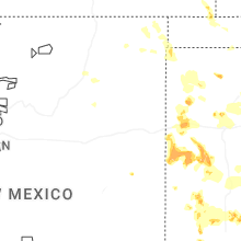
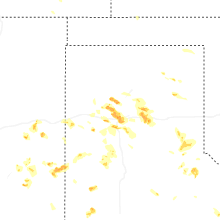
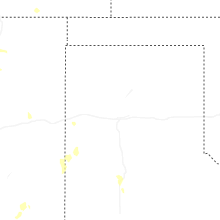
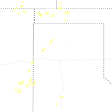
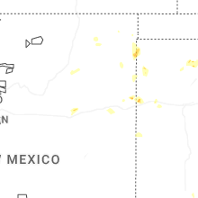
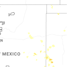

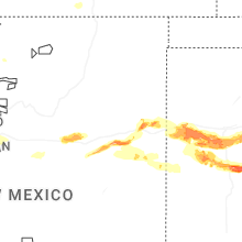


Connect with Interactive Hail Maps