

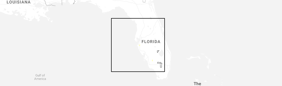
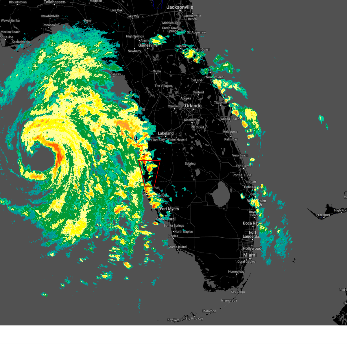
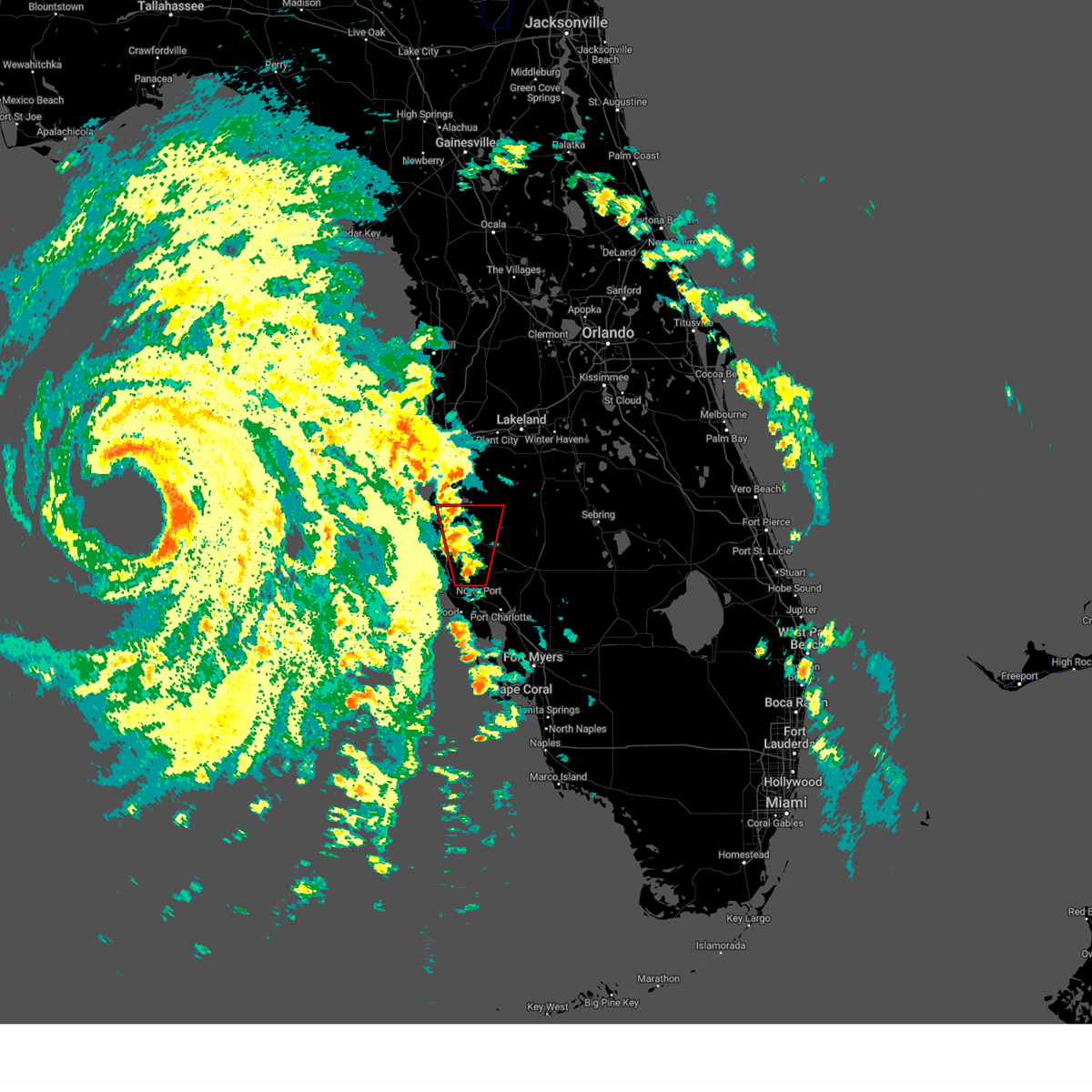
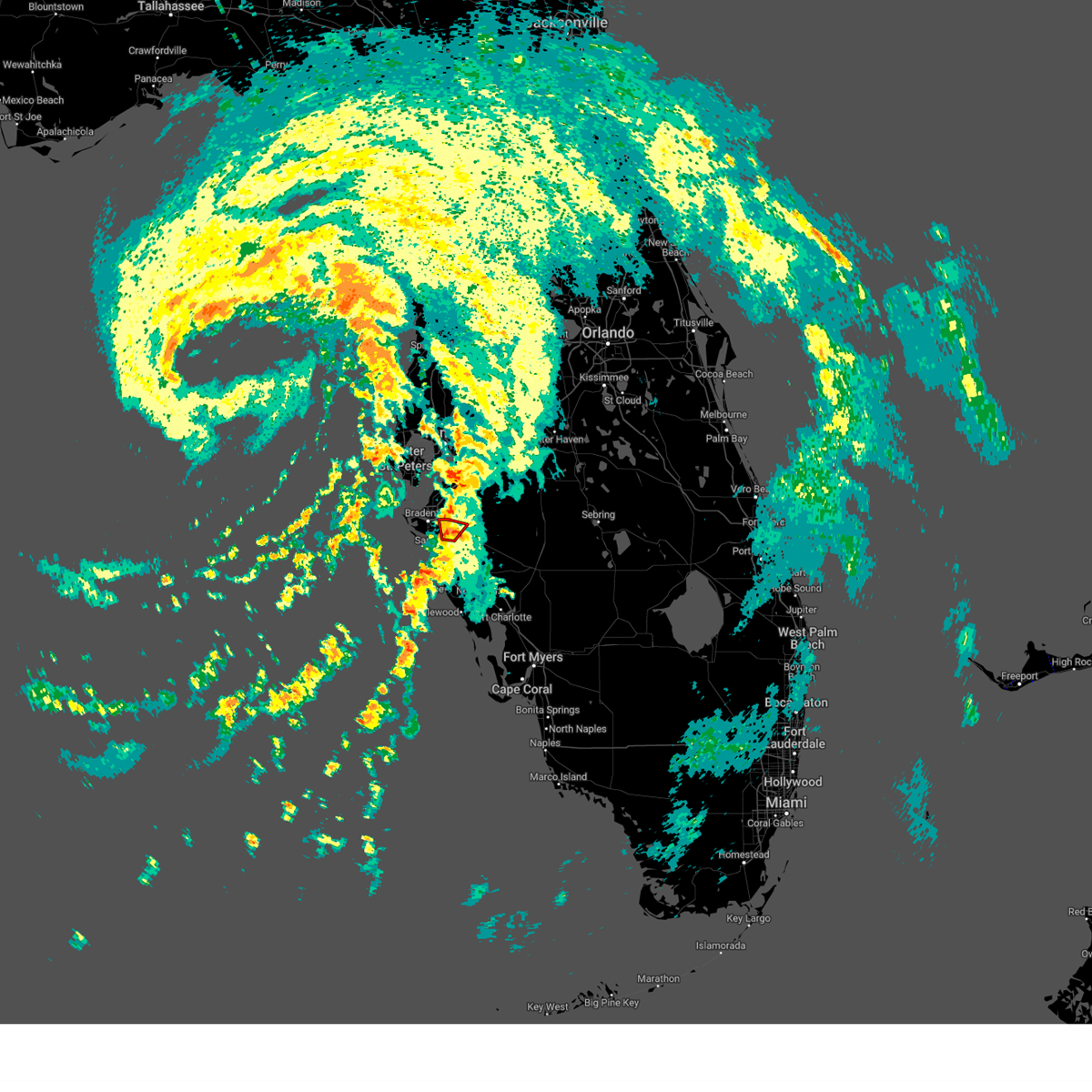
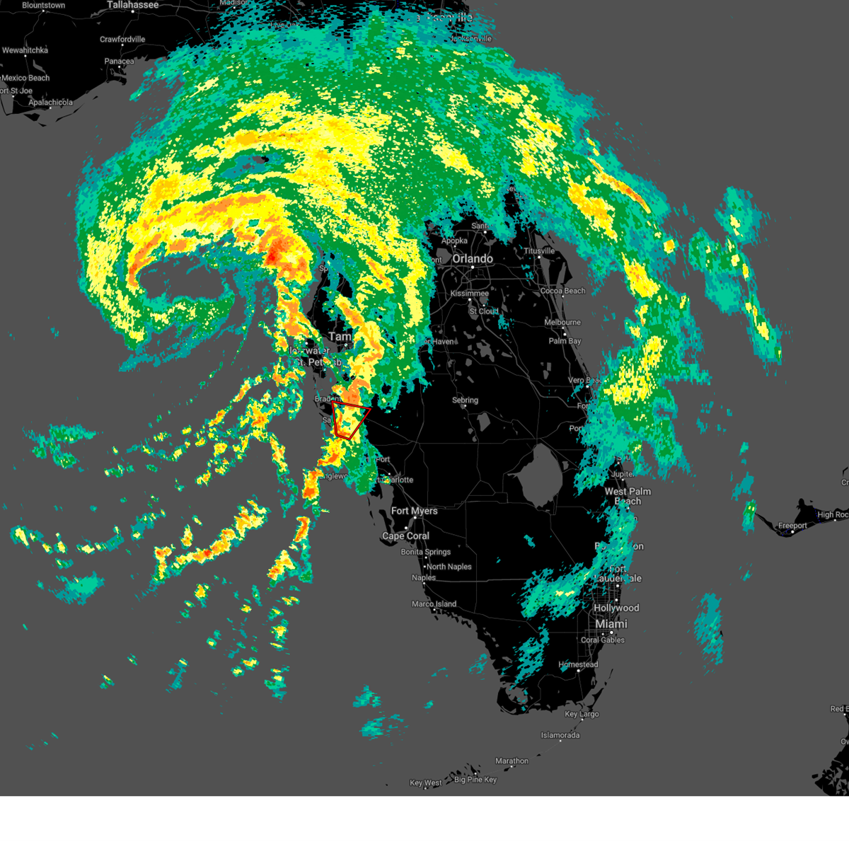
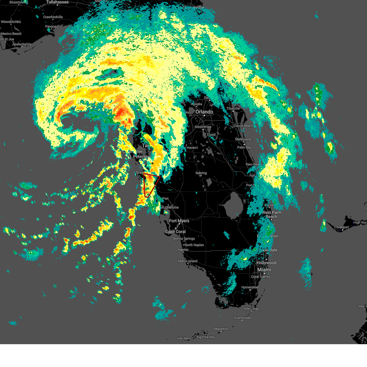
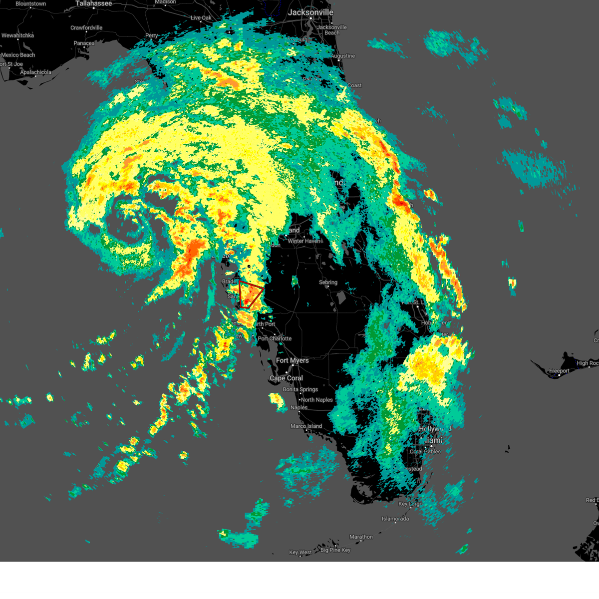
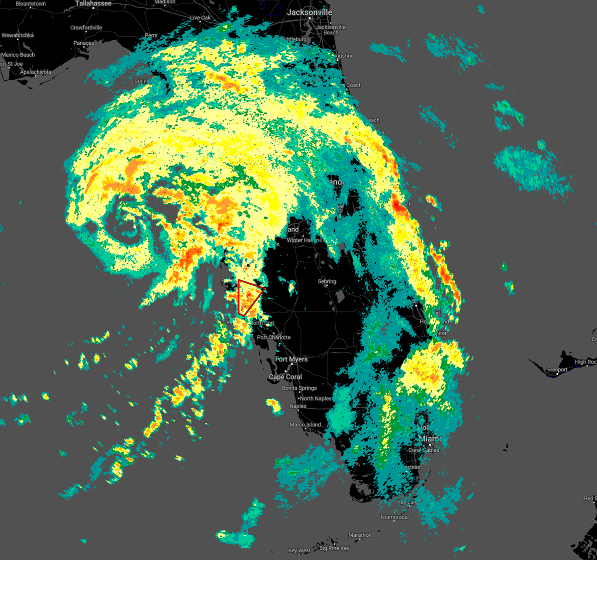
Hail Map for Bradenton, FL
The Bradenton, FL area has had 5 reports of on-the-ground hail by trained spotters, and has been under severe weather warnings 0 times during the past 12 months. Doppler radar has detected hail at or near Bradenton, FL on 38 occasions, including 3 occasions during the past year.
| Name: | Bradenton, FL |
| Where Located: | 0.8 miles ESE of Bradenton, FL |
| Map: | Google Map for Bradenton, FL |
| Population: | 49546 |
| Housing Units: | 26767 |
| More Info: | Search Google for Bradenton, FL |
2
The Top Recent Hail Date for Bradenton, FL is Thursday, June 11, 2026 (6th out of 38)
Hail and Wind Damage Spotted near Bradenton, FL
| Date / Time | Report Details |
|---|---|
| 9/26/2024 5:05 PM EDT |
 The storm which prompted the warning has weakened below severe limits, and no longer appears capable of producing a tornado. therefore, the warning will be allowed to expire. a tornado watch remains in effect until 800 pm edt for west central florida. The storm which prompted the warning has weakened below severe limits, and no longer appears capable of producing a tornado. therefore, the warning will be allowed to expire. a tornado watch remains in effect until 800 pm edt for west central florida.
|
| 9/26/2024 4:57 PM EDT |
 Tortbw the national weather service in ruskin has issued a * tornado warning for, eastern manatee county in west central florida, northeastern sarasota county in west central florida, * until 515 pm edt. * at 457 pm edt, a severe thunderstorm capable of producing a tornado was located over myakka river state park, or 12 miles northwest of north port, moving north at 75 mph (radar indicated rotation). Hazards include tornado. Flying debris will be dangerous to those caught without shelter. mobile homes will be damaged or destroyed. damage to roofs, windows, and vehicles will occur. tree damage is likely. this dangerous storm will be near, lake sarasota around 505 pm edt. Other locations impacted by this tornadic thunderstorm include duette, gator creek estate, lake manatee state park, hidden river, and fruitville. Tortbw the national weather service in ruskin has issued a * tornado warning for, eastern manatee county in west central florida, northeastern sarasota county in west central florida, * until 515 pm edt. * at 457 pm edt, a severe thunderstorm capable of producing a tornado was located over myakka river state park, or 12 miles northwest of north port, moving north at 75 mph (radar indicated rotation). Hazards include tornado. Flying debris will be dangerous to those caught without shelter. mobile homes will be damaged or destroyed. damage to roofs, windows, and vehicles will occur. tree damage is likely. this dangerous storm will be near, lake sarasota around 505 pm edt. Other locations impacted by this tornadic thunderstorm include duette, gator creek estate, lake manatee state park, hidden river, and fruitville.
|
| 8/4/2024 9:52 PM EDT |
 the tornado warning has been cancelled and is no longer in effect the tornado warning has been cancelled and is no longer in effect
|
| 8/4/2024 9:52 PM EDT |
 At 951 pm edt, a severe thunderstorm capable of producing a tornado was located over lakewood ranch, or 8 miles northeast of sarasota, moving north at 45 mph (radar indicated rotation). Hazards include tornado. Flying debris will be dangerous to those caught without shelter. mobile homes will be damaged or destroyed. damage to roofs, windows, and vehicles will occur. tree damage is likely. This tornadic thunderstorm will remain over mainly rural areas of central manatee county, including the following locations, lake manatee state park. At 951 pm edt, a severe thunderstorm capable of producing a tornado was located over lakewood ranch, or 8 miles northeast of sarasota, moving north at 45 mph (radar indicated rotation). Hazards include tornado. Flying debris will be dangerous to those caught without shelter. mobile homes will be damaged or destroyed. damage to roofs, windows, and vehicles will occur. tree damage is likely. This tornadic thunderstorm will remain over mainly rural areas of central manatee county, including the following locations, lake manatee state park.
|
| 8/4/2024 9:41 PM EDT |
 At 940 pm edt, a severe thunderstorm capable of producing a tornado was located over sarasota springs, or near sarasota, moving north at 45 mph (radar indicated rotation). Hazards include tornado. Flying debris will be dangerous to those caught without shelter. mobile homes will be damaged or destroyed. damage to roofs, windows, and vehicles will occur. tree damage is likely. this dangerous storm will be near, sarasota, lakewood ranch, sarasota bradenton airport, north sarasota, the meadows, sarasota springs, and kensington park around 945 pm edt. bradenton and west samoset around 950 pm edt. ellenton around 955 pm edt. Other locations impacted by this tornadic thunderstorm include lake manatee state park, desoto lakes, fruitville, bee ridge, samoset, oneco, and bayshore gardens. At 940 pm edt, a severe thunderstorm capable of producing a tornado was located over sarasota springs, or near sarasota, moving north at 45 mph (radar indicated rotation). Hazards include tornado. Flying debris will be dangerous to those caught without shelter. mobile homes will be damaged or destroyed. damage to roofs, windows, and vehicles will occur. tree damage is likely. this dangerous storm will be near, sarasota, lakewood ranch, sarasota bradenton airport, north sarasota, the meadows, sarasota springs, and kensington park around 945 pm edt. bradenton and west samoset around 950 pm edt. ellenton around 955 pm edt. Other locations impacted by this tornadic thunderstorm include lake manatee state park, desoto lakes, fruitville, bee ridge, samoset, oneco, and bayshore gardens.
|
| 8/4/2024 9:29 PM EDT |
 Tortbw the national weather service in ruskin has issued a * tornado warning for, central manatee county in west central florida, northwestern sarasota county in west central florida, * until 1000 pm edt. * at 929 pm edt, a severe thunderstorm capable of producing a tornado was located near gulf gate estates, or 11 miles south of sarasota, moving north at 45 mph (radar indicated rotation). Hazards include tornado. Flying debris will be dangerous to those caught without shelter. mobile homes will be damaged or destroyed. damage to roofs, windows, and vehicles will occur. tree damage is likely. this dangerous storm will be near, sarasota, ridge wood heights, south gate ridge, lake sarasota, north sarasota, gulf gate estates, the meadows, sarasota springs, kensington park, and south sarasota around 935 pm edt. lakewood ranch and sarasota bradenton airport around 940 pm edt. bradenton and west samoset around 950 pm edt. ellenton around 955 pm edt. Other locations impacted by this tornadic thunderstorm include osprey, lake manatee state park, desoto lakes, vamo, fruitville, turtle beach, oscar scherer state park, bee ridge, samoset, and oneco. Tortbw the national weather service in ruskin has issued a * tornado warning for, central manatee county in west central florida, northwestern sarasota county in west central florida, * until 1000 pm edt. * at 929 pm edt, a severe thunderstorm capable of producing a tornado was located near gulf gate estates, or 11 miles south of sarasota, moving north at 45 mph (radar indicated rotation). Hazards include tornado. Flying debris will be dangerous to those caught without shelter. mobile homes will be damaged or destroyed. damage to roofs, windows, and vehicles will occur. tree damage is likely. this dangerous storm will be near, sarasota, ridge wood heights, south gate ridge, lake sarasota, north sarasota, gulf gate estates, the meadows, sarasota springs, kensington park, and south sarasota around 935 pm edt. lakewood ranch and sarasota bradenton airport around 940 pm edt. bradenton and west samoset around 950 pm edt. ellenton around 955 pm edt. Other locations impacted by this tornadic thunderstorm include osprey, lake manatee state park, desoto lakes, vamo, fruitville, turtle beach, oscar scherer state park, bee ridge, samoset, and oneco.
|
| 8/4/2024 7:47 PM EDT |
 At 747 pm edt, a severe thunderstorm capable of producing a tornado was located over lake sarasota, or near sarasota, moving north at 45 mph (radar indicated rotation). Hazards include tornado. Flying debris will be dangerous to those caught without shelter. mobile homes will be damaged or destroyed. damage to roofs, windows, and vehicles will occur. tree damage is likely. this dangerous storm will be near, bradenton, lakewood ranch, north sarasota, and the meadows around 755 pm edt. Other locations impacted by this tornadic thunderstorm include lake manatee state park, desoto lakes, bee ridge, and fruitville. At 747 pm edt, a severe thunderstorm capable of producing a tornado was located over lake sarasota, or near sarasota, moving north at 45 mph (radar indicated rotation). Hazards include tornado. Flying debris will be dangerous to those caught without shelter. mobile homes will be damaged or destroyed. damage to roofs, windows, and vehicles will occur. tree damage is likely. this dangerous storm will be near, bradenton, lakewood ranch, north sarasota, and the meadows around 755 pm edt. Other locations impacted by this tornadic thunderstorm include lake manatee state park, desoto lakes, bee ridge, and fruitville.
|
| 8/4/2024 7:38 PM EDT |
 Tortbw the national weather service in ruskin has issued a * tornado warning for, central manatee county in west central florida, northwestern sarasota county in west central florida, * until 815 pm edt. * at 738 pm edt, a severe thunderstorm capable of producing a tornado was located near gulf gate estates, or 9 miles southeast of sarasota, moving north at 45 mph (radar indicated rotation). Hazards include tornado. Flying debris will be dangerous to those caught without shelter. mobile homes will be damaged or destroyed. damage to roofs, windows, and vehicles will occur. tree damage is likely. this dangerous storm will be near, sarasota, lakewood ranch, ridge wood heights, south gate ridge, lake sarasota, north sarasota, gulf gate estates, the meadows, sarasota springs, and kensington park around 745 pm edt. bradenton around 755 pm edt. Other locations impacted by this tornadic thunderstorm include osprey, gator creek estate, lake manatee state park, desoto lakes, vamo, fruitville, turtle beach, oscar scherer state park, bee ridge, and laurel. Tortbw the national weather service in ruskin has issued a * tornado warning for, central manatee county in west central florida, northwestern sarasota county in west central florida, * until 815 pm edt. * at 738 pm edt, a severe thunderstorm capable of producing a tornado was located near gulf gate estates, or 9 miles southeast of sarasota, moving north at 45 mph (radar indicated rotation). Hazards include tornado. Flying debris will be dangerous to those caught without shelter. mobile homes will be damaged or destroyed. damage to roofs, windows, and vehicles will occur. tree damage is likely. this dangerous storm will be near, sarasota, lakewood ranch, ridge wood heights, south gate ridge, lake sarasota, north sarasota, gulf gate estates, the meadows, sarasota springs, and kensington park around 745 pm edt. bradenton around 755 pm edt. Other locations impacted by this tornadic thunderstorm include osprey, gator creek estate, lake manatee state park, desoto lakes, vamo, fruitville, turtle beach, oscar scherer state park, bee ridge, and laurel.
|
| 7/30/2024 4:55 PM EDT | A tree was reported to have fallen on a home in bradenton... damaging the home and displacing the residents. no injuries were reporte in manatee county FL, 2.9 miles NNE of Bradenton, FL |
| 5/14/2024 11:31 AM EDT |
 Svrtbw the national weather service in ruskin has issued a * severe thunderstorm warning for, northwestern manatee county in west central florida, southeastern pinellas county in west central florida, southwestern hillsborough county in west central florida, * until 1215 pm edt. * at 1131 am edt, a severe thunderstorm was located 7 miles southeast of downtown saint petersburg, moving east at 30 mph (radar indicated). Hazards include 60 mph wind gusts and quarter size hail. Hail damage to vehicles is expected. Expect wind damage to roofs, siding, and trees. Svrtbw the national weather service in ruskin has issued a * severe thunderstorm warning for, northwestern manatee county in west central florida, southeastern pinellas county in west central florida, southwestern hillsborough county in west central florida, * until 1215 pm edt. * at 1131 am edt, a severe thunderstorm was located 7 miles southeast of downtown saint petersburg, moving east at 30 mph (radar indicated). Hazards include 60 mph wind gusts and quarter size hail. Hail damage to vehicles is expected. Expect wind damage to roofs, siding, and trees.
|
| 4/11/2024 1:45 PM EDT |
 At 144 pm edt, severe thunderstorms were located along a line extending from 8 miles north of plant city to near west samoset, moving east at 40 mph (radar indicated). Hazards include 60 mph wind gusts. Expect damage to roofs, siding, and trees. Locations impacted include, lakeland, sarasota, bradenton, plant city, auburndale, mulberry, polk city, alafia river state park, lake manatee state park, and lakewood ranch. At 144 pm edt, severe thunderstorms were located along a line extending from 8 miles north of plant city to near west samoset, moving east at 40 mph (radar indicated). Hazards include 60 mph wind gusts. Expect damage to roofs, siding, and trees. Locations impacted include, lakeland, sarasota, bradenton, plant city, auburndale, mulberry, polk city, alafia river state park, lake manatee state park, and lakewood ranch.
|
| 4/11/2024 1:45 PM EDT |
 the severe thunderstorm warning has been cancelled and is no longer in effect the severe thunderstorm warning has been cancelled and is no longer in effect
|
| 4/11/2024 1:16 PM EDT |
 Svrtbw the national weather service in ruskin has issued a * severe thunderstorm warning for, southeastern pasco county in west central florida, manatee county in west central florida, southeastern pinellas county in west central florida, northwestern polk county in central florida, hillsborough county in west central florida, * until 200 pm edt. * at 116 pm edt, severe thunderstorms were located along a line extending from near temple terrace to 12 miles southwest of anna maria, moving east at 40 mph (radar indicated). Hazards include 60 mph wind gusts. expect damage to roofs, siding, and trees Svrtbw the national weather service in ruskin has issued a * severe thunderstorm warning for, southeastern pasco county in west central florida, manatee county in west central florida, southeastern pinellas county in west central florida, northwestern polk county in central florida, hillsborough county in west central florida, * until 200 pm edt. * at 116 pm edt, severe thunderstorms were located along a line extending from near temple terrace to 12 miles southwest of anna maria, moving east at 40 mph (radar indicated). Hazards include 60 mph wind gusts. expect damage to roofs, siding, and trees
|
| 4/11/2024 1:04 PM EDT |
 At 104 pm edt, severe thunderstorms were located along a line extending from 7 miles southwest of bushnell to near pebble creek to near fort desoto park, moving east at 45 mph (radar indicated). Hazards include 60 mph wind gusts. Expect damage to roofs, siding, and trees. locations impacted include, tampa, st. petersburg, bradenton, plant city, temple terrace, zephyrhills, palmetto, gulfport, st. Pete beach, and wildwood. At 104 pm edt, severe thunderstorms were located along a line extending from 7 miles southwest of bushnell to near pebble creek to near fort desoto park, moving east at 45 mph (radar indicated). Hazards include 60 mph wind gusts. Expect damage to roofs, siding, and trees. locations impacted include, tampa, st. petersburg, bradenton, plant city, temple terrace, zephyrhills, palmetto, gulfport, st. Pete beach, and wildwood.
|
| 4/11/2024 12:30 PM EDT |
 Svrtbw the national weather service in ruskin has issued a * severe thunderstorm warning for, southeastern citrus county in west central florida, sumter county in central florida, pasco county in west central florida, hernando county in west central florida, northwestern manatee county in west central florida, pinellas county in west central florida, northwestern polk county in central florida, hillsborough county in west central florida, * until 115 pm edt. * at 1229 pm edt, severe thunderstorms were located along a line extending from near spring hill to 6 miles southwest of citrus park to 17 miles west of anna maria, moving east at 45 mph (radar indicated). Hazards include 60 mph wind gusts. expect damage to roofs, siding, and trees Svrtbw the national weather service in ruskin has issued a * severe thunderstorm warning for, southeastern citrus county in west central florida, sumter county in central florida, pasco county in west central florida, hernando county in west central florida, northwestern manatee county in west central florida, pinellas county in west central florida, northwestern polk county in central florida, hillsborough county in west central florida, * until 115 pm edt. * at 1229 pm edt, severe thunderstorms were located along a line extending from near spring hill to 6 miles southwest of citrus park to 17 miles west of anna maria, moving east at 45 mph (radar indicated). Hazards include 60 mph wind gusts. expect damage to roofs, siding, and trees
|
| 1/9/2024 4:58 PM EST |
 At 457 pm est, severe thunderstorms were located along a line extending from near ruskin to sarasota bradenton airport to 10 miles southwest of south sarasota, moving northeast at 50 mph (radar indicated). Hazards include 60 mph wind gusts. expect damage to roofs, siding, and trees At 457 pm est, severe thunderstorms were located along a line extending from near ruskin to sarasota bradenton airport to 10 miles southwest of south sarasota, moving northeast at 50 mph (radar indicated). Hazards include 60 mph wind gusts. expect damage to roofs, siding, and trees
|
| 6/21/2023 5:52 AM EDT |
 The severe thunderstorm warning for west central manatee county will expire at 600 am edt, the storm which prompted the warning has weakened below severe limits, and no longer poses an immediate threat to life or property. therefore, the warning will be allowed to expire. however, gusty winds are still possible with this thunderstorm. The severe thunderstorm warning for west central manatee county will expire at 600 am edt, the storm which prompted the warning has weakened below severe limits, and no longer poses an immediate threat to life or property. therefore, the warning will be allowed to expire. however, gusty winds are still possible with this thunderstorm.
|
| 6/21/2023 5:37 AM EDT |
 At 537 am edt, a severe thunderstorm was located near anna maria, or 7 miles west of bradenton, moving northeast at 25 mph (radar indicated). Hazards include 60 mph wind gusts. expect damage to roofs, siding, and trees At 537 am edt, a severe thunderstorm was located near anna maria, or 7 miles west of bradenton, moving northeast at 25 mph (radar indicated). Hazards include 60 mph wind gusts. expect damage to roofs, siding, and trees
|
| 6/18/2023 7:28 PM EDT |
 At 727 pm edt, a severe thunderstorm was located near memphis, or near palmetto, moving east at 30 mph (radar indicated). Hazards include 60 mph wind gusts. expect damage to roofs, siding, and trees At 727 pm edt, a severe thunderstorm was located near memphis, or near palmetto, moving east at 30 mph (radar indicated). Hazards include 60 mph wind gusts. expect damage to roofs, siding, and trees
|
| 5/12/2023 7:31 PM EDT |
 At 731 pm edt, a severe thunderstorm was located over ellenton, or near palmetto, moving west at 20 mph (radar indicated). Hazards include quarter size hail. damage to vehicles is expected At 731 pm edt, a severe thunderstorm was located over ellenton, or near palmetto, moving west at 20 mph (radar indicated). Hazards include quarter size hail. damage to vehicles is expected
|
| 4/27/2023 9:51 PM EDT |
 The severe thunderstorm warning for northwestern manatee, southeastern pinellas and central hillsborough counties will expire at 1000 pm edt, the storms which prompted the warning have moved out of the area. therefore, the warning will be allowed to expire. however, gusty winds are still possible with these thunderstorms. The severe thunderstorm warning for northwestern manatee, southeastern pinellas and central hillsborough counties will expire at 1000 pm edt, the storms which prompted the warning have moved out of the area. therefore, the warning will be allowed to expire. however, gusty winds are still possible with these thunderstorms.
|
| 4/27/2023 9:25 PM EDT |
 At 924 pm edt, severe thunderstorms were located along a line extending from near pebble creek to st. petersburg, moving southeast at 40 mph (radar indicated). Hazards include 60 mph wind gusts. expect damage to roofs, siding, and trees At 924 pm edt, severe thunderstorms were located along a line extending from near pebble creek to st. petersburg, moving southeast at 40 mph (radar indicated). Hazards include 60 mph wind gusts. expect damage to roofs, siding, and trees
|
| 10/15/2022 6:39 PM EDT |
 At 639 pm edt, a severe thunderstorm was located over north sarasota, or near sarasota, moving south at 10 mph (radar indicated). Hazards include 60 mph wind gusts and quarter size hail. Hail damage to vehicles is expected. Expect wind damage to roofs, siding, and trees. At 639 pm edt, a severe thunderstorm was located over north sarasota, or near sarasota, moving south at 10 mph (radar indicated). Hazards include 60 mph wind gusts and quarter size hail. Hail damage to vehicles is expected. Expect wind damage to roofs, siding, and trees.
|
| 10/15/2022 6:36 PM EDT | Quarter sized hail reported 6.8 miles WNW of Bradenton, FL, social media video of hail just w of i-75 and s of sr-70. several other social media videos showing hail around this time in the same area. time from video stamp. |
| 9/10/2022 11:38 AM EDT |
 At 1138 am edt, a severe thunderstorm was located over memphis, or over palmetto, moving north at 30 mph (radar indicated). Hazards include 60 mph wind gusts. Expect damage to roofs, siding, and trees. locations impacted include, bradenton, palmetto, south bradenton, ellenton, parrish, memphis, west bradenton, samoset, oneco and west samoset. hail threat, radar indicated max hail size, <. 75 in wind threat, radar indicated max wind gust, 60 mph. At 1138 am edt, a severe thunderstorm was located over memphis, or over palmetto, moving north at 30 mph (radar indicated). Hazards include 60 mph wind gusts. Expect damage to roofs, siding, and trees. locations impacted include, bradenton, palmetto, south bradenton, ellenton, parrish, memphis, west bradenton, samoset, oneco and west samoset. hail threat, radar indicated max hail size, <. 75 in wind threat, radar indicated max wind gust, 60 mph.
|
| 9/10/2022 11:27 AM EDT |
 At 1127 am edt, a severe thunderstorm was located over south bradenton, or near bradenton, moving north at 30 mph (radar indicated). Hazards include 60 mph wind gusts. expect damage to roofs, siding, and trees At 1127 am edt, a severe thunderstorm was located over south bradenton, or near bradenton, moving north at 30 mph (radar indicated). Hazards include 60 mph wind gusts. expect damage to roofs, siding, and trees
|
| 9/2/2022 2:18 PM EDT | Manatee co emergency management relayed that damage in a mobile home community occurred this afternoon during a thunderstorm. while a downburst did occur with this stor in manatee county FL, 3.5 miles N of Bradenton, FL |
| 9/2/2022 2:17 PM EDT | Broadcast media reported wind damage to mobile homes in the vicinity of 53rd and chateau lane west. this damage appears to have been caused by a downburst. time estimat in manatee county FL, 3.5 miles N of Bradenton, FL |
| 8/8/2022 5:40 PM EDT |
 The severe thunderstorm warning for west central manatee and northwestern sarasota counties will expire at 545 pm edt, the storm which prompted the warning has weakened below severe limits, and no longer poses an immediate threat to life or property. therefore, the warning will be allowed to expire. however gusty winds and heavy rain are still possible with this thunderstorm. The severe thunderstorm warning for west central manatee and northwestern sarasota counties will expire at 545 pm edt, the storm which prompted the warning has weakened below severe limits, and no longer poses an immediate threat to life or property. therefore, the warning will be allowed to expire. however gusty winds and heavy rain are still possible with this thunderstorm.
|
| 8/8/2022 5:19 PM EDT |
 At 519 pm edt, a severe thunderstorm was located over sarasota bradenton airport, or near sarasota, moving west at 5 mph (radar indicated). Hazards include 60 mph wind gusts and quarter size hail. Hail damage to vehicles is expected. Expect wind damage to roofs, siding, and trees. At 519 pm edt, a severe thunderstorm was located over sarasota bradenton airport, or near sarasota, moving west at 5 mph (radar indicated). Hazards include 60 mph wind gusts and quarter size hail. Hail damage to vehicles is expected. Expect wind damage to roofs, siding, and trees.
|
| 6/15/2022 6:56 PM EDT |
 The severe thunderstorm warning for western manatee, southern pinellas, south central hillsborough and northwestern sarasota counties will expire at 700 pm edt, the storms which prompted the warning have weakened below severe limits, and no longer pose an immediate threat to life or property. therefore, the warning will be allowed to expire. however small hail and gusty winds are still possible with these thunderstorms. The severe thunderstorm warning for western manatee, southern pinellas, south central hillsborough and northwestern sarasota counties will expire at 700 pm edt, the storms which prompted the warning have weakened below severe limits, and no longer pose an immediate threat to life or property. therefore, the warning will be allowed to expire. however small hail and gusty winds are still possible with these thunderstorms.
|
| 6/15/2022 6:36 PM EDT |
 At 636 pm edt, severe thunderstorms were located along a line extending from parrish to near lakewood ranch to near myakka river state park, moving west at 20 mph (radar indicated). Hazards include 60 mph wind gusts and quarter size hail. Hail damage to vehicles is expected. Expect wind damage to roofs, siding, and trees. At 636 pm edt, severe thunderstorms were located along a line extending from parrish to near lakewood ranch to near myakka river state park, moving west at 20 mph (radar indicated). Hazards include 60 mph wind gusts and quarter size hail. Hail damage to vehicles is expected. Expect wind damage to roofs, siding, and trees.
|
| 6/15/2022 6:30 PM EDT | Quarter sized hail reported 8.6 miles WSW of Bradenton, FL, public reported quarter size hail along ft. hamer road and ft. hamer bridge near manatee river. |
| 5/31/2022 7:55 PM EDT |
 The severe thunderstorm warning for northwestern manatee and northwestern sarasota counties will expire at 800 pm edt, the storm which prompted the warning has weakened below severe limits, and no longer poses an immediate threat to life or property. therefore, the warning will be allowed to expire. however small hail and gusty winds are still possible with this thunderstorm. The severe thunderstorm warning for northwestern manatee and northwestern sarasota counties will expire at 800 pm edt, the storm which prompted the warning has weakened below severe limits, and no longer poses an immediate threat to life or property. therefore, the warning will be allowed to expire. however small hail and gusty winds are still possible with this thunderstorm.
|
| 5/31/2022 7:51 PM EDT | Utility poles and roof damage was reported at pictown mobile home par in manatee county FL, 2.1 miles N of Bradenton, FL |
| 5/31/2022 7:34 PM EDT |
 At 734 pm edt, a severe thunderstorm was located over west samoset, or near bradenton, moving southwest at 5 mph (radar indicated). Hazards include 60 mph wind gusts and quarter size hail. Hail damage to vehicles is expected. Expect wind damage to roofs, siding, and trees. At 734 pm edt, a severe thunderstorm was located over west samoset, or near bradenton, moving southwest at 5 mph (radar indicated). Hazards include 60 mph wind gusts and quarter size hail. Hail damage to vehicles is expected. Expect wind damage to roofs, siding, and trees.
|
| 3/12/2022 9:26 AM EST |
 At 925 am est, severe thunderstorms were located along a line extending from near groveland to near zephyrhills west to egypt lake-leto to near fort desoto park to 23 miles southwest of anna maria, moving east at 35 mph (radar indicated). Hazards include 60 mph wind gusts. expect damage to roofs, siding, and trees At 925 am est, severe thunderstorms were located along a line extending from near groveland to near zephyrhills west to egypt lake-leto to near fort desoto park to 23 miles southwest of anna maria, moving east at 35 mph (radar indicated). Hazards include 60 mph wind gusts. expect damage to roofs, siding, and trees
|
| 12/21/2021 8:15 AM EST |
 At 814 am est, a severe thunderstorm was located over west samoset, or over bradenton, moving east at 50 mph (radar indicated). Hazards include 60 mph wind gusts. expect damage to roofs, siding, and trees At 814 am est, a severe thunderstorm was located over west samoset, or over bradenton, moving east at 50 mph (radar indicated). Hazards include 60 mph wind gusts. expect damage to roofs, siding, and trees
|
| 12/21/2021 8:12 AM EST | Broadcast media shared images on social media of a large tree that fell on a house in bradenton. time estimated based on rada in manatee county FL, 3.6 miles NNE of Bradenton, FL |
| 12/21/2021 8:10 AM EST | Mesonet station 0400w 1.9 w bayshore gardens (weatherstem in manatee county FL, 4.4 miles NE of Bradenton, FL |
| 8/12/2021 5:57 PM EDT |
 At 557 pm edt, a severe thunderstorm was located over ellenton, or near palmetto, moving southwest at 20 mph (radar indicated). Hazards include 60 mph wind gusts and quarter size hail. Hail damage to vehicles is expected. Expect wind damage to roofs, siding, and trees. At 557 pm edt, a severe thunderstorm was located over ellenton, or near palmetto, moving southwest at 20 mph (radar indicated). Hazards include 60 mph wind gusts and quarter size hail. Hail damage to vehicles is expected. Expect wind damage to roofs, siding, and trees.
|
| 4/10/2021 5:45 PM EDT | Three mobile homes were reported to have minor roof damag in manatee county FL, 2.1 miles N of Bradenton, FL |
| 4/10/2021 5:45 PM EDT | *** 1 inj *** manatee county emergency management reports 20 structures sustained wind damage... five of which had major damage with large sections of roofing remove in manatee county FL, 4.7 miles NNE of Bradenton, FL |
| 11/11/2020 5:27 PM EST |
 The tornado warning for northwestern manatee, southeastern pinellas, south central hillsborough and northwestern sarasota counties will expire at 530 pm est, the storm which prompted the warning has weakened below severe limits, and no longer appears capable of producing a tornado. therefore, the warning will be allowed to expire. The tornado warning for northwestern manatee, southeastern pinellas, south central hillsborough and northwestern sarasota counties will expire at 530 pm est, the storm which prompted the warning has weakened below severe limits, and no longer appears capable of producing a tornado. therefore, the warning will be allowed to expire.
|
| 11/11/2020 4:58 PM EST |
 At 458 pm est, a radar indicated waterspout was located just offshore over gulf gate estates, or near sarasota, moving north at 45 mph (radar indicated rotation). Hazards include tornado. Flying debris will be dangerous to those caught without shelter. mobile homes will be damaged or destroyed. damage to roofs, windows, and vehicles will occur. tree damage is likely. this tornado will be near, kensington park around 505 pm est. sarasota, north sarasota, sarasota bradenton airport, the meadows and lakewood ranch around 510 pm est. west samoset around 515 pm est. bradenton, ellenton, south bradenton and west bradenton around 520 pm est. palmetto and memphis around 525 pm est. parrish around 530 pm est. Other locations impacted by this tornadic thunderstorm include osprey, bayshore gardens, cortez, vamo, oscar scherer state park, bee ridge, samoset, desoto lakes, lake maggiore and palma sola. At 458 pm est, a radar indicated waterspout was located just offshore over gulf gate estates, or near sarasota, moving north at 45 mph (radar indicated rotation). Hazards include tornado. Flying debris will be dangerous to those caught without shelter. mobile homes will be damaged or destroyed. damage to roofs, windows, and vehicles will occur. tree damage is likely. this tornado will be near, kensington park around 505 pm est. sarasota, north sarasota, sarasota bradenton airport, the meadows and lakewood ranch around 510 pm est. west samoset around 515 pm est. bradenton, ellenton, south bradenton and west bradenton around 520 pm est. palmetto and memphis around 525 pm est. parrish around 530 pm est. Other locations impacted by this tornadic thunderstorm include osprey, bayshore gardens, cortez, vamo, oscar scherer state park, bee ridge, samoset, desoto lakes, lake maggiore and palma sola.
|
| 11/11/2020 4:40 PM EST |
 At 439 pm est, a severe thunderstorm capable of producing a tornado was located over saint armands key, or over sarasota, moving north at 60 mph (radar indicated rotation). Hazards include tornado. Flying debris will be dangerous to those caught without shelter. mobile homes will be damaged or destroyed. damage to roofs, windows, and vehicles will occur. tree damage is likely. this dangerous storm will be near, bradenton, west samoset, south bradenton and west bradenton around 450 pm est. palmetto, memphis and ellenton around 455 pm est. Other locations impacted by this tornadic thunderstorm include bayshore gardens, palma sola, cortez, whitney beach, samoset, oneco, desoto lakes and bradenton beach. At 439 pm est, a severe thunderstorm capable of producing a tornado was located over saint armands key, or over sarasota, moving north at 60 mph (radar indicated rotation). Hazards include tornado. Flying debris will be dangerous to those caught without shelter. mobile homes will be damaged or destroyed. damage to roofs, windows, and vehicles will occur. tree damage is likely. this dangerous storm will be near, bradenton, west samoset, south bradenton and west bradenton around 450 pm est. palmetto, memphis and ellenton around 455 pm est. Other locations impacted by this tornadic thunderstorm include bayshore gardens, palma sola, cortez, whitney beach, samoset, oneco, desoto lakes and bradenton beach.
|
| 11/11/2020 12:05 PM EST |
 At 1204 pm est, a severe thunderstorm capable of producing a tornado was located over south bradenton, or over bradenton, moving northwest at 50 mph (radar indicated rotation). Hazards include tornado. Flying debris will be dangerous to those caught without shelter. mobile homes will be damaged or destroyed. damage to roofs, windows, and vehicles will occur. tree damage is likely. This tornadic thunderstorm will remain over mainly rural areas of northwestern manatee and northwestern sarasota counties, including the following locations, samoset. At 1204 pm est, a severe thunderstorm capable of producing a tornado was located over south bradenton, or over bradenton, moving northwest at 50 mph (radar indicated rotation). Hazards include tornado. Flying debris will be dangerous to those caught without shelter. mobile homes will be damaged or destroyed. damage to roofs, windows, and vehicles will occur. tree damage is likely. This tornadic thunderstorm will remain over mainly rural areas of northwestern manatee and northwestern sarasota counties, including the following locations, samoset.
|
| 11/11/2020 11:54 AM EST |
 At 1153 am est, a severe thunderstorm capable of producing a tornado was located over the meadows, or near sarasota, moving northwest at 50 mph (radar indicated rotation). Hazards include tornado. Flying debris will be dangerous to those caught without shelter. mobile homes will be damaged or destroyed. damage to roofs, windows, and vehicles will occur. tree damage is likely. this dangerous storm will be near, bradenton and west samoset around 1200 pm est. palmetto, south bradenton, west bradenton, memphis and ellenton around 1205 pm est. Other locations impacted by this tornadic thunderstorm include bayshore gardens, desoto lakes, palma sola, fruitville, samoset, oneco, cortez and holmes beach. At 1153 am est, a severe thunderstorm capable of producing a tornado was located over the meadows, or near sarasota, moving northwest at 50 mph (radar indicated rotation). Hazards include tornado. Flying debris will be dangerous to those caught without shelter. mobile homes will be damaged or destroyed. damage to roofs, windows, and vehicles will occur. tree damage is likely. this dangerous storm will be near, bradenton and west samoset around 1200 pm est. palmetto, south bradenton, west bradenton, memphis and ellenton around 1205 pm est. Other locations impacted by this tornadic thunderstorm include bayshore gardens, desoto lakes, palma sola, fruitville, samoset, oneco, cortez and holmes beach.
|
| 8/11/2020 2:25 PM EDT | Damage to batting cage... bleachers blown over... and one tree uprooted at lakewood ranch park. time estimated by radar. winds estimated 45 to 50 mp in manatee county FL, 8.2 miles WNW of Bradenton, FL |
| 8/9/2020 6:11 PM EDT |
 At 611 pm edt, a severe thunderstorm was located near anna maria, or 7 miles west of bradenton, moving west at 10 mph (radar indicated). Hazards include 60 mph wind gusts. expect damage to roofs, siding, and trees At 611 pm edt, a severe thunderstorm was located near anna maria, or 7 miles west of bradenton, moving west at 10 mph (radar indicated). Hazards include 60 mph wind gusts. expect damage to roofs, siding, and trees
|
| 5/18/2020 8:53 AM EDT |
 At 853 am edt, severe thunderstorms were located along a line extending from bay pines to downtown saint petersburg to 6 miles east of fort desoto park to west bradenton, moving northeast at 40 mph (radar indicated). Hazards include 60 mph wind gusts. expect damage to roofs, siding, and trees At 853 am edt, severe thunderstorms were located along a line extending from bay pines to downtown saint petersburg to 6 miles east of fort desoto park to west bradenton, moving northeast at 40 mph (radar indicated). Hazards include 60 mph wind gusts. expect damage to roofs, siding, and trees
|
| 5/18/2020 8:34 AM EDT |
 At 834 am edt, severe thunderstorms were located along a line extending from 12 miles west of bay pines to 9 miles south of anna maria, moving northeast at 40 mph (radar indicated). Hazards include 60 mph wind gusts. expect damage to roofs, siding, and trees At 834 am edt, severe thunderstorms were located along a line extending from 12 miles west of bay pines to 9 miles south of anna maria, moving northeast at 40 mph (radar indicated). Hazards include 60 mph wind gusts. expect damage to roofs, siding, and trees
|
| 4/20/2020 1:27 PM EDT |
 At 126 pm edt, severe thunderstorms were located along a line extending from 6 miles southeast of greater sun center to near ellenton to near anna maria, moving east at 35 mph (radar indicated). Hazards include 60 mph wind gusts and nickel size hail. expect damage to roofs, siding, and trees At 126 pm edt, severe thunderstorms were located along a line extending from 6 miles southeast of greater sun center to near ellenton to near anna maria, moving east at 35 mph (radar indicated). Hazards include 60 mph wind gusts and nickel size hail. expect damage to roofs, siding, and trees
|
| 4/20/2020 12:29 PM EDT |
 At 1228 pm edt, severe thunderstorms were located along a line extending from near st. pete beach to 9 miles west of fort desoto park to 22 miles west of anna maria, moving east at 55 mph (radar indicated). Hazards include 60 mph wind gusts and nickel size hail. expect damage to roofs, siding, and trees At 1228 pm edt, severe thunderstorms were located along a line extending from near st. pete beach to 9 miles west of fort desoto park to 22 miles west of anna maria, moving east at 55 mph (radar indicated). Hazards include 60 mph wind gusts and nickel size hail. expect damage to roofs, siding, and trees
|
| 2/6/2020 11:17 PM EST |
 At 1116 pm est, a severe thunderstorm capable of producing a tornado was located near south bradenton, or near bradenton, moving east at 30 mph (radar indicated rotation). Hazards include tornado. Flying debris will be dangerous to those caught without shelter. mobile homes will be damaged or destroyed. damage to roofs, windows, and vehicles will occur. tree damage is likely. this dangerous storm will be near, west bradenton around 1120 pm est. palmetto and south bradenton around 1125 pm est. bradenton, west samoset, sarasota bradenton airport and memphis around 1130 pm est. ellenton around 1135 pm est. lakewood ranch around 1140 pm est. Other locations impacted by this tornadic thunderstorm include bayshore gardens, lake manatee state park, samoset and oneco. At 1116 pm est, a severe thunderstorm capable of producing a tornado was located near south bradenton, or near bradenton, moving east at 30 mph (radar indicated rotation). Hazards include tornado. Flying debris will be dangerous to those caught without shelter. mobile homes will be damaged or destroyed. damage to roofs, windows, and vehicles will occur. tree damage is likely. this dangerous storm will be near, west bradenton around 1120 pm est. palmetto and south bradenton around 1125 pm est. bradenton, west samoset, sarasota bradenton airport and memphis around 1130 pm est. ellenton around 1135 pm est. lakewood ranch around 1140 pm est. Other locations impacted by this tornadic thunderstorm include bayshore gardens, lake manatee state park, samoset and oneco.
|
| 2/6/2020 11:04 PM EST | Storm damage reported in manatee county FL, 10.5 miles ESE of Bradenton, FL |
| 2/6/2020 10:50 PM EST |
 At 1049 pm est, severe thunderstorms were located along a line extending from 9 miles northeast of inverness to near land o lakes to 25 miles southwest of anna maria, moving east at 35 mph (radar indicated). Hazards include 60 mph wind gusts. expect damage to roofs, siding, and trees At 1049 pm est, severe thunderstorms were located along a line extending from 9 miles northeast of inverness to near land o lakes to 25 miles southwest of anna maria, moving east at 35 mph (radar indicated). Hazards include 60 mph wind gusts. expect damage to roofs, siding, and trees
|
| 7/20/2019 5:28 PM EDT |
 The severe thunderstorm warning for northwestern manatee and northwestern sarasota counties will expire at 530 pm edt, the storm which prompted the warning has weakened below severe limits, and no longer poses an immediate threat to life or property. therefore, the warning will be allowed to expire. however small hail and gusty winds are still possible with this thunderstorm. The severe thunderstorm warning for northwestern manatee and northwestern sarasota counties will expire at 530 pm edt, the storm which prompted the warning has weakened below severe limits, and no longer poses an immediate threat to life or property. therefore, the warning will be allowed to expire. however small hail and gusty winds are still possible with this thunderstorm.
|
| 7/20/2019 4:53 PM EDT |
 At 453 pm edt, a severe thunderstorm was located over lakewood ranch, or 7 miles northeast of sarasota, moving northwest at 15 mph (radar indicated). Hazards include 60 mph wind gusts and quarter size hail. Hail damage to vehicles is expected. Expect wind damage to roofs, siding, and trees. At 453 pm edt, a severe thunderstorm was located over lakewood ranch, or 7 miles northeast of sarasota, moving northwest at 15 mph (radar indicated). Hazards include 60 mph wind gusts and quarter size hail. Hail damage to vehicles is expected. Expect wind damage to roofs, siding, and trees.
|
| 5/5/2019 12:44 PM EDT |
 At 1243 pm edt, severe thunderstorms were located along a line extending from 11 miles west of beacon square to near palm harbor to seminole to near tierra verde, moving northeast at 40 mph. at 1234 pm edt, a wind gust of 58 mph was reported at indian rocks beach (radar indicated). Hazards include 60 mph wind gusts. Expect damage to roofs, siding, and trees. locations impacted include, tampa, clearwater, largo, bradenton, pinellas park, seminole, downtown saint petersburg, saint petersburg, fort desoto park, st. petersburg, st. Pete beach, anna maria, palm harbor, south highpoint, tierra verde, west and east lealman, ridgecrest, bay pines, keystone and east lake. At 1243 pm edt, severe thunderstorms were located along a line extending from 11 miles west of beacon square to near palm harbor to seminole to near tierra verde, moving northeast at 40 mph. at 1234 pm edt, a wind gust of 58 mph was reported at indian rocks beach (radar indicated). Hazards include 60 mph wind gusts. Expect damage to roofs, siding, and trees. locations impacted include, tampa, clearwater, largo, bradenton, pinellas park, seminole, downtown saint petersburg, saint petersburg, fort desoto park, st. petersburg, st. Pete beach, anna maria, palm harbor, south highpoint, tierra verde, west and east lealman, ridgecrest, bay pines, keystone and east lake.
|
| 5/5/2019 12:22 PM EDT |
 At 1222 pm edt, severe thunderstorms were located along a line extending from 21 miles west of palm harbor to 9 miles west of harbor bluffs to 11 miles southwest of bay pines to 14 miles west of anna maria, moving northeast at 40 mph (radar indicated). Hazards include 60 mph wind gusts. expect damage to roofs, siding, and trees At 1222 pm edt, severe thunderstorms were located along a line extending from 21 miles west of palm harbor to 9 miles west of harbor bluffs to 11 miles southwest of bay pines to 14 miles west of anna maria, moving northeast at 40 mph (radar indicated). Hazards include 60 mph wind gusts. expect damage to roofs, siding, and trees
|
| 4/19/2019 2:13 PM EDT |
 At 212 pm edt, severe thunderstorms were located along a line extending from zephyrhills west to 34 miles southwest of gulf gate estates, moving northeast at 65 mph (radar indicated). Hazards include 60 mph wind gusts. expect damage to roofs, siding, and trees At 212 pm edt, severe thunderstorms were located along a line extending from zephyrhills west to 34 miles southwest of gulf gate estates, moving northeast at 65 mph (radar indicated). Hazards include 60 mph wind gusts. expect damage to roofs, siding, and trees
|
| 4/19/2019 1:52 PM EDT |
 At 151 pm edt, severe thunderstorms were located along a line extending from moss bluff to near hill n dale to downtown saint petersburg, moving northeast at 65 mph (radar indicated). Hazards include 60 mph wind gusts. Expect damage to roofs, siding, and trees. locations impacted include, tampa, clearwater, largo, bradenton, pinellas park, plant city, temple terrace, seminole, zephyrhills, palmetto, wildwood, dade city, bushnell, downtown saint petersburg, fort desoto park, fish hawk, saint petersburg, lutz, brandon and st. Petersburg. At 151 pm edt, severe thunderstorms were located along a line extending from moss bluff to near hill n dale to downtown saint petersburg, moving northeast at 65 mph (radar indicated). Hazards include 60 mph wind gusts. Expect damage to roofs, siding, and trees. locations impacted include, tampa, clearwater, largo, bradenton, pinellas park, plant city, temple terrace, seminole, zephyrhills, palmetto, wildwood, dade city, bushnell, downtown saint petersburg, fort desoto park, fish hawk, saint petersburg, lutz, brandon and st. Petersburg.
|
| 4/19/2019 1:18 PM EDT |
 At 118 pm edt, severe thunderstorms were located along a line extending from 6 miles west of bushnell to keystone to 18 miles southwest of anna maria, moving northeast at 65 mph (radar indicated). Hazards include 60 mph wind gusts. expect damage to roofs, siding, and trees At 118 pm edt, severe thunderstorms were located along a line extending from 6 miles west of bushnell to keystone to 18 miles southwest of anna maria, moving northeast at 65 mph (radar indicated). Hazards include 60 mph wind gusts. expect damage to roofs, siding, and trees
|
| 1/24/2019 5:39 AM EST |
 At 537 am est, severe thunderstorms were located along a line extending from near parrish to the meadows to 20 miles south of gulf gate estates, moving east at 35 mph. this line of storms has a history of damaging winds, producing a winds gusts at sarasota bradenton international airport of 65 mph (radar indicated). Hazards include 60 mph wind gusts. expect damage to roofs, siding, and trees At 537 am est, severe thunderstorms were located along a line extending from near parrish to the meadows to 20 miles south of gulf gate estates, moving east at 35 mph. this line of storms has a history of damaging winds, producing a winds gusts at sarasota bradenton international airport of 65 mph (radar indicated). Hazards include 60 mph wind gusts. expect damage to roofs, siding, and trees
|
| 12/9/2018 10:17 AM EST |
 At 1017 am est, a severe thunderstorm was located 7 miles southwest of anna maria, or 13 miles southwest of fort desoto park, moving northeast at 25 mph (radar indicated). Hazards include 60 mph wind gusts. expect damage to roofs, siding, and trees At 1017 am est, a severe thunderstorm was located 7 miles southwest of anna maria, or 13 miles southwest of fort desoto park, moving northeast at 25 mph (radar indicated). Hazards include 60 mph wind gusts. expect damage to roofs, siding, and trees
|
| 11/2/2018 3:55 PM EDT |
 At 354 pm edt, severe thunderstorms were located along a line extending from near hillsborough river state park to near fish hawk to near parrish, moving east at 40 mph (radar indicated). Hazards include 60 mph wind gusts. expect damage to roofs, siding, and trees At 354 pm edt, severe thunderstorms were located along a line extending from near hillsborough river state park to near fish hawk to near parrish, moving east at 40 mph (radar indicated). Hazards include 60 mph wind gusts. expect damage to roofs, siding, and trees
|
| 10/10/2018 2:57 PM EDT |
 At 256 pm edt, a severe thunderstorm capable of producing a tornado was located over sarasota bradenton airport, or near sarasota, moving northeast at 35 mph (radar indicated rotation). Hazards include tornado. Flying debris will be dangerous to those caught without shelter. mobile homes will be damaged or destroyed. damage to roofs, windows, and vehicles will occur. tree damage is likely. this dangerous storm will be near, the meadows around 300 pm edt. lakewood ranch around 305 pm edt. Other locations impacted by this tornadic thunderstorm include desoto lakes. At 256 pm edt, a severe thunderstorm capable of producing a tornado was located over sarasota bradenton airport, or near sarasota, moving northeast at 35 mph (radar indicated rotation). Hazards include tornado. Flying debris will be dangerous to those caught without shelter. mobile homes will be damaged or destroyed. damage to roofs, windows, and vehicles will occur. tree damage is likely. this dangerous storm will be near, the meadows around 300 pm edt. lakewood ranch around 305 pm edt. Other locations impacted by this tornadic thunderstorm include desoto lakes.
|
| 3/20/2018 3:54 PM EDT |
 At 353 pm edt, a severe thunderstorm was located near anna maria, or near bradenton, moving east at 40 mph (radar indicated). Hazards include 70 mph wind gusts and nickel size hail. Expect considerable tree damage. Damage is likely to mobile homes, roofs, and outbuildings. At 353 pm edt, a severe thunderstorm was located near anna maria, or near bradenton, moving east at 40 mph (radar indicated). Hazards include 70 mph wind gusts and nickel size hail. Expect considerable tree damage. Damage is likely to mobile homes, roofs, and outbuildings.
|
| 3/20/2018 3:35 PM EDT |
 At 334 pm edt, severe thunderstorms were located along a line extending from near riverview to near south bradenton, moving east at 25 mph (radar indicated). Hazards include 60 mph wind gusts and nickel size hail. Expect damage to roofs, siding, and trees. locations impacted include, bradenton, palmetto, fish hawk, fort desoto park, brandon, anna maria, ellenton, greater sun center, memphis, west samoset, riverview, south bradenton, ruskin, parrish, west bradenton, holmes beach, bradenton beach, lake manatee state park, samoset and boyette. A tornado watch remains in effect until 700 pm edt for west central florida. At 334 pm edt, severe thunderstorms were located along a line extending from near riverview to near south bradenton, moving east at 25 mph (radar indicated). Hazards include 60 mph wind gusts and nickel size hail. Expect damage to roofs, siding, and trees. locations impacted include, bradenton, palmetto, fish hawk, fort desoto park, brandon, anna maria, ellenton, greater sun center, memphis, west samoset, riverview, south bradenton, ruskin, parrish, west bradenton, holmes beach, bradenton beach, lake manatee state park, samoset and boyette. A tornado watch remains in effect until 700 pm edt for west central florida.
|
| 3/20/2018 3:14 PM EDT |
 At 314 pm edt, severe thunderstorms were located along a line extending from near gandy to near memphis, moving east at 45 mph (radar indicated). Hazards include 60 mph wind gusts and nickel size hail. expect damage to roofs, siding, and trees At 314 pm edt, severe thunderstorms were located along a line extending from near gandy to near memphis, moving east at 45 mph (radar indicated). Hazards include 60 mph wind gusts and nickel size hail. expect damage to roofs, siding, and trees
|
| 12/9/2017 12:35 AM EST |
 At 1231 am est, a severe thunderstorm was located 9 miles northwest of saint armands key, or 10 miles west of sarasota, moving northeast at 40 mph (radar indicated). Hazards include 60 mph wind gusts. expect damage to roofs, siding, and trees At 1231 am est, a severe thunderstorm was located 9 miles northwest of saint armands key, or 10 miles west of sarasota, moving northeast at 40 mph (radar indicated). Hazards include 60 mph wind gusts. expect damage to roofs, siding, and trees
|
| 7/31/2017 11:10 AM EDT |
 The tornado warning for west central manatee county will expire at 1115 am edt, the storm which prompted the warning no longer appears capable of producing a tornado. therefore the warning will be allowed to expire. The tornado warning for west central manatee county will expire at 1115 am edt, the storm which prompted the warning no longer appears capable of producing a tornado. therefore the warning will be allowed to expire.
|
| 7/31/2017 10:50 AM EDT |
 At 1049 am edt, a severe thunderstorm capable of producing a tornado was located over west bradenton, or near palmetto, moving southeast at 5 mph (radar indicated rotation). Hazards include tornado. Flying debris will be dangerous to those caught without shelter. mobile homes will be damaged or destroyed. damage to roofs, windows, and vehicles will occur. Tree damage is likely. At 1049 am edt, a severe thunderstorm capable of producing a tornado was located over west bradenton, or near palmetto, moving southeast at 5 mph (radar indicated rotation). Hazards include tornado. Flying debris will be dangerous to those caught without shelter. mobile homes will be damaged or destroyed. damage to roofs, windows, and vehicles will occur. Tree damage is likely.
|
| 6/14/2017 3:46 PM EDT |
 At 346 pm edt, severe thunderstorms were located along a line extending from near lakewood ranch to near riverview, moving west at 25 mph (radar indicated). Hazards include 60 mph wind gusts and penny size hail. Expect damage to roofs, siding, and trees. Locations impacted include, bradenton, palmetto, anna maria, lakewood ranch, ellenton, greater sun center, memphis, sarasota bradenton airport, west samoset, south bradenton, ruskin, parrish, west bradenton, holmes beach, bradenton beach, lake manatee state park, samoset, wimauma, bayshore gardens and little manatee river state park. At 346 pm edt, severe thunderstorms were located along a line extending from near lakewood ranch to near riverview, moving west at 25 mph (radar indicated). Hazards include 60 mph wind gusts and penny size hail. Expect damage to roofs, siding, and trees. Locations impacted include, bradenton, palmetto, anna maria, lakewood ranch, ellenton, greater sun center, memphis, sarasota bradenton airport, west samoset, south bradenton, ruskin, parrish, west bradenton, holmes beach, bradenton beach, lake manatee state park, samoset, wimauma, bayshore gardens and little manatee river state park.
|
| 6/14/2017 3:36 PM EDT |
 At 335 pm edt, a severe thunderstorm was located over greater sun center, or 14 miles southwest of fish hawk, moving northwest at 20 mph (radar indicated). Hazards include 60 mph wind gusts. expect damage to roofs, siding, and trees At 335 pm edt, a severe thunderstorm was located over greater sun center, or 14 miles southwest of fish hawk, moving northwest at 20 mph (radar indicated). Hazards include 60 mph wind gusts. expect damage to roofs, siding, and trees
|
| 6/7/2017 10:11 AM EDT |
 At 1011 am edt, a severe thunderstorm was located over west bradenton, moving northeast at 50 mph (radar indicated). Hazards include 60 mph wind gusts. expect damage to roofs, siding, and trees At 1011 am edt, a severe thunderstorm was located over west bradenton, moving northeast at 50 mph (radar indicated). Hazards include 60 mph wind gusts. expect damage to roofs, siding, and trees
|
| 5/24/2017 2:48 PM EDT | Emergency manager reported a large tree fell on a house causing minor damage on the 2200 block of 57th east in bradento in manatee county FL, 4.7 miles W of Bradenton, FL |
| 5/24/2017 2:47 PM EDT | Ham radio operator reported large tree down in the oneco are in manatee county FL, 3.5 miles NW of Bradenton, FL |
| 5/24/2017 2:42 PM EDT |
 At 241 pm edt, severe thunderstorms were located along a line extending from near macdill air force base to near lakewood ranch, moving east at 35 mph (radar indicated). Hazards include 60 mph wind gusts. expect damage to roofs, siding, and trees At 241 pm edt, severe thunderstorms were located along a line extending from near macdill air force base to near lakewood ranch, moving east at 35 mph (radar indicated). Hazards include 60 mph wind gusts. expect damage to roofs, siding, and trees
|
| 1/22/2017 8:24 PM EST |
 At 823 pm est, a severe thunderstorm was located near anna maria island, moving east at 50 mph (radar indicated). Hazards include 60 mph wind gusts. expect damage to roofs, siding, and trees At 823 pm est, a severe thunderstorm was located near anna maria island, moving east at 50 mph (radar indicated). Hazards include 60 mph wind gusts. expect damage to roofs, siding, and trees
|
| 1/22/2017 7:59 PM EST |
 At 759 pm est, a severe thunderstorm was located near lakewood ranch, or 7 miles east of bradenton, moving northeast at 50 mph (radar indicated). Hazards include 60 mph wind gusts. expect damage to roofs, siding, and trees At 759 pm est, a severe thunderstorm was located near lakewood ranch, or 7 miles east of bradenton, moving northeast at 50 mph (radar indicated). Hazards include 60 mph wind gusts. expect damage to roofs, siding, and trees
|
| 1/22/2017 7:50 PM EST | Several mobile homes with significant roof damage in heather hills estates and casa loma mobile home park in manatee county FL, 2.8 miles N of Bradenton, FL |
| 1/22/2017 7:48 PM EST |
 At 747 pm est, a likely waterspout was located just offshore over whitfield, or near sarasota, moving northeast at 50 mph (doppler radar was tracking a waterspout moving onshore). Hazards include tornado. Flying debris will be dangerous to those caught without shelter. mobile homes will be damaged or destroyed. damage to roofs, windows, and vehicles will occur. tree damage is likely. this tornado will be near, lakewood ranch around 755 pm est. Other locations impacted by this tornado include desoto lakes, oneco, bayshore gardens and samoset. At 747 pm est, a likely waterspout was located just offshore over whitfield, or near sarasota, moving northeast at 50 mph (doppler radar was tracking a waterspout moving onshore). Hazards include tornado. Flying debris will be dangerous to those caught without shelter. mobile homes will be damaged or destroyed. damage to roofs, windows, and vehicles will occur. tree damage is likely. this tornado will be near, lakewood ranch around 755 pm est. Other locations impacted by this tornado include desoto lakes, oneco, bayshore gardens and samoset.
|
| 1/22/2017 7:38 PM EST |
 At 737 pm est, a likely waterspout was located just offshore 7 miles west of saint armands key, or 9 miles west of sarasota, moving northeast at 45 mph (weather spotters confirmed waterspout moving onshore). Hazards include tornado. Flying debris will be dangerous to those caught without shelter. mobile homes will be damaged or destroyed. damage to roofs, windows, and vehicles will occur. tree damage is likely. this tornado will be near, sarasota and sarasota bradenton airport around 750 pm est. whitfield, north sarasota, kensington park, the meadows, south bradenton and west samoset around 755 pm est. bradenton and lakewood ranch around 800 pm est. Other locations impacted by this tornado include bayshore gardens, desoto lakes, samoset and oneco. At 737 pm est, a likely waterspout was located just offshore 7 miles west of saint armands key, or 9 miles west of sarasota, moving northeast at 45 mph (weather spotters confirmed waterspout moving onshore). Hazards include tornado. Flying debris will be dangerous to those caught without shelter. mobile homes will be damaged or destroyed. damage to roofs, windows, and vehicles will occur. tree damage is likely. this tornado will be near, sarasota and sarasota bradenton airport around 750 pm est. whitfield, north sarasota, kensington park, the meadows, south bradenton and west samoset around 755 pm est. bradenton and lakewood ranch around 800 pm est. Other locations impacted by this tornado include bayshore gardens, desoto lakes, samoset and oneco.
|
| 1/22/2017 6:12 PM EST |
 At 612 pm est, severe thunderstorms were located along a line extending from near memphis to 19 miles southwest of anna maria, moving northeast at 55 mph (radar indicated). Hazards include 60 mph wind gusts. expect damage to roofs, siding, and trees At 612 pm est, severe thunderstorms were located along a line extending from near memphis to 19 miles southwest of anna maria, moving northeast at 55 mph (radar indicated). Hazards include 60 mph wind gusts. expect damage to roofs, siding, and trees
|
| 9/25/2016 8:14 PM EDT |
 At 814 pm edt, a severe thunderstorm was located 5 miles east of lakewood ranch, or 15 miles east of sarasota, and is nearly stationary (radar indicated). Hazards include 60 mph wind gusts. Expect damage to roofs. siding. And trees. At 814 pm edt, a severe thunderstorm was located 5 miles east of lakewood ranch, or 15 miles east of sarasota, and is nearly stationary (radar indicated). Hazards include 60 mph wind gusts. Expect damage to roofs. siding. And trees.
|
| 8/13/2016 5:06 PM EDT |
 The severe thunderstorm warning for northwestern sarasota and northwestern manatee counties will expire at 515 pm edt, the storm which prompted the warning has weakened below severe limits, and no longer pose an immediate threat to life or property. therefore the warning will be allowed to expire. however gusty winds are still possible with this thunderstorm. The severe thunderstorm warning for northwestern sarasota and northwestern manatee counties will expire at 515 pm edt, the storm which prompted the warning has weakened below severe limits, and no longer pose an immediate threat to life or property. therefore the warning will be allowed to expire. however gusty winds are still possible with this thunderstorm.
|
| 8/13/2016 4:44 PM EDT |
 At 443 pm edt, a severe thunderstorm was located over sarasota springs, or near sarasota, moving northwest at 20 mph (radar indicated). Hazards include 70 mph wind gusts. Expect considerable tree damage. Damage is likely to mobile homes, roofs, and outbuildings. At 443 pm edt, a severe thunderstorm was located over sarasota springs, or near sarasota, moving northwest at 20 mph (radar indicated). Hazards include 70 mph wind gusts. Expect considerable tree damage. Damage is likely to mobile homes, roofs, and outbuildings.
|
| 8/13/2016 4:31 PM EDT |
 At 430 pm edt, a severe thunderstorm was located over sarasota bradenton airport, or near sarasota, and is nearly stationary (radar indicated). Hazards include 60 mph wind gusts. Expect damage to roofs. siding. And trees. At 430 pm edt, a severe thunderstorm was located over sarasota bradenton airport, or near sarasota, and is nearly stationary (radar indicated). Hazards include 60 mph wind gusts. Expect damage to roofs. siding. And trees.
|
| 7/21/2016 2:23 PM EDT | The roof of an older trailer in trailer estates in bayshore gardens was blown off and some debris from that caused minor damage to two neighboring trailers. winds estim in manatee county FL, 4.9 miles N of Bradenton, FL |
| 6/26/2016 3:39 PM EDT |
 At 338 pm edt, a severe thunderstorm was located 11 miles southeast of parrish, or 19 miles east of palmetto, moving south at 20 mph (radar indicated). Hazards include 60 mph wind gusts and quarter size hail. Hail damage to vehicles is expected. expect wind damage to roofs, siding, and trees. Locations impacted include, bradenton, palmetto, south bradenton, west samoset, parrish, whitfield, ellenton, west bradenton, memphis, bradenton beach, lake manatee state park, myakka head, oneco, cortez, duette, whitney beach, samoset and bayshore gardens. At 338 pm edt, a severe thunderstorm was located 11 miles southeast of parrish, or 19 miles east of palmetto, moving south at 20 mph (radar indicated). Hazards include 60 mph wind gusts and quarter size hail. Hail damage to vehicles is expected. expect wind damage to roofs, siding, and trees. Locations impacted include, bradenton, palmetto, south bradenton, west samoset, parrish, whitfield, ellenton, west bradenton, memphis, bradenton beach, lake manatee state park, myakka head, oneco, cortez, duette, whitney beach, samoset and bayshore gardens.
|
| 6/26/2016 3:32 PM EDT |
 At 331 pm edt, a severe thunderstorm was located near parrish, or 15 miles east of palmetto, moving south at 20 mph (radar indicated). Hazards include 60 mph wind gusts and quarter size hail. Hail damage to vehicles is expected. expect wind damage to roofs, siding, and trees. Locations impacted include, bradenton, palmetto, south bradenton, west samoset, parrish, whitfield, west bradenton, memphis, greater sun center, ellenton, ruskin, bradenton beach, little manatee river state park, lake manatee state park, palma sola, myakka head, oneco, cortez, fort lonesome and duette. At 331 pm edt, a severe thunderstorm was located near parrish, or 15 miles east of palmetto, moving south at 20 mph (radar indicated). Hazards include 60 mph wind gusts and quarter size hail. Hail damage to vehicles is expected. expect wind damage to roofs, siding, and trees. Locations impacted include, bradenton, palmetto, south bradenton, west samoset, parrish, whitfield, west bradenton, memphis, greater sun center, ellenton, ruskin, bradenton beach, little manatee river state park, lake manatee state park, palma sola, myakka head, oneco, cortez, fort lonesome and duette.
|
| 6/26/2016 3:05 PM EDT |
 At 304 pm edt, a severe thunderstorm was located near sun city center, or 11 miles southwest of fish hawk, moving south at 20 mph (radar indicated). Hazards include 60 mph wind gusts and quarter size hail. Hail damage to vehicles is expected. Expect wind damage to roofs, siding, and trees. At 304 pm edt, a severe thunderstorm was located near sun city center, or 11 miles southwest of fish hawk, moving south at 20 mph (radar indicated). Hazards include 60 mph wind gusts and quarter size hail. Hail damage to vehicles is expected. Expect wind damage to roofs, siding, and trees.
|
| 4/2/2016 12:17 PM EDT |
 At 1216 pm edt, severe thunderstorms were located along a line extending from near gandy to near saint petersburg to 11 miles west of anna maria, moving east at 40 mph (radar indicated). Hazards include 60 mph wind gusts and quarter size hail. Expect wind damage to roofs. siding. And trees. At 1216 pm edt, severe thunderstorms were located along a line extending from near gandy to near saint petersburg to 11 miles west of anna maria, moving east at 40 mph (radar indicated). Hazards include 60 mph wind gusts and quarter size hail. Expect wind damage to roofs. siding. And trees.
|
| 2/16/2016 2:34 AM EST |
 At 233 am est, a severe thunderstorm was located over fort desoto park, moving northeast at 40 mph (radar indicated). Hazards include 60 mph wind gusts. Expect damage to roofs. siding. And trees. At 233 am est, a severe thunderstorm was located over fort desoto park, moving northeast at 40 mph (radar indicated). Hazards include 60 mph wind gusts. Expect damage to roofs. siding. And trees.
|
| 1/17/2016 3:33 AM EST |
 At 332 am est, several severe thunderstorms were located near anna maria, or 10 miles west of bradenton and offshore siesa key , moving northeast at 40 mph (radar indicated). Hazards include 70 mph wind gusts. Expect considerable tree damage. Damage is likely to mobile homes, roofs and outbuildings. At 332 am est, several severe thunderstorms were located near anna maria, or 10 miles west of bradenton and offshore siesa key , moving northeast at 40 mph (radar indicated). Hazards include 70 mph wind gusts. Expect considerable tree damage. Damage is likely to mobile homes, roofs and outbuildings.
|
| 1/17/2016 3:27 AM EST |
 At 327 am est, a severe thunderstorm was located near lakewood ranch, or 13 miles east of bradenton, moving northeast at 40 mph (radar indicated). Hazards include 60 mph wind gusts. Expect damage to roofs. Siding and trees. At 327 am est, a severe thunderstorm was located near lakewood ranch, or 13 miles east of bradenton, moving northeast at 40 mph (radar indicated). Hazards include 60 mph wind gusts. Expect damage to roofs. Siding and trees.
|
| 1/17/2016 3:11 AM EST |
 At 310 am est, a dangerous tornado was located over siesta key, or just southwest of sarasota, moving northeast at 40 mph. this is a particularly dangerous situation (radar indicated rotation). Hazards include damaging tornado. You are in a life threatening situation. flying debris may be deadly to those caught without shelter. mobile homes will be destroyed. considerable damage to homes, businesses and vehicles is likely and complete destruction is possible. the tornado will be near, south gate ridge around 315 am est. sarasota, sarasota springs, southgate, lake sarasota, north sarasota and sarasota bradenton airport around 320 am est. the meadows and kensington park around 325 am est. lakewood ranch around 330 am est. Other locations impacted by this tornadic thunderstorm include gator creek estate, vamo, bee ridge, fruitville, osprey, hidden river, oscar scherer state park, samoset, desoto lakes and oneco. At 310 am est, a dangerous tornado was located over siesta key, or just southwest of sarasota, moving northeast at 40 mph. this is a particularly dangerous situation (radar indicated rotation). Hazards include damaging tornado. You are in a life threatening situation. flying debris may be deadly to those caught without shelter. mobile homes will be destroyed. considerable damage to homes, businesses and vehicles is likely and complete destruction is possible. the tornado will be near, south gate ridge around 315 am est. sarasota, sarasota springs, southgate, lake sarasota, north sarasota and sarasota bradenton airport around 320 am est. the meadows and kensington park around 325 am est. lakewood ranch around 330 am est. Other locations impacted by this tornadic thunderstorm include gator creek estate, vamo, bee ridge, fruitville, osprey, hidden river, oscar scherer state park, samoset, desoto lakes and oneco.
|
| 1/17/2016 3:05 AM EST |
 At 304 am est, a potentially dangerous tornado was located 8 miles southwest of siesta key, saint armands key, lido key, or 10 miles southwest of sarasota, moving northeast at 60 mph. this is a particularly dangerous situation (radar indicated rotation). Hazards include damaging tornado. You are in a life threatening situation. flying debris may be deadly to those caught without shelter. mobile homes will be destroyed. considerable damage to homes, businesses and vehicles is likely and complete destruction is possible. the tornado will be near, sarasota, south gate ridge, ridge wood heights, southgate, south sarasota, sarasota springs, gulf gate estates, lake sarasota, saint armands key and sarasota bradenton airport around 315 am est. the meadows, lakewood ranch, kensington park and north sarasota around 320 am est. Other locations impacted by this tornadic thunderstorm include gator creek estate, bee ridge, laurel, oneco, desoto lakes, vamo, hidden river, osprey, fruitville and nokomis. At 304 am est, a potentially dangerous tornado was located 8 miles southwest of siesta key, saint armands key, lido key, or 10 miles southwest of sarasota, moving northeast at 60 mph. this is a particularly dangerous situation (radar indicated rotation). Hazards include damaging tornado. You are in a life threatening situation. flying debris may be deadly to those caught without shelter. mobile homes will be destroyed. considerable damage to homes, businesses and vehicles is likely and complete destruction is possible. the tornado will be near, sarasota, south gate ridge, ridge wood heights, southgate, south sarasota, sarasota springs, gulf gate estates, lake sarasota, saint armands key and sarasota bradenton airport around 315 am est. the meadows, lakewood ranch, kensington park and north sarasota around 320 am est. Other locations impacted by this tornadic thunderstorm include gator creek estate, bee ridge, laurel, oneco, desoto lakes, vamo, hidden river, osprey, fruitville and nokomis.
|
| 1/17/2016 2:56 AM EST |
 At 255 am est, a severe thunderstorm capable of producing a tornado was located 14 miles southwest of gulf gate estates, or 15 miles southwest of sarasota, moving northeast at 50 mph (radar indicated rotation). Hazards include tornado and quarter size hail. Flying debris will be dangerous to those caught without shelter. mobile homes will be damaged or destroyed. damage to roofs, windows and vehicles will occur. tree damage is likely. this dangerous storm will be near, south gate ridge, gulf gate estates, ridge wood heights, south sarasota, southgate, sarasota springs and saint armands key around 315 am est. lake sarasota, the meadows, kensington park, north sarasota and sarasota bradenton airport around 320 am est. lakewood ranch around 325 am est. Other locations impacted by this tornadic thunderstorm include gator creek estate, bee ridge, laurel, oneco, desoto lakes, vamo, hidden river, osprey, fruitville and nokomis. At 255 am est, a severe thunderstorm capable of producing a tornado was located 14 miles southwest of gulf gate estates, or 15 miles southwest of sarasota, moving northeast at 50 mph (radar indicated rotation). Hazards include tornado and quarter size hail. Flying debris will be dangerous to those caught without shelter. mobile homes will be damaged or destroyed. damage to roofs, windows and vehicles will occur. tree damage is likely. this dangerous storm will be near, south gate ridge, gulf gate estates, ridge wood heights, south sarasota, southgate, sarasota springs and saint armands key around 315 am est. lake sarasota, the meadows, kensington park, north sarasota and sarasota bradenton airport around 320 am est. lakewood ranch around 325 am est. Other locations impacted by this tornadic thunderstorm include gator creek estate, bee ridge, laurel, oneco, desoto lakes, vamo, hidden river, osprey, fruitville and nokomis.
|
| 1/17/2016 2:52 AM EST |
 At 251 am est, a severe thunderstorm was located 13 miles southwest of gulf gate estates, or 15 miles south of sarasota, moving northeast at 65 mph (radar indicated). Hazards include 60 mph wind gusts and quarter size hail. Hail damage to vehicles is expected. Expect wind damage to roofs, siding and trees. At 251 am est, a severe thunderstorm was located 13 miles southwest of gulf gate estates, or 15 miles south of sarasota, moving northeast at 65 mph (radar indicated). Hazards include 60 mph wind gusts and quarter size hail. Hail damage to vehicles is expected. Expect wind damage to roofs, siding and trees.
|
| 4/23/2015 1:45 PM EDT | Numerous trees down and one large oak tree down on house on 115 ave ne bradenton. time estimated by rada in manatee county FL, 9 miles W of Bradenton, FL |
| 4/23/2015 1:41 PM EDT | At 141 pm edt, doppler radar indicated a severe thunderstorm capable of producing quarter size hail and damaging winds in excess of 60 mph. this storm was located near lakewood ranch, or 10 miles east of bradenton, and moving southeast at 25 mph. |
| 4/20/2015 4:50 PM EDT | At 448 pm edt, doppler radar indicated a severe thunderstorm capable of producing damaging winds in excess of 60 mph. this storm was located over macdill air force base, or near downtown saint petersburg, moving east at 30 mph. nickel size hail may also accompany the damaging winds. locations impacted include, tampa, bradenton, plant city, temple terrace, palmetto, fish hawk, brandon, apollo beach, tampa international airport, egypt lake-leto, university, memphis, palm river-clair mel, ruskin, myakka city, south bradenton, town `n` country, west samoset, greater sun center and riverview. |
| 4/20/2015 4:25 PM EDT | The national weather service in ruskin has issued a * severe thunderstorm warning for. manatee county in west central florida. hillsborough county in west central florida. southeastern pinellas county in west central florida. Until 515 pm edt. |
| 6/8/2012 6:40 PM EDT | Quarter sized hail reported 0.7 miles SSW of Bradenton, FL, nickel to quarter sized hail. hail lasted 10 minutes. |
| 6/8/2012 6:37 PM EDT | Half Dollar sized hail reported 2.1 miles N of Bradenton, FL, public report of half dollar sized hail relayed by national weather service employee. |
| 6/8/2012 6:36 PM EDT | Half Dollar sized hail reported 2.1 miles N of Bradenton, FL, half dollar sized hail reported by out of state spotter. |
| 1/1/0001 12:00 AM | 60mph wind gusts blew cars off road along palma sola causeway/manatee ave w. dime sized hail also reporte in manatee county FL, 5.8 miles E of Bradenton, FL |
Hail Maps for Bradenton, FL
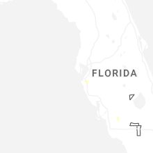
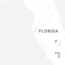
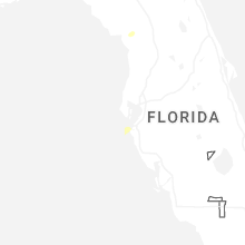
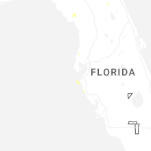


Connect with Interactive Hail Maps