

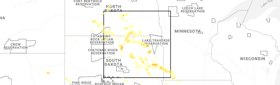
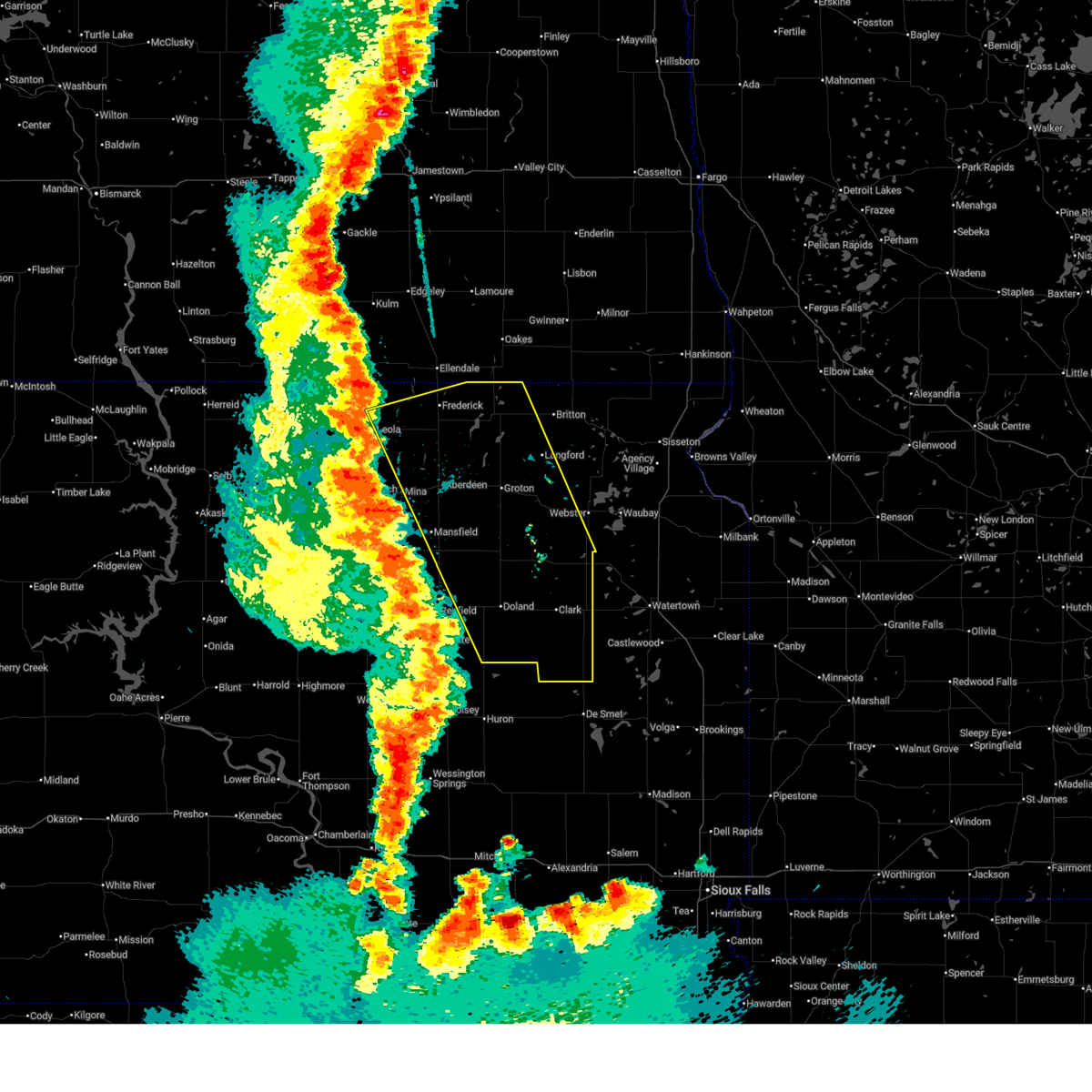
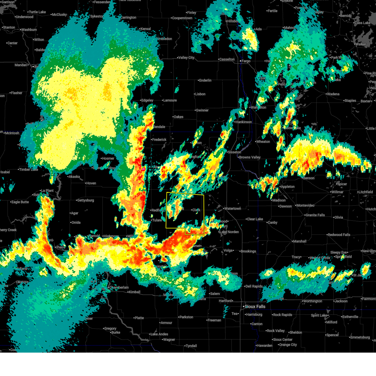
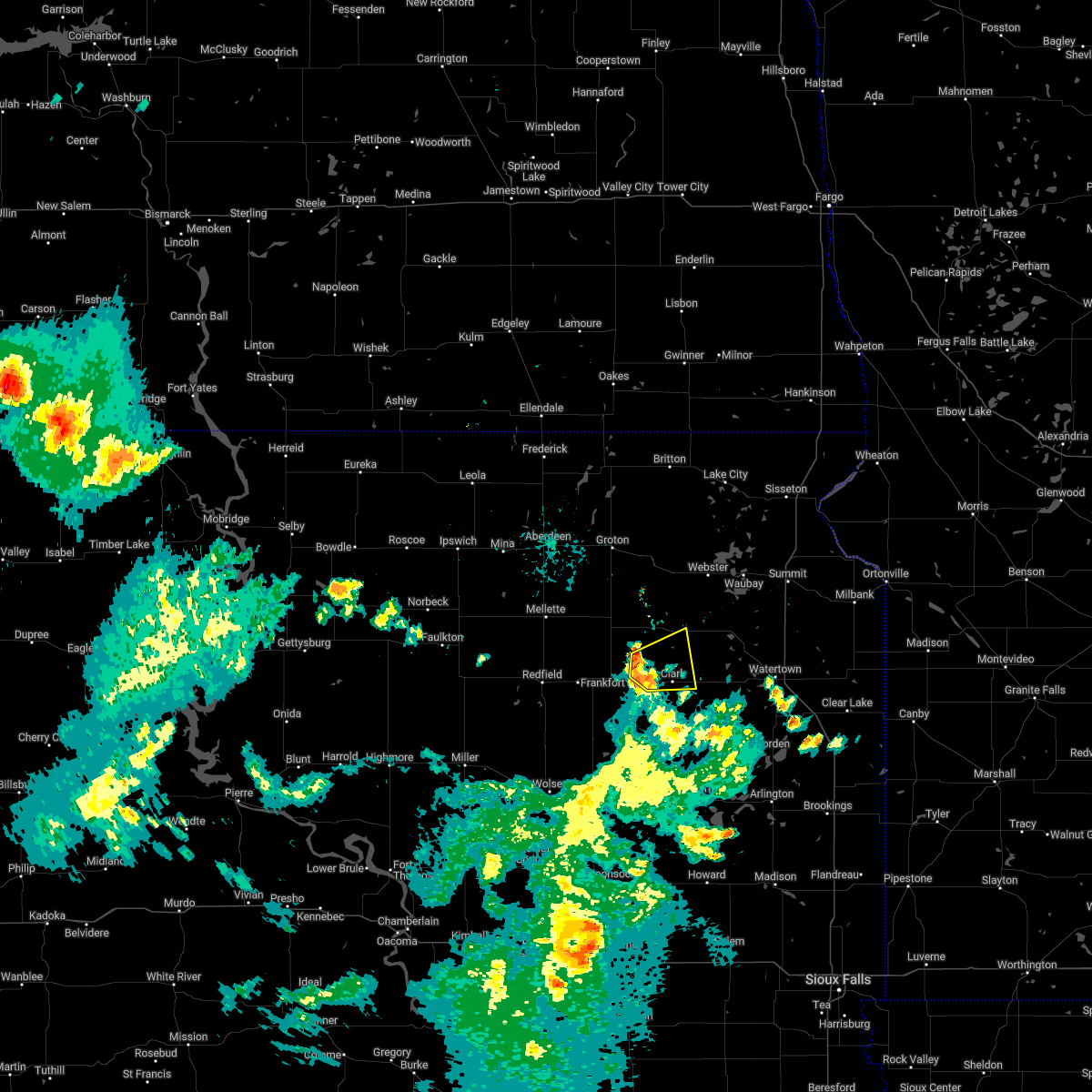
Hail Map for Bradley, SD
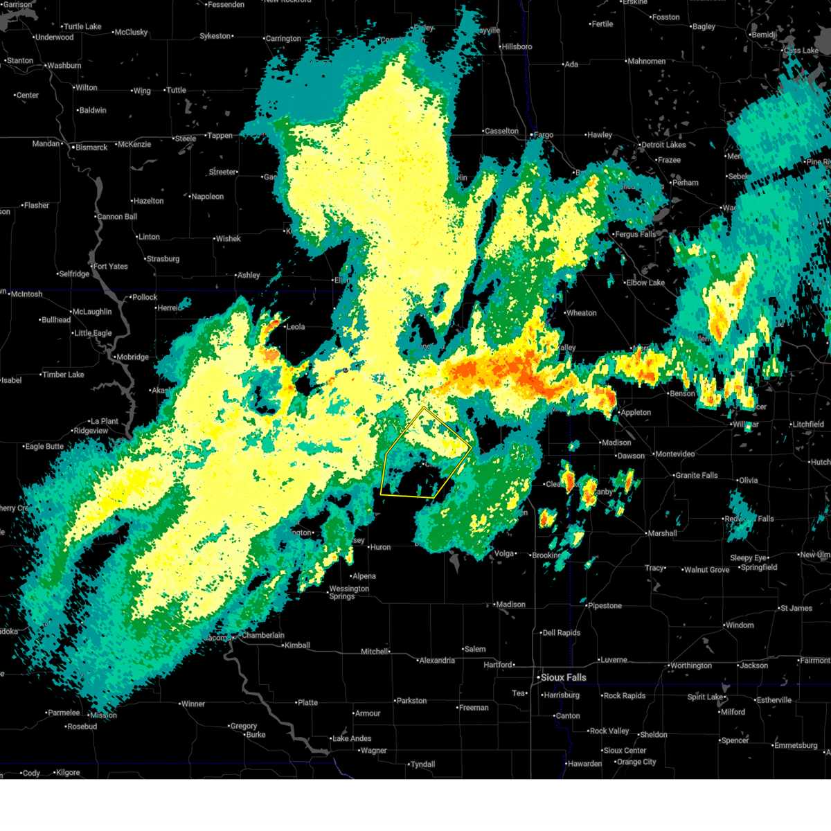
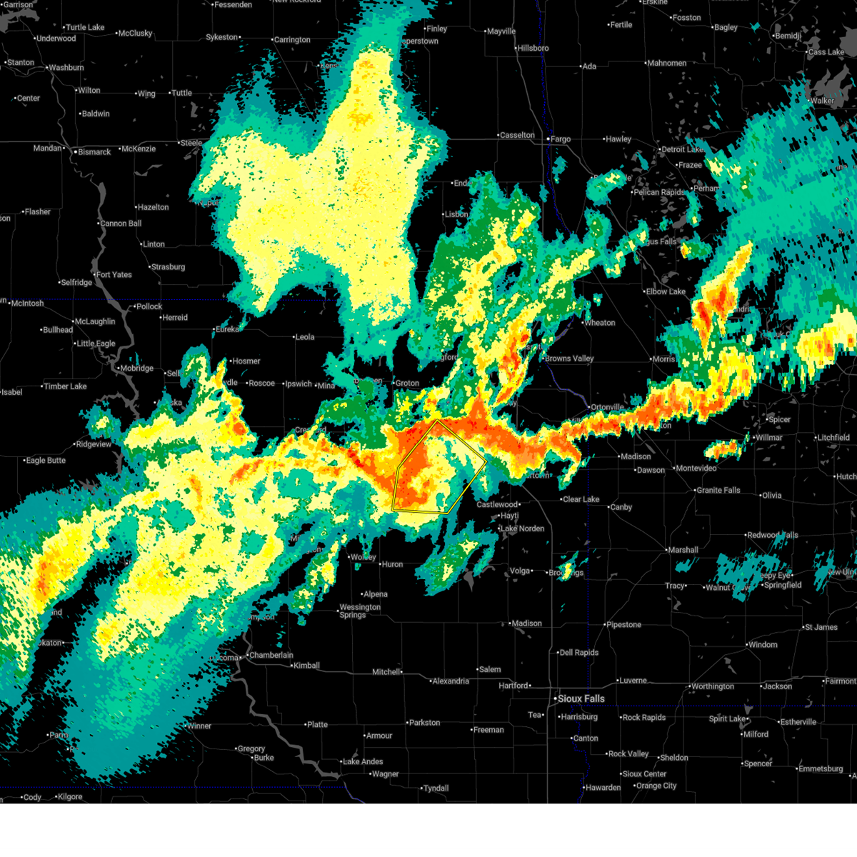
The Bradley, SD area has had 3 reports of on-the-ground hail by trained spotters, and has been under severe weather warnings 24 times during the past 12 months. Doppler radar has detected hail at or near Bradley, SD on 44 occasions, including 1 occasion during the past year.
| Name: | Bradley, SD |
| Where Located: | 48.4 miles ESE of Aberdeen, SD |
| Map: | Google Map for Bradley, SD |
| Population: | 72 |
| Housing Units: | 53 |
| More Info: | Search Google for Bradley, SD |
1
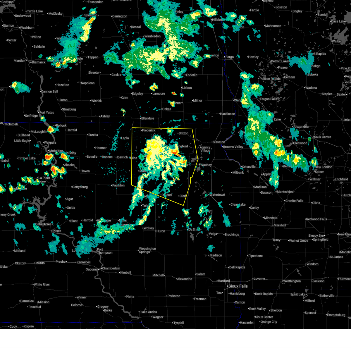
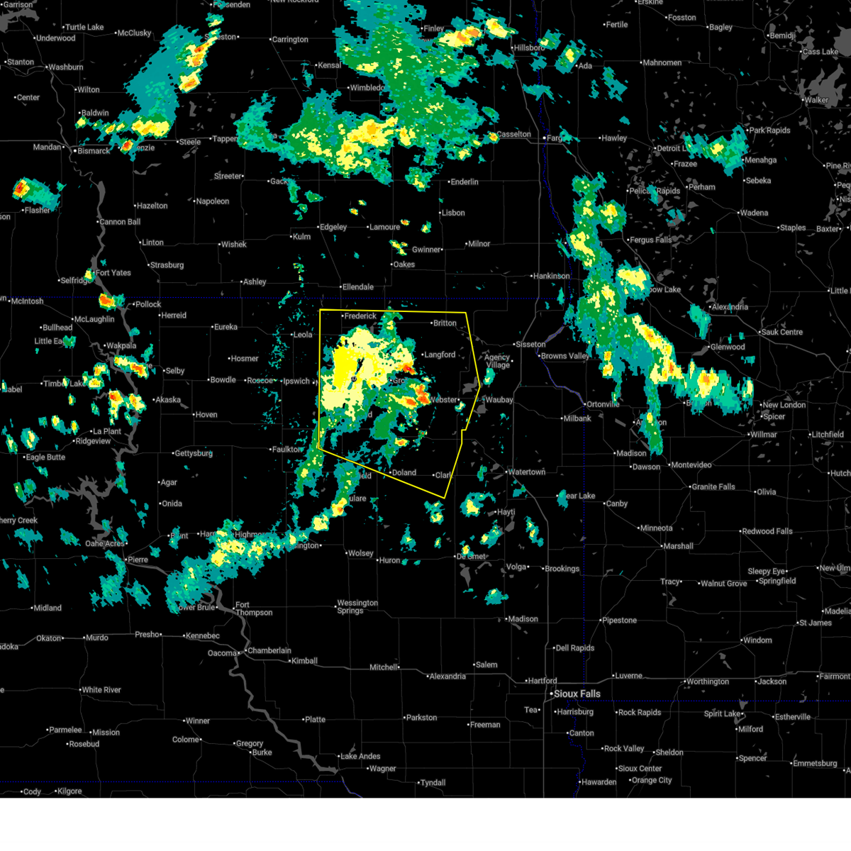
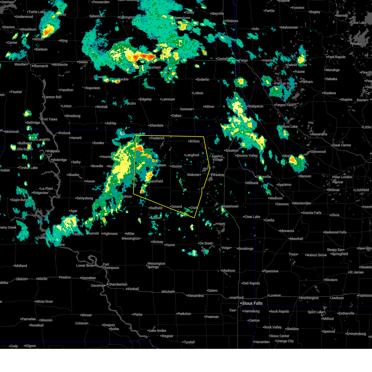
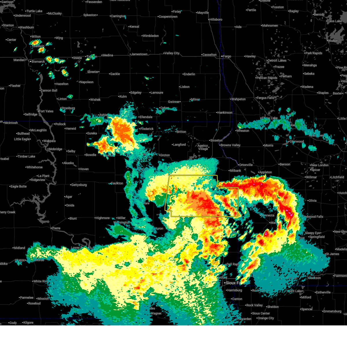
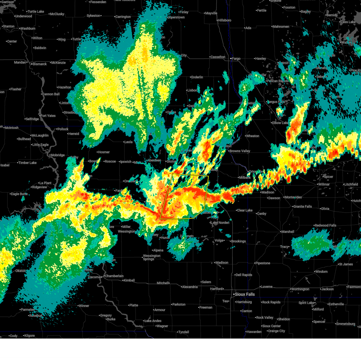
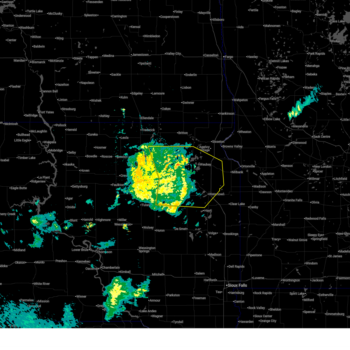
The Top Recent Hail Date for Bradley, SD is Tuesday, August 5, 2025 (2nd out of 44)
Hail and Wind Damage Spotted near Bradley, SD
| Date / Time | Report Details |
|---|---|
| 6/15/2026 4:11 PM CDT |
 The storms which prompted the warning have weakened below severe limits, and no longer pose an immediate threat to life or property. therefore, the warning will be allowed to expire. however, gusty winds are still possible with these thunderstorms. The storms which prompted the warning have weakened below severe limits, and no longer pose an immediate threat to life or property. therefore, the warning will be allowed to expire. however, gusty winds are still possible with these thunderstorms.
|
| 6/15/2026 4:01 PM CDT |
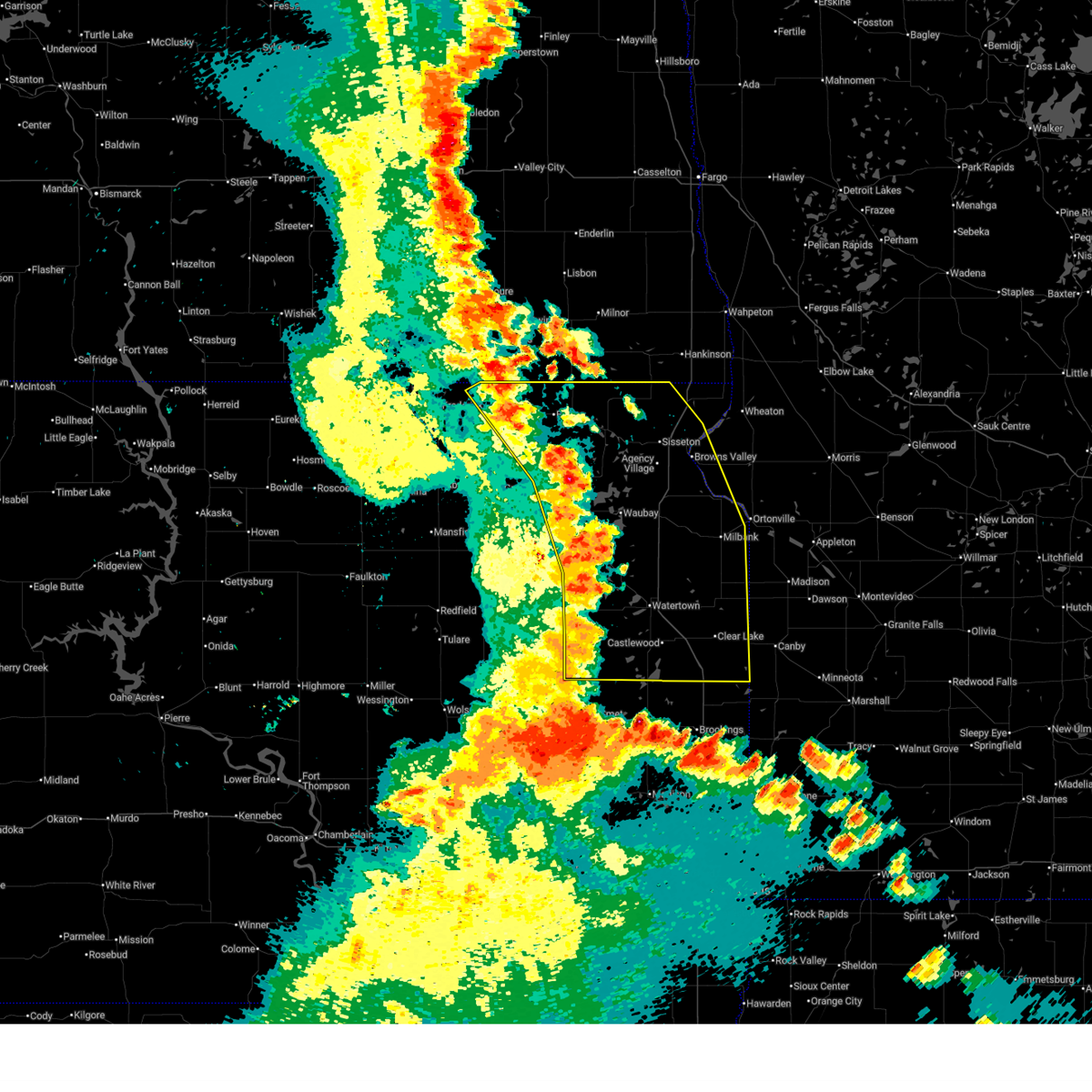
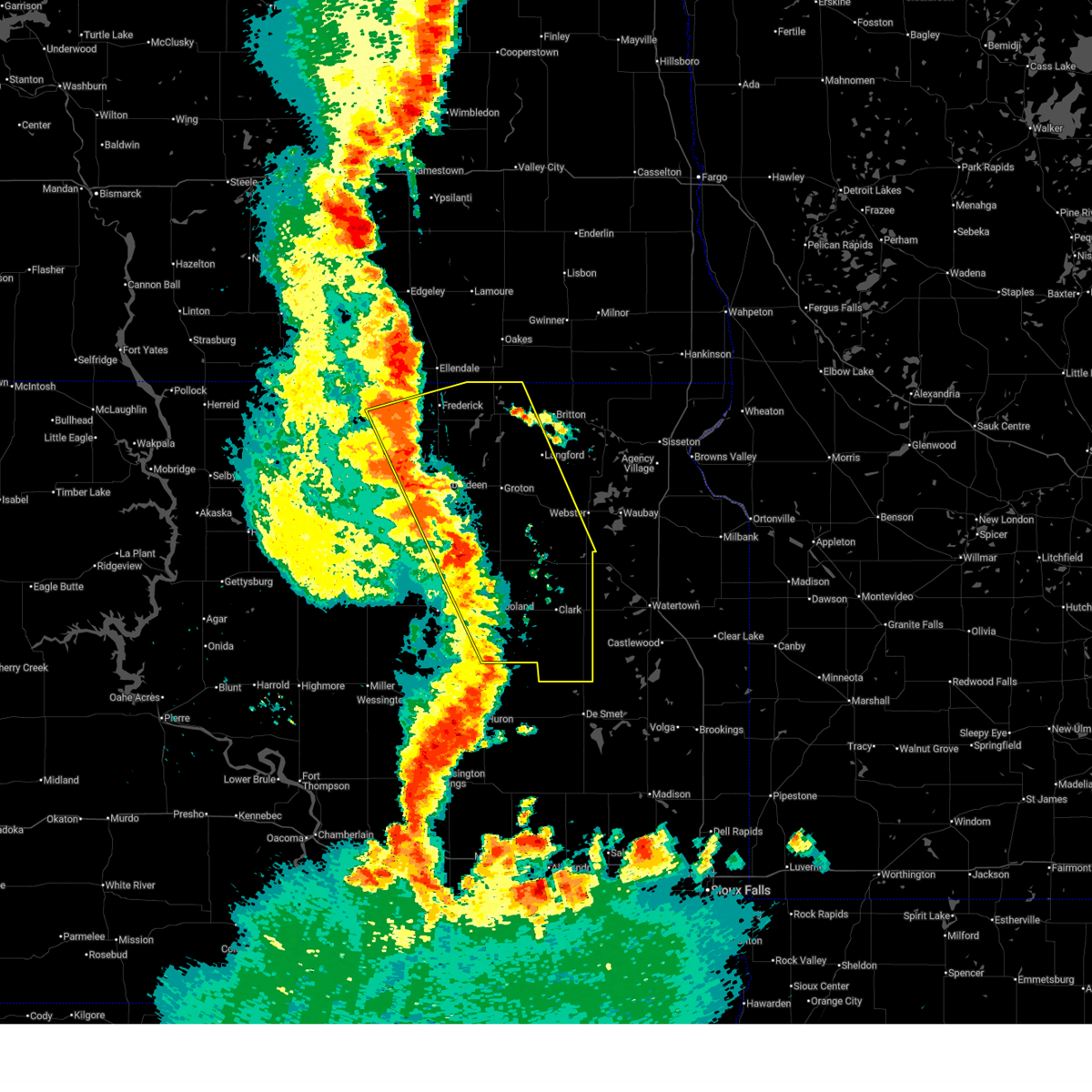
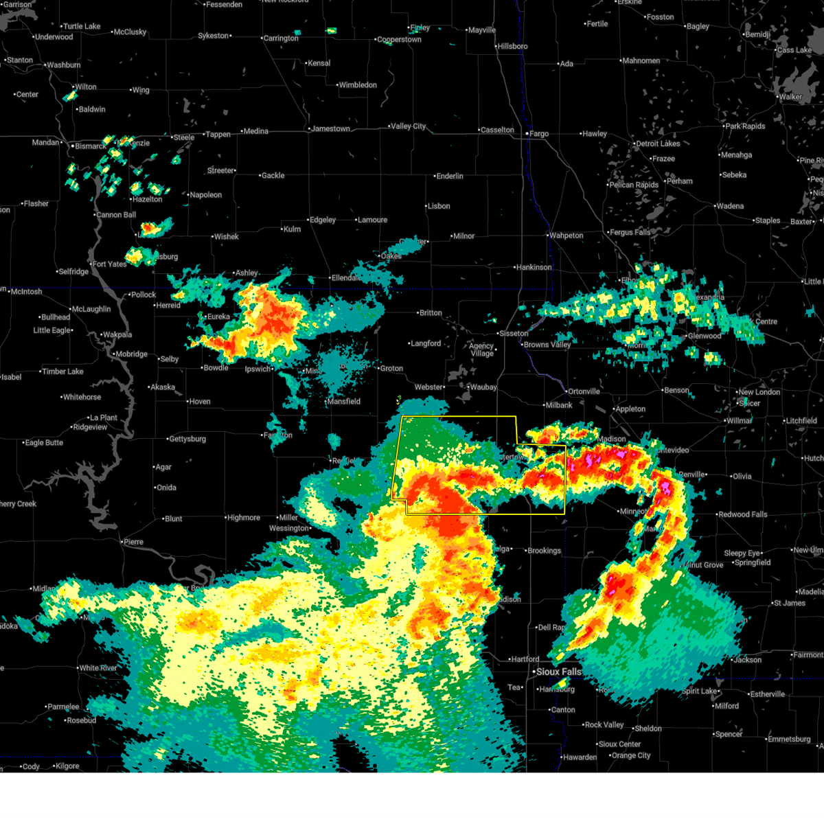
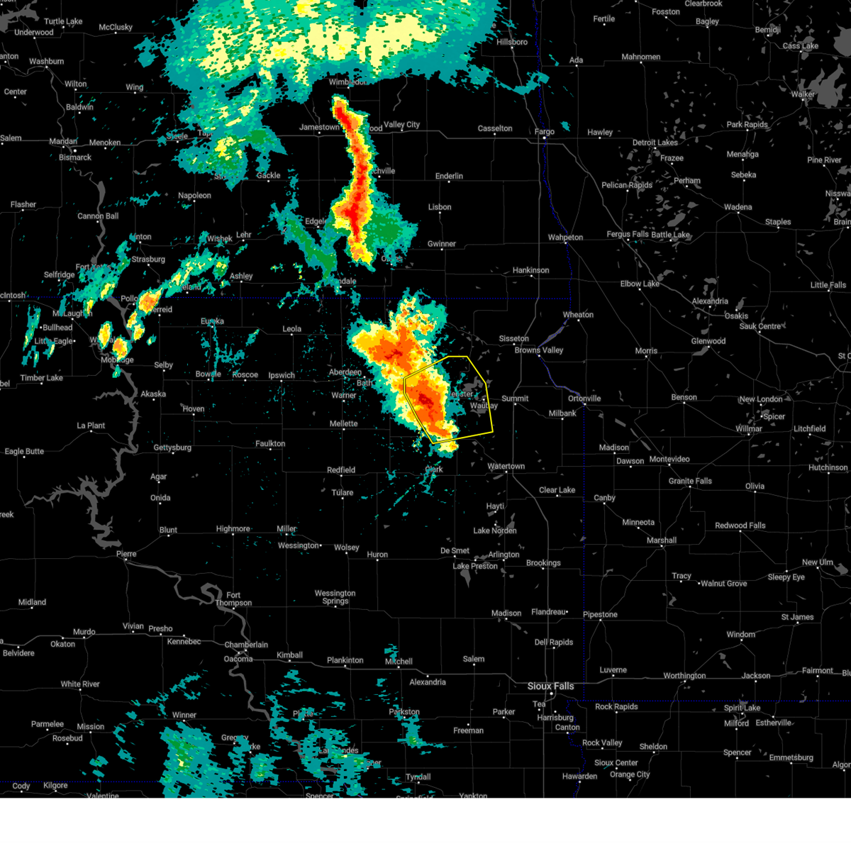
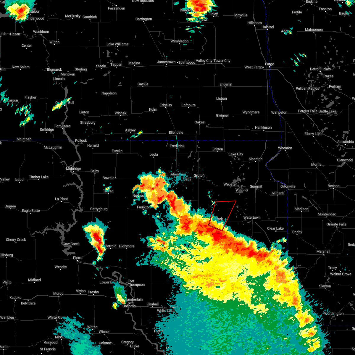
 At 400 pm cdt, severe thunderstorms were located along a line extending from near sunset colony to 6 miles north of holmquist to 7 miles southwest of crocker, moving east at 50 mph (trained weather spotters). Hazards include 60 mph wind gusts. Expect damage to roofs, siding, and trees. Locations impacted include, webster, britton, roslyn, sunset colony, hillcrest colony, bradley, grenville, crocker, lily, minnewasta lake, eden, garden city, rush lake, fort sisseton state park and roy lake rec area. At 400 pm cdt, severe thunderstorms were located along a line extending from near sunset colony to 6 miles north of holmquist to 7 miles southwest of crocker, moving east at 50 mph (trained weather spotters). Hazards include 60 mph wind gusts. Expect damage to roofs, siding, and trees. Locations impacted include, webster, britton, roslyn, sunset colony, hillcrest colony, bradley, grenville, crocker, lily, minnewasta lake, eden, garden city, rush lake, fort sisseton state park and roy lake rec area.
|
| 6/15/2026 3:19 PM CDT |
 Svrabr the national weather service in aberdeen has issued a * severe thunderstorm warning for, eastern edmunds county in north central south dakota, day county in northeastern south dakota, southwestern marshall county in northeastern south dakota, brown county in northeastern south dakota, northeastern faulk county in north central south dakota, northern clark county in northeastern south dakota, southeastern mcpherson county in north central south dakota, northern spink county in northeastern south dakota, * until 415 pm cdt. * at 318 pm cdt, severe thunderstorms were located along a line extending from near elm lake to bath to near athol, moving east at 50 mph (trained weather spotters). Hazards include 60 mph wind gusts and blowing dust. Expect damage to roofs, siding, and trees. severe thunderstorms will be near, groton, frederick, columbia, putney, hutterville colony, brentford, stratford, ferney, barnard, and sand lake wildlife refuge around 325 pm cdt. verdon and houghton around 330 pm cdt. conde, andover, camrose colony, and turton around 335 pm cdt. Other locations in the path of these severe thunderstorms include pierpont, claremont, crandall, bristol, langford, newport colony, amherst, sunset colony, butler, crocker, lily, holmquist, webster, britton, roslyn, bradley and waubay lake. Svrabr the national weather service in aberdeen has issued a * severe thunderstorm warning for, eastern edmunds county in north central south dakota, day county in northeastern south dakota, southwestern marshall county in northeastern south dakota, brown county in northeastern south dakota, northeastern faulk county in north central south dakota, northern clark county in northeastern south dakota, southeastern mcpherson county in north central south dakota, northern spink county in northeastern south dakota, * until 415 pm cdt. * at 318 pm cdt, severe thunderstorms were located along a line extending from near elm lake to bath to near athol, moving east at 50 mph (trained weather spotters). Hazards include 60 mph wind gusts and blowing dust. Expect damage to roofs, siding, and trees. severe thunderstorms will be near, groton, frederick, columbia, putney, hutterville colony, brentford, stratford, ferney, barnard, and sand lake wildlife refuge around 325 pm cdt. verdon and houghton around 330 pm cdt. conde, andover, camrose colony, and turton around 335 pm cdt. Other locations in the path of these severe thunderstorms include pierpont, claremont, crandall, bristol, langford, newport colony, amherst, sunset colony, butler, crocker, lily, holmquist, webster, britton, roslyn, bradley and waubay lake.
|
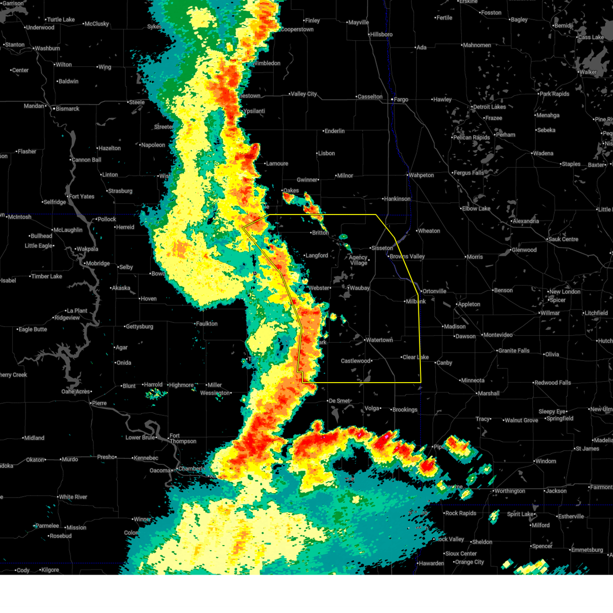
| 6/10/2026 12:15 AM CDT |
 At 1213 am cdt, severe thunderstorms were located along a line extending from near westwood colony to eden to 7 miles southeast of bitter lake to near kellerton church, moving northeast at 60 mph (radar indicated). Hazards include 70 mph wind gusts. Expect considerable tree damage. damage is likely to mobile homes, roofs, and outbuildings. Locations impacted include, watertown, agency village, veblen, summit, rauville, ortley, lake city, enemy swim lake, clear lake rec area, buffalo lakes, sisseton, castlewood, south shore, waverly, kranzburg, marvin, veblen flats housing, wilmot, peever, goodwin, stockholm, claire city, troy, bemis, dakota connection & casino, peever flats housing, browns valley, new effington, corona, strandburg, twin brooks, bullhead lake, lake traverse, big stone lake, school lake, yankeetown, milbank, beardsley, la bolt, bonanza grove, tunerville, traverse country park, rainbow island, revillo, lake alice, lismore colony and albee. At 1213 am cdt, severe thunderstorms were located along a line extending from near westwood colony to eden to 7 miles southeast of bitter lake to near kellerton church, moving northeast at 60 mph (radar indicated). Hazards include 70 mph wind gusts. Expect considerable tree damage. damage is likely to mobile homes, roofs, and outbuildings. Locations impacted include, watertown, agency village, veblen, summit, rauville, ortley, lake city, enemy swim lake, clear lake rec area, buffalo lakes, sisseton, castlewood, south shore, waverly, kranzburg, marvin, veblen flats housing, wilmot, peever, goodwin, stockholm, claire city, troy, bemis, dakota connection & casino, peever flats housing, browns valley, new effington, corona, strandburg, twin brooks, bullhead lake, lake traverse, big stone lake, school lake, yankeetown, milbank, beardsley, la bolt, bonanza grove, tunerville, traverse country park, rainbow island, revillo, lake alice, lismore colony and albee.
|
| 6/9/2026 11:57 PM CDT |
 Svrabr the national weather service in aberdeen has issued a * severe thunderstorm warning for, southwestern traverse county in west central minnesota, northwestern big stone county in west central minnesota, deuel county in northeastern south dakota, roberts county in northeastern south dakota, day county in northeastern south dakota, marshall county in northeastern south dakota, northeastern brown county in northeastern south dakota, hamlin county in northeastern south dakota, grant county in northeastern south dakota, clark county in northeastern south dakota, codington county in northeastern south dakota, * until 100 am cdt. * at 1156 pm cdt, severe thunderstorms were located along a line extending from near hecla to near pierpont to near wallace to near willow lake, moving east at 55 mph (radar indicated). Hazards include 70 mph wind gusts and nickel size hail. Expect considerable tree damage. damage is likely to mobile homes, roofs, and outbuildings. severe thunderstorms will be near, webster, bryant, florence, langford, henry, hecla, mayfield colony, sunset colony, newport colony, and hazel around 1200 am cdt. watertown, britton, goose lake, roslyn, rush lake, minnewasta lake, opitz lake, cattail lake, bitter lake, and lake kampeska around 1205 am cdt. waubay, hayti, enemy swim housing, eden, kidder, grenville, westwood colony, enemy swim lake, campbell slough, and piyas lake around 1210 am cdt. rauville, ortley, lake city, clear lake rec area, buffalo lakes, roy lake rec area, and pickerel lake rec area around 1215 am cdt. Other locations in the path of these severe thunderstorms include castlewood, summit, rudebusch corner, red iron housing, agency village, south shore, waverly, kranzburg, claremont colony, marvin, hillhead, finley heights housing, long hollow housing, sica hollow state park, sisseton, veblen, peever, goodwin, stockholm, twin brooks, troy, bemis, school lake, veblen flats housing, wilmot, corona, strandburg, bullhead lake, dakota connection & casino and peever flats housing. Svrabr the national weather service in aberdeen has issued a * severe thunderstorm warning for, southwestern traverse county in west central minnesota, northwestern big stone county in west central minnesota, deuel county in northeastern south dakota, roberts county in northeastern south dakota, day county in northeastern south dakota, marshall county in northeastern south dakota, northeastern brown county in northeastern south dakota, hamlin county in northeastern south dakota, grant county in northeastern south dakota, clark county in northeastern south dakota, codington county in northeastern south dakota, * until 100 am cdt. * at 1156 pm cdt, severe thunderstorms were located along a line extending from near hecla to near pierpont to near wallace to near willow lake, moving east at 55 mph (radar indicated). Hazards include 70 mph wind gusts and nickel size hail. Expect considerable tree damage. damage is likely to mobile homes, roofs, and outbuildings. severe thunderstorms will be near, webster, bryant, florence, langford, henry, hecla, mayfield colony, sunset colony, newport colony, and hazel around 1200 am cdt. watertown, britton, goose lake, roslyn, rush lake, minnewasta lake, opitz lake, cattail lake, bitter lake, and lake kampeska around 1205 am cdt. waubay, hayti, enemy swim housing, eden, kidder, grenville, westwood colony, enemy swim lake, campbell slough, and piyas lake around 1210 am cdt. rauville, ortley, lake city, clear lake rec area, buffalo lakes, roy lake rec area, and pickerel lake rec area around 1215 am cdt. Other locations in the path of these severe thunderstorms include castlewood, summit, rudebusch corner, red iron housing, agency village, south shore, waverly, kranzburg, claremont colony, marvin, hillhead, finley heights housing, long hollow housing, sica hollow state park, sisseton, veblen, peever, goodwin, stockholm, twin brooks, troy, bemis, school lake, veblen flats housing, wilmot, corona, strandburg, bullhead lake, dakota connection & casino and peever flats housing.
|
| 6/9/2026 11:54 PM CDT |
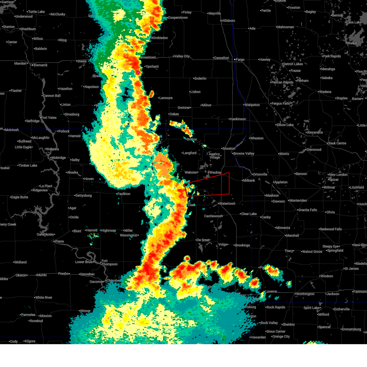 Torabr the national weather service in aberdeen has issued a * tornado warning for, southeastern day county in northeastern south dakota, northwestern grant county in northeastern south dakota, northeastern clark county in northeastern south dakota, northern codington county in northeastern south dakota, * until 1245 am cdt. * at 1154 pm cdt, severe thunderstorms capable of producing both tornadoes and extensive straight line wind damage were located over bradley, or 15 miles west of florence, moving east at 55 mph (radar indicated rotation). Hazards include tornado. Flying debris will be dangerous to those caught without shelter. mobile homes will be damaged or destroyed. damage to roofs, windows, and vehicles will occur. tree damage is likely. these dangerous storms will be near, wallace, grass lake, and swan lake around 1200 am cdt. florence around 1210 am cdt. Other locations in the path of this tornadic thunderstorm include south shore and marvin. Torabr the national weather service in aberdeen has issued a * tornado warning for, southeastern day county in northeastern south dakota, northwestern grant county in northeastern south dakota, northeastern clark county in northeastern south dakota, northern codington county in northeastern south dakota, * until 1245 am cdt. * at 1154 pm cdt, severe thunderstorms capable of producing both tornadoes and extensive straight line wind damage were located over bradley, or 15 miles west of florence, moving east at 55 mph (radar indicated rotation). Hazards include tornado. Flying debris will be dangerous to those caught without shelter. mobile homes will be damaged or destroyed. damage to roofs, windows, and vehicles will occur. tree damage is likely. these dangerous storms will be near, wallace, grass lake, and swan lake around 1200 am cdt. florence around 1210 am cdt. Other locations in the path of this tornadic thunderstorm include south shore and marvin.
|
| 6/9/2026 11:49 PM CDT |
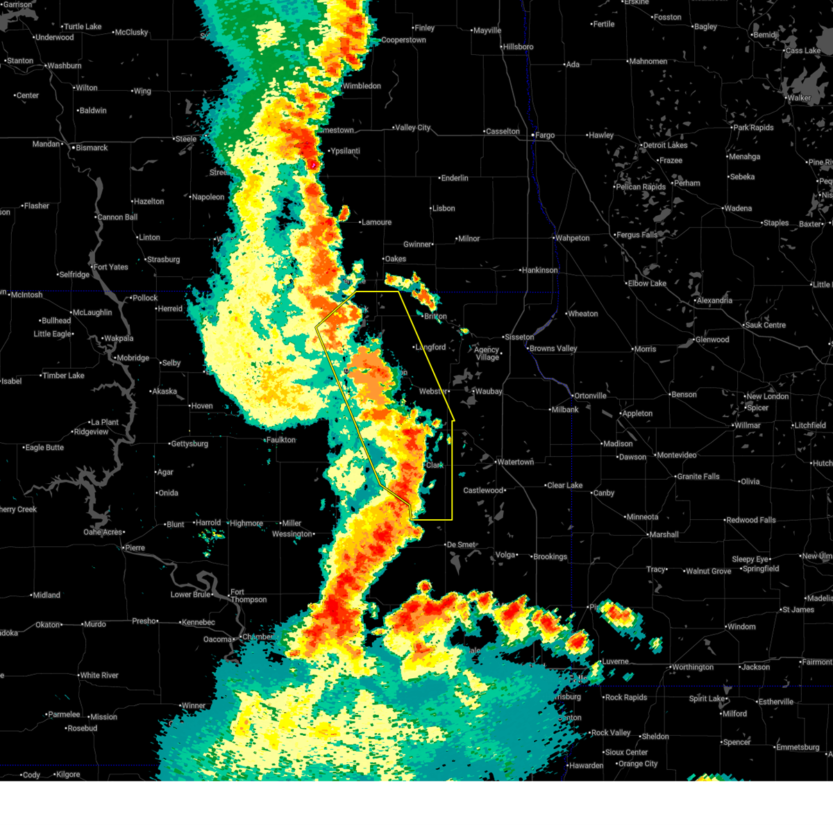 At 1148 pm cdt, severe thunderstorms were located along a line extending from 6 miles northwest of sand lake wildlife refuge to clark, moving east at 55 mph (radar indicated). Hazards include 70 mph wind gusts. Expect considerable tree damage. damage is likely to mobile homes, roofs, and outbuildings. Locations impacted include, bristol, hecla, pierpont, claremont, newport colony, hillcrest colony, andover, bradley, garden city, crocker, langford, amherst, holmquist and sunset colony. At 1148 pm cdt, severe thunderstorms were located along a line extending from 6 miles northwest of sand lake wildlife refuge to clark, moving east at 55 mph (radar indicated). Hazards include 70 mph wind gusts. Expect considerable tree damage. damage is likely to mobile homes, roofs, and outbuildings. Locations impacted include, bristol, hecla, pierpont, claremont, newport colony, hillcrest colony, andover, bradley, garden city, crocker, langford, amherst, holmquist and sunset colony.
|
| 6/9/2026 11:26 PM CDT |
 At 1126 pm cdt, severe thunderstorms were located along a line extending from 6 miles south of elm lake to near doland, moving east at 55 mph (radar indicated). Hazards include 70 mph wind gusts. Expect considerable tree damage. damage is likely to mobile homes, roofs, and outbuildings. these severe storms will be near, aberdeen, frederick, doland, bath, conde, westport, hutterville colony, clark colony, stratford, and raymond around 1130 pm cdt. Other locations in the path of these severe thunderstorms include columbia, ferney, verdon, sand lake wildlife refuge, tacoma park, groton, clark, putney, crandall, hillcrest colony, crocker, houghton, hecla, claremont, andover, bradley, garden city, silver lake, bristol, pierpont, newport colony, butler, lily, swan lake, langford, amherst, holmquist and sunset colony. At 1126 pm cdt, severe thunderstorms were located along a line extending from 6 miles south of elm lake to near doland, moving east at 55 mph (radar indicated). Hazards include 70 mph wind gusts. Expect considerable tree damage. damage is likely to mobile homes, roofs, and outbuildings. these severe storms will be near, aberdeen, frederick, doland, bath, conde, westport, hutterville colony, clark colony, stratford, and raymond around 1130 pm cdt. Other locations in the path of these severe thunderstorms include columbia, ferney, verdon, sand lake wildlife refuge, tacoma park, groton, clark, putney, crandall, hillcrest colony, crocker, houghton, hecla, claremont, andover, bradley, garden city, silver lake, bristol, pierpont, newport colony, butler, lily, swan lake, langford, amherst, holmquist and sunset colony.
|
| 6/9/2026 11:12 PM CDT |
 Svrabr the national weather service in aberdeen has issued a * severe thunderstorm warning for, northeastern edmunds county in north central south dakota, western day county in northeastern south dakota, southwestern marshall county in northeastern south dakota, brown county in northeastern south dakota, clark county in northeastern south dakota, southeastern mcpherson county in north central south dakota, spink county in northeastern south dakota, * until 1215 am cdt. * at 1111 pm cdt, severe thunderstorms were located along a line extending from near leola to near frankfort, moving east at 55 mph (radar indicated). Hazards include 60 mph wind gusts. Expect damage to roofs, siding, and trees. severe thunderstorms will be near, leola, warner, mina lake rec area, mellette, glendale colony, frankfort, grassland colony, mansfield, camrose colony, and long lake colony around 1115 pm cdt. aberdeen, doland, brentford, and elm lake around 1120 pm cdt. westport, hutterville colony, stratford, and turton around 1125 pm cdt. frederick, bath, conde, clark colony, raymond, and barnard around 1130 pm cdt. Other locations in the path of these severe thunderstorms include columbia, ferney, verdon, sand lake wildlife refuge, crandall, tacoma park, groton, clark, putney, hillcrest colony, crocker, houghton, hecla, claremont, andover, bradley, garden city, lily and silver lake. Svrabr the national weather service in aberdeen has issued a * severe thunderstorm warning for, northeastern edmunds county in north central south dakota, western day county in northeastern south dakota, southwestern marshall county in northeastern south dakota, brown county in northeastern south dakota, clark county in northeastern south dakota, southeastern mcpherson county in north central south dakota, spink county in northeastern south dakota, * until 1215 am cdt. * at 1111 pm cdt, severe thunderstorms were located along a line extending from near leola to near frankfort, moving east at 55 mph (radar indicated). Hazards include 60 mph wind gusts. Expect damage to roofs, siding, and trees. severe thunderstorms will be near, leola, warner, mina lake rec area, mellette, glendale colony, frankfort, grassland colony, mansfield, camrose colony, and long lake colony around 1115 pm cdt. aberdeen, doland, brentford, and elm lake around 1120 pm cdt. westport, hutterville colony, stratford, and turton around 1125 pm cdt. frederick, bath, conde, clark colony, raymond, and barnard around 1130 pm cdt. Other locations in the path of these severe thunderstorms include columbia, ferney, verdon, sand lake wildlife refuge, crandall, tacoma park, groton, clark, putney, hillcrest colony, crocker, houghton, hecla, claremont, andover, bradley, garden city, lily and silver lake.
|
| 8/16/2025 4:17 AM CDT |
 At 417 am cdt, severe thunderstorms were located along a line extending from dakota sioux casino to near claremont colony to near white, moving northeast at 65 mph (radar indicated. at 353 am 59 mph wind gust was reported 4 miles west of bryant). Hazards include 70 mph wind gusts and nickel size hail. Expect considerable tree damage. damage is likely to mobile homes, roofs, and outbuildings. these severe storms will be near, watertown, clear lake, rauville, toronto, waverly, kranzburg, goodwin, astoria, brandt, and bemis around 420 am cdt. Other locations in the path of these severe thunderstorms include south shore, altamont, bullhead lake, lake alice, tunerville, gary, lake cochrane rec area and moritz. At 417 am cdt, severe thunderstorms were located along a line extending from dakota sioux casino to near claremont colony to near white, moving northeast at 65 mph (radar indicated. at 353 am 59 mph wind gust was reported 4 miles west of bryant). Hazards include 70 mph wind gusts and nickel size hail. Expect considerable tree damage. damage is likely to mobile homes, roofs, and outbuildings. these severe storms will be near, watertown, clear lake, rauville, toronto, waverly, kranzburg, goodwin, astoria, brandt, and bemis around 420 am cdt. Other locations in the path of these severe thunderstorms include south shore, altamont, bullhead lake, lake alice, tunerville, gary, lake cochrane rec area and moritz.
|
| 8/16/2025 4:02 AM CDT |
 At 402 am cdt, severe thunderstorms were located along a line extending from near henry to near hayti to near volga, moving northeast at 55 mph (radar indicated). Hazards include 60 mph wind gusts and nickel size hail. Expect damage to roofs, siding, and trees. these severe storms will be near, estelline, castlewood, goose lake, lake poinsett, hayti, henry, thomas, long lake, pelican lake, and stone bridge around 405 am cdt. watertown, claremont colony, poinsett colony, lake kampeska, sandy shore rec area, and memorial park camping site around 410 am cdt. watertown city park around 415 am cdt. Other locations in the path of these severe thunderstorms include clear lake, rauville, toronto, kranzburg, goodwin, bemis, dakota sioux casino, waverly, astoria, brandt, altamont, school lake, bullhead lake, lake alice, lake cochrane rec area, tunerville, moritz and gary. At 402 am cdt, severe thunderstorms were located along a line extending from near henry to near hayti to near volga, moving northeast at 55 mph (radar indicated). Hazards include 60 mph wind gusts and nickel size hail. Expect damage to roofs, siding, and trees. these severe storms will be near, estelline, castlewood, goose lake, lake poinsett, hayti, henry, thomas, long lake, pelican lake, and stone bridge around 405 am cdt. watertown, claremont colony, poinsett colony, lake kampeska, sandy shore rec area, and memorial park camping site around 410 am cdt. watertown city park around 415 am cdt. Other locations in the path of these severe thunderstorms include clear lake, rauville, toronto, kranzburg, goodwin, bemis, dakota sioux casino, waverly, astoria, brandt, altamont, school lake, bullhead lake, lake alice, lake cochrane rec area, tunerville, moritz and gary.
|
| 8/16/2025 3:57 AM CDT |
 Svrabr the national weather service in aberdeen has issued a * severe thunderstorm warning for, deuel county in northeastern south dakota, hamlin county in northeastern south dakota, clark county in northeastern south dakota, codington county in northeastern south dakota, * until 445 am cdt. * at 357 am cdt, severe thunderstorms were located along a line extending from 8 miles west of mayfield colony to near lake norden to near arlington, moving northeast at 70 mph (radar indicated). Hazards include 60 mph wind gusts and nickel size hail. Expect damage to roofs, siding, and trees. severe thunderstorms will be near, estelline, castlewood, lake poinsett, hayti, henry, hazel, claremont colony, naples, poinsett colony, and thomas around 405 am cdt. watertown, goose lake, long lake, lake kampeska, pelican lake, and tinkertown around 410 am cdt. toronto, astoria, brandt, bemis, sandy shore rec area, medicine lake, memorial park camping site, and watertown city park around 415 am cdt. Other locations in the path of these severe thunderstorms include clear lake, rauville, kranzburg, goodwin, altamont, dakota sioux casino, waverly, bullhead lake, lake alice, school lake, lake cochrane rec area, tunerville, moritz, gary and south shore. Svrabr the national weather service in aberdeen has issued a * severe thunderstorm warning for, deuel county in northeastern south dakota, hamlin county in northeastern south dakota, clark county in northeastern south dakota, codington county in northeastern south dakota, * until 445 am cdt. * at 357 am cdt, severe thunderstorms were located along a line extending from 8 miles west of mayfield colony to near lake norden to near arlington, moving northeast at 70 mph (radar indicated). Hazards include 60 mph wind gusts and nickel size hail. Expect damage to roofs, siding, and trees. severe thunderstorms will be near, estelline, castlewood, lake poinsett, hayti, henry, hazel, claremont colony, naples, poinsett colony, and thomas around 405 am cdt. watertown, goose lake, long lake, lake kampeska, pelican lake, and tinkertown around 410 am cdt. toronto, astoria, brandt, bemis, sandy shore rec area, medicine lake, memorial park camping site, and watertown city park around 415 am cdt. Other locations in the path of these severe thunderstorms include clear lake, rauville, kranzburg, goodwin, altamont, dakota sioux casino, waverly, bullhead lake, lake alice, school lake, lake cochrane rec area, tunerville, moritz, gary and south shore.
|
| 8/5/2025 8:02 PM CDT |
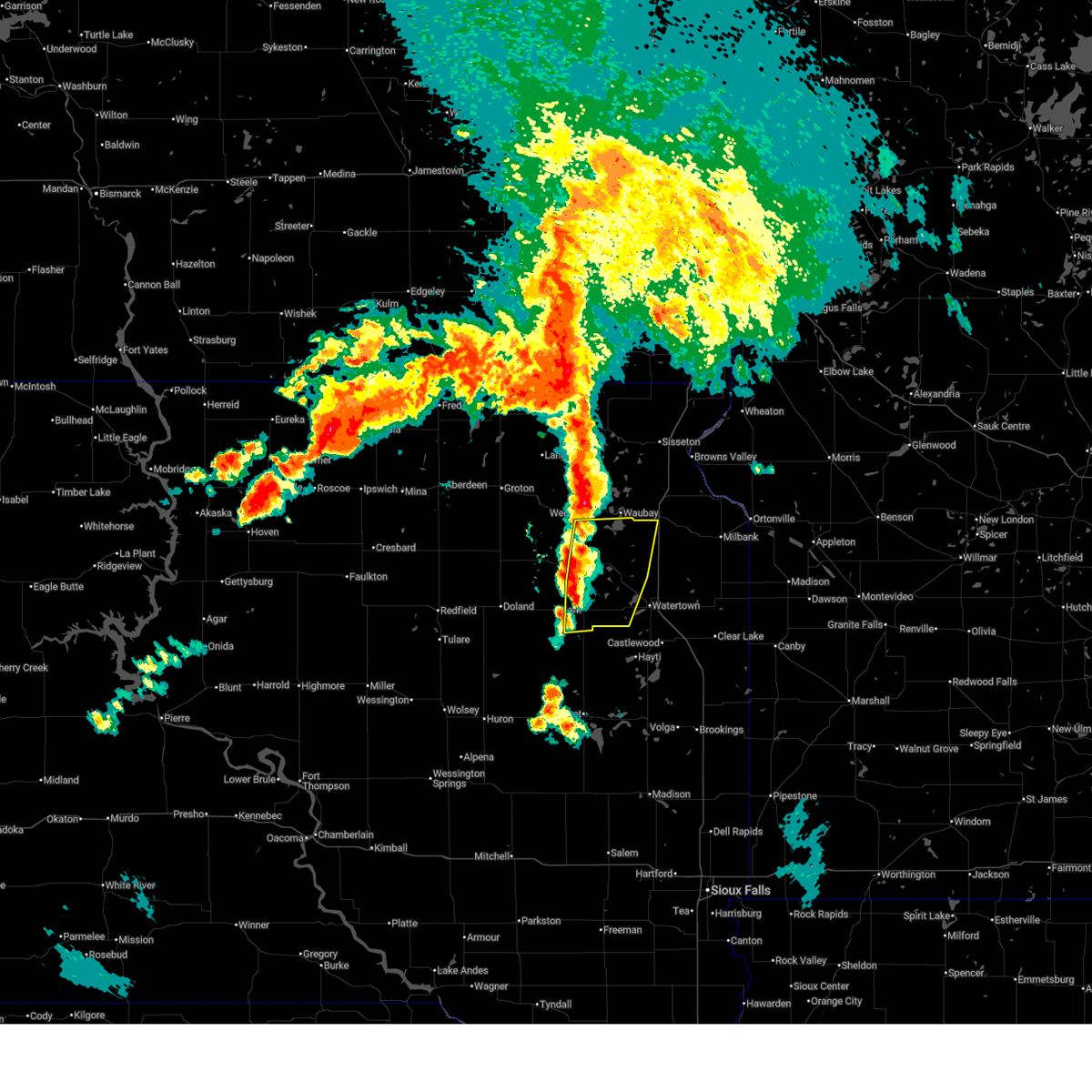 Svrabr the national weather service in aberdeen has issued a * severe thunderstorm warning for, southeastern day county in northeastern south dakota, northwestern grant county in northeastern south dakota, northeastern clark county in northeastern south dakota, western codington county in northeastern south dakota, * until 845 pm cdt. * at 802 pm cdt, severe thunderstorms were located along a line extending from near antelope lake to near long lake to near silver lake, moving east at 20 mph (radar indicated). Hazards include quarter size hail. Damage to vehicles is expected. severe thunderstorms will be near, florence, henry, long lake, grass lake, bitter lake, and medicine lake around 805 pm cdt. tinkertown around 810 pm cdt. Other locations in the path of these severe thunderstorms include watertown, goose lake, lake kampeska and memorial park camping site. Svrabr the national weather service in aberdeen has issued a * severe thunderstorm warning for, southeastern day county in northeastern south dakota, northwestern grant county in northeastern south dakota, northeastern clark county in northeastern south dakota, western codington county in northeastern south dakota, * until 845 pm cdt. * at 802 pm cdt, severe thunderstorms were located along a line extending from near antelope lake to near long lake to near silver lake, moving east at 20 mph (radar indicated). Hazards include quarter size hail. Damage to vehicles is expected. severe thunderstorms will be near, florence, henry, long lake, grass lake, bitter lake, and medicine lake around 805 pm cdt. tinkertown around 810 pm cdt. Other locations in the path of these severe thunderstorms include watertown, goose lake, lake kampeska and memorial park camping site.
|
| 7/23/2025 10:32 AM CDT |
 the severe thunderstorm warning has been cancelled and is no longer in effect the severe thunderstorm warning has been cancelled and is no longer in effect
|
| 7/23/2025 9:53 AM CDT |
 Svrabr the national weather service in aberdeen has issued a * severe thunderstorm warning for, south central day county in northeastern south dakota, clark county in northeastern south dakota, southeastern spink county in northeastern south dakota, west central codington county in northeastern south dakota, * until 1045 am cdt. * at 952 am cdt, a severe thunderstorm was located near raymond, or near clark, moving northeast at 35 mph (radar indicated). Hazards include 60 mph wind gusts. Expect damage to roofs, siding, and trees. this severe thunderstorm will be near, clark and hillcrest colony around 1000 am cdt. garden city around 1010 am cdt. Other locations in the path of this severe thunderstorm include bradley and swan lake. Svrabr the national weather service in aberdeen has issued a * severe thunderstorm warning for, south central day county in northeastern south dakota, clark county in northeastern south dakota, southeastern spink county in northeastern south dakota, west central codington county in northeastern south dakota, * until 1045 am cdt. * at 952 am cdt, a severe thunderstorm was located near raymond, or near clark, moving northeast at 35 mph (radar indicated). Hazards include 60 mph wind gusts. Expect damage to roofs, siding, and trees. this severe thunderstorm will be near, clark and hillcrest colony around 1000 am cdt. garden city around 1010 am cdt. Other locations in the path of this severe thunderstorm include bradley and swan lake.
|
| 7/23/2025 9:38 AM CDT |
 At 938 am cdt, a severe thunderstorm was located over clark colony, or 14 miles southwest of clark, moving northeast at 35 mph (trained weather spotters. at 923 am cdt, a 63 mph wind gust was reported 9 miles south, southeast of spink colony). Hazards include 60 mph wind gusts. Expect damage to roofs, siding, and trees. this severe storm will be near, raymond around 945 am cdt. clark around 950 am cdt. Other locations in the path of this severe thunderstorm include hillcrest colony, garden city and bradley. At 938 am cdt, a severe thunderstorm was located over clark colony, or 14 miles southwest of clark, moving northeast at 35 mph (trained weather spotters. at 923 am cdt, a 63 mph wind gust was reported 9 miles south, southeast of spink colony). Hazards include 60 mph wind gusts. Expect damage to roofs, siding, and trees. this severe storm will be near, raymond around 945 am cdt. clark around 950 am cdt. Other locations in the path of this severe thunderstorm include hillcrest colony, garden city and bradley.
|
| 7/23/2025 9:33 AM CDT |
 At 932 am cdt, a severe thunderstorm was located over hillside colony, or 17 miles southwest of clark, moving northeast at 35 mph (trained weather spotters. at 923 am cdt, a 63 mph wind gust was reported 9 miles south, southeast of spink colony). Hazards include 60 mph wind gusts. Expect damage to roofs, siding, and trees. this severe storm will be near, clark colony and fordham colony around 940 am cdt. raymond around 945 am cdt. Other locations in the path of this severe thunderstorm include clark, hillcrest colony, garden city and bradley. At 932 am cdt, a severe thunderstorm was located over hillside colony, or 17 miles southwest of clark, moving northeast at 35 mph (trained weather spotters. at 923 am cdt, a 63 mph wind gust was reported 9 miles south, southeast of spink colony). Hazards include 60 mph wind gusts. Expect damage to roofs, siding, and trees. this severe storm will be near, clark colony and fordham colony around 940 am cdt. raymond around 945 am cdt. Other locations in the path of this severe thunderstorm include clark, hillcrest colony, garden city and bradley.
|
| 7/23/2025 9:27 AM CDT |
 At 927 am cdt, a severe thunderstorm was located near crocker, or 9 miles north of clark, moving north at 35 mph (radar indicated). Hazards include 60 mph wind gusts. Expect damage to roofs, siding, and trees. Locations impacted include, bradley, crocker, lily, swan lake and butler. At 927 am cdt, a severe thunderstorm was located near crocker, or 9 miles north of clark, moving north at 35 mph (radar indicated). Hazards include 60 mph wind gusts. Expect damage to roofs, siding, and trees. Locations impacted include, bradley, crocker, lily, swan lake and butler.
|
| 7/23/2025 9:09 AM CDT |
 Svrabr the national weather service in aberdeen has issued a * severe thunderstorm warning for, southern day county in northeastern south dakota, western hamlin county in northeastern south dakota, clark county in northeastern south dakota, southeastern spink county in northeastern south dakota, western codington county in northeastern south dakota, * until 1000 am cdt. * at 909 am cdt, a severe thunderstorm was located near clark, moving north at 35 mph (radar indicated). Hazards include 70 mph wind gusts. Expect considerable tree damage. damage is likely to mobile homes, roofs, and outbuildings. this severe thunderstorm will be near, clark and hillcrest colony around 915 am cdt. crocker around 925 am cdt. Other locations in the path of this severe thunderstorm include bradley, lily, swan lake and butler. Svrabr the national weather service in aberdeen has issued a * severe thunderstorm warning for, southern day county in northeastern south dakota, western hamlin county in northeastern south dakota, clark county in northeastern south dakota, southeastern spink county in northeastern south dakota, western codington county in northeastern south dakota, * until 1000 am cdt. * at 909 am cdt, a severe thunderstorm was located near clark, moving north at 35 mph (radar indicated). Hazards include 70 mph wind gusts. Expect considerable tree damage. damage is likely to mobile homes, roofs, and outbuildings. this severe thunderstorm will be near, clark and hillcrest colony around 915 am cdt. crocker around 925 am cdt. Other locations in the path of this severe thunderstorm include bradley, lily, swan lake and butler.
|
| 7/23/2025 8:56 AM CDT |
 At 855 am cdt, a severe thunderstorm was located near fordham colony, or 8 miles southwest of clark, moving north at 45 mph (radar indicated). Hazards include 70 mph wind gusts. Expect considerable tree damage. damage is likely to mobile homes, roofs, and outbuildings. Locations impacted include, clark, hillcrest colony and bradley. At 855 am cdt, a severe thunderstorm was located near fordham colony, or 8 miles southwest of clark, moving north at 45 mph (radar indicated). Hazards include 70 mph wind gusts. Expect considerable tree damage. damage is likely to mobile homes, roofs, and outbuildings. Locations impacted include, clark, hillcrest colony and bradley.
|
| 7/23/2025 8:37 AM CDT |
 Svrabr the national weather service in aberdeen has issued a * severe thunderstorm warning for, clark county in northeastern south dakota, eastern spink county in northeastern south dakota, * until 915 am cdt. * at 836 am cdt, a severe thunderstorm was located near carpenter, or 21 miles northeast of huron, moving north at 45 mph (radar indicated). Hazards include 70 mph wind gusts. Expect considerable tree damage. damage is likely to mobile homes, roofs, and outbuildings. this severe thunderstorm will be near, carpenter around 840 am cdt. fordham colony around 845 am cdt. clark around 855 am cdt. Other locations in the path of this severe thunderstorm include hillcrest colony. Svrabr the national weather service in aberdeen has issued a * severe thunderstorm warning for, clark county in northeastern south dakota, eastern spink county in northeastern south dakota, * until 915 am cdt. * at 836 am cdt, a severe thunderstorm was located near carpenter, or 21 miles northeast of huron, moving north at 45 mph (radar indicated). Hazards include 70 mph wind gusts. Expect considerable tree damage. damage is likely to mobile homes, roofs, and outbuildings. this severe thunderstorm will be near, carpenter around 840 am cdt. fordham colony around 845 am cdt. clark around 855 am cdt. Other locations in the path of this severe thunderstorm include hillcrest colony.
|
| 6/29/2025 10:15 PM CDT |
 the severe thunderstorm warning has been cancelled and is no longer in effect the severe thunderstorm warning has been cancelled and is no longer in effect
|
| 6/29/2025 9:52 PM CDT |
 At 951 pm cdt, severe thunderstorms were located along a line extending from putney to near bristol to near bradley to fordham colony, moving east at 50 mph (radar indicated). Hazards include 60 mph wind gusts. Expect damage to roofs, siding, and trees. Locations impacted include, groton, clark, bristol, pierpont, hillcrest colony, andover, bradley, garden city, butler, lily, webster, wallace, antelope lake, henry, naples, long lake, grass lake, waubay lake, medicine lake, florence, minnewasta lake, bitter lake, rush lake, tinkertown, watertown, waubay, goose lake, roslyn, hazel, lake kampeska, blue dog lake, waubay wildlife rec area, memorial park camping site, enemy swim housing, rauville, ortley, grenville, enemy swim lake, campbell slough, pelican lake, sandy shore rec area, dakota sioux casino, kellerton church, opitz lake, thomas, summit, waverly, rudebusch corner and pickerel lake rec area. At 951 pm cdt, severe thunderstorms were located along a line extending from putney to near bristol to near bradley to fordham colony, moving east at 50 mph (radar indicated). Hazards include 60 mph wind gusts. Expect damage to roofs, siding, and trees. Locations impacted include, groton, clark, bristol, pierpont, hillcrest colony, andover, bradley, garden city, butler, lily, webster, wallace, antelope lake, henry, naples, long lake, grass lake, waubay lake, medicine lake, florence, minnewasta lake, bitter lake, rush lake, tinkertown, watertown, waubay, goose lake, roslyn, hazel, lake kampeska, blue dog lake, waubay wildlife rec area, memorial park camping site, enemy swim housing, rauville, ortley, grenville, enemy swim lake, campbell slough, pelican lake, sandy shore rec area, dakota sioux casino, kellerton church, opitz lake, thomas, summit, waverly, rudebusch corner and pickerel lake rec area.
|
| 6/29/2025 9:30 PM CDT |
 Svrabr the national weather service in aberdeen has issued a * severe thunderstorm warning for, southwestern roberts county in northeastern south dakota, southwestern marshall county in northeastern south dakota, day county in northeastern south dakota, southern brown county in northeastern south dakota, northwestern hamlin county in northeastern south dakota, western grant county in northeastern south dakota, clark county in northeastern south dakota, spink county in northeastern south dakota, codington county in northeastern south dakota, * until 1030 pm cdt. * at 929 pm cdt, severe thunderstorms were located along a line extending from near richmond lake rec area to near groton to turton to near glendale colony, moving east at 50 mph (radar indicated). Hazards include 60 mph wind gusts. Expect damage to roofs, siding, and trees. severe thunderstorms will be near, aberdeen, groton, doland, glendale colony, bath, putney, andover, raymond, crandall, and tacoma park around 935 pm cdt. crocker around 940 pm cdt. bristol, pierpont, hillside colony, clark colony, butler, and lily around 945 pm cdt. Other locations in the path of these severe thunderstorms include clark, hillcrest colony, bradley, fordham colony, swan lake, holmquist, webster, wallace, garden city, grass lake, antelope lake, waubay lake, silver lake, florence, henry, roslyn, long lake, minnewasta lake, bitter lake, rush lake, medicine lake, waubay, enemy swim housing, grenville, naples, enemy swim lake, campbell slough, blue dog lake and waubay wildlife rec area. Svrabr the national weather service in aberdeen has issued a * severe thunderstorm warning for, southwestern roberts county in northeastern south dakota, southwestern marshall county in northeastern south dakota, day county in northeastern south dakota, southern brown county in northeastern south dakota, northwestern hamlin county in northeastern south dakota, western grant county in northeastern south dakota, clark county in northeastern south dakota, spink county in northeastern south dakota, codington county in northeastern south dakota, * until 1030 pm cdt. * at 929 pm cdt, severe thunderstorms were located along a line extending from near richmond lake rec area to near groton to turton to near glendale colony, moving east at 50 mph (radar indicated). Hazards include 60 mph wind gusts. Expect damage to roofs, siding, and trees. severe thunderstorms will be near, aberdeen, groton, doland, glendale colony, bath, putney, andover, raymond, crandall, and tacoma park around 935 pm cdt. crocker around 940 pm cdt. bristol, pierpont, hillside colony, clark colony, butler, and lily around 945 pm cdt. Other locations in the path of these severe thunderstorms include clark, hillcrest colony, bradley, fordham colony, swan lake, holmquist, webster, wallace, garden city, grass lake, antelope lake, waubay lake, silver lake, florence, henry, roslyn, long lake, minnewasta lake, bitter lake, rush lake, medicine lake, waubay, enemy swim housing, grenville, naples, enemy swim lake, campbell slough, blue dog lake and waubay wildlife rec area.
|
| 7/31/2024 11:18 AM CDT |
 Svrabr the national weather service in aberdeen has issued a * severe thunderstorm warning for, day county in northeastern south dakota, northeastern clark county in northeastern south dakota, northwestern codington county in northeastern south dakota, * until noon cdt. * at 1118 am cdt, severe thunderstorms were located along a line extending from near andover to butler to near bradley, moving northeast at 30 mph (radar indicated). Hazards include 60 mph wind gusts and quarter size hail. Hail damage to vehicles is expected. expect wind damage to roofs, siding, and trees. severe thunderstorms will be near, bristol, pierpont, swan lake, and holmquist around 1125 am cdt. webster and antelope lake around 1130 am cdt. waubay lake around 1135 am cdt. Other locations in the path of these severe thunderstorms include bitter lake and roslyn. Svrabr the national weather service in aberdeen has issued a * severe thunderstorm warning for, day county in northeastern south dakota, northeastern clark county in northeastern south dakota, northwestern codington county in northeastern south dakota, * until noon cdt. * at 1118 am cdt, severe thunderstorms were located along a line extending from near andover to butler to near bradley, moving northeast at 30 mph (radar indicated). Hazards include 60 mph wind gusts and quarter size hail. Hail damage to vehicles is expected. expect wind damage to roofs, siding, and trees. severe thunderstorms will be near, bristol, pierpont, swan lake, and holmquist around 1125 am cdt. webster and antelope lake around 1130 am cdt. waubay lake around 1135 am cdt. Other locations in the path of these severe thunderstorms include bitter lake and roslyn.
|
| 6/2/2024 8:48 PM CDT |
 At 848 pm cdt, a severe thunderstorm was located over swan lake, or 12 miles northwest of florence, moving northeast at 50 mph (radar indicated). Hazards include 60 mph wind gusts and half dollar size hail. Hail damage to vehicles is expected. expect wind damage to roofs, siding, and trees. Locations impacted include, wallace, bradley, lily, and swan lake. At 848 pm cdt, a severe thunderstorm was located over swan lake, or 12 miles northwest of florence, moving northeast at 50 mph (radar indicated). Hazards include 60 mph wind gusts and half dollar size hail. Hail damage to vehicles is expected. expect wind damage to roofs, siding, and trees. Locations impacted include, wallace, bradley, lily, and swan lake.
|
| 6/2/2024 8:34 PM CDT |
 At 833 pm cdt, a severe thunderstorm was located near crocker, or 10 miles north of clark, moving northeast at 45 mph (radar indicated). Hazards include 60 mph wind gusts and quarter size hail. Hail damage to vehicles is expected. expect wind damage to roofs, siding, and trees. Locations impacted include, bradley, swan lake and wallace. At 833 pm cdt, a severe thunderstorm was located near crocker, or 10 miles north of clark, moving northeast at 45 mph (radar indicated). Hazards include 60 mph wind gusts and quarter size hail. Hail damage to vehicles is expected. expect wind damage to roofs, siding, and trees. Locations impacted include, bradley, swan lake and wallace.
|
| 6/2/2024 8:34 PM CDT |
 the severe thunderstorm warning has been cancelled and is no longer in effect the severe thunderstorm warning has been cancelled and is no longer in effect
|
| 6/2/2024 8:13 PM CDT |
 Svrabr the national weather service in aberdeen has issued a * severe thunderstorm warning for, south central day county in northeastern south dakota, northern clark county in northeastern south dakota, east central spink county in northeastern south dakota, northwestern codington county in northeastern south dakota, * until 900 pm cdt. * at 813 pm cdt, a severe thunderstorm was located near turton, or 17 miles west of clark, moving northeast at 50 mph (radar indicated). Hazards include 60 mph wind gusts and quarter size hail. Hail damage to vehicles is expected. expect wind damage to roofs, siding, and trees. this severe thunderstorm will be near, crocker around 825 pm cdt. Other locations in the path of this severe thunderstorm include bradley, lily, swan lake and butler. Svrabr the national weather service in aberdeen has issued a * severe thunderstorm warning for, south central day county in northeastern south dakota, northern clark county in northeastern south dakota, east central spink county in northeastern south dakota, northwestern codington county in northeastern south dakota, * until 900 pm cdt. * at 813 pm cdt, a severe thunderstorm was located near turton, or 17 miles west of clark, moving northeast at 50 mph (radar indicated). Hazards include 60 mph wind gusts and quarter size hail. Hail damage to vehicles is expected. expect wind damage to roofs, siding, and trees. this severe thunderstorm will be near, crocker around 825 pm cdt. Other locations in the path of this severe thunderstorm include bradley, lily, swan lake and butler.
|
| 8/10/2023 6:34 PM CDT |
 At 633 pm cdt, severe thunderstorms were located along a line extending from near lily to bradley to near hillcrest colony, moving east at 55 mph (radar indicated). Hazards include 70 mph wind gusts and quarter size hail. Hail damage to vehicles is expected. expect considerable tree damage. wind damage is also likely to mobile homes, roofs, and outbuildings. these severe storms will be near, swan lake around 640 pm cdt. wallace around 645 pm cdt. other locations in the path of these severe thunderstorms include grass lake, medicine lake and florence. thunderstorm damage threat, considerable hail threat, radar indicated max hail size, 1. 00 in wind threat, radar indicated max wind gust, 70 mph. At 633 pm cdt, severe thunderstorms were located along a line extending from near lily to bradley to near hillcrest colony, moving east at 55 mph (radar indicated). Hazards include 70 mph wind gusts and quarter size hail. Hail damage to vehicles is expected. expect considerable tree damage. wind damage is also likely to mobile homes, roofs, and outbuildings. these severe storms will be near, swan lake around 640 pm cdt. wallace around 645 pm cdt. other locations in the path of these severe thunderstorms include grass lake, medicine lake and florence. thunderstorm damage threat, considerable hail threat, radar indicated max hail size, 1. 00 in wind threat, radar indicated max wind gust, 70 mph.
|
| 8/10/2023 6:25 PM CDT |
 At 625 pm cdt, severe thunderstorms were located along a line extending from near crocker to 6 miles southwest of bradley to 6 miles northwest of hillcrest colony, moving east at 55 mph (radar indicated). Hazards include 70 mph wind gusts and quarter size hail. Hail damage to vehicles is expected. expect considerable tree damage. wind damage is also likely to mobile homes, roofs, and outbuildings. these severe storms will be near, bradley around 630 pm cdt. other locations in the path of these severe thunderstorms include garden city, swan lake, wallace, florence, grass lake and medicine lake. thunderstorm damage threat, considerable hail threat, radar indicated max hail size, 1. 00 in wind threat, radar indicated max wind gust, 70 mph. At 625 pm cdt, severe thunderstorms were located along a line extending from near crocker to 6 miles southwest of bradley to 6 miles northwest of hillcrest colony, moving east at 55 mph (radar indicated). Hazards include 70 mph wind gusts and quarter size hail. Hail damage to vehicles is expected. expect considerable tree damage. wind damage is also likely to mobile homes, roofs, and outbuildings. these severe storms will be near, bradley around 630 pm cdt. other locations in the path of these severe thunderstorms include garden city, swan lake, wallace, florence, grass lake and medicine lake. thunderstorm damage threat, considerable hail threat, radar indicated max hail size, 1. 00 in wind threat, radar indicated max wind gust, 70 mph.
|
| 8/10/2023 6:14 PM CDT |
 At 614 pm cdt, severe thunderstorms were located along a line extending from near crandall to 8 miles east of turton to near raymond, moving east at 50 mph (trained weather spotters. at 608 pm cdt quarter sized hail was reported in turton). Hazards include 60 mph wind gusts and quarter size hail. Hail damage to vehicles is expected. expect wind damage to roofs, siding, and trees. severe thunderstorms will be near, crocker around 620 pm cdt. clark around 625 pm cdt. hillcrest colony and bradley around 630 pm cdt. other locations in the path of these severe thunderstorms include garden city, swan lake, wallace, medicine lake, florence and grass lake. hail threat, observed max hail size, 1. 00 in wind threat, radar indicated max wind gust, 60 mph. At 614 pm cdt, severe thunderstorms were located along a line extending from near crandall to 8 miles east of turton to near raymond, moving east at 50 mph (trained weather spotters. at 608 pm cdt quarter sized hail was reported in turton). Hazards include 60 mph wind gusts and quarter size hail. Hail damage to vehicles is expected. expect wind damage to roofs, siding, and trees. severe thunderstorms will be near, crocker around 620 pm cdt. clark around 625 pm cdt. hillcrest colony and bradley around 630 pm cdt. other locations in the path of these severe thunderstorms include garden city, swan lake, wallace, medicine lake, florence and grass lake. hail threat, observed max hail size, 1. 00 in wind threat, radar indicated max wind gust, 60 mph.
|
| 7/23/2022 7:57 AM CDT | Mesonet station 200 wallace (sddot in clark county SD, 5.5 miles W of Bradley, SD |
| 7/4/2022 1:43 AM CDT |
 The severe thunderstorm warning for northwestern clark and east central spink counties will expire at 145 am cdt, the storms which prompted the warning have weakened below severe limits, and no longer pose an immediate threat to life or property. therefore, the warning will be allowed to expire. however gusty winds are still possible with these thunderstorms. a severe thunderstorm watch remains in effect until 800 am cdt for northeastern south dakota. The severe thunderstorm warning for northwestern clark and east central spink counties will expire at 145 am cdt, the storms which prompted the warning have weakened below severe limits, and no longer pose an immediate threat to life or property. therefore, the warning will be allowed to expire. however gusty winds are still possible with these thunderstorms. a severe thunderstorm watch remains in effect until 800 am cdt for northeastern south dakota.
|
| 7/4/2022 1:32 AM CDT |
 At 131 am cdt, severe thunderstorms were located along a line extending from near bristol to near clark, moving east at 35 mph (radar indicated). Hazards include 60 mph wind gusts and quarter size hail. Hail damage to vehicles is expected. expect wind damage to roofs, siding, and trees. locations impacted include, clark, bradley, raymond, turton, crocker and hillcrest colony. hail threat, radar indicated max hail size, 1. 00 in wind threat, radar indicated max wind gust, 60 mph. At 131 am cdt, severe thunderstorms were located along a line extending from near bristol to near clark, moving east at 35 mph (radar indicated). Hazards include 60 mph wind gusts and quarter size hail. Hail damage to vehicles is expected. expect wind damage to roofs, siding, and trees. locations impacted include, clark, bradley, raymond, turton, crocker and hillcrest colony. hail threat, radar indicated max hail size, 1. 00 in wind threat, radar indicated max wind gust, 60 mph.
|
| 7/4/2022 1:15 AM CDT |
 At 115 am cdt, severe thunderstorms were located along a line extending from near bristol to near raymond, moving east at 35 mph (radar indicated). Hazards include 60 mph wind gusts and nickel size hail. Expect damage to roofs, siding, and trees. locations impacted include, clark and hillcrest colony. hail threat, radar indicated max hail size, 0. 88 in wind threat, radar indicated max wind gust, 60 mph. At 115 am cdt, severe thunderstorms were located along a line extending from near bristol to near raymond, moving east at 35 mph (radar indicated). Hazards include 60 mph wind gusts and nickel size hail. Expect damage to roofs, siding, and trees. locations impacted include, clark and hillcrest colony. hail threat, radar indicated max hail size, 0. 88 in wind threat, radar indicated max wind gust, 60 mph.
|
| 7/4/2022 12:54 AM CDT |
 At 1254 am cdt, severe thunderstorms were located along a line extending from near groton to near camrose colony, moving east at 35 mph (radar indicated). Hazards include 60 mph wind gusts. Expect damage to roofs, siding, and trees. severe thunderstorms will be near, andover around 105 am cdt. other locations in the path of these severe thunderstorms include raymond, bristol, butler, clark and webster. hail threat, radar indicated max hail size, <. 75 in wind threat, radar indicated max wind gust, 60 mph. At 1254 am cdt, severe thunderstorms were located along a line extending from near groton to near camrose colony, moving east at 35 mph (radar indicated). Hazards include 60 mph wind gusts. Expect damage to roofs, siding, and trees. severe thunderstorms will be near, andover around 105 am cdt. other locations in the path of these severe thunderstorms include raymond, bristol, butler, clark and webster. hail threat, radar indicated max hail size, <. 75 in wind threat, radar indicated max wind gust, 60 mph.
|
| 6/29/2022 8:48 PM CDT |
 At 848 pm cdt, a severe thunderstorm was located over clark, moving east at 40 mph (radar indicated). Hazards include 60 mph wind gusts and quarter size hail. Hail damage to vehicles is expected. expect wind damage to roofs, siding, and trees. locations impacted include, clark, bradley, raymond and hillcrest colony. hail threat, radar indicated max hail size, 1. 00 in wind threat, radar indicated max wind gust, 60 mph. At 848 pm cdt, a severe thunderstorm was located over clark, moving east at 40 mph (radar indicated). Hazards include 60 mph wind gusts and quarter size hail. Hail damage to vehicles is expected. expect wind damage to roofs, siding, and trees. locations impacted include, clark, bradley, raymond and hillcrest colony. hail threat, radar indicated max hail size, 1. 00 in wind threat, radar indicated max wind gust, 60 mph.
|
| 6/29/2022 8:41 PM CDT |
 At 841 pm cdt, a severe thunderstorm was located near raymond, or near clark, moving east at 40 mph (radar indicated). Hazards include 60 mph wind gusts. Expect damage to roofs, siding, and trees. locations impacted include, clark, bradley, raymond and hillcrest colony. hail threat, radar indicated max hail size, <. 75 in wind threat, radar indicated max wind gust, 60 mph. At 841 pm cdt, a severe thunderstorm was located near raymond, or near clark, moving east at 40 mph (radar indicated). Hazards include 60 mph wind gusts. Expect damage to roofs, siding, and trees. locations impacted include, clark, bradley, raymond and hillcrest colony. hail threat, radar indicated max hail size, <. 75 in wind threat, radar indicated max wind gust, 60 mph.
|
| 6/29/2022 8:31 PM CDT |
 At 830 pm cdt, a severe thunderstorm was located near clark colony, or 13 miles west of clark, moving east at 35 mph (radar indicated). Hazards include 60 mph wind gusts and nickel size hail. Expect damage to roofs, siding, and trees. locations impacted include, fordham colony, raymond, clark and hillcrest colony. hail threat, radar indicated max hail size, 0. 88 in wind threat, radar indicated max wind gust, 60 mph. At 830 pm cdt, a severe thunderstorm was located near clark colony, or 13 miles west of clark, moving east at 35 mph (radar indicated). Hazards include 60 mph wind gusts and nickel size hail. Expect damage to roofs, siding, and trees. locations impacted include, fordham colony, raymond, clark and hillcrest colony. hail threat, radar indicated max hail size, 0. 88 in wind threat, radar indicated max wind gust, 60 mph.
|
| 6/29/2022 8:11 PM CDT |
 At 810 pm cdt, a severe thunderstorm was located over glendale colony, or 14 miles east of redfield, moving east at 40 mph (trained weather spotters. at 802 pm, a 63 mph wind gust was reported 12 miles south of redfield). Hazards include 60 mph wind gusts and nickel size hail. Expect damage to roofs, siding, and trees. this severe thunderstorm will be near, doland and hillside colony around 820 pm cdt. clark colony and fordham colony around 830 pm cdt. other locations in the path of this severe thunderstorm include raymond, clark and hillcrest colony. hail threat, radar indicated max hail size, 0. 88 in wind threat, observed max wind gust, 60 mph. At 810 pm cdt, a severe thunderstorm was located over glendale colony, or 14 miles east of redfield, moving east at 40 mph (trained weather spotters. at 802 pm, a 63 mph wind gust was reported 12 miles south of redfield). Hazards include 60 mph wind gusts and nickel size hail. Expect damage to roofs, siding, and trees. this severe thunderstorm will be near, doland and hillside colony around 820 pm cdt. clark colony and fordham colony around 830 pm cdt. other locations in the path of this severe thunderstorm include raymond, clark and hillcrest colony. hail threat, radar indicated max hail size, 0. 88 in wind threat, observed max wind gust, 60 mph.
|
| 6/20/2022 9:56 PM CDT |
 At 956 pm cdt, severe thunderstorms were located along a line extending from near webster to garden city to near bryant, moving east at 50 mph (radar indicated). Hazards include 60 mph wind gusts. Expect damage to roofs, siding, and trees. severe thunderstorms will be near, webster, henry and roslyn around 1000 pm cdt. wallace, grenville, waubay lake, minnewasta lake, long lake, rush lake and tinkertown around 1005 pm cdt. waubay, florence, enemy swim housing, campbell slough, medicine lake, waubay wildlife rec area, enemy swim lake, pickerel lake rec area, blue dog lake and hamlin education center around 1010 pm cdt. lake norden, hayti, ortley, memorial park camping site, sandy shore rec area and lake kampeska around 1015 pm cdt. other locations in the path of these severe thunderstorms include watertown, rauville, dakota sioux casino, rudebusch corner, lake albert, watertown city park, stone bridge, finley heights housing, lake poinsett, waverly, dempster, claremont colony, estelline, south shore, troy and poinsett colony. hail threat, radar indicated max hail size, <. 75 in wind threat, radar indicated max wind gust, 60 mph. At 956 pm cdt, severe thunderstorms were located along a line extending from near webster to garden city to near bryant, moving east at 50 mph (radar indicated). Hazards include 60 mph wind gusts. Expect damage to roofs, siding, and trees. severe thunderstorms will be near, webster, henry and roslyn around 1000 pm cdt. wallace, grenville, waubay lake, minnewasta lake, long lake, rush lake and tinkertown around 1005 pm cdt. waubay, florence, enemy swim housing, campbell slough, medicine lake, waubay wildlife rec area, enemy swim lake, pickerel lake rec area, blue dog lake and hamlin education center around 1010 pm cdt. lake norden, hayti, ortley, memorial park camping site, sandy shore rec area and lake kampeska around 1015 pm cdt. other locations in the path of these severe thunderstorms include watertown, rauville, dakota sioux casino, rudebusch corner, lake albert, watertown city park, stone bridge, finley heights housing, lake poinsett, waverly, dempster, claremont colony, estelline, south shore, troy and poinsett colony. hail threat, radar indicated max hail size, <. 75 in wind threat, radar indicated max wind gust, 60 mph.
|
| 6/20/2022 9:50 PM CDT |
 At 950 pm cdt, a severe thunderstorm was located over butler, or 10 miles west of webster, moving northeast at 55 mph (radar indicated). Hazards include 60 mph wind gusts and quarter size hail. Hail damage to vehicles is expected. expect wind damage to roofs, siding, and trees. locations impacted include, webster and waubay lake. hail threat, radar indicated max hail size, 1. 00 in wind threat, radar indicated max wind gust, 60 mph. At 950 pm cdt, a severe thunderstorm was located over butler, or 10 miles west of webster, moving northeast at 55 mph (radar indicated). Hazards include 60 mph wind gusts and quarter size hail. Hail damage to vehicles is expected. expect wind damage to roofs, siding, and trees. locations impacted include, webster and waubay lake. hail threat, radar indicated max hail size, 1. 00 in wind threat, radar indicated max wind gust, 60 mph.
|
| 6/20/2022 9:30 PM CDT |
 At 930 pm cdt, a severe thunderstorm was located near crandall, or 19 miles northwest of clark, moving northeast at 55 mph (radar indicated). Hazards include 60 mph wind gusts and quarter size hail. Hail damage to vehicles is expected. expect wind damage to roofs, siding, and trees. this severe thunderstorm will be near, crocker around 940 pm cdt. lily around 945 pm cdt. bristol and butler around 950 pm cdt. other locations in the path of this severe thunderstorm include webster. hail threat, radar indicated max hail size, 1. 00 in wind threat, radar indicated max wind gust, 60 mph. At 930 pm cdt, a severe thunderstorm was located near crandall, or 19 miles northwest of clark, moving northeast at 55 mph (radar indicated). Hazards include 60 mph wind gusts and quarter size hail. Hail damage to vehicles is expected. expect wind damage to roofs, siding, and trees. this severe thunderstorm will be near, crocker around 940 pm cdt. lily around 945 pm cdt. bristol and butler around 950 pm cdt. other locations in the path of this severe thunderstorm include webster. hail threat, radar indicated max hail size, 1. 00 in wind threat, radar indicated max wind gust, 60 mph.
|
| 5/30/2022 2:15 AM CDT | At 215 am cdt, a severe thunderstorm was located near swan lake, or 12 miles south of webster, moving north at 45 mph (trained weather spotters). Hazards include 60 mph wind gusts. Expect damage to roofs, siding, and trees. this severe thunderstorm will be near, antelope lake around 225 am cdt. webster around 235 am cdt. other locations in the path of this severe thunderstorm include roslyn and opitz lake. hail threat, radar indicated max hail size, <. 75 in wind threat, radar indicated max wind gust, 60 mph. |
| 5/30/2022 2:11 AM CDT |
 The severe thunderstorm warning for clark county will expire at 215 am cdt, the storm which prompted the warning has weakened below severe limits, and no longer poses an immediate threat to life or property. therefore, the warning will be allowed to expire. however gusty winds are still possible with this thunderstorm. a severe thunderstorm watch remains in effect until 800 am cdt for northeastern south dakota. The severe thunderstorm warning for clark county will expire at 215 am cdt, the storm which prompted the warning has weakened below severe limits, and no longer poses an immediate threat to life or property. therefore, the warning will be allowed to expire. however gusty winds are still possible with this thunderstorm. a severe thunderstorm watch remains in effect until 800 am cdt for northeastern south dakota.
|
| 5/30/2022 2:00 AM CDT | Mesonet station 200 wallace (sddot in clark county SD, 5.5 miles W of Bradley, SD |
| 5/30/2022 1:36 AM CDT |
 At 136 am cdt, a severe thunderstorm was located near clark, moving north at 45 mph (radar indicated). Hazards include 60 mph wind gusts and quarter size hail. Hail damage to vehicles is expected. expect wind damage to roofs, siding, and trees. this severe thunderstorm will be near, raymond and hillcrest colony around 145 am cdt. other locations in the path of this severe thunderstorm include crocker. hail threat, radar indicated max hail size, 1. 00 in wind threat, radar indicated max wind gust, 60 mph. At 136 am cdt, a severe thunderstorm was located near clark, moving north at 45 mph (radar indicated). Hazards include 60 mph wind gusts and quarter size hail. Hail damage to vehicles is expected. expect wind damage to roofs, siding, and trees. this severe thunderstorm will be near, raymond and hillcrest colony around 145 am cdt. other locations in the path of this severe thunderstorm include crocker. hail threat, radar indicated max hail size, 1. 00 in wind threat, radar indicated max wind gust, 60 mph.
|
| 5/29/2022 1:43 AM CDT |
 At 142 am cdt, severe thunderstorms were located along a line extending from near crandall to near hillcrest colony to 6 miles west of badger, moving northeast at 45 mph (trained weather spotters). Hazards include 60 mph wind gusts. Expect damage to roofs, siding, and trees. severe thunderstorms will be near, henry, garden city and hamlin education center around 150 am cdt. lake norden, hayti, lily, long lake, lake albert and tinkertown around 155 am cdt. bristol, butler, stone bridge, medicine lake and lake poinsett around 200 am cdt. other locations in the path of these severe thunderstorms include florence, memorial park camping site, sandy shore rec area, lake kampeska, watertown, castlewood, watertown city park, webster, rauville, dakota sioux casino, claremont colony, antelope lake, rush lake, waubay, waverly and waubay lake. hail threat, radar indicated max hail size, <. 75 in wind threat, radar indicated max wind gust, 60 mph. At 142 am cdt, severe thunderstorms were located along a line extending from near crandall to near hillcrest colony to 6 miles west of badger, moving northeast at 45 mph (trained weather spotters). Hazards include 60 mph wind gusts. Expect damage to roofs, siding, and trees. severe thunderstorms will be near, henry, garden city and hamlin education center around 150 am cdt. lake norden, hayti, lily, long lake, lake albert and tinkertown around 155 am cdt. bristol, butler, stone bridge, medicine lake and lake poinsett around 200 am cdt. other locations in the path of these severe thunderstorms include florence, memorial park camping site, sandy shore rec area, lake kampeska, watertown, castlewood, watertown city park, webster, rauville, dakota sioux casino, claremont colony, antelope lake, rush lake, waubay, waverly and waubay lake. hail threat, radar indicated max hail size, <. 75 in wind threat, radar indicated max wind gust, 60 mph.
|
| 5/12/2022 6:37 PM CDT |
 The severe thunderstorm warning for northwestern deuel, southwestern roberts, day, southeastern brown, northern hamlin, grant, northern clark, northeastern spink and codington counties will expire at 645 pm cdt, the storms which prompted the warning have moved out of the area. therefore, the warning will be allowed to expire. a tornado watch remains in effect until 1000 pm cdt for northeastern south dakota. remember, severe thunderstorm and tornado warnings remains in effect for portions of brown, day, grant, and roberts counties. The severe thunderstorm warning for northwestern deuel, southwestern roberts, day, southeastern brown, northern hamlin, grant, northern clark, northeastern spink and codington counties will expire at 645 pm cdt, the storms which prompted the warning have moved out of the area. therefore, the warning will be allowed to expire. a tornado watch remains in effect until 1000 pm cdt for northeastern south dakota. remember, severe thunderstorm and tornado warnings remains in effect for portions of brown, day, grant, and roberts counties.
|
| 5/12/2022 6:08 PM CDT |
 At 608 pm cdt, severe thunderstorms capable of producing both tornadoes and extensive straight line wind damage were located near lily, or 14 miles southwest of webster, moving north at 40 mph (radar indicated rotation). Hazards include tornado. Flying debris will be dangerous to those caught without shelter. mobile homes will be damaged or destroyed. damage to roofs, windows, and vehicles will occur. tree damage is likely. these dangerous storms will be near, butler around 615 pm cdt. Bristol around 625 pm cdt. At 608 pm cdt, severe thunderstorms capable of producing both tornadoes and extensive straight line wind damage were located near lily, or 14 miles southwest of webster, moving north at 40 mph (radar indicated rotation). Hazards include tornado. Flying debris will be dangerous to those caught without shelter. mobile homes will be damaged or destroyed. damage to roofs, windows, and vehicles will occur. tree damage is likely. these dangerous storms will be near, butler around 615 pm cdt. Bristol around 625 pm cdt.
|
| 5/12/2022 6:01 PM CDT |
 At 601 pm cdt, severe thunderstorms capable of producing both tornadoes and extensive straight line wind damage were located near garden city, or 13 miles northeast of clark, moving north at 55 mph (radar indicated rotation). Hazards include tornado. Flying debris will be dangerous to those caught without shelter. mobile homes will be damaged or destroyed. damage to roofs, windows, and vehicles will occur. tree damage is likely. these dangerous storms will be near, wallace around 605 pm cdt. swan lake and grass lake around 610 pm cdt. antelope lake around 620 pm cdt. Other locations in the path of this tornadic thunderstorm include webster, rush lake, waubay, waubay lake and blue dog lake. At 601 pm cdt, severe thunderstorms capable of producing both tornadoes and extensive straight line wind damage were located near garden city, or 13 miles northeast of clark, moving north at 55 mph (radar indicated rotation). Hazards include tornado. Flying debris will be dangerous to those caught without shelter. mobile homes will be damaged or destroyed. damage to roofs, windows, and vehicles will occur. tree damage is likely. these dangerous storms will be near, wallace around 605 pm cdt. swan lake and grass lake around 610 pm cdt. antelope lake around 620 pm cdt. Other locations in the path of this tornadic thunderstorm include webster, rush lake, waubay, waubay lake and blue dog lake.
|
| 5/12/2022 5:51 PM CDT |
 At 548 pm cdt, severe thunderstorms were located along a line extending from near camrose colony to clark to near hayti, moving north at 50 mph. these are destructive storms for codington, clark, day, grant counties (trained weather spotters. 70 to 80 mph winds were reported near lake poinsett). Hazards include 80 mph wind gusts and quarter size hail. Flying debris will be dangerous to those caught without shelter. mobile homes will be heavily damaged. expect considerable damage to roofs, windows, and vehicles. extensive tree damage and power outages are likely. severe thunderstorms will be near, garden city and hillcrest colony around 555 pm cdt. brentford and goose lake around 600 pm cdt. conde, bradley, pelican lake, lake kampeska, sandy shore rec area, memorial park camping site and crocker around 605 pm cdt. Other locations in the path of these severe thunderstorms include watertown, wallace, verdon, lily, swan lake, watertown city park, rauville, butler, dakota sioux casino, waverly, ferney, antelope lake, webster, groton, south shore, andover and rush lake. At 548 pm cdt, severe thunderstorms were located along a line extending from near camrose colony to clark to near hayti, moving north at 50 mph. these are destructive storms for codington, clark, day, grant counties (trained weather spotters. 70 to 80 mph winds were reported near lake poinsett). Hazards include 80 mph wind gusts and quarter size hail. Flying debris will be dangerous to those caught without shelter. mobile homes will be heavily damaged. expect considerable damage to roofs, windows, and vehicles. extensive tree damage and power outages are likely. severe thunderstorms will be near, garden city and hillcrest colony around 555 pm cdt. brentford and goose lake around 600 pm cdt. conde, bradley, pelican lake, lake kampeska, sandy shore rec area, memorial park camping site and crocker around 605 pm cdt. Other locations in the path of these severe thunderstorms include watertown, wallace, verdon, lily, swan lake, watertown city park, rauville, butler, dakota sioux casino, waverly, ferney, antelope lake, webster, groton, south shore, andover and rush lake.
|
| 5/12/2022 5:42 PM CDT |
 At 541 pm cdt, severe thunderstorms were located along a line extending from near camrose colony to near clark to near bryant, moving northeast at 55 mph. these are destructive storms for hamlin, clark, spink, and codington counties (radar indicated). Hazards include 80 mph wind gusts and quarter size hail. Flying debris will be dangerous to those caught without shelter. mobile homes will be heavily damaged. expect considerable damage to roofs, windows, and vehicles. extensive tree damage and power outages are likely. Locations impacted include, clark, lake norden, hamlin education center, kellerton church, hillcrest colony, hayti, henry, hazel, garden city, turton, thomas, long lake, conde, wallace, pelican lake, goose lake, lake kampeska, sandy shore rec area, medicine lake and swan lake. At 541 pm cdt, severe thunderstorms were located along a line extending from near camrose colony to near clark to near bryant, moving northeast at 55 mph. these are destructive storms for hamlin, clark, spink, and codington counties (radar indicated). Hazards include 80 mph wind gusts and quarter size hail. Flying debris will be dangerous to those caught without shelter. mobile homes will be heavily damaged. expect considerable damage to roofs, windows, and vehicles. extensive tree damage and power outages are likely. Locations impacted include, clark, lake norden, hamlin education center, kellerton church, hillcrest colony, hayti, henry, hazel, garden city, turton, thomas, long lake, conde, wallace, pelican lake, goose lake, lake kampeska, sandy shore rec area, medicine lake and swan lake.
|
| 5/12/2022 5:41 PM CDT |
 At 541 pm cdt, severe thunderstorms capable of producing both tornadoes and extensive straight line wind damage were located over clark, moving north at 50 mph (radar indicated rotation). Hazards include tornado. Flying debris will be dangerous to those caught without shelter. mobile homes will be damaged or destroyed. damage to roofs, windows, and vehicles will occur. tree damage is likely. these dangerous storms will be near, garden city and hillcrest colony around 550 pm cdt. bradley and crocker around 600 pm cdt. Other locations in the path of this tornadic thunderstorm include wallace and swan lake. At 541 pm cdt, severe thunderstorms capable of producing both tornadoes and extensive straight line wind damage were located over clark, moving north at 50 mph (radar indicated rotation). Hazards include tornado. Flying debris will be dangerous to those caught without shelter. mobile homes will be damaged or destroyed. damage to roofs, windows, and vehicles will occur. tree damage is likely. these dangerous storms will be near, garden city and hillcrest colony around 550 pm cdt. bradley and crocker around 600 pm cdt. Other locations in the path of this tornadic thunderstorm include wallace and swan lake.
|
| 5/12/2022 5:01 PM CDT |
 At 459 pm cdt, severe thunderstorms were located along a line extending from near hitchcock to near cavour to near carthage, moving northeast at 60 mph. these are destructive storms for tulare, carpenter, willow lake, bryant (radar indicated). Hazards include 80 mph wind gusts and ping pong ball size hail. Flying debris will be dangerous to those caught without shelter. mobile homes will be heavily damaged. expect considerable damage to roofs, windows, and vehicles. extensive tree damage and power outages are likely. severe thunderstorms will be near, tulare around 505 pm cdt. spink colony around 510 pm cdt. glendale colony around 515 pm cdt. Other locations in the path of these severe thunderstorms include frankfort, carpenter, doland, camrose colony, fordham colony, clark colony, willow lake, bryant, turton, mayfield colony, clark, vienna, kellerton church and hamlin education center. At 459 pm cdt, severe thunderstorms were located along a line extending from near hitchcock to near cavour to near carthage, moving northeast at 60 mph. these are destructive storms for tulare, carpenter, willow lake, bryant (radar indicated). Hazards include 80 mph wind gusts and ping pong ball size hail. Flying debris will be dangerous to those caught without shelter. mobile homes will be heavily damaged. expect considerable damage to roofs, windows, and vehicles. extensive tree damage and power outages are likely. severe thunderstorms will be near, tulare around 505 pm cdt. spink colony around 510 pm cdt. glendale colony around 515 pm cdt. Other locations in the path of these severe thunderstorms include frankfort, carpenter, doland, camrose colony, fordham colony, clark colony, willow lake, bryant, turton, mayfield colony, clark, vienna, kellerton church and hamlin education center.
|
| 5/12/2022 5:20 AM CDT |
 At 520 am cdt, a severe thunderstorm was located 7 miles south of clark, moving northeast at 60 mph (radar indicated). Hazards include 60 mph wind gusts and quarter size hail. Hail damage to vehicles is expected. expect wind damage to roofs, siding, and trees. this severe thunderstorm will be near, hillcrest colony around 530 am cdt. henry and garden city around 535 am cdt. long lake and tinkertown around 540 am cdt. other locations in the path of this severe thunderstorm include medicine lake. hail threat, radar indicated max hail size, 1. 00 in wind threat, radar indicated max wind gust, 60 mph. At 520 am cdt, a severe thunderstorm was located 7 miles south of clark, moving northeast at 60 mph (radar indicated). Hazards include 60 mph wind gusts and quarter size hail. Hail damage to vehicles is expected. expect wind damage to roofs, siding, and trees. this severe thunderstorm will be near, hillcrest colony around 530 am cdt. henry and garden city around 535 am cdt. long lake and tinkertown around 540 am cdt. other locations in the path of this severe thunderstorm include medicine lake. hail threat, radar indicated max hail size, 1. 00 in wind threat, radar indicated max wind gust, 60 mph.
|
| 5/9/2022 3:59 AM CDT |
 At 359 am cdt, a severe thunderstorm was located over bradley, or 16 miles north of clark, moving north at 45 mph (radar indicated). Hazards include 60 mph wind gusts and quarter size hail. Hail damage to vehicles is expected. expect wind damage to roofs, siding, and trees. locations impacted include, butler, webster, antelope lake, minnewasta lake, waubay lake and waubay wildlife rec area. hail threat, radar indicated max hail size, 1. 00 in wind threat, radar indicated max wind gust, 60 mph. At 359 am cdt, a severe thunderstorm was located over bradley, or 16 miles north of clark, moving north at 45 mph (radar indicated). Hazards include 60 mph wind gusts and quarter size hail. Hail damage to vehicles is expected. expect wind damage to roofs, siding, and trees. locations impacted include, butler, webster, antelope lake, minnewasta lake, waubay lake and waubay wildlife rec area. hail threat, radar indicated max hail size, 1. 00 in wind threat, radar indicated max wind gust, 60 mph.
|
| 5/9/2022 3:43 AM CDT |
 At 343 am cdt, a severe thunderstorm was located near hillcrest colony, or near clark, moving north at 50 mph (radar indicated). Hazards include 60 mph wind gusts and quarter size hail. Hail damage to vehicles is expected. expect wind damage to roofs, siding, and trees. this severe thunderstorm will be near, crocker around 350 am cdt. bradley around 355 am cdt. lily and swan lake around 400 am cdt. other locations in the path of this severe thunderstorm include butler, webster, antelope lake, minnewasta lake and waubay lake. hail threat, radar indicated max hail size, 1. 00 in wind threat, radar indicated max wind gust, 60 mph. At 343 am cdt, a severe thunderstorm was located near hillcrest colony, or near clark, moving north at 50 mph (radar indicated). Hazards include 60 mph wind gusts and quarter size hail. Hail damage to vehicles is expected. expect wind damage to roofs, siding, and trees. this severe thunderstorm will be near, crocker around 350 am cdt. bradley around 355 am cdt. lily and swan lake around 400 am cdt. other locations in the path of this severe thunderstorm include butler, webster, antelope lake, minnewasta lake and waubay lake. hail threat, radar indicated max hail size, 1. 00 in wind threat, radar indicated max wind gust, 60 mph.
|
| 10/9/2021 5:58 PM CDT |
 At 558 pm cdt, severe thunderstorms were located along a line extending from 7 miles east of ludden to near enemy swim lake to near bryant, moving east at 30 mph (radar indicated). Hazards include 60 mph wind gusts and penny size hail. Expect damage to roofs, siding, and trees. Locations impacted include, rudebusch corner, enemy swim lake, pickerel lake rec area, campbell slough, enemy swim housing, finley heights housing, lake norden, agency village, hayti and lake albert. At 558 pm cdt, severe thunderstorms were located along a line extending from 7 miles east of ludden to near enemy swim lake to near bryant, moving east at 30 mph (radar indicated). Hazards include 60 mph wind gusts and penny size hail. Expect damage to roofs, siding, and trees. Locations impacted include, rudebusch corner, enemy swim lake, pickerel lake rec area, campbell slough, enemy swim housing, finley heights housing, lake norden, agency village, hayti and lake albert.
|
| 10/9/2021 5:18 PM CDT |
 At 518 pm cdt, severe thunderstorms were located along a line extending from 8 miles northeast of frederick to 6 miles northwest of webster to 8 miles southeast of carpenter, moving east at 30 mph (radar indicated). Hazards include 60 mph wind gusts and penny size hail. Expect damage to roofs, siding, and trees. severe thunderstorms will be near, webster around 525 pm cdt. roslyn around 530 pm cdt. willow lake around 535 pm cdt. Other locations in the path of these severe thunderstorms include grenville, waubay lake, minnewasta lake, rush lake, waubay, waubay wildlife rec area, blue dog lake, bryant, enemy swim lake, campbell slough, enemy swim housing, pickerel lake rec area, rudebusch corner, hamlin education center and kellerton church. At 518 pm cdt, severe thunderstorms were located along a line extending from 8 miles northeast of frederick to 6 miles northwest of webster to 8 miles southeast of carpenter, moving east at 30 mph (radar indicated). Hazards include 60 mph wind gusts and penny size hail. Expect damage to roofs, siding, and trees. severe thunderstorms will be near, webster around 525 pm cdt. roslyn around 530 pm cdt. willow lake around 535 pm cdt. Other locations in the path of these severe thunderstorms include grenville, waubay lake, minnewasta lake, rush lake, waubay, waubay wildlife rec area, blue dog lake, bryant, enemy swim lake, campbell slough, enemy swim housing, pickerel lake rec area, rudebusch corner, hamlin education center and kellerton church.
|
| 10/9/2021 4:33 PM CDT |
 At 433 pm cdt, severe thunderstorms were located along a line extending from near stratford to near crandall to near carpenter, moving east at 45 mph (radar indicated). Hazards include 60 mph wind gusts and penny size hail. Expect damage to roofs, siding, and trees. severe thunderstorms will be near, crandall around 440 pm cdt. crocker around 445 pm cdt. Other locations in the path of these severe thunderstorms include willow lake, bradley, butler, lily, andover, mayfield colony, swan lake, bristol, pierpont, wallace, vienna, naples, antelope lake, hazel, kellerton church and grass lake. At 433 pm cdt, severe thunderstorms were located along a line extending from near stratford to near crandall to near carpenter, moving east at 45 mph (radar indicated). Hazards include 60 mph wind gusts and penny size hail. Expect damage to roofs, siding, and trees. severe thunderstorms will be near, crandall around 440 pm cdt. crocker around 445 pm cdt. Other locations in the path of these severe thunderstorms include willow lake, bradley, butler, lily, andover, mayfield colony, swan lake, bristol, pierpont, wallace, vienna, naples, antelope lake, hazel, kellerton church and grass lake.
|
| 8/28/2021 5:30 AM CDT |
 At 530 am cdt, a severe thunderstorm was located near butler, or 14 miles west of webster, moving east at 35 mph (radar indicated). Hazards include tennis ball size hail and 70 mph wind gusts. People and animals outdoors will be injured. expect hail damage to roofs, siding, windows, and vehicles. expect considerable tree damage. wind damage is also likely to mobile homes, roofs, and outbuildings. locations impacted include, butler, lily, webster, antelope lake, rush lake and bitter lake. thunderstorm damage threat, considerable hail threat, radar indicated max hail size, 2. 50 in wind threat, radar indicated max wind gust, 70 mph. At 530 am cdt, a severe thunderstorm was located near butler, or 14 miles west of webster, moving east at 35 mph (radar indicated). Hazards include tennis ball size hail and 70 mph wind gusts. People and animals outdoors will be injured. expect hail damage to roofs, siding, windows, and vehicles. expect considerable tree damage. wind damage is also likely to mobile homes, roofs, and outbuildings. locations impacted include, butler, lily, webster, antelope lake, rush lake and bitter lake. thunderstorm damage threat, considerable hail threat, radar indicated max hail size, 2. 50 in wind threat, radar indicated max wind gust, 70 mph.
|
| 8/26/2021 9:15 AM CDT |
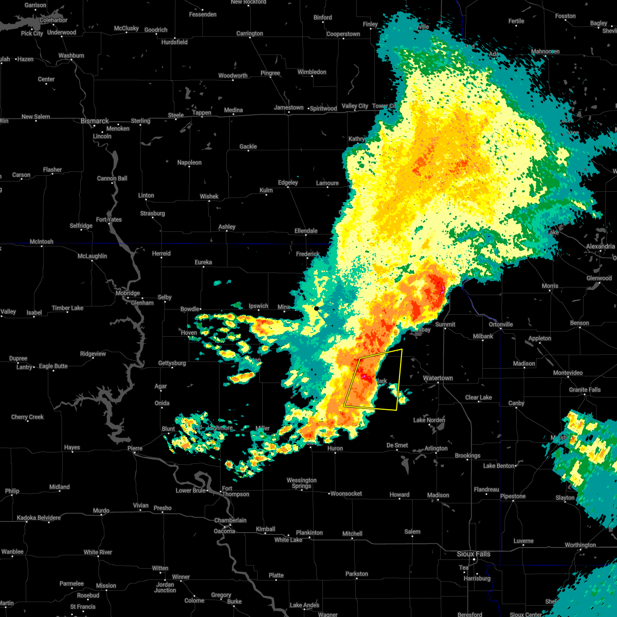 At 915 am cdt, a severe thunderstorm was located near raymond, or 7 miles west of clark, moving east at 25 mph (radar indicated). Hazards include 60 mph wind gusts and penny size hail. Expect damage to roofs, siding, and trees. Locations impacted include, clark, bradley, garden city, raymond, crocker, mayfield colony, fordham colony, clark colony, hillcrest colony, swan lake and hillside colony. At 915 am cdt, a severe thunderstorm was located near raymond, or 7 miles west of clark, moving east at 25 mph (radar indicated). Hazards include 60 mph wind gusts and penny size hail. Expect damage to roofs, siding, and trees. Locations impacted include, clark, bradley, garden city, raymond, crocker, mayfield colony, fordham colony, clark colony, hillcrest colony, swan lake and hillside colony.
|
| 8/26/2021 9:08 AM CDT |
 At 907 am cdt, a severe thunderstorm was located near fordham colony, or 9 miles southwest of clark, moving east at 40 mph (radar indicated). Hazards include 60 mph wind gusts and penny size hail. Expect damage to roofs, siding, and trees. locations impacted include, clark and mayfield colony. hail threat, radar indicated max hail size, 0. 75 in wind threat, radar indicated max wind gust, 60 mph. At 907 am cdt, a severe thunderstorm was located near fordham colony, or 9 miles southwest of clark, moving east at 40 mph (radar indicated). Hazards include 60 mph wind gusts and penny size hail. Expect damage to roofs, siding, and trees. locations impacted include, clark and mayfield colony. hail threat, radar indicated max hail size, 0. 75 in wind threat, radar indicated max wind gust, 60 mph.
|
| 8/26/2021 8:45 AM CDT |
 At 845 am cdt, a severe thunderstorm was located over turton, or 20 miles northwest of clark, moving east at 40 mph (radar indicated). Hazards include 60 mph wind gusts. Expect damage to roofs, siding, and trees. this severe thunderstorm will be near, raymond around 900 am cdt. other locations in the path of this severe thunderstorm include clark, hillcrest colony and garden city. hail threat, radar indicated max hail size, <. 75 in wind threat, radar indicated max wind gust, 60 mph. At 845 am cdt, a severe thunderstorm was located over turton, or 20 miles northwest of clark, moving east at 40 mph (radar indicated). Hazards include 60 mph wind gusts. Expect damage to roofs, siding, and trees. this severe thunderstorm will be near, raymond around 900 am cdt. other locations in the path of this severe thunderstorm include clark, hillcrest colony and garden city. hail threat, radar indicated max hail size, <. 75 in wind threat, radar indicated max wind gust, 60 mph.
|
| 7/25/2021 8:28 PM CDT |
 At 828 pm cdt, a severe thunderstorm was located near crocker, or 11 miles north of clark, moving east at 40 mph (public). Hazards include half dollar size hail. Damage to vehicles is expected. Locations impacted include, hillcrest colony, bradley, garden city and swan lake. At 828 pm cdt, a severe thunderstorm was located near crocker, or 11 miles north of clark, moving east at 40 mph (public). Hazards include half dollar size hail. Damage to vehicles is expected. Locations impacted include, hillcrest colony, bradley, garden city and swan lake.
|
| 7/25/2021 8:11 PM CDT |
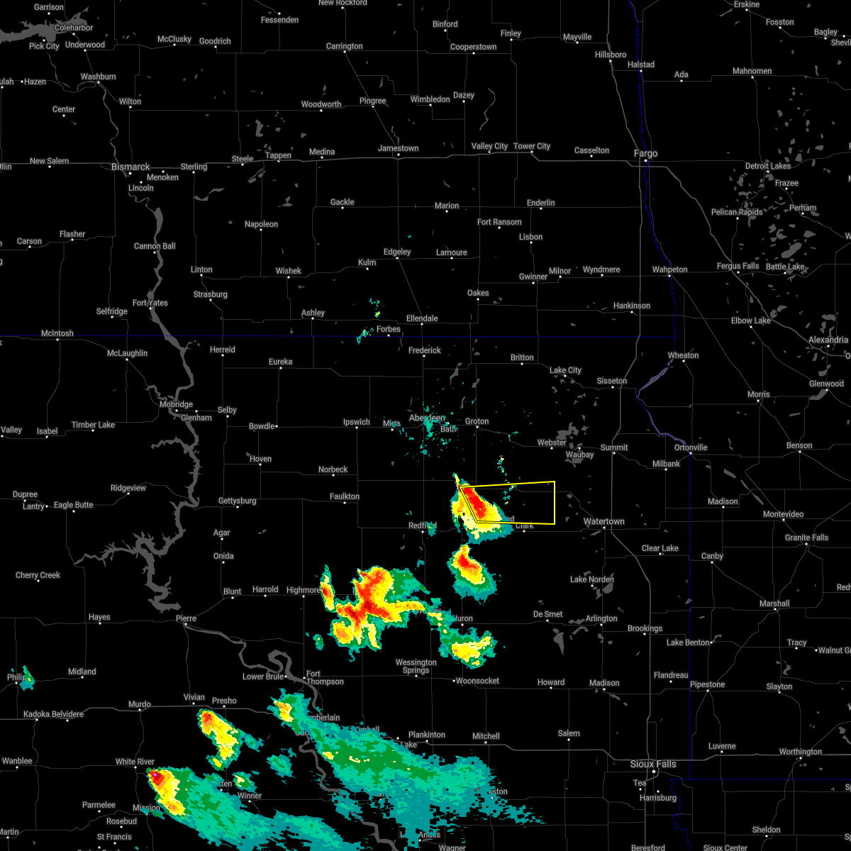 At 811 pm cdt, a severe thunderstorm was located near turton, or 17 miles northwest of clark, moving east at 40 mph (public. at 811 pm, golf ball size hail was reported in turton). Hazards include golf ball size hail. People and animals outdoors will be injured. expect damage to roofs, siding, windows, and vehicles. this severe thunderstorm will be near, crocker around 830 pm cdt. Other locations in the path of this severe thunderstorm include hillcrest colony, bradley, garden city and swan lake. At 811 pm cdt, a severe thunderstorm was located near turton, or 17 miles northwest of clark, moving east at 40 mph (public. at 811 pm, golf ball size hail was reported in turton). Hazards include golf ball size hail. People and animals outdoors will be injured. expect damage to roofs, siding, windows, and vehicles. this severe thunderstorm will be near, crocker around 830 pm cdt. Other locations in the path of this severe thunderstorm include hillcrest colony, bradley, garden city and swan lake.
|
| 6/11/2021 5:02 AM CDT |
 At 501 am cdt, severe thunderstorms were located along a line extending from near claire city to near florence, moving east at 60 mph (radar indicated). Hazards include 60 mph wind gusts and quarter size hail. Hail damage to vehicles is expected. expect wind damage to roofs, siding, and trees. severe thunderstorms will be near, new effington around 505 am cdt. victor around 510 am cdt. rosholt around 515 am cdt. south shore, waverly, whiterock colony and mud lake landing around 520 am cdt. Other locations in the path of these severe thunderstorms include wheaton, stockholm, troy, strandburg, twin brooks, immanuel church, la bolt, tintah, charlesville, revillo and albee. At 501 am cdt, severe thunderstorms were located along a line extending from near claire city to near florence, moving east at 60 mph (radar indicated). Hazards include 60 mph wind gusts and quarter size hail. Hail damage to vehicles is expected. expect wind damage to roofs, siding, and trees. severe thunderstorms will be near, new effington around 505 am cdt. victor around 510 am cdt. rosholt around 515 am cdt. south shore, waverly, whiterock colony and mud lake landing around 520 am cdt. Other locations in the path of these severe thunderstorms include wheaton, stockholm, troy, strandburg, twin brooks, immanuel church, la bolt, tintah, charlesville, revillo and albee.
|
| 6/11/2021 4:16 AM CDT |
 At 415 am cdt, severe thunderstorms were located along a line extending from near kidder to near frankfort, moving east at 60 mph (radar indicated). Hazards include 60 mph wind gusts. Expect damage to roofs, siding, and trees. severe thunderstorms will be near, veblen flats housing and hillhead around 430 am cdt. veblen around 435 am cdt. Other locations in the path of these severe thunderstorms include claire city, new effington, garden city, victor, long lake and medicine lake. At 415 am cdt, severe thunderstorms were located along a line extending from near kidder to near frankfort, moving east at 60 mph (radar indicated). Hazards include 60 mph wind gusts. Expect damage to roofs, siding, and trees. severe thunderstorms will be near, veblen flats housing and hillhead around 430 am cdt. veblen around 435 am cdt. Other locations in the path of these severe thunderstorms include claire city, new effington, garden city, victor, long lake and medicine lake.
|
| 8/28/2020 1:55 AM CDT | The severe thunderstorm warning for southeastern day, western hamlin, clark and western codington counties will expire at 200 am cdt, the storm which prompted the warning has moved out of the area. therefore, the warning will be allowed to expire. however gusty winds are still possible with this thunderstorm. a severe thunderstorm watch remains in effect until 500 am cdt for northeastern south dakota. |
| 8/28/2020 1:43 AM CDT | At 142 am cdt, a severe thunderstorm was located over tinkertown, or 10 miles west of watertown, moving east at 45 mph (radar indicated). Hazards include 60 mph wind gusts. Expect damage to roofs, siding, and trees. Locations impacted include, watertown, clark, lake norden, bryant, hayti, florence, henry, willow lake, hazel, wallace, bradley, garden city, vienna, naples, lily, crocker, medicine lake, mayfield colony, grass lake and kellerton church. |
| 8/28/2020 1:11 AM CDT | At 110 am cdt, a severe thunderstorm was located near clark colony, or 11 miles west of clark, moving east at 70 mph (radar indicated). Hazards include 60 mph wind gusts. expect damage to roofs, siding, and trees |
| 7/26/2020 1:03 AM CDT |
 At 103 am cdt, a severe thunderstorm was located 7 miles east of ferney, or 13 miles southeast of groton, moving east at 40 mph (radar indicated). Hazards include 70 mph wind gusts and quarter size hail. Hail damage to vehicles is expected. expect considerable tree damage. Wind damage is also likely to mobile homes, roofs, and outbuildings. At 103 am cdt, a severe thunderstorm was located 7 miles east of ferney, or 13 miles southeast of groton, moving east at 40 mph (radar indicated). Hazards include 70 mph wind gusts and quarter size hail. Hail damage to vehicles is expected. expect considerable tree damage. Wind damage is also likely to mobile homes, roofs, and outbuildings.
|
| 7/8/2020 11:15 PM CDT |
 At 1115 pm cdt, a severe thunderstorm was located near raymond, or 10 miles northwest of clark, moving northeast at 20 mph (radar indicated). Hazards include 60 mph wind gusts and quarter size hail. Hail damage to vehicles is expected. expect wind damage to roofs, siding, and trees. this severe thunderstorm will be near, crocker around 1135 pm cdt. bradley around 1145 pm cdt. lily around 1150 pm cdt. butler and swan lake around 1155 pm cdt. Antelope lake around 1200 am cdt. At 1115 pm cdt, a severe thunderstorm was located near raymond, or 10 miles northwest of clark, moving northeast at 20 mph (radar indicated). Hazards include 60 mph wind gusts and quarter size hail. Hail damage to vehicles is expected. expect wind damage to roofs, siding, and trees. this severe thunderstorm will be near, crocker around 1135 pm cdt. bradley around 1145 pm cdt. lily around 1150 pm cdt. butler and swan lake around 1155 pm cdt. Antelope lake around 1200 am cdt.
|
| 7/8/2020 10:32 PM CDT |
 At 1032 pm cdt, a severe thunderstorm was located near hillside colony, or 15 miles southwest of clark, moving northeast at 20 mph (radar indicated). Hazards include 60 mph wind gusts and quarter size hail. Hail damage to vehicles is expected. expect wind damage to roofs, siding, and trees. this severe thunderstorm will be near, clark colony around 1035 pm cdt. fordham colony around 1040 pm cdt. raymond around 1055 pm cdt. clark around 1105 pm cdt. Hillcrest colony around 1110 pm cdt. At 1032 pm cdt, a severe thunderstorm was located near hillside colony, or 15 miles southwest of clark, moving northeast at 20 mph (radar indicated). Hazards include 60 mph wind gusts and quarter size hail. Hail damage to vehicles is expected. expect wind damage to roofs, siding, and trees. this severe thunderstorm will be near, clark colony around 1035 pm cdt. fordham colony around 1040 pm cdt. raymond around 1055 pm cdt. clark around 1105 pm cdt. Hillcrest colony around 1110 pm cdt.
|
| 8/15/2019 5:26 PM CDT |
 At 526 pm cdt, severe thunderstorms were located along a line extending from grenville to near swan lake, moving east at 35 mph (radar indicated). Hazards include 60 mph wind gusts and quarter size hail. Hail damage to vehicles is expected. expect wind damage to roofs, siding, and trees. Locations impacted include, webster, waubay, florence, roslyn, wallace, bradley, grenville, butler, lily, enemy swim housing, grass lake, waubay lake, minnewasta lake, swan lake, blue dog lake, waubay wildlife rec area, enemy swim lake, antelope lake, campbell slough and rush lake. At 526 pm cdt, severe thunderstorms were located along a line extending from grenville to near swan lake, moving east at 35 mph (radar indicated). Hazards include 60 mph wind gusts and quarter size hail. Hail damage to vehicles is expected. expect wind damage to roofs, siding, and trees. Locations impacted include, webster, waubay, florence, roslyn, wallace, bradley, grenville, butler, lily, enemy swim housing, grass lake, waubay lake, minnewasta lake, swan lake, blue dog lake, waubay wildlife rec area, enemy swim lake, antelope lake, campbell slough and rush lake.
|
| 8/15/2019 5:12 PM CDT |
 The national weather service in aberdeen has issued a * severe thunderstorm warning for. day county in northeastern south dakota. southeastern marshall county in northeastern south dakota. northeastern clark county in northeastern south dakota. Northwestern codington county in northeastern south dakota. The national weather service in aberdeen has issued a * severe thunderstorm warning for. day county in northeastern south dakota. southeastern marshall county in northeastern south dakota. northeastern clark county in northeastern south dakota. Northwestern codington county in northeastern south dakota.
|
| 7/20/2019 6:38 AM CDT |
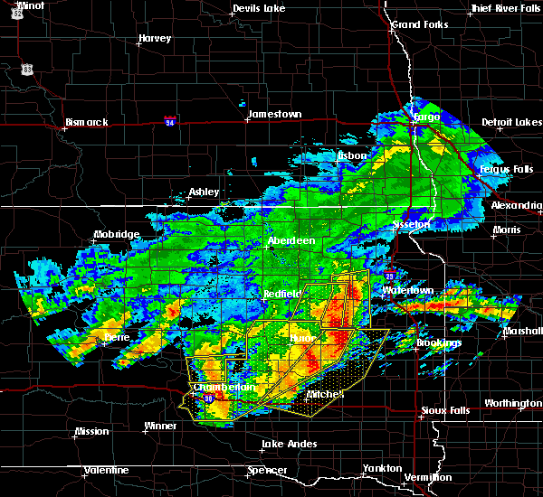 At 637 am cdt, severe thunderstorms were located along a line extending from near lily to 9 miles northwest of de smet, moving east at 40 mph (radar indicated). Hazards include 70 mph wind gusts and quarter size hail. Hail damage to vehicles is expected. expect considerable tree damage. wind damage is also likely to mobile homes, roofs, and outbuildings. Locations impacted include, clark, bryant, florence, henry, willow lake, hazel, wallace, bradley, garden city, vienna, naples, medicine lake, mayfield colony, grass lake, kellerton church, swan lake, tinkertown, hillcrest colony, long lake and hamlin education center. At 637 am cdt, severe thunderstorms were located along a line extending from near lily to 9 miles northwest of de smet, moving east at 40 mph (radar indicated). Hazards include 70 mph wind gusts and quarter size hail. Hail damage to vehicles is expected. expect considerable tree damage. wind damage is also likely to mobile homes, roofs, and outbuildings. Locations impacted include, clark, bryant, florence, henry, willow lake, hazel, wallace, bradley, garden city, vienna, naples, medicine lake, mayfield colony, grass lake, kellerton church, swan lake, tinkertown, hillcrest colony, long lake and hamlin education center.
|
| 7/20/2019 6:22 AM CDT |
 At 621 am cdt, severe thunderstorms were located along a line extending from near crocker to 6 miles east of yale, moving east at 40 mph (radar indicated). Hazards include 70 mph wind gusts and quarter size hail. Hail damage to vehicles is expected. expect considerable tree damage. Wind damage is also likely to mobile homes, roofs, and outbuildings. At 621 am cdt, severe thunderstorms were located along a line extending from near crocker to 6 miles east of yale, moving east at 40 mph (radar indicated). Hazards include 70 mph wind gusts and quarter size hail. Hail damage to vehicles is expected. expect considerable tree damage. Wind damage is also likely to mobile homes, roofs, and outbuildings.
|
| 6/15/2019 3:56 PM CDT |
 The severe thunderstorm warning for southeastern day, northeastern clark and northwestern codington counties will expire at 400 pm cdt, the storm which prompted the warning has weakened below severe limits, and no longer poses an immediate threat to life or property. therefore, the warning will be allowed to expire. however small hail is still possible with this thunderstorm. The severe thunderstorm warning for southeastern day, northeastern clark and northwestern codington counties will expire at 400 pm cdt, the storm which prompted the warning has weakened below severe limits, and no longer poses an immediate threat to life or property. therefore, the warning will be allowed to expire. however small hail is still possible with this thunderstorm.
|
| 6/15/2019 3:40 PM CDT |
 At 340 pm cdt, a severe thunderstorm was located near bradley, or 13 miles north of clark, moving east at 30 mph (radar indicated). Hazards include 60 mph wind gusts and nickel size hail. Expect damage to roofs, siding, and trees. Locations impacted include, wallace, bradley, garden city, crocker, grass lake, swan lake and hillcrest colony. At 340 pm cdt, a severe thunderstorm was located near bradley, or 13 miles north of clark, moving east at 30 mph (radar indicated). Hazards include 60 mph wind gusts and nickel size hail. Expect damage to roofs, siding, and trees. Locations impacted include, wallace, bradley, garden city, crocker, grass lake, swan lake and hillcrest colony.
|
| 6/15/2019 3:19 PM CDT |
 At 318 pm cdt, a severe thunderstorm was located near crandall, or 18 miles north of clark, moving east at 35 mph (radar indicated). Hazards include 60 mph wind gusts and quarter size hail. Hail damage to vehicles is expected. Expect wind damage to roofs, siding, and trees. At 318 pm cdt, a severe thunderstorm was located near crandall, or 18 miles north of clark, moving east at 35 mph (radar indicated). Hazards include 60 mph wind gusts and quarter size hail. Hail damage to vehicles is expected. Expect wind damage to roofs, siding, and trees.
|
| 7/25/2018 4:45 AM CDT |
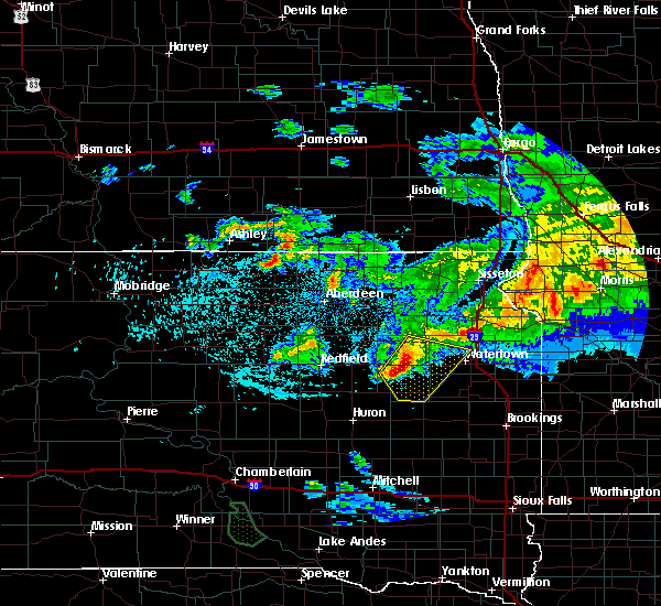 At 445 am cdt, severe thunderstorms were located along a line extending from near bradley to near fordham colony, moving southeast at 50 mph (radar indicated). Hazards include 60 mph wind gusts and quarter size hail. Hail damage to vehicles is expected. Expect wind damage to roofs, siding, and trees. At 445 am cdt, severe thunderstorms were located along a line extending from near bradley to near fordham colony, moving southeast at 50 mph (radar indicated). Hazards include 60 mph wind gusts and quarter size hail. Hail damage to vehicles is expected. Expect wind damage to roofs, siding, and trees.
|
| 5/8/2018 6:15 PM CDT | Quarter sized hail reported 0.9 miles SW of Bradley, SD |
| 5/8/2018 6:11 PM CDT |
 The national weather service in aberdeen has issued a * severe thunderstorm warning for. southeastern day county in northeastern south dakota. northeastern clark county in northeastern south dakota. Until 645 pm cdt * at 611 pm cdt, a severe thunderstorm was located over bradley, or. The national weather service in aberdeen has issued a * severe thunderstorm warning for. southeastern day county in northeastern south dakota. northeastern clark county in northeastern south dakota. Until 645 pm cdt * at 611 pm cdt, a severe thunderstorm was located over bradley, or.
|
| 9/19/2017 9:24 PM CDT |
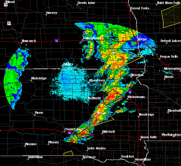 At 923 pm cdt, a severe thunderstorm capable of producing a tornado was located near bradley, or 12 miles northeast of clark, moving northeast at 30 mph (weather spotters reported funnel cloud). Hazards include tornado and quarter size hail. Flying debris will be dangerous to those caught without shelter. mobile homes will be damaged or destroyed. damage to roofs, windows, and vehicles will occur. tree damage is likely. this dangerous storm will be near, swan lake around 930 pm cdt. wallace around 935 pm cdt. Florence and grass lake around 945 pm cdt. At 923 pm cdt, a severe thunderstorm capable of producing a tornado was located near bradley, or 12 miles northeast of clark, moving northeast at 30 mph (weather spotters reported funnel cloud). Hazards include tornado and quarter size hail. Flying debris will be dangerous to those caught without shelter. mobile homes will be damaged or destroyed. damage to roofs, windows, and vehicles will occur. tree damage is likely. this dangerous storm will be near, swan lake around 930 pm cdt. wallace around 935 pm cdt. Florence and grass lake around 945 pm cdt.
|
| 9/19/2017 9:10 PM CDT |
 At 909 pm cdt, a severe thunderstorm capable of producing a tornado was located over hillcrest colony, or near clark, moving northeast at 40 mph (weather spotters reported a funnel cloud). Hazards include tornado and ping pong ball size hail. Flying debris will be dangerous to those caught without shelter. mobile homes will be damaged or destroyed. damage to roofs, windows, and vehicles will occur. tree damage is likely. this dangerous storm will be near, garden city around 915 pm cdt. bradley around 925 pm cdt. Wallace and swan lake around 930 pm cdt. At 909 pm cdt, a severe thunderstorm capable of producing a tornado was located over hillcrest colony, or near clark, moving northeast at 40 mph (weather spotters reported a funnel cloud). Hazards include tornado and ping pong ball size hail. Flying debris will be dangerous to those caught without shelter. mobile homes will be damaged or destroyed. damage to roofs, windows, and vehicles will occur. tree damage is likely. this dangerous storm will be near, garden city around 915 pm cdt. bradley around 925 pm cdt. Wallace and swan lake around 930 pm cdt.
|
| 9/19/2017 8:53 PM CDT |
 At 853 pm cdt, a severe thunderstorm capable of producing a tornado was located near clark, moving northeast at 45 mph (radar indicated rotation). Hazards include tornado and ping pong ball size hail. Flying debris will be dangerous to those caught without shelter. mobile homes will be damaged or destroyed. damage to roofs, windows, and vehicles will occur. tree damage is likely. this dangerous storm will be near, clark around 900 pm cdt. hillcrest colony around 910 pm cdt. garden city around 915 pm cdt. bradley around 920 pm cdt. Wallace and swan lake around 925 pm cdt. At 853 pm cdt, a severe thunderstorm capable of producing a tornado was located near clark, moving northeast at 45 mph (radar indicated rotation). Hazards include tornado and ping pong ball size hail. Flying debris will be dangerous to those caught without shelter. mobile homes will be damaged or destroyed. damage to roofs, windows, and vehicles will occur. tree damage is likely. this dangerous storm will be near, clark around 900 pm cdt. hillcrest colony around 910 pm cdt. garden city around 915 pm cdt. bradley around 920 pm cdt. Wallace and swan lake around 925 pm cdt.
|
| 8/25/2017 5:39 PM CDT |
 At 539 pm cdt, a severe thunderstorm was located near bradley, or 14 miles south of webster, moving east at 25 mph (radar indicated). Hazards include 70 mph wind gusts. Expect considerable tree damage. damage is likely to mobile homes, roofs, and outbuildings. Locations impacted include, florence, wallace, bradley, lily, swan lake and grass lake. At 539 pm cdt, a severe thunderstorm was located near bradley, or 14 miles south of webster, moving east at 25 mph (radar indicated). Hazards include 70 mph wind gusts. Expect considerable tree damage. damage is likely to mobile homes, roofs, and outbuildings. Locations impacted include, florence, wallace, bradley, lily, swan lake and grass lake.
|
| 8/25/2017 5:27 PM CDT |
 At 526 pm cdt, a severe thunderstorm was located over crocker, or 17 miles southwest of webster, moving east at 25 mph (radar indicated). Hazards include 70 mph wind gusts. Expect considerable tree damage. damage is likely to mobile homes, roofs, and outbuildings. Locations impacted include, florence, wallace, bradley, lily, crocker, grass lake and swan lake. At 526 pm cdt, a severe thunderstorm was located over crocker, or 17 miles southwest of webster, moving east at 25 mph (radar indicated). Hazards include 70 mph wind gusts. Expect considerable tree damage. damage is likely to mobile homes, roofs, and outbuildings. Locations impacted include, florence, wallace, bradley, lily, crocker, grass lake and swan lake.
|
| 8/25/2017 5:23 PM CDT |
 At 523 pm cdt, a severe thunderstorm was located over crocker, or 17 miles north of clark, moving east at 25 mph (radar indicated). Hazards include 60 mph wind gusts. expect damage to roofs, siding, and trees At 523 pm cdt, a severe thunderstorm was located over crocker, or 17 miles north of clark, moving east at 25 mph (radar indicated). Hazards include 60 mph wind gusts. expect damage to roofs, siding, and trees
|
| 7/22/2017 12:11 AM CDT |
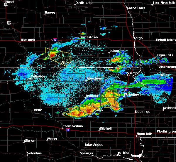 At 1210 am cdt, severe thunderstorms were located along a line extending from near garden city to near naples, moving southeast at 35 mph (radar indicated). Hazards include 60 mph wind gusts. Expect damage to roofs, siding, and trees. Locations impacted include, clark, bryant, henry, willow lake, wallace, bradley, garden city, vienna, naples, mayfield colony, crocker, grass lake, swan lake, hillcrest colony and long lake. At 1210 am cdt, severe thunderstorms were located along a line extending from near garden city to near naples, moving southeast at 35 mph (radar indicated). Hazards include 60 mph wind gusts. Expect damage to roofs, siding, and trees. Locations impacted include, clark, bryant, henry, willow lake, wallace, bradley, garden city, vienna, naples, mayfield colony, crocker, grass lake, swan lake, hillcrest colony and long lake.
|
| 7/22/2017 12:00 AM CDT |
 At 1159 pm cdt, severe thunderstorms were located along a line extending from near bradley to 6 miles southeast of clark, moving southeast at 35 mph. these are very dangerous storms (radar indicated). Hazards include 80 mph wind gusts. Flying debris will be dangerous to those caught without shelter. mobile homes will be heavily damaged. expect considerable damage to roofs, windows, and vehicles. extensive tree damage and power outages are likely. Locations impacted include, clark, bryant, henry, willow lake, wallace, bradley, garden city, vienna, naples, mayfield colony, crocker, grass lake, swan lake, hillcrest colony and long lake. At 1159 pm cdt, severe thunderstorms were located along a line extending from near bradley to 6 miles southeast of clark, moving southeast at 35 mph. these are very dangerous storms (radar indicated). Hazards include 80 mph wind gusts. Flying debris will be dangerous to those caught without shelter. mobile homes will be heavily damaged. expect considerable damage to roofs, windows, and vehicles. extensive tree damage and power outages are likely. Locations impacted include, clark, bryant, henry, willow lake, wallace, bradley, garden city, vienna, naples, mayfield colony, crocker, grass lake, swan lake, hillcrest colony and long lake.
|
| 7/21/2017 11:27 PM CDT |
 At 1127 pm cdt, severe thunderstorms were located along a line extending from 6 miles northeast of crandall to 7 miles north of raymond, moving southeast at 35 mph. these are very dangerous storms (radar indicated). Hazards include 80 mph wind gusts. Flying debris will be dangerous to those caught without shelter. mobile homes will be heavily damaged. expect considerable damage to roofs, windows, and vehicles. Extensive tree damage and power outages are likely. At 1127 pm cdt, severe thunderstorms were located along a line extending from 6 miles northeast of crandall to 7 miles north of raymond, moving southeast at 35 mph. these are very dangerous storms (radar indicated). Hazards include 80 mph wind gusts. Flying debris will be dangerous to those caught without shelter. mobile homes will be heavily damaged. expect considerable damage to roofs, windows, and vehicles. Extensive tree damage and power outages are likely.
|
| 6/13/2017 7:30 PM CDT |
 At 729 pm cdt, severe thunderstorms were located along a line extending from near andover to near bitter lake to watertown city park, moving northeast at 60 mph (radar indicated). Hazards include 70 mph wind gusts and penny size hail. Expect considerable tree damage. damage is likely to mobile homes, roofs, and outbuildings. locations impacted include, watertown, webster, waubay, florence, bristol, summit, rauville, south shore, roslyn, andover, eden, wallace, bradley, twin brooks, ortley, grenville, marvin, butler, lily and medicine lake. A tornado watch remains in effect until 1000 pm cdt for northeastern south dakota. At 729 pm cdt, severe thunderstorms were located along a line extending from near andover to near bitter lake to watertown city park, moving northeast at 60 mph (radar indicated). Hazards include 70 mph wind gusts and penny size hail. Expect considerable tree damage. damage is likely to mobile homes, roofs, and outbuildings. locations impacted include, watertown, webster, waubay, florence, bristol, summit, rauville, south shore, roslyn, andover, eden, wallace, bradley, twin brooks, ortley, grenville, marvin, butler, lily and medicine lake. A tornado watch remains in effect until 1000 pm cdt for northeastern south dakota.
|
| 6/13/2017 7:22 PM CDT |
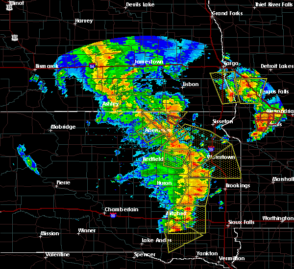 The severe thunderstorm warning for northern clark and east central spink counties will expire at 730 pm cdt, the storm which prompted the warning has moved out of the area. therefore the warning will be allowed to expire. however gusty winds are still possible with this thunderstorm. a tornado watch remains in effect until 1000 pm cdt for northeastern south dakota. The severe thunderstorm warning for northern clark and east central spink counties will expire at 730 pm cdt, the storm which prompted the warning has moved out of the area. therefore the warning will be allowed to expire. however gusty winds are still possible with this thunderstorm. a tornado watch remains in effect until 1000 pm cdt for northeastern south dakota.
|
| 6/13/2017 7:10 PM CDT |
 At 710 pm cdt, severe thunderstorms were located along a line extending from near conde to near hillcrest colony to near naples, moving northeast at 55 mph (radar indicated). Hazards include 70 mph wind gusts and quarter size hail. Hail damage to vehicles is expected. expect considerable tree damage. wind damage is also likely to mobile homes, roofs, and outbuildings. severe thunderstorms will be near, henry and bradley around 715 pm cdt. wallace, tinkertown, swan lake, long lake and goose lake around 720 pm cdt. butler, memorial park camping site, sandy shore rec area, lake kampeska, medicine lake, grass lake and pelican lake around 725 pm cdt. watertown, florence, bristol, andover, watertown city park and antelope lake around 730 pm cdt. rauville, bitter lake and dakota sioux casino around 735 pm cdt. waubay, blue dog lake and rush lake around 740 pm cdt. south shore, ortley, campbell slough and enemy swim housing around 745 pm cdt. summit, roslyn, grenville, rudebusch corner and enemy swim lake around 750 pm cdt. A tornado watch remains in effect until 1000 pm cdt for northeastern south dakota. At 710 pm cdt, severe thunderstorms were located along a line extending from near conde to near hillcrest colony to near naples, moving northeast at 55 mph (radar indicated). Hazards include 70 mph wind gusts and quarter size hail. Hail damage to vehicles is expected. expect considerable tree damage. wind damage is also likely to mobile homes, roofs, and outbuildings. severe thunderstorms will be near, henry and bradley around 715 pm cdt. wallace, tinkertown, swan lake, long lake and goose lake around 720 pm cdt. butler, memorial park camping site, sandy shore rec area, lake kampeska, medicine lake, grass lake and pelican lake around 725 pm cdt. watertown, florence, bristol, andover, watertown city park and antelope lake around 730 pm cdt. rauville, bitter lake and dakota sioux casino around 735 pm cdt. waubay, blue dog lake and rush lake around 740 pm cdt. south shore, ortley, campbell slough and enemy swim housing around 745 pm cdt. summit, roslyn, grenville, rudebusch corner and enemy swim lake around 750 pm cdt. A tornado watch remains in effect until 1000 pm cdt for northeastern south dakota.
|
| 6/13/2017 7:06 PM CDT |
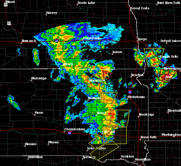 At 705 pm cdt, a severe thunderstorm was located near clark, moving north at 45 mph (radar indicated). Hazards include 70 mph wind gusts and quarter size hail. Hail damage to vehicles is expected. expect considerable tree damage. wind damage is also likely to mobile homes, roofs, and outbuildings. this severe storm will be near, bradley and crocker around 720 pm cdt. swan lake around 725 pm cdt. A tornado watch remains in effect until 1000 pm cdt for northeastern south dakota. At 705 pm cdt, a severe thunderstorm was located near clark, moving north at 45 mph (radar indicated). Hazards include 70 mph wind gusts and quarter size hail. Hail damage to vehicles is expected. expect considerable tree damage. wind damage is also likely to mobile homes, roofs, and outbuildings. this severe storm will be near, bradley and crocker around 720 pm cdt. swan lake around 725 pm cdt. A tornado watch remains in effect until 1000 pm cdt for northeastern south dakota.
|
| 6/13/2017 6:43 PM CDT |
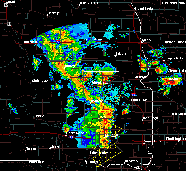 At 643 pm cdt, a severe thunderstorm was located over carpenter, or 18 miles southwest of clark, moving north at 55 mph (radar indicated). Hazards include 60 mph wind gusts and quarter size hail. Hail damage to vehicles is expected. expect wind damage to roofs, siding, and trees. this severe thunderstorm will be near, fordham colony and clark colony around 650 pm cdt. raymond around 700 pm cdt. clark and hillcrest colony around 705 pm cdt. crocker around 715 pm cdt. bradley and swan lake around 720 pm cdt. A tornado watch remains in effect until 1000 pm cdt for northeastern south dakota. At 643 pm cdt, a severe thunderstorm was located over carpenter, or 18 miles southwest of clark, moving north at 55 mph (radar indicated). Hazards include 60 mph wind gusts and quarter size hail. Hail damage to vehicles is expected. expect wind damage to roofs, siding, and trees. this severe thunderstorm will be near, fordham colony and clark colony around 650 pm cdt. raymond around 700 pm cdt. clark and hillcrest colony around 705 pm cdt. crocker around 715 pm cdt. bradley and swan lake around 720 pm cdt. A tornado watch remains in effect until 1000 pm cdt for northeastern south dakota.
|
| 5/28/2017 5:20 PM CDT |
 At 519 pm cdt, severe thunderstorms were located along a line extending from bradley to near doland, moving east at 55 mph (trained weather spotters). Hazards include 60 mph wind gusts and penny size hail. Expect damage to roofs, siding, and trees. Locations impacted include, clark and hillside colony. At 519 pm cdt, severe thunderstorms were located along a line extending from bradley to near doland, moving east at 55 mph (trained weather spotters). Hazards include 60 mph wind gusts and penny size hail. Expect damage to roofs, siding, and trees. Locations impacted include, clark and hillside colony.
|
| 5/28/2017 4:54 PM CDT |
 At 454 pm cdt, severe thunderstorms were located along a line extending from near andover to 6 miles southwest of brentford, moving southeast at 55 mph (trained weather spotters). Hazards include 60 mph wind gusts and penny size hail. Expect damage to roofs, siding, and trees. severe thunderstorms will be near, butler around 505 pm cdt. lily around 510 pm cdt. doland and crocker around 515 pm cdt. bradley and swan lake around 520 pm cdt. wallace, clark colony, hillside colony and hillcrest colony around 525 pm cdt. Garden city and fordham colony around 530 pm cdt. At 454 pm cdt, severe thunderstorms were located along a line extending from near andover to 6 miles southwest of brentford, moving southeast at 55 mph (trained weather spotters). Hazards include 60 mph wind gusts and penny size hail. Expect damage to roofs, siding, and trees. severe thunderstorms will be near, butler around 505 pm cdt. lily around 510 pm cdt. doland and crocker around 515 pm cdt. bradley and swan lake around 520 pm cdt. wallace, clark colony, hillside colony and hillcrest colony around 525 pm cdt. Garden city and fordham colony around 530 pm cdt.
|
| 8/10/2016 10:28 PM CDT |
 At 1028 pm cdt, a severe thunderstorm was located near turton, or 19 miles northeast of redfield, moving east at 40 mph (radar indicated). Hazards include 70 mph wind gusts and quarter size hail. Hail damage to vehicles is expected. expect considerable tree damage. wind damage is also likely to mobile homes, roofs, and outbuildings. this severe thunderstorm will be near, conde and turton around 1035 pm cdt. crandall around 1045 pm cdt. crocker around 1100 pm cdt. hillcrest colony around 1105 pm cdt. Bradley around 1110 pm cdt. At 1028 pm cdt, a severe thunderstorm was located near turton, or 19 miles northeast of redfield, moving east at 40 mph (radar indicated). Hazards include 70 mph wind gusts and quarter size hail. Hail damage to vehicles is expected. expect considerable tree damage. wind damage is also likely to mobile homes, roofs, and outbuildings. this severe thunderstorm will be near, conde and turton around 1035 pm cdt. crandall around 1045 pm cdt. crocker around 1100 pm cdt. hillcrest colony around 1105 pm cdt. Bradley around 1110 pm cdt.
|
| 7/16/2016 7:35 PM CDT |
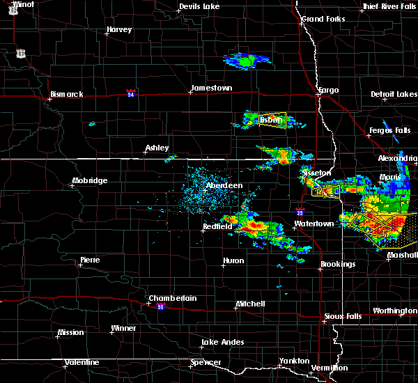 At 734 pm cdt, a severe thunderstorm was located near raymond, or near clark, moving east at 25 mph (radar indicated). Hazards include ping pong ball size hail and 60 mph wind gusts. People and animals outdoors will be injured. expect hail damage to roofs, siding, windows, and vehicles. expect wind damage to roofs, siding, and trees. this severe thunderstorm will be near, clark around 750 pm cdt. hillcrest colony around 755 pm cdt. Garden city around 810 pm cdt. At 734 pm cdt, a severe thunderstorm was located near raymond, or near clark, moving east at 25 mph (radar indicated). Hazards include ping pong ball size hail and 60 mph wind gusts. People and animals outdoors will be injured. expect hail damage to roofs, siding, windows, and vehicles. expect wind damage to roofs, siding, and trees. this severe thunderstorm will be near, clark around 750 pm cdt. hillcrest colony around 755 pm cdt. Garden city around 810 pm cdt.
|
| 7/10/2016 4:40 AM CDT |
 At 440 am cdt, a severe thunderstorm was located near crandall, or 21 miles northwest of clark, moving east at 40 mph (radar indicated). Hazards include 60 mph wind gusts and quarter size hail. Hail damage to vehicles is expected. expect wind damage to roofs, siding, and trees. this severe thunderstorm will be near, crocker around 455 am cdt. bradley and lily around 505 am cdt. Swan lake around 515 am cdt. At 440 am cdt, a severe thunderstorm was located near crandall, or 21 miles northwest of clark, moving east at 40 mph (radar indicated). Hazards include 60 mph wind gusts and quarter size hail. Hail damage to vehicles is expected. expect wind damage to roofs, siding, and trees. this severe thunderstorm will be near, crocker around 455 am cdt. bradley and lily around 505 am cdt. Swan lake around 515 am cdt.
|
| 8/9/2015 4:47 PM CDT |
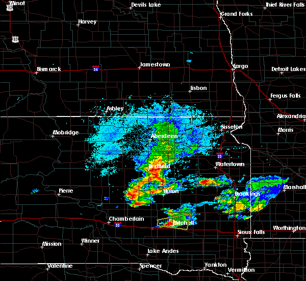 At 446 pm cdt, severe thunderstorms were located along a line extending from 6 miles northwest of turton to 6 miles east of hitchcock, moving east at 45 mph (radar indicated). Hazards include 60 mph wind gusts and quarter size hail. Hail damage to vehicles is expected. expect wind damage to roofs, siding and trees. severe thunderstorms will be near, turton around 455 pm cdt. carpenter around 510 pm cdt. crocker around 515 pm cdt. bradley around 525 pm cdt. Willow lake, swan lake and mayfield colony around 530 pm cdt. At 446 pm cdt, severe thunderstorms were located along a line extending from 6 miles northwest of turton to 6 miles east of hitchcock, moving east at 45 mph (radar indicated). Hazards include 60 mph wind gusts and quarter size hail. Hail damage to vehicles is expected. expect wind damage to roofs, siding and trees. severe thunderstorms will be near, turton around 455 pm cdt. carpenter around 510 pm cdt. crocker around 515 pm cdt. bradley around 525 pm cdt. Willow lake, swan lake and mayfield colony around 530 pm cdt.
|
| 7/25/2015 7:36 PM CDT |
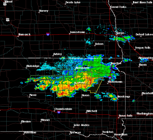 At 736 pm cdt, a severe thunderstorm was located near bradley, or 11 miles north of clark, moving east at 35 mph (radar indicated). Hazards include 60 mph wind gusts and quarter size hail. Hail damage to vehicles is expected. expect wind damage to roofs, siding and trees. this severe thunderstorm will be near, bradley and hillcrest colony around 740 pm cdt. garden city and swan lake around 750 pm cdt. wallace around 755 pm cdt. grass lake around 805 pm cdt. A tornado watch remains in effect until 1100 pm cdt for northeastern south dakota. At 736 pm cdt, a severe thunderstorm was located near bradley, or 11 miles north of clark, moving east at 35 mph (radar indicated). Hazards include 60 mph wind gusts and quarter size hail. Hail damage to vehicles is expected. expect wind damage to roofs, siding and trees. this severe thunderstorm will be near, bradley and hillcrest colony around 740 pm cdt. garden city and swan lake around 750 pm cdt. wallace around 755 pm cdt. grass lake around 805 pm cdt. A tornado watch remains in effect until 1100 pm cdt for northeastern south dakota.
|
| 7/17/2015 8:26 PM CDT | Quarter sized hail reported 4 miles W of Bradley, SD |
| 7/17/2015 8:15 PM CDT | Damage to power lines along cr 155 in clark county SD, 0.1 miles WNW of Bradley, SD |
| 7/17/2015 8:10 PM CDT |
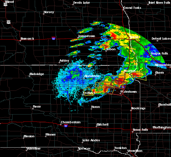 At 810 pm cdt, a severe thunderstorm capable of producing a tornado was located over bradley, or 14 miles north of clark, moving east at 30 mph (radar indicated rotation). Hazards include tornado and ping pong ball size hail. Flying debris will be dangerous to those caught without shelter. mobile homes will be damaged or destroyed. damage to roofs, windows and vehicles will occur. tree damage is likely. this dangerous storm will be near, garden city and swan lake around 820 pm cdt. wallace around 830 pm cdt. grass lake around 835 pm cdt. florence and medicine lake around 840 pm cdt. memorial park camping site around 855 pm cdt. watertown, dakota sioux casino and watertown city park around 900 pm cdt. Rauville around 905 pm cdt. At 810 pm cdt, a severe thunderstorm capable of producing a tornado was located over bradley, or 14 miles north of clark, moving east at 30 mph (radar indicated rotation). Hazards include tornado and ping pong ball size hail. Flying debris will be dangerous to those caught without shelter. mobile homes will be damaged or destroyed. damage to roofs, windows and vehicles will occur. tree damage is likely. this dangerous storm will be near, garden city and swan lake around 820 pm cdt. wallace around 830 pm cdt. grass lake around 835 pm cdt. florence and medicine lake around 840 pm cdt. memorial park camping site around 855 pm cdt. watertown, dakota sioux casino and watertown city park around 900 pm cdt. Rauville around 905 pm cdt.
|
| 7/17/2015 7:55 PM CDT |
 At 755 pm cdt, a severe thunderstorm was located over crocker, or 15 miles north of clark, moving east at 30 mph (radar indicated). Hazards include 70 mph wind gusts and quarter size hail. Hail damage to vehicles is expected. expect considerable tree damage. wind damage is also likely to mobile homes, roofs and outbuildings. this severe thunderstorm will be near, lily around 805 pm cdt. bradley around 810 pm cdt. garden city and swan lake around 820 pm cdt. wallace around 830 pm cdt. Grass lake around 835 pm cdt. At 755 pm cdt, a severe thunderstorm was located over crocker, or 15 miles north of clark, moving east at 30 mph (radar indicated). Hazards include 70 mph wind gusts and quarter size hail. Hail damage to vehicles is expected. expect considerable tree damage. wind damage is also likely to mobile homes, roofs and outbuildings. this severe thunderstorm will be near, lily around 805 pm cdt. bradley around 810 pm cdt. garden city and swan lake around 820 pm cdt. wallace around 830 pm cdt. Grass lake around 835 pm cdt.
|
| 5/2/2012 7:35 PM CDT | Quarter sized hail reported 2.9 miles NW of Bradley, SD |
Hail Maps for Bradley, SD
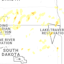


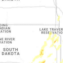


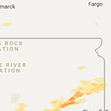


Connect with Interactive Hail Maps