

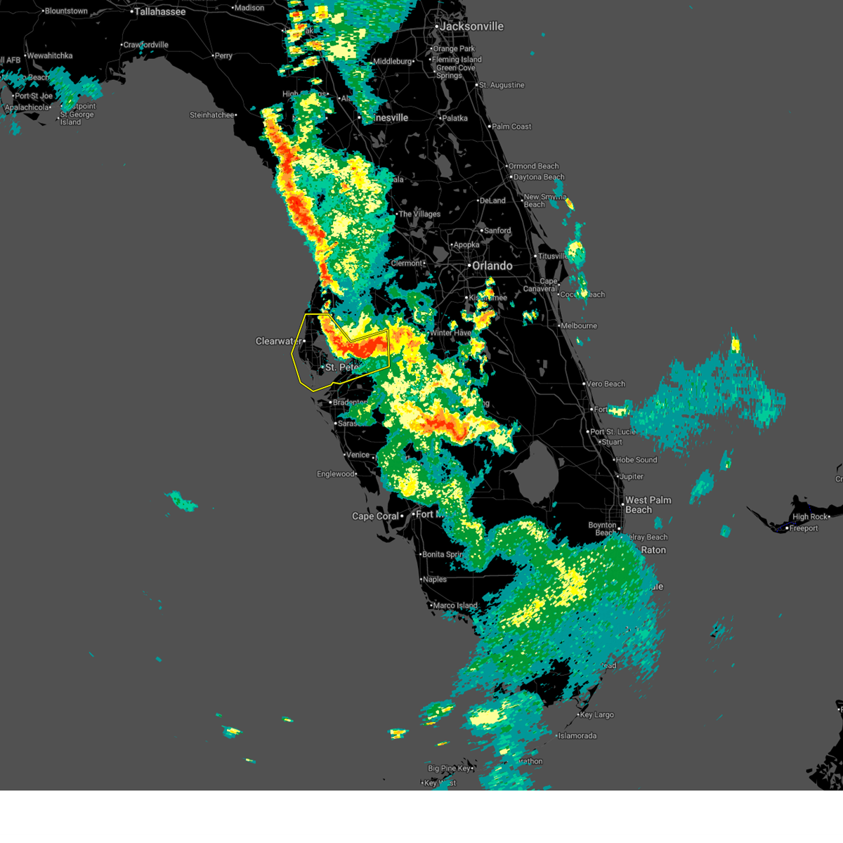
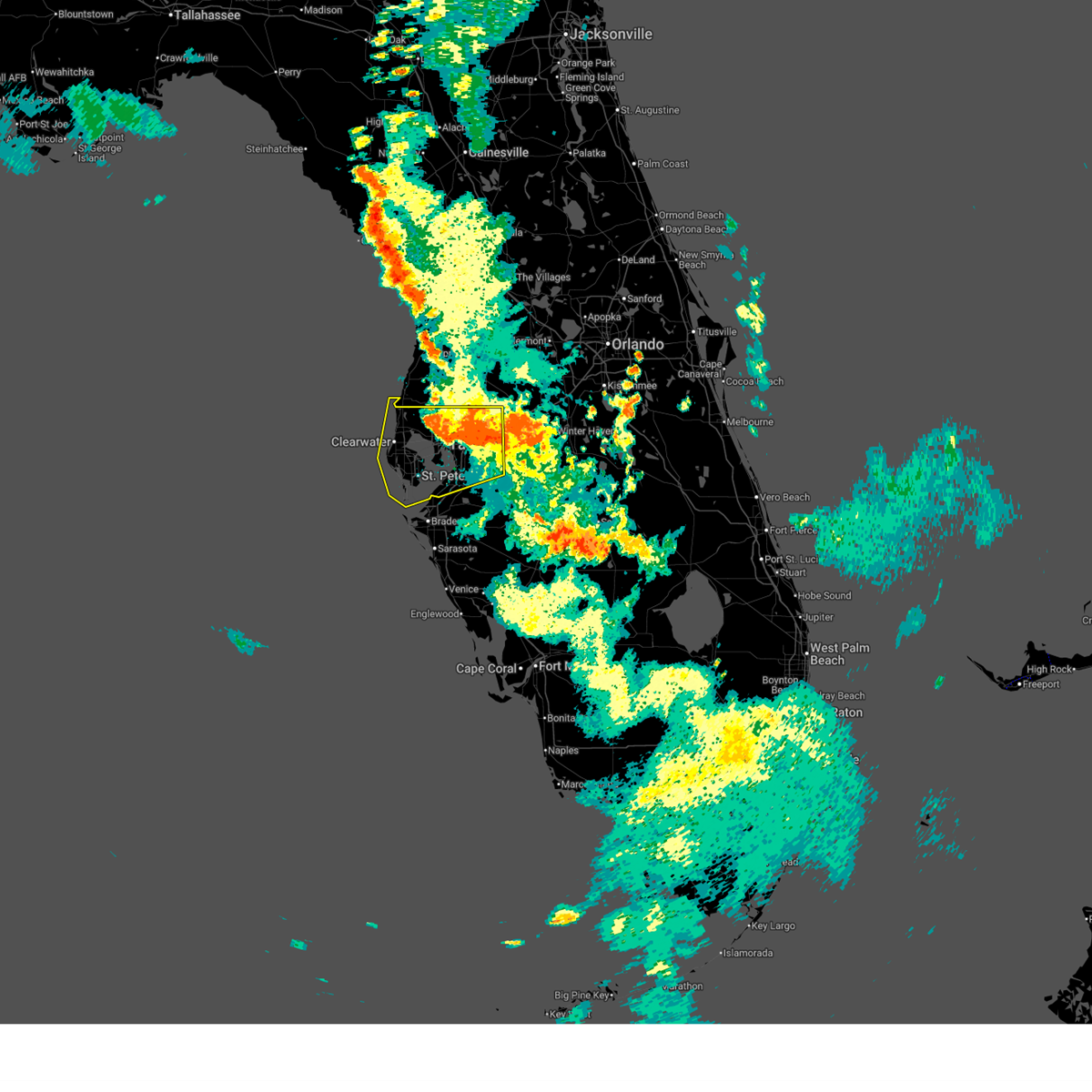
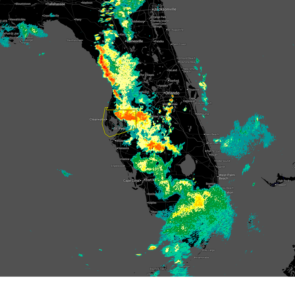
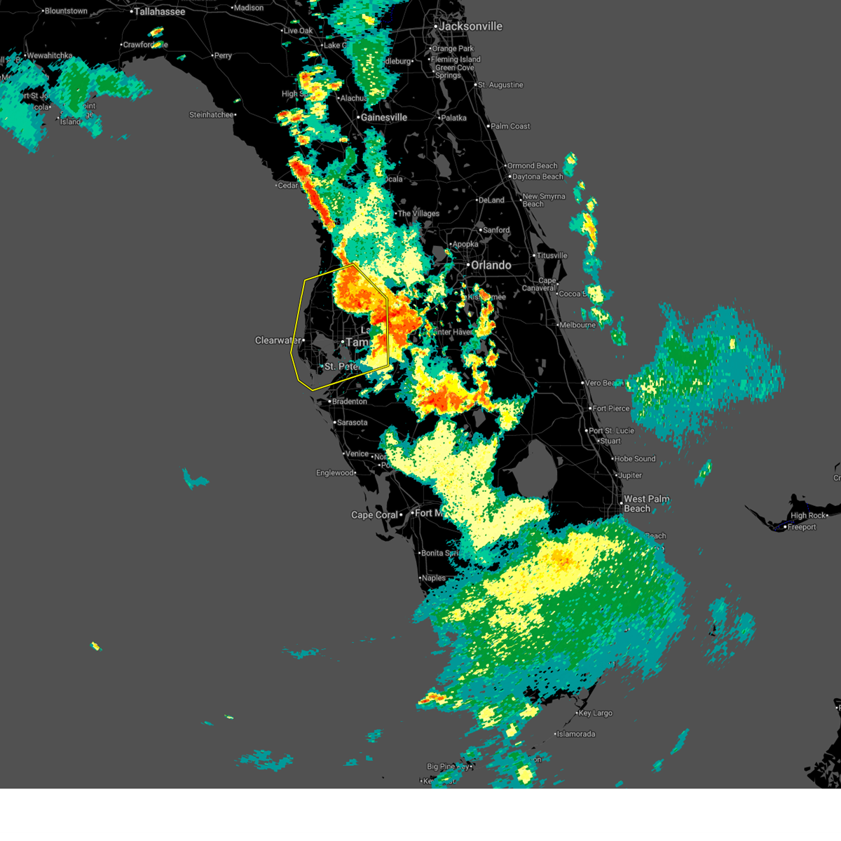
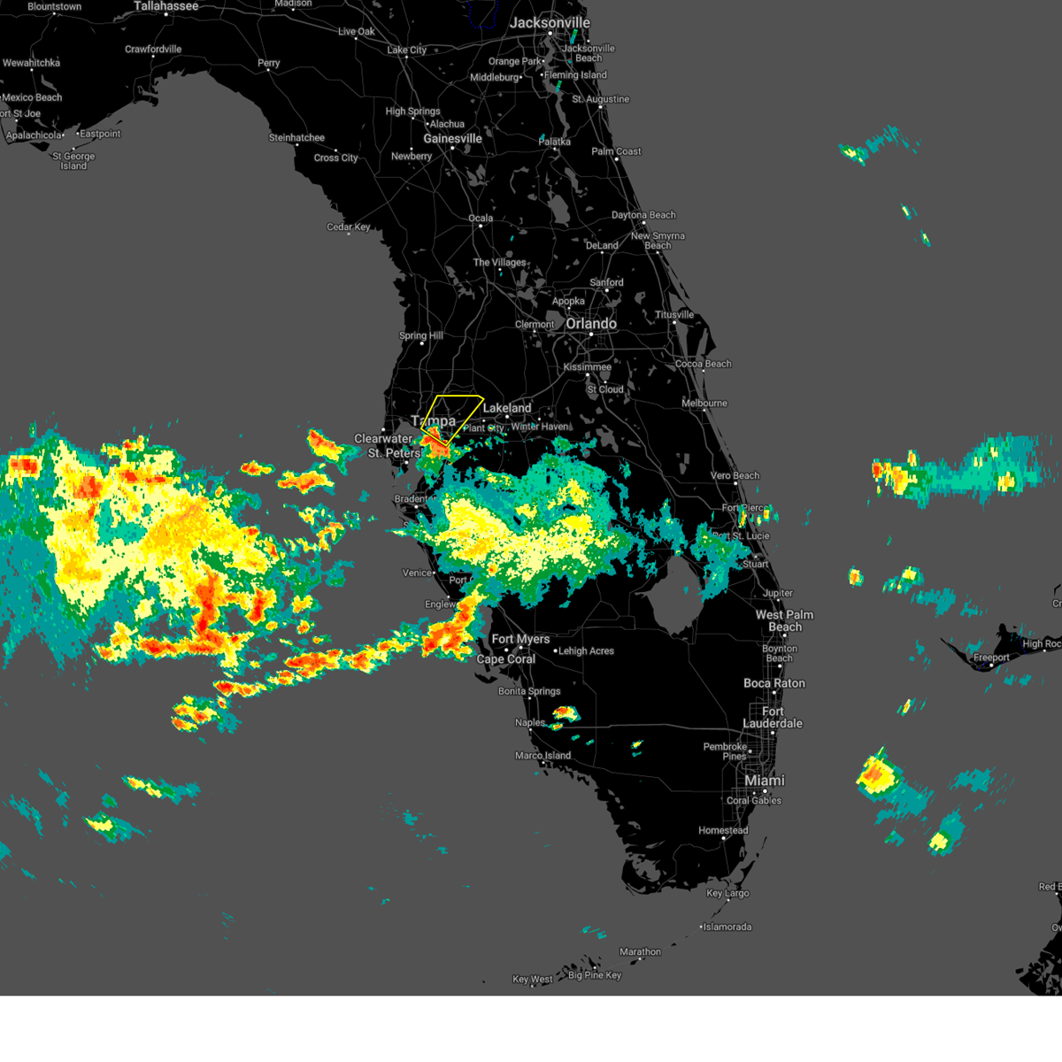
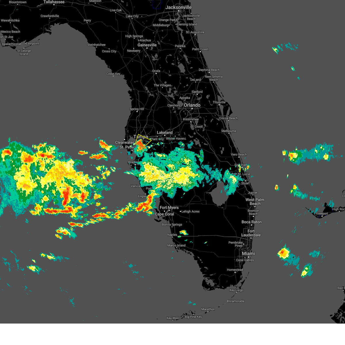
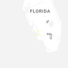
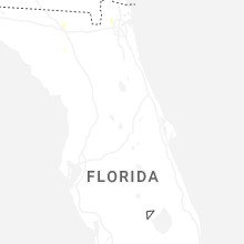
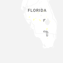
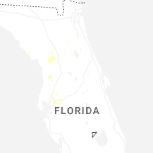
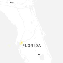
Hail Map for Brandon, FL
The Brandon, FL area has had 0 reports of on-the-ground hail by trained spotters, and has been under severe weather warnings 4 times during the past 12 months. Doppler radar has detected hail at or near Brandon, FL on 92 occasions, including 6 occasions during the past year.
| Name: | Brandon, FL |
| Where Located: | 34.8 miles NNE of Bradenton, FL |
| Map: | Google Map for Brandon, FL |
| Population: | 103483 |
| Housing Units: | 43352 |
| More Info: | Search Google for Brandon, FL |
2
The Top Recent Hail Date for Brandon, FL is Sunday, March 15, 2026 (8th out of 92)

Hail and Wind Damage Spotted near Brandon, FL
| Date / Time | Report Details |
|---|---|
| 7/14/2025 6:33 PM EDT |
 At 633 pm edt, a severe thunderstorm was located over gandy, or near downtown saint petersburg, moving south at 40 mph (radar indicated). Hazards include 60 mph wind gusts. Expect damage to roofs, siding, and trees. locations impacted include, belleair bluffs, palm harbor, south tampa, sawgrass lake park, belleair beach, plant city airport, downtown saint petersburg, st. Pete beach, tampa international airport, and highpoint. At 633 pm edt, a severe thunderstorm was located over gandy, or near downtown saint petersburg, moving south at 40 mph (radar indicated). Hazards include 60 mph wind gusts. Expect damage to roofs, siding, and trees. locations impacted include, belleair bluffs, palm harbor, south tampa, sawgrass lake park, belleair beach, plant city airport, downtown saint petersburg, st. Pete beach, tampa international airport, and highpoint.
|
| 7/14/2025 6:19 PM EDT |
 the severe thunderstorm warning has been cancelled and is no longer in effect the severe thunderstorm warning has been cancelled and is no longer in effect
|
| 7/14/2025 6:19 PM EDT |
 At 619 pm edt, a severe thunderstorm was located over tampa international airport, or near tampa, moving south at 40 mph (radar indicated). Hazards include 60 mph wind gusts. Expect damage to roofs, siding, and trees. locations impacted include, belleair bluffs, palm harbor, south tampa, sawgrass lake park, belleair beach, plant city airport, tampa executive airport, downtown saint petersburg, st. Pete beach, and tampa international airport. At 619 pm edt, a severe thunderstorm was located over tampa international airport, or near tampa, moving south at 40 mph (radar indicated). Hazards include 60 mph wind gusts. Expect damage to roofs, siding, and trees. locations impacted include, belleair bluffs, palm harbor, south tampa, sawgrass lake park, belleair beach, plant city airport, tampa executive airport, downtown saint petersburg, st. Pete beach, and tampa international airport.
|
| 7/14/2025 5:56 PM EDT |
 Svrtbw the national weather service in ruskin has issued a * severe thunderstorm warning for, pasco county in west central florida, southwestern hernando county in west central florida, northwestern manatee county in west central florida, pinellas county in west central florida, western polk county in central florida, hillsborough county in west central florida, * until 645 pm edt. * at 556 pm edt, a severe thunderstorm was located over lutz, moving south at 40 mph (radar indicated). Hazards include 60 mph wind gusts. expect damage to roofs, siding, and trees Svrtbw the national weather service in ruskin has issued a * severe thunderstorm warning for, pasco county in west central florida, southwestern hernando county in west central florida, northwestern manatee county in west central florida, pinellas county in west central florida, western polk county in central florida, hillsborough county in west central florida, * until 645 pm edt. * at 556 pm edt, a severe thunderstorm was located over lutz, moving south at 40 mph (radar indicated). Hazards include 60 mph wind gusts. expect damage to roofs, siding, and trees
|
| 6/2/2025 11:02 AM EDT |
 Svrtbw the national weather service in ruskin has issued a * severe thunderstorm warning for, northeastern hillsborough county in west central florida, * until 1130 am edt. * at 1102 am edt, a severe thunderstorm was located over east lake-orient park, or over tampa, moving northeast at 25 mph (radar indicated). Hazards include 60 mph wind gusts and penny size hail. expect damage to roofs, siding, and trees Svrtbw the national weather service in ruskin has issued a * severe thunderstorm warning for, northeastern hillsborough county in west central florida, * until 1130 am edt. * at 1102 am edt, a severe thunderstorm was located over east lake-orient park, or over tampa, moving northeast at 25 mph (radar indicated). Hazards include 60 mph wind gusts and penny size hail. expect damage to roofs, siding, and trees
|
| 6/2/2025 10:49 AM EDT |
 Svrtbw the national weather service in ruskin has issued a * severe thunderstorm warning for, central hillsborough county in west central florida, * until 1115 am edt. * at 1049 am edt, severe thunderstorms were located along a line extending from near tampa international airport to near palm river-clair mel, moving northeast at 15 mph (radar indicated). Hazards include 60 mph wind gusts and penny size hail. expect damage to roofs, siding, and trees Svrtbw the national weather service in ruskin has issued a * severe thunderstorm warning for, central hillsborough county in west central florida, * until 1115 am edt. * at 1049 am edt, severe thunderstorms were located along a line extending from near tampa international airport to near palm river-clair mel, moving northeast at 15 mph (radar indicated). Hazards include 60 mph wind gusts and penny size hail. expect damage to roofs, siding, and trees
|
| 7/14/2024 4:55 PM EDT |
 Svrtbw the national weather service in ruskin has issued a * severe thunderstorm warning for, central hillsborough county in west central florida, * until 515 pm edt. * at 455 pm edt, a severe thunderstorm was located over palm river-clair mel, or near brandon, and is nearly stationary (radar indicated). Hazards include 60 mph wind gusts and penny size hail. expect damage to roofs, siding, and trees Svrtbw the national weather service in ruskin has issued a * severe thunderstorm warning for, central hillsborough county in west central florida, * until 515 pm edt. * at 455 pm edt, a severe thunderstorm was located over palm river-clair mel, or near brandon, and is nearly stationary (radar indicated). Hazards include 60 mph wind gusts and penny size hail. expect damage to roofs, siding, and trees
|
| 5/14/2024 11:37 AM EDT |
 At 1137 am edt, a severe thunderstorm was located over citrus park, or near tampa, moving east at 45 mph (radar indicated). Hazards include 60 mph wind gusts and quarter size hail. Hail damage to vehicles is expected. expect wind damage to roofs, siding, and trees. Locations impacted include, tampa, clearwater, largo, temple terrace, safety harbor, west park, oldsmar, busch gardens, south highpoint, and trinity. At 1137 am edt, a severe thunderstorm was located over citrus park, or near tampa, moving east at 45 mph (radar indicated). Hazards include 60 mph wind gusts and quarter size hail. Hail damage to vehicles is expected. expect wind damage to roofs, siding, and trees. Locations impacted include, tampa, clearwater, largo, temple terrace, safety harbor, west park, oldsmar, busch gardens, south highpoint, and trinity.
|
| 5/14/2024 11:07 AM EDT |
 Svrtbw the national weather service in ruskin has issued a * severe thunderstorm warning for, southwestern pasco county in west central florida, northern pinellas county in west central florida, northwestern hillsborough county in west central florida, * until 1145 am edt. * at 1106 am edt, a severe thunderstorm was located 9 miles northwest of harbor bluffs, or 11 miles northwest of largo, moving east at 45 mph (radar indicated). Hazards include 60 mph wind gusts and quarter size hail. Hail damage to vehicles is expected. Expect wind damage to roofs, siding, and trees. Svrtbw the national weather service in ruskin has issued a * severe thunderstorm warning for, southwestern pasco county in west central florida, northern pinellas county in west central florida, northwestern hillsborough county in west central florida, * until 1145 am edt. * at 1106 am edt, a severe thunderstorm was located 9 miles northwest of harbor bluffs, or 11 miles northwest of largo, moving east at 45 mph (radar indicated). Hazards include 60 mph wind gusts and quarter size hail. Hail damage to vehicles is expected. Expect wind damage to roofs, siding, and trees.
|
| 4/11/2024 1:45 PM EDT |
 At 144 pm edt, severe thunderstorms were located along a line extending from 8 miles north of plant city to near west samoset, moving east at 40 mph (radar indicated). Hazards include 60 mph wind gusts. Expect damage to roofs, siding, and trees. Locations impacted include, lakeland, sarasota, bradenton, plant city, auburndale, mulberry, polk city, alafia river state park, lake manatee state park, and lakewood ranch. At 144 pm edt, severe thunderstorms were located along a line extending from 8 miles north of plant city to near west samoset, moving east at 40 mph (radar indicated). Hazards include 60 mph wind gusts. Expect damage to roofs, siding, and trees. Locations impacted include, lakeland, sarasota, bradenton, plant city, auburndale, mulberry, polk city, alafia river state park, lake manatee state park, and lakewood ranch.
|
| 4/11/2024 1:45 PM EDT |
 the severe thunderstorm warning has been cancelled and is no longer in effect the severe thunderstorm warning has been cancelled and is no longer in effect
|
| 4/11/2024 1:16 PM EDT |
 Svrtbw the national weather service in ruskin has issued a * severe thunderstorm warning for, southeastern pasco county in west central florida, manatee county in west central florida, southeastern pinellas county in west central florida, northwestern polk county in central florida, hillsborough county in west central florida, * until 200 pm edt. * at 116 pm edt, severe thunderstorms were located along a line extending from near temple terrace to 12 miles southwest of anna maria, moving east at 40 mph (radar indicated). Hazards include 60 mph wind gusts. expect damage to roofs, siding, and trees Svrtbw the national weather service in ruskin has issued a * severe thunderstorm warning for, southeastern pasco county in west central florida, manatee county in west central florida, southeastern pinellas county in west central florida, northwestern polk county in central florida, hillsborough county in west central florida, * until 200 pm edt. * at 116 pm edt, severe thunderstorms were located along a line extending from near temple terrace to 12 miles southwest of anna maria, moving east at 40 mph (radar indicated). Hazards include 60 mph wind gusts. expect damage to roofs, siding, and trees
|
| 4/11/2024 1:04 PM EDT |
 At 104 pm edt, severe thunderstorms were located along a line extending from 7 miles southwest of bushnell to near pebble creek to near fort desoto park, moving east at 45 mph (radar indicated). Hazards include 60 mph wind gusts. Expect damage to roofs, siding, and trees. locations impacted include, tampa, st. petersburg, bradenton, plant city, temple terrace, zephyrhills, palmetto, gulfport, st. Pete beach, and wildwood. At 104 pm edt, severe thunderstorms were located along a line extending from 7 miles southwest of bushnell to near pebble creek to near fort desoto park, moving east at 45 mph (radar indicated). Hazards include 60 mph wind gusts. Expect damage to roofs, siding, and trees. locations impacted include, tampa, st. petersburg, bradenton, plant city, temple terrace, zephyrhills, palmetto, gulfport, st. Pete beach, and wildwood.
|
| 4/11/2024 12:30 PM EDT |
 Svrtbw the national weather service in ruskin has issued a * severe thunderstorm warning for, southeastern citrus county in west central florida, sumter county in central florida, pasco county in west central florida, hernando county in west central florida, northwestern manatee county in west central florida, pinellas county in west central florida, northwestern polk county in central florida, hillsborough county in west central florida, * until 115 pm edt. * at 1229 pm edt, severe thunderstorms were located along a line extending from near spring hill to 6 miles southwest of citrus park to 17 miles west of anna maria, moving east at 45 mph (radar indicated). Hazards include 60 mph wind gusts. expect damage to roofs, siding, and trees Svrtbw the national weather service in ruskin has issued a * severe thunderstorm warning for, southeastern citrus county in west central florida, sumter county in central florida, pasco county in west central florida, hernando county in west central florida, northwestern manatee county in west central florida, pinellas county in west central florida, northwestern polk county in central florida, hillsborough county in west central florida, * until 115 pm edt. * at 1229 pm edt, severe thunderstorms were located along a line extending from near spring hill to 6 miles southwest of citrus park to 17 miles west of anna maria, moving east at 45 mph (radar indicated). Hazards include 60 mph wind gusts. expect damage to roofs, siding, and trees
|
| 4/11/2024 11:47 AM EDT |
 Svrtbw the national weather service in ruskin has issued a * severe thunderstorm warning for, southern citrus county in west central florida, northwestern sumter county in central florida, pasco county in west central florida, hernando county in west central florida, pinellas county in west central florida, northwestern hillsborough county in west central florida, * until 1230 pm edt. * at 1146 am edt, severe thunderstorms were located along a line extending from 6 miles northwest of pine island to near hudson to near clearwater to 19 miles southwest of harbor bluffs, moving northeast at 50 mph (radar indicated). Hazards include 60 mph wind gusts. expect damage to roofs, siding, and trees Svrtbw the national weather service in ruskin has issued a * severe thunderstorm warning for, southern citrus county in west central florida, northwestern sumter county in central florida, pasco county in west central florida, hernando county in west central florida, pinellas county in west central florida, northwestern hillsborough county in west central florida, * until 1230 pm edt. * at 1146 am edt, severe thunderstorms were located along a line extending from 6 miles northwest of pine island to near hudson to near clearwater to 19 miles southwest of harbor bluffs, moving northeast at 50 mph (radar indicated). Hazards include 60 mph wind gusts. expect damage to roofs, siding, and trees
|
| 4/3/2024 2:21 PM EDT |
 At 221 pm edt, a severe thunderstorm was located near east lake, or 9 miles northeast of clearwater, moving east at 40 mph (radar indicated). Hazards include 60 mph wind gusts. Expect damage to roofs, siding, and trees. Locations impacted include, tampa, clearwater, temple terrace, safety harbor, west park, oldsmar, busch gardens, mango, lutz, and new tampa. At 221 pm edt, a severe thunderstorm was located near east lake, or 9 miles northeast of clearwater, moving east at 40 mph (radar indicated). Hazards include 60 mph wind gusts. Expect damage to roofs, siding, and trees. Locations impacted include, tampa, clearwater, temple terrace, safety harbor, west park, oldsmar, busch gardens, mango, lutz, and new tampa.
|
| 4/3/2024 2:14 PM EDT |
 Svrtbw the national weather service in ruskin has issued a * severe thunderstorm warning for, northeastern pinellas county in west central florida, northwestern hillsborough county in west central florida, * until 245 pm edt. * at 214 pm edt, a severe thunderstorm was located over palm harbor, or near clearwater, moving east at 40 mph (radar indicated). Hazards include 60 mph wind gusts. expect damage to roofs, siding, and trees Svrtbw the national weather service in ruskin has issued a * severe thunderstorm warning for, northeastern pinellas county in west central florida, northwestern hillsborough county in west central florida, * until 245 pm edt. * at 214 pm edt, a severe thunderstorm was located over palm harbor, or near clearwater, moving east at 40 mph (radar indicated). Hazards include 60 mph wind gusts. expect damage to roofs, siding, and trees
|
| 3/5/2024 6:42 PM EST |
 The storm which prompted the warning has weakened below severe limits, and no longer poses an immediate threat to life or property. therefore, the warning will be allowed to expire. however, small hail and gusty winds are still possible with this thunderstorm. The storm which prompted the warning has weakened below severe limits, and no longer poses an immediate threat to life or property. therefore, the warning will be allowed to expire. however, small hail and gusty winds are still possible with this thunderstorm.
|
| 3/5/2024 6:30 PM EST |
 At 630 pm est, a severe thunderstorm was located near brandon, moving northeast at 10 mph (radar indicated). Hazards include 60 mph wind gusts and quarter size hail. Hail damage to vehicles is expected. expect wind damage to roofs, siding, and trees. Locations impacted include, plant city, plant city airport, valrico, seffner, thonotosassa, dover, mango, and brandon. At 630 pm est, a severe thunderstorm was located near brandon, moving northeast at 10 mph (radar indicated). Hazards include 60 mph wind gusts and quarter size hail. Hail damage to vehicles is expected. expect wind damage to roofs, siding, and trees. Locations impacted include, plant city, plant city airport, valrico, seffner, thonotosassa, dover, mango, and brandon.
|
| 3/5/2024 6:16 PM EST |
 Svrtbw the national weather service in ruskin has issued a * severe thunderstorm warning for, northeastern hillsborough county in west central florida, * until 645 pm est. * at 615 pm est, a severe thunderstorm was located near brandon, moving northeast at 10 mph (radar indicated). Hazards include 60 mph wind gusts and quarter size hail. Hail damage to vehicles is expected. Expect wind damage to roofs, siding, and trees. Svrtbw the national weather service in ruskin has issued a * severe thunderstorm warning for, northeastern hillsborough county in west central florida, * until 645 pm est. * at 615 pm est, a severe thunderstorm was located near brandon, moving northeast at 10 mph (radar indicated). Hazards include 60 mph wind gusts and quarter size hail. Hail damage to vehicles is expected. Expect wind damage to roofs, siding, and trees.
|
| 1/9/2024 4:31 PM EST |
 The national weather service in ruskin has issued a * tornado warning for. central hillsborough county in west central florida. until 445 pm est. At 431 pm est, a severe thunderstorm capable of producing a tornado was located over macdill air force base, or 8 miles south of tampa,. The national weather service in ruskin has issued a * tornado warning for. central hillsborough county in west central florida. until 445 pm est. At 431 pm est, a severe thunderstorm capable of producing a tornado was located over macdill air force base, or 8 miles south of tampa,.
|
| 4/27/2023 9:51 PM EDT |
 The severe thunderstorm warning for northwestern manatee, southeastern pinellas and central hillsborough counties will expire at 1000 pm edt, the storms which prompted the warning have moved out of the area. therefore, the warning will be allowed to expire. however, gusty winds are still possible with these thunderstorms. The severe thunderstorm warning for northwestern manatee, southeastern pinellas and central hillsborough counties will expire at 1000 pm edt, the storms which prompted the warning have moved out of the area. therefore, the warning will be allowed to expire. however, gusty winds are still possible with these thunderstorms.
|
| 4/27/2023 9:25 PM EDT |
 At 924 pm edt, severe thunderstorms were located along a line extending from near pebble creek to st. petersburg, moving southeast at 40 mph (radar indicated). Hazards include 60 mph wind gusts. expect damage to roofs, siding, and trees At 924 pm edt, severe thunderstorms were located along a line extending from near pebble creek to st. petersburg, moving southeast at 40 mph (radar indicated). Hazards include 60 mph wind gusts. expect damage to roofs, siding, and trees
|
| 8/27/2022 6:07 PM EDT | The severe thunderstorm warning for northwestern hillsborough county will expire at 615 pm edt, the storm which prompted the warning has weakened below severe limits, and no longer poses an immediate threat to life or property. therefore, the warning will be allowed to expire. however gusty winds are still possible with this thunderstorm. |
| 8/27/2022 6:01 PM EDT | At 601 pm edt, a severe thunderstorm was located over brandon, and is nearly stationary (radar indicated). Hazards include 60 mph wind gusts and nickel size hail. Expect damage to roofs, siding, and trees. locations impacted include, brandon, orient park, east lake-orient park, florida state fairgrounds, mango, palm river-clair mel, seffner, valrico and progress village. hail threat, radar indicated max hail size, 0. 88 in wind threat, radar indicated max wind gust, 60 mph. |
| 8/27/2022 5:50 PM EDT | At 550 pm edt, a severe thunderstorm was located over brandon, and is nearly stationary (radar indicated). Hazards include 60 mph wind gusts and nickel size hail. expect damage to roofs, siding, and trees |
| 3/15/2022 10:53 PM EDT |
 At 1052 pm edt, severe thunderstorms were located along a line extending from hillsborough river state park to near greater sun center, moving east at 25 mph (radar indicated). Hazards include 60 mph wind gusts. expect damage to roofs, siding, and trees At 1052 pm edt, severe thunderstorms were located along a line extending from hillsborough river state park to near greater sun center, moving east at 25 mph (radar indicated). Hazards include 60 mph wind gusts. expect damage to roofs, siding, and trees
|
| 3/12/2022 9:26 AM EST |
 At 925 am est, severe thunderstorms were located along a line extending from near groveland to near zephyrhills west to egypt lake-leto to near fort desoto park to 23 miles southwest of anna maria, moving east at 35 mph (radar indicated). Hazards include 60 mph wind gusts. expect damage to roofs, siding, and trees At 925 am est, severe thunderstorms were located along a line extending from near groveland to near zephyrhills west to egypt lake-leto to near fort desoto park to 23 miles southwest of anna maria, moving east at 35 mph (radar indicated). Hazards include 60 mph wind gusts. expect damage to roofs, siding, and trees
|
| 3/12/2022 9:16 AM EST |
 At 915 am est, severe thunderstorms were located along a line extending from near mascotte to near st. leo to near citrus park to 8 miles west of tierra verde, moving east at 35 mph (radar indicated). Hazards include 60 mph wind gusts. Expect damage to roofs, siding, and trees. locations impacted include, tampa, st. petersburg, clearwater, largo, pinellas park, temple terrace, seminole, safety harbor, west park and oldsmar. hail threat, radar indicated max hail size, <. 75 in wind threat, radar indicated max wind gust, 60 mph. At 915 am est, severe thunderstorms were located along a line extending from near mascotte to near st. leo to near citrus park to 8 miles west of tierra verde, moving east at 35 mph (radar indicated). Hazards include 60 mph wind gusts. Expect damage to roofs, siding, and trees. locations impacted include, tampa, st. petersburg, clearwater, largo, pinellas park, temple terrace, seminole, safety harbor, west park and oldsmar. hail threat, radar indicated max hail size, <. 75 in wind threat, radar indicated max wind gust, 60 mph.
|
| 3/12/2022 8:45 AM EST |
 At 843 am est, severe thunderstorms were located along a line extending from near the villages to near hill n dale to near new port richey to 30 miles west of bay pines, moving east at 45 mph (radar indicated). Hazards include 60 mph wind gusts. expect damage to roofs, siding, and trees At 843 am est, severe thunderstorms were located along a line extending from near the villages to near hill n dale to near new port richey to 30 miles west of bay pines, moving east at 45 mph (radar indicated). Hazards include 60 mph wind gusts. expect damage to roofs, siding, and trees
|
| 7/12/2021 3:40 PM EDT |
 At 339 pm edt, severe thunderstorms were located along a line extending from near clearwater to university, moving northwest at 35 mph (radar indicated). Hazards include 60 mph wind gusts. Expect damage to roofs, siding, and trees. locations impacted include, tampa, st. Petersburg, clearwater, pinellas park, temple terrace, safety harbor, west park, oldsmar, busch gardens and university of tampa. At 339 pm edt, severe thunderstorms were located along a line extending from near clearwater to university, moving northwest at 35 mph (radar indicated). Hazards include 60 mph wind gusts. Expect damage to roofs, siding, and trees. locations impacted include, tampa, st. Petersburg, clearwater, pinellas park, temple terrace, safety harbor, west park, oldsmar, busch gardens and university of tampa.
|
| 7/12/2021 3:26 PM EDT |
 At 326 pm edt, severe thunderstorms were located along a line extending from gandy to near east lake-orient park, moving northwest at 20 mph (radar indicated). Hazards include 60 mph wind gusts and penny size hail. expect damage to roofs, siding, and trees At 326 pm edt, severe thunderstorms were located along a line extending from gandy to near east lake-orient park, moving northwest at 20 mph (radar indicated). Hazards include 60 mph wind gusts and penny size hail. expect damage to roofs, siding, and trees
|
| 5/30/2021 5:26 PM EDT |
 The severe thunderstorm warning for east central hillsborough county will expire at 530 pm edt, the storm which prompted the warning has weakened below severe limits, and no longer poses an immediate threat to life or property. therefore, the warning will be allowed to expire. however small hail and gusty winds are still possible with this thunderstorm. The severe thunderstorm warning for east central hillsborough county will expire at 530 pm edt, the storm which prompted the warning has weakened below severe limits, and no longer poses an immediate threat to life or property. therefore, the warning will be allowed to expire. however small hail and gusty winds are still possible with this thunderstorm.
|
| 5/30/2021 5:18 PM EDT |
 At 517 pm edt, a severe thunderstorm was located over fish hawk, moving southwest at 5 mph (radar indicated). Hazards include 60 mph wind gusts and quarter size hail. Hail damage to vehicles is expected. expect wind damage to roofs, siding, and trees. Locations impacted include, lithia springs state park, fish hawk, bloomingdale, boyette, valrico and brandon. At 517 pm edt, a severe thunderstorm was located over fish hawk, moving southwest at 5 mph (radar indicated). Hazards include 60 mph wind gusts and quarter size hail. Hail damage to vehicles is expected. expect wind damage to roofs, siding, and trees. Locations impacted include, lithia springs state park, fish hawk, bloomingdale, boyette, valrico and brandon.
|
| 5/30/2021 4:58 PM EDT |
 At 458 pm edt, a severe thunderstorm was located over fish hawk, moving southeast at 15 mph (radar indicated). Hazards include 60 mph wind gusts and quarter size hail. Hail damage to vehicles is expected. Expect wind damage to roofs, siding, and trees. At 458 pm edt, a severe thunderstorm was located over fish hawk, moving southeast at 15 mph (radar indicated). Hazards include 60 mph wind gusts and quarter size hail. Hail damage to vehicles is expected. Expect wind damage to roofs, siding, and trees.
|
| 5/30/2021 4:55 PM EDT |
 At 454 pm edt, a severe thunderstorm was located near fish hawk, moving southeast at 20 mph (radar indicated). Hazards include 60 mph wind gusts and quarter size hail. Hail damage to vehicles is expected. wind damage to roofs, siding, and trees is possible. Locations impacted include, plant city, mulberry, alafia river state park, lithia springs state park, willow oak, fish hawk, bloomingdale and brandon. At 454 pm edt, a severe thunderstorm was located near fish hawk, moving southeast at 20 mph (radar indicated). Hazards include 60 mph wind gusts and quarter size hail. Hail damage to vehicles is expected. wind damage to roofs, siding, and trees is possible. Locations impacted include, plant city, mulberry, alafia river state park, lithia springs state park, willow oak, fish hawk, bloomingdale and brandon.
|
| 5/30/2021 4:40 PM EDT |
 At 439 pm edt, a severe thunderstorm was located near fish hawk, moving southeast at 20 mph (radar indicated). Hazards include 60 mph wind gusts and half dollar size hail. Hail damage to vehicles is expected. wind damage to roofs, siding, and trees is possible. Locations impacted include, plant city, mulberry, valrico, alafia river state park, brandon, dover, fish hawk, plant city airport, lithia springs state park and willow oak. At 439 pm edt, a severe thunderstorm was located near fish hawk, moving southeast at 20 mph (radar indicated). Hazards include 60 mph wind gusts and half dollar size hail. Hail damage to vehicles is expected. wind damage to roofs, siding, and trees is possible. Locations impacted include, plant city, mulberry, valrico, alafia river state park, brandon, dover, fish hawk, plant city airport, lithia springs state park and willow oak.
|
| 5/30/2021 4:34 PM EDT |
 At 433 pm edt, a severe thunderstorm was located near brandon, moving southeast at 20 mph (radar indicated). Hazards include 60 mph wind gusts and quarter size hail. Hail damage to vehicles is possible. Wind damage to roofs, siding, and trees is possible. At 433 pm edt, a severe thunderstorm was located near brandon, moving southeast at 20 mph (radar indicated). Hazards include 60 mph wind gusts and quarter size hail. Hail damage to vehicles is possible. Wind damage to roofs, siding, and trees is possible.
|
| 5/18/2020 9:23 AM EDT |
 At 922 am edt, severe thunderstorms were located along a line extending from temple terrace to near east lake-orient park to near riverview to near greater sun center, moving northeast at 45 mph (radar indicated). Hazards include 70 mph wind gusts. Expect considerable tree damage. Damage is likely to mobile homes, roofs, and outbuildings. At 922 am edt, severe thunderstorms were located along a line extending from temple terrace to near east lake-orient park to near riverview to near greater sun center, moving northeast at 45 mph (radar indicated). Hazards include 70 mph wind gusts. Expect considerable tree damage. Damage is likely to mobile homes, roofs, and outbuildings.
|
| 5/18/2020 8:53 AM EDT |
 At 853 am edt, severe thunderstorms were located along a line extending from bay pines to downtown saint petersburg to 6 miles east of fort desoto park to west bradenton, moving northeast at 40 mph (radar indicated). Hazards include 60 mph wind gusts. expect damage to roofs, siding, and trees At 853 am edt, severe thunderstorms were located along a line extending from bay pines to downtown saint petersburg to 6 miles east of fort desoto park to west bradenton, moving northeast at 40 mph (radar indicated). Hazards include 60 mph wind gusts. expect damage to roofs, siding, and trees
|
| 4/24/2020 5:41 AM EDT |
 At 540 am edt, severe thunderstorms were located along a line extending from 6 miles southeast of hernando county airport to near harbor bluffs, moving east at 40 mph (radar indicated). Hazards include 60 mph wind gusts. expect damage to roofs, siding, and trees At 540 am edt, severe thunderstorms were located along a line extending from 6 miles southeast of hernando county airport to near harbor bluffs, moving east at 40 mph (radar indicated). Hazards include 60 mph wind gusts. expect damage to roofs, siding, and trees
|
| 4/20/2020 1:05 PM EDT |
 At 104 pm edt, severe thunderstorms were located along a line extending from near brandon to near riverview to near palm river-clair mel, moving east at 50 mph (radar indicated). Hazards include 60 mph wind gusts and nickel size hail. expect damage to roofs, siding, and trees At 104 pm edt, severe thunderstorms were located along a line extending from near brandon to near riverview to near palm river-clair mel, moving east at 50 mph (radar indicated). Hazards include 60 mph wind gusts and nickel size hail. expect damage to roofs, siding, and trees
|
| 4/20/2020 12:09 PM EDT |
 The national weather service in ruskin has issued a * severe thunderstorm warning for. southeastern sumter county in central florida. southeastern pasco county in west central florida. northeastern pinellas county in west central florida. Northwestern polk county in central florida. The national weather service in ruskin has issued a * severe thunderstorm warning for. southeastern sumter county in central florida. southeastern pasco county in west central florida. northeastern pinellas county in west central florida. Northwestern polk county in central florida.
|
| 2/6/2020 10:50 PM EST |
 At 1049 pm est, severe thunderstorms were located along a line extending from 9 miles northeast of inverness to near land o lakes to 25 miles southwest of anna maria, moving east at 35 mph (radar indicated). Hazards include 60 mph wind gusts. expect damage to roofs, siding, and trees At 1049 pm est, severe thunderstorms were located along a line extending from 9 miles northeast of inverness to near land o lakes to 25 miles southwest of anna maria, moving east at 35 mph (radar indicated). Hazards include 60 mph wind gusts. expect damage to roofs, siding, and trees
|
| 7/19/2019 7:27 PM EDT |
 At 727 pm edt, severe thunderstorms were located along a line extending from fish hawk to 10 miles southeast of greater sun center, moving northwest at 10 mph (radar indicated). Hazards include 60 mph wind gusts and quarter size hail. Hail damage to vehicles is expected. expect wind damage to roofs, siding, and trees. Locations impacted include, brandon, fish hawk, greater sun center, riverview, palm river-clair mel, valrico, alafia river state park, seffner, mango, dover, fort lonesome, tampa executive airport, boyette, duette, wimauma, sun city center, lithia springs state park, bloomingdale, thonotosassa and progress village. At 727 pm edt, severe thunderstorms were located along a line extending from fish hawk to 10 miles southeast of greater sun center, moving northwest at 10 mph (radar indicated). Hazards include 60 mph wind gusts and quarter size hail. Hail damage to vehicles is expected. expect wind damage to roofs, siding, and trees. Locations impacted include, brandon, fish hawk, greater sun center, riverview, palm river-clair mel, valrico, alafia river state park, seffner, mango, dover, fort lonesome, tampa executive airport, boyette, duette, wimauma, sun city center, lithia springs state park, bloomingdale, thonotosassa and progress village.
|
| 7/19/2019 7:13 PM EDT |
 At 711 pm edt, severe thunderstorms were located along a line extending from near fish hawk to 13 miles southeast of greater sun center, moving northwest at 10 mph (radar indicated). Hazards include 60 mph wind gusts and quarter size hail. Hail damage to vehicles is expected. Expect wind damage to roofs, siding, and trees. At 711 pm edt, severe thunderstorms were located along a line extending from near fish hawk to 13 miles southeast of greater sun center, moving northwest at 10 mph (radar indicated). Hazards include 60 mph wind gusts and quarter size hail. Hail damage to vehicles is expected. Expect wind damage to roofs, siding, and trees.
|
| 7/4/2019 2:42 PM EDT |
 At 241 pm edt, a severe thunderstorm was located over tampa, and is nearly stationary (radar indicated). Hazards include 60 mph wind gusts and penny size hail. expect damage to roofs, siding, and trees At 241 pm edt, a severe thunderstorm was located over tampa, and is nearly stationary (radar indicated). Hazards include 60 mph wind gusts and penny size hail. expect damage to roofs, siding, and trees
|
| 5/5/2019 1:20 PM EDT | Tree was reported down on a house on clayton street in brando in hillsborough county FL, 1 miles WNW of Brandon, FL |
| 5/5/2019 1:05 PM EDT |
 At 104 pm edt, severe thunderstorms were located along a line extending from near land o lakes to near lutz to east lake-orient park to near palm river-clair mel, moving east at 60 mph (radar indicated). Hazards include 60 mph wind gusts. expect damage to roofs, siding, and trees At 104 pm edt, severe thunderstorms were located along a line extending from near land o lakes to near lutz to east lake-orient park to near palm river-clair mel, moving east at 60 mph (radar indicated). Hazards include 60 mph wind gusts. expect damage to roofs, siding, and trees
|
| 4/19/2019 2:25 PM EDT | Fallen tree blocking lanes on telfair road. time estimated by rada in hillsborough county FL, 2.5 miles S of Brandon, FL |
| 4/19/2019 2:13 PM EDT |
 At 212 pm edt, severe thunderstorms were located along a line extending from zephyrhills west to 34 miles southwest of gulf gate estates, moving northeast at 65 mph (radar indicated). Hazards include 60 mph wind gusts. expect damage to roofs, siding, and trees At 212 pm edt, severe thunderstorms were located along a line extending from zephyrhills west to 34 miles southwest of gulf gate estates, moving northeast at 65 mph (radar indicated). Hazards include 60 mph wind gusts. expect damage to roofs, siding, and trees
|
| 4/19/2019 1:52 PM EDT |
 At 151 pm edt, severe thunderstorms were located along a line extending from moss bluff to near hill n dale to downtown saint petersburg, moving northeast at 65 mph (radar indicated). Hazards include 60 mph wind gusts. Expect damage to roofs, siding, and trees. locations impacted include, tampa, clearwater, largo, bradenton, pinellas park, plant city, temple terrace, seminole, zephyrhills, palmetto, wildwood, dade city, bushnell, downtown saint petersburg, fort desoto park, fish hawk, saint petersburg, lutz, brandon and st. Petersburg. At 151 pm edt, severe thunderstorms were located along a line extending from moss bluff to near hill n dale to downtown saint petersburg, moving northeast at 65 mph (radar indicated). Hazards include 60 mph wind gusts. Expect damage to roofs, siding, and trees. locations impacted include, tampa, clearwater, largo, bradenton, pinellas park, plant city, temple terrace, seminole, zephyrhills, palmetto, wildwood, dade city, bushnell, downtown saint petersburg, fort desoto park, fish hawk, saint petersburg, lutz, brandon and st. Petersburg.
|
| 4/19/2019 1:18 PM EDT |
 At 118 pm edt, severe thunderstorms were located along a line extending from 6 miles west of bushnell to keystone to 18 miles southwest of anna maria, moving northeast at 65 mph (radar indicated). Hazards include 60 mph wind gusts. expect damage to roofs, siding, and trees At 118 pm edt, severe thunderstorms were located along a line extending from 6 miles west of bushnell to keystone to 18 miles southwest of anna maria, moving northeast at 65 mph (radar indicated). Hazards include 60 mph wind gusts. expect damage to roofs, siding, and trees
|
| 1/24/2019 5:54 AM EST |
 The severe thunderstorm warning for northeastern hillsborough county will expire at 600 am est, the storm which prompted the warning has weakened below severe limits, and no longer poses an immediate threat to life or property. therefore, the warning will be allowed to expire. however gusty winds are still possible with this thunderstorm. The severe thunderstorm warning for northeastern hillsborough county will expire at 600 am est, the storm which prompted the warning has weakened below severe limits, and no longer poses an immediate threat to life or property. therefore, the warning will be allowed to expire. however gusty winds are still possible with this thunderstorm.
|
| 1/24/2019 5:43 AM EST |
 At 543 am est, a severe thunderstorm was located near brandon, moving northeast at 55 mph (radar indicated). Hazards include 60 mph wind gusts. Expect damage to roofs, siding, and trees. Locations impacted include, tampa, plant city, temple terrace, brandon, east lake-orient park, riverview, palm river-clair mel, valrico, seffner, florida state fairgrounds, mango, thonotosassa, dover, plant city airport, tampa executive airport, orient park and bloomingdale. At 543 am est, a severe thunderstorm was located near brandon, moving northeast at 55 mph (radar indicated). Hazards include 60 mph wind gusts. Expect damage to roofs, siding, and trees. Locations impacted include, tampa, plant city, temple terrace, brandon, east lake-orient park, riverview, palm river-clair mel, valrico, seffner, florida state fairgrounds, mango, thonotosassa, dover, plant city airport, tampa executive airport, orient park and bloomingdale.
|
| 1/24/2019 5:23 AM EST |
 At 523 am est, a severe thunderstorm was located near macdill air force base, or 7 miles east of downtown saint petersburg, moving northeast at 55 mph (radar indicated). Hazards include 60 mph wind gusts. expect damage to roofs, siding, and trees At 523 am est, a severe thunderstorm was located near macdill air force base, or 7 miles east of downtown saint petersburg, moving northeast at 55 mph (radar indicated). Hazards include 60 mph wind gusts. expect damage to roofs, siding, and trees
|
| 11/2/2018 3:55 PM EDT |
 At 354 pm edt, severe thunderstorms were located along a line extending from near hillsborough river state park to near fish hawk to near parrish, moving east at 40 mph (radar indicated). Hazards include 60 mph wind gusts. expect damage to roofs, siding, and trees At 354 pm edt, severe thunderstorms were located along a line extending from near hillsborough river state park to near fish hawk to near parrish, moving east at 40 mph (radar indicated). Hazards include 60 mph wind gusts. expect damage to roofs, siding, and trees
|
| 11/2/2018 3:36 PM EDT |
 The tornado warning for central hillsborough county will expire at 345 pm edt, the tornadic thunderstorm which prompted the warning has weakened. therefore, the warning will be allowed to expire. The tornado warning for central hillsborough county will expire at 345 pm edt, the tornadic thunderstorm which prompted the warning has weakened. therefore, the warning will be allowed to expire.
|
| 11/2/2018 3:23 PM EDT |
 At 322 pm edt, a severe thunderstorm capable of producing a tornado was located over university, or near temple terrace, moving northeast at 45 mph. this storm has a history of damage in pinellas and hillsborough counties. take cover now! (radar indicated rotation). Hazards include tornado. Flying debris will be dangerous to those caught without shelter. mobile homes will be damaged or destroyed. damage to roofs, windows, and vehicles will occur. tree damage is likely. this dangerous storm will be near, pebble creek around 335 pm edt. hillsborough river state park around 340 pm edt. Other locations impacted by this tornadic thunderstorm include busch gardens, seffner, florida state fairgrounds, mango, thonotosassa, carrollwood, dover, new tampa, plant city airport and tampa executive airport. At 322 pm edt, a severe thunderstorm capable of producing a tornado was located over university, or near temple terrace, moving northeast at 45 mph. this storm has a history of damage in pinellas and hillsborough counties. take cover now! (radar indicated rotation). Hazards include tornado. Flying debris will be dangerous to those caught without shelter. mobile homes will be damaged or destroyed. damage to roofs, windows, and vehicles will occur. tree damage is likely. this dangerous storm will be near, pebble creek around 335 pm edt. hillsborough river state park around 340 pm edt. Other locations impacted by this tornadic thunderstorm include busch gardens, seffner, florida state fairgrounds, mango, thonotosassa, carrollwood, dover, new tampa, plant city airport and tampa executive airport.
|
| 11/2/2018 3:21 PM EDT |
 At 320 pm edt, a severe thunderstorm capable of producing a tornado was located 2 miles west of macdill air force base, or near tampa, moving east at 40 mph (radar indicated rotation). Hazards include tornado. Flying debris will be dangerous to those caught without shelter. mobile homes will be damaged or destroyed. damage to roofs, windows, and vehicles will occur. tree damage is likely. this dangerous storm will be near, riverview, palm river-clair mel and east lake-orient park around 335 pm edt. brandon around 345 pm edt. Other locations impacted by this tornadic thunderstorm include south tampa, ybor city, soho, university of tampa, florida state fairgrounds, weedon island state preserve, palm river, peter o knight airport, davis islands and progress village. At 320 pm edt, a severe thunderstorm capable of producing a tornado was located 2 miles west of macdill air force base, or near tampa, moving east at 40 mph (radar indicated rotation). Hazards include tornado. Flying debris will be dangerous to those caught without shelter. mobile homes will be damaged or destroyed. damage to roofs, windows, and vehicles will occur. tree damage is likely. this dangerous storm will be near, riverview, palm river-clair mel and east lake-orient park around 335 pm edt. brandon around 345 pm edt. Other locations impacted by this tornadic thunderstorm include south tampa, ybor city, soho, university of tampa, florida state fairgrounds, weedon island state preserve, palm river, peter o knight airport, davis islands and progress village.
|
| 11/2/2018 3:15 PM EDT |
 At 315 pm edt, severe thunderstorms were located along a line extending from near hudson to near citrus park to near tierra verde, moving east at 45 mph (radar indicated). Hazards include 60 mph wind gusts. expect damage to roofs, siding, and trees At 315 pm edt, severe thunderstorms were located along a line extending from near hudson to near citrus park to near tierra verde, moving east at 45 mph (radar indicated). Hazards include 60 mph wind gusts. expect damage to roofs, siding, and trees
|
| 7/23/2018 4:24 AM EDT |
 At 424 am edt, a severe thunderstorm was located over tampa international airport, or near tampa, moving southeast at 50 mph (radar indicated). Hazards include 60 mph wind gusts. expect damage to roofs, siding, and trees At 424 am edt, a severe thunderstorm was located over tampa international airport, or near tampa, moving southeast at 50 mph (radar indicated). Hazards include 60 mph wind gusts. expect damage to roofs, siding, and trees
|
| 4/15/2018 4:01 PM EDT |
 At 400 pm edt, a severe thunderstorm was located over zephyrhills, moving northeast at 50 mph (radar indicated). Hazards include 60 mph wind gusts. Expect damage to roofs, siding, and trees. locations impacted include, zephyrhills, st. leo, zephyrhills west, hillsborough river state park, pebble creek, zephyrhills north, zephyrhills south, wesley chapel south, san antonio, saint leo, darby, zephyrhills municipal airport, wesley chapel, thonotosassa, dover, richland, meadow pointe, crystal springs, seffner and valrico. A tornado watch remains in effect until 600 pm edt for central and west central florida. At 400 pm edt, a severe thunderstorm was located over zephyrhills, moving northeast at 50 mph (radar indicated). Hazards include 60 mph wind gusts. Expect damage to roofs, siding, and trees. locations impacted include, zephyrhills, st. leo, zephyrhills west, hillsborough river state park, pebble creek, zephyrhills north, zephyrhills south, wesley chapel south, san antonio, saint leo, darby, zephyrhills municipal airport, wesley chapel, thonotosassa, dover, richland, meadow pointe, crystal springs, seffner and valrico. A tornado watch remains in effect until 600 pm edt for central and west central florida.
|
| 4/15/2018 3:46 PM EDT |
 At 345 pm edt, a severe thunderstorm was located over temple terrace, moving northeast at 60 mph (radar indicated). Hazards include 60 mph wind gusts. expect damage to roofs, siding, and trees At 345 pm edt, a severe thunderstorm was located over temple terrace, moving northeast at 60 mph (radar indicated). Hazards include 60 mph wind gusts. expect damage to roofs, siding, and trees
|
| 3/20/2018 3:35 PM EDT |
 At 334 pm edt, severe thunderstorms were located along a line extending from near riverview to near south bradenton, moving east at 25 mph (radar indicated). Hazards include 60 mph wind gusts and nickel size hail. Expect damage to roofs, siding, and trees. locations impacted include, bradenton, palmetto, fish hawk, fort desoto park, brandon, anna maria, ellenton, greater sun center, memphis, west samoset, riverview, south bradenton, ruskin, parrish, west bradenton, holmes beach, bradenton beach, lake manatee state park, samoset and boyette. A tornado watch remains in effect until 700 pm edt for west central florida. At 334 pm edt, severe thunderstorms were located along a line extending from near riverview to near south bradenton, moving east at 25 mph (radar indicated). Hazards include 60 mph wind gusts and nickel size hail. Expect damage to roofs, siding, and trees. locations impacted include, bradenton, palmetto, fish hawk, fort desoto park, brandon, anna maria, ellenton, greater sun center, memphis, west samoset, riverview, south bradenton, ruskin, parrish, west bradenton, holmes beach, bradenton beach, lake manatee state park, samoset and boyette. A tornado watch remains in effect until 700 pm edt for west central florida.
|
| 3/20/2018 3:14 PM EDT |
 At 314 pm edt, severe thunderstorms were located along a line extending from near gandy to near memphis, moving east at 45 mph (radar indicated). Hazards include 60 mph wind gusts and nickel size hail. expect damage to roofs, siding, and trees At 314 pm edt, severe thunderstorms were located along a line extending from near gandy to near memphis, moving east at 45 mph (radar indicated). Hazards include 60 mph wind gusts and nickel size hail. expect damage to roofs, siding, and trees
|
| 6/30/2017 6:23 PM EDT |
 At 623 pm edt, a severe thunderstorm was located near plant city, moving southwest at 5 mph (radar indicated). Hazards include 60 mph wind gusts and quarter size hail. Hail damage to vehicles is expected. Expect wind damage to roofs, siding, and trees. At 623 pm edt, a severe thunderstorm was located near plant city, moving southwest at 5 mph (radar indicated). Hazards include 60 mph wind gusts and quarter size hail. Hail damage to vehicles is expected. Expect wind damage to roofs, siding, and trees.
|
| 5/24/2017 3:05 PM EDT | Emergency manager reported multiple trees down on the corner of north parsons ave and windhorst roa in hillsborough county FL, 1.8 miles S of Brandon, FL |
| 5/24/2017 2:42 PM EDT |
 At 241 pm edt, severe thunderstorms were located along a line extending from near macdill air force base to near lakewood ranch, moving east at 35 mph (radar indicated). Hazards include 60 mph wind gusts. expect damage to roofs, siding, and trees At 241 pm edt, severe thunderstorms were located along a line extending from near macdill air force base to near lakewood ranch, moving east at 35 mph (radar indicated). Hazards include 60 mph wind gusts. expect damage to roofs, siding, and trees
|
| 1/22/2017 8:03 PM EST |
 At 803 pm est, severe thunderstorms were located along a line extending from 5 miles southwest of mascotte to gandy, moving east at 50 mph (radar indicated). Hazards include 60 mph wind gusts. expect damage to roofs, siding, and trees At 803 pm est, severe thunderstorms were located along a line extending from 5 miles southwest of mascotte to gandy, moving east at 50 mph (radar indicated). Hazards include 60 mph wind gusts. expect damage to roofs, siding, and trees
|
| 7/13/2016 5:57 PM EDT |
 At 556 pm edt, a severe thunderstorm was located near alafia river state park, moving northwest at 10 mph (radar indicated). Hazards include 60 mph wind gusts and quarter size hail. Hail damage to vehicles is expected. Expect wind damage to roofs, siding, and trees. At 556 pm edt, a severe thunderstorm was located near alafia river state park, moving northwest at 10 mph (radar indicated). Hazards include 60 mph wind gusts and quarter size hail. Hail damage to vehicles is expected. Expect wind damage to roofs, siding, and trees.
|
| 7/11/2016 7:59 PM EDT |
 At 759 pm edt, a severe thunderstorm was located over riverview, or 7 miles southwest of brandon, moving west at 10 mph (radar indicated). Hazards include 60 mph wind gusts. Expect damage to roofs. siding. and trees. Locations impacted include, tampa, brandon, palm river-clair mel, riverview, apollo beach, ruskin, greater sun center, progress village, gibsonton, sun city center, palm river, wimauma, bloomingdale and boyette. At 759 pm edt, a severe thunderstorm was located over riverview, or 7 miles southwest of brandon, moving west at 10 mph (radar indicated). Hazards include 60 mph wind gusts. Expect damage to roofs. siding. and trees. Locations impacted include, tampa, brandon, palm river-clair mel, riverview, apollo beach, ruskin, greater sun center, progress village, gibsonton, sun city center, palm river, wimauma, bloomingdale and boyette.
|
| 7/11/2016 7:52 PM EDT |
 At 751 pm edt, a severe thunderstorm was located over pebble creek, or 8 miles northeast of lutz, moving west at 10 mph (radar indicated). Hazards include 60 mph wind gusts and quarter size hail. Hail damage to vehicles is expected. Expect wind damage to roofs, siding, and trees. At 751 pm edt, a severe thunderstorm was located over pebble creek, or 8 miles northeast of lutz, moving west at 10 mph (radar indicated). Hazards include 60 mph wind gusts and quarter size hail. Hail damage to vehicles is expected. Expect wind damage to roofs, siding, and trees.
|
| 7/11/2016 7:46 PM EDT |
 At 746 pm edt, a severe thunderstorm was located near riverview, or near fish hawk, moving west at 10 mph (radar indicated). Hazards include 60 mph wind gusts. Expect damage to roofs. siding. And trees. At 746 pm edt, a severe thunderstorm was located near riverview, or near fish hawk, moving west at 10 mph (radar indicated). Hazards include 60 mph wind gusts. Expect damage to roofs. siding. And trees.
|
| 6/26/2016 2:51 PM EDT |
 At 250 pm edt, a severe thunderstorm was located over apollo beach, or 10 miles southwest of brandon, moving south at 20 mph (radar indicated). Hazards include 60 mph wind gusts and quarter size hail. Hail damage to vehicles is expected. expect wind damage to roofs, siding, and trees. locations impacted include, tampa, plant city, temple terrace, fish hawk, brandon, st. Petersburg, apollo beach, tampa international airport, egypt lake-leto, palm river-clair mel, ruskin, town `n` country, macdill air force base, greater sun center, riverview, east lake-orient park, greater carrollwood, citrus park, gandy and west park. At 250 pm edt, a severe thunderstorm was located over apollo beach, or 10 miles southwest of brandon, moving south at 20 mph (radar indicated). Hazards include 60 mph wind gusts and quarter size hail. Hail damage to vehicles is expected. expect wind damage to roofs, siding, and trees. locations impacted include, tampa, plant city, temple terrace, fish hawk, brandon, st. Petersburg, apollo beach, tampa international airport, egypt lake-leto, palm river-clair mel, ruskin, town `n` country, macdill air force base, greater sun center, riverview, east lake-orient park, greater carrollwood, citrus park, gandy and west park.
|
| 6/26/2016 2:20 PM EDT |
 At 220 pm edt, a severe thunderstorm was located over east lake-orient park, or near tampa, moving south at 25 mph (radar indicated). Hazards include 60 mph wind gusts and quarter size hail. Hail damage to vehicles is expected. Expect wind damage to roofs, siding, and trees. At 220 pm edt, a severe thunderstorm was located over east lake-orient park, or near tampa, moving south at 25 mph (radar indicated). Hazards include 60 mph wind gusts and quarter size hail. Hail damage to vehicles is expected. Expect wind damage to roofs, siding, and trees.
|
| 5/4/2016 6:28 AM EDT |
 At 627 am edt, a severe thunderstorm was located over town `n` country, or 8 miles west of tampa, moving southeast at 40 mph (radar indicated). Hazards include 60 mph wind gusts and quarter size hail. Hail damage to vehicles is expected. Expect wind damage to roofs, siding, and trees. At 627 am edt, a severe thunderstorm was located over town `n` country, or 8 miles west of tampa, moving southeast at 40 mph (radar indicated). Hazards include 60 mph wind gusts and quarter size hail. Hail damage to vehicles is expected. Expect wind damage to roofs, siding, and trees.
|
| 4/2/2016 12:17 PM EDT |
 At 1216 pm edt, severe thunderstorms were located along a line extending from near gandy to near saint petersburg to 11 miles west of anna maria, moving east at 40 mph (radar indicated). Hazards include 60 mph wind gusts and quarter size hail. Expect wind damage to roofs. siding. And trees. At 1216 pm edt, severe thunderstorms were located along a line extending from near gandy to near saint petersburg to 11 miles west of anna maria, moving east at 40 mph (radar indicated). Hazards include 60 mph wind gusts and quarter size hail. Expect wind damage to roofs. siding. And trees.
|
| 7/11/2015 4:50 PM EDT |
 At 449 pm edt, doppler radar indicated a severe thunderstorm capable of producing quarter size hail and damaging winds in excess of 60 mph. this storm was located over apollo beach, or 10 miles south of tampa, moving south at 20 mph. locations impacted include, tampa, brandon, palm river-clair mel, riverview, apollo beach, macdill air force base, ruskin, greater sun center, progress village, davis islands, university of tampa, peter o knight airport, south tampa, soho, gibsonton, channelside, palm river, wimauma and boyette. At 449 pm edt, doppler radar indicated a severe thunderstorm capable of producing quarter size hail and damaging winds in excess of 60 mph. this storm was located over apollo beach, or 10 miles south of tampa, moving south at 20 mph. locations impacted include, tampa, brandon, palm river-clair mel, riverview, apollo beach, macdill air force base, ruskin, greater sun center, progress village, davis islands, university of tampa, peter o knight airport, south tampa, soho, gibsonton, channelside, palm river, wimauma and boyette.
|
| 7/11/2015 4:34 PM EDT |
 At 433 pm edt, doppler radar indicated a severe thunderstorm capable of producing quarter size hail and damaging winds in excess of 60 mph. this storm was located over palm river-clair mel, or near tampa, and moving south at 20 mph. At 433 pm edt, doppler radar indicated a severe thunderstorm capable of producing quarter size hail and damaging winds in excess of 60 mph. this storm was located over palm river-clair mel, or near tampa, and moving south at 20 mph.
|
| 7/3/2015 4:10 PM EDT |
 The severe thunderstorm warning for north central hillsborough county will expire at 415 pm edt, the storm which prompted the warning has weakened below severe limits, and no longer poses an immediate threat to life or property. therefore the warning will be allowed to expire. however small. The severe thunderstorm warning for north central hillsborough county will expire at 415 pm edt, the storm which prompted the warning has weakened below severe limits, and no longer poses an immediate threat to life or property. therefore the warning will be allowed to expire. however small.
|
| 7/3/2015 3:57 PM EDT |
 At 355 pm edt, doppler radar indicated a severe thunderstorm capable of producing quarter size hail and damaging winds in excess of 60 mph. this storm was located over east lake-orient park, or near temple terrace. this storm was nearly stationary. in addition, at 355 pm roof damage, downed powerlines, and pea sized hail was reported by hillsborough county fire rescue to a business at 56th street and hanna ave in tampa. locations impacted include, tampa, temple terrace, brandon, lutz, east lake-orient park, tampa international airport, egypt lake-leto, university, palm river-clair mel, lake magdalene, greater carrollwood, town `n` country, west park, davis islands, peter o knight airport, lettuce lake park, raymond james stadium, orient park, busch gardens and tampa executive airport. At 355 pm edt, doppler radar indicated a severe thunderstorm capable of producing quarter size hail and damaging winds in excess of 60 mph. this storm was located over east lake-orient park, or near temple terrace. this storm was nearly stationary. in addition, at 355 pm roof damage, downed powerlines, and pea sized hail was reported by hillsborough county fire rescue to a business at 56th street and hanna ave in tampa. locations impacted include, tampa, temple terrace, brandon, lutz, east lake-orient park, tampa international airport, egypt lake-leto, university, palm river-clair mel, lake magdalene, greater carrollwood, town `n` country, west park, davis islands, peter o knight airport, lettuce lake park, raymond james stadium, orient park, busch gardens and tampa executive airport.
|
| 7/3/2015 3:44 PM EDT |
 At 342 pm edt, doppler radar indicated a severe thunderstorm capable of producing large hail up to ping pong ball size and damaging winds in excess of 60 mph. this storm was located over east lake-orient park, or over temple terrace. this storm was nearly stationary. locations impacted include, tampa, temple terrace, brandon, fish hawk, lutz, riverview, east lake-orient park, tampa international airport, egypt lake-leto, university, palm river-clair mel, greater carrollwood, lake magdalene, town `n` country, west park, davis islands, peter o knight airport, lettuce lake park, seffner and raymond james stadium. At 342 pm edt, doppler radar indicated a severe thunderstorm capable of producing large hail up to ping pong ball size and damaging winds in excess of 60 mph. this storm was located over east lake-orient park, or over temple terrace. this storm was nearly stationary. locations impacted include, tampa, temple terrace, brandon, fish hawk, lutz, riverview, east lake-orient park, tampa international airport, egypt lake-leto, university, palm river-clair mel, greater carrollwood, lake magdalene, town `n` country, west park, davis islands, peter o knight airport, lettuce lake park, seffner and raymond james stadium.
|
| 7/3/2015 3:31 PM EDT |
 At 331 pm edt, doppler radar indicated a severe thunderstorm capable of producing quarter size hail and damaging winds in excess of 60 mph. this storm was located over east lake-orient park, or over temple terrace. this storm was nearly stationary. At 331 pm edt, doppler radar indicated a severe thunderstorm capable of producing quarter size hail and damaging winds in excess of 60 mph. this storm was located over east lake-orient park, or over temple terrace. this storm was nearly stationary.
|
| 6/18/2015 5:28 PM EDT | At 528 pm edt, doppler radar continued to indicated a severe thunderstorm capable of producing quarter size hail and damaging winds in excess of 60 mph. this storm was located over riverview, or near brandon, moving south at 10 mph. locations impacted include, brandon, palm river-clair mel, riverview, progress village, bloomingdale, palm river, gibsonton and boyette. |
| 6/18/2015 5:20 PM EDT | Tree down along providence roa in hillsborough county FL, 2.7 miles NNE of Brandon, FL |
| 6/18/2015 5:17 PM EDT | At 517 pm edt, doppler radar indicated a severe thunderstorm capable of producing quarter size hail and damaging winds in excess of 60 mph. this storm was located over brandon, moving southwest at 10 mph. locations impacted include, tampa, brandon, palm river-clair mel, riverview, progress village, bloomingdale, palm river, gibsonton, mango and boyette. |
| 6/18/2015 5:13 PM EDT | At 513 pm edt, doppler radar indicated a severe thunderstorm capable of producing damaging winds in excess of 60 mph. this storm was located over brandon, and moving southwest at 10 mph. |
| 6/15/2015 5:54 PM EDT |
 At 554 pm edt, doppler radar indicated a severe thunderstorm capable of producing damaging winds in excess of 60 mph. this storm was located over tampa, and moving west at 30 mph. At 554 pm edt, doppler radar indicated a severe thunderstorm capable of producing damaging winds in excess of 60 mph. this storm was located over tampa, and moving west at 30 mph.
|
| 5/11/2015 7:51 PM EDT | At 750 pm edt, doppler radar indicated a severe thunderstorm capable of producing quarter size hail and damaging winds in excess of 60 mph. this storm was located over east lake-orient park, or near temple terrace. this storm was nearly stationary. locations impacted include, tampa, temple terrace, lutz, brandon, east lake-orient park, university, palm river-clair mel, lake magdalene, riverview, egypt lake-leto, greater carrollwood, davis islands, peter o knight airport, lettuce lake park, orient park, soho, busch gardens, thonotosassa, tampa executive airport and palm river. |
| 5/11/2015 7:30 PM EDT | At 729 pm edt, doppler radar indicated a severe thunderstorm capable of producing quarter size hail and damaging winds in excess of 60 mph. this storm was located over east lake-orient park, or near tampa. this storm was nearly stationary. |
| 4/20/2015 5:13 PM EDT | Off duty nws employee reported a snapped tree in providence lakes in hillsborough county FL, 2.3 miles N of Brandon, FL |
| 4/20/2015 4:50 PM EDT | At 448 pm edt, doppler radar indicated a severe thunderstorm capable of producing damaging winds in excess of 60 mph. this storm was located over macdill air force base, or near downtown saint petersburg, moving east at 30 mph. nickel size hail may also accompany the damaging winds. locations impacted include, tampa, bradenton, plant city, temple terrace, palmetto, fish hawk, brandon, apollo beach, tampa international airport, egypt lake-leto, university, memphis, palm river-clair mel, ruskin, myakka city, south bradenton, town `n` country, west samoset, greater sun center and riverview. |
| 4/20/2015 4:25 PM EDT | The national weather service in ruskin has issued a * severe thunderstorm warning for. manatee county in west central florida. hillsborough county in west central florida. southeastern pinellas county in west central florida. Until 515 pm edt. |
| 5/29/2014 5:25 PM EDT | Off duty nws employee reported downed healthy tree limbs with an outflow boundary ahead of storm in the valrico are in hillsborough county FL, 2.5 miles WSW of Brandon, FL |
| 3/17/2014 3:55 PM EDT | Hillsborough county sheriff relayed a report of a downed tree in valrico. time estimated off rada in hillsborough county FL, 2.5 miles WSW of Brandon, FL |
| 7/10/2012 4:15 PM EDT | Power poles snapped in half near the intersection of falkenburg road and highway 60 in brando in hillsborough county FL, 2.7 miles E of Brandon, FL |
Hail Maps for Brandon, FL


Connect with Interactive Hail Maps