

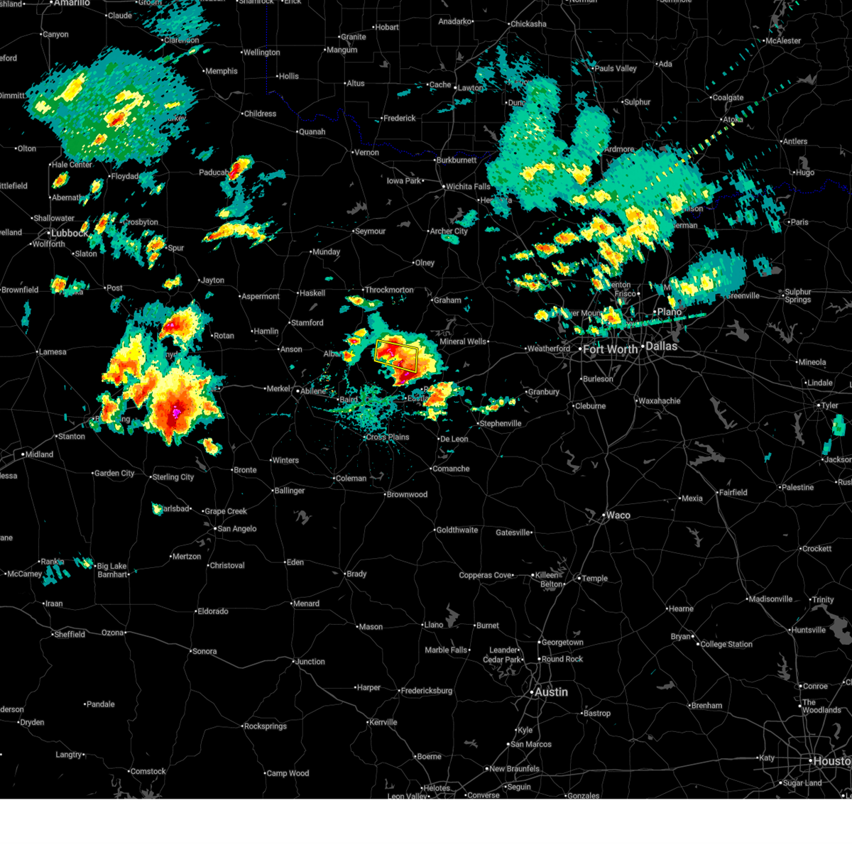
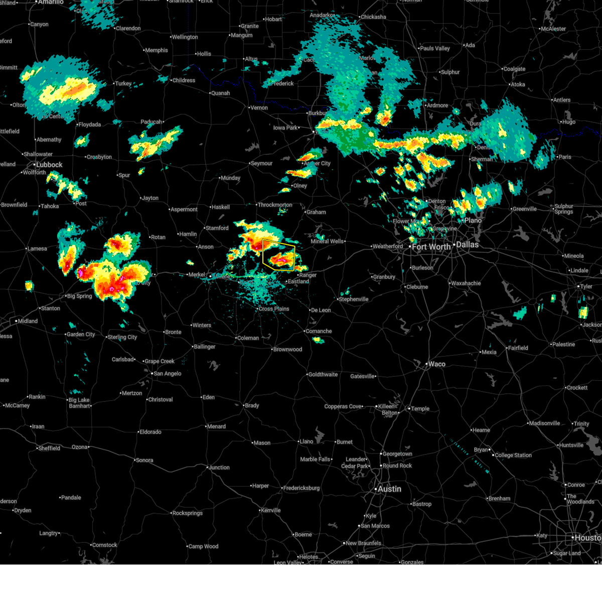
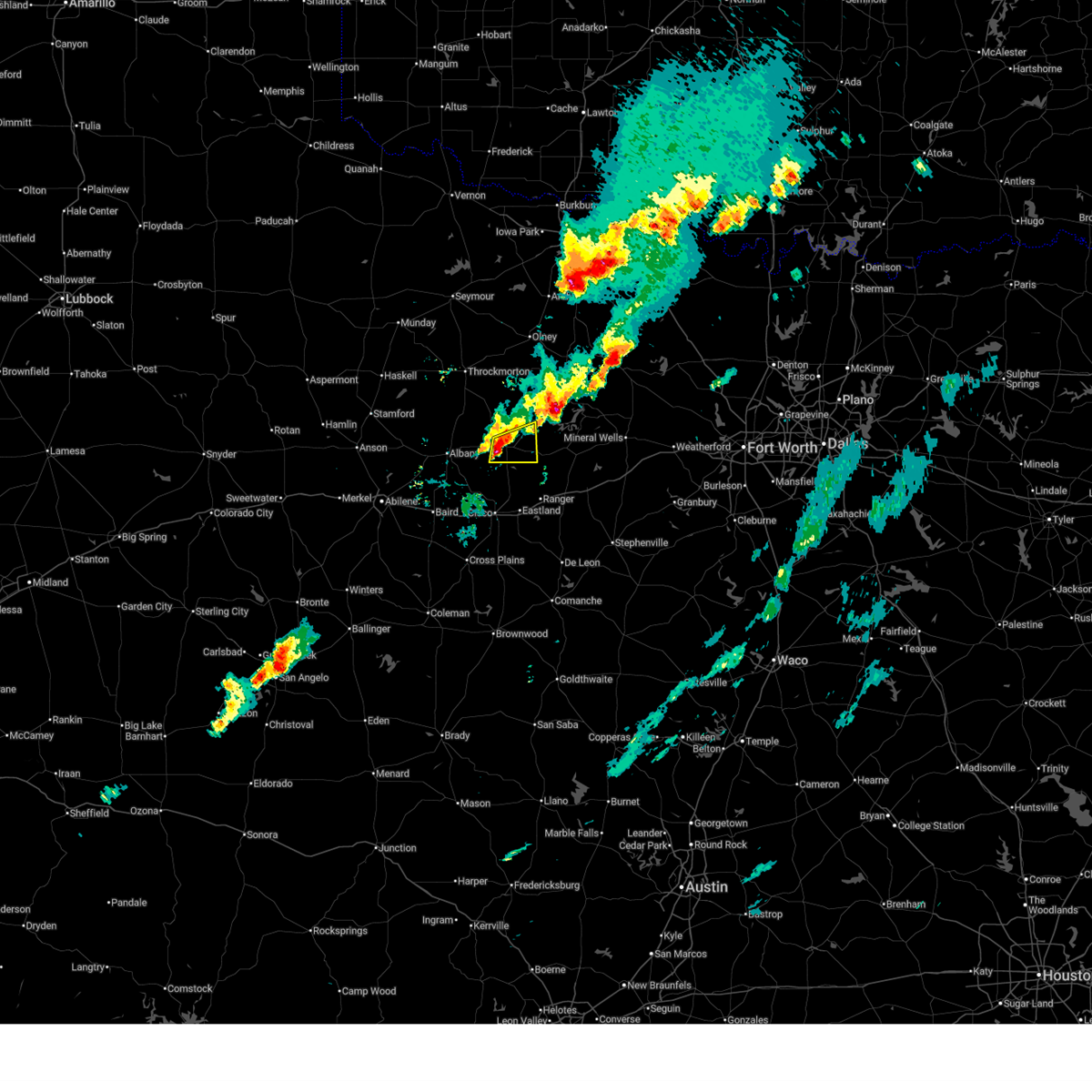
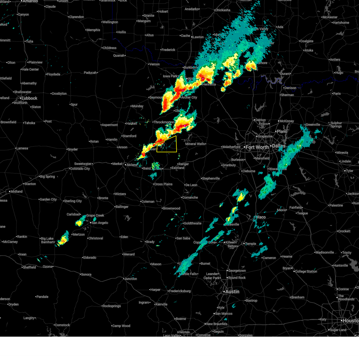
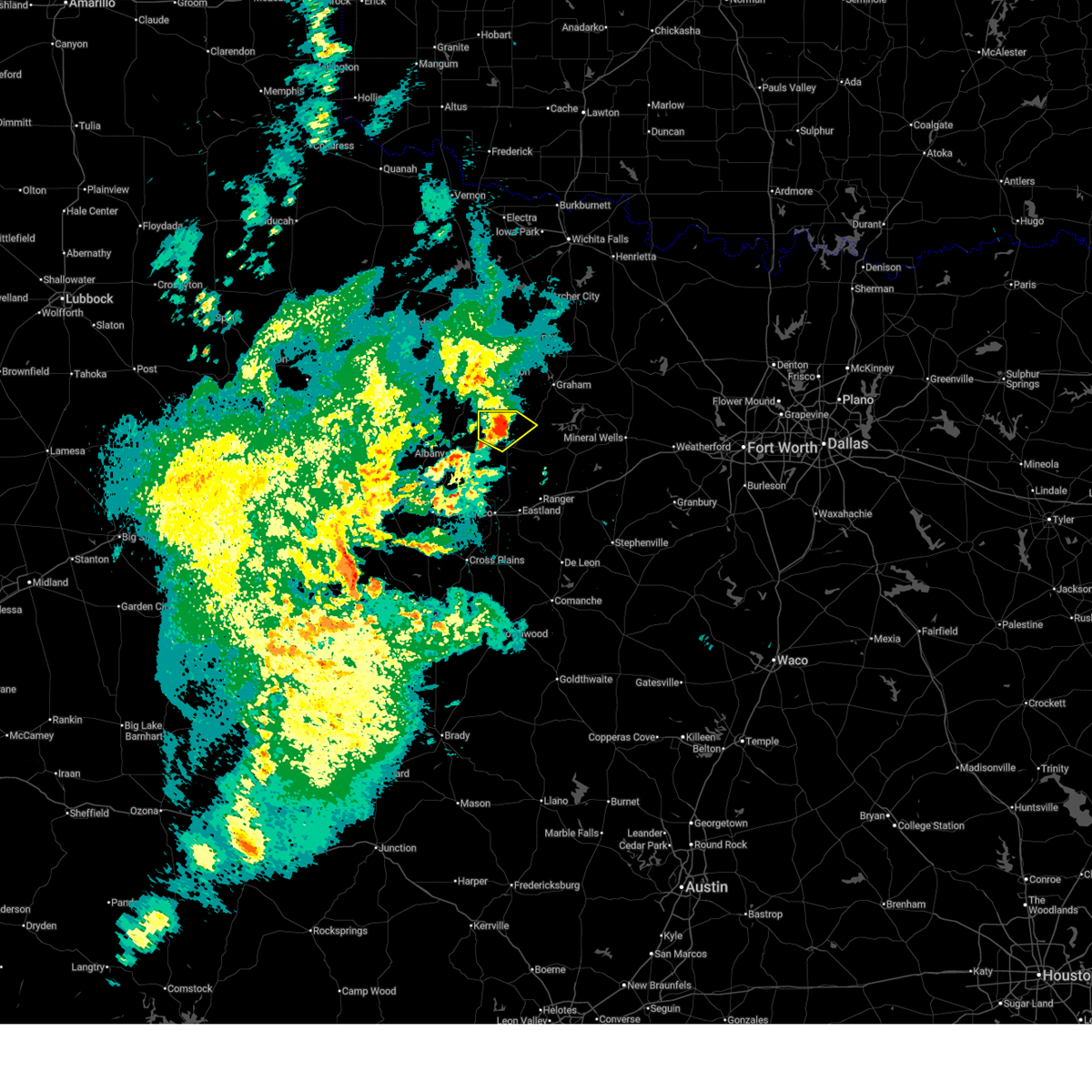
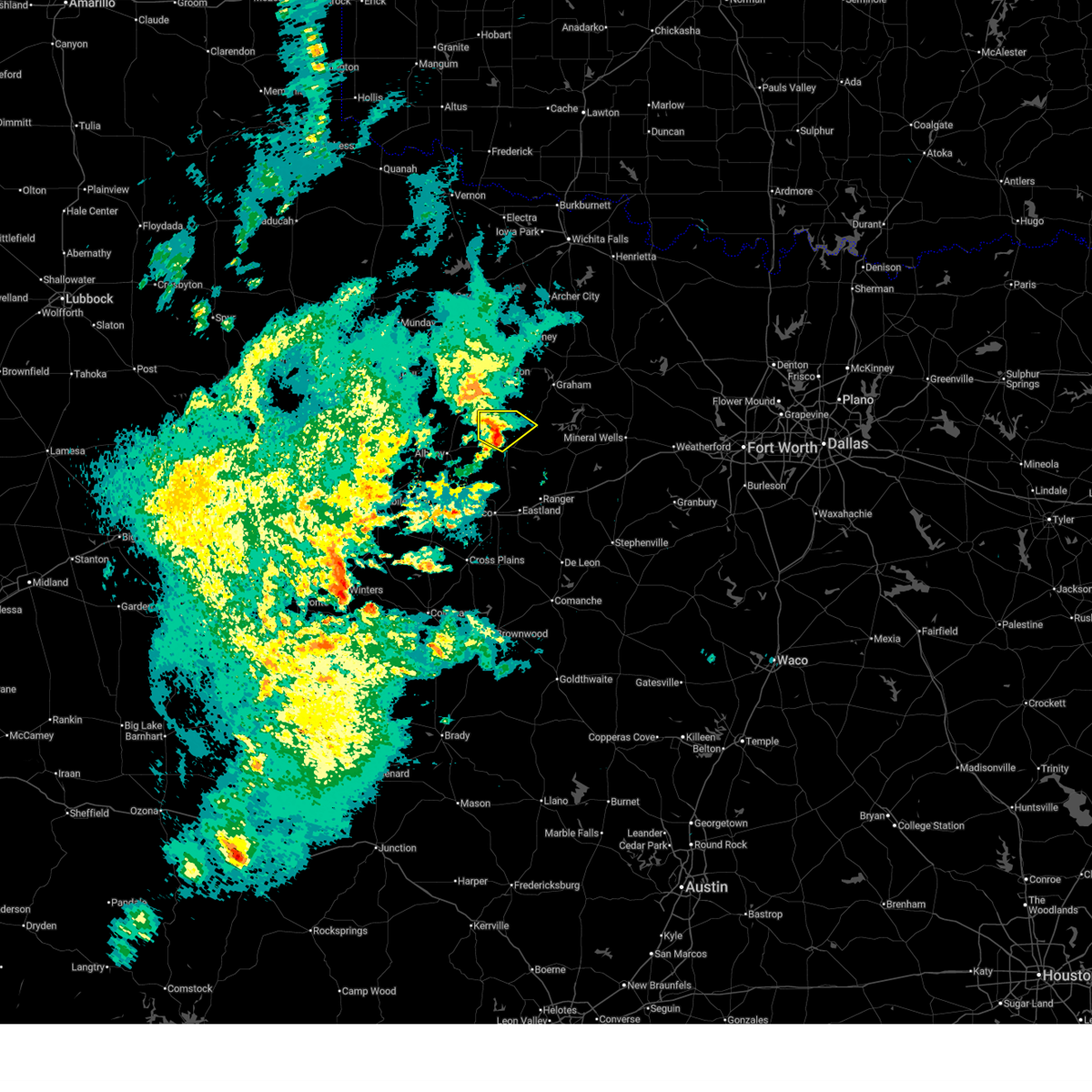
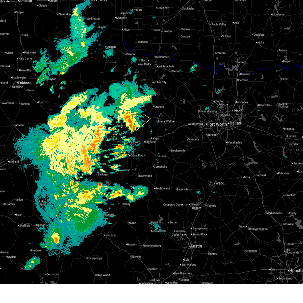
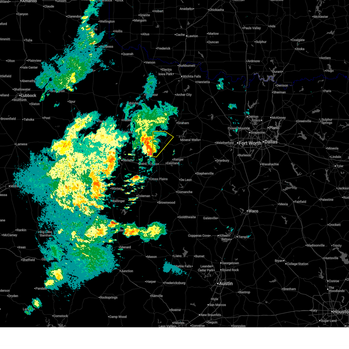
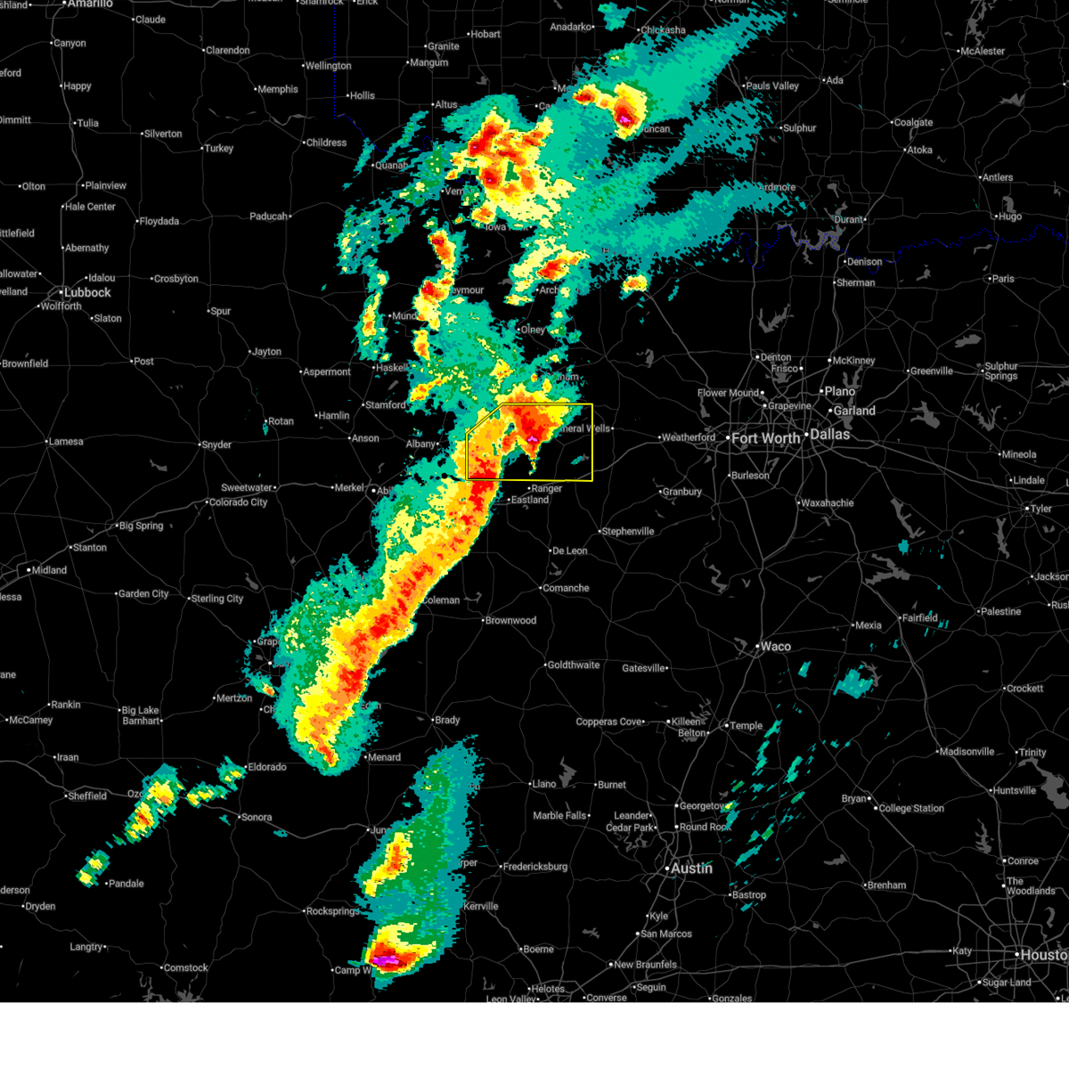
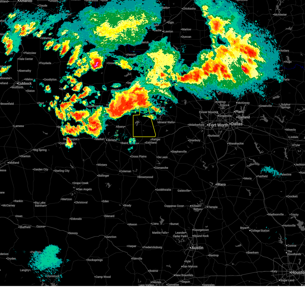
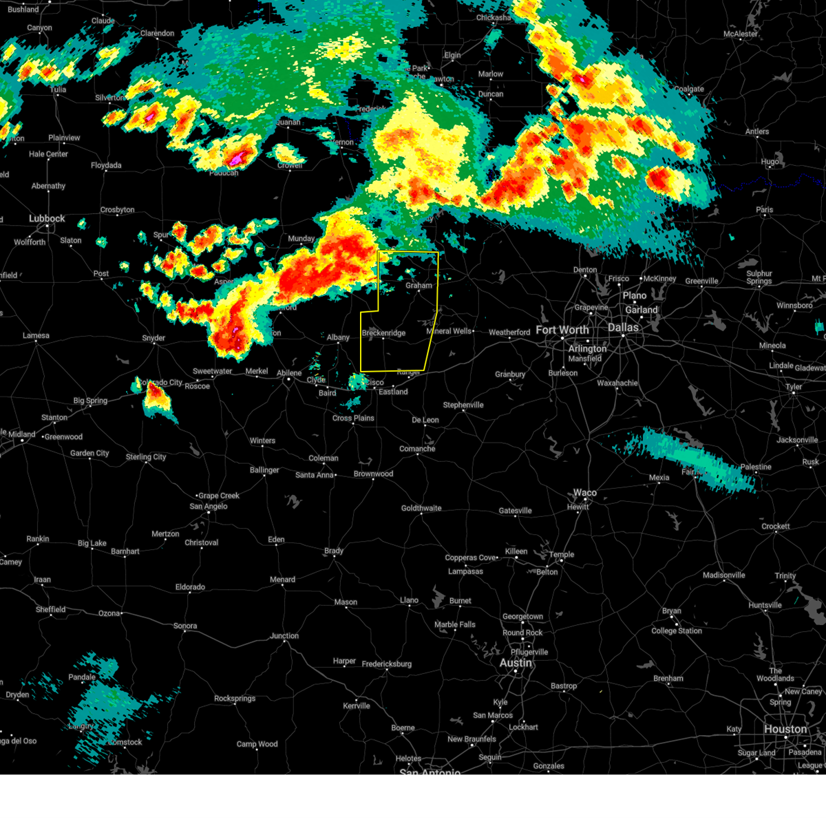
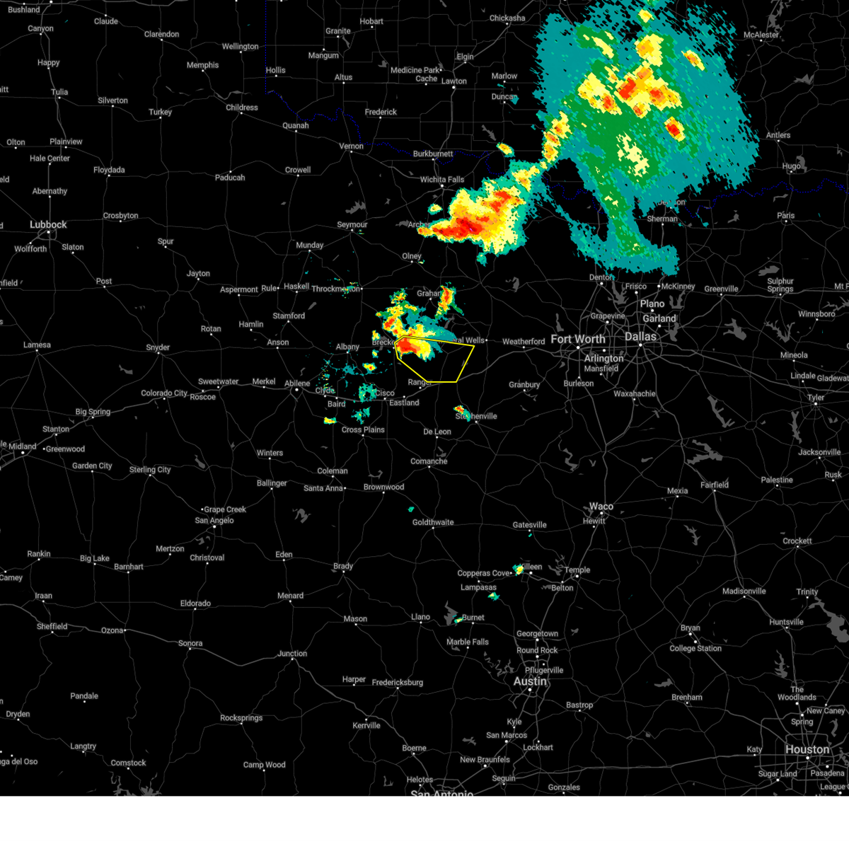
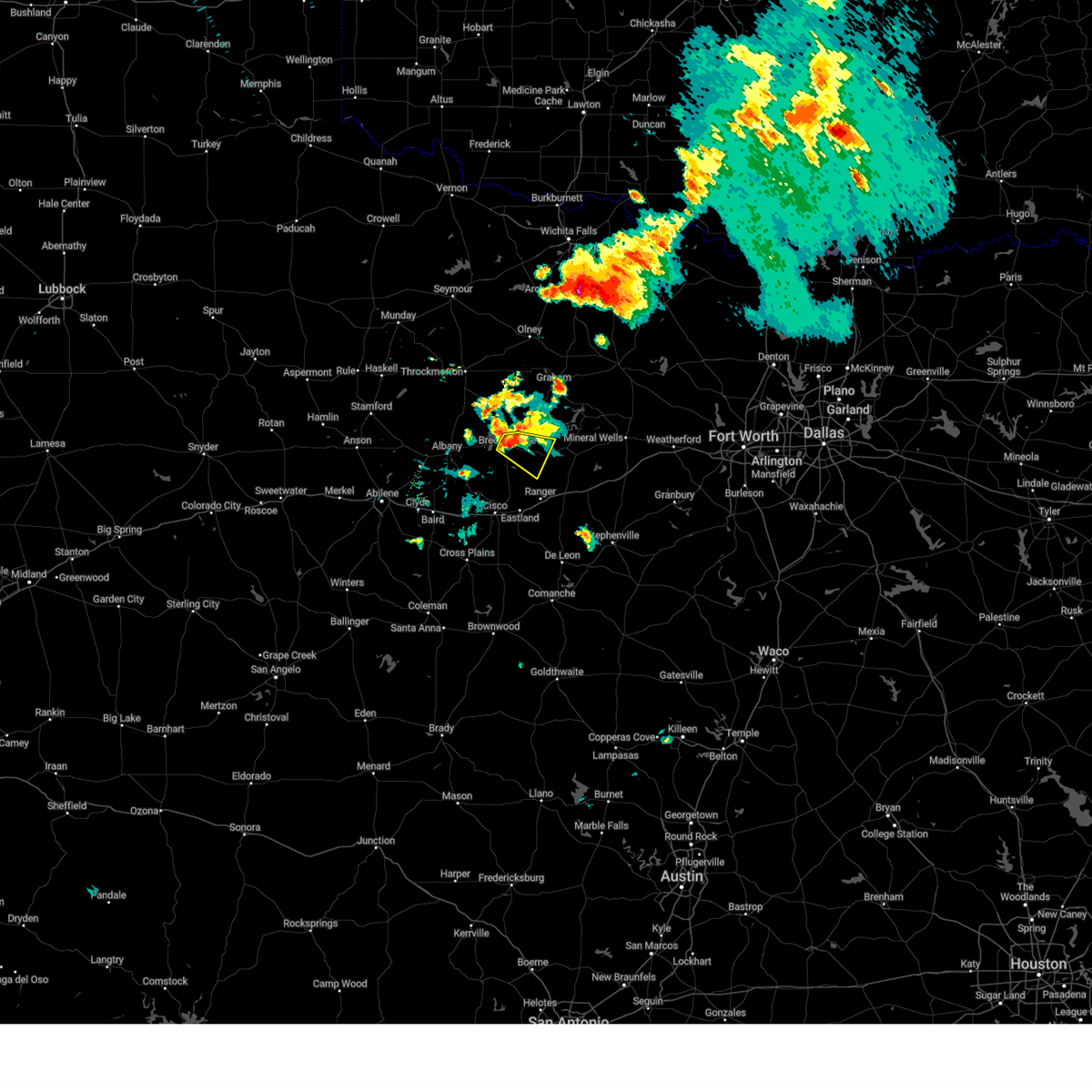
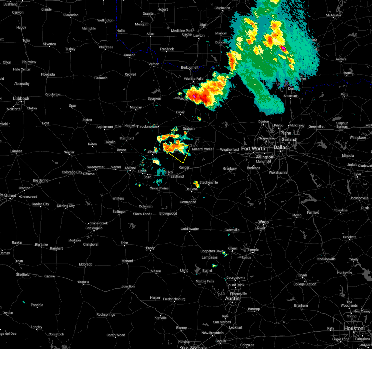
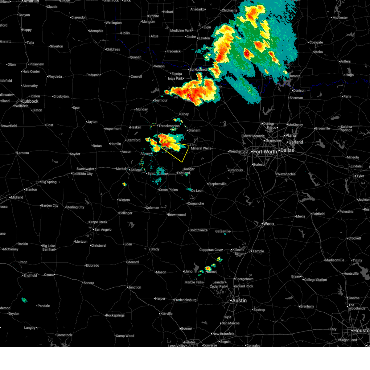
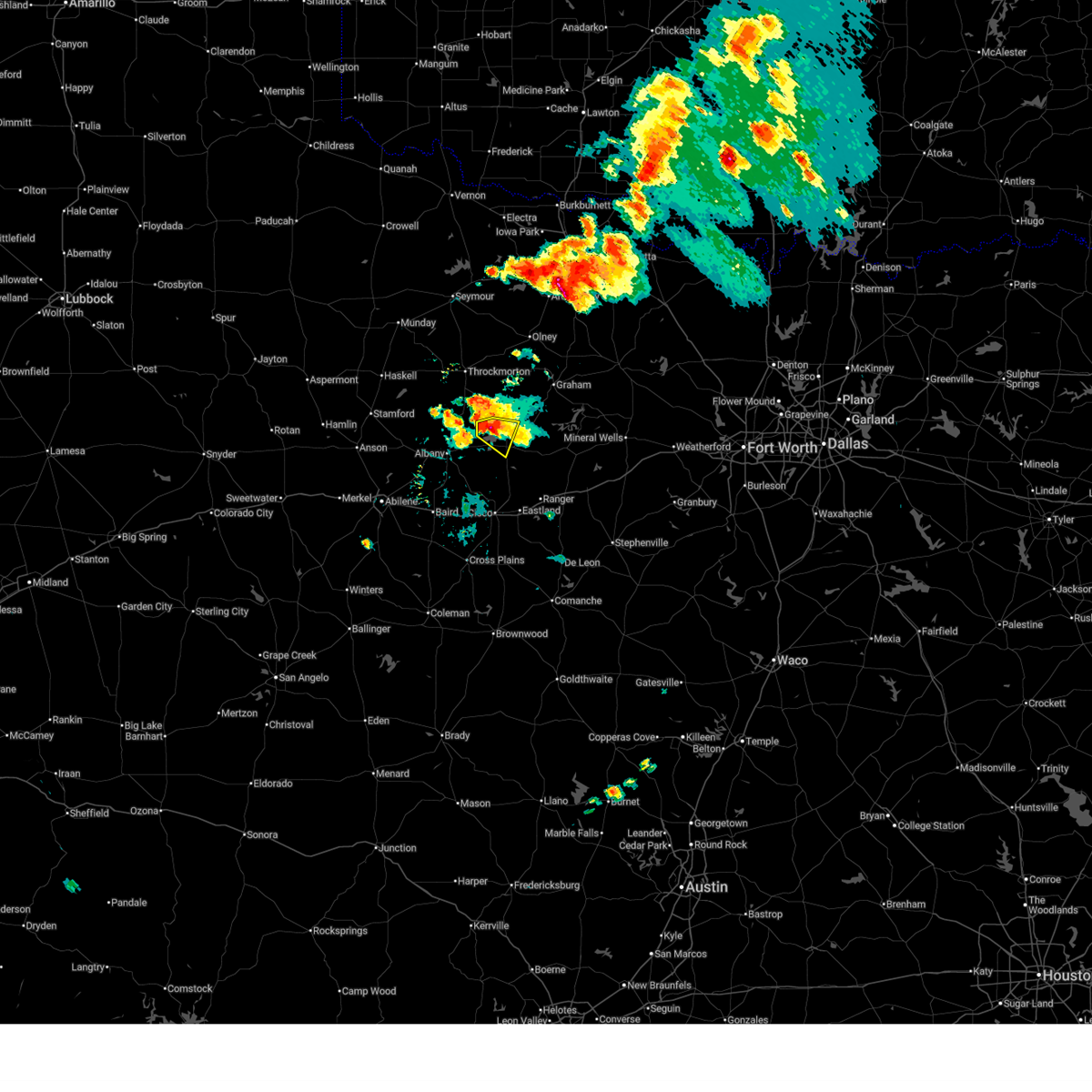
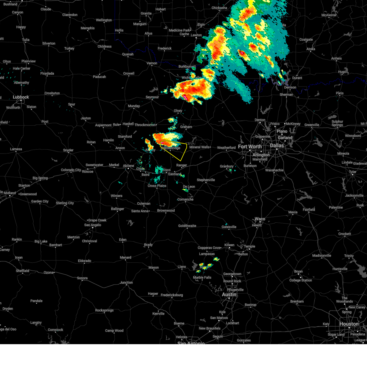
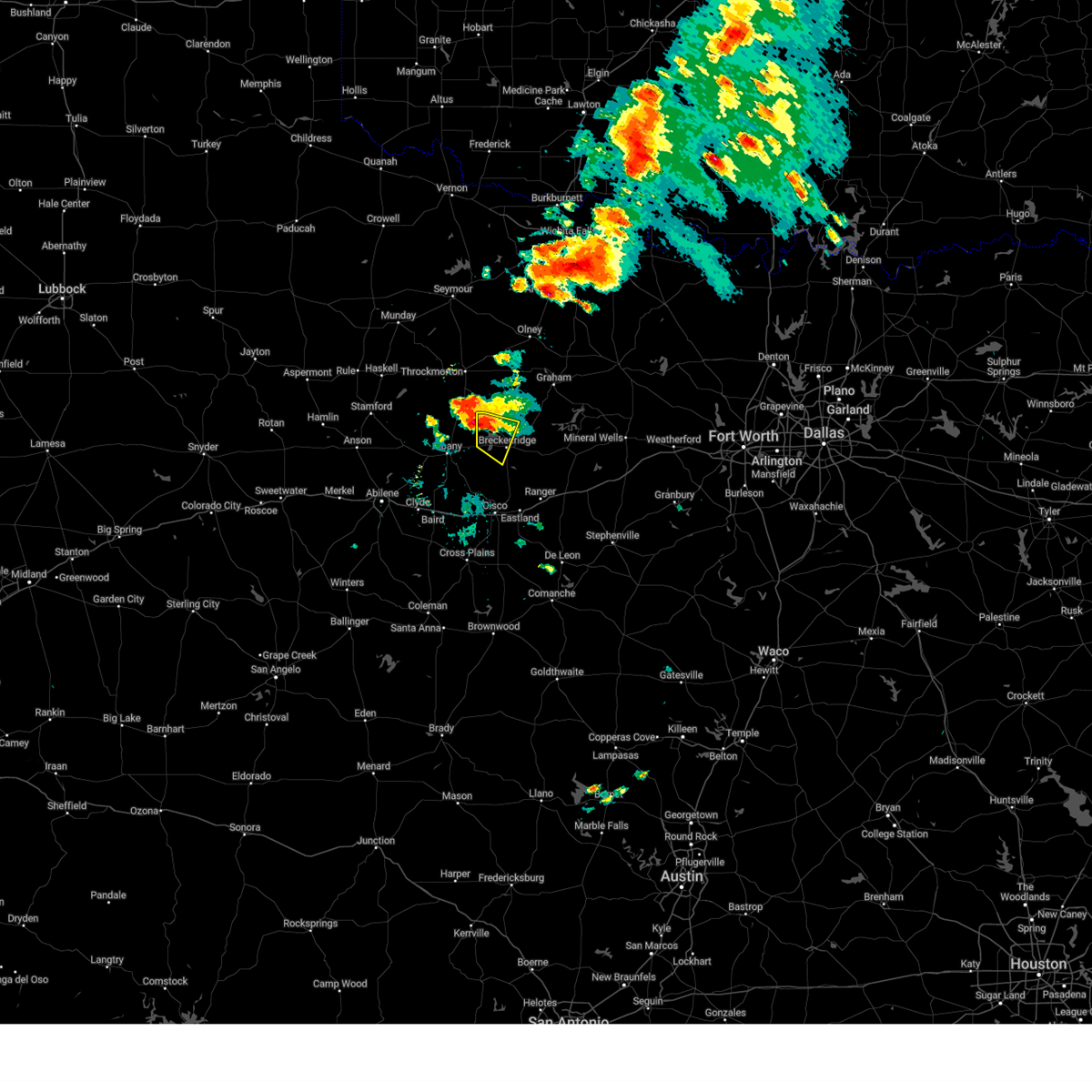
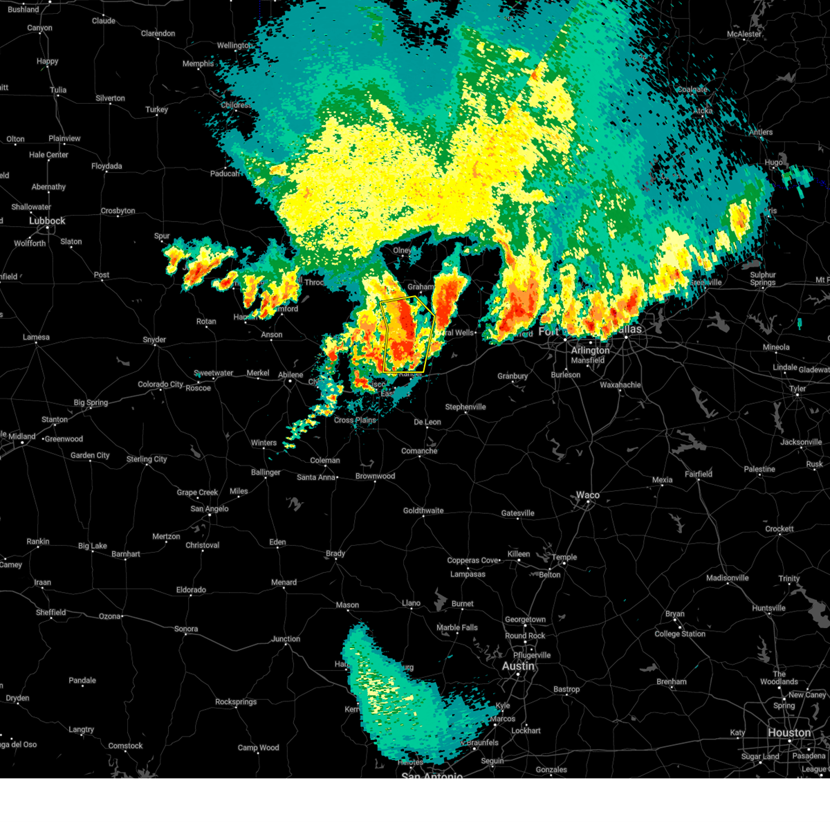
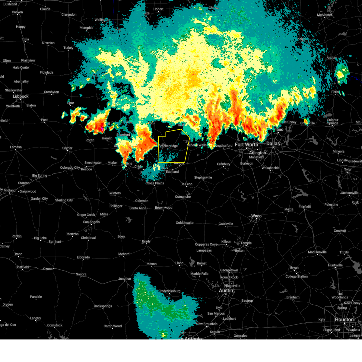
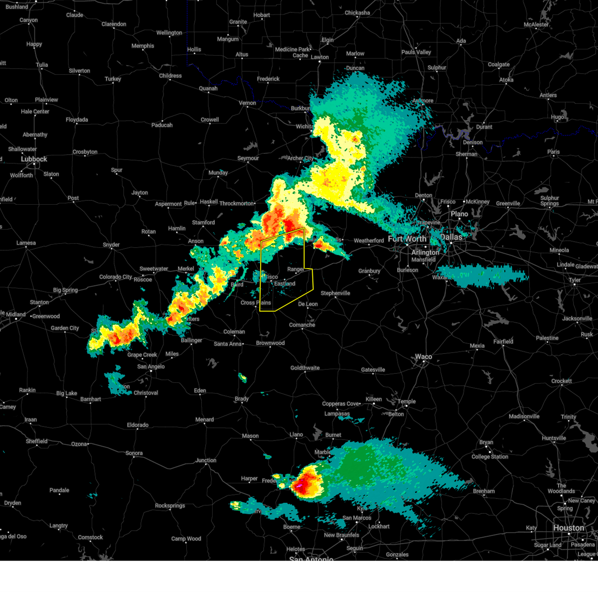
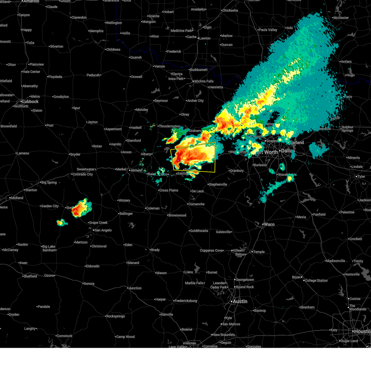
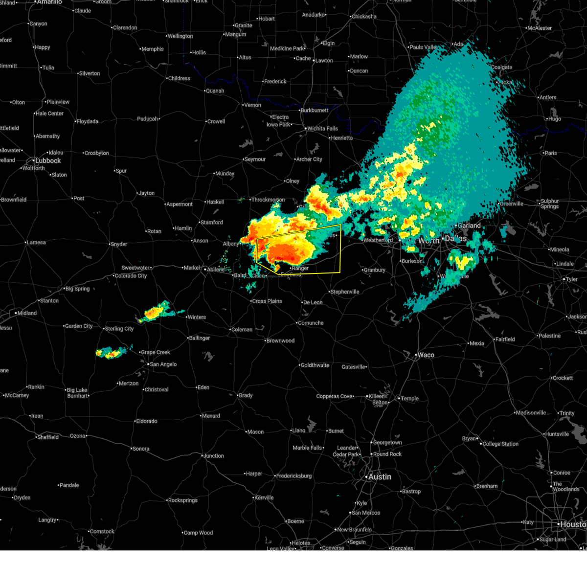
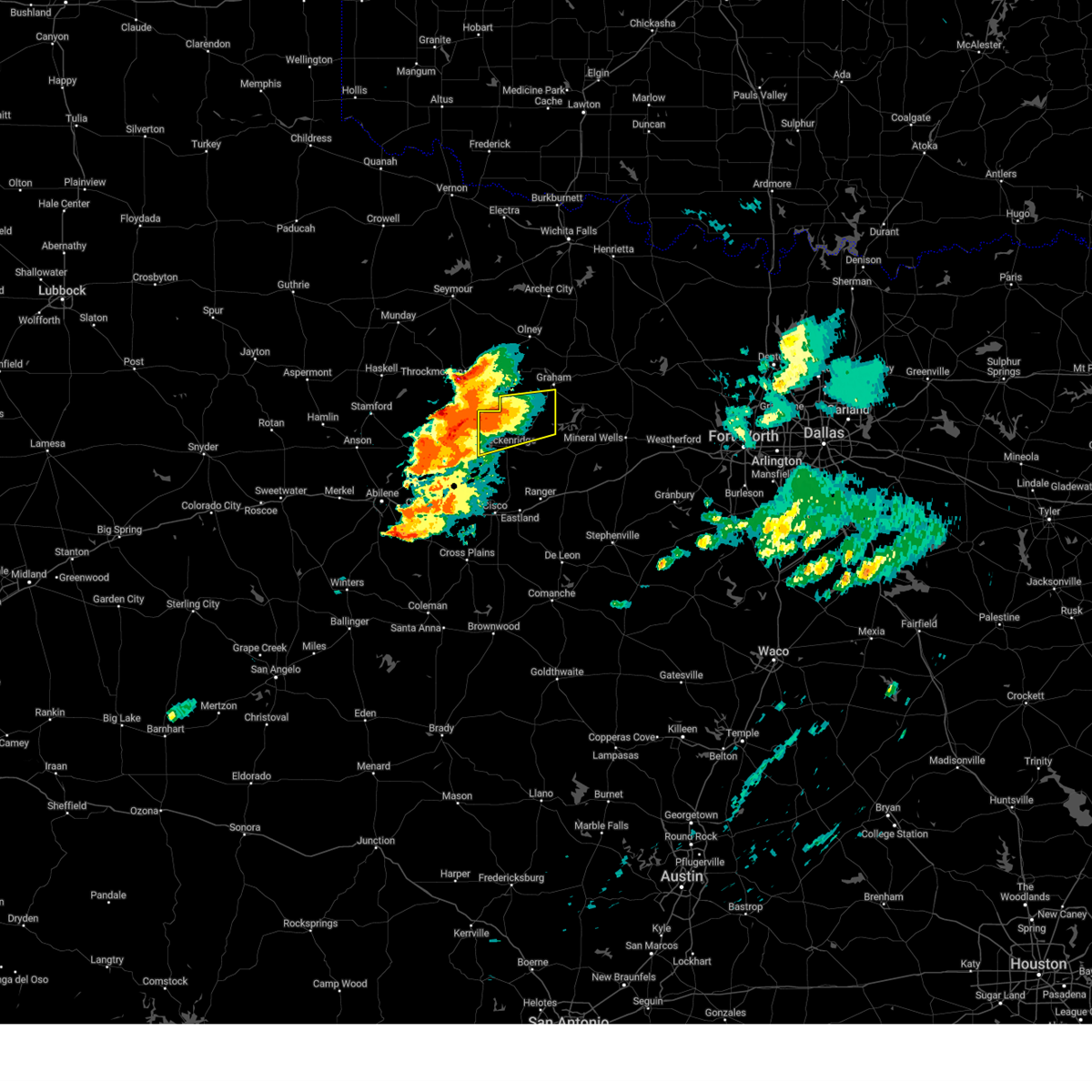
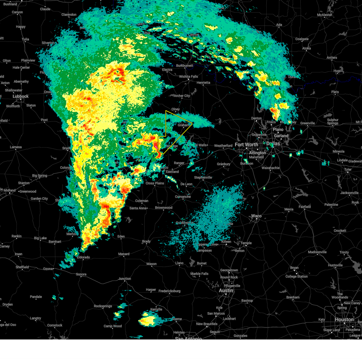
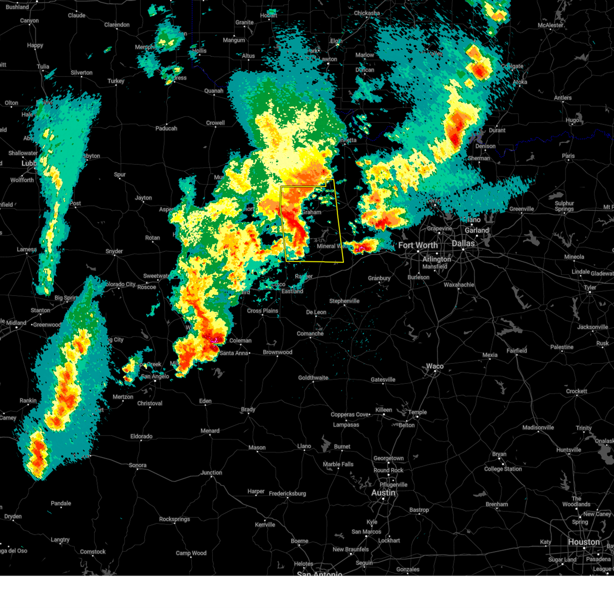
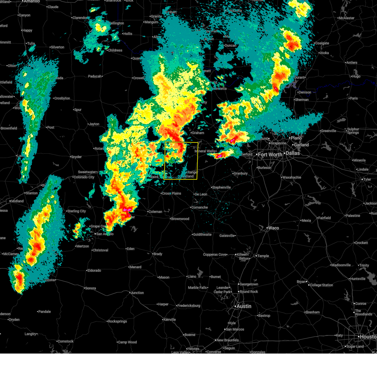
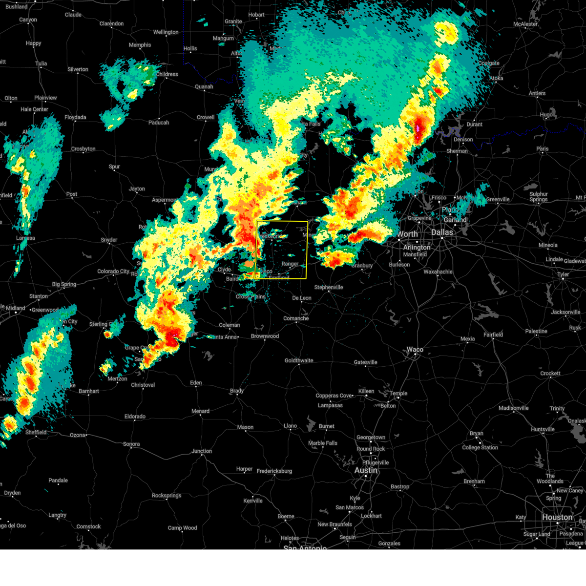
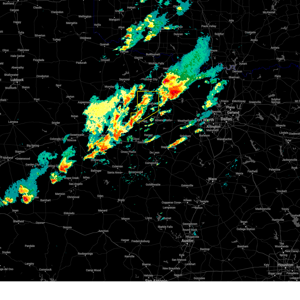
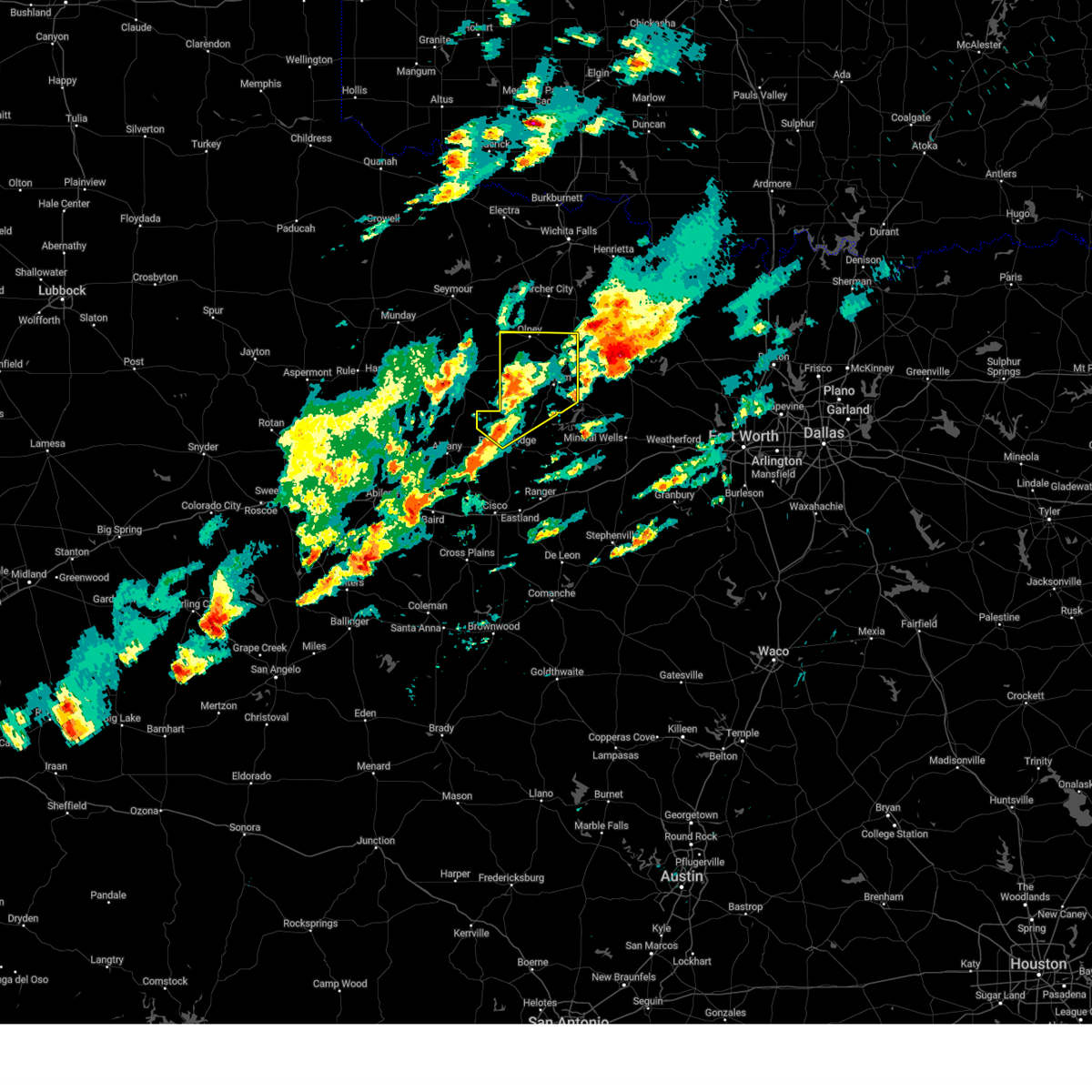
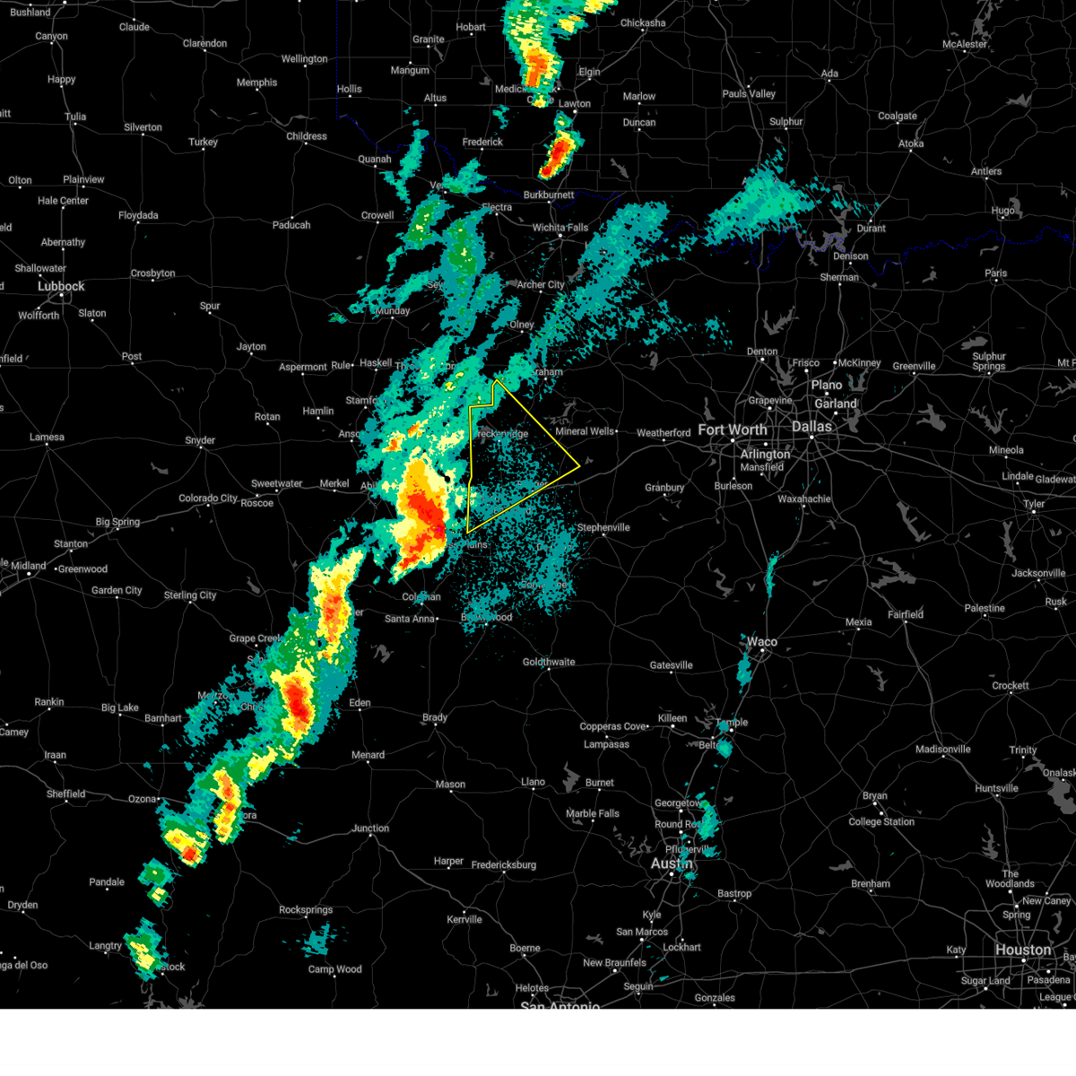
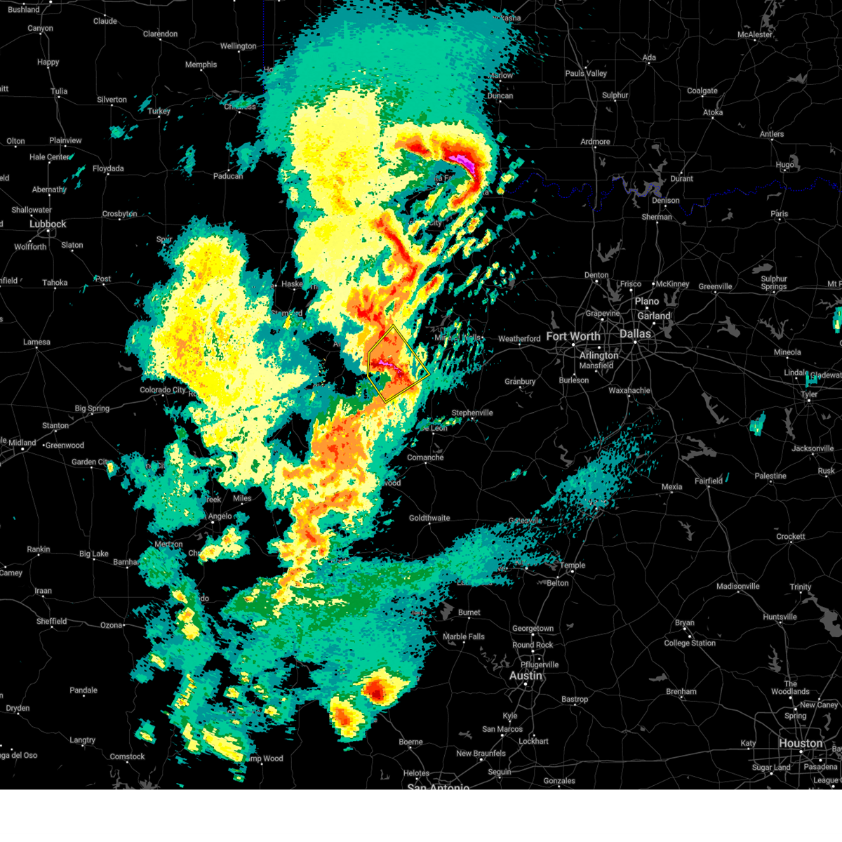
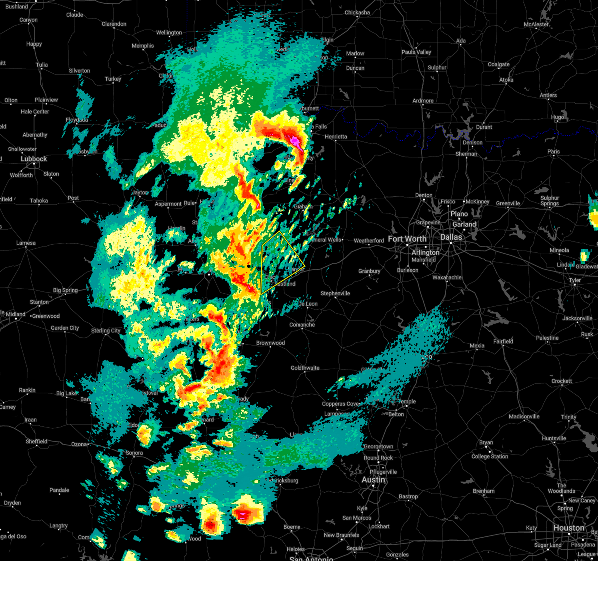
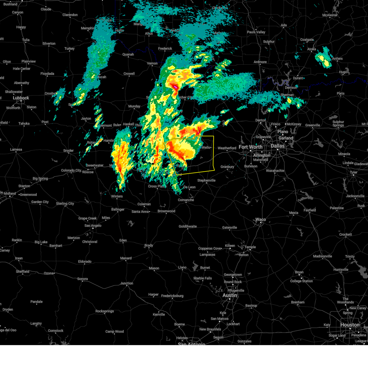
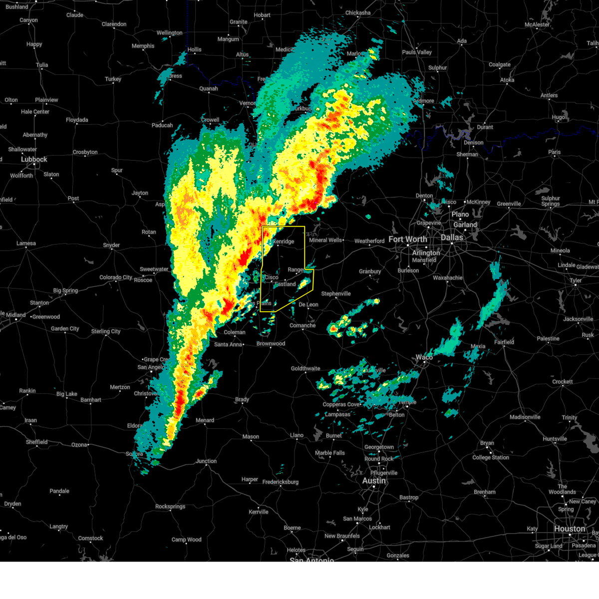
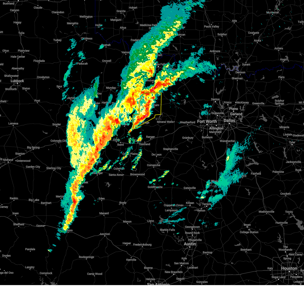
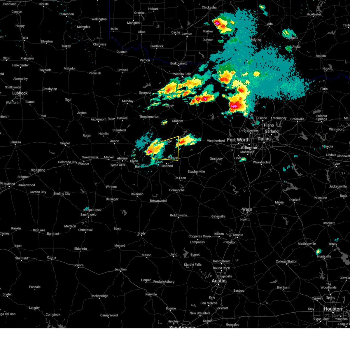
Hail Map for Breckenridge, TX
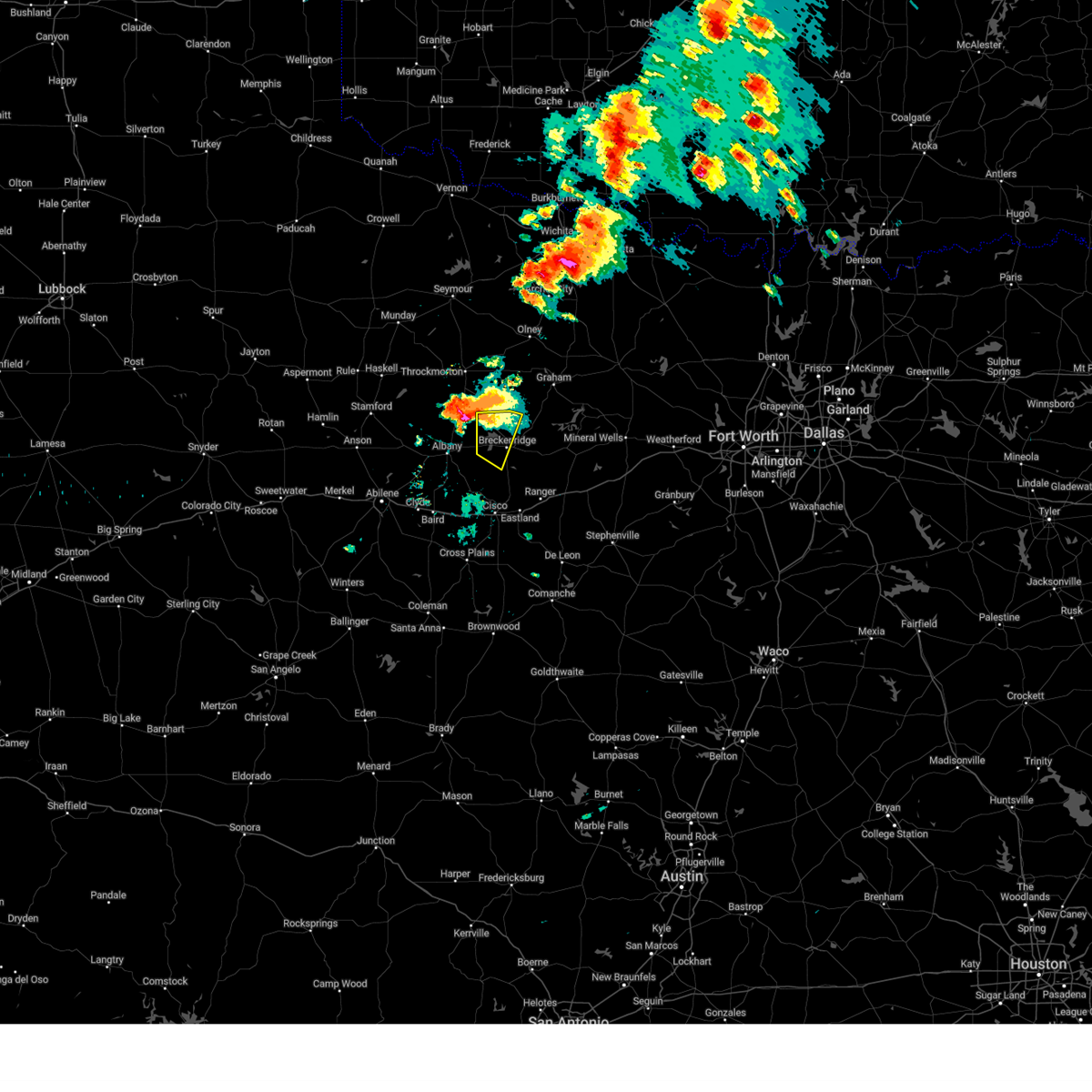
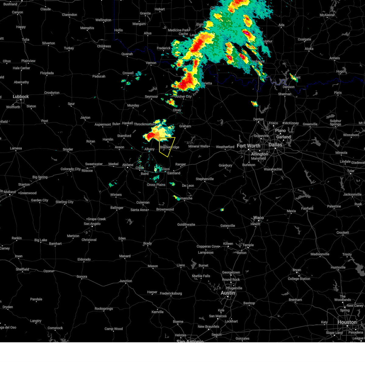
The Breckenridge, TX area has had 42 reports of on-the-ground hail by trained spotters, and has been under severe weather warnings 18 times during the past 12 months. Doppler radar has detected hail at or near Breckenridge, TX on 119 occasions, including 6 occasions during the past year.
| Name: | Breckenridge, TX |
| Where Located: | 52.9 miles ENE of Abilene, TX |
| Map: | Google Map for Breckenridge, TX |
| Population: | 5780 |
| Housing Units: | 2704 |
| More Info: | Search Google for Breckenridge, TX |
3
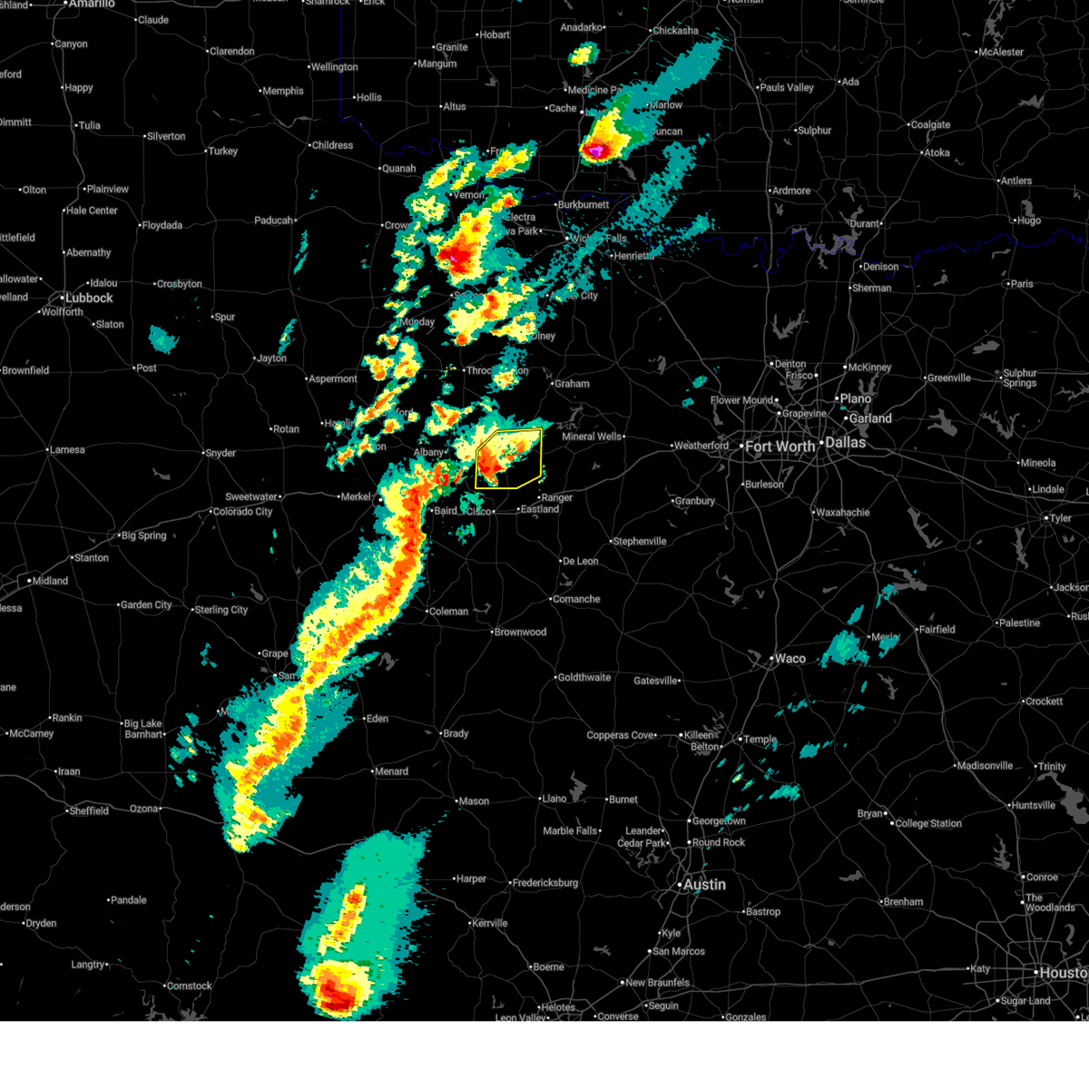
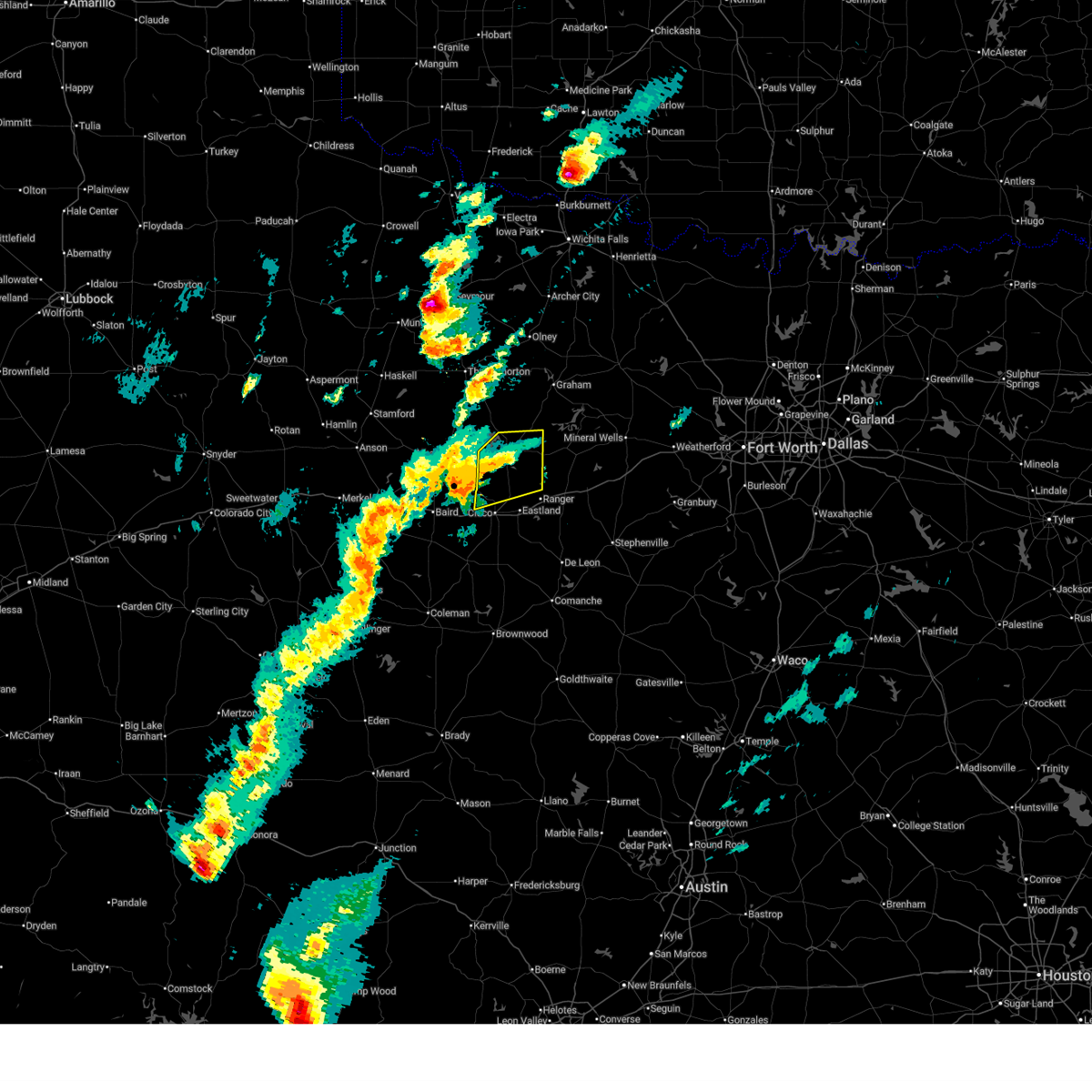
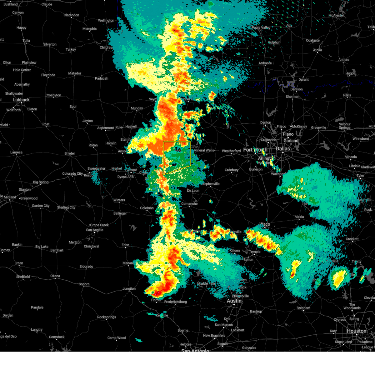
The Top Recent Hail Date for Breckenridge, TX is Tuesday, March 10, 2026 (6th out of 119)

Hail and Wind Damage Spotted near Breckenridge, TX
| Date / Time | Report Details |
|---|---|
| 6/2/2026 8:20 PM CDT | Quarter sized hail reported 6.1 miles ENE of Breckenridge, TX, facebook report of pea to quarter size hail on southwest side of hubbard creek lake. |
| 6/2/2026 8:19 PM CDT |
 At 818 pm cdt, severe thunderstorms were located along a line extending from near breckenridge to around hubbard creek reservoir, moving southwest at 15 mph (radar indicated). Hazards include 60 mph wind gusts and quarter size hail. Hail damage to vehicles is expected. expect wind damage to roofs, siding, and trees. Locations impacted include, breckenridge, hubbard creek reservoir, and eolian. At 818 pm cdt, severe thunderstorms were located along a line extending from near breckenridge to around hubbard creek reservoir, moving southwest at 15 mph (radar indicated). Hazards include 60 mph wind gusts and quarter size hail. Hail damage to vehicles is expected. expect wind damage to roofs, siding, and trees. Locations impacted include, breckenridge, hubbard creek reservoir, and eolian.
|
| 6/2/2026 8:01 PM CDT |
 At 801 pm cdt, a severe thunderstorm was located just north of breckenridge, moving west at 15 mph (radar indicated). Hazards include ping pong ball size hail and 60 mph wind gusts. People and animals outdoors will be injured. expect hail damage to roofs, siding, windows, and vehicles. expect wind damage to roofs, siding, and trees. Locations impacted include, breckenridge, hubbard creek reservoir, crystal falls, and eolian. At 801 pm cdt, a severe thunderstorm was located just north of breckenridge, moving west at 15 mph (radar indicated). Hazards include ping pong ball size hail and 60 mph wind gusts. People and animals outdoors will be injured. expect hail damage to roofs, siding, windows, and vehicles. expect wind damage to roofs, siding, and trees. Locations impacted include, breckenridge, hubbard creek reservoir, crystal falls, and eolian.
|
| 5/22/2026 9:46 PM CDT |
 Svrfwd the national weather service in fort worth has issued a * severe thunderstorm warning for, western young county in north central texas, northwestern eastland county in north central texas, stephens county in north central texas, * until 1045 pm cdt. * at 946 pm cdt, severe thunderstorms were located along a line extending from near gilliland to 8 miles southwest of throckmorton to near albany to near hamby, moving southeast at 35 mph (radar indicated). Hazards include 60 mph wind gusts. Expect damage to roofs, siding, and trees. severe thunderstorms will be near, hubbard creek reservoir around 1000 pm cdt. breckenridge around 1020 pm cdt. crystal falls and lake cisco around 1025 pm cdt. cisco, lake daniel, and gunsight around 1030 pm cdt. other locations impacted by these severe thunderstorms include eliasville, morton valley, nimrod, ivan, scranton, eolian, newcastle, murray, padgett, and south bend. This includes interstate 20 between mile markers 324 and 344. Svrfwd the national weather service in fort worth has issued a * severe thunderstorm warning for, western young county in north central texas, northwestern eastland county in north central texas, stephens county in north central texas, * until 1045 pm cdt. * at 946 pm cdt, severe thunderstorms were located along a line extending from near gilliland to 8 miles southwest of throckmorton to near albany to near hamby, moving southeast at 35 mph (radar indicated). Hazards include 60 mph wind gusts. Expect damage to roofs, siding, and trees. severe thunderstorms will be near, hubbard creek reservoir around 1000 pm cdt. breckenridge around 1020 pm cdt. crystal falls and lake cisco around 1025 pm cdt. cisco, lake daniel, and gunsight around 1030 pm cdt. other locations impacted by these severe thunderstorms include eliasville, morton valley, nimrod, ivan, scranton, eolian, newcastle, murray, padgett, and south bend. This includes interstate 20 between mile markers 324 and 344.
|
| 5/10/2026 3:31 PM CDT |
 At 331 pm cdt, a severe thunderstorm was located over breckenridge, moving east at 20 mph (radar indicated). Hazards include quarter size hail. Damage to vehicles is possible. Locations impacted include, breckenridge, necessity, lake daniel, and hubbard creek reservoir. At 331 pm cdt, a severe thunderstorm was located over breckenridge, moving east at 20 mph (radar indicated). Hazards include quarter size hail. Damage to vehicles is possible. Locations impacted include, breckenridge, necessity, lake daniel, and hubbard creek reservoir.
|
| 5/10/2026 3:18 PM CDT |
 At 318 pm cdt, a severe thunderstorm was located near breckenridge, moving east at 20 mph (radar indicated). Hazards include half dollar size hail. Damage to vehicles is possible. Locations impacted include, breckenridge, necessity, hubbard creek reservoir, lake daniel, and eolian. At 318 pm cdt, a severe thunderstorm was located near breckenridge, moving east at 20 mph (radar indicated). Hazards include half dollar size hail. Damage to vehicles is possible. Locations impacted include, breckenridge, necessity, hubbard creek reservoir, lake daniel, and eolian.
|
| 5/10/2026 3:12 PM CDT | Golf Ball sized hail reported 1.2 miles N of Breckenridge, TX, trained spotter report on x showed hail stones around golf ball size just south of breckenridge. time estimated by radar. |
| 5/10/2026 3:06 PM CDT | Ping Pong Ball sized hail reported 7 miles E of Breckenridge, TX, facebook report of between ping pong and golf ball sized hail on the southwest side of the lake. time estimated by radar. |
| 5/10/2026 3:04 PM CDT | Quarter sized hail reported 6.4 miles E of Breckenridge, TX, report of 1 inch hail from mping. |
| 5/10/2026 2:55 PM CDT |
 Svrfwd the national weather service in fort worth has issued a * severe thunderstorm warning for, southwestern stephens county in north central texas, * until 400 pm cdt. * at 254 pm cdt, a severe thunderstorm was located over ibex, or 9 miles east of albany, moving east southeast at 20 mph (radar indicated). Hazards include quarter size hail. damage to vehicles is possible Svrfwd the national weather service in fort worth has issued a * severe thunderstorm warning for, southwestern stephens county in north central texas, * until 400 pm cdt. * at 254 pm cdt, a severe thunderstorm was located over ibex, or 9 miles east of albany, moving east southeast at 20 mph (radar indicated). Hazards include quarter size hail. damage to vehicles is possible
|
| 4/15/2026 6:27 PM CDT | Half Dollar sized hail reported 0.5 miles N of Breckenridge, TX, viewer sent broadcast media a picture of quarter to half dollar sized hail on south miller street near downtown breckenridge. |
| 4/15/2026 6:24 PM CDT | Half Dollar sized hail reported 1.3 miles WNW of Breckenridge, TX, report from mping half dollar 1.25 in. |
| 4/15/2026 6:22 PM CDT | Golf Ball sized hail reported 0.2 miles S of Breckenridge, TX, several facebook reports and photos of up to golfball size hail in breckenridge. |
| 4/15/2026 6:18 PM CDT |
 At 617 pm cdt, a severe thunderstorm was located over breckenridge, moving east at 30 mph (radar indicated). Hazards include ping pong ball size hail and 60 mph wind gusts. People and animals outdoors will be injured. expect hail damage to roofs, siding, windows, and vehicles. expect wind damage to roofs, siding, and trees. this severe storm will be near, breckenridge around 625 pm cdt. Other locations impacted by this severe thunderstorm include ivan. At 617 pm cdt, a severe thunderstorm was located over breckenridge, moving east at 30 mph (radar indicated). Hazards include ping pong ball size hail and 60 mph wind gusts. People and animals outdoors will be injured. expect hail damage to roofs, siding, windows, and vehicles. expect wind damage to roofs, siding, and trees. this severe storm will be near, breckenridge around 625 pm cdt. Other locations impacted by this severe thunderstorm include ivan.
|
| 4/15/2026 5:56 PM CDT |
 Svrfwd the national weather service in fort worth has issued a * severe thunderstorm warning for, central stephens county in north central texas, * until 645 pm cdt. * at 556 pm cdt, a severe thunderstorm was located over ibex, or 9 miles east of albany, moving northeast at 35 mph (radar indicated). Hazards include ping pong ball size hail and 60 mph wind gusts. People and animals outdoors will be injured. expect hail damage to roofs, siding, windows, and vehicles. expect wind damage to roofs, siding, and trees. this severe thunderstorm will be near, hubbard creek reservoir around 600 pm cdt. breckenridge around 610 pm cdt. Other locations impacted by this severe thunderstorm include ivan. Svrfwd the national weather service in fort worth has issued a * severe thunderstorm warning for, central stephens county in north central texas, * until 645 pm cdt. * at 556 pm cdt, a severe thunderstorm was located over ibex, or 9 miles east of albany, moving northeast at 35 mph (radar indicated). Hazards include ping pong ball size hail and 60 mph wind gusts. People and animals outdoors will be injured. expect hail damage to roofs, siding, windows, and vehicles. expect wind damage to roofs, siding, and trees. this severe thunderstorm will be near, hubbard creek reservoir around 600 pm cdt. breckenridge around 610 pm cdt. Other locations impacted by this severe thunderstorm include ivan.
|
| 4/11/2026 9:53 PM CDT |
 The storm which prompted the warning has weakened below severe limits. therefore the warning will be allowed to expire. however gusty winds and heavy rain are still possible with this thunderstorm. The storm which prompted the warning has weakened below severe limits. therefore the warning will be allowed to expire. however gusty winds and heavy rain are still possible with this thunderstorm.
|
| 4/11/2026 9:42 PM CDT |
 At 941 pm cdt, a severe thunderstorm was located over hubbard creek reservoir, or near breckenridge, moving northeast at 25 mph (radar indicated). Hazards include 60 mph wind gusts and quarter size hail. Hail damage to vehicles is expected. expect wind damage to roofs, siding, and trees. this severe storm will be near, crystal falls around 945 pm cdt. Other locations impacted by this severe thunderstorm include ivan. At 941 pm cdt, a severe thunderstorm was located over hubbard creek reservoir, or near breckenridge, moving northeast at 25 mph (radar indicated). Hazards include 60 mph wind gusts and quarter size hail. Hail damage to vehicles is expected. expect wind damage to roofs, siding, and trees. this severe storm will be near, crystal falls around 945 pm cdt. Other locations impacted by this severe thunderstorm include ivan.
|
| 4/11/2026 9:20 PM CDT |
 At 919 pm cdt, a severe thunderstorm was located near hubbard creek reservoir, or 7 miles west of breckenridge, moving northeast at 30 mph (radar indicated). Hazards include 60 mph wind gusts and quarter size hail. Hail damage to vehicles is expected. expect wind damage to roofs, siding, and trees. this severe storm will be near, hubbard creek reservoir around 925 pm cdt. crystal falls around 940 pm cdt. Other locations impacted by this severe thunderstorm include ivan and eolian. At 919 pm cdt, a severe thunderstorm was located near hubbard creek reservoir, or 7 miles west of breckenridge, moving northeast at 30 mph (radar indicated). Hazards include 60 mph wind gusts and quarter size hail. Hail damage to vehicles is expected. expect wind damage to roofs, siding, and trees. this severe storm will be near, hubbard creek reservoir around 925 pm cdt. crystal falls around 940 pm cdt. Other locations impacted by this severe thunderstorm include ivan and eolian.
|
| 4/11/2026 9:02 PM CDT |
 Svrfwd the national weather service in fort worth has issued a * severe thunderstorm warning for, northwestern stephens county in north central texas, * until 1000 pm cdt. * at 901 pm cdt, a severe thunderstorm was located near moran, or 14 miles southeast of albany, moving northeast at 30 mph (radar indicated). Hazards include 60 mph wind gusts and quarter size hail. Hail damage to vehicles is expected. expect wind damage to roofs, siding, and trees. this severe thunderstorm will be near, hubbard creek reservoir around 915 pm cdt. breckenridge around 925 pm cdt. crystal falls around 945 pm cdt. Other locations impacted by this severe thunderstorm include ivan, eolian, and harpersville. Svrfwd the national weather service in fort worth has issued a * severe thunderstorm warning for, northwestern stephens county in north central texas, * until 1000 pm cdt. * at 901 pm cdt, a severe thunderstorm was located near moran, or 14 miles southeast of albany, moving northeast at 30 mph (radar indicated). Hazards include 60 mph wind gusts and quarter size hail. Hail damage to vehicles is expected. expect wind damage to roofs, siding, and trees. this severe thunderstorm will be near, hubbard creek reservoir around 915 pm cdt. breckenridge around 925 pm cdt. crystal falls around 945 pm cdt. Other locations impacted by this severe thunderstorm include ivan, eolian, and harpersville.
|
| 3/10/2026 7:18 PM CDT |
 At 717 pm cdt, a severe thunderstorm was located near lake daniel, or near breckenridge, moving northeast at 45 mph (radar indicated). Hazards include two inch hail and 70 mph wind gusts. People and animals outdoors will be injured. expect hail damage to roofs, siding, windows, and vehicles. expect considerable tree damage. wind damage is also likely to mobile homes, roofs, and outbuildings. this severe storm will be near, breckenridge and lake daniel around 720 pm cdt. caddo around 730 pm cdt. possum kingdom state park and possum kingdom lake around 740 pm cdt. graford around 810 pm cdt. Other locations impacted by this severe thunderstorm include mingus, ivan, eolian, lone camp, strawn, harpersville, and thurber. At 717 pm cdt, a severe thunderstorm was located near lake daniel, or near breckenridge, moving northeast at 45 mph (radar indicated). Hazards include two inch hail and 70 mph wind gusts. People and animals outdoors will be injured. expect hail damage to roofs, siding, windows, and vehicles. expect considerable tree damage. wind damage is also likely to mobile homes, roofs, and outbuildings. this severe storm will be near, breckenridge and lake daniel around 720 pm cdt. caddo around 730 pm cdt. possum kingdom state park and possum kingdom lake around 740 pm cdt. graford around 810 pm cdt. Other locations impacted by this severe thunderstorm include mingus, ivan, eolian, lone camp, strawn, harpersville, and thurber.
|
| 3/10/2026 7:12 PM CDT |
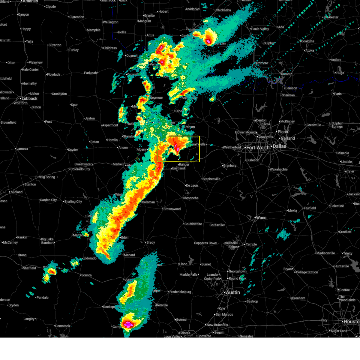 Svrfwd the national weather service in fort worth has issued a * severe thunderstorm warning for, stephens county in north central texas, western palo pinto county in north central texas, * until 815 pm cdt. * at 712 pm cdt, a severe thunderstorm was located near lake daniel, or near breckenridge, moving northeast at 45 mph (radar indicated). Hazards include golf ball size hail and 65 mph wind gusts. People and animals outdoors will be injured. expect hail damage to roofs, siding, windows, and vehicles. expect wind damage to roofs, siding, and trees. this severe thunderstorm will be near, breckenridge and lake daniel around 715 pm cdt. caddo around 730 pm cdt. possum kingdom state park and possum kingdom lake around 740 pm cdt. graford around 810 pm cdt. other locations impacted by this severe thunderstorm include mingus, ivan, eolian, lone camp, strawn, harpersville, and thurber. This includes interstate 20 between mile markers 369 and 376. Svrfwd the national weather service in fort worth has issued a * severe thunderstorm warning for, stephens county in north central texas, western palo pinto county in north central texas, * until 815 pm cdt. * at 712 pm cdt, a severe thunderstorm was located near lake daniel, or near breckenridge, moving northeast at 45 mph (radar indicated). Hazards include golf ball size hail and 65 mph wind gusts. People and animals outdoors will be injured. expect hail damage to roofs, siding, windows, and vehicles. expect wind damage to roofs, siding, and trees. this severe thunderstorm will be near, breckenridge and lake daniel around 715 pm cdt. caddo around 730 pm cdt. possum kingdom state park and possum kingdom lake around 740 pm cdt. graford around 810 pm cdt. other locations impacted by this severe thunderstorm include mingus, ivan, eolian, lone camp, strawn, harpersville, and thurber. This includes interstate 20 between mile markers 369 and 376.
|
| 3/10/2026 7:07 PM CDT | Baseball sized hail reported 13.8 miles WNW of Breckenridge, TX, report from mping: baseball (2.75 in.). |
| 3/10/2026 7:00 PM CDT | Baseball sized hail reported 10.6 miles NW of Breckenridge, TX, emergency manager relayed photos of baseball sized hail in necessity. |
| 3/10/2026 6:56 PM CDT |
 At 655 pm cdt, a severe thunderstorm was located near necessity, or near breckenridge, moving northeast at 30 mph (radar indicated). Hazards include two inch hail and 60 mph wind gusts. People and animals outdoors will be injured. expect hail damage to roofs, siding, windows, and vehicles. expect wind damage to roofs, siding, and trees. This severe thunderstorm will remain over mainly rural areas of southern stephens county, including the following locations, eolian and harpersville. At 655 pm cdt, a severe thunderstorm was located near necessity, or near breckenridge, moving northeast at 30 mph (radar indicated). Hazards include two inch hail and 60 mph wind gusts. People and animals outdoors will be injured. expect hail damage to roofs, siding, windows, and vehicles. expect wind damage to roofs, siding, and trees. This severe thunderstorm will remain over mainly rural areas of southern stephens county, including the following locations, eolian and harpersville.
|
| 3/10/2026 6:55 PM CDT | Quarter sized hail reported 1.3 miles WNW of Breckenridge, TX, report from mping: quarter (1.00 in.). |
| 3/10/2026 6:47 PM CDT | Tennis Ball sized hail reported 0.2 miles S of Breckenridge, TX, amateur radio relayed report of tennis ball sized hail in breckenridge. |
| 3/10/2026 6:47 PM CDT | Tennis Ball sized hail reported 8.4 miles NNW of Breckenridge, TX, delayed report. storm spotter reported tennis ball sized hail 9 miles south of breckenridge. |
| 3/10/2026 6:34 PM CDT |
 the severe thunderstorm warning has been cancelled and is no longer in effect the severe thunderstorm warning has been cancelled and is no longer in effect
|
| 3/10/2026 6:34 PM CDT |
 At 633 pm cdt, a severe thunderstorm was located 7 miles west of lake daniel, or 10 miles southwest of breckenridge, moving northeast at 30 mph (radar indicated). Hazards include ping pong ball size hail and 60 mph wind gusts. People and animals outdoors will be injured. expect hail damage to roofs, siding, windows, and vehicles. expect wind damage to roofs, siding, and trees. this severe storm will be near, lake daniel around 640 pm cdt. necessity around 655 pm cdt. caddo around 705 pm cdt. Other locations impacted by this severe thunderstorm include eolian and harpersville. At 633 pm cdt, a severe thunderstorm was located 7 miles west of lake daniel, or 10 miles southwest of breckenridge, moving northeast at 30 mph (radar indicated). Hazards include ping pong ball size hail and 60 mph wind gusts. People and animals outdoors will be injured. expect hail damage to roofs, siding, windows, and vehicles. expect wind damage to roofs, siding, and trees. this severe storm will be near, lake daniel around 640 pm cdt. necessity around 655 pm cdt. caddo around 705 pm cdt. Other locations impacted by this severe thunderstorm include eolian and harpersville.
|
| 3/10/2026 6:08 PM CDT |
 Svrfwd the national weather service in fort worth has issued a * severe thunderstorm warning for, northwestern eastland county in north central texas, southern stephens county in north central texas, * until 715 pm cdt. * at 607 pm cdt, a severe thunderstorm was located near moran, or 13 miles northwest of cisco, moving northeast at 30 mph (radar indicated). Hazards include 60 mph wind gusts and half dollar size hail. Hail damage to vehicles is expected. expect wind damage to roofs, siding, and trees. this severe thunderstorm will be near, lake daniel around 630 pm cdt. Other locations impacted by this severe thunderstorm include eolian and harpersville. Svrfwd the national weather service in fort worth has issued a * severe thunderstorm warning for, northwestern eastland county in north central texas, southern stephens county in north central texas, * until 715 pm cdt. * at 607 pm cdt, a severe thunderstorm was located near moran, or 13 miles northwest of cisco, moving northeast at 30 mph (radar indicated). Hazards include 60 mph wind gusts and half dollar size hail. Hail damage to vehicles is expected. expect wind damage to roofs, siding, and trees. this severe thunderstorm will be near, lake daniel around 630 pm cdt. Other locations impacted by this severe thunderstorm include eolian and harpersville.
|
| 6/8/2025 9:58 PM CDT |
 Svrfwd the national weather service in fort worth has issued a * severe thunderstorm warning for, southern young county in north central texas, northwestern erath county in north central texas, eastland county in north central texas, stephens county in north central texas, palo pinto county in north central texas, northwestern comanche county in central texas, * until 1100 pm cdt. * at 957 pm cdt, severe thunderstorms were located along a line extending from 7 miles north of possum kingdom lake to near lake cisco, moving southeast at 40 mph (radar indicated). Hazards include 65 mph wind gusts and half dollar size hail. Hail damage to vehicles is expected. expect wind damage to roofs, siding, and trees. severe thunderstorms will be near, lake cisco, necessity, possum kingdom state park, cisco, gunsight, caddo, and possum kingdom lake around 1005 pm cdt. eastland, ranger, graford, and palo pinto mountains state park around 1015 pm cdt. lake leon, palo pinto, and lake olden around 1020 pm cdt. mineral wells around 1025 pm cdt. lake palo pinto around 1030 pm cdt. gordon around 1035 pm cdt. gorman around 1040 pm cdt. other locations impacted by these severe thunderstorms include nimrod, kokomo, santo, staff, okra, harpersville, duster, morton valley, new salem, and thurber. This includes interstate 20 between mile markers 324 and 389. Svrfwd the national weather service in fort worth has issued a * severe thunderstorm warning for, southern young county in north central texas, northwestern erath county in north central texas, eastland county in north central texas, stephens county in north central texas, palo pinto county in north central texas, northwestern comanche county in central texas, * until 1100 pm cdt. * at 957 pm cdt, severe thunderstorms were located along a line extending from 7 miles north of possum kingdom lake to near lake cisco, moving southeast at 40 mph (radar indicated). Hazards include 65 mph wind gusts and half dollar size hail. Hail damage to vehicles is expected. expect wind damage to roofs, siding, and trees. severe thunderstorms will be near, lake cisco, necessity, possum kingdom state park, cisco, gunsight, caddo, and possum kingdom lake around 1005 pm cdt. eastland, ranger, graford, and palo pinto mountains state park around 1015 pm cdt. lake leon, palo pinto, and lake olden around 1020 pm cdt. mineral wells around 1025 pm cdt. lake palo pinto around 1030 pm cdt. gordon around 1035 pm cdt. gorman around 1040 pm cdt. other locations impacted by these severe thunderstorms include nimrod, kokomo, santo, staff, okra, harpersville, duster, morton valley, new salem, and thurber. This includes interstate 20 between mile markers 324 and 389.
|
| 6/8/2025 9:27 PM CDT |
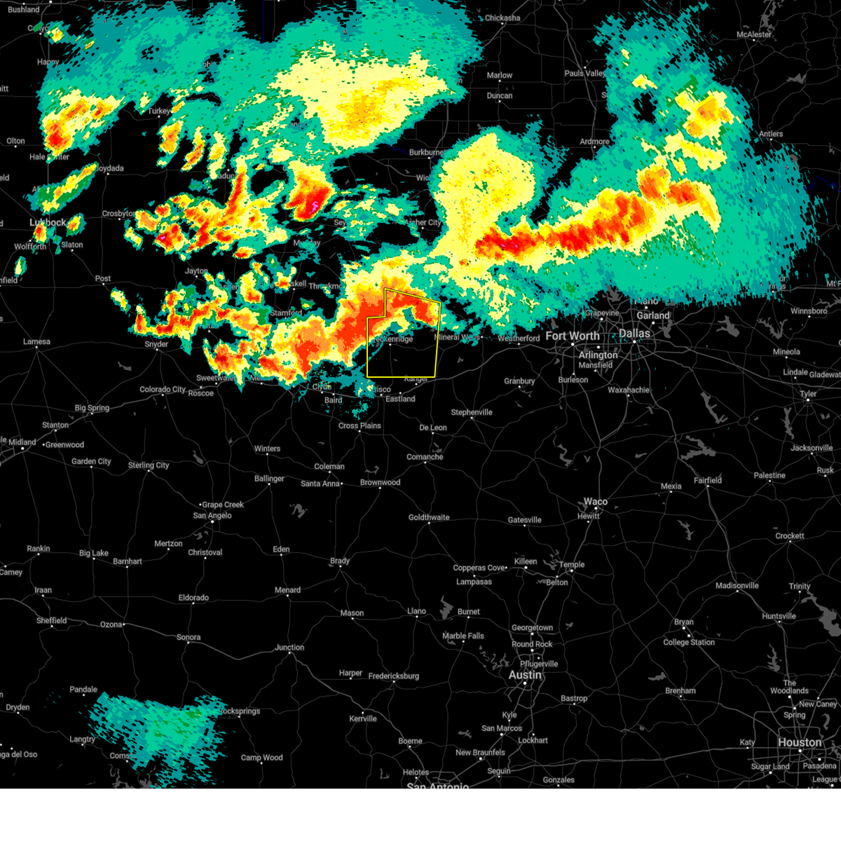 Svrfwd the national weather service in fort worth has issued a * severe thunderstorm warning for, southern young county in north central texas, stephens county in north central texas, western palo pinto county in north central texas, * until 1000 pm cdt. * at 926 pm cdt, a severe thunderstorm was located near hubbard creek reservoir, or near breckenridge, moving southeast at 45 mph. this is a destructive storm for breckenridge (radar indicated). Hazards include 80 mph wind gusts and quarter size hail. Flying debris will be dangerous to those caught without shelter. mobile homes will be heavily damaged. expect considerable damage to roofs, windows, and vehicles. Extensive tree damage and power outages are likely. Svrfwd the national weather service in fort worth has issued a * severe thunderstorm warning for, southern young county in north central texas, stephens county in north central texas, western palo pinto county in north central texas, * until 1000 pm cdt. * at 926 pm cdt, a severe thunderstorm was located near hubbard creek reservoir, or near breckenridge, moving southeast at 45 mph. this is a destructive storm for breckenridge (radar indicated). Hazards include 80 mph wind gusts and quarter size hail. Flying debris will be dangerous to those caught without shelter. mobile homes will be heavily damaged. expect considerable damage to roofs, windows, and vehicles. Extensive tree damage and power outages are likely.
|
| 6/8/2025 9:14 PM CDT |
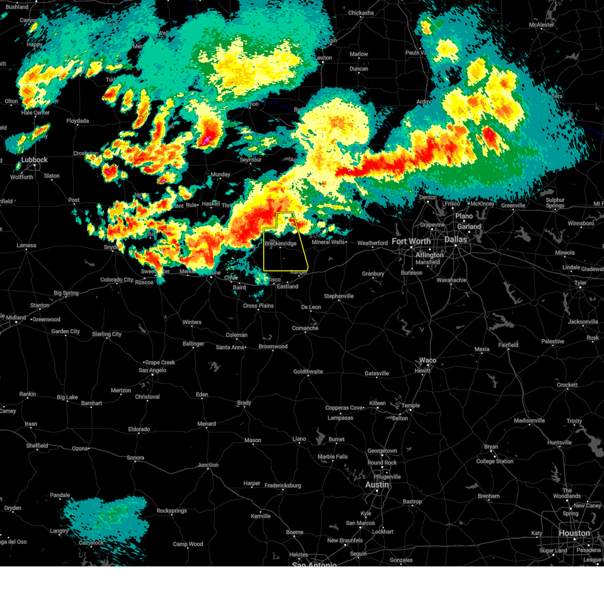 At 914 pm cdt, a severe thunderstorm was located over hubbard creek reservoir, or 8 miles northwest of breckenridge, moving southeast at 45 mph. this is a destructive storm for breckenridge (radar indicated). Hazards include 80 mph wind gusts and quarter size hail. Flying debris will be dangerous to those caught without shelter. mobile homes will be heavily damaged. expect considerable damage to roofs, windows, and vehicles. extensive tree damage and power outages are likely. this severe storm will be near, breckenridge and hubbard creek reservoir around 920 pm cdt. lake daniel around 930 pm cdt. necessity around 935 pm cdt. Other locations impacted by this severe thunderstorm include ivan, eliasville, eolian, murray, and harpersville. At 914 pm cdt, a severe thunderstorm was located over hubbard creek reservoir, or 8 miles northwest of breckenridge, moving southeast at 45 mph. this is a destructive storm for breckenridge (radar indicated). Hazards include 80 mph wind gusts and quarter size hail. Flying debris will be dangerous to those caught without shelter. mobile homes will be heavily damaged. expect considerable damage to roofs, windows, and vehicles. extensive tree damage and power outages are likely. this severe storm will be near, breckenridge and hubbard creek reservoir around 920 pm cdt. lake daniel around 930 pm cdt. necessity around 935 pm cdt. Other locations impacted by this severe thunderstorm include ivan, eliasville, eolian, murray, and harpersville.
|
| 6/8/2025 9:00 PM CDT |
 Svrfwd the national weather service in fort worth has issued a * severe thunderstorm warning for, southwestern young county in north central texas, stephens county in north central texas, * until 930 pm cdt. * at 858 pm cdt, a severe thunderstorm was located near fort griffin, or 16 miles south of throckmorton, moving southeast at 45 mph. this is a destructive storm for stephens county including the town of breckenridge (radar indicated). Hazards include 80 mph wind gusts and quarter size hail. Flying debris will be dangerous to those caught without shelter. mobile homes will be heavily damaged. expect considerable damage to roofs, windows, and vehicles. extensive tree damage and power outages are likely. this severe thunderstorm will be near, hubbard creek reservoir around 905 pm cdt. breckenridge around 915 pm cdt. Other locations impacted by this severe thunderstorm include ivan, eliasville, eolian, murray, and harpersville. Svrfwd the national weather service in fort worth has issued a * severe thunderstorm warning for, southwestern young county in north central texas, stephens county in north central texas, * until 930 pm cdt. * at 858 pm cdt, a severe thunderstorm was located near fort griffin, or 16 miles south of throckmorton, moving southeast at 45 mph. this is a destructive storm for stephens county including the town of breckenridge (radar indicated). Hazards include 80 mph wind gusts and quarter size hail. Flying debris will be dangerous to those caught without shelter. mobile homes will be heavily damaged. expect considerable damage to roofs, windows, and vehicles. extensive tree damage and power outages are likely. this severe thunderstorm will be near, hubbard creek reservoir around 905 pm cdt. breckenridge around 915 pm cdt. Other locations impacted by this severe thunderstorm include ivan, eliasville, eolian, murray, and harpersville.
|
| 6/8/2025 8:31 PM CDT |
 Svrfwd the national weather service in fort worth has issued a * severe thunderstorm warning for, young county in north central texas, stephens county in north central texas, western palo pinto county in north central texas, * until 930 pm cdt. * at 831 pm cdt, a severe thunderstorm was located 7 miles southwest of throckmorton, moving southeast at 45 mph (radar indicated). Hazards include 70 mph wind gusts and quarter size hail. Hail damage to vehicles is expected. expect considerable tree damage. wind damage is also likely to mobile homes, roofs, and outbuildings. this severe thunderstorm will be near, crystal falls around 855 pm cdt. caddo around 920 pm cdt. Other locations impacted by this severe thunderstorm include eliasville, ivan, eolian, newcastle, murray, jean, padgett, loving, south bend, and harpersville. Svrfwd the national weather service in fort worth has issued a * severe thunderstorm warning for, young county in north central texas, stephens county in north central texas, western palo pinto county in north central texas, * until 930 pm cdt. * at 831 pm cdt, a severe thunderstorm was located 7 miles southwest of throckmorton, moving southeast at 45 mph (radar indicated). Hazards include 70 mph wind gusts and quarter size hail. Hail damage to vehicles is expected. expect considerable tree damage. wind damage is also likely to mobile homes, roofs, and outbuildings. this severe thunderstorm will be near, crystal falls around 855 pm cdt. caddo around 920 pm cdt. Other locations impacted by this severe thunderstorm include eliasville, ivan, eolian, newcastle, murray, jean, padgett, loving, south bend, and harpersville.
|
| 6/3/2025 6:55 PM CDT |
 Svrfwd the national weather service in fort worth has issued a * severe thunderstorm warning for, southeastern stephens county in north central texas, southwestern palo pinto county in north central texas, * until 800 pm cdt. * at 655 pm cdt, a severe thunderstorm was located near necessity, or 9 miles east of breckenridge, moving east at 30 mph (radar indicated). Hazards include 60 mph wind gusts and quarter size hail. Hail damage to vehicles is expected. expect wind damage to roofs, siding, and trees. this severe thunderstorm will be near, caddo around 700 pm cdt. lake palo pinto around 740 pm cdt. gordon around 745 pm cdt. other locations impacted by this severe thunderstorm include mingus, strawn, lone camp, and thurber. This includes interstate 20 near mile marker 369. Svrfwd the national weather service in fort worth has issued a * severe thunderstorm warning for, southeastern stephens county in north central texas, southwestern palo pinto county in north central texas, * until 800 pm cdt. * at 655 pm cdt, a severe thunderstorm was located near necessity, or 9 miles east of breckenridge, moving east at 30 mph (radar indicated). Hazards include 60 mph wind gusts and quarter size hail. Hail damage to vehicles is expected. expect wind damage to roofs, siding, and trees. this severe thunderstorm will be near, caddo around 700 pm cdt. lake palo pinto around 740 pm cdt. gordon around 745 pm cdt. other locations impacted by this severe thunderstorm include mingus, strawn, lone camp, and thurber. This includes interstate 20 near mile marker 369.
|
| 6/3/2025 6:47 PM CDT |
 At 647 pm cdt, a severe thunderstorm was located near breckenridge, moving southeast at 25 mph (radar indicated). Hazards include 60 mph wind gusts and quarter size hail. Hail damage to vehicles is expected. expect wind damage to roofs, siding, and trees. This severe storm will be near, caddo around 700 pm cdt. At 647 pm cdt, a severe thunderstorm was located near breckenridge, moving southeast at 25 mph (radar indicated). Hazards include 60 mph wind gusts and quarter size hail. Hail damage to vehicles is expected. expect wind damage to roofs, siding, and trees. This severe storm will be near, caddo around 700 pm cdt.
|
| 6/3/2025 6:36 PM CDT |
 At 636 pm cdt, a severe thunderstorm was located over breckenridge, moving east at 30 mph (radar indicated). Hazards include 60 mph wind gusts and quarter size hail. Hail damage to vehicles is expected. expect wind damage to roofs, siding, and trees. this severe storm will be near, breckenridge around 640 pm cdt. caddo around 700 pm cdt. Other locations impacted by this severe thunderstorm include ivan. At 636 pm cdt, a severe thunderstorm was located over breckenridge, moving east at 30 mph (radar indicated). Hazards include 60 mph wind gusts and quarter size hail. Hail damage to vehicles is expected. expect wind damage to roofs, siding, and trees. this severe storm will be near, breckenridge around 640 pm cdt. caddo around 700 pm cdt. Other locations impacted by this severe thunderstorm include ivan.
|
| 6/3/2025 6:12 PM CDT |
 At 611 pm cdt, a severe thunderstorm was located near breckenridge, moving southeast at 25 mph (radar indicated). Hazards include 60 mph wind gusts and quarter size hail. Hail damage to vehicles is expected. expect wind damage to roofs, siding, and trees. This severe storm will be near, breckenridge around 615 pm cdt. At 611 pm cdt, a severe thunderstorm was located near breckenridge, moving southeast at 25 mph (radar indicated). Hazards include 60 mph wind gusts and quarter size hail. Hail damage to vehicles is expected. expect wind damage to roofs, siding, and trees. This severe storm will be near, breckenridge around 615 pm cdt.
|
| 6/3/2025 6:11 PM CDT |
 At 610 pm cdt, a severe thunderstorm was located near hubbard creek reservoir, or near breckenridge, moving southeast at 25 mph (radar indicated). Hazards include 60 mph wind gusts and quarter size hail. Hail damage to vehicles is expected. expect wind damage to roofs, siding, and trees. this severe storm will be near, breckenridge around 615 pm cdt. caddo around 645 pm cdt. Other locations impacted by this severe thunderstorm include ivan. At 610 pm cdt, a severe thunderstorm was located near hubbard creek reservoir, or near breckenridge, moving southeast at 25 mph (radar indicated). Hazards include 60 mph wind gusts and quarter size hail. Hail damage to vehicles is expected. expect wind damage to roofs, siding, and trees. this severe storm will be near, breckenridge around 615 pm cdt. caddo around 645 pm cdt. Other locations impacted by this severe thunderstorm include ivan.
|
| 6/3/2025 6:08 PM CDT |
 At 607 pm cdt, a severe thunderstorm was located near hubbard creek reservoir, or near breckenridge, moving east at 20 mph (radar indicated). Hazards include 60 mph wind gusts and quarter size hail. Hail damage to vehicles is expected. expect wind damage to roofs, siding, and trees. This severe storm will be near, breckenridge around 615 pm cdt. At 607 pm cdt, a severe thunderstorm was located near hubbard creek reservoir, or near breckenridge, moving east at 20 mph (radar indicated). Hazards include 60 mph wind gusts and quarter size hail. Hail damage to vehicles is expected. expect wind damage to roofs, siding, and trees. This severe storm will be near, breckenridge around 615 pm cdt.
|
| 6/3/2025 6:07 PM CDT |
 Svrfwd the national weather service in fort worth has issued a * severe thunderstorm warning for, central stephens county in north central texas, * until 700 pm cdt. * at 606 pm cdt, a severe thunderstorm was located near hubbard creek reservoir, or near breckenridge, moving east at 20 mph (radar indicated). Hazards include 60 mph wind gusts and quarter size hail. Hail damage to vehicles is expected. expect wind damage to roofs, siding, and trees. this severe thunderstorm will be near, breckenridge and hubbard creek reservoir around 610 pm cdt. caddo around 645 pm cdt. Other locations impacted by this severe thunderstorm include ivan. Svrfwd the national weather service in fort worth has issued a * severe thunderstorm warning for, central stephens county in north central texas, * until 700 pm cdt. * at 606 pm cdt, a severe thunderstorm was located near hubbard creek reservoir, or near breckenridge, moving east at 20 mph (radar indicated). Hazards include 60 mph wind gusts and quarter size hail. Hail damage to vehicles is expected. expect wind damage to roofs, siding, and trees. this severe thunderstorm will be near, breckenridge and hubbard creek reservoir around 610 pm cdt. caddo around 645 pm cdt. Other locations impacted by this severe thunderstorm include ivan.
|
| 6/3/2025 5:53 PM CDT |
 At 552 pm cdt, a severe thunderstorm was located near hubbard creek reservoir, or 9 miles northwest of breckenridge, moving southeast at 25 mph (radar indicated). Hazards include 60 mph wind gusts and half dollar size hail. Hail damage to vehicles is expected. expect wind damage to roofs, siding, and trees. this severe storm will be near, hubbard creek reservoir around 600 pm cdt. Breckenridge around 605 pm cdt. At 552 pm cdt, a severe thunderstorm was located near hubbard creek reservoir, or 9 miles northwest of breckenridge, moving southeast at 25 mph (radar indicated). Hazards include 60 mph wind gusts and half dollar size hail. Hail damage to vehicles is expected. expect wind damage to roofs, siding, and trees. this severe storm will be near, hubbard creek reservoir around 600 pm cdt. Breckenridge around 605 pm cdt.
|
| 6/3/2025 5:40 PM CDT |
 At 540 pm cdt, a severe thunderstorm was located 7 miles southeast of fort griffin, or 14 miles northwest of breckenridge, moving southeast at 20 mph (radar indicated). Hazards include two inch hail and 70 mph wind gusts. People and animals outdoors will be injured. expect hail damage to roofs, siding, windows, and vehicles. expect considerable tree damage. wind damage is also likely to mobile homes, roofs, and outbuildings. this severe storm will be near, hubbard creek reservoir around 545 pm cdt. Breckenridge around 605 pm cdt. At 540 pm cdt, a severe thunderstorm was located 7 miles southeast of fort griffin, or 14 miles northwest of breckenridge, moving southeast at 20 mph (radar indicated). Hazards include two inch hail and 70 mph wind gusts. People and animals outdoors will be injured. expect hail damage to roofs, siding, windows, and vehicles. expect considerable tree damage. wind damage is also likely to mobile homes, roofs, and outbuildings. this severe storm will be near, hubbard creek reservoir around 545 pm cdt. Breckenridge around 605 pm cdt.
|
| 6/3/2025 5:22 PM CDT |
 Svrfwd the national weather service in fort worth has issued a * severe thunderstorm warning for, northwestern stephens county in north central texas, * until 615 pm cdt. * at 520 pm cdt, a severe thunderstorm was located over fort griffin, or 14 miles north of albany, moving east at 25 mph (radar indicated). Hazards include golf ball size hail and 70 mph wind gusts. People and animals outdoors will be injured. expect hail damage to roofs, siding, windows, and vehicles. expect considerable tree damage. wind damage is also likely to mobile homes, roofs, and outbuildings. this severe thunderstorm will be near, hubbard creek reservoir around 545 pm cdt. Breckenridge around 610 pm cdt. Svrfwd the national weather service in fort worth has issued a * severe thunderstorm warning for, northwestern stephens county in north central texas, * until 615 pm cdt. * at 520 pm cdt, a severe thunderstorm was located over fort griffin, or 14 miles north of albany, moving east at 25 mph (radar indicated). Hazards include golf ball size hail and 70 mph wind gusts. People and animals outdoors will be injured. expect hail damage to roofs, siding, windows, and vehicles. expect considerable tree damage. wind damage is also likely to mobile homes, roofs, and outbuildings. this severe thunderstorm will be near, hubbard creek reservoir around 545 pm cdt. Breckenridge around 610 pm cdt.
|
| 5/26/2025 2:41 AM CDT |
 the severe thunderstorm warning has been cancelled and is no longer in effect the severe thunderstorm warning has been cancelled and is no longer in effect
|
| 5/26/2025 2:35 AM CDT |
 At 235 am cdt, a severe thunderstorm was located 8 miles west of possum kingdom state park, or 14 miles northeast of breckenridge, moving east at 35 mph (radar indicated). Hazards include 60 mph wind gusts and penny size hail. Expect damage to roofs, siding, and trees. this severe storm will be near, possum kingdom state park and possum kingdom lake around 240 am cdt. Other locations impacted by this severe thunderstorm include ivan, eliasville, and south bend. At 235 am cdt, a severe thunderstorm was located 8 miles west of possum kingdom state park, or 14 miles northeast of breckenridge, moving east at 35 mph (radar indicated). Hazards include 60 mph wind gusts and penny size hail. Expect damage to roofs, siding, and trees. this severe storm will be near, possum kingdom state park and possum kingdom lake around 240 am cdt. Other locations impacted by this severe thunderstorm include ivan, eliasville, and south bend.
|
| 5/26/2025 2:25 AM CDT |
 At 225 am cdt, a severe thunderstorm was located near crystal falls, or 9 miles northeast of breckenridge, moving east at 35 mph (radar indicated). Hazards include 60 mph wind gusts and nickel size hail. Expect damage to roofs, siding, and trees. this severe storm will be near, possum kingdom lake around 240 am cdt. possum kingdom state park around 245 am cdt. Other locations impacted by this severe thunderstorm include ivan, eliasville, eolian, south bend, and harpersville. At 225 am cdt, a severe thunderstorm was located near crystal falls, or 9 miles northeast of breckenridge, moving east at 35 mph (radar indicated). Hazards include 60 mph wind gusts and nickel size hail. Expect damage to roofs, siding, and trees. this severe storm will be near, possum kingdom lake around 240 am cdt. possum kingdom state park around 245 am cdt. Other locations impacted by this severe thunderstorm include ivan, eliasville, eolian, south bend, and harpersville.
|
| 5/26/2025 1:53 AM CDT |
 Svrfwd the national weather service in fort worth has issued a * severe thunderstorm warning for, southwestern young county in north central texas, stephens county in north central texas, northwestern palo pinto county in north central texas, * until 300 am cdt. * at 153 am cdt, a severe thunderstorm was located 7 miles west of hubbard creek reservoir, or 11 miles northeast of albany, moving east at 35 mph (radar indicated). Hazards include 60 mph wind gusts and nickel size hail. Expect damage to roofs, siding, and trees. this severe thunderstorm will be near, hubbard creek reservoir around 200 am cdt. crystal falls around 210 am cdt. possum kingdom lake around 240 am cdt. possum kingdom state park around 245 am cdt. Other locations impacted by this severe thunderstorm include ivan, eliasville, eolian, south bend, and harpersville. Svrfwd the national weather service in fort worth has issued a * severe thunderstorm warning for, southwestern young county in north central texas, stephens county in north central texas, northwestern palo pinto county in north central texas, * until 300 am cdt. * at 153 am cdt, a severe thunderstorm was located 7 miles west of hubbard creek reservoir, or 11 miles northeast of albany, moving east at 35 mph (radar indicated). Hazards include 60 mph wind gusts and nickel size hail. Expect damage to roofs, siding, and trees. this severe thunderstorm will be near, hubbard creek reservoir around 200 am cdt. crystal falls around 210 am cdt. possum kingdom lake around 240 am cdt. possum kingdom state park around 245 am cdt. Other locations impacted by this severe thunderstorm include ivan, eliasville, eolian, south bend, and harpersville.
|
| 5/22/2025 8:53 PM CDT |
 Svrfwd the national weather service in fort worth has issued a * severe thunderstorm warning for, eastland county in north central texas, stephens county in north central texas, * until 945 pm cdt. * at 852 pm cdt, severe thunderstorms were located along a line extending from caddo to near moran, moving south at 30 mph (radar indicated). Hazards include 60 mph wind gusts and quarter size hail. Hail damage to vehicles is expected. expect wind damage to roofs, siding, and trees. severe thunderstorms will be near, necessity, gunsight, and lake daniel around 855 pm cdt. lake cisco around 900 pm cdt. cisco around 905 pm cdt. ranger and palo pinto mountains state park around 910 pm cdt. eastland around 915 pm cdt. lake olden around 920 pm cdt. lake leon around 925 pm cdt. other locations impacted by these severe thunderstorms include nimrod, kokomo, staff, carbon, okra, harpersville, morton valley, pleasant hill, pioneer, and ivan. This includes interstate 20 between mile markers 324 and 362. Svrfwd the national weather service in fort worth has issued a * severe thunderstorm warning for, eastland county in north central texas, stephens county in north central texas, * until 945 pm cdt. * at 852 pm cdt, severe thunderstorms were located along a line extending from caddo to near moran, moving south at 30 mph (radar indicated). Hazards include 60 mph wind gusts and quarter size hail. Hail damage to vehicles is expected. expect wind damage to roofs, siding, and trees. severe thunderstorms will be near, necessity, gunsight, and lake daniel around 855 pm cdt. lake cisco around 900 pm cdt. cisco around 905 pm cdt. ranger and palo pinto mountains state park around 910 pm cdt. eastland around 915 pm cdt. lake olden around 920 pm cdt. lake leon around 925 pm cdt. other locations impacted by these severe thunderstorms include nimrod, kokomo, staff, carbon, okra, harpersville, morton valley, pleasant hill, pioneer, and ivan. This includes interstate 20 between mile markers 324 and 362.
|
| 5/18/2025 7:27 PM CDT |
 At 725 pm cdt, a severe thunderstorm was located near strawn, or 15 miles northeast of ranger, moving east at 30 mph. another severe thunderstorm was located 5 miles northwest of tiffin, moving east at 30 mph (radar indicated. at 716 pm cdt...tennis ball size hail was reported in la casa with these storms). Hazards include tennis ball size hail and 60 mph wind gusts. People and animals outdoors will be injured. expect hail damage to roofs, siding, windows, and vehicles. expect wind damage to roofs, siding, and trees. Locations impacted include, gordon, ranger, palo pinto, santo, patillo, necessity, mineral wells, caddo, lake palo pinto, breckenridge, morton valley, mingus, lake daniel, new salem, thurber, brazos, salesville, gunsight, lone camp, and strawn. At 725 pm cdt, a severe thunderstorm was located near strawn, or 15 miles northeast of ranger, moving east at 30 mph. another severe thunderstorm was located 5 miles northwest of tiffin, moving east at 30 mph (radar indicated. at 716 pm cdt...tennis ball size hail was reported in la casa with these storms). Hazards include tennis ball size hail and 60 mph wind gusts. People and animals outdoors will be injured. expect hail damage to roofs, siding, windows, and vehicles. expect wind damage to roofs, siding, and trees. Locations impacted include, gordon, ranger, palo pinto, santo, patillo, necessity, mineral wells, caddo, lake palo pinto, breckenridge, morton valley, mingus, lake daniel, new salem, thurber, brazos, salesville, gunsight, lone camp, and strawn.
|
| 5/18/2025 6:55 PM CDT |
 Svrfwd the national weather service in fort worth has issued a * severe thunderstorm warning for, northwestern erath county in north central texas, northeastern eastland county in north central texas, stephens county in north central texas, palo pinto county in north central texas, * until 815 pm cdt. * at 654 pm cdt, a severe thunderstorm was located near necessity, or 8 miles northwest of ranger, moving east at 30 mph. another severe thunderstorm was located 5 miles southwest of breckenridge, moving east at 30 mph. this is a destructive storm for stephens, palo pinto, north eastland, and north erath counties (radar indicated). Hazards include baseball size hail and 70 mph wind gusts. People and animals outdoors will be severely injured. Expect shattered windows, extensive damage to roofs, siding, and vehicles. Svrfwd the national weather service in fort worth has issued a * severe thunderstorm warning for, northwestern erath county in north central texas, northeastern eastland county in north central texas, stephens county in north central texas, palo pinto county in north central texas, * until 815 pm cdt. * at 654 pm cdt, a severe thunderstorm was located near necessity, or 8 miles northwest of ranger, moving east at 30 mph. another severe thunderstorm was located 5 miles southwest of breckenridge, moving east at 30 mph. this is a destructive storm for stephens, palo pinto, north eastland, and north erath counties (radar indicated). Hazards include baseball size hail and 70 mph wind gusts. People and animals outdoors will be severely injured. Expect shattered windows, extensive damage to roofs, siding, and vehicles.
|
| 5/18/2025 5:20 PM CDT |
 Svrfwd the national weather service in fort worth has issued a * severe thunderstorm warning for, southwestern young county in north central texas, northern stephens county in north central texas, * until 630 pm cdt. * at 519 pm cdt, a severe thunderstorm was located near albany, moving east at 25 mph (radar indicated). Hazards include golf ball size hail and 60 mph wind gusts. People and animals outdoors will be injured. expect hail damage to roofs, siding, windows, and vehicles. Expect wind damage to roofs, siding, and trees. Svrfwd the national weather service in fort worth has issued a * severe thunderstorm warning for, southwestern young county in north central texas, northern stephens county in north central texas, * until 630 pm cdt. * at 519 pm cdt, a severe thunderstorm was located near albany, moving east at 25 mph (radar indicated). Hazards include golf ball size hail and 60 mph wind gusts. People and animals outdoors will be injured. expect hail damage to roofs, siding, windows, and vehicles. Expect wind damage to roofs, siding, and trees.
|
| 5/6/2025 5:36 AM CDT |
 Svrfwd the national weather service in fort worth has issued a * severe thunderstorm warning for, young county in north central texas, northwestern stephens county in north central texas, * until 630 am cdt. * at 536 am cdt, a severe thunderstorm was located near hubbard creek reservoir, or 10 miles west of breckenridge, moving northeast at 40 mph (radar indicated). Hazards include 60 mph wind gusts and half dollar size hail. Hail damage to vehicles is expected. expect wind damage to roofs, siding, and trees. this severe thunderstorm will be near, hubbard creek reservoir around 540 am cdt. Other locations impacted by this severe thunderstorm include eliasville, newcastle, murray, padgett, south bend, and eolian. Svrfwd the national weather service in fort worth has issued a * severe thunderstorm warning for, young county in north central texas, northwestern stephens county in north central texas, * until 630 am cdt. * at 536 am cdt, a severe thunderstorm was located near hubbard creek reservoir, or 10 miles west of breckenridge, moving northeast at 40 mph (radar indicated). Hazards include 60 mph wind gusts and half dollar size hail. Hail damage to vehicles is expected. expect wind damage to roofs, siding, and trees. this severe thunderstorm will be near, hubbard creek reservoir around 540 am cdt. Other locations impacted by this severe thunderstorm include eliasville, newcastle, murray, padgett, south bend, and eolian.
|
| 4/19/2025 10:44 PM CDT |
 Svrfwd the national weather service in fort worth has issued a * severe thunderstorm warning for, young county in north central texas, western jack county in north central texas, northeastern stephens county in north central texas, northwestern palo pinto county in north central texas, * until 1130 pm cdt. * at 1043 pm cdt, severe thunderstorms were located along a line extending from near olney to near necessity, moving east at 40 mph (radar indicated). Hazards include 60 mph wind gusts. Expect damage to roofs, siding, and trees. severe thunderstorms will be near, lake graham, olney, caddo, and possum kingdom lake around 1050 pm cdt. possum kingdom state park and graham around 1055 pm cdt. bryson around 1110 pm cdt. palo pinto around 1115 pm cdt. Other locations impacted by these severe thunderstorms include jermyn, eliasville, antelope, ivan, newcastle, lone camp, murray, jean, padgett, and loving. Svrfwd the national weather service in fort worth has issued a * severe thunderstorm warning for, young county in north central texas, western jack county in north central texas, northeastern stephens county in north central texas, northwestern palo pinto county in north central texas, * until 1130 pm cdt. * at 1043 pm cdt, severe thunderstorms were located along a line extending from near olney to near necessity, moving east at 40 mph (radar indicated). Hazards include 60 mph wind gusts. Expect damage to roofs, siding, and trees. severe thunderstorms will be near, lake graham, olney, caddo, and possum kingdom lake around 1050 pm cdt. possum kingdom state park and graham around 1055 pm cdt. bryson around 1110 pm cdt. palo pinto around 1115 pm cdt. Other locations impacted by these severe thunderstorms include jermyn, eliasville, antelope, ivan, newcastle, lone camp, murray, jean, padgett, and loving.
|
| 4/19/2025 10:40 PM CDT |
 the severe thunderstorm warning has been cancelled and is no longer in effect the severe thunderstorm warning has been cancelled and is no longer in effect
|
| 4/19/2025 10:15 PM CDT |
 Svrfwd the national weather service in fort worth has issued a * severe thunderstorm warning for, northern eastland county in north central texas, stephens county in north central texas, western palo pinto county in north central texas, * until 1115 pm cdt. * at 1014 pm cdt, a severe thunderstorm was located 7 miles southwest of breckenridge, moving east at 30 mph (radar indicated). Hazards include 60 mph wind gusts and quarter size hail. Hail damage to vehicles is expected. expect wind damage to roofs, siding, and trees. this severe thunderstorm will be near, lake daniel around 1020 pm cdt. breckenridge around 1025 pm cdt. caddo around 1040 pm cdt. other locations impacted by this severe thunderstorm include morton valley, staff, ivan, eolian, olden, strawn, harpersville, and eliasville. This includes interstate 20 between mile markers 324 and 363. Svrfwd the national weather service in fort worth has issued a * severe thunderstorm warning for, northern eastland county in north central texas, stephens county in north central texas, western palo pinto county in north central texas, * until 1115 pm cdt. * at 1014 pm cdt, a severe thunderstorm was located 7 miles southwest of breckenridge, moving east at 30 mph (radar indicated). Hazards include 60 mph wind gusts and quarter size hail. Hail damage to vehicles is expected. expect wind damage to roofs, siding, and trees. this severe thunderstorm will be near, lake daniel around 1020 pm cdt. breckenridge around 1025 pm cdt. caddo around 1040 pm cdt. other locations impacted by this severe thunderstorm include morton valley, staff, ivan, eolian, olden, strawn, harpersville, and eliasville. This includes interstate 20 between mile markers 324 and 363.
|
| 4/19/2025 6:34 PM CDT |
 the severe thunderstorm warning has been cancelled and is no longer in effect the severe thunderstorm warning has been cancelled and is no longer in effect
|
| 4/19/2025 6:17 PM CDT |
 Svrfwd the national weather service in fort worth has issued a * severe thunderstorm warning for, young county in north central texas, northern stephens county in north central texas, * until 715 pm cdt. * at 617 pm cdt, a severe thunderstorm was located over crystal falls, or 10 miles north of breckenridge, moving northeast at 60 mph (radar indicated). Hazards include two inch hail and 60 mph wind gusts. People and animals outdoors will be injured. expect hail damage to roofs, siding, windows, and vehicles. expect wind damage to roofs, siding, and trees. this severe thunderstorm will be near, crystal falls around 620 pm cdt. lake graham around 640 pm cdt. Other locations impacted by this severe thunderstorm include eliasville, ivan, newcastle, murray, jean, padgett, loving, and south bend. Svrfwd the national weather service in fort worth has issued a * severe thunderstorm warning for, young county in north central texas, northern stephens county in north central texas, * until 715 pm cdt. * at 617 pm cdt, a severe thunderstorm was located over crystal falls, or 10 miles north of breckenridge, moving northeast at 60 mph (radar indicated). Hazards include two inch hail and 60 mph wind gusts. People and animals outdoors will be injured. expect hail damage to roofs, siding, windows, and vehicles. expect wind damage to roofs, siding, and trees. this severe thunderstorm will be near, crystal falls around 620 pm cdt. lake graham around 640 pm cdt. Other locations impacted by this severe thunderstorm include eliasville, ivan, newcastle, murray, jean, padgett, loving, and south bend.
|
| 4/19/2025 6:05 PM CDT | Hen Egg sized hail reported 5.9 miles E of Breckenridge, TX, 2 inch diameter hail reported on hubbard creek lake. |
| 4/19/2025 2:18 AM CDT |
 Svrfwd the national weather service in fort worth has issued a * severe thunderstorm warning for, southwestern young county in north central texas, northwestern eastland county in north central texas, stephens county in north central texas, southwestern palo pinto county in north central texas, * until 315 am cdt. * at 217 am cdt, a severe thunderstorm was located near putnam, or 8 miles east of baird, moving northeast at 60 mph (radar indicated). Hazards include 65 mph wind gusts and quarter size hail. Hail damage to vehicles is expected. expect wind damage to roofs, siding, and trees. this severe thunderstorm will be near, lake daniel around 240 am cdt. breckenridge around 245 am cdt. other locations impacted by this severe thunderstorm include morton valley, eliasville, nimrod, ivan, scranton, eolian, murray, olden, strawn, and harpersville. This includes interstate 20 between mile markers 324 and 340, and between mile markers 343 and 345. Svrfwd the national weather service in fort worth has issued a * severe thunderstorm warning for, southwestern young county in north central texas, northwestern eastland county in north central texas, stephens county in north central texas, southwestern palo pinto county in north central texas, * until 315 am cdt. * at 217 am cdt, a severe thunderstorm was located near putnam, or 8 miles east of baird, moving northeast at 60 mph (radar indicated). Hazards include 65 mph wind gusts and quarter size hail. Hail damage to vehicles is expected. expect wind damage to roofs, siding, and trees. this severe thunderstorm will be near, lake daniel around 240 am cdt. breckenridge around 245 am cdt. other locations impacted by this severe thunderstorm include morton valley, eliasville, nimrod, ivan, scranton, eolian, murray, olden, strawn, and harpersville. This includes interstate 20 between mile markers 324 and 340, and between mile markers 343 and 345.
|
| 4/5/2025 2:36 AM CDT |
 the severe thunderstorm warning has been cancelled and is no longer in effect the severe thunderstorm warning has been cancelled and is no longer in effect
|
| 4/5/2025 2:23 AM CDT |
 At 222 am cdt, a severe thunderstorm was located over caddo, or 13 miles east of breckenridge, moving northeast at 55 mph (radar indicated). Hazards include 60 mph wind gusts and quarter size hail. Hail damage to vehicles is expected. expect wind damage to roofs, siding, and trees. Locations impacted include, possum kingdom lake, lake graham, graham, palo pinto, necessity, caddo, lake palo pinto, breckenridge, eliasville, possum kingdom state park, ivan, lone camp, strawn, south bend, palo pinto mountains state park, hubbard creek reservoir, and mineral wells. At 222 am cdt, a severe thunderstorm was located over caddo, or 13 miles east of breckenridge, moving northeast at 55 mph (radar indicated). Hazards include 60 mph wind gusts and quarter size hail. Hail damage to vehicles is expected. expect wind damage to roofs, siding, and trees. Locations impacted include, possum kingdom lake, lake graham, graham, palo pinto, necessity, caddo, lake palo pinto, breckenridge, eliasville, possum kingdom state park, ivan, lone camp, strawn, south bend, palo pinto mountains state park, hubbard creek reservoir, and mineral wells.
|
| 4/5/2025 2:23 AM CDT |
 the severe thunderstorm warning has been cancelled and is no longer in effect the severe thunderstorm warning has been cancelled and is no longer in effect
|
| 4/5/2025 2:09 AM CDT |
 Svrfwd the national weather service in fort worth has issued a * severe thunderstorm warning for, southeastern young county in north central texas, north central eastland county in north central texas, stephens county in north central texas, palo pinto county in north central texas, * until 300 am cdt. * at 208 am cdt, a severe thunderstorm was located over lake daniel, or 11 miles south of breckenridge, moving northeast at 55 mph (radar indicated). Hazards include 60 mph wind gusts and half dollar size hail. Hail damage to vehicles is expected. Expect wind damage to roofs, siding, and trees. Svrfwd the national weather service in fort worth has issued a * severe thunderstorm warning for, southeastern young county in north central texas, north central eastland county in north central texas, stephens county in north central texas, palo pinto county in north central texas, * until 300 am cdt. * at 208 am cdt, a severe thunderstorm was located over lake daniel, or 11 miles south of breckenridge, moving northeast at 55 mph (radar indicated). Hazards include 60 mph wind gusts and half dollar size hail. Hail damage to vehicles is expected. Expect wind damage to roofs, siding, and trees.
|
| 4/5/2025 2:03 AM CDT |
 At 203 am cdt, a severe thunderstorm was located over gunsight, or 11 miles south of breckenridge, moving northeast at 60 mph (radar indicated). Hazards include 60 mph wind gusts and half dollar size hail. Hail damage to vehicles is expected. expect wind damage to roofs, siding, and trees. Locations impacted include, lake cisco, necessity, harpersville, breckenridge, morton valley, lake daniel, cisco, eolian, gunsight, eastland, palo pinto mountains state park, hubbard creek reservoir, and ranger. At 203 am cdt, a severe thunderstorm was located over gunsight, or 11 miles south of breckenridge, moving northeast at 60 mph (radar indicated). Hazards include 60 mph wind gusts and half dollar size hail. Hail damage to vehicles is expected. expect wind damage to roofs, siding, and trees. Locations impacted include, lake cisco, necessity, harpersville, breckenridge, morton valley, lake daniel, cisco, eolian, gunsight, eastland, palo pinto mountains state park, hubbard creek reservoir, and ranger.
|
| 4/5/2025 1:35 AM CDT |
 Svrfwd the national weather service in fort worth has issued a * severe thunderstorm warning for, northwestern eastland county in north central texas, southwestern stephens county in north central texas, * until 215 am cdt. * at 134 am cdt, a severe thunderstorm was located near baird, moving northeast at 55 mph (radar indicated). Hazards include 60 mph wind gusts and quarter size hail. Hail damage to vehicles is expected. Expect wind damage to roofs, siding, and trees. Svrfwd the national weather service in fort worth has issued a * severe thunderstorm warning for, northwestern eastland county in north central texas, southwestern stephens county in north central texas, * until 215 am cdt. * at 134 am cdt, a severe thunderstorm was located near baird, moving northeast at 55 mph (radar indicated). Hazards include 60 mph wind gusts and quarter size hail. Hail damage to vehicles is expected. Expect wind damage to roofs, siding, and trees.
|
| 4/3/2025 6:18 AM CDT |
 Svrfwd the national weather service in fort worth has issued a * severe thunderstorm warning for, northwestern erath county in north central texas, northeastern eastland county in north central texas, stephens county in north central texas, palo pinto county in north central texas, * until 715 am cdt. * at 617 am cdt, a severe thunderstorm was located near breckenridge and strawn, moving east at 35 mph (radar indicated). Hazards include two inch hail and 65 mph wind gusts. People and animals outdoors will be injured. expect hail damage to roofs, siding, windows, and vehicles. Expect wind damage to roofs, siding, and trees. Svrfwd the national weather service in fort worth has issued a * severe thunderstorm warning for, northwestern erath county in north central texas, northeastern eastland county in north central texas, stephens county in north central texas, palo pinto county in north central texas, * until 715 am cdt. * at 617 am cdt, a severe thunderstorm was located near breckenridge and strawn, moving east at 35 mph (radar indicated). Hazards include two inch hail and 65 mph wind gusts. People and animals outdoors will be injured. expect hail damage to roofs, siding, windows, and vehicles. Expect wind damage to roofs, siding, and trees.
|
| 3/4/2025 3:08 AM CST |
 Svrfwd the national weather service in fort worth has issued a * severe thunderstorm warning for, eastland county in north central texas, stephens county in north central texas, * until 400 am cst. * at 307 am cst, severe thunderstorms were located along a line extending from near woodson to near ibex to oplin, moving east at 45 mph (radar indicated). Hazards include 65 mph wind gusts. Expect damage to roofs, siding, and trees. severe thunderstorms will be near, breckenridge and hubbard creek reservoir around 315 am cst. lake cisco and crystal falls around 320 am cst. cisco and lake daniel around 325 am cst. necessity and gunsight around 330 am cst. eastland, caddo, and possum kingdom lake around 340 am cst. lake leon, ranger, palo pinto mountains state park, and lake olden around 345 am cst. other locations impacted by these severe thunderstorms include nimrod, kokomo, staff, carbon, okra, harpersville, morton valley, pleasant hill, pioneer, and ivan. This includes interstate 20 between mile markers 324 and 363. Svrfwd the national weather service in fort worth has issued a * severe thunderstorm warning for, eastland county in north central texas, stephens county in north central texas, * until 400 am cst. * at 307 am cst, severe thunderstorms were located along a line extending from near woodson to near ibex to oplin, moving east at 45 mph (radar indicated). Hazards include 65 mph wind gusts. Expect damage to roofs, siding, and trees. severe thunderstorms will be near, breckenridge and hubbard creek reservoir around 315 am cst. lake cisco and crystal falls around 320 am cst. cisco and lake daniel around 325 am cst. necessity and gunsight around 330 am cst. eastland, caddo, and possum kingdom lake around 340 am cst. lake leon, ranger, palo pinto mountains state park, and lake olden around 345 am cst. other locations impacted by these severe thunderstorms include nimrod, kokomo, staff, carbon, okra, harpersville, morton valley, pleasant hill, pioneer, and ivan. This includes interstate 20 between mile markers 324 and 363.
|
| 3/4/2025 2:42 AM CST |
 The storms which prompted the warning have weakened below severe limits. therefore the warning will be allowed to expire. however small hail and gusty winds are still possible with these thunderstorms. a tornado watch remains in effect until 500 am cst for north central texas. The storms which prompted the warning have weakened below severe limits. therefore the warning will be allowed to expire. however small hail and gusty winds are still possible with these thunderstorms. a tornado watch remains in effect until 500 am cst for north central texas.
|
| 3/4/2025 2:20 AM CST |
 At 219 am cst, severe thunderstorms were located along a line extending from 14 miles south of windthorst to near woodson, moving northeast at 60 mph (radar indicated). Hazards include 60 mph wind gusts and quarter size hail. Hail damage to vehicles is expected. expect wind damage to roofs, siding, and trees. these severe storms will be near, lake graham around 225 am cst. Other locations impacted by these severe thunderstorms include eliasville, ivan, newcastle, murray, jean, loving, and south bend. At 219 am cst, severe thunderstorms were located along a line extending from 14 miles south of windthorst to near woodson, moving northeast at 60 mph (radar indicated). Hazards include 60 mph wind gusts and quarter size hail. Hail damage to vehicles is expected. expect wind damage to roofs, siding, and trees. these severe storms will be near, lake graham around 225 am cst. Other locations impacted by these severe thunderstorms include eliasville, ivan, newcastle, murray, jean, loving, and south bend.
|
| 3/4/2025 2:06 AM CST |
 Svrfwd the national weather service in fort worth has issued a * severe thunderstorm warning for, young county in north central texas, northern stephens county in north central texas, * until 245 am cst. * at 205 am cst, a severe thunderstorm was located 7 miles northwest of hubbard creek reservoir, or 13 miles northwest of breckenridge, moving northeast at 60 mph (radar indicated). Hazards include 60 mph wind gusts and quarter size hail. Hail damage to vehicles is expected. expect wind damage to roofs, siding, and trees. this severe thunderstorm will be near, lake graham around 230 am cst. Other locations impacted by this severe thunderstorm include eliasville, ivan, newcastle, murray, jean, loving, and south bend. Svrfwd the national weather service in fort worth has issued a * severe thunderstorm warning for, young county in north central texas, northern stephens county in north central texas, * until 245 am cst. * at 205 am cst, a severe thunderstorm was located 7 miles northwest of hubbard creek reservoir, or 13 miles northwest of breckenridge, moving northeast at 60 mph (radar indicated). Hazards include 60 mph wind gusts and quarter size hail. Hail damage to vehicles is expected. expect wind damage to roofs, siding, and trees. this severe thunderstorm will be near, lake graham around 230 am cst. Other locations impacted by this severe thunderstorm include eliasville, ivan, newcastle, murray, jean, loving, and south bend.
|
| 11/7/2024 11:51 AM CST |
 Svrfwd the national weather service in fort worth has issued a * severe thunderstorm warning for, southwestern young county in north central texas, northwestern stephens county in north central texas, * until 1230 pm cst. * at 1151 am cst, a severe thunderstorm was located over crystal falls, or near breckenridge, moving north at 25 mph (radar indicated). Hazards include quarter size hail. Damage to vehicles is possible. this severe thunderstorm will be near, crystal falls around 1155 am cst. Other locations impacted by this severe thunderstorm include ivan, eliasville, murray, and south bend. Svrfwd the national weather service in fort worth has issued a * severe thunderstorm warning for, southwestern young county in north central texas, northwestern stephens county in north central texas, * until 1230 pm cst. * at 1151 am cst, a severe thunderstorm was located over crystal falls, or near breckenridge, moving north at 25 mph (radar indicated). Hazards include quarter size hail. Damage to vehicles is possible. this severe thunderstorm will be near, crystal falls around 1155 am cst. Other locations impacted by this severe thunderstorm include ivan, eliasville, murray, and south bend.
|
| 11/3/2024 12:59 PM CST |
 Svrfwd the national weather service in fort worth has issued a * severe thunderstorm warning for, young county in north central texas, stephens county in north central texas, * until 145 pm cst. * at 1259 pm cst, a severe thunderstorm was located near throckmorton, moving northeast at 50 mph (radar indicated). Hazards include 60 mph wind gusts and penny size hail. Expect damage to roofs, siding, and trees. This severe thunderstorm will remain over mainly rural areas of young and stephens counties, including the following locations, eliasville, ivan, eolian, newcastle, jean, padgett, murray, loving, and south bend. Svrfwd the national weather service in fort worth has issued a * severe thunderstorm warning for, young county in north central texas, stephens county in north central texas, * until 145 pm cst. * at 1259 pm cst, a severe thunderstorm was located near throckmorton, moving northeast at 50 mph (radar indicated). Hazards include 60 mph wind gusts and penny size hail. Expect damage to roofs, siding, and trees. This severe thunderstorm will remain over mainly rural areas of young and stephens counties, including the following locations, eliasville, ivan, eolian, newcastle, jean, padgett, murray, loving, and south bend.
|
| 5/9/2024 2:01 PM CDT |
 Svrfwd the national weather service in fort worth has issued a * severe thunderstorm warning for, northern eastland county in north central texas, stephens county in north central texas, * until 300 pm cdt. * at 159 pm cdt, a severe thunderstorm was located near moran, or 15 miles southeast of albany, moving east at 35 mph (radar indicated). Hazards include 60 mph wind gusts and quarter size hail. Hail damage to vehicles is expected. expect wind damage to roofs, siding, and trees. this severe thunderstorm will be near, lake daniel around 215 pm cdt. necessity around 225 pm cdt. Other locations impacted by this severe thunderstorm include eolian, harpersville, and morton valley. Svrfwd the national weather service in fort worth has issued a * severe thunderstorm warning for, northern eastland county in north central texas, stephens county in north central texas, * until 300 pm cdt. * at 159 pm cdt, a severe thunderstorm was located near moran, or 15 miles southeast of albany, moving east at 35 mph (radar indicated). Hazards include 60 mph wind gusts and quarter size hail. Hail damage to vehicles is expected. expect wind damage to roofs, siding, and trees. this severe thunderstorm will be near, lake daniel around 215 pm cdt. necessity around 225 pm cdt. Other locations impacted by this severe thunderstorm include eolian, harpersville, and morton valley.
|
| 5/2/2024 12:03 AM CDT |
 At 1203 am cdt, severe thunderstorms were located along a line extending from near hubbard creek reservoir to near gunsight, moving northeast at 30 mph (radar indicated). Hazards include 60 mph wind gusts and nickel size hail. Expect damage to roofs, siding, and trees. these severe storms will be near, breckenridge 1210 am cdt. necessity around 1215 am cdt. crystal falls around 1220 am cdt. caddo around 1230 am cdt. Other locations impacted by these severe thunderstorms include ivan, eolian, and harpersville. At 1203 am cdt, severe thunderstorms were located along a line extending from near hubbard creek reservoir to near gunsight, moving northeast at 30 mph (radar indicated). Hazards include 60 mph wind gusts and nickel size hail. Expect damage to roofs, siding, and trees. these severe storms will be near, breckenridge 1210 am cdt. necessity around 1215 am cdt. crystal falls around 1220 am cdt. caddo around 1230 am cdt. Other locations impacted by these severe thunderstorms include ivan, eolian, and harpersville.
|
| 5/1/2024 11:40 PM CDT |
 Svrfwd the national weather service in fort worth has issued a * severe thunderstorm warning for, northwestern eastland county in north central texas, stephens county in north central texas, * until 1230 am cdt. * at 1139 pm cdt, severe thunderstorms were located along a line extending from near albany to near moran, moving northeast at 45 mph (radar indicated). Hazards include 60 mph wind gusts and nickel size hail. Expect damage to roofs, siding, and trees. severe thunderstorms will be near, hubbard creek reservoir around 1150 pm cdt. breckenridge around 1200 am cdt. crystal falls around 1210 am cdt. Other locations impacted by these severe thunderstorms include ivan, eolian, and harpersville. Svrfwd the national weather service in fort worth has issued a * severe thunderstorm warning for, northwestern eastland county in north central texas, stephens county in north central texas, * until 1230 am cdt. * at 1139 pm cdt, severe thunderstorms were located along a line extending from near albany to near moran, moving northeast at 45 mph (radar indicated). Hazards include 60 mph wind gusts and nickel size hail. Expect damage to roofs, siding, and trees. severe thunderstorms will be near, hubbard creek reservoir around 1150 pm cdt. breckenridge around 1200 am cdt. crystal falls around 1210 am cdt. Other locations impacted by these severe thunderstorms include ivan, eolian, and harpersville.
|
| 4/28/2024 1:10 AM CDT |
 At 109 am cdt, severe thunderstorms were located along a line extending from jacksboro to graford to caddo, moving east at 45 mph (radar indicated). Hazards include 60 mph wind gusts and quarter size hail. Hail damage to vehicles is expected. expect wind damage to roofs, siding, and trees. these severe storms will be near, graford and possum kingdom lake around 115 am cdt. palo pinto and lake bridgeport around 120 am cdt. mineral wells around 125 am cdt. lake palo pinto around 135 am cdt. Other locations impacted by these severe thunderstorms include jermyn, lost creek reservoir, cundiff, loving, harpersville, gibtown, joplin, eliasville, perrin, and bartons chapel. At 109 am cdt, severe thunderstorms were located along a line extending from jacksboro to graford to caddo, moving east at 45 mph (radar indicated). Hazards include 60 mph wind gusts and quarter size hail. Hail damage to vehicles is expected. expect wind damage to roofs, siding, and trees. these severe storms will be near, graford and possum kingdom lake around 115 am cdt. palo pinto and lake bridgeport around 120 am cdt. mineral wells around 125 am cdt. lake palo pinto around 135 am cdt. Other locations impacted by these severe thunderstorms include jermyn, lost creek reservoir, cundiff, loving, harpersville, gibtown, joplin, eliasville, perrin, and bartons chapel.
|
| 4/28/2024 12:42 AM CDT |
 Svrfwd the national weather service in fort worth has issued a * severe thunderstorm warning for, young county in north central texas, jack county in north central texas, stephens county in north central texas, palo pinto county in north central texas, * until 145 am cdt. * at 1241 am cdt, severe thunderstorms were located along a line extending from near lake graham to near possum kingdom state park to near ibex, moving east at 50 mph (radar indicated). Hazards include 60 mph wind gusts and quarter size hail. Hail damage to vehicles is expected. expect wind damage to roofs, siding, and trees. severe thunderstorms will be near, graham, breckenridge, possum kingdom state park, lake daniel, and possum kingdom lake around 1245 am cdt. bryson around 1250 am cdt. necessity and caddo around 1255 am cdt. graford around 105 am cdt. jacksboro and fort richardson state park around 110 am cdt. palo pinto around 120 am cdt. mineral wells and lake bridgeport around 125 am cdt. Lake palo pinto around 130 am cdt. Svrfwd the national weather service in fort worth has issued a * severe thunderstorm warning for, young county in north central texas, jack county in north central texas, stephens county in north central texas, palo pinto county in north central texas, * until 145 am cdt. * at 1241 am cdt, severe thunderstorms were located along a line extending from near lake graham to near possum kingdom state park to near ibex, moving east at 50 mph (radar indicated). Hazards include 60 mph wind gusts and quarter size hail. Hail damage to vehicles is expected. expect wind damage to roofs, siding, and trees. severe thunderstorms will be near, graham, breckenridge, possum kingdom state park, lake daniel, and possum kingdom lake around 1245 am cdt. bryson around 1250 am cdt. necessity and caddo around 1255 am cdt. graford around 105 am cdt. jacksboro and fort richardson state park around 110 am cdt. palo pinto around 120 am cdt. mineral wells and lake bridgeport around 125 am cdt. Lake palo pinto around 130 am cdt.
|
| 4/28/2024 12:06 AM CDT |
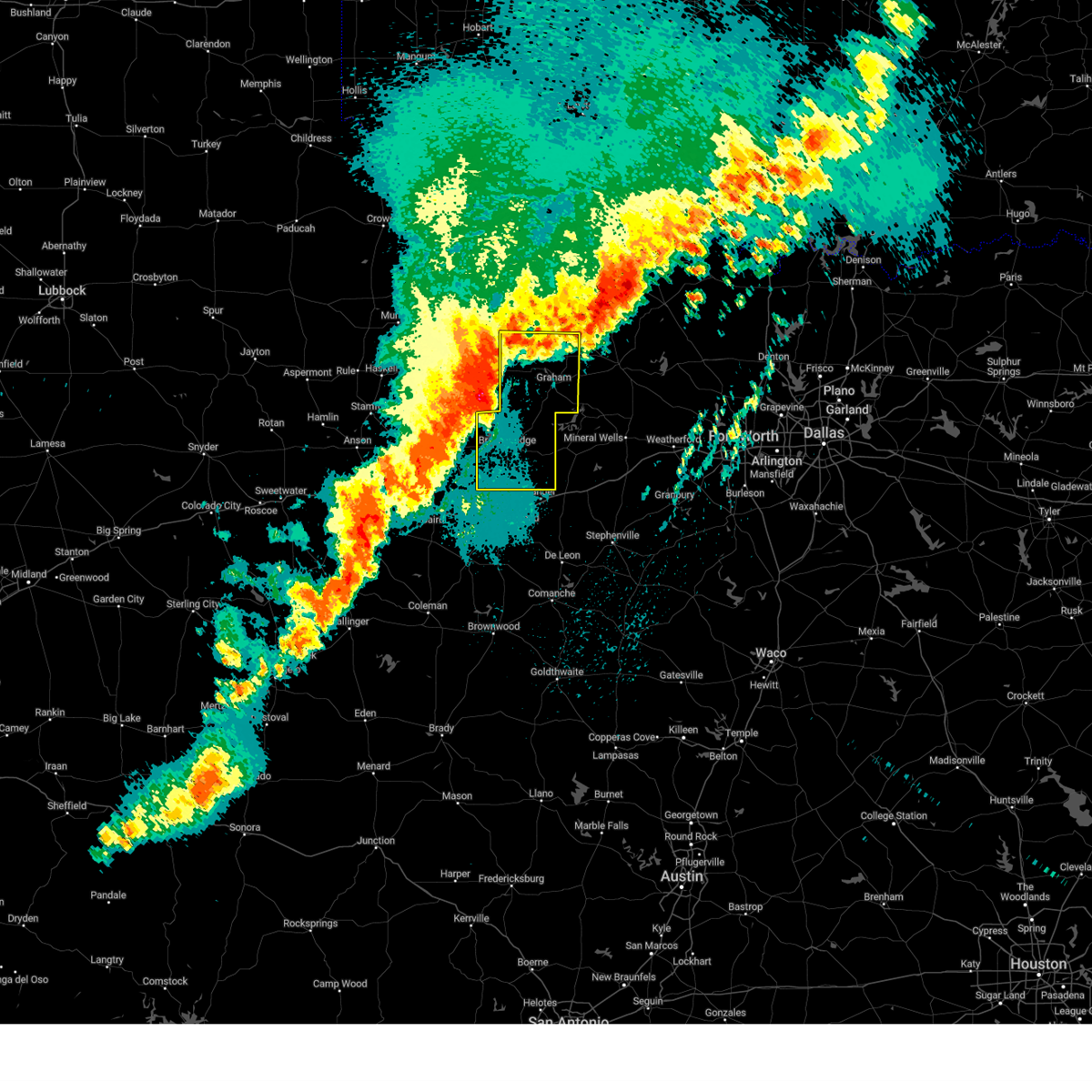 At 1205 am cdt, severe thunderstorms were located along a line extending from elbert to woodson to ibex, moving east at 50 mph (radar indicated). Hazards include 65 mph wind gusts and quarter size hail. Hail damage to vehicles is expected. expect wind damage to roofs, siding, and trees. these severe storms will be near, breckenridge, crystal falls, and hubbard creek reservoir around 1210 am cdt. lake daniel around 1220 am cdt. lake graham around 1225 am cdt. graham and necessity around 1230 am cdt. caddo and possum kingdom lake around 1235 am cdt. Other locations impacted by these severe thunderstorms include eliasville, ivan, eolian, newcastle, jean, padgett, murray, loving, south bend, and harpersville. At 1205 am cdt, severe thunderstorms were located along a line extending from elbert to woodson to ibex, moving east at 50 mph (radar indicated). Hazards include 65 mph wind gusts and quarter size hail. Hail damage to vehicles is expected. expect wind damage to roofs, siding, and trees. these severe storms will be near, breckenridge, crystal falls, and hubbard creek reservoir around 1210 am cdt. lake daniel around 1220 am cdt. lake graham around 1225 am cdt. graham and necessity around 1230 am cdt. caddo and possum kingdom lake around 1235 am cdt. Other locations impacted by these severe thunderstorms include eliasville, ivan, eolian, newcastle, jean, padgett, murray, loving, south bend, and harpersville.
|
| 4/27/2024 11:51 PM CDT |
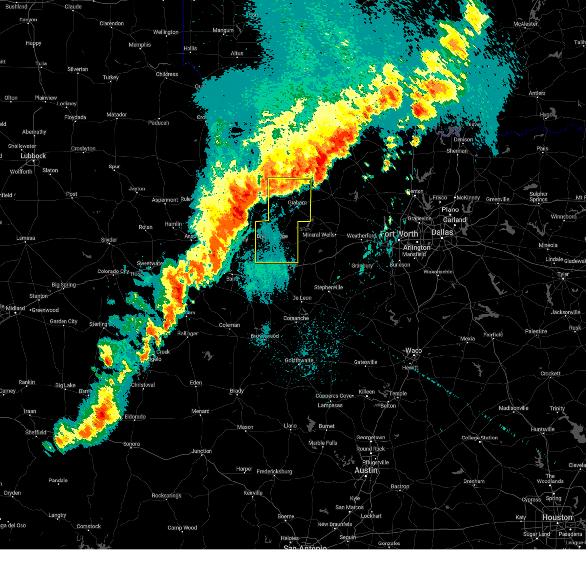 Svrfwd the national weather service in fort worth has issued a * severe thunderstorm warning for, young county in north central texas, stephens county in north central texas, * until 1245 am cdt. * at 1150 pm cdt, severe thunderstorms were located along a line extending from throckmorton to fort griffin to albany, moving east near 50 mph (radar indicated). Hazards include 60 mph wind gusts and quarter size hail. Hail damage to vehicles is expected. expect wind damage to roofs, siding, and trees. severe thunderstorms will be near, hubbard creek reservoir around 1200 am cdt. breckenridge and crystal falls around 1215 am cdt. lake daniel around 1225 am cdt. lake graham around 1230 am cdt. graham and necessity around 1235 am cdt. Other locations impacted by these severe thunderstorms include eliasville, ivan, eolian, newcastle, jean, padgett, murray, loving, south bend, and harpersville. Svrfwd the national weather service in fort worth has issued a * severe thunderstorm warning for, young county in north central texas, stephens county in north central texas, * until 1245 am cdt. * at 1150 pm cdt, severe thunderstorms were located along a line extending from throckmorton to fort griffin to albany, moving east near 50 mph (radar indicated). Hazards include 60 mph wind gusts and quarter size hail. Hail damage to vehicles is expected. expect wind damage to roofs, siding, and trees. severe thunderstorms will be near, hubbard creek reservoir around 1200 am cdt. breckenridge and crystal falls around 1215 am cdt. lake daniel around 1225 am cdt. lake graham around 1230 am cdt. graham and necessity around 1235 am cdt. Other locations impacted by these severe thunderstorms include eliasville, ivan, eolian, newcastle, jean, padgett, murray, loving, south bend, and harpersville.
|
| 4/8/2024 11:59 PM CDT | Hen Egg sized hail reported 0.2 miles S of Breckenridge, TX |
| 4/8/2024 10:57 PM CDT | Hen Egg sized hail reported 0.2 miles S of Breckenridge, TX |
| 4/8/2024 10:46 PM CDT |
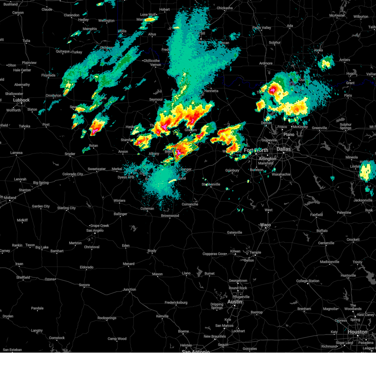 the severe thunderstorm warning has been cancelled and is no longer in effect the severe thunderstorm warning has been cancelled and is no longer in effect
|
| 4/8/2024 10:46 PM CDT |
 At 1045 pm cdt, a severe thunderstorm was located 7 miles northwest of caddo, or 8 miles east of breckenridge, moving northeast at 35 mph (radar indicated). Hazards include two inch hail and 60 mph wind gusts. People and animals outdoors will be injured. expect hail damage to roofs, siding, windows, and vehicles. expect wind damage to roofs, siding, and trees. Locations impacted include, breckenridge, possum kingdom lake, lake daniel, possum kingdom state park, ivan, and eliasville. At 1045 pm cdt, a severe thunderstorm was located 7 miles northwest of caddo, or 8 miles east of breckenridge, moving northeast at 35 mph (radar indicated). Hazards include two inch hail and 60 mph wind gusts. People and animals outdoors will be injured. expect hail damage to roofs, siding, windows, and vehicles. expect wind damage to roofs, siding, and trees. Locations impacted include, breckenridge, possum kingdom lake, lake daniel, possum kingdom state park, ivan, and eliasville.
|
| 4/8/2024 10:32 PM CDT | Golf Ball sized hail reported 1.3 miles WNW of Breckenridge, TX, report from mping: golf ball (1.75 in.). |
| 4/8/2024 10:26 PM CDT | Quarter sized hail reported 0.8 miles NE of Breckenridge, TX, report from mping: quarter (1.00 in.). |
| 4/8/2024 10:25 PM CDT |
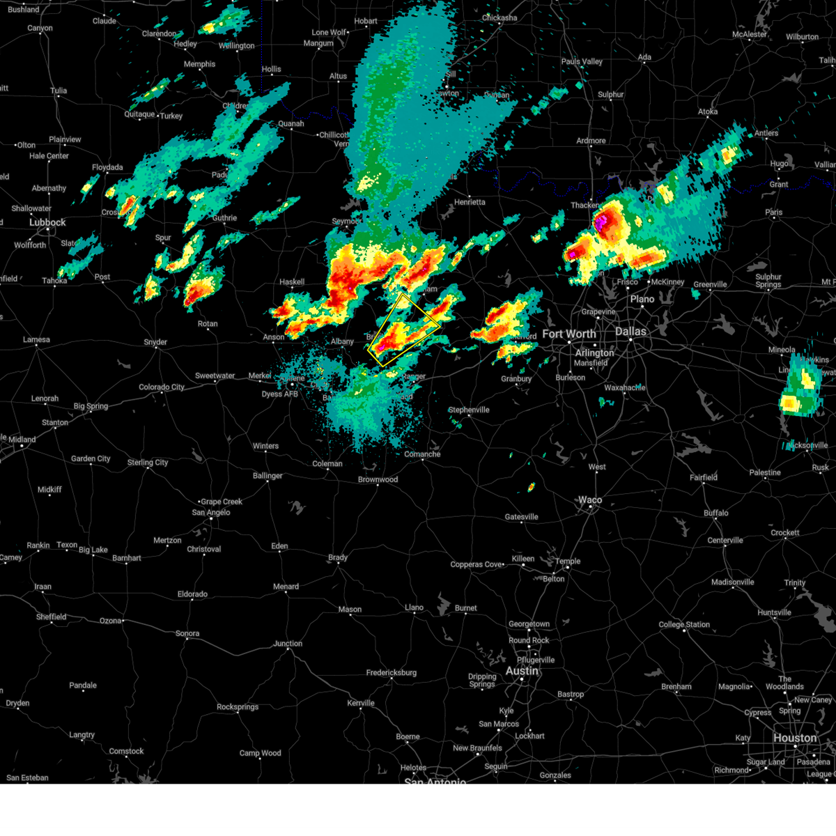 At 1025 pm cdt, a severe thunderstorm was located near breckenridge, moving northeast at 40 mph (radar indicated). Hazards include two inch hail and 60 mph wind gusts. People and animals outdoors will be injured. expect hail damage to roofs, siding, windows, and vehicles. expect wind damage to roofs, siding, and trees. Locations impacted include, breckenridge, possum kingdom lake, hubbard creek reservoir, lake daniel, possum kingdom state park, crystal falls, eolian, harpersville, eliasville, ivan, and south bend. At 1025 pm cdt, a severe thunderstorm was located near breckenridge, moving northeast at 40 mph (radar indicated). Hazards include two inch hail and 60 mph wind gusts. People and animals outdoors will be injured. expect hail damage to roofs, siding, windows, and vehicles. expect wind damage to roofs, siding, and trees. Locations impacted include, breckenridge, possum kingdom lake, hubbard creek reservoir, lake daniel, possum kingdom state park, crystal falls, eolian, harpersville, eliasville, ivan, and south bend.
|
| 4/8/2024 10:18 PM CDT |
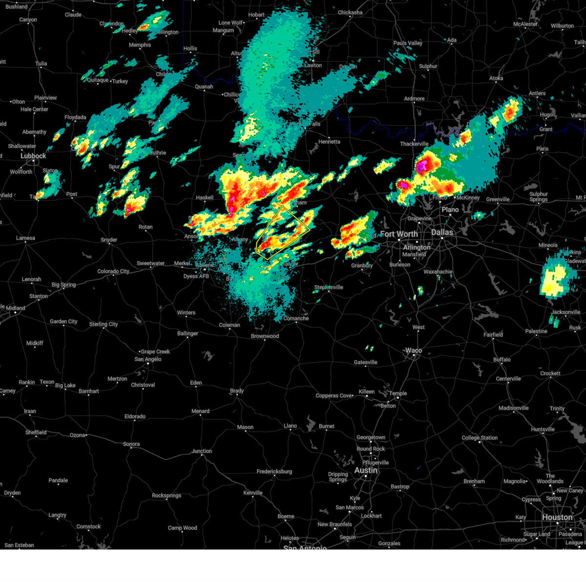 Svrfwd the national weather service in fort worth has issued a * severe thunderstorm warning for, south central young county in north central texas, stephens county in north central texas, west central palo pinto county in north central texas, * until 1100 pm cdt. * at 1017 pm cdt, a severe thunderstorm was located over breckenridge, moving northeast at 40 mph (radar indicated). Hazards include 60 mph wind gusts and half dollar size hail. Hail damage to vehicles is expected. Expect wind damage to roofs, siding, and trees. Svrfwd the national weather service in fort worth has issued a * severe thunderstorm warning for, south central young county in north central texas, stephens county in north central texas, west central palo pinto county in north central texas, * until 1100 pm cdt. * at 1017 pm cdt, a severe thunderstorm was located over breckenridge, moving northeast at 40 mph (radar indicated). Hazards include 60 mph wind gusts and half dollar size hail. Hail damage to vehicles is expected. Expect wind damage to roofs, siding, and trees.
|
| 4/1/2024 5:08 PM CDT |
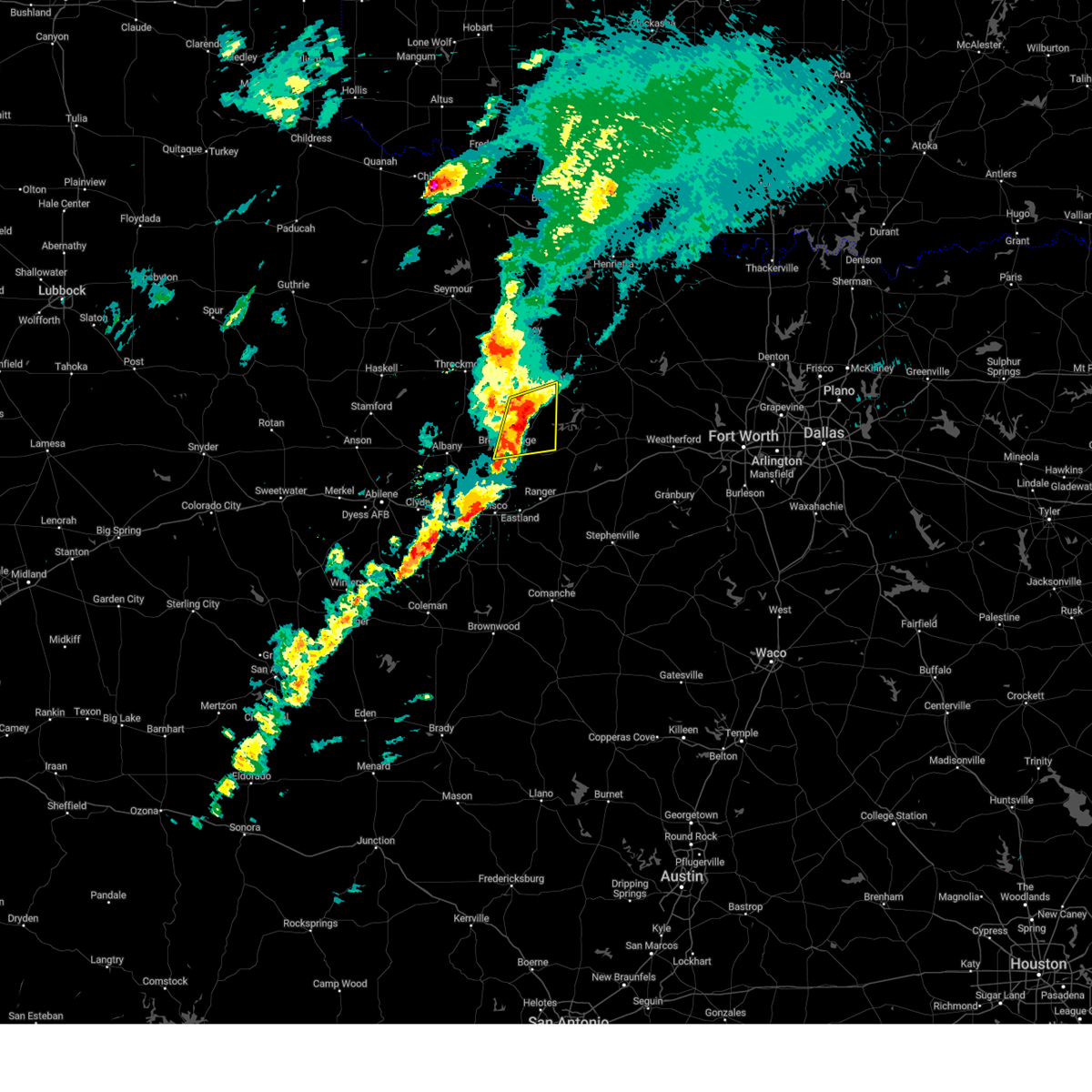 At 507 pm cdt, a severe thunderstorm was located near ivan, moving east at 50 mph (radar indicated). Hazards include 70 mph wind gusts and ping pong ball size hail. People and animals outdoors will be injured. expect hail damage to roofs, siding, windows, and vehicles. expect considerable tree damage. wind damage is also likely to mobile homes, roofs, and outbuildings. this severe storm will be near, possum kingdom lake around 510 pm cdt. Other locations impacted by this severe thunderstorm include eliasville and south bend. At 507 pm cdt, a severe thunderstorm was located near ivan, moving east at 50 mph (radar indicated). Hazards include 70 mph wind gusts and ping pong ball size hail. People and animals outdoors will be injured. expect hail damage to roofs, siding, windows, and vehicles. expect considerable tree damage. wind damage is also likely to mobile homes, roofs, and outbuildings. this severe storm will be near, possum kingdom lake around 510 pm cdt. Other locations impacted by this severe thunderstorm include eliasville and south bend.
|
| 4/1/2024 4:42 PM CDT |
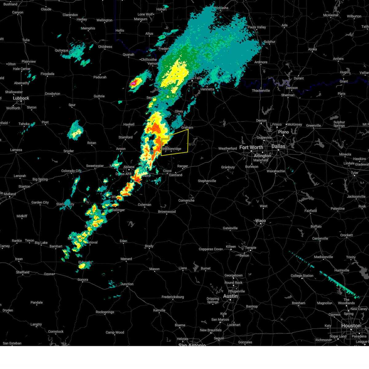 At 441 pm cdt, a severe thunderstorm was located over hubbard creek reservoir, or 8 miles west of breckenridge, moving east at 50 mph. this storm has a history of producing large hail and damaging wind gusts (radar indicated). Hazards include 70 mph wind gusts and half dollar size hail. Hail damage to vehicles is expected. expect considerable tree damage. wind damage is also likely to mobile homes, roofs, and outbuildings. this severe storm will be near, hubbard creek reservoir around 445 pm cdt. crystal falls around 450 pm cdt. possum kingdom lake around 510 pm cdt. Other locations impacted by this severe thunderstorm include ivan, eliasville, and south bend. At 441 pm cdt, a severe thunderstorm was located over hubbard creek reservoir, or 8 miles west of breckenridge, moving east at 50 mph. this storm has a history of producing large hail and damaging wind gusts (radar indicated). Hazards include 70 mph wind gusts and half dollar size hail. Hail damage to vehicles is expected. expect considerable tree damage. wind damage is also likely to mobile homes, roofs, and outbuildings. this severe storm will be near, hubbard creek reservoir around 445 pm cdt. crystal falls around 450 pm cdt. possum kingdom lake around 510 pm cdt. Other locations impacted by this severe thunderstorm include ivan, eliasville, and south bend.
|
| 4/1/2024 4:36 PM CDT |
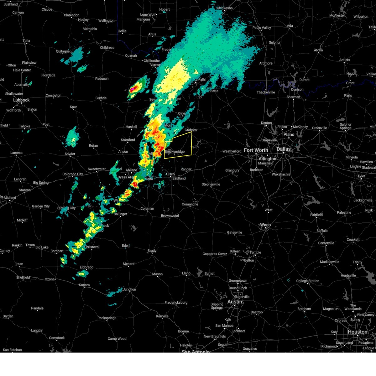 Svrfwd the national weather service in fort worth has issued a * severe thunderstorm warning for, southwestern young county in north central texas, northern stephens county in north central texas, * until 530 pm cdt. * at 435 pm cdt, a severe thunderstorm was located 7 miles north of ibex, moving east at 50 mph (radar indicated). Hazards include 60 mph wind gusts and half dollar size hail. Hail damage to vehicles is expected. expect wind damage to roofs, siding, and trees. this severe thunderstorm will be near, hubbard creek reservoir around 440 pm cdt. crystal falls around 450 pm cdt. possum kingdom lake around 510 pm cdt. Other locations impacted by this severe thunderstorm include ivan, eliasville, and south bend. Svrfwd the national weather service in fort worth has issued a * severe thunderstorm warning for, southwestern young county in north central texas, northern stephens county in north central texas, * until 530 pm cdt. * at 435 pm cdt, a severe thunderstorm was located 7 miles north of ibex, moving east at 50 mph (radar indicated). Hazards include 60 mph wind gusts and half dollar size hail. Hail damage to vehicles is expected. expect wind damage to roofs, siding, and trees. this severe thunderstorm will be near, hubbard creek reservoir around 440 pm cdt. crystal falls around 450 pm cdt. possum kingdom lake around 510 pm cdt. Other locations impacted by this severe thunderstorm include ivan, eliasville, and south bend.
|
| 2/2/2024 8:08 PM CST |
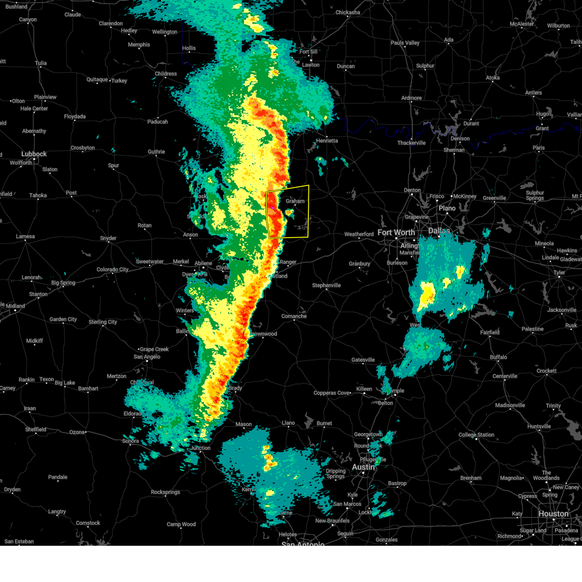 At 807 pm cst, severe thunderstorms were located along a line extending from near newcastle to eliasville to ivan, moving east at 45 mph (radar indicated). Hazards include 60 mph wind gusts and quarter size hail. Hail damage to vehicles is expected. expect wind damage to roofs, siding, and trees. these severe storms will be near, possum kingdom lake around 815 pm cst. graham, lake graham, and possum kingdom state park around 820 pm cst. other locations impacted by these severe thunderstorms include ivan, eliasville, newcastle, murray, loving, and south bend. hail threat, radar indicated max hail size, 1. 00 in wind threat, radar indicated max wind gust, 60 mph. At 807 pm cst, severe thunderstorms were located along a line extending from near newcastle to eliasville to ivan, moving east at 45 mph (radar indicated). Hazards include 60 mph wind gusts and quarter size hail. Hail damage to vehicles is expected. expect wind damage to roofs, siding, and trees. these severe storms will be near, possum kingdom lake around 815 pm cst. graham, lake graham, and possum kingdom state park around 820 pm cst. other locations impacted by these severe thunderstorms include ivan, eliasville, newcastle, murray, loving, and south bend. hail threat, radar indicated max hail size, 1. 00 in wind threat, radar indicated max wind gust, 60 mph.
|
| 2/2/2024 7:50 PM CST |
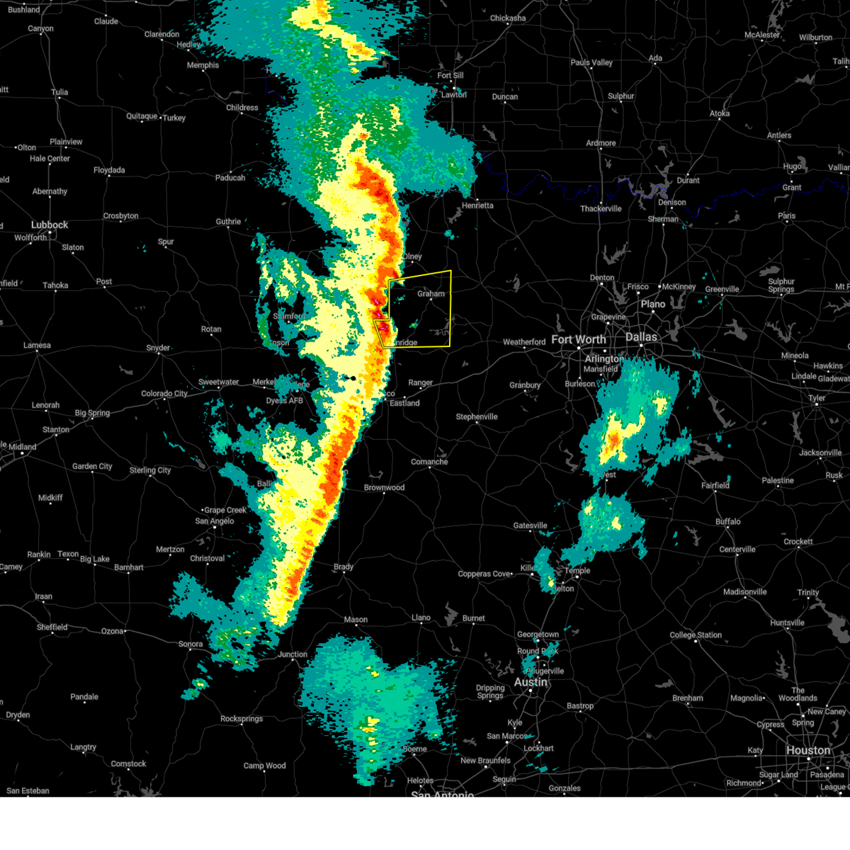 At 749 pm cst, severe thunderstorms were located along a line extending from near woodson to near crystal falls, moving east at 40 mph (radar indicated). Hazards include 60 mph wind gusts and quarter size hail. Hail damage to vehicles is expected. expect wind damage to roofs, siding, and trees. severe thunderstorms will be near, crystal falls around 755 pm cst. possum kingdom lake around 810 pm cst. lake graham and possum kingdom state park around 815 pm cst. graham around 820 pm cst. other locations impacted by these severe thunderstorms include ivan, eliasville, newcastle, murray, loving, and south bend. hail threat, radar indicated max hail size, 1. 00 in wind threat, radar indicated max wind gust, 60 mph. At 749 pm cst, severe thunderstorms were located along a line extending from near woodson to near crystal falls, moving east at 40 mph (radar indicated). Hazards include 60 mph wind gusts and quarter size hail. Hail damage to vehicles is expected. expect wind damage to roofs, siding, and trees. severe thunderstorms will be near, crystal falls around 755 pm cst. possum kingdom lake around 810 pm cst. lake graham and possum kingdom state park around 815 pm cst. graham around 820 pm cst. other locations impacted by these severe thunderstorms include ivan, eliasville, newcastle, murray, loving, and south bend. hail threat, radar indicated max hail size, 1. 00 in wind threat, radar indicated max wind gust, 60 mph.
|
| 9/19/2023 9:41 PM CDT |
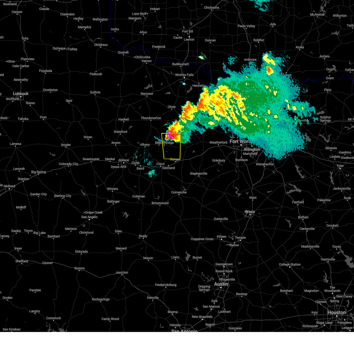 At 940 pm cdt, a severe thunderstorm was located 8 miles northwest of caddo, or 10 miles northeast of breckenridge, moving southeast at 35 mph (radar indicated). Hazards include 60 mph wind gusts and half dollar size hail. Hail damage to vehicles is expected. expect wind damage to roofs, siding, and trees. locations impacted include, breckenridge, lake daniel, necessity, gunsight, crystal falls, caddo, palo pinto mountains state park, possum kingdom state park, possum kingdom lake, ivan, and eliasville. hail threat, radar indicated max hail size, 1. 25 in wind threat, radar indicated max wind gust, 60 mph. At 940 pm cdt, a severe thunderstorm was located 8 miles northwest of caddo, or 10 miles northeast of breckenridge, moving southeast at 35 mph (radar indicated). Hazards include 60 mph wind gusts and half dollar size hail. Hail damage to vehicles is expected. expect wind damage to roofs, siding, and trees. locations impacted include, breckenridge, lake daniel, necessity, gunsight, crystal falls, caddo, palo pinto mountains state park, possum kingdom state park, possum kingdom lake, ivan, and eliasville. hail threat, radar indicated max hail size, 1. 25 in wind threat, radar indicated max wind gust, 60 mph.
|
| 9/19/2023 9:19 PM CDT |
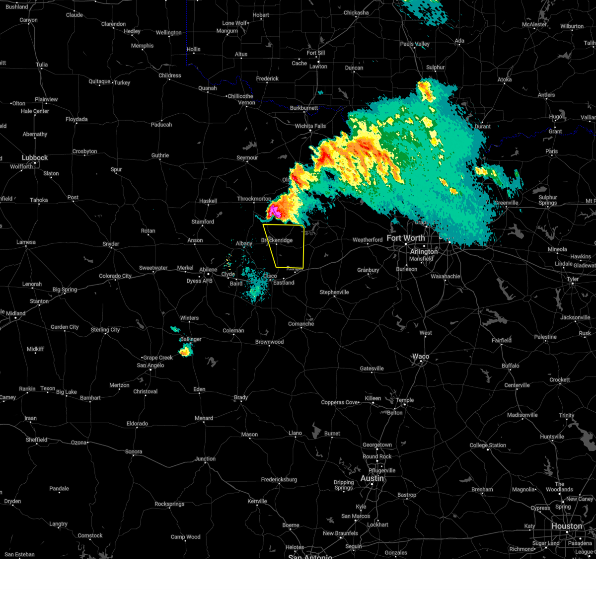 At 918 pm cdt, a severe thunderstorm was located near crystal falls, or 15 miles north of breckenridge, moving southeast at 35 mph (radar indicated). Hazards include ping pong ball size hail and 65 mph wind gusts. People and animals outdoors will be injured. expect hail damage to roofs, siding, windows, and vehicles. Expect wind damage to roofs, siding, and trees. At 918 pm cdt, a severe thunderstorm was located near crystal falls, or 15 miles north of breckenridge, moving southeast at 35 mph (radar indicated). Hazards include ping pong ball size hail and 65 mph wind gusts. People and animals outdoors will be injured. expect hail damage to roofs, siding, windows, and vehicles. Expect wind damage to roofs, siding, and trees.
|
| 9/11/2023 8:41 PM CDT | Kbkd 30030g54k in stephens county TX, 2.8 miles NNW of Breckenridge, TX |
| 6/17/2023 8:03 PM CDT |
 At 802 pm cdt, a severe thunderstorm was located near ibex, or 9 miles east of albany, moving east at 55 mph (radar indicated). Hazards include 65 mph wind gusts and quarter size hail. Hail damage to vehicles is expected. Expect wind damage to roofs, siding, and trees. At 802 pm cdt, a severe thunderstorm was located near ibex, or 9 miles east of albany, moving east at 55 mph (radar indicated). Hazards include 65 mph wind gusts and quarter size hail. Hail damage to vehicles is expected. Expect wind damage to roofs, siding, and trees.
|
| 6/11/2023 8:14 PM CDT |
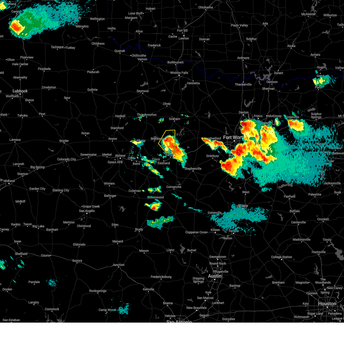 At 814 pm cdt, a severe thunderstorm was located over caddo, or 13 miles east of breckenridge, moving east at 25 mph (radar indicated). Hazards include 60 mph wind gusts and quarter size hail. Hail damage to vehicles is expected. expect wind damage to roofs, siding, and trees. locations impacted include, breckenridge, necessity, caddo, lake daniel, palo pinto mountains state park, possum kingdom lake and ivan. hail threat, radar indicated max hail size, 1. 00 in wind threat, radar indicated max wind gust, 60 mph. At 814 pm cdt, a severe thunderstorm was located over caddo, or 13 miles east of breckenridge, moving east at 25 mph (radar indicated). Hazards include 60 mph wind gusts and quarter size hail. Hail damage to vehicles is expected. expect wind damage to roofs, siding, and trees. locations impacted include, breckenridge, necessity, caddo, lake daniel, palo pinto mountains state park, possum kingdom lake and ivan. hail threat, radar indicated max hail size, 1. 00 in wind threat, radar indicated max wind gust, 60 mph.
|
| 6/11/2023 8:00 PM CDT | Golf Ball sized hail reported 1.2 miles W of Breckenridge, TX, report of golf ball (1.75 in.) hail near breckenridge. |
| 6/11/2023 7:56 PM CDT |
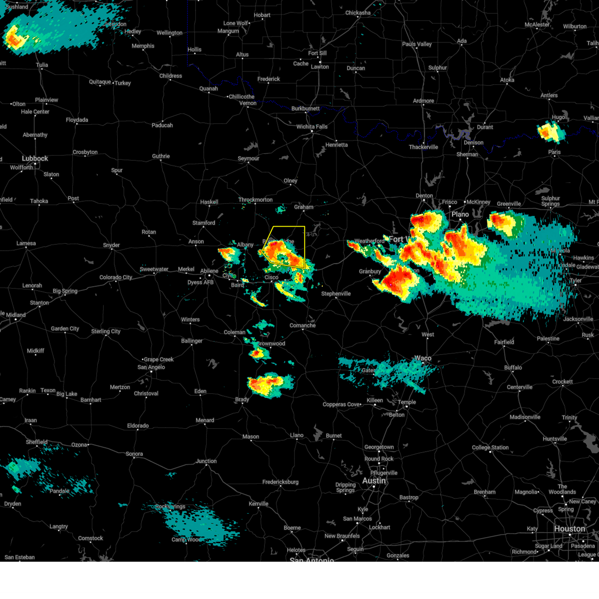 At 756 pm cdt, a severe thunderstorm was located near breckenridge, moving northeast at 20 mph (radar indicated). Hazards include 60 mph wind gusts and quarter size hail. Hail damage to vehicles is expected. expect wind damage to roofs, siding, and trees. locations impacted include, breckenridge, hubbard creek reservoir, lake daniel, necessity, crystal falls, caddo, palo pinto mountains state park, possum kingdom lake, eolian, harpersville and ivan. hail threat, radar indicated max hail size, 1. 00 in wind threat, radar indicated max wind gust, 60 mph. At 756 pm cdt, a severe thunderstorm was located near breckenridge, moving northeast at 20 mph (radar indicated). Hazards include 60 mph wind gusts and quarter size hail. Hail damage to vehicles is expected. expect wind damage to roofs, siding, and trees. locations impacted include, breckenridge, hubbard creek reservoir, lake daniel, necessity, crystal falls, caddo, palo pinto mountains state park, possum kingdom lake, eolian, harpersville and ivan. hail threat, radar indicated max hail size, 1. 00 in wind threat, radar indicated max wind gust, 60 mph.
|
| 6/11/2023 7:45 PM CDT |
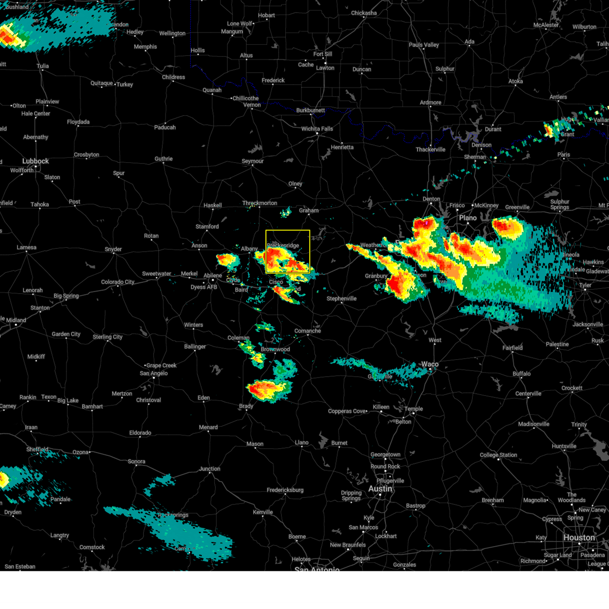 At 745 pm cdt, a severe thunderstorm was located over breckenridge, moving northeast at 25 mph (radar indicated). Hazards include 70 mph wind gusts and half dollar size hail. Hail damage to vehicles is expected. expect considerable tree damage. wind damage is also likely to mobile homes, roofs, and outbuildings. locations impacted include, breckenridge, hubbard creek reservoir, necessity, caddo, lake daniel, gunsight, crystal falls, palo pinto mountains state park, possum kingdom lake, eolian, harpersville, ivan and us- 180 near the shackelford-stephens county line. thunderstorm damage threat, considerable hail threat, radar indicated max hail size, 1. 25 in wind threat, radar indicated max wind gust, 70 mph. At 745 pm cdt, a severe thunderstorm was located over breckenridge, moving northeast at 25 mph (radar indicated). Hazards include 70 mph wind gusts and half dollar size hail. Hail damage to vehicles is expected. expect considerable tree damage. wind damage is also likely to mobile homes, roofs, and outbuildings. locations impacted include, breckenridge, hubbard creek reservoir, necessity, caddo, lake daniel, gunsight, crystal falls, palo pinto mountains state park, possum kingdom lake, eolian, harpersville, ivan and us- 180 near the shackelford-stephens county line. thunderstorm damage threat, considerable hail threat, radar indicated max hail size, 1. 25 in wind threat, radar indicated max wind gust, 70 mph.
|
| 6/11/2023 7:27 PM CDT |
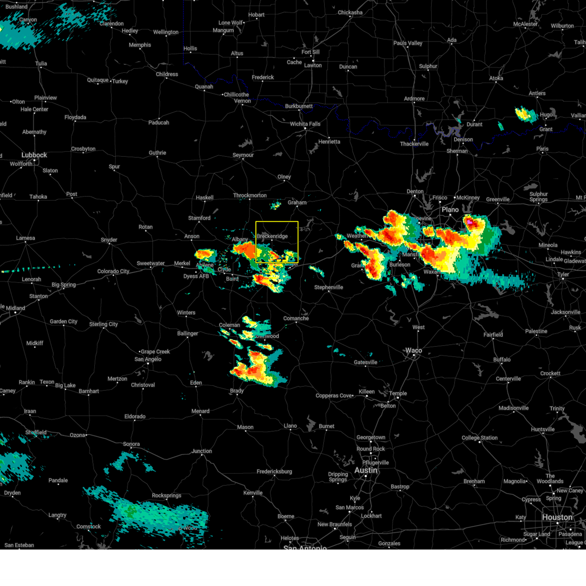 At 726 pm cdt, a severe thunderstorm was located over ibex, or 11 miles east of albany, moving northeast at 20 mph (radar indicated). Hazards include 70 mph wind gusts and half dollar size hail. Hail damage to vehicles is expected. expect considerable tree damage. Wind damage is also likely to mobile homes, roofs, and outbuildings. At 726 pm cdt, a severe thunderstorm was located over ibex, or 11 miles east of albany, moving northeast at 20 mph (radar indicated). Hazards include 70 mph wind gusts and half dollar size hail. Hail damage to vehicles is expected. expect considerable tree damage. Wind damage is also likely to mobile homes, roofs, and outbuildings.
|
| 5/12/2023 8:47 PM CDT |
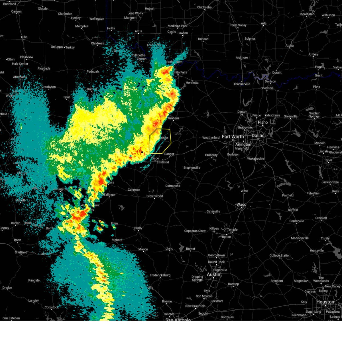 At 846 pm cdt, severe thunderstorms were located along a line extending from near crystal falls to 6 miles north of lake cisco, moving southeast at 15 mph (radar indicated). Hazards include 60 mph wind gusts and penny size hail. Expect damage to roofs, siding, and trees. locations impacted include, breckenridge, hubbard creek reservoir, lake daniel, necessity, gunsight, crystal falls, caddo, eolian, harpersville and ivan. hail threat, radar indicated max hail size, 0. 75 in wind threat, radar indicated max wind gust, 60 mph. At 846 pm cdt, severe thunderstorms were located along a line extending from near crystal falls to 6 miles north of lake cisco, moving southeast at 15 mph (radar indicated). Hazards include 60 mph wind gusts and penny size hail. Expect damage to roofs, siding, and trees. locations impacted include, breckenridge, hubbard creek reservoir, lake daniel, necessity, gunsight, crystal falls, caddo, eolian, harpersville and ivan. hail threat, radar indicated max hail size, 0. 75 in wind threat, radar indicated max wind gust, 60 mph.
|
| 5/12/2023 8:12 PM CDT |
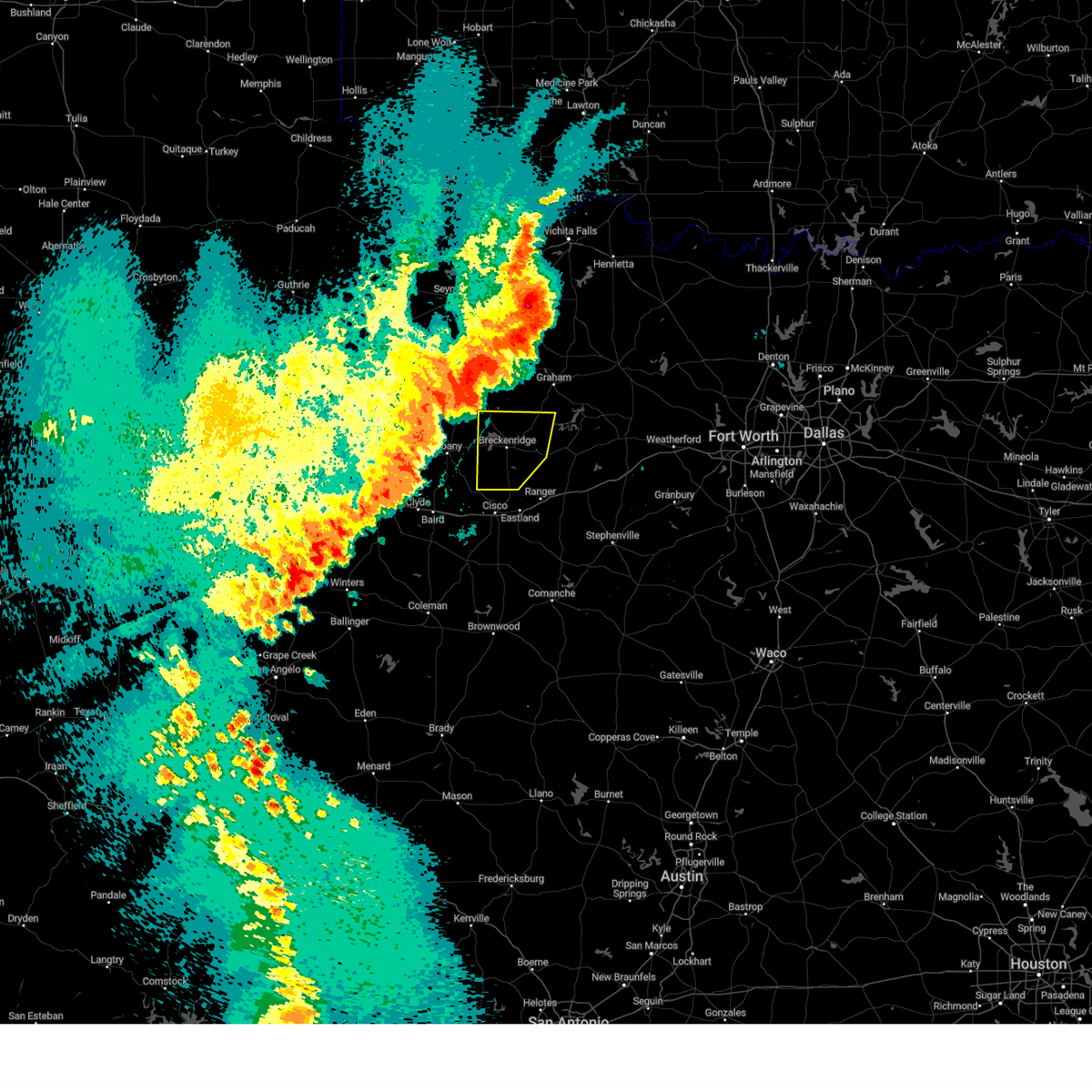 At 812 pm cdt, severe thunderstorms were located along a line extending from near crystal falls to 6 miles northwest of moran, moving southeast at 30 mph (radar indicated). Hazards include 60 mph wind gusts and penny size hail. expect damage to roofs, siding, and trees At 812 pm cdt, severe thunderstorms were located along a line extending from near crystal falls to 6 miles northwest of moran, moving southeast at 30 mph (radar indicated). Hazards include 60 mph wind gusts and penny size hail. expect damage to roofs, siding, and trees
|
| 5/6/2023 9:36 PM CDT |
 At 936 pm cdt, a severe thunderstorm was located over cisco, moving east at 20 mph (radar indicated). Hazards include 60 mph wind gusts and half dollar size hail. Hail damage to vehicles is expected. expect wind damage to roofs, siding, and trees. locations impacted include, breckenridge, eastland, cisco, ranger, lake cisco, necessity, lake olden, lake daniel, lake leon, gunsight, palo pinto mountains state park, caddo, hubbard creek reservoir, pleasant hill, staff, nimrod, eolian, harpersville, us-180 near the shackelford- stephens county line and morton valley. hail threat, radar indicated max hail size, 1. 25 in wind threat, radar indicated max wind gust, 60 mph. At 936 pm cdt, a severe thunderstorm was located over cisco, moving east at 20 mph (radar indicated). Hazards include 60 mph wind gusts and half dollar size hail. Hail damage to vehicles is expected. expect wind damage to roofs, siding, and trees. locations impacted include, breckenridge, eastland, cisco, ranger, lake cisco, necessity, lake olden, lake daniel, lake leon, gunsight, palo pinto mountains state park, caddo, hubbard creek reservoir, pleasant hill, staff, nimrod, eolian, harpersville, us-180 near the shackelford- stephens county line and morton valley. hail threat, radar indicated max hail size, 1. 25 in wind threat, radar indicated max wind gust, 60 mph.
|
| 5/6/2023 9:20 PM CDT |
 At 920 pm cdt, a severe thunderstorm was located near eastland, moving east at 25 mph (radar indicated). Hazards include 60 mph wind gusts and quarter size hail. Hail damage to vehicles is expected. expect wind damage to roofs, siding, and trees. locations impacted include, breckenridge, eastland, cisco, ranger, hubbard creek reservoir, lake cisco, necessity, lake olden, caddo, lake daniel, lake leon, gunsight, palo pinto mountains state park, pleasant hill, staff, nimrod, eolian, harpersville, us-180 near the shackelford- stephens county line and morton valley. hail threat, radar indicated max hail size, 1. 00 in wind threat, radar indicated max wind gust, 60 mph. At 920 pm cdt, a severe thunderstorm was located near eastland, moving east at 25 mph (radar indicated). Hazards include 60 mph wind gusts and quarter size hail. Hail damage to vehicles is expected. expect wind damage to roofs, siding, and trees. locations impacted include, breckenridge, eastland, cisco, ranger, hubbard creek reservoir, lake cisco, necessity, lake olden, caddo, lake daniel, lake leon, gunsight, palo pinto mountains state park, pleasant hill, staff, nimrod, eolian, harpersville, us-180 near the shackelford- stephens county line and morton valley. hail threat, radar indicated max hail size, 1. 00 in wind threat, radar indicated max wind gust, 60 mph.
|
| 5/6/2023 8:59 PM CDT |
 At 859 pm cdt, a severe thunderstorm was located over lake cisco, or near cisco, moving east at 25 mph (radar indicated). Hazards include 60 mph wind gusts and quarter size hail. Hail damage to vehicles is expected. Expect wind damage to roofs, siding, and trees. At 859 pm cdt, a severe thunderstorm was located over lake cisco, or near cisco, moving east at 25 mph (radar indicated). Hazards include 60 mph wind gusts and quarter size hail. Hail damage to vehicles is expected. Expect wind damage to roofs, siding, and trees.
|
| 4/26/2023 3:30 AM CDT |
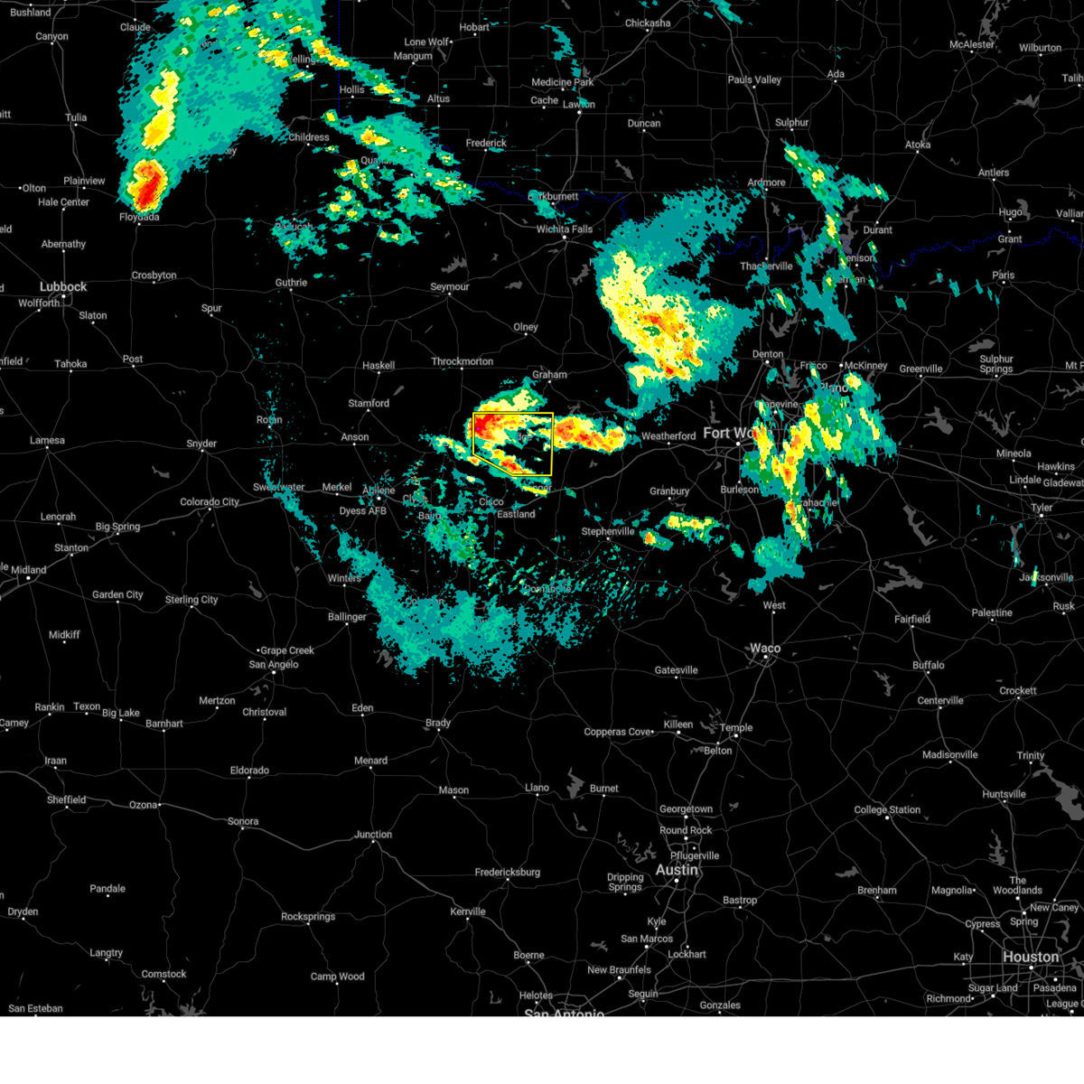 At 329 am cdt, a severe thunderstorm was located over hubbard creek reservoir, or near breckenridge, moving east at 25 mph (radar indicated). Hazards include quarter size hail. Damage to vehicles is possible. locations impacted include, breckenridge, hubbard creek reservoir, lake daniel, necessity, crystal falls, caddo, possum kingdom state park, possum kingdom lake, eolian, ivan and us-180 near the shackelford-stephens county line. hail threat, radar indicated max hail size, 1. 00 in wind threat, radar indicated max wind gust, <50 mph. At 329 am cdt, a severe thunderstorm was located over hubbard creek reservoir, or near breckenridge, moving east at 25 mph (radar indicated). Hazards include quarter size hail. Damage to vehicles is possible. locations impacted include, breckenridge, hubbard creek reservoir, lake daniel, necessity, crystal falls, caddo, possum kingdom state park, possum kingdom lake, eolian, ivan and us-180 near the shackelford-stephens county line. hail threat, radar indicated max hail size, 1. 00 in wind threat, radar indicated max wind gust, <50 mph.
|
| 4/26/2023 3:12 AM CDT |
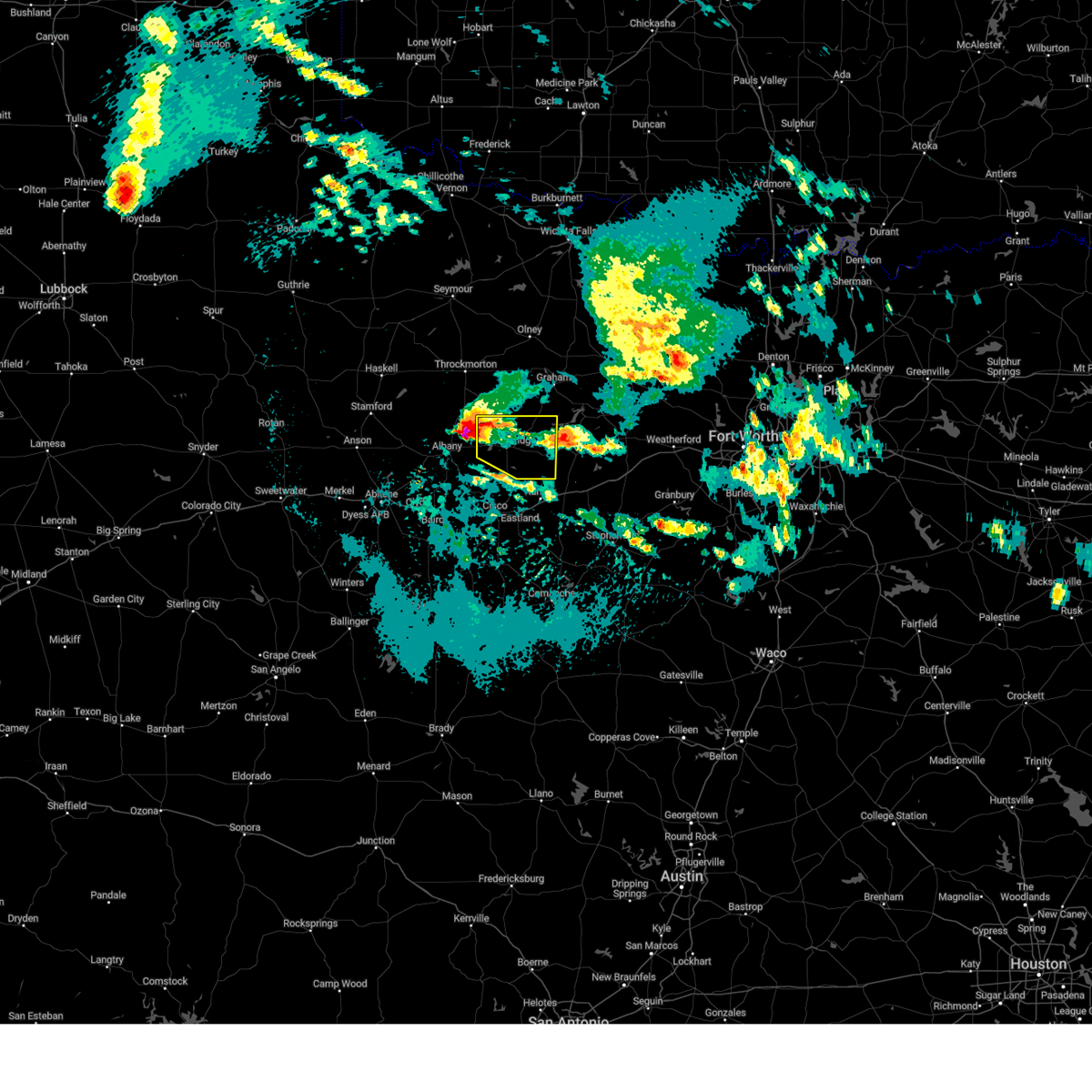 At 311 am cdt, a severe thunderstorm was located 7 miles west of hubbard creek reservoir, or 11 miles northeast of albany, moving east at 25 mph (radar indicated). Hazards include two inch hail and 60 mph wind gusts. People and animals outdoors will be injured. expect hail damage to roofs, siding, windows, and vehicles. Expect wind damage to roofs, siding, and trees. At 311 am cdt, a severe thunderstorm was located 7 miles west of hubbard creek reservoir, or 11 miles northeast of albany, moving east at 25 mph (radar indicated). Hazards include two inch hail and 60 mph wind gusts. People and animals outdoors will be injured. expect hail damage to roofs, siding, windows, and vehicles. Expect wind damage to roofs, siding, and trees.
|
| 3/24/2023 4:00 AM CDT |
 At 359 am cdt, a severe thunderstorm was located near necessity, or 7 miles north of ranger, moving east at 45 mph (radar indicated). Hazards include 65 mph wind gusts. Expect damage to roofs, siding, and trees. Locations impacted include, eastland, ranger, gordon, lake daniel, necessity, gunsight, caddo, palo pinto mountains state park, strawn, mingus, harpersville and morton valley. At 359 am cdt, a severe thunderstorm was located near necessity, or 7 miles north of ranger, moving east at 45 mph (radar indicated). Hazards include 65 mph wind gusts. Expect damage to roofs, siding, and trees. Locations impacted include, eastland, ranger, gordon, lake daniel, necessity, gunsight, caddo, palo pinto mountains state park, strawn, mingus, harpersville and morton valley.
|
| 3/16/2023 2:11 PM CDT |
 At 210 pm cdt, a severe thunderstorm was located 8 miles northwest of caddo, or 10 miles northeast of breckenridge, moving east at 45 mph (radar indicated). Hazards include golf ball size hail and 60 mph wind gusts. People and animals outdoors will be injured. expect hail damage to roofs, siding, windows, and vehicles. expect wind damage to roofs, siding, and trees. locations impacted include, breckenridge, graford, palo pinto, possum kingdom lake, possum kingdom state park, crystal falls, caddo, eliasville, ivan and south bend. thunderstorm damage threat, considerable hail threat, radar indicated max hail size, 1. 75 in wind threat, radar indicated max wind gust, 60 mph. At 210 pm cdt, a severe thunderstorm was located 8 miles northwest of caddo, or 10 miles northeast of breckenridge, moving east at 45 mph (radar indicated). Hazards include golf ball size hail and 60 mph wind gusts. People and animals outdoors will be injured. expect hail damage to roofs, siding, windows, and vehicles. expect wind damage to roofs, siding, and trees. locations impacted include, breckenridge, graford, palo pinto, possum kingdom lake, possum kingdom state park, crystal falls, caddo, eliasville, ivan and south bend. thunderstorm damage threat, considerable hail threat, radar indicated max hail size, 1. 75 in wind threat, radar indicated max wind gust, 60 mph.
|
| 3/16/2023 2:06 PM CDT |
 At 205 pm cdt, a severe thunderstorm was located near breckenridge, moving east at 45 mph (radar indicated). Hazards include 60 mph wind gusts and quarter size hail. Hail damage to vehicles is expected. Expect wind damage to roofs, siding, and trees. At 205 pm cdt, a severe thunderstorm was located near breckenridge, moving east at 45 mph (radar indicated). Hazards include 60 mph wind gusts and quarter size hail. Hail damage to vehicles is expected. Expect wind damage to roofs, siding, and trees.
|
| 3/2/2023 4:41 PM CST |
 The severe thunderstorm warning for northern eastland and stephens counties will expire at 445 pm cst, the storm which prompted the warning has weakened below severe limits, and has exited the warned area. therefore, the warning will be allowed to expire. however gusty winds and heavy rain are still possible with this thunderstorm. a tornado watch remains in effect until 1000 pm cst for north central texas. The severe thunderstorm warning for northern eastland and stephens counties will expire at 445 pm cst, the storm which prompted the warning has weakened below severe limits, and has exited the warned area. therefore, the warning will be allowed to expire. however gusty winds and heavy rain are still possible with this thunderstorm. a tornado watch remains in effect until 1000 pm cst for north central texas.
|
| 3/2/2023 4:13 PM CST |
 At 412 pm cst, a severe cluster of severe thunderstorms was located from eliasville to near caddo, moving east at 50 mph (radar indicated). Hazards include 70 mph wind gusts and quarter size hail. Hail damage to vehicles is expected. expect considerable tree damage. wind damage is also likely to mobile homes, roofs, and outbuildings. locations impacted include, breckenridge, eastland, cisco, ranger, lake cisco, necessity, lake olden, caddo, lake daniel, lake leon, gunsight, crystal falls, palo pinto mountains state park, hubbard creek reservoir, possum kingdom lake, staff, harpersville, morton valley, ivan and olden. thunderstorm damage threat, considerable hail threat, radar indicated max hail size, 1. 00 in wind threat, radar indicated max wind gust, 70 mph. At 412 pm cst, a severe cluster of severe thunderstorms was located from eliasville to near caddo, moving east at 50 mph (radar indicated). Hazards include 70 mph wind gusts and quarter size hail. Hail damage to vehicles is expected. expect considerable tree damage. wind damage is also likely to mobile homes, roofs, and outbuildings. locations impacted include, breckenridge, eastland, cisco, ranger, lake cisco, necessity, lake olden, caddo, lake daniel, lake leon, gunsight, crystal falls, palo pinto mountains state park, hubbard creek reservoir, possum kingdom lake, staff, harpersville, morton valley, ivan and olden. thunderstorm damage threat, considerable hail threat, radar indicated max hail size, 1. 00 in wind threat, radar indicated max wind gust, 70 mph.
|
| 3/2/2023 4:10 PM CST | Damage to trees and outbuildings in necessit in stephens county TX, 10.6 miles NW of Breckenridge, TX |
| 3/2/2023 4:01 PM CST |
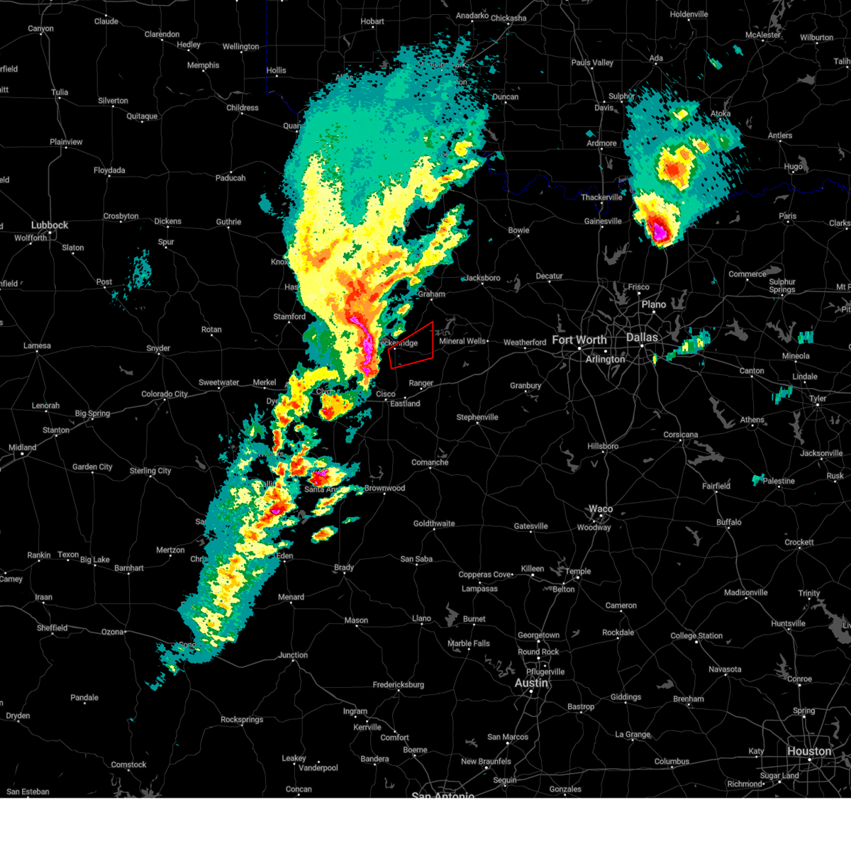 At 400 pm cst, severe thunderstorms capable of producing both tornadoes and extensive straight line wind damage were located near lake daniel, or near breckenridge, moving northeast at 60 mph (radar indicated rotation). Hazards include tornado. Flying debris will be dangerous to those caught without shelter. mobile homes will be damaged or destroyed. damage to roofs, windows, and vehicles will occur. tree damage is likely. these dangerous storms will be near, caddo around 410 pm cst. Other locations impacted by this tornadic thunderstorm include ivan. At 400 pm cst, severe thunderstorms capable of producing both tornadoes and extensive straight line wind damage were located near lake daniel, or near breckenridge, moving northeast at 60 mph (radar indicated rotation). Hazards include tornado. Flying debris will be dangerous to those caught without shelter. mobile homes will be damaged or destroyed. damage to roofs, windows, and vehicles will occur. tree damage is likely. these dangerous storms will be near, caddo around 410 pm cst. Other locations impacted by this tornadic thunderstorm include ivan.
|
| 3/2/2023 3:44 PM CST |
 At 344 pm cst, a severe line of severe thunderstorms was located from ibex to moran, moving east at 50 mph (radar indicated). Hazards include 70 mph wind gusts and quarter size hail. Hail damage to vehicles is expected. expect considerable tree damage. Wind damage is also likely to mobile homes, roofs, and outbuildings. At 344 pm cst, a severe line of severe thunderstorms was located from ibex to moran, moving east at 50 mph (radar indicated). Hazards include 70 mph wind gusts and quarter size hail. Hail damage to vehicles is expected. expect considerable tree damage. Wind damage is also likely to mobile homes, roofs, and outbuildings.
|
| 2/26/2023 9:32 PM CST |
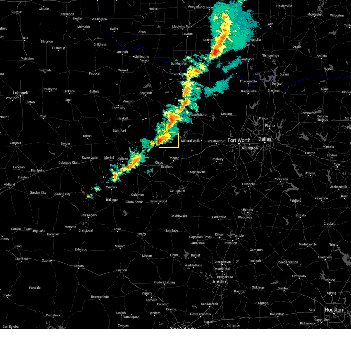 At 931 pm cst, a severe thunderstorm was located near breckenridge, moving east at 55 mph (radar indicated). Hazards include 60 mph wind gusts and quarter size hail. Hail damage to vehicles is expected. expect wind damage to roofs, siding, and trees. locations impacted include, breckenridge, crystal falls, caddo, hubbard creek reservoir, possum kingdom lake, ivan and eliasville. hail threat, radar indicated max hail size, 1. 00 in wind threat, radar indicated max wind gust, 60 mph. At 931 pm cst, a severe thunderstorm was located near breckenridge, moving east at 55 mph (radar indicated). Hazards include 60 mph wind gusts and quarter size hail. Hail damage to vehicles is expected. expect wind damage to roofs, siding, and trees. locations impacted include, breckenridge, crystal falls, caddo, hubbard creek reservoir, possum kingdom lake, ivan and eliasville. hail threat, radar indicated max hail size, 1. 00 in wind threat, radar indicated max wind gust, 60 mph.
|
| 2/26/2023 9:21 PM CST |
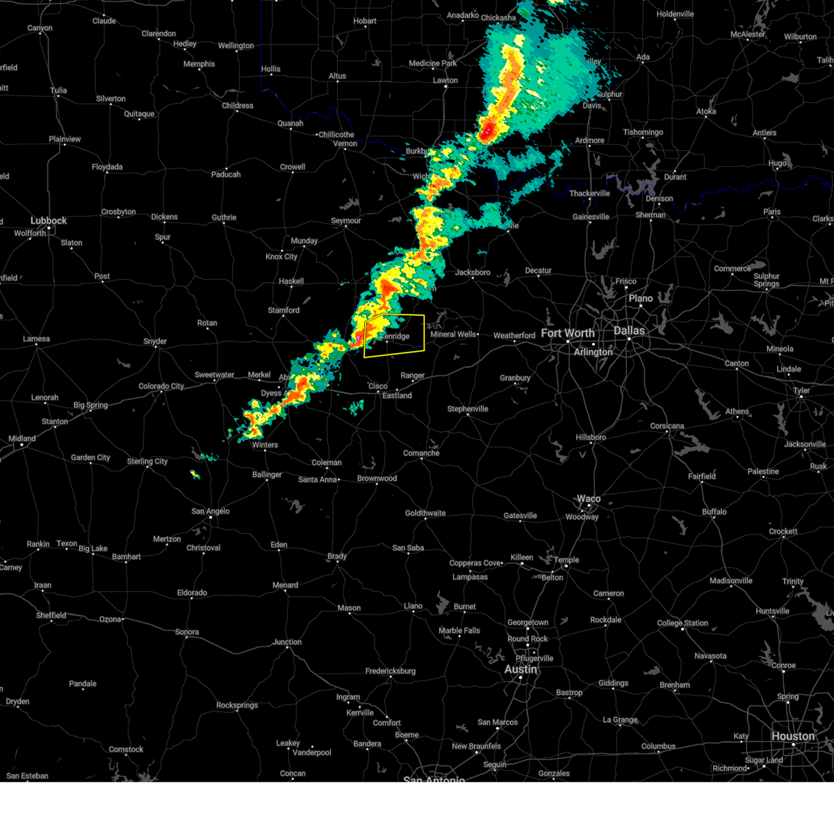 At 920 pm cst, a severe thunderstorm was located near hubbard creek reservoir, or 10 miles west of breckenridge, moving east at 55 mph (radar indicated). Hazards include 60 mph wind gusts and quarter size hail. Hail damage to vehicles is expected. Expect wind damage to roofs, siding, and trees. At 920 pm cst, a severe thunderstorm was located near hubbard creek reservoir, or 10 miles west of breckenridge, moving east at 55 mph (radar indicated). Hazards include 60 mph wind gusts and quarter size hail. Hail damage to vehicles is expected. Expect wind damage to roofs, siding, and trees.
|
| 9/4/2022 5:27 PM CDT |
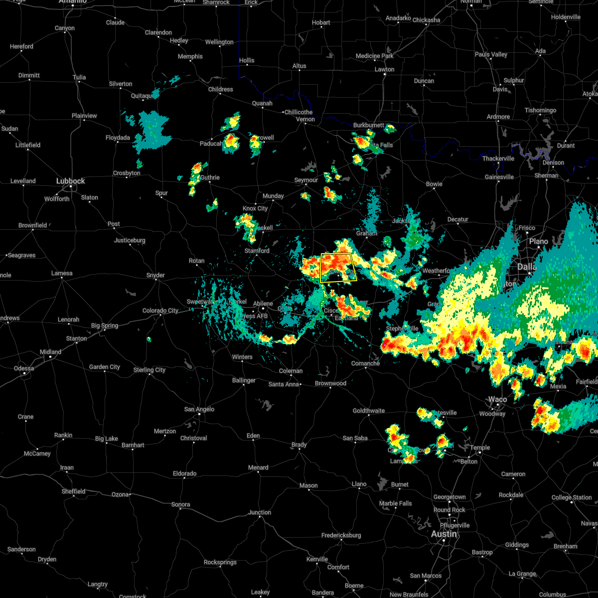 At 527 pm cdt, a severe thunderstorm was located near breckenridge, moving south at 15 mph (radar indicated). Hazards include 60 mph wind gusts and quarter size hail. Hail damage to vehicles is expected. expect wind damage to roofs, siding, and trees. locations impacted include, breckenridge, crystal falls and us-180 near the shackelford- stephens county line. hail threat, radar indicated max hail size, 1. 00 in wind threat, radar indicated max wind gust, 60 mph. At 527 pm cdt, a severe thunderstorm was located near breckenridge, moving south at 15 mph (radar indicated). Hazards include 60 mph wind gusts and quarter size hail. Hail damage to vehicles is expected. expect wind damage to roofs, siding, and trees. locations impacted include, breckenridge, crystal falls and us-180 near the shackelford- stephens county line. hail threat, radar indicated max hail size, 1. 00 in wind threat, radar indicated max wind gust, 60 mph.
|
| 9/4/2022 5:03 PM CDT |
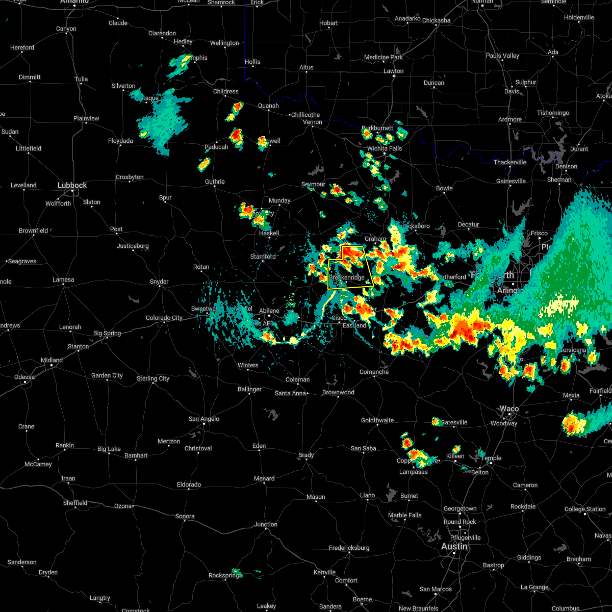 At 503 pm cdt, a severe thunderstorm was located near crystal falls, or 13 miles north of breckenridge, moving south at 15 mph (radar indicated). Hazards include 60 mph wind gusts and half dollar size hail. Hail damage to vehicles is expected. Expect wind damage to roofs, siding, and trees. At 503 pm cdt, a severe thunderstorm was located near crystal falls, or 13 miles north of breckenridge, moving south at 15 mph (radar indicated). Hazards include 60 mph wind gusts and half dollar size hail. Hail damage to vehicles is expected. Expect wind damage to roofs, siding, and trees.
|
| 6/2/2022 1:39 AM CDT |
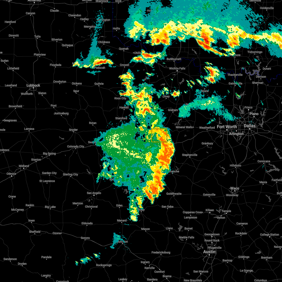 The severe thunderstorm warning for southwestern stephens county will expire at 145 am cdt, the storm which prompted the warning has weakened below severe limits. therefore the warning will be allowed to expire. however gusty winds and heavy rain are still possible with this thunderstorm. The severe thunderstorm warning for southwestern stephens county will expire at 145 am cdt, the storm which prompted the warning has weakened below severe limits. therefore the warning will be allowed to expire. however gusty winds and heavy rain are still possible with this thunderstorm.
|
| 6/2/2022 1:23 AM CDT |
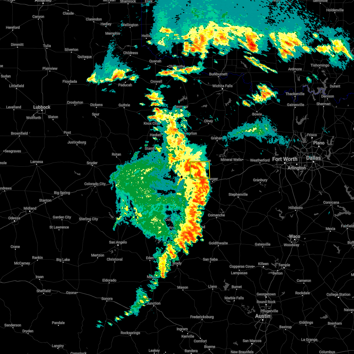 At 122 am cdt, a severe thunderstorm was located near necessity, or 7 miles southeast of breckenridge, moving east at 30 mph (radar indicated). Hazards include 60 mph wind gusts. Expect damage to roofs, siding, and trees. locations impacted include, breckenridge, necessity and gunsight. hail threat, radar indicated max hail size, <. 75 in wind threat, radar indicated max wind gust, 60 mph. At 122 am cdt, a severe thunderstorm was located near necessity, or 7 miles southeast of breckenridge, moving east at 30 mph (radar indicated). Hazards include 60 mph wind gusts. Expect damage to roofs, siding, and trees. locations impacted include, breckenridge, necessity and gunsight. hail threat, radar indicated max hail size, <. 75 in wind threat, radar indicated max wind gust, 60 mph.
|
| 6/2/2022 1:05 AM CDT |
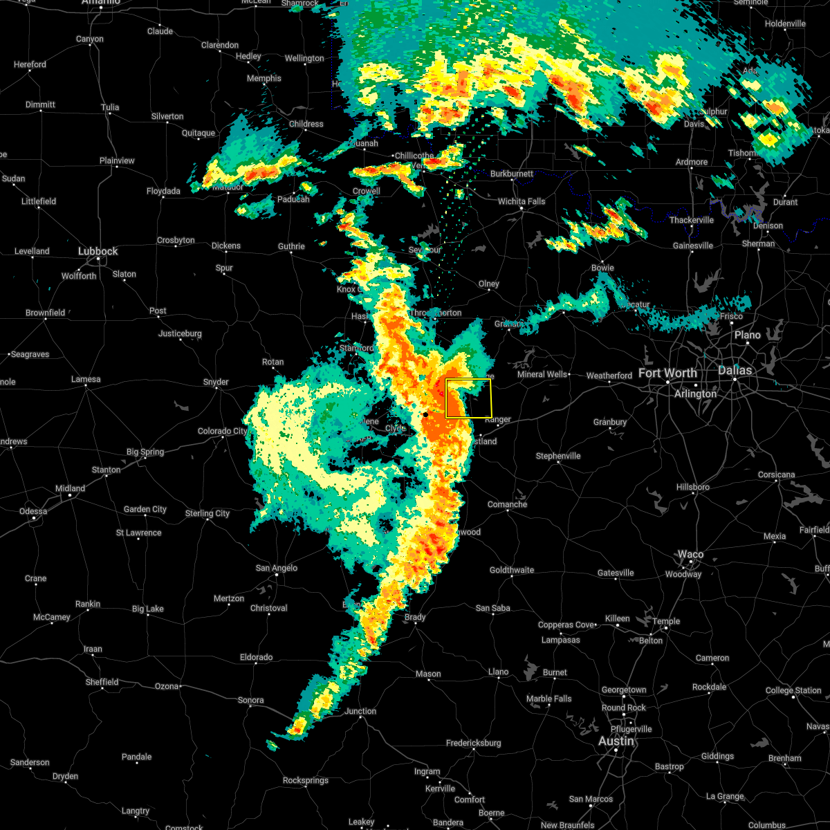 At 104 am cdt, a severe thunderstorm was located near gunsight, or 10 miles south of breckenridge, moving east at 30 mph (radar indicated). Hazards include 60 mph wind gusts. expect damage to roofs, siding, and trees At 104 am cdt, a severe thunderstorm was located near gunsight, or 10 miles south of breckenridge, moving east at 30 mph (radar indicated). Hazards include 60 mph wind gusts. expect damage to roofs, siding, and trees
|
| 6/2/2022 12:55 AM CDT |
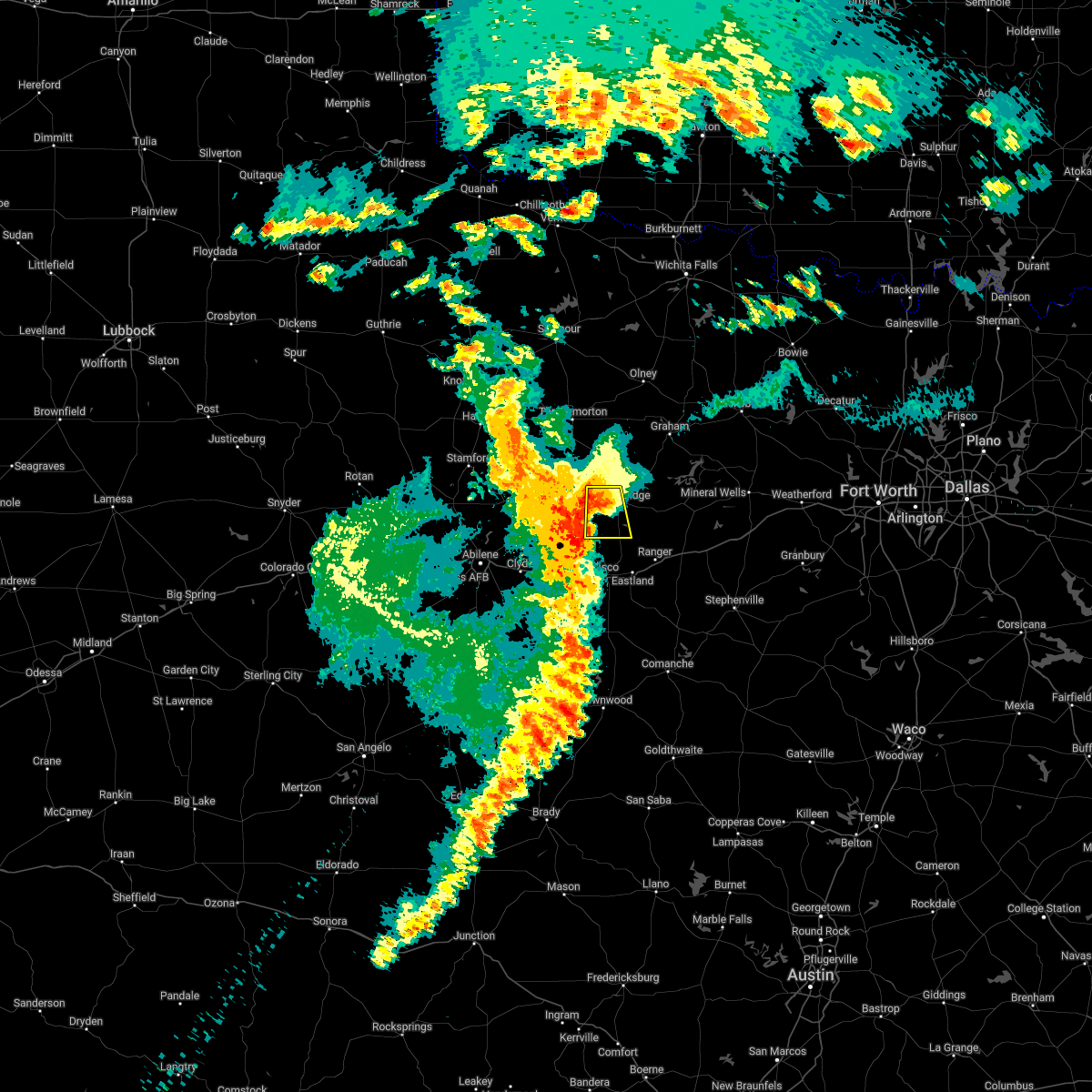 The severe thunderstorm warning for southwestern stephens county will expire at 100 am cdt, the storm which prompted the warning has weakened below severe limits. therefore the warning will be allowed to expire. however gusty winds and heavy rain are still possible with this thunderstorm. The severe thunderstorm warning for southwestern stephens county will expire at 100 am cdt, the storm which prompted the warning has weakened below severe limits. therefore the warning will be allowed to expire. however gusty winds and heavy rain are still possible with this thunderstorm.
|
| 6/2/2022 12:46 AM CDT |
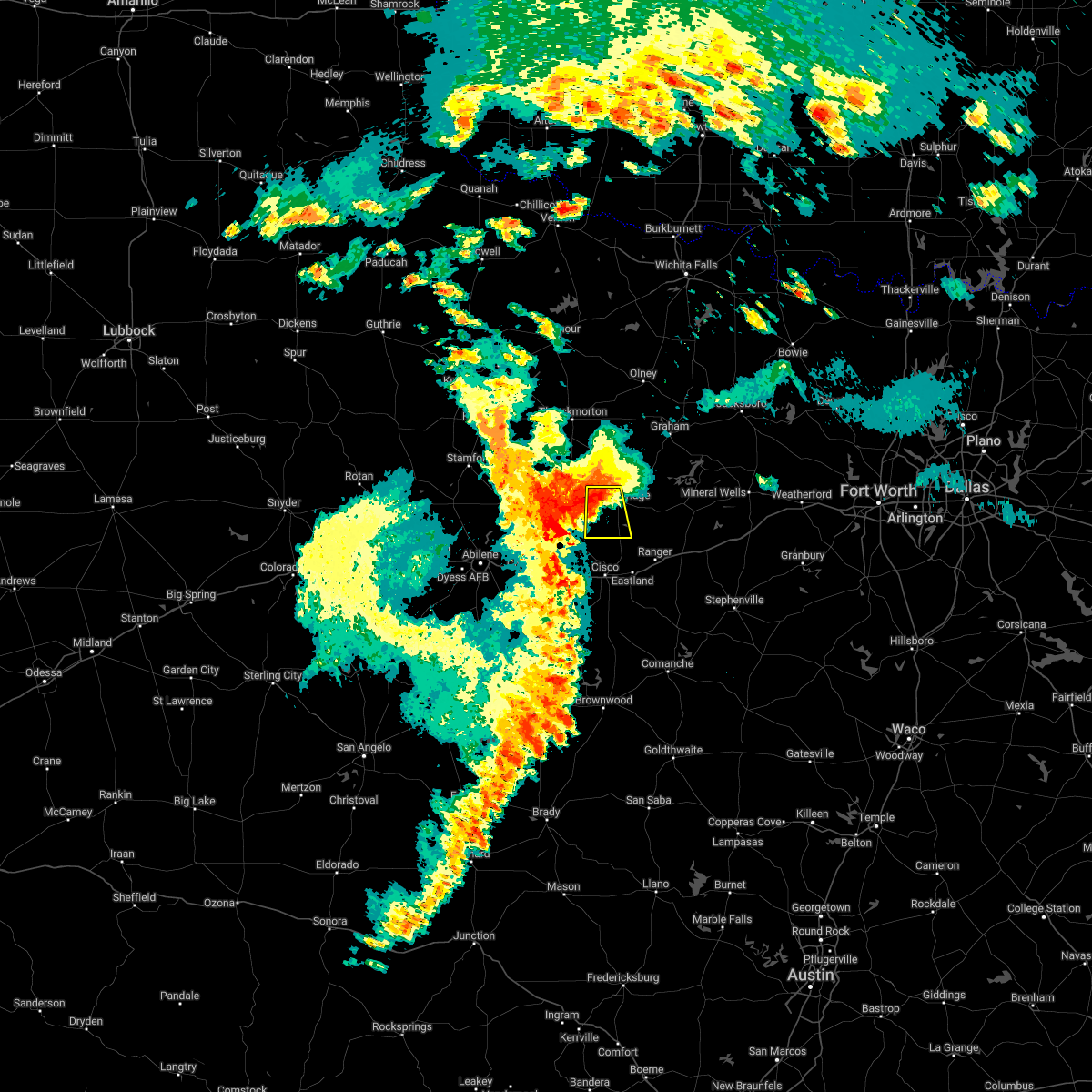 At 1245 am cdt, a severe thunderstorm was located near ibex, or 10 miles west of breckenridge, moving south at 15 mph (radar indicated). Hazards include 60 mph wind gusts. Expect damage to roofs, siding, and trees. locations impacted include, hubbard creek reservoir and highway 180 west of breckenridge. hail threat, radar indicated max hail size, <. 75 in wind threat, radar indicated max wind gust, 60 mph. At 1245 am cdt, a severe thunderstorm was located near ibex, or 10 miles west of breckenridge, moving south at 15 mph (radar indicated). Hazards include 60 mph wind gusts. Expect damage to roofs, siding, and trees. locations impacted include, hubbard creek reservoir and highway 180 west of breckenridge. hail threat, radar indicated max hail size, <. 75 in wind threat, radar indicated max wind gust, 60 mph.
|
| 6/2/2022 12:26 AM CDT | Social media video of large tree branches blown down at rest area near county line. time estimated by rada in stephens county TX, 10.5 miles E of Breckenridge, TX |
| 6/2/2022 12:23 AM CDT |
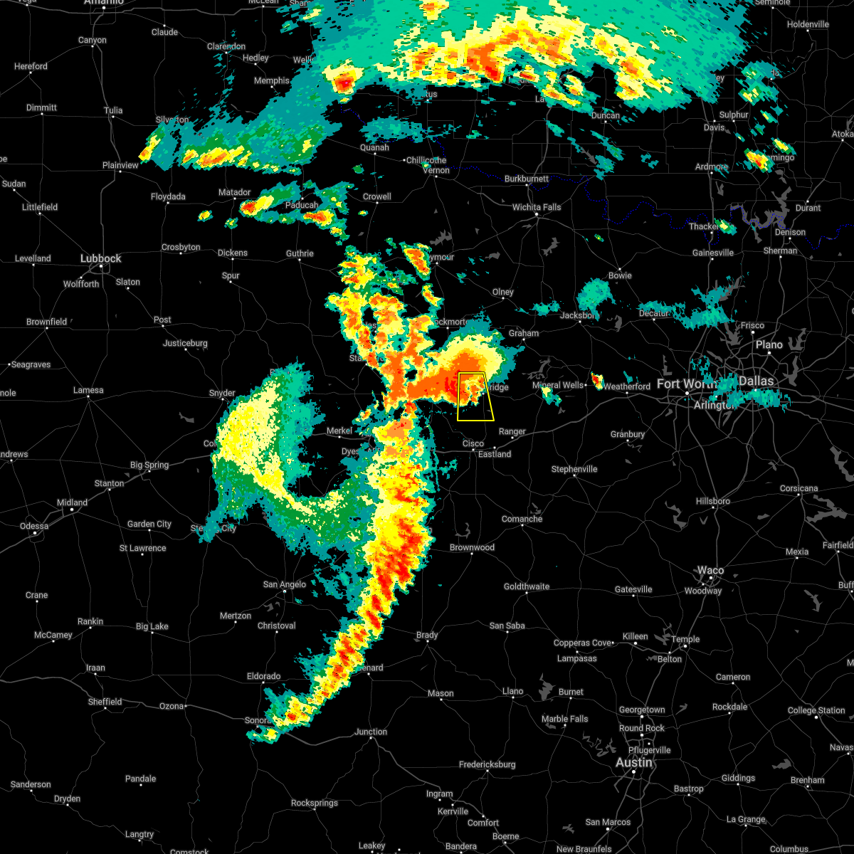 At 1222 am cdt, a severe thunderstorm was located near breckenridge, moving south at 20 mph (radar indicated). Hazards include 60 mph wind gusts and quarter size hail. Hail damage to vehicles is expected. expect wind damage to roofs, siding, and trees. locations impacted include, hubbard creek reservoir and breckenridge. hail threat, radar indicated max hail size, 1. 00 in wind threat, radar indicated max wind gust, 60 mph. At 1222 am cdt, a severe thunderstorm was located near breckenridge, moving south at 20 mph (radar indicated). Hazards include 60 mph wind gusts and quarter size hail. Hail damage to vehicles is expected. expect wind damage to roofs, siding, and trees. locations impacted include, hubbard creek reservoir and breckenridge. hail threat, radar indicated max hail size, 1. 00 in wind threat, radar indicated max wind gust, 60 mph.
|
| 6/2/2022 12:07 AM CDT |
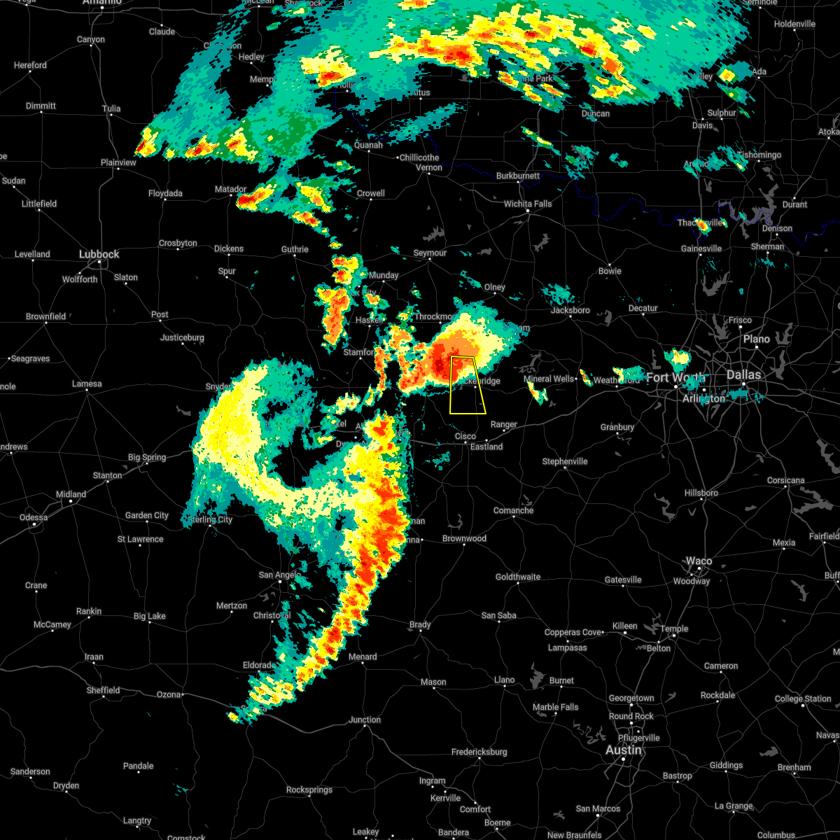 At 1206 am cdt, a severe thunderstorm was located 10 miles northwest of breckenridge, moving south at 20 mph (radar indicated). Hazards include 60 mph wind gusts and quarter size hail. Hail damage to vehicles is expected. Expect wind damage to roofs, siding, and trees. At 1206 am cdt, a severe thunderstorm was located 10 miles northwest of breckenridge, moving south at 20 mph (radar indicated). Hazards include 60 mph wind gusts and quarter size hail. Hail damage to vehicles is expected. Expect wind damage to roofs, siding, and trees.
|
| 5/13/2022 8:56 PM CDT |
 At 855 pm cdt, a severe thunderstorm was located 7 miles southwest of breckenridge, moving south at 30 mph (radar indicated). Hazards include 60 mph wind gusts and quarter size hail. Hail damage to vehicles is expected. Expect wind damage to roofs, siding, and trees. At 855 pm cdt, a severe thunderstorm was located 7 miles southwest of breckenridge, moving south at 30 mph (radar indicated). Hazards include 60 mph wind gusts and quarter size hail. Hail damage to vehicles is expected. Expect wind damage to roofs, siding, and trees.
|
| 5/13/2022 7:33 PM CDT |
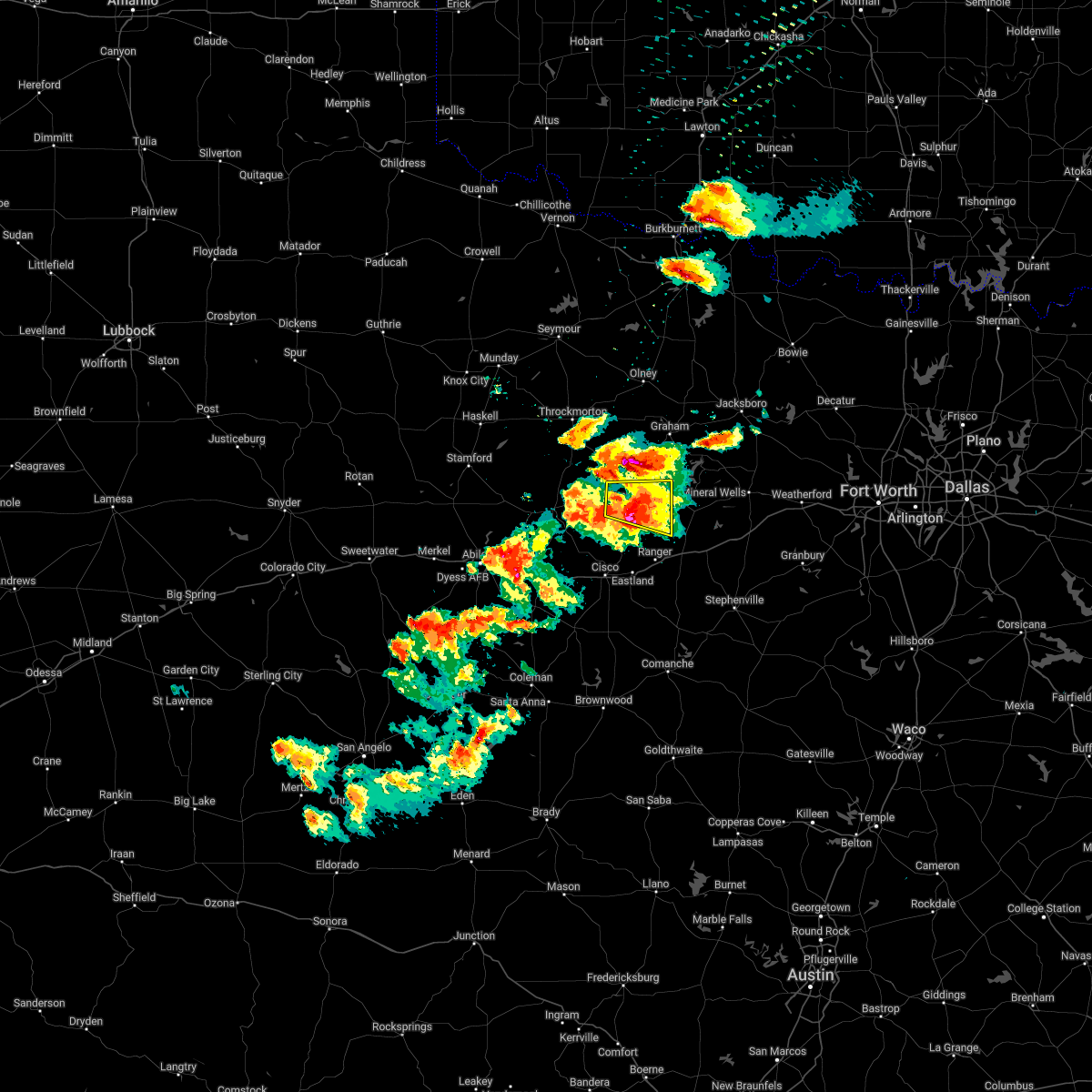 At 732 pm cdt, a severe thunderstorm was located near breckenridge, and is nearly stationary (radar indicated). Hazards include 60 mph wind gusts and half dollar size hail. Hail damage to vehicles is expected. expect wind damage to roofs, siding, and trees. locations impacted include, breckenridge and necessity. hail threat, radar indicated max hail size, 1. 25 in wind threat, radar indicated max wind gust, 60 mph. At 732 pm cdt, a severe thunderstorm was located near breckenridge, and is nearly stationary (radar indicated). Hazards include 60 mph wind gusts and half dollar size hail. Hail damage to vehicles is expected. expect wind damage to roofs, siding, and trees. locations impacted include, breckenridge and necessity. hail threat, radar indicated max hail size, 1. 25 in wind threat, radar indicated max wind gust, 60 mph.
|
| 5/13/2022 7:06 PM CDT | Baseball sized hail reported 4.1 miles W of Breckenridge, TX, ham radio operator reported baseball sized hail 4 miles e of downtown breckenridge along hwy 180. |
| 5/13/2022 7:04 PM CDT |
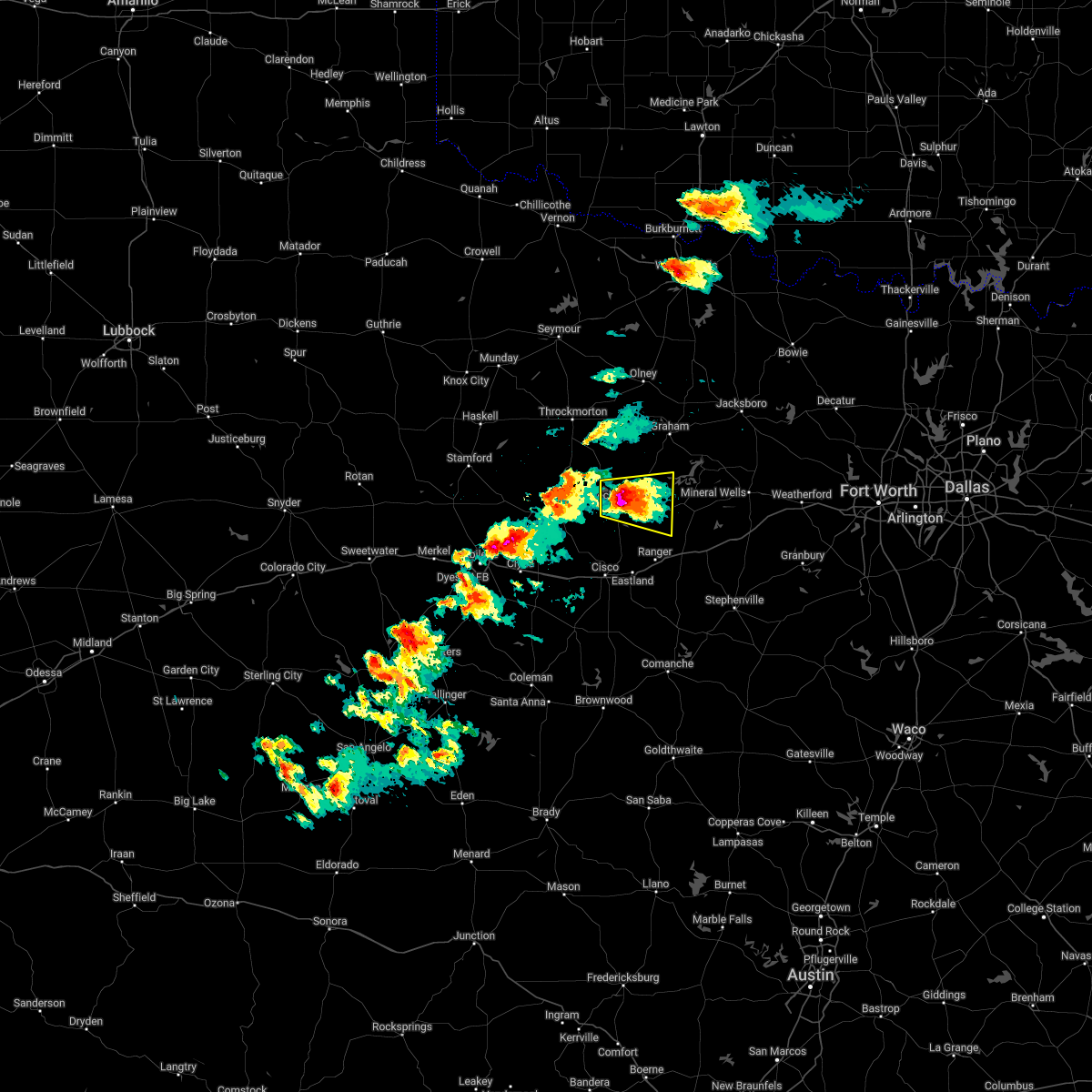 At 704 pm cdt, a severe thunderstorm was located near breckenridge, and is nearly stationary. this is a destructive storm for breckenridge (radar indicated). Hazards include baseball size hail and 60 mph wind gusts. People and animals outdoors will be severely injured. expect shattered windows, extensive damage to roofs, siding, and vehicles. locations impacted include, breckenridge, necessity and crystal falls. thunderstorm damage threat, destructive hail threat, radar indicated max hail size, 2. 75 in wind threat, radar indicated max wind gust, 60 mph. At 704 pm cdt, a severe thunderstorm was located near breckenridge, and is nearly stationary. this is a destructive storm for breckenridge (radar indicated). Hazards include baseball size hail and 60 mph wind gusts. People and animals outdoors will be severely injured. expect shattered windows, extensive damage to roofs, siding, and vehicles. locations impacted include, breckenridge, necessity and crystal falls. thunderstorm damage threat, destructive hail threat, radar indicated max hail size, 2. 75 in wind threat, radar indicated max wind gust, 60 mph.
|
| 5/13/2022 6:54 PM CDT |
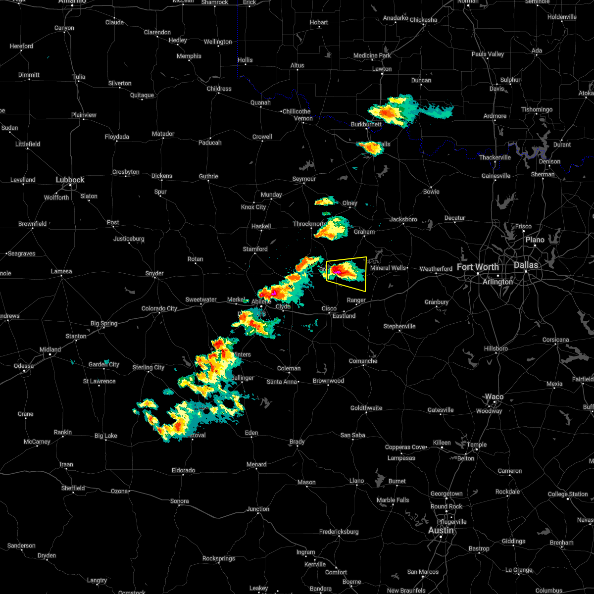 At 653 pm cdt, a severe thunderstorm was located near breckenridge, and is nearly stationary (radar indicated). Hazards include golf ball size hail and 60 mph wind gusts. People and animals outdoors will be injured. expect hail damage to roofs, siding, windows, and vehicles. expect wind damage to roofs, siding, and trees. locations impacted include, breckenridge, necessity and crystal falls. thunderstorm damage threat, considerable hail threat, observed max hail size, 1. 75 in wind threat, radar indicated max wind gust, 60 mph. At 653 pm cdt, a severe thunderstorm was located near breckenridge, and is nearly stationary (radar indicated). Hazards include golf ball size hail and 60 mph wind gusts. People and animals outdoors will be injured. expect hail damage to roofs, siding, windows, and vehicles. expect wind damage to roofs, siding, and trees. locations impacted include, breckenridge, necessity and crystal falls. thunderstorm damage threat, considerable hail threat, observed max hail size, 1. 75 in wind threat, radar indicated max wind gust, 60 mph.
|
| 5/13/2022 6:51 PM CDT | Golf Ball sized hail reported 0.8 miles NE of Breckenridge, TX, spotter reported golf ball sized hail. |
| 5/13/2022 6:47 PM CDT |
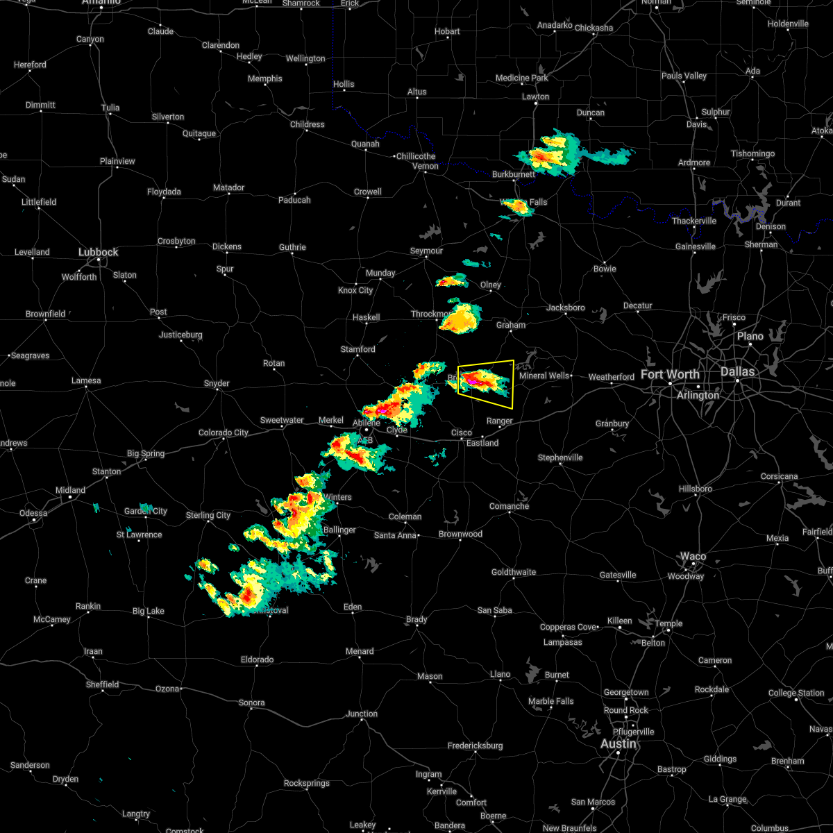 At 647 pm cdt, a severe thunderstorm was located near breckenridge, and is nearly stationary (radar indicated). Hazards include 60 mph wind gusts and quarter size hail. Hail damage to vehicles is expected. Expect wind damage to roofs, siding, and trees. At 647 pm cdt, a severe thunderstorm was located near breckenridge, and is nearly stationary (radar indicated). Hazards include 60 mph wind gusts and quarter size hail. Hail damage to vehicles is expected. Expect wind damage to roofs, siding, and trees.
|
| 4/3/2022 8:43 PM CDT |
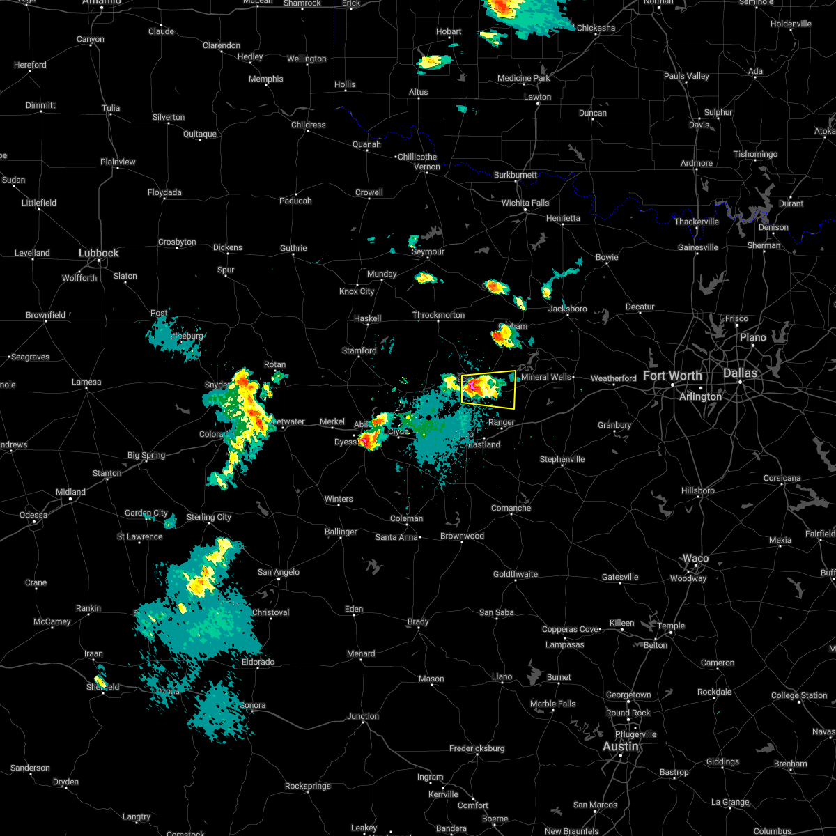 At 843 pm cdt, a severe thunderstorm was located over breckenridge, moving east at 20 mph (radar indicated). Hazards include 60 mph wind gusts and quarter size hail. Hail damage to vehicles is expected. expect wind damage to roofs, siding, and trees. locations impacted include, breckenridge and necessity. hail threat, radar indicated max hail size, 1. 00 in wind threat, radar indicated max wind gust, 60 mph. At 843 pm cdt, a severe thunderstorm was located over breckenridge, moving east at 20 mph (radar indicated). Hazards include 60 mph wind gusts and quarter size hail. Hail damage to vehicles is expected. expect wind damage to roofs, siding, and trees. locations impacted include, breckenridge and necessity. hail threat, radar indicated max hail size, 1. 00 in wind threat, radar indicated max wind gust, 60 mph.
|
| 4/3/2022 8:25 PM CDT |
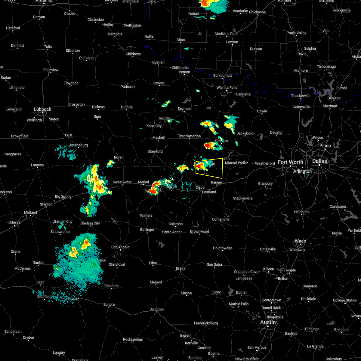 At 825 pm cdt, a severe thunderstorm was located near breckenridge, moving east at 25 mph (radar indicated). Hazards include quarter size hail. damage to vehicles is possible At 825 pm cdt, a severe thunderstorm was located near breckenridge, moving east at 25 mph (radar indicated). Hazards include quarter size hail. damage to vehicles is possible
|
| 3/21/2022 2:57 PM CDT |
 At 257 pm cdt, a severe thunderstorm was located near crystal falls, or 7 miles northeast of breckenridge, moving northeast at 50 mph (radar indicated). Hazards include 60 mph wind gusts and quarter size hail. Hail damage to vehicles is expected. expect wind damage to roofs, siding, and trees. locations impacted include, breckenridge, eastland, cisco, necessity, gunsight and crystal falls. hail threat, radar indicated max hail size, 1. 00 in wind threat, radar indicated max wind gust, 60 mph. At 257 pm cdt, a severe thunderstorm was located near crystal falls, or 7 miles northeast of breckenridge, moving northeast at 50 mph (radar indicated). Hazards include 60 mph wind gusts and quarter size hail. Hail damage to vehicles is expected. expect wind damage to roofs, siding, and trees. locations impacted include, breckenridge, eastland, cisco, necessity, gunsight and crystal falls. hail threat, radar indicated max hail size, 1. 00 in wind threat, radar indicated max wind gust, 60 mph.
|
| 3/21/2022 2:32 PM CDT |
 At 231 pm cdt, a severe thunderstorm was located near gunsight, or 9 miles north of cisco, moving northeast at 50 mph (radar indicated). Hazards include 60 mph wind gusts and quarter size hail. Hail damage to vehicles is expected. expect wind damage to roofs, siding, and trees. locations impacted include, breckenridge, eastland, cisco, necessity, gunsight and crystal falls. hail threat, radar indicated max hail size, 1. 00 in wind threat, radar indicated max wind gust, 60 mph. At 231 pm cdt, a severe thunderstorm was located near gunsight, or 9 miles north of cisco, moving northeast at 50 mph (radar indicated). Hazards include 60 mph wind gusts and quarter size hail. Hail damage to vehicles is expected. expect wind damage to roofs, siding, and trees. locations impacted include, breckenridge, eastland, cisco, necessity, gunsight and crystal falls. hail threat, radar indicated max hail size, 1. 00 in wind threat, radar indicated max wind gust, 60 mph.
|
| 3/21/2022 2:15 PM CDT |
 At 215 pm cdt, a severe thunderstorm was located near cisco, moving northeast at 50 mph (radar indicated). Hazards include 60 mph wind gusts and quarter size hail. Hail damage to vehicles is expected. Expect wind damage to roofs, siding, and trees. At 215 pm cdt, a severe thunderstorm was located near cisco, moving northeast at 50 mph (radar indicated). Hazards include 60 mph wind gusts and quarter size hail. Hail damage to vehicles is expected. Expect wind damage to roofs, siding, and trees.
|
| 2/21/2022 9:38 PM CST |
 At 937 pm cst, a severe thunderstorm was located 15 miles north of cisco, moving east at 50 mph (radar indicated). Hazards include 60 mph wind gusts and half dollar size hail. Hail damage to vehicles is expected. Expect wind damage to roofs, siding, and trees. At 937 pm cst, a severe thunderstorm was located 15 miles north of cisco, moving east at 50 mph (radar indicated). Hazards include 60 mph wind gusts and half dollar size hail. Hail damage to vehicles is expected. Expect wind damage to roofs, siding, and trees.
|
| 10/10/2021 7:08 PM CDT |
 At 707 pm cdt, a severe thunderstorm was located 7 miles east of ibex, or 8 miles southwest of breckenridge, moving east at 65 mph (radar indicated). Hazards include 70 mph wind gusts and half dollar size hail. Hail damage to vehicles is expected. expect considerable tree damage. wind damage is also likely to mobile homes, roofs, and outbuildings. locations impacted include, mineral wells, breckenridge, graford, possum kingdom state park, necessity, gunsight and crystal falls. thunderstorm damage threat, considerable hail threat, radar indicated max hail size, 1. 25 in wind threat, radar indicated max wind gust, 70 mph. At 707 pm cdt, a severe thunderstorm was located 7 miles east of ibex, or 8 miles southwest of breckenridge, moving east at 65 mph (radar indicated). Hazards include 70 mph wind gusts and half dollar size hail. Hail damage to vehicles is expected. expect considerable tree damage. wind damage is also likely to mobile homes, roofs, and outbuildings. locations impacted include, mineral wells, breckenridge, graford, possum kingdom state park, necessity, gunsight and crystal falls. thunderstorm damage threat, considerable hail threat, radar indicated max hail size, 1. 25 in wind threat, radar indicated max wind gust, 70 mph.
|
| 10/10/2021 7:03 PM CDT |
 At 702 pm cdt, a severe thunderstorm was located near ibex, or 13 miles southeast of albany, moving northeast at 65 mph (radar indicated). Hazards include 60 mph wind gusts and quarter size hail. Hail damage to vehicles is expected. Expect wind damage to roofs, siding, and trees. At 702 pm cdt, a severe thunderstorm was located near ibex, or 13 miles southeast of albany, moving northeast at 65 mph (radar indicated). Hazards include 60 mph wind gusts and quarter size hail. Hail damage to vehicles is expected. Expect wind damage to roofs, siding, and trees.
|
| 5/3/2021 10:03 PM CDT |
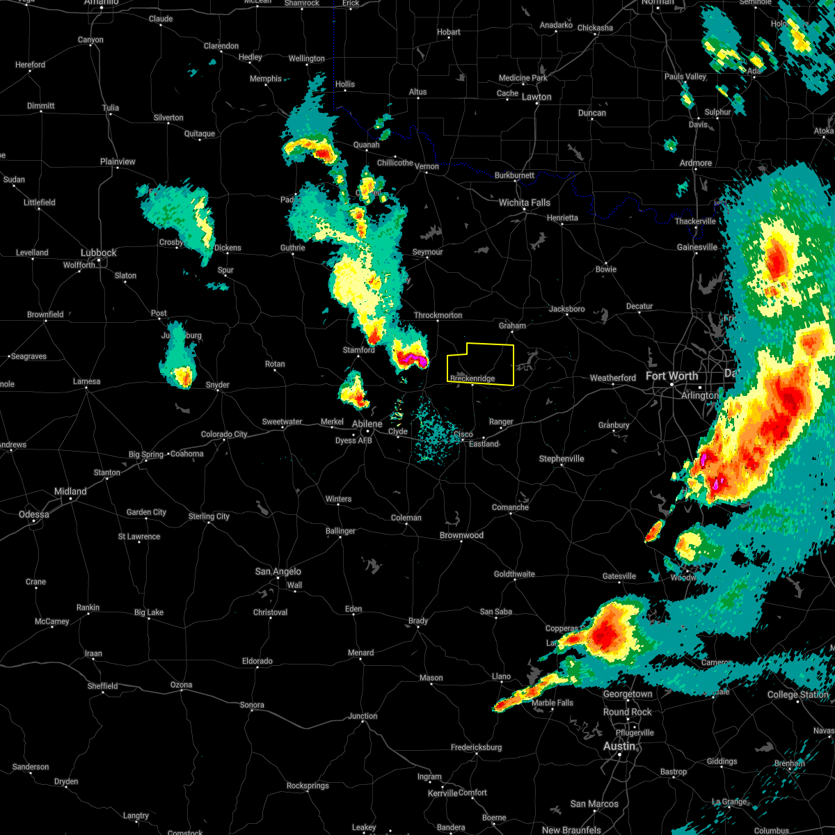 At 1003 pm cdt, a severe thunderstorm was located near fort griffin, or 15 miles northeast of albany, moving east at 45 mph (radar indicated). Hazards include half dollar size hail. damage to vehicles is possible At 1003 pm cdt, a severe thunderstorm was located near fort griffin, or 15 miles northeast of albany, moving east at 45 mph (radar indicated). Hazards include half dollar size hail. damage to vehicles is possible
|
| 4/28/2021 7:24 AM CDT |
 At 723 am cdt, a severe thunderstorm was located near necessity, or 6 miles west of caddo, moving east at 30 mph (radar indicated). Hazards include 60 mph wind gusts and quarter size hail. Hail damage to vehicles is expected. expect wind damage to roofs, siding, and trees. locations impacted include, breckenridge, gordon, possum kingdom state park, necessity, gunsight, strawn and mingus. A tornado watch remains in effect until 1000 am cdt for north central texas. At 723 am cdt, a severe thunderstorm was located near necessity, or 6 miles west of caddo, moving east at 30 mph (radar indicated). Hazards include 60 mph wind gusts and quarter size hail. Hail damage to vehicles is expected. expect wind damage to roofs, siding, and trees. locations impacted include, breckenridge, gordon, possum kingdom state park, necessity, gunsight, strawn and mingus. A tornado watch remains in effect until 1000 am cdt for north central texas.
|
| 4/28/2021 7:10 AM CDT |
 At 710 am cdt, a severe thunderstorm was located near gunsight, or 9 miles south of breckenridge, moving east at 30 mph (radar indicated). Hazards include 60 mph wind gusts and quarter size hail. Hail damage to vehicles is expected. Expect wind damage to roofs, siding, and trees. At 710 am cdt, a severe thunderstorm was located near gunsight, or 9 miles south of breckenridge, moving east at 30 mph (radar indicated). Hazards include 60 mph wind gusts and quarter size hail. Hail damage to vehicles is expected. Expect wind damage to roofs, siding, and trees.
|
| 4/28/2021 4:43 AM CDT |
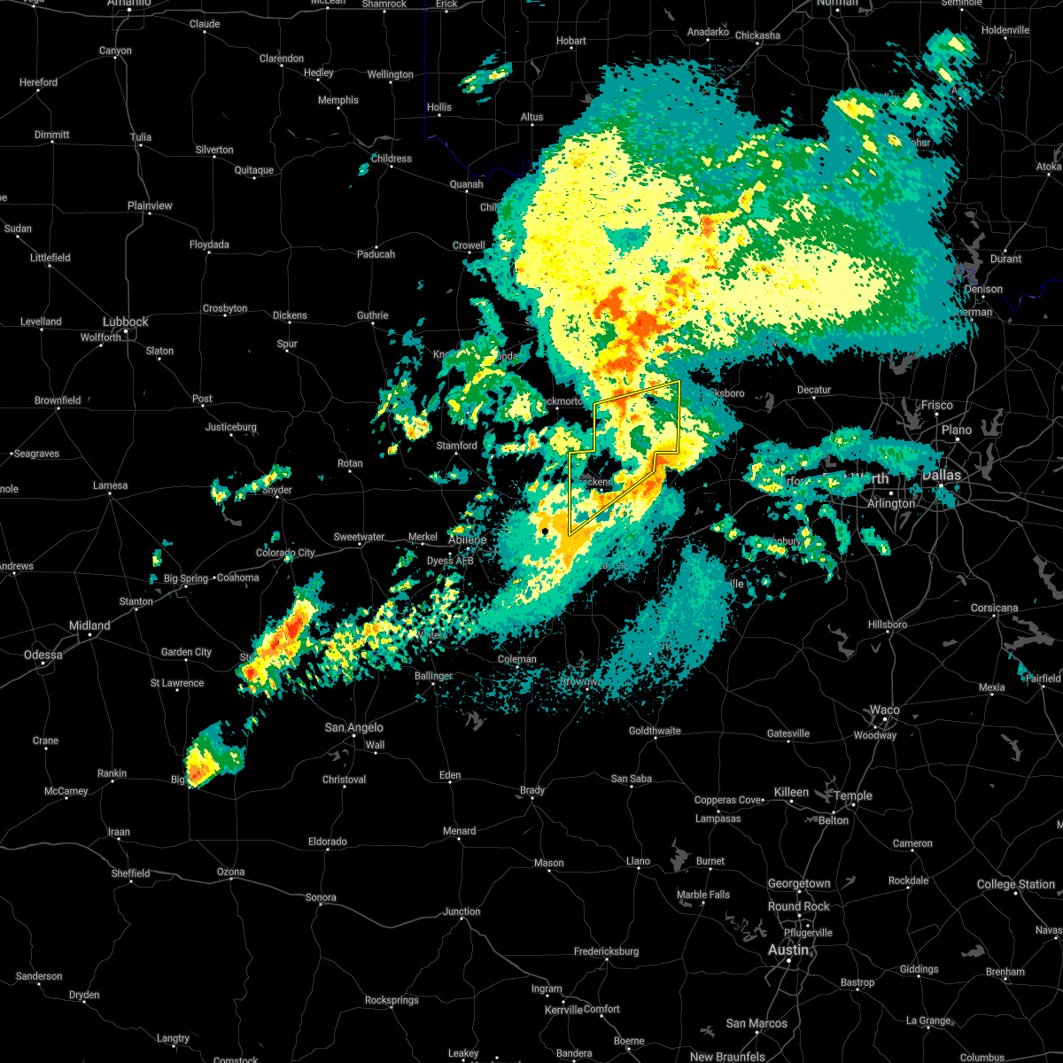 The severe thunderstorm warning for young and stephens counties will expire at 445 am cdt, the storm which prompted the warning has moved out of the area. therefore the warning will be allowed to expire. a tornado watch remains in effect until 1000 am cdt for north central texas. remember, a severe thunderstorm warning remains in effect for eastern stephens county and southeastern young county until 530 am cdt. The severe thunderstorm warning for young and stephens counties will expire at 445 am cdt, the storm which prompted the warning has moved out of the area. therefore the warning will be allowed to expire. a tornado watch remains in effect until 1000 am cdt for north central texas. remember, a severe thunderstorm warning remains in effect for eastern stephens county and southeastern young county until 530 am cdt.
|
| 4/28/2021 4:07 AM CDT |
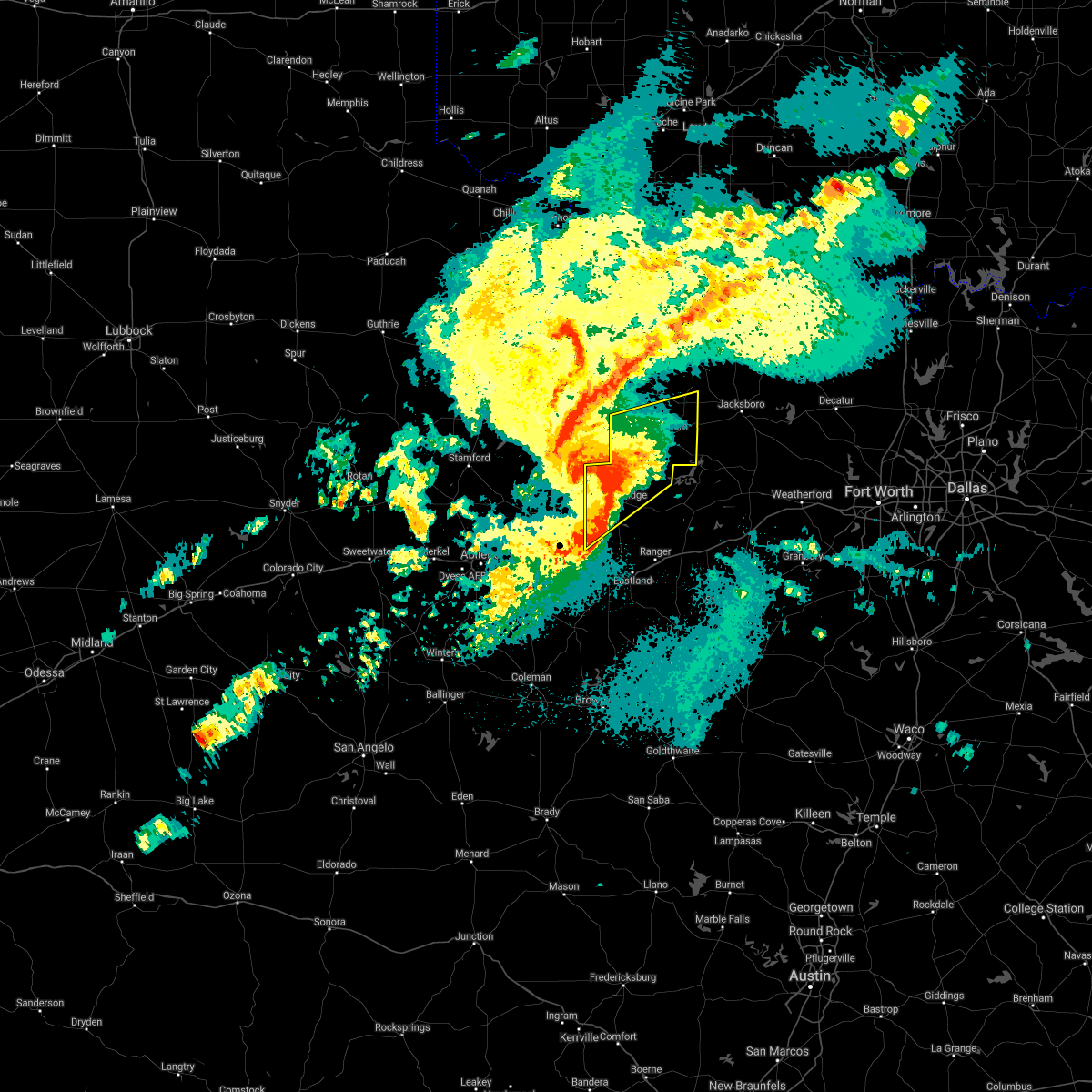 At 407 am cdt, a severe thunderstorm was located near woodson, or 14 miles northwest of breckenridge, moving northeast at 30 mph (radar indicated). Hazards include 60 mph wind gusts and half dollar size hail. Hail damage to vehicles is expected. expect wind damage to roofs, siding, and trees. locations impacted include, graham, breckenridge, crystal falls, newcastle and us- 180 near the shackelford-stephens county line. A tornado watch remains in effect until 1000 am cdt for north central texas. At 407 am cdt, a severe thunderstorm was located near woodson, or 14 miles northwest of breckenridge, moving northeast at 30 mph (radar indicated). Hazards include 60 mph wind gusts and half dollar size hail. Hail damage to vehicles is expected. expect wind damage to roofs, siding, and trees. locations impacted include, graham, breckenridge, crystal falls, newcastle and us- 180 near the shackelford-stephens county line. A tornado watch remains in effect until 1000 am cdt for north central texas.
|
| 4/28/2021 3:46 AM CDT |
 At 345 am cdt, a severe thunderstorm was located 8 miles southeast of fort griffin, or 10 miles northeast of albany, moving east at 35 mph (radar indicated). Hazards include 60 mph wind gusts and half dollar size hail. Hail damage to vehicles is expected. Expect wind damage to roofs, siding, and trees. At 345 am cdt, a severe thunderstorm was located 8 miles southeast of fort griffin, or 10 miles northeast of albany, moving east at 35 mph (radar indicated). Hazards include 60 mph wind gusts and half dollar size hail. Hail damage to vehicles is expected. Expect wind damage to roofs, siding, and trees.
|
| 4/15/2021 1:35 PM CDT |
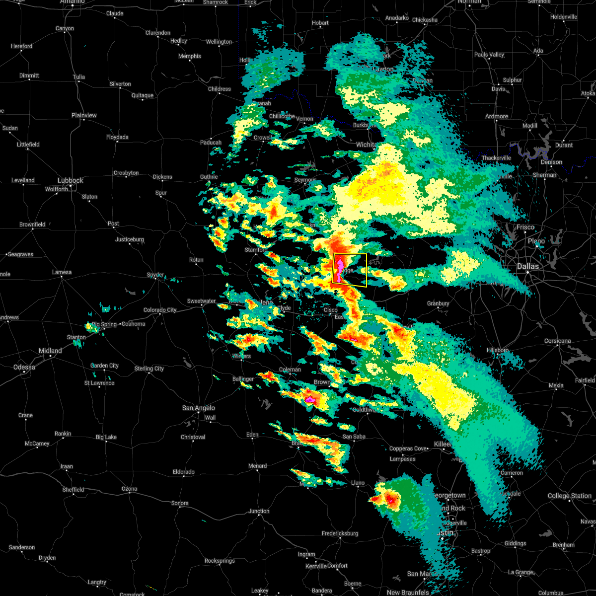 At 134 pm cdt, a severe thunderstorm was located near breckenridge, moving east at 45 mph (radar indicated). Hazards include ping pong ball size hail. People and animals outdoors will be injured. expect damage to roofs, siding, windows, and vehicles. Locations impacted include, breckenridge, necessity and crystal falls. At 134 pm cdt, a severe thunderstorm was located near breckenridge, moving east at 45 mph (radar indicated). Hazards include ping pong ball size hail. People and animals outdoors will be injured. expect damage to roofs, siding, windows, and vehicles. Locations impacted include, breckenridge, necessity and crystal falls.
|
| 4/15/2021 1:21 PM CDT |
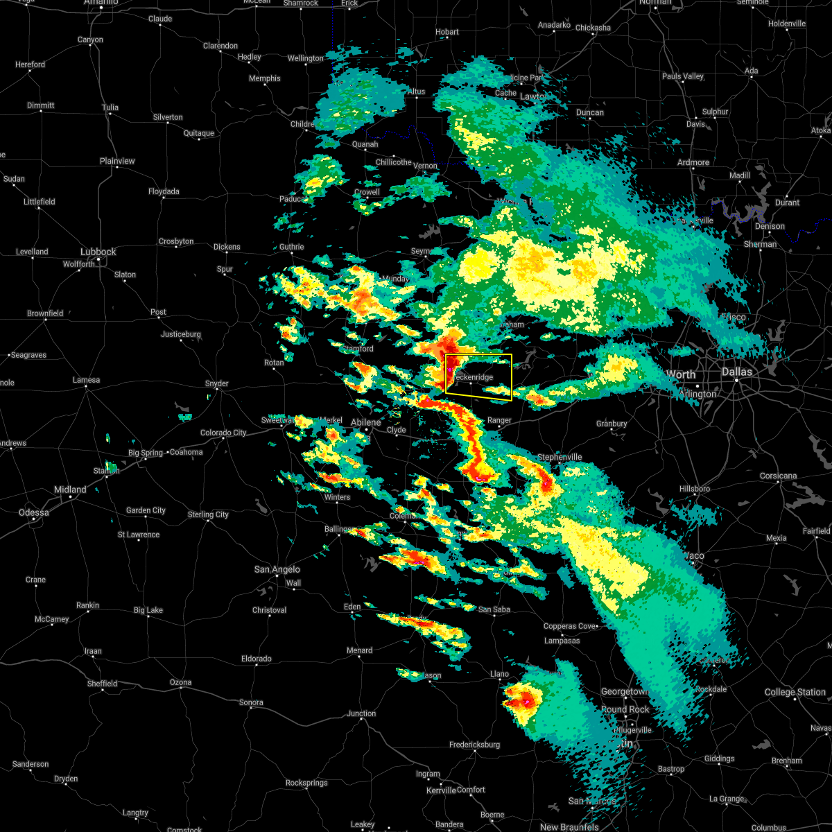 At 121 pm cdt, a severe thunderstorm was located near crystal falls, or near breckenridge, moving east at 45 mph (radar indicated). Hazards include ping pong ball size hail. People and animals outdoors will be injured. expect damage to roofs, siding, windows, and vehicles. Locations impacted include, breckenridge, necessity, crystal falls and us- 180 near the shackelford-stephens county line. At 121 pm cdt, a severe thunderstorm was located near crystal falls, or near breckenridge, moving east at 45 mph (radar indicated). Hazards include ping pong ball size hail. People and animals outdoors will be injured. expect damage to roofs, siding, windows, and vehicles. Locations impacted include, breckenridge, necessity, crystal falls and us- 180 near the shackelford-stephens county line.
|
| 4/15/2021 1:08 PM CDT |
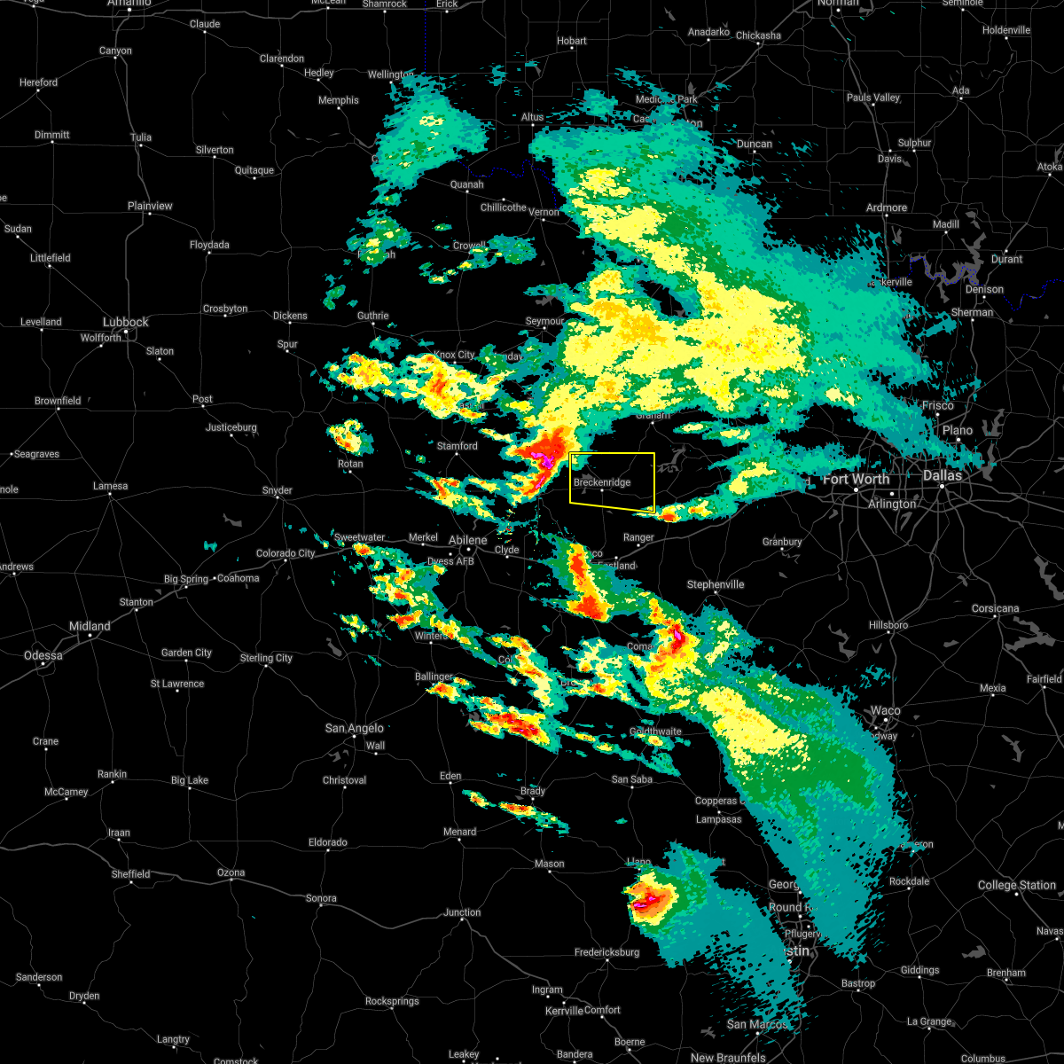 At 108 pm cdt, a severe thunderstorm was located near fort griffin, or 14 miles northeast of albany, moving east at 40 mph (radar indicated). Hazards include ping pong ball size hail. People and animals outdoors will be injured. Expect damage to roofs, siding, windows, and vehicles. At 108 pm cdt, a severe thunderstorm was located near fort griffin, or 14 miles northeast of albany, moving east at 40 mph (radar indicated). Hazards include ping pong ball size hail. People and animals outdoors will be injured. Expect damage to roofs, siding, windows, and vehicles.
|
| 4/12/2021 11:25 PM CDT |
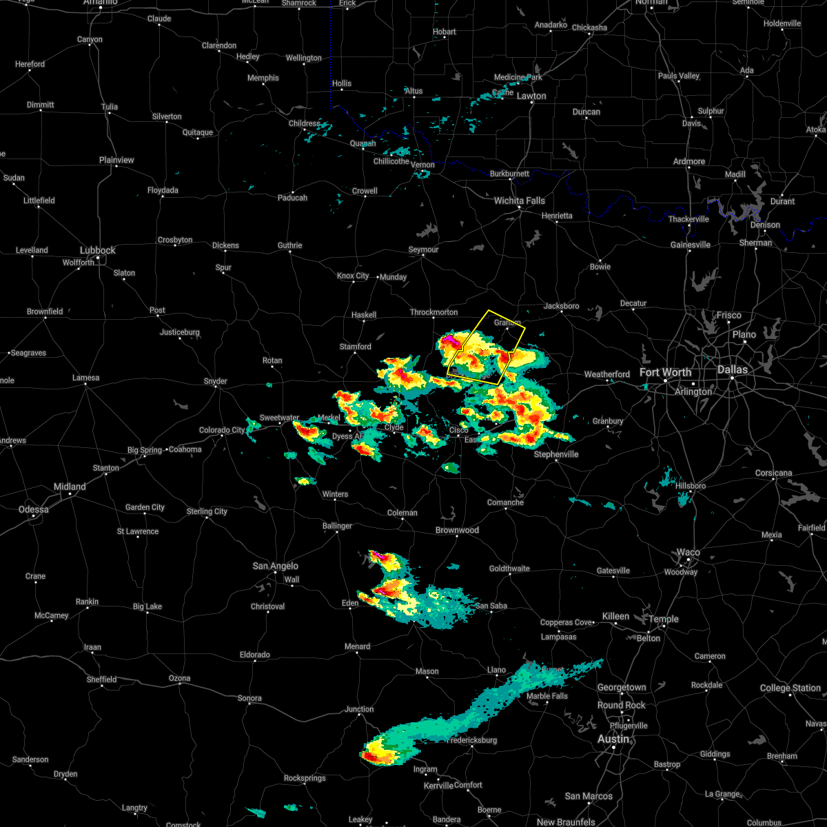 The severe thunderstorm warning for southern young and northern stephens counties will expire at 1130 pm cdt, the storm which prompted the warning has weakened below severe limits. therefore the warning will be allowed to expire. however small hail is still possible with this thunderstorm. The severe thunderstorm warning for southern young and northern stephens counties will expire at 1130 pm cdt, the storm which prompted the warning has weakened below severe limits. therefore the warning will be allowed to expire. however small hail is still possible with this thunderstorm.
|
| 4/12/2021 11:07 PM CDT |
 At 1107 pm cdt, a severe thunderstorm was located 9 miles east of crystal falls, or 13 miles northeast of breckenridge, moving northeast at 30 mph (radar indicated). Hazards include half dollar size hail. Damage to vehicles is possible. Locations impacted include, graham, breckenridge, crystal falls and newcastle. At 1107 pm cdt, a severe thunderstorm was located 9 miles east of crystal falls, or 13 miles northeast of breckenridge, moving northeast at 30 mph (radar indicated). Hazards include half dollar size hail. Damage to vehicles is possible. Locations impacted include, graham, breckenridge, crystal falls and newcastle.
|
| 4/12/2021 10:55 PM CDT |
 At 1055 pm cdt, a severe thunderstorm was located 7 miles east of breckenridge, moving northeast at 30 mph (radar indicated). Hazards include half dollar size hail. Damage to vehicles is possible. Locations impacted include, graham, breckenridge, necessity, crystal falls and newcastle. At 1055 pm cdt, a severe thunderstorm was located 7 miles east of breckenridge, moving northeast at 30 mph (radar indicated). Hazards include half dollar size hail. Damage to vehicles is possible. Locations impacted include, graham, breckenridge, necessity, crystal falls and newcastle.
|
| 4/12/2021 10:39 PM CDT |
 At 1032 pm cdt, a severe thunderstorm was located near breckenridge, moving northeast at 30 mph (radar indicated). Hazards include quarter size hail. damage to vehicles is possible At 1032 pm cdt, a severe thunderstorm was located near breckenridge, moving northeast at 30 mph (radar indicated). Hazards include quarter size hail. damage to vehicles is possible
|
| 4/12/2021 10:32 PM CDT |
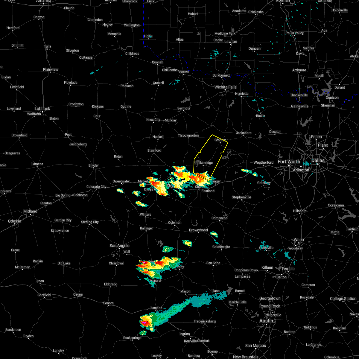 At 1032 pm cdt, a severe thunderstorm was located near breckenridge, moving northeast at 30 mph (radar indicated). Hazards include quarter size hail. damage to vehicles is possible At 1032 pm cdt, a severe thunderstorm was located near breckenridge, moving northeast at 30 mph (radar indicated). Hazards include quarter size hail. damage to vehicles is possible
|
| 9/1/2020 4:06 PM CDT |
 At 406 pm cdt, a severe thunderstorm was located 8 miles southeast of breckenridge, moving east at 25 mph (radar indicated). Hazards include 60 mph wind gusts and penny size hail. Expect damage to roofs, siding, and trees. Locations impacted include, breckenridge and necessity. At 406 pm cdt, a severe thunderstorm was located 8 miles southeast of breckenridge, moving east at 25 mph (radar indicated). Hazards include 60 mph wind gusts and penny size hail. Expect damage to roofs, siding, and trees. Locations impacted include, breckenridge and necessity.
|
| 9/1/2020 4:05 PM CDT |
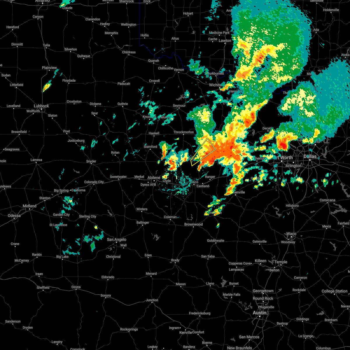 At 404 pm cdt, a severe thunderstorm was located 9 miles southwest of graham, moving northeast at 35 mph (radar indicated). Hazards include 60 mph wind gusts. Expect damage to roofs, siding, and trees. Locations impacted include, breckenridge and crystal falls. At 404 pm cdt, a severe thunderstorm was located 9 miles southwest of graham, moving northeast at 35 mph (radar indicated). Hazards include 60 mph wind gusts. Expect damage to roofs, siding, and trees. Locations impacted include, breckenridge and crystal falls.
|
| 9/1/2020 3:54 PM CDT |
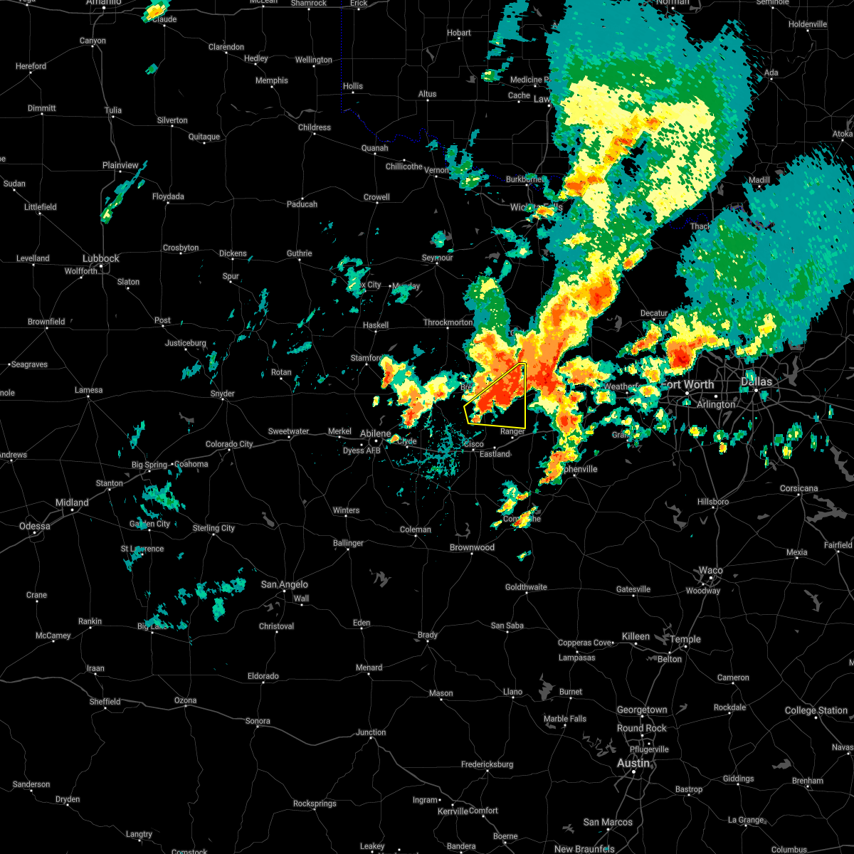 At 353 pm cdt, a severe thunderstorm was located near breckenridge, moving east at 25 mph (radar indicated). Hazards include 60 mph wind gusts and penny size hail. expect damage to roofs, siding, and trees At 353 pm cdt, a severe thunderstorm was located near breckenridge, moving east at 25 mph (radar indicated). Hazards include 60 mph wind gusts and penny size hail. expect damage to roofs, siding, and trees
|
| 9/1/2020 3:33 PM CDT |
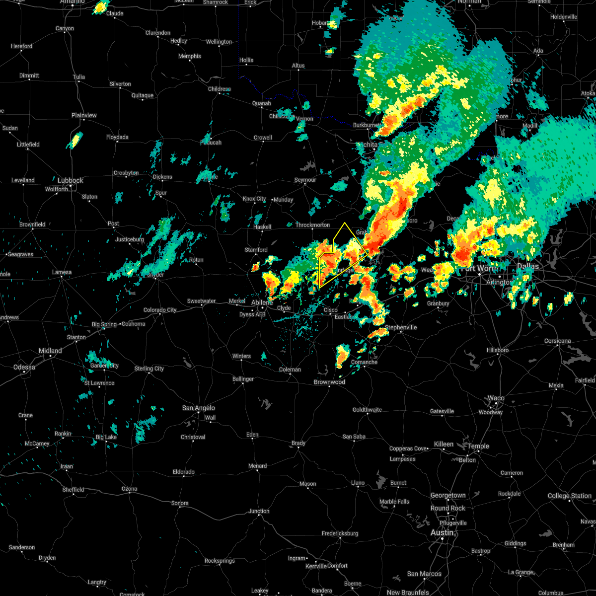 At 333 pm cdt, a severe thunderstorm was located 7 miles northwest of breckenridge, moving northeast at 30 mph (radar indicated). Hazards include 60 mph wind gusts and penny size hail. expect damage to roofs, siding, and trees At 333 pm cdt, a severe thunderstorm was located 7 miles northwest of breckenridge, moving northeast at 30 mph (radar indicated). Hazards include 60 mph wind gusts and penny size hail. expect damage to roofs, siding, and trees
|
| 5/15/2020 9:29 PM CDT |
 At 927 pm cdt, severe thunderstorms were located along a line extending from 13 miles south of windthorst to 12 miles northwest of gordon to rising star, moving east at 35 mph (weather station. at 910 pm, a 60 mph wind gust was reported at graham municipal airport). Hazards include 60 mph wind gusts and quarter size hail. Hail damage to vehicles is expected. expect wind damage to roofs, siding, and trees. Locations impacted include, mineral wells, graham, breckenridge, jacksboro, eastland, cisco, olney, ranger, gorman, rising star, graford, bryson, gordon, necessity, possum kingdom state park, gunsight, crystal falls, strawn, newcastle and carbon. At 927 pm cdt, severe thunderstorms were located along a line extending from 13 miles south of windthorst to 12 miles northwest of gordon to rising star, moving east at 35 mph (weather station. at 910 pm, a 60 mph wind gust was reported at graham municipal airport). Hazards include 60 mph wind gusts and quarter size hail. Hail damage to vehicles is expected. expect wind damage to roofs, siding, and trees. Locations impacted include, mineral wells, graham, breckenridge, jacksboro, eastland, cisco, olney, ranger, gorman, rising star, graford, bryson, gordon, necessity, possum kingdom state park, gunsight, crystal falls, strawn, newcastle and carbon.
|
| 5/15/2020 9:12 PM CDT |
 At 911 pm cdt, severe thunderstorms were located along a line extending from 11 miles east of olney to near necessity to near cross cut, moving east at 35 mph (radar indicated). Hazards include 60 mph wind gusts and quarter size hail. Hail damage to vehicles is expected. Expect wind damage to roofs, siding, and trees. At 911 pm cdt, severe thunderstorms were located along a line extending from 11 miles east of olney to near necessity to near cross cut, moving east at 35 mph (radar indicated). Hazards include 60 mph wind gusts and quarter size hail. Hail damage to vehicles is expected. Expect wind damage to roofs, siding, and trees.
|
| 5/15/2020 8:42 PM CDT |
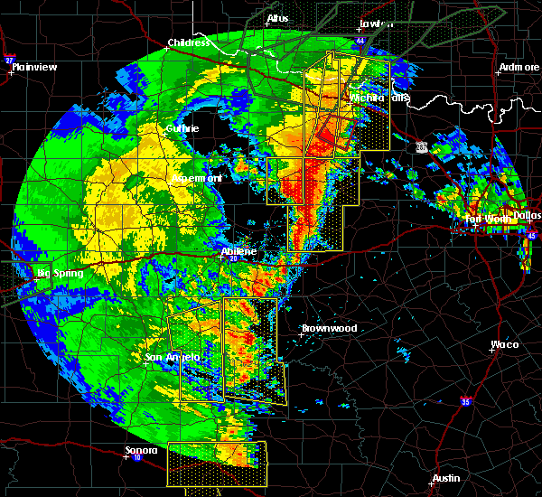 At 842 pm cdt, severe thunderstorms were located along a line extending from olney to near gunsight, moving east at 25 mph (radar indicated). Hazards include 60 mph wind gusts and half dollar size hail. Hail damage to vehicles is expected. expect wind damage to roofs, siding, and trees. Locations impacted include, graham, breckenridge, olney, necessity, gunsight, crystal falls, newcastle and us-180 near the shackelford-stephens county line. At 842 pm cdt, severe thunderstorms were located along a line extending from olney to near gunsight, moving east at 25 mph (radar indicated). Hazards include 60 mph wind gusts and half dollar size hail. Hail damage to vehicles is expected. expect wind damage to roofs, siding, and trees. Locations impacted include, graham, breckenridge, olney, necessity, gunsight, crystal falls, newcastle and us-180 near the shackelford-stephens county line.
|
| 5/15/2020 8:09 PM CDT |
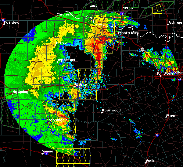 At 808 pm cdt, severe thunderstorms were located along a line extending from 6 miles northwest of elbert to near ibex, moving east at 25 mph (radar indicated). Hazards include 60 mph wind gusts and half dollar size hail. Hail damage to vehicles is expected. Expect wind damage to roofs, siding, and trees. At 808 pm cdt, severe thunderstorms were located along a line extending from 6 miles northwest of elbert to near ibex, moving east at 25 mph (radar indicated). Hazards include 60 mph wind gusts and half dollar size hail. Hail damage to vehicles is expected. Expect wind damage to roofs, siding, and trees.
|
| 5/14/2020 2:27 AM CDT |
 The severe thunderstorm warning for southwestern young and northern stephens counties will expire at 230 am cdt, the storm which prompted the warning has weakened below severe limits, and has exited the warned area. therefore, the warning will be allowed to expire. The severe thunderstorm warning for southwestern young and northern stephens counties will expire at 230 am cdt, the storm which prompted the warning has weakened below severe limits, and has exited the warned area. therefore, the warning will be allowed to expire.
|
| 5/14/2020 1:50 AM CDT |
 At 149 am cdt, a severe thunderstorm was located near crystal falls, or 10 miles north of breckenridge, moving east at 25 mph (radar indicated). Hazards include 60 mph wind gusts and quarter size hail. Hail damage to vehicles is expected. expect wind damage to roofs, siding, and trees. Locations impacted include, breckenridge and crystal falls. At 149 am cdt, a severe thunderstorm was located near crystal falls, or 10 miles north of breckenridge, moving east at 25 mph (radar indicated). Hazards include 60 mph wind gusts and quarter size hail. Hail damage to vehicles is expected. expect wind damage to roofs, siding, and trees. Locations impacted include, breckenridge and crystal falls.
|
| 5/14/2020 1:31 AM CDT |
 At 130 am cdt, a severe thunderstorm was located 8 miles east of fort griffin, or 13 miles northwest of breckenridge, moving east at 25 mph (radar indicated). Hazards include 60 mph wind gusts and quarter size hail. Hail damage to vehicles is expected. Expect wind damage to roofs, siding, and trees. At 130 am cdt, a severe thunderstorm was located 8 miles east of fort griffin, or 13 miles northwest of breckenridge, moving east at 25 mph (radar indicated). Hazards include 60 mph wind gusts and quarter size hail. Hail damage to vehicles is expected. Expect wind damage to roofs, siding, and trees.
|
| 4/28/2020 10:01 PM CDT |
 At 1000 pm cdt, a severe thunderstorm was located near breckenridge, moving south at 30 mph (emergency management). Hazards include golf ball size hail and 60 mph wind gusts. People and animals outdoors will be injured. expect hail damage to roofs, siding, windows, and vehicles. expect wind damage to roofs, siding, and trees. Locations impacted include, breckenridge, cisco, ranger and gunsight. At 1000 pm cdt, a severe thunderstorm was located near breckenridge, moving south at 30 mph (emergency management). Hazards include golf ball size hail and 60 mph wind gusts. People and animals outdoors will be injured. expect hail damage to roofs, siding, windows, and vehicles. expect wind damage to roofs, siding, and trees. Locations impacted include, breckenridge, cisco, ranger and gunsight.
|
| 4/28/2020 10:00 PM CDT | Ping Pong Ball sized hail reported 2.4 miles E of Breckenridge, TX |
| 4/28/2020 9:44 PM CDT |
 At 943 pm cdt, a severe thunderstorm was located 8 miles northwest of breckenridge, moving south at 30 mph. at 942 pm cdt, golf ball size hail was reported in northern stephens county (emergency management). Hazards include golf ball size hail and 60 mph wind gusts. People and animals outdoors will be injured. expect hail damage to roofs, siding, windows, and vehicles. expect wind damage to roofs, siding, and trees. Locations impacted include, breckenridge, cisco, ranger and gunsight. At 943 pm cdt, a severe thunderstorm was located 8 miles northwest of breckenridge, moving south at 30 mph. at 942 pm cdt, golf ball size hail was reported in northern stephens county (emergency management). Hazards include golf ball size hail and 60 mph wind gusts. People and animals outdoors will be injured. expect hail damage to roofs, siding, windows, and vehicles. expect wind damage to roofs, siding, and trees. Locations impacted include, breckenridge, cisco, ranger and gunsight.
|
| 4/28/2020 9:32 PM CDT | Golf Ball sized hail reported 15.6 miles SSE of Breckenridge, TX |
| 4/28/2020 9:31 PM CDT |
 At 931 pm cdt, a severe thunderstorm was located 7 miles south of woodson, or 12 miles northwest of breckenridge, moving south at 30 mph (radar indicated). Hazards include 60 mph wind gusts and half dollar size hail. Hail damage to vehicles is expected. Expect wind damage to roofs, siding, and trees. At 931 pm cdt, a severe thunderstorm was located 7 miles south of woodson, or 12 miles northwest of breckenridge, moving south at 30 mph (radar indicated). Hazards include 60 mph wind gusts and half dollar size hail. Hail damage to vehicles is expected. Expect wind damage to roofs, siding, and trees.
|
| 4/11/2020 8:19 PM CDT |
 At 819 pm cdt, a severe thunderstorm was located just north of breckenridge, moving east at 20 mph (radar indicated). Hazards include 60 mph wind gusts and quarter size hail. Hail damage to vehicles is expected. expect wind damage to roofs, siding, and trees. Locations impacted include, breckenridge and crystal falls. At 819 pm cdt, a severe thunderstorm was located just north of breckenridge, moving east at 20 mph (radar indicated). Hazards include 60 mph wind gusts and quarter size hail. Hail damage to vehicles is expected. expect wind damage to roofs, siding, and trees. Locations impacted include, breckenridge and crystal falls.
|
| 4/11/2020 7:46 PM CDT |
 At 745 pm cdt, a severe thunderstorm was located near ibex, or 11 miles east of albany, moving east at 25 mph. this storm is expected to move along highway 180 west of breckenridge (radar indicated). Hazards include 60 mph wind gusts and half dollar size hail. Hail damage to vehicles is expected. expect wind damage to roofs, siding, and trees. Locations impacted include, breckenridge, necessity, crystal falls and us- 180 near the shackelford-stephens county line. At 745 pm cdt, a severe thunderstorm was located near ibex, or 11 miles east of albany, moving east at 25 mph. this storm is expected to move along highway 180 west of breckenridge (radar indicated). Hazards include 60 mph wind gusts and half dollar size hail. Hail damage to vehicles is expected. expect wind damage to roofs, siding, and trees. Locations impacted include, breckenridge, necessity, crystal falls and us- 180 near the shackelford-stephens county line.
|
| 4/11/2020 7:25 PM CDT |
 At 725 pm cdt, a severe thunderstorm was located 8 miles southeast of fort griffin, or 13 miles northwest of breckenridge, moving east at 20 mph (radar indicated). Hazards include 60 mph wind gusts and quarter size hail. Hail damage to vehicles is expected. Expect wind damage to roofs, siding, and trees. At 725 pm cdt, a severe thunderstorm was located 8 miles southeast of fort griffin, or 13 miles northwest of breckenridge, moving east at 20 mph (radar indicated). Hazards include 60 mph wind gusts and quarter size hail. Hail damage to vehicles is expected. Expect wind damage to roofs, siding, and trees.
|
| 4/11/2020 10:20 AM CDT | Quarter sized hail reported 13.5 miles SSE of Breckenridge, TX, quarter size hail reported 10 miles south of woodson. |
| 3/19/2020 2:29 AM CDT |
 At 229 am cdt, a severe thunderstorm was located 8 miles southeast of fort griffin, or 12 miles northeast of albany, moving northeast at 45 mph (radar indicated). Hazards include golf ball size hail and 65 mph wind gusts. People and animals outdoors will be injured. expect hail damage to roofs, siding, windows, and vehicles. Expect wind damage to roofs, siding, and trees. At 229 am cdt, a severe thunderstorm was located 8 miles southeast of fort griffin, or 12 miles northeast of albany, moving northeast at 45 mph (radar indicated). Hazards include golf ball size hail and 65 mph wind gusts. People and animals outdoors will be injured. expect hail damage to roofs, siding, windows, and vehicles. Expect wind damage to roofs, siding, and trees.
|
| 3/18/2020 8:46 PM CDT |
 At 846 pm cdt, a severe thunderstorm was located near breckenridge, moving northeast at 30 mph (radar indicated). Hazards include 65 mph wind gusts and quarter size hail. Hail damage to vehicles is expected. expect wind damage to roofs, siding, and trees. locations impacted include, breckenridge and crystal falls. A tornado watch remains in effect until midnight cdt for north central texas. At 846 pm cdt, a severe thunderstorm was located near breckenridge, moving northeast at 30 mph (radar indicated). Hazards include 65 mph wind gusts and quarter size hail. Hail damage to vehicles is expected. expect wind damage to roofs, siding, and trees. locations impacted include, breckenridge and crystal falls. A tornado watch remains in effect until midnight cdt for north central texas.
|
| 3/18/2020 8:24 PM CDT |
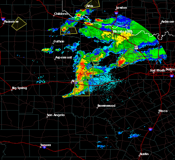 At 824 pm cdt, a severe thunderstorm was located near ibex, or 9 miles east of albany, moving northeast at 35 mph (radar indicated). Hazards include 60 mph wind gusts and quarter size hail. Hail damage to vehicles is expected. Expect wind damage to roofs, siding, and trees. At 824 pm cdt, a severe thunderstorm was located near ibex, or 9 miles east of albany, moving northeast at 35 mph (radar indicated). Hazards include 60 mph wind gusts and quarter size hail. Hail damage to vehicles is expected. Expect wind damage to roofs, siding, and trees.
|
| 3/17/2020 9:49 PM CDT |
 At 949 pm cdt, a severe thunderstorm was located 7 miles northwest of possum kingdom state park, or 9 miles south of graham, moving east at 40 mph (radar indicated). Hazards include 60 mph wind gusts and nickel size hail. Expect damage to roofs, siding, and trees. Locations impacted include, graham, breckenridge, crystal falls and newcastle. At 949 pm cdt, a severe thunderstorm was located 7 miles northwest of possum kingdom state park, or 9 miles south of graham, moving east at 40 mph (radar indicated). Hazards include 60 mph wind gusts and nickel size hail. Expect damage to roofs, siding, and trees. Locations impacted include, graham, breckenridge, crystal falls and newcastle.
|
| 3/17/2020 9:10 PM CDT |
 At 910 pm cdt, a severe thunderstorm was located 9 miles west of crystal falls, or 9 miles northwest of breckenridge, moving east at 40 mph (public reported quarter size hail near albany, tx, just before 9 pm). Hazards include 65 mph wind gusts and quarter size hail. Hail damage to vehicles is expected. expect wind damage to roofs, siding, and trees. Locations impacted include, graham, breckenridge, crystal falls, newcastle and us- 180 near the shackelford-stephens county line. At 910 pm cdt, a severe thunderstorm was located 9 miles west of crystal falls, or 9 miles northwest of breckenridge, moving east at 40 mph (public reported quarter size hail near albany, tx, just before 9 pm). Hazards include 65 mph wind gusts and quarter size hail. Hail damage to vehicles is expected. expect wind damage to roofs, siding, and trees. Locations impacted include, graham, breckenridge, crystal falls, newcastle and us- 180 near the shackelford-stephens county line.
|
| 3/17/2020 9:05 PM CDT |
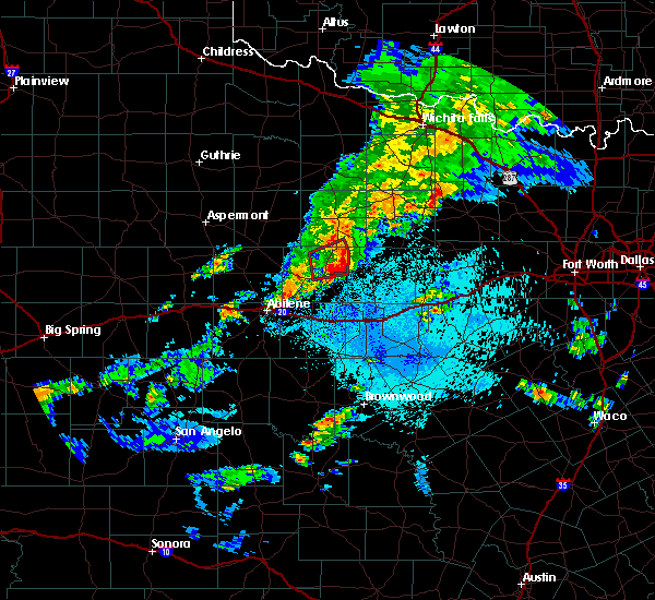 At 904 pm cdt, a severe thunderstorm was located 9 miles southeast of fort griffin, or 12 miles northwest of breckenridge, moving east at 40 mph (radar indicated). Hazards include 65 mph wind gusts and quarter size hail. Hail damage to vehicles is expected. Expect wind damage to roofs, siding, and trees. At 904 pm cdt, a severe thunderstorm was located 9 miles southeast of fort griffin, or 12 miles northwest of breckenridge, moving east at 40 mph (radar indicated). Hazards include 65 mph wind gusts and quarter size hail. Hail damage to vehicles is expected. Expect wind damage to roofs, siding, and trees.
|
| 6/23/2019 7:28 PM CDT |
 At 727 pm cdt, severe thunderstorms were located along a line extending from 8 miles east of crystal falls to 8 miles south of cisco, moving east at 30 mph (radar indicated). Hazards include 60 mph wind gusts and nickel size hail. Expect damage to roofs, siding, and trees. Locations impacted include, breckenridge, eastland, cisco, ranger, gorman, rising star, necessity, gunsight and carbon. At 727 pm cdt, severe thunderstorms were located along a line extending from 8 miles east of crystal falls to 8 miles south of cisco, moving east at 30 mph (radar indicated). Hazards include 60 mph wind gusts and nickel size hail. Expect damage to roofs, siding, and trees. Locations impacted include, breckenridge, eastland, cisco, ranger, gorman, rising star, necessity, gunsight and carbon.
|
| 6/23/2019 6:47 PM CDT |
 At 647 pm cdt, a severe thunderstorm was located near moran, or 11 miles northwest of cisco, moving east at 40 mph (radar indicated). Hazards include 60 mph wind gusts and quarter size hail. Hail damage to vehicles is expected. Expect wind damage to roofs, siding, and trees. At 647 pm cdt, a severe thunderstorm was located near moran, or 11 miles northwest of cisco, moving east at 40 mph (radar indicated). Hazards include 60 mph wind gusts and quarter size hail. Hail damage to vehicles is expected. Expect wind damage to roofs, siding, and trees.
|
| 6/2/2019 3:21 AM CDT |
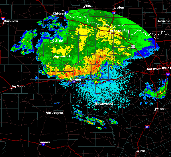 At 321 am cdt, severe thunderstorms were located along a line extending from 10 miles west of graham, to near crystal falls, to 5 miles northwest of breckenridge, to near albany, moving east at 55 mph (radar indicated). Hazards include 60 mph wind gusts and penny size hail. Expect damage to roofs, siding, and trees. Locations impacted include, graham, breckenridge, necessity, gunsight, crystal falls and newcastle. At 321 am cdt, severe thunderstorms were located along a line extending from 10 miles west of graham, to near crystal falls, to 5 miles northwest of breckenridge, to near albany, moving east at 55 mph (radar indicated). Hazards include 60 mph wind gusts and penny size hail. Expect damage to roofs, siding, and trees. Locations impacted include, graham, breckenridge, necessity, gunsight, crystal falls and newcastle.
|
| 6/2/2019 3:20 AM CDT | Roof blown off of a residence just northwest of breckenridge. time estimated via rada in stephens county TX, 4.2 miles SE of Breckenridge, TX |
| 6/2/2019 2:59 AM CDT |
 At 258 am cdt, severe thunderstorms were located along a line extending from 6 miles south of elbert, to near fort griffin, to 9 miles north of albany, moving east at 55 mph (radar indicated). Hazards include 60 mph wind gusts and penny size hail. expect damage to roofs, siding, and trees At 258 am cdt, severe thunderstorms were located along a line extending from 6 miles south of elbert, to near fort griffin, to 9 miles north of albany, moving east at 55 mph (radar indicated). Hazards include 60 mph wind gusts and penny size hail. expect damage to roofs, siding, and trees
|
| 5/29/2019 9:00 AM CDT |
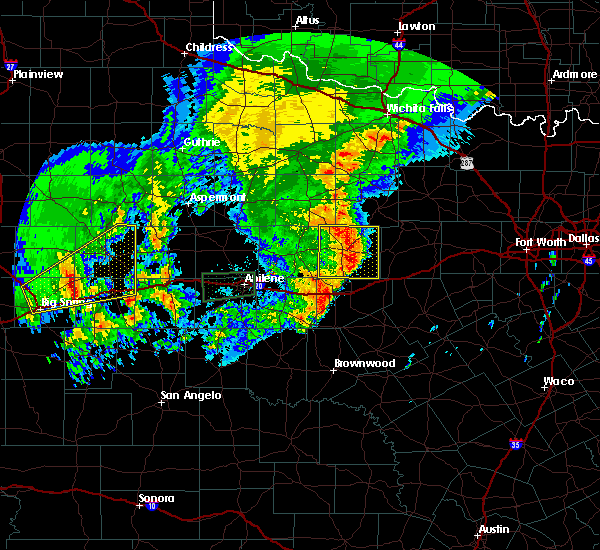 At 859 am cdt, a severe thunderstorm was located near necessity, or just south of breckenridge, moving east at 40 mph (radar indicated). Hazards include 60 mph wind gusts and quarter size hail. Hail damage to vehicles is expected. expect wind damage to roofs, siding, and trees. Locations impacted include, breckenridge, necessity, gunsight and crystal falls. At 859 am cdt, a severe thunderstorm was located near necessity, or just south of breckenridge, moving east at 40 mph (radar indicated). Hazards include 60 mph wind gusts and quarter size hail. Hail damage to vehicles is expected. expect wind damage to roofs, siding, and trees. Locations impacted include, breckenridge, necessity, gunsight and crystal falls.
|
| 5/29/2019 8:33 AM CDT |
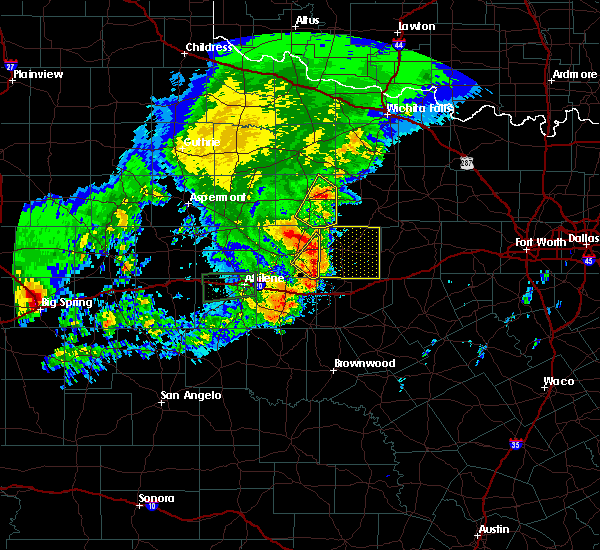 At 832 am cdt, a severe thunderstorm was located over ibex, or 10 miles southeast of albany, moving northeast at 50 mph (radar indicated). Hazards include 60 mph wind gusts and quarter size hail. Hail damage to vehicles is expected. Expect wind damage to roofs, siding, and trees. At 832 am cdt, a severe thunderstorm was located over ibex, or 10 miles southeast of albany, moving northeast at 50 mph (radar indicated). Hazards include 60 mph wind gusts and quarter size hail. Hail damage to vehicles is expected. Expect wind damage to roofs, siding, and trees.
|
| 5/18/2019 8:16 AM CDT |
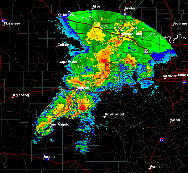 At 816 am cdt, a severe thunderstorm was located 7 miles northeast of crystal falls, or 15 miles north of breckenridge, moving east at 40 mph (radar indicated). Hazards include 60 mph wind gusts and penny size hail. Expect damage to roofs, siding, and trees. locations impacted include, graham, breckenridge, crystal falls, newcastle and us- 180 near the shackelford-stephens county line. A tornado watch remains in effect until 1000 am cdt for north central texas. At 816 am cdt, a severe thunderstorm was located 7 miles northeast of crystal falls, or 15 miles north of breckenridge, moving east at 40 mph (radar indicated). Hazards include 60 mph wind gusts and penny size hail. Expect damage to roofs, siding, and trees. locations impacted include, graham, breckenridge, crystal falls, newcastle and us- 180 near the shackelford-stephens county line. A tornado watch remains in effect until 1000 am cdt for north central texas.
|
| 5/18/2019 7:51 AM CDT |
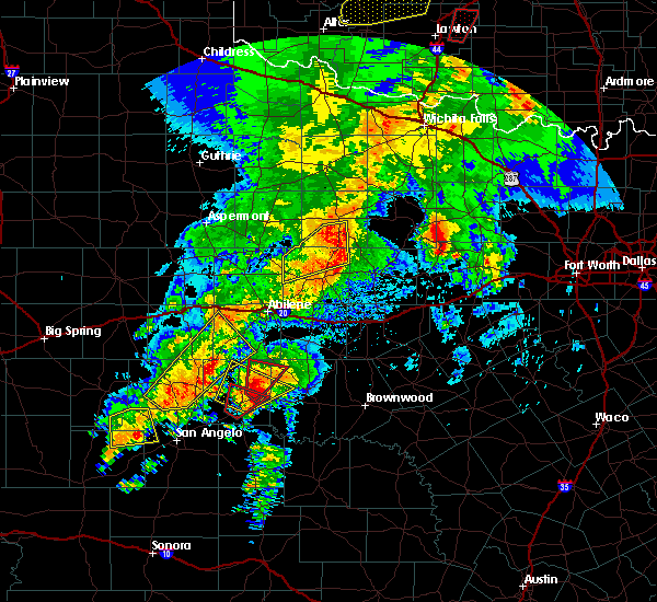 At 751 am cdt, a severe thunderstorm was located 8 miles south of woodson, or 13 miles northwest of breckenridge, moving east at 45 mph (radar indicated). Hazards include 60 mph wind gusts and penny size hail. expect damage to roofs, siding, and trees At 751 am cdt, a severe thunderstorm was located 8 miles south of woodson, or 13 miles northwest of breckenridge, moving east at 45 mph (radar indicated). Hazards include 60 mph wind gusts and penny size hail. expect damage to roofs, siding, and trees
|
| 4/23/2019 3:10 PM CDT |
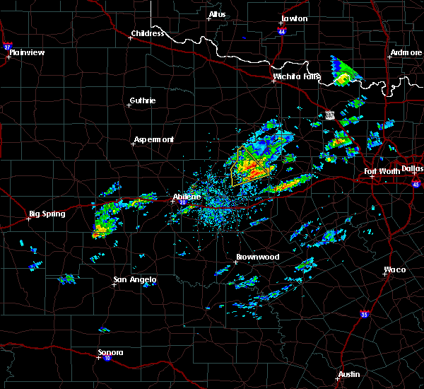 The severe thunderstorm warning for southwestern young and northern stephens counties will expire at 315 pm cdt, the storm which prompted the warning has weakened below severe limits. therefore the warning will be allowed to expire. however small hail and gusty winds are still possible with this thunderstorm. a severe thunderstorm watch remains in effect until 1100 pm cdt for north central texas. The severe thunderstorm warning for southwestern young and northern stephens counties will expire at 315 pm cdt, the storm which prompted the warning has weakened below severe limits. therefore the warning will be allowed to expire. however small hail and gusty winds are still possible with this thunderstorm. a severe thunderstorm watch remains in effect until 1100 pm cdt for north central texas.
|
| 4/23/2019 2:59 PM CDT |
 At 258 pm cdt, a severe thunderstorm was located over crystal falls, or near breckenridge, moving northeast at 30 mph (radar indicated). Hazards include 60 mph wind gusts and quarter size hail. Hail damage to vehicles is expected. expect wind damage to roofs, siding, and trees. Locations impacted include, breckenridge and crystal falls. At 258 pm cdt, a severe thunderstorm was located over crystal falls, or near breckenridge, moving northeast at 30 mph (radar indicated). Hazards include 60 mph wind gusts and quarter size hail. Hail damage to vehicles is expected. expect wind damage to roofs, siding, and trees. Locations impacted include, breckenridge and crystal falls.
|
| 4/23/2019 2:21 PM CDT |
 At 220 pm cdt, a severe thunderstorm was located near ibex, or 7 miles east of albany, moving northeast at 30 mph (radar indicated). Hazards include 60 mph wind gusts and quarter size hail. Hail damage to vehicles is expected. Expect wind damage to roofs, siding, and trees. At 220 pm cdt, a severe thunderstorm was located near ibex, or 7 miles east of albany, moving northeast at 30 mph (radar indicated). Hazards include 60 mph wind gusts and quarter size hail. Hail damage to vehicles is expected. Expect wind damage to roofs, siding, and trees.
|
| 3/13/2019 2:49 AM CDT |
 At 249 am cdt, severe thunderstorms were located along a line extending from olney to ranger, moving east at 55 mph (radar indicated). Hazards include 65 mph wind gusts. Expect damage to roofs, siding, and trees. Locations impacted include, mineral wells, graham, breckenridge, jacksboro, olney, graford, bryson, necessity, possum kingdom state park, gunsight, crystal falls, strawn and newcastle. At 249 am cdt, severe thunderstorms were located along a line extending from olney to ranger, moving east at 55 mph (radar indicated). Hazards include 65 mph wind gusts. Expect damage to roofs, siding, and trees. Locations impacted include, mineral wells, graham, breckenridge, jacksboro, olney, graford, bryson, necessity, possum kingdom state park, gunsight, crystal falls, strawn and newcastle.
|
| 3/13/2019 2:05 AM CDT |
 At 203 am cdt, severe thunderstorms were located along a line extending from near throckmorton to near moran, moving northeast at 55 mph (radar indicated). Hazards include 65 mph wind gusts. expect damage to roofs, siding, and trees At 203 am cdt, severe thunderstorms were located along a line extending from near throckmorton to near moran, moving northeast at 55 mph (radar indicated). Hazards include 65 mph wind gusts. expect damage to roofs, siding, and trees
|
| 12/26/2018 5:45 PM CST | 2 power lines down and 1 broken telephone pole in the northwest part of the city of breckenridge in stephens county TX, 0.8 miles NW of Breckenridge, TX |
| 12/26/2018 5:45 PM CST | 2 power lines down and 1 broken telephone pole in the northwest part of the city of breckenridge in stephens county TX, 0.8 miles NW of Breckenridge, TX |
| 12/26/2018 5:07 PM CST |
 At 507 pm cst, severe thunderstorms were located along a line extending from near albany to near cross plains, moving east at 45 mph (radar indicated). Hazards include 60 mph wind gusts. expect damage to roofs, siding, and trees At 507 pm cst, severe thunderstorms were located along a line extending from near albany to near cross plains, moving east at 45 mph (radar indicated). Hazards include 60 mph wind gusts. expect damage to roofs, siding, and trees
|
| 11/30/2018 6:09 PM CST | One dead tree fell on a parked car in breckenridge in stephens county TX, 0.8 miles NW of Breckenridge, TX |
| 5/3/2018 8:04 AM CDT |
 At 803 am cdt, severe thunderstorms were located along a line extending from 8 miles southeast of crystal falls to 7 miles southeast of necessity to 8 miles northeast of rising star, moving northeast at 55 mph (radar indicated). Hazards include 60 mph wind gusts and quarter size hail. Hail damage to vehicles is expected. expect wind damage to roofs, siding, and trees. Locations impacted include, breckenridge, eastland, cisco, ranger, gorman, gordon, necessity, possum kingdom state park, gunsight, crystal falls, strawn, carbon and mingus. At 803 am cdt, severe thunderstorms were located along a line extending from 8 miles southeast of crystal falls to 7 miles southeast of necessity to 8 miles northeast of rising star, moving northeast at 55 mph (radar indicated). Hazards include 60 mph wind gusts and quarter size hail. Hail damage to vehicles is expected. expect wind damage to roofs, siding, and trees. Locations impacted include, breckenridge, eastland, cisco, ranger, gorman, gordon, necessity, possum kingdom state park, gunsight, crystal falls, strawn, carbon and mingus.
|
| 5/3/2018 7:48 AM CDT |
 At 748 am cdt, severe thunderstorms were located along a line extending from breckenridge to near gunsight to 6 miles east of cross plains, moving northeast at 55 mph (radar indicated). Hazards include 60 mph wind gusts and quarter size hail. Hail damage to vehicles is expected. Expect wind damage to roofs, siding, and trees. At 748 am cdt, severe thunderstorms were located along a line extending from breckenridge to near gunsight to 6 miles east of cross plains, moving northeast at 55 mph (radar indicated). Hazards include 60 mph wind gusts and quarter size hail. Hail damage to vehicles is expected. Expect wind damage to roofs, siding, and trees.
|
| 7/1/2017 5:51 AM CDT |
 At 550 am cdt, severe thunderstorms were located along a line extending from near albany to 6 miles northeast of oplin, moving east at 40 mph (radar indicated). Hazards include 60 mph wind gusts and dime size hail or smaller. damage to roofs, siding, and trees or tree limbs possible At 550 am cdt, severe thunderstorms were located along a line extending from near albany to 6 miles northeast of oplin, moving east at 40 mph (radar indicated). Hazards include 60 mph wind gusts and dime size hail or smaller. damage to roofs, siding, and trees or tree limbs possible
|
| 5/19/2017 7:20 AM CDT | Downed utility lines just south and west of ivan. time estimated via rada in stephens county TX, 13 miles SW of Breckenridge, TX |
| 5/19/2017 7:17 AM CDT |
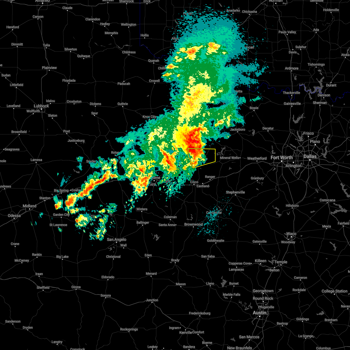 At 717 am cdt, a severe thunderstorm was located near crystal falls, or 10 miles north of breckenridge, moving northeast at 50 mph (radar indicated). Hazards include 60 mph wind gusts and nickel size hail. Expect damage to roofs, siding, and trees. Locations impacted include, breckenridge and crystal falls. At 717 am cdt, a severe thunderstorm was located near crystal falls, or 10 miles north of breckenridge, moving northeast at 50 mph (radar indicated). Hazards include 60 mph wind gusts and nickel size hail. Expect damage to roofs, siding, and trees. Locations impacted include, breckenridge and crystal falls.
|
| 5/19/2017 6:40 AM CDT |
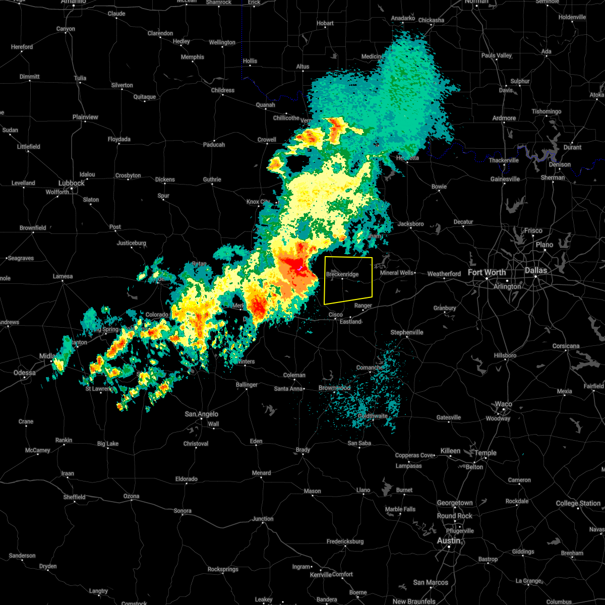 At 639 am cdt, a severe thunderstorm was located near ibex, or 7 miles east of albany, moving east at 45 mph (radar indicated). Hazards include 65 mph wind gusts and quarter size hail. Hail damage to vehicles is expected. Expect wind damage to roofs, siding, and trees. At 639 am cdt, a severe thunderstorm was located near ibex, or 7 miles east of albany, moving east at 45 mph (radar indicated). Hazards include 65 mph wind gusts and quarter size hail. Hail damage to vehicles is expected. Expect wind damage to roofs, siding, and trees.
|
| 5/18/2017 10:23 PM CDT |
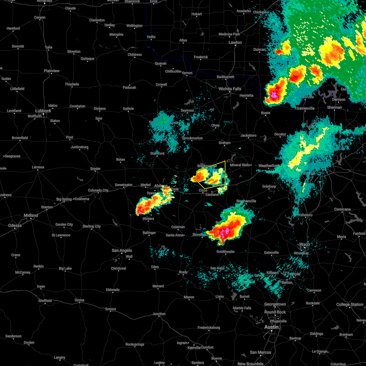 The severe thunderstorm warning for north central eastland and stephens counties will expire at 1030 pm cdt, the storm which prompted the warning has weakened below severe limits. therefore the warning will be allowed to expire. however small hail and gusty winds are still possible with this thunderstorm. The severe thunderstorm warning for north central eastland and stephens counties will expire at 1030 pm cdt, the storm which prompted the warning has weakened below severe limits. therefore the warning will be allowed to expire. however small hail and gusty winds are still possible with this thunderstorm.
|
| 5/18/2017 9:46 PM CDT |
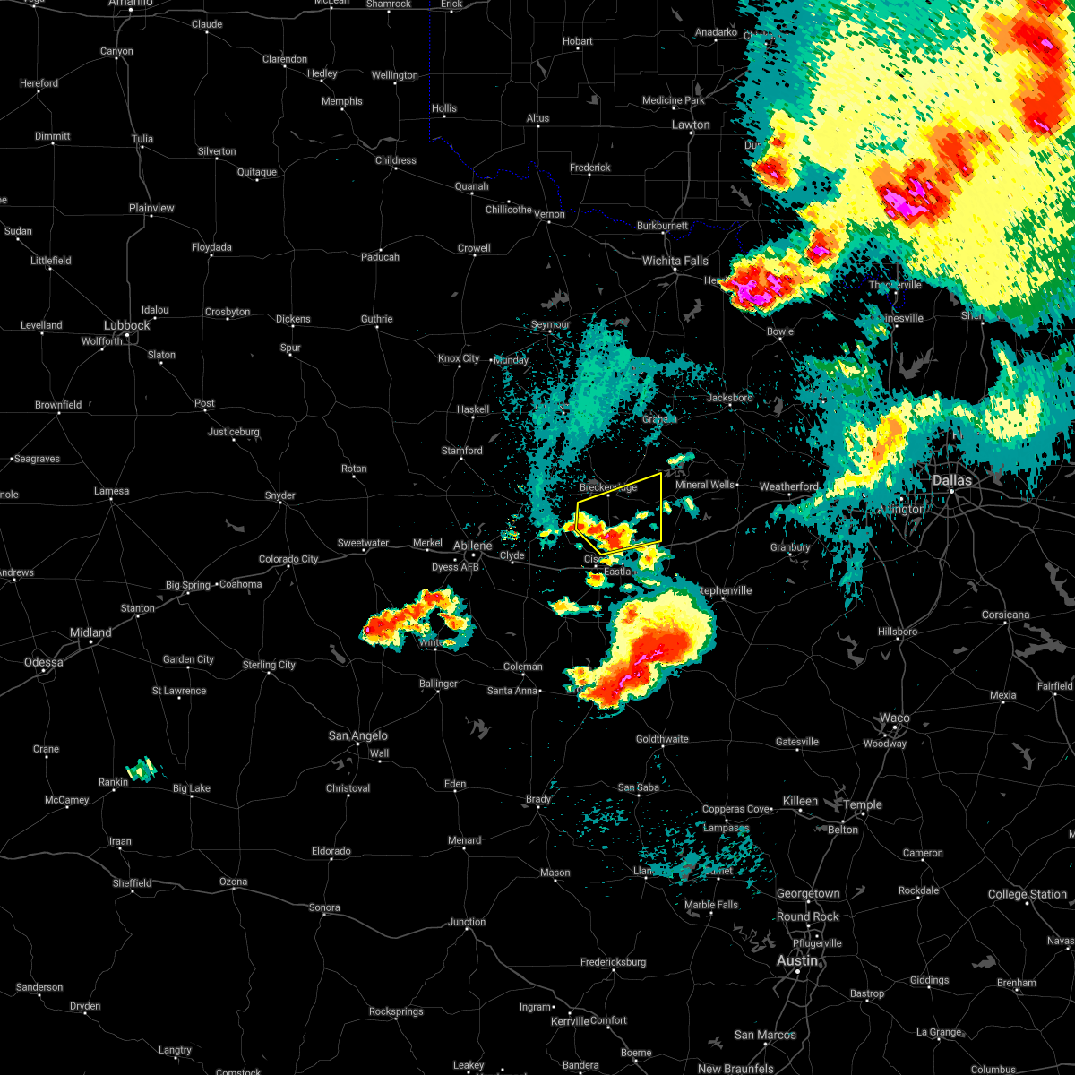 At 946 pm cdt, a severe thunderstorm was located near gunsight, or 10 miles northwest of eastland, moving northeast at 20 mph (radar indicated). Hazards include 60 mph wind gusts and half dollar size hail. Hail damage to vehicles is expected. Expect wind damage to roofs, siding, and trees. At 946 pm cdt, a severe thunderstorm was located near gunsight, or 10 miles northwest of eastland, moving northeast at 20 mph (radar indicated). Hazards include 60 mph wind gusts and half dollar size hail. Hail damage to vehicles is expected. Expect wind damage to roofs, siding, and trees.
|
| 5/18/2017 9:02 PM CDT | Quarter sized hail reported 0.8 miles NW of Breckenridge, TX, delayed report: quarter size hail report near breckenridge |
| 5/18/2017 9:00 PM CDT | Golf Ball sized hail reported 0.8 miles NW of Breckenridge, TX, delayed report: trained spotter report golf ball to baseball size hail east of brekenridge. |
| 4/21/2017 7:10 PM CDT |
 At 709 pm cdt, a severe thunderstorm was located near gunsight, or 9 miles south of breckenridge, moving east at 35 mph (radar indicated). Hazards include 60 mph wind gusts and quarter size hail. Hail damage to vehicles is expected. Expect wind damage to roofs, siding, and trees. At 709 pm cdt, a severe thunderstorm was located near gunsight, or 9 miles south of breckenridge, moving east at 35 mph (radar indicated). Hazards include 60 mph wind gusts and quarter size hail. Hail damage to vehicles is expected. Expect wind damage to roofs, siding, and trees.
|
| 9/16/2016 7:49 PM CDT |
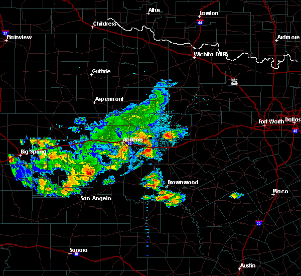 At 748 pm cdt, a severe thunderstorm was located near gunsight, or 12 miles south of breckenridge, moving northeast at 10 mph (radar indicated). Hazards include 60 mph wind gusts and half dollar size hail. Hail damage to vehicles is expected. expect wind damage to roofs, siding, and trees. this severe thunderstorm will be near, gunsight around 800 pm cdt. Breckenridge around 845 pm cdt. At 748 pm cdt, a severe thunderstorm was located near gunsight, or 12 miles south of breckenridge, moving northeast at 10 mph (radar indicated). Hazards include 60 mph wind gusts and half dollar size hail. Hail damage to vehicles is expected. expect wind damage to roofs, siding, and trees. this severe thunderstorm will be near, gunsight around 800 pm cdt. Breckenridge around 845 pm cdt.
|
| 7/4/2016 10:25 PM CDT |
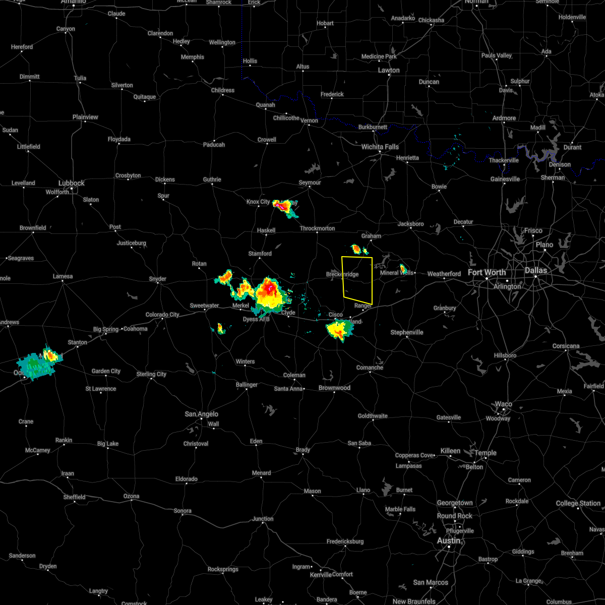 The severe thunderstorm warning for eastern stephens county will expire at 1030 pm cdt, the storms which prompted the warning have weakened below severe limits and exited the warned area. therefore the warning will be allowed to expire. however gusty winds and heavy rain are still possible with these thunderstorms. The severe thunderstorm warning for eastern stephens county will expire at 1030 pm cdt, the storms which prompted the warning have weakened below severe limits and exited the warned area. therefore the warning will be allowed to expire. however gusty winds and heavy rain are still possible with these thunderstorms.
|
| 7/4/2016 10:13 PM CDT |
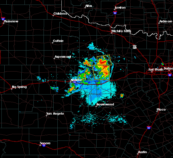 At 1012 pm cdt, severe thunderstorms were located along a line extending from 7 miles northwest of possum kingdom state park to 7 miles east of necessity, moving east at 30 mph (radar indicated). Hazards include 60 mph wind gusts. Expect damage to roofs. siding. and trees. Locations impacted include, breckenridge, necessity and crystal falls. At 1012 pm cdt, severe thunderstorms were located along a line extending from 7 miles northwest of possum kingdom state park to 7 miles east of necessity, moving east at 30 mph (radar indicated). Hazards include 60 mph wind gusts. Expect damage to roofs. siding. and trees. Locations impacted include, breckenridge, necessity and crystal falls.
|
| 7/4/2016 9:51 PM CDT |
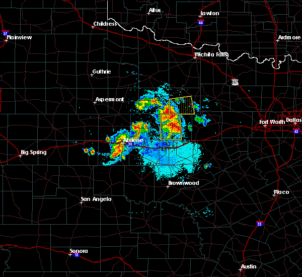 At 951 pm cdt, a severe thunderstorm was located 7 miles southeast of crystal falls, or 8 miles northeast of breckenridge, moving northeast at 40 mph (radar indicated). Hazards include 70 mph wind gusts and nickel size hail. Expect considerable tree damage. damage is likely to mobile homes, roofs, and outbuildings. This severe thunderstorm will remain over mainly rural areas of stephens county. At 951 pm cdt, a severe thunderstorm was located 7 miles southeast of crystal falls, or 8 miles northeast of breckenridge, moving northeast at 40 mph (radar indicated). Hazards include 70 mph wind gusts and nickel size hail. Expect considerable tree damage. damage is likely to mobile homes, roofs, and outbuildings. This severe thunderstorm will remain over mainly rural areas of stephens county.
|
| 7/4/2016 9:35 PM CDT | Quarter sized hail reported 0.8 miles NW of Breckenridge, TX |
| 7/4/2016 9:35 PM CDT | Power lines down in breckenridge in stephens county TX, 0.8 miles NW of Breckenridge, TX |
| 7/4/2016 9:19 PM CDT |
 At 918 pm cdt, a severe thunderstorm was located near ibex, or 9 miles west of breckenridge, moving east at 25 mph (radar indicated). Hazards include 65 mph wind gusts and quarter size hail. Hail damage to vehicles is expected. expect wind damage to roofs, siding, and trees. this severe thunderstorm will be near, breckenridge around 940 pm cdt. necessity around 1000 pm cdt. Other locations impacted by this severe thunderstorm include us- 183 near the throckmorton-stephens county line. At 918 pm cdt, a severe thunderstorm was located near ibex, or 9 miles west of breckenridge, moving east at 25 mph (radar indicated). Hazards include 65 mph wind gusts and quarter size hail. Hail damage to vehicles is expected. expect wind damage to roofs, siding, and trees. this severe thunderstorm will be near, breckenridge around 940 pm cdt. necessity around 1000 pm cdt. Other locations impacted by this severe thunderstorm include us- 183 near the throckmorton-stephens county line.
|
| 6/4/2016 5:39 PM CDT |
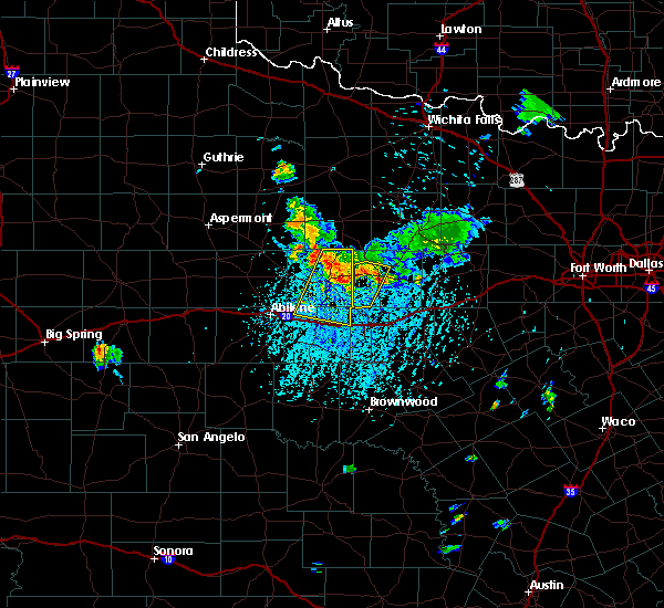 At 539 pm cdt, a severe thunderstorm was located between ibex and breckenridge, moving south at 40 mph (radar indicated). Hazards include 60 mph wind gusts. Expect damage to roofs. siding. and trees. Locations impacted include, breckenridge. At 539 pm cdt, a severe thunderstorm was located between ibex and breckenridge, moving south at 40 mph (radar indicated). Hazards include 60 mph wind gusts. Expect damage to roofs. siding. and trees. Locations impacted include, breckenridge.
|
| 6/4/2016 5:17 PM CDT |
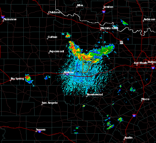 At 516 pm cdt, a severe thunderstorm was located near crystal falls, or 10 miles north of breckenridge, moving south at 50 mph (radar indicated). Hazards include 60 mph wind gusts. Expect damage to roofs. siding. and trees. this severe thunderstorm will be near, breckenridge around 530 pm cdt. Other locations impacted by this severe thunderstorm include us- 180 near the shackelford-stephens county line. At 516 pm cdt, a severe thunderstorm was located near crystal falls, or 10 miles north of breckenridge, moving south at 50 mph (radar indicated). Hazards include 60 mph wind gusts. Expect damage to roofs. siding. and trees. this severe thunderstorm will be near, breckenridge around 530 pm cdt. Other locations impacted by this severe thunderstorm include us- 180 near the shackelford-stephens county line.
|
| 5/29/2016 11:56 PM CDT | The severe thunderstorm warning for eastland and southern stephens counties will expire at midnight cdt, the storms which prompted the warning have weakened below severe limits. therefore the warning will be allowed to expire. however gusty winds and heavy rain are still possible with these thunderstorms. a flash flood warning is in effect until 230 am cdt. a severe thunderstorm watch remains in effect until 200 am cdt for north central texas. |
| 5/29/2016 11:40 PM CDT |
 At 1139 pm cdt, severe thunderstorms were located along a line extending from 7 miles south of possum kingdom state park to near eastland to near rising star, moving east at 30 mph (radar indicated). Hazards include 60 mph wind gusts and penny size hail. Expect damage to roofs. siding. and trees. these severe storms will be near, ranger around 1145 pm cdt. Other locations impacted by these severe thunderstorms include carbon. At 1139 pm cdt, severe thunderstorms were located along a line extending from 7 miles south of possum kingdom state park to near eastland to near rising star, moving east at 30 mph (radar indicated). Hazards include 60 mph wind gusts and penny size hail. Expect damage to roofs. siding. and trees. these severe storms will be near, ranger around 1145 pm cdt. Other locations impacted by these severe thunderstorms include carbon.
|
| 5/29/2016 11:01 PM CDT |
 At 1100 pm cdt, severe thunderstorms were located along a line extending from near crystal falls to near atwell, moving northeast at 20 mph (radar indicated). Hazards include 60 mph wind gusts and quarter size hail. Hail damage to vehicles is expected. expect wind damage to roofs, siding, and trees. severe thunderstorms will be near, crystal falls around 1105 pm cdt. cisco around 1125 pm cdt. eastland around 1155 pm cdt. ranger around 1200 am cdt. other locations impacted by these severe thunderstorms include us- 180 near the shackelford-stephens county line, carbon and strawn. This includes interstate 20 between mile markers 324 and 361. At 1100 pm cdt, severe thunderstorms were located along a line extending from near crystal falls to near atwell, moving northeast at 20 mph (radar indicated). Hazards include 60 mph wind gusts and quarter size hail. Hail damage to vehicles is expected. expect wind damage to roofs, siding, and trees. severe thunderstorms will be near, crystal falls around 1105 pm cdt. cisco around 1125 pm cdt. eastland around 1155 pm cdt. ranger around 1200 am cdt. other locations impacted by these severe thunderstorms include us- 180 near the shackelford-stephens county line, carbon and strawn. This includes interstate 20 between mile markers 324 and 361.
|
| 5/29/2016 10:59 PM CDT | Spotter estimates wind gust of 60 mph with power out in the town of breckenridg in stephens county TX, 5.4 miles N of Breckenridge, TX |
| 5/29/2016 10:28 PM CDT |
 At 1028 pm cdt, severe thunderstorms were located along a line extending from near woodson to near breckenridge to near moran, moving east at 25 mph (radar indicated). Hazards include 60 mph wind gusts and half dollar size hail. Hail damage to vehicles is expected. expect wind damage to roofs, siding, and trees. these severe storms will be near, breckenridge around 1035 pm cdt. crystal falls around 1055 pm cdt. necessity and gunsight around 1100 pm cdt. Other locations impacted by these severe thunderstorms include us- 183 near the throckmorton-stephens county line. At 1028 pm cdt, severe thunderstorms were located along a line extending from near woodson to near breckenridge to near moran, moving east at 25 mph (radar indicated). Hazards include 60 mph wind gusts and half dollar size hail. Hail damage to vehicles is expected. expect wind damage to roofs, siding, and trees. these severe storms will be near, breckenridge around 1035 pm cdt. crystal falls around 1055 pm cdt. necessity and gunsight around 1100 pm cdt. Other locations impacted by these severe thunderstorms include us- 183 near the throckmorton-stephens county line.
|
| 5/29/2016 9:54 PM CDT |
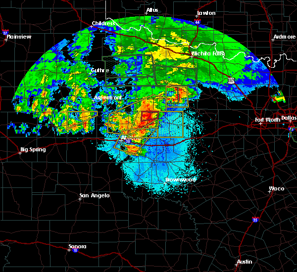 At 954 pm cdt, severe thunderstorms were located along a line extending from near fort griffin to 9 miles north of baird, moving east at 20 mph (radar indicated). Hazards include 65 mph wind gusts and half dollar size hail. Hail damage to vehicles is expected. expect wind damage to roofs, siding, and trees. severe thunderstorms will be near, crystal falls around 1035 pm cdt. gunsight around 1100 pm cdt. Other locations impacted by these severe thunderstorms include us- 183 near the throckmorton-stephens county line. At 954 pm cdt, severe thunderstorms were located along a line extending from near fort griffin to 9 miles north of baird, moving east at 20 mph (radar indicated). Hazards include 65 mph wind gusts and half dollar size hail. Hail damage to vehicles is expected. expect wind damage to roofs, siding, and trees. severe thunderstorms will be near, crystal falls around 1035 pm cdt. gunsight around 1100 pm cdt. Other locations impacted by these severe thunderstorms include us- 183 near the throckmorton-stephens county line.
|
| 5/26/2016 8:29 PM CDT |
 At 828 pm cdt, a severe thunderstorm was located 7 miles southwest of gunsight, or 8 miles north of cisco, moving east at 20 mph (radar indicated). Hazards include ping pong ball size hail and 65 mph wind gusts. People and animals outdoors will be injured. expect hail damage to roofs, siding, windows, and vehicles. Expect wind damage to roofs, siding, and trees. At 828 pm cdt, a severe thunderstorm was located 7 miles southwest of gunsight, or 8 miles north of cisco, moving east at 20 mph (radar indicated). Hazards include ping pong ball size hail and 65 mph wind gusts. People and animals outdoors will be injured. expect hail damage to roofs, siding, windows, and vehicles. Expect wind damage to roofs, siding, and trees.
|
| 5/11/2016 8:14 PM CDT | Quarter sized hail reported 6.4 miles W of Breckenridge, TX |
| 5/11/2016 8:14 PM CDT | Storm damage reported in stephens county TX, 0.8 miles NW of Breckenridge, TX |
| 5/11/2016 7:55 PM CDT | Storm damage reported in stephens county TX, 1.3 miles NNW of Breckenridge, TX |
| 5/11/2016 7:53 PM CDT |
 At 753 pm cdt, severe thunderstorms were located along a line extending from 8 miles southwest of crystal falls to near breckenridge to near cisco, moving east at 35 mph (radar indicated). Hazards include 65 mph wind gusts and half dollar size hail. Hail damage to vehicles is expected. expect wind damage to roofs, siding, and trees. severe thunderstorms will be near, breckenridge and crystal falls around 805 pm cdt. necessity around 810 pm cdt. eastland around 820 pm cdt. ranger around 830 pm cdt. possum kingdom state park around 840 pm cdt. other locations impacted by these severe thunderstorms include mingus, carbon, strawn and us-180 near the shackelford- stephens county line. This includes interstate 20 between mile markers 324 and 363, and between mile markers 368 and 389. At 753 pm cdt, severe thunderstorms were located along a line extending from 8 miles southwest of crystal falls to near breckenridge to near cisco, moving east at 35 mph (radar indicated). Hazards include 65 mph wind gusts and half dollar size hail. Hail damage to vehicles is expected. expect wind damage to roofs, siding, and trees. severe thunderstorms will be near, breckenridge and crystal falls around 805 pm cdt. necessity around 810 pm cdt. eastland around 820 pm cdt. ranger around 830 pm cdt. possum kingdom state park around 840 pm cdt. other locations impacted by these severe thunderstorms include mingus, carbon, strawn and us-180 near the shackelford- stephens county line. This includes interstate 20 between mile markers 324 and 363, and between mile markers 368 and 389.
|
| 5/11/2016 7:44 PM CDT |
 At 744 pm cdt, a severe thunderstorm was located near gunsight, or 11 miles north of cisco, moving east at 30 mph (radar indicated). Hazards include 70 mph wind gusts and half dollar size hail. Hail damage to vehicles is expected. expect considerable tree damage. wind damage is also likely to mobile homes, roofs, and outbuildings. this severe storm will be near, gunsight around 750 pm cdt. ranger around 800 pm cdt. Other locations impacted by this severe thunderstorm include i- 20 near the callahan-eastland county line and us- 180 near the shackelford-stephens county line. At 744 pm cdt, a severe thunderstorm was located near gunsight, or 11 miles north of cisco, moving east at 30 mph (radar indicated). Hazards include 70 mph wind gusts and half dollar size hail. Hail damage to vehicles is expected. expect considerable tree damage. wind damage is also likely to mobile homes, roofs, and outbuildings. this severe storm will be near, gunsight around 750 pm cdt. ranger around 800 pm cdt. Other locations impacted by this severe thunderstorm include i- 20 near the callahan-eastland county line and us- 180 near the shackelford-stephens county line.
|
| 5/11/2016 7:05 PM CDT |
 At 705 pm cdt, a severe thunderstorm was located near moran, or 10 miles south of albany, moving east at 35 mph (radar indicated). Hazards include 70 mph wind gusts and ping pong ball size hail. People and animals outdoors will be injured. expect hail damage to roofs, siding, windows, and vehicles. expect considerable tree damage. wind damage is also likely to mobile homes, roofs, and outbuildings. this severe thunderstorm will be near, cisco around 740 pm cdt. gunsight around 745 pm cdt. eastland around 755 pm cdt. ranger around 800 pm cdt. other locations impacted by this severe thunderstorm include carbon and us-180 near the shackelford-stephens county line. This includes interstate 20 between mile markers 324 and 362. At 705 pm cdt, a severe thunderstorm was located near moran, or 10 miles south of albany, moving east at 35 mph (radar indicated). Hazards include 70 mph wind gusts and ping pong ball size hail. People and animals outdoors will be injured. expect hail damage to roofs, siding, windows, and vehicles. expect considerable tree damage. wind damage is also likely to mobile homes, roofs, and outbuildings. this severe thunderstorm will be near, cisco around 740 pm cdt. gunsight around 745 pm cdt. eastland around 755 pm cdt. ranger around 800 pm cdt. other locations impacted by this severe thunderstorm include carbon and us-180 near the shackelford-stephens county line. This includes interstate 20 between mile markers 324 and 362.
|
| 5/8/2016 6:28 PM CDT |
 At 627 pm cdt, a severe thunderstorm was located near necessity, or 8 miles east of breckenridge, moving northeast at 50 mph (radar indicated). Hazards include 60 mph wind gusts and penny size hail. Expect damage to roofs. siding. and trees. This severe thunderstorm will remain over mainly rural areas of stephens county. At 627 pm cdt, a severe thunderstorm was located near necessity, or 8 miles east of breckenridge, moving northeast at 50 mph (radar indicated). Hazards include 60 mph wind gusts and penny size hail. Expect damage to roofs. siding. and trees. This severe thunderstorm will remain over mainly rural areas of stephens county.
|
| 5/8/2016 6:20 PM CDT | Multiple post oak trees blown down in high winds near the county line at fm 578 in stephens county TX, 11.3 miles SSE of Breckenridge, TX |
| 5/8/2016 5:50 PM CDT |
 At 550 pm cdt, a severe thunderstorm was located near moran, or 12 miles south of albany, moving northeast at 45 mph (radar indicated). Hazards include 60 mph wind gusts and penny size hail. Expect damage to roofs. siding. and trees. this severe thunderstorm will be near, breckenridge around 625 pm cdt. necessity around 630 pm cdt. other locations impacted by this severe thunderstorm include us- 180 near the shackelford-stephens county line. This includes interstate 20 between mile markers 324 and 356. At 550 pm cdt, a severe thunderstorm was located near moran, or 12 miles south of albany, moving northeast at 45 mph (radar indicated). Hazards include 60 mph wind gusts and penny size hail. Expect damage to roofs. siding. and trees. this severe thunderstorm will be near, breckenridge around 625 pm cdt. necessity around 630 pm cdt. other locations impacted by this severe thunderstorm include us- 180 near the shackelford-stephens county line. This includes interstate 20 between mile markers 324 and 356.
|
| 4/26/2016 7:44 PM CDT |
 At 743 pm cdt, severe thunderstorms were located along a line extending from 8 miles northeast of crystal falls to gunsight to near atwell, moving east at 45 mph (radar indicated). Hazards include 65 mph wind gusts and quarter size hail. Hail damage to vehicles is expected. expect wind damage to roofs, siding, and trees. these severe storms will be near, necessity around 755 pm cdt. eastland around 810 pm cdt. ranger around 815 pm cdt. A tornado watch remains in effect until midnight cdt for north central texas. At 743 pm cdt, severe thunderstorms were located along a line extending from 8 miles northeast of crystal falls to gunsight to near atwell, moving east at 45 mph (radar indicated). Hazards include 65 mph wind gusts and quarter size hail. Hail damage to vehicles is expected. expect wind damage to roofs, siding, and trees. these severe storms will be near, necessity around 755 pm cdt. eastland around 810 pm cdt. ranger around 815 pm cdt. A tornado watch remains in effect until midnight cdt for north central texas.
|
| 4/26/2016 7:17 PM CDT |
 At 716 pm cdt, severe thunderstorms were located along a line extending from woodson to south of admiral, moving east at 40 mph (radar indicated). Hazards include 65 mph wind gusts and quarter size hail. Hail damage to vehicles is expected. expect wind damage to roofs, siding, and trees. severe thunderstorms will be near, crystal falls around 725 pm cdt. cisco and gunsight around 740 pm cdt. necessity around 750 pm cdt. eastland around 800 pm cdt. ranger around 810 pm cdt. other locations impacted by these severe thunderstorms include us- 180 near the shackelford-stephens county line and carbon. A tornado watch remains in effect until midnight cdt for north central texas. At 716 pm cdt, severe thunderstorms were located along a line extending from woodson to south of admiral, moving east at 40 mph (radar indicated). Hazards include 65 mph wind gusts and quarter size hail. Hail damage to vehicles is expected. expect wind damage to roofs, siding, and trees. severe thunderstorms will be near, crystal falls around 725 pm cdt. cisco and gunsight around 740 pm cdt. necessity around 750 pm cdt. eastland around 800 pm cdt. ranger around 810 pm cdt. other locations impacted by these severe thunderstorms include us- 180 near the shackelford-stephens county line and carbon. A tornado watch remains in effect until midnight cdt for north central texas.
|
| 3/30/2016 2:32 PM CDT |
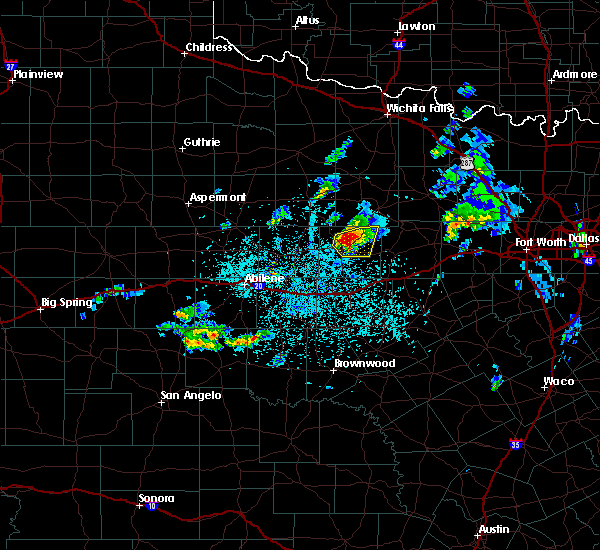 At 231 pm cdt, a severe thunderstorm was located near crystal falls, or near breckenridge, moving east at 20 mph (radar indicated and spotter reports). Hazards include two inch diameter hail and 60 mph wind gusts. People and animals outdoors will be injured. expect hail damage to roofs, siding, windows, and vehicles. expect wind damage to roofs, siding, and trees. This severe thunderstorm will remain over mainly rural areas of northern and northeastern stephens county near the town of ivan. At 231 pm cdt, a severe thunderstorm was located near crystal falls, or near breckenridge, moving east at 20 mph (radar indicated and spotter reports). Hazards include two inch diameter hail and 60 mph wind gusts. People and animals outdoors will be injured. expect hail damage to roofs, siding, windows, and vehicles. expect wind damage to roofs, siding, and trees. This severe thunderstorm will remain over mainly rural areas of northern and northeastern stephens county near the town of ivan.
|
| 3/30/2016 2:19 PM CDT | Tennis Ball sized hail reported 4.2 miles SE of Breckenridge, TX, at hubbard creek lake |
| 3/30/2016 2:16 PM CDT |
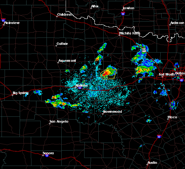 At 215 pm cdt, a severe thunderstorm was located near breckenridge, moving northeast at 15 mph (radar indicated). Hazards include ping pong ball size hail and 60 mph wind gusts. People and animals outdoors will be injured. expect hail damage to roofs, siding, windows, and vehicles. expect wind damage to roofs, siding, and trees. Locations impacted include, crystal falls and 5 miles north of breckenridge. At 215 pm cdt, a severe thunderstorm was located near breckenridge, moving northeast at 15 mph (radar indicated). Hazards include ping pong ball size hail and 60 mph wind gusts. People and animals outdoors will be injured. expect hail damage to roofs, siding, windows, and vehicles. expect wind damage to roofs, siding, and trees. Locations impacted include, crystal falls and 5 miles north of breckenridge.
|
| 3/30/2016 1:53 PM CDT |
 At 152 pm cdt, a severe thunderstorm was located near breckenridge, moving northeast at 20 mph (radar indicated). Hazards include 60 mph wind gusts and half dollar size hail. Hail damage to vehicles is expected. Expect wind damage to roofs, siding, and trees. At 152 pm cdt, a severe thunderstorm was located near breckenridge, moving northeast at 20 mph (radar indicated). Hazards include 60 mph wind gusts and half dollar size hail. Hail damage to vehicles is expected. Expect wind damage to roofs, siding, and trees.
|
| 3/8/2016 5:53 AM CST |
 At 553 am cst, severe thunderstorms were located along a line extending from near crystal falls to 7 miles southwest of possum kingdom state park to 6 miles north of ranger, moving northeast at 45 mph (radar indicated). Hazards include 60 mph wind gusts. Expect damage to roofs. siding. and trees. Locations impacted include, breckenridge, necessity and crystal falls. At 553 am cst, severe thunderstorms were located along a line extending from near crystal falls to 7 miles southwest of possum kingdom state park to 6 miles north of ranger, moving northeast at 45 mph (radar indicated). Hazards include 60 mph wind gusts. Expect damage to roofs. siding. and trees. Locations impacted include, breckenridge, necessity and crystal falls.
|
| 3/8/2016 5:23 AM CST |
 At 522 am cst, a severe thunderstorm was located near ibex, or 7 miles southwest of breckenridge, moving east at 35 mph (radar indicated). Hazards include 60 mph wind gusts. Expect damage to roofs. siding. And trees. At 522 am cst, a severe thunderstorm was located near ibex, or 7 miles southwest of breckenridge, moving east at 35 mph (radar indicated). Hazards include 60 mph wind gusts. Expect damage to roofs. siding. And trees.
|
| 11/17/2015 1:23 AM CST |
 At 122 am cst, a severe thunderstorm was located near necessity, or 7 miles east of breckenridge, moving northeast at 55 mph (radar indicated). Hazards include 60 mph wind gusts and quarter size hail. Hail damage to vehicles is possible. expect wind damage to roofs, siding and trees. trees may be uprooted as well. locations impacted include, breckenridge, necessity, gunsight and crystal falls. A tornado watch remains in effect until 300 am cst for north central texas. At 122 am cst, a severe thunderstorm was located near necessity, or 7 miles east of breckenridge, moving northeast at 55 mph (radar indicated). Hazards include 60 mph wind gusts and quarter size hail. Hail damage to vehicles is possible. expect wind damage to roofs, siding and trees. trees may be uprooted as well. locations impacted include, breckenridge, necessity, gunsight and crystal falls. A tornado watch remains in effect until 300 am cst for north central texas.
|
| 11/17/2015 1:01 AM CST |
 At 100 am cst, a severe thunderstorm was located over breckenridge, moving northeast at 60 mph (radar indicated). Hazards include 60 mph wind gusts and quarter size hail. Hail damage to vehicles is expected. expect wind damage to roofs, siding and trees. this severe thunderstorm will remain over mainly rural areas of stephens county, including the following locations, us-183 near the throckmorton-stephens county line. A tornado watch remains in effect until 300 am cst for north central texas. At 100 am cst, a severe thunderstorm was located over breckenridge, moving northeast at 60 mph (radar indicated). Hazards include 60 mph wind gusts and quarter size hail. Hail damage to vehicles is expected. expect wind damage to roofs, siding and trees. this severe thunderstorm will remain over mainly rural areas of stephens county, including the following locations, us-183 near the throckmorton-stephens county line. A tornado watch remains in effect until 300 am cst for north central texas.
|
| 11/17/2015 12:37 AM CST |
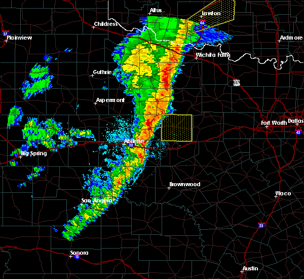 At 1237 am cst, a severe thunderstorm was located near ibex, or near albany, moving northeast at 50 mph (radar indicated). Hazards include 65 mph wind gusts. Expect damage to roofs. siding and trees. this severe thunderstorm will be near, breckenridge around 100 am cst. crystal falls around 105 am cst. A tornado watch remains in effect until 300 am cst for north central texas. At 1237 am cst, a severe thunderstorm was located near ibex, or near albany, moving northeast at 50 mph (radar indicated). Hazards include 65 mph wind gusts. Expect damage to roofs. siding and trees. this severe thunderstorm will be near, breckenridge around 100 am cst. crystal falls around 105 am cst. A tornado watch remains in effect until 300 am cst for north central texas.
|
| 5/28/2015 7:11 PM CDT | At 710 pm cdt, severe thunderstorms were located along a line extending from 11 miles west of newport to 6 miles southeast of jacksboro to near graford to 7 miles northeast of ranger, moving northeast at 30 mph (radar indicated). Hazards include 70 mph wind gusts and quarter size hail. Hail damage to vehicles is expected. expect considerable tree damage. wind damage is also likely to mobile homes, roofs and outbuildings. locations impacted include, mineral wells, graham, breckenridge, jacksboro, graford, bryson, gordon, necessity, gunsight, possum kingdom state park, newport, strawn and mingus. This includes interstate 20 between mile markers 369 and 389. |
| 5/28/2015 6:49 PM CDT | At 648 pm cdt, severe thunderstorms were located along a line extending from 13 miles northwest of jacksboro to 9 miles northeast of ranger, moving southeast at 35 mph. the strongest part of this line was located in young county moving into jack county (radar indicated). Hazards include 70 mph wind gusts and half dollar size hail. Hail damage to vehicles is expected. expect considerable tree damage. wind damage is also likely to mobile homes, roofs and outbuildings. locations impacted include, mineral wells, graham, breckenridge, jacksboro, olney, graford, bryson, gordon, necessity, gunsight, crystal falls, possum kingdom state park, newport, strawn, newcastle, mingus and us-180 near the shackelford-stephens county line. This includes interstate 20 between mile markers 369 and 389. |
| 5/28/2015 6:27 PM CDT | At 627 pm cdt, severe thunderstorms were located along a line extending from near olney to near crystal falls, moving east at 35 mph (radar indicated). Hazards include 70 mph wind gusts and nickel size hail. Expect considerable tree damage. Damage is likely to mobile homes, roofs and outbuildings. |
| 5/28/2015 6:04 PM CDT | At 603 pm cdt, a severe thunderstorm was located near crystal falls, or 8 miles north of breckenridge, moving east at 40 mph. strong winds are also occurring with an outflow boundary moving across the county (radar indicated). Hazards include 70 mph wind gusts and quarter size hail. Hail damage to vehicles is expected. expect considerable tree damage. wind damage is also likely to mobile homes, roofs and outbuildings. Locations impacted include, breckenridge, necessity, gunsight and crystal falls. |
| 5/28/2015 5:39 PM CDT | At 538 pm cdt, a severe thunderstorm was located near fort griffin, or 11 miles northeast of albany, moving east at 40 mph (radar indicated). Hazards include 70 mph wind gusts and nickel size hail. Expect considerable tree damage. Damage is likely to mobile homes, roofs and outbuildings. |
| 5/26/2015 6:36 PM CDT | At 635 pm cdt, severe thunderstorms were located along a line extending from near necessity to 8 miles northeast of gordon, moving southeast at 20 mph (radar indicated and spotter confirmed). Hazards include tennis ball size hail and 60 mph wind gusts. People and animals outdoors will be injured. expect hail damage to roofs, siding, windows and vehicles. expect wind damage to roofs, siding and trees. locations impacted include, gordon, necessity, strawn, palo pinto creek reservoir and mingus. this includes interstate 20 between mile markers 370 and 389. A tornado watch remains in effect until 1000 pm cdt for north central texas. |
| 5/26/2015 6:07 PM CDT | At 604 pm cdt, severe thunderstorms were located along a line extending from 5 miles east of breckenridge to the city of palo pinto, moving southeast at 30 mph (radar indicated). Hazards include golf ball size hail and 60 mph wind gusts. People and animals outdoors will be injured. expect hail damage to roofs, siding, windows and vehicles. Expect wind damage to roofs, siding and trees. |
| 5/26/2015 5:56 PM CDT | At 553 pm cdt, severe thunderstorms were located along a line extending from near breckenridge to 9 miles east of necessity to 11 miles south of graford, moving southeast at 10 mph (radar indicated). Hazards include golf ball size hail and 60 mph wind gusts. People and animals outdoors will be injured. expect hail damage to roofs, siding, windows and vehicles. expect wind damage to roofs, siding and trees. locations impacted include, breckenridge, graford, necessity, crystal falls and possum kingdom state park. A tornado watch remains in effect until 1000 pm cdt for north central texas. |
| 5/26/2015 5:32 PM CDT | Quarter sized hail reported 5.9 miles SW of Breckenridge, TX, hwy 67 5 miles north of hwy 180 |
| 5/26/2015 5:25 PM CDT | Large trees down on park road 33 in stephens county TX, 14.2 miles W of Breckenridge, TX |
| 5/26/2015 5:12 PM CDT | At 511 pm cdt, severe thunderstorms were located along a line extending from crystal falls to near possum kingdom state park, moving southeast at 15 mph (radar indicated). Hazards include golf ball size hail and 60 mph wind gusts. People and animals outdoors will be injured. expect hail damage to roofs, siding, windows and vehicles. Expect wind damage to roofs, siding and trees. |
| 5/26/2015 3:42 PM CDT | At 341 pm cdt, a severe thunderstorm capable of producing a tornado was located near crystal falls, or just north of breckenridge, moving east at 20 mph (radar indicated rotation). Hazards include tornado and golf ball size hail. Flying debris will be dangerous to those caught without shelter. mobile homes will be damaged or destroyed. damage to roofs, windows and vehicles will occur. tree damage is likely. This tornadic thunderstorm will remain over mainly rural areas of northern stephens county. |
| 5/26/2015 3:39 PM CDT | At 338 pm cdt, a severe thunderstorm was located over crystal falls, or 7 miles north of breckenridge, moving east at 10 mph (radar indicated). Hazards include ping pong ball size hail and 60 mph wind gusts. People and animals outdoors will be injured. expect hail damage to roofs, siding, windows and vehicles. expect wind damage to roofs, siding and trees. locations impacted include, breckenridge and crystal falls. A tornado watch remains in effect until 1000 pm cdt for north central texas. |
| 5/26/2015 3:23 PM CDT | At 322 pm cdt, a severe thunderstorm was located near crystal falls, or 7 miles northwest of breckenridge, moving east at 15 mph (radar indicated). Hazards include ping pong ball size hail and 60 mph wind gusts. People and animals outdoors will be injured. expect hail damage to roofs, siding, windows and vehicles. expect wind damage to roofs, siding and trees. locations impacted include, breckenridge and crystal falls. A tornado watch remains in effect until 1000 pm cdt for north central texas. |
| 5/26/2015 3:00 PM CDT | At 300 pm cdt, a severe thunderstorm was located near crystal falls, or 8 miles northwest of breckenridge, moving east at 35 mph (radar indicated). Hazards include 60 mph wind gusts and quarter size hail. Hail damage to vehicles is expected. Expect wind damage to roofs, siding and trees. |
| 5/25/2015 12:08 PM CDT | At 1208 pm cdt, severe thunderstorms were located along a line extending from 10 miles northwest of possum kingdom state park to near ranger to near gorman, moving east at 35 mph (radar indicated). Hazards include 60 mph wind gusts. Expect damage to roofs. Siding and trees. |
| 5/25/2015 11:49 AM CDT | At 1148 am cdt, severe thunderstorms were located along a line extending from near woodson to gunsight to near rising star, moving east at 35 mph (radar indicated). Hazards include 70 mph wind gusts. Expect considerable tree damage. damage is likely to mobile homes, roofs and outbuildings. locations impacted include, breckenridge, eastland, cisco, ranger, gorman, rising star, necessity, gunsight, crystal falls and carbon. this includes interstate 20 between mile markers 324 and 357. A tornado watch remains in effect until 600 pm cdt for north central texas. |
| 5/25/2015 11:22 AM CDT | At 1122 am cdt, severe thunderstorms were located along a line extending from near fort griffin to near moran to 10 miles west of cross plains, moving northeast at 45 mph (radar indicated). Hazards include 70 mph wind gusts. Expect considerable tree damage. Damage is likely to mobile homes, roofs and outbuildings. |
| 5/16/2015 11:08 PM CDT | The severe thunderstorm warning for eastland and stephens counties will expire at 1115 pm cdt, the storms which prompted the warning have weakened below severe limits, therefore the warning will be allowed to expire. however gusty winds of up to 50 mph, frequent cloud to ground lightning, and heavy rain are still possible with these thunderstorms. |
| 5/16/2015 10:43 PM CDT | At 1042 pm cdt, severe thunderstorms were located along a line extending from 7 miles southwest of possum kingdom state park to near gunsight to near cross plains, moving east at 35 mph (radar indicated). Hazards include 60 mph wind gusts and quarter size hail. Hail damage to vehicles is expected. expect wind damage to roofs, siding and trees. these severe storms will be near, ranger around 1055 pm cdt. other locations impacted by these severe thunderstorms include carbon. this includes interstate 20 between mile markers 324 and 356. 1. 00in. |
| 5/16/2015 10:18 PM CDT | At 1016 pm cdt, severe thunderstorms were located along a line extending from 6 miles southeast of crystal falls to near moran to 15 miles south of clyde, moving northeast at 50 mph (radar indicated). Hazards include 60 mph wind gusts and quarter size hail. Hail damage to vehicles is expected. expect wind damage to roofs, siding and trees. severe thunderstorms will be near, breckenridge through 1040 pm cdt. crystal falls around 1050 pm cdt. cisco around 1055 pm cdt. eastland around 1110 pm cdt. ranger around 1115 pm cdt. a tornado watch remains in effect until 1100 pm cdt for north central texas. 1. 00in. |
| 5/16/2015 9:35 PM CDT | At 933 pm cdt, a severe thunderstorm was located just northeast of breckenridge, moving east at 30 mph (radar indicated). Hazards include 60 mph wind gusts and quarter size hail. Hail damage to vehicles is expected. expect wind damage to roofs, siding and trees. locations impacted include, ivan. a tornado watch remains in effect until 1100 pm cdt for north central texas. 1. 00in. |
| 5/16/2015 9:14 PM CDT | At 914 pm cdt, a severe thunderstorm was located near breckenridge, moving east at 30 mph (radar indicated). Hazards include ping pong ball size hail and 60 mph wind gusts. People and animals outdoors will be injured. expect hail damage to roofs, siding, windows and vehicles. expect wind damage to roofs, siding and trees. locations impacted include, breckenridge, necessity, gunsight and crystal falls. a tornado watch remains in effect until 1100 pm cdt for north central texas. 1. 50in. |
| 5/16/2015 8:45 PM CDT | At 844 pm cdt, a severe thunderstorm was located over ibex, or 10 miles east of albany, moving east at 30 mph (radar indicated). Hazards include ping pong ball size hail and 60 mph wind gusts. People and animals outdoors will be injured. expect hail damage to roofs, siding, windows and vehicles. expect wind damage to roofs, siding and trees. this severe thunderstorm will be near, breckenridge around 915 pm cdt. necessity around 925 pm cdt. a tornado watch remains in effect until 1100 pm cdt for north central texas. 1. 50in. |
| 5/16/2015 8:24 PM CDT | At 824 pm cdt, a severe thunderstorm was located 8 miles north of necessity, or 9 miles east of breckenridge, moving east at 40 mph (radar indicated). Hazards include 60 mph wind gusts and half dollar size hail. Hail damage to vehicles is expected. expect wind damage to roofs, siding and trees. locations impacted include, breckenridge, necessity and crystal falls. a tornado watch remains in effect until 1100 pm cdt for north central texas. 1. 25in. |
| 5/16/2015 7:47 PM CDT | At 746 pm cdt, a severe thunderstorm was located near albany, moving east at 40 mph (radar indicated). Hazards include 60 mph wind gusts and quarter size hail. Hail damage to vehicles is expected. Expect wind damage to roofs, siding and trees. |
| 5/10/2015 4:53 AM CDT | At 453 am cdt, a severe thunderstorm was located near necessity, or 10 miles southeast of breckenridge, moving northeast at 35 mph (radar indicated). Hazards include 60 mph wind gusts. Expect damage to roofs. siding and trees. locations impacted include, breckenridge, necessity, gunsight, crystal falls and us- 180 near the shackelford-stephens county line. 75in. |
| 5/10/2015 4:14 AM CDT | At 413 am cdt, a line of severe thunderstorms was located from northwest of albany to cisco to easland , moving northeast at 40 mph (radar indicated). Hazards include 70 mph wind gusts. Expect considerable tree damage. Damage is likely to mobile homes, roofs and outbuildings. |
| 5/8/2015 11:43 PM CDT | At 1142 pm cdt, a severe thunderstorm was located near gunsight, or 10 miles south of breckenridge, moving east at 25 mph (radar indicated). Hazards include golf ball size hail and 60 mph wind gusts. People and animals outdoors will be injured. expect hail damage to roofs, siding, windows and vehicles. Expect wind damage to roofs, siding and trees. |
| 5/8/2015 11:35 PM CDT | At 1135 pm cdt, a severe thunderstorm was located near gunsight, or 10 miles south of breckenridge, moving east at 25 mph (radar indicated). Hazards include 60 mph wind gusts and half dollar size hail. Hail damage to vehicles is expected. expect wind damage to roofs, siding and trees. locations impacted include, breckenridge, necessity, gunsight and crystal falls. a tornado watch remains in effect until 300 am cdt for north central texas. 1. 25in. |
| 5/8/2015 11:20 PM CDT | Golf Ball sized hail reported 0.8 miles NW of Breckenridge, TX |
| 5/8/2015 11:19 PM CDT | At 1118 pm cdt, a severe thunderstorm was located over breckenridge, moving east at 20 mph. another severe thunderstorm was located near eureka, moving northeast at 20 mph (radar indicated). Hazards include ping pong ball size hail and 60 mph wind gusts. People and animals outdoors will be injured. expect hail damage to roofs, siding, windows and vehicles. expect wind damage to roofs, siding and trees. locations impacted include, breckenridge, necessity, gunsight and crystal falls. a tornado watch remains in effect until 300 am cdt for north central texas. 1. 50in. |
| 5/8/2015 10:59 PM CDT | At 1058 pm cdt, a severe thunderstorm was located near breckenridge, moving east at 20 mph (radar indicated). Hazards include golf ball size hail and 60 mph wind gusts. People and animals outdoors will be injured. expect hail damage to roofs, siding, windows and vehicles. expect wind damage to roofs, siding and trees. this severe storm will be near, breckenridge around 1115 pm cdt. crystal falls around 1125 pm cdt. a tornado watch remains in effect until 300 am cdt for north central texas. 1. 75in. |
| 5/8/2015 10:43 PM CDT | At 1043 pm cdt, a severe thunderstorm was located over ibex, or 10 miles west of breckenridge, moving northeast at 20 mph (radar indicated). Hazards include 60 mph wind gusts and half dollar size hail. Hail damage to vehicles is expected. Expect wind damage to roofs, siding and trees. |
| 5/8/2015 10:29 PM CDT | At 1026 pm cdt, a severe thunderstorm was located near ibex, or 20 miles west of breckenridge, moving northeast at 30 mph (radar indicated). Hazards include quarter size hail. Damage to vehicles is expected. a tornado watch remains in effect until 300 am cdt for north central texas. 1. 00in. |
| 5/8/2015 9:57 PM CDT | At 957 pm cdt, a severe thunderstorm was located 5 miles northwest of possum kingdom state park, or 10 miles southwest of graham, moving northeast at 25 mph (radar indicated). Hazards include 60 mph wind gusts and quarter size hail. Hail damage to vehicles is expected. expect wind damage to roofs, siding and trees. locations impacted include, graham, breckenridge, crystal falls and possum kingdom state park. a tornado watch remains in effect until 300 am cdt for north central texas. 1. 00in. |
| 5/8/2015 9:43 PM CDT | At 943 pm cdt, a severe thunderstorm was located near crystal falls, or 10 miles northeast of breckenridge, moving northeast at 25 mph (radar indicated). Hazards include ping pong ball size hail and 60 mph wind gusts. People and animals outdoors will be injured. expect hail damage to roofs, siding, windows and vehicles. Expect wind damage to roofs, siding and trees. |
| 5/8/2015 9:33 PM CDT | At 933 pm cdt, severe thunderstorms were located along a line extending from 8 miles south of jacksboro to 7 miles east of possum kingdom state park to 7 miles southeast of crystal falls to near breckenridge, moving east at 15 mph (radar indicated). Hazards include two inch hail and 60 mph wind gusts. People and animals outdoors will be injured. expect hail damage to roofs, siding, windows and vehicles. expect wind damage to roofs, siding and trees. locations impacted include, graham, breckenridge, graford, bryson, crystal falls and possum kingdom state park. a tornado watch remains in effect until 300 am cdt for north central texas. 2. 00in. |
| 5/8/2015 9:16 PM CDT | Ping Pong Ball sized hail reported 2.4 miles SE of Breckenridge, TX, ping pong size hail on the east side of hubbard creek lake. |
| 5/8/2015 9:01 PM CDT | At 901 pm cdt, severe thunderstorms were located along a line extending from 7 miles southeast of bryson to possum kingdom state park to near breckenridge to 9 miles northeast of ibex, moving east at 15 mph (radar indicated). Hazards include ping pong ball size hail and 60 mph wind gusts. People and animals outdoors will be injured. expect hail damage to roofs, siding, windows and vehicles. expect wind damage to roofs, siding and trees. locations impacted include, graham, breckenridge, graford, bryson, crystal falls and possum kingdom state park. a tornado watch remains in effect until 300 am cdt for north central texas. 1. 50in. |
| 5/8/2015 8:46 PM CDT | At 844 pm cdt, severe thunderstorms were located along a line extending from near bryson to near possum kingdom state park to 6 miles northwest of breckenridge to 7 miles north of ibex, moving east at 15 mph (radar indicated). Hazards include 60 mph wind gusts and quarter size hail. Hail damage to vehicles is expected. Expect wind damage to roofs, siding and trees. |
| 5/6/2015 5:22 PM CDT | At 520 pm cdt, a severe thunderstorm was located near albany, moving northeast at 20 mph (radar indicated). Hazards include golf ball size hail and 70 mph wind gusts. People and animals outdoors will be injured. expect hail damage to roofs, siding, windows and vehicles. expect considerable tree damage. Wind damage is also likely to mobile homes, roofs and outbuildings. |
| 4/26/2015 6:55 PM CDT | At 654 pm cdt, a severe thunderstorm was located near crystal falls, or 12 miles north of breckenridge, moving east at 50 mph (radar indicated). Hazards include 60 mph wind gusts and quarter size hail. Hail damage to vehicles is expected. Expect wind damage to roofs, siding and trees. |
| 4/23/2015 1:19 AM CDT | At 115 am cdt, a severe thunderstorm was located 8 miles east of necessity, or 12 miles north of ranger, moving southeast at 30 mph. another severe thunderstorm was located 16 miles southwest of breckenridge, moving east at 25 mph (radar indicated). Hazards include 60 mph wind gusts and quarter size hail. Hail damage to vehicles is expected. expect wind damage to roofs, siding and trees. locations impacted include, gordon, necessity, gunsight, possum kingdom state park, strawn and mingus. 1. 00in. |
| 4/23/2015 12:59 AM CDT | At 1258 am cdt, a severe thunderstorm was located near necessity, or 9 miles east of breckenridge, moving southeast at 30 mph. another severe thunderstorm is near albany and moving east into stephens county (radar indicated). Hazards include 60 mph wind gusts and quarter size hail. Minor hail damage to vehicles is expected. Expect wind damage to roofs, siding and trees. |
| 4/23/2015 12:55 AM CDT | Half way between breckenridge and caddo damage done to garage door and an out building was moved in stephens county TX, 5.8 miles W of Breckenridge, TX |
| 4/23/2015 12:55 AM CDT | Telephone pole snapped in half. shingles off roof of home. horse trailer pushed 30 feet. wellhouse roof ripped of in stephens county TX, 3.5 miles W of Breckenridge, TX |
| 4/23/2015 12:50 AM CDT | At 1250 am cdt, a severe thunderstorm was located 7 miles north of necessity, or 5 miles east of breckenridge, moving southeast at 35 mph (radar indicated). Hazards include 60 mph wind gusts and quarter size hail. Minor hail damage to vehicles is expected. expect wind damage to roofs, siding and trees. locations impacted include, breckenridge and crystal falls. 1. 00in. |
| 4/23/2015 12:31 AM CDT | At 1230 am cdt, a severe thunderstorm was located 5 miles northwest of breckenridge, moving southeast at 40 mph. this is a very dangerous storm (radar indicated). Hazards include baseball size hail and 70 mph wind gusts. People and animals outdoors could be severely injured. expect shattered windows, extensive damage to roofs, siding and vehicles. locations impacted include, breckenridge, crystal falls and us-180 near the shackelford- stephens county line. 2. 75in. |
| 4/23/2015 12:17 AM CDT | At 1216 am cdt, a severe thunderstorm was located 9 miles south of woodson, or 10 miles northwest of breckenridge, moving southeast at 30 mph. this is a very dangerous storm (radar indicated). Hazards include baseball size hail and 60 mph wind gusts. People and animals outdoors could be severely injured. expect shattered windows, extensive damage to roofs, siding and vehicles. locations impacted include, breckenridge, crystal falls and us-180 near the shackelford- stephens county line. 2. 75in. |
| 4/23/2015 12:05 AM CDT | At 1204 am cdt, a severe thunderstorm was located near woodson, or 13 miles south of throckmorton, moving east at 45 mph (radar indicated). Hazards include hen egg sized hail and 60 mph wind gusts. People and animals outdoors will be injured. expect hail damage to roofs, siding, windows and vehicles. Expect wind damage to roofs, siding and trees. |
| 4/18/2015 3:57 PM CDT | At 355 pm cdt, a severe thunderstorm was located 11 miles southwest of graham, moving east at 20 mph. a second severe thunderstorm was located 6 miles north of breckenridge, also moving east at 20 mph (radar indicated). Hazards include golf ball size hail and 60 mph wind gusts. People and animals outdoors will be injured. expect hail damage to roofs, siding, windows and vehicles. Expect wind damage to roofs, siding and trees. |
| 4/18/2015 3:37 PM CDT | At 336 pm cdt, a severe thunderstorm was located near crystal falls, or 15 miles north of breckenridge, moving east at 20 mph (radar indicated). Hazards include 60 mph wind gusts and quarter size hail. Hail damage to vehicles is expected. expect wind damage to roofs, siding and trees. locations impacted include, breckenridge, crystal falls and newcastle. 1. 00in. |
| 4/18/2015 3:16 PM CDT | At 316 pm cdt, a severe thunderstorm was located near woodson, or 15 miles north of breckenridge, moving northeast at 25 mph (radar indicated). Hazards include 60 mph wind gusts and quarter size hail. Hail damage to vehicles is expected. Expect wind damage to roofs, siding and trees. |
| 4/18/2015 9:57 AM CDT | The national weather service in fort worth has issued a * severe thunderstorm warning for. southern young county in north central texas. northwestern palo pinto county in north central texas. northeastern stephens county in north central texas. Until 500 pm cdt. |
| 4/18/2015 9:37 AM CDT | A severe thunderstorm warning remains in effect until 400 pm cdt for southwestern young and northern stephens counties. at 336 pm cdt. a severe thunderstorm was located near crystal falls. or 15 miles north of breckenridge. moving east at 20 mph. hazard. 60 mph wind gusts and quarter size hail. source. Radar indicated. |
| 5/7/2014 10:34 PM CDT | Kbkd awos recorded a wind gust to 52 knots at 0334 in stephens county TX, 0.8 miles NW of Breckenridge, TX |
| 6/19/2013 3:08 PM CDT | Ping Pong Ball sized hail reported 3.5 miles E of Breckenridge, TX |
| 6/19/2013 3:00 PM CDT | Tree uprooted 6 miles south of breckenridge in stephens county TX, 6.7 miles N of Breckenridge, TX |
| 6/19/2013 2:51 PM CDT | Golf Ball sized hail reported 11.9 miles WSW of Breckenridge, TX, hwy 67 just south of ivan |
| 6/6/2013 12:05 AM CDT | Several 3 inch diameter limbs about 10 feet long blown down on the nw side of breckenridg in stephens county TX, 0.2 miles S of Breckenridge, TX |
| 5/21/2013 12:15 PM CDT | Quarter sized hail reported 5.3 miles E of Breckenridge, TX, quarter sized hail reported 6 miles w of breckenridige |
| 6/11/2012 7:26 PM CDT | Tennis Ball sized hail reported 15 miles SSW of Breckenridge, TX, tennis ball sized hail was reported 3 miles south of eliasville |
| 6/11/2012 7:12 PM CDT | Quarter sized hail reported 0.8 miles NW of Breckenridge, TX, quarter hail at the cvs drug store on west walker street in breckenridge |
| 6/11/2012 7:00 PM CDT | Half Dollar sized hail reported 4.2 miles SE of Breckenridge, TX, half dollar sized hail was reported on the peninsula on the eastern side of hubbard creek lake |
| 6/11/2012 6:46 PM CDT | Quarter sized hail reported 5.3 miles E of Breckenridge, TX, 6 miles west of breckenridge |
| 5/28/2012 8:40 PM CDT | Roofs of homes damaged and trees blown down between breckenridge and crystal falls in stephens county TX, 4.9 miles SSW of Breckenridge, TX |
| 1/1/0001 12:00 AM | Golf Ball sized hail reported 16.2 miles SW of Breckenridge, TX, ping pong and golfball size hail covering ground |
| 1/1/0001 12:00 AM | Quarter sized hail reported 7.3 miles SE of Breckenridge, TX, north side of hubbard creek lake |
| 1/1/0001 12:00 AM | Hen Egg sized hail reported 10.2 miles N of Breckenridge, TX |
| 1/1/0001 12:00 AM | Golf Ball sized hail reported 12.2 miles NNE of Breckenridge, TX, reported at intersection of fm1853 and cr 190 |
Hail Maps for Breckenridge, TX
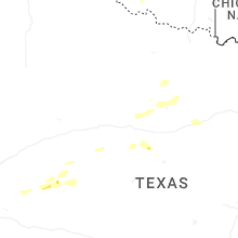
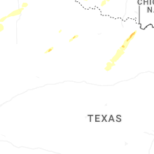
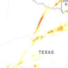


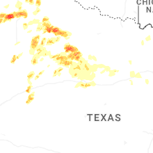
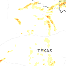

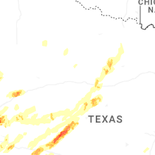


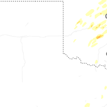


Connect with Interactive Hail Maps