

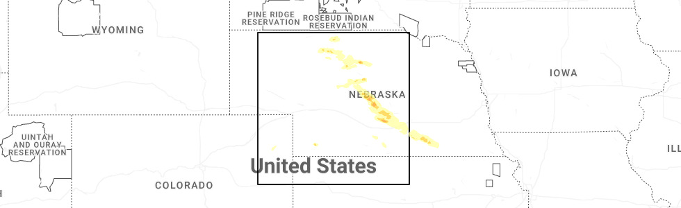
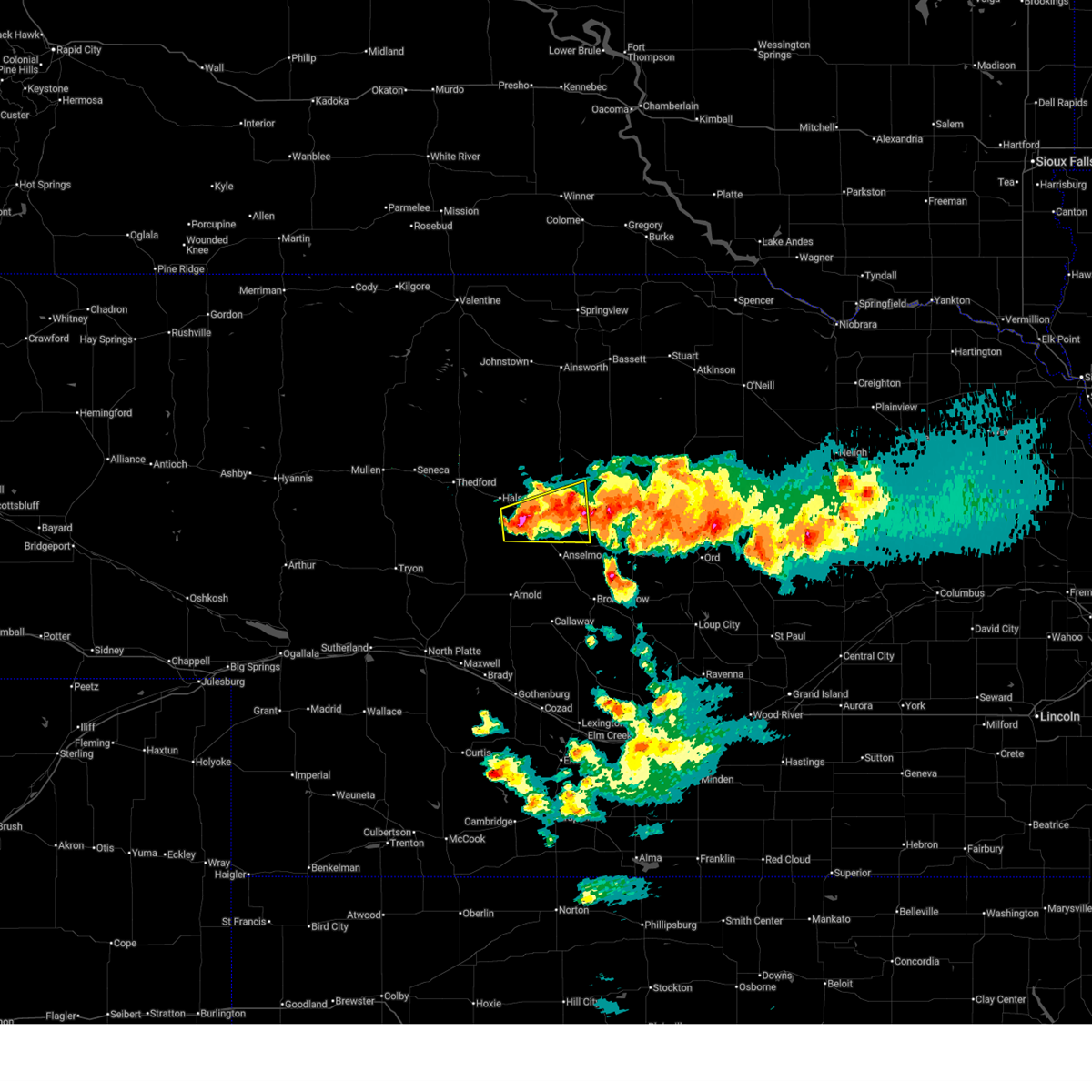
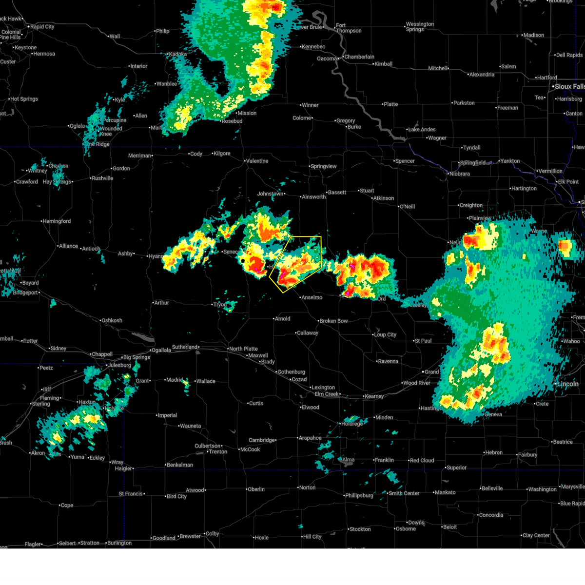
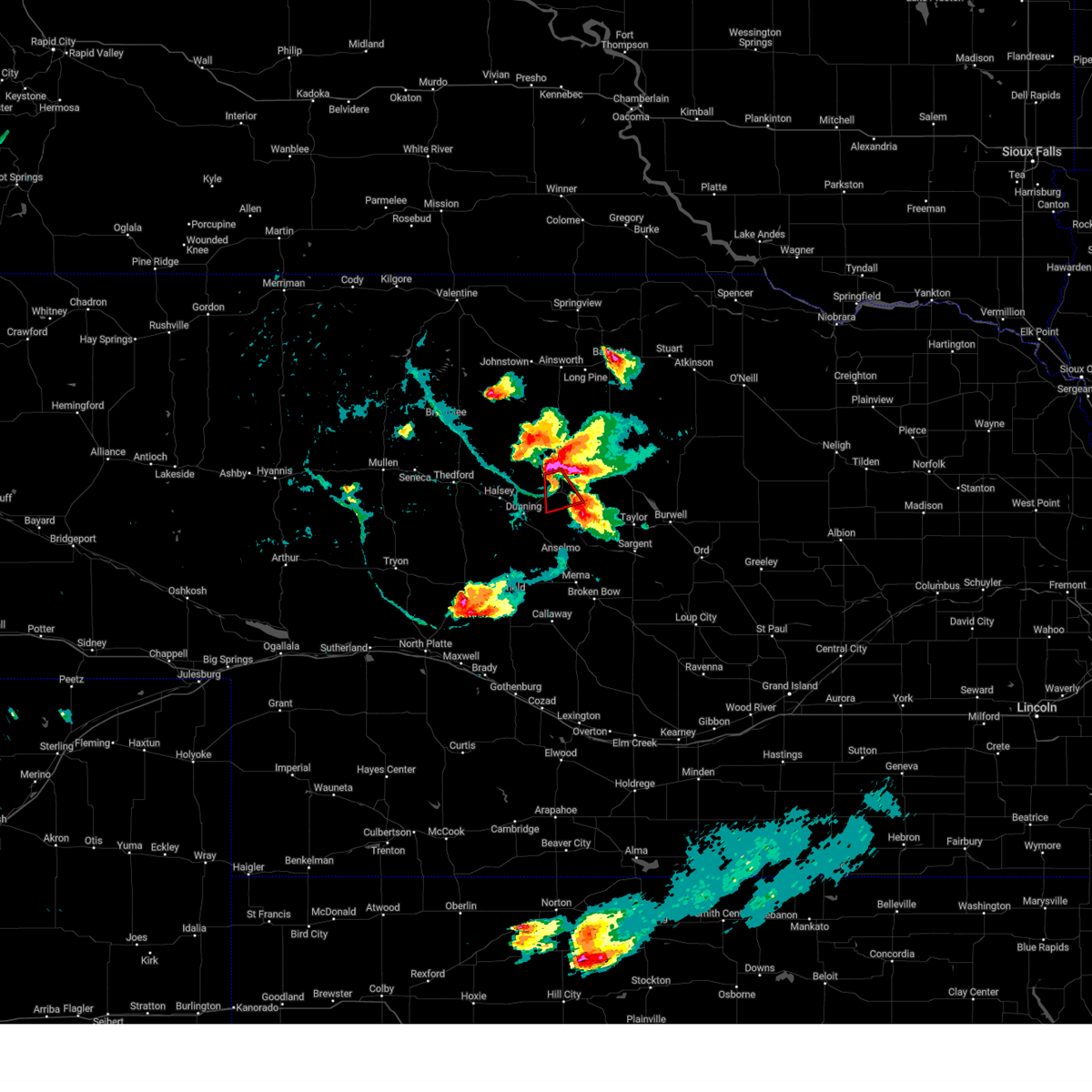
Hail Map for Brewster, NE
The Brewster, NE area has had 18 reports of on-the-ground hail by trained spotters, and has been under severe weather warnings 14 times during the past 12 months. Doppler radar has detected hail at or near Brewster, NE on 119 occasions, including 5 occasions during the past year.
| Name: | Brewster, NE |
| Where Located: | 72 miles WSW of Oneill, NE |
| Map: | Google Map for Brewster, NE |
| Population: | 17 |
| Housing Units: | 21 |
| More Info: | Search Google for Brewster, NE |
1
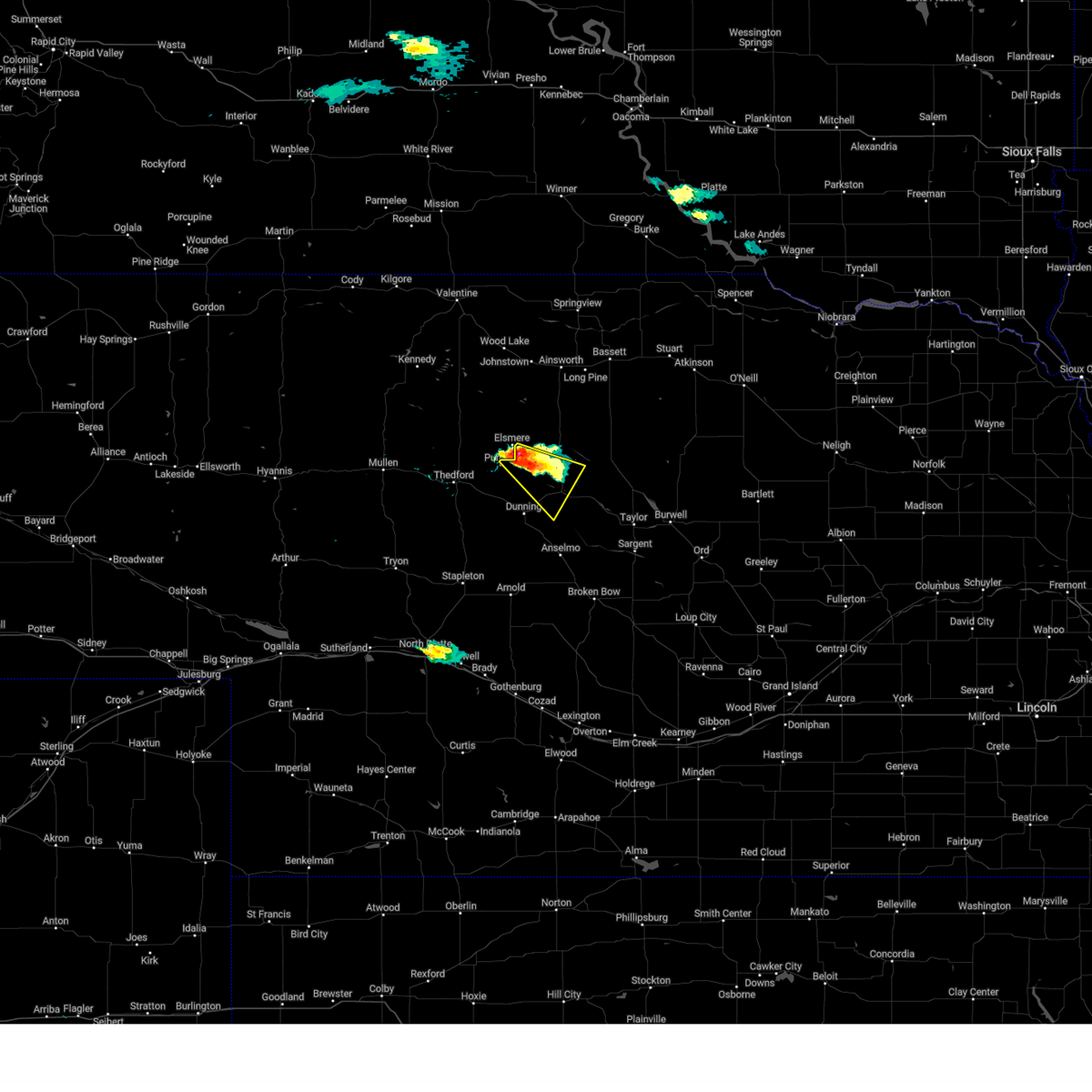
The Top Recent Hail Date for Brewster, NE is Saturday, June 20, 2026 (45th out of 119)
Hail and Wind Damage Spotted near Brewster, NE
| Date / Time | Report Details |
|---|---|
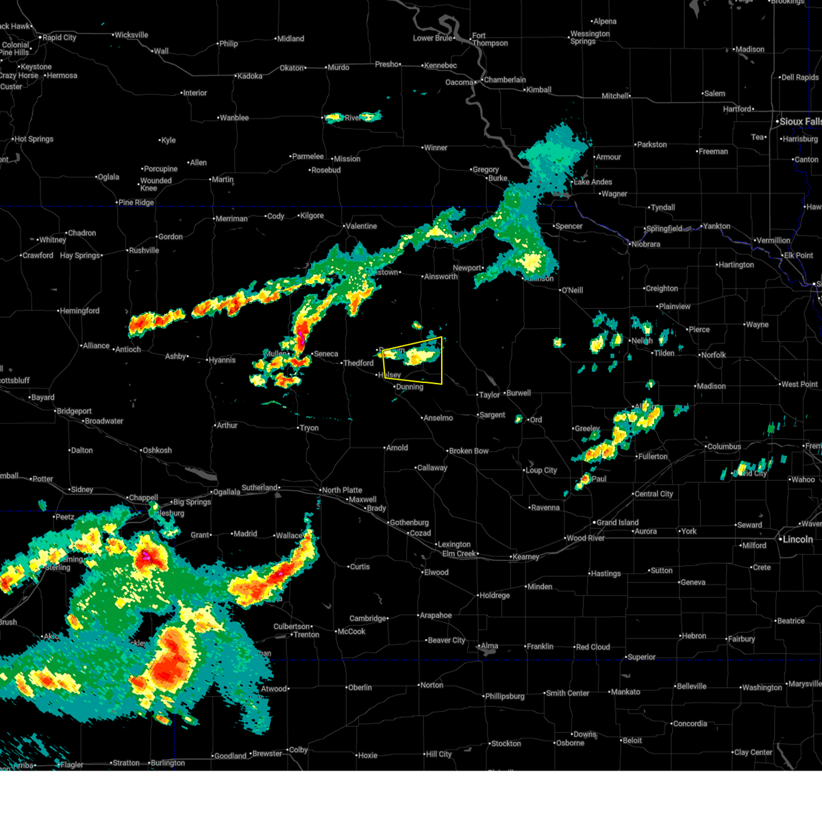
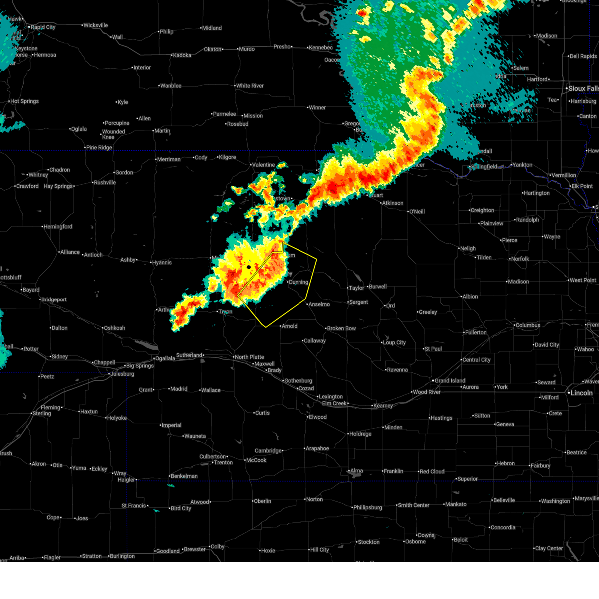
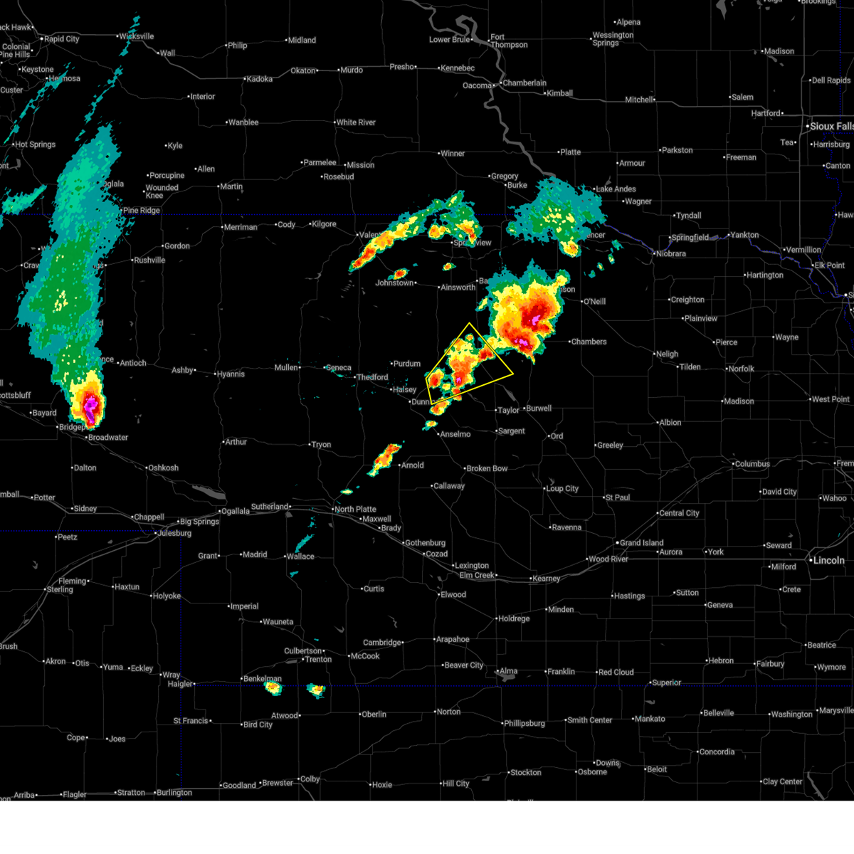
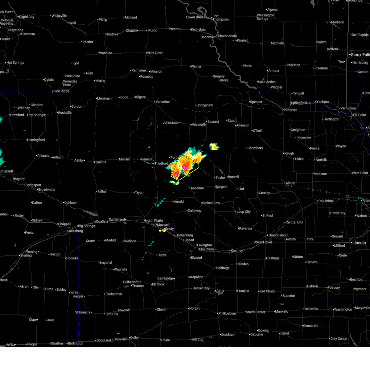
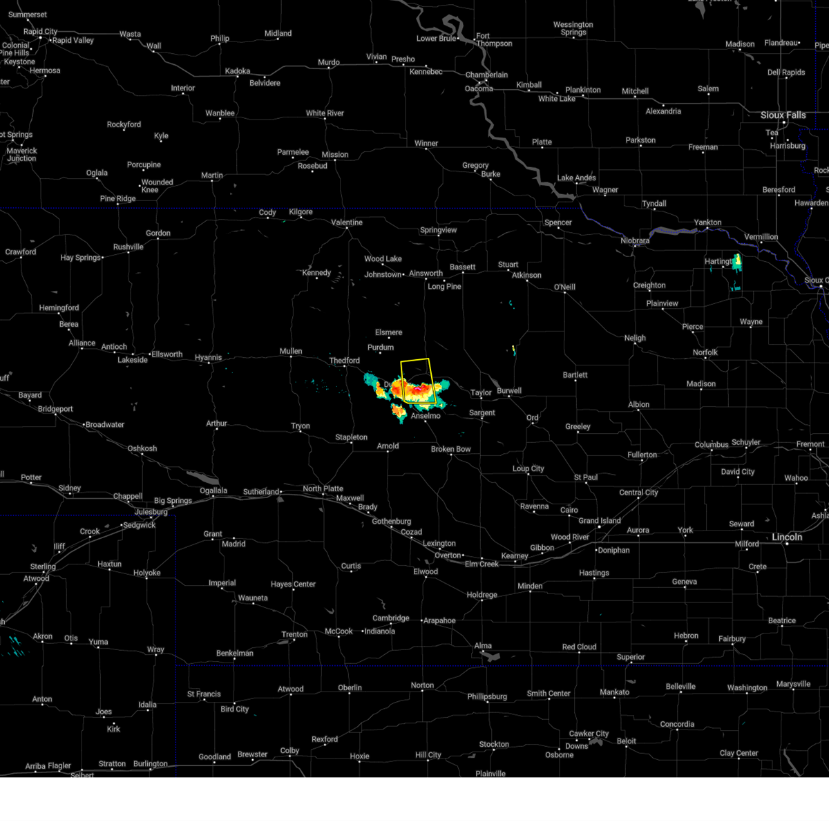
| 6/20/2026 3:47 PM CDT |
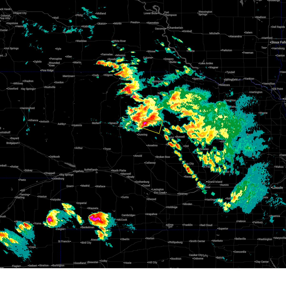 Svrlbf the national weather service in north platte has issued a * severe thunderstorm warning for, northwestern loup county in north central nebraska, northeastern blaine county in north central nebraska, * until 430 pm cdt. * at 347 pm cdt, a severe thunderstorm was located near brewster, moving east at 30 mph (radar indicated). Hazards include 60 mph wind gusts and quarter size hail. Hail damage to vehicles is expected. Expect wind damage to roofs, siding, and trees. Svrlbf the national weather service in north platte has issued a * severe thunderstorm warning for, northwestern loup county in north central nebraska, northeastern blaine county in north central nebraska, * until 430 pm cdt. * at 347 pm cdt, a severe thunderstorm was located near brewster, moving east at 30 mph (radar indicated). Hazards include 60 mph wind gusts and quarter size hail. Hail damage to vehicles is expected. Expect wind damage to roofs, siding, and trees.
|
| 6/13/2026 6:20 AM CDT |
 The storm which prompted the warning has weakened below severe limits, and no longer poses an immediate threat to life or property. therefore, the warning will be allowed to expire. however, heavy rain is still possible with this thunderstorm. a severe thunderstorm watch remains in effect until 1100 am cdt for central and north central nebraska. to report severe weather, contact your nearest law enforcement agency. they will relay your report to the national weather service north platte. The storm which prompted the warning has weakened below severe limits, and no longer poses an immediate threat to life or property. therefore, the warning will be allowed to expire. however, heavy rain is still possible with this thunderstorm. a severe thunderstorm watch remains in effect until 1100 am cdt for central and north central nebraska. to report severe weather, contact your nearest law enforcement agency. they will relay your report to the national weather service north platte.
|
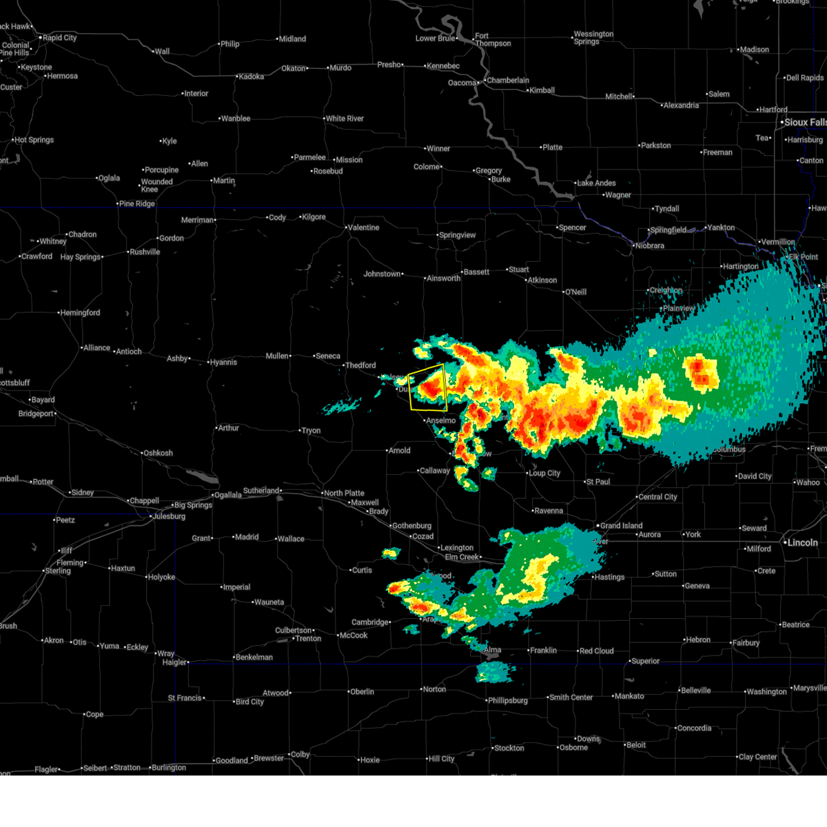
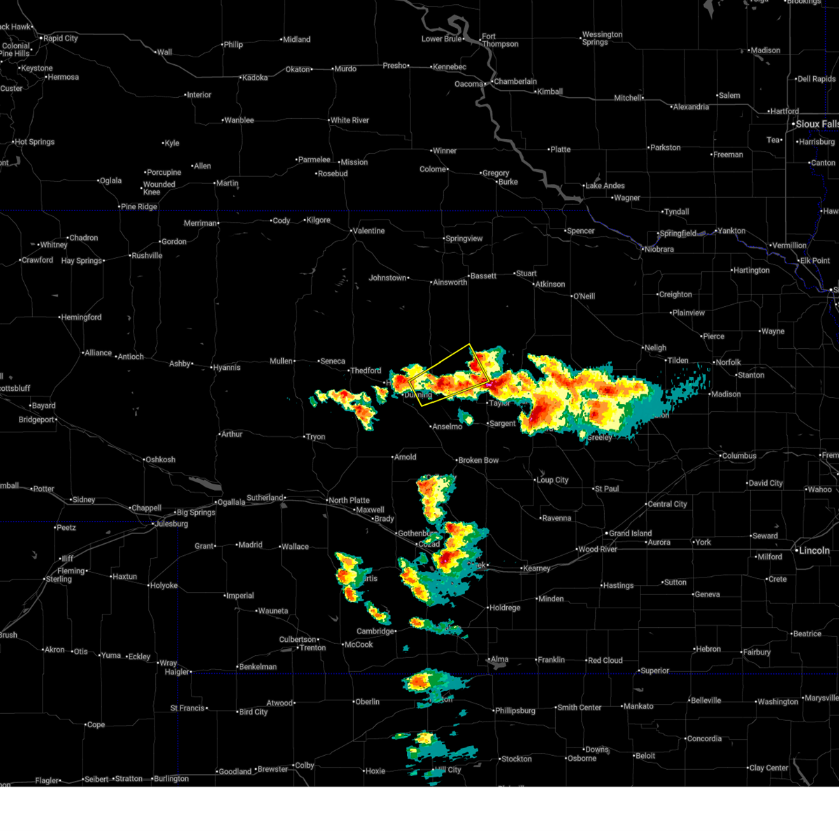
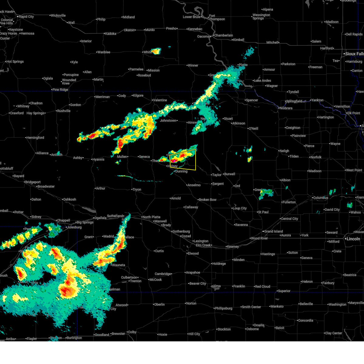
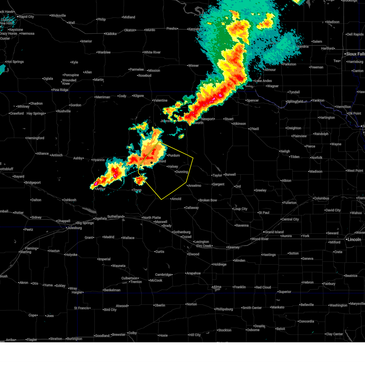
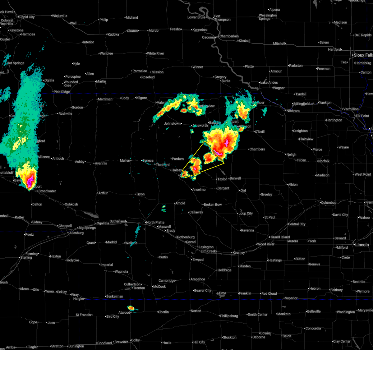
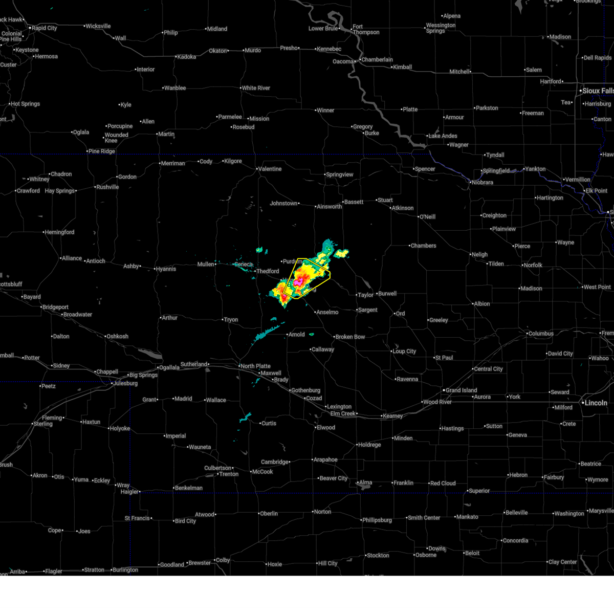
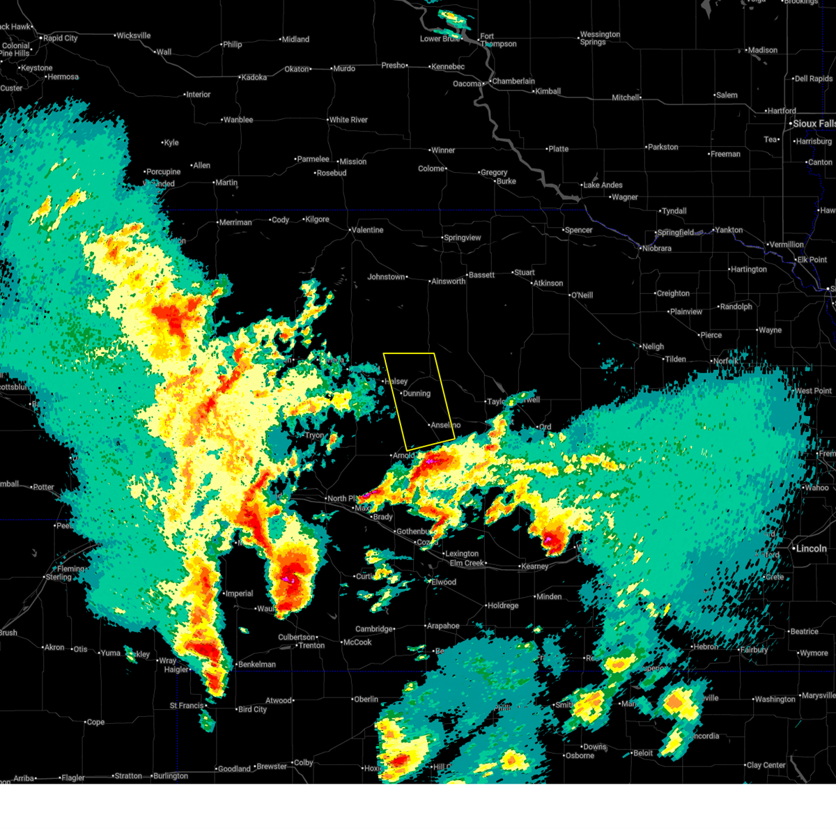
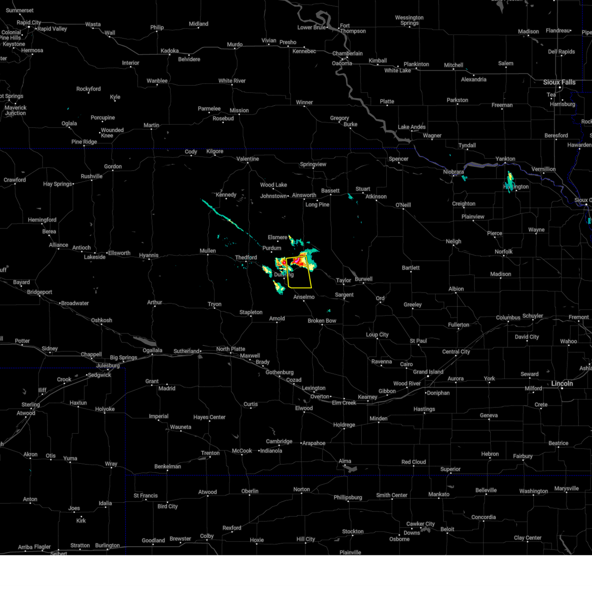
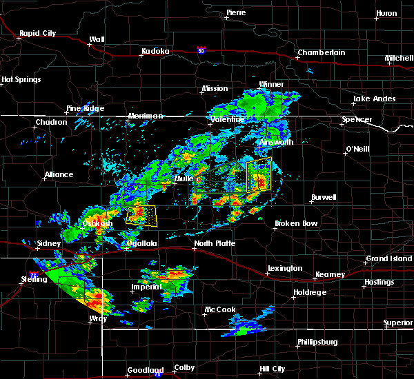
| 6/13/2026 6:02 AM CDT |
 At 602 am cdt, a severe thunderstorm was located near dunning, or 11 miles southwest of brewster, moving east at 20 mph (radar indicated). Hazards include quarter size hail. Damage to vehicles is expected. locations impacted include, brewster, dunning, milburn, milburn diversion dam state wildlife management area, and linscott. This includes highway 2 between mile markers 237 and 252. At 602 am cdt, a severe thunderstorm was located near dunning, or 11 miles southwest of brewster, moving east at 20 mph (radar indicated). Hazards include quarter size hail. Damage to vehicles is expected. locations impacted include, brewster, dunning, milburn, milburn diversion dam state wildlife management area, and linscott. This includes highway 2 between mile markers 237 and 252.
|
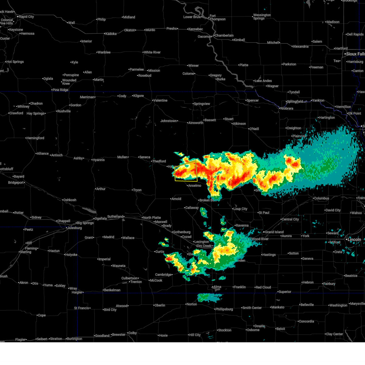
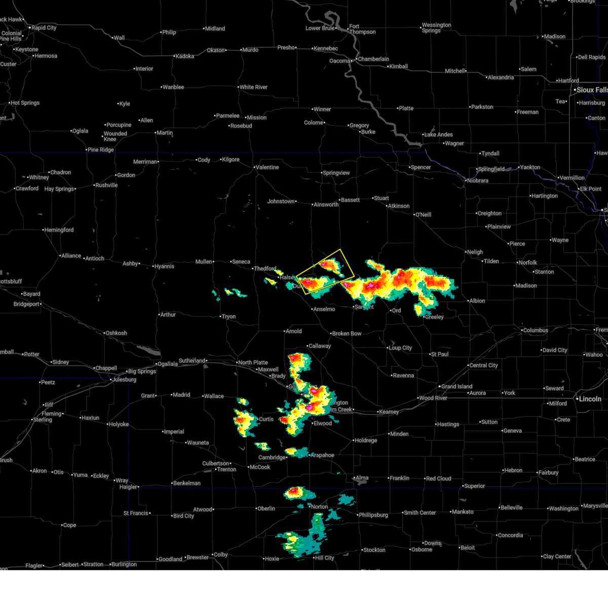
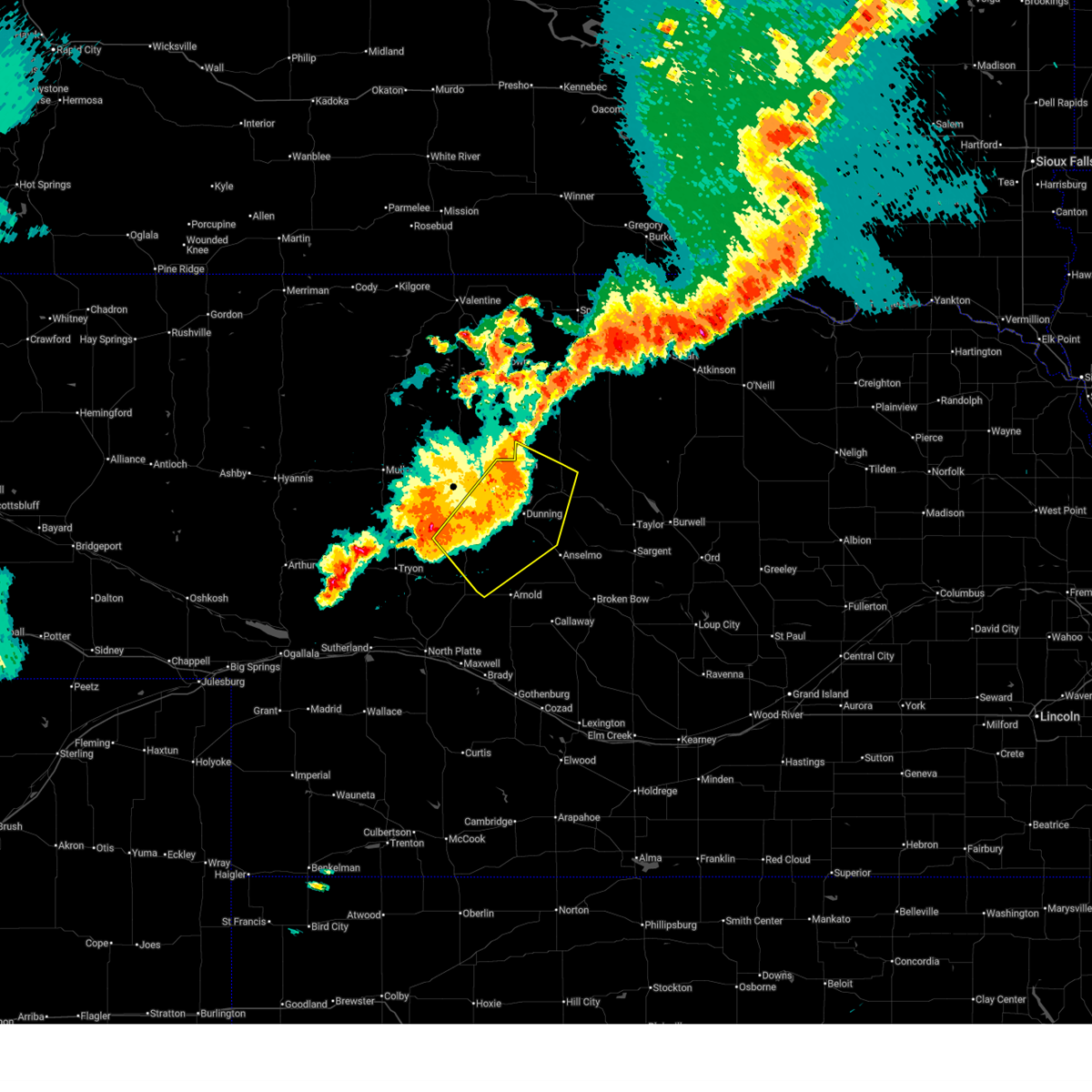
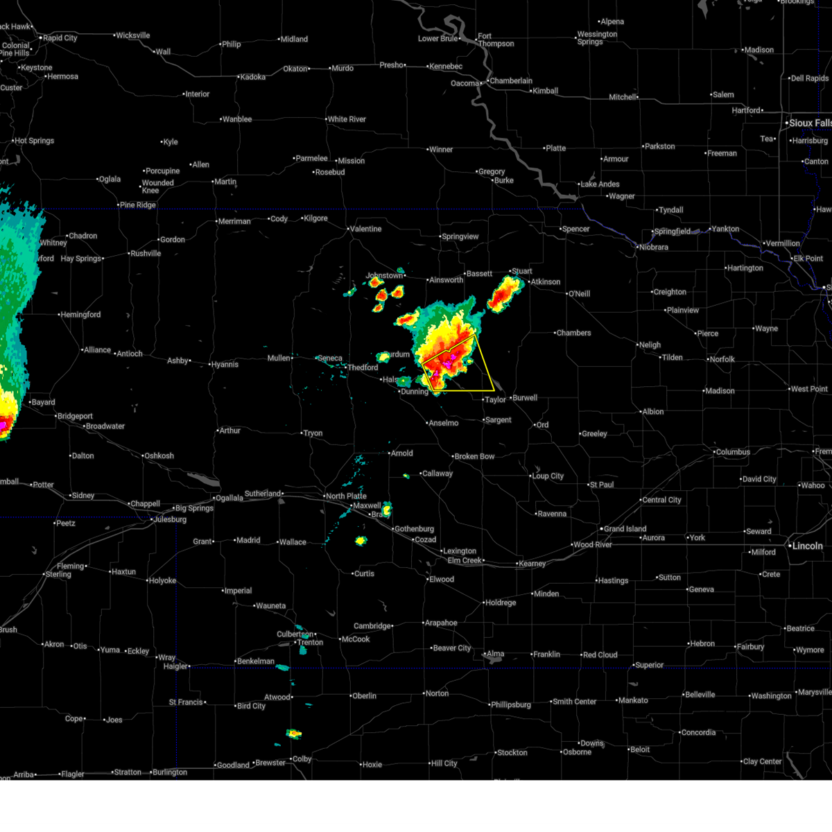
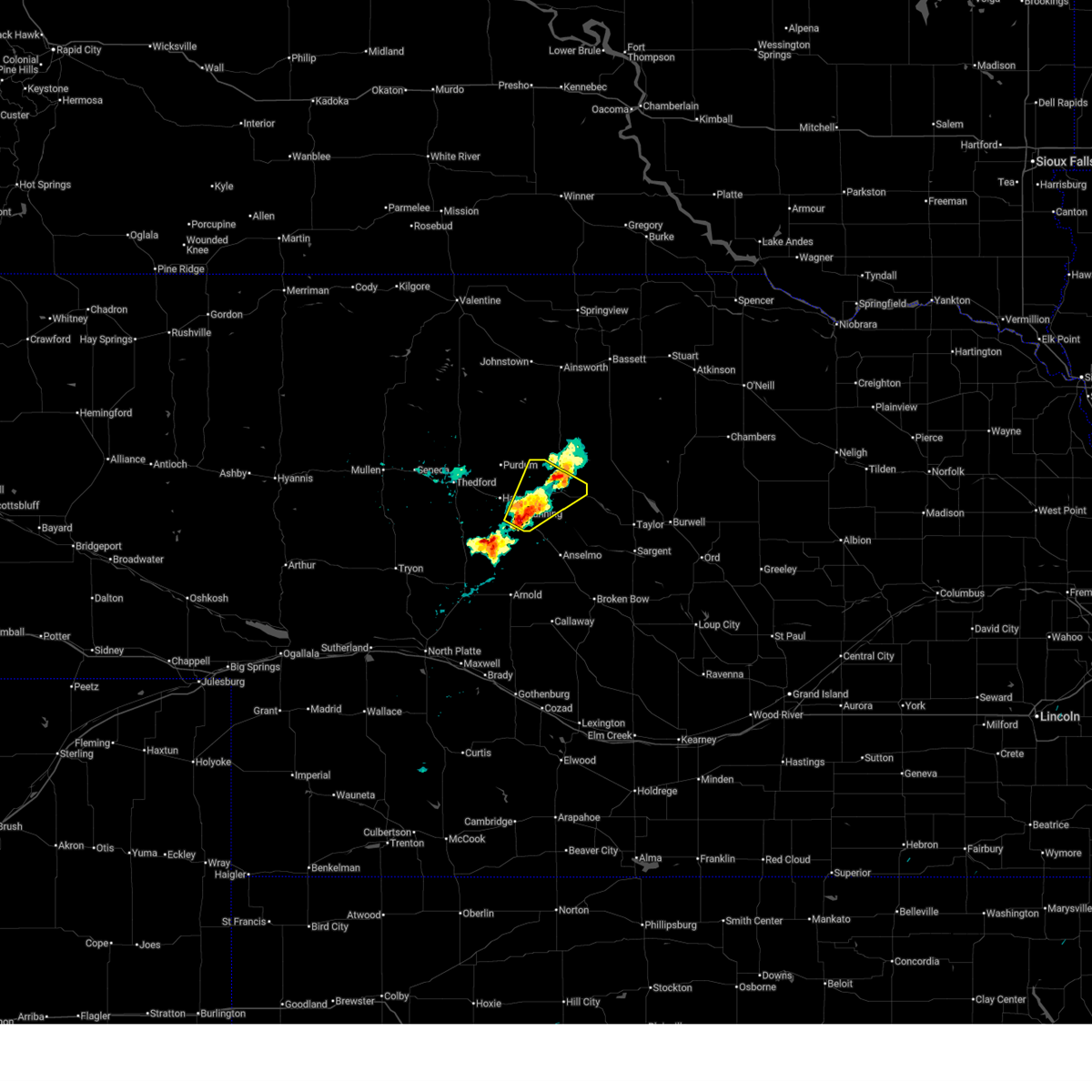
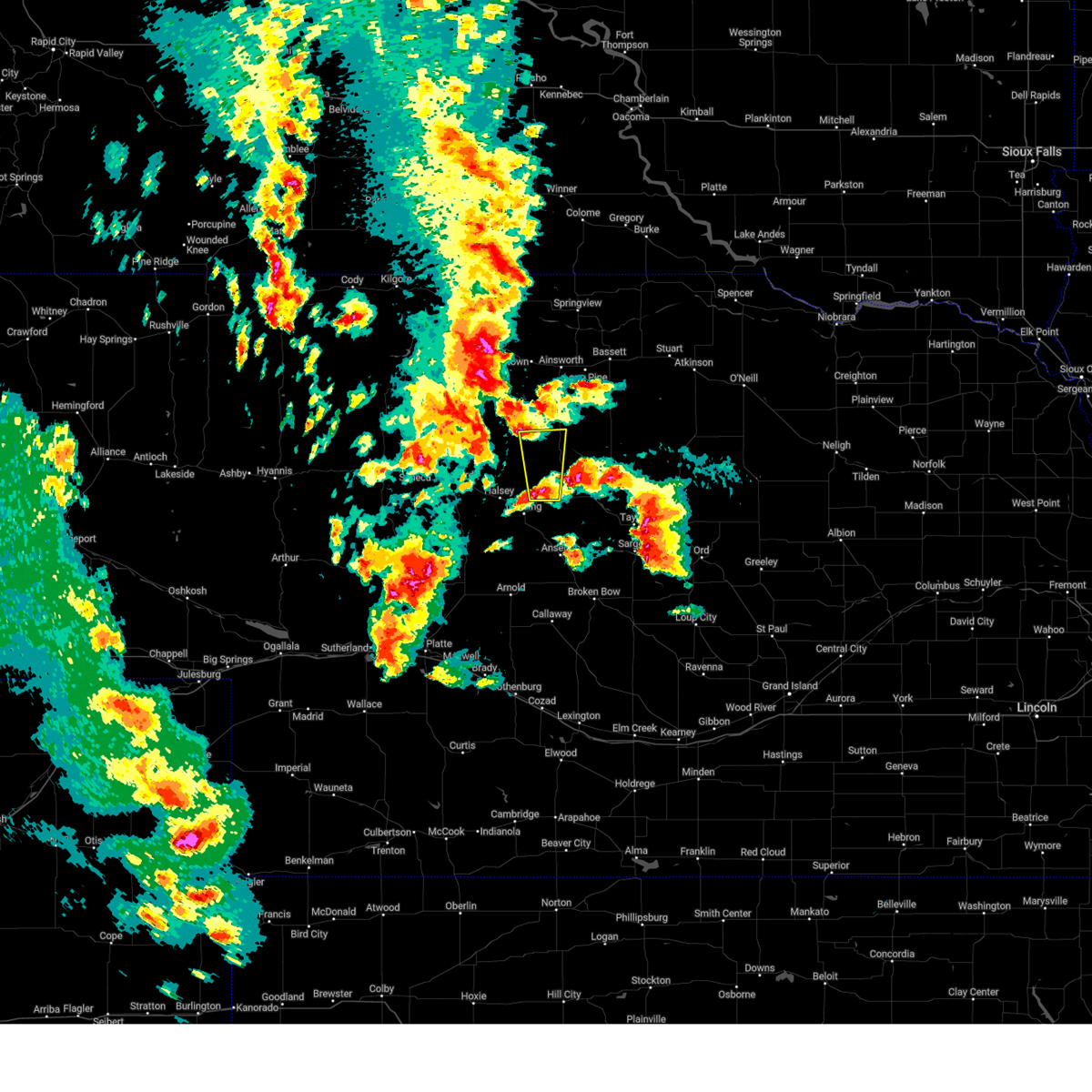
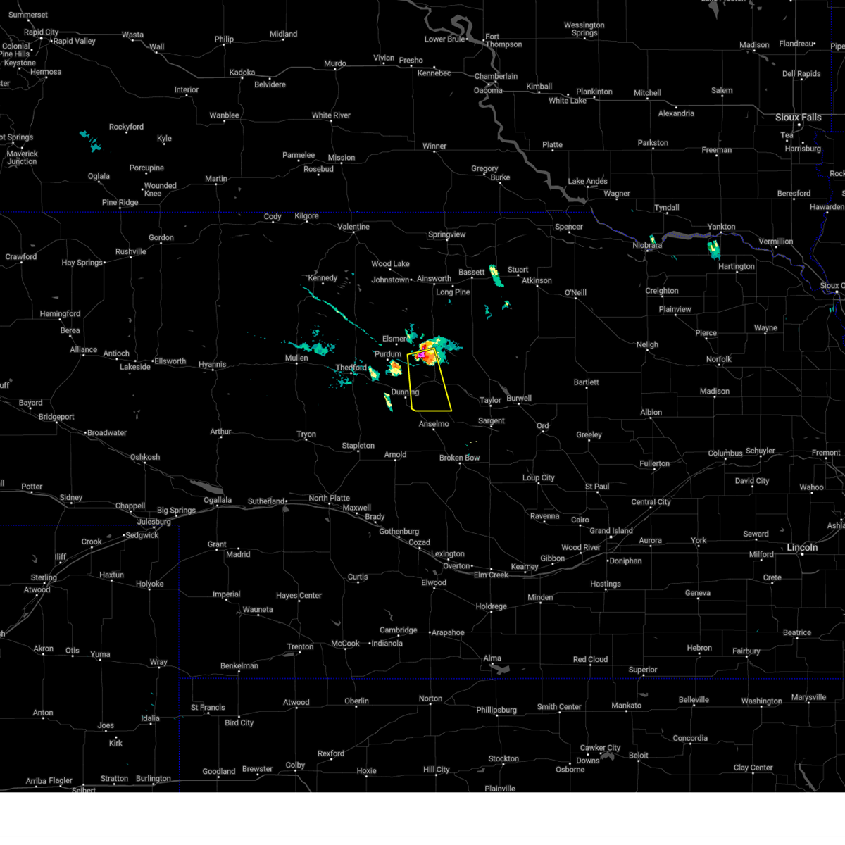
| 6/13/2026 5:45 AM CDT |
 Svrlbf the national weather service in north platte has issued a * severe thunderstorm warning for, northwestern custer county in central nebraska, southern blaine county in north central nebraska, * until 630 am cdt. * at 544 am cdt, a severe thunderstorm was located just south of dunning, or 16 miles southwest of brewster, moving east at 20 mph (radar indicated). Hazards include ping pong ball size hail. People and animals outdoors will be injured. Expect damage to roofs, siding, windows, and vehicles. Svrlbf the national weather service in north platte has issued a * severe thunderstorm warning for, northwestern custer county in central nebraska, southern blaine county in north central nebraska, * until 630 am cdt. * at 544 am cdt, a severe thunderstorm was located just south of dunning, or 16 miles southwest of brewster, moving east at 20 mph (radar indicated). Hazards include ping pong ball size hail. People and animals outdoors will be injured. Expect damage to roofs, siding, windows, and vehicles.
|
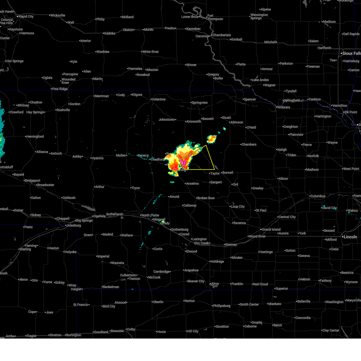
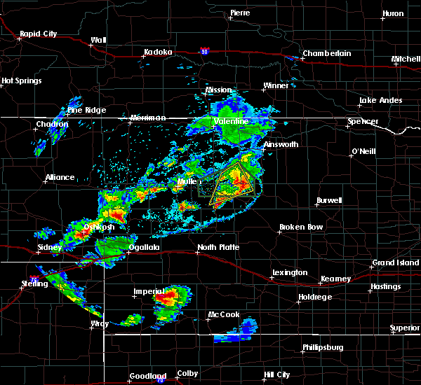
| 6/13/2026 5:00 AM CDT |
 At 500 am cdt, a severe thunderstorm was located 7 miles east of brewster, moving northeast at 20 mph (radar indicated). Hazards include quarter size hail. Damage to vehicles is expected. locations impacted include, brewster, fox bayou, almeria meadow state wildlife management area, and horseshoe bend lake. This includes highway 183 between mile markers 134 and 136, and between mile markers 138 and 152. At 500 am cdt, a severe thunderstorm was located 7 miles east of brewster, moving northeast at 20 mph (radar indicated). Hazards include quarter size hail. Damage to vehicles is expected. locations impacted include, brewster, fox bayou, almeria meadow state wildlife management area, and horseshoe bend lake. This includes highway 183 between mile markers 134 and 136, and between mile markers 138 and 152.
|
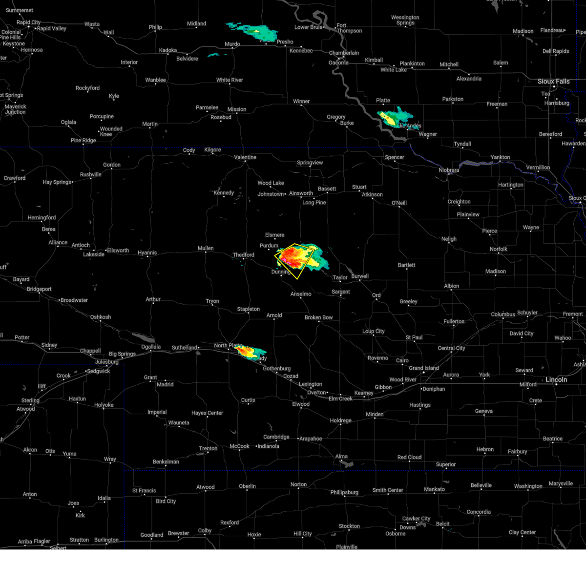
| 6/13/2026 4:33 AM CDT |
 Svrlbf the national weather service in north platte has issued a * severe thunderstorm warning for, south central rock county in north central nebraska, northwestern loup county in north central nebraska, eastern blaine county in north central nebraska, * until 515 am cdt. * at 433 am cdt, a severe thunderstorm was located near brewster, moving northeast at 25 mph (radar indicated). Hazards include golf ball size hail. People and animals outdoors will be injured. Expect damage to roofs, siding, windows, and vehicles. Svrlbf the national weather service in north platte has issued a * severe thunderstorm warning for, south central rock county in north central nebraska, northwestern loup county in north central nebraska, eastern blaine county in north central nebraska, * until 515 am cdt. * at 433 am cdt, a severe thunderstorm was located near brewster, moving northeast at 25 mph (radar indicated). Hazards include golf ball size hail. People and animals outdoors will be injured. Expect damage to roofs, siding, windows, and vehicles.
|
| 6/9/2026 9:45 PM CDT |
 At 945 pm cdt, a severe thunderstorm was located near dunning, or 10 miles west of brewster, moving northeast at 20 mph (radar indicated). Hazards include 60 mph wind gusts and quarter size hail. Hail damage to vehicles is expected. expect wind damage to roofs, siding, and trees. locations impacted include, brewster, dunning, linscott, almeria meadow state wildlife management area, and hawley flats. This includes highway 2 between mile markers 232 and 246. At 945 pm cdt, a severe thunderstorm was located near dunning, or 10 miles west of brewster, moving northeast at 20 mph (radar indicated). Hazards include 60 mph wind gusts and quarter size hail. Hail damage to vehicles is expected. expect wind damage to roofs, siding, and trees. locations impacted include, brewster, dunning, linscott, almeria meadow state wildlife management area, and hawley flats. This includes highway 2 between mile markers 232 and 246.
|
| 6/9/2026 9:16 PM CDT |
 Svrlbf the national weather service in north platte has issued a * severe thunderstorm warning for, southwestern rock county in north central nebraska, northwestern loup county in north central nebraska, southeastern brown county in north central nebraska, northern custer county in central nebraska, blaine county in north central nebraska, * until 1000 pm cdt. * at 916 pm cdt, a severe thunderstorm was located over dunning, or 14 miles southwest of brewster, moving northeast at 45 mph (radar indicated). Hazards include 60 mph wind gusts and quarter size hail. Hail damage to vehicles is expected. Expect wind damage to roofs, siding, and trees. Svrlbf the national weather service in north platte has issued a * severe thunderstorm warning for, southwestern rock county in north central nebraska, northwestern loup county in north central nebraska, southeastern brown county in north central nebraska, northern custer county in central nebraska, blaine county in north central nebraska, * until 1000 pm cdt. * at 916 pm cdt, a severe thunderstorm was located over dunning, or 14 miles southwest of brewster, moving northeast at 45 mph (radar indicated). Hazards include 60 mph wind gusts and quarter size hail. Hail damage to vehicles is expected. Expect wind damage to roofs, siding, and trees.
|
| 8/9/2025 7:21 PM CDT |
 the severe thunderstorm warning has been cancelled and is no longer in effect the severe thunderstorm warning has been cancelled and is no longer in effect
|
| 8/9/2025 6:52 PM CDT |
 Svrlbf the national weather service in north platte has issued a * severe thunderstorm warning for, southeastern brown county in north central nebraska, northern blaine county in north central nebraska, * until 745 pm cdt. * at 652 pm cdt, a severe thunderstorm was located 10 miles southeast of purdum, or 12 miles west of brewster, moving east at 20 mph (radar indicated). Hazards include 60 mph wind gusts and half dollar size hail. Hail damage to vehicles is expected. Expect wind damage to roofs, siding, and trees. Svrlbf the national weather service in north platte has issued a * severe thunderstorm warning for, southeastern brown county in north central nebraska, northern blaine county in north central nebraska, * until 745 pm cdt. * at 652 pm cdt, a severe thunderstorm was located 10 miles southeast of purdum, or 12 miles west of brewster, moving east at 20 mph (radar indicated). Hazards include 60 mph wind gusts and half dollar size hail. Hail damage to vehicles is expected. Expect wind damage to roofs, siding, and trees.
|
| 7/15/2025 6:45 PM CDT |
 The storms which prompted the warning have weakened below severe limits, and no longer pose an immediate threat to life or property. therefore, the warning has been allowed to expire. a severe thunderstorm watch remains in effect until 1100 pm cdt for central, north central and west central nebraska. The storms which prompted the warning have weakened below severe limits, and no longer pose an immediate threat to life or property. therefore, the warning has been allowed to expire. a severe thunderstorm watch remains in effect until 1100 pm cdt for central, north central and west central nebraska.
|
| 7/15/2025 6:35 PM CDT |
 the severe thunderstorm warning has been cancelled and is no longer in effect the severe thunderstorm warning has been cancelled and is no longer in effect
|
| 7/15/2025 6:35 PM CDT |
 At 635 pm cdt, severe thunderstorms were located along a line extending from 6 miles northwest of brewster to near dunning to 15 miles northeast of gandy, moving southeast at 40 mph (radar indicated). Hazards include 60 mph wind gusts and quarter size hail. Hail damage to vehicles is expected. expect wind damage to roofs, siding, and trees. locations impacted include, brewster, dunning, halsey, gandy, purdum, logan, highway 83 crossing the dismal river, hawley flats, linscott, tarboz lake, shanklin bluff, hoagland, brown lake, and koshopah. this includes the following highways, highway 2 between mile markers 218 and 254. highway 92 between mile markers 239 and 240. Highway 83 between mile markers 115 and 138. At 635 pm cdt, severe thunderstorms were located along a line extending from 6 miles northwest of brewster to near dunning to 15 miles northeast of gandy, moving southeast at 40 mph (radar indicated). Hazards include 60 mph wind gusts and quarter size hail. Hail damage to vehicles is expected. expect wind damage to roofs, siding, and trees. locations impacted include, brewster, dunning, halsey, gandy, purdum, logan, highway 83 crossing the dismal river, hawley flats, linscott, tarboz lake, shanklin bluff, hoagland, brown lake, and koshopah. this includes the following highways, highway 2 between mile markers 218 and 254. highway 92 between mile markers 239 and 240. Highway 83 between mile markers 115 and 138.
|
| 7/15/2025 5:54 PM CDT |
 Svrlbf the national weather service in north platte has issued a * severe thunderstorm warning for, southeastern cherry county in north central nebraska, southwestern brown county in north central nebraska, logan county in west central nebraska, northwestern custer county in central nebraska, blaine county in north central nebraska, thomas county in north central nebraska, * until 645 pm cdt. * at 553 pm cdt, severe thunderstorms were located along a line extending from near purdum to 7 miles west of halsey to 12 miles southwest of thedford, moving southeast at 30 mph (radar indicated). Hazards include 70 mph wind gusts and quarter size hail. Hail damage to vehicles is expected. expect considerable tree damage. Wind damage is also likely to mobile homes, roofs, and outbuildings. Svrlbf the national weather service in north platte has issued a * severe thunderstorm warning for, southeastern cherry county in north central nebraska, southwestern brown county in north central nebraska, logan county in west central nebraska, northwestern custer county in central nebraska, blaine county in north central nebraska, thomas county in north central nebraska, * until 645 pm cdt. * at 553 pm cdt, severe thunderstorms were located along a line extending from near purdum to 7 miles west of halsey to 12 miles southwest of thedford, moving southeast at 30 mph (radar indicated). Hazards include 70 mph wind gusts and quarter size hail. Hail damage to vehicles is expected. expect considerable tree damage. Wind damage is also likely to mobile homes, roofs, and outbuildings.
|
| 6/22/2025 7:56 PM CDT |
 At 756 pm cdt, a severe thunderstorm was located near brewster, moving northeast at 40 mph (radar indicated). Hazards include ping pong ball size hail and 60 mph wind gusts. People and animals outdoors will be injured. expect hail damage to roofs, siding, windows, and vehicles. expect wind damage to roofs, siding, and trees. locations impacted include, brewster, milburn diversion dam state wildlife management area, fox bayou, linscott, almeria meadow state wildlife management area, and horseshoe bend lake. this includes the following highways, highway 183 between mile markers 136 and 144. Highway 2 between mile markers 243 and 254. At 756 pm cdt, a severe thunderstorm was located near brewster, moving northeast at 40 mph (radar indicated). Hazards include ping pong ball size hail and 60 mph wind gusts. People and animals outdoors will be injured. expect hail damage to roofs, siding, windows, and vehicles. expect wind damage to roofs, siding, and trees. locations impacted include, brewster, milburn diversion dam state wildlife management area, fox bayou, linscott, almeria meadow state wildlife management area, and horseshoe bend lake. this includes the following highways, highway 183 between mile markers 136 and 144. Highway 2 between mile markers 243 and 254.
|
| 6/22/2025 7:34 PM CDT |
 Svrlbf the national weather service in north platte has issued a * severe thunderstorm warning for, southwestern rock county in north central nebraska, northwestern loup county in north central nebraska, southeastern brown county in north central nebraska, north central custer county in central nebraska, eastern blaine county in north central nebraska, * until 815 pm cdt. * at 734 pm cdt, a severe thunderstorm was located 8 miles southeast of dunning, or 15 miles southwest of brewster, moving northeast at 40 mph (radar indicated). Hazards include ping pong ball size hail and 60 mph wind gusts. People and animals outdoors will be injured. expect hail damage to roofs, siding, windows, and vehicles. Expect wind damage to roofs, siding, and trees. Svrlbf the national weather service in north platte has issued a * severe thunderstorm warning for, southwestern rock county in north central nebraska, northwestern loup county in north central nebraska, southeastern brown county in north central nebraska, north central custer county in central nebraska, eastern blaine county in north central nebraska, * until 815 pm cdt. * at 734 pm cdt, a severe thunderstorm was located 8 miles southeast of dunning, or 15 miles southwest of brewster, moving northeast at 40 mph (radar indicated). Hazards include ping pong ball size hail and 60 mph wind gusts. People and animals outdoors will be injured. expect hail damage to roofs, siding, windows, and vehicles. Expect wind damage to roofs, siding, and trees.
|
| 6/22/2025 6:55 PM CDT |
 At 655 pm cdt, a severe thunderstorm was located 9 miles northeast of brewster, moving northeast at 30 mph (radar indicated). Hazards include 60 mph wind gusts and half dollar size hail. Hail damage to vehicles is expected. expect wind damage to roofs, siding, and trees. locations impacted include, brewster, rose, fox bayou, duff, and almeria meadow state wildlife management area. This includes highway 183 between mile markers 137 and 160. At 655 pm cdt, a severe thunderstorm was located 9 miles northeast of brewster, moving northeast at 30 mph (radar indicated). Hazards include 60 mph wind gusts and half dollar size hail. Hail damage to vehicles is expected. expect wind damage to roofs, siding, and trees. locations impacted include, brewster, rose, fox bayou, duff, and almeria meadow state wildlife management area. This includes highway 183 between mile markers 137 and 160.
|
| 6/22/2025 6:38 PM CDT |
 Svrlbf the national weather service in north platte has issued a * severe thunderstorm warning for, southwestern rock county in north central nebraska, northern loup county in north central nebraska, southeastern brown county in north central nebraska, eastern blaine county in north central nebraska, * until 730 pm cdt. * at 638 pm cdt, a severe thunderstorm was located near brewster, moving northeast at 30 mph (radar indicated). Hazards include ping pong ball size hail and 60 mph wind gusts. People and animals outdoors will be injured. expect hail damage to roofs, siding, windows, and vehicles. Expect wind damage to roofs, siding, and trees. Svrlbf the national weather service in north platte has issued a * severe thunderstorm warning for, southwestern rock county in north central nebraska, northern loup county in north central nebraska, southeastern brown county in north central nebraska, eastern blaine county in north central nebraska, * until 730 pm cdt. * at 638 pm cdt, a severe thunderstorm was located near brewster, moving northeast at 30 mph (radar indicated). Hazards include ping pong ball size hail and 60 mph wind gusts. People and animals outdoors will be injured. expect hail damage to roofs, siding, windows, and vehicles. Expect wind damage to roofs, siding, and trees.
|
| 6/22/2025 5:56 PM CDT |
 At 555 pm cdt, a severe thunderstorm was located 13 miles east of brewster, moving northeast at 30 mph (radar indicated). Hazards include two inch hail and 70 mph wind gusts. People and animals outdoors will be injured. expect hail damage to roofs, siding, windows, and vehicles. expect considerable tree damage. wind damage is also likely to mobile homes, roofs, and outbuildings. locations impacted include, brewster, fox bayou, almeria meadow state wildlife management area, horseshoe bend lake, hannamon bayou campground, and almeria. This includes highway 183 between mile markers 129 and 153. At 555 pm cdt, a severe thunderstorm was located 13 miles east of brewster, moving northeast at 30 mph (radar indicated). Hazards include two inch hail and 70 mph wind gusts. People and animals outdoors will be injured. expect hail damage to roofs, siding, windows, and vehicles. expect considerable tree damage. wind damage is also likely to mobile homes, roofs, and outbuildings. locations impacted include, brewster, fox bayou, almeria meadow state wildlife management area, horseshoe bend lake, hannamon bayou campground, and almeria. This includes highway 183 between mile markers 129 and 153.
|
| 6/22/2025 5:30 PM CDT |
 Svrlbf the national weather service in north platte has issued a * severe thunderstorm warning for, south central rock county in north central nebraska, northern loup county in north central nebraska, northeastern blaine county in north central nebraska, * until 615 pm cdt. * at 529 pm cdt, a severe thunderstorm was located near brewster, moving northeast at 30 mph (radar indicated). Hazards include two inch hail and 70 mph wind gusts. People and animals outdoors will be injured. expect hail damage to roofs, siding, windows, and vehicles. expect considerable tree damage. Wind damage is also likely to mobile homes, roofs, and outbuildings. Svrlbf the national weather service in north platte has issued a * severe thunderstorm warning for, south central rock county in north central nebraska, northern loup county in north central nebraska, northeastern blaine county in north central nebraska, * until 615 pm cdt. * at 529 pm cdt, a severe thunderstorm was located near brewster, moving northeast at 30 mph (radar indicated). Hazards include two inch hail and 70 mph wind gusts. People and animals outdoors will be injured. expect hail damage to roofs, siding, windows, and vehicles. expect considerable tree damage. Wind damage is also likely to mobile homes, roofs, and outbuildings.
|
| 6/22/2025 5:21 PM CDT |
 At 520 pm cdt, a severe thunderstorm was located near brewster, moving northeast at 20 mph (radar indicated). Hazards include two inch hail and 70 mph wind gusts. People and animals outdoors will be injured. expect hail damage to roofs, siding, windows, and vehicles. expect considerable tree damage. wind damage is also likely to mobile homes, roofs, and outbuildings. locations impacted include, brewster, dunning, and hawley flats. This includes highway 2 between mile markers 233 and 244. At 520 pm cdt, a severe thunderstorm was located near brewster, moving northeast at 20 mph (radar indicated). Hazards include two inch hail and 70 mph wind gusts. People and animals outdoors will be injured. expect hail damage to roofs, siding, windows, and vehicles. expect considerable tree damage. wind damage is also likely to mobile homes, roofs, and outbuildings. locations impacted include, brewster, dunning, and hawley flats. This includes highway 2 between mile markers 233 and 244.
|
| 6/22/2025 5:10 PM CDT |
 At 509 pm cdt, a severe thunderstorm was located near dunning, or 9 miles southwest of brewster, moving northeast at 20 mph (radar indicated). Hazards include two inch hail and 60 mph wind gusts. People and animals outdoors will be injured. expect hail damage to roofs, siding, windows, and vehicles. expect wind damage to roofs, siding, and trees. locations impacted include, brewster, dunning, and hawley flats. This includes highway 2 between mile markers 233 and 244. At 509 pm cdt, a severe thunderstorm was located near dunning, or 9 miles southwest of brewster, moving northeast at 20 mph (radar indicated). Hazards include two inch hail and 60 mph wind gusts. People and animals outdoors will be injured. expect hail damage to roofs, siding, windows, and vehicles. expect wind damage to roofs, siding, and trees. locations impacted include, brewster, dunning, and hawley flats. This includes highway 2 between mile markers 233 and 244.
|
| 6/22/2025 4:57 PM CDT |
 Svrlbf the national weather service in north platte has issued a * severe thunderstorm warning for, central blaine county in north central nebraska, * until 545 pm cdt. * at 456 pm cdt, a severe thunderstorm was located over dunning, or 14 miles southwest of brewster, moving northeast at 20 mph (radar indicated). Hazards include ping pong ball size hail and 60 mph wind gusts. People and animals outdoors will be injured. expect hail damage to roofs, siding, windows, and vehicles. Expect wind damage to roofs, siding, and trees. Svrlbf the national weather service in north platte has issued a * severe thunderstorm warning for, central blaine county in north central nebraska, * until 545 pm cdt. * at 456 pm cdt, a severe thunderstorm was located over dunning, or 14 miles southwest of brewster, moving northeast at 20 mph (radar indicated). Hazards include ping pong ball size hail and 60 mph wind gusts. People and animals outdoors will be injured. expect hail damage to roofs, siding, windows, and vehicles. Expect wind damage to roofs, siding, and trees.
|
| 5/18/2025 8:31 PM CDT |
 the severe thunderstorm warning has been cancelled and is no longer in effect the severe thunderstorm warning has been cancelled and is no longer in effect
|
| 5/18/2025 8:24 PM CDT |
 At 823 pm cdt, a severe thunderstorm was located near dunning, or 10 miles southwest of brewster, moving north at 60 mph (radar indicated). Hazards include 60 mph wind gusts and quarter size hail. Hail damage to vehicles is expected. expect wind damage to roofs, siding, and trees. locations impacted include, brewster, dunning, and hawley flats. This includes highway 2 between mile markers 234 and 244. At 823 pm cdt, a severe thunderstorm was located near dunning, or 10 miles southwest of brewster, moving north at 60 mph (radar indicated). Hazards include 60 mph wind gusts and quarter size hail. Hail damage to vehicles is expected. expect wind damage to roofs, siding, and trees. locations impacted include, brewster, dunning, and hawley flats. This includes highway 2 between mile markers 234 and 244.
|
| 5/18/2025 8:24 PM CDT |
 the severe thunderstorm warning has been cancelled and is no longer in effect the severe thunderstorm warning has been cancelled and is no longer in effect
|
| 5/18/2025 8:05 PM CDT |
 Svrlbf the national weather service in north platte has issued a * severe thunderstorm warning for, northwestern custer county in central nebraska, blaine county in north central nebraska, * until 845 pm cdt. * at 805 pm cdt, a severe thunderstorm was located near anselmo, or 17 miles northwest of broken bow, moving north at 70 mph (radar indicated). Hazards include 60 mph wind gusts and half dollar size hail. Hail damage to vehicles is expected. Expect wind damage to roofs, siding, and trees. Svrlbf the national weather service in north platte has issued a * severe thunderstorm warning for, northwestern custer county in central nebraska, blaine county in north central nebraska, * until 845 pm cdt. * at 805 pm cdt, a severe thunderstorm was located near anselmo, or 17 miles northwest of broken bow, moving north at 70 mph (radar indicated). Hazards include 60 mph wind gusts and half dollar size hail. Hail damage to vehicles is expected. Expect wind damage to roofs, siding, and trees.
|
| 5/14/2025 7:29 PM CDT |
 Svrlbf the national weather service in north platte has issued a * severe thunderstorm warning for, southwestern brown county in north central nebraska, north central blaine county in north central nebraska, * until 815 pm cdt. * at 729 pm cdt, a severe thunderstorm was located near brewster, moving north at 25 mph (radar indicated). Hazards include half dollar size hail. damage to vehicles is expected Svrlbf the national weather service in north platte has issued a * severe thunderstorm warning for, southwestern brown county in north central nebraska, north central blaine county in north central nebraska, * until 815 pm cdt. * at 729 pm cdt, a severe thunderstorm was located near brewster, moving north at 25 mph (radar indicated). Hazards include half dollar size hail. damage to vehicles is expected
|
| 5/14/2025 7:24 PM CDT |
 Svrlbf the national weather service in north platte has issued a * severe thunderstorm warning for, southwestern rock county in north central nebraska, northwestern loup county in north central nebraska, southeastern brown county in north central nebraska, northeastern blaine county in north central nebraska, * until 815 pm cdt. * at 724 pm cdt, a severe thunderstorm was located near brewster, moving north at 25 mph (radar indicated). Hazards include half dollar size hail. damage to vehicles is expected Svrlbf the national weather service in north platte has issued a * severe thunderstorm warning for, southwestern rock county in north central nebraska, northwestern loup county in north central nebraska, southeastern brown county in north central nebraska, northeastern blaine county in north central nebraska, * until 815 pm cdt. * at 724 pm cdt, a severe thunderstorm was located near brewster, moving north at 25 mph (radar indicated). Hazards include half dollar size hail. damage to vehicles is expected
|
| 7/16/2024 5:38 PM CDT |
 Torlbf the national weather service in north platte has issued a * tornado warning for, northeastern blaine county in north central nebraska, * until 600 pm cdt. * at 538 pm cdt, a severe thunderstorm capable of producing a tornado was located near brewster, moving south at 25 mph (radar indicated rotation). Hazards include tornado and tennis ball size hail. Flying debris will be dangerous to those caught without shelter. mobile homes will be damaged or destroyed. damage to roofs, windows, and vehicles will occur. tree damage is likely. This dangerous storm will be near, brewster around 545 pm cdt. Torlbf the national weather service in north platte has issued a * tornado warning for, northeastern blaine county in north central nebraska, * until 600 pm cdt. * at 538 pm cdt, a severe thunderstorm capable of producing a tornado was located near brewster, moving south at 25 mph (radar indicated rotation). Hazards include tornado and tennis ball size hail. Flying debris will be dangerous to those caught without shelter. mobile homes will be damaged or destroyed. damage to roofs, windows, and vehicles will occur. tree damage is likely. This dangerous storm will be near, brewster around 545 pm cdt.
|
| 7/16/2024 5:08 PM CDT |
 Svrlbf the national weather service in north platte has issued a * severe thunderstorm warning for, southeastern brown county in north central nebraska, blaine county in north central nebraska, * until 615 pm cdt. * at 508 pm cdt, a severe thunderstorm was located 12 miles northeast of elsmere, or 21 miles south of ainsworth, moving south at 25 mph (radar indicated). Hazards include tennis ball size hail and 60 mph wind gusts. People and animals outdoors will be injured. expect hail damage to roofs, siding, windows, and vehicles. Expect wind damage to roofs, siding, and trees. Svrlbf the national weather service in north platte has issued a * severe thunderstorm warning for, southeastern brown county in north central nebraska, blaine county in north central nebraska, * until 615 pm cdt. * at 508 pm cdt, a severe thunderstorm was located 12 miles northeast of elsmere, or 21 miles south of ainsworth, moving south at 25 mph (radar indicated). Hazards include tennis ball size hail and 60 mph wind gusts. People and animals outdoors will be injured. expect hail damage to roofs, siding, windows, and vehicles. Expect wind damage to roofs, siding, and trees.
|
| 4/6/2024 5:16 PM CDT |
 The storms which prompted the warning have weakened below severe limits, and no longer pose an immediate threat to life or property. therefore, the warning has been allowed to expire. however, gusty winds are still possible with these thunderstorms. a severe thunderstorm watch remains in effect until 800 pm cdt for central nebraska. The storms which prompted the warning have weakened below severe limits, and no longer pose an immediate threat to life or property. therefore, the warning has been allowed to expire. however, gusty winds are still possible with these thunderstorms. a severe thunderstorm watch remains in effect until 800 pm cdt for central nebraska.
|
| 4/6/2024 4:57 PM CDT |
 At 456 pm cdt, severe thunderstorms were located along a line extending from 14 miles east of elsmere to 9 miles east of brewster to 8 miles east of sargent, moving northeast at 35 mph (radar indicated). Hazards include 60 mph wind gusts. Expect damage to roofs, siding, and trees. locations impacted include, burwell, taylor, brewster, sargent, comstock, calamus reservoir state recreation area, fox bayou, almeria meadow state wildlife management area, virginia smith dam, hannamon bayou campground, wescott, kent diversion dam state wildlife management area, homestead knolls campground, horseshoe bend lake, big oak canyon, almeria, nunda shoal campground, divide hill, and valley view flat campground. This includes highway 183 between mile markers 111 and 151. At 456 pm cdt, severe thunderstorms were located along a line extending from 14 miles east of elsmere to 9 miles east of brewster to 8 miles east of sargent, moving northeast at 35 mph (radar indicated). Hazards include 60 mph wind gusts. Expect damage to roofs, siding, and trees. locations impacted include, burwell, taylor, brewster, sargent, comstock, calamus reservoir state recreation area, fox bayou, almeria meadow state wildlife management area, virginia smith dam, hannamon bayou campground, wescott, kent diversion dam state wildlife management area, homestead knolls campground, horseshoe bend lake, big oak canyon, almeria, nunda shoal campground, divide hill, and valley view flat campground. This includes highway 183 between mile markers 111 and 151.
|
| 4/6/2024 4:28 PM CDT |
 Svrlbf the national weather service in north platte has issued a * severe thunderstorm warning for, southwestern rock county in north central nebraska, loup county in north central nebraska, southeastern brown county in north central nebraska, southwestern garfield county in north central nebraska, northeastern custer county in central nebraska, eastern blaine county in north central nebraska, * until 515 pm cdt. * at 428 pm cdt, severe thunderstorms were located along a line extending from 9 miles north of anselmo to near victoria springs state recreation area to 6 miles southwest of arcadia, moving north at 45 mph (radar indicated). Hazards include 70 mph wind gusts. Expect considerable tree damage. Damage is likely to mobile homes, roofs, and outbuildings. Svrlbf the national weather service in north platte has issued a * severe thunderstorm warning for, southwestern rock county in north central nebraska, loup county in north central nebraska, southeastern brown county in north central nebraska, southwestern garfield county in north central nebraska, northeastern custer county in central nebraska, eastern blaine county in north central nebraska, * until 515 pm cdt. * at 428 pm cdt, severe thunderstorms were located along a line extending from 9 miles north of anselmo to near victoria springs state recreation area to 6 miles southwest of arcadia, moving north at 45 mph (radar indicated). Hazards include 70 mph wind gusts. Expect considerable tree damage. Damage is likely to mobile homes, roofs, and outbuildings.
|
| 8/4/2023 7:48 PM CDT |
 At 747 pm cdt, a severe thunderstorm was located near brewster, moving southeast at 15 mph (radar indicated). Hazards include quarter size hail. Damage to vehicles is expected. locations impacted include, brewster, dunning and linscott. this includes highway 2 between mile markers 236 and 239, and between mile markers 245 and 246. hail threat, radar indicated max hail size, 1. 00 in wind threat, radar indicated max wind gust, <50 mph. At 747 pm cdt, a severe thunderstorm was located near brewster, moving southeast at 15 mph (radar indicated). Hazards include quarter size hail. Damage to vehicles is expected. locations impacted include, brewster, dunning and linscott. this includes highway 2 between mile markers 236 and 239, and between mile markers 245 and 246. hail threat, radar indicated max hail size, 1. 00 in wind threat, radar indicated max wind gust, <50 mph.
|
| 8/4/2023 7:33 PM CDT |
 At 733 pm cdt, a severe thunderstorm was located 8 miles west of brewster, moving southeast at 15 mph (radar indicated). Hazards include half dollar size hail. Damage to vehicles is expected. locations impacted include, brewster, dunning, linscott and hawley flats. this includes highway 2 between mile markers 236 and 239, and between mile markers 245 and 246. hail threat, radar indicated max hail size, 1. 25 in wind threat, radar indicated max wind gust, <50 mph. At 733 pm cdt, a severe thunderstorm was located 8 miles west of brewster, moving southeast at 15 mph (radar indicated). Hazards include half dollar size hail. Damage to vehicles is expected. locations impacted include, brewster, dunning, linscott and hawley flats. this includes highway 2 between mile markers 236 and 239, and between mile markers 245 and 246. hail threat, radar indicated max hail size, 1. 25 in wind threat, radar indicated max wind gust, <50 mph.
|
| 8/4/2023 7:24 PM CDT |
 At 724 pm cdt, a severe thunderstorm was located 10 miles west of brewster, moving southeast at 15 mph (radar indicated). Hazards include ping pong ball size hail. People and animals outdoors will be injured. expect damage to roofs, siding, windows, and vehicles. locations impacted include, brewster, dunning, linscott and hawley flats. this includes highway 2 between mile markers 235 and 239, and between mile markers 245 and 246. hail threat, radar indicated max hail size, 1. 50 in wind threat, radar indicated max wind gust, <50 mph. At 724 pm cdt, a severe thunderstorm was located 10 miles west of brewster, moving southeast at 15 mph (radar indicated). Hazards include ping pong ball size hail. People and animals outdoors will be injured. expect damage to roofs, siding, windows, and vehicles. locations impacted include, brewster, dunning, linscott and hawley flats. this includes highway 2 between mile markers 235 and 239, and between mile markers 245 and 246. hail threat, radar indicated max hail size, 1. 50 in wind threat, radar indicated max wind gust, <50 mph.
|
| 8/4/2023 7:11 PM CDT |
 At 711 pm cdt, a severe thunderstorm was located 7 miles southeast of purdum, or 14 miles northwest of brewster, moving southeast at 15 mph (radar indicated). Hazards include two inch hail. People and animals outdoors will be injured. Expect damage to roofs, siding, windows, and vehicles. At 711 pm cdt, a severe thunderstorm was located 7 miles southeast of purdum, or 14 miles northwest of brewster, moving southeast at 15 mph (radar indicated). Hazards include two inch hail. People and animals outdoors will be injured. Expect damage to roofs, siding, windows, and vehicles.
|
| 7/21/2023 9:51 PM CDT |
 The severe thunderstorm warning for central blaine county will expire at 1000 pm cdt, the storm which prompted the warning has weakened below severe limits, and no longer poses an immediate threat to life or property. therefore, the warning will be allowed to expire. The severe thunderstorm warning for central blaine county will expire at 1000 pm cdt, the storm which prompted the warning has weakened below severe limits, and no longer poses an immediate threat to life or property. therefore, the warning will be allowed to expire.
|
| 7/21/2023 9:30 PM CDT |
 At 928 pm cdt, a severe thunderstorm was located near brewster, moving south at 30 mph (public reported). Hazards include quarter size hail. Damage to vehicles is expected. locations impacted include, brewster, milburn diversion dam state wildlife management area and linscott. this includes highway 2 between mile markers 245 and 246. hail threat, observed max hail size, 1. 00 in wind threat, radar indicated max wind gust, <50 mph. At 928 pm cdt, a severe thunderstorm was located near brewster, moving south at 30 mph (public reported). Hazards include quarter size hail. Damage to vehicles is expected. locations impacted include, brewster, milburn diversion dam state wildlife management area and linscott. this includes highway 2 between mile markers 245 and 246. hail threat, observed max hail size, 1. 00 in wind threat, radar indicated max wind gust, <50 mph.
|
| 7/21/2023 9:17 PM CDT | Quarter sized hail reported 9.9 miles SSE of Brewster, NE |
| 7/21/2023 9:13 PM CDT |
 At 913 pm cdt, a severe thunderstorm was located 9 miles northwest of brewster, moving south at 35 mph (radar indicated). Hazards include 60 mph wind gusts and quarter size hail. Hail damage to vehicles is expected. Expect wind damage to roofs, siding, and trees. At 913 pm cdt, a severe thunderstorm was located 9 miles northwest of brewster, moving south at 35 mph (radar indicated). Hazards include 60 mph wind gusts and quarter size hail. Hail damage to vehicles is expected. Expect wind damage to roofs, siding, and trees.
|
| 7/11/2023 10:07 PM CDT |
 The severe thunderstorm warning for north central custer and southeastern blaine counties will expire at 1015 pm cdt, the storm which prompted the warning has moved out of the area. therefore, the warning will be allowed to expire. The severe thunderstorm warning for north central custer and southeastern blaine counties will expire at 1015 pm cdt, the storm which prompted the warning has moved out of the area. therefore, the warning will be allowed to expire.
|
| 7/11/2023 9:36 PM CDT |
 At 935 pm cdt, a severe thunderstorm was located near brewster, moving southeast at 20 mph (radar indicated). Hazards include two inch hail and 60 mph wind gusts. People and animals outdoors will be injured. expect hail damage to roofs, siding, windows, and vehicles. expect wind damage to roofs, siding, and trees. locations impacted include, brewster, dunning, milburn diversion dam state wildlife management area and linscott. This includes highway 2 between mile markers 236 and 250. At 935 pm cdt, a severe thunderstorm was located near brewster, moving southeast at 20 mph (radar indicated). Hazards include two inch hail and 60 mph wind gusts. People and animals outdoors will be injured. expect hail damage to roofs, siding, windows, and vehicles. expect wind damage to roofs, siding, and trees. locations impacted include, brewster, dunning, milburn diversion dam state wildlife management area and linscott. This includes highway 2 between mile markers 236 and 250.
|
| 7/11/2023 9:25 PM CDT |
 At 924 pm cdt, a severe thunderstorm was located 8 miles west of brewster, moving southeast at 15 mph (radar indicated). Hazards include golf ball size hail and 60 mph wind gusts. People and animals outdoors will be injured. expect hail damage to roofs, siding, windows, and vehicles. Expect wind damage to roofs, siding, and trees. At 924 pm cdt, a severe thunderstorm was located 8 miles west of brewster, moving southeast at 15 mph (radar indicated). Hazards include golf ball size hail and 60 mph wind gusts. People and animals outdoors will be injured. expect hail damage to roofs, siding, windows, and vehicles. Expect wind damage to roofs, siding, and trees.
|
| 7/11/2023 9:16 PM CDT |
 At 915 pm cdt, a severe thunderstorm was located 7 miles west of brewster, moving southeast at 40 mph (radar indicated). Hazards include golf ball size hail and 60 mph wind gusts. People and animals outdoors will be injured. expect hail damage to roofs, siding, windows, and vehicles. expect wind damage to roofs, siding, and trees. locations impacted include, brewster and hawley flats. thunderstorm damage threat, considerable hail threat, radar indicated max hail size, 1. 75 in wind threat, radar indicated max wind gust, 60 mph. At 915 pm cdt, a severe thunderstorm was located 7 miles west of brewster, moving southeast at 40 mph (radar indicated). Hazards include golf ball size hail and 60 mph wind gusts. People and animals outdoors will be injured. expect hail damage to roofs, siding, windows, and vehicles. expect wind damage to roofs, siding, and trees. locations impacted include, brewster and hawley flats. thunderstorm damage threat, considerable hail threat, radar indicated max hail size, 1. 75 in wind threat, radar indicated max wind gust, 60 mph.
|
| 7/11/2023 8:46 PM CDT |
 At 846 pm cdt, a severe thunderstorm was located near elsmere, or 17 miles northwest of brewster, moving southeast at 25 mph (radar indicated). Hazards include golf ball size hail and 60 mph wind gusts. People and animals outdoors will be injured. expect hail damage to roofs, siding, windows, and vehicles. Expect wind damage to roofs, siding, and trees. At 846 pm cdt, a severe thunderstorm was located near elsmere, or 17 miles northwest of brewster, moving southeast at 25 mph (radar indicated). Hazards include golf ball size hail and 60 mph wind gusts. People and animals outdoors will be injured. expect hail damage to roofs, siding, windows, and vehicles. Expect wind damage to roofs, siding, and trees.
|
| 7/10/2023 4:45 PM CDT | Half Dollar sized hail reported 9.1 miles SSE of Brewster, NE |
| 6/24/2023 1:58 AM CDT |
 The severe thunderstorm warning for southern rock, loup, southern brown, garfield, southwestern holt, northeastern custer and blaine counties will expire at 200 am cdt, the storms which prompted the warning have weakened below severe limits, and no longer pose an immediate threat to life or property. therefore, the warning will be allowed to expire. however gusty winds and heavy rain are still possible with these thunderstorms. a severe thunderstorm watch remains in effect until 600 am cdt for central and north central nebraska. to report severe weather, contact your nearest law enforcement agency. they will relay your report to the national weather service north platte. The severe thunderstorm warning for southern rock, loup, southern brown, garfield, southwestern holt, northeastern custer and blaine counties will expire at 200 am cdt, the storms which prompted the warning have weakened below severe limits, and no longer pose an immediate threat to life or property. therefore, the warning will be allowed to expire. however gusty winds and heavy rain are still possible with these thunderstorms. a severe thunderstorm watch remains in effect until 600 am cdt for central and north central nebraska. to report severe weather, contact your nearest law enforcement agency. they will relay your report to the national weather service north platte.
|
| 6/24/2023 1:41 AM CDT |
 At 141 am cdt, severe thunderstorms were located along a line extending from 20 miles south of long pine to 6 miles south of rose to near taylor to near sargent, moving east at 45 mph (radar indicated). Hazards include 60 mph wind gusts. Expect damage to roofs, siding, and trees. locations impacted include, burwell, taylor, brewster, sargent, anselmo, comstock, rose, amelia, victoria springs state recreation area, calamus reservoir state recreation area, lillian, milburn, milburn diversion dam state wildlife management area, hofeld lake, fox bayou, raven, almeria meadow state wildlife management area, walworth, virginia smith dam and hawley flats. this includes the following highways, highway 183 between mile markers 106 and 173. highway 2 between mile markers 255 and 267. hail threat, radar indicated max hail size, <. 75 in wind threat, observed max wind gust, 60 mph. At 141 am cdt, severe thunderstorms were located along a line extending from 20 miles south of long pine to 6 miles south of rose to near taylor to near sargent, moving east at 45 mph (radar indicated). Hazards include 60 mph wind gusts. Expect damage to roofs, siding, and trees. locations impacted include, burwell, taylor, brewster, sargent, anselmo, comstock, rose, amelia, victoria springs state recreation area, calamus reservoir state recreation area, lillian, milburn, milburn diversion dam state wildlife management area, hofeld lake, fox bayou, raven, almeria meadow state wildlife management area, walworth, virginia smith dam and hawley flats. this includes the following highways, highway 183 between mile markers 106 and 173. highway 2 between mile markers 255 and 267. hail threat, radar indicated max hail size, <. 75 in wind threat, observed max wind gust, 60 mph.
|
| 6/24/2023 1:21 AM CDT |
 At 120 am cdt, severe thunderstorms were located along a line extending from 8 miles east of elsmere to near brewster to 8 miles northeast of victoria springs state recreation area to near merna, moving east at 50 mph (radar indicated. at 109 am cdt, a 66 mph gust was reported 1 mile south of dunning). Hazards include 60 mph wind gusts. expect damage to roofs, siding, and trees At 120 am cdt, severe thunderstorms were located along a line extending from 8 miles east of elsmere to near brewster to 8 miles northeast of victoria springs state recreation area to near merna, moving east at 50 mph (radar indicated. at 109 am cdt, a 66 mph gust was reported 1 mile south of dunning). Hazards include 60 mph wind gusts. expect damage to roofs, siding, and trees
|
| 5/7/2023 3:17 PM CDT |
 At 317 pm cdt, a severe thunderstorm was located over dunning, or 15 miles southwest of brewster, moving east at 25 mph (radar indicated). Hazards include 60 mph wind gusts and quarter size hail. Hail damage to vehicles is expected. Expect wind damage to roofs, siding, and trees. At 317 pm cdt, a severe thunderstorm was located over dunning, or 15 miles southwest of brewster, moving east at 25 mph (radar indicated). Hazards include 60 mph wind gusts and quarter size hail. Hail damage to vehicles is expected. Expect wind damage to roofs, siding, and trees.
|
| 5/30/2022 9:13 AM CDT |
 At 912 am cdt, a severe thunderstorm was located 7 miles east of brewster, moving northeast at 45 mph (public). Hazards include 60 mph wind gusts and quarter size hail. Hail damage to vehicles is expected. expect wind damage to roofs, siding, and trees. locations impacted include, brewster, rose, fox bayou, almeria meadow state wildlife management area, horseshoe bend lake, koshopah, hawley flats, willow lake state wildlife management area, long lake state wildlife management area and johnsons corner. this includes highway 183 between mile markers 136 and 154. hail threat, radar indicated max hail size, 1. 00 in wind threat, radar indicated max wind gust, 60 mph. At 912 am cdt, a severe thunderstorm was located 7 miles east of brewster, moving northeast at 45 mph (public). Hazards include 60 mph wind gusts and quarter size hail. Hail damage to vehicles is expected. expect wind damage to roofs, siding, and trees. locations impacted include, brewster, rose, fox bayou, almeria meadow state wildlife management area, horseshoe bend lake, koshopah, hawley flats, willow lake state wildlife management area, long lake state wildlife management area and johnsons corner. this includes highway 183 between mile markers 136 and 154. hail threat, radar indicated max hail size, 1. 00 in wind threat, radar indicated max wind gust, 60 mph.
|
| 5/30/2022 9:00 AM CDT |
 At 900 am cdt, a severe thunderstorm was located 9 miles south of brewster, moving northeast at 45 mph (public). Hazards include 60 mph wind gusts and quarter size hail. Hail damage to vehicles is expected. expect wind damage to roofs, siding, and trees. locations impacted include, brewster, arnold, merna, anselmo, dunning, rose, victoria springs state recreation area, milburn, milburn diversion dam state wildlife management area, fox bayou, almeria meadow state wildlife management area, hawley flats, willow lake state wildlife management area, long lake state wildlife management area, linscott, pleasant hill, horseshoe bend lake, koshopah, almeria and johnsons corner. this includes the following highways, highway 183 between mile markers 136 and 154. highway 2 between mile markers 234 and 270. highway 92 between mile markers 252 and 273. hail threat, radar indicated max hail size, 1. 00 in wind threat, radar indicated max wind gust, 60 mph. At 900 am cdt, a severe thunderstorm was located 9 miles south of brewster, moving northeast at 45 mph (public). Hazards include 60 mph wind gusts and quarter size hail. Hail damage to vehicles is expected. expect wind damage to roofs, siding, and trees. locations impacted include, brewster, arnold, merna, anselmo, dunning, rose, victoria springs state recreation area, milburn, milburn diversion dam state wildlife management area, fox bayou, almeria meadow state wildlife management area, hawley flats, willow lake state wildlife management area, long lake state wildlife management area, linscott, pleasant hill, horseshoe bend lake, koshopah, almeria and johnsons corner. this includes the following highways, highway 183 between mile markers 136 and 154. highway 2 between mile markers 234 and 270. highway 92 between mile markers 252 and 273. hail threat, radar indicated max hail size, 1. 00 in wind threat, radar indicated max wind gust, 60 mph.
|
| 5/30/2022 8:25 AM CDT |
 At 825 am cdt, a severe thunderstorm was located near arnold, or 22 miles east of stapleton, moving northeast at 45 mph (public). Hazards include 60 mph wind gusts and quarter size hail. Hail damage to vehicles is expected. Expect wind damage to roofs, siding, and trees. At 825 am cdt, a severe thunderstorm was located near arnold, or 22 miles east of stapleton, moving northeast at 45 mph (public). Hazards include 60 mph wind gusts and quarter size hail. Hail damage to vehicles is expected. Expect wind damage to roofs, siding, and trees.
|
| 5/29/2022 10:55 PM CDT |
 The severe thunderstorm warning for southeastern rock, loup, southeastern brown, northeastern custer and blaine counties will expire at 1100 pm cdt, the storms which prompted the warning remain severe and have moved out of the area. therefore, this warning will be allowed to expire and a new warning has been issued. a tornado watch remains in effect until 200 am cdt for central and north central nebraska. The severe thunderstorm warning for southeastern rock, loup, southeastern brown, northeastern custer and blaine counties will expire at 1100 pm cdt, the storms which prompted the warning remain severe and have moved out of the area. therefore, this warning will be allowed to expire and a new warning has been issued. a tornado watch remains in effect until 200 am cdt for central and north central nebraska.
|
| 5/29/2022 10:35 PM CDT |
 At 1035 pm cdt, severe thunderstorms were located along a line extending from 15 miles west of rose to 12 miles east of brewster to near anselmo, moving east at 35 mph (radar indicated). Hazards include 60 mph wind gusts and quarter size hail. Hail damage to vehicles is expected. expect wind damage to roofs, siding, and trees. locations impacted include, taylor, brewster, sargent, anselmo, comstock, victoria springs state recreation area, calamus reservoir state recreation area, lillian, milburn, milburn diversion dam state wildlife management area, fox bayou, almeria meadow state wildlife management area, walworth, hawley flats, kent diversion dam state wildlife management area, nunda shoal campground, round valley, hannamon bayou campground, wescott and linscott. this includes the following highways, highway 183 between mile markers 108 and 149. highway 2 between mile markers 246 and 261. hail threat, radar indicated max hail size, 1. 00 in wind threat, radar indicated max wind gust, 60 mph. At 1035 pm cdt, severe thunderstorms were located along a line extending from 15 miles west of rose to 12 miles east of brewster to near anselmo, moving east at 35 mph (radar indicated). Hazards include 60 mph wind gusts and quarter size hail. Hail damage to vehicles is expected. expect wind damage to roofs, siding, and trees. locations impacted include, taylor, brewster, sargent, anselmo, comstock, victoria springs state recreation area, calamus reservoir state recreation area, lillian, milburn, milburn diversion dam state wildlife management area, fox bayou, almeria meadow state wildlife management area, walworth, hawley flats, kent diversion dam state wildlife management area, nunda shoal campground, round valley, hannamon bayou campground, wescott and linscott. this includes the following highways, highway 183 between mile markers 108 and 149. highway 2 between mile markers 246 and 261. hail threat, radar indicated max hail size, 1. 00 in wind threat, radar indicated max wind gust, 60 mph.
|
| 5/29/2022 10:11 PM CDT |
 At 1011 pm cdt, severe thunderstorms were located along a line extending from near elsmere to 6 miles south of brewster to 7 miles northeast of arnold, moving east at 35 mph (radar indicated). Hazards include 60 mph wind gusts and quarter size hail. Hail damage to vehicles is expected. Expect wind damage to roofs, siding, and trees. At 1011 pm cdt, severe thunderstorms were located along a line extending from near elsmere to 6 miles south of brewster to 7 miles northeast of arnold, moving east at 35 mph (radar indicated). Hazards include 60 mph wind gusts and quarter size hail. Hail damage to vehicles is expected. Expect wind damage to roofs, siding, and trees.
|
| 4/23/2022 2:42 AM CDT |
 The severe thunderstorm warning for southeastern cherry, brown, blaine, thomas and western keya paha counties will expire at 245 am cdt, the storms which prompted the warning have weakened below severe limits, and no longer pose an immediate threat to life or property. therefore, the warning will be allowed to expire. a severe thunderstorm watch remains in effect until 500 am cdt for north central nebraska. The severe thunderstorm warning for southeastern cherry, brown, blaine, thomas and western keya paha counties will expire at 245 am cdt, the storms which prompted the warning have weakened below severe limits, and no longer pose an immediate threat to life or property. therefore, the warning will be allowed to expire. a severe thunderstorm watch remains in effect until 500 am cdt for north central nebraska.
|
| 4/23/2022 2:25 AM CDT |
 At 224 am cdt, severe thunderstorms were located along a line extending from near johnstown to 13 miles southwest of thedford, moving east at 25 mph (radar indicated). Hazards include 70 mph wind gusts and penny size hail. Expect considerable tree damage. damage is likely to mobile homes, roofs, and outbuildings. locations impacted include, ainsworth, springview, thedford, brewster, dunning, halsey, johnstown, purdum, norden, elsmere, wood lake, hofeld lake, highway 83 crossing the dismal river, raven, hawley flats, willow lake state wildlife management area and koshopah. this includes the following highways, highway 183 between mile markers 194 and 224. highway 20 between mile markers 218 and 249. highway 2 between mile markers 202 and 244. highway 83 between mile markers 132 and 178. highway 12 between mile markers 27 and 60. thunderstorm damage threat, considerable hail threat, radar indicated max hail size, 0. 75 in wind threat, radar indicated max wind gust, 70 mph. At 224 am cdt, severe thunderstorms were located along a line extending from near johnstown to 13 miles southwest of thedford, moving east at 25 mph (radar indicated). Hazards include 70 mph wind gusts and penny size hail. Expect considerable tree damage. damage is likely to mobile homes, roofs, and outbuildings. locations impacted include, ainsworth, springview, thedford, brewster, dunning, halsey, johnstown, purdum, norden, elsmere, wood lake, hofeld lake, highway 83 crossing the dismal river, raven, hawley flats, willow lake state wildlife management area and koshopah. this includes the following highways, highway 183 between mile markers 194 and 224. highway 20 between mile markers 218 and 249. highway 2 between mile markers 202 and 244. highway 83 between mile markers 132 and 178. highway 12 between mile markers 27 and 60. thunderstorm damage threat, considerable hail threat, radar indicated max hail size, 0. 75 in wind threat, radar indicated max wind gust, 70 mph.
|
| 4/23/2022 1:52 AM CDT |
 At 151 am cdt, severe thunderstorms were located along a line extending from 9 miles northwest of norden to 10 miles west of purdum, moving east at 35 mph (radar indicated). Hazards include 70 mph wind gusts and penny size hail. Expect considerable tree damage. Damage is likely to mobile homes, roofs, and outbuildings. At 151 am cdt, severe thunderstorms were located along a line extending from 9 miles northwest of norden to 10 miles west of purdum, moving east at 35 mph (radar indicated). Hazards include 70 mph wind gusts and penny size hail. Expect considerable tree damage. Damage is likely to mobile homes, roofs, and outbuildings.
|
| 8/5/2021 6:36 PM CDT |
 At 636 pm cdt, severe thunderstorms were located along a line extending from 10 miles northwest of brewster to 11 miles northeast of halsey to near purdum, moving south at 30 mph (radar indicated). Hazards include 70 mph wind gusts and ping pong ball size hail. People and animals outdoors will be injured. expect hail damage to roofs, siding, windows, and vehicles. expect considerable tree damage. wind damage is also likely to mobile homes, roofs, and outbuildings. locations impacted include, brewster, dunning, halsey, purdum and hawley flats. this includes highway 2 between mile markers 227 and 240. thunderstorm damage threat, considerable hail threat, ${observedhail} max hail size, 1. 50 in wind threat, ${observedwind} max wind gust, 70 mph. At 636 pm cdt, severe thunderstorms were located along a line extending from 10 miles northwest of brewster to 11 miles northeast of halsey to near purdum, moving south at 30 mph (radar indicated). Hazards include 70 mph wind gusts and ping pong ball size hail. People and animals outdoors will be injured. expect hail damage to roofs, siding, windows, and vehicles. expect considerable tree damage. wind damage is also likely to mobile homes, roofs, and outbuildings. locations impacted include, brewster, dunning, halsey, purdum and hawley flats. this includes highway 2 between mile markers 227 and 240. thunderstorm damage threat, considerable hail threat, ${observedhail} max hail size, 1. 50 in wind threat, ${observedwind} max wind gust, 70 mph.
|
| 8/5/2021 6:20 PM CDT |
 At 619 pm cdt, severe thunderstorms were located along a line extending from 16 miles northwest of brewster to near elsmere to near purdum, moving south at 30 mph (radar indicated). Hazards include 70 mph wind gusts and ping pong ball size hail. People and animals outdoors will be injured. expect hail damage to roofs, siding, windows, and vehicles. expect considerable tree damage. wind damage is also likely to mobile homes, roofs, and outbuildings. locations impacted include, brewster, dunning, halsey, elsmere, purdum, koshopah and hawley flats. this includes highway 2 between mile markers 222 and 240. thunderstorm damage threat, considerable hail threat, ${observedhail} max hail size, 1. 50 in wind threat, ${observedwind} max wind gust, 70 mph. At 619 pm cdt, severe thunderstorms were located along a line extending from 16 miles northwest of brewster to near elsmere to near purdum, moving south at 30 mph (radar indicated). Hazards include 70 mph wind gusts and ping pong ball size hail. People and animals outdoors will be injured. expect hail damage to roofs, siding, windows, and vehicles. expect considerable tree damage. wind damage is also likely to mobile homes, roofs, and outbuildings. locations impacted include, brewster, dunning, halsey, elsmere, purdum, koshopah and hawley flats. this includes highway 2 between mile markers 222 and 240. thunderstorm damage threat, considerable hail threat, ${observedhail} max hail size, 1. 50 in wind threat, ${observedwind} max wind gust, 70 mph.
|
| 8/5/2021 5:59 PM CDT |
 At 557 pm cdt, severe thunderstorms were located along a line extending from 18 miles south of johnstown to 6 miles north of elsmere to 14 miles north of purdum, moving south at 35 mph. these are destructive storms for elsmere and purdum! (radar indicated). Hazards include 80 mph wind gusts and ping pong ball size hail. Flying debris will be dangerous to those caught without shelter. mobile homes will be heavily damaged. expect considerable damage to roofs, windows, and vehicles. Extensive tree damage and power outages are likely. At 557 pm cdt, severe thunderstorms were located along a line extending from 18 miles south of johnstown to 6 miles north of elsmere to 14 miles north of purdum, moving south at 35 mph. these are destructive storms for elsmere and purdum! (radar indicated). Hazards include 80 mph wind gusts and ping pong ball size hail. Flying debris will be dangerous to those caught without shelter. mobile homes will be heavily damaged. expect considerable damage to roofs, windows, and vehicles. Extensive tree damage and power outages are likely.
|
| 6/23/2021 11:40 PM CDT |
 At 1139 pm cdt, severe thunderstorms were located along a line extending from 6 miles south of newport to 8 miles east of rose to 8 miles north of anselmo, moving east at 45 mph (radar indicated). Hazards include 60 mph wind gusts and quarter size hail. Hail damage to vehicles is expected. Expect wind damage to roofs, siding, and trees. At 1139 pm cdt, severe thunderstorms were located along a line extending from 6 miles south of newport to 8 miles east of rose to 8 miles north of anselmo, moving east at 45 mph (radar indicated). Hazards include 60 mph wind gusts and quarter size hail. Hail damage to vehicles is expected. Expect wind damage to roofs, siding, and trees.
|
| 6/23/2021 11:33 PM CDT |
 At 1133 pm cdt, severe thunderstorms were located along a line extending from 11 miles northeast of brewster to 6 miles southeast of dunning, moving east at 40 mph (radar indicated). Hazards include 60 mph wind gusts and quarter size hail. Hail damage to vehicles is expected. expect wind damage to roofs, siding, and trees. locations impacted include, brewster, anselmo, dunning, victoria springs state recreation area, milburn, milburn diversion dam state wildlife management area, linscott, almeria meadow state wildlife management area, horseshoe bend lake and almeria. this includes the following highways, highway 183 between mile markers 136 and 143. Highway 2 between mile markers 232 and 261. At 1133 pm cdt, severe thunderstorms were located along a line extending from 11 miles northeast of brewster to 6 miles southeast of dunning, moving east at 40 mph (radar indicated). Hazards include 60 mph wind gusts and quarter size hail. Hail damage to vehicles is expected. expect wind damage to roofs, siding, and trees. locations impacted include, brewster, anselmo, dunning, victoria springs state recreation area, milburn, milburn diversion dam state wildlife management area, linscott, almeria meadow state wildlife management area, horseshoe bend lake and almeria. this includes the following highways, highway 183 between mile markers 136 and 143. Highway 2 between mile markers 232 and 261.
|
| 6/23/2021 11:20 PM CDT |
 At 1120 pm cdt, severe thunderstorms were located along a line extending from 10 miles north of brewster to near dunning, moving east at 40 mph (radar indicated). Hazards include 60 mph wind gusts and quarter size hail. Hail damage to vehicles is expected. Expect wind damage to roofs, siding, and trees. At 1120 pm cdt, severe thunderstorms were located along a line extending from 10 miles north of brewster to near dunning, moving east at 40 mph (radar indicated). Hazards include 60 mph wind gusts and quarter size hail. Hail damage to vehicles is expected. Expect wind damage to roofs, siding, and trees.
|
| 7/25/2020 7:50 PM CDT |
 The severe thunderstorm warning for southeastern brown and northeastern blaine counties will expire at 800 pm cdt, the storm which prompted the warning has weakened below severe limits, and no longer poses an immediate threat to life or property. therefore, the warning will be allowed to expire. however gusty winds and heavy rain are still possible with this thunderstorm. The severe thunderstorm warning for southeastern brown and northeastern blaine counties will expire at 800 pm cdt, the storm which prompted the warning has weakened below severe limits, and no longer poses an immediate threat to life or property. therefore, the warning will be allowed to expire. however gusty winds and heavy rain are still possible with this thunderstorm.
|
| 7/25/2020 7:33 PM CDT |
 At 733 pm cdt, a severe thunderstorm was located 7 miles north of brewster, moving east at 30 mph (radar indicated). Hazards include 60 mph wind gusts. Expect damage to roofs, siding, and trees. Locations impacted include, brewster, raven, jones lake and johnsons corner. At 733 pm cdt, a severe thunderstorm was located 7 miles north of brewster, moving east at 30 mph (radar indicated). Hazards include 60 mph wind gusts. Expect damage to roofs, siding, and trees. Locations impacted include, brewster, raven, jones lake and johnsons corner.
|
| 7/25/2020 7:30 PM CDT | Auger flipped over. picture sent through social medi in blaine county NE, 14.3 miles SE of Brewster, NE |
| 7/25/2020 7:14 PM CDT |
 At 714 pm cdt, a severe thunderstorm was located 8 miles southeast of elsmere, or 14 miles northwest of brewster, moving northeast at 25 mph (radar indicated). Hazards include 60 mph wind gusts and penny size hail. expect damage to roofs, siding, and trees At 714 pm cdt, a severe thunderstorm was located 8 miles southeast of elsmere, or 14 miles northwest of brewster, moving northeast at 25 mph (radar indicated). Hazards include 60 mph wind gusts and penny size hail. expect damage to roofs, siding, and trees
|
| 7/10/2020 10:33 PM CDT |
 At 1032 pm cdt, severe thunderstorms were located along a line extending from 16 miles west of rose to 7 miles northwest of brewster to 6 miles east of halsey, moving southeast at 50 mph (radar indicated). Hazards include 60 mph wind gusts. Expect damage to roofs, siding, and trees. locations impacted include, brewster, dunning, halsey, elsmere, purdum, moon lake, hawley flats, natwick, willow lake state wildlife management area and long lake state wildlife management area. this includes the following highways, highway 2 between mile markers 215 and 241. Highway 83 between mile markers 152 and 169. At 1032 pm cdt, severe thunderstorms were located along a line extending from 16 miles west of rose to 7 miles northwest of brewster to 6 miles east of halsey, moving southeast at 50 mph (radar indicated). Hazards include 60 mph wind gusts. Expect damage to roofs, siding, and trees. locations impacted include, brewster, dunning, halsey, elsmere, purdum, moon lake, hawley flats, natwick, willow lake state wildlife management area and long lake state wildlife management area. this includes the following highways, highway 2 between mile markers 215 and 241. Highway 83 between mile markers 152 and 169.
|
| 7/10/2020 10:09 PM CDT |
 At 1007 pm cdt, severe thunderstorms were located along a line extending from 13 miles southwest of johnstown to 8 miles northwest of elsmere to 11 miles southeast of brownlee, moving southeast at 50 mph (radar indicated). Hazards include 60 mph wind gusts. expect damage to roofs, siding, and trees At 1007 pm cdt, severe thunderstorms were located along a line extending from 13 miles southwest of johnstown to 8 miles northwest of elsmere to 11 miles southeast of brownlee, moving southeast at 50 mph (radar indicated). Hazards include 60 mph wind gusts. expect damage to roofs, siding, and trees
|
| 7/8/2020 9:04 PM CDT |
 At 904 pm cdt, severe thunderstorms were located along a line extending from 10 miles northeast of calamus reservoir state recreation area to 11 miles north of victoria springs state recreation area to 14 miles southwest of halsey, moving south at 50 mph (radar indicated). Hazards include 70 mph wind gusts and nickel size hail. Expect considerable tree damage. Damage is likely to mobile homes, roofs, and outbuildings. At 904 pm cdt, severe thunderstorms were located along a line extending from 10 miles northeast of calamus reservoir state recreation area to 11 miles north of victoria springs state recreation area to 14 miles southwest of halsey, moving south at 50 mph (radar indicated). Hazards include 70 mph wind gusts and nickel size hail. Expect considerable tree damage. Damage is likely to mobile homes, roofs, and outbuildings.
|
| 7/8/2020 8:26 PM CDT |
 At 826 pm cdt, severe thunderstorms were located along a line extending from 9 miles southwest of rose to 7 miles northeast of halsey to near thedford, moving south at 35 mph (radar indicated). Hazards include 70 mph wind gusts and quarter size hail. Hail damage to vehicles is expected. expect considerable tree damage. Wind damage is also likely to mobile homes, roofs, and outbuildings. At 826 pm cdt, severe thunderstorms were located along a line extending from 9 miles southwest of rose to 7 miles northeast of halsey to near thedford, moving south at 35 mph (radar indicated). Hazards include 70 mph wind gusts and quarter size hail. Hail damage to vehicles is expected. expect considerable tree damage. Wind damage is also likely to mobile homes, roofs, and outbuildings.
|
| 6/20/2020 6:02 PM CDT |
 At 601 pm cdt, a severe thunderstorm was located near brewster, moving southeast at 25 mph (radar indicated). Hazards include golf ball size hail and 70 mph wind gusts. People and animals outdoors will be injured. expect hail damage to roofs, siding, windows, and vehicles. expect considerable tree damage. wind damage is also likely to mobile homes, roofs, and outbuildings. Locations impacted include, brewster, milburn, milburn diversion dam state wildlife management area and almeria meadow state wildlife management area. At 601 pm cdt, a severe thunderstorm was located near brewster, moving southeast at 25 mph (radar indicated). Hazards include golf ball size hail and 70 mph wind gusts. People and animals outdoors will be injured. expect hail damage to roofs, siding, windows, and vehicles. expect considerable tree damage. wind damage is also likely to mobile homes, roofs, and outbuildings. Locations impacted include, brewster, milburn, milburn diversion dam state wildlife management area and almeria meadow state wildlife management area.
|
| 6/20/2020 6:00 PM CDT | Half Dollar sized hail reported 0.3 miles WSW of Brewster, NE |
| 6/20/2020 5:55 PM CDT |
 At 554 pm cdt, a severe thunderstorm was located near brewster, moving southeast at 25 mph (radar indicated). Hazards include golf ball size hail and 70 mph wind gusts. People and animals outdoors will be injured. expect hail damage to roofs, siding, windows, and vehicles. expect considerable tree damage. Wind damage is also likely to mobile homes, roofs, and outbuildings. At 554 pm cdt, a severe thunderstorm was located near brewster, moving southeast at 25 mph (radar indicated). Hazards include golf ball size hail and 70 mph wind gusts. People and animals outdoors will be injured. expect hail damage to roofs, siding, windows, and vehicles. expect considerable tree damage. Wind damage is also likely to mobile homes, roofs, and outbuildings.
|
| 6/20/2020 5:49 PM CDT | Golf Ball sized hail reported 11.2 miles SE of Brewster, NE, golf ball size hail |
| 6/8/2020 10:05 PM CDT |
 The severe thunderstorm warning for west central loup, south central brown and northeastern blaine counties will expire at 1015 pm cdt, the storm which prompted the warning has weakened below severe limits, and has exited the warned area. therefore, the warning will be allowed to expire. however small hail and heavy rain are still possible with this thunderstorm. a severe thunderstorm watch remains in effect until 200 am cdt for north central nebraska. The severe thunderstorm warning for west central loup, south central brown and northeastern blaine counties will expire at 1015 pm cdt, the storm which prompted the warning has weakened below severe limits, and has exited the warned area. therefore, the warning will be allowed to expire. however small hail and heavy rain are still possible with this thunderstorm. a severe thunderstorm watch remains in effect until 200 am cdt for north central nebraska.
|
| 6/8/2020 9:45 PM CDT |
 At 945 pm cdt, a severe thunderstorm was located over brewster, moving northeast at 35 mph (radar indicated). Hazards include ping pong ball size hail and 60 mph wind gusts. People and animals outdoors will be injured. expect hail damage to roofs, siding, windows, and vehicles. expect wind damage to roofs, siding, and trees. Locations impacted include, brewster. At 945 pm cdt, a severe thunderstorm was located over brewster, moving northeast at 35 mph (radar indicated). Hazards include ping pong ball size hail and 60 mph wind gusts. People and animals outdoors will be injured. expect hail damage to roofs, siding, windows, and vehicles. expect wind damage to roofs, siding, and trees. Locations impacted include, brewster.
|
| 6/8/2020 9:30 PM CDT |
 At 929 pm cdt, a severe thunderstorm was located near dunning, or 12 miles southwest of brewster, moving northeast at 30 mph (radar indicated). Hazards include 60 mph wind gusts and half dollar size hail. Hail damage to vehicles is expected. Expect wind damage to roofs, siding, and trees. At 929 pm cdt, a severe thunderstorm was located near dunning, or 12 miles southwest of brewster, moving northeast at 30 mph (radar indicated). Hazards include 60 mph wind gusts and half dollar size hail. Hail damage to vehicles is expected. Expect wind damage to roofs, siding, and trees.
|
| 6/8/2020 7:46 PM CDT |
 At 746 pm cdt, a severe thunderstorm was located over brewster, moving northeast at 25 mph (radar indicated). Hazards include golf ball size hail. People and animals outdoors will be injured. Expect damage to roofs, siding, windows, and vehicles. At 746 pm cdt, a severe thunderstorm was located over brewster, moving northeast at 25 mph (radar indicated). Hazards include golf ball size hail. People and animals outdoors will be injured. Expect damage to roofs, siding, windows, and vehicles.
|
| 6/8/2020 6:55 PM CDT | Storm damage reported in blaine county NE, 0.3 miles WSW of Brewster, NE |
| 6/4/2020 7:58 PM CDT |
 The severe thunderstorm warning for western loup and blaine counties will expire at 800 pm cdt, the storm which prompted the warning has weakened below severe limits, and no longer poses an immediate threat to life or property. therefore, the warning will be allowed to expire. however gusty winds are still possible with this thunderstorm. a severe thunderstorm watch remains in effect until 200 am cdt for north central nebraska. The severe thunderstorm warning for western loup and blaine counties will expire at 800 pm cdt, the storm which prompted the warning has weakened below severe limits, and no longer poses an immediate threat to life or property. therefore, the warning will be allowed to expire. however gusty winds are still possible with this thunderstorm. a severe thunderstorm watch remains in effect until 200 am cdt for north central nebraska.
|
| 6/4/2020 7:48 PM CDT |
 At 748 pm cdt, a severe thunderstorm was located near brewster, moving east at 30 mph (radar indicated). Hazards include 60 mph wind gusts and quarter size hail. Hail damage to vehicles is expected. expect wind damage to roofs, siding, and trees. locations impacted include, brewster, dunning, milburn diversion dam state wildlife management area, almeria meadow state wildlife management area and hawley flats. This includes highway 2 between mile markers 234 and 245. At 748 pm cdt, a severe thunderstorm was located near brewster, moving east at 30 mph (radar indicated). Hazards include 60 mph wind gusts and quarter size hail. Hail damage to vehicles is expected. expect wind damage to roofs, siding, and trees. locations impacted include, brewster, dunning, milburn diversion dam state wildlife management area, almeria meadow state wildlife management area and hawley flats. This includes highway 2 between mile markers 234 and 245.
|
| 6/4/2020 7:19 PM CDT |
 At 718 pm cdt, a severe thunderstorm was located near dunning, or 12 miles west of brewster, moving east at 30 mph (radar indicated). Hazards include 60 mph wind gusts and quarter size hail. Hail damage to vehicles is expected. Expect wind damage to roofs, siding, and trees. At 718 pm cdt, a severe thunderstorm was located near dunning, or 12 miles west of brewster, moving east at 30 mph (radar indicated). Hazards include 60 mph wind gusts and quarter size hail. Hail damage to vehicles is expected. Expect wind damage to roofs, siding, and trees.
|
| 6/3/2020 6:29 PM CDT |
 At 629 pm cdt, a severe thunderstorm was located 11 miles east of brewster, moving southeast at 40 mph (radar indicated). Hazards include 60 mph wind gusts and quarter size hail. Hail damage to vehicles is expected. expect wind damage to roofs, siding, and trees. locations impacted include, brewster, duff, hawley flats and johnsons corner. This includes highway 183 between mile markers 155 and 158. At 629 pm cdt, a severe thunderstorm was located 11 miles east of brewster, moving southeast at 40 mph (radar indicated). Hazards include 60 mph wind gusts and quarter size hail. Hail damage to vehicles is expected. expect wind damage to roofs, siding, and trees. locations impacted include, brewster, duff, hawley flats and johnsons corner. This includes highway 183 between mile markers 155 and 158.
|
| 6/3/2020 5:56 PM CDT |
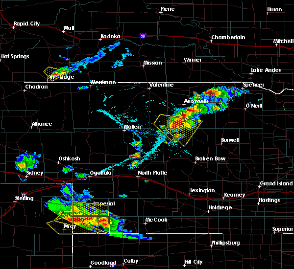 At 555 pm cdt, a severe thunderstorm was located 8 miles east of elsmere, or 17 miles northwest of brewster, moving southeast at 40 mph (radar indicated). Hazards include 60 mph wind gusts and quarter size hail. Hail damage to vehicles is expected. Expect wind damage to roofs, siding, and trees. At 555 pm cdt, a severe thunderstorm was located 8 miles east of elsmere, or 17 miles northwest of brewster, moving southeast at 40 mph (radar indicated). Hazards include 60 mph wind gusts and quarter size hail. Hail damage to vehicles is expected. Expect wind damage to roofs, siding, and trees.
|
| 5/24/2020 12:23 AM CDT |
 At 1222 am cdt, severe thunderstorms were located along a line extending from 7 miles south of springview to 8 miles northwest of rose to 10 miles north of anselmo, moving east at 35 mph (radar indicated). Hazards include 60 mph wind gusts and half dollar size hail. Hail damage to vehicles is expected. Expect wind damage to roofs, siding, and trees. At 1222 am cdt, severe thunderstorms were located along a line extending from 7 miles south of springview to 8 miles northwest of rose to 10 miles north of anselmo, moving east at 35 mph (radar indicated). Hazards include 60 mph wind gusts and half dollar size hail. Hail damage to vehicles is expected. Expect wind damage to roofs, siding, and trees.
|
| 5/24/2020 12:18 AM CDT |
 At 1217 am cdt, severe thunderstorms were located along a line extending from 6 miles northeast of johnstown to 16 miles northeast of elsmere to near dunning, moving east at 30 mph (radar indicated). Hazards include ping pong ball size hail and 60 mph wind gusts. People and animals outdoors will be injured. expect hail damage to roofs, siding, windows, and vehicles. expect wind damage to roofs, siding, and trees. locations impacted include, ainsworth, brewster, dunning, hofeld lake, raven, bobcat state wildlife management area, antelope peak, jones lake, hawley flats and johnsons corner. this includes the following highways, highway 20 between mile markers 235 and 245. Highway 2 between mile markers 234 and 242. At 1217 am cdt, severe thunderstorms were located along a line extending from 6 miles northeast of johnstown to 16 miles northeast of elsmere to near dunning, moving east at 30 mph (radar indicated). Hazards include ping pong ball size hail and 60 mph wind gusts. People and animals outdoors will be injured. expect hail damage to roofs, siding, windows, and vehicles. expect wind damage to roofs, siding, and trees. locations impacted include, ainsworth, brewster, dunning, hofeld lake, raven, bobcat state wildlife management area, antelope peak, jones lake, hawley flats and johnsons corner. this includes the following highways, highway 20 between mile markers 235 and 245. Highway 2 between mile markers 234 and 242.
|
| 5/23/2020 11:52 PM CDT |
 At 1151 pm cdt, severe thunderstorms were located along a line extending from 9 miles northwest of johnstown to 9 miles north of elsmere to 10 miles southwest of halsey, moving east at 25 mph (radar indicated). Hazards include ping pong ball size hail and 60 mph wind gusts. People and animals outdoors will be injured. expect hail damage to roofs, siding, windows, and vehicles. expect wind damage to roofs, siding, and trees. locations impacted include, ainsworth, brewster, dunning, halsey, johnstown, purdum, elsmere, wood lake, hofeld lake, raven, moon lake, hawley flats, willow lake, long lake, koshopah, antelope peak, jones lake, natwick and johnsons corner. this includes the following highways, highway 20 between mile markers 217 and 245. highway 2 between mile markers 214 and 244. Highway 83 between mile markers 133 and 139. At 1151 pm cdt, severe thunderstorms were located along a line extending from 9 miles northwest of johnstown to 9 miles north of elsmere to 10 miles southwest of halsey, moving east at 25 mph (radar indicated). Hazards include ping pong ball size hail and 60 mph wind gusts. People and animals outdoors will be injured. expect hail damage to roofs, siding, windows, and vehicles. expect wind damage to roofs, siding, and trees. locations impacted include, ainsworth, brewster, dunning, halsey, johnstown, purdum, elsmere, wood lake, hofeld lake, raven, moon lake, hawley flats, willow lake, long lake, koshopah, antelope peak, jones lake, natwick and johnsons corner. this includes the following highways, highway 20 between mile markers 217 and 245. highway 2 between mile markers 214 and 244. Highway 83 between mile markers 133 and 139.
|
| 5/23/2020 11:50 PM CDT | Quarter sized hail reported 2.9 miles S of Brewster, NE, quarter to half dollar size hail reported |
| 5/23/2020 11:28 PM CDT |
 At 1127 pm cdt, severe thunderstorms were located along a line extending from 9 miles northeast of valentine national wildlife refuge to 8 miles southeast of brownlee to 12 miles southwest of thedford, moving east at 30 mph (radar indicated). Hazards include 60 mph wind gusts and half dollar size hail. Hail damage to vehicles is expected. Expect wind damage to roofs, siding, and trees. At 1127 pm cdt, severe thunderstorms were located along a line extending from 9 miles northeast of valentine national wildlife refuge to 8 miles southeast of brownlee to 12 miles southwest of thedford, moving east at 30 mph (radar indicated). Hazards include 60 mph wind gusts and half dollar size hail. Hail damage to vehicles is expected. Expect wind damage to roofs, siding, and trees.
|
| 9/10/2019 11:43 PM CDT |
 The severe thunderstorm warning for western loup, southeastern brown and northeastern blaine counties will expire at 1145 pm cdt, the storms which prompted the warning have weakened below severe limits, and no longer pose an immediate threat to life or property. therefore, the warning will be allowed to expire. however small hail and gusty winds are still possible with these thunderstorms. The severe thunderstorm warning for western loup, southeastern brown and northeastern blaine counties will expire at 1145 pm cdt, the storms which prompted the warning have weakened below severe limits, and no longer pose an immediate threat to life or property. therefore, the warning will be allowed to expire. however small hail and gusty winds are still possible with these thunderstorms.
|
| 9/10/2019 11:30 PM CDT |
 At 1130 pm cdt, severe thunderstorms were located along a line extending from 16 miles southwest of rose to near brewster, moving east at 25 mph (radar indicated). Hazards include 60 mph wind gusts and quarter size hail. Hail damage to vehicles is expected. expect wind damage to roofs, siding, and trees. Locations impacted include, brewster and almeria meadow state wildlife management area. At 1130 pm cdt, severe thunderstorms were located along a line extending from 16 miles southwest of rose to near brewster, moving east at 25 mph (radar indicated). Hazards include 60 mph wind gusts and quarter size hail. Hail damage to vehicles is expected. expect wind damage to roofs, siding, and trees. Locations impacted include, brewster and almeria meadow state wildlife management area.
|
| 9/10/2019 11:15 PM CDT |
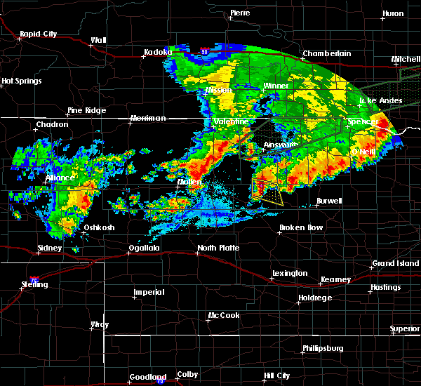 At 1115 pm cdt, severe thunderstorms were located along a line extending from 15 miles southeast of elsmere to near brewster, moving east at 25 mph (radar indicated). Hazards include 60 mph wind gusts and quarter size hail. Hail damage to vehicles is expected. Expect wind damage to roofs, siding, and trees. At 1115 pm cdt, severe thunderstorms were located along a line extending from 15 miles southeast of elsmere to near brewster, moving east at 25 mph (radar indicated). Hazards include 60 mph wind gusts and quarter size hail. Hail damage to vehicles is expected. Expect wind damage to roofs, siding, and trees.
|
| 8/26/2019 3:33 AM CDT |
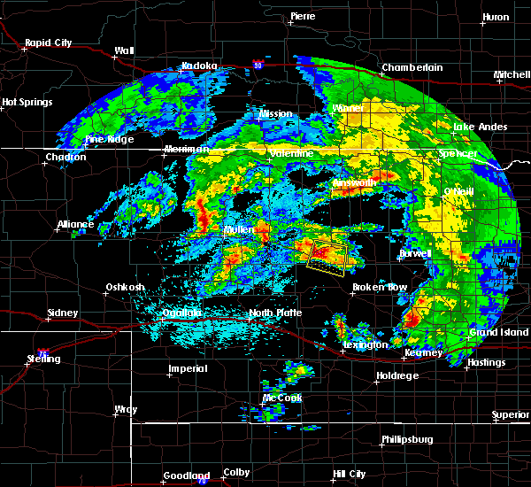 At 333 am cdt, a severe thunderstorm was located 7 miles southwest of brewster, moving east at 35 mph (radar indicated). Hazards include ping pong ball size hail and 60 mph wind gusts. People and animals outdoors will be injured. expect hail damage to roofs, siding, windows, and vehicles. expect wind damage to roofs, siding, and trees. locations impacted include, brewster, victoria springs state recreation area, milburn, milburn diversion dam state wildlife management area and linscott. This includes highway 2 between mile markers 240 and 255. At 333 am cdt, a severe thunderstorm was located 7 miles southwest of brewster, moving east at 35 mph (radar indicated). Hazards include ping pong ball size hail and 60 mph wind gusts. People and animals outdoors will be injured. expect hail damage to roofs, siding, windows, and vehicles. expect wind damage to roofs, siding, and trees. locations impacted include, brewster, victoria springs state recreation area, milburn, milburn diversion dam state wildlife management area and linscott. This includes highway 2 between mile markers 240 and 255.
|
| 8/26/2019 3:11 AM CDT |
 At 311 am cdt, a severe thunderstorm was located over halsey, or 17 miles east of thedford, moving east at 30 mph (radar indicated). Hazards include 60 mph wind gusts and half dollar size hail. Hail damage to vehicles is expected. Expect wind damage to roofs, siding, and trees. At 311 am cdt, a severe thunderstorm was located over halsey, or 17 miles east of thedford, moving east at 30 mph (radar indicated). Hazards include 60 mph wind gusts and half dollar size hail. Hail damage to vehicles is expected. Expect wind damage to roofs, siding, and trees.
|
| 8/21/2019 5:09 AM CDT |
 The national weather service in north platte has issued a * severe thunderstorm warning for. southwestern rock county in north central nebraska. loup county in north central nebraska. southern brown county in north central nebraska. Northeastern custer county in central nebraska. The national weather service in north platte has issued a * severe thunderstorm warning for. southwestern rock county in north central nebraska. loup county in north central nebraska. southern brown county in north central nebraska. Northeastern custer county in central nebraska.
|
| 7/13/2019 12:41 AM CDT |
 The severe thunderstorm warning for southeastern cherry, loup, southern brown, southwestern garfield, northeastern custer, blaine and northeastern thomas counties will expire at 1245 am cdt, the storms which prompted the warning have weakened below severe limits, and no longer pose an immediate threat to life or property. therefore, the warning will be allowed to expire. however gusty winds are still possible with these thunderstorms. a severe thunderstorm watch remains in effect until 200 am cdt for central and north central nebraska. to report severe weather, contact your nearest law enforcement agency. they will relay your report to the national weather service north platte. The severe thunderstorm warning for southeastern cherry, loup, southern brown, southwestern garfield, northeastern custer, blaine and northeastern thomas counties will expire at 1245 am cdt, the storms which prompted the warning have weakened below severe limits, and no longer pose an immediate threat to life or property. therefore, the warning will be allowed to expire. however gusty winds are still possible with these thunderstorms. a severe thunderstorm watch remains in effect until 200 am cdt for central and north central nebraska. to report severe weather, contact your nearest law enforcement agency. they will relay your report to the national weather service north platte.
|
| 7/13/2019 12:12 AM CDT |
 At 1212 am cdt, severe thunderstorms were located along a line extending from near elsmere to 8 miles east of brewster to near weissert, moving east at 45 mph (radar indicated). Hazards include 70 mph wind gusts and penny size hail. Expect considerable tree damage. damage is likely to mobile homes, roofs, and outbuildings. locations impacted include, broken bow, taylor, brewster, sargent, merna, anselmo, dunning, comstock, purdum, victoria springs state recreation area, elsmere, weissert, lillian, milburn, milburn diversion dam state wildlife management area, fox bayou, almeria meadow state wildlife management area, walworth, hawley flats and willow lake state wildlife management area. this includes the following highways, highway 183 between mile markers 99 and 136. highway 2 between mile markers 235 and 240, and between mile markers 242 and 276. highway 92 between mile markers 269 and 273. Highway 83 between mile markers 160 and 165. At 1212 am cdt, severe thunderstorms were located along a line extending from near elsmere to 8 miles east of brewster to near weissert, moving east at 45 mph (radar indicated). Hazards include 70 mph wind gusts and penny size hail. Expect considerable tree damage. damage is likely to mobile homes, roofs, and outbuildings. locations impacted include, broken bow, taylor, brewster, sargent, merna, anselmo, dunning, comstock, purdum, victoria springs state recreation area, elsmere, weissert, lillian, milburn, milburn diversion dam state wildlife management area, fox bayou, almeria meadow state wildlife management area, walworth, hawley flats and willow lake state wildlife management area. this includes the following highways, highway 183 between mile markers 99 and 136. highway 2 between mile markers 235 and 240, and between mile markers 242 and 276. highway 92 between mile markers 269 and 273. Highway 83 between mile markers 160 and 165.
|
| 7/12/2019 11:40 PM CDT |
 At 1140 pm cdt, severe thunderstorms were located along a line extending from 9 miles south of brownlee to near thedford to near dunning to near merna, moving east at 50 mph (radar indicated). Hazards include 70 mph wind gusts and penny size hail. Expect considerable tree damage. Damage is likely to mobile homes, roofs, and outbuildings. At 1140 pm cdt, severe thunderstorms were located along a line extending from 9 miles south of brownlee to near thedford to near dunning to near merna, moving east at 50 mph (radar indicated). Hazards include 70 mph wind gusts and penny size hail. Expect considerable tree damage. Damage is likely to mobile homes, roofs, and outbuildings.
|
| 7/5/2019 3:17 AM CDT |
 At 237 am cdt/137 am mdt/, severe thunderstorms were located along a line extending from 15 miles south of medicine lake to near purdum to victoria springs state recreation area, moving northeast at 50 mph (radar indicated). Hazards include 60 mph wind gusts and quarter size hail. Hail damage to vehicles is expected. Expect wind damage to roofs, siding, and trees. At 237 am cdt/137 am mdt/, severe thunderstorms were located along a line extending from 15 miles south of medicine lake to near purdum to victoria springs state recreation area, moving northeast at 50 mph (radar indicated). Hazards include 60 mph wind gusts and quarter size hail. Hail damage to vehicles is expected. Expect wind damage to roofs, siding, and trees.
|
| 7/5/2019 2:39 AM CDT |
 The national weather service in north platte has issued a * severe thunderstorm warning for. eastern cherry county in north central nebraska. rock county in north central nebraska. loup county in north central nebraska. Brown county in north central nebraska. The national weather service in north platte has issued a * severe thunderstorm warning for. eastern cherry county in north central nebraska. rock county in north central nebraska. loup county in north central nebraska. Brown county in north central nebraska.
|
| 6/19/2019 7:32 PM CDT | Golf Ball sized hail reported 9 miles W of Brewster, NE |
| 5/17/2019 4:49 PM CDT |
 At 448 pm cdt, severe thunderstorms were located along a line extending from near elsmere to 10 miles southwest of rose to victoria springs state recreation area, moving northeast at 60 mph (radar indicated). Hazards include ping pong ball size hail and 60 mph wind gusts. People and animals outdoors will be injured. expect hail damage to roofs, siding, windows, and vehicles. expect wind damage to roofs, siding, and trees. locations impacted include, brewster, rose, victoria springs state recreation area, milburn, hofeld lake, milburn diversion dam state wildlife management area, fox bayou, raven, almeria meadow state wildlife management area, willow lake state wildlife management area, duff, jones lake and johnsons corner. this includes the following highways, highway 183 between mile markers 142 and 158. highway 2 near mile marker 261. A tornado watch remains in effect until 1000 pm cdt for central and north central nebraska. At 448 pm cdt, severe thunderstorms were located along a line extending from near elsmere to 10 miles southwest of rose to victoria springs state recreation area, moving northeast at 60 mph (radar indicated). Hazards include ping pong ball size hail and 60 mph wind gusts. People and animals outdoors will be injured. expect hail damage to roofs, siding, windows, and vehicles. expect wind damage to roofs, siding, and trees. locations impacted include, brewster, rose, victoria springs state recreation area, milburn, hofeld lake, milburn diversion dam state wildlife management area, fox bayou, raven, almeria meadow state wildlife management area, willow lake state wildlife management area, duff, jones lake and johnsons corner. this includes the following highways, highway 183 between mile markers 142 and 158. highway 2 near mile marker 261. A tornado watch remains in effect until 1000 pm cdt for central and north central nebraska.
|
| 5/17/2019 4:37 PM CDT |
 At 437 pm cdt, severe thunderstorms were located along a line extending from near elsmere to near brewster, moving north at 60 mph (radar indicated). Hazards include golf ball size hail and 60 mph wind gusts. People and animals outdoors will be injured. expect hail damage to roofs, siding, windows, and vehicles. expect wind damage to roofs, siding, and trees. locations impacted include, brewster, anselmo, rose, victoria springs state recreation area, milburn, hofeld lake, milburn diversion dam state wildlife management area, fox bayou, raven, almeria meadow state wildlife management area, hawley flats, willow lake state wildlife management area, duff, koshopah, jones lake and johnsons corner. this includes the following highways, highway 183 between mile markers 143 and 158. highway 2 between mile markers 251 and 264. A tornado watch remains in effect until 1000 pm cdt for central and north central nebraska. At 437 pm cdt, severe thunderstorms were located along a line extending from near elsmere to near brewster, moving north at 60 mph (radar indicated). Hazards include golf ball size hail and 60 mph wind gusts. People and animals outdoors will be injured. expect hail damage to roofs, siding, windows, and vehicles. expect wind damage to roofs, siding, and trees. locations impacted include, brewster, anselmo, rose, victoria springs state recreation area, milburn, hofeld lake, milburn diversion dam state wildlife management area, fox bayou, raven, almeria meadow state wildlife management area, hawley flats, willow lake state wildlife management area, duff, koshopah, jones lake and johnsons corner. this includes the following highways, highway 183 between mile markers 143 and 158. highway 2 between mile markers 251 and 264. A tornado watch remains in effect until 1000 pm cdt for central and north central nebraska.
|
| 5/17/2019 4:22 PM CDT |
 At 422 pm cdt, severe thunderstorms were located along a line extending from near halsey to near anselmo, moving north at 65 mph (radar indicated). Hazards include golf ball size hail and 60 mph wind gusts. People and animals outdoors will be injured. expect hail damage to roofs, siding, windows, and vehicles. Expect wind damage to roofs, siding, and trees. At 422 pm cdt, severe thunderstorms were located along a line extending from near halsey to near anselmo, moving north at 65 mph (radar indicated). Hazards include golf ball size hail and 60 mph wind gusts. People and animals outdoors will be injured. expect hail damage to roofs, siding, windows, and vehicles. Expect wind damage to roofs, siding, and trees.
|
| 8/31/2018 4:12 PM CDT |
 At 412 pm cdt, a severe thunderstorm capable of producing a tornado was located near dunning, or 10 miles southwest of brewster, moving east at 20 mph (radar indicated rotation). Hazards include tornado and quarter size hail. Flying debris will be dangerous to those caught without shelter. mobile homes will be damaged or destroyed. damage to roofs, windows, and vehicles will occur. tree damage is likely. this dangerous storm will be near, brewster around 430 pm cdt. Other locations impacted by this tornadic thunderstorm include milburn diversion dam state wildlife management area. At 412 pm cdt, a severe thunderstorm capable of producing a tornado was located near dunning, or 10 miles southwest of brewster, moving east at 20 mph (radar indicated rotation). Hazards include tornado and quarter size hail. Flying debris will be dangerous to those caught without shelter. mobile homes will be damaged or destroyed. damage to roofs, windows, and vehicles will occur. tree damage is likely. this dangerous storm will be near, brewster around 430 pm cdt. Other locations impacted by this tornadic thunderstorm include milburn diversion dam state wildlife management area.
|
| 8/31/2018 3:59 PM CDT |
 At 359 pm cdt, a severe thunderstorm capable of producing a tornado was located near dunning, or 13 miles west of brewster, moving east at 15 mph (radar indicated rotation). Hazards include tornado and quarter size hail. Flying debris will be dangerous to those caught without shelter. mobile homes will be damaged or destroyed. damage to roofs, windows, and vehicles will occur. tree damage is likely. this dangerous storm will be near, brewster around 445 pm cdt. other locations impacted by this tornadic thunderstorm include milburn diversion dam state wildlife management area. This includes highway 2 between mile markers 234 and 238. At 359 pm cdt, a severe thunderstorm capable of producing a tornado was located near dunning, or 13 miles west of brewster, moving east at 15 mph (radar indicated rotation). Hazards include tornado and quarter size hail. Flying debris will be dangerous to those caught without shelter. mobile homes will be damaged or destroyed. damage to roofs, windows, and vehicles will occur. tree damage is likely. this dangerous storm will be near, brewster around 445 pm cdt. other locations impacted by this tornadic thunderstorm include milburn diversion dam state wildlife management area. This includes highway 2 between mile markers 234 and 238.
|
| 6/17/2018 6:46 PM CDT |
 At 646 pm cdt, a severe thunderstorm was located 7 miles east of brewster, moving northeast at 40 mph (radar indicated). Hazards include 60 mph wind gusts and quarter size hail. Hail damage to vehicles is expected. expect wind damage to roofs, siding, and trees. locations impacted include, brewster and hawley flats. A tornado watch remains in effect until 1000 pm cdt for north central nebraska. At 646 pm cdt, a severe thunderstorm was located 7 miles east of brewster, moving northeast at 40 mph (radar indicated). Hazards include 60 mph wind gusts and quarter size hail. Hail damage to vehicles is expected. expect wind damage to roofs, siding, and trees. locations impacted include, brewster and hawley flats. A tornado watch remains in effect until 1000 pm cdt for north central nebraska.
|
| 6/17/2018 6:29 PM CDT |
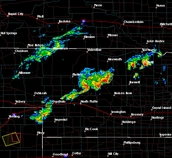 At 628 pm cdt, a severe thunderstorm was located near brewster, moving northeast at 35 mph (radar indicated). Hazards include 60 mph wind gusts and half dollar size hail. Hail damage to vehicles is expected. Expect wind damage to roofs, siding, and trees. At 628 pm cdt, a severe thunderstorm was located near brewster, moving northeast at 35 mph (radar indicated). Hazards include 60 mph wind gusts and half dollar size hail. Hail damage to vehicles is expected. Expect wind damage to roofs, siding, and trees.
|
| 8/27/2017 1:18 AM CDT |
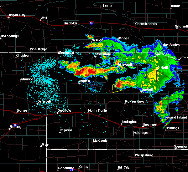 At 117 am cdt, a severe thunderstorm was located over brewster, moving south at 30 mph (radar indicated). Hazards include ping pong ball size hail and 60 mph wind gusts. People and animals outdoors will be injured. expect hail damage to roofs, siding, windows, and vehicles. expect wind damage to roofs, siding, and trees. Locations impacted include, brewster. At 117 am cdt, a severe thunderstorm was located over brewster, moving south at 30 mph (radar indicated). Hazards include ping pong ball size hail and 60 mph wind gusts. People and animals outdoors will be injured. expect hail damage to roofs, siding, windows, and vehicles. expect wind damage to roofs, siding, and trees. Locations impacted include, brewster.
|
| 8/27/2017 12:57 AM CDT |
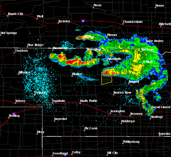 At 1256 am cdt, a severe thunderstorm was located 13 miles east of elsmere, or 13 miles north of brewster, moving south at 30 mph (radar indicated). Hazards include golf ball size hail and 60 mph wind gusts. People and animals outdoors will be injured. expect hail damage to roofs, siding, windows, and vehicles. Expect wind damage to roofs, siding, and trees. At 1256 am cdt, a severe thunderstorm was located 13 miles east of elsmere, or 13 miles north of brewster, moving south at 30 mph (radar indicated). Hazards include golf ball size hail and 60 mph wind gusts. People and animals outdoors will be injured. expect hail damage to roofs, siding, windows, and vehicles. Expect wind damage to roofs, siding, and trees.
|
| 8/19/2017 6:51 PM CDT |
 At 650 pm cdt, a severe thunderstorm was located near brewster, moving east at 15 mph (radar indicated). Hazards include golf ball size hail and 60 mph wind gusts. People and animals outdoors will be injured. expect hail damage to roofs, siding, windows, and vehicles. expect wind damage to roofs, siding, and trees. locations impacted include, brewster, fox bayou, almeria meadow state wildlife management area, horseshoe bend lake and almeria. This includes highway 183 between mile markers 129 and 147. At 650 pm cdt, a severe thunderstorm was located near brewster, moving east at 15 mph (radar indicated). Hazards include golf ball size hail and 60 mph wind gusts. People and animals outdoors will be injured. expect hail damage to roofs, siding, windows, and vehicles. expect wind damage to roofs, siding, and trees. locations impacted include, brewster, fox bayou, almeria meadow state wildlife management area, horseshoe bend lake and almeria. This includes highway 183 between mile markers 129 and 147.
|
| 8/19/2017 6:29 PM CDT |
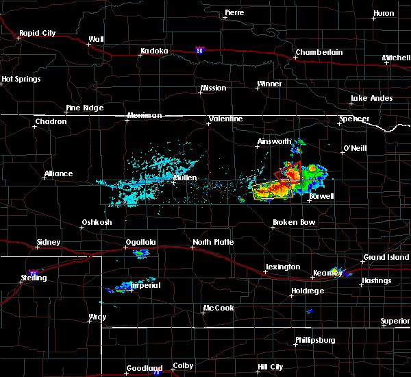 At 629 pm cdt, a severe thunderstorm was located near brewster, moving east at 20 mph (radar indicated). Hazards include 60 mph wind gusts and quarter size hail. Hail damage to vehicles is expected. expect wind damage to roofs, siding, and trees. this severe thunderstorm will remain over mainly rural areas of northwestern loup and northeastern blaine counties, including the following locations: fox bayou, almeria meadow state wildlife management area, horseshoe bend lake and almeria. This includes highway 183 between mile markers 129 and 147. At 629 pm cdt, a severe thunderstorm was located near brewster, moving east at 20 mph (radar indicated). Hazards include 60 mph wind gusts and quarter size hail. Hail damage to vehicles is expected. expect wind damage to roofs, siding, and trees. this severe thunderstorm will remain over mainly rural areas of northwestern loup and northeastern blaine counties, including the following locations: fox bayou, almeria meadow state wildlife management area, horseshoe bend lake and almeria. This includes highway 183 between mile markers 129 and 147.
|
| 8/12/2017 7:59 PM CDT |
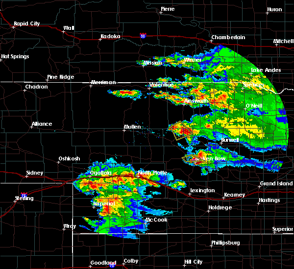 At 759 pm cdt, a severe thunderstorm was located near brewster, moving southeast at 20 mph (trained weather spotters). Hazards include 60 mph wind gusts and quarter size hail. Hail damage to vehicles is expected. expect wind damage to roofs, siding, and trees. Locations impacted include, brewster, hawley flats and koshopah. At 759 pm cdt, a severe thunderstorm was located near brewster, moving southeast at 20 mph (trained weather spotters). Hazards include 60 mph wind gusts and quarter size hail. Hail damage to vehicles is expected. expect wind damage to roofs, siding, and trees. Locations impacted include, brewster, hawley flats and koshopah.
|
| 8/12/2017 7:40 PM CDT |
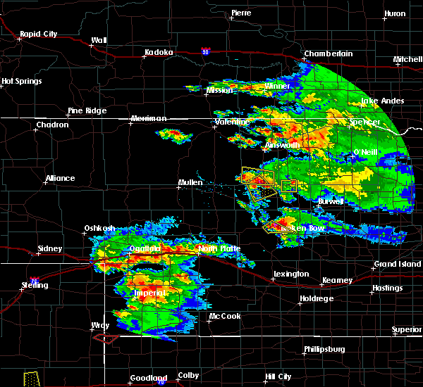 At 740 pm cdt, a severe thunderstorm was located 11 miles east of elsmere, or 12 miles northwest of brewster, moving southeast at 20 mph (radar indicated). Hazards include 60 mph wind gusts and half dollar size hail. Hail damage to vehicles is expected. Expect wind damage to roofs, siding, and trees. At 740 pm cdt, a severe thunderstorm was located 11 miles east of elsmere, or 12 miles northwest of brewster, moving southeast at 20 mph (radar indicated). Hazards include 60 mph wind gusts and half dollar size hail. Hail damage to vehicles is expected. Expect wind damage to roofs, siding, and trees.
|
| 7/26/2017 1:08 AM CDT |
 The severe thunderstorm warning for southwestern rock, western loup, southeastern brown, north central custer and eastern blaine counties will expire at 115 am cdt, the storms which prompted the warning have weakened below severe limits, and no longer pose an immediate threat to life or property. therefore the warning will be allowed to expire. however gusty winds are still possible with these thunderstorms. to report severe weather, contact your nearest law enforcement agency. they will relay your report to the national weather service north platte. The severe thunderstorm warning for southwestern rock, western loup, southeastern brown, north central custer and eastern blaine counties will expire at 115 am cdt, the storms which prompted the warning have weakened below severe limits, and no longer pose an immediate threat to life or property. therefore the warning will be allowed to expire. however gusty winds are still possible with these thunderstorms. to report severe weather, contact your nearest law enforcement agency. they will relay your report to the national weather service north platte.
|
| 7/26/2017 12:41 AM CDT |
 At 1241 am cdt, severe thunderstorms were located along a line extending from 8 miles south of long pine to near victoria springs state recreation area, moving northeast at 40 mph (radar indicated). Hazards include 70 mph wind gusts. Expect considerable tree damage. damage is likely to mobile homes, roofs, and outbuildings. locations impacted include, brewster, anselmo, rose, victoria springs state recreation area, milburn, milburn diversion dam state wildlife management area, hofeld lake, fox bayou, raven, almeria meadow state wildlife management area, walworth, twin lakes state wildlife management area, duff, almeria, jones lake, johnsons corner and gates. this includes the following highways, highway 183 between mile markers 145 and 179. Highway 2 between mile markers 253 and 263. At 1241 am cdt, severe thunderstorms were located along a line extending from 8 miles south of long pine to near victoria springs state recreation area, moving northeast at 40 mph (radar indicated). Hazards include 70 mph wind gusts. Expect considerable tree damage. damage is likely to mobile homes, roofs, and outbuildings. locations impacted include, brewster, anselmo, rose, victoria springs state recreation area, milburn, milburn diversion dam state wildlife management area, hofeld lake, fox bayou, raven, almeria meadow state wildlife management area, walworth, twin lakes state wildlife management area, duff, almeria, jones lake, johnsons corner and gates. this includes the following highways, highway 183 between mile markers 145 and 179. Highway 2 between mile markers 253 and 263.
|
| 7/26/2017 12:25 AM CDT |
 At 1225 am cdt, severe thunderstorms were located along a line extending from 15 miles south of ainsworth to 7 miles southwest of anselmo, moving northeast at 35 mph (radar indicated). Hazards include 70 mph wind gusts. Expect considerable tree damage. Damage is likely to mobile homes, roofs, and outbuildings. At 1225 am cdt, severe thunderstorms were located along a line extending from 15 miles south of ainsworth to 7 miles southwest of anselmo, moving northeast at 35 mph (radar indicated). Hazards include 70 mph wind gusts. Expect considerable tree damage. Damage is likely to mobile homes, roofs, and outbuildings.
|
| 6/13/2017 5:02 PM CDT |
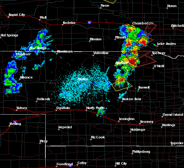 At 502 pm cdt, a severe thunderstorm was located 7 miles southwest of rose, or 15 miles northeast of brewster, moving northeast at 30 mph (radar indicated). Hazards include two inch hail and 60 mph wind gusts. People and animals outdoors will be injured. expect hail damage to roofs, siding, windows, and vehicles. expect wind damage to roofs, siding, and trees. locations impacted include, brewster, milburn diversion dam state wildlife management area, fox bayou, almeria meadow state wildlife management area, horseshoe bend lake and almeria. this includes highway 183 between mile markers 131 and 149. A tornado watch remains in effect until 1000 pm cdt for central and north central nebraska. At 502 pm cdt, a severe thunderstorm was located 7 miles southwest of rose, or 15 miles northeast of brewster, moving northeast at 30 mph (radar indicated). Hazards include two inch hail and 60 mph wind gusts. People and animals outdoors will be injured. expect hail damage to roofs, siding, windows, and vehicles. expect wind damage to roofs, siding, and trees. locations impacted include, brewster, milburn diversion dam state wildlife management area, fox bayou, almeria meadow state wildlife management area, horseshoe bend lake and almeria. this includes highway 183 between mile markers 131 and 149. A tornado watch remains in effect until 1000 pm cdt for central and north central nebraska.
|
| 6/13/2017 4:43 PM CDT |
 At 443 pm cdt, a severe thunderstorm was located near brewster, moving northeast at 45 mph (radar indicated). Hazards include two inch hail and 60 mph wind gusts. People and animals outdoors will be injured. expect hail damage to roofs, siding, windows, and vehicles. Expect wind damage to roofs, siding, and trees. At 443 pm cdt, a severe thunderstorm was located near brewster, moving northeast at 45 mph (radar indicated). Hazards include two inch hail and 60 mph wind gusts. People and animals outdoors will be injured. expect hail damage to roofs, siding, windows, and vehicles. Expect wind damage to roofs, siding, and trees.
|
| 6/13/2017 4:36 PM CDT | Half Dollar sized hail reported 0.3 miles ESE of Brewster, NE |
| 6/13/2017 4:08 PM CDT |
 At 407 pm cdt, a severe thunderstorm was located 8 miles north of arnold, or 19 miles east of stapleton, moving north at 45 mph. a second storm was located 20 miles north of arnold and was moving north at 45 mph. the northern storm was cabable of producing tennis ball sized hail (radar indicated). Hazards include tennis ball size hail and 60 mph wind gusts. People and animals outdoors will be injured. expect hail damage to roofs, siding, windows, and vehicles. expect wind damage to roofs, siding, and trees. locations impacted include, brewster, arnold, dunning, linscott and pleasant hill. this includes the following highways, highway 2 between mile markers 231 and 255. highway 92 between mile markers 247 and 261. A tornado watch remains in effect until 1000 pm cdt for central and north central nebraska. At 407 pm cdt, a severe thunderstorm was located 8 miles north of arnold, or 19 miles east of stapleton, moving north at 45 mph. a second storm was located 20 miles north of arnold and was moving north at 45 mph. the northern storm was cabable of producing tennis ball sized hail (radar indicated). Hazards include tennis ball size hail and 60 mph wind gusts. People and animals outdoors will be injured. expect hail damage to roofs, siding, windows, and vehicles. expect wind damage to roofs, siding, and trees. locations impacted include, brewster, arnold, dunning, linscott and pleasant hill. this includes the following highways, highway 2 between mile markers 231 and 255. highway 92 between mile markers 247 and 261. A tornado watch remains in effect until 1000 pm cdt for central and north central nebraska.
|
| 6/13/2017 4:03 PM CDT |
 At 407 pm cdt, a severe thunderstorm was located 8 miles north of arnold, or 19 miles east of stapleton, moving north at 45 mph. a second storm was located 20 miles north of arnold and was moving north at 45 mph. the northern storm was cabable of producing tennis ball sized hail (radar indicated). Hazards include tennis ball size hail and 60 mph wind gusts. People and animals outdoors will be injured. expect hail damage to roofs, siding, windows, and vehicles. expect wind damage to roofs, siding, and trees. locations impacted include, brewster, arnold, dunning, linscott and pleasant hill. this includes the following highways, highway 2 between mile markers 231 and 255. highway 92 between mile markers 247 and 261. A tornado watch remains in effect until 1000 pm cdt for central and north central nebraska. At 407 pm cdt, a severe thunderstorm was located 8 miles north of arnold, or 19 miles east of stapleton, moving north at 45 mph. a second storm was located 20 miles north of arnold and was moving north at 45 mph. the northern storm was cabable of producing tennis ball sized hail (radar indicated). Hazards include tennis ball size hail and 60 mph wind gusts. People and animals outdoors will be injured. expect hail damage to roofs, siding, windows, and vehicles. expect wind damage to roofs, siding, and trees. locations impacted include, brewster, arnold, dunning, linscott and pleasant hill. this includes the following highways, highway 2 between mile markers 231 and 255. highway 92 between mile markers 247 and 261. A tornado watch remains in effect until 1000 pm cdt for central and north central nebraska.
|
| 9/4/2016 8:43 PM CDT |
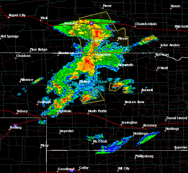 At 843 pm cdt, a severe thunderstorm was located near brewster, moving northeast at 30 mph (radar indicated). Hazards include quarter size hail. damage to vehicles is expected At 843 pm cdt, a severe thunderstorm was located near brewster, moving northeast at 30 mph (radar indicated). Hazards include quarter size hail. damage to vehicles is expected
|
| 9/4/2016 8:30 PM CDT |
 At 830 pm cdt, a severe thunderstorm was located 7 miles northeast of dunning, or 8 miles west of brewster, moving northeast at 25 mph (radar indicated). Hazards include 60 mph wind gusts and quarter size hail. Hail damage to vehicles is expected. expect wind damage to roofs, siding, and trees. Locations impacted include, brewster and hawley flats. At 830 pm cdt, a severe thunderstorm was located 7 miles northeast of dunning, or 8 miles west of brewster, moving northeast at 25 mph (radar indicated). Hazards include 60 mph wind gusts and quarter size hail. Hail damage to vehicles is expected. expect wind damage to roofs, siding, and trees. Locations impacted include, brewster and hawley flats.
|
| 9/4/2016 8:13 PM CDT |
 At 813 pm cdt, a severe thunderstorm was located near dunning, or 13 miles southwest of brewster, moving northeast at 25 mph (radar indicated). Hazards include 60 mph wind gusts and quarter size hail. Hail damage to vehicles is expected. Expect wind damage to roofs, siding, and trees. At 813 pm cdt, a severe thunderstorm was located near dunning, or 13 miles southwest of brewster, moving northeast at 25 mph (radar indicated). Hazards include 60 mph wind gusts and quarter size hail. Hail damage to vehicles is expected. Expect wind damage to roofs, siding, and trees.
|
| 7/27/2016 6:10 PM CDT |
 At 610 pm cdt, a severe thunderstorm was located near brewster, moving south at 35 mph (radar indicated). Hazards include ping pong ball size hail and 60 mph wind gusts. People and animals outdoors will be injured. expect hail damage to roofs, siding, windows, and vehicles. Expect wind damage to roofs, siding, and trees. At 610 pm cdt, a severe thunderstorm was located near brewster, moving south at 35 mph (radar indicated). Hazards include ping pong ball size hail and 60 mph wind gusts. People and animals outdoors will be injured. expect hail damage to roofs, siding, windows, and vehicles. Expect wind damage to roofs, siding, and trees.
|
| 7/26/2016 11:32 PM CDT | Winds were estimated in excess of 60 mp in blaine county NE, 0.3 miles ESE of Brewster, NE |
| 7/6/2016 9:02 PM CDT |
 At 902 pm cdt, a severe thunderstorm was located near brewster, moving east at 55 mph (radar indicated). Hazards include half dollar size hail. damage to vehicles is expected At 902 pm cdt, a severe thunderstorm was located near brewster, moving east at 55 mph (radar indicated). Hazards include half dollar size hail. damage to vehicles is expected
|
| 7/6/2016 8:55 PM CDT |
 At 854 pm cdt, a severe thunderstorm was located 8 miles north of dunning, or 12 miles west of brewster, moving northeast at 40 mph (radar indicated). Hazards include golf ball size hail. People and animals outdoors will be injured. expect damage to roofs, siding, windows, and vehicles. locations impacted include, brewster, dunning and hawley flats. this includes highway 2 between mile markers 229 and 237. A tornado watch remains in effect until 1000 pm cdt for north central nebraska. At 854 pm cdt, a severe thunderstorm was located 8 miles north of dunning, or 12 miles west of brewster, moving northeast at 40 mph (radar indicated). Hazards include golf ball size hail. People and animals outdoors will be injured. expect damage to roofs, siding, windows, and vehicles. locations impacted include, brewster, dunning and hawley flats. this includes highway 2 between mile markers 229 and 237. A tornado watch remains in effect until 1000 pm cdt for north central nebraska.
|
| 7/6/2016 8:46 PM CDT |
 At 845 pm cdt, a severe thunderstorm was located over halsey, or 18 miles east of thedford, moving northeast at 40 mph (radar indicated). Hazards include golf ball size hail. People and animals outdoors will be injured. Expect damage to roofs, siding, windows, and vehicles. At 845 pm cdt, a severe thunderstorm was located over halsey, or 18 miles east of thedford, moving northeast at 40 mph (radar indicated). Hazards include golf ball size hail. People and animals outdoors will be injured. Expect damage to roofs, siding, windows, and vehicles.
|
| 6/29/2016 10:40 PM CDT | The severe thunderstorm warning for eastern blaine, garfield, eastern keya paha, western holt, loup, brown, western boyd and rock counties will expire at 1045 pm cdt, the storms which prompted the warning have moved out of the area. therefore the warning will be allowed to expire. a severe thunderstorm watch remains in effect until 300 am cdt for north central nebraska. |
| 6/29/2016 10:21 PM CDT |
 At 1020 pm cdt, severe thunderstorms were located along a line extending from 7 miles southwest of naper to rose to 7 miles northwest of brewster, moving southeast at 35 mph (radar indicated). Hazards include 60 mph wind gusts. Expect damage to roofs. siding. and trees. locations impacted include, ainsworth, burwell, bassett, spencer, taylor, brewster, atkinson, stuart, butte, long pine, newport, naper, amelia, calamus reservoir state recreation area, rose, emmet, dustin, anoka, kent diversion dam state wildlife management area and anncar. this includes the following highways, highway 183 between mile markers 124 and 204. highway 20 between mile markers 238 and 301. Highway 281 between mile markers 214 and 223. At 1020 pm cdt, severe thunderstorms were located along a line extending from 7 miles southwest of naper to rose to 7 miles northwest of brewster, moving southeast at 35 mph (radar indicated). Hazards include 60 mph wind gusts. Expect damage to roofs. siding. and trees. locations impacted include, ainsworth, burwell, bassett, spencer, taylor, brewster, atkinson, stuart, butte, long pine, newport, naper, amelia, calamus reservoir state recreation area, rose, emmet, dustin, anoka, kent diversion dam state wildlife management area and anncar. this includes the following highways, highway 183 between mile markers 124 and 204. highway 20 between mile markers 238 and 301. Highway 281 between mile markers 214 and 223.
|
| 6/29/2016 10:05 PM CDT |
 At 1004 pm cdt, severe thunderstorms were located along a line extending from 10 miles west of naper to 7 miles northwest of rose to 8 miles southeast of elsmere, moving southeast at 45 mph (radar indicated). Hazards include 60 mph wind gusts. Expect damage to roofs. siding. And trees. At 1004 pm cdt, severe thunderstorms were located along a line extending from 10 miles west of naper to 7 miles northwest of rose to 8 miles southeast of elsmere, moving southeast at 45 mph (radar indicated). Hazards include 60 mph wind gusts. Expect damage to roofs. siding. And trees.
|
| 6/28/2016 10:29 PM CDT |
 At 1029 pm cdt, severe thunderstorms were located along a line extending from 10 miles southwest of rose to 6 miles southeast of victoria springs state recreation area, moving east at 40 mph (radar indicated). Hazards include 70 mph wind gusts. Expect considerable tree damage. Damage is likely to mobile homes, roofs, and outbuildings. At 1029 pm cdt, severe thunderstorms were located along a line extending from 10 miles southwest of rose to 6 miles southeast of victoria springs state recreation area, moving east at 40 mph (radar indicated). Hazards include 70 mph wind gusts. Expect considerable tree damage. Damage is likely to mobile homes, roofs, and outbuildings.
|
| 6/28/2016 10:08 PM CDT |
 At 1007 pm cdt, severe thunderstorms were located along a line extending from near long pine to 8 miles southeast of dunning, moving southeast at 35 mph (radar indicated). Hazards include 60 mph wind gusts. Expect damage to roofs. siding. and trees. locations impacted include, ainsworth, bassett, taylor, brewster, sargent, long pine, anselmo, dunning, comstock, victoria springs state recreation area, calamus reservoir state recreation area, rose, lillian, milburn, nunda shoal campground, linscott, kent diversion dam state wildlife management area, almeria meadow state wildlife management area, brown lake and hannamon bayou campground. this includes the following highways, highway 183 between mile markers 109 and 201. highway 20 between mile markers 241 and 266. Highway 2 between mile markers 232 and 261. At 1007 pm cdt, severe thunderstorms were located along a line extending from near long pine to 8 miles southeast of dunning, moving southeast at 35 mph (radar indicated). Hazards include 60 mph wind gusts. Expect damage to roofs. siding. and trees. locations impacted include, ainsworth, bassett, taylor, brewster, sargent, long pine, anselmo, dunning, comstock, victoria springs state recreation area, calamus reservoir state recreation area, rose, lillian, milburn, nunda shoal campground, linscott, kent diversion dam state wildlife management area, almeria meadow state wildlife management area, brown lake and hannamon bayou campground. this includes the following highways, highway 183 between mile markers 109 and 201. highway 20 between mile markers 241 and 266. Highway 2 between mile markers 232 and 261.
|
| 6/28/2016 9:43 PM CDT |
 At 942 pm cdt, severe thunderstorms were located along a line extending from 8 miles north of long pine to near halsey, moving southeast at 50 mph (radar indicated). Hazards include 60 mph wind gusts. Expect damage to roofs. siding. And trees. At 942 pm cdt, severe thunderstorms were located along a line extending from 8 miles north of long pine to near halsey, moving southeast at 50 mph (radar indicated). Hazards include 60 mph wind gusts. Expect damage to roofs. siding. And trees.
|
| 6/17/2016 8:01 PM CDT |
 At 800 pm cdt, a severe thunderstorm was located over brewster, moving west at 15 mph (radar indicated). Hazards include 60 mph wind gusts and quarter size hail. Hail damage to vehicles is expected. expect wind damage to roofs, siding, and trees. Locations impacted include, brewster. At 800 pm cdt, a severe thunderstorm was located over brewster, moving west at 15 mph (radar indicated). Hazards include 60 mph wind gusts and quarter size hail. Hail damage to vehicles is expected. expect wind damage to roofs, siding, and trees. Locations impacted include, brewster.
|
| 6/17/2016 7:48 PM CDT |
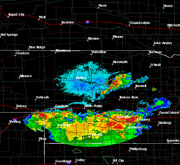 At 748 pm cdt, a severe thunderstorm was located over brewster, moving west at 10 mph (radar indicated). Hazards include ping pong ball size hail and 60 mph wind gusts. People and animals outdoors will be injured. expect hail damage to roofs, siding, windows, and vehicles. Expect wind damage to roofs, siding, and trees. At 748 pm cdt, a severe thunderstorm was located over brewster, moving west at 10 mph (radar indicated). Hazards include ping pong ball size hail and 60 mph wind gusts. People and animals outdoors will be injured. expect hail damage to roofs, siding, windows, and vehicles. Expect wind damage to roofs, siding, and trees.
|
| 6/10/2016 7:51 PM CDT |
 At 750 pm cdt, severe thunderstorms were located along a line extending from 7 miles southeast of elsmere to 8 miles southeast of brewster, moving southwest at 10 mph (radar indicated). Hazards include 60 mph wind gusts and quarter size hail. Hail damage to vehicles is expected. expect wind damage to roofs, siding, and trees. locations impacted include, brewster, dunning, hawley flats, koshopah and milburn diversion dam state wildlife management area. This includes highway 2 between mile markers 234 and 240. At 750 pm cdt, severe thunderstorms were located along a line extending from 7 miles southeast of elsmere to 8 miles southeast of brewster, moving southwest at 10 mph (radar indicated). Hazards include 60 mph wind gusts and quarter size hail. Hail damage to vehicles is expected. expect wind damage to roofs, siding, and trees. locations impacted include, brewster, dunning, hawley flats, koshopah and milburn diversion dam state wildlife management area. This includes highway 2 between mile markers 234 and 240.
|
| 6/10/2016 7:32 PM CDT |
 At 732 pm cdt, severe thunderstorms were located along a line extending from 7 miles southeast of elsmere to 8 miles southeast of brewster, moving southwest at 10 mph (radar indicated). Hazards include 60 mph wind gusts and quarter size hail. Hail damage to vehicles is expected. Expect wind damage to roofs, siding, and trees. At 732 pm cdt, severe thunderstorms were located along a line extending from 7 miles southeast of elsmere to 8 miles southeast of brewster, moving southwest at 10 mph (radar indicated). Hazards include 60 mph wind gusts and quarter size hail. Hail damage to vehicles is expected. Expect wind damage to roofs, siding, and trees.
|
| 6/10/2016 7:00 PM CDT |
 At 700 pm cdt, a severe thunderstorm was located 11 miles northeast of brewster, moving southwest at 25 mph (radar indicated). Hazards include golf ball size hail and 60 mph wind gusts. People and animals outdoors will be injured. expect hail damage to roofs, siding, windows, and vehicles. expect wind damage to roofs, siding, and trees. locations impacted include, brewster, rose, almeria meadow state wildlife management area and fox bayou. This includes highway 183 between mile markers 143 and 155. At 700 pm cdt, a severe thunderstorm was located 11 miles northeast of brewster, moving southwest at 25 mph (radar indicated). Hazards include golf ball size hail and 60 mph wind gusts. People and animals outdoors will be injured. expect hail damage to roofs, siding, windows, and vehicles. expect wind damage to roofs, siding, and trees. locations impacted include, brewster, rose, almeria meadow state wildlife management area and fox bayou. This includes highway 183 between mile markers 143 and 155.
|
| 6/10/2016 6:42 PM CDT |
 At 640 pm cdt, a severe thunderstorm was located near rose, or 17 miles northeast of brewster, moving south at 15 mph (public). Hazards include golf ball size hail. People and animals outdoors will be injured. Expect damage to roofs, siding, windows, and vehicles. At 640 pm cdt, a severe thunderstorm was located near rose, or 17 miles northeast of brewster, moving south at 15 mph (public). Hazards include golf ball size hail. People and animals outdoors will be injured. Expect damage to roofs, siding, windows, and vehicles.
|
| 5/29/2016 9:28 PM CDT | The severe thunderstorm warning for southeastern blaine county will expire at 930 pm cdt, the storm which prompted the warning has weakened below severe limits, and no longer pose an immediate threat to life or property. therefore the warning will be allowed to expire. however small hail is still possible with this thunderstorm. |
| 5/29/2016 9:23 PM CDT |
 At 917 pm cdt, a severe thunderstorm was located 7 miles southwest of brewster, moving northeast at 30 mph (radar indicated). Hazards include ping pong ball size hail. People and animals outdoors will be injured. expect damage to roofs, siding, windows, and vehicles. locations impacted include, brewster and dunning. This includes highway 2 between mile markers 235 and 245. At 917 pm cdt, a severe thunderstorm was located 7 miles southwest of brewster, moving northeast at 30 mph (radar indicated). Hazards include ping pong ball size hail. People and animals outdoors will be injured. expect damage to roofs, siding, windows, and vehicles. locations impacted include, brewster and dunning. This includes highway 2 between mile markers 235 and 245.
|
| 5/29/2016 8:58 PM CDT |
 At 858 pm cdt, a severe thunderstorm was located over dunning, or 15 miles southwest of brewster, moving northeast at 30 mph (radar indicated). Hazards include quarter size hail. damage to vehicles is expected At 858 pm cdt, a severe thunderstorm was located over dunning, or 15 miles southwest of brewster, moving northeast at 30 mph (radar indicated). Hazards include quarter size hail. damage to vehicles is expected
|
| 7/5/2015 10:57 PM CDT | The severe thunderstorm warning for southern rock, loup, southwestern holt, northwestern garfield, southern brown and eastern blaine counties will expire at 1000 pm mdt, the line of storms which prompted the warning has weakened below severe limits, and no longer poses an immediate threat to life or property. however, gusty winds are still possible with these thunderstorms. |
| 7/5/2015 10:46 PM CDT |
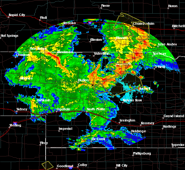 At 1044 pm cdt, severe thunderstorms were located along a line extending from 6 miles northwest of rose to rose to 11 miles southeast of rose to 6 miles northwest of calamus reservoir state recreation area, and moving northeast at 50 mph (radar indicated). Hazards include 60 mph wind gusts. Expect damage to roofs. siding and trees. locations impacted include, swan lake, twin lakes state wildlife management area, carson lake and sybrant. This includes highway 183 between mile markers 127 and 165. At 1044 pm cdt, severe thunderstorms were located along a line extending from 6 miles northwest of rose to rose to 11 miles southeast of rose to 6 miles northwest of calamus reservoir state recreation area, and moving northeast at 50 mph (radar indicated). Hazards include 60 mph wind gusts. Expect damage to roofs. siding and trees. locations impacted include, swan lake, twin lakes state wildlife management area, carson lake and sybrant. This includes highway 183 between mile markers 127 and 165.
|
| 7/5/2015 10:09 PM CDT |
 At 1007 pm cdt, severe thunderstorms were located along a line extending from purdum to 9 miles southeast of purdum to 6 miles southwest of brewster to 8 miles north of anselmo, and moving northeast at 50 mph (radar indicated). Hazards include 60 mph wind gusts. Expect damage to roofs. Siding and trees. At 1007 pm cdt, severe thunderstorms were located along a line extending from purdum to 9 miles southeast of purdum to 6 miles southwest of brewster to 8 miles north of anselmo, and moving northeast at 50 mph (radar indicated). Hazards include 60 mph wind gusts. Expect damage to roofs. Siding and trees.
|
| 6/25/2015 6:00 PM CDT | Storm damage reported in blaine county NE, 7.8 miles NNE of Brewster, NE |
| 6/16/2015 8:27 PM CDT | The severe thunderstorm warning for east central thomas and blaine counties will expire at 830 pm cdt. the storm which prompted the warning has weakened below severe limits. and no longer poses an immediate threat to life or property. however. small hail. Gusty winds and heavy rain are still possible with this thunderstorm. |
| 6/16/2015 8:01 PM CDT |
 At 759 pm cdt, a severe thunderstorm was located near purdum, and moving southeast at 35 mph (radar indicated). Hazards include 60 mph wind gusts and quarter size hail. Hail damage to vehicles is expected. Expect wind damage to roofs, siding and trees. At 759 pm cdt, a severe thunderstorm was located near purdum, and moving southeast at 35 mph (radar indicated). Hazards include 60 mph wind gusts and quarter size hail. Hail damage to vehicles is expected. Expect wind damage to roofs, siding and trees.
|
| 6/10/2015 5:03 PM CDT |
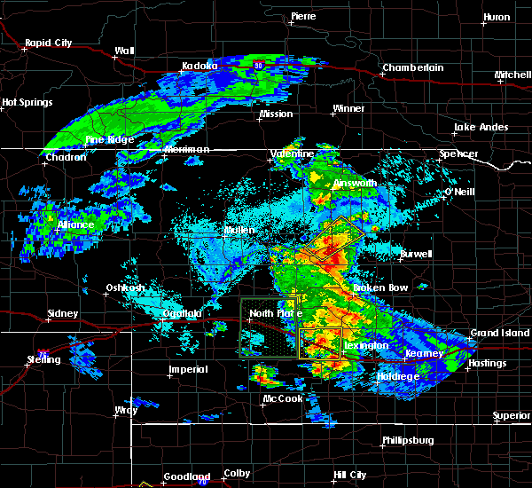 At 501 pm cdt, a severe thunderstorm was located near brewster, and moving northeast at 30 mph (radar indicated). Hazards include 60 mph wind gusts and quarter size hail. Hail damage to vehicles is expected. expect wind damage to roofs, siding and trees. Locations impacted include, fox bayou and johnsons corner. At 501 pm cdt, a severe thunderstorm was located near brewster, and moving northeast at 30 mph (radar indicated). Hazards include 60 mph wind gusts and quarter size hail. Hail damage to vehicles is expected. expect wind damage to roofs, siding and trees. Locations impacted include, fox bayou and johnsons corner.
|
| 6/10/2015 5:00 PM CDT | The thunderstorm wind gusts estimated at 60 mph preceded the very heavy rainfal in loup county NE, 14.3 miles NW of Brewster, NE |
| 6/10/2015 4:47 PM CDT |
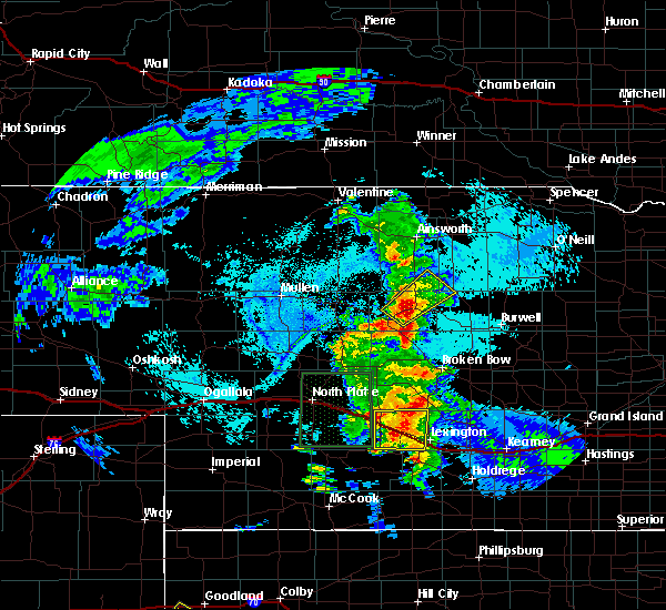 At 445 pm cdt, a severe thunderstorm was located near brewster, and moving northeast at 30 mph (radar indicated). Hazards include 60 mph wind gusts and quarter size hail. Hail damage to vehicles is expected. expect wind damage to roofs, siding and trees. Locations impacted include, fox bayou and johnsons corner. At 445 pm cdt, a severe thunderstorm was located near brewster, and moving northeast at 30 mph (radar indicated). Hazards include 60 mph wind gusts and quarter size hail. Hail damage to vehicles is expected. expect wind damage to roofs, siding and trees. Locations impacted include, fox bayou and johnsons corner.
|
| 6/10/2015 4:45 PM CDT | Storm damage reported in blaine county NE, 4.7 miles NE of Brewster, NE |
| 6/10/2015 4:34 PM CDT |
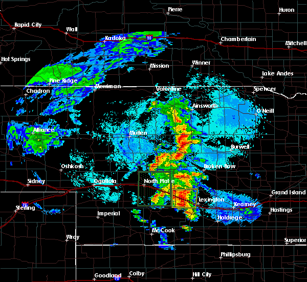 At 432 pm cdt, a severe thunderstorm was located 7 miles west of brewster, and moving northeast at 30 mph (radar indicated). Hazards include 60 mph wind gusts and half dollar size hail. Hail damage to vehicles is expected. Expect wind damage to roofs, siding and trees. At 432 pm cdt, a severe thunderstorm was located 7 miles west of brewster, and moving northeast at 30 mph (radar indicated). Hazards include 60 mph wind gusts and half dollar size hail. Hail damage to vehicles is expected. Expect wind damage to roofs, siding and trees.
|
| 5/2/2015 2:49 AM CDT | At 248 am cdt, a severe thunderstorm was located 8 miles east of brewster, and moving northeast at 30 mph (law enforcement). Hazards include quarter size hail. Damage to vehicles is expected. locations impacted include, almeria, almeria meadow state wildlife management area, fox bayou, horseshoe bend lake, hannamon bayou campground and valley view flat campground. this includes highway 183 between mile markers 132 and 148. 1. 00in. |
| 5/2/2015 2:26 AM CDT | At 222 am cdt, a severe thunderstorm was located 9 miles south of brewster, and moving northeast at 30 mph (law enforcement). Hazards include quarter size hail. damage to vehicles is expected |
| 4/24/2015 7:57 PM CDT | The severe thunderstorm warning for loup and east central blaine counties will expire at 800 pm cdt, the line of storms which prompted the warning has weakened below severe limits, and no longer poses an immediate threat to life or property. however, small hail up to nickle size and heavy rain are still possible with these thunderstorms. |
| 4/24/2015 7:35 PM CDT | At 734 pm cdt, severe thunderstorms were located along a line extending from 12 miles northeast of almeria to 6 miles west of almeria to 5 miles southwest of brewster, and moving southeast at 10 mph (radar indicated). Hazards include quarter size hail. Damage to vehicles is expected. locations impacted include, almeria, calamus reservoir state recreation area, horseshoe bend lake, hannamon bayou campground, valley view flat campground and nunda shoal campground. this includes highway 183 between mile markers 126 and 146. 1. 00in. |
| 4/24/2015 7:30 PM CDT | Quarter sized hail reported 4 miles N of Brewster, NE, hail has completely covered the ground |
| 4/24/2015 7:15 PM CDT | At 713 pm cdt, severe thunderstorms were located along a line extending from 11 miles north of almeria to 8 miles west of almeria to brewster, and moving southeast at 10 mph (radar indicated). Hazards include quarter size hail. damage to vehicles is expected |
| 4/24/2015 6:40 PM CDT | Golf Ball sized hail reported 11.2 miles W of Brewster, NE, trained spotter reported golf ball sized hail... with the majority of the hail being quarters and dimes. hail covered the ground. |
| 8/17/2014 6:01 PM CDT | Winds knocked down power poles and trees. golf ball size hail also knocked out car window in blaine county NE, 11.3 miles NW of Brewster, NE |
| 8/17/2014 5:50 PM CDT | Public estimated 60 mph winds and penny size hail along with torrential rainfall with visibilities near zer in blaine county NE, 0.3 miles ESE of Brewster, NE |
| 7/7/2014 6:25 PM CDT | Storm damage reported in loup county NE, 14.8 miles SW of Brewster, NE |
| 7/7/2014 6:00 PM CDT | 6 inch diameter branches down in blaine county NE, 13.2 miles SE of Brewster, NE |
| 6/3/2014 6:10 PM CDT | Estimated wind gusts of 60 mph at an estimated time of 610 p in blaine county NE, 3.2 miles ESE of Brewster, NE |
| 5/26/2013 8:45 PM CDT | Golf Ball sized hail reported 4.3 miles S of Brewster, NE |
| 5/26/2013 8:10 PM CDT | Ping Pong Ball sized hail reported 3.2 miles SE of Brewster, NE |
| 8/1/2012 7:20 PM CDT | Branches down. power out at locatio in brown county NE, 16.4 miles SSW of Brewster, NE |
| 8/1/2012 7:15 PM CDT | Thunderstorm wind gust estimated as high as 60 mph from 715 pm cdt through 720 pm cdt. lightning caused hay fires in fields nearby around 730 pm cdt. delayed reports fr in brown county NE, 18.1 miles SSW of Brewster, NE |
| 5/4/2012 5:00 PM CDT | Baseball sized hail reported 9 miles W of Brewster, NE |
| 5/4/2012 4:50 PM CDT | Golf Ball sized hail reported 7 miles W of Brewster, NE |
| 4/14/2012 7:38 PM CDT | Quarter sized hail reported 14.7 miles NNW of Brewster, NE, hail almost covering the ground. |
| 1/1/0001 12:00 AM | Quarter sized hail reported 0.3 miles ESE of Brewster, NE |
| 1/1/0001 12:00 AM | Tennis Ball sized hail reported 5 miles S of Brewster, NE, delayed report...golf and tennis ball sized hail reported by public 5 miles n of brewster at 130 am |
| 1/1/0001 12:00 AM | Quarter sized hail reported 1.9 miles N of Brewster, NE |
| 1/1/0001 12:00 AM | Quarter sized hail reported 0.3 miles ESE of Brewster, NE, pea to quarter size hail reported by dispatcher. ground covered by hail. |
Hail Maps for Brewster, NE
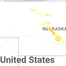
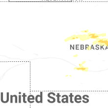
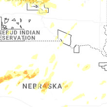
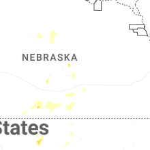
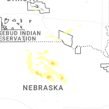
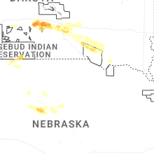
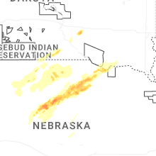

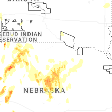


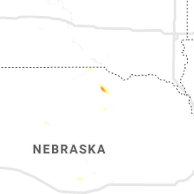


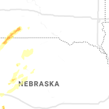


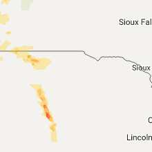


Connect with Interactive Hail Maps