

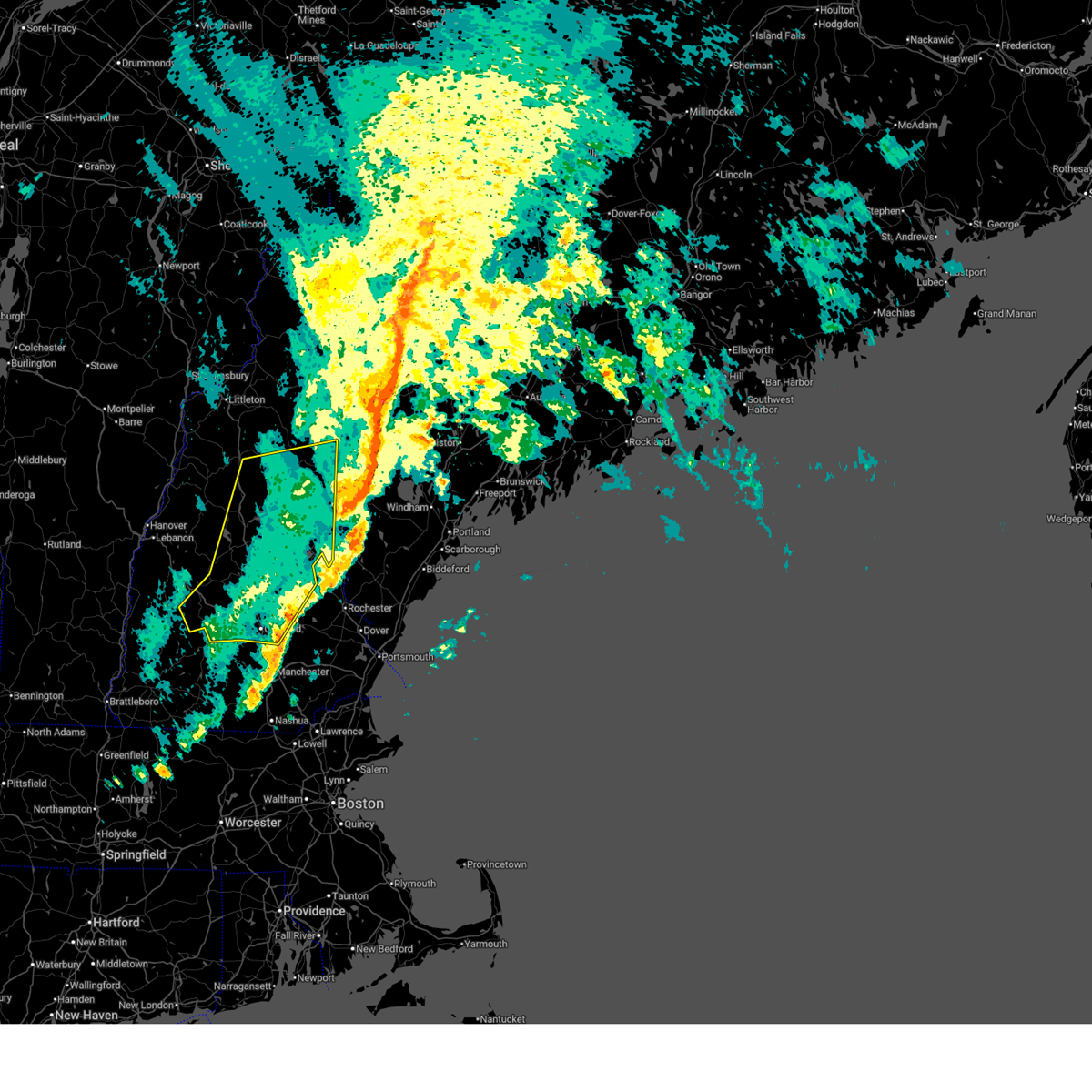
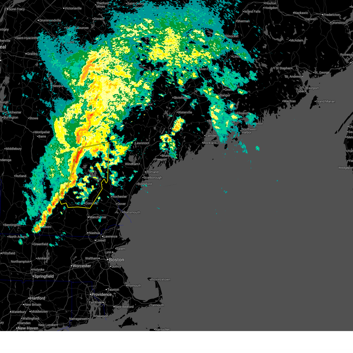
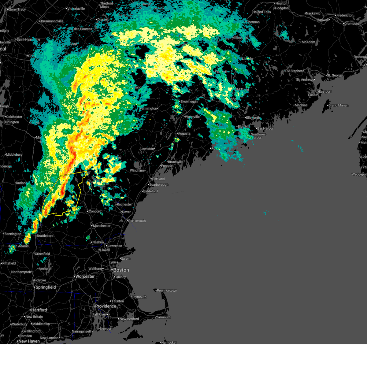
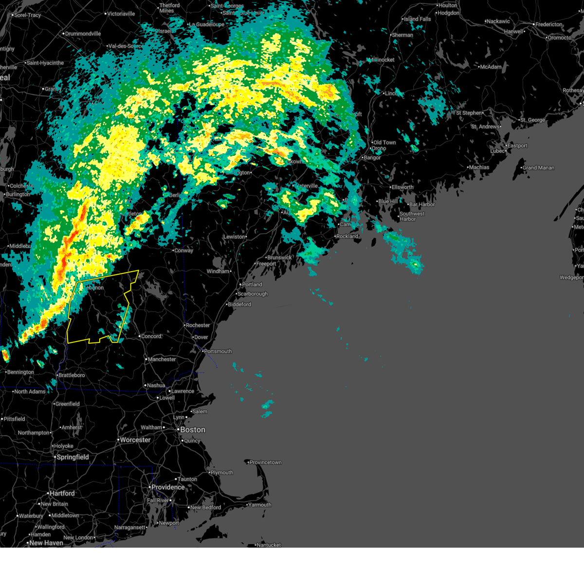
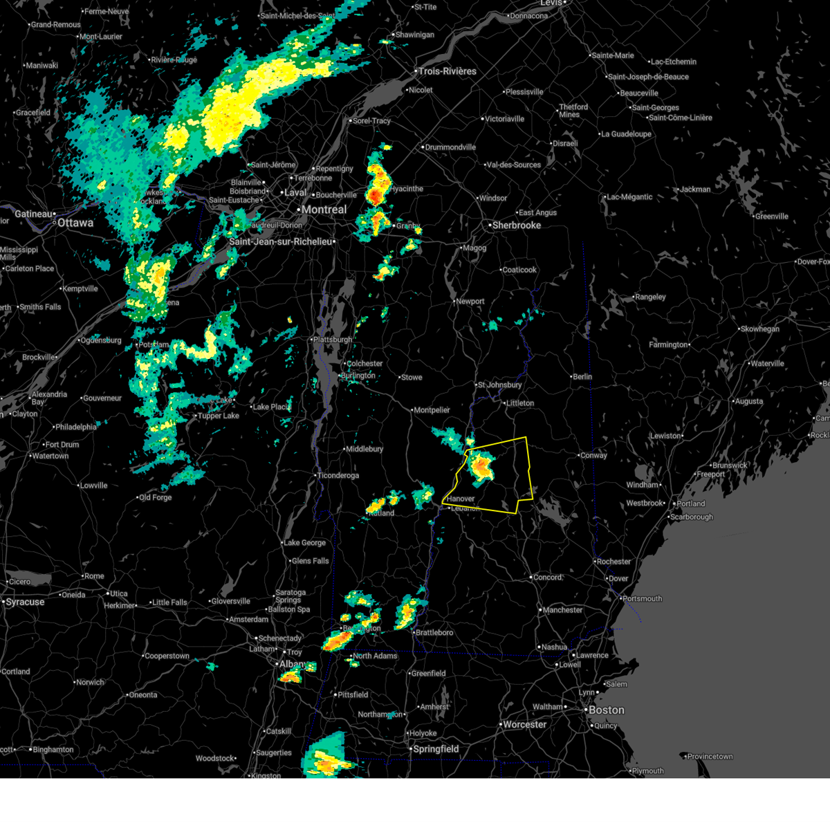
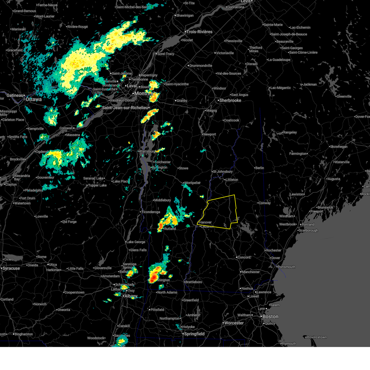
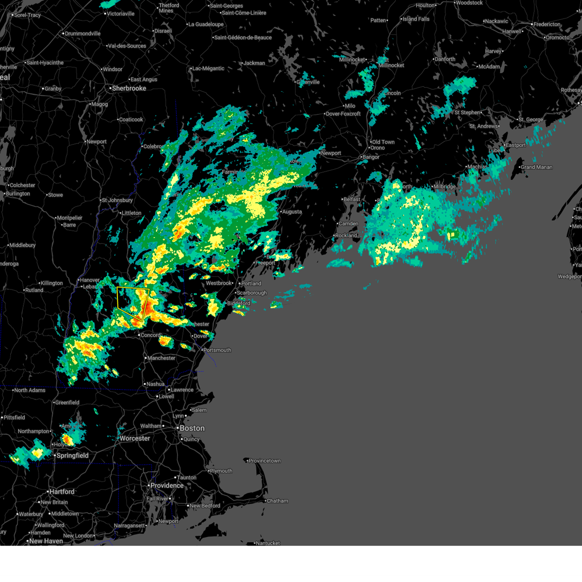
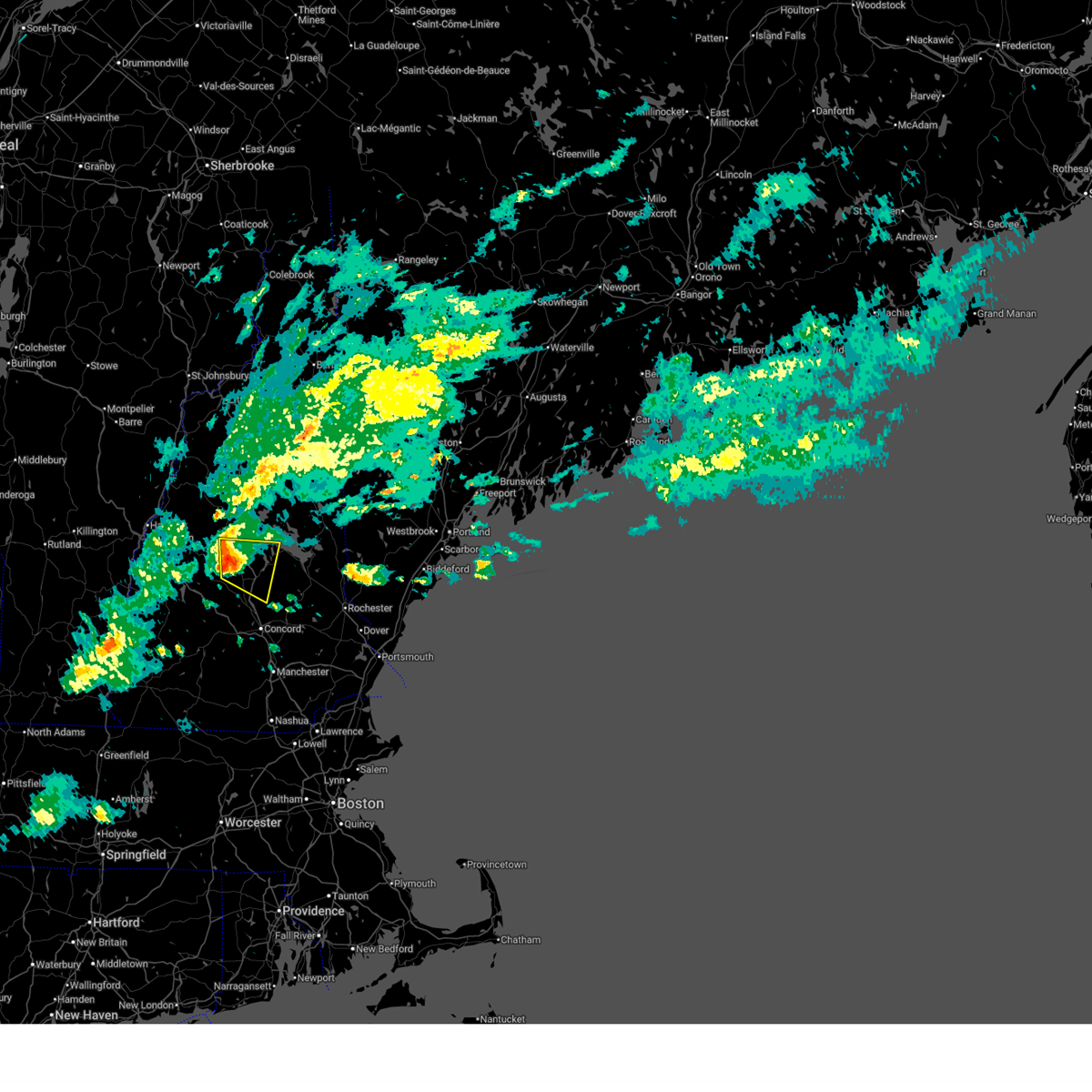
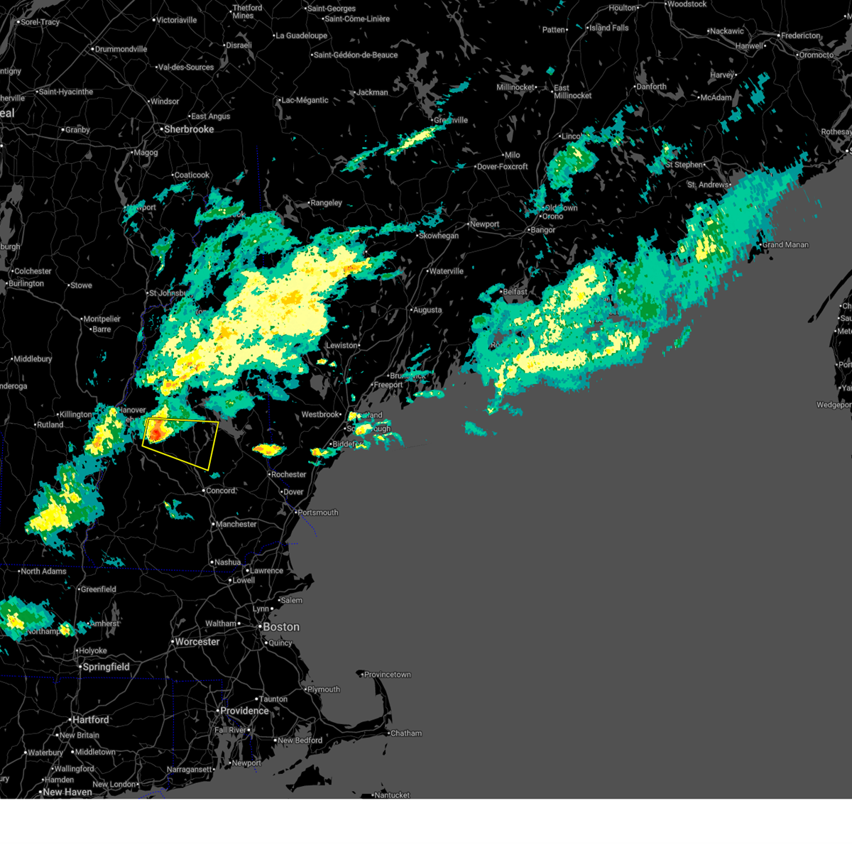
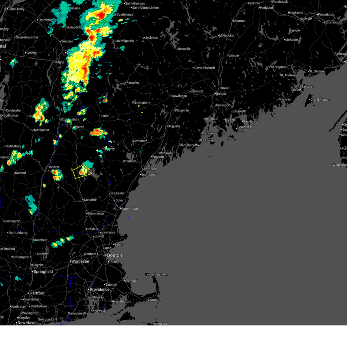
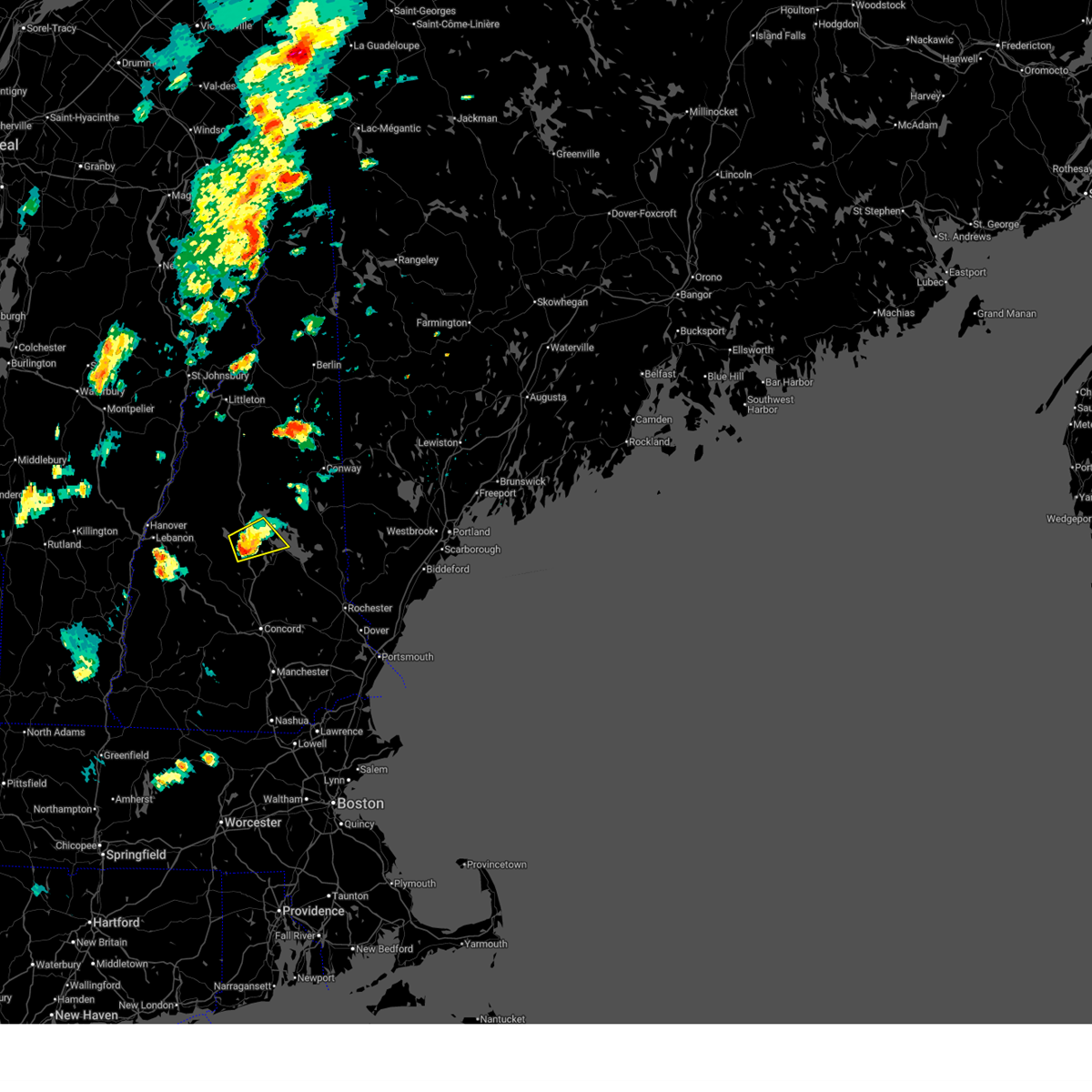
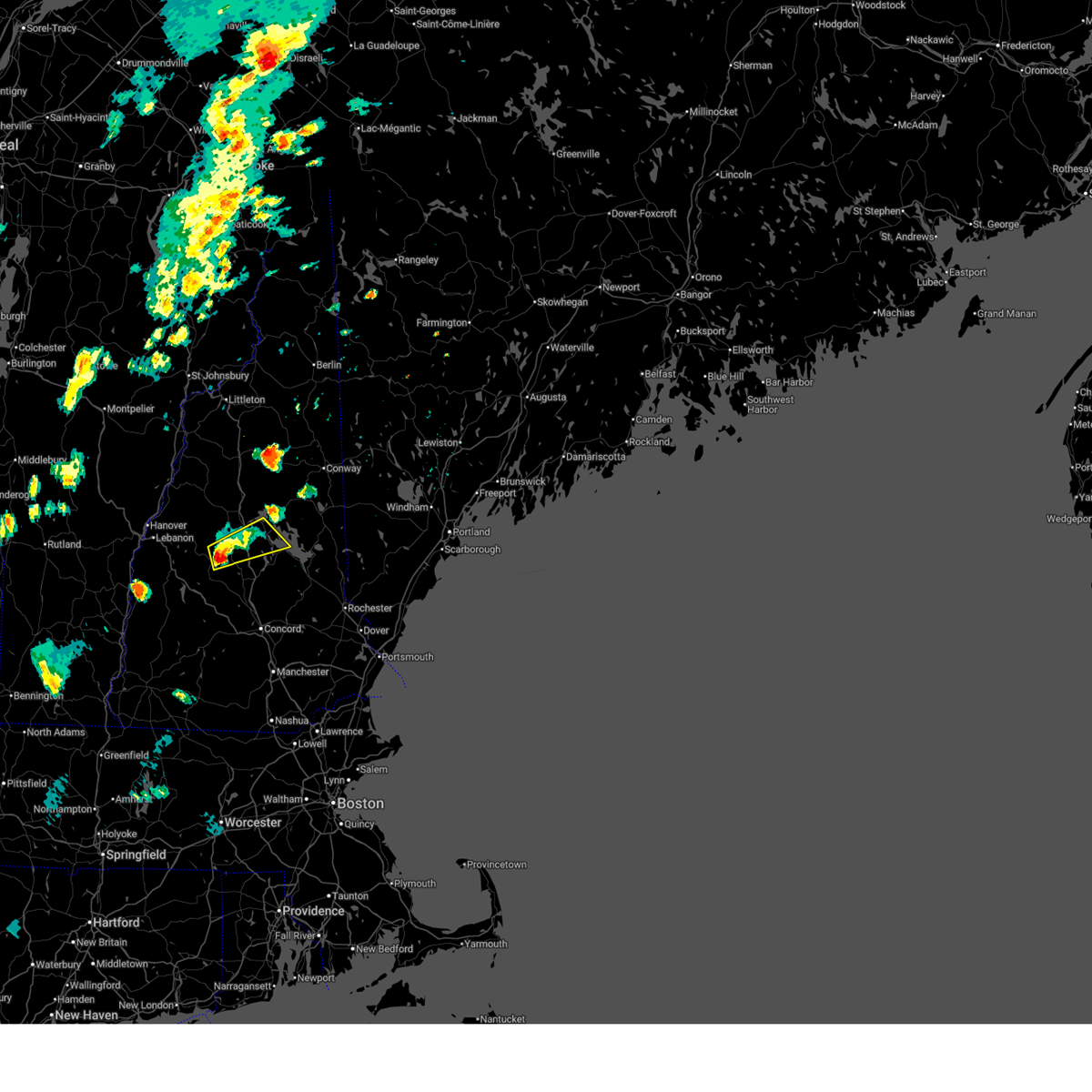
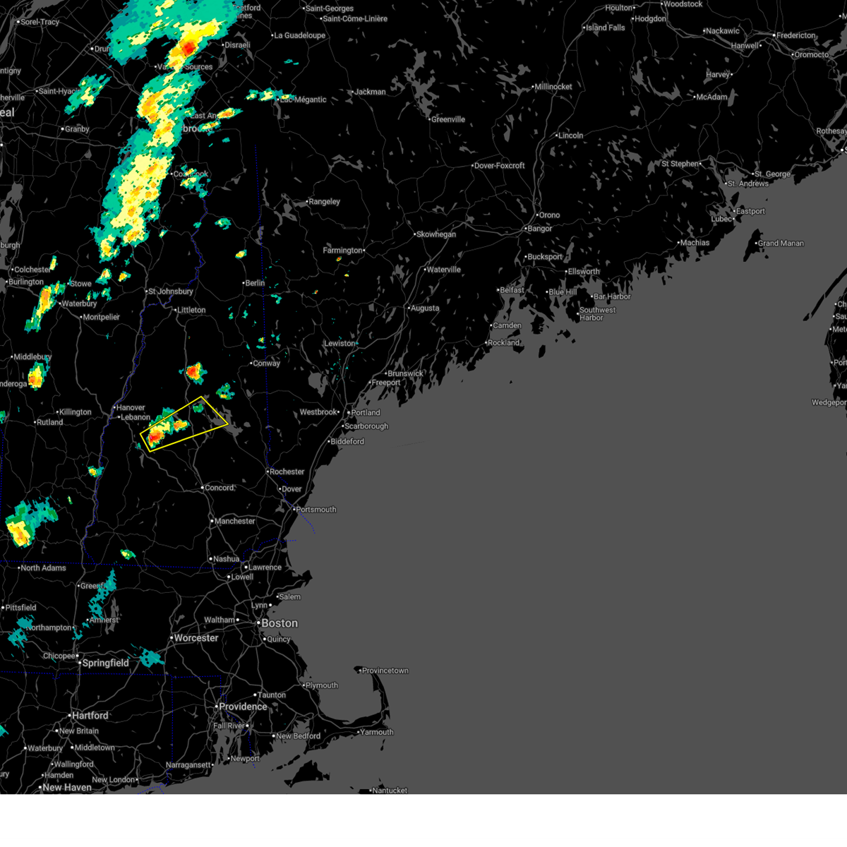
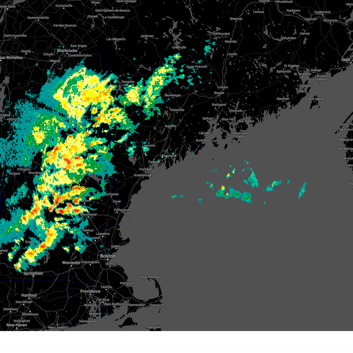
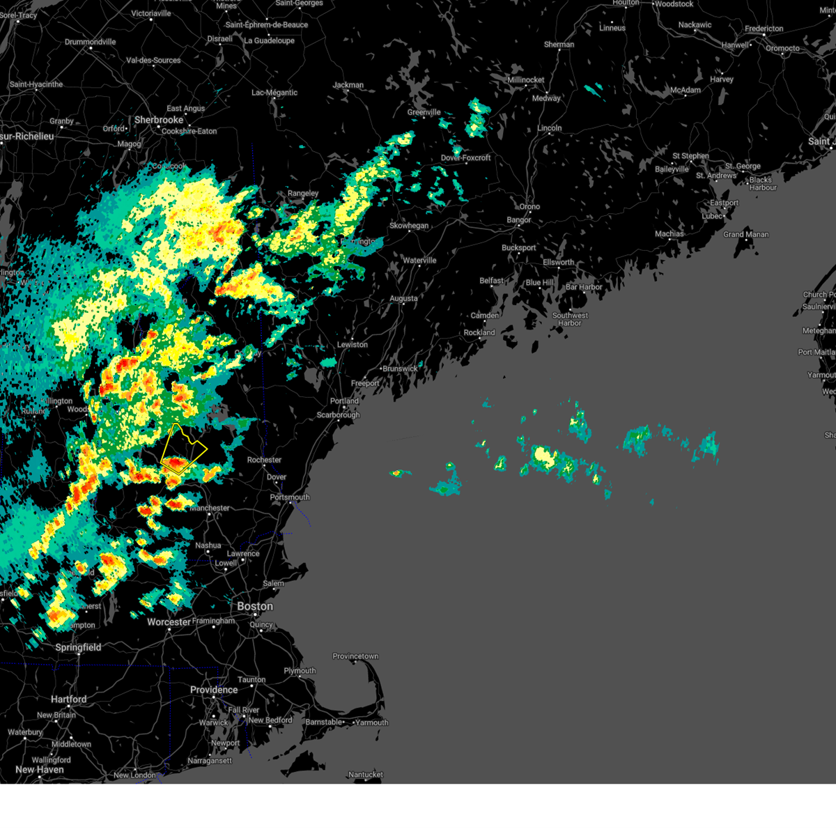
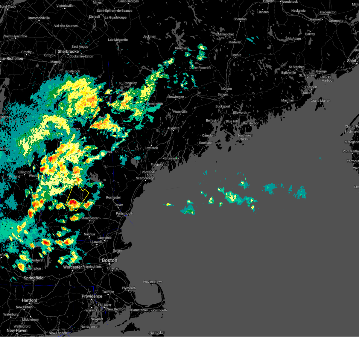
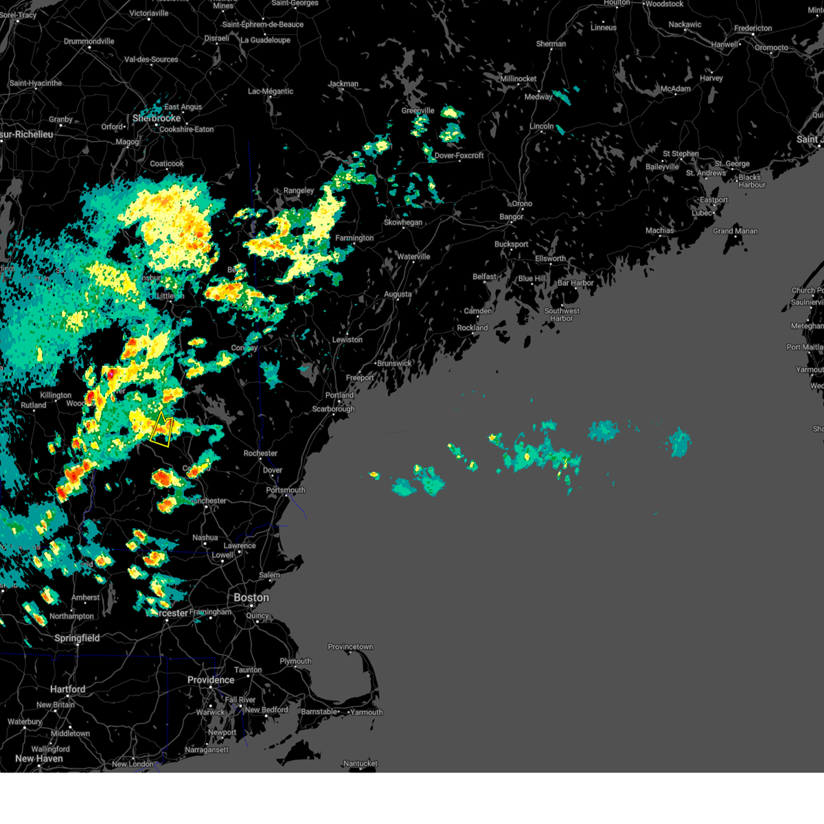
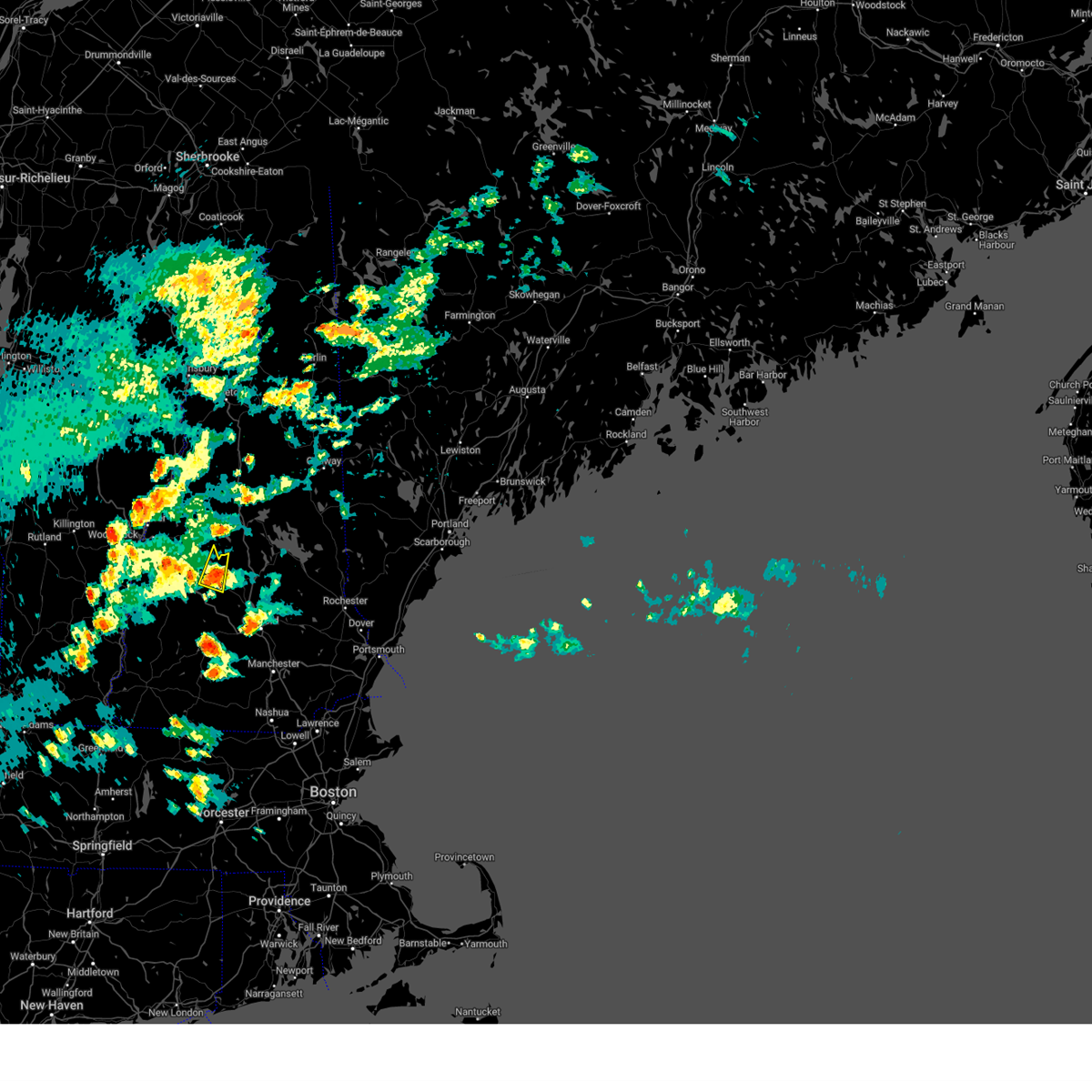
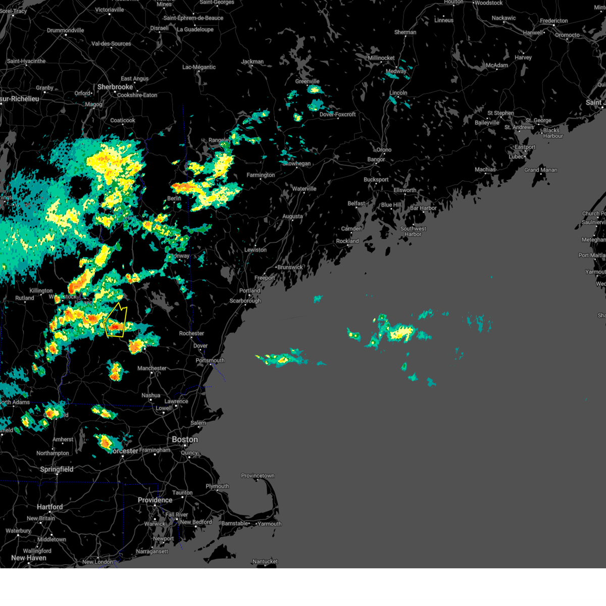
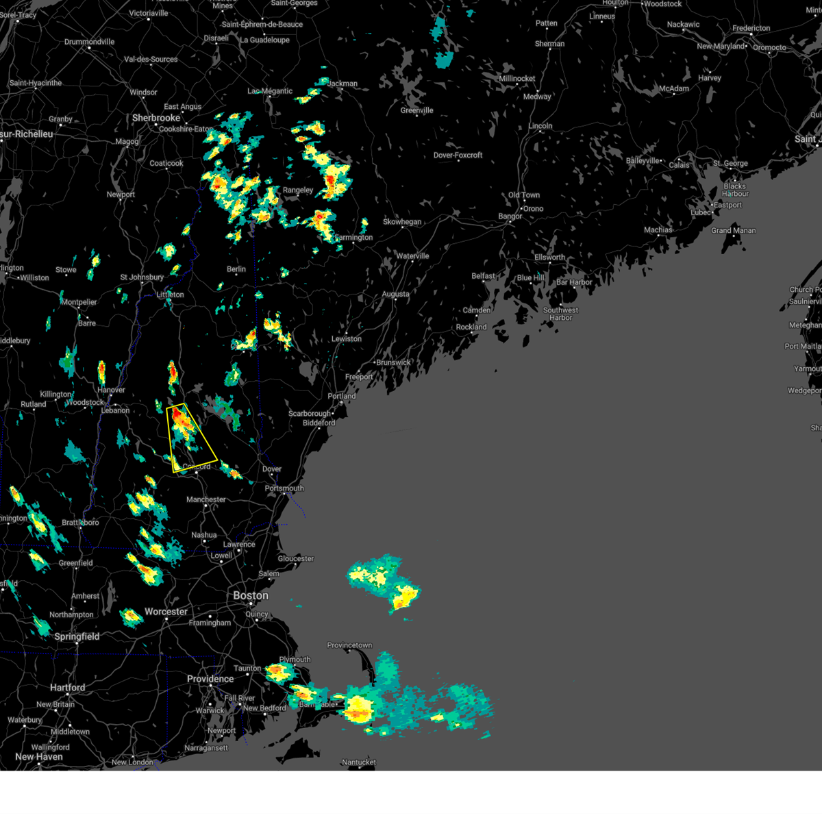
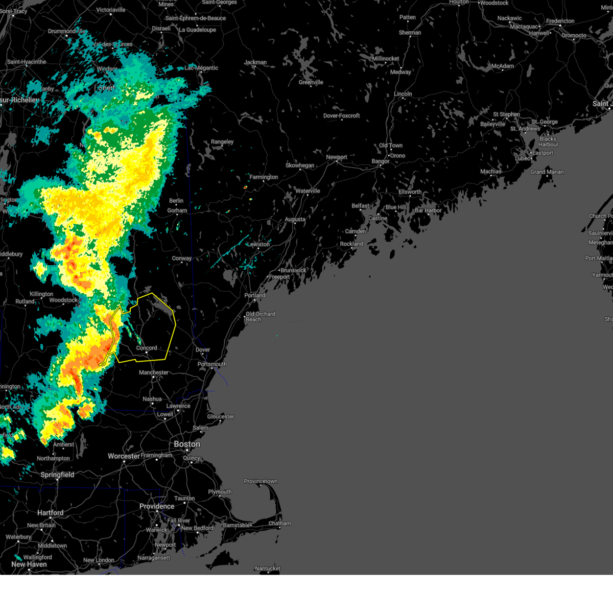
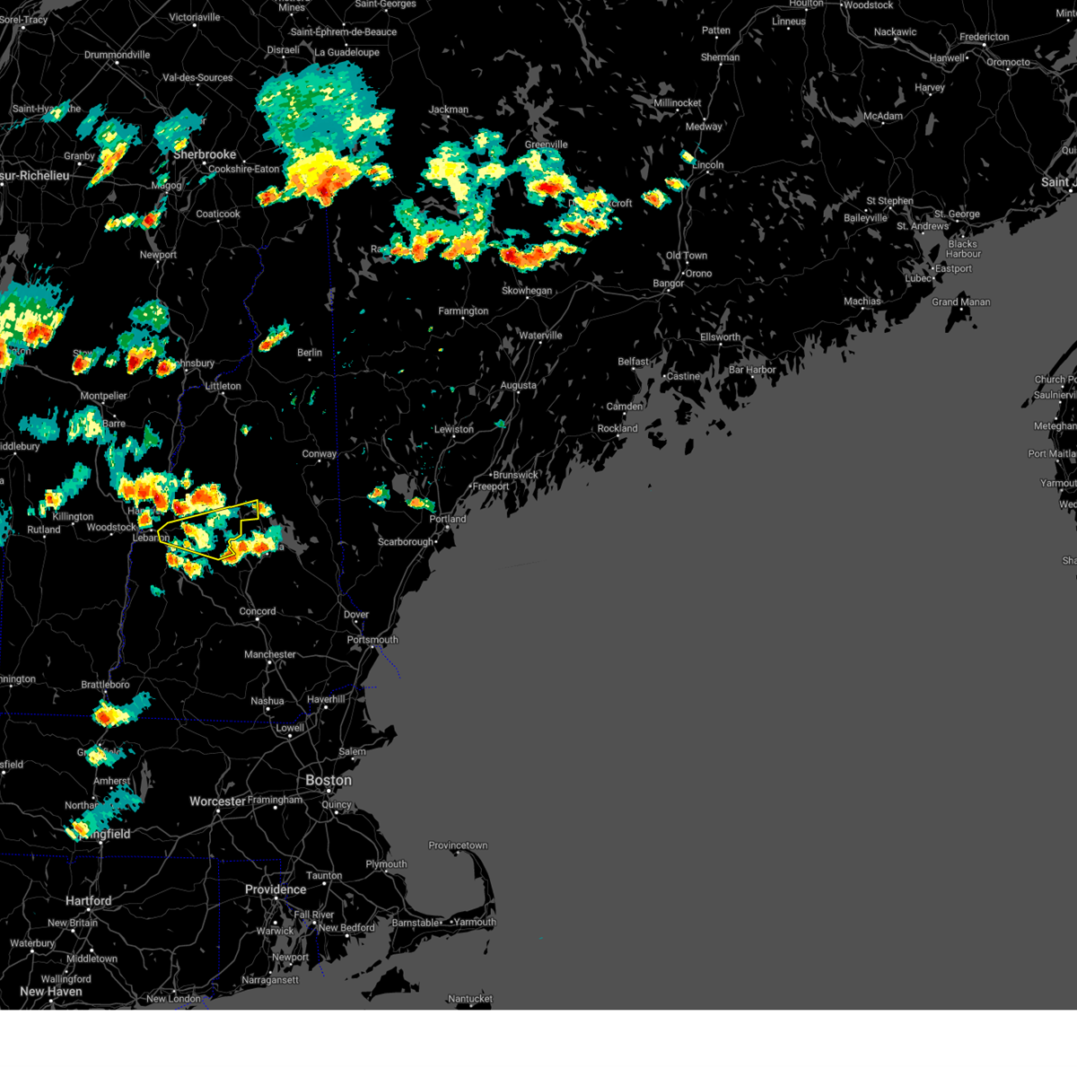
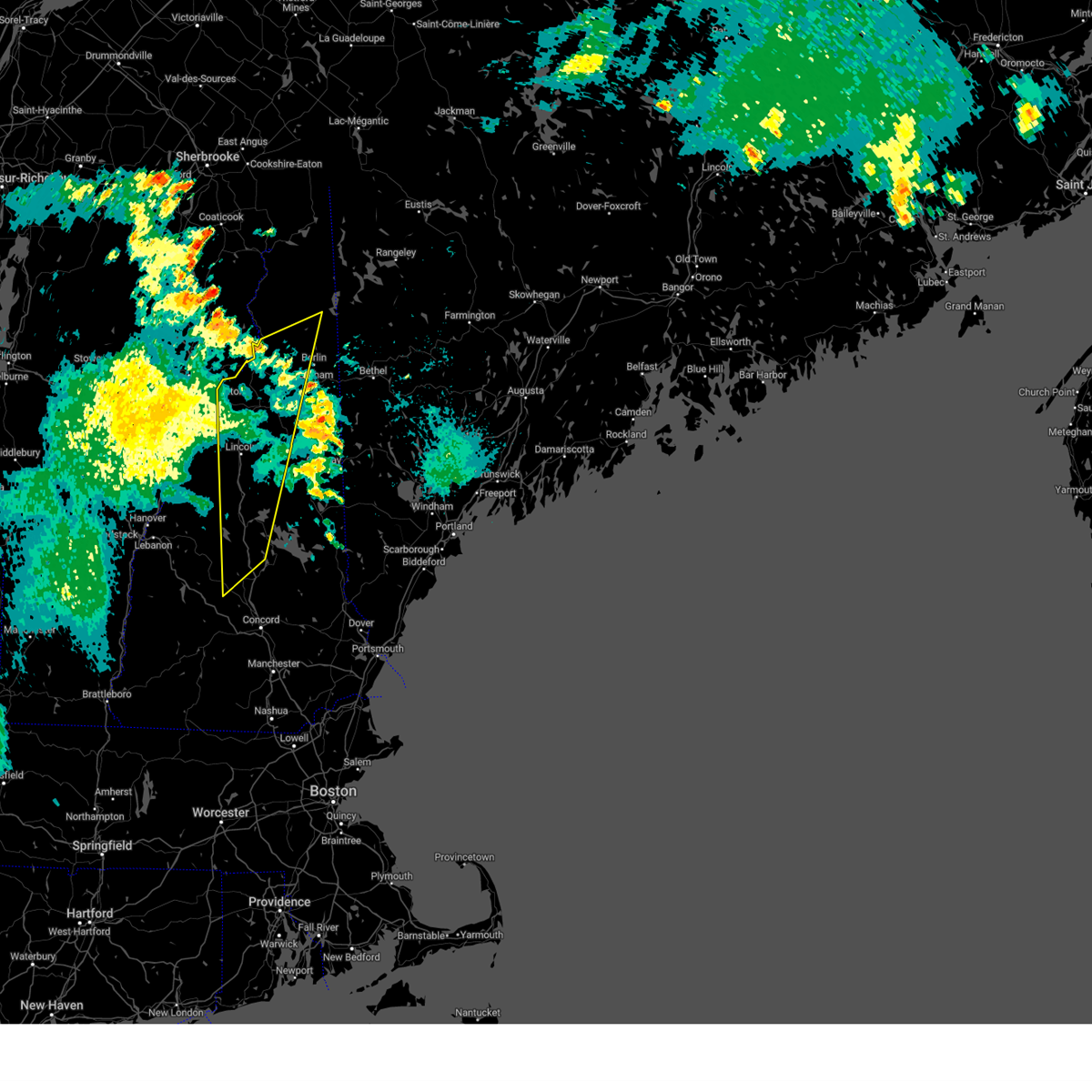
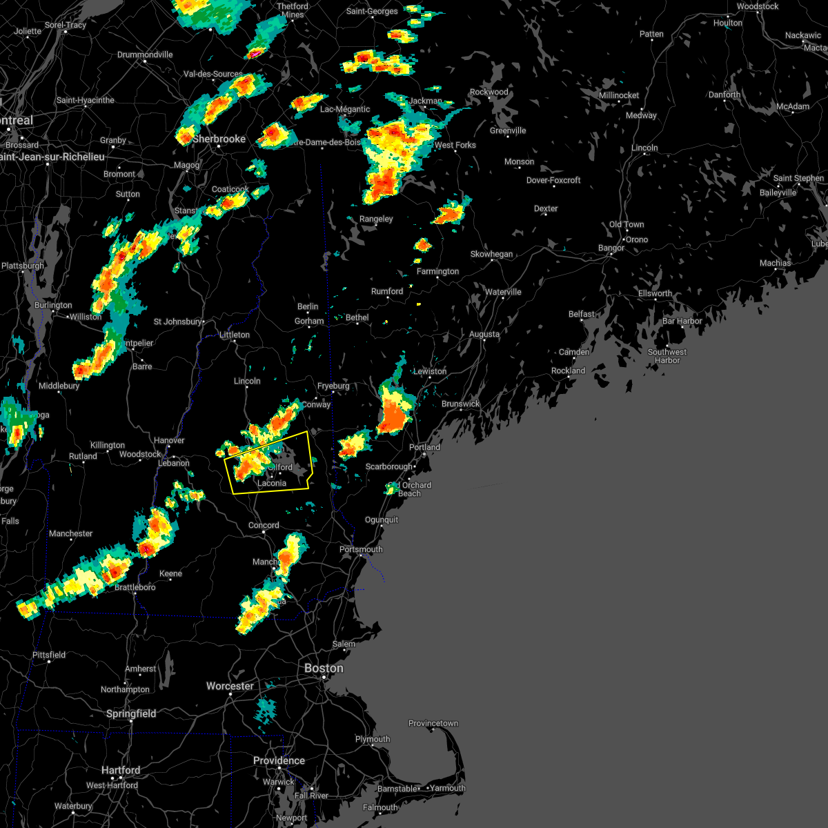
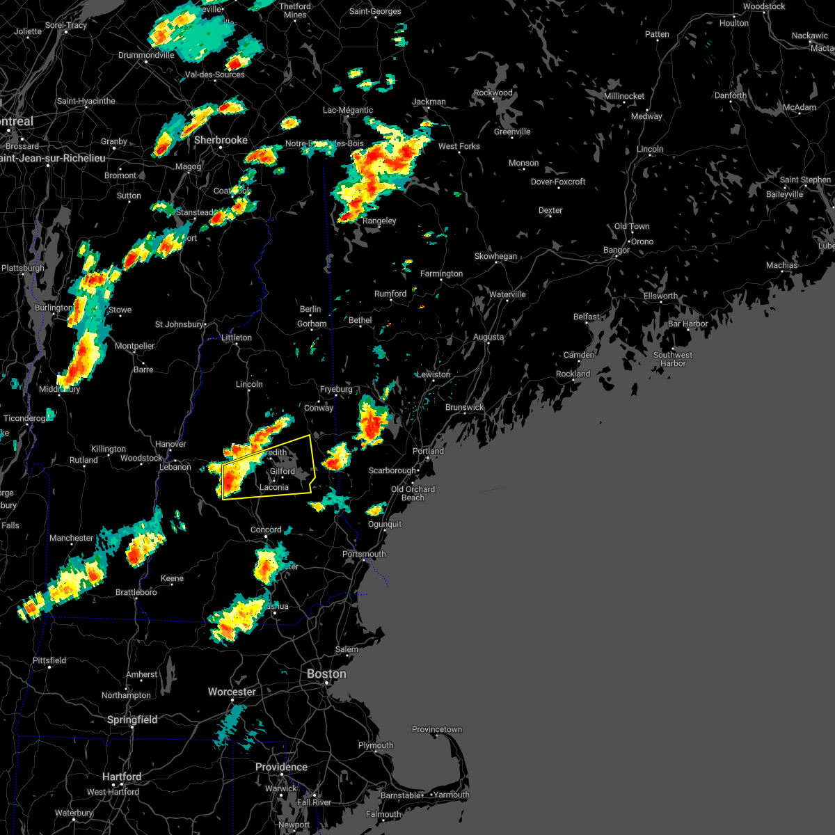
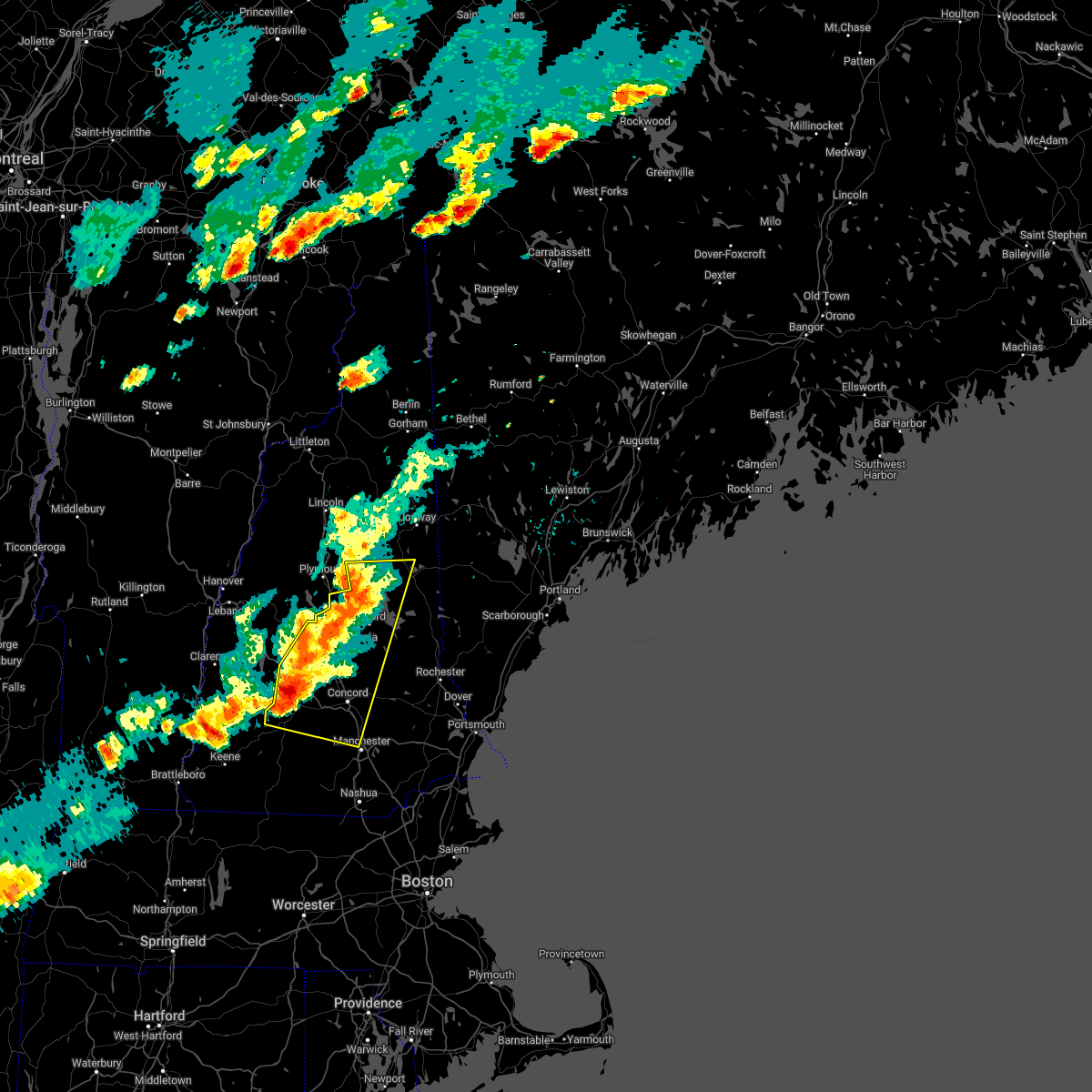
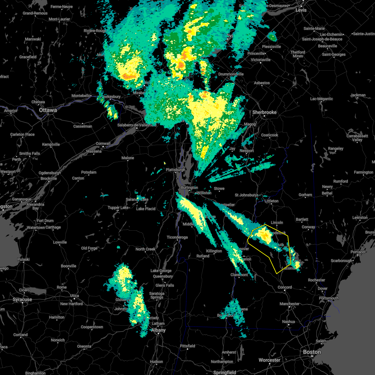
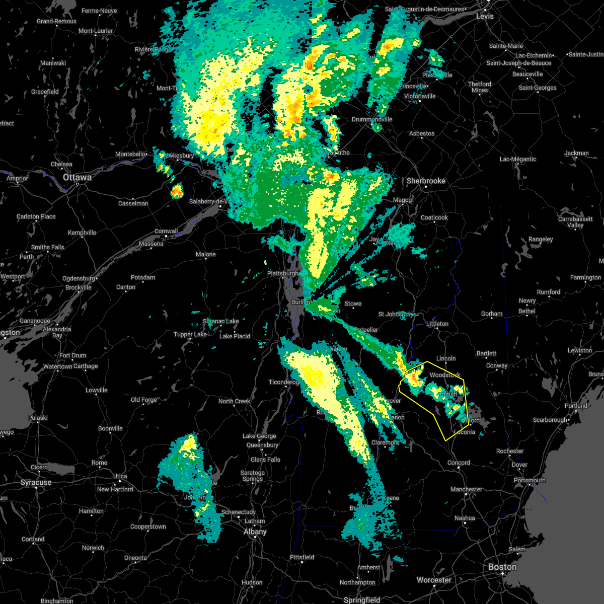
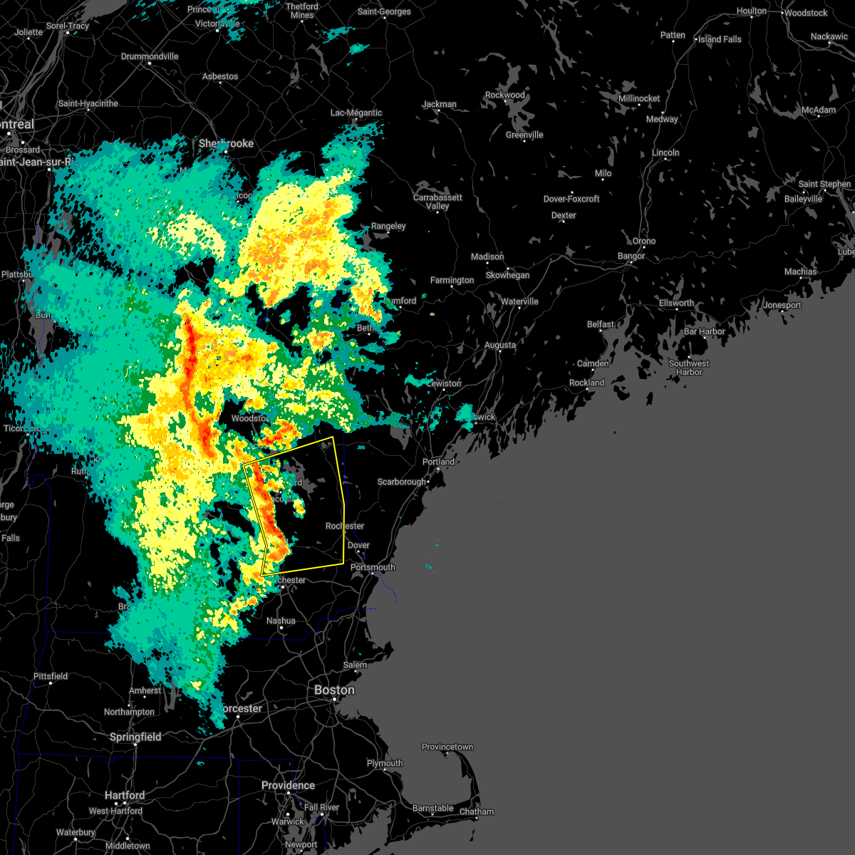
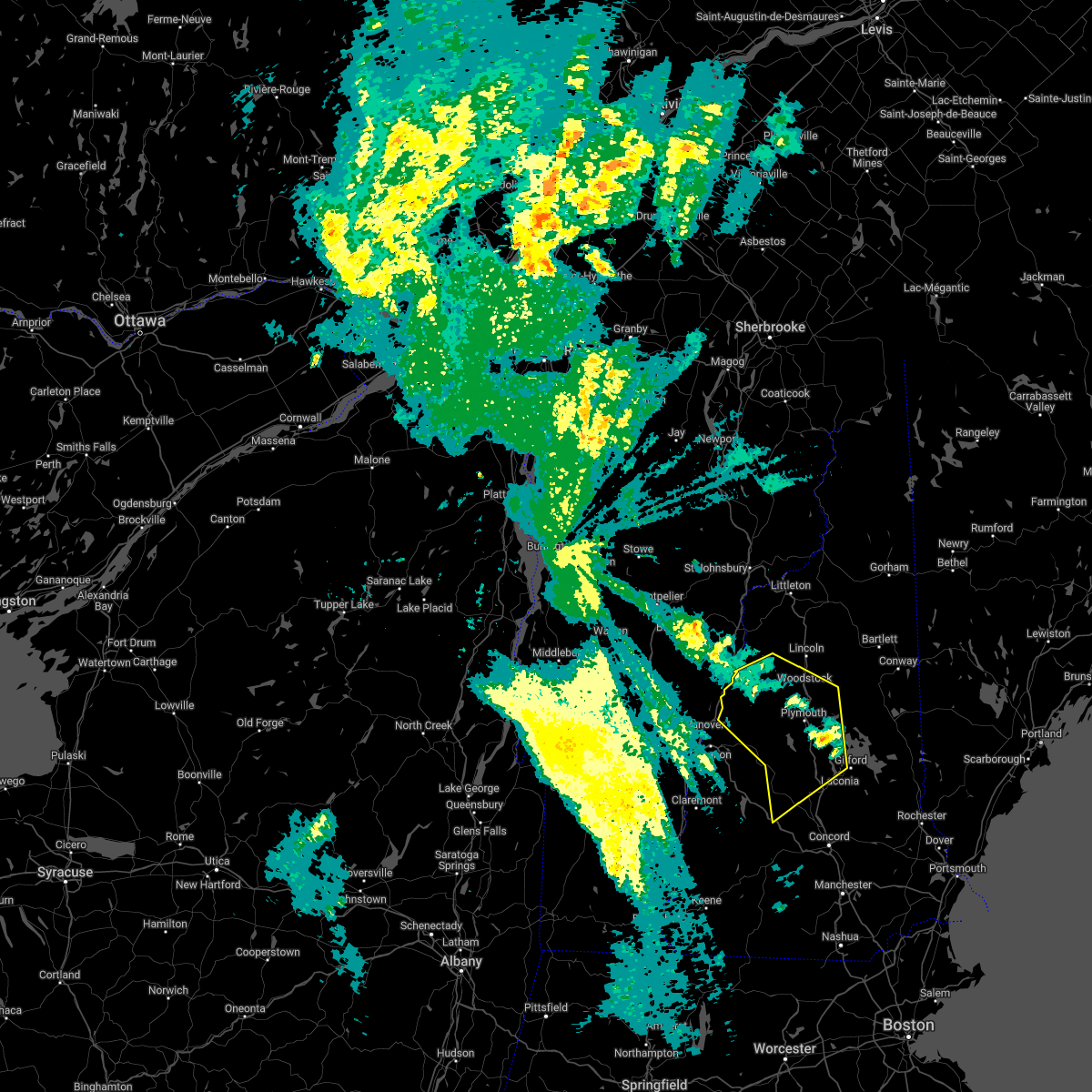
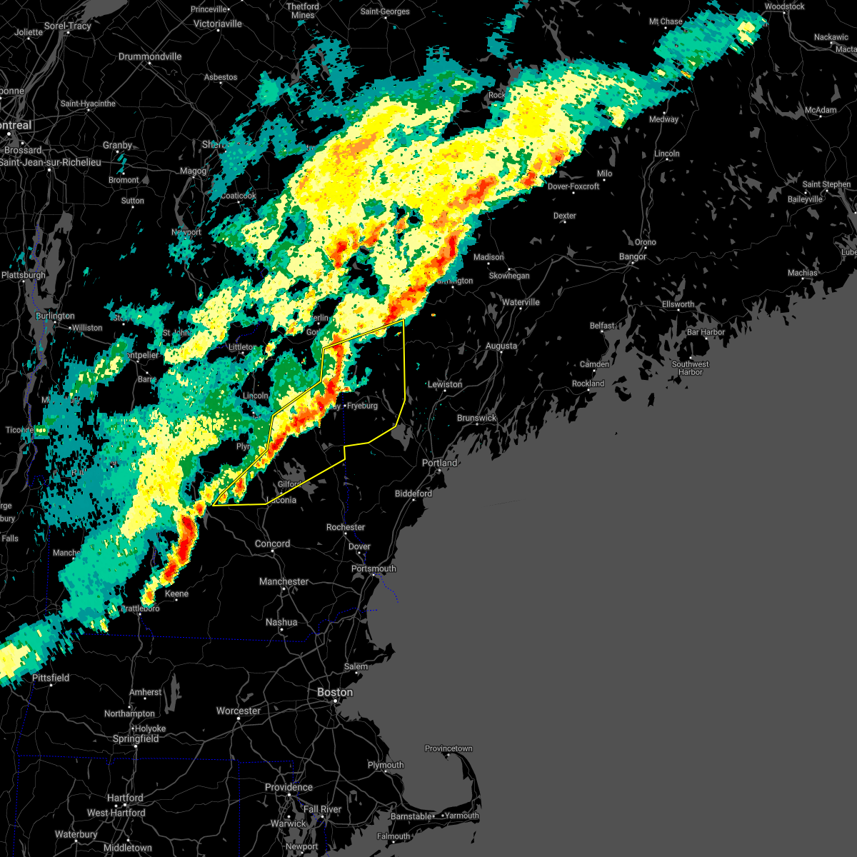
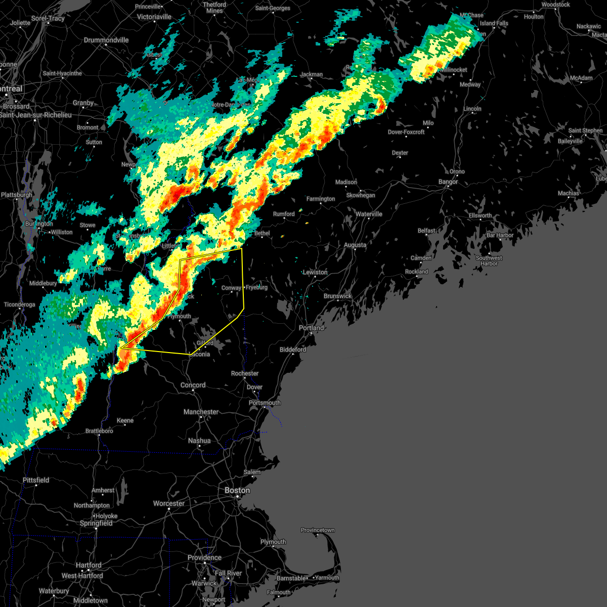
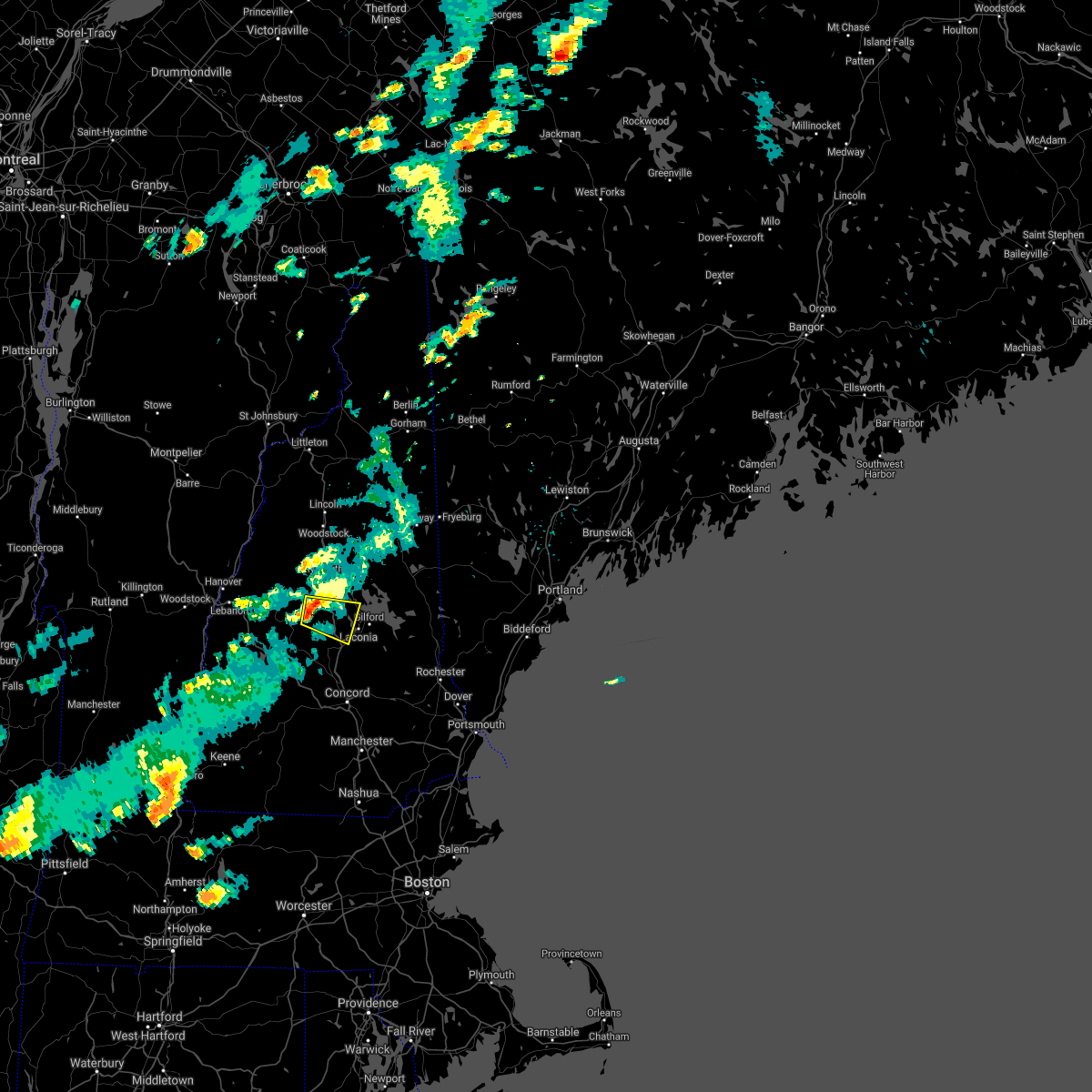
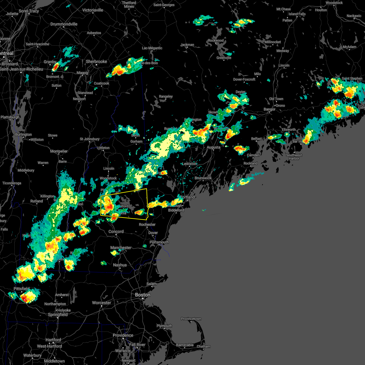
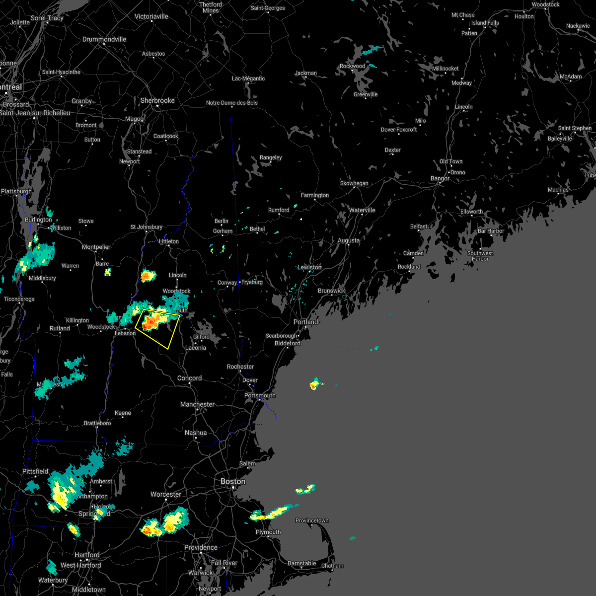
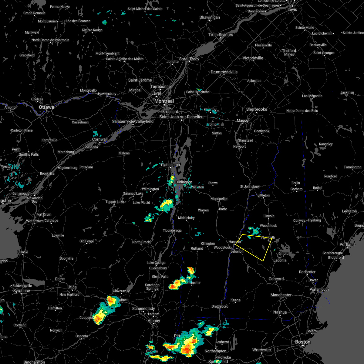
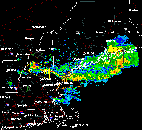
Hail Map for Bristol, NH
The Bristol, NH area has had 8 reports of on-the-ground hail by trained spotters, and has been under severe weather warnings 10 times during the past 12 months. Doppler radar has detected hail at or near Bristol, NH on 14 occasions.
| Name: | Bristol, NH |
| Where Located: | 74.7 miles W of Portland, ME |
| Map: | Google Map for Bristol, NH |
| Population: | 1688 |
| Housing Units: | 1027 |
| More Info: | Search Google for Bristol, NH |
2
The Top Recent Hail Date for Bristol, NH is Monday, August 26, 2024 (5th out of 14)

Hail and Wind Damage Spotted near Bristol, NH
| Date / Time | Report Details |
|---|---|
| 6/18/2026 4:38 PM EDT |
 The storms which prompted the warning have moved out of the area. therefore, the warning will be allowed to expire. a tornado watch remains in effect until 700 pm edt for central, northern and southern new hampshire. The storms which prompted the warning have moved out of the area. therefore, the warning will be allowed to expire. a tornado watch remains in effect until 700 pm edt for central, northern and southern new hampshire.
|
| 6/18/2026 3:43 PM EDT | Bristol fire reporting multiple trees and powerlines down in the area of hemlock brook rd. time estimated by rada in grafton county NH, 2.3 miles SSW of Bristol, NH |
| 6/18/2026 3:40 PM EDT |
 Svrgyx the national weather service in gray maine has issued a * severe thunderstorm warning for, southeastern grafton county in northern new hampshire, belknap county in central new hampshire, merrimack county in central new hampshire, carroll county in northern new hampshire, * until 445 pm edt. * at 340 pm edt, severe thunderstorms were located along a line extending from near woodstock to near danbury to near marlow, moving east at 40 mph (radar indicated). Hazards include 60 mph wind gusts and nickel size hail. expect damage to roofs, siding, and trees Svrgyx the national weather service in gray maine has issued a * severe thunderstorm warning for, southeastern grafton county in northern new hampshire, belknap county in central new hampshire, merrimack county in central new hampshire, carroll county in northern new hampshire, * until 445 pm edt. * at 340 pm edt, severe thunderstorms were located along a line extending from near woodstock to near danbury to near marlow, moving east at 40 mph (radar indicated). Hazards include 60 mph wind gusts and nickel size hail. expect damage to roofs, siding, and trees
|
| 6/18/2026 3:23 PM EDT |
 At 323 pm edt, severe thunderstorms were located along a line extending from near grafton to near charlestown, moving east at 40 mph (radar indicated). Hazards include 60 mph wind gusts and nickel size hail. Expect damage to roofs, siding, and trees. locations impacted include, claremont, franklin, henniker, new london, plymouth, grafton, charlestown, enfield, canaan, holderness, ashland, bradford, danbury, groton, newport, warner, marlow, alstead, hillsborough, and bristol. this also includes, mount kearsage and mount sunapee. this includes the following highways, interstate 89 between mile markers 16 and 51. Interstate 93 between mile markers 75 and 80. At 323 pm edt, severe thunderstorms were located along a line extending from near grafton to near charlestown, moving east at 40 mph (radar indicated). Hazards include 60 mph wind gusts and nickel size hail. Expect damage to roofs, siding, and trees. locations impacted include, claremont, franklin, henniker, new london, plymouth, grafton, charlestown, enfield, canaan, holderness, ashland, bradford, danbury, groton, newport, warner, marlow, alstead, hillsborough, and bristol. this also includes, mount kearsage and mount sunapee. this includes the following highways, interstate 89 between mile markers 16 and 51. Interstate 93 between mile markers 75 and 80.
|
| 6/18/2026 2:39 PM EDT |
 Svrgyx the national weather service in gray maine has issued a * severe thunderstorm warning for, sullivan county in central new hampshire, southern grafton county in northern new hampshire, northwestern merrimack county in central new hampshire, * until 345 pm edt. * at 239 pm edt, severe thunderstorms were located along a line extending from near lebanon to 20 miles west of charlestown, moving east at 55 mph (radar indicated). Hazards include 60 mph wind gusts. expect damage to roofs, siding, and trees Svrgyx the national weather service in gray maine has issued a * severe thunderstorm warning for, sullivan county in central new hampshire, southern grafton county in northern new hampshire, northwestern merrimack county in central new hampshire, * until 345 pm edt. * at 239 pm edt, severe thunderstorms were located along a line extending from near lebanon to 20 miles west of charlestown, moving east at 55 mph (radar indicated). Hazards include 60 mph wind gusts. expect damage to roofs, siding, and trees
|
| 6/6/2026 8:37 PM EDT |
 At 837 pm edt, a severe thunderstorm was located 8 miles southeast of piermont, or 14 miles northwest of plymouth, moving east at 25 mph (radar indicated). Hazards include 60 mph wind gusts and quarter size hail. Hail damage to vehicles is expected. expect wind damage to roofs, siding, and trees. locations impacted include, lebanon, lincoln, plymouth, hanover, haverhill, canaan, holderness, ashland, groton, woodstock, piermont, bristol, lyme, alexandria, bridgewater, hebron, benton, dorchester, ellsworth, and orange. this also includes, mount moosilauke, rumney rocks, carr mountain, stinson mountain, and elbow pond recreation area. This includes interstate 93 between mile markers 75 and 103. At 837 pm edt, a severe thunderstorm was located 8 miles southeast of piermont, or 14 miles northwest of plymouth, moving east at 25 mph (radar indicated). Hazards include 60 mph wind gusts and quarter size hail. Hail damage to vehicles is expected. expect wind damage to roofs, siding, and trees. locations impacted include, lebanon, lincoln, plymouth, hanover, haverhill, canaan, holderness, ashland, groton, woodstock, piermont, bristol, lyme, alexandria, bridgewater, hebron, benton, dorchester, ellsworth, and orange. this also includes, mount moosilauke, rumney rocks, carr mountain, stinson mountain, and elbow pond recreation area. This includes interstate 93 between mile markers 75 and 103.
|
| 6/6/2026 8:04 PM EDT |
 Svrgyx the national weather service in gray maine has issued a * severe thunderstorm warning for, southern grafton county in northern new hampshire, * until 900 pm edt. * at 804 pm edt, a severe thunderstorm was located 8 miles north of hanover, or 13 miles north of lebanon, moving east at 40 mph (radar indicated). Hazards include 60 mph wind gusts and quarter size hail. Hail damage to vehicles is expected. Expect wind damage to roofs, siding, and trees. Svrgyx the national weather service in gray maine has issued a * severe thunderstorm warning for, southern grafton county in northern new hampshire, * until 900 pm edt. * at 804 pm edt, a severe thunderstorm was located 8 miles north of hanover, or 13 miles north of lebanon, moving east at 40 mph (radar indicated). Hazards include 60 mph wind gusts and quarter size hail. Hail damage to vehicles is expected. Expect wind damage to roofs, siding, and trees.
|
| 7/20/2025 5:24 PM EDT |
 The storm which prompted the warning has moved out of the area. therefore, the warning will be allowed to expire. a severe t hunderstorm warning remains in effect for parts of belknap and merrimack counties. a severe thunderstorm watch remains in effect until 900 pm edt for central new hampshire. The storm which prompted the warning has moved out of the area. therefore, the warning will be allowed to expire. a severe t hunderstorm warning remains in effect for parts of belknap and merrimack counties. a severe thunderstorm watch remains in effect until 900 pm edt for central new hampshire.
|
| 7/20/2025 5:03 PM EDT |
 At 502 pm edt, a severe thunderstorm was located near franklin, moving east at 35 mph (radar indicated). Hazards include 60 mph wind gusts and quarter size hail. Hail damage to vehicles is expected. expect wind damage to roofs, siding, and trees. locations impacted include, franklin, canterbury, laconia, hill, belmont, tilton, sanbornton, new hampton, bristol, northfield, andover, meredith, alexandria, bridgewater, gilford, and salisbury. This includes interstate 93 between mile markers 51 and 70. At 502 pm edt, a severe thunderstorm was located near franklin, moving east at 35 mph (radar indicated). Hazards include 60 mph wind gusts and quarter size hail. Hail damage to vehicles is expected. expect wind damage to roofs, siding, and trees. locations impacted include, franklin, canterbury, laconia, hill, belmont, tilton, sanbornton, new hampton, bristol, northfield, andover, meredith, alexandria, bridgewater, gilford, and salisbury. This includes interstate 93 between mile markers 51 and 70.
|
| 7/20/2025 5:03 PM EDT |
 the severe thunderstorm warning has been cancelled and is no longer in effect the severe thunderstorm warning has been cancelled and is no longer in effect
|
| 7/20/2025 4:41 PM EDT |
 Svrgyx the national weather service in gray maine has issued a * severe thunderstorm warning for, northeastern sullivan county in central new hampshire, south central grafton county in northern new hampshire, west central belknap county in central new hampshire, northwestern merrimack county in central new hampshire, * until 530 pm edt. * at 440 pm edt, a severe thunderstorm was located over grafton, or 9 miles north of new london, moving east at 35 mph (radar indicated). Hazards include 60 mph wind gusts and quarter size hail. Hail damage to vehicles is expected. Expect wind damage to roofs, siding, and trees. Svrgyx the national weather service in gray maine has issued a * severe thunderstorm warning for, northeastern sullivan county in central new hampshire, south central grafton county in northern new hampshire, west central belknap county in central new hampshire, northwestern merrimack county in central new hampshire, * until 530 pm edt. * at 440 pm edt, a severe thunderstorm was located over grafton, or 9 miles north of new london, moving east at 35 mph (radar indicated). Hazards include 60 mph wind gusts and quarter size hail. Hail damage to vehicles is expected. Expect wind damage to roofs, siding, and trees.
|
| 7/17/2025 7:34 PM EDT | Reported by amateur radio. social media photos of downed trees and a tree on wires in alexandria. time estimated by rada in grafton county NH, 1.9 miles ESE of Bristol, NH |
| 6/19/2025 5:16 PM EDT | Half Dollar sized hail reported 0.7 miles NNE of Bristol, NH, reported by amateur radio. half dollar size hail at hannaford parking lot. |
| 6/19/2025 5:14 PM EDT |
 The storm which prompted the warning has weakened below severe limits, and no longer poses an immediate threat to life or property. therefore, the warning will be allowed to expire. however, heavy rain is still possible with this thunderstorm. a severe thunderstorm watch remains in effect until 1100 pm edt for central and northern new hampshire. The storm which prompted the warning has weakened below severe limits, and no longer poses an immediate threat to life or property. therefore, the warning will be allowed to expire. however, heavy rain is still possible with this thunderstorm. a severe thunderstorm watch remains in effect until 1100 pm edt for central and northern new hampshire.
|
| 6/19/2025 5:06 PM EDT |
 At 506 pm edt, a severe thunderstorm was located near meredith, moving east at 30 mph (radar indicated). Hazards include 60 mph wind gusts and half dollar size hail. Hail damage to vehicles is expected. expect wind damage to roofs, siding, and trees. locations impacted include, center harber, meredith, bristol, bridgewater, new hampton, laconia, ashland, sanbornton, gilford, and holderness. This includes interstate 93 between mile markers 65 and 74. At 506 pm edt, a severe thunderstorm was located near meredith, moving east at 30 mph (radar indicated). Hazards include 60 mph wind gusts and half dollar size hail. Hail damage to vehicles is expected. expect wind damage to roofs, siding, and trees. locations impacted include, center harber, meredith, bristol, bridgewater, new hampton, laconia, ashland, sanbornton, gilford, and holderness. This includes interstate 93 between mile markers 65 and 74.
|
| 6/19/2025 4:59 PM EDT | Trees and wires down on new chester mtn r in grafton county NH, 1.5 miles NNW of Bristol, NH |
| 6/19/2025 4:58 PM EDT | Half Dollar sized hail reported 0.6 miles NNW of Bristol, NH, half dollar sized hail on main street in bristol. |
| 6/19/2025 4:58 PM EDT | Observed trees down along bristol hill rd near plumer hill r in grafton county NH, 0.3 miles ESE of Bristol, NH |
| 6/19/2025 4:57 PM EDT | Observed trees downed on mcmurphy rd near split from karl gordon rd; diameter of downed trees between 8-18i in grafton county NH, 1.8 miles NE of Bristol, NH |
| 6/19/2025 4:50 PM EDT |
 At 449 pm edt, a severe thunderstorm was located near danbury, or 8 miles northwest of franklin, moving east at 35 mph (radar indicated). Hazards include 60 mph wind gusts and half dollar size hail. Hail damage to vehicles is expected. expect wind damage to roofs, siding, and trees. locations impacted include, center harber, laconia, hill, bridgewater, new hampton, meredith, bristol, alexandria, danbury, ashland, sanbornton, gilford, holderness, and grafton. This includes interstate 93 between mile markers 64 and 74. At 449 pm edt, a severe thunderstorm was located near danbury, or 8 miles northwest of franklin, moving east at 35 mph (radar indicated). Hazards include 60 mph wind gusts and half dollar size hail. Hail damage to vehicles is expected. expect wind damage to roofs, siding, and trees. locations impacted include, center harber, laconia, hill, bridgewater, new hampton, meredith, bristol, alexandria, danbury, ashland, sanbornton, gilford, holderness, and grafton. This includes interstate 93 between mile markers 64 and 74.
|
| 6/19/2025 4:50 PM EDT |
 the severe thunderstorm warning has been cancelled and is no longer in effect the severe thunderstorm warning has been cancelled and is no longer in effect
|
| 6/19/2025 4:48 PM EDT | Trees downed wires on us route 4 and ford mill rd in fords crossing villag in merrimack county NH, 8 miles ENE of Bristol, NH |
| 6/19/2025 4:45 PM EDT | Observed downed wires as well as trees and large branches across waukeena lake rd and sedgewick rd in danbur in merrimack county NH, 9.1 miles NE of Bristol, NH |
| 6/19/2025 4:45 PM EDT | Half Dollar sized hail reported 7.5 miles NE of Bristol, NH, chaser reports half dollar sized hail falling in danbury. |
| 6/19/2025 4:44 PM EDT | Ping Pong Ball sized hail reported 4.7 miles NE of Bristol, NH, hail up to 1.5in... hail lasted for 8 minutes. minor damage to car. |
| 6/19/2025 4:43 PM EDT | Reports of trees down on spa rd... north rd... and ragged mtn hwy in danbud in merrimack county NH, 7.5 miles NE of Bristol, NH |
| 6/19/2025 4:34 PM EDT |
 Svrgyx the national weather service in gray maine has issued a * severe thunderstorm warning for, northeastern sullivan county in central new hampshire, southeastern grafton county in northern new hampshire, northwestern belknap county in central new hampshire, northwestern merrimack county in central new hampshire, * until 515 pm edt. * at 433 pm edt, a severe thunderstorm was located near danbury, or 7 miles north of new london, moving northeast at 35 mph (radar indicated). Hazards include 60 mph wind gusts and quarter size hail. Hail damage to vehicles is expected. Expect wind damage to roofs, siding, and trees. Svrgyx the national weather service in gray maine has issued a * severe thunderstorm warning for, northeastern sullivan county in central new hampshire, southeastern grafton county in northern new hampshire, northwestern belknap county in central new hampshire, northwestern merrimack county in central new hampshire, * until 515 pm edt. * at 433 pm edt, a severe thunderstorm was located near danbury, or 7 miles north of new london, moving northeast at 35 mph (radar indicated). Hazards include 60 mph wind gusts and quarter size hail. Hail damage to vehicles is expected. Expect wind damage to roofs, siding, and trees.
|
| 6/6/2025 4:51 PM EDT |
 The storm which prompted the warning has weakened below severe limits, and has exited the warned area. therefore, the warning will be allowed to expire. The storm which prompted the warning has weakened below severe limits, and has exited the warned area. therefore, the warning will be allowed to expire.
|
| 6/6/2025 4:33 PM EDT |
 At 432 pm edt, a severe thunderstorm was located near warner, or 7 miles southwest of franklin, moving northeast at 25 mph (radar indicated). Hazards include 60 mph wind gusts and quarter size hail. Hail damage to vehicles is expected. expect wind damage to roofs, siding, and trees. locations impacted include, franklin, boscawen, hill, webster, salisbury, andover, northfield, canterbury, tilton, warner, sutton, bristol, and new hampton. this includes the following highways, interstate 89 between mile markers 21 and 23. Interstate 93 between mile markers 48 and 56. At 432 pm edt, a severe thunderstorm was located near warner, or 7 miles southwest of franklin, moving northeast at 25 mph (radar indicated). Hazards include 60 mph wind gusts and quarter size hail. Hail damage to vehicles is expected. expect wind damage to roofs, siding, and trees. locations impacted include, franklin, boscawen, hill, webster, salisbury, andover, northfield, canterbury, tilton, warner, sutton, bristol, and new hampton. this includes the following highways, interstate 89 between mile markers 21 and 23. Interstate 93 between mile markers 48 and 56.
|
| 6/6/2025 4:15 PM EDT |
 Svrgyx the national weather service in gray maine has issued a * severe thunderstorm warning for, central merrimack county in central new hampshire, * until 500 pm edt. * at 414 pm edt, a severe thunderstorm was located over warner, or near henniker, moving northeast at 25 mph (radar indicated). Hazards include 60 mph wind gusts and quarter size hail. Hail damage to vehicles is expected. Expect wind damage to roofs, siding, and trees. Svrgyx the national weather service in gray maine has issued a * severe thunderstorm warning for, central merrimack county in central new hampshire, * until 500 pm edt. * at 414 pm edt, a severe thunderstorm was located over warner, or near henniker, moving northeast at 25 mph (radar indicated). Hazards include 60 mph wind gusts and quarter size hail. Hail damage to vehicles is expected. Expect wind damage to roofs, siding, and trees.
|
| 6/6/2025 4:05 PM EDT |
 The storm which prompted the warning has weakened below severe limits, and has exited the warned area. therefore, the warning will be allowed to expire. The storm which prompted the warning has weakened below severe limits, and has exited the warned area. therefore, the warning will be allowed to expire.
|
| 6/6/2025 3:52 PM EDT |
 At 352 pm edt, a severe thunderstorm was located near new london, moving north at 15 mph (radar indicated). Hazards include 60 mph wind gusts and quarter size hail. Hail damage to vehicles is expected. expect wind damage to roofs, siding, and trees. Locations impacted include, wilmot, danbury, hill, andover, salisbury, and new london. At 352 pm edt, a severe thunderstorm was located near new london, moving north at 15 mph (radar indicated). Hazards include 60 mph wind gusts and quarter size hail. Hail damage to vehicles is expected. expect wind damage to roofs, siding, and trees. Locations impacted include, wilmot, danbury, hill, andover, salisbury, and new london.
|
| 6/6/2025 3:32 PM EDT |
 Svrgyx the national weather service in gray maine has issued a * severe thunderstorm warning for, northwestern merrimack county in central new hampshire, * until 415 pm edt. * at 331 pm edt, a severe thunderstorm was located near new london, moving north at 15 mph (radar indicated). Hazards include 60 mph wind gusts and quarter size hail. Hail damage to vehicles is expected. Expect wind damage to roofs, siding, and trees. Svrgyx the national weather service in gray maine has issued a * severe thunderstorm warning for, northwestern merrimack county in central new hampshire, * until 415 pm edt. * at 331 pm edt, a severe thunderstorm was located near new london, moving north at 15 mph (radar indicated). Hazards include 60 mph wind gusts and quarter size hail. Hail damage to vehicles is expected. Expect wind damage to roofs, siding, and trees.
|
| 8/26/2024 12:47 PM EDT |
 Svrgyx the national weather service in gray maine has issued a * severe thunderstorm warning for, southern grafton county in northern new hampshire, west central belknap county in central new hampshire, central merrimack county in central new hampshire, * until 130 pm edt. * at 1246 pm edt, a severe thunderstorm was located near franklin, moving south at 30 mph (radar indicated). Hazards include 60 mph wind gusts and half dollar size hail. Hail damage to vehicles is expected. Expect wind damage to roofs, siding, and trees. Svrgyx the national weather service in gray maine has issued a * severe thunderstorm warning for, southern grafton county in northern new hampshire, west central belknap county in central new hampshire, central merrimack county in central new hampshire, * until 130 pm edt. * at 1246 pm edt, a severe thunderstorm was located near franklin, moving south at 30 mph (radar indicated). Hazards include 60 mph wind gusts and half dollar size hail. Hail damage to vehicles is expected. Expect wind damage to roofs, siding, and trees.
|
| 8/26/2024 12:46 PM EDT | Ping Pong Ball sized hail reported 3.2 miles W of Bristol, NH, reported by amateur radio. |
| 7/16/2024 7:14 PM EDT |
 Svrgyx the national weather service in gray maine has issued a * severe thunderstorm warning for, northeastern cheshire county in southern new hampshire, belknap county in central new hampshire, merrimack county in central new hampshire, * until 800 pm edt. * at 713 pm edt, severe thunderstorms were located along a line extending from grafton to near warner to near stoddard, moving east at 45 mph (radar indicated). Hazards include 60 mph wind gusts. expect damage to roofs, siding, and trees Svrgyx the national weather service in gray maine has issued a * severe thunderstorm warning for, northeastern cheshire county in southern new hampshire, belknap county in central new hampshire, merrimack county in central new hampshire, * until 800 pm edt. * at 713 pm edt, severe thunderstorms were located along a line extending from grafton to near warner to near stoddard, moving east at 45 mph (radar indicated). Hazards include 60 mph wind gusts. expect damage to roofs, siding, and trees
|
| 6/23/2024 6:44 PM EDT | Trees and wires down in road. time estimated by rada in grafton county NH, 3.3 miles E of Bristol, NH |
| 6/20/2024 3:07 PM EDT |
 the severe thunderstorm warning has been cancelled and is no longer in effect the severe thunderstorm warning has been cancelled and is no longer in effect
|
| 6/20/2024 2:48 PM EDT |
 At 248 pm edt, a severe thunderstorm was located near grafton, or 10 miles southwest of plymouth, moving east at 20 mph (radar indicated). Hazards include 60 mph wind gusts and penny size hail. Expect damage to roofs, siding, and trees. locations impacted include, lebanon, plymouth, grafton, hanover, enfield, canaan, holderness, ashland, danbury, groton, bristol, alexandria, hill, bridgewater, hebron, dorchester, orange, and new hampton. this includes the following highways, interstate 89 between mile markers 50 and 53. Interstate 93 between mile markers 75 and 80. At 248 pm edt, a severe thunderstorm was located near grafton, or 10 miles southwest of plymouth, moving east at 20 mph (radar indicated). Hazards include 60 mph wind gusts and penny size hail. Expect damage to roofs, siding, and trees. locations impacted include, lebanon, plymouth, grafton, hanover, enfield, canaan, holderness, ashland, danbury, groton, bristol, alexandria, hill, bridgewater, hebron, dorchester, orange, and new hampton. this includes the following highways, interstate 89 between mile markers 50 and 53. Interstate 93 between mile markers 75 and 80.
|
| 6/20/2024 2:23 PM EDT |
 Svrgyx the national weather service in gray maine has issued a * severe thunderstorm warning for, southern grafton county in northern new hampshire, north central merrimack county in central new hampshire, * until 330 pm edt. * at 223 pm edt, a severe thunderstorm was located near grafton, or 13 miles southwest of plymouth, moving east at 25 mph (radar indicated). Hazards include 60 mph wind gusts and quarter size hail. Hail damage to vehicles is expected. Expect wind damage to roofs, siding, and trees. Svrgyx the national weather service in gray maine has issued a * severe thunderstorm warning for, southern grafton county in northern new hampshire, north central merrimack county in central new hampshire, * until 330 pm edt. * at 223 pm edt, a severe thunderstorm was located near grafton, or 13 miles southwest of plymouth, moving east at 25 mph (radar indicated). Hazards include 60 mph wind gusts and quarter size hail. Hail damage to vehicles is expected. Expect wind damage to roofs, siding, and trees.
|
| 9/7/2023 11:57 PM EDT |
 The severe thunderstorm warning for southern coos, eastern grafton, northwestern belknap, north central merrimack and northwestern carroll counties will expire at midnight edt, the storms which prompted the warning have weakened below severe limits, and have exited the warned area. therefore, the warning will be allowed to expire. The severe thunderstorm warning for southern coos, eastern grafton, northwestern belknap, north central merrimack and northwestern carroll counties will expire at midnight edt, the storms which prompted the warning have weakened below severe limits, and have exited the warned area. therefore, the warning will be allowed to expire.
|
| 9/7/2023 11:43 PM EDT |
 At 1140 pm edt, severe thunderstorms were located along a line extending from near lancaster to near holderness, moving northeast at 50 mph (radar indicated). Hazards include 60 mph wind gusts and quarter size hail. Expect wind damage to trees and power lines. Minor hail damage to vehicles is possible. At 1140 pm edt, severe thunderstorms were located along a line extending from near lancaster to near holderness, moving northeast at 50 mph (radar indicated). Hazards include 60 mph wind gusts and quarter size hail. Expect wind damage to trees and power lines. Minor hail damage to vehicles is possible.
|
| 9/7/2023 11:09 PM EDT |
 At 1108 pm edt, severe thunderstorms were located along a line extending from 6 miles east of haverhill to 7 miles north of warner, moving northeast at 40 mph (radar indicated). Hazards include 60 mph wind gusts and quarter size hail. Expect wind damage to trees and power lines. Minor hail damage to vehicles is possible. At 1108 pm edt, severe thunderstorms were located along a line extending from 6 miles east of haverhill to 7 miles north of warner, moving northeast at 40 mph (radar indicated). Hazards include 60 mph wind gusts and quarter size hail. Expect wind damage to trees and power lines. Minor hail damage to vehicles is possible.
|
| 9/7/2023 10:52 PM EDT |
 At 1051 pm edt, severe thunderstorms were located along a line extending from 20 miles northwest of littleton to 7 miles north of hanover, moving north at 85 mph (radar indicated). Hazards include 60 mph wind gusts and quarter size hail. Expect wind damage to trees and power lines. minor hail damage to vehicles is possible. locations impacted include, franklin, littleton, bethlehem, lincoln, new london, plymouth, grafton, hanover, haverhill, enfield, canaan, bradford, danbury, franconia, groton, woodstock, piermont, newport, walpole and alstead. hail threat, radar indicated max hail size, 1. 00 in wind threat, observed max wind gust, 60 mph. At 1051 pm edt, severe thunderstorms were located along a line extending from 20 miles northwest of littleton to 7 miles north of hanover, moving north at 85 mph (radar indicated). Hazards include 60 mph wind gusts and quarter size hail. Expect wind damage to trees and power lines. minor hail damage to vehicles is possible. locations impacted include, franklin, littleton, bethlehem, lincoln, new london, plymouth, grafton, hanover, haverhill, enfield, canaan, bradford, danbury, franconia, groton, woodstock, piermont, newport, walpole and alstead. hail threat, radar indicated max hail size, 1. 00 in wind threat, observed max wind gust, 60 mph.
|
| 9/7/2023 10:18 PM EDT |
 At 1018 pm edt, severe thunderstorms were located along a line extending from 17 miles northwest of hanover to near charlestown, moving north at 85 mph (radar indicated). Hazards include 60 mph wind gusts and quarter size hail. Expect wind damage to trees and power lines. Minor hail damage to vehicles is possible. At 1018 pm edt, severe thunderstorms were located along a line extending from 17 miles northwest of hanover to near charlestown, moving north at 85 mph (radar indicated). Hazards include 60 mph wind gusts and quarter size hail. Expect wind damage to trees and power lines. Minor hail damage to vehicles is possible.
|
| 8/4/2023 6:01 PM EDT |
 At 600 pm edt, a severe thunderstorm was located over grafton, or 8 miles north of new london, moving east at 30 mph (radar indicated). Hazards include 60 mph wind gusts and quarter size hail. Hail damage to vehicles is expected. Expect wind damage to roofs, siding, and trees. At 600 pm edt, a severe thunderstorm was located over grafton, or 8 miles north of new london, moving east at 30 mph (radar indicated). Hazards include 60 mph wind gusts and quarter size hail. Hail damage to vehicles is expected. Expect wind damage to roofs, siding, and trees.
|
| 12/23/2022 5:18 PM EST |
 At 518 pm est, severe thunderstorms were located along a line extending from 11 miles west of piermont to near canterbury to 7 miles southwest of seabrook, moving northeast at 45 mph (radar indicated). Hazards include 70 mph wind gusts. Expect considerable tree damage. Damage is likely to mobile homes, roofs, and outbuildings. At 518 pm est, severe thunderstorms were located along a line extending from 11 miles west of piermont to near canterbury to 7 miles southwest of seabrook, moving northeast at 45 mph (radar indicated). Hazards include 70 mph wind gusts. Expect considerable tree damage. Damage is likely to mobile homes, roofs, and outbuildings.
|
| 8/26/2022 3:06 PM EDT | The severe thunderstorm warning for northern sullivan, south central grafton, northwestern belknap and northwestern merrimack counties will expire at 315 pm edt, the storms which prompted the warning have weakened below severe limits, and no longer pose an immediate threat to life or property. therefore, the warning will be allowed to expire. however heavy rain is still possible with these thunderstorms. a severe thunderstorm watch remains in effect until 800 pm edt for central and northern new hampshire. |
| 8/26/2022 2:27 PM EDT | At 227 pm edt, severe thunderstorms were located along a line extending from 6 miles northeast of claremont to near new london to bradford, moving northeast at 60 mph (radar indicated). Hazards include 60 mph wind gusts and nickel size hail. expect damage to roofs, siding, and trees |
| 8/26/2022 2:13 PM EDT | The severe thunderstorm warning for southeastern grafton, northwestern belknap and northwestern carroll counties will expire at 215 pm edt, the storms which prompted the warning have moved out of the area. therefore, the warning will be allowed to expire. however heavy rain is still possible with these thunderstorms. a severe thunderstorm watch remains in effect until 800 pm edt for central and northern new hampshire. |
| 8/26/2022 1:38 PM EDT | At 138 pm edt, severe thunderstorms were located along a line extending from near woodstock to near groton, moving east at 30 mph (radar indicated). Hazards include 60 mph wind gusts and quarter size hail. Hail damage to vehicles is expected. expect wind damage to roofs, siding, and trees. locations impacted include, lincoln, plymouth, meredith, moultonborough, grafton, holderness, ashland, groton, woodstock, sandwich, bristol, center harber, hebron, benton, dorchester, ellsworth, thornton, livermore, rumney and campton. This includes interstate 93 between mile markers 68 and 102. |
| 8/26/2022 1:24 PM EDT | At 123 pm edt, severe thunderstorms were located along a line extending from 10 miles southeast of piermont to canaan, moving east at 25 mph (radar indicated). Hazards include 60 mph wind gusts and nickel size hail. expect damage to roofs, siding, and trees |
| 8/4/2022 7:53 PM EDT | Large tree down across fowler river rd in alexandria. time estimated by rada in grafton county NH, 3.9 miles ESE of Bristol, NH |
| 7/21/2022 4:28 PM EDT |
 At 427 pm edt, a severe thunderstorm was located 8 miles south of ashland, or 9 miles north of franklin, moving northeast at 25 mph (radar indicated). Hazards include 60 mph wind gusts and quarter size hail. Hail damage to vehicles is expected. expect wind damage to roofs, siding, and trees. locations impacted include, laconia, franklin, meredith, moultonborough, ossipee, alton, gilmanton, holderness, ashland, wolfeboro, belmont, gilford, bristol, andover, alexandria, center harber, hill, bridgewater, tuftonboro and tilton. this includes interstate 93 between mile markers 56 and 74. hail threat, radar indicated max hail size, 1. 00 in wind threat, radar indicated max wind gust, 60 mph. At 427 pm edt, a severe thunderstorm was located 8 miles south of ashland, or 9 miles north of franklin, moving northeast at 25 mph (radar indicated). Hazards include 60 mph wind gusts and quarter size hail. Hail damage to vehicles is expected. expect wind damage to roofs, siding, and trees. locations impacted include, laconia, franklin, meredith, moultonborough, ossipee, alton, gilmanton, holderness, ashland, wolfeboro, belmont, gilford, bristol, andover, alexandria, center harber, hill, bridgewater, tuftonboro and tilton. this includes interstate 93 between mile markers 56 and 74. hail threat, radar indicated max hail size, 1. 00 in wind threat, radar indicated max wind gust, 60 mph.
|
| 7/21/2022 4:18 PM EDT | Tree on wire. time estimated by rada in grafton county NH, 1.9 miles SE of Bristol, NH |
| 7/21/2022 4:12 PM EDT |
 At 411 pm edt, a severe thunderstorm was located near danbury, or 8 miles northwest of franklin, moving east at 35 mph (radar indicated). Hazards include 60 mph wind gusts and quarter size hail. Hail damage to vehicles is expected. Expect wind damage to roofs, siding, and trees. At 411 pm edt, a severe thunderstorm was located near danbury, or 8 miles northwest of franklin, moving east at 35 mph (radar indicated). Hazards include 60 mph wind gusts and quarter size hail. Hail damage to vehicles is expected. Expect wind damage to roofs, siding, and trees.
|
| 7/21/2022 2:54 PM EDT | Tree on wires. time estimated by rada in grafton county NH, 3 miles NNE of Bristol, NH |
| 7/21/2022 2:48 PM EDT |
 At 247 pm edt, severe thunderstorms were located along a line extending from near groton to near grafton, moving northeast at 25 mph (radar indicated). Hazards include ping pong ball size hail and 60 mph wind gusts. People and animals outdoors will be injured. expect hail damage to roofs, siding, windows, and vehicles. expect wind damage to roofs, siding, and trees. locations impacted include, laconia, franklin, plymouth, meredith, moultonborough, grafton, alton, gilmanton, holderness, ashland, danbury, groton, sandwich, belmont, gilford, bristol, andover, alexandria, center harber and hill. this includes interstate 93 between mile markers 58 and 80. hail threat, radar indicated max hail size, 1. 50 in wind threat, radar indicated max wind gust, 60 mph. At 247 pm edt, severe thunderstorms were located along a line extending from near groton to near grafton, moving northeast at 25 mph (radar indicated). Hazards include ping pong ball size hail and 60 mph wind gusts. People and animals outdoors will be injured. expect hail damage to roofs, siding, windows, and vehicles. expect wind damage to roofs, siding, and trees. locations impacted include, laconia, franklin, plymouth, meredith, moultonborough, grafton, alton, gilmanton, holderness, ashland, danbury, groton, sandwich, belmont, gilford, bristol, andover, alexandria, center harber and hill. this includes interstate 93 between mile markers 58 and 80. hail threat, radar indicated max hail size, 1. 50 in wind threat, radar indicated max wind gust, 60 mph.
|
| 7/21/2022 2:36 PM EDT | Ping Pong Ball sized hail reported 2.9 miles S of Bristol, NH, reported by amateur radio: ping pong sized hail fell for about minutes. observed from route 3a. reports of some minor damage. time estimated by radar. |
| 7/21/2022 2:36 PM EDT | Wires down. time estimated by rada in grafton county NH, 4.9 miles S of Bristol, NH |
| 7/21/2022 2:23 PM EDT |
 At 223 pm edt, severe thunderstorms were located along a line extending from near grafton to 6 miles northeast of newport, moving northeast at 25 mph (radar indicated). Hazards include ping pong ball size hail and 60 mph wind gusts. People and animals outdoors will be injured. expect hail damage to roofs, siding, windows, and vehicles. Expect wind damage to roofs, siding, and trees. At 223 pm edt, severe thunderstorms were located along a line extending from near grafton to 6 miles northeast of newport, moving northeast at 25 mph (radar indicated). Hazards include ping pong ball size hail and 60 mph wind gusts. People and animals outdoors will be injured. expect hail damage to roofs, siding, windows, and vehicles. Expect wind damage to roofs, siding, and trees.
|
| 7/21/2022 2:15 PM EDT |
 At 214 pm edt, severe thunderstorms were located along a line extending from grafton to near newport, moving northeast at 25 mph (radar indicated). Hazards include golf ball size hail and 60 mph wind gusts. People and animals outdoors will be injured. expect hail damage to roofs, siding, windows, and vehicles. expect wind damage to roofs, siding, and trees. locations impacted include, claremont, franklin, new london, plymouth, grafton, enfield, canaan, danbury, groton, newport, bristol, grantham, andover, cornish, hill, croydon, hebron, orange, wilmot and sunapee. This includes interstate 89 between mile markers 31 and 50. At 214 pm edt, severe thunderstorms were located along a line extending from grafton to near newport, moving northeast at 25 mph (radar indicated). Hazards include golf ball size hail and 60 mph wind gusts. People and animals outdoors will be injured. expect hail damage to roofs, siding, windows, and vehicles. expect wind damage to roofs, siding, and trees. locations impacted include, claremont, franklin, new london, plymouth, grafton, enfield, canaan, danbury, groton, newport, bristol, grantham, andover, cornish, hill, croydon, hebron, orange, wilmot and sunapee. This includes interstate 89 between mile markers 31 and 50.
|
| 7/21/2022 2:11 PM EDT |
 At 211 pm edt, severe thunderstorms were located along a line extending from near grafton to near newport, moving northeast at 20 mph (radar indicated). Hazards include 60 mph wind gusts and half dollar size hail. Hail damage to vehicles is expected. expect wind damage to roofs, siding, and trees. locations impacted include, claremont, franklin, new london, plymouth, grafton, enfield, canaan, danbury, groton, newport, bristol, grantham, andover, cornish, hill, croydon, hebron, orange, wilmot and sunapee. This includes interstate 89 between mile markers 31 and 50. At 211 pm edt, severe thunderstorms were located along a line extending from near grafton to near newport, moving northeast at 20 mph (radar indicated). Hazards include 60 mph wind gusts and half dollar size hail. Hail damage to vehicles is expected. expect wind damage to roofs, siding, and trees. locations impacted include, claremont, franklin, new london, plymouth, grafton, enfield, canaan, danbury, groton, newport, bristol, grantham, andover, cornish, hill, croydon, hebron, orange, wilmot and sunapee. This includes interstate 89 between mile markers 31 and 50.
|
| 7/21/2022 1:37 PM EDT |
 At 137 pm edt, a severe thunderstorm was located 8 miles north of newport, or 10 miles northwest of new london, moving east at 30 mph (radar indicated). Hazards include 60 mph wind gusts and quarter size hail. Hail damage to vehicles is expected. expect wind damage to roofs, siding, and trees. locations impacted include, claremont, lebanon, franklin, new london, plymouth, grafton, enfield, canaan, danbury, groton, newport, bristol, grantham, andover, cornish, hill, croydon, hebron, plainfield and orange. This includes interstate 89 between mile markers 31 and 51. At 137 pm edt, a severe thunderstorm was located 8 miles north of newport, or 10 miles northwest of new london, moving east at 30 mph (radar indicated). Hazards include 60 mph wind gusts and quarter size hail. Hail damage to vehicles is expected. expect wind damage to roofs, siding, and trees. locations impacted include, claremont, lebanon, franklin, new london, plymouth, grafton, enfield, canaan, danbury, groton, newport, bristol, grantham, andover, cornish, hill, croydon, hebron, plainfield and orange. This includes interstate 89 between mile markers 31 and 51.
|
| 7/21/2022 1:33 PM EDT |
 At 132 pm edt, a severe thunderstorm was located 7 miles north of newport, or 8 miles northeast of claremont, moving east at 30 mph (radar indicated). Hazards include 60 mph wind gusts and quarter size hail. Hail damage to vehicles is expected. Expect wind damage to roofs, siding, and trees. At 132 pm edt, a severe thunderstorm was located 7 miles north of newport, or 8 miles northeast of claremont, moving east at 30 mph (radar indicated). Hazards include 60 mph wind gusts and quarter size hail. Hail damage to vehicles is expected. Expect wind damage to roofs, siding, and trees.
|
| 7/12/2022 4:42 PM EDT |
 At 441 pm edt, severe thunderstorms were located along a line extending from near sandwich to near henniker, moving east at 35 mph (trained weather spotters. these storms have a history of producing damaging winds and hail over one inch in diameter). Hazards include 60 mph wind gusts and quarter size hail. Hail damage to vehicles is expected. expect wind damage to roofs, siding, and trees. locations impacted include, manchester, concord, laconia, franklin, henniker, moultonborough, meredith, ossipee, hooksett, hopkinton, loudon, alton, barnstead, epsom, gilmanton, antrim, canterbury, holderness, bradford and danbury. this includes the following highways, interstate 293 between mile markers 9 and 11. interstate 89 between mile markers 0 and 29. interstate 93 between mile markers 26 and 74. hail threat, radar indicated max hail size, 1. 00 in wind threat, radar indicated max wind gust, 60 mph. At 441 pm edt, severe thunderstorms were located along a line extending from near sandwich to near henniker, moving east at 35 mph (trained weather spotters. these storms have a history of producing damaging winds and hail over one inch in diameter). Hazards include 60 mph wind gusts and quarter size hail. Hail damage to vehicles is expected. expect wind damage to roofs, siding, and trees. locations impacted include, manchester, concord, laconia, franklin, henniker, moultonborough, meredith, ossipee, hooksett, hopkinton, loudon, alton, barnstead, epsom, gilmanton, antrim, canterbury, holderness, bradford and danbury. this includes the following highways, interstate 293 between mile markers 9 and 11. interstate 89 between mile markers 0 and 29. interstate 93 between mile markers 26 and 74. hail threat, radar indicated max hail size, 1. 00 in wind threat, radar indicated max wind gust, 60 mph.
|
| 7/12/2022 4:24 PM EDT | Tree down on wires across road... mayhew turnpike close in grafton county NH, 4.2 miles S of Bristol, NH |
| 7/12/2022 4:24 PM EDT | Wires and a couple poles down on the side of the road. time estimated by rada in grafton county NH, 5.4 miles SSE of Bristol, NH |
| 7/12/2022 4:24 PM EDT |
 At 422 pm edt, severe thunderstorms were located along a line extending from plymouth to near hillsborough, moving east at 40 mph (trained weather spotters. these storms have a history of producing damaging winds). Hazards include 60 mph wind gusts and quarter size hail. Hail damage to vehicles is expected. Expect wind damage to roofs, siding, and trees. At 422 pm edt, severe thunderstorms were located along a line extending from plymouth to near hillsborough, moving east at 40 mph (trained weather spotters. these storms have a history of producing damaging winds). Hazards include 60 mph wind gusts and quarter size hail. Hail damage to vehicles is expected. Expect wind damage to roofs, siding, and trees.
|
| 7/12/2022 4:09 PM EDT |
 At 409 pm edt, severe thunderstorms were located along a line extending from 10 miles northwest of groton to near marlow, moving east at 40 mph (radar indicated). Hazards include 60 mph wind gusts and quarter size hail. Hail damage to vehicles is expected. expect wind damage to roofs, siding, and trees. locations impacted include, claremont, henniker, new london, plymouth, grafton, hanover, charlestown, enfield, canaan, holderness, ashland, bradford, danbury, groton, newport, warner, marlow, alstead, woodstock and hillsborough. this includes the following highways, interstate 89 between mile markers 19 and 49. interstate 93 between mile markers 78 and 93. hail threat, radar indicated max hail size, 1. 00 in wind threat, radar indicated max wind gust, 60 mph. At 409 pm edt, severe thunderstorms were located along a line extending from 10 miles northwest of groton to near marlow, moving east at 40 mph (radar indicated). Hazards include 60 mph wind gusts and quarter size hail. Hail damage to vehicles is expected. expect wind damage to roofs, siding, and trees. locations impacted include, claremont, henniker, new london, plymouth, grafton, hanover, charlestown, enfield, canaan, holderness, ashland, bradford, danbury, groton, newport, warner, marlow, alstead, woodstock and hillsborough. this includes the following highways, interstate 89 between mile markers 19 and 49. interstate 93 between mile markers 78 and 93. hail threat, radar indicated max hail size, 1. 00 in wind threat, radar indicated max wind gust, 60 mph.
|
| 7/12/2022 3:46 PM EDT |
 At 345 pm edt, severe thunderstorms were located along a line extending from 10 miles southwest of piermont to near charlestown, moving east at 40 mph (radar indicated). Hazards include 60 mph wind gusts and quarter size hail. Hail damage to vehicles is expected. expect wind damage to roofs, siding, and trees. locations impacted include, claremont, lebanon, henniker, new london, plymouth, grafton, hanover, charlestown, enfield, canaan, holderness, ashland, bradford, danbury, groton, newport, warner, marlow, piermont and alstead. this includes the following highways, interstate 89 between mile markers 19 and 60. interstate 93 between mile markers 78 and 93. hail threat, radar indicated max hail size, 1. 00 in wind threat, radar indicated max wind gust, 60 mph. At 345 pm edt, severe thunderstorms were located along a line extending from 10 miles southwest of piermont to near charlestown, moving east at 40 mph (radar indicated). Hazards include 60 mph wind gusts and quarter size hail. Hail damage to vehicles is expected. expect wind damage to roofs, siding, and trees. locations impacted include, claremont, lebanon, henniker, new london, plymouth, grafton, hanover, charlestown, enfield, canaan, holderness, ashland, bradford, danbury, groton, newport, warner, marlow, piermont and alstead. this includes the following highways, interstate 89 between mile markers 19 and 60. interstate 93 between mile markers 78 and 93. hail threat, radar indicated max hail size, 1. 00 in wind threat, radar indicated max wind gust, 60 mph.
|
| 7/12/2022 3:32 PM EDT |
 At 331 pm edt, severe thunderstorms were located along a line extending from 13 miles northwest of hanover to 11 miles west of charlestown, moving east at 40 mph (radar indicated). Hazards include 60 mph wind gusts and nickel size hail. expect damage to roofs, siding, and trees At 331 pm edt, severe thunderstorms were located along a line extending from 13 miles northwest of hanover to 11 miles west of charlestown, moving east at 40 mph (radar indicated). Hazards include 60 mph wind gusts and nickel size hail. expect damage to roofs, siding, and trees
|
| 5/16/2022 7:51 PM EDT |
 The severe thunderstorm warning for southern grafton, northwestern belknap, north central merrimack and west central carroll counties will expire at 800 pm edt, the storms which prompted the warning have weakened below severe limits, and have exited the warned area. therefore, the warning will be allowed to expire. however gusty winds are still possible with these thunderstorms. a severe thunderstorm watch remains in effect until 1100 pm edt for central and northern new hampshire. The severe thunderstorm warning for southern grafton, northwestern belknap, north central merrimack and west central carroll counties will expire at 800 pm edt, the storms which prompted the warning have weakened below severe limits, and have exited the warned area. therefore, the warning will be allowed to expire. however gusty winds are still possible with these thunderstorms. a severe thunderstorm watch remains in effect until 1100 pm edt for central and northern new hampshire.
|
| 5/16/2022 7:31 PM EDT |
 At 731 pm edt, severe thunderstorms were located along a line extending from 7 miles southeast of piermont to holderness to near meredith, moving northeast at 45 mph (radar indicated). Hazards include 60 mph wind gusts. Expect damage to roofs, siding, and trees. locations impacted include, laconia, franklin, plymouth, meredith, moultonborough, haverhill, canaan, holderness, ashland, groton, piermont, woodstock, sandwich, belmont, gilford, bristol, andover, lyme, alexandria and center harber. this includes interstate 93 between mile markers 59 and 96. hail threat, radar indicated max hail size, <. 75 in wind threat, radar indicated max wind gust, 60 mph. At 731 pm edt, severe thunderstorms were located along a line extending from 7 miles southeast of piermont to holderness to near meredith, moving northeast at 45 mph (radar indicated). Hazards include 60 mph wind gusts. Expect damage to roofs, siding, and trees. locations impacted include, laconia, franklin, plymouth, meredith, moultonborough, haverhill, canaan, holderness, ashland, groton, piermont, woodstock, sandwich, belmont, gilford, bristol, andover, lyme, alexandria and center harber. this includes interstate 93 between mile markers 59 and 96. hail threat, radar indicated max hail size, <. 75 in wind threat, radar indicated max wind gust, 60 mph.
|
| 5/16/2022 7:30 PM EDT |
 At 729 pm edt, severe thunderstorms were located along a line extending from near laconia to loudon to goffstown, moving northeast at 40 mph (radar indicated). Hazards include 60 mph wind gusts. expect damage to roofs, siding, and trees At 729 pm edt, severe thunderstorms were located along a line extending from near laconia to loudon to goffstown, moving northeast at 40 mph (radar indicated). Hazards include 60 mph wind gusts. expect damage to roofs, siding, and trees
|
| 5/16/2022 7:13 PM EDT |
 At 712 pm edt, severe thunderstorms were located along a line extending from near enfield to near grafton to 6 miles south of danbury, moving northeast at 35 mph (radar indicated). Hazards include 60 mph wind gusts. expect damage to roofs, siding, and trees At 712 pm edt, severe thunderstorms were located along a line extending from near enfield to near grafton to 6 miles south of danbury, moving northeast at 35 mph (radar indicated). Hazards include 60 mph wind gusts. expect damage to roofs, siding, and trees
|
| 9/15/2021 4:09 PM EDT |
 At 409 pm edt, severe thunderstorms were located along a line extending from near bethel to near conway to near moultonborough to near franklin, moving east at 40 mph (radar indicated). Hazards include 60 mph wind gusts. expect damage to roofs, siding, and trees At 409 pm edt, severe thunderstorms were located along a line extending from near bethel to near conway to near moultonborough to near franklin, moving east at 40 mph (radar indicated). Hazards include 60 mph wind gusts. expect damage to roofs, siding, and trees
|
| 9/15/2021 3:35 PM EDT |
 At 334 pm edt, a severe thunderstorm was located over new london, moving east at 45 mph (radar indicated). Hazards include 60 mph wind gusts and quarter size hail. Hail damage to vehicles is expected. expect wind damage to roofs, siding, and trees. locations impacted include, claremont, franklin, new london, grafton, enfield, danbury, newport, warner, bristol, grantham, andover, cornish, hill, croydon, wilmot, sunapee, springfield, salisbury, new hampton and sulton. hail threat, radar indicated max hail size, 1. 00 in wind threat, radar indicated max wind gust, 60 mph. At 334 pm edt, a severe thunderstorm was located over new london, moving east at 45 mph (radar indicated). Hazards include 60 mph wind gusts and quarter size hail. Hail damage to vehicles is expected. expect wind damage to roofs, siding, and trees. locations impacted include, claremont, franklin, new london, grafton, enfield, danbury, newport, warner, bristol, grantham, andover, cornish, hill, croydon, wilmot, sunapee, springfield, salisbury, new hampton and sulton. hail threat, radar indicated max hail size, 1. 00 in wind threat, radar indicated max wind gust, 60 mph.
|
| 9/15/2021 3:22 PM EDT |
 At 322 pm edt, severe thunderstorms were located along a line extending from 7 miles southeast of bethlehem to near lincoln to near plymouth to 8 miles south of enfield, moving east at 25 mph (radar indicated). Hazards include 60 mph wind gusts and penny size hail. expect damage to roofs, siding, and trees At 322 pm edt, severe thunderstorms were located along a line extending from 7 miles southeast of bethlehem to near lincoln to near plymouth to 8 miles south of enfield, moving east at 25 mph (radar indicated). Hazards include 60 mph wind gusts and penny size hail. expect damage to roofs, siding, and trees
|
| 9/15/2021 3:14 PM EDT |
 At 313 pm edt, severe thunderstorms were located along a line extending from 6 miles south of lancaster to near canaan, moving east at 30 mph. the greatest wind threat appears to be near warren through lincoln, including i-93 (radar indicated). Hazards include 70 mph wind gusts and penny size hail. Expect considerable tree damage. damage is likely to mobile homes, roofs, and outbuildings. Locations impacted include, laconia, lebanon, bethlehem, lincoln, plymouth, meredith, moultonborough, grafton, hanover, enfield, canaan, holderness, ashland, danbury, franconia, groton, woodstock, sandwich, piermont and tamworth. At 313 pm edt, severe thunderstorms were located along a line extending from 6 miles south of lancaster to near canaan, moving east at 30 mph. the greatest wind threat appears to be near warren through lincoln, including i-93 (radar indicated). Hazards include 70 mph wind gusts and penny size hail. Expect considerable tree damage. damage is likely to mobile homes, roofs, and outbuildings. Locations impacted include, laconia, lebanon, bethlehem, lincoln, plymouth, meredith, moultonborough, grafton, hanover, enfield, canaan, holderness, ashland, danbury, franconia, groton, woodstock, sandwich, piermont and tamworth.
|
| 9/15/2021 2:31 PM EDT |
 At 231 pm edt, severe thunderstorms were located along a line extending from 8 miles west of littleton to near lebanon, moving east at 30 mph (radar indicated). Hazards include 60 mph wind gusts and nickel size hail. expect damage to roofs, siding, and trees At 231 pm edt, severe thunderstorms were located along a line extending from 8 miles west of littleton to near lebanon, moving east at 30 mph (radar indicated). Hazards include 60 mph wind gusts and nickel size hail. expect damage to roofs, siding, and trees
|
| 7/20/2021 10:15 PM EDT | Trees and wires dow in merrimack county NH, 4.3 miles NNE of Bristol, NH |
| 7/20/2021 10:10 PM EDT | Storm damage reported in grafton county NH, 0.6 miles NNW of Bristol, NH |
| 7/20/2021 10:10 PM EDT | Half Dollar sized hail reported 0.6 miles NNW of Bristol, NH, quarter size hail for 3 to 5 minutes with largest stones to 1.25 inches. |
| 7/20/2021 10:03 PM EDT |
 At 1002 pm edt, severe thunderstorms were located along a line extending from near woodstock to plymouth to danbury, moving east at 30 mph (radar indicated). Hazards include 60 mph wind gusts and quarter size hail. Hail damage to vehicles is expected. expect wind damage to roofs, siding, and trees. locations impacted include, franklin, plymouth, meredith, moultonborough, grafton, holderness, ashland, danbury, groton, woodstock, sandwich, bristol, center harber, hill, hebron, ellsworth, thornton, rumney, campton and new hampton. this also includes, rumney rocks, squam lake, carr mountain, stinson mountain, and mount tecumseh. This includes interstate 93 between mile markers 66 and 96. At 1002 pm edt, severe thunderstorms were located along a line extending from near woodstock to plymouth to danbury, moving east at 30 mph (radar indicated). Hazards include 60 mph wind gusts and quarter size hail. Hail damage to vehicles is expected. expect wind damage to roofs, siding, and trees. locations impacted include, franklin, plymouth, meredith, moultonborough, grafton, holderness, ashland, danbury, groton, woodstock, sandwich, bristol, center harber, hill, hebron, ellsworth, thornton, rumney, campton and new hampton. this also includes, rumney rocks, squam lake, carr mountain, stinson mountain, and mount tecumseh. This includes interstate 93 between mile markers 66 and 96.
|
| 7/20/2021 9:35 PM EDT |
 At 935 pm edt, severe thunderstorms were located along a line extending from 8 miles southeast of piermont to near groton to 6 miles south of enfield, moving east at 30 mph (radar indicated). Hazards include 60 mph wind gusts and quarter size hail. Hail damage to vehicles is expected. Expect wind damage to roofs, siding, and trees. At 935 pm edt, severe thunderstorms were located along a line extending from 8 miles southeast of piermont to near groton to 6 miles south of enfield, moving east at 30 mph (radar indicated). Hazards include 60 mph wind gusts and quarter size hail. Hail damage to vehicles is expected. Expect wind damage to roofs, siding, and trees.
|
| 7/14/2021 4:41 PM EDT |
 At 440 pm edt, a severe thunderstorm was located 7 miles northeast of danbury, or 11 miles south of plymouth, moving east at 15 mph (radar indicated). Hazards include 60 mph wind gusts and penny size hail. expect damage to roofs, siding, and trees At 440 pm edt, a severe thunderstorm was located 7 miles northeast of danbury, or 11 miles south of plymouth, moving east at 15 mph (radar indicated). Hazards include 60 mph wind gusts and penny size hail. expect damage to roofs, siding, and trees
|
| 6/30/2021 4:01 PM EDT |
 At 400 pm edt, a severe thunderstorm was located near laconia, moving east at 50 mph (radar indicated). Hazards include 60 mph wind gusts and nickel size hail. expect damage to roofs, siding, and trees At 400 pm edt, a severe thunderstorm was located near laconia, moving east at 50 mph (radar indicated). Hazards include 60 mph wind gusts and nickel size hail. expect damage to roofs, siding, and trees
|
| 6/30/2021 3:45 PM EDT | Trees down on waukeena lake rd west of danbury. time estimated based on rada in merrimack county NH, 8.7 miles NE of Bristol, NH |
| 6/29/2021 6:31 PM EDT |
 At 631 pm edt, a severe thunderstorm was located over canaan, or 14 miles east of lebanon, moving east at 30 mph (radar indicated). Hazards include 60 mph wind gusts and quarter size hail. Hail damage to vehicles is expected. expect wind damage to roofs, siding, and trees. locations impacted include, plymouth, grafton, enfield, canaan, holderness, ashland, danbury, groton, bristol, lyme, hill, hebron, dorchester and orange. This includes interstate 93 between mile markers 78 and 79. At 631 pm edt, a severe thunderstorm was located over canaan, or 14 miles east of lebanon, moving east at 30 mph (radar indicated). Hazards include 60 mph wind gusts and quarter size hail. Hail damage to vehicles is expected. expect wind damage to roofs, siding, and trees. locations impacted include, plymouth, grafton, enfield, canaan, holderness, ashland, danbury, groton, bristol, lyme, hill, hebron, dorchester and orange. This includes interstate 93 between mile markers 78 and 79.
|
| 6/29/2021 6:12 PM EDT |
 At 611 pm edt, a severe thunderstorm was located near enfield, or 8 miles northeast of lebanon, moving southeast at 30 mph (radar indicated). Hazards include 60 mph wind gusts and quarter size hail. Hail damage to vehicles is expected. Expect wind damage to roofs, siding, and trees. At 611 pm edt, a severe thunderstorm was located near enfield, or 8 miles northeast of lebanon, moving southeast at 30 mph (radar indicated). Hazards include 60 mph wind gusts and quarter size hail. Hail damage to vehicles is expected. Expect wind damage to roofs, siding, and trees.
|
| 5/26/2021 5:54 PM EDT | Trees and wires dow in merrimack county NH, 2.1 miles NNW of Bristol, NH |
| 5/26/2021 5:52 PM EDT |
 At 550 pm edt, severe thunderstorms were located along a line extending from near sandwich to near danbury to near new london to near bradford, moving east at 55 mph (radar indicated). Hazards include 60 mph wind gusts. this storm has already produced damaging winds in several towns. expect damage to roofs, siding, and trees At 550 pm edt, severe thunderstorms were located along a line extending from near sandwich to near danbury to near new london to near bradford, moving east at 55 mph (radar indicated). Hazards include 60 mph wind gusts. this storm has already produced damaging winds in several towns. expect damage to roofs, siding, and trees
|
| 5/26/2021 5:36 PM EDT |
 At 536 pm edt, a severe thunderstorm was located near grafton, or 8 miles north of new london, moving east at 45 mph (radar indicated). Hazards include 60 mph wind gusts. Expect damage to roofs, siding, and trees. locations impacted include, claremont, lebanon, franklin, new london, plymouth, grafton, hanover, charlestown, enfield, canaan, holderness, ashland, danbury, groton, newport, warner, bristol, grantham, andover and cornish. this also includes, mount kearsage. this includes the following highways, interstate 89 between mile markers 26 and 59. Interstate 93 between mile markers 73 and 83. At 536 pm edt, a severe thunderstorm was located near grafton, or 8 miles north of new london, moving east at 45 mph (radar indicated). Hazards include 60 mph wind gusts. Expect damage to roofs, siding, and trees. locations impacted include, claremont, lebanon, franklin, new london, plymouth, grafton, hanover, charlestown, enfield, canaan, holderness, ashland, danbury, groton, newport, warner, bristol, grantham, andover and cornish. this also includes, mount kearsage. this includes the following highways, interstate 89 between mile markers 26 and 59. Interstate 93 between mile markers 73 and 83.
|
| 5/26/2021 5:07 PM EDT |
 At 507 pm edt, severe thunderstorms were located along a line extending from near hanover to 6 miles west of claremont, moving east at 50 mph (radar indicated). Hazards include 60 mph wind gusts. expect damage to roofs, siding, and trees At 507 pm edt, severe thunderstorms were located along a line extending from near hanover to 6 miles west of claremont, moving east at 50 mph (radar indicated). Hazards include 60 mph wind gusts. expect damage to roofs, siding, and trees
|
| 8/25/2020 3:15 PM EDT | Multiple reports of trees on wires. also reported via facebook. time estimated from rada in grafton county NH, 0.6 miles NNW of Bristol, NH |
| 8/25/2020 3:10 PM EDT | Tree down on mayhew turnpike. wires down on hemlock brook rd. also reports of multiple trees on wires in the bridgewater area from facebook. time estimated from rada in grafton county NH, 2.2 miles S of Bristol, NH |
| 7/8/2020 7:54 PM EDT |
 At 753 pm edt, a severe thunderstorm was located near rumney, moving southeast at 35 mph (radar indicated). Hazards include 60 mph wind gusts and quarter size hail. Hail damage to vehicles is expected. expect wind damage to roofs, siding, and trees. locations impacted include, laconia, moultonborough, plymouth, meredith, alton, canaan, holderness, ashland, groton, sandwich, woodstock, belmont, gilford, bristol, alexandria, center harber, bridgewater, hebron, benton and dorchester. this also includes, lake winnipesaukee, rumney rocks, squam lake, carr mountain, and stinson mountain. This includes interstate 93 between mile markers 66 and 96. At 753 pm edt, a severe thunderstorm was located near rumney, moving southeast at 35 mph (radar indicated). Hazards include 60 mph wind gusts and quarter size hail. Hail damage to vehicles is expected. expect wind damage to roofs, siding, and trees. locations impacted include, laconia, moultonborough, plymouth, meredith, alton, canaan, holderness, ashland, groton, sandwich, woodstock, belmont, gilford, bristol, alexandria, center harber, bridgewater, hebron, benton and dorchester. this also includes, lake winnipesaukee, rumney rocks, squam lake, carr mountain, and stinson mountain. This includes interstate 93 between mile markers 66 and 96.
|
| 7/8/2020 7:35 PM EDT |
 At 735 pm edt, a severe thunderstorm was located near meredith, moving southeast at 15 mph. another severe thunderstorm was located near wentworth, also moving southeast at 15 mph (radar indicated). Hazards include 60 mph wind gusts and quarter size hail. Hail damage to vehicles is expected. expect wind damage to roofs, siding, and trees. locations impacted include, laconia, franklin, moultonborough, plymouth, meredith, ossipee, grafton, hanover, loudon, alton, haverhill, barnstead, canaan, gilmanton, canterbury, holderness, ashland, danbury, groton and wolfeboro. this also includes, lake winnipesaukee, rumney rocks, squam lake, carr mountain, and stinson mountain. This includes interstate 93 between mile markers 55 and 96. At 735 pm edt, a severe thunderstorm was located near meredith, moving southeast at 15 mph. another severe thunderstorm was located near wentworth, also moving southeast at 15 mph (radar indicated). Hazards include 60 mph wind gusts and quarter size hail. Hail damage to vehicles is expected. expect wind damage to roofs, siding, and trees. locations impacted include, laconia, franklin, moultonborough, plymouth, meredith, ossipee, grafton, hanover, loudon, alton, haverhill, barnstead, canaan, gilmanton, canterbury, holderness, ashland, danbury, groton and wolfeboro. this also includes, lake winnipesaukee, rumney rocks, squam lake, carr mountain, and stinson mountain. This includes interstate 93 between mile markers 55 and 96.
|
| 7/8/2020 7:14 PM EDT |
 At 714 pm edt, severe thunderstorms were located along a line extending from near haverhill to 7 miles southeast of piermont to near hanover, moving southeast at 60 mph (radar indicated). Hazards include 60 mph wind gusts and quarter size hail. Hail damage to vehicles is expected. Expect wind damage to roofs, siding, and trees. At 714 pm edt, severe thunderstorms were located along a line extending from near haverhill to 7 miles southeast of piermont to near hanover, moving southeast at 60 mph (radar indicated). Hazards include 60 mph wind gusts and quarter size hail. Hail damage to vehicles is expected. Expect wind damage to roofs, siding, and trees.
|
| 5/15/2020 7:56 PM EDT |
 The severe thunderstorm warning for sullivan, southern grafton and northwestern merrimack counties will expire at 800 pm edt, the storms which prompted the warning have moved out of the area. therefore, the warning will be allowed to expire. however gusty winds and heavy rain are still possible with these thunderstorms. a tornado watch remains in effect until 1000 pm edt for central and northern new hampshire. The severe thunderstorm warning for sullivan, southern grafton and northwestern merrimack counties will expire at 800 pm edt, the storms which prompted the warning have moved out of the area. therefore, the warning will be allowed to expire. however gusty winds and heavy rain are still possible with these thunderstorms. a tornado watch remains in effect until 1000 pm edt for central and northern new hampshire.
|
| 5/15/2020 7:43 PM EDT |
 At 743 pm edt, severe thunderstorms were located along a line extending from 8 miles north of groton to 7 miles west of grafton to near claremont, moving east at 60 mph (radar indicated). Hazards include 60 mph wind gusts. expect damage to roofs, siding, and trees At 743 pm edt, severe thunderstorms were located along a line extending from 8 miles north of groton to 7 miles west of grafton to near claremont, moving east at 60 mph (radar indicated). Hazards include 60 mph wind gusts. expect damage to roofs, siding, and trees
|
| 5/15/2020 7:16 PM EDT |
 At 715 pm edt, severe thunderstorms were located along a line extending from 9 miles northeast of hanover to 10 miles northwest of claremont, moving east at 50 mph (radar indicated). Hazards include 60 mph wind gusts and penny size hail. expect damage to roofs, siding, and trees At 715 pm edt, severe thunderstorms were located along a line extending from 9 miles northeast of hanover to 10 miles northwest of claremont, moving east at 50 mph (radar indicated). Hazards include 60 mph wind gusts and penny size hail. expect damage to roofs, siding, and trees
|
| 8/17/2019 8:40 PM EDT |
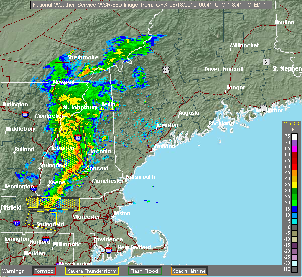 At 840 pm edt, severe thunderstorms were located along a line extending from near woodstock to near canterbury to henniker, moving east at 30 mph (radar indicated). Hazards include 60 mph wind gusts. Expect damage to roofs, siding, and trees. locations impacted include, franklin, henniker, lincoln, plymouth, meredith, hopkinton, canterbury, holderness, ashland, bradford, groton, woodstock, warner, belmont, boscawen, bristol, andover, center harber, hill and hebron. this also includes, mount moosilauke, carr mountain, stinson mountain, and elbow pond recreation area. this includes the following highways, interstate 89 between mile markers 14 and 23. Interstate 93 between mile markers 45 and 102. At 840 pm edt, severe thunderstorms were located along a line extending from near woodstock to near canterbury to henniker, moving east at 30 mph (radar indicated). Hazards include 60 mph wind gusts. Expect damage to roofs, siding, and trees. locations impacted include, franklin, henniker, lincoln, plymouth, meredith, hopkinton, canterbury, holderness, ashland, bradford, groton, woodstock, warner, belmont, boscawen, bristol, andover, center harber, hill and hebron. this also includes, mount moosilauke, carr mountain, stinson mountain, and elbow pond recreation area. this includes the following highways, interstate 89 between mile markers 14 and 23. Interstate 93 between mile markers 45 and 102.
|
| 8/17/2019 8:10 PM EDT |
 At 809 pm edt, severe thunderstorms were located along a line extending from near piermont to near bradford, moving east at 30 mph (radar indicated). Hazards include 60 mph wind gusts. expect damage to roofs, siding, and trees At 809 pm edt, severe thunderstorms were located along a line extending from near piermont to near bradford, moving east at 30 mph (radar indicated). Hazards include 60 mph wind gusts. expect damage to roofs, siding, and trees
|
| 6/26/2019 10:26 PM EDT |
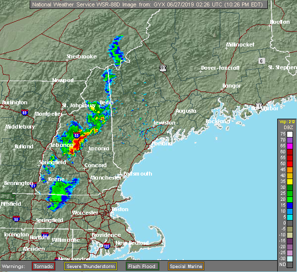 At 1026 pm edt, severe thunderstorms were located along a line extending from 6 miles north of plymouth to near ashland to near danbury, moving east at 15 mph (radar indicated). Hazards include 60 mph wind gusts. expect damage to roofs, siding, and trees At 1026 pm edt, severe thunderstorms were located along a line extending from 6 miles north of plymouth to near ashland to near danbury, moving east at 15 mph (radar indicated). Hazards include 60 mph wind gusts. expect damage to roofs, siding, and trees
|
| 7/17/2018 10:25 AM EDT |
 At 1025 am edt, a severe thunderstorm was located over bradford, or 8 miles northwest of henniker, moving east at 40 mph (radar indicated). Hazards include 60 mph wind gusts. Expect damage to roofs, siding, and trees. locations impacted include, concord, franklin, henniker, new london, hopkinton, bradford, danbury, newport, warner, hillsborough, windsor, boscawen, bristol, grantham, andover, lempster, hill, goshen, croydon and washington. this also includes, mount kearsage and mount sunapee. This includes interstate 89 between mile markers 7 and 41. At 1025 am edt, a severe thunderstorm was located over bradford, or 8 miles northwest of henniker, moving east at 40 mph (radar indicated). Hazards include 60 mph wind gusts. Expect damage to roofs, siding, and trees. locations impacted include, concord, franklin, henniker, new london, hopkinton, bradford, danbury, newport, warner, hillsborough, windsor, boscawen, bristol, grantham, andover, lempster, hill, goshen, croydon and washington. this also includes, mount kearsage and mount sunapee. This includes interstate 89 between mile markers 7 and 41.
|
| 7/17/2018 10:14 AM EDT |
 At 1014 am edt, a severe thunderstorm was located near bradford, or 11 miles south of new london, moving east at 40 mph (radar indicated). Hazards include 60 mph wind gusts. expect damage to roofs, siding, and trees At 1014 am edt, a severe thunderstorm was located near bradford, or 11 miles south of new london, moving east at 40 mph (radar indicated). Hazards include 60 mph wind gusts. expect damage to roofs, siding, and trees
|
| 5/4/2018 9:40 PM EDT |
 At 939 pm edt, severe thunderstorms were located along a line extending from near mount washington to 8 miles east of lincoln to near woodstock to near groton, moving east at 60 mph (radar indicated). Hazards include 60 mph wind gusts. Expect damage to roofs, siding, and trees. locations impacted include, lincoln, plymouth, grafton, hanover, enfield, canaan, holderness, ashland, danbury, franconia, groton, woodstock, piermont, sandwich, bristol, grantham, lyme, hill, albany and hebron. this also includes, franconia notch, mount moosilauke, rumney rocks, cannon mountain, and franconia ridge. this includes the following highways, interstate 89 between mile markers 47 and 51. Interstate 93 between mile markers 75 and 115. At 939 pm edt, severe thunderstorms were located along a line extending from near mount washington to 8 miles east of lincoln to near woodstock to near groton, moving east at 60 mph (radar indicated). Hazards include 60 mph wind gusts. Expect damage to roofs, siding, and trees. locations impacted include, lincoln, plymouth, grafton, hanover, enfield, canaan, holderness, ashland, danbury, franconia, groton, woodstock, piermont, sandwich, bristol, grantham, lyme, hill, albany and hebron. this also includes, franconia notch, mount moosilauke, rumney rocks, cannon mountain, and franconia ridge. this includes the following highways, interstate 89 between mile markers 47 and 51. Interstate 93 between mile markers 75 and 115.
|
| 5/4/2018 9:23 PM EDT |
 At 922 pm edt, severe thunderstorms were located along a line extending from bethlehem to 8 miles west of lincoln to 6 miles southeast of piermont to 6 miles northeast of hanover, moving east at 60 mph (radar indicated). Hazards include 60 mph wind gusts. Expect damage to roofs, siding, and trees. locations impacted include, lebanon, lincoln, plymouth, grafton, hanover, haverhill, enfield, canaan, holderness, ashland, danbury, franconia, groton, woodstock, piermont, sandwich, bristol, grantham, lyme and lisbon. this also includes, franconia notch, mount moosilauke, rumney rocks, cannon mountain, and franconia ridge. this includes the following highways, interstate 89 between mile markers 47 and 60. Interstate 93 between mile markers 75 and 115. At 922 pm edt, severe thunderstorms were located along a line extending from bethlehem to 8 miles west of lincoln to 6 miles southeast of piermont to 6 miles northeast of hanover, moving east at 60 mph (radar indicated). Hazards include 60 mph wind gusts. Expect damage to roofs, siding, and trees. locations impacted include, lebanon, lincoln, plymouth, grafton, hanover, haverhill, enfield, canaan, holderness, ashland, danbury, franconia, groton, woodstock, piermont, sandwich, bristol, grantham, lyme and lisbon. this also includes, franconia notch, mount moosilauke, rumney rocks, cannon mountain, and franconia ridge. this includes the following highways, interstate 89 between mile markers 47 and 60. Interstate 93 between mile markers 75 and 115.
|
| 5/4/2018 8:54 PM EDT |
 At 853 pm edt, severe thunderstorms were located along a line extending from 15 miles northwest of haverhill to 13 miles west of piermont to 14 miles northwest of hanover to 22 miles west of lebanon, moving east at 55 mph (radar indicated). Hazards include 60 mph wind gusts. expect damage to roofs, siding, and trees At 853 pm edt, severe thunderstorms were located along a line extending from 15 miles northwest of haverhill to 13 miles west of piermont to 14 miles northwest of hanover to 22 miles west of lebanon, moving east at 55 mph (radar indicated). Hazards include 60 mph wind gusts. expect damage to roofs, siding, and trees
|
| 8/22/2017 9:52 PM EDT |
 At 952 pm edt, severe thunderstorms were located along a line extending from 10 miles southeast of piermont to groton to near danbury to near new london to 6 miles southeast of newport, moving east at 40 mph (radar indicated). Hazards include 60 mph wind gusts. expect damage to trees, and power lines At 952 pm edt, severe thunderstorms were located along a line extending from 10 miles southeast of piermont to groton to near danbury to near new london to 6 miles southeast of newport, moving east at 40 mph (radar indicated). Hazards include 60 mph wind gusts. expect damage to trees, and power lines
|
| 7/8/2017 12:41 PM EDT |
 At 1241 pm edt, severe thunderstorms were located along a line extending from near sandwich to 6 miles south of hinsdale, moving east at 25 mph (public). Hazards include 60 mph wind gusts. Expect damage to trees, and power lines. locations impacted include, concord, keene, laconia, franklin, jaffrey, henniker, moultonborough, ossipee, meredith, plymouth, peterborough, hopkinton, new boston, loudon, alton, winchester, gilmanton, antrim, canterbury and holderness. this also includes, lake winnipesaukee, squam lake, mount monadnock, north pack monadnock, and mount kearsage. this includes the following highways, interstate 89 between mile markers 2 and 27. Interstate 93 between mile markers 38 and 77. At 1241 pm edt, severe thunderstorms were located along a line extending from near sandwich to 6 miles south of hinsdale, moving east at 25 mph (public). Hazards include 60 mph wind gusts. Expect damage to trees, and power lines. locations impacted include, concord, keene, laconia, franklin, jaffrey, henniker, moultonborough, ossipee, meredith, plymouth, peterborough, hopkinton, new boston, loudon, alton, winchester, gilmanton, antrim, canterbury and holderness. this also includes, lake winnipesaukee, squam lake, mount monadnock, north pack monadnock, and mount kearsage. this includes the following highways, interstate 89 between mile markers 2 and 27. Interstate 93 between mile markers 38 and 77.
|
| 7/8/2017 12:16 PM EDT |
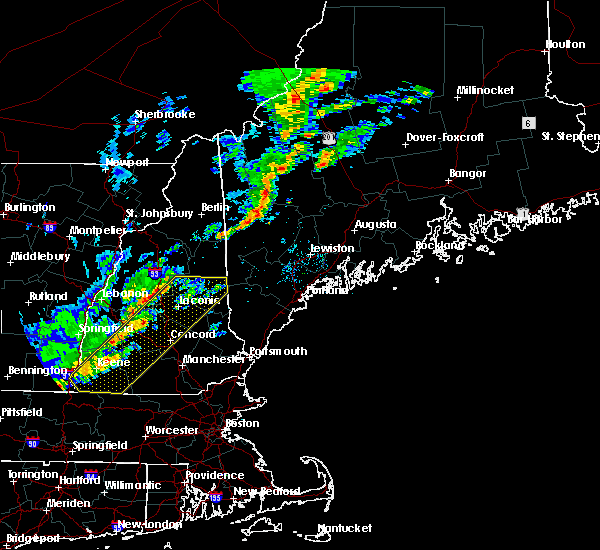 At 1216 pm edt, severe thunderstorms were located along a line extending from near sandwich to 9 miles southwest of hinsdale, moving east at 25 mph (public). Hazards include 60 mph wind gusts. expect damage to trees, and power lines At 1216 pm edt, severe thunderstorms were located along a line extending from near sandwich to 9 miles southwest of hinsdale, moving east at 25 mph (public). Hazards include 60 mph wind gusts. expect damage to trees, and power lines
|
| 7/1/2017 6:08 PM EDT |
 At 608 pm edt, severe thunderstorms were located along a line extending from near conway to near danbury, moving east at 30 mph (radar indicated). Hazards include 60 mph wind gusts and quarter size hail. Minor hail damage to vehicles is possible. expect wind damage to roofs, siding, and trees. locations impacted include, laconia, conway, franklin, fryeburg, moultonborough, meredith, ossipee, alton, gilmanton, holderness, ashland, hiram, effingham, danbury, wolfeboro, tamworth, sandwich, belmont, gilford and bristol. this also includes, lake winnipesaukee, burnt meadow mountains, peary mountain, and mount cutler. This includes interstate 93 between mile markers 57 and 72. At 608 pm edt, severe thunderstorms were located along a line extending from near conway to near danbury, moving east at 30 mph (radar indicated). Hazards include 60 mph wind gusts and quarter size hail. Minor hail damage to vehicles is possible. expect wind damage to roofs, siding, and trees. locations impacted include, laconia, conway, franklin, fryeburg, moultonborough, meredith, ossipee, alton, gilmanton, holderness, ashland, hiram, effingham, danbury, wolfeboro, tamworth, sandwich, belmont, gilford and bristol. this also includes, lake winnipesaukee, burnt meadow mountains, peary mountain, and mount cutler. This includes interstate 93 between mile markers 57 and 72.
|
| 7/1/2017 6:00 PM EDT | Tree and wires down near mayhew turnpike. time estimated in grafton county NH, 2.9 miles S of Bristol, NH |
| 7/1/2017 5:50 PM EDT |
 At 550 pm edt, severe thunderstorms were located along a line extending from 7 miles north of tamworth to near new london, moving east at 30 mph (radar indicated). Hazards include 60 mph wind gusts and quarter size hail. Minor hail damage to vehicles is possible. Expect wind damage to roofs, siding, and trees. At 550 pm edt, severe thunderstorms were located along a line extending from 7 miles north of tamworth to near new london, moving east at 30 mph (radar indicated). Hazards include 60 mph wind gusts and quarter size hail. Minor hail damage to vehicles is possible. Expect wind damage to roofs, siding, and trees.
|
| 7/1/2017 5:45 PM EDT | Tree and wires down near mayhew turnpike. time estimated in grafton county NH, 2.9 miles S of Bristol, NH |
| 6/19/2017 4:03 PM EDT |
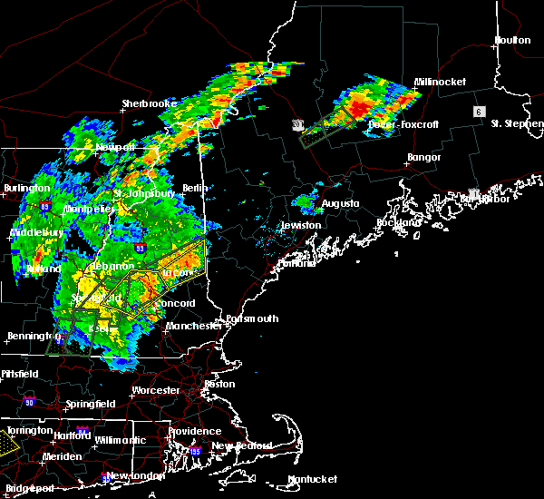 At 402 pm edt, severe thunderstorms were located along a line extending from near danbury to near franklin to near canterbury, moving northeast at 60 mph (radar indicated). Hazards include 70 mph wind gusts. Expect considerable tree damage. damage is likely to mobile homes, roofs, and outbuildings. locations impacted include, concord, laconia, franklin, meredith, hopkinton, gilmanton, canterbury, danbury, warner, belmont, gilford, boscawen, bristol, andover, hill, hebron, tilton, new hampton, sanbornton and webster. this includes the following highways, interstate 89 between mile markers 11 and 16. Interstate 93 between mile markers 46 and 72. At 402 pm edt, severe thunderstorms were located along a line extending from near danbury to near franklin to near canterbury, moving northeast at 60 mph (radar indicated). Hazards include 70 mph wind gusts. Expect considerable tree damage. damage is likely to mobile homes, roofs, and outbuildings. locations impacted include, concord, laconia, franklin, meredith, hopkinton, gilmanton, canterbury, danbury, warner, belmont, gilford, boscawen, bristol, andover, hill, hebron, tilton, new hampton, sanbornton and webster. this includes the following highways, interstate 89 between mile markers 11 and 16. Interstate 93 between mile markers 46 and 72.
|
| 6/19/2017 3:44 PM EDT |
 At 344 pm edt, severe thunderstorms were located along a line extending from new london to 6 miles northeast of bradford to near warner, moving northeast at 55 mph (radar indicated). Hazards include 60 mph wind gusts. expect damage to trees, and power lines At 344 pm edt, severe thunderstorms were located along a line extending from new london to 6 miles northeast of bradford to near warner, moving northeast at 55 mph (radar indicated). Hazards include 60 mph wind gusts. expect damage to trees, and power lines
|
| 5/31/2017 5:59 PM EDT |
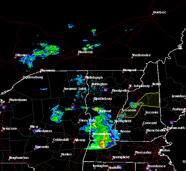 At 559 pm edt, severe thunderstorms were located along a line extending from 11 miles southwest of woodstock to near enfield, moving east at 30 mph (radar indicated). Hazards include 60 mph wind gusts and quarter size hail. Minor hail damage to vehicles is possible. expect wind damage to roofs, siding, and trees. locations impacted include, lebanon, plymouth, grafton, hanover, enfield, canaan, holderness, ashland, danbury, groton, woodstock, bristol, grantham, lyme, cornish, hill, hebron, dorchester, ellsworth and orange. this includes the following highways, interstate 89 between mile markers 43 and 54. Interstate 93 between mile markers 79 and 93. At 559 pm edt, severe thunderstorms were located along a line extending from 11 miles southwest of woodstock to near enfield, moving east at 30 mph (radar indicated). Hazards include 60 mph wind gusts and quarter size hail. Minor hail damage to vehicles is possible. expect wind damage to roofs, siding, and trees. locations impacted include, lebanon, plymouth, grafton, hanover, enfield, canaan, holderness, ashland, danbury, groton, woodstock, bristol, grantham, lyme, cornish, hill, hebron, dorchester, ellsworth and orange. this includes the following highways, interstate 89 between mile markers 43 and 54. Interstate 93 between mile markers 79 and 93.
|
| 5/31/2017 5:17 PM EDT |
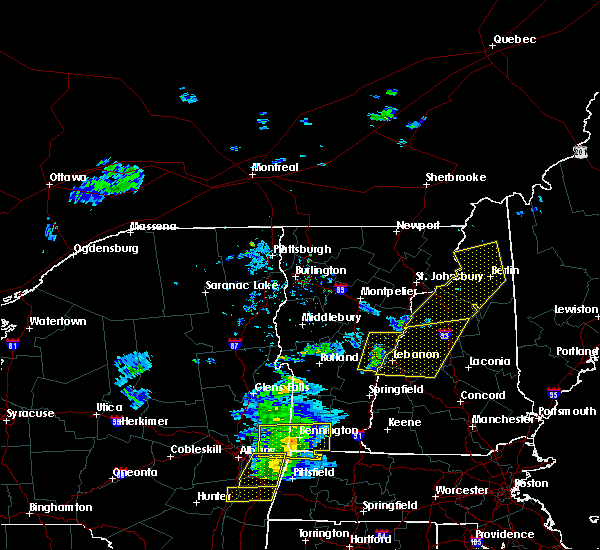 At 516 pm edt, severe thunderstorms were located along a line extending from 12 miles southwest of piermont to 7 miles west of lebanon, moving east at 35 mph (radar indicated). Hazards include 60 mph wind gusts and quarter size hail. Minor hail damage to vehicles is possible. Expect wind damage to roofs, siding, and trees. At 516 pm edt, severe thunderstorms were located along a line extending from 12 miles southwest of piermont to 7 miles west of lebanon, moving east at 35 mph (radar indicated). Hazards include 60 mph wind gusts and quarter size hail. Minor hail damage to vehicles is possible. Expect wind damage to roofs, siding, and trees.
|
| 9/11/2016 8:40 AM EDT |
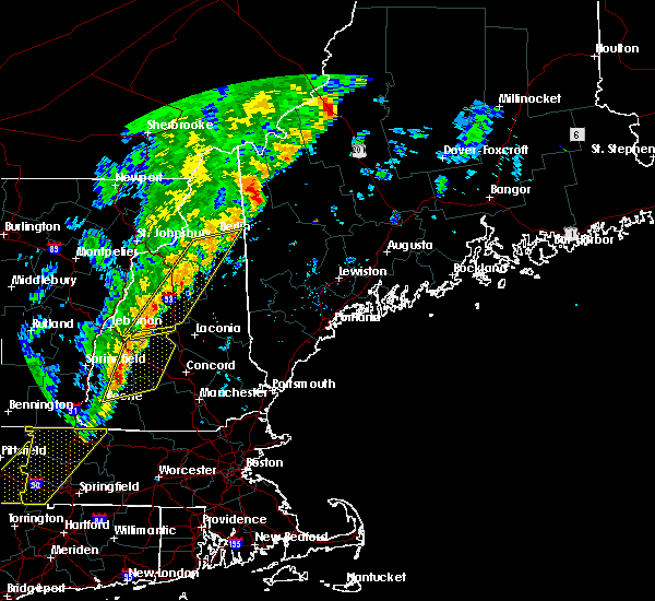 At 840 am edt, severe thunderstorms were located along a line extending from 6 miles northwest of mount washington to near canaan, moving northeast at 45 mph (radar indicated). Hazards include 60 mph wind gusts and penny size hail. Expect damage to roofs. siding. and trees. Locations impacted include, berlin, bethlehem, lincoln, plymouth, grafton, enfield, canaan, holderness, ashland, danbury, franconia, groton, pinkham notch, woodstock, mount washington, sandwich, carroll, bristol, gorham and jefferson. At 840 am edt, severe thunderstorms were located along a line extending from 6 miles northwest of mount washington to near canaan, moving northeast at 45 mph (radar indicated). Hazards include 60 mph wind gusts and penny size hail. Expect damage to roofs. siding. and trees. Locations impacted include, berlin, bethlehem, lincoln, plymouth, grafton, enfield, canaan, holderness, ashland, danbury, franconia, groton, pinkham notch, woodstock, mount washington, sandwich, carroll, bristol, gorham and jefferson.
|
| 9/11/2016 8:37 AM EDT |
 At 837 am edt, severe thunderstorms were located along a line extending from near canaan to near gilsum, moving northeast at 40 mph (radar indicated). Hazards include 60 mph wind gusts. Expect damage to roofs. siding. and trees. Locations impacted include, keene, franklin, henniker, new london, grafton, hopkinton, enfield, antrim, bradford, danbury, nelson, warner, hillsborough, marlow, sullivan, gilsum, windsor, newport, deering and surry. At 837 am edt, severe thunderstorms were located along a line extending from near canaan to near gilsum, moving northeast at 40 mph (radar indicated). Hazards include 60 mph wind gusts. Expect damage to roofs. siding. and trees. Locations impacted include, keene, franklin, henniker, new london, grafton, hopkinton, enfield, antrim, bradford, danbury, nelson, warner, hillsborough, marlow, sullivan, gilsum, windsor, newport, deering and surry.
|
| 9/11/2016 8:23 AM EDT |
 At 822 am edt, severe thunderstorms were located along a line extending from 6 miles southwest of enfield to 6 miles southwest of hinsdale, moving east at 35 mph. this line of storms has the history of producing wind damage (radar indicated). Hazards include 60 mph wind gusts. Expect damage to roofs. siding. And trees. At 822 am edt, severe thunderstorms were located along a line extending from 6 miles southwest of enfield to 6 miles southwest of hinsdale, moving east at 35 mph. this line of storms has the history of producing wind damage (radar indicated). Hazards include 60 mph wind gusts. Expect damage to roofs. siding. And trees.
|
| 9/11/2016 8:06 AM EDT |
 At 806 am edt, severe thunderstorms were located along a line extending from near littleton to near lebanon, moving northeast at 55 mph (radar indicated). Hazards include 60 mph wind gusts and penny size hail. Expect damage to roofs. siding. And trees. At 806 am edt, severe thunderstorms were located along a line extending from near littleton to near lebanon, moving northeast at 55 mph (radar indicated). Hazards include 60 mph wind gusts and penny size hail. Expect damage to roofs. siding. And trees.
|
| 7/23/2016 5:30 PM EDT | Wires down on brookdale roa in grafton county NH, 2.9 miles S of Bristol, NH |
| 7/23/2016 5:24 PM EDT | Trees down west shore r in grafton county NH, 6.7 miles SSE of Bristol, NH |
| 7/1/2016 8:50 PM EDT |
 At 849 pm edt, severe thunderstorms were located along a line extending from 7 miles east of lancaster to near mount washington to 6 miles northwest of tamworth to near moultonborough, moving northeast at 45 mph (radar indicated). Hazards include 60 mph wind gusts. Expect damage to roofs. siding. and trees. Locations impacted include, laconia, bethlehem, lincoln, moultonborough, meredith, ossipee, alton, holderness, ashland, franconia, tamworth, sandwich, wolfeboro, carroll, gilford, bristol, bartlett, madison, center harber and hill. At 849 pm edt, severe thunderstorms were located along a line extending from 7 miles east of lancaster to near mount washington to 6 miles northwest of tamworth to near moultonborough, moving northeast at 45 mph (radar indicated). Hazards include 60 mph wind gusts. Expect damage to roofs. siding. and trees. Locations impacted include, laconia, bethlehem, lincoln, moultonborough, meredith, ossipee, alton, holderness, ashland, franconia, tamworth, sandwich, wolfeboro, carroll, gilford, bristol, bartlett, madison, center harber and hill.
|
| 7/1/2016 8:33 PM EDT |
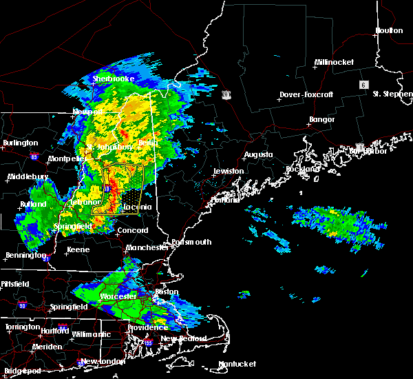 At 832 pm edt, severe thunderstorms were located along a line extending from 6 miles northeast of bethlehem to 10 miles northeast of lincoln to near sandwich to near ashland, moving northeast at 45 mph (radar indicated). Hazards include 60 mph wind gusts. Expect damage to roofs. siding. and trees. Locations impacted include, laconia, bethlehem, lincoln, moultonborough, plymouth, meredith, ossipee, grafton, alton, holderness, ashland, danbury, franconia, tamworth, woodstock, sandwich, wolfeboro, carroll, gilford and bristol. At 832 pm edt, severe thunderstorms were located along a line extending from 6 miles northeast of bethlehem to 10 miles northeast of lincoln to near sandwich to near ashland, moving northeast at 45 mph (radar indicated). Hazards include 60 mph wind gusts. Expect damage to roofs. siding. and trees. Locations impacted include, laconia, bethlehem, lincoln, moultonborough, plymouth, meredith, ossipee, grafton, alton, holderness, ashland, danbury, franconia, tamworth, woodstock, sandwich, wolfeboro, carroll, gilford and bristol.
|
| 7/1/2016 8:08 PM EDT |
 At 808 pm edt, severe thunderstorms were located along a line extending from near franconia to near woodstock to near groton to near danbury, moving northeast at 45 mph (radar indicated). Hazards include 60 mph wind gusts. Expect damage to roofs. siding. And trees. At 808 pm edt, severe thunderstorms were located along a line extending from near franconia to near woodstock to near groton to near danbury, moving northeast at 45 mph (radar indicated). Hazards include 60 mph wind gusts. Expect damage to roofs. siding. And trees.
|
| 8/15/2015 5:05 PM EDT | Tree down on a house in bristol nh in grafton county NH, 0.6 miles NNW of Bristol, NH |
| 8/15/2015 4:53 PM EDT |
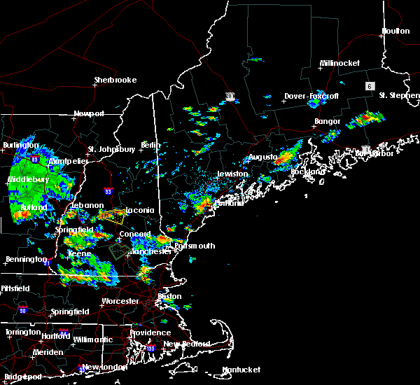 At 453 pm edt, doppler radar indicated a severe thunderstorm capable of producing quarter size hail and damaging winds in excess of 60 mph. this storm was located 7 miles east of danbury, or 9 miles northwest of franklin, and moving east at 15 mph. At 453 pm edt, doppler radar indicated a severe thunderstorm capable of producing quarter size hail and damaging winds in excess of 60 mph. this storm was located 7 miles east of danbury, or 9 miles northwest of franklin, and moving east at 15 mph.
|
| 8/4/2015 1:56 PM EDT | Branches down across haunting whisper vineyard in merrimack county NH, 7.9 miles ENE of Bristol, NH |
| 8/4/2015 1:55 PM EDT |
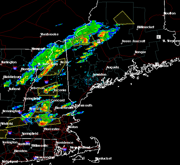 At 155 pm edt, doppler radar indicated a severe thunderstorm capable of producing quarter size hail and damaging winds in excess of 60 mph. this storm was located 8 miles northeast of danbury, or 10 miles north of franklin, moving east at 35 mph. locations impacted include, laconia, meredith, moultonborough, plymouth, holderness, ashland, sandwich, gilford, bristol, alexandria, center harber, hill, bridgewater, hebron, ellacoya state park, wellington state park, ahern state park, new hampton and sanbornton. lake winnepesaukee is also in this warning. At 155 pm edt, doppler radar indicated a severe thunderstorm capable of producing quarter size hail and damaging winds in excess of 60 mph. this storm was located 8 miles northeast of danbury, or 10 miles north of franklin, moving east at 35 mph. locations impacted include, laconia, meredith, moultonborough, plymouth, holderness, ashland, sandwich, gilford, bristol, alexandria, center harber, hill, bridgewater, hebron, ellacoya state park, wellington state park, ahern state park, new hampton and sanbornton. lake winnepesaukee is also in this warning.
|
| 8/4/2015 1:52 PM EDT | Trees down in grafton county NH, 2.4 miles ESE of Bristol, NH |
| 8/4/2015 1:50 PM EDT | Trees down on wires in grafton county NH, 0.6 miles NNW of Bristol, NH |
| 8/4/2015 1:41 PM EDT | Trees on wires in merrimack county NH, 7.5 miles NE of Bristol, NH |
| 8/4/2015 1:40 PM EDT | Branches down across haunting whisper vineyard. corrected time from earlier report in merrimack county NH, 7.9 miles ENE of Bristol, NH |
| 8/4/2015 1:38 PM EDT |
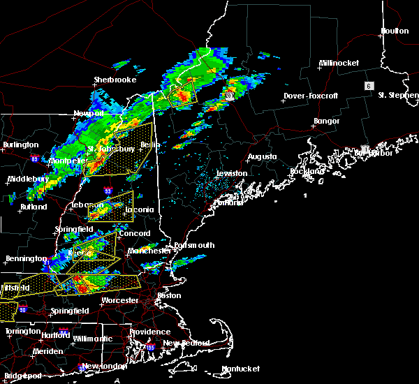 At 138 pm edt, doppler radar indicated a severe thunderstorm capable of producing quarter size hail and damaging winds in excess of 60 mph. this storm was located near danbury, or 11 miles northwest of franklin, and moving east at 35 mph. At 138 pm edt, doppler radar indicated a severe thunderstorm capable of producing quarter size hail and damaging winds in excess of 60 mph. this storm was located near danbury, or 11 miles northwest of franklin, and moving east at 35 mph.
|
| 8/3/2015 7:10 PM EDT |
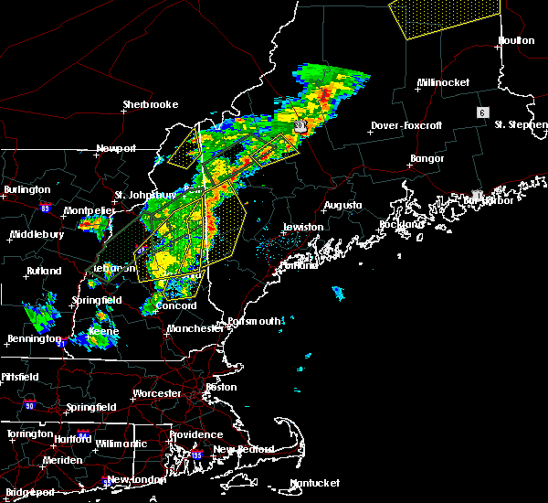 The severe thunderstorm warning for carroll, southeastern coos, southeastern grafton and northwestern belknap counties will expire at 715 pm edt, the storms which prompted the warning have moved out of the area. therefore the warning will be allowed to expire. The severe thunderstorm warning for carroll, southeastern coos, southeastern grafton and northwestern belknap counties will expire at 715 pm edt, the storms which prompted the warning have moved out of the area. therefore the warning will be allowed to expire.
|
| 8/3/2015 6:26 PM EDT |
 At 625 pm edt, doppler radar indicated a line of severe thunderstorms capable of producing damaging winds in excess of 60 mph. these storms were located along a line extending from holderness to near franklin to hancock, moving east at 40 mph. locations impacted include, keene, franklin, henniker, new london, meredith, hopkinton, antrim, hancock, bradford, francestown, bennington, danbury, harrisville, gilsum, nelson, sullivan, roxbury, warner, mount sunapee state park and wadleigh state park. At 625 pm edt, doppler radar indicated a line of severe thunderstorms capable of producing damaging winds in excess of 60 mph. these storms were located along a line extending from holderness to near franklin to hancock, moving east at 40 mph. locations impacted include, keene, franklin, henniker, new london, meredith, hopkinton, antrim, hancock, bradford, francestown, bennington, danbury, harrisville, gilsum, nelson, sullivan, roxbury, warner, mount sunapee state park and wadleigh state park.
|
| 8/3/2015 6:13 PM EDT |
 At 612 pm edt, doppler radar indicated a line of severe thunderstorms capable of producing quarter size hail and destructive winds in excess of 70 mph. these storms were located along a line extending from mount washington to near woodstock to near ashland, and moving east at 40 mph. At 612 pm edt, doppler radar indicated a line of severe thunderstorms capable of producing quarter size hail and destructive winds in excess of 70 mph. these storms were located along a line extending from mount washington to near woodstock to near ashland, and moving east at 40 mph.
|
| 8/3/2015 6:10 PM EDT | Trees down all over town in grafton county NH, 0.6 miles NNW of Bristol, NH |
| 8/3/2015 5:57 PM EDT |
 At 556 pm edt, doppler radar indicated a line of severe thunderstorms capable of producing damaging winds in excess of 60 mph. these storms were located along a line extending from groton to new london to near keene, and moving east at 40 mph. At 556 pm edt, doppler radar indicated a line of severe thunderstorms capable of producing damaging winds in excess of 60 mph. these storms were located along a line extending from groton to new london to near keene, and moving east at 40 mph.
|
| 8/3/2015 5:42 PM EDT |
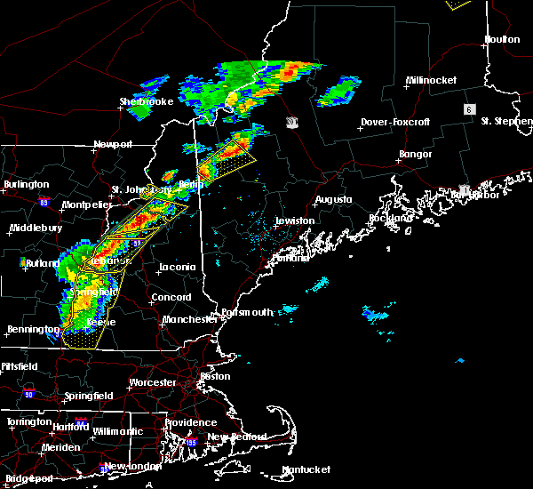 At 542 pm edt, doppler radar indicated a line of severe thunderstorms capable of producing quarter size hail and damaging winds in excess of 60 mph. these storms were located along a line extending from 8 miles east of haverhill to hanover, and moving northeast at 50 mph. At 542 pm edt, doppler radar indicated a line of severe thunderstorms capable of producing quarter size hail and damaging winds in excess of 60 mph. these storms were located along a line extending from 8 miles east of haverhill to hanover, and moving northeast at 50 mph.
|
| 7/19/2015 7:59 PM EDT | Trees down washburn rd in grafton county NH, 2.4 miles ESE of Bristol, NH |
| 7/19/2015 7:57 PM EDT |
 At 757 pm edt, doppler radar indicated a severe thunderstorm capable of producing quarter size hail and damaging winds in excess of 60 mph. this storm was located near wadleigh state park, or near new london, and moving east at 45 mph. At 757 pm edt, doppler radar indicated a severe thunderstorm capable of producing quarter size hail and damaging winds in excess of 60 mph. this storm was located near wadleigh state park, or near new london, and moving east at 45 mph.
|
| 7/19/2015 6:35 PM EDT | Trees and wires down in grafton county NH, 2.4 miles ESE of Bristol, NH |
| 7/19/2015 6:27 PM EDT |
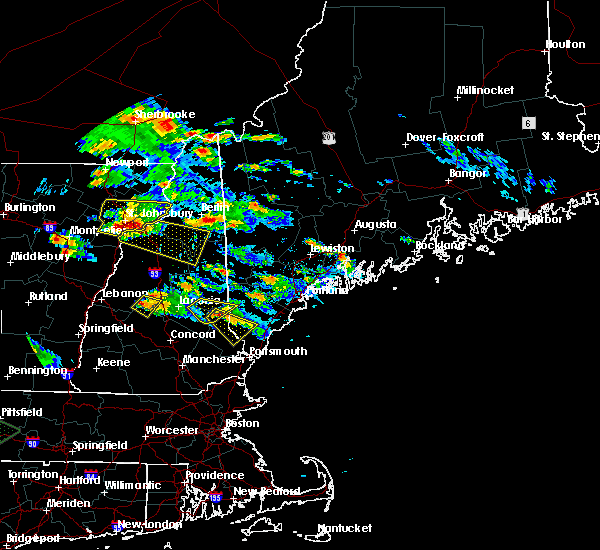 At 627 pm edt, doppler radar indicated a severe thunderstorm capable of producing large damaging hail up to golf ball size and damaging winds in excess of 60 mph. this storm was located near danbury, or 12 miles southwest of plymouth, moving southeast at 30 mph. locations impacted include, danbury, grafton, bristol, northern andover, hill, hebron, wellington state park and new hampton. At 627 pm edt, doppler radar indicated a severe thunderstorm capable of producing large damaging hail up to golf ball size and damaging winds in excess of 60 mph. this storm was located near danbury, or 12 miles southwest of plymouth, moving southeast at 30 mph. locations impacted include, danbury, grafton, bristol, northern andover, hill, hebron, wellington state park and new hampton.
|
| 7/19/2015 5:57 PM EDT |
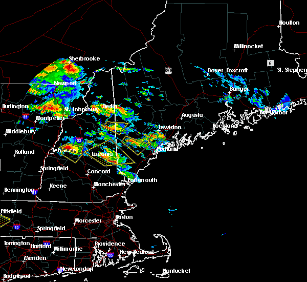 At 556 pm edt, doppler radar indicated a severe thunderstorm capable of producing large damaging hail up to golf ball size and damaging winds in excess of 60 mph. this storm was located near groton, or 11 miles west of plymouth, moving southeast at 25 mph. locations impacted include, canaan, danbury, groton, cardigan mountain state park, grafton, bristol, northern andover, hill, hebron, dorchester, wellington state park, orange and new hampton. At 556 pm edt, doppler radar indicated a severe thunderstorm capable of producing large damaging hail up to golf ball size and damaging winds in excess of 60 mph. this storm was located near groton, or 11 miles west of plymouth, moving southeast at 25 mph. locations impacted include, canaan, danbury, groton, cardigan mountain state park, grafton, bristol, northern andover, hill, hebron, dorchester, wellington state park, orange and new hampton.
|
| 7/19/2015 5:45 PM EDT |
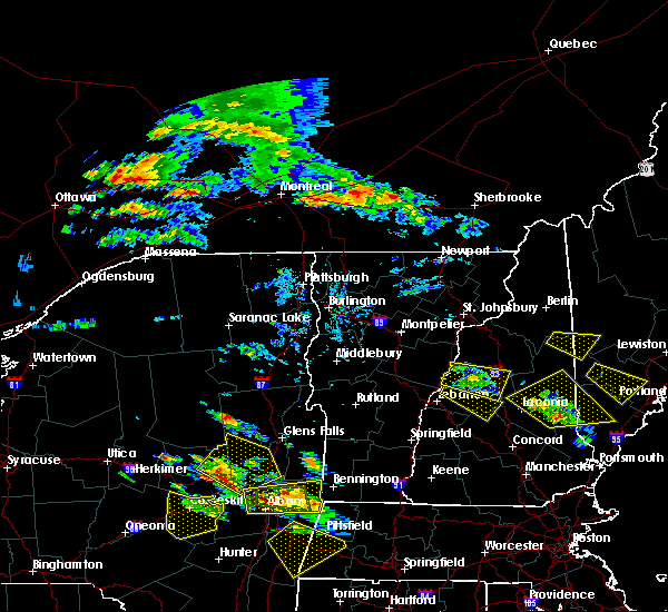 At 545 pm edt, doppler radar indicated a severe thunderstorm capable of producing large damaging hail up to golf ball size and damaging winds in excess of 60 mph. this storm was located 8 miles north of canaan, or 15 miles northeast of lebanon, and moving southeast at 25 mph. At 545 pm edt, doppler radar indicated a severe thunderstorm capable of producing large damaging hail up to golf ball size and damaging winds in excess of 60 mph. this storm was located 8 miles north of canaan, or 15 miles northeast of lebanon, and moving southeast at 25 mph.
|
| 6/23/2015 5:17 PM EDT |
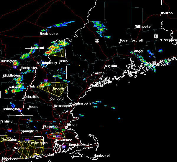 At 516 pm edt, doppler radar indicated a severe thunderstorm capable of producing quarter size hail and damaging winds in excess of 60 mph. this storm was located over ashland, or near meredith, moving east at 45 mph. locations impacted include, laconia, plymouth, meredith, ossipee, moultonborough, alton, barnstead, canaan, gilmanton, holderness, ashland, effingham, groton, sandwich, wolfeboro, tamworth, belmont, gilford, bristol and alexandria. a tornado watch remains in effect until 1100 pm edt for southwestern maine and northern new hampshire. At 516 pm edt, doppler radar indicated a severe thunderstorm capable of producing quarter size hail and damaging winds in excess of 60 mph. this storm was located over ashland, or near meredith, moving east at 45 mph. locations impacted include, laconia, plymouth, meredith, ossipee, moultonborough, alton, barnstead, canaan, gilmanton, holderness, ashland, effingham, groton, sandwich, wolfeboro, tamworth, belmont, gilford, bristol and alexandria. a tornado watch remains in effect until 1100 pm edt for southwestern maine and northern new hampshire.
|
| 6/23/2015 5:09 PM EDT |
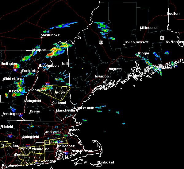 At 508 pm edt, doppler radar indicated a severe thunderstorm capable of producing quarter size hail and damaging winds in excess of 60 mph. this storm was located near plymouth, and moving east at 45 mph. At 508 pm edt, doppler radar indicated a severe thunderstorm capable of producing quarter size hail and damaging winds in excess of 60 mph. this storm was located near plymouth, and moving east at 45 mph.
|
| 6/9/2015 5:21 PM EDT |
 At 520 pm edt, doppler radar indicated a severe thunderstorm capable of producing damaging winds in excess of 60 mph. this storm was located near newport, or 8 miles northeast of claremont, and moving northeast at 45 mph. At 520 pm edt, doppler radar indicated a severe thunderstorm capable of producing damaging winds in excess of 60 mph. this storm was located near newport, or 8 miles northeast of claremont, and moving northeast at 45 mph.
|
| 5/27/2015 5:51 PM EDT | At 550 pm edt, doppler radar indicated a line of severe thunderstorms capable of producing damaging winds in excess of 60 mph. these storms were located along a line extending from plymouth to 6 miles southwest of ashland, moving east at 55 mph. locations impacted include, plymouth, enfield, canaan, holderness, ashland, danbury, groton, cardigan mountain state park, grafton, bristol, hill, hebron, dorchester, wellington state park, campton, orange, new hampton, springfield and rumney. |
| 5/27/2015 5:33 PM EDT | At 533 pm edt, doppler radar indicated a line of severe thunderstorms capable of producing damaging winds in excess of 60 mph. these storms were located along a line extending from near canaan to near grafton, moving east at 55 mph. locations impacted include, lebanon, plymouth, southern hanover, enfield, canaan, holderness, ashland, danbury, groton, cardigan mountain state park, grafton, bristol, grantham, hill, croydon, hebron, dorchester, orange, wellington state park and campton. |
| 5/27/2015 5:17 PM EDT | At 516 pm edt, doppler radar indicated a line of severe thunderstorms capable of producing damaging winds in excess of 60 mph. these storms were located along a line extending from lebanon to 6 miles southeast of hartland, and moving east at 55 mph. |
| 5/10/2015 7:18 PM EDT | At 717 pm edt, doppler radar indicated a severe thunderstorm capable of producing damaging winds in excess of 60 mph. this storm was located 7 miles southwest of ashland, or 9 miles south of plymouth. this storm was nearly stationary. locations impacted include, western laconia, franklin, plymouth, meredith, canaan, canterbury, holderness, ashland, danbury, groton, cardigan mountain state park, grafton, belmont, bristol, andover, center harber, hill, hebron, dorchester and sanbornton. |
| 5/10/2015 6:59 PM EDT | At 658 pm edt, doppler radar indicated a severe thunderstorm capable of producing damaging winds in excess of 60 mph. this storm was located over canaan, or 13 miles east of lebanon, and moving east at 35 mph. |
| 7/3/2014 9:15 PM EDT | Numerous trees and power lines dow in grafton county NH, 0.6 miles NNW of Bristol, NH |
| 7/3/2014 9:07 PM EDT | Trees on wires on north rd in merrimack county NH, 7.5 miles NE of Bristol, NH |
| 7/3/2014 8:42 PM EDT | Many trees down on cardigan mountain in grafton county NH, 2.4 miles ESE of Bristol, NH |
| 7/3/2014 8:38 PM EDT | Trees down on north shore rd in grafton county NH, 7.1 miles SSE of Bristol, NH |
| 7/3/2014 8:30 PM EDT | Trees on wires on north rd in merrimack county NH, 7.5 miles NE of Bristol, NH |
| 9/11/2013 9:30 PM EDT | Lakes region dispatch. trees and wires dow in grafton county NH, 7.1 miles SSE of Bristol, NH |
| 9/11/2013 9:00 PM EDT | Lakes region dispatch. trees and wires down in alexandri in grafton county NH, 2.4 miles ESE of Bristol, NH |
| 6/2/2013 3:35 PM EDT | Spotter heard reports on his scanner of trees down on wires in thornton... plymouth... campton and hebron in grafton county NH, 0.2 miles WSW of Bristol, NH |
| 6/2/2013 3:30 PM EDT | Spotter heard reports on his scanner of trees down on wires in thornton... plymouth... campton and hebron in grafton county NH, 0.2 miles WSW of Bristol, NH |
| 7/17/2012 6:45 PM EDT | Downed tree across road in danbur in merrimack county NH, 7.5 miles NE of Bristol, NH |
| 7/4/2012 6:00 PM EDT | Trees and wires down gale road in grafton county NH, 2.4 miles ESE of Bristol, NH |
| 7/4/2012 5:55 PM EDT | Trees and wires down on rte 3 in grafton county NH, 7.1 miles SSE of Bristol, NH |
| 5/29/2012 2:05 AM EDT | Quarter sized hail reported 8.5 miles SE of Bristol, NH |
| 1/1/0001 12:00 AM | Trees and wires down on rocky shore road in grafton county NH, 0.6 miles NNW of Bristol, NH |
| 1/1/0001 12:00 AM | 2 trees down on wires in bristol and a tree down on a house in grafton county NH, 0.6 miles NNW of Bristol, NH |
| 1/1/0001 12:00 AM | Trees down on wires in alexandria in grafton county NH, 2.4 miles ESE of Bristol, NH |
| 1/1/0001 12:00 AM | Trees down in grafton county NH, 7.1 miles SSE of Bristol, NH |
| 1/1/0001 12:00 AM | Trees down on wires in grafton county NH, 7.1 miles SSE of Bristol, NH |
Hail Maps for Bristol, NH
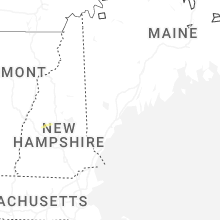


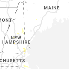


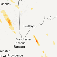

Connect with Interactive Hail Maps