

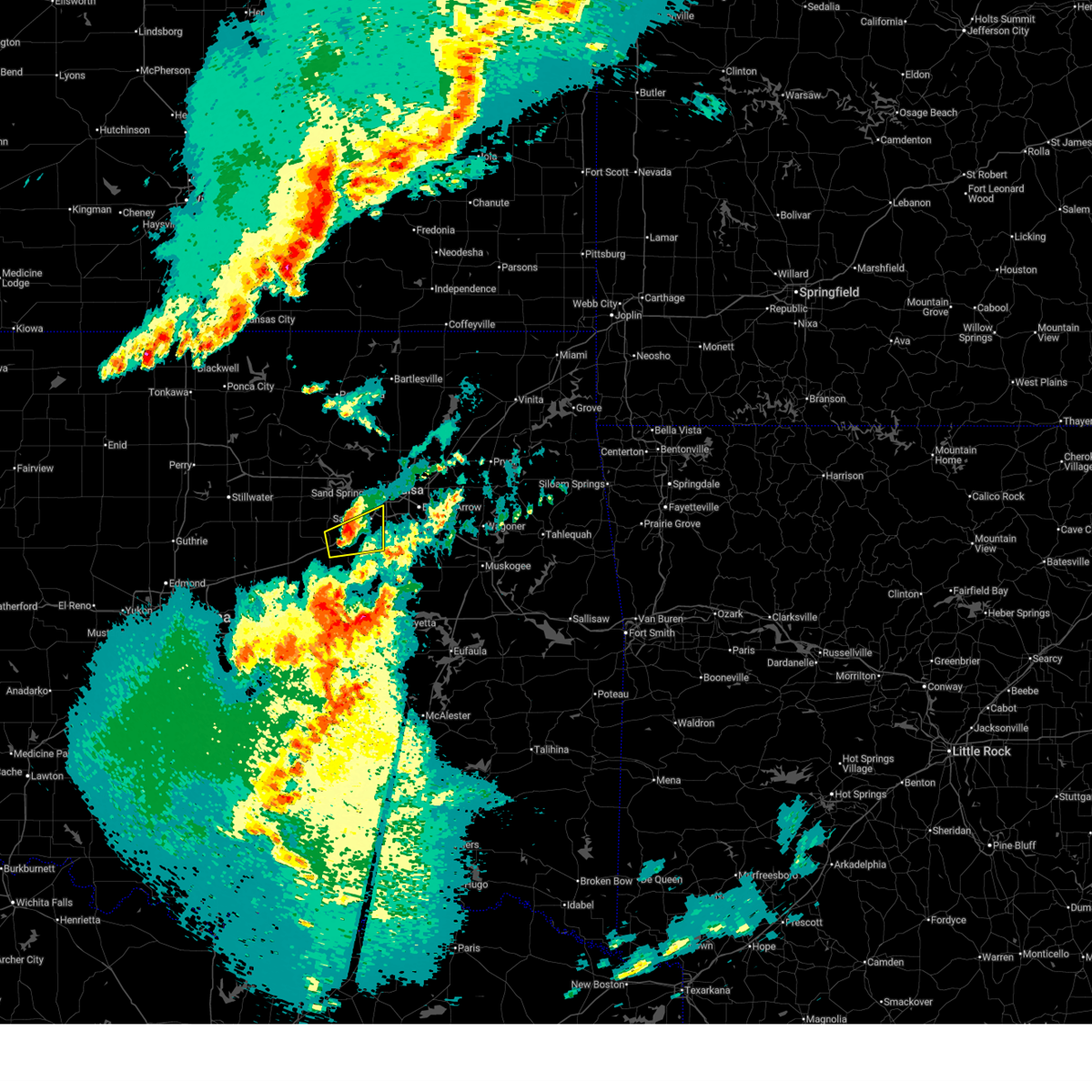
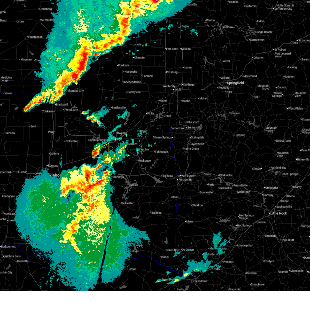
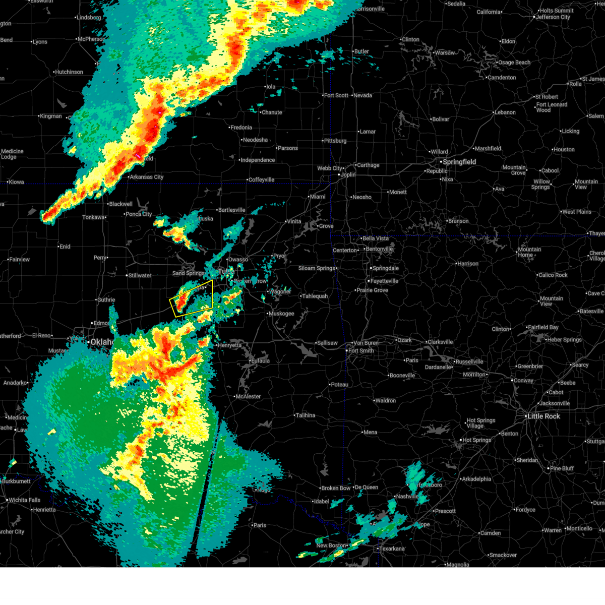
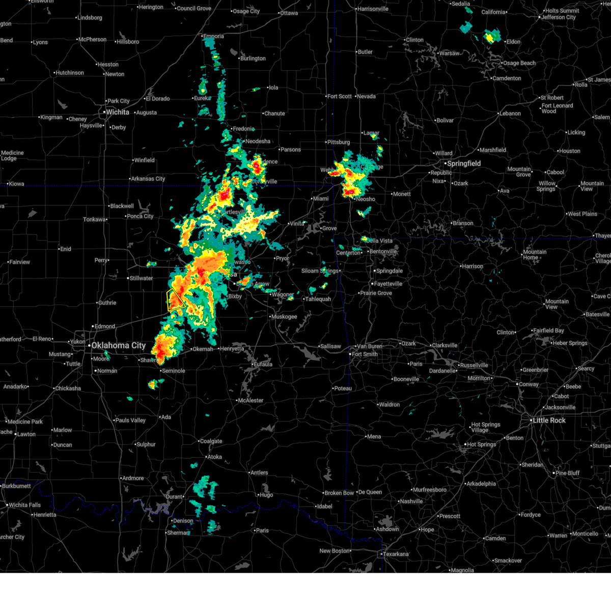
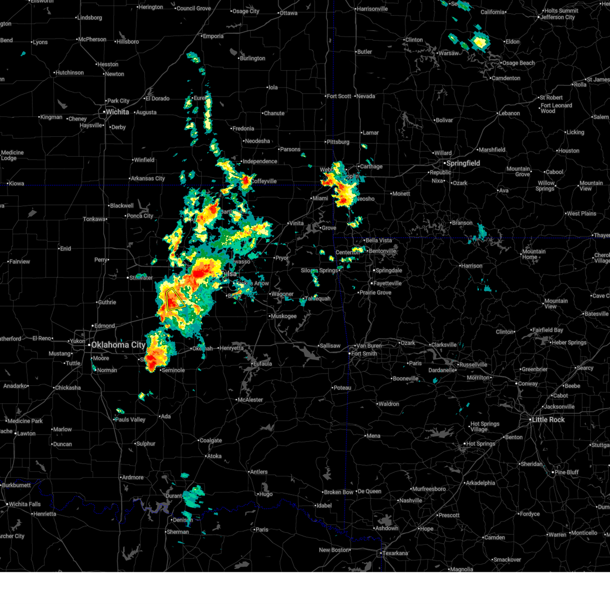
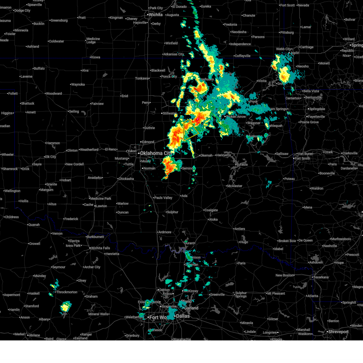
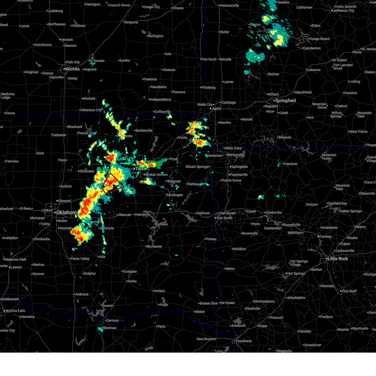
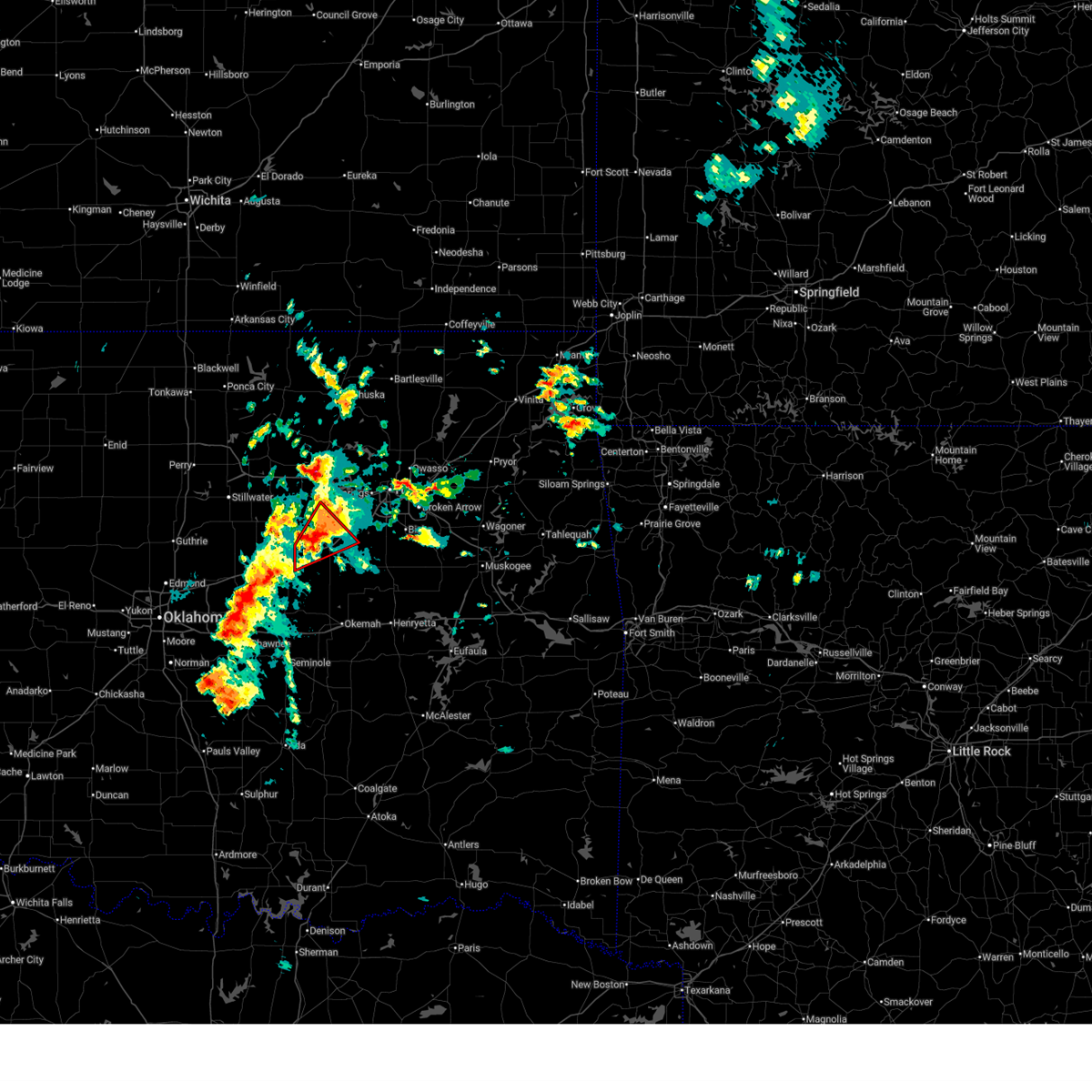
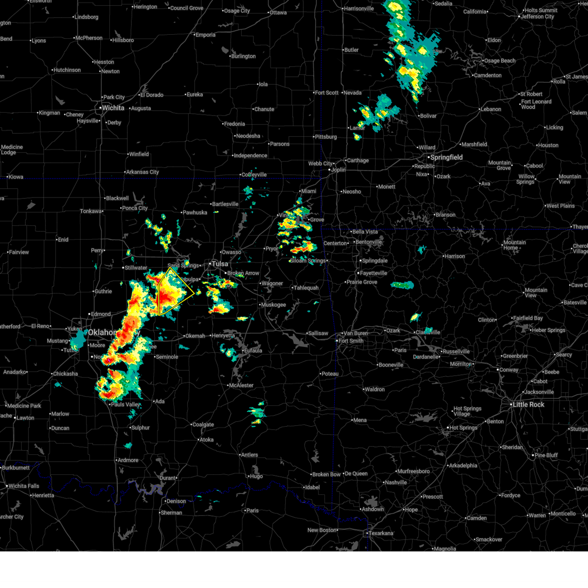
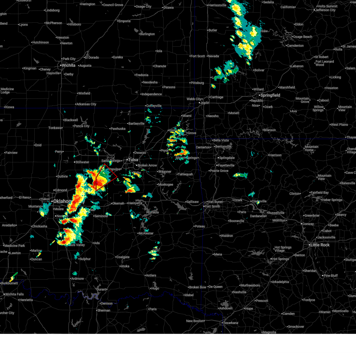
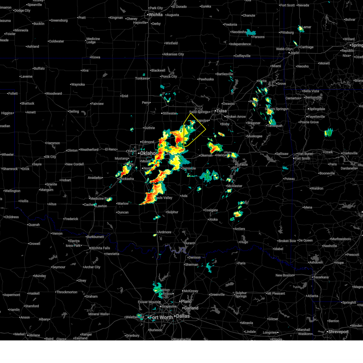
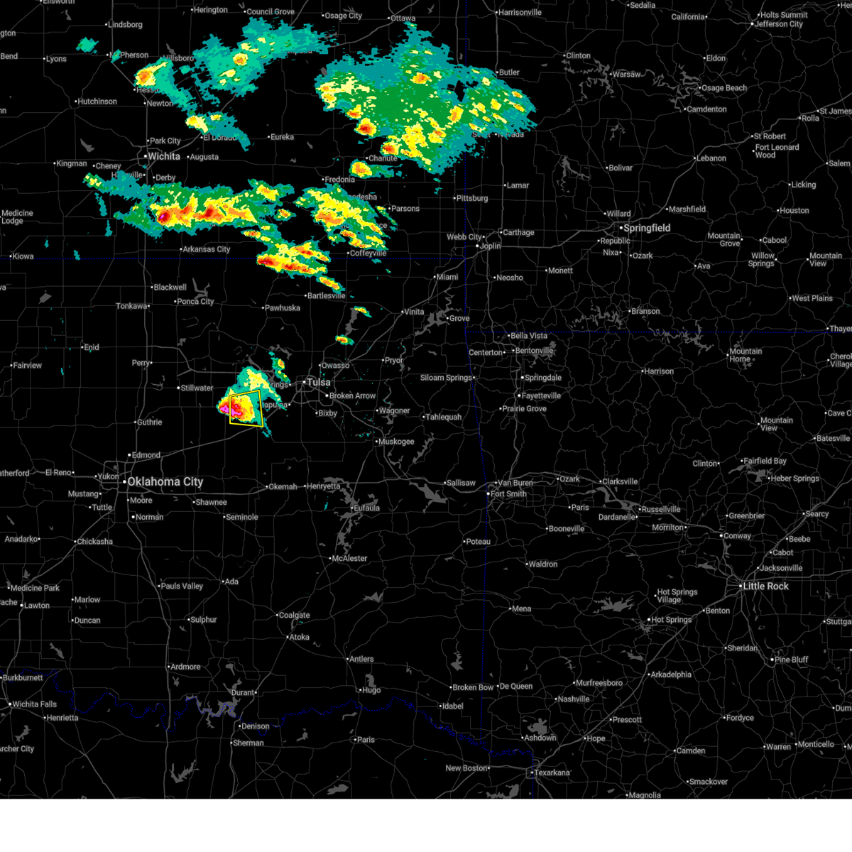
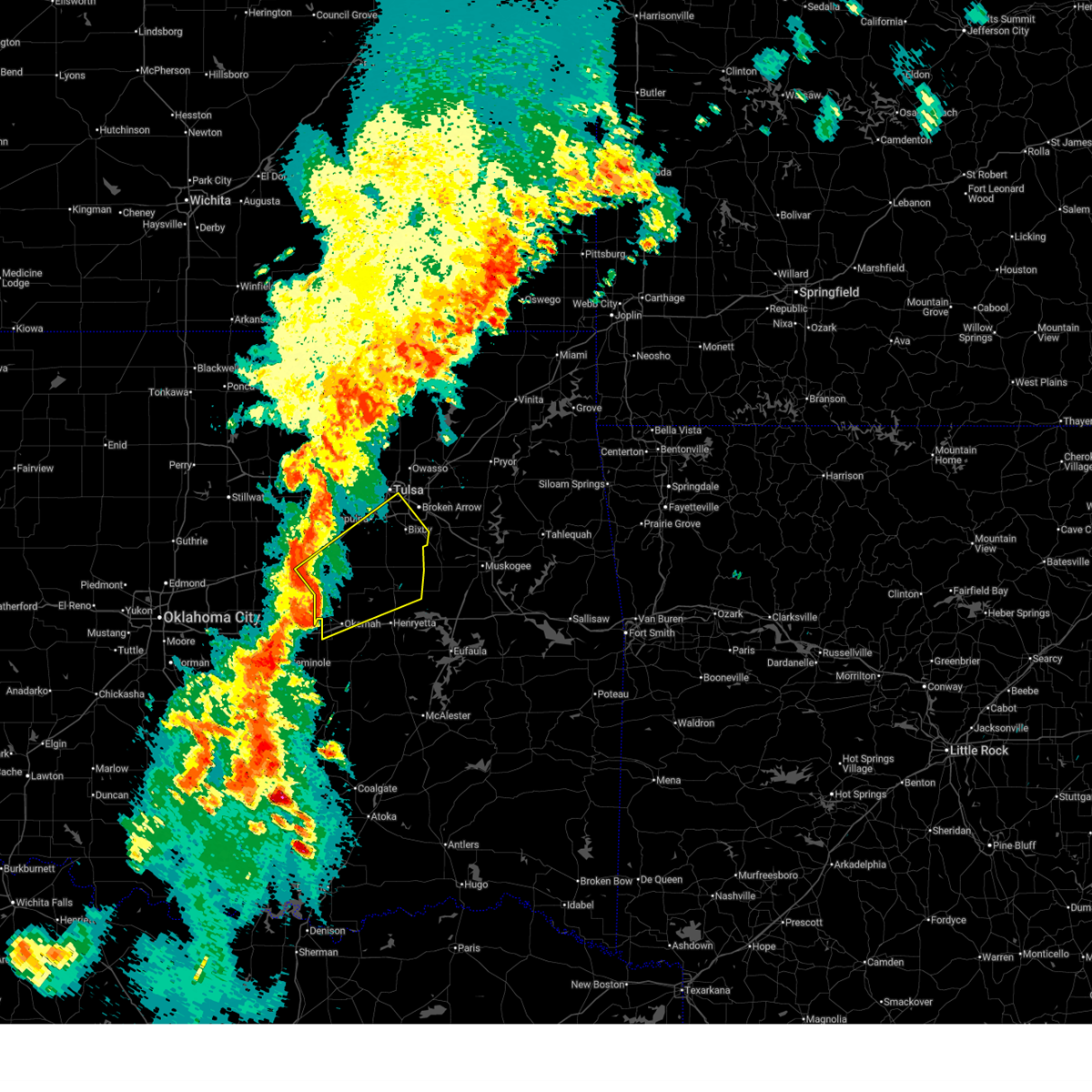
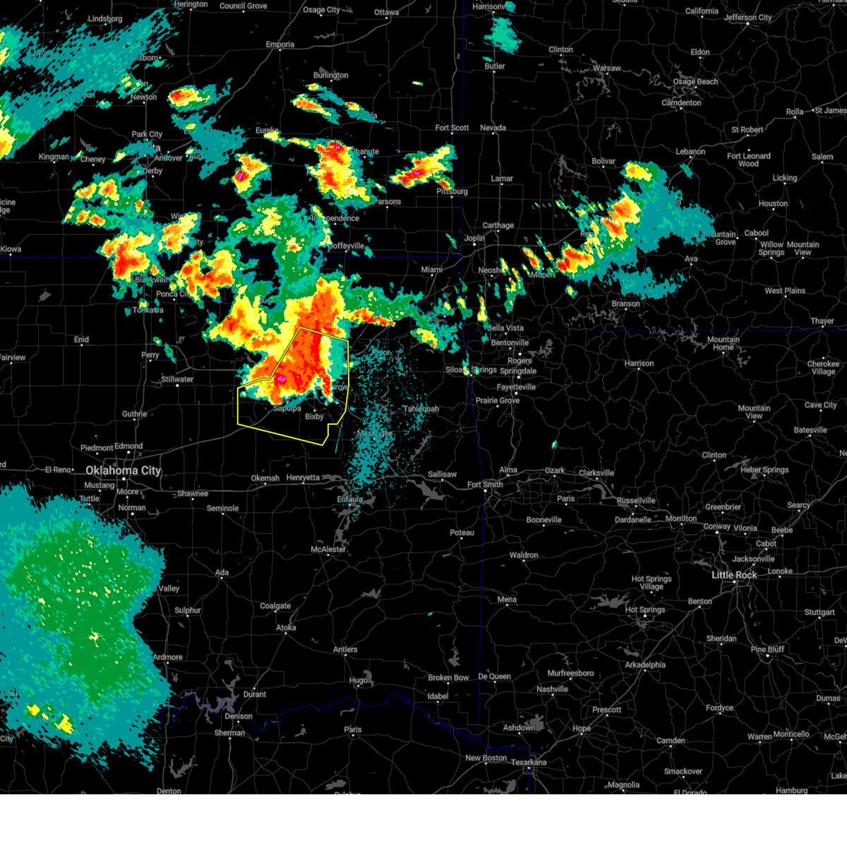
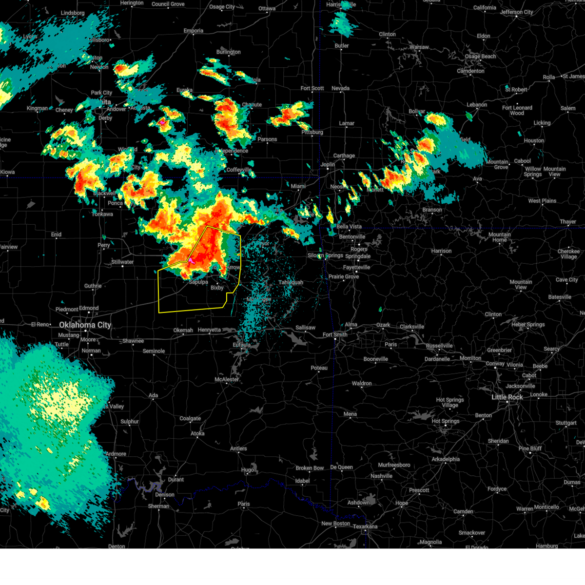
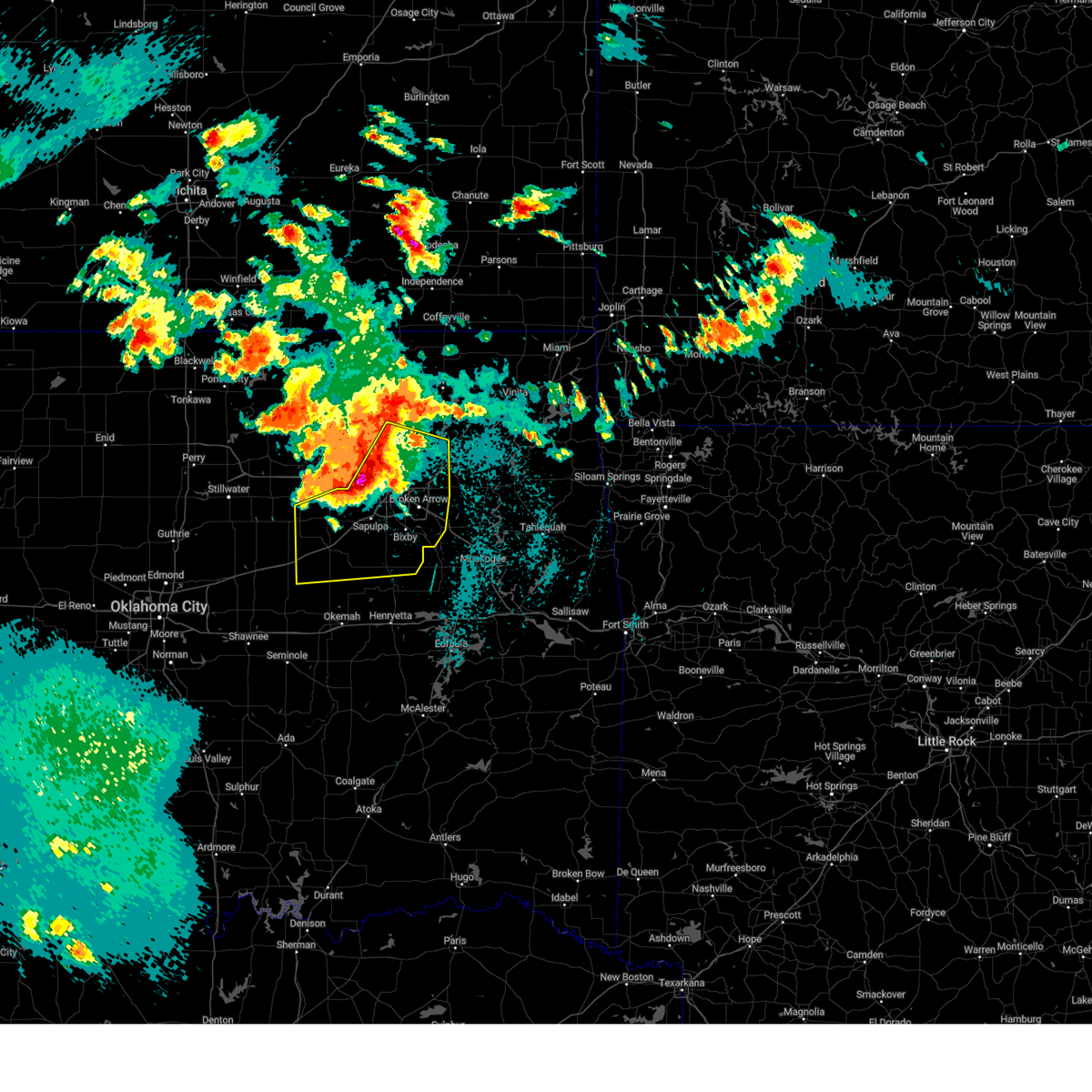
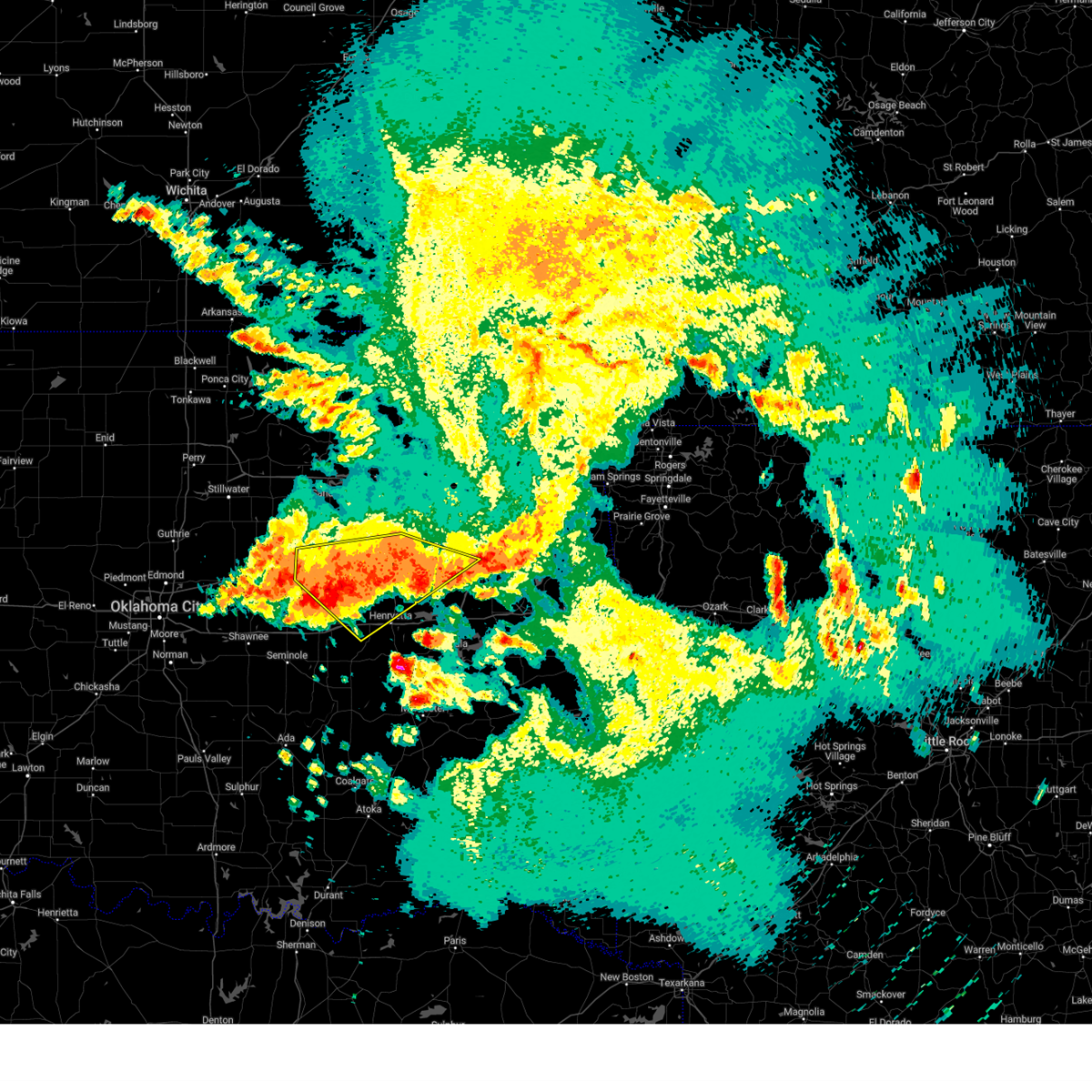
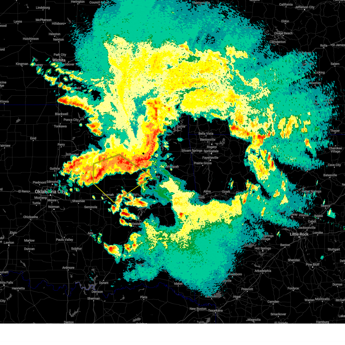
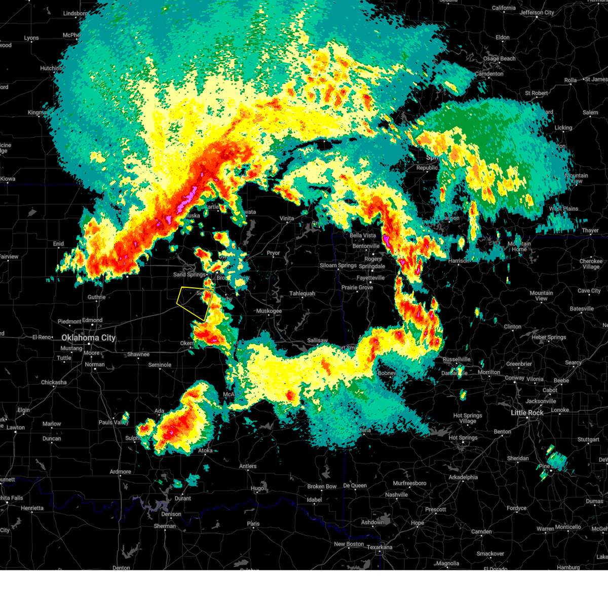
Hail Map for Bristow, OK
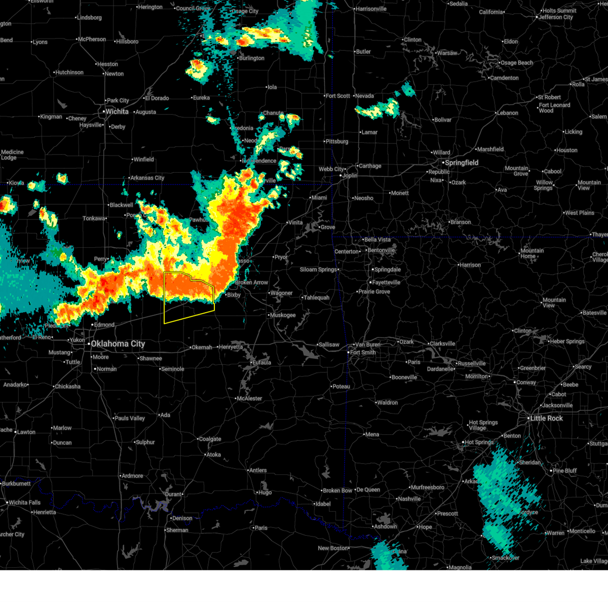
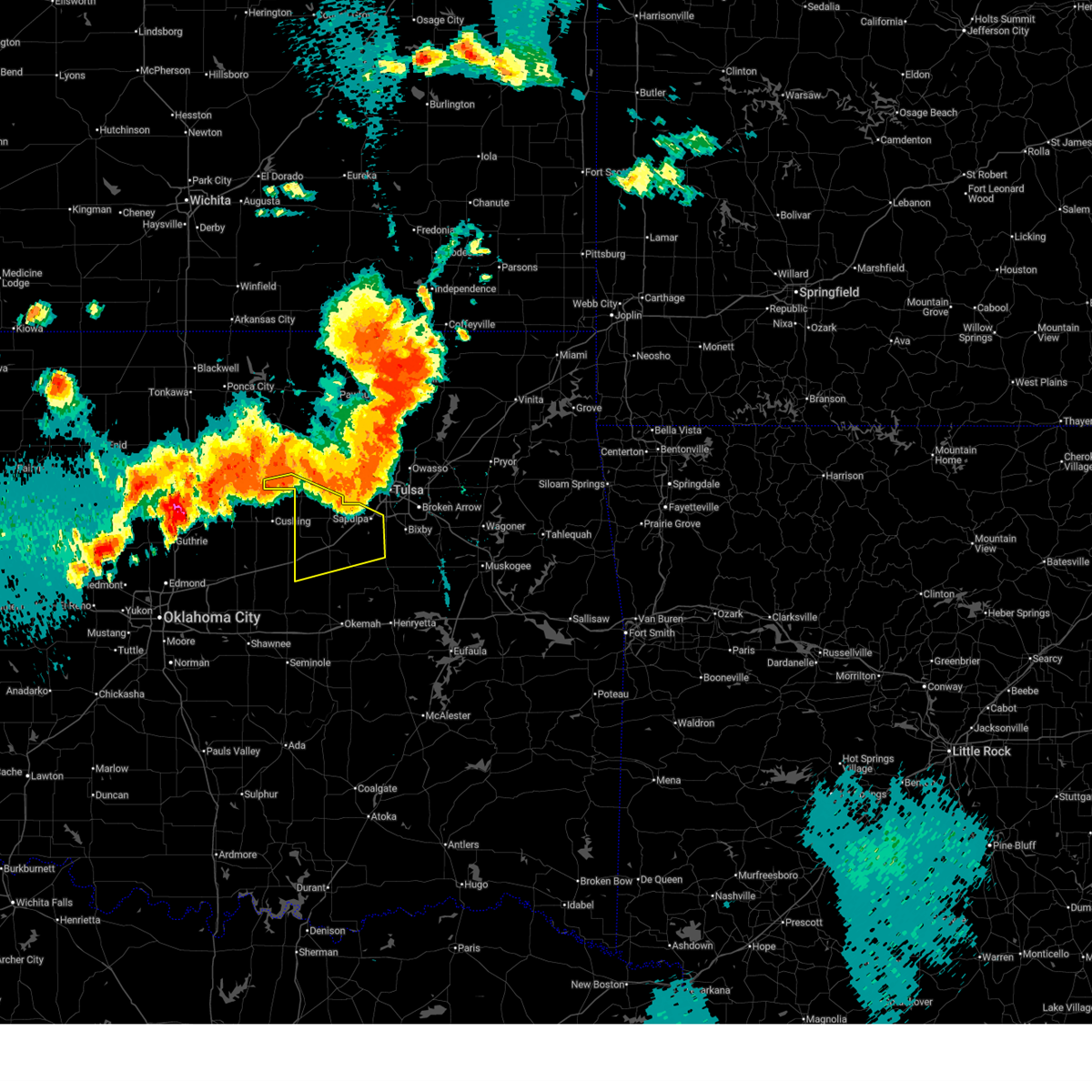
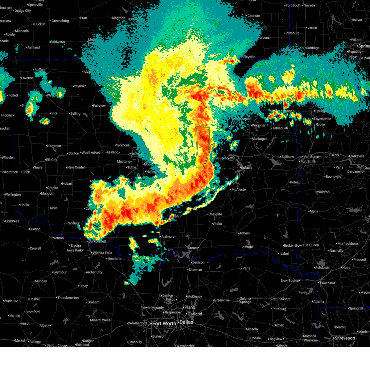
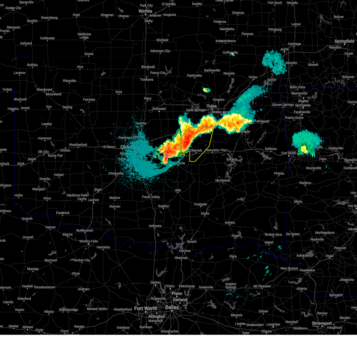
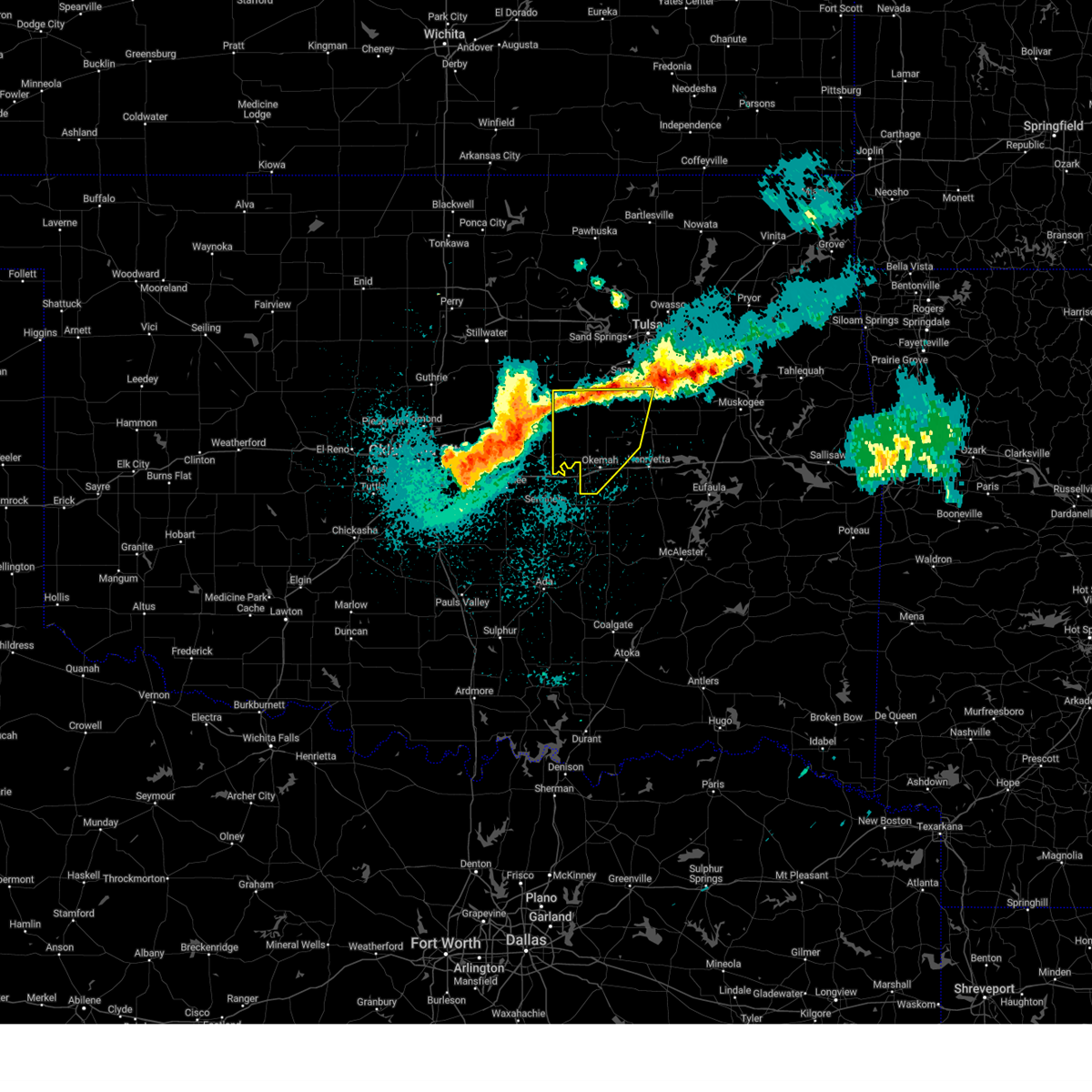
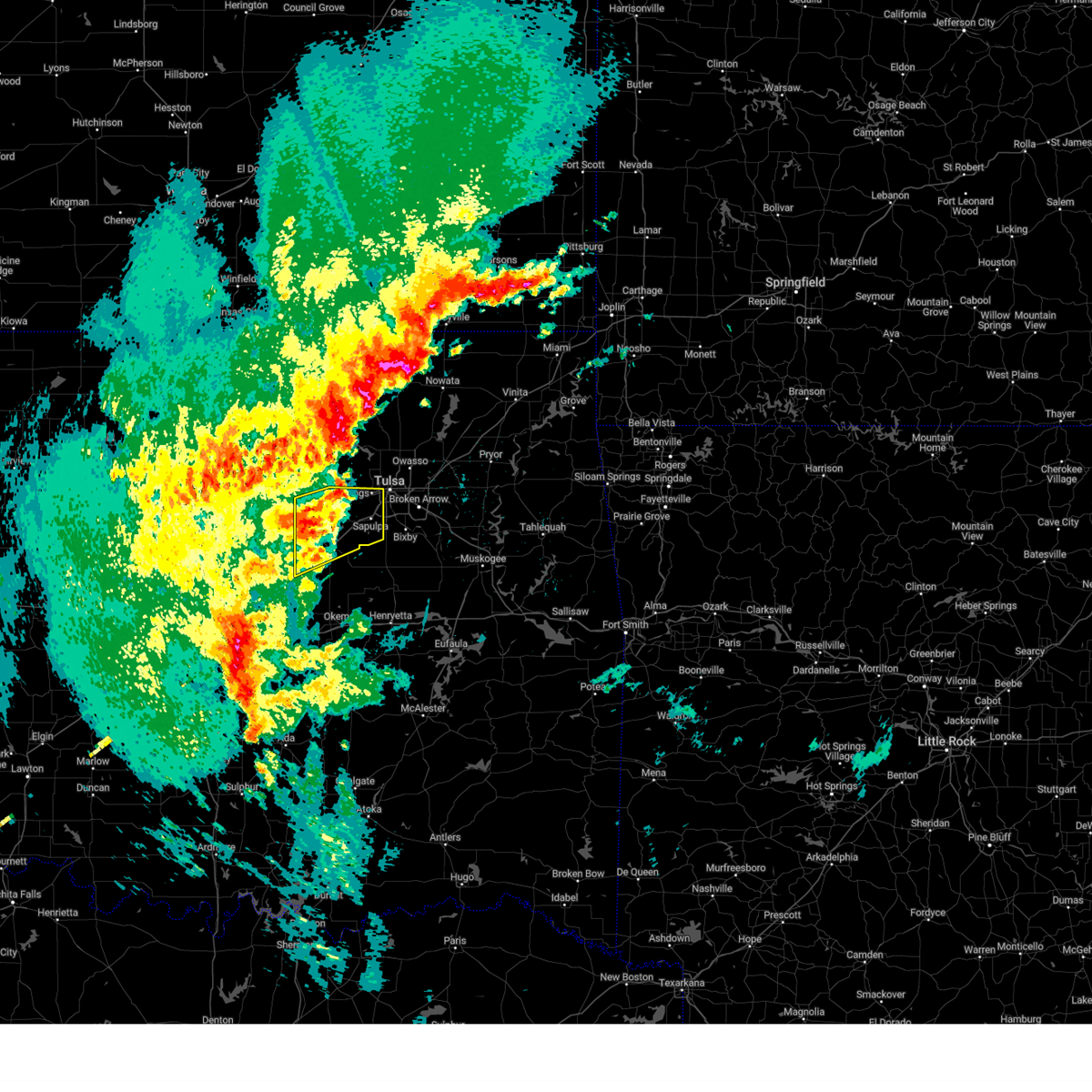
The Bristow, OK area has had 15 reports of on-the-ground hail by trained spotters, and has been under severe weather warnings 30 times during the past 12 months. Doppler radar has detected hail at or near Bristow, OK on 93 occasions, including 7 occasions during the past year.
| Name: | Bristow, OK |
| Where Located: | 31 miles SW of Tulsa, OK |
| Map: | Google Map for Bristow, OK |
| Population: | 4222 |
| Housing Units: | 2054 |
| More Info: | Search Google for Bristow, OK |
3
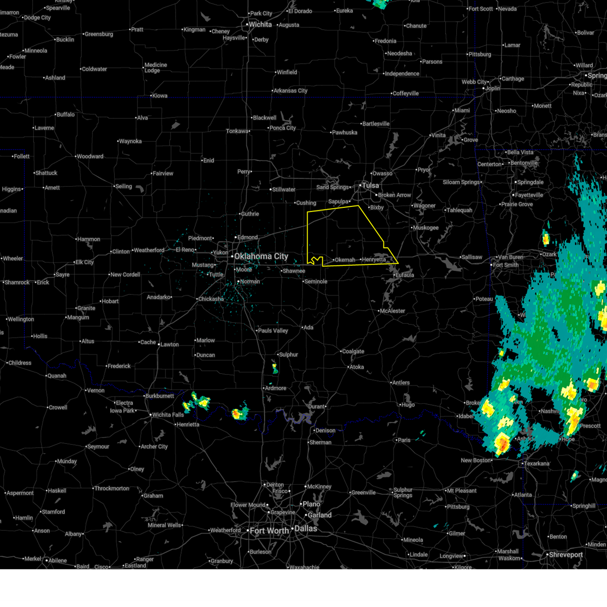
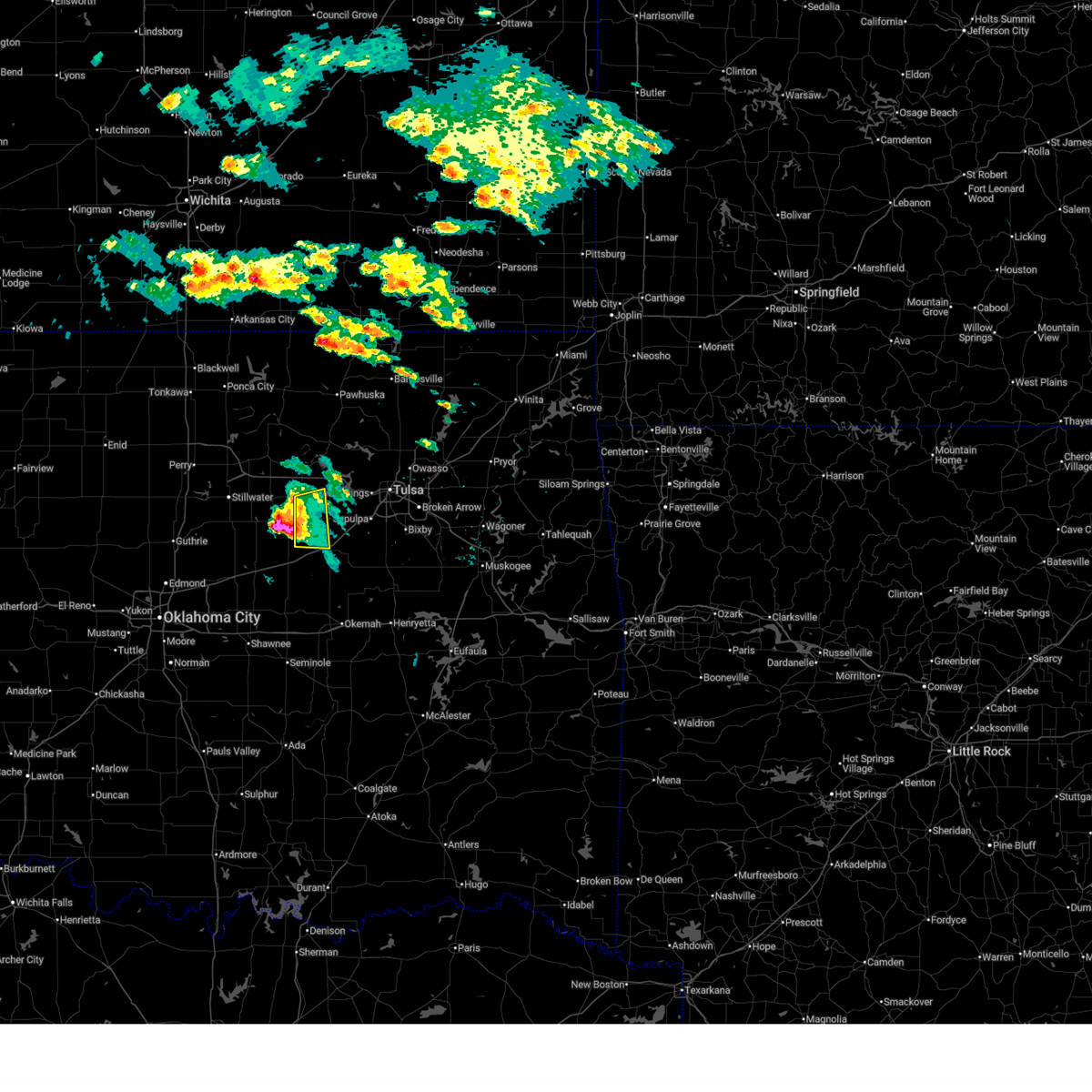
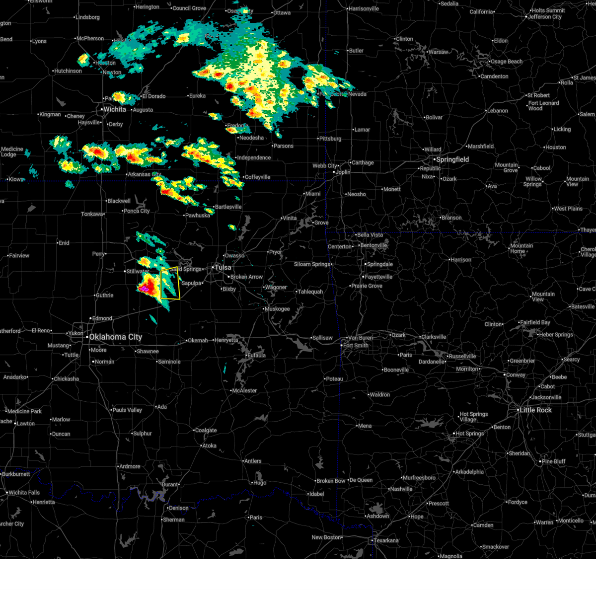
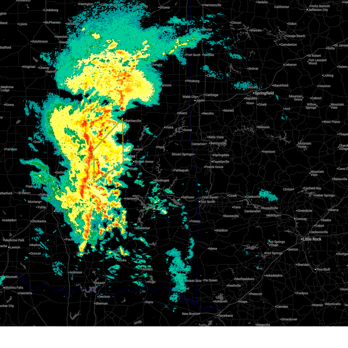
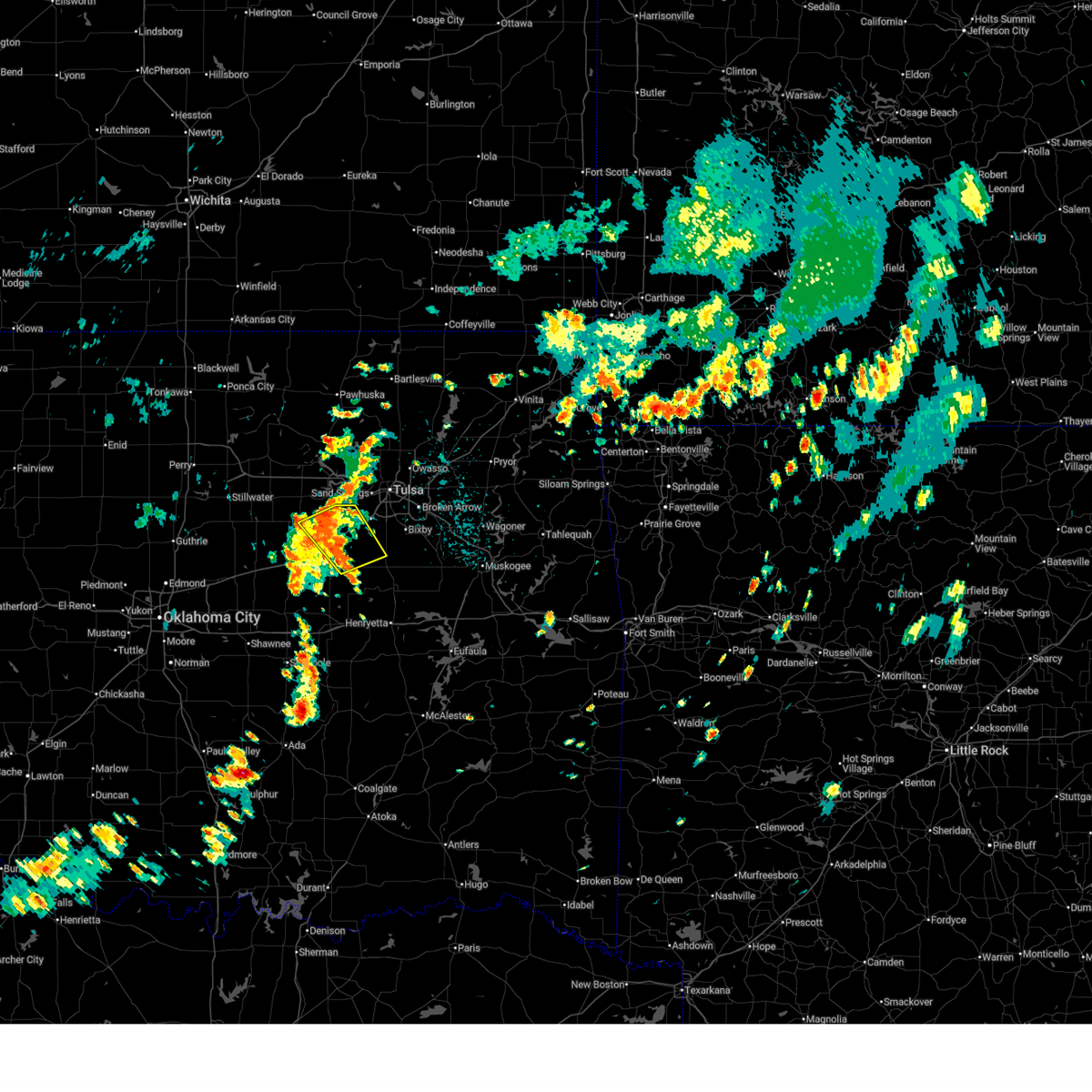
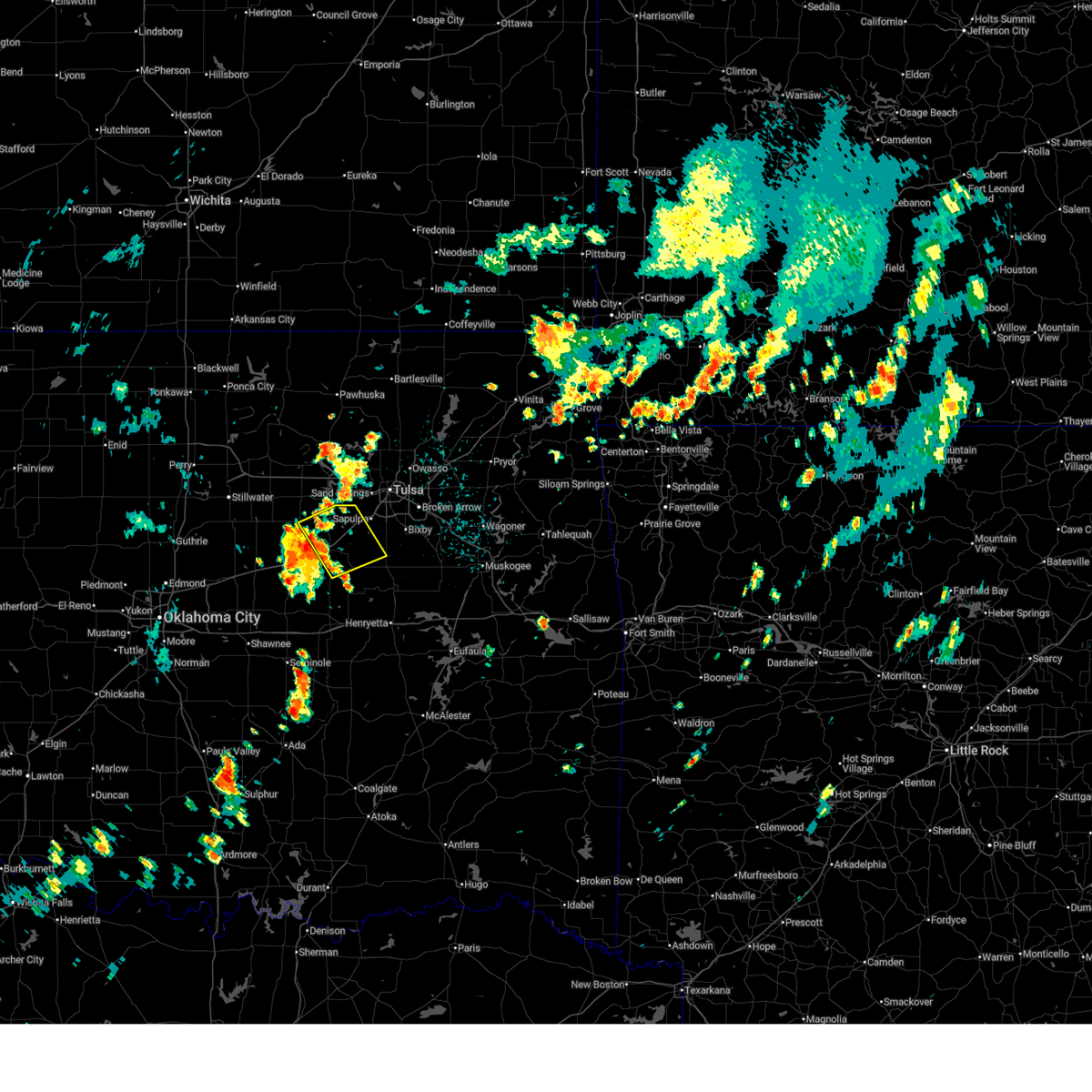
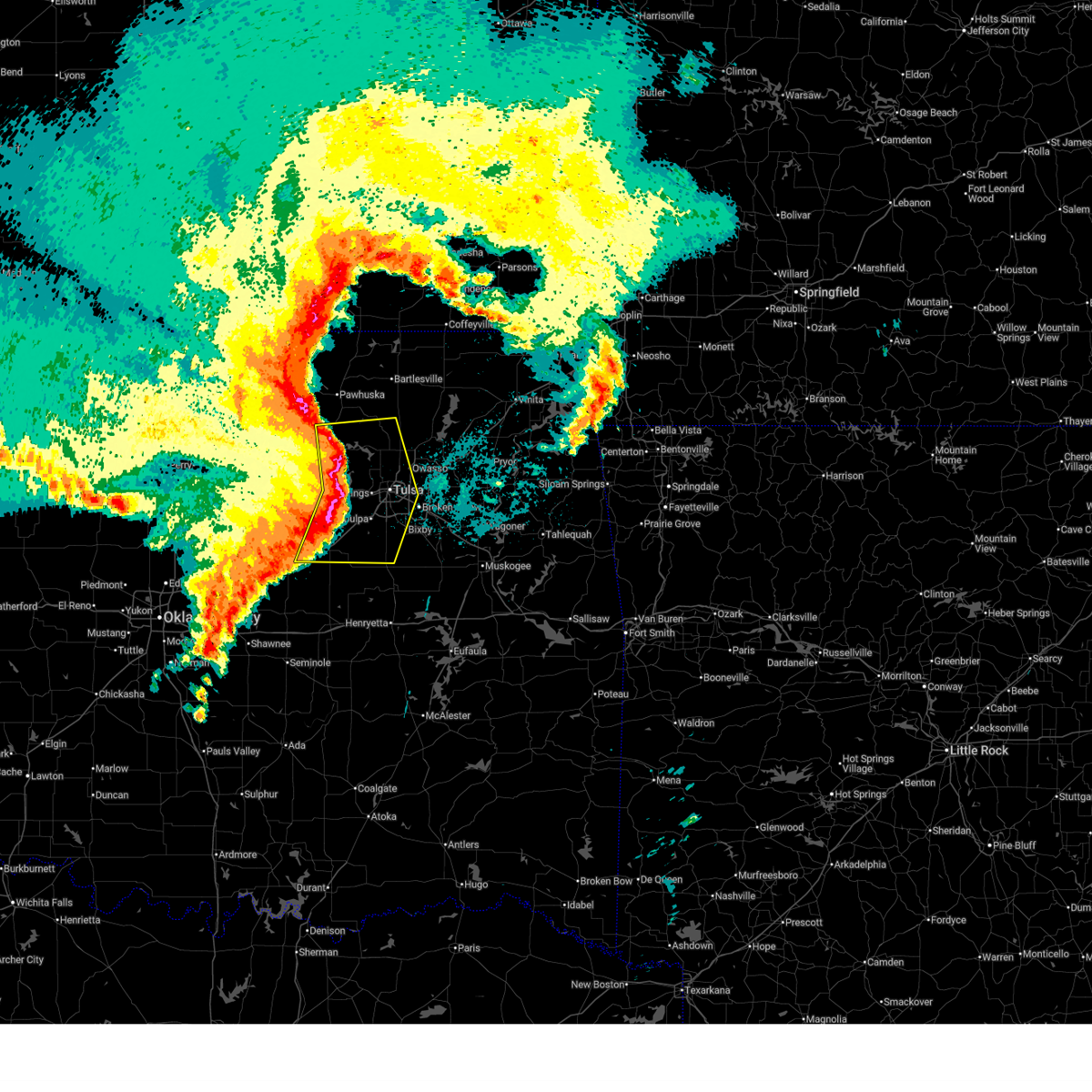
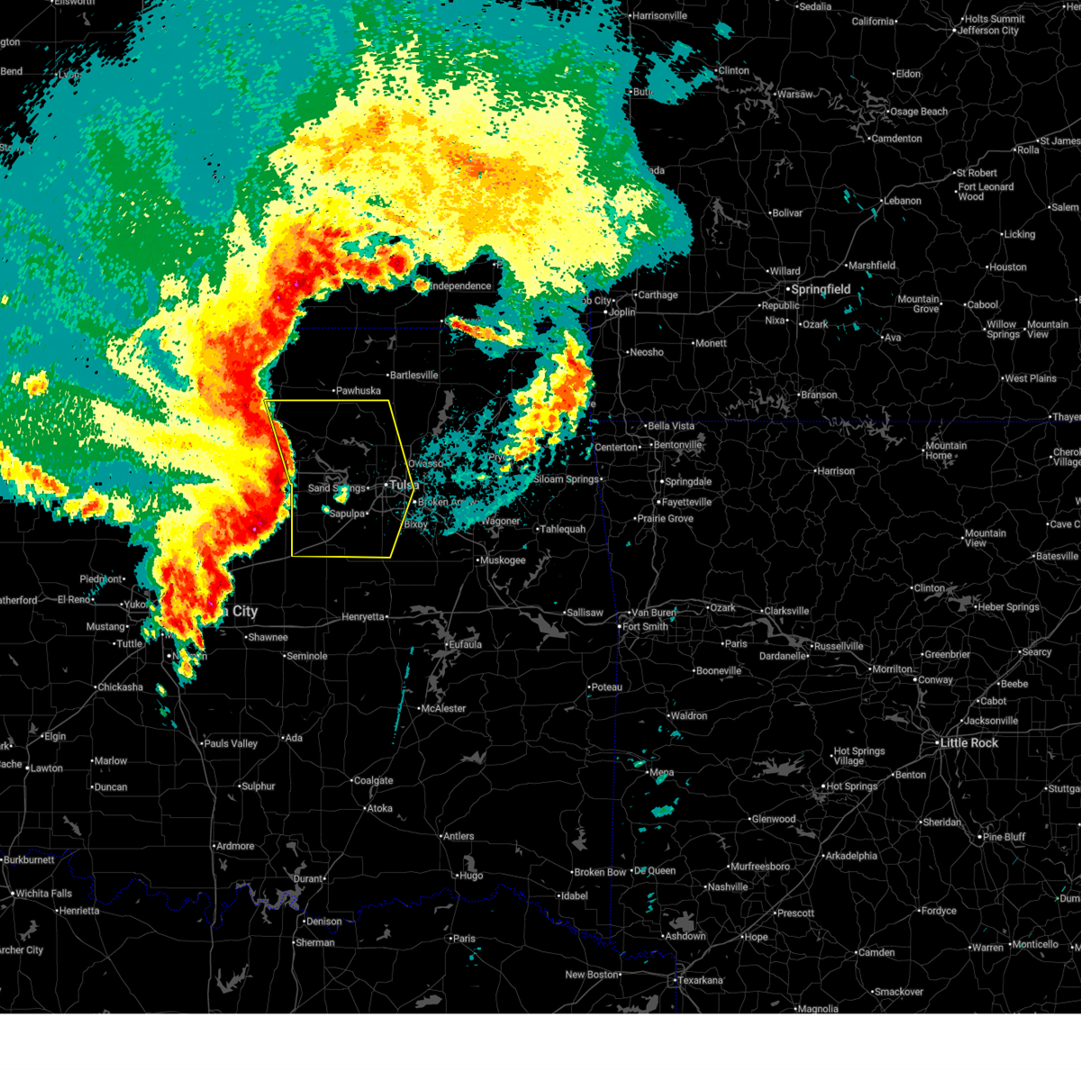
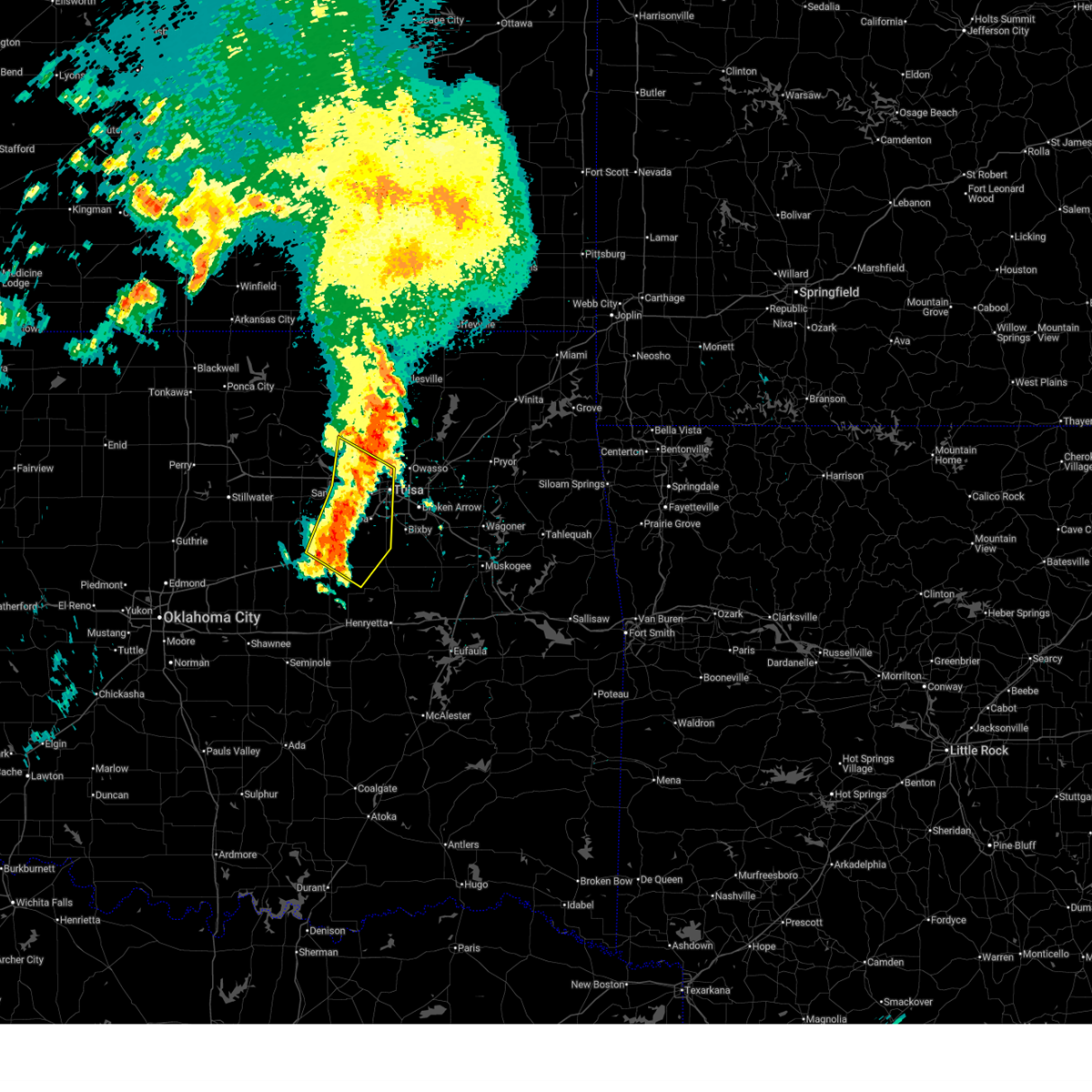
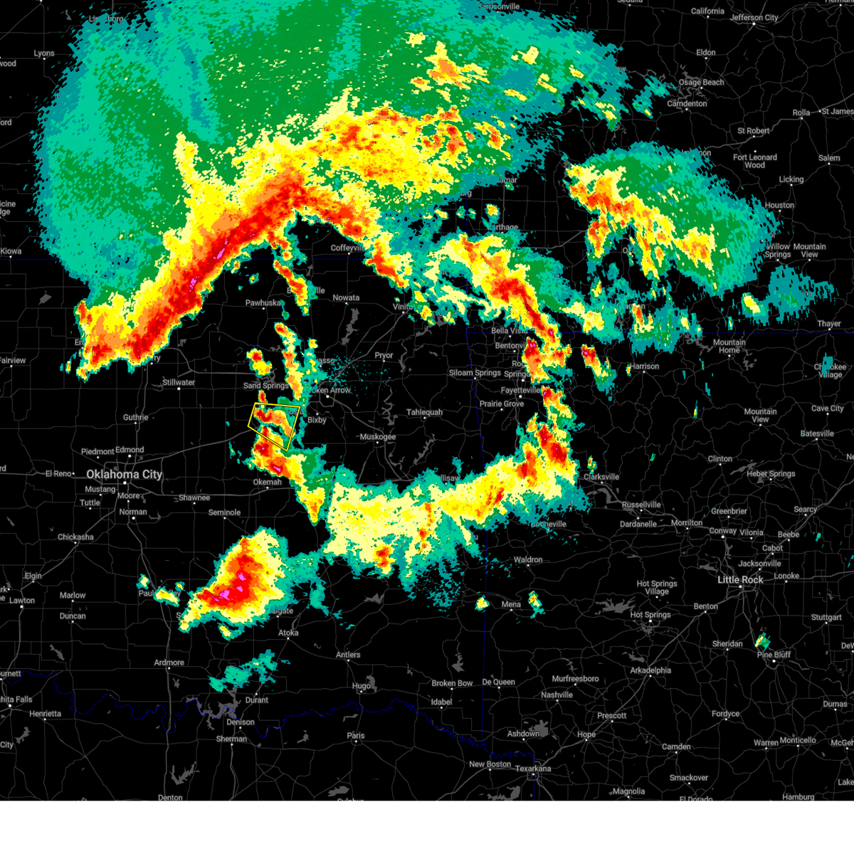
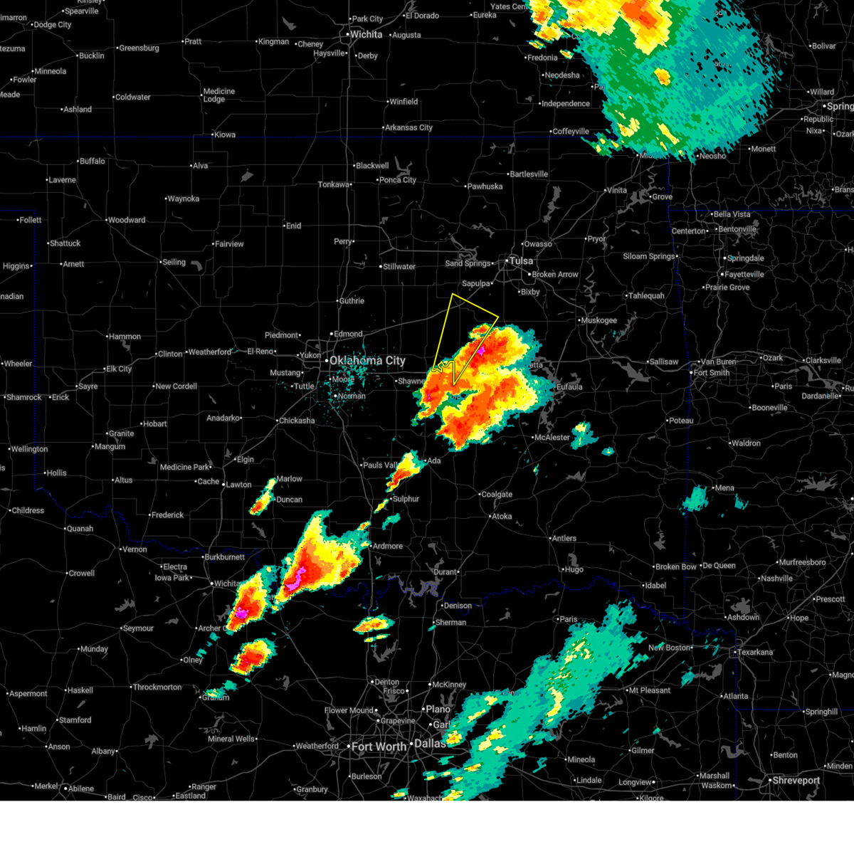
The Top Recent Hail Date for Bristow, OK is Tuesday, March 10, 2026 (17th out of 93)

Hail and Wind Damage Spotted near Bristow, OK
| Date / Time | Report Details |
|---|---|
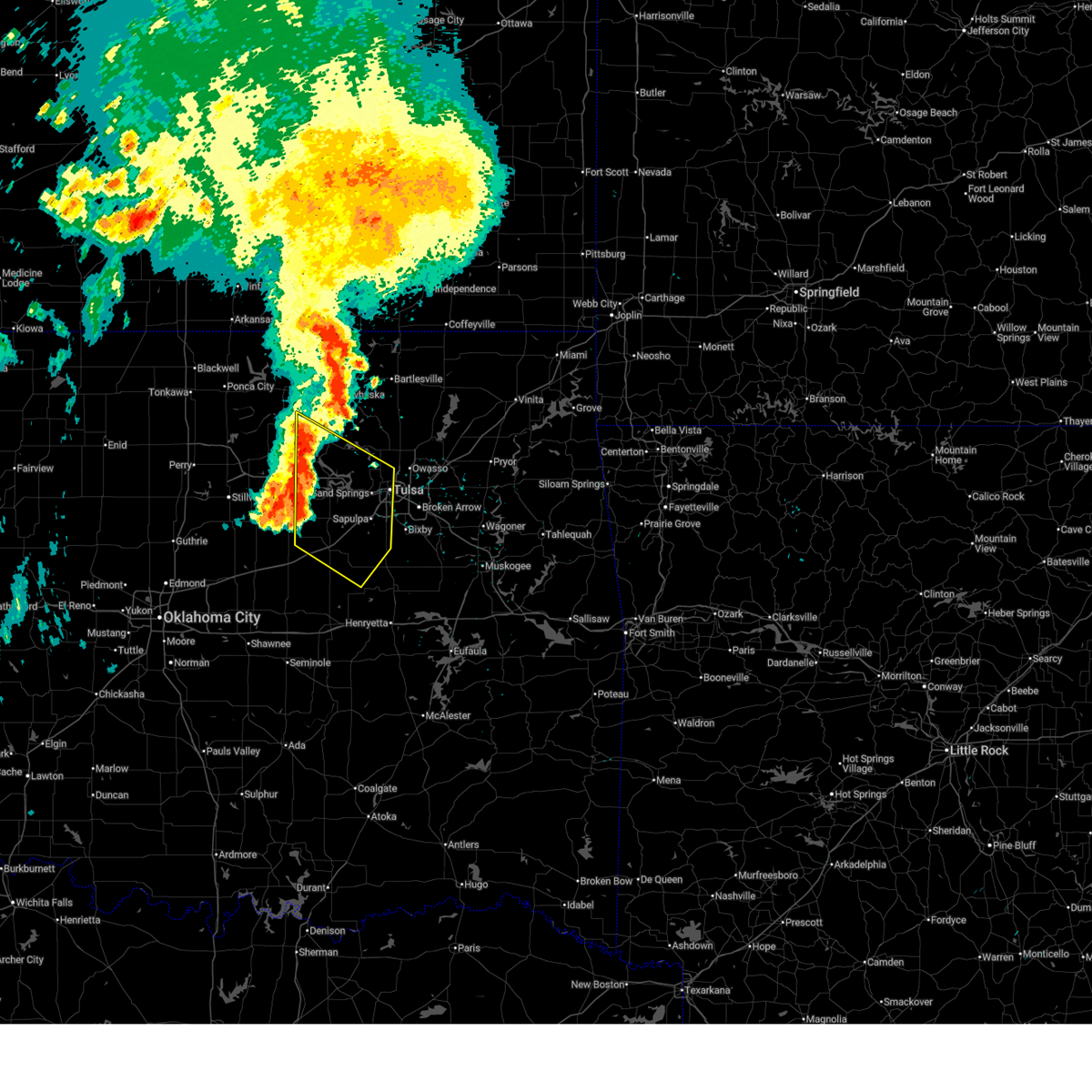
| 7/4/2026 8:45 PM CDT |
 At 843 pm cdt, severe thunderstorms were located along a line extending from 2 miles south of bald hill to 7 miles west of welty, moving southeast at 45 mph (radar indicated. at 8:42 pm, a 60 mph gust was reported at the okmulgee county eoc). Hazards include 60 mph wind gusts and quarter size hail. Hail damage to vehicles is expected. expect wind damage to roofs, siding, and trees. locations in or near the path include, okmulgee, bristow, okemah, okfuskee, glenpool, henryetta, kiefer, morris, beggs, boley, mounds, dewar, schulter, depew, paden, grayson, slick, hoffman, castle, clearview, this includes the following highways, interstate 40 in oklahoma between mile markers 212 and 260. Interstate 44 between mile markers 178 and 200. At 843 pm cdt, severe thunderstorms were located along a line extending from 2 miles south of bald hill to 7 miles west of welty, moving southeast at 45 mph (radar indicated. at 8:42 pm, a 60 mph gust was reported at the okmulgee county eoc). Hazards include 60 mph wind gusts and quarter size hail. Hail damage to vehicles is expected. expect wind damage to roofs, siding, and trees. locations in or near the path include, okmulgee, bristow, okemah, okfuskee, glenpool, henryetta, kiefer, morris, beggs, boley, mounds, dewar, schulter, depew, paden, grayson, slick, hoffman, castle, clearview, this includes the following highways, interstate 40 in oklahoma between mile markers 212 and 260. Interstate 44 between mile markers 178 and 200.
|
| 7/4/2026 8:26 PM CDT |
 Svrtsa the national weather service in tulsa has issued a * severe thunderstorm warning for, southern creek county in northeastern oklahoma, northwestern mcintosh county in southeastern oklahoma, okmulgee county in northeastern oklahoma, southern tulsa county in northeastern oklahoma, okfuskee county in east central oklahoma, * until 915 pm cdt. * at 826 pm cdt, severe thunderstorms were located along a line extending from 5 miles south of bixby to 3 miles west of depew, moving southeast at 40 mph (radar indicated). Hazards include 60 mph wind gusts and quarter size hail. Hail damage to vehicles is expected. expect wind damage to roofs, siding, and trees. locations in or near the path include, okmulgee, bristow, okemah, okfuskee, glenpool, henryetta, kiefer, morris, beggs, boley, mounds, dewar, schulter, depew, paden, grayson, slick, hoffman, castle, clearview, this includes the following highways, interstate 40 in oklahoma between mile markers 212 and 260. Interstate 44 between mile markers 178 and 200. Svrtsa the national weather service in tulsa has issued a * severe thunderstorm warning for, southern creek county in northeastern oklahoma, northwestern mcintosh county in southeastern oklahoma, okmulgee county in northeastern oklahoma, southern tulsa county in northeastern oklahoma, okfuskee county in east central oklahoma, * until 915 pm cdt. * at 826 pm cdt, severe thunderstorms were located along a line extending from 5 miles south of bixby to 3 miles west of depew, moving southeast at 40 mph (radar indicated). Hazards include 60 mph wind gusts and quarter size hail. Hail damage to vehicles is expected. expect wind damage to roofs, siding, and trees. locations in or near the path include, okmulgee, bristow, okemah, okfuskee, glenpool, henryetta, kiefer, morris, beggs, boley, mounds, dewar, schulter, depew, paden, grayson, slick, hoffman, castle, clearview, this includes the following highways, interstate 40 in oklahoma between mile markers 212 and 260. Interstate 44 between mile markers 178 and 200.
|
| 7/4/2026 8:09 PM CDT |
 At 809 pm cdt, severe thunderstorms were located along a line extending from 2 miles east of kellyville to 4 miles north of cushing, moving southeast at 60 mph (radar indicated). Hazards include 70 mph wind gusts and quarter size hail. Hail damage to vehicles is expected. expect considerable tree damage. wind damage is also likely to mobile homes, roofs, and outbuildings. Locations in or near the path include, bristow, sapulpa, mannford, drumright, kiefer, mounds, kellyville, oilton, depew, slick, shamrock, silver city, milfay, this includes interstate 44 between mile markers 178 and 213. At 809 pm cdt, severe thunderstorms were located along a line extending from 2 miles east of kellyville to 4 miles north of cushing, moving southeast at 60 mph (radar indicated). Hazards include 70 mph wind gusts and quarter size hail. Hail damage to vehicles is expected. expect considerable tree damage. wind damage is also likely to mobile homes, roofs, and outbuildings. Locations in or near the path include, bristow, sapulpa, mannford, drumright, kiefer, mounds, kellyville, oilton, depew, slick, shamrock, silver city, milfay, this includes interstate 44 between mile markers 178 and 213.
|
| 7/4/2026 7:46 PM CDT |
 Svrtsa the national weather service in tulsa has issued a * severe thunderstorm warning for, creek county in northeastern oklahoma, northwestern okmulgee county in northeastern oklahoma, south central pawnee county in northeastern oklahoma, * until 830 pm cdt. * at 746 pm cdt, severe thunderstorms were located along a line extending from near jennings to 2 miles southwest of stillwater, moving southeast at 55 mph (radar indicated). Hazards include 60 mph wind gusts and quarter size hail. Hail damage to vehicles is expected. expect wind damage to roofs, siding, and trees. Locations in or near the path include, bristow, sapulpa, glenpool, mannford, drumright, kiefer, mounds, kellyville, oilton, depew, jennings, slick, terlton, shamrock, milfay, silver city, this includes interstate 44 between mile markers 178 and 213. Svrtsa the national weather service in tulsa has issued a * severe thunderstorm warning for, creek county in northeastern oklahoma, northwestern okmulgee county in northeastern oklahoma, south central pawnee county in northeastern oklahoma, * until 830 pm cdt. * at 746 pm cdt, severe thunderstorms were located along a line extending from near jennings to 2 miles southwest of stillwater, moving southeast at 55 mph (radar indicated). Hazards include 60 mph wind gusts and quarter size hail. Hail damage to vehicles is expected. expect wind damage to roofs, siding, and trees. Locations in or near the path include, bristow, sapulpa, glenpool, mannford, drumright, kiefer, mounds, kellyville, oilton, depew, jennings, slick, terlton, shamrock, milfay, silver city, this includes interstate 44 between mile markers 178 and 213.
|
| 6/22/2026 3:29 AM CDT |
 At 328 am cdt, severe thunderstorms were located along a line extending from near kellyville to 3 miles south of weleetka, moving east at 45 mph (radar indicated). Hazards include 70 mph wind gusts and penny size hail. Expect considerable tree damage. damage is likely to mobile homes, roofs, and outbuildings. locations in or near the path include, bristow, okemah, okfuskee, bearden, slick, castle, welty, mason, this includes the following highways, interstate 40 in oklahoma between mile markers 212 and 223. Interstate 44 between mile markers 189 and 200. At 328 am cdt, severe thunderstorms were located along a line extending from near kellyville to 3 miles south of weleetka, moving east at 45 mph (radar indicated). Hazards include 70 mph wind gusts and penny size hail. Expect considerable tree damage. damage is likely to mobile homes, roofs, and outbuildings. locations in or near the path include, bristow, okemah, okfuskee, bearden, slick, castle, welty, mason, this includes the following highways, interstate 40 in oklahoma between mile markers 212 and 223. Interstate 44 between mile markers 189 and 200.
|
| 6/22/2026 2:39 AM CDT |
 Svrtsa the national weather service in tulsa has issued a * severe thunderstorm warning for, southwestern creek county in northeastern oklahoma, okfuskee county in east central oklahoma, * until 345 am cdt. * at 239 am cdt, severe thunderstorms were located along a line extending from 2 miles south of drumright to 3 miles south of johnson, moving east at 35 mph (radar indicated). Hazards include 60 mph wind gusts and nickel size hail. Expect damage to roofs, siding, and trees. locations in or near the path include, bristow, okemah, okfuskee, boley, depew, paden, bearden, slick, castle, shamrock, welty, milfay, mason, this includes the following highways, interstate 40 in oklahoma between mile markers 212 and 223. Interstate 44 between mile markers 178 and 200. Svrtsa the national weather service in tulsa has issued a * severe thunderstorm warning for, southwestern creek county in northeastern oklahoma, okfuskee county in east central oklahoma, * until 345 am cdt. * at 239 am cdt, severe thunderstorms were located along a line extending from 2 miles south of drumright to 3 miles south of johnson, moving east at 35 mph (radar indicated). Hazards include 60 mph wind gusts and nickel size hail. Expect damage to roofs, siding, and trees. locations in or near the path include, bristow, okemah, okfuskee, boley, depew, paden, bearden, slick, castle, shamrock, welty, milfay, mason, this includes the following highways, interstate 40 in oklahoma between mile markers 212 and 223. Interstate 44 between mile markers 178 and 200.
|
| 6/13/2026 11:20 PM CDT |
 At 1120 pm cdt, severe thunderstorms were located along a line extending from 5 miles south of barnsdall to 4 miles northeast of sand springs to 2 miles northeast of drumright, moving southeast at 45 mph (radar indicated). Hazards include 70 mph wind gusts. Expect considerable tree damage. damage is likely to mobile homes, roofs, and outbuildings. Locations in or near the path include, tulsa, broken arrow, sand springs, bristow, owasso, bixby, sapulpa, jenks, glenpool, skiatook, catoosa, collinsville, hominy, cleveland, mannford, drumright, kiefer, sperry, mounds, kellyville, this includes interstate 44 between mile markers 178 and 238. At 1120 pm cdt, severe thunderstorms were located along a line extending from 5 miles south of barnsdall to 4 miles northeast of sand springs to 2 miles northeast of drumright, moving southeast at 45 mph (radar indicated). Hazards include 70 mph wind gusts. Expect considerable tree damage. damage is likely to mobile homes, roofs, and outbuildings. Locations in or near the path include, tulsa, broken arrow, sand springs, bristow, owasso, bixby, sapulpa, jenks, glenpool, skiatook, catoosa, collinsville, hominy, cleveland, mannford, drumright, kiefer, sperry, mounds, kellyville, this includes interstate 44 between mile markers 178 and 238.
|
| 6/13/2026 11:09 PM CDT |
 Svrtsa the national weather service in tulsa has issued a * severe thunderstorm warning for, western rogers county in northeastern oklahoma, southeastern osage county in northeastern oklahoma, creek county in northeastern oklahoma, southern washington county in northeastern oklahoma, northwestern wagoner county in northeastern oklahoma, northwestern okmulgee county in northeastern oklahoma, southeastern pawnee county in northeastern oklahoma, tulsa county in northeastern oklahoma, * until midnight cdt. * at 1109 pm cdt, severe thunderstorms were located along a line extending from 3 miles east of wynona to 4 miles east of walnut creek state park to 3 miles northwest of drumright, moving southeast at 45 mph (radar indicated). Hazards include 60 mph wind gusts. Expect damage to roofs, siding, and trees. Locations in or near the path include, tulsa, broken arrow, sand springs, bristow, owasso, bixby, sapulpa, jenks, glenpool, skiatook, catoosa, collinsville, hominy, cleveland, mannford, drumright, kiefer, barnsdall, sperry, mounds, this includes interstate 44 between mile markers 178 and 239. Svrtsa the national weather service in tulsa has issued a * severe thunderstorm warning for, western rogers county in northeastern oklahoma, southeastern osage county in northeastern oklahoma, creek county in northeastern oklahoma, southern washington county in northeastern oklahoma, northwestern wagoner county in northeastern oklahoma, northwestern okmulgee county in northeastern oklahoma, southeastern pawnee county in northeastern oklahoma, tulsa county in northeastern oklahoma, * until midnight cdt. * at 1109 pm cdt, severe thunderstorms were located along a line extending from 3 miles east of wynona to 4 miles east of walnut creek state park to 3 miles northwest of drumright, moving southeast at 45 mph (radar indicated). Hazards include 60 mph wind gusts. Expect damage to roofs, siding, and trees. Locations in or near the path include, tulsa, broken arrow, sand springs, bristow, owasso, bixby, sapulpa, jenks, glenpool, skiatook, catoosa, collinsville, hominy, cleveland, mannford, drumright, kiefer, barnsdall, sperry, mounds, this includes interstate 44 between mile markers 178 and 239.
|
| 5/8/2026 8:48 PM CDT |
 Svrtsa the national weather service in tulsa has issued a * severe thunderstorm warning for, south central creek county in northeastern oklahoma, central okmulgee county in northeastern oklahoma, * until 930 pm cdt. * at 848 pm cdt, a severe thunderstorm was located over slick, moving southeast at 25 mph (radar indicated). Hazards include 60 mph wind gusts and quarter size hail. Hail damage to vehicles is expected. expect wind damage to roofs, siding, and trees. Locations in or near the path include, okmulgee, bristow, morris, beggs, schulter, slick, preston, okmulgee state park, this includes interstate 44 between mile markers 191 and 198. Svrtsa the national weather service in tulsa has issued a * severe thunderstorm warning for, south central creek county in northeastern oklahoma, central okmulgee county in northeastern oklahoma, * until 930 pm cdt. * at 848 pm cdt, a severe thunderstorm was located over slick, moving southeast at 25 mph (radar indicated). Hazards include 60 mph wind gusts and quarter size hail. Hail damage to vehicles is expected. expect wind damage to roofs, siding, and trees. Locations in or near the path include, okmulgee, bristow, morris, beggs, schulter, slick, preston, okmulgee state park, this includes interstate 44 between mile markers 191 and 198.
|
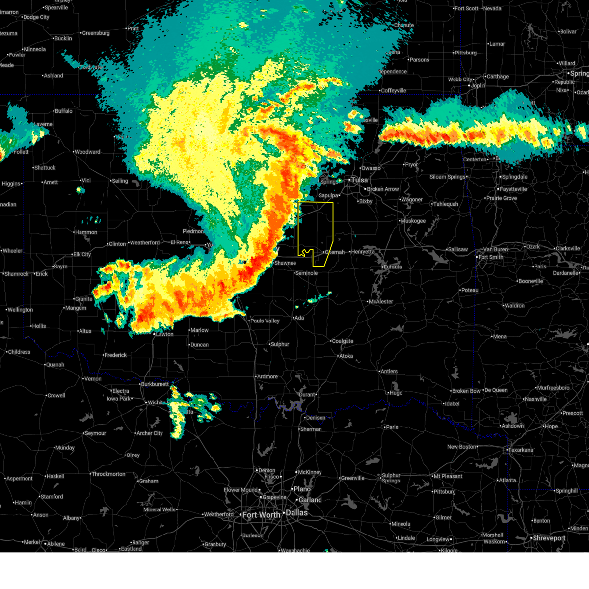
| 3/10/2026 10:30 PM CDT |
 the severe thunderstorm warning has been cancelled and is no longer in effect the severe thunderstorm warning has been cancelled and is no longer in effect
|
| 3/10/2026 10:16 PM CDT |
 At 1015 pm cdt, a severe thunderstorm was located 4 miles northeast of bristow, moving northeast at 30 mph (radar indicated). Hazards include 60 mph wind gusts and quarter size hail. Hail damage to vehicles is expected. expect wind damage to roofs, siding, and trees. Locations in or near the path include, mounds, bristow, kellyville, sapulpa, kiefer, this includes interstate 44 between mile markers 191 and 214. At 1015 pm cdt, a severe thunderstorm was located 4 miles northeast of bristow, moving northeast at 30 mph (radar indicated). Hazards include 60 mph wind gusts and quarter size hail. Hail damage to vehicles is expected. expect wind damage to roofs, siding, and trees. Locations in or near the path include, mounds, bristow, kellyville, sapulpa, kiefer, this includes interstate 44 between mile markers 191 and 214.
|
| 3/10/2026 10:05 PM CDT |
 Svrtsa the national weather service in tulsa has issued a * severe thunderstorm warning for, central creek county in northeastern oklahoma, northwestern okmulgee county in northeastern oklahoma, * until 1045 pm cdt. * at 1004 pm cdt, a severe thunderstorm was located over bristow, moving northeast at 30 mph (radar indicated). Hazards include 60 mph wind gusts and quarter size hail. Hail damage to vehicles is expected. expect wind damage to roofs, siding, and trees. Locations in or near the path include, mounds, bristow, sapulpa, depew, slick, kellyville, kiefer, this includes interstate 44 between mile markers 184 and 214. Svrtsa the national weather service in tulsa has issued a * severe thunderstorm warning for, central creek county in northeastern oklahoma, northwestern okmulgee county in northeastern oklahoma, * until 1045 pm cdt. * at 1004 pm cdt, a severe thunderstorm was located over bristow, moving northeast at 30 mph (radar indicated). Hazards include 60 mph wind gusts and quarter size hail. Hail damage to vehicles is expected. expect wind damage to roofs, siding, and trees. Locations in or near the path include, mounds, bristow, sapulpa, depew, slick, kellyville, kiefer, this includes interstate 44 between mile markers 184 and 214.
|
| 3/6/2026 6:14 PM CST |
 the severe thunderstorm warning has been cancelled and is no longer in effect the severe thunderstorm warning has been cancelled and is no longer in effect
|
| 3/6/2026 6:04 PM CST |
 At 604 pm cst, severe thunderstorms were located along a line extending from 5 miles east of drumright to 3 miles northeast of depew, moving east at 40 mph (radar indicated). Hazards include 60 mph wind gusts and nickel size hail. Expect damage to roofs, siding, and trees. Locations in or near the path include, shamrock, this includes interstate 44 between mile markers 184 and 191. At 604 pm cst, severe thunderstorms were located along a line extending from 5 miles east of drumright to 3 miles northeast of depew, moving east at 40 mph (radar indicated). Hazards include 60 mph wind gusts and nickel size hail. Expect damage to roofs, siding, and trees. Locations in or near the path include, shamrock, this includes interstate 44 between mile markers 184 and 191.
|
| 3/6/2026 5:43 PM CST |
 Svrtsa the national weather service in tulsa has issued a * severe thunderstorm warning for, southwestern creek county in northeastern oklahoma, * until 630 pm cst. * at 543 pm cst, severe thunderstorms were located along a line extending from near avery to 4 miles south of stroud, moving northeast at 55 mph (radar indicated). Hazards include 60 mph wind gusts and quarter size hail. Hail damage to vehicles is expected. expect wind damage to roofs, siding, and trees. Locations in or near the path include, milfay, shamrock, bristow, depew, this includes interstate 44 between mile markers 178 and 192. Svrtsa the national weather service in tulsa has issued a * severe thunderstorm warning for, southwestern creek county in northeastern oklahoma, * until 630 pm cst. * at 543 pm cst, severe thunderstorms were located along a line extending from near avery to 4 miles south of stroud, moving northeast at 55 mph (radar indicated). Hazards include 60 mph wind gusts and quarter size hail. Hail damage to vehicles is expected. expect wind damage to roofs, siding, and trees. Locations in or near the path include, milfay, shamrock, bristow, depew, this includes interstate 44 between mile markers 178 and 192.
|
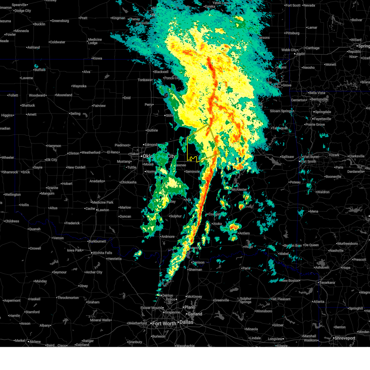
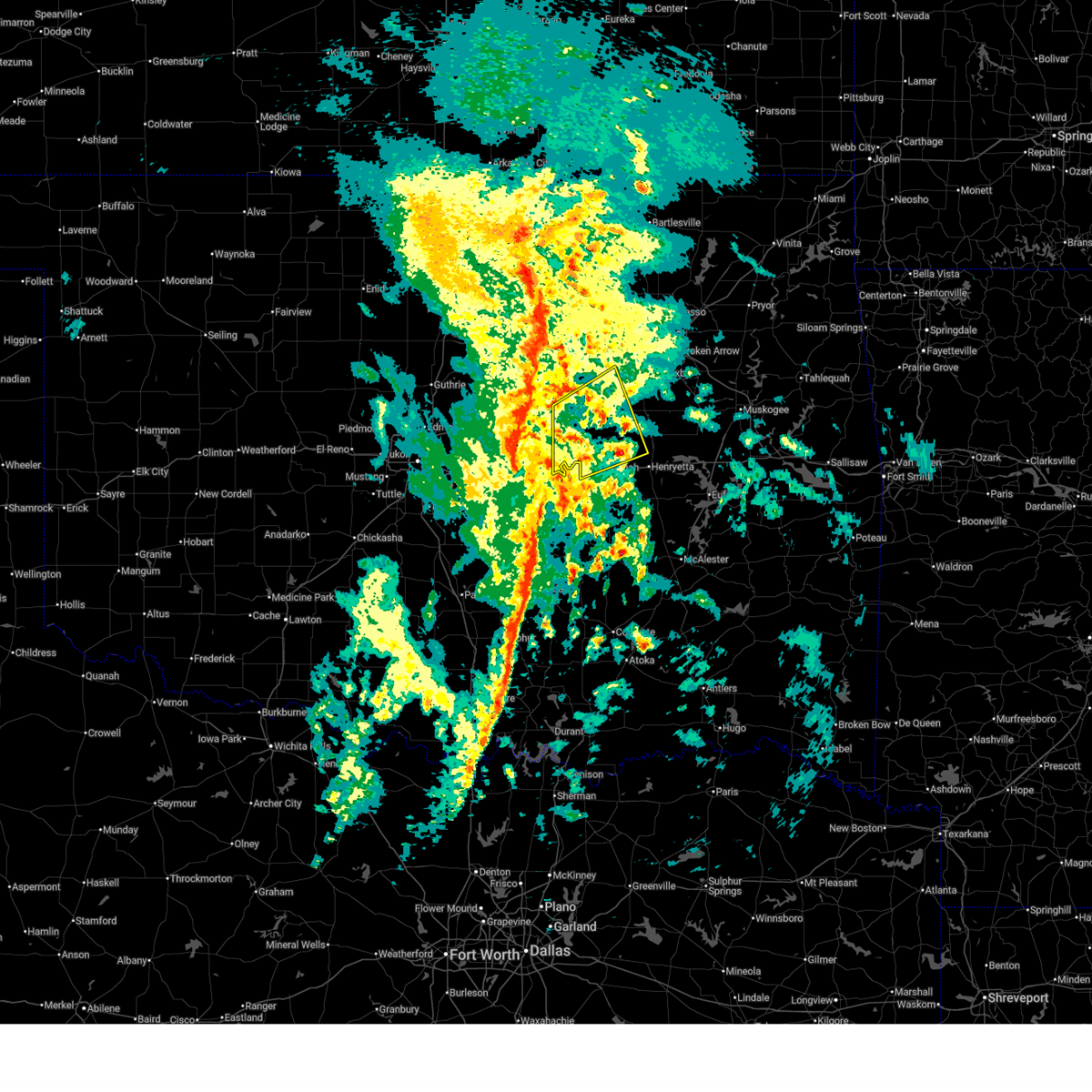
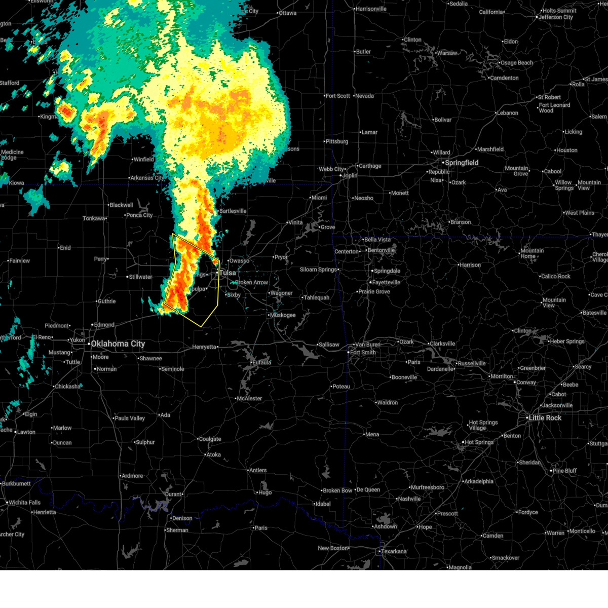
| 3/6/2026 5:27 PM CST |
 Tortsa the national weather service in tulsa has issued a * tornado warning for, central creek county in northeastern oklahoma, west central tulsa county in northeastern oklahoma, * until 630 pm cst. * at 527 pm cst, a confirmed tornado was located 5 miles north of bristow, moving northeast at 30 mph (weather spotters confirmed tornado). Hazards include damaging tornado and half dollar size hail. Flying debris will be dangerous to those caught without shelter. mobile homes will be damaged or destroyed. damage to roofs, windows, and vehicles will occur. tree damage is likely. Locations in or near the path include, sand springs, keystone state park, mannford, sapulpa, kellyville, kiefer, tulsa, this includes interstate 44 between mile markers 190 and 218. Tortsa the national weather service in tulsa has issued a * tornado warning for, central creek county in northeastern oklahoma, west central tulsa county in northeastern oklahoma, * until 630 pm cst. * at 527 pm cst, a confirmed tornado was located 5 miles north of bristow, moving northeast at 30 mph (weather spotters confirmed tornado). Hazards include damaging tornado and half dollar size hail. Flying debris will be dangerous to those caught without shelter. mobile homes will be damaged or destroyed. damage to roofs, windows, and vehicles will occur. tree damage is likely. Locations in or near the path include, sand springs, keystone state park, mannford, sapulpa, kellyville, kiefer, tulsa, this includes interstate 44 between mile markers 190 and 218.
|
| 3/6/2026 5:22 PM CST |
 At 522 pm cst, a confirmed tornado was located 3 miles northwest of bristow, moving northeast at 30 mph (weather spotters confirmed tornado). Hazards include damaging tornado and half dollar size hail. Flying debris will be dangerous to those caught without shelter. mobile homes will be damaged or destroyed. damage to roofs, windows, and vehicles will occur. tree damage is likely. Locations in or near the path include, depew, shamrock, bristow, this includes interstate 44 between mile markers 181 and 200. At 522 pm cst, a confirmed tornado was located 3 miles northwest of bristow, moving northeast at 30 mph (weather spotters confirmed tornado). Hazards include damaging tornado and half dollar size hail. Flying debris will be dangerous to those caught without shelter. mobile homes will be damaged or destroyed. damage to roofs, windows, and vehicles will occur. tree damage is likely. Locations in or near the path include, depew, shamrock, bristow, this includes interstate 44 between mile markers 181 and 200.
|
| 3/6/2026 5:16 PM CST |
 At 516 pm cst, a severe thunderstorm with strong low level rotation that could produce a tornado at any time was located 4 miles northeast of depew, moving northeast at 25 mph (radar indicated rotation). Hazards include tornado and half dollar size hail. Flying debris will be dangerous to those caught without shelter. mobile homes will be damaged or destroyed. damage to roofs, windows, and vehicles will occur. tree damage is likely. Locations in or near the path include, milfay, shamrock, bristow, depew, this includes interstate 44 between mile markers 178 and 200. At 516 pm cst, a severe thunderstorm with strong low level rotation that could produce a tornado at any time was located 4 miles northeast of depew, moving northeast at 25 mph (radar indicated rotation). Hazards include tornado and half dollar size hail. Flying debris will be dangerous to those caught without shelter. mobile homes will be damaged or destroyed. damage to roofs, windows, and vehicles will occur. tree damage is likely. Locations in or near the path include, milfay, shamrock, bristow, depew, this includes interstate 44 between mile markers 178 and 200.
|
| 3/6/2026 5:02 PM CST |
 At 502 pm cst, a severe thunderstorm was located near depew, moving northeast at 25 mph (radar indicated). Hazards include 60 mph wind gusts and half dollar size hail. Hail damage to vehicles is expected. expect wind damage to roofs, siding, and trees. Locations in or near the path include, milfay, silver city, shamrock, bristow, depew, this includes interstate 44 between mile markers 178 and 200. At 502 pm cst, a severe thunderstorm was located near depew, moving northeast at 25 mph (radar indicated). Hazards include 60 mph wind gusts and half dollar size hail. Hail damage to vehicles is expected. expect wind damage to roofs, siding, and trees. Locations in or near the path include, milfay, silver city, shamrock, bristow, depew, this includes interstate 44 between mile markers 178 and 200.
|
| 3/6/2026 5:02 PM CST |
 the severe thunderstorm warning has been cancelled and is no longer in effect the severe thunderstorm warning has been cancelled and is no longer in effect
|
| 3/6/2026 4:51 PM CST |
 Tortsa the national weather service in tulsa has issued a * tornado warning for, western creek county in northeastern oklahoma, * until 530 pm cst. * at 451 pm cst, a severe thunderstorm capable of producing a tornado was located 3 miles southeast of stroud, moving northeast at 35 mph (radar indicated rotation). Hazards include tornado and half dollar size hail. Flying debris will be dangerous to those caught without shelter. mobile homes will be damaged or destroyed. damage to roofs, windows, and vehicles will occur. tree damage is likely. Locations in or near the path include, milfay, shamrock, bristow, depew, this includes interstate 44 between mile markers 178 and 200. Tortsa the national weather service in tulsa has issued a * tornado warning for, western creek county in northeastern oklahoma, * until 530 pm cst. * at 451 pm cst, a severe thunderstorm capable of producing a tornado was located 3 miles southeast of stroud, moving northeast at 35 mph (radar indicated rotation). Hazards include tornado and half dollar size hail. Flying debris will be dangerous to those caught without shelter. mobile homes will be damaged or destroyed. damage to roofs, windows, and vehicles will occur. tree damage is likely. Locations in or near the path include, milfay, shamrock, bristow, depew, this includes interstate 44 between mile markers 178 and 200.
|
| 3/6/2026 4:37 PM CST |
 Svrtsa the national weather service in tulsa has issued a * severe thunderstorm warning for, western creek county in northeastern oklahoma, northwestern okfuskee county in east central oklahoma, * until 530 pm cst. * at 437 pm cst, a severe thunderstorm was located 4 miles east of davenport, moving northeast at 40 mph (radar indicated). Hazards include 60 mph wind gusts and quarter size hail. Hail damage to vehicles is expected. expect wind damage to roofs, siding, and trees. Locations in or near the path include, milfay, silver city, shamrock, bristow, depew, this includes interstate 44 between mile markers 178 and 200. Svrtsa the national weather service in tulsa has issued a * severe thunderstorm warning for, western creek county in northeastern oklahoma, northwestern okfuskee county in east central oklahoma, * until 530 pm cst. * at 437 pm cst, a severe thunderstorm was located 4 miles east of davenport, moving northeast at 40 mph (radar indicated). Hazards include 60 mph wind gusts and quarter size hail. Hail damage to vehicles is expected. expect wind damage to roofs, siding, and trees. Locations in or near the path include, milfay, silver city, shamrock, bristow, depew, this includes interstate 44 between mile markers 178 and 200.
|
| 3/1/2026 1:06 PM CST | Quarter sized hail reported 10.6 miles S of Bristow, OK |
| 3/1/2026 12:28 PM CST |
 Svrtsa the national weather service in tulsa has issued a * severe thunderstorm warning for, northwestern creek county in northeastern oklahoma, * until 100 pm cst. * at 1228 pm cst, a severe thunderstorm was located near drumright, moving east at 20 mph (radar indicated). Hazards include quarter size hail. Damage to vehicles is expected. Locations in or near the path include, drumright, shamrock, this includes interstate 44 between mile markers 193 and 194. Svrtsa the national weather service in tulsa has issued a * severe thunderstorm warning for, northwestern creek county in northeastern oklahoma, * until 100 pm cst. * at 1228 pm cst, a severe thunderstorm was located near drumright, moving east at 20 mph (radar indicated). Hazards include quarter size hail. Damage to vehicles is expected. Locations in or near the path include, drumright, shamrock, this includes interstate 44 between mile markers 193 and 194.
|
| 3/1/2026 12:14 PM CST |
 At 1213 pm cst, a severe thunderstorm was located 4 miles east of cushing, moving east at 25 mph (radar indicated). Hazards include quarter size hail. Damage to vehicles is expected. Locations in or near the path include, oilton, silver city, drumright, shamrock, this includes interstate 44 near mile marker 191. At 1213 pm cst, a severe thunderstorm was located 4 miles east of cushing, moving east at 25 mph (radar indicated). Hazards include quarter size hail. Damage to vehicles is expected. Locations in or near the path include, oilton, silver city, drumright, shamrock, this includes interstate 44 near mile marker 191.
|
| 3/1/2026 11:58 AM CST |
 Svrtsa the national weather service in tulsa has issued a * severe thunderstorm warning for, northwestern creek county in northeastern oklahoma, * until 1230 pm cst. * at 1157 am cst, a severe thunderstorm was located near cushing, moving east at 25 mph (radar indicated). Hazards include quarter size hail. Damage to vehicles is expected. Locations in or near the path include, oilton, silver city, drumright, shamrock, this includes interstate 44 near mile marker 191. Svrtsa the national weather service in tulsa has issued a * severe thunderstorm warning for, northwestern creek county in northeastern oklahoma, * until 1230 pm cst. * at 1157 am cst, a severe thunderstorm was located near cushing, moving east at 25 mph (radar indicated). Hazards include quarter size hail. Damage to vehicles is expected. Locations in or near the path include, oilton, silver city, drumright, shamrock, this includes interstate 44 near mile marker 191.
|
| 1/8/2026 8:57 AM CST |
 The storms which prompted the warning have moved out of the area. therefore, the warning will be allowed to expire. a tornado watch remains in effect until noon cst for northeastern oklahoma. remember, a severe thunderstorm warning still remains in effect for southeastern okfuskee county until 945 am cst. The storms which prompted the warning have moved out of the area. therefore, the warning will be allowed to expire. a tornado watch remains in effect until noon cst for northeastern oklahoma. remember, a severe thunderstorm warning still remains in effect for southeastern okfuskee county until 945 am cst.
|
| 1/8/2026 8:17 AM CST |
 Svrtsa the national weather service in tulsa has issued a * severe thunderstorm warning for, southern creek county in northeastern oklahoma, western okmulgee county in northeastern oklahoma, okfuskee county in east central oklahoma, * until 900 am cst. * at 817 am cst, severe thunderstorms were located along a line extending from seminole to near sparks, moving northeast at 60 mph (radar indicated). Hazards include 70 mph wind gusts and quarter size hail. Hail damage to vehicles is expected. expect considerable tree damage. wind damage is also likely to mobile homes, roofs, and outbuildings. locations in or near the path include, bristow, boley, paden, okemah, depew, okfuskee, milfay, mason, okmulgee state park, castle, welty, slick, kellyville, this includes the following highways, interstate 40 in oklahoma between mile markers 212 and 222. Interstate 44 between mile markers 178 and 205. Svrtsa the national weather service in tulsa has issued a * severe thunderstorm warning for, southern creek county in northeastern oklahoma, western okmulgee county in northeastern oklahoma, okfuskee county in east central oklahoma, * until 900 am cst. * at 817 am cst, severe thunderstorms were located along a line extending from seminole to near sparks, moving northeast at 60 mph (radar indicated). Hazards include 70 mph wind gusts and quarter size hail. Hail damage to vehicles is expected. expect considerable tree damage. wind damage is also likely to mobile homes, roofs, and outbuildings. locations in or near the path include, bristow, boley, paden, okemah, depew, okfuskee, milfay, mason, okmulgee state park, castle, welty, slick, kellyville, this includes the following highways, interstate 40 in oklahoma between mile markers 212 and 222. Interstate 44 between mile markers 178 and 205.
|
| 1/8/2026 8:15 AM CST |
 Svrtsa the national weather service in tulsa has issued a * severe thunderstorm warning for, southeastern osage county in northeastern oklahoma, northern creek county in northeastern oklahoma, southeastern pawnee county in northeastern oklahoma, west central tulsa county in northeastern oklahoma, * until 900 am cst. * at 814 am cst, severe thunderstorms were located along a line extending from 3 miles east of quay to 2 miles south of stroud, moving northeast at 65 mph (radar indicated). Hazards include 60 mph wind gusts and quarter size hail. Hail damage to vehicles is expected. expect wind damage to roofs, siding, and trees. Locations in or near the path include, barnsdall, sand springs, shamrock, mannford, sapulpa, hallett, depew, jennings, tallant, cleveland, wolco, westport, keystone state park, hominy, walnut creek state park, oilton, milfay, silver city, drumright, osage, this includes interstate 44 between mile markers 178 and 219. Svrtsa the national weather service in tulsa has issued a * severe thunderstorm warning for, southeastern osage county in northeastern oklahoma, northern creek county in northeastern oklahoma, southeastern pawnee county in northeastern oklahoma, west central tulsa county in northeastern oklahoma, * until 900 am cst. * at 814 am cst, severe thunderstorms were located along a line extending from 3 miles east of quay to 2 miles south of stroud, moving northeast at 65 mph (radar indicated). Hazards include 60 mph wind gusts and quarter size hail. Hail damage to vehicles is expected. expect wind damage to roofs, siding, and trees. Locations in or near the path include, barnsdall, sand springs, shamrock, mannford, sapulpa, hallett, depew, jennings, tallant, cleveland, wolco, westport, keystone state park, hominy, walnut creek state park, oilton, milfay, silver city, drumright, osage, this includes interstate 44 between mile markers 178 and 219.
|
| 11/19/2025 8:50 PM CST |
 At 849 pm cst, a severe thunderstorm was located 3 miles west of depew, moving northeast at 30 mph (radar indicated). Hazards include ping pong ball size hail and 60 mph wind gusts. People and animals outdoors will be injured. expect hail damage to roofs, siding, windows, and vehicles. expect wind damage to roofs, siding, and trees. Locations in or near the path include, milfay, drumright, shamrock, bristow, depew, this includes interstate 44 between mile markers 178 and 195. At 849 pm cst, a severe thunderstorm was located 3 miles west of depew, moving northeast at 30 mph (radar indicated). Hazards include ping pong ball size hail and 60 mph wind gusts. People and animals outdoors will be injured. expect hail damage to roofs, siding, windows, and vehicles. expect wind damage to roofs, siding, and trees. Locations in or near the path include, milfay, drumright, shamrock, bristow, depew, this includes interstate 44 between mile markers 178 and 195.
|
| 11/19/2025 8:35 PM CST |
 Svrtsa the national weather service in tulsa has issued a * severe thunderstorm warning for, southwestern creek county in northeastern oklahoma, * until 915 pm cst. * at 835 pm cst, a severe thunderstorm was located 3 miles south of stroud, moving northeast at 30 mph (radar indicated). Hazards include ping pong ball size hail and 60 mph wind gusts. People and animals outdoors will be injured. expect hail damage to roofs, siding, windows, and vehicles. expect wind damage to roofs, siding, and trees. Locations in or near the path include, milfay, drumright, shamrock, bristow, depew, this includes interstate 44 between mile markers 178 and 195. Svrtsa the national weather service in tulsa has issued a * severe thunderstorm warning for, southwestern creek county in northeastern oklahoma, * until 915 pm cst. * at 835 pm cst, a severe thunderstorm was located 3 miles south of stroud, moving northeast at 30 mph (radar indicated). Hazards include ping pong ball size hail and 60 mph wind gusts. People and animals outdoors will be injured. expect hail damage to roofs, siding, windows, and vehicles. expect wind damage to roofs, siding, and trees. Locations in or near the path include, milfay, drumright, shamrock, bristow, depew, this includes interstate 44 between mile markers 178 and 195.
|
| 6/27/2025 2:59 PM CDT |
 At 258 pm cdt, severe thunderstorms were located along a line extending from 6 miles northwest of kellyville to 4 miles east of slick, moving east at 20 mph (radar indicated). Hazards include 60 mph wind gusts. Expect damage to roofs, siding, and trees. Locations impacted include, kellyville and slick. At 258 pm cdt, severe thunderstorms were located along a line extending from 6 miles northwest of kellyville to 4 miles east of slick, moving east at 20 mph (radar indicated). Hazards include 60 mph wind gusts. Expect damage to roofs, siding, and trees. Locations impacted include, kellyville and slick.
|
| 6/27/2025 2:40 PM CDT |
 At 240 pm cdt, severe thunderstorms were located along a line extending from 10 miles southwest of mannford to near slick, moving east-northeast at 15 mph (radar indicated). Hazards include 60 mph wind gusts. Expect damage to roofs, siding, and trees. Locations impacted include, bristow, kellyville, and slick. At 240 pm cdt, severe thunderstorms were located along a line extending from 10 miles southwest of mannford to near slick, moving east-northeast at 15 mph (radar indicated). Hazards include 60 mph wind gusts. Expect damage to roofs, siding, and trees. Locations impacted include, bristow, kellyville, and slick.
|
| 6/27/2025 2:23 PM CDT |
 Svrtsa the national weather service in tulsa has issued a * severe thunderstorm warning for, central creek county in northeastern oklahoma, northwestern okmulgee county in northeastern oklahoma, * until 315 pm cdt. * at 223 pm cdt, severe thunderstorms were located along a line extending from 4 miles northeast of shamrock to 5 miles south of bristow, moving northeast at 25 mph (radar indicated). Hazards include 60 mph wind gusts and quarter size hail. Hail damage to vehicles is expected. Expect wind damage to roofs, siding, and trees. Svrtsa the national weather service in tulsa has issued a * severe thunderstorm warning for, central creek county in northeastern oklahoma, northwestern okmulgee county in northeastern oklahoma, * until 315 pm cdt. * at 223 pm cdt, severe thunderstorms were located along a line extending from 4 miles northeast of shamrock to 5 miles south of bristow, moving northeast at 25 mph (radar indicated). Hazards include 60 mph wind gusts and quarter size hail. Hail damage to vehicles is expected. Expect wind damage to roofs, siding, and trees.
|
| 6/17/2025 11:48 PM CDT |
 At 1148 pm cdt, severe thunderstorms were located along a line extending from 3 miles west of wynona to near keystone state park to near bristow, moving east at 60 mph (radar indicated). Hazards include 70 mph wind gusts and nickel size hail. Expect considerable tree damage. damage is likely to mobile homes, roofs, and outbuildings. Locations impacted include, tulsa, broken arrow, sand springs, bristow, owasso, bixby, sapulpa, jenks, glenpool, skiatook, hominy, mannford, kiefer, sperry, mounds, kellyville, depew, avant, westport, and osage. At 1148 pm cdt, severe thunderstorms were located along a line extending from 3 miles west of wynona to near keystone state park to near bristow, moving east at 60 mph (radar indicated). Hazards include 70 mph wind gusts and nickel size hail. Expect considerable tree damage. damage is likely to mobile homes, roofs, and outbuildings. Locations impacted include, tulsa, broken arrow, sand springs, bristow, owasso, bixby, sapulpa, jenks, glenpool, skiatook, hominy, mannford, kiefer, sperry, mounds, kellyville, depew, avant, westport, and osage.
|
| 6/17/2025 11:31 PM CDT |
 Svrtsa the national weather service in tulsa has issued a * severe thunderstorm warning for, southeastern osage county in northeastern oklahoma, creek county in northeastern oklahoma, southwestern washington county in northeastern oklahoma, northwestern okmulgee county in northeastern oklahoma, eastern pawnee county in northeastern oklahoma, tulsa county in northeastern oklahoma, * until 1215 am cdt. * at 1130 pm cdt, severe thunderstorms were located along a line extending from near fairfax to near jennings to 3 miles southeast of avery, moving east at 45 mph (radar indicated). Hazards include 70 mph wind gusts and quarter size hail. Hail damage to vehicles is expected. expect considerable tree damage. Wind damage is also likely to mobile homes, roofs, and outbuildings. Svrtsa the national weather service in tulsa has issued a * severe thunderstorm warning for, southeastern osage county in northeastern oklahoma, creek county in northeastern oklahoma, southwestern washington county in northeastern oklahoma, northwestern okmulgee county in northeastern oklahoma, eastern pawnee county in northeastern oklahoma, tulsa county in northeastern oklahoma, * until 1215 am cdt. * at 1130 pm cdt, severe thunderstorms were located along a line extending from near fairfax to near jennings to 3 miles southeast of avery, moving east at 45 mph (radar indicated). Hazards include 70 mph wind gusts and quarter size hail. Hail damage to vehicles is expected. expect considerable tree damage. Wind damage is also likely to mobile homes, roofs, and outbuildings.
|
| 6/17/2025 8:23 AM CDT |
 At 823 am cdt, severe thunderstorms were located along a line extending from 7 miles west of sperry to near kellyville to near slick, moving southeast at 35 mph (radar indicated). Hazards include 60 mph wind gusts and penny size hail. Expect damage to roofs, siding, and trees. Locations impacted include, tulsa, sand springs, bristow, sapulpa, jenks, glenpool, mannford, kiefer, beggs, sperry, mounds, kellyville, depew, westport, slick, keystone state park, walnut creek state park, jenks riverside airport, turley, and liberty. At 823 am cdt, severe thunderstorms were located along a line extending from 7 miles west of sperry to near kellyville to near slick, moving southeast at 35 mph (radar indicated). Hazards include 60 mph wind gusts and penny size hail. Expect damage to roofs, siding, and trees. Locations impacted include, tulsa, sand springs, bristow, sapulpa, jenks, glenpool, mannford, kiefer, beggs, sperry, mounds, kellyville, depew, westport, slick, keystone state park, walnut creek state park, jenks riverside airport, turley, and liberty.
|
| 6/17/2025 8:12 AM CDT |
 At 811 am cdt, severe thunderstorms were located along a line extending from 6 miles northeast of walnut creek state park to 4 miles northwest of kellyville to 4 miles west of slick, moving southeast at 35 mph (radar indicated). Hazards include 60 mph wind gusts and penny size hail. Expect damage to roofs, siding, and trees. Locations impacted include, tulsa, sand springs, bristow, sapulpa, jenks, glenpool, hominy, cleveland, mannford, kiefer, beggs, sperry, mounds, kellyville, depew, westport, osage, slick, terlton, and shamrock. At 811 am cdt, severe thunderstorms were located along a line extending from 6 miles northeast of walnut creek state park to 4 miles northwest of kellyville to 4 miles west of slick, moving southeast at 35 mph (radar indicated). Hazards include 60 mph wind gusts and penny size hail. Expect damage to roofs, siding, and trees. Locations impacted include, tulsa, sand springs, bristow, sapulpa, jenks, glenpool, hominy, cleveland, mannford, kiefer, beggs, sperry, mounds, kellyville, depew, westport, osage, slick, terlton, and shamrock.
|
| 6/17/2025 7:38 AM CDT |
 Svrtsa the national weather service in tulsa has issued a * severe thunderstorm warning for, southeastern osage county in northeastern oklahoma, creek county in northeastern oklahoma, northwestern okmulgee county in northeastern oklahoma, southeastern pawnee county in northeastern oklahoma, central tulsa county in northeastern oklahoma, * until 830 am cdt. * at 738 am cdt, severe thunderstorms were located along a line extending from 3 miles southwest of hominy to 7 miles southeast of oilton to near shamrock, moving southeast at 35 mph (radar indicated). Hazards include 60 mph wind gusts and penny size hail. expect damage to roofs, siding, and trees Svrtsa the national weather service in tulsa has issued a * severe thunderstorm warning for, southeastern osage county in northeastern oklahoma, creek county in northeastern oklahoma, northwestern okmulgee county in northeastern oklahoma, southeastern pawnee county in northeastern oklahoma, central tulsa county in northeastern oklahoma, * until 830 am cdt. * at 738 am cdt, severe thunderstorms were located along a line extending from 3 miles southwest of hominy to 7 miles southeast of oilton to near shamrock, moving southeast at 35 mph (radar indicated). Hazards include 60 mph wind gusts and penny size hail. expect damage to roofs, siding, and trees
|
| 6/6/2025 4:59 AM CDT |
 Svrtsa the national weather service in tulsa has issued a * severe thunderstorm warning for, east central creek county in northeastern oklahoma, northwestern wagoner county in northeastern oklahoma, northwestern okmulgee county in northeastern oklahoma, southeastern tulsa county in northeastern oklahoma, * until 545 am cdt. * at 459 am cdt, severe thunderstorms were located along a line extending from near tulsa to 5 miles north of slick, moving east at 30 mph (radar indicated). Hazards include 60 mph wind gusts and half dollar size hail. Hail damage to vehicles is expected. expect wind damage to roofs, siding, and trees. Locations in or near the path include, beggs, broken arrow, bristow, sapulpa, jenks riverside airport, liberty, coweta, tulsa, mounds, stonebluff, hectorville, leonard, jenks, glenpool, bixby, kellyville, kiefer, oneta, sand springs, this includes interstate 44 between mile markers 190 and 229. Svrtsa the national weather service in tulsa has issued a * severe thunderstorm warning for, east central creek county in northeastern oklahoma, northwestern wagoner county in northeastern oklahoma, northwestern okmulgee county in northeastern oklahoma, southeastern tulsa county in northeastern oklahoma, * until 545 am cdt. * at 459 am cdt, severe thunderstorms were located along a line extending from near tulsa to 5 miles north of slick, moving east at 30 mph (radar indicated). Hazards include 60 mph wind gusts and half dollar size hail. Hail damage to vehicles is expected. expect wind damage to roofs, siding, and trees. Locations in or near the path include, beggs, broken arrow, bristow, sapulpa, jenks riverside airport, liberty, coweta, tulsa, mounds, stonebluff, hectorville, leonard, jenks, glenpool, bixby, kellyville, kiefer, oneta, sand springs, this includes interstate 44 between mile markers 190 and 229.
|
| 6/3/2025 7:02 PM CDT |
 At 702 pm cdt, severe thunderstorms were located along a line extending from 5 miles northeast of bristow to 6 miles southeast of slick to 5 miles south of okfuskee, moving northeast at 45 mph (radar indicated). Hazards include 60 mph wind gusts. Expect damage to roofs, siding, and trees. Locations in or near the path include, beggs, preston, sapulpa, jenks riverside airport, liberty, mounds, stonebluff, hectorville, leonard, jenks, morris, bixby, bristow, okmulgee, bald hill, okfuskee, tulsa, mason, okmulgee state park, castle, this includes interstate 44 between mile markers 188 and 203, between mile markers 208 and 214, and between mile markers 220 and 226. At 702 pm cdt, severe thunderstorms were located along a line extending from 5 miles northeast of bristow to 6 miles southeast of slick to 5 miles south of okfuskee, moving northeast at 45 mph (radar indicated). Hazards include 60 mph wind gusts. Expect damage to roofs, siding, and trees. Locations in or near the path include, beggs, preston, sapulpa, jenks riverside airport, liberty, mounds, stonebluff, hectorville, leonard, jenks, morris, bixby, bristow, okmulgee, bald hill, okfuskee, tulsa, mason, okmulgee state park, castle, this includes interstate 44 between mile markers 188 and 203, between mile markers 208 and 214, and between mile markers 220 and 226.
|
| 6/3/2025 6:42 PM CDT |
 Svrtsa the national weather service in tulsa has issued a * severe thunderstorm warning for, southern creek county in northeastern oklahoma, west central wagoner county in northeastern oklahoma, okmulgee county in northeastern oklahoma, southeastern tulsa county in northeastern oklahoma, okfuskee county in east central oklahoma, * until 730 pm cdt. * at 642 pm cdt, severe thunderstorms were located along a line extending from 4 miles south of depew to welty to 2 miles southwest of castle, moving northeast at 50 mph (radar indicated). Hazards include 60 mph wind gusts. Expect damage to roofs, siding, and trees. locations in or near the path include, beggs, preston, boley, sapulpa, jenks riverside airport, liberty, mounds, schulter, stonebluff, hectorville, leonard, jenks, morris, bixby, bristow, okmulgee, okemah, bald hill, okfuskee, tulsa, this includes the following highways, interstate 40 in oklahoma between mile markers 212 and 225. Interstate 44 between mile markers 188 and 203, between mile markers 208 and 214, and between mile markers 220 and 226. Svrtsa the national weather service in tulsa has issued a * severe thunderstorm warning for, southern creek county in northeastern oklahoma, west central wagoner county in northeastern oklahoma, okmulgee county in northeastern oklahoma, southeastern tulsa county in northeastern oklahoma, okfuskee county in east central oklahoma, * until 730 pm cdt. * at 642 pm cdt, severe thunderstorms were located along a line extending from 4 miles south of depew to welty to 2 miles southwest of castle, moving northeast at 50 mph (radar indicated). Hazards include 60 mph wind gusts. Expect damage to roofs, siding, and trees. locations in or near the path include, beggs, preston, boley, sapulpa, jenks riverside airport, liberty, mounds, schulter, stonebluff, hectorville, leonard, jenks, morris, bixby, bristow, okmulgee, okemah, bald hill, okfuskee, tulsa, this includes the following highways, interstate 40 in oklahoma between mile markers 212 and 225. Interstate 44 between mile markers 188 and 203, between mile markers 208 and 214, and between mile markers 220 and 226.
|
| 6/3/2025 6:27 PM CDT |
 At 627 pm cdt, severe thunderstorms were located along a line extending from near jennings to 6 miles southeast of oilton to 2 miles north of depew to 8 miles southeast of davenport, moving east at 35 mph (radar indicated). Hazards include 60 mph wind gusts. Expect damage to roofs, siding, and trees. Locations in or near the path include, milfay, silver city, drumright, shamrock, bristow, terlton, hallett, oilton, depew, slick, jennings, mannford, this includes interstate 44 between mile markers 178 and 204. At 627 pm cdt, severe thunderstorms were located along a line extending from near jennings to 6 miles southeast of oilton to 2 miles north of depew to 8 miles southeast of davenport, moving east at 35 mph (radar indicated). Hazards include 60 mph wind gusts. Expect damage to roofs, siding, and trees. Locations in or near the path include, milfay, silver city, drumright, shamrock, bristow, terlton, hallett, oilton, depew, slick, jennings, mannford, this includes interstate 44 between mile markers 178 and 204.
|
| 6/3/2025 6:13 PM CDT |
 At 613 pm cdt, severe thunderstorms were located along a line extending from 5 miles west of quay to 3 miles west of drumright to 4 miles north of stroud to 3 miles east of sparks, moving northeast at 35 mph (radar indicated). Hazards include 60 mph wind gusts. Expect damage to roofs, siding, and trees. Locations in or near the path include, milfay, silver city, drumright, shamrock, bristow, terlton, hallett, oilton, depew, slick, jennings, mannford, this includes interstate 44 between mile markers 178 and 204. At 613 pm cdt, severe thunderstorms were located along a line extending from 5 miles west of quay to 3 miles west of drumright to 4 miles north of stroud to 3 miles east of sparks, moving northeast at 35 mph (radar indicated). Hazards include 60 mph wind gusts. Expect damage to roofs, siding, and trees. Locations in or near the path include, milfay, silver city, drumright, shamrock, bristow, terlton, hallett, oilton, depew, slick, jennings, mannford, this includes interstate 44 between mile markers 178 and 204.
|
| 6/3/2025 6:01 PM CDT |
 Svrtsa the national weather service in tulsa has issued a * severe thunderstorm warning for, creek county in northeastern oklahoma, south central pawnee county in northeastern oklahoma, * until 645 pm cdt. * at 600 pm cdt, severe thunderstorms were located along a line extending from near ripley to near avery to 4 miles north of meeker, moving east at 30 mph (radar indicated). Hazards include 60 mph wind gusts and penny size hail. Expect damage to roofs, siding, and trees. Locations in or near the path include, milfay, silver city, drumright, shamrock, bristow, terlton, hallett, oilton, depew, slick, jennings, mannford, this includes interstate 44 between mile markers 178 and 204. Svrtsa the national weather service in tulsa has issued a * severe thunderstorm warning for, creek county in northeastern oklahoma, south central pawnee county in northeastern oklahoma, * until 645 pm cdt. * at 600 pm cdt, severe thunderstorms were located along a line extending from near ripley to near avery to 4 miles north of meeker, moving east at 30 mph (radar indicated). Hazards include 60 mph wind gusts and penny size hail. Expect damage to roofs, siding, and trees. Locations in or near the path include, milfay, silver city, drumright, shamrock, bristow, terlton, hallett, oilton, depew, slick, jennings, mannford, this includes interstate 44 between mile markers 178 and 204.
|
| 5/25/2025 3:03 AM CDT |
 At 302 am cdt, severe thunderstorms were located along a line extending from 2 miles northwest of owasso to 2 miles northeast of kiefer to 6 miles north of bristow, moving southeast at 35 mph (radar indicated). Hazards include 60 mph wind gusts and quarter size hail. Hail damage to vehicles is expected. expect wind damage to roofs, siding, and trees. Locations in or near the path include, sand springs, broken arrow, mannford, sapulpa, collinsville, jenks riverside airport, liberty, sperry, skiatook, mounds, stonebluff, hectorville, vera, leonard, jenks, bixby, owasso, keystone state park, bristow, verdigris, this includes interstate 44 between mile markers 188 and 248. At 302 am cdt, severe thunderstorms were located along a line extending from 2 miles northwest of owasso to 2 miles northeast of kiefer to 6 miles north of bristow, moving southeast at 35 mph (radar indicated). Hazards include 60 mph wind gusts and quarter size hail. Hail damage to vehicles is expected. expect wind damage to roofs, siding, and trees. Locations in or near the path include, sand springs, broken arrow, mannford, sapulpa, collinsville, jenks riverside airport, liberty, sperry, skiatook, mounds, stonebluff, hectorville, vera, leonard, jenks, bixby, owasso, keystone state park, bristow, verdigris, this includes interstate 44 between mile markers 188 and 248.
|
| 5/25/2025 2:53 AM CDT |
 At 253 am cdt, severe thunderstorms were located along a line extending from 3 miles east of skiatook to 2 miles northeast of sapulpa to 6 miles east of drumright, moving southeast at 35 mph (radar indicated). Hazards include ping pong ball size hail and 60 mph wind gusts. People and animals outdoors will be injured. expect hail damage to roofs, siding, windows, and vehicles. expect wind damage to roofs, siding, and trees. Locations in or near the path include, beggs, sand springs, broken arrow, shamrock, preston, mannford, sapulpa, collinsville, jenks riverside airport, liberty, depew, sperry, skiatook, mounds, stonebluff, hectorville, vera, leonard, jenks, bixby, this includes interstate 44 between mile markers 178 and 248. At 253 am cdt, severe thunderstorms were located along a line extending from 3 miles east of skiatook to 2 miles northeast of sapulpa to 6 miles east of drumright, moving southeast at 35 mph (radar indicated). Hazards include ping pong ball size hail and 60 mph wind gusts. People and animals outdoors will be injured. expect hail damage to roofs, siding, windows, and vehicles. expect wind damage to roofs, siding, and trees. Locations in or near the path include, beggs, sand springs, broken arrow, shamrock, preston, mannford, sapulpa, collinsville, jenks riverside airport, liberty, depew, sperry, skiatook, mounds, stonebluff, hectorville, vera, leonard, jenks, bixby, this includes interstate 44 between mile markers 178 and 248.
|
| 5/25/2025 2:45 AM CDT |
 Svrtsa the national weather service in tulsa has issued a * severe thunderstorm warning for, southwestern rogers county in northeastern oklahoma, southeastern osage county in northeastern oklahoma, creek county in northeastern oklahoma, southern washington county in northeastern oklahoma, northwestern wagoner county in northeastern oklahoma, northern okmulgee county in northeastern oklahoma, tulsa county in northeastern oklahoma, * until 330 am cdt. * at 244 am cdt, severe thunderstorms were located along a line extending from near skiatook to 4 miles north of sapulpa to 4 miles east of drumright, moving southeast at 35 mph (radar indicated). Hazards include golf ball size hail and 60 mph wind gusts. People and animals outdoors will be injured. expect hail damage to roofs, siding, windows, and vehicles. expect wind damage to roofs, siding, and trees. Locations in or near the path include, beggs, sand springs, broken arrow, shamrock, preston, mannford, sapulpa, collinsville, jenks riverside airport, liberty, depew, sperry, skiatook, mounds, stonebluff, hectorville, vera, leonard, jenks, bixby, this includes interstate 44 between mile markers 178 and 248. Svrtsa the national weather service in tulsa has issued a * severe thunderstorm warning for, southwestern rogers county in northeastern oklahoma, southeastern osage county in northeastern oklahoma, creek county in northeastern oklahoma, southern washington county in northeastern oklahoma, northwestern wagoner county in northeastern oklahoma, northern okmulgee county in northeastern oklahoma, tulsa county in northeastern oklahoma, * until 330 am cdt. * at 244 am cdt, severe thunderstorms were located along a line extending from near skiatook to 4 miles north of sapulpa to 4 miles east of drumright, moving southeast at 35 mph (radar indicated). Hazards include golf ball size hail and 60 mph wind gusts. People and animals outdoors will be injured. expect hail damage to roofs, siding, windows, and vehicles. expect wind damage to roofs, siding, and trees. Locations in or near the path include, beggs, sand springs, broken arrow, shamrock, preston, mannford, sapulpa, collinsville, jenks riverside airport, liberty, depew, sperry, skiatook, mounds, stonebluff, hectorville, vera, leonard, jenks, bixby, this includes interstate 44 between mile markers 178 and 248.
|
| 5/24/2025 6:47 AM CDT |
 At 647 am cdt, severe thunderstorms were located along a line extending from 5 miles east of rentiesville to 3 miles south of hoffman to 2 miles southwest of okemah, moving southeast at 45 mph (trained weather spotters. multiple reports of trees down have been received from the tulsa metro area and into northern okmulgee county). Hazards include 60 mph wind gusts and penny size hail. Expect damage to roofs, siding, and trees. locations in or near the path include, beggs, preston, liberty, depew, mounds, clearview, schulter, hectorville, eram, haskell, morris, pharoah, bristow, okmulgee, jamesville, bald hill, okfuskee, milfay, boynton, mason, this includes the following highways, interstate 40 in oklahoma between mile markers 221 and 236. Interstate 44 between mile markers 178 and 194. At 647 am cdt, severe thunderstorms were located along a line extending from 5 miles east of rentiesville to 3 miles south of hoffman to 2 miles southwest of okemah, moving southeast at 45 mph (trained weather spotters. multiple reports of trees down have been received from the tulsa metro area and into northern okmulgee county). Hazards include 60 mph wind gusts and penny size hail. Expect damage to roofs, siding, and trees. locations in or near the path include, beggs, preston, liberty, depew, mounds, clearview, schulter, hectorville, eram, haskell, morris, pharoah, bristow, okmulgee, jamesville, bald hill, okfuskee, milfay, boynton, mason, this includes the following highways, interstate 40 in oklahoma between mile markers 221 and 236. Interstate 44 between mile markers 178 and 194.
|
| 5/24/2025 6:17 AM CDT |
 At 617 am cdt, severe thunderstorms were located along a line extending from 4 miles south of coweta to 3 miles west of preston to 7 miles west of welty, moving southeast at 50 mph (radar indicated). Hazards include 70 mph wind gusts and penny size hail. Expect considerable tree damage. damage is likely to mobile homes, roofs, and outbuildings. locations in or near the path include, beggs, sand springs, shamrock, preston, sapulpa, jenks riverside airport, liberty, depew, mounds, clearview, schulter, stonebluff, hectorville, eram, haskell, leonard, jenks, morris, pharoah, bixby, this includes the following highways, interstate 40 in oklahoma between mile markers 221 and 236. Interstate 44 between mile markers 178 and 223. At 617 am cdt, severe thunderstorms were located along a line extending from 4 miles south of coweta to 3 miles west of preston to 7 miles west of welty, moving southeast at 50 mph (radar indicated). Hazards include 70 mph wind gusts and penny size hail. Expect considerable tree damage. damage is likely to mobile homes, roofs, and outbuildings. locations in or near the path include, beggs, sand springs, shamrock, preston, sapulpa, jenks riverside airport, liberty, depew, mounds, clearview, schulter, stonebluff, hectorville, eram, haskell, leonard, jenks, morris, pharoah, bixby, this includes the following highways, interstate 40 in oklahoma between mile markers 221 and 236. Interstate 44 between mile markers 178 and 223.
|
| 5/24/2025 6:17 AM CDT |
 the severe thunderstorm warning has been cancelled and is no longer in effect the severe thunderstorm warning has been cancelled and is no longer in effect
|
| 5/24/2025 5:58 AM CDT |
 Svrtsa the national weather service in tulsa has issued a * severe thunderstorm warning for, south central osage county in northeastern oklahoma, creek county in northeastern oklahoma, southwestern wagoner county in northeastern oklahoma, okmulgee county in northeastern oklahoma, northwestern muskogee county in east central oklahoma, southeastern pawnee county in northeastern oklahoma, southern tulsa county in northeastern oklahoma, eastern okfuskee county in east central oklahoma, * until 700 am cdt. * at 558 am cdt, severe thunderstorms were located along a line extending from 4 miles northwest of broken arrow to 6 miles southwest of mannford to 2 miles south of shamrock, moving southeast at 45 mph (radar indicated). Hazards include 70 mph wind gusts and penny size hail. Expect considerable tree damage. damage is likely to mobile homes, roofs, and outbuildings. locations in or near the path include, beggs, sand springs, shamrock, sapulpa, jenks riverside airport, depew, mounds, clearview, schulter, stonebluff, hectorville, eram, haskell, leonard, morris, pharoah, keystone state park, okmulgee, oilton, okfuskee, this includes the following highways, interstate 40 in oklahoma between mile markers 221 and 236. Interstate 44 between mile markers 178 and 223. Svrtsa the national weather service in tulsa has issued a * severe thunderstorm warning for, south central osage county in northeastern oklahoma, creek county in northeastern oklahoma, southwestern wagoner county in northeastern oklahoma, okmulgee county in northeastern oklahoma, northwestern muskogee county in east central oklahoma, southeastern pawnee county in northeastern oklahoma, southern tulsa county in northeastern oklahoma, eastern okfuskee county in east central oklahoma, * until 700 am cdt. * at 558 am cdt, severe thunderstorms were located along a line extending from 4 miles northwest of broken arrow to 6 miles southwest of mannford to 2 miles south of shamrock, moving southeast at 45 mph (radar indicated). Hazards include 70 mph wind gusts and penny size hail. Expect considerable tree damage. damage is likely to mobile homes, roofs, and outbuildings. locations in or near the path include, beggs, sand springs, shamrock, sapulpa, jenks riverside airport, depew, mounds, clearview, schulter, stonebluff, hectorville, eram, haskell, leonard, morris, pharoah, keystone state park, okmulgee, oilton, okfuskee, this includes the following highways, interstate 40 in oklahoma between mile markers 221 and 236. Interstate 44 between mile markers 178 and 223.
|
| 5/24/2025 5:38 AM CDT |
 At 538 am cdt, severe thunderstorms were located along a line extending from 3 miles east of osage to near tryon, moving southeast at 65 mph (radar indicated). Hazards include 70 mph wind gusts and penny size hail. Expect considerable tree damage. damage is likely to mobile homes, roofs, and outbuildings. Locations in or near the path include, sand springs, skedee, shamrock, mannford, sapulpa, hallett, jenks riverside airport, depew, jennings, cleveland, blackburn, westport, keystone state park, bristow, walnut creek state park, oilton, milfay, silver city, drumright, maramec, this includes interstate 44 between mile markers 178 and 226. At 538 am cdt, severe thunderstorms were located along a line extending from 3 miles east of osage to near tryon, moving southeast at 65 mph (radar indicated). Hazards include 70 mph wind gusts and penny size hail. Expect considerable tree damage. damage is likely to mobile homes, roofs, and outbuildings. Locations in or near the path include, sand springs, skedee, shamrock, mannford, sapulpa, hallett, jenks riverside airport, depew, jennings, cleveland, blackburn, westport, keystone state park, bristow, walnut creek state park, oilton, milfay, silver city, drumright, maramec, this includes interstate 44 between mile markers 178 and 226.
|
| 5/24/2025 5:22 AM CDT |
 Svrtsa the national weather service in tulsa has issued a * severe thunderstorm warning for, south central osage county in northeastern oklahoma, creek county in northeastern oklahoma, pawnee county in northeastern oklahoma, west central tulsa county in northeastern oklahoma, * until 615 am cdt. * at 521 am cdt, severe thunderstorms were located along a line extending from 2 miles northwest of blackburn to 3 miles northeast of coyle, moving east at 35 mph (radar indicated. a 64 mph gust was reported at the pawnee mesonet). Hazards include 70 mph wind gusts. Expect considerable tree damage. damage is likely to mobile homes, roofs, and outbuildings. Locations in or near the path include, sand springs, skedee, shamrock, mannford, sapulpa, hallett, jenks riverside airport, depew, jennings, cleveland, blackburn, westport, keystone state park, bristow, walnut creek state park, oilton, milfay, silver city, drumright, maramec, this includes interstate 44 between mile markers 178 and 226. Svrtsa the national weather service in tulsa has issued a * severe thunderstorm warning for, south central osage county in northeastern oklahoma, creek county in northeastern oklahoma, pawnee county in northeastern oklahoma, west central tulsa county in northeastern oklahoma, * until 615 am cdt. * at 521 am cdt, severe thunderstorms were located along a line extending from 2 miles northwest of blackburn to 3 miles northeast of coyle, moving east at 35 mph (radar indicated. a 64 mph gust was reported at the pawnee mesonet). Hazards include 70 mph wind gusts. Expect considerable tree damage. damage is likely to mobile homes, roofs, and outbuildings. Locations in or near the path include, sand springs, skedee, shamrock, mannford, sapulpa, hallett, jenks riverside airport, depew, jennings, cleveland, blackburn, westport, keystone state park, bristow, walnut creek state park, oilton, milfay, silver city, drumright, maramec, this includes interstate 44 between mile markers 178 and 226.
|
| 5/24/2025 5:10 AM CDT |
 The storm which prompted the warning has weakened below severe limits, and no longer poses an immediate threat to life or property. therefore, the warning will be allowed to expire. however, heavy rain is still possible with this thunderstorm. a severe thunderstorm watch remains in effect until 1000 am cdt for northeastern oklahoma. The storm which prompted the warning has weakened below severe limits, and no longer poses an immediate threat to life or property. therefore, the warning will be allowed to expire. however, heavy rain is still possible with this thunderstorm. a severe thunderstorm watch remains in effect until 1000 am cdt for northeastern oklahoma.
|
| 5/24/2025 4:45 AM CDT |
 At 444 am cdt, a severe thunderstorm was located 5 miles southwest of kellyville, moving east at 25 mph (radar indicated). Hazards include 60 mph wind gusts and quarter size hail. Hail damage to vehicles is expected. expect wind damage to roofs, siding, and trees. Locations in or near the path include, bristow, slick, kellyville, kiefer, sapulpa, this includes interstate 44 between mile markers 190 and 208. At 444 am cdt, a severe thunderstorm was located 5 miles southwest of kellyville, moving east at 25 mph (radar indicated). Hazards include 60 mph wind gusts and quarter size hail. Hail damage to vehicles is expected. expect wind damage to roofs, siding, and trees. Locations in or near the path include, bristow, slick, kellyville, kiefer, sapulpa, this includes interstate 44 between mile markers 190 and 208.
|
| 5/24/2025 4:29 AM CDT |
 Svrtsa the national weather service in tulsa has issued a * severe thunderstorm warning for, central creek county in northeastern oklahoma, northwestern okmulgee county in northeastern oklahoma, * until 515 am cdt. * at 429 am cdt, a severe thunderstorm was located 7 miles north of bristow, moving east at 25 mph (radar indicated). Hazards include quarter size hail. Damage to vehicles is expected. Locations in or near the path include, bristow, slick, kellyville, kiefer, sapulpa, this includes interstate 44 between mile markers 189 and 208. Svrtsa the national weather service in tulsa has issued a * severe thunderstorm warning for, central creek county in northeastern oklahoma, northwestern okmulgee county in northeastern oklahoma, * until 515 am cdt. * at 429 am cdt, a severe thunderstorm was located 7 miles north of bristow, moving east at 25 mph (radar indicated). Hazards include quarter size hail. Damage to vehicles is expected. Locations in or near the path include, bristow, slick, kellyville, kiefer, sapulpa, this includes interstate 44 between mile markers 189 and 208.
|
| 5/24/2025 4:10 AM CDT |
 Svrtsa the national weather service in tulsa has issued a * severe thunderstorm warning for, southwestern creek county in northeastern oklahoma, northwestern okfuskee county in east central oklahoma, * until 500 am cdt. * at 410 am cdt, a severe thunderstorm was located 7 miles southeast of stroud, moving east at 20 mph (radar indicated). Hazards include 60 mph wind gusts and quarter size hail. Hail damage to vehicles is expected. expect wind damage to roofs, siding, and trees. Locations in or near the path include, milfay, welty, mason, slick, okfuskee, depew, this includes interstate 44 between mile markers 178 and 179. Svrtsa the national weather service in tulsa has issued a * severe thunderstorm warning for, southwestern creek county in northeastern oklahoma, northwestern okfuskee county in east central oklahoma, * until 500 am cdt. * at 410 am cdt, a severe thunderstorm was located 7 miles southeast of stroud, moving east at 20 mph (radar indicated). Hazards include 60 mph wind gusts and quarter size hail. Hail damage to vehicles is expected. expect wind damage to roofs, siding, and trees. Locations in or near the path include, milfay, welty, mason, slick, okfuskee, depew, this includes interstate 44 between mile markers 178 and 179.
|
| 5/19/2025 3:23 PM CDT |
 Svrtsa the national weather service in tulsa has issued a * severe thunderstorm warning for, southwestern creek county in northeastern oklahoma, northwestern okmulgee county in northeastern oklahoma, western okfuskee county in east central oklahoma, * until 400 pm cdt. * at 321 pm cdt, a severe thunderstorm was located 6 miles west of cromwell, moving northeast at 55 mph (radar indicated). Hazards include 60 mph wind gusts and half dollar size hail. Hail damage to vehicles is expected. expect wind damage to roofs, siding, and trees. locations in or near the path include, bristow, mason, boley, paden, castle, welty, slick, okfuskee, beggs, bearden, this includes the following highways, interstate 40 in oklahoma between mile markers 212 and 216. Interstate 44 between mile markers 186 and 195. Svrtsa the national weather service in tulsa has issued a * severe thunderstorm warning for, southwestern creek county in northeastern oklahoma, northwestern okmulgee county in northeastern oklahoma, western okfuskee county in east central oklahoma, * until 400 pm cdt. * at 321 pm cdt, a severe thunderstorm was located 6 miles west of cromwell, moving northeast at 55 mph (radar indicated). Hazards include 60 mph wind gusts and half dollar size hail. Hail damage to vehicles is expected. expect wind damage to roofs, siding, and trees. locations in or near the path include, bristow, mason, boley, paden, castle, welty, slick, okfuskee, beggs, bearden, this includes the following highways, interstate 40 in oklahoma between mile markers 212 and 216. Interstate 44 between mile markers 186 and 195.
|
| 5/18/2025 2:21 AM CDT |
 At 221 am cdt, severe thunderstorms were located along a line extending from 2 miles north of slick to near welty to 4 miles south of paden, moving east at 50 mph (radar indicated). Hazards include 60 mph wind gusts and quarter size hail. Hail damage to vehicles is expected. expect wind damage to roofs, siding, and trees. locations in or near the path include, beggs, bristow, boley, paden, okemah, okfuskee, mason, okmulgee state park, castle, bearden, welty, slick, preston, liberty, this includes the following highways, interstate 40 in oklahoma between mile markers 212 and 227. Interstate 44 between mile markers 187 and 191. At 221 am cdt, severe thunderstorms were located along a line extending from 2 miles north of slick to near welty to 4 miles south of paden, moving east at 50 mph (radar indicated). Hazards include 60 mph wind gusts and quarter size hail. Hail damage to vehicles is expected. expect wind damage to roofs, siding, and trees. locations in or near the path include, beggs, bristow, boley, paden, okemah, okfuskee, mason, okmulgee state park, castle, bearden, welty, slick, preston, liberty, this includes the following highways, interstate 40 in oklahoma between mile markers 212 and 227. Interstate 44 between mile markers 187 and 191.
|
| 5/18/2025 2:03 AM CDT |
 Svrtsa the national weather service in tulsa has issued a * severe thunderstorm warning for, southern creek county in northeastern oklahoma, northwestern okmulgee county in northeastern oklahoma, okfuskee county in east central oklahoma, * until 300 am cdt. * at 203 am cdt, severe thunderstorms were located along a line extending from 2 miles east of stroud to 5 miles southeast of sparks to 3 miles north of shawnee, moving east at 40 mph (radar indicated). Hazards include 60 mph wind gusts and quarter size hail. Hail damage to vehicles is expected. expect wind damage to roofs, siding, and trees. locations in or near the path include, beggs, bristow, boley, paden, okemah, depew, okfuskee, milfay, mason, okmulgee state park, castle, bearden, welty, slick, preston, liberty, this includes the following highways, interstate 40 in oklahoma between mile markers 212 and 227. Interstate 44 between mile markers 178 and 192. Svrtsa the national weather service in tulsa has issued a * severe thunderstorm warning for, southern creek county in northeastern oklahoma, northwestern okmulgee county in northeastern oklahoma, okfuskee county in east central oklahoma, * until 300 am cdt. * at 203 am cdt, severe thunderstorms were located along a line extending from 2 miles east of stroud to 5 miles southeast of sparks to 3 miles north of shawnee, moving east at 40 mph (radar indicated). Hazards include 60 mph wind gusts and quarter size hail. Hail damage to vehicles is expected. expect wind damage to roofs, siding, and trees. locations in or near the path include, beggs, bristow, boley, paden, okemah, depew, okfuskee, milfay, mason, okmulgee state park, castle, bearden, welty, slick, preston, liberty, this includes the following highways, interstate 40 in oklahoma between mile markers 212 and 227. Interstate 44 between mile markers 178 and 192.
|
| 4/29/2025 6:40 AM CDT |
 At 640 am cdt, a severe thunderstorm was located 8 miles west of kellyville, moving northeast at 45 mph (radar indicated). Hazards include 60 mph wind gusts. Expect damage to roofs, siding, and trees. Locations in or near the path include, sand springs, keystone state park, shamrock, bristow, mannford, sapulpa, oilton, depew, milfay, silver city, drumright, kellyville, kiefer, tulsa, this includes interstate 44 between mile markers 178 and 218. At 640 am cdt, a severe thunderstorm was located 8 miles west of kellyville, moving northeast at 45 mph (radar indicated). Hazards include 60 mph wind gusts. Expect damage to roofs, siding, and trees. Locations in or near the path include, sand springs, keystone state park, shamrock, bristow, mannford, sapulpa, oilton, depew, milfay, silver city, drumright, kellyville, kiefer, tulsa, this includes interstate 44 between mile markers 178 and 218.
|
| 4/29/2025 6:26 AM CDT |
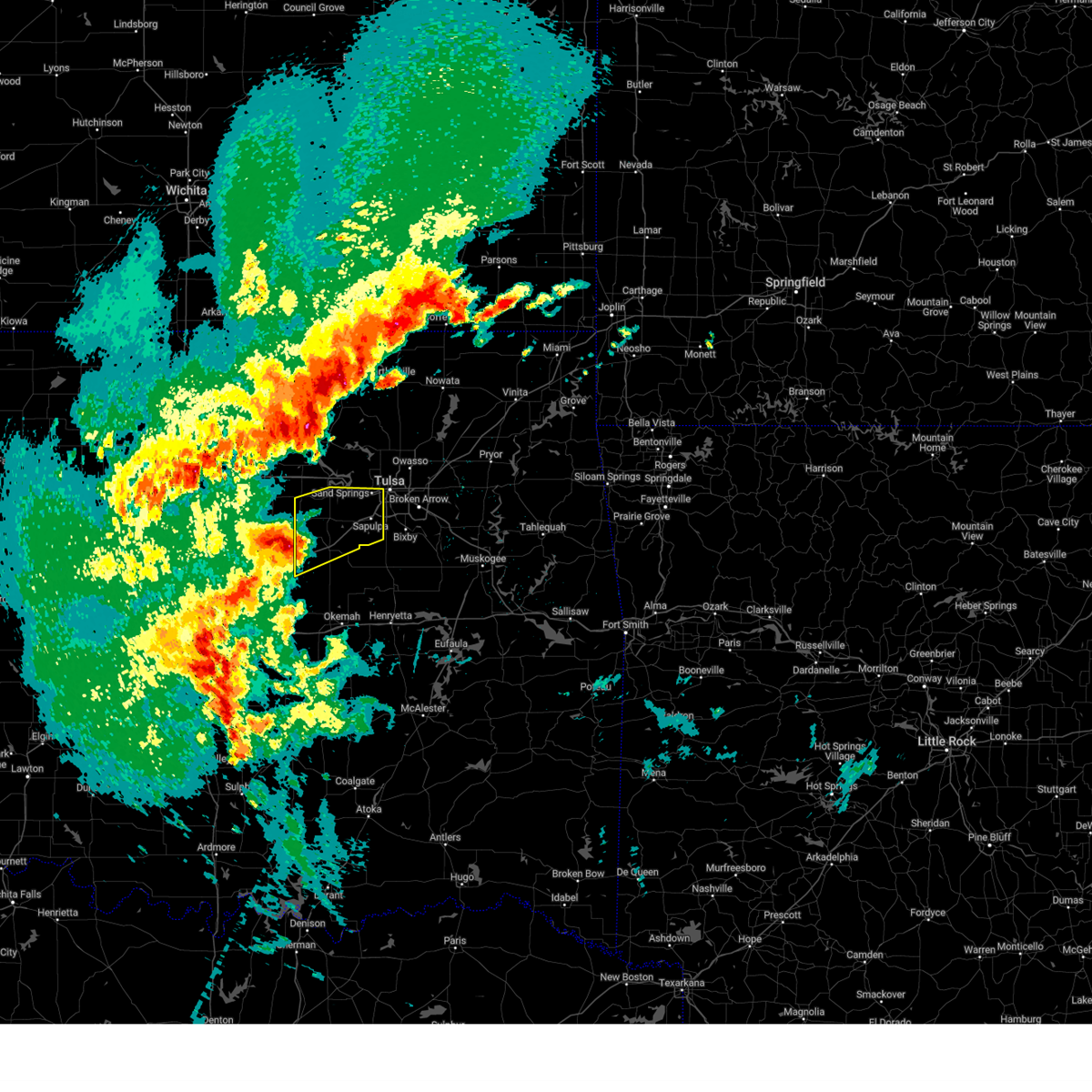 Svrtsa the national weather service in tulsa has issued a * severe thunderstorm warning for, creek county in northeastern oklahoma, southwestern tulsa county in northeastern oklahoma, * until 715 am cdt. * at 626 am cdt, a severe thunderstorm was located near shamrock, moving northeast at 45 mph (radar indicated). Hazards include 60 mph wind gusts and nickel size hail. Expect damage to roofs, siding, and trees. Locations in or near the path include, sand springs, keystone state park, shamrock, bristow, mannford, sapulpa, oilton, depew, milfay, silver city, drumright, kellyville, kiefer, tulsa, this includes interstate 44 between mile markers 178 and 218. Svrtsa the national weather service in tulsa has issued a * severe thunderstorm warning for, creek county in northeastern oklahoma, southwestern tulsa county in northeastern oklahoma, * until 715 am cdt. * at 626 am cdt, a severe thunderstorm was located near shamrock, moving northeast at 45 mph (radar indicated). Hazards include 60 mph wind gusts and nickel size hail. Expect damage to roofs, siding, and trees. Locations in or near the path include, sand springs, keystone state park, shamrock, bristow, mannford, sapulpa, oilton, depew, milfay, silver city, drumright, kellyville, kiefer, tulsa, this includes interstate 44 between mile markers 178 and 218.
|
| 4/4/2025 6:19 AM CDT |
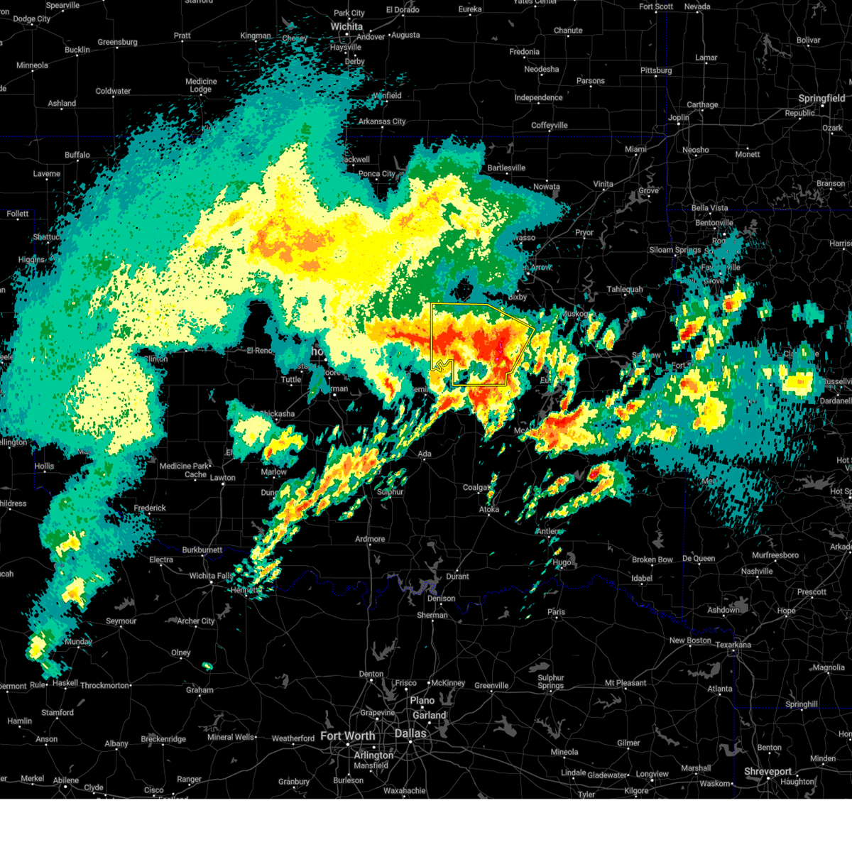 At 618 am cdt, severe thunderstorms were located along a line extending from 4 miles southeast of stroud to 6 miles southwest of beggs to 2 miles northwest of grayson, moving north at 60 mph. golf ball size hail was reported just to the west of henryetta (radar indicated). Hazards include golf ball size hail and 60 mph wind gusts. People and animals outdoors will be injured. expect hail damage to roofs, siding, windows, and vehicles. expect wind damage to roofs, siding, and trees. locations in or near the path include, beggs, preston, boley, paden, weleetka, dewar, depew, clearview, schulter, morris, pharoah, grayson, bryant, bristow, okmulgee, okemah, okfuskee, henryetta, milfay, mason, this includes the following highways, interstate 40 in oklahoma between mile markers 212 and 241. Interstate 44 between mile markers 178 and 192. At 618 am cdt, severe thunderstorms were located along a line extending from 4 miles southeast of stroud to 6 miles southwest of beggs to 2 miles northwest of grayson, moving north at 60 mph. golf ball size hail was reported just to the west of henryetta (radar indicated). Hazards include golf ball size hail and 60 mph wind gusts. People and animals outdoors will be injured. expect hail damage to roofs, siding, windows, and vehicles. expect wind damage to roofs, siding, and trees. locations in or near the path include, beggs, preston, boley, paden, weleetka, dewar, depew, clearview, schulter, morris, pharoah, grayson, bryant, bristow, okmulgee, okemah, okfuskee, henryetta, milfay, mason, this includes the following highways, interstate 40 in oklahoma between mile markers 212 and 241. Interstate 44 between mile markers 178 and 192.
|
| 4/4/2025 6:06 AM CDT |
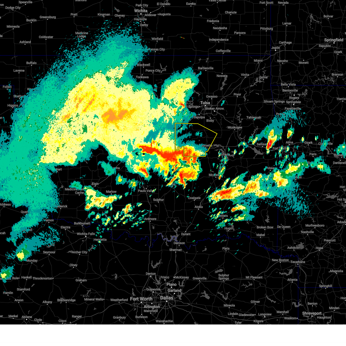 At 606 am cdt, severe thunderstorms were located along a line extending from 5 miles north of prague to 3 miles southwest of okfuskee to 2 miles west of henryetta, moving north at 60 mph (radar indicated). Hazards include 60 mph wind gusts and quarter size hail. Hail damage to vehicles is expected. expect wind damage to roofs, siding, and trees. locations in or near the path include, beggs, preston, boley, paden, weleetka, dewar, depew, clearview, schulter, morris, pharoah, grayson, bryant, bristow, okmulgee, okemah, okfuskee, henryetta, milfay, mason, this includes the following highways, interstate 40 in oklahoma between mile markers 212 and 241. Interstate 44 between mile markers 178 and 192. At 606 am cdt, severe thunderstorms were located along a line extending from 5 miles north of prague to 3 miles southwest of okfuskee to 2 miles west of henryetta, moving north at 60 mph (radar indicated). Hazards include 60 mph wind gusts and quarter size hail. Hail damage to vehicles is expected. expect wind damage to roofs, siding, and trees. locations in or near the path include, beggs, preston, boley, paden, weleetka, dewar, depew, clearview, schulter, morris, pharoah, grayson, bryant, bristow, okmulgee, okemah, okfuskee, henryetta, milfay, mason, this includes the following highways, interstate 40 in oklahoma between mile markers 212 and 241. Interstate 44 between mile markers 178 and 192.
|
| 4/4/2025 5:48 AM CDT |
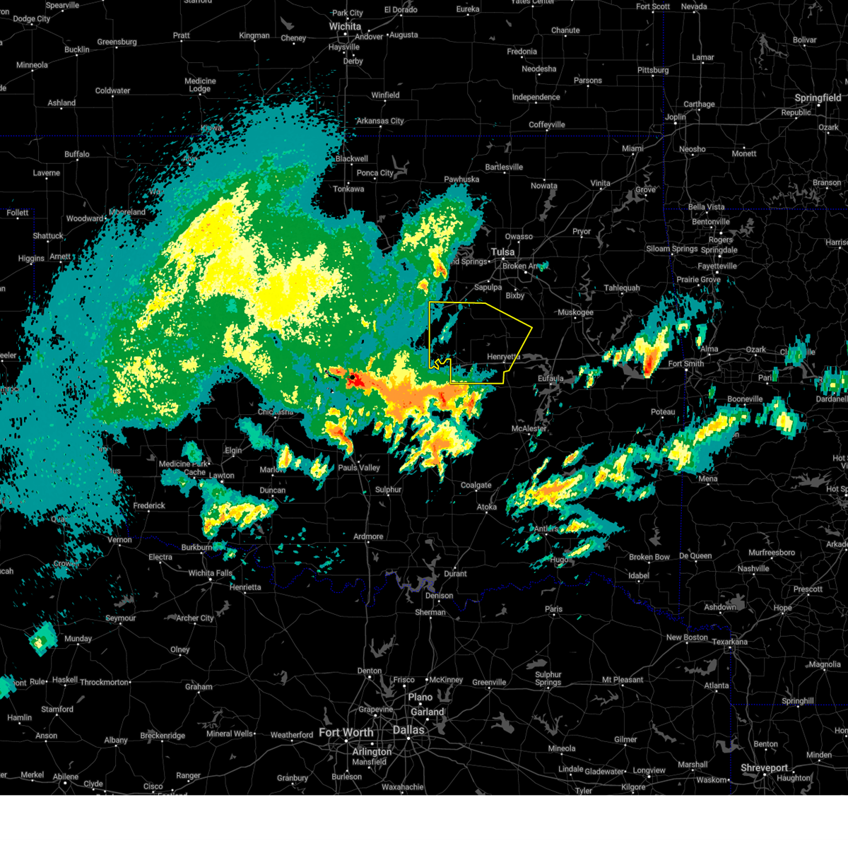 Svrtsa the national weather service in tulsa has issued a * severe thunderstorm warning for, southwestern creek county in northeastern oklahoma, okmulgee county in northeastern oklahoma, okfuskee county in east central oklahoma, * until 630 am cdt. * at 547 am cdt, severe thunderstorms were located along a line extending from 4 miles west of little to 4 miles southeast of bearden to 4 miles southeast of wetumka, moving north at 60 mph (radar indicated). Hazards include 60 mph wind gusts and quarter size hail. Hail damage to vehicles is expected. expect wind damage to roofs, siding, and trees. locations in or near the path include, beggs, preston, boley, paden, weleetka, dewar, depew, clearview, schulter, morris, pharoah, grayson, bryant, bristow, okmulgee, okemah, okfuskee, henryetta, milfay, mason, this includes the following highways, interstate 40 in oklahoma between mile markers 212 and 241. Interstate 44 between mile markers 178 and 192. Svrtsa the national weather service in tulsa has issued a * severe thunderstorm warning for, southwestern creek county in northeastern oklahoma, okmulgee county in northeastern oklahoma, okfuskee county in east central oklahoma, * until 630 am cdt. * at 547 am cdt, severe thunderstorms were located along a line extending from 4 miles west of little to 4 miles southeast of bearden to 4 miles southeast of wetumka, moving north at 60 mph (radar indicated). Hazards include 60 mph wind gusts and quarter size hail. Hail damage to vehicles is expected. expect wind damage to roofs, siding, and trees. locations in or near the path include, beggs, preston, boley, paden, weleetka, dewar, depew, clearview, schulter, morris, pharoah, grayson, bryant, bristow, okmulgee, okemah, okfuskee, henryetta, milfay, mason, this includes the following highways, interstate 40 in oklahoma between mile markers 212 and 241. Interstate 44 between mile markers 178 and 192.
|
| 4/2/2025 6:48 AM CDT |
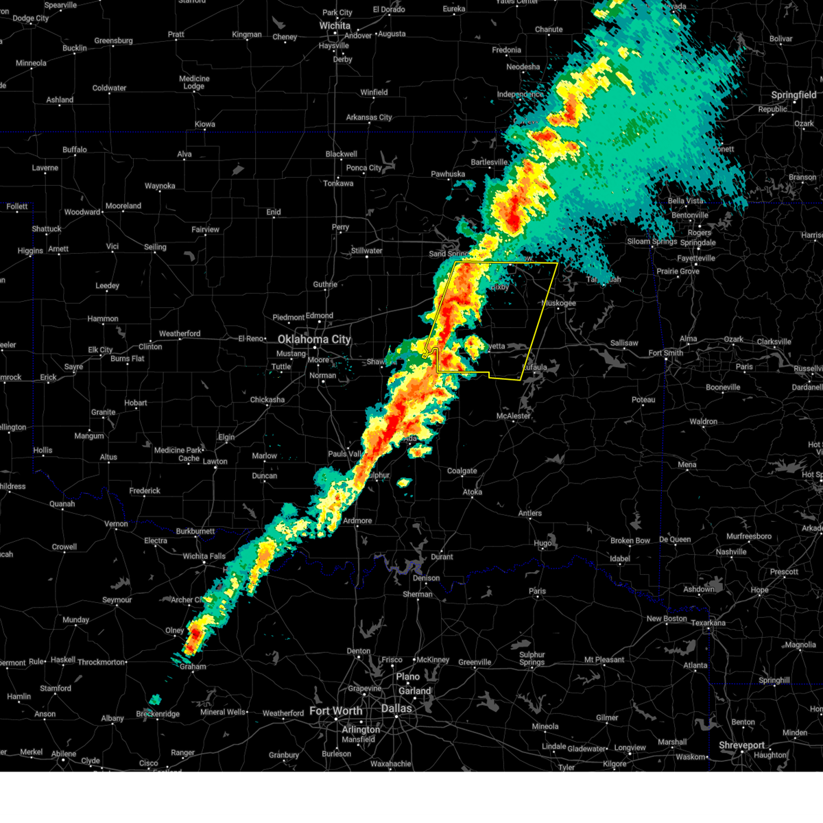 Svrtsa the national weather service in tulsa has issued a * severe thunderstorm warning for, eastern creek county in northeastern oklahoma, western mcintosh county in southeastern oklahoma, southwestern wagoner county in northeastern oklahoma, okmulgee county in northeastern oklahoma, northwestern muskogee county in east central oklahoma, southern tulsa county in northeastern oklahoma, okfuskee county in east central oklahoma, * until 745 am cdt. * at 648 am cdt, severe thunderstorms were located along a line extending from 2 miles north of sapulpa to 3 miles south of cromwell, moving east at 45 mph (radar indicated). Hazards include 60 mph wind gusts and quarter size hail. Hail damage to vehicles is expected. expect wind damage to roofs, siding, and trees. locations in or near the path include, beggs, sapulpa, raiford, jenks riverside airport, mounds, pierce, clearview, schulter, stonebluff, hectorville, eram, haskell, leonard, morris, pharoah, bryant, hoffman, okmulgee, hitchita, okemah, this includes the following highways, interstate 40 in oklahoma between mile markers 212 and 258. Interstate 44 between mile markers 193 and 216. Svrtsa the national weather service in tulsa has issued a * severe thunderstorm warning for, eastern creek county in northeastern oklahoma, western mcintosh county in southeastern oklahoma, southwestern wagoner county in northeastern oklahoma, okmulgee county in northeastern oklahoma, northwestern muskogee county in east central oklahoma, southern tulsa county in northeastern oklahoma, okfuskee county in east central oklahoma, * until 745 am cdt. * at 648 am cdt, severe thunderstorms were located along a line extending from 2 miles north of sapulpa to 3 miles south of cromwell, moving east at 45 mph (radar indicated). Hazards include 60 mph wind gusts and quarter size hail. Hail damage to vehicles is expected. expect wind damage to roofs, siding, and trees. locations in or near the path include, beggs, sapulpa, raiford, jenks riverside airport, mounds, pierce, clearview, schulter, stonebluff, hectorville, eram, haskell, leonard, morris, pharoah, bryant, hoffman, okmulgee, hitchita, okemah, this includes the following highways, interstate 40 in oklahoma between mile markers 212 and 258. Interstate 44 between mile markers 193 and 216.
|
| 4/2/2025 6:00 AM CDT |
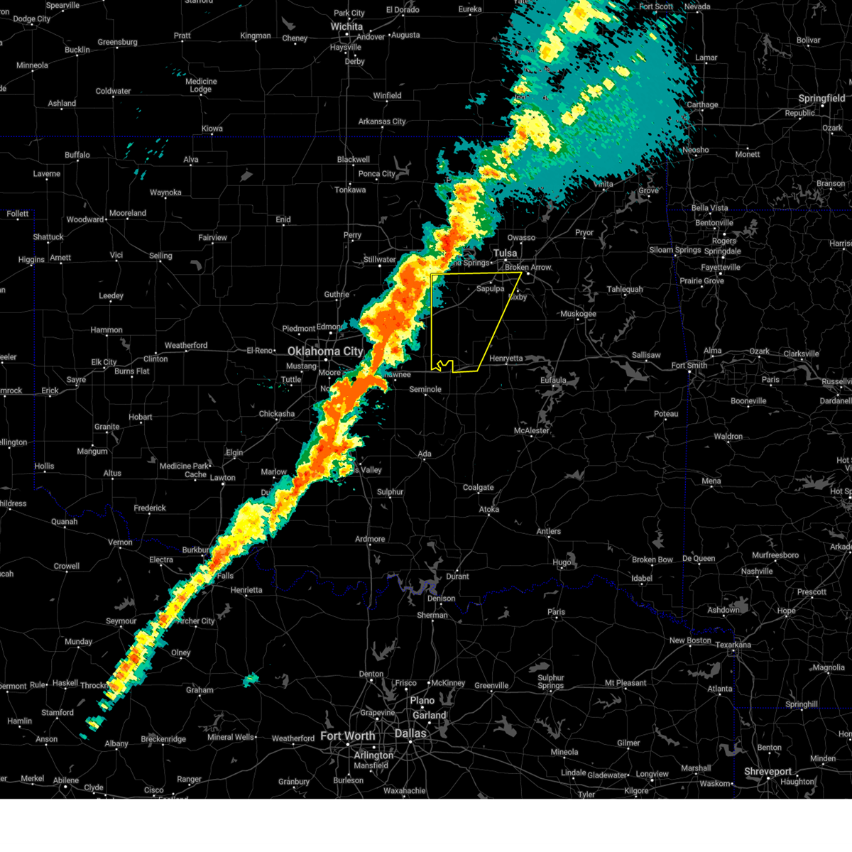 Svrtsa the national weather service in tulsa has issued a * severe thunderstorm warning for, creek county in northeastern oklahoma, northwestern okmulgee county in northeastern oklahoma, southeastern tulsa county in northeastern oklahoma, okfuskee county in east central oklahoma, * until 645 am cdt. * at 559 am cdt, severe thunderstorms were located along a line extending from near oilton to 4 miles northeast of dale, moving east at 60 mph (radar indicated). Hazards include 60 mph wind gusts and quarter size hail. Hail damage to vehicles is expected. expect wind damage to roofs, siding, and trees. locations in or near the path include, beggs, shamrock, bristow, boley, sapulpa, paden, okemah, jenks riverside airport, liberty, depew, okfuskee, milfay, mounds, drumright, mason, castle, jenks, glenpool, welty, slick, this includes the following highways, interstate 40 in oklahoma between mile markers 212 and 224. Interstate 44 between mile markers 178 and 215. Svrtsa the national weather service in tulsa has issued a * severe thunderstorm warning for, creek county in northeastern oklahoma, northwestern okmulgee county in northeastern oklahoma, southeastern tulsa county in northeastern oklahoma, okfuskee county in east central oklahoma, * until 645 am cdt. * at 559 am cdt, severe thunderstorms were located along a line extending from near oilton to 4 miles northeast of dale, moving east at 60 mph (radar indicated). Hazards include 60 mph wind gusts and quarter size hail. Hail damage to vehicles is expected. expect wind damage to roofs, siding, and trees. locations in or near the path include, beggs, shamrock, bristow, boley, sapulpa, paden, okemah, jenks riverside airport, liberty, depew, okfuskee, milfay, mounds, drumright, mason, castle, jenks, glenpool, welty, slick, this includes the following highways, interstate 40 in oklahoma between mile markers 212 and 224. Interstate 44 between mile markers 178 and 215.
|
| 11/4/2024 12:04 PM CST |
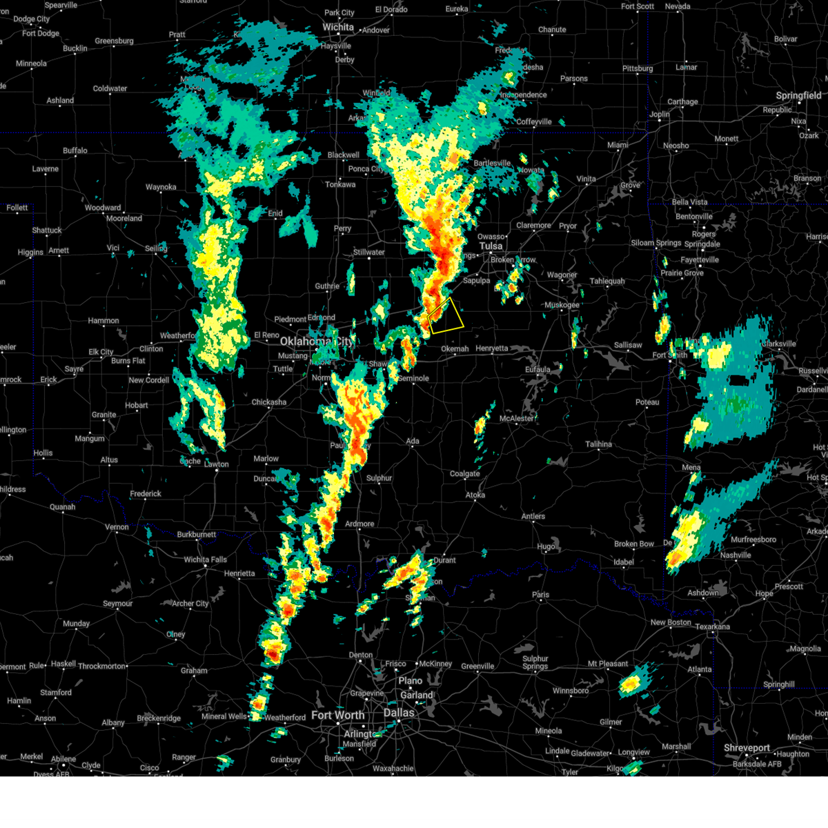 At 1204 pm cst, a severe thunderstorm was located 6 miles southeast of depew, moving northeast at 50 mph (radar indicated). Hazards include 60 mph wind gusts. Expect damage to roofs, siding, and trees. Locations in or near the path include, welty,. At 1204 pm cst, a severe thunderstorm was located 6 miles southeast of depew, moving northeast at 50 mph (radar indicated). Hazards include 60 mph wind gusts. Expect damage to roofs, siding, and trees. Locations in or near the path include, welty,.
|
| 11/4/2024 11:58 AM CST |
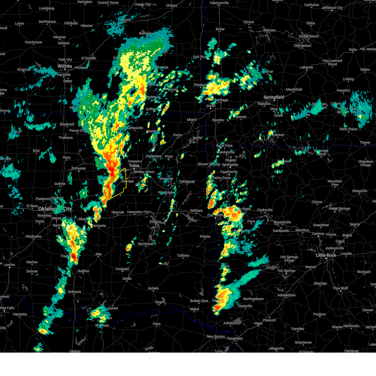 Svrtsa the national weather service in tulsa has issued a * severe thunderstorm warning for, central creek county in northeastern oklahoma, west central tulsa county in northeastern oklahoma, * until 1230 pm cst. * at 1158 am cst, severe thunderstorms were located along a line extending from 6 miles east of shamrock to near bristow to 5 miles southeast of depew, moving northeast at 50 mph (radar indicated). Hazards include 60 mph wind gusts and penny size hail. Expect damage to roofs, siding, and trees. Locations in or near the path include, bristow, kellyville, slick, this includes interstate 44 between mile markers 186 and 208. Svrtsa the national weather service in tulsa has issued a * severe thunderstorm warning for, central creek county in northeastern oklahoma, west central tulsa county in northeastern oklahoma, * until 1230 pm cst. * at 1158 am cst, severe thunderstorms were located along a line extending from 6 miles east of shamrock to near bristow to 5 miles southeast of depew, moving northeast at 50 mph (radar indicated). Hazards include 60 mph wind gusts and penny size hail. Expect damage to roofs, siding, and trees. Locations in or near the path include, bristow, kellyville, slick, this includes interstate 44 between mile markers 186 and 208.
|
| 11/4/2024 11:52 AM CST |
 At 1152 am cst, a severe thunderstorm was located 7 miles north of paden, moving northeast at 50 mph (radar indicated). Hazards include 60 mph wind gusts and penny size hail. Expect damage to roofs, siding, and trees. Locations in or near the path include, welty,. At 1152 am cst, a severe thunderstorm was located 7 miles north of paden, moving northeast at 50 mph (radar indicated). Hazards include 60 mph wind gusts and penny size hail. Expect damage to roofs, siding, and trees. Locations in or near the path include, welty,.
|
| 11/4/2024 11:50 AM CST |
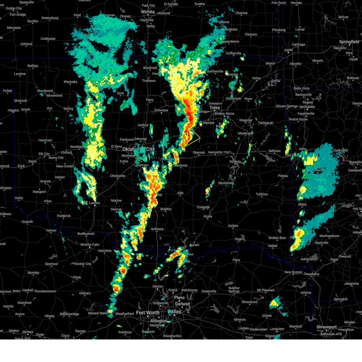 At 1150 am cst, a severe thunderstorm was located over depew, moving northeast at 45 mph (radar indicated). Hazards include 60 mph wind gusts and penny size hail. Expect damage to roofs, siding, and trees. Locations in or near the path include, depew, milfay, this includes interstate 44 between mile markers 183 and 188. At 1150 am cst, a severe thunderstorm was located over depew, moving northeast at 45 mph (radar indicated). Hazards include 60 mph wind gusts and penny size hail. Expect damage to roofs, siding, and trees. Locations in or near the path include, depew, milfay, this includes interstate 44 between mile markers 183 and 188.
|
| 11/4/2024 11:42 AM CST |
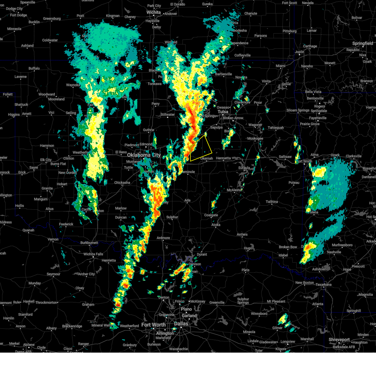 Svrtsa the national weather service in tulsa has issued a * severe thunderstorm warning for, southwestern creek county in northeastern oklahoma, northwestern okfuskee county in east central oklahoma, * until 1230 pm cst. * at 1142 am cst, a severe thunderstorm was located near prague, moving northeast at 50 mph (radar indicated). Hazards include 60 mph wind gusts and quarter size hail. Hail damage to vehicles is expected. expect wind damage to roofs, siding, and trees. Locations in or near the path include, okfuskee, boley, paden, welty, mason,. Svrtsa the national weather service in tulsa has issued a * severe thunderstorm warning for, southwestern creek county in northeastern oklahoma, northwestern okfuskee county in east central oklahoma, * until 1230 pm cst. * at 1142 am cst, a severe thunderstorm was located near prague, moving northeast at 50 mph (radar indicated). Hazards include 60 mph wind gusts and quarter size hail. Hail damage to vehicles is expected. expect wind damage to roofs, siding, and trees. Locations in or near the path include, okfuskee, boley, paden, welty, mason,.
|
| 11/4/2024 11:33 AM CST |
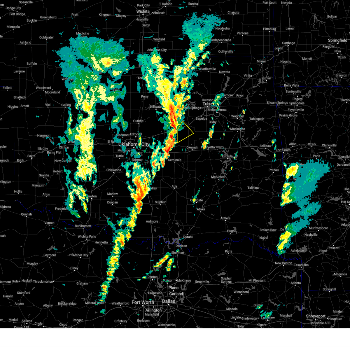 At 1133 am cst, a severe thunderstorm was located 6 miles southeast of davenport, moving northeast at 45 mph (radar indicated). Hazards include 60 mph wind gusts and quarter size hail. Hail damage to vehicles is expected. expect wind damage to roofs, siding, and trees. Locations in or near the path include, depew, milfay, this includes interstate 44 between mile markers 178 and 189. At 1133 am cst, a severe thunderstorm was located 6 miles southeast of davenport, moving northeast at 45 mph (radar indicated). Hazards include 60 mph wind gusts and quarter size hail. Hail damage to vehicles is expected. expect wind damage to roofs, siding, and trees. Locations in or near the path include, depew, milfay, this includes interstate 44 between mile markers 178 and 189.
|
| 11/4/2024 11:22 AM CST |
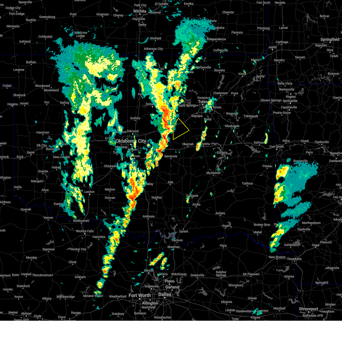 Svrtsa the national weather service in tulsa has issued a * severe thunderstorm warning for, southwestern creek county in northeastern oklahoma, northwestern okfuskee county in east central oklahoma, * until noon cst. * at 1121 am cst, a severe thunderstorm was located 4 miles southeast of sparks, moving northeast at 45 mph (radar indicated). Hazards include 60 mph wind gusts and quarter size hail. Hail damage to vehicles is expected. expect wind damage to roofs, siding, and trees. Locations in or near the path include, depew, milfay, this includes interstate 44 between mile markers 178 and 189. Svrtsa the national weather service in tulsa has issued a * severe thunderstorm warning for, southwestern creek county in northeastern oklahoma, northwestern okfuskee county in east central oklahoma, * until noon cst. * at 1121 am cst, a severe thunderstorm was located 4 miles southeast of sparks, moving northeast at 45 mph (radar indicated). Hazards include 60 mph wind gusts and quarter size hail. Hail damage to vehicles is expected. expect wind damage to roofs, siding, and trees. Locations in or near the path include, depew, milfay, this includes interstate 44 between mile markers 178 and 189.
|
| 11/3/2024 3:41 AM CST |
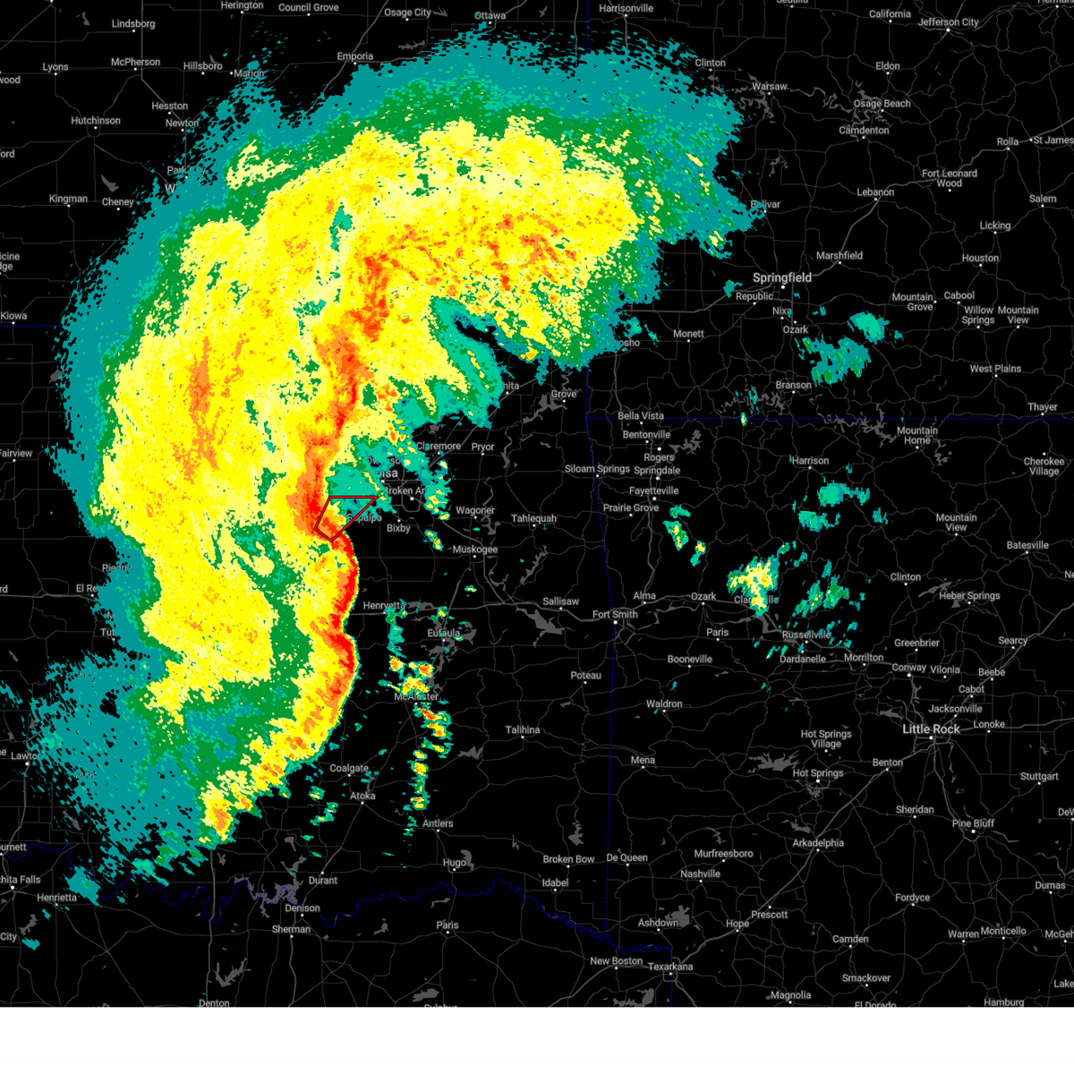 Tortsa the national weather service in tulsa has issued a * tornado warning for, central creek county in northeastern oklahoma, * until 415 am cst. * at 340 am cst, a severe thunderstorm capable of producing a tornado was located 5 miles northeast of bristow, moving northeast at 50 mph (radar indicated rotation). Hazards include tornado. Flying debris will be dangerous to those caught without shelter. mobile homes will be damaged or destroyed. damage to roofs, windows, and vehicles will occur. tree damage is likely. Locations in or near the path include, kellyville, this includes interstate 44 between mile markers 193 and 215. Tortsa the national weather service in tulsa has issued a * tornado warning for, central creek county in northeastern oklahoma, * until 415 am cst. * at 340 am cst, a severe thunderstorm capable of producing a tornado was located 5 miles northeast of bristow, moving northeast at 50 mph (radar indicated rotation). Hazards include tornado. Flying debris will be dangerous to those caught without shelter. mobile homes will be damaged or destroyed. damage to roofs, windows, and vehicles will occur. tree damage is likely. Locations in or near the path include, kellyville, this includes interstate 44 between mile markers 193 and 215.
|
| 11/3/2024 3:29 AM CST |
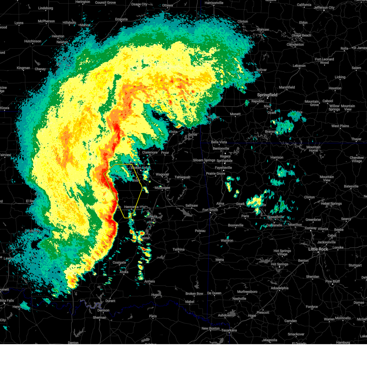 Svrtsa the national weather service in tulsa has issued a * severe thunderstorm warning for, central creek county in northeastern oklahoma, okmulgee county in northeastern oklahoma, southern tulsa county in northeastern oklahoma, eastern okfuskee county in east central oklahoma, * until 415 am cst. * at 329 am cst, severe thunderstorms were located along a line extending from 6 miles east of drumright to 6 miles northwest of okfuskee to 4 miles southeast of bearden, moving east at 50 mph (radar indicated). Hazards include 70 mph wind gusts. Expect considerable tree damage. damage is likely to mobile homes, roofs, and outbuildings. locations in or near the path include, tulsa, sand springs, okmulgee, bristow, bixby, sapulpa, jenks, okfuskee, glenpool, henryetta, mannford, kiefer, morris, beggs, mounds, kellyville, weleetka, dewar, schulter, slick, this includes the following highways, interstate 40 in oklahoma between mile markers 226 and 241. Interstate 44 between mile markers 190 and 223. Svrtsa the national weather service in tulsa has issued a * severe thunderstorm warning for, central creek county in northeastern oklahoma, okmulgee county in northeastern oklahoma, southern tulsa county in northeastern oklahoma, eastern okfuskee county in east central oklahoma, * until 415 am cst. * at 329 am cst, severe thunderstorms were located along a line extending from 6 miles east of drumright to 6 miles northwest of okfuskee to 4 miles southeast of bearden, moving east at 50 mph (radar indicated). Hazards include 70 mph wind gusts. Expect considerable tree damage. damage is likely to mobile homes, roofs, and outbuildings. locations in or near the path include, tulsa, sand springs, okmulgee, bristow, bixby, sapulpa, jenks, okfuskee, glenpool, henryetta, mannford, kiefer, morris, beggs, mounds, kellyville, weleetka, dewar, schulter, slick, this includes the following highways, interstate 40 in oklahoma between mile markers 226 and 241. Interstate 44 between mile markers 190 and 223.
|
| 11/3/2024 3:24 AM CST |
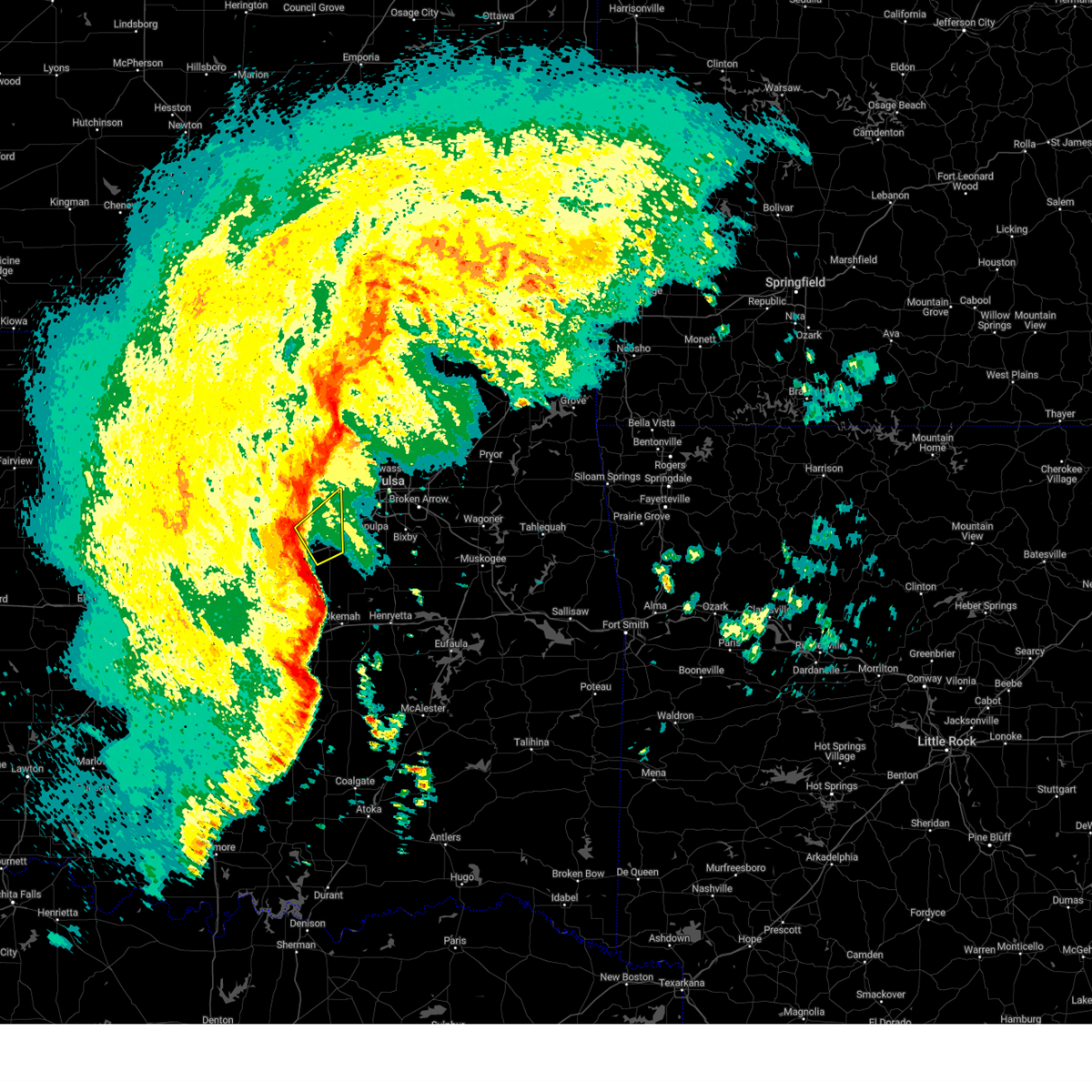 Svrtsa the national weather service in tulsa has issued a * severe thunderstorm warning for, western creek county in northeastern oklahoma, * until 345 am cst. * at 324 am cst, severe thunderstorms were located along a line extending from 3 miles northeast of shamrock to 4 miles southwest of bristow, moving northeast at 70 mph (radar indicated). Hazards include 70 mph wind gusts. Expect considerable tree damage. damage is likely to mobile homes, roofs, and outbuildings. Locations in or near the path include, bristow, mannford, depew, shamrock, this includes interstate 44 between mile markers 184 and 197. Svrtsa the national weather service in tulsa has issued a * severe thunderstorm warning for, western creek county in northeastern oklahoma, * until 345 am cst. * at 324 am cst, severe thunderstorms were located along a line extending from 3 miles northeast of shamrock to 4 miles southwest of bristow, moving northeast at 70 mph (radar indicated). Hazards include 70 mph wind gusts. Expect considerable tree damage. damage is likely to mobile homes, roofs, and outbuildings. Locations in or near the path include, bristow, mannford, depew, shamrock, this includes interstate 44 between mile markers 184 and 197.
|
| 11/3/2024 2:52 AM CST |
 Svrtsa the national weather service in tulsa has issued a * severe thunderstorm warning for, western creek county in northeastern oklahoma, northwestern okfuskee county in east central oklahoma, * until 330 am cst. * at 251 am cst, severe thunderstorms were located along a line extending from 2 miles east of chandler to 3 miles east of sparks to 3 miles north of earlsboro, moving northeast at 60 mph (radar indicated). Hazards include 60 mph wind gusts. Expect damage to roofs, siding, and trees. Locations in or near the path include, drumright, boley, oilton, depew, paden, shamrock, silver city, milfay, this includes interstate 44 between mile markers 178 and 190. Svrtsa the national weather service in tulsa has issued a * severe thunderstorm warning for, western creek county in northeastern oklahoma, northwestern okfuskee county in east central oklahoma, * until 330 am cst. * at 251 am cst, severe thunderstorms were located along a line extending from 2 miles east of chandler to 3 miles east of sparks to 3 miles north of earlsboro, moving northeast at 60 mph (radar indicated). Hazards include 60 mph wind gusts. Expect damage to roofs, siding, and trees. Locations in or near the path include, drumright, boley, oilton, depew, paden, shamrock, silver city, milfay, this includes interstate 44 between mile markers 178 and 190.
|
| 9/24/2024 8:27 PM CDT |
 At 827 pm cdt, a severe thunderstorm was located 6 miles north of welty, moving southeast at 30 mph (radar indicated). Hazards include quarter size hail. Damage to vehicles is expected. Locations in or near the path include, okfuskee, slick, welty,. At 827 pm cdt, a severe thunderstorm was located 6 miles north of welty, moving southeast at 30 mph (radar indicated). Hazards include quarter size hail. Damage to vehicles is expected. Locations in or near the path include, okfuskee, slick, welty,.
|
| 9/24/2024 8:18 PM CDT |
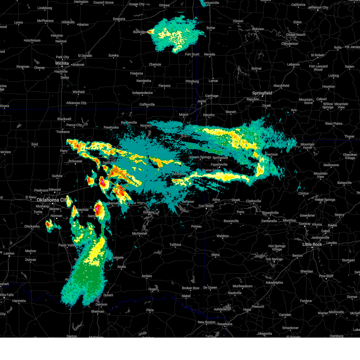 At 818 pm cdt, a severe thunderstorm was located 3 miles southwest of kellyville, moving southeast at 30 mph (radar indicated). Hazards include half dollar size hail. Damage to vehicles is expected. Locations in or near the path include, beggs, mounds, kellyville, slick, liberty, this includes interstate 44 between mile markers 192 and 205. At 818 pm cdt, a severe thunderstorm was located 3 miles southwest of kellyville, moving southeast at 30 mph (radar indicated). Hazards include half dollar size hail. Damage to vehicles is expected. Locations in or near the path include, beggs, mounds, kellyville, slick, liberty, this includes interstate 44 between mile markers 192 and 205.
|
| 9/24/2024 8:14 PM CDT |
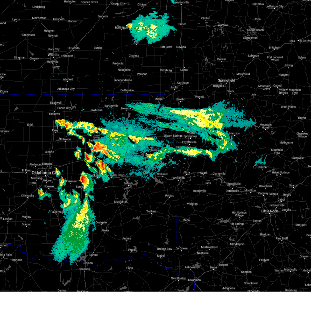 Svrtsa the national weather service in tulsa has issued a * severe thunderstorm warning for, southwestern creek county in northeastern oklahoma, west central okmulgee county in northeastern oklahoma, north central okfuskee county in east central oklahoma, * until 900 pm cdt. * at 814 pm cdt, a severe thunderstorm was located near depew, moving southeast at 30 mph (radar indicated). Hazards include quarter size hail. Damage to vehicles is expected. Locations in or near the path include, bristow, okfuskee, depew, slick, welty, milfay, this includes interstate 44 between mile markers 181 and 190. Svrtsa the national weather service in tulsa has issued a * severe thunderstorm warning for, southwestern creek county in northeastern oklahoma, west central okmulgee county in northeastern oklahoma, north central okfuskee county in east central oklahoma, * until 900 pm cdt. * at 814 pm cdt, a severe thunderstorm was located near depew, moving southeast at 30 mph (radar indicated). Hazards include quarter size hail. Damage to vehicles is expected. Locations in or near the path include, bristow, okfuskee, depew, slick, welty, milfay, this includes interstate 44 between mile markers 181 and 190.
|
| 9/24/2024 8:11 PM CDT |
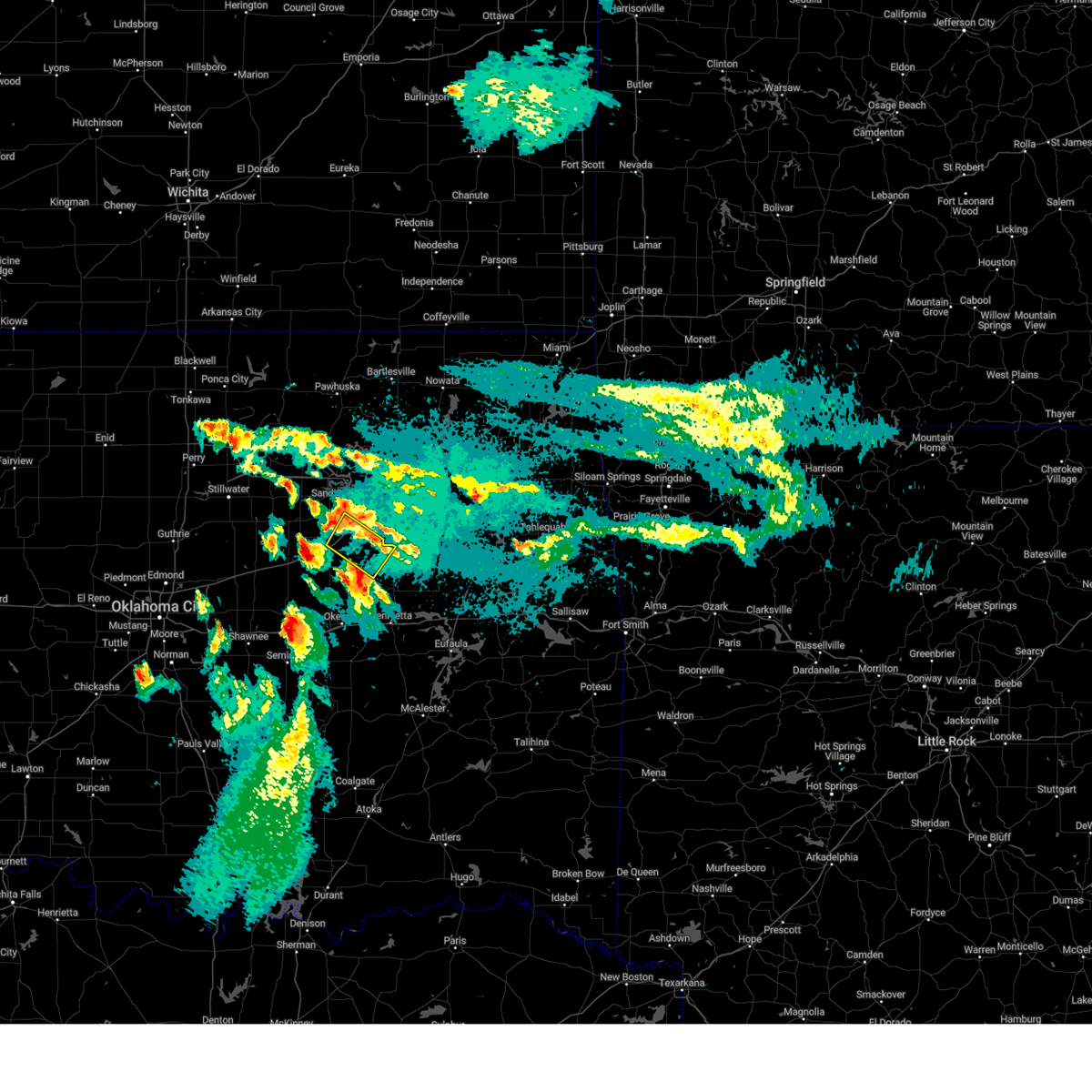 Svrtsa the national weather service in tulsa has issued a * severe thunderstorm warning for, central creek county in northeastern oklahoma, northwestern okmulgee county in northeastern oklahoma, * until 845 pm cdt. * at 811 pm cdt, a severe thunderstorm was located 4 miles southwest of kellyville, moving southeast at 35 mph (radar indicated). Hazards include quarter size hail. Damage to vehicles is expected. Locations in or near the path include, beggs, mounds, kellyville, slick, liberty, this includes interstate 44 between mile markers 192 and 205. Svrtsa the national weather service in tulsa has issued a * severe thunderstorm warning for, central creek county in northeastern oklahoma, northwestern okmulgee county in northeastern oklahoma, * until 845 pm cdt. * at 811 pm cdt, a severe thunderstorm was located 4 miles southwest of kellyville, moving southeast at 35 mph (radar indicated). Hazards include quarter size hail. Damage to vehicles is expected. Locations in or near the path include, beggs, mounds, kellyville, slick, liberty, this includes interstate 44 between mile markers 192 and 205.
|
| 6/26/2024 8:00 AM CDT |
 At 800 am cdt, severe thunderstorms were located along a line extending from bristow to 2 miles northeast of preston, moving south at 35 mph (radar indicated). Hazards include 70 mph wind gusts. Expect considerable tree damage. damage is likely to mobile homes, roofs, and outbuildings. Locations in or near the path include, tulsa, broken arrow, sand springs, okmulgee, bristow, bixby, sapulpa, jenks, glenpool, catoosa, mannford, kiefer, beggs, mounds, kellyville, slick, preston, jenks riverside airport, keystone state park, bald hill, this includes interstate 44 between mile markers 188 and 237. At 800 am cdt, severe thunderstorms were located along a line extending from bristow to 2 miles northeast of preston, moving south at 35 mph (radar indicated). Hazards include 70 mph wind gusts. Expect considerable tree damage. damage is likely to mobile homes, roofs, and outbuildings. Locations in or near the path include, tulsa, broken arrow, sand springs, okmulgee, bristow, bixby, sapulpa, jenks, glenpool, catoosa, mannford, kiefer, beggs, mounds, kellyville, slick, preston, jenks riverside airport, keystone state park, bald hill, this includes interstate 44 between mile markers 188 and 237.
|
| 6/26/2024 8:00 AM CDT |
 the severe thunderstorm warning has been cancelled and is no longer in effect the severe thunderstorm warning has been cancelled and is no longer in effect
|
| 6/26/2024 7:32 AM CDT |
 Svrtsa the national weather service in tulsa has issued a * severe thunderstorm warning for, southwestern rogers county in northeastern oklahoma, southeastern osage county in northeastern oklahoma, central creek county in northeastern oklahoma, northwestern wagoner county in northeastern oklahoma, northern okmulgee county in northeastern oklahoma, southeastern pawnee county in northeastern oklahoma, tulsa county in northeastern oklahoma, * until 830 am cdt. * at 732 am cdt, severe thunderstorms were located along a line extending from near keystone state park to 3 miles northwest of broken arrow, moving south at 65 mph (radar indicated). Hazards include 70 mph wind gusts. Expect considerable tree damage. damage is likely to mobile homes, roofs, and outbuildings. Locations in or near the path include, tulsa, broken arrow, sand springs, okmulgee, bristow, owasso, bixby, sapulpa, jenks, glenpool, catoosa, mannford, kiefer, beggs, sperry, mounds, kellyville, westport, slick, shamrock, this includes interstate 44 between mile markers 188 and 237. Svrtsa the national weather service in tulsa has issued a * severe thunderstorm warning for, southwestern rogers county in northeastern oklahoma, southeastern osage county in northeastern oklahoma, central creek county in northeastern oklahoma, northwestern wagoner county in northeastern oklahoma, northern okmulgee county in northeastern oklahoma, southeastern pawnee county in northeastern oklahoma, tulsa county in northeastern oklahoma, * until 830 am cdt. * at 732 am cdt, severe thunderstorms were located along a line extending from near keystone state park to 3 miles northwest of broken arrow, moving south at 65 mph (radar indicated). Hazards include 70 mph wind gusts. Expect considerable tree damage. damage is likely to mobile homes, roofs, and outbuildings. Locations in or near the path include, tulsa, broken arrow, sand springs, okmulgee, bristow, owasso, bixby, sapulpa, jenks, glenpool, catoosa, mannford, kiefer, beggs, sperry, mounds, kellyville, westport, slick, shamrock, this includes interstate 44 between mile markers 188 and 237.
|
| 5/20/2024 4:18 AM CDT |
 The storms which prompted the warning have weakened below severe limits, and no longer pose an immediate threat to life or property. therefore, the warning has been allowed to expire. however, gusty winds are still possible with these thunderstorms. a severe thunderstorm watch remains in effect until 600 am cdt for northeastern and east central oklahoma. The storms which prompted the warning have weakened below severe limits, and no longer pose an immediate threat to life or property. therefore, the warning has been allowed to expire. however, gusty winds are still possible with these thunderstorms. a severe thunderstorm watch remains in effect until 600 am cdt for northeastern and east central oklahoma.
|
| 5/20/2024 3:36 AM CDT |
 Svrtsa the national weather service in tulsa has issued a * severe thunderstorm warning for, southern creek county in northeastern oklahoma, western okmulgee county in northeastern oklahoma, okfuskee county in east central oklahoma, * until 415 am cdt. * at 336 am cdt, severe thunderstorms were located along a line extending from 5 miles southeast of avery to 2 miles east of prague, moving east at 40 mph (radar indicated). Hazards include 60 mph wind gusts and nickel size hail. Expect damage to roofs, siding, and trees. locations in or near the path include, bristow, okemah, okfuskee, beggs, boley, mounds, weleetka, depew, paden, bearden, slick, castle, shamrock, clearview, okmulgee state park, welty, pharoah, bryant, milfay, mason, this includes the following highways, interstate 40 in oklahoma between mile markers 212 and 233. Interstate 44 between mile markers 178 and 199. Svrtsa the national weather service in tulsa has issued a * severe thunderstorm warning for, southern creek county in northeastern oklahoma, western okmulgee county in northeastern oklahoma, okfuskee county in east central oklahoma, * until 415 am cdt. * at 336 am cdt, severe thunderstorms were located along a line extending from 5 miles southeast of avery to 2 miles east of prague, moving east at 40 mph (radar indicated). Hazards include 60 mph wind gusts and nickel size hail. Expect damage to roofs, siding, and trees. locations in or near the path include, bristow, okemah, okfuskee, beggs, boley, mounds, weleetka, depew, paden, bearden, slick, castle, shamrock, clearview, okmulgee state park, welty, pharoah, bryant, milfay, mason, this includes the following highways, interstate 40 in oklahoma between mile markers 212 and 233. Interstate 44 between mile markers 178 and 199.
|
| 5/6/2024 11:56 PM CDT |
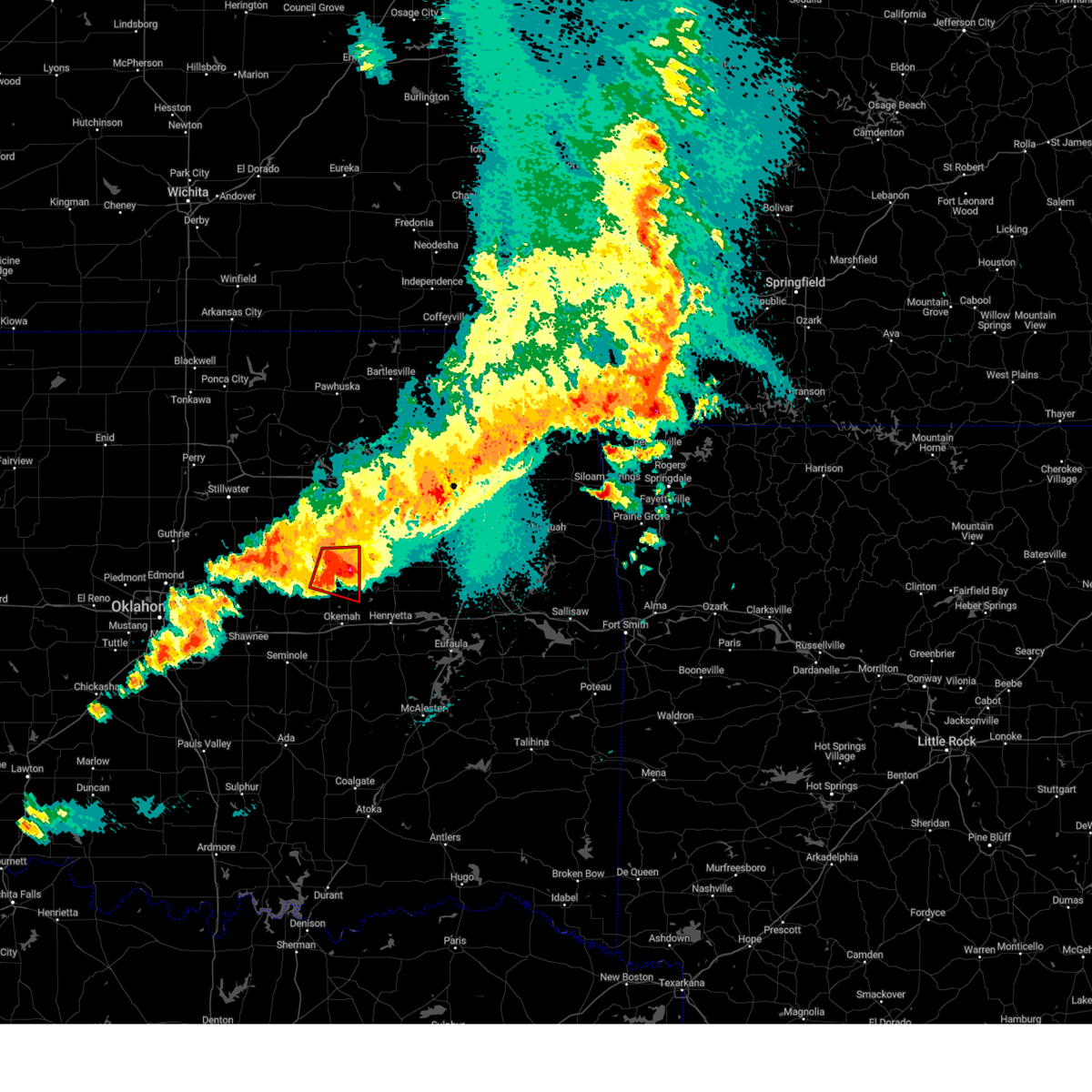 The rotation which prompted the warning has weakened, and no longer appears capable of producing a tornado. therefore, the warning will be allowed to expire. a tornado watch remains in effect until 100 am cdt for northeastern and east central oklahoma. remember, a severe thunderstorm warning still remains in effect for south central creek county in northeastern oklahoma, okmulgee county in northeastern oklahoma, northeastern okfuskee county in east central oklahoma until 1245 am. The rotation which prompted the warning has weakened, and no longer appears capable of producing a tornado. therefore, the warning will be allowed to expire. a tornado watch remains in effect until 100 am cdt for northeastern and east central oklahoma. remember, a severe thunderstorm warning still remains in effect for south central creek county in northeastern oklahoma, okmulgee county in northeastern oklahoma, northeastern okfuskee county in east central oklahoma until 1245 am.
|
| 5/6/2024 11:52 PM CDT |
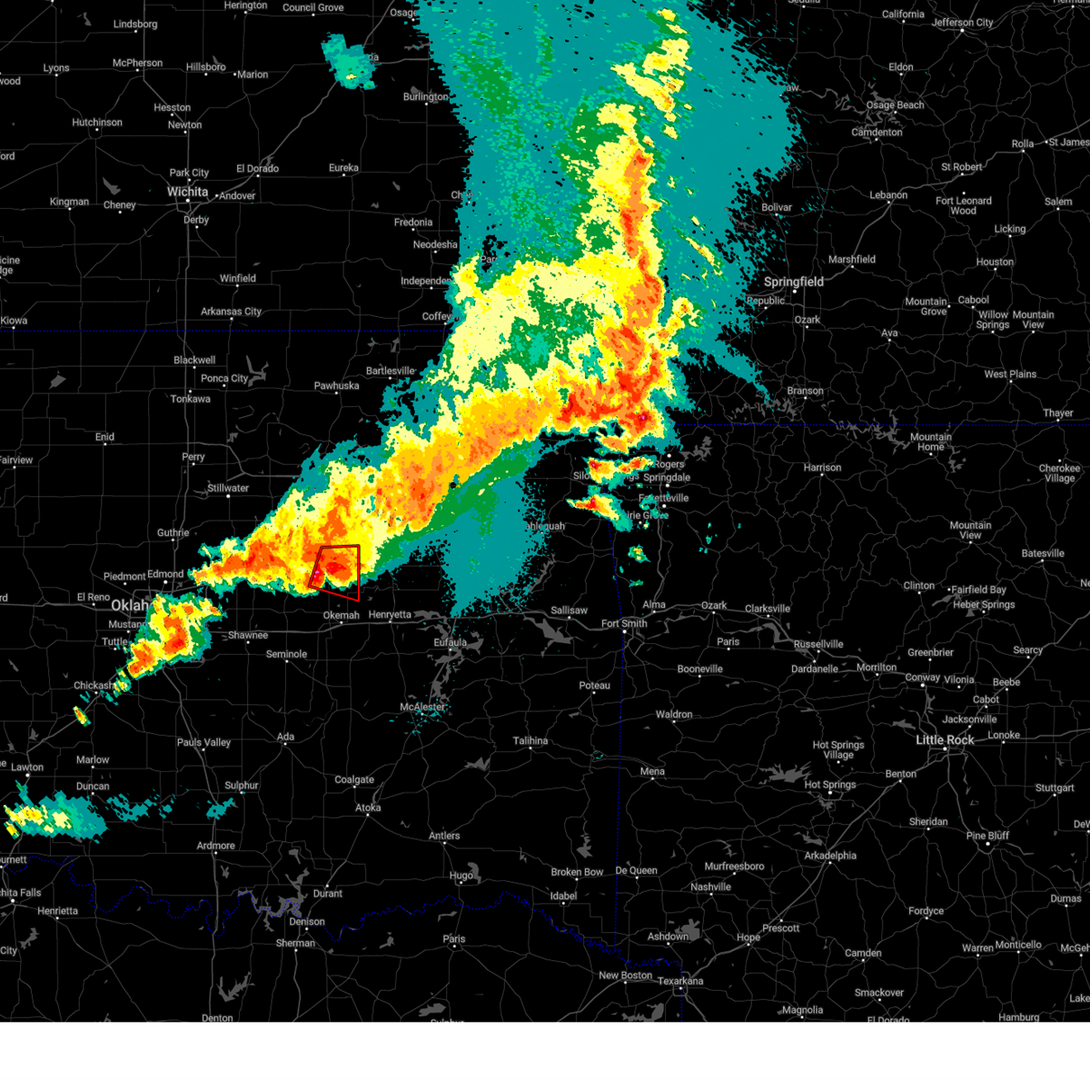 At 1151 pm cdt, a severe thunderstorm capable of producing a tornado was located 6 miles north of welty, moving east at 30 mph (radar indicated rotation. at 11:35 pm golfball size hail was reported in milfay with this storm). Hazards include tornado and golf ball size hail. Flying debris will be dangerous to those caught without shelter. mobile homes will be damaged or destroyed. damage to roofs, windows, and vehicles will occur. tree damage is likely. Locations in or near the path include, bristow, okfuskee, slick, welty, this includes interstate 44 between mile markers 189 and 190. At 1151 pm cdt, a severe thunderstorm capable of producing a tornado was located 6 miles north of welty, moving east at 30 mph (radar indicated rotation. at 11:35 pm golfball size hail was reported in milfay with this storm). Hazards include tornado and golf ball size hail. Flying debris will be dangerous to those caught without shelter. mobile homes will be damaged or destroyed. damage to roofs, windows, and vehicles will occur. tree damage is likely. Locations in or near the path include, bristow, okfuskee, slick, welty, this includes interstate 44 between mile markers 189 and 190.
|
| 5/6/2024 11:43 PM CDT |
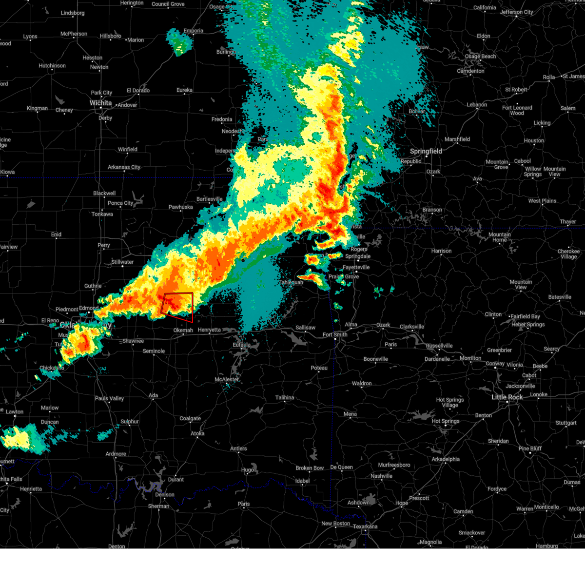 At 1143 pm cdt, a severe thunderstorm capable of producing a tornado was located 6 miles south of depew, moving east at 40 mph (radar indicated rotation). Hazards include tornado and quarter size hail. Flying debris will be dangerous to those caught without shelter. mobile homes will be damaged or destroyed. damage to roofs, windows, and vehicles will occur. tree damage is likely. Locations in or near the path include, bristow, okfuskee, depew, slick, welty, this includes interstate 44 between mile markers 183 and 190. At 1143 pm cdt, a severe thunderstorm capable of producing a tornado was located 6 miles south of depew, moving east at 40 mph (radar indicated rotation). Hazards include tornado and quarter size hail. Flying debris will be dangerous to those caught without shelter. mobile homes will be damaged or destroyed. damage to roofs, windows, and vehicles will occur. tree damage is likely. Locations in or near the path include, bristow, okfuskee, depew, slick, welty, this includes interstate 44 between mile markers 183 and 190.
|
| 5/6/2024 11:34 PM CDT |
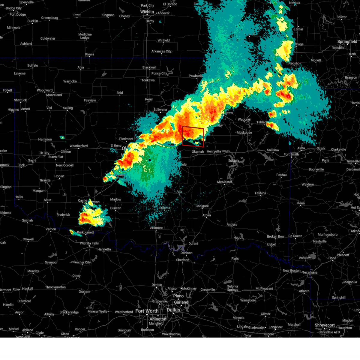 At 1133 pm cdt, a severe thunderstorm capable of producing a tornado was located 4 miles southeast of stroud, moving east at 35 mph (radar indicated rotation). Hazards include tornado and two inch hail. Flying debris will be dangerous to those caught without shelter. mobile homes will be damaged or destroyed. damage to roofs, windows, and vehicles will occur. tree damage is likely. Locations in or near the path include, bristow, okfuskee, depew, slick, welty, milfay, mason, this includes interstate 44 between mile markers 178 and 193. At 1133 pm cdt, a severe thunderstorm capable of producing a tornado was located 4 miles southeast of stroud, moving east at 35 mph (radar indicated rotation). Hazards include tornado and two inch hail. Flying debris will be dangerous to those caught without shelter. mobile homes will be damaged or destroyed. damage to roofs, windows, and vehicles will occur. tree damage is likely. Locations in or near the path include, bristow, okfuskee, depew, slick, welty, milfay, mason, this includes interstate 44 between mile markers 178 and 193.
|
| 5/6/2024 11:21 PM CDT |
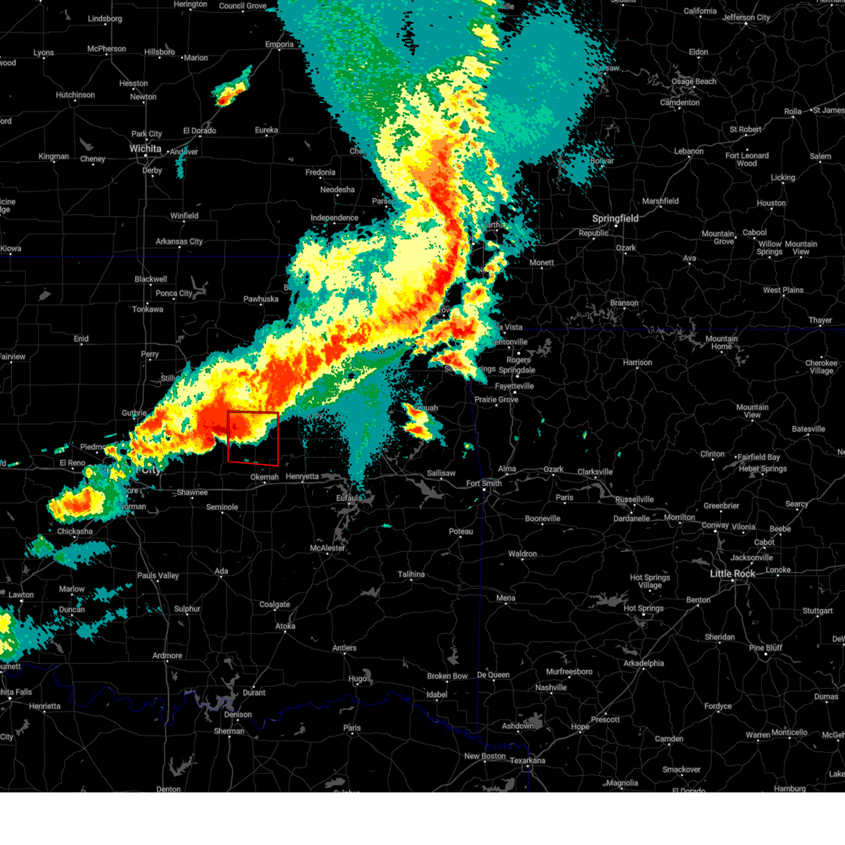 Tortsa the national weather service in tulsa has issued a * tornado warning for, southwestern creek county in northeastern oklahoma, northwestern okfuskee county in east central oklahoma, * until midnight cdt. * at 1120 pm cdt, a severe thunderstorm with strong low level rotation that could produce a tornado at any time was located near davenport, moving east at 40 mph (radar indicated rotation). Hazards include tornado and hail up to two inches in diameter. Flying debris will be dangerous to those caught without shelter. mobile homes will be damaged or destroyed. damage to roofs, windows, and vehicles will occur. tree damage is likely. Locations in or near the path include, bristow, okfuskee, depew, slick, shamrock, welty, milfay, mason, this includes interstate 44 between mile markers 178 and 199. Tortsa the national weather service in tulsa has issued a * tornado warning for, southwestern creek county in northeastern oklahoma, northwestern okfuskee county in east central oklahoma, * until midnight cdt. * at 1120 pm cdt, a severe thunderstorm with strong low level rotation that could produce a tornado at any time was located near davenport, moving east at 40 mph (radar indicated rotation). Hazards include tornado and hail up to two inches in diameter. Flying debris will be dangerous to those caught without shelter. mobile homes will be damaged or destroyed. damage to roofs, windows, and vehicles will occur. tree damage is likely. Locations in or near the path include, bristow, okfuskee, depew, slick, shamrock, welty, milfay, mason, this includes interstate 44 between mile markers 178 and 199.
|
| 5/6/2024 11:13 PM CDT |
 At 1113 pm cdt, a severe thunderstorm was located near keystone state park, moving east at 50 mph (radar indicated). Hazards include 60 mph wind gusts and quarter size hail. Hail damage to vehicles is expected. expect wind damage to roofs, siding, and trees. Locations in or near the path include, tulsa, broken arrow, sand springs, claremore, bristow, pryor, owasso, bixby, sapulpa, jenks, glenpool, coweta, pryor creek, catoosa, verdigris, mannford, drumright, chouteau, inola, kiefer, this includes interstate 44 between mile markers 178 and 252. At 1113 pm cdt, a severe thunderstorm was located near keystone state park, moving east at 50 mph (radar indicated). Hazards include 60 mph wind gusts and quarter size hail. Hail damage to vehicles is expected. expect wind damage to roofs, siding, and trees. Locations in or near the path include, tulsa, broken arrow, sand springs, claremore, bristow, pryor, owasso, bixby, sapulpa, jenks, glenpool, coweta, pryor creek, catoosa, verdigris, mannford, drumright, chouteau, inola, kiefer, this includes interstate 44 between mile markers 178 and 252.
|
| 5/6/2024 11:06 PM CDT |
 At 1106 pm cdt, severe thunderstorms were located along a line extending from 6 miles west of pryor to near oneta to 3 miles southeast of depew, moving east at 25 mph (radar indicated). Hazards include 60 mph wind gusts and quarter size hail. Hail damage to vehicles is expected. expect wind damage to roofs, siding, and trees. Locations in or near the path include, tulsa, broken arrow, sand springs, claremore, bristow, pryor, owasso, bixby, sapulpa, jenks, glenpool, coweta, pryor creek, catoosa, verdigris, mannford, drumright, chouteau, inola, kiefer, this includes interstate 44 between mile markers 178 and 252. At 1106 pm cdt, severe thunderstorms were located along a line extending from 6 miles west of pryor to near oneta to 3 miles southeast of depew, moving east at 25 mph (radar indicated). Hazards include 60 mph wind gusts and quarter size hail. Hail damage to vehicles is expected. expect wind damage to roofs, siding, and trees. Locations in or near the path include, tulsa, broken arrow, sand springs, claremore, bristow, pryor, owasso, bixby, sapulpa, jenks, glenpool, coweta, pryor creek, catoosa, verdigris, mannford, drumright, chouteau, inola, kiefer, this includes interstate 44 between mile markers 178 and 252.
|
| 5/6/2024 10:42 PM CDT |
 Svrtsa the national weather service in tulsa has issued a * severe thunderstorm warning for, southern rogers county in northeastern oklahoma, southeastern osage county in northeastern oklahoma, creek county in northeastern oklahoma, west central mayes county in northeastern oklahoma, northwestern wagoner county in northeastern oklahoma, northwestern okmulgee county in northeastern oklahoma, southern pawnee county in northeastern oklahoma, tulsa county in northeastern oklahoma, * until 1130 pm cdt. * at 1041 pm cdt, severe thunderstorms were located along a line extending from near claremore to 3 miles east of jenks riverside airport to 2 miles north of stroud, moving east at 25 mph (radar indicated). Hazards include 60 mph wind gusts and half dollar size hail. Hail damage to vehicles is expected. expect wind damage to roofs, siding, and trees. Locations in or near the path include, tulsa, broken arrow, sand springs, claremore, bristow, pryor, owasso, bixby, sapulpa, jenks, glenpool, coweta, pryor creek, catoosa, verdigris, mannford, drumright, chouteau, inola, kiefer, this includes interstate 44 between mile markers 178 and 252. Svrtsa the national weather service in tulsa has issued a * severe thunderstorm warning for, southern rogers county in northeastern oklahoma, southeastern osage county in northeastern oklahoma, creek county in northeastern oklahoma, west central mayes county in northeastern oklahoma, northwestern wagoner county in northeastern oklahoma, northwestern okmulgee county in northeastern oklahoma, southern pawnee county in northeastern oklahoma, tulsa county in northeastern oklahoma, * until 1130 pm cdt. * at 1041 pm cdt, severe thunderstorms were located along a line extending from near claremore to 3 miles east of jenks riverside airport to 2 miles north of stroud, moving east at 25 mph (radar indicated). Hazards include 60 mph wind gusts and half dollar size hail. Hail damage to vehicles is expected. expect wind damage to roofs, siding, and trees. Locations in or near the path include, tulsa, broken arrow, sand springs, claremore, bristow, pryor, owasso, bixby, sapulpa, jenks, glenpool, coweta, pryor creek, catoosa, verdigris, mannford, drumright, chouteau, inola, kiefer, this includes interstate 44 between mile markers 178 and 252.
|
| 4/28/2024 7:22 PM CDT |
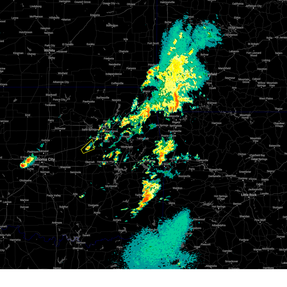 the severe thunderstorm warning has been cancelled and is no longer in effect the severe thunderstorm warning has been cancelled and is no longer in effect
|
| 4/28/2024 6:58 PM CDT |
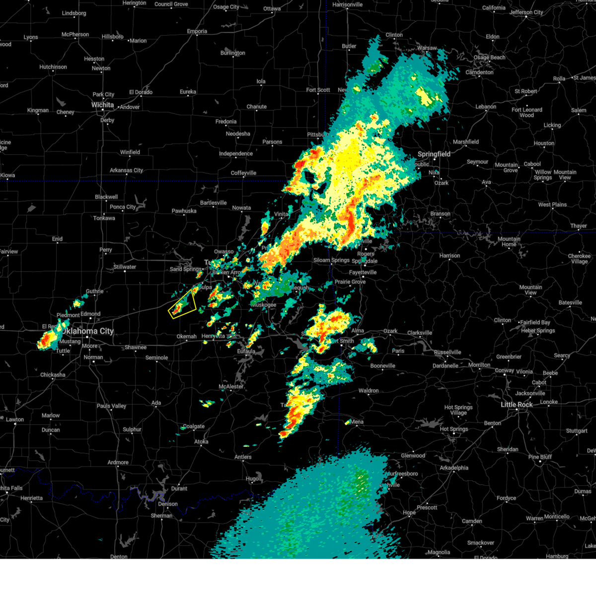 Svrtsa the national weather service in tulsa has issued a * severe thunderstorm warning for, southwestern creek county in northeastern oklahoma, * until 745 pm cdt. * at 658 pm cdt, a severe thunderstorm was located 6 miles southeast of depew, moving northeast at 20 mph (radar indicated). Hazards include 60 mph wind gusts and quarter size hail. Hail damage to vehicles is expected. expect wind damage to roofs, siding, and trees. Locations in or near the path include, bristow, slick,. Svrtsa the national weather service in tulsa has issued a * severe thunderstorm warning for, southwestern creek county in northeastern oklahoma, * until 745 pm cdt. * at 658 pm cdt, a severe thunderstorm was located 6 miles southeast of depew, moving northeast at 20 mph (radar indicated). Hazards include 60 mph wind gusts and quarter size hail. Hail damage to vehicles is expected. expect wind damage to roofs, siding, and trees. Locations in or near the path include, bristow, slick,.
|
| 4/27/2024 10:49 PM CDT |
 At 1048 pm cdt, severe thunderstorms were located along a line extending from 4 miles west of yale to 3 miles northeast of drumright to 6 miles southeast of depew to 3 miles northeast of paden, moving northeast at 40 mph (radar indicated). Hazards include 70 mph wind gusts and nickel size hail. Expect considerable tree damage. damage is likely to mobile homes, roofs, and outbuildings. locations in or near the path include, bristow, okemah, okfuskee, mannford, drumright, boley, kellyville, oilton, depew, paden, bearden, slick, castle, shamrock, welty, silver city, milfay, mason, this includes the following highways, interstate 40 in oklahoma between mile markers 212 and 220. Interstate 44 between mile markers 178 and 205. At 1048 pm cdt, severe thunderstorms were located along a line extending from 4 miles west of yale to 3 miles northeast of drumright to 6 miles southeast of depew to 3 miles northeast of paden, moving northeast at 40 mph (radar indicated). Hazards include 70 mph wind gusts and nickel size hail. Expect considerable tree damage. damage is likely to mobile homes, roofs, and outbuildings. locations in or near the path include, bristow, okemah, okfuskee, mannford, drumright, boley, kellyville, oilton, depew, paden, bearden, slick, castle, shamrock, welty, silver city, milfay, mason, this includes the following highways, interstate 40 in oklahoma between mile markers 212 and 220. Interstate 44 between mile markers 178 and 205.
|
| 4/27/2024 10:13 PM CDT |
 Svrtsa the national weather service in tulsa has issued a * severe thunderstorm warning for, creek county in northeastern oklahoma, okfuskee county in east central oklahoma, * until 1115 pm cdt. * at 1013 pm cdt, severe thunderstorms were located along a line extending from 5 miles north of fallis to 3 miles west of chandler to 2 miles northeast of johnson to 3 miles southeast of tecumseh, moving northeast at 60 mph (radar indicated). Hazards include 70 mph wind gusts and nickel size hail. Expect considerable tree damage. damage is likely to mobile homes, roofs, and outbuildings. locations in or near the path include, bristow, okemah, okfuskee, mannford, drumright, boley, kellyville, oilton, depew, paden, bearden, slick, castle, shamrock, welty, silver city, milfay, mason, this includes the following highways, interstate 40 in oklahoma between mile markers 212 and 220. Interstate 44 between mile markers 178 and 205. Svrtsa the national weather service in tulsa has issued a * severe thunderstorm warning for, creek county in northeastern oklahoma, okfuskee county in east central oklahoma, * until 1115 pm cdt. * at 1013 pm cdt, severe thunderstorms were located along a line extending from 5 miles north of fallis to 3 miles west of chandler to 2 miles northeast of johnson to 3 miles southeast of tecumseh, moving northeast at 60 mph (radar indicated). Hazards include 70 mph wind gusts and nickel size hail. Expect considerable tree damage. damage is likely to mobile homes, roofs, and outbuildings. locations in or near the path include, bristow, okemah, okfuskee, mannford, drumright, boley, kellyville, oilton, depew, paden, bearden, slick, castle, shamrock, welty, silver city, milfay, mason, this includes the following highways, interstate 40 in oklahoma between mile markers 212 and 220. Interstate 44 between mile markers 178 and 205.
|
| 4/26/2024 6:25 AM CDT |
 The storms which prompted the warning have moved out of the area. therefore, the warning will be allowed to expire. however, gusty winds are still possible with these thunderstorms. a tornado watch remains in effect until 1100 am cdt for northeastern and east central oklahoma. remember, a severe thunderstorm warning still remains in effect for eastern creek and northern okfuskee counties until 7 am cdt. The storms which prompted the warning have moved out of the area. therefore, the warning will be allowed to expire. however, gusty winds are still possible with these thunderstorms. a tornado watch remains in effect until 1100 am cdt for northeastern and east central oklahoma. remember, a severe thunderstorm warning still remains in effect for eastern creek and northern okfuskee counties until 7 am cdt.
|
| 4/26/2024 6:09 AM CDT |
 the tornado warning has been cancelled and is no longer in effect the tornado warning has been cancelled and is no longer in effect
|
| 4/26/2024 6:09 AM CDT |
 At 609 am cdt, a severe squall line capable of producing tornadoes that may not be visible due to heavy rain was located along a line extending from 8 miles east of drumright to 6 miles west of kellyville to 5 miles southwest of okmulgee state park, moving east at 55 mph (radar indicated rotation). Hazards include tornado. Flying debris will be dangerous to those caught without shelter. mobile homes will be damaged or destroyed. damage to roofs, windows, and vehicles will occur. tree damage is likely. Locations in or near the path include, okmulgee, sapulpa, kiefer, beggs, mounds, kellyville, slick, preston, okmulgee state park, this includes interstate 44 between mile markers 192 and 211. At 609 am cdt, a severe squall line capable of producing tornadoes that may not be visible due to heavy rain was located along a line extending from 8 miles east of drumright to 6 miles west of kellyville to 5 miles southwest of okmulgee state park, moving east at 55 mph (radar indicated rotation). Hazards include tornado. Flying debris will be dangerous to those caught without shelter. mobile homes will be damaged or destroyed. damage to roofs, windows, and vehicles will occur. tree damage is likely. Locations in or near the path include, okmulgee, sapulpa, kiefer, beggs, mounds, kellyville, slick, preston, okmulgee state park, this includes interstate 44 between mile markers 192 and 211.
|
| 4/26/2024 5:57 AM CDT |
 Tortsa the national weather service in tulsa has issued a * tornado warning for, creek county in northeastern oklahoma, northwestern okmulgee county in northeastern oklahoma, northeastern okfuskee county in east central oklahoma, * until 630 am cdt. * at 557 am cdt, a severe squall line capable of producing tornadoes that may not be visible due to heavy rain was located along a line extending from near shamrock to 2 miles north of okemah, moving northeast at 50 mph (radar indicated rotation). Hazards include tornado. Flying debris will be dangerous to those caught without shelter. mobile homes will be damaged or destroyed. damage to roofs, windows, and vehicles will occur. tree damage is likely. locations in or near the path include, okmulgee, bristow, okemah, sapulpa, okfuskee, kiefer, beggs, mounds, kellyville, depew, slick, shamrock, preston, okmulgee state park, welty, mason, this includes the following highways, interstate 40 in oklahoma between mile markers 219 and 224. Interstate 44 between mile markers 183 and 211. Tortsa the national weather service in tulsa has issued a * tornado warning for, creek county in northeastern oklahoma, northwestern okmulgee county in northeastern oklahoma, northeastern okfuskee county in east central oklahoma, * until 630 am cdt. * at 557 am cdt, a severe squall line capable of producing tornadoes that may not be visible due to heavy rain was located along a line extending from near shamrock to 2 miles north of okemah, moving northeast at 50 mph (radar indicated rotation). Hazards include tornado. Flying debris will be dangerous to those caught without shelter. mobile homes will be damaged or destroyed. damage to roofs, windows, and vehicles will occur. tree damage is likely. locations in or near the path include, okmulgee, bristow, okemah, sapulpa, okfuskee, kiefer, beggs, mounds, kellyville, depew, slick, shamrock, preston, okmulgee state park, welty, mason, this includes the following highways, interstate 40 in oklahoma between mile markers 219 and 224. Interstate 44 between mile markers 183 and 211.
|
| 4/26/2024 5:22 AM CDT |
 Svrtsa the national weather service in tulsa has issued a * severe thunderstorm warning for, southwestern creek county in northeastern oklahoma, okfuskee county in east central oklahoma, * until 600 am cdt. * at 521 am cdt, severe thunderstorms were located along a line extending from near chandler to 4 miles east of johnson to 3 miles west of maud, moving east at 50 mph (radar indicated). Hazards include 70 mph wind gusts and nickel size hail. Expect considerable tree damage. damage is likely to mobile homes, roofs, and outbuildings. locations in or near the path include, bristow, okemah, okfuskee, boley, kellyville, weleetka, depew, paden, bearden, slick, castle, clearview, welty, pharoah, milfay, mason, this includes the following highways, interstate 40 in oklahoma between mile markers 212 and 231. Interstate 44 between mile markers 178 and 204. Svrtsa the national weather service in tulsa has issued a * severe thunderstorm warning for, southwestern creek county in northeastern oklahoma, okfuskee county in east central oklahoma, * until 600 am cdt. * at 521 am cdt, severe thunderstorms were located along a line extending from near chandler to 4 miles east of johnson to 3 miles west of maud, moving east at 50 mph (radar indicated). Hazards include 70 mph wind gusts and nickel size hail. Expect considerable tree damage. damage is likely to mobile homes, roofs, and outbuildings. locations in or near the path include, bristow, okemah, okfuskee, boley, kellyville, weleetka, depew, paden, bearden, slick, castle, clearview, welty, pharoah, milfay, mason, this includes the following highways, interstate 40 in oklahoma between mile markers 212 and 231. Interstate 44 between mile markers 178 and 204.
|
| 3/14/2024 12:52 PM CDT |
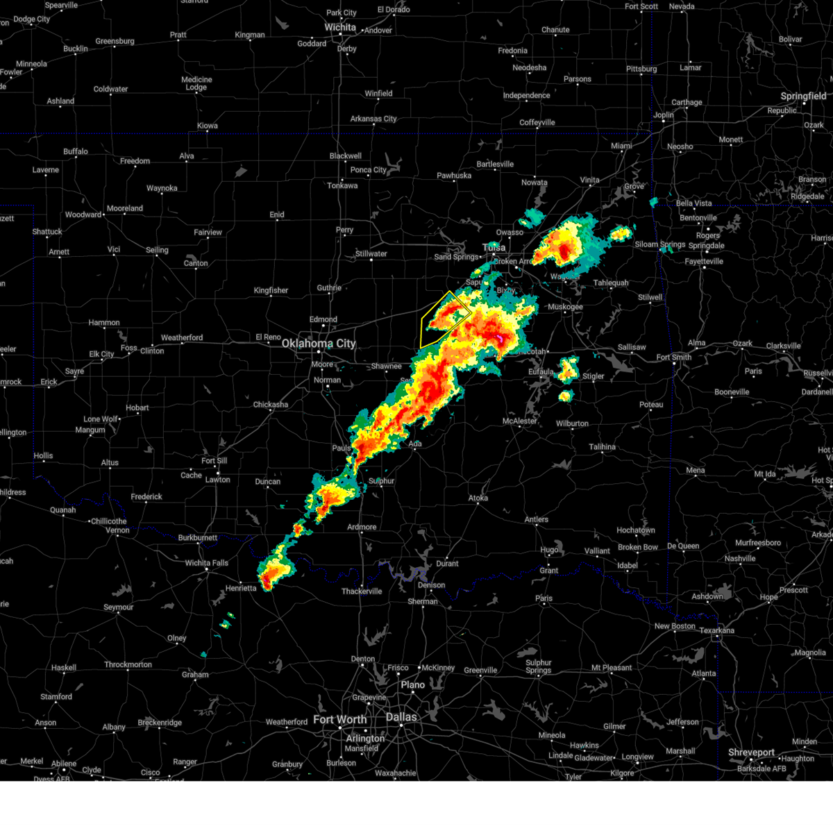 The storm which prompted the warning has weakened below severe limits, and no longer poses an immediate threat to life or property. therefore, the warning will be allowed to expire. however, small hail is still possible with this thunderstorm. a tornado watch remains in effect until 600 pm cdt for northeastern and east central oklahoma. The storm which prompted the warning has weakened below severe limits, and no longer poses an immediate threat to life or property. therefore, the warning will be allowed to expire. however, small hail is still possible with this thunderstorm. a tornado watch remains in effect until 600 pm cdt for northeastern and east central oklahoma.
|
| 3/14/2024 12:43 PM CDT |
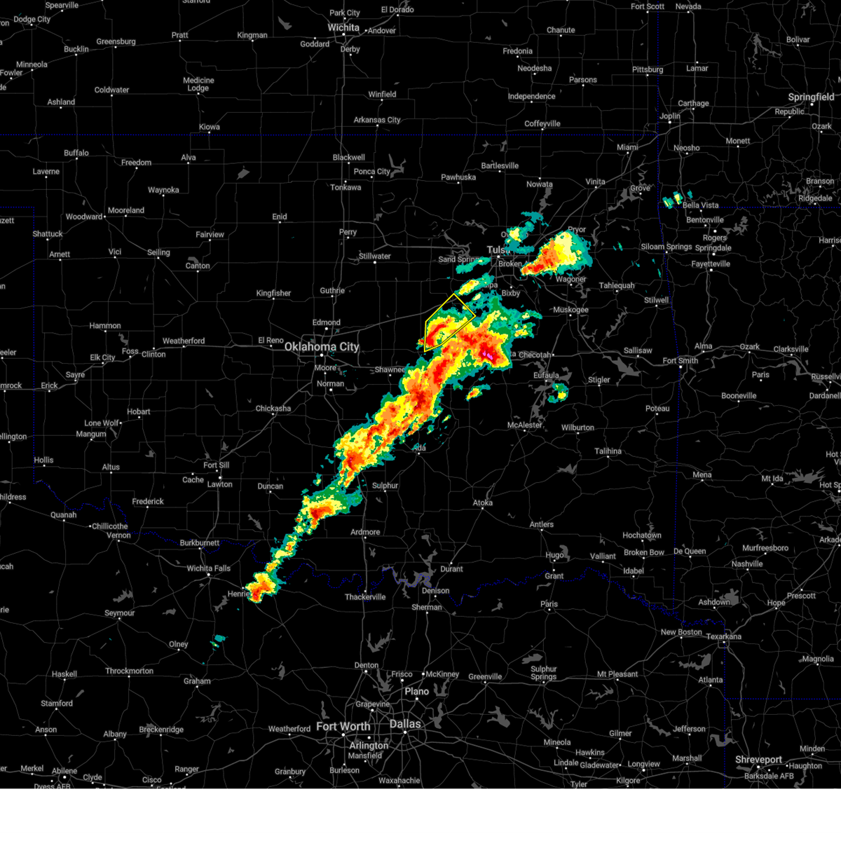 At 1242 pm cdt, a severe thunderstorm was located 7 miles north of paden, moving northeast at 50 mph (radar indicated). Hazards include 60 mph wind gusts and quarter size hail. Hail damage to vehicles is expected. expect wind damage to roofs, siding, and trees. Locations in or near the path include, bristow, slick, welty, this includes interstate 44 between mile markers 187 and 194. At 1242 pm cdt, a severe thunderstorm was located 7 miles north of paden, moving northeast at 50 mph (radar indicated). Hazards include 60 mph wind gusts and quarter size hail. Hail damage to vehicles is expected. expect wind damage to roofs, siding, and trees. Locations in or near the path include, bristow, slick, welty, this includes interstate 44 between mile markers 187 and 194.
|
| 3/14/2024 12:27 PM CDT |
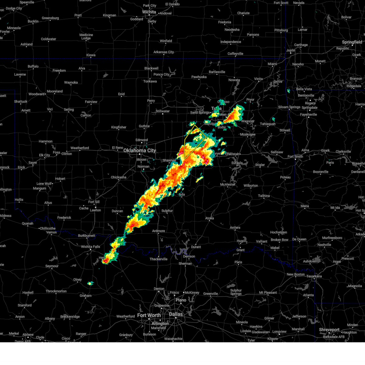 Svrtsa the national weather service in tulsa has issued a * severe thunderstorm warning for, southwestern creek county in northeastern oklahoma, northwestern okfuskee county in east central oklahoma, * until 100 pm cdt. * at 1227 pm cdt, a severe thunderstorm was located near prague, moving northeast at 45 mph (radar indicated). Hazards include ping pong ball size hail and 60 mph wind gusts. People and animals outdoors will be injured. expect hail damage to roofs, siding, windows, and vehicles. expect wind damage to roofs, siding, and trees. Locations in or near the path include, bristow, boley, depew, paden, slick, welty, milfay, this includes interstate 44 between mile markers 183 and 194. Svrtsa the national weather service in tulsa has issued a * severe thunderstorm warning for, southwestern creek county in northeastern oklahoma, northwestern okfuskee county in east central oklahoma, * until 100 pm cdt. * at 1227 pm cdt, a severe thunderstorm was located near prague, moving northeast at 45 mph (radar indicated). Hazards include ping pong ball size hail and 60 mph wind gusts. People and animals outdoors will be injured. expect hail damage to roofs, siding, windows, and vehicles. expect wind damage to roofs, siding, and trees. Locations in or near the path include, bristow, boley, depew, paden, slick, welty, milfay, this includes interstate 44 between mile markers 183 and 194.
|
| 9/23/2023 6:25 PM CDT |
 At 625 pm cdt, a severe thunderstorm was located near slick, moving east at 20 mph (radar indicated). Hazards include ping pong ball size hail and 60 mph wind gusts. People and animals outdoors will be injured. expect hail damage to roofs, siding, windows, and vehicles. expect wind damage to roofs, siding, and trees. locations in or near the path include, beggs, mounds, slick, this includes interstate 44 between mile markers 192 and 196. hail threat, radar indicated max hail size, 1. 50 in wind threat, radar indicated max wind gust, 60 mph. At 625 pm cdt, a severe thunderstorm was located near slick, moving east at 20 mph (radar indicated). Hazards include ping pong ball size hail and 60 mph wind gusts. People and animals outdoors will be injured. expect hail damage to roofs, siding, windows, and vehicles. expect wind damage to roofs, siding, and trees. locations in or near the path include, beggs, mounds, slick, this includes interstate 44 between mile markers 192 and 196. hail threat, radar indicated max hail size, 1. 50 in wind threat, radar indicated max wind gust, 60 mph.
|
| 9/23/2023 6:15 PM CDT |
 At 615 pm cdt, a severe thunderstorm was located 3 miles southeast of bristow, moving east at 20 mph (radar indicated). Hazards include 60 mph wind gusts and quarter size hail. Hail damage to vehicles is expected. expect wind damage to roofs, siding, and trees. locations in or near the path include, bristow, beggs, mounds, slick, this includes interstate 44 between mile markers 190 and 196. hail threat, radar indicated max hail size, 1. 00 in wind threat, radar indicated max wind gust, 60 mph. At 615 pm cdt, a severe thunderstorm was located 3 miles southeast of bristow, moving east at 20 mph (radar indicated). Hazards include 60 mph wind gusts and quarter size hail. Hail damage to vehicles is expected. expect wind damage to roofs, siding, and trees. locations in or near the path include, bristow, beggs, mounds, slick, this includes interstate 44 between mile markers 190 and 196. hail threat, radar indicated max hail size, 1. 00 in wind threat, radar indicated max wind gust, 60 mph.
|
| 9/5/2023 6:54 PM CDT |
 At 653 pm cdt, a severe thunderstorm was located 5 miles east of shamrock, moving northeast at 30 mph (radar indicated). Hazards include 70 mph wind gusts and quarter size hail. Hail damage to vehicles is expected. expect considerable tree damage. wind damage is also likely to mobile homes, roofs, and outbuildings. locations in or near the path include, mannford, this includes interstate 44 between mile markers 190 and 201. thunderstorm damage threat, considerable hail threat, radar indicated max hail size, 1. 00 in wind threat, radar indicated max wind gust, 70 mph. At 653 pm cdt, a severe thunderstorm was located 5 miles east of shamrock, moving northeast at 30 mph (radar indicated). Hazards include 70 mph wind gusts and quarter size hail. Hail damage to vehicles is expected. expect considerable tree damage. wind damage is also likely to mobile homes, roofs, and outbuildings. locations in or near the path include, mannford, this includes interstate 44 between mile markers 190 and 201. thunderstorm damage threat, considerable hail threat, radar indicated max hail size, 1. 00 in wind threat, radar indicated max wind gust, 70 mph.
|
| 9/5/2023 6:34 PM CDT |
 At 634 pm cdt, a severe thunderstorm was located 5 miles southwest of shamrock, moving northeast at 30 mph (radar indicated). Hazards include 70 mph wind gusts and quarter size hail. Hail damage to vehicles is expected. expect considerable tree damage. wind damage is also likely to mobile homes, roofs, and outbuildings. locations in or near the path include, bristow, mannford, drumright, depew, slick, shamrock, silver city, milfay, this includes interstate 44 between mile markers 178 and 201. thunderstorm damage threat, considerable hail threat, radar indicated max hail size, 1. 00 in wind threat, radar indicated max wind gust, 70 mph. At 634 pm cdt, a severe thunderstorm was located 5 miles southwest of shamrock, moving northeast at 30 mph (radar indicated). Hazards include 70 mph wind gusts and quarter size hail. Hail damage to vehicles is expected. expect considerable tree damage. wind damage is also likely to mobile homes, roofs, and outbuildings. locations in or near the path include, bristow, mannford, drumright, depew, slick, shamrock, silver city, milfay, this includes interstate 44 between mile markers 178 and 201. thunderstorm damage threat, considerable hail threat, radar indicated max hail size, 1. 00 in wind threat, radar indicated max wind gust, 70 mph.
|
| 8/13/2023 11:39 PM CDT |
 At 1138 pm cdt, severe thunderstorms were located along a line extending from 2 miles south of terlton to 9 miles west of kellyville, moving east at 55 mph (radar indicated). Hazards include 70 mph wind gusts. Expect considerable tree damage. damage is likely to mobile homes, roofs, and outbuildings. locations in or near the path include, sand springs, bristow, sapulpa, mannford, drumright, kellyville, oilton, depew, jennings, westport, hallett, terlton, shamrock, keystone state park, walnut creek state park, silver city, this includes interstate 44 between mile markers 178 and 210. thunderstorm damage threat, considerable hail threat, radar indicated max hail size, <. 75 in wind threat, radar indicated max wind gust, 70 mph. At 1138 pm cdt, severe thunderstorms were located along a line extending from 2 miles south of terlton to 9 miles west of kellyville, moving east at 55 mph (radar indicated). Hazards include 70 mph wind gusts. Expect considerable tree damage. damage is likely to mobile homes, roofs, and outbuildings. locations in or near the path include, sand springs, bristow, sapulpa, mannford, drumright, kellyville, oilton, depew, jennings, westport, hallett, terlton, shamrock, keystone state park, walnut creek state park, silver city, this includes interstate 44 between mile markers 178 and 210. thunderstorm damage threat, considerable hail threat, radar indicated max hail size, <. 75 in wind threat, radar indicated max wind gust, 70 mph.
|
| 8/13/2023 11:25 PM CDT |
 At 1125 pm cdt, severe thunderstorms were located along a line extending from 2 miles west of yale to 3 miles north of shamrock, moving east at 45 mph (radar indicated). Hazards include 70 mph wind gusts. Expect considerable tree damage. damage is likely to mobile homes, roofs, and outbuildings. locations in or near the path include, sand springs, bristow, sapulpa, mannford, drumright, kellyville, oilton, depew, jennings, westport, hallett, terlton, shamrock, keystone state park, walnut creek state park, silver city, this includes interstate 44 between mile markers 178 and 210. thunderstorm damage threat, considerable hail threat, radar indicated max hail size, <. 75 in wind threat, radar indicated max wind gust, 70 mph. At 1125 pm cdt, severe thunderstorms were located along a line extending from 2 miles west of yale to 3 miles north of shamrock, moving east at 45 mph (radar indicated). Hazards include 70 mph wind gusts. Expect considerable tree damage. damage is likely to mobile homes, roofs, and outbuildings. locations in or near the path include, sand springs, bristow, sapulpa, mannford, drumright, kellyville, oilton, depew, jennings, westport, hallett, terlton, shamrock, keystone state park, walnut creek state park, silver city, this includes interstate 44 between mile markers 178 and 210. thunderstorm damage threat, considerable hail threat, radar indicated max hail size, <. 75 in wind threat, radar indicated max wind gust, 70 mph.
|
| 8/13/2023 11:16 PM CDT |
 At 1115 pm cdt, a severe thunderstorm was located 4 miles north of cushing, moving east at 50 mph (radar indicated). Hazards include 60 mph wind gusts. Expect damage to roofs, siding, and trees. locations in or near the path include, sand springs, bristow, sapulpa, mannford, drumright, kellyville, oilton, depew, jennings, westport, hallett, terlton, shamrock, keystone state park, walnut creek state park, silver city, this includes interstate 44 between mile markers 178 and 210. hail threat, radar indicated max hail size, <. 75 in wind threat, radar indicated max wind gust, 60 mph. At 1115 pm cdt, a severe thunderstorm was located 4 miles north of cushing, moving east at 50 mph (radar indicated). Hazards include 60 mph wind gusts. Expect damage to roofs, siding, and trees. locations in or near the path include, sand springs, bristow, sapulpa, mannford, drumright, kellyville, oilton, depew, jennings, westport, hallett, terlton, shamrock, keystone state park, walnut creek state park, silver city, this includes interstate 44 between mile markers 178 and 210. hail threat, radar indicated max hail size, <. 75 in wind threat, radar indicated max wind gust, 60 mph.
|
| 7/21/2023 5:39 AM CDT |
 At 539 am cdt, severe thunderstorms were located along a line extending from 3 miles southeast of hominy to near mannford to 5 miles north of bristow, moving east at 45 mph (radar indicated). Hazards include 60 mph wind gusts. Expect damage to roofs, siding, and trees. locations in or near the path include, tulsa, sand springs, bristow, sapulpa, hominy, cleveland, mannford, kellyville, avant, westport, osage, slick, terlton, shamrock, keystone state park, walnut creek state park, gray, silver city, this includes interstate 44 between mile markers 185 and 216. hail threat, radar indicated max hail size, <. 75 in wind threat, radar indicated max wind gust, 60 mph. At 539 am cdt, severe thunderstorms were located along a line extending from 3 miles southeast of hominy to near mannford to 5 miles north of bristow, moving east at 45 mph (radar indicated). Hazards include 60 mph wind gusts. Expect damage to roofs, siding, and trees. locations in or near the path include, tulsa, sand springs, bristow, sapulpa, hominy, cleveland, mannford, kellyville, avant, westport, osage, slick, terlton, shamrock, keystone state park, walnut creek state park, gray, silver city, this includes interstate 44 between mile markers 185 and 216. hail threat, radar indicated max hail size, <. 75 in wind threat, radar indicated max wind gust, 60 mph.
|
| 7/21/2023 5:26 AM CDT |
 At 525 am cdt, severe thunderstorms were located along a line extending from 2 miles northeast of blackburn to 2 miles south of terlton to 2 miles northeast of shamrock, moving east at 50 mph (radar indicated). Hazards include 70 mph wind gusts. Expect considerable tree damage. damage is likely to mobile homes, roofs, and outbuildings. locations in or near the path include, tulsa, sand springs, bristow, pawnee, sapulpa, hominy, cleveland, mannford, drumright, kellyville, oilton, jennings, avant, westport, osage, slick, hallett, blackburn, terlton, shamrock, this includes interstate 44 between mile markers 185 and 216. thunderstorm damage threat, considerable hail threat, radar indicated max hail size, <. 75 in wind threat, radar indicated max wind gust, 70 mph. At 525 am cdt, severe thunderstorms were located along a line extending from 2 miles northeast of blackburn to 2 miles south of terlton to 2 miles northeast of shamrock, moving east at 50 mph (radar indicated). Hazards include 70 mph wind gusts. Expect considerable tree damage. damage is likely to mobile homes, roofs, and outbuildings. locations in or near the path include, tulsa, sand springs, bristow, pawnee, sapulpa, hominy, cleveland, mannford, drumright, kellyville, oilton, jennings, avant, westport, osage, slick, hallett, blackburn, terlton, shamrock, this includes interstate 44 between mile markers 185 and 216. thunderstorm damage threat, considerable hail threat, radar indicated max hail size, <. 75 in wind threat, radar indicated max wind gust, 70 mph.
|
| 7/21/2023 5:09 AM CDT |
 At 509 am cdt, severe thunderstorms were located along a line extending from 4 miles north of pawnee to near quay to 2 miles southwest of cushing, moving east at 45 mph (radar indicated). Hazards include 70 mph wind gusts. Expect considerable tree damage. damage is likely to mobile homes, roofs, and outbuildings. locations in or near the path include, tulsa, sand springs, bristow, pawnee, sapulpa, hominy, cleveland, mannford, drumright, kellyville, oilton, jennings, avant, westport, osage, slick, hallett, blackburn, terlton, shamrock, this includes interstate 44 between mile markers 185 and 216. thunderstorm damage threat, considerable hail threat, radar indicated max hail size, <. 75 in wind threat, radar indicated max wind gust, 70 mph. At 509 am cdt, severe thunderstorms were located along a line extending from 4 miles north of pawnee to near quay to 2 miles southwest of cushing, moving east at 45 mph (radar indicated). Hazards include 70 mph wind gusts. Expect considerable tree damage. damage is likely to mobile homes, roofs, and outbuildings. locations in or near the path include, tulsa, sand springs, bristow, pawnee, sapulpa, hominy, cleveland, mannford, drumright, kellyville, oilton, jennings, avant, westport, osage, slick, hallett, blackburn, terlton, shamrock, this includes interstate 44 between mile markers 185 and 216. thunderstorm damage threat, considerable hail threat, radar indicated max hail size, <. 75 in wind threat, radar indicated max wind gust, 70 mph.
|
| 6/27/2023 9:34 AM CDT |
 At 933 am cdt, severe thunderstorms were located along a line extending from sapulpa to 2 miles southwest of preston to 3 miles northeast of wetumka, moving east at 45 mph (radar indicated). Hazards include 60 mph wind gusts and penny size hail. Expect damage to roofs, siding, and trees. locations in or near the path include, tulsa, broken arrow, okmulgee, bristow, okemah, bixby, sapulpa, jenks, okfuskee, glenpool, henryetta, kiefer, morris, beggs, mounds, kellyville, weleetka, dewar, schulter, grayson, this includes the following highways, interstate 40 in oklahoma between mile markers 212 and 246. interstate 44 between mile markers 190 and 216. hail threat, radar indicated max hail size, 0. 75 in wind threat, radar indicated max wind gust, 60 mph. At 933 am cdt, severe thunderstorms were located along a line extending from sapulpa to 2 miles southwest of preston to 3 miles northeast of wetumka, moving east at 45 mph (radar indicated). Hazards include 60 mph wind gusts and penny size hail. Expect damage to roofs, siding, and trees. locations in or near the path include, tulsa, broken arrow, okmulgee, bristow, okemah, bixby, sapulpa, jenks, okfuskee, glenpool, henryetta, kiefer, morris, beggs, mounds, kellyville, weleetka, dewar, schulter, grayson, this includes the following highways, interstate 40 in oklahoma between mile markers 212 and 246. interstate 44 between mile markers 190 and 216. hail threat, radar indicated max hail size, 0. 75 in wind threat, radar indicated max wind gust, 60 mph.
|
| 6/27/2023 9:17 AM CDT |
 At 917 am cdt, severe thunderstorms were located along a line extending from 6 miles south of mannford to 3 miles southeast of slick to near bearden, moving east at 45 mph (radar indicated). Hazards include 60 mph wind gusts and nickel size hail. Expect damage to roofs, siding, and trees. locations in or near the path include, tulsa, broken arrow, okmulgee, bristow, okemah, bixby, sapulpa, jenks, okfuskee, glenpool, henryetta, kiefer, morris, beggs, mounds, kellyville, weleetka, dewar, schulter, grayson, this includes the following highways, interstate 40 in oklahoma between mile markers 212 and 246. interstate 44 between mile markers 190 and 216. hail threat, radar indicated max hail size, 0. 88 in wind threat, radar indicated max wind gust, 60 mph. At 917 am cdt, severe thunderstorms were located along a line extending from 6 miles south of mannford to 3 miles southeast of slick to near bearden, moving east at 45 mph (radar indicated). Hazards include 60 mph wind gusts and nickel size hail. Expect damage to roofs, siding, and trees. locations in or near the path include, tulsa, broken arrow, okmulgee, bristow, okemah, bixby, sapulpa, jenks, okfuskee, glenpool, henryetta, kiefer, morris, beggs, mounds, kellyville, weleetka, dewar, schulter, grayson, this includes the following highways, interstate 40 in oklahoma between mile markers 212 and 246. interstate 44 between mile markers 190 and 216. hail threat, radar indicated max hail size, 0. 88 in wind threat, radar indicated max wind gust, 60 mph.
|
| 6/27/2023 9:09 AM CDT | Storm damage reported in creek county OK, 2.9 miles NW of Bristow, OK |
| 6/27/2023 9:04 AM CDT |
 At 904 am cdt, severe thunderstorms were located along a line extending from 6 miles east of drumright to 3 miles south of bristow to near boley, moving east at 50 mph (radar indicated). Hazards include 70 mph wind gusts and quarter size hail. Hail damage to vehicles is expected. expect considerable tree damage. wind damage is also likely to mobile homes, roofs, and outbuildings. locations in or near the path include, bristow, okemah, okfuskee, mannford, drumright, boley, kellyville, oilton, depew, paden, bearden, slick, castle, shamrock, clearview, welty, silver city, milfay, mason, this includes the following highways, interstate 40 in oklahoma between mile markers 212 and 227. interstate 44 between mile markers 178 and 207. thunderstorm damage threat, considerable hail threat, radar indicated max hail size, 1. 00 in wind threat, radar indicated max wind gust, 70 mph. At 904 am cdt, severe thunderstorms were located along a line extending from 6 miles east of drumright to 3 miles south of bristow to near boley, moving east at 50 mph (radar indicated). Hazards include 70 mph wind gusts and quarter size hail. Hail damage to vehicles is expected. expect considerable tree damage. wind damage is also likely to mobile homes, roofs, and outbuildings. locations in or near the path include, bristow, okemah, okfuskee, mannford, drumright, boley, kellyville, oilton, depew, paden, bearden, slick, castle, shamrock, clearview, welty, silver city, milfay, mason, this includes the following highways, interstate 40 in oklahoma between mile markers 212 and 227. interstate 44 between mile markers 178 and 207. thunderstorm damage threat, considerable hail threat, radar indicated max hail size, 1. 00 in wind threat, radar indicated max wind gust, 70 mph.
|
| 6/27/2023 8:44 AM CDT |
 At 843 am cdt, severe thunderstorms were located along a line extending from 2 miles north of ripley to 4 miles south of sparks, moving east at 50 mph (radar indicated). Hazards include 70 mph wind gusts and quarter size hail. Hail damage to vehicles is expected. expect considerable tree damage. wind damage is also likely to mobile homes, roofs, and outbuildings. locations in or near the path include, bristow, okemah, okfuskee, mannford, drumright, boley, kellyville, oilton, depew, paden, bearden, slick, castle, shamrock, clearview, welty, silver city, milfay, mason, this includes the following highways, interstate 40 in oklahoma between mile markers 212 and 227. interstate 44 between mile markers 178 and 207. thunderstorm damage threat, considerable hail threat, radar indicated max hail size, 1. 00 in wind threat, radar indicated max wind gust, 70 mph. At 843 am cdt, severe thunderstorms were located along a line extending from 2 miles north of ripley to 4 miles south of sparks, moving east at 50 mph (radar indicated). Hazards include 70 mph wind gusts and quarter size hail. Hail damage to vehicles is expected. expect considerable tree damage. wind damage is also likely to mobile homes, roofs, and outbuildings. locations in or near the path include, bristow, okemah, okfuskee, mannford, drumright, boley, kellyville, oilton, depew, paden, bearden, slick, castle, shamrock, clearview, welty, silver city, milfay, mason, this includes the following highways, interstate 40 in oklahoma between mile markers 212 and 227. interstate 44 between mile markers 178 and 207. thunderstorm damage threat, considerable hail threat, radar indicated max hail size, 1. 00 in wind threat, radar indicated max wind gust, 70 mph.
|
| 6/18/2023 12:18 AM CDT |
 At 1217 am cdt, severe thunderstorms were located along a line extending from 5 miles west of sperry to 3 miles south of broken arrow to 5 miles northwest of bald hill, moving east at 70 mph. these are destructive storms for the tulsa metro area (radar indicated). Hazards include 100 mph wind gusts and quarter size hail. You are in a life-threatening situation. flying debris may be deadly to those caught without shelter. mobile homes will be destroyed. expect considerable damage to homes and businesses. expect extensive tree damage and power outages. locations in or near the path include, tulsa, broken arrow, sand springs, bristow, owasso, bixby, sapulpa, jenks, glenpool, catoosa, mannford, kiefer, beggs, sperry, mounds, kellyville, westport, slick, jenks riverside airport, keystone state park, this includes interstate 44 between mile markers 190 and 232. thunderstorm damage threat, destructive hail threat, radar indicated max hail size, 1. 00 in wind threat, radar indicated max wind gust, 100 mph. At 1217 am cdt, severe thunderstorms were located along a line extending from 5 miles west of sperry to 3 miles south of broken arrow to 5 miles northwest of bald hill, moving east at 70 mph. these are destructive storms for the tulsa metro area (radar indicated). Hazards include 100 mph wind gusts and quarter size hail. You are in a life-threatening situation. flying debris may be deadly to those caught without shelter. mobile homes will be destroyed. expect considerable damage to homes and businesses. expect extensive tree damage and power outages. locations in or near the path include, tulsa, broken arrow, sand springs, bristow, owasso, bixby, sapulpa, jenks, glenpool, catoosa, mannford, kiefer, beggs, sperry, mounds, kellyville, westport, slick, jenks riverside airport, keystone state park, this includes interstate 44 between mile markers 190 and 232. thunderstorm damage threat, destructive hail threat, radar indicated max hail size, 1. 00 in wind threat, radar indicated max wind gust, 100 mph.
|
| 6/18/2023 12:03 AM CDT |
 At 1203 am cdt, severe thunderstorms were located along a line extending from 2 miles northwest of keystone state park to 2 miles south of sapulpa to 2 miles east of slick, moving east at 70 mph. these are destructive storms for the tulsa metro area (radar indicated). Hazards include 100 mph wind gusts and quarter size hail. You are in a life-threatening situation. flying debris may be deadly to those caught without shelter. mobile homes will be destroyed. expect considerable damage to homes and businesses. expect extensive tree damage and power outages. locations in or near the path include, tulsa, broken arrow, sand springs, bristow, owasso, bixby, sapulpa, jenks, glenpool, catoosa, mannford, drumright, kiefer, beggs, sperry, mounds, kellyville, oilton, depew, jennings, this includes interstate 44 between mile markers 178 and 232. thunderstorm damage threat, destructive hail threat, radar indicated max hail size, 1. 00 in wind threat, radar indicated max wind gust, 100 mph. At 1203 am cdt, severe thunderstorms were located along a line extending from 2 miles northwest of keystone state park to 2 miles south of sapulpa to 2 miles east of slick, moving east at 70 mph. these are destructive storms for the tulsa metro area (radar indicated). Hazards include 100 mph wind gusts and quarter size hail. You are in a life-threatening situation. flying debris may be deadly to those caught without shelter. mobile homes will be destroyed. expect considerable damage to homes and businesses. expect extensive tree damage and power outages. locations in or near the path include, tulsa, broken arrow, sand springs, bristow, owasso, bixby, sapulpa, jenks, glenpool, catoosa, mannford, drumright, kiefer, beggs, sperry, mounds, kellyville, oilton, depew, jennings, this includes interstate 44 between mile markers 178 and 232. thunderstorm damage threat, destructive hail threat, radar indicated max hail size, 1. 00 in wind threat, radar indicated max wind gust, 100 mph.
|
| 6/17/2023 11:57 PM CDT |
 At 1156 pm cdt, severe thunderstorms were located along a line extending from 4 miles northwest of mannford to 2 miles northwest of kellyville to 3 miles southeast of bristow, moving east at 70 mph. these are destructive storms moving into the western tulsa metro (radar indicated). Hazards include 90 mph wind gusts and quarter size hail. You are in a life-threatening situation. flying debris may be deadly to those caught without shelter. mobile homes will be heavily damaged or destroyed. homes and businesses will have substantial roof and window damage. expect extensive tree damage and power outages. locations in or near the path include, tulsa, broken arrow, sand springs, bristow, owasso, bixby, sapulpa, jenks, glenpool, catoosa, mannford, drumright, kiefer, beggs, sperry, mounds, kellyville, oilton, depew, jennings, this includes interstate 44 between mile markers 178 and 232. thunderstorm damage threat, destructive hail threat, radar indicated max hail size, 1. 00 in wind threat, radar indicated max wind gust, 90 mph. At 1156 pm cdt, severe thunderstorms were located along a line extending from 4 miles northwest of mannford to 2 miles northwest of kellyville to 3 miles southeast of bristow, moving east at 70 mph. these are destructive storms moving into the western tulsa metro (radar indicated). Hazards include 90 mph wind gusts and quarter size hail. You are in a life-threatening situation. flying debris may be deadly to those caught without shelter. mobile homes will be heavily damaged or destroyed. homes and businesses will have substantial roof and window damage. expect extensive tree damage and power outages. locations in or near the path include, tulsa, broken arrow, sand springs, bristow, owasso, bixby, sapulpa, jenks, glenpool, catoosa, mannford, drumright, kiefer, beggs, sperry, mounds, kellyville, oilton, depew, jennings, this includes interstate 44 between mile markers 178 and 232. thunderstorm damage threat, destructive hail threat, radar indicated max hail size, 1. 00 in wind threat, radar indicated max wind gust, 90 mph.
|
| 6/17/2023 11:39 PM CDT |
 At 1137 pm cdt, severe thunderstorms were located along a line extending from 3 miles west of quay to drumright to 3 miles east of kendrick, moving east at 50 mph. these are destructive storms for across creek and tulsa counties including the tulsa metro area (radar indicated). Hazards include 90 mph wind gusts and quarter size hail. You are in a life-threatening situation. flying debris may be deadly to those caught without shelter. mobile homes will be heavily damaged or destroyed. homes and businesses will have substantial roof and window damage. expect extensive tree damage and power outages. locations in or near the path include, tulsa, broken arrow, sand springs, bristow, owasso, bixby, sapulpa, jenks, glenpool, catoosa, mannford, drumright, kiefer, beggs, sperry, mounds, kellyville, oilton, depew, jennings, this includes interstate 44 between mile markers 178 and 232. thunderstorm damage threat, destructive hail threat, radar indicated max hail size, 1. 00 in wind threat, radar indicated max wind gust, 90 mph. At 1137 pm cdt, severe thunderstorms were located along a line extending from 3 miles west of quay to drumright to 3 miles east of kendrick, moving east at 50 mph. these are destructive storms for across creek and tulsa counties including the tulsa metro area (radar indicated). Hazards include 90 mph wind gusts and quarter size hail. You are in a life-threatening situation. flying debris may be deadly to those caught without shelter. mobile homes will be heavily damaged or destroyed. homes and businesses will have substantial roof and window damage. expect extensive tree damage and power outages. locations in or near the path include, tulsa, broken arrow, sand springs, bristow, owasso, bixby, sapulpa, jenks, glenpool, catoosa, mannford, drumright, kiefer, beggs, sperry, mounds, kellyville, oilton, depew, jennings, this includes interstate 44 between mile markers 178 and 232. thunderstorm damage threat, destructive hail threat, radar indicated max hail size, 1. 00 in wind threat, radar indicated max wind gust, 90 mph.
|
| 6/17/2023 11:23 PM CDT |
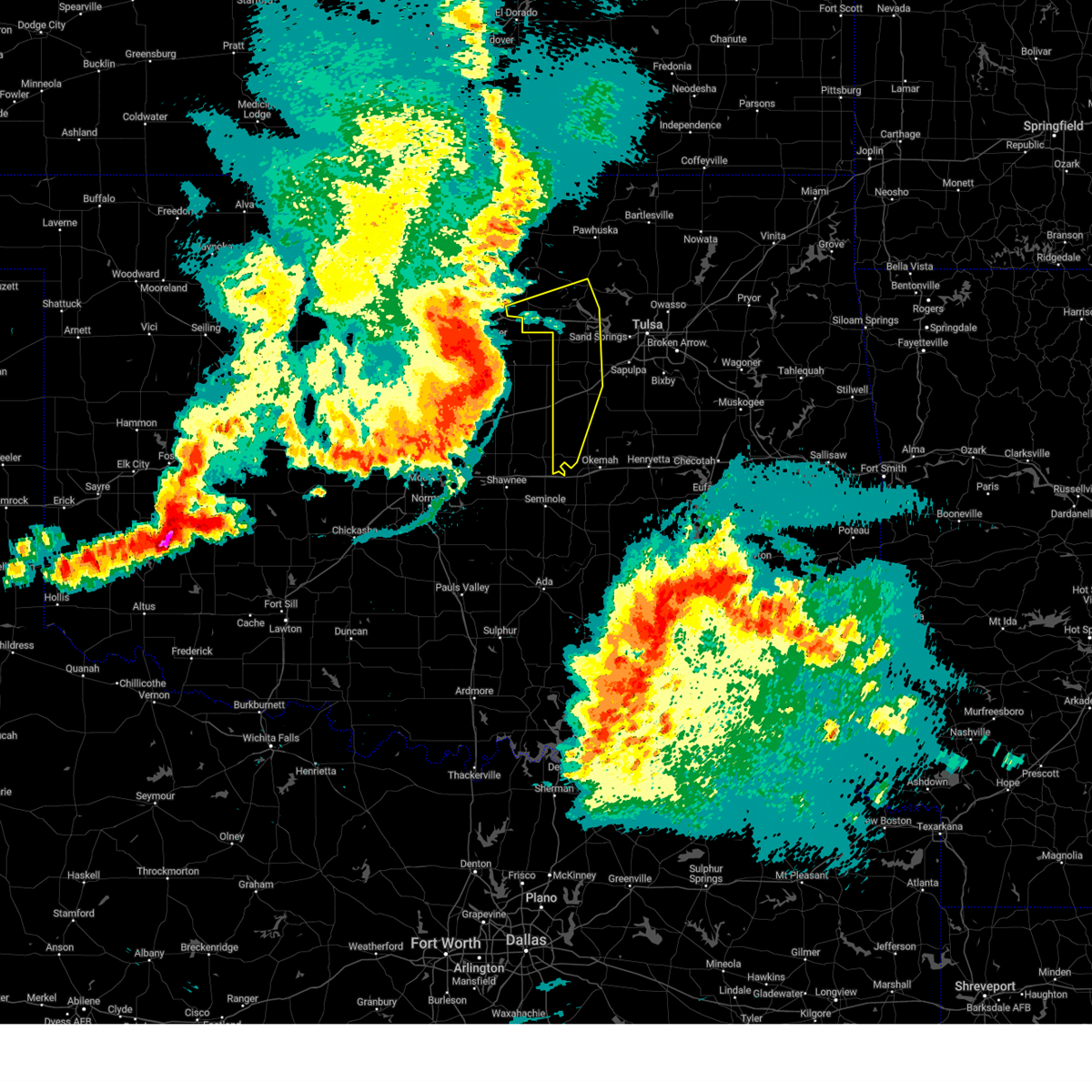 At 1122 pm cdt, severe thunderstorms were located along a line extending from 4 miles north of stillwater to 3 miles southwest of ripley to 3 miles south of wellston, moving east at 60 mph (radar indicated). Hazards include 80 mph wind gusts and quarter size hail. Flying debris will be dangerous to those caught without shelter. mobile homes will be heavily damaged. expect considerable damage to roofs, windows, and vehicles. extensive tree damage and power outages are likely. locations in or near the path include, bristow, pawnee, hominy, cleveland, mannford, drumright, boley, oilton, depew, paden, jennings, westport, osage, hallett, blackburn, terlton, shamrock, maramec, welty, silver city, this includes interstate 44 between mile markers 178 and 198. thunderstorm damage threat, destructive hail threat, radar indicated max hail size, 1. 00 in wind threat, radar indicated max wind gust, 80 mph. At 1122 pm cdt, severe thunderstorms were located along a line extending from 4 miles north of stillwater to 3 miles southwest of ripley to 3 miles south of wellston, moving east at 60 mph (radar indicated). Hazards include 80 mph wind gusts and quarter size hail. Flying debris will be dangerous to those caught without shelter. mobile homes will be heavily damaged. expect considerable damage to roofs, windows, and vehicles. extensive tree damage and power outages are likely. locations in or near the path include, bristow, pawnee, hominy, cleveland, mannford, drumright, boley, oilton, depew, paden, jennings, westport, osage, hallett, blackburn, terlton, shamrock, maramec, welty, silver city, this includes interstate 44 between mile markers 178 and 198. thunderstorm damage threat, destructive hail threat, radar indicated max hail size, 1. 00 in wind threat, radar indicated max wind gust, 80 mph.
|
| 6/17/2023 11:19 PM CDT |
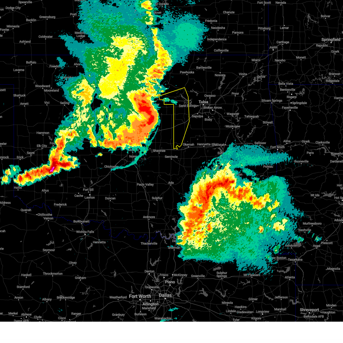 At 1119 pm cdt, severe thunderstorms were located along a line extending from 4 miles northwest of stillwater to 2 miles east of perkins to 3 miles east of luther, moving east at 55 mph (radar indicated). Hazards include 70 mph wind gusts and quarter size hail. Hail damage to vehicles is expected. expect considerable tree damage. wind damage is also likely to mobile homes, roofs, and outbuildings. locations in or near the path include, bristow, pawnee, hominy, cleveland, mannford, drumright, boley, oilton, depew, paden, jennings, westport, osage, hallett, blackburn, terlton, shamrock, maramec, welty, silver city, this includes interstate 44 between mile markers 178 and 198. thunderstorm damage threat, considerable hail threat, radar indicated max hail size, 1. 00 in wind threat, radar indicated max wind gust, 70 mph. At 1119 pm cdt, severe thunderstorms were located along a line extending from 4 miles northwest of stillwater to 2 miles east of perkins to 3 miles east of luther, moving east at 55 mph (radar indicated). Hazards include 70 mph wind gusts and quarter size hail. Hail damage to vehicles is expected. expect considerable tree damage. wind damage is also likely to mobile homes, roofs, and outbuildings. locations in or near the path include, bristow, pawnee, hominy, cleveland, mannford, drumright, boley, oilton, depew, paden, jennings, westport, osage, hallett, blackburn, terlton, shamrock, maramec, welty, silver city, this includes interstate 44 between mile markers 178 and 198. thunderstorm damage threat, considerable hail threat, radar indicated max hail size, 1. 00 in wind threat, radar indicated max wind gust, 70 mph.
|
| 2/26/2023 10:27 PM CST |
 At 1026 pm cst, a severe thunderstorm was located 6 miles southeast of slick, moving northeast at 105 mph (radar indicated). Hazards include 70 mph wind gusts and penny size hail. Expect considerable tree damage. damage is likely to mobile homes, roofs, and outbuildings. this storm ha a history of producing wind damage and tornadoes. Locations in or near the path include, tulsa, broken arrow, muskogee, sand springs, claremore, okmulgee, wagoner, bristow, okemah, owasso, bixby, sapulpa, jenks, okfuskee, glenpool, coweta, skiatook, catoosa, collinsville, verdigris, this includes interstate 44 between mile markers 179 and 247. At 1026 pm cst, a severe thunderstorm was located 6 miles southeast of slick, moving northeast at 105 mph (radar indicated). Hazards include 70 mph wind gusts and penny size hail. Expect considerable tree damage. damage is likely to mobile homes, roofs, and outbuildings. this storm ha a history of producing wind damage and tornadoes. Locations in or near the path include, tulsa, broken arrow, muskogee, sand springs, claremore, okmulgee, wagoner, bristow, okemah, owasso, bixby, sapulpa, jenks, okfuskee, glenpool, coweta, skiatook, catoosa, collinsville, verdigris, this includes interstate 44 between mile markers 179 and 247.
|
| 2/26/2023 9:37 PM CST |
 At 935 pm cst, a severe thunderstorm was located near pink, moving northeast at 70 mph (radar indicated). Hazards include 70 mph wind gusts and nickel size hail. Expect considerable tree damage. damage is likely to mobile homes, roofs, and outbuildings. locations in or near the path include, mcalester, okmulgee, bristow, okemah, okfuskee, henryetta, beggs, boley, mounds, weleetka, dewar, schulter, depew, paden, indianola, grayson, hanna, bearden, slick, castle, this includes the following highways, interstate 40 in oklahoma between mile markers 212 and 245. interstate 44 between mile markers 178 and 199. thunderstorm damage threat, considerable hail threat, radar indicated max hail size, 0. 88 in wind threat, radar indicated max wind gust, 70 mph. At 935 pm cst, a severe thunderstorm was located near pink, moving northeast at 70 mph (radar indicated). Hazards include 70 mph wind gusts and nickel size hail. Expect considerable tree damage. damage is likely to mobile homes, roofs, and outbuildings. locations in or near the path include, mcalester, okmulgee, bristow, okemah, okfuskee, henryetta, beggs, boley, mounds, weleetka, dewar, schulter, depew, paden, indianola, grayson, hanna, bearden, slick, castle, this includes the following highways, interstate 40 in oklahoma between mile markers 212 and 245. interstate 44 between mile markers 178 and 199. thunderstorm damage threat, considerable hail threat, radar indicated max hail size, 0. 88 in wind threat, radar indicated max wind gust, 70 mph.
|
| 8/9/2022 9:11 PM CDT |
 At 911 pm cdt, a severe thunderstorm was located over stroud, moving east at 20 mph (radar indicated). Hazards include 60 mph wind gusts and half dollar size hail. Hail damage to vehicles is expected. expect wind damage to roofs, siding, and trees. locations in or near the path include, bristow, depew, milfay, this includes interstate 44 between mile markers 178 and 191. hail threat, radar indicated max hail size, 1. 25 in wind threat, radar indicated max wind gust, 60 mph. At 911 pm cdt, a severe thunderstorm was located over stroud, moving east at 20 mph (radar indicated). Hazards include 60 mph wind gusts and half dollar size hail. Hail damage to vehicles is expected. expect wind damage to roofs, siding, and trees. locations in or near the path include, bristow, depew, milfay, this includes interstate 44 between mile markers 178 and 191. hail threat, radar indicated max hail size, 1. 25 in wind threat, radar indicated max wind gust, 60 mph.
|
| 6/10/2022 5:23 AM CDT |
 At 523 am cdt, severe thunderstorms were located along a line extending from 2 miles southwest of mounds to 6 miles southwest of slick to 7 miles southeast of davenport, moving southeast at 50 mph (radar indicated). Hazards include 60 mph wind gusts and penny size hail. Expect damage to roofs, siding, and trees. locations in or near the path include, okmulgee, okemah, okfuskee, henryetta, checotah, morris, beggs, boley, mounds, weleetka, dewar, schulter, paden, grayson, bearden, slick, hoffman, castle, clearview, stidham, this includes interstate 40 in oklahoma between mile markers 212 and 264. hail threat, radar indicated max hail size, 0. 75 in wind threat, radar indicated max wind gust, 60 mph. At 523 am cdt, severe thunderstorms were located along a line extending from 2 miles southwest of mounds to 6 miles southwest of slick to 7 miles southeast of davenport, moving southeast at 50 mph (radar indicated). Hazards include 60 mph wind gusts and penny size hail. Expect damage to roofs, siding, and trees. locations in or near the path include, okmulgee, okemah, okfuskee, henryetta, checotah, morris, beggs, boley, mounds, weleetka, dewar, schulter, paden, grayson, bearden, slick, hoffman, castle, clearview, stidham, this includes interstate 40 in oklahoma between mile markers 212 and 264. hail threat, radar indicated max hail size, 0. 75 in wind threat, radar indicated max wind gust, 60 mph.
|
| 5/5/2022 12:31 AM CDT |
 At 1231 am cdt, severe thunderstorms were located along a line extending from okfuskee to 3 miles southwest of haskell, moving northeast at 35 mph (radar indicated). Hazards include 60 mph wind gusts and nickel size hail. Expect damage to roofs, siding, and trees. locations in or near the path include, okmulgee, bristow, okemah, okfuskee, haskell, morris, beggs, boley, mounds, kellyville, paden, taft, bearden, slick, castle, clearview, preston, bald hill, okmulgee state park, welty, this includes the following highways, interstate 40 in oklahoma between mile markers 212 and 229. interstate 44 between mile markers 193 and 205. hail threat, radar indicated max hail size, 0. 88 in wind threat, radar indicated max wind gust, 60 mph. At 1231 am cdt, severe thunderstorms were located along a line extending from okfuskee to 3 miles southwest of haskell, moving northeast at 35 mph (radar indicated). Hazards include 60 mph wind gusts and nickel size hail. Expect damage to roofs, siding, and trees. locations in or near the path include, okmulgee, bristow, okemah, okfuskee, haskell, morris, beggs, boley, mounds, kellyville, paden, taft, bearden, slick, castle, clearview, preston, bald hill, okmulgee state park, welty, this includes the following highways, interstate 40 in oklahoma between mile markers 212 and 229. interstate 44 between mile markers 193 and 205. hail threat, radar indicated max hail size, 0. 88 in wind threat, radar indicated max wind gust, 60 mph.
|
| 5/4/2022 11:57 PM CDT |
 At 1157 pm cdt, severe thunderstorms were located along a line extending from 5 miles southeast of welty to bald hill, moving northeast at 35 mph (radar indicated). Hazards include 60 mph wind gusts and quarter size hail. Hail damage to vehicles is expected. expect wind damage to roofs, siding, and trees. locations in or near the path include, okmulgee, bristow, okemah, okfuskee, haskell, morris, beggs, boley, mounds, kellyville, paden, taft, bearden, slick, castle, clearview, preston, bald hill, okmulgee state park, welty, this includes the following highways, interstate 40 in oklahoma between mile markers 212 and 229. interstate 44 between mile markers 193 and 205. hail threat, radar indicated max hail size, 1. 00 in wind threat, radar indicated max wind gust, 60 mph. At 1157 pm cdt, severe thunderstorms were located along a line extending from 5 miles southeast of welty to bald hill, moving northeast at 35 mph (radar indicated). Hazards include 60 mph wind gusts and quarter size hail. Hail damage to vehicles is expected. expect wind damage to roofs, siding, and trees. locations in or near the path include, okmulgee, bristow, okemah, okfuskee, haskell, morris, beggs, boley, mounds, kellyville, paden, taft, bearden, slick, castle, clearview, preston, bald hill, okmulgee state park, welty, this includes the following highways, interstate 40 in oklahoma between mile markers 212 and 229. interstate 44 between mile markers 193 and 205. hail threat, radar indicated max hail size, 1. 00 in wind threat, radar indicated max wind gust, 60 mph.
|
| 5/4/2022 11:51 PM CDT |
 At 1150 pm cdt, severe thunderstorms were located along a line extending from 2 miles south of westport to 2 miles south of depew, moving east at 30 mph (radar indicated). Hazards include 60 mph wind gusts and quarter size hail. Hail damage to vehicles is expected. expect wind damage to roofs, siding, and trees. locations in or near the path include, bristow, mannford, drumright, oilton, depew, westport, terlton, shamrock, keystone state park, walnut creek state park, silver city, milfay, this includes interstate 44 between mile markers 178 and 204. hail threat, radar indicated max hail size, 1. 00 in wind threat, radar indicated max wind gust, 60 mph. At 1150 pm cdt, severe thunderstorms were located along a line extending from 2 miles south of westport to 2 miles south of depew, moving east at 30 mph (radar indicated). Hazards include 60 mph wind gusts and quarter size hail. Hail damage to vehicles is expected. expect wind damage to roofs, siding, and trees. locations in or near the path include, bristow, mannford, drumright, oilton, depew, westport, terlton, shamrock, keystone state park, walnut creek state park, silver city, milfay, this includes interstate 44 between mile markers 178 and 204. hail threat, radar indicated max hail size, 1. 00 in wind threat, radar indicated max wind gust, 60 mph.
|
| 5/4/2022 11:48 PM CDT |
 At 1147 pm cdt, severe thunderstorms were located along a line extending from 4 miles west of slick to 4 miles northwest of okmulgee state park to 2 miles west of bald hill, moving northeast at 35 mph (radar indicated). Hazards include 60 mph wind gusts and quarter size hail. Hail damage to vehicles is expected. expect wind damage to roofs, siding, and trees. locations in or near the path include, okmulgee, bristow, okemah, okfuskee, haskell, beggs, boley, mounds, kellyville, depew, paden, slick, castle, preston, bald hill, okmulgee state park, welty, liberty, milfay, mason, this includes the following highways, interstate 40 in oklahoma between mile markers 212 and 223. interstate 44 between mile markers 183 and 207. hail threat, radar indicated max hail size, 1. 00 in wind threat, radar indicated max wind gust, 60 mph. At 1147 pm cdt, severe thunderstorms were located along a line extending from 4 miles west of slick to 4 miles northwest of okmulgee state park to 2 miles west of bald hill, moving northeast at 35 mph (radar indicated). Hazards include 60 mph wind gusts and quarter size hail. Hail damage to vehicles is expected. expect wind damage to roofs, siding, and trees. locations in or near the path include, okmulgee, bristow, okemah, okfuskee, haskell, beggs, boley, mounds, kellyville, depew, paden, slick, castle, preston, bald hill, okmulgee state park, welty, liberty, milfay, mason, this includes the following highways, interstate 40 in oklahoma between mile markers 212 and 223. interstate 44 between mile markers 183 and 207. hail threat, radar indicated max hail size, 1. 00 in wind threat, radar indicated max wind gust, 60 mph.
|
| 5/4/2022 11:30 PM CDT |
 At 1129 pm cdt, severe thunderstorms were located along a line extending from 3 miles southwest of terlton to near stroud, moving east at 30 mph (radar indicated). Hazards include 60 mph wind gusts and penny size hail. Expect damage to roofs, siding, and trees. locations in or near the path include, bristow, mannford, drumright, oilton, depew, westport, terlton, shamrock, keystone state park, walnut creek state park, silver city, milfay, this includes interstate 44 between mile markers 178 and 204. hail threat, radar indicated max hail size, 0. 75 in wind threat, radar indicated max wind gust, 60 mph. At 1129 pm cdt, severe thunderstorms were located along a line extending from 3 miles southwest of terlton to near stroud, moving east at 30 mph (radar indicated). Hazards include 60 mph wind gusts and penny size hail. Expect damage to roofs, siding, and trees. locations in or near the path include, bristow, mannford, drumright, oilton, depew, westport, terlton, shamrock, keystone state park, walnut creek state park, silver city, milfay, this includes interstate 44 between mile markers 178 and 204. hail threat, radar indicated max hail size, 0. 75 in wind threat, radar indicated max wind gust, 60 mph.
|
| 5/4/2022 11:14 PM CDT |
 At 1114 pm cdt, severe thunderstorms were located along a line extending from 6 miles north of welty to 4 miles northeast of castle to near okmulgee state park, moving northeast at 30 mph (radar indicated). Hazards include 60 mph wind gusts and quarter size hail. Hail damage to vehicles is expected. expect wind damage to roofs, siding, and trees. locations in or near the path include, okmulgee, bristow, okemah, okfuskee, haskell, beggs, boley, mounds, kellyville, depew, paden, slick, castle, preston, bald hill, okmulgee state park, welty, liberty, milfay, mason, this includes the following highways, interstate 40 in oklahoma between mile markers 212 and 223. interstate 44 between mile markers 183 and 207. hail threat, radar indicated max hail size, 1. 00 in wind threat, radar indicated max wind gust, 60 mph. At 1114 pm cdt, severe thunderstorms were located along a line extending from 6 miles north of welty to 4 miles northeast of castle to near okmulgee state park, moving northeast at 30 mph (radar indicated). Hazards include 60 mph wind gusts and quarter size hail. Hail damage to vehicles is expected. expect wind damage to roofs, siding, and trees. locations in or near the path include, okmulgee, bristow, okemah, okfuskee, haskell, beggs, boley, mounds, kellyville, depew, paden, slick, castle, preston, bald hill, okmulgee state park, welty, liberty, milfay, mason, this includes the following highways, interstate 40 in oklahoma between mile markers 212 and 223. interstate 44 between mile markers 183 and 207. hail threat, radar indicated max hail size, 1. 00 in wind threat, radar indicated max wind gust, 60 mph.
|
| 5/4/2022 11:00 PM CDT |
 At 1059 pm cdt, a severe thunderstorm was located over welty, moving northeast at 50 mph (radar indicated). Hazards include 60 mph wind gusts and quarter size hail. Hail damage to vehicles is expected. expect wind damage to roofs, siding, and trees. locations in or near the path include, bristow, boley, depew, paden, slick, welty, this includes interstate 44 between mile markers 184 and 201. hail threat, radar indicated max hail size, 1. 00 in wind threat, radar indicated max wind gust, 60 mph. At 1059 pm cdt, a severe thunderstorm was located over welty, moving northeast at 50 mph (radar indicated). Hazards include 60 mph wind gusts and quarter size hail. Hail damage to vehicles is expected. expect wind damage to roofs, siding, and trees. locations in or near the path include, bristow, boley, depew, paden, slick, welty, this includes interstate 44 between mile markers 184 and 201. hail threat, radar indicated max hail size, 1. 00 in wind threat, radar indicated max wind gust, 60 mph.
|
| 5/4/2022 10:36 PM CDT |
 At 1036 pm cdt, a severe thunderstorm was located 5 miles north of paden, moving northeast at 35 mph (radar indicated). Hazards include 60 mph wind gusts and quarter size hail. Hail damage to vehicles is expected. expect wind damage to roofs, siding, and trees. locations in or near the path include, bristow, boley, depew, paden, slick, welty, this includes interstate 44 between mile markers 184 and 201. hail threat, radar indicated max hail size, 1. 00 in wind threat, radar indicated max wind gust, 60 mph. At 1036 pm cdt, a severe thunderstorm was located 5 miles north of paden, moving northeast at 35 mph (radar indicated). Hazards include 60 mph wind gusts and quarter size hail. Hail damage to vehicles is expected. expect wind damage to roofs, siding, and trees. locations in or near the path include, bristow, boley, depew, paden, slick, welty, this includes interstate 44 between mile markers 184 and 201. hail threat, radar indicated max hail size, 1. 00 in wind threat, radar indicated max wind gust, 60 mph.
|
| 5/4/2022 7:16 PM CDT |
 At 716 pm cdt, a severe thunderstorm was located 7 miles north of bristow, moving northeast at 45 mph (radar indicated). Hazards include ping pong ball size hail. People and animals outdoors will be injured. expect damage to roofs, siding, windows, and vehicles. locations in or near the path include, sapulpa, mannford, kellyville, this includes interstate 44 between mile markers 192 and 212. hail threat, radar indicated max hail size, 1. 50 in wind threat, radar indicated max wind gust, <50 mph. At 716 pm cdt, a severe thunderstorm was located 7 miles north of bristow, moving northeast at 45 mph (radar indicated). Hazards include ping pong ball size hail. People and animals outdoors will be injured. expect damage to roofs, siding, windows, and vehicles. locations in or near the path include, sapulpa, mannford, kellyville, this includes interstate 44 between mile markers 192 and 212. hail threat, radar indicated max hail size, 1. 50 in wind threat, radar indicated max wind gust, <50 mph.
|
| 5/4/2022 7:09 PM CDT |
 At 709 pm cdt, a severe thunderstorm was located 4 miles northwest of bristow, moving northeast at 45 mph (radar indicated). Hazards include half dollar size hail. Damage to vehicles is expected. locations in or near the path include, bristow, sapulpa, mannford, kellyville, depew, this includes interstate 44 between mile markers 182 and 212. hail threat, radar indicated max hail size, 1. 25 in wind threat, radar indicated max wind gust, <50 mph. At 709 pm cdt, a severe thunderstorm was located 4 miles northwest of bristow, moving northeast at 45 mph (radar indicated). Hazards include half dollar size hail. Damage to vehicles is expected. locations in or near the path include, bristow, sapulpa, mannford, kellyville, depew, this includes interstate 44 between mile markers 182 and 212. hail threat, radar indicated max hail size, 1. 25 in wind threat, radar indicated max wind gust, <50 mph.
|
| 5/4/2022 5:28 PM CDT |
 At 528 pm cdt, a severe thunderstorm was located 5 miles east of shamrock, moving northeast at 40 mph (radar indicated). Hazards include half dollar size hail. Damage to vehicles is expected. locations in or near the path include, sand springs, bristow, sapulpa, mannford, kellyville, depew, westport, shamrock, keystone state park, gray, this includes interstate 44 between mile markers 183 and 217. hail threat, radar indicated max hail size, 1. 25 in wind threat, radar indicated max wind gust, <50 mph. At 528 pm cdt, a severe thunderstorm was located 5 miles east of shamrock, moving northeast at 40 mph (radar indicated). Hazards include half dollar size hail. Damage to vehicles is expected. locations in or near the path include, sand springs, bristow, sapulpa, mannford, kellyville, depew, westport, shamrock, keystone state park, gray, this includes interstate 44 between mile markers 183 and 217. hail threat, radar indicated max hail size, 1. 25 in wind threat, radar indicated max wind gust, <50 mph.
|
| 5/2/2022 8:23 PM CDT |
 At 822 pm cdt, severe thunderstorms were located along a line extending from 7 miles north of wagoner to near taft to 3 miles north of paden, moving east at 50 mph (radar indicated). Hazards include 60 mph wind gusts and quarter size hail. Hail damage to vehicles is expected. expect wind damage to roofs, siding, and trees. locations in or near the path include, tulsa, broken arrow, muskogee, tahlequah, okmulgee, wagoner, bristow, bixby, jenks, okfuskee, glenpool, coweta, catoosa, henryetta, fort gibson, checotah, haskell, kiefer, warner, morris, this includes the following highways, interstate 40 in oklahoma between mile markers 229 and 272. interstate 44 between mile markers 178 and 201. hail threat, radar indicated max hail size, 1. 00 in wind threat, radar indicated max wind gust, 60 mph. At 822 pm cdt, severe thunderstorms were located along a line extending from 7 miles north of wagoner to near taft to 3 miles north of paden, moving east at 50 mph (radar indicated). Hazards include 60 mph wind gusts and quarter size hail. Hail damage to vehicles is expected. expect wind damage to roofs, siding, and trees. locations in or near the path include, tulsa, broken arrow, muskogee, tahlequah, okmulgee, wagoner, bristow, bixby, jenks, okfuskee, glenpool, coweta, catoosa, henryetta, fort gibson, checotah, haskell, kiefer, warner, morris, this includes the following highways, interstate 40 in oklahoma between mile markers 229 and 272. interstate 44 between mile markers 178 and 201. hail threat, radar indicated max hail size, 1. 00 in wind threat, radar indicated max wind gust, 60 mph.
|
| 5/2/2022 8:11 PM CDT |
 At 811 pm cdt, severe thunderstorms were located along a line extending from 2 miles south of pryor creek to 4 miles south of haskell to near paden, moving east at 50 mph (radar indicated). Hazards include 60 mph wind gusts and quarter size hail. Hail damage to vehicles is expected. expect wind damage to roofs, siding, and trees. locations in or near the path include, tulsa, broken arrow, muskogee, tahlequah, okmulgee, wagoner, bristow, okemah, bixby, jenks, okfuskee, glenpool, coweta, catoosa, henryetta, fort gibson, checotah, haskell, kiefer, warner, this includes the following highways, interstate 40 in oklahoma between mile markers 212 and 271. interstate 44 between mile markers 178 and 201. hail threat, radar indicated max hail size, 1. 00 in wind threat, radar indicated max wind gust, 60 mph. At 811 pm cdt, severe thunderstorms were located along a line extending from 2 miles south of pryor creek to 4 miles south of haskell to near paden, moving east at 50 mph (radar indicated). Hazards include 60 mph wind gusts and quarter size hail. Hail damage to vehicles is expected. expect wind damage to roofs, siding, and trees. locations in or near the path include, tulsa, broken arrow, muskogee, tahlequah, okmulgee, wagoner, bristow, okemah, bixby, jenks, okfuskee, glenpool, coweta, catoosa, henryetta, fort gibson, checotah, haskell, kiefer, warner, this includes the following highways, interstate 40 in oklahoma between mile markers 212 and 271. interstate 44 between mile markers 178 and 201. hail threat, radar indicated max hail size, 1. 00 in wind threat, radar indicated max wind gust, 60 mph.
|
| 5/2/2022 7:58 PM CDT |
 At 757 pm cdt, severe thunderstorms were located along a line extending from 2 miles west of coweta to preston to 7 miles west of welty, moving east at 35 mph (radar indicated). Hazards include 60 mph wind gusts and quarter size hail. Hail damage to vehicles is expected. expect wind damage to roofs, siding, and trees. locations in or near the path include, tulsa, broken arrow, sand springs, okmulgee, bristow, okemah, owasso, bixby, sapulpa, jenks, okfuskee, glenpool, catoosa, henryetta, kiefer, morris, beggs, boley, mounds, kellyville, this includes the following highways, interstate 40 in oklahoma between mile markers 217 and 243. interstate 44 between mile markers 178 and 232. hail threat, radar indicated max hail size, 1. 00 in wind threat, radar indicated max wind gust, 60 mph. At 757 pm cdt, severe thunderstorms were located along a line extending from 2 miles west of coweta to preston to 7 miles west of welty, moving east at 35 mph (radar indicated). Hazards include 60 mph wind gusts and quarter size hail. Hail damage to vehicles is expected. expect wind damage to roofs, siding, and trees. locations in or near the path include, tulsa, broken arrow, sand springs, okmulgee, bristow, okemah, owasso, bixby, sapulpa, jenks, okfuskee, glenpool, catoosa, henryetta, kiefer, morris, beggs, boley, mounds, kellyville, this includes the following highways, interstate 40 in oklahoma between mile markers 217 and 243. interstate 44 between mile markers 178 and 232. hail threat, radar indicated max hail size, 1. 00 in wind threat, radar indicated max wind gust, 60 mph.
|
| 5/2/2022 7:32 PM CDT |
 At 731 pm cdt, severe thunderstorms were located along a line extending from 4 miles southwest of turley to 2 miles south of glenpool to near welty, moving east at 60 mph (radar indicated). Hazards include 70 mph wind gusts and quarter size hail. Hail damage to vehicles is expected. expect considerable tree damage. wind damage is also likely to mobile homes, roofs, and outbuildings. locations in or near the path include, tulsa, broken arrow, sand springs, okmulgee, bristow, okemah, owasso, bixby, sapulpa, jenks, okfuskee, glenpool, catoosa, henryetta, mannford, kiefer, morris, beggs, sperry, boley, this includes the following highways, interstate 40 in oklahoma between mile markers 217 and 243. Interstate 44 between mile markers 178 and 234. At 731 pm cdt, severe thunderstorms were located along a line extending from 4 miles southwest of turley to 2 miles south of glenpool to near welty, moving east at 60 mph (radar indicated). Hazards include 70 mph wind gusts and quarter size hail. Hail damage to vehicles is expected. expect considerable tree damage. wind damage is also likely to mobile homes, roofs, and outbuildings. locations in or near the path include, tulsa, broken arrow, sand springs, okmulgee, bristow, okemah, owasso, bixby, sapulpa, jenks, okfuskee, glenpool, catoosa, henryetta, mannford, kiefer, morris, beggs, sperry, boley, this includes the following highways, interstate 40 in oklahoma between mile markers 217 and 243. Interstate 44 between mile markers 178 and 234.
|
| 5/2/2022 7:19 PM CDT |
 At 718 pm cdt, severe thunderstorms were located along a line extending from 4 miles southeast of walnut creek state park to 2 miles southeast of kellyville to 7 miles north of paden, moving east at 50 mph (radar indicated). Hazards include 70 mph wind gusts and quarter size hail. Hail damage to vehicles is expected. expect considerable tree damage. wind damage is also likely to mobile homes, roofs, and outbuildings. locations in or near the path include, tulsa, broken arrow, sand springs, okmulgee, bristow, okemah, owasso, bixby, sapulpa, jenks, okfuskee, glenpool, catoosa, henryetta, mannford, drumright, kiefer, morris, beggs, sperry, this includes the following highways, interstate 40 in oklahoma between mile markers 217 and 243. Interstate 44 between mile markers 177 and 234. At 718 pm cdt, severe thunderstorms were located along a line extending from 4 miles southeast of walnut creek state park to 2 miles southeast of kellyville to 7 miles north of paden, moving east at 50 mph (radar indicated). Hazards include 70 mph wind gusts and quarter size hail. Hail damage to vehicles is expected. expect considerable tree damage. wind damage is also likely to mobile homes, roofs, and outbuildings. locations in or near the path include, tulsa, broken arrow, sand springs, okmulgee, bristow, okemah, owasso, bixby, sapulpa, jenks, okfuskee, glenpool, catoosa, henryetta, mannford, drumright, kiefer, morris, beggs, sperry, this includes the following highways, interstate 40 in oklahoma between mile markers 217 and 243. Interstate 44 between mile markers 177 and 234.
|
| 5/2/2022 6:56 PM CDT |
 At 656 pm cdt, severe thunderstorms were located along a line extending from 3 miles west of mannford to 6 miles east of sparks, moving east at 60 mph (radar indicated). Hazards include 70 mph wind gusts and quarter size hail. Hail damage to vehicles is expected. expect considerable tree damage. wind damage is also likely to mobile homes, roofs, and outbuildings. locations in or near the path include, tulsa, broken arrow, sand springs, okmulgee, bristow, okemah, owasso, bixby, sapulpa, jenks, okfuskee, glenpool, catoosa, henryetta, mannford, drumright, kiefer, morris, beggs, sperry, this includes the following highways, interstate 40 in oklahoma between mile markers 217 and 243. interstate 44 between mile markers 177 and 234. thunderstorm damage threat, considerable hail threat, radar indicated max hail size, 1. 00 in wind threat, radar indicated max wind gust, 70 mph. At 656 pm cdt, severe thunderstorms were located along a line extending from 3 miles west of mannford to 6 miles east of sparks, moving east at 60 mph (radar indicated). Hazards include 70 mph wind gusts and quarter size hail. Hail damage to vehicles is expected. expect considerable tree damage. wind damage is also likely to mobile homes, roofs, and outbuildings. locations in or near the path include, tulsa, broken arrow, sand springs, okmulgee, bristow, okemah, owasso, bixby, sapulpa, jenks, okfuskee, glenpool, catoosa, henryetta, mannford, drumright, kiefer, morris, beggs, sperry, this includes the following highways, interstate 40 in oklahoma between mile markers 217 and 243. interstate 44 between mile markers 177 and 234. thunderstorm damage threat, considerable hail threat, radar indicated max hail size, 1. 00 in wind threat, radar indicated max wind gust, 70 mph.
|
| 4/30/2022 1:52 AM CDT | Two toppled drees down on state highway 4 in creek county OK, 6.6 miles N of Bristow, OK |
| 4/30/2022 1:48 AM CDT |
 At 148 am cdt, severe thunderstorms were located along a line extending from near slick to near paden, moving southeast at 35 mph (radar indicated). Hazards include 60 mph wind gusts and quarter size hail. Hail damage to vehicles is expected. expect wind damage to roofs, siding, and trees. locations in or near the path include, okmulgee, bristow, okemah, okfuskee, beggs, boley, paden, bearden, slick, castle, clearview, preston, okmulgee state park, welty, mason, this includes interstate 40 in oklahoma between mile markers 212 and 229. hail threat, radar indicated max hail size, 1. 00 in wind threat, radar indicated max wind gust, 60 mph. At 148 am cdt, severe thunderstorms were located along a line extending from near slick to near paden, moving southeast at 35 mph (radar indicated). Hazards include 60 mph wind gusts and quarter size hail. Hail damage to vehicles is expected. expect wind damage to roofs, siding, and trees. locations in or near the path include, okmulgee, bristow, okemah, okfuskee, beggs, boley, paden, bearden, slick, castle, clearview, preston, okmulgee state park, welty, mason, this includes interstate 40 in oklahoma between mile markers 212 and 229. hail threat, radar indicated max hail size, 1. 00 in wind threat, radar indicated max wind gust, 60 mph.
|
| 4/30/2022 1:40 AM CDT | Quarter sized hail reported 0.4 miles N of Bristow, OK, quarter size hail in bristow. |
| 4/30/2022 1:30 AM CDT |
 At 130 am cdt, severe thunderstorms were located along a line extending from 3 miles north of bristow to 4 miles east of sparks, moving southeast at 35 mph (radar indicated). Hazards include 60 mph wind gusts and half dollar size hail. Hail damage to vehicles is expected. expect wind damage to roofs, siding, and trees. locations in or near the path include, okmulgee, bristow, okemah, okfuskee, beggs, boley, depew, paden, bearden, slick, castle, clearview, preston, okmulgee state park, welty, milfay, mason, this includes the following highways, interstate 40 in oklahoma between mile markers 212 and 229. interstate 44 between mile markers 178 and 198. hail threat, radar indicated max hail size, 1. 25 in wind threat, radar indicated max wind gust, 60 mph. At 130 am cdt, severe thunderstorms were located along a line extending from 3 miles north of bristow to 4 miles east of sparks, moving southeast at 35 mph (radar indicated). Hazards include 60 mph wind gusts and half dollar size hail. Hail damage to vehicles is expected. expect wind damage to roofs, siding, and trees. locations in or near the path include, okmulgee, bristow, okemah, okfuskee, beggs, boley, depew, paden, bearden, slick, castle, clearview, preston, okmulgee state park, welty, milfay, mason, this includes the following highways, interstate 40 in oklahoma between mile markers 212 and 229. interstate 44 between mile markers 178 and 198. hail threat, radar indicated max hail size, 1. 25 in wind threat, radar indicated max wind gust, 60 mph.
|
| 4/30/2022 1:17 AM CDT |
 At 117 am cdt, severe thunderstorms were located along a line extending from 8 miles east of drumright to 2 miles northeast of stroud, moving southeast at 35 mph (radar indicated). Hazards include 60 mph wind gusts and half dollar size hail. Hail damage to vehicles is expected. expect wind damage to roofs, siding, and trees. locations in or near the path include, bristow, sapulpa, drumright, kellyville, oilton, depew, shamrock, silver city, milfay, this includes interstate 44 between mile markers 178 and 213. hail threat, radar indicated max hail size, 1. 25 in wind threat, radar indicated max wind gust, 60 mph. At 117 am cdt, severe thunderstorms were located along a line extending from 8 miles east of drumright to 2 miles northeast of stroud, moving southeast at 35 mph (radar indicated). Hazards include 60 mph wind gusts and half dollar size hail. Hail damage to vehicles is expected. expect wind damage to roofs, siding, and trees. locations in or near the path include, bristow, sapulpa, drumright, kellyville, oilton, depew, shamrock, silver city, milfay, this includes interstate 44 between mile markers 178 and 213. hail threat, radar indicated max hail size, 1. 25 in wind threat, radar indicated max wind gust, 60 mph.
|
| 4/30/2022 12:59 AM CDT |
 At 1259 am cdt, severe thunderstorms were located along a line extending from oilton to 2 miles south of avery, moving southeast at 35 mph (radar indicated). Hazards include 60 mph wind gusts and half dollar size hail. Hail damage to vehicles is expected. expect wind damage to roofs, siding, and trees. locations in or near the path include, bristow, sapulpa, drumright, kellyville, oilton, depew, shamrock, silver city, milfay, this includes interstate 44 between mile markers 178 and 213. hail threat, radar indicated max hail size, 1. 25 in wind threat, radar indicated max wind gust, 60 mph. At 1259 am cdt, severe thunderstorms were located along a line extending from oilton to 2 miles south of avery, moving southeast at 35 mph (radar indicated). Hazards include 60 mph wind gusts and half dollar size hail. Hail damage to vehicles is expected. expect wind damage to roofs, siding, and trees. locations in or near the path include, bristow, sapulpa, drumright, kellyville, oilton, depew, shamrock, silver city, milfay, this includes interstate 44 between mile markers 178 and 213. hail threat, radar indicated max hail size, 1. 25 in wind threat, radar indicated max wind gust, 60 mph.
|
| 4/23/2022 9:48 PM CDT |
 At 947 pm cdt, severe thunderstorms were located along a line extending from 3 miles southwest of bristow to 4 miles south of welty, moving northeast at 40 mph (radar indicated). Hazards include 60 mph wind gusts and quarter size hail. Hail damage to vehicles is expected. expect wind damage to roofs, siding, and trees. locations in or near the path include, bristow, okemah, okfuskee, boley, kellyville, depew, paden, slick, castle, welty, milfay, mason, this includes interstate 44 between mile markers 178 and 206. hail threat, radar indicated max hail size, 1. 00 in wind threat, radar indicated max wind gust, 60 mph. At 947 pm cdt, severe thunderstorms were located along a line extending from 3 miles southwest of bristow to 4 miles south of welty, moving northeast at 40 mph (radar indicated). Hazards include 60 mph wind gusts and quarter size hail. Hail damage to vehicles is expected. expect wind damage to roofs, siding, and trees. locations in or near the path include, bristow, okemah, okfuskee, boley, kellyville, depew, paden, slick, castle, welty, milfay, mason, this includes interstate 44 between mile markers 178 and 206. hail threat, radar indicated max hail size, 1. 00 in wind threat, radar indicated max wind gust, 60 mph.
|
| 4/23/2022 9:14 PM CDT |
 At 913 pm cdt, severe thunderstorms were located along a line extending from 4 miles south of davenport to 5 miles southwest of prague, moving northeast at 40 mph (radar indicated). Hazards include 60 mph wind gusts and quarter size hail. Hail damage to vehicles is expected. expect wind damage to roofs, siding, and trees. locations in or near the path include, bristow, okemah, okfuskee, boley, kellyville, depew, paden, slick, castle, welty, milfay, mason, this includes interstate 44 between mile markers 178 and 206. hail threat, radar indicated max hail size, 1. 00 in wind threat, radar indicated max wind gust, 60 mph. At 913 pm cdt, severe thunderstorms were located along a line extending from 4 miles south of davenport to 5 miles southwest of prague, moving northeast at 40 mph (radar indicated). Hazards include 60 mph wind gusts and quarter size hail. Hail damage to vehicles is expected. expect wind damage to roofs, siding, and trees. locations in or near the path include, bristow, okemah, okfuskee, boley, kellyville, depew, paden, slick, castle, welty, milfay, mason, this includes interstate 44 between mile markers 178 and 206. hail threat, radar indicated max hail size, 1. 00 in wind threat, radar indicated max wind gust, 60 mph.
|
| 4/15/2022 9:21 PM CDT | Quarter sized hail reported 5.2 miles N of Bristow, OK, report relayed through broadcast media. |
| 4/15/2022 9:21 PM CDT | Quarter sized hail reported 6.6 miles N of Bristow, OK |
| 4/15/2022 9:21 PM CDT | Half Dollar sized hail reported 5.2 miles N of Bristow, OK, corrects previous hail report from 5 s bristow. report relayed through broadcast media. 1.25 inch hail reported on ok-48 s of bristow. |
| 4/15/2022 9:11 PM CDT |
 At 911 pm cdt, a severe thunderstorm was located 3 miles southeast of depew, moving east at 35 mph (radar indicated). Hazards include 60 mph wind gusts and quarter size hail. Hail damage to vehicles is expected. expect wind damage to roofs, siding, and trees. locations in or near the path include, okmulgee, bristow, beggs, depew, slick, preston, okmulgee state park, this includes interstate 44 between mile markers 183 and 191. hail threat, radar indicated max hail size, 1. 00 in wind threat, radar indicated max wind gust, 60 mph. At 911 pm cdt, a severe thunderstorm was located 3 miles southeast of depew, moving east at 35 mph (radar indicated). Hazards include 60 mph wind gusts and quarter size hail. Hail damage to vehicles is expected. expect wind damage to roofs, siding, and trees. locations in or near the path include, okmulgee, bristow, beggs, depew, slick, preston, okmulgee state park, this includes interstate 44 between mile markers 183 and 191. hail threat, radar indicated max hail size, 1. 00 in wind threat, radar indicated max wind gust, 60 mph.
|
| 10/10/2021 9:47 PM CDT | Storm damage reported in creek county OK, 5.2 miles N of Bristow, OK |
| 10/10/2021 9:43 PM CDT |
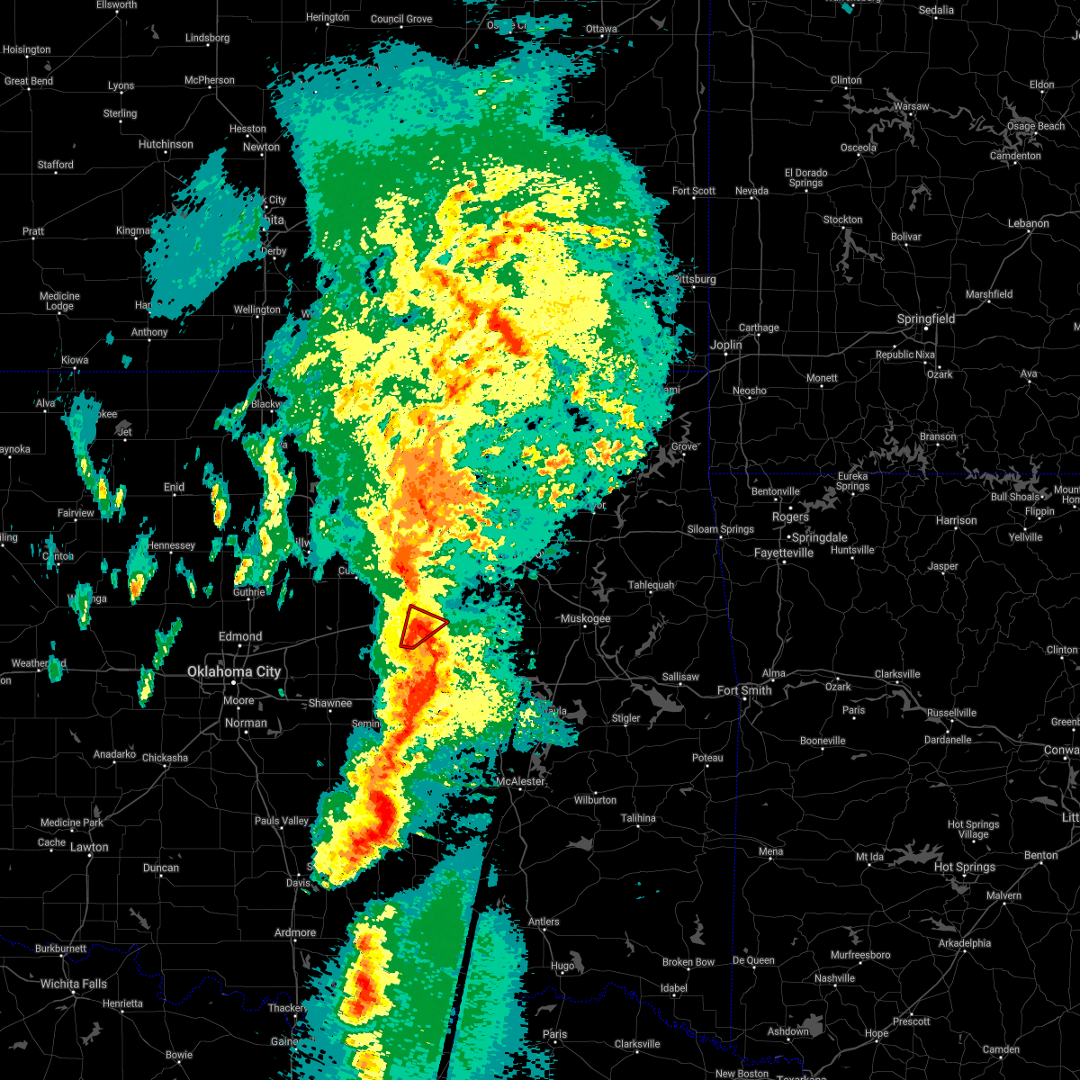 At 942 pm cdt, a severe thunderstorm capable of producing a tornado was located 4 miles north of welty, moving northeast at 40 mph (radar indicated rotation). Hazards include tornado. Flying debris will be dangerous to those caught without shelter. mobile homes will be damaged or destroyed. damage to roofs, windows, and vehicles will occur. tree damage is likely. Locations in or near the path include, bristow, slick, this includes interstate 44 near mile marker 189. At 942 pm cdt, a severe thunderstorm capable of producing a tornado was located 4 miles north of welty, moving northeast at 40 mph (radar indicated rotation). Hazards include tornado. Flying debris will be dangerous to those caught without shelter. mobile homes will be damaged or destroyed. damage to roofs, windows, and vehicles will occur. tree damage is likely. Locations in or near the path include, bristow, slick, this includes interstate 44 near mile marker 189.
|
| 10/10/2021 9:37 PM CDT |
 At 937 pm cdt, a severe thunderstorm capable of producing a tornado was located 3 miles northwest of welty, moving northeast at 40 mph (radar indicated rotation). Hazards include tornado. Flying debris will be dangerous to those caught without shelter. mobile homes will be damaged or destroyed. damage to roofs, windows, and vehicles will occur. tree damage is likely. Locations in or near the path include, bristow, slick, this includes interstate 44 between mile markers 185 and 189. At 937 pm cdt, a severe thunderstorm capable of producing a tornado was located 3 miles northwest of welty, moving northeast at 40 mph (radar indicated rotation). Hazards include tornado. Flying debris will be dangerous to those caught without shelter. mobile homes will be damaged or destroyed. damage to roofs, windows, and vehicles will occur. tree damage is likely. Locations in or near the path include, bristow, slick, this includes interstate 44 between mile markers 185 and 189.
|
| 10/10/2021 9:36 PM CDT |
 At 935 pm cdt, severe thunderstorms were located along a line extending from 8 miles east of drumright to 4 miles northeast of castle to 5 miles north of wewoka, moving northeast at 45 mph (radar indicated). Hazards include 70 mph wind gusts and nickel size hail. Expect considerable tree damage. damage is likely to mobile homes, roofs, and outbuildings. locations in or near the path include, tulsa, broken arrow, sand springs, okmulgee, bristow, okemah, bixby, sapulpa, jenks, okfuskee, glenpool, henryetta, kiefer, morris, beggs, mounds, kellyville, weleetka, dewar, schulter, this includes the following highways, interstate 40 in oklahoma between mile markers 213 and 253. interstate 44 between mile markers 187 and 229. thunderstorm damage threat, considerable hail threat, radar indicated max hail size, 0. 88 in wind threat, radar indicated max wind gust, 70 mph. At 935 pm cdt, severe thunderstorms were located along a line extending from 8 miles east of drumright to 4 miles northeast of castle to 5 miles north of wewoka, moving northeast at 45 mph (radar indicated). Hazards include 70 mph wind gusts and nickel size hail. Expect considerable tree damage. damage is likely to mobile homes, roofs, and outbuildings. locations in or near the path include, tulsa, broken arrow, sand springs, okmulgee, bristow, okemah, bixby, sapulpa, jenks, okfuskee, glenpool, henryetta, kiefer, morris, beggs, mounds, kellyville, weleetka, dewar, schulter, this includes the following highways, interstate 40 in oklahoma between mile markers 213 and 253. interstate 44 between mile markers 187 and 229. thunderstorm damage threat, considerable hail threat, radar indicated max hail size, 0. 88 in wind threat, radar indicated max wind gust, 70 mph.
|
| 10/10/2021 9:28 PM CDT |
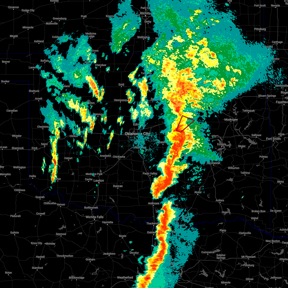 At 928 pm cdt, a severe thunderstorm capable of producing a tornado was located 5 miles north of paden, moving northeast at 40 mph (radar indicated rotation). Hazards include tornado. Flying debris will be dangerous to those caught without shelter. mobile homes will be damaged or destroyed. damage to roofs, windows, and vehicles will occur. tree damage is likely. Locations in or near the path include, bristow, depew, slick, this includes interstate 44 between mile markers 185 and 189. At 928 pm cdt, a severe thunderstorm capable of producing a tornado was located 5 miles north of paden, moving northeast at 40 mph (radar indicated rotation). Hazards include tornado. Flying debris will be dangerous to those caught without shelter. mobile homes will be damaged or destroyed. damage to roofs, windows, and vehicles will occur. tree damage is likely. Locations in or near the path include, bristow, depew, slick, this includes interstate 44 between mile markers 185 and 189.
|
| 10/10/2021 9:14 PM CDT |
 At 914 pm cdt, severe thunderstorms were located along a line extending from 2 miles northwest of drumright to 8 miles southeast of stroud to 5 miles west of cromwell, moving northeast at 40 mph (radar indicated). Hazards include 70 mph wind gusts and quarter size hail. Hail damage to vehicles is expected. expect considerable tree damage. wind damage is also likely to mobile homes, roofs, and outbuildings. locations in or near the path include, bristow, okemah, okfuskee, mannford, drumright, boley, depew, paden, bearden, slick, castle, shamrock, welty, milfay, mason, this includes the following highways, interstate 40 in oklahoma between mile markers 212 and 225. interstate 44 between mile markers 178 and 203. thunderstorm damage threat, considerable hail threat, radar indicated max hail size, 1. 00 in wind threat, radar indicated max wind gust, 70 mph. At 914 pm cdt, severe thunderstorms were located along a line extending from 2 miles northwest of drumright to 8 miles southeast of stroud to 5 miles west of cromwell, moving northeast at 40 mph (radar indicated). Hazards include 70 mph wind gusts and quarter size hail. Hail damage to vehicles is expected. expect considerable tree damage. wind damage is also likely to mobile homes, roofs, and outbuildings. locations in or near the path include, bristow, okemah, okfuskee, mannford, drumright, boley, depew, paden, bearden, slick, castle, shamrock, welty, milfay, mason, this includes the following highways, interstate 40 in oklahoma between mile markers 212 and 225. interstate 44 between mile markers 178 and 203. thunderstorm damage threat, considerable hail threat, radar indicated max hail size, 1. 00 in wind threat, radar indicated max wind gust, 70 mph.
|
| 10/10/2021 8:41 PM CDT |
 At 841 pm cdt, severe thunderstorms were located along a line extending from 3 miles southeast of tryon to 5 miles northeast of johnson to 3 miles east of brooksville, moving northeast at 40 mph (radar indicated). Hazards include 70 mph wind gusts and half dollar size hail. Hail damage to vehicles is expected. expect considerable tree damage. wind damage is also likely to mobile homes, roofs, and outbuildings. locations in or near the path include, bristow, okemah, okfuskee, mannford, drumright, boley, depew, paden, bearden, slick, castle, shamrock, welty, milfay, mason, this includes the following highways, interstate 40 in oklahoma between mile markers 212 and 225. interstate 44 between mile markers 178 and 203. thunderstorm damage threat, considerable hail threat, radar indicated max hail size, 1. 25 in wind threat, radar indicated max wind gust, 70 mph. At 841 pm cdt, severe thunderstorms were located along a line extending from 3 miles southeast of tryon to 5 miles northeast of johnson to 3 miles east of brooksville, moving northeast at 40 mph (radar indicated). Hazards include 70 mph wind gusts and half dollar size hail. Hail damage to vehicles is expected. expect considerable tree damage. wind damage is also likely to mobile homes, roofs, and outbuildings. locations in or near the path include, bristow, okemah, okfuskee, mannford, drumright, boley, depew, paden, bearden, slick, castle, shamrock, welty, milfay, mason, this includes the following highways, interstate 40 in oklahoma between mile markers 212 and 225. interstate 44 between mile markers 178 and 203. thunderstorm damage threat, considerable hail threat, radar indicated max hail size, 1. 25 in wind threat, radar indicated max wind gust, 70 mph.
|
| 7/10/2021 8:05 PM CDT |
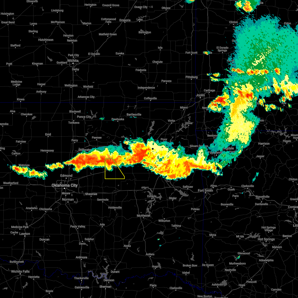 At 805 pm cdt, a severe thunderstorm was located 3 miles southeast of shamrock, moving southeast at 30 mph (radar indicated). Hazards include 70 mph wind gusts and nickel size hail. Expect considerable tree damage. damage is likely to mobile homes, roofs, and outbuildings. Locations in or near the path include, bristow, drumright, depew, slick, shamrock, milfay, this includes interstate 44 between mile markers 178 and 194. At 805 pm cdt, a severe thunderstorm was located 3 miles southeast of shamrock, moving southeast at 30 mph (radar indicated). Hazards include 70 mph wind gusts and nickel size hail. Expect considerable tree damage. damage is likely to mobile homes, roofs, and outbuildings. Locations in or near the path include, bristow, drumright, depew, slick, shamrock, milfay, this includes interstate 44 between mile markers 178 and 194.
|
| 7/10/2021 7:51 PM CDT |
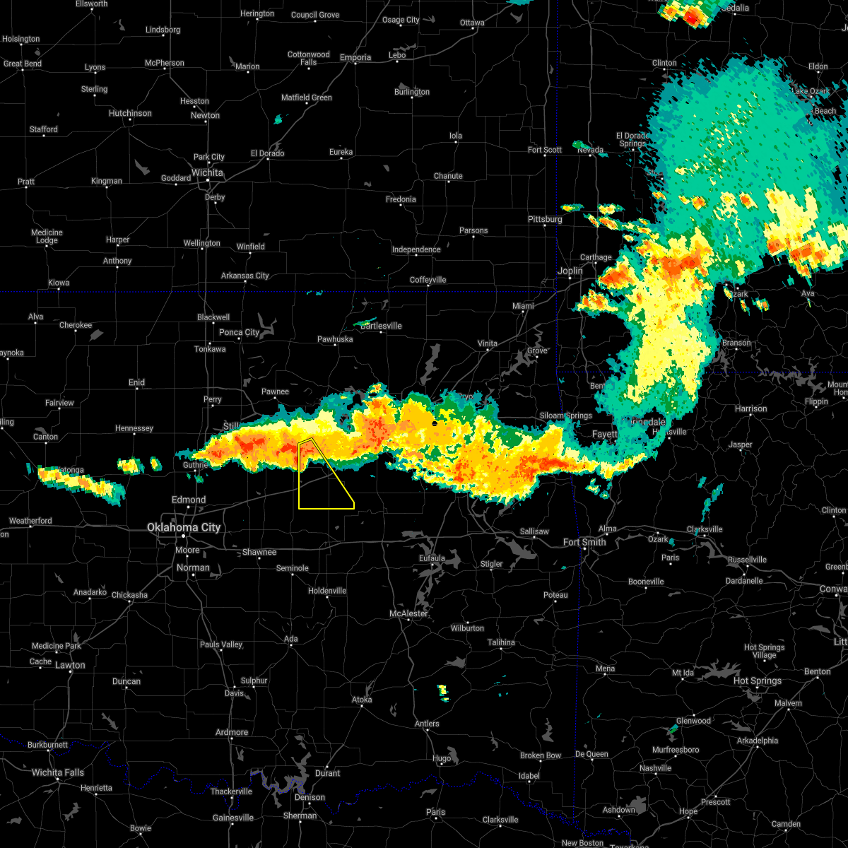 At 751 pm cdt, a severe thunderstorm was located over drumright, moving southeast at 35 mph (radar indicated). Hazards include 70 mph wind gusts and quarter size hail. Hail damage to vehicles is expected. expect considerable tree damage. wind damage is also likely to mobile homes, roofs, and outbuildings. Locations in or near the path include, bristow, drumright, depew, slick, shamrock, milfay, this includes interstate 44 between mile markers 178 and 194. At 751 pm cdt, a severe thunderstorm was located over drumright, moving southeast at 35 mph (radar indicated). Hazards include 70 mph wind gusts and quarter size hail. Hail damage to vehicles is expected. expect considerable tree damage. wind damage is also likely to mobile homes, roofs, and outbuildings. Locations in or near the path include, bristow, drumright, depew, slick, shamrock, milfay, this includes interstate 44 between mile markers 178 and 194.
|
| 5/27/2021 5:16 PM CDT |
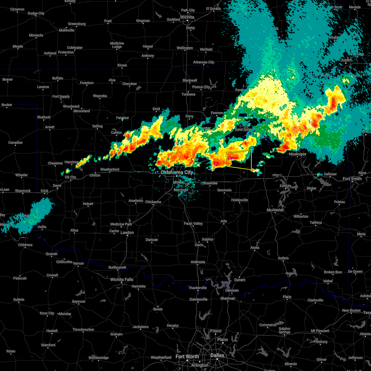 At 515 pm cdt, a severe thunderstorm was located 5 miles southeast of stroud, moving east at 40 mph (radar indicated). Hazards include golf ball size hail and 70 mph wind gusts. People and animals outdoors will be injured. expect hail damage to roofs, siding, windows, and vehicles. expect considerable tree damage. wind damage is also likely to mobile homes, roofs, and outbuildings. locations in or near the path include, okfuskee, depew, slick, welty, milfay, this includes interstate 44 between mile markers 178 and 181. A tornado watch remains in effect until 700 pm cdt for northeastern and east central oklahoma. At 515 pm cdt, a severe thunderstorm was located 5 miles southeast of stroud, moving east at 40 mph (radar indicated). Hazards include golf ball size hail and 70 mph wind gusts. People and animals outdoors will be injured. expect hail damage to roofs, siding, windows, and vehicles. expect considerable tree damage. wind damage is also likely to mobile homes, roofs, and outbuildings. locations in or near the path include, okfuskee, depew, slick, welty, milfay, this includes interstate 44 between mile markers 178 and 181. A tornado watch remains in effect until 700 pm cdt for northeastern and east central oklahoma.
|
| 5/27/2021 4:51 PM CDT |
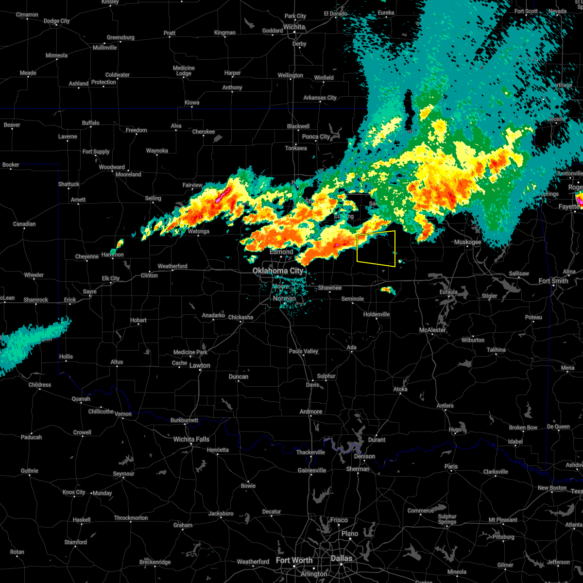 At 451 pm cdt, a severe thunderstorm was located 3 miles northwest of davenport, moving east at 40 mph (radar indicated). Hazards include 60 mph wind gusts and half dollar size hail. Hail damage to vehicles is expected. expect wind damage to roofs, siding, and trees. locations in or near the path include, bristow, okfuskee, depew, slick, welty, milfay, this includes interstate 44 between mile markers 178 and 194. A tornado watch remains in effect until 700 pm cdt for northeastern and east central oklahoma. At 451 pm cdt, a severe thunderstorm was located 3 miles northwest of davenport, moving east at 40 mph (radar indicated). Hazards include 60 mph wind gusts and half dollar size hail. Hail damage to vehicles is expected. expect wind damage to roofs, siding, and trees. locations in or near the path include, bristow, okfuskee, depew, slick, welty, milfay, this includes interstate 44 between mile markers 178 and 194. A tornado watch remains in effect until 700 pm cdt for northeastern and east central oklahoma.
|
| 5/27/2021 4:25 PM CDT |
 The severe thunderstorm warning for southwestern creek county will expire at 430 pm cdt, the storm which prompted the warning has weakened below severe limits, and has exited the warned area. therefore the warning will be allowed to expire. a tornado watch remains in effect until 700 pm cdt for northeastern oklahoma. The severe thunderstorm warning for southwestern creek county will expire at 430 pm cdt, the storm which prompted the warning has weakened below severe limits, and has exited the warned area. therefore the warning will be allowed to expire. a tornado watch remains in effect until 700 pm cdt for northeastern oklahoma.
|
| 5/27/2021 3:55 PM CDT |
 At 355 pm cdt, a severe thunderstorm was located over depew, moving east at 35 mph (radar indicated). Hazards include 60 mph wind gusts and quarter size hail. Hail damage to vehicles is expected. expect wind damage to roofs, siding, and trees. locations in or near the path include, bristow, depew, shamrock, milfay, this includes interstate 44 between mile markers 178 and 198. A tornado watch remains in effect until 700 pm cdt for northeastern oklahoma. At 355 pm cdt, a severe thunderstorm was located over depew, moving east at 35 mph (radar indicated). Hazards include 60 mph wind gusts and quarter size hail. Hail damage to vehicles is expected. expect wind damage to roofs, siding, and trees. locations in or near the path include, bristow, depew, shamrock, milfay, this includes interstate 44 between mile markers 178 and 198. A tornado watch remains in effect until 700 pm cdt for northeastern oklahoma.
|
| 5/27/2021 3:54 PM CDT |
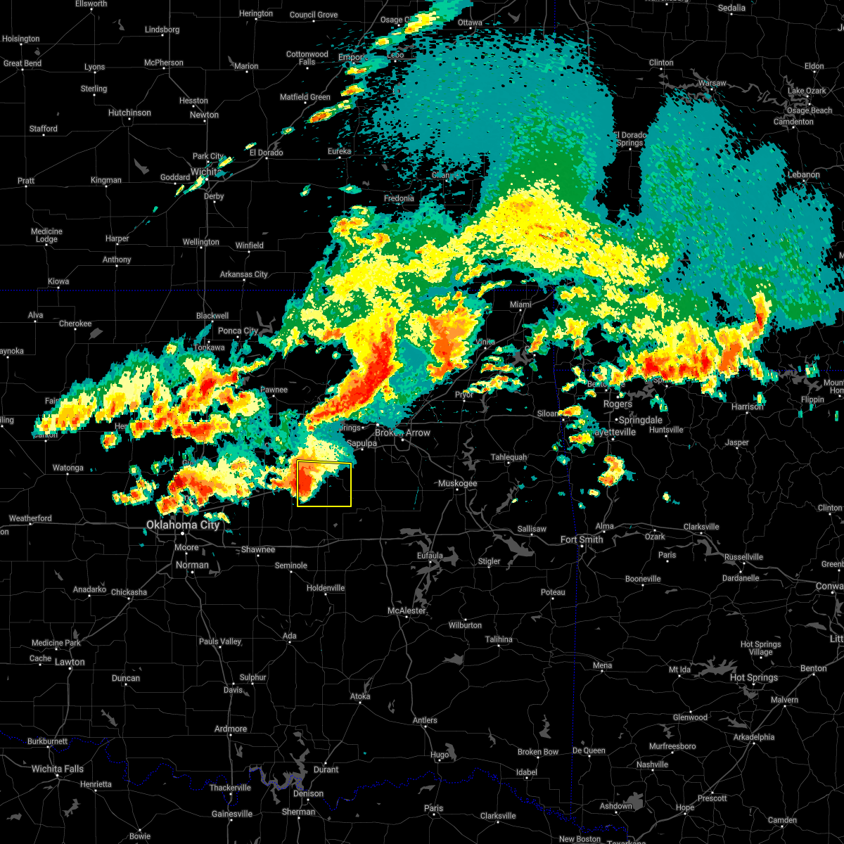 At 353 pm cdt, a severe thunderstorm was located 3 miles west of depew, moving east at 25 mph (radar indicated). Hazards include 60 mph wind gusts and quarter size hail. Hail damage to vehicles is expected. expect wind damage to roofs, siding, and trees. locations in or near the path include, bristow, depew, slick, shamrock, milfay, this includes interstate 44 between mile markers 178 and 198. A tornado watch remains in effect until 700 pm cdt for northeastern oklahoma. At 353 pm cdt, a severe thunderstorm was located 3 miles west of depew, moving east at 25 mph (radar indicated). Hazards include 60 mph wind gusts and quarter size hail. Hail damage to vehicles is expected. expect wind damage to roofs, siding, and trees. locations in or near the path include, bristow, depew, slick, shamrock, milfay, this includes interstate 44 between mile markers 178 and 198. A tornado watch remains in effect until 700 pm cdt for northeastern oklahoma.
|
| 5/27/2021 3:42 PM CDT |
 At 342 pm cdt, severe thunderstorms were located along a line extending from 3 miles east of avery to 2 miles north of stroud to 2 miles southeast of davenport, moving east at 25 mph (radar indicated). Hazards include 60 mph wind gusts and quarter size hail. Hail damage to vehicles is expected. expect wind damage to roofs, siding, and trees. locations in or near the path include, bristow, okfuskee, boley, depew, slick, castle, shamrock, welty, milfay, mason, this includes interstate 44 between mile markers 178 and 198. A tornado watch remains in effect until 700 pm cdt for northeastern and east central oklahoma. At 342 pm cdt, severe thunderstorms were located along a line extending from 3 miles east of avery to 2 miles north of stroud to 2 miles southeast of davenport, moving east at 25 mph (radar indicated). Hazards include 60 mph wind gusts and quarter size hail. Hail damage to vehicles is expected. expect wind damage to roofs, siding, and trees. locations in or near the path include, bristow, okfuskee, boley, depew, slick, castle, shamrock, welty, milfay, mason, this includes interstate 44 between mile markers 178 and 198. A tornado watch remains in effect until 700 pm cdt for northeastern and east central oklahoma.
|
| 5/27/2021 3:26 PM CDT |
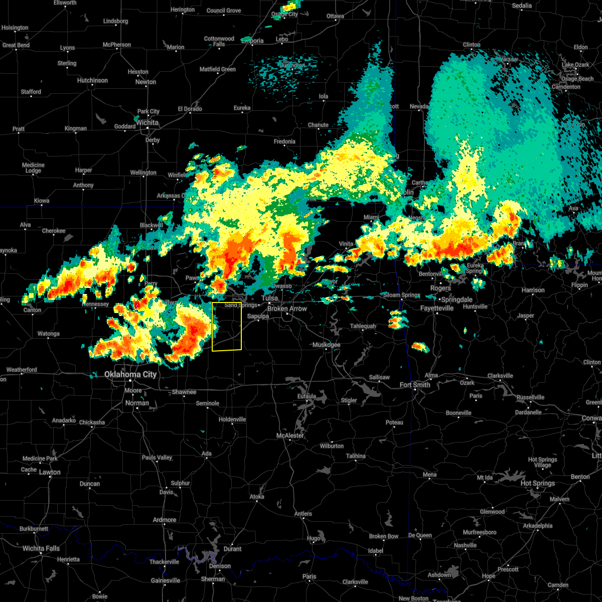 At 326 pm cdt, a severe thunderstorm was located near avery, moving east at 30 mph (radar indicated). Hazards include 60 mph wind gusts and quarter size hail. Hail damage to vehicles is expected. expect wind damage to roofs, siding, and trees. locations in or near the path include, bristow, mannford, drumright, oilton, depew, shamrock, silver city, milfay, this includes interstate 44 between mile markers 178 and 198. A tornado watch remains in effect until 700 pm cdt for northeastern oklahoma. At 326 pm cdt, a severe thunderstorm was located near avery, moving east at 30 mph (radar indicated). Hazards include 60 mph wind gusts and quarter size hail. Hail damage to vehicles is expected. expect wind damage to roofs, siding, and trees. locations in or near the path include, bristow, mannford, drumright, oilton, depew, shamrock, silver city, milfay, this includes interstate 44 between mile markers 178 and 198. A tornado watch remains in effect until 700 pm cdt for northeastern oklahoma.
|
| 5/27/2021 3:18 PM CDT |
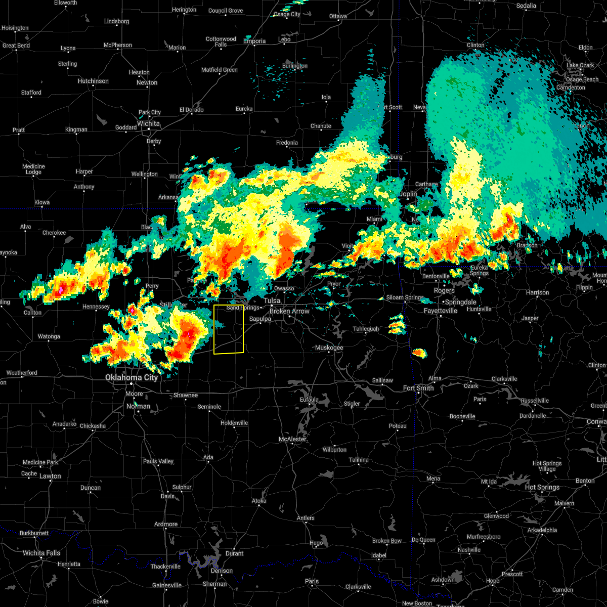 At 317 pm cdt, a severe thunderstorm was located over agra, moving east at 30 mph (radar indicated). Hazards include golf ball size hail and 60 mph wind gusts. People and animals outdoors will be injured. expect hail damage to roofs, siding, windows, and vehicles. expect wind damage to roofs, siding, and trees. locations in or near the path include, bristow, mannford, drumright, oilton, depew, shamrock, silver city, milfay, this includes interstate 44 between mile markers 178 and 198. A tornado watch remains in effect until 700 pm cdt for northeastern oklahoma. At 317 pm cdt, a severe thunderstorm was located over agra, moving east at 30 mph (radar indicated). Hazards include golf ball size hail and 60 mph wind gusts. People and animals outdoors will be injured. expect hail damage to roofs, siding, windows, and vehicles. expect wind damage to roofs, siding, and trees. locations in or near the path include, bristow, mannford, drumright, oilton, depew, shamrock, silver city, milfay, this includes interstate 44 between mile markers 178 and 198. A tornado watch remains in effect until 700 pm cdt for northeastern oklahoma.
|
| 4/9/2021 7:12 PM CDT |
 At 712 pm cdt, severe thunderstorms were located along a line extending from 5 miles west of kellyville to 2 miles south of depew to 7 miles west of welty, moving east at 25 mph (radar indicated). Hazards include 60 mph wind gusts and quarter size hail. Hail damage to vehicles is expected. expect wind damage to roofs, siding, and trees. Locations in or near the path include, bristow, okfuskee, kiefer, kellyville, depew, slick, welty, milfay, this includes interstate 44 between mile markers 183 and 207. At 712 pm cdt, severe thunderstorms were located along a line extending from 5 miles west of kellyville to 2 miles south of depew to 7 miles west of welty, moving east at 25 mph (radar indicated). Hazards include 60 mph wind gusts and quarter size hail. Hail damage to vehicles is expected. expect wind damage to roofs, siding, and trees. Locations in or near the path include, bristow, okfuskee, kiefer, kellyville, depew, slick, welty, milfay, this includes interstate 44 between mile markers 183 and 207.
|
| 3/17/2021 1:58 PM CDT |
 At 157 pm cdt, a severe thunderstorm capable of producing a tornado was located 5 miles southwest of kellyville, moving northeast at 15 mph (radar indicated rotation). Hazards include tornado and quarter size hail. Flying debris will be dangerous to those caught without shelter. mobile homes will be damaged or destroyed. damage to roofs, windows, and vehicles will occur. tree damage is likely. Locations in or near the path include, sapulpa, kellyville, this includes interstate 44 between mile markers 193 and 212. At 157 pm cdt, a severe thunderstorm capable of producing a tornado was located 5 miles southwest of kellyville, moving northeast at 15 mph (radar indicated rotation). Hazards include tornado and quarter size hail. Flying debris will be dangerous to those caught without shelter. mobile homes will be damaged or destroyed. damage to roofs, windows, and vehicles will occur. tree damage is likely. Locations in or near the path include, sapulpa, kellyville, this includes interstate 44 between mile markers 193 and 212.
|
| 8/13/2020 4:11 AM CDT |
 The severe thunderstorm warning for northern creek, southeastern pawnee and west central tulsa counties will expire at 415 am cdt, the storm which prompted the warning has weakened below severe limits, and no longer poses an immediate threat to life or property. therefore the warning will be allowed to expire. however small hail, gusty winds and heavy rain are still possible with this thunderstorm. The severe thunderstorm warning for northern creek, southeastern pawnee and west central tulsa counties will expire at 415 am cdt, the storm which prompted the warning has weakened below severe limits, and no longer poses an immediate threat to life or property. therefore the warning will be allowed to expire. however small hail, gusty winds and heavy rain are still possible with this thunderstorm.
|
| 8/13/2020 3:55 AM CDT |
 At 355 am cdt, a severe thunderstorm was located near mannford, moving southeast at 30 mph (radar indicated). Hazards include two inch hail and 70 mph wind gusts. People and animals outdoors will be injured. expect hail damage to roofs, siding, windows, and vehicles. expect considerable tree damage. wind damage is also likely to mobile homes, roofs, and outbuildings. Locations in or near the path include, sand springs, sapulpa, mannford, kellyville, westport, keystone state park, silver city, this includes interstate 44 between mile markers 189 and 214. At 355 am cdt, a severe thunderstorm was located near mannford, moving southeast at 30 mph (radar indicated). Hazards include two inch hail and 70 mph wind gusts. People and animals outdoors will be injured. expect hail damage to roofs, siding, windows, and vehicles. expect considerable tree damage. wind damage is also likely to mobile homes, roofs, and outbuildings. Locations in or near the path include, sand springs, sapulpa, mannford, kellyville, westport, keystone state park, silver city, this includes interstate 44 between mile markers 189 and 214.
|
| 8/13/2020 3:36 AM CDT |
 At 336 am cdt, a severe thunderstorm was located 3 miles northeast of terlton, moving southeast at 25 mph (radar indicated). Hazards include two inch hail and 70 mph wind gusts. People and animals outdoors will be injured. expect hail damage to roofs, siding, windows, and vehicles. expect considerable tree damage. wind damage is also likely to mobile homes, roofs, and outbuildings. Locations in or near the path include, sand springs, sapulpa, cleveland, mannford, kellyville, jennings, westport, hallett, terlton, keystone state park, silver city, this includes interstate 44 between mile markers 189 and 214. At 336 am cdt, a severe thunderstorm was located 3 miles northeast of terlton, moving southeast at 25 mph (radar indicated). Hazards include two inch hail and 70 mph wind gusts. People and animals outdoors will be injured. expect hail damage to roofs, siding, windows, and vehicles. expect considerable tree damage. wind damage is also likely to mobile homes, roofs, and outbuildings. Locations in or near the path include, sand springs, sapulpa, cleveland, mannford, kellyville, jennings, westport, hallett, terlton, keystone state park, silver city, this includes interstate 44 between mile markers 189 and 214.
|
| 7/11/2020 11:40 PM CDT |
 At 1140 pm cdt, severe thunderstorms were located along a line extending from 2 miles northwest of bristow to 7 miles southeast of stroud to 3 miles south of sparks, moving southeast at 50 mph (radar indicated). Hazards include 60 mph wind gusts. Expect damage to roofs, siding, and trees. locations in or near the path include, okmulgee, bristow, okemah, okfuskee, henryetta, morris, beggs, boley, weleetka, dewar, schulter, depew, paden, bearden, slick, castle, shamrock, clearview, preston, pharoah, this includes the following highways, interstate 40 in oklahoma between mile markers 212 and 238. Interstate 44 between mile markers 178 and 195. At 1140 pm cdt, severe thunderstorms were located along a line extending from 2 miles northwest of bristow to 7 miles southeast of stroud to 3 miles south of sparks, moving southeast at 50 mph (radar indicated). Hazards include 60 mph wind gusts. Expect damage to roofs, siding, and trees. locations in or near the path include, okmulgee, bristow, okemah, okfuskee, henryetta, morris, beggs, boley, weleetka, dewar, schulter, depew, paden, bearden, slick, castle, shamrock, clearview, preston, pharoah, this includes the following highways, interstate 40 in oklahoma between mile markers 212 and 238. Interstate 44 between mile markers 178 and 195.
|
| 7/11/2020 10:48 PM CDT |
 At 1047 pm cdt, severe thunderstorms were located along a line extending from 2 miles north of castle to 3 miles east of dustin, moving south at 45 mph (radar indicated). Hazards include 60 mph wind gusts and nickel size hail. Expect damage to roofs, siding, and trees. locations in or near the path include, bristow, okemah, okfuskee, henryetta, beggs, weleetka, bearden, slick, castle, clearview, okmulgee state park, welty, pharoah, bryant, mason, this includes the following highways, interstate 40 in oklahoma between mile markers 213 and 236. Interstate 44 between mile markers 190 and 192. At 1047 pm cdt, severe thunderstorms were located along a line extending from 2 miles north of castle to 3 miles east of dustin, moving south at 45 mph (radar indicated). Hazards include 60 mph wind gusts and nickel size hail. Expect damage to roofs, siding, and trees. locations in or near the path include, bristow, okemah, okfuskee, henryetta, beggs, weleetka, bearden, slick, castle, clearview, okmulgee state park, welty, pharoah, bryant, mason, this includes the following highways, interstate 40 in oklahoma between mile markers 213 and 236. Interstate 44 between mile markers 190 and 192.
|
| 7/11/2020 9:50 PM CDT |
 At 950 pm cdt, severe thunderstorms were located along a line extending from 6 miles north of kellyville to 4 miles north of bald hill, moving south at 30 mph (radar indicated). Hazards include 70 mph wind gusts and quarter size hail. Hail damage to vehicles is expected. expect considerable tree damage. wind damage is also likely to mobile homes, roofs, and outbuildings. Locations in or near the path include, okmulgee, bristow, sapulpa, glenpool, mannford, kiefer, morris, beggs, mounds, kellyville, grayson, slick, hoffman, keystone state park, preston, bald hill, okmulgee state park, liberty, hectorville, this includes interstate 44 between mile markers 192 and 212. At 950 pm cdt, severe thunderstorms were located along a line extending from 6 miles north of kellyville to 4 miles north of bald hill, moving south at 30 mph (radar indicated). Hazards include 70 mph wind gusts and quarter size hail. Hail damage to vehicles is expected. expect considerable tree damage. wind damage is also likely to mobile homes, roofs, and outbuildings. Locations in or near the path include, okmulgee, bristow, sapulpa, glenpool, mannford, kiefer, morris, beggs, mounds, kellyville, grayson, slick, hoffman, keystone state park, preston, bald hill, okmulgee state park, liberty, hectorville, this includes interstate 44 between mile markers 192 and 212.
|
| 5/22/2020 7:06 AM CDT |
 The severe thunderstorm warning for western rogers, southeastern osage, creek, southern washington, northwestern wagoner, southeastern pawnee, okmulgee, tulsa and okfuskee counties will expire at 715 am cdt, the storms which prompted the warning have weakened below severe limits, and no longer pose an immediate threat to life or property. therefore the warning will be allowed to expire. a severe thunderstorm watch remains in effect until noon cdt for northeastern and east central oklahoma. The severe thunderstorm warning for western rogers, southeastern osage, creek, southern washington, northwestern wagoner, southeastern pawnee, okmulgee, tulsa and okfuskee counties will expire at 715 am cdt, the storms which prompted the warning have weakened below severe limits, and no longer pose an immediate threat to life or property. therefore the warning will be allowed to expire. a severe thunderstorm watch remains in effect until noon cdt for northeastern and east central oklahoma.
|
| 5/22/2020 6:34 AM CDT |
 At 632 am cdt, severe thunderstorms were located along a line extending from 4 miles east of barnsdall to 5 miles west of turley to 4 miles west of mounds to 6 miles northeast of castle, moving east at 35 mph (radar indicated). Hazards include 60 mph wind gusts. Expect damage to roofs, siding, and trees. locations in or near the path include, tulsa, broken arrow, sand springs, claremore, okmulgee, bristow, okemah, owasso, bixby, sapulpa, jenks, okfuskee, glenpool, coweta, skiatook, catoosa, henryetta, collinsville, verdigris, mannford, this includes the following highways, interstate 40 in oklahoma between mile markers 218 and 239. interstate 44 between mile markers 188 and 245. the squall line has shown signs of weakening overall. If the trend continues, the warning may either be cancelled early or will be allowed to expire at 715 am. At 632 am cdt, severe thunderstorms were located along a line extending from 4 miles east of barnsdall to 5 miles west of turley to 4 miles west of mounds to 6 miles northeast of castle, moving east at 35 mph (radar indicated). Hazards include 60 mph wind gusts. Expect damage to roofs, siding, and trees. locations in or near the path include, tulsa, broken arrow, sand springs, claremore, okmulgee, bristow, okemah, owasso, bixby, sapulpa, jenks, okfuskee, glenpool, coweta, skiatook, catoosa, henryetta, collinsville, verdigris, mannford, this includes the following highways, interstate 40 in oklahoma between mile markers 218 and 239. interstate 44 between mile markers 188 and 245. the squall line has shown signs of weakening overall. If the trend continues, the warning may either be cancelled early or will be allowed to expire at 715 am.
|
| 5/22/2020 6:09 AM CDT |
 At 609 am cdt, severe thunderstorms were located along a line extending from near wynona to walnut creek state park to 3 miles northeast of bristow to 4 miles north of paden, moving east at 35 mph (radar indicated). Hazards include 60 mph wind gusts. Expect damage to roofs, siding, and trees. locations in or near the path include, tulsa, broken arrow, sand springs, claremore, okmulgee, bristow, okemah, owasso, bixby, sapulpa, jenks, okfuskee, glenpool, coweta, skiatook, catoosa, henryetta, collinsville, verdigris, hominy, this includes the following highways, interstate 40 in oklahoma between mile markers 218 and 239. Interstate 44 between mile markers 178 and 245. At 609 am cdt, severe thunderstorms were located along a line extending from near wynona to walnut creek state park to 3 miles northeast of bristow to 4 miles north of paden, moving east at 35 mph (radar indicated). Hazards include 60 mph wind gusts. Expect damage to roofs, siding, and trees. locations in or near the path include, tulsa, broken arrow, sand springs, claremore, okmulgee, bristow, okemah, owasso, bixby, sapulpa, jenks, okfuskee, glenpool, coweta, skiatook, catoosa, henryetta, collinsville, verdigris, hominy, this includes the following highways, interstate 40 in oklahoma between mile markers 218 and 239. Interstate 44 between mile markers 178 and 245.
|
| 5/22/2020 5:46 AM CDT |
 At 545 am cdt, severe thunderstorms were located along a line extending from 7 miles north of blackburn to near oilton to near sparks, moving east at 35 mph (radar indicated. at 535 am...the pawnee mesonet station 3 miles east northeast of pawnee reported a 65 mph wind gust). Hazards include 60 mph wind gusts. Expect damage to roofs, siding, and trees. Locations in or near the path include, sand springs, bristow, sapulpa, hominy, cleveland, mannford, drumright, barnsdall, boley, kellyville, oilton, depew, paden, wynona, jennings, westport, osage, slick, hallett, blackburn, this includes interstate 44 between mile markers 178 and 210. At 545 am cdt, severe thunderstorms were located along a line extending from 7 miles north of blackburn to near oilton to near sparks, moving east at 35 mph (radar indicated. at 535 am...the pawnee mesonet station 3 miles east northeast of pawnee reported a 65 mph wind gust). Hazards include 60 mph wind gusts. Expect damage to roofs, siding, and trees. Locations in or near the path include, sand springs, bristow, sapulpa, hominy, cleveland, mannford, drumright, barnsdall, boley, kellyville, oilton, depew, paden, wynona, jennings, westport, osage, slick, hallett, blackburn, this includes interstate 44 between mile markers 178 and 210.
|
| 5/22/2020 5:35 AM CDT |
 At 534 am cdt, severe thunderstorms were located along a line extending from near ralston to 3 miles west of yale to 2 miles south of warwick, moving east at 40 mph (radar indicated). Hazards include 60 mph wind gusts. Expect damage to roofs, siding, and trees. Locations in or near the path include, sand springs, bristow, sapulpa, hominy, cleveland, mannford, drumright, barnsdall, boley, kellyville, oilton, depew, paden, wynona, jennings, westport, osage, slick, hallett, blackburn, this includes interstate 44 between mile markers 178 and 210. At 534 am cdt, severe thunderstorms were located along a line extending from near ralston to 3 miles west of yale to 2 miles south of warwick, moving east at 40 mph (radar indicated). Hazards include 60 mph wind gusts. Expect damage to roofs, siding, and trees. Locations in or near the path include, sand springs, bristow, sapulpa, hominy, cleveland, mannford, drumright, barnsdall, boley, kellyville, oilton, depew, paden, wynona, jennings, westport, osage, slick, hallett, blackburn, this includes interstate 44 between mile markers 178 and 210.
|
| 5/4/2020 5:09 PM CDT |
 At 509 pm cdt, a severe thunderstorm was located 3 miles north of slick, moving east at 45 mph (radar indicated). Hazards include half dollar size hail. Damage to vehicles is expected. locations in or near the path include, tulsa, broken arrow, bixby, jenks, glenpool, kiefer, beggs, mounds, slick, bald hill, stonebluff, liberty, hectorville, leonard, this includes interstate 44 between mile markers 192 and 198. A tornado watch remains in effect until 1000 pm cdt for northeastern and east central oklahoma. At 509 pm cdt, a severe thunderstorm was located 3 miles north of slick, moving east at 45 mph (radar indicated). Hazards include half dollar size hail. Damage to vehicles is expected. locations in or near the path include, tulsa, broken arrow, bixby, jenks, glenpool, kiefer, beggs, mounds, slick, bald hill, stonebluff, liberty, hectorville, leonard, this includes interstate 44 between mile markers 192 and 198. A tornado watch remains in effect until 1000 pm cdt for northeastern and east central oklahoma.
|
| 5/4/2020 5:01 PM CDT |
 At 501 pm cdt, a severe thunderstorm was located 3 miles southeast of bristow, moving east at 55 mph (radar indicated). Hazards include half dollar size hail. Damage to vehicles is expected. locations in or near the path include, tulsa, broken arrow, bristow, bixby, jenks, glenpool, kiefer, beggs, mounds, slick, bald hill, stonebluff, liberty, hectorville, leonard, this includes interstate 44 between mile markers 188 and 198. A tornado watch remains in effect until 1000 pm cdt for northeastern and east central oklahoma. At 501 pm cdt, a severe thunderstorm was located 3 miles southeast of bristow, moving east at 55 mph (radar indicated). Hazards include half dollar size hail. Damage to vehicles is expected. locations in or near the path include, tulsa, broken arrow, bristow, bixby, jenks, glenpool, kiefer, beggs, mounds, slick, bald hill, stonebluff, liberty, hectorville, leonard, this includes interstate 44 between mile markers 188 and 198. A tornado watch remains in effect until 1000 pm cdt for northeastern and east central oklahoma.
|
| 4/28/2020 7:18 PM CDT |
 At 718 pm cdt, severe thunderstorms were located along a line extending from 6 miles north of porter to 4 miles northeast of bald hill to 4 miles east of welty, moving southeast at 30 mph (radar indicated). Hazards include 60 mph wind gusts and quarter size hail. Hail damage to vehicles is expected. expect wind damage to roofs, siding, and trees. Locations in or near the path include, tulsa, broken arrow, okmulgee, wagoner, bristow, bixby, jenks, okfuskee, glenpool, coweta, haskell, inola, kiefer, morris, beggs, mounds, okay, porter, taft, boynton, a tornado watch remains in effect until 1100 pm cdt for northeastern and east central oklahoma. At 718 pm cdt, severe thunderstorms were located along a line extending from 6 miles north of porter to 4 miles northeast of bald hill to 4 miles east of welty, moving southeast at 30 mph (radar indicated). Hazards include 60 mph wind gusts and quarter size hail. Hail damage to vehicles is expected. expect wind damage to roofs, siding, and trees. Locations in or near the path include, tulsa, broken arrow, okmulgee, wagoner, bristow, bixby, jenks, okfuskee, glenpool, coweta, haskell, inola, kiefer, morris, beggs, mounds, okay, porter, taft, boynton, a tornado watch remains in effect until 1100 pm cdt for northeastern and east central oklahoma.
|
| 4/28/2020 6:42 PM CDT |
 At 642 pm cdt, severe thunderstorms were located along a line extending from 6 miles west of inola to 2 miles southeast of jenks to 4 miles northeast of bristow, moving south at 30 mph (radar indicated). Hazards include 60 mph wind gusts and quarter size hail. Hail damage to vehicles is expected. expect wind damage to roofs, siding, and trees. locations in or near the path include, tulsa, broken arrow, sand springs, okmulgee, wagoner, bristow, bixby, sapulpa, jenks, okfuskee, glenpool, coweta, catoosa, verdigris, haskell, inola, kiefer, morris, beggs, mounds, this includes interstate 44 between mile markers 185 and 243. A tornado watch remains in effect until 1100 pm cdt for northeastern and east central oklahoma. At 642 pm cdt, severe thunderstorms were located along a line extending from 6 miles west of inola to 2 miles southeast of jenks to 4 miles northeast of bristow, moving south at 30 mph (radar indicated). Hazards include 60 mph wind gusts and quarter size hail. Hail damage to vehicles is expected. expect wind damage to roofs, siding, and trees. locations in or near the path include, tulsa, broken arrow, sand springs, okmulgee, wagoner, bristow, bixby, sapulpa, jenks, okfuskee, glenpool, coweta, catoosa, verdigris, haskell, inola, kiefer, morris, beggs, mounds, this includes interstate 44 between mile markers 185 and 243. A tornado watch remains in effect until 1100 pm cdt for northeastern and east central oklahoma.
|
| 4/28/2020 5:45 PM CDT |
 At 544 pm cdt, severe thunderstorms were located along a line extending from 7 miles east of drumright to 6 miles southeast of stroud, moving east at 30 mph (radar indicated). Hazards include 60 mph wind gusts and quarter size hail. Hail damage to vehicles is expected. expect wind damage to roofs, siding, and trees. locations in or near the path include, bristow, drumright, kellyville, oilton, depew, slick, shamrock, milfay, this includes interstate 44 between mile markers 178 and 204. A tornado watch remains in effect until 1100 pm cdt for northeastern and east central oklahoma. At 544 pm cdt, severe thunderstorms were located along a line extending from 7 miles east of drumright to 6 miles southeast of stroud, moving east at 30 mph (radar indicated). Hazards include 60 mph wind gusts and quarter size hail. Hail damage to vehicles is expected. expect wind damage to roofs, siding, and trees. locations in or near the path include, bristow, drumright, kellyville, oilton, depew, slick, shamrock, milfay, this includes interstate 44 between mile markers 178 and 204. A tornado watch remains in effect until 1100 pm cdt for northeastern and east central oklahoma.
|
| 3/19/2020 1:50 AM CDT | Mobile home and propane suppy tank flipped or damaged by thunderstorm winds east of drumright near intersection of hwy 33 and 433rd west av in creek county OK, 11.3 miles SSE of Bristow, OK |
| 1/10/2020 10:52 AM CST |
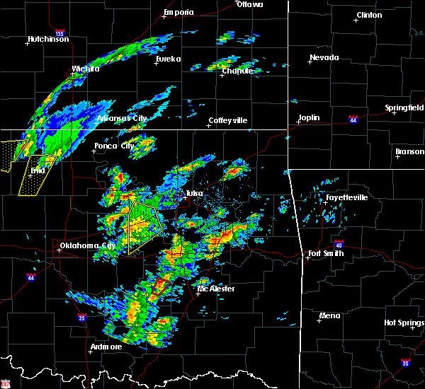 At 1051 am cst, severe thunderstorms were located along a line extending from 3 miles northeast of stroud to 5 miles southwest of depew to 6 miles north of paden, moving northeast at 40 mph (radar indicated). Hazards include 60 mph wind gusts. Expect damage to roofs, siding, and trees. locations in or near the path include, bristow, depew, shamrock, milfay, this includes interstate 44 between mile markers 178 and 199. A tornado watch remains in effect until 600 pm cst for northeastern and east central oklahoma. At 1051 am cst, severe thunderstorms were located along a line extending from 3 miles northeast of stroud to 5 miles southwest of depew to 6 miles north of paden, moving northeast at 40 mph (radar indicated). Hazards include 60 mph wind gusts. Expect damage to roofs, siding, and trees. locations in or near the path include, bristow, depew, shamrock, milfay, this includes interstate 44 between mile markers 178 and 199. A tornado watch remains in effect until 600 pm cst for northeastern and east central oklahoma.
|
| 1/10/2020 10:42 AM CST |
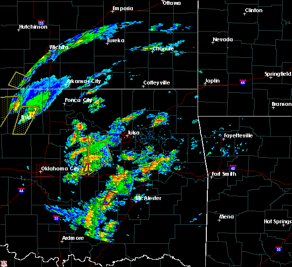 At 1041 am cst, severe thunderstorms were located along a line extending from 3 miles south of stroud to 10 miles east of davenport to 3 miles east of prague, moving northeast at 45 mph (radar indicated). Hazards include 60 mph wind gusts and penny size hail. Expect damage to roofs, siding, and trees. locations in or near the path include, bristow, depew, paden, slick, shamrock, welty, milfay, this includes interstate 44 between mile markers 178 and 200. A tornado watch remains in effect until 600 pm cst for northeastern and east central oklahoma. At 1041 am cst, severe thunderstorms were located along a line extending from 3 miles south of stroud to 10 miles east of davenport to 3 miles east of prague, moving northeast at 45 mph (radar indicated). Hazards include 60 mph wind gusts and penny size hail. Expect damage to roofs, siding, and trees. locations in or near the path include, bristow, depew, paden, slick, shamrock, welty, milfay, this includes interstate 44 between mile markers 178 and 200. A tornado watch remains in effect until 600 pm cst for northeastern and east central oklahoma.
|
| 10/20/2019 10:54 PM CDT |
 The severe thunderstorm warning for central creek, northwestern okmulgee and south central tulsa counties will expire at 1100 pm cdt, the storm which prompted the warning has weakened below severe limits, and no longer poses an immediate threat to life or property. therefore the warning will be allowed to expire. however gusty winds are still possible with this thunderstorm. a tornado watch remains in effect until 300 am cdt for northeastern oklahoma. The severe thunderstorm warning for central creek, northwestern okmulgee and south central tulsa counties will expire at 1100 pm cdt, the storm which prompted the warning has weakened below severe limits, and no longer poses an immediate threat to life or property. therefore the warning will be allowed to expire. however gusty winds are still possible with this thunderstorm. a tornado watch remains in effect until 300 am cdt for northeastern oklahoma.
|
| 10/20/2019 10:44 PM CDT |
 At 1044 pm cdt, a severe thunderstorm was located near sapulpa, moving east at 65 mph (radar indicated). Hazards include 60 mph wind gusts and penny size hail. Expect damage to roofs, siding, and trees. locations in or near the path include, tulsa, bristow, sapulpa, jenks, glenpool, kiefer, mounds, kellyville, depew, this includes interstate 44 between mile markers 183 and 219. A tornado watch remains in effect until 300 am cdt for northeastern oklahoma. At 1044 pm cdt, a severe thunderstorm was located near sapulpa, moving east at 65 mph (radar indicated). Hazards include 60 mph wind gusts and penny size hail. Expect damage to roofs, siding, and trees. locations in or near the path include, tulsa, bristow, sapulpa, jenks, glenpool, kiefer, mounds, kellyville, depew, this includes interstate 44 between mile markers 183 and 219. A tornado watch remains in effect until 300 am cdt for northeastern oklahoma.
|
| 10/20/2019 10:23 PM CDT |
 At 1023 pm cdt, a severe thunderstorm was located 4 miles north of depew, moving east at 65 mph (radar indicated). Hazards include 60 mph wind gusts and quarter size hail. Hail damage to vehicles is expected. expect wind damage to roofs, siding, and trees. locations in or near the path include, tulsa, sand springs, bristow, sapulpa, jenks, glenpool, kiefer, mounds, kellyville, depew, shamrock, gray, this includes interstate 44 between mile markers 178 and 218. A tornado watch remains in effect until 300 am cdt for northeastern oklahoma. At 1023 pm cdt, a severe thunderstorm was located 4 miles north of depew, moving east at 65 mph (radar indicated). Hazards include 60 mph wind gusts and quarter size hail. Hail damage to vehicles is expected. expect wind damage to roofs, siding, and trees. locations in or near the path include, tulsa, sand springs, bristow, sapulpa, jenks, glenpool, kiefer, mounds, kellyville, depew, shamrock, gray, this includes interstate 44 between mile markers 178 and 218. A tornado watch remains in effect until 300 am cdt for northeastern oklahoma.
|
| 10/20/2019 9:39 PM CDT |
 At 939 pm cdt, a severe thunderstorm was located 4 miles south of slick, moving northeast at 60 mph (radar indicated). Hazards include 60 mph wind gusts and half dollar size hail. Hail damage to vehicles is expected. expect wind damage to roofs, siding, and trees. locations in or near the path include, bristow, sapulpa, kiefer, mounds, kellyville, slick, welty, mason, this includes interstate 44 between mile markers 190 and 212. A tornado watch remains in effect until 300 am cdt for northeastern and east central oklahoma. At 939 pm cdt, a severe thunderstorm was located 4 miles south of slick, moving northeast at 60 mph (radar indicated). Hazards include 60 mph wind gusts and half dollar size hail. Hail damage to vehicles is expected. expect wind damage to roofs, siding, and trees. locations in or near the path include, bristow, sapulpa, kiefer, mounds, kellyville, slick, welty, mason, this includes interstate 44 between mile markers 190 and 212. A tornado watch remains in effect until 300 am cdt for northeastern and east central oklahoma.
|
| 10/20/2019 9:28 PM CDT |
 At 928 pm cdt, a severe thunderstorm was located over welty, moving northeast at 45 mph. another severe storm just east of bristow is capable of producing quarter size hail (radar indicated). Hazards include ping pong ball size hail. People and animals outdoors will be injured. expect damage to roofs, siding, windows, and vehicles. locations in or near the path include, bristow, sapulpa, kiefer, mounds, kellyville, slick, castle, welty, mason, this includes interstate 44 between mile markers 188 and 212. A tornado watch remains in effect until 300 am cdt for northeastern and east central oklahoma. At 928 pm cdt, a severe thunderstorm was located over welty, moving northeast at 45 mph. another severe storm just east of bristow is capable of producing quarter size hail (radar indicated). Hazards include ping pong ball size hail. People and animals outdoors will be injured. expect damage to roofs, siding, windows, and vehicles. locations in or near the path include, bristow, sapulpa, kiefer, mounds, kellyville, slick, castle, welty, mason, this includes interstate 44 between mile markers 188 and 212. A tornado watch remains in effect until 300 am cdt for northeastern and east central oklahoma.
|
| 10/20/2019 9:26 PM CDT | Quarter sized hail reported 1 miles S of Bristow, OK, quarter size hail reported at the hwy 48 and i44 junction in bristow. |
| 10/20/2019 9:20 PM CDT |
 At 919 pm cdt, a severe thunderstorm was located near paden, moving northeast at 30 mph (radar indicated). Hazards include ping pong ball size hail and 60 mph wind gusts. People and animals outdoors will be injured. expect hail damage to roofs, siding, windows, and vehicles. expect wind damage to roofs, siding, and trees. locations in or near the path include, bristow, boley, depew, paden, slick, shamrock, welty, milfay, this includes interstate 44 between mile markers 178 and 199. A tornado watch remains in effect until 300 am cdt for northeastern and east central oklahoma. At 919 pm cdt, a severe thunderstorm was located near paden, moving northeast at 30 mph (radar indicated). Hazards include ping pong ball size hail and 60 mph wind gusts. People and animals outdoors will be injured. expect hail damage to roofs, siding, windows, and vehicles. expect wind damage to roofs, siding, and trees. locations in or near the path include, bristow, boley, depew, paden, slick, shamrock, welty, milfay, this includes interstate 44 between mile markers 178 and 199. A tornado watch remains in effect until 300 am cdt for northeastern and east central oklahoma.
|
| 10/20/2019 9:09 PM CDT |
 At 909 pm cdt, a severe thunderstorm was located 4 miles west of welty, moving northeast at 60 mph (radar indicated). Hazards include 60 mph wind gusts and half dollar size hail. Hail damage to vehicles is expected. expect wind damage to roofs, siding, and trees. locations in or near the path include, bristow, boley, depew, paden, slick, shamrock, welty, milfay, this includes interstate 44 between mile markers 178 and 199. A tornado watch remains in effect until 300 am cdt for northeastern and east central oklahoma. At 909 pm cdt, a severe thunderstorm was located 4 miles west of welty, moving northeast at 60 mph (radar indicated). Hazards include 60 mph wind gusts and half dollar size hail. Hail damage to vehicles is expected. expect wind damage to roofs, siding, and trees. locations in or near the path include, bristow, boley, depew, paden, slick, shamrock, welty, milfay, this includes interstate 44 between mile markers 178 and 199. A tornado watch remains in effect until 300 am cdt for northeastern and east central oklahoma.
|
| 10/20/2019 9:00 PM CDT |
 At 900 pm cdt, severe thunderstorms were located along a line extending from 4 miles northwest of little to 4 miles southwest of paden, moving northeast at 55 mph (radar indicated). Hazards include 60 mph wind gusts and quarter size hail. Hail damage to vehicles is expected. expect wind damage to roofs, siding, and trees. locations in or near the path include, bristow, boley, depew, paden, slick, shamrock, welty, milfay, this includes interstate 44 between mile markers 178 and 199. A tornado watch remains in effect until 300 am cdt for northeastern and east central oklahoma. At 900 pm cdt, severe thunderstorms were located along a line extending from 4 miles northwest of little to 4 miles southwest of paden, moving northeast at 55 mph (radar indicated). Hazards include 60 mph wind gusts and quarter size hail. Hail damage to vehicles is expected. expect wind damage to roofs, siding, and trees. locations in or near the path include, bristow, boley, depew, paden, slick, shamrock, welty, milfay, this includes interstate 44 between mile markers 178 and 199. A tornado watch remains in effect until 300 am cdt for northeastern and east central oklahoma.
|
| 10/20/2019 8:36 PM CDT |
 At 835 pm cdt, a severe thunderstorm was located 4 miles north of slick, moving northeast at 60 mph (radar indicated). Hazards include 60 mph wind gusts and quarter size hail. Hail damage to vehicles is expected. expect wind damage to roofs, siding, and trees. locations in or near the path include, tulsa, broken arrow, sand springs, bristow, owasso, bixby, sapulpa, jenks, glenpool, catoosa, verdigris, kiefer, mounds, kellyville, slick, jenks riverside airport, turley, tulsa international airport, liberty, gray, this includes interstate 44 between mile markers 189 and 242. A tornado watch remains in effect until 300 am cdt for northeastern oklahoma. At 835 pm cdt, a severe thunderstorm was located 4 miles north of slick, moving northeast at 60 mph (radar indicated). Hazards include 60 mph wind gusts and quarter size hail. Hail damage to vehicles is expected. expect wind damage to roofs, siding, and trees. locations in or near the path include, tulsa, broken arrow, sand springs, bristow, owasso, bixby, sapulpa, jenks, glenpool, catoosa, verdigris, kiefer, mounds, kellyville, slick, jenks riverside airport, turley, tulsa international airport, liberty, gray, this includes interstate 44 between mile markers 189 and 242. A tornado watch remains in effect until 300 am cdt for northeastern oklahoma.
|
| 10/10/2019 1:04 PM CDT |
 At 103 pm cdt, a severe thunderstorm was located 6 miles west of kellyville, moving northeast at 45 mph (radar indicated). Hazards include 60 mph wind gusts and quarter size hail. Hail damage to vehicles is expected. expect wind damage to roofs, siding, and trees. Locations in or near the path include, tulsa, broken arrow, sand springs, owasso, bixby, sapulpa, jenks, glenpool, catoosa, kiefer, kellyville, jenks riverside airport, turley, tulsa international airport, gray, this includes interstate 44 between mile markers 192 and 232. At 103 pm cdt, a severe thunderstorm was located 6 miles west of kellyville, moving northeast at 45 mph (radar indicated). Hazards include 60 mph wind gusts and quarter size hail. Hail damage to vehicles is expected. expect wind damage to roofs, siding, and trees. Locations in or near the path include, tulsa, broken arrow, sand springs, owasso, bixby, sapulpa, jenks, glenpool, catoosa, kiefer, kellyville, jenks riverside airport, turley, tulsa international airport, gray, this includes interstate 44 between mile markers 192 and 232.
|
| 10/5/2019 5:15 PM CDT | Golf Ball sized hail reported 7.9 miles W of Bristow, OK |
| 10/5/2019 4:51 PM CDT |
 At 451 pm cdt, a severe thunderstorm was located near bristow, moving east at 25 mph (radar indicated). Hazards include golf ball size hail and 60 mph wind gusts. People and animals outdoors will be injured. expect hail damage to roofs, siding, windows, and vehicles. expect wind damage to roofs, siding, and trees. Locations in or near the path include, bristow, bixby, jenks, glenpool, kiefer, beggs, mounds, kellyville, depew, slick, preston, liberty, hectorville, this includes interstate 44 between mile markers 185 and 203. At 451 pm cdt, a severe thunderstorm was located near bristow, moving east at 25 mph (radar indicated). Hazards include golf ball size hail and 60 mph wind gusts. People and animals outdoors will be injured. expect hail damage to roofs, siding, windows, and vehicles. expect wind damage to roofs, siding, and trees. Locations in or near the path include, bristow, bixby, jenks, glenpool, kiefer, beggs, mounds, kellyville, depew, slick, preston, liberty, hectorville, this includes interstate 44 between mile markers 185 and 203.
|
| 9/12/2019 6:29 PM CDT |
 At 628 pm cdt, severe thunderstorms were located along a line extending from 2 miles north of cleveland to 4 miles northeast of terlton to 5 miles east of oilton to 3 miles northwest of drumright, moving southeast at 45 mph (radar indicated). Hazards include 60 mph wind gusts. Expect damage to roofs, siding, and trees. Locations in or near the path include, tulsa, sand springs, bixby, sapulpa, jenks, glenpool, skiatook, hominy, cleveland, mannford, drumright, kiefer, sperry, mounds, kellyville, oilton, jennings, westport, osage, terlton, this includes interstate 44 between mile markers 193 and 224. At 628 pm cdt, severe thunderstorms were located along a line extending from 2 miles north of cleveland to 4 miles northeast of terlton to 5 miles east of oilton to 3 miles northwest of drumright, moving southeast at 45 mph (radar indicated). Hazards include 60 mph wind gusts. Expect damage to roofs, siding, and trees. Locations in or near the path include, tulsa, sand springs, bixby, sapulpa, jenks, glenpool, skiatook, hominy, cleveland, mannford, drumright, kiefer, sperry, mounds, kellyville, oilton, jennings, westport, osage, terlton, this includes interstate 44 between mile markers 193 and 224.
|
| 8/22/2019 8:49 PM CDT |
 At 829 pm cdt, a severe thunderstorm was located 4 miles south of bristow, moving northeast at 45 mph (radar indicated). Hazards include 60 mph wind gusts. Expect damage to roofs, siding, and trees. Locations in or near the path include, tulsa, sand springs, bristow, sapulpa, jenks, glenpool, mannford, kiefer, mounds, kellyville, depew, slick, keystone state park, jenks riverside airport, gray, this includes interstate 44 between mile markers 184 and 226. At 829 pm cdt, a severe thunderstorm was located 4 miles south of bristow, moving northeast at 45 mph (radar indicated). Hazards include 60 mph wind gusts. Expect damage to roofs, siding, and trees. Locations in or near the path include, tulsa, sand springs, bristow, sapulpa, jenks, glenpool, mannford, kiefer, mounds, kellyville, depew, slick, keystone state park, jenks riverside airport, gray, this includes interstate 44 between mile markers 184 and 226.
|
| 8/22/2019 8:29 PM CDT |
 At 829 pm cdt, a severe thunderstorm was located 4 miles south of bristow, moving northeast at 45 mph (radar indicated). Hazards include 60 mph wind gusts. Expect damage to roofs, siding, and trees. Locations in or near the path include, tulsa, sand springs, bristow, sapulpa, jenks, glenpool, mannford, kiefer, mounds, kellyville, depew, slick, keystone state park, jenks riverside airport, gray, this includes interstate 44 between mile markers 184 and 226. At 829 pm cdt, a severe thunderstorm was located 4 miles south of bristow, moving northeast at 45 mph (radar indicated). Hazards include 60 mph wind gusts. Expect damage to roofs, siding, and trees. Locations in or near the path include, tulsa, sand springs, bristow, sapulpa, jenks, glenpool, mannford, kiefer, mounds, kellyville, depew, slick, keystone state park, jenks riverside airport, gray, this includes interstate 44 between mile markers 184 and 226.
|
| 8/22/2019 8:10 PM CDT |
 At 810 pm cdt, a severe thunderstorm was located 7 miles north of paden, moving northeast at 40 mph (radar indicated). Hazards include 60 mph wind gusts. Expect damage to roofs, siding, and trees. Locations in or near the path include, bristow, boley, depew, paden, slick, shamrock, welty, milfay, this includes interstate 44 between mile markers 178 and 191. At 810 pm cdt, a severe thunderstorm was located 7 miles north of paden, moving northeast at 40 mph (radar indicated). Hazards include 60 mph wind gusts. Expect damage to roofs, siding, and trees. Locations in or near the path include, bristow, boley, depew, paden, slick, shamrock, welty, milfay, this includes interstate 44 between mile markers 178 and 191.
|
| 6/16/2019 12:53 AM CDT |
 At 1253 am cdt, severe thunderstorms were located along a line extending from 3 miles northeast of maramec to 4 miles west of beggs to 4 miles southwest of horntown, moving east at 45 mph (radar indicated). Hazards include 60 mph wind gusts. Expect damage to roofs, siding, and trees. locations in or near the path include, tulsa, broken arrow, sand springs, okmulgee, okemah, eufaula, pawnee, owasso, bixby, sapulpa, jenks, okfuskee, glenpool, coweta, skiatook, catoosa, henryetta, hominy, cleveland, mannford, this includes the following highways, interstate 40 in oklahoma between mile markers 219 and 261. Interstate 44 between mile markers 192 and 232. At 1253 am cdt, severe thunderstorms were located along a line extending from 3 miles northeast of maramec to 4 miles west of beggs to 4 miles southwest of horntown, moving east at 45 mph (radar indicated). Hazards include 60 mph wind gusts. Expect damage to roofs, siding, and trees. locations in or near the path include, tulsa, broken arrow, sand springs, okmulgee, okemah, eufaula, pawnee, owasso, bixby, sapulpa, jenks, okfuskee, glenpool, coweta, skiatook, catoosa, henryetta, hominy, cleveland, mannford, this includes the following highways, interstate 40 in oklahoma between mile markers 219 and 261. Interstate 44 between mile markers 192 and 232.
|
| 6/16/2019 12:37 AM CDT |
 At 1236 am cdt, severe thunderstorms were located along a line extending from near maramec to 3 miles northeast of welty to 3 miles northwest of yeager, moving east at 50 mph (radar indicated). Hazards include 60 mph wind gusts. Expect damage to roofs, siding, and trees. locations in or near the path include, bristow, okemah, pawnee, okfuskee, cleveland, mannford, drumright, boley, oilton, weleetka, depew, paden, jennings, bearden, slick, hallett, blackburn, terlton, castle, shamrock, this includes the following highways, interstate 40 in oklahoma between mile markers 212 and 234. Interstate 44 between mile markers 178 and 202. At 1236 am cdt, severe thunderstorms were located along a line extending from near maramec to 3 miles northeast of welty to 3 miles northwest of yeager, moving east at 50 mph (radar indicated). Hazards include 60 mph wind gusts. Expect damage to roofs, siding, and trees. locations in or near the path include, bristow, okemah, pawnee, okfuskee, cleveland, mannford, drumright, boley, oilton, weleetka, depew, paden, jennings, bearden, slick, hallett, blackburn, terlton, castle, shamrock, this includes the following highways, interstate 40 in oklahoma between mile markers 212 and 234. Interstate 44 between mile markers 178 and 202.
|
| 6/16/2019 12:13 AM CDT |
 At 1212 am cdt, severe thunderstorms were located along a line extending from 3 miles southeast of lake carl blackwell to 5 miles east of sparks to near bowlegs, moving east at 50 mph (radar indicated). Hazards include 70 mph wind gusts and quarter size hail. Hail damage to vehicles is expected. expect considerable tree damage. wind damage is also likely to mobile homes, roofs, and outbuildings. locations in or near the path include, bristow, okemah, pawnee, okfuskee, cleveland, mannford, drumright, boley, oilton, weleetka, depew, paden, jennings, bearden, slick, hallett, blackburn, terlton, castle, shamrock, this includes the following highways, interstate 40 in oklahoma between mile markers 212 and 234. Interstate 44 between mile markers 178 and 202. At 1212 am cdt, severe thunderstorms were located along a line extending from 3 miles southeast of lake carl blackwell to 5 miles east of sparks to near bowlegs, moving east at 50 mph (radar indicated). Hazards include 70 mph wind gusts and quarter size hail. Hail damage to vehicles is expected. expect considerable tree damage. wind damage is also likely to mobile homes, roofs, and outbuildings. locations in or near the path include, bristow, okemah, pawnee, okfuskee, cleveland, mannford, drumright, boley, oilton, weleetka, depew, paden, jennings, bearden, slick, hallett, blackburn, terlton, castle, shamrock, this includes the following highways, interstate 40 in oklahoma between mile markers 212 and 234. Interstate 44 between mile markers 178 and 202.
|
| 5/26/2019 12:10 AM CDT | Spotter reported thunderstorm wind gusts estimated around 60 mph near bristo in creek county OK, 0.4 miles N of Bristow, OK |
| 5/26/2019 12:04 AM CDT |
 At 1204 am cdt, a severe thunderstorm capable of producing a tornado was located 5 miles northwest of bristow, moving east at 30 mph (radar indicated rotation). Hazards include tornado. Flying debris will be dangerous to those caught without shelter. mobile homes will be damaged or destroyed. damage to roofs, windows, and vehicles will occur. tree damage is likely. Locations in or near the path include, bristow, kellyville, depew, this includes interstate 44 between mile markers 183 and 208. At 1204 am cdt, a severe thunderstorm capable of producing a tornado was located 5 miles northwest of bristow, moving east at 30 mph (radar indicated rotation). Hazards include tornado. Flying debris will be dangerous to those caught without shelter. mobile homes will be damaged or destroyed. damage to roofs, windows, and vehicles will occur. tree damage is likely. Locations in or near the path include, bristow, kellyville, depew, this includes interstate 44 between mile markers 183 and 208.
|
| 5/25/2019 11:47 PM CDT |
 At 1146 pm cdt, severe thunderstorms were located along a line extending from 4 miles northeast of avery to 3 miles south of johnson, moving east at 40 mph (radar indicated). Hazards include 60 mph wind gusts. Expect damage to roofs, siding, and trees. locations in or near the path include, bristow, okemah, okfuskee, boley, kellyville, depew, paden, slick, castle, shamrock, welty, milfay, mason, this includes the following highways, interstate 40 in oklahoma between mile markers 214 and 223. Interstate 44 between mile markers 178 and 204. At 1146 pm cdt, severe thunderstorms were located along a line extending from 4 miles northeast of avery to 3 miles south of johnson, moving east at 40 mph (radar indicated). Hazards include 60 mph wind gusts. Expect damage to roofs, siding, and trees. locations in or near the path include, bristow, okemah, okfuskee, boley, kellyville, depew, paden, slick, castle, shamrock, welty, milfay, mason, this includes the following highways, interstate 40 in oklahoma between mile markers 214 and 223. Interstate 44 between mile markers 178 and 204.
|
| 5/21/2019 5:49 AM CDT |
 At 549 am cdt, severe thunderstorms were located along a line extending from 5 miles north of kellyville to 3 miles east of slick to 3 miles southwest of bearden, moving east at 25 mph (radar indicated). Hazards include 60 mph wind gusts and quarter size hail. Hail damage to vehicles is expected. expect wind damage to roofs, siding, and trees. locations in or near the path include, tulsa, bristow, okemah, sapulpa, jenks, okfuskee, glenpool, kiefer, beggs, boley, mounds, kellyville, weleetka, depew, paden, bearden, slick, castle, shamrock, clearview, this includes the following highways, interstate 40 in oklahoma between mile markers 212 and 232. interstate 44 between mile markers 180 and 217. A tornado watch remains in effect until noon cdt for northeastern and east central oklahoma. At 549 am cdt, severe thunderstorms were located along a line extending from 5 miles north of kellyville to 3 miles east of slick to 3 miles southwest of bearden, moving east at 25 mph (radar indicated). Hazards include 60 mph wind gusts and quarter size hail. Hail damage to vehicles is expected. expect wind damage to roofs, siding, and trees. locations in or near the path include, tulsa, bristow, okemah, sapulpa, jenks, okfuskee, glenpool, kiefer, beggs, boley, mounds, kellyville, weleetka, depew, paden, bearden, slick, castle, shamrock, clearview, this includes the following highways, interstate 40 in oklahoma between mile markers 212 and 232. interstate 44 between mile markers 180 and 217. A tornado watch remains in effect until noon cdt for northeastern and east central oklahoma.
|
| 5/21/2019 5:24 AM CDT |
 At 524 am cdt, severe thunderstorms were located along a line extending from 5 miles east of shamrock to 6 miles south of bristow to 6 miles east of seminole, moving east at 40 mph (radar indicated). Hazards include 60 mph wind gusts. Expect damage to roofs, siding, and trees. locations in or near the path include, tulsa, bristow, okemah, sapulpa, jenks, okfuskee, glenpool, kiefer, beggs, boley, mounds, kellyville, weleetka, depew, paden, bearden, slick, castle, shamrock, clearview, this includes the following highways, interstate 40 in oklahoma between mile markers 212 and 232. interstate 44 between mile markers 180 and 217. A tornado watch remains in effect until noon cdt for northeastern and east central oklahoma. At 524 am cdt, severe thunderstorms were located along a line extending from 5 miles east of shamrock to 6 miles south of bristow to 6 miles east of seminole, moving east at 40 mph (radar indicated). Hazards include 60 mph wind gusts. Expect damage to roofs, siding, and trees. locations in or near the path include, tulsa, bristow, okemah, sapulpa, jenks, okfuskee, glenpool, kiefer, beggs, boley, mounds, kellyville, weleetka, depew, paden, bearden, slick, castle, shamrock, clearview, this includes the following highways, interstate 40 in oklahoma between mile markers 212 and 232. interstate 44 between mile markers 180 and 217. A tornado watch remains in effect until noon cdt for northeastern and east central oklahoma.
|
| 5/21/2019 5:17 AM CDT |
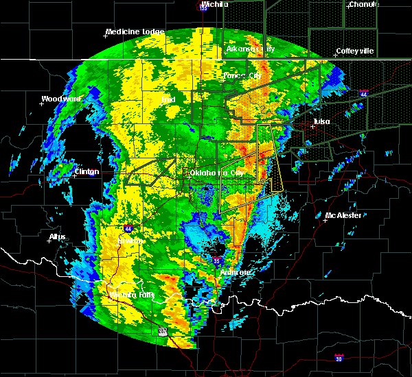 At 517 am cdt, severe thunderstorms were located along a line extending from 4 miles southeast of stroud to 6 miles west of welty to 4 miles east of francis, moving east at 40 mph (radar indicated). Hazards include 60 mph wind gusts and quarter size hail. Hail damage to vehicles is expected. expect wind damage to roofs, siding, and trees. locations in or near the path include, bristow, drumright, boley, oilton, depew, paden, bearden, castle, shamrock, welty, silver city, milfay, mason, this includes the following highways, interstate 40 in oklahoma between mile markers 212 and 219. interstate 44 between mile markers 178 and 191. A tornado watch remains in effect until noon cdt for northeastern and east central oklahoma. At 517 am cdt, severe thunderstorms were located along a line extending from 4 miles southeast of stroud to 6 miles west of welty to 4 miles east of francis, moving east at 40 mph (radar indicated). Hazards include 60 mph wind gusts and quarter size hail. Hail damage to vehicles is expected. expect wind damage to roofs, siding, and trees. locations in or near the path include, bristow, drumright, boley, oilton, depew, paden, bearden, castle, shamrock, welty, silver city, milfay, mason, this includes the following highways, interstate 40 in oklahoma between mile markers 212 and 219. interstate 44 between mile markers 178 and 191. A tornado watch remains in effect until noon cdt for northeastern and east central oklahoma.
|
| 5/21/2019 4:59 AM CDT |
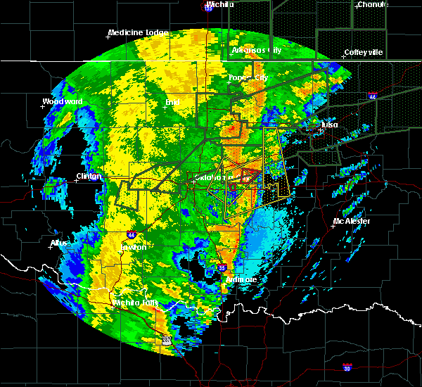 At 458 am cdt, severe thunderstorms were located along a line extending from 3 miles southwest of kendrick to 4 miles southeast of davenport to 2 miles southeast of konawa, moving northeast at 40 mph (radar indicated). Hazards include 60 mph wind gusts and quarter size hail. Hail damage to vehicles is expected. expect wind damage to roofs, siding, and trees. locations in or near the path include, bristow, drumright, boley, oilton, depew, paden, bearden, castle, shamrock, welty, silver city, milfay, mason, this includes the following highways, interstate 40 in oklahoma between mile markers 212 and 219. Interstate 44 between mile markers 178 and 191. At 458 am cdt, severe thunderstorms were located along a line extending from 3 miles southwest of kendrick to 4 miles southeast of davenport to 2 miles southeast of konawa, moving northeast at 40 mph (radar indicated). Hazards include 60 mph wind gusts and quarter size hail. Hail damage to vehicles is expected. expect wind damage to roofs, siding, and trees. locations in or near the path include, bristow, drumright, boley, oilton, depew, paden, bearden, castle, shamrock, welty, silver city, milfay, mason, this includes the following highways, interstate 40 in oklahoma between mile markers 212 and 219. Interstate 44 between mile markers 178 and 191.
|
| 5/21/2019 1:38 AM CDT |
 At 138 am cdt, a severe thunderstorm was located 3 miles northwest of slick, moving northeast at 25 mph (radar indicated). Hazards include 60 mph wind gusts. Expect damage to roofs, siding, and trees. Locations in or near the path include, bristow, sapulpa, kiefer, mounds, kellyville, slick, this includes interstate 44 between mile markers 190 and 205, and between mile markers 208 and 213. At 138 am cdt, a severe thunderstorm was located 3 miles northwest of slick, moving northeast at 25 mph (radar indicated). Hazards include 60 mph wind gusts. Expect damage to roofs, siding, and trees. Locations in or near the path include, bristow, sapulpa, kiefer, mounds, kellyville, slick, this includes interstate 44 between mile markers 190 and 205, and between mile markers 208 and 213.
|
| 5/18/2019 10:44 AM CDT |
 At 1044 am cdt, severe thunderstorms were located along a line extending from 4 miles east of kellyville to 6 miles south of okfuskee, moving east at 35 mph (radar indicated). Hazards include 60 mph wind gusts. Expect damage to roofs, siding, and trees. locations in or near the path include, bristow, okemah, sapulpa, okfuskee, kiefer, beggs, boley, mounds, kellyville, depew, slick, castle, clearview, okmulgee state park, welty, pharoah, bryant, mason, this includes the following highways, interstate 40 in oklahoma between mile markers 212 and 233. interstate 44 between mile markers 183 and 215. A tornado watch remains in effect until 500 pm cdt for northeastern and east central oklahoma. At 1044 am cdt, severe thunderstorms were located along a line extending from 4 miles east of kellyville to 6 miles south of okfuskee, moving east at 35 mph (radar indicated). Hazards include 60 mph wind gusts. Expect damage to roofs, siding, and trees. locations in or near the path include, bristow, okemah, sapulpa, okfuskee, kiefer, beggs, boley, mounds, kellyville, depew, slick, castle, clearview, okmulgee state park, welty, pharoah, bryant, mason, this includes the following highways, interstate 40 in oklahoma between mile markers 212 and 233. interstate 44 between mile markers 183 and 215. A tornado watch remains in effect until 500 pm cdt for northeastern and east central oklahoma.
|
| 5/18/2019 10:22 AM CDT |
 At 1021 am cdt, severe thunderstorms were located along a line extending from 6 miles north of bristow to near boley, moving northeast at 65 mph (radar indicated). Hazards include 60 mph wind gusts. Expect damage to roofs, siding, and trees. locations in or near the path include, bristow, okemah, sapulpa, okfuskee, drumright, kiefer, beggs, boley, mounds, kellyville, depew, paden, slick, castle, shamrock, clearview, okmulgee state park, welty, pharoah, bryant, this includes the following highways, interstate 40 in oklahoma between mile markers 212 and 233. interstate 44 between mile markers 178 and 215. A tornado watch remains in effect until 500 pm cdt for northeastern and east central oklahoma. At 1021 am cdt, severe thunderstorms were located along a line extending from 6 miles north of bristow to near boley, moving northeast at 65 mph (radar indicated). Hazards include 60 mph wind gusts. Expect damage to roofs, siding, and trees. locations in or near the path include, bristow, okemah, sapulpa, okfuskee, drumright, kiefer, beggs, boley, mounds, kellyville, depew, paden, slick, castle, shamrock, clearview, okmulgee state park, welty, pharoah, bryant, this includes the following highways, interstate 40 in oklahoma between mile markers 212 and 233. interstate 44 between mile markers 178 and 215. A tornado watch remains in effect until 500 pm cdt for northeastern and east central oklahoma.
|
| 5/6/2019 1:25 AM CDT |
 The severe thunderstorm warning for northwestern creek and southeastern pawnee counties will expire at 130 am cdt, the storms which prompted the warning have weakened below severe limits, and no longer pose an immediate threat to life or property. therefore the warning will be allowed to expire. however small hail and gusty winds are still possible with these thunderstorms. a severe thunderstorm watch remains in effect until 400 am cdt for northeastern oklahoma. to report severe weather, contact your nearest law enforcement agency. they will relay your report to the national weather service tulsa. The severe thunderstorm warning for northwestern creek and southeastern pawnee counties will expire at 130 am cdt, the storms which prompted the warning have weakened below severe limits, and no longer pose an immediate threat to life or property. therefore the warning will be allowed to expire. however small hail and gusty winds are still possible with these thunderstorms. a severe thunderstorm watch remains in effect until 400 am cdt for northeastern oklahoma. to report severe weather, contact your nearest law enforcement agency. they will relay your report to the national weather service tulsa.
|
| 5/6/2019 1:07 AM CDT |
 At 107 am cdt, severe thunderstorms were located along a line extending from 3 miles north of terlton to 2 miles east of drumright to avery, moving east at 40 mph (radar indicated). Hazards include 60 mph wind gusts and quarter size hail. Hail damage to vehicles is expected. expect wind damage to roofs, siding, and trees. Locations in or near the path include, bristow, cleveland, mannford, drumright, oilton, depew, jennings, westport, hallett, terlton, shamrock, silver city, this includes interstate 44 between mile markers 178 and 203. At 107 am cdt, severe thunderstorms were located along a line extending from 3 miles north of terlton to 2 miles east of drumright to avery, moving east at 40 mph (radar indicated). Hazards include 60 mph wind gusts and quarter size hail. Hail damage to vehicles is expected. expect wind damage to roofs, siding, and trees. Locations in or near the path include, bristow, cleveland, mannford, drumright, oilton, depew, jennings, westport, hallett, terlton, shamrock, silver city, this includes interstate 44 between mile markers 178 and 203.
|
| 5/6/2019 12:39 AM CDT |
 At 1239 am cdt, severe thunderstorms were located along a line extending from 6 miles northwest of quay to 3 miles south of ripley to 4 miles northwest of carney, moving east at 40 mph (radar indicated). Hazards include 60 mph wind gusts and quarter size hail. Hail damage to vehicles is expected. expect wind damage to roofs, siding, and trees. Locations in or near the path include, bristow, cleveland, mannford, drumright, oilton, depew, jennings, westport, hallett, terlton, shamrock, maramec, silver city, this includes interstate 44 between mile markers 178 and 203. At 1239 am cdt, severe thunderstorms were located along a line extending from 6 miles northwest of quay to 3 miles south of ripley to 4 miles northwest of carney, moving east at 40 mph (radar indicated). Hazards include 60 mph wind gusts and quarter size hail. Hail damage to vehicles is expected. expect wind damage to roofs, siding, and trees. Locations in or near the path include, bristow, cleveland, mannford, drumright, oilton, depew, jennings, westport, hallett, terlton, shamrock, maramec, silver city, this includes interstate 44 between mile markers 178 and 203.
|
| 3/23/2019 7:16 PM CDT |
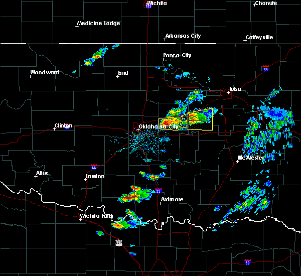 At 716 pm cdt, a severe thunderstorm was located 5 miles southeast of stroud, moving east at 30 mph (radar indicated). Hazards include 60 mph wind gusts and quarter size hail. Hail damage to vehicles is expected. expect wind damage to roofs, siding, and trees. Locations in or near the path include, okfuskee, boley, depew, paden, slick, welty, milfay, mason, this includes interstate 44 between mile markers 178 and 179. At 716 pm cdt, a severe thunderstorm was located 5 miles southeast of stroud, moving east at 30 mph (radar indicated). Hazards include 60 mph wind gusts and quarter size hail. Hail damage to vehicles is expected. expect wind damage to roofs, siding, and trees. Locations in or near the path include, okfuskee, boley, depew, paden, slick, welty, milfay, mason, this includes interstate 44 between mile markers 178 and 179.
|
| 3/23/2019 6:58 PM CDT |
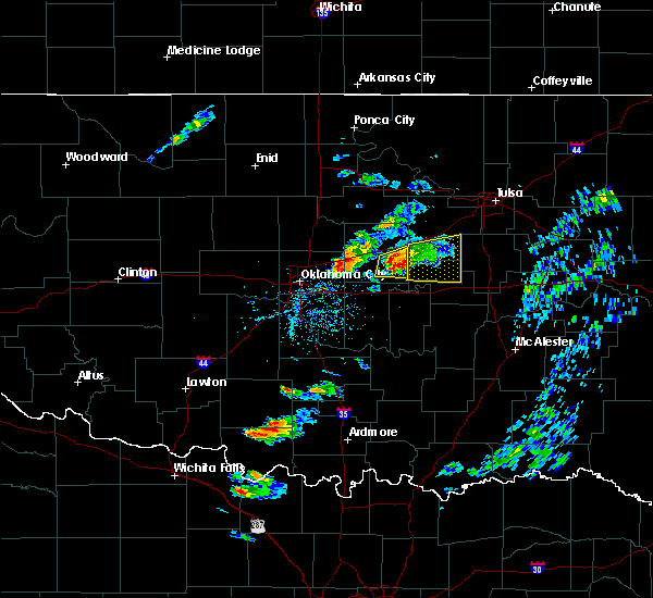 At 658 pm cdt, a severe thunderstorm was located 7 miles northwest of paden, moving east at 35 mph (radar indicated). Hazards include 60 mph wind gusts and quarter size hail. Hail damage to vehicles is expected. expect wind damage to roofs, siding, and trees. Locations in or near the path include, okfuskee, boley, depew, paden, slick, welty, milfay, mason, this includes interstate 44 between mile markers 178 and 179. At 658 pm cdt, a severe thunderstorm was located 7 miles northwest of paden, moving east at 35 mph (radar indicated). Hazards include 60 mph wind gusts and quarter size hail. Hail damage to vehicles is expected. expect wind damage to roofs, siding, and trees. Locations in or near the path include, okfuskee, boley, depew, paden, slick, welty, milfay, mason, this includes interstate 44 between mile markers 178 and 179.
|
| 2/6/2019 3:03 PM CST |
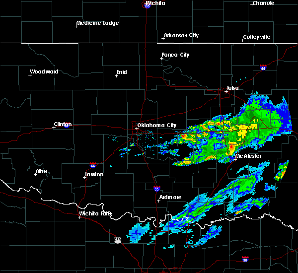 At 258 pm cst, a severe thunderstorm was located near paden, moving northeast at 60 mph (radar indicated). Hazards include 60 mph wind gusts and quarter size hail. Hail damage to vehicles is expected. expect wind damage to roofs, siding, and trees. Locations in or near the path include, bristow, boley, paden, slick, welty, mason, this includes interstate 44 between mile markers 190 and 192. At 258 pm cst, a severe thunderstorm was located near paden, moving northeast at 60 mph (radar indicated). Hazards include 60 mph wind gusts and quarter size hail. Hail damage to vehicles is expected. expect wind damage to roofs, siding, and trees. Locations in or near the path include, bristow, boley, paden, slick, welty, mason, this includes interstate 44 between mile markers 190 and 192.
|
| 11/30/2018 9:08 PM CST |
 At 908 pm cst, a severe thunderstorm was located 5 miles southeast of mannford, moving northeast at 55 mph (radar indicated). Hazards include 70 mph wind gusts and quarter size hail. Hail damage to vehicles is expected. expect considerable tree damage. wind damage is also likely to mobile homes, roofs, and outbuildings. locations in or near the path include, tulsa, sand springs, bristow, sapulpa, skiatook, cleveland, mannford, kellyville, depew, westport, osage, terlton, keystone state park, walnut creek state park, gray, silver city, this includes interstate 44 between mile markers 185 and 218. A tornado watch remains in effect until midnight cst for northeastern oklahoma. At 908 pm cst, a severe thunderstorm was located 5 miles southeast of mannford, moving northeast at 55 mph (radar indicated). Hazards include 70 mph wind gusts and quarter size hail. Hail damage to vehicles is expected. expect considerable tree damage. wind damage is also likely to mobile homes, roofs, and outbuildings. locations in or near the path include, tulsa, sand springs, bristow, sapulpa, skiatook, cleveland, mannford, kellyville, depew, westport, osage, terlton, keystone state park, walnut creek state park, gray, silver city, this includes interstate 44 between mile markers 185 and 218. A tornado watch remains in effect until midnight cst for northeastern oklahoma.
|
| 10/9/2018 10:31 AM CDT |
 At 1030 am cdt, severe thunderstorms were located along a line extending from 4 miles northwest of kellyville to 5 miles northeast of dustin, moving northeast at 40 mph (radar indicated). Hazards include 60 mph wind gusts. Expect damage to roofs, siding, and trees. locations in or near the path include, tulsa, broken arrow, sand springs, okmulgee, bristow, bixby, sapulpa, jenks, okfuskee, glenpool, henryetta, kiefer, morris, beggs, mounds, kellyville, weleetka, dewar, schulter, boynton, this includes the following highways, interstate 40 in oklahoma between mile markers 224 and 250. interstate 44 between mile markers 191 and 224. A tornado watch remains in effect until 200 pm cdt for southeastern, northeastern and east central oklahoma. At 1030 am cdt, severe thunderstorms were located along a line extending from 4 miles northwest of kellyville to 5 miles northeast of dustin, moving northeast at 40 mph (radar indicated). Hazards include 60 mph wind gusts. Expect damage to roofs, siding, and trees. locations in or near the path include, tulsa, broken arrow, sand springs, okmulgee, bristow, bixby, sapulpa, jenks, okfuskee, glenpool, henryetta, kiefer, morris, beggs, mounds, kellyville, weleetka, dewar, schulter, boynton, this includes the following highways, interstate 40 in oklahoma between mile markers 224 and 250. interstate 44 between mile markers 191 and 224. A tornado watch remains in effect until 200 pm cdt for southeastern, northeastern and east central oklahoma.
|
| 10/9/2018 10:05 AM CDT |
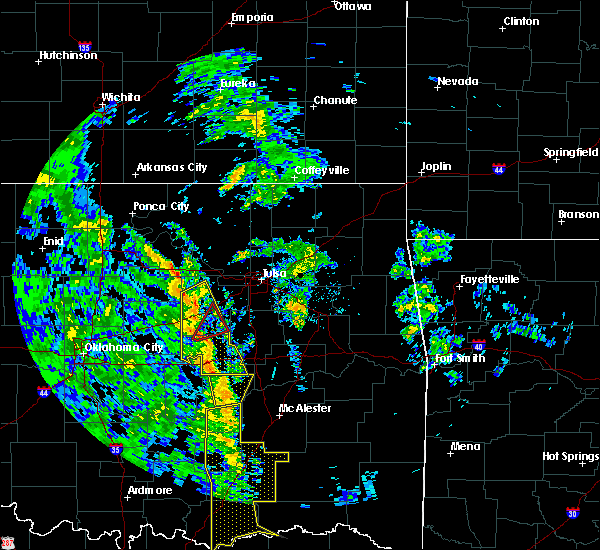 At 1005 am cdt, a severe thunderstorm capable of producing a tornado was located near welty, moving northeast at 30 mph (radar indicated rotation). Hazards include tornado. Flying debris will be dangerous to those caught without shelter. mobile homes will be damaged or destroyed. damage to roofs, windows, and vehicles will occur. tree damage is likely. Locations in or near the path include, bristow, slick, welty, this includes interstate 44 between mile markers 193 and 196. At 1005 am cdt, a severe thunderstorm capable of producing a tornado was located near welty, moving northeast at 30 mph (radar indicated rotation). Hazards include tornado. Flying debris will be dangerous to those caught without shelter. mobile homes will be damaged or destroyed. damage to roofs, windows, and vehicles will occur. tree damage is likely. Locations in or near the path include, bristow, slick, welty, this includes interstate 44 between mile markers 193 and 196.
|
| 10/9/2018 9:56 AM CDT |
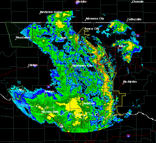 At 956 am cdt, severe thunderstorms were located along a line extending from 2 miles east of drumright to horntown, moving northeast at 35 mph (radar indicated). Hazards include 60 mph wind gusts. Expect damage to roofs, siding, and trees. locations in or near the path include, bristow, okemah, okfuskee, drumright, boley, weleetka, depew, paden, bearden, slick, castle, shamrock, clearview, welty, pharoah, milfay, mason, this includes the following highways, interstate 40 in oklahoma between mile markers 212 and 231. interstate 44 between mile markers 178 and 197. A tornado watch remains in effect until 200 pm cdt for northeastern and east central oklahoma. At 956 am cdt, severe thunderstorms were located along a line extending from 2 miles east of drumright to horntown, moving northeast at 35 mph (radar indicated). Hazards include 60 mph wind gusts. Expect damage to roofs, siding, and trees. locations in or near the path include, bristow, okemah, okfuskee, drumright, boley, weleetka, depew, paden, bearden, slick, castle, shamrock, clearview, welty, pharoah, milfay, mason, this includes the following highways, interstate 40 in oklahoma between mile markers 212 and 231. interstate 44 between mile markers 178 and 197. A tornado watch remains in effect until 200 pm cdt for northeastern and east central oklahoma.
|
| 10/9/2018 9:49 AM CDT |
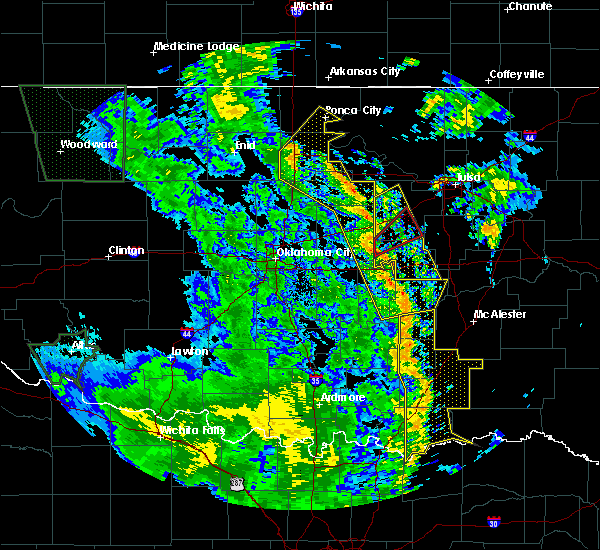 At 949 am cdt, a severe squall line capable of producing tornadoes that may not be visible due to heavy rain was located 3 miles northwest of paden, moving northeast at 35 mph (radar indicated rotation). Hazards include tornado. Flying debris will be dangerous to those caught without shelter. mobile homes will be damaged or destroyed. damage to roofs, windows, and vehicles will occur. tree damage is likely. Locations in or near the path include, bristow, slick, welty, this includes interstate 44 between mile markers 189 and 196. At 949 am cdt, a severe squall line capable of producing tornadoes that may not be visible due to heavy rain was located 3 miles northwest of paden, moving northeast at 35 mph (radar indicated rotation). Hazards include tornado. Flying debris will be dangerous to those caught without shelter. mobile homes will be damaged or destroyed. damage to roofs, windows, and vehicles will occur. tree damage is likely. Locations in or near the path include, bristow, slick, welty, this includes interstate 44 between mile markers 189 and 196.
|
| 10/9/2018 9:29 AM CDT |
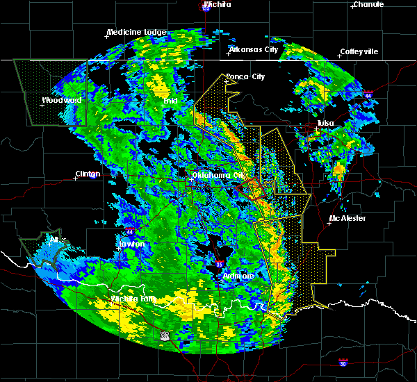 At 928 am cdt, severe thunderstorms were located along a line extending from near agra to 4 miles east of sasakwa, moving northeast at 40 mph (radar indicated). Hazards include 60 mph wind gusts. Expect damage to roofs, siding, and trees. locations in or near the path include, bristow, okemah, okfuskee, drumright, boley, weleetka, depew, paden, bearden, slick, castle, shamrock, clearview, welty, pharoah, milfay, mason, this includes the following highways, interstate 40 in oklahoma between mile markers 212 and 231. interstate 44 between mile markers 178 and 197. A tornado watch remains in effect until 200 pm cdt for northeastern and east central oklahoma. At 928 am cdt, severe thunderstorms were located along a line extending from near agra to 4 miles east of sasakwa, moving northeast at 40 mph (radar indicated). Hazards include 60 mph wind gusts. Expect damage to roofs, siding, and trees. locations in or near the path include, bristow, okemah, okfuskee, drumright, boley, weleetka, depew, paden, bearden, slick, castle, shamrock, clearview, welty, pharoah, milfay, mason, this includes the following highways, interstate 40 in oklahoma between mile markers 212 and 231. interstate 44 between mile markers 178 and 197. A tornado watch remains in effect until 200 pm cdt for northeastern and east central oklahoma.
|
| 8/16/2018 5:10 PM CDT |
 At 510 pm cdt, severe thunderstorms were located along a line extending from 4 miles northeast of beggs to 5 miles west of welty, moving southwest at 65 mph (radar indicated). Hazards include 60 mph wind gusts. Expect damage to roofs, siding, and trees. Locations in or near the path include, broken arrow, bixby, jenks, okfuskee, glenpool, coweta, kiefer, beggs, boley, mounds, slick, castle, preston, stonebluff, welty, liberty, mason, hectorville, leonard, this includes interstate 40 in oklahoma near mile marker 213. At 510 pm cdt, severe thunderstorms were located along a line extending from 4 miles northeast of beggs to 5 miles west of welty, moving southwest at 65 mph (radar indicated). Hazards include 60 mph wind gusts. Expect damage to roofs, siding, and trees. Locations in or near the path include, broken arrow, bixby, jenks, okfuskee, glenpool, coweta, kiefer, beggs, boley, mounds, slick, castle, preston, stonebluff, welty, liberty, mason, hectorville, leonard, this includes interstate 40 in oklahoma near mile marker 213.
|
| 8/16/2018 4:57 PM CDT |
 At 457 pm cdt, severe thunderstorms were located along a line extending from 3 miles east of jenks to 4 miles west of welty, moving southeast at 20 mph (radar indicated). Hazards include 60 mph wind gusts and nickel size hail. Expect damage to roofs, siding, and trees. locations in or near the path include, tulsa, broken arrow, sand springs, bristow, owasso, bixby, sapulpa, jenks, okfuskee, glenpool, coweta, catoosa, kiefer, beggs, boley, mounds, kellyville, depew, slick, castle, this includes the following highways, interstate 40 in oklahoma near mile marker 213. Interstate 44 between mile markers 184 and 232. At 457 pm cdt, severe thunderstorms were located along a line extending from 3 miles east of jenks to 4 miles west of welty, moving southeast at 20 mph (radar indicated). Hazards include 60 mph wind gusts and nickel size hail. Expect damage to roofs, siding, and trees. locations in or near the path include, tulsa, broken arrow, sand springs, bristow, owasso, bixby, sapulpa, jenks, okfuskee, glenpool, coweta, catoosa, kiefer, beggs, boley, mounds, kellyville, depew, slick, castle, this includes the following highways, interstate 40 in oklahoma near mile marker 213. Interstate 44 between mile markers 184 and 232.
|
| 8/16/2018 4:45 PM CDT |
 At 445 pm cdt, severe thunderstorms were located along a line extending from 3 miles northwest of bristow to near mounds to 3 miles northeast of jenks riverside airport, moving southeast at 45 mph (radar indicated). Hazards include 60 mph wind gusts and quarter size hail. Hail damage to vehicles is expected. expect wind damage to roofs, siding, and trees. Locations in or near the path include, tulsa, broken arrow, sand springs, owasso, bixby, sapulpa, jenks, glenpool, kiefer, mounds, kellyville, jenks riverside airport, tulsa international airport, turley, liberty, gray, this includes interstate 44 between mile markers 193 and 232. At 445 pm cdt, severe thunderstorms were located along a line extending from 3 miles northwest of bristow to near mounds to 3 miles northeast of jenks riverside airport, moving southeast at 45 mph (radar indicated). Hazards include 60 mph wind gusts and quarter size hail. Hail damage to vehicles is expected. expect wind damage to roofs, siding, and trees. Locations in or near the path include, tulsa, broken arrow, sand springs, owasso, bixby, sapulpa, jenks, glenpool, kiefer, mounds, kellyville, jenks riverside airport, tulsa international airport, turley, liberty, gray, this includes interstate 44 between mile markers 193 and 232.
|
| 6/30/2018 6:26 PM CDT |
 At 606 pm cdt, severe thunderstorms were located along a line extending from 5 miles west of newkirk to 3 miles north of maramec to 4 miles southeast of stroud, moving northeast at 35 mph (radar indicated). Hazards include 60 mph wind gusts and nickel size hail. Expect damage to roofs, siding, and trees. Locations in or near the path include, bristow, pawnee, hominy, cleveland, mannford, drumright, fairfax, kellyville, oilton, depew, shidler, jennings, ralston, westport, osage, burbank, hallett, blackburn, terlton, shamrock, this includes interstate 44 between mile markers 178 and 205. At 606 pm cdt, severe thunderstorms were located along a line extending from 5 miles west of newkirk to 3 miles north of maramec to 4 miles southeast of stroud, moving northeast at 35 mph (radar indicated). Hazards include 60 mph wind gusts and nickel size hail. Expect damage to roofs, siding, and trees. Locations in or near the path include, bristow, pawnee, hominy, cleveland, mannford, drumright, fairfax, kellyville, oilton, depew, shidler, jennings, ralston, westport, osage, burbank, hallett, blackburn, terlton, shamrock, this includes interstate 44 between mile markers 178 and 205.
|
| 6/30/2018 6:06 PM CDT |
 At 606 pm cdt, severe thunderstorms were located along a line extending from 5 miles west of newkirk to 3 miles north of maramec to 4 miles southeast of stroud, moving northeast at 35 mph (radar indicated). Hazards include 60 mph wind gusts and nickel size hail. Expect damage to roofs, siding, and trees. Locations in or near the path include, bristow, pawnee, hominy, cleveland, mannford, drumright, fairfax, kellyville, oilton, depew, shidler, jennings, ralston, westport, osage, burbank, hallett, blackburn, terlton, shamrock, this includes interstate 44 between mile markers 178 and 205. At 606 pm cdt, severe thunderstorms were located along a line extending from 5 miles west of newkirk to 3 miles north of maramec to 4 miles southeast of stroud, moving northeast at 35 mph (radar indicated). Hazards include 60 mph wind gusts and nickel size hail. Expect damage to roofs, siding, and trees. Locations in or near the path include, bristow, pawnee, hominy, cleveland, mannford, drumright, fairfax, kellyville, oilton, depew, shidler, jennings, ralston, westport, osage, burbank, hallett, blackburn, terlton, shamrock, this includes interstate 44 between mile markers 178 and 205.
|
| 6/30/2018 5:35 PM CDT |
 At 534 pm cdt, severe thunderstorms were located along a line extending from 5 miles northeast of billings to 6 miles east of stillwater to 5 miles southeast of sparks, moving northeast at 35 mph (radar indicated). Hazards include 60 mph wind gusts and nickel size hail. Expect damage to roofs, siding, and trees. Locations in or near the path include, bristow, pawnee, hominy, cleveland, mannford, drumright, fairfax, kellyville, oilton, depew, shidler, jennings, ralston, westport, osage, burbank, hallett, blackburn, terlton, shamrock, this includes interstate 44 between mile markers 178 and 205. At 534 pm cdt, severe thunderstorms were located along a line extending from 5 miles northeast of billings to 6 miles east of stillwater to 5 miles southeast of sparks, moving northeast at 35 mph (radar indicated). Hazards include 60 mph wind gusts and nickel size hail. Expect damage to roofs, siding, and trees. Locations in or near the path include, bristow, pawnee, hominy, cleveland, mannford, drumright, fairfax, kellyville, oilton, depew, shidler, jennings, ralston, westport, osage, burbank, hallett, blackburn, terlton, shamrock, this includes interstate 44 between mile markers 178 and 205.
|
| 6/25/2018 3:53 AM CDT |
 The severe thunderstorm warning for eastern osage, northwestern creek and southeastern pawnee counties will expire at 400 am cdt, the line of storms which prompted the warning have weakened below severe limits, and no longer pose an immediate threat to life or property. therefore the warning will be allowed to expire. however gusty winds to 50 mph are still possible with these thunderstorms. a severe thunderstorm watch remains in effect until 800 am cdt for northeastern oklahoma. The severe thunderstorm warning for eastern osage, northwestern creek and southeastern pawnee counties will expire at 400 am cdt, the line of storms which prompted the warning have weakened below severe limits, and no longer pose an immediate threat to life or property. therefore the warning will be allowed to expire. however gusty winds to 50 mph are still possible with these thunderstorms. a severe thunderstorm watch remains in effect until 800 am cdt for northeastern oklahoma.
|
| 6/25/2018 3:42 AM CDT |
 At 342 am cdt, severe thunderstorms were located along a line extending from 4 miles northwest of caney to 8 miles north of bristow, moving east at 35 mph (radar indicated). Hazards include 60 mph wind gusts and penny size hail. Expect damage to roofs, siding, and trees. Locations in or near the path include, pawhuska, hominy, cleveland, mannford, drumright, barnsdall, oilton, depew, wynona, westport, osage, terlton, shamrock, elgin, bigheart, osage hills state park, walnut creek state park, hulah, sunset lake, okesa, this includes interstate 44 between mile markers 182 and 190. At 342 am cdt, severe thunderstorms were located along a line extending from 4 miles northwest of caney to 8 miles north of bristow, moving east at 35 mph (radar indicated). Hazards include 60 mph wind gusts and penny size hail. Expect damage to roofs, siding, and trees. Locations in or near the path include, pawhuska, hominy, cleveland, mannford, drumright, barnsdall, oilton, depew, wynona, westport, osage, terlton, shamrock, elgin, bigheart, osage hills state park, walnut creek state park, hulah, sunset lake, okesa, this includes interstate 44 between mile markers 182 and 190.
|
| 6/25/2018 3:30 AM CDT |
 At 301 am cdt, severe thunderstorms were located along a line extending from 7 miles south of cedar vale to cushing, moving east at 35 mph (radar indicated). Hazards include 60 mph wind gusts and penny size hail. Expect damage to roofs, siding, and trees. Locations in or near the path include, pawhuska, pawnee, hominy, cleveland, mannford, drumright, fairfax, barnsdall, oilton, depew, shidler, wynona, jennings, ralston, westport, osage, hallett, blackburn, terlton, shamrock, this includes interstate 44 between mile markers 182 and 190. At 301 am cdt, severe thunderstorms were located along a line extending from 7 miles south of cedar vale to cushing, moving east at 35 mph (radar indicated). Hazards include 60 mph wind gusts and penny size hail. Expect damage to roofs, siding, and trees. Locations in or near the path include, pawhuska, pawnee, hominy, cleveland, mannford, drumright, fairfax, barnsdall, oilton, depew, shidler, wynona, jennings, ralston, westport, osage, hallett, blackburn, terlton, shamrock, this includes interstate 44 between mile markers 182 and 190.
|
| 6/25/2018 3:01 AM CDT |
 The national weather service in tulsa has issued a * severe thunderstorm warning for. osage county in northeastern oklahoma. northwestern creek county in northeastern oklahoma. pawnee county in northeastern oklahoma. Until 400 am cdt. The national weather service in tulsa has issued a * severe thunderstorm warning for. osage county in northeastern oklahoma. northwestern creek county in northeastern oklahoma. pawnee county in northeastern oklahoma. Until 400 am cdt.
|
| 6/24/2018 4:32 AM CDT |
 At 431 am cdt, severe thunderstorms were located along a line extending from 5 miles east of hominy to 4 miles northeast of keystone state park to 4 miles west of kellyville to 3 miles west of depew, moving east at 60 mph (radar indicated). Hazards include 70 mph wind gusts and nickel size hail. Expect considerable tree damage. damage is likely to mobile homes, roofs, and outbuildings. Locations in or near the path include, tulsa, broken arrow, sand springs, claremore, okmulgee, bristow, owasso, bixby, sapulpa, jenks, glenpool, coweta, skiatook, catoosa, collinsville, verdigris, hominy, mannford, haskell, inola, this includes interstate 44 between mile markers 178 and 259. At 431 am cdt, severe thunderstorms were located along a line extending from 5 miles east of hominy to 4 miles northeast of keystone state park to 4 miles west of kellyville to 3 miles west of depew, moving east at 60 mph (radar indicated). Hazards include 70 mph wind gusts and nickel size hail. Expect considerable tree damage. damage is likely to mobile homes, roofs, and outbuildings. Locations in or near the path include, tulsa, broken arrow, sand springs, claremore, okmulgee, bristow, owasso, bixby, sapulpa, jenks, glenpool, coweta, skiatook, catoosa, collinsville, verdigris, hominy, mannford, haskell, inola, this includes interstate 44 between mile markers 178 and 259.
|
| 6/24/2018 4:21 AM CDT |
 At 401 am cdt, severe thunderstorms were located along a line extending from 2 miles southwest of ralston to 3 miles northwest of quay to 2 miles east of perkins to 5 miles northeast of meridian, moving east at 40 mph (radar indicated). Hazards include 70 mph wind gusts and nickel size hail. Expect considerable tree damage. damage is likely to mobile homes, roofs, and outbuildings. Locations in or near the path include, tulsa, sand springs, bristow, pawnee, sapulpa, glenpool, skiatook, hominy, cleveland, mannford, drumright, kiefer, kellyville, oilton, depew, jennings, westport, osage, slick, hallett, this includes interstate 44 between mile markers 178 and 219. At 401 am cdt, severe thunderstorms were located along a line extending from 2 miles southwest of ralston to 3 miles northwest of quay to 2 miles east of perkins to 5 miles northeast of meridian, moving east at 40 mph (radar indicated). Hazards include 70 mph wind gusts and nickel size hail. Expect considerable tree damage. damage is likely to mobile homes, roofs, and outbuildings. Locations in or near the path include, tulsa, sand springs, bristow, pawnee, sapulpa, glenpool, skiatook, hominy, cleveland, mannford, drumright, kiefer, kellyville, oilton, depew, jennings, westport, osage, slick, hallett, this includes interstate 44 between mile markers 178 and 219.
|
| 6/24/2018 4:01 AM CDT |
 The national weather service in tulsa has issued a * severe thunderstorm warning for. southern osage county in northeastern oklahoma. creek county in northeastern oklahoma. pawnee county in northeastern oklahoma. Southwestern tulsa county in northeastern oklahoma. The national weather service in tulsa has issued a * severe thunderstorm warning for. southern osage county in northeastern oklahoma. creek county in northeastern oklahoma. pawnee county in northeastern oklahoma. Southwestern tulsa county in northeastern oklahoma.
|
| 6/22/2018 11:49 PM CDT |
 At 1149 pm cdt, severe thunderstorms were located along a line extending from near kellyville to 5 miles north of slick to 3 miles south of paden, moving east at 45 mph (radar indicated). Hazards include 70 mph wind gusts. Expect considerable tree damage. damage is likely to mobile homes, roofs, and outbuildings. locations in or near the path include, okmulgee, bristow, okemah, okfuskee, beggs, boley, mounds, depew, paden, bearden, slick, castle, shamrock, clearview, preston, okmulgee state park, welty, pharoah, liberty, milfay, this includes the following highways, interstate 40 in oklahoma between mile markers 212 and 231. Interstate 44 between mile markers 178 and 198. At 1149 pm cdt, severe thunderstorms were located along a line extending from near kellyville to 5 miles north of slick to 3 miles south of paden, moving east at 45 mph (radar indicated). Hazards include 70 mph wind gusts. Expect considerable tree damage. damage is likely to mobile homes, roofs, and outbuildings. locations in or near the path include, okmulgee, bristow, okemah, okfuskee, beggs, boley, mounds, depew, paden, bearden, slick, castle, shamrock, clearview, preston, okmulgee state park, welty, pharoah, liberty, milfay, this includes the following highways, interstate 40 in oklahoma between mile markers 212 and 231. Interstate 44 between mile markers 178 and 198.
|
| 6/22/2018 11:20 PM CDT |
 At 1120 pm cdt, severe thunderstorms were located along a line extending from 3 miles southwest of oilton to 4 miles west of shamrock to 2 miles south of chandler, moving east at 45 mph (radar indicated). Hazards include 70 mph wind gusts. Expect considerable tree damage. damage is likely to mobile homes, roofs, and outbuildings. locations in or near the path include, okmulgee, bristow, okemah, okfuskee, beggs, boley, mounds, depew, paden, bearden, slick, castle, shamrock, clearview, preston, okmulgee state park, welty, pharoah, liberty, milfay, this includes the following highways, interstate 40 in oklahoma between mile markers 212 and 231. Interstate 44 between mile markers 178 and 198. At 1120 pm cdt, severe thunderstorms were located along a line extending from 3 miles southwest of oilton to 4 miles west of shamrock to 2 miles south of chandler, moving east at 45 mph (radar indicated). Hazards include 70 mph wind gusts. Expect considerable tree damage. damage is likely to mobile homes, roofs, and outbuildings. locations in or near the path include, okmulgee, bristow, okemah, okfuskee, beggs, boley, mounds, depew, paden, bearden, slick, castle, shamrock, clearview, preston, okmulgee state park, welty, pharoah, liberty, milfay, this includes the following highways, interstate 40 in oklahoma between mile markers 212 and 231. Interstate 44 between mile markers 178 and 198.
|
| 6/12/2018 7:17 AM CDT |
 At 717 am cdt, severe thunderstorms were located along a line extending from 3 miles northwest of tryon to 4 miles northeast of slick, moving south at 30 mph (radar indicated). Hazards include 60 mph wind gusts and nickel size hail. Expect damage to roofs, siding, and trees. Locations in or near the path include, bristow, sapulpa, drumright, kellyville, depew, slick, shamrock, this includes interstate 44 between mile markers 178 and 210. At 717 am cdt, severe thunderstorms were located along a line extending from 3 miles northwest of tryon to 4 miles northeast of slick, moving south at 30 mph (radar indicated). Hazards include 60 mph wind gusts and nickel size hail. Expect damage to roofs, siding, and trees. Locations in or near the path include, bristow, sapulpa, drumright, kellyville, depew, slick, shamrock, this includes interstate 44 between mile markers 178 and 210.
|
| 6/12/2018 6:55 AM CDT |
 At 654 am cdt, severe thunderstorms were located along a line extending from near ripley to 3 miles north of kellyville, moving south at 30 mph (radar indicated). Hazards include 60 mph wind gusts and nickel size hail. Expect damage to roofs, siding, and trees. Locations in or near the path include, sand springs, bristow, sapulpa, mannford, drumright, kellyville, oilton, depew, slick, shamrock, keystone state park, silver city, this includes interstate 44 between mile markers 178 and 213. At 654 am cdt, severe thunderstorms were located along a line extending from near ripley to 3 miles north of kellyville, moving south at 30 mph (radar indicated). Hazards include 60 mph wind gusts and nickel size hail. Expect damage to roofs, siding, and trees. Locations in or near the path include, sand springs, bristow, sapulpa, mannford, drumright, kellyville, oilton, depew, slick, shamrock, keystone state park, silver city, this includes interstate 44 between mile markers 178 and 213.
|
| 6/12/2018 6:29 AM CDT |
 At 629 am cdt, severe thunderstorms were located along a line extending from 7 miles southeast of glencoe to 2 miles west of keystone state park, moving southwest at 25 mph (radar indicated). Hazards include 60 mph wind gusts and nickel size hail. Expect damage to roofs, siding, and trees. Locations in or near the path include, sand springs, bristow, sapulpa, mannford, drumright, kellyville, oilton, depew, jennings, slick, terlton, shamrock, keystone state park, silver city, this includes interstate 44 between mile markers 178 and 213. At 629 am cdt, severe thunderstorms were located along a line extending from 7 miles southeast of glencoe to 2 miles west of keystone state park, moving southwest at 25 mph (radar indicated). Hazards include 60 mph wind gusts and nickel size hail. Expect damage to roofs, siding, and trees. Locations in or near the path include, sand springs, bristow, sapulpa, mannford, drumright, kellyville, oilton, depew, jennings, slick, terlton, shamrock, keystone state park, silver city, this includes interstate 44 between mile markers 178 and 213.
|
| 5/31/2018 2:47 AM CDT |
 At 247 am cdt, severe thunderstorms were located along a line extending from 4 miles south of barnsdall to 6 miles northeast of bristow, moving east at 50 mph (radar indicated). Hazards include 60 mph wind gusts and penny size hail. Expect damage to roofs, siding, and trees. Locations in or near the path include, bristow, hominy, cleveland, mannford, drumright, oilton, depew, jennings, westport, osage, hallett, terlton, shamrock, silver city, this includes interstate 44 between mile markers 182 and 196. At 247 am cdt, severe thunderstorms were located along a line extending from 4 miles south of barnsdall to 6 miles northeast of bristow, moving east at 50 mph (radar indicated). Hazards include 60 mph wind gusts and penny size hail. Expect damage to roofs, siding, and trees. Locations in or near the path include, bristow, hominy, cleveland, mannford, drumright, oilton, depew, jennings, westport, osage, hallett, terlton, shamrock, silver city, this includes interstate 44 between mile markers 182 and 196.
|
| 5/31/2018 2:33 AM CDT |
 At 232 am cdt, severe thunderstorms were located along a line extending from 4 miles northwest of hominy to 3 miles southwest of mannford to 2 miles west of depew, moving east at 55 mph (radar indicated). Hazards include 60 mph wind gusts and penny size hail. Expect damage to roofs, siding, and trees. Locations in or near the path include, tulsa, broken arrow, sand springs, claremore, bristow, owasso, bixby, sapulpa, jenks, glenpool, coweta, skiatook, catoosa, collinsville, verdigris, hominy, mannford, chelsea, inola, kiefer, this includes interstate 44 between mile markers 189 and 260. At 232 am cdt, severe thunderstorms were located along a line extending from 4 miles northwest of hominy to 3 miles southwest of mannford to 2 miles west of depew, moving east at 55 mph (radar indicated). Hazards include 60 mph wind gusts and penny size hail. Expect damage to roofs, siding, and trees. Locations in or near the path include, tulsa, broken arrow, sand springs, claremore, bristow, owasso, bixby, sapulpa, jenks, glenpool, coweta, skiatook, catoosa, collinsville, verdigris, hominy, mannford, chelsea, inola, kiefer, this includes interstate 44 between mile markers 189 and 260.
|
| 5/31/2018 2:08 AM CDT |
 At 207 am cdt, severe thunderstorms were located along a line extending from 4 miles south of ralston to 3 miles southwest of agra, moving east at 50 mph (radar indicated). Hazards include 70 mph wind gusts and nickel size hail. Expect considerable tree damage. damage is likely to mobile homes, roofs, and outbuildings. Locations in or near the path include, bristow, hominy, cleveland, mannford, drumright, oilton, depew, jennings, westport, osage, hallett, blackburn, terlton, shamrock, maramec, skedee, silver city, this includes interstate 44 between mile markers 182 and 196. At 207 am cdt, severe thunderstorms were located along a line extending from 4 miles south of ralston to 3 miles southwest of agra, moving east at 50 mph (radar indicated). Hazards include 70 mph wind gusts and nickel size hail. Expect considerable tree damage. damage is likely to mobile homes, roofs, and outbuildings. Locations in or near the path include, bristow, hominy, cleveland, mannford, drumright, oilton, depew, jennings, westport, osage, hallett, blackburn, terlton, shamrock, maramec, skedee, silver city, this includes interstate 44 between mile markers 182 and 196.
|
| 5/2/2018 9:36 PM CDT |
 At 936 pm cdt, severe thunderstorms were located along a line extending from 2 miles southwest of cushing to 2 miles northwest of seminole, moving northeast at 45 mph (radar indicated). Hazards include 60 mph wind gusts. Expect damage to roofs, siding, and trees. locations in or near the path include, bristow, okemah, sapulpa, okfuskee, henryetta, drumright, beggs, boley, kellyville, weleetka, depew, paden, bearden, slick, castle, shamrock, clearview, okmulgee state park, welty, pharoah, this includes the following highways, interstate 40 in oklahoma between mile markers 212 and 236. interstate 44 between mile markers 178 and 211. A tornado watch remains in effect until 300 am cdt for southeastern, northeastern and east central oklahoma. At 936 pm cdt, severe thunderstorms were located along a line extending from 2 miles southwest of cushing to 2 miles northwest of seminole, moving northeast at 45 mph (radar indicated). Hazards include 60 mph wind gusts. Expect damage to roofs, siding, and trees. locations in or near the path include, bristow, okemah, sapulpa, okfuskee, henryetta, drumright, beggs, boley, kellyville, weleetka, depew, paden, bearden, slick, castle, shamrock, clearview, okmulgee state park, welty, pharoah, this includes the following highways, interstate 40 in oklahoma between mile markers 212 and 236. interstate 44 between mile markers 178 and 211. A tornado watch remains in effect until 300 am cdt for southeastern, northeastern and east central oklahoma.
|
| 4/13/2018 2:49 PM CDT |
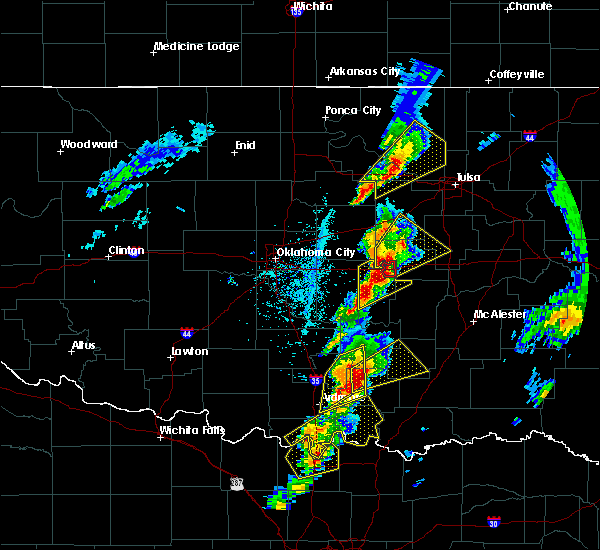 At 249 pm cdt, a severe thunderstorm was located 3 miles southwest of boley, moving northeast at 50 mph (radar indicated). Hazards include 70 mph wind gusts and half dollar size hail. Hail damage to vehicles is expected. expect considerable tree damage. wind damage is also likely to mobile homes, roofs, and outbuildings. locations in or near the path include, bristow, okemah, okfuskee, boley, paden, bearden, slick, castle, okmulgee state park, welty, mason, this includes the following highways, interstate 40 in oklahoma between mile markers 212 and 224. interstate 44 between mile markers 189 and 192. A tornado watch remains in effect until 1000 pm cdt for northeastern and east central oklahoma. At 249 pm cdt, a severe thunderstorm was located 3 miles southwest of boley, moving northeast at 50 mph (radar indicated). Hazards include 70 mph wind gusts and half dollar size hail. Hail damage to vehicles is expected. expect considerable tree damage. wind damage is also likely to mobile homes, roofs, and outbuildings. locations in or near the path include, bristow, okemah, okfuskee, boley, paden, bearden, slick, castle, okmulgee state park, welty, mason, this includes the following highways, interstate 40 in oklahoma between mile markers 212 and 224. interstate 44 between mile markers 189 and 192. A tornado watch remains in effect until 1000 pm cdt for northeastern and east central oklahoma.
|
| 4/13/2018 2:38 PM CDT |
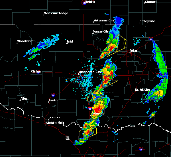 The national weather service in tulsa has issued a * severe thunderstorm warning for. southwestern creek county in northeastern oklahoma. west central okmulgee county in northeastern oklahoma. okfuskee county in east central oklahoma. Until 330 pm cdt. The national weather service in tulsa has issued a * severe thunderstorm warning for. southwestern creek county in northeastern oklahoma. west central okmulgee county in northeastern oklahoma. okfuskee county in east central oklahoma. Until 330 pm cdt.
|
| 8/15/2017 5:21 PM CDT |
 At 521 pm cdt, severe thunderstorms were located along a line extending from 4 miles northwest of skiatook to 2 miles northeast of turley to tulsa to 5 miles south of kellyville, moving east at 35 mph (radar indicated). Hazards include 60 mph wind gusts. Expect damage to roofs, siding, and trees. Locations in or near the path include, tulsa, broken arrow, sand springs, claremore, bristow, owasso, bixby, sapulpa, jenks, glenpool, skiatook, catoosa, collinsville, verdigris, kiefer, sperry, mounds, kellyville, oologah, ramona, this includes interstate 44 between mile markers 186 and 248. At 521 pm cdt, severe thunderstorms were located along a line extending from 4 miles northwest of skiatook to 2 miles northeast of turley to tulsa to 5 miles south of kellyville, moving east at 35 mph (radar indicated). Hazards include 60 mph wind gusts. Expect damage to roofs, siding, and trees. Locations in or near the path include, tulsa, broken arrow, sand springs, claremore, bristow, owasso, bixby, sapulpa, jenks, glenpool, skiatook, catoosa, collinsville, verdigris, kiefer, sperry, mounds, kellyville, oologah, ramona, this includes interstate 44 between mile markers 186 and 248.
|
| 8/15/2017 5:03 PM CDT |
 At 502 pm cdt, severe thunderstorms were located along a line extending from 9 miles north of walnut creek state park to 6 miles north of sand springs to 3 miles west of sapulpa to bristow, moving east at 45 mph (radar indicated). Hazards include 60 mph wind gusts and penny size hail. Expect damage to roofs, siding, and trees. Locations in or near the path include, tulsa, broken arrow, sand springs, claremore, bristow, owasso, bixby, sapulpa, jenks, glenpool, skiatook, catoosa, collinsville, verdigris, kiefer, sperry, mounds, kellyville, oologah, ramona, this includes interstate 44 between mile markers 186 and 248. At 502 pm cdt, severe thunderstorms were located along a line extending from 9 miles north of walnut creek state park to 6 miles north of sand springs to 3 miles west of sapulpa to bristow, moving east at 45 mph (radar indicated). Hazards include 60 mph wind gusts and penny size hail. Expect damage to roofs, siding, and trees. Locations in or near the path include, tulsa, broken arrow, sand springs, claremore, bristow, owasso, bixby, sapulpa, jenks, glenpool, skiatook, catoosa, collinsville, verdigris, kiefer, sperry, mounds, kellyville, oologah, ramona, this includes interstate 44 between mile markers 186 and 248.
|
| 8/15/2017 4:44 PM CDT |
 At 444 pm cdt, severe thunderstorms were located along a line extending from near cleveland to mannford to 8 miles northwest of kellyville to 3 miles northeast of stroud, moving northeast at 30 mph (radar indicated). Hazards include 60 mph wind gusts and quarter size hail. Hail damage to vehicles is expected. expect wind damage to roofs, siding, and trees. Locations in or near the path include, sand springs, bristow, sapulpa, cleveland, mannford, drumright, kellyville, oilton, depew, jennings, westport, osage, slick, hallett, terlton, shamrock, keystone state park, walnut creek state park, silver city, this includes interstate 44 between mile markers 178 and 214. At 444 pm cdt, severe thunderstorms were located along a line extending from near cleveland to mannford to 8 miles northwest of kellyville to 3 miles northeast of stroud, moving northeast at 30 mph (radar indicated). Hazards include 60 mph wind gusts and quarter size hail. Hail damage to vehicles is expected. expect wind damage to roofs, siding, and trees. Locations in or near the path include, sand springs, bristow, sapulpa, cleveland, mannford, drumright, kellyville, oilton, depew, jennings, westport, osage, slick, hallett, terlton, shamrock, keystone state park, walnut creek state park, silver city, this includes interstate 44 between mile markers 178 and 214.
|
| 8/15/2017 4:29 PM CDT |
 At 429 pm cdt, severe thunderstorms were located along a line extending from 2 miles southeast of hallett to 7 miles east of drumright to 4 miles south of shamrock, moving east at 35 mph (radar indicated). Hazards include 60 mph wind gusts and nickel size hail. Expect damage to roofs, siding, and trees. Locations in or near the path include, sand springs, bristow, sapulpa, cleveland, mannford, drumright, kellyville, oilton, depew, jennings, westport, osage, slick, hallett, terlton, shamrock, maramec, keystone state park, walnut creek state park, silver city, this includes interstate 44 between mile markers 178 and 214. At 429 pm cdt, severe thunderstorms were located along a line extending from 2 miles southeast of hallett to 7 miles east of drumright to 4 miles south of shamrock, moving east at 35 mph (radar indicated). Hazards include 60 mph wind gusts and nickel size hail. Expect damage to roofs, siding, and trees. Locations in or near the path include, sand springs, bristow, sapulpa, cleveland, mannford, drumright, kellyville, oilton, depew, jennings, westport, osage, slick, hallett, terlton, shamrock, maramec, keystone state park, walnut creek state park, silver city, this includes interstate 44 between mile markers 178 and 214.
|
| 8/15/2017 4:12 PM CDT |
 At 412 pm cdt, severe thunderstorms were located along a line extending from 3 miles north of quay to near drumright to 3 miles southeast of avery, moving east at 35 mph (radar indicated). Hazards include 60 mph wind gusts and quarter size hail. Hail damage to vehicles is expected. expect wind damage to roofs, siding, and trees. Locations in or near the path include, sand springs, bristow, sapulpa, cleveland, mannford, drumright, kellyville, oilton, depew, jennings, westport, osage, slick, hallett, terlton, shamrock, maramec, keystone state park, walnut creek state park, silver city, this includes interstate 44 between mile markers 178 and 214. At 412 pm cdt, severe thunderstorms were located along a line extending from 3 miles north of quay to near drumright to 3 miles southeast of avery, moving east at 35 mph (radar indicated). Hazards include 60 mph wind gusts and quarter size hail. Hail damage to vehicles is expected. expect wind damage to roofs, siding, and trees. Locations in or near the path include, sand springs, bristow, sapulpa, cleveland, mannford, drumright, kellyville, oilton, depew, jennings, westport, osage, slick, hallett, terlton, shamrock, maramec, keystone state park, walnut creek state park, silver city, this includes interstate 44 between mile markers 178 and 214.
|
| 7/3/2017 10:44 PM CDT |
 At 1044 pm cdt, severe thunderstorms were located along a line extending from 8 miles west of kellyville to depew to near paden, moving northeast at 40 mph (radar indicated). Hazards include 60 mph wind gusts. Expect damage to roofs, siding, and trees. Locations in or near the path include, bristow, okfuskee, mannford, drumright, beggs, boley, kellyville, oilton, depew, paden, slick, shamrock, keystone state park, okmulgee state park, welty, milfay, silver city, mason, this includes interstate 44 between mile markers 178 and 207. At 1044 pm cdt, severe thunderstorms were located along a line extending from 8 miles west of kellyville to depew to near paden, moving northeast at 40 mph (radar indicated). Hazards include 60 mph wind gusts. Expect damage to roofs, siding, and trees. Locations in or near the path include, bristow, okfuskee, mannford, drumright, beggs, boley, kellyville, oilton, depew, paden, slick, shamrock, keystone state park, okmulgee state park, welty, milfay, silver city, mason, this includes interstate 44 between mile markers 178 and 207.
|
| 7/3/2017 10:14 PM CDT |
 At 1013 pm cdt, severe thunderstorms were located along a line extending from 2 miles north of agra to 4 miles northwest of prague, moving east at 40 mph (radar indicated). Hazards include 60 mph wind gusts. Expect damage to roofs, siding, and trees. Locations in or near the path include, bristow, okfuskee, mannford, drumright, beggs, boley, kellyville, oilton, depew, paden, slick, shamrock, keystone state park, okmulgee state park, welty, milfay, silver city, mason, this includes interstate 44 between mile markers 178 and 207. At 1013 pm cdt, severe thunderstorms were located along a line extending from 2 miles north of agra to 4 miles northwest of prague, moving east at 40 mph (radar indicated). Hazards include 60 mph wind gusts. Expect damage to roofs, siding, and trees. Locations in or near the path include, bristow, okfuskee, mannford, drumright, beggs, boley, kellyville, oilton, depew, paden, slick, shamrock, keystone state park, okmulgee state park, welty, milfay, silver city, mason, this includes interstate 44 between mile markers 178 and 207.
|
| 7/2/2017 4:48 PM CDT |
 At 447 pm cdt, severe thunderstorms were located along a line extending from near mannford to 4 miles south of slick, moving northeast at 20 mph (radar indicated). Hazards include 60 mph wind gusts. Expect damage to roofs, siding, and trees. Locations in or near the path include, western tulsa, sand springs, bristow, bixby, sapulpa, jenks, glenpool, mannford, kiefer, beggs, sperry, mounds, kellyville, slick, keystone state park, preston, bald hill, turley, liberty, gray, this includes interstate 44 between mile markers 191 and 225. At 447 pm cdt, severe thunderstorms were located along a line extending from near mannford to 4 miles south of slick, moving northeast at 20 mph (radar indicated). Hazards include 60 mph wind gusts. Expect damage to roofs, siding, and trees. Locations in or near the path include, western tulsa, sand springs, bristow, bixby, sapulpa, jenks, glenpool, mannford, kiefer, beggs, sperry, mounds, kellyville, slick, keystone state park, preston, bald hill, turley, liberty, gray, this includes interstate 44 between mile markers 191 and 225.
|
| 7/2/2017 4:31 PM CDT |
 At 430 pm cdt, severe thunderstorms were located along a line extending from 5 miles east of oilton to 2 miles north of welty, moving east at 40 mph (radar indicated). Hazards include 60 mph wind gusts. Expect damage to roofs, siding, and trees. Locations in or near the path include, western tulsa, sand springs, bristow, bixby, sapulpa, jenks, glenpool, mannford, kiefer, beggs, sperry, mounds, kellyville, slick, keystone state park, preston, bald hill, turley, liberty, gray, this includes interstate 44 between mile markers 186 and 225. At 430 pm cdt, severe thunderstorms were located along a line extending from 5 miles east of oilton to 2 miles north of welty, moving east at 40 mph (radar indicated). Hazards include 60 mph wind gusts. Expect damage to roofs, siding, and trees. Locations in or near the path include, western tulsa, sand springs, bristow, bixby, sapulpa, jenks, glenpool, mannford, kiefer, beggs, sperry, mounds, kellyville, slick, keystone state park, preston, bald hill, turley, liberty, gray, this includes interstate 44 between mile markers 186 and 225.
|
| 7/2/2017 3:59 PM CDT |
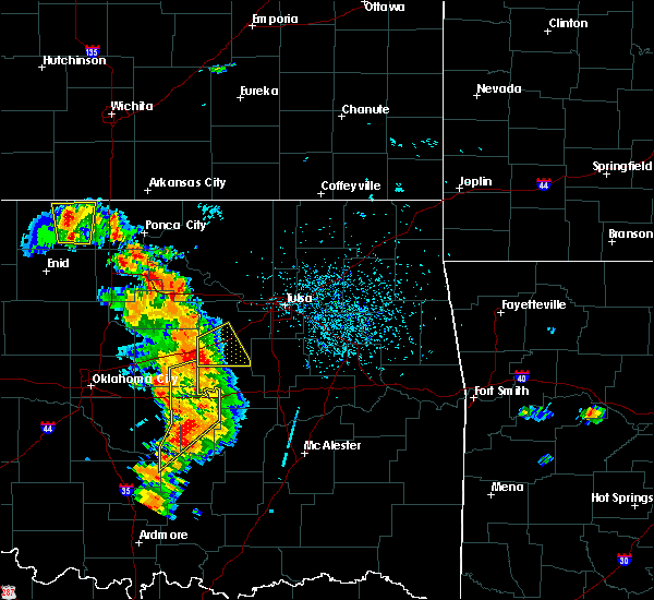 At 358 pm cdt, a severe thunderstorm was located 6 miles southeast of stroud, moving northeast at 35 mph (radar indicated). Hazards include 60 mph wind gusts and nickel size hail. Expect damage to roofs, siding, and trees. Locations in or near the path include, bristow, depew, slick, milfay, this includes interstate 44 between mile markers 178 and 196. At 358 pm cdt, a severe thunderstorm was located 6 miles southeast of stroud, moving northeast at 35 mph (radar indicated). Hazards include 60 mph wind gusts and nickel size hail. Expect damage to roofs, siding, and trees. Locations in or near the path include, bristow, depew, slick, milfay, this includes interstate 44 between mile markers 178 and 196.
|
| 7/2/2017 3:47 PM CDT |
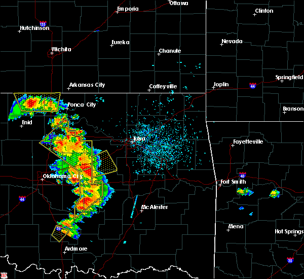 At 347 pm cdt, a severe thunderstorm was located 6 miles southeast of davenport, moving northeast at 30 mph (radar indicated). Hazards include 60 mph wind gusts and quarter size hail. Hail damage to vehicles is expected. expect wind damage to roofs, siding, and trees. Locations in or near the path include, bristow, depew, slick, welty, milfay, this includes interstate 44 between mile markers 178 and 196. At 347 pm cdt, a severe thunderstorm was located 6 miles southeast of davenport, moving northeast at 30 mph (radar indicated). Hazards include 60 mph wind gusts and quarter size hail. Hail damage to vehicles is expected. expect wind damage to roofs, siding, and trees. Locations in or near the path include, bristow, depew, slick, welty, milfay, this includes interstate 44 between mile markers 178 and 196.
|
| 5/28/2017 2:09 AM CDT |
 The severe thunderstorm warning for southwestern creek county will expire at 215 am cdt, the storm which prompted the warning has moved out of the area. therefore the warning will be allowed to expire. a severe thunderstorm watch remains in effect until 700 am cdt for northeastern oklahoma. The severe thunderstorm warning for southwestern creek county will expire at 215 am cdt, the storm which prompted the warning has moved out of the area. therefore the warning will be allowed to expire. a severe thunderstorm watch remains in effect until 700 am cdt for northeastern oklahoma.
|
| 5/28/2017 1:42 AM CDT |
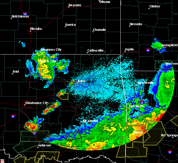 At 141 am cdt, a severe thunderstorm was located 3 miles southeast of depew, moving southeast at 35 mph (radar indicated). Hazards include golf ball size hail. People and animals outdoors will be injured. expect damage to roofs, siding, windows, and vehicles. locations in or near the path include, bristow, slick, this includes interstate 44 between mile markers 188 and 189. A tornado watch remains in effect until 200 am cdt for northeastern oklahoma. At 141 am cdt, a severe thunderstorm was located 3 miles southeast of depew, moving southeast at 35 mph (radar indicated). Hazards include golf ball size hail. People and animals outdoors will be injured. expect damage to roofs, siding, windows, and vehicles. locations in or near the path include, bristow, slick, this includes interstate 44 between mile markers 188 and 189. A tornado watch remains in effect until 200 am cdt for northeastern oklahoma.
|
| 5/28/2017 1:34 AM CDT |
 At 134 am cdt, a severe thunderstorm was located over depew, moving southeast at 30 mph (radar indicated). Hazards include half dollar size hail. Damage to vehicles is expected. locations in or near the path include, bristow, depew, slick, milfay, this includes interstate 44 between mile markers 178 and 192. A tornado watch remains in effect until 200 am cdt for northeastern oklahoma. At 134 am cdt, a severe thunderstorm was located over depew, moving southeast at 30 mph (radar indicated). Hazards include half dollar size hail. Damage to vehicles is expected. locations in or near the path include, bristow, depew, slick, milfay, this includes interstate 44 between mile markers 178 and 192. A tornado watch remains in effect until 200 am cdt for northeastern oklahoma.
|
| 5/27/2017 8:39 PM CDT | Hen Egg sized hail reported 14.2 miles N of Bristow, OK, spotter is on highway 48 at the okfuskee and creek county line reporting heavy hail up to 2 inches in diameter. |
| 5/27/2017 7:50 PM CDT |
 At 749 pm cdt, a severe thunderstorm was located 4 miles east of davenport, moving east at 35 mph (radar indicated). Hazards include 60 mph wind gusts and half dollar size hail. Hail damage to vehicles is expected. expect wind damage to roofs, siding, and trees. locations in or near the path include, bristow, depew, slick, welty, milfay, mason, this includes interstate 44 between mile markers 178 and 190. A tornado watch remains in effect until midnight cdt for northeastern and east central oklahoma. At 749 pm cdt, a severe thunderstorm was located 4 miles east of davenport, moving east at 35 mph (radar indicated). Hazards include 60 mph wind gusts and half dollar size hail. Hail damage to vehicles is expected. expect wind damage to roofs, siding, and trees. locations in or near the path include, bristow, depew, slick, welty, milfay, mason, this includes interstate 44 between mile markers 178 and 190. A tornado watch remains in effect until midnight cdt for northeastern and east central oklahoma.
|
| 5/19/2017 7:14 PM CDT |
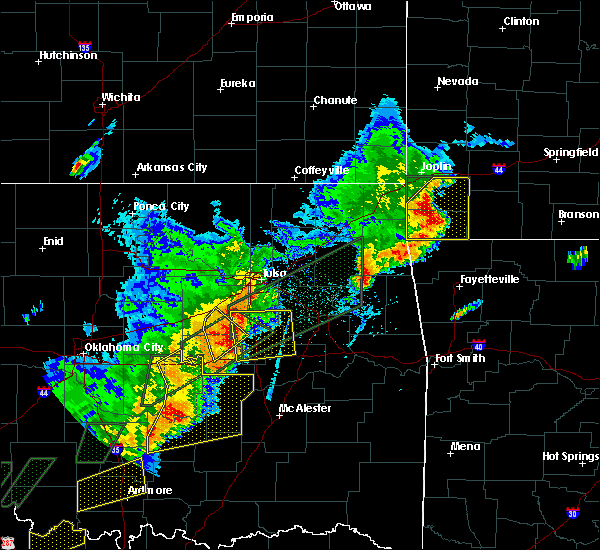 At 714 pm cdt, severe thunderstorms were located along a line extending from 3 miles southwest of mounds to 4 miles north of pharoah, moving northeast at 35 mph (radar indicated). Hazards include 60 mph wind gusts and quarter size hail. Hail damage to vehicles is expected. expect wind damage to roofs, siding, and trees. Locations in or near the path include, okemah, okfuskee, slick, okmulgee state park, mason, this includes interstate 40 in oklahoma near mile marker 218. At 714 pm cdt, severe thunderstorms were located along a line extending from 3 miles southwest of mounds to 4 miles north of pharoah, moving northeast at 35 mph (radar indicated). Hazards include 60 mph wind gusts and quarter size hail. Hail damage to vehicles is expected. expect wind damage to roofs, siding, and trees. Locations in or near the path include, okemah, okfuskee, slick, okmulgee state park, mason, this includes interstate 40 in oklahoma near mile marker 218.
|
| 5/19/2017 6:55 PM CDT |
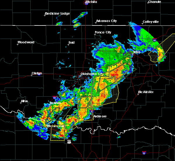 At 655 pm cdt, severe thunderstorms were located along a line extending from slick to near okemah, moving northeast at 50 mph (radar indicated). Hazards include 60 mph wind gusts and quarter size hail. Hail damage to vehicles is expected. expect wind damage to roofs, siding, and trees. locations in or near the path include, bristow, okemah, okfuskee, boley, depew, paden, bearden, slick, castle, okmulgee state park, welty, milfay, mason, this includes the following highways, interstate 40 in oklahoma between mile markers 212 and 219. Interstate 44 between mile markers 189 and 195. At 655 pm cdt, severe thunderstorms were located along a line extending from slick to near okemah, moving northeast at 50 mph (radar indicated). Hazards include 60 mph wind gusts and quarter size hail. Hail damage to vehicles is expected. expect wind damage to roofs, siding, and trees. locations in or near the path include, bristow, okemah, okfuskee, boley, depew, paden, bearden, slick, castle, okmulgee state park, welty, milfay, mason, this includes the following highways, interstate 40 in oklahoma between mile markers 212 and 219. Interstate 44 between mile markers 189 and 195.
|
| 5/19/2017 6:28 PM CDT |
 At 628 pm cdt, a severe thunderstorm was located 3 miles south of prague, moving northeast at 35 mph (radar indicated). Hazards include 60 mph wind gusts and quarter size hail. Hail damage to vehicles is expected. expect wind damage to roofs, siding, and trees. locations in or near the path include, bristow, okemah, okfuskee, boley, depew, paden, bearden, slick, castle, okmulgee state park, welty, milfay, mason, this includes the following highways, interstate 40 in oklahoma between mile markers 212 and 219. Interstate 44 between mile markers 189 and 195. At 628 pm cdt, a severe thunderstorm was located 3 miles south of prague, moving northeast at 35 mph (radar indicated). Hazards include 60 mph wind gusts and quarter size hail. Hail damage to vehicles is expected. expect wind damage to roofs, siding, and trees. locations in or near the path include, bristow, okemah, okfuskee, boley, depew, paden, bearden, slick, castle, okmulgee state park, welty, milfay, mason, this includes the following highways, interstate 40 in oklahoma between mile markers 212 and 219. Interstate 44 between mile markers 189 and 195.
|
| 5/19/2017 4:42 PM CDT |
 At 441 pm cdt, a severe thunderstorm was located over paden, moving northeast at 55 mph (radar indicated). Hazards include 60 mph wind gusts and quarter size hail. Hail damage to vehicles is expected. expect wind damage to roofs, siding, and trees. Locations in or near the path include, beggs, boley, paden, slick, welty, mason, this includes interstate 44 between mile markers 196 and 202. At 441 pm cdt, a severe thunderstorm was located over paden, moving northeast at 55 mph (radar indicated). Hazards include 60 mph wind gusts and quarter size hail. Hail damage to vehicles is expected. expect wind damage to roofs, siding, and trees. Locations in or near the path include, beggs, boley, paden, slick, welty, mason, this includes interstate 44 between mile markers 196 and 202.
|
| 5/18/2017 9:43 PM CDT |
 At 942 pm cdt, severe thunderstorms were located along a line extending from near keystone state park to tulsa to 3 miles northeast of oneta, moving northeast at 30 mph (radar indicated). Hazards include 70 mph wind gusts and quarter size hail. Hail damage to vehicles is expected. expect considerable tree damage. wind damage is also likely to mobile homes, roofs, and outbuildings. locations in or near the path include, tulsa, broken arrow, sand springs, claremore, okmulgee, bristow, owasso, bixby, sapulpa, jenks, glenpool, coweta, skiatook, catoosa, collinsville, verdigris, mannford, inola, kiefer, morris, this includes interstate 44 between mile markers 191 and 259. A tornado watch remains in effect until midnight cdt for northeastern and east central oklahoma. At 942 pm cdt, severe thunderstorms were located along a line extending from near keystone state park to tulsa to 3 miles northeast of oneta, moving northeast at 30 mph (radar indicated). Hazards include 70 mph wind gusts and quarter size hail. Hail damage to vehicles is expected. expect considerable tree damage. wind damage is also likely to mobile homes, roofs, and outbuildings. locations in or near the path include, tulsa, broken arrow, sand springs, claremore, okmulgee, bristow, owasso, bixby, sapulpa, jenks, glenpool, coweta, skiatook, catoosa, collinsville, verdigris, mannford, inola, kiefer, morris, this includes interstate 44 between mile markers 191 and 259. A tornado watch remains in effect until midnight cdt for northeastern and east central oklahoma.
|
| 5/18/2017 9:26 PM CDT |
 At 926 pm cdt, severe thunderstorms were located along a line extending from 8 miles south of mannford to tulsa to 5 miles southwest of oneta, moving northeast at 55 mph (radar indicated). Hazards include 70 mph wind gusts and quarter size hail. Hail damage to vehicles is expected. expect considerable tree damage. wind damage is also likely to mobile homes, roofs, and outbuildings. locations in or near the path include, tulsa, broken arrow, sand springs, claremore, okmulgee, bristow, owasso, bixby, sapulpa, jenks, glenpool, coweta, skiatook, catoosa, collinsville, verdigris, mannford, inola, kiefer, morris, this includes interstate 44 between mile markers 186 and 259. A tornado watch remains in effect until midnight cdt for northeastern and east central oklahoma. At 926 pm cdt, severe thunderstorms were located along a line extending from 8 miles south of mannford to tulsa to 5 miles southwest of oneta, moving northeast at 55 mph (radar indicated). Hazards include 70 mph wind gusts and quarter size hail. Hail damage to vehicles is expected. expect considerable tree damage. wind damage is also likely to mobile homes, roofs, and outbuildings. locations in or near the path include, tulsa, broken arrow, sand springs, claremore, okmulgee, bristow, owasso, bixby, sapulpa, jenks, glenpool, coweta, skiatook, catoosa, collinsville, verdigris, mannford, inola, kiefer, morris, this includes interstate 44 between mile markers 186 and 259. A tornado watch remains in effect until midnight cdt for northeastern and east central oklahoma.
|
| 5/18/2017 9:17 PM CDT |
 At 916 pm cdt, severe thunderstorms were located along a line extending from 8 miles west of kellyville to 2 miles northwest of glenpool to 5 miles southwest of stonebluff, moving northeast at 55 mph (radar indicated). Hazards include 70 mph wind gusts and nickel size hail. Expect considerable tree damage. damage is likely to mobile homes, roofs, and outbuildings. locations in or near the path include, tulsa, broken arrow, sand springs, okmulgee, bristow, bixby, sapulpa, jenks, glenpool, coweta, catoosa, mannford, kiefer, morris, beggs, mounds, kellyville, depew, westport, slick, this includes interstate 44 between mile markers 185 and 232. A tornado watch remains in effect until midnight cdt for northeastern and east central oklahoma. At 916 pm cdt, severe thunderstorms were located along a line extending from 8 miles west of kellyville to 2 miles northwest of glenpool to 5 miles southwest of stonebluff, moving northeast at 55 mph (radar indicated). Hazards include 70 mph wind gusts and nickel size hail. Expect considerable tree damage. damage is likely to mobile homes, roofs, and outbuildings. locations in or near the path include, tulsa, broken arrow, sand springs, okmulgee, bristow, bixby, sapulpa, jenks, glenpool, coweta, catoosa, mannford, kiefer, morris, beggs, mounds, kellyville, depew, westport, slick, this includes interstate 44 between mile markers 185 and 232. A tornado watch remains in effect until midnight cdt for northeastern and east central oklahoma.
|
| 5/18/2017 9:06 PM CDT |
 At 906 pm cdt, severe thunderstorms were located along a line extending from 3 miles northwest of bristow to 3 miles west of mounds to 2 miles west of bald hill, moving northeast at 60 mph (radar indicated). Hazards include 60 mph wind gusts and quarter size hail. Hail damage to vehicles is expected. expect wind damage to roofs, siding, and trees. locations in or near the path include, tulsa, broken arrow, sand springs, okmulgee, bristow, bixby, sapulpa, jenks, glenpool, coweta, catoosa, mannford, kiefer, morris, beggs, mounds, kellyville, depew, westport, slick, this includes interstate 44 between mile markers 185 and 232. A tornado watch remains in effect until midnight cdt for northeastern and east central oklahoma. At 906 pm cdt, severe thunderstorms were located along a line extending from 3 miles northwest of bristow to 3 miles west of mounds to 2 miles west of bald hill, moving northeast at 60 mph (radar indicated). Hazards include 60 mph wind gusts and quarter size hail. Hail damage to vehicles is expected. expect wind damage to roofs, siding, and trees. locations in or near the path include, tulsa, broken arrow, sand springs, okmulgee, bristow, bixby, sapulpa, jenks, glenpool, coweta, catoosa, mannford, kiefer, morris, beggs, mounds, kellyville, depew, westport, slick, this includes interstate 44 between mile markers 185 and 232. A tornado watch remains in effect until midnight cdt for northeastern and east central oklahoma.
|
| 5/18/2017 8:33 PM CDT |
 At 832 pm cdt, a severe thunderstorm was located over boley, moving northeast at 40 mph (radar indicated). Hazards include 60 mph wind gusts and quarter size hail. Hail damage to vehicles is expected. expect wind damage to roofs, siding, and trees. locations in or near the path include, bristow, okemah, okfuskee, drumright, boley, kellyville, depew, paden, bearden, slick, castle, shamrock, welty, milfay, mason, this includes the following highways, interstate 40 in oklahoma between mile markers 212 and 225. interstate 44 between mile markers 178 and 206. A tornado watch remains in effect until midnight cdt for northeastern and east central oklahoma. At 832 pm cdt, a severe thunderstorm was located over boley, moving northeast at 40 mph (radar indicated). Hazards include 60 mph wind gusts and quarter size hail. Hail damage to vehicles is expected. expect wind damage to roofs, siding, and trees. locations in or near the path include, bristow, okemah, okfuskee, drumright, boley, kellyville, depew, paden, bearden, slick, castle, shamrock, welty, milfay, mason, this includes the following highways, interstate 40 in oklahoma between mile markers 212 and 225. interstate 44 between mile markers 178 and 206. A tornado watch remains in effect until midnight cdt for northeastern and east central oklahoma.
|
| 5/18/2017 7:40 PM CDT |
 At 739 pm cdt, severe thunderstorms were located along a line extending from 8 miles east of drumright to 4 miles south of bristow to 3 miles northeast of prague, moving northeast at 45 mph (radar indicated). Hazards include 60 mph wind gusts and nickel size hail. Expect damage to roofs, siding, and trees. locations in or near the path include, bristow, okfuskee, mannford, drumright, boley, depew, paden, slick, shamrock, welty, milfay, mason, this includes interstate 44 between mile markers 178 and 202. A tornado watch remains in effect until midnight cdt for northeastern and east central oklahoma. At 739 pm cdt, severe thunderstorms were located along a line extending from 8 miles east of drumright to 4 miles south of bristow to 3 miles northeast of prague, moving northeast at 45 mph (radar indicated). Hazards include 60 mph wind gusts and nickel size hail. Expect damage to roofs, siding, and trees. locations in or near the path include, bristow, okfuskee, mannford, drumright, boley, depew, paden, slick, shamrock, welty, milfay, mason, this includes interstate 44 between mile markers 178 and 202. A tornado watch remains in effect until midnight cdt for northeastern and east central oklahoma.
|
| 5/18/2017 7:17 PM CDT |
 At 716 pm cdt, a severe thunderstorm was located over stroud, moving northeast at 45 mph (radar indicated). Hazards include 60 mph wind gusts and quarter size hail. Hail damage to vehicles is expected. expect wind damage to roofs, siding, and trees. locations in or near the path include, bristow, okfuskee, mannford, drumright, boley, depew, paden, slick, shamrock, welty, milfay, mason, this includes interstate 44 between mile markers 178 and 202. A tornado watch remains in effect until midnight cdt for northeastern and east central oklahoma. At 716 pm cdt, a severe thunderstorm was located over stroud, moving northeast at 45 mph (radar indicated). Hazards include 60 mph wind gusts and quarter size hail. Hail damage to vehicles is expected. expect wind damage to roofs, siding, and trees. locations in or near the path include, bristow, okfuskee, mannford, drumright, boley, depew, paden, slick, shamrock, welty, milfay, mason, this includes interstate 44 between mile markers 178 and 202. A tornado watch remains in effect until midnight cdt for northeastern and east central oklahoma.
|
| 5/10/2017 9:41 PM CDT |
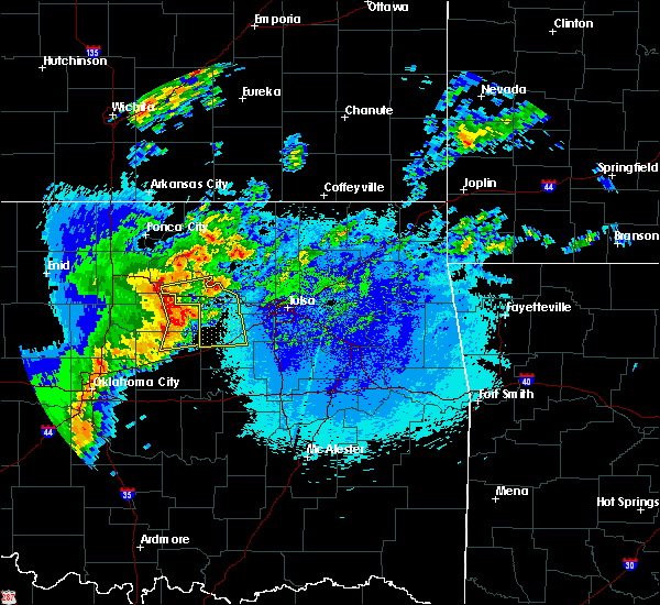 At 940 pm cdt, severe thunderstorms were located along a line extending from glencoe to 4 miles northeast of ripley to 4 miles south of agra, moving east at 50 mph (radar indicated). Hazards include 60 mph wind gusts and penny size hail. at 930 pm, the oklahoma mesonet station at perkins oklahoma measured a 61 mph wind gust. Expect damage to roofs, siding, and trees. Locations in or near the path include, bristow, pawnee, cleveland, mannford, drumright, oilton, jennings, westport, hallett, terlton, shamrock, maramec, silver city, this includes interstate 44 between mile markers 185 and 201. At 940 pm cdt, severe thunderstorms were located along a line extending from glencoe to 4 miles northeast of ripley to 4 miles south of agra, moving east at 50 mph (radar indicated). Hazards include 60 mph wind gusts and penny size hail. at 930 pm, the oklahoma mesonet station at perkins oklahoma measured a 61 mph wind gust. Expect damage to roofs, siding, and trees. Locations in or near the path include, bristow, pawnee, cleveland, mannford, drumright, oilton, jennings, westport, hallett, terlton, shamrock, maramec, silver city, this includes interstate 44 between mile markers 185 and 201.
|
| 4/29/2017 3:34 AM CDT |
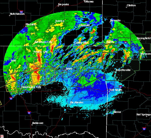 At 334 am cdt, severe thunderstorms were located along a line extending from 5 miles east of stillwater to 3 miles northeast of agra to near chandler, moving northeast at 40 mph (radar indicated). Hazards include 60 mph wind gusts and half dollar size hail. Hail damage to vehicles is expected. expect wind damage to roofs, siding, and trees. Locations in or near the path include, bristow, mannford, drumright, oilton, depew, jennings, hallett, blackburn, terlton, shamrock, maramec, milfay, silver city, this includes interstate 44 between mile markers 178 and 198. At 334 am cdt, severe thunderstorms were located along a line extending from 5 miles east of stillwater to 3 miles northeast of agra to near chandler, moving northeast at 40 mph (radar indicated). Hazards include 60 mph wind gusts and half dollar size hail. Hail damage to vehicles is expected. expect wind damage to roofs, siding, and trees. Locations in or near the path include, bristow, mannford, drumright, oilton, depew, jennings, hallett, blackburn, terlton, shamrock, maramec, milfay, silver city, this includes interstate 44 between mile markers 178 and 198.
|
| 4/25/2017 9:39 PM CDT |
 The severe thunderstorm warning for northwestern creek county will expire at 945 pm cdt, the storm which prompted the warning has weakened below severe limits, and no longer poses an immediate threat to life or property. therefore the warning will be allowed to expire. a severe thunderstorm watch remains in effect until 200 am cdt for northeastern oklahoma. The severe thunderstorm warning for northwestern creek county will expire at 945 pm cdt, the storm which prompted the warning has weakened below severe limits, and no longer poses an immediate threat to life or property. therefore the warning will be allowed to expire. a severe thunderstorm watch remains in effect until 200 am cdt for northeastern oklahoma.
|
| 4/25/2017 9:33 PM CDT |
 At 932 pm cdt, a severe thunderstorm was located near shamrock, moving northeast at 60 mph (radar indicated). Hazards include 60 mph wind gusts and quarter size hail. Hail damage to vehicles is expected. expect wind damage to roofs, siding, and trees. locations in or near the path include, shamrock, this includes interstate 44 between mile markers 194 and 202. recent trends suggest that the storms are weakening. If this trend continues, the warning may be cancelled early. At 932 pm cdt, a severe thunderstorm was located near shamrock, moving northeast at 60 mph (radar indicated). Hazards include 60 mph wind gusts and quarter size hail. Hail damage to vehicles is expected. expect wind damage to roofs, siding, and trees. locations in or near the path include, shamrock, this includes interstate 44 between mile markers 194 and 202. recent trends suggest that the storms are weakening. If this trend continues, the warning may be cancelled early.
|
| 4/25/2017 9:21 PM CDT |
 At 921 pm cdt, a severe thunderstorm was located 3 miles southwest of shamrock, moving northeast at 45 mph (radar indicated). Hazards include quarter size hail. Damage to vehicles is expected. Locations in or near the path include, shamrock, this includes interstate 44 between mile markers 194 and 202. At 921 pm cdt, a severe thunderstorm was located 3 miles southwest of shamrock, moving northeast at 45 mph (radar indicated). Hazards include quarter size hail. Damage to vehicles is expected. Locations in or near the path include, shamrock, this includes interstate 44 between mile markers 194 and 202.
|
| 4/25/2017 9:05 PM CDT |
 At 905 pm cdt, a severe thunderstorm was located near depew, moving northeast at 40 mph (radar indicated. at 859 pm, quarter size hail was reported 1 mile north northwest of milfay). Hazards include 60 mph wind gusts and half dollar size hail. Hail damage to vehicles is expected. expect wind damage to roofs, siding, and trees. Locations in or near the path include, bristow, kellyville, depew, slick, shamrock, milfay, this includes interstate 44 between mile markers 178 and 205. At 905 pm cdt, a severe thunderstorm was located near depew, moving northeast at 40 mph (radar indicated. at 859 pm, quarter size hail was reported 1 mile north northwest of milfay). Hazards include 60 mph wind gusts and half dollar size hail. Hail damage to vehicles is expected. expect wind damage to roofs, siding, and trees. Locations in or near the path include, bristow, kellyville, depew, slick, shamrock, milfay, this includes interstate 44 between mile markers 178 and 205.
|
| 4/25/2017 9:03 PM CDT |
 At 849 pm cdt, a severe thunderstorm was located over stroud, moving northeast at 40 mph (radar indicated). Hazards include 60 mph wind gusts and half dollar size hail. Hail damage to vehicles is expected. expect wind damage to roofs, siding, and trees. Locations in or near the path include, bristow, kellyville, depew, slick, shamrock, milfay, this includes interstate 44 between mile markers 178 and 205. At 849 pm cdt, a severe thunderstorm was located over stroud, moving northeast at 40 mph (radar indicated). Hazards include 60 mph wind gusts and half dollar size hail. Hail damage to vehicles is expected. expect wind damage to roofs, siding, and trees. Locations in or near the path include, bristow, kellyville, depew, slick, shamrock, milfay, this includes interstate 44 between mile markers 178 and 205.
|
| 4/25/2017 8:50 PM CDT |
 At 849 pm cdt, a severe thunderstorm was located over stroud, moving northeast at 40 mph (radar indicated). Hazards include 60 mph wind gusts and half dollar size hail. Hail damage to vehicles is expected. expect wind damage to roofs, siding, and trees. Locations in or near the path include, bristow, kellyville, depew, slick, shamrock, milfay, this includes interstate 44 between mile markers 178 and 205. At 849 pm cdt, a severe thunderstorm was located over stroud, moving northeast at 40 mph (radar indicated). Hazards include 60 mph wind gusts and half dollar size hail. Hail damage to vehicles is expected. expect wind damage to roofs, siding, and trees. Locations in or near the path include, bristow, kellyville, depew, slick, shamrock, milfay, this includes interstate 44 between mile markers 178 and 205.
|
| 4/21/2017 3:44 AM CDT |
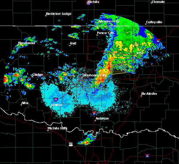 At 344 am cdt, a severe thunderstorm was located 3 miles south of stroud, moving east at 40 mph (radar indicated). Hazards include 60 mph wind gusts and quarter size hail. Hail damage to vehicles is expected. expect wind damage to roofs, siding, and trees. Locations in or near the path include, bristow, depew, slick, welty, milfay, this includes interstate 44 between mile markers 178 and 194. At 344 am cdt, a severe thunderstorm was located 3 miles south of stroud, moving east at 40 mph (radar indicated). Hazards include 60 mph wind gusts and quarter size hail. Hail damage to vehicles is expected. expect wind damage to roofs, siding, and trees. Locations in or near the path include, bristow, depew, slick, welty, milfay, this includes interstate 44 between mile markers 178 and 194.
|
| 4/4/2017 5:02 PM CDT | Golf Ball sized hail reported 0.4 miles N of Bristow, OK |
| 4/4/2017 4:52 PM CDT |
 At 451 pm cdt, a severe thunderstorm was located 5 miles southwest of depew, moving northeast at 45 mph (radar indicated). Hazards include 60 mph wind gusts and quarter size hail. Hail damage to vehicles is expected. expect wind damage to roofs, siding, and trees. Locations in or near the path include, sand springs, bristow, mannford, depew, keystone state park, milfay, this includes interstate 44 between mile markers 179 and 203. At 451 pm cdt, a severe thunderstorm was located 5 miles southwest of depew, moving northeast at 45 mph (radar indicated). Hazards include 60 mph wind gusts and quarter size hail. Hail damage to vehicles is expected. expect wind damage to roofs, siding, and trees. Locations in or near the path include, sand springs, bristow, mannford, depew, keystone state park, milfay, this includes interstate 44 between mile markers 179 and 203.
|
| 4/4/2017 4:02 PM CDT |
 At 402 pm cdt, a severe thunderstorm was located over boley, moving northeast at 60 mph (radar indicated). Hazards include 60 mph wind gusts and half dollar size hail. Hail damage to vehicles is expected. expect wind damage to roofs, siding, and trees. locations in or near the path include, bristow, okfuskee, boley, paden, slick, castle, welty, mason, this includes the following highways, interstate 40 in oklahoma near mile marker 212. Interstate 44 between mile markers 190 and 193. At 402 pm cdt, a severe thunderstorm was located over boley, moving northeast at 60 mph (radar indicated). Hazards include 60 mph wind gusts and half dollar size hail. Hail damage to vehicles is expected. expect wind damage to roofs, siding, and trees. locations in or near the path include, bristow, okfuskee, boley, paden, slick, castle, welty, mason, this includes the following highways, interstate 40 in oklahoma near mile marker 212. Interstate 44 between mile markers 190 and 193.
|
| 4/4/2017 3:46 PM CDT |
 At 346 pm cdt, a severe thunderstorm was located 3 miles southeast of little, moving northeast at 50 mph (radar indicated). Hazards include 60 mph wind gusts and quarter size hail. Hail damage to vehicles is expected. expect wind damage to roofs, siding, and trees. locations in or near the path include, bristow, okemah, okfuskee, boley, depew, paden, bearden, slick, castle, welty, okmulgee state park, mason, this includes the following highways, interstate 40 in oklahoma between mile markers 212 and 218. Interstate 44 between mile markers 185 and 193. At 346 pm cdt, a severe thunderstorm was located 3 miles southeast of little, moving northeast at 50 mph (radar indicated). Hazards include 60 mph wind gusts and quarter size hail. Hail damage to vehicles is expected. expect wind damage to roofs, siding, and trees. locations in or near the path include, bristow, okemah, okfuskee, boley, depew, paden, bearden, slick, castle, welty, okmulgee state park, mason, this includes the following highways, interstate 40 in oklahoma between mile markers 212 and 218. Interstate 44 between mile markers 185 and 193.
|
| 3/6/2017 10:14 PM CST |
 At 1014 pm cst, severe thunderstorms were located along a line extending from 4 miles southeast of oologah to tulsa to 2 miles north of paden, moving east at 50 mph (radar indicated). Hazards include 60 mph wind gusts and quarter size hail. Hail damage to vehicles is expected. expect wind damage to roofs, siding, and trees. locations in or near the path include, tulsa, broken arrow, sand springs, claremore, okmulgee, bristow, okemah, pryor, owasso, bixby, sapulpa, jenks, okfuskee, glenpool, coweta, pryor creek, skiatook, catoosa, collinsville, verdigris, this includes the following highways, interstate 40 in oklahoma between mile markers 212 and 224. interstate 44 between mile markers 181 and 265. A tornado watch remains in effect until 300 am cst for northeastern and east central oklahoma. At 1014 pm cst, severe thunderstorms were located along a line extending from 4 miles southeast of oologah to tulsa to 2 miles north of paden, moving east at 50 mph (radar indicated). Hazards include 60 mph wind gusts and quarter size hail. Hail damage to vehicles is expected. expect wind damage to roofs, siding, and trees. locations in or near the path include, tulsa, broken arrow, sand springs, claremore, okmulgee, bristow, okemah, pryor, owasso, bixby, sapulpa, jenks, okfuskee, glenpool, coweta, pryor creek, skiatook, catoosa, collinsville, verdigris, this includes the following highways, interstate 40 in oklahoma between mile markers 212 and 224. interstate 44 between mile markers 181 and 265. A tornado watch remains in effect until 300 am cst for northeastern and east central oklahoma.
|
| 3/6/2017 10:14 PM CST |
 The severe thunderstorm warning for washington and pawnee counties is cancelled, the storms which prompted the warning have moved out of the warned area therefore the warning has been cancelled. a tornado watch remains in effect until 300 am cst for northeastern and east central oklahoma. The severe thunderstorm warning for washington and pawnee counties is cancelled, the storms which prompted the warning have moved out of the warned area therefore the warning has been cancelled. a tornado watch remains in effect until 300 am cst for northeastern and east central oklahoma.
|
| 3/6/2017 9:50 PM CST |
 At 949 pm cst, severe thunderstorms were located along a line extending from near skiatook to 3 miles northwest of bristow, moving east at 35 mph (radar indicated). Hazards include 60 mph wind gusts and quarter size hail. Hail damage to vehicles is expected. expect wind damage to roofs, siding, and trees. locations in or near the path include, northwestern tulsa, sand springs, bristow, skiatook, mannford, sperry, ramona, depew, avant, westport, shamrock, keystone state park, walnut creek state park, milfay, this includes interstate 44 between mile markers 178 and 202. A tornado watch remains in effect until 300 am cst for northeastern oklahoma. At 949 pm cst, severe thunderstorms were located along a line extending from near skiatook to 3 miles northwest of bristow, moving east at 35 mph (radar indicated). Hazards include 60 mph wind gusts and quarter size hail. Hail damage to vehicles is expected. expect wind damage to roofs, siding, and trees. locations in or near the path include, northwestern tulsa, sand springs, bristow, skiatook, mannford, sperry, ramona, depew, avant, westport, shamrock, keystone state park, walnut creek state park, milfay, this includes interstate 44 between mile markers 178 and 202. A tornado watch remains in effect until 300 am cst for northeastern oklahoma.
|
| 3/6/2017 9:46 PM CST |
 At 946 pm cst, severe thunderstorms were located along a line extending from near vera to near keystone state park to 6 miles southeast of davenport, moving east at 35 mph (radar indicated). Hazards include 60 mph wind gusts and quarter size hail. Hail damage to vehicles is expected. expect wind damage to roofs, siding, and trees. locations in or near the path include, tulsa, broken arrow, sand springs, claremore, okmulgee, bristow, okemah, pryor, owasso, bixby, sapulpa, jenks, okfuskee, glenpool, coweta, pryor creek, skiatook, catoosa, collinsville, verdigris, this includes the following highways, interstate 40 in oklahoma between mile markers 212 and 224. interstate 44 between mile markers 178 and 265. A tornado watch remains in effect until 300 am cst for northeastern and east central oklahoma. At 946 pm cst, severe thunderstorms were located along a line extending from near vera to near keystone state park to 6 miles southeast of davenport, moving east at 35 mph (radar indicated). Hazards include 60 mph wind gusts and quarter size hail. Hail damage to vehicles is expected. expect wind damage to roofs, siding, and trees. locations in or near the path include, tulsa, broken arrow, sand springs, claremore, okmulgee, bristow, okemah, pryor, owasso, bixby, sapulpa, jenks, okfuskee, glenpool, coweta, pryor creek, skiatook, catoosa, collinsville, verdigris, this includes the following highways, interstate 40 in oklahoma between mile markers 212 and 224. interstate 44 between mile markers 178 and 265. A tornado watch remains in effect until 300 am cst for northeastern and east central oklahoma.
|
| 3/6/2017 9:19 PM CST |
 At 918 pm cst, severe thunderstorms were located along a line extending from near hominy to 3 miles east of avery, moving east at 30 mph (radar indicated). Hazards include 60 mph wind gusts and quarter size hail. Hail damage to vehicles is expected. expect wind damage to roofs, siding, and trees. locations in or near the path include, northwestern tulsa, sand springs, bristow, skiatook, hominy, cleveland, mannford, drumright, sperry, oilton, ramona, depew, jennings, avant, westport, osage, terlton, shamrock, keystone state park, walnut creek state park, this includes interstate 44 between mile markers 178 and 202. A tornado watch remains in effect until 300 am cst for northeastern oklahoma. At 918 pm cst, severe thunderstorms were located along a line extending from near hominy to 3 miles east of avery, moving east at 30 mph (radar indicated). Hazards include 60 mph wind gusts and quarter size hail. Hail damage to vehicles is expected. expect wind damage to roofs, siding, and trees. locations in or near the path include, northwestern tulsa, sand springs, bristow, skiatook, hominy, cleveland, mannford, drumright, sperry, oilton, ramona, depew, jennings, avant, westport, osage, terlton, shamrock, keystone state park, walnut creek state park, this includes interstate 44 between mile markers 178 and 202. A tornado watch remains in effect until 300 am cst for northeastern oklahoma.
|
| 7/28/2016 6:19 PM CDT |
 At 619 pm cdt, severe thunderstorms were located along a line extending from 6 miles northwest of kellyville to kiefer to 4 miles northeast of bixby, moving south at 10 mph (radar indicated). Hazards include 60 mph wind gusts and penny size hail. Expect damage to roofs. siding. and trees. Locations in or near the path include, southern tulsa, broken arrow, sand springs, bixby, sapulpa, jenks, glenpool, coweta, kiefer, mounds, kellyville, stonebluff, oneta, liberty, leonard, this includes interstate 44 between mile markers 192 and 225. At 619 pm cdt, severe thunderstorms were located along a line extending from 6 miles northwest of kellyville to kiefer to 4 miles northeast of bixby, moving south at 10 mph (radar indicated). Hazards include 60 mph wind gusts and penny size hail. Expect damage to roofs. siding. and trees. Locations in or near the path include, southern tulsa, broken arrow, sand springs, bixby, sapulpa, jenks, glenpool, coweta, kiefer, mounds, kellyville, stonebluff, oneta, liberty, leonard, this includes interstate 44 between mile markers 192 and 225.
|
| 7/28/2016 6:08 PM CDT |
 At 607 pm cdt, severe thunderstorms were located along a line extending from 7 miles south of mannford to 2 miles southwest of broken arrow, moving south at 15 mph (radar indicated. several reports of wind damage have been received in the tulsa metro area). Hazards include 60 mph wind gusts and penny size hail. Expect damage to roofs. siding. and trees. Locations in or near the path include, southern tulsa, broken arrow, sand springs, bixby, sapulpa, jenks, glenpool, coweta, kiefer, mounds, kellyville, stonebluff, oneta, liberty, leonard, this includes interstate 44 between mile markers 192 and 225. At 607 pm cdt, severe thunderstorms were located along a line extending from 7 miles south of mannford to 2 miles southwest of broken arrow, moving south at 15 mph (radar indicated. several reports of wind damage have been received in the tulsa metro area). Hazards include 60 mph wind gusts and penny size hail. Expect damage to roofs. siding. and trees. Locations in or near the path include, southern tulsa, broken arrow, sand springs, bixby, sapulpa, jenks, glenpool, coweta, kiefer, mounds, kellyville, stonebluff, oneta, liberty, leonard, this includes interstate 44 between mile markers 192 and 225.
|
| 7/14/2016 1:34 AM CDT |
 At 133 am cdt, severe thunderstorms were located along a line extending from 4 miles south of kellyville to 6 miles north of welty to 4 miles north of prague, moving southeast at 30 mph (radar indicated). Hazards include 60 mph wind gusts and quarter size hail. Hail damage to vehicles is expected. expect wind damage to roofs, siding, and trees. Locations in or near the path include, okemah, okfuskee, beggs, boley, paden, bearden, slick, castle, welty, okmulgee state park, mason, this includes interstate 40 in oklahoma between mile markers 212 and 224. At 133 am cdt, severe thunderstorms were located along a line extending from 4 miles south of kellyville to 6 miles north of welty to 4 miles north of prague, moving southeast at 30 mph (radar indicated). Hazards include 60 mph wind gusts and quarter size hail. Hail damage to vehicles is expected. expect wind damage to roofs, siding, and trees. Locations in or near the path include, okemah, okfuskee, beggs, boley, paden, bearden, slick, castle, welty, okmulgee state park, mason, this includes interstate 40 in oklahoma between mile markers 212 and 224.
|
| 7/14/2016 1:25 AM CDT |
 At 125 am cdt, severe thunderstorms were located along a line extending from 4 miles south of keystone state park to 5 miles southeast of stroud, moving southeast at 40 mph (radar indicated). Hazards include 60 mph wind gusts and quarter size hail. Hail damage to vehicles is expected. expect wind damage to roofs, siding, and trees. Locations in or near the path include, bristow, sapulpa, mannford, drumright, kellyville, oilton, depew, slick, shamrock, milfay, silver city, this includes interstate 44 between mile markers 178 and 208. At 125 am cdt, severe thunderstorms were located along a line extending from 4 miles south of keystone state park to 5 miles southeast of stroud, moving southeast at 40 mph (radar indicated). Hazards include 60 mph wind gusts and quarter size hail. Hail damage to vehicles is expected. expect wind damage to roofs, siding, and trees. Locations in or near the path include, bristow, sapulpa, mannford, drumright, kellyville, oilton, depew, slick, shamrock, milfay, silver city, this includes interstate 44 between mile markers 178 and 208.
|
| 7/14/2016 12:44 AM CDT |
 At 1244 am cdt, a severe thunderstorm was located near yale, moving southeast at 35 mph (radar indicated). Hazards include 60 mph wind gusts and quarter size hail. Hail damage to vehicles is expected. expect wind damage to roofs, siding, and trees. Locations in or near the path include, bristow, sapulpa, mannford, drumright, kellyville, oilton, depew, slick, shamrock, milfay, silver city, this includes interstate 44 between mile markers 178 and 208. At 1244 am cdt, a severe thunderstorm was located near yale, moving southeast at 35 mph (radar indicated). Hazards include 60 mph wind gusts and quarter size hail. Hail damage to vehicles is expected. expect wind damage to roofs, siding, and trees. Locations in or near the path include, bristow, sapulpa, mannford, drumright, kellyville, oilton, depew, slick, shamrock, milfay, silver city, this includes interstate 44 between mile markers 178 and 208.
|
| 7/8/2016 8:26 AM CDT |
 At 826 am cdt, severe thunderstorms were located along a line extending from 2 miles southwest of hallett to 2 miles southwest of jennings to 5 miles east of oilton to 5 miles south of stroud, moving east at 35 mph (radar indicated). Hazards include 60 mph wind gusts and quarter size hail. Hail damage to vehicles is expected. expect wind damage to roofs, siding, and trees. Locations in or near the path include, bristow, okfuskee, cleveland, mannford, drumright, oilton, depew, jennings, westport, slick, hallett, terlton, shamrock, maramec, welty, milfay, silver city, this includes interstate 44 between mile markers 178 and 203. At 826 am cdt, severe thunderstorms were located along a line extending from 2 miles southwest of hallett to 2 miles southwest of jennings to 5 miles east of oilton to 5 miles south of stroud, moving east at 35 mph (radar indicated). Hazards include 60 mph wind gusts and quarter size hail. Hail damage to vehicles is expected. expect wind damage to roofs, siding, and trees. Locations in or near the path include, bristow, okfuskee, cleveland, mannford, drumright, oilton, depew, jennings, westport, slick, hallett, terlton, shamrock, maramec, welty, milfay, silver city, this includes interstate 44 between mile markers 178 and 203.
|
| 7/8/2016 8:16 AM CDT |
 At 815 am cdt, severe thunderstorms were located along a line extending from 3 miles east of glencoe to quay to near oilton to 6 miles southeast of davenport, moving east at 40 mph (radar indicated). Hazards include 60 mph wind gusts and quarter size hail. Hail damage to vehicles is expected. expect wind damage to roofs, siding, and trees. Locations in or near the path include, bristow, okfuskee, hominy, cleveland, mannford, drumright, oilton, depew, jennings, westport, osage, slick, hallett, terlton, shamrock, maramec, welty, milfay, silver city, this includes interstate 44 between mile markers 178 and 203. At 815 am cdt, severe thunderstorms were located along a line extending from 3 miles east of glencoe to quay to near oilton to 6 miles southeast of davenport, moving east at 40 mph (radar indicated). Hazards include 60 mph wind gusts and quarter size hail. Hail damage to vehicles is expected. expect wind damage to roofs, siding, and trees. Locations in or near the path include, bristow, okfuskee, hominy, cleveland, mannford, drumright, oilton, depew, jennings, westport, osage, slick, hallett, terlton, shamrock, maramec, welty, milfay, silver city, this includes interstate 44 between mile markers 178 and 203.
|
| 7/8/2016 8:04 AM CDT |
 At 804 am cdt, severe thunderstorms were located along a line extending from glencoe to 2 miles west of cushing to 2 miles southeast of sparks, moving east at 35 mph (radar indicated). Hazards include 60 mph wind gusts and quarter size hail. Hail damage to vehicles is expected. expect wind damage to roofs, siding, and trees. Locations in or near the path include, bristow, pawnee, okfuskee, hominy, cleveland, mannford, drumright, oilton, depew, jennings, westport, osage, slick, hallett, blackburn, terlton, shamrock, maramec, skedee, welty, this includes interstate 44 between mile markers 178 and 203. At 804 am cdt, severe thunderstorms were located along a line extending from glencoe to 2 miles west of cushing to 2 miles southeast of sparks, moving east at 35 mph (radar indicated). Hazards include 60 mph wind gusts and quarter size hail. Hail damage to vehicles is expected. expect wind damage to roofs, siding, and trees. Locations in or near the path include, bristow, pawnee, okfuskee, hominy, cleveland, mannford, drumright, oilton, depew, jennings, westport, osage, slick, hallett, blackburn, terlton, shamrock, maramec, skedee, welty, this includes interstate 44 between mile markers 178 and 203.
|
| 5/25/2016 12:36 AM CDT |
 At 1235 am cdt, a severe thunderstorm was located 5 miles south of slick, moving east at 35 mph (radar indicated). Hazards include 70 mph wind gusts and half dollar size hail. Hail damage to vehicles is expected. expect considerable tree damage. wind damage is also likely to mobile homes, roofs, and outbuildings. Locations in or near the path include, okmulgee, bristow, sapulpa, okfuskee, beggs, kellyville, depew, slick, preston, welty, okmulgee state park, this includes interstate 44 between mile markers 182 and 209. At 1235 am cdt, a severe thunderstorm was located 5 miles south of slick, moving east at 35 mph (radar indicated). Hazards include 70 mph wind gusts and half dollar size hail. Hail damage to vehicles is expected. expect considerable tree damage. wind damage is also likely to mobile homes, roofs, and outbuildings. Locations in or near the path include, okmulgee, bristow, sapulpa, okfuskee, beggs, kellyville, depew, slick, preston, welty, okmulgee state park, this includes interstate 44 between mile markers 182 and 209.
|
| 5/25/2016 12:13 AM CDT |
 At 1235 am cdt, a severe thunderstorm was located 5 miles south of slick, moving east at 35 mph (radar indicated). Hazards include 70 mph wind gusts and half dollar size hail. Hail damage to vehicles is expected. expect considerable tree damage. wind damage is also likely to mobile homes, roofs, and outbuildings. Locations in or near the path include, okmulgee, bristow, sapulpa, okfuskee, beggs, kellyville, depew, slick, preston, welty, okmulgee state park, this includes interstate 44 between mile markers 182 and 209. At 1235 am cdt, a severe thunderstorm was located 5 miles south of slick, moving east at 35 mph (radar indicated). Hazards include 70 mph wind gusts and half dollar size hail. Hail damage to vehicles is expected. expect considerable tree damage. wind damage is also likely to mobile homes, roofs, and outbuildings. Locations in or near the path include, okmulgee, bristow, sapulpa, okfuskee, beggs, kellyville, depew, slick, preston, welty, okmulgee state park, this includes interstate 44 between mile markers 182 and 209.
|
| 5/24/2016 11:54 PM CDT |
 At 1153 pm cdt, a severe thunderstorm was located 4 miles northeast of bristow, moving northeast at 40 mph. another severe thunderstorm was 3 miles south of depew, also moving northeast at 40 mph (radar indicated). Hazards include 60 mph wind gusts and half dollar size hail. Hail damage to vehicles is expected. expect wind damage to roofs, siding, and trees. Locations in or near the path include, bristow, mannford, kellyville, depew, slick, shamrock, welty, milfay, this includes interstate 44 between mile markers 178 and 204. At 1153 pm cdt, a severe thunderstorm was located 4 miles northeast of bristow, moving northeast at 40 mph. another severe thunderstorm was 3 miles south of depew, also moving northeast at 40 mph (radar indicated). Hazards include 60 mph wind gusts and half dollar size hail. Hail damage to vehicles is expected. expect wind damage to roofs, siding, and trees. Locations in or near the path include, bristow, mannford, kellyville, depew, slick, shamrock, welty, milfay, this includes interstate 44 between mile markers 178 and 204.
|
| 5/24/2016 10:57 PM CDT | The national weather service in tulsa has issued a * severe thunderstorm warning for. northwestern creek county in northeastern oklahoma. until 1145 pm cdt * at 1056 pm cdt. a severe thunderstorm was located over stroud. Moving northeast at 30 mph. |
| 5/24/2016 5:52 PM CDT |
 At 552 pm cdt, a severe thunderstorm was located 5 miles southwest of kellyville, moving east at 25 mph (radar indicated). Hazards include golf ball size hail and 60 mph wind gusts. People and animals outdoors will be injured. expect hail damage to roofs, siding, windows, and vehicles. expect wind damage to roofs, siding, and trees. Locations in or near the path include, southwestern tulsa, okmulgee, bristow, bixby, sapulpa, jenks, glenpool, kiefer, beggs, mounds, kellyville, slick, preston, liberty, hectorville, this includes interstate 44 between mile markers 191 and 214. At 552 pm cdt, a severe thunderstorm was located 5 miles southwest of kellyville, moving east at 25 mph (radar indicated). Hazards include golf ball size hail and 60 mph wind gusts. People and animals outdoors will be injured. expect hail damage to roofs, siding, windows, and vehicles. expect wind damage to roofs, siding, and trees. Locations in or near the path include, southwestern tulsa, okmulgee, bristow, bixby, sapulpa, jenks, glenpool, kiefer, beggs, mounds, kellyville, slick, preston, liberty, hectorville, this includes interstate 44 between mile markers 191 and 214.
|
| 5/24/2016 5:45 PM CDT | Trees down at turnpike entrance at bristow... ramp partially blocked. damage to one hom in creek county OK, 0.4 miles N of Bristow, OK |
| 5/24/2016 5:45 PM CDT | Extensive damage to mobile homes and houses. injuries and multiple trees down. hwy 16 between shamrock and bristo in creek county OK, 8.5 miles SE of Bristow, OK |
| 5/24/2016 5:36 PM CDT | Hen Egg sized hail reported 4.5 miles SW of Bristow, OK |
| 5/24/2016 5:13 PM CDT | The national weather service in tulsa has issued a * severe thunderstorm warning for. western creek county in northeastern oklahoma. until 615 pm cdt * at 512 pm cdt. a severe thunderstorm was located over drumright. Moving east at 15 mph. |
| 4/26/2016 9:57 PM CDT |
 At 957 pm cdt, severe thunderstorms were located along a line extending from 3 miles northeast of cleveland to 6 miles northwest of kellyville to 4 miles northeast of castle, moving northeast at 60 mph (radar indicated). Hazards include 70 mph wind gusts. Expect considerable tree damage. damage is likely to mobile homes, roofs, and outbuildings. locations in or near the path include, bristow, okfuskee, hominy, cleveland, mannford, beggs, kellyville, oilton, depew, jennings, westport, osage, slick, hallett, blackburn, castle, terlton, welty, walnut creek state park, keystone state park, this includes interstate 44 between mile markers 183 and 208. A tornado watch remains in effect until midnight cdt for northeastern oklahoma. At 957 pm cdt, severe thunderstorms were located along a line extending from 3 miles northeast of cleveland to 6 miles northwest of kellyville to 4 miles northeast of castle, moving northeast at 60 mph (radar indicated). Hazards include 70 mph wind gusts. Expect considerable tree damage. damage is likely to mobile homes, roofs, and outbuildings. locations in or near the path include, bristow, okfuskee, hominy, cleveland, mannford, beggs, kellyville, oilton, depew, jennings, westport, osage, slick, hallett, blackburn, castle, terlton, welty, walnut creek state park, keystone state park, this includes interstate 44 between mile markers 183 and 208. A tornado watch remains in effect until midnight cdt for northeastern oklahoma.
|
| 4/26/2016 9:31 PM CDT |
 At 930 pm cdt, severe thunderstorms were located along a line extending from 5 miles west of quay to 3 miles west of paden, moving northeast at 60 mph (radar indicated). Hazards include 70 mph wind gusts and penny size hail. Expect considerable tree damage. damage is likely to mobile homes, roofs, and outbuildings. locations in or near the path include, bristow, pawnee, okfuskee, hominy, cleveland, mannford, drumright, beggs, boley, kellyville, oilton, depew, paden, jennings, westport, osage, slick, hallett, blackburn, castle, this includes interstate 44 between mile markers 178 and 208. A tornado watch remains in effect until midnight cdt for northeastern oklahoma. At 930 pm cdt, severe thunderstorms were located along a line extending from 5 miles west of quay to 3 miles west of paden, moving northeast at 60 mph (radar indicated). Hazards include 70 mph wind gusts and penny size hail. Expect considerable tree damage. damage is likely to mobile homes, roofs, and outbuildings. locations in or near the path include, bristow, pawnee, okfuskee, hominy, cleveland, mannford, drumright, beggs, boley, kellyville, oilton, depew, paden, jennings, westport, osage, slick, hallett, blackburn, castle, this includes interstate 44 between mile markers 178 and 208. A tornado watch remains in effect until midnight cdt for northeastern oklahoma.
|
| 4/26/2016 12:50 PM CDT | Quarter sized hail reported 0.4 miles N of Bristow, OK, half inch to inch size hail on east side of bristow. |
| 11/17/2015 4:02 AM CST |
 At 402 am cst, severe thunderstorms were located along a line extending from 3 miles southeast of sand springs to 2 miles east of kellyville to 4 miles northeast of okemah, moving east at 45 mph (radar indicated). Hazards include 60 mph wind gusts. Damage to roofs. siding and trees will be possible. locations in or near the path include, tulsa, broken arrow, sand springs, okmulgee, bristow, okemah, bixby, sapulpa, jenks, okfuskee, glenpool, kiefer, beggs, boley, mounds, kellyville, paden, slick, castle, welty, this includes the following highways, interstate 40 in oklahoma between mile markers 218 and 223. Interstate 44 between mile markers 190 and 228. At 402 am cst, severe thunderstorms were located along a line extending from 3 miles southeast of sand springs to 2 miles east of kellyville to 4 miles northeast of okemah, moving east at 45 mph (radar indicated). Hazards include 60 mph wind gusts. Damage to roofs. siding and trees will be possible. locations in or near the path include, tulsa, broken arrow, sand springs, okmulgee, bristow, okemah, bixby, sapulpa, jenks, okfuskee, glenpool, kiefer, beggs, boley, mounds, kellyville, paden, slick, castle, welty, this includes the following highways, interstate 40 in oklahoma between mile markers 218 and 223. Interstate 44 between mile markers 190 and 228.
|
| 11/17/2015 3:56 AM CST |
 At 355 am cst, severe thunderstorms were located along a line extending from 2 miles east of sand springs to 2 miles southwest of kellyville to near okemah, moving east at 40 mph (radar indicated). Hazards include 60 mph wind gusts. Damage to roofs. siding and trees will be possible. locations in or near the path include, tulsa, broken arrow, sand springs, okmulgee, bristow, okemah, bixby, sapulpa, jenks, okfuskee, glenpool, henryetta, kiefer, beggs, boley, mounds, kellyville, schulter, depew, paden, this includes the following highways, interstate 40 in oklahoma between mile markers 217 and 225. Interstate 44 between mile markers 184 and 229. At 355 am cst, severe thunderstorms were located along a line extending from 2 miles east of sand springs to 2 miles southwest of kellyville to near okemah, moving east at 40 mph (radar indicated). Hazards include 60 mph wind gusts. Damage to roofs. siding and trees will be possible. locations in or near the path include, tulsa, broken arrow, sand springs, okmulgee, bristow, okemah, bixby, sapulpa, jenks, okfuskee, glenpool, henryetta, kiefer, beggs, boley, mounds, kellyville, schulter, depew, paden, this includes the following highways, interstate 40 in oklahoma between mile markers 217 and 225. Interstate 44 between mile markers 184 and 229.
|
| 11/17/2015 3:37 AM CST |
 At 337 am cst, severe thunderstorms were located along a line extending from 3 miles south of keystone state park to 4 miles northwest of bristow to near boley, moving east at 35 mph (radar indicated). Hazards include 60 mph wind gusts. Damage to roofs. siding and trees is possible. locations in or near the path include, tulsa, broken arrow, sand springs, okmulgee, bristow, okemah, bixby, sapulpa, jenks, okfuskee, glenpool, coweta, catoosa, henryetta, drumright, haskell, inola, kiefer, morris, beggs, this includes the following highways, interstate 40 in oklahoma between mile markers 217 and 225. Interstate 44 between mile markers 178 and 230. At 337 am cst, severe thunderstorms were located along a line extending from 3 miles south of keystone state park to 4 miles northwest of bristow to near boley, moving east at 35 mph (radar indicated). Hazards include 60 mph wind gusts. Damage to roofs. siding and trees is possible. locations in or near the path include, tulsa, broken arrow, sand springs, okmulgee, bristow, okemah, bixby, sapulpa, jenks, okfuskee, glenpool, coweta, catoosa, henryetta, drumright, haskell, inola, kiefer, morris, beggs, this includes the following highways, interstate 40 in oklahoma between mile markers 217 and 225. Interstate 44 between mile markers 178 and 230.
|
| 11/17/2015 3:11 AM CST |
 At 311 am cst, severe thunderstorms were located along a line extending from 2 miles north of drumright to 3 miles northwest of prague, moving east at 45 mph (radar indicated). Hazards include 60 mph wind gusts. Damage to roofs. siding and trees is possible. locations in or near the path include, tulsa, broken arrow, sand springs, okmulgee, bristow, okemah, bixby, sapulpa, jenks, okfuskee, glenpool, coweta, catoosa, henryetta, drumright, haskell, inola, kiefer, morris, beggs, this includes the following highways, interstate 40 in oklahoma between mile markers 217 and 225. Interstate 44 between mile markers 178 and 230. At 311 am cst, severe thunderstorms were located along a line extending from 2 miles north of drumright to 3 miles northwest of prague, moving east at 45 mph (radar indicated). Hazards include 60 mph wind gusts. Damage to roofs. siding and trees is possible. locations in or near the path include, tulsa, broken arrow, sand springs, okmulgee, bristow, okemah, bixby, sapulpa, jenks, okfuskee, glenpool, coweta, catoosa, henryetta, drumright, haskell, inola, kiefer, morris, beggs, this includes the following highways, interstate 40 in oklahoma between mile markers 217 and 225. Interstate 44 between mile markers 178 and 230.
|
| 5/23/2015 8:23 PM CDT | At 820 pm cdt, severe thunderstorms were located along a line extending from 6 miles north of sand springs to 5 miles southwest of slick, and moving east at 30 mph (radar indicated. a wind gust to 50 mph was reported in bristow). Hazards include 60 mph wind gusts. Expect damage to roofs. siding and trees. Locations in or near the path include, kellyville, slick, sand springs, gray, sapulpa, skiatook, sperry, kiefer, tulsa, mounds, jenks riverside airport, tulsa international airport, collinsville, glenpool, owasso, jenks, hectorville, beggs, preston and liberty this includes interstate 44 between mile markers 192 and 231. |
| 5/23/2015 8:10 PM CDT | At 809 pm cdt, severe thunderstorms were located along a line extending from walnut creek state park to slick, and moving east at 30 mph (radar indicated). Hazards include 60 mph wind gusts. Expect damage to roofs. siding and trees. locations in or near the path include, slick, kellyville, sand springs, sapulpa, gray, kiefer, skiatook, mounds, sperry, beggs, tulsa, glenpool, jenks riverside airport, jenks, tulsa international airport, collinsville, owasso, hectorville, preston and liberty. This includes interstate 44 between mile markers 189 and 231. |
| 5/23/2015 7:36 PM CDT | At 734 pm cdt, severe thunderstorms were located along a line extending from hominy to stroud, and moving east at 20 mph (radar indicated). Hazards include 60 mph wind gusts. Expect damage to roofs. siding and trees. Locations in or near the path include, shamrock, cleveland, terlton, hominy, silver city, osage, depew, walnut creek state park, mannford, bristow and westport this includes interstate 44 between mile markers 178 and 195. |
| 5/23/2015 7:17 PM CDT | At 715 pm cdt, severe thunderstorms were located along a line extending from 6 miles north of blackburn to avery, and moving east at 20 mph (radar indicated). Hazards include 60 mph wind gusts. Expect damage to roofs. siding and trees. locations in or near the path include, hallett, jennings, oilton, drumright, cleveland, shamrock, terlton, hominy, silver city, osage, depew, walnut creek state park, mannford, bristow and westport. This includes interstate 44 between mile markers 178 and 195. |
| 5/16/2015 10:45 PM CDT | At 1043 pm cdt, severe thunderstorms were located along a line extending from 5 miles south of depew to castle to 6 miles east of seminole, and moving northeast at 50 mph (radar indicated). Hazards include 70 mph wind gusts and nickel size hail. Expect considerable tree damage. damage is likely to mobile homes, roofs and outbuildings. locations in or near the path include, welty, castle, mason, bearden, okemah, slick and okfuskee this includes interstate 40 between mile markers 212 and 225. 0. 88in. |
| 5/16/2015 10:35 PM CDT | At 1033 pm cdt, severe thunderstorms were located along a line extending from keystone state park to 6 miles south of bristow, and moving northeast at 35 mph (radar indicated). Hazards include 60 mph wind gusts and nickel size hail. Expect damage to roofs. siding and trees. locations in or near the path include, keystone state park, jenks riverside airport, tulsa international airport, sapulpa, kellyville, kiefer, vera, collinsville, sperry, glenpool, owasso, jenks, sand springs, gray and tulsa this includes interstate 44 between mile markers 188 and 232. 0. 88in. |
| 5/16/2015 10:29 PM CDT | At 1027 pm cdt, severe thunderstorms were located along a line extending from 5 miles southeast of stroud to st. louis, and moving east at 35 mph (radar indicated). Hazards include 60 mph wind gusts and nickel size hail. Expect damage to roofs. siding and trees. locations in or near the path include, milfay, paden, boley, welty, slick, castle, mason, bearden, okemah and okfuskee. this includes interstate 40 between mile markers 212 and 225. 0. 88in. |
| 5/16/2015 10:16 PM CDT | At 1014 pm cdt, severe thunderstorms were located along a line extending from sand springs to bristow, and moving northeast at 55 mph (radar indicated). Hazards include 60 mph wind gusts and nickel size hail. Expect damage to roofs. siding and trees. locations in or near the path include, sand springs, kellyville, sperry, gray, sapulpa, kiefer, vera, glenpool, tulsa, jenks riverside airport, jenks, collinsville, tulsa international airport and owasso this includes interstate 44 between mile markers 188 and 232. 0. 88in. |
| 5/16/2015 10:02 PM CDT | At 1000 pm cdt, a severe thunderstorm was located near bristow, and moving northeast at 55 mph (radar indicated). Hazards include 70 mph wind gusts and quarter size hail. Hail damage to vehicles is expected. expect considerable tree damage. wind damage is also likely to mobile homes, roofs and outbuildings. locations in or near the path include, kellyville, kiefer, sapulpa, keystone state park, glenpool, sand springs, jenks, jenks riverside airport, gray, tulsa, tulsa international airport, sperry, owasso, collinsville and vera. this includes interstate 44 between mile markers 188 and 232. 1. 00in. |
| 5/16/2015 9:32 PM CDT | At 930 pm cdt, a severe thunderstorm was located 7 miles south of stroud, and moving northeast at 35 mph (radar indicated). Hazards include 60 mph wind gusts and quarter size hail. Hail damage to vehicles is expected. expect wind damage to roofs, siding and trees. locations in or near the path include, milfay, depew, shamrock, bristow and drumright. this includes interstate 44 between mile markers 178 and 198. 1. 00in. |
| 5/6/2015 6:20 PM CDT | Most of the top of an oak tree snapped off. two additional tree uprooted. broken limb downs power line on 281st. 4 south on hwy 48 and 1 mile east in creek county OK, 4.5 miles N of Bristow, OK |
| 5/6/2015 2:41 AM CDT | At 240 am cdt, severe thunderstorms were located along a line extending from bristow to 5 miles south of bristow to welty, and moving northeast at 40 mph (radar indicated). Hazards include 60 mph wind gusts. Expect damage to roofs. siding and trees. locations in or near the path include, slick, kellyville, sapulpa, kiefer and mounds. this includes interstate 44 between mile markers 189 and 213. 75in. |
| 4/19/2015 5:09 PM CDT | The severe thunderstorm warning for southern creek county will expire at 515 pm cdt, the storm which prompted the warning has weakened and moved out of the warned area. however, small hail is still possible with this thunderstorm across far southeast creek county. in addition, severe thunderstorms may redevelop, and a severe thunderstorm watch remains in effect until 8 pm. |
| 4/19/2015 4:54 PM CDT | A severe thunderstorm warning remains in effect for southern creek county until 515 pm cdt. at 452 pm cdt. a severe thunderstorm was located near bristow. and moving southeast at 30 mph. hazard. 60 mph wind gusts and quarter size hail. source. Radar indicated. |
| 4/19/2015 4:28 PM CDT | At 426 pm cdt, a severe thunderstorm was located near shamrock, and moving southeast at 30 mph (radar indicated). Hazards include 60 mph wind gusts and quarter size hail. Hail damage to vehicles is expected. expect wind damage to roofs, siding and trees. locations in or near the path include, milfay, depew, bristow and slick. this includes interstate 44 between mile markers 178 and 192. 1. 00in. |
| 3/25/2015 7:25 PM CDT | A severe thunderstorm warning remains in effect for northwestern okfuskee and southwestern creek counties until 745 pm cdt. at 724 pm cdt. a severe thunderstorm was located near depew. and moving east at 40 mph. hazard. 60 mph wind gusts and quarter size hail. source. Radar indicated. |
| 3/25/2015 7:03 PM CDT | The national weather service in tulsa has issued a * severe thunderstorm warning for. southern creek county in northeast oklahoma. northern okfuskee county in east central oklahoma. west central okmulgee county in northeast oklahoma. Until 745 pm cdt. |
| 3/25/2015 4:10 PM CDT | The national weather service in tulsa has issued a * severe thunderstorm warning for. central creek county in northeast oklahoma. central tulsa county in northeast oklahoma. until 500 pm cdt * at 409 pm cdt. A severe thunderstorm was located 8 miles north of. |
| 3/25/2015 4:07 PM CDT | A severe thunderstorm warning remains in effect for central creek county until 415 pm cdt. at 404 pm cdt. a severe thunderstorm was located 6 miles north of bristow. and moving northeast at 50 mph. hazard. 60 mph wind gusts and quarter size hail. source. Radar indicated. |
| 3/25/2015 3:47 PM CDT | A severe thunderstorm warning remains in effect for central creek county until 415 pm cdt. at 345 pm cdt. a severe thunderstorm was located near depew. and moving northeast at 50 mph. hazard. 60 mph wind gusts and half dollar size hail. source. Radar indicated. |
| 3/25/2015 3:30 PM CDT | The national weather service in tulsa has issued a * severe thunderstorm warning for. western creek county in northeast oklahoma. until 415 pm cdt * at 329 pm cdt. a severe thunderstorm was located near stroud. And moving northeast at 50 mph. |
| 5/29/2012 8:20 PM CDT | Spotter estimated 60 mph winds and 3 inch diamter tree limbs down near bristow. relayed by medi in creek county OK, 0.4 miles N of Bristow, OK |
| 1/1/0001 12:00 AM | Storm damage reported in creek county OK, 4.2 miles NW of Bristow, OK |
| 1/1/0001 12:00 AM | Quarter sized hail reported 7 miles WNW of Bristow, OK |
| 4/22/2011 4:47 PM CDT | Quarter sized hail reported 3.3 miles NE of Bristow, OK |
| 1/1/0001 12:00 AM | Quarter sized hail reported 0.4 miles N of Bristow, OK |
| 2/10/2009 7:16 PM CST | Penny sized hail reported 2.3 miles E of Bristow, OK |
Hail Maps for Bristow, OK

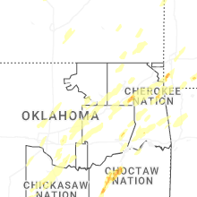

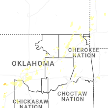
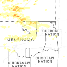
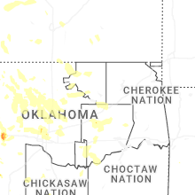


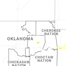


Connect with Interactive Hail Maps