

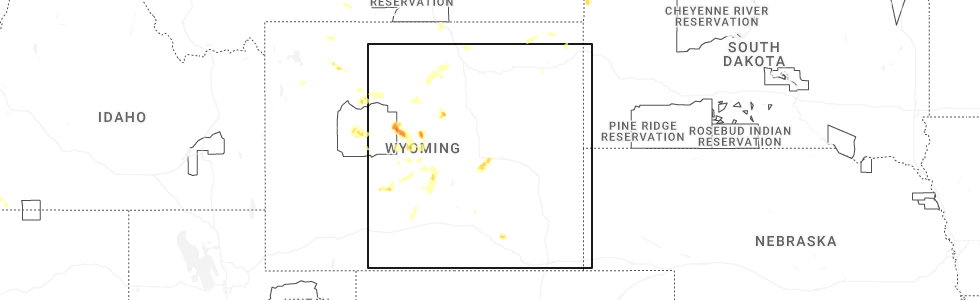
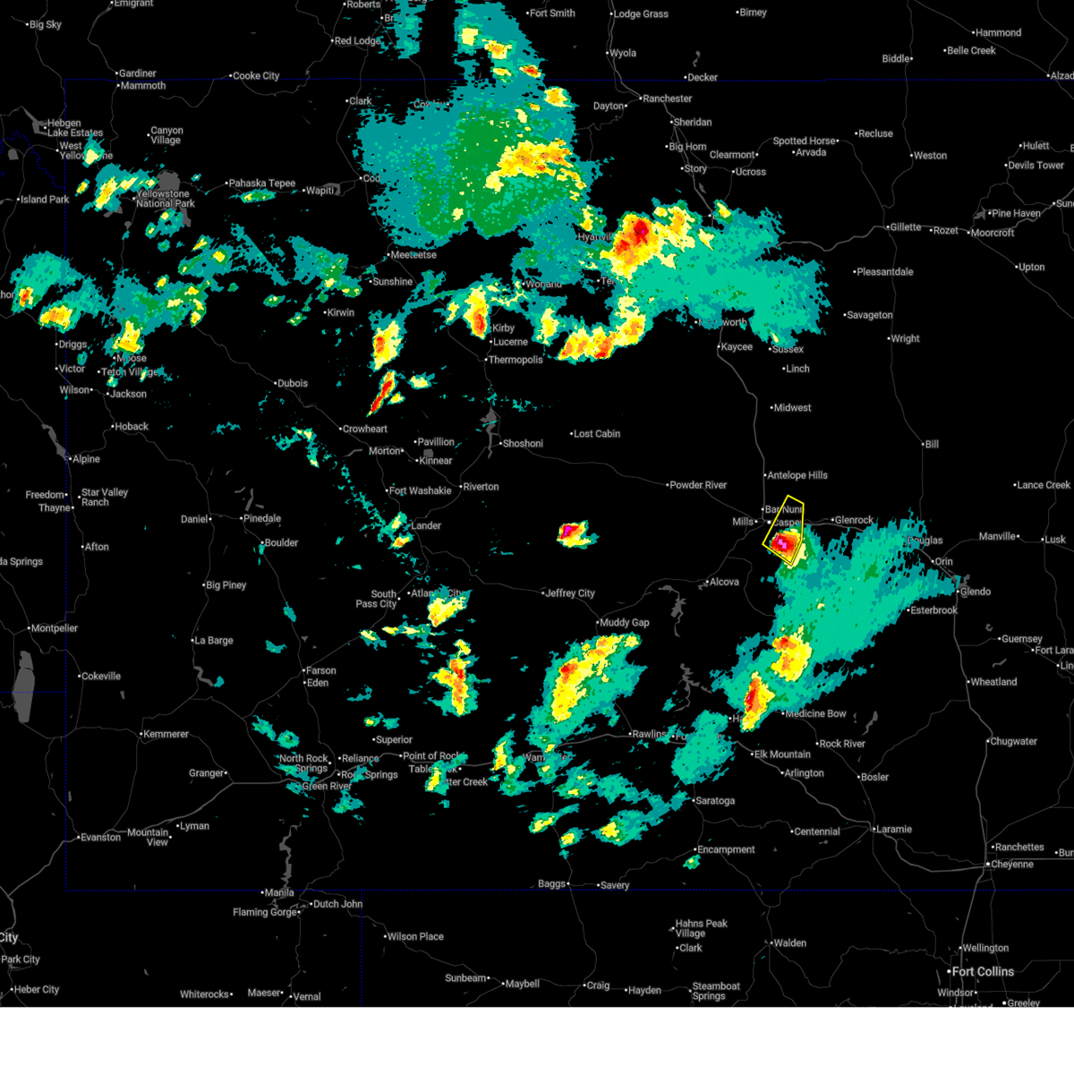
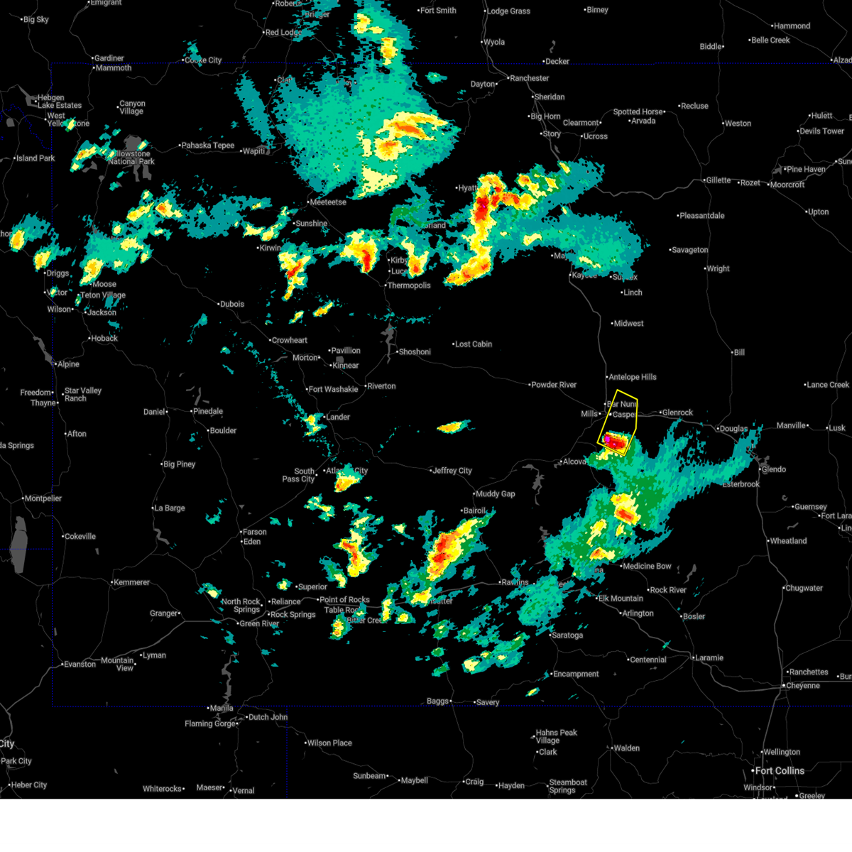
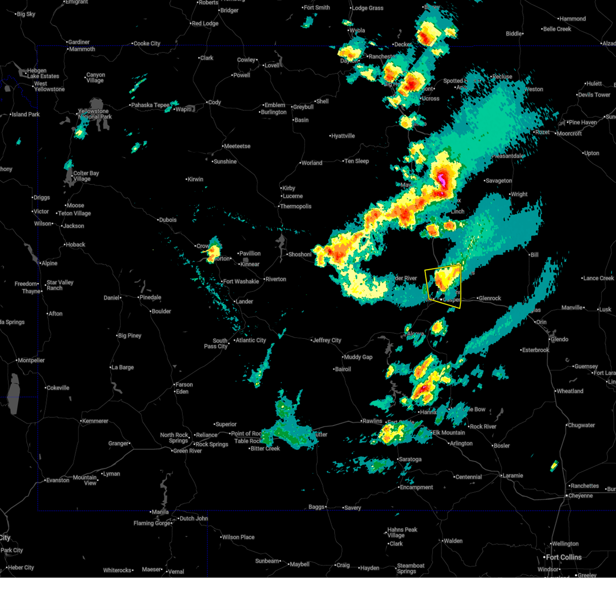
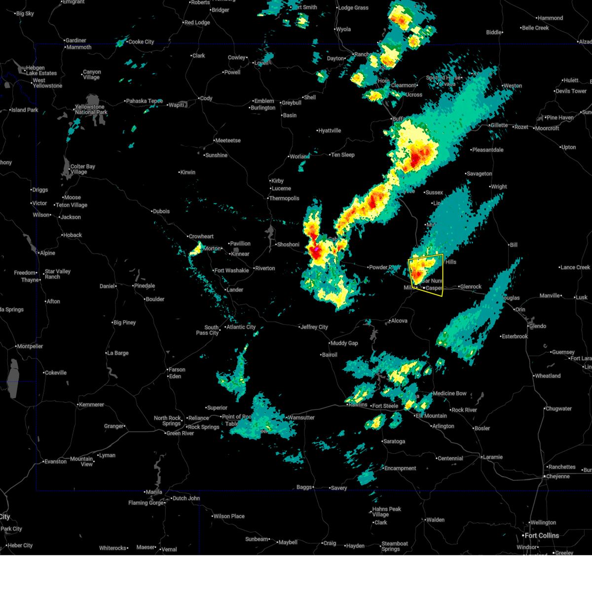
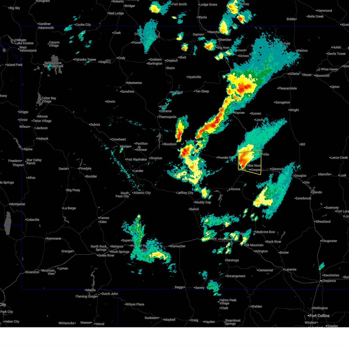
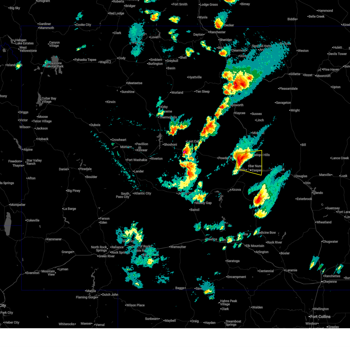
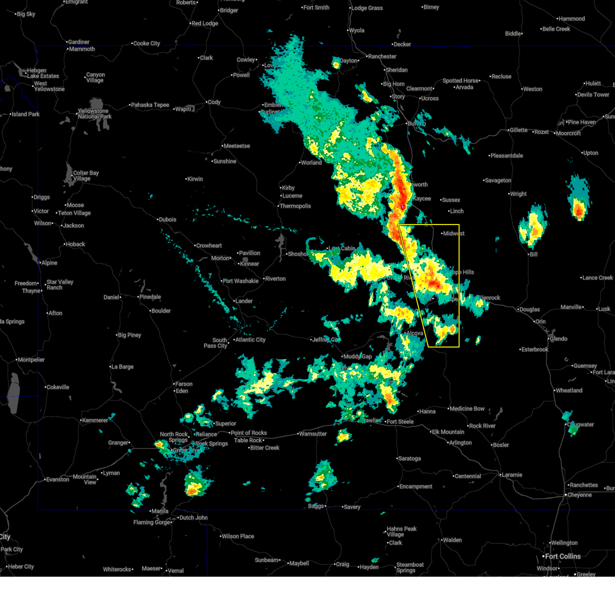
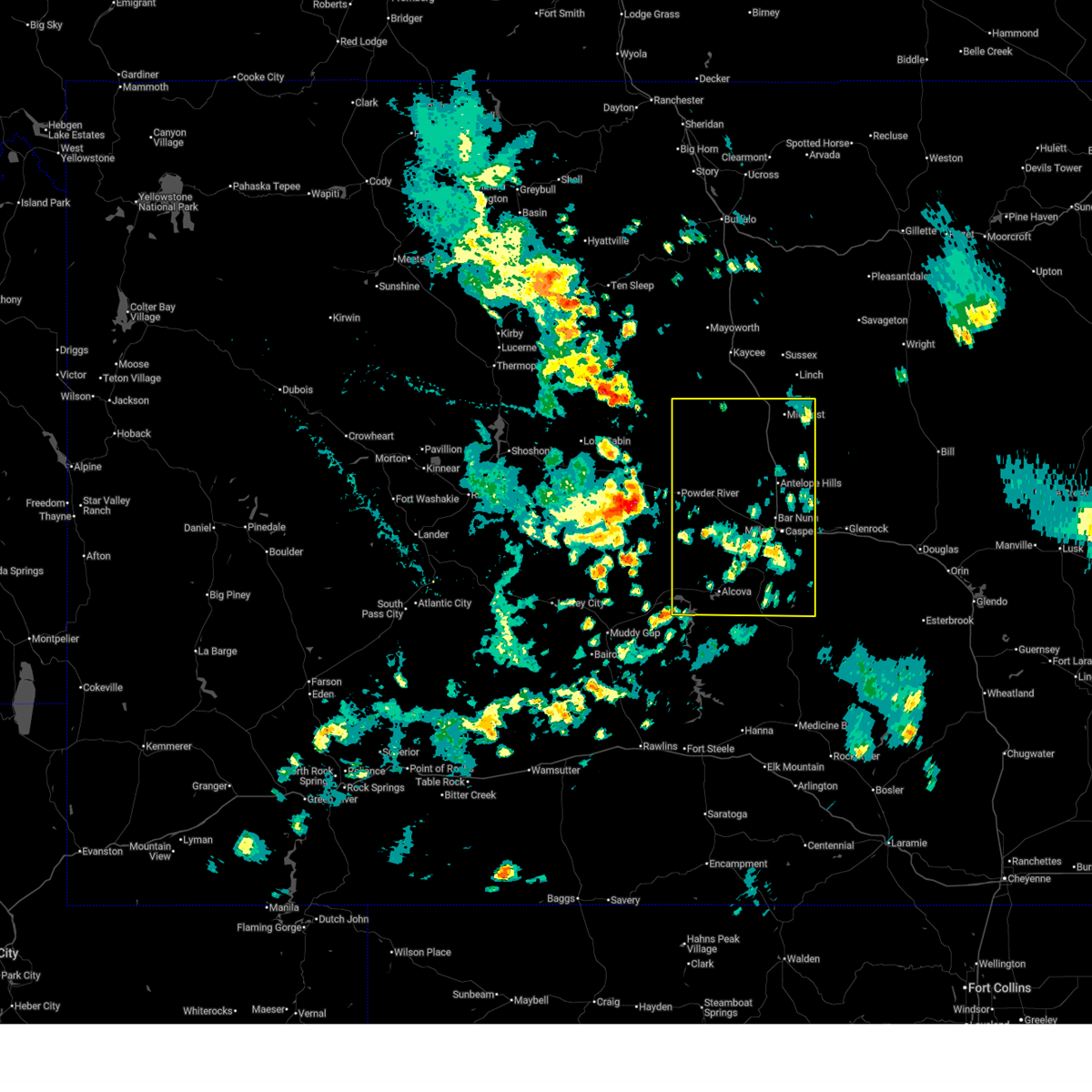
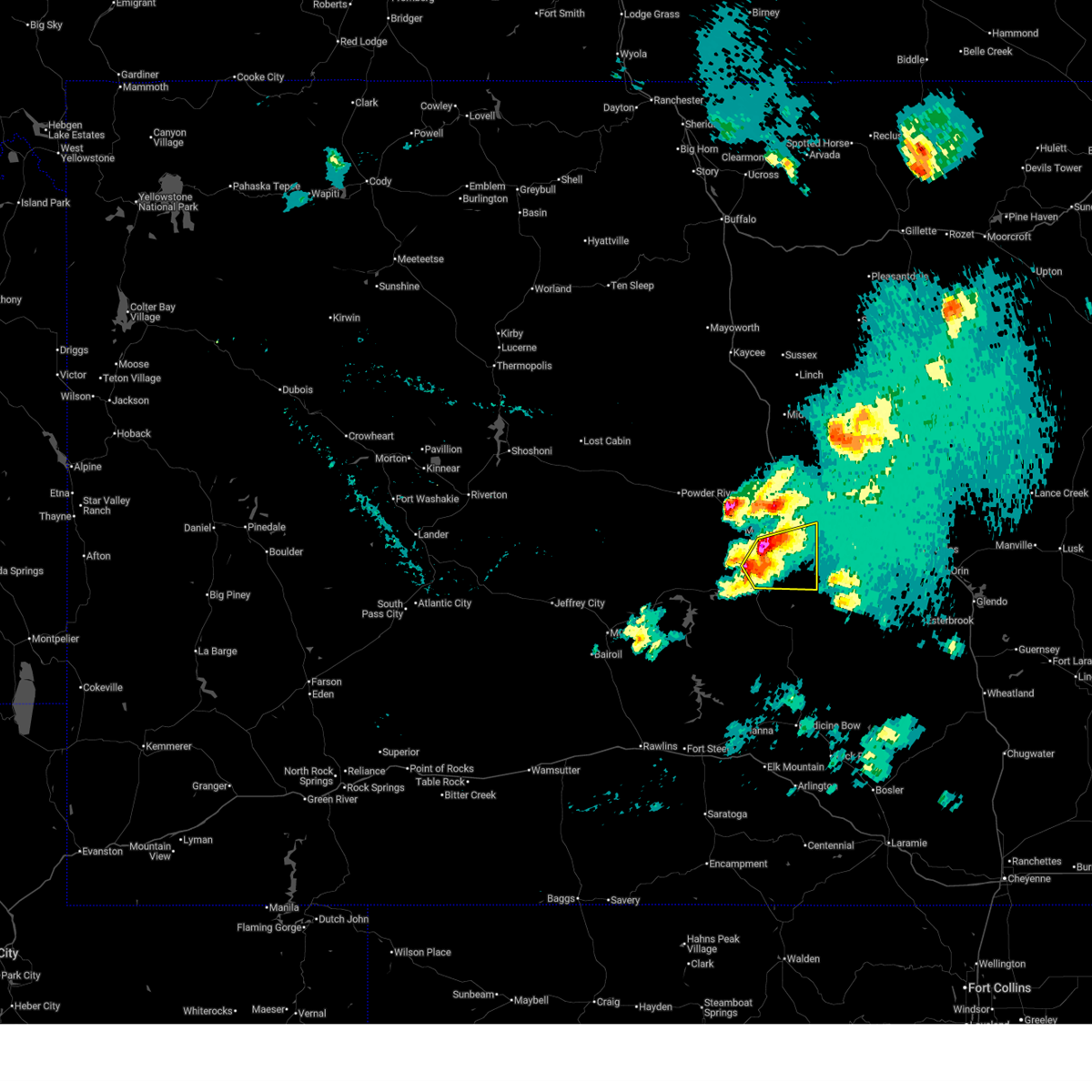
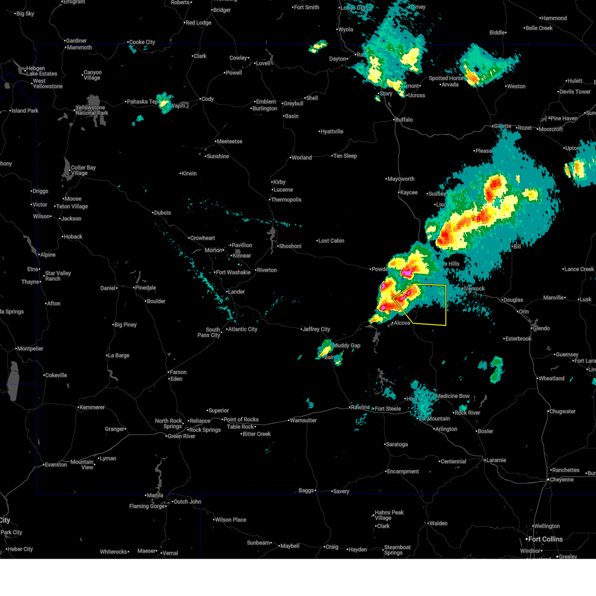
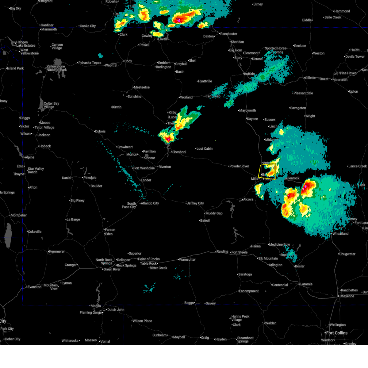
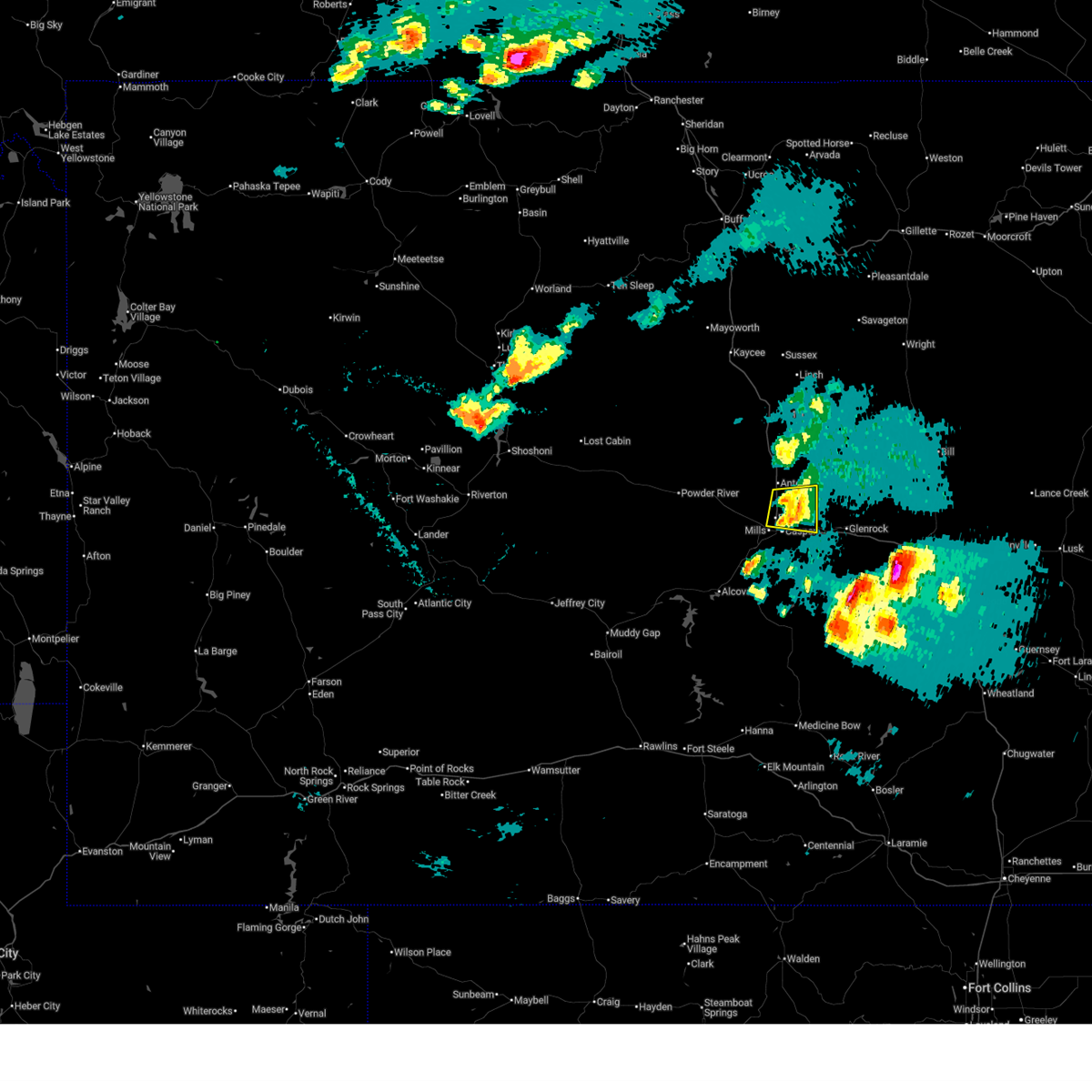
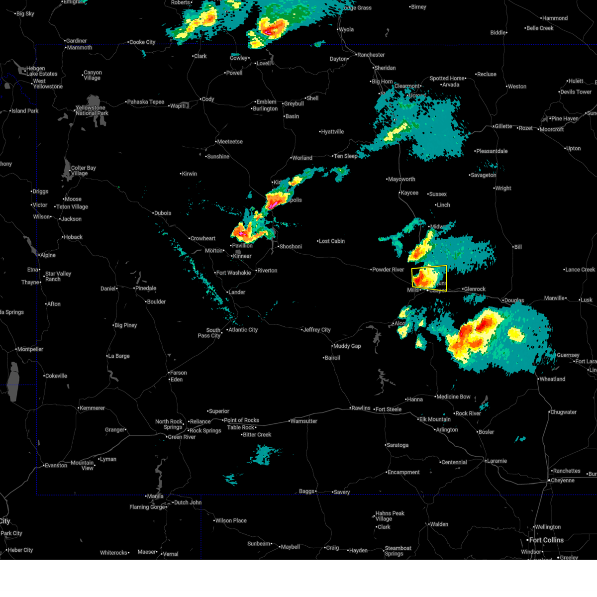
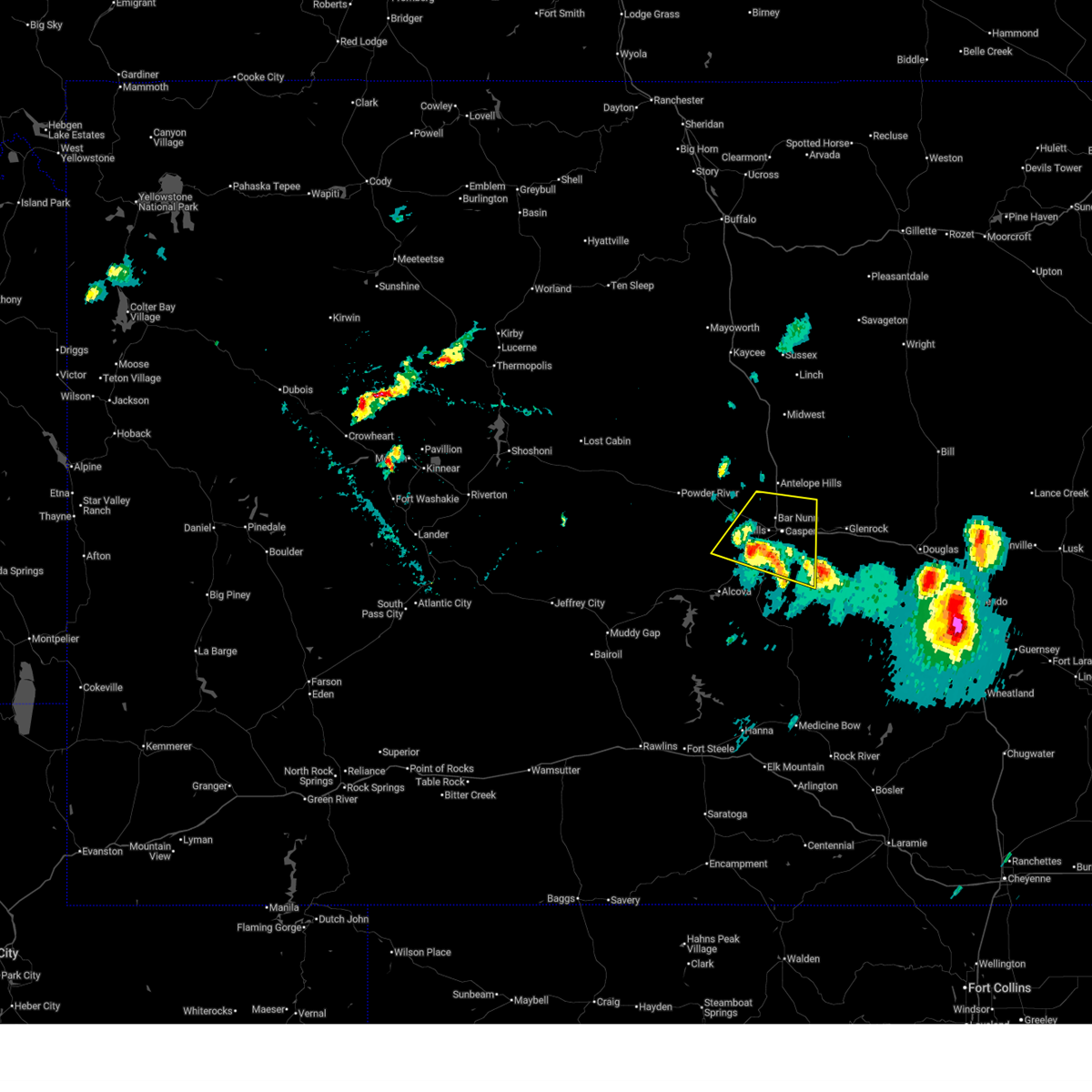
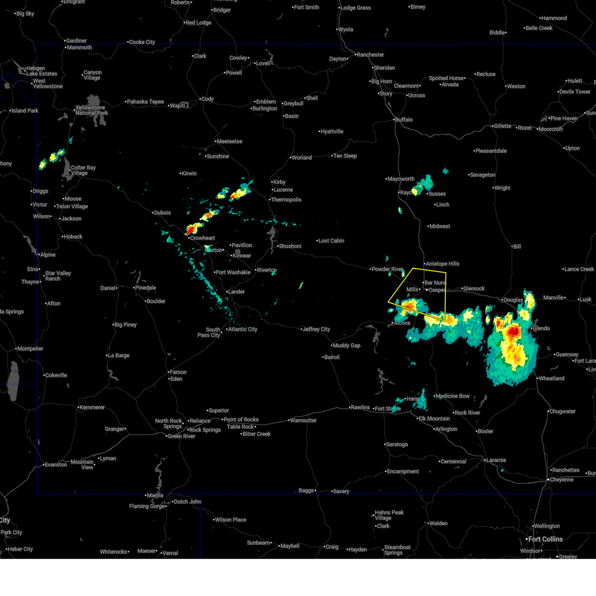
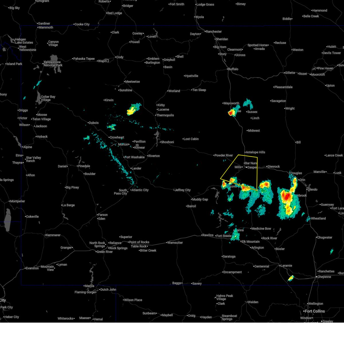
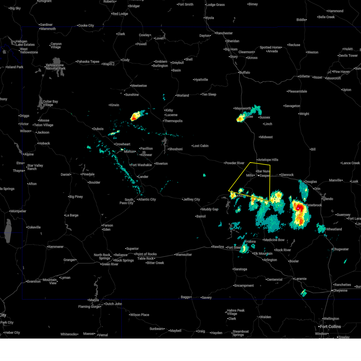
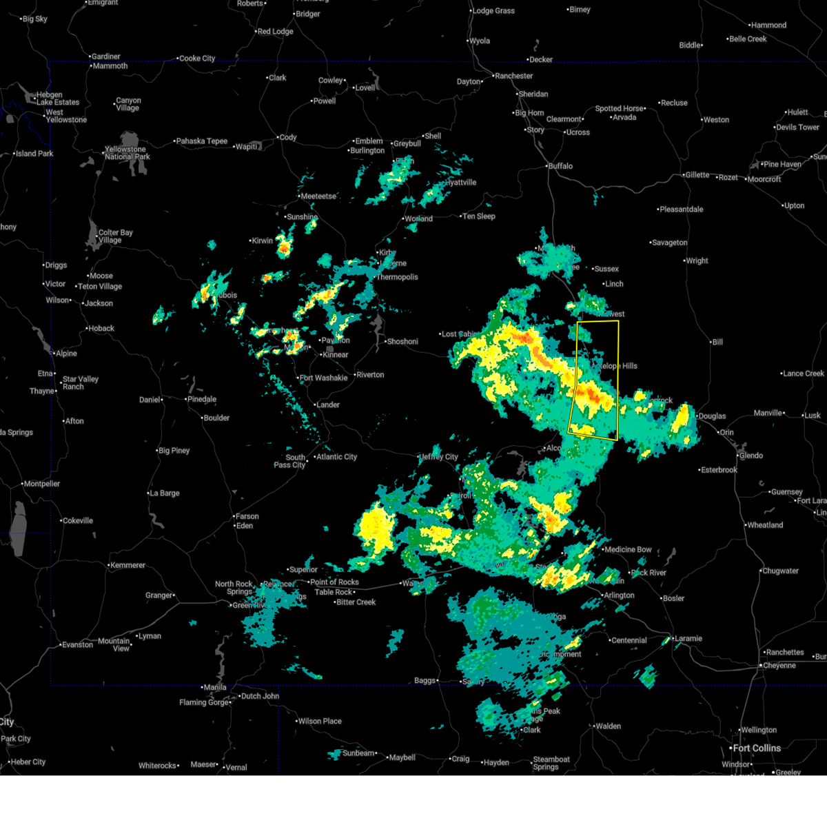
Hail Map for Brookhurst, WY
The Brookhurst, WY area has had 0 reports of on-the-ground hail by trained spotters, and has been under severe weather warnings 13 times during the past 12 months. Doppler radar has detected hail at or near Brookhurst, WY on 33 occasions, including 1 occasion during the past year.
| Name: | Brookhurst, WY |
| Where Located: | 5.4 miles E of Casper, WY |
| Map: | Google Map for Brookhurst, WY |
| Population: | 185 |
| Housing Units: | 83 |
| More Info: | Search Google for Brookhurst, WY |
0
The Top Recent Hail Date for Brookhurst, WY is Wednesday, July 30, 2025 (28th out of 33)
Hail and Wind Damage Spotted near Brookhurst, WY
| Date / Time | Report Details |
|---|---|
| 6/25/2026 3:22 PM MDT |
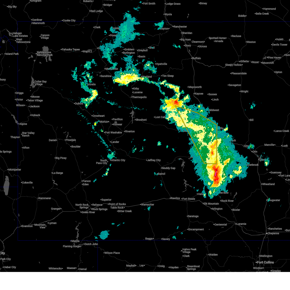
 At 320 pm mdt, severe thunderstorms were located along a line extending from 7 miles southwest of midwest to near antelope hills to 10 miles northeast of dome rock, moving east at 35 mph (radar indicated. at casper, natrona county international airport wind gusted to 59 mph at 3:07 pm mdt). Hazards include 60 mph wind gusts and nickel size hail. Expect damage to roofs, siding, and trees. locations impacted include, casper, mills, evansville, bar nunn, red butte, midwest, antelope hills, beartrap meadows county park, teapot rock and paradise valley. This includes interstate 25 between mile markers 176 and 234. At 320 pm mdt, severe thunderstorms were located along a line extending from 7 miles southwest of midwest to near antelope hills to 10 miles northeast of dome rock, moving east at 35 mph (radar indicated. at casper, natrona county international airport wind gusted to 59 mph at 3:07 pm mdt). Hazards include 60 mph wind gusts and nickel size hail. Expect damage to roofs, siding, and trees. locations impacted include, casper, mills, evansville, bar nunn, red butte, midwest, antelope hills, beartrap meadows county park, teapot rock and paradise valley. This includes interstate 25 between mile markers 176 and 234.
|
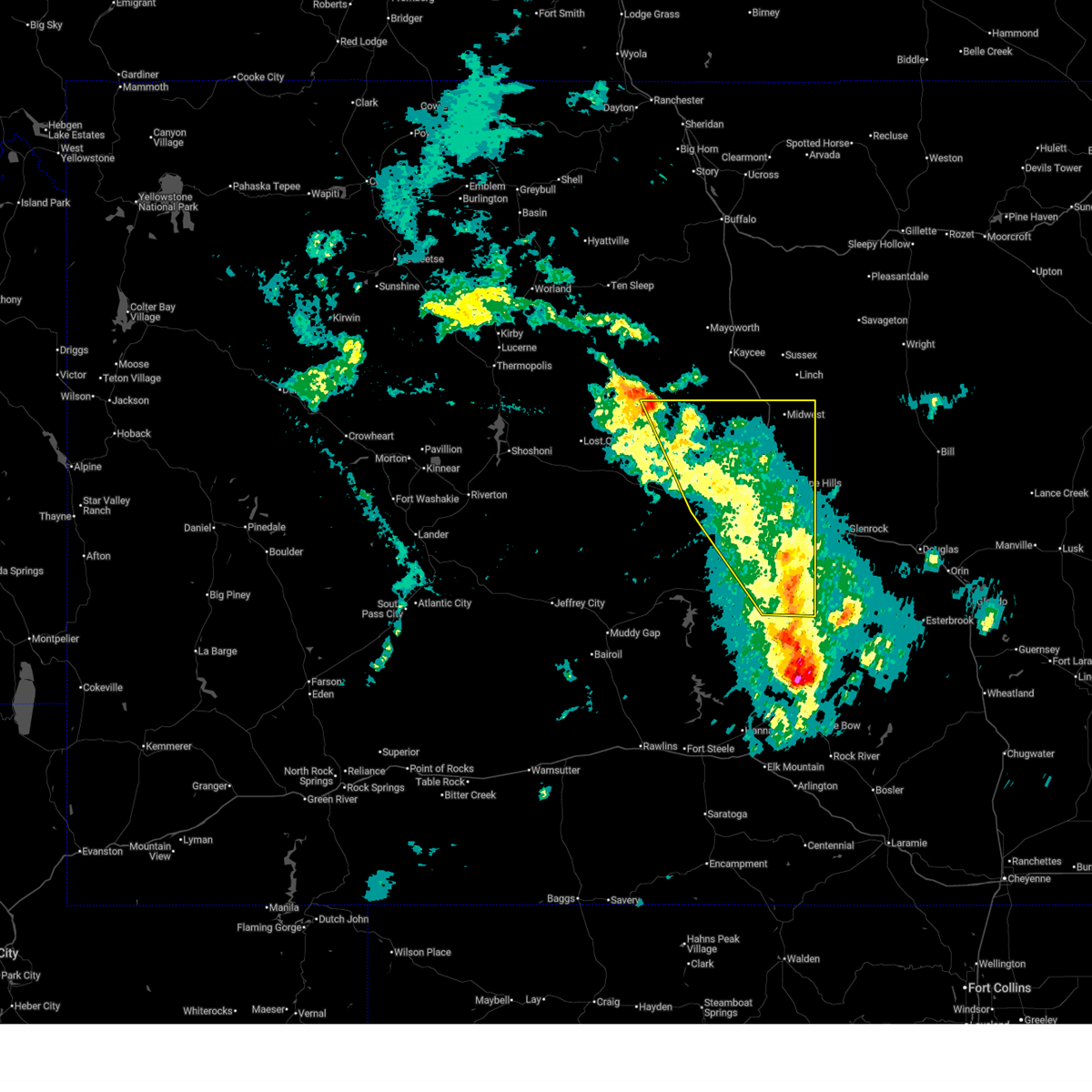
| 6/25/2026 2:52 PM MDT |
 Svrriw the national weather service in riverton has issued a * severe thunderstorm warning for, eastern natrona county in central wyoming, * until 400 pm mdt. * at 252 pm mdt, severe thunderstorms were located along a line extending from 8 miles east of red wall to near goldeneye reservoir to 10 miles east of independence rock, moving east at 35 mph (radar indicated). Hazards include 70 mph wind gusts and quarter size hail. Hail damage to vehicles is expected. expect considerable tree damage. wind damage is also likely to mobile homes, roofs, and outbuildings. severe thunderstorms will be near, alcova around 300 pm mdt. emigrant gap around 305 pm mdt. casper and homa hills around 310 pm mdt. other locations in the path of these severe thunderstorms include mills, bar nunn, red butte, antelope hills, paradise valley, teapot rock, bates hole, evansville and beartrap meadows county park. This includes interstate 25 between mile markers 176 and 234. Svrriw the national weather service in riverton has issued a * severe thunderstorm warning for, eastern natrona county in central wyoming, * until 400 pm mdt. * at 252 pm mdt, severe thunderstorms were located along a line extending from 8 miles east of red wall to near goldeneye reservoir to 10 miles east of independence rock, moving east at 35 mph (radar indicated). Hazards include 70 mph wind gusts and quarter size hail. Hail damage to vehicles is expected. expect considerable tree damage. wind damage is also likely to mobile homes, roofs, and outbuildings. severe thunderstorms will be near, alcova around 300 pm mdt. emigrant gap around 305 pm mdt. casper and homa hills around 310 pm mdt. other locations in the path of these severe thunderstorms include mills, bar nunn, red butte, antelope hills, paradise valley, teapot rock, bates hole, evansville and beartrap meadows county park. This includes interstate 25 between mile markers 176 and 234.
|
| 6/20/2026 4:21 PM MDT |
 The storms which prompted the warning have moved out of the area. therefore, the warning will be allowed to expire. however, gusty winds are still possible with these thunderstorms. a severe thunderstorm watch remains in effect until 900 pm mdt for central wyoming. remember, a severe thunderstorm warning still remains in effect for northeast natrona county. The storms which prompted the warning have moved out of the area. therefore, the warning will be allowed to expire. however, gusty winds are still possible with these thunderstorms. a severe thunderstorm watch remains in effect until 900 pm mdt for central wyoming. remember, a severe thunderstorm warning still remains in effect for northeast natrona county.
|
| 6/20/2026 3:56 PM MDT |
 Svrriw the national weather service in riverton has issued a * severe thunderstorm warning for, eastern natrona county in central wyoming, * until 430 pm mdt. * at 355 pm mdt, severe thunderstorms were located along a line extending from 7 miles east of hole in the wall to near edgerton to 9 miles northeast of rolling hills, moving northeast at 45 mph (radar indicated). Hazards include 70 mph wind gusts. Expect considerable tree damage. damage is likely to mobile homes, roofs, and outbuildings. these severe thunderstorms will remain over mainly rural areas of eastern natrona county, including the following locations, edness k wilkins state park, casper mountain, casper-natrona county international airport, casper events center, fort caspar campground, central wyoming fairgrounds, bessemer bend, casper mountain county park, rotary park, and casper natural gas processing plant. This includes interstate 25 between mile markers 176 and 219. Svrriw the national weather service in riverton has issued a * severe thunderstorm warning for, eastern natrona county in central wyoming, * until 430 pm mdt. * at 355 pm mdt, severe thunderstorms were located along a line extending from 7 miles east of hole in the wall to near edgerton to 9 miles northeast of rolling hills, moving northeast at 45 mph (radar indicated). Hazards include 70 mph wind gusts. Expect considerable tree damage. damage is likely to mobile homes, roofs, and outbuildings. these severe thunderstorms will remain over mainly rural areas of eastern natrona county, including the following locations, edness k wilkins state park, casper mountain, casper-natrona county international airport, casper events center, fort caspar campground, central wyoming fairgrounds, bessemer bend, casper mountain county park, rotary park, and casper natural gas processing plant. This includes interstate 25 between mile markers 176 and 219.
|
| 6/20/2026 3:49 PM MDT |
 At 348 pm mdt, severe thunderstorms were located along a line extending from 7 miles west of hole in the wall to near midwest to near deer creek, moving northeast at 40 mph (radar indicated). Hazards include 70 mph wind gusts. Expect considerable tree damage. damage is likely to mobile homes, roofs, and outbuildings. locations impacted include, casper, mills, evansville, bar nunn, red butte, midwest, homa hills, edgerton, antelope hills, teapot rock, goldeneye reservoir, bates hole, emigrant gap, beartrap meadows county park, paradise valley, red wall, natrona, casper natural gas processing plant, fort caspar campground, and casper mountain. This includes interstate 25 between mile markers 176 and 232. At 348 pm mdt, severe thunderstorms were located along a line extending from 7 miles west of hole in the wall to near midwest to near deer creek, moving northeast at 40 mph (radar indicated). Hazards include 70 mph wind gusts. Expect considerable tree damage. damage is likely to mobile homes, roofs, and outbuildings. locations impacted include, casper, mills, evansville, bar nunn, red butte, midwest, homa hills, edgerton, antelope hills, teapot rock, goldeneye reservoir, bates hole, emigrant gap, beartrap meadows county park, paradise valley, red wall, natrona, casper natural gas processing plant, fort caspar campground, and casper mountain. This includes interstate 25 between mile markers 176 and 232.
|
| 6/20/2026 3:28 PM MDT |
 At 327 pm mdt, severe thunderstorms were located along a line extending from 16 miles northwest of red wall to near antelope hills to 7 miles southwest of boxelder, moving northeast at 40 mph (radar indicated). Hazards include 70 mph wind gusts. Expect considerable tree damage. damage is likely to mobile homes, roofs, and outbuildings. locations impacted include, antelope hills, teapot rock, red wall, midwest and edgerton. This includes interstate 25 between mile markers 176 and 232. At 327 pm mdt, severe thunderstorms were located along a line extending from 16 miles northwest of red wall to near antelope hills to 7 miles southwest of boxelder, moving northeast at 40 mph (radar indicated). Hazards include 70 mph wind gusts. Expect considerable tree damage. damage is likely to mobile homes, roofs, and outbuildings. locations impacted include, antelope hills, teapot rock, red wall, midwest and edgerton. This includes interstate 25 between mile markers 176 and 232.
|
| 6/20/2026 2:59 PM MDT |
 Svrriw the national weather service in riverton has issued a * severe thunderstorm warning for, natrona county in central wyoming, east central fremont county in central wyoming, * until 400 pm mdt. * at 258 pm mdt, severe thunderstorms were located along a line extending from near cottonwood pass to near powder river to 8 miles south of alcova, moving east at 40 mph (radar indicated). Hazards include 60 mph wind gusts. Expect damage to roofs, siding, and trees. severe thunderstorms will be near, bates hole and goldeneye reservoir around 310 pm mdt. emigrant gap around 315 pm mdt. other locations in the path of these severe thunderstorms include casper, mills, red butte, red wall, paradise valley, bar nunn, beartrap meadows county park, evansville, homa hills and antelope hills. This includes interstate 25 between mile markers 176 and 233. Svrriw the national weather service in riverton has issued a * severe thunderstorm warning for, natrona county in central wyoming, east central fremont county in central wyoming, * until 400 pm mdt. * at 258 pm mdt, severe thunderstorms were located along a line extending from near cottonwood pass to near powder river to 8 miles south of alcova, moving east at 40 mph (radar indicated). Hazards include 60 mph wind gusts. Expect damage to roofs, siding, and trees. severe thunderstorms will be near, bates hole and goldeneye reservoir around 310 pm mdt. emigrant gap around 315 pm mdt. other locations in the path of these severe thunderstorms include casper, mills, red butte, red wall, paradise valley, bar nunn, beartrap meadows county park, evansville, homa hills and antelope hills. This includes interstate 25 between mile markers 176 and 233.
|
| 7/30/2025 6:04 PM MDT |
 At 604 pm mdt, a severe thunderstorm was located near beartrap meadows county park, which is near casper, moving northeast at 25 mph (radar indicated). Hazards include 60 mph wind gusts and quarter size hail. Hail damage to vehicles is expected. expect wind damage to roofs, siding, and trees. this severe storm will be near, eastern casper and evansville around 610 pm mdt. This includes interstate 25 between mile markers 176 and 184. At 604 pm mdt, a severe thunderstorm was located near beartrap meadows county park, which is near casper, moving northeast at 25 mph (radar indicated). Hazards include 60 mph wind gusts and quarter size hail. Hail damage to vehicles is expected. expect wind damage to roofs, siding, and trees. this severe storm will be near, eastern casper and evansville around 610 pm mdt. This includes interstate 25 between mile markers 176 and 184.
|
| 7/30/2025 5:53 PM MDT |
 Svrriw the national weather service in riverton has issued a * severe thunderstorm warning for, east central natrona county in central wyoming, * until 645 pm mdt. * at 552 pm mdt, a severe thunderstorm was located over beartrap meadows county park, which is 7 miles south of casper, moving northeast at 25 mph (radar indicated). Hazards include 60 mph wind gusts and quarter size hail. Hail damage to vehicles is expected. expect wind damage to roofs, siding, and trees. this severe thunderstorm will be near, eastern casper around 600 pm mdt. evansville around 605 pm mdt. This includes interstate 25 between mile markers 176 and 187. Svrriw the national weather service in riverton has issued a * severe thunderstorm warning for, east central natrona county in central wyoming, * until 645 pm mdt. * at 552 pm mdt, a severe thunderstorm was located over beartrap meadows county park, which is 7 miles south of casper, moving northeast at 25 mph (radar indicated). Hazards include 60 mph wind gusts and quarter size hail. Hail damage to vehicles is expected. expect wind damage to roofs, siding, and trees. this severe thunderstorm will be near, eastern casper around 600 pm mdt. evansville around 605 pm mdt. This includes interstate 25 between mile markers 176 and 187.
|
| 7/29/2025 6:58 PM MDT |
 The storm which prompted the warning has weakened below severe limits, and no longer poses an immediate threat to life or property. therefore, the warning will be allowed to expire. however, small hail and gusty wind 35 to 45 mph are still possible with this thunderstorm. a severe thunderstorm watch remains in effect until 900 pm mdt for central wyoming. The storm which prompted the warning has weakened below severe limits, and no longer poses an immediate threat to life or property. therefore, the warning will be allowed to expire. however, small hail and gusty wind 35 to 45 mph are still possible with this thunderstorm. a severe thunderstorm watch remains in effect until 900 pm mdt for central wyoming.
|
| 7/29/2025 6:30 PM MDT |
 At 629 pm mdt, a severe thunderstorm was located over bar nunn, which is near casper, moving east at 20 mph (a peak wind gust of 66 mph was recorded at the casper- natrona county international airport at 608 pm. hail up to the size of nickels fell just to the east of the airport). Hazards include 60 mph wind gusts and penny to quarter sized hail. Hail damage to vehicles is expected. expect wind damage to roofs, siding, and trees. locations impacted include, northeastern casper and evansville. This includes interstate 25 between mile markers 176 and 206. At 629 pm mdt, a severe thunderstorm was located over bar nunn, which is near casper, moving east at 20 mph (a peak wind gust of 66 mph was recorded at the casper- natrona county international airport at 608 pm. hail up to the size of nickels fell just to the east of the airport). Hazards include 60 mph wind gusts and penny to quarter sized hail. Hail damage to vehicles is expected. expect wind damage to roofs, siding, and trees. locations impacted include, northeastern casper and evansville. This includes interstate 25 between mile markers 176 and 206.
|
| 7/29/2025 6:13 PM MDT |
 At 613 pm mdt, a severe thunderstorm was located over bar nunn, which is 7 miles northwest of casper, moving east at 20 mph (a peak wind gust of 63 mph was recorded at the casper- natrona county international airport at 604 pm). Hazards include 60 to 65 mph wind gusts and half dollar sized hail. Hail damage to vehicles is expected. expect wind damage to roofs, siding, and trees. this severe storm will be near, northeastern casper, bar nunn, and homa hills around 615 pm mdt. other locations in the path of this severe thunderstorm include evansville. This includes interstate 25 between mile markers 176 and 207. At 613 pm mdt, a severe thunderstorm was located over bar nunn, which is 7 miles northwest of casper, moving east at 20 mph (a peak wind gust of 63 mph was recorded at the casper- natrona county international airport at 604 pm). Hazards include 60 to 65 mph wind gusts and half dollar sized hail. Hail damage to vehicles is expected. expect wind damage to roofs, siding, and trees. this severe storm will be near, northeastern casper, bar nunn, and homa hills around 615 pm mdt. other locations in the path of this severe thunderstorm include evansville. This includes interstate 25 between mile markers 176 and 207.
|
| 7/29/2025 5:58 PM MDT |
 Svrriw the national weather service in riverton has issued a * severe thunderstorm warning for, east central natrona county in central wyoming, * until 700 pm mdt. * at 557 pm mdt, a severe thunderstorm was located near homa hills, which is 11 miles northwest of casper, moving east at 25 mph (radar indicated). Hazards include half dollar sized hail. Damage to vehicles is expected. this severe thunderstorm will be near, bar nunn and homa hills around 605 pm mdt. northern casper around 615 pm mdt. other locations in the path of this severe thunderstorm include evansville. This includes interstate 25 between mile markers 176 and 207. Svrriw the national weather service in riverton has issued a * severe thunderstorm warning for, east central natrona county in central wyoming, * until 700 pm mdt. * at 557 pm mdt, a severe thunderstorm was located near homa hills, which is 11 miles northwest of casper, moving east at 25 mph (radar indicated). Hazards include half dollar sized hail. Damage to vehicles is expected. this severe thunderstorm will be near, bar nunn and homa hills around 605 pm mdt. northern casper around 615 pm mdt. other locations in the path of this severe thunderstorm include evansville. This includes interstate 25 between mile markers 176 and 207.
|
| 7/4/2025 5:45 PM MDT |
 Svrriw the national weather service in riverton has issued a * severe thunderstorm warning for, eastern natrona county in central wyoming, * until 600 pm mdt. * at 544 pm mdt, a severe thunderstorm was located over bar nunn, which is near casper, moving east at 70 mph (radar indicated). Hazards include 60 mph wind gusts. Expect damage to roofs, siding, and trees. this severe thunderstorm will be near, evansville around 550 pm mdt. This includes interstate 25 between mile markers 176 and 234. Svrriw the national weather service in riverton has issued a * severe thunderstorm warning for, eastern natrona county in central wyoming, * until 600 pm mdt. * at 544 pm mdt, a severe thunderstorm was located over bar nunn, which is near casper, moving east at 70 mph (radar indicated). Hazards include 60 mph wind gusts. Expect damage to roofs, siding, and trees. this severe thunderstorm will be near, evansville around 550 pm mdt. This includes interstate 25 between mile markers 176 and 234.
|
| 7/4/2025 4:54 PM MDT |
 Svrriw the national weather service in riverton has issued a * severe thunderstorm warning for, natrona county in central wyoming, * until 545 pm mdt. * at 452 pm mdt, a severe thunderstorm was located over powder river, which is 37 miles west of casper, moving east at 70 mph (radar indicated. at 4:47 pm a 69 mph wind gust was reported at hiland). Hazards include 70 mph wind gusts. Expect considerable tree damage. damage is likely to mobile homes, roofs, and outbuildings. this severe thunderstorm will be near, goldeneye reservoir around 505 pm mdt. other locations in the path of this severe thunderstorm include homa hills and antelope hills. This includes interstate 25 between mile markers 176 and 234. Svrriw the national weather service in riverton has issued a * severe thunderstorm warning for, natrona county in central wyoming, * until 545 pm mdt. * at 452 pm mdt, a severe thunderstorm was located over powder river, which is 37 miles west of casper, moving east at 70 mph (radar indicated. at 4:47 pm a 69 mph wind gust was reported at hiland). Hazards include 70 mph wind gusts. Expect considerable tree damage. damage is likely to mobile homes, roofs, and outbuildings. this severe thunderstorm will be near, goldeneye reservoir around 505 pm mdt. other locations in the path of this severe thunderstorm include homa hills and antelope hills. This includes interstate 25 between mile markers 176 and 234.
|
| 6/16/2025 8:26 PM MDT |
 At 826 pm mdt, a severe thunderstorm was located over beartrap meadows county park, which is 7 miles southeast of casper, moving southeast at 25 mph (radar indicated). Hazards include ping pong ball size hail and 60 mph wind gusts. People and animals outdoors will be injured. expect hail damage to roofs, siding, windows, and vehicles. expect wind damage to roofs, siding, and trees. this severe thunderstorm will remain over mainly rural areas of southeastern natrona county, including the following locations, edness k wilkins state park, casper mountain, casper mountain county park, rotary park, and casper natural gas processing plant. This includes interstate 25 between mile markers 176 and 184. At 826 pm mdt, a severe thunderstorm was located over beartrap meadows county park, which is 7 miles southeast of casper, moving southeast at 25 mph (radar indicated). Hazards include ping pong ball size hail and 60 mph wind gusts. People and animals outdoors will be injured. expect hail damage to roofs, siding, windows, and vehicles. expect wind damage to roofs, siding, and trees. this severe thunderstorm will remain over mainly rural areas of southeastern natrona county, including the following locations, edness k wilkins state park, casper mountain, casper mountain county park, rotary park, and casper natural gas processing plant. This includes interstate 25 between mile markers 176 and 184.
|
| 6/16/2025 7:58 PM MDT |
 Svrriw the national weather service in riverton has issued a * severe thunderstorm warning for, southeastern natrona county in central wyoming, * until 845 pm mdt. * at 758 pm mdt, a severe thunderstorm was located over red butte, which is 7 miles west of casper, moving southeast at 25 mph (radar indicated). Hazards include ping pong ball size hail and 60 mph wind gusts. People and animals outdoors will be injured. expect hail damage to roofs, siding, windows, and vehicles. expect wind damage to roofs, siding, and trees. this severe thunderstorm will be near, southern casper, mills, red butte, and paradise valley around 805 pm mdt. beartrap meadows county park around 815 pm mdt. This includes interstate 25 between mile markers 176 and 191. Svrriw the national weather service in riverton has issued a * severe thunderstorm warning for, southeastern natrona county in central wyoming, * until 845 pm mdt. * at 758 pm mdt, a severe thunderstorm was located over red butte, which is 7 miles west of casper, moving southeast at 25 mph (radar indicated). Hazards include ping pong ball size hail and 60 mph wind gusts. People and animals outdoors will be injured. expect hail damage to roofs, siding, windows, and vehicles. expect wind damage to roofs, siding, and trees. this severe thunderstorm will be near, southern casper, mills, red butte, and paradise valley around 805 pm mdt. beartrap meadows county park around 815 pm mdt. This includes interstate 25 between mile markers 176 and 191.
|
| 6/16/2025 5:10 PM MDT |
 the severe thunderstorm warning has been cancelled and is no longer in effect the severe thunderstorm warning has been cancelled and is no longer in effect
|
| 6/16/2025 5:04 PM MDT |
 At 503 pm mdt, a severe thunderstorm was located near evansville, which is 8 miles northeast of casper, moving east at 20 mph (radar indicated). Hazards include half dollar size hail. Damage to vehicles is expected. this severe thunderstorm will remain over mainly rural areas of east central natrona county, including the following locations, edness k wilkins state park, casper natural gas processing plant, and casper events center. This includes interstate 25 between mile markers 190 and 202. At 503 pm mdt, a severe thunderstorm was located near evansville, which is 8 miles northeast of casper, moving east at 20 mph (radar indicated). Hazards include half dollar size hail. Damage to vehicles is expected. this severe thunderstorm will remain over mainly rural areas of east central natrona county, including the following locations, edness k wilkins state park, casper natural gas processing plant, and casper events center. This includes interstate 25 between mile markers 190 and 202.
|
| 6/16/2025 4:52 PM MDT |
 At 451 pm mdt, a severe thunderstorm was located over bar nunn, which is near casper, moving east at 20 mph. emergency management observed hail nearly 2 inches in diameter (emergency management). Hazards include two inch hail. People and animals outdoors will be injured. expect damage to roofs, siding, windows, and vehicles. this severe storm will be near, northern casper and evansville around 455 pm mdt. This includes interstate 25 between mile markers 190 and 202. At 451 pm mdt, a severe thunderstorm was located over bar nunn, which is near casper, moving east at 20 mph. emergency management observed hail nearly 2 inches in diameter (emergency management). Hazards include two inch hail. People and animals outdoors will be injured. expect damage to roofs, siding, windows, and vehicles. this severe storm will be near, northern casper and evansville around 455 pm mdt. This includes interstate 25 between mile markers 190 and 202.
|
| 6/16/2025 4:43 PM MDT |
 Svrriw the national weather service in riverton has issued a * severe thunderstorm warning for, east central natrona county in central wyoming, * until 530 pm mdt. * at 443 pm mdt, a severe thunderstorm was located over bar nunn, which is 7 miles northwest of casper, moving east at 20 mph (radar indicated). Hazards include half dollar size hail. Damage to vehicles is expected. this severe thunderstorm will be near, northern casper and bar nunn around 450 pm mdt. evansville around 455 pm mdt. This includes interstate 25 between mile markers 190 and 202. Svrriw the national weather service in riverton has issued a * severe thunderstorm warning for, east central natrona county in central wyoming, * until 530 pm mdt. * at 443 pm mdt, a severe thunderstorm was located over bar nunn, which is 7 miles northwest of casper, moving east at 20 mph (radar indicated). Hazards include half dollar size hail. Damage to vehicles is expected. this severe thunderstorm will be near, northern casper and bar nunn around 450 pm mdt. evansville around 455 pm mdt. This includes interstate 25 between mile markers 190 and 202.
|
| 6/13/2025 3:28 PM MDT |
 The storm which prompted the warning has weakened below severe limits, and no longer poses an immediate threat to life or property. therefore, the warning will be allowed to expire. however, gusty winds are still possible with this thunderstorm. to report severe weather, contact your nearest law enforcement agency. they will relay your report to the national weather service riverton. The storm which prompted the warning has weakened below severe limits, and no longer poses an immediate threat to life or property. therefore, the warning will be allowed to expire. however, gusty winds are still possible with this thunderstorm. to report severe weather, contact your nearest law enforcement agency. they will relay your report to the national weather service riverton.
|
| 6/13/2025 3:19 PM MDT |
 At 319 pm mdt, a severe thunderstorm was located near glenrock, which is 20 miles east of casper, moving northeast at 35 mph (radar indicated). Hazards include 60 mph wind gusts and nickel size hail. Expect damage to roofs, siding, and trees. locations impacted include, casper, mills, evansville, bar nunn, red butte, homa hills, emigrant gap, beartrap meadows county park, paradise valley, casper natural gas processing plant, fort caspar campground, casper mountain, casper-natrona county international airport, casper events center, central wyoming fairgrounds, casper mountain county park, rotary park, edness k wilkins state park, and bessemer bend. This includes interstate 25 between mile markers 176 and 200. At 319 pm mdt, a severe thunderstorm was located near glenrock, which is 20 miles east of casper, moving northeast at 35 mph (radar indicated). Hazards include 60 mph wind gusts and nickel size hail. Expect damage to roofs, siding, and trees. locations impacted include, casper, mills, evansville, bar nunn, red butte, homa hills, emigrant gap, beartrap meadows county park, paradise valley, casper natural gas processing plant, fort caspar campground, casper mountain, casper-natrona county international airport, casper events center, central wyoming fairgrounds, casper mountain county park, rotary park, edness k wilkins state park, and bessemer bend. This includes interstate 25 between mile markers 176 and 200.
|
| 6/13/2025 3:04 PM MDT |
 At 304 pm mdt, a severe thunderstorm was located 7 miles east of beartrap meadows county park, which is 11 miles southeast of casper, moving northeast at 35 mph (radar indicated). Hazards include 60 mph wind gusts and nickel size hail. Expect damage to roofs, siding, and trees. locations impacted include, casper, mills, evansville, bar nunn, red butte, homa hills, emigrant gap, beartrap meadows county park, paradise valley, casper natural gas processing plant, fort caspar campground, casper mountain, casper-natrona county international airport, casper events center, central wyoming fairgrounds, casper mountain county park, rotary park, edness k wilkins state park, and bessemer bend. This includes interstate 25 between mile markers 176 and 200. At 304 pm mdt, a severe thunderstorm was located 7 miles east of beartrap meadows county park, which is 11 miles southeast of casper, moving northeast at 35 mph (radar indicated). Hazards include 60 mph wind gusts and nickel size hail. Expect damage to roofs, siding, and trees. locations impacted include, casper, mills, evansville, bar nunn, red butte, homa hills, emigrant gap, beartrap meadows county park, paradise valley, casper natural gas processing plant, fort caspar campground, casper mountain, casper-natrona county international airport, casper events center, central wyoming fairgrounds, casper mountain county park, rotary park, edness k wilkins state park, and bessemer bend. This includes interstate 25 between mile markers 176 and 200.
|
| 6/13/2025 2:48 PM MDT |
 Svrriw the national weather service in riverton has issued a * severe thunderstorm warning for, southeastern natrona county in central wyoming, * until 330 pm mdt. * at 248 pm mdt, a severe thunderstorm was located near bates hole, which is 17 miles south of casper, moving northeast at 35 mph (radar indicated). Hazards include 60 mph wind gusts and nickel size hail. Expect damage to roofs, siding, and trees. this severe thunderstorm will remain over mainly rural areas of southeastern natrona county, including the following locations, edness k wilkins state park, casper mountain, casper-natrona county international airport, casper events center, fort caspar campground, central wyoming fairgrounds, bessemer bend, casper mountain county park, rotary park, and casper natural gas processing plant. This includes interstate 25 between mile markers 176 and 200. Svrriw the national weather service in riverton has issued a * severe thunderstorm warning for, southeastern natrona county in central wyoming, * until 330 pm mdt. * at 248 pm mdt, a severe thunderstorm was located near bates hole, which is 17 miles south of casper, moving northeast at 35 mph (radar indicated). Hazards include 60 mph wind gusts and nickel size hail. Expect damage to roofs, siding, and trees. this severe thunderstorm will remain over mainly rural areas of southeastern natrona county, including the following locations, edness k wilkins state park, casper mountain, casper-natrona county international airport, casper events center, fort caspar campground, central wyoming fairgrounds, bessemer bend, casper mountain county park, rotary park, and casper natural gas processing plant. This includes interstate 25 between mile markers 176 and 200.
|
| 7/15/2024 5:16 PM MDT |
 The storms which prompted the warning have moved out of the area. therefore, the warning will be allowed to expire. however, gusty winds and heavy rain are still possible with these thunderstorms across eastern natrona county. a severe thunderstorm warning is in effect in west-central converse county however for 60 to 70 mph wind gusts. The storms which prompted the warning have moved out of the area. therefore, the warning will be allowed to expire. however, gusty winds and heavy rain are still possible with these thunderstorms across eastern natrona county. a severe thunderstorm warning is in effect in west-central converse county however for 60 to 70 mph wind gusts.
|
| 7/15/2024 4:59 PM MDT |
 At 458 pm mdt, severe thunderstorms were located along a line extending from near midwest to near bar nunn to 7 miles southwest of red butte, moving east at 35 mph (trained weather spotters. multiple locations have reported 55 to 60 mph wind gusts in natrona county). Hazards include 60 mph wind gusts and nickel size hail. Expect damage to roofs, siding, and trees. locations impacted include, casper, mills, evansville, bar nunn, antelope hills, teapot rock, beartrap meadows county park and paradise valley. This includes interstate 25 between mile markers 176 and 223. At 458 pm mdt, severe thunderstorms were located along a line extending from near midwest to near bar nunn to 7 miles southwest of red butte, moving east at 35 mph (trained weather spotters. multiple locations have reported 55 to 60 mph wind gusts in natrona county). Hazards include 60 mph wind gusts and nickel size hail. Expect damage to roofs, siding, and trees. locations impacted include, casper, mills, evansville, bar nunn, antelope hills, teapot rock, beartrap meadows county park and paradise valley. This includes interstate 25 between mile markers 176 and 223.
|
| 7/15/2024 4:38 PM MDT |
 Svrriw the national weather service in riverton has issued a * severe thunderstorm warning for, eastern natrona county in central wyoming, * until 515 pm mdt. * at 437 pm mdt, severe thunderstorms were located along a line extending from 14 miles southeast of hole in the wall to 6 miles southeast of goldeneye reservoir to 11 miles southwest of emigrant gap, moving east at 35 mph (radar indicated. wind gusts of 60 to 70 mph have been observed with this cluster of storms from central fremont county to the hiland and natrona areas). Hazards include 60 mph wind gusts and nickel size hail. Expect damage to roofs, siding, and trees. severe thunderstorms will be near, emigrant gap around 440 pm mdt. casper, mills, bar nunn, red butte, and homa hills around 450 pm mdt. antelope hills, teapot rock, and paradise valley around 455 pm mdt. other locations in the path of these severe thunderstorms include evansville and beartrap meadows county park. This includes interstate 25 between mile markers 176 and 223. Svrriw the national weather service in riverton has issued a * severe thunderstorm warning for, eastern natrona county in central wyoming, * until 515 pm mdt. * at 437 pm mdt, severe thunderstorms were located along a line extending from 14 miles southeast of hole in the wall to 6 miles southeast of goldeneye reservoir to 11 miles southwest of emigrant gap, moving east at 35 mph (radar indicated. wind gusts of 60 to 70 mph have been observed with this cluster of storms from central fremont county to the hiland and natrona areas). Hazards include 60 mph wind gusts and nickel size hail. Expect damage to roofs, siding, and trees. severe thunderstorms will be near, emigrant gap around 440 pm mdt. casper, mills, bar nunn, red butte, and homa hills around 450 pm mdt. antelope hills, teapot rock, and paradise valley around 455 pm mdt. other locations in the path of these severe thunderstorms include evansville and beartrap meadows county park. This includes interstate 25 between mile markers 176 and 223.
|
| 6/8/2024 4:52 PM MDT |
 The storm which prompted the warning has weakened below severe limits, and no longer poses an immediate threat to life or property. therefore, the warning will be allowed to expire. to report severe weather, contact your nearest law enforcement agency. they will relay your report to the national weather service riverton. The storm which prompted the warning has weakened below severe limits, and no longer poses an immediate threat to life or property. therefore, the warning will be allowed to expire. to report severe weather, contact your nearest law enforcement agency. they will relay your report to the national weather service riverton.
|
| 6/8/2024 4:33 PM MDT |
 Svrriw the national weather service in riverton has issued a * severe thunderstorm warning for, east central natrona county in central wyoming, * until 500 pm mdt. * at 433 pm mdt, a severe thunderstorm was located over northeastern casper, moving northeast at 15 mph (radar indicated). Hazards include quarter size hail. Damage to vehicles is expected. this severe thunderstorm will be near, northeastern casper, evansville, and bar nunn around 440 pm mdt. This includes interstate 25 between mile markers 177 and 198. Svrriw the national weather service in riverton has issued a * severe thunderstorm warning for, east central natrona county in central wyoming, * until 500 pm mdt. * at 433 pm mdt, a severe thunderstorm was located over northeastern casper, moving northeast at 15 mph (radar indicated). Hazards include quarter size hail. Damage to vehicles is expected. this severe thunderstorm will be near, northeastern casper, evansville, and bar nunn around 440 pm mdt. This includes interstate 25 between mile markers 177 and 198.
|
| 9/10/2023 4:00 PM MDT |
 At 358 pm mdt, a line of severe thunderstorms was located over homa hills, which is also 11 miles north of casper, moving southeast at 30 mph (public. there have been several reports of one inch hail with these storms). Hazards include quarter size hail. Damage to vehicles is expected. this severe thunderstorm will be near, bar nunn around 410 pm mdt. casper around 415 pm mdt. other locations in the path of this severe thunderstorm include mills, evansville, paradise valley and beartrap meadows county park. this includes interstate 25 between mile markers 176 and 205. hail threat, observed max hail size, 1. 00 in wind threat, radar indicated max wind gust, <50 mph. At 358 pm mdt, a line of severe thunderstorms was located over homa hills, which is also 11 miles north of casper, moving southeast at 30 mph (public. there have been several reports of one inch hail with these storms). Hazards include quarter size hail. Damage to vehicles is expected. this severe thunderstorm will be near, bar nunn around 410 pm mdt. casper around 415 pm mdt. other locations in the path of this severe thunderstorm include mills, evansville, paradise valley and beartrap meadows county park. this includes interstate 25 between mile markers 176 and 205. hail threat, observed max hail size, 1. 00 in wind threat, radar indicated max wind gust, <50 mph.
|
| 8/27/2023 4:09 PM MDT |
 At 408 pm mdt, a severe thunderstorm was located 7 miles east of evansville, which is also 10 miles east of casper, moving east at 55 mph (a 65 mph gust was recorded at casper airport). Hazards include 70 mph wind gusts. Expect considerable tree damage. damage is likely to mobile homes, roofs, and outbuildings. locations impacted include, evansville, edness k wilkins state park and casper mountain. this includes interstate 25 between mile markers 176 and 183. thunderstorm damage threat, considerable hail threat, radar indicated max hail size, <. 75 in wind threat, observed max wind gust, 70 mph. At 408 pm mdt, a severe thunderstorm was located 7 miles east of evansville, which is also 10 miles east of casper, moving east at 55 mph (a 65 mph gust was recorded at casper airport). Hazards include 70 mph wind gusts. Expect considerable tree damage. damage is likely to mobile homes, roofs, and outbuildings. locations impacted include, evansville, edness k wilkins state park and casper mountain. this includes interstate 25 between mile markers 176 and 183. thunderstorm damage threat, considerable hail threat, radar indicated max hail size, <. 75 in wind threat, observed max wind gust, 70 mph.
|
| 8/27/2023 4:01 PM MDT |
 At 400 pm mdt, a severe thunderstorm was located over evansville, which is also near casper, moving east at 55 mph (a 65 mph gust was recorded at casper airport). Hazards include 70 mph wind gusts. Expect considerable tree damage. damage is likely to mobile homes, roofs, and outbuildings. this severe thunderstorm will remain over areas of east central natrona county, including the following locations, edness k wilkins state park, casper mountain, casper events center, casper mountain county park, rotary park, casper natural gas processing plant and central wyoming fairgrounds. this includes interstate 25 between mile markers 176 and 199. thunderstorm damage threat, considerable hail threat, radar indicated max hail size, <. 75 in wind threat, observed max wind gust, 70 mph. At 400 pm mdt, a severe thunderstorm was located over evansville, which is also near casper, moving east at 55 mph (a 65 mph gust was recorded at casper airport). Hazards include 70 mph wind gusts. Expect considerable tree damage. damage is likely to mobile homes, roofs, and outbuildings. this severe thunderstorm will remain over areas of east central natrona county, including the following locations, edness k wilkins state park, casper mountain, casper events center, casper mountain county park, rotary park, casper natural gas processing plant and central wyoming fairgrounds. this includes interstate 25 between mile markers 176 and 199. thunderstorm damage threat, considerable hail threat, radar indicated max hail size, <. 75 in wind threat, observed max wind gust, 70 mph.
|
| 8/6/2023 9:27 PM MDT |
 The severe thunderstorm warning for southeastern natrona county will expire at 930 pm mdt, the storm which prompted the warning has moved out of the area. therefore, the warning will be allowed to expire at 930 pm. however, gusty winds to 40 mph and heavy rain are still possible until 10 pm. a wind gust to 61 mph was recorded at 9 pm just south of wyoming boulevard on the southeast side of casper. The severe thunderstorm warning for southeastern natrona county will expire at 930 pm mdt, the storm which prompted the warning has moved out of the area. therefore, the warning will be allowed to expire at 930 pm. however, gusty winds to 40 mph and heavy rain are still possible until 10 pm. a wind gust to 61 mph was recorded at 9 pm just south of wyoming boulevard on the southeast side of casper.
|
| 8/6/2023 9:00 PM MDT |
 At 858 pm mdt, a severe thunderstorm was located over the west side of casper, moving east at 40 mph (radar indicated). Hazards include 60 mph wind gusts. wind gusts of 45 to 55 mph have already been reported just west of casper. Expect damage to roofs, siding, and trees. this includes interstate 25 between mile markers 176 and 209. hail threat, radar indicated max hail size, <. 75 in wind threat, radar indicated max wind gust, 60 mph. At 858 pm mdt, a severe thunderstorm was located over the west side of casper, moving east at 40 mph (radar indicated). Hazards include 60 mph wind gusts. wind gusts of 45 to 55 mph have already been reported just west of casper. Expect damage to roofs, siding, and trees. this includes interstate 25 between mile markers 176 and 209. hail threat, radar indicated max hail size, <. 75 in wind threat, radar indicated max wind gust, 60 mph.
|
| 8/6/2023 8:34 PM MDT |
 At 833 pm mdt, a severe thunderstorm was located 8 miles west of emigrant gap, which is also 19 miles west of casper, moving east at 25 mph (radar indicated). Hazards include 60 mph wind gusts. Expect damage to roofs, siding, and trees. this severe thunderstorm will be near, emigrant gap around 850 pm mdt casper between 850 and 910 pm mdt. other locations in the path of this severe thunderstorm include red butte, homa hills, paradise valley, mills, bar nunn, and evansville. this includes interstate 25 between mile markers 176 and 209. hail threat, radar indicated max hail size, <. 75 in wind threat, radar indicated max wind gust, 60 mph. At 833 pm mdt, a severe thunderstorm was located 8 miles west of emigrant gap, which is also 19 miles west of casper, moving east at 25 mph (radar indicated). Hazards include 60 mph wind gusts. Expect damage to roofs, siding, and trees. this severe thunderstorm will be near, emigrant gap around 850 pm mdt casper between 850 and 910 pm mdt. other locations in the path of this severe thunderstorm include red butte, homa hills, paradise valley, mills, bar nunn, and evansville. this includes interstate 25 between mile markers 176 and 209. hail threat, radar indicated max hail size, <. 75 in wind threat, radar indicated max wind gust, 60 mph.
|
| 7/26/2023 5:05 PM MDT |
 At 504 pm mdt, severe thunderstorms were located along a line extending from near bar nunn to 8 miles north of shirley basin, moving east at 50 mph (trained weather spotters. a wind gust of 58 mph was measured at the casper-natrona county international airport at 450 pm mdt). Hazards include 60 mph wind gusts. Expect damage to roofs, siding, and trees. these severe thunderstorms will impact southeast natrona county, including the following locations, casper and casper mountain. this includes interstate 25 between mile markers 176 and 198. hail threat, radar indicated max hail size, <. 75 in wind threat, observed max wind gust, 60 mph. At 504 pm mdt, severe thunderstorms were located along a line extending from near bar nunn to 8 miles north of shirley basin, moving east at 50 mph (trained weather spotters. a wind gust of 58 mph was measured at the casper-natrona county international airport at 450 pm mdt). Hazards include 60 mph wind gusts. Expect damage to roofs, siding, and trees. these severe thunderstorms will impact southeast natrona county, including the following locations, casper and casper mountain. this includes interstate 25 between mile markers 176 and 198. hail threat, radar indicated max hail size, <. 75 in wind threat, observed max wind gust, 60 mph.
|
| 7/26/2023 4:55 PM MDT |
 At 454 pm mdt, severe thunderstorms were located along a line extending from near bar nunn to 7 miles southwest of bates hole, moving east at 50 mph (trained weather spotters. wind gusts around 60 mph have occurred along wyoming highway 220 near patfhinder and alcova reservoirs). Hazards include 60 mph wind gusts. Expect damage to roofs, siding, and trees. these severe storms will be near, casper, evansville, bar nunn and homa hills around 500 to 510 pm mdt. this includes interstate 25 between mile markers 176 and 198. the strongest winds are likely to occur over southeast natrona county, mainly south of casper mountain and along and east of wyoming highway 220. precautionary/preparedness actions, for your protection move to an interior room on the lowest floor of a building. if on or near alcova, pathfinder, and goldeneye reservoirs, get away from the water and move indoors or inside a vehicle. do not be caught on the water in a thunderstorm. hail threat, radar indicated max hail size, <. 75 in wind threat, observed max wind gust, 60 mph. At 454 pm mdt, severe thunderstorms were located along a line extending from near bar nunn to 7 miles southwest of bates hole, moving east at 50 mph (trained weather spotters. wind gusts around 60 mph have occurred along wyoming highway 220 near patfhinder and alcova reservoirs). Hazards include 60 mph wind gusts. Expect damage to roofs, siding, and trees. these severe storms will be near, casper, evansville, bar nunn and homa hills around 500 to 510 pm mdt. this includes interstate 25 between mile markers 176 and 198. the strongest winds are likely to occur over southeast natrona county, mainly south of casper mountain and along and east of wyoming highway 220. precautionary/preparedness actions, for your protection move to an interior room on the lowest floor of a building. if on or near alcova, pathfinder, and goldeneye reservoirs, get away from the water and move indoors or inside a vehicle. do not be caught on the water in a thunderstorm. hail threat, radar indicated max hail size, <. 75 in wind threat, observed max wind gust, 60 mph.
|
| 7/26/2023 4:41 PM MDT |
 At 439 pm mdt, severe thunderstorms were located along a line extending from 5 miles west of emigrant gap to around alcova and pathfinder reservoirs, moving east at 55 mph (radar indicated). Hazards include 60 mph wind gusts. Expect damage to roofs, siding, and trees. severe thunderstorms will be near, emigrant gap around 445 pm mdt. red butte and paradise valley around 450 pm mdt. mills, bar nunn, homa hills and bates hole around 455 pm mdt casper and evansville between 5 and 510 pm mdt. this includes interstate 25 between mile markers 176 and 198. hail threat, radar indicated max hail size, <. 75 in wind threat, observed max wind gust, 60 mph. At 439 pm mdt, severe thunderstorms were located along a line extending from 5 miles west of emigrant gap to around alcova and pathfinder reservoirs, moving east at 55 mph (radar indicated). Hazards include 60 mph wind gusts. Expect damage to roofs, siding, and trees. severe thunderstorms will be near, emigrant gap around 445 pm mdt. red butte and paradise valley around 450 pm mdt. mills, bar nunn, homa hills and bates hole around 455 pm mdt casper and evansville between 5 and 510 pm mdt. this includes interstate 25 between mile markers 176 and 198. hail threat, radar indicated max hail size, <. 75 in wind threat, observed max wind gust, 60 mph.
|
| 7/3/2023 7:15 PM MDT |
 At 713 pm mdt, severe thunderstorms were located between midwest and casper, moving east at 35 mph (surface observations). Hazards include golf ball size hail and 70 mph wind gusts. People and animals outdoors will be injured. expect hail damage to roofs, siding, windows, and vehicles. expect considerable tree damage. wind damage is also likely to mobile homes, roofs, and outbuildings. these severe thunderstorms will remain over mainly rural areas of northeastern natrona county, including the following locations, casper mountain, casper-natrona county international airport, casper events center, fort caspar campground, central wyoming fairgrounds, bessemer bend, casper mountain county park, rotary park and casper natural gas processing plant. This includes interstate 25 between mile markers 176 and 234. At 713 pm mdt, severe thunderstorms were located between midwest and casper, moving east at 35 mph (surface observations). Hazards include golf ball size hail and 70 mph wind gusts. People and animals outdoors will be injured. expect hail damage to roofs, siding, windows, and vehicles. expect considerable tree damage. wind damage is also likely to mobile homes, roofs, and outbuildings. these severe thunderstorms will remain over mainly rural areas of northeastern natrona county, including the following locations, casper mountain, casper-natrona county international airport, casper events center, fort caspar campground, central wyoming fairgrounds, bessemer bend, casper mountain county park, rotary park and casper natural gas processing plant. This includes interstate 25 between mile markers 176 and 234.
|
| 7/3/2023 6:58 PM MDT |
 At 656 pm mdt, severe thunderstorms were located near casper and north to the johnson county border, moving east at 30 mph (emergency management). Hazards include 70 mph wind gusts and ping pong ball size hail. People and animals outdoors will be injured. expect hail damage to roofs, siding, windows, and vehicles. expect considerable tree damage. wind damage is also likely to mobile homes, roofs, and outbuildings. severe thunderstorms will be near, red butte, antelope hills and paradise valley around 700 pm mdt. mills and bar nunn around 705 pm mdt. casper and beartrap meadows county park around 710 pm mdt. evansville around 715 pm mdt. other locations in the path of these severe thunderstorms include midwest, teapot rock and edgerton. This includes interstate 25 between mile markers 176 and 234. At 656 pm mdt, severe thunderstorms were located near casper and north to the johnson county border, moving east at 30 mph (emergency management). Hazards include 70 mph wind gusts and ping pong ball size hail. People and animals outdoors will be injured. expect hail damage to roofs, siding, windows, and vehicles. expect considerable tree damage. wind damage is also likely to mobile homes, roofs, and outbuildings. severe thunderstorms will be near, red butte, antelope hills and paradise valley around 700 pm mdt. mills and bar nunn around 705 pm mdt. casper and beartrap meadows county park around 710 pm mdt. evansville around 715 pm mdt. other locations in the path of these severe thunderstorms include midwest, teapot rock and edgerton. This includes interstate 25 between mile markers 176 and 234.
|
| 7/3/2023 6:41 PM MDT |
 At 640 pm mdt, severe thunderstorms were moving through natrona county, moving east at 50 mph (emergency management). Hazards include 70 mph wind gusts and half dollar size hail. Hail damage to vehicles is expected. expect considerable tree damage. wind damage is also likely to mobile homes, roofs, and outbuildings. locations impacted include, casper, mills, evansville, bar nunn, red butte, midwest, homa hills, edgerton, antelope hills, alcova, teapot rock, goldeneye reservoir, bates hole, emigrant gap, beartrap meadows county park, paradise valley, red wall, natrona, casper natural gas processing plant and fort caspar campground. This includes interstate 25 between mile markers 176 and 234. At 640 pm mdt, severe thunderstorms were moving through natrona county, moving east at 50 mph (emergency management). Hazards include 70 mph wind gusts and half dollar size hail. Hail damage to vehicles is expected. expect considerable tree damage. wind damage is also likely to mobile homes, roofs, and outbuildings. locations impacted include, casper, mills, evansville, bar nunn, red butte, midwest, homa hills, edgerton, antelope hills, alcova, teapot rock, goldeneye reservoir, bates hole, emigrant gap, beartrap meadows county park, paradise valley, red wall, natrona, casper natural gas processing plant and fort caspar campground. This includes interstate 25 between mile markers 176 and 234.
|
| 7/3/2023 6:20 PM MDT |
 At 617 pm mdt, severe thunderstorms were located along a line extending across most of natrona county, moving east at 60 mph. the strongest storms are currently north of powder river (radar indicated). Hazards include 70 mph wind gusts and half dollar size hail. Hail damage to vehicles is expected. expect considerable tree damage. wind damage is also likely to mobile homes, roofs, and outbuildings. locations impacted include, casper, mills, evansville, bar nunn, red butte, midwest, homa hills, edgerton, antelope hills, alcova, powder river, waltman, teapot rock, goldeneye reservoir, devil`s gate, independence rock, bates hole, emigrant gap, beartrap meadows county park and paradise valley. This includes interstate 25 between mile markers 176 and 234. At 617 pm mdt, severe thunderstorms were located along a line extending across most of natrona county, moving east at 60 mph. the strongest storms are currently north of powder river (radar indicated). Hazards include 70 mph wind gusts and half dollar size hail. Hail damage to vehicles is expected. expect considerable tree damage. wind damage is also likely to mobile homes, roofs, and outbuildings. locations impacted include, casper, mills, evansville, bar nunn, red butte, midwest, homa hills, edgerton, antelope hills, alcova, powder river, waltman, teapot rock, goldeneye reservoir, devil`s gate, independence rock, bates hole, emigrant gap, beartrap meadows county park and paradise valley. This includes interstate 25 between mile markers 176 and 234.
|
| 7/3/2023 6:13 PM MDT |
 At 610 pm mdt, severe thunderstorms were moving east across natrona county at 55 mph (surface observation. at 606 pm mdt, wind gusts to 67 mph were reported near alcova reservoir). Hazards include 70 mph wind gusts and quarter size hail. Hail damage to vehicles is expected. expect considerable tree damage. wind damage is also likely to mobile homes, roofs, and outbuildings. locations impacted include, casper, mills, evansville, bar nunn, red butte, midwest, homa hills, edgerton, antelope hills, alcova, powder river, hiland, waltman, ervay, teapot rock, goldeneye reservoir, devil`s gate, independence rock, bates hole and emigrant gap. this includes interstate 25 between mile markers 176 and 234. thunderstorm damage threat, considerable hail threat, radar indicated max hail size, 1. 00 in wind threat, observed max wind gust, 70 mph. At 610 pm mdt, severe thunderstorms were moving east across natrona county at 55 mph (surface observation. at 606 pm mdt, wind gusts to 67 mph were reported near alcova reservoir). Hazards include 70 mph wind gusts and quarter size hail. Hail damage to vehicles is expected. expect considerable tree damage. wind damage is also likely to mobile homes, roofs, and outbuildings. locations impacted include, casper, mills, evansville, bar nunn, red butte, midwest, homa hills, edgerton, antelope hills, alcova, powder river, hiland, waltman, ervay, teapot rock, goldeneye reservoir, devil`s gate, independence rock, bates hole and emigrant gap. this includes interstate 25 between mile markers 176 and 234. thunderstorm damage threat, considerable hail threat, radar indicated max hail size, 1. 00 in wind threat, observed max wind gust, 70 mph.
|
| 7/3/2023 6:00 PM MDT |
 At 559 pm mdt, severe thunderstorms were located along a line extending from 9 miles west of red wall to near waltman to 11 miles east of independence rock, moving east at 50 mph (public). Hazards include 60 mph wind gusts. expect damage to roofs, siding, and trees At 559 pm mdt, severe thunderstorms were located along a line extending from 9 miles west of red wall to near waltman to 11 miles east of independence rock, moving east at 50 mph (public). Hazards include 60 mph wind gusts. expect damage to roofs, siding, and trees
|
| 8/4/2021 8:25 PM MDT |
 At 824 pm mdt, a severe thunderstorm was located over eastern casper, moving south at 35 mph (public. at 820 pm, quarter size hail was reported in evansville). Hazards include 60 mph wind gusts and quarter size hail. Hail damage to vehicles is expected. expect wind damage to roofs, siding, and trees. this severe thunderstorm will be near, beartrap meadows county park around 835 pm mdt. this includes interstate 25 between mile markers 176 and 188. hail threat, radar indicated max hail size, 1. 00 in wind threat, radar indicated max wind gust, 60 mph. At 824 pm mdt, a severe thunderstorm was located over eastern casper, moving south at 35 mph (public. at 820 pm, quarter size hail was reported in evansville). Hazards include 60 mph wind gusts and quarter size hail. Hail damage to vehicles is expected. expect wind damage to roofs, siding, and trees. this severe thunderstorm will be near, beartrap meadows county park around 835 pm mdt. this includes interstate 25 between mile markers 176 and 188. hail threat, radar indicated max hail size, 1. 00 in wind threat, radar indicated max wind gust, 60 mph.
|
| 8/11/2020 2:36 PM MDT |
 The severe thunderstorm warning for east central natrona county will expire at 245 pm mdt, the storm which prompted the warning has weakened below severe limits, and has exited the warned area. therefore, the warning will be allowed to expire. however gusty winds are still possible with this thunderstorm. The severe thunderstorm warning for east central natrona county will expire at 245 pm mdt, the storm which prompted the warning has weakened below severe limits, and has exited the warned area. therefore, the warning will be allowed to expire. however gusty winds are still possible with this thunderstorm.
|
| 8/11/2020 2:17 PM MDT |
 At 217 pm mdt, a severe thunderstorm was located 8 miles east of evansville, which is 12 miles east of casper, moving east at 25 mph (radar indicated). Hazards include 60 mph wind gusts. Expect damage to roofs, siding, and trees. locations impacted include, eastern casper, evansville, casper natural gas processing plant, edness k wilkins state park and casper mountain. This includes interstate 25 between mile markers 176 and 187. At 217 pm mdt, a severe thunderstorm was located 8 miles east of evansville, which is 12 miles east of casper, moving east at 25 mph (radar indicated). Hazards include 60 mph wind gusts. Expect damage to roofs, siding, and trees. locations impacted include, eastern casper, evansville, casper natural gas processing plant, edness k wilkins state park and casper mountain. This includes interstate 25 between mile markers 176 and 187.
|
| 8/11/2020 1:58 PM MDT |
 At 157 pm mdt, a severe thunderstorm was located over eastern casper, moving east at 25 mph (radar indicated). Hazards include 60 mph wind gusts. Expect damage to roofs, siding, and trees. this severe thunderstorm will remain over mainly rural areas of east central natrona county, including the following locations, edness k wilkins state park, casper mountain, casper-natrona county international airport, casper events center, fort caspar campground, central wyoming fairgrounds, casper mountain county park, rotary park and casper natural gas processing plant. This includes interstate 25 between mile markers 176 and 194. At 157 pm mdt, a severe thunderstorm was located over eastern casper, moving east at 25 mph (radar indicated). Hazards include 60 mph wind gusts. Expect damage to roofs, siding, and trees. this severe thunderstorm will remain over mainly rural areas of east central natrona county, including the following locations, edness k wilkins state park, casper mountain, casper-natrona county international airport, casper events center, fort caspar campground, central wyoming fairgrounds, casper mountain county park, rotary park and casper natural gas processing plant. This includes interstate 25 between mile markers 176 and 194.
|
| 6/7/2020 6:16 PM MDT |
 At 615 pm mdt, a severe thunderstorm was located 11 miles northwest of rolling hills estates, which is 21 miles northeast of casper, moving northeast at 55 mph (radar indicated). Hazards include 60 mph wind gusts. Expect damage to roofs, siding, and trees. this severe thunderstorm will remain over mainly rural areas of east central natrona county, including the following locations, edness k wilkins state park, fort caspar campground, central wyoming fairgrounds, casper natural gas processing plant, casper events center and casper mountain. This includes interstate 25 between mile markers 176 and 193. At 615 pm mdt, a severe thunderstorm was located 11 miles northwest of rolling hills estates, which is 21 miles northeast of casper, moving northeast at 55 mph (radar indicated). Hazards include 60 mph wind gusts. Expect damage to roofs, siding, and trees. this severe thunderstorm will remain over mainly rural areas of east central natrona county, including the following locations, edness k wilkins state park, fort caspar campground, central wyoming fairgrounds, casper natural gas processing plant, casper events center and casper mountain. This includes interstate 25 between mile markers 176 and 193.
|
| 6/6/2020 4:24 PM MDT |
 The severe thunderstorm warning for natrona county will expire at 430 pm mdt, the storms which prompted the warning have moved northeast out of the area. therefore, the warning will be allowed to expire. however gusty winds are still possible with these thunderstorms. a severe thunderstorm watch remains in effect until 800 pm mdt for central wyoming. The severe thunderstorm warning for natrona county will expire at 430 pm mdt, the storms which prompted the warning have moved northeast out of the area. therefore, the warning will be allowed to expire. however gusty winds are still possible with these thunderstorms. a severe thunderstorm watch remains in effect until 800 pm mdt for central wyoming.
|
| 6/6/2020 4:03 PM MDT |
 At 400 pm mdt, severe thunderstorms were located along a line extending from 7 miles east of cottonwood pass to 12 miles northeast of goldeneye reservoir to 8 miles northeast of evansville, moving north at 65 mph (radar indicated. at 351 pm a 71 mph wind gust was reported at 351 pm at the natrona county airport west of casper). Hazards include 70 mph wind gusts and dime size hail. Expect considerable tree damage. damage is likely to mobile homes, roofs, and outbuildings. these severe thunderstorms will remain over mainly rural areas of natrona county, including the following locations, casper, casper mountain, and casper-natrona county international airport, this includes interstate 25 between mile markers 176 and 208. Time, mot, loc 2200z 181deg 143kt 4351 10743 4319 10660 4294 10613. At 400 pm mdt, severe thunderstorms were located along a line extending from 7 miles east of cottonwood pass to 12 miles northeast of goldeneye reservoir to 8 miles northeast of evansville, moving north at 65 mph (radar indicated. at 351 pm a 71 mph wind gust was reported at 351 pm at the natrona county airport west of casper). Hazards include 70 mph wind gusts and dime size hail. Expect considerable tree damage. damage is likely to mobile homes, roofs, and outbuildings. these severe thunderstorms will remain over mainly rural areas of natrona county, including the following locations, casper, casper mountain, and casper-natrona county international airport, this includes interstate 25 between mile markers 176 and 208. Time, mot, loc 2200z 181deg 143kt 4351 10743 4319 10660 4294 10613.
|
| 6/6/2020 3:34 PM MDT |
 At 332 pm mdt, severe thunderstorms were located along a line extending from 6 miles southeast of hidden valley to near alcova, moving east at 65 mph (radar indicated). Hazards include 60 to 65 mph wind gusts. Expect damage to roofs, siding, and trees. severe thunderstorms will be near, hiland, waltman and waltman rest area around 350 pm mdt. powder river around 355 pm mdt. goldeneye reservoir around 400 pm mdt. casper, bar nunn, homa hills and antelope hills around 410 pm mdt. other locations impacted by these severe thunderstorms include atlantic city, casper mountain, and casper-natrona county international airport. this includes interstate 25 between mile markers 176 and 208. Time, mot, loc 2132z 273deg 134kt 4310 10813 4208 10660 4251 10665. At 332 pm mdt, severe thunderstorms were located along a line extending from 6 miles southeast of hidden valley to near alcova, moving east at 65 mph (radar indicated). Hazards include 60 to 65 mph wind gusts. Expect damage to roofs, siding, and trees. severe thunderstorms will be near, hiland, waltman and waltman rest area around 350 pm mdt. powder river around 355 pm mdt. goldeneye reservoir around 400 pm mdt. casper, bar nunn, homa hills and antelope hills around 410 pm mdt. other locations impacted by these severe thunderstorms include atlantic city, casper mountain, and casper-natrona county international airport. this includes interstate 25 between mile markers 176 and 208. Time, mot, loc 2132z 273deg 134kt 4310 10813 4208 10660 4251 10665.
|
| 8/15/2019 10:07 PM MDT |
 At 1007 pm mdt, a severe thunderstorm was located 9 miles east of evansville, which is 13 miles east of casper, moving southeast at 45 mph (public). Hazards include golf ball size hail and 60 mph wind gusts. People and animals outdoors will be injured. expect hail damage to roofs, siding, windows, and vehicles. expect wind damage to roofs, siding, and trees. locations impacted include, cole creek road and areas north of i-25 near the converse county line. this storm produced reports of ping pong ball sized hail, golf ball sized hail, and reports of a large amount of small hail. This includes interstate 25 between mile markers 176 and 180. At 1007 pm mdt, a severe thunderstorm was located 9 miles east of evansville, which is 13 miles east of casper, moving southeast at 45 mph (public). Hazards include golf ball size hail and 60 mph wind gusts. People and animals outdoors will be injured. expect hail damage to roofs, siding, windows, and vehicles. expect wind damage to roofs, siding, and trees. locations impacted include, cole creek road and areas north of i-25 near the converse county line. this storm produced reports of ping pong ball sized hail, golf ball sized hail, and reports of a large amount of small hail. This includes interstate 25 between mile markers 176 and 180.
|
| 8/15/2019 10:03 PM MDT |
 At 1002 pm mdt, a severe thunderstorm was located 7 miles northeast of evansville, which is 11 miles northeast of casper, moving southeast at 45 mph (radar indicated). Hazards include quarter to golf ball sized hail and 60 mph wind gusts. People and animals outdoors will be injured. expect hail damage to roofs, siding, windows, and vehicles. expect wind damage to roofs, siding, and trees. this severe thunderstorm will remain over areas along cole creek road and mainly north of i-25 near the converse county line. This includes interstate 25 between mile markers 176 and 180. At 1002 pm mdt, a severe thunderstorm was located 7 miles northeast of evansville, which is 11 miles northeast of casper, moving southeast at 45 mph (radar indicated). Hazards include quarter to golf ball sized hail and 60 mph wind gusts. People and animals outdoors will be injured. expect hail damage to roofs, siding, windows, and vehicles. expect wind damage to roofs, siding, and trees. this severe thunderstorm will remain over areas along cole creek road and mainly north of i-25 near the converse county line. This includes interstate 25 between mile markers 176 and 180.
|
| 7/6/2019 4:57 PM MDT |
 At 457 pm mdt, a severe thunderstorm was located near emigrant gap, which is 11 miles west of casper, moving northeast at 10 mph (radar indicated). Hazards include quarter size hail. Damage to vehicles is expected. this severe thunderstorm will be near, mills around 535 pm mdt. northern casper, bar nunn and homa hills around 545 pm mdt. other locations impacted by this severe thunderstorm include casper-natrona county international airport and casper events center. This includes interstate 25 between mile markers 187 and 204. At 457 pm mdt, a severe thunderstorm was located near emigrant gap, which is 11 miles west of casper, moving northeast at 10 mph (radar indicated). Hazards include quarter size hail. Damage to vehicles is expected. this severe thunderstorm will be near, mills around 535 pm mdt. northern casper, bar nunn and homa hills around 545 pm mdt. other locations impacted by this severe thunderstorm include casper-natrona county international airport and casper events center. This includes interstate 25 between mile markers 187 and 204.
|
| 7/27/2018 5:18 PM MDT |
 At 517 pm mdt, a severe thunderstorm was located over edness k wilkins state park, or 9 miles east of casper, moving southeast at 35 mph (trained weather spotters. one inch hail was reported at sam`s club at 512 pm). Hazards include quarter size hail. Damage to vehicles is expected. this severe thunderstorm will remain over mainly rural areas of east central natrona county, including the following locations, casper natural gas processing plant, eastridge mall, edness kimball wilkins state park and casper mountain. This includes interstate 25 between mile markers 176 and 186. At 517 pm mdt, a severe thunderstorm was located over edness k wilkins state park, or 9 miles east of casper, moving southeast at 35 mph (trained weather spotters. one inch hail was reported at sam`s club at 512 pm). Hazards include quarter size hail. Damage to vehicles is expected. this severe thunderstorm will remain over mainly rural areas of east central natrona county, including the following locations, casper natural gas processing plant, eastridge mall, edness kimball wilkins state park and casper mountain. This includes interstate 25 between mile markers 176 and 186.
|
| 7/27/2018 5:01 PM MDT |
 At 501 pm mdt, a severe thunderstorm was located near bar nunn, or near casper, moving southeast at 35 mph (radar indicated). Hazards include quarter size hail. Damage to vehicles is expected. this severe thunderstorm will be near, evansville around 510 pm mdt. edness k wilkins state park around 515 pm mdt. other locations impacted by this severe thunderstorm include eastridge mall and edness kimball wilkins state park. This includes interstate 25 between mile markers 176 and 186, and between mile markers 192 and 194. At 501 pm mdt, a severe thunderstorm was located near bar nunn, or near casper, moving southeast at 35 mph (radar indicated). Hazards include quarter size hail. Damage to vehicles is expected. this severe thunderstorm will be near, evansville around 510 pm mdt. edness k wilkins state park around 515 pm mdt. other locations impacted by this severe thunderstorm include eastridge mall and edness kimball wilkins state park. This includes interstate 25 between mile markers 176 and 186, and between mile markers 192 and 194.
|
| 7/26/2018 3:53 PM MDT |
 The severe thunderstorm warning for east central natrona county will expire at 400 pm mdt, the storm which prompted the warning has weakened below severe limits, and no longer poses an immediate threat to life or property. therefore, the warning will be allowed to expire. however small hail and heavy rain are still possible with this thunderstorm. to report severe weather, contact your nearest law enforcement agency. they will relay your report to the national weather service riverton. The severe thunderstorm warning for east central natrona county will expire at 400 pm mdt, the storm which prompted the warning has weakened below severe limits, and no longer poses an immediate threat to life or property. therefore, the warning will be allowed to expire. however small hail and heavy rain are still possible with this thunderstorm. to report severe weather, contact your nearest law enforcement agency. they will relay your report to the national weather service riverton.
|
| 7/26/2018 3:38 PM MDT |
 At 337 pm mdt, a severe thunderstorm was located over northeastern casper, moving southeast at 30 mph (radar indicated). Hazards include 60 mph wind gusts and quarter size hail. Hail damage to vehicles is expected. expect wind damage to roofs, siding, and trees. this severe storm will be near, evansville around 340 pm mdt. edness k wilkins state park around 345 pm mdt. beartrap meadows county park around 355 pm mdt. other locations impacted by this severe thunderstorm include fort casper campground, casper events center, central wyoming fairgrounds, casper college, rotary park, casper mountain county park, casper natural gas processing plant, eastridge mall, edness kimball wilkins state park and casper mountain. This includes interstate 25 between mile markers 177 and 196. At 337 pm mdt, a severe thunderstorm was located over northeastern casper, moving southeast at 30 mph (radar indicated). Hazards include 60 mph wind gusts and quarter size hail. Hail damage to vehicles is expected. expect wind damage to roofs, siding, and trees. this severe storm will be near, evansville around 340 pm mdt. edness k wilkins state park around 345 pm mdt. beartrap meadows county park around 355 pm mdt. other locations impacted by this severe thunderstorm include fort casper campground, casper events center, central wyoming fairgrounds, casper college, rotary park, casper mountain county park, casper natural gas processing plant, eastridge mall, edness kimball wilkins state park and casper mountain. This includes interstate 25 between mile markers 177 and 196.
|
| 7/26/2018 3:26 PM MDT |
 At 325 pm mdt, a severe thunderstorm was located over bar nunn, or 7 miles north of casper, moving southeast at 30 mph (radar indicated). Hazards include 60 mph wind gusts and half dollar size hail. Hail damage to vehicles is expected. expect wind damage to roofs, siding, and trees. this severe storm will be near, casper, mills, evansville, red butte and paradise valley around 340 pm mdt. edness k wilkins state park around 345 pm mdt. hogadon ski area around 350 pm mdt. beartrap meadows county park around 355 pm mdt. This includes interstate 25 between mile markers 176 and 202. At 325 pm mdt, a severe thunderstorm was located over bar nunn, or 7 miles north of casper, moving southeast at 30 mph (radar indicated). Hazards include 60 mph wind gusts and half dollar size hail. Hail damage to vehicles is expected. expect wind damage to roofs, siding, and trees. this severe storm will be near, casper, mills, evansville, red butte and paradise valley around 340 pm mdt. edness k wilkins state park around 345 pm mdt. hogadon ski area around 350 pm mdt. beartrap meadows county park around 355 pm mdt. This includes interstate 25 between mile markers 176 and 202.
|
| 7/26/2018 3:14 PM MDT |
 At 313 pm mdt, a severe thunderstorm was located near homa hills, or 14 miles northwest of casper, moving southeast at 30 mph (radar indicated). Hazards include ping pong ball size hail and 60 mph wind gusts. People and animals outdoors will be injured. expect hail damage to roofs, siding, windows, and vehicles. expect wind damage to roofs, siding, and trees. this severe thunderstorm will be near, homa hills around 320 pm mdt. natrona county airport around 325 pm mdt. bar nunn around 330 pm mdt. casper, mills, red butte and paradise valley around 340 pm mdt. evansville and edness k wilkins state park around 345 pm mdt. hogadon ski area around 350 pm mdt. beartrap meadows county park around 355 pm mdt. This includes interstate 25 between mile markers 176 and 204. At 313 pm mdt, a severe thunderstorm was located near homa hills, or 14 miles northwest of casper, moving southeast at 30 mph (radar indicated). Hazards include ping pong ball size hail and 60 mph wind gusts. People and animals outdoors will be injured. expect hail damage to roofs, siding, windows, and vehicles. expect wind damage to roofs, siding, and trees. this severe thunderstorm will be near, homa hills around 320 pm mdt. natrona county airport around 325 pm mdt. bar nunn around 330 pm mdt. casper, mills, red butte and paradise valley around 340 pm mdt. evansville and edness k wilkins state park around 345 pm mdt. hogadon ski area around 350 pm mdt. beartrap meadows county park around 355 pm mdt. This includes interstate 25 between mile markers 176 and 204.
|
| 5/27/2018 5:10 PM MDT |
 The severe thunderstorm warning for eastern natrona county will expire at 515 pm mdt, the storms which prompted the warning have weakened below severe limits, and no longer pose an immediate threat to life or property. therefore, the warning will be allowed to expire. heavy rain is still possible through 600 pm with these weakening thunderstorms. a flood advisory is in effect until 645 pm for casper and the surrounding towns and communities. a severe thunderstorm watch remains in effect until 800 pm mdt for central wyoming. The severe thunderstorm warning for eastern natrona county will expire at 515 pm mdt, the storms which prompted the warning have weakened below severe limits, and no longer pose an immediate threat to life or property. therefore, the warning will be allowed to expire. heavy rain is still possible through 600 pm with these weakening thunderstorms. a flood advisory is in effect until 645 pm for casper and the surrounding towns and communities. a severe thunderstorm watch remains in effect until 800 pm mdt for central wyoming.
|
| 5/27/2018 4:52 PM MDT |
 At 451 pm mdt, severe thunderstorms were located along a line extending from near antelope hills to 9 miles southwest of emigrant gap, moving northwest at 15 mph (trained weather spotters). Hazards include 60 mph wind gusts and quarter size hail. Hail damage to vehicles is expected. expect wind damage to roofs, siding, and trees. locations impacted include, casper, homa hills, bar nunn, and the surrounding communities. this includes interstate 25 between mile markers 176 and 221. most of the hail will likely be smaller than one inch in diameter as the current trend is for weakening storms. Also, a flood advisory is in effect until 645 pm for the same general area including casper. At 451 pm mdt, severe thunderstorms were located along a line extending from near antelope hills to 9 miles southwest of emigrant gap, moving northwest at 15 mph (trained weather spotters). Hazards include 60 mph wind gusts and quarter size hail. Hail damage to vehicles is expected. expect wind damage to roofs, siding, and trees. locations impacted include, casper, homa hills, bar nunn, and the surrounding communities. this includes interstate 25 between mile markers 176 and 221. most of the hail will likely be smaller than one inch in diameter as the current trend is for weakening storms. Also, a flood advisory is in effect until 645 pm for the same general area including casper.
|
| 5/27/2018 4:29 PM MDT |
 At 427 pm mdt, severe thunderstorms were located along a line extending from near antelope hills to around alcova, moving northwest at 15 mph (trained weather spotters). Hazards include 60 mph wind gusts and quarter size hail. Hail damage to vehicles is expected. expect wind damage to roofs, siding, and trees. severe thunderstorms will be impact casper and the communities around casper, including homa hills, paradise valley, evansville, and edness kimball wilkins state park. this includes interstate 25 between mile markers 176 and 221. these storms have a history of producing brief funnel clouds. precautionary/preparedness actions, these storms are producing large hail. seek shelter now inside a sturdy structure and stay away from windows! very heavy rainfall is occurring with these storms, and may lead to flash flooding. do not drive your vehicle through flooded roadways. At 427 pm mdt, severe thunderstorms were located along a line extending from near antelope hills to around alcova, moving northwest at 15 mph (trained weather spotters). Hazards include 60 mph wind gusts and quarter size hail. Hail damage to vehicles is expected. expect wind damage to roofs, siding, and trees. severe thunderstorms will be impact casper and the communities around casper, including homa hills, paradise valley, evansville, and edness kimball wilkins state park. this includes interstate 25 between mile markers 176 and 221. these storms have a history of producing brief funnel clouds. precautionary/preparedness actions, these storms are producing large hail. seek shelter now inside a sturdy structure and stay away from windows! very heavy rainfall is occurring with these storms, and may lead to flash flooding. do not drive your vehicle through flooded roadways.
|
| 5/27/2018 4:13 PM MDT |
 At 411 pm mdt, a severe thunderstorm was located over red butte, which is near casper, moving northwest at 10 mph (trained weather spotters). Hazards include golf ball size hail. People and animals outdoors will be injured. expect damage to roofs, siding, windows, and vehicles. locations impacted include, casper, mills, evansville, bar nunn, paradise valley, and casper mountain. this includes interstate 25 between mile markers 176 and 203. a spotter in paradise valley also reported a funnel cloud with this thunderstorm just after 400 pm. Additional storms are developing north of casper and will be capable of producing large hail around homa hills. At 411 pm mdt, a severe thunderstorm was located over red butte, which is near casper, moving northwest at 10 mph (trained weather spotters). Hazards include golf ball size hail. People and animals outdoors will be injured. expect damage to roofs, siding, windows, and vehicles. locations impacted include, casper, mills, evansville, bar nunn, paradise valley, and casper mountain. this includes interstate 25 between mile markers 176 and 203. a spotter in paradise valley also reported a funnel cloud with this thunderstorm just after 400 pm. Additional storms are developing north of casper and will be capable of producing large hail around homa hills.
|
| 5/27/2018 3:54 PM MDT |
 At 353 pm mdt, a severe thunderstorm was located over paradise valley, which is near casper, moving northwest at 15 mph (trained weather spotters). Hazards include quarter size hail. Damage to vehicles is expected. locations impacted include, casper, mills, poison spider road, and casper-natrona county international airport. the strongest part of the storm will be over south and southwest casper. This includes interstate 25 between mile markers 176 and 203. At 353 pm mdt, a severe thunderstorm was located over paradise valley, which is near casper, moving northwest at 15 mph (trained weather spotters). Hazards include quarter size hail. Damage to vehicles is expected. locations impacted include, casper, mills, poison spider road, and casper-natrona county international airport. the strongest part of the storm will be over south and southwest casper. This includes interstate 25 between mile markers 176 and 203.
|
| 5/27/2018 3:44 PM MDT |
 At 344 pm mdt, a severe thunderstorm was located over casper and casper mountain moving northwest at 10 mph (radar indicated). Hazards include quarter size hail. Damage to vehicles is expected. this severe thunderstorm will be near, casper around 350 pm mdt. mills around 400 pm mdt. paradise valley around 405 pm mdt. red butte around 410 pm mdt. natrona county airport around 430 pm mdt. other locations impacted by this severe thunderstorm include fort casper campground, casper mountain, and the casper events center. This includes interstate 25 between mile markers 176 and 203. At 344 pm mdt, a severe thunderstorm was located over casper and casper mountain moving northwest at 10 mph (radar indicated). Hazards include quarter size hail. Damage to vehicles is expected. this severe thunderstorm will be near, casper around 350 pm mdt. mills around 400 pm mdt. paradise valley around 405 pm mdt. red butte around 410 pm mdt. natrona county airport around 430 pm mdt. other locations impacted by this severe thunderstorm include fort casper campground, casper mountain, and the casper events center. This includes interstate 25 between mile markers 176 and 203.
|
| 6/27/2017 11:22 AM MDT |
 The severe thunderstorm warning for eastern natrona county will expire at 530 pm mdt, the storms which prompted the warning have weakened below severe limits, and no longer pose an immediate threat to life or property. therefore the warning will be allowed to expire. however gusty winds are still possible with these showers and thunderstorms. The severe thunderstorm warning for eastern natrona county will expire at 530 pm mdt, the storms which prompted the warning have weakened below severe limits, and no longer pose an immediate threat to life or property. therefore the warning will be allowed to expire. however gusty winds are still possible with these showers and thunderstorms.
|
| 6/27/2017 11:07 AM MDT |
 At 504 pm mdt, a line of showers and an isolated thunderstorm or two were located along a line extending from near edgerton to casper, moving east at 35 mph (natrona county airport reported a wind gust to 64 mph at 426 pm). Hazards include 60 mph wind gusts. Expect damage to roofs, siding, and trees. This includes interstate 25 between mile markers 176 and 230. At 504 pm mdt, a line of showers and an isolated thunderstorm or two were located along a line extending from near edgerton to casper, moving east at 35 mph (natrona county airport reported a wind gust to 64 mph at 426 pm). Hazards include 60 mph wind gusts. Expect damage to roofs, siding, and trees. This includes interstate 25 between mile markers 176 and 230.
|
| 6/27/2017 10:39 AM MDT |
 At 437 pm mdt, severe thunderstorms were located along a line extending from 11 miles west of midwest to near bates hole, moving east at 35 mph (natrona county airport reported a wind gust to 64 mph at 426 pm). Hazards include 60 to 65 mph wind gusts. expect damage to roofs, siding, and trees At 437 pm mdt, severe thunderstorms were located along a line extending from 11 miles west of midwest to near bates hole, moving east at 35 mph (natrona county airport reported a wind gust to 64 mph at 426 pm). Hazards include 60 to 65 mph wind gusts. expect damage to roofs, siding, and trees
|
| 6/12/2017 6:18 PM MDT |
 At 618 pm mdt, a severe thunderstorm was located 7 miles north of edness k wilkins state park, which is 12 miles northeast of casper, moving north at 50 mph (trained weather spotters). Hazards include ping pong ball size hail and 60 mph wind gusts. People and animals outdoors will be injured. expect hail damage to roofs, siding, windows, and vehicles. expect wind damage to roofs, siding, and trees. This severe thunderstorm will remain over mainly rural areas of northeastern natrona county. At 618 pm mdt, a severe thunderstorm was located 7 miles north of edness k wilkins state park, which is 12 miles northeast of casper, moving north at 50 mph (trained weather spotters). Hazards include ping pong ball size hail and 60 mph wind gusts. People and animals outdoors will be injured. expect hail damage to roofs, siding, windows, and vehicles. expect wind damage to roofs, siding, and trees. This severe thunderstorm will remain over mainly rural areas of northeastern natrona county.
|
| 6/11/2017 7:05 PM MDT |
 At 704 pm mdt, a severe thunderstorm capable of producing a tornado was located over evansville, which is near casper, moving northeast at 20 mph (radar indicated rotation). Hazards include tornado and quarter size hail. Flying debris will be dangerous to those caught without shelter. mobile homes will be damaged or destroyed. damage to roofs, windows and vehicles will occur. tree damage is likely. this tornadic thunderstorm will remain over mainly rural areas of east central natrona county, including the following locations, fairdale elementary school, roosevelt high school, casper classical academy, casper events center, kelly walsh high school, casper wind enxco incorporation wind farm, centennial junior high school, woods learning center, frontier middle school and casper central wyoming counseling center new horizons residential treatment. At 704 pm mdt, a severe thunderstorm capable of producing a tornado was located over evansville, which is near casper, moving northeast at 20 mph (radar indicated rotation). Hazards include tornado and quarter size hail. Flying debris will be dangerous to those caught without shelter. mobile homes will be damaged or destroyed. damage to roofs, windows and vehicles will occur. tree damage is likely. this tornadic thunderstorm will remain over mainly rural areas of east central natrona county, including the following locations, fairdale elementary school, roosevelt high school, casper classical academy, casper events center, kelly walsh high school, casper wind enxco incorporation wind farm, centennial junior high school, woods learning center, frontier middle school and casper central wyoming counseling center new horizons residential treatment.
|
| 6/11/2017 6:59 PM MDT |
 At 659 pm mdt, a severe thunderstorm was located over evansville, which is near casper, moving northeast at 20 mph (radar indicated). Hazards include 60 mph wind gusts and quarter size hail. Hail damage to vehicles is expected. expect wind damage to roofs, siding, and trees. this severe thunderstorm will be near, edness k wilkins state park around 705 pm mdt. This includes interstate 25 between mile markers 176 and 191. At 659 pm mdt, a severe thunderstorm was located over evansville, which is near casper, moving northeast at 20 mph (radar indicated). Hazards include 60 mph wind gusts and quarter size hail. Hail damage to vehicles is expected. expect wind damage to roofs, siding, and trees. this severe thunderstorm will be near, edness k wilkins state park around 705 pm mdt. This includes interstate 25 between mile markers 176 and 191.
|
| 6/5/2017 8:13 PM MDT |
 The severe thunderstorm warning for southeastern natrona county will expire at 815 pm mdt, the storm which prompted the warning has weakened below severe limits, and no longer expected to produce damaging winds or hail. therefore the warning will be allowed to expire. however very heavy rain will occur and some flooding is likely in the casper and casper mountain areas. The severe thunderstorm warning for southeastern natrona county will expire at 815 pm mdt, the storm which prompted the warning has weakened below severe limits, and no longer expected to produce damaging winds or hail. therefore the warning will be allowed to expire. however very heavy rain will occur and some flooding is likely in the casper and casper mountain areas.
|
| 6/5/2017 7:56 PM MDT |
 At 754 pm mdt, another severe thunderstorm developed just southwest of casper near red butte village, moving slowly eastward (radar indicated). Hazards include quarter size hail. Damage to vehicles is expected. This severe storm will be near mills around 815 pm mdt. At 754 pm mdt, another severe thunderstorm developed just southwest of casper near red butte village, moving slowly eastward (radar indicated). Hazards include quarter size hail. Damage to vehicles is expected. This severe storm will be near mills around 815 pm mdt.
|
| 6/5/2017 7:35 PM MDT |
 At 732 pm mdt, a severe thunderstorm was located over casper and muddy mountains, which is 7 miles south of casper, moving slowly east around 10 mph. another severe thunderstorm was about 5 miles east northeast of evansville moving east (trained weather spotters). Hazards include quarter size hail. damage to vehicles is expected At 732 pm mdt, a severe thunderstorm was located over casper and muddy mountains, which is 7 miles south of casper, moving slowly east around 10 mph. another severe thunderstorm was about 5 miles east northeast of evansville moving east (trained weather spotters). Hazards include quarter size hail. damage to vehicles is expected
|
| 6/5/2017 7:18 PM MDT |
 At 717 pm mdt, a severe thunderstorm was located over edness k wilkins state park, which is 9 miles east of casper, moving east at 10 mph (trained weather spotters). Hazards include 60 mph wind gusts and quarter size hail. Hail damage to vehicles is expected. expect wind damage to roofs, siding, and trees. a trained weather spotter reported quarter-size hail in evansville. This includes interstate 25 between mile markers 176 and 190. At 717 pm mdt, a severe thunderstorm was located over edness k wilkins state park, which is 9 miles east of casper, moving east at 10 mph (trained weather spotters). Hazards include 60 mph wind gusts and quarter size hail. Hail damage to vehicles is expected. expect wind damage to roofs, siding, and trees. a trained weather spotter reported quarter-size hail in evansville. This includes interstate 25 between mile markers 176 and 190.
|
| 6/5/2017 7:13 PM MDT |
 At 712 pm mdt, a severe thunderstorm was located near beartrap meadows county park, which is 10 miles south of casper, moving east at 15 mph. another storm was just east of evansville (radar indicated). Hazards include 60 mph wind gusts and quarter size hail. Hail damage to vehicles is expected. expect wind damage to roofs, siding, and trees. This includes interstate 25 between mile markers 176 and 190. At 712 pm mdt, a severe thunderstorm was located near beartrap meadows county park, which is 10 miles south of casper, moving east at 15 mph. another storm was just east of evansville (radar indicated). Hazards include 60 mph wind gusts and quarter size hail. Hail damage to vehicles is expected. expect wind damage to roofs, siding, and trees. This includes interstate 25 between mile markers 176 and 190.
|
| 9/4/2016 5:40 PM MDT |
 At 530 pm mdt, severe thunderstorms were located along a line extending from just northeast of evansville to east of casper mountain, moving east northeast at 40 mph (radar indicated). Hazards include quarter size hail. Damage to vehicles is expected. Reports of half to three-quarter inch hail has been observed in bar nunn and on casper mountain. At 530 pm mdt, severe thunderstorms were located along a line extending from just northeast of evansville to east of casper mountain, moving east northeast at 40 mph (radar indicated). Hazards include quarter size hail. Damage to vehicles is expected. Reports of half to three-quarter inch hail has been observed in bar nunn and on casper mountain.
|
| 9/4/2016 5:34 PM MDT |
 At 516 pm mdt, severe thunderstorms were located along a line extending from just west of bar nunn to casper mountain, moving northeast at 40 mph (radar indicated). Hazards include quarter size hail. Damage to vehicles is expected. the main areas impacted from the severe thunderstorms through 530 pm will be north of casper in the bar nunn area, as well as south of casper including casper and muddy mountain areas. This includes interstate 25 between mile markers 176 and 205. At 516 pm mdt, severe thunderstorms were located along a line extending from just west of bar nunn to casper mountain, moving northeast at 40 mph (radar indicated). Hazards include quarter size hail. Damage to vehicles is expected. the main areas impacted from the severe thunderstorms through 530 pm will be north of casper in the bar nunn area, as well as south of casper including casper and muddy mountain areas. This includes interstate 25 between mile markers 176 and 205.
|
| 9/4/2016 5:19 PM MDT |
 At 516 pm mdt, severe thunderstorms were located along a line extending from just west of bar nunn to casper mountain, moving northeast at 40 mph (radar indicated). Hazards include quarter size hail. Damage to vehicles is expected. the main areas impacted from the severe thunderstorms through 530 pm will be north of casper in the bar nunn area, as well as south of casper including casper and muddy mountain areas. This includes interstate 25 between mile markers 176 and 205. At 516 pm mdt, severe thunderstorms were located along a line extending from just west of bar nunn to casper mountain, moving northeast at 40 mph (radar indicated). Hazards include quarter size hail. Damage to vehicles is expected. the main areas impacted from the severe thunderstorms through 530 pm will be north of casper in the bar nunn area, as well as south of casper including casper and muddy mountain areas. This includes interstate 25 between mile markers 176 and 205.
|
| 9/4/2016 5:06 PM MDT |
 At 505 pm mdt, severe thunderstorms were located along a line extending from near natrona county airport to 7 miles northwest of bates hole, moving northeast at 40 mph (radar indicated). Hazards include 60 mph wind gusts and quarter size hail. Hail damage to vehicles is expected. expect wind damage to roofs, siding, and trees. these severe storms will be near, mills and homa hills around 515 pm mdt. casper, evansville and bar nunn around 520 pm mdt. edness k wilkins state park around 530 pm mdt. This includes interstate 25 between mile markers 176 and 205. At 505 pm mdt, severe thunderstorms were located along a line extending from near natrona county airport to 7 miles northwest of bates hole, moving northeast at 40 mph (radar indicated). Hazards include 60 mph wind gusts and quarter size hail. Hail damage to vehicles is expected. expect wind damage to roofs, siding, and trees. these severe storms will be near, mills and homa hills around 515 pm mdt. casper, evansville and bar nunn around 520 pm mdt. edness k wilkins state park around 530 pm mdt. This includes interstate 25 between mile markers 176 and 205.
|
| 9/4/2016 4:43 PM MDT |
 At 441 pm mdt, severe thunderstorms were located along a line extending from 5 miles south of natrona to near alcova, moving northeast at 40 mph (radar indicated). Hazards include 60 mph wind gusts and half dollar size hail. Hail damage to vehicles is expected. expect wind damage to roofs, siding, and trees. severe thunderstorms will be near, natrona county airport and bates hole around 505 pm mdt. mills around 515 pm mdt. casper around 525 pm mdt. this includes interstate 25 between mile markers 176 and 208. Also this severe thunderstorm warning replaces the previous severe thunderstorm warning for natrona county. At 441 pm mdt, severe thunderstorms were located along a line extending from 5 miles south of natrona to near alcova, moving northeast at 40 mph (radar indicated). Hazards include 60 mph wind gusts and half dollar size hail. Hail damage to vehicles is expected. expect wind damage to roofs, siding, and trees. severe thunderstorms will be near, natrona county airport and bates hole around 505 pm mdt. mills around 515 pm mdt. casper around 525 pm mdt. this includes interstate 25 between mile markers 176 and 208. Also this severe thunderstorm warning replaces the previous severe thunderstorm warning for natrona county.
|
| 8/3/2016 3:08 PM MDT |
 The severe thunderstorm warning for east central natrona county will expire at 315 pm mdt, the storms which prompted the warning have weakened below severe limits, and no longer pose an immediate threat to life or property. therefore, the warning will be allowed to expire. however gusty winds are still possible with these thunderstorms. The severe thunderstorm warning for east central natrona county will expire at 315 pm mdt, the storms which prompted the warning have weakened below severe limits, and no longer pose an immediate threat to life or property. therefore, the warning will be allowed to expire. however gusty winds are still possible with these thunderstorms.
|
| 8/3/2016 2:58 PM MDT |
 At 254 pm mdt, severe thunderstorms were located along a line extending from near antelope hills to 7 miles southeast of edness k wilkins state park, moving east at 35 mph (radar indicated). Hazards include 60 mph wind gusts. Expect damage to roofs. siding. and trees. these severe thunderstorms will remain over mainly rural areas of east central natrona county. This includes interstate 25 between mile markers 176 and 216. At 254 pm mdt, severe thunderstorms were located along a line extending from near antelope hills to 7 miles southeast of edness k wilkins state park, moving east at 35 mph (radar indicated). Hazards include 60 mph wind gusts. Expect damage to roofs. siding. and trees. these severe thunderstorms will remain over mainly rural areas of east central natrona county. This includes interstate 25 between mile markers 176 and 216.
|
| 8/3/2016 2:30 PM MDT |
 At 226 pm mdt, severe thunderstorms were located along a line extending from goldeneye reservoir to near red butte, moving northeast at 35 mph (radar indicated). Hazards include 60 to 70 mph wind gusts. Expect damage to roofs. siding. and trees. this severe thunderstorm will be near, red butte, hogadon ski area and paradise valley round 230 pm mdt. mills and beartrap meadows county park around 235 pm mdt. bar nunn around 240 pm mdt. casper and evansville around 245 pm mdt. edness k wilkins state park around 250 pm mdt. antelope hills around 300 pm mdt. teapot rock around 305 pm mdt. This includes interstate 25 between mile markers 176 and 216. At 226 pm mdt, severe thunderstorms were located along a line extending from goldeneye reservoir to near red butte, moving northeast at 35 mph (radar indicated). Hazards include 60 to 70 mph wind gusts. Expect damage to roofs. siding. and trees. this severe thunderstorm will be near, red butte, hogadon ski area and paradise valley round 230 pm mdt. mills and beartrap meadows county park around 235 pm mdt. bar nunn around 240 pm mdt. casper and evansville around 245 pm mdt. edness k wilkins state park around 250 pm mdt. antelope hills around 300 pm mdt. teapot rock around 305 pm mdt. This includes interstate 25 between mile markers 176 and 216.
|
| 6/28/2016 3:16 PM MDT |
 At 312 pm mdt, severe thunderstorms were located along a line extending from around 20 miles north of casper, through western casper to about 15 miles southwest of casper, moving east at 40 mph (radar indicated). Hazards include 60 mph wind gusts and one-half inch diameter size hail. Expect damage to roofs. siding and trees. These severe storms will be around, casper through about 330 pm this includes the following highways, interstate 25 between mile markers 176 and 221. At 312 pm mdt, severe thunderstorms were located along a line extending from around 20 miles north of casper, through western casper to about 15 miles southwest of casper, moving east at 40 mph (radar indicated). Hazards include 60 mph wind gusts and one-half inch diameter size hail. Expect damage to roofs. siding and trees. These severe storms will be around, casper through about 330 pm this includes the following highways, interstate 25 between mile markers 176 and 221.
|
| 6/28/2016 2:53 PM MDT |
 At 251 pm mdt, severe thunderstorms were located across central natrona county, moving east at 40 to 45 mph (radar indicated). Hazards include 60 mph wind gusts and one-half inch diameter size hail. Expect damage to roofs. siding and trees. These severe storms will be around, casper through about 330 pm this includes the following highways, interstate 25 between mile markers 176 and 221. At 251 pm mdt, severe thunderstorms were located across central natrona county, moving east at 40 to 45 mph (radar indicated). Hazards include 60 mph wind gusts and one-half inch diameter size hail. Expect damage to roofs. siding and trees. These severe storms will be around, casper through about 330 pm this includes the following highways, interstate 25 between mile markers 176 and 221.
|
| 6/28/2016 2:37 PM MDT |
 At 235 pm mdt, severe thunderstorms were located along a line extending from 14 miles southeast of red wall to near emigrant gap to near alcova, moving east at 40 mph (radar indicated. at 205 pm mdt...a 64 mph wind gust was measured at hiland). Hazards include 60 mph wind gusts and penny size hail. Expect damage to roofs. siding and trees. severe thunderstorms will be near, emigrant gap around 240 pm mdt. natrona county airport around 245 pm mdt. mills, bar nunn, bates hole, hogadon ski area and beartrap casper, evansville and teapot rock around 300 pm mdt. edness k wilkins state park around 305 pm mdt. this includes the following highways, interstate 25 between mile markers 176 and 221. Interstate 90 near mile marker 42. At 235 pm mdt, severe thunderstorms were located along a line extending from 14 miles southeast of red wall to near emigrant gap to near alcova, moving east at 40 mph (radar indicated. at 205 pm mdt...a 64 mph wind gust was measured at hiland). Hazards include 60 mph wind gusts and penny size hail. Expect damage to roofs. siding and trees. severe thunderstorms will be near, emigrant gap around 240 pm mdt. natrona county airport around 245 pm mdt. mills, bar nunn, bates hole, hogadon ski area and beartrap casper, evansville and teapot rock around 300 pm mdt. edness k wilkins state park around 305 pm mdt. this includes the following highways, interstate 25 between mile markers 176 and 221. Interstate 90 near mile marker 42.
|
| 6/23/2016 6:36 PM MDT |
 The severe thunderstorm warning for northern natrona county will expire at 645 pm mdt, the storms which prompted the warning have weakened below severe limits, and exited the warned area. therefore the warning will be allowed to expire. however gusty winds are still possible with these thunderstorms. The severe thunderstorm warning for northern natrona county will expire at 645 pm mdt, the storms which prompted the warning have weakened below severe limits, and exited the warned area. therefore the warning will be allowed to expire. however gusty winds are still possible with these thunderstorms.
|
| 6/23/2016 6:23 PM MDT |
 At 622 pm mdt, severe thunderstorms were located along a line extending from near edgerton to near antelope hills to near goldeneye reservoir, moving east at 50 mph (radar indicated). Hazards include 60 mph wind gusts and penny size hail. Expect damage to roofs. siding and trees. these severe storms will be near, antelope hills and teapot rock around 630 pm mdt. homa hills around 645 pm mdt. This includes interstate 25 between mile markers 176 and 227. At 622 pm mdt, severe thunderstorms were located along a line extending from near edgerton to near antelope hills to near goldeneye reservoir, moving east at 50 mph (radar indicated). Hazards include 60 mph wind gusts and penny size hail. Expect damage to roofs. siding and trees. these severe storms will be near, antelope hills and teapot rock around 630 pm mdt. homa hills around 645 pm mdt. This includes interstate 25 between mile markers 176 and 227.
|
| 6/23/2016 6:12 PM MDT |
 At 612 pm mdt, severe thunderstorms were located along a line extending from near midwest to 10 miles west of antelope hills to 6 miles southeast of powder river, moving east at 50 mph (radar indicated). Hazards include 60 mph wind gusts and penny size hail. Expect damage to roofs. siding and trees. these severe storms will be near, midwest and edgerton around 615 pm mdt. teapot rock around 625 pm mdt. homa hills and antelope hills around 645 pm mdt. This includes interstate 25 between mile markers 176 and 227. At 612 pm mdt, severe thunderstorms were located along a line extending from near midwest to 10 miles west of antelope hills to 6 miles southeast of powder river, moving east at 50 mph (radar indicated). Hazards include 60 mph wind gusts and penny size hail. Expect damage to roofs. siding and trees. these severe storms will be near, midwest and edgerton around 615 pm mdt. teapot rock around 625 pm mdt. homa hills and antelope hills around 645 pm mdt. This includes interstate 25 between mile markers 176 and 227.
|
| 6/23/2016 6:10 PM MDT |
 At 612 pm mdt, severe thunderstorms were located along a line extending from near midwest to 10 miles west of antelope hills to 6 miles southeast of powder river, moving east at 50 mph (radar indicated). Hazards include 60 mph wind gusts and penny size hail. Expect damage to roofs. siding and trees. these severe storms will be near, midwest and edgerton around 615 pm mdt. teapot rock around 625 pm mdt. homa hills and antelope hills around 645 pm mdt. This includes interstate 25 between mile markers 176 and 227. At 612 pm mdt, severe thunderstorms were located along a line extending from near midwest to 10 miles west of antelope hills to 6 miles southeast of powder river, moving east at 50 mph (radar indicated). Hazards include 60 mph wind gusts and penny size hail. Expect damage to roofs. siding and trees. these severe storms will be near, midwest and edgerton around 615 pm mdt. teapot rock around 625 pm mdt. homa hills and antelope hills around 645 pm mdt. This includes interstate 25 between mile markers 176 and 227.
|
| 6/23/2016 6:02 PM MDT |
 At 600 pm mdt, severe thunderstorms were located along a line extending from near midwest to 8 miles northeast of goldeneye reservoir to near powder river, moving east at 50 mph (radar indicated). Hazards include 60 mph wind gusts and half inch size hail. Expect damage to roofs. siding and trees. severe thunderstorms will be near, midwest and edgerton around 605 pm mdt. goldeneye reservoir around 615 pm mdt. teapot rock around 620 pm mdt. homa hills around 635 pm mdt. antelope hills around 640 pm mdt. other locations impacted by these severe thunderstorms include alternative learning center school, westwood elementary school, casper wyoming medical center, paradise valley country club, st anthony`s catholic school, casper wind enxco incorporation wind farm, mckinley elementary school, casper natrona county airport, casper mountain county park and woods learning center. This includes interstate 25 between mile markers 176 and 227. At 600 pm mdt, severe thunderstorms were located along a line extending from near midwest to 8 miles northeast of goldeneye reservoir to near powder river, moving east at 50 mph (radar indicated). Hazards include 60 mph wind gusts and half inch size hail. Expect damage to roofs. siding and trees. severe thunderstorms will be near, midwest and edgerton around 605 pm mdt. goldeneye reservoir around 615 pm mdt. teapot rock around 620 pm mdt. homa hills around 635 pm mdt. antelope hills around 640 pm mdt. other locations impacted by these severe thunderstorms include alternative learning center school, westwood elementary school, casper wyoming medical center, paradise valley country club, st anthony`s catholic school, casper wind enxco incorporation wind farm, mckinley elementary school, casper natrona county airport, casper mountain county park and woods learning center. This includes interstate 25 between mile markers 176 and 227.
|
| 6/17/2016 5:47 PM MDT |
 At 544 pm mdt, a severe thunderstorm was located near casper mountain, which is 8 miles southeast of casper, moving north northeast at 25 mph (radar indicated). Hazards include 60 mph wind gusts and quarter size hail. Hail damage to vehicles is expected. expect wind damage to roofs, siding and trees. this severe thunderstorm will be near, casper around 610 pm mdt. This includes interstate 25 between mile markers 176 and 196. At 544 pm mdt, a severe thunderstorm was located near casper mountain, which is 8 miles southeast of casper, moving north northeast at 25 mph (radar indicated). Hazards include 60 mph wind gusts and quarter size hail. Hail damage to vehicles is expected. expect wind damage to roofs, siding and trees. this severe thunderstorm will be near, casper around 610 pm mdt. This includes interstate 25 between mile markers 176 and 196.
|
| 7/3/2015 7:36 PM MDT |
 At 736 pm mdt, a severe thunderstorm was located 12 miles east of antelope hills, which is 20 miles northeast of casper, moving south at 25 mph (radar indicated). Hazards include golf ball size hail. People and animals outdoors will be injured. expect damage to roofs, siding, windows and vehicles. this severe thunderstorm will be near, edness k wilkins state park around 810 pm mdt. other locations impacted by this severe thunderstorm include casper mountain view regional hospital, edness kimball wilkins state park, casper wind enxco incorporation wind farm and casper natural gas processing plant. This includes interstate 25 between mile markers 176 and 183. At 736 pm mdt, a severe thunderstorm was located 12 miles east of antelope hills, which is 20 miles northeast of casper, moving south at 25 mph (radar indicated). Hazards include golf ball size hail. People and animals outdoors will be injured. expect damage to roofs, siding, windows and vehicles. this severe thunderstorm will be near, edness k wilkins state park around 810 pm mdt. other locations impacted by this severe thunderstorm include casper mountain view regional hospital, edness kimball wilkins state park, casper wind enxco incorporation wind farm and casper natural gas processing plant. This includes interstate 25 between mile markers 176 and 183.
|
| 6/9/2015 4:56 PM MDT |
 At 455 pm mdt, a severe thunderstorm was located near homa hills, which is 12 miles north of casper, moving northwest at 15 mph (radar indicated). Hazards include 60 mph wind gusts and quarter size hail. Hail damage to vehicles is expected. expect wind damage to roofs, siding and trees. this severe thunderstorm will be near, bar nunn around 500 pm mdt. homa hills and antelope hills around 515 pm mdt. This includes interstate 25 between mile markers 191 and 218. At 455 pm mdt, a severe thunderstorm was located near homa hills, which is 12 miles north of casper, moving northwest at 15 mph (radar indicated). Hazards include 60 mph wind gusts and quarter size hail. Hail damage to vehicles is expected. expect wind damage to roofs, siding and trees. this severe thunderstorm will be near, bar nunn around 500 pm mdt. homa hills and antelope hills around 515 pm mdt. This includes interstate 25 between mile markers 191 and 218.
|
| 6/3/2015 5:27 PM MDT | The severe thunderstorm warning for central natrona county will expire at 530 pm mdt, the storms which prompted the warning have weakened below severe limits, and no longer pose an immediate threat to life or property. therefore the warning will be allowed to expire. however small. |
| 6/3/2015 5:05 PM MDT | At 503 pm mdt, severe thunderstorms were located along a line extending from 8 miles northwest of rolling hills estates to 15 miles south of powder river, moving north at 25 mph (radar indicated). Hazards include 60 mph wind gusts and quarter size hail. Hail damage to vehicles is expected. expect wind damage to roofs, siding and trees. these severe storms will be near, powder river and hell`s half acre around 530 pm mdt. this severe thunderstorm will be moving through casper between now and 530 pm mdt. this includes interstate 25 between mile markers 176 and 211. A tornado watch remains in effect until 900 pm mdt for central wyoming. |
| 6/3/2015 4:43 PM MDT | At 442 pm mdt, severe thunderstorms were located along a line extending from 8 miles west of glenrock to 14 miles north of independence rock, moving north at 25 mph (radar indicated). Hazards include 60 mph wind gusts and quarter size hail. Hail damage to vehicles is expected. expect wind damage to roofs, siding and trees. severe thunderstorms will be near, powder river and hell`s half acre around 530 pm mdt. this severe thunderstorm warning includes casper. this includes interstate 25 between mile markers 176 and 211. A tornado watch remains in effect until 900 pm mdt for central wyoming. |
Hail Maps for Brookhurst, WY
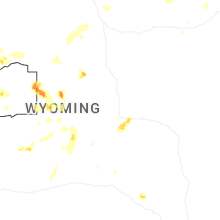
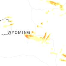
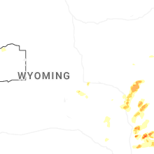
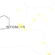


Connect with Interactive Hail Maps