

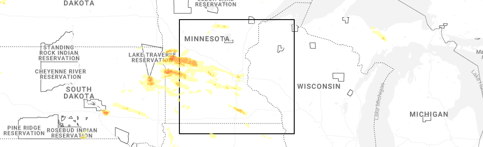
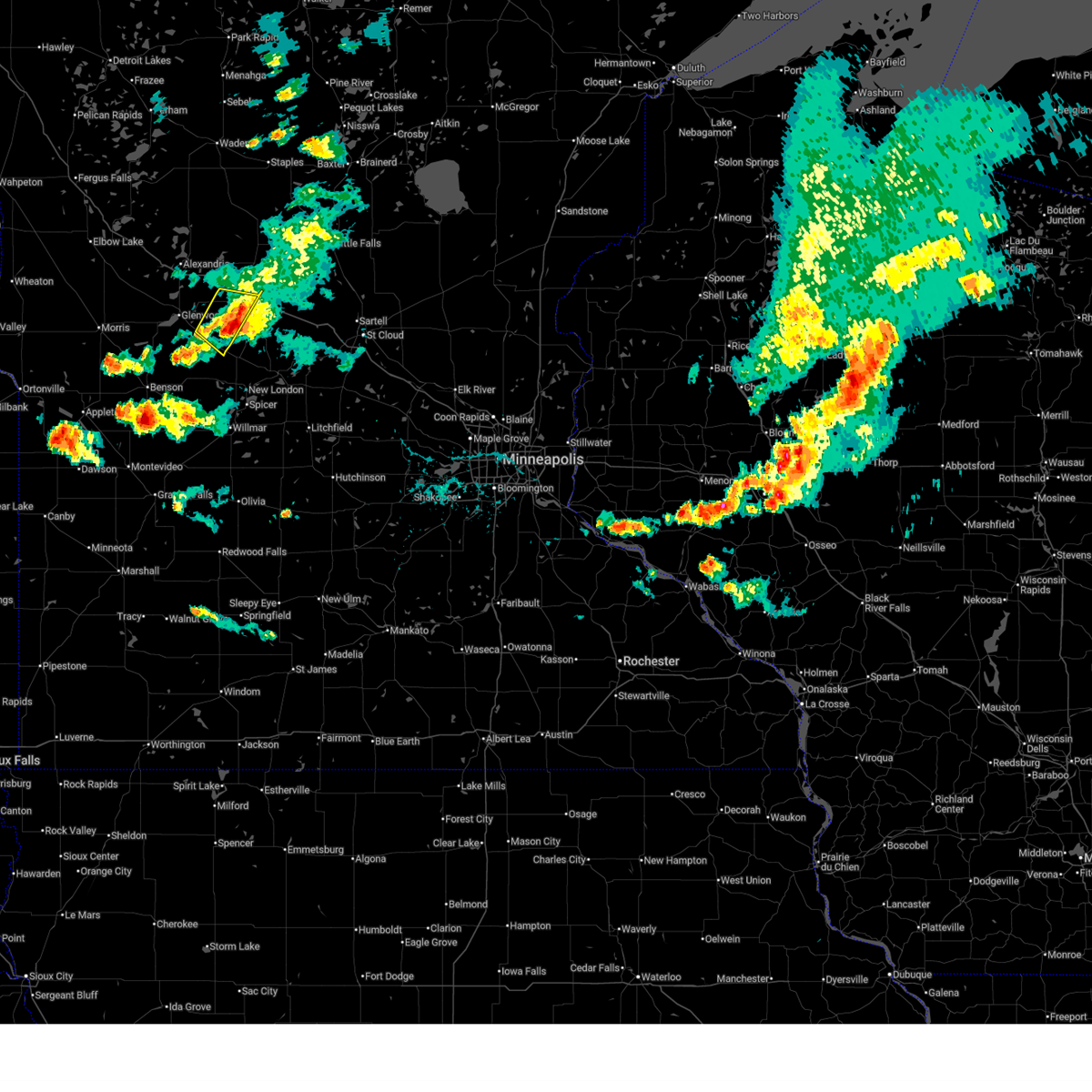
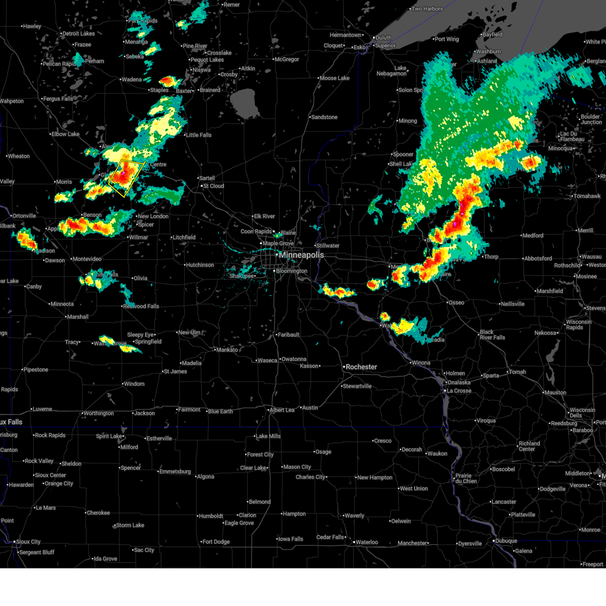
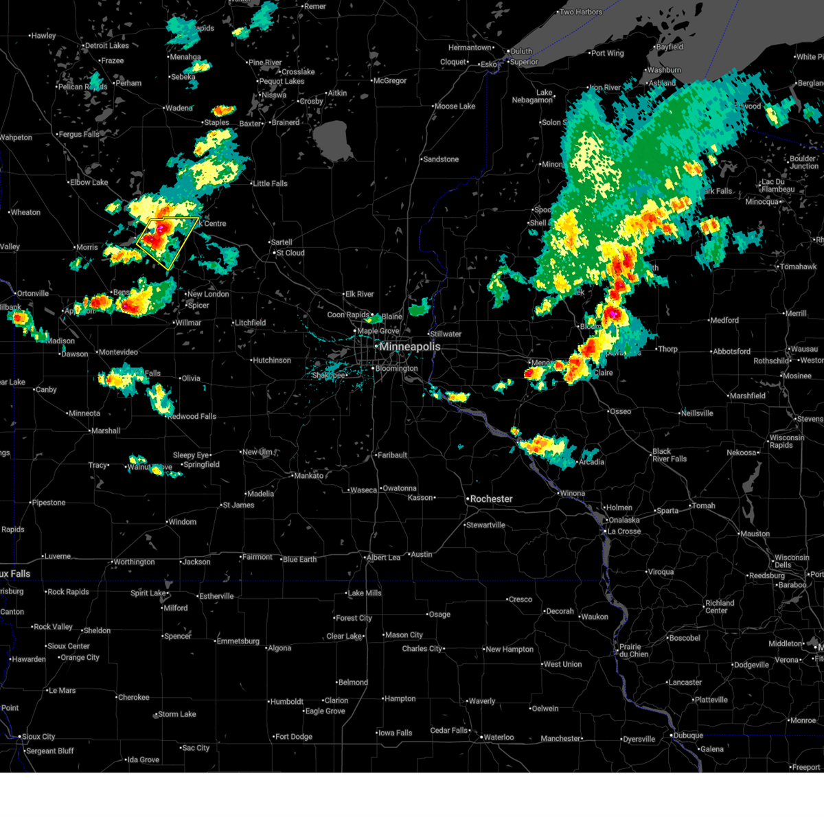
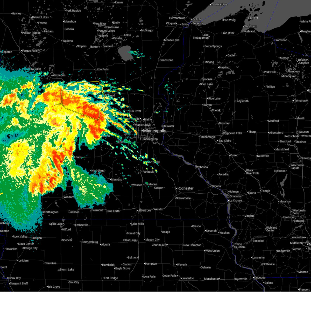
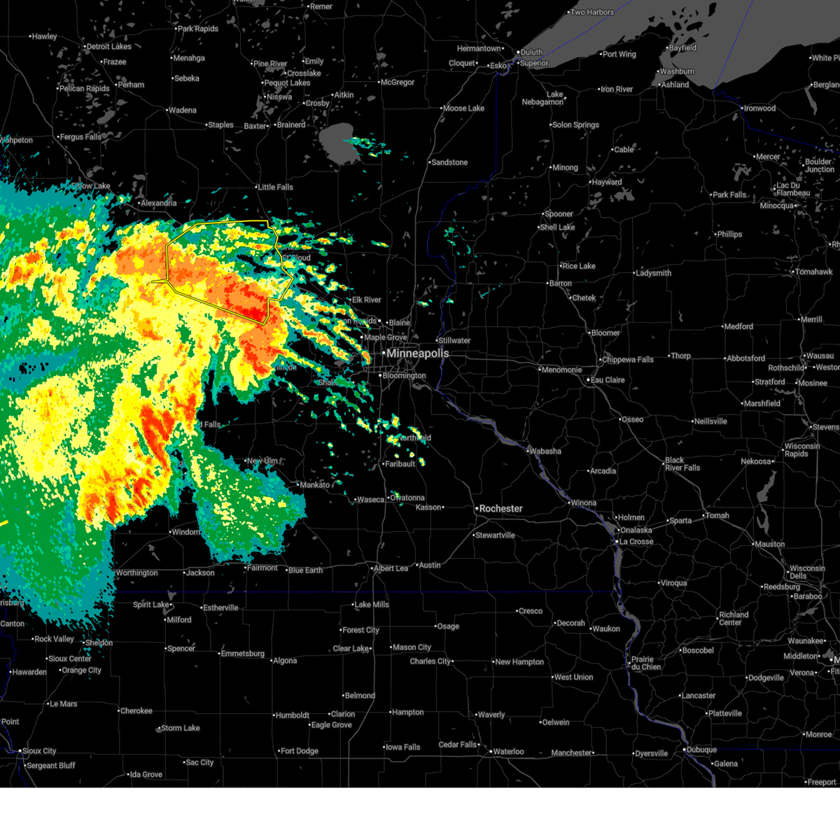
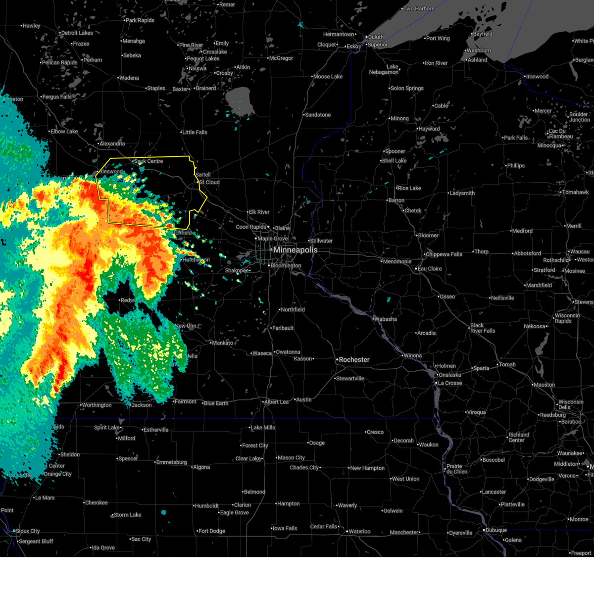
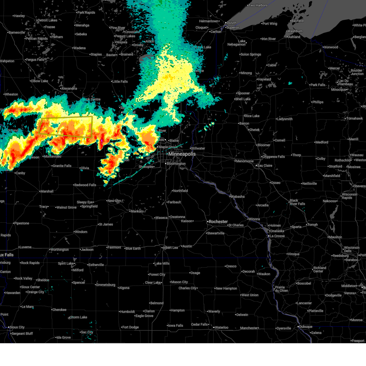
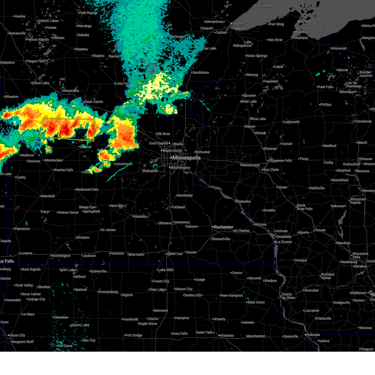
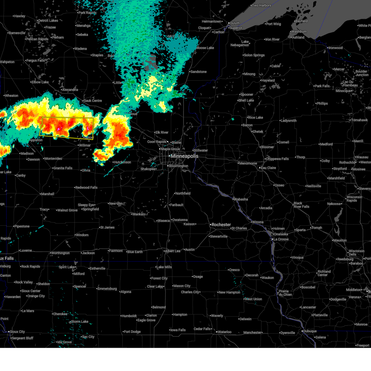
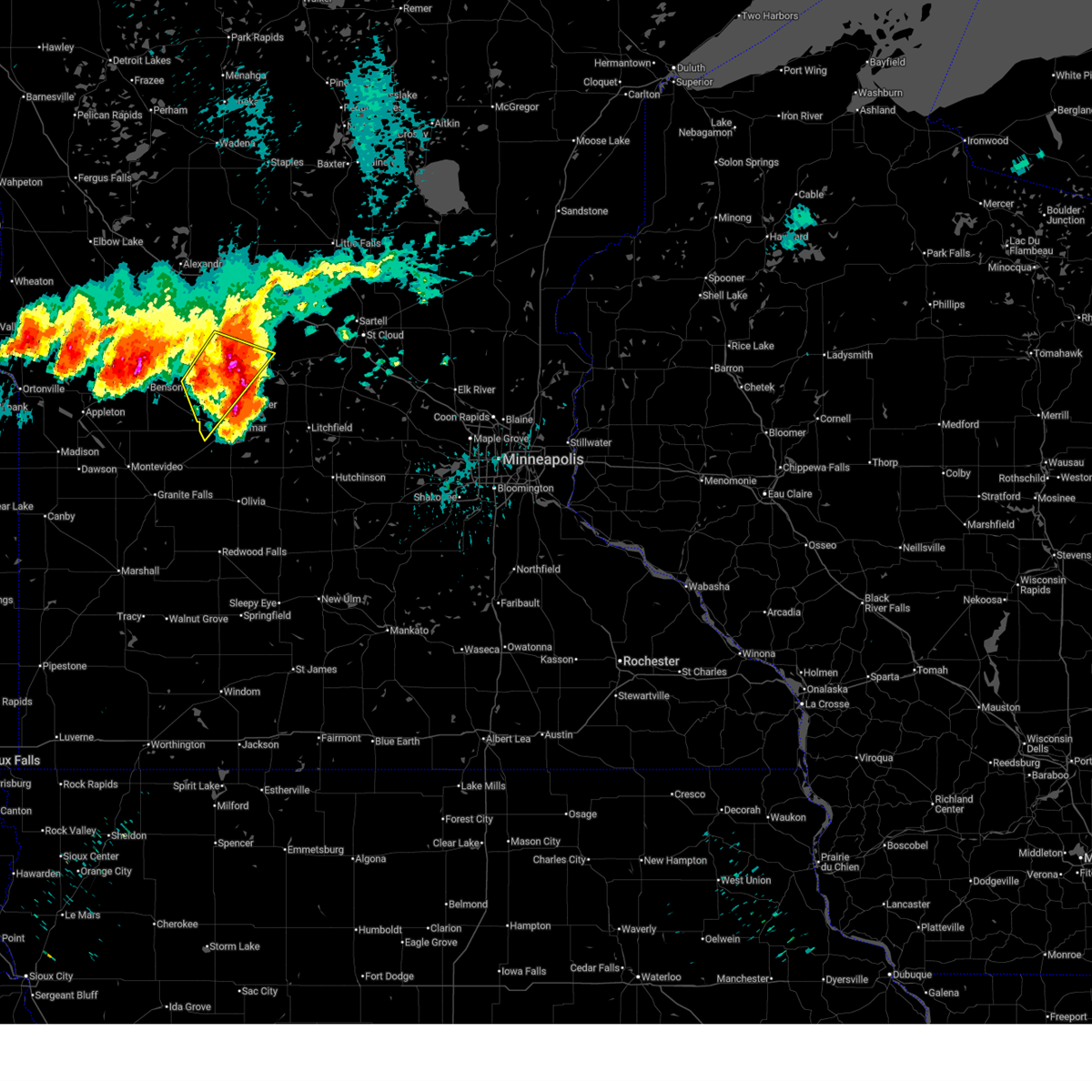
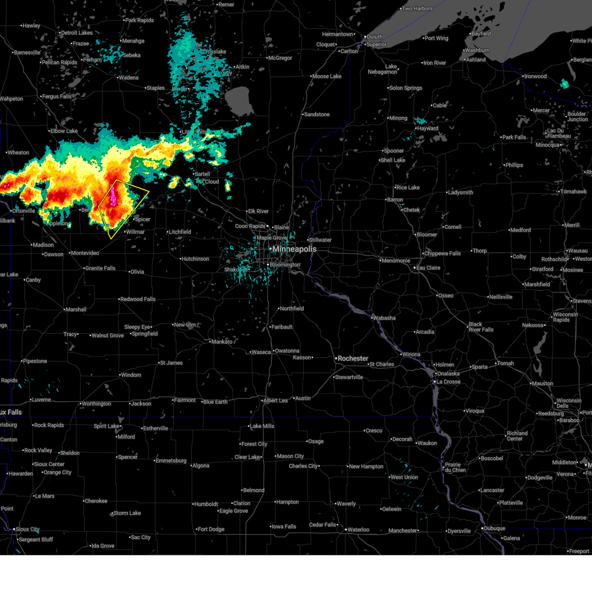
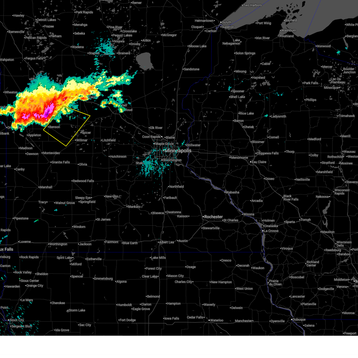
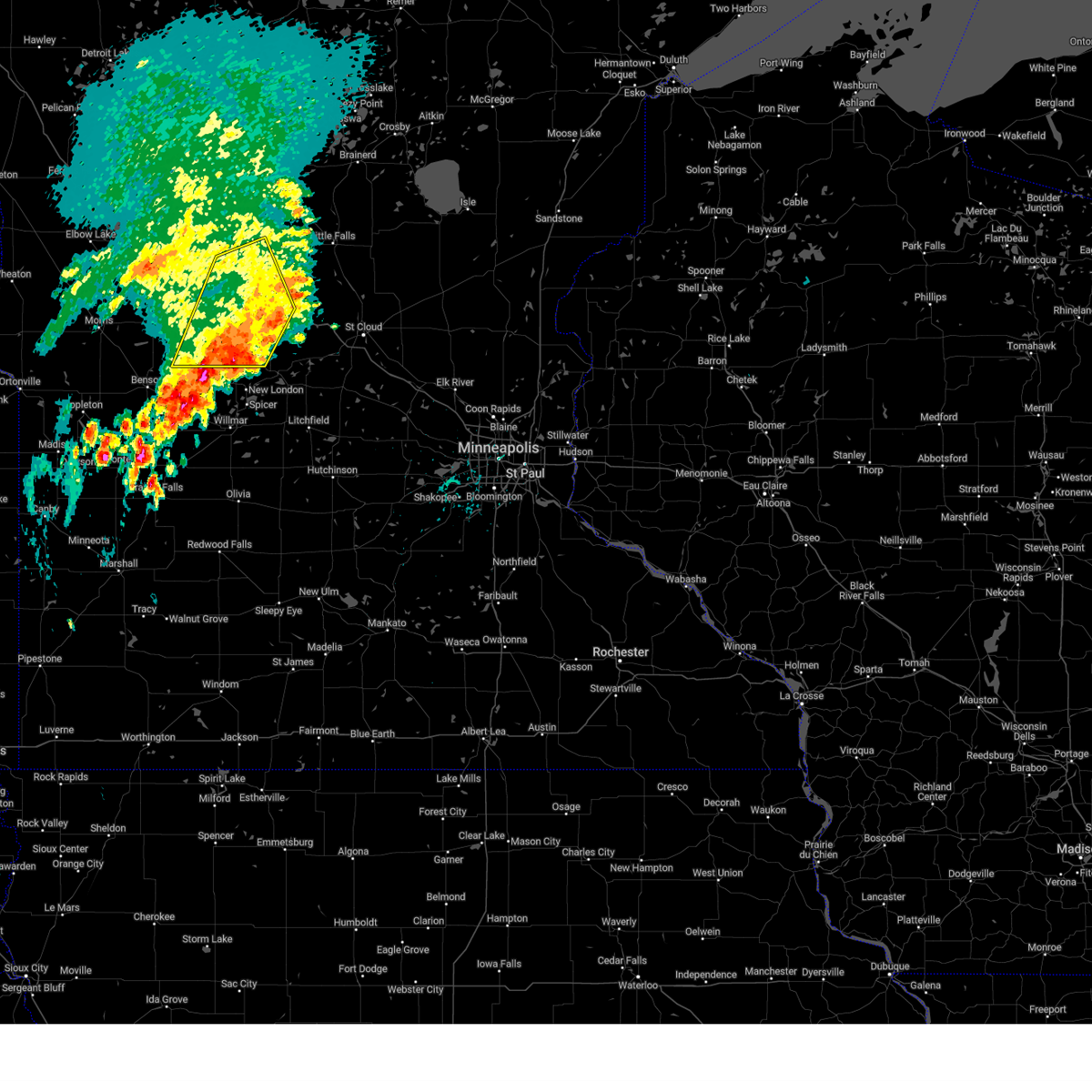
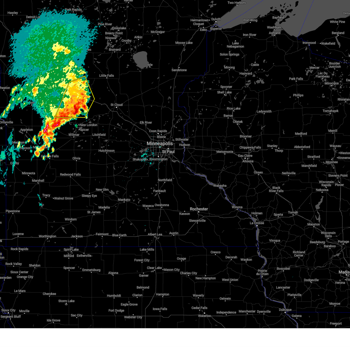
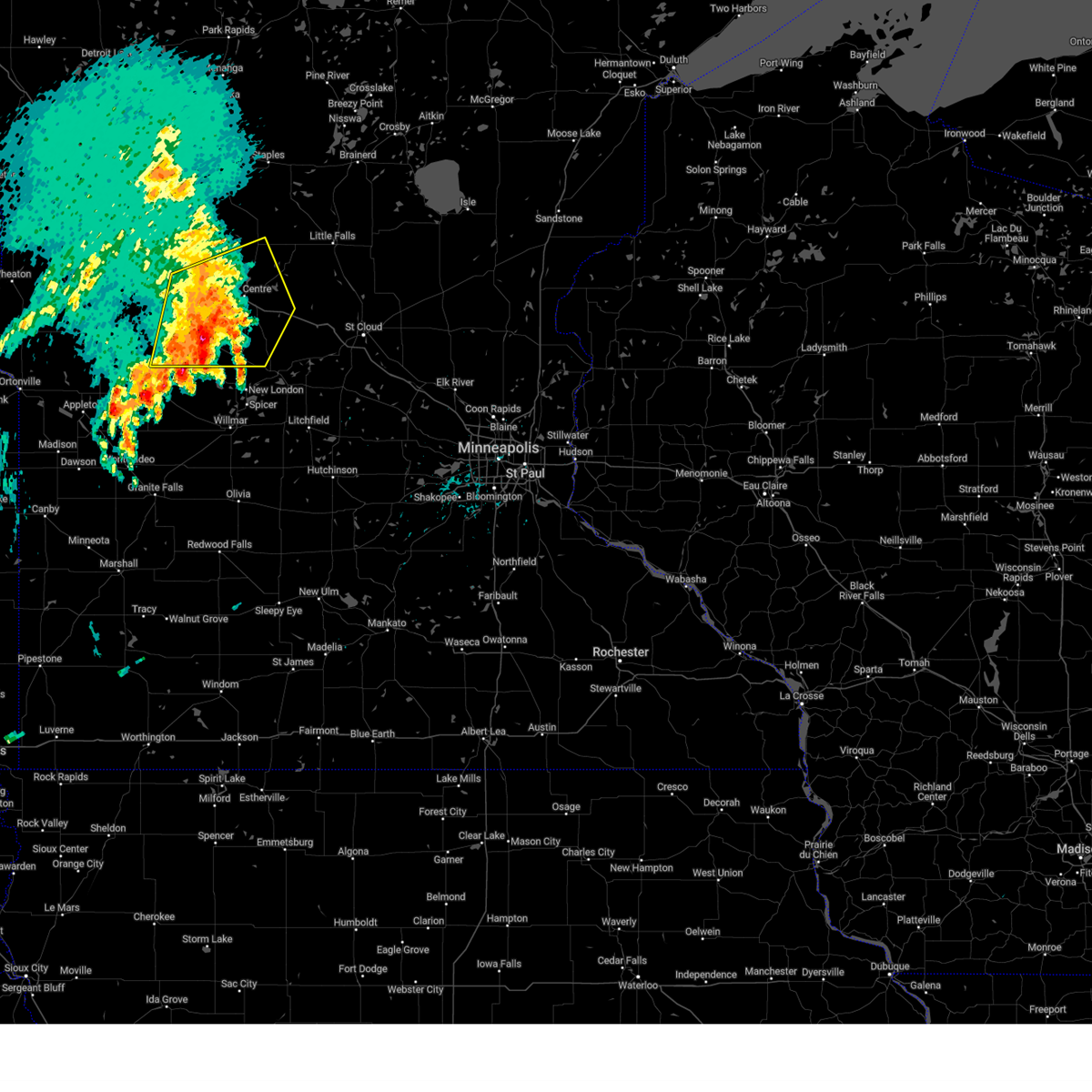
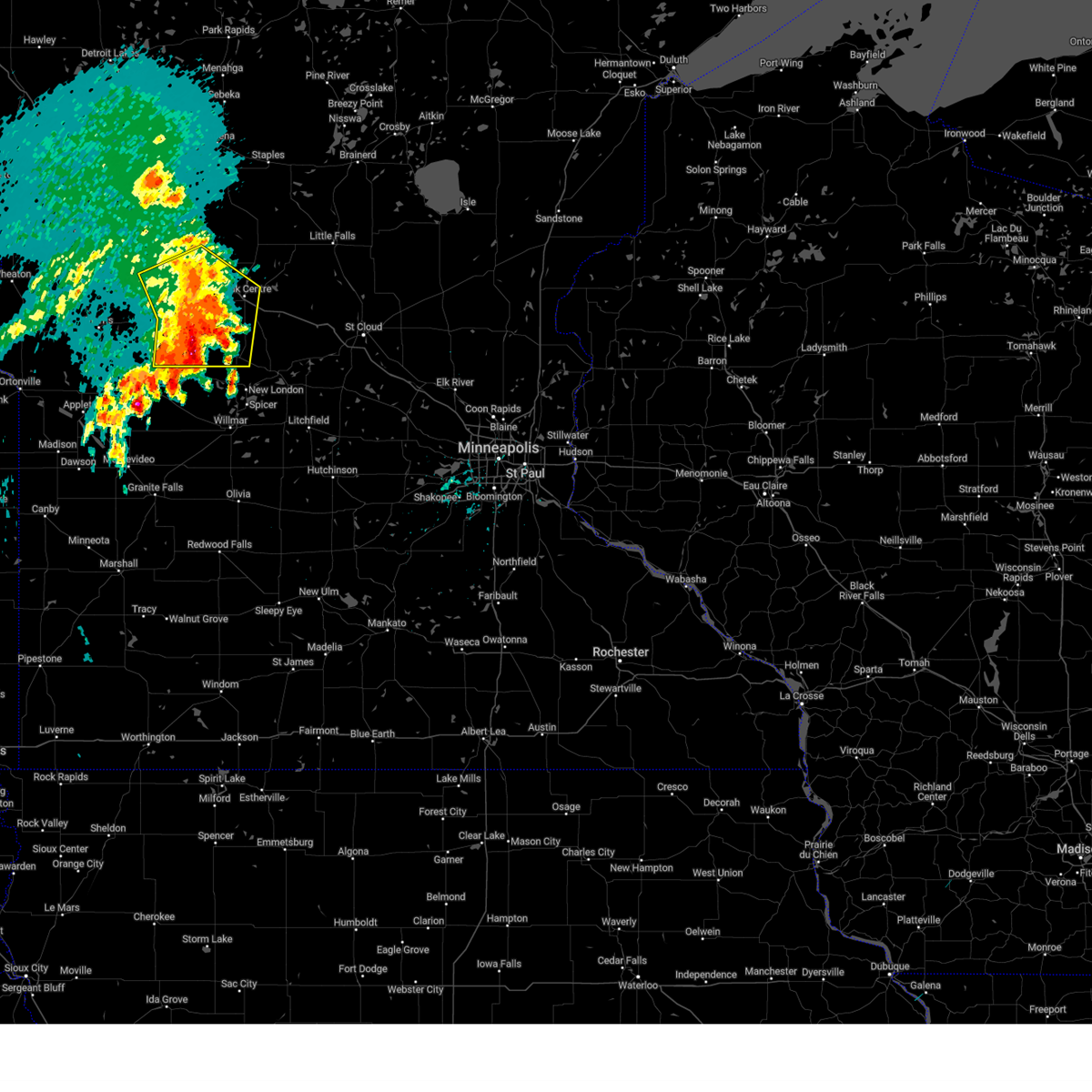
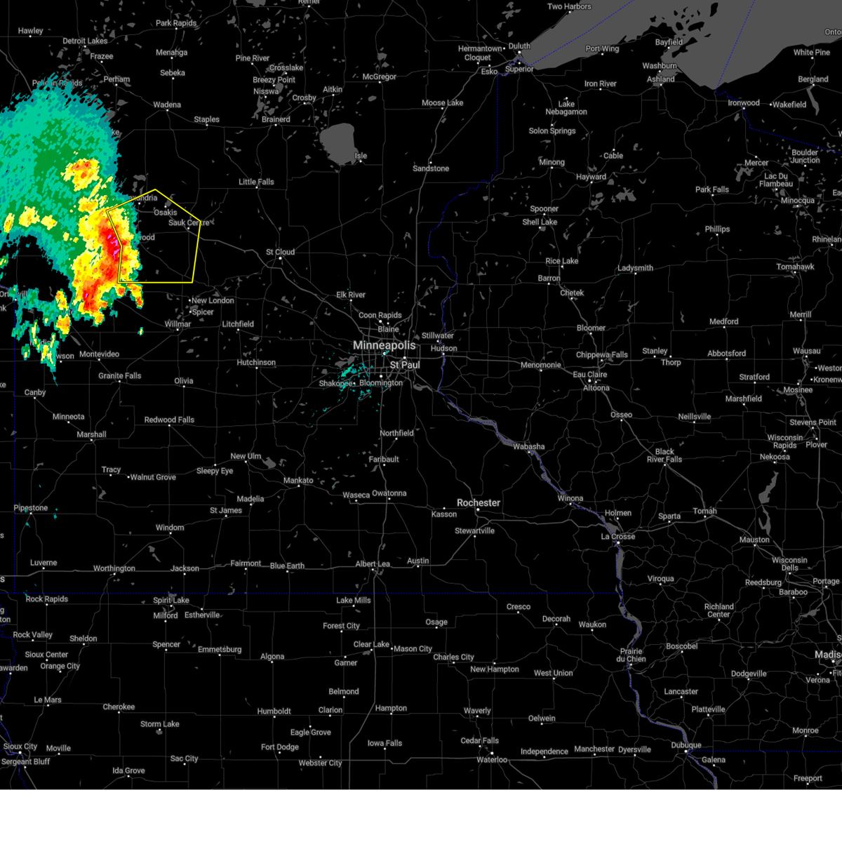
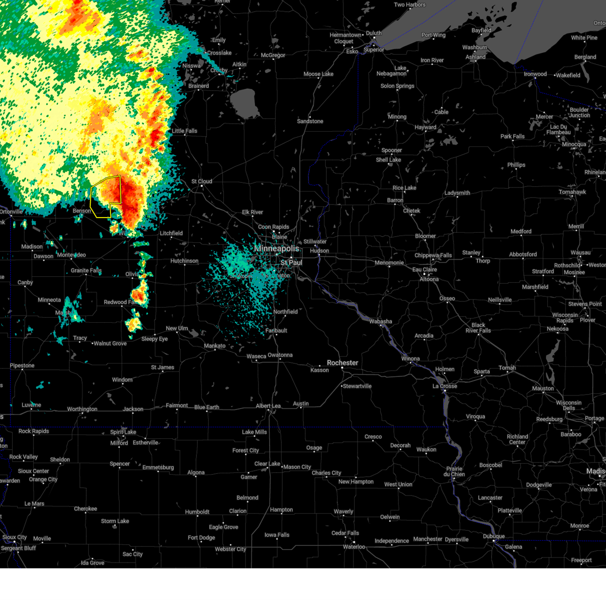
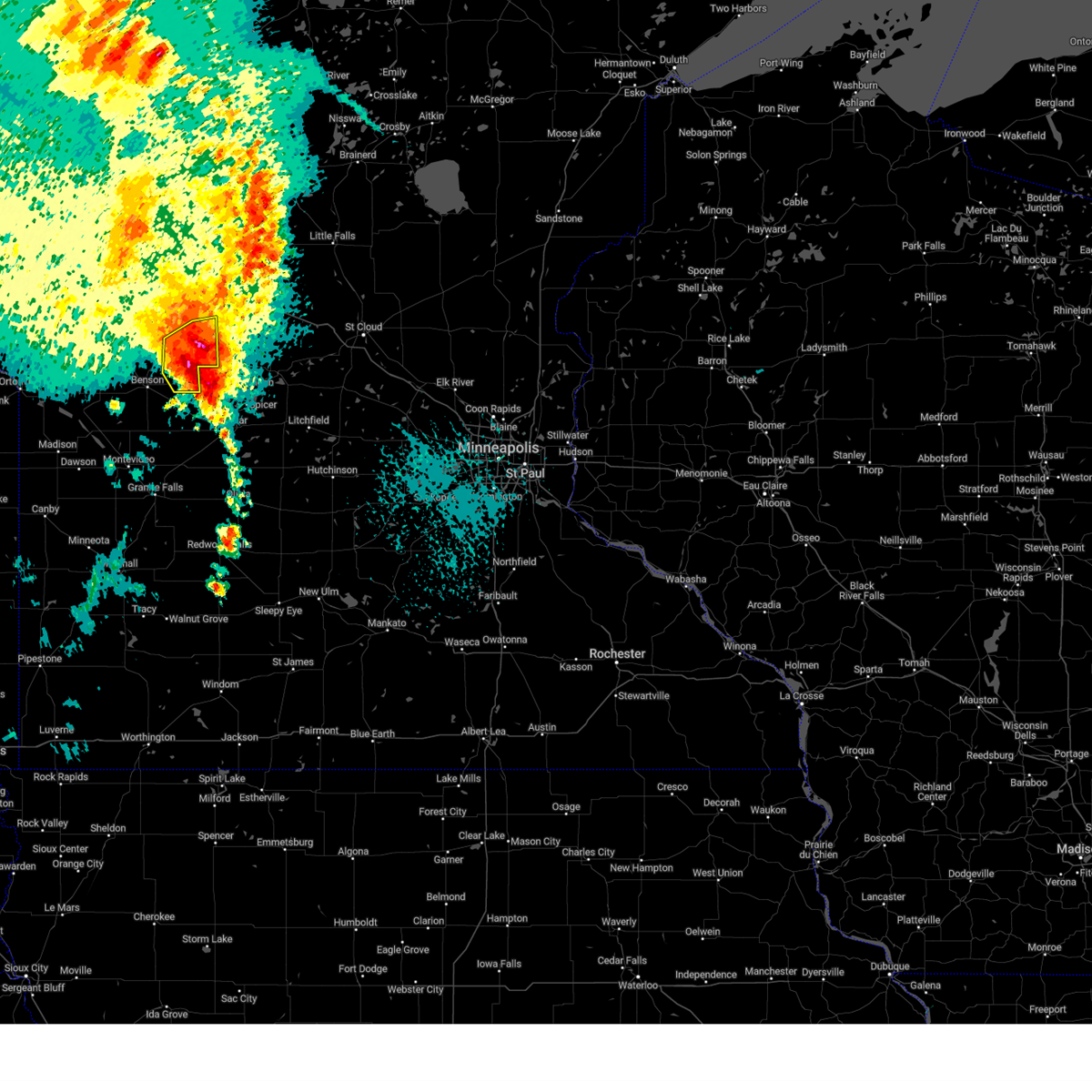
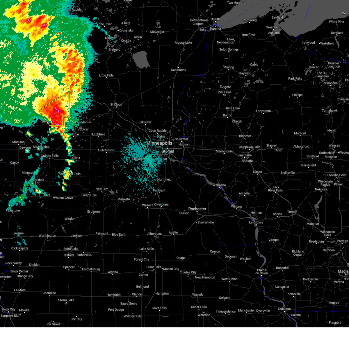
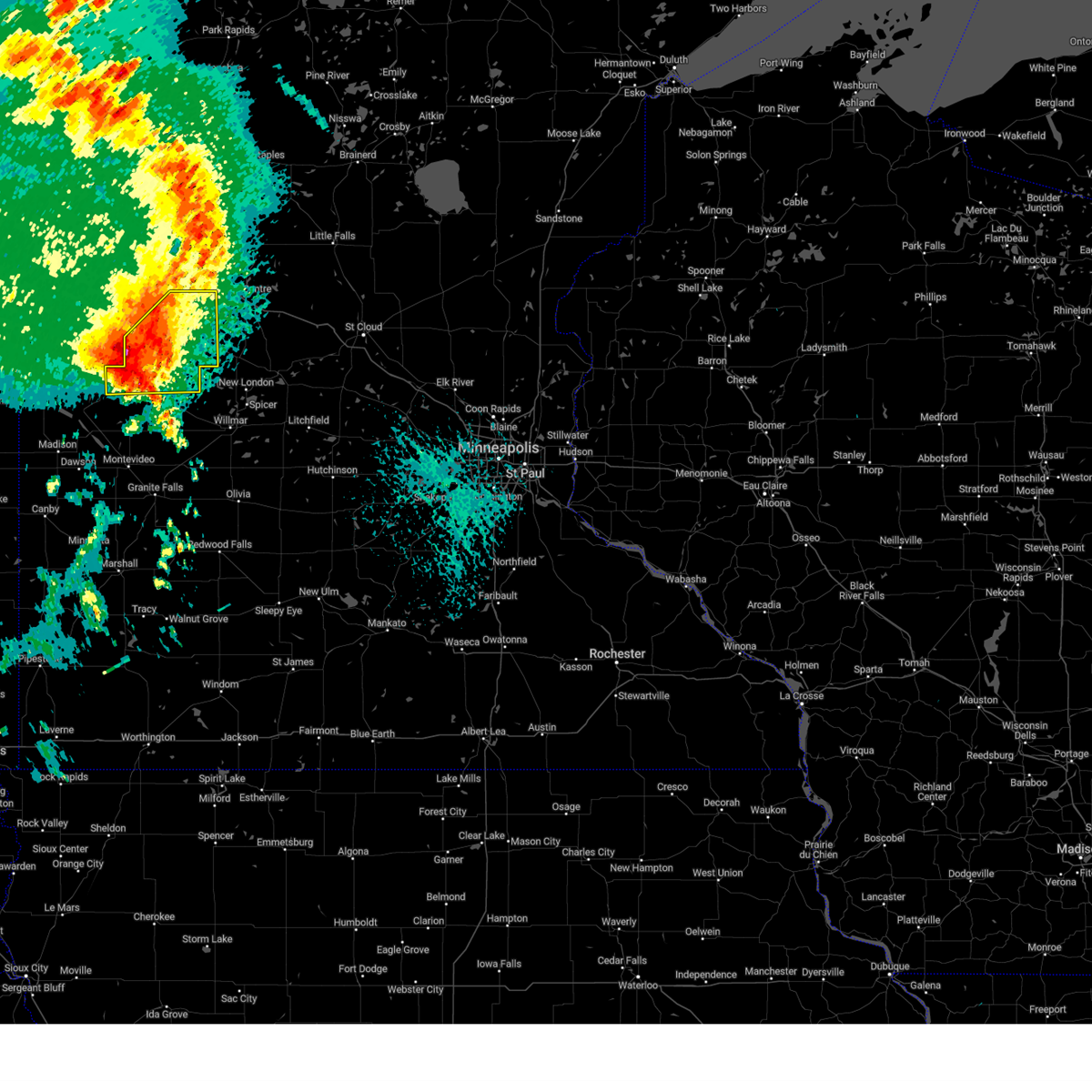
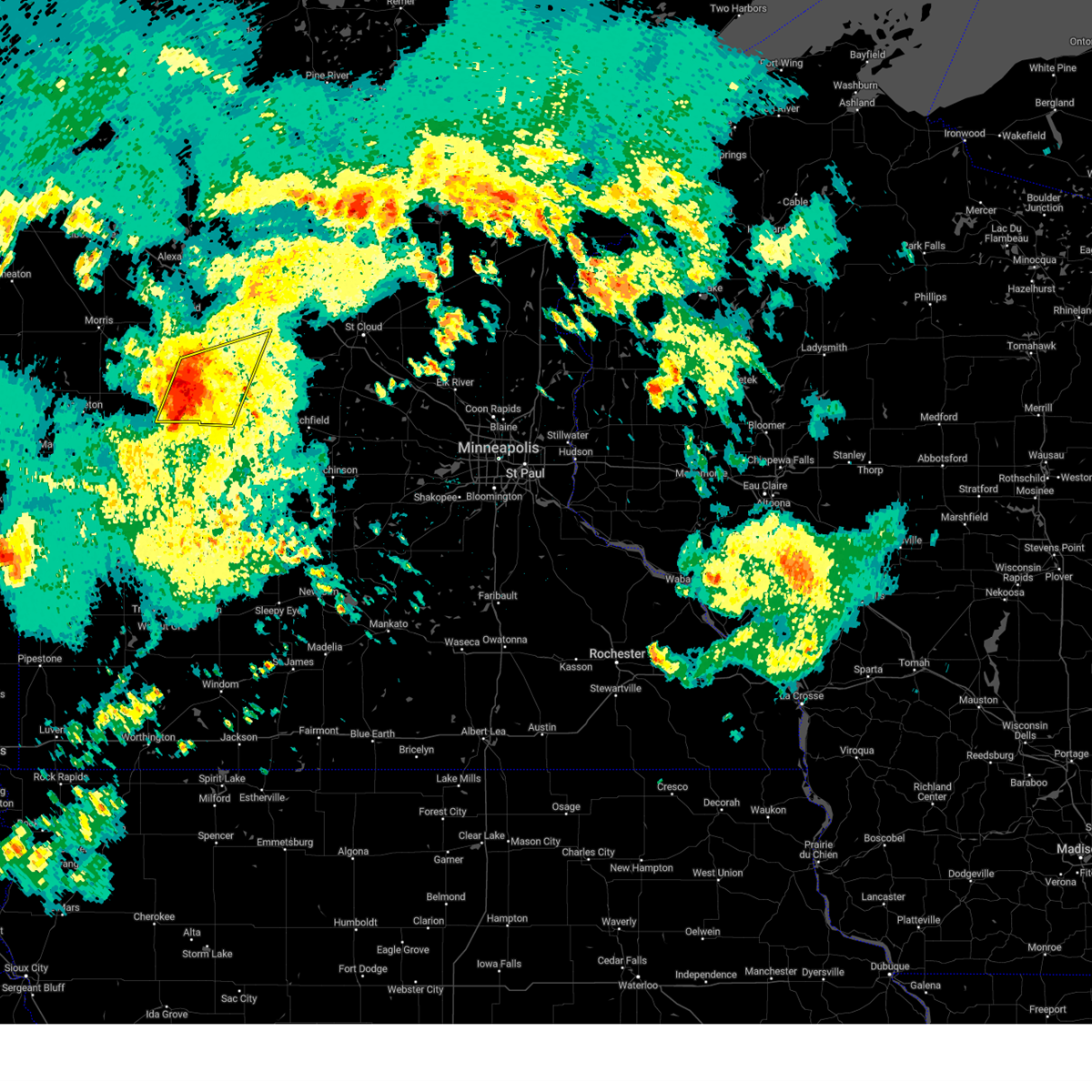
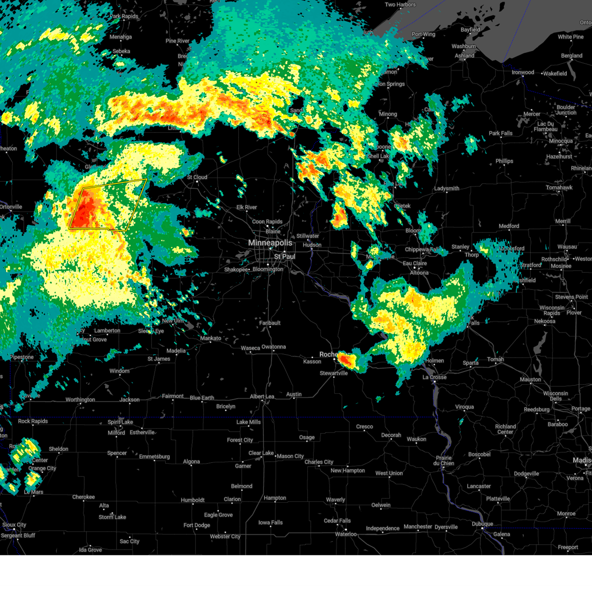
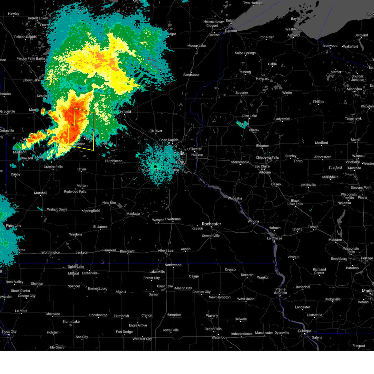
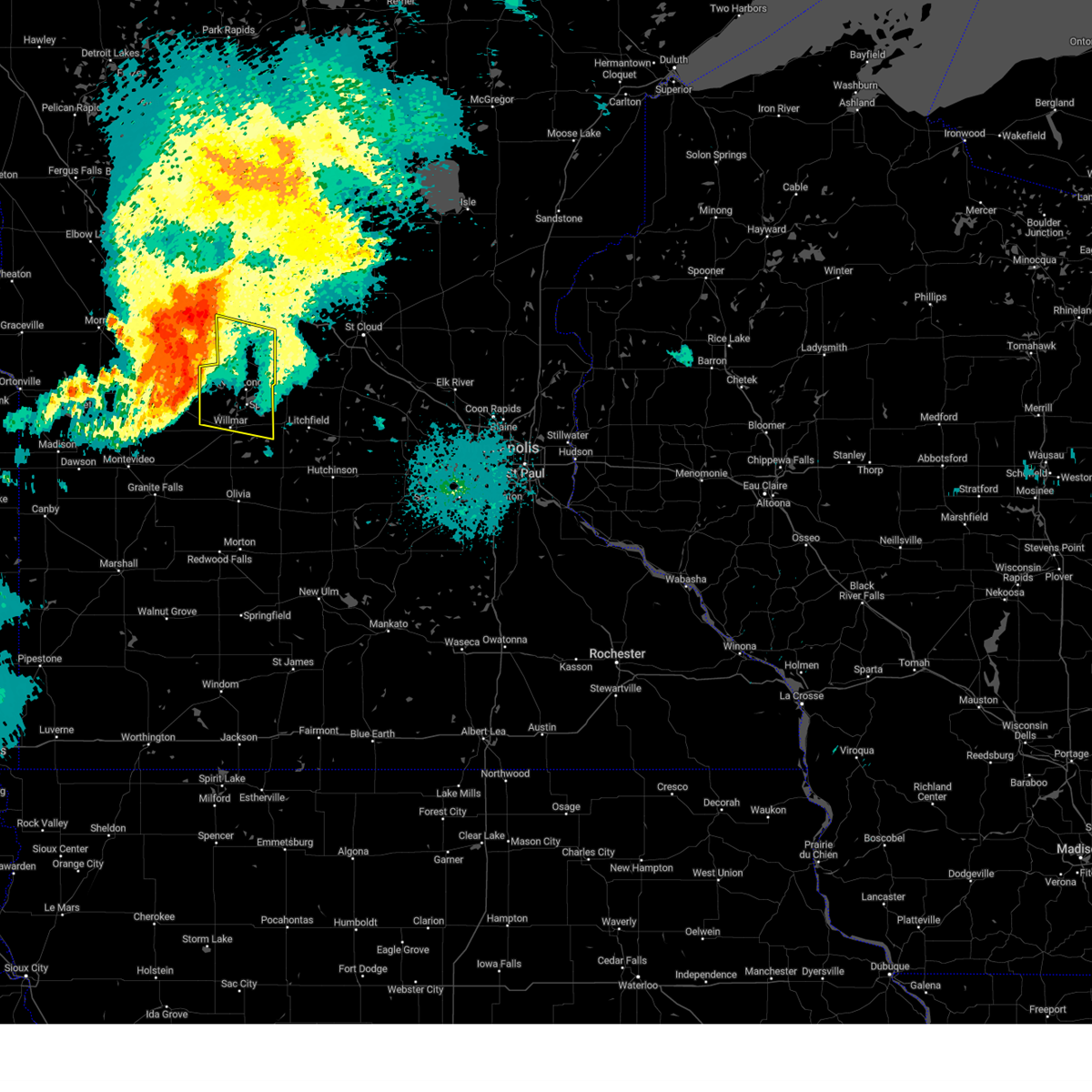
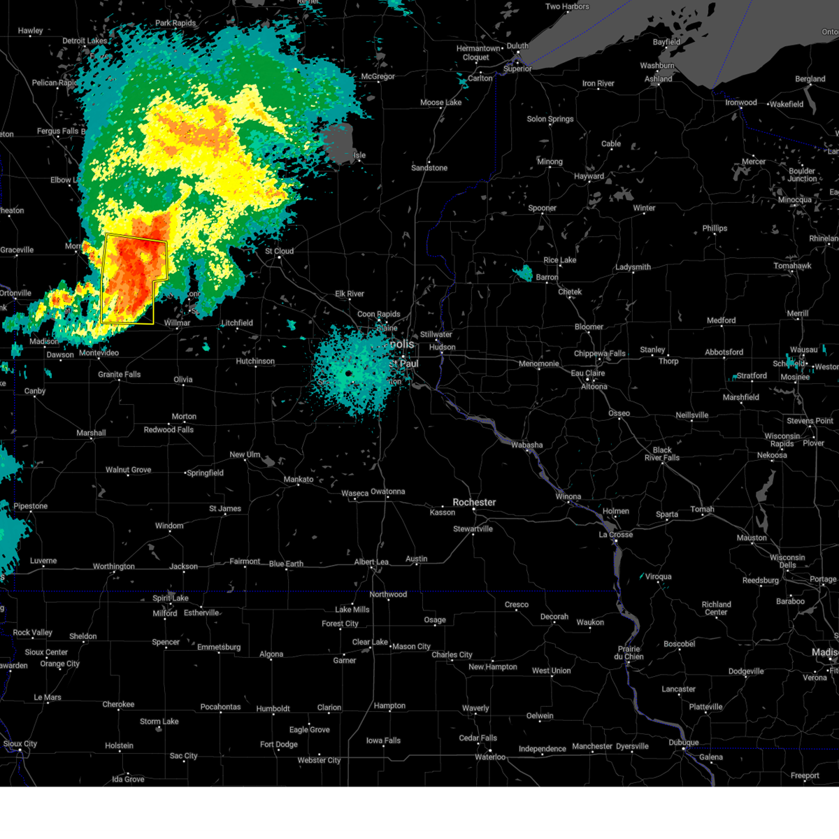
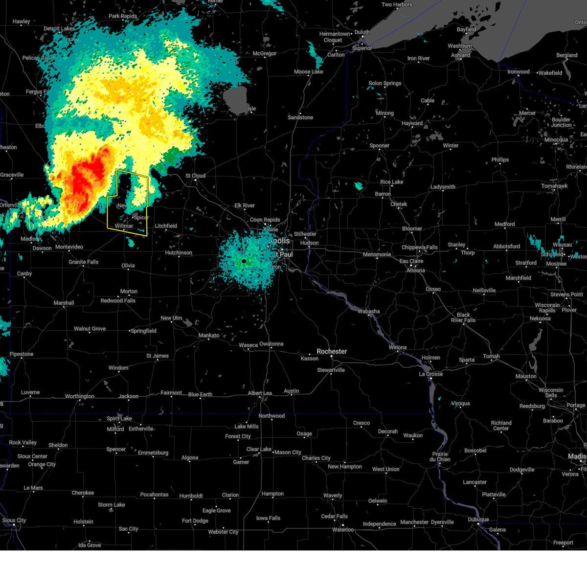
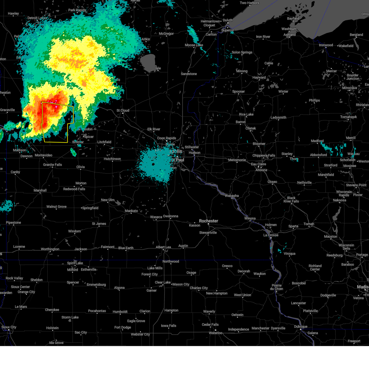
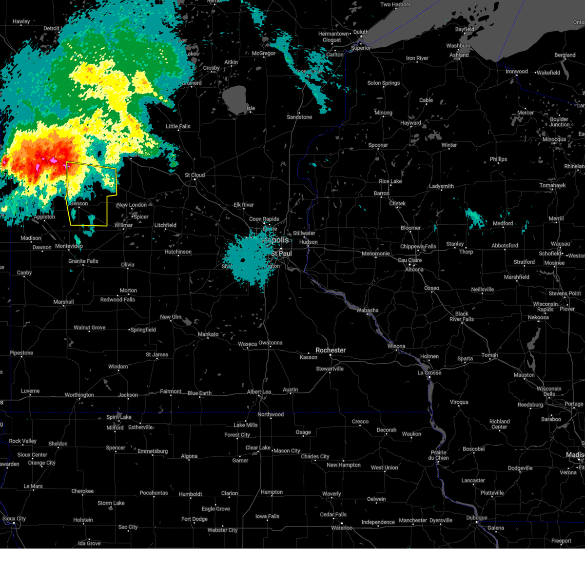
Hail Map for Brooten, MN
The Brooten, MN area has had 2 reports of on-the-ground hail by trained spotters, and has been under severe weather warnings 17 times during the past 12 months. Doppler radar has detected hail at or near Brooten, MN on 57 occasions, including 4 occasions during the past year.
| Name: | Brooten, MN |
| Where Located: | 47.8 miles NE of Montevideo, MN |
| Map: | Google Map for Brooten, MN |
| Population: | 743 |
| Housing Units: | 320 |
| More Info: | Search Google for Brooten, MN |
3
The Top Recent Hail Date for Brooten, MN is Sunday, July 27, 2025 (3rd out of 57)
Hail and Wind Damage Spotted near Brooten, MN
| Date / Time | Report Details |
|---|---|
| 6/10/2026 2:26 AM CDT |
 At 226 am cdt, severe thunderstorms were located along a line from 13 miles northeast of evansville to 6 miles southwest of long prairie, or along a line from 21 miles northwest of alexandria to 21 miles east of alexandria, moving northeast at 70 mph (weather station reported). Hazards include 70 mph wind gusts and small hail. Expect considerable tree damage. damage is likely to mobile homes, roofs, and outbuildings. Locations impacted include, brooten, holmes city, alexandria, brandon, evansville, carlos, sauk centre, lake osakis, leaf valley, miltona, little sauk, grey eagle, round prairie, long prairie, eagle bend, swanville, clarissa, browerville, bertha and hewitt. At 226 am cdt, severe thunderstorms were located along a line from 13 miles northeast of evansville to 6 miles southwest of long prairie, or along a line from 21 miles northwest of alexandria to 21 miles east of alexandria, moving northeast at 70 mph (weather station reported). Hazards include 70 mph wind gusts and small hail. Expect considerable tree damage. damage is likely to mobile homes, roofs, and outbuildings. Locations impacted include, brooten, holmes city, alexandria, brandon, evansville, carlos, sauk centre, lake osakis, leaf valley, miltona, little sauk, grey eagle, round prairie, long prairie, eagle bend, swanville, clarissa, browerville, bertha and hewitt.
|
| 6/10/2026 2:15 AM CDT |
 At 215 am cdt, severe thunderstorms were located along a line from over evansville to 5 miles west of sauk centre, or along a line from 17 miles northwest of alexandria to 19 miles southeast of alexandria, moving northeast at 70 mph (weather station reported). Hazards include 70 mph wind gusts and small hail. Expect considerable tree damage. damage is likely to mobile homes, roofs, and outbuildings. Locations impacted include, starbuck, lowry, glenwood, kensington, brooten, alexandria, brandon, evansville, carlos, sauk centre, lake osakis, little sauk, grey eagle, long prairie, eagle bend, swanville, clarissa, browerville, bertha and hewitt. At 215 am cdt, severe thunderstorms were located along a line from over evansville to 5 miles west of sauk centre, or along a line from 17 miles northwest of alexandria to 19 miles southeast of alexandria, moving northeast at 70 mph (weather station reported). Hazards include 70 mph wind gusts and small hail. Expect considerable tree damage. damage is likely to mobile homes, roofs, and outbuildings. Locations impacted include, starbuck, lowry, glenwood, kensington, brooten, alexandria, brandon, evansville, carlos, sauk centre, lake osakis, little sauk, grey eagle, long prairie, eagle bend, swanville, clarissa, browerville, bertha and hewitt.
|
| 6/10/2026 1:58 AM CDT |
 Svrmpx the national weather service in the twin cities has issued a * severe thunderstorm warning for, northwestern stearns county in central minnesota, todd county in central minnesota, douglas county in west central minnesota, northeastern pope county in west central minnesota, * until 245 am cdt. * at 158 am cdt, severe thunderstorms were located along a line from 7 miles northeast of donnelly to 7 miles west of brooten, or along a line from 11 miles north of morris to 26 miles northwest of willmar, moving northeast at 70 mph (radar indicated). Hazards include 70 mph wind gusts and small hail. Expect considerable tree damage. Damage is likely to mobile homes, roofs, and outbuildings. Svrmpx the national weather service in the twin cities has issued a * severe thunderstorm warning for, northwestern stearns county in central minnesota, todd county in central minnesota, douglas county in west central minnesota, northeastern pope county in west central minnesota, * until 245 am cdt. * at 158 am cdt, severe thunderstorms were located along a line from 7 miles northeast of donnelly to 7 miles west of brooten, or along a line from 11 miles north of morris to 26 miles northwest of willmar, moving northeast at 70 mph (radar indicated). Hazards include 70 mph wind gusts and small hail. Expect considerable tree damage. Damage is likely to mobile homes, roofs, and outbuildings.
|
| 6/5/2026 4:48 PM CDT |
 the severe thunderstorm warning has been cancelled and is no longer in effect the severe thunderstorm warning has been cancelled and is no longer in effect
|
| 6/5/2026 4:30 PM CDT |
 At 430 pm cdt, a severe thunderstorm was located 10 miles north of brooten, or 21 miles southeast of alexandria, moving southeast at 25 mph (radar indicated). Hazards include 60 mph wind gusts and quarter size hail. Hail damage to vehicles is expected. expect wind damage to roofs, siding, and trees. Locations impacted include, westport, grove lake, sedan, sauk centre, padua, brooten and sauk centre airport. At 430 pm cdt, a severe thunderstorm was located 10 miles north of brooten, or 21 miles southeast of alexandria, moving southeast at 25 mph (radar indicated). Hazards include 60 mph wind gusts and quarter size hail. Hail damage to vehicles is expected. expect wind damage to roofs, siding, and trees. Locations impacted include, westport, grove lake, sedan, sauk centre, padua, brooten and sauk centre airport.
|
| 6/5/2026 4:19 PM CDT |
 Svrmpx the national weather service in the twin cities has issued a * severe thunderstorm warning for, northwestern stearns county in central minnesota, northeastern pope county in west central minnesota, * until 515 pm cdt. * at 419 pm cdt, a severe thunderstorm was located 8 miles east of glenwood, or 16 miles southeast of alexandria, moving southeast at 15 mph (radar indicated). Hazards include 60 mph wind gusts and quarter size hail. Hail damage to vehicles is expected. Expect wind damage to roofs, siding, and trees. Svrmpx the national weather service in the twin cities has issued a * severe thunderstorm warning for, northwestern stearns county in central minnesota, northeastern pope county in west central minnesota, * until 515 pm cdt. * at 419 pm cdt, a severe thunderstorm was located 8 miles east of glenwood, or 16 miles southeast of alexandria, moving southeast at 15 mph (radar indicated). Hazards include 60 mph wind gusts and quarter size hail. Hail damage to vehicles is expected. Expect wind damage to roofs, siding, and trees.
|
| 8/16/2025 6:00 AM CDT |
 the severe thunderstorm warning has been cancelled and is no longer in effect the severe thunderstorm warning has been cancelled and is no longer in effect
|
| 8/16/2025 6:00 AM CDT |
 At 600 am cdt, severe thunderstorms were located along a line from near melrose to near annandale, or along a line from 30 miles west of st. cloud to 15 miles northwest of buffalo, moving east at 55 mph (radar indicated). Hazards include 60 mph wind gusts and quarter size hail. Hail damage to vehicles is expected. expect wind damage to roofs, siding, and trees. locations impacted include, st. cloud, sartell, sauk rapids, st. anthony, waite park, st. Joseph, sauk centre, cold spring, melrose, collegeville, albany, rockville, paynesville, richmond, avon, watkins, kimball, brooten, belgrade and holdingford. At 600 am cdt, severe thunderstorms were located along a line from near melrose to near annandale, or along a line from 30 miles west of st. cloud to 15 miles northwest of buffalo, moving east at 55 mph (radar indicated). Hazards include 60 mph wind gusts and quarter size hail. Hail damage to vehicles is expected. expect wind damage to roofs, siding, and trees. locations impacted include, st. cloud, sartell, sauk rapids, st. anthony, waite park, st. Joseph, sauk centre, cold spring, melrose, collegeville, albany, rockville, paynesville, richmond, avon, watkins, kimball, brooten, belgrade and holdingford.
|
| 8/16/2025 5:23 AM CDT |
 Svrmpx the national weather service in the twin cities has issued a * severe thunderstorm warning for, northern kandiyohi county in central minnesota, northern meeker county in central minnesota, stearns county in central minnesota, eastern pope county in west central minnesota, * until 630 am cdt. * at 523 am cdt, severe thunderstorms were located along a line from 7 miles south of glenwood to near atwater, or along a line from 24 miles south of alexandria to 8 miles east of willmar, moving northeast at 50 mph (radar indicated). Hazards include 60 mph wind gusts and quarter size hail. Hail damage to vehicles is expected. Expect wind damage to roofs, siding, and trees. Svrmpx the national weather service in the twin cities has issued a * severe thunderstorm warning for, northern kandiyohi county in central minnesota, northern meeker county in central minnesota, stearns county in central minnesota, eastern pope county in west central minnesota, * until 630 am cdt. * at 523 am cdt, severe thunderstorms were located along a line from 7 miles south of glenwood to near atwater, or along a line from 24 miles south of alexandria to 8 miles east of willmar, moving northeast at 50 mph (radar indicated). Hazards include 60 mph wind gusts and quarter size hail. Hail damage to vehicles is expected. Expect wind damage to roofs, siding, and trees.
|
| 7/27/2025 7:27 PM CDT |
 the severe thunderstorm warning has been cancelled and is no longer in effect the severe thunderstorm warning has been cancelled and is no longer in effect
|
| 7/27/2025 7:18 PM CDT |
 At 718 pm cdt, severe thunderstorms were located along a line from near lake hassel to 7 miles southwest of paynesville, or along a line from 26 miles southeast of morris to 17 miles northeast of willmar, moving east at 15 mph (radar indicated). Hazards include 60 mph wind gusts and quarter size hail. Hail damage to vehicles is expected. expect wind damage to roofs, siding, and trees. Locations impacted include, benson, new london, spicer, brooten, belgrade, lake hassel, green lake, norway lake, gilchrist, clontarf, de graff, lake henry, sunburg, danvers, regal, monson lake state park, sibley state park, swift falls, georgeville and benson airport. At 718 pm cdt, severe thunderstorms were located along a line from near lake hassel to 7 miles southwest of paynesville, or along a line from 26 miles southeast of morris to 17 miles northeast of willmar, moving east at 15 mph (radar indicated). Hazards include 60 mph wind gusts and quarter size hail. Hail damage to vehicles is expected. expect wind damage to roofs, siding, and trees. Locations impacted include, benson, new london, spicer, brooten, belgrade, lake hassel, green lake, norway lake, gilchrist, clontarf, de graff, lake henry, sunburg, danvers, regal, monson lake state park, sibley state park, swift falls, georgeville and benson airport.
|
| 7/27/2025 7:06 PM CDT |
 At 706 pm cdt, severe thunderstorms were located along a line from 5 miles southeast of lake hassel to 6 miles south of paynesville, or along a line from 26 miles northwest of willmar to 18 miles northeast of willmar, moving east at 30 mph (radar indicated). Hazards include 60 mph wind gusts and quarter size hail. Hail damage to vehicles is expected. expect wind damage to roofs, siding, and trees. Locations impacted include, benson, new london, spicer, brooten, belgrade, lake hassel, green lake, norway lake, gilchrist, clontarf, de graff, lake henry, sunburg, danvers, regal, monson lake state park, swift falls, sibley state park, georgeville and benson airport. At 706 pm cdt, severe thunderstorms were located along a line from 5 miles southeast of lake hassel to 6 miles south of paynesville, or along a line from 26 miles northwest of willmar to 18 miles northeast of willmar, moving east at 30 mph (radar indicated). Hazards include 60 mph wind gusts and quarter size hail. Hail damage to vehicles is expected. expect wind damage to roofs, siding, and trees. Locations impacted include, benson, new london, spicer, brooten, belgrade, lake hassel, green lake, norway lake, gilchrist, clontarf, de graff, lake henry, sunburg, danvers, regal, monson lake state park, swift falls, sibley state park, georgeville and benson airport.
|
| 7/27/2025 6:48 PM CDT |
 Svrmpx the national weather service in the twin cities has issued a * severe thunderstorm warning for, northern kandiyohi county in central minnesota, southwestern stearns county in central minnesota, southern pope county in west central minnesota, northeastern swift county in west central minnesota, * until 745 pm cdt. * at 648 pm cdt, severe thunderstorms were located along a line from near lake hassel to 7 miles southwest of brooten, or along a line from 19 miles southeast of morris to 21 miles north of willmar, moving east at 30 mph (radar indicated). Hazards include 60 mph wind gusts and quarter size hail. Hail damage to vehicles is expected. Expect wind damage to roofs, siding, and trees. Svrmpx the national weather service in the twin cities has issued a * severe thunderstorm warning for, northern kandiyohi county in central minnesota, southwestern stearns county in central minnesota, southern pope county in west central minnesota, northeastern swift county in west central minnesota, * until 745 pm cdt. * at 648 pm cdt, severe thunderstorms were located along a line from near lake hassel to 7 miles southwest of brooten, or along a line from 19 miles southeast of morris to 21 miles north of willmar, moving east at 30 mph (radar indicated). Hazards include 60 mph wind gusts and quarter size hail. Hail damage to vehicles is expected. Expect wind damage to roofs, siding, and trees.
|
| 7/27/2025 6:00 PM CDT |
 The severe thunderstorm warning that was previously in effect has been reissued for kandiyohi and stearns counties and is in effect until 630 pm cdt. please refer to that bulletin for the latest severe weather information. a severe thunderstorm watch remains in effect until 1200 am cdt monday for portions of central and west central minnesota. The severe thunderstorm warning that was previously in effect has been reissued for kandiyohi and stearns counties and is in effect until 630 pm cdt. please refer to that bulletin for the latest severe weather information. a severe thunderstorm watch remains in effect until 1200 am cdt monday for portions of central and west central minnesota.
|
| 7/27/2025 5:47 PM CDT |
 At 547 pm cdt, a severe thunderstorm was located 7 miles west of new london, or 12 miles north of willmar, moving southeast at 45 mph (radar indicated). Hazards include 70 mph wind gusts and quarter size hail. Hail damage to vehicles is expected. expect considerable tree damage. wind damage is also likely to mobile homes, roofs, and outbuildings. Locations impacted include, new london, brooten, belgrade, pennock, norway lake, lake henry, sunburg, regal, sibley state park, monson lake state park and georgeville. At 547 pm cdt, a severe thunderstorm was located 7 miles west of new london, or 12 miles north of willmar, moving southeast at 45 mph (radar indicated). Hazards include 70 mph wind gusts and quarter size hail. Hail damage to vehicles is expected. expect considerable tree damage. wind damage is also likely to mobile homes, roofs, and outbuildings. Locations impacted include, new london, brooten, belgrade, pennock, norway lake, lake henry, sunburg, regal, sibley state park, monson lake state park and georgeville.
|
| 7/27/2025 5:47 PM CDT |
 the severe thunderstorm warning has been cancelled and is no longer in effect the severe thunderstorm warning has been cancelled and is no longer in effect
|
| 7/27/2025 5:15 PM CDT |
 Svrmpx the national weather service in the twin cities has issued a * severe thunderstorm warning for, northwestern kandiyohi county in central minnesota, west central stearns county in central minnesota, northeastern chippewa county in west central minnesota, southeastern pope county in west central minnesota, eastern swift county in west central minnesota, * until 600 pm cdt. * at 515 pm cdt, a severe thunderstorm was located near lake hassel, or 21 miles southeast of morris, moving east at 45 mph (radar indicated). Hazards include 70 mph wind gusts and half dollar size hail. Hail damage to vehicles is expected. expect considerable tree damage. Wind damage is also likely to mobile homes, roofs, and outbuildings. Svrmpx the national weather service in the twin cities has issued a * severe thunderstorm warning for, northwestern kandiyohi county in central minnesota, west central stearns county in central minnesota, northeastern chippewa county in west central minnesota, southeastern pope county in west central minnesota, eastern swift county in west central minnesota, * until 600 pm cdt. * at 515 pm cdt, a severe thunderstorm was located near lake hassel, or 21 miles southeast of morris, moving east at 45 mph (radar indicated). Hazards include 70 mph wind gusts and half dollar size hail. Hail damage to vehicles is expected. expect considerable tree damage. Wind damage is also likely to mobile homes, roofs, and outbuildings.
|
| 6/2/2025 3:24 PM CDT |
 The storms which prompted the warning have weakened below severe limits, and no longer pose an immediate threat to life or property. therefore, the warning will be allowed to expire. however, small hail, gusty winds, and heavy rain are still possible with these thunderstorms. to report severe weather, contact your nearest law enforcement agency. they will send your report to the national weather service office. a severe thunderstorm watch remains in effect until 700 pm cdt for portions of central and west central minnesota. The storms which prompted the warning have weakened below severe limits, and no longer pose an immediate threat to life or property. therefore, the warning will be allowed to expire. however, small hail, gusty winds, and heavy rain are still possible with these thunderstorms. to report severe weather, contact your nearest law enforcement agency. they will send your report to the national weather service office. a severe thunderstorm watch remains in effect until 700 pm cdt for portions of central and west central minnesota.
|
| 6/2/2025 3:06 PM CDT |
 At 306 pm cdt, severe thunderstorms were located along a line from over long prairie to 7 miles northeast of belgrade, or along a line from 23 miles east of alexandria to 29 miles north of willmar, moving northeast at 45 mph (radar indicated). Hazards include 60 mph wind gusts and small hail. Expect damage to roofs, siding, and trees. Locations impacted include, sauk centre, melrose, long prairie, brooten, belgrade, freeport, grey eagle, lake osakis, little sauk, round prairie, new munich, grove lake, villard, greenwald, elrosa, gilchrist, meire grove, west union, lake henry and spring hill. At 306 pm cdt, severe thunderstorms were located along a line from over long prairie to 7 miles northeast of belgrade, or along a line from 23 miles east of alexandria to 29 miles north of willmar, moving northeast at 45 mph (radar indicated). Hazards include 60 mph wind gusts and small hail. Expect damage to roofs, siding, and trees. Locations impacted include, sauk centre, melrose, long prairie, brooten, belgrade, freeport, grey eagle, lake osakis, little sauk, round prairie, new munich, grove lake, villard, greenwald, elrosa, gilchrist, meire grove, west union, lake henry and spring hill.
|
| 6/2/2025 2:46 PM CDT |
 Svrmpx the national weather service in the twin cities has issued a * severe thunderstorm warning for, northwestern stearns county in central minnesota, southwestern todd county in central minnesota, southeastern douglas county in west central minnesota, pope county in west central minnesota, * until 330 pm cdt. * at 246 pm cdt, severe thunderstorms were located along a line from over lake osakis to 7 miles southwest of brooten, or along a line from 12 miles east of alexandria to 23 miles northwest of willmar, moving northeast at 45 mph (radar indicated). Hazards include 60 mph wind gusts and small hail. expect damage to roofs, siding, and trees Svrmpx the national weather service in the twin cities has issued a * severe thunderstorm warning for, northwestern stearns county in central minnesota, southwestern todd county in central minnesota, southeastern douglas county in west central minnesota, pope county in west central minnesota, * until 330 pm cdt. * at 246 pm cdt, severe thunderstorms were located along a line from over lake osakis to 7 miles southwest of brooten, or along a line from 12 miles east of alexandria to 23 miles northwest of willmar, moving northeast at 45 mph (radar indicated). Hazards include 60 mph wind gusts and small hail. expect damage to roofs, siding, and trees
|
| 6/2/2025 2:42 PM CDT |
 The severe thunderstorm warning that was previously in effect has been reissued for portions of pope, douglas, todd, and stearns counties and is in effect until 330pm. please refer to that bulletin for the latest severe weather information. to report severe weather, contact your nearest law enforcement agency. they will send your report to the national weather service office. The severe thunderstorm warning that was previously in effect has been reissued for portions of pope, douglas, todd, and stearns counties and is in effect until 330pm. please refer to that bulletin for the latest severe weather information. to report severe weather, contact your nearest law enforcement agency. they will send your report to the national weather service office.
|
| 6/2/2025 2:18 PM CDT |
 Svrmpx the national weather service in the twin cities has issued a * severe thunderstorm warning for, northwestern stearns county in central minnesota, southwestern todd county in central minnesota, southern douglas county in west central minnesota, pope county in west central minnesota, * until 245 pm cdt. * at 218 pm cdt, a severe thunderstorm was located near glenwood, or 20 miles south of alexandria, moving northeast at 60 mph (radar indicated). Hazards include 60 mph wind gusts and small hail. expect damage to roofs, siding, and trees Svrmpx the national weather service in the twin cities has issued a * severe thunderstorm warning for, northwestern stearns county in central minnesota, southwestern todd county in central minnesota, southern douglas county in west central minnesota, pope county in west central minnesota, * until 245 pm cdt. * at 218 pm cdt, a severe thunderstorm was located near glenwood, or 20 miles south of alexandria, moving northeast at 60 mph (radar indicated). Hazards include 60 mph wind gusts and small hail. expect damage to roofs, siding, and trees
|
| 8/29/2024 2:37 PM CDT |
 Svrmpx the national weather service in the twin cities has issued a * severe thunderstorm warning for, southern todd county in central minnesota, western stearns county in central minnesota, northeastern kandiyohi county in central minnesota, * until 315 pm cdt. * at 237 pm cdt, severe thunderstorms were located along a line extending from 6 miles northwest of long prairie to near paynesville, moving northeast at 50 mph (radar indicated). Hazards include 60 mph wind gusts and quarter size hail. Hail damage to vehicles is expected. Expect wind damage to roofs, siding, and trees. Svrmpx the national weather service in the twin cities has issued a * severe thunderstorm warning for, southern todd county in central minnesota, western stearns county in central minnesota, northeastern kandiyohi county in central minnesota, * until 315 pm cdt. * at 237 pm cdt, severe thunderstorms were located along a line extending from 6 miles northwest of long prairie to near paynesville, moving northeast at 50 mph (radar indicated). Hazards include 60 mph wind gusts and quarter size hail. Hail damage to vehicles is expected. Expect wind damage to roofs, siding, and trees.
|
| 8/29/2024 2:21 PM CDT |
 At 221 pm cdt, a severe thunderstorm was located 10 miles northwest of new london, or 14 miles north of willmar, moving northeast at 30 mph (radar indicated). Hazards include 60 mph wind gusts and quarter size hail. Hail damage to vehicles is expected. expect wind damage to roofs, siding, and trees. Locations impacted include, new london, brooten, belgrade, norway lake, sibley state park, and georgeville. At 221 pm cdt, a severe thunderstorm was located 10 miles northwest of new london, or 14 miles north of willmar, moving northeast at 30 mph (radar indicated). Hazards include 60 mph wind gusts and quarter size hail. Hail damage to vehicles is expected. expect wind damage to roofs, siding, and trees. Locations impacted include, new london, brooten, belgrade, norway lake, sibley state park, and georgeville.
|
| 8/29/2024 2:11 PM CDT |
 Svrmpx the national weather service in the twin cities has issued a * severe thunderstorm warning for, west central stearns county in central minnesota, northern kandiyohi county in central minnesota, * until 245 pm cdt. * at 210 pm cdt, a severe thunderstorm was located 7 miles northeast of kerkhoven, or 13 miles northwest of willmar, moving northeast at 30 mph (radar indicated). Hazards include 60 mph wind gusts and quarter size hail. Hail damage to vehicles is expected. Expect wind damage to roofs, siding, and trees. Svrmpx the national weather service in the twin cities has issued a * severe thunderstorm warning for, west central stearns county in central minnesota, northern kandiyohi county in central minnesota, * until 245 pm cdt. * at 210 pm cdt, a severe thunderstorm was located 7 miles northeast of kerkhoven, or 13 miles northwest of willmar, moving northeast at 30 mph (radar indicated). Hazards include 60 mph wind gusts and quarter size hail. Hail damage to vehicles is expected. Expect wind damage to roofs, siding, and trees.
|
| 7/31/2024 2:56 PM CDT |
 At 256 pm cdt, severe thunderstorms were located along a line extending from 9 miles north of belgrade to 7 miles north of new london to near spicer, moving east at 40 mph (radar indicated). Hazards include 60 mph wind gusts and penny size hail. Expect damage to roofs, siding, and trees. these severe storms will be near, paynesville and new london around 300 pm cdt. atwater around 305 pm cdt. grove city around 310 pm cdt. richmond around 320 pm cdt. other locations impacted by these severe thunderstorms include paynesville airport, spring hill, padua, sibley state park, regal, st. Martin, greenwald, green lake, lake henry, and georgeville. At 256 pm cdt, severe thunderstorms were located along a line extending from 9 miles north of belgrade to 7 miles north of new london to near spicer, moving east at 40 mph (radar indicated). Hazards include 60 mph wind gusts and penny size hail. Expect damage to roofs, siding, and trees. these severe storms will be near, paynesville and new london around 300 pm cdt. atwater around 305 pm cdt. grove city around 310 pm cdt. richmond around 320 pm cdt. other locations impacted by these severe thunderstorms include paynesville airport, spring hill, padua, sibley state park, regal, st. Martin, greenwald, green lake, lake henry, and georgeville.
|
| 7/31/2024 2:53 PM CDT |
 The storm which prompted the warning has moved out of the area. therefore, the warning will be allowed to expire. however, gusty winds and heavy rain are still possible with this thunderstorm. a severe thunderstorm watch remains in effect until 700 pm cdt for central and west central minnesota. The storm which prompted the warning has moved out of the area. therefore, the warning will be allowed to expire. however, gusty winds and heavy rain are still possible with this thunderstorm. a severe thunderstorm watch remains in effect until 700 pm cdt for central and west central minnesota.
|
| 7/31/2024 2:40 PM CDT |
 At 240 pm cdt, a severe thunderstorm was located 7 miles southwest of brooten, or 23 miles northwest of willmar, moving east at 45 mph (radar indicated). Hazards include 60 mph wind gusts and penny size hail. Expect damage to roofs, siding, and trees. Locations impacted include, grove lake, gilchrist, sedan, monson lake state park, swift falls, and glacial lakes state park. At 240 pm cdt, a severe thunderstorm was located 7 miles southwest of brooten, or 23 miles northwest of willmar, moving east at 45 mph (radar indicated). Hazards include 60 mph wind gusts and penny size hail. Expect damage to roofs, siding, and trees. Locations impacted include, grove lake, gilchrist, sedan, monson lake state park, swift falls, and glacial lakes state park.
|
| 7/31/2024 2:37 PM CDT |
 Svrmpx the national weather service in the twin cities has issued a * severe thunderstorm warning for, northwestern meeker county in central minnesota, southwestern stearns county in central minnesota, northern kandiyohi county in central minnesota, * until 330 pm cdt. * at 236 pm cdt, a severe thunderstorm was located 8 miles southwest of brooten, or 21 miles northwest of willmar, moving east at 45 mph (radar indicated). Hazards include 60 mph wind gusts and penny size hail. Expect damage to roofs, siding, and trees. this severe thunderstorm will be near, belgrade around 250 pm cdt. paynesville around 305 pm cdt. other locations impacted by this severe thunderstorm include paynesville airport, spring hill, padua, sibley state park, regal, st. Martin, greenwald, green lake, lake henry, and georgeville. Svrmpx the national weather service in the twin cities has issued a * severe thunderstorm warning for, northwestern meeker county in central minnesota, southwestern stearns county in central minnesota, northern kandiyohi county in central minnesota, * until 330 pm cdt. * at 236 pm cdt, a severe thunderstorm was located 8 miles southwest of brooten, or 21 miles northwest of willmar, moving east at 45 mph (radar indicated). Hazards include 60 mph wind gusts and penny size hail. Expect damage to roofs, siding, and trees. this severe thunderstorm will be near, belgrade around 250 pm cdt. paynesville around 305 pm cdt. other locations impacted by this severe thunderstorm include paynesville airport, spring hill, padua, sibley state park, regal, st. Martin, greenwald, green lake, lake henry, and georgeville.
|
| 7/31/2024 2:28 PM CDT |
 At 228 pm cdt, severe thunderstorms were located along a line extending from 8 miles southeast of starbuck to 5 miles east of lake hassel, moving east at 55 mph (radar indicated). Hazards include 60 mph wind gusts and penny size hail. Expect damage to roofs, siding, and trees. Locations impacted include, glenwood, starbuck, lake hassel, grove lake, villard, gilchrist, westport, sedan, glenwood airport, monson lake state park, swift falls, and lake minnewaska. At 228 pm cdt, severe thunderstorms were located along a line extending from 8 miles southeast of starbuck to 5 miles east of lake hassel, moving east at 55 mph (radar indicated). Hazards include 60 mph wind gusts and penny size hail. Expect damage to roofs, siding, and trees. Locations impacted include, glenwood, starbuck, lake hassel, grove lake, villard, gilchrist, westport, sedan, glenwood airport, monson lake state park, swift falls, and lake minnewaska.
|
| 7/31/2024 2:14 PM CDT |
 Svrmpx the national weather service in the twin cities has issued a * severe thunderstorm warning for, pope county in west central minnesota, northeastern swift county in west central minnesota, * until 300 pm cdt. * at 214 pm cdt, severe thunderstorms were located along a line extending from lowry to near hancock to benson, moving northeast at 35 mph (radar indicated). Hazards include 60 mph wind gusts and penny size hail. expect damage to roofs, siding, and trees Svrmpx the national weather service in the twin cities has issued a * severe thunderstorm warning for, pope county in west central minnesota, northeastern swift county in west central minnesota, * until 300 pm cdt. * at 214 pm cdt, severe thunderstorms were located along a line extending from lowry to near hancock to benson, moving northeast at 35 mph (radar indicated). Hazards include 60 mph wind gusts and penny size hail. expect damage to roofs, siding, and trees
|
| 7/13/2024 11:17 PM CDT |
 At 1117 pm cdt, severe thunderstorms were located along a line extending from near grey eagle to near lowry, moving east at 45 mph (radar indicated). Hazards include 60 mph wind gusts and quarter size hail. Hail damage to vehicles is expected. expect wind damage to roofs, siding, and trees. Locations impacted include, alexandria, sauk centre, melrose, glenwood, starbuck, brooten, freeport, lowry, kensington, cyrus, holmes city, and new munich. At 1117 pm cdt, severe thunderstorms were located along a line extending from near grey eagle to near lowry, moving east at 45 mph (radar indicated). Hazards include 60 mph wind gusts and quarter size hail. Hail damage to vehicles is expected. expect wind damage to roofs, siding, and trees. Locations impacted include, alexandria, sauk centre, melrose, glenwood, starbuck, brooten, freeport, lowry, kensington, cyrus, holmes city, and new munich.
|
| 7/13/2024 11:02 PM CDT |
 Svrmpx the national weather service in the twin cities has issued a * severe thunderstorm warning for, southern douglas county in west central minnesota, pope county in west central minnesota, southern todd county in central minnesota, northwestern stearns county in central minnesota, * until 1145 pm cdt. * at 1102 pm cdt, severe thunderstorms were located along a line extending from 5 miles south of long prairie to near kensington, moving east at 45 mph (radar indicated). Hazards include 60 mph wind gusts and quarter size hail. Hail damage to vehicles is expected. Expect wind damage to roofs, siding, and trees. Svrmpx the national weather service in the twin cities has issued a * severe thunderstorm warning for, southern douglas county in west central minnesota, pope county in west central minnesota, southern todd county in central minnesota, northwestern stearns county in central minnesota, * until 1145 pm cdt. * at 1102 pm cdt, severe thunderstorms were located along a line extending from 5 miles south of long prairie to near kensington, moving east at 45 mph (radar indicated). Hazards include 60 mph wind gusts and quarter size hail. Hail damage to vehicles is expected. Expect wind damage to roofs, siding, and trees.
|
| 6/2/2024 10:45 PM CDT |
 At 1044 pm cdt, severe thunderstorms were located along a line extending from 9 miles southwest of brooten to near murdock, moving east at 25 mph (radar indicated). Hazards include 60 mph wind gusts and half dollar size hail. Hail damage to vehicles is expected. expect wind damage to roofs, siding, and trees. Locations impacted include, willmar, new london, kerkhoven, brooten, belgrade, murdock, pennock, norway lake, gilchrist, de graff, sunburg, and spring hill. At 1044 pm cdt, severe thunderstorms were located along a line extending from 9 miles southwest of brooten to near murdock, moving east at 25 mph (radar indicated). Hazards include 60 mph wind gusts and half dollar size hail. Hail damage to vehicles is expected. expect wind damage to roofs, siding, and trees. Locations impacted include, willmar, new london, kerkhoven, brooten, belgrade, murdock, pennock, norway lake, gilchrist, de graff, sunburg, and spring hill.
|
| 6/2/2024 10:17 PM CDT |
 Svrmpx the national weather service in the twin cities has issued a * severe thunderstorm warning for, southeastern pope county in west central minnesota, west central stearns county in central minnesota, eastern swift county in west central minnesota, northwestern kandiyohi county in central minnesota, * until 1100 pm cdt. * at 1017 pm cdt, severe thunderstorms were located along a line extending from near lake hassel to 7 miles south of benson, moving east at 30 mph (radar indicated). Hazards include 60 mph wind gusts and half dollar size hail. Hail damage to vehicles is expected. Expect wind damage to roofs, siding, and trees. Svrmpx the national weather service in the twin cities has issued a * severe thunderstorm warning for, southeastern pope county in west central minnesota, west central stearns county in central minnesota, eastern swift county in west central minnesota, northwestern kandiyohi county in central minnesota, * until 1100 pm cdt. * at 1017 pm cdt, severe thunderstorms were located along a line extending from near lake hassel to 7 miles south of benson, moving east at 30 mph (radar indicated). Hazards include 60 mph wind gusts and half dollar size hail. Hail damage to vehicles is expected. Expect wind damage to roofs, siding, and trees.
|
| 7/25/2023 11:07 PM CDT |
 At 1107 pm cdt, a severe thunderstorm was located 6 miles northeast of new london, or 16 miles northeast of willmar, moving east at 55 mph (trained weather spotters). Hazards include 70 mph wind gusts and quarter size hail. Hail damage to vehicles is expected. expect considerable tree damage. wind damage is also likely to mobile homes, roofs, and outbuildings. locations impacted include, willmar, new london, spicer, atwater, brooten, belgrade, green lake, pennock, kandiyohi, norway lake, greenwald and elrosa. thunderstorm damage threat, considerable hail threat, radar indicated max hail size, 1. 00 in wind threat, radar indicated max wind gust, 70 mph. At 1107 pm cdt, a severe thunderstorm was located 6 miles northeast of new london, or 16 miles northeast of willmar, moving east at 55 mph (trained weather spotters). Hazards include 70 mph wind gusts and quarter size hail. Hail damage to vehicles is expected. expect considerable tree damage. wind damage is also likely to mobile homes, roofs, and outbuildings. locations impacted include, willmar, new london, spicer, atwater, brooten, belgrade, green lake, pennock, kandiyohi, norway lake, greenwald and elrosa. thunderstorm damage threat, considerable hail threat, radar indicated max hail size, 1. 00 in wind threat, radar indicated max wind gust, 70 mph.
|
| 7/25/2023 10:59 PM CDT |
 At 1059 pm cdt, a severe thunderstorm was located near new london, or 9 miles north of willmar, moving east at 50 mph (trained weather spotters). Hazards include 60 mph wind gusts and quarter size hail. Hail damage to vehicles is expected. expect wind damage to roofs, siding, and trees. locations impacted include, glenwood, kerkhoven, murdock, grove lake, gilchrist, de graff, sedan, glenwood airport, monson lake state park, swift falls, long beach and lake minnewaska. hail threat, radar indicated max hail size, 1. 00 in wind threat, observed max wind gust, 60 mph. At 1059 pm cdt, a severe thunderstorm was located near new london, or 9 miles north of willmar, moving east at 50 mph (trained weather spotters). Hazards include 60 mph wind gusts and quarter size hail. Hail damage to vehicles is expected. expect wind damage to roofs, siding, and trees. locations impacted include, glenwood, kerkhoven, murdock, grove lake, gilchrist, de graff, sedan, glenwood airport, monson lake state park, swift falls, long beach and lake minnewaska. hail threat, radar indicated max hail size, 1. 00 in wind threat, observed max wind gust, 60 mph.
|
| 7/25/2023 10:57 PM CDT | Brooten fire confirming wind gusts of 50-60 mph 5 miles south of broote in stearns county MN, 4.7 miles N of Brooten, MN |
| 7/25/2023 10:47 PM CDT |
 At 1046 pm cdt, a severe thunderstorm was located 10 miles southwest of brooten, or 18 miles northwest of willmar, moving east at 45 mph (trained weather spotters reported branches down and power outages earlier with this storm). Hazards include 60 mph wind gusts and quarter size hail. Hail damage to vehicles is expected. expect wind damage to roofs, siding, and trees. locations impacted include, new london and spicer. hail threat, radar indicated max hail size, 1. 00 in wind threat, radar indicated max wind gust, 60 mph. At 1046 pm cdt, a severe thunderstorm was located 10 miles southwest of brooten, or 18 miles northwest of willmar, moving east at 45 mph (trained weather spotters reported branches down and power outages earlier with this storm). Hazards include 60 mph wind gusts and quarter size hail. Hail damage to vehicles is expected. expect wind damage to roofs, siding, and trees. locations impacted include, new london and spicer. hail threat, radar indicated max hail size, 1. 00 in wind threat, radar indicated max wind gust, 60 mph.
|
| 7/25/2023 10:45 PM CDT |
 At 1043 pm cdt, a severe thunderstorm was located 10 miles north of kerkhoven, or 16 miles northwest of willmar, moving east at 50 mph (trained weather spotters reported branches down and power outages earlier with this storm). Hazards include 60 mph wind gusts and quarter size hail. Hail damage to vehicles is expected. expect wind damage to roofs, siding, and trees. locations impacted include, benson, glenwood, starbuck, kerkhoven, murdock, lake hassel, grove lake, gilchrist, clontarf, de graff, sedan and glenwood airport. hail threat, radar indicated max hail size, 1. 00 in wind threat, observed max wind gust, 60 mph. At 1043 pm cdt, a severe thunderstorm was located 10 miles north of kerkhoven, or 16 miles northwest of willmar, moving east at 50 mph (trained weather spotters reported branches down and power outages earlier with this storm). Hazards include 60 mph wind gusts and quarter size hail. Hail damage to vehicles is expected. expect wind damage to roofs, siding, and trees. locations impacted include, benson, glenwood, starbuck, kerkhoven, murdock, lake hassel, grove lake, gilchrist, clontarf, de graff, sedan and glenwood airport. hail threat, radar indicated max hail size, 1. 00 in wind threat, observed max wind gust, 60 mph.
|
| 7/25/2023 10:32 PM CDT |
 At 1031 pm cdt, a severe thunderstorm was located 11 miles west of brooten, or 26 miles northwest of willmar, moving east at 50 mph (emergency management reported large branches down, and the morris airport measured 60 mph winds). Hazards include 60 mph wind gusts and quarter size hail. Hail damage to vehicles is expected. expect wind damage to roofs, siding, and trees. this severe thunderstorm will be near, brooten around 1045 pm cdt. belgrade around 1050 pm cdt. hail threat, radar indicated max hail size, 1. 00 in wind threat, radar indicated max wind gust, 60 mph. At 1031 pm cdt, a severe thunderstorm was located 11 miles west of brooten, or 26 miles northwest of willmar, moving east at 50 mph (emergency management reported large branches down, and the morris airport measured 60 mph winds). Hazards include 60 mph wind gusts and quarter size hail. Hail damage to vehicles is expected. expect wind damage to roofs, siding, and trees. this severe thunderstorm will be near, brooten around 1045 pm cdt. belgrade around 1050 pm cdt. hail threat, radar indicated max hail size, 1. 00 in wind threat, radar indicated max wind gust, 60 mph.
|
| 7/25/2023 10:20 PM CDT |
 At 1020 pm cdt, a severe thunderstorm was located near lake hassel, or 17 miles southeast of morris, moving east at 50 mph (trained weather spotters. at 1008 pm the morris airport measured 60 mph winds). Hazards include 60 mph wind gusts and quarter size hail. Hail damage to vehicles is expected. expect wind damage to roofs, siding, and trees. this severe thunderstorm will remain over mainly rural areas of pope and eastern swift counties, including the following locations, glenwood airport, monson lake state park, benson airport, swift falls, grove lake, de graff, lake minnewaska, gilchrist, lake emily and clontarf. hail threat, radar indicated max hail size, 1. 00 in wind threat, observed max wind gust, 60 mph. At 1020 pm cdt, a severe thunderstorm was located near lake hassel, or 17 miles southeast of morris, moving east at 50 mph (trained weather spotters. at 1008 pm the morris airport measured 60 mph winds). Hazards include 60 mph wind gusts and quarter size hail. Hail damage to vehicles is expected. expect wind damage to roofs, siding, and trees. this severe thunderstorm will remain over mainly rural areas of pope and eastern swift counties, including the following locations, glenwood airport, monson lake state park, benson airport, swift falls, grove lake, de graff, lake minnewaska, gilchrist, lake emily and clontarf. hail threat, radar indicated max hail size, 1. 00 in wind threat, observed max wind gust, 60 mph.
|
| 7/25/2023 10:12 PM CDT |
 At 1011 pm cdt, a severe thunderstorm was located near hancock, or 11 miles southeast of morris, moving east at 50 mph (radar indicated. emergency management reported power out earlier with this storm). Hazards include 60 mph wind gusts and quarter size hail. Hail damage to vehicles is expected. expect wind damage to roofs, siding, and trees. this severe thunderstorm will be near, lake hassel around 1025 pm cdt. hail threat, radar indicated max hail size, 1. 00 in wind threat, observed max wind gust, 60 mph. At 1011 pm cdt, a severe thunderstorm was located near hancock, or 11 miles southeast of morris, moving east at 50 mph (radar indicated. emergency management reported power out earlier with this storm). Hazards include 60 mph wind gusts and quarter size hail. Hail damage to vehicles is expected. expect wind damage to roofs, siding, and trees. this severe thunderstorm will be near, lake hassel around 1025 pm cdt. hail threat, radar indicated max hail size, 1. 00 in wind threat, observed max wind gust, 60 mph.
|
| 7/25/2023 10:09 PM CDT |
 At 1008 pm cdt, a severe thunderstorm was located over hancock, or 10 miles southeast of morris, moving east at 50 mph (radar indicated strong winds. emergency managment reportee power out earlier with this storm). Hazards include 60 mph wind gusts and quarter size hail. Hail damage to vehicles is expected. expect wind damage to roofs, siding, and trees. this severe thunderstorm will be near, lake hassel around 1020 pm cdt. hail threat, radar indicated max hail size, 1. 00 in wind threat, observed max wind gust, 60 mph. At 1008 pm cdt, a severe thunderstorm was located over hancock, or 10 miles southeast of morris, moving east at 50 mph (radar indicated strong winds. emergency managment reportee power out earlier with this storm). Hazards include 60 mph wind gusts and quarter size hail. Hail damage to vehicles is expected. expect wind damage to roofs, siding, and trees. this severe thunderstorm will be near, lake hassel around 1020 pm cdt. hail threat, radar indicated max hail size, 1. 00 in wind threat, observed max wind gust, 60 mph.
|
| 7/13/2023 7:56 PM CDT |
 At 755 pm cdt, a severe thunderstorm was located near belgrade, or 26 miles north of willmar, moving east at 45 mph (radar indicated). Hazards include 60 mph wind gusts and half dollar size hail. Hail damage to vehicles is expected. expect wind damage to roofs, siding, and trees. Locations impacted include, paynesville. At 755 pm cdt, a severe thunderstorm was located near belgrade, or 26 miles north of willmar, moving east at 45 mph (radar indicated). Hazards include 60 mph wind gusts and half dollar size hail. Hail damage to vehicles is expected. expect wind damage to roofs, siding, and trees. Locations impacted include, paynesville.
|
| 7/13/2023 7:43 PM CDT |
 At 743 pm cdt, a severe thunderstorm was located near brooten, or 26 miles southeast of alexandria, moving east at 45 mph (radar indicated). Hazards include 60 mph wind gusts and half dollar size hail. Hail damage to vehicles is expected. expect wind damage to roofs, siding, and trees. this severe thunderstorm will be near, belgrade around 755 pm cdt. other locations in the path of this severe thunderstorm include paynesville. hail threat, radar indicated max hail size, 1. 25 in wind threat, radar indicated max wind gust, 60 mph. At 743 pm cdt, a severe thunderstorm was located near brooten, or 26 miles southeast of alexandria, moving east at 45 mph (radar indicated). Hazards include 60 mph wind gusts and half dollar size hail. Hail damage to vehicles is expected. expect wind damage to roofs, siding, and trees. this severe thunderstorm will be near, belgrade around 755 pm cdt. other locations in the path of this severe thunderstorm include paynesville. hail threat, radar indicated max hail size, 1. 25 in wind threat, radar indicated max wind gust, 60 mph.
|
| 7/13/2023 6:19 PM CDT |
 At 618 pm cdt, a severe thunderstorm was located near belgrade, or 21 miles north of willmar, moving southeast at 30 mph (law enforcement). Hazards include two inch hail and 60 mph wind gusts. People and animals outdoors will be injured. expect hail damage to roofs, siding, windows, and vehicles. expect wind damage to roofs, siding, and trees. locations impacted include, paynesville, richmond, new london, brooten, belgrade, green lake, lake henry, roscoe, spring hill, regal, paynesville airport and georgeville. thunderstorm damage threat, considerable hail threat, observed max hail size, 2. 00 in wind threat, radar indicated max wind gust, 60 mph. At 618 pm cdt, a severe thunderstorm was located near belgrade, or 21 miles north of willmar, moving southeast at 30 mph (law enforcement). Hazards include two inch hail and 60 mph wind gusts. People and animals outdoors will be injured. expect hail damage to roofs, siding, windows, and vehicles. expect wind damage to roofs, siding, and trees. locations impacted include, paynesville, richmond, new london, brooten, belgrade, green lake, lake henry, roscoe, spring hill, regal, paynesville airport and georgeville. thunderstorm damage threat, considerable hail threat, observed max hail size, 2. 00 in wind threat, radar indicated max wind gust, 60 mph.
|
| 7/13/2023 6:14 PM CDT |
 At 613 pm cdt, a severe thunderstorm was located over belgrade, or 22 miles north of willmar, moving southeast at 30 mph (trained spotter). Hazards include golf ball size hail and 60 mph wind gusts. People and animals outdoors will be injured. expect hail damage to roofs, siding, windows, and vehicles. expect wind damage to roofs, siding, and trees. locations impacted include, paynesville. thunderstorm damage threat, considerable hail threat, observed max hail size, 1. 75 in wind threat, radar indicated max wind gust, 60 mph. At 613 pm cdt, a severe thunderstorm was located over belgrade, or 22 miles north of willmar, moving southeast at 30 mph (trained spotter). Hazards include golf ball size hail and 60 mph wind gusts. People and animals outdoors will be injured. expect hail damage to roofs, siding, windows, and vehicles. expect wind damage to roofs, siding, and trees. locations impacted include, paynesville. thunderstorm damage threat, considerable hail threat, observed max hail size, 1. 75 in wind threat, radar indicated max wind gust, 60 mph.
|
| 7/13/2023 6:01 PM CDT |
 At 601 pm cdt, a severe thunderstorm was located over brooten, or 26 miles north of willmar, moving southeast at 35 mph (radar indicated). Hazards include 60 mph wind gusts and quarter size hail. Hail damage to vehicles is expected. expect wind damage to roofs, siding, and trees. this severe thunderstorm will be near, belgrade around 610 pm cdt. other locations in the path of this severe thunderstorm include paynesville and richmond. hail threat, radar indicated max hail size, 1. 00 in wind threat, radar indicated max wind gust, 60 mph. At 601 pm cdt, a severe thunderstorm was located over brooten, or 26 miles north of willmar, moving southeast at 35 mph (radar indicated). Hazards include 60 mph wind gusts and quarter size hail. Hail damage to vehicles is expected. expect wind damage to roofs, siding, and trees. this severe thunderstorm will be near, belgrade around 610 pm cdt. other locations in the path of this severe thunderstorm include paynesville and richmond. hail threat, radar indicated max hail size, 1. 00 in wind threat, radar indicated max wind gust, 60 mph.
|
| 6/20/2022 11:45 PM CDT |
 At 1145 pm cdt, severe thunderstorms were located along a line extending from sauk centre to near brooten, moving northeast at 55 mph (radar indicated). Hazards include 60 mph wind gusts. expect damage to roofs, siding, and trees At 1145 pm cdt, severe thunderstorms were located along a line extending from sauk centre to near brooten, moving northeast at 55 mph (radar indicated). Hazards include 60 mph wind gusts. expect damage to roofs, siding, and trees
|
| 6/20/2022 11:20 PM CDT |
 At 1120 pm cdt, severe thunderstorms were located along a line extending from near glenwood to 9 miles west of benson, moving northeast at 65 mph (radar indicated). Hazards include 60 mph wind gusts. expect damage to roofs, siding, and trees At 1120 pm cdt, severe thunderstorms were located along a line extending from near glenwood to 9 miles west of benson, moving northeast at 65 mph (radar indicated). Hazards include 60 mph wind gusts. expect damage to roofs, siding, and trees
|
| 5/30/2022 5:19 PM CDT |
 At 519 pm cdt, a severe squall line capable of producing both tornadoes and extensive straight line wind damage was located near sauk centre, or 25 miles southeast of alexandria, moving northeast at 45 mph (radar indicated rotation). Hazards include tornado. Flying debris will be dangerous to those caught without shelter. mobile homes will be damaged or destroyed. damage to roofs, windows, and vehicles will occur. tree damage is likely. Locations impacted include, sauk centre, brooten, padua and sauk centre airport. At 519 pm cdt, a severe squall line capable of producing both tornadoes and extensive straight line wind damage was located near sauk centre, or 25 miles southeast of alexandria, moving northeast at 45 mph (radar indicated rotation). Hazards include tornado. Flying debris will be dangerous to those caught without shelter. mobile homes will be damaged or destroyed. damage to roofs, windows, and vehicles will occur. tree damage is likely. Locations impacted include, sauk centre, brooten, padua and sauk centre airport.
|
| 5/30/2022 5:07 PM CDT |
 At 507 pm cdt, a severe squall line capable of producing both tornadoes and extensive straight line wind damage was located 6 miles northwest of brooten, or 24 miles southeast of alexandria, moving northeast at 85 mph (radar indicated rotation). Hazards include tornado. Flying debris will be dangerous to those caught without shelter. mobile homes will be damaged or destroyed. damage to roofs, windows, and vehicles will occur. tree damage is likely. Locations impacted include, sauk centre, brooten, grove lake, villard, gilchrist, westport, sedan, sauk centre airport and padua. At 507 pm cdt, a severe squall line capable of producing both tornadoes and extensive straight line wind damage was located 6 miles northwest of brooten, or 24 miles southeast of alexandria, moving northeast at 85 mph (radar indicated rotation). Hazards include tornado. Flying debris will be dangerous to those caught without shelter. mobile homes will be damaged or destroyed. damage to roofs, windows, and vehicles will occur. tree damage is likely. Locations impacted include, sauk centre, brooten, grove lake, villard, gilchrist, westport, sedan, sauk centre airport and padua.
|
| 5/30/2022 4:50 PM CDT |
 At 450 pm cdt, a severe squall line capable of producing both tornadoes and extensive straight line wind damage was located near murdock, or 19 miles northwest of willmar, moving northeast at 85 mph (radar indicated rotation). Hazards include tornado. Flying debris will be dangerous to those caught without shelter. mobile homes will be damaged or destroyed. damage to roofs, windows, and vehicles will occur. tree damage is likely. Locations impacted include, sauk centre, kerkhoven, brooten, murdock, grove lake, villard, gilchrist, de graff, sunburg, westport, sedan and swift falls. At 450 pm cdt, a severe squall line capable of producing both tornadoes and extensive straight line wind damage was located near murdock, or 19 miles northwest of willmar, moving northeast at 85 mph (radar indicated rotation). Hazards include tornado. Flying debris will be dangerous to those caught without shelter. mobile homes will be damaged or destroyed. damage to roofs, windows, and vehicles will occur. tree damage is likely. Locations impacted include, sauk centre, kerkhoven, brooten, murdock, grove lake, villard, gilchrist, de graff, sunburg, westport, sedan and swift falls.
|
| 5/30/2022 4:44 PM CDT |
 At 443 pm cdt, severe thunderstorms capable of producing both tornadoes and extensive straight line wind damage were located 7 miles southwest of murdock, or 17 miles northeast of montevideo, moving northeast at 85 mph (radar indicated rotation). Hazards include tornado. Flying debris will be dangerous to those caught without shelter. mobile homes will be damaged or destroyed. damage to roofs, windows, and vehicles will occur. Tree damage is likely. At 443 pm cdt, severe thunderstorms capable of producing both tornadoes and extensive straight line wind damage were located 7 miles southwest of murdock, or 17 miles northeast of montevideo, moving northeast at 85 mph (radar indicated rotation). Hazards include tornado. Flying debris will be dangerous to those caught without shelter. mobile homes will be damaged or destroyed. damage to roofs, windows, and vehicles will occur. Tree damage is likely.
|
| 5/30/2022 4:14 AM CDT |
 At 414 am cdt, severe thunderstorms were located along a line extending from 8 miles west of brooten to near dassel, moving northeast at 65 mph (radar indicated). Hazards include 70 mph wind gusts. Expect considerable tree damage. damage is likely to mobile homes, roofs, and outbuildings. severe thunderstorms will be near, cokato and dassel around 420 am cdt. annandale around 430 am cdt. other locations in the path of these severe thunderstorms include sauk centre, clearwater, becker and clear lake. thunderstorm damage threat, considerable hail threat, radar indicated max hail size, <. 75 in wind threat, radar indicated max wind gust, 70 mph. At 414 am cdt, severe thunderstorms were located along a line extending from 8 miles west of brooten to near dassel, moving northeast at 65 mph (radar indicated). Hazards include 70 mph wind gusts. Expect considerable tree damage. damage is likely to mobile homes, roofs, and outbuildings. severe thunderstorms will be near, cokato and dassel around 420 am cdt. annandale around 430 am cdt. other locations in the path of these severe thunderstorms include sauk centre, clearwater, becker and clear lake. thunderstorm damage threat, considerable hail threat, radar indicated max hail size, <. 75 in wind threat, radar indicated max wind gust, 70 mph.
|
| 5/30/2022 3:52 AM CDT |
 At 351 am cdt, severe thunderstorms were located along a line extending from 8 miles north of watson to near hector, moving northeast at 70 mph (radar indicated). Hazards include 70 mph wind gusts. Expect considerable tree damage. damage is likely to mobile homes, roofs, and outbuildings. severe thunderstorms will be near, hector around 355 am cdt. cosmos around 400 am cdt. other locations in the path of these severe thunderstorms include litchfield. thunderstorm damage threat, considerable hail threat, radar indicated max hail size, <. 75 in wind threat, radar indicated max wind gust, 70 mph. At 351 am cdt, severe thunderstorms were located along a line extending from 8 miles north of watson to near hector, moving northeast at 70 mph (radar indicated). Hazards include 70 mph wind gusts. Expect considerable tree damage. damage is likely to mobile homes, roofs, and outbuildings. severe thunderstorms will be near, hector around 355 am cdt. cosmos around 400 am cdt. other locations in the path of these severe thunderstorms include litchfield. thunderstorm damage threat, considerable hail threat, radar indicated max hail size, <. 75 in wind threat, radar indicated max wind gust, 70 mph.
|
| 5/12/2022 7:27 PM CDT |
 At 726 pm cdt, severe thunderstorms were located along a line extending from 6 miles southwest of dalton to 6 miles northwest of carlos to 7 miles east of lake osakis to 7 miles southeast of paynesville, moving northeast at 85 mph (radar indicated). Hazards include 70 mph wind gusts. Expect considerable tree damage. damage is likely to mobile homes, roofs, and outbuildings. these severe thunderstorms will remain over mainly rural areas of douglas, eastern pope and kandiyohi counties, including the following locations, glenwood airport, garfield, willmar airport, villard, blomkest, miltona, holmes city, lake lillian, forada and green lake. thunderstorm damage threat, considerable hail threat, radar indicated max hail size, <. 75 in wind threat, radar indicated max wind gust, 70 mph. At 726 pm cdt, severe thunderstorms were located along a line extending from 6 miles southwest of dalton to 6 miles northwest of carlos to 7 miles east of lake osakis to 7 miles southeast of paynesville, moving northeast at 85 mph (radar indicated). Hazards include 70 mph wind gusts. Expect considerable tree damage. damage is likely to mobile homes, roofs, and outbuildings. these severe thunderstorms will remain over mainly rural areas of douglas, eastern pope and kandiyohi counties, including the following locations, glenwood airport, garfield, willmar airport, villard, blomkest, miltona, holmes city, lake lillian, forada and green lake. thunderstorm damage threat, considerable hail threat, radar indicated max hail size, <. 75 in wind threat, radar indicated max wind gust, 70 mph.
|
| 5/12/2022 7:22 PM CDT |
 At 722 pm cdt, severe thunderstorms were located along a line extending from 8 miles south of sauk centre to paynesville to near grove city, moving northeast at 85 mph (radar indicated). Hazards include 70 mph wind gusts. Expect considerable tree damage. damage is likely to mobile homes, roofs, and outbuildings. these severe thunderstorms will remain over mainly rural areas of western meeker, southwestern stearns and kandiyohi counties, including the following locations, willmar airport, spring hill, blomkest, lake lillian, greenwald, green lake, cedar mills, paynesville airport, litchfield airport and kandiyohi. thunderstorm damage threat, considerable hail threat, radar indicated max hail size, <. 75 in wind threat, radar indicated max wind gust, 70 mph. At 722 pm cdt, severe thunderstorms were located along a line extending from 8 miles south of sauk centre to paynesville to near grove city, moving northeast at 85 mph (radar indicated). Hazards include 70 mph wind gusts. Expect considerable tree damage. damage is likely to mobile homes, roofs, and outbuildings. these severe thunderstorms will remain over mainly rural areas of western meeker, southwestern stearns and kandiyohi counties, including the following locations, willmar airport, spring hill, blomkest, lake lillian, greenwald, green lake, cedar mills, paynesville airport, litchfield airport and kandiyohi. thunderstorm damage threat, considerable hail threat, radar indicated max hail size, <. 75 in wind threat, radar indicated max wind gust, 70 mph.
|
| 5/12/2022 7:00 PM CDT |
 At 659 pm cdt, severe thunderstorms were located along a line extending from 6 miles west of herman to near kensington to near glenwood to near cosmos, moving northeast at 70 mph. these are destructive storms for alexandria and willmar (radar indicated). Hazards include 80 mph wind gusts. Flying debris will be dangerous to those caught without shelter. mobile homes will be heavily damaged. expect considerable damage to roofs, windows, and vehicles. extensive tree damage and power outages are likely. severe thunderstorms will be near, glenwood and kensington around 705 pm cdt. alexandria around 710 pm cdt. evansville and brandon around 715 pm cdt. other locations impacted by these severe thunderstorms include glenwood airport, swift falls, alberta, garfield, willmar airport, villard, blomkest, fish lake, miltona and holmes city. thunderstorm damage threat, destructive hail threat, radar indicated max hail size, <. 75 in wind threat, radar indicated max wind gust, 80 mph. At 659 pm cdt, severe thunderstorms were located along a line extending from 6 miles west of herman to near kensington to near glenwood to near cosmos, moving northeast at 70 mph. these are destructive storms for alexandria and willmar (radar indicated). Hazards include 80 mph wind gusts. Flying debris will be dangerous to those caught without shelter. mobile homes will be heavily damaged. expect considerable damage to roofs, windows, and vehicles. extensive tree damage and power outages are likely. severe thunderstorms will be near, glenwood and kensington around 705 pm cdt. alexandria around 710 pm cdt. evansville and brandon around 715 pm cdt. other locations impacted by these severe thunderstorms include glenwood airport, swift falls, alberta, garfield, willmar airport, villard, blomkest, fish lake, miltona and holmes city. thunderstorm damage threat, destructive hail threat, radar indicated max hail size, <. 75 in wind threat, radar indicated max wind gust, 80 mph.
|
| 5/12/2022 6:41 PM CDT |
 At 640 pm cdt, severe thunderstorms were located along a line extending from murdock to near prinsburg to 6 miles southwest of olivia, moving northeast at 70 mph. these are destructive storms for willmar and paynesville (radar indicated). Hazards include 80 mph wind gusts. Flying debris will be dangerous to those caught without shelter. mobile homes will be heavily damaged. expect considerable damage to roofs, windows, and vehicles. extensive tree damage and power outages are likely. these severe storms will be near, willmar around 650 pm cdt. new london, spicer, atwater, brooten and belgrade around 700 pm cdt. paynesville and grove city around 710 pm cdt. litchfield around 715 pm cdt. thunderstorm damage threat, destructive hail threat, radar indicated max hail size, <. 75 in wind threat, radar indicated max wind gust, 80 mph. At 640 pm cdt, severe thunderstorms were located along a line extending from murdock to near prinsburg to 6 miles southwest of olivia, moving northeast at 70 mph. these are destructive storms for willmar and paynesville (radar indicated). Hazards include 80 mph wind gusts. Flying debris will be dangerous to those caught without shelter. mobile homes will be heavily damaged. expect considerable damage to roofs, windows, and vehicles. extensive tree damage and power outages are likely. these severe storms will be near, willmar around 650 pm cdt. new london, spicer, atwater, brooten and belgrade around 700 pm cdt. paynesville and grove city around 710 pm cdt. litchfield around 715 pm cdt. thunderstorm damage threat, destructive hail threat, radar indicated max hail size, <. 75 in wind threat, radar indicated max wind gust, 80 mph.
|
| 5/12/2022 6:36 PM CDT |
 At 635 pm cdt, severe thunderstorms were located along a line extending from near johnson to 5 miles southwest of hancock to 5 miles west of raymond, moving north at 75 mph. these are destructive storms for benson and morris (radar indicated). Hazards include 90 mph wind gusts. You are in a life-threatening situation. flying debris may be deadly to those caught without shelter. mobile homes will be heavily damaged or destroyed. homes and businesses will have substantial roof and window damage. expect extensive tree damage and power outages. these severe storms will be near, hancock and chokio around 640 pm cdt. morris, cyrus and murdock around 645 pm cdt. donnelly around 650 pm cdt. brooten around 700 pm cdt. thunderstorm damage threat, destructive hail threat, radar indicated max hail size, <. 75 in wind threat, radar indicated max wind gust, 90 mph. At 635 pm cdt, severe thunderstorms were located along a line extending from near johnson to 5 miles southwest of hancock to 5 miles west of raymond, moving north at 75 mph. these are destructive storms for benson and morris (radar indicated). Hazards include 90 mph wind gusts. You are in a life-threatening situation. flying debris may be deadly to those caught without shelter. mobile homes will be heavily damaged or destroyed. homes and businesses will have substantial roof and window damage. expect extensive tree damage and power outages. these severe storms will be near, hancock and chokio around 640 pm cdt. morris, cyrus and murdock around 645 pm cdt. donnelly around 650 pm cdt. brooten around 700 pm cdt. thunderstorm damage threat, destructive hail threat, radar indicated max hail size, <. 75 in wind threat, radar indicated max wind gust, 90 mph.
|
| 5/12/2022 6:26 PM CDT |
 At 625 pm cdt, severe thunderstorms were located along a line extending from 6 miles northeast of montevideo to sacred heart to 8 miles north of wabasso, moving northeast at 70 mph. these are destructive storms for willmar and paynesville (radar indicated). Hazards include 80 mph wind gusts. Flying debris will be dangerous to those caught without shelter. mobile homes will be heavily damaged. expect considerable damage to roofs, windows, and vehicles. extensive tree damage and power outages are likely. severe thunderstorms will be near, prinsburg around 635 pm cdt. willmar around 650 pm cdt. new london, spicer and atwater around 655 pm cdt. brooten, belgrade, grove city and cosmos around 700 pm cdt. paynesville around 710 pm cdt. litchfield around 715 pm cdt. thunderstorm damage threat, destructive hail threat, radar indicated max hail size, <. 75 in wind threat, radar indicated max wind gust, 80 mph. At 625 pm cdt, severe thunderstorms were located along a line extending from 6 miles northeast of montevideo to sacred heart to 8 miles north of wabasso, moving northeast at 70 mph. these are destructive storms for willmar and paynesville (radar indicated). Hazards include 80 mph wind gusts. Flying debris will be dangerous to those caught without shelter. mobile homes will be heavily damaged. expect considerable damage to roofs, windows, and vehicles. extensive tree damage and power outages are likely. severe thunderstorms will be near, prinsburg around 635 pm cdt. willmar around 650 pm cdt. new london, spicer and atwater around 655 pm cdt. brooten, belgrade, grove city and cosmos around 700 pm cdt. paynesville around 710 pm cdt. litchfield around 715 pm cdt. thunderstorm damage threat, destructive hail threat, radar indicated max hail size, <. 75 in wind threat, radar indicated max wind gust, 80 mph.
|
| 5/12/2022 6:16 PM CDT |
 At 615 pm cdt, severe thunderstorms were located along a line extending from near milbank to 6 miles southwest of appleton to near hanley falls, moving northeast at 85 mph. these are destructive storms for appleton and benson (radar indicated. at 608 pm cdt, madison airport reported a gust of 94 mph). Hazards include 100 mph wind gusts. You are in a life-threatening situation. flying debris may be deadly to those caught without shelter. mobile homes will be destroyed. expect considerable damage to homes and businesses. expect extensive tree damage and power outages. severe thunderstorms will be near, granite falls and appleton around 620 pm cdt. maynard and lake oliver around 625 pm cdt. clara city around 630 pm cdt. hancock and raymond around 635 pm cdt. kerkhoven, chokio and cyrus around 640 pm cdt. thunderstorm damage threat, destructive hail threat, radar indicated max hail size, <. 75 in wind threat, observed max wind gust, 100 mph. At 615 pm cdt, severe thunderstorms were located along a line extending from near milbank to 6 miles southwest of appleton to near hanley falls, moving northeast at 85 mph. these are destructive storms for appleton and benson (radar indicated. at 608 pm cdt, madison airport reported a gust of 94 mph). Hazards include 100 mph wind gusts. You are in a life-threatening situation. flying debris may be deadly to those caught without shelter. mobile homes will be destroyed. expect considerable damage to homes and businesses. expect extensive tree damage and power outages. severe thunderstorms will be near, granite falls and appleton around 620 pm cdt. maynard and lake oliver around 625 pm cdt. clara city around 630 pm cdt. hancock and raymond around 635 pm cdt. kerkhoven, chokio and cyrus around 640 pm cdt. thunderstorm damage threat, destructive hail threat, radar indicated max hail size, <. 75 in wind threat, observed max wind gust, 100 mph.
|
| 5/9/2022 8:00 AM CDT |
 At 759 am cdt, severe thunderstorms were located along a line extending from 10 miles northeast of kerkhoven to near willmar to 6 miles east of prinsburg, moving northeast at 60 mph. these are destructive storms for willmar (radar indicated). Hazards include baseball size hail and 60 mph wind gusts. People and animals outdoors will be severely injured. expect shattered windows, extensive damage to roofs, siding, and vehicles. these severe storms will be near, new london and spicer around 810 am cdt. belgrade around 815 am cdt. atwater around 820 am cdt. other locations impacted by these severe thunderstorms include kandiyohi, willmar airport, thorpe, blomkest, padua, regal, priam, pennock, lake lillian and green lake. thunderstorm damage threat, destructive hail threat, radar indicated max hail size, 2. 75 in wind threat, radar indicated max wind gust, 60 mph. At 759 am cdt, severe thunderstorms were located along a line extending from 10 miles northeast of kerkhoven to near willmar to 6 miles east of prinsburg, moving northeast at 60 mph. these are destructive storms for willmar (radar indicated). Hazards include baseball size hail and 60 mph wind gusts. People and animals outdoors will be severely injured. expect shattered windows, extensive damage to roofs, siding, and vehicles. these severe storms will be near, new london and spicer around 810 am cdt. belgrade around 815 am cdt. atwater around 820 am cdt. other locations impacted by these severe thunderstorms include kandiyohi, willmar airport, thorpe, blomkest, padua, regal, priam, pennock, lake lillian and green lake. thunderstorm damage threat, destructive hail threat, radar indicated max hail size, 2. 75 in wind threat, radar indicated max wind gust, 60 mph.
|
| 5/9/2022 7:50 AM CDT |
 At 749 am cdt, severe thunderstorms were located along a line extending from 6 miles northwest of murdock to 6 miles south of kerkhoven to 5 miles southwest of prinsburg, moving northeast at 65 mph. these are destructive storms for raymond, pennock, and willmar (radar indicated). Hazards include baseball size hail and 60 mph wind gusts. People and animals outdoors will be severely injured. expect shattered windows, extensive damage to roofs, siding, and vehicles. these severe storms will be near, willmar around 800 am cdt. new london, spicer, brooten and belgrade around 810 am cdt. atwater around 820 am cdt. other locations impacted by these severe thunderstorms include swift falls, kandiyohi, willmar airport, thorpe, de graff, blomkest, padua, regal, priam and pennock. thunderstorm damage threat, destructive hail threat, radar indicated max hail size, 2. 75 in wind threat, radar indicated max wind gust, 60 mph. At 749 am cdt, severe thunderstorms were located along a line extending from 6 miles northwest of murdock to 6 miles south of kerkhoven to 5 miles southwest of prinsburg, moving northeast at 65 mph. these are destructive storms for raymond, pennock, and willmar (radar indicated). Hazards include baseball size hail and 60 mph wind gusts. People and animals outdoors will be severely injured. expect shattered windows, extensive damage to roofs, siding, and vehicles. these severe storms will be near, willmar around 800 am cdt. new london, spicer, brooten and belgrade around 810 am cdt. atwater around 820 am cdt. other locations impacted by these severe thunderstorms include swift falls, kandiyohi, willmar airport, thorpe, de graff, blomkest, padua, regal, priam and pennock. thunderstorm damage threat, destructive hail threat, radar indicated max hail size, 2. 75 in wind threat, radar indicated max wind gust, 60 mph.
|
| 5/9/2022 7:33 AM CDT |
 At 732 am cdt, severe thunderstorms were located along a line extending from 10 miles east of milan to 6 miles east of montevideo to near hanley falls, moving northeast at 65 mph. these are destructive storms for clara city (radar indicated). Hazards include baseball size hail. People and animals outdoors will be severely injured. expect shattered windows, extensive damage to roofs, siding, and vehicles. severe thunderstorms will be near, benson around 740 am cdt. clara city and murdock around 745 am cdt. kerkhoven around 750 am cdt. raymond and prinsburg around 755 am cdt. willmar around 800 am cdt. new london, spicer and brooten around 805 am cdt. belgrade around 810 am cdt. atwater around 815 am cdt. other locations impacted by these severe thunderstorms include benson airport, swift falls, kandiyohi, willmar airport, thorpe, de graff, blomkest, padua, regal and minnesota falls. thunderstorm damage threat, destructive hail threat, radar indicated max hail size, 2. 75 in wind threat, radar indicated max wind gust, <50 mph. At 732 am cdt, severe thunderstorms were located along a line extending from 10 miles east of milan to 6 miles east of montevideo to near hanley falls, moving northeast at 65 mph. these are destructive storms for clara city (radar indicated). Hazards include baseball size hail. People and animals outdoors will be severely injured. expect shattered windows, extensive damage to roofs, siding, and vehicles. severe thunderstorms will be near, benson around 740 am cdt. clara city and murdock around 745 am cdt. kerkhoven around 750 am cdt. raymond and prinsburg around 755 am cdt. willmar around 800 am cdt. new london, spicer and brooten around 805 am cdt. belgrade around 810 am cdt. atwater around 815 am cdt. other locations impacted by these severe thunderstorms include benson airport, swift falls, kandiyohi, willmar airport, thorpe, de graff, blomkest, padua, regal and minnesota falls. thunderstorm damage threat, destructive hail threat, radar indicated max hail size, 2. 75 in wind threat, radar indicated max wind gust, <50 mph.
|
| 8/28/2021 11:17 AM CDT |
 At 1116 am cdt, severe thunderstorms were located along a line extending from 5 miles northwest of swanville to near freeport to 5 miles east of belgrade, moving east at 40 mph (trained weather spotters). Hazards include ping pong ball size hail and 60 mph wind gusts. People and animals outdoors will be injured. expect hail damage to roofs, siding, windows, and vehicles. expect wind damage to roofs, siding, and trees. these severe storms will be near, freeport around 1120 am cdt. other locations impacted by these severe thunderstorms include st. rosa, round prairie, spring hill, burtrum, padua, pleasant beach, greenwald, west union and new munich. hail threat, radar indicated max hail size, 1. 50 in wind threat, radar indicated max wind gust, 60 mph. At 1116 am cdt, severe thunderstorms were located along a line extending from 5 miles northwest of swanville to near freeport to 5 miles east of belgrade, moving east at 40 mph (trained weather spotters). Hazards include ping pong ball size hail and 60 mph wind gusts. People and animals outdoors will be injured. expect hail damage to roofs, siding, windows, and vehicles. expect wind damage to roofs, siding, and trees. these severe storms will be near, freeport around 1120 am cdt. other locations impacted by these severe thunderstorms include st. rosa, round prairie, spring hill, burtrum, padua, pleasant beach, greenwald, west union and new munich. hail threat, radar indicated max hail size, 1. 50 in wind threat, radar indicated max wind gust, 60 mph.
|
| 8/28/2021 10:41 AM CDT |
 At 1040 am cdt, severe thunderstorms were located along a line extending from near lake osakis to 9 miles east of glenwood to 9 miles east of lake hassel, moving east at 40 mph (trained weather spotters). Hazards include ping pong ball size hail and 60 mph wind gusts. People and animals outdoors will be injured. expect hail damage to roofs, siding, windows, and vehicles. expect wind damage to roofs, siding, and trees. severe thunderstorms will be near, lake osakis around 1045 am cdt. sauk centre and brooten around 1100 am cdt. long prairie around 1105 am cdt. melrose and belgrade around 1110 am cdt. grey eagle around 1115 am cdt. freeport around 1120 am cdt. other locations impacted by these severe thunderstorms include westport, nelson, st. rosa, round prairie, grove lake, spring hill, villard, burtrum, padua and pleasant beach. hail threat, radar indicated max hail size, 1. 50 in wind threat, radar indicated max wind gust, 60 mph. At 1040 am cdt, severe thunderstorms were located along a line extending from near lake osakis to 9 miles east of glenwood to 9 miles east of lake hassel, moving east at 40 mph (trained weather spotters). Hazards include ping pong ball size hail and 60 mph wind gusts. People and animals outdoors will be injured. expect hail damage to roofs, siding, windows, and vehicles. expect wind damage to roofs, siding, and trees. severe thunderstorms will be near, lake osakis around 1045 am cdt. sauk centre and brooten around 1100 am cdt. long prairie around 1105 am cdt. melrose and belgrade around 1110 am cdt. grey eagle around 1115 am cdt. freeport around 1120 am cdt. other locations impacted by these severe thunderstorms include westport, nelson, st. rosa, round prairie, grove lake, spring hill, villard, burtrum, padua and pleasant beach. hail threat, radar indicated max hail size, 1. 50 in wind threat, radar indicated max wind gust, 60 mph.
|
| 8/24/2021 4:44 AM CDT |
 At 443 am cdt, a severe thunderstorm was located near new london, or 13 miles northeast of willmar, moving east at 55 mph (radar indicated). Hazards include 70 mph wind gusts and quarter size hail. Hail damage to vehicles is expected. expect considerable tree damage. wind damage is also likely to mobile homes, roofs, and outbuildings. this severe thunderstorm will be near, paynesville around 450 am cdt. grove city around 455 am cdt. other locations in the path of this severe thunderstorm include watkins and kimball. thunderstorm damage threat, considerable hail threat, radar indicated max hail size, 1. 00 in wind threat, observed max wind gust, 70 mph. At 443 am cdt, a severe thunderstorm was located near new london, or 13 miles northeast of willmar, moving east at 55 mph (radar indicated). Hazards include 70 mph wind gusts and quarter size hail. Hail damage to vehicles is expected. expect considerable tree damage. wind damage is also likely to mobile homes, roofs, and outbuildings. this severe thunderstorm will be near, paynesville around 450 am cdt. grove city around 455 am cdt. other locations in the path of this severe thunderstorm include watkins and kimball. thunderstorm damage threat, considerable hail threat, radar indicated max hail size, 1. 00 in wind threat, observed max wind gust, 70 mph.
|
| 8/24/2021 4:08 AM CDT |
 At 407 am cdt, a severe thunderstorm was located 8 miles east of lake hassel, or 25 miles northwest of willmar, moving east at 50 mph (radar indicated). Hazards include 60 mph wind gusts and quarter size hail. Hail damage to vehicles is expected. Expect wind damage to roofs, siding, and trees. At 407 am cdt, a severe thunderstorm was located 8 miles east of lake hassel, or 25 miles northwest of willmar, moving east at 50 mph (radar indicated). Hazards include 60 mph wind gusts and quarter size hail. Hail damage to vehicles is expected. Expect wind damage to roofs, siding, and trees.
|
| 8/20/2021 6:39 PM CDT |
 At 637 pm cdt, a severe thunderstorm was located over brooten, or 24 miles north of willmar, moving northeast at 45 mph. there was a brief tornado touchdown 1.5 miles southeast of brooten at 630 pm (trained weather spotters). Hazards include 60 mph wind gusts and nickel size hail. Expect damage to roofs, siding, and trees. Locations impacted include, sauk centre and melrose. At 637 pm cdt, a severe thunderstorm was located over brooten, or 24 miles north of willmar, moving northeast at 45 mph. there was a brief tornado touchdown 1.5 miles southeast of brooten at 630 pm (trained weather spotters). Hazards include 60 mph wind gusts and nickel size hail. Expect damage to roofs, siding, and trees. Locations impacted include, sauk centre and melrose.
|
| 8/20/2021 6:30 PM CDT |
 At 629 pm cdt, a severe thunderstorm was located near brooten, or 23 miles north of willmar, moving north at 40 mph (radar indicated). Hazards include 60 mph wind gusts and nickel size hail. Expect damage to roofs, siding, and trees. Locations impacted include, sauk centre. At 629 pm cdt, a severe thunderstorm was located near brooten, or 23 miles north of willmar, moving north at 40 mph (radar indicated). Hazards include 60 mph wind gusts and nickel size hail. Expect damage to roofs, siding, and trees. Locations impacted include, sauk centre.
|
| 8/20/2021 6:21 PM CDT |
 At 620 pm cdt, a severe thunderstorm was located 7 miles south of brooten, or 18 miles north of willmar, moving northeast at 45 mph (radar indicated). Hazards include 60 mph wind gusts and nickel size hail. Expect damage to roofs, siding, and trees. this severe thunderstorm will be near, brooten and belgrade around 630 pm cdt. Other locations in the path of this severe thunderstorm include melrose and sauk centre. At 620 pm cdt, a severe thunderstorm was located 7 miles south of brooten, or 18 miles north of willmar, moving northeast at 45 mph (radar indicated). Hazards include 60 mph wind gusts and nickel size hail. Expect damage to roofs, siding, and trees. this severe thunderstorm will be near, brooten and belgrade around 630 pm cdt. Other locations in the path of this severe thunderstorm include melrose and sauk centre.
|
| 10/11/2020 8:13 PM CDT |
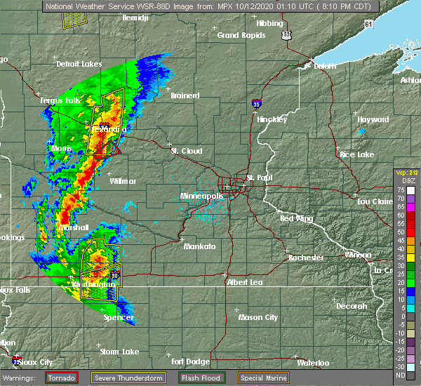 At 813 pm cdt, a severe thunderstorm capable of producing a tornado was located over belgrade, or 23 miles north of willmar, moving northeast at 45 mph (radar indicated rotation). Hazards include tornado. Flying debris will be dangerous to those caught without shelter. mobile homes will be damaged or destroyed. damage to roofs, windows, and vehicles will occur. tree damage is likely. This tornadic thunderstorm will remain over mainly rural areas of west central stearns county, including the following locations, georgeville. At 813 pm cdt, a severe thunderstorm capable of producing a tornado was located over belgrade, or 23 miles north of willmar, moving northeast at 45 mph (radar indicated rotation). Hazards include tornado. Flying debris will be dangerous to those caught without shelter. mobile homes will be damaged or destroyed. damage to roofs, windows, and vehicles will occur. tree damage is likely. This tornadic thunderstorm will remain over mainly rural areas of west central stearns county, including the following locations, georgeville.
|
| 10/11/2020 8:04 PM CDT |
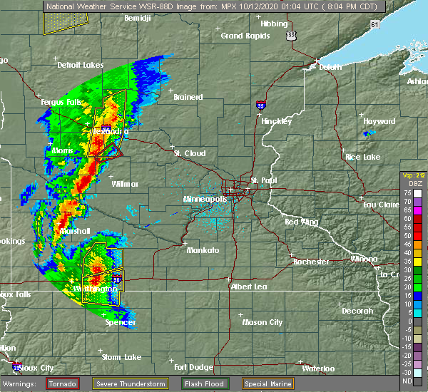 At 804 pm cdt, a severe thunderstorm capable of producing a tornado was located 7 miles southwest of brooten, or 19 miles north of willmar, moving northeast at 40 mph (radar indicated rotation). Hazards include tornado. Flying debris will be dangerous to those caught without shelter. mobile homes will be damaged or destroyed. damage to roofs, windows, and vehicles will occur. tree damage is likely. this dangerous storm will be near, brooten around 815 pm cdt. Belgrade around 820 pm cdt. At 804 pm cdt, a severe thunderstorm capable of producing a tornado was located 7 miles southwest of brooten, or 19 miles north of willmar, moving northeast at 40 mph (radar indicated rotation). Hazards include tornado. Flying debris will be dangerous to those caught without shelter. mobile homes will be damaged or destroyed. damage to roofs, windows, and vehicles will occur. tree damage is likely. this dangerous storm will be near, brooten around 815 pm cdt. Belgrade around 820 pm cdt.
|
| 10/11/2020 7:59 PM CDT |
 At 745 pm cdt, severe thunderstorms were located along a line extending from 5 miles southeast of parkers prairie to near lake osakis to 9 miles east of lake hassel, moving northeast at 45 mph (radar indicated). Hazards include 60 mph wind gusts. Expect damage to roofs, siding, and trees. these severe storms will be near, lake osakis around 750 pm cdt. eagle bend around 800 pm cdt. long prairie, brooten, bertha and hewitt around 805 pm cdt. browerville, belgrade and clarissa around 810 pm cdt. staples around 825 pm cdt. Other locations impacted by these severe thunderstorms include glenwood airport, westport, nelson, round prairie, grove lake, villard, miltona, padua, rose city and clotho. At 745 pm cdt, severe thunderstorms were located along a line extending from 5 miles southeast of parkers prairie to near lake osakis to 9 miles east of lake hassel, moving northeast at 45 mph (radar indicated). Hazards include 60 mph wind gusts. Expect damage to roofs, siding, and trees. these severe storms will be near, lake osakis around 750 pm cdt. eagle bend around 800 pm cdt. long prairie, brooten, bertha and hewitt around 805 pm cdt. browerville, belgrade and clarissa around 810 pm cdt. staples around 825 pm cdt. Other locations impacted by these severe thunderstorms include glenwood airport, westport, nelson, round prairie, grove lake, villard, miltona, padua, rose city and clotho.
|
| 10/11/2020 7:46 PM CDT |
 At 745 pm cdt, severe thunderstorms were located along a line extending from 5 miles southeast of parkers prairie to near lake osakis to 9 miles east of lake hassel, moving northeast at 45 mph (radar indicated). Hazards include 60 mph wind gusts. Expect damage to roofs, siding, and trees. these severe storms will be near, lake osakis around 750 pm cdt. eagle bend around 800 pm cdt. long prairie, brooten, bertha and hewitt around 805 pm cdt. browerville, belgrade and clarissa around 810 pm cdt. staples around 825 pm cdt. Other locations impacted by these severe thunderstorms include glenwood airport, westport, nelson, round prairie, grove lake, villard, miltona, padua, rose city and clotho. At 745 pm cdt, severe thunderstorms were located along a line extending from 5 miles southeast of parkers prairie to near lake osakis to 9 miles east of lake hassel, moving northeast at 45 mph (radar indicated). Hazards include 60 mph wind gusts. Expect damage to roofs, siding, and trees. these severe storms will be near, lake osakis around 750 pm cdt. eagle bend around 800 pm cdt. long prairie, brooten, bertha and hewitt around 805 pm cdt. browerville, belgrade and clarissa around 810 pm cdt. staples around 825 pm cdt. Other locations impacted by these severe thunderstorms include glenwood airport, westport, nelson, round prairie, grove lake, villard, miltona, padua, rose city and clotho.
|
| 10/11/2020 7:28 PM CDT |
 At 727 pm cdt, severe thunderstorms were located along a line extending from 6 miles northeast of brandon to near alexandria to 6 miles northeast of lowry to 5 miles northeast of lake hassel, moving northeast at 45 mph (radar indicated. a personal weather station measured a 65 mph gust in garfield). Hazards include 60 mph wind gusts. Expect damage to roofs, siding, and trees. severe thunderstorms will be near, alexandria and carlos around 735 pm cdt. glenwood around 745 pm cdt. lake osakis around 750 pm cdt. eagle bend around 800 pm cdt. bertha and hewitt around 805 pm cdt. sauk centre, staples, browerville and clarissa around 815 pm cdt. Other locations impacted by these severe thunderstorms include glenwood airport, westport, nelson, round prairie, grove lake, villard, miltona, padua, rose city and clotho. At 727 pm cdt, severe thunderstorms were located along a line extending from 6 miles northeast of brandon to near alexandria to 6 miles northeast of lowry to 5 miles northeast of lake hassel, moving northeast at 45 mph (radar indicated. a personal weather station measured a 65 mph gust in garfield). Hazards include 60 mph wind gusts. Expect damage to roofs, siding, and trees. severe thunderstorms will be near, alexandria and carlos around 735 pm cdt. glenwood around 745 pm cdt. lake osakis around 750 pm cdt. eagle bend around 800 pm cdt. bertha and hewitt around 805 pm cdt. sauk centre, staples, browerville and clarissa around 815 pm cdt. Other locations impacted by these severe thunderstorms include glenwood airport, westport, nelson, round prairie, grove lake, villard, miltona, padua, rose city and clotho.
|
| 8/14/2020 5:20 PM CDT |
 At 519 pm cdt, a severe thunderstorm was located near sauk centre, or 26 miles southeast of alexandria, moving east at 45 mph (radar indicated). Hazards include 60 mph wind gusts and quarter size hail. Hail damage to vehicles is expected. expect wind damage to roofs, siding, and trees. this severe storm will be near, melrose around 525 pm cdt. freeport around 535 pm cdt. other locations impacted by this severe thunderstorm include greenwald, new munich, spring hill, lake henry, georgeville, elrosa, padua, roscoe, meire grove and st. Martin. At 519 pm cdt, a severe thunderstorm was located near sauk centre, or 26 miles southeast of alexandria, moving east at 45 mph (radar indicated). Hazards include 60 mph wind gusts and quarter size hail. Hail damage to vehicles is expected. expect wind damage to roofs, siding, and trees. this severe storm will be near, melrose around 525 pm cdt. freeport around 535 pm cdt. other locations impacted by this severe thunderstorm include greenwald, new munich, spring hill, lake henry, georgeville, elrosa, padua, roscoe, meire grove and st. Martin.
|
| 8/14/2020 5:07 PM CDT |
 At 506 pm cdt, a severe thunderstorm was located 9 miles southwest of sauk centre, or 22 miles southeast of alexandria, moving east at 45 mph (radar indicated). Hazards include 60 mph wind gusts and quarter size hail. Hail damage to vehicles is expected. expect wind damage to roofs, siding, and trees. this severe storm will be near, melrose around 525 pm cdt. freeport around 535 pm cdt. Other locations impacted by this severe thunderstorm include greenwald, grove lake, new munich, spring hill, lake henry, georgeville, elrosa, padua, roscoe and meire grove. At 506 pm cdt, a severe thunderstorm was located 9 miles southwest of sauk centre, or 22 miles southeast of alexandria, moving east at 45 mph (radar indicated). Hazards include 60 mph wind gusts and quarter size hail. Hail damage to vehicles is expected. expect wind damage to roofs, siding, and trees. this severe storm will be near, melrose around 525 pm cdt. freeport around 535 pm cdt. Other locations impacted by this severe thunderstorm include greenwald, grove lake, new munich, spring hill, lake henry, georgeville, elrosa, padua, roscoe and meire grove.
|
| 8/14/2020 4:58 PM CDT |
 At 458 pm cdt, a severe thunderstorm was located 8 miles east of glenwood, or 21 miles south of alexandria, moving east at 45 mph (radar indicated). Hazards include 60 mph wind gusts and quarter size hail. Hail damage to vehicles is expected. expect wind damage to roofs, siding, and trees. this severe thunderstorm will be near, melrose around 525 pm cdt. freeport around 535 pm cdt. other locations impacted by this severe thunderstorm include glenwood airport, grove lake, spring hill, padua, st. Martin, greenwald, gilchrist, new munich, lake henry and georgeville. At 458 pm cdt, a severe thunderstorm was located 8 miles east of glenwood, or 21 miles south of alexandria, moving east at 45 mph (radar indicated). Hazards include 60 mph wind gusts and quarter size hail. Hail damage to vehicles is expected. expect wind damage to roofs, siding, and trees. this severe thunderstorm will be near, melrose around 525 pm cdt. freeport around 535 pm cdt. other locations impacted by this severe thunderstorm include glenwood airport, grove lake, spring hill, padua, st. Martin, greenwald, gilchrist, new munich, lake henry and georgeville.
|
| 7/18/2020 12:46 AM CDT |
 At 1246 am cdt, severe thunderstorms were located along a line extending from near foley to cold spring to 6 miles north of new london, moving southeast at 25 mph (radar indicated). Hazards include 60 mph wind gusts. Expect damage to roofs, siding, and trees. these severe storms will be near, st. cloud, sauk rapids and foley around 1250 am cdt. rockville around 1255 am cdt. paynesville around 100 am cdt. other locations impacted by these severe thunderstorms include mayhew, paynesville airport, parent, spring hill, oak park, padua, pleasant lake, st. stephen, regal and st. Martin. At 1246 am cdt, severe thunderstorms were located along a line extending from near foley to cold spring to 6 miles north of new london, moving southeast at 25 mph (radar indicated). Hazards include 60 mph wind gusts. Expect damage to roofs, siding, and trees. these severe storms will be near, st. cloud, sauk rapids and foley around 1250 am cdt. rockville around 1255 am cdt. paynesville around 100 am cdt. other locations impacted by these severe thunderstorms include mayhew, paynesville airport, parent, spring hill, oak park, padua, pleasant lake, st. stephen, regal and st. Martin.
|
| 7/18/2020 12:19 AM CDT |
 At 1218 am cdt, severe thunderstorms were located along a line extending from 7 miles east of rice to near albany to near brooten, moving southeast at 35 mph (radar indicated). Hazards include 60 mph wind gusts. Expect damage to roofs, siding, and trees. these severe storms will be near, sauk rapids, foley and richmond around 1235 am cdt. st. cloud, cold spring and rockville around 1240 am cdt. new london around 1250 am cdt. other locations impacted by these severe thunderstorms include mayhew, morrill, parent, spring hill, opole, pleasant lake, hillman, st. Martin, greenwald and gilman. At 1218 am cdt, severe thunderstorms were located along a line extending from 7 miles east of rice to near albany to near brooten, moving southeast at 35 mph (radar indicated). Hazards include 60 mph wind gusts. Expect damage to roofs, siding, and trees. these severe storms will be near, sauk rapids, foley and richmond around 1235 am cdt. st. cloud, cold spring and rockville around 1240 am cdt. new london around 1250 am cdt. other locations impacted by these severe thunderstorms include mayhew, morrill, parent, spring hill, opole, pleasant lake, hillman, st. Martin, greenwald and gilman.
|
| 7/18/2020 12:11 AM CDT |
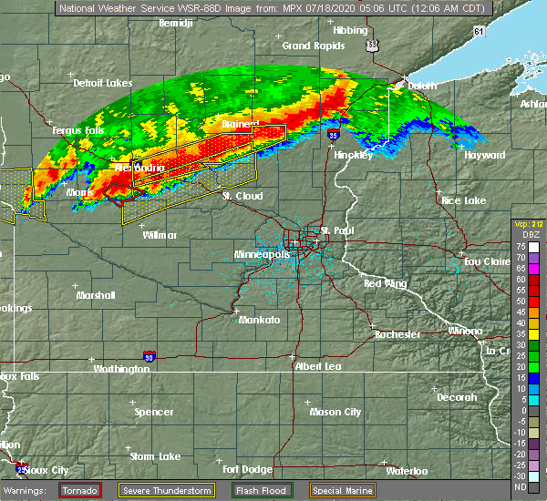 At 1211 am cdt, a severe thunderstorm capable of producing a tornado was located near brooten, or 27 miles north of willmar, moving east at 40 mph (radar indicated rotation). Hazards include tornado and quarter size hail. Flying debris will be dangerous to those caught without shelter. mobile homes will be damaged or destroyed. damage to roofs, windows, and vehicles will occur. tree damage is likely. this dangerous storm will be near, brooten around 1220 am cdt. Other locations impacted by this tornadic thunderstorm include sedan. At 1211 am cdt, a severe thunderstorm capable of producing a tornado was located near brooten, or 27 miles north of willmar, moving east at 40 mph (radar indicated rotation). Hazards include tornado and quarter size hail. Flying debris will be dangerous to those caught without shelter. mobile homes will be damaged or destroyed. damage to roofs, windows, and vehicles will occur. tree damage is likely. this dangerous storm will be near, brooten around 1220 am cdt. Other locations impacted by this tornadic thunderstorm include sedan.
|
| 7/18/2020 12:00 AM CDT |
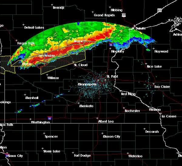 At 1159 pm cdt, a severe thunderstorm capable of producing a tornado was located 8 miles south of glenwood, or 25 miles south of alexandria, moving east at 40 mph (radar indicated rotation). Hazards include tornado and quarter size hail. Flying debris will be dangerous to those caught without shelter. mobile homes will be damaged or destroyed. damage to roofs, windows, and vehicles will occur. tree damage is likely. this dangerous storm will be near, brooten around 1220 am cdt. Other locations impacted by this tornadic thunderstorm include gilchrist and sedan. At 1159 pm cdt, a severe thunderstorm capable of producing a tornado was located 8 miles south of glenwood, or 25 miles south of alexandria, moving east at 40 mph (radar indicated rotation). Hazards include tornado and quarter size hail. Flying debris will be dangerous to those caught without shelter. mobile homes will be damaged or destroyed. damage to roofs, windows, and vehicles will occur. tree damage is likely. this dangerous storm will be near, brooten around 1220 am cdt. Other locations impacted by this tornadic thunderstorm include gilchrist and sedan.
|
| 7/17/2020 11:58 PM CDT |
 At 1158 pm cdt, severe thunderstorms were located along a line extending from near royalton to near melrose to near brooten, moving southeast at 25 mph (radar indicated). Hazards include 60 mph wind gusts. Expect damage to roofs, siding, and trees. severe thunderstorms will be near, royalton around 1205 am cdt. st. anthony and freeport around 1215 am cdt. rice around 1220 am cdt. albany around 1225 am cdt. sauk rapids, paynesville and new london around 1250 am cdt. st. Cloud and cold spring around 100 am cdt. At 1158 pm cdt, severe thunderstorms were located along a line extending from near royalton to near melrose to near brooten, moving southeast at 25 mph (radar indicated). Hazards include 60 mph wind gusts. Expect damage to roofs, siding, and trees. severe thunderstorms will be near, royalton around 1205 am cdt. st. anthony and freeport around 1215 am cdt. rice around 1220 am cdt. albany around 1225 am cdt. sauk rapids, paynesville and new london around 1250 am cdt. st. Cloud and cold spring around 100 am cdt.
|
| 7/17/2020 11:51 PM CDT |
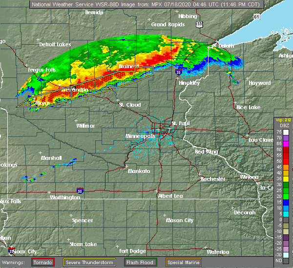 At 1151 pm cdt, a severe thunderstorm capable of producing a tornado was located near starbuck, or 22 miles east of morris, moving southeast at 30 mph (radar indicated rotation). Hazards include tornado and quarter size hail. Flying debris will be dangerous to those caught without shelter. mobile homes will be damaged or destroyed. damage to roofs, windows, and vehicles will occur. tree damage is likely. this dangerous storm will be near, brooten around 1230 am cdt. Other locations impacted by this tornadic thunderstorm include gilchrist, sedan and lake minnewaska. At 1151 pm cdt, a severe thunderstorm capable of producing a tornado was located near starbuck, or 22 miles east of morris, moving southeast at 30 mph (radar indicated rotation). Hazards include tornado and quarter size hail. Flying debris will be dangerous to those caught without shelter. mobile homes will be damaged or destroyed. damage to roofs, windows, and vehicles will occur. tree damage is likely. this dangerous storm will be near, brooten around 1230 am cdt. Other locations impacted by this tornadic thunderstorm include gilchrist, sedan and lake minnewaska.
|
| 9/2/2019 8:58 PM CDT |
 A severe thunderstorm warning remains in effect until 915 pm cdt for south central todd. western stearns. southeastern swift and northern kandiyohi counties. At 857 pm cdt, severe thunderstorms were located along a line extending from near upsala to near paynesville to near willmar to 10 miles southwest of murdock, moving east at 50 mph. A severe thunderstorm warning remains in effect until 915 pm cdt for south central todd. western stearns. southeastern swift and northern kandiyohi counties. At 857 pm cdt, severe thunderstorms were located along a line extending from near upsala to near paynesville to near willmar to 10 miles southwest of murdock, moving east at 50 mph.
|
| 9/2/2019 8:38 PM CDT |
 At 837 pm cdt, severe thunderstorms were located along a line extending from 7 miles east of lake osakis to near brooten to near murdock to 7 miles east of appleton, moving east at 45 mph (law enforcement). Hazards include 70 mph wind gusts and quarter size hail. Hail damage to vehicles is expected. expect considerable tree damage. wind damage is also likely to mobile homes, roofs, and outbuildings. Locations impacted include, willmar, sauk centre, melrose, benson, glenwood, albany, paynesville, appleton, new london, spicer, kerkhoven and brooten. At 837 pm cdt, severe thunderstorms were located along a line extending from 7 miles east of lake osakis to near brooten to near murdock to 7 miles east of appleton, moving east at 45 mph (law enforcement). Hazards include 70 mph wind gusts and quarter size hail. Hail damage to vehicles is expected. expect considerable tree damage. wind damage is also likely to mobile homes, roofs, and outbuildings. Locations impacted include, willmar, sauk centre, melrose, benson, glenwood, albany, paynesville, appleton, new london, spicer, kerkhoven and brooten.
|
| 9/2/2019 8:20 PM CDT |
 At 819 pm cdt, severe thunderstorms were located along a line extending from near lake osakis to near glenwood to near benson to near correll, moving east at 45 mph (radar indicated). Hazards include 70 mph wind gusts and quarter size hail. Hail damage to vehicles is expected. expect considerable tree damage. Wind damage is also likely to mobile homes, roofs, and outbuildings. At 819 pm cdt, severe thunderstorms were located along a line extending from near lake osakis to near glenwood to near benson to near correll, moving east at 45 mph (radar indicated). Hazards include 70 mph wind gusts and quarter size hail. Hail damage to vehicles is expected. expect considerable tree damage. Wind damage is also likely to mobile homes, roofs, and outbuildings.
|
| 6/4/2019 1:09 PM CDT |
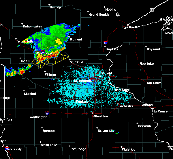 At 109 pm cdt, a severe thunderstorm was located over freeport, or 23 miles west of st. cloud, moving east at 25 mph (radar indicated). Hazards include ping pong ball size hail and 60 mph wind gusts. People and animals outdoors will be injured. expect hail damage to roofs, siding, windows, and vehicles. Expect wind damage to roofs, siding, and trees. At 109 pm cdt, a severe thunderstorm was located over freeport, or 23 miles west of st. cloud, moving east at 25 mph (radar indicated). Hazards include ping pong ball size hail and 60 mph wind gusts. People and animals outdoors will be injured. expect hail damage to roofs, siding, windows, and vehicles. Expect wind damage to roofs, siding, and trees.
|
| 6/4/2019 12:41 PM CDT |
 At 1241 pm cdt, a severe thunderstorm was located near glenwood, or 20 miles south of alexandria, moving southeast at 45 mph (radar indicated). Hazards include 60 mph wind gusts and half dollar size hail. Hail damage to vehicles is expected. Expect wind damage to roofs, siding, and trees. At 1241 pm cdt, a severe thunderstorm was located near glenwood, or 20 miles south of alexandria, moving southeast at 45 mph (radar indicated). Hazards include 60 mph wind gusts and half dollar size hail. Hail damage to vehicles is expected. Expect wind damage to roofs, siding, and trees.
|
| 8/27/2018 4:02 PM CDT |
 A severe thunderstorm warning remains in effect until 445 pm cdt for southern todd and northwestern stearns counties. at 401 pm cdt, a severe thunderstorm was located near sauk centre airport, or 23 miles southeast of alexandria, moving northeast at 45 mph. hazard. Ping pong ball size hail and 60 mph wind gusts. A severe thunderstorm warning remains in effect until 445 pm cdt for southern todd and northwestern stearns counties. at 401 pm cdt, a severe thunderstorm was located near sauk centre airport, or 23 miles southeast of alexandria, moving northeast at 45 mph. hazard. Ping pong ball size hail and 60 mph wind gusts.
|
| 8/27/2018 3:54 PM CDT |
 At 346 pm cdt, a severe thunderstorm was located over sedan, or 23 miles south of alexandria, moving northeast at 45 mph (radar indicated). Hazards include 60 mph wind gusts and quarter size hail. Hail damage to vehicles is expected. expect wind damage to roofs, siding, and trees. this severe storm will be near, sauk centre around 410 pm cdt. melrose around 415 pm cdt. grey eagle around 425 pm cdt. swanville around 435 pm cdt. other locations impacted by this severe thunderstorm include glenwood airport, westport, st. Rosa, round prairie, grove lake, spring hill, villard, burtrum, padua and pleasant beach. At 346 pm cdt, a severe thunderstorm was located over sedan, or 23 miles south of alexandria, moving northeast at 45 mph (radar indicated). Hazards include 60 mph wind gusts and quarter size hail. Hail damage to vehicles is expected. expect wind damage to roofs, siding, and trees. this severe storm will be near, sauk centre around 410 pm cdt. melrose around 415 pm cdt. grey eagle around 425 pm cdt. swanville around 435 pm cdt. other locations impacted by this severe thunderstorm include glenwood airport, westport, st. Rosa, round prairie, grove lake, spring hill, villard, burtrum, padua and pleasant beach.
|
| 8/27/2018 3:46 PM CDT |
 At 346 pm cdt, a severe thunderstorm was located over sedan, or 23 miles south of alexandria, moving northeast at 45 mph (radar indicated). Hazards include 60 mph wind gusts and quarter size hail. Hail damage to vehicles is expected. expect wind damage to roofs, siding, and trees. this severe storm will be near, sauk centre around 410 pm cdt. melrose around 415 pm cdt. grey eagle around 425 pm cdt. swanville around 435 pm cdt. other locations impacted by this severe thunderstorm include glenwood airport, westport, st. Rosa, round prairie, grove lake, spring hill, villard, burtrum, padua and pleasant beach. At 346 pm cdt, a severe thunderstorm was located over sedan, or 23 miles south of alexandria, moving northeast at 45 mph (radar indicated). Hazards include 60 mph wind gusts and quarter size hail. Hail damage to vehicles is expected. expect wind damage to roofs, siding, and trees. this severe storm will be near, sauk centre around 410 pm cdt. melrose around 415 pm cdt. grey eagle around 425 pm cdt. swanville around 435 pm cdt. other locations impacted by this severe thunderstorm include glenwood airport, westport, st. Rosa, round prairie, grove lake, spring hill, villard, burtrum, padua and pleasant beach.
|
| 8/27/2018 3:38 PM CDT |
 At 338 pm cdt, a severe thunderstorm was located near sedan, or 25 miles south of alexandria, moving northeast at 45 mph (radar indicated). Hazards include 60 mph wind gusts and quarter size hail. Hail damage to vehicles is expected. expect wind damage to roofs, siding, and trees. this severe thunderstorm will be near, sauk centre around 410 pm cdt. melrose around 415 pm cdt. st. anthony and grey eagle around 425 pm cdt. swanville around 435 pm cdt. this includes the following highways, interstate 94 in minnesota between mile markers 118 and 147. u. s. Highway 71 between mile markers 147 and 182. At 338 pm cdt, a severe thunderstorm was located near sedan, or 25 miles south of alexandria, moving northeast at 45 mph (radar indicated). Hazards include 60 mph wind gusts and quarter size hail. Hail damage to vehicles is expected. expect wind damage to roofs, siding, and trees. this severe thunderstorm will be near, sauk centre around 410 pm cdt. melrose around 415 pm cdt. st. anthony and grey eagle around 425 pm cdt. swanville around 435 pm cdt. this includes the following highways, interstate 94 in minnesota between mile markers 118 and 147. u. s. Highway 71 between mile markers 147 and 182.
|
| 8/3/2018 6:22 PM CDT |
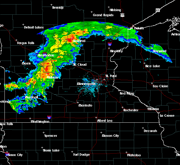 At 621 pm cdt, severe thunderstorms were located along a line extending from near brooten to near belgrade to near spicer, moving east at 35 mph (radar indicated). Hazards include 60 mph wind gusts. Expect damage to roofs, siding, and trees. these severe storms will be near, new london and spicer around 630 pm cdt. belgrade around 635 pm cdt. Other locations impacted by these severe thunderstorms include green lake, georgeville, elrosa, hawick, norway lake, regal and spring hill. At 621 pm cdt, severe thunderstorms were located along a line extending from near brooten to near belgrade to near spicer, moving east at 35 mph (radar indicated). Hazards include 60 mph wind gusts. Expect damage to roofs, siding, and trees. these severe storms will be near, new london and spicer around 630 pm cdt. belgrade around 635 pm cdt. Other locations impacted by these severe thunderstorms include green lake, georgeville, elrosa, hawick, norway lake, regal and spring hill.
|
| 8/3/2018 6:04 PM CDT |
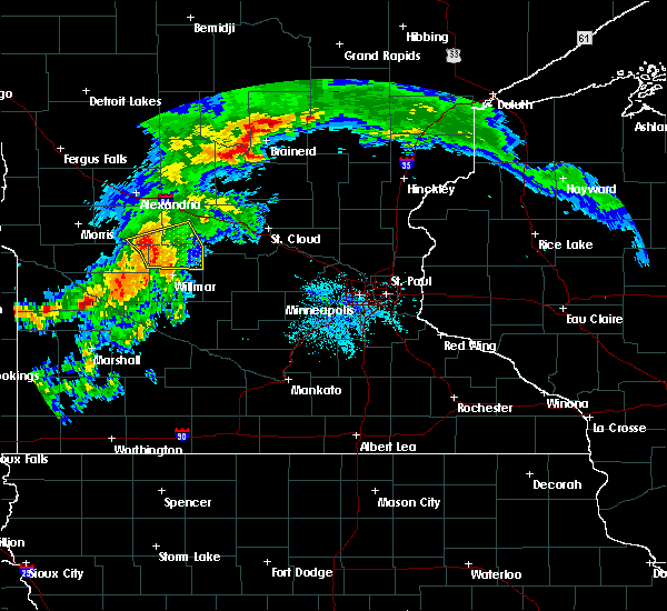 At 604 pm cdt, severe thunderstorms were located along a line extending from near gilchrist to sunburg to 6 miles northeast of kerkhoven, moving east at 35 mph (trained weather spotters). Hazards include 60 mph wind gusts. Expect damage to roofs, siding, and trees. severe thunderstorms will be near, willmar around 615 pm cdt. brooten around 620 pm cdt. new london, spicer and belgrade around 625 pm cdt. other locations impacted by these severe thunderstorms include gilchrist, green lake, georgeville, elrosa, hawick, norway lake, sunburg, regal, padua and spring hill. Trees were reported down just west of sunburg at 601 pm. At 604 pm cdt, severe thunderstorms were located along a line extending from near gilchrist to sunburg to 6 miles northeast of kerkhoven, moving east at 35 mph (trained weather spotters). Hazards include 60 mph wind gusts. Expect damage to roofs, siding, and trees. severe thunderstorms will be near, willmar around 615 pm cdt. brooten around 620 pm cdt. new london, spicer and belgrade around 625 pm cdt. other locations impacted by these severe thunderstorms include gilchrist, green lake, georgeville, elrosa, hawick, norway lake, sunburg, regal, padua and spring hill. Trees were reported down just west of sunburg at 601 pm.
|
| 6/16/2018 10:12 PM CDT |
 At 1012 pm cdt, a severe thunderstorm was located near padua, or 23 miles southeast of alexandria, moving east at 25 mph (radar indicated). Hazards include 60 mph wind gusts and quarter size hail. Hail damage to vehicles is expected. Expect wind damage to roofs, siding, and trees. At 1012 pm cdt, a severe thunderstorm was located near padua, or 23 miles southeast of alexandria, moving east at 25 mph (radar indicated). Hazards include 60 mph wind gusts and quarter size hail. Hail damage to vehicles is expected. Expect wind damage to roofs, siding, and trees.
|
| 6/6/2018 3:11 AM CDT |
 At 310 am cdt, severe thunderstorms were located along a line extending from villard to near sunburg to 8 miles north of gluek, moving east at 60 mph (radar indicated. at 300am a 67 mph wind gust was reported at benson). Hazards include 60 mph wind gusts. Expect damage to roofs, siding, and trees. severe thunderstorms will be near, sauk centre around 325 am cdt. willmar, melrose, new london and spicer around 330 am cdt. freeport around 335 am cdt. st. anthony and paynesville around 340 am cdt. albany, avon and holdingford around 345 am cdt. other locations impacted by these severe thunderstorms include spring hill, st. Martin, greenwald, green lake, new munich, meire grove, sedan and westport. At 310 am cdt, severe thunderstorms were located along a line extending from villard to near sunburg to 8 miles north of gluek, moving east at 60 mph (radar indicated. at 300am a 67 mph wind gust was reported at benson). Hazards include 60 mph wind gusts. Expect damage to roofs, siding, and trees. severe thunderstorms will be near, sauk centre around 325 am cdt. willmar, melrose, new london and spicer around 330 am cdt. freeport around 335 am cdt. st. anthony and paynesville around 340 am cdt. albany, avon and holdingford around 345 am cdt. other locations impacted by these severe thunderstorms include spring hill, st. Martin, greenwald, green lake, new munich, meire grove, sedan and westport.
|
| 6/6/2018 2:45 AM CDT |
 At 244 am cdt, severe thunderstorms were located along a line extending from near lowry to hancock to appleton, moving east at 50 mph (radar indicated). Hazards include 60 mph wind gusts and penny size hail. Expect damage to roofs, siding, and trees. these severe storms will be near, lowry around 250 am cdt. starbuck around 300 am cdt. benson and glenwood around 310 am cdt. murdock around 315 am cdt. Other locations impacted by these severe thunderstorms include westport, swift falls, alberta, grove lake, de graff, villard, and lake minnewaska. At 244 am cdt, severe thunderstorms were located along a line extending from near lowry to hancock to appleton, moving east at 50 mph (radar indicated). Hazards include 60 mph wind gusts and penny size hail. Expect damage to roofs, siding, and trees. these severe storms will be near, lowry around 250 am cdt. starbuck around 300 am cdt. benson and glenwood around 310 am cdt. murdock around 315 am cdt. Other locations impacted by these severe thunderstorms include westport, swift falls, alberta, grove lake, de graff, villard, and lake minnewaska.
|
| 6/6/2018 2:18 AM CDT |
 At 217 am cdt, severe thunderstorms were located along a line extending from near donnelly to 7 miles northwest of artichoke to 6 miles southwest of big stone national wildlife refuge, moving east at 50 mph (radar indicated). Hazards include 60 mph wind gusts and penny size hail. Expect damage to roofs, siding, and trees. severe thunderstorms will be near, donnelly around 220 am cdt. chokio around 225 am cdt. lake hattie around 230 am cdt. morris and lowry around 240 am cdt. appleton and hancock around 245 am cdt. cyrus around 250 am cdt. Other locations impacted by these severe thunderstorms include westport, swift falls, alberta, grove lake, de graff, villard, fish lake and lake minnewaska. At 217 am cdt, severe thunderstorms were located along a line extending from near donnelly to 7 miles northwest of artichoke to 6 miles southwest of big stone national wildlife refuge, moving east at 50 mph (radar indicated). Hazards include 60 mph wind gusts and penny size hail. Expect damage to roofs, siding, and trees. severe thunderstorms will be near, donnelly around 220 am cdt. chokio around 225 am cdt. lake hattie around 230 am cdt. morris and lowry around 240 am cdt. appleton and hancock around 245 am cdt. cyrus around 250 am cdt. Other locations impacted by these severe thunderstorms include westport, swift falls, alberta, grove lake, de graff, villard, fish lake and lake minnewaska.
|
| 9/24/2017 4:42 PM CDT |
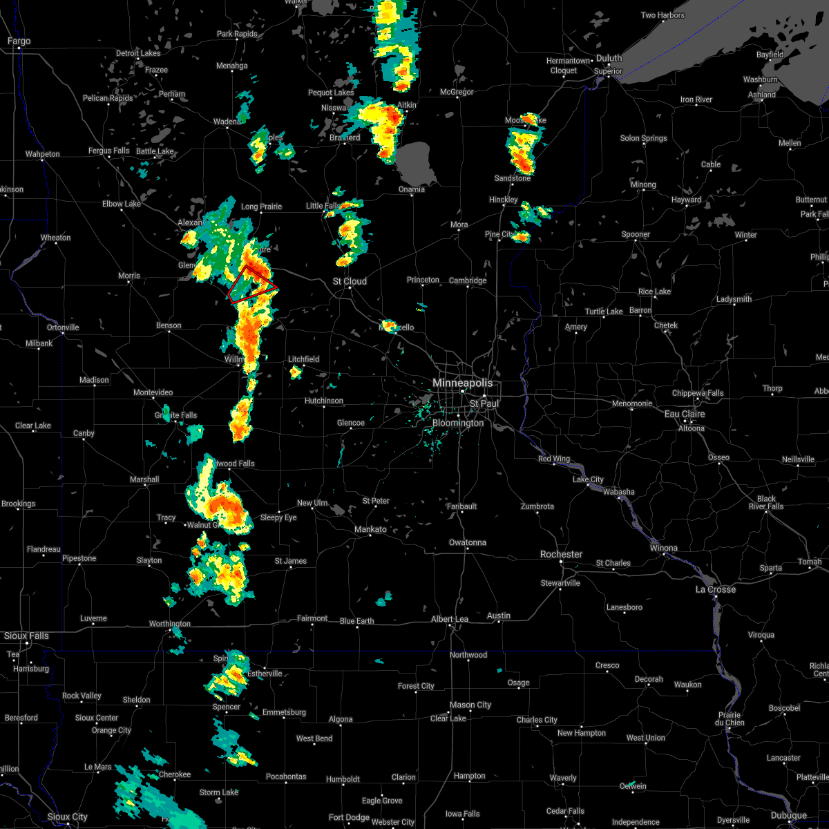 The tornado warning for western stearns county will expire at 445 pm cdt, the storm which prompted the warning has weakened below severe limits, and no longer appears capable of producing a tornado. therefore the warning will be allowed to expire. however gusty winds are still possible with this thunderstorm. The tornado warning for western stearns county will expire at 445 pm cdt, the storm which prompted the warning has weakened below severe limits, and no longer appears capable of producing a tornado. therefore the warning will be allowed to expire. however gusty winds are still possible with this thunderstorm.
|
| 9/24/2017 4:33 PM CDT |
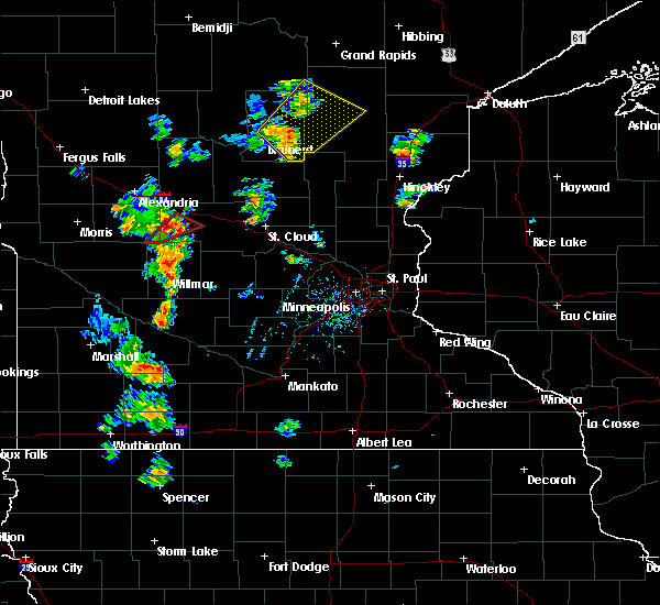 At 432 pm cdt, a severe thunderstorm capable of producing a tornado was located near padua, or 28 miles north of willmar, moving northeast at 45 mph (radar indicated rotation). Hazards include tornado. Flying debris will be dangerous to those caught without shelter. mobile homes will be damaged or destroyed. damage to roofs, windows, and vehicles will occur. tree damage is likely. This tornadic thunderstorm will remain over mainly rural areas of west central stearns county, including the following locations: greenwald, padua, elrosa and meire grove. At 432 pm cdt, a severe thunderstorm capable of producing a tornado was located near padua, or 28 miles north of willmar, moving northeast at 45 mph (radar indicated rotation). Hazards include tornado. Flying debris will be dangerous to those caught without shelter. mobile homes will be damaged or destroyed. damage to roofs, windows, and vehicles will occur. tree damage is likely. This tornadic thunderstorm will remain over mainly rural areas of west central stearns county, including the following locations: greenwald, padua, elrosa and meire grove.
|
| 9/24/2017 4:18 PM CDT |
 At 417 pm cdt, a severe thunderstorm capable of producing a tornado was located 5 miles west of brooten, or 22 miles north of willmar, moving northeast at 45 mph (radar indicated rotation). Hazards include tornado. Flying debris will be dangerous to those caught without shelter. mobile homes will be damaged or destroyed. damage to roofs, windows, and vehicles will occur. tree damage is likely. this dangerous storm will be near, brooten around 425 pm cdt. belgrade around 430 pm cdt. other locations impacted by this tornadic thunderstorm include greenwald, padua, elrosa, spring hill and meire grove. this includes u. s. Highway 71 between mile markers 150 and 163. At 417 pm cdt, a severe thunderstorm capable of producing a tornado was located 5 miles west of brooten, or 22 miles north of willmar, moving northeast at 45 mph (radar indicated rotation). Hazards include tornado. Flying debris will be dangerous to those caught without shelter. mobile homes will be damaged or destroyed. damage to roofs, windows, and vehicles will occur. tree damage is likely. this dangerous storm will be near, brooten around 425 pm cdt. belgrade around 430 pm cdt. other locations impacted by this tornadic thunderstorm include greenwald, padua, elrosa, spring hill and meire grove. this includes u. s. Highway 71 between mile markers 150 and 163.
|
| 9/20/2017 12:42 AM CDT |
 At 1242 am cdt, severe thunderstorms were located along a line extending from near villard to near brooten to near pennock, moving northeast at 80 mph (radar indicated). Hazards include 60 mph wind gusts and nickel size hail. Expect damage to roofs, siding, and trees. severe thunderstorms will be near, sauk centre and melrose around 1255 am cdt. grey eagle around 105 am cdt. freeport around 115 am cdt. other locations impacted by these severe thunderstorms include westport, st. Rosa, round prairie, grove lake, spring hill, burtrum, padua, regal, pleasant beach and greenwald. At 1242 am cdt, severe thunderstorms were located along a line extending from near villard to near brooten to near pennock, moving northeast at 80 mph (radar indicated). Hazards include 60 mph wind gusts and nickel size hail. Expect damage to roofs, siding, and trees. severe thunderstorms will be near, sauk centre and melrose around 1255 am cdt. grey eagle around 105 am cdt. freeport around 115 am cdt. other locations impacted by these severe thunderstorms include westport, st. Rosa, round prairie, grove lake, spring hill, burtrum, padua, regal, pleasant beach and greenwald.
|
| 9/20/2017 12:33 AM CDT |
 At 1233 am cdt, severe thunderstorms were located along a line extending from near urbank to miltona to lake minnewaska, moving northeast at 60 mph (radar indicated). Hazards include 60 mph wind gusts and penny size hail. Expect damage to roofs, siding, and trees. these severe storms will be near, alexandria around 1245 am cdt. Other locations impacted by these severe thunderstorms include westport, nelson, garfield, grove lake, villard, miltona, rose city and holmes city. At 1233 am cdt, severe thunderstorms were located along a line extending from near urbank to miltona to lake minnewaska, moving northeast at 60 mph (radar indicated). Hazards include 60 mph wind gusts and penny size hail. Expect damage to roofs, siding, and trees. these severe storms will be near, alexandria around 1245 am cdt. Other locations impacted by these severe thunderstorms include westport, nelson, garfield, grove lake, villard, miltona, rose city and holmes city.
|
| 9/20/2017 12:17 AM CDT |
 At 1217 am cdt, severe thunderstorms were located along a line extending from evansville to near holmes city to near lake emily, moving northeast at 70 mph (radar indicated). Hazards include 60 mph wind gusts and quarter size hail. Hail damage to vehicles is expected. expect wind damage to roofs, siding, and trees. these severe storms will be near, evansville and brandon around 1220 am cdt. starbuck around 1225 am cdt. carlos around 1230 am cdt. glenwood and lowry around 1235 am cdt. alexandria around 1245 am cdt. Other locations impacted by these severe thunderstorms include westport, nelson, garfield, grove lake, melby, villard, miltona and rose city. At 1217 am cdt, severe thunderstorms were located along a line extending from evansville to near holmes city to near lake emily, moving northeast at 70 mph (radar indicated). Hazards include 60 mph wind gusts and quarter size hail. Hail damage to vehicles is expected. expect wind damage to roofs, siding, and trees. these severe storms will be near, evansville and brandon around 1220 am cdt. starbuck around 1225 am cdt. carlos around 1230 am cdt. glenwood and lowry around 1235 am cdt. alexandria around 1245 am cdt. Other locations impacted by these severe thunderstorms include westport, nelson, garfield, grove lake, melby, villard, miltona and rose city.
|
| 9/19/2017 11:50 PM CDT |
 At 1149 pm cdt, severe thunderstorms were located along a line extending from near ashby to 6 miles southwest of kensington to 6 miles east of lake oliver, moving northeast at 60 mph (radar indicated). Hazards include 60 mph wind gusts and penny size hail. Expect damage to roofs, siding, and trees. severe thunderstorms will be near, kensington around 1155 pm cdt. cyrus around 1205 am cdt. brandon around 1210 am cdt. starbuck around 1215 am cdt. lowry around 1220 am cdt. alexandria around 1230 am cdt. carlos around 1240 am cdt. Other locations impacted by these severe thunderstorms include westport, nelson, garfield, grove lake, melby, villard, miltona and rose city. At 1149 pm cdt, severe thunderstorms were located along a line extending from near ashby to 6 miles southwest of kensington to 6 miles east of lake oliver, moving northeast at 60 mph (radar indicated). Hazards include 60 mph wind gusts and penny size hail. Expect damage to roofs, siding, and trees. severe thunderstorms will be near, kensington around 1155 pm cdt. cyrus around 1205 am cdt. brandon around 1210 am cdt. starbuck around 1215 am cdt. lowry around 1220 am cdt. alexandria around 1230 am cdt. carlos around 1240 am cdt. Other locations impacted by these severe thunderstorms include westport, nelson, garfield, grove lake, melby, villard, miltona and rose city.
|
| 7/11/2017 11:40 PM CDT |
 At 1140 pm cdt, a severe thunderstorm was located near starbuck, or 20 miles east of morris, moving east at 45 mph (radar indicated). Hazards include 60 mph wind gusts and quarter size hail. Hail damage to vehicles is expected. expect wind damage to roofs, siding, and trees. this severe storm will be near, glenwood around 1150 pm cdt. Other locations impacted by this severe thunderstorm include glenwood airport, westport, grove lake, long beach, villard, sedan and lake minnewaska. At 1140 pm cdt, a severe thunderstorm was located near starbuck, or 20 miles east of morris, moving east at 45 mph (radar indicated). Hazards include 60 mph wind gusts and quarter size hail. Hail damage to vehicles is expected. expect wind damage to roofs, siding, and trees. this severe storm will be near, glenwood around 1150 pm cdt. Other locations impacted by this severe thunderstorm include glenwood airport, westport, grove lake, long beach, villard, sedan and lake minnewaska.
|
| 7/11/2017 11:27 PM CDT |
 At 1127 pm cdt, a severe thunderstorm was located over lake emily, or 14 miles southeast of morris, moving east at 45 mph (radar indicated). Hazards include 60 mph wind gusts and quarter size hail. Hail damage to vehicles is expected. expect wind damage to roofs, siding, and trees. this severe thunderstorm will be near, starbuck around 1135 pm cdt. glenwood around 1150 pm cdt. Other locations impacted by this severe thunderstorm include glenwood airport, westport, gilchrist, lake emily, grove lake, long beach, villard, sedan and lake minnewaska. At 1127 pm cdt, a severe thunderstorm was located over lake emily, or 14 miles southeast of morris, moving east at 45 mph (radar indicated). Hazards include 60 mph wind gusts and quarter size hail. Hail damage to vehicles is expected. expect wind damage to roofs, siding, and trees. this severe thunderstorm will be near, starbuck around 1135 pm cdt. glenwood around 1150 pm cdt. Other locations impacted by this severe thunderstorm include glenwood airport, westport, gilchrist, lake emily, grove lake, long beach, villard, sedan and lake minnewaska.
|
| 7/9/2017 9:06 PM CDT |
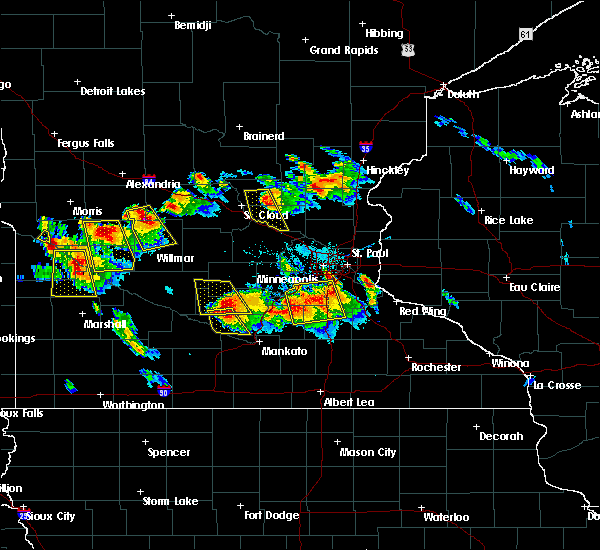 At 905 pm cdt, a severe thunderstorm was located near gilchrist, or 23 miles north of willmar, moving southeast at 30 mph (radar indicated). Hazards include two inch hail and 60 mph wind gusts. People and animals outdoors will be injured. expect hail damage to roofs, siding, windows, and vehicles. expect wind damage to roofs, siding, and trees. this severe thunderstorm will be near, new london around 940 pm cdt. spicer around 945 pm cdt. willmar around 950 pm cdt. other locations impacted by this severe thunderstorm include norway lake, green lake, sunburg, willmar airport and pennock. this includes the following highways, u. s. highway 12 between mile markers 68 and 73. u. s. highway 71 between mile markers 125 and 145. A tornado watch remains in effect until 100 am cdt for central and west central minnesota. At 905 pm cdt, a severe thunderstorm was located near gilchrist, or 23 miles north of willmar, moving southeast at 30 mph (radar indicated). Hazards include two inch hail and 60 mph wind gusts. People and animals outdoors will be injured. expect hail damage to roofs, siding, windows, and vehicles. expect wind damage to roofs, siding, and trees. this severe thunderstorm will be near, new london around 940 pm cdt. spicer around 945 pm cdt. willmar around 950 pm cdt. other locations impacted by this severe thunderstorm include norway lake, green lake, sunburg, willmar airport and pennock. this includes the following highways, u. s. highway 12 between mile markers 68 and 73. u. s. highway 71 between mile markers 125 and 145. A tornado watch remains in effect until 100 am cdt for central and west central minnesota.
|
| 7/4/2017 7:01 PM CDT | Quarter sized hail reported 8 miles ENE of Brooten, MN |
| 8/10/2016 5:26 AM CDT |
 The severe thunderstorm warning for northwestern stearns, southern todd, northeastern swift, southeastern douglas and pope counties will expire at 530 am cdt, the storms which prompted the warning have weakened below severe limits, and no longer pose an immediate threat to life or property. therefore the warning will be allowed to expire. however small. The severe thunderstorm warning for northwestern stearns, southern todd, northeastern swift, southeastern douglas and pope counties will expire at 530 am cdt, the storms which prompted the warning have weakened below severe limits, and no longer pose an immediate threat to life or property. therefore the warning will be allowed to expire. however small.
|
| 8/10/2016 5:11 AM CDT |
 At 511 am cdt, severe thunderstorms were located along a line extending from near clarissa to near lake osakis to 6 miles south of starbuck, moving east at 40 mph (radar indicated). Hazards include 60 mph wind gusts and quarter size hail. Hail damage to vehicles is expected. expect wind damage to roofs, siding, and trees. Locations impacted include, alexandria, sauk centre, melrose, long prairie, glenwood, starbuck, browerville, brooten, belgrade, lowry, lake hassel and lake osakis. At 511 am cdt, severe thunderstorms were located along a line extending from near clarissa to near lake osakis to 6 miles south of starbuck, moving east at 40 mph (radar indicated). Hazards include 60 mph wind gusts and quarter size hail. Hail damage to vehicles is expected. expect wind damage to roofs, siding, and trees. Locations impacted include, alexandria, sauk centre, melrose, long prairie, glenwood, starbuck, browerville, brooten, belgrade, lowry, lake hassel and lake osakis.
|
| 8/10/2016 4:47 AM CDT |
 At 447 am cdt, severe thunderstorms were located along a line extending from near rose city to near nelson to lake emily, moving east at 55 mph (radar indicated). Hazards include 60 mph wind gusts and nickel size hail. Expect damage to roofs. siding. And trees. At 447 am cdt, severe thunderstorms were located along a line extending from near rose city to near nelson to lake emily, moving east at 55 mph (radar indicated). Hazards include 60 mph wind gusts and nickel size hail. Expect damage to roofs. siding. And trees.
|
| 7/5/2016 3:30 PM CDT |
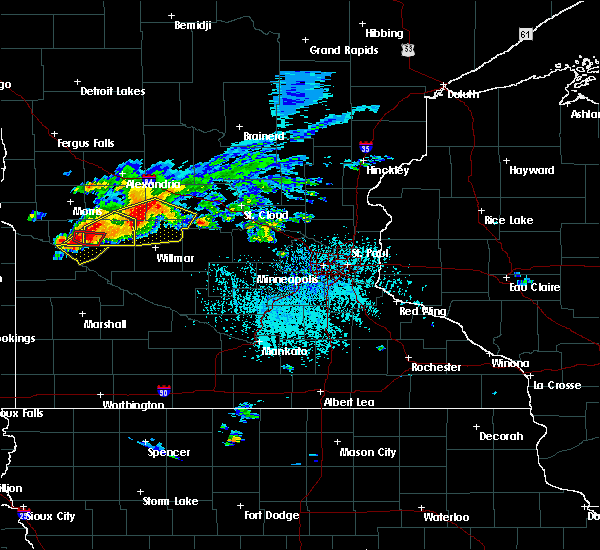 At 330 pm cdt, a severe thunderstorm was located near regal, or 16 miles north of willmar, moving east at 40 mph (radar indicated). Hazards include 70 mph wind gusts and quarter size hail. Hail damage to vehicles is expected. expect considerable tree damage. wind damage is also likely to mobile homes, roofs, and outbuildings. this severe storm will be near, paynesville around 345 pm cdt. other locations impacted by this severe thunderstorm include lake henry, padua, georgeville, paynesville airport, hawick, sunburg, gilchrist, norway lake, spring hill and regal. A tornado watch remains in effect until 900 pm cdt for west central and central minnesota. At 330 pm cdt, a severe thunderstorm was located near regal, or 16 miles north of willmar, moving east at 40 mph (radar indicated). Hazards include 70 mph wind gusts and quarter size hail. Hail damage to vehicles is expected. expect considerable tree damage. wind damage is also likely to mobile homes, roofs, and outbuildings. this severe storm will be near, paynesville around 345 pm cdt. other locations impacted by this severe thunderstorm include lake henry, padua, georgeville, paynesville airport, hawick, sunburg, gilchrist, norway lake, spring hill and regal. A tornado watch remains in effect until 900 pm cdt for west central and central minnesota.
|
| 7/5/2016 3:20 PM CDT |
 At 320 pm cdt, a severe thunderstorm was located near belgrade, or 17 miles north of willmar, moving east at 40 mph (radar indicated). Hazards include 60 mph wind gusts and quarter size hail. Hail damage to vehicles is expected. expect wind damage to roofs, siding, and trees. this severe storm will be near, new london around 335 pm cdt. paynesville around 345 pm cdt. other locations impacted by this severe thunderstorm include lake henry, georgeville, hawick, elrosa, norway lake, padua, paynesville airport, sunburg, gilchrist and spring hill. A tornado watch remains in effect until 900 pm cdt for west central and central minnesota. At 320 pm cdt, a severe thunderstorm was located near belgrade, or 17 miles north of willmar, moving east at 40 mph (radar indicated). Hazards include 60 mph wind gusts and quarter size hail. Hail damage to vehicles is expected. expect wind damage to roofs, siding, and trees. this severe storm will be near, new london around 335 pm cdt. paynesville around 345 pm cdt. other locations impacted by this severe thunderstorm include lake henry, georgeville, hawick, elrosa, norway lake, padua, paynesville airport, sunburg, gilchrist and spring hill. A tornado watch remains in effect until 900 pm cdt for west central and central minnesota.
|
| 7/5/2016 3:07 PM CDT |
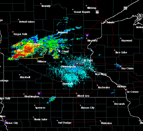 At 306 pm cdt, a severe thunderstorm was located near gilchrist, or 23 miles northwest of willmar, moving east at 40 mph (radar indicated). Hazards include 60 mph wind gusts and quarter size hail. Hail damage to vehicles is expected. expect wind damage to roofs, siding, and trees. this severe thunderstorm will be near, brooten around 315 pm cdt. belgrade around 320 pm cdt. new london around 335 pm cdt. paynesville around 345 pm cdt. other locations impacted by this severe thunderstorm include lake henry, georgeville, hawick, elrosa, norway lake, grove lake, sedan, padua, paynesville airport and sunburg. this includes the following highways, u. s. highway 12 between mile markers 64 and 65. u. s. highway 8 in minnesota near mile marker 6. u. s. highway 71 between mile markers 128 and 159. A tornado watch remains in effect until 900 pm cdt for west central and central minnesota. At 306 pm cdt, a severe thunderstorm was located near gilchrist, or 23 miles northwest of willmar, moving east at 40 mph (radar indicated). Hazards include 60 mph wind gusts and quarter size hail. Hail damage to vehicles is expected. expect wind damage to roofs, siding, and trees. this severe thunderstorm will be near, brooten around 315 pm cdt. belgrade around 320 pm cdt. new london around 335 pm cdt. paynesville around 345 pm cdt. other locations impacted by this severe thunderstorm include lake henry, georgeville, hawick, elrosa, norway lake, grove lake, sedan, padua, paynesville airport and sunburg. this includes the following highways, u. s. highway 12 between mile markers 64 and 65. u. s. highway 8 in minnesota near mile marker 6. u. s. highway 71 between mile markers 128 and 159. A tornado watch remains in effect until 900 pm cdt for west central and central minnesota.
|
| 6/19/2016 8:38 PM CDT |
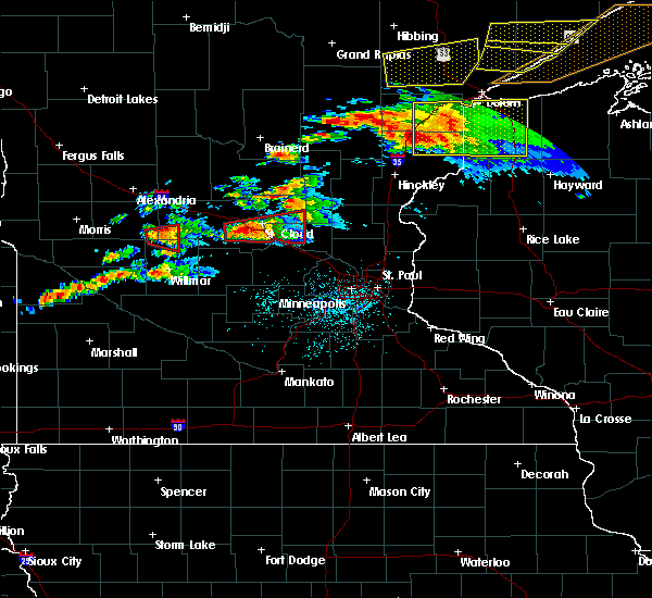 The tornado warning for southwestern stearns, northwestern kandiyohi and southeastern pope counties will expire at 845 pm cdt, the storm which prompted the warning has weakened below severe limits, and no longer appears capable of producing a tornado. therefore the warning will be allowed to expire. a severe thunderstorm watch remains in effect until 1100 pm cdt for central minnesota. to report severe weather, contact your nearest law enforcement agency. they will relay your report to the national weather service the twin cities. The tornado warning for southwestern stearns, northwestern kandiyohi and southeastern pope counties will expire at 845 pm cdt, the storm which prompted the warning has weakened below severe limits, and no longer appears capable of producing a tornado. therefore the warning will be allowed to expire. a severe thunderstorm watch remains in effect until 1100 pm cdt for central minnesota. to report severe weather, contact your nearest law enforcement agency. they will relay your report to the national weather service the twin cities.
|
| 6/19/2016 8:32 PM CDT |
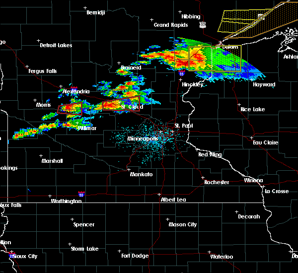 At 832 pm cdt, a severe thunderstorm capable of producing a tornado was located near brooten, or 21 miles north of willmar, moving east at 35 mph (radar indicated rotation). Hazards include tornado and half dollar size hail. Flying debris will be dangerous to those caught without shelter. mobile homes will be damaged or destroyed. damage to roofs, windows, and vehicles will occur. tree damage is likely. this dangerous storm will be near, brooten around 835 pm cdt. Belgrade around 845 pm cdt. At 832 pm cdt, a severe thunderstorm capable of producing a tornado was located near brooten, or 21 miles north of willmar, moving east at 35 mph (radar indicated rotation). Hazards include tornado and half dollar size hail. Flying debris will be dangerous to those caught without shelter. mobile homes will be damaged or destroyed. damage to roofs, windows, and vehicles will occur. tree damage is likely. this dangerous storm will be near, brooten around 835 pm cdt. Belgrade around 845 pm cdt.
|
| 6/19/2016 8:18 PM CDT |
 At 817 pm cdt, a severe thunderstorm capable of producing a tornado was located near gilchrist, or 23 miles northwest of willmar, moving east at 30 mph (radar indicated rotation). Hazards include tornado and half dollar size hail. Flying debris will be dangerous to those caught without shelter. mobile homes will be damaged or destroyed. damage to roofs, windows, and vehicles will occur. tree damage is likely. this dangerous storm will be near, brooten around 840 pm cdt. belgrade around 845 pm cdt. other locations impacted by this tornadic thunderstorm include sunburg, gilchrist and norway lake. this includes u. s. Highway 71 between mile markers 137 and 154. At 817 pm cdt, a severe thunderstorm capable of producing a tornado was located near gilchrist, or 23 miles northwest of willmar, moving east at 30 mph (radar indicated rotation). Hazards include tornado and half dollar size hail. Flying debris will be dangerous to those caught without shelter. mobile homes will be damaged or destroyed. damage to roofs, windows, and vehicles will occur. tree damage is likely. this dangerous storm will be near, brooten around 840 pm cdt. belgrade around 845 pm cdt. other locations impacted by this tornadic thunderstorm include sunburg, gilchrist and norway lake. this includes u. s. Highway 71 between mile markers 137 and 154.
|
| 6/19/2016 7:36 PM CDT |
 At 735 pm cdt, severe thunderstorms were located along a line extending from near freeport to brooten, moving east at 35 mph (radar indicated). Hazards include 60 mph wind gusts and half dollar size hail. Hail damage to vehicles is expected. expect wind damage to roofs, siding, and trees. these severe thunderstorms will remain over mainly rural areas of central stearns county, including the following locations: lake henry, georgeville, st wendel, greenwald, elrosa, farming, new munich, meire grove, opole and padua. this includes the following highways, interstate 94 in minnesota between mile markers 133 and 159. u. s. Highway 71 between mile markers 145 and 161. At 735 pm cdt, severe thunderstorms were located along a line extending from near freeport to brooten, moving east at 35 mph (radar indicated). Hazards include 60 mph wind gusts and half dollar size hail. Hail damage to vehicles is expected. expect wind damage to roofs, siding, and trees. these severe thunderstorms will remain over mainly rural areas of central stearns county, including the following locations: lake henry, georgeville, st wendel, greenwald, elrosa, farming, new munich, meire grove, opole and padua. this includes the following highways, interstate 94 in minnesota between mile markers 133 and 159. u. s. Highway 71 between mile markers 145 and 161.
|
| 6/12/2016 6:07 PM CDT |
 The severe thunderstorm warning for northwestern stearns, south central todd and east central pope counties will expire at 615 pm cdt, the storms which prompted the warning have weakened below severe limits, and have exited the warned area. therefore the warning will be allowed to expire. however heavy rain is still possible with these thunderstorms. a severe thunderstorm watch remains in effect until 1000 pm cdt for west central minnesota. remember, a severe thunderstorm warning still remains in effect for southern stearns county until 645 pm cdt. The severe thunderstorm warning for northwestern stearns, south central todd and east central pope counties will expire at 615 pm cdt, the storms which prompted the warning have weakened below severe limits, and have exited the warned area. therefore the warning will be allowed to expire. however heavy rain is still possible with these thunderstorms. a severe thunderstorm watch remains in effect until 1000 pm cdt for west central minnesota. remember, a severe thunderstorm warning still remains in effect for southern stearns county until 645 pm cdt.
|
| 6/12/2016 6:00 PM CDT | Numerous large branches felled... some as large as 12 inches in diamete in stearns county MN, 0.3 miles ESE of Brooten, MN |
| 6/12/2016 5:48 PM CDT |
 At 547 pm cdt, severe thunderstorms were located along a line extending from near west union to near sauk centre to near sedan, moving east at 20 mph (radar indicated). Hazards include 60 mph wind gusts and quarter size hail. Hail damage to vehicles is expected. expect wind damage to roofs, siding, and trees. these severe storms will be near, sauk centre around 600 pm cdt. Other locations impacted by these severe thunderstorms include sauk centre airport, west union, sedan, grove lake, padua and westport. At 547 pm cdt, severe thunderstorms were located along a line extending from near west union to near sauk centre to near sedan, moving east at 20 mph (radar indicated). Hazards include 60 mph wind gusts and quarter size hail. Hail damage to vehicles is expected. expect wind damage to roofs, siding, and trees. these severe storms will be near, sauk centre around 600 pm cdt. Other locations impacted by these severe thunderstorms include sauk centre airport, west union, sedan, grove lake, padua and westport.
|
| 6/12/2016 5:18 PM CDT |
 At 518 pm cdt, severe thunderstorms were located along a line extending from near forada to villard to near lake minnewaska, moving east at 20 mph (radar indicated). Hazards include 60 mph wind gusts and quarter size hail. Hail damage to vehicles is expected. expect wind damage to roofs, siding, and trees. severe thunderstorms will be near, sauk centre and brooten around 605 pm cdt. other locations impacted by these severe thunderstorms include villard, west union, sedan, padua, lake minnewaska, forada, long beach and grove lake. this includes the following highways, interstate 94 in minnesota between mile markers 116 and 132. u. s. Highway 71 between mile markers 159 and 176. At 518 pm cdt, severe thunderstorms were located along a line extending from near forada to villard to near lake minnewaska, moving east at 20 mph (radar indicated). Hazards include 60 mph wind gusts and quarter size hail. Hail damage to vehicles is expected. expect wind damage to roofs, siding, and trees. severe thunderstorms will be near, sauk centre and brooten around 605 pm cdt. other locations impacted by these severe thunderstorms include villard, west union, sedan, padua, lake minnewaska, forada, long beach and grove lake. this includes the following highways, interstate 94 in minnesota between mile markers 116 and 132. u. s. Highway 71 between mile markers 159 and 176.
|
| 8/6/2015 4:20 PM CDT | Ping Pong Ball sized hail reported 8.2 miles NE of Brooten, MN, mostly nickel and quarter sized. |
| 7/12/2015 9:33 PM CDT |
 At 932 pm cdt, severe thunderstorms were located along a line extending from cold spring to near brooten, moving southeast at 30 mph (radar indicated). Hazards include 70 mph wind gusts and half dollar size hail. Hail damage to vehicles is expected. expect considerable tree damage. wind damage is also likely to mobile homes, roofs and outbuildings. locations impacted include, melrose, brooten, belgrade, new munich, greenwald, elrosa, meire grove, lake henry, spring hill, regal, padua and georgeville. this includes interstate 94 in minnesota between mile markers 134 and 138. A tornado watch remains in effect until 100 am cdt for central minnesota. At 932 pm cdt, severe thunderstorms were located along a line extending from cold spring to near brooten, moving southeast at 30 mph (radar indicated). Hazards include 70 mph wind gusts and half dollar size hail. Hail damage to vehicles is expected. expect considerable tree damage. wind damage is also likely to mobile homes, roofs and outbuildings. locations impacted include, melrose, brooten, belgrade, new munich, greenwald, elrosa, meire grove, lake henry, spring hill, regal, padua and georgeville. this includes interstate 94 in minnesota between mile markers 134 and 138. A tornado watch remains in effect until 100 am cdt for central minnesota.
|
| 7/12/2015 9:14 PM CDT |
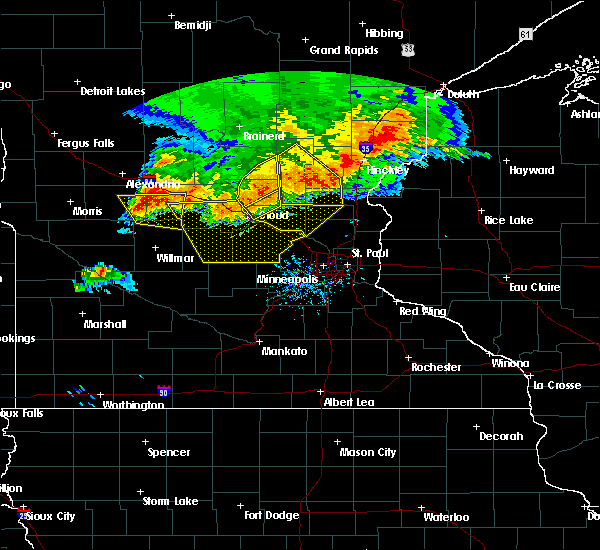 At 914 pm cdt, severe thunderstorms were located along a line extending from roscoe to gilchrist, moving southeast at 25 mph (radar indicated). Hazards include 70 mph wind gusts and half dollar size hail. Hail damage to vehicles is expected. expect considerable tree damage. wind damage is also likely to mobile homes, roofs and outbuildings. locations impacted include, melrose, brooten, belgrade, new munich, grove lake, greenwald, elrosa, meire grove, lake henry, spring hill, sedan and regal. this includes interstate 94 in minnesota between mile markers 134 and 138. A tornado watch remains in effect until 100 am cdt for west central minnesota. At 914 pm cdt, severe thunderstorms were located along a line extending from roscoe to gilchrist, moving southeast at 25 mph (radar indicated). Hazards include 70 mph wind gusts and half dollar size hail. Hail damage to vehicles is expected. expect considerable tree damage. wind damage is also likely to mobile homes, roofs and outbuildings. locations impacted include, melrose, brooten, belgrade, new munich, grove lake, greenwald, elrosa, meire grove, lake henry, spring hill, sedan and regal. this includes interstate 94 in minnesota between mile markers 134 and 138. A tornado watch remains in effect until 100 am cdt for west central minnesota.
|
| 7/12/2015 8:59 PM CDT |
 At 858 pm cdt, severe thunderstorms were located along a line extending from st. martin to near gilchrist, moving southeast at 30 mph (radar indicated). Hazards include 70 mph wind gusts and half dollar size hail. Hail damage to vehicles is expected. expect considerable tree damage. wind damage is also likely to mobile homes, roofs and outbuildings. these severe thunderstorms will remain over mainly rural areas of western stearns, southeastern pope and northeastern kandiyohi counties, including the following locations, glenwood airport, meire grove, lake henry, sedan, padua, georgeville, elrosa, greenwald, spring hill and grove lake. this includes interstate 94 in minnesota between mile markers 134 and 138. A tornado watch remains in effect until 100 am cdt for west central minnesota. At 858 pm cdt, severe thunderstorms were located along a line extending from st. martin to near gilchrist, moving southeast at 30 mph (radar indicated). Hazards include 70 mph wind gusts and half dollar size hail. Hail damage to vehicles is expected. expect considerable tree damage. wind damage is also likely to mobile homes, roofs and outbuildings. these severe thunderstorms will remain over mainly rural areas of western stearns, southeastern pope and northeastern kandiyohi counties, including the following locations, glenwood airport, meire grove, lake henry, sedan, padua, georgeville, elrosa, greenwald, spring hill and grove lake. this includes interstate 94 in minnesota between mile markers 134 and 138. A tornado watch remains in effect until 100 am cdt for west central minnesota.
|
| 7/12/2015 8:41 PM CDT |
 At 841 pm cdt, severe thunderstorms were located along a line extending from near mayhew to manannah, moving southeast at 35 mph (radar indicated). Hazards include 70 mph wind gusts and half dollar size hail. Hail damage to vehicles is expected. expect considerable tree damage. wind damage is also likely to mobile homes, roofs and outbuildings. these severe storms will be near, watkins around 900 pm cdt. other locations impacted by these severe thunderstorms include fairhaven, lake henry, georgeville, st wendel, pleasant lake, elrosa, greenwald, st augusta, farming and new munich. this includes interstate 94 in minnesota between mile markers 128 and 178. A tornado watch remains in effect until 100 am cdt for west central minnesota. At 841 pm cdt, severe thunderstorms were located along a line extending from near mayhew to manannah, moving southeast at 35 mph (radar indicated). Hazards include 70 mph wind gusts and half dollar size hail. Hail damage to vehicles is expected. expect considerable tree damage. wind damage is also likely to mobile homes, roofs and outbuildings. these severe storms will be near, watkins around 900 pm cdt. other locations impacted by these severe thunderstorms include fairhaven, lake henry, georgeville, st wendel, pleasant lake, elrosa, greenwald, st augusta, farming and new munich. this includes interstate 94 in minnesota between mile markers 128 and 178. A tornado watch remains in effect until 100 am cdt for west central minnesota.
|
| 7/12/2015 8:27 PM CDT |
 At 823 pm cdt, a severe thunderstorm was located over glenwood airport, or 18 miles south of alexandria, moving east at 25 mph (radar indicated). Hazards include golf ball size hail and 70 mph wind gusts. People and animals outdoors will be injured. expect hail damage to roofs, siding, windows and vehicles. expect considerable tree damage. wind damage is also likely to mobile homes, roofs and outbuildings. this severe thunderstorm will remain over mainly rural areas of eastern pope county, including the following locations, glenwood airport, villard, sedan, lake minnewaska, long beach, grove lake and westport. A tornado watch remains in effect until 100 am cdt for west central minnesota. At 823 pm cdt, a severe thunderstorm was located over glenwood airport, or 18 miles south of alexandria, moving east at 25 mph (radar indicated). Hazards include golf ball size hail and 70 mph wind gusts. People and animals outdoors will be injured. expect hail damage to roofs, siding, windows and vehicles. expect considerable tree damage. wind damage is also likely to mobile homes, roofs and outbuildings. this severe thunderstorm will remain over mainly rural areas of eastern pope county, including the following locations, glenwood airport, villard, sedan, lake minnewaska, long beach, grove lake and westport. A tornado watch remains in effect until 100 am cdt for west central minnesota.
|
| 7/12/2015 8:18 PM CDT |
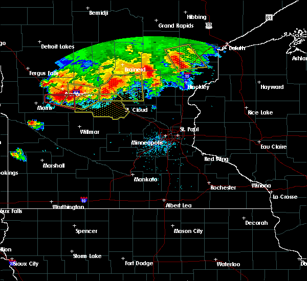 At 818 pm cdt, a severe thunderstorm capable of producing a tornado was located over glenwood, or 16 miles south of alexandria, moving east at 25 mph (radar indicated rotation). Hazards include tornado and golf ball size hail. Flying debris will be dangerous to those caught without shelter. mobile homes will be damaged or destroyed. damage to roofs, windows and vehicles will occur. tree damage is likely. This tornadic thunderstorm will remain over mainly rural areas of northeastern pope county, including the following locations, glenwood airport, villard, sedan, lake minnewaska, long beach, grove lake and westport. At 818 pm cdt, a severe thunderstorm capable of producing a tornado was located over glenwood, or 16 miles south of alexandria, moving east at 25 mph (radar indicated rotation). Hazards include tornado and golf ball size hail. Flying debris will be dangerous to those caught without shelter. mobile homes will be damaged or destroyed. damage to roofs, windows and vehicles will occur. tree damage is likely. This tornadic thunderstorm will remain over mainly rural areas of northeastern pope county, including the following locations, glenwood airport, villard, sedan, lake minnewaska, long beach, grove lake and westport.
|
| 7/12/2015 8:16 PM CDT |
 At 815 pm cdt, severe thunderstorms were located along a line extending from royalton to near regal, moving southeast at 35 mph (radar indicated). Hazards include 70 mph wind gusts and half dollar size hail. Hail damage to vehicles is expected. expect considerable tree damage. wind damage is also likely to mobile homes, roofs and outbuildings. severe thunderstorms will be near, rice around 825 pm cdt. eden valley around 845 pm cdt. watkins around 855 pm cdt. other locations impacted by these severe thunderstorms include fairhaven, lake henry, georgeville, st wendel, pleasant lake, elrosa, greenwald, st augusta, farming and new munich. this includes interstate 94 in minnesota between mile markers 125 and 178. A tornado watch remains in effect until 100 am cdt for west central minnesota. At 815 pm cdt, severe thunderstorms were located along a line extending from royalton to near regal, moving southeast at 35 mph (radar indicated). Hazards include 70 mph wind gusts and half dollar size hail. Hail damage to vehicles is expected. expect considerable tree damage. wind damage is also likely to mobile homes, roofs and outbuildings. severe thunderstorms will be near, rice around 825 pm cdt. eden valley around 845 pm cdt. watkins around 855 pm cdt. other locations impacted by these severe thunderstorms include fairhaven, lake henry, georgeville, st wendel, pleasant lake, elrosa, greenwald, st augusta, farming and new munich. this includes interstate 94 in minnesota between mile markers 125 and 178. A tornado watch remains in effect until 100 am cdt for west central minnesota.
|
| 7/12/2015 8:02 PM CDT |
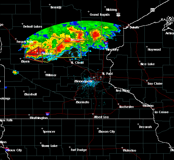 At 802 pm cdt, a severe thunderstorm capable of producing a tornado was located over long beach, or 18 miles south of alexandria, moving east at 25 mph (radar indicated rotation). Hazards include tornado and golf ball size hail. Flying debris will be dangerous to those caught without shelter. mobile homes will be damaged or destroyed. damage to roofs, windows and vehicles will occur. tree damage is likely. this dangerous storm will be near, glenwood around 820 pm cdt. Other locations impacted by this tornadic thunderstorm include glenwood airport, villard, sedan, lake minnewaska, farwell, long beach, grove lake and westport. At 802 pm cdt, a severe thunderstorm capable of producing a tornado was located over long beach, or 18 miles south of alexandria, moving east at 25 mph (radar indicated rotation). Hazards include tornado and golf ball size hail. Flying debris will be dangerous to those caught without shelter. mobile homes will be damaged or destroyed. damage to roofs, windows and vehicles will occur. tree damage is likely. this dangerous storm will be near, glenwood around 820 pm cdt. Other locations impacted by this tornadic thunderstorm include glenwood airport, villard, sedan, lake minnewaska, farwell, long beach, grove lake and westport.
|
| 7/12/2015 7:45 PM CDT |
 At 743 pm cdt, a severe thunderstorm was located near west union, or 14 miles southeast of alexandria, moving east at 30 mph (law enforcement reported power lines down near garfield in douglas county). Hazards include golf ball size hail and 70 mph wind gusts. People and animals outdoors will be injured. expect hail damage to roofs, siding, windows and vehicles. expect considerable tree damage. wind damage is also likely to mobile homes, roofs and outbuildings. this severe storm will be near, sauk centre around 800 pm cdt. melrose around 815 pm cdt. freeport around 830 pm cdt. other locations impacted by this severe thunderstorm include glenwood airport, north shore, west union, round prairie, long prairie airport, elrosa, greenwald, grove lake, westport and new munich. this includes interstate 94 in minnesota between mile markers 110 and 142. A tornado watch remains in effect until 100 am cdt for west central minnesota. At 743 pm cdt, a severe thunderstorm was located near west union, or 14 miles southeast of alexandria, moving east at 30 mph (law enforcement reported power lines down near garfield in douglas county). Hazards include golf ball size hail and 70 mph wind gusts. People and animals outdoors will be injured. expect hail damage to roofs, siding, windows and vehicles. expect considerable tree damage. wind damage is also likely to mobile homes, roofs and outbuildings. this severe storm will be near, sauk centre around 800 pm cdt. melrose around 815 pm cdt. freeport around 830 pm cdt. other locations impacted by this severe thunderstorm include glenwood airport, north shore, west union, round prairie, long prairie airport, elrosa, greenwald, grove lake, westport and new munich. this includes interstate 94 in minnesota between mile markers 110 and 142. A tornado watch remains in effect until 100 am cdt for west central minnesota.
|
| 7/12/2015 7:42 PM CDT |
 At 741 pm cdt, a severe thunderstorm capable of producing a tornado was located near lowry, or 17 miles northeast of morris, moving east at 40 mph (radar indicated rotation). Hazards include tornado and golf ball size hail. Flying debris will be dangerous to those caught without shelter. mobile homes will be damaged or destroyed. damage to roofs, windows and vehicles will occur. tree damage is likely. this dangerous storm will be near, starbuck around 745 pm cdt. lowry around 750 pm cdt. glenwood around 800 pm cdt. Other locations impacted by this tornadic thunderstorm include glenwood airport, villard, sedan, lake minnewaska, farwell, long beach, grove lake and westport. At 741 pm cdt, a severe thunderstorm capable of producing a tornado was located near lowry, or 17 miles northeast of morris, moving east at 40 mph (radar indicated rotation). Hazards include tornado and golf ball size hail. Flying debris will be dangerous to those caught without shelter. mobile homes will be damaged or destroyed. damage to roofs, windows and vehicles will occur. tree damage is likely. this dangerous storm will be near, starbuck around 745 pm cdt. lowry around 750 pm cdt. glenwood around 800 pm cdt. Other locations impacted by this tornadic thunderstorm include glenwood airport, villard, sedan, lake minnewaska, farwell, long beach, grove lake and westport.
|
| 7/12/2015 7:20 PM CDT |
 At 719 pm cdt, a severe thunderstorm was located over forada, or near alexandria, moving east at 30 mph (radar indicated). Hazards include golf ball size hail and 70 mph wind gusts. People and animals outdoors will be injured. expect hail damage to roofs, siding, windows and vehicles. expect considerable tree damage. wind damage is also likely to mobile homes, roofs and outbuildings. this severe thunderstorm will be near, osakis and lake osakis around 735 pm cdt. sauk centre around 800 pm cdt. melrose around 815 pm cdt. freeport around 825 pm cdt. other locations impacted by this severe thunderstorm include glenwood airport, north shore, west union, round prairie, long prairie airport, elrosa, greenwald, grove lake, westport and new munich. this includes interstate 94 in minnesota between mile markers 110 and 142. A tornado watch remains in effect until 100 am cdt for west central minnesota. At 719 pm cdt, a severe thunderstorm was located over forada, or near alexandria, moving east at 30 mph (radar indicated). Hazards include golf ball size hail and 70 mph wind gusts. People and animals outdoors will be injured. expect hail damage to roofs, siding, windows and vehicles. expect considerable tree damage. wind damage is also likely to mobile homes, roofs and outbuildings. this severe thunderstorm will be near, osakis and lake osakis around 735 pm cdt. sauk centre around 800 pm cdt. melrose around 815 pm cdt. freeport around 825 pm cdt. other locations impacted by this severe thunderstorm include glenwood airport, north shore, west union, round prairie, long prairie airport, elrosa, greenwald, grove lake, westport and new munich. this includes interstate 94 in minnesota between mile markers 110 and 142. A tornado watch remains in effect until 100 am cdt for west central minnesota.
|
| 6/9/2015 6:06 PM CDT |
 At 606 pm cdt, a severe thunderstorm was located near norway lake, or 16 miles north of willmar, moving east at 30 mph (radar indicated). Hazards include 60 mph wind gusts and quarter size hail. Hail damage to vehicles is expected. expect wind damage to roofs, siding and trees. This severe thunderstorm will remain over mainly rural areas of west central stearns, southeastern pope, northwestern kandiyohi and northeastern swift counties, including the following locations, sunburg, gilchrist and norway lake. At 606 pm cdt, a severe thunderstorm was located near norway lake, or 16 miles north of willmar, moving east at 30 mph (radar indicated). Hazards include 60 mph wind gusts and quarter size hail. Hail damage to vehicles is expected. expect wind damage to roofs, siding and trees. This severe thunderstorm will remain over mainly rural areas of west central stearns, southeastern pope, northwestern kandiyohi and northeastern swift counties, including the following locations, sunburg, gilchrist and norway lake.
|
| 6/9/2015 5:46 PM CDT |
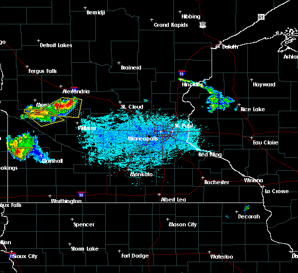 At 545 pm cdt, a severe thunderstorm was located near brooten, or 27 miles north of willmar, moving southeast at 25 mph (radar indicated). Hazards include 60 mph wind gusts and quarter size hail. Hail damage to vehicles is expected. expect wind damage to roofs, siding and trees. this severe storm will be near, brooten around 600 pm cdt. belgrade around 615 pm cdt. Other locations impacted by this severe thunderstorm include sedan, padua, sunburg, gilchrist, norway lake, grove lake and elrosa. At 545 pm cdt, a severe thunderstorm was located near brooten, or 27 miles north of willmar, moving southeast at 25 mph (radar indicated). Hazards include 60 mph wind gusts and quarter size hail. Hail damage to vehicles is expected. expect wind damage to roofs, siding and trees. this severe storm will be near, brooten around 600 pm cdt. belgrade around 615 pm cdt. Other locations impacted by this severe thunderstorm include sedan, padua, sunburg, gilchrist, norway lake, grove lake and elrosa.
|
| 6/9/2015 5:35 PM CDT |
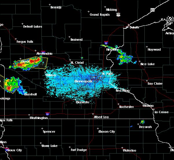 At 534 pm cdt, a severe thunderstorm was located near gilchrist, or 25 miles east of morris, moving southeast at 35 mph (radar indicated). Hazards include 60 mph wind gusts and quarter size hail. Hail damage to vehicles is expected. expect wind damage to roofs, siding and trees. this severe thunderstorm will be near, brooten around 600 pm cdt. belgrade around 610 pm cdt. Other locations impacted by this severe thunderstorm include glenwood airport, sedan, padua, sunburg, gilchrist, norway lake, grove lake and elrosa. At 534 pm cdt, a severe thunderstorm was located near gilchrist, or 25 miles east of morris, moving southeast at 35 mph (radar indicated). Hazards include 60 mph wind gusts and quarter size hail. Hail damage to vehicles is expected. expect wind damage to roofs, siding and trees. this severe thunderstorm will be near, brooten around 600 pm cdt. belgrade around 610 pm cdt. Other locations impacted by this severe thunderstorm include glenwood airport, sedan, padua, sunburg, gilchrist, norway lake, grove lake and elrosa.
|
| 6/21/2013 2:00 AM CDT | 1 foot branches down and flag pole bent to ground in stearns county MN, 0.3 miles ESE of Brooten, MN |
| 6/21/2013 1:40 AM CDT | 1 foot branches down and flag pole bent to ground in stearns county MN, 0.3 miles ESE of Brooten, MN |
| 1/1/0001 12:00 AM | 6 inch diameter branch down in yard...numerous smaller branche in pope county MN, 7.5 miles ENE of Brooten, MN |
| 1/1/0001 12:00 AM | 6 inch diameter branch down in yard...numerous smaller branc in pope county MN, 7.5 miles ENE of Brooten, MN |
Hail Maps for Brooten, MN
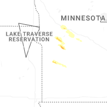
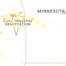

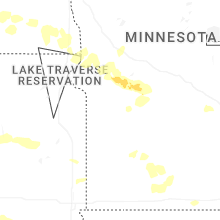


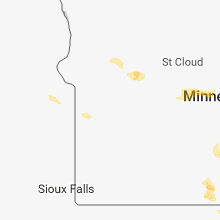


Connect with Interactive Hail Maps