

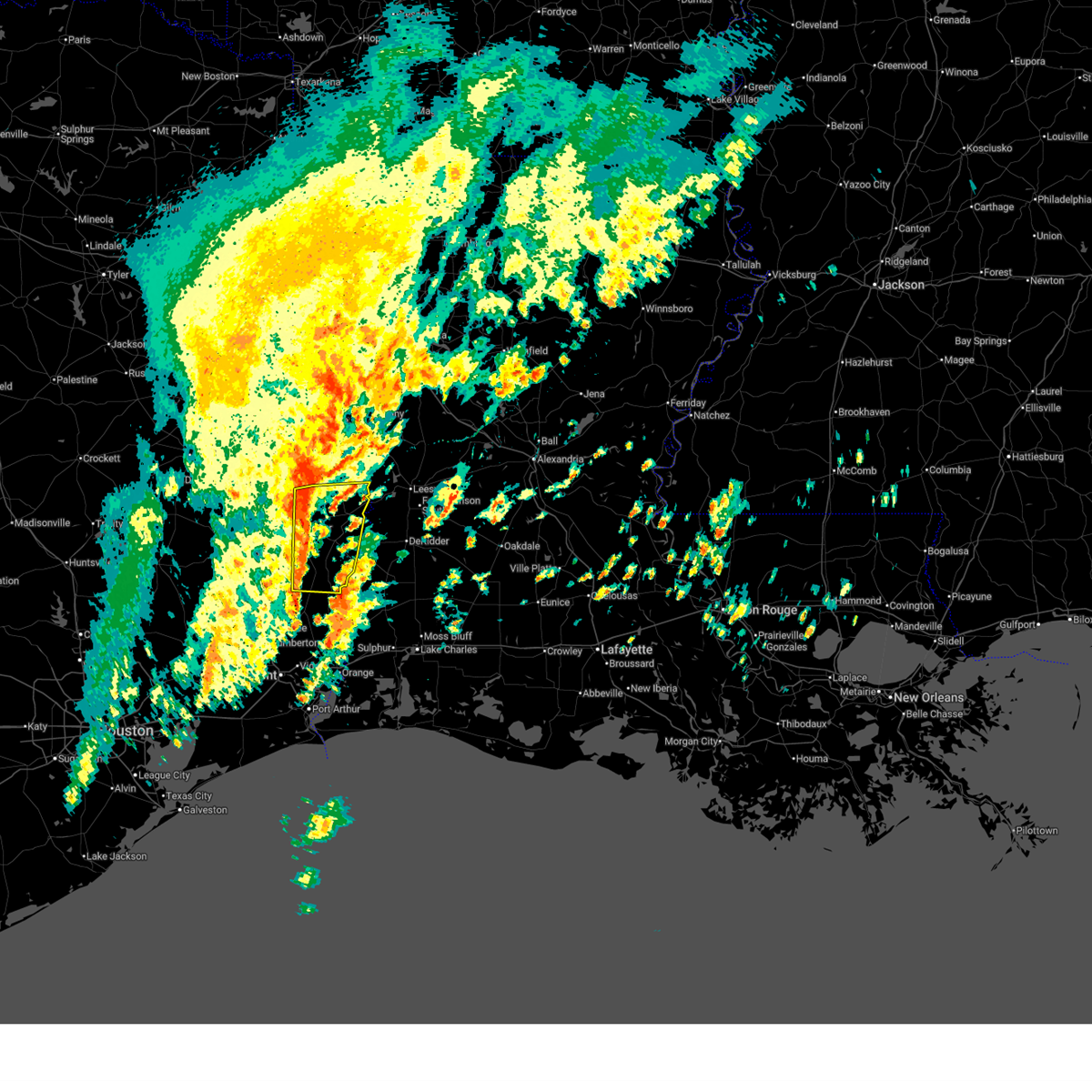
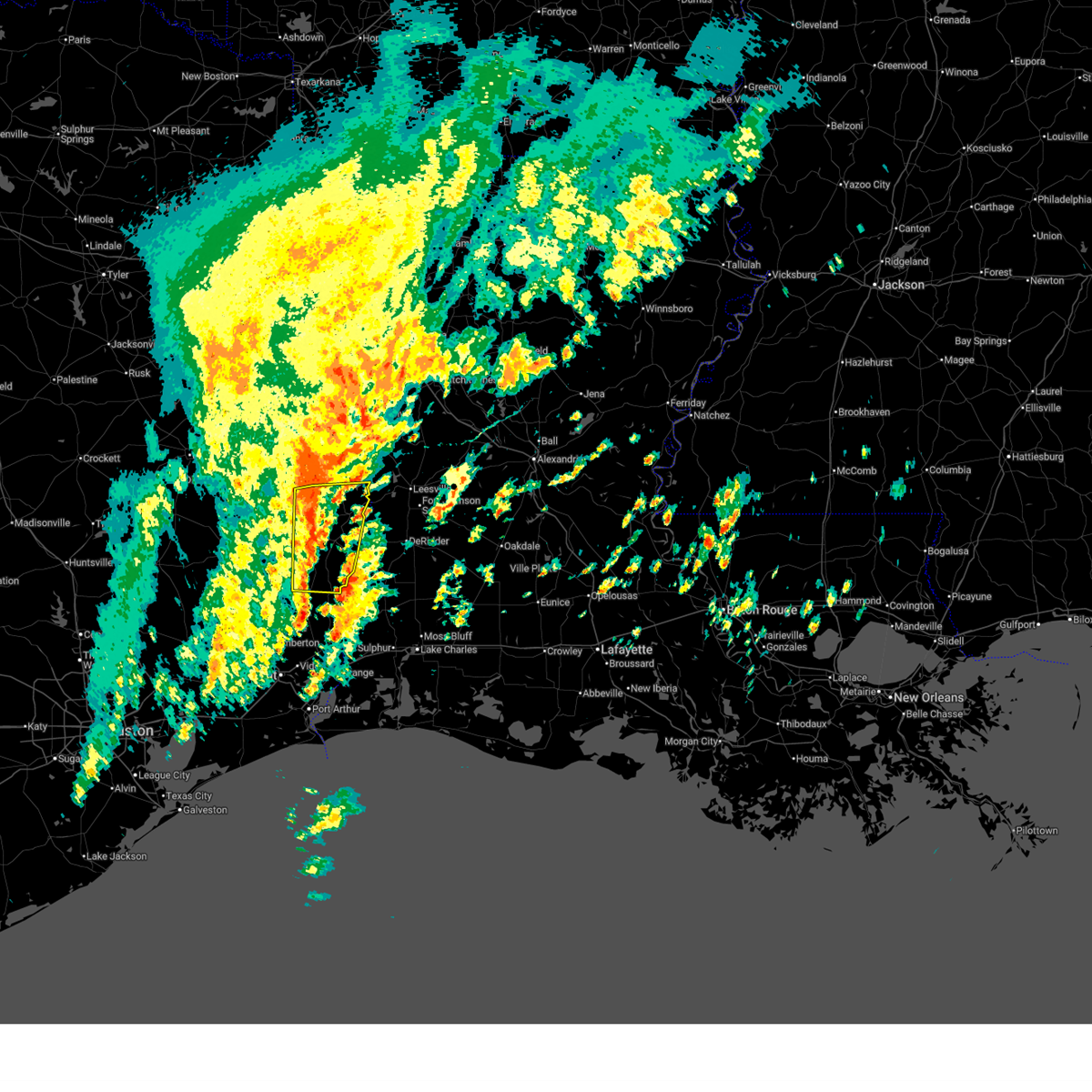
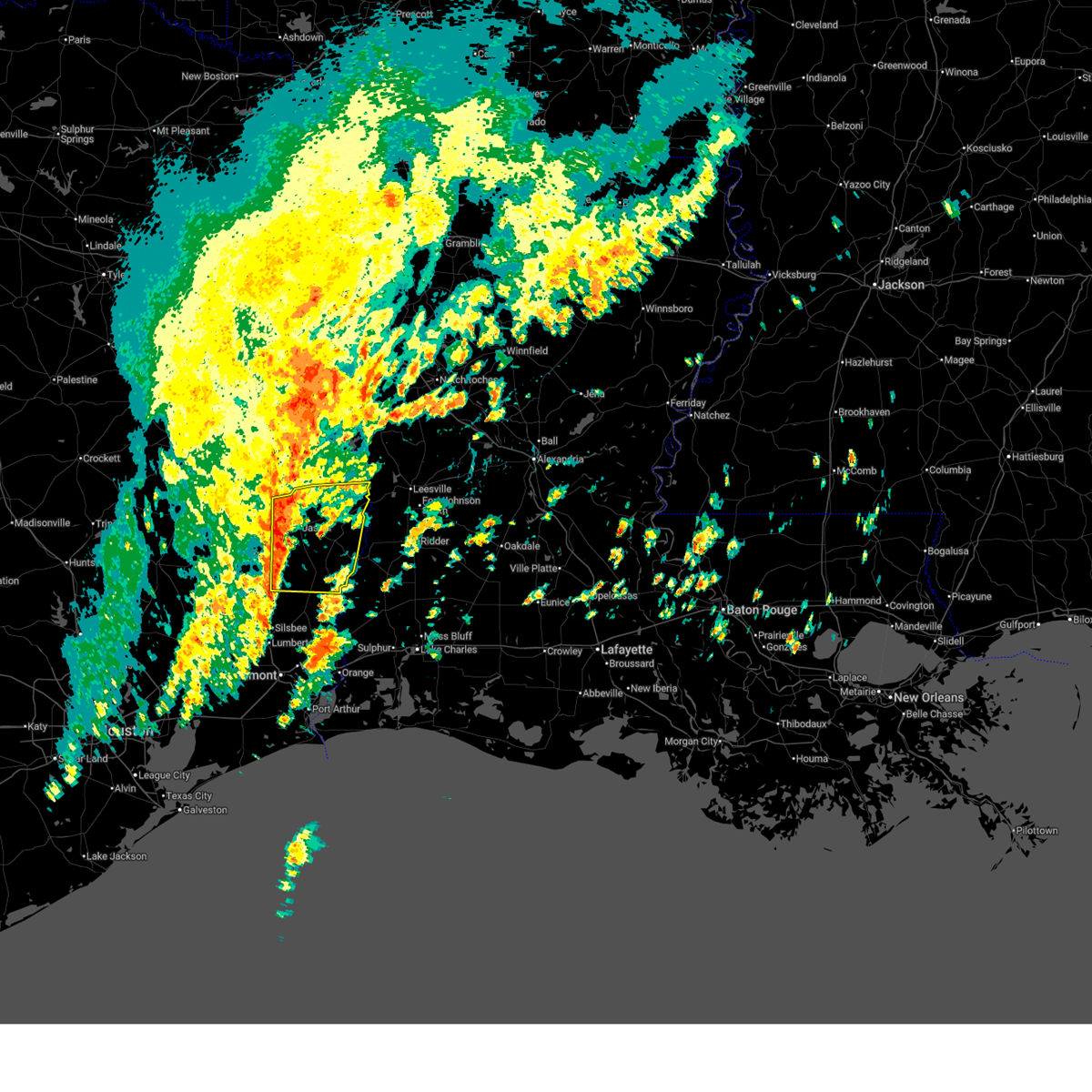
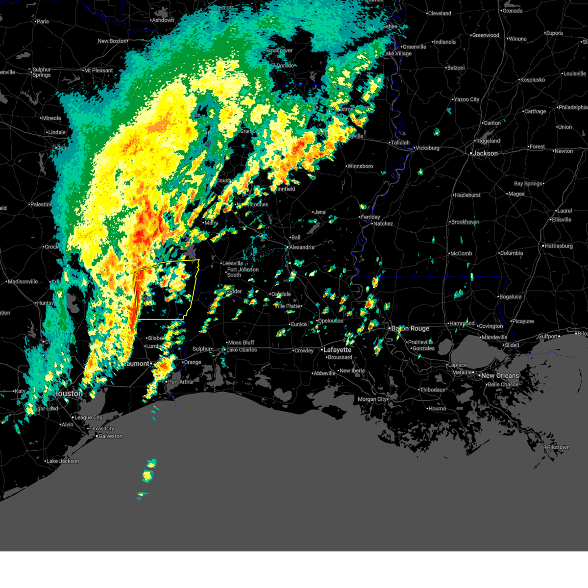
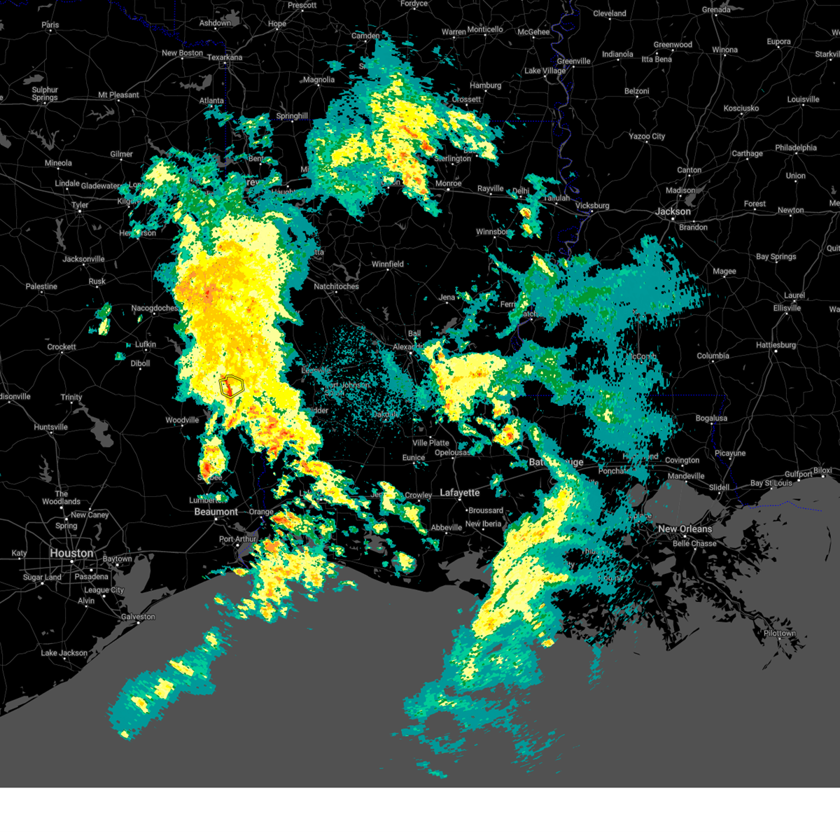
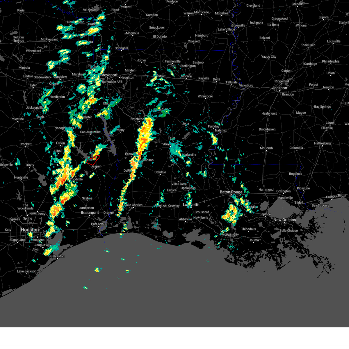
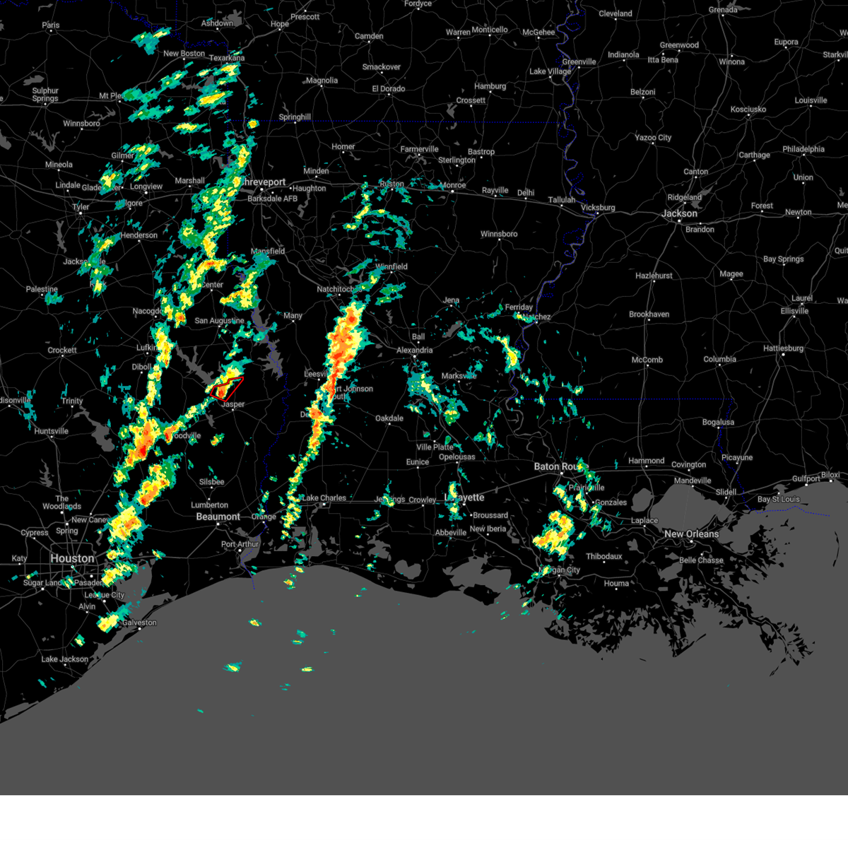
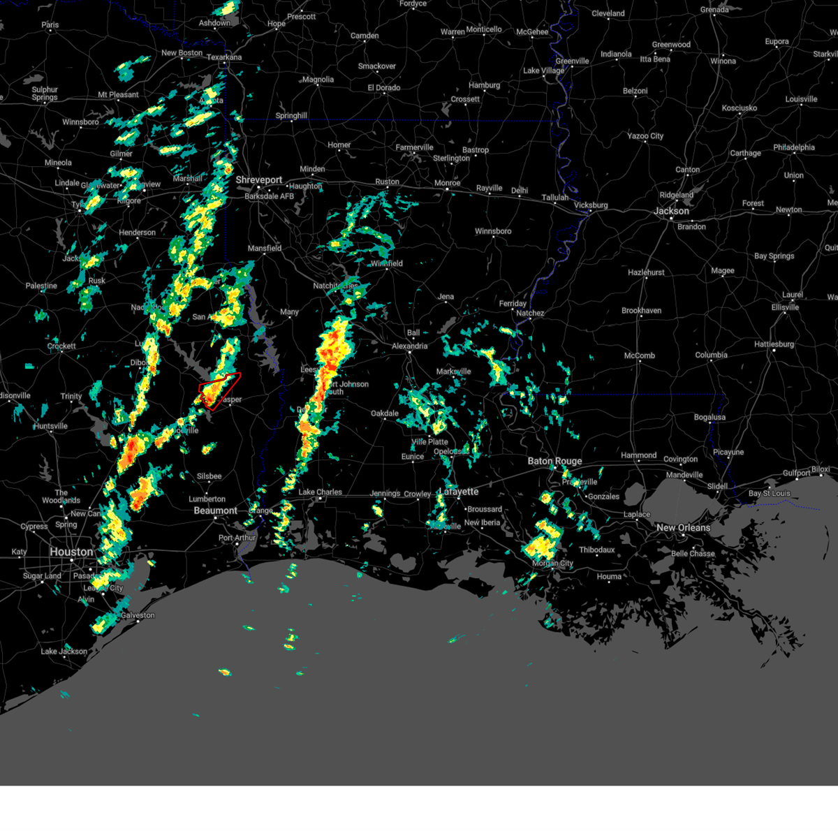
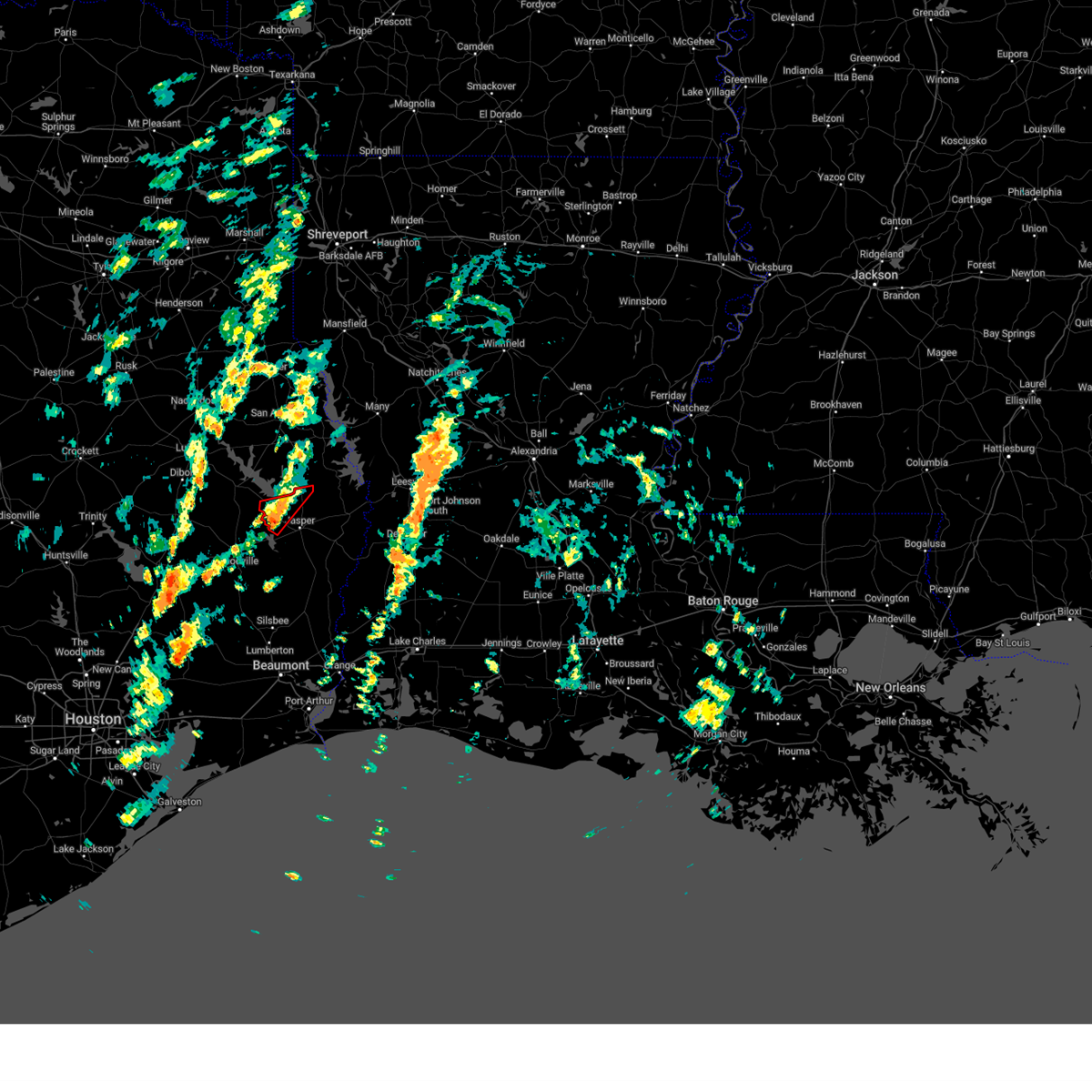
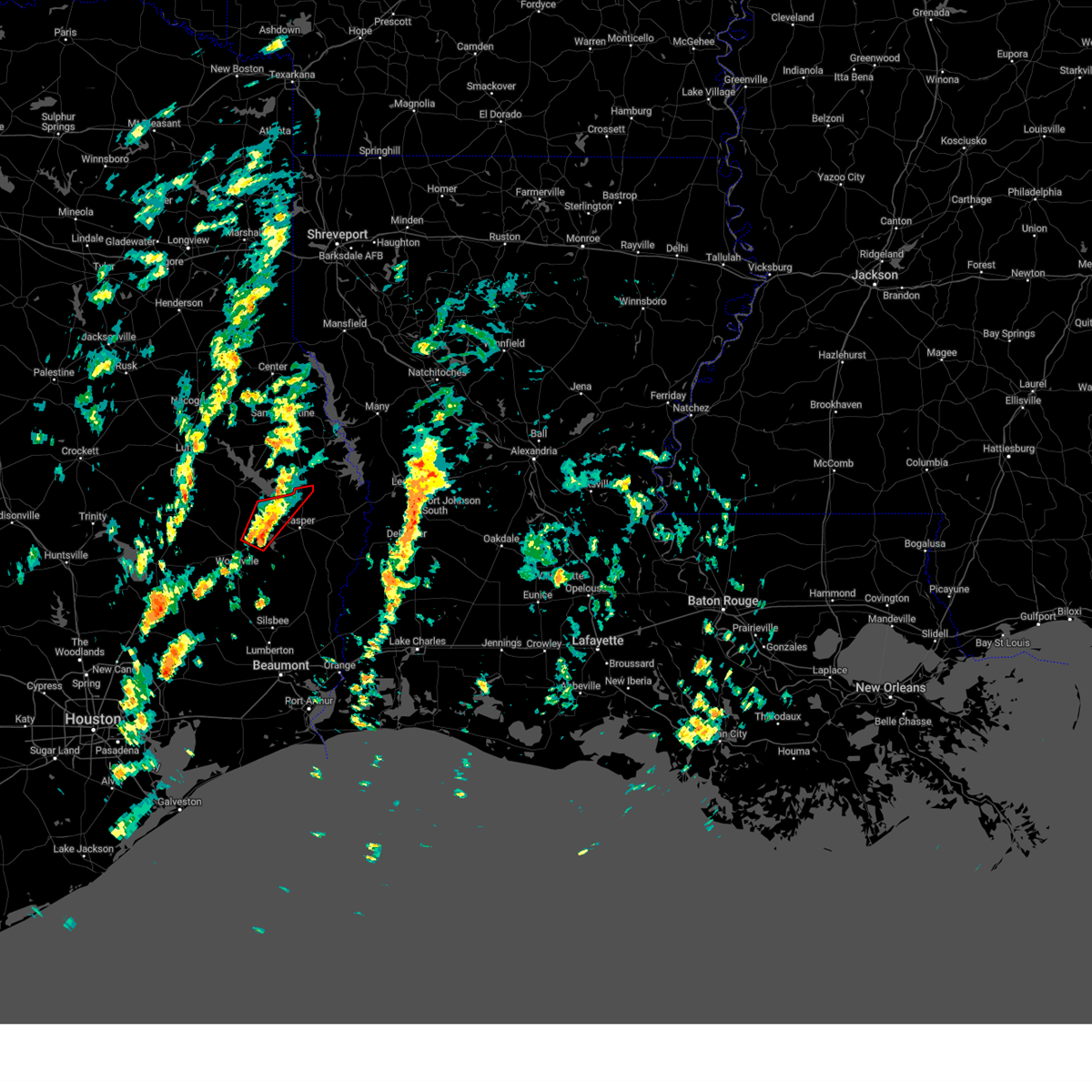
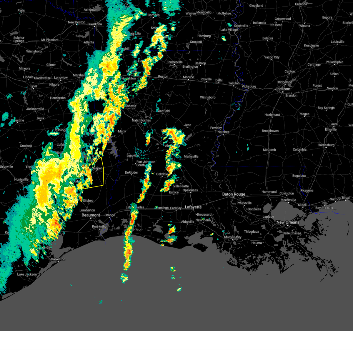
Hail Map for Browndell, TX
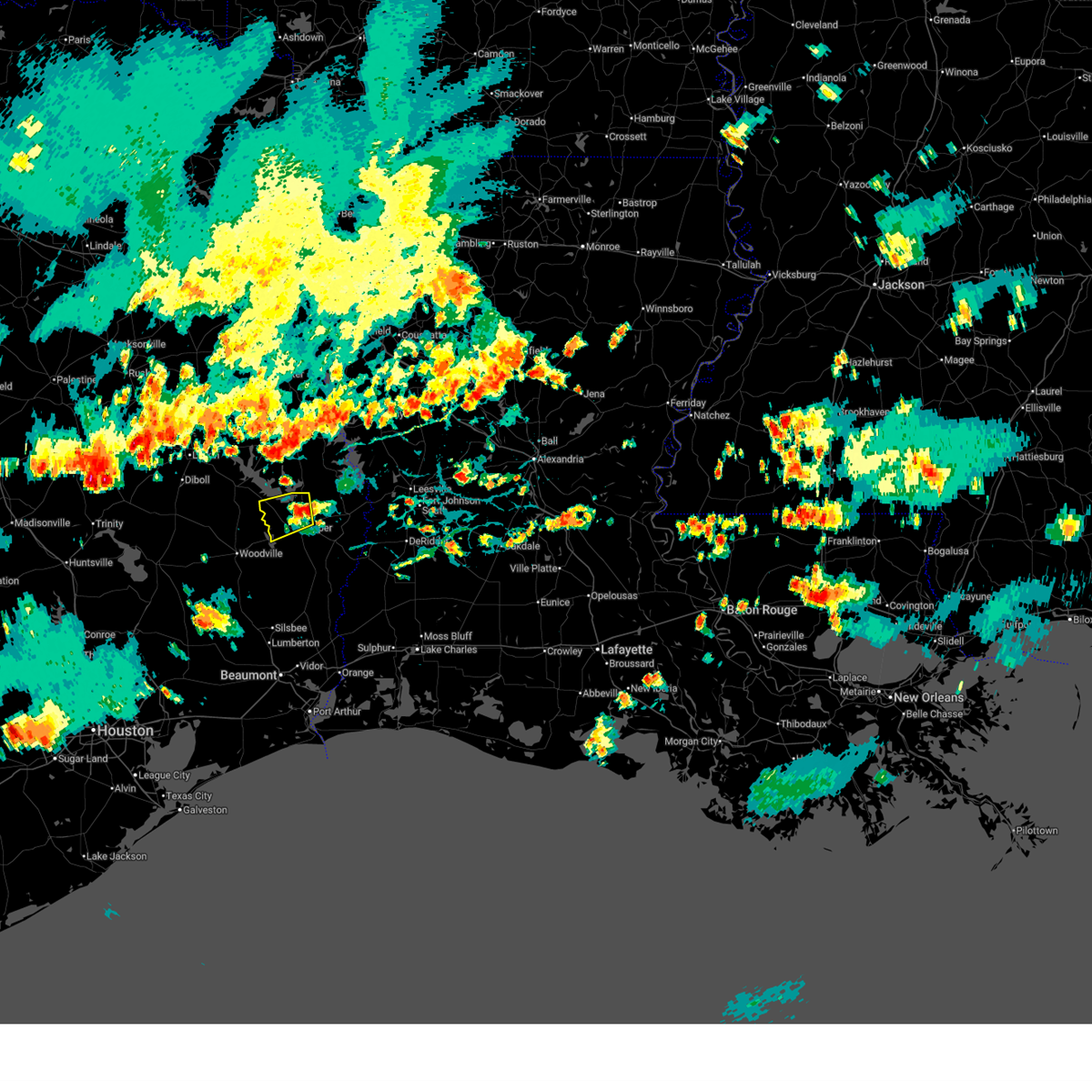
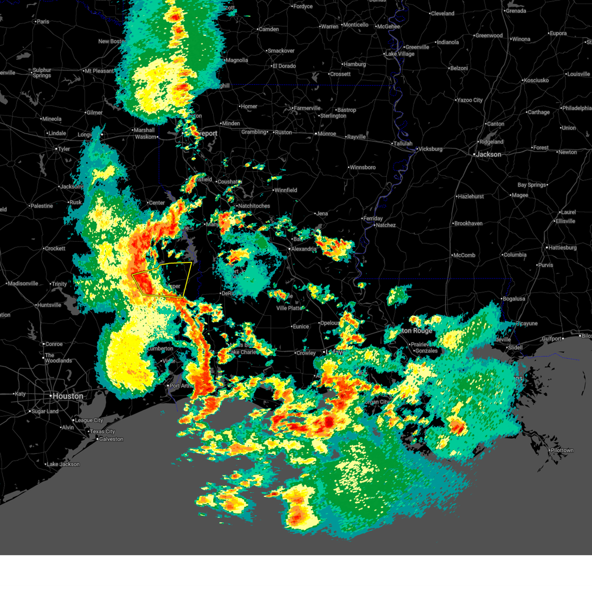
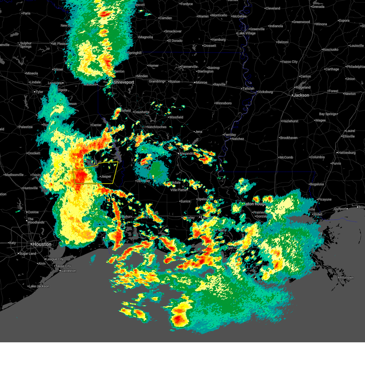
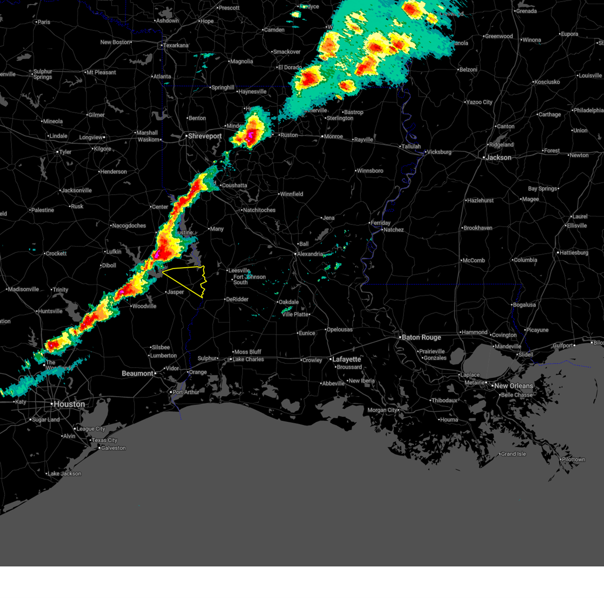
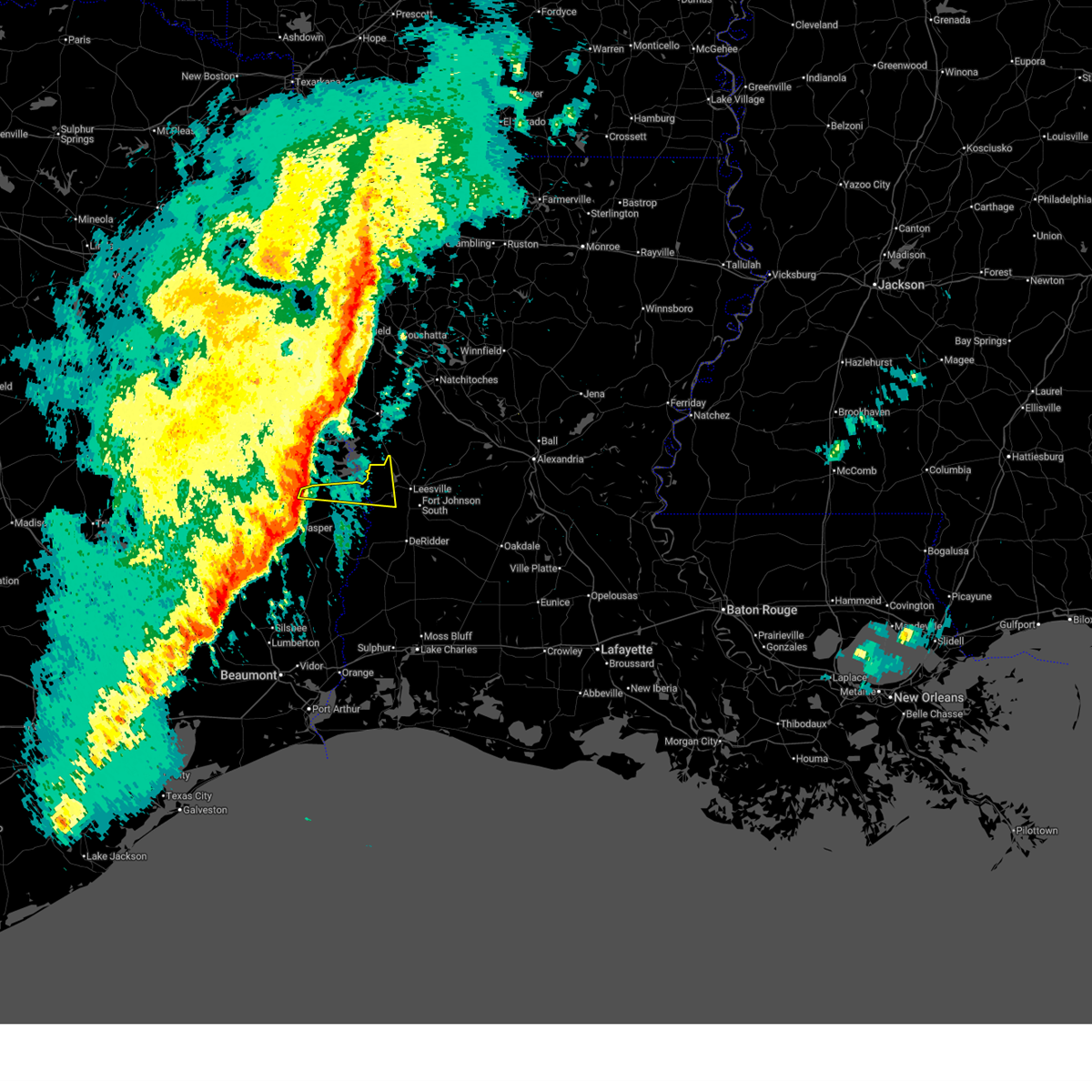
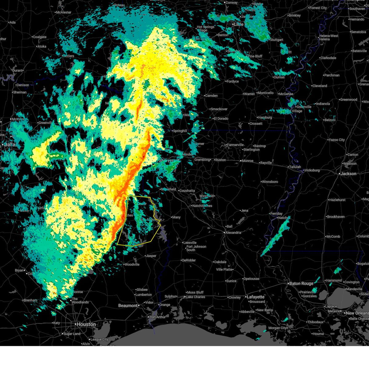
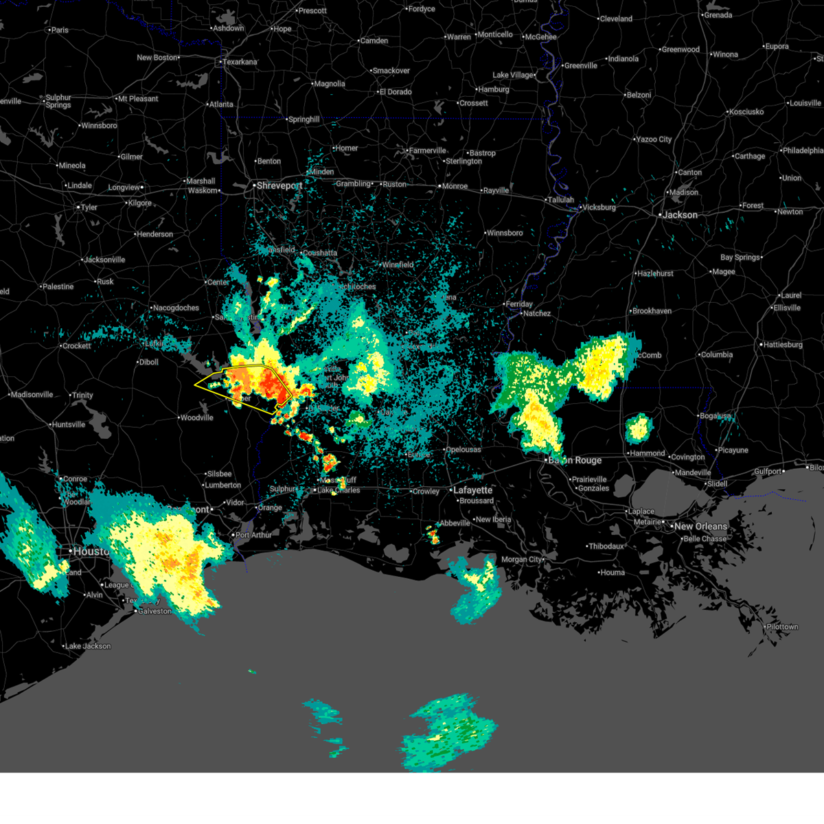
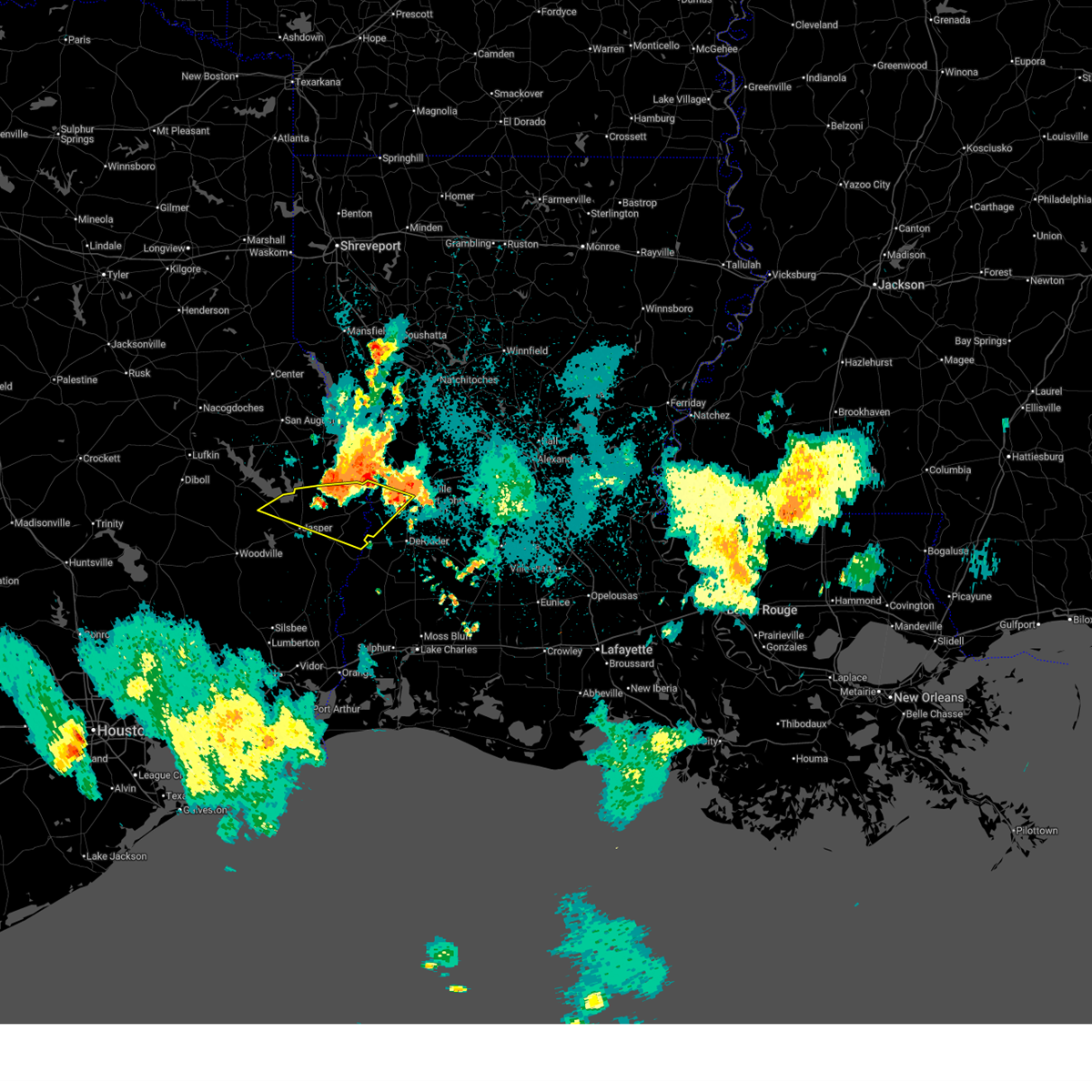
The Browndell, TX area has had 2 reports of on-the-ground hail by trained spotters, and has been under severe weather warnings 14 times during the past 12 months. Doppler radar has detected hail at or near Browndell, TX on 66 occasions, including 4 occasions during the past year.
| Name: | Browndell, TX |
| Where Located: | 46.1 miles ESE of Lufkin, TX |
| Map: | Google Map for Browndell, TX |
| Population: | 197 |
| Housing Units: | 116 |
| More Info: | Search Google for Browndell, TX |
1
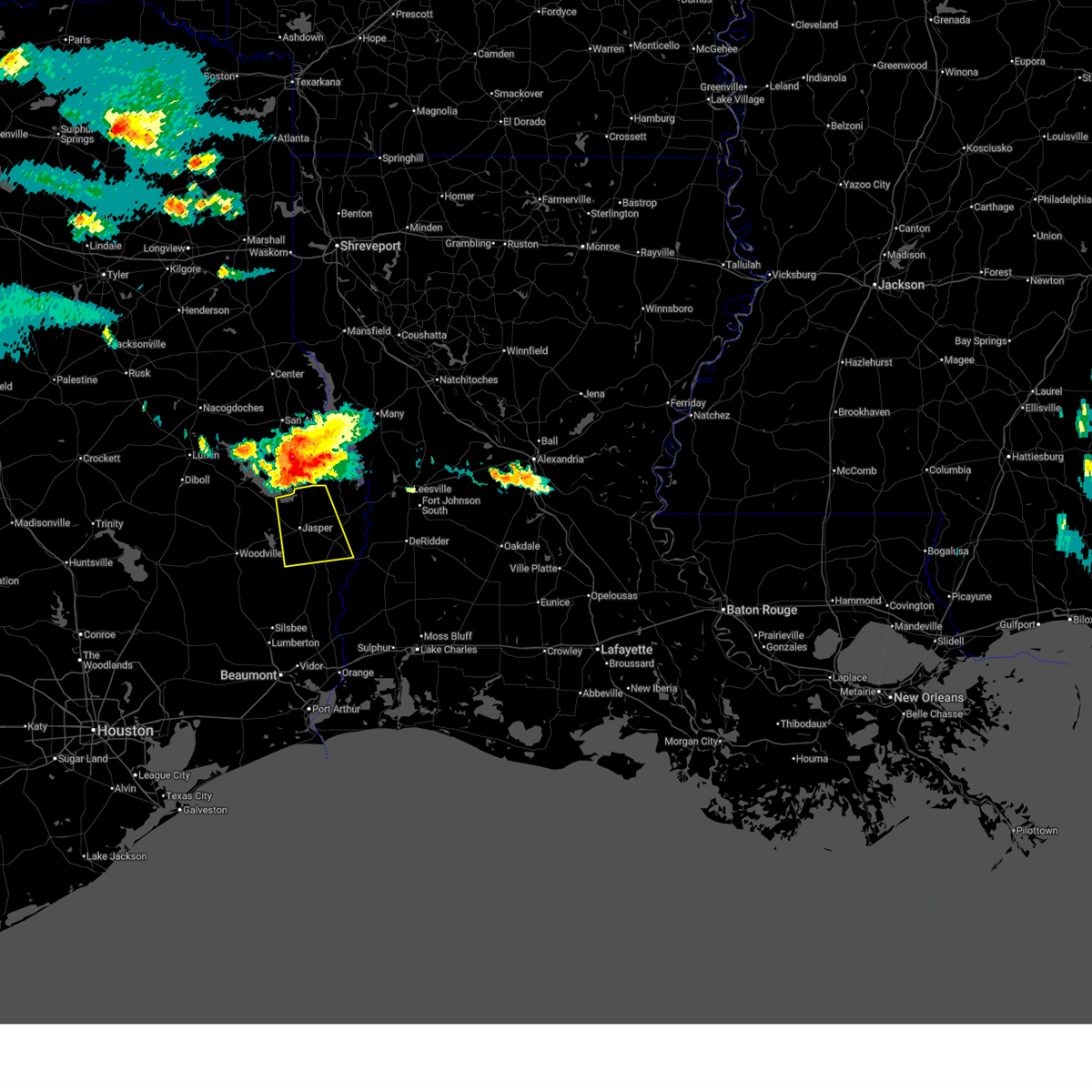
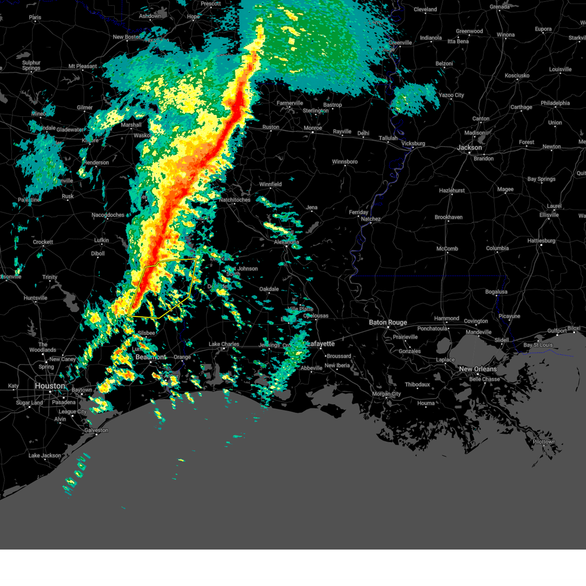
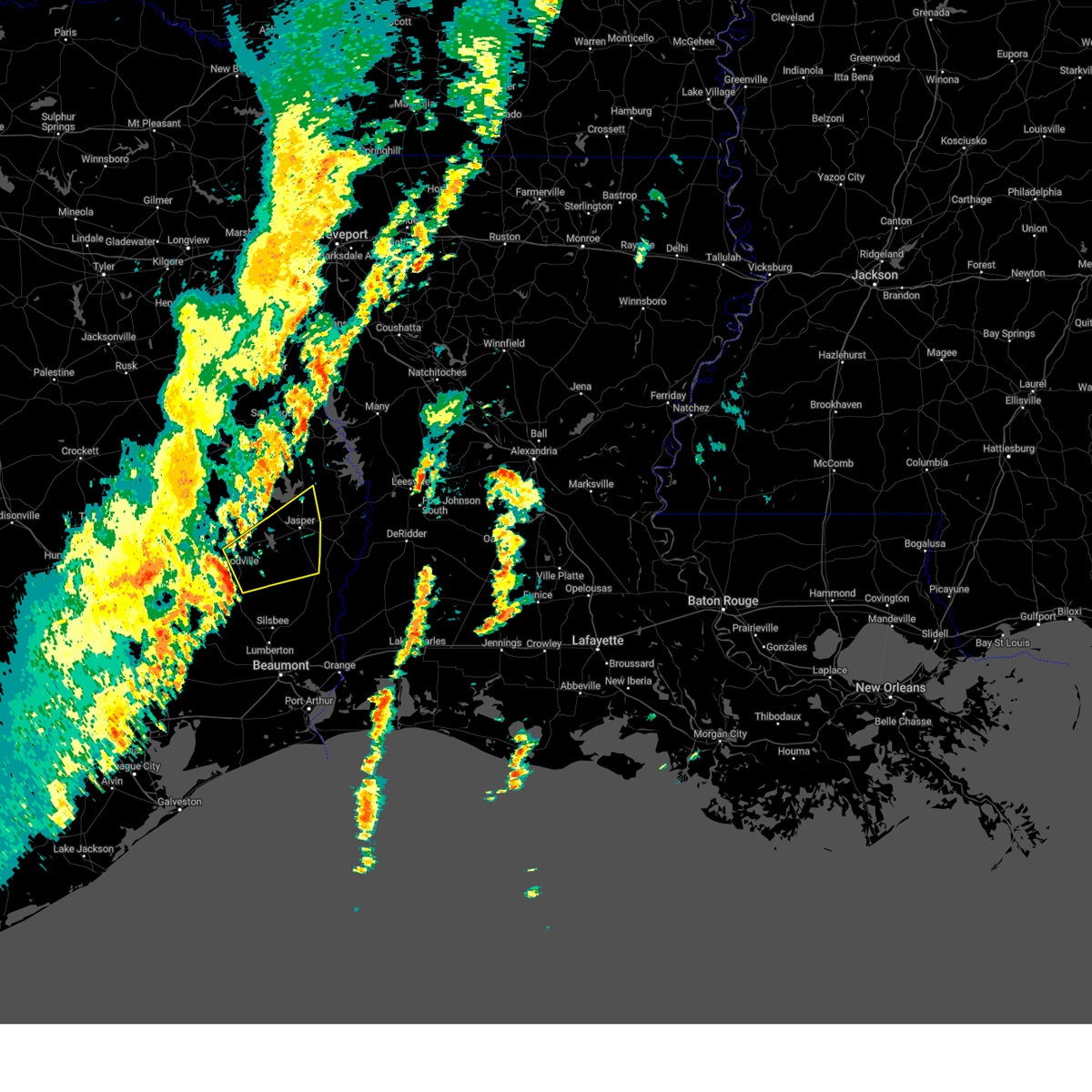
The Top Recent Hail Date for Browndell, TX is Sunday, March 15, 2026 (24th out of 66)

Hail and Wind Damage Spotted near Browndell, TX
| Date / Time | Report Details |
|---|---|
| 6/2/2026 5:13 PM CDT |
 Svrlch the national weather service in lake charles has issued a * severe thunderstorm warning for, northeastern jasper county in southeastern texas, * until 600 pm cdt. * at 513 pm cdt, a severe thunderstorm was located 7 miles north of jasper, moving west at 20 mph (radar indicated). Hazards include 60 mph wind gusts and quarter size hail. Hail damage to vehicles is expected. Expect wind damage to roofs, siding, and trees. Svrlch the national weather service in lake charles has issued a * severe thunderstorm warning for, northeastern jasper county in southeastern texas, * until 600 pm cdt. * at 513 pm cdt, a severe thunderstorm was located 7 miles north of jasper, moving west at 20 mph (radar indicated). Hazards include 60 mph wind gusts and quarter size hail. Hail damage to vehicles is expected. Expect wind damage to roofs, siding, and trees.
|
| 5/23/2026 9:18 AM CDT |
 At 917 am cdt, a severe thunderstorm was located near mayflower, or near burkeville, moving east at 60 mph (radar indicated). Hazards include 70 mph wind gusts. Expect considerable tree damage. damage is likely to mobile homes, roofs, and outbuildings. Locations impacted include, de ridder, jasper, leesville, newton, rosepine, anacoco, fort polk, sugartown, slagle, toledo bend dam, pitkin, burkeville, new llano, hornbeck, browndell, hutton, mayflower, kurthwood, harrisburg, and junction. At 917 am cdt, a severe thunderstorm was located near mayflower, or near burkeville, moving east at 60 mph (radar indicated). Hazards include 70 mph wind gusts. Expect considerable tree damage. damage is likely to mobile homes, roofs, and outbuildings. Locations impacted include, de ridder, jasper, leesville, newton, rosepine, anacoco, fort polk, sugartown, slagle, toledo bend dam, pitkin, burkeville, new llano, hornbeck, browndell, hutton, mayflower, kurthwood, harrisburg, and junction.
|
| 5/23/2026 8:51 AM CDT |
 At 851 am cdt, a severe thunderstorm was located near ebenezer, moving east at 40 mph (radar indicated). Hazards include 60 mph wind gusts. Expect damage to roofs, siding, and trees. Locations impacted include, jasper, newton, ebenezer, browndell, jamestown, farrsville, harrisburg, mayflower, sam rayburn dam, and wiergate. At 851 am cdt, a severe thunderstorm was located near ebenezer, moving east at 40 mph (radar indicated). Hazards include 60 mph wind gusts. Expect damage to roofs, siding, and trees. Locations impacted include, jasper, newton, ebenezer, browndell, jamestown, farrsville, harrisburg, mayflower, sam rayburn dam, and wiergate.
|
| 5/23/2026 8:32 AM CDT |
 Svrlch the national weather service in lake charles has issued a * severe thunderstorm warning for, northern tyler county in southeastern texas, northwestern newton county in southeastern texas, northern jasper county in southeastern texas, * until 915 am cdt. * at 832 am cdt, a severe thunderstorm was located 7 miles southwest of ebenezer, moving east at 45 mph (radar indicated). Hazards include 60 mph wind gusts. expect damage to roofs, siding, and trees Svrlch the national weather service in lake charles has issued a * severe thunderstorm warning for, northern tyler county in southeastern texas, northwestern newton county in southeastern texas, northern jasper county in southeastern texas, * until 915 am cdt. * at 832 am cdt, a severe thunderstorm was located 7 miles southwest of ebenezer, moving east at 45 mph (radar indicated). Hazards include 60 mph wind gusts. expect damage to roofs, siding, and trees
|
| 3/15/2026 7:23 PM CDT |
 Svrlch the national weather service in lake charles has issued a * severe thunderstorm warning for, northern newton county in southeastern texas, northeastern jasper county in southeastern texas, * until 815 pm cdt. * at 723 pm cdt, a severe thunderstorm was located over pineland, or 16 miles northeast of ebenezer, moving southeast at 40 mph (radar indicated). Hazards include golf ball size hail and 60 mph wind gusts. People and animals outdoors will be injured. expect hail damage to roofs, siding, windows, and vehicles. Expect wind damage to roofs, siding, and trees. Svrlch the national weather service in lake charles has issued a * severe thunderstorm warning for, northern newton county in southeastern texas, northeastern jasper county in southeastern texas, * until 815 pm cdt. * at 723 pm cdt, a severe thunderstorm was located over pineland, or 16 miles northeast of ebenezer, moving southeast at 40 mph (radar indicated). Hazards include golf ball size hail and 60 mph wind gusts. People and animals outdoors will be injured. expect hail damage to roofs, siding, windows, and vehicles. Expect wind damage to roofs, siding, and trees.
|
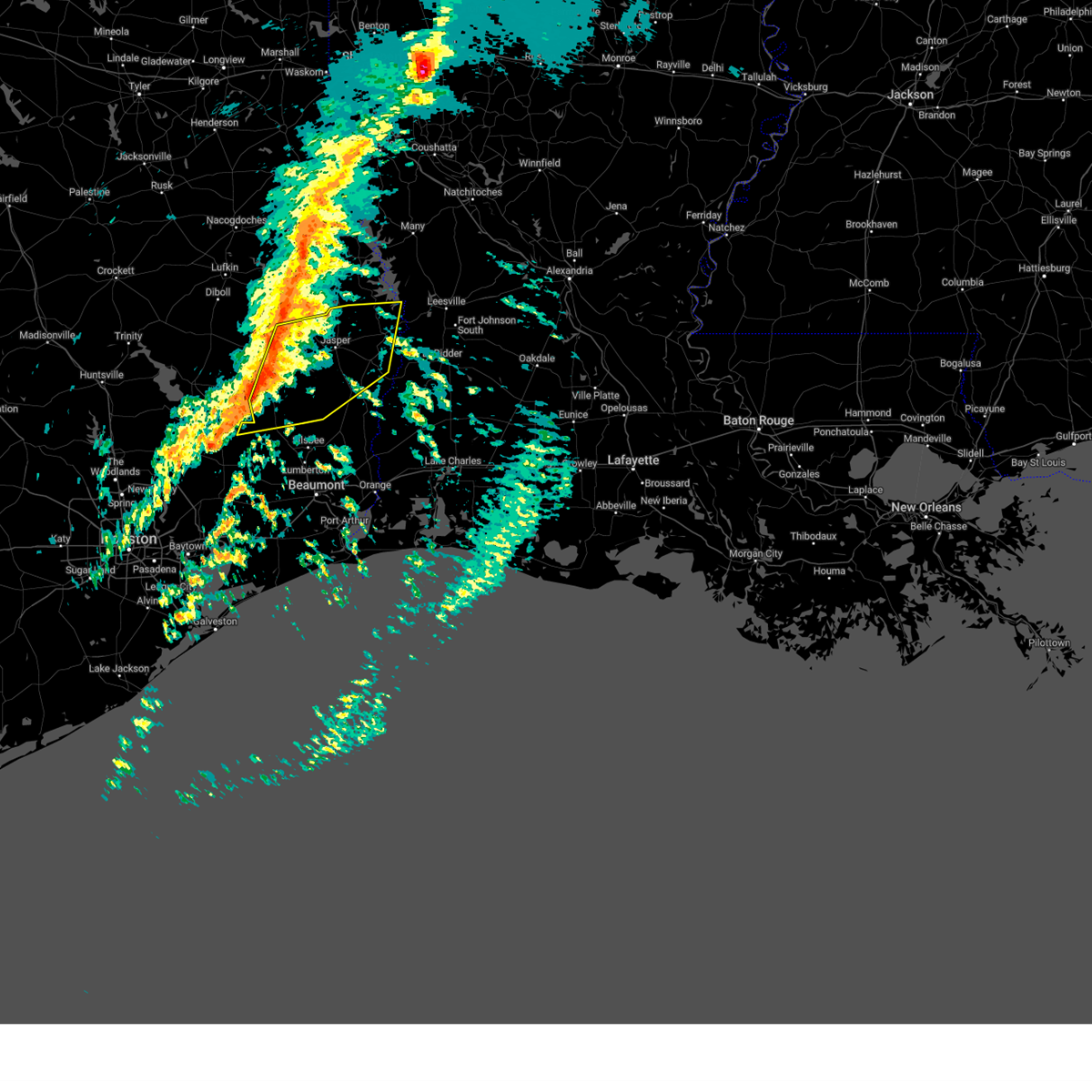
| 3/11/2026 3:49 PM CDT |
 At 349 pm cdt, severe thunderstorms were located along a line extending from near browndell to near jasper to near mt. union, moving northeast at 45 mph (radar indicated). Hazards include 60 mph wind gusts. Expect damage to roofs, siding, and trees. locations impacted include, jasper, newton, kirbyville, toledo bend dam, call, bon weir, burkeville, browndell, trout creek, farrsville, magnolia springs, mayflower, mt. Union, jamestown, roganville, harrisburg, stringtown, bleakwood, and wiergate. At 349 pm cdt, severe thunderstorms were located along a line extending from near browndell to near jasper to near mt. union, moving northeast at 45 mph (radar indicated). Hazards include 60 mph wind gusts. Expect damage to roofs, siding, and trees. locations impacted include, jasper, newton, kirbyville, toledo bend dam, call, bon weir, burkeville, browndell, trout creek, farrsville, magnolia springs, mayflower, mt. Union, jamestown, roganville, harrisburg, stringtown, bleakwood, and wiergate.
|
| 3/11/2026 3:49 PM CDT |
 the severe thunderstorm warning has been cancelled and is no longer in effect the severe thunderstorm warning has been cancelled and is no longer in effect
|
| 3/11/2026 3:36 PM CDT |
 At 336 pm cdt, severe thunderstorms were located along a line extending from 6 miles southwest of browndell to near jasper to near mt. union, moving northeast at 30 mph (radar indicated). Hazards include 60 mph wind gusts. Expect damage to roofs, siding, and trees. locations impacted include, jasper, newton, kirbyville, toledo bend dam, call, bon weir, burkeville, browndell, trout creek, farrsville, magnolia springs, mayflower, mt. Union, jamestown, roganville, harrisburg, stringtown, sam rayburn dam, bleakwood, and wiergate. At 336 pm cdt, severe thunderstorms were located along a line extending from 6 miles southwest of browndell to near jasper to near mt. union, moving northeast at 30 mph (radar indicated). Hazards include 60 mph wind gusts. Expect damage to roofs, siding, and trees. locations impacted include, jasper, newton, kirbyville, toledo bend dam, call, bon weir, burkeville, browndell, trout creek, farrsville, magnolia springs, mayflower, mt. Union, jamestown, roganville, harrisburg, stringtown, sam rayburn dam, bleakwood, and wiergate.
|
| 3/11/2026 3:26 PM CDT |
 At 326 pm cdt, severe thunderstorms were located along a line extending from ebenezer to near town bluff to near fred, moving northeast at 40 mph (radar indicated). Hazards include 60 mph wind gusts. Expect damage to roofs, siding, and trees. locations impacted include, jasper, newton, kirbyville, toledo bend dam, call, ebenezer, fred, town bluff, bon weir, burkeville, browndell, trout creek, farrsville, magnolia springs, mayflower, mt. Union, spurger, jamestown, roganville, and harrisburg. At 326 pm cdt, severe thunderstorms were located along a line extending from ebenezer to near town bluff to near fred, moving northeast at 40 mph (radar indicated). Hazards include 60 mph wind gusts. Expect damage to roofs, siding, and trees. locations impacted include, jasper, newton, kirbyville, toledo bend dam, call, ebenezer, fred, town bluff, bon weir, burkeville, browndell, trout creek, farrsville, magnolia springs, mayflower, mt. Union, spurger, jamestown, roganville, and harrisburg.
|
| 3/11/2026 3:09 PM CDT |
 Svrlch the national weather service in lake charles has issued a * severe thunderstorm warning for, eastern tyler county in southeastern texas, newton county in southeastern texas, jasper county in southeastern texas, * until 400 pm cdt. * at 308 pm cdt, severe thunderstorms were located along a line extending from 6 miles east of rockland to near town bluff to 6 miles southeast of warren, moving northeast at 45 mph (radar indicated). Hazards include 60 mph wind gusts. expect damage to roofs, siding, and trees Svrlch the national weather service in lake charles has issued a * severe thunderstorm warning for, eastern tyler county in southeastern texas, newton county in southeastern texas, jasper county in southeastern texas, * until 400 pm cdt. * at 308 pm cdt, severe thunderstorms were located along a line extending from 6 miles east of rockland to near town bluff to 6 miles southeast of warren, moving northeast at 45 mph (radar indicated). Hazards include 60 mph wind gusts. expect damage to roofs, siding, and trees
|
| 2/14/2026 6:48 PM CST |
 Svrlch the national weather service in lake charles has issued a * severe thunderstorm warning for, northwestern vernon parish in west central louisiana, northern newton county in southeastern texas, northeastern jasper county in southeastern texas, * until 715 pm cst. * at 648 pm cst, a severe thunderstorm was located 7 miles east of browndell, or 15 miles northwest of burkeville, moving east at 45 mph (radar indicated). Hazards include 60 mph wind gusts. expect damage to roofs, siding, and trees Svrlch the national weather service in lake charles has issued a * severe thunderstorm warning for, northwestern vernon parish in west central louisiana, northern newton county in southeastern texas, northeastern jasper county in southeastern texas, * until 715 pm cst. * at 648 pm cst, a severe thunderstorm was located 7 miles east of browndell, or 15 miles northwest of burkeville, moving east at 45 mph (radar indicated). Hazards include 60 mph wind gusts. expect damage to roofs, siding, and trees
|
| 2/14/2026 5:29 PM CST |
 Svrshv the national weather service in shreveport has issued a * severe thunderstorm warning for, southeastern angelina county in eastern texas, southeastern nacogdoches county in eastern texas, sabine county in eastern texas, san augustine county in eastern texas, shelby county in eastern texas, * until 615 pm cst. * at 529 pm cst, severe thunderstorms were located along a line from near timpson to 12 miles southeast of diboll, or along a line from 13 miles northwest of center to 12 miles southeast of diboll, moving east at 45 mph (radar indicated). Hazards include 60 mph wind gusts. expect damage to roofs, siding, and trees Svrshv the national weather service in shreveport has issued a * severe thunderstorm warning for, southeastern angelina county in eastern texas, southeastern nacogdoches county in eastern texas, sabine county in eastern texas, san augustine county in eastern texas, shelby county in eastern texas, * until 615 pm cst. * at 529 pm cst, severe thunderstorms were located along a line from near timpson to 12 miles southeast of diboll, or along a line from 13 miles northwest of center to 12 miles southeast of diboll, moving east at 45 mph (radar indicated). Hazards include 60 mph wind gusts. expect damage to roofs, siding, and trees
|
| 8/18/2025 9:21 PM CDT |
 At 921 pm cdt, severe thunderstorms were located along a line extending from near stringtown to near browndell, moving southwest at 30 mph (radar indicated). Hazards include 60 mph wind gusts. Expect damage to roofs, siding, and trees. Locations impacted include, jasper, newton, ebenezer, burkeville, browndell, farrsville, mayflower, jamestown, harrisburg, stringtown, sam rayburn dam, wiergate, and evans. At 921 pm cdt, severe thunderstorms were located along a line extending from near stringtown to near browndell, moving southwest at 30 mph (radar indicated). Hazards include 60 mph wind gusts. Expect damage to roofs, siding, and trees. Locations impacted include, jasper, newton, ebenezer, burkeville, browndell, farrsville, mayflower, jamestown, harrisburg, stringtown, sam rayburn dam, wiergate, and evans.
|
| 8/18/2025 8:56 PM CDT |
 Svrlch the national weather service in lake charles has issued a * severe thunderstorm warning for, southwestern vernon parish in west central louisiana, northern newton county in southeastern texas, northeastern jasper county in southeastern texas, * until 930 pm cdt. * at 855 pm cdt, severe thunderstorms were located along a line extending from 6 miles southwest of new llano to 7 miles northwest of mayflower, moving southwest at 30 mph (radar indicated). Hazards include 60 mph wind gusts. expect damage to roofs, siding, and trees Svrlch the national weather service in lake charles has issued a * severe thunderstorm warning for, southwestern vernon parish in west central louisiana, northern newton county in southeastern texas, northeastern jasper county in southeastern texas, * until 930 pm cdt. * at 855 pm cdt, severe thunderstorms were located along a line extending from 6 miles southwest of new llano to 7 miles northwest of mayflower, moving southwest at 30 mph (radar indicated). Hazards include 60 mph wind gusts. expect damage to roofs, siding, and trees
|
| 6/8/2025 7:37 PM CDT | Sheriff department reported multiple trees down and power outages around the browndell area. time estimated from rada in jasper county TX, 0.6 miles SE of Browndell, TX |
| 6/8/2025 7:24 PM CDT |
 Svrlch the national weather service in lake charles has issued a * severe thunderstorm warning for, northwestern newton county in southeastern texas, northeastern jasper county in southeastern texas, * until 830 pm cdt. * at 723 pm cdt, a severe thunderstorm was located near pineland, or 14 miles northeast of ebenezer, moving south at 35 mph (radar indicated). Hazards include golf ball size hail and 60 mph wind gusts. People and animals outdoors will be injured. expect hail damage to roofs, siding, windows, and vehicles. Expect wind damage to roofs, siding, and trees. Svrlch the national weather service in lake charles has issued a * severe thunderstorm warning for, northwestern newton county in southeastern texas, northeastern jasper county in southeastern texas, * until 830 pm cdt. * at 723 pm cdt, a severe thunderstorm was located near pineland, or 14 miles northeast of ebenezer, moving south at 35 mph (radar indicated). Hazards include golf ball size hail and 60 mph wind gusts. People and animals outdoors will be injured. expect hail damage to roofs, siding, windows, and vehicles. Expect wind damage to roofs, siding, and trees.
|
| 5/27/2025 12:09 AM CDT |
 Svrlch the national weather service in lake charles has issued a * severe thunderstorm warning for, northwestern tyler county in southeastern texas, northern jasper county in southeastern texas, * until 100 am cdt. * at 1209 am cdt, a severe thunderstorm was located 9 miles north of chester, moving northeast at 50 mph (radar indicated). Hazards include 60 mph wind gusts and penny size hail. expect damage to roofs, siding, and trees Svrlch the national weather service in lake charles has issued a * severe thunderstorm warning for, northwestern tyler county in southeastern texas, northern jasper county in southeastern texas, * until 100 am cdt. * at 1209 am cdt, a severe thunderstorm was located 9 miles north of chester, moving northeast at 50 mph (radar indicated). Hazards include 60 mph wind gusts and penny size hail. expect damage to roofs, siding, and trees
|
| 5/2/2025 1:00 PM CDT |
 At 100 pm cdt, a severe thunderstorm was located near ebenezer, moving northeast at 20 mph (radar indicated). Hazards include 60 mph wind gusts and quarter size hail. Hail damage to vehicles is expected. expect wind damage to roofs, siding, and trees. Locations impacted include, sam rayburn dam, browndell, and ebenezer. At 100 pm cdt, a severe thunderstorm was located near ebenezer, moving northeast at 20 mph (radar indicated). Hazards include 60 mph wind gusts and quarter size hail. Hail damage to vehicles is expected. expect wind damage to roofs, siding, and trees. Locations impacted include, sam rayburn dam, browndell, and ebenezer.
|
| 5/2/2025 12:48 PM CDT |
 Svrlch the national weather service in lake charles has issued a * severe thunderstorm warning for, northeastern jasper county in southeastern texas, * until 115 pm cdt. * at 1247 pm cdt, a severe thunderstorm was located 8 miles north of town bluff, moving northeast at 20 mph (radar indicated). Hazards include 60 mph wind gusts and quarter size hail. Hail damage to vehicles is expected. Expect wind damage to roofs, siding, and trees. Svrlch the national weather service in lake charles has issued a * severe thunderstorm warning for, northeastern jasper county in southeastern texas, * until 115 pm cdt. * at 1247 pm cdt, a severe thunderstorm was located 8 miles north of town bluff, moving northeast at 20 mph (radar indicated). Hazards include 60 mph wind gusts and quarter size hail. Hail damage to vehicles is expected. Expect wind damage to roofs, siding, and trees.
|
| 3/28/2025 8:31 PM CDT |
 the severe thunderstorm warning has been cancelled and is no longer in effect the severe thunderstorm warning has been cancelled and is no longer in effect
|
| 3/28/2025 8:21 PM CDT |
 At 820 pm cdt, a severe thunderstorm was located near jasper, moving northeast at 20 mph (radar indicated). Hazards include 60 mph wind gusts. Expect damage to roofs, siding, and trees. Locations impacted include, browndell. At 820 pm cdt, a severe thunderstorm was located near jasper, moving northeast at 20 mph (radar indicated). Hazards include 60 mph wind gusts. Expect damage to roofs, siding, and trees. Locations impacted include, browndell.
|
| 3/28/2025 7:52 PM CDT |
 Svrlch the national weather service in lake charles has issued a * severe thunderstorm warning for, northeastern jasper county in southeastern texas, * until 845 pm cdt. * at 751 pm cdt, a severe thunderstorm was located near jasper, moving northeast at 30 mph (radar indicated). Hazards include 60 mph wind gusts. expect damage to roofs, siding, and trees Svrlch the national weather service in lake charles has issued a * severe thunderstorm warning for, northeastern jasper county in southeastern texas, * until 845 pm cdt. * at 751 pm cdt, a severe thunderstorm was located near jasper, moving northeast at 30 mph (radar indicated). Hazards include 60 mph wind gusts. expect damage to roofs, siding, and trees
|
| 3/4/2025 10:16 AM CST |
 the severe thunderstorm warning has been cancelled and is no longer in effect the severe thunderstorm warning has been cancelled and is no longer in effect
|
| 3/4/2025 10:16 AM CST |
 At 1015 am cst, severe thunderstorms were located along a line extending from near pineland to 6 miles southwest of spurger, moving northeast at 70 mph (radar indicated). Hazards include 60 mph wind gusts. Expect damage to roofs, siding, and trees. locations impacted include, toledo bend dam, sam rayburn dam, ebenezer, farrsville, bleakwood, fred, magnolia springs, mayflower, mt. Union, wiergate, kirbyville, spurger, newton, jasper, jamestown, town bluff, roganville, burkeville, harrisburg, and browndell. At 1015 am cst, severe thunderstorms were located along a line extending from near pineland to 6 miles southwest of spurger, moving northeast at 70 mph (radar indicated). Hazards include 60 mph wind gusts. Expect damage to roofs, siding, and trees. locations impacted include, toledo bend dam, sam rayburn dam, ebenezer, farrsville, bleakwood, fred, magnolia springs, mayflower, mt. Union, wiergate, kirbyville, spurger, newton, jasper, jamestown, town bluff, roganville, burkeville, harrisburg, and browndell.
|
| 3/4/2025 9:59 AM CST |
 Svrlch the national weather service in lake charles has issued a * severe thunderstorm warning for, tyler county in southeastern texas, northwestern newton county in southeastern texas, northern hardin county in southeastern texas, jasper county in southeastern texas, * until 1045 am cst. * at 958 am cst, severe thunderstorms were located along a line extending from near ebenezer to near wildwood, moving northeast at 70 mph (radar indicated). Hazards include 60 mph wind gusts. expect damage to roofs, siding, and trees Svrlch the national weather service in lake charles has issued a * severe thunderstorm warning for, tyler county in southeastern texas, northwestern newton county in southeastern texas, northern hardin county in southeastern texas, jasper county in southeastern texas, * until 1045 am cst. * at 958 am cst, severe thunderstorms were located along a line extending from near ebenezer to near wildwood, moving northeast at 70 mph (radar indicated). Hazards include 60 mph wind gusts. expect damage to roofs, siding, and trees
|
| 11/18/2024 3:14 PM CST |
 The storm which prompted the warning has weakened below severe limits, and has exited the warned area. therefore, the warning will be allowed to expire. a tornado watch remains in effect until 800 pm cst for southeastern texas. The storm which prompted the warning has weakened below severe limits, and has exited the warned area. therefore, the warning will be allowed to expire. a tornado watch remains in effect until 800 pm cst for southeastern texas.
|
| 11/18/2024 3:00 PM CST |
 Torlch the national weather service in lake charles has issued a * tornado warning for, north central jasper county in southeastern texas, * until 315 pm cst. * at 300 pm cst, a severe thunderstorm capable of producing a tornado was located near ebenezer, moving northeast at 35 mph (radar indicated rotation). Hazards include tornado. Flying debris will be dangerous to those caught without shelter. mobile homes will be damaged or destroyed. damage to roofs, windows, and vehicles will occur. tree damage is likely. this dangerous storm will be near, browndell around 305 pm cst. Other locations impacted by this tornadic thunderstorm include sam rayburn dam. Torlch the national weather service in lake charles has issued a * tornado warning for, north central jasper county in southeastern texas, * until 315 pm cst. * at 300 pm cst, a severe thunderstorm capable of producing a tornado was located near ebenezer, moving northeast at 35 mph (radar indicated rotation). Hazards include tornado. Flying debris will be dangerous to those caught without shelter. mobile homes will be damaged or destroyed. damage to roofs, windows, and vehicles will occur. tree damage is likely. this dangerous storm will be near, browndell around 305 pm cst. Other locations impacted by this tornadic thunderstorm include sam rayburn dam.
|
| 11/18/2024 2:47 PM CST |
 At 246 pm cst, a severe thunderstorm capable of producing a tornado was located near town bluff, moving northeast at 40 mph (radar indicated rotation). Hazards include tornado. Flying debris will be dangerous to those caught without shelter. mobile homes will be damaged or destroyed. damage to roofs, windows, and vehicles will occur. tree damage is likely. this dangerous storm will be near, ebenezer around 250 pm cst. Other locations impacted by this tornadic thunderstorm include sam rayburn dam. At 246 pm cst, a severe thunderstorm capable of producing a tornado was located near town bluff, moving northeast at 40 mph (radar indicated rotation). Hazards include tornado. Flying debris will be dangerous to those caught without shelter. mobile homes will be damaged or destroyed. damage to roofs, windows, and vehicles will occur. tree damage is likely. this dangerous storm will be near, ebenezer around 250 pm cst. Other locations impacted by this tornadic thunderstorm include sam rayburn dam.
|
| 11/18/2024 2:47 PM CST |
 the tornado warning has been cancelled and is no longer in effect the tornado warning has been cancelled and is no longer in effect
|
| 11/18/2024 2:37 PM CST |
 Torlch the national weather service in lake charles has issued a * tornado warning for, northeastern tyler county in southeastern texas, north central jasper county in southeastern texas, * until 300 pm cst. * at 237 pm cst, a severe thunderstorm capable of producing a tornado was located near town bluff, moving northeast at 35 mph (radar indicated rotation). Hazards include tornado. Flying debris will be dangerous to those caught without shelter. mobile homes will be damaged or destroyed. damage to roofs, windows, and vehicles will occur. tree damage is likely. this dangerous storm will be near, ebenezer around 245 pm cst. Other locations impacted by this tornadic thunderstorm include sam rayburn dam. Torlch the national weather service in lake charles has issued a * tornado warning for, northeastern tyler county in southeastern texas, north central jasper county in southeastern texas, * until 300 pm cst. * at 237 pm cst, a severe thunderstorm capable of producing a tornado was located near town bluff, moving northeast at 35 mph (radar indicated rotation). Hazards include tornado. Flying debris will be dangerous to those caught without shelter. mobile homes will be damaged or destroyed. damage to roofs, windows, and vehicles will occur. tree damage is likely. this dangerous storm will be near, ebenezer around 245 pm cst. Other locations impacted by this tornadic thunderstorm include sam rayburn dam.
|
| 11/5/2024 8:41 AM CST |
 the severe thunderstorm warning has been cancelled and is no longer in effect the severe thunderstorm warning has been cancelled and is no longer in effect
|
| 11/5/2024 8:21 AM CST |
 At 820 am cst, severe thunderstorms were located along a line extending from 6 miles northeast of woodville to near fred, moving east at 35 mph (radar indicated). Hazards include 60 mph wind gusts. Expect damage to roofs, siding, and trees. locations impacted include, jasper, kirbyville, town bluff, browndell, spurger, roganville, magnolia springs, harrisburg, and mt. Union. At 820 am cst, severe thunderstorms were located along a line extending from 6 miles northeast of woodville to near fred, moving east at 35 mph (radar indicated). Hazards include 60 mph wind gusts. Expect damage to roofs, siding, and trees. locations impacted include, jasper, kirbyville, town bluff, browndell, spurger, roganville, magnolia springs, harrisburg, and mt. Union.
|
| 11/5/2024 8:07 AM CST |
 Svrlch the national weather service in lake charles has issued a * severe thunderstorm warning for, central tyler county in southeastern texas, northeastern jasper county in southeastern texas, * until 900 am cst. * at 807 am cst, severe thunderstorms were located along a line extending from woodville to near warren, moving northeast at 35 mph (radar indicated). Hazards include 60 mph wind gusts. expect damage to roofs, siding, and trees Svrlch the national weather service in lake charles has issued a * severe thunderstorm warning for, central tyler county in southeastern texas, northeastern jasper county in southeastern texas, * until 900 am cst. * at 807 am cst, severe thunderstorms were located along a line extending from woodville to near warren, moving northeast at 35 mph (radar indicated). Hazards include 60 mph wind gusts. expect damage to roofs, siding, and trees
|
| 7/8/2024 2:27 PM CDT |
 The tornado warning that was previously in effect has been reissued for jasper county and is in effect until 245 pm cdt. please refer to that bulletin for the latest severe weather information. a tornado watch remains in effect until 1000 pm cdt for southeastern texas. The tornado warning that was previously in effect has been reissued for jasper county and is in effect until 245 pm cdt. please refer to that bulletin for the latest severe weather information. a tornado watch remains in effect until 1000 pm cdt for southeastern texas.
|
| 7/8/2024 2:27 PM CDT |
 Torlch the national weather service in lake charles has issued a * tornado warning for, northwestern newton county in southeastern texas, northeastern jasper county in southeastern texas, * until 245 pm cdt. * at 226 pm cdt, a severe thunderstorm capable of producing a tornado was located near jasper, moving north at 65 mph (radar indicated rotation). Hazards include tornado. Flying debris will be dangerous to those caught without shelter. mobile homes will be damaged or destroyed. damage to roofs, windows, and vehicles will occur. tree damage is likely. This dangerous storm will be near, jasper, browndell, and harrisburg around 230 pm cdt. Torlch the national weather service in lake charles has issued a * tornado warning for, northwestern newton county in southeastern texas, northeastern jasper county in southeastern texas, * until 245 pm cdt. * at 226 pm cdt, a severe thunderstorm capable of producing a tornado was located near jasper, moving north at 65 mph (radar indicated rotation). Hazards include tornado. Flying debris will be dangerous to those caught without shelter. mobile homes will be damaged or destroyed. damage to roofs, windows, and vehicles will occur. tree damage is likely. This dangerous storm will be near, jasper, browndell, and harrisburg around 230 pm cdt.
|
| 7/8/2024 1:59 PM CDT |
 Torlch the national weather service in lake charles has issued a * tornado warning for, northwestern newton county in southeastern texas, northeastern jasper county in southeastern texas, * until 230 pm cdt. * at 159 pm cdt, a severe thunderstorm capable of producing a tornado was located near call, moving north at 40 mph (radar indicated rotation). Hazards include tornado. Flying debris will be dangerous to those caught without shelter. mobile homes will be damaged or destroyed. damage to roofs, windows, and vehicles will occur. tree damage is likely. this dangerous storm will be near, kirbyville, call, and mt. union around 205 pm cdt. magnolia springs around 210 pm cdt. roganville around 215 pm cdt. Other locations impacted by this tornadic thunderstorm include sam rayburn dam. Torlch the national weather service in lake charles has issued a * tornado warning for, northwestern newton county in southeastern texas, northeastern jasper county in southeastern texas, * until 230 pm cdt. * at 159 pm cdt, a severe thunderstorm capable of producing a tornado was located near call, moving north at 40 mph (radar indicated rotation). Hazards include tornado. Flying debris will be dangerous to those caught without shelter. mobile homes will be damaged or destroyed. damage to roofs, windows, and vehicles will occur. tree damage is likely. this dangerous storm will be near, kirbyville, call, and mt. union around 205 pm cdt. magnolia springs around 210 pm cdt. roganville around 215 pm cdt. Other locations impacted by this tornadic thunderstorm include sam rayburn dam.
|
| 7/8/2024 1:39 PM CDT |
 The storm which prompted the warning has moved out of the area. therefore, the warning will be allowed to expire. a tornado watch remains in effect until 1000 pm cdt for southeastern texas. The storm which prompted the warning has moved out of the area. therefore, the warning will be allowed to expire. a tornado watch remains in effect until 1000 pm cdt for southeastern texas.
|
| 7/8/2024 1:12 PM CDT |
 Torlch the national weather service in lake charles has issued a * tornado warning for, northeastern jasper county in southeastern texas, * until 145 pm cdt. * at 112 pm cdt, a severe thunderstorm capable of producing a tornado was located near magnolia springs, or near town bluff, moving north at 55 mph (radar indicated rotation). Hazards include tornado. Flying debris will be dangerous to those caught without shelter. mobile homes will be damaged or destroyed. damage to roofs, windows, and vehicles will occur. tree damage is likely. this dangerous storm will be near, jasper around 120 pm cdt. ebenezer around 125 pm cdt. Other locations impacted by this tornadic thunderstorm include sam rayburn dam. Torlch the national weather service in lake charles has issued a * tornado warning for, northeastern jasper county in southeastern texas, * until 145 pm cdt. * at 112 pm cdt, a severe thunderstorm capable of producing a tornado was located near magnolia springs, or near town bluff, moving north at 55 mph (radar indicated rotation). Hazards include tornado. Flying debris will be dangerous to those caught without shelter. mobile homes will be damaged or destroyed. damage to roofs, windows, and vehicles will occur. tree damage is likely. this dangerous storm will be near, jasper around 120 pm cdt. ebenezer around 125 pm cdt. Other locations impacted by this tornadic thunderstorm include sam rayburn dam.
|
| 7/8/2024 12:44 PM CDT |
 The storm which prompted the warning has moved out of the area. therefore, the warning will be allowed to expire. a tornado watch remains in effect until 1000 pm cdt for southeastern texas. The storm which prompted the warning has moved out of the area. therefore, the warning will be allowed to expire. a tornado watch remains in effect until 1000 pm cdt for southeastern texas.
|
| 7/8/2024 12:34 PM CDT |
 Torlch the national weather service in lake charles has issued a * tornado warning for, northeastern jasper county in southeastern texas, * until 1245 pm cdt. * at 1233 pm cdt, a severe thunderstorm capable of producing a tornado was located near browndell, or 9 miles north of jasper, moving north at 60 mph (radar indicated rotation). Hazards include tornado. Flying debris will be dangerous to those caught without shelter. mobile homes will be damaged or destroyed. damage to roofs, windows, and vehicles will occur. tree damage is likely. This dangerous storm will be near, browndell around 1240 pm cdt. Torlch the national weather service in lake charles has issued a * tornado warning for, northeastern jasper county in southeastern texas, * until 1245 pm cdt. * at 1233 pm cdt, a severe thunderstorm capable of producing a tornado was located near browndell, or 9 miles north of jasper, moving north at 60 mph (radar indicated rotation). Hazards include tornado. Flying debris will be dangerous to those caught without shelter. mobile homes will be damaged or destroyed. damage to roofs, windows, and vehicles will occur. tree damage is likely. This dangerous storm will be near, browndell around 1240 pm cdt.
|
| 7/8/2024 11:27 AM CDT |
 the tornado warning has been cancelled and is no longer in effect the tornado warning has been cancelled and is no longer in effect
|
| 7/8/2024 11:08 AM CDT |
 Torlch the national weather service in lake charles has issued a * tornado warning for, northeastern jasper county in southeastern texas, * until 1145 am cdt. * at 1108 am cdt, a tornado producing storm was located over jasper, moving north at 35 mph (radar confirmed tornado). Hazards include damaging tornado. Flying debris will be dangerous to those caught without shelter. mobile homes will be damaged or destroyed. damage to roofs, windows, and vehicles will occur. tree damage is likely. this tornadic storm will be near, jasper and ebenezer around 1115 am cdt. browndell around 1125 am cdt. Other locations impacted by this tornadic thunderstorm include sam rayburn dam. Torlch the national weather service in lake charles has issued a * tornado warning for, northeastern jasper county in southeastern texas, * until 1145 am cdt. * at 1108 am cdt, a tornado producing storm was located over jasper, moving north at 35 mph (radar confirmed tornado). Hazards include damaging tornado. Flying debris will be dangerous to those caught without shelter. mobile homes will be damaged or destroyed. damage to roofs, windows, and vehicles will occur. tree damage is likely. this tornadic storm will be near, jasper and ebenezer around 1115 am cdt. browndell around 1125 am cdt. Other locations impacted by this tornadic thunderstorm include sam rayburn dam.
|
| 6/26/2024 2:50 PM CDT |
 Svrshv the national weather service in shreveport has issued a * severe thunderstorm warning for, south central sabine parish in northwestern louisiana, southeastern nacogdoches county in eastern texas, angelina county in eastern texas, southern san augustine county in eastern texas, southern sabine county in eastern texas, * until 330 pm cdt. * at 250 pm cdt, severe thunderstorms were located along a line extending from 8 miles north of toledo bend dam to 12 miles west of pineland to near hudson, moving southeast at 55 mph (radar indicated). Hazards include 60 mph wind gusts. expect damage to roofs, siding, and trees Svrshv the national weather service in shreveport has issued a * severe thunderstorm warning for, south central sabine parish in northwestern louisiana, southeastern nacogdoches county in eastern texas, angelina county in eastern texas, southern san augustine county in eastern texas, southern sabine county in eastern texas, * until 330 pm cdt. * at 250 pm cdt, severe thunderstorms were located along a line extending from 8 miles north of toledo bend dam to 12 miles west of pineland to near hudson, moving southeast at 55 mph (radar indicated). Hazards include 60 mph wind gusts. expect damage to roofs, siding, and trees
|
| 6/1/2024 7:51 PM CDT |
 At 751 pm cdt, severe thunderstorms were located along a line extending from near many to near hornbeck to near toledo bend dam to 6 miles northwest of mayflower, moving east at 40 mph (radar indicated). Hazards include 60 mph wind gusts and quarter size hail. Hail damage to vehicles is expected. expect wind damage to roofs, siding, and trees. Locations impacted include, many, pineland, florien, fisher, robeline, mcelroy, negreet, fairmount, mount carmel, yellowpine, and columbus. At 751 pm cdt, severe thunderstorms were located along a line extending from near many to near hornbeck to near toledo bend dam to 6 miles northwest of mayflower, moving east at 40 mph (radar indicated). Hazards include 60 mph wind gusts and quarter size hail. Hail damage to vehicles is expected. expect wind damage to roofs, siding, and trees. Locations impacted include, many, pineland, florien, fisher, robeline, mcelroy, negreet, fairmount, mount carmel, yellowpine, and columbus.
|
| 6/1/2024 7:51 PM CDT |
 the severe thunderstorm warning has been cancelled and is no longer in effect the severe thunderstorm warning has been cancelled and is no longer in effect
|
| 6/1/2024 7:29 PM CDT |
 Svrshv the national weather service in shreveport has issued a * severe thunderstorm warning for, west central natchitoches parish in northwestern louisiana, sabine parish in northwestern louisiana, southeastern san augustine county in eastern texas, sabine county in eastern texas, * until 815 pm cdt. * at 729 pm cdt, severe thunderstorms were located along a line extending from near converse to 8 miles south of zwolle to near milam to hemphill to near pineland, moving east at 35 mph (radar indicated). Hazards include 60 mph wind gusts and quarter size hail. Hail damage to vehicles is expected. Expect wind damage to roofs, siding, and trees. Svrshv the national weather service in shreveport has issued a * severe thunderstorm warning for, west central natchitoches parish in northwestern louisiana, sabine parish in northwestern louisiana, southeastern san augustine county in eastern texas, sabine county in eastern texas, * until 815 pm cdt. * at 729 pm cdt, severe thunderstorms were located along a line extending from near converse to 8 miles south of zwolle to near milam to hemphill to near pineland, moving east at 35 mph (radar indicated). Hazards include 60 mph wind gusts and quarter size hail. Hail damage to vehicles is expected. Expect wind damage to roofs, siding, and trees.
|
| 5/30/2024 8:13 PM CDT |
 The storms which prompted the warning have moved out of the area. therefore, the warning will be allowed to expire. however gusty winds and heavy rain are still possible with these thunderstorms. a severe thunderstorm watch remains in effect until 1100 pm cdt for southeastern texas. The storms which prompted the warning have moved out of the area. therefore, the warning will be allowed to expire. however gusty winds and heavy rain are still possible with these thunderstorms. a severe thunderstorm watch remains in effect until 1100 pm cdt for southeastern texas.
|
| 5/30/2024 7:51 PM CDT |
 At 751 pm cdt, severe thunderstorms were located along a line extending from near browndell to 6 miles northeast of town bluff to 6 miles east of alabama-coushatta reservation, moving southeast at 30 mph (radar indicated). Hazards include 60 mph wind gusts and penny size hail. Expect damage to roofs, siding, and trees. locations impacted include, jasper, woodville, colmesneil, ebenezer, warren, town bluff, browndell, magnolia springs, mt. Union, spurger, ivanhoe, sam rayburn dam, and hillister. At 751 pm cdt, severe thunderstorms were located along a line extending from near browndell to 6 miles northeast of town bluff to 6 miles east of alabama-coushatta reservation, moving southeast at 30 mph (radar indicated). Hazards include 60 mph wind gusts and penny size hail. Expect damage to roofs, siding, and trees. locations impacted include, jasper, woodville, colmesneil, ebenezer, warren, town bluff, browndell, magnolia springs, mt. Union, spurger, ivanhoe, sam rayburn dam, and hillister.
|
| 5/30/2024 7:39 PM CDT |
 Svrshv the national weather service in shreveport has issued a * severe thunderstorm warning for, sabine parish in northwestern louisiana, southeastern shelby county in eastern texas, southeastern san augustine county in eastern texas, sabine county in eastern texas, * until 830 pm cdt. * at 739 pm cdt, severe thunderstorms were located along a line extending from 8 miles southwest of converse to hemphill to near browndell, moving east at 30 mph (radar indicated). Hazards include 60 mph wind gusts. expect damage to roofs, siding, and trees Svrshv the national weather service in shreveport has issued a * severe thunderstorm warning for, sabine parish in northwestern louisiana, southeastern shelby county in eastern texas, southeastern san augustine county in eastern texas, sabine county in eastern texas, * until 830 pm cdt. * at 739 pm cdt, severe thunderstorms were located along a line extending from 8 miles southwest of converse to hemphill to near browndell, moving east at 30 mph (radar indicated). Hazards include 60 mph wind gusts. expect damage to roofs, siding, and trees
|
| 5/30/2024 7:18 PM CDT |
 Svrlch the national weather service in lake charles has issued a * severe thunderstorm warning for, tyler county in southeastern texas, northern jasper county in southeastern texas, * until 815 pm cdt. * at 718 pm cdt, severe thunderstorms were located along a line extending from 12 miles southeast of etoile to 7 miles northeast of chester to 7 miles north of livingston, moving southeast at 25 mph (radar indicated). Hazards include 60 mph wind gusts and penny size hail. expect damage to roofs, siding, and trees Svrlch the national weather service in lake charles has issued a * severe thunderstorm warning for, tyler county in southeastern texas, northern jasper county in southeastern texas, * until 815 pm cdt. * at 718 pm cdt, severe thunderstorms were located along a line extending from 12 miles southeast of etoile to 7 miles northeast of chester to 7 miles north of livingston, moving southeast at 25 mph (radar indicated). Hazards include 60 mph wind gusts and penny size hail. expect damage to roofs, siding, and trees
|
| 5/28/2024 12:46 PM CDT |
 Svrlch the national weather service in lake charles has issued a * severe thunderstorm warning for, tyler county in southeastern texas, western hardin county in southeastern texas, northwestern jasper county in southeastern texas, * until 145 pm cdt. * at 1245 pm cdt, severe thunderstorms were located along a line extending from 6 miles northeast of corrigan to near goodrich, moving southeast at 30 mph (radar indicated). Hazards include 60 mph wind gusts and quarter size hail. Hail damage to vehicles is expected. Expect wind damage to roofs, siding, and trees. Svrlch the national weather service in lake charles has issued a * severe thunderstorm warning for, tyler county in southeastern texas, western hardin county in southeastern texas, northwestern jasper county in southeastern texas, * until 145 pm cdt. * at 1245 pm cdt, severe thunderstorms were located along a line extending from 6 miles northeast of corrigan to near goodrich, moving southeast at 30 mph (radar indicated). Hazards include 60 mph wind gusts and quarter size hail. Hail damage to vehicles is expected. Expect wind damage to roofs, siding, and trees.
|
| 5/28/2024 11:35 AM CDT |
 Svrlch the national weather service in lake charles has issued a * severe thunderstorm warning for, northwestern newton county in southeastern texas, northeastern jasper county in southeastern texas, * until 1215 pm cdt. * at 1135 am cdt, a severe thunderstorm was located near browndell, or 11 miles north of jasper, moving southeast at 15 mph (radar indicated). Hazards include quarter size hail. damage to vehicles is expected Svrlch the national weather service in lake charles has issued a * severe thunderstorm warning for, northwestern newton county in southeastern texas, northeastern jasper county in southeastern texas, * until 1215 pm cdt. * at 1135 am cdt, a severe thunderstorm was located near browndell, or 11 miles north of jasper, moving southeast at 15 mph (radar indicated). Hazards include quarter size hail. damage to vehicles is expected
|
| 5/28/2024 11:25 AM CDT |
 Svrshv the national weather service in shreveport has issued a * severe thunderstorm warning for, central sabine parish in northwestern louisiana, eastern san augustine county in eastern texas, sabine county in eastern texas, * until 1230 pm cdt. * at 1125 am cdt, severe thunderstorms were located along a line extending from near san augustine to rosevine to 7 miles west of pineland, moving east at 25 mph (radar indicated). Hazards include 60 mph wind gusts and quarter size hail. Hail damage to vehicles is expected. Expect wind damage to roofs, siding, and trees. Svrshv the national weather service in shreveport has issued a * severe thunderstorm warning for, central sabine parish in northwestern louisiana, eastern san augustine county in eastern texas, sabine county in eastern texas, * until 1230 pm cdt. * at 1125 am cdt, severe thunderstorms were located along a line extending from near san augustine to rosevine to 7 miles west of pineland, moving east at 25 mph (radar indicated). Hazards include 60 mph wind gusts and quarter size hail. Hail damage to vehicles is expected. Expect wind damage to roofs, siding, and trees.
|
| 5/16/2024 3:52 PM CDT |
 Svrlch the national weather service in lake charles has issued a * severe thunderstorm warning for, tyler county in southeastern texas, northwestern newton county in southeastern texas, northern jasper county in southeastern texas, * until 445 pm cdt. * at 352 pm cdt, a severe thunderstorm was located near woodville, moving northeast at 40 mph (radar indicated). Hazards include 60 mph wind gusts and quarter size hail. Hail damage to vehicles is expected. Expect wind damage to roofs, siding, and trees. Svrlch the national weather service in lake charles has issued a * severe thunderstorm warning for, tyler county in southeastern texas, northwestern newton county in southeastern texas, northern jasper county in southeastern texas, * until 445 pm cdt. * at 352 pm cdt, a severe thunderstorm was located near woodville, moving northeast at 40 mph (radar indicated). Hazards include 60 mph wind gusts and quarter size hail. Hail damage to vehicles is expected. Expect wind damage to roofs, siding, and trees.
|
| 4/29/2024 12:15 AM CDT |
 the severe thunderstorm warning has been cancelled and is no longer in effect the severe thunderstorm warning has been cancelled and is no longer in effect
|
| 4/29/2024 12:15 AM CDT |
 At 1214 am cdt, severe thunderstorms were located along a line extending from near natchitoches to 8 miles northwest of kurthwood to 6 miles northeast of burkeville, moving east at 40 mph (radar indicated). Hazards include 70 mph wind gusts and quarter size hail. Hail damage to vehicles is expected. expect considerable tree damage. wind damage is also likely to mobile homes, roofs, and outbuildings. Locations impacted include, natchitoches, milam, many, zwolle, hemphill, pineland, florien, provencal, fisher, robeline, kisatchie, fairmount, mount carmel, belmont, mcelroy, negreet, flora, yellowpine, and columbus. At 1214 am cdt, severe thunderstorms were located along a line extending from near natchitoches to 8 miles northwest of kurthwood to 6 miles northeast of burkeville, moving east at 40 mph (radar indicated). Hazards include 70 mph wind gusts and quarter size hail. Hail damage to vehicles is expected. expect considerable tree damage. wind damage is also likely to mobile homes, roofs, and outbuildings. Locations impacted include, natchitoches, milam, many, zwolle, hemphill, pineland, florien, provencal, fisher, robeline, kisatchie, fairmount, mount carmel, belmont, mcelroy, negreet, flora, yellowpine, and columbus.
|
| 4/29/2024 12:13 AM CDT |
 Svrlch the national weather service in lake charles has issued a * severe thunderstorm warning for, western vernon parish in west central louisiana, northeastern tyler county in southeastern texas, northern newton county in southeastern texas, northeastern jasper county in southeastern texas, * until 1245 am cdt. * at 1212 am cdt, severe thunderstorms were located along a line extending from near toledo bend dam to near jamestown to near magnolia springs, moving east at 35 mph (radar indicated). Hazards include 60 mph wind gusts and penny size hail. expect damage to roofs, siding, and trees Svrlch the national weather service in lake charles has issued a * severe thunderstorm warning for, western vernon parish in west central louisiana, northeastern tyler county in southeastern texas, northern newton county in southeastern texas, northeastern jasper county in southeastern texas, * until 1245 am cdt. * at 1212 am cdt, severe thunderstorms were located along a line extending from near toledo bend dam to near jamestown to near magnolia springs, moving east at 35 mph (radar indicated). Hazards include 60 mph wind gusts and penny size hail. expect damage to roofs, siding, and trees
|
| 4/28/2024 11:42 PM CDT |
 Svrshv the national weather service in shreveport has issued a * severe thunderstorm warning for, southwestern natchitoches parish in northwestern louisiana, sabine parish in northwestern louisiana, southeastern shelby county in eastern texas, southeastern angelina county in eastern texas, southern san augustine county in eastern texas, sabine county in eastern texas, * until 1230 am cdt. * at 1141 pm cdt, severe thunderstorms were located along a line extending from 6 miles northeast of zwolle to 11 miles southeast of milam to near harrisburg, moving east at 40 mph (radar indicated). Hazards include 70 mph wind gusts and quarter size hail. Hail damage to vehicles is expected. expect considerable tree damage. Wind damage is also likely to mobile homes, roofs, and outbuildings. Svrshv the national weather service in shreveport has issued a * severe thunderstorm warning for, southwestern natchitoches parish in northwestern louisiana, sabine parish in northwestern louisiana, southeastern shelby county in eastern texas, southeastern angelina county in eastern texas, southern san augustine county in eastern texas, sabine county in eastern texas, * until 1230 am cdt. * at 1141 pm cdt, severe thunderstorms were located along a line extending from 6 miles northeast of zwolle to 11 miles southeast of milam to near harrisburg, moving east at 40 mph (radar indicated). Hazards include 70 mph wind gusts and quarter size hail. Hail damage to vehicles is expected. expect considerable tree damage. Wind damage is also likely to mobile homes, roofs, and outbuildings.
|
| 4/28/2024 11:40 PM CDT |
 Svrlch the national weather service in lake charles has issued a * severe thunderstorm warning for, central tyler county in southeastern texas, northern newton county in southeastern texas, jasper county in southeastern texas, * until 1215 am cdt. * at 1140 pm cdt, severe thunderstorms were located along a line extending from near browndell to jasper to 7 miles east of warren, moving east at 35 mph (radar indicated). Hazards include 60 mph wind gusts and penny size hail. expect damage to roofs, siding, and trees Svrlch the national weather service in lake charles has issued a * severe thunderstorm warning for, central tyler county in southeastern texas, northern newton county in southeastern texas, jasper county in southeastern texas, * until 1215 am cdt. * at 1140 pm cdt, severe thunderstorms were located along a line extending from near browndell to jasper to 7 miles east of warren, moving east at 35 mph (radar indicated). Hazards include 60 mph wind gusts and penny size hail. expect damage to roofs, siding, and trees
|
| 4/28/2024 11:13 PM CDT |
 Svrlch the national weather service in lake charles has issued a * severe thunderstorm warning for, central tyler county in southeastern texas, northern jasper county in southeastern texas, * until 1145 pm cdt. * at 1113 pm cdt, severe thunderstorms were located along a line extending from 6 miles north of ebenezer to near woodville, moving east at 25 mph (radar indicated). Hazards include 60 mph wind gusts and quarter size hail. Hail damage to vehicles is expected. Expect wind damage to roofs, siding, and trees. Svrlch the national weather service in lake charles has issued a * severe thunderstorm warning for, central tyler county in southeastern texas, northern jasper county in southeastern texas, * until 1145 pm cdt. * at 1113 pm cdt, severe thunderstorms were located along a line extending from 6 miles north of ebenezer to near woodville, moving east at 25 mph (radar indicated). Hazards include 60 mph wind gusts and quarter size hail. Hail damage to vehicles is expected. Expect wind damage to roofs, siding, and trees.
|
| 4/28/2024 10:45 PM CDT |
 Svrlch the national weather service in lake charles has issued a * severe thunderstorm warning for, northwestern tyler county in southeastern texas, northwestern jasper county in southeastern texas, * until 1115 pm cdt. * at 1044 pm cdt, severe thunderstorms were located along a line extending from near rockland to near chester, moving east at 15 mph (radar indicated). Hazards include 60 mph wind gusts and penny size hail. expect damage to roofs, siding, and trees Svrlch the national weather service in lake charles has issued a * severe thunderstorm warning for, northwestern tyler county in southeastern texas, northwestern jasper county in southeastern texas, * until 1115 pm cdt. * at 1044 pm cdt, severe thunderstorms were located along a line extending from near rockland to near chester, moving east at 15 mph (radar indicated). Hazards include 60 mph wind gusts and penny size hail. expect damage to roofs, siding, and trees
|
| 9/25/2023 1:08 AM CDT |
 At 107 am cdt, severe thunderstorms were located along a line extending from 7 miles southeast of logansport to near hemphill to 8 miles southeast of diboll, moving southeast at 50 mph (radar indicated). Hazards include 70 mph wind gusts and quarter size hail. Hail damage to vehicles is expected. expect considerable tree damage. wind damage is also likely to mobile homes, roofs, and outbuildings. locations impacted include, lufkin, milam, many, huntington, zwolle, logansport, hemphill, pineland, joaquin, converse, patroon, rosevine, shelbyville, oak grove, burke, pleasant hill, zavalla, florien, huxley, and noble. thunderstorm damage threat, considerable hail threat, radar indicated max hail size, 1. 00 in wind threat, radar indicated max wind gust, 70 mph. At 107 am cdt, severe thunderstorms were located along a line extending from 7 miles southeast of logansport to near hemphill to 8 miles southeast of diboll, moving southeast at 50 mph (radar indicated). Hazards include 70 mph wind gusts and quarter size hail. Hail damage to vehicles is expected. expect considerable tree damage. wind damage is also likely to mobile homes, roofs, and outbuildings. locations impacted include, lufkin, milam, many, huntington, zwolle, logansport, hemphill, pineland, joaquin, converse, patroon, rosevine, shelbyville, oak grove, burke, pleasant hill, zavalla, florien, huxley, and noble. thunderstorm damage threat, considerable hail threat, radar indicated max hail size, 1. 00 in wind threat, radar indicated max wind gust, 70 mph.
|
| 9/25/2023 12:33 AM CDT |
 At 1232 am cdt, severe thunderstorms were located along a line extending from 6 miles south of carthage to 9 miles west of bland lake to 7 miles northwest of apple springs, moving southeast at 50 mph (radar indicated). Hazards include 70 mph wind gusts and quarter size hail. Hail damage to vehicles is expected. expect considerable tree damage. Wind damage is also likely to mobile homes, roofs, and outbuildings. At 1232 am cdt, severe thunderstorms were located along a line extending from 6 miles south of carthage to 9 miles west of bland lake to 7 miles northwest of apple springs, moving southeast at 50 mph (radar indicated). Hazards include 70 mph wind gusts and quarter size hail. Hail damage to vehicles is expected. expect considerable tree damage. Wind damage is also likely to mobile homes, roofs, and outbuildings.
|
| 4/27/2023 12:33 AM CDT |
 At 1231 am cdt, severe thunderstorms were located along a line extending from near mayflower to near jamestown to near kirbyville, moving east at 45 mph (radar indicated). Hazards include 60 mph wind gusts and half dollar size hail. Hail damage to vehicles is expected. expect wind damage to roofs, siding, and trees. locations impacted include, jasper, newton, kirbyville, burkeville, browndell, farrsville, magnolia springs, mayflower, mt. union, jamestown, roganville, harrisburg, stringtown, bleakwood and wiergate. hail threat, radar indicated max hail size, 1. 25 in wind threat, radar indicated max wind gust, 60 mph. At 1231 am cdt, severe thunderstorms were located along a line extending from near mayflower to near jamestown to near kirbyville, moving east at 45 mph (radar indicated). Hazards include 60 mph wind gusts and half dollar size hail. Hail damage to vehicles is expected. expect wind damage to roofs, siding, and trees. locations impacted include, jasper, newton, kirbyville, burkeville, browndell, farrsville, magnolia springs, mayflower, mt. union, jamestown, roganville, harrisburg, stringtown, bleakwood and wiergate. hail threat, radar indicated max hail size, 1. 25 in wind threat, radar indicated max wind gust, 60 mph.
|
| 4/27/2023 12:19 AM CDT |
 At 1219 am cdt, severe thunderstorms were located along a line extending from near browndell to near jasper to magnolia springs, moving east at 45 mph (radar indicated). Hazards include 60 mph wind gusts and half dollar size hail. Hail damage to vehicles is expected. Expect wind damage to roofs, siding, and trees. At 1219 am cdt, severe thunderstorms were located along a line extending from near browndell to near jasper to magnolia springs, moving east at 45 mph (radar indicated). Hazards include 60 mph wind gusts and half dollar size hail. Hail damage to vehicles is expected. Expect wind damage to roofs, siding, and trees.
|
| 4/26/2023 11:56 PM CDT |
 At 1156 pm cdt, a severe thunderstorm was located near town bluff, moving east at 45 mph (radar indicated). Hazards include 70 mph wind gusts and ping pong ball size hail. People and animals outdoors will be injured. expect hail damage to roofs, siding, windows, and vehicles. expect considerable tree damage. wind damage is also likely to mobile homes, roofs, and outbuildings. locations impacted include, jasper, woodville, colmesneil, chester, ebenezer, town bluff, rockland, browndell, roganville and sam rayburn dam. thunderstorm damage threat, considerable hail threat, radar indicated max hail size, 1. 50 in wind threat, radar indicated max wind gust, 70 mph. At 1156 pm cdt, a severe thunderstorm was located near town bluff, moving east at 45 mph (radar indicated). Hazards include 70 mph wind gusts and ping pong ball size hail. People and animals outdoors will be injured. expect hail damage to roofs, siding, windows, and vehicles. expect considerable tree damage. wind damage is also likely to mobile homes, roofs, and outbuildings. locations impacted include, jasper, woodville, colmesneil, chester, ebenezer, town bluff, rockland, browndell, roganville and sam rayburn dam. thunderstorm damage threat, considerable hail threat, radar indicated max hail size, 1. 50 in wind threat, radar indicated max wind gust, 70 mph.
|
| 4/26/2023 11:30 PM CDT |
 At 1130 pm cdt, a severe thunderstorm was located near colmesneil, moving east at 50 mph (radar indicated). Hazards include golf ball size hail and 70 mph wind gusts. People and animals outdoors will be injured. expect hail damage to roofs, siding, windows, and vehicles. expect considerable tree damage. Wind damage is also likely to mobile homes, roofs, and outbuildings. At 1130 pm cdt, a severe thunderstorm was located near colmesneil, moving east at 50 mph (radar indicated). Hazards include golf ball size hail and 70 mph wind gusts. People and animals outdoors will be injured. expect hail damage to roofs, siding, windows, and vehicles. expect considerable tree damage. Wind damage is also likely to mobile homes, roofs, and outbuildings.
|
| 4/15/2023 9:30 PM CDT |
 At 930 pm cdt, a severe thunderstorm was located 8 miles southeast of hemphill, or 12 miles northwest of toledo bend dam, moving southeast at 35 mph (radar indicated). Hazards include 60 mph wind gusts and half dollar size hail. Hail damage to vehicles is expected. Expect wind damage to roofs, siding, and trees. At 930 pm cdt, a severe thunderstorm was located 8 miles southeast of hemphill, or 12 miles northwest of toledo bend dam, moving southeast at 35 mph (radar indicated). Hazards include 60 mph wind gusts and half dollar size hail. Hail damage to vehicles is expected. Expect wind damage to roofs, siding, and trees.
|
| 4/15/2023 8:54 PM CDT |
 At 854 pm cdt, a severe thunderstorm was located near ebenezer, moving east at 25 mph (radar indicated). Hazards include 60 mph wind gusts and quarter size hail. Hail damage to vehicles is expected. Expect wind damage to roofs, siding, and trees. At 854 pm cdt, a severe thunderstorm was located near ebenezer, moving east at 25 mph (radar indicated). Hazards include 60 mph wind gusts and quarter size hail. Hail damage to vehicles is expected. Expect wind damage to roofs, siding, and trees.
|
| 4/15/2023 8:26 PM CDT |
 At 826 pm cdt, a severe thunderstorm was located 11 miles north of toledo bend dam, moving southeast at 30 mph (radar indicated). Hazards include 60 mph wind gusts and half dollar size hail. Hail damage to vehicles is expected. Expect wind damage to roofs, siding, and trees. At 826 pm cdt, a severe thunderstorm was located 11 miles north of toledo bend dam, moving southeast at 30 mph (radar indicated). Hazards include 60 mph wind gusts and half dollar size hail. Hail damage to vehicles is expected. Expect wind damage to roofs, siding, and trees.
|
| 4/15/2023 8:17 PM CDT |
 At 817 pm cdt, a severe thunderstorm was located over browndell, or 12 miles northeast of ebenezer, moving northeast at 20 mph (radar indicated). Hazards include ping pong ball size hail and 60 mph wind gusts. People and animals outdoors will be injured. expect hail damage to roofs, siding, windows, and vehicles. Expect wind damage to roofs, siding, and trees. At 817 pm cdt, a severe thunderstorm was located over browndell, or 12 miles northeast of ebenezer, moving northeast at 20 mph (radar indicated). Hazards include ping pong ball size hail and 60 mph wind gusts. People and animals outdoors will be injured. expect hail damage to roofs, siding, windows, and vehicles. Expect wind damage to roofs, siding, and trees.
|
| 3/17/2023 12:56 AM CDT |
 At 1256 am cdt, severe thunderstorms were located along a line extending from 9 miles northwest of mayflower to browndell, moving southeast at 40 mph (radar indicated). Hazards include 60 mph wind gusts. expect damage to roofs, siding, and trees At 1256 am cdt, severe thunderstorms were located along a line extending from 9 miles northwest of mayflower to browndell, moving southeast at 40 mph (radar indicated). Hazards include 60 mph wind gusts. expect damage to roofs, siding, and trees
|
| 11/11/2022 4:19 PM CST |
 At 418 pm cst, a severe thunderstorm was located over ebenezer, moving east at 35 mph (radar indicated). Hazards include 60 mph wind gusts and quarter size hail. Hail damage to vehicles is expected. Expect wind damage to roofs, siding, and trees. At 418 pm cst, a severe thunderstorm was located over ebenezer, moving east at 35 mph (radar indicated). Hazards include 60 mph wind gusts and quarter size hail. Hail damage to vehicles is expected. Expect wind damage to roofs, siding, and trees.
|
| 9/7/2022 6:11 PM CDT |
 At 611 pm cdt, severe thunderstorms were located along a line extending from 8 miles northwest of mayflower to farrsville to near junction, moving southwest at 40 mph (radar indicated). Hazards include 60 mph wind gusts and quarter size hail. Hail damage to vehicles is expected. expect wind damage to roofs, siding, and trees. locations impacted include, newton, toledo bend dam, burkeville, browndell, jamestown, farrsville, harrisburg, mayflower, stringtown and wiergate. hail threat, radar indicated max hail size, 1. 00 in wind threat, radar indicated max wind gust, 60 mph. At 611 pm cdt, severe thunderstorms were located along a line extending from 8 miles northwest of mayflower to farrsville to near junction, moving southwest at 40 mph (radar indicated). Hazards include 60 mph wind gusts and quarter size hail. Hail damage to vehicles is expected. expect wind damage to roofs, siding, and trees. locations impacted include, newton, toledo bend dam, burkeville, browndell, jamestown, farrsville, harrisburg, mayflower, stringtown and wiergate. hail threat, radar indicated max hail size, 1. 00 in wind threat, radar indicated max wind gust, 60 mph.
|
| 9/7/2022 5:55 PM CDT |
 At 555 pm cdt, severe thunderstorms were located along a line extending from 7 miles north of toledo bend dam to near mayflower to 7 miles west of rosepine, moving west at 30 mph (radar indicated). Hazards include two inch hail and 70 mph wind gusts. People and animals outdoors will be injured. expect hail damage to roofs, siding, windows, and vehicles. expect considerable tree damage. wind damage is also likely to mobile homes, roofs, and outbuildings. locations impacted include, newton, anacoco, toledo bend dam, burkeville, hornbeck, browndell, farrsville, burr ferry, mayflower, jamestown, harrisburg, stringtown, wiergate and evans. thunderstorm damage threat, considerable hail threat, radar indicated max hail size, 2. 00 in wind threat, radar indicated max wind gust, 70 mph. At 555 pm cdt, severe thunderstorms were located along a line extending from 7 miles north of toledo bend dam to near mayflower to 7 miles west of rosepine, moving west at 30 mph (radar indicated). Hazards include two inch hail and 70 mph wind gusts. People and animals outdoors will be injured. expect hail damage to roofs, siding, windows, and vehicles. expect considerable tree damage. wind damage is also likely to mobile homes, roofs, and outbuildings. locations impacted include, newton, anacoco, toledo bend dam, burkeville, hornbeck, browndell, farrsville, burr ferry, mayflower, jamestown, harrisburg, stringtown, wiergate and evans. thunderstorm damage threat, considerable hail threat, radar indicated max hail size, 2. 00 in wind threat, radar indicated max wind gust, 70 mph.
|
| 9/7/2022 5:28 PM CDT |
 At 527 pm cdt, severe thunderstorms were located along a line extending from near many to 6 miles southwest of anacoco to near rosepine, moving southwest at 35 mph (radar indicated). Hazards include 70 mph wind gusts and quarter size hail. Hail damage to vehicles is expected. expect considerable tree damage. Wind damage is also likely to mobile homes, roofs, and outbuildings. At 527 pm cdt, severe thunderstorms were located along a line extending from near many to 6 miles southwest of anacoco to near rosepine, moving southwest at 35 mph (radar indicated). Hazards include 70 mph wind gusts and quarter size hail. Hail damage to vehicles is expected. expect considerable tree damage. Wind damage is also likely to mobile homes, roofs, and outbuildings.
|
| 1/9/2022 2:53 AM CST |
 At 253 am cst, a severe thunderstorm was located near ebenezer, moving northeast at 50 mph (radar indicated). Hazards include 60 mph wind gusts and penny size hail. Expect damage to roofs, siding, and trees. locations impacted include, ebenezer, browndell and sam rayburn dam. hail threat, radar indicated max hail size, 0. 75 in wind threat, radar indicated max wind gust, 60 mph. At 253 am cst, a severe thunderstorm was located near ebenezer, moving northeast at 50 mph (radar indicated). Hazards include 60 mph wind gusts and penny size hail. Expect damage to roofs, siding, and trees. locations impacted include, ebenezer, browndell and sam rayburn dam. hail threat, radar indicated max hail size, 0. 75 in wind threat, radar indicated max wind gust, 60 mph.
|
| 1/9/2022 2:29 AM CST |
 At 229 am cst, a severe thunderstorm was located near rockland, moving northeast at 50 mph (radar indicated). Hazards include 60 mph wind gusts and quarter size hail. Hail damage to vehicles is expected. Expect wind damage to roofs, siding, and trees. At 229 am cst, a severe thunderstorm was located near rockland, moving northeast at 50 mph (radar indicated). Hazards include 60 mph wind gusts and quarter size hail. Hail damage to vehicles is expected. Expect wind damage to roofs, siding, and trees.
|
| 5/9/2021 7:12 PM CDT |
 At 711 pm cdt, severe thunderstorms were located along a line extending from 9 miles south of many to 6 miles north of mayflower, moving east at 40 mph (radar indicated). Hazards include 60 mph wind gusts and quarter size hail. Hail damage to vehicles is expected. expect wind damage to roofs, siding, and trees. Locations impacted include, milam, hemphill, pineland, browndell, florien, fisher, negreet, fairmount, mount carmel, yellowpine and columbus. At 711 pm cdt, severe thunderstorms were located along a line extending from 9 miles south of many to 6 miles north of mayflower, moving east at 40 mph (radar indicated). Hazards include 60 mph wind gusts and quarter size hail. Hail damage to vehicles is expected. expect wind damage to roofs, siding, and trees. Locations impacted include, milam, hemphill, pineland, browndell, florien, fisher, negreet, fairmount, mount carmel, yellowpine and columbus.
|
| 5/9/2021 7:01 PM CDT |
 At 700 pm cdt, severe thunderstorms were located along a line extending from 8 miles east of hemphill to 8 miles northwest of mayflower to near harrisburg to near ebenezer, moving east at 40 mph (radar indicated). Hazards include 60 mph wind gusts and quarter size hail. Hail damage to vehicles is expected. expect wind damage to roofs, siding, and trees. Locations impacted include, jasper, toledo bend dam, harrisburg, mayflower and farrsville. At 700 pm cdt, severe thunderstorms were located along a line extending from 8 miles east of hemphill to 8 miles northwest of mayflower to near harrisburg to near ebenezer, moving east at 40 mph (radar indicated). Hazards include 60 mph wind gusts and quarter size hail. Hail damage to vehicles is expected. expect wind damage to roofs, siding, and trees. Locations impacted include, jasper, toledo bend dam, harrisburg, mayflower and farrsville.
|
| 5/9/2021 6:31 PM CDT |
 At 630 pm cdt, severe thunderstorms were located along a line extending from near rosevine to 9 miles west of pineland to 8 miles northwest of ebenezer to near rockland, moving east at 30 mph (radar indicated). Hazards include 60 mph wind gusts and quarter size hail. Hail damage to vehicles is expected. Expect wind damage to roofs, siding, and trees. At 630 pm cdt, severe thunderstorms were located along a line extending from near rosevine to 9 miles west of pineland to 8 miles northwest of ebenezer to near rockland, moving east at 30 mph (radar indicated). Hazards include 60 mph wind gusts and quarter size hail. Hail damage to vehicles is expected. Expect wind damage to roofs, siding, and trees.
|
| 5/9/2021 6:23 PM CDT |
 At 623 pm cdt, severe thunderstorms were located along a line extending from near rosevine to 10 miles south of macune to 9 miles northwest of rockland, moving east at 30 mph (radar indicated). Hazards include 60 mph wind gusts and quarter size hail. Hail damage to vehicles is expected. Expect wind damage to roofs, siding, and trees. At 623 pm cdt, severe thunderstorms were located along a line extending from near rosevine to 10 miles south of macune to 9 miles northwest of rockland, moving east at 30 mph (radar indicated). Hazards include 60 mph wind gusts and quarter size hail. Hail damage to vehicles is expected. Expect wind damage to roofs, siding, and trees.
|
| 5/9/2021 6:19 PM CDT |
 At 619 pm cdt, severe thunderstorms were located along a line extending from 10 miles southeast of diboll to 13 miles north of ebenezer to near macune to near milam, moving southeast at 20 mph (radar indicated). Hazards include 60 mph wind gusts and quarter size hail. Hail damage to vehicles is expected. expect wind damage to roofs, siding, and trees. Locations impacted include, diboll, milam, huntington, san augustine, hemphill, pineland, rosevine, macune, bland lake, zavalla, broaddus, shawnee, bronson, mcelroy, yellowpine, dolan and chinaquapin. At 619 pm cdt, severe thunderstorms were located along a line extending from 10 miles southeast of diboll to 13 miles north of ebenezer to near macune to near milam, moving southeast at 20 mph (radar indicated). Hazards include 60 mph wind gusts and quarter size hail. Hail damage to vehicles is expected. expect wind damage to roofs, siding, and trees. Locations impacted include, diboll, milam, huntington, san augustine, hemphill, pineland, rosevine, macune, bland lake, zavalla, broaddus, shawnee, bronson, mcelroy, yellowpine, dolan and chinaquapin.
|
| 5/9/2021 5:58 PM CDT |
 At 558 pm cdt, severe thunderstorms were located along a line extending from diboll to 10 miles southeast of etoile to 6 miles northwest of milam, moving southeast at 20 mph (radar indicated). Hazards include 60 mph wind gusts and quarter size hail. Hail damage to vehicles is expected. expect wind damage to roofs, siding, and trees. Locations impacted include, lufkin, diboll, milam, hudson, huntington, san augustine, hemphill, pineland, bland lake, rosevine, macune, etoile, burke, zavalla, chireno, broaddus, central, bronson, redland and mcelroy. At 558 pm cdt, severe thunderstorms were located along a line extending from diboll to 10 miles southeast of etoile to 6 miles northwest of milam, moving southeast at 20 mph (radar indicated). Hazards include 60 mph wind gusts and quarter size hail. Hail damage to vehicles is expected. expect wind damage to roofs, siding, and trees. Locations impacted include, lufkin, diboll, milam, hudson, huntington, san augustine, hemphill, pineland, bland lake, rosevine, macune, etoile, burke, zavalla, chireno, broaddus, central, bronson, redland and mcelroy.
|
| 5/9/2021 5:28 PM CDT |
 At 528 pm cdt, severe thunderstorms were located along a line extending from near apple springs to 6 miles southeast of etoile to san augustine, moving southeast at 25 mph (radar indicated). Hazards include 60 mph wind gusts and quarter size hail. Hail damage to vehicles is expected. Expect wind damage to roofs, siding, and trees. At 528 pm cdt, severe thunderstorms were located along a line extending from near apple springs to 6 miles southeast of etoile to san augustine, moving southeast at 25 mph (radar indicated). Hazards include 60 mph wind gusts and quarter size hail. Hail damage to vehicles is expected. Expect wind damage to roofs, siding, and trees.
|
| 4/23/2021 7:20 PM CDT |
 At 719 pm cdt, severe thunderstorms were located along a line extending from 7 miles west of town bluff to near wildwood, moving east at 35 mph (radar indicated). Hazards include 60 mph wind gusts and nickel size hail. Expect damage to roofs, siding, and trees. locations impacted include, jasper, kirbyville, kountze, ebenezer, fred, town bluff, browndell, caney head, magnolia springs, mt. Union, spurger, roganville, harrisburg and sam rayburn dam. At 719 pm cdt, severe thunderstorms were located along a line extending from 7 miles west of town bluff to near wildwood, moving east at 35 mph (radar indicated). Hazards include 60 mph wind gusts and nickel size hail. Expect damage to roofs, siding, and trees. locations impacted include, jasper, kirbyville, kountze, ebenezer, fred, town bluff, browndell, caney head, magnolia springs, mt. Union, spurger, roganville, harrisburg and sam rayburn dam.
|
| 4/23/2021 7:03 PM CDT |
 At 703 pm cdt, severe thunderstorms were located along a line extending from woodville to near wildwood, moving east at 35 mph (radar indicated). Hazards include 60 mph wind gusts and nickel size hail. Expect damage to roofs, siding, and trees. locations impacted include, jasper, woodville, kirbyville, kountze, colmesneil, ebenezer, fred, rockland, wildwood, warren, town bluff, browndell, caney head, honey island, magnolia springs, mt. Union, spurger, roganville, harrisburg and village mills. At 703 pm cdt, severe thunderstorms were located along a line extending from woodville to near wildwood, moving east at 35 mph (radar indicated). Hazards include 60 mph wind gusts and nickel size hail. Expect damage to roofs, siding, and trees. locations impacted include, jasper, woodville, kirbyville, kountze, colmesneil, ebenezer, fred, rockland, wildwood, warren, town bluff, browndell, caney head, honey island, magnolia springs, mt. Union, spurger, roganville, harrisburg and village mills.
|
| 4/23/2021 6:42 PM CDT |
 At 642 pm cdt, severe thunderstorms were located along a line extending from near alabama-coushatta reservation to near votaw, moving east at 35 mph (radar indicated). Hazards include 60 mph wind gusts and nickel size hail. expect damage to roofs, siding, and trees At 642 pm cdt, severe thunderstorms were located along a line extending from near alabama-coushatta reservation to near votaw, moving east at 35 mph (radar indicated). Hazards include 60 mph wind gusts and nickel size hail. expect damage to roofs, siding, and trees
|
| 4/23/2021 6:08 PM CDT |
 At 607 pm cdt, severe thunderstorms were located along a line extending from near harrisburg to near ebenezer, moving east at 30 mph (radar indicated). Hazards include 60 mph wind gusts and nickel size hail. expect damage to roofs, siding, and trees At 607 pm cdt, severe thunderstorms were located along a line extending from near harrisburg to near ebenezer, moving east at 30 mph (radar indicated). Hazards include 60 mph wind gusts and nickel size hail. expect damage to roofs, siding, and trees
|
| 4/23/2021 5:45 PM CDT |
 At 545 pm cdt, severe thunderstorms were located along a line extending from near macune to 7 miles south of ebenezer, moving east at 30 mph (radar indicated). Hazards include 60 mph wind gusts and nickel size hail. Expect damage to roofs, siding, and trees. Locations impacted include, jasper, colmesneil, rockland, ebenezer, browndell and sam rayburn dam. At 545 pm cdt, severe thunderstorms were located along a line extending from near macune to 7 miles south of ebenezer, moving east at 30 mph (radar indicated). Hazards include 60 mph wind gusts and nickel size hail. Expect damage to roofs, siding, and trees. Locations impacted include, jasper, colmesneil, rockland, ebenezer, browndell and sam rayburn dam.
|
| 4/23/2021 5:12 PM CDT |
 At 512 pm cdt, severe thunderstorms were located along a line extending from 12 miles southeast of etoile to woodville, moving northeast at 30 mph (radar indicated). Hazards include 60 mph wind gusts and penny size hail. expect damage to roofs, siding, and trees At 512 pm cdt, severe thunderstorms were located along a line extending from 12 miles southeast of etoile to woodville, moving northeast at 30 mph (radar indicated). Hazards include 60 mph wind gusts and penny size hail. expect damage to roofs, siding, and trees
|
| 4/23/2021 5:01 PM CDT |
 The national weather service in shreveport has issued a * severe thunderstorm warning for. southeastern angelina county in eastern texas. southern san augustine county in eastern texas. southwestern sabine county in eastern texas. Until 545 pm cdt. The national weather service in shreveport has issued a * severe thunderstorm warning for. southeastern angelina county in eastern texas. southern san augustine county in eastern texas. southwestern sabine county in eastern texas. Until 545 pm cdt.
|
| 4/10/2021 4:00 AM CDT |
 At 400 am cdt, a severe thunderstorm was located near mayflower, or 10 miles northwest of burkeville, moving southeast at 30 mph (radar indicated). Hazards include 60 mph wind gusts and quarter size hail. Hail damage to vehicles is expected. expect wind damage to roofs, siding, and trees. Locations impacted include, burkeville, browndell, jamestown, farrsville, harrisburg, mayflower and wiergate. At 400 am cdt, a severe thunderstorm was located near mayflower, or 10 miles northwest of burkeville, moving southeast at 30 mph (radar indicated). Hazards include 60 mph wind gusts and quarter size hail. Hail damage to vehicles is expected. expect wind damage to roofs, siding, and trees. Locations impacted include, burkeville, browndell, jamestown, farrsville, harrisburg, mayflower and wiergate.
|
| 4/10/2021 3:34 AM CDT |
 At 334 am cdt, a severe thunderstorm was located near pineland, or 14 miles northeast of ebenezer, moving southeast at 30 mph (radar indicated). Hazards include 60 mph wind gusts and quarter size hail. Hail damage to vehicles is expected. Expect wind damage to roofs, siding, and trees. At 334 am cdt, a severe thunderstorm was located near pineland, or 14 miles northeast of ebenezer, moving southeast at 30 mph (radar indicated). Hazards include 60 mph wind gusts and quarter size hail. Hail damage to vehicles is expected. Expect wind damage to roofs, siding, and trees.
|
| 4/10/2021 12:55 AM CDT |
 At 1255 am cdt, a severe thunderstorm was located over browndell, or 12 miles northeast of ebenezer, moving east at 40 mph (radar indicated). Hazards include 60 mph wind gusts and quarter size hail. Hail damage to vehicles is expected. Expect wind damage to roofs, siding, and trees. At 1255 am cdt, a severe thunderstorm was located over browndell, or 12 miles northeast of ebenezer, moving east at 40 mph (radar indicated). Hazards include 60 mph wind gusts and quarter size hail. Hail damage to vehicles is expected. Expect wind damage to roofs, siding, and trees.
|
| 4/7/2021 5:48 PM CDT |
 At 548 pm cdt, a severe thunderstorm was located near browndell, or 14 miles north of jasper, moving east at 35 mph (radar indicated). Hazards include 60 mph wind gusts and quarter size hail. Hail damage to vehicles is expected. expect wind damage to roofs, siding, and trees. Locations impacted include, ebenezer, browndell, harrisburg and sam rayburn dam. At 548 pm cdt, a severe thunderstorm was located near browndell, or 14 miles north of jasper, moving east at 35 mph (radar indicated). Hazards include 60 mph wind gusts and quarter size hail. Hail damage to vehicles is expected. expect wind damage to roofs, siding, and trees. Locations impacted include, ebenezer, browndell, harrisburg and sam rayburn dam.
|
| 4/7/2021 5:21 PM CDT |
 At 520 pm cdt, a severe thunderstorm was located 7 miles northwest of ebenezer, moving east at 35 mph (radar indicated). Hazards include 60 mph wind gusts and quarter size hail. Hail damage to vehicles is expected. Expect wind damage to roofs, siding, and trees. At 520 pm cdt, a severe thunderstorm was located 7 miles northwest of ebenezer, moving east at 35 mph (radar indicated). Hazards include 60 mph wind gusts and quarter size hail. Hail damage to vehicles is expected. Expect wind damage to roofs, siding, and trees.
|
| 4/29/2020 3:27 AM CDT |
 The severe thunderstorm warning for southeastern nacogdoches, angelina, southern san augustine and sabine counties will expire at 330 am cdt, the storms which prompted the warning have moved out of the area. therefore, the warning will be allowed to expire. however heavy rain is still possible with these thunderstorms. a severe thunderstorm watch remains in effect until 600 am cdt for northwestern louisiana, and eastern texas. The severe thunderstorm warning for southeastern nacogdoches, angelina, southern san augustine and sabine counties will expire at 330 am cdt, the storms which prompted the warning have moved out of the area. therefore, the warning will be allowed to expire. however heavy rain is still possible with these thunderstorms. a severe thunderstorm watch remains in effect until 600 am cdt for northwestern louisiana, and eastern texas.
|
| 4/29/2020 3:23 AM CDT |
 At 322 am cdt, severe thunderstorms were located along a line extending from 6 miles southeast of archie to 6 miles east of fort polk to near colmesneil, moving south at 45 mph (radar indicated). Hazards include 60 mph wind gusts and quarter size hail. Hail damage to vehicles is expected. expect wind damage to roofs, siding, and trees. locations impacted include, alexandria, pineville, de ridder, oakdale, jasper, leesville, marksville, woodville, newton, kirbyville, rosepine, glenmora, merryville, boyce, moreauville, anacoco, cheneyville, colmesneil, elizabeth and chester. This includes interstate 49 between mile markers 54 and 109. At 322 am cdt, severe thunderstorms were located along a line extending from 6 miles southeast of archie to 6 miles east of fort polk to near colmesneil, moving south at 45 mph (radar indicated). Hazards include 60 mph wind gusts and quarter size hail. Hail damage to vehicles is expected. expect wind damage to roofs, siding, and trees. locations impacted include, alexandria, pineville, de ridder, oakdale, jasper, leesville, marksville, woodville, newton, kirbyville, rosepine, glenmora, merryville, boyce, moreauville, anacoco, cheneyville, colmesneil, elizabeth and chester. This includes interstate 49 between mile markers 54 and 109.
|
| 4/29/2020 3:12 AM CDT |
 At 312 am cdt, severe thunderstorms were located along a line extending from 9 miles southeast of diboll to 10 miles southeast of huntington to near ebenezer to near burr ferry to 10 miles southwest of new llano, moving southeast at 40 mph (radar indicated). Hazards include 60 mph wind gusts and penny size hail. Expect damage to roofs, siding, and trees. Locations impacted include, lufkin, diboll, milam, hudson, huntington, hemphill, pineland, rosevine, macune, etoile, burke, zavalla, broaddus, fairmount, shawnee, bronson, mcelroy, yellowpine, columbus and homer. At 312 am cdt, severe thunderstorms were located along a line extending from 9 miles southeast of diboll to 10 miles southeast of huntington to near ebenezer to near burr ferry to 10 miles southwest of new llano, moving southeast at 40 mph (radar indicated). Hazards include 60 mph wind gusts and penny size hail. Expect damage to roofs, siding, and trees. Locations impacted include, lufkin, diboll, milam, hudson, huntington, hemphill, pineland, rosevine, macune, etoile, burke, zavalla, broaddus, fairmount, shawnee, bronson, mcelroy, yellowpine, columbus and homer.
|
| 4/29/2020 2:47 AM CDT |
 At 247 am cdt, severe thunderstorms were located along a line extending from near rosefield to near kurthwood to near huntington, moving south at 40 mph (radar indicated). Hazards include 60 mph wind gusts and quarter size hail. Hail damage to vehicles is expected. Expect wind damage to roofs, siding, and trees. At 247 am cdt, severe thunderstorms were located along a line extending from near rosefield to near kurthwood to near huntington, moving south at 40 mph (radar indicated). Hazards include 60 mph wind gusts and quarter size hail. Hail damage to vehicles is expected. Expect wind damage to roofs, siding, and trees.
|
| 4/29/2020 2:41 AM CDT |
 At 239 am cdt, severe thunderstorms were located along a line extending from near apple springs to 9 miles southwest of nacogdoches to near macune to 8 miles southeast of milam, moving southeast at 55 mph (radar indicated. these storms have downed numerous trees and power lines throughout much of east texas). Hazards include 60 mph wind gusts and quarter size hail. Hail damage to vehicles is expected. Expect wind damage to roofs, siding, and trees. At 239 am cdt, severe thunderstorms were located along a line extending from near apple springs to 9 miles southwest of nacogdoches to near macune to 8 miles southeast of milam, moving southeast at 55 mph (radar indicated. these storms have downed numerous trees and power lines throughout much of east texas). Hazards include 60 mph wind gusts and quarter size hail. Hail damage to vehicles is expected. Expect wind damage to roofs, siding, and trees.
|
| 4/19/2020 1:59 PM CDT |
 At 145 pm cdt, a severe thunderstorm was located near ebenezer, moving northeast at 55 mph (radar indicated). Hazards include ping pong ball size hail. People and animals outdoors will be injured. Expect damage to roofs, siding, windows, and vehicles. At 145 pm cdt, a severe thunderstorm was located near ebenezer, moving northeast at 55 mph (radar indicated). Hazards include ping pong ball size hail. People and animals outdoors will be injured. Expect damage to roofs, siding, windows, and vehicles.
|
| 4/19/2020 1:46 PM CDT |
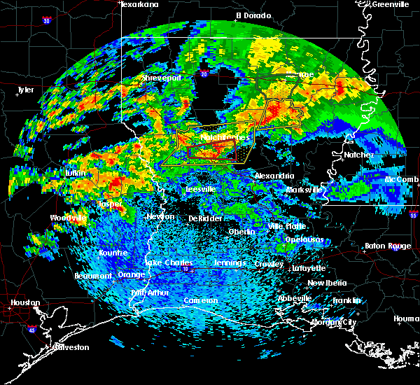 At 145 pm cdt, a severe thunderstorm was located near ebenezer, moving northeast at 55 mph (radar indicated). Hazards include ping pong ball size hail. People and animals outdoors will be injured. Expect damage to roofs, siding, windows, and vehicles. At 145 pm cdt, a severe thunderstorm was located near ebenezer, moving northeast at 55 mph (radar indicated). Hazards include ping pong ball size hail. People and animals outdoors will be injured. Expect damage to roofs, siding, windows, and vehicles.
|
| 4/19/2020 10:10 AM CDT |
 At 1009 am cdt, a severe thunderstorm was located near mayflower, or 11 miles west of toledo bend dam, moving northeast at 50 mph (radar indicated). Hazards include quarter size hail. Damage to vehicles is expected. Locations impacted include, toledo bend dam, browndell, harrisburg and mayflower. At 1009 am cdt, a severe thunderstorm was located near mayflower, or 11 miles west of toledo bend dam, moving northeast at 50 mph (radar indicated). Hazards include quarter size hail. Damage to vehicles is expected. Locations impacted include, toledo bend dam, browndell, harrisburg and mayflower.
|
| 4/19/2020 9:58 AM CDT |
 At 958 am cdt, a severe thunderstorm was located near harrisburg, or 13 miles northeast of jasper, moving northeast at 50 mph (radar indicated). Hazards include quarter size hail. damage to vehicles is expected At 958 am cdt, a severe thunderstorm was located near harrisburg, or 13 miles northeast of jasper, moving northeast at 50 mph (radar indicated). Hazards include quarter size hail. damage to vehicles is expected
|
| 4/19/2020 9:48 AM CDT |
 At 948 am cdt, a severe thunderstorm was located near ebenezer, moving northeast at 55 mph (radar indicated). Hazards include quarter size hail. Damage to vehicles is expected. Locations impacted include, jasper, colmesneil, toledo bend dam, ebenezer, town bluff, burkeville, browndell, farrsville, harrisburg, mayflower, sam rayburn dam and wiergate. At 948 am cdt, a severe thunderstorm was located near ebenezer, moving northeast at 55 mph (radar indicated). Hazards include quarter size hail. Damage to vehicles is expected. Locations impacted include, jasper, colmesneil, toledo bend dam, ebenezer, town bluff, burkeville, browndell, farrsville, harrisburg, mayflower, sam rayburn dam and wiergate.
|
| 4/19/2020 9:27 AM CDT |
 At 927 am cdt, a severe thunderstorm was located near woodville, moving northeast at 55 mph (radar indicated). Hazards include quarter size hail. damage to vehicles is expected At 927 am cdt, a severe thunderstorm was located near woodville, moving northeast at 55 mph (radar indicated). Hazards include quarter size hail. damage to vehicles is expected
|
| 1/11/2020 1:57 AM CST |
 At 155 am cst, severe thunderstorms were located along a line extending from near pineland to magnolia springs to near gilchrist, moving east at 35 mph (radar indicated. at 1:40 am cst a wind gust to 59 mph was reported by local media at pinewood, texas). Hazards include 60 mph wind gusts. Expect damage to roofs, siding, and trees. locations impacted include, beaumont, port arthur, lumberton, jasper, silsbee, kirbyville, kountze, sour lake, nome, evadale, town bluff, hamshire, fred, buna, bevil oaks, china, rose city, pine forest, browndell and lakeview. This includes interstate 10 in texas between mile markers 860 and 832. At 155 am cst, severe thunderstorms were located along a line extending from near pineland to magnolia springs to near gilchrist, moving east at 35 mph (radar indicated. at 1:40 am cst a wind gust to 59 mph was reported by local media at pinewood, texas). Hazards include 60 mph wind gusts. Expect damage to roofs, siding, and trees. locations impacted include, beaumont, port arthur, lumberton, jasper, silsbee, kirbyville, kountze, sour lake, nome, evadale, town bluff, hamshire, fred, buna, bevil oaks, china, rose city, pine forest, browndell and lakeview. This includes interstate 10 in texas between mile markers 860 and 832.
|
| 1/11/2020 1:31 AM CST |
 At 130 am cst, severe thunderstorms were located along a line extending from 9 miles west of pineland to near spurger to near crystal beach, moving east at 35 mph (radar indicated). Hazards include 60 mph wind gusts. expect damage to roofs, siding, and trees At 130 am cst, severe thunderstorms were located along a line extending from 9 miles west of pineland to near spurger to near crystal beach, moving east at 35 mph (radar indicated). Hazards include 60 mph wind gusts. expect damage to roofs, siding, and trees
|
| 10/21/2019 6:58 AM CDT |
 At 657 am cdt, a severe thunderstorm was located near browndell, or 12 miles north of jasper, moving east at 35 mph (radar indicated). Hazards include 60 mph wind gusts and penny size hail. Expect damage to roofs, siding, and trees. Locations impacted include, jasper, toledo bend dam, burkeville, browndell, farrsville, harrisburg, mayflower and wiergate. At 657 am cdt, a severe thunderstorm was located near browndell, or 12 miles north of jasper, moving east at 35 mph (radar indicated). Hazards include 60 mph wind gusts and penny size hail. Expect damage to roofs, siding, and trees. Locations impacted include, jasper, toledo bend dam, burkeville, browndell, farrsville, harrisburg, mayflower and wiergate.
|
| 10/21/2019 6:28 AM CDT |
 At 627 am cdt, a severe thunderstorm was located near ebenezer, moving east at 35 mph (radar indicated). Hazards include 60 mph wind gusts and penny size hail. expect damage to roofs, siding, and trees At 627 am cdt, a severe thunderstorm was located near ebenezer, moving east at 35 mph (radar indicated). Hazards include 60 mph wind gusts and penny size hail. expect damage to roofs, siding, and trees
|
| 5/19/2019 1:00 AM CDT |
 At 100 am cdt, a severe thunderstorm capable of producing a tornado was located near ebenezer, moving northeast at 30 mph (radar indicated rotation). Hazards include tornado. Flying debris will be dangerous to those caught without shelter. mobile homes will be damaged or destroyed. damage to roofs, windows, and vehicles will occur. tree damage is likely. Locations impacted include, browndell. At 100 am cdt, a severe thunderstorm capable of producing a tornado was located near ebenezer, moving northeast at 30 mph (radar indicated rotation). Hazards include tornado. Flying debris will be dangerous to those caught without shelter. mobile homes will be damaged or destroyed. damage to roofs, windows, and vehicles will occur. tree damage is likely. Locations impacted include, browndell.
|
| 5/19/2019 12:49 AM CDT |
 At 1249 am cdt, a severe thunderstorm capable of producing a tornado was located near ebenezer, moving northeast at 30 mph (radar indicated rotation). Hazards include tornado. Flying debris will be dangerous to those caught without shelter. mobile homes will be damaged or destroyed. damage to roofs, windows, and vehicles will occur. tree damage is likely. Locations impacted include, ebenezer, browndell and sam rayburn dam. At 1249 am cdt, a severe thunderstorm capable of producing a tornado was located near ebenezer, moving northeast at 30 mph (radar indicated rotation). Hazards include tornado. Flying debris will be dangerous to those caught without shelter. mobile homes will be damaged or destroyed. damage to roofs, windows, and vehicles will occur. tree damage is likely. Locations impacted include, ebenezer, browndell and sam rayburn dam.
|
| 5/19/2019 12:43 AM CDT |
 At 1243 am cdt, severe thunderstorms were located along a line extending from near patroon to near etoile to 6 miles north of apple springs, moving southeast at 25 mph (radar indicated). Hazards include 60 mph wind gusts and quarter size hail. Hail damage to vehicles is expected. Expect wind damage to roofs, siding, and trees. At 1243 am cdt, severe thunderstorms were located along a line extending from near patroon to near etoile to 6 miles north of apple springs, moving southeast at 25 mph (radar indicated). Hazards include 60 mph wind gusts and quarter size hail. Hail damage to vehicles is expected. Expect wind damage to roofs, siding, and trees.
|
| 5/19/2019 12:38 AM CDT |
 At 1238 am cdt, a severe thunderstorm capable of producing a tornado was located near rockland, moving northeast at 30 mph (radar indicated rotation). Hazards include tornado. Flying debris will be dangerous to those caught without shelter. mobile homes will be damaged or destroyed. damage to roofs, windows, and vehicles will occur. Tree damage is likely. At 1238 am cdt, a severe thunderstorm capable of producing a tornado was located near rockland, moving northeast at 30 mph (radar indicated rotation). Hazards include tornado. Flying debris will be dangerous to those caught without shelter. mobile homes will be damaged or destroyed. damage to roofs, windows, and vehicles will occur. Tree damage is likely.
|
| 5/9/2019 6:05 PM CDT | Ping Pong Ball sized hail reported 1.7 miles S of Browndell, TX, social media pictures and photos along with public reports of half dollar to ping pong size hail in the brookeland community near the jasper and sabine county line. |
| 5/9/2019 5:56 PM CDT | Golf Ball sized hail reported 1.1 miles NNE of Browndell, TX |
| 5/9/2019 5:43 PM CDT |
 At 542 pm cdt, a severe thunderstorm was located near browndell, or 8 miles north of jasper, moving northeast at 25 mph (radar indicated). Hazards include golf ball size hail and 60 mph wind gusts. People and animals outdoors will be injured. expect hail damage to roofs, siding, windows, and vehicles. Expect wind damage to roofs, siding, and trees. At 542 pm cdt, a severe thunderstorm was located near browndell, or 8 miles north of jasper, moving northeast at 25 mph (radar indicated). Hazards include golf ball size hail and 60 mph wind gusts. People and animals outdoors will be injured. expect hail damage to roofs, siding, windows, and vehicles. Expect wind damage to roofs, siding, and trees.
|
| 5/9/2019 5:35 PM CDT |
 At 534 pm cdt, a severe thunderstorm was located near jasper, moving northeast at 20 mph (radar indicated). Hazards include two inch hail and 60 mph wind gusts. People and animals outdoors will be injured. expect hail damage to roofs, siding, windows, and vehicles. expect wind damage to roofs, siding, and trees. Locations impacted include, jasper, browndell and harrisburg. At 534 pm cdt, a severe thunderstorm was located near jasper, moving northeast at 20 mph (radar indicated). Hazards include two inch hail and 60 mph wind gusts. People and animals outdoors will be injured. expect hail damage to roofs, siding, windows, and vehicles. expect wind damage to roofs, siding, and trees. Locations impacted include, jasper, browndell and harrisburg.
|
| 5/9/2019 5:30 PM CDT |
 At 529 pm cdt, a severe thunderstorm was located near jasper, moving north at 25 mph (radar indicated). Hazards include two inch hail and 60 mph wind gusts. People and animals outdoors will be injured. expect hail damage to roofs, siding, windows, and vehicles. expect wind damage to roofs, siding, and trees. Locations impacted include, jasper, browndell and harrisburg. At 529 pm cdt, a severe thunderstorm was located near jasper, moving north at 25 mph (radar indicated). Hazards include two inch hail and 60 mph wind gusts. People and animals outdoors will be injured. expect hail damage to roofs, siding, windows, and vehicles. expect wind damage to roofs, siding, and trees. Locations impacted include, jasper, browndell and harrisburg.
|
| 5/9/2019 5:16 PM CDT |
 At 516 pm cdt, a severe thunderstorm was located near jasper, moving northeast at 20 mph (radar indicated). Hazards include two inch hail and 60 mph wind gusts. People and animals outdoors will be injured. expect hail damage to roofs, siding, windows, and vehicles. expect wind damage to roofs, siding, and trees. Locations impacted include, jasper, browndell, harrisburg and farrsville. At 516 pm cdt, a severe thunderstorm was located near jasper, moving northeast at 20 mph (radar indicated). Hazards include two inch hail and 60 mph wind gusts. People and animals outdoors will be injured. expect hail damage to roofs, siding, windows, and vehicles. expect wind damage to roofs, siding, and trees. Locations impacted include, jasper, browndell, harrisburg and farrsville.
|
| 5/9/2019 5:03 PM CDT |
 At 503 pm cdt, a severe thunderstorm was located near town bluff, moving northeast at 20 mph (radar indicated). Hazards include 60 mph wind gusts and quarter size hail. Hail damage to vehicles is expected. Expect wind damage to roofs, siding, and trees. At 503 pm cdt, a severe thunderstorm was located near town bluff, moving northeast at 20 mph (radar indicated). Hazards include 60 mph wind gusts and quarter size hail. Hail damage to vehicles is expected. Expect wind damage to roofs, siding, and trees.
|
| 5/8/2019 4:58 PM CDT |
 At 458 pm cdt, a severe thunderstorm capable of producing a tornado was located over jasper, moving northeast at 10 mph (radar indicated rotation). Hazards include tornado. Flying debris will be dangerous to those caught without shelter. mobile homes will be damaged or destroyed. damage to roofs, windows, and vehicles will occur. tree damage is likely. This dangerous storm will be near, browndell and harrisburg around 530 pm cdt. At 458 pm cdt, a severe thunderstorm capable of producing a tornado was located over jasper, moving northeast at 10 mph (radar indicated rotation). Hazards include tornado. Flying debris will be dangerous to those caught without shelter. mobile homes will be damaged or destroyed. damage to roofs, windows, and vehicles will occur. tree damage is likely. This dangerous storm will be near, browndell and harrisburg around 530 pm cdt.
|
| 5/2/2019 6:13 AM CDT |
 At 613 am cdt, severe thunderstorms were located along a line extending from near tenaha to near shelbyville to near patroon to near browndell, moving east at 70 mph (radar indicated). Hazards include 60 mph wind gusts. expect damage to roofs, siding, and trees At 613 am cdt, severe thunderstorms were located along a line extending from near tenaha to near shelbyville to near patroon to near browndell, moving east at 70 mph (radar indicated). Hazards include 60 mph wind gusts. expect damage to roofs, siding, and trees
|
| 4/25/2019 1:12 AM CDT |
 At 112 am cdt, severe thunderstorms were located along a line extending from 17 miles southeast of ringgold to 12 miles west of natchitoches to near many to near browndell, moving northeast at 35 mph (radar indicated). Hazards include 60 mph wind gusts and penny size hail. expect damage to roofs, siding, and trees At 112 am cdt, severe thunderstorms were located along a line extending from 17 miles southeast of ringgold to 12 miles west of natchitoches to near many to near browndell, moving northeast at 35 mph (radar indicated). Hazards include 60 mph wind gusts and penny size hail. expect damage to roofs, siding, and trees
|
| 4/25/2019 12:58 AM CDT |
 At 1258 am cdt, severe thunderstorms were located along a line extending from 6 miles south of coushatta to near many to near browndell, moving northeast at 50 mph (radar indicated). Hazards include 60 mph wind gusts. Expect damage to roofs, siding, and trees. Locations impacted include, milam, many, zwolle, hemphill, pineland, allen, oak grove, pleasant hill, florien, noble, fisher, robeline, powhatan, lake end, belmont, bronson, mcelroy, negreet, yellowpine and columbus. At 1258 am cdt, severe thunderstorms were located along a line extending from 6 miles south of coushatta to near many to near browndell, moving northeast at 50 mph (radar indicated). Hazards include 60 mph wind gusts. Expect damage to roofs, siding, and trees. Locations impacted include, milam, many, zwolle, hemphill, pineland, allen, oak grove, pleasant hill, florien, noble, fisher, robeline, powhatan, lake end, belmont, bronson, mcelroy, negreet, yellowpine and columbus.
|
| 4/25/2019 12:37 AM CDT |
 At 1237 am cdt, severe thunderstorms were located along a line extending from 7 miles north of converse to hemphill to 6 miles north of ebenezer, moving east at 40 mph (radar indicated). Hazards include 60 mph wind gusts. expect damage to roofs, siding, and trees At 1237 am cdt, severe thunderstorms were located along a line extending from 7 miles north of converse to hemphill to 6 miles north of ebenezer, moving east at 40 mph (radar indicated). Hazards include 60 mph wind gusts. expect damage to roofs, siding, and trees
|
| 4/25/2019 12:37 AM CDT |
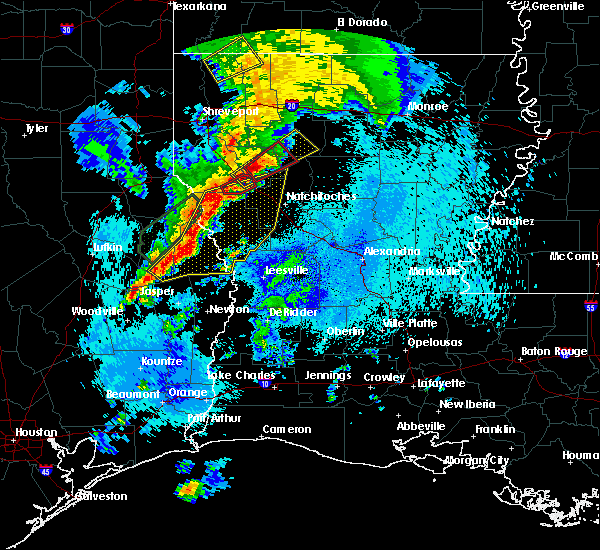 At 1237 am cdt, severe thunderstorms were located along a line extending from 7 miles north of converse to hemphill to 6 miles north of ebenezer, moving east at 40 mph (radar indicated). Hazards include 60 mph wind gusts. expect damage to roofs, siding, and trees At 1237 am cdt, severe thunderstorms were located along a line extending from 7 miles north of converse to hemphill to 6 miles north of ebenezer, moving east at 40 mph (radar indicated). Hazards include 60 mph wind gusts. expect damage to roofs, siding, and trees
|
| 4/13/2019 12:34 AM CDT |
 At 1234 am cdt, a severe thunderstorm was located over ebenezer, moving northeast at 25 mph (radar indicated). Hazards include quarter size hail. Damage to vehicles is expected. Locations impacted include, jasper, ebenezer, browndell and sam rayburn dam. At 1234 am cdt, a severe thunderstorm was located over ebenezer, moving northeast at 25 mph (radar indicated). Hazards include quarter size hail. Damage to vehicles is expected. Locations impacted include, jasper, ebenezer, browndell and sam rayburn dam.
|
| 4/12/2019 11:57 PM CDT |
 At 1157 pm cdt, a severe thunderstorm was located 7 miles southeast of colmesneil, moving northeast at 30 mph (radar indicated). Hazards include quarter size hail. Damage to vehicles is expected. Locations impacted include, jasper, woodville, ebenezer, browndell and sam rayburn dam. At 1157 pm cdt, a severe thunderstorm was located 7 miles southeast of colmesneil, moving northeast at 30 mph (radar indicated). Hazards include quarter size hail. Damage to vehicles is expected. Locations impacted include, jasper, woodville, ebenezer, browndell and sam rayburn dam.
|
| 4/12/2019 11:42 PM CDT |
 At 1142 pm cdt, a severe thunderstorm was located near woodville, moving northeast at 30 mph (radar indicated). Hazards include 60 mph wind gusts and quarter size hail. Hail damage to vehicles is expected. expect wind damage to roofs, siding, and trees. Locations impacted include, jasper, woodville, colmesneil, ebenezer, town bluff, rockland, browndell, ivanhoe, sam rayburn dam and hillister. At 1142 pm cdt, a severe thunderstorm was located near woodville, moving northeast at 30 mph (radar indicated). Hazards include 60 mph wind gusts and quarter size hail. Hail damage to vehicles is expected. expect wind damage to roofs, siding, and trees. Locations impacted include, jasper, woodville, colmesneil, ebenezer, town bluff, rockland, browndell, ivanhoe, sam rayburn dam and hillister.
|
| 4/12/2019 11:21 PM CDT |
 At 1120 pm cdt, severe thunderstorms were located along a line extending from 7 miles northwest of warren to near fred, moving north at 30 mph (radar indicated). Hazards include 60 mph wind gusts and quarter size hail. Hail damage to vehicles is expected. Expect wind damage to roofs, siding, and trees. At 1120 pm cdt, severe thunderstorms were located along a line extending from 7 miles northwest of warren to near fred, moving north at 30 mph (radar indicated). Hazards include 60 mph wind gusts and quarter size hail. Hail damage to vehicles is expected. Expect wind damage to roofs, siding, and trees.
|
| 4/7/2019 2:56 PM CDT |
 At 256 pm cdt, severe thunderstorms were located along a line extending from near ebenezer to near bon weir, moving northeast at 50 mph (radar indicated). Hazards include 60 mph wind gusts. expect damage to roofs, siding, and trees At 256 pm cdt, severe thunderstorms were located along a line extending from near ebenezer to near bon weir, moving northeast at 50 mph (radar indicated). Hazards include 60 mph wind gusts. expect damage to roofs, siding, and trees
|
| 4/7/2019 2:45 PM CDT |
 At 245 pm cdt, severe thunderstorms were located along a line extending from 7 miles southeast of kennard to near jamestown, moving north at 45 mph (radar indicated). Hazards include 60 mph wind gusts and quarter size hail. Hail damage to vehicles is expected. Expect wind damage to roofs, siding, and trees. At 245 pm cdt, severe thunderstorms were located along a line extending from 7 miles southeast of kennard to near jamestown, moving north at 45 mph (radar indicated). Hazards include 60 mph wind gusts and quarter size hail. Hail damage to vehicles is expected. Expect wind damage to roofs, siding, and trees.
|
| 4/4/2019 5:19 PM CDT |
 At 519 pm cdt, severe thunderstorms were located along a line extending from near ebenezer to near browndell, moving east at 25 mph (radar indicated). Hazards include 60 mph wind gusts and quarter size hail. Hail damage to vehicles is expected. Expect wind damage to roofs, siding, and trees. At 519 pm cdt, severe thunderstorms were located along a line extending from near ebenezer to near browndell, moving east at 25 mph (radar indicated). Hazards include 60 mph wind gusts and quarter size hail. Hail damage to vehicles is expected. Expect wind damage to roofs, siding, and trees.
|
| 7/31/2018 4:20 AM CDT |
 At 420 am cdt, a severe thunderstorm was located over harrisburg, or 8 miles northeast of jasper, moving southeast at 30 mph (radar indicated). Hazards include 60 mph wind gusts. expect damage to roofs, siding, and trees At 420 am cdt, a severe thunderstorm was located over harrisburg, or 8 miles northeast of jasper, moving southeast at 30 mph (radar indicated). Hazards include 60 mph wind gusts. expect damage to roofs, siding, and trees
|
| 6/10/2018 6:48 PM CDT |
 At 647 pm cdt, a severe thunderstorm capable of producing a tornado was located over browndell, or 11 miles northeast of ebenezer, moving east at 20 mph (radar indicated rotation). Hazards include tornado. Flying debris will be dangerous to those caught without shelter. mobile homes will be damaged or destroyed. damage to roofs, windows, and vehicles will occur. tree damage is likely. Locations impacted include, browndell. At 647 pm cdt, a severe thunderstorm capable of producing a tornado was located over browndell, or 11 miles northeast of ebenezer, moving east at 20 mph (radar indicated rotation). Hazards include tornado. Flying debris will be dangerous to those caught without shelter. mobile homes will be damaged or destroyed. damage to roofs, windows, and vehicles will occur. tree damage is likely. Locations impacted include, browndell.
|
| 6/10/2018 6:35 PM CDT |
 At 634 pm cdt, a severe thunderstorm capable of producing a tornado was located near browndell, or 8 miles northeast of ebenezer, moving east at 20 mph (radar indicated rotation). Hazards include tornado. Flying debris will be dangerous to those caught without shelter. mobile homes will be damaged or destroyed. damage to roofs, windows, and vehicles will occur. Tree damage is likely. At 634 pm cdt, a severe thunderstorm capable of producing a tornado was located near browndell, or 8 miles northeast of ebenezer, moving east at 20 mph (radar indicated rotation). Hazards include tornado. Flying debris will be dangerous to those caught without shelter. mobile homes will be damaged or destroyed. damage to roofs, windows, and vehicles will occur. Tree damage is likely.
|
| 5/26/2018 5:18 PM CDT |
 At 518 pm cdt, a severe thunderstorm was located near rosevine, or 24 miles north of ebenezer, moving southeast at 20 mph (radar indicated). Hazards include 60 mph wind gusts and quarter size hail. Hail damage to vehicles is expected. Expect wind damage to roofs, siding, and trees. At 518 pm cdt, a severe thunderstorm was located near rosevine, or 24 miles north of ebenezer, moving southeast at 20 mph (radar indicated). Hazards include 60 mph wind gusts and quarter size hail. Hail damage to vehicles is expected. Expect wind damage to roofs, siding, and trees.
|
| 4/6/2018 11:53 PM CDT |
 At 1153 pm cdt, severe thunderstorms were located along a line extending from near diboll to 10 miles north of ebenezer to 9 miles east of hemphill to 12 miles northwest of hornbeck to just southwest of many, moving southeast at 25 mph (radar indicated). Hazards include 60 mph wind gusts and quarter size hail. Hail damage to vehicles is expected. Expect wind damage to roofs, siding, and trees. At 1153 pm cdt, severe thunderstorms were located along a line extending from near diboll to 10 miles north of ebenezer to 9 miles east of hemphill to 12 miles northwest of hornbeck to just southwest of many, moving southeast at 25 mph (radar indicated). Hazards include 60 mph wind gusts and quarter size hail. Hail damage to vehicles is expected. Expect wind damage to roofs, siding, and trees.
|
| 4/6/2018 11:47 PM CDT |
 At 1147 pm cdt, severe thunderstorms were located along a line extending from 12 miles east of milam to 6 miles west of pineland to 6 miles southeast of huntington, moving southeast at 25 mph (radar indicated). Hazards include 60 mph wind gusts and quarter size hail. Hail damage to vehicles is expected. Expect wind damage to roofs, siding, and trees. At 1147 pm cdt, severe thunderstorms were located along a line extending from 12 miles east of milam to 6 miles west of pineland to 6 miles southeast of huntington, moving southeast at 25 mph (radar indicated). Hazards include 60 mph wind gusts and quarter size hail. Hail damage to vehicles is expected. Expect wind damage to roofs, siding, and trees.
|
| 4/3/2018 8:31 PM CDT |
 At 830 pm cdt, a severe thunderstorm was located over harrisburg, or 10 miles northeast of jasper, moving east at 40 mph (radar indicated). Hazards include 60 mph wind gusts. expect damage to roofs, siding, and trees At 830 pm cdt, a severe thunderstorm was located over harrisburg, or 10 miles northeast of jasper, moving east at 40 mph (radar indicated). Hazards include 60 mph wind gusts. expect damage to roofs, siding, and trees
|
| 4/3/2018 6:15 PM CDT |
 At 615 pm cdt, a severe thunderstorm was located near harrisburg, or near jasper, moving east at 35 mph (radar indicated). Hazards include 60 mph wind gusts and penny size hail. expect damage to roofs, siding, and trees At 615 pm cdt, a severe thunderstorm was located near harrisburg, or near jasper, moving east at 35 mph (radar indicated). Hazards include 60 mph wind gusts and penny size hail. expect damage to roofs, siding, and trees
|
| 3/18/2018 8:57 PM CDT |
 At 857 pm cdt, severe thunderstorms were located along a line extending from near browndell to near harrisburg to near jasper, moving east at 45 mph (radar indicated). Hazards include 60 mph wind gusts and quarter size hail. Hail damage to vehicles is expected. Expect wind damage to roofs, siding, and trees. At 857 pm cdt, severe thunderstorms were located along a line extending from near browndell to near harrisburg to near jasper, moving east at 45 mph (radar indicated). Hazards include 60 mph wind gusts and quarter size hail. Hail damage to vehicles is expected. Expect wind damage to roofs, siding, and trees.
|
| 3/18/2018 8:41 PM CDT |
 At 830 pm cdt, a severe thunderstorm was located near rockland, moving east at 45 mph (radar indicated). Hazards include 60 mph wind gusts and quarter size hail. Hail damage to vehicles is expected. expect wind damage to roofs, siding, and trees. Locations impacted include, jasper, rockland, ebenezer, browndell, harrisburg and sam rayburn dam. At 830 pm cdt, a severe thunderstorm was located near rockland, moving east at 45 mph (radar indicated). Hazards include 60 mph wind gusts and quarter size hail. Hail damage to vehicles is expected. expect wind damage to roofs, siding, and trees. Locations impacted include, jasper, rockland, ebenezer, browndell, harrisburg and sam rayburn dam.
|
| 3/18/2018 8:30 PM CDT |
 At 830 pm cdt, a severe thunderstorm was located near rockland, moving east at 45 mph (radar indicated). Hazards include 60 mph wind gusts and quarter size hail. Hail damage to vehicles is expected. expect wind damage to roofs, siding, and trees. Locations impacted include, jasper, rockland, ebenezer, browndell, harrisburg and sam rayburn dam. At 830 pm cdt, a severe thunderstorm was located near rockland, moving east at 45 mph (radar indicated). Hazards include 60 mph wind gusts and quarter size hail. Hail damage to vehicles is expected. expect wind damage to roofs, siding, and trees. Locations impacted include, jasper, rockland, ebenezer, browndell, harrisburg and sam rayburn dam.
|
| 3/18/2018 8:16 PM CDT |
 At 815 pm cdt, a severe thunderstorm was located near colmesneil, moving east at 45 mph (radar indicated). Hazards include 60 mph wind gusts and quarter size hail. Hail damage to vehicles is expected. Expect wind damage to roofs, siding, and trees. At 815 pm cdt, a severe thunderstorm was located near colmesneil, moving east at 45 mph (radar indicated). Hazards include 60 mph wind gusts and quarter size hail. Hail damage to vehicles is expected. Expect wind damage to roofs, siding, and trees.
|
| 2/24/2018 11:35 PM CST |
 At 1135 pm cst, a severe thunderstorm was located near colmesneil, moving northeast at 35 mph (radar indicated). Hazards include 60 mph wind gusts and quarter size hail. Hail damage to vehicles is expected. Expect wind damage to roofs, siding, and trees. At 1135 pm cst, a severe thunderstorm was located near colmesneil, moving northeast at 35 mph (radar indicated). Hazards include 60 mph wind gusts and quarter size hail. Hail damage to vehicles is expected. Expect wind damage to roofs, siding, and trees.
|
| 5/3/2017 6:21 PM CDT |
 At 620 pm cdt, severe thunderstorms were located along a line extending from 6 miles southwest of hornbeck to near chester, moving southeast at 40 mph (radar indicated). Hazards include 60 mph wind gusts and quarter size hail. Hail damage to vehicles is expected. Expect wind damage to roofs, siding, and trees. At 620 pm cdt, severe thunderstorms were located along a line extending from 6 miles southwest of hornbeck to near chester, moving southeast at 40 mph (radar indicated). Hazards include 60 mph wind gusts and quarter size hail. Hail damage to vehicles is expected. Expect wind damage to roofs, siding, and trees.
|
| 5/3/2017 2:23 PM CDT |
 At 223 pm cdt, a severe thunderstorm was located over pineland, or 19 miles northeast of ebenezer, moving northeast at 35 mph (radar indicated). Hazards include 60 mph wind gusts and quarter size hail. Hail damage to vehicles is expected. expect wind damage to roofs, siding, and trees. locations impacted include, milam, hemphill, pineland, macune, rosevine, bronson, mcelroy, sexton, fairmount, yellowpine, columbus and chinaquapin. A tornado watch remains in effect until 500 pm cdt for northwestern louisiana, and eastern texas. At 223 pm cdt, a severe thunderstorm was located over pineland, or 19 miles northeast of ebenezer, moving northeast at 35 mph (radar indicated). Hazards include 60 mph wind gusts and quarter size hail. Hail damage to vehicles is expected. expect wind damage to roofs, siding, and trees. locations impacted include, milam, hemphill, pineland, macune, rosevine, bronson, mcelroy, sexton, fairmount, yellowpine, columbus and chinaquapin. A tornado watch remains in effect until 500 pm cdt for northwestern louisiana, and eastern texas.
|
| 5/3/2017 2:14 PM CDT |
 At 213 pm cdt, a severe thunderstorm was located 7 miles west of pineland, or 13 miles north of ebenezer, moving northeast at 30 mph (radar indicated). Hazards include 60 mph wind gusts and quarter size hail. Hail damage to vehicles is expected. Expect wind damage to roofs, siding, and trees. At 213 pm cdt, a severe thunderstorm was located 7 miles west of pineland, or 13 miles north of ebenezer, moving northeast at 30 mph (radar indicated). Hazards include 60 mph wind gusts and quarter size hail. Hail damage to vehicles is expected. Expect wind damage to roofs, siding, and trees.
|
| 4/26/2017 5:57 PM CDT |
 The national weather service in lake charles has issued a * severe thunderstorm warning for. western vernon parish in west central louisiana. southeastern tyler county in southeastern texas. newton county in southeastern texas. Northeastern jasper county in southeastern texas. The national weather service in lake charles has issued a * severe thunderstorm warning for. western vernon parish in west central louisiana. southeastern tyler county in southeastern texas. newton county in southeastern texas. Northeastern jasper county in southeastern texas.
|
| 4/26/2017 5:29 PM CDT |
 At 529 pm cdt, severe thunderstorms were located along a line extending from near zwolle to 6 miles northeast of ebenezer, moving east at 50 mph (radar indicated). Hazards include 60 mph wind gusts and nickel size hail. expect damage to roofs, siding, and trees At 529 pm cdt, severe thunderstorms were located along a line extending from near zwolle to 6 miles northeast of ebenezer, moving east at 50 mph (radar indicated). Hazards include 60 mph wind gusts and nickel size hail. expect damage to roofs, siding, and trees
|
| 4/26/2017 5:25 PM CDT |
 At 524 pm cdt, severe thunderstorms were located along a line extending from near ebenezer to near alabama-coushatta reservation, moving east at 40 mph (radar indicated). Hazards include 60 mph wind gusts and quarter size hail. Hail damage to vehicles is expected. Expect wind damage to roofs, siding, and trees. At 524 pm cdt, severe thunderstorms were located along a line extending from near ebenezer to near alabama-coushatta reservation, moving east at 40 mph (radar indicated). Hazards include 60 mph wind gusts and quarter size hail. Hail damage to vehicles is expected. Expect wind damage to roofs, siding, and trees.
|
| 4/2/2017 2:42 PM CDT |
 At 242 pm cdt, severe thunderstorms were located along a line extending from 6 miles west of toledo bend dam to near fred, moving east at 20 mph (radar indicated). Hazards include 70 mph wind gusts and quarter size hail. Hail damage to vehicles is expected. expect considerable tree damage. Wind damage is also likely to mobile homes, roofs, and outbuildings. At 242 pm cdt, severe thunderstorms were located along a line extending from 6 miles west of toledo bend dam to near fred, moving east at 20 mph (radar indicated). Hazards include 70 mph wind gusts and quarter size hail. Hail damage to vehicles is expected. expect considerable tree damage. Wind damage is also likely to mobile homes, roofs, and outbuildings.
|
| 3/24/2017 11:45 PM CDT |
 At 1145 pm cdt, severe thunderstorms were located along a line extending from near browndell to near magnolia springs, moving northeast at 50 mph (radar indicated). Hazards include 60 mph wind gusts. Expect damage to roofs, siding, and trees. locations impacted include, jasper, newton, toledo bend dam, ebenezer, town bluff, bon weir, burkeville, browndell, farrsville, magnolia springs, mayflower, mt. union, spurger, jamestown, roganville, harrisburg, stringtown, sam rayburn dam and wiergate. A tornado watch remains in effect until 400 am cdt for west central louisiana, and southeastern texas. At 1145 pm cdt, severe thunderstorms were located along a line extending from near browndell to near magnolia springs, moving northeast at 50 mph (radar indicated). Hazards include 60 mph wind gusts. Expect damage to roofs, siding, and trees. locations impacted include, jasper, newton, toledo bend dam, ebenezer, town bluff, bon weir, burkeville, browndell, farrsville, magnolia springs, mayflower, mt. union, spurger, jamestown, roganville, harrisburg, stringtown, sam rayburn dam and wiergate. A tornado watch remains in effect until 400 am cdt for west central louisiana, and southeastern texas.
|
| 3/24/2017 11:21 PM CDT |
 At 1120 pm cdt, severe thunderstorms were located along a line extending from 6 miles southwest of ebenezer to near warren, moving northeast at 45 mph (radar indicated). Hazards include 60 mph wind gusts. expect damage to roofs, siding, and trees At 1120 pm cdt, severe thunderstorms were located along a line extending from 6 miles southwest of ebenezer to near warren, moving northeast at 45 mph (radar indicated). Hazards include 60 mph wind gusts. expect damage to roofs, siding, and trees
|
| 1/2/2017 9:37 AM CST |
 The severe thunderstorm warning for northeastern jasper county will expire at 945 am cst, the severe thunderstorm which prompted the warning has moved out of the warned area. therefore the warning will be allowed to expire. a tornado watch remains in effect until 200 pm cst for southeastern texas. The severe thunderstorm warning for northeastern jasper county will expire at 945 am cst, the severe thunderstorm which prompted the warning has moved out of the warned area. therefore the warning will be allowed to expire. a tornado watch remains in effect until 200 pm cst for southeastern texas.
|
| 1/2/2017 9:23 AM CST |
 At 922 am cst, a severe thunderstorm was located near mayflower, or 10 miles northwest of burkeville, moving east at 35 mph (radar indicated). Hazards include 70 mph wind gusts. Expect considerable tree damage. damage is likely to mobile homes, roofs, and outbuildings. locations impacted include, jasper, browndell, harrisburg and sam rayburn dam. A tornado watch remains in effect until 200 pm cst for southeastern texas. At 922 am cst, a severe thunderstorm was located near mayflower, or 10 miles northwest of burkeville, moving east at 35 mph (radar indicated). Hazards include 70 mph wind gusts. Expect considerable tree damage. damage is likely to mobile homes, roofs, and outbuildings. locations impacted include, jasper, browndell, harrisburg and sam rayburn dam. A tornado watch remains in effect until 200 pm cst for southeastern texas.
|
| 1/2/2017 9:08 AM CST | Several large trees down in the rayburn browndell are in jasper county TX, 0.6 miles SE of Browndell, TX |
| 1/2/2017 9:08 AM CST |
 At 908 am cst, a severe thunderstorm was located near browndell, or 10 miles north of jasper, moving east at 35 mph (radar indicated). Hazards include 70 mph wind gusts. Expect considerable tree damage. damage is likely to mobile homes, roofs, and outbuildings. locations impacted include, jasper, ebenezer, browndell, harrisburg and sam rayburn dam. A tornado watch remains in effect until 200 pm cst for southeastern texas. At 908 am cst, a severe thunderstorm was located near browndell, or 10 miles north of jasper, moving east at 35 mph (radar indicated). Hazards include 70 mph wind gusts. Expect considerable tree damage. damage is likely to mobile homes, roofs, and outbuildings. locations impacted include, jasper, ebenezer, browndell, harrisburg and sam rayburn dam. A tornado watch remains in effect until 200 pm cst for southeastern texas.
|
| 1/2/2017 9:03 AM CST |
 At 902 am cst, a severe thunderstorm was located near browndell, or 9 miles east of ebenezer, moving east at 65 mph (radar indicated). Hazards include 60 mph wind gusts. Expect damage to roofs, siding, and trees. locations impacted include, jasper, ebenezer, browndell, harrisburg and sam rayburn dam. A tornado watch remains in effect until 200 pm cst for southeastern texas. At 902 am cst, a severe thunderstorm was located near browndell, or 9 miles east of ebenezer, moving east at 65 mph (radar indicated). Hazards include 60 mph wind gusts. Expect damage to roofs, siding, and trees. locations impacted include, jasper, ebenezer, browndell, harrisburg and sam rayburn dam. A tornado watch remains in effect until 200 pm cst for southeastern texas.
|
| 1/2/2017 8:54 AM CST |
 At 854 am cst, a severe thunderstorm was located near ebenezer, moving east at 60 mph (radar indicated). Hazards include 60 mph wind gusts. Expect damage to roofs, siding, and trees. locations impacted include, jasper, rockland, ebenezer, browndell, harrisburg and sam rayburn dam. A tornado watch remains in effect until 200 pm cst for southeastern texas. At 854 am cst, a severe thunderstorm was located near ebenezer, moving east at 60 mph (radar indicated). Hazards include 60 mph wind gusts. Expect damage to roofs, siding, and trees. locations impacted include, jasper, rockland, ebenezer, browndell, harrisburg and sam rayburn dam. A tornado watch remains in effect until 200 pm cst for southeastern texas.
|
| 1/2/2017 8:40 AM CST |
 At 839 am cst, a severe thunderstorm was located over colmesneil, moving east at 35 mph (radar indicated). Hazards include 60 mph wind gusts. expect damage to roofs, siding, and trees At 839 am cst, a severe thunderstorm was located over colmesneil, moving east at 35 mph (radar indicated). Hazards include 60 mph wind gusts. expect damage to roofs, siding, and trees
|
| 1/2/2017 7:44 AM CST |
 At 743 am cst, a severe thunderstorm was located over town bluff, moving northeast at 40 mph (radar indicated). Hazards include 60 mph wind gusts and quarter size hail. Hail damage to vehicles is expected. expect wind damage to roofs, siding, and trees. locations impacted include, jasper, ebenezer and sam rayburn dam. A tornado watch remains in effect until 200 pm cst for southeastern texas. At 743 am cst, a severe thunderstorm was located over town bluff, moving northeast at 40 mph (radar indicated). Hazards include 60 mph wind gusts and quarter size hail. Hail damage to vehicles is expected. expect wind damage to roofs, siding, and trees. locations impacted include, jasper, ebenezer and sam rayburn dam. A tornado watch remains in effect until 200 pm cst for southeastern texas.
|
| 1/2/2017 7:25 AM CST |
 At 724 am cst, a severe thunderstorm was located near woodville, moving northeast at 40 mph (radar indicated). Hazards include 60 mph wind gusts and quarter size hail. Hail damage to vehicles is expected. Expect wind damage to roofs, siding, and trees. At 724 am cst, a severe thunderstorm was located near woodville, moving northeast at 40 mph (radar indicated). Hazards include 60 mph wind gusts and quarter size hail. Hail damage to vehicles is expected. Expect wind damage to roofs, siding, and trees.
|
| 6/18/2016 3:03 PM CDT |
 At 302 pm cdt, severe thunderstorms were located along a line extending from near rosevine to near mayflower, moving south at 35 mph (radar indicated). Hazards include 60 mph wind gusts. Expect damage to roofs. siding. And trees. At 302 pm cdt, severe thunderstorms were located along a line extending from near rosevine to near mayflower, moving south at 35 mph (radar indicated). Hazards include 60 mph wind gusts. Expect damage to roofs. siding. And trees.
|
| 5/27/2016 4:04 PM CDT |
 At 403 pm cdt, severe thunderstorms were located along a line extending from near burkeville to near devers, moving southeast at 15 mph (radar indicated). Hazards include 60 mph wind gusts and nickel size hail. Expect damage to roofs. siding. and trees. Locations impacted include, beaumont, lumberton, vidor, jasper, silsbee, newton, kirbyville, kountze, sour lake, thicket, fred, saratoga, bon weir, buna, burkeville, evadale, call, bevil oaks, china and rose city. At 403 pm cdt, severe thunderstorms were located along a line extending from near burkeville to near devers, moving southeast at 15 mph (radar indicated). Hazards include 60 mph wind gusts and nickel size hail. Expect damage to roofs. siding. and trees. Locations impacted include, beaumont, lumberton, vidor, jasper, silsbee, newton, kirbyville, kountze, sour lake, thicket, fred, saratoga, bon weir, buna, burkeville, evadale, call, bevil oaks, china and rose city.
|
| 5/27/2016 3:23 PM CDT |
 At 323 pm cdt, severe thunderstorms were located along a line extending from near mayflower to near daisetta, moving southeast at 15 mph (radar indicated). Hazards include 60 mph wind gusts. Expect damage to roofs. siding. And trees. At 323 pm cdt, severe thunderstorms were located along a line extending from near mayflower to near daisetta, moving southeast at 15 mph (radar indicated). Hazards include 60 mph wind gusts. Expect damage to roofs. siding. And trees.
|
| 5/27/2016 3:10 PM CDT |
 At 309 pm cdt, severe thunderstorms were located along a line extending from near harrisburg to warren, moving northeast at 25 mph (radar indicated). Hazards include 60 mph wind gusts and nickel size hail. Expect damage to roofs. siding. and trees. Locations impacted include, jasper, woodville, colmesneil, town bluff, ebenezer, burkeville, rockland, browndell, harrisburg, mayflower, farrsville, jamestown, ivanhoe, holly springs, wiergate, sam rayburn dam and hillister. At 309 pm cdt, severe thunderstorms were located along a line extending from near harrisburg to warren, moving northeast at 25 mph (radar indicated). Hazards include 60 mph wind gusts and nickel size hail. Expect damage to roofs. siding. and trees. Locations impacted include, jasper, woodville, colmesneil, town bluff, ebenezer, burkeville, rockland, browndell, harrisburg, mayflower, farrsville, jamestown, ivanhoe, holly springs, wiergate, sam rayburn dam and hillister.
|
| 5/27/2016 2:30 PM CDT |
 At 229 pm cdt, severe thunderstorms were located along a line extending from near harrisburg to 9 miles north of votaw, moving northeast at 30 mph (radar indicated). Hazards include 60 mph wind gusts and nickel size hail. Expect damage to roofs. siding. And trees. At 229 pm cdt, severe thunderstorms were located along a line extending from near harrisburg to 9 miles north of votaw, moving northeast at 30 mph (radar indicated). Hazards include 60 mph wind gusts and nickel size hail. Expect damage to roofs. siding. And trees.
|
| 5/27/2016 2:17 PM CDT |
 At 217 pm cdt, a severe thunderstorm was located near harrisburg, or 13 miles northwest of burkeville, moving east at 30 mph (radar indicated). Hazards include 60 mph wind gusts and nickel size hail. Expect damage to roofs. siding. and trees. Locations impacted include, browndell, harrisburg, farrsville and wiergate. At 217 pm cdt, a severe thunderstorm was located near harrisburg, or 13 miles northwest of burkeville, moving east at 30 mph (radar indicated). Hazards include 60 mph wind gusts and nickel size hail. Expect damage to roofs. siding. and trees. Locations impacted include, browndell, harrisburg, farrsville and wiergate.
|
| 5/27/2016 1:53 PM CDT |
 At 153 pm cdt, a severe thunderstorm was located near browndell, or 7 miles east of ebenezer, moving east at 30 mph (radar indicated). Hazards include 60 mph wind gusts and nickel size hail. Expect damage to roofs. siding. And trees. At 153 pm cdt, a severe thunderstorm was located near browndell, or 7 miles east of ebenezer, moving east at 30 mph (radar indicated). Hazards include 60 mph wind gusts and nickel size hail. Expect damage to roofs. siding. And trees.
|
| 3/17/2016 4:28 PM CDT |
 At 427 pm cdt, a severe thunderstorm was located near stringtown, or 7 miles east of burkeville, moving east at 20 mph (radar indicated). Hazards include 60 mph wind gusts and quarter size hail. Hail damage to vehicles is expected. Expect wind damage to roofs, siding and trees. At 427 pm cdt, a severe thunderstorm was located near stringtown, or 7 miles east of burkeville, moving east at 20 mph (radar indicated). Hazards include 60 mph wind gusts and quarter size hail. Hail damage to vehicles is expected. Expect wind damage to roofs, siding and trees.
|
| 3/8/2016 7:39 PM CST | At 738 pm cst, a severe thunderstorm capable of producing a tornado was located near pineland, or 18 miles northeast of ebenezer, moving north at 30 mph (radar indicated rotation). Hazards include tornado and quarter size hail. Flying debris will be dangerous to those caught without shelter. mobile homes will be damaged or destroyed. damage to roofs, windows, and vehicles will occur. tree damage is likely. Locations impacted include, hemphill, pineland, browndell, yellowpine, bronson and mcelroy. |
| 3/8/2016 7:13 PM CST |
 At 712 pm cst, a severe thunderstorm capable of producing a tornado was located near browndell, or 7 miles east of ebenezer, moving northeast at 35 mph (radar indicated rotation). Hazards include tornado. Flying debris will be dangerous to those caught without shelter. mobile homes will be damaged or destroyed. damage to roofs, windows and vehicles will occur. tree damage is likely. this dangerous storm will be near, browndell around 720 pm cst. Other locations impacted by this tornadic thunderstorm include sam rayburn dam. At 712 pm cst, a severe thunderstorm capable of producing a tornado was located near browndell, or 7 miles east of ebenezer, moving northeast at 35 mph (radar indicated rotation). Hazards include tornado. Flying debris will be dangerous to those caught without shelter. mobile homes will be damaged or destroyed. damage to roofs, windows and vehicles will occur. tree damage is likely. this dangerous storm will be near, browndell around 720 pm cst. Other locations impacted by this tornadic thunderstorm include sam rayburn dam.
|
| 3/8/2016 7:02 PM CST |
 At 701 pm cst, a severe thunderstorm capable of producing a tornado was located near ebenezer, moving northeast at 25 mph (radar indicated rotation). Hazards include tornado. Flying debris will be dangerous to those caught without shelter. mobile homes will be damaged or destroyed. damage to roofs, windows and vehicles will occur. tree damage is likely. this dangerous storm will be near, browndell around 730 pm cst. Other locations impacted by this tornadic thunderstorm include sam rayburn dam. At 701 pm cst, a severe thunderstorm capable of producing a tornado was located near ebenezer, moving northeast at 25 mph (radar indicated rotation). Hazards include tornado. Flying debris will be dangerous to those caught without shelter. mobile homes will be damaged or destroyed. damage to roofs, windows and vehicles will occur. tree damage is likely. this dangerous storm will be near, browndell around 730 pm cst. Other locations impacted by this tornadic thunderstorm include sam rayburn dam.
|
| 8/24/2015 8:37 PM CDT |
 At 836 pm cdt, doppler radar indicated a severe thunderstorm capable of producing quarter size hail and damaging winds in excess of 60 mph. this storm was located near jamestown, or near jasper, and moving southeast at 20 mph. At 836 pm cdt, doppler radar indicated a severe thunderstorm capable of producing quarter size hail and damaging winds in excess of 60 mph. this storm was located near jamestown, or near jasper, and moving southeast at 20 mph.
|
| 5/27/2015 4:10 AM CDT | At 410 am cdt, trained weather spotters reported a line of severe thunderstorms producing quarter size hail and damaging winds in excess of 60 mph. these storms were located along a line extending from near ebenezer to near woodville to 10 miles northwest of warren, and moving southeast at 25 mph. |
| 5/25/2015 9:39 PM CDT | At 938 pm cdt, doppler radar indicated a line of severe thunderstorms capable of producing quarter size hail and damaging winds in excess of 60 mph. these storms were located along a line extending from toledo bend dam to near bon weir to 6 miles northwest of buna, moving east at 35 mph. locations impacted include, jasper, newton, kirbyville, call, toledo bend dam, bon weir, ebenezer, buna, burkeville, browndell, roganville, harrisburg, mt. union, magnolia springs, stringtown, mayflower, old salem, farrsville, trout creek and wrights settlement. a tornado watch remains in effect until 200 am cdt for southwestern louisiana and southeastern texas. |
| 5/25/2015 9:06 PM CDT | At 906 pm cdt, doppler radar indicated a line of severe thunderstorms capable of producing quarter size hail and damaging winds in excess of 60 mph. these storms were located along a line extending from near browndell to 7 miles west of call, and moving northeast at 35 mph. |
| 5/25/2015 8:15 PM CDT | At 814 pm cdt, severe thunderstorms were located along a line extending from 6 miles northeast of plain dealing to 8 miles west of cotton valley to 6 miles southeast of shreveport to 11 miles west of converse to 9 miles south of macune, moving east at 65 mph (radar indicated). Hazards include 70 mph wind gusts and quarter size hail. Hail damage to vehicles is expected. expect considerable tree damage. wind damage is also likely to mobile homes, roofs and outbuildings. locations impacted include, shreveport, bossier city, center, mansfield, milam, haughton, greenwood, blanchard, huntington, san augustine, benton, stonewall, zwolle, logansport, hemphill, plain dealing, pineland, mooringsport, converse and hosston. a tornado watch remains in effect until 1000 pm cdt for eastern texas. A tornado watch also remains in effect until 200 am cdt for northwestern louisiana and eastern texas. |
| 5/25/2015 8:15 PM CDT | At 814 pm cdt, severe thunderstorms were located along a line extending from 6 miles northeast of plain dealing to 8 miles west of cotton valley to 6 miles southeast of shreveport to 11 miles west of converse to 9 miles south of macune, moving east at 65 mph (radar indicated). Hazards include 70 mph wind gusts and quarter size hail. Hail damage to vehicles is expected. expect considerable tree damage. wind damage is also likely to mobile homes, roofs and outbuildings. locations impacted include, shreveport, bossier city, center, mansfield, milam, haughton, greenwood, blanchard, huntington, san augustine, benton, stonewall, zwolle, logansport, hemphill, plain dealing, pineland, mooringsport, converse and hosston. a tornado watch remains in effect until 1000 pm cdt for eastern texas. A tornado watch also remains in effect until 200 am cdt for northwestern louisiana and eastern texas. |
| 5/25/2015 7:52 PM CDT | At 751 pm cdt, severe thunderstorms were located along a line extending from near hosston to near belcher to 7 miles east of deberry to center to near huntington, moving east at 65 mph (radar indicated). Hazards include 70 mph wind gusts and quarter size hail. Hail damage to vehicles is expected. expect considerable tree damage. wind damage is also likely to mobile homes, roofs and outbuildings. locations impacted include, shreveport, bossier city, lufkin, marshall, carthage, center, mansfield, milam, vivian, haughton, greenwood, blanchard, waskom, huntington, san augustine, benton, stonewall, zwolle, logansport and hemphill. a tornado watch remains in effect until 1000 pm cdt for northeastern texas. A tornado watch also remains in effect until 200 am cdt for northwestern louisiana and eastern texas. |
| 5/25/2015 7:52 PM CDT | At 751 pm cdt, severe thunderstorms were located along a line extending from near hosston to near belcher to 7 miles east of deberry to center to near huntington, moving east at 65 mph (radar indicated). Hazards include 70 mph wind gusts and quarter size hail. Hail damage to vehicles is expected. expect considerable tree damage. wind damage is also likely to mobile homes, roofs and outbuildings. locations impacted include, shreveport, bossier city, lufkin, marshall, carthage, center, mansfield, milam, vivian, haughton, greenwood, blanchard, waskom, huntington, san augustine, benton, stonewall, zwolle, logansport and hemphill. a tornado watch remains in effect until 1000 pm cdt for northeastern texas. A tornado watch also remains in effect until 200 am cdt for northwestern louisiana and eastern texas. |
| 5/25/2015 7:27 PM CDT | At 726 pm cdt, severe thunderstorms were located along a line extending from berea to near woodlawn to 8 miles northeast of beckville to near garrison to diboll, moving east at 65 mph (radar indicated). Hazards include 70 mph wind gusts and quarter size hail. Hail damage to vehicles is expected. expect considerable tree damage. Wind damage is also likely to mobile homes, roofs and outbuildings. |
| 5/25/2015 7:27 PM CDT | At 726 pm cdt, severe thunderstorms were located along a line extending from berea to near woodlawn to 8 miles northeast of beckville to near garrison to diboll, moving east at 65 mph (radar indicated). Hazards include 70 mph wind gusts and quarter size hail. Hail damage to vehicles is expected. expect considerable tree damage. Wind damage is also likely to mobile homes, roofs and outbuildings. |
| 4/27/2015 6:18 AM CDT | At 617 am cdt, doppler radar indicated a line of severe thunderstorms capable of producing quarter size hail and damaging winds in excess of 60 mph. these storms were located along a line extending from near harrisburg to buna to bevil oaks, moving east at 50 mph. locations impacted include, beaumont, lumberton, jasper, silsbee, newton, kirbyville, deweyville, bon weir, buna, burkeville, evadale, call, toledo bend dam, mauriceville, pine forest, browndell, lakeview, roganville, gist and mayflower. a tornado watch remains in effect until 900 am cdt for southeastern texas. a tornado watch also remains in effect until 100 pm cdt for southwestern louisiana and southeastern texas. |
| 4/27/2015 5:53 AM CDT | At 553 am cdt, doppler radar indicated a line of severe thunderstorms capable of producing quarter size hail and damaging winds in excess of 60 mph. these storms were located along a line extending from ebenezer to near kountze to 6 miles east of daisetta, and moving east at 50 mph. |
| 4/27/2015 5:27 AM CDT | At 526 am cdt, doppler radar indicated a line of severe thunderstorms capable of producing quarter size hail and damaging winds in excess of 60 mph. these storms were located along a line extending from near chester to 7 miles southeast of alabama-coushatta reservation to near batson, moving east at 45 mph. locations impacted include, jasper, silsbee, woodville, kountze, colmesneil, chester, thicket, fred, saratoga, ebenezer, rockland, town bluff, warren, wildwood, browndell, votaw, village mills, caney head, spurger and mt. union. a tornado watch remains in effect until 900 am cdt for southeastern texas. |
| 4/27/2015 4:59 AM CDT | At 458 am cdt, doppler radar indicated a line of severe thunderstorms capable of producing quarter size hail and damaging winds in excess of 60 mph. these storms were located along a line extending from lufkin to near seven oaks to near kingwood, and moving east at 35 mph. |
| 1/3/2015 3:15 AM CST | Trees reported down along higway 96 near browndel in jasper county TX, 0.6 miles SE of Browndell, TX |
| 1/1/0001 12:00 AM | Jasper sheriff reports trees down on roads near brookeland as well as dime size hai in jasper county TX, 0.6 miles SE of Browndell, TX |
Hail Maps for Browndell, TX
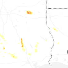

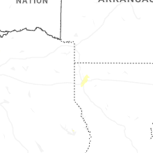

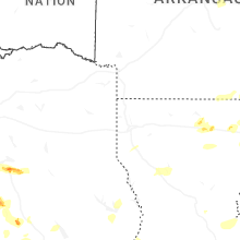


Connect with Interactive Hail Maps